GAZETTEER OF AFGHANISTAN
650
HISTORICAL AND POLITICAL GAZETTEER OF AFGHANISTAN Vol. 3
-
Upload
khangminh22 -
Category
Documents
-
view
0 -
download
0
Transcript of GAZETTEER OF AFGHANISTAN

HISTORICAL AND POLITICALGAZETTEER OF AFGHANISTAN
Vol. 3

HERAT
AND NORTHWESTERN AFGHANISTAN
Edited by
LUDWIG W. ADAM EC, Ph. D.
4AKADEMISCHE DRUCK- u. VERLAGSANSTALT
GRAZ - AUSTRIA1975

This work was generated under a contract with the U.S. Office of Education, Department of Health,Education and Welfare, However, the opinions and other content do not necessarily reflect the positionor policy of that Agency, and no official U.S. government endorsement should be inferred.
The Afghanistan Gazetteer, printed originally for secret official purposes, is here published with addi-tions and editorial changes by permission of the Controller of Her Majesty's Stationery Office, London,United Kingdom.
The present edition includes the formerly secret Gazetteer of Afghanistan (compiledin 1914) with corrections and additions of maps and considerable new material to take
into account developments up to 1970.
© Akademische Druck- u. Verlagsanstalt, Graz 1975
Printed in Austria
ISBN 3 -201- 00942 -3los /75
UNIVERSITY of ARIZONA
LIBRARY
MAP

''R -í.-',_.,. ir ,P:
m .
CONTENTS
Preface . . . . VII
Introduction . . . . . . 1
Historical and Political Gazetteer of Afghanistan . . . 9
Glossary of Terms . . . . . . . 439
Index of Entries . . . . . . 461
Map Section . . . . . . . . . 511


PREFACE
The third volume of the Historical and Political Gazetteer of Afghanistan,covering the provinces of Herat, Badghis, and Ghor in northwestern Afghanistan,provides general information for the layman and specialized data for the scholar,much of which is not available in any other reference source on Afghanistan.This work, which is the result of a century of accumulative research, will establishAfghanistan studies on a new foundation. Scholars in all fields of Afghanistanstudies will find it indispensable as a point of departure for specialized research onnorthwestern Afghanistan. Those with a nonspecialized interest in Afghanistanwill find the Gazetteer useful for locating a particular area or geographical feature,and for obtaining a wealth of background material of a political, historical, andgeographical nature.This work is based largely on material collected by the British Indian Governmentand its agents since the early days of the 19th century. In an age of imperialism,Afghanistan became important as the "Gateway to India" and an area of disputebetween the British and Russian empires. It is therefore not surprising that mucheffort was expended by various branches of the British Indian Government toamass information regarding the country's topography, tribal composition,climate, economy, and internal politics. Thus, an effort which began with militaryconsiderations in mind has now been expanded and updated with maps and datacompiled by both Western and Afghan scholarship to serve the non -politicalpurpose of providing a comprehensive reference work on Afghanistan.
ORGANIZATION AND SCOPE
In the preparation of the Herat volume of the Gazetteer series, I was able tobenefit from the comments, suggestions, and criticisms of a wide variety ofreaders who had examined the previous two volumes. As a result, I was able tointroduce some new features in this volume and discuss a number of questionswhich still require clarification.Geographical Coordinates. Not all entries listed in this work can be located in theMap Section; therefore, I placed the letter "m" next to the geographicalcoordinates of each entry which can be found in the map section. For example,"Ahangaran," located at 34 -28 65 -2 m, can be found; whereas "Ahmad Kal,"located at 34 -39 62 -1, cannot be found on the maps.I determined geographical coordinates on the basis of maps published in Kabul atthe scale of 1 : 250,000. If a name could not be located, I referred to mapsproduced by the British government at the scale of 1 : 253,000; German maps atthe scale of 1 : 200,000; U. S. World Aeronautical Charts at the scale of1 : 1,000,000, and other cartographic sources. Only degrees and minutes were
VII

given because the primary purpose in giving coordinates and distances was toenable the reader to locate the entry in the Map Section. Place names which couldnot be located on any maps were identified on the basis of such sources as theDari Qámzcs -e Jughrafiyá -ye Afghanistan and the Pashtu Da Afghanistan Jugh-ráfiyá -ye (2(1-mils. In many cases when a place was not indicated on any maps itwas nevertheless possible to obtain fairly accurate coordinates: Places were oftendescribed as located a certain distance from another, or near some geographicalfeature, as the bend or estuary of a river, or at a valley or crossroads, which madeit possible to take measurements from the maps to indicate the general location ofa place. In some cases only the area could be defined and therefore only degreeswere given (for example, NASARABAD 33- 62 -.).To locate an entry in the Map Section, the reader should refer to the degrees oflongitude and latitude listed below the entry and find the same coordinates in theMap Index. For example: to locate the entry KHWAJA KALANDAR in the MapSection, note coordinates 34 -47 62 -39 m. Next, refer to Index in the MapSection and the coordinates will lie in grid No. 8, A, B, C, D. The minutes 47 and39 will be located in the upper right section, marked 8B.Measures and Weights. It has been suggested that I list all measures and weights inmetric units. This could have been done with little difficulty as far as British unitsare concerned, but I felt it desirable to give Afghan units in their historical terms.Furthermore, the situation is somewhat complex: units of measure identical inname are not necessarily also identical in the quantities measured. It was thereforemuch simpler to provide the reader with conversion tables which will enable himto make his own computations:
Western Units
Length
1 inch1 foot1 yard1 furlong1 mile
Area1 sq inch1 sq foot1 sq yard1 acre1 sq mile
VIII
25.40.30480.9144
201.1681,609.344
mmmetermetermetersmeters
6.4516 sq cm0.092903 sq meter0.83613 sq meter0.404686 hectare2.590 sq km
1 cm1 meter
1 km
1 sq cm1 sq meter
1 hectare1 sq km
0.394 inch3.281 feet1.094 yard
4,971 feet
0.155 sq inch10.7639 sq feet
1.19599 sq yard2.4711 acres0.3861 sq mile

Weight1 ounce1 pound1 ton (1.)
28.3495 grams0.4535924 kg
1.01605 m ton
DegreesFahrenheit to Centigrade
F C
1 -17.2
2 -16.7
3 -16.1
4 -15.6
5 -15.0
6 -14.4
7 -13.9
8 -13.3
9 -12.8
10 -12.2
11 -11.7
12 -11.1
13 -10.6
14 -10.0
15 - 9.4
16 8.9
17 8.3
18 7.8
19 7.2
20 6.7
21 6.1
22 - 5.6
23 5.0
24 4.4
25 3.9
26 3.3
27 2.8
28 2.2
29 1.7
30 1.1
31 0.6
32 0
33 0.6
34 1.1
35 1.7
1 gram1 kg1 m ton
0.035274 ounce2.20462 pounds0.9842 ton (1.)
F C F C F C
36 2.2 71 21.7 106 41.1
37 2.8 72 22.2 107 41.7
38 3.3 73 22.8 108 42.2
39 3.9 74 23.3 109 42.8
40 4.4 75 23.9 110 43.3
41 5.0 76 24.4 111 43.9
42 5.6 77 25.0 112 44.4
43 6.1 78 25.6 113 45.0
44 6.7 79 26.1 114 45.6
45 7.2 80 26.7 115 46.1
46 7.8 81 27.2 116 46.7
47 8.3 82 27.8 117 47.2
48 8.9 83 28.3 118 47.8
49 9.4 84 28.9 119 48.3
50 10.0 85 29.4 120 48.9
51 10.6 86 30.0 121 49.4
52 11.1 87 30.6 122 50.0
53 11.7 88 31.1 123 50.6
54 12.2 89 31.7 124 51.1
55 12.8 90 32.2 125 51.7
56 13.3 91 32.8 126 52.2
57 13.9 92 33.3 127 52.8
58 14.4 93 33.9 128 53.3
59 15.0 94 34.4 129 53.9
60 15.6 95 35.0 130 54.4
61 16.1 96 35.6 131 55.0
62 16.7 97 36.1 132 55.6
63 17.2 98 36.7 133 56.1
64 17.8 99 37.2 134 56.7
65 18.3 100 37.8 135 57.2
66 18.9 101 38.3 136 57.8
67 19.4 102 38.9 137 58.3
68 20.0 103 39.4
69 20.6 104 40.0
70 21.1 105 40.6
IX

Afghan Units: Length
1 gaz -i -shah (Kabul yard) 1.065 meter1 girah- i -gaz -i -shah 0.066 meter1 gaz -i -mimar (mason's yard) 0.838 meter1 gaz-i-jareeb (for land) 0.736 meter1 jareeb (one side) 44.183 meters1 biswah (one side) 9.879 meters1 biswasah (one side) 2.209 meters
Weights1 nakhud 0.19 gram1 misqal 4.4 grams1 khurd 110.4 grams1 pao 441.6 grams1 charak 1,766.4 grams 1.77 kg1 seer 7,066.0 grams 7.07 kg1 kharwar 565,280.0 grams 565.28 kg
24 nakhuds 1 miskal30 miskals 1 seer40 seers 1 man (12 lbs., if wheat 13 lbs.)
100 mans 1 kharwar (1,200 lbs.)Also see Chakhansur for measures and weights.
British sources in 1914 describe weights in Herat as similar to those in Kandahar:
8 tolas = 1 Herati seer = 1 /i0 of a British (Indian) seer.
40 seers = 1 Herati man = 4 seers British.100 mans = 1 Herati Kharwar = 10 maunds British.
Actually the weights are a trifle more than the stated British equivalent.Moreover, the seer varies locally: thus the Obeh seer has 10 tolas and in Badghisthere are two seers, one of 12, and one of 16 tolas. In all cases the man has40 seers, so that the local weight can easily be calculated, if necessary. Heratweights are more or less recognized throughout the province.Transliteration and Style. The reader will notice that many entries are takenverbatim from the writings of various authorities. This resulted in a mixing ofstyles and terminology, which is further aggravated by the fact that names aregiven from sources, including the maps appended to this volume, which employdifferent systems of transliteration. There are names in Arabic, Turkish, Persian,Pashtu, and a number of other languages and dialects which cannot easily bewritten in one system of transliteration. The Perso- Arabic script does not indicateshort vowels and such grammatical forms as the izafat construction. Neither Afghannor Western authorities can agree at times on the proper forms. Afghan sourcesare not consistent in their spellings and often list words according to local or
X

colloquial pronunciation, even though correct literary spellings exist. I have notfelt it my task to impose my own system of transliteration in an attempt to bringorder and standardization into a somewhat chaotic situation. The problem oftransliteration and indexing has therefore been solved in the most practicablemanner: terms are written as they appear in non -technical literature, such asnewspapers and most scholarly and general publications. Exact transliterations, ifthey are not easily recognizable to the layman, are cross -listed in alphabeticalorder (Dhú `1 -Figar and Zulfikar), and spellings in Perso- Arabic script are givenwith each entry. An index in Perso- Arabic script enables the reader to find anentry he may have located in Afghan sources in that script. Thus it has beenpossible to satisfy the scholar, who wants exact spellings, without confusing thelayman with a complex system of transliteration.Statistics. One question which requires some clarification is my use of recentAfghan statistics. In Volume 2, Farah, I indicated that "statistical data used inupdating this work was taken from the latest published and unpublished Afghansources. It is presented primarily as a means for comparison with statistical dataof various periods in the past, and should not be taken as absolutely reliablebecause Afghan statistics often show considerable variation." In spite of thisdisclaimer, one reviewer criticized the population statistics I gave for individualprovinces, districts, and towns. It must be remembered that Afghanistan has notas yet conducted a nationwide census and all population statistics are estimates.Estimates published by the Afghan government amount to 17,086,300 inhabit-ants (Majmzi `ah -ye Ihsa' iyyawi -ye Sal 1350, Vezarat -e Plan, Riyasat-e Ihsá'iyyah, Kabul, English translation, entitled Statistical Pocket -Book of Afghanistan,1350, Department of Statistics, Ministry of Planning, Kabul.); recent estimates byan American demographic team suggest 12 million to which must be added sometwo million nomads. I was able to obtain a seven -volume, mimeographedpublication by the Central Department of Statistics of Afghanistan, PrimeMinistry, Republic of Afghanistan, 1346 and 1352 (Edare-ye Markaz -e Ihsá' iyyehAfghanistan, Daúlat -e Jumhúri -ye Afghanistan Saderá.t Azami), with detailed dataon the population, lifestock, crops, and irrigation, compiled on the basis ofsources of the Afghan Ministry of Agriculture and Irrigation. The populationstatistics in this publication are lower because only the agricultural population isincluded. I translated the data and included in this volume six tables each underthe entries of Herat, Badghis, and Ghor. I am inclined to accept the statistical datapresented in this seven -volume publication. Until the Afghan governmentconducts a national census it will be necessary to rely on estimates. The readermay therefore accept these statistics at face value or discount as much as 20percent as far as both the sedentary and nomadic population is concerned; but heshould keep in mind that the numbers given for any particular town include, inaddition to the residents of that town, also the population of the surroundingdistricts and the nomads.Updating of Entries. All entries have been updated to some extent. Locations
XI

were identified as far as they could be ascertained on the basis of available sources.In addition to this, entire entries have been compiled on the basis of materialavailable in 1975. These entries are identified by asterisks; passages in italicsindicate additional information and corrections. All other entries give descriptionsas compiled in 1914, except where otherwise indicated.
THE SOURCES
It has been suggested by some reviewers of the first volume of this work thatsources and authorities be cited, both those utilized in the compilation of theGazetteer and those useful to the reader who is interested in more narrowlyspecialized areas. While it would indeed be useful to include here an exhaustivebibliography I feel that it goes beyond the scope of this work and that it is reallynot necessary.The reader will find what he seeks in such bibliographies as Donald N. Wilber'sAnnotated Bibliography of Afganistan, and the two- volume Bibliographie derAfghanistan -Literatur 1945 -1967 by E. A. Messerschmidt and Willy Kraus,which includes much German material and some recent sources not covered byWilber. There is also the Soviet bibliography by T.I. Kukhtina, BibliografiaAfganistana: Literatura na russkom iazyka, and Vartan Gregorian's The Emer-gence of Modern Afghanistan, which includes a bibliography of some 50 pages.It should therefore suffice to discuss some of the major authorities whose writingshave been utilized in the compilation of this work. Appended to this introduc-tion, the reader will find a list of British authorities which includes such indi-viduals as Bellew, Biddulph, McMahon, and Yate who are well -known to anyoneengaged in research on Afghanistan. These and the other names given below areBritishers who at some time or other during the past 100 years have participatedin campaigns or peaceful missions to Afghanistan and thus acquired whatever datathey could find on the area. Many of them published only for secret Britishgovernment use and their contributions are known only to those who havecanvassed British archival sources. Of course there is always the great anonymousresearcher whose contribution is acknowledged under the designation of "nativeinformant." As to sources I have found useful in updating this volume I mightmention the following specialized publications which are not listed in the abovebibliographies:My most important Afghan sources include both the Qámús -e Jughrafiya-yeAfghanistan, a four -volume, geographical dictionary in Persian, compiled by theAnj o man -e Aryana Da' erat al -Ma' axe f, published in Kabul between 1956and 1960, and the Pashtu Da Afghanistan Jughrafiya -i Qámús. They arelargely, but not completely, identical and therefore both had to be consulted.Another useful source was the Atlas-e W eláyát -e Afghanistan, published by theAfghan Cartographic Institute (Da Afghánistán Kartúgráfi Mu assassa) in
XII

1349/1970. My most important statistical source was a seven -volume, mimeo-graphed publication by the Central Department of Statistics of Afghanistan,entitled:1. Taúhid -e `Umúmi Natáyej -e Ihsáiya Giri Sarwey Mugaddâmati ye Zera cati -yeSal-e 1346;2. Ihsáiya -ye Nu fis -e Zera`ati, Ta`dad -e Zamindar o Máldár, Sáheh -ye Zamindáriye Sal -e 1346 be Tafriq -e Woleswáli há wa Weláyat-e Keshwar;3. Ihsá'iyá -ye Sáheh -ha -ye Takhta Zar` az Manábe` -e Mokhtalefeh Albi, Ta` adád -eManábe `e Albi wa lsyáb -e Albi Sal -e 1346, be Tafriq -e Woleswáli-ha wa Welyat -eKeshwar;4. Ihs&iyá -ye Mawashi -ye Sal -e 1346 be Tafriq -e Woleswáli -ha wa Welayat-eKeshwar;5. Ihsáiya -ye Sáhe -ha -ye Taklita Zart -e Nabátát -e Mokhtalefa -ye Zerá` ati -yeSal -e 1346 be Tafriq -e Woleswáli ha wa Welayat-e Keshwar;6. Ihsa'iyä -ye Sáheh -há -ye Búrah -ye Mowaqti, Sáheh -ye Zamindari, Jangalat wa`Alafchar- -e Sal-e 1346 be Tafriq -e Woleswáli há wa Welayat-e Keshwar;7. Ihsá'iyá -ye Taúlidát -e Nabátát -e Mokhtalefa -ye Zera'ati e Sal -e 1346 beTafriq -e Woleswáli há wa Weláyát -e Keshwar. Material from the above source isalso available in abbreviated form in the English language Statistical Pocket -Bookof Afghanistan, 1350, published by the Department of Statistics, Ministry ofPlanning, 1350/1972.A source on the administrative divisions of Afghanistan during the period of KingAmanullah is the Nizam- náma -ye Tagsimát -e Mulkiya, published in 1300/1921 atKabul. Publications by the Planning Ministry which are relevant to the areacovered in this volume include Herat wa Mantaqa-ye An, by Alam Reshnu andLouis Lung, and Plangozari -ye Enkesháfi dar Afghanistan, by Louis Lung, andEnkeshaf-e Welayat-e Markazi, translation by Alam Reshnu of Le Dévelopment deProvince Centrales, by J. C. Woillet. An Afghan source which discusses historicalmonuments in Herat is Abádat -e Nafïsa -ye Herat, by Sarwar Goya Etemadi,published by the Wezarat -e MatbU ät in Kabul, 1343/1964; others are thethree -volume Athär -e Herat, by A. Khalili, and Khiaban, by F. Saljuqi, Herat,1333/1954.Western sources include "The Traditional City of Herat, Afghanistan," by PaulEnglish, in Carl Brown's From Medina to Metropolis, 1973; "Herat," by RichardN. Frye, in Encyclopaedia Islam, 2nd. ed. ; La géographie de l'Afghanistan, byJ. Humlum; Afghanistan: A Pictorial Guide, by Nancy Hatch Wolfe (Dupree),Kabul, 1966; and Afghanistan: Natur, Geschichte und Kultur, Staat, Gesellschaftund Wirtschaft, ed. by Willy Kraus, a handbook with useful bibliography ofmostly German material. Alfred Janata published a number of articles on thepeople of western Afghanistan, including "Die Bevoelkerung von Ghor. Beitragzur Ethnographie und Ethnogenese der Chahar Aimak," in Archiv fuer Voelker-kunde, 1962/63, and "Voelkerkundliche Forschungen in West -afghanistan," inBustan, Wien, 1970. An examination of the geomedical characteristics of
XIII

Afghanistan, and the incidence of disease is L. Fischer's Afghanistan: AGeomedical Monograph, Berlin, 1968.
Regarding maps for the area of Afghanistan, I might mention here that, unlike themaps produced by the Afghan Cartographic Institute, those produced by theBritish Government are available in major libraries and archives in Britain,Pakistan, India, and above all in the United States. These maps, listed in the seriesAfghanistan GSGS, scale 1 : 253,440, were the most reliable maps available for along time. They served as the basis for maps produced by the GermanGovernment in 1940 at the scale of 1 : 200,000, also available in major researchlibraries in the United States. Finally, there are the U. S. World AeronauticalCharts, published by the U. S. Government in 1948 and 1951 at a scale of1 : 1,000,000. Neither the maps produced in Afghanistan nor those listed abovecarry all the entries in this work.
ACKNOWLEDGMENTS
This work could not have been accomplished without the collaboration of anumber of people and the generous economic support given by severalinstitutions. Therefore, it is my pleasure and duty to acknowledge my gratitudeand thank all of those who have been directly or indirectly involved in thisproject. Above all I want to thank my Research Associate Miss Sheila AnnScoville who has been associated with this project from beginning to end. MissScoville typed the entire manuscript of 6,000 pages. She ably assisted in thecompiling and editing of the material and the proofreading of the finalmanuscripts of the first three volumes.Generous institutional support was provided by the U. S. Office of Education,Department of Health, Education, and Welfare, Washington, D. C. The ForeignLanguage Area Section, Division of Foreign Studies, Institute of InternationalStudies, of the Office of Education supplied funds that paid for research andtravel expenses and I especially would like to express my genuine gratitude forthis support. The individuals most helpful in administrating my research contractwith the Institute of International Studies include Mrs. Julia A. Petrov, Chief ofthe Research Section, Dr. Karl P. Epstein, Program Officer of the ResearchSection, and Mr. Morton W. Bachrach, Copyright Administrator with the U. S.Office of Education.I am also obligated to the officers of the India Office Library and Records of theForeign and Commonwealth Office in London for permitting the publication of awork which was originally compiled as a result of over half a century of Britishresearch. I want to mention especially Miss Joan C. Lancaster, Librarian andKeeper, Mr. Martin Moir, Assistant Keeper, and Mrs. Valerie Weston, ResearchOfficer, and give them my sincere thanks.Mr. Joel W. Scarborough, Head of the Asia Foundation in Kabul, has helped with
XIV

research funds, administered by Kabul University. He also provided a publicationssubsidy of $ 2,000 to facilitate publication of the Herat volume. I am glad toacknowledge my gratitude to Mr. Scarborough and to the Asia Foundation inKabul.Last but not least, I want to extend my thanks to the members of the followingAfghan institutions: the Afghan Cartographic Institute, the Afghan HistoricalSociety, the Anjoman -e Aryana Da'erat al- Ma'aref, the Pashtun Academy, KabulUniversity, the Department of Planning and Statistics -Ministry of Agriculture -theDepartment of Statistics -Ministry of Planning -as well as the Ministry of ForeignAffairs.In Afghanistan I am obliged to more Afghans and Americans than I am able tomention here. Members of the American community in Kabul, includingAmbassador Theodore L. Eliot, Jr., have been helpful in many ways.Finally, I want to thank Dr. Karl Gratzl and Ing. Leopold Schedi who expertlyperformed the technical tasks of getting the manuscript prepared for the press.
L. W. A.
British authorities quoted in this volume include the following:
Afghan Boundary Commission Records (A.B.C.), 1884 -86.Bellew, H. - Surgeon, Bengal Army, Kandahar Mission, 18 57 .
Cotton, S. - Author of Nine years on the Forth -west Frontier of India, from 1854to 1863 (published, London 1878).
Dobbs, H. R. C., Esquire, I.C.S. - Special duty, Russo -Afghan boundary, 1904.Durand, E. Major, R.E. - A.B.C.Ferrier, J.P., General. - French soldier of Fortune (1845 -46). Author of Caravan
journeys and wanderings in Persia, Afghanistan, Turkistan and Baluchistan(translated and published, London, 18 57) and History of the Afghans(translated and published, London, 1858).
Galindo, R.E., Lieutenant, Royal Sussex Regiment. - Author of "A record of twoyears' wanderings in Eastern Persia and Baluchistan" (I.B., 1890).
Goldsmid, Sir F. J., Major- General. - Perso-Afghan Boundary Commission, 1870.Griesbach, C.L. Esquire. - A.B.C., Geologist to the Amir, 1889.Hira Singh, Sub -Surveyor. - A.B.C.Imam Sharif, Sub -Surveyor. - A.B.C.Intelligence Branch Compilations (I.B.C.). - Various.Maclean, General. - First Consul -General, Meshed, 1889.Maitland, P.J., Major. - A.B. C.Merk, W.R.H., Esquire, I.C.S. - A.B.C.Muhammad Takki Khan. - British Agent in Herat, 1885.Muhammad Akbar Khan, Duffadar. - A.B.C.
XV

Napier, the Hon'ble G.C., Captain. - A.B.C.Peacocke, W., Captain, R.E. - A.B.C.Pottinger, Eldred, Lieutenant. - Herat, 1837.Ridgeway, Sir J.W., Colonel. - A.B.C.Sahibdad Khan, Dufadar, 15th B.L. - A.B.C.Shamsuddin Khan, Dufadar. - A.B.C.Sistan Mission (S.M.)., 1904 -05.Stewart, C.E. Colonel. - A.B.C., S.M.Talbot, the Hon'ble M.G., Captain, R.E. - A.B.C.Tate, G.P., Esquire, Survey Officer. - S.M.Wanliss, C., Major. - S.M., Special duty, Russo -Afghan Boundary, 1904.Yate, C.E., Lieutenant -Colonel, C.S.I., C.M.G. - Agent to the Governor General,
Baluchistan.
XVI

INTRODUCTION
The area discussed in this volume comprises historical Herat which, since1963 -64, is divided into the provinces of Herat, Badghis, and Ghor (see Fig-ure 1). Herat had in the past a measure of independence under various Afghanprinces until Amir Abdur Rahman centralized the national government andpermanently established administrative control from Kabul.
The area described in this volume is bounded by Iran in the west and by theSoviet Union in the northwest. Its provincial boundaries touch upon Faryaband Jawzjan in the northeast, Bamian in the east, Oruzgan and Helmand inthe southeast, and Farah in the south. The size of the area is approximately99,450 square kilometers, and the population amounts to about 1,362, 700. Divi-ded into the three provinces, the figures are as follows: Herat, area 41,540 squarekilometers, population 702,992; Badghis, area 23,048 square kilometers, popu-lation 328,105; Ghor, area 35,078 square kilometers, population 331,551.For changes in the administrative division of historical Herat, see Figures 1, 2,and 3 in the Introduction of Volume 2, Farah and Southwestern Afghanistan.In 1912 this area was described as follows:
BOUNDARIES
The boundaries of the province are:North. The Russo -Afghan frontier line goes from the Ashkara Kotal, northeast ofKala Wali, to a place called Zulfikar. The line runs across downs and chol, givingto Russia all the lands on the Kashan and Kushk streams which are cultivated bySarik Turkomans. Zulfikar, to describe it shortly, is simply a cleft in the cliffswhich bound the Hari Rud on the east, and it is only important as being one ofthe few passages by which the high chol can be gained from the banks of the river.There are two lines of cliff, one behind the other, with low broken groundbetween them, and there are two defiles, one through each line of cliffs: thewestern defile is in possession of Afghanistan, but the eastern is held by theRussians.West. The Perso- Afghan frontier line. This, where it passes through the salt desert,is undemarcated and rather loosely defined. The boundary has been defined in anumber of agreements, at first with the assistance of a British commission underA. H. Mc Mahon, and with Turkish assistance in the 1930's. Disputes over waterrights continued, however. Afghan graziers go right up to Gulwarcha and ChahSagak and no Persians come east of those places. From a point a few miles aboveToman Agha, the Hari Rud itself forms the boundary.South. From the junction of the Khushk and Harut Ruds the line runs up theKhushk Rud to Bazdeh, then passing by the west end of the Koh Bibcha Baran, itregains the Harut Rud, or Adraskand, and, following it some way towards Sabza-
1

Figu
re 1
.
..
010.
...
..
Prov
ince
s of
Afg
hani
stan
1. B
adak
hsha
n 15
. Bam
yan
2. T
akha
r16
. Par
wan
3. K
undu
z17
. Kap
isa
4. B
aghl
an18
. Lag
hman
5. F
arah
19. K
onar
6. N
imru
z20
. May
dan
(War
dak)
7. H
elm
and
21. K
abul
8. H
erat
22. N
anga
rhar
9. B
adgh
is23
. Log
ar10
. Gho
r24
. Pak
tya
11. F
arya
b25
. Gha
zni
12. J
awzj
an26
. Uro
zgan
13. B
alkh
27. Z
abul
14. S
aman
gan
28. K
anda
har

war, passes into the Taimani hills and there crosses the Farah Rud, so as toinclude nearly the whole basin of that river within the hills.East. The watershed between the Farah Rud and Helmand basins. It then crossesthe Hari Rud above Daulat Yar, runs in a general northwesterly direction throughthe Firozkohi country, and so on to the Russian frontier at the Ashkara Kotal.
PHYSICAL FEATURES
The province may be geographically defined as that part of Afghanistan drainedby the Murghab, the Hari Rud, the Adraskand and the affluents of the Farah Rud,above where it enters the plains.It is bounded on the north by the chol, on the east by the mountains of theHazara country, on the west by the Khorasan deserts. It is thus, to a certainextent, physically cut off on all sides but one, the south, by natural obstacles fromthe surrounding countries and provinces. On the southern side it is open, and thegreat roads from Kandahar and Sistan lead to it through the broad space betweenthe Taimani hills and the Persian desert.The most populous, fertile and flourishing part of the province is that comprisedin the districts of Herat, Ghorian, Ob eh, and Karokh. North of this fertile tract isthe Band -i -Baba or Siah Bubak, known to Europeans as the Paropamisus. Thismountain range is really a prolongation of the middle branch of the Koh -i -Baba.North of Herat, and to the eastward of that place, the hills are of some height, thepeaks rising four or five thousand feet above the valley. North of the Band -i -Babais the district of Badghis, for the most part an expanse of open rolling downs oflight clay soil, covered with rich grass during the earlier half of the year, but aridand parched during the latter half. This district becomes more and more hilly asone travels east, until it may be characterized as almost mountainous. The onlyperennial river in the whole of Badghis, not counting the Hari Rud on its westernborder or the Murghab on its eastern, is the Kushk; so that from July to Decem-ber the country away from these streams is almost destitute of running water.Two important features of this part of Afghanistan are the Murghab and HariRud. The former is, generally speaking, deep and unfordable and, when in flood,is an impassable obstacle. The latter, on the contrary, is generally shallow andfordable, except of course in flood season, when it becomes a rapid river about200 yards wide. The flood season is from the middle of March to the end of July.East of the Herat valley and Badghis is a wild mountainous country inhabited byFirozkohis, Taimanis, and Hazaras, though but few of the latter are found in theHerat province. This is a region of barren rugged hills rising in places to 10,000and even 12,000 feet. The main axis of the mountain system comprised in thisarea is the Koh -i -Baba, which is in itself a continuation of the Hindu Kush. TheBand -i -Baba, just before entering the Herat province, breaks up into three mainranges: the northern one is the Band -i- Turkistan, the central is generally spoken of
3

as the Band -i -Baba, and the southern one is called the Band -i -Baian or Safed Koh.Between the two first is the country of the Firozkohis; between the two last is thevalley of the Hari Rud; south of the Band -i -Baian and its western prolongation isthe Taimani country.South of the Herat valley is the open country of the Sabzawar district, drained bythe Adraskand, which lower down becomes known as the Harut Rud. One promi-nent feature in the southern part of the province is the Do Shakh range, whichruns obliquely from the Hari Rud near Zindajan to the Persian frontier.
TOWNS
The only places in the province that can be described as towns are Herat- Sabza-
war, and Ghorian. Of these the only really important place is Herat. Sabzawar is awalled town, in ruins, and now contains only about 1,000 houses. Its position,however, on the Kandahar road makes it important. Ghorian is a long stragglingplace, with about 1,140 families and can hardly be called a town. In the 1970'sGhorian has an agricultural population of 26,000, and Kala-i-Nao and Chakhcha-ran must be added as major towns in the area.
POPULATION
The Firozkohis, Taimanis, and Hazaras, who were still strong and largely ruled bytheir own chiefs in the early twentieth century, have been subjected, and thecentral government administration introduced everywhere.The tracts of country formerly held by these tribes are being yearly overrun moreand more by Pashtun flock owners. This has resulted in a diminution of culti-vation and thus of local supplies which were never plentiful.The total population may be taken at half a million souls. Of these the greatmajority are Heratis, (in the 1970's the total population exceeds 1,400, 000) withwhom are mingled a number of families who are Pashtun by descent but who havebecome Herati by residence and intermarriage, and who no longer speak Pushtu.The Pashtuns can hardly number more than 75,000 souls of whom half are in theSabzawar district, while most of the remainder are Ghilzai and Zamindawarnomads.The Jamshedis, Hazaras, Firozkohis, Taimuris, etc., found settled in the valley ofthe Hari Rud, Karokh, and Sabzawar, being ` safed- khana', or dwellers in houses,are reckoned with the general population, and not with their tribes, to whom theyhave, in fact, ceased to belong.In the last years of Abdur Rahman's reign the policy was initiated of settlingDuranis and Ghilzais in the country. For ethnic background of the Afghan popu-lation, see Figure 2.
4

DIS
TR
IBU
TIO
N O
F E
TH
NIC
GR
OU
PS
.., 11r....mos.
rnmwr/\I\
! O"
Ir qw
1'r
]r
. _.
N
Figu
re 2
.
SC
ALE
500
50 1
00 K
M
Dra
wn
afte
r W
ilber
, Afg
hani
stan
.
TIN
IIi
!ll
Ivv
1v Y
f--
1-
al
AFG
HA
NS
TA
JIK
S
PAM
IR T
AJI
KS
BA
LU
CH
I
BE
RB
ER
I H
AZ
AR
AS
DE
H -
I- Z
AIN
AT
HA
ZA
RA
S
JAM
SHE
DIS
FIR
OZ
KO
HIS
TA
IMA
NIS
TA
IMU
RIS
IN
UR
I ST
AN
I S
UZ
BE
KS
TU
RK
OM
AN
S
KIR
GH
IZE
S
KA
RA
KA
LPA
KS
AR
AB
S
., .---
-11
1111
1
111'

SUPPLIES
The Herati local horse, who are irregular mounted militia, are paid by remissionsof revenue, one -third in kind. They appear to amount altogether to somewhatless than 5,000 men, and, as well as can be made out, their cost to the stateis nominally 452,250 krans. Herat valley would be able to draw from the districtsof Herat and Ghorian alone 135,000 maunds of wheat, or flour, 90,000 maunds
of rice, and 62,000 maunds of barley.Forage for animals is, on the whole, plentiful. Bhusa may be counted on to theextent of a weight in maunds equal to that of the wheat and barley together.Lucerne is largely grown in the valley. Excellent natural grass is abundant on thehills north of the valley, and in Badghis, all spring and a part of the summer; also
to a less extent in other places. Camel grazing is good almost everywhere, particu-larly towards Obeh.Sheep are numerous, and mutton would be always forthcoming.Vegetables and fruit are abundant in the Herat district, in season.It will be observed that in the above calculations the district of Sabzawar is notincluded.Camels are plentiful and as many as 50,000 could be got from the province. There
are also a large number of donkeys, horses, and sheep, but few goats. Fodder isplentiful everywhere. Average prices are: Camels 200 (Kabuli) rupees. Oxen150 rupees. Cows 100 rupees. Donkeys 40 rupees. Bullocks are largely used fortransport purposes. There are few buffaloes. For details regarding agriculturalproducts and livestock in the 1970's, see entries of Herat, Badghis, and Ghor.
CLIMATE
Winter is cold in the Herat valley, with more or less snow, but it does not, as arule, lie very long. Spring is a rainy season, or rather the months of March andApril are rainy, the end of February and beginning of March being often fine,with what we should call enjoyable spring weather. The rainfall appears to de-pend, as in Turkistan, on the amount of previous snow, and is greatest after severewinters. By May the weather is clear, and then the northerly wind sets in which isfamous as the bad -i- sad -o- bist -ruz, or "wind of 120 days ". Probably, this wind isnot supposed to begin till after May, for it certainly blows throughout the sum-mer and autumn, till November; in fact there seems to be always more or lesswind in the Herat valley. During the summer months the wind is very strong,being always highest after sunset, and if there should be rain on the hills to thenorth, or a shower in Badghis, as sometimes happens, it increases almost to ahurricane, so that it is difficult to keep tents standing.The wind is felt far to the south, and blows with unabated fury in Sistan. InBadghis, curiously enough, there is no wind. Moreover, the wind is not felt in theHerat valley east of Tunian. There is no summer wind at Obeh, and this place has
6

a much pleasanter climate than Herat, which is disagreeable and not very healthy,except in winter.When the wind is not blowing, the summer heat in the Herat valley is great,though not to be compared to that of India. There are, however, various places inthe hills to the north, where sanitaria and summer cantonments might be formed,within easy reach of the valley. See the following meteorological data for1965 -66.The barley harvest of Herat and Ghorian is due about the 20th June; that ofKarokh and Obeh on 1st July; that of Badghis on 10th July. Wheat harvest isalways about 10 days later than barley harvest. On the 1st July 1885, the barleyin the neighbourhood of Herat was all cut, and the wheat fully ready for thesickle. The rice harvest commences about the 15th September. Mash (dhall), arzan(millet), and jow -tursh (a late barley), are harvested about the beginning of Octo-ber. Beans, however, are an early crop, and are ready for cutting about the20th May.
1966
Ojcrj
+t..
oC
W. OBS.
LC-0
p
,J1 JL L.
-0
tú
pO
LO
C;z
-Ó
Z iQ
pi C; .;+..v1
d1
Qá
RelativeWZ
Mean MaxTemp. 27 5 20 2 13.1 16. 4 14.3 18. 3 222 29. 0 34.5 35 7 34. 9 30.8Mean Min.Temp. 10.0 3.9 -3.5 0.4 4.1 3.9 8.7 12.8 19.9 21. 6 19.3 13.4
Mean Temp. 19.7 11. 4 3.5 7.1 8.2 10.4 14.8 20.8 28.4 291 276 22.0
humidity 57 b 1 70 66 75 50 55 36 34 33 38 38Total Rain-fall in mm 0 7. 8 13.8 21. 6 73.8 276 1008 0 0 0 0 0
0ZU
Mean Max.Temp. 1 61 8.6 2.7 -1.5 3.0 4.3 8.7
,
16.7 24.0 24.9 24.4 200Mean Min.Temp.
-32 -71 -15.8 202 -8.7 -75 -1.8 0.1 3.4 4.5 2.6 -2.6
Mean Temp. 5.8 -0.5 -8.4 -12. 2 -3.2 -2.4 3.2 8. 7 14.9 15.9 i 14.9 9.4Relativehumidity 60 67 62 71 82 76 82 64 62 60 49 52Total Rain-fall ¡n mm 0
.i3.6 18.4 11.6 420 71. 9 I
I
93.71 2.8 0 0 0 Tr
CURRENCY
Coins in Afghanistan were manufactured by a laborious process until 1890 whenAmir Abdur Rahman established the first modern mint to strike the new coin, therupee, which came into circulation throughout the State of Afghanistan. Under thereign of King Amanullah (1919 -1929) paper money was printed for the firsttime, but it was not issued until the period of Bacha -i- Saqqao (1929). The rupee
7

was renamed "Afghani" and has remained the monetary unit until the present.The currency in use in Herat in 1922 is described in the following:The common currency in Herat is the kran, worth about 61/2 annas of Indianmoney. Persian krans circulate freely, and bear the same value as the Herati krans.British rupees, called kaldar, are taken freely as 21/2 krans, and Russian 5-roublegold pieces circulate at 23 or 24 krans, and are called tilas, but the silver rouble isworth only 3 krans.As at Kabul, there is a double currency for accounts, the `pukhta' and the `kham',or pakka and kachcha currencies. Merk says that all payments to Government arereckoned in pukhta, and all made by Government are in kham. I believe the samesystem obtains more or less throughout Afghanistan.It is rather difficult to state the two systems of reckoning with accuracy, but thefollowing is near enough for practical purposes.
Pukhta system261/2 pul, or shahis = 1 kran.10 krans (265 pul) = 1 toman = Rs. 4 British.
Kham system12 pul, or shahis = 1 kran `kham'.161/2 krans (200 pul) = 1 toman = Rs. 3 British, very nearly.
That is to say, 100 krans `kham' are 6 tomans `kham', or 1,200 shahis: but thekham toman appears to be usually reckoned as 71/2 krans pukhta, though it is notso exactly. However, the value of the actual kran in copper change varies consider-ably. For instance, in the winter of 1884 -1885, it was said to be 23 pul at Herat,24 pul at Kushk, and 26 pul at Bala Murghab.But practically all that is necessary to remember is that
21/2 krans = 1 British rupee (Kaldar).3 krans = 1 Rouble.
Also that a Russian gold 5- rouble piece, which ought to be worth 25 krans, istaken at 24, or less: and that when tomans are spoken of (there is no coin), thepukka toman is 10 krans, or 4 rupees, and the kachcha toman 71/2 krans, or3 rupees.For additional data on Afghan coins, see "A Catalog of Modern Coins of Afghani-stan", by Hakim Hamidi, Education Press, Kabul, 1967.
8

HISTORICAL AND POLITICAL
GAZETTEER OF AFGHANISTAN


*ABMeans water, also spelled AO and AW.
AB BARIK L I
34 -39 63 -46 m. A small stream, 40 miles southeast of Kala Naorunning north and northeast towards Chaharsada (Chaharband). It contains82 families of Kadis Hazaras. (Dobbs, 1904.) Other places with this nameinclude: A pass, 32 miles south of Charshamba in Qaisar, at 35 -28 63 -59;a village, about 40 miles north of Herat, with 400 houses and some1,000 inhabitants; a village located at 34 -39 66 -15 m.
v*AB BARIK -I -QUDI ,+ L . I
34 -55 62 -43 m. A village situated on the road from Kala -i -Nao toKushk.
ABBASI cy.,. itsA section of the Firozkohis.
ABBUR34 -22 62 -28. A village in Karokh with 40 houses. (A. B. C.) This maybe the present village of Ambar.
*AB CHARMI c36 I
35 -26 61 -24 m. A village, located about four miles northeast of Karez-i-Ilyas.
ABDULA small section of the Kala Nao Hazaras.
AB GARMAK ,S35 -2 63 -10 m. A village and a small river, a tributary of the Kashan inthe Kala Nao district. It runs in the vicinity of Kala Nao. Garmak village issituated on it, about 2 miles north of Kala Nao. The stream flows in anorthwest direction and changes its name constantly. The village con-tains 190 Hazara families (Laghari, Faristan, and Zaimat) . (Dobbs, 1904.)There is also a well with this name, located 16 miles east of Herat at 34 -2162 -27; and a village about 33 miles northeast of Bala Murghab, at35 -44 63 -51.
AB -I
Watercourses and places the names of which begin with the word Ab fol-lowed by the Persian izafat, are generally described under the second wordof their designations.
11

*AB- I -BARIK See AB BARIK
*AB-I-KAMARI35 -5 63 -3 m. A village located some 15 miles northwest of Kala- i -Nao.
*AB KALJI33 -21 63 -40. A village and a stream west of Titan.
T
ABRU -I- DUKHTARAN v I , r I
34 -12 63 -2. The remains of an ancient masonry aqueduct in the TagaoIshlan, near Kaoghan in the Obeh district. (Merk.)
*ABSAR See ABSHURA 35 -12 63 -2
* ABSHURA a T
35 -12 63 -2 m. A place on the Ab- i- Garmak, north of Kala- i -Nao.
TAB SHURAK ú ,35 -20 62 -56. A settlement of 80 Ghilzai tents on the Kala Nao River,11/2 miles form Babulai. There is no cultivation. The livestock consists of200 camels, 100 cattle, 4,500 sheep and goats, and 30 horses. (Wanliss, 1904.)
*ABUL j-34-14 65 -22 m. A village in the Nawa -i -Abul, some 25 miles southeastof Chakhcharan.
ABUL GAYA See DARBAND-I-JAOKAR 35 -28 63 -24
*ACHABAZAR ) 1
34 -24 66 -15 m. A village located north of the Band -i- Doakhund.
ACHAKZAI
12
0--záFor full information regarding this section of the Duranis, see Kandaharvolume.There are said to be the following number of Achakzai families settled in theHerat province:
In Sabzawar 1,110 familiesGhorian 24
Total 1,134
Also, there are numbers of Achakzai nomads who go every year from Zamin-dawar and the Kandahar district to graze their flocks in the richly- grassedcountry north of Obeh. (A. B. C.)

ADHAMA large section of the Firozkohis.
..ra .. I
ADHAM, K A I,A -I rsa j I ...,
34 -37 65 -18 m. A settlement in the district of Chakhcharan, inhabitedby the Khudayari clan of the Firozkohi tribe. Consists of 30 houses, owning100 sheep.
ADRASKAN J I
33 -30 62 -5. A river formed at a place called Dorudi, by the junction ofthe Farsi and Hanut streams. At first it flows in a general westerly directionthrough the subdistrict to the old Adraskan Robat, and is known as theKarucha in this part of its course; at the robat it receives the waters of theRud -i-Gaz, and then curves southwest round the town of Sabzawar, and ishereabouts joined by several small streams draining southwest from the DehKhar Koh. Below Sabzawar it runs nearly due south through Imarat, whenceit takes a southwesterly turn between the Anardara and Mil Koh hills, passesthrough the Kala -i -Kah sub -district under the name of the Harut Rud, and soon to the western hamun in the Farah district, being joined by the KhushkRud just before entering the Sistan basin.The Adraskan Robat is the first point of which we have any definite infor-mation regarding this river, though it is believed that a good many Nurzainomads are to be found higher up the valley. At this place it is crossed bythe road from Herat to Sabzawar and Farah, and in May 1893 was 20 to25 yards in width, with water above the horses' hocks, banks easy on bothsides. The breadth of the river from bank to bank is about 160 yards. Afterfollowing down for some 2 miles the road leaves the valley, entering it againat the eastern end of the Sabzawar plain. Crossing at this point, the roadfollows the stream through Imarat: the valley is well cultivated, with manyNurzai villages, the cultivation being almost all on the left bank, hard dashtcoming right down to the river on the right. Just as the river enters the Farahprovince the road bends away to the right, but again strikes the stream at thevillage of Jija; there is, however, a road following the river banks. At Jija thestream is said to be dry in summer.In November 1884, the Afghan Boundary Commission crossed this stream ata point 61/2 miles north of Kang: the bed is gravel and 100 to 150 yardswide, and was then perfectly dry. From Kang a road is said to lead by theriver to Sistan, with abundant water in pools in the bed. Near Kang the riverdoes not appear to overflow its banks though it does lower down. During therainy season, that is, from the middle of December to the middle of March,the river rises to full height in two days, and is then unfordable till it runsoff, which is probable in three or four days. This may occur several times inthe course of the season, but the rainfall is very uncertain. Sometimes there
13

is a good deal, in other seasons hardly any. For a description of the lowerportion of the river, see HARUT RUD in the Farah Gazetteer. (Yate,A. B. C.)
ADRASKAN J I33 -20 62 -14. A reddish hill about 6 miles east of Sabzawar, appears tobe known as the Adraskan Koh, though Maitland believes this name is alsoapplied to a mountain much farther east.
ADRASKAN ROBAT33 -38 62 -17m. The ruins of an old brick sarai, situated just abovethe Adraskan- Rud -i -Gaz confluence. There is good ground for a camp andplenty of firewood close by in the river beds. In winter no one lives there,but at other seasons, it is said, some 1,000 Nurzai nomads and Aimaks aregenerally to be found encamped thereabouts; however, Yate makes nomention of having seen any when he passed through in May 1893. (Yate,A. B. C.) In the 1970's there is a town located here which is the headquartersof the fourth degree woleswali of Adraskan. The woleswali includes 56 vil-lages and has a population of 32,000. For additional statistics, see tablesunder entry of Herat.
ADRASKAND See ADRASKAN
AFGHANAN See MURSHIDABAD 34 -18 63 -55. 01; W I
AFZAL, DEH -I- I J34 -47 63 -3 m. Elevation 5,160 feet. A pass leading over the hillsnorth of the Herat valley. (Maitland.) About 50 miles north of Herat.Another village with this name is southeast of Gulran, Badghisat, at34 -47 61 -56 m.
AGAI33 -50 63 -25. A small hamlet in the Farsi district, situated half a mileto the left of the Farsi- Khuram Shar road, and distant 10 miles from theformer place. It has 10 houses of Taimanis. (A. B. C.) One place called Agejis located south of Band -e Farsi, at 33 -37 63 -24 m.
AGHAZ KANG t_S:;S Vit!
35 -49 63 -52. A valley which descends southwest to Kala Wali, where itdischarges into the Karawal Khana valley the drainage of no less than elevenshors, which drain down into it from the Kara Bel plateau and the Bel
14

Parandaz (the name given to the watershed connecting the Kara Bel plateauand the Kaisar plain). These two bels, or ridges, form the watershed betweenthe Murghab and Oxus basins. The names of its tributary shors in order fromwest are: Salah, Yakigaz, Barakhor, Pakana, Kizil Bhai, Iskampara, KaraBaba, Ghili, Kara Nandi, Alai Chulai, Sai Mateh or Yan Bulak. The five latterhave their heads in the Bel Parandaz, and from the eastern side of the BelParandaz watershed five corresponding large valleys drain eastward, and allconverge in a similar way to a single outlet debouching at Tash Guzar intothe Kaisar valley. In dry weather all these shors form good roadways, orcould be rendered such with a few cuts of a spade, and the kotals on thewatershed are all very easy. By ascending any one of these valleys and descen-ding the corresponding valley on the east side of the watershed a throughroad is at once found from the Karawal Khana valley into the Kaisar basin.Ordinary travellers proceeding from Kala Wali to Daulatabad generally useone of these chol roads, viz by the Shor Aghaz King, then up the Shor SaiMateh past Yan Bulak (water) and Issik Bulak (water), then over the IssikBulak Kotal and down the Shor Hibalak to Tash Guzar. From Tash Guzarthey continue down the Kaisar valley, or, if going to Maimana branchthrough Almar or Kassaba Kala. In wet or snowy weather this chol road is apreferable line for reaching Maimana, as it traverses lower ground and hasfewer kotals than the main road by Chaharshamba, Kaisar, and Almar.The road up the Aghaz Kang is an excellent track until within one mile shortof Alai Chulai. Its bed is level and about a quarter mile in width, with a watercourse, sunk some 30 to 50 feet, draining down its west side. The hills on thewest side are steep and broken; but those on the east side are lower, andenclose among them many broad, open, grassy hollows in which the Chahar -shamba flocks graze.Close to Alai Chulai the following shors join the Aghaz Kang, viz.: ShorYakigaz, Shor Barakhor, Shor Alai Chulai Kalan, Shor Alai Chulai Khurdand Shor Kara Baba are each drained by a wall -sided water course 50 to70 feet deep.The Shor Kara Baba is itself joined higher up by the Shors Yulghulli, Pa-kanna, Kizil Bhai, Ishkampara, Ghili, Karamandi, and Doab Ashkara. Thusthe whole of the drainage of the Kara Bala basin is collected at Alai Chulai.About one mile short of Alai Chulai the Aghaz Kang is contracted by spursfrom the hills on either hand to the actual width of the water course formedby the junction of the five above -named shors, and becomes for about onemile a deep impassable gorge. The road here strikes into the chol hills on theright, and climbs over several spurs into the Alai Chulai hollow. There is agood, easy camel track. From Kala Wali to Alai Chulai the distance is14 miles.The valley and the surrounding chol hills are destitute of brushwood of anysort. Aghaz Kang means "big mouth." (Peacocke.)
15

AHANGARAN ú 1 T
34 -28 65 -2 m. Elevation 7,170 feet. A ruined fort in the Hari Rud val-
ley, 45 miles below Daulat Yar. There is good ground for the encampment oftroops where the valley is first entered by the road leading down from theShutur Khun Kotal, and again at the fort. Abundant grass on the river banks,and also brushwood. The grass by the river is reedy and rushy; but there is
abundance of clover, or wild lucerne, and other excellent grass, in theshallow tagao beyond the fort. (Maitland.)The village of Ahangaran is situated about 1/4 mile east of the fort andconsists of 100 families of Firozkohis; Arbab, Shamsullah. They possess300 cattle, 900 sheep and goats, and 50 horses. The village was practicallydeserted in June as the inhabitants go up to the hills from April to October.Excellent camel grazing but supplies and fuel are scarce except for a smallparty. Sufficient grazing for 600 horses. Summer quarters in the Jirmatuhills. Headman (1904), Fatteh Ullah. (Dobbs, Wanliss, 1904.) This town wasonce the capital of the kingdom of Ghor.
ARMAD KAL (QUL) Si ....> 1
34 -39 62 -1. A wide ravine which joins the Batun valley from the north-east some 7 miles south of the Batan Kotal. It is located about 28 milesnorth of Herat.
AHMAD WALI ,.J' I
34 -22 62 -9. A lofty and conspicuous brick building at the north edgeof the mass of villages and enclosures west of the city of Herat. The Anjir Juiruns to the north of it. (Maitland.)
AIMAGOJIK See KUCHAK SHÓR
AIMAK See CHAHAR AIMAK
AINIA section of the Taimanis. (Dobbs, 1904.)
.> ,5 1.4,. 1
61.-.,1
cAJAL JI
33 -46 64 -10 m. A kotal in the northwest of Ghoa, crossed by the roadleading from Taiwara to Khwaja Chisht, 33 miles from the former place.
AKAJANI L5....; L,,, 6 T
A section of the Taimanis.
AKBURUT 5r v34 -50 62 -31 m. A place near Kushk, said to be inhabited by 400 fami-lies of Khakchi Jamshedis. (Maitland.)
16

AKHTACHI or .I
35 -4 61 -49 m. Akhtachi proper is 8 miles east of Gulran, and about thesame distance northwest of Tutakchi. It is described as in a wide hollow withgently sloping sides, affording ample room for encampment. Water from aspring. (A. B. C.) This place is the site of ruins.
AKHTA KHANA, DAHANE o Lam. .4.-..;_,...;., 1
34 -30 65 -13 m. A tagao in Chakhcharan, descending north to the HariRud and crossed by the Ahangaran -Puzalich road at 8 miles from the formerplace. On the right near the road and overlooking the tagao, is a tower inwhich is stationed a post of dark sowars. Inhabited by the Miri clan of theFirozkohi tribe. Headman (1904), Haji. Summer quarters: Baian hills. Thereare 100 houses, 300 sheep, 15 horses, 200 cows and oxen. (Maitland,Dobbs, 1904.) The village of Akhta Khana is located about seven miles eastof Chakhcharan.
AKHTAM- O- BRINJI See following article. c.: ~'r w I
AKHTAM, TAGAW -E AKHTUM ' 1
34 -10 64 -55 m. A tagao which curves gradually round from southeastand joins that of Brinji at the point where the road leading up the Shaharakvalley turns north to the Shutur Khun Kotal. The junction of the Akhtamand Brinji is known as Akhtam -o- Brinji. Down this ravine flows a consider-able stream of water. A branch from the main Herat -Kabul road runs up thisvalley and goes via the Kunda Sokhta Tagao and the Zartalai Kotal, rejoiningthe main road a few miles below Badgah. (Maitland.)
AKHTASH 1
34 -57 62 -15. A small village north of Kushk. (A. B. C.) Also a stream,located about 14 miles northwest of Farsi, at 33 -52 63 -9.
*AKHTOBAH 1
33 -7 64 -20. A village about 37 miles south of Zarni. Also a pass about21 miles southeast of Zarni, at 33 -2 64 -28; and a river bed about24 miles southeast of Zarni, at 33 -3 64 -31.
AKHUND (ROBAT -I) .. T
34 -16 62 -59. A small Sayyid village of 5 houses in the Marwa sub-district division of the Obeh district. It is situated on the right bank of theHari Rud, 21/2 miles above Marwa. (Dobbs, 1904.)
17

AKHUNDI Ls
33 -40 63 -57. At 634 miles from Deh Titan, the Farsi- Taiwara roadenters the Akhundi Nala, which is very narrow and in which there are trees,jungle, and large stones; it is very rough going, and is practicable only, andwith difficulty, for mules.
AK ROBAT JAI) J34- 63 -. The stream which flows through the Dehistan valley of theKala Nao Hazara country. Lower down the stream is called the Kushk river.(Wanliss, 1904.)
AKTAGUL - 1
34- 63-. A village of 20 Mamakah Hazara families in the Kala Naodistrict. (Dobbs, 1904.)
ALAI CHULAI ALI GUL .1=35 -54 63 -55. Elevation 2,280 feet. Alai Chulai is really two sets ofsprings - the one set called Alai and the other Chulai - in the Aghaz Kangvalley, 14 miles above Kala Wali.Ascending the Shor Aghaz Kang, the Alai springs are first reached. They aretwo strong springs draining out of a small reedy marsh in a ravine separatedby a long spur from the Chulai hollow. The water is good but inferior to theChulai water. At Chulai there are two good wells lined with brick and stone,and a large spring draining out from a marsh formed into a chain of sheeppools.The water is good and abundant. In former days there was a large mohalla,or shepherd settlement, here, which was destroyed by Sarik Turkomans.There were similar settlements at Yulghulli, Kara Baba, and Ishkampara inthe Kara Baba basin, and also at Taidushti and Saidam to its west. Thesesettlements were the permanent houses of the large population of Uzbakshepherds who used to graze their flocks in this chol. Their two principalsardars were Banda Bhai and Aila Bhai, who built all the old wells.From Alai Chulai a road leads up the Shor Borakhor, and across the BelJaobari to Taidushti, and thence to Khwaja Gogirdak. A road also leads upthe Shor Ali Chulai Kalan across the Bel Parandaz into the Shor Jarkudukand another leads up the Sher Kara Baba for the Kara Bel plateau or placesin the Nurish basin. Mai Chulai is a well -known road centre in this portion ofthe chol. (Peacocke.)
ALAI CHULAI (KOTAL) j(
35 -55 64 -0. Elevation 3,000 feet. A pass at the head of the Shor AlaiChulai.
18

ALAM35 -11 63 -47. A tagao which drains in a general southwesterly directionfrom the Band -i- Turkistan to the Murghab valley. In 1904, Firozkohis in-habited this valley. They owned 46 houses. (Hira Sing.) The tagao runs intothe Murghab at Mulla Gul.
ALAMDARIA section of the Taimanis.
Ls .>
ALAMDARIThirty families calling themselves by this name reside in Parwana. They aresaid to be descendants of Genghis Khan. (Maitland.)
ALANDER (TAGAO) L ) .s i I34 -32 65 -6 m. A settlement in the district of Chakhcharan inhabitedby the Yar Faulad clan of Firozkohi the tribe. Headman, Arbab Din Muham-mad (1904).Summer quarters, at Siah Khak. Consists of 100 houses, owning 1,000 sheep,40 horses, and 200 cows and oxen.
* ALAYAR34 -30 65 -40 m. A village near the Hari Rud, between Badga and Daulat-yar.
ALGAK KAMAR f.S 1J I34 -28 61 -40. A conspicuous hill to the north of the road leading downthe right bank of the Hari Rud, about half -way between Baranabad andRozanak. (Maitland.)
ALÏABAD L. T34 -47 62 -34 m. A place in the Jamshedi country, occupied by250 families, mostly Jamshedis. The place is located about 60 miles north-west of Ju y Nao.
ALI AFGHAN ú 1 L5.1--s-
34-20 62 -28. A village about 18 miles east of Herat on the Daulat Yarroad. Its headman is Ibrahim, a Jamshedi. Fifty Jamshedi families live here,who own 250 cattle. The lands consist of 15 ploughs with a yearly outputof grain of 3,750 maunds. (Wanliss, June 1904.)
*ALI AGHA .il u,c33 -54 61 -26 m. A mountain northeast of Sar Boland. There is also awell nearby.
19

ALI CHAP34 -4 61 -42 m. Ali Chap is said to be at foot of the hills, and to be agood camping ground, with lots of water from a karez. It is said to lie some3 miles to north of the main Parah - Mughal Bacha -Kaland road, and to be16 miles from Parah (Pahra). (Peacocke.)
ALI GADA ALI GUDAR ) 5 LyL 1
33 -19 62 -14 m. A village in Sabzawar, containing 25 families of Achak-zais and Mishmasts. (A. B. C.)
ALI GUL See ALAI CHULAI 35 -54 63 -55
*ALIJAN33 -50 62 -45 m. A village northeast of Adraskan and southwest ofHerat.
ALI KAKU KOKA 1%15 r34 -26 62 -25. A village in Karokh, said to contain 15 houses. (Pea -cocke.) It is about 12 miles southwest of Karokh.
ALIKOZAI 0'A section of the Zirak Duranis, see Kandahar volume. There are a fewfamilies of Alikozais in the Herat province - about 100, according to thetables of population given in the Afghan Boundary Commission records.
ALIMAI34 -30 62 -27. A mile and a half north of Kala Surkh on the SherBaksh -Gazakchah road is a hill called Alimai, near which is a karez of thesame name. (Maitland.)
ALINJAN v IÑ I IOne of the nine buluks or subdistricts of Herat consisting of 53 villages lyingclose together near the city chiefly to the south. Afghan Gazetteers show aplace called Alinjan about 39 miles northwest of Farsi, at 33 -56 62 -41.
ALINJAN v) ¡33 -52 62 -55. A small tributary of the Seh Darakht. There does notappear to be any village of this name in the neighbourhood. (Imam Sharif.)
*ALISARUNI See ALISURDAN 34 -23 62 -25
20
raw ulA
ALI SHER BEG, KALA -I L t!.
34 -30 65 -40. A settlement in the district of Chakhcharan, inhabited bythe Zai Husaini clan of the Firozkohi tribe.Headman (1904): Mauladad Beg. Sixty houses, 2,000 sheep, 50 horses,250 cows and oxen. (Dobbs, 1904.) The settlement is about 8 miles west ofDaulatyar.
ALISURDAN v 1J J ? c34 -28 62 -25. A village in Karokh, said to contain 80 Jamshedi houses.(A. B. C.) This seems to be Alisaruni, located about 10 miles west of Karokh.
ALIYARA section of the Firozkohis. There is also a place with this name, locatedat 34 -30 65 -39 m.
ALIZAIA section of the Taimanis.
ALIZAI dl i c36A large section of the Duranis, see Kandahar volume. According to the list ofvillages, population, etc., given in the Afghan Boundary Commission records,there are about 1,137 families of Alizai settled in the Herat province. Theyare said to be located as follows:
In Sabzawar 1,002 familiesGhorian 130
Total 1,132 families (A.B.C.)
ALLAH TAIMUR 4-1-11
35 -41 63 -16. A valley descending north from the Band -i- Turkistan anddebouching into the Karawal Khana valley at Kala Wali. It is known toTurkomans as the Chaharmak. (Maitland.)
AMALA 411, 1
A section of the Taimanis.
AMBAR34 -22 62 -28 m. A village in the east of the Herat district, passed on theroad leading from Machkandak to Tunian, distant 10 miles from the former.(A. B. C.)
ANA 1
33 -25 64 -22 m. A village in Ghor. 101/4 miles southeast of Waras, con-taining 120 houses of Taimanis and Khwajas. It is situated in a tagao of the
21

same name, which comes from the northeast and here turns south. SahibdadKhan says the road up the tagao presents no difficulty, but Imam Sharif saysthat the ravine is very narrow, and the road stony and bad from 2 3/4 miles
above where the Girishk -Farsi road enters it, 4 miles north of Ana, the road
crosses the Kotal -i -Ana, said to be easy and practicable (A. B. C.) The village
of Ana is located about 14 miles southeast of Taiwara.
ANARDARA C ) J L
32 -46 61 -39 m. A village and a subdistrict of Sabzawar. 400 camelswould be procurable at any time in the Anardara district.There is an Afghan garrison of 1 squadron of cavalry (100 sabres) in thissubdistrict (M. O. 3. 1912). Anardara, formerly called Shaykhabad, is in the
1970's the residence of a governor. The district is bordered in the north bySabzawar and Herat; in the west by Iran and Qala- i -Gah; in the east byKhak -i -Safid and Sabzawar; and in the south by the Dasht -i- Babus.
ANARDARA (DEFILE) o) J J L32 -46 61 -39. A gorge in the Koh -i- Anardara, through which runs theLash Juwain -Herat main road. The Anardara hills, running in a general westand east direction, bound the Dasht -i -Babus on the south, and along theirsouthern foot lie a number of villages. (Maitland, Peacocke.)
*ANDARMIN35- (6 -13) 64- (12 -16) m. A mountain range, north of Jowand (Chahar -taq) near the banks of the Murghab.
ANGIRANG f.t'' 1
32 -25 61 -22 m. Two hamlets in the Kala -i -Kah subdistrict of Sabzawar,on the right bank of the Harut river, below Karezak. 40 houses altogether.(A. B. C.) The area is located about 7 miles northwest of Dostabad in Farah.
*AN JA33 -49 64 -35 m. A village on the Farah Rud.
ANJIROne of the nine buluks or subdistricts of Herat consisting of 82 villages. Thisarea appears to be near the village of Enjil, at 34 -18 62 -15.
*ANJIRAH e ,,.,;34 -28 62 -31. A village, located about 3 miles west of Karokh.
ANJIRAK34 -17 61 -57. Elevation 3,250 feet. A kotal in the Kaftar Khan ridge,crossed by a road leading from Zindajan to Ziaratgah.
22

"Striking eastward from Zindajan up the open gravel daman the road entersthe Dahan -i- Anjirak. Here, leaving the road to Parah called the Terekah road,and which was used for march of the Commission in 1884, the road con-tinues east up some open upland slopes to the Kotal Anjirak. Just beforereaching the kotal the Chashma Anjirak is passed. It is a good spring, withenough water for some fifty cavalry, and a very small patch of good grass.There is an excellent road all the way, and also over the kotal, which is veryeasy. The ascent on west side is a gentle gradient, and there is a 15 to 20 feetwide track. The descent is an easy gradient, and very short. For first100 yards a few rocks obstruct it, but a few hours' work of a party of 20 to30 men would render it an excellent road. At quarter mile below kotal oneast side the road forks. The right branch is easy, and leads down an uplandslope to the plain. The left branch is almost equally good, but some rock atits head would require a little work. Both branches debouch at end of threequarters of a mile on the open gravel daman which borders the Herat plain ".(Peacocke.)
ANJIRAK34 -46 63 -14. A tagao in the southeast of Kala Nao, which descendsnorth from the Band -i- Kipchak, and is crossed near its head by the Naratu-Kadis road.
ANJIRAK -I -BABA
34 -29 62 -28 m. Elevation 390 feet. A village in Karokh, on the Palezkar-Karokh fort road, distant 4 miles from the former.In 1903 the two villages contained 60 houses of Dinyari Hazaras. There were220 inhabitants who owned 150 cattle, 1,200 sheep and goats, and 12ploughs producing on an average 250 maunds (Indian) each. The headmanwas Abdul Wahab. (Wanliss, 1903.)
* ANJIRAN See ANGIRANG 32 -25 61 -22
AN J I RO
32 -40 61 -20. A Nurzai village in the Pusht -i -Koh or northern part ofthe Kala -i -Kah district. Its population is 200 families and it contains 8 pagos,30 gardens, and 4 unused karez.
AO 9 1
Water courses the names of which begin with the word Ao, whether followedby the Persian izafat or not, are generally described under the second wordof their designation; thus, for "Ao Shora" see also "Shora ".
23

AO BAKHSH y !
34 -53 63 -15 m. A village of 80 Firozkohi families situated in the HazarMeshi Tagao which forms the boundary between the Firozkohi and Hazaracountries. The inhabitants are of the Kaminji section of the Firozkohi tribe.Their headman is Abdul Kadir and they own 4,000 sheep and goats,140 cattle, 30 horses, and 30 donkeys.Their settlements extend up to the head of the Hazar Meshi valley, and theSang- i -Siah, another smaller valley branching off it.About 1/3 mile off is the Ziarat Khwaja Kasim, where there is a sufficientlylarge camping ground for two regiments, under the hills on the left of thevalley. Good water is obtainable from the tagao and from a spring close by.In the spring grazing for horses is plentiful. Firewood is scarce, and has to bebrought from near Do Bradar in the Kala Nao valley. (Wanliss, 1904.) Thevillage is located about 12 miles southeast of Kala-i-Nao, near the road toQades.
AOCHA 9
34- 63-. A place in Obeh, situated in the Sibak Tagao. It is cultivatedby people from the Dahan -i- Hamwar, from which place it is distant 3 miles.There is also abundance of grass. (A. B. C.)
*AO CHASH4
j 1
34 -18 64 -56. A pass, located about 27 miles northeast of Gozar Pam.
AO CHUSH I
34 -9 65 -3. Ravine situated on the left of the Sarak -i- Khalifa valley,about 7 miles southeast of Sarak -i- Khalifa village. It is about 100 yards wideand full of wheat, the property of the Ayani Taimanis. (Dobbs, 1904.) Thereis also a village of this name in the area, located about 6 miles southwest ofNakhshi.
AODARAN.
1 1
34 -12 62 -17. Understood to be a village on the Hari Rud, 8 milesbelow Robat- i -Nao. There is a ford over the river at Aodaran. (A. B. C.)
AODARU CHAH -I- ABDARU 1 J 1
33 -52 61 -29. A halting place on the eastern foot of the Doshakh range,36 miles southwest of Farah. There are two wells "the water of which isexcessively salt, and is said to possess healing qualities. Persons with skindiseases come to bathe in the wells, of which there are two about half a mileapart. That to the north, near a graveyard and shrine, is sunk in the rock. Itis 10 feet in diameter and is said to be 12 feet deep. The southern well is avery small one. Here, as elsewhere, fresher water is obtained by emptying the
24

wells and allowing them to refill ". (Cotton.) There is also a mountain withthis name, located a few miles to the west.
AOGAJI LS, i
A subdivision of the Jamshedis.
AOGARMI 1
r (.5-° t-5,About 25 families of Aogarmis (as they are called) live in the Rud -i -Gazvalley, near the mineral spring of Garmao. They are said to be Jamshedis, butas they hold their lands revenue -free by reason of its being waqf, or areligious bequest, Merk suspects they are descendants of some (possiblyJamshedi) fakir at the ziarat on the Garmao. (Merk.)
AOGHO UGHA 9
34 -24 61 -44 m. A village on the right bank of the Hari Rud, northwestof Zindajan. It lies on the Meshed -Herat road, 30 miles west of the latterplace. It contains 50 houses and a windmill. The village possesses 100 cattleand 200 sheep and goats. The annual production of wheat and barley is saidto amount to 10,000 maunds. The headman is Arbab Mahmoud, Tajik, andthe inhabitants number 220. There is plenty of water from an irrigationcanal. (Wanliss, October 1903.)
AO GURMAK AB GARMAK k:-Li5 a I
35 -1 63 -8 m. A large village in the Kala Nao district, about 2 milesfrom Kala Nao. (Wanliss, 1904.)
AOGUZASHTA subdivision of the Jamshedis.
AOKAL AWKAL J551
33 -18 61-55 m. A group of villages lying on the Dasht -i- Mandal, westof Sabzawar. Their names are said to be as under:Aokal itself, about 3 miles east of Mandai, has 300 houses of Alizais, and100 of Tajiks.Shaykh Abdul Rasul is close to Aokal. Abdul Rasul is a religious leader andis said to have 100,000 to 150,000 followers in the country. The hamletconsists of about 40 houses inhabited by his disciples.Deh Ahmad Khan is south of Aokal. It contains 100 houses of Nurzais. Nofort, but walled enclosures in the vicinity.Kah. Four or five hamlets of Barakzais, collectively known by that name.Altogether 500 houses of Barakzais.Samandar Khan and Karam Kan. Forts with about 25 houses of Alizaiseach.
25

Sarwar Khan. -A fort of Sarwar Khan, Alizai, with about 20 houses.Janis Khan. - Fort of Janis Khan, Alizai, with about 20 houses.There is another village, Kadelaika, about which the only information got byMaitland was that it had a watermill.The villages appear to be generally open. There is a good deal of cultivation,watered by small cuts from the Adraskand. Trees of any sort are few, andonly in fruit gardens. The produce of the district is said to amount to 1,000kharwars of grain, nearly all wheat. Sheep and goats are not numerous, theyare estimated at 5,000 head. There are also the plough bullocks which couldbe used as pack animals, and may amount to some hundreds. No camels.The people, the majority of whom are Alizais, are agriculturists. There arefew traders, and no Hindus. The villages can collectively turn out 1,000 menin case of need.There are no villages between the Aokal group and Sabzawar, or its imme-diate neighbourhood. (Maitland.)
AOKAMARI35-5 6 3 -4 m. A village of 32 Mamakah Hazara, 162 Dai Zangi Hazara,and 33 Zamiat Hazara, 27 Kipchak (non -Hazara) and 14 Pahlwan (non -Hazara) families, in the district of Kala Nao. About 6 miles above Kala Nao,a kotal leads into the Aokamari valley. The descent is steep. The valley is400 yards broad and the Aokamari stream flows through it in a northerlydirection. The stream is about 5 yards broad. On February 25th, 1904,Major Wanliss says it was a few inches deep and the whole of the valley wasvery marshy and covered with reeds and low tamarisk. The hills boundingthe valley are rocky and about 300 feet high. The track as far as he went wassuitable for transport animals but would require preparation as in places it isnarrow and steep. (Wanliss, Dobbs, 1904.)
*AOKHOR AWKHOR34 -48 63 -47 m. A pass in Badghis, about 21 miles east of Qades.
AOKHORAK See KUCHA 34 -55 63 -2
AOKHORAK KOTAL See ZARMAST 34-35 62-52 kj...;
AOLAD See FIROZKOHIS i
AO MAZAR ) 1
34 -57 61 -32 m. A pass over the range north of the Herat valley,crossed by a road leading to Ao Safed and Gulran; it is only a few milesnorth of the Ao Safed (or Padagi) pass. There is also a stream, located21 miles southwest of Gulran, at 31 -57 61 -25.
26

AORAIN ) ' I
33 -14 62 -11. A village in the Farmakhan subdistrict of Sabzawar,peopled by Nurzais. (Dobbs, 1904.) The village is located about 7 milessouth of Sabzawar.AO SAFED.s 534 -57 61 -37 m. Elevation 4,050 feet. The Ao Safed pass leads over therange of low hills separating Badghis from the Ghorian district of the Heratprovince. It lies between the Robat -i -Surkh pass, 11 miles to its northwest,and the Chashma Sabz pass, 41/2 miles to its southeast, and is one of theeasiest of the passes through these hills. The pass is only 7 miles long fromend to end, and in fact can scarcely be properly termed a pass for quite halfthat distance, where the road crosses open upland slopes allowing of greatlatitude of movement. (Peacocke, A. B. C.) A village is located about20 miles southwest of Gulran.
AOSAJ CLw 9134 -23 63 -9 m. A Ghilzai village of 40 houses in the Obeh district, lo-cated a few miles northwest of Obeh.
AOSHORA Or AOSHERA , o 5.-.. 9 1
35 -12 63 -2 m. A village in the Kala Nao valley, 16 miles above Babulai.Muhammad Akbar Khan, a brother -in -law of the Sardar Nasrulla, lives here.The village lies at the junction of the Kamari and Kala Nao streams. Half amile up the Kala Nao from here is a Hazara settlement of 10 khirgahs on theright bank. It forms the northern limit of the Hazara settlements, althoughthe actual Kala Nao district extends as far north as Tora Shaikh. (Wanliss,1904.)
*AQAGUMBAD34 -37 64 -40 m. An area on the Kharbed stream.
ARABA SHOR See SHOR ARABA 35 -0 62 -33 m.
ARDEWAN KOTAL34 -43 62 -8 m. Elevation 5,270 feet. This is one of the most importantof all the passes over the range north of Herat, and is the most suitable for anadvance on that city from the north. With the exception of the Batun pass itis the easiest way of crossing the Band -i -Baba. It is about 18 miles from theBaba pass on the east, and about 5 from the Batun pass on the west. (Mait-land.) The pass is located about 30 miles north of Herat.
ARF See TAIMANIS j27

ARGHAWAN See MUSHKAN 32 -59 64 -3
ARGHAWAN SHAH o L.., v 1y-s j 1
34-27 62-35. A village in Karokh. 10 houses of Dinyari Hazaras.(A.B.C.)
ARKAK See KHWAJA NIHANG 35 -10 63 -32 ,I.15,1
ARKH Or ERKH, NAWA -I !C.
)33 -53 63 -32 m. A village in Farsi, situated in the Bulwa Tagao, herecalled the Arkh, north of Khuram Shar. (A. B. C.)
ARMALIK dL I34 -33 62 -49 m. A village situated in the Karokh valley at the southernentrance of the Zarmast pass, about 6 miles northeast of Juy Nao. Its head-man is Sayyid Khan and its population, 90. It consists of 35 houses and isirrigated by 2 karez. The inhabitants possess 70 cattle and 500 sheep andgoats. The annual production of wheat and barley is said to amount to2,400 maunds (Indian). A sarai is now under construction. (Wanliss, Octo-ber, 1903.) For the Armalik Kotal, see Zarmast.
ARWICH 9> 1 E. 9) 1
34 -23 63 -31 m. A village and a wooded glen debouching into the northof the Hari Rud, 18 miles east of Obeh. There are no inhabitants. Thecultivation of the crops is carried on by labour from Korki. (Dobbs, 1904.)The name is also spelled Arwij.
ARZANABAD ' L... T 0) J 1
34 -17 62 -42 m. A large village about 12 miles east of Tunian, on theDaulat Yar road. The headman is Abdullah, a Mughal. There are 50 familiesof Mughals here. They own 300 cattle, 1,400 sheep and goats, and 40 horses.They possess 10 ploughs averaging 40 kharwars each. (Wanliss, 1904.) Re-cent maps show the name Zamanabad.
ASBULAK34- 62-. A village in Karokh. 55 families of Dinyaris. (A. B. C.)
k.0,.1---- 1
ASIA BADAK eJ ,,, ' L.,,,w, TM
35 -0 61 -30 m. A pass over the hills north of the Herat valley, whichleads from a spot called Asia Badak at the southwest base of the range,on the road from Robat -i -Surkh to Chashma Sabz. Asia Badak is about31/2 miles from the spring on the Robat -i- Surkh, pass, and 7 or 8 milesfrom Padagi.
28

The road leads up a ravine, which receives the drainage of the high, levelvalley running along the top of the hills under the Robat -i -Surkh peak. Thisravine contains water in spring.The road is said to be practicable for horses, but not for camels. It bends tothe left after passing through the first range, and a path along the high valleyleads to the Robat -i -Surkh spring and pass.Somewhere on the further side of the hills is Chahar Chashma, to which themain track probably leads, although there is no precise information on thispoint, the pass not having been explored. (A. B. C.) The village of AsiaBadak is located about 36 miles northeast of Kohsan.
*ASIA DEV Or ASIADIB g- J Lam.
34-55 61 -41 m. Two hamlets on the Rud -i- Gulran, about 15 milessouth of Gulran.
ASIA W ANAK a, 1 s 1
34 -27 62 -29. Elevation 3,670 feet. A kotal leading from the Hari Rudvalley to that of Karokh. From Ao Garmak the road ascends a ravine whichis narrow and stony, reaching the kotal at about the 9th mile. The gradient iseasy, soil is easily worked and a road could easily be made, though with thegood road up the Rud -i- Karokh so close on the west it would never berequired. The kotal is easy and low. The descent on north side is easythough the ravine still remains narrow. At 10th mile the road debauchesinto the Rud -i- Karokh opposite the village of Machkandak. (Peacocke.)
*ASKAK, KAREZ-I32 -49 61 -39 m. A village, located about 4 miles north of Anardara.
ASLAM ROBAI 1 1.1.. 1
34- 62 -. Said to be a village in the Herat district, and to contain40 houses. (Peacocke.)
ASTANA 1. ,
33 -50 63 -36 m. A village in Farsi, about 4 miles southeast of KhuramShar. 20 houses of Husaini Taimanis. (A. B. C.) The village is located about20 miles southwest of Tulak.
ATA ULLAH KHAN c, i.,- a..l 1 1.
32- 61 -. A village in the Kala -i -Kah district. It has a population of150 families and contains 6 pagos, 4 vineyards, and 4 fruit gardens. In addi-tion to existing water supply, there are two unused karez. (S. M., Tate, fromnative information, 1905.)
29

*ATISHAN, DASHT .:.J v L::-,
33 -37 60 -54 m. Elevation 3,000 feet. The name given to that portionof a huge plain which lies exactly on the Perso- Afghan frontier, and throughwhich the route between Lash-Juwain and Birjand passes.It receives its name of Dasht -i- Atishan from the fact that the people findflints for their muskets on a hill situated therein. Further to the north itchanges its name to Dash -i- Nammad. (Goldsmid.)
* ATI SH -KHÁNA +1.% l; I
32 -4 61 -3 m. A mountain and a plain, dasht, located about 8 miles
west of the Khashrud, near Khash.
*AUSAJ c Li I34 -24 63 -7 m. One of the Obeh villages. It has 40 houses of MughalzaiGhilzais. (Maitland.)
AWAR BARAKZAI L5 ;)1. )i 132 -22 61 -24. A village in the Pusht -i -Koh, or northern part of theKala -i -Kah district. The lands are taken up by the Government, and Tajiksput in possession of them. These number 200 families. (S. M., Tate fromnative information, 1905.)
AWAR NURZAI L,1).1
s Jl
32 -22 61 -24. A village in the Pusht -i -Koh, or northern part of theKala -i -Kah district. Its population is 300 families. It contains 12 pagos,20 vineyards, 8 fruit gardens, and one watermill. In addition to those usedthere are 4 abandoned karez. (S. M., Tate from native information, 1905.)
*AWKHOR See AOKHOR 34 -48 63 -47 m. .
J " 5
AZADAN 1 J 1 i
34 -20 62 -8. A village in the northwest of the town of Herat, con-taining 120 houses, situated a few miles west of Herat. The village containsthe tombs of Shaykh Abi al -Walid Ahmad ibn Abi Raja and Abu AbdurRahman Qatiba ibn Mahran al Magari.
AZAO 9 I. I
33 -47 63 -51. Elevation 8,400 feet. A pass crossed by the Farsi-Warasroad and situated about 71/4 miles east of Juwaja village, and about 7 milesnorth of Titan. There is also a village of this name, about 44 miles northeastof Sabzawar, at 33 -40 62 -38.
AZAO TANGI See ISHLAN 34 -8 63 -32
30
k:-.. ,9r i

AZBURK .,., j 1
32- 61 -. A deserted village in the Pusht -i -Koh or northern division ofthe Kala -i -Kah district. There are said to be 70 unused karez here. (S. M.,Tate from natives, 1905.)
AZIZABAD J 1-:1- --g.33 -21 62 -21 m. A large Alizai village in the Hamesh valley, 121/4 milesnortheast of Sabzawar. 200 houses. (A. B. C.)
AZIZ RUD .) 9) 1--Ç34- 62-. Two villages in the Herat district, together containing 190houses. (Peacocke, from native information.)
BABA, BAND -I ..A.;......; a_..e L.1
34 -37 62 -40 m. A range of hills bounding the Hari Rud valley on thenorth. So far as it has any one name, this range is called the Band -i -Baba, butthe Topchak (or Tipchak), Laman, Baba Siah Bulak, Khumbao, and Nihal-sheni hills are parts of it, named from east to west. The Turkomans call therange Barkhudung -Dagh, or hills of Barkhud, whence the Barkut mountainsof the Russians, and of those geographers who follow their nomenclature. ToEuropeans it is further known as the Paropamisus.The Koh -i -Baba (see Kabul volume), just before entering the Herat province,breaks up into three main ranges, which trifurcate like the prongs of apitchfork. The northern one is the Band -i- Turkistan, the southern is calledthe Band -i- Baian, and the central one - that is, the one here dealt with - theKoh -i -Baba. North of Herat and to the eastward of that place, the hills ofthis range are of some considerable height, the peaks rising to a height ofover 5,000 feet above the valley. The known roads over this part of the rangeare rough and somewhat difficult, while east of Karokh the hills have notbeen properly explored. Westward of the meridian of Herat the hills becomelower and the passes easier, till in fact they become a series of downs. Westof the Khumbao pass the range is split into two by the Chilgazi stream, andthe two spurs thus formed end abruptly on the Hari Rud after that river hastaken its great bend to the north.The known passes leading over the range are, in order from the east, asfollows:One north of Daulat Yar, for which there appears to be no name; there doesnot seem to be any marked kotal, but the road is said to be hilly.Another, north of Kasi, said to be south of Gul Kotal. A third, also withoutname, northwest of Ahangaran.Besides these are the better known ones of Kasagao, Kabodi, Zarmast, Dalan-tu, Banush Dara, Shutur Murda, Golah, Paba, Kushk Robat (which dividesinto the Robat -i -Sangi or Robat -i- Mirza, and Ardewan roads), Batun, Afzal,
31

Sang, Darakht -i -Tut, Chashma Sabz, Ao Safed, Ao Mazar, Asia Badak,Robat -i- Surkh, Khumbao, Chashma Surkhak, Sang Nawisht, Karango, andNihalsheni. (See also Badghis.) (A. B. C., Maitland.)
BABA PASS ' L AI!34 -41 62 -19 m. Elevation 7,060 feet. A pass over the range of hillsnorth of the Herat valley.The Baba pass leads directly from Herat to Kushk, and thus to Kala Nao andBala Murghab. The shortest road from Herat to both Afghan Turkistan andPanjdeh may be said to lie over this pass, which is therefore one of impor-tance.The Kush Robat pass, however, about 18 miles to the west, is much easier,and the Batun pass west of that is easier still. The routes to Do -Ao and KaraTapa for Bala Murghab, Panjdeh, and Mery would be by these passes, and notby the Baba. (Maitland, Peacocke.)
BABU'I ZIARAT ) ( )1 1135 -19 62 -55. About 30 miles northeast of Kala- i -Nao.
BABULAI (. r L
35 -19 62 -56 m. A halting place on the Herat -Panjdeh road, 1081/4miles from the former place. Here the Kala Nao and Kolari rivers join andform the Kashan Rud. The proper name of this place appears to be Bab -i-Ilahi. There is here a settlement of 30 tents, Alikozai Duranis, owning 80camels, 1,800 sheep, 25 horses, 20 cattle, 15 donkeys. There is no culti-vation here all the year round. Water from the river. (Wanliss, 1904.) Thename was originally Bab - Illahi, or Babullahi.
BABUS See DASHT- I -BÁBUS 32 -30 61 -45
BACH EL33 -25 62 -1. A village in Sabzawar. Together with Kandanak it contains200 houses. (A. B. C.)
BADAMTU ' r 1 -
34 -32 62 -57. A village about 18 miles from Karokh up the Karokh riveron the left bank. See also Dawandar Koh.
*BADAR MUSAZAI 1 sL35 -42 63 -28 m. A village on the Qaysar -Chapchal stream, northeast ofBala Murghab.
32

BADGAH a 15 J L34 -32 65 -28 m. Elevation 7,720 feet. A settlement of 100 families ofthe Sultanyari clan (Firozkohis) in the district of Chakhcharan.It is situated on the left bank of the Hari Rud, 203/4 miles below DaulatYar. The river runs in one channel here, 50 -60 yards wide and 4 or 5 feetdeep in the middle. Fuel scarce. Camel grazing scarce. Sufficient grass forabout 500 horses.The valley here is about 600 yards broad and is commanded by hills on bothsides.The settlement possesses 1,000 sheep, 13 horses, 130 cattle. Summer quar-ters at Haftad Chashma. (Maitland, Dobbs.) One place called Qeshlaq Badgahis located at 35 -1 64 -58 m.
BADGHIS t34 -30 to 36 -0 62 -6 to 65 -0. Badghis is a province which wasformed in 1964 from a northeastern district (Hukumat- i- Kalan) of Herat.With an area of 293,169 square kilometers it is the tenth largest province inAfghanistan. The administrative capital is Kala-i-Nao. Badghis is divided intothe following administrative districts: Ghormach, fourth degree woleswali;Joand, woleswali; Kushk -i- Kohna, alakadari; Murghab, first degree woleswali;and Qades, fourth degree woleswali. The province has three major rivers;the Murghab, Kushk, and Kala-i-Nao. Important passes include the Band -eKhare, Zarmast, Sabzak, Yakhak, and the Archaliq. There are a number ofarchaeological remains, as for example, the Kala-i-Kuh Nariman. It is con-structed of burnt brick but there is no information as to the period in whichit was built. Inside this fort is a ziyarat named Imam Asghar. Another ziyaratnamed Khwaja Abdul is on the Kuh -e Laman, and one called Khwaja Abu'l-Qasim is in the village of Kharestan.The economy of Badghis is based primarily on agriculture. Pistachio nuts,cereals, and karakul skins are the major export items Efforts are beingmade to develop the economy by the formation of agricultural and livestockcooperatives and by the expansion of the carpet and construction industries.For data published by the Department of Statistics of the Prime Ministry ofAfghanistan in 1968/1346, see the tables on the following pages.In 1914 Badghis was described as follows:Badghis may be defined as the country lying between Russian territory onthe north and the Siah Bubak or Paropamisus on the south. The' Russianfrontier is the northern boundary from Zulfikar to Kala Wali. West and eastit is bounded by the Hari Rud or Tejend, and Firozkohi country, respec-tively. Although the whole of this tract, including Murghab and the basin ofthe Kashan river, is believed to be politically included in Badghis, the realBadghis is properly speaking only the country between the Hari Rud and theKushk river.
33

Stat
istic
al E
stim
ates
of
the
Agr
icul
tura
l Pop
ulat
ion
and
the
Are
a un
der
Cul
tivat
ion
by W
oles
wal
isan
d A
laka
dari
s
Bad
ghis
No.
Vill
ages
Dis
tric
t
Agr
ic. P
opu-
Lan
dlor
dsla
tion
Lan
d un
der
Cul
tivat
ion
in J
arib
s
Irri
gate
dN
on -
Irri
g.T
otal
Lan
d un
der
Cul
tivat
ion
in H
ecta
res
Irri
gate
dN
on-
Irri
g.T
otal
1Jo
wan
d69
45,1
405,
230
18,8
7097
,040
115,
910
3,77
419
,408
23,1
82
2G
horm
ach
3234
,520
3,10
026
,820
81,6
3010
8,45
05,
364
16,3
2621
,690
3Q
ades
5044
,830
8,97
026
,700
92,3
8011
9,08
05,
340
18,4
7623
,816
4M
urgh
ab43
46,9
207,
360
45,1
2074
,830
119,
950
9,02
414
,966
23,9
90
5K
ala
Nao
108
67,8
3010
,250
28, 4
1016
0,22
018
8,63
05,
682
32,0
4437
,726
6K
ushk
-i -
Koh
na54
56,0
203,
400
20,6
0097
,880
118,
480
4,12
019
,576
23,6
96
Tot
al35
629
5,26
038
,310
166,
520
603,
980
770,
500
33,3
0412
0,79
615
4,10
0
Stat
istic
al E
stim
ate
of L
ives
tock
and
Pou
ltry
by W
oles
wal
is a
nd A
laka
dari
s
Bad
ghis
Shee
pK
arak
ul
Shee
p
Goa
tsC
attle
Buf
falo
esC
amel
sH
orse
sD
onke
ysM
ules
Poul
try
1Jo
wan
d26
5,81
080
075
,090
9,95
031
01,
180
1,57
05,
940
40,6
50
2G
horm
ach
133,
700
66,5
0025
, 290
8,67
0-
1,27
01,
700
2,96
029
,810
3Q
ades
274,
320
8,00
044
,260
21,2
60-
1,50
03,
150
3,35
060
030
,460
4M
urgh
ab46
0,62
057
,400
81,2
6036
,080
5,13
02,
870
12,9
5061
026
,470
5K
ala
Nao
181,
350
262,
200
52,0
7019
,400
-3,
230
5,26
09,
880
50,6
50
6K
ushk
-i-K
ohna
77,8
6077
,850
8,68
08,
140
101,
200
1,24
02,
870
11,5
80
Tot
al1,
393,
660
472,
750
286,
650
103,
500
320
13,5
1015
,790
37,9
501,
210
189,
620

Prod
uctio
n of
Agr
icul
tura
l Cro
ps -
in K
abul
i See
rs
Irri
gate
dG
rain
sT
otal
Veg
etab
les
Oth
er C
rops
Oth
er T
emp.
Frui
ts
Bad
ghis
Non
-Ir
riga
ted
Indu
stri
al C
rops
Cro
ps
No.
Dis
tric
t
1Jo
wan
d39
6,34
082
4,84
01,
212,
180
-69
3,00
072
7,44
0
2G
horm
ach
833,
720
693,
770
1,52
7,49
0-
12,4
7033
6,00
0
3Q
ades
710,
220
783,
870
1,49
4,09
0-
199,
500
744,
240
4M
urgh
ab90
0,22
01,
361,
870
2,26
2,09
018
6,66
019
,400
153,
300
727,
440
5K
ala
Nao
1,20
7,64
063
5,97
01,
843,
610
526,
320
67,6
6035
4,90
079
1,28
0
6K
ushk
-i -
Koh
na97
9,26
083
1,98
01,
811,
240
353,
430
255,
360
Tot
al5,
027,
400
5,13
2,30
010
,159
,700
1,06
6,41
099
,530
1,40
0,70
03,
581,
760
Lan
d un
der
Irri
gatio
n an
d So
urce
s of
Irr
igat
ion
Bad
ghis
Can
als
Are
a in
Jar
ibs
Spri
ngs
Kar
ezW
ells
Tot
alC
anal
s
Num
ber
of S
ourc
es
Spri
ngs
Kar
ezW
ells
Wat
er M
ills
1Jo
wan
d14
,370
4,50
0-
18,8
7023
5-
-10
6
2G
horm
ach
17,8
209,
000
--
26,8
2011
10-
-30
3Q
ades
7,03
07,
700
11,9
70-
26,7
0011
1015
-11
6
4M
urgh
ab31
,520
13,6
00-
-45
,120
2919
-10
6
5K
ala
Nao
18,0
806,
330
4,00
0-
28,4
107
38
-90
6K
ushk
-i -
Koh
na12
,450
2,15
06,
000
-20
,600
393
7-
52
Tot
al10
1,27
043
,280
21,9
7016
6,52
012
050
30-
500

Tot
al C
ultiv
able
Lan
d, b
y C
rop.
Gra
ins
Tot
alV
eget
able
sIn
dust
rial
Cro
psO
ther
Cro
psFr
uits
Tot
al C
ulti-
Bad
gh is
Irri
gate
dN
on -
Irri
gate
dva
ted
Lan
d
1Jo
wan
d10
,430
48,5
2058
,950
--
3,30
04,
330
66,5
80
2G
horm
ach
21,9
4040
,810
62,7
50-
1,10
0-
2,00
065
,850
3Q
ades
18,6
9046
,110
64,8
00-
-95
04,
430
70,1
80
4M
urgh
ab23
,690
80,1
1010
3,80
01,
220
1,29
073
04,
330
111,
370
5K
ala
Nao
31,7
8037
,410
69,1
903,
440
300
1,69
04,
710
79,3
30
6K
ushk
-i -
Koh
na25
,770
48,9
4074
,710
2,31
0-
-1,
520
78,5
40
Tot
al13
2,30
030
1,90
043
4,20
06,
970
2,69
06,
670
21,3
2047
1,85
0
Tot
al C
ultiv
able
Lan
d -
in J
arib
s, K
abul
i
Bad
ghis
Fallo
w L
ands
Und
er C
ultiv
atio
nFo
rest
sPa
stur
esT
otal
No.
Dis
tric
t
1Jo
wan
d51
,720
115,
910
12,2
0016
9,39
029
7,50
0
2G
horm
ach
46,1
7010
8,45
052
,650
399,
430
560,
530
3Q
ades
51,5
3011
9,08
011
1,41
022
9,77
046
0,26
0
4M
urgh
ab85
,790
188,
630
73,5
3060
4,83
086
6,99
0
5K
ala
Nao
46,9
3011
9,95
049
8,01
01,
132,
860
1,75
0,82
0
6K
ushk
-i -
Koh
na53
,060
118,
480
-18
9,62
030
8,10
0
Tot
al33
5,20
077
0,50
074
7,80
02,
725,
900
4,24
4,20
0

The territory of Badghis may be divided into four distinct portions. Theseare, from the west, Gulran, Kushk, Kala Nao and Murghab.The following has been taken from Maitland's report on the "Chahar Aimaktribes of the Herat province":Badghis is a country of beautiful grassy downs, sloping gently to the north-ward. The soil of the valleys, and also of the high ground when near the hills,is exceedingly fertile and produces excellent crops of wheat and barley with-out irrigation. The grass in spring and early summer is magnificent, standingseveral feet high in the bottoms, sweet and good as English meadow grassand, like it, filled with wild flowers. The horses of the Afghan cavalry, andmost of the horses in the Herat valley, are picketed out for several weeks inspring, during which they live on the grass, and nothing else. During April,May, and June all the cavalry would find grass in abundance in Badghis.After that the hot sun dries it up, but if cut in time and made into hay; avery large number of horses might be fed on it throughout the year. Thereare also places in the hills where there is good grass throughout the summerand well on into autumn.The rolling downs are perfectly bare of trees and even bushes. Only ineastern Badghis, where the country gets more hilly and broken, is woodfound, and there, both in the Kushk and Kala Nao districts there are tractscovered with the pistachio tree (pistacia vera). But it grows thinly, thoughregularly, and never exceeds a height of twenty feet. Juniper grows on theBand -i -Baba, and is excellent firewood, but is too far off to be readilyavailable as such. It is used for building, but pista (pistachio) is made use ofas well in conjunction with the tamarisk and willow which occasionally growalong the larger streams.There is abundance of water everywhere near the hills, but further out thestreams have a tendency to become brackish. Those of Moghor and Islim, forinstance, are undrinkable, and immediately below Gulran the water is quitesalt. Nearly all the streams are more or less marshy, and therefore not alwayseasy to cross. In some places, as at Gulran, there are reed beds of consider-able size.The whole of Badghis was anciently well populated and cultivated. It seemsto have been finally devastated by Shah Abbas II, who exterminated ordrove out the Uzbak and Jagatai inhabitants, since which time it has onlybeen occupied by semi -nomadic tribes, such as the Taimuris and Jamshedis.The Taimuris having left at the beginning of the present century, the westernhalf of Badghis has remained uninhabited, as the incessant raids of theTurkomans not only prevented its occupation by others, but laid wastewhole tracts to the south and west. So complete was the desolation at thetime of the arrival of the Boundary Commission in the country in 1884, thatit was with difficulty men could be found who knew the country wellenough to act as guides.
37

In the days of its prosperity Badghis is said to have possessed many orchardsand vineyards. Traces of these, as well as the sites of former forts andvillages, and very numerous remains of water channels for irrigation, attestthe former presence of a considerable and well -to -do population. In
1885 -1886, Turkoman raids having entirely ceased since the Russian occu-pation of Merv, and there being some prospect of a continuance of peace,cultivation was being recommenced in the neighbourhood of the hills, whilemany were anxious to go to Gulran, the soil of which was said to be "likegold ". But anything like a regular emigration into Western Badghis appearsto have been discouraged, as the Amir was anxious to settle the frontier withpeople on whom he could rely to resist aggression. An endeavour has there-fore been made to introduce Duranis from the Sabzawar district, and toform with these, in the first instance, a fringe of Afghan colonists along theJamshedi and Kala Nao Hazara border to the Murghab valley, and across it toKala Wali. But even this has not so far been very successful.Numerous roads lead from the valley of the Hari -Rud into and throughBadghis. They may be divided into two principal groups: (1) those leadingnorthwest to Sarakhs; and (2) those leading northeast to Panjdeh and BalaMurghab, the latter being the route to Maimana and Afghan Turkistan gene-rally. The Band -i -Baba and Siah Bubak hills dividing the Herat valley fromBadghis are crossed by upwards of twenty passes, from the Zarmast on theextreme east to the Nihalsheni on the extreme west. Immediately north ofHerat, and to the eastward of that place, the hills are of some height, theirpeaks rising four or five thousand feet above the valley. The roads over thispart of the range are rough, and some of them difficult, but to the west of aline drawn north and south through Herat the passes are much easier, andparts of the Siah Bubak hills are mere downs and can be galloped over.The main road to Sarakhs is along the Hari Rud and by the Nihalsheni passto Karez Elias and Zulfikar. The Sang Nawisht and Karango are alternativesto the Nihalsheni, but not so good.The distance from Herat to Zulfikar by the Nihalsheni is 141 miles and toSarakhs 217 miles.Next come the Chashma Surkhak, Khumbao, and Robat -i -Surkh passes, lea-ding by Kizil Bulak to Zulfikar. They are all good camel roads, and might bemade passable without much difficulty.There is then a rather difficult road, called the Asia Badak, which is of noimportance.Then come the Ao Mazar, the Ao Safed, and the Chashma Sabz passes. Thefirst two of these are remarkably easy and heavy guns might be got overthem without much difficulty in dry weather. They all lead to Gulran.From Gulran there is a road by Kizil Bulak to Zulfikar, and another by AkRobat and Kangruali to Adam Ulan, and so to Pul -i- Khatun, or by KaiunKuisi to Sarakhs direct.
38

The Darakht Tut pass also leads to Gulran, but is a bad road. The next arethe Sang Kotal and Afzal passes. They lead by Robat -i- Sagardan and Kara-
bagh to Gulran, and are the shortest roads from Herat to that place, andtherefore to Zulfikar. Both these are very good roads, but the passes havesteep descents on the north side which render them impracticable for artil-lery. They are not very difficult for camels, however.The distance from Herat to Gulran by the Sang Kotal road is 681/2 miles, andto Zulfikar 1151/2 miles.These are all the roads belonging to the first group.In the second group of roads leading to Panjdeh and Bala Murghab, the firstpass is the Batun, and near it is the Kush Robat pass, which divides into theRobat -i- Sangi, or Robat -i- Mirza, and Ardewan roads. The Robat -i -Sangi wasno doubt the old main road to Panjdeh and Merv, but the Batun, only a fewmiles to the west, is remarkably easy. The other two are good camel roads.The distance from Herat to Panjdeh (Ak Tapa) by the Robat -i -Sangi is1341/2 miles. The Russian frontier is crossed just beyond Kara Tapa at701/2 miles. The next are the Baba and Golah passes. They are both ratherdifficult but practicable for light laden camels.The direct road from Herat to Kushk is by the Baba pass 531/2 miles. Heratto Panjdeh (Ak Tapa), via Kushk, the Kolari road, and Kashan stream, is1581/4 miles. To Bala Murghab is 1371/4 miles. Kushk to Kala Nao is471/4 miles.The Dalantu, Banush Dara, and Shutur Murda passes lead from the Karokhvalley, east of Herat, into the Dara Jawal above Kushk. They are high androcky. The Dalantu is said to be practicable for camels, but all three roadsare only used for small local traffic.The last pass is the Zarmast, the road to which lies up the Karokh valley. TheZarmast itself is rather difficult, though practicable for camels, and beyondit is another, but easier, kotal, called the Kaslika.This is the road from Herat to Kala Nao, distant 303/4 miles. Herat to BalaMurghab by Kala Nao and the Dara Barn, 142 miles.In Western Badghis the country can be traversed in any direction, and all thetracks, though undulating, are good, except after the melting of snow, orduring the spring rains, when they are apt to become deep in some placesand slippery in others.Further east the country becomes more hilly and difficult. Southwest ofKala Nao and in some other places it is a mass of small smooth hills, withbig, rocky, perpendicular -sided ravines. South and southeast of Kala Nao,however, are broad grassy slopes, gently falling to the northward, but scoredand divided by tremendous ravines, which can only be descended into at andascended from a few places. A great part of the Firozkohi country appears tobe of this nature, and it is the ravines which constitute its principal diffi-culty, for there are no hills of any consequence in the Murghab basin.
39

The climate of Badghis is intermediate between that of Afghan Turkistanand the Herat valley. There are four seasons: bahar, spring; taimus, summer;tirima, autumn; and zimistan, winter. These do not exactly accord withthose of Europe, as the year begins with the Nao -roz on the 21st March, andeach season is supposed to last three months. Thus, zimistan, or winter, isfrom 21st December to 21st March, and not as we should reckon it, Decem-ber, January, and February. This season is cold, with more or less snowwhich often lies long on the northern slopes of the Band -i -Baba. The passesas far west as the Golah are often blocked for weeks together, but it is rarefor the Ardewan, Robat -i- Sangi, and Batun to be absolutely closed for morethan a few days. In mild winters they may remain open throughout theseason. In the valleys, as at Gulran, Kushk, and Kala Nao, snow frequentlyfalls, but does not, as a rule, lie very long. It must be remembered thatwinter begins late, and that there is seldom snow before the 1st January,while it may not fall till well on in that month. However, frosts occur everynight, and an average minimum of about 25°F. may be expected. Severecold is sometimes experienced for a few days at a time. The climate of BalaMurghab and Maruchak, which are much lower than Badghis, is proportion-ately milder, but there is perhaps more wet.A feature of the winter and spring in Badghis is the occurrence of thick, colddrizzly fogs brought down by a northerly breeze. As long as the wind is inthe south, the atmosphere, though saturated with moisture, is generally clear,except for an occasional white cloud, and the temperature warm and plea-sant. Suddenly the barometer makes a considerable rise, half an inch ormore, and within twelve hours the chill mist comes creeping down from thenorth, blotting out the landscape, and causing great discomfort to the traveller.This weather is called shabnun. In winter the barometer always rises for anorth wind, and a change of wind to that quarter is the precursor of badweather. The spring storms appear to be chiefly caused by small depressionspassing across the country from west or northwest. The barometer gives verylittle notice of these.The snow generally begins to melt off everywhere in February, and at theend of that month and beginning of March there is often an interval of fine,enjoyable weather.Spring is supposed to begin on the 21st March (the Nao -roz) and to last forthree months. The first month is always rainy. The month of rain appears todepend on the previous snowfall. The more snow in winter, the more rain inspring. Storms now sweep across the country from west to east. On the hillsthey are regular blizzards with violent wind and driving snow, which it isalmost impossible for man and beast to face. It was in one of these stormsthat half the camp of the Boundary Commission in crossing the very easy AoSafed, or Padagi, pass lost 24 followers, besides many mules, several horses,and a large amount of baggage.
40

It is never quite safe to cross the hills in winter and spring unless the weatheris fairly fine. A storm coming from the westward should be treated withrespect.By May the weather is generally fine and settled. The strong northerly wind,called the bad -i- sad -o -bist roz, or wind of one hundred and twenty days, forwhich the Herat valley is famous, does not blow in Badghis. But there aresometimes falls of rain, especially on and near the hills, and these cause amarked increase in the violence of the wind in the neighbourhood of Herat.Towards the end of May and in June the weather is warm, but not unplea-santly so. The grass at this season is luxuriant; when it begins to dry, spring isover and summer begun.The summer of Badghis (21st June to 21st September) is hot, though notexcessively so, and there are many places in the hills to the south where theclimate is delightful and healthy, and which would make excellent sanitaria.The maximum temperature of Kushk and Kala Nao may be as much as 100,and it is said that a hot wind is sometimes felt at Kala Nao. But the nightsare not hot, nor is the country generally unhealthy. Kushk is an exceptionbut this may be partly due to want of sanitation. Fever is also prevalent inthe low -lying valley of the Murghab.The barley harvest of Badghis is supposed to commence in the second weekin July, being twenty days later than that of Herat. But, of course, there arelocal variations according to elevation, and the Murghab harvest is probablyearlier than the Herat harvest. Wheat harvest is always about ten days laterthan barley harvest.August is fine, but hot. The grass is now quite dried up except in the hills. InSeptember the weather changes, and is perceptibly cooler. This is generally apleasant month like the beginning of an Indian cold weather. Autumn issupposed to commence towards the end of September, when the summerheat is gone. October is one of the best months in the year. November
may also be very good, but the weather now begins to be somewhatunsettled. The nights are frosty. December is likely to be more unsettledthan November, as winter is approaching. Local storms sweep along the hills,and leave them whitened with snow. These storms sometimes give rain,which may turn to sleet and snow, in the lower country. The cold wet mistscalled shabnun are also common. Towards the end of December, the winteris considered to have actually commenced.In 1904, it was estimated that the surplus grain in this district amounted towheat 90,000 maunds, barley 50,000 maunds, of which almost all was clan-destinely exported to Russian territory. Maize and millet are grown as asecond crop and are reaped at the end of August or early in September. Nofruit or vegetables except melons are obtainable. In 1912 the revenue grainfrom the Badghis district amounted to 68,000 Indian maunds (M. O.3, 1912). Flocks and herds estimated as follows:
41

Sheep 400,000 Horses 7,000Cattle 50,000 Donkeys 10,000Camels 6,000*
*The figures do not include those belonging to Ghilzais and Duranis.Major Wanliss, who visited these parts in 1904, estimates the population ofBadghis at about 10,000. They are mostly Ghilzais from Obeh district. They
possess few breech -loading rifles and have little martial instinct.As regards troops there are only a few hundred khasadars and some 200 ca-valry between Bala Murghab and Zulfikar.The whole population of Badghis consists of nomads who regularly shifttheir abodes at certain seasons. So that a valley which is thickly inhabitedone month may be practically deserted the next, only a few families remain-ing to look after the crops.
BADKOL35 -3 65 -6 m. A village in the Chaharsada district for "100 khasadars"read "1/2 squadron cavalry (60 sabres) and 80 khasadars". The village islocated about 7 miles southeast of Takht -i Dukhtar -i Padshah.
*BADKOL See BADQOL 35 -3 65 -6 m.
BADRAWAK w! ' t.....,
34 -54 63 -32 m. At 16 miles northeast of Kadis, in the Firozkohi coun-try, the Khair Khana road goes round the south end of the Badrawak hill.From about here there is a rather steep descent to the Badrawak Tagao,where there is a spring or small stream. Water slightly brackish. (Hira Sing.)There are two villages, the second one located at 34 -54 63 -29.
BAGAL34 -19 63 -5 m. A fort on left bank of the Hari Rud, about 8 milesbelow Obeh. (Maitland.)
BAGHAK34 -58 63 -7 m. A village south of, and near, Kala Nao. (A. B. C.)The name is also given to one of the narrow valleys debouching from south-east into the main Laman valley at Kala Nao. A small stream runs down itwhich rises at a spring called Khargaitu. There is a very large amount ofcultivation in the valley and a number of settlements or mahallas of Hazarasconsisting in all of about 60 khirgahs or tents and mud huts to shelter cattle.There are trees, mostly willows, along the Baghak stream. In April the valleywas very marshy. A low kotal leads from the head of the Baghak valley intothe Dara -i- Ismail valley. (Wanliss, 1904.)
42

BAGHAN L
33 -57 63 -27 m. A tagao crossed by the Farsi- Khuram Shar road, andformed by the junction of three or four ravines from the south, which unitenear the village of Tik. Water from springs comes down the ravines, but theunited stream is not deep, and the crossing is easy. There are said to be in allabout 300 families of Hazaras, Taimanis, and Mughals living in the glen.About 12 miles north of Tik, according to the map, the Baghan joins theBulwa Tagao. (Sahibdad Khan.) Further south are two villages, Baghan Pa'inand Baghan Sufi, at 33 -55 63 -27 m. and 33 -53 63 -27 m.
BAGHARISTAN 1s L
33 -45 63 -40 m. A narrow, winding valley in the Taimani country, wellcultivated near its head wherever a level space is obtained, and watered by astream of excellent water. It is reached from the west by a road whichascends the Hanut Tagao to the crest of the hills north of Koh -i -Bala, whencethe track crosses a low kotal by an easy camel road to Isfinij, a settlement atthe head of the Bagharistan. Altogether there are some 60 houses scatteredin small hamlets along the rud. In September, Merk found the crops at thehead of the valley mostly standing, but they were being reaped lower down.At about 12 miles from its head the stream is joined by the Jawaja Tagao
coming from the east, and down which leads the Taiwara -Farsi road. Thisjunction, near which is a ruined fort, is known both as the Dahan-i- Bagha-
ristan and Dahan -i- Jawaja. Below this the united stream flows west under thename of Bagharistan and the dara is about 300 yards wide for 2 miles belowthe confluence. At this distance the Bagharistan Tangi is entered. It is about6 miles in length; its average width is from 20 to 30 yards, and the stream init is from 1 to 2 feet deep and 10 to 15 yards wide. On both sides are steepcliffs. This tangi is impracticable for guns, but baggage animals can getthrough it well enough, except when the stream is in flood, when it isimpassable. Then a track has to be used which leads across the hills on thesouth of the tangi. It is impracticable for baggage animals, and is only usedby footmen and clever yabus. It would be very difficult to make a roadwhich could turn the tangi fit for baggage animals, as the hills are very steep,high, and rocky. The stream is in flood after the melting of the snows, as arule, in May, June, and July, but before May there is never much water in it.
Near the western exit is the village of Astana, whence the road continuesdown the left bank of the Bagharistan for about a mile, when the latter turnsnorthwest, receives the small tagao of Khuram Shar, and appears then to beknown as the Tagao Arkh. Lower down it is known as the Bulwa, andreceives the Tulak stream from the east, and that of Safedan from the west.The combined stream flows northeast, finally debouching into the IshlanTagao some 6 miles below Kala Ishlan. (Merk, Sahibdad Khan.) Recent mapsshow the name Bughrestan.
43
BAGHBAGHO L--1A L.
33 -18 62 -17 m. A small village in the Zawal subdistrict of Sabzawar.10 houses of Achakzais. (A. B. C.) The village is about 8 miles south ofSabzawar.
BAGHCHA34 -45 62 -15 m. A village in the Kushk district on the Bala Murghab-Herat (via Kolan, Kushk and the Baba Pass) road. Consists of 30 housesowning 5 ploughs at 25 kharwars each, 40 cattle, 20 camels, 1,200 sheep andgoats. (Wanliss, 1904.)
BAGHCHA -I -MIRZA GHULAM MUHAMMAD -
34 -45 62 -15 m. A village of 210 Jamshedi houses in the Kushk district.(Wanliss, 1904.)
BAGHCHI MEHTAR34- 62-. A village said to be in the Herat district, and to contain30 houses. (Peacocke.)
BAGH -I -DASHT
34 -22 62 -15. Said to be a village of 200 houses in the north of Herat.( Peacocke.)
BAGH-I-JAN33-30 62-35 m. A village in the Zawal subdistrict of Sabzawar, inhabi-ted by Achakzais. (Dobbs, 1904.)
BAGH -I -MURAD
34- 62 -. A village said to be in the Herat district, and to contain120 houses. (Peacocke.)
BAGH -I- SHAHZADA ABDUL KASIM ..w ti-J134 -21 62 -13. "The appointed camping place for officers going to Heratis in a long walled garden known as the Bagh -i- Shahzada Abdul Kasim, agood mile from the city. It has a lofty gate building, several stories high,from the roof of which an excellent view is obtainable. The entrance, how-ever, is so narrow that all our horses had to be left outside with the escort of20 lances of the 11th Bengal Lancers ". (Maitland.)
BAGHIT i L33 -26 62-53 m. A small tributary of the Wakhal stream. The valley isinhabited by Khwajas. (Imam Sharif.) The area is about 58 miles east north-east of Sabzawar.
44

BAGH KHANA o._.:, L.>L L
34 -39 61 -10. A village on the road from Islam Kala to Kuhsan(Kuhistan), 41/2 miles from the former. It consists of 40 houses. The in-habitants number 120, and own 60 cattle. Plentiful water can be got fromthe Hari Rud. (Wanliss, 1903.)
*BAGHRAN KHOLA 33-1 64-58 m. .
4-1 rBAHADUR KHAN ú U. j .) Lt.-,
34 -48 62 -41. A village in Kushk, one mile north of Khwaja Kalandar.120 houses of Jamshedis. (A. B. C.) It is located on the Kushk river, about10 miles southeast of Kushk.
*BAHARI See BARI 34 -26 65 -13 m.
BAHI
k.' .)t-t--
Ls t-w. - L5--- 434 -18 62 -30 m. A village on right bank of Hari Rud, 4 miles belowTunian. Inhabitants Shakhabadi Jamshedis. (A. B. C.)
*BA'I See BAHI 34 -18 62 -30 m. C1ts'.
BRIAN, BAND -I 1.,....;..., ù -..;34 -14 to 34 -24 64 -42 to 65 -52 m. The most southerly of the threemountain ranges into which the Koh -i -Baba trifurcates just before enteringthe Herat province. The name is, however, more properly applied to theeastern portion of the range, the western being better known as the SafedKoh. Recent maps show the Band -i -Baian range running parallel to the HariRud, some 12 miles south of Chaghcharan in the province of Ghor.Five principal passes, besides minor paths, lead over the range from the HariRud valley. These are in order from the east: Chapri, Zartalai, Ushtarkhun orShutur Khun, Waras, and the Ghotachak. Each of these passes will be founddescribed under its proper heading. (A. B. C.)
BAIBAGHAA section of Kala Nao Hazaras.
BAIDAK TAGAO
611INS.
( lz) 56; L.-).1....-1-...
34 -10 64 -49. Runs from the north into Tarbulak stream 163/4 mileseast of Haoz -i- Bhangi. From here to Sarak -i- Khalifa the Tarbulak valley isabout 3/4 mile broad and covered with beautiful grass. (Wanliss, 1904.) Thereis also a village of this name, located about 10 miles northeast of Gozar-i-Pam.
45

BAINAMA subdivision of the Jamshedis.
(fLt$L)
BAJDEH o J c32 -8 61 -14 m. A collection of four villages in the Kala -i -Kah districtof Farah, about 16 miles southwest of Farah, each taking its name from itsheadman for the time being.That of Habib Khan, Barakzai, is said to have a population of 200 families. Itcontains 81/2 pagos. In addition to existing water supply there are 4 desertedkarez.That of Shah Pasand Khan, Barakzai, has a population of 200 families. Itcontains 4 pagos, and four vineyards. There are here 4 deserted karez inaddition to the existing water supply.That of Muin Khan, Barakzai, is said to have a population of 100 families. Itcontains 8 pagos and 4 vineyards. In addition to the existing water supplythere are two unused karez.That of Nadir Khan, Barakzai, has a population of 100 families. It contains5 pagos, 2 vineyards, and one fruit garden. Besides existing water supplythere is one unused karez. (S. M., Tate from native information, 1905.)
BAKCHAH ( ) a-SL34 -45 62-13 m. A shallow, stony watercourse running north from theBand -i -Baba, and entered by the Ardewan Kotal road leading to Kushk atabout 6 miles below the pass. About 2 miles below this it is joined on theright by the Karaghaitu stream, and from here the united stream, known asthe Chahar Dara, flows in a general northerly direction to the Kushk river. Inthe valley, and on either side of the Bakchah, and some few hundred yardsfrom it, are two mounds, evidently the sites of ancient forts. (Maitland.) Onrecent maps the name is spelled Baghchah.
BAKHMALIA subdivision of the Jamshedis.
BAKHTABAD ., L T33 -13 62 -11. A village, about 7 miles southeast of Sabzawar, contain-ing 250 families of Nurzais and 50 families of Zohris. It is situated on theleft bank of the Adraskan river, and is about 8 miles southeast of Sabzawar.(A. B. C.)
BALA MURGHAB L., L
46
J....m.0y35 -35 63 -20 m. A fort on the Murghab river, 142 miles from Herat and54 miles from Panjdeh. The name is now applied to the whole valley fromDarband-i-Jaokar to Kala Ismail. The river in this part and the fords are

described under Murghab. The fort is of mud, with towers in much the usualstyle. Has a considerable command being on a mound, but is itself comman-ded from the east.The town of Bala Murghab no longer exists. (It has been rebuilt and exists inthe 1970's). The small villages inhabited by the married men of the garrison(100 khasadars) and a few shops are the only habitations. There is a maga-zine in the fort said to contain 100 boxes of cartridges. There are also somegrain godowns.There is little cultivation in the valley, only enough grain being grown tosupply local wants and to pay revenue. Fuel is extremely scarce, and itwould be almost impossible to obtain wood locally for bridge building, etc.Major Wanliss in 1903 said nearly the whole population is Pashtun, mostlyGhilzais from Obeh, who were forcibly installed here after its evacuation bythe Jamshedis shortly after the Panjdeh incident, and there are practically noJamshedis left. The idea of all Afghans in these parts being armed is purely afiction. Not a fifth of them possess firearms of any description and thosethat they have got are all muzzle loaders.There are numerous herds and flocks here, and also a large number ofcamels. The maliyat in grain is stored in Bala Murghab. (Maitland.) In 1973Bala Murghab is the administrative capital of the first degree woleswali of thesame name, in the province of Badghis. The area is now famous for itscarpets, which are of the style produced at Merv, and its karakul skins. Amajor export item of the area is pistachio nuts. Bala Murghab is locatedabout 54 miles north of Kala- i -Nao. For statistical data, published in 1968,see the entry of Badghis.
BALANDU 1.sJ.r34 -23 62 -14. A village on the Jui Anjir canal, 21/2 miles northeast ofHerat, consisting of 40 houses. The headman is Mulla Hasan. It possesses50 cattle and 400 sheep and goats. The annual production of wheat andbarley is said to amount to 1,750 Indian maunds. (Wanliss, October 1903.)
BALGHORA section of the Kala Nao Hazaras.
BALUCHAKA section of the Taimanis. (Dobbs, 1904.)
*BAM, DARA -I See BUM, DARRAH -I 35 -13 63 -28 m. 0 I
J WI
.:-1-- p1.._.:
4 J J ._ r Le
BANAFSHAK ` 4
34 -29 62 -31 m. A village in Karokh, said to contain 50 Jamshedihouses (A. B. C.) Recent maps show the name spelled Benoshak.
47

BANAFSH DARRA a )34-33 62-43 m. A village in Karokh, containing 20 houses of Jam-shedis.
* BANAWSH See BANAFSH and BANOSH
BAND -I
Hills and places the names of which begin with the word "Band" followedby the Persian izafat, are described under the second word of their designa-tions.
`BANOSH v 1-34 -40 62 -45. A pass, north of Banafsh Darrah, leading over the Band -i-Baba from the Karokh to the Kushk valley. It has not been explored, but thefollowing note gives some information regarding it:"East of the Dalantu Kotal there is a rather high head, and some way east ofthat is the Banush Dara Kotal, which is apparently about north of Hauz -i-Ambar Shah. The pass is approached from Karokh proper, but it wouldprobably be convenient to make the first march to the neighbourhood ofHauz -i -Ambar Shah (10 miles from Karokh Ziarat). Thence to the foot ofthe pass, where there is said to be water, is about 5 or 6 miles. The road overthe pass is described as being more difficult than that by the Dalantu, but itappears to be practicable for laden mules and yabus. Lightly -laden camelscould also probably get over it. The descent is into the Banush Dara, a rockyravine which runs into the main glen descending from Tagao Robat. Itsjunction is below Tai Surkh, and, after it has joined the glen, the latter isitself called Banush Dara down to the junction of the Dalantu glen, that is,to the head of the Jawal valley. The road in the Banush Dara is known to beindifferent, and the track appears to lead along hillsides frequently ascendingand descending. From Hauz -i -Ambar Shah to where the main glen is enteredis probably about 12 miles. Thence down the latter to Jawal is 61/2 or7 miles; therefore to Khwaja Kalandar would be 12 miles and to GallaChaghar would be 15 or 16 miles. There may be, and very likely is, a directroad from where the main glen is entered to Galla Chaghar, and possibly onto Kucha Zard but we know nothing of it." (Maitland.)
BANOSH .
34 -22 63 -14 m. A village 3 miles northeast of Obeh, containing200 houses of Mughalzai Ghilzais. Near it is the Ziarat -i- Farokhlai, with20 houses of Chisti Sayyids. (Maitland.)
*BANOSH DARRAH See BANAFSH DARRAH 34-33 62-43 m.. J j, ,.;_,
48

BARAKHANA ,j j;, 4 r34 -34 64 -59 m. A village and a stream which comes from the northernhills and enters the Hari Rud opposite Ahangaran in Chakhcharan. A road issaid to go up it to Sar -i -Ak Gumbat, and so on to Shahar Arman. (Maitland.)
BARAKZAIA section of the Zirak branch of the Duranis (see Kandahar volume). In theHerat province there are, according to the Afghan Boundary Commissionrecords, some 300 families of Barakzais settled in the Sabzawar district andalso a few about the Herat valley. (A. B. C.)
BARAMUN ( r1) L) v r 4)-134- 62-. A village in the Herat district, said to have 90 houses.(A. B. C.)
*BARANABAD See BARNABAD 34 -23 61 -35 m.
BARANKARIA section of the Kala Nao Hazaras.
-LI vI )L
LS) I-5 lU%
*BARDEZ .ar r35 -1 65 -22 m. A hamlet at the junction of the Darrahe Bardez and theMurghab.
BARGAK34- 63-. A village of 200 Surkhavi Hazara houses in the Kala Nao dis-trict. (Dobbs, 1904.)
BARI L34 -26 65 -13 m. A settlement in the district of Chakhcharan inhabitedby the Miri clan of the Firozkohi tribe. Headman (1904), Haji. Summerquarters, Baian hills. 100 houses, 300 sheep, 15 horses, 200 cows and oxen.(Dobbs, 1904.) Recent maps spell the name "Baharí ".
BARIK L
34 -55 62 -43 m. A small village of 60 houses in the Kushk district.There are two places close together: Ab- i- Barik -i -Qudi and Ab-i- Barik -i-Ghalmani.
BARIK, AB -I L-1-- )L
34 -44 62-25 m. A stream on the road from Kushk to the Baba pass,10 miles from the former. It never runs dry. It flows out by Laglag Khanaand joins the Kushk Rud at Kala Baldi. A number of small tributaries join it
49

to the right of the road one of which, the Ab- i- Arghun, is crossed by theBaba pass road a few hundred yards south of the Ab- i- Barik. (A. B. C.)
BARIK, AB T t
34 -38 63 -47 m. A ravine which descends northeast from the hills northof the Hari Rud valley and joins the head of the Kucha Dara north of ShaharArman. It is crossed by a road leading from the latter place to Kadis. (Him
Sing.)
BARIK, AO 9 1
34 -55 62 -43 m. Ao Barik is a small village on the road up the Kanakulvalley from Kala Nao to Kushk, 16 miles from the latter. The hills near arecovered with pista trees. (Wanliss, 1904.)
BARIK, AO 9 4) 1r.35 -20 64 -0 m. A small hollow, with a slender stream, descending southfrom the Band -i- Turkistan to the Dozakh Dara. There is some cultivation atthe point where the Kala Niaz Khan- Maimana road enters the hollow, but noinhabitants. A road leads up the Ao Barik to the watershed; this is the AoBarik Kotal. The track is fairly good, but steep and stony. (Hira Sing.)
BARNABAD (J L 1 J 1 L) Jilt: r34 -23 61 -35 m. A large village on left bank of Hari Rud, 331/4 milesfrom Herat. Contains 500 families, who possess 300 cattle, 900 sheep andgoats, and 35 camels. The population is Mashadi Sayyid, also known asGhainis (i. e., people from Ghain or Kain), having last come from that place.(Maitland, Peacocke, Wanliss, 1903.) The village is 8 miles northeast ofGhorian. Recent maps show Baranabad.
BAROTIA section of Kala Nao Hazaras.
BARPAI 4.517
33 -33 62 -42 m. A village in Karucha, situated in the Hamesh valley,some 8 miles northeast of Dashak. It is inhabited by Khwajas. (Imam Sharif.)There is also a stream of this name about 46 miles northeast of Sabzawar.
*BAR PAYA See BARPAIBARTAKHT,,,;.33 -16 62 -13. A village in the Zawal subdistrict of Sabzawar, situatedon left bank of the Adraskand river. 200 families Achakzais and Persians.(A. B. C., Dobbs, 1904.) The village is located about 6 miles southeast ofSabzawar.
50

BASHTUN ()h:) 0 L34 -23 62 -24 m. A group of 6 or 7 villages in the Herat district, passedon the Tunian Karokh road, distant 71/2 miles from the former place. (Mait-land.) This place is spelled Pashtan on recent maps.
BATUN (0-; ).;) .L34 -39 62 -2 m. Elevation 5,410 feet. This is one of the easiest passesacross the hills north of the Hari Rud valley. Its position also renders it oneof great importance.It is barely five miles west of the Kush Robat pass, through which lies theprincipal road from Herat to Panjdeh and Merv. And easy as is the KushRobat pass, the Batun is still easier; it is simply the additional distance whichhas caused the former to be selected as the highway for all traffic going toand coming from the north. There is also a stream called Butan, located about10 miles north of the Koh-i-Divandar, at 34 -29 61 -55 m.
*BAYAN, BAND -I Also see BAIAN .i.." !a«.,
34 -22 65- (2 -55). A mountain chain running parallel to the Hari Rud,some 12 miles south of Chakhcharan in the province of Ghor.
BAZARTU M
35 -23 63 -21 m. Elevation 4,741. A range which is in reality the contin-uation of the Band -i- Turkistan. It runs westward from the ravine of Dar -
band-i- Kilrekhta to the Kashan river, on which it abuts near where theRusso -Afghan frontier crosses that stream. Here it is sometimes known asBand -i- Palang Khawali. (I. B. C.) Recent maps show the crest of a mountainchain extending in a northwestern direction along the left bank of theMurghab.
BAZAZI --:33 -20 62 -17 m. A village in the Zawal subdistrict of Sabzawar, con-taining 50 families. (A. B. C.) The village lies about 11 miles northeast ofSabzawar.
BECHAKTU34 -37 62 -40. Elevation 8,637 feet. A prominent eminence east of theBaba Kotal. (Peacocke.)
BEDAK, BAND -I34 -6 62 -0 m. A low ridge of hills in the Herat district, running fromnortheast to southwest. It is also known as the Band -i -Reg. An undulatingridge forms a barrier east and west across the Parah plain and connects theBand -i -Bedak and the northern end of the Doshakh range. (See Parah).
51

From Chah Gazak, on the east side of these hills, a straight road leads directto Parah, 11 miles.The main road from Farah and Sabzawar passes round the north end of theridge through Haoz -i -Mir Daud. (Peacocke.)
BEDAK -I -JALAL J34 -13 64 -50. Bedak and Jalal are shown as two separate streams, join-ing together before running into the Ishlan from the north, close to Tarbu-lak. (Dobbs, 1904.)
*BEDAK- I -TANGI See BAIDAK TAGAO 34 -10 64 -49 m. .« J .a...r...
BEDAMTU .r ..34 -32 62 -57. A village in the Karokh valley, northwest of the Lulianpeak. 20 houses of Malmanji Firozkohis, 10 Sakhri Firozkohis, 10 KoriJamshedis, and 10 Jazaras; total about 50 houses. (Sahibdad Khan.)
*BEDMOBARAK jie .
33-45 62 -35 m. A village located about 52 miles northeast of Sab-zawar.
BEGUJAI Or BAI GUJAIA section of Kala Nao Hazaras.
*BENOSH See BANOSH
vi )5. S L) c
* BEREN J 'fir-34 -45 63 -16 m. and 34 -47 63 -14 m. There are two villages, DeheBerenj and Qaradehe Berenj, both located in the Dara -i- Hazarmishi. SeeBirinji and Brinji for other areas.
BESHA34 -20 63 -46. Elevation 4,890 feet. A village on left bank of Hari Rud,1 mile above Chisht, 98 miles above Herat containing 30 houses of Khwajas.It belongs to Obeh division. (See Khwaja Chist.) There are several fords, thebest of which appears to be about half a mile up; but by the end of June theriver should be fordable, waist deep almost anywhere. Stony bottom andstrong current. Width not less than 50 yards. (Maitland.) A place called SarBestia is located west of the Band-i-Awdan, at 33 -35 64 -2 m.
BIBARAH LitThe name applied to the bold and rocky hills lying south of the Hari Rud,under which the Herat -Daulat Yar main road runs in the 10th stage. SeeTalkh -Ao. Dobbs says this hill is known as Kulah -i- Deheran. (1904.)
52

*BICHAGI l.Ñ34 -14 62 -25 m. Elevation 2,830 feet. A village on left bank of HariRud, containing 150 houses. (Peacocke.) The Robat -i -Nao ford is two mileswest of Bichagi.
*BIDAK See BEDAK 'z) -ate..M .
BILJI !.!
33 -33 64 -4. A kotal in the Ghorat, crossed by the Farsi-Taiwara road.The pass is located about 25 miles northwest of Taiwara.
BILUCHAKA section of Taimanis.
BINOSHAK .
34 -30 62 -33. A village of 60 houses, 5 miles west of Karokh fort. (Mait-land.)
*BIRANJI See BIRINJI and BRINJI .
(.a,- r-
BIRINJI c,-,.: 1.,
34 -11 61 -58. A broad shallow nala descending north from the Band -i-Madira to Chah Gazak, whence it turns west along the southern foot of theBand -i- Bedak, and then joins the Kaftari Nala at the southwestern foot ofthat ridge. From this point the united stream runs north under the name ofthe Brinji Shela, finding an outlet into the Herat valley through a gap in thehills north of Parah.A road leads down it from Chah Gazak, passing the mouth of the DehShaikh Nala at 3 miles, and the village of Charmgran at 6 miles. At the8th mile the Kaftari joins through a mouth one mile in width. The east sideof the latter seems to be hereabouts known as Shorawak, and the soil isimpregnated with salt.At 13th mile is Kala Biranji, a small village of 10 families, Bakhtiari Parsi-wans. A small extent of cultivation. A similar village called Karez Shorak -i-Abdulla Arab lies about one mile to north, with 10 families of Arab Parsi-wans; and another village lies about one mile to northwest called KalaAkhundzada. Between all three there are five karez, but water of all is a littlesalt. The karez at Akhundzada is the least salt. Good camping ground; nograss, no fuel.From here Parah 7 miles, Ali Chap 11 miles, and Mughal Bacha 18 miles, canbe reached over the open plain extending westward. (Peacocke.) There isalso a pass called Brinji, located 7 miles northeast of Obeh; and a well at33 -48 60 -52.
53

BOGORCHA See BATUN
*BOJUK See BUJAK 32 -38 61 -37 m. 4-Li/ )-%1
BOKAN 15 1-35-44 63 -31. A long narrow valley running down from the Band -i-Turkistan at right angles to the Kala Wali valley, which it joins. In spring theBokan water is plentiful and fit for drinking; but in dry weather it is bad andmuddy. There is a fort, close to which is a small mud enclosure which holdsan Afghan post of about 12 men.A robat is being built here, and also another some miles up the Bokan valley,where the Bala Murghab -Dahang -i- Kurutu -Kaormach road crosses.The stream runs down the valley which is seldom more than a quarter milebroad. The stream is nowhere more than 5 feet broad and eight inches deep.There is a good deal of cultivation in the valley. A track runs up the east sideof it, passing numerous side valleys, occupied by small Ghilzai settlements,consisting of at least 150 black tents, large flocks of sheep and cattle, andabout 300 camels.In the main valley are 2 Musazai Ghilzai Khel under Rahim Khan and AtaMuhammad. There are some 100,000 sheep and goats, 200 camels, and100 horses.The Bokan shor is a gorge descending from the northern side of the KarawalKhana valley and joining it almost opposite the place where the Bokanstream debouches into the same valley. At the foot of the shor is a settle-ment of about 60 black tents. A good track leads up the shor. Roundedgrassy hills rise to a height of 200 feet on either side.Eight miles up the shor another gorge comes in from the west and about6 miles up this gorge is the spring known as Khwaja Gogirdak. Close to it isthe highest hill in the neighbourhood, 2,837 feet high according to the map,and near this place is boundary pillar No. 39, which marks the Russo -Afghanfrontier.Major Wanliss was informed that the place where the Bokan valley runs intothe Dahang -i- Kurutu is on the shortest road from Bala Murghab to Maimana,the various stages being:
54
Robat -i -Bokan KaisarKaormach Almar
Maimana(Wanliss, November 1903.)
Recent maps show five locations in this valley: Bokan, at 35 -40 63 -36and 35 -42 63 -34; Bala Bokan at 35 -34 63 -38; and Pa'in Bokan, at35 -36 36-37 and 35-37 63 -3 7.

BOR, BAND -I33 -57 64 -10 and 34 -6 64 -37 m. Elevation 9,959 feet. A range ofhills enclosing the Shahrak valley on the south. It is really a part of the longrange forming the watershed between the Hari and Farah Ruds. (A. B. C.)
BORIABAF Also see BURIABAF L L ..34 -14 62 -52 m. A village almost at the western limit of the Obeh dis-trict situated 21/2 miles below Marwa on the right bank. It comes under theMarvad subdivision of the Obeh district. It contains one of the post houseson the Herat -Dai -Zangi road. It contains 40 Kipchak and 20 Nurzai villages.(Dobbs, 1904.) This place is Boriabaf Ulya; see Buriabaf for another placenearby.
BRINJI r.34 -28 63 -15. A pass over the hills northeast of Obeh, which leads fromthe latter place to Mazar -i -Kush on the Kasagao Kotal road. This is a verydirect road from Obeh, but the kotal is high and steep. The natural way ofreaching Mazar -i -Kush from Obeh is along the plain to the mouth of theTagao Yari, and then up the latter (see Kasagao). (Maitland.) The pass islocated about 8 miles northeast of Obeh.
BRINJI34 -12 64 -54. A broad tagao which runs southwest down the Band -i-Baian, and, after being joined by the Akhtam, unites with the head of theIshlan Tagao, here called the Tarbulak, at about 91/2 miles above Guzar -i-Pam. It is entered in the 15th stage of the Herat -Daulat Yar main road. Thereis a considerable amount of grass, and small brushwood (iskich) is abundant.(Maitland.)
*BRINJI See BIRANJI, BIRINJI, AND BERENJ
BUBAK 5-1
A small section of Kala Nao Hazaras. (This name is also applied to a sectionof the Muhammad Khwaja Hazaras.)
BUDU SHUTUR .L;
34 -16 62 -24 m. A village on right bank of Hari Rud, 10 miles belowTunian. (Maitland.) This appears to be identical with Gullo Shutur.
*BUGHRESTAN See BAGHARISTAN 33 -45 63 -40 m.
BUJAK32 -38 61 -37 m. A village in the Anardara subdistrict of Sabzawar,3 miles southwest of Ziken. It is also called Karez Muhammad Azar Khan.
55

Twenty houses of Ghorizai and Jiji Nurzais. (Maitland.) On recent maps theplace is spelled Bojuk.
BULANDAK33 -16 62 -5. A village in Sabzawar. Twelve families of Alizais. (A. B. C.)The village is located about 4 miles southwest of Sabzawar.
*BUM, DARRAH -I . ) J ?..
35 -5 63 -28 and 35 -8 63 -28 m. Two places, located in the Dara -i-Bum, on the road from Kala -i -Nao to Bala Murghab.
BURIABAF Also see BORIABAF (L1r cyú.. ) L L ..-..34 -15 62 -51 m. A village on right bank of Hari Rud, 39 miles aboveHerat. Thirty houses of Kipchaks who are not nomads like the rest of theirtribe. West of the village is the well -known Walang -i- Buriabaf, covered withrich grass.This walang or meadow -land of Buriabaf is all Government property andforms part of a low strip of alluvial land, a short way above the village. It isabout 300 yards wide and 700 long, and furnishes splendid grazing - tallgrass mixed with white clover and purple vetches - capable of feeding five orsix hundred animals for some days.It is irrigated by the Jui Atishan, which runs through its midst. (Maitland,Dobbs, 1904.) This village is now Buriabaf Sofia, located near Buriabaf Ulya.
BURJ -IPlaces the names of which begin with the word Burj followed by the Persianizafat, are described under the second word of their designations.
* BUSHRUN See BUSHRUN 34 -19 62 -2 m.
BUSHRUN34 -19 62 -2 m. Said to be a village west of Herat, and to contain200 houses. (Peacocke.)
*BUSTAN See PASHTAN 34 -23 62 -26 m.
*BUTAN See BATUN 34 -39 62 -2 m.
BUYAH See KARCHAGAI
BUZAKHORA subdivision of the Jamshedis.
56
r.)

BUZBAI Ls L
35 -27 63 -23 and 35 -26 63 -24 m. Elevation 1,850 feet. A villagelying in the cultivated valley of Jaokar on the west bank of the Murghabriver between the Darband -i- Kilrekhta and the Darband -i- Jaokar and about12 miles above the latter.The inhabitants number 170 families living in black tents, and consist ofGhilzais, Kakars, and Tahiris. They own 300 cattle, 3,000 sheep and goats,and 250 camels.There is a fort 1/2 mile above the village. A canal takes off at Buzbai andfollows the left bank. Below Buzbai the Murghab valley is studded withGhilzai and other villages.The road between Darband -i- Jaokar and Darband -i- Kilrekhta is fairly leveland could with little preparation be made suitable for wheels. (Wanliss, De-cember 1904.) There are two villages called Buzbai, lying closely together.Buzbai is also spelled Buzbar in some Afghan sources.
*BUZBAR See BUZBAI 35 -27 63 -23 m.
CHAD RUD J 5 ) .3-Z-
33-56 63 -26. Forms with Farsi one of the chiefships into which theTaimani country is divided, see Taimanis. A village, spelled Chaprud, islocated about 12 miles east of Tulak. There is also a stream with this name.
*CHAGHCHARAN See CHAKHCHARAN ú 1 y. -z.
34 -32 65 -15 m. Afghan sources spell this name both ways.
CHAHAR AIMAK :3 1 ) -
The following general description of the tribes known as the Chahar Aimakhas been taken from an exhaustive and valuable report compiled in 1891 byColonel P. J. Maitland:The meaning of the word ` Aimak' is simply nomad, and exactly correspondsto the Persian iliat. It is of Turkish origin, and is in common use throughoutthe provinces of Herat and Afghan Turkistan, where all nomads are known asAimak. The words `Chahar Aimak', therefore, simply mean the four nomadtribes.The term appears to be one of some antiquity, and various tribes have at onetime and another been included in the Chahar Aimak. At the present mo-ment, however, there is no doubt the following are understood to be theChahar Aimak:
1. Jam sh edis2. Suni Hazaras of Kala Nao
3. Firozkohis4. Taimanis
57

The Jamshedis occupy the Kushk district in the centre of Badghis, wherethere are about 8,000 families living.The Suni Hazaras have the Kala Nao district, east of the Jamshedis.Firozkohis inhabit the country east of the Suni Hazaras - that is to say, thebasin of the Upper Murghab, which is sometimes called the Sarhad. It liesbetween the Topchak hills, which bound the Upper Hari Rud, or Obeh,valley on the north, and the Band -i- Turkistan, which bounds the province ofAfghan Turkistan on the south.Thus these tribes are spread along the northern slopes of the range whichdivides the somewhat narrow valley of the Hari Rud from the Murghabdrainage. So far as it has any one name, this range is called the Band -i -Baba.The Topchak (or Tipchak), Laman, Baba, Siah Bubak, Khumbao, and Nihal-sheni hills are parts of it, named from east to west.The country north of the hills as far east as the Firozkohi settlement ofKadis is Badghis.The fourth tribe, that is, the Taimanis, are somewhat apart from the others,and occupy the hilly elevated country southeast of Herat, and immediatelysouth of the Obeh portion of the Hari Rud valley. They touch the Firoz-kohis along a portion of their northern boundary.Several authorities omit the Taimanis from the Chahar Aimak and includeinstead the Taimuris. This is not a mistake arising from confusion of name asmight be at first sight supposed. The Taimuris formerly occupied the Gulrandistrict, or Western Badghis, and were thus neighbours of the Jamshedis, butthey completely abandoned it about the year 1800, and are now mostlylocated in the district of Khaf in Persian territory.Information regarding Badghis and the several Chahar Aimak tribes will befound under their respective headings; but the following introductory re-marks by Maitland will not be out of place here:The Jamshedis and Firozkohis are of Persian origin. The Hazaras are descen-ded from fragments of various Hazara clans removed to their present localityby Nadir Shah.The Taimanis are also in the main of Persian origin. They differ from theothers principally in having a very strong "Khan Khel" section (to which thechiefs belong) which is of Kakar Pathan descent. But the bulk of the tribe isIranian.It must be clearly understood at the outset that none of these tribes pretendto be descended from a common ancestor like the Pathan clans on our ownfrontier.The names of their taifas, or sections, are very frequently those of localities.The tie of common blood and descent being far less strong than among thePashtuns any chance congregation of families may consolidate into a section,and will then probably become known by the name of the place where theyfirst became assembled. On the other hand, the tribes are much more obedi-
58

ent to their Khan, or Chiefs, than are the Pashtun tribes. They are, there-fore, capable of acting together for a common object independently of anyspecial stimulus, such as fanaticism or hope of plunder. The authority of theKhans, or even of the heads of sections, among their own people, is consider-able, although their power rests principally on the suffrages of the tribesmen,by whom they can be deposed if unpopular or incompetent.The bitter internal dissensions which exist in every Pashtun tribe are un-known among the Chahar Aimak. The two larger tribes, the Firozkohis andthe Taimanis, are divided among themselves, and have fought; but hostilitiesare not incessant, nor enmity implacable, as with the border Pashtuns. Indivi-dual blood -feuds of the Pashtun type seem to be also unknown.The Jamshedis and Hazaras have always been more or less united tribes, eachobeying one Chief. The Firozkohis are, however, divided into the Mahmudior Western Firozkohis, and the Darazi, or Eastern Firozkohis. The former areagain divided into two rival clans, while the Darazis are much disunited, andfrequently at war among themselves. The Taimanis are also divided into theNorthern and Southern Taimanis, the former being under several Chiefs, andthe whole without much cohesion.All the tribes are semi -nomadic. There appears to be much misconception asto the mode of life of nomad people. The popular idea seems to be that theywander all over the country with their flocks, and may be one year in onepart and in the next in another far distant. This is not the case. All nomadtribes are confined, or confine themselves, to certain well- defined localities.And every group of them may be found with tolerable certainty in a particu-lar neighbourhood at a given season.It often happens that camp is only shifted by the most purely nomadicpeople three or four times in the year. Drought, wars, or the fiat of a greatpotentate may cause a district to be abandoned temporarily or entirely, butthe routine of pastoral life then recommences elsewhere, and is carried onwith the same regularity.Nomads may, therefore, be defined as people who live in tents, dependmainly on their flocks and herds for subsistence, and own no irrigated orother land on which revenue is regularly paid. Almost all nomads cultivateland watered only by rain, and which would otherwise be waste. Very fre-quently they raise grain enough for their own consumption, and this adds to,rather than detracts from, their independence.Semi- nomads are those who have land which they regularly cultivate, and onwhich they pay revenue, but who nevertheless live in tents and own flocks,with which they move out in summer, returning to their more permanentsettlements in winter. The latter are generally called kishlaks, and are distin-guished by numerous mud huts, often in small walled courtyards. These hutsare for the winter accomodation of livestock. They are never lived in exceptby the very indigent. The summer camping places are known as ailaks.
59

Every section, and every subsection and group in that section, has its ownaccustomed grazing- grounds, and will be found there unless some disturbingcause has intervened.The Jamshedis, Kala Nao Hazaras, Firozkohis, and Northern Taimanis all live
in the felt tent called by all Persian speaking people khargah, but betterknown to us by the Russian name kibitka. The Southern Taimanis use the
black blanket tent (kizhdi) of the Pashtuns.Khargahs as well as kizhdis are called siahkhana (black dwelling), and thepeople living in them are also called siahkhana (the word nishin, dweller,being understood) in contradistinction to safedkhana, or dwellers in white
abodes (mud houses), i. e., settled inhabitants.The Khargahs of the Chahar Aimak tribes are far inferior to the owehs of theUzbaks, themselves not so good as the really handsome and comfortableabodes in use by Turkoman tribes. (The oweh is described under Uzbaks,
Volume 4).The khargah of the Chahar Aimaks is constructed on the same principles, butis smaller, and scantily covered with dark brown or black felts. These aretattered from age, or burnt into holes by sparks from the fire in the middleof the floor, and admit wind as well as rain and snow from the four quartersof heaven. The whole interior is blackened and begrimed with smoke. Sacksof household goods and rude utensils are placed round the sides, with per-haps a poor little striped carpet opposite the door. There are two sizes ofkhargah, the smaller is called chaopari, and appears to differ in being suppor-ted on stakes driven into the ground instead of the orthodox "lazy tongs"arrangement. It is also without the opening in the roof. The diameter of anordinary khargah is 11 or 12 feet, and its height in the centre is about10 feet. A chaopari is 9 or 10 feet in diameter, and its height about 9 feet.Slight peculiarities of shape distinguish the khargahs of one tribe from thoseof another. For instance, those of the Kala Nao Hazaras can be recognized along way off by their pointed roofs.The dress of all the Chahar Aimak tribes is, with slight modification, that ofthe Turkomans (and Uzbaks), which is also common to the population ofHerat and Ghorian, Pashtuns excepted. A short vest, lined, and sometimeswadded, is worn next to the skin. Over this a long garment without buttons,open in front, and reaching to the knees. It is generally made of some stripedstuff of brilliant colours when new, and is also warmly lined.The pyjamas are of barak, and very loose. They are tucked into high boots,within which are long felt or barak stockings. The boots are of soft untannedleather, with curiously small heels and rounded soles, slightly turned up atthe toes. They are evidently not intended for walking in. The head -dress isthe sheep -skin hat. It is usually of black or dark brown wool, though whiteones are not uncommon. It is extraordinary what an aspect of ferocity isimparted to the mildest countenance by this head -dress. To see small boys in
60

it is ludicrous. The waist is confined by a dopatta, which is taken off andbound on the head when in- doors. Spurs are never worn, but every horsemancarries a short -handled whip tucked into his waist -band. The gun is carriedslung across the back.The Jamshedis and Hazaras wear the sheep -skin hat (gabal) * but the Firozko-his do not. *(This is the local term. The proper Persian word used in Herat isgabri. The short -haired ones are karakul. The Persian form of hat is arakchin).All the tribes speak Persian, but their dialects differ from each other, andfrom the Persian of Herat. The differences, however, are not so great as toprevent the Chahar Aimaks and Heratis readily understanding each other.The Hazaras, though dressing exactly like the Jamshedis, can frequently bedistinguished, with tolerable readiness, by their Tartar features and ruddiercomplexion.The narrow eyes, broad faces, and thin pointed beards, with little hair on thecheeks of many Hazaras are very Mongolian. They are also bigger men thanthe Jamshedis; altogether they have a considerable resemblance to theTurkomans. The Jamshedis have Iranian features and long full beards. TheFirozkohis are readily distinguished from other Chahar Aimaks by wearingsmall turbans instead of the sheep -skin cap. The Western Firozkohis haveshort cut beards, and faces rather those of Pashtuns than Persians; or perhapsit would be correct to say they resemble Tajiks. The Eastern Firozkohisshow a strong dash of Tartar blood, which they say they have contracted byintermarriage with the neighbouring Hazaras (of the Hazarajat).The Jamshedis and Hazaras are all horsemen, and so are most of the Taima-nis. They ride very well. The Firozkohis have fewer horses as their country isnot so well adapted for riding. Still the Western Firozkohis may be consi-dered as horsemen rather than footmen.All the horses of the Chahar Aimaks are small indifferent animals, muchinferior to those of the Turkomans, which themselves seem to have beenoverpraised.They all fight on horseback, but with firearms, and very rarely with thesword.The Firozkohis are universally admitted to be the most courageous, and aresaid to be more than a match for the Turkomans; but from all accounts thelatter do not seem to be possessed of any extraordinary degree of bravery.The Hazaras are acknowledged with equal unamimity to be the least brave.There is no doubt the Jamshedis, Kala Nao Hazaras Firozkohis, and at least amajority of the Taimanis are Shiahs at heart, though professing Suni tenetsunder pressure from their masters.At one time all the tribes were more or less addicted to trafficking in slaveswho were generally captives taken in raids made for the purpose, like thoseof the Turkomans of our own time, and of the Uzbaks a generation or twoago. But this inhuman practice has long been abandoned.
61
As to the part taken by the tribes in Herat politics, they have never in spiteof a certain similarity of feeling and interest acted together or pursued acommon policy. On the contrary, they have generally been rivals and fre-
quently at war with each other, or at least with their nearest neighbours.This has enabled successive rulers of Herat to play off one tribe againstanother, and in recent times to reduce them to a very subordinate position.Generally speaking, the Kala Nao Hazaras have supported the de facto HeratGovernment, while the Jamshedis have been in opposition though it must beadded in justice to the latter that they have been loyal to the BarakzaiAmirs. The astute policy of the Hazara Chiefs long enabled them to maintaina sort of supremacy, and to control a portion of the neighbouring Firoz-kohis. The latter tribe, brave, but lawless and disunited, has taken no part inthe general affairs of the country. The Taimanis are also disunited, but haveat times had really important influence on events.Down to the year 1886 the Jamshedis and Kala Nao Hazaras paid no revenueto the Herat treasury. It was collected by the Chiefs for their own benefit,and in return they gave military service when called on, their contingentsbeing nominally 500 sowars each. The Western (Mahmudi) Firozkohis werein much the same position. The Chiefs of the two rival clans got whatrevenue they could from the tribesmen, and each furnished a small contin-gent when required. The Taimanis also were originally on the same footing,but Wazir Yar Muhammad of Herat, who first broke the power of the Jam-shedis and Kala Nao Hazaras, succeeded in imposing a revenue on all theTaimanis, although it was collected by the Chiefs, who also received allow-ances proportionate to their position, in return for which they weresupposed to maintain so many horsemen for the service of the State. In1882, however, the Chiefs of the Northern Taimanis were deprived of theirpowers of collecting revenue and exercising jurisdiction over their people,and Afghan officials were appointed to administer their districts.The strength of the various Chahar Aimak tribes, and their contingents, orlevies as they existed in 1884 -85, may be stated as follows:See tables on page 63.
It must be understood that every tribe has representatives in the Heratvalley. Thus there are Jamshedis at Sak Suliman and other places, Hazaras atShandeh and Ruch, Firozkohis at Sarkhez and Nukra, etc. But these beingsettled cultivators, safedkhana in fact, and incorporated in the general popu-lation, are not taken account of in the above estimate, or in the followingreports. But the Jamshedis of Karokh, and the Persian Jamshedis, alsothe Persian Hazaras, having Chiefs of their own and a certain amount ofcohesion, have been noted.In 1886 the Chahar Aimak Chiefs were made prisoners and sent to Kabul.The Chief of the Jamshedis and his family were put to death, not withoutsome reason, as they had been in communication with the Russians. The
62
Chahar Aimak Tribes in 1884
TRIBEStrength in
round numbers
CONTINGENT OFHORSEMEN.
Nominal.
Accord-ing toHeratlists.
Full fightingstrength of
tribe.
(1) JAMSHEDIS.
Chief. Yalantush Khan (put to death at Kabul in 1886) 4,000 families 500 456 1,500 horsemen.
(2) HAZARAS OF KALA NAO.
Chief, Muhammad Khan, Nizam- ud -daula . . . . 4,000 families 500 400 2,000 horsemen.
(3) FIROZKOHIS.
Mahmudi Firozkohis.Under Bahram Khan of Kadis and Niaz Beg of Kucha
- together . . . . . . . . . . . . 3,460 families 300 250 700 horsemen1,000 foot.
Darazi Firozkohis.Under various Chiefs . . . . . . . . . . 7,400 families* - - Unknown, but
very few moun-ted men.
(4) TAIMANIS.
Northern Taimanis.the Chiefs of Tulak. Tagao Ishlan, and
Shahrak . . . . . . . . . . . . . 6,000 families ? ? 3,800 horsemen.
Southern Taimanis.Under Ambia Khan, Chief of Ghor . . . . . . 14,300 ** ? 85 6,000 horsemen.
* Includes Murghabi Tajik, who are practically Firozkohis** Includes upwards of 8,000 families of Tajiks, Zohris, etc.
tribe, which was almost openly disaffected, has been broken up, and onlyabout eleven hundred families out of the original four thousand remained intheir district of Kushk in 1888. The Hazara Chief, and at least one of theChiefs of the Western Firozkohis, appear to be detained at Kabul, and thecountry of all three tribes is directly administered from Herat. The EasternFirozkohis, whose country is a very difficult one, are not yet sufficientlywell in hand to be much interfered with. The Northern Taimanis had alreadybeen reduced to the position of ordinary revenue paying peasants in 1884.Ambia Khan, Chief of the Ghorat, who has perhaps been the most influentialof all the Chahar Aimak Chiefs since Mehdi Kuli Khan, Jamshedi (the Khan
63

Agha), was put to death by Ayyub Khan, has been allowed to return to his
own country, but with what curtailment of powers is not known.Altogether the Chahar Aimak tribes have felt to the full the levelling influ-
ence that has been at work in Afghanistan for the last generation or two butmore particularly since the accession of Amir Abdur Rahman. That they
should have to pay revenue to the Herat treasury instead of to their ownChiefs does not seem much of a hardship if, as the Afghans profess, only the
same amount as before is exacted, and it is levied in the same way. But thereis no doubt the change is keenly felt by the people as well as by the Chiefs toinvolve a loss of dignity and importance, especially as it would appear thatsowars have still to be provided by the tribes in Badghis. This and a generalimpatience of Afghan rule, with its occasional outbursts of brutality, rendersall the tribes more or less disaffected. But, on the other hand, their power ofdoing mischief is very much diminished; and, as some of them would in any
case have been disloyal, it is probable that the stability of Afghan rule in theHerat province has not been lessened by the rather rough treatment to whichthe tribes have been subjected. (Maitland.)This opinion is confirmed by Colonel Yate, who visited Badghis in 1893.This officer gives it as his opinion that the Herat frontier will probablycontinue in a state of unrest until the Afghans completely break up or get ridof the Chahar Aimak tribes, who, he says, are constantly intriguing againstthe Afghans.According to latest accounts a large number of Hazara and all the Jamshedifamilies have been removed to the Herat district.
*CHAHAR BURJ (CHAR) See CHAHAR BURJAK 34 -15 62 -12 m. C ., LY..
CHAHAR BURJAK34 -15 62 -12 m. A village about 12 miles due south of Herat and westof Rozabagh, south of the Hari Rud.
CHAHAR BURJAK34-13 62-47.(A.B.C.)
One of the Shafilan villages, on left bank of Hari Rud.
CHAHAR BURJAK 1---, )33 -19 62 -15. A village in the Zawal subdistrict of Sabzawar. It is loca-ted about 9 miles east of Sabzawar. Fifty houses of Achakzais and Popalzais.(A. B. C.) Another village, called Chahar Burjak Thani, is located 8 miles eastof Sabzawar, at 33 -21 62 -14.
CHAHAR DABAG34 -53 62 -27 m. A stream descending north from the Band -i -Baba tothe Kushk valley. A road from Karaghaitu to Kushk enters the Chahar Dabak
64

valley, here known as Jafir Beg, at about 4 miles northeast of the formerplace, and then continues down the left bank of the watercourse. The wateris nearly continuous, and there is room to camp almost anywhere.In 1904, there were altogether about 300 houses in the Chahar Dabak valley.The inhabitants owned 140 cattle and 40 camels. (Wanliss, 1904.) There arenow three villages in this valley, located at 34 -52 62 -25 m.
*CHAHAR DARA Also see KARAGHAITU o i..._..
34 -57 62 -15 m. A valley running into the Kushk. Also a stream,running into the Murghab at Masjeda, 35 -15 64 -29 m.
CHAHARDAR TAGAO 4-2,-33-31 64 -27. An affluent of the Ghor Tagao, into which it debouchesnear Taiwara fort. Imam Sharif, travelling from Zarni to Taiwara, followedthe Nili valley to its head, and then passed over a dividing watershed into theChahardar valley, down which he travelled to Taiwara. There are two verydifficult miles where the Chahardar runs through a deep gorge, only a fewmiles from Taiwara and although Iman Sharif got through himself, hisbaggage made a detour of hardly less than 20 miles. (A. B. C.)
*CHAHAR DO BAGH See CHAHAR DABAG 34 -53 62 -27 m. t»
CHAHARGOSHA o-ú pS J `
33 -22 62 -8 m. A village in the Pusht -i -Shahr subdivision of Sabzawar.(Dobbs, 1904.) It is located about 6 miles north of Sabzawar.
*CHAHAR GUSH See CHAHARGOSHA 33 -22 62 -8 m. ,,,,.- , 11"-Z
CHAHAR HAIAT34 -17 62 -30. A village on left bank of Hari Rud, opposite Tunian. It is
said to contain 60 houses. (Peacocke.) The village is about 20 miles southeast
of Herat.
CHAHARMAHAL33 -20 62 -10. A subdivision in the Sabzawar district.
CHAHARSADA 4. LA t35 -5 65 -6 m. A district on both sides of the Murghab comprising thefollowing 4 subdistricts:1. Gaohar, Mang and Dehyak2. Deh Haji, Nilinj and Kaonak3. Badkol, Khajak and Gilkhin4. Bardez and Shimarg
65

At Gaohar (where there are ruins from the Ghor period), there is a post,garrisoned by one company infantry under the command of a subadar.(M. O. 1912.)
CHAHAR SHAMBA34 -32 62 -54 m. Elevation 5,260 feet. A village, with trees and fields, inthe Karokh valley. The width of the hollow in which the stream flows is here
about 100 yards; it has steep sides, nearly 200 feet high. Karokh fort is20 miles lower down. (Maitland.) Other places with this name are located
at 34 -28 62 -34; and two villages east of Kala Wali, at 35 -4563 -59 m.
CHAHAR SUNAK, AB -I L.- =1; ) Le.34 -4 61 -39. A broad nala descending east from the kotal whichconnects the Chashma Pitawi ridge with the main Doshakh ridge. The headof this nala is about 7 miles northeast of Karez Shahabuddin, and down it aneasy road is believed to descend by Ali Chap to the Parah -Mughal Bacharoad. In June 1885 there was a strong stream and also much tamarisk jungle.(Peacocke.)
CHAHAR SUNAK J34- 62-. A village in the Herat district, said to contain 70 houses.(Peacocke.)
*CHAHARTAQ See JAWAND 35 -4 64 -8 m.
CHAHAR WILAYAT : y34- 62-. The name applied to the four outlying districts of Herat.
CHAH DAHANA art a L.34 -16 61 -39. A place on the western foot of the Doshakh range, duesouth of Zindajan. A small supply of water is available. (Peacocke.) It islocated about 14 miles southeast of Ghorian.
CHAH GAZAK J ;S e ..34 -2. 62 -5. Elevation 3,949 feet. A village in the Herat district, lying atthe eastern foot of the Band -i -Bedak hills, passed on the direct road fromSher Baksh to Herat. Suitable camping ground in a small valley watered by akarez with a slender stream. (Peacocke.)
CHAH GAZI d 1.--,f7
34 -33 61 -48. A village 13 miles north of Shakiban, which is on theright bank of the Hari Rud, west of Herat. (Dobbs, 1904.) Also a well,located at 35 -11 62 -1 m.
66

CHAH -I -BAI MUHAMMAD BEG L, o 1.... .
34 -48 61 -17 m. A well 12 miles north -northeast of Kuhsan. It is stonelined, 3 feet in diameter, and about 27 feet deep. On the 5th April 1885 itcontained 24 feet of water, but supply would be much less in summer andautumn. There is a trough for watering animals at this well, which is muchresorted to by shepherds.There are low red hills all about Chah -i -Bai Muhammad Beg, much as atChashma Sabz. The country generally is the same as that between ChashmaSabz and Tirpul. (Maitland.) The area south of it is called Dasht-i- Biyaban-i -Bay Muhammad.
*CHAH -I- BALUCH
34 -7 60 -51 m. Located on the road from Ghorian to the Iranian bor-der, north of the Kol -i- Namaksar.
CHAH-I-JAHAN33 -8 62 -28. A halting -place 31/2 miles northwest of the Zard Kotal,which is here the boundary between the Sabzawar and Farah districts, andabout 22 miles southeast of the town of Sabzawar.There is a good large well, holding enough water for moderate -sized kafilas.The supply might be increased by digging more wells. Forage for both camelsand horses is abundant. No habitations or cultivation. (Imam Sharif.)
CHAH -I- KALDARI 11..t1S ..35- 62-. A small frontier post in the Kushk district. (I. B. C.)
CHAH -I- KOLARI 1 ))/35 -10 62 -45 m. Is a settlement of 350 tents of Mushwani Afghans onthe Bala -Murghab -Herat road (via Kolan, Kushk, and Baba Pass). They own600 camels, 150 cattle, 12,500 sheep and goats. They always remain in theKolari district. The watersupply is scanty and brackish. There is a militarypost here of 7 sowars and 7 khasadars. A road leads from here to ShaikhJunaid. Plenty of fuel.
CHAH -I- LABRAH , G.1
33 -56 61 -39. A halting place on the Yazdan -Parah kafila route, 25 milessouthwest of the latter place. There are two wells containing water, andseveral dry wells, remains of an old karez. The water, which is sweet andcomes in fast, is about 3 feet deep. It is 9 feet below the level of the groundand is obtained by means of a rope and bucket. Some Taimuri shepherds,whom Cotton found watering their flocks on his arrival, gave it as theiropinion that if any of the dry wells were dug out another 3 feet water wouldbe found. (Cotton.) There is also a place called Labraw Moghulbacha nearby,at 33 -55 61 -39 m.
67

*CHAH- I -MAZAR
33 -56 60 -42 m. A well east of the Kul -i- Namaksar.l1
CHAH -I- NAKHCHIR34 -22 61 -3 m. A halting place on the Herat -Rui (Khaf) road, 24 mileswest of Ghorian. A spring here yields water for 500 cavalry. (Peacocke, fromnative information.)
CHAH -I- NAKHRAH + , f LS
34 -0 61 -30. A valley draining westwards through a broad gap in theDoshakh range. At Karez Shahbuddin it is 1 to 11/2 miles wide, and separatesthe parallel ridge on the east in which is situated the prominent peak namedKoh Chashma Pitawi, from the main Doshakh ridge. A road leads down itand joins the direct road from Chahrakhs. (Peacocke.)
*CHAH -I- NILAKOH34 -7 61 -10 m. A well southwest of Ghorian.
, ?S a ' .L.. lr
CHAH -I- PALOSI c ,-L
33 -43 61 -50. A halting place on an alternative road leading from SherBakhsh to Parah, 13 miles from the former place. There is room to camp here.There are said to be two wells about 6 feet in diameter and 4 feet deep, andalso several hollow pools. Water can be got by digging in addition to theabove mentioned supply. There is no fuel except from some shrubs, whichhowever are scarce. (I. B. C.) The Kariz- i- Chah -i Palosi is about 14 milesnorthwest of S hir Bakhsh.
* CHAH -I- SAFIDAK ú ..L l,..,
33 -46 61 -54 m. A well in the south of Hasankula.
CHAH -I -SAGAK tit. lr32 -13 60 -50. Elevation 3,890 feet. A well -known place on the Persianborder due west of Kala- i -Kah. There is said to be a Persian post here. TheAfghan shepherds graze right up to this place and certainly no Persians grazeeast of it. The boundary here is undemarcated, precariously observed andprobably ill- defined in the minds of the inhabitants. Water is plentiful andquite good enough for use. The wells are 11 and 12 feet deep. (S. M. Tate,from natives, 1904.) This place is in the province of Farah.
*CHAH -I- SANGAK
33 -49 61 -18. A well 18 miles from Gaw Dara, Ghorian.
*CHAH -I- SHARIF rw lr33 -33 61 -56 m. A place on the road from Herat to Anardara, south-west of Adraskan.
68

*CHAH -I- SISTAN
33 -34 61 -8 m. A well on the way from Herat to Yazdan, Iran.
CHAH -I -USBEG j I .1..33 -28 62 -17. A well on the Farah -Herat road, 14 miles north of Sabza-
war. There is a post runner's hut here. (Yate, 1893.)
CHAH YALKI P L 41.r ((»It L
35 -10 61 -29. Elevation 2,760 feet. A halting place 61/2 miles north ofthe Khumbao Kotal.Yalki is Turki for flock. A well about '/2 mile inside the mouth of the nala ofthe same name. Well is 5 feet in diameter and lined with stone. Water 6 feetbelow surface, and over 6 feet deep. Water is a little salt and bitter, but isquite potable. Well lies in a rather cramped part of the nala with a steep cliffon its west. There is a considerable quantity of tamarisk jungle in the nala.All these small valleys draining out towards the plain from Simkoh and ChahYalki hills are narrow, with steep, rounded slopes at the sides, leading up to
open rounded spurs, and are all passable with ease by baggage animals. Soil, a
light clay, covered in places with short grass. (Peacocke.) Recent maps show
the name as Chalkhi.
CHAH ZARD33 -45 61 -2 m. A well on the Yazdan -Shahbuddin road. It is said toyield sufficient water for 150 cavalry. (Peacocke.) It is located northwest ofthe Koh -i- Band -i- Sehtegh.
*CHAHZENDAN See KAZINDAN 32 -21 61 -25 m. cv1 oL*
CHAKAB 11 J L. J.34 -45 63 -2 m. A village in the Kala Nao district, situated 15 milessouthwest of Kala Nao on a branch rivulet of Tagao Laman. It consists of180 families of Barat Hazaras. (Dobbs, 1904.)
*CHAKAW See CHAKAB 34 -45 63 -2 m.
CHAKHCHARAN 01 ..34 -32 65 -15 m. Chakhcharan is the capital of the province of Ghor.Together with the surrounding area (24 -20 to 35 -26 and 64 -11 to66 -15) it forms an administrative district with a population of about62,000. The district lies in the northern part of Ghor and is bordered byLal- o- Sarjangal in the east; Shahrak and Jowand in the west; Maimana andSarpul in the north; and Shahrak in the south. The major rivers in the districtare the Hari Rud and the Murghab. The area is cool in summer and very cold
69
in the winter. The economy is based largely on agriculture and livestockbreeding. The major crop is wheat. A home industry of carpet weaving ismaintained by the women. According to 1960 statistics, Chakhcharan hasone village school and was represented in parliament by one deputy. InAhangaran there are the ruins of a fort of the Ghorid period. For statisticaldata, published in 1968 at Kabul on the town and district of Chakhcharan,see the entry of Ghor. In 1914 the area was described as follows:The district of Chakhcharan forms a portion of the Herat province, and isunder the Governor of Herat.Boundaries. Its boundaries are not exactly known. The district lies on bothbanks of the Hari Rud from Ahangaran to the east of Daulat Yar. Theinhabitants are chiefly the various clans of the Firozkohi tribe, numberingabout 2,840 families. In the summer the bulk of the people go into the hills,north of the Koh -i -Baba and the upper valley of the Murghab, leaving a smallnumber behind to tend the crops. Total strength, 2,840 houses. They aredivided into nine clans, each of which is further subdivided into one or moresettlements as:
Clan. Sub -division into settlements. Numbers, property, etc.
(i.) Sultanyari
(ii.) Khudayari
(iii.) Yar Faulad
(iv.) Zai Husairri
(v.) Karcha(Subsection ofAdhami.)
(vi.) Zai Daulat(Subsection ofthe Zai Raza.)
(vii.) Adham
Tagao Garinao, Zard Sang, Tagao Kotus,Tagao Kandwal, Tagao Gandao, Bad-gah.
Siah Sang, Tillak, Kuasi, Pain-i- Kala -i-Adham.
Sangbar, Ahangaran, Chuinak, TagaoAlander.
Luka -i- Mazar, Luka -i- Surkh. Shinia Cha-ragadan, Tagao Sharshar, Kala -i -AliSher Beg.
Tagao Kilmin
Some 1,500 families of this clan lived atCharsada, Tagao Mak, Kala -i -Gawa,Kala -i- Missin, Folakar, and Safedak.After the Firozkohi revolt they wereremoved by the late Amir and madeto settle at Kundus close to Kabul.
Sar -i- Kotus. In 1908 all of them migratedto Maimana in Turkestan, but it isrumoured that they intend to return.
530 houses, 4,800 sheep, 140 horses,950 cattle.
500 houses, 2,500 sheep.
480 houses, 3,600 sheep, 400 horses,1,900 cattle.
560 houses, 6,700 sheep, 200 horses,1,100 cattle.
400 houses, 1,300 sheep, 120 horses,700 cattle.
1,500 houses.
150 houses.
70

Clan
(viii.) Miri
(ix.) Parsa
Sub -division into settlements. Numbers, property, etc.
Taghai Taimur. Akhtakhana, Bari .
Ushtar Khan .
100 houses, 550 sheep, 35 horses, 350cattle.
15 houses, 60 sheep, 3 horses, 20 cattle.
The total annual produce of wheat and barley is 120,000 Indian maunds.Assuming 1/5 surplus, this gives an annual surplus of 24,000 Indian maunds.Oil and metals are said to have been found in this district, but the report isuncorroborated and doubtful.The total revenue is said to be 150,000 krans.Since the Firozkohi revolt in 1887, the inhabitants of the district have notbeen allowed to keep firearms.The armed forces in the district consist (1904) of 100 sepoys at Charsada,85 khasadars at Ghor, and 85 khasadars at Puzalich. See also Firozkohis.Major Wanliss' figures of the same year vary considerably. He says there are5,500 families in the district according to the official revenue papers, butthat about 4,000 is more likely correct, as numbers have gone to otherdistricts of late years.Livestock he estimates at:
Sheep and goats 82,500 Donkeys 1,000Horned cattle 15,000 Camels Nil.Horses 2,000
The inhabitants occupy the mountainous country north of the Koh -i -Baba inthe vicinity of Chaharsada and the upper valley of the Murghab in thesummer, and only come down to the Hari Rud valley and the southernslopes of the Koh -i -Baba during the winter months. (Wanliss, Dobbs, 1904.)
CHALAP DALAN v "J.i r..J33 -38 64 -26 m. Elevation 12,693 feet. A notable peak on the hillsnorth of Taiwara.The Barma Kotal passes under, and to the west of the peak. Recent mapsshow the name of Chehel Abdalan.
*CHALKHI See CHAH -I -YALKI 35 -10 61 -29 m. Lr'"4,-
CHALOSAK ..1., ,133 -18 62 -16 m. A village in the Zawal subdistrict of Sabzawar, con-taining 20 houses of Zohris and 40 of Achakzais. (A. B. C.)
71

CHALSIA L..-434- 62-. Said to be a village in Karokh, and to contain 15 houses.(A. B. C.)
CHALUNAK (1-1; 44-) =LI;
34 -45 62 -55 m. A settlement of 88 Jamshedi and Ihsanbaka Hazarafamilies in the Kala Nao district. It is situated 6 miles north -northwest of theDehistan valley, and 40 miles south -southwest of Kala Nao. The Jamshedisare a non -Hazara tribe. (Dobbs, 1904.)
CHALUNAK35 -30 63 -31 m. A village and a narrow valley about 11/2 miles to thewest of Panirak in the Murghab district. It is divided from Panirak by a lowblock of clay hills. It is watered by a good stream coming down fromKurmak. Contains 20 families of Miranzais, and a few Kandaharis and Tai -manis and Firozkohis. (Dobbs, 1904.) The valley runs into the Murghab atQibchaq.
CHAMAN -I -BED =:._ ... ,....á35 -15 64 -7 m. Elevation 4,900 feet. Firozkohi settlement and haltingplace on the Herat Maimana road, 1551/4 miles from the former place. It issituated in a glen which comes from the east and bends north just above thecamping place and, continuing in that direction, joins the Alam Tagao2 miles lower down.There are here about 400 families of Sadullais living in scattered groups ofkhirgahs. There is not much cultivation in the glen, which is 200 yards wide,but there is a good deal of daima on the adjacent plateau. (Hira Sing.) Thesettlement is about 15 miles north of Joand (Chahartaq.)
CHANARAK J.34- 63-. A village in the Chist subdivision of Obeh. Contains 10 houses.(Dobbs, 1904.)
CHANARAN34 -16 63 -1 m. Two villages on left bank of Hari Rud, some 12 milesbelow Obeh, said to contain 35 families in all. (Maitland.)
CHANGAN KALA33 -22 62 -14 m. A village about 7 miles northeast of Sabzawar. It issaid to contain 40 houses of Achakzais. (A. B. C.) There is also a Koh -i-Changan 2 miles to the west.
*CHAPAR and CHAPARAY See CHAPRI 34 -20 65 -33 m.
72

CHAPRI cS
34 -20 65 -33 m. A pass over the Band -i- Baian, crossed by a road leadingfrom Taiwara to Daulat Yar. There are also two villages: Chaparay andChapar at 34 -26 65 -28 and 34 -32 65 -32.
*CHAPRUD See CHAD RUD 33 -56 63 -26 m. Pe'
*CHAR DO BAGH See CHAHAR DABAG
CHARKHA A
34 -26 61 -37. Elevation 2,740 feet. A robat and ziarat on the road lea-ding down right bank of Hari Rud, lying between Mamizak and Rozanak.Ample camping ground; water from irrigation ditch: fuel scanty. See MullaKhwaja. (A. B. C.). The robat is about 12 miles northeast of Ghorian. It isalso called Charkhar.
*CHARKHAB See CHARKHA BINAL 35 -45 63 -10 m. I '
CHARKHA BINAL OR CHARKHA NIL { J-- y-) '- -35 -45 63 -10 m. A small khasadar post on the right bank of the Mur-ghab, about 7 miles above Maruchak. The post consists of two mud hutsenclosed by a mud wall. The post is held by 8 khasadars and 4 sowars armedwith tower muskets of 1856. Recent maps show the name Charkhab.A mile higher up the river on the left bank is the Russian post of RatakSurkh, consisting of 50 cavalry. At Charkha Binal there are two forts. Thespur which runs down to the river bank just above the post is also calledCharkha Binal or Charkha Nil. (Dobbs, Wanliss, November 1903.)
*CHARKHA NOH ..: & -
33 -52 61 -43. A well, located about 22 miles northwest of Shir Bakhsh.
*CHARMGARHA See CHARMGRAN 34 -1 61-56.
CHARMGRAN
tsb
34 -1 61 -56. A village situated on the western foot of the Band -i -Bedakhills, passed on a road leading from Chah Gazak to Pahra. It consists of8 small mud huts and some 30 acres cultivation. A weak karez fills a sheeppond 20 yards diameter and about 6 inches deep: all the water is usuallyfouled by sheep. Good camping ground; no grass, no fuel. Some Nurzaiflocks and camels are generally to be found grazing there. (Peacocke.) Thevillage is about 40 miles southwest of Herat.
CHARMI, AB -I See SHARMI 35 -26 61 -23 m.
73

CHASH, AO J ,}34 -9 65 -1. A valley which descends south from the Band -i- Baian, andafter being joined by the Khunda Sang, goes through a defile, the GaoMurda, and then debouches into the upper Farah Rud. (A. B. C.). There isalso a village with this name, located about 6 miles southwest of Nakshi.
CHASHMA BAGH34 -10 64 -21. A tagao descending south to Kala Shahrak. A road leadsup it and crosses a kotal on the Kasamurgh range, thence to Kaminj in theHari Rud valley. Up this ravine goes an alternative route to Ahangaran in theHari Rud valley by way of the Ushan Tagao. (A. B. C., from native infor-mation, Dobbs, 1904.)
CHASHMA DARAZ See YARI 34 -27 63 -16 m. J JJ 4....«....r
*CHASHMA DOZAKH See CHASHMA DUSDAK 35-5 63-5 m.
CHASHMA DUSDAK35 -5 63 -5 m. In the Kala Nao district. There are here 106 families ofLaghari Hazaras. (Dobbs, 1904.)
CHASMA GAIWAND yr-5
33 -50 61 -13. A small spring passed on the road leading along thewestern foot of the Doshakh range. It flows from the southern end of thehill of the same name, and is distant 31 miles north -northeast from Yazdah.The water collects in a pond 30 feet in diameter and 1 foot deep. Cottonwrites of the Gaiwand neighbourhood as:The Gaiwand hill is a yellow rock with vertical stripes of darker strata. It is aremarkable object from all sides. From the east or west it is long and hog-
backed. From Yazdan it looks a sharp conical peak. At Gaiwand there isroom for a large camp, but it would have to be pitched in irregular form in aravine. There was a very high wind the day of our halt, and from the way inwhich nomads had habitually collected their flocks in one particular shel-tered nook, this wind would appear to be usual. From the foot of the hill, ata point a few hundred yards west of the pond, there is a very extensive viewtowards the north, south, and west. The country to the westward is verylow. It is in fact a great basin bounded on the west by the Ahangaran range.Out of the middle of the basin rises a chain of rocky hills the principal peaksfrom north to south being Mir Shahi, Sargudar, Laki Kuh, and Hamia Kuh.In the basin are many depressions, the largest of which is the Nimakzar, avast extent of salt -plain or marsh, lying on the north and west of the MirShahi peak. The Nimakzar is snow white, and can be seen from an immensedistance. Roads used by people getting salt, converge to it from all directions
74

from Herat, Sabzawar, and Persia. Between Gaiwand and the central hills ofthe basin lies a chain of hollows or "daks" many miles in length. Most ofthese places are now dry, but the most southerly one, which lies under HamaKuh, and is called Dak -i -Kul Brinj, is said to be never dry. (Cotton.)
CHASHMA GARMAO , , r J5 `a---"'.?33- 62-. A mineral spring in the north of the Sabzawar District, passedon the road leading by the Gotachak Kotal from the Seh Darakht valley toHerat.The spring bubbles up in an octagonal brick basin, lined with marble at thetop; the basin is covered by a dome, and approached through two chamberswhich, with the dome, are well built of brick. It is much resorted to byHeratis, who suffer from rheumatism, skin diseases, etc. Round the springare very large willow trees; and close above it is a cold spring. (Merk.)
*CHASHMA GHORI L.5 ., _ `a.....:. ---
34-28 61 -55 m. A village northeast of Shakiban.
CHASHMA GHURMESHI 1...5-4Y) ) 46.,;,.t
34 -46 62 -22. Elevation 3,900 feet. A village 3 miles along a road whichbranches west from the main Kushk -Daba pass road, 7 miles from Kushk.Afghan maps do not indicate this village, but according to the Afghan Gazet-teer it is 14 miles southwest of Kushk. Water is procurable here. (A. B. C.)
CHASHMA HUKMI L,_. .- ca.........,
33 -55 61 -23. A stream of sweet water, also called Chah Tagh, about4 miles north of the Hukmi peak in the Doshakh range. It is crossed by theroad leading from Yazdan to Parah. There is room for a large camp here, andby means of small dams across the stream, drinking places could be made foranimals. (Cotton.)
CHASHMA -I -BAGH Also see CHASHMA BAGH i. L `a. __aY
34 -10 64 -21. A village of 80 Taimani houses in the Shahrak district.
CHASHMA -I -KHASH See SHIR RUHAK 32- 61 -. ,,..- u.
CHASHMA -I -REG `
33 -47 63 -11. A permanent Taimani settlement west of Farsi. Onehundred families. (Sahibdad Khan.)
CHASHMA -I- SHIRIN y-.-W ` --t.In the Kala Nao district, contains 23 Sayyid (non -Hazara) houses. (Dobbs,
1904.)
75

*CHASHMA KHANI See CHASHMA KHUNI 34-37 64-39 m. 1}
CHASHMA KHUNI --34 -37 64 -39 m. A small hamlet in the Ghor valley, 151/2 miles above
Taiwara. (Imam Sharif.) Recent maps spell the name Chashma Khani.
CHASHMA KHUNI KALA --34-4 62 -11. A small ruined fort, otherwise called Karez Tawarkah, orotherwise Robat -i- Sarkang Rahmat, southeast of Parah and 7 miles south-west of Mir Daud, passed on a road leading from Chak Gazak to the Herat -Sabzawar main road. Outside the fort are a few mud hovels and a group oftrees. Two families Alikozais and Taimuris. There are a few fields, abundantwater from a stony karez, and good camping ground; no grass, no wood. Thevillage lies on the left bank of the broad, gravelly nala called Chashma Khuni,which drains down from the Dahan -i -Shah bed in the Band -i- Madira. About5 miles higher up the nala a group of trees marks the village and springs ofChashma Khuni. Nine families of Barakzais. Lower down the nala, and about11/2 to 2 miles distant, are the two villages of Pusht -i -Koh, Mullah Yasin, within all 30 families of Yasin Barakzais, some cultivation and trees, and a karez.(Peacocke). This place is also spelled Chashma Khani.
*CHASHMA KOHL See CHASHMA KOHNA 34 -44 62 -13 m. UPI 4.4:4->"
CHASHMA KOHNA34-44 62 -13 m. A small spring probably dry in autumn, which is situ-ated 141/2 miles from Robat -i -Batun on the road to the Afzal Kotal.(I. B. C.) Recent maps show the name Chashma Kohi, located about 14 miles
northeast of Butan.
CHASHMA MANAO33 -51 61 -13 A large spring of sweet water on the Yazdan -Parah road,32 miles northeast of the former place. The water is full of leeches, varyingin length from 1/2 an inch to 2 inches. For several days after Cotton's partypassed this place they found these creatures in their horses' mouths, andremoved them by applying salt. The water at Manao, after filling a chain ofsmall basins made by the nomads, runs about 100 yards and then disappearsin the ground. There is space for a large camp, but the ground is stony, beingfor the most part the dry bed of a wide nala. (Cotton.) According to AfghanGazetteers the well is about 10 miles south of Gaw Darra.
CHASHMA MULLA33 -37 61 -9 m. A group of four small springs situated at the foot of apromontory of black, rocky hills, which runs in a southerly direction and
76

meets the great plain between Yazdan and the Muhammad Ismail mountain,15 miles northeast of Yazdan. The water is called sweet by the natives, butthe principal well has a slight saline flavor. The springs or wells are asfollows:Two close together: one of which 12 feet long, 8 feet wide, and sunk 3 feetin the rock, the other being a circular pool, 8 feet in diameter and 1 footdeep. About 400 yards to the south are two more pools: one close under therock being 8 feet in diameter and 1 foot deep. The other is 100 yards fromthe hills; it is 15 feet in diameter and 1 foot deep. The springs are not veryactive, and in August 1885 there was no surplus water flowing from any ofthe pools. (Cotton.). Recent maps name the wells Chashma Mulla Bala andChashma Mulla Pa'in. They are about 29 miles south of Gaw Darra.
CHASHMA OBEH Or GARM AO 9 r 1_ a.r... 9 I cd'a.34 -24 63 -8 m. A hot spring situated up a tagao coming into the HariRud valley from the north. It is about 7 miles northwest of Obeh. It is famedfor its healing properties and over it is a dome -shaped roof built by the Sipah
Salar of Herat. (Dobbs, June 1904.)
CHASHMA PITAI See KHWAJA MUHAMMAD KILKI (.151 '34-0 61-34.
CHASHMA PUZAGISH ,. .....34 -2 61 -23. A strong spring in a narrow hollow, passed on therau-Karez Shahabuddin road through the Doshakh hills, 8 miles from theformer place. The spring is said never to run dry. Water for 500 people; some
good grass. (Peacocke.)
CHASHMA SABZ t -.ms..µ
34 -49 61 -34 m. Elevation 5,360 feet. The Chashma Sabz pass leadsover the Siah Bubak. It is about 16 miles by road from Robat -i- Surkh, whichis to the northwest, and some 35 miles in a straight line from the Ardewanpass, which lies about southeast.It is one of the principal passes over the hills north of the Hari Rud valley,leading from Kohsan and Rosanak to Gulran and Aktachi-Tutachi. Thestraight road from Ghorian to Panjdeh would be by this pass.Chashma Sabz is a spring on the south side of the pass. It is about 24 milesby road from Kohsan. The distance to Rosanak is probably about the same.At 63/4 miles from the kotal the road branches in two, the one to Asia Devgoing to the right and the road to Ao Safed continuing down the valley.
CHASHMA SURKH `
34 -9 61 -47 m. A strong spring, 8 miles west of Parah. There is waterenough for 500 cavalry at a time and it is said to never run dry. A fairly good
77

camping ground in the broad nala. In June 1885 there was here a large Kuchiencampment of about 100 families. A road runs up the Dahan -i- ChashmaSurkh to Zindajan or Ghorian. This road runs directly towards Koh ChahilMastu, to the south of which it forks. One branch, very difficult, continuesdown to Robat -i -Pai gorge to Zindajan, and above Robat -i -Pai Ziarat is diffi-cult even for horsemen. The other branch leads to Teleh Eswi (water); andfrom there on Kaftari Nala and stream can be followed to its debouchureinto the plain some 7 miles west of Zindajan, or the track can be takenleading towards Ghorian past Chah Gazak, Terazak, and Buzkush. Ladencamels can, it is said, travel by the latter branch, either by the Kaftari Nalaor by Terasak.From Chashma Surkh a good road can also be taken towards Herat passingto northwest of Parah, so turning any position that might be taken up on theParah ridges close to Parah facing south. (Peacocke.) The spring is about31 miles southeast of Ghorian.
CHASHMA SURKHAK ,....,... ., cQ.....,, ._
35 -6 61 -22. Elevation 3,230 feet. This pass leads over the low range ofhills separating Badghis from the Ghorian district of the Herat province, andlies to the east of the Karango pass. A well called Chashma-i-Chah Surkhak issouth of Ghorian, at 34 -1 61 -25 m.
CHAWARCHI (__ J 19 L.i-.
34 -13 62 -53 m. A group of hamlets in the Shafilan buluk of Herat,about 6 miles west of Rawindan (Maitland.), and about 50 miles southeast ofHerat.
CHEHIL ABDALAN See CHALAP DALAN33-38 64-24 m. k)11-411 J-(---:"-
CHEHIL DUKHTARAN ùi1--.-- - .., J>.35 -6 62 -19 m. A large graveyard and grove of trees, with a few houses,close to the foot of the clay bluffs on the left side of the Kushk valley,distant 62 miles from Herat. Here are the ruins of a brick bridge over theKushk Rud. A short distance, 1/4 to 1/2 mile, below Chehil Dukhtaran, theroad down the right bank enters Russian territory: the river from this pointto its junction with the Moghor is the boundary between Russia and Afgha-nistan.There is a garrison here of 1/2 squadron (80 sabres) cavalry and 80 khasadars.(Maitland.) There is also a mountain with this name at 33 -11 64 -27.
CHEHIL KARAIA subdivision of the Jamshedis.
78
(P.15 J-1,--

CHEKAO34 -45 63 -2 m. A ravine in the Kala Nao district, which descends northfrom the Band- i- Laman.The village of Chekao is the headquarters of the Baroti section of the Haza-ras. There is a ziarat close by. Water and grazing are plentiful.The families are scattered about the valley in small groups and live in khir-gahs or felt tents.There are some 200 families in the valley.They frequent the hills in summer and the valleys in winter. They own500 cattle, and as many as 6,000 sheep and goats. (Wanliss, 1904.) See alsoKala Nao.
*CHELUNAK See CHALUNAK `.L )4.
*CHEWARCHI See CHAWARCHI 34 -13 62 -53 m.
CHILANAK Also see CHALUNAKsmall valley about 1/4 mile broad with a stream running down it, which
takes its origin from a spring situated at an elevation of 3,000 feet almostimmediately below the northern slopes of the Darband -i- Jaokar. There is acertain amount of cultivation. In the valley is a settlement of 20 tents ofMiranzai Ghilzais about 10 miles east of Bala Murghab. (Wanliss, Decem-ber 1903.)
CHILINGKALAK34- 61-. A small hill on the right of the road from Sangbast to theArdewan kotal, 3 miles north of the gap at Shahr Andak. It has two rockyknobs on it. (I. B. C.)
CHILING SHAH MARDAN 01j L: '5:1>33 -24 64 -20. A hill of some interest southwest of Taiwara. On it is aremarkable pointed peak, with rough hewn steps leading to the summit,whereon Ali is said to have fasted 40 days. It is now a ziarat of even greatersanctity than the Chalap Dalan. A large mela is held here in the spring, andsick people resort to the shrine in numbers, remaining on the summit of thepeak for days together. (Imam Sharif.)
*CHILUNAK See CHALUNAK
CHIMGHAR34 -17 62 -17. Said to be a village in the Herat district, and to contain300 houses. (Peacocke.) This village may be identical with Chungar, 6 milessoutheast of Herat.
79

* CHINAR See CHINARAK 35 -22 61 -18 m. LL,J r
CHINARAK :: j35 -22 61 -18 m. A kotal leading over the Nihalsheni hills, and lying4 miles east of the pass of that name. The road branches from the Nihalshenipass at the Chilgazi Rud, and is, if anything, easier than the proper Nihal-sheni branch. It is a good camel road, and could easily be converted into agood cart track. It is passable with a day's labour near the kotal. At 3/4 mile,on the north side of the kotal, there is a strong spring, called ChashmaChinaran, with a chain of sheep pools supplying enough water for two squa-drons. With a little preparation a large supply of water could be secured atthis spring. (Peacocke.)
*CHINARAN See CHANARAN 34 -16 63 -1 m. I 1,.,.v
CHINGURAK ú35-14 62 -40. A pass over the hills in the northwest corner of KalaNao. At the north foot of the kotal is the Chashma Chingurak, a strongspring of good water, which is said never to dry up. From this place a goodeasy camel track leads up to the kotal; top at 1 mile. The watershed hereforms the boundary between Russian and Afghan territories, and the road,after crossing the kotal enters Afghan soil. The descent on the south side isvery gradual, and is down undulating uplands covered with grass. Five milesfrom the pass the Shor Safed is struck. (Peacocke.)
CHIRAH (') I p734- 63-. A village in Obeh, said to contain 30 houses of Baharduzais.(A. B. C.)
CHISHTA subdistrict of Obeh, well known owing to the shrines of the saints there. Itconsists of a large number of villages (see Obeh.) See below.
CHISHT -I- SHARIF .. J.:, .,.34 -21 63 -44 m. Is the chief village of Chisht subdistrict. Inhabited by100 families of Sayyids and Taimanis. A posthouse on the Herat -Dai Zangiroad. In the early 1970's Chish t -i -Shari f is a third degree alakadari of theprovince of Herat. The district contains 26 villages in addition to the town ofChisht, which is about 26 miles east of Obeh. The population of the districtis estimated at 42,000, and the land under cultivation comprises about58,000 jaribs. The most important villages in the district are: Waja, Ragh-waja, Kurki, Esfarz, Shura, Zaw, Arwij, Soni, Taghab Ghaza, Deh Surkh,Chasui, Kaftar Khan, Sinjitak, Khiyarak, Poshta, Deh Zabar, Deh Khan, Shir
80

Khan, Dahan-i-Hamwar, Kutah, Murgha, Sang Daruya, Ghal-i-Saqab, Wala,Khwaja Mardan, Robatak, Darreye Takht, Darre -ye Gak, and Safidalak. Thearea is bounded in the north by the Safid Koh and in the south by the SiahKoh ranges. Chisht-i-Sharif is the location of the tomb of Hazrat SultanMaudud Chishti. See Khwaja Chisht. For statistical data, published in 1968at Kabul on the town and alakadari of Chisht, see entry of Herat.
CHISHTI Or CHISTI.A section of Taimanis living in the Lashwa Tagao. This section professes tobe a remnant of the ancient inhabitants of Ghor before that place was takenpossession of by the Ghaznavi princes. Driven thence, they settled at Karzul,now known as Khwaja Chisht. On the arrival of the Sayyids at that placethey were again ousted and have since, like other broken clans, becomeincorporated with the Taimanis. As Karzul very quickly became known asChisht, they have acquired the name of Chishtis, or people from Chisht, as atribal appellation. (Maitland.)
*CHIST See CHISHT}CHOGUR js y.
34 -36 62 -8. A ruined robat about 4 miles south of Kush Robat. Thereare the ruins of a brick bridge here. (I. B. C.) The robat is about 24 milesnorth of Herat. There is also a stream, the Ab -i- Chuqur, nearby.
*CHOLUSAK See CHALUSAK 33-18 62-16 m.
CHUINAK e.Le. y34 -24 65 -5. A settlement in the district of Chakhcharan inhabited bythe Yar- Faulad clan of the Firozkohi tribe. 80 houses, 600 sheep, 60 horses,150 cows. Headman (1904), Fatteh Ullah. Summer quarters in the JirmatuHills. (Dobbs, 1904.)
CHUKUR GUZAR35 -41 63 -24. A passage across the Karawal Khana stream, 18 milesbelow Kala Wali. It is a rather difficult place to traverse in wet weather,owing to its marshy banks. (Peacocke.)
*CHUQUR See CHOGUR 34 -36 62 -8.
CHURGATI34 -27 61 -59. The Dahan -i- Churgati is a gap in the first range of hillsmet with north of the Hari Rud on the way from Sangbast to the Ardewankotal. (I. B. C.)
81

CHUSH, AO ' I u ---34-15 64 -54. The name given to the Sharak valley in the neighbourhoodof Sarak -i- Khalifa. (Maitland.) There is also a pass, called Ao Chush, locatedabout 27 miles northeast of Gozar-i Pam, at 34 -18 64 -56.
DAHAN See also DAHANA
*DAHANA DENGAL See DAHANA DENGLI 35 -29 61 -20
DAHANA DENGLI cs- J `c-. L35 -29 61 -20. A small valley which descends westward and joins theHari Rud 11/2 miles above the old tower of Dahan -i- Zulfikar. In it is an oldtower, from which it seems probable that this is the "Dengli" of formerreconnoitrers, deng being Turki for a tower.The Karez Elias -Kangruali road, at 9 miles from the former place, bends leftin order to avoid the Zaguli, or Zakli, hill, and crosses a low saddle whichconnects that hill with Dengli Dagh, or outer line of cliffs. Crossing thesaddle the road enters Russian territory. (A. B. C.) There is also a mountainwith this name in the vicinity.
DAHANA-I-DOAB J G.; J
DAHANA -I -KETU d s34- 63-. A village in the Kala Nao district consisting of 46 Kah KahHazaras. (Dobbs, 1904.)
DAHAN -I- AOKHWAR35 -36 63 -17. A valley running eastwards to join the Murghab valleywhich it enters about 4 miles below Bala Murghab and from which roadsbranch off to Moghor and Mangan. (Wanliss, November 1903.) A villagecalled Ao Khvor is located at 34 -48 63 -48.
DAHAN -I -AO SHORA KHURD JJ 3. e, 9 `a; 1._..sa J34 -38 63 -19. A big nala crossed by the Tunian -Marwa road, at about6 miles from the former place. It might be troublesome in flood time. (Mait-land.) A village called Ab Shura is located at 35 -11 63 -1.
DAHAN -I- BAGHAK cav l. J34 -58 63 -7 m. One of the small valleys opening on to the small circularplain in which the fort of Kala Nao lies. (Dobbs, November 1903.)
82

DAHAN -I -DOAO 9.) ` LA) ..)
34 -15 62 -59 m. A large village in Obeh, situated at the junction of theKaoghan stream with the Hari Rud, 44 miles from Herat.There were here 80 Kipchak families who owned 450 cattle and 40 horses,but no sheep. The place had some orchards and was surrounded by a wall.(A. B. C., Wanliss, June 1904.)
DAHAN -I -GHAR ) ajtsb J
34 -28 62 -33 m. A village situated in a broad stony watercourse whichdebouches into the Karokh valley 11/2 miles below the fort of Karokh. Itcontains about 30 families of Jamshedis, called Dahan Kari. Up the hollow,at the mouth of which is the village, can be seen the ruins of Mirdad Kala.(Maitland.) The village is about 11 miles west of Jui Nao.
*DAHAN -I- GHARMA .. J t 4..:1 _Qt J
34 -48 64 -8 m. Two places in a valley which runs into the Murghabbelow Jawand.
DAHAN -I- HAMWAR J 1 J.._. sa ca..+'..o J34 -20 63 -57 m. Elevation 5,170 feet. At 101/2 miles above KhwajaChisht the Hari Rud valley on right bank of stream opens out very much,and is of considerable width for about 2 miles. This is the Dahan -i- Hamwar.There is plenty of room to camp on the cultivated fields. Grass from a smallwalang on the opposite bank. In September 1885, the river was 40 to 50yards wide at this place, and of about the same depth everywhere, viz, 21/2feet. (Maitland.) This place is about 5 miles north of Murgha in Shahrak.
DAHAN -I- ISMAIL J .:s 1.0. 1 `Q
34 -57 63 -8. A narrow fertile valley in the Kala Nao district, runninginto the Ao Laman valley about 2 miles from Kala Nao. (Wanliss, Novem-ber 1903). The valley is also called Tagab -i- Ismail.It is inhabited by 125 Mamakah Hazara families and 15 Mullayan (non -Hazara) families. (Dobbs, 1904.)
DAHAN -I- KHARISTAN ú L..... 9 r.;. Co j a _ ú1'.... j1 ;4; 1_._.$b .J
Or DARA KHARUSAN
34 -57 63 -13 m. One of the small fertile valleys opening on the littlecircular plain in which the fort of Kala Nao lies. Along this valley runs theroad to Kadis. The people here have 300 tents, 600 cattle, 2,500 sheep, and200 camels. Their annual produce is 27,000 maunds of grain. The inhabi-tants are mostly Ghilzais and Tajiks, of which the former predominate.(Dobbs, Wanliss, 1903.)
83
DAHAN -I- KHUNBASTA o. - L - a; V_O) .
34 -9 64 -7. Elevation 9,290 feet. The 11th stage on the Herat -DaulatYar main road, distant 1291/4 miles from the former place. The Shahrakvalley is 200 to 300 yards wide at this place, and there is cultivation andtrees. The stream is 25 to 30 feet wide, with a depth of 1 to 2 feet; gravellybottom. The hills on the opposite side are high, with steep slopes topped bya rocky scarp. (Maitland.) Also called Dahana -i- Khunbasta, located about18 miles northwest of Shahrak.
DAHAN -I- MANQAN co.;
35 -37 63 -17. A tract of land situated on the west bank of the Murghaband about 4 miles north of Bala Murghab at the mouth of the valley whichleads up to Mangan. It is irrigated by the Ju- i- Dahan -i- Manqan. It is inhabitedby Akazai Ghilzais and the headman is Agha Muhammad. There are70 houses, 4,000 sheep and goats, 100 camels, 30 horses. (Dobbs, 1904.)
DAHAN -I- SANJITI Co__,; L J34 -59 63 -8 m. One of the small fertile valleys which open on to thelittle circular plain in which Kala Nao lies. (Dobbs, 1903.) Recent maps spellthe name Senjetak.
DAHGAK osa32 -16 61 -15 m. A village in the Pusht -i -Koh or northern part of theKala -i -Kah district. It belongs to the Montana Sahib, a native of Herat.Its population is 100 to 150 families and it contains 4 to 8 pagos, sowing,each 110 mans of seed per mi of water. It also has 8 vineyards and 4 fruitgardens. There are four unused karez besides the existing watersupply.(S. M., Tate, from native information, 1905.)
*DAHMARDA Also called DAULAT YAR 34 -33 65 -47 J
DAI34 -12 63 -36 m. A tagao which descends southwest to that of Ishlan. Itis entered a short distance above its junction with the main valley by a roadcoming from Kaoghan, and here it is half a mile wide and cultivated.' Theroad continues up the Dai, passing several kishlaks, and at about 10 milesascends to the Zarg Kotal, thence it descends steeply by the Zarg Tagao.Some 5 miles below the kotal this latter tagao joins the valley of the TagaoIshlan. (A. B. C.)
DAI ZANGIA section of the Kala Nao Hazaras.
84

*DAKAK See DAH GAK 32 -16 61 -15 m.
DALANTU r, y l j34 -34 62 -42 m. Elevation 8,982 feet. One of the three more or lessdifficult roads which lead from the Karokh valley to the Jawal Dara, and soto Kushk or to Kala Nao: the Banush Dara and the Shutur Murda are theother two. The Dalantu was not explored by the Boundary Commission. Thevillage of this name is about 10 miles northwest of Juy Nao.
DALPAK32- 61. A deserted site in the Kala -i -Kah district where a Barakzai villagewas, which was purchased by Muhammad Umar Khan. The karez heresupplied 6 pagos of land, but it has now fallen into disrepair. There are alsohere 8 other abandoned karez. (S. M., Tate, from native information, 1905.)
DAMARDAHA section of the Taimanis.
d J
DAMDAM32 -12 60 -56 m. A halting place on the Farah -Duruh road, near thePersian boundary. Water can be obtained here by digging. The plain or dashtin the neighbourhood is fully described under Dasht -i- Nammad. (Bellew.)There is also a Koh-i-Damdam, located a few miles to the northeast.
DAODIA section of the Zai Hakim clan of Firozkohis.
DARA -I -BAM See GULCHINA and BUM, DARRAHP
L °d J J
DARA -I- ISMAIL `d
34 -57 63 -8 m. A small valley entered by a kotal from the Baghakvalley, and debouching into the main Kala Nao valley 2 miles above KalaNao. It is 11/2 miles long and 1/4 mile broad. There is a small stream runningdown it which is used to irrigate the fields of several small settlements ormahallas. Its banks are fringed with willows and at places it overflows thebanks and makes the land a swamp. (Wanliss, 1904.) There is also a smallvillage, called Tagab -i- Ismail.
DARA -I -TAKHT34 -22 64 -3 m. Elevation 5,430 feet. A halting place on right bank of HariRud, 181/4 miles above Besha. It derives its name from a large glen whichhere debouches into the right of the main valley. The dara is 500 yardsacross and nicely wooded. Stretches of cultivation on both sides afford room
85

to camp but not in any great number. It contains a settlement of100 Taimani families. (Maitland, Dobbs, 1904.) The settlement is about37 miles northwest of Shahrak.
DARAJAWAL JI '' J34 -44 62 -40 m. A Jamshedi village of 350 houses in Kushk district.Also Darajoval.
*DARA JAWAN34 -58 64 -11. A valley in the northwest of Aq Gumbad.
0 ,... ' J,
DARA KHARGOSH L.):' ,....5 )--eQ
34- 65-. A valley draining northwards from the Band -i -Baba range intothe basin of the Murghab, through which runs the route from Kala Kansi toChaharsada. It also is the original home of the Taimanis.
DARA KHARUSAN See DAHAN-I-KHARISTAN34-57 63-13 m.
(.:) L''''",9 ,J---'- ` o J
DARAKHT -I -TUT j...-; - ) J34 -49 61 -48. Elevation 5,480 feet. A pass leading over the Siah Bubakor Band -i -Baba range. It lies about 7 miles west of the Sang Kotal.The pass is very difficult and may be considered useless for some purposes.There are also two villages with this name (Ulya and Sufla) at 34 -3562 -32 m. A mountain with this name is located north of Shor Khalil at35 -5 62 -21 m.
DARA SURKH KHARG S j . t r...,,, e o j JOne of the small valleys which converge on the small circular plain in whichKala Nao lies. Two hundred Hazara families live in khirgahs here. They own500 cattle, 3,000 sheep and goats, and produce about 15,000 maunds ofgrain annually. (Wanliss, 1903.)
DARAZ Or DARAS KHAN ú Lam. ) 1 ,'34 -17 63 -3 m. The same as Deh Daraz. A village on the Hari Rud,southwest of Obeh. See Deh Daraz.
DARAZIOne of the two main divisions of the Firozkohis.
DARBANAN ú L J34 -23 63 -10 m. A village in the Obeh district (probably one of theObeh group), containing 80 houses. (A. B. C.) This village seems to be identi-cal with Daryaban, as it is spelled on recent maps.
86

DARBAND J.1.---!
35 -27 63 -23. Elevation 4,741 feet. The Koh -i- Darband rises up fromthe left bank of the Murghab in a sheer cliff 1,000 feet high, at a point about16 miles above Bala Murghab. The Koh -i- Gurmak stands on the right bank ofthe stream opposite the Koh -i- Darband. (Wanliss, November 1903.)
DARBAND See SARFARAZ 35 -32 63 -25
DARBAND-I-JAOKAR
.1....;6.el J J
35 -31 63 -22 m. Elevation 1,550 feet. A narrow rock -bound gorge inthe Band -i- Turkistan, entered by the Herat -Bala Murghab road at 1341/4miles from the former place, and through which flows the Murghab river.Just below the Darband -i- Jaokar is a small settlement of six tents of Tai -manis. They have been here six years and came from Ghor originally. Theyhave 500 sheep and goats.Besides the Taimani settlement there are also the following:
(a) (i) Shimalzai Ghilzai(ii) Sini Kakors
Houses 50Sheep and goats 3,000Camels 100Horses 20Ploughs 50
The amounts given are for both Kakors and Ghilzais. Both live in one en-campment in the winter.
(b) SakhirisHouses 40Sheep and goats 3,000Horses 30Ploughs 30
The southern slopes of the mountain are covered with trees, and wood inabundance is procurable.There is a ford over the river about two miles above the gap. (Wanliss,Dobbs, 1903 -1904.)
DARBAND -I- KILREKHTA _ L11_5
35 -19 63 -29. Elevation 2,150 feet. A gap or darband, where the Mur-ghab has broken through the Band -i- Turkistan. It is also called Sar- i- Pul -i-Murghab.
87

Just above the darband or ravine is one of the new robats in course ofconstruction.When British officers visited this place in November 1903 there were noinhabitants in the vicinity but six weeks later they found here a considerablesettlement of tent -living Nurzais numbering 140 souls. It was known as Bala -
i-Saripul and its headman was Kamran, a Nurzai. The people were purely
pastoral, did no cultivation, and in summer migrate to the hills near Moghor.
They own numerous flocks. (Wanliss, 1903.)
DARIACHAH 1 ) J34 -46 63 -1. A nala in Kala Nao, which descends from the northernslopes of the Band -i- Laman, and running past the Naratu hill, debouches intothe Kucha Zard a short distance above the junction of the latter with the AoKomori. At the village of Gao Khana, 7 miles below Naratu, it is joined bythe Gao Khana ravine, by which latter name the united stream is known.(A. B. C.) Recent maps give the name Darra -i- Chakaw.
DARLAMTU -J) J34 -34 62-42 m . A village in Karokh, containing 25 houses. (A. B. C.)This village is probably identical with Dalantu.
DARMUSHIA subdivision of the Jamshedis.
A
(.5-1-''' ,* ) J
DAROZI Or DARWAJI PA'IN o 9 ) J33 -5 62 -7 m. A chaoki, 1 mile from the right bank of the Adraskand,16 miles south of Sabzawar. There are here some Barakzai families and50 Nurzai families, who live in tents. Firewood is not procurable. (A. B. C.)Another village, Darozi Bala, is at 35 -6 62 -7 m.
*DARRAH See DARA e J J
DARWAJI See DAROZI 33 -6 62 -7 m. (5-2.j 5 J
DARWAZA o 1 J34 -15 65 -15. A rock -topped range of hills in the northeast of Ghor,running parallel to the south side of the road leading from the Shahrak valleyto the Zartalai pass. (A. B. C.) A village is located at 34 -12 65 -15 m.
DARZIA section of the Taimanis.
88

DASHAK j 1 a33 -28 62 -36. A village on the Sabzawar -Farsi road, 30 miles northeastof the former place. A few Kakars reside there and cultivate a little groundfor their own use. (Imam Sharif.)
DASHAN 1r.,.1, 1
34 -15 62 -27 m. A large village in the Herat district, 14 miles east ofRozabagh, containing 220 houses. Near it are Amragird and Asia Chah.Away to the north, on the right bank of the river, is the fort of Sar -i- HusainKhwaja. The road to Rozabagh is enclosed by the Dashan gardens and or-chards on both sides; walls 8 to 10 feet high. A great part of the roadway istaken up by a ditch, which runs on the north side; but there seems to beroom to pass all along. This defile is three -quarters of a mile in length. Itmight be avoided by making a detour to the south, outside the orchards.(Maitland.)
DASHTA ti_-:, JA village in Obeh. Forty families of Kipchaks. (A. B. C.)
*DASHTA -I -GOL See DAST -GOL 32 -19 61 -30 m.
DASHT BALA y L .w J34 -11 62 -5 m. A village on left bank of Hari Rud, opposite Marwa.Thirty houses of Kipchaks. (Maitland.) According to recent maps it is some7 miles southeast of Marwa.
DASHT -I- ARDEWAN See GANDAO34 -29 62 -10 m.
1a J 1 L:.,.`. J
DASHT- I- HAMDAMAO 9 1 . .
34 -40 61 -35 m. A slightly elevated plain stretching along the southernbase of the Siah Bubak hills, and abutting on the valley of the Hari Rud inclay cliffs and broken ground known as the Band -i- Khaki. Roads lead acrossthis dasht from Dahan -i -Shahr Andak, Mamizak, and Robat -i- Chashma to theSang Kotal or to Chashma Surkhak; also from Rozanak and Kuhsan toChashma Sabz and Chashma Surkhak. Generally, it is everywhere traversableby all arms, but with little water.
DASHT -I -KAR L - J34 -22 63 -17 m. A place in the Obeh district. It is said to be inhabitedby 40 families of Ghilzais. (A. B. C.)
*DASHT-I-KATURI34-10 60-55 m. Southwest of Ghorian.
tS ) ? `" J
89

DASHT -I- KHALGOSHI ,,;., S .... W J33 -39 61 -56 m. A plain in Sabzawar entered by the Lash Juwain -Heratroad 5 miles north of Sher Baksh.
DASHT -I- LALLABAI L NJ)! _t J35 -9 64 -5 m. A great undulating plateau in the Firozkohi countryresembling that of Nakhjaristan, but flatter, and some 2,000 feet above thelevel of the Murghab valley. From the right bank of the Murghab river thereare only two ways of getting up on to this dasht. The first is a track whichleaves the Kala Niaz Khan -Chaman -i -Bed main road at a little short of21/2 miles below the former place, and reaches the Gaoraha Kotal at about31/2 miles. Thence it crosses the dasht and rejoins the main road at about14 miles. This route is, however, only practicable for men on foot. It leavesthe river at 31/2 miles below Kala Niaz Khan, and turns north up the TakChagi glen. It is pretty good for mules but difficult for camels. It reaches theedge of the dasht at 51/2 miles and bifurcates at 1 mile further on. The leftbranch, goes to the Alam Tagao, the other, bends northeast over the dasht,and goes almost straight for 12 miles to Chaman -i -Bed. (Hira Sing.)
DASHT -I- NAMMAD .1.,....; ...,32 -31 61 -0. This is the name given to the tract of country betweenDam Dam and Gulwara on the west and Chah -i -Reg and the Hari Rud onthe east. The name Dasht -i- Naumed, given on many maps, is incorrect.Naumid is further to the north at 32 -45 60 -47 m. Nammad, on re-cent maps Namid, is located at 32 -18 60 -52 m.In the spring the dasht receives the drainage from the western hills and isthen covered with luxuriant vegetation. Water is said to be obtainable bydigging. The boundary here is ill defined but no trouble has as yet arisenfrom the Afghans of the Sabzawar and Farah district, who come here withtheir flocks in spring, overstepping the limit, and some arrangement of mu-tual accomodation undoubtedly exists. (Bellew, Dobbs.) This area is now inthe province of Farah.
DASHT -I- PAM -I -GUZAR ..LS J34 -7 64 -42 m. A part of the Shahrak valley about 51/4 miles fromHaoz -i- Bhangi. This would make an excellent camping place. It is level, thereis abundance of grass for grazing a little higher up the stream and a suffi-ciency of buta as fuel. There is no cultivation in this part of the valley now,although there are traces of previous cultivation. On recent maps the name isspelled Godarpam.
DAST -GOL IS J32 -19 61 -30 m. A village in the Pusht -i -Koh, north of Kala- i -Kah. Its
90

population is 50 families and it contains 4 pagos, 16 vineyards and 4 fruitgardens. In addition to the existing water supply there is one abandonedkarez. Near it are said to be the remains of an ancient fort called Kala -i-Gauri, or the fort of the infidels, because it is supposed to have existedbefore the Muslim era. (Maitland, S. M., Tate 1903 from native information.)
DAULAT KHANA34- 62-. Said to be a village in the Herat district and to contain65 houses. (Peacocke.)
DAULAT YAR J34 -33 65 -47. A district in the extreme northeast of the Taimanicountry.It consists of that portion of the basin of the upper Hari Rud, which liesabout the junction of the Lal and Sar -i- Jangal streams. Its total area does notexceed 500 or 600 square miles. The Daulat Yar of the present day is,however, only a fragment of what was once a considerable chiefship; in factthe Sardar of this district exercised authority over the Murghabi Tajiks ofChiras, etc., until not many years ago. A description of Daulat Yar has beenomitted from the article on Taimanis, as it is now almost separated from theTaimani country, and also because it is, although under a Taimani chief,mostly inhabited by Firozkohis.Daulat Yar, says Maitland, is the lower part of the valleys of the Sar -i- Jangaland Lai streams, and extends some 17 miles up the former from the pointwhere the streams meet to form the Hari Rud. The place of junction is wellknown as Shineh or Shinia (Doab)- i- Chiragdan. The country below the junc-tion, to within a mile or two of the uppermost forts of Badgah, is alsoincluded in Daulat Yar. The north and south boundaries may be said to bethe watersheds of the hills enclosing the Hari Rud drainage (1886). Never-theless, Chiras on the north fork of the Upper Murghab and the whole of theintervening country belonged to the Chief of Daulat Yar until after theaccession of Amir Abdur Rahman.The extreme eastern portion of the Upper Murghab basin is a wild region,inhabited by Tajiks, known as Murghabis. They are notoriously lawless.Daulat Yar, which once comprised not only the country of the MurghabiTajiks, but also all that of the Dai Zangi Hazaras, and probably stretchedmuch further west than at present, is now but a patch of some 600 squaremiles.Daulat Yar has certain importance from its position on the Herat -Kabulroad, where it is a sort of half -way house between those cities, and from thefact that a road leads up to it from the south through Taiwara, while otherroads, or rather tracks, run northward across the basin of the Murghab toSar -i -Pul and Maimana.
91

Of the two valleys which form the principal part of Daulat Yar as nowexisting, that of the Lal stream is deep and narrow, but appears with itslateral glens, to be fairly well populated, the people being mostly Firozkohis.It is called Kishrao, Lal proper being a valley much higher up. The Sar-i-Jangal valley is comparatively wide and open, though closed by defiles aboveand below. Several long glens run down into it from the north. This is DaulatYar proper. There are eight forts in the valley, of which only five wereinhabited in 1885. That of the Chief is rather large, but in bad repair. TheTaimani part of the population is found in the neighbourhood. It is quitesmall; in fact, it was stated in 1885 to be only about 120 families, and ofthese, a majority are really Kala Nao Hazaras, who have migrated eastwardtoward their original country.Inhabitants.The following is a detail of the population obtained on the spot in 1885:Most of the Murghabi Tajiks are beyond the watershed, and with regard tothe Firozkohis, a certain number of them are certainly outside the limits ofthe district as here defined.
Tribes or sections. Location. Numberof
families.
Zai Husain* .
Abbasi* .
Kilmani* .
Ghori . .
Karbalai (of Arab descent) .
Baibagha (Kala Nao Hazaras)Baiat (Kala Nao Hazaras) . .
Kamarda (Hazaras from Kamard)Chishti (not retainers) . .
Jahi . .
Isperwani .Dara TakhiIsparfi . .
Firozkohis.
At Shiniat and in the glens north of the Sar-i-Jangal valley . .
West of Shinia Chiragdan .
Bahari Tagao . . .
Taimanis (so -called retainers of the Chief).
In the Sar -i- Jangal valleyDitto dittoDitto dittoDitto ditto
. Ditto dittoBahari and Akhtar Khana Tagaos
Murghabi Tajiks.
Surnak .
Pushtalur .
Dara TakhIsparf . .
1,5301425
102050101020
2050
10020
1,879
t And Kishrao?*For full details, see "Firozkohis."
Daulat Yar is not shown in the maps appended to this volume. The area is namedDahmarda.
92

It is evident that no large amount of grain can be obtained from so small adistrict as Daulat Yar, situated as it is in the heart of the hills, with anelevation ranging between 8,000 and 10,000 feet.There is always, however, a small depot of supplies for the use of Afghantroops passing along the Herat -Kabul road, and Sardar Muhammad Khan toldthe writer in 1885 that he could, if necessary, and with sufficient notice,collect enough to feed 40,000 men for one day. According to Afghanreckoning, this would mean 1,000 to 1,200 maunds of ata, 1,200 to 1,500maunds of barley, and 1,500 to 2,000 maunds of bhusa or grass. But toprovide these amounts, it would certainly be necessary to drain Chakhcharanon the west, and probably to draw largely from the Hazara country to eastand southeast. Excluding the latter, it is believed that about 500 maunds ofata and 500 of barley might be counted on. Natural grass appears to be fairlyplentiful during the summer months. It is cut and stacked for winter con-sumption. Firewood and camel grazing (in summer) are easily obtained.Climate.The climate of Daulat Yar is very severe in winter. Snow renders thecountry impassable for several months, and the rivers are said to be socompletely frozen over that people travel on the ice. The harvest is not tillthe end of September or even later, and is sometimes ruined by an early fallof snow. In that case supplies would be very scanty the following year.There is hardly any firewood anywhere, except buta, the very small scrub, aswild thyme, mint, and so forth, with which the country is covered.Hardly any horses are bred in Daulat Yar. There are no camels; cows andbullocks appear to be the universal beasts of burden. (Maitland.)
DAULAT YAR L "34 -33 65 -50. Elevation 8,120 feet. A fort on the left bank of the HariRud, situated on the edge of a projecting plateau overlooking the stream, theresidence of the Chief of the Daulat Yar district, and distant 224 miles fromKabul, 242 from Herat, and 257 from Mazar- i- Sharif. It is a large mudstructure, with towers at the angles. Part of the south wall appears to havebeen left unfinished, and there is a great gap there. It is not commanded,except at rather long rifle range. A wall, with small towers, has been builtround a square, of which the river bank and the fort form the north face.There are only a number of mud cabins clustered about the neighbourhoodof the fort. Population Taimanis, with a sprinkling of Firozkohis andHazaras.There are some 100 families inhabiting the mud houses during the wintermonths. They possess 350 cattle, 700 sheep and goats and 20 horses.The valley is here about half a mile wide, and above Daulat Yar it is knownas the Sar -i- Jangal. (For a description of the latter, see Kabul volume.)The river is about 50 yards wide, but comparatively shallow; in July 1885, it
93

was fordable in various places with ease. The level of the water at that timewas 6 to 10 feet below the banks, to the top of which it never rises. The leftbank is generally higher than the right, and the ground on that side is allhigher for some distance up and down. The left bank is also generallyscarped, while the right is shelving.There is sufficient space to encamp. Good camel grazing, and fuel scantyclose by, but can be obtained from Shinia. No grass in the valley, butabundant supply from the Tanurtak or Lurk tagao which comes into theSar -i- Jangal valley from the north opposite Daulat Yar.It is also said that it is now almost impossible to obtain supplies along thisroute. (Maitland, Wanliss, Dobbs, 1904.)
DAURABAD ' T 933- 61 -. A village in the Zawal subdistrict of Sabzawar. (Dobbs, 1904.)
DAWANDAR KOH d1.5) y J34 -22 62 -47 m. A branch of the Band -i -Baba, which takes off from themain range at the Yakhak Kotal and encloses the Karokh valley southeast ofKarokh. It has an average altitude of 9,500 feet, the principal peaks beingthe Jaoza and Lulian. The hills are rugged and rocky, with broken, irregularoutline, and are quite destitute of timber.There are four roads from Karokh over the Dawandar into the Obeh valley:(1) The Kurambao road, which leads from Kurambao (the upper Karokhvalley) into Tagao Yari. It is said to be a bad road, impracticable for camels,although the maldars get a lightly laden one over it sometimes.(2) The Shorgird. This goes from Kishwarmand by the Sang -i -Zard ravine, inwhich there is cultivation. Water and wood abundant. Thence over the hillinto the Shorgird Dara, 16 miles from Kishwarmand. From Shorgird to Obehis 4 or 5 miles. This road is a much better one than the Kurambao and ladencamels get over well enough. The Sang -i -Zard ravine is north of Naorozabad,and can be gained thence by crossing a kotal.(3) The Siah Chubak road. It goes from Jaoza over the Siah Chubak Kotalto the Pushpa valley; distance about 12 miles. The kotal is impracticable forcamels and difficult for horses. Pushpa to Obeh, 16 miles. Jaoza is about12 miles from Karokh.(4) Kinjak Alamdar. This is a road to Marwa. First to Bagh -i- Mirak, about6 miles from Karokh fort. Thence over the hills west of the end of Dawandarto Marwa by a good road. Alamdar is a ziarat. Khinjak is the well -knownshine or gwan tree (Pistacia Cabulica) common in Afghanistan. (Maitland,Peacocke.)
*DAY See DAI 1 J
94
DEH AGHA Oit 4 J 1s o J
33 -20 62 -14. A village in Sabzawar. 20 families of Achakzais.(A. B. C.)
DEHAK asa J32 -20 61 -29. A village in the Kala -i -Kah subdistrict of Sabzawar.About 15 families of Parsiwans. (A. B. C.)
*DEH AKHERI o ,_;.1"
33 -35 63 -38 m. A village, located about 41 miles southwest of Titan.
DEH AOKAL ,g11 . J33 -17 61 -55 m. A subdivision of the Sabzawar District. (Dobbs, 1904.)
*DEH AWKAL See DEH AOKAL 33 -17 61 -55 m. J.55 J
DEH DARAZ 1 J o J34 -17 63 -3 m. A village in the Obeh district, situated on the left bankof the Hari Rud, about 12 miles below Obeh. Here live 70 families of Uz-baks, who own 400 cattle, and 50 horses, but no sheep. There are someorchards. (Wanliss, June 1904.)
DEH GAZAK J ;S a J34 -10 63 -5. A village in the Herat district, passed at 10 miles fromMarwa on the road leading up the Kaoghan Tagao. 20 houses of Ghilzais.(Sahibdad Khan.) Recent maps show a valley called Shela -i- Gazak.
DEH GHANI KHAN J34 -17 62 -43. A small village on right bank of Hari Rud, 9 miles aboveTunian. There is a good ford at this place, but in flood time the stream issaid to be very rapid, and the ford at such time is dangerous. (A. B. C.) The
village is about 30 miles southeast of Herat.
*DEHGHAZI J33 -22 62 -16. A village 10 miles northeast of Sabzawar.
DEH GHULAM L-s oA village in Sabzawar, said to contain 40 houses of Popalzais. (A. B. C.)
DEH GUL J.3 o J34 -20 63 -21 m. A village in the Sirvan subdistrict of Obeh situated11 miles east of Obeh and 3 miles south of the Hari Rud. Consists of50 houses (Khwajas ?). A mountain range, the Band -i- Dehgul, is some 5 miles
to the south, at 34 -17 63 -22 m.
95

DEH HAJI35 -3 65 -10 m. A village in the Chaharsada district.
J
DEH HAZARA o l osa o J33 -18 62 -16. A village in the Zawal subdistrict of Sabzawar, con-taining 20 families of Achakzais. (A. B. C.) The village is about 10 miles eastof Sabzawar.
DEH -I- GURGAN Or DIGARGUN v LS ) J....3 o J34 -26 61 -29. A village in Ghorian, lying close to that of Rozanak, andcontaining 80 Tajik houses. (Maitland.)
*DEH -I- KARNAYL Jj34 -34 62 -1 m. A halting place about 10 miles southwest of the Kotal-i-Khush Robat.
DEH -I- SAFARAZ See SAFARAZ 35 -31 63 -22
DEHISTAN
J __i....04 o J
J34 -41 62 -56 m. A locality in the southwest corner of Kala Nao, andnorth of the Kashka Kotal. Dehistan may be briefly described as a low -lyingbasin, between the main range to the south (here called Khwaja Abdar) andthe high scarp facing it, which runs nearly east and west and is a prolon-gation of the Naratu ridge. The distance between the two is perhaps 3 miles.On the west, Dehistan is bounded by the plateau from which the road,(Herat -Kala Nao) descends, and to the east are grassy downs, forming thewatershed between the drainage of Kushk and Kala Nao. The country is adifficult one to describe, and contains many unexpected features; but theabove will suffice to give an idea of the place. The whole area included inDehistan consists of shallow, grassy hollows which converge to the northwestcorner, where their united streams escape through the grass bottomed, butrock bound, defile of the Dehistan Tangi to the Ghalla Chaghar valley, andso to the Kushk Rud. Cultivation here is very extensive, and there is alsoabundance of rich grass, but no permanent inhabitants. It belongs to Haza-ras, whose ailaks are pitched about in the neighbourhood in summer, andwho resort to Kala Nao, and other sheltered valleys and ravines in winter.A robat is being built here 80 yards long by 45 wide. (Maitland, Wanliss.)
DEH KAH o L.S o J33- 62-. A subdivision of the Sabzawar district. (Dobbs, 1904.)
DEH KAZI .,,,ó Li o J33 -21 62 -14. A small village, about 8 miles northeast of Sabzawar.
96
(A. B. C.) Another place with this name is in Saghar, at 33 -4063 -52 m.
DEH KHAR33 -32 62 -39 m. A lofty ridge of hills in the northeast of Sabzawarwhich runs nearly due east and west and forms the watershed between theAdraskand and the Hamesh streams.
DEH MANAK 1/4111..... o J33 -21 62 -22. A village in Sabzawar. 10 houses of Alizais. (A. B. C.)
*DEH MINAR L .0 o .34 -16 61 -59 m. A village about 40 miles southwest of Herat.
DEH MIRZA KASIM j J o J33 -17 62 -12. A village in the Zawal subdistrict of Sabzawar, containing203 families, chiefly of Persians, and a few Achakzais. (Dobbs, 1904.) Thevillage is about 4 miles southeast of Sabzawar.
DEH MUGHAL o J34 -29 62 -25. A walled village of 40 houses in the Herat district, situ-ated on the east edge of the Siah Ao, and passed on the Palezkar -Parwanaroad at about 2 miles west of the former place. There is always a strongstream in the Siah Ao, and there is also a karez on the east of the village. Alarge quantity of grain is grown in the neighbourhood. (Peacocke.)
DEH MUGHAL MAHALLA A.Lft. .. J34 -12 62 -38. Elevation 3,890 feet. A village in the Herat district,situated on the Shafilan canal, 24 miles east of Rozabagh. (A. B. C.) Recentmaps show two places: Rabat-i-Mughul, at 34 -15 62 -32 m; and MahallaBibcha, at 34 -12 62 -37 m.
DEH NAO j - o J34 -23 63 -20 m. A village on right bank of Hari Rud, 10 miles aboveObeh; 80 houses of Muhammadzai Ghilzais. A short mile higher up are theremains of the masonry bridge known as Pul -i -Nao (Sare Pul).
DEH NAO ,-% o J
34 -15 62 -4 m. A large village in the Herat district, 11 miles west ofRozabagh. The watercourse from Parah runs through Deh Nao and has abroad gravelly bed, 3 or 4 feet deep, but was quite dry in August 1885. Closeto the village is the little hamlet of Robat -i -Sufi; to the east is the small fortof Chahar Khana; further, a little north, is the village of Gulbagaz; to thenorthwest is Deh Minar, a village with a fort and towers. (Maitland.)
97

DEH PAHLAWAN -1
7.a
33 -21 62 -17 m. A village in the Zawal subdistrict of Sabzawar. Near itis Deh Nao; the two together containing 50 families of Taimanis and 70 ofAchakzais. (A. B. C.) The village is about 11 miles northeast of Sabzawar.
DEH PALAN ú tz G
33- 62-. A village in the Zawal subdistrict of Sabzawar, contains500 villages of Achakzais and Persians. (Dobbs, 1904.)
*DEH QAZI See DEH KAZI 33 -21 62 -14
DEH RAN v 1 o
34 -15 63 -59 m. Elevation 10,205 feet. A kotal in the Shahrak district,leading from the Ishlan valley into the Hari Rud valley. There are also thesummer quarters of a settlement of 60 Taimanis. (Dobbs, 1904.) There isalso a village in this area, located about 10 miles southeast of Murgha.
DEH SHAFI c J
33 -23 62 -19. A village in Sabzawar, containing 20 families of Nurzaisand Alizais. (A. B. C.) The village is about 14 miles northeast of Sabzawar.
DEH SHAIKH t- .-- =: a ..
34 -13 62 -31 m. A number of scattered hamlets in the Shafilan bulukof Herat, passed on the Rozabagh -Deh Mughal Mahalla road, at about 3 mileswest of the latter place. (Maitland.) The area is about 23 miles southeast ofHerat.
DEH SHAIKH t .:., a J34 -30 62 -14 m. A village 11/2 miles east of Palezkar in the Herat dis-trict. It is situated on the Rud -i -Deh Shaikh, a nala which comes from thehills to the north, and contains some 50 domed huts. Near the village is theziarat of Shaikh Abdul Wahab, said to be of the family of Abu Bakar,father -in -law of the prophet. (Maitland.)
DEH SURKH t ter,,., o J34 -29 62 -30 m. A village 8 miles west of Karokh fort. 50 houses.(A. B. C.) Two other places with this name are 26 miles west of Herat,at 34 -23 61 -54 m; and north of the Koh -e Kalan, at 35 -4665 -47 m.
DEH SURKHAK a-.,;, a JA non -Hazara village in the district of Kala Nao. It contains 12 Sayyid fami-lies. (Dobbs, 1904.)
98

DEHTAI o J33 -35 64 -23 m. A kishlak in Ghor, 71/2 miles northwest of Taiwara.The tagao in which it is situated is here 200 to 400 yards in width, andcontains many habitations of Pahiwan Taimanis. (Sahibdad Khan.)
DEHTAPA o,. of34- 62-. A village in the Herat district, said to contain 160 houses ofGhilzais. (A. B. C.)
DEH TITAN o J33 -42 63 -53 m. A village in Ghor, on the Girishk -Farsi road, northwestof Taiwara. It is the principal place in Sakhar and is the residence of thehakim of that district. 400 houses of Tajiks.There are three springs which supply plenty of water for drinking andirrigation; also orchards with many kinds of fruit trees. Good campingground in the orchards, but there is no open space available. Grass can beobtained from the neighbourhood. Wood is brought from the Farah Rud.Supplies are obtainable from the whole Sakhar district sufficient for onecavalry regiment and one infantry battalion for a day.
DEHTUR See FIROZKOHIS
DEHYAK35- 6 5 -. A village in the Chaharsada district.
4 J
J J
DEH ZABAR (DEH ZAWAR) )1.3) )-:1) o J
34 -20 63 -49. A village of 40 houses in the Chisht subdivision of theObeh district, situated 21/2 miles above Chisht on the left bank of the HariRud. The village is about 10 miles northwest of Murgha. There is also amountain called Bande Dehe Zabar, at 34 -19 63 -48 m.
DEH ZABARI Ls r- .) 4.1
A subdivision of the Jamshedis.
DEHZAK J J32 -10 61 -36. A village in the Kala -i -Kah district, about 4 miles west ofthe Anardara road from Lash Juwain to Herat, and about 38 miles southwestof Farah. It is divided into a Tajik part and an Afghan part consisting of 300and 200 families respectively. There are some vineyards and gardens here andalso two watermills and two windmills. There are 4 karez (not in workingorder) in addition to the existing watersupply. (Dobbs, 1904.) Anothervillage with this name is about 30 miles northeast of Farah, at 32 -3762 -31.
99
UN1VE , .TY of ARTZWIA
!_' f3 RA PY
U rre -.,, ..,--
*DEHZIRAK Jj,.) of34 -17 62 -24 m. A village located about 14 miles southeast of Herat.
DIRAN 1 re J34-24 61-29 m. A village in Ghorian, inhabited by 170 families ofTajiks. (A. B. C.)
DOAB 3 9 J34 -16 62 -59 m. A village in the Obeh district, on the Hari Rud, 71/2miles east of Buriabaf. (Wanliss, 1904.) Also called Dahan-i-Doab.
DOAB 19 ..,
34 -48 62 -14 m. A village of 230 Jamshedi families in the Ku. shk dis-
trict. Another village with this name is nearby, on the road from Herat toKala Nao, at 34 -49 62-10 m.
*DOAKHUND, BAND -I ..w .i,: 9..x.1 9 J34 -23 66 -23 m. A mountain range, separating the valleys of the DaryaLal and the Nawa- i- Talkhak.
DO BARDAR -1)-: 9 a34 -55 63 -7. A small village of 40 families, containing 160 inhabitantsin the Laman valley, in the Kala Nao district. It is situated between Chekaoand Kala Nao about 91/2 miles from the former. The inhabitants own200 cattle, 3,000 sheep, and 30 ploughs at 20 kharwars each. The inhabi-tants are Hazaras, living in khargahs. A sarai is here under construction.(Wanliss, 1903.)
*DO BERADAR, CHAH -I 411-- ) -'1)-: S J34 -7 61 -6. A well located southwest of Ghorian.
*DO BERAR )1 1., s .)
33 -18 64 -35. A village located about 8 miles southeast of Qala Antar.
DOGI t.5-5 y J35- 62-. A Jamshedi village of 200 houses in the Khushk district.
DOGMAST k....4.4. IS J35 -27 64 -14. A place at the head of the Dozak Dara, distant some19 miles north from Chaman -i -Bed, and 25 miles south of Qaysar. Recentmaps show the name Doymast.
DOKI35 -6 62 -18 m. A valley which descends north from the Band -i -Baba
100

and joins the Kushki 2 miles above Chehil Dukhtaran. It is entered by theHerat -Kara Tapa main road at Do -Ao, 10 miles north of the Robat -i- Mirza,or Ardewan pass. There are no difficulties on the road up this valley.(Napier.) There is a stream in this valley. A village is located at 34 -5862 -13 m.
*DOQALA See DU KALA 32 -10 61 -27 m. o.s,1 9.a
DORAN, KALA -I - 1 J34- 63-. A village of 20 houses in Obeh district. It contains a regularPost House on the Herat -Dai Zangi Road. (Dobbs, 1904.)
DORUDI cs kJ, J 9 -'33 -40 63 -4. A well -known locality some 15 miles southwest of Farsi.Here the Farsi stream joins the Hanut, the two thus forming the Adraskan.The Dorudi lands are understood to belong to the Taimanis. (A. B. C.) SeeAdraskan.
DOSHAKH t 9 J34 -5 61 -35 m. Elevation 6,822 feet. A range of hills running obliquelyfrom the Hari Rud near Zindajan to the Persian frontier. Its average elevationis about 5,000 feet, the highest peak being 6,922 feet. Northeast the range isprolonged by a high ridge known as Kaftar Khan, but this name is said to beproperly applied only to the puzak, or spur, jutting out into the valley to theleft bank of the Hari Rud. This spur marks the division between the districtsof Herat and Ghorian.The Doshakh range forms a prominent feature in the western part of theprovince, as it considerably narrows the front available for operations on theroads leading south from Herat, though at the same time it must be remem-bered that it does not by any means form an impassable barrier. On thecontrary, it can be crossed by several roads, the hills being, as it were, inechelon.The following are the chief points of passage:(1) By the Anjirak Kotal over the Kaftar Khan ridge.(2) By the Rud -i- Tarka.(3) By a road leading between Robat -i -Pai and the southwestern end of the
Kaftar Khan.(4) A very good road exists from Kishmaru to Karez Shahabuddin, and so
on to Parah.(5) Another road, also easy, leads round the southwestern flank from
Chashma Manao and joins (4) at Shahabuddin.
The mountain range is south of Ghorian. Recent maps give the name Koh-i-Kishmaru.
101

* DOZAKH CHASHMA ao..w.? ,,35 -5 63 -3 m. A village located about 12 miles north of Kala Nao.
* DOZAKH DARR o )' ° J33 -51 63 -1 m. A valley located about 16 miles northwest of Farsi.
DOZAKH DARA c ) J ) 9 J35 -12 63 -47 m. A large tagao in the Kuch district of the Firozkohicountry, which drains southwest from the Band -i- Turkistan to the Murghabriver (at Palangan). There is a road down the glen to the Murghab, about6 miles, but there is none upwards after a certain distance. There are in thevalley 150 Daudi Firozkohi families. (Hira Singh, Dobbs, 1903.)
DOZBAD J L. y J32 -19 61 -29 m. A large settlement, with high walled gardens and afort, in the Kala Kah subdistrict of Sabzawar, passed on the Lash Juwain-Sabzawar road 5 miles before reaching the village of Kang. The fort, whichwas in good repair in 1884, is on the north side of the village. 100 houses ofNurzais. (Maitland.) Recent maps show the name Duzdbad.
DU KALA )I._._9 9 J32 -10 61 -27 m. A village in the Kala -i -Kah district divided into twoparts:
i. Shib -i -deh containing 400 families, andii. Bala -i -deh containing 300 families.
There are numerous orchards, vineyards, and gardens. Water is got fromsprings in addition to which there are several watermills and karez. There arealso 6 windmills. Spelled Doqala on recent maps.
DUKHTAR33 -16 62 -14. An ancient fort near Sabzawar.
.-. J*DULDUL J J
33 -11 62 -15 m. A plain southeast of Sabzawar.
DULURG ,5) -119
33 -15 62 -14. A village in the Farmakhan subdistrict of Sabzawar, in-habited by Nurzais. (Dobbs, 1904.) The village is about 7 miles southeast ofSabzawar. It may be identical with Duldul.
DULURGHACLP
33- 62-. A village in the Zawal subdistrict of Sabzawar, inhabited by50 families of Achakzais. (A. B. C.)
102

*DUZBURG See DUZDBARAT 32 -17 61 -40 m.
*DUZDBAB See DUZBAD 32 -19 61 -29 m.
'=-1.r. )s -'
t....1, a.DUZDBARAT 1 j..; ..) id
32 -17 61 -40 m. A hill in the Kala -i -Kah subdistrict of Sabzawar. About8 miles north of Kala Kin a small spur projects from the Kala -i -Kah range towithin 400 yards of the Duzdbarat hill, and the Lash Juwain -Herat roadpasses through this gap. From the north of the gap can be seen a small fort,which is that of Duzdbarat also called Duz Kala. (Maitland.)
DUZIAT Or DUZIAT -I -SALIM KALA35- 61 -. A village in the Pusht -i -Koh or northern part of the Kala -i -Kahdistrict. It contains 300 families.It has numerous gardens, 6 unused karez, two watermills and two windmills.Close by is another village called Duziat -i -Salim Khan containing 40 families,some vineyards and one unused karez.
ECLUKA aS )1! 4A very small section of the Kala Nao Hazaras, who reside in the Ao Kamarivalley. (A. B. C.)* EN JI L,,;134 -18 62 -12 m. A village and a fourth degree woleswali in the provinceof Herat. According to maps at the scale of 1:2,000,000, the village of Enjilis located south of the town of Herat (larger scale maps do not show thename). Afghan gazetteers place the district of Enjil (second degree hukumatbefore 1963, located between 34 -28 to 34 -45 and 61 -49 to 62 -24)north of Herat, bordered on the northeast by Kushk, on the east by Karrokh,on the south by Herat, and on the west by Ghorian. There are about300 villages in this area, most important of which are: Auran, Jabrail,Jaghartan, Shadi Bara, Talb, Su fiyan, Malan, Hauz -i- Karbas, Sarustan, Aqab,Ghor -i- Darwaz, Bait al -Aman, Tilamha, Karta Ulya, Karta Sufla, Kurzan, andNavin Ulya. According to 1967 data, provided by the Department of Statisticsof the Ministry of- Agriculture and Irrigation, the woleswali of Enjil comprises190 villages with about 120,000 inhabitants engaged in agriculture and about20,000 landowners. For additional statistics, see tables in entry of Herat.
EQAZ BAKI()%) jL )61
35 -24. 65 -21. A section of the Hakim Zai clan of Firozkohis, num-bering some 50 families and residing in Kucha. (A. B. C.)
*ERKH, NAWA -I See ARKH 33 -53 63 -32 m. o103

*ESFARZ See SIBARAZ 34 -21 63 -35 m.
*ESHLAN See ISHLAN 34 -8 63 -32
*ESPEZAW See ISPIZOE 34 -7 64 -20 m.
*ESTAWI See ISTAWI 33 -9 63 -55 m.
FAIAK J L9
35 -15 65 -18. Elevation 9,310 feet. Forms with Folakhar one of thenine buluks, or districts, of Karjistan. See Firozkohis.
FAKHRABAD33 -20 62 -15 m. A village in the Zawal subdistrict of Sabzawar, inhabi-ted by 30 families of Achakzais. (A. B. C.) There are two villages, Ulya and
Sufla, in the same area.
FAKIRABAD LT j34 -5 64 -28 m. A tagao on the Tangi Azao -Haoz -i- Bhangi road, 16 1/2miles from the former. (Wanliss, 1904.) A village with this name is located
10 miles east of Shahrak.
FARAH RUD See Volume 2.
FARISTANA section of the Kala Nao Hazaras.
ù L.
FARJAI cs L"- )
34- 62-. A village in the Herat district, containing 120 families.(A. B. C.)
*FARJAR34 -17 62 -10. A village located about 14 miles southwest of Herat.
FARMAKAN c.)1 /33 -12 62 -12. A subdivision of the Sabzawar district; contains also avillage of the same name inhabited by Nurzais. (Dobbs, 1904.) Recent mapsshow the name Parmakan. See Parmakan.
*FARSI33 -47 63 -15 m. An alakadari in the northeast of Farah province; be-fore 1963, a third degree alakadari of Tulak district in Ghor. The alakadarilies at an altitude of 2,197 meters and is made up of 52 villages, the most
104

important of which are: Do Ab Sarjani, Chashma and Gazawrak, ShelaMasjid, Maimand Sadat Shela Sepe Salar, Khola -i- Salar, Baluch, Amla QalaFarshi, Gergi Umumi, Hazara Kalkhak, Ab Mahi, Bighul, Robat Zhola, QalinBaf, Safidan Umumi, Pabid Ulya o Sufla, Chashma Azizan, Tilak, Shorab,Pa -ye Alamdari, Kij, Kushkak, Duzakh, Barpul, Bidak, Shang, Samchak,Baghan Sufla, Baghan Ulya, Mir Shadi, Sheshyar, Dehkhak, Chaleq, Maiwak,Chadrud, Khoramshar, Arkh Sadat, and Kham Gul. The population is corn-posed mainly of Taimanis. There are ancient historical ruins in the area. Theoccupation of the people is primarily agriculture. In the 1960's the Afghangovernment opened a village school in the area.According to Afghan statistics, Farsi has an agricultural population of 12,110and 78,180 jaribs of land under cultivation. There are 65,580 jaribs of pastureland in the area. In 1912 the area was described as follows: Farsi is the mostnorthwestern portion of Taimani country. For full details see Taimanis.Elevation 7,300 feet. A fort in the Farsi district, passed on the northernroad leading from Girishk to Herat, distant 238 miles from the former,and 94 from the latter place. It is a mud enclosure of the usual type.There are scattered habitations on both banks. The population of Farsi andthe surrounding hamlets amounts to about 550 families. There is also a streamwith the name Farsi which rises near the village of Farsi and runs into the Olang.
FIREB L.9
32 -8 61 -29 m. An Ishakzai village in the Kala -i -Kah district con-taining 400 families and 14 pagos. It has one water- and four windmills. Inaddition to the existing water supply, there are two abandoned karez. (S. M.,native information, 1904.) This village is located in the province of Farah.Recent maps show the name Farib.
*FIROZKOH x 9 r----9
34 -15 to 35 -46 63 -33 to 64 -54 m. A mountain range also calledSafidkoh.
FIROZKOHIS 95 9 rfi
Previous to the Afghan Boundary Commission we had very little reliableinformation regarding this tribe; the deficiency has now, however, been welleliminated by Colonel Maitland in the following report:Boundaries.The Firozkohis are the third of the Chahar Aimak tribe. Their country isextensive, comprising almost the whole of the upper basin of the Murghaband a portion of the upper valley of the Hari Rud, the latter being known asthe district of Chakhcharan. The length of the Firozkohi country from west
to east is about 130 miles, and its breadth varies from 45 to 80 miles.
105

Country.On the north the Firozkohis are bounded by the Band -i-Turkistan and itseastern continuation, forming the watershed of the Murghab, and separatingthem from the Uzbak population of the Maimana district.On the east the Firozkohis do not extend quite to the head -waters of theMurghab, that region being occupied by the Murghabi Tajiks of Chiras, etc.These Tajiks appear, however, to so closely resemble the neighbouring Firoz-kohis in appearance and habits as to be indistinguishable by strangers.On the south the southern watershed of the Upper Hari Rud is the boundarybetween the Firozkohis and the Taimanis. It lies for a distance of about40 miles along the crest of the Band -i- Baian, which is the high range south ofthe Hari Rud. The valley of the Hari Rud down to, and inclusive of Ahan-garan is called Chakhcharan. Below Ahangaran but separated from it byalmost impassable defiles, is the small district of Kaminj, which is Taimani.From where it commences, therefore, the watershed of the hills north of theHari Rud is again the boundary, until the country of the Kala Nao Hazaras isreached at, or near to, the Yakhak pass, which is about 20 miles east- south-east from Naratu.To the west the Firozkohis are bounded by the country of the Kala NaoHazaras (the second Chahar Aimak tribe). Roughly speaking, the boundaryshould go northward from the watershed of the Hari Rud, leaving to KalaNao all the country draining to that place; as a matter of fact, Deh Brinj andHazar -Meshi are (and have long been) inhabited by Firozkohis, and theFirozkohis of Kadis and Kala Nao Hazaras have varied at times according tothe success of the tribes in their contests with each other. This is said to beparticularly the case with regard to the Firozkohi -Kala Nao Hazara boun-dary. Not very long ago Kadis belonged to the Hazaras, while, on the otherhand, it is asserted that Kala Nao itself was once in the possession of theforefathers of Bahram Khan, Firozkohi.Divisions.The Firozkohi country, not including Kadis, is considered to be geographi-cally divided into Karjistan and Chakhcharan. Karjistan is the basin of theMurghab, exclusive of Chiras - that is, it extends from about the junction ofthe streams above Chaharsada to below Shah -i- Mashad, or perhaps further.Chakhcharan is, as above stated, the upper valley of the Hari Rud from thejunction of the Sar-i-Jangal and Lal streams to the defiles of Kaminj. Itwould seem that Daulat Yar is also included geographically in Chakhcharan.Karjistan is considered to be divided into nine buluks or districts namedbelow and, so far as is known, from east to west:(1) Folakhar and Faiak. West of Chiras.(2) Murghabi. Probably south of Folakhar, etc.(3) Chaharsada. West of the two former on both sides of the Murghab. It
is said to be subdivided into four subdistricts:
106

(4)(5)(6)
(7)
(8)
(9)
a. Gaohar, Mang, and Dehyak; b. Deh Haji, Nilinj, and Kaonak; c. BadkolKhajak, and Ghilkhin; d. Bardez and Shiwarg.Kilmin or Gelmin. South of Chaharsada.Kundakh, Malminj and Besha. On the Murghab west of Chaharsada.Karkol (or Karghaz ?) and Saratur. Apparently west of the last -namedand south of the Murghab.Tarshana, Sumbakej and Dehtur. Understood to be next to Saraturand south of the Murghab.Jawan and Kucha. South of the Murghab, between Tarshana on theeast and Kadis on the west.Bandar. North of the Murghab and west of Chaharsada.
Kadis, the most westerly district of the Firozkohi country, is understood tobe geographically a part of Badghis; also the country on the south of theBand -i- Turkistan, west of Bandar, and on the right bank of the Murghab -that is to say, Tagao Alam, and perhaps Chaman -i -Bed, appears to be con-sidered as in Badghis rather than in Karjistan. It is known as the Kara Jangaldistrict.It must be understood that we know as yet very little of the southern andlarger portion of Karjistan; and the divisions of Karjistan given above fromnative information are not altogether intelligible.Chakhcharan, including Daulat Yar, is only about a fourth of the area ofKarjistan. It contains the small districts of Daulat Yar, Shineh or Shinia(belonging to Daulat Yar), Kausi, and Sangobar.The small district of Dara Takht on the Hari Rud between Kaminj (Taimani)and Khwaja Chisht is also held by Firozkohis.The whole country north of the Murghab appears to have belonged in quiterecent times to Maimana. That State, however, now retains only Bandar. Theother districts to its east that is to say, Chaharsada (north of the river) Mak,Faiak, etc., are at present (1886) attached to the Afghan Turkistan districtof Sar-i-pul, and are under the Governor of that place. (Mak is a valley northof Chaharsada. It is not mentioned by name in the list of Karjistan districts,but is of some size and importance.)The remainder of the Firozkohi country, some three -fourths of the whole,belongs to the province of Herat.The Firozkohis raise corn enough for their own consumption without diffi-culty. Wheat is the principal grain. Barley and millet are also cultivated. It isprobable that corn for export could be grown if the country were settled anda market existed.There is said to be no palex (melons, etc.) and no shuli (rice) in the country,and very little fruit.Cattle are said to be numerous in the Firozkohi country; they are used aspack animals, and also for riding. Sheep are plentiful, but the total numberof flocks is not extraordinarily large. The Firozkohis are said to have fewer
107

sheep for their numbers than the Kala Nao Hazaras and the Jamshedis.Horses are few. There are no camels.Juniper grows abundantly on the higher hills north and south of Karjistan,and attains a large size. From Afghan accounts it was thought that pineforests existed, but on further enquiry, and after partial exploration, it seemsmost unlikely that there is any more important tree than the juniper. Thepistachio flourishes in some parts, and it is believed there is a certain exportof pistachio nuts to Maimana and Sar- i -pul, and perhaps also to Kala Nao.However, the principal fuel of the country appears to be buta (small busheswith woody roots). It is exclusively burnt in Chakhcharan, where there ispractically no other wood. Much labor is necessary to collect a sufficientamount to last through the winter.Climate and harvest.The climate of the Firozkohi country, as might be expected from its ele-vation, is severe in winter. The winters appear, however, to vary a good deal.Snow generally falls in Chakhcharan and Daulat Yar, towards the latter endof November, but is sometimes as early as the middle of October. It lies to adepth of several feet till April, and all the roads are closed. When the snowmelts there is heavy rain for some weeks and the country is not fairly opentill June unless the winter has been unusually mild.It is said that from Daulat Yar (8,100 feet) down to Puzalich the river, arapid stream, is often frozen in winter sufficiently to allow of men andhorses travelling on the ice, and that it is then the usual road. This is not thecase, however, at Ahangaran (7,250 feet), which is perceptibly warmer thanDaulat Yar.The climate of Karjistan, that is of the eastern part of it, may be taken assimilar to that of Chakhcharan.The harvest is generally in August. It depends, of course, on the elevation, butin an average year barley is ready for cutting about the middle of that month,and wheat at the end of it or in the beginning of September. Grass generallylasts till about August, and grazing can be got pretty well through the autumn.The Firozkohi Tribe.Origin. The origin of the Firozkohi is variously stated. The story which hasbeen hitherto accepted is that their name is derived from the Firoz Koh, amountain near Samnan in Persia; that they were originally of various tribeswho pastured about this mountain; and that they were driven thence byTimur (Tamerlane), acquiring their cohesion from being involved in a com-mon misfortune and their name from their former locality. If this is the case,their first settlement in the country east of Herat must have been in the14th century. Nadir Shah in the last century is said to have caused them toreturn to Persia, but after his death they came back to the country they nowoccupy in increased numbers, leaving, however, a certain remnant behindthem in Persia.
108
There seems, however, to be no doubt that Firoz was an individual and theFiroz Koh from which they derive their name, if indeed the word reallyrefers to a mountain, must be looked for in Afghanistan rather than inPersia. The Firozkohis of the present day say Firoz was their leader in themarch from Khorasan. They also claim, like many other tribes, descent fromthe Arabs. The Taimanis, however, who are descended from Taiman, one ofthe twelve sons of Sanzar, fifth in descent from Kak, and progenitor of theSaran Kakars of Zhob and Bori, have quite another story. They assert thatFiroz was a slave of Sanzar, who gave him to Taiman, and that he fled withthe latter from the family home in southeastern Afghanistan. Taiman is saidto have first settled in Dara Khargosh which is somewhere north of Puzalichin Chakhcharan, between it and Chaharsada. This was apparently about theyear 1400.He soon collected a following, and fought successfully with the Kipchaksand Uzbaks, to whom the country then belonged. Having among other placesgot possession of Ahangaran, he gave it to Firoz. The descendants of Firozwere small Chiefs under the Taimani Khans, the latter being at one time verypowerful. The former however, gathered adherents round them, and as thefortunes of the Taimanis declined, the Firozkohi clan became able to takemuch of their territory from them; for what is now Firozkohi is asserted tohave been all originally Taimani, or at least to have been ruled by theTaimani Chiefs.The Jamshedis vary the above story by saying that Firoz was a slave ofSanzar, but that he ran off with a Kakar girl, Sanzar's niece, and thus becamean exile. The two stories are not altogether incompatible.It seems to be agreed, the Firozkohis themselves being the only dissentients,that Firoz, the progenitor of the race, or at least of the founders of the clan,was a slave of Sanzar, the Kakar.On the other hand, the Firozkohis aver that Firoz was a son of Sanzar, andnot a slave, and that the true Firozkohis and true Taimanis are brothers,being both descended from sons of Sanzar. They add that when the slaveDumar killed Sanzar's children (see "Taimanis "), Taiman and Firoz fled. Theformer settled first in the Balkhab country or in Chiras, while Firoz went toRaz Kushkhana in Persia. There he, with his family and dependants lived for
a certain number of years by plunder, and apparently gathered so large aband, and committed such depredations, that at last a considerable force wasassembled, and the Firozkohis, as they were now called, were driven out oftheir stronghold in the mountain, which had acquired the name of theirleader (the Firoz Koh). Accordingly they retired eastwards beyond Herat,and settled near the Taimanis. Firoz was then alive, though an old man. Heleft two sons, Ali Zirak and Ali Mirak. From them and their adherents aredescended the two main divisions of Firozkohis. The descendants of theformer appear to be the modern Mahmudis, and are considered, or at least
109

profess to be of purer and nobler blood than the descendants of Ali Mirakand his people. The latter from inhabiting glens and defiles, have acquiredthe name of Darazis, by which they are now generally known.As a matter of fact, it is pretty certain that, as with the Jamshedis andTaimanis, comparatively few of those who call themselves Firozkohis haveany share in the blood of Firoz Khan or even of his companions. TheFirozkohis of the present day are in all probability a fusion of various tribesand races by no means altogether of Iranian origin.
Physique.The Western Firozkohis, that is the Mahmudis, seem to be men of rathergood physique; certainly bigger than the Jamshedis. Their features areIranian, and they appeared to the writer to resemble the Tajiks. The EasternFirozkohis on the other hand, are of somewhat different stature, and manyof them have strongly marked Tartar characteristics. They are aware of thisthemselves, and say they acquired the Tartar physiognomy by constant inter-marriage with their eastern neighbours, the Dai Zangi Hazaras, who are veryTartar in appearance.The courage of the Firozkohis, certainly of the Mahmudis, is incontestable.The Darazis are the most independent, but they are greatly assisted by thedifficult nature of their country, which is almost impenetrable to Afghanregulars. There is no doubt, however, that the Firozkohis are the bravest ofall the Chahar Aimak tribes.
Section Number of families Location
1. Zai Murad . . . . .
2. Ghulam Ali (or Ghulmali) .
3. Jalam Ali (or Jalmali) . .
4. Zai Salih . .
5. Zai Mahmud6. Khud Amada* . . . .
7. Pas Shahi (or Pashai) . .
8. Takht Kufi* * (Taj iks) . .
9. Jarai*** .10. Tagachi .
11. Kaminji . . . . . . .
12. Mulla Ayun**** or Mullayan13. Sakhri . .
14. Tajik***** .15. Shigai .
TOTAL
250300
150
5010010010040202050306040
1,310
At Kadis.Have five sub -sections, and inhabit the
valley of Deh Brinj, Ao Pakah, etc.Have three sub -sections, and live at Kho-
ristan, Ao Baksh, etc.Kadis.Karchagai.
Do.Do.Do.Do.Do.Do.Do.Do.Do.
110
The Jamshedi section of this name is said to be an offshoot.Portions also under Fathulla Beg and under Sayyid Muhammad.Possibly a fragment of the Jalai of Tagao Bist, etc.The Jamshedi section of this name is said to be an offshoot.Said to be real Firozkohis, but called "Tajiks ", because they plant trees and have orchards.

We may now give details of the various Firozkohi clans as far as they areknown to us, beginning with the Mahmudis.
Mahmudi Firozkohis in 1885.
Inhabiting the Districts of Kadis and Kucha.1. The Zai Murad clan under Bahram Khan of Kadis.
See table on page 110.Adhering to Bahram Khan under Mirza Mahmud Beg.1. Portions of the Aolad -i- Mirza, Aolad -i- Jundus, Aolad -i -Shah Folad, andAolad -i -Batur (Mirza Mahmud Beg's own section), belonging to the ZaiHakim clan, amounting to 90 families.2. The small subdivisions of the Zai Murad clan, called Bai, Busbai and BabaDosti. They originally seceded from Bahram Khan to Fathullah Beg, andthen returned with Mirza Mahmud. They amount to 120 families.Total, 210 families. (The above is according to the best information obtain-able, but it is really very uncertain how many adherents Mirza Mahmud has.)Adhering to Bahram Khan under Sarbuland Khan of Dara -i- Takht. The fol-lowing sections, or portions of sections, of the Zai Hakim clan who haveremained faithful to the family of Ibrahim Khan (as represented by Sarbu-land Khan and Kamran Khan) :1. Shishmani 150 Located at Kadis2. Basi (no doubt Abbasi) * 1503. Jandosti 1004. Ghaib Ali 150
Total 550 families.
The Ghaib Ali are said to be mingled with the Shishmani and the Jandostiwith the Abbasi.All the above, amounting to 2,070 families are in the district of Kadis, andacknowledge Bahram Khan as their principal Chief, though Mirza Mahmudand Sarbuland Khan take the dues from their immediate followers.In the winter of 1884 -85 some 220 families of the Zai Murad clan wereestablished in the neighbourhood of Bala Murghab, having been moved thereby the Governor of Herat in 1883, when the resettlement of the Murghabdistrict was commenced. They were under Azim Khan, Bahram Khan'snephew. After the defeat of the Afghans at Panjdeh, where Azim Khan waskilled, the Firozkohis of Bala Murghab all returned to their own country, asdid also the Kala Nao Hazaras leaving only the Jamshedis, and they also wereremoved in 1886.The Sakhri section was settled in 1884 -85 on the Murghab between theDarband -i- Kilrekhta and Darband -i- Jaokar. They left at the same time as theothers, but it is possible they have been allowed to return. Their settlement
*A portion of the Abbasi (140 families) are in the Daulat Yar district under Sardar Muhammad Khan,Taimani.
111

was called Sakhri, but the proper name of the place appears to be Kham -i-
Tut "the mulberry reach or bend ".It is said the Sakhris were the only Firozkohis who have ever paid revenue ontheir lands, though no doubt all those at Bala Murghab would have had to doso if they had remained.The Shigai, to the number of about 250 families, under Painda Khan, wereordered in 1884 by the then Governor of Herat, Muhammad Sarwar Khan, toremove to the Gulran district and Badghis to make a commencement ofrepopulating that tract. However, they were stopped on the Kushk stream inthe neighbourhood of Kush Asia, and remained there through 1885, butwithout cultivating. It is not known where they are now located (1888).The reason why the Shigai were selected for removal to Gulran is said tohave been because they had refused to remain under Bahram Khan's rule.There is a story that Bahram Khan invited the head of the Shigai, Mirza Ali,and his son, Painda Khan, to a wedding feast at his house, and there treacher-ously seized and imprisoned them. At night some of the Shigai crept up andsucceeded in liberating Painda Khan, who escaped, but could not get theirons off his father, who was put to death next morning. Bahram Khan's mo-tive for this murder is not stated. Possibly Mirza Ali was intriguing against him.The Shishmani, forming part of Sarbuland Khan's following, are said to havebeen for long settled in the Herat district, having gone there in the time ofSultan Ahmad Khan (Sultan Jan), and only returned about 1872.II. The Zai Hakim Clan, inhabiting the district of Kucha, under Fathulla Beg,or one of his sons. Most of the sections given below appear to be reallysubsections of the original Zai Hakim.
Section Number of families1. Zai Hakim 3502. Aolad -i -Shah Faulad' 1403. Aolad -i -Jan Dost (or Jundus) 704. Aolad- i- Batur2 1005. Aolad -i -Mirza 306. Ewaz Babi3 507. Aolad -i -Mukam 208. Sayyid Ata 209. Jawani (Tajiks) 200
10. Jabhari4 60
Total 1,040 familiesAll in Kucha.1 The Aolad -i -Shah Faulad are descended from distinguished ancestor of the chief, for which reason
Niaz Khan is head.2 The Aohad -i -Batur is Mirza Mahmud's section. There were originally more than 100 families, but some
have seceded with their leader.3 Seceded with Mirza Mahmud, but afterwards returned.4 Said to have lately returned from the Sangcharak of Mazar- i- Sharif district of Afghan Turkistan.
112

11. Aolad- i -Shah Dost12. Daodi
Under Karar Beg, half-brother of Fathullah Beg.100200
300 families
The former is located in Tagao Alam and the latter in Dozak Dara.Grand total of the Zai Hakim under Fathulla Beg, or rather one of his sons,1,340 families.Besides this following, the Chief of Kucha has various allies (see FathullaBeg).The Zai Hakim sections under Karar Beg inhabit the Tagao Alam country onthe north side of the Murghab whereas all the rest of the Zai Hakim appearto be on the left, or south, bank of that river. The Sadullahi Darazis underSherdil Khan of Chaman -i -Bed occupy the country adjacent to Karar Beg'son the east. All this tract appears to be called the Kara Jangal district,though Yate was informed that it was known as the Watan -i- Miana, or mid-lands.The Daodi, now at Dozak Dara, are said to have been a long time in theHerat district, but it is a good many years since they returned. Somefamilies, however, remained *, and of these a noted man, Kuntal Batur, wasin Sardar Muhammad Yakub Khan's service, and was killed in an affair withTurkoman raiders. His descendants live at Karia Nokra in the Herat valley.For Darazi Firozkuhis, see tables on pages 114 -117.Add to the above 3,400 families, the strength of the two Mahmudi clans anda total is obtained of 10,800 families for the whole Firozkohi race, or ratherfor the inhabitants of the Firozkohi country, as a large number of thosereckoned among the Darazi Firozkohis are Murghabi Tajiks. The latter, how-ever, have become so closely assimilated to the Firozkohis that they appearto be undistinguishable by strangers, and it is not uncommon for people atsome distance to call all the inhabitants of the Murghab basin, including theMurghabis of Chilas, "Firozkohis ".
* The Firozkohis of the Herat valley, like those of other Aimak tribes, are now accounted Heratis, andspoken of as safedkhana in contradistinction to siahkhana or dwellers in tents. Their numbers were saidto be in 1885:-
At Sarkhar, under Soh -rab Beg: total 180families.
Karam Ali 60 Under Muhammad Umar At Nukra, Shah Kamani 40Baji . . 40 Beg: total 90 families. At Sangbast, Daodi . 20Shibarghani . 30 At Kushk, ditto . . 30Kirmani 10Utantai 20Sborai . 20
Muhammad Umar Beg is acknowledged head of all the Firozkohis settled in the Herat valley. Includingsome scattered here and there, the total amounts to about 300 families.
113

DARAZI FIROZKOHIS IN 1885
INHABITING KARJISTAN AND CHAKHCHARAN
Under Sayyid Muhammad Khan of Robat, Sardar Muhammad Jan Khan of Puzalich, and other Chiefs, ashereafter detailed.
Sections and Chiefs Sub -divisions and localities Numberof families
REMARKS
I.- SULTANYARIunder Sardar Muhammad JanKhan of Puzalich (425 fami-lies), and Mulla Nijat Beg, Sa-hib Ikhtiar (420 families).
I.- SULTANYARIunder Sardar Muhammad JanKhan of Puzalich (425 fami-lies), and Mulla Nijat Beg, Sa-hib Ikhtiar (420 families).
II.- KHUDAYARIunder Rasuldad Beg. Kul Ikh-tiar, of Kausi.
III. -YAR FAULAD OR GURZI-WANIS*under Naib Abdul Rahmanof Sangabar.
IV. -ZAI HUSAINIunder Sardar MuhammadKhan, the Taimani Chief ofDaulat Yar, but the head ofthe section is Ali Sher Begof Shineh.
At Kala Dotai (Tasraghai Tagao).At Katarsum (above Dotai).At Kala Baluchak . . . .
At Kala Ibrahim Beg (Tasraghai).At Bahari . .
At Puzalich .
At Dahan-i-Sadsiah (Badgah Tagao).At Jar-i-Sadsiah . .
At Ditto . .
At Kindawal .At Ditto . .
At Tagao Kausi .
At Kala Kausi .
At Badgahl .
At Ditto . .
TOTAL
At Kala Matlah (Tasraghai).At Kala Khalifa . . .
At Kala Aolad Alladad .
At Dahan-i-Kausi . .
TOTAL
1. Shewji at ShewjiDitto at Sangabar . . .
Ditto at Khwaja Sahrposh2. Parsa at Dahan -i- Ushtar Khan3. Yasawal at Sufak
Ditto at Ilandar .
4. Mulla Haji Ditto .
TOTAL
At Shinia (Shinia Chiragdan). .
At Mudarsa (the Tagao above Bad-gah).
At Sharshar (in Daulat Yar).At Lukai Mizar (ditto) .
At Garmab (above Sharshar)At Sar-i-Sharshar (ditto) .
At Dahan-i-Kushkak .
At Kharbed .
TOTAL
2540303040
260
204020
1302050803030
845 families
302520
200
275 families
100251560403060
330 families
15050
12010020502020
530 families
Following of Sar-dar MuhammadJan Khan.
Following of Mul-la Nijat Beg. Sa-hib Ikhtiar.
Under the TaimaniChief of DaulatYar.
* Are said to have come originally from Garziwan under Yar Faulad, and are therefore known as Garziwanis.The sub -section called Shewji are Yar Faulad proper.
114

Sections and Chiefs Sub -divisions and localities Number offamilies
REMARKS
V.- ABBASItunder Sardar MuhammadKhan Taimani, of DaulatYar.
VI. -ZAI WALI
VII. -KILMANI
VIII. -CHISTI(These are the same peopleas the Taimani Chisti.)
IX. -ZAI RAZAunder Abbas Khan, Daroghahe has the first three sub-sections amounting to 670families Karim Beg Kul Ikhtiarand Mulla Gadai.
X.- MALMINJI(really Tajiks) under KatkhudasKhudadad* (of Malminj) andNiamat Beg of Dara -i- Takht.)
XI. -ADHAM(said to be not true Firoz-kohis, possibly of Tajik origin),under Tasalla Beg of Puzrakh(but he appears to actually con-trol only the Jalai and perhapsthe Firozis).
I
1
I
At Gandao (between Badgah andShineh).
TOTAL
At Shaikh Alman Tagao (south ofPuzalich).
At Bahari Tago .
At Bahari Tagao and Akhtar KhanaTagao.
1. Zai Mahmud at Mareg .
2. Zai Hindu at Missin .
Ditto at Sabra . .
MakFolakar
Ditto at Dehyaband Shimarg.
3. Zai Shah Ahmad at Kala Gaohar.Ditto at Hissar -i -Sum
4. Zai Daulat at BadkolDitto at Dahan -i- Khafak.Ditto at Sar -i -SangDitto at Kamarg .
Ditto at Safedak . .
Ditto at Siah Sangak .Ditto at Akhtiar . .
Ditto at Shorak .
Ditto at Sarlak .
Ditto at Gash Sangi
TOTAL
At Rastan (of Malminj ? ) .
At Tahideh (ditto?) . . .
At Dara-i-Takht (and Margha). .
TOTAL
1. Adhami at Kotus and Kausi2. Machulak at Kilmin .
3. Karcha at ditto .
4. Firozi at Tagao Tur5. Jalai at Puzrakh .
Jalai at Tilak . .
Jalai at Chashma ShakhianJalai at Deli Bist . .
Jalai at Dara Kalan
TOTAL
140
140 families
30
25
20
100200100
200
5020
150508080403070503020
1,270 families
100100100
300 families
6012015010013060303030
710 families
Following of Ab-bas Khan, Daro-gha.
Following of Ka-rim Beg. KulIkhtiar.
t Another 150 families of this section appear to be with Bahram Khan in Kadis.*Formerly Kurgan Beg, but he was turned out by the people. The two sub -divisions under Khodadad are saidto be adherents of Abbas Khan of Gaohar, but the third follows Sarboland Khan.
115

Sections and Chiefs. Sub -divisions and localities Number offamilies
REMARKS
XII. -SHAH -KASIMI, OR JA-WANI(really Tajiks) under Kad-khuda Bahram Beg (firsttwo sections only).
XIII. -KUNDA -KHI(really Tajiks).
XIV. -FAIAKI(not true Firozkohis).
XV.- ALIYARunder Husain Sultan, KulIkhtiar.
1. Shahkasimi at Pattan . .
2. Paji (called Mishini) at Kala Mi-shin and Kham-i-Tulak . . .
3. Jawani (at Chahartak?) . .
TOTAL
At Besha (Karjistan?) .
At Kundakh near Malminj .
TOTAL
At Faiak (east of Chaharsada?)At Kurmal (ditto) ? . .
TOTAL
At Ak Gumbat (head of TagaoJawan)
XVI. -ULANTAI(Tajiks), under Ghulam Mo- At Chahartak and Ulantak .
hind -din.
XVII. -LAFRAJ(not true Firozkohis, pro-bably of Uzbak origin ?)
XVIII. -SHEWJI(Tajiks).
XIX. -KARJISTANI(Tajiks ?).
XX.- SADULAIunder Sherdil Khan of Cha-man -i -Red.
XXI.- KALICHI(Aolad of Mir Kalich Khan,Taimuri).
XXII.- BANDARI(property Abdul Baki ?),under Sikandar Beg,Chief of Bandar.
XXIII. -MIRI(a separated section ofSultanyari.)
}
{
At Lafra (possibly Laulash)
At Shewji
In Karjistan .
At Chaman -i -Bed .
At Dara Mattah Bai .At Khak Safar
At Tarshana .At Sumba Kej and Dehtur.
1. Abdul Baki, about Bandar2. Katasehnia, about Bandar*3. Shaikh Ali, about Bandar
TOTAL
At Jarmatu and Khwajagan.At Taghai Taimur .
TOTAL
J
}
60
200200
460 families
10020
120 families
5050
100 families
500
200
100
100
300
300
100
100170130
400 families
10060
160 families
*With this sub -section are 10 families of Karcha under Badullah Beg.
116

Sections and Chiefs Sub- divisions and localities Number offamilies
REMARKS
XXIV. -TAKHT KUFI(Tajiks), also calledSiahpalas from livingin tents, not in khirgas.
At Robat of Jawan . . . . . 50?
XXV. -MALKI(said to be Aolad ofGhaus -ud -Din of Ghor). At Bardez (in Chaharsada) . . . 100Are under Darogha Ab-bas Khan of Chaharsada.
XXVI.- PAOGHUNI Of Chaharsada ( ?) but in 1885 had(are probably Tajiks). gone northward over the water-
shed into the Sangeharak or Sar-i -pul districts on account of thedisturbances. Have probably re-turned.
500
XXVII.- MURGHABI TAJIKS. Other than those in Chiras andDaulat Yar, about . . . . 1,000
Grand Total of Darazis . . . . 8,965 families
History.An immense amount of labour has been expended in endeavouring to makeout the history of the Firozkohis, some comprehension of which is necessaryto correct understanding of the position of the various clans at the presentday; but the accounts received are so complicated and conflicting that asregards the original formation of the existing divisions nothing very certainhas been elucidated. It is noteworthy, however, that the descendants of thesomewhat mythical Firoz Khan do not appear to be known; at least it is notunderstood that any of the Chiefs, of the present day attempt to tracetheir descent from the so- called founder of the race. On the other hand,most of the principal Chiefs have a common ancestor, Mir Ibrahim Beg. ThisMir Ibrahim Beg, according to one account, was the son of a Sayyid namedKhwaja Ali, who married the daughter of a local Chief named Tufan Beg.Now Tufan Beg (see Genealogical Table No. 2) was descended from oneHakim Khan, Achakzai, who is said to have come into the country about thebeginning of the last century, and to have become a person of consider-able note and influence with a following of his own. And this following appearsto have been the origin of the Mahmudi division of the Firozkohis of today,named, it is said, from Mahmud, a son or early descendant of Hakim Khan,while one of the principal Mahmudi sections is still known as the Zai Hakim.There is a story that Mahmud was given the chiefship over all the WesternFirozkohis* by Kholaf Khan, then ruler of Herat, as a compensation for the
*Otherwise spoken of as occupying the "lower" country.
117

death of his son, whom Kholaf Khan had slain. However that may be, it iscertain that the descendants of Hakim Khan were Chiefs of considerableauthority.It is said that Mir Ibrahim was still young when a large number of the clandetermined to adopt him as their Chief. Hence originated the split of theMahmudis into Zai Hakim and Zai Murad, the former being those whoadhered to the descendants of Hakim Khan in the male line, while the ZaiMurad appear to have been called after the principal section or family whichsupported Mir Ibrahim.So far information is vague, but this much appears certain, that somewhereabout the middle of the last century Mir Ibrahim Beg was Chief not only ofwhat is now known as the Mahmudi division, that is of the Western Firoz-kohis, but also of the larger portion of the tribe living in Chakhcharan andKarjistan, and distinguished as Darazis, while the son or grandson of TufanBeg was merely subchief of the Zai Hakim. (It seems probable that MirIbrahim, whatever his real origin, became the leading Chief of the Firozkohissoon after their return from Persia, subsequent to the death of Nadir Shah1747.)Ibrahim Khan is said to have died in the reign of Timur Shah Saddozai (1773to 1793). At or before his death he divided the chiefship of the Firozkohis,giving the rule over the Darazis to his (eldest?) son Rahim Sultan, while theMahmudis were divided between his other son, Kushal Beg, and the latter'sson, Urus Khan (Lieutenant A. C. Yate in some notes which he collectedspeaks of this man as Aores Khan), in the following manner:
To Kushal Beg1. Shismani2. Basi (Abbasi)3. Ghaib Ali4. Jan Dosti
To Uruz Khan5. Zai Hakim (proper)6. Zai Salih7. Zai Murad8. Ghulam Ali9. Jalam Ali
10. Kaminji
These are said to have been all the sections then existing. It is interesting tocompare them with the present subdivisions.The head of the Zai Hakim section was at this time Arbab Niaz, grandson ofTufan Beg. For some unexplained reason Urus Khan put him to death. Itmay plausibly be conjectured that Arbab Niaz, as representative in the maleline of Hakim Khan, considered his claims had been unjustly overlooked inthe apportioning of the chiefships, and made a bid for power, which endeddisastrously to himself. At any rate he seems to have been slain in someprivate way and not in open fight. To stop the blood feud which nowcommenced between the families of Arbab Niaz and Urus Khan, Timur Shahcaused the latter to give his daughter in marriage to Lutfali Beg, Arbab Niaz's
118

son. This, however, does not appear to have had much effect, as the feud hascontinued down to the present day (1880's).Besides Urus Khan, Kushal Beg had another son, Malik Beg, and after KushalBeg's death Malik Beg appears to have succeeded to the chiefship of hissubdivision of the Mahmudis (see above). In this way the Mahmudis appearto have been always divided, the headquarters of the respective Chiefs beingat Kadis and Kucha. No doubt sections and portions of sections passed fromthe rule of one Chief to another and back again, according to a variety ofcircumstances, but the separation into two clans has been continuouslymaintained.The clans have always been at variance. That of Kucha appears to have earlyallied itself with Kala Nao Hazaras, and to have aided the latter in theirencroachments on the neighbouring Firozkohis of Kadis. From their alliancewith the Hazaras, the Kucha Firozkohis of Kadis have been usually loyal tothe Government of Herat and it is related that when Mahmud Khan, Jam -shedi, who had been appointed Chief of all the Chahar Aimak tribes by theShah of Persia, attempted to enter their country with 100 sowars, theycollected to resist him and, being supported by the Hazaras under their ChiefBunyad Khan, heavy odds were brought against Mahmud Khan, who waskilled in an affair said to have taken place at Khwajadad, near Paiwar. Thiswas about the year 1816.Urus Khan was succeeded by his son, Bahram Khan (1st). Bahram Khan issaid have been slain by Shah Pasand Khan, Chief of the Darzai Firozkohis,and great- grandson of Rahim Sultan, first Chief of that division. The story ofthis affair is not on record, but there is no doubt that by this time theFirozkohi clans were all fighting among themselves and with their neigh-bours.With Shah Pasand Khan, who must have been a young man at the time ofBahram Khan's death, we begin to arrive at something like authentic history.He is mentioned by Pottinger, who speaks of him as a tyrannical and barba-rous Chief. A large portion of his clan rebelled against him under Karar Beg,subchief of the Sultanyari section; and though he seems to have been able tomaintain himself at Robat, the head- quarters of the family, it was withgreatly diminished power and authority.Already the Kala Nao Hazaras, profiting by the dissensions of the Firoz-kohis, had made serious encroachments on Firozkohi territory. The Hazaraswere now at the height of their prosperity; their attacks were naturallydirected on the clan nearest to them, that is, on the subdivision of Mahmudisunder the family of Urus Khan, whose headquarters are at Kadis, and who
are now conveniently distinguished as Zai Murad. In this aggression they notonly received the support of the other Mahmudi clan under the Chief ofKucha, but also, according to Pottinger, that of Shah Pasand Khan and theDarazis, by whose aid, he says, the Hazaras succeeded in ruining the other
119

branches of the Firozkohis. It would seem, however, that it was the ZaiMurad clan of Kadis that really suffered.Bahram Khan (1st) was succeeded by his son, Maodud Kuli Khan, who wasreduced to acknowledging the supremacy of the Hazara Chief of Kala Nao.But says Pottinger, on the advance of the Persians in 1837, "he shook off thehated yoke ", and refused to take the field with the Hazaras. On hearing thisthe Persian general made overtures to him through the Chief of the PersianFirozkohis of Nishapur, who was present with the army. Maodud Kuli de-clared himself on the Persian side, and received from the Shah, MuhammadShah (Kajar), a rich khilat and the title of Sardar. But on the retirement ofthe Persians he was obliged to leave the country, and at the time Pottingerwrote was living at Shakh in the territory of Maimana.On the other hand, the Kucha Firozkohis opposed the Persians and a smallcontingent of them actually took part in the defence of Herat. These wereled by Fathulla Beg, grandson of the Lutf Ali Beg, who married the daughterof Urus Khan, and therefore direct descendant of Hakim Khan, Achakzai.Fathulla Beg distinguished himself during the siege, and was personallyinstrumental in repulsing a very dangerous attack in which the Persians hadactually gained the summit of a tower.The Chief of Kucha at this time was Ibrahim Khan, grandson of Malik Beg.He married Bibi Hajir, a daughter of Shah Pasand Khan, the Darazi Chief.This lady having disagreed with her husband for very sufficient reasons, tookadvantage of his absence to raise a rebellion against him and succeeded incarrying off a great part of his people into her father's territory. This prettyeffectually broke up the old Kadis clan and ruined the family of Malik Beg.Ibrahim Khan retired to Dara Takht with his eldest son, Purdil Khan. ThisPurdil Khan is said to have afterwards slain Shah Pasand Khan, and washimself killed by his halfbrothers, the sons of Bibi Hajir, Shah Pasand'sdaughter.In the meantime Bahram Khan (2nd) succeeded Maodud Kuli Khan as Chiefof the Zai Murad Mahmudis.This was probably about 1847, the year, in which Yar Muhammad of Heratcrushed the Hazaras of Kala Nao. He removed the bulk of them, to thenumber it is said of 10,000 families, to Herat. But after his death in 1851 thetribe seems to have returned, though in diminished strength, to its owncountry. This was followed by an intertribal war, in which the Hazaras,attacked at once by the Jamshedis and by Bahram Khan's Firozkohis, gotconsiderably the worst of it, and lost a part of their territory. They appealedto the then ruler of Herat (Muhammad Yusuf Khan?), who sent troops and gunsto their assistance and reinstated them in their possessions. In 1857, how-ever, the Persians, who had captured Herat the previous year, carried thewhole of the Kala Nao Hazaras into Khorasan, apparently at the same timethat they evacuated the town and province of Herat in accordance with the
120

treaty which closed the British expedition to Bushire. Nevertheless, theyalmost at once began to return in spite of various efforts on the part of thePersians to retain them in the neighbourhood of Meshed; and it is probablethat in five or six years the majority had found their way back to theiroriginal settlement. (But see Kala Nao Hazaras.)The point to be noted in connection with the present paper is that for some15 years from the date of the defeat and dispersal of the Hazaras by YarMuhammad Khan, they were quite unable to harass the Firozkohis as in thetime of Bunyad Khan, and that in particular the clan of Bahram Khan hadtime to recover from its previous misfortunes. Indeed, the Hazaras havenever recovered the supremacy which was based on their union and compara-tive wealth; and had Bahram Khan in the early years of his chiefship had noother enemies to contend with, it is not unlikely that he might have unitedthe whole Mahmudi clan under his own leadership, and become a consider-able power in the Herat province.It happened, however, that Bahram Khan, had a formidable foe in the personof Fathulla Beg. It will have been understood from the foregoing thatBahram Khan and Fathulla Beg were hereditary enemies. The latter has beenalready mentioned as the descendant of Hakim Khan, Achakzai, who dis-tinguished himself during the siege of Herat in 1837. He was then simplearbab of his own section, the Zai Hakim proper, but raised himself by hisown courage and energy to a position equal to that of Bahram Khan, or anyother Firozkohi Chief of the present day, and became the leader of a clanprincipally formed from the subdivisions of that formerly under IbrahimKhan, which was dispersed by the rebellions of Bibi Hajir. This clan is theZai Hakim now existing. Niaz Khan, eldest son of Bahram Khan, married adaughter of Purdil Khan the sons of Ibrahim Khan; but whether Fathulla Begderived any direct accession of strength from this alliance is doubtful. On theother hand, the sons of Ibrahim Khan by Bibi Hajir, with a considerablefollowing, have since joined the clan of Bahram Khan.From 1870 to 1880 the history of the Western Firozkohis is practically thatof the feud between Bahram Khan and Fathulla Beg. The former, recogni-zing the danger of his situation, appears to have made friends with the KalaNao Hazaras, and in 1863 -64 (or thereabouts) they are said to have been inthe field together against Fathulla Beg. No great advantage, however, appearsto have been gained by either side.But some time after this, Bahram Khan (unsupported ?) was defeated byFathulla Beg so completely that he was obliged to fly to Maimana, where heremained two years. Returning he was again worsted, and for the secondtime retired to Maimana, where he is said to have entered the service of thethen Wali, Mir Husain Ali Beg.In 1875 Amir Sher Ali determined to reduce Maimana. Bahram Khan joinedthe small column which advanced from Herat and served against the Wali
121

during the siege. After the capture of the town in March 1876 Bahram Khanreturned with the Herat column and, as Fathulla Beg was then out of favourand under open arrest in the city, Bahram Khan was restored by Afghan aidto his chiefship of Kadis.He had, however, to maintain himself there and not long after his return wefind him though again in alliance with the Hazaras of Kala Nao, defeated byNiaz Khan, the eldest son of Fathulla Beg. It is said that when Fathulla Begwas summoned to Herat, one Mir Nasir Beg, a Zai Hakim Firozkohi, who hadbeen Sipah Salar to the deposed Wali of Maimana, was appointed to act inhis place; but, as has invariably happened in like cases, his authority wasentirely ignored by the clan.After about a year's detention at Herat, Fathulla Beg was released andpermitted to return to his own country. This was followed by another en-gagement in which Fathulla Beg, weakened by the defection of one of hisbravest and most valuable supporters named Mirza Mahmud, was defeated,and since then it would seem that Bahram Khan allied with MuhammadKhan, Nizam- ud- Daula, the Hazara Chief, and, assisted by Mirza Mahmudand his following, has maintained the ascendancy. The last fight is said tohave been in 1878.In 1881 Abdul Kudus Khan took possession of Herat in the name of AmirAbdur Rahman. To strengthen his position he married a daughter of Muham-mad Khan, Nizam- ud- Daula, Hazara Chief of Kala Nao. Muhammad Khan issaid to have drawn Abdul Kudus' attention to the fact that Fathulla Beg hadnot made submission. A party of cavalry under General Shahab -ud -Din Khanwas sent to bring him in. Fathulla Beg thereupon fled, and is said to havebeen pursued by Bahram Khan and Mirza Mahmud with some of theirHazara allies to Bandar. But he was there given shelter by Aliyar Khan, Chiefof that place, and, being supported by Ata Khan of Robat and by SardarMuhammad Jan Khan of Puzalich, Bahram Khan and his allies were obligedto retire.Fathulla Beg is said to have afterwards gone on to Maimana, and to havebeen hospitably received by the then Wali, Dilawar Khan, who was sub-sequently deposed by Amir Abdur Rahman. Eventually he returned to hisown country and resided at Kucha, and was not interfered with by theGovernor of Herat, who contented himself with warning both the MahmudiChiefs to keep the peace. The latter in fact has not since been brokenbetween the clans, though Fathulla Beg and his followers are said to haverobbed here and there, and in particular to have rendered the main roadthrough Chakhcharan very unsafe.In 1884 -85 Bahram Khan was under surveillance at Herat. His nephew (andheir ?) Muhammad Azim Khan was in command of his contingent of sowarsin the disastrous affair at Panjdeh, and was there killed. Niaz Khan, FathullaBeg's eldest son, appears to have also been detained at Herat, but Fathulla
122

Beg himself was in confinement at Kabul, where he is said to have died in1886.It will now be necessary to turn to the Darazi division of the Firozkohis.This division, which has a less defined history than the Mahmudis, and isfurther removed from the influence of Herat, has become broken up into anumber of clans. Mention has been already made of the rebellion of KararBeg, the head of the Sultanyari section, against Shah Pasand Khan of Robat,great- grandson of Rahim Sultan, and the last Chief who appears to have hadauthority over the Darazis as a whole. The Sultanyari occupy (though notexclusively) the somewhat important district of Chakhcharan on the upperHari Rud, through which runs the main road from Herat via Daulat Yar toKabul and Bamian. Karar Beg's son, Sardar Muhammad Jan Khan of Puza-lich, was about the most powerful of the Darazi Chiefs in 1885, havingapparently the assured support of considerable numbers of other Darazisubdivisions though it was understood that he had direct authority only overhalf of his own section, the Sultanyari. The present representative of ShahPasand Khan is Sayyid Muhammad Khan of Robat, whose clan numbered, in1885, about 1,200 families. Sherdil Khan of Chaman -i -Bed, an inferior chief,is also descended from Shah Pasand Khan.The energies of the Darazis appear to have been mostly absorbed in fightingwith each other and in harassing their southern neighbours, the Taimanis, byconstant petty raids and plundering expeditions. However, nearly all theChiefs appear to have taken sides, though not perhaps very actively, in thestruggle between Bahram Khan and Fathulla Beg. Thus Sardar MuhammadJan Khan is allied with the latter, and seems to have been assisted by himagainst his own hereditary enemy, Sayyid Muhammad of Robat. Aliyar Khanof Bandar (killed in 1885), Sherdil Khan of Chaman-i -Bed, Mulla Gadai (ZaiRaza), and Muhammad Khan, the Taimani Chief of Daulat Yar, are also onthe same side. On the other hand, Sayyid Muhammad of Robat and hisadherents, Rasuldad Beg (Khudayari) and Naib Abdul Rahman (Yar Folad),are friendly to Bahram Khan.Taking the Firozkohis as a whole, it may be said that Bahram Khan andSayyid Muhammad of Robat are well affected towards the present Govern-ment of Afghanistan, while Fathulla Beg and Sardar Muhammad Jan Khan ofPuzalich, with their allies, are inclined towards Amir Sher Ali Khan's family.The latter, especially the Darazi clans, are by no means yet brought intosubjection, and, aided by the difficulty of their country, it will probably besome years before they are got in hand, though there is no doubt the com-plete submission of the Firozkohis will in time be obtained should AmirAbdur Rahman remain on the throne.In 1884 General Allandad Khan, a Firozkohi by birth, was sent by Muham-mad Sarwar Khan, the then Governor of Herat, to collect the tribute (onesheep per flock?) due from the Darazi Firozkohis, and to obtain the sub-
1 23

mission of all the principal men who had not yet tendered their allegiance. Indue course General Allandad Khan returned, bringing with him SardarMuhammad Jan Khan of Puzalich, Rasuldad Beg, Kul Ikhtiar, Ismail Beg(Mehri), Mulla Gadai, Kasim Zard, and various others, all belonging toMuhammad Jan Khan's faction. The Chief leaders of the malcontents havingbeen secured, Sayyid Muhammad Khan of Robat was appointed Chief of allthe Darazis with Abdur Rahman Beg as his Naib in Chakhcharan, and it washoped that things would now go smoothly.So far from this being the case, there was at once an outburst of feelingagainst Sayyid Muhammad, who seems to be personally disliked and notmuch respected. The great majority of the Darazi Firozkohis refused toacknowledge the authority of the newly appointed officials, and though,owing no doubt to so many of their headmen being hostages at Herat, therewas no bloodshed, they committed various overt acts of rebellion such asseizing and disarming a small party of khasadars.Affairs remained in this state during the winter of 1884 -85, but in the follow-ing spring, after the disastrous affair at Panjdeh (March 30th) all the hostages,except Sardar Muhammad Jan Khan and Rasuldad Beg, were released by theGovernor and told to collect their men for the defence of the country shouldthe Russians advance. This they promised to do, but on arriving at theirhomes they announced that Afghan rule had been destroyed by Russia, andthat they were therefore independent. The Chiefs certainly collected theirmen, but it was to carry on a tribal war against Abbas Khan, Beglar Begi, aZai Raza Darazi, established at Kala Gaohar in Chaharsada. The reason of thisgeneral onslaugth on Abbas Khan, in which nearly all the leading Darazisseem to have joined, was not discoverable in 1885, but it seems to have beenconnected with a split in the Zai Raza section, of whom the Jalai subdivisionunder Karim Beg, Kul Ikhtiar, and Mulla Gadai, supporters of SardarMuhammad Jan Khan, were opposed to Abbas Khan, possibly because thelatter was allied to Sayyid Muhammad of Robat, and what may be termedthe party of order, that is, the faction favourable to the present AfghanGovernment.Sayyid Muhammad is said to have also turned out his followers and gone toKala Gaohar; but this may have been to assist Abbas Khan.The latter, however, was obliged to abandon his position and retire intoMaimana territory after some little fighting. Mir Danial Khan, Uzbak, theChief and Hakim of the Gurziwan district southeast of Maimana, whoappears to exercise some sort of control over the Firozkohi headmen northof the Murghab river, was then ordered, probably by the Afghan resident atMaimana, to assist Abbas Khan to the utmost of his ability. Accordingly MirDanial and Abbas Khan, with a force of some hundreds of Uzbak sowars,marched on Kala Gaohar, and an action took place, lasting according to theFirozkohi account from early dawn to midday. The Darazis were beaten
124

with the loss of one man of note, Kasim Zard (Yar Folad), and four killed,an uncertain number of wounded, and twenty prisoners. The Darazis thensent envoys to Danial Khan to make peace, but before it was concluded areinforcement of 100 Murghabi sowars came up and attacked the Uzbaks.The latter, apparently taken by surprise, gave way, losing three men killed,but the fort of Gaohar remained in their hands.On hearing this the leaders of the loyal Darazis, viz., Sayyid Muhammad ofRobat, Naib Abdul Rahman Beg, Sufi Maoladad, Mulla Nijat, Sahib Ikhtiar(Sultanyari), Muhammad Yusuf, Ataluk of Badgah, Khalifa MuhammadDost, and Mulla Ismail Beg, Waliand, also Sardar Muhammad Khan, Taimani,of Daulat Yar, sent a joint letter and a deputation to the Governor of Heratreporting the state of affairs, and asking for his interference.This was in the summer of 1885, when a Russian advance was still apprehen-ded; so the Governor could only send for Sardar Muhammad Jan Khan andRasuldad Beg, whom he had retained in Herat when the others were released,and ask their advice. Rasuldad Beg volunteered to restore peace if he werepermitted to return. The Governor accordingly took an oath of fidelity fromhim and let him go.When the writer passed through Chakhcharan in July and August 1885, thewhole of the Darazi leaders of both factions were assembled in council atRobat, Sayyid Muhammad's headquarters, to hear what Rasuldad Beg had tosay, and on again traversing Chakhcharan in September of the same year itwas understood that some sort of an arrangement had been come to, and thecountry was for the moment quiet. Abbas Khan was apparently left inpossession of Kala Gaohar, and Danial Khan had returned to Gurziwan,taking with him Mulla Gadai as prisoner or hostage.Sayyid Muhammad was still nominally Hakim of Karjistan and AbdulRahman Naib of Chakhcharan, but they had no authority beyond their ownfollowing.There was then great talk among the Afghan officials of an expedition intothe Firozkohi country next year (1886), but more important affairs being onhand, nothing seems to have been done until 1887, when troops were sentinto Karjistan, but with what objective and what result is not known. Pea -cocke afterwards met the Afghan General who had been in command, and heseems to have acknowledged that little was effected. The General (Ghaus-ud -din ?) said great difficulties had been encountered, and that he had had tomake his way through narrow defiles, where the enemy's marksmen fired onhim from the top of inaccessible cliffs, a situation the discomfort of which isnot unknown to British officers.To the foregoing may be added our more recent information regarding thetribe.In May 1890, it appears that the Firozkohis of Chakhcharan refused to paythe revenue demanded by the Amir's agents, and a force was therefore
125

despatched against them to exact payment. The insurgents were defeatedwith severe loss, while the prisoners captured were most barbarously treated.In the following years some of the Chakhcharan people, who were in no wayimplicated in the rebellion, and who had even rendered service to the Amir'stroops, went to pay their respects to the Governor of Herat. The latterordered them to bring their families from Chakhcharan and reside at Herat.It is hardly necessary to say that such harsh measures as these, to membersof the tribe who had done no wrong, did not tend to improve matters.Afghan troops continued to occupy the country, and orders were issued forthe disarmament of the whole tribe. Some progress was made in this direc-tion, two thousand firearms being collected from them and sent to Herat. InAugust 1892 another Afghan force had to be sent, owing to the Firozkohishaving made a raid on Sar- i -Pul. It was afterwards stated that a fight hadtaken place in Chaharsada, in which the Afghans claimed the victory. TheFirozkohi leaders, however, remained at large and continued to make occa-sional raids. In June 1893 the Firozkohis of Chaharsada, Chakhcharan, andother Firozkohi districts were said to be again in rebellion, as were also theHazaras inhabiting the vicinity of Daulat Yar. In the following year no reportwas received of renewed disturbances, but steps were taken to deport toKabul with their families all the dangerous and turbulent characters fromChakhcharan and adjacent districts.Inter -tribal relations in the Herat province are very much more friendly now(1903) than of yore. The Firozkohis of Kadis and Kucha, who used to be atdeadly feud with one another, have been at peace for a long time. Theirleaders have been taken to Kabul and killed.There is also no quarrel between the Hazaras and Firozkohis of Kadis as ofold. They are all now absolutely broken and under the thumb of the centralGovernment. Last year a Hazara levy of 100 horsemen and a Firozkohi levyof 200 horsemen, who were kept at Kabul presumably as hostages were sentback. No levies are now furnished by these tribes, although the Governor ofthe frontier districts of Herat is empowered to call on them if necessary. It isnot perhaps generally realised how successful in Herat at all events, has beenthe late Amir's (Abdur Rahman) policy of breaking down tribal organisation,and merging all inhabitants of Afghanistan into one nation. To one who haswitnessed the interminable feuds existing between the petty tribes on ourIndian frontier the entire absence of tribal feuds up here is astonishing.Duranis, Ghilzais and Kakars are found living side by side in the same en-campment, and such a thing as a blood -feud does not exist. Pathan traditionsand customs too have been swept aside as barbarous. Trial by a Jirga orCouncil of Elders is now unknown and disputes are settled by Governor orKazi. Many of the curious customs relating to women and marriage disputes,which still flourish on the Indian side of the border have been supressed. It iscertain that this policy of tribal disintegration has made the country far
126

MA
LIK
JA
MSH
ED
1
Mir
Ibr
ahim
Beg
I
(Sev
eral
gen
erat
ions
'I
Mir
Ibr
ahim
Beg
(who
div
ided
the
trib
es)
GE
NE
AL
OG
Y N
o. 1
I
II
Rah
im S
ulta
n.(F
irst
Chi
ef o
f th
e D
araz
iD
ivis
ion
of F
iroz
kohi
s)
I
Sayi
d N
azar
Kha
n
II
It
I
Hus
ain
Ali
Kha
nM
ir N
auro
z K
han
Muh
amm
ad R
aza
Bah
zat K
han
I
I
iI
lI
I1
ItI
Shah
Pas
and
Kha
nN
iaz
Beg
Sika
ndar
Beg
Mah
mud
Zul
fika
rA
ziz
Aka
Bun
iad
Yal
antu
shB
ahza
t Kha
n(o
f. R
obat
)B
egK
han
Kha
n
Buz
urg
Um
ad A
bdul
Ghi
asA
ka D
ildar
II
Asl
amt
Abd
ul A
ziz.
-
1
Jaha
ndad
Kha
nI
Rah
imdi
l Kha
n1
Sher
dil K
han
(of
Cha
man
-i -
Bed
)I
Muh
amm
ad A
zim
Muh
amm
ad A
kram
II
1
Muh
amm
ad H
usai
nIn
ayat
ulla
Muh
amm
ad A
kram
(Sar
dar)
I
(And
thre
e ot
her
sons
,M
uham
mad
Azi
m.*
Ata
ulla
Kha
n, a
nd B
ahra
m K
han,
**al
l sai
d to
hav
e di
ed w
ith-
out m
ale
issu
e.)
Als
o a
daug
hter
, Bib
i Haj
ir, w
hom
arri
ed I
brah
im K
han
ofK
ucha
.
Khu
shal
Beg
.(F
irst
Chi
ef o
f th
eM
ahm
udi D
ivis
ion
of F
iroz
kohi
s)
II
I
Nao
shad
Beg
Uru
s K
han
(of
Kad
is)
Mal
ik B
eg (
of K
ucha
)
I
'I
I---
---I
Aka
Aha
dA
ka M
usal
imB
ahra
m K
han
A d
augh
ter
Sadu
llaM
alik
Beg
(Kill
ed b
yt*
Kha
nSh
ah P
asan
dK
han)
II
I
Aka
Aza
dA
ka B
azad
Nia
mat
ulla
Mau
dud
Kul
i Kha
nI
I
Bah
ram
Kha
nof
Kad
is(
No
sons
?'
II
I
Muh
amm
ad A
zim
Kar
im K
han
(Bor
nPu
rdil
Kha
n. S
aid
to(K
illed
at P
anjd
eh,
abou
t 187
0, w
ho is
ex-
have
kill
ed S
hah
Pasa
nd K
han
Mar
ch, 1
885)
pect
ed to
suc
ceed
Bah
-of
Rob
at, h
is m
othe
r's f
athe
r,ra
m K
han
of K
adis
.)an
d to
hav
e be
en h
imse
lf k
illed
II
Ibra
him
Kha
n***
*Sa
liti B
eg
Sarb
ulan
dK
han
by S
arbu
land
Kha
n.H
e m
arri
ed a
sis
ter
of D
ost
Muh
amm
ad K
han,
Sah
ib lk
htia
rof
Kam
inj,
titul
ar C
hief
of
the
Nor
ther
n T
aim
anis
.In
ayat
ulla
Kha
n. (
Mar
ried
tohi
s fi
rst c
ousi
n, a
dau
ghte
r of
Yar
Muh
amm
ad, b
roth
er o
f M
uham
mad
Kha
n of
Kam
inj.)
Sayy
id M
uham
mad
Muh
amm
ad S
adik
of R
obat
,(D
ied
in 1
885.
Kill
edI
Chi
ef o
f th
e D
araz
iby
Fat
halla
Beg
of
Ku-
Muh
amm
ad H
asan
Firo
zkoh
is.
cha.
)
Muh
amm
ad A
saf
I
Ghu
lam
Hai
dar
1
Kam
ran
Kha
n1
Muh
amm
adIb
rahi
m K
han
II
I
Abd
ulla
Yak
ubR
ahm
atul
la
II
I
Ghu
lam
Muh
amm
adM
uham
mad
Sada
t Kha
nB
ahza
t Kha
nM
ohiu
ddin
Aza
mH
usai
nof
Cha
hart
ak
*Pu
t to
deat
h by
Kar
ar B
eg S
ulta
nyar
i.**
Bah
ram
Kha
n w
as li
ving
at D
ara
Tak
hat i
n 18
85.
* *
* M
arri
ed L
utf
Ali
Beg
, son
of
Arb
ab N
iaz
(a g
reat
-gr
ands
on o
f Sh
ah F
olad
), a
nd b
roth
er o
f K
arim
dad
Beg
, who
was
the
fath
er o
f Fa
thul
la B
eg.
* *
* *
Mar
ried
Bib
i Haj
ir, d
augh
ter
of S
hah
Pasa
nd K
han.

GENEALOGY No. 2
Hakim Khan, Achakzai
Mahmud Khan
Shah Faulad
I
Tufan Beg
I
A son
Arab Niaz
Lutf Ali 'Beg. (Hemarried a daughter of
Urus Khan, grandson ofMir Ibrahim.)
Karimdad Beg
Fathulla Beg(Died at Kabul in 1886 ?)
Niaz Khan and 9 other sons.
A daughter, marriedKhwaja Ali, a Sayyid
Mir Ibrahim, from whommost of the Firozkohi
Chiefs of the present dayare descended (see Genealogy
No. 1.)
easier to rule than before. But probably the martial spirit of the inhabitantswhich throve on tribal feeling has been incalculably weakened by theprocess. In this portion of the Amir's realm the pure Afghans even are nolonger a formidable people. (Dobbs, 1904.)
FOLAKHAR See FAIAK 35-15 65-18 m. J ,i
GAH- I- BARAKZAI c.5 $ J1-.., c 15
33 -17 62 -10 m. A village in Sabzawar, containing 200 houses mostlyBarakzais. (A. B. C.)
*GALA CHAGHAR See GHALLA CHAGHAR 34-45 62-47 m. y,-;- a1S
128

GALICHAH d
34 -58 61 -13. A stage on the Herat -Khumbao Kotal road, via BunyadKhan; 16 miles southwest of the pass. In 1884 there was an old karez therewhich yielded water decidedly saline; but it would seem that drinkable waterfor a large force is simply a question of digging. If cleared the karez wouldno doubt supply a large number of men and horses, and when running thewater would probably be sweeter. Firewood and camel grazing abundanthere, and there is plenty of room to camp.It is said the karez comes from the hills, and only fell in some 70 or 80 yearsago. The people in the fort (now in ruins) got their water from a tank at thefoot of the hill, which was filled by rain. No wells are known of. The karezirrigated some land which is said to have produced five or six kharwars (50or 60 British maunds) of grain yearly. There was also khushkawa cultivation.(Maitland.) The area is about 30 miles north of Kohsan. Recent maps showthe name Darya -i Khushk -i- Galachah.
GALLA CHASHMA 6..-41-t- a.CS
35 -43 63 -29 m. The brick ruins of an old robat and tank in the Kara-
wal Khana valley; and abrest of the robat, under the hillside on south ofvalley, there is a line of several small springs called Yan Chashma, or GallaChashma. Yan being Turki, and Galla the Persian, for flock. Springs arefound under the hillside for next mile or so up to the point or bend of thevalley. The last of these springs at the point is called Ganda Chashma. Thewater of these springs at the head of the spring is good, and is sufficient forordinary parties of travellers, but is insufficient for any considerable body ofmen. Large bodies of men, if the stream was dry, would have to continue onto about 4 miles above Bokan. In spring the Bokan water is plentiful and fitfor drinking, but in dry weather it is bad and muddy, and the valley wouldbe an undesirable halting place.The robat is called Robat Yan Chashma or, from the old ruined tank,Robat -i- Sardaba.In spring there is abundant grass all up this valley. In places there is a thintamarisk jungle in the bed of the stream; and firewood can always be readilycollected with little notice from the shors in the chol to the north, in manyof which there is a good supply of tamarisk or kandam jungle. (Peacocke.)There is now a village of this name on the road from Bala Murghab toQaysar.
GALLA CHASHMA d.....t.. a .CS
33 -49 63 -3 m. A plateau in the northeast of the district of Sabzawar,crossed by the Herat -Farsi road. Its west end forms the boundary betweenthe Sabzawar and Farsi districts. There is some irrigated cultivation belong-
129

ing to the Taimanis; also a settlement of 60 to 70 Nurzai tents of the Barak -zai subsection. The plateau is some 12 miles west of Kala Farsi.
GALMIN See KILMIN 34 -50 65 -19 m.
GANDA AB
( L:rL°.1s ) c):P.-15
..T35 -1 62 -57 m. Situated in the Kala Nao district, 24 miles west of KalaNao. There are 70 families, Beguji Hazaras, and 14 families, Kukdaris (non -Hazaras). (Dobbs, 1904.) Two other places with this name are locatedat 34 -47 62 -55, about 40 miles southwest of Kala Nao; and at34 -32 65 -35 m.
*GAND AB See GANDAO
* GANDACHAH a
33 -42 61 -56 m. A well some 20 miles south of Hasankola.
GANDAD J i .yS
34 -24 65 -35. A village located about 18 miles south of Daulatyar. Re-cent maps show a place named Garayamdad. Another place called Gandad islocated about 14 miles from Anjil, at 34 -20 62 -8.
GANDAO34 -29 62 -10 m. A stream which descends south from the Dasht -i-Gandao, or, as it is sometimes called, the Dasht- i- Ardewan and unites withthree others immediately north of the Kamar Kalagh gap. A road leads upthe rud by Gandao Robat to Kush Robat for the Ardewan Kotal, in fact thiswas formerly the main road. The site of the old Gandao Robat is 31/2 mileswest of Parwana; over the ruins a village called Kala Gandao -i -Yar Muham-mad has been built, but it also is now in ruins. At this place the rud is ashallow hollow with a small brook which takes its rise at some weak springshalf a mile higher up the hollow. The water is retained in a small pond about50 feet diameter, passed at roadside a quarter mile further and its overflowforms the brook.In November 1903 the Governor of Herat and his son were busily engaged inthe repairs of a channel, constructed before the days of the Saddozaidynasty, for irrigating the dasht lands between Parwana and Kush Robatwith water from the Sinjao river. The Dasht -i- Gandao therefore may be aregion of increased fertility by this time. (Peacocke, I. B. C., 1903.)
GANDAO ' 1 ..i;__._ S
34 -47 62 -55. A village on the road from the Dehistan to Pada. It is theheadquarters of the Bai Guji Hazaras. (Dobbs, 1904.)
GANDAO 5134 -28 65 -35 m. A settlement in the district of Chakhcharan. It is situ-
130

ated in the Gandao valley and inhabited by the Sultanyari clan of the Firoz-kohi tribe. It lies to the north of a pass of the same name, which is 16 milessouthwest of Daulat Yar. It consists of 30 houses, owning 1,000 sheep,15 horses, 80 cows and oxen. (Dobbs, 1904.) In the same valley, about sixmiles to the north, is fare Gandab, at 34 -32 65 -35 m.
GANDAO, BAND -I ,... J1 -LS34 -58 to 35 -2 62- (50 -58) m. Elevation 5,080 feet. A range of heightsin the west of the Kala Nao district, lying immediately north of the Band -i-Zinda Hashim, and of about the same elevation, but running in a generalnortheast and southwest direction.The drainage of the north side of the Zinda Hashim goes through a gap inthese hills. There is perennial water in the nala which is called Ab -i- Gandao,and is the upper part of the Kolari watercourse. The Khaki Kotal is on aspur, or projecting plateau, south of the Band -i- Gandao, where it is crossedby a road from Kushk to Kala Nao. The mass of low hills between the ZindaHashim and Gandao Bands is all more or less impassable. (Maitland.)
GAOKHANA a..+ L.i.I LS34 -50 62 -59 m. A village 13 miles southwest of Kala Nao, situated inthe Dariachah Tagao. 50 houses of Barankari Hazaras.The name is also applied to the tract of neighbouring country which liesbetween Naratu and the Kucha Zard ravine. (A. B. C., Wanliss, May 1904.)Recent maps show the name Gul Khana.
GAO KHOR -, - 9 L...333- 62-. A ridge of low and broken hills in the Sabzawar district, whichbounds the Mandal plain on the west. They are known as the Shikasta, or"broken ground" of Gao or Ghao Khor, which name is, however, morecorrectly applied to the highest part of the ridge. (A. B. C.)
GARDAN BERUN ú i ú -1 P--535 -52 63 -24. A valley running down southwest from the Kara BelPlateau, on the Russian frontier, into the Kala Wali valley. Enclosed by steepclay hills 200 -300 feet high. It is V- shaped and only a few yards wide at thebottom where there is generally a salty stream with a slight trickle of water.The track runs from side to side, sometimes along the bed and sometimesalong the steep bank on either side, affording only just sufficient room for asingle file of horsemen. Grazing is good always, but in the spring and earlysummer it is magnificent.The neighbouring shepherds come here to collect the salt which, in places,has become incrustated like rock salt. (Wanliss, 1904.)
*GARM AB See GARMAO
131

GARMAK See AB GARMAK
GARMAK, AO34 -21 62 -27. Seven and a half miles northwest of Tunian is a ziarat andlarge group of fir trees known as Ao Garmak. Just inside the ravine, at thedahan of which the ziarat is situated, is a spring and pond 10 yards indiameter, and a small stream also flows down the ravine. (Peacocke.)
GARMAO See CHASHMA -OBEH 34 -24 63 -8 m.
GARMAO34 -28 65 -59 m. A settlement in the district of Chakhcharan, 9 milessoutheast of Daulat Yar. Inhabited by the Sultanyari clan of the Firozkohitribe.The headman (1904) is Akbar Beg, son of Sardar Muhammad Jan Beg. He isthe most influential man in the Chakhcharan district.The settlement consists of 100 houses, owning 500 sheep, 20 horses,200 cows and oxen. (Wanliss, Dobbs, 1904.) The above settlement consistsof two villages, Garmab Ulya and Garmab Sufla, which lie in the same valley.Another place with this name is north of Daulat Yar, at 34 -38
65 -45 m.
GARMAO 9 ' r r-s34 -6 64 -55. A tagao running into the Tarbulak, 14 miles east of Haoz-
i-Bhangi. ( Wanliss, 1904.)
*GARMAWAK J 9t034 -11 64-59 m. A village, located about 10 miles due east of Tarbo-lagh.
GASHT32 -17 61 -27 m. A village in the Pusht -i -Koh or northern part of theKala -i -Kah district. Its population is 300 families. There are 30 gardens here.(S. M., Tate from native information, 1905.) The village, called Gest onrecent maps, is about 3 miles south of Duzdabad in the province of Farah.
GAZ LS33 -48 62-22. The Rud -i -Gaz rises in the southern slopes of the SafedKoh, and flows in a general southwesterly direction to the Adraskand intowhich it debouches near the old sarai of Adraskand.A village northwest of Ghorian, containing 150 houses. (A. B. C.)
*GAZA 4
34-23 61 -28 m. A village located about 4 miles northwest of Ghorian.
132

*GAZAH (a?15) 41534 -8 62 -33 m. A village in the Gozara alakadari, about 29 miles east ofHauz Mir Daud. Recent maps show the name Gajah.
GAZARGAH34 -22 62 -14 m. Elevation 4,100 feet. The name is sometimes appliedto the eastern end of the range of low hills running along the north side ofHerat. See Mulla Khwaja.Gazargah itself is the ziarat of Khwaja Abdulla Ansar (one of the compan-ions of the Prophet) and lies from 21/2 to 3 miles northeast of the city.It is an extensive place, with large courtyards, surrounded by domedchambers and arcades, now half ruinous and desolate. (Maitland.) The shrineis the residence of the Pir of Gazargah, a man widely revered for his pietyand saintly reputation.
*GAZENDAN See KASINDAN 32 -21 61 -25 m.
GENG See KANG 32 -22 61 -28 m.
*GEST See GASHT 32 -17 61 -27 m.
GHAIBIA section of the Taimanis.
*GHAIZAN See KAIZAN 34 -12 62 -1.
V1..t,: j 6U
GHALLA CHAGHAR (tom- 4-15- ) - a.lt
34 -45 62 -47 m. A valley descending northwest from the neighbour-hood of the Kushk Kotal to the Kushk valley, and draining the Dehistan andGulistan country. The village of Ghala Chaghar is passed on the Dalantu passroad leading to Gok Chel, and a good road leads from it down to KhwajaKalandar. (A. B. C.) Recent maps show two villages in this valley, called GalaChaghar.
*GHALMIN See KILMIN 34 -50 65 -19 m.
*GHARAK J ,ls33 -27 64 -47 m. A glen and a mountain, called Koh -i- Nawa -i- Gharak.Also see Ghorak.
GHARA KAL Jis. c )34 -59 63 -32 m. A village of 200 houses in the Dara- i -Bam, situated be-low Khair Khana and above the point where the Moghor road enters thevalley (A. B. C.)
133

GHARA KHAN d ) 6
34 -15 62 -50. A village in the Obeh district 2 miles east of Buriabaf.(Wanliss, 1904.)
*GHARCHA35 -25 65 -2 m. A village about 4 miles northwest of Chapras. Also Charji.
GHARGANAW34 -8 64 -31 m. A village of 10 Taimani families in Sharak district.(Dobbs, 1904.) It is about 8 miles west of Gozar -i -Pam.
GHARIBZADAS ó 1 r---sAbout 36 families of inferior clans and trades (i. e., barbers, musicians) whowander about plying their trades in the Kala Nao district. (Dobbs, 1904.)
* GHARMA See DAHANA -I- GHARMA 34 -48 64 -8 m. a
GHAZI KALA or GHAZIABAD 634 -26 61 -24 m. A village on the left bank of the Hari Rud about6 miles above Shabash. Ghazi Khan, Tajik, is the headman. It contains40 houses. The inhabitants own 70 cattle and 900 sheep and goats. (Wanliss,October 1903.) The village, also called Qalat -i -Qazi, is about 10 miles north-west of Ghorian.
GHILZAIS '
According to information gathered by the Afghan Boundary Commission,the Ghilzais form the majority of the population of Obeh, numbering inthat district some 1,440 families, all more or less settled, besides those whoown no land, and whose numbers are not known, but are supposed by Mait-land to amount to about 8,000 families. There are also some Ghilzai settlersin the Murghab district, and many nomads from Obeh frequent the Karokhvalley. For further information regarding this tribe, see Kabul volume.
*GHOKA asc33 -4 64 -18 m. A mountain range in the upper drainage of the Khash-rud. Recent maps show the name Ghuka -i- Khurd.
GHOOK, DAHANA -I34 -21 64 -22 m. A settlement of 40 Taimani houses in the Shahrak dis-trict. (Dobbs, 1904.) Further to the south is a mountain called the BandeGhok, at 34-15 64 -25 m.
134

GHOR J33 -24 64 -0. The principal affluent of the Farah Rud, with which itruns roughly parallel in a southwesterly direction through the Ghorat.Unfortunately no European has yet visited the Ghor valley, for Ferrier'sjourney is obviously a romance, and we are dependent on the accounts ofnative surveyors and explorers. These being the production of more or lesstrained men are doubtless correct as far as they go; at the same time thedescription here given cannot be considered as absolutely reliable.The Ghor appears to take its rise in the hills dividing Taimani country fromthe Hazarajat, some 40 miles northeast of Taiwara. A fairly good road runsdown this portion of the valley, passing several kishlaks; it is well grassed,and has a considerable amount of cultivation. From its head to within10 miles of Taiwara it bears the name of Sarpanak. Below this point it is saidto be several miles wide from foot to foot of the hills, but the low ground bythe stream is only a few hundred yards across. At Taiwara the valley is abouta mile wide, and the stream is described as easily fordable, but from 70 to100 yards wide. Here it receives the considerable stream of Chahardar.According to Sahibdad Khan's informant, a road leads from Waras, a villagesome 10 miles below Taiwara, west to Yagin, where it divides; the right handbranch leading down the Ghor valley, to where it is joined by the Parjumanstream from the east. This is said to be a bad road, only fit for singlehorseman and not practicable for baggage animals. From Waras to the Par-
juman junction is approximately 40 miles. However, Imam Sharif was toldthere was no road up the Ghor above Nizgan. The united Ghor and Parjumanwatercourses form a broad stream with plenty of water, and the whole of theNizgan valley is well cultivated by Zuris. At Nizgan village the stream turnssouthwest and joins the Farah Rud just as the latter enters the province ofFarah. (A. B. C.) See also Taimanis.
GHOR Or GHORAT J33 -20 to 35 -20 63 -20 to 66 -43. In 1973, Ghor is the west -centralprovince of Afghanistan. It is about 35,764 square kilometers in size,ranking 7th among Afghan provinces, and has a population of about300, 000. The capital of the province is Chakhcharan which has a populationof about 56,000 (including the villages which form part of Chakhcharandistrict). Ghor is divided into administrative divisions as follows: Ghor -i-Taiwara, third degree woleswali (pop. 69,963 ); Lai o Sarjangal, fourth degreewoleswali (pop. 45,450); Saghar, alakadari (pop. 19,569); Shahrak, seconddegree woleswali (pop. 56,480); Tulak, third degree woleswali (pop. 25,429);and Pasaband, second degree woleswali (pop. 24,373). For statistical data,issued by the Department of Statistics, Ministry of Agriculture and Irrigation,1967, see the following six tables:
135

Est
imat
e of
Agr
icul
tura
l Pop
ulat
ion
and
Are
a un
der
Cul
tivat
ion
Gho
r
Vill
ages
Agr
ic. P
opu-
latio
nL
andl
ords
Lan
d un
der
Cul
tivat
ion
in J
arib
sIr
riga
ted
Non
-Ir
rig.
Tot
alL
and
unde
r C
ultiv
atio
n in
Hec
tare
s
Irri
gate
dN
on -
Irri
g.T
otal
1Pa
saba
nd62
31,1
705,
300
42,5
1064
,070
106,
580
8,50
212
,814
21,3
16
2T
ulak
6621
,130
2,56
023
,520
35,2
6058
,780
4,70
47,
052
11,7
56
3T
aiw
ara
7028
,470
4,94
048
,220
27,9
7076
,190
9,64
45,
594
15,2
38
4C
hagh
char
an13
956
,500
10,7
4039
,050
131,
640
170,
690
7,81
026
,328
34,1
38
5Sh
ahra
k85
35,5
305,
820
42,7
6084
,440
127,
200
8,55
216
,888
25,4
40
6L
al-o
-Sar
Jan
gal
441
29,9
907,
170
141,
240
138,
500
279,
740
28,2
4827
,700
55,9
48
7Sa
ghar
3414
,490
2,50
026
,940
9,97
036
,910
5,38
81,
994
7,38
2
Tot
al89
721
7,28
039
,030
364,
240
491,
850
856,
090
72,8
4898
,370
171,
218
Stat
istic
al E
stim
ate
of L
ives
tock
and
Pou
ltry
byW
oles
wal
is a
nd A
laka
dari
s
Gho
r
Shee
pK
arak
ulSh
eep
Goa
tsC
attle
Buf
falo
es C
amel
sH
orse
sD
onke
ysM
ules
Poul
try
1Pa
saba
nd14
,910
-13
,190
16,9
60-
-56
03,
650
-4,
770
2T
ulak
13,0
30-
7,86
011
,640
--
370
3,07
0-
63,4
90
3T
aiw
ara
10,7
60-
18,9
0016
,520
--
580
6,74
0-
1,05
0
4C
hagh
char
an14
2,73
010
,900
44,1
4058
,910
--
3,56
09,
290
-26
,860
5Sh
ahra
k10
1,69
0-
73,8
9027
,830
--
2,04
05,
940
-9,
270
6L
al-o
-Sar
Jan
gal
149,
700
-10
,060
40,1
60-
-1,
100
8,45
0-
7,22
0
7Sa
ghar
12,5
80-
9,19
012
,900
--
290
3,49
0-
910
Tot
al44
5,40
010
,900
177,
230
184,
920
--
8,50
040
,630
-11
3,57
0

Lan
d un
der
Irri
gatio
n an
d So
urce
s of
Irr
igat
ion
Can
als
Are
a in
Jar
ibs
Spri
ngs
Kar
ezW
ells
Tot
alC
anal
sN
umbe
r of
Sou
rces
Spri
ngs
Kar
ezW
ells
Wat
er M
ills
Gho
r
1Pa
saba
nd23
,360
16,1
103.
040
-42
,510
6261
3-
70
2T
ulak
18,0
205,
500
--
23,5
2061
60-
-20
3T
aiw
ara
34,3
3013
,890
--
48,2
2069
38-
-90
4C
hagh
char
an31
,910
6,77
0-
370
39,0
5011
570
-80
120
5Sh
ahra
k35
,180
7,09
049
0-
42,7
6086
751
-70
6L
al-o
-Sar
Jan
gal
115,
530
24,9
10-
800
141,
240
379
238
-18
080
7Sa
ghar
21,2
505,
660
-30
26,9
4032
28-
350
Tot
al27
9,58
079
,930
3,53
01,
200
364,
240
804
570
426
350
0
Prod
uctio
n of
Agr
icul
tura
l Cro
ps -
in K
abul
i See
rs
Gho
rIr
riga
ted
Gra
ins
Non
-Ir
riga
ted
Tot
alV
eget
able
sO
ther
Cro
psIn
dust
rial
Cro
psO
ther
Tem
p.C
rops
Frui
ts
1Pa
saba
nd1,
434,
300
1,14
4,26
02,
578,
560
-26
,250
311,
400
282,
240
2T
ulak
1,52
0,82
056
7,00
02,
087,
820
-22
,750
378,
000
86,4
00
3T
aiw
ara
3,79
2,60
01,
248,
480
5,04
1,08
01,
660,
050
-50
2,20
067
,680
4C
hagh
char
an1,
034,
040
307,
800
1,34
1,84
0-
6,30
037
6,20
012
9,60
0
5Sh
ahra
k1,
622,
880
246,
060
1,86
8,94
051
4,08
012
,950
216,
000
131,
040
6L
al-o
-Sar
Jan
gal
1,50
4,44
073
8,00
02,
242,
440
-22
,750
379,
000
211,
680
~ Cr.
)7
Sagh
ar1,
031,
520
84,6
001,
116,
120
472,
770
1,05
023
9,40
022
0,32
0
vT
otal
11,9
40,6
004,
336,
200
16,2
76,8
002,
646,
900
92,0
502,
403,
000
1,12
8,96
0

Tot
al C
ultiv
able
Lan
ds -
in K
abul
iJa
ribs
Gho
rFa
llow
Lan
dsU
nder
Cul
tivat
ion
Fore
sts
Past
ures
Tot
al
No.
Dis
tric
t1
Pasa
band
71,6
3017
0,69
039
,200
524,
460
734,
350
2T
ulak
35,5
4010
6,58
016
,900
54,9
5017
8,43
0
3T
aiw
ara
106,
500
279,
740
-54
7,44
082
7,18
0
4C
hagh
char
an16
,330
58,7
8042
,000
48,8
4014
9,62
0
5Sh
ahra
k23
,630
76,1
90-
40,4
1011
6,60
0
6L
al-o
-Sar
Jan
gal
49,7
7012
7,20
014
,100
372,
880
514,
180
7Sa
ghar
10,3
4036
,910
-46
,520
83,4
30
Tot
al31
3,74
085
6,09
011
2,20
01,
635,
500
2,60
3,79
0
Tot
al C
ultiv
able
Lan
d, b
y C
rop
- in
Kab
uli J
arib
s
Gho
rIr
riga
ted
Gra
ins
Non
-Ir
riga
ted
Tot
alV
eget
able
sIn
dust
rial
Cro
psO
ther
Cro
psFr
uits
Tot
al C
ulti-
vate
d L
and
1Pa
saba
nd34
,150
63,5
7097
,720
-75
01,
730
1,96
010
2,16
0
2T
ulak
36,2
1031
,500
67,7
10-
650
2,10
060
071
,060
3T
aiw
ara
90,3
0069
,360
159,
660
10,8
50-
2,79
047
017
3,77
0
4C
ha'g
hcha
ran
24,6
2017
,100
41,7
20-
180
2,09
090
044
,890
5Sh
ahra
k38
,640
13,6
7052
,310
3,36
037
01,
200
910
58,1
50
6L
al-o
-Sar
Jan
gal
35,8
2041
,000
76,8
20-
650
2,11
01,
470
81,0
50
7Sa
ghar
24,5
604,
700
29,2
603,
090
301,
330
1,53
035
,240
Tot
al28
4,30
024
0,90
052
5,20
017
,300
2,63
013
,350
7,84
056
6,32
0

The major rivers of the province are the Farah Rud, Hari Rud, and theMurghab. The major mountain ranges are the Firozkoh (or Safidkoh), theSiyahkoh, and the Band -e Bayan. The economy of the province is based onagriculture, and the major crops are wheat and barley. The province is underthe administration of a governor; who in 1970, was Muhammad AsefThe historical importance of the province of Ghor is that it is the heartlandof the Ghorid Sultanate (11th -13th century) which ruled over an area thatextended from eastern Iran to Delhi in India and from Mary south to thePersian Gulf Before 1964, when Ghor was part of Herat province, the areawas described as follows:One of the main divisions of the Taimani country, so called from the twovalleys of Ghor -i- Taiwara and Ghor -i- Mushkan, which together with theintervening tract form what may be called the Ghorat proper. For furtherdetails see Taimanis. The winter in this region is very cold and bitter. Snowoften falls early, foodstuffs become scarce and the inhabitants leave theirhomes for want of food to seek a more equable climate. (Native infor-mation, 1903.)
*GHORAKE ULYA ( J )ls) J ys34 -6 64 -56 m. A village in the Shela -i- Ghorak. Another village close byis Chorak -e Sufla, at 34 -7 64 -59 m. Ghorak is also spelled Ghorak.
GHORAN PASHTAN v 1
34 -13 62 -10 m. One of the nine buluks of the Herat district consistingof 22 villages on the Jui Sultani, which is supplied by the Karokh stream.Recent maps show a village with this name southwest of Herat.
* GHORAT See GHOR 33 -20 to 35 -20 63 -20 to 66 -45 m. iJ*GHORI (.s J 9s:
35 -36 64 -10 m. A village located about 12 miles southwest of Qaysar.
GHORIAN Ole J ys
Ghorian is a first degree woleswali and an administrative town in theprovince of Herat. The subprovince has a population of 43,000, distributedover 56 (59 ?) villages. The agricultural population is estimated at26, 000 and the cultivated land comprises 420, 000 jaribs. About 300, 000 ja-ribs are grazing land. The subprovince is bordered in the north by the dis-tricts of Gulran, in the east by Zandajan, in the south by Sabzawar, and inthe west by Kohsan (on 1:250,000 scale maps spelled Kohistan). During thedemocratic period the Ghorian woleswali sent five representatives to parlia-ment. In 1914, Ghorian was described as follows:
139

The most westerly district of the province. On the south bank of the HariRud it commences at the Puzak Kaftar Khan, or Kaftar Khan ridge, whichdivided it from the central district of Herat. On the north bank Ghorianincludes Mamizak and Shaikhiwan, or Shakiban, Sangbast belonging toHerat. The district extends down the river as far as Afghan territory goes;that is, on the south bank it includes Kafir Kala, now called Islam Kala, andthe ruined fort of Kala Sher Khan- i -Nao, nearly due north of Kafir Kala. Onthe right bank of the river it reaches to Zulfikar.The north boundary of the district is the range of hills (Siah Bubak) dividingthe Hari Rud valley from Badghis.To the south, the division between Ghorian and Sabzawar is not at presentaccurately known to us, and that part of the country was hardly inhabited in1884 -85.The average elevation of the inhabited portion of the district is about2,500 feet. Ghorian itself is 2,678 feet, Kohsan 2,460 feet, and Zindajan2,880 feet. The present (1894) hakim of the district is said to be GhulamMuhammad Khan, Popalzai.The principal villages are Ghorian, Zindajan, Shaikhiwan, Mamizak, Barna-bad, Shaddeh, Rozanak and Kuhsan.The following statistics of population, supplies, etc., has been taken fromMaitland's report:
Villages
Barnabad
Zindajan
Shaikiban-i-Tajik
140
Inhabitants Number offamilies
Parsiwans 40Tajiks 260Taimuris 40Kainis 30Tahiris 20Daragaznis 400Tajiks 200Alizais 70Popalzais 20Barakzais 20Nurzais 10Achakzais 4Khugianis 10Maku 40Achakzais 20Tajiks 150Alikozais 3
Various 20

Villages
Shaikiban-i-MauriMamizakAku (Aoghu)
Shada (Shahdeh)
Roj (Ruch)
Sabul (and Kala Daraz)
RozanakDeh -i- Gurgan (Digargun)Human (Istaonun)
Kazah (Kala Guzal)
Deh -i -Ran (Roshanu)and Kala JaoharZangi Sabah
Kalatah Ghazi (Kala Taghzi)Shabash
Kohsan
Inhabitants
MaurisMaurisTajiksAlikozaisArabsFirozkohisHazarasMakuTarinsHazarasTajiksZarbisTajiksAlizaisBarakzaisPopalzaisHazarasTajiksTajiksTajiksPopalzaisAlizaisTajiksIshakzaisPo palzaisAlikozais
Tajiks
Persians and TajiksAlizaisHazarasChaghataisHazarasMubarisChaghataisLagharisHazaras
Number offamilies
300300
603
20010
3015
2
501020
2005
103
20
20080
10015
5
1001010
7
3015
1001010
10010
150150
3020
Total 3,747
The above eighteen villages, or groups of villages, exclusive of Ghorian itself,have a total population of 3,747 families, of whom about 300 are Pashtuns.
141

The total revenue of Ghorian is 74,109 krans in cash and 36,271 maunds inkind.The gross produce is 13,425 kharwars.Major Wanliss in 1904 estimated the surplus grain at
wheat 3,600 maunds,barley 1,800 maunds
while a certain amount of rice and dhal are also grown.Muhammad Taki Khan estimated the number of sheep at 46,600 and cattleat 50.(Peacocke, Maitland, A. B. C., Wanliss, 1904, Native information, 1906.) Forthe town of Ghorian, see following article.
GHORIAN ú 1.
34 -20 61 -30. Elevation 2,678 feet. Ghorian is a first degree woleswaliand a village in the province of Herat. According to 1967 statistics, issued bythe Department of Statistics of the Afghan Ministry of Agriculture andIrrigation, Ghorian comprises 59 villages, with an agricultural population of25,820 and 6,190 landowners. For additional statistics see tables under entryof Herat. In 1912, Ghorian was described as follows: The principal placein the Ghorian district, 411/4 miles from Herat. It is a large, narrow, stragglingplace about 21/2 miles long. It is divided into four quarters, two upper andtwo lower, viz., Kaisan, Fakdan in the Upper; Sarasia, Ghunjan in the Lower.
In Kaisan and Fakdan there are 560 families, as underParsiwan and Tajik 500Barakzai 50Maku 10
and in Sarasia and Ghunjan 580 families, viz.:Parsiwan and Tajik 500Popalzai 30Alizai 40Ishakzai 10
making a total of 1,140 families.
A large number of sheep are kept, as are also numerous cattle, the formernumbering about 11,000 and the cattle about 13,000 (in 1885).There are numerous water and windmills.Water is supplied by large canals taking off from the river above Barnabadand is also stored in seven large covered tanks.There is good camping ground anywhere along the south edge of theGhorian. Water from canal. No grass. North side is under cultivation. There isa large tank at Ziarat Khoja Jamal on south side. There is a small fort withgarrison of 2 mule guns.
142

The annual produce in grain is said to amount to between 3,000 and4,000 kharwars. Also see preceding article.
*GHORMACH L ,35 -44 63 -47 m. Two places, about 3 miles apart, in the Wadi -i-Ghormach.
GHOR MUSHKAN See MUSHKAN 33 -fl 64 -2.C.)
6----
GHOTACHAK e..34 -1 62 -33. Elevation 6,290 feet. A pass leading over the Safed Kohfrom the Seh Darakht valley to that of the Hari Rud.
*GHUJAGAK See KWAJA GAK 33 -53 63 -10 m.
GHULAM ALIA section of the Mahmudi Firozkohis.
GHULAM BACHA34 -17 62 -41. A village on the right bank of the Hari Rud about 9 milesabove Tunian (Wanliss, June 1904), and about 28 miles southeast of Herat.
GHURAN.
1
34 -17 62-28 m. A village on the right bank of the Hari Rud some2 miles west of Tunian (I. B. C.), and about 18 miles southeast of Herat.
GILAK s
34 -53 63 -50 m. A stage on the Herat -Maimana road 33'/2 miles (byroad), east by a little north of Kadis. There was a khirgah camp there inOctober 1885. (A. B. C.) There is also a village with this name in the Dar-
rah-e Gilak.
GILKHIN C.)35- 65 -. A village in the Chaharsada district. Recent maps show a placenamed Gulkhenj at 35 -2 65 -3 m.
GIRDAO 9 1 rS34- 62-. A village in the Herat district, said to contain 100 houses.(A. B. C.)
GIRGAO j 15 7-535 -33 63 -27. A small valley between Panirak and the Murghab river.(Wanliss, December 1903.)
143

GIST O32 -17 61 -27 m. A village in the Kala -i -Kah subdistrict of Sabzawar, duesouth of Kang, now called Geng. It is said to contain 30 houses of Barakzais.(Maitland.) This village appears to be identical with Gest. Also see Gasht.
GODALIA section of the Taimanis. (Dobbs, 1904.)
*GOHNABAD See KOHNA ABAD 34 -19 63 -9.
GOK CHEL See KOK 34 -52 62 -49 m.
GOLAH34 -40 62 -27 m. Elevation 7,380 feet. A pass over the Band -i -Baba orSiah Bubak range. The Golah pass has the same entrance on the Herat side asthe pass -that is to say, the Khwaja Jir valley. Recent maps show the nameKo tal -i -Hula.
*GOZARA34 -13 62 -13. A village south of Herat.
GUL34 -44 65 -20. A kotal crossed by a road leading from the upper HariRud valley to Chahar Sada. The route over the pass runs north from Chagh-charan, via Kansi and Qalesang, through the Gul Dara.
GULCHIN34 -53 63 -40. A long valley descending north from the northern water-shed of the Hari Rud to the Murghab. Only its upper portion bears thisname, lower down the valley is known as Dara -i -Barn.The Dara -i -Barn valley varies from 100 to 300 yards in breadth. It is boundedon either side by precipitous rocky cliffs, rising to a height of about300 feet. The stream is passable everywhere except in a few places where thebanks are high. Track bad and in places very stony, and difficult for camels.A village of this name lies a short way below the junction of the Kala Naotrack. At this point it opens out to about 400. Just below the junction of theKala Nao road the valley opens out into a chaman nearly 1/2 a mile broadwhich is in parts very marshy, but has an excellent camping ground on theleft bank. Fuel from the neighbourhood. Water good and plentiful. In theDara -i -Barn and adjoining valley there are said to be 430 Achakzai Durranifamilies, 30 Firozkohi families and 35 Kipchak and Taimani families,who own 460 camels, 20,000 sheep and 250 horses. Annual produce is50,000 maunds. There are 6 watermills grinding about 1 kharwar each in24 hours. There are said to be about 80 breech -loaders here.
144

At Khair Khana the valley is 200 wide, and well cultivated. Daffadar Sham -
suddin Khan travelled down the valley from here to its junction with theMurghab in 1884 and gives the following information.Up the stream about 7 miles is a place called Khwajadad. At 20 miles is KalaPaiwar. At 28 miles there is a place called Gharah Kal (Karakal), containing200 houses of Musazai Ghilzais; headman Mulla Dand. At 36 miles the valleyis known as the Dara -i- Zamburak, and at 45 miles is Kala Kaikabad. At50 miles is Khair Khana containing 100 houses of Musazai Ghilzais, headmanKhalifa Kamran.At 55 miles is the Darband -i- Safed. It is cultivated but there are no perma-nent inhabitants near. At 60 miles is Jaoza Maimand, inhabited by nomadsof the Chahar Aimak, headman Dilawar. Three miles farther is Gharezak, andat 70 miles Gulchin. Nomads go to the latter place in spring, as there isabundant grass, and return to Maimand, etc., in the autumn (tirimah).The road leads down the stream to the Murghab river, and then down that toBala Murghab. At 1 mile a reed jungle commences. Half a mile farther thereis a settlement of Firozkohis, called Jahandosti, containing about 30 houseswith a watermill; headman Mulla Ahwaz. At 31/2 miles the dara is called theMiana Barn. At 5 miles there is a small flat space on the right bank, withremains of a settlement of about 20 houses. There is a watermill. The peoplewere Firozkohis, but deserted the place 10 years ago. The valley now beginsto widen out.At 51/2 miles a road branches to the right and goes to Panjao, which is2 farsakhs distant. At 8 miles the valley narrows to a defile (choked withreeds), 30 yards wide. At about 9 miles the gorge widens out into the valleyof the Murghab, and this part of it is called Lukhi Surkh. The name Dahan -i-Kushkak is no longer known. The land is cultivable and there are fields.Hence there is a road to Koh -i -Miana Bamak, where there is a great deal ofpista. It is 3 farsakhs distant. Close to the junction of the Dara -i -Bam and theMurghab are several small settlements of Achakzais, numbering in all about130 tents, containing 550 people.They own 400 cattle, 10,000 sheep and goats, 50 horses, and 200 camels.Annual produce is 9,000 maunds of grain.The inhabitants are said to possess 4 breech -loaders and 130 muzzleloaders.In the side valleys also there are numerous small settlements, consistingchiefly of Achakzai Durranis, although there are also some Kipchaks, Tai-
manis and Firozkohis to be found. (Shamsuddin Khan, Wanliss,Dobbs, 1903 -04.)
*GULCHINA See GULCHIN 34 -53 63 -40.
GULGANDIA subdivision of the Jamshedis.
e J J exw`s. Li5
Ls,..J.ii. LI5
145

*GUL KHANA See GAOKHANA 34-50 62-59 m.
*GULLO SHUTUR See BUDU SHUTUR 34 -16 62 -24 m. J-15
GULMIR ,JS34 -13 62 -35 m. Elevation 3,090 feet. A village, with extensive gardensand orchards, and a large but dilapidated fort in the Shafilan buluk of theHerat district. It has a mixed population of about 250 families. (Peacocke.)
GULRAN ú35 -7 61 -41 m. In 1973, Gulran is a second degree woleswali in theprovince of Herat, comprising about 130 villages with a population of about57, 000. For statistical estimates in 1969, see tables under entry of Herat.The administrative center is the town of Gulran. The Gulran woles-wali is bordered by the Hari Rud in the west, by the Soviet Union in thenorth, by Kushk in the east, and by Kohsan and Ghorian in the south. Theeconomy is based primarily on agriculture and wheat is the major crop.Pistachio nuts and various fruits are exported, as are sheep, wool, and sheep'sfat. The area is famous for its carpet industry which produces a variety ofstyles. Historical ruins can be found in the villages of Qarabagh, Shahrband,Choghra, Ghishwari, Khwaja Qasim, Ghurqand, Ab Safid, Kariz Ilyas, andZiraki. In the democratic period, the area was represented in parliament byone delegate. In 1914, Gulran was described as follows: A subdivision ofBadghis.Maitland's description of Gulran is as follows:This subdistrict is said to have been formerly occupied by Taimuris, whowere then accounted one of the Chahar Aimak tribes. In 1884 -86 it wascompletely deserted, and had been so for 40 or 50 years, on account of theraids of the Taka and Sarik Turkomans, to which it was the most exposedpart of the Herat province.A majority of the Taimuris are now (1886) settled in Khorasan, mostly inthe district of Khaf, which adjoins the Ghorian district of Herat. They aresaid to have been originally emigrants from Badghis, and Stewart says thattheir Chief, Kalich Khan, a name well known in the history of Herat, with-drew his tribe from Badghis to Khaf, where a portion was already settled, onthe retirement of Shah Zaman from Herat.A certain number, however, appears to have remained, until compelled toleave the district by the frequency of Turkoman raids.These, or most of them, are still in the province of Herat and are nomads,pasturing in summer on the Siah Bubak and Band -i -Baba hills.It is said that Amir Abdul Rahman, about 1882, offered to reestablish Tai-
muris on their old lands of Gulran, but they declined.Subsequently a number of Shigai Firozkohis, 250 families, were ordered to
146

Gulran, but were stopped on the Kushk Rud, where they remained in 1885,and it is not known whether they have moved further west.Even in 1884, when the Boundary Commission first reached the Hari Rudvalley, numbers of Heratis were anxious to move into Gulran, as it is veryfertile, and unrivalled as a grazing country. But permission was then with-held.However, some commencement of a movement had been made, and wascontinuing in 1885. At the end of 1887 Major Peacocke found a few familiessettled as far north as Tutakchi.The outpost of 40 Ghorian sowars at Gulran itself had commenced culti-vation, and the Zulfikar post of 100 khasadars and 50 sowars, all Kabulis, orKohistanis, were raising enough grain for their own wants.Some 300 families of Zamindawari Afghans, displaced at Kara Tapa by therectification of the frontier line in 1887 -88, are supposed to have beenremoved to Gulran, on Major Peacock's suggestion.If permitted, a reflux of population from Khaf, and other parts of Khorasanadjacent to Herat, may be expected. The nomad Taimuris, with variousArabs, Mishmast, etc., who now have no land, would most likely settle downwith a little encouragement, and might be joined by Mushwani and Ghilzainomads from Karokh and Obeh.At the time of writing, however (1888), it is impossible to say that there isany settled population in the Gulran subdivision, and as the Amir is desirousto settle the border with people on whom he can rely to resist aggression, or,at all events, not to side with an invader, it is very doubtful whether thenatural influx of population will not be checked. But the Taimuris and othernomads, not elsewhere accounted for, may be guessed at about 1,200 fami-lies altogether. (Maitland.)It is believed that there are now (1895) some few hundred Afghan colonistsin Gulran, and there are certainly small military posts at Zulfikar and Gulranitself.
GULRAN ú 1 tl__S35 -7 61 -41 m. Elevation 2,505 feet. In 1973, Gulran is the administrativecenter of the woleswali of the same name in the province of Herat. Forstatistical estimates in 1969, see tables under entry of Herat. In 1914, thearea of Gulran was described as follows: A ruined fort in the Gulran dis-trict, 681/2 miles from Herat via the Sang Kotal, that is, by the most directroute.The best place for a defensive post would be on low undulating ground tothe south of the fort, near the ziarat, which is marked by a single small tree.The position of Gulran renders it a point of considerable importance. Itcovers the passes over the hills from Karabagh to the Chah Yalki spring nearthe entrance of the Khumbao, and there is a good road from it by Ak Robat
147

Kangruali, and Adam Ulan, to Sarakhs (the Shah -Rah of Lessar), which
appears to have been the old main road to that place.The country all about here is exceedingly fertile. It is a common saying that
the soil of Gulran is like gold. Excellent crops can be grown anywherewithout irrigation; but, owing to Turkoman devastations, it is long sincethere has been any cultivation. The tract was formerly inhabited by Tai -
muris.Below Gulran the valley varies in width from 1/2 to 11/2 miles, is flat and
smooth and good going in dry weather, but would be heavy in wet. TheAb -i- Gulran in December 1884 ceased to be a running stream 3 miles below
the old fort, whence it was replaced by a deep watercourse incrusted with
salt and dry, with the exception of an occasional salt pool.The garrison here is 1/2 squadron cavalry (60 sabres) and 7 khasadars. (M. O.
3, 1912.)A new guardhouse for the frontier post has been ordered to be built. (I. B. C.,
Maitland, Peacocke.)
GULSHAR33- 62 -. A village in the district of Sabzawar, inhabited by 40 families
of Nurzais. (A. B. C.)
GULSHAR See KHWAJA BAHRAM 35 -33 63 -19.
*GULZARAH See GUZARA
GUMBAZ34 -51 63 -45 m. A rocky ravine in the Kucha district, draining north-east and joining the Kucha Dara about 51/2 miles below Gilak. Where crossed
by the Khair Khana -Shahar Arman road it is 100 yards wide. Here there was
a siahkhana camp of Afghans in October 1885. Lower down it is crossed by
the Khair Khana Gilak road. Below this it is a defile, and there is a baddescent in it which prevents the hollow being used as a road. (Hira Sing.) The
name is also spelled Gunbad.
GUNABAD See KOHNA -ABAD 34 -19 63 -9. .)11
GURAZAN:.)
1 IJ
;75034 -17 62 -13. A village 7 miles south of Herat, containing aboutfamilies. (Peacocke, from native information.)
GURIAN L 9-534 -22 62 -18. A village of 40 houses situated on the Jui Nao, 41/2 milesnortheast of Herat. It belongs to Feramaz Khan, the Commander -in -Chief of
148

Herat, and possesses 70 cattle and 200 sheep and goats. The annual produc-tion of wheat and barley is said to amount to 1,800 Indian maunds. The JuiNao canal is here 15 feet wide and 2 feet deep and is crossed by a stonebridge. (Wanliss, October 1903.)
GURKAK32 -42 62 -41 m. A village in the Anardara subdistrict of Sabzawar, lying
about 2 miles east of the Zakin -Sangbur road, south of the Anardara hills. Itis inhabited by 40 families of Barakzais, and has a fort and walled gardens.(Maitland.)
GURMAK See AB GARMAK J35 -2 63 -10 m. A large village on the Kala Nao river 2 miles below KalaNao. (Wanliss, 1904.)
GURMAK See KURMAK 35 -27 63 -36 41.0ÿ
GURZIWAN , ' fA section of the Darazi Firozkohis, said to have come originally from Gurzi-
wan under Yar Folad, and are therefore known as Gurziwanis. (Maitland.)
GUZARA a
34 -14 62 -14. Guzara, also called Gu lzarah, is a village located about10 miles south of Herat, as well as the administrative seat of a third degreewoleswali of the same name. The woleswali has a population of 74,000which is distributed over 111 villages. The area is predominantly agricultural,
with some 200, 000 jaribs under cultivation. Grazing land amounts to about125,000 jaribs. The woleswali is bounded in the west by Zindajan, in the eastby Pashtun Zarghuna, in the north by the Hari Rud, and in the south byAdraskan. During the parliamentary period, Guzara was represented in Kabulby one deputy. For statistical estimates in 1969, see tables under entry ofHerat.In 1914, the area was described as: One of the nine buluks or subdistricts ofHerat, consisting of 32 villages, situated south of the Hari Rud.
GUZAR HAZARAA section of the Taimanis.
GUZAR-I-PAM34 -7 64 -39. A ford, 5 miles east of Haoz -i- Bhangi, where the roadcrosses the Shahrak stream. Would make an excellent camping place; it islevel, there is an abundance of grass, and a little higher up plenty of buta forfuel. No cultivation. No trees. (Wanliss, 1904.) Recent maps give the nameGodarpam for this area. It is about 20 miles east of Shahrak.
149

HADA a ..LA
34- 62-. Said to be a village in Karokh, and to contain 100 houses.(A. B. C.)
HAFTU Or HAFTAO34 -54 62 -8. Elevation 3,550 feet. The 5th stage on the Herat -BatunKotal -Kara Tapa road, which derives its name from the seven karez whichformerly existed there. No firewood, and camel grazing is scanty. There ishere a settlement of 300 houses, consisting chiefly of Jamshedis.
HAMDAM See DASHT -I- HAMDAMAO 34 -45 61 -30 m.
HAMESH --. tsb
33 -27 62 -34. A valley draining southwest and debouching into theAdraskand Rud near the town of Sabzawar.
HANUT Or HANUD ( J - ) `-.-33-39 63 -5 m. A village and a stream in the south of the Farsi district,rising north of the Koh -i -Wala and flowing in a general westerly direction toa locality called Dorudi, the southwest corner of the district, where it joinsthe Farsi Rud. The joint stream then takes the name of Karucha, but is inreality the head of the Adraskand. Only two small patches of cultivationwere seen in the bed of the stream, owned by 10 to 15 families of DamardahTaimanis camped at the head of the valley. According to Merk, the stream isthe boundary of the Farsi and Taiwara districts. Some fields in glens drainingto it from the Koh- i -Wala range to its south are cultivated by Tajiks from thePanjdeh valley, which runs parallel to and south of the Hanud Rud. A bridlepath connects the two valleys. Traces of frequent encampments of Afghannomads, who come here in July and August, are to be seen along the valley.Wood plentiful (willows and ispij) in the bed of the stream. (Merk.)
HAOZ -I -AMBAR SHAH a L,;, rs34 -32 62 -46. The third stage on the Herat -Kala Nao road via Karokhand the Zarmast pass, distant 371/4 miles from the former place.In 1903 the place was a complete ruin. Nothing remained but a few bricksand there were no signs of any haoz or tank. (Wanliss, 1903.)
HAOZ- I- BHANGI; 1. f..í y.34 -6 64 -36 m. A settlement of 10 Taimani houses on the Tagao Ishlan,about 81/2 miles above Kala Shahrak. The camping ground is up a side ravinewhich has a small stream flowing down it. Fuel is scarce, but buta forcooking purposes is available. There is a little cultivation higher up thevalley. (Wanliss, Dobbs, 1904.)
HAOZ -I -DAK See DASHT -I- HAMDAMAO 34 -40 61 -35 m.
150

HAOZ KHUDAI 051 .a.>. , 9..35- 63-. A village in the Kala Nao district consisting of 40 Mamakah(Hazara) houses. (Dobbs, 1904.)
HARI RUD 9 Jr! ).._ --40
34 -20 to 35 -40 61 -5 to 66 -30. A river formed by two chief con-fluents, the Sar -i- Jangal and Lal, which rise in the Dai Zangi country. (For adescription of these streams see Kabul volume.)From the confluence, about 9 miles below Daulat Yar, the river flows westby a little south to Herat, some 210 miles. Passing about two miles to thesouth of this city, it assumes a northwesterly course and curves round by thesouth of Kuhsan at 280 miles, whence it runs north, passing Zulfikar atabout 350 miles. Entering Russian territory at this place, the main channelcontinues its northerly course past Pul -i- Khatun, Sarakhs and Karibund.From Sarakhs, which is some 76 miles below Zulfikar, the river is known asthe Tejend. [The Turkomans know the Hari Rud only by the name of theTejend. The river does not exactly change its name, as so many of the riversin Afghanistan do, but is rather known by different names to differentpeoples. (Maitland.)). It finally loses itself in the sands of the Kara Kum,forming what is known as the Tejend oasis. (Maitland, Peacocke, A. B. C.)
HARUT RUD See ADRASKAND 31 -35 61 -18 `) 9 J L-.' 9 J L4b
HASANABAD .' L34 -11 62 -2 m. A village in the Herat district, about 4 miles south ofDeh Nao, said to contain about 200 families. Beyond the west end of it, is agreat empty mud fort. (A. B. C.)
*HASANKOLA aJ 9S.33 -57 61 -58 m. A village near the road from Herat to Shindand.
HAOZ-I-HAJI-KHAN (s-- k-'- v° "_."'34 -20 62 -8. A brick -built cistern containing water. It lies 5 miles west ofHerat. (A. B. C., 1886.)
HAOZ -I -KAOD .s 9 G p.A.
35 -21 64 -25. Elevation 11,473 feet. A pass over the Band -i- Turkistan,crossed by a track leading from Chaman -i -Bed to the Baraghan glen in theMaimana district, distant 22 miles from the former place.
HAOZ -I -MIR DAOD See MIR DAOD 34 -4 62 -13 J 1 , .
HASARAK J J L34- 64-. A settlement of 10 Taimani houses in the Shahrak district.(Dobbs, 1904.)
151

*HASAR- I- GHULAMAN v 1L) L34 -27 62 -24 m. A mountain in the northeast of Herat.
*HAUZ See HAOZ v° 9---'.
HAZARAS See KALA NAO HAZARAS d 1:,______z
HAZARA MESHI See KHARISTAN 34 -55 63 -17
HAZRAT -I -BABA L L ,34 -40 62 -25 m. Elevation 5,820 feet. A large grave surrounded by awall of burnt bricks without mortar, and a small brick building, very ruined,but in which three or four domed rooms afford shelter to travellers, north ofthe Baba Kotal.There is a small tree by the grave, at the end of which is a tall stonemonolith. A tradition exists that it fell from heaven, and the place is accoun-ted very sacred, although nobody seems to know who the person is who isburied here. He is supposed to have been an Uzbak saint. (Maitland.) Avillage of this name is now in this area at 34 -44 62 -20 m.
HERAT (DISTRICT)
152
Cm:- 1 ---..1434 -20 62 -12 m. Herat is a province in northwestern Afghanistan. It is41, 718 square kilometers and is the sixth largest. The capital is the city ofHerat. In 1973, the province is divided into the following administrativedivisions: Adraskan, fourth degree woleswali; Chisht- i- Sharif, alakadari; Enjil,fourth degree woleswali; Ghorian, fourth degree woleswali; Gulran, seconddegree woleswali; Gozara (Gulzareh), third degree woleswali; Karokh, fourthdegree woleswali; Kohsan (Kohestan), fourth degree woleswali; Kushk, seconddegree woleswali; Obeh, third degree woleswali; Pashtun Zarghun, seconddegree woleswali; and Zindajan, fourth degree woleswali.Until the early 1960's the province of Herat also included the sub provinces(Hukumat -i- Kalan) of Badghis and Ghor. The province was subdivided into14 districts (Hukumat-i-Mahalli) as follows: Murghab, Gulran, Kushk, Qadis,Jovand, Shindand, Zandajan, Kohsan, Adraskan, Enjil, Pashtun Zarghun,Obeli, Gozara, Karrokh; and into the three districts (alakadari) of Ghormach,Kushk- i- Kohna, and Chisht- i- Sharif.The economy of the province depends primarily on farming and industry.The major products raised are cotton, rice, and wheat. The major industrialproducts are cement, edible oil, and textiles. According to Afghan statistics,the province of Herat has a population exceeding 700,000. For data providedin 1969 by the Department of Statistics of the Ministry of Agriculture andIrrigation see the following six tables:

Stat
istic
al E
stim
ates
of
the
Agr
icul
tura
l Pop
ulat
ion
and
the
Are
a un
der
Cul
tivat
ion
by W
oles
wal
is a
nd A
laka
dari
s
Herat
Vill
ages
Agr
ic. P
opu-
latio
nL
andl
ords
Lan
d un
der
Cul
tivat
ion
in J
arib
sIr
riga
ted
Non
-Ir
rig.
Tot
alL
and
unde
r C
ultiv
atio
n in
Hec
tare
sIr
riga
ted
Non
-Ir
rig.
Tot
al
Her
at D
istr
ict
633
,760
1E
njil
190
118,
120
19,8
5098
,900
98,9
0019
,780
-19
,780
2O
beh
6322
,070
4,24
010
6,94
040
010
7,34
021
,388
8021
,468
3A
dras
kan
5622
2,15
05,
750
14,8
8053
015
,410
2,97
610
63,
082
4Pa
shtu
n Z
argh
un13
739
,970
7,45
024
3,16
03,
300
246,
460
48,6
3266
049
,292
5Z
anda
jan
3818
,190
3,49
044
,200
44,2
008,
840
-8,
840
6G
hori
an59
25,8
206,
190
108,
120
-10
8,12
021
,624
-21
,624
7K
arro
kh64
21,5
804,
230
50,3
6013
2,13
018
2,49
010
,072
26,4
2636
,498
8G
ozar
a (G
ulza
ra)
111
72,4
5022
,700
65,0
10-
65,0
1013
,002
-13
,002
9K
ushk
114
31,8
909,
640
36,3
1074
2,34
077
8,65
07,
262
148,
468
155,
730
10K
ohes
tan
2515
,620
2,33
042
,050
3,40
045
,450
8,41
068
09,
090
11G
ulra
n13
057
,140
3,03
03,
190
802,
820
806,
010
638
160,
564
161,
202
12C
hish
t -i-
Sha
rif
266,
240
1,25
05,
350
905,
440
1,07
018
1,08
8T
otal
1,01
968
5,00
090
,150
818,
470
1,68
5,01
02,
503,
480
163,
694
337,
002
500,
696

Stat
istic
al E
stim
ate
of L
ives
tock
and
Pou
ltry
Herat
Shee
pK
arak
ulSh
eep
--
Goa
ts
-
Cat
tleB
uffa
loes
160
-
Cam
els
-
Hor
ses
200
Don
keys
Mul
es
130
-
Poul
try
2,50
01
Enj
il12
,880
-2,
670
17,8
00-
-66
010
,800
-20
,230
2O
beh
36,7
40-
6,92
013
,780
-62
01,
540
4,05
0-
7,88
03
Adr
aska
n63
, 630
-57
,940
6,12
0-
3,05
046
074
0-
4,18
04
Pash
tun
Zar
ghun
88,3
509,
000
2,35
047
,790
-60
2,45
09,
310
-38
,770
5Z
anda
jan
10,9
20-
9,36
06,
740
-41
083
02,
220
-5,
130
6G
hori
an42
2,12
0-
22,0
207,
400
-6,
400
480
3,33
0-
6,66
07
Kar
rokh
70,3
20-
72,5
807,
970
-2,
110
670
2,86
0-
8,14
08
Goz
ara
(Gul
zara
)82
,690
-21
,550
42,8
40-
2,05
02,
570
8,22
0-
167,
560
9K
ushk
61,5
902,
000
24,5
8021
,900
-3,
590
2,97
05,
260
-22
,370
10K
ohes
tan
24,8
8036
015
,180
3,01
0-
1,08
071
01,
320
-4,
910
11G
ulra
n14
7,44
0-
27,8
5027
,210
-2,
320
4,43
010
,650
-30
,000
12C
hish
t -i-
Sha
rif
3,88
0-
5,36
04,
800
-70
220
760
-2,
850
Tot
al1,
025,
440
11,3
6026
8,36
020
7,52
0-
16,7
6018
,190
59,6
50-
321,
180
Liv
esto
ck o
f th
e K
uchi
s is
not
incl
uded
in th
e ab
ove.
For
the
entir
e pr
ovin
ce th
e nu
mbe
rs a
re a
s fo
llow
s:3,
954,
000
130,
000
72,0
0020
9,00
013
0,00
035
,000
92,0
00-
330,
000
Lan
d un
der
Irri
gatio
n an
d So
urce
s of
Irr
igat
ion
Her
atC
anal
sA
rea
in J
arib
sSp
ring
sK
arez
Wel
lsT
otal
Can
als
Num
ber
of S
ourc
esSp
ring
sK
arez
Wel
lsW
ater
Mill
s
1E
njil
98,0
5040
010
035
098
,900
538
328
240
2O
beh
106,
790
5010
0-
106,
940
483
5-
80
3A
dras
kan
12,8
8050
01,
200
300
14,8
8011
2322
2764
4Pa
shtu
n Z
argh
un24
1,98
018
070
030
024
3,16
035
914
2520
9
5Z
anda
jan
44,2
00-
--
44,2
0016
2-
24
6G
hori
an10
6,77
010
050
075
010
8,12
026
311
5312
5
7K
arro
kh48
,290
2095
01,
100
50,3
6015
212
7011
0
8G
ozar
a (G
ulza
ra)
61,3
4093
02,
200
540
65,0
1019
2340
3977
6
9K
ushk
34,5
2020
800
970
36,3
1030
315
5692
10K
ohes
tan
40,0
0054
061
090
042
,050
3529
3058
150
11G
ulra
n1,
820
100
170
1,10
03,
190
105
467
7
12C
hish
t-i-
Shar
if2,
610
1,29
091
054
05,
350
443
7227
125
Tot
al79
9,25
04,
130
8,24
06,
850
818,
470
302
153
228
450
1,30
2
Prod
uctio
n of
Agr
icul
tura
l Cro
ps -
in K
abul
i See
rs
Her
a t
Irri
gate
dG
rain
sN
on -
Irri
gate
dT
otal
Veg
etab
les
Oth
er C
rops
Indu
stri
al C
rops
Oth
er T
emp.
Cro
psFr
uits
1E
njil
3,5
70,7
203,
5 70
,720
-21
9,79
092
4,00
088
7,04
02
Obe
h3,
815,
520
6,24
03,
821,
760
1,73
5,07
060
,660
398,
200
927,
520
3A
dras
kan
695,
520
25,4
4072
0,96
021
9,40
026
,400
28,1
604
Pash
tun
Zar
ghun
9,08
9,76
08,
480
9,09
8,24
083
1,04
032
1,54
01,
410,
200
3,39
3,28
05
Zan
daja
n1,
959,
840
1,95
9,84
0-
10,4
4016
9,40
020
2,40
06
Gho
rian
4,69
0,56
04,
690,
560
537,
680
404,
800
485,
760
7K
arro
kh2,
181,
600
1,89
7,76
04,
079,
360
165,
980
25,4
3027
9,40
024
8,06
08
Goz
ara
(Gul
zara
)2,
916,
000
2,91
6,00
022
0,02
027
,720
2,19
3,40
030
2,72
09
Kus
hk1,
562,
880
10,9
20,0
0012
,482
,880
304,
940
63,8
0067
9,36
010
Koh
esta
n1,
860,
480
54,4
001,
914,
880
137,
030
156,
200
112,
640
11G
ulra
n13
7,28
053
8,88
067
6,16
019
8,79
06,
600
684,
640
12C
hish
t-i-
Shar
if24
1,44
01,
440
242,
880
27,0
2010
,560
Tot
al32
,721
,600
13,4
80,0
0045
,346
,240
4,37
6,97
066
5,58
06,
032,
400
7,96
2,24
0
Tot
al C
ultiv
able
Lan
d -
in K
abul
i Jar
ibs
Her
atFa
llow
Lan
dsU
nder
Cul
tivat
ion
Fore
sts
Past
ures
Tot
al
1E
njil
31,6
5098
,900
40,0
0019
,320
158,
220
2O
beh
34,5
4010
7,34
082
,000
95,1
1028
4,45
03
Adr
aska
n5,
290
15,4
107,
300
95,4
0011
8,11
04
Pash
tun
Zar
ghun
80,5
5024
6,46
0-
146,
020
392,
480
5Z
anda
jan
14,2
4044
,200
38,4
3082
,630
6G
hori
an34
,690
108,
120
-31
6,58
042
4,70
07
Kar
rokh
121,
250
182,
490
2,30
052
,830
237,
620
8G
ozar
a (G
ulza
ra)
20,6
7065
,010
30,0
0012
4, 0
3021
9,04
09
Kus
hk6,
120
778,
650
3,50
014
,860
797,
010
10K
ohes
tan
16,1
7045
,450
-18
,840
64,2
9011
Gul
ran
639,
260
806,
010
7,10
012
8,16
094
1,27
012
Chi
sht -
i- S
hari
f1,
770
5,44
036
,000
15,8
2057
,260
Tot
al1,
006,
200
2,50
3,48
020
8,20
01,
065,
400
3,77
7,08
0
Tot
al C
ultiv
able
Lan
d, b
y C
rop
Gra
ins
Tot
alV
eget
able
s In
dust
rial
Cro
ps O
ther
Cro
psFr
uits
Tot
al C
ulti-
Her
atIr
riga
ted
Non
-Ir
riga
ted
vate
d L
and
1E
njil
74,3
90-
74,3
90-
6,74
04,
200
5,04
090
,370
2O
beh
79,4
9039
079
,880
8,99
01,
860
1,81
05,
270
97,8
103
Adr
aska
n14
,490
530
15,0
201,
130
-12
016
016
,430
4Pa
shtu
n Z
argh
un18
9,37
03,
300
192,
670
4,28
09,
860
6,41
019
,280
232,
500
5Z
anda
jan
40,8
30-
40,8
30-
320
770
1,15
043
,070
6G
hori
an97
,720
-97
,720
2,76
0-
1,84
02,
760
105,
080
7K
arro
kh45
,450
118,
610
164,
060
860
780
1,27
01,
410
168,
380
8G
ozar
a (G
ulza
ra)
60,7
50-
60,7
501,
140
850
9,97
01,
720
74,4
309
Kus
hk32
,560
682,
500
715,
060
1,58
0-
290
3,86
072
0,79
010
Koh
esta
n38
,760
3,40
042
,160
710
-71
064
044
,220
11G
ulra
n2,
860
33,6
8036
,540
1,03
0-
303,
890
41,4
9012
Chi
sht -
i- S
hari
f5,
030
905,
120
140
--
605,
320
Tot
al68
1,70
084
2,50
01,
524,
200
22,6
2020
,410
27,4
2045
,240
1,63
9,89
0
In 1914 the district of Herat was described as follows:This district comprises the city of Herat and the 9 buluks in its vicinity, andis directly administered by the Governor of Herat. It extends from theDahan -i -Doab on the east to Sangbast on the west. It includes Parah on thesouth and the northern boundary is the range of hills dividing the valleyfrom Badghis.The elevation of the Herat district ranges between 10,994 feet, the altitudeof a peak on the Safed Koh, and 2,760 feet at Sangbast on the Hari Rud.North of Herat the Kaitu peak rises to a height of 8,588 feet. Herat itself is3,027 feet, while Parah and Tunian are respectively 4,340 and 3,418 feet.The average elevation of the Herat valley between Marwa and Sangbast isroughly 3,270 feet.
The nine buluks are:
1. Anjir or Anjil 4. Guzara 7. Ghoran Pashtan2. Alinjan 5. Sabkar 8. Karambak3. Udwan -o -Tezan 6. Khiaban 9. Shahfilan
Dobbs, who visited the district in 1904, estimated the total population ofthe nine buluks to be 50,000 families, out of which 42,000 families areHeratis (Parsiwans) and 8,000 families Pashtuns. The total number of soulsin the nine buluks might be 300,000.Owing to the energy of the Governor, Muhammad Sarwar Khan, there hasbeen a great increase in the prosperity of Herat since 1904; but, owing to theabsence of newspapers and the restrictions on travel, deep ignorance aboutforeign affairs prevails. (1912.)The Heratis speak Persian, but it is impossible to say how many are Shiahs,since they conceal their religious tenets, differing from inhabitants of thecity, where Sunnis and Shiahs are distinct.
The transport animals available in the district are:
8,000 Camels2,000 Yabus
20,000 Donkeys
Major Wanliss, who visited most parts of this province in 1903 -1904, says:"I made enquiries from several of my camel men regarding the camel grazingto be found in the various parts of the Herat district which we have visited.They all state that it is the finest grazing country that they have ever seen,and that there is a sufficiency of fodder for a practically unlimited numberof camels. At the present time (6th March 1904) the grass is already nearly afoot high and the young grass and thistles, especially the latter, afford splen-did grazing. Even in the late autumn and winter, when all the grass was driedup there was still ample and good grazing. In fact they gave me to under-stand that at all times of the year it is good and plentiful."
157

Major Wanliss (1904) gives the gross product of the district as:
61,00041,00020,00020,000
Total 142,000
This, reckoned at theof:
125,00082,00040,00040,000
kharwars
kharwars
wheatbarleyricedhal
usual 1/5 , gives an annual surplus (in Indian maunds)
wheatbarleyricedhal
The Russians in 1910 estimated the surplus wheat in the Herat district as308,000 Indian maunds. The increase in the produce of the country is alsoconfirmed from other sources. (M. O. 3. 1912.)Large granaries, says Yate, 1893, have been built in the centre of the town(of Herat), and 20,000 maunds of grain are to be always kept in store, ofwhich about 1/2 is annually renewed.These granaries are in the charge of the Civil Department, Sepoys are em-ployed when necessary for the collection of the revenue grain.
(M. O. 3. 1912).
Garrison. The troops in the Herat district consist of:
4 Regiments Cavalry, each 400 strong2 Companies of Sappers and Miners, each 200 strong9 Battalions Regular Infantry, each 600 strong1,440 Artillerymen with 105? guns of various description, of which notmore than half are of any military value300 Khawanin Sowars800 Khasadars
The troops are distributed as follows:
At Herat, 2 Regiments CavalryHeadquarters of the 2 Regiments on detachmentArtillery less 3 Mountain guns2 Companies Sappers and Miners8 Battalions InfantryHeadquarters and 1 company of the Battalion on detachment2,000 Khawanin Sowars125 Khasadars
158

On detachment in frontier posts from Bala Murghab to Anardara2 Regiments Cavalry (less headquarters)3 Mountain guns5 Companies Infantry1,000 Khawanin Sowars675 Khasadars
The troops receive no musketry training and little military training of anykind. The officers have no military education.There is no arsenal at Herat, but there are workshops for the repair of riflesand the manufacture of axes, kettles, carts and saddlery.There are two powder factories in Herat, the annual output of which isabout 10 tons of black powder of good quality.The Herat garrison in 1911 was still dependent on Kabul for arms and to acertain degree for ammunition.
The following arms and ammunition were in store at Herat in 1911:
Rifles breech -loading 185Rifles muzzle -loading 14,182Pistols 335Swords 932Bayonets 2,842Lances 38Tents 549Horse shoes 817Entrenching tools 1,631Shells 100 pdr. cylindrical 2,408Shells 66 18,265Shells 36 1,179Shells 24 2,569 spherical 22,864Shells 18 7,245 10,360Shells 14 284 1,007
Shells 12 9,733Shells 9 10,000 2,622
Shells 6 15,628 736
Shells 4 6,300 4,550Shells 3 15,920Shells Krupp gun 6,078Powder for artillery 17,551 lbs.
Cartridges for breech and muzzle -loading rifles 4,549,813 rounds. Powderfor rifle cartridges 140,408 lbs. (M. O. 3. 1912).In 1912 Herat paid in as revenue Rs. 13,00,000 Kabuli (Kabul diary,14- 7 -12).
159

HERAT34 -21 62 -13 m. The city of Herat is the capital of the province of Herat.It has an estimated population of about 73,000. The city consists of the newtown, Shahr- i -Nao, and the old town which was surrounded by a wall that isstill partially preserved. The old town is divided into four districts, named theBazar- i -Kushk in the east, the Bazar -i -Iraq in the west, the Bazar-i-Malik in thenorth, and the Bazar -i- Qandahar in the south. At the northern end of theMalik district is the royal fort, Arg -i- Shahi, and beyond it is the new town,Shahr- i -Nao.Herat is an ancient town which was called Hairava in the Avesta and Arto-coana in Greek sources. In the 9th century B. C. Herat was an etappe on theinvasion routes of the Achaemenid armies of Cyrus and Darius and twocenturies later of Alexander the Great, who is said to have constructed the
citadel. After it came under Islamic domination, Herat was a prized possessionof the Umayyad and Abbasid Caliphates until it became the center of Khora-sanian rulers and finally in turn the possession of the Ghaznavids, Seljuks,Ghorids, Mongols, Karts, Timurids, and Safavids before it became part ofmodern Afghanistan.The area of Herat is rich in historical monuments and shrines. There are theMasjid -i -Jami and the Arg- i -Nao, described further below, and the Musallaremains dating from the 15th century, consisting of six minarets and amausoleum. Shrines include the one dedicated to Abdullah Jaffar Tayar(d. 751) and such 9th century structures as the Ziyarat -i- Shahzada Abul-qasim, the Ziyarat -i- Sultan Mir Shahid, and the Ziyarat -i- Muhaddis. Finally,there is the tomb of the 15th century poet Jami and Gazergah, the mostcelebrated shrine of Herat which contains the tomb of the 11th centurySufi poet and philosopher Khwajah Abdullah Ansari. Below is a descriptionof Herat in 1912. It may be mentioned here that contemporary historians,including the Britisher J. A. Norris, no longer accept the role of EldredPottinger as the "savior of Herat" described below.Elevation 3,026 feet. A fortified city of Afghanistan, distant 407 miles fromKandahar, via Farah and Sabzawar, 4691/2 from Kabul (through the Hazarajat),239 from Maimana, and 1901/2 from Sarakhs via the Sang Kotal and Zulfikar.In 1903, Major Wanliss said the walls were in a fairly good state of repair.It lies in a fertile and well- watered valley of a varying width, some 3 milesfrom the right bank of the Hari Rud. Below Obeh the valley commences towiden out, and abrest of Tunian is some 14 miles broad. It continues of thissame average width to the city, abrest of which it has a breadth of 13 miles.West of the city it is joined by the Parah valley, and its breadth from Parahto the Mulla Khwaja ridge may be termed 20 miles. Abrest of Kala Yadgar itcontracted to a width of 5 miles by the Kaftar Khan promontory, but againrapidly opens out to some 8 miles wide at Zindajan, to the west of which itis joined by the Ghorian plain.
160
The entire plain surrounding Herat is closely studded with villages, especiallyon the south, east and west. These villages are as a rule large and straggling,covering large areas with walled gardens and orchards. With them are mingledthe ruins of old forts and villages. One peculiar feature of the villages in thisneighbourhood is that in many places the roads are tunnels under the houses.They are high enough to ride through as a rule, and would form excellentdry, warm, cover. The walls of the villages and orchards are generally 8 to12 feet high, so that the environs of the city present nothing to the eye butbare mud walls, with the tops of trees showing over them. The houses are forthe most part low domed hovels connected by a puzzling labyrinth ofnarrow lanes. A few of the villages are, however, square mud fortlets. Thenorth side of the plain is closed by a range of hills which effectually com-mands the city. At about 4,000 yards, the rugged sides of this ridge rise to aheight of several hundred feet above the level of the plain. Below this is anopen gravel glacis -like space, which slopes down for about 1,000 yards to theJui Nao. About 900 to 1,500 yards from the Jui Nao, and about 75 feetbelow, winds the Jui Anjir. Both canals are 12 to 15 feet wide and 3 feetdeep, with spoil banks 7 feet high on each side. They are crossed by frequentbrick bridges capable of bearing heavy loads. On the southwest side is theKarobar Nala. It is here about 40 yards wide, and 20 feet deep, with asmooth gravelly bed forming a covered communication to within 500 yardsof the south face. Ordinarily the stream is 6 feet wide and 1 foot deep, butin flood time it would form an impassable obstacle. It is spanned by anewly -built brick bridge of two arches, in good repair and capable of bearingheavy loads.The city, nearly square in plan, has five gates, two on the north face, theKutubchak and Malik gates, one on the east face, the Kushk gate, one on thesouth, the Kandahar gate, and one on the west, the Irak gate. There are fourbazars meeting under a domed structure, called the Chahar Su, or crossroads, in the centre of the town. They are named from the gates, the Bazar -
i- Malik, Bazar -i -Kush, Bazar -i- Kandahar and Bazar- i -Irak. These thoroughfaresare roofed in to a short distance from the Chahar Su with masonry, furtheron with wooden rafters and thatch, the only wood that was observable inthe place in 1885. They are from 12 to 15 feet wide at most, and lined withshops of which the general appearance is that of a third -rate bazar in India.Near the Chahar Su the shops are apparently rich and flourishing, but avery marked difference in appearance is perceptible as one recedes from theChahar Su, until a point is reached where a good many of these shops areclose together. Outside these main streets there appears to be no direct road.Narrow and exceedingly little bye -ways, flanked by high walls and withexecrably bad roadways, were the only means of communication traversedby the officers of the Afghan Boundary Commission, and these frequentlypassed through arched tunnels between, or under, the houses from which, at
161

intervals other narrower, darker, and yet more arched ways diverged. As faras could be seen from the city walls there is not much actual ruin in Herat.The principal buildings in Herat are the Juma Masjid, and the Arg- i -Nao. Theformer was built at the end of the fifteenth century, in the reign of ShahHusain, by his relative Prince Shibati. When perfect it was 465 feet by275 feet wide, it had 408 cupolas, 130 windows, 444 pillars, 6 entrances,and was adorned in the most magnificent manner with gilding, carving, pre-cious mosaic stones, and other elaborate and costly embellishments. TheArg- i -Nao, or new citadel, is of more recent construction.The city of Herat is not only the capital of a province, but has a strategicalvalue and a historical reputation which has given to its possession a moralinfluence out of all proportion to its actual importance as a city or even as afortress; some detailed account of this famous city is therefore necessary.History.Herat enjoys the pre- eminence of having stood more sieges than almostany other city in Central Asia, having been depopulated and destroyedoftener, and always having risen from her ruins, if not always with renewedsplendour, at all events with a vigour and a tenacity of life that is withouta parallel. The first catastrophe which befell Herat occurred in the 12thcentury. In the reign of the Sultan Sanjar, and about the year 1157(Hijra 544), it fell into the hands of the Turkomans, who committed themost frightful ravages, and left not one stone upon another.The second ordeal was equally deplorable, as the following brief account willtestify: "This town ", says Herbelot, "was the largest of the three capitals ofKhorasan (the other two were Mery and Nishapur) which were besieged byTuli Khan, son of Changez Khan; the city was defended by MuhammadGurgani, Governor of the province, who had under his command a consider-able army; and accordingly, during the first seven days of the siege, Muham-mad made such frequent and vigorous sorties that the Mughals were soonmade aware that they were not likely to finish this enterprise so easily asthey had done the preceding ones; but it happened shortly after that theintelligent and gallant Governor was unfortunately killed by an arrow. Afterhis death the besieged gradually lost courage, and already talked of sur-rendering. When Tuli Khan heard this, which he did from his spies, headvanced with only 200 horse to one of the gates to confer with thosecitizens who were the most inclined for peace. To them he declared that ifthey would voluntarily surrender, and he was in a condition to force them,he would respect their lives and property; also that he would be satisfied ifthey paid him half the tribute which they had hitherto given to the Sultan ofKhorasan. The Khan having pledged his word and confirmed by a solemnoath the terms of the capitulation, the citizens of Herat opened their gatesand received him with every honour. Tuli Khan religiously observed theconditions of the treaty, and would not permit the Mughals to commit the
162

least excess; the garrison, however, with whom he had not capitulated wasput to death; and naming as the future governor Malik Abu Bakr, hehastened to rejoin his father at the siege of Talikhan (Taloqan). But thedestruction of this noble city having, says Kondamir, been decreed by theDivine will, it soon came to pass; for a rumour having spread through thecountry that the Mughals had been defeated by Jalal -ud -Din near the townof Ghazni, the inhabitants of the cities of Khorasan in which Tuli Khan hadleft governors rose simultaneously, and put all the Mughals to death who fellinto their hands. The people of Herat were no exception; they massacred theGovernor, Malik Abu Bakr, and his small force and placed the defence of thecity in the hands of Mubarak -ud -Din of the town of Sabzawar. ChangezKhan, having been apprised of these reverses, roughly reprimanded his sonTuli for having by a false clemency spared the lives of his enemies and put itin their power to play him this trick, and sent 80,000 horses to Herat to taketheir revenge. The siege lasted six months during which time the inhabitantsfought with all the energy of despair, and made most extraordinary efforts inconducting the defence; but being at length overcome, they were all put todeath without mercy to the number of 160,000. The Amir Khavand Shahstates that the physician Sharf -ud -Din Khatib, with 15 of the inhabitants,who had concealed themselves in some grottoes and remained there undis-covered, and were afterwards joined by 24 other persons were the onlyindividuals that escaped, as if by a miracle, the general massacre. These40 persons resided in Herat for 15 years before there was any increase in thenumber of inhabitants; so complete had been the destruction. This deplor-able event took place in the year 1232 (Hijra 619)."Timur Lang, another devastator and scourge of the human race, closelyimitated the example of Ghangez Khan by carrying fire and sword into everypart of Khorasan. Ghias -ud -Din, then sovereign prince of Herat, was the firstwho attempted to withstand the Tartar conqueror, but the danger increasedwith the length of the contest, and he surrendered at discretion. Timur Lang,to punish him for having thought of arresting his course, dismantled thefortifications of Herat and the citadel, and levied so large a contributionupon the inhabitants that they were reduced to utter misery. He also seizedthe territory and the immense riches of Ghias -ud -Din. The Governor, who,under the protection of Timur Lang, succeeded this chief, dying in 1398(Hijra 785), a revolt ensued, when the inhabitants declared in favour of hispredecessor, and the extermination of the Mughal garrison was the result. Atthe time this occurrence took place, Miran Shah, son of Timur Lang,happened to be a few days march from Herat, on the banks of the Murghab,and hearing of the disaster, entered the city with a large force, laid it waste,decimated the inhabitants, and destroyed the place.The same fate awaited it in the reign of Ulugh Beg, the grandson of TimurLang. This prince was at war with his nephews, Mirza Babur and Alla -ud-
163
Daulat; and the Heratis, thinking the moment favourable, again revolted; aTartar Chief, Yar Ali, was placed at their head, but Ulugh Beg having arrived,the former was defeated, and the city once more became a heap of ruins; thecitadel, which opened its gates, was spared.In 1477 (Hijra 864), and in the reign of Abu Sayyid of the race of theTimur, a Turcoman prince, named Jahan Shah, of the dynasty of the BlackSheep, again ravaged Herat; and the famine which ensued from the destruc-tion of the crops nearly depopulated the country.In 1554 (Hijra 941) the same fate attended it at the hands of Abad Khan, anUzbak prince, who burnt and pillaged up to the very walls of the citadelwhich alone remained.Finally, on the occasion of the seventh and last destruction of Herat in 1607
(Hijra 994), and in the reign of Shah Abbas the Great, it was once moresacked by the Uzbaks, commanded by Abdul Momin Khan.
In 1730 Herat was taken by Nadir Shah after a short resistance, and itremained loyal to him during all his reign.In 1750 Ahmad Shah Durani marched against Herat with an army of70,000 men. It was then governed by the Arab Sardar, Amir Khan, an oldcommander of artillery under Nadir Shah, who held the city for his son,Shah Rokh Mirza: this chief, feeling that he was not strong enough to meet
the Afghans in the field, placed the citadel in a good state of defence, andwith a garrison of picked men retired within its walls. To the townspeople,who were ready to defend the city, he ordered that money, provisions, and
arms should be distributed, and despatched a messenger to Shah Rokh re-
questing his prompt assistance. The inhabitants of Herat now sustained asiege for 14 months in the most heroic manner, trusting always that thisassistance, twenty times demanded and as often promised by the prince,would at length reach them; finding themselves, however, deceived in theirhopes, and being reduced to the greatest distress, they surrendered at dis-cretion and opened the gates. Amir Khan, who from the citadel witnessedthe fall of the city, determined to make one last effort in its defence, anddescended into the suburbs with his little band; but being assailed infront by the Afghans and in the rear by some Heratis who were of their party,his soldiers were soon exterminated, and the Amir hacked to pieces onthe spot.After the death of Timur Shah, son of Ahmad Shah, Herat fell to MahmudMirza, the rival competitor of Zaman Mirza for the throne of the Durranis.Zaman Shah marched for Herat and encamped under its walls, but severalassaults he made were repulsed with energy, and he then withdrew, pursuedby the sons of Mahmud. When they were gone, Kalich Khan, Taimani, whohad been left in charge of the citadel, sent word to Zaman Shah to informhim that he held the fortress at his disposal. Zaman Shah, accordingly,returned and took possession. On the death of Zaman Shah, Herat fell by
164

treachery and Haji -Firoz -ud -Din, son of Mahmud, was made Governor muchagainst his will.Haji Firoz -ud -Din was permitted to hold Herat in tolerable quiet till theKajar king of Persia sent an army against him to claim Herat for the firsttime since the death of Nadir Shah; but being beaten in a battle near thecity, he retired to Mashad.With this exception, Haji Firoz was not disturbed in his rule at Herat till1816, when the Persians again sent an army against Herat. Haji Firoz -ud -Dinnow called in the aid of the great Afghan king -maker Fateh Khan, whoresponded readily and, arriving at Herat, intrigued till he had got the Hajiinto his power, when he seized the government, and marching out defeatedthe Persians in a desperate battle fought at Kasan. This disgusted the Persiansfor some time with the idea of taking Herat.Towards the close of 1817, Fateh Khan was treacherously seized by KamranMirza, son of Mahmud Shah, and blinded; Kamran then seized the govern-ment.In 1819, Kamran acknowledged the suzerainty of Persia and bound himselfto pay tribute, and drove his father out of the city. Mahmud Shah soonreturned, and laid siege to it; he was, however, beaten and obliged to fly.After having reinforced his army, he returned in 1821, and besieged Herata second time, but a reconciliation was brought about between father andson.In 1822, Haji Firoz -ud -Din, who had retired to Mashad, was induced byKalich Khan, Taimani, to attempt to surprise Herat. This he very nearly did,but Kamran collecting his forces in time perhaps the most desperate battlethat was ever fought under the walls of that city ensued. The Haji wasdefeated and taken prisoner.Karman was scarcely relieved from this danger when he was called upon todeal with another. The Persians attacked Herat in 1823. Duriiirng three monthsthey made many attempts to take the city, but did not succeed, so theyretired, having first ravaged the whole country.In the following year, 1824, the chiefs taking advantage of Kamran's absenceto put down a revolt at Farah, broke into rebellion, first raised his son,Jahangir Mirza, to the government, and then having deposed him foughtamongst themselves as to who should be the next governor, Mahmud Shah orHaji Firoz -ud -Din. Meanwhile Kamran returned from Farah and laid siege toHerat, but was forced to raise it by the arrival of Sher Dil Khan, Barakzai,who had come to avenge the murder of his brother, Fateh Khan, at hishands. This chief was, however, forced in his turn to retire, and the inhab-itants of Herat, sickened by the blood which was being spilt like water byMustapha Khan, who had seized the real power, even invited Kamran toreturn. Kamran at once responded, and having arrived, the inhabitants roseand besieged the citadel in which Mustapha Khan was. This chief made a
165

noble defence for one month, but at last it was taken by assault, and Kamranagain found himself master of Herat.From this time to 1829 constant attempts were made to revolt againstKamran's cruel power. In that year Shah Mahmud died, and the year afterAta Khan, who had been mainly instrumental in keeping Kamran in power.Kamran now assumed the title of Shah, and appointed the nephew of AtaKhan, Yar- Muhammad Khan, his wazir. In 1832 the Persians threatened toadvance against Herat, but were dissuaded therefrom by the English envoy atTehran.Yar Muhammad now assumed all the power, and leaving Kamran to drinkhimself to death, did all he could to repair the fortifications and re- settle thesurrounding country, which had become a mere desert in consequence of thenumerous struggles for supremacy which had taken place.It was in this state of affairs when in 1837 it was rumoured that MuhammadShah of Persia was preparing an army to conquer Herat. Yar Muhammad onthis ordered all grain and forage in the surrounding villages to be broughtinto the city, and all that could not be so brought to be destroyed andaddressed himself with increased vigour to the defence of the city. In thesehe was assisted by Lieutenant Eldred Pottinger, who had just arrived fromKabul through the Hazara country, and he had besides perhaps 3,000 armedmen, but no artillery. On the 23rd November the siege commenced. ThePersians had 34,000 men and about 50 pieces of brass ordnance, 24 -, 18 -,14-, 12 -, 6-, and 4- pounders, about half being of the last -mentioned calibre,with half a dozen 51/2-inch mortars. The Persians were directed in their effortsby Colonel Semineau, a French officer in the Persian service, and by theadvice of Count Simonitch and Colonel Blaremberg, afterwards the pioneerof Russian conquest in Turkistan. Notwithstanding these advantages, thesiege was conducted with no vigour, and so the defence was not much better;month after month passed without anything decisive having been attempted.Messengers continually passed to and from the beleaguered city to the Per-sian camp in discussion of terms of surrender, but these were never success-ful owing to the exertions of Eldred Pottinger, Mr. McNeil, and ColonelStoddart. A half -hearted attempt to assault was made on the 18th April atthe northeast face, but was easily defeated, and it was not till the 24th June,seven months after the commencement of the siege, that a real assault wasmade. On this day the Persians attacked at five points, viz., at the Kandahargate, at the southeast angle, the southwest angle, at the Irak gate and in thecentre of the northwest face. Four of these were defeated without difficulty,but the fifth was very gallantly attempted and very stoutly met; it was onlyunsuccessful on account of the exertions of Eldred Pottinger, who on thisday, if possible, surpassed himself. But though the garrison had beaten off thisassault, they were disheartened by it, and would fain have surrendered; hereagain Eldred Pottinger saved them, and induced them to delay such an ignoble
166

course of action till Colonel Stoddart arrived on the 11th August in the campwith power to threaten the Shah with the hostile intervention of Great Britainin aid of Herat. This at once produced its desired effect, and the Shah agreed toall the terms proposed to him, and on the 9th September raised the siege. Itmay be as well to note here that, though some credit is due to the stead-fastness of the garrison, the success of the defence was far more owing to thewant of concert in the Shah's plans and the inefficiency of his officers.Pottinger was of opinion that the place might have been taken by assault thefirst day, for "the Persian troops were infinitely better soldiers and quite asbrave men as the Afghans. The non -success of their efforts was owing to thefaults of their generals. We can never again calculate on such, and if thePersians again return, they will do so properly commanded and enlightenedas to the causes of their former failure. Their material was on a scale tohave reduced a powerful fortress; the men worked very well at the tren-ches, considering they were not trained sappers and the practice of theirartillery was really superb. They simply wanted engineers and a generalto have proved a most formidable force." These are Eldred Pottinger'swords.After the retirement of the Persian army under Muhammad Shah, the BritishGovernment proclaimed the restoration of Shah Shuja to the throne of theSaddozais in Kabul, and the independence of Herat under Shah Kamran.Subsequently it was a favourite scheme of Sir William Macnaghten to detacha few battalions from the British force at Kabul for the occupation of Herat;but this policy was opposed by Lord Auckland, who considered that afterthe retreat of the Persian army such a step was wholly unnecessary. Mean-time Major Eldred Pottinger remained at Herat, and was joined by ColonelStoddart from Tehran. These officers believed that Yar Muhammad Khanwas secretly opposed to the views of the British Government; and they gaveit as their opinion that he was one of the most accomplished villains inCentral Asia. It was supposed, however, that hence there was all the lessreason for sending a British force to Herat. Meantime, the revenues of Heratwere utterly exhausted, and money could only be raised by selling thewretched inhabitants to the Uzbaks as slaves. Accordingly Major Pottingercontinued to pay the troops at Herat with money supplied by the BritishGovernment, in order to save the people from famine; and the BritishGovernment also sanctioned a pension to Shah Kamran and the principalchiefs of Herat for the purpose of putting a stop to the trade in slaves.Notwithstanding, however, these largesses, Major Pottinger and ColonelStoddart found that neither gratitude towards the British Government, norfear of the British army at Kabul, could induce Yar Muhammad Khan tolisten to their counsels.They had asked for three concessions in return for the pecuniary aid whichhad been given to Herat, namely:
167

1st The reform of the government of Herat under the administration ofBritish agents.
2nd The occupation of the citadel with two regular battalions of Heratisofficered by Englishmen.
3rd The recapture of Ghorian, which Persia had held ever since the close of1837.
In the first instance Colonel Stoddart so offended Yar Muhammad Khan by hisimpetuosity that he received an order from Shah Kamran to retire from Herat.After the departure of Colonel Stoddart from Herat, Major Pottinger foundthat Yar Muhammad Khan would not accede to any of his demands; and heaccordingly ceased to pay the subsidy to the Sardars. Yar Muhammad Khan,however, considered that he had acquired a right to the continuance of thepayments, and refused to renew any negotiations until they were continued.At this juncture, about July 1839, Major Pottinger was relieved by MajorD'Arcy Todd, and proceeded to Kabul. In August, Major Todd concluded atreaty with Shah Kamran, in which the independence of Herat was guaran-teed by the British Government, and substantial advantages were granted infavour of the Herati Sardars, on condition that the slave trade should beabolished, and that the Herat Government should carry on no correspond-ence with any other State excepting through the British envoy. Meantime, asthe soil had remained without cultivation for 18 months, a monthly sum,equal to the revenues of the principality, was granted for the maintenance ofthe Herat Government.The intrigues which followed may be very briefly indicated. Yar MuhammadKhan would do nothing in return for the money that was lavished on Herat.Meantime Shah Kamran was willing to gratify his pleasures with Englishmoney, and was anxious to remove his wazir; but could see no other way ofdoing so, excepting by assassination. Subsequently Major Todd discoveredthat Yar Muhammad Khan was proposing to the Persian Government toplace himself and his country under the protection of Muhammad Shah.Accordingly he wrote to Sir William Macnaghten at Kabul, that it was nolonger possible to maintain friendly relations with Herat and that it wasindispensable to the security of Shah Shuja in Afghanistan that Herat shouldbe annexed to his dominions. Sir William Macnaghten was of the sameopinion. The subject was under discussion for some months, and meantimethe difficulty was increasing at Herat. Yar Muhammad wrote to the Shah ofPersia that he only permitted the British envoy to remain at Herat frommotives of courtesy; and he wrote in like manner to the Russian minister atTehran, and at the same time requested that a Russian agent might be sent toHerat. Meantime Yar Muhammad Khan increased his demands upon theBritish the more he carried on his intrigues with Persia.Ultimately Major Todd found that he must either sacrifice more money orelse retire from Herat, and he accordingly proceeded to Kandahar.
168

After the departure of Major Todd from Herat in March 1841, Yar Muham-mad Khan exercised all his original cruelty and rapacity. He imprisoned andtortured every person who had received money or carried on any dealingswith the English; and he confiscated their wealth without pity. He applied toAsaf- ud- Daula, the Persian Governor of Khorasan, for a subsidy under pre-tence of being about to march against Kandahar; but Asaf- ud -Daula evaded therequest, knowing that when Yar Muhammad Khan had once got the money,he would never think of undertaking the expedition. Accordingly Yar Muham-mad Khan swore eternal hatred against the Persian Governor and all his family.Meantime Shah Kamran began to suspect the designs of Yar MuhammadKhan, and at length suddenly took possession of the citadel of Herat in theexpectation that the population would join him in the attempt to put downthe obnoxious wazir. Yar Muhammad Khan, however, put forth all hisenergy to meet the crisis. He sent all his available cavalry to keep the countryin check, and laid siege to the citadel with six battalions on whom he couldrely. Shah Kamran and his party held out for 50 days, but at length thecitadel was taken. In the first flush of success Yar Muhammad Khan actedwith some moderation, and sent the four sons of the Shah out of Herat,without doing them any personal injury; but he treated Shah Kamran as aState prisoner, and despoiled him of all the treasure which could be dis-covered, including diamonds valued at 24 lakhs of rupees, which ShahMuhammad had taken from the crown of Kabul when he reigned in thatcountry. There was, however, a jeweled vest, valued at 16 lakhs of rupees,which was still missing. Shah Kamran had entrusted it to one of his wivesbefore retiring to the citadel and the lady had made it over to a faithfulservant, who had carried it into Khorasan.Yar Muhammad Khan put the unfortunate lady to the torture but failed toinduce her to reveal the secret. Subsequently he informed her that her onlydaughter by Shah Kamran was to be married to his son; but the daughter issaid to have poisoned herself, to escape the detested nuptials. Yar Muham-mad Khan revenged himself by once again imprisoning and torturing themother. Subsequently he made over all the other women of Shah Kamran,who were young and rich, to his friends and partisans, but the elder ones,together with three or four of Shah Kamran's daughters, were sold to theTurkomans, who again disposed of them in the slave markets of Khiva andBokhara. Yar Muhammad Khan then determined on putting his sovereign todeath. Early in 1842, when the force at Kabul was perishing in the passes,and the force at Kandahar was surrounded by perils, the fatal order wasgiven, and Shah Kamran was suffocated in prison.After the murder of Shah Kamran, Yar Muhammad ceased to be cruel, andadministered the affairs of government with a firm and able hand. Rebellionand pillage were vigorously put down, and the city and principality of Heratbegan to prosper.
169

About the end of 1846, between the first and second Sikh war, MuhammadAkbar Khan of Kabul and Yar Muhammad Khan of Herat wrote a joint letterto Muhammad Shah of Persia, pointing out that the English were carryingtheir conquests along the whole course of the Indus, and requesting him tojoin in a war against the British Government. The envoys were well receivedat the Court of Persia and the Shah sent jewelled swords and decorations toDost Muhammad Khan and Muhammad Akbar Khan.About this time, Asaf- ud- Daula, the Persian Governor of Khorasan, wasrecalled by the Shah. For thirteen years Asaf- ud -Daula had prevented YarMuhammad Khan from exercising his legitimate authority over the Hazaras,and from extending his dominion over the small Uzbak Khanates in thenorth, namely, Maimana, Sar- i -Pul, Shibarghan, Andkhui, and Akchah. Nosooner, however, had Asaf- ud -Daula departed for Tehran, than Yar Muham-mad Khan marched against the Hazaras, and completely crushed them, andtransplanted eight thousand of their families to the banks of Hari Rud, in theterritory of Herat. By these transplantations of Taimanis and Hazaras, Heratbecame more populous than it was before the siege of 1838; whilst YarMuhammad Khan was enabled to keep the most turbulent inhabitants of hisdominions under his own eye, and ultimately converted them into excellentsoldiers.In August 1848, Hamza Mirza, who was commanding the Persian forces inKhorasan, sent two letters to Muhammad Shah at Tehran; one was fromKhohandil Khan of Kandahar, who asked permission to march against Herat;the other was from Yar Muhammad Khan of Herat, who asked permission tomarch against Kandahar. Yar Muhammad Khan represented that the Britishhad taken up a position on the right bank of the Indus at Dadar, near theBolan pass, and could consequently exercise a powerful influence uponKohandil Khan at Kandahar, and that if the Shah of Persia permittedKohandil Khan to capture Herat, he would virtually throw open the Persianterritory to a British advance.Muhammad Shah was satisfied as to the truth of this representation, forPersia had always found that by maintaining the separate existence of thethree principalities of Kabul, Kandahar, and Herat and by upholding theindependence of some of the smaller chiefs, she was enabled to exercise amuch greater control over the whole than if they were united into a singlesovereignty. But the hatred of Muhammad Shah towards Yar MuhammadKhan overcame every other consideration, and he had decided on supportingKohandil Khan, when death put an end to his career, and he expired on the4th September 1848.Yar Muhammad Khan of Herat died in 1851, and was succeeded by his sonSayyid Muhammad Khan. The new ruler found that he was threatened byDost Muhammad Khan at Kabul, and also by Kohandil Khan at Kandahar.Accordingly he made overtures to the Shah of Persia, who despatched a
170

force, nominally for the reduction of the Turkomans, but in reality for theoccupation of Herat.Mr. Thomson, the British Envoy at Tehran, remonstrated with the PersianGovernment and required explicit assurances of the course which they meantto adopt. Accordingly, on the 25th January 1853, the Persian Governmentsigned an agreement, by which they engaged not to interfere in the affairs ofHerat, not to send any troops to that quarter, unless Herat should be threat-ened by a force from Kabul or Kandahar, or from some other foreign terri-tory. In that case Persia might send a force to the assistance of Herat; buteven in the event of such a contingency, it was agreed that she shouldwithdraw the force immediately after the withdrawal of the foreign troops inquestion.Meantime, Sayyid Muhammad Khan of Herat proved to be imbecile andprofligate. He had married a niece of Dost Muhammad Khan, and ultimatelysucceeded his father, Yar Muhammad Khan, as ruler of Herat. About 1853,Kohandil Khan seized the province of Farah, which belonged to Herat; andSayyid Muhammad Khan, accordingly applied to Dost Muhammad Khan forassistance against the ruler of Kandahar, and threatened, in the event ofrefusal, to ally with the British Government. Dost Muhammad Khan repliedto the following effect: "You may ally with whom you please, but theBritish Government can do you no good; if, however, you will wait, until Ican march a force against Kandahar, I will restore your provinces."Meanwhile Muhammad Yusaf Khan, a Saddozai, grandson of Firoz -ud -DinKhan and a nephew of Shah Kamran, had been residing with his family inPersian territory; and was said to have been intriguing for some months withSartip Isa Khan, one of the chief officers of Sayyid Muhammad Khan, theruler of Herat. At last Muhammad Yusaf Khan appeared in the neighbour-hood of Herat with 200 horse, and was secretly joined by Sartip Isa Khanwith a hundred horse. In the night they gained an entrance into the city andcaptured the citadel; and Sayyid Muhammad Khan was sent as a prisoner toKuchan, while twelve of his principal men were put to death. It was said thatthis movement was at least approved, if not directed, by Persia; but it wasalso said that Muhammad Yusaf Khan had been invited by the people ofHerat, in consequence of the incapacity, drunkenness, and cruelty of SayyidMuhammad Khan, and that the Persian authorities had, in the first instance,tried to prevent him from going to Herat.In this state of affairs, and, indeed, before leaving Kabul, Dost MuhammadKhan had been anxious to receive the advice and assistance of the BritishGovernment, especially with regard to his contemplated advance on Herat.Lord Canning, however, declined to make any communication which mightbe construed into a direct encouragement to the Amir to seize Herat. Mean-time, Mr. Murray, the English Minister, had left Tehran; and early in 1856the Shah of Persia sent an army to Herat under Sultan Murad Mirza. No
171

opposition was expected from the Afghans, and consequently, a small de-tachment was sent in advance to garrison Herat; but though MuhammadYusaf Khan was said to be a Persian in heart, the people of Herat wereopposed to Persia, and they turned the detachment out of Herat and hoistedBritish colours. Muhammad Yusaf Khan then declared himself to be theservant of the British Government; and he wrote to Dost Muhammad Khan,as well as to the Governor General, requesting assistance against Persia, anddeclaring that the Afghans, as good Sunnis, would never submit to thesupremacy of the Persian Shiahs.In May 1856, Lord Canning wrote to Dost Muhammad Khan to the effectthat the British Government would maintain the independence of Herat, andwould not allow any systematic effort on the part of Persia to effect achange in the status of the countries lying between the Persian Gulf and theBritish territory; but that the Government of India repudiated the pro-ceedings of Muhammad Yusaf Khan in hoisting the British flag at Heratwithout either authority or encouragement.In June 1856 there was a sudden change of rulers in Herat. The Persians hadagreed to retire, but Muhammad Yusaf Khan was still in heart a Persian, andthere was a breach between him and Isa Khan. At length Isa Khan deter-mined to hold Herat for himself. Muhammad Yusaf Khan was put on adonkey, and sent into the Persian camp with a message that if the Persianswould make the same terms with Isa Khan that they had formerly made withYar Muhammad Khan, well and good; but otherwise Isa Khan would stand asiege, and if matters went against him, he would apply to Dost MuhammadKhan for assistance.On receipt of this message, the Persian general turned back his forces, andagain laid siege to Herat, and Isa Khan wrote to Dost Muhammad Khan,declaring himself willing to be a servant of the Kabul Government, andinviting the Amir to march on Herat. It was now pretty evident that DostMuhammad Khan had been successfully intriguing with the Afghan party inHerat, that it was he who had procured the expulsion of the Saddozaiadventurer, Muhammad Yusaf Khan, by the very man, Isa Khan, who hadinvited him to Herat, and that Herat was still held in the Afghan interest,although closely beleaguered by a Persian army.About the same time, messengers from Isa Khan arrived at Peshawar with aletter to Sir John Lawrence, the Chief Commissioner of the Punjab, offeringto hold Herat for the British Government. In this letter it was explained thatthe people of Herat had invited Muhammad Yusaf Khan from Mashad toHerat, and made him their ruler; but that some months afterwards Muham-mad Yusaf Khan had requested the Shah to send an army and take posses-sion of the place. Isa Khan added that on discovering the intrigue, he seizedMuhammad Yusaf Khan after which the Persian army arrived and com-menced hostilities.
172
Ultimately Sir John Lawrence was authorised by the Government of India tosend two lakhs of rupees to Isa Khan at Herat, but the messenger wasdetained at Peshawar by sickness, and meantime news arrived that on the24th of October 1856, Isa Khan had been compelled to surrender Herat tothe Persians.After the surrender of Herat to the Persians, Isa Khan was made wazir. ThePersian generals remained in the neighbourhood, and Persian troops occupiedthe city and fort. About this time Isa Khan was murdered by some Persiansoldiers. Towards the end of 1856, many of the Persian troops were with-drawn to Bushire, which had been attacked by the British forces fromBombay.On the 26th March 1857, the war between England and Persia was broughtto a close, and Persia withdrew her forces from Herat in accordance with thetreaty; but before doing so the Shah installed Sultan Ahmad Khan as ruler ofHerat.Ultimately the Government of India saw no reason why Sultan Ahmad Khanshould not be recognised as ruler of Herat, and accordingly declined tointerfere between Herat and Kabul.Sultan Ahmad Khan of Herat was dissatisfied with the results of his over-tures to the British Government. A native of Herat had been appointed bythe British Minister at Tehran to act as newswriter at Herat; and this manoffended Sultan Ahmad Khan, either by secret intrigues or by inflated lan-guage in which he assumed, to be a representative of the British Government.Sultan Ahmad Khan was informed that the Government of India had neithersanctioned nor approved, nor even been informed, of the proceedings attrib-uted to this native newswriter and others, but still it was understood thatSultan Ahmad Khan was unfriendly.Towards the end of 1858, M. Khanikoff, a Russian Envoy, arrived with adiplomatic suite at Herat, and was well received.In 1861, a breach arose between Sultan Ahmad Khan and Dost MuhammadKhan, which terminated in the conquest of Herat by the Amir of Afghani-stan.The immediate object of Dost Muhammad Khan having been accomplishedby the capture of Farah, he resolved on annexing Herat territory once againto the empire of Afghanistan. He opened up negotiations with the Sardarsand influential men within the city, and found them to be well disposed tohis cause. Accordingly, on the 10th July 1862, he advanced upon Herat,while the army of Sultan Ahmad Khan retreated before him. On the28th July he encamped before the walls of Herat and commenced the siege,which lasted for ten months. Meantime there were intrigues and treacheriesin either camp. Sultan Ahmad Khan was profuse in his offers of qualifiedsubmission to the Amir; but Dost Muhammad Khan would accept nothingbut the unconditional surrender of the citadel. The wife of Sultan Ahmad
173

Khan, who was also the daughter of the Amir, vainly urged the cause of herhusband to her exasperated father, and died in the early part of the siege.Sultan Ahmad Khan also died on the 6th April 1863, but Herat was gallantlydefended for some weeks longer by Shah Nawaz Khan, the son of the de-ceased ruler. At length, on the 26th May, Dost Muhammad Khan made a finalattack and became master of Herat. Since this date Herat has remained in thehands of the Amirs of Kabul.
Population.The population of Herat has been liable to great fluctuations. When Christievisited it in 1809 it was estimated at 100,000 souls; this Connolly considerstoo high, placing it himself at 45,000. Ferrier says that before the siege of1838, the number of inhabitants was at least 70,000, and when it was raised,6,000 to 7,000 where all that remained. In 1845 Ferrier estimates the popu-lation at 22,000, and as it probably went on increasing under the severe butsecure rule of Yar Muhammad, it is probable that before the siege of 1857 itagain approached Connolly's estimate.The siege and capture of the city by Dost Muhammad Khan in 1863 mustagain have reduced its numbers, and when Vambery visited it two monthsafter its capture it was a scene of utter desolation and devastation."The original inhabitants of Herat," says Vambery, "appear to have beenPersians, and to have belonged to the race that spread itself from Seistantowards the northeast and formed the ancient Province of Khorasan, ofwhich until recent days it remained the capital. In later time the immigrationof which Changez and Taimur were the cause, led to the infusion of Turko-Tartaric blood into the veins of the ancient population. The Hindus of Herat,though they are only tolerated by their Afghan masters, nevertheless con-trive to amass considerable fortunes in the city. The citadel is inhabited forthe most part by Persians, who settled here in the last century to maintainand spread the influence of their own country. They are now principallyhandicraftsmen or merchants. As for Pashtuns, one cannot find in the citymore than one in five. They have become quite Persians and are, particularlysince the last siege in 1863, very hostile to their own countrymen. A Kabulior Kakar from Kandahar is as much detested as the aboriginal natives ofHerat."In 1885 the population was estimated at nearly 9,000 souls, of which 3,000were Pashtuns and 5,000 Parsiwans or Heratis. (For full details of the popu-lation, trade, etc., see Herat District.)
Defences of Herat.Of Herat itself, it will be convenient to begin with the following extract froman exhaustive report submitted by Captain P. J. Maitland, August 1885:Description of works. It may be stated at once that the defences are in fairlygood repair. From a little distance they have a neat and solid appearance,
174

and the long line of wall and towers standing high on its entrenched moundlook somewhat formidable.Trace. As is well known, the trace of the works is that of a rectangle approxi-mating to a square, the sides of which are 1,600 and 1,500 yards in length.Profile. The defences of Herat consist of a ditch, behind which, is a largemound of earth, crowned by a line of mud wall with numerous towers. Withthe exception of a break in the north face which is filled by the Arg orCitadel, this arrangement continues round all four sides of the place. Theheight of the mound above the ground outside is about 40 feet, but varies, ata guess, as much as 10 feet higher or lower in various parts of the enceinte.(Height of mound on east half of north front is believed to be 60 feet.) Itsthickness at the base is very great, and is considerable, even at the top inmany places, although the exterior slope is gentle. This slope is broken bytwo lines of entrenchment which run all the way round parallel to the footof the wall and the crest of the scarp. They are called shirazis, and theirprofile may be described as resembling that of a covered way. Their depth isabout five feet, but additional cover is given by a small loopholed wall builtalong the interior slope, to which it acts as a revetment, and rising some twofeet above the crest of the parapet.The width of these trenches is much greater than I had supposed, being 10 or12 feet and they are perfectly clear of all obstruction, save the traverses thatare now being made in them. The lower shirazi is generally placed rather fardown the mound and not much above the plane of site, while the upperentrenchment is close to the foot of the wall, so much so that it has to becurved round the projecting bases of the towers. This protects it to someslight extent from enfilade. The lower shirazi is approximately straight. How-ever at all the main angles the mound has increased saliency, at least its basecurves slightly outwards, carrying with it the lower shirazi, and of course theditch. This renders it less easy to enfilade the shirazi, but also makes it moredifficult to flank the ditch.As before said, the whole exterior slope of the mound is gentle, and an activeman having crossed the ditch could run up it in most places to the foot ofthe wall, crossing both shirazis with little difficulty. On the east half of thenorth face, however; the upper shirazi is much lower than usual, being quitehalf way down the mound, which is also here of more than ordinary height.The slope from the base of the wall downwards is steep, and the profilealtogether is stronger than usual.Wall. Along the crest of the mound above the upper shirazi runs the mainwall, the top of which is tolerably level; its height therefore varies with thedips and rises of the mound. In some places it seems to be barely 20 feet.The thickness of the wall is also variable; often it is very weak. This isespecially noticeable on the south side, where its greatest thickness at thebase is probably not more than 10 feet, and in the worst places it may not be
175

more than 3 or 4 feet. Of the total height, 61/2 to 8 feet is parapet wall only.Sanders gives the average thickness of this at the base as 21/2 feet, and at thetop 9 inches. It is everywhere penetrable by the shells of modern field guns.The pathway on the top of the wall behind the parapet is said by Sanders tohave an average width of 6 feet, but it would rather seem this is the maxi-mum. In places it is only 2 or 3 feet wide, and along the south face the wallhas crumbled away for a certain distance, so that there is no pathway thereat all. The mound on the interior side has a most irregular slope, and itsapparent height is also very variable. Sometimes there is an easy ascent towithin a few feet of the top of the wall, but often there is a sheer descentfrom the latter of 50 or 60 feet or even more. The means of ascent to thewall are few and difficult. Ramps are being made at all the main angles tofacilitate the mounting of guns on the angle towers. From each of thegateways the top of the wall is accessible by some narrow and often diffi-cult paths. There are also a few very steep and contracted staircases in thethickness of the wall, which are being replaced, or added to, by one or twostaircases of a better sort, but altogether the means of access to the top ofthe wall are very deficient. A good wide road has, however, been latelycleared round the interior of the place at the foot of the mound.Towers. The towers are very numerous along all the faces (over 150 alto-gether), but they are small, and with few exceptions adapted only for mus-ketry fire. Their parapet walls are generally of the same height and thicknessas those of the curtains.The loopholes are everywhere of the ordinary Afghan style, small circularapertures, peepholes rather than loopholes. They are at all sorts of heightsand angles. It would be easy, however, to make loopholes as might be re-quired. At each of the main angles is a large tower, known by a distinctivename. The interior of these towers is being solidly filled up, to enable themto mount one heavy gun each.As in the time of Sanders there is no communication between the interior ofthe place and the shirazis, except through the gateways.Ditch. The ditch is said by Sanders to have an average width of 45 feet, witha depth of 16 feet: Captain Peacocke has ascertained its present breadth tobe from 45 to 60 feet, with an average depth of about 20 feet. It is 15 to20 feet wide at the bottom. The unrevetted slopes are much steeper near thebottom than they are at the top where they may be not more than 1 in 1.There is no covered way but the counter -scrap is raised by a small glacis,along which is a public road. The narrowest part of the ditch is at thenorthwest and northeast angles, and along the north side generally. As inSanders' time, it is not yet possible to get water to stand in the ditch allround, as its bottom, besides being at different levels, follows the natural fallof the country and is considerably lower at the southwest than at the north-east corner. However, it is being deepened at the northwest angle and else-
176
where, and as the sides will probably bear the admission of water withoutinjury, it is hoped that a depth of 6 feet may be gained in the shallowestpart. This will presumably necessitate the water being nearly up to theground level at the southwest angle, at which point is the drain under thecounterscarp by which the contents of the ditch can be run off to a cuttingcommunicating with the Karobar.The trace of the ditch is fairly regular. As above mentioned, there is a slightoutward curve round the main angles, and it also curves round the salients ofthe gate -works which have not yet been alluded to.Gates and gateworks. Herat has five gates; one in the centre of each face,except the north face, which has two. That in the west face is known as theIrak gate, that in the south face as the Kandahar gate, and that in the eastface as the Kushk gate. Of the two in the north face, the easternmost is theKutub Chak gate, the other is the Malik gate. The gateworks covering thegates are of very varying trace. They project from the main wall as far as theline of the counterscarp of the ditch which is carried round them. Their wallssink rapidly in height as they descend the mound, and are comparatively lowat the salients. Their interiors are consequently somewhat exposed. Besidescovering the gates, they serve to flank the ditch, and also both the shirazis,and considerable attention is now being paid to them. When the work inprogress is complete, they will mount 2 or 3 small guns in each face, but thesituation is one much better adapted for machine guns. The Malik gate hasno protecting work, but as it lies in the angles between the west flank of theArg -i -Nao and the main wall, it is considered fairly secure from open attack,though the exposed gate can be battered down from a distance.North face. The defences on the west, south and east fronts of the place arealike in all essential features, but the north front is peculiar. It is broken atabout half its length from the northeast angle, and there is a return of somehundred yards falling on the ditch of the arg or citadel. The latter, on its ownmound, then extends west for about 250 yards,* when it is joined by ashort screen wall to the west portion of the main wall on this front. *(Ac-cording to the plan, which appears to be correct in all important points.Sanders, as quoted in the Gazetteer, says 150 yards, but this is probably amisprint.) The arg is rather a narrow mass on a long mound, and presents aline of high wall towards the exterior of the place. The eastern part of thearg appears to be a mass of buildings enclosing a couple of very small courts.Here is the residence of the Sipah Salar (Commander -in- Chief). The westernpart contains a larger courtyard (the stable court of Sanders), surrounded bydomed houses or chambers, used for the storage of powder, ammunition,etc. In fact this court is the main magazine of Herat. The walls of the arg areof about the same height as those of the enceinte, but are apparently weak,especially in front of the magazine, the clearance of a portion of which hasbeen recommended. The arg is surrounded by a ditch which ought to
177

communicate with the main ditch. On the town side the ditch is somewhatin advance of the walls, and the parapet for musketry runs along the escarp.A mass of houses, with courtyards and enclosures, approaches nearly to theedge of the counterscarp. The arg is not calculated to make a long defenceafter the town has been taken.Arg- i -Nao. The Arg- i -Nao, or new citadel, is of comparatively recent con-struction, and of much lower relief than the old arg and enceinte. It hasabout 24 guns mounted on it. It has no mound, and its walls stand on thenatural ground. The Arg -i -Nao projects beyond the general line of the northfront whereas the old arg is somewhat retired behind it. The front of theArg -i -Nao is a long straight face which is joined to the east part of the mainwall by a short flank of perhaps 50 yards. Another flank of over 100 yardsconnects it with the easternmost of the two large towers at the Malik gate.The main ditch is taken round the Arg- i -Nao, and there is a faussebraiebetween the ditch and the wall. The wall is now being considerablystrengthened and also raised to a height of about 33 feet, which will partlyscreen the wall of the old arg, previously exposed to its base. The profile,however, will still be much weaker than is desirable and the faussebraieshould be got rid of if possible, but the Afghans have a prejudice in favour ofit. Beyond this wall, about 500 yards to the north of it is Tal -i- Bhangian,which has embrasures for 11 guns. These mostly consist of 24- pounders ofCossipore manufacture. It is open to the rear, i. e., south, and is situatedabout 200 yards from the Musalla.It is surrounded by a wall similar to that of the city. Between it and the cityis a maidan which is used as the parade ground for the garrison. The ditchalong the front of the Arg -i -Nao is fairly straight, and is tolerably wellflanked by a fire from a portion of the main wall, west of the Kutub Chakgate. Some 80 or 100 yards, however, of the east end of the ditch is not seeninto from the walls, and is only defended by the direct fire of the advancedparapet of the faussebraie.The return of the main wall joining it to the east end of the old arg and thescreen wall connecting the west end of the latter with the main wall at theMalik gate, have both fallen down and the city is exposed to view fromexterior through gaps. These walls are being built up and arranged fordefence, so that resistance may be prolonged after the fall of the Arg- i -Nao.Interior. The interior of the city appears to be lower than the ground out-side. It is for the most part densely crowded with squalid mud buildingshaving domed roofs, according to the almost invariable fashion in this as wellas other parts of Afghanistan. This fashion, it may be remarked, arises notfrom choice but necessity, on account of the scarcity of timber fit forroofing purposes. The two long streets running at right angles to each otherthrough the length and breadth of the city, and crossing in the centre undera dome called the Chahar Su, have been often described. These streets
178

contain all the shops, and are covered by a light roofing nearly from end toend; very few shops now remain open, the traders having departed in antici-pation of a siege.The Juma Masjid in the northeast quarter is noticeable among the mass ofpoor looking houses, on account of its superior height. To the west of it isthe Chahar Bagh, where the Governor resides. It has been called a palace butofficers who have been there describe it as a very ordinary place. Except theabove and the hauz of the Chahar Su, there appears to be absolutely nobuilding of any pretension in Herat. There are also no streets or roads,except the two main streets, only a labyrinth of wretched narrow lanes. Theroad which has been cleared all round the interior improves the communi-cations very much, but a great deal still requires to be done from a purelymilitary point of view before they can be considered satisfactory. There areno houses now standing against the interior face of the mound or wall, buttheir removal, while very necessary, has for the present increased the diffi-culty of gaining the latter.Five lakhs of rupees were spent on improving the fortifications. These de-fences were reported by Colonel Yate in 1893 to be in good repair. (Ridge-way, Maitland, Peacocke, Yate, I. B. C., Dobbs, Wanliss.)
HERATIS Ls 9' 74)Was the term usually employed for all Persian speaking inhabitants living inthe Herat district who are not Afghans, such as Tajiks, Parsiwans, etc. In1885, there were according to the Afghan Boundary Commission records,44,260 Herati families living in the district, also a few scattered about theGulran, Kala Nao, and Kushk districts. (A. B. C.)
*HESAR Or HESARAK J34 -20 64 -8 m. Two villages about 2 miles apart on the Hari Rud. An-other village with the same name is about 18 miles east of Shahrak,at 34 -8 64 -3 m.
HINDWAN 1 ,34 -17 62 -18. A village on the right bank of the Hari Rud, distant about6 miles southeast from Herat and said to have a population of 200 Tajikfamilies. (A. B. C.)
*HULA, KOTAL See GOLAH 34 -40 62 -27 m. J,,j fit0
IMAMZAID 9-c5
32 -10 61 -20 m. A celebrated ziarat understood to be about 10 or12 miles northwest of Kala Kin (Kala Kah) on the Lash Juwain -Herat road.Near it is a hamlet and also the Reg Rawan, or moving sand.
179

At the ziarat of Iman Zaid there now live 20 families. In addition to theexisting water supply there are 8 abandoned karez.
The Shaikhs of the Kala -i -Kah district are said to be the converted descend-
ants of an ancient infidel population who persecuted the godly Imam.(S. M., Tate from natives, 1903.) To the east of the ziarat is Dasht -i -Imam
Zaid Ali.
*INJIL See ENJIL 34 -19 62 -12 m.
I S FAGHAN , 1
34 -13 62 -7 m. A village in the Herat district, understood to be on leftbank of Hari Rud. 200 houses. (A. B. C.) Recent maps give the name Ispa-
ghan.
ISHAKZAI ts.
A section of the Durranis.According to the Afghan Boundary Commission records, there are some225 families of Ishakzais settled in the Sabzawar district (1903.)Besides the above, numerous black tent camps of Ishakzai nomads, and largeflocks of sheep belonging to them, were seen by Maitland in the Shahrakvalley. From some of these men, who had been hired at Kala Shahrak tosupply 10 camels for transport purposes, the following information wasobtained:
They say they belong to the Mandanzai section, which has four subsections:
Dulazai Muhammad Azim KhanUmarzai Ataullah KhanShaikhanzai Mulla Turnan KhanNazarzai Sahib Khan
All these, they say, live at or about Karez, which is in the Naozad district ofZamindawar (northeast of Girishk). For eight months of the year they areaway pasturing their flocks, and are only in Naozad for the coldest monthsof the year, apparently from about the end of November to Naoroz(21st March). Of the eight months, four are spent on summer grazinggrounds in the Ghorat (country of Ghor), two in going and two in returning.The Ishakzais, and other Zamindawaris, have no quarrels with the Taimanis.Occasionally the Firozkohis carry off a few of their sheep or camels. As theyhave few arms and horses, they are practically unable to retaliate. It is true,however, that the Ishakzais who go to the Farsi district join with the Farahnomads in robbing the Taimanis, and there used to be fighting; but AmirAbdur Rahman has stopped all that. A few Zamindawaris remain in theGhorat all winter. (Maitland.)
180

ISHLAN )-':34 -6 63 -36 m. A small district in the southwest of the Taimani coun-try, consisting of the Tagao Ishlan proper and its tributary glens. See Taima-nis. Recent maps spell the name Oshlan or Ushlan.
ISHLAN )1-151 k;))1
34 -8 63 -32 m. A stream which rises in the Band -i- Baian, near theShutur Khun Kotal, and flows in a westerly direction through the northernTaimani country. Its course lies through a deep and narrow valley boundedon the north by hills which immediately border the left of the Hari Rud, andon the south by the Band -i -Bor and its western prolongation. Like all otherstreams in Afghanistan it is called by different names in different parts of itscourse. From its source to Guzar -i -Pam it is known as the Tarbulak, then fora short distance as the Minarah, and afterwards as the Ao Shahrak to about5 miles below the fort of that name. Here it assumes the name of the TangiAzao, which it retains as far as Kala Hissar, a place some 5 miles below theKhunbasta confluence, then it is known as the Gao Kush; lower down itbecomes the Tagao Ishlan, and finally joins the Hari Rud at Dahan -i -Doaounder the name of Kaoghan.The chief lateral communications between this valley and that of the HariRud lead from:
The Akhtam confluence over the Shutur Khun Kotal to Kala Ahanga-ran,Kala Shahrak to Kaminj,Dahan -i- Khunbasta via the postal road,Chahar Rah via Mala Sar to Besha.
Southwards, roads lead to Ghor by:The Khwaja Sowaran Tagao,the Zardnao Tagao,the Chahar Rah and Pashutur Kotal, andthe Taghman Koh and Waras Kotal.
*ISLAM QALA Formerly called KAFIR KALA,See KAFIR KALA 34 -40 61 -4.
a. ,,, {
ISLIM35 -24 62 -5 m. A valley draining out from the direction of the Sim Kohin the Nihalsheni hills towards Chaman -i -Bed in Russian territory. The bed ofthe valley is largely impregnated with saltpetre, and the lower part of it isimpassable for guns in wet weather. A road leads down it from Chah Yalki toits junction with the Kushk Rud. (Peacocke.) Islim is the name of the Gulranriver as it flows into Soviet territory.
181

* ISPAGHAN See ISFAGHAN 34 -13 62 -7 m. ú1.i,-,.,,,1
ISPIZOE y .,,w,1
34 -7 64 -20 m. A settlement of 80 Taimanis in the north of Shahrakvalley. There is also a posthouse on the Herat Dai Zangi road. (Dobbs, 1904.)Recent maps give the name Espezaw.
ISTAONU r y..w 1
34 -23 61 -29 m. A village 3 miles north of Ghorian, inhabited by100 Tajik families. (A. B. C.) Recent maps give the name Stawnu.
ISTAWI c591:-..,1
33 -9 63 -55 m. A village in the south of the Ghorat, situated in theParjuman valley. (Imam Sharif.) The name is also spelled Estawi.
ISTOGHUNCHIL See SIAH AO 34- 62-. Li..--.; ys y:.,,.1
IZABAD 411.,133- 62-. A village in the Zawal subdistrict of Sabzawar consisting of500 houses. (Dobbs, 1904.)
IZABAD -I -BALA l., L 11,1
33- 62-. A village of Sayyids in the Zawal district of Sabzawar.(Dobbs, 1904.)
JABRABAD ..)1..T y_..
33 -33 62 -8 m. A Nurzai village in the Pusht -i -Shahr subdivision ofSabzawar. (Dobbs, 1904.) This may be identical with Zulmabad, a namewith similar meaning.
JAFAR BEG 4~34 -47 62 -20 m. A Jamshedi village of 350 houses situated a few mileseast of Khwaja Mahal in the Kushk district. (Wanliss, 1904.) There are threevillages on the banks of the Juy -i -Char Do Bagh.
JAFARIA section of the Taimanis.
cs t-s-'-
JAGHARA G t,,34 -17 62 -13 m. A large village, with many enclosures, south of Herat.It is said to have a population of 150 Tajik families. (A. B. C.)
*JAGHARTAN See JAGHARA 34 -17 62-13 m.
182

JAHAK d 1,,, at L.,.34 -28 62 -44 m. A village in the Karokh district, with a population ofabout 40 families. (A. B. C.)
JAHANDOSTI.,.,9 û,35 -14 63 -28. A settlement of some 30 Firozkohi families in the Dara-i -Barn, 5 miles above the point where the stream joins the Murghab. (Sham -suddin Khan.)
JAK33 -17 62 -16. A large village near Sabzawar containing, together withthe village of Sumlan, 420 families, chiefly Achakzais. (A. B. C.)
JALWARCHA34- 62-. A village in the Herat district, said to contain 180 houses. (Pea-cocke.)
JAM rl34 -21 64 -30 m. A settlement of 20 Taimani houses in the Shahrak dis-trict. (Dobbs, 1904.)
JAMAL GHAZI s ) JL:33 -2 61 -43. Elevation 6,141 feet. A pass crossed by the Lash Juwain-Herat road, southwest of Qala Mandat. The spot specially known by thisname is a small sloping plateau on the east of the pass, studded with khinjaktrees. The hills on both sides are high, black, and rugged. They are known asKoh Jamal Ghazi. There is also a place with a number of wells about30 miles north of Anardarah, at 32 -59 61 -40 m.
JAMBRAN33 -23 62 -19 m. A large and rich village in the district of Sabzawar,inhabited by some 500 families, chiefly Alizais, with a very bad reputation asrobbers. (Imam Sharif.) The village, also called Jambaran, is 14 miles north-east of Sabzawar.
JAMGUK PASS See YAMYAK J34 -8 64 -13. Elevation 7,820 feet.
JAM KALA33 -7 64 -7 m. A very ancient fort in the south of the Ghorat, perchedhigh up on a spur over the road leading from Lazari to Zarni. It is describedas a fine building all of stone, and having a large masonry tank inside. Thereis only one road up to the fort, the approaches from other parts being quite
183
precipitous. Near it is the Koh -i -Jam, 13,598 feet, said to be the highest hillin the Taimani country. (Imam Sharif.) There is also a mountain, called fangQala, about 17 miles southwest of Zarni in Farah.
JAM SHEDI S ....One of the four tribes collectively known as Chahar Aimaks.Previous to the Afghan Boundary Commission we had but little informationregarding the Jamshedis, but this deficiency has now been eliminated by thefollowing article compiled by Colonel Maitland from reports and notes fur-nished by himself, Colonel Ridgeway, Mr. Merk, Captain Yate, and Major -General Maclean. It must, however, be understood that this account appliesto the tribe as it existed in 1885 -86. Since that date a large number ofJamshedi families have left Afghan territory and settled in Persia.The Jamshedis occupy the central portion of Badghis, between the Kala NaoHazaras on the east and the district of Gulran on the west. The latter wasdeserted in 1884 -86. Kushk was their headquarters.Country.Boundaries. East of Kushk, the range called the Band -i- Sharam and Band -i-Zinda Hashim is the boundary between the Jamshedis and the Hazaras, butafter crossing the Kala Nao road at the Zinda Hashim Kotal, the line runsnorthward and includes Gandao. It probably goes to the west peak of theBand -i- Gandao (5,080 feet). Thence it runs west and north, including thehead of the Shor -i- Araba, and appears to follow the northeast watershed ofthe Shor -i -Araba to the Russo -Afghan boundary at pillar No. 23 C on theBand -Chah -i- Khishti.On the west the boundary of the Jamshedi lands is understood to be thewestern watershed of the Doab, that is to say, the Doki stream (Dugi ofmap). It runs from the main watershed east of the Batun Kotal to theRusso -Afghan boundary pillar No. 23 on the Ak Robat or Kushk river. (Thisis what appeared to be the western limit of the district actually occupied bythe Jamshedis in 1884. But all the country draining to the Kushk -rud belowKara Tapa, up to and including Haftu and Moghor, was claimed by them,and the claim generally acknowledged. In the time of Darwesh Ali Khan andZaman Khan, the Jamshedis are said to have cultivated Kashauri and KhwajaDobrar. They also had possession of the country south of the watershed,viz., the valleys above Burj -i -Batun down to that spot.)The southern boundary of the Jamshedis is the crest line of the Koh -i -Baba,or Zarmast range, to a point northwest of, and not far from, the ZarmastKotal.Thence it runs northward to the southeast end of the Band -i- Sharam.Thus, the lands of Tagao Robat, Gulistan, Dehistan, and Chalanak on theeast belong to Hazaras of Kala Nao, though they were all unoccupied in1884 -85. But the valley of Jawal and Galla Chaghar are entirely Jamshedi.
184

GENEALOGY OF THE JAMSHEDI CHIEFS.
1. KHUSHI KHAN.
2. Mahmud Khan.(Lived in the timeof Timur Shah.)
3. Yalantush Khan. 4. Mahmud Khan. i
(Killed in attacking (Received Kushk in Jair.the Hazaras at Kala Was killed by FirozkohisNao.) and Hazaras near Palw$.r.)
5. Darwesh Ali Khan. Kara Khan Abdul Jabar Beg.
(Killed in a fightwith the Hazaras.)
Muhammad Ali Khan.(Killed by MuhammadZaman Khan.) 6. Muhammad Zaman Khan. A daughter. Murtaza Kuli Khan. 7. Mir Ahmad Khan. 8. Mehdi Kuli Khan. Abdulla Khan Allah Kuli Khan Akram Khan
(Killed by the Khan Argha (Married Wali Mu- (Turned fakir. No sons.) (Killed by Yomuts in Khan Agha. Beglar Begi (Died 1863.) (In Herat in 1885)
about 1861.) hammad Khan of Khiva in 1856. No sons.) (Killed by Sardar Ayub (Dead.)
Karokh.) Khan in 1861. Marriedto daughter of DarweshAli Khan.)
Allahyar Khan.(Fled to Persia in1841 or 1843.)
10. Haidar Kuli Khan. 9. Yalantush Khan. Amirulla Khan. Daughter, married to Daughter, betrothed(Son of a Jamshedi woman, (Married daughter of Murra (Put to death at Kabul Sardar Yakub Khan. to Sardar Ayub Khan.not of the Khan Khel. Was Sadik Mustaufi of Herat; al- in 1886.) Died 1879, leaving Was in Kushk in 1885,
Wali Muhammad Khan Nas ulla Khan.(Put to death at Kabul in (In K4ak in 18? .)
1854.)
alive at Herat in 1888.) so daughter of Wali Muham-mad Khan, Jamshedi, of Ka-rokh. Put to death at Kabulin 1906.) - two daughters. aged 18.
Zulfikar Khan Muhammad(in Meshed in 1868. Azim Khan.
MuhammadRahim Khan.
MuhammadKarim Khan.
Muhammad Khan,born 1875.
Ahmad Ali Khan.(Fled to Russian ter-
Khan Arba Agha.(Fled to Russian terri-
Daughter, betrothedSardar Ahmad
toAli Jan,
Chief of the Persian ritory in 1908.) tory in 1908.) grandson of Amir Sher
Jamshedis.) Sayyid Muhammad. Ali.
(Fled to Russian terri-tory in 1908.)
Hafizulla.(Fledito Rumdanterritory in 1908.)
Abdur Rahman Khan(Fled to Rumdan territory
1906.)
Muhammad Azam Khan.(Married a daughter ofWali Muhammad Khanof Karokh.)
Muhammad AslamKhan

Area and elevation. The Jamshedi country thus defined is not large. It iswidest to the south of Kushk, where it stretches for some 45 miles along theKoh -i -Baba range; but north it runs almost into a point. Its length fromsouth to north is about 35 miles. Its area must be somewhat less than1,000 square miles. The elevation varies from upwards of 6,000 feet underthe Baba range to 2,300 or thereabouts, where it meets the Russian bound-ary crossing the Kushkrud. Kushk itself is about 3,600 feet above sea -level.The Jamshedi Tribe.The origin of the name Jamshedi, is somewhat obscure. The members of theChief's family, the "Khan Khel ", or "Mir" section of the tribe, who callthemselves Kayanis, and profess descent from the Kayani kings of Sistan,declare it to denote their derivation from Jamshed, the more or less mythicalancestor of the Peshdadian, and therefore of the Kayanian, families; and thisappears to be the generally accepted view. The Kayani family who camefrom Sistan called themselves, or were called by their adherents, Jamshedis,and so the name gradually became that of all those who followed them. Thederivation of Jamshedi from Jama- shuda, "gathered or collected together ",although said to be believed in by the bulk of the tribe, appears moreplausible than accurate.The Kayanis themselves say that they first came from Sistan in the time ofMirza Ulugh Beg, grandson of Amir Taimur, and the enlightened ruler of thekingdom of Mawara -an- Nahar. Sixty thousand men came up under theleadership of two brothers of the royal race. Mir Haidar Sultan and Yalan-tush Sultan. Badghis was then occupied by Mughals of Changez Khan's tribe(Jaghatais) and by Kipchaks. Mir Haidar's descendants are the Khans ofKarokh, and Yalantush's the Chiefs of Kushk. From Mir Haidar and Yalan-tush till the present time is fifteen generations.On the other hand, the Khan of Karokh, who is also a Jamshedi, declared tothe writer in 1885 that the Jamshedi Chiefs had no right to call themselvesKayanis or descendants of Jamshed, and that he himself was the represen-tative of both Mir Haidar and Yalantush.The genealogies of the Jamshedi Chiefs and of the Khans of Karokh are bothgiven, as far as they could be ascertained, at the end of this report.The general opinion seems to be that the Khans of Karokh are really therepresentatives of the original Kayani family, and that the Jamshedi Chiefsbelong to a junior and inferior branch that somehow obtained the positionwhich the Khans of Karokh should have enjoyed.The first known member of this secondary Kayani family is said to havebeen a follower of Shah Abbas II (1642 to 1668), who was placed in chargeof the district of Badghis, which had been cleared of its Jaghatai or Uzbakinhabitants. Round this noble, of whose name we are ignorant, and hisdescendants, gathered fragments of various peoples and tribes; though nearlyall of Iranian race. For it would seem that from the first the Kayanis were
185

Wardens of the Marches, and that they and their retainers held their lands oncondition of military service for the protection of Herat against the Turks.These military settlers in Badghis, acknowledging the lordship of the Kayani,or Jamshed family, became the Jamshedi tribe.Originally the Jamshedis held the Murghab valley including Bala Murghab,Maruchak, and Panjdeh; also the country eastward as far as Kala Wali andTakht -i- Khatun; Kushk, which is now their headquarters, appears to havebeen a later acquisition. The first name which appears in the genealogy ofthe Jamshedi Chiefs is Khushi Khan, who lived about the time of NadirShah. It was this conqueror who created the tribe of the Kala Nao Hazaras,probably to act as a check on the Jamshedis, by transplanting ten or twelvethousand families from the Hazarajat, and it would seem that the first loca-tion of this new people was in the Murghab district, which they must havethen shared with the Jamshedi tribe, although it was not long before theymoved off to Kala Nao.Mahmud Khan, son of Khushi Khan, apparently lived in the time of Timur,son of Ahmad Shah (1773 to 1793). He is said to have ruled for thirty years,and to have lived at Bala Murghab and Maruchak.It was about this time that Jan Begi of Bokhara destroyed Merv, and theSarik Turkomans occupied its vacant lands.Mahmud Khan's son, Yalantush Khan, was a contemporary of Shah Mahmudof Herat, one of the sons of Timur (1793 to 1829). He is said to have beenChief for forty years and to have built (or rebuilt) the fort of Maruchak. Hisbrother, Mahmud Khan, was Hakim of Panjdeh, at that time inhabited byArsari Turkomans. Yalantush was killed in an attack on the Hazaras, thenunder Bunyad Khan, at Kala Nao. He was succeeded by Mahmud Khan, whois said to have received Kushk in jagir from Mahmud Shah, who also gaveKarokh to Ibrahim, grandfather of the present Khan of that place. It appearsto have been about this time that the Karokh Jamshedis separated from themain body of the tribe, a division which was not effected without fighting,although the people of Kushk and Karokh, as well as their respective Chiefs,are now on terms of the closest friendship. But the Karokh Jamshedis,although continuing to be Aimaks for some time longer, were from hence-forth apart from the tribe in general and have shared but slightly in itsvicissitudes.Mahmud Khan appears to have favoured the Persians, who at this timeclaimed Herat as a part of the dominions of Nadir Shah, and made severalattempts to establish his authority over the Mahmudi Firozkohis of Kucha.This was probably in 1816; the Firozkohis were supported by Bunyad Khanand the Hazaras, and the fight in which Mahmud Khan fell is said to havetaken place at Khwajadad near Paiwar (see also Firozkohis).After Mahmud Khan his nephew, Darwesh Ali Khan, son of Yalantush,became Chief. He lived at Bala Murghab, and made his brother, Kush Khan,
186

hakim of Maruchak and Panjdeh. Darwesh Ali, like his father, was killed in afight with the Hazaras. This time it was at Chaman -i -Bed, and the Hazaraswere supported, or instigated, by Muhammad Zaman Khan, Darwesh Ali'snephew.Muhammad Zaman, supported by Shah Kamran of Herat, now becameChief. He transferred the headquarters of the tribe to Kushk, but Bai Khan,Aman Sardar, and Karakash Khan, the Arsari and Salor Chiefs of Panjdeh,etc., used to pay tribute to Herat through him. Zaman Khan was very un-popular with his tribe, partly from his personal character, and partly fromhis alliance with the Hazaras on whom he was obliged to lean. When ShahKamran allowed his power to fall into the hands of the Wazir Yar Muham-mad, that able individual endeavoured to use Zaman Khan as a counterpoiseto the Hazara Chief, Sher Muhammad Khan, Nizam- ud- Daula. But theformer appears to have been incapable of standing alone. Pottinger describeshim as "vain, ignorant and tyrannical, possessing little courage or firmness,and consequently very little control over his tribe."On the death of Sher Muhammad Khan, Hazara, his brother and successor,Karimdad Khan, Beglar Begi, refused to give his sister to the Jamshedi Chief,although she had been formerly betrothed to him by Sher Muhammad Khan.Zaman Khan therefore broke with the Hazaras and became completely sub-servient to Yar Muhammad. During the siege of Herat he remained in attend-ance on the Wazir, and his sowars were of great service, especially in nightattacks.Muhammad Ali Khan, son of Darwesh Ali, fled to Takht -i- Khatun after hisfather's death, accompanied by some 400 families of the tribe. According toPottinger, others followed, until he was at the head of about 2,000 families,and when Pottinger left Herat it appeared possible that Muhammad Alimight gain the chiefship, as the sympathies of the Jamshedis generally werewith him. (Pottinger, writing in 1839, estimated the strength of the Jam -
shedis at from 12,000 to 13,000 families, though not more than 8,000 or9,000 were then together under their Chief. But even this is far in excess oftheir present numbers.)However, Zaman Khan, probably aided by Yar Muhammad of Herat,attacked him, took him prisoner, and put him to death, removing his fol-lowing to Kushk. But this, as may be imagined, did not add to Zaman Khan'spopularity.Zaman Khan had now got rid of his most dangerous rival, but there stillremained the six sons of Abdul Jabar Beg, the youngest son of YalantushKhan. Of these, the two eldest were Mir Ahmad Khan and Mehdi Kuli Khan,who was afterwards so well known as the Khan Agha. Zaman Khan is said tohave ill- treated Mir Ahmad Khan and his brothers. Whether he did or not,there is no doubt they sincerely hated him. They planned his death, and atlast succeeded in killing him. This was apparently in 1842.
187

Probably the satisfaction of the tribe at Zaman Khan's death was openlyexpressed, and Mir Ahmad welcomed as the new Chief. But this did not suitYar Muhammad Khan, who treated the matter as an act of rebellion. Hemarched to Kushk and fell on the Jamshedis many of whom were killed andthe rest dispersed. Mir Ahmad Khan and his brother, Abdullah Khan, were
taken prisoners, while 5,000 families were removed to the Herat valley.Allahyar Khan, son of Zaman Khan, fled like the others and made his wayinto Persia, followed by 600 families, the descendants of whom are now inthe neighbourhood of Meshed.But the bulk of the tribe made off northwards to Panjdeh, and so along theMurghab to Merv. It is uncertain whether this happened at once or whether,after Yar Muhammad had returned to Herat, satisfied with having given theJamshedis a lesson, Mehdi Kuli Khan obtained assistance from the Khan ofKhiva for the withdrawal of his people. The latter seems the most probable,and it may be conjectured, first, that a number of families fled at once toMaruchak and Panjdeh on Yar Muhammad's attack, while the remaindersubsequently escaped under the protection of Khivan horsemen.The then Khan of Khiva was Rahim Kuli, who appears to have been at Meryat the time of the Jamshedis' flight and to have received them there. Hesucceeded his father in 1842, and died in 1844, so that the date of the aboveoccurrence was most likely in 1843. Rahim Kuli was succeeded by hisbrother, the celebrated Muhammad Amin, who continued to the Jamshedisthe protection afforded by predecessor. He is said to have settled thetribe to the number of 10,000 tents at Kilidjui on the Oxus, presumably inthe neighbourhood of Khiva itself. There they were joined by Mir AhmadKhan from Herat, who escaped or was released by Yar Muhammad. TheJamshedis remained Khivan subjects for about 14 years, and were very usefulto Muhammad Amin, taking an active part in his numerous expeditions.About 1850 the Sariks at Mery revolted and killed their Khivan Governor,Muhammad Niaz Beg. Muhammad Amin marched against them, and thoughhe does not appear to have been immediately successful, he at last put downthe rebellion. In recognition of Mir Ahmad Khan's services on this occasion,Muhammad Amin bestowed on him the title of "Khan Agha."There is no doubt that Mir Ahmad and the Jamshedis well deserved whateverrewards they obtained. For, in addition to their direct assistance in the war,it is said that when Muhammad Amin after several failures was preparing forthe attack which proved successful, the Sariks, doubtful of being able anylonger to hold their own, obtained a promise of help from the Persians. MirAhmad thereupon applied to his brother Abdullah Khan, who was still atHerat, to do what he could to prevent the Persians from crossing the Tejend.This was probably after the death of Yar Muhammad of Herat (1851), orAbdullah Khan would hardly have been in a position to act. It must alsohave been when the Tejend was in flood, and this fixes the date with toler-
188

able certainty as the spring of 1852. Abdullah Khan appears to have at oncecollected what force he could from the Jamshedis in the Herat valley andfrom Karokh, and marching with them down the river, broke the bridge ofPul -i- Khatun. He was thus able to delay the Persians on their own side of theriver until Muhammad Amin had reduced the Sariks to submission. AbdullahKhan appears to have subsequently joined his brothers and returned withthem to Khiva.The Turkomans however, both Sariks and Takas, continued to give Muham-mad Amin much trouble, and in 1855 he was killed in an action with thelatter somewhere not very far from Sarakhs. He was succeeded by his cousinAbdullah, but the latter was very shortly after killed in a rising of theYomuts and Mir Ahmad perished with him. Mehdi Kuli Khan now becameChief of the Jamshedis, and took the title of Khan Agha. After much blood-shed Sayyid Muhammad Rahim, son of Muhammad Rahim Kuli, was electedto the Khivan throne. He was unfriendly to the Jamshedis, probably onaccount of their staunch adherence to Muhammad Amin's party, and MehdiKuli Khan resolved to return with his tribe to Afghanistan.The Jamshedis accordingly broke up their settlements and began their returnmarch along the Oxus. In 1859, they were followed by a Khivan force, butbeat them off with loss, and at length reached in safety the territory ofMaimana, where they were assured of protection as the then Wali, HukmatKhan, was a brother -in -law and friend of the Khan Agha.They settled at first about Kurmach on the borders of their own old terri-tory but, finding themselves unmolested, re- occupied Bala Murghab andMaruchak, which had apparently remained without inhabitants during thewhole time of their absence. It was also at this period that the Sarik Turko-mans, driven from Mery by the Takas, took possession of Panjdeh, to whichthey are said to have been invited by the Khan Agha. The occupation of BalaMurghab and Maruchak by the Jamshedis and of Panjdeh by the Sariksappears to have been completed in 1860.In the meantime Abdullah Khan had gone to Herat probably to tender thesubmission of the tribe to Muhammad Yusuf Khan. This must have beenimmediately after the Jamshedis had resolved to return to Afghanistan, forAbdullah Khan and his men are reported to have assisted in the defenceof Herat by Sartip Isa Khan against the Persians in 1856, and to have parti-cularly distinguished themselves in making sorties. After Isa Khan's death in1859 at the hands of some Persian soldiers, Abdullah Khan appears to havegone to Kushk with his following. The Hazaras, crushed by Yar Muhammadafter the departure of the Jamshedis, had been entirely removed from Heratterritory by the Persians during their temporary occupation of the country,and the Jamshedis took advantage of their absence to destroy the fort ofKala Nao.However, as soon as the British expedition to the Persian Gulf had compelled
189

the Persians to withdraw to their own country, the Hazaras began to return,though at first in small numbers, and about 1860, the position of the twotribes must have been not unlike what it was in the early part of the centuryallowing, of course, for the diminution of both in numbers and influence andfor the fact that the Hazaras were not all collected in their district of KalaNao till ten years later.After the retirement of the Persians in 1857, Sultan Ahmad Khan (SultanJan), the Shah's nominee, was acknowledged ruler of Herat, and the Jam -
shedis submitted to him. In 1862, however, Sultan Ahmad Khan sent a forceagainst the Jamshedis. It would appear that this was in consequence of theirrenewing their old quarrel with the Kala Nao Hazaras. According to theHazara account, they were attacked on both sides by the Jamshedis andFirozkohis simultaneously, and would have been annihilated but for troopsand guns sent from Herat. Sultan Ahmad Khan's force was commanded byhis son, Shah Nawaz Khan. On his way to Kala Nao he passed throughKarokh and harried the Jamshedis of that place, who seem to have been alsoin arms against the Hazaras. It was at this time, or perhaps previously, thatSultan Ahmad Khan compelled the people of Karokh to pay revenue insteadof giving military service, and they have since been reckoned as safed -khana,or dwellers in houses that is, ordinary peasants, and not aimak or nomads.The Khan Agha and his people being unable to face Shah Nawaz Khan in thefield withdrew to Maruchak, which Shah Nawaz did not consider himselfstrong enough to attack. He therefore returned to Herat, carrying with himHaidar Kuli Khan and a few other headmen. The Jamshedis are then said tohave retired into Maimana territory, when Shah Nawaz again marchedagainst them. As Dost Muhammad Khan was at this time advancing on Herat,it is probable Shah Nawaz was glad to come to an agreement with the KhanAgha and his tribe. There was no fighting, and the whole of the Jamshedismoved quietly down into the Kushk district, abandoning Bala Murghab andMaruchak, which were temporarily taken possession of by the Hazaras.Mehdi Kuli Khan and the Jamshedis are said to have afforded Dost Muham-mad Khan great assistance during his siege of Herat (1862 -63), particularlyin the way of collecting supplies. Dost Muhammad Khan died within afortnight of the fall of the city. His son and nominated successor, Sher AliKhan, had to hasten to Kabul to secure the accession. He left Herat in chargeof his own son, Muhammad Yakub Khan, who had married a daughter ofMehdi Kuli Khan, and the latter was appointed a sort of guardian or super-visor over the young Sardar. The Khan Agha was, therefore, for some yearsthe virtual Governor of the Herat province.This period, owing perhaps to the distracted state of Afghanistan, was one inwhich the country, Khorasan as well as Herat, suffered terribly from thecontinual raids of the Turkomans, both Takas and Sariks. The Jamshedis saythat at one time they had difficulty in maintaining their position. About
190

1872 the Turkomans came down in great force on Kushk itself. The Jam-shedis, however, had constructed lines of entrenchment on both sides of thetown, and succeeded in inflicting a severe repulse on the Turkomans. Thelatter, it is said, were chased out of the valley, losing a great number of men.After this the Jamshedis were not so much molested.Yakub Khan rebelled in 1870, and was imprisoned at Kabul in 1874. TheMustaufi Habibullah Khan, being appointed Governor of Herat, sent theKhan Agha to Kabul, where he was detained until the British occupation of1879 -80. When Sir Frederick Roberts marched to Kandahar, the Khan Aghaaccompanied him, and was allowed to leave for Herat after Sardar Muham-mad Ayyub Khan's defeat on 1st September 1880.The Khan Agha, who had been completely gained over to British interests,went to Ambia Khan, the Taimani Chief of Ghor, who was strongly opposedto Ayyub Khan's party (see Taimanis), and endeavoured, in concert withhim, to organize a general rising of all the Chahar Aimaks against AyyubKhan. It is not impossible that this would have succeeded. Ambia Khan andSultan Muhammad, Chief of Farsi, openly defied Ayyub, and doubtless theJamshedis and many of the Heratis were only awaiting the signal to rise. Atthis juncture the Khan Agha left Taiwara (Ghor) for Farsi, to be nearerHerat. On his way he was seized at Kala Kohna, in the Bogharistan valley bythe Chiefs of Tulak and Tagao Ishlan, and by them sent to Sardar AyyubKhan. The latter immediately had him put to death, and his corpse wasdragged by the heels through the bazar of the city, a piece of wanton barbar-ity which greatly damaged Ayyub Khan. The people could understand theexecution of a political opponent, but this outrage on the corpse of a high-born and much respected Chief, the father -in -law of Amir Yakub Khan,Ayyub's brother, and of Ayyub himself, disgusted all classes.The Khan Agha was a very old man at the time of his death. His sonsYalantush Khan and Aminullah Khan at once fled to Panjdeh, and AyyubKhan sent troops under Sardar Muhammad Hasan Khan to harry the Kushkvalley. The Jamshedis, taken by surprise, were unable to resist or to moveaway, and for some months were at the mercy of the Afghan soldiery, bywhom they appear to have been brutally treated. It seems to have been thismore than any other cause which has so thoroughly alienated the Jamshedisfrom their rulers.The troops were only withdrawn from Kushk a few weeks before AyyubKhan started from Herat on his second march to Kandahar. Some weeksafter the decisive battle, Yalantush Khan and his brother Aminullah, who hadmoved from Panjdeh to Chahar Shamba in Maimana territory, joined AbdulKudus when he made his daring and successful attempt to capture Herat forAmir Abdur Rahman, and were apparently present at the action of Pushkan,near Shahfilan, in which the Kala Nao Hazaras were engaged on the oppositeside. Abdul Kudus Khan's success in this engagement opened to him the
191

gates of Herat, and practically gave the possession of the province to thepresent Amir, (Abdur Rahman). Yalantush Khan was then recognized aschief of the Jamshedis.Before going on to the recent history of the tribe, it will be convenient togive a statement of their strength and subdivisions, with such further particu-lars as may be necessary to enable the reader to form as good an idea aspossible of the Jamshedis of the present day.
Subdivision
The Jamshedi Tribe, 1884
Number offamilies
1. Kayani (The Mir Section 25to which the chiefs of thetribe belong)
2. Taimani3. Murtazai4. Khakchi5. Safar6. Darmushi7. Khalifati8. Shakhabadi9. Shultari
10. Tab akb ardar11. Kuti12. Aoguzasht13. Khugro, or Khudrao14. Tarbur15. Buzakhor16. Khudamada17. Bala Murghabi18. Mulla Ayan, or Mulayan19. Gulgandi, or Kulkandi20. Kambari21. Zingar22. Khaufi, or Khafi23. Kamochi24. Raoti
25. Wal26. Paturkhani27. Shalbaf28. Khwaja29. Khwaja Mullai30. Sabzaki31. Zohri, or Zuri32. Tashbai33. Saifuddini
192
Location
Kushk
235 Kushk and Gogilam450 Dahan -i- Chahar Dabak and below Kushk400 Akbarut near Kushk45 Kushk30 Kushk (above fort)
135 Robat- i- Khalifa (in the Kushk valley)135 Chahar Dabak and below Kushk120 Kushk valley35 Kushk35 Kushk50 Kushk45 ?
115 Dahan- i -Do -Ao100 Kushk40 Kushk55 Kushk40 ?
185 Kushk30 Kushk35 Aliabad55 Ziarat -i -Kush Shahab (Kashab ?)15 Dahan-i-Aliabad70 Khwaja Kalandar and the Zinda Hashim
ravine65 Dahan-i- Khwaja Kalandar80 Nazir Khana below Khwaja Kalandar35 Dahan -i- Aliabad50 Kishlak -i- Khwaja30 ?
135 Kushk100 Aliabad40 ?
65 ?

Number ofSubdivision families Location
34. Maodudi 165 ?
35. Dehzabari 45 ?
36. Aogaji 70 ?
37. Shalji or Shahluchi 50 ?
38. Tokhi 20 ?
39. Girdak 10 ?
40. Bakhmali 40 ?
41. Goshaspi 20 ?
42. Bainam 50 ?
43. Mirdosti 25 ?
44. Tahiri 35 ?
45. Mirha 35 ?
46. Sharif Bolandi 30 ?
47. Sota 30 ?
48. Kirmani 50 ?
49. Sanjari 90 ?
50. Chehil Kharai 20 ?
51. Kurban Bai 20 ?
52. Bolar 20 ?
53. Ghorak Khorasani 40 ?
Total 3,945
The strength of the Jamshedis in round numbers may be taken at4,000 families, or from 14,000 to 16,000 souls.It will be observed that the names of many sections are those of localities. Itdoes not follow that these sections were originally inhabitants of the placesthey are called after who have become incorporated into the tribe. In someinstances it is no doubt so, as the Kirmani, Khafti, etc. In others, groups offragments which have happened to reside for some time in the same placehave been called by its name on rejoining the main body. The Bala Murghabiand the Ghorak Khorasani are examples of the nomenclature, and the sameis found frequently among the other Chahar Aimak tribes and the Heratis. Afew other sections, as the Zohri, Kipchak, and Taimani, are integrate por-tions of those people which have become incorporated in the Jamshedi tribe.Others again, as the Kambaris, are said to be Sharaki or Sharbandi Sistanis. Amore numerous class, as the Murtazai, Mulla Ayun, Paturkhani, etc., arenamed after individuals, and probably represent the personal followings ofminor Chiefs, or other persons of note. But there is no pretence of the wholetribe being derived from a common ancestor, as is the case with Pashtun tribes,where the sections and subsections all profess to be descendants of variousmembers of the founder's family, his sons, grandsons, brothers, etc.Physique.Physically the Jamshedis are not a big race of men, though they seem fairlywell made, tough and active. They are by no means wanting in intelligence.
193

Dress, arms and horses. The dress of the Jamshedis and of all the ChaharAimak tribes resembles that of the Turkomans.The Jamshedis are badly armed. Every horseman carries a gun of some sort,mostly percussion -lock weapons of Afghan make. Old European shotgunsare seen occasionally, but they have no rifles, except perhaps one or two oldRussian muzzle -loaders. They carry swords, but prefer firearms, on whichthere is no doubt they place their chief reliance.Like the other Chahar Aimaks, the Jamshedis are poorly mounted. Theirhorses are undersized, and are not at all remarkable for make or shape, or forbreeding. Many are unsound from being worked at too early an age. Theremarks made on the horses of the Kala Nao Hazaras apply equally to thoseof the Jamshedis. They have sufficient bone and other good qualities to beimprovable, which could be done by an infusion of Arab, blood. The countryis very well adapted for horse -breeding, and, if the Amir could be induced totake the matter in hand, might be made to produce really good horses inlarge numbers. In 1884, there were said to be altogether 1,500 horses andmares of three years old and upwards in the possession of the Jamshedis.Only horses are ridden. They are always fighting with and kicking at eachother, but seem quiet enough to ride.Language and character. The language of the Jamshedis as of all the ChaharAimaks is Persian. Their dialect differs from those of the Hazaras and Firoz-kohis as well as from the Persian of Herat, but not to any great extent.In character the Jamshedis appear to be a peaceable, well- disposed peasantry.They are not deficient in courage, and have contrived to defend themselvesfairly well against the Turkomans.They have not the daring of some of the Pashtun tribes, but at the same timeare totally devoid of the truculent swagger and self -assertion universal amongPashtuns. In point of bravery they are considered superior to the Hazaras,but inferior to the Firozkohis, who are allowed to be the most courageousrace in the country, and are better men than the Turkomans. The Jamshedisdo not appear to have blood feuds, or even serious quarrels among them-selves, and the country is evidently as safe and quiet as India, now theTurkomans are subdued. Probably they are not industrious, but their coun-try is sufficiently fertile, and their flocks numerous enough to provide themwith all the necessaries of life at the cost of but little trouble. They makekurk and barak, but not so much as the Hazaras.Religion. The Jamshedis are Sunnis, but do not seem to have any particularpredilection for that form of faith. Probably they would be Shiahs if theyhad absolute freedom of choice. They are certainly not in any way fanatical.There are seven schools at Kushk, but only the Koran and certain Arabic andPersian religious works are studied.Habits. The Jamshedis live in the felt tents or portable huts well known to usby the name of kibitka. They have been described by almost every writer on
194

the countries of Central Asia. They are of two sizes, the larger are calledkhargah, the smaller chopari.Every family has at least one of these, and the kishlaks are a mixture ofkhargahs and mud huts, the latter being intended solely for cattle. A Jam-
shedî residence generally consists of two or three huts or cowshed hovelsranged round a low walled enclosure. The khargahs stand in the courtyard,and the surroundings are dirty and untidy.There are no regular nomads (dudi) among the Jamshedis, but in springalmost the whole population moves south to the hills with their flocks,returning for the harvest which takes place in July.After the grain harvest comes that of melons and the minor crops. There isalso, as autumn draws on, the important business of collecting firewood forwinter consumption. The people of Kushk bring this from the distance of amarch or two down the stream, where the latter is fringed with a narrowjungle of tamarisk and other bushes. The wood of the pista (pistachio) tree isalso burnt. Cattle and horses are fed in winter on bhusa (kah -i- safed) anddried lucerne. The Firozkohis and Taimanis make hay of their grass, but theJamshedis do not seem to avail themselves of the abundant supply at theirdoors to any great extent.The Jamshedis are social equals and intermarry. They form the Ulus. Sociallyinferior to the Ulus are the Jatts, more politely termed the Gharib zadah.The Jatts follow exclusively the professions of blacksmiths, carpenters,barbers, and musicians. Their women practise such surgery as is implied incupping, letting blood, setting broken limbs, and act as professional go-betweens in the matter of betrothals and marriages. Jatts intermarry amongstthemselves: no Jamshedi will give his daughter to a Jatt, but, if so inclined,can marry a Jatt woman, although the marriage would be considered ratherdisreputable. There are some 60 families of Jatts altogether amongst theJamshedis.Marriages usually take place in the autumn months after the harvest is over.As is usual in Afghanistan, a consideration, locally termed boda, is paid for awife. Its amount varies according to the circumstances of each case; it isalways paid in kind, generally a certain number of camels or bullocks, to-gether with grain, cloth, etc. For a widow one -half of the boda payable if shewere unmarried is made over to her deceased husband's nearest -of -kin.
Marriages are celebrated with the festivities that usually accompany theceremony elsewhere in Afghanistan. In the anj, as it is called by Afghans, thearmed procession bringing the bride to her future home, she is invariablyseated on a camel, the bridegroom riding by her side.At marriages and other festive occasions the Jamshedis dance the atan (des-cribed by Conolly) to the music of the Jatts.Seven or eight years ago there was a custom among the Jamshedis to claimthe widow of a deceased relative, and not to allow her to marry any other
195

person unless a fine was paid to the relatives of the deceased. In YakubKhan's time the Jamshedis referred the matter to the Kazi of Herat, and itwas ruled that the widow was at liberty to marry anybody she pleased. Thisrule is still in force. The person who wishes to marry a widow has to paysomething though to the headman.Tribal administration. In former times the Jamshedis were divided intotwenty -four administrative units called mohalla pukhta, from each of whichthe Chief used to levy 1,000 krans. The inhabitants of these mohallas at firstenjoyed equal property, but in course of time many became poor and thepopulation diminished. Nevertheless the same taxes were levied. This gaverise to so much discontent that they had to be discontinued, and a tax onsheep and cattle was substituted. Such mohalla taxes as now exist are extra,as provisions for troops or for the Chief on tour, money paid by the wholetribe for special purposes, etc. When such taxation is levied, all mohallas areequally assessed without regard to property or number of inhabitants. This isnaturally a great hardship, and is frequently the cause of emigration. Eachmohalla pukhta is again divided into a certain number of mohalla kham,according to the number of flocks, each mohalla kham representing oneflock of about 500 head. There are, therefore, 112 such mohallas in thewhole tribe, and they are, or were till lately, the unit of assessment.The heads of the leading sections of the tribe are termed Katkhudas. Therepresentatives of the subsections or of minor sections are the Arbabs. Eachof these subdivisions is composed of families or groups of families, whofollow their safedrish, or greybeards. Orders from the Chief are transmittedto the Katkhudas, who pass them on to the Arbabs, who in turn direct theheads of the families for whom they act.Each mohalla kham has its malik or headman, but he is not paid, and hasno extra remuneration, and is simply the man held responsible for certainfrequently onerous duties.The headmen of the mohalla pukhtas are in a different position. They are thetax -collectors, and make a good deal of money in different ways. They receiveone -tenth of the whole revenue of the mohalla, and at each marriage they re-ceive a sheep. Each house gives them annually a donkey load of wood two loadsof straw, and 30 bundles of lucerne. Some are said to be content with whatthey have a right to take, but others were said to take a great deal more.There are no blood feuds among the Chahar Aimak tribes; that is to say, if aman is killed in a quarrel, his son or near relative may slay the slayer, and beheld blameless, or nearly so; but it goes no further. When the Jamshedis wereruled by their Chiefs, the latter usually forced a murderer to pay compen-sation, and also to give a girl or girls in marriage free of boda to the relativesof the deceased. The case would now be adjudicated on by the Governor ofHerat and a convicted murderer is almost certain to suffer capital punish-ment. However, such crimes are rare.
196

Adultery, if proved by the evidence of four respectable eye- witnesses, ispunished with the death of the guilty parties; but sometimes the man escapeswith a heavy fine, in which case he has to marry the woman. Offenders incases where an intrigue is strongly suspected are punished by a floggingadministered with a darma or broad leather lash.In cases of assault or hurt, if the injury is not serious, a fine is realized fromthe offender and paid to the suffer; but if injury of a permanent nature isinflicted, a female relative of the offender is given in marriage to the injuredperson or to someone of his relatives.In cases of theft, where the charge is proved, the stolen property or its valueis returned to the owner of the property, and a fine is also realized from thethief.Petty civil cases are generally decided by the maliks; more important casesare decided either by the Hakim at Kushk or by the Khalifas, who are thespiritual leaders of the Jamshedis.The Hakim may also refer a case to the Kazi, who generally is appointed byhimself and gets his pay from him, and as a rule settles the case in theHakim's presence. The Kazi though in his turn is guided in his rulings by theKazi of Herat.Revenue. Up to 1886 the Jamshedi Chiefs collected revenue from their tribefor their own benefit, and rendered military service to the State when calledon. Since that date there has been no Chief, and revenue has been directly
Afghan officials paid into the Herat treasury. The rates oftaxation appear to be the same as under the Chiefs.Recent history. Of the three sons left by the Khan Agha, Haidar Kuli Khan,the eldest, is the son of a Jamshedi woman of low origin, and consequentlyenjoyed less consideration in the tribe than his two younger brothers, Yalan-tush Khan and Aminullah Khan, whose mother was the daughter of DarweshKhan. Of the three, Yalantush Khan was decidedly the ablest, and had thereputation of being a shrewd and far -sighted, but ambitious, Chief. Aminul-lah Khan was young and more hot-headed, while Haidar Kuli Khan is a manof poor abilities and of a feeble and indolent character. The half brotherswere on bad terms. The feud commenced some 13 or 14 years ago, whenHaidar Kuli Khan, dissatisfied at his mother's treatment by his father, anddisgusted because the Khan Agha had formally nominated Yalantush Khanto be his successor in the chiefship, fled to the hills near Bala Murghab, andraided by way of protest on the Herat -Maimana road. After a year of exile,(Bala Murghab was not then occupied by the Jamshedis) he submitted to hisfather, who fixed a small allowance for him, and thereafter he lived quietlyat Herat. At the time of the Khan Agha's death, Haidar Kuli Khan was inKushk but he went to Herat and being known to have been on hostilefooting with his father, he was not molested. When Ayub Khan started onhis second march to Kandahar, Haidar Kuli Khan went with him and
197

deserted to the Amir a few days previous to the decisive battle. Some weeksafter Yalantush Khan joined Sardar Abdul Kudus Khan, when he advancedon and captured Herat for the Amir in September 1881.In Afghan party politics the execution of the Khan Agha of course alienatedthe ruling family of Jamshedis from the party of the late Amir Sher Ali Khanand his representatives, and converted the sons of the Khan Agha and theirtribe into partisans of Amir Abdur Rahman against Ayub Khan. But asbetween the three brothers it is asserted that the timely defection of Haidar
Kuli Khan at the hour of need won for him the special regard and confidenceof the Amir, and that, had it been safe to do so, the Amir would havepreferred to make Haidar Kuli Khan the Chief of the Jamshedis in place ofYalantush Khan. The Amir's authority, however, at Herat in the latter partof the year 1881 was by no means firm enough to allow him to thwart thewishes of the Jamshedis, and accordingly Yalantush Khan was appointedChief of his tribe, residing at Kushk. In 1883 Bala Murghab was resettledwith Jamshidi families, and Aminullah Khan, who had been detained atKabul for two years, was entrusted with the task of taking them from Kushkand of placing them there under the general supervision of Yalantush Khan,who appointed his cousin and friend Wali Muhammad Khan as his deputyat Kushk.The movement from Kushk to Bala Murghab appears to have commenced in1881 soon after Abdul Kudus Khan obtained possession of Herat for thepresent Amir, Abdur Rahman. Kushk is decidedly unhealthy, and moreoverthe Jamshedis had a natural predilection for their old and fertile lands alongthe Murghab river. But no doubt the number of families removing was atfirst small, and it was not till 1883 that any considerable exodus took place.At and after that time it became rapid, as the Amir desired to re- populatethe abandoned country as quickly as possible, and a number of Hazara andFirozkohi families were also moved to the neighbourhood of Bala Murghab.The repair, or rather reconstruction, of the fort was also taken in hand.In March 1884 the Russians occupied Mery and Yulatan, and the Sariks ofPanjdeh, fearing lest they should also be absorbed, declared themselvesAfghan subjects, and requested that a Governor should be sent them. Thedemand was promptly met, and Usman Khan, an Afghan official, was des-patched to Panjdeh, and supported by a detachment from Bala Murghab,which was hastily garrisoned by Afghan troops. Usman Khan was, however,very shortly afterwards replaced by Aminullah Khan, who was appointed bythe Amir partly as a recompense for the loss of his villages in the Herat valleyas already mentioned.Aminullah Khan's duties as Governor at Panjdeh seem to have been mainlynominal, but the Jamshedis having long held more or less friendly relationswith the Sarik headmen, he was so far, well qualified to act as the channel ofcommunication between the Afghan officers at Panjdeh and Herat and the
198

Sariks. Being, however, young and inexperienced, he seems to have beensomewhat conceited and overbearing in his relations with the heads of theSariks, and they made a complaint against him, owing to which he wasrelieved by Yalantush Khan in December 1884 just before the BoundaryCommission arrived on the Murghab.At that time, the situation was as follows:Yalantush Khan, the Chief of the Jamshedis, was Governor of Panjdeh with adetachment of Afghan troops and 150 Jamshedi horsemen. Aminullah Khanwas at Bala Murghab in charge of that portion of Jamshedis which hadresettled in the district. Their numbers now amounted to some sixteen orseventeen hundred families, not far from half of the whole tribe. They werelocated on the right bank of the river from Darband- i -Kil- Rekhta to KarawalKhana, having been obliged to vacate the left bank in order to make roomfor the Kala Nao Hazaras and Firozkohis recently moved down. The Jam -
shedis had also settlements at Bokan and various other places east of theriver. Wali Muhammad Khan, son of Abdullah Khan, Beglar Begi, was Yalan-tush Khan's deputy at Kushk. Haidar Kuli Khan was at Herat.There can be little doubt that from time to time communications passedthrough the medium of the Panjdeh Sariks, between the Jamshedi Chief andthe Russians after the occupation by the latter of Merv. What was the tenorof the letters or messages is uncertain, probably only complimentary, but itis generally believed that Yalantush Khan was for some time in correspond-ence with Alikhanoff.On the morning of the Russian attack on the Afghan troops at Pul -i- Khisti(30th March 1885), Yalantush Khan with his 150 horsemen loyally joinedthe Afghans, and lost two sowars wounded and 11 horses killed andwounded, and also had a bullet through his own coat. On the retirement ofthe Afghans to Maruchak, Yalantush Khan joined the British officers atPanjdeh, and drew up his men outside so as to screen the camp. For severalhours he remained in this position, and at last when the British officers werecompelled by the force of circumstances to leave Panjdeh, and after theorders for departure had been given, he slowly withdrew to the neighbouringhills, where he halted till they were clear of the Turkoman settlements, andthen proceeded on his way to rejoin the retreating Afghans. The loyalty andgood faith shown by Yalantush Khan at this crisis was deserving of everypraise, and merited great reward. While Yalantush Khan was at the Britishcamp, he received several messages from Alikhanoff telling him thatAlikhanoff wished to see him, urging him to come to Aktapa, where theRussian troops were at that moment, and lastly, informing him thatAlikhanoff himself was coming to meet him. Afraid of being compromised,he was obliged to move off; his horsemen refusing to remain any longer,dreading that if they were compromised in any way, the Afghan troops whowere then marching on Bala Murghab would slaughter their families in
199

revenge. Yalantush Khan reached Bala Murghab on the morning of the 31st,
and immediately exerted himself to collect supplies for the fugitive Afghans.
These commenced to arrive there the same evening, and, after halting a day or
two, straggled on to Kala Nao, plundering as they went the few families of
Hazaras and Firozkohis who had recently been settled on the left bank ofthe river at Bala Murghab . The Hazaras and Firozkohis at once left theMurghab valley for their original homes.On the night of the 1st April, Yalantush Khan received a verbal messagefrom Alikhanoff to the effect that before the action of Pul -i- Khisti, the
governorship of Badghis had been offered to him; that at Panjdeh he hadreceived a hint to seize the British officers as hostages for his family, who
were in the power of the Afghans; that although he did not then declare for
the Russians, it was not too late to do so now; and that he was to remember
the execution of his father and the tyranny of the Afghans.Several messages, much to the same import, were also addressed to theHazara Chief, the Nizam- ud- Daula, during the first week in April. But with
the retreating Afghan soldiers at Bala Murghab and Kala Nao, even if theyhad wished to do so, the Chiefs could not have ventured to act; moreover,their inclinations were towards the British in preference to the Russians, andthey were uncertain regarding the action which would be taken by theBritish Government in respect to the Pul -i-Khisti attack. Accordingly theydid nothing although their tribesmen were excited, and no replies seem tohave been sent to the Russians.In opposition to the wishes of the Jamshedi headmen, Yalantush Khandecided on going to Kushk, and by the 7th or 8th April had reached KalaNao, the seat of the Nizam- ud- Daula. Meanwhile, at the request of theAfghan authorities, General Lumsden and Colonel Ridgeway wrote to the
Nizam- ud -Daula warning him against Russian intrigue, and exhorting him toremain loyal to the Amir.These letters, which reached Kala Nao on the 8th April, had an excellenteffect upon the Nizam- ud -Daula and upon Yalantush Khan, who, instead ofremaining with their tribes, in which case the pressure of tribal opinionwould almost certainly have committed them irretrievably to the Russians,determined to accompany the returning Afghan troops to Herat and to visitthe camp of the Commission. They arrived at Herat about the 17th April,and without delay set forth the British camp at Tirpul. Thereupon theAfghan authorities committed the astounding blunder of forbidding theChiefs to visit General Lumsden. They were compelled to return to Heratafter nearly reaching the British camp, and at Herat were detained undersurveillance. Yalantush Khan was further removed from the chiefship, andthe weak and unpopular Haidar Kuli Khan was appointed in his place. Thenews of the detention and deposition of Yalantush Khan was not long inreaching Bala Murghab, where in the meantime the headmen of the Jamshedi
200

sections there had already taken matters into their own hands, and had madeovertures to the Russians. Hitherto the Afghans had not openly mistrustedthe Chahar Aimak tribes, but the steps taken by them in the second fort-night of April precipitated matters. The Jamshedis at Bala Murghab hadrefused to follow the advice which Yalantush Khan gave them when hestarted for Kushk, viz., to remove their families to the Band -i- Turkistanrange; the Afghans had evacuated Bala Murghab and Badghis, and there wereno signs of their returning. Rumours of Russian advances were current, andon the top of them came the news of the arrest of their Chief at Herat.Everything pointed to a Russian occupation of the Chahar Aimak country,and in the middle of April 1885 the Jamshedis were palpably gravitatingtowards Russia. The very mistakes of the Afghans drove some of the bolderspirits amongst them to adopt a decisive course, and towards the end ofApril three leading headmen,. Mulla Niaz Beg, Gulgandi, Mulla AbdurRahman, Khalifati, and Abdul Bhangi, Khakchi, visited the Russian Gover-nor of Panjdeh, and were presented by him with khilats.What added greatly to the gravity of this act was that the three Katkhudastook with them Muhammad Khan, eldest son of Yalantush, a boy of aboutten years of age, and this could hardly have occurred without some sort ofsanction from the Chief. The visit to Panjdeh appears to have been madesecretly. At all events no notice was taken of it by the Afghan authorities fora whole year.About this very time the Governor of Herat despatched 300 cavalry to re-occupy Bala Murghab. Rumour exaggerated their number, and the Jamshedisof Bala Murghab in a panic moved their families to Karawal Khana, openlyexpressing their intention of migrating to Panjdeh. The Afghan cavalry onarrival at Kala Nao had great difficulty in obtaining supplies from theHazaras, and were entertained with false reports of Russian advances to BalaMurghab. Fortunately their commander was prudent enough to halt at somedistance from the Murghab and to await the result of Aminullah Khan'sefforts, who was hard at work conciliating the Jamshedis and bringing themback from Karawal Khana. They returned, but those who had visitedPanjdeh remained in correspondence with the Russian Governor, and on the10th May, the ill- feeling against the Afghan troops culminated in a distinctrefusal to accept their presence. The difficulties of the situation were en-hanced by the fact that Haidar Kuli Khan at Kushk, by spreading unfoundedrumours and otherwise, did his best to embroil the Bala Murghab Jamshediswith the Afghans in order to discredit his brothers.However, the Jamshedis soon heard that British officers had visited Herat,and that the Russians would probably withdraw from Panjdeh, and on the15th May, the Afghan cavalry entered the Bala Murghab fort withoutopposition.As soon as the news of the arrival of the Afghans at Bala Murghab reached
201

Panjdeh, the Russian officer in command there sent a letter to the Afghanofficer in charge of the cavalry defining the Russian boundary on theMurghab at Tanur Sangi, just below Karawal Khana, at the head of theMaruchak valley, and threatening hostilities if that boundary was over-stepped. This letter produced a certain sensation amongst the Jamshedis,which was much heightened by a subsequent letter from Aiwaz Khan,the Turkoman who had been appointed Governor of Panjdeh by the Rus-sians.Aiwaz Khan, after referring briefly to his friendship with Aminullah Khan'sfather, warned the latter not to take part with the Afghans, but to make hissubmission in time to the Russians on pain of being forcibly made to do so,and concluded by saying that, as the Jamshedis had entered into friendshipwith the Russians, it was Aiwaz Khan's duty to free them from the oppres-sion of the Afghans.At this time it was rumoured that Panjdeh would fall to Russia, and thetension grew so extreme amongst the Jamshedis that on the 2nd of JuneAminullah Khan, fearing that a collision with the Afghans was imminent,addressed a remarkable letter to Colonel Ridgeway imploring him to inter-fere in Bala Murghab affairs, and to state where the frontier line would bedrawn. On the same date the newswriter at Bala Murghab wrote urging theexpediency of sending a British officer to quiet the Jamshedis. The momentwas a very critical one. Any move on the part of the Jamshedis would havebeen resented by the Afghans, and any collision would have led not only tothe immediate emigration of the Bala Murghab section to Panjdeh, but infear of Afghan vengeance the majority of the Kushk Jamshedis would alsohave taken refuge in Russian territory. The Hazaras of Kala Nao weresufficiently excited and disloyal to follow suit, and the whole of Badghiswould in all probability have been lost to the Afghans. The only means ofreassuring the tribe lay in the interposition of British influence. ColonelRidgeway wrote at once to Aminullah Khan that there was no intention ofgiving up Bala Murghab to the Russians; that there was a prospect of anamnesty by the Amir; and told him that Sardar Muhammad Aslam Khan,Ressaldar -Major of the 5th Bengal Cavalry, and Attache of the Commission,was going to Bala Murghab to assist him in the management of affairs. TheSardar reached Bala Murghab on the 11th June 1885 furnished with lettersof recommendation from the Afghan authorities, and was well received bythe Jamshedis and the Afghan troops. The presence of the Sardar at BalaMurghab at once had a most beneficial effect. The Jamshedis concluded thatif the Russians were to occupy their valley, an officer in British employwould not have been sent to them while the prolonged quiescence of theRussian troops tended to influence them in the same direction. Their excite-ment gradually subsided and the party of action cooled down. This processwas much accelerated by the tact and judgement of Sardar Muhammad
202

Aslam Khan, who exerted himself successfully to reassure the tribe and topromote friendly relations between them and the Afghans.During this time Haidar Kuli Khan's authority with the tribe was limited tothe Kushk Jamshedis. He had assumed the nominal chiefship on the25th April, and had received at first a fictitious support from the moreambitious or more timid of the headmen. On the 23rd June, however, hewent with his partizans to Herat and on the 30th June Yalantush Khan wasreappointed Chief of the tribe, but was not permitted to leave Herat. Theadministration of Kushk was carried on in the name of Yalantush Khan byhis young son and his cousin and confidential agent, Wali Muhammad Khan,while Bala Murghab remained in charge of Aminullah Khan.The Governor of Herat, Muhammad Sarwar Khan, spent the winter of1885 -86 at Bala Murghab while the demarcation of the frontier was inprogress and by the spring of 1886 had completed his arrangements for theremoval of all the Jamshedis at Bala Murghab to Kushk, and the substitutionof Afghan nomads in their place.At the end of May all the different sections who had been pasturing theirflocks away up in the hills at Takht -i- Khatum and Khwaja Kandu werebrought in, and crossed over the Murghab by a wooden bridge erected atBand -i- Kilrekhta and sent back to Kushk, and not long afterwards YalantushKhan, his two elder sons, Aminullah Khan, and the three Kathudas whowent with Yalantush Khan's eldest son to Panjdeh were all arrested underorders from the Amir and sent off through the Hazarajat to Kabul, wherethey were subsequently put to death in October or November 1886, aboutthe time of the return of the Boundary Commission to India. Theadministration of Kushk was at first carried on by the Afghan residentnamed Rasul Khan, with the assistance of Jamshedi elders; but shortlybefore Yalantush Khan's execution Haidar Kuli Khan was again appointedChief of the tribe, but was not allowed to leave Herat, his son having beensent to Kushk in his place. However, the Jamshedis cared so little for HaidarKuli Khan that he was shortly after removed, and an Afghan official, YarMuhammad Khan, Barakzai, appointed to the charge of the district.The Hazara Chief Muhammad Khan, Nizam- ud- Daula, was placed in arrest atthe same time as Yalantush Khan and sent to Kabul, where, so far as isknown, he still remains (1888). An Afghan official, a nephew of GeneralGhaus -ud -Din Khan, was sent to Kala Nao, and that district, like Kushk, isnow directly administered by the Afghans.It appears that at or about the time Haidar Kuli Khan was finally removedfrom the chiefship of the Jamshedis, it was determined to break up the tribeand to locate them together in the valley of the Hari Rud, where theywould be more or less dispersed among other people, and would be unable toact in concert for any purpose. This plan has been so far carried out thatonly about eleven hundred families remain at Kushk. The remainder have
203

been forcibly settled in the Obeh, Karokh, and Shahifilan districts, wherethey have been provided with land and pay revenue like any other peasants.The remnant at Kushk now pays to the Afghan Hakim the revenue beforetaken by the Chief, and in much the same manner. They also continue tofurnish sowars, one for every ten families, or 110 altogether.Haidar Kuli Khan was at Herat in 1888 in the service of the Governor, andreceived an allowance to maintain a small number of horsemen. Besideshimself and his sons, the only surviving male member of the Khan Agha'sfamily is a child, either Yalantush Khan's youngest son or a son ofAminullah.The Jamshedis are very discontented at their dispersal and fallen fortunes,but they are powerless and unable to fly. They now look to Wali MuhammadKhan of Karokh as their natural head. He is a popular and respected oldman, but is naturally afraid to put himself forward in any way.In the year 1908, a descendant of the last Khan Agha of the Jamshedis, oneSayyid Ahmad Beg, who had been a State prisoner in Kabul for sixteenyears, but was released in 1906 by Amir Habibullah Khan, returned suddenlyto his own country, and induced a number of Jamshedi families to migrateacross the border and seek Russian protection. They were hospitablyreceived, given arms and money and encouraged to utilise Russian territoryas a base to make raids into Afghanistan. The Afghan frontier garrisons werereinforced and several collisions occurred between the raiders and Afghantroops in which the former were usually worsted. Altogether some10,000 Jamshedis, had been persuaded to secede, but finding that they hadbeen misled by false hopes, and being reduced to severe straits, signified theirdesire to return to their native country. The Amir, who was approachedthrough the Government of India, allowed the fugitives, with the exceptionof six of their leading Khans, to resume their lands and promised that theywould not be molested. This promise was kept and the repatriated Jamshediswere well treated by the Herat authorities. The proscribed Khans, however,whose names were Sayyid Ahmad Beg, son of Mustafa Kuli, Sayyid Muham-mad, son of Muhammad Rahim, Abdur Rahman, son of Allah Kuli Khan,Ahmad Ali and Khan Agha, sons of Yalantush Khan, and Hafizullah, grand-son of Allah Kuli Khan, being thought to be mischievous and harmfulpersons, were, by arrangement with the Russian Government, not evenallowed to settle near the border but were deported to Samarkand and otherplaces.Jamshedis of Karokh.Before concluding this report, it will be advisable to say something con-cerning the Jamshedis of the Karokh valley and those in Khorasan, althoughboth have ceased to be Aimaks and to have any direct connection with theJamshedis proper for a considerable time.The following details of the non -nomadic Jamshedis of Karokh were
204

obtained in 1884 from one of themselves, but are not to be regarded asaccurate. The table refers only to land -owning families:
Subdivision Number of families1. Zaimal (Kayani) 1202. Mirzabai 903. Sakhri 804. Khulasar 805. Kashur Mandi 606. Kuri 607. Hakkar 708. Kulagh 209. Pelwan 30
10. Kipchak 7011. Zohri 2012. Binaoshki 8013. Anjiraki 9014. Hasanabad 4015. Kasab 2016. Chaharshamba 3017. Machkandak 9018. Dahan-i-Kari 70
To these must be added: TajiksTotal of land- owning families 1,420
Total 1,120300
1,420
According to information afforded by the Khan of Karokh himself in 1885,the total population of the district then amounted to about 4,000 families,of whom half were Jamshedis, the remainder Tajiks, Hazaras, etc. A numberof the people depended mainly on their flocks.The Khans of Karokh call themselves the representatives of the originalKayani family which came from Sistan, and therefore by right of birthChiefs of the Jamshedis. They consider themselves of vastly superior birth tothe Kushk family, who are, or rather were, the actual Chiefs, and their claimto high descent seems to be universally acknowledged. However, the Karokhand Kushk families have long been in close alliance. The mother of WaliMuhammad, the present Khan, is said to have been a lady of the Kushkfamily. He married a daughter of the late Zaman Khan, and has two sons andtwo daughters. One of the latter was married to Yalantush Khan, and theother to Muhammad Azam Khan, son of Akram Khan, youngest brother ofthe Khan Agha. The Khan's brother, Haji Yar Muhammad, married a sister ofthe Khan Agha, but has no children, and has adopted Muhammad AzamKhan as his heir.
205

Curiously enough the pedigree of the Khans of Karokh could only be ob-tained for a few generations back.
NAOROZ ALI KHANLived in the time of Timur Shah
Ibrahim KhanFirst Khan of Karokh
I
Ahmad Khan
I
I
I
Wali Muhammad Khan Yar Muhammad KhanBorn about 1827, was Khan Elder brother, retiredin 1887. Married a daughter ofZaman Khan, Jamshedi Chief
I
I
Ghulam Reza Khan Ghulam Muhammad Khan
Naoroz Ali Khan is said by some to have been descended from a brother ofone Saifullah Khan, who is said to have been the father or grandfather ofKushi Khan, the first known Chief of the Jamshedis. It is also stated thatthis brother of Saifullah Khan himself held the chiefship, but he or his sonslost it.Ibrahim Khan is said to have been a confidential servant of Shah Mahmud ofHerat and an influential man at Herat in his day, and even to have built abridge near Kabul still known as Pul -i- Ibrahim Khan, and it was in recogni-tion of all his services that Shah Mahmud gave him the town of Karokh injagir (fief). On receiving this he is said to have gone to Kushk, and to havebrought away with him 1,200 families of Jamshedis, whom he settled atKarokh, the revenues of which were enjoyed in free grant until the time ofSultan Ahmad Khan, when revenue was first demanded and levied.Ibrahim Khan is said to have died about 1835, and he was succeeded atKarokh by his son, Ahmad Khan, who lived for 15 years after his father'sdeath, and was succeeded in turn by his second son, the present WaliMuhammad Khan, the latter's elder brother, Yar Muhammad Khan, being areligious devotee, who prefers to live a retired life.Ahmad Khan is said to have revolted against Wazir Yar Muhammad Khan,and to have been compelled to abandon Karokh and take refuge at Kushk,not returning till after the Wazir's death.During his absence others held the Governorship of Karokh, and more thanonce both he and his son after regaining the post had to give it up again, butalways recovered it eventually by outbidding their opponents. Wali Muham-
206

mad Khan now farms the revenue of Karokh, but both he and his brotherbetween them do not appear actually to own more than three or fourploughs of land and four or five gardens in the place. Ibrahim Khan is said atone time to have owned 200 ploughs of land near Herat but this land wasconfiscated by Yar Muhammad Khan, and only part of it was restored toAhmad Khan after the Wazir's death. The family now possess some 20 or25 ploughs out of the original 200, each plough being said to equal about25 acres. Karokh is said to have been plundered and almost destroyed in1862 by Shah Nawaz Khan when advancing against the Jamshedis under theKhan Agha at Bala Murghab and Maruchak. At present the total populationof Karokh is said not to exceed some 400 houses, of whom about one fourthbelong to religious classes, another to Tajiks, and the third to other tribes,leaving only about 100 families of real Jamshedis in the village. Although theJamshedis have always maintained a connection with their tribesmen inBadghis, they have not preserved their independence and nationality to thesame extent, and have quite given up the felt khargah and live in regularmud -built villages like other Heratis. For this reason they are called safed-khana or white -housed, in contradistinction to their seminomadic brethrenwho are siahkhana, or black -housed, in allusion to the colour of their tents.These terms, as already stated, are in common use all over the province, aswell as in other parts of Afghanistan, to denote the difference betweensettled and pastoral people.Wali Muhammad Khan has an allowance of 15,000 or 16,000 krans a year tokeep up 50 sowars. Other petty Khans have among them allowances to main-tain 70 sowars; so the total levy of the district is 120 horsemen, who areprobably all, or nearly all, Jamshedis.Wali Muhammad Khan is said to pay his own men 180 krans a year if theman brings his own horse, or 100 krans a year if the horse is provided. Butthis must in any case be exclusive of forage.Persian Jamshedis.These are descendants of the families who followed Allahyar Khan, son ofZaman Khan, into Khorasan when Yar Muhammad of Herat attacked theJamshedis in 1842.These original numbers are variously stated; probably the figure previouslygiven, viz., 600 families, is fairly correct. They were first settled at KhanaGosheh, 10 miles east -northeast of Meshed, but after some years wereordered to move to Kara Boka, apparently to make room for the Hazarasbrought up from Isfarayin. Kara Boka is about 20 miles east of Meshed onthe Sarakhs road; and as it was much more exposed to Turkoman raids thanKhana Gosheh, the Jamshedis declined to go there, but are said to have beendriven from Khana Gosheh by force. A number then returned to Kushk,while others dispersed to various places in Khorasan, but about 300 familiesare said to have settled at Kara Boka. Of these about 60 families of Khakchis
207

moved in 1883 or 1884 to Shorja, which is about 2 miles above Pul -i- Khatunon the bend of the Meshed river (Kara-su). A fort has been built there, and itappears likely to become a considerable settlement.There is also a place called Amirabad, a fort which was being built in 1884, 5or 6 miles above Kala -i- Gulistan on the Rud -i -Jam. Here Sher Khan, Jam -shedi, a son -in -law of the Khan Agha, settled in 1881. From the way he isspoken of, he appears to be an adherent of Ayub Khan, and to have leftKushk when the latter was obliged to take refuge at Meshed. He has beenjoined by a certain number of Jamshedis from Yakatut and other villages in
which they were previously scattered; and as they have lands and a canal, a
permanent colony is likely to be formed.Captain C. E. Yate has the following note on the Persian Jamshedis:The Persian Jamshedis are said to be composed of the following sections,v12 .. .
Raoti 250 familiesKaghchi 130Buzakhor 20Baturkhani 30Katagulu 10
Bainam 10
Total 450
This number, though, may possibly be exaggerated. Their headquarters are atKara Boka and Khana Gosheh, a little way from Meshed, but in 1885 theywere cultivating land at Paskamar, opposite to Pul -i- Khatun, but had not atthat time moved their families there. Zulfikar Khan, their Chief, has 50 levyhorse, for each of whom the State pays 250 krans a year. He also receivesan allowance of 200 tomans or 200 rupees a year. Darwesh Ali Khan andKhalifa Mulla Yakub are also mentioned as men of influence, amongst them.Darwesh Ali Khan is the katkhuda of the Raotis, and the son of IsmailaKhan Raoti, who was Allahyar Khan's principal follower. (Maitland.) Forfurther details regarding Jamshedis see Kushk.
JANAWAR ) 934 -23 63 -26 m. Elevation 4,500 feet. A small hamlet of flat- toppedcabins, situated on the right bank of the Hari Rud, about 14 miles aboveObeh. The valley is here about half a mile in width, and has about 300 yardsof flat this side, from river to foot of conglomerate hills 150 feet high. Theflat is partly cultivated; grass, wood, and camel -grazing abundant. Water isconvenient. (Maitland.) There is also a stream, the Shela- i- Janawa, runninginto the Hari Rud from the north.
208

JANDA KHAN d ..L?.34 -19 62 -26 m. A village 16 miles east of Herat. The headman is UmarKhan, Popalzai. There are 110 families here of Tajiks and Afghans. Theyown 400 cattle, 60 horses. There are walled fruit gardens in the village; also ahaoz or tank close by with water in it. (Wanliss, June 1904.)
JANDOSTIA small section of the Firozkohis.
JANGAL -I -BAZ
34 -32 63 -20 m. A village and a tagao which drains south from theBand -i- Kipchak and joins the Nayak glen, which in its turn joins the YariTagao; up the latter leads the road from Obeh to Kadis, via the KasagaoKotal. A path leads up the Jangal- i -Baz, and over the hills towards ShaharArman, etc., but it is only practicable for footmen. The tagao derives itsname "the hawk -wood glen" from the fact of being thickly wooded, andbecause hawks were formerly caught there. (Maitland.) The tagao is calledDarrahe Andaq on recent maps.
JANGU34 -24 61 -36. A small fort of no importance in the Ghorian district,situated some little distance from the right bank of the Hari Rud, nearlyopposite Barnabad. Twenty houses of Hazaras.
JAN KHAN (KALA -I) 1> 01"..A village in Obeh containing 30 houses of Sayyids, Taimanis and Kipchaks.
JAOHARI Ls
A section of the Firozkohis.
JAOKAR, BAND -I35 -27 63 -21. Appears to be the name sometimes applied to that partof the Band -i- Turkistan which runs from the Darband -i- Jaokar to the KashanRud.
JAORA 1 J g.,.
34 -10 64 -14. A settlement of 50 Pahlwan and 50 Dori Taimani familiesin a small valley in the Shahrak district running south from the long rangebetween the Hari Rud and Ishlan into the latter, 5 miles below Karez.(Dobbs, 1904.) The valley is shown on recent maps with the name _fareJawra.
*JAOZA d
34 -24 62 -44 m. A village located about 11 miles southeast of Karokh.
209

JAOZA G y.?.
34 -18 63 -50. Elevation 7,600 feet. A pass over the hills south of theHari Rud, crossed by an alternative road from Besha to Dahan -i- Khunbasta.This road is a mere camel track, and the gradients are heavy. The top of thepass is reached at 51/2 miles from Besha; rise 2,510 feet. In 1885 the pass wasnot practicable for artillery, but given time and labour a gun road mighteasily be made over it. Maitland's guides called this the Malisar Kotal, andthe range they also called Malisar. (Maitland.) Recent maps show the nameBande Dehe Zabar.
JAOZA See Dawandar 34 -22 62 -47 m. O
JAOZAK d .,'''35 -29 64 -3. A pass over the Band -i- Turkistan, crossed by a road leadingfrom Kala Niaz Khan to Chaharshamba. (A. B. C.)
JARMATU "y.A locality in the Darazi Firozkohi country inhabited by the Miri section.(Maitland.)
JAWAJA e.ß.1,
33 -48 63 -47 m. Elevation 7,460 feet. A village on the latter of the twotagaos below mentioned.
JAWAJA a1..l .
33 -48 63 -47 m. There are two tagaos of this name, the Waraqa-i-Jawaja and the Dahana-i-Jawaja, in the Tulak division of the Taimani coun-try, one draining east, the other west. The Girishk -Herat road, after leavingDeh Titan, crosses the Azao Kotal and then goes for a short distance alongthe watershed between the two tagaos. On the road up the western tagaothere are 80 houses of Dahmarda Hazaras at Deh Jawaja and another20 houses further down. The lower part of the valley is known as theBagharistan. (A. B. C.)
JAWAL See DALANTU 34 -34 62 -42 m.
JAWAN c) ,,34- 63-. Forms with Kuch one of the nine districts of Karjistan (seeFirozkohis).
JAWAND ,a; ,-,.35 -4 64 -8. A village and the administrative seat of the woleswali ofJawand in the province of Badghis with an estimated population of 52,000.
210

The village of Jawand, on recent maps called Chahartaq, lies at the pointwhere the Jawand stream runs into the Murghab. A long and populous glendescending northwest from the northern watershed of the Hari Rud to theMurghab, into which it debouches at a point 6 miles above Kala Niaz Khan.There is a road up it to Ak Gumbat, and from there to the Hari Rud valley.(Hira Sing.) See tables under entry of Badghis for additional statistics.
JAWANIA section of the Zai Hakim clan of Firozkohis.
JAYA34 -24 62 -1 m. A village west of Herat, containing 100 families.(A. B. C., Native information.)JAZAK-...32- 61-. A village in Kala -i -Kah subdistrict of Sabzawar, inhabited by150 families of Parsiwans. (A. B. C.)
*JAZGHARA o
33 -27 62 -51. A stream located about 55 miles northeast of Sabzawar.
JELAL TAGAO 915;
34 -9 64 -49. A tagao on the Haoz -i- Bhangi -Sarak -i- Khalifa road, 153/4miles from the former, running to the Tarbulak from the north. (Wan -
liss, 1904.)
JIJAI agi.32 -53 62 -31. A Nurzai village in the Farmakhan subdistrict of Sabza-war. (Dobbs, 1904.) The village is about 37 miles north of Farah.
*JINDAK34 -59 65 -42 m. A hamlet on the Murghab river.
*JOAND See JAWAND 35 -4 64 -8 m.
JUI -ANJIR 1
34 -22 62 -13. One of the Herat canals, a mile north of Herat city. At apoint 3 miles east of the city Major Wanliss describes it as being 20 feetbroad and 2 feet deep, with a bank about 3 feet high on the right. (Wan -liss, 1904.)
JUI -DARBAND See SARFARAZ 35 -33 63 -22. J
211

JUI -GHAZI (KAZI) L.s6 5,.33 -20 62 -7. A village in the Pusht -i -Shahr subdivision of Sabzawar.(Dobbs, 1904.) The village is about 2.5 miles north of Sabzawar.
JUI -KHWAJA o- Ls y.>-
35-33 63 -20 m. A tract of cultivated land stretching on the west sideof the Murghab valley from north of the Darband -i- Jaokar to Bala Murghab,and watered by the Jui- Khwaja. It is inhabited by a settlement of 460 Tahiriand Sini Kakar families. These Tahiris are an Aimak tribe, now countedamong the Ghilzais and paying no poll tax. (Dobbs, 1904.)
JUI-KHWAJA BAIRAM See KHWAJA BAIRAM35-33 63-19.
JUI-SARKARI35- 63-. At Bala Murghab, ataining 112 families of Fararis, i.(Dobbs, 1904.)
r4-- s-L )6 .r. LS
settlement in the Murghab district, con-e., convicts and exiles, and khasadars.
JUI -TAPPA ABDULLA See MIRANZAI
JUI- TAPPA -I -BALA
35 -41 63 -17. all, .. a-;
35- 63-. A yurt of khargahs on the east bank of the Murghab, andincluded in Murghab province. It consists of 100 Kipchak families.(Dobbs, 1904.)
JULABAD ,,L1 Li , .34 -15 62 -13. A village in the Herat district, apparently near Rozabagh,containing 130 families. (Peacocke, from native information.)
JURG ,S32 -10 61 -25. A village about 4 miles west of Kala -i -Kah village on theFarah -Duruh road. Its population consists of 300 families composed ofKhojas and Shaikhs. There are here two watermills, and in addition to theexisting water supply there are 8 abandoned karez. (S. M., Tate, 1904.)West of this place is the well -known ziarat or shrine of Imam Zaid.
*KABABIYAN34 -19 62 -15 m. A village located about 4 miles southeast of Herat.
KABARZANt.:)1) .
i ) r4.434 -17 62 -8 m. A village on the right bank of the Hari Rud, about6 miles southwest of Herat. Here are three canals bordered with willows,running alongside each other, and all branches of the Atrao canal. (Mait-
212
land.) Recent maps show the name Kawarzan, but Afghan Gazetteers showthe name Qabarzan.
KABODI34 -38 63 -5. Elevation 10,128 feet. A pass over the Band- i- Laman,which leads from the eastern end of the Karokh valley to Kala Nao. At thepoint where it crosses the main range it is nothing better than a difficult anddangerous footpath. It has not been explored. (A. B. C.) The pass is about30 miles south of Kala Nao. Recent maps show Qola -i -Bad of which Kabodimay be a corruption.
KADIA section of the Kala Nao Hazaras.
oJ6
KADIS ..)l
34 -48 63 -26 m. The most westerly district of the Firozkohi country,inhabited by about 2,000 families. (See Firozkohis.) Since 1964 Kadis is awoleswali in the province of Badghis with an estimated population of45,000, distributed over about 50 villages. See tables under entry of Badghisfor additional statistics.
KADIS 634 -48 63 -28. Elevation 4,270 feet. A village, which is the adminis-trative headquarters of the woleswali of Kadis. In 1914, Kadis was describedas follows: a ruined village, the principal settlement of the Firozkohis, situ-ated in a valley of the same name. The valley is about a mile broad, with astream running down it. There are kishlaks, containing about 800 families,scattered up and down the valley, the inhabitants of which move into thehighlands about March. The ground slopes up gradually to two conspicuoushills just above Kadis, known as Puza -i- Ambak. On the western side of thevalley are three ruined mud forts, the southern one of which is occupied bythe Governor of Kadis. The place is said to be terribly cold in winter. Water-
supply said to be excellent. The Tagao Buya joins that of Kadis about 31/2miles below the village, and there the valley is called Kachagai (see Moghor).Supplies are procurable in small quantities. (Dobbs, 1904.)
KADISTAN út_.. ..45 c).;....., Jti
34 -21 62 -18 m. A village about 8 miles east of Herat on the Herat-
Daulat Yar road consisting of 120 families of Tajiks and Afghans. Theyown 500 cattle, 700 sheep and goats and 80 horses. Annual produce14,000 maunds of grain. (Wanliss, June 1904.) The name is spelled Kandis-tan on recent maps.
213

KADU GHAK 9.34 -51 62 -57 m. A village in the Kala Nao district, a short distance westof Gokchel, inhabited by 30 Kadi Hazara families. (Maitland.) The name isspelled Qudughak on recent maps.
KADULA -I- BADULLA aJ a. of S33 -1 62 -8. A village of Alizais and Popalzais in the Pusht -i -Shahr sub-division of Sabzawar. (Dobbs, 1904.)
KAFASLAN34 -18 62 -11 m. A village of 120 houses in the Herat district, about4 miles south of Herat. (Peacocke, from native information.)
KAFIR KALA Now ISLAM KALA 634 -40 61 -4. Elevation 2,460 feet. The sixth stage on the Herat -Meshedroad, 71 miles west by a little north from the former place. Maitland, whovisited Kafir Kala in November 1884, describes it thus:Here is a large mound on which was once a fort, of which few traces nowremain. Being of a time anterior to Musalman records, it is called Kafir Kala,a not uncommon name in Afghanistan and Persia. To the south of the fort isa large brick -built robat, a fine specimen of that class of building which wasfound in very good repair in 1903. The walls are unfortunately eroded at thebase, and are cracked through in several places, the north end being in factruinous. Still a great part of the building is in fair preservation, and mightperhaps be patched up. There is nothing to show the robat is in a worsecondition now than it was in Ferrier's time, nearly forty years ago. There is acourtyard in which forty or fifty horses might be picketed, and to the southare the usual vaulted corridors, very spacious and very strong. On the northside is a vaulted hauz, or reservoir of water; but, as before mentioned, thisside of the building is dilapidated and looks very unsafe. The reservoir stillholds water, however, and there is, besides, a good pakka well in the court-yard. Besides these, there are also 4 good wells. There are only a few Kuhsanisowars who carry the mail to Karez, where it is taken up by Persian sowars(Hazaras), and so on to Meshed. Eighty -five khasadars, armed with muzzle-loaders, live in the fort.The mound is about 40 feet high, and originally supported a fort of irregularpolygonal shape, the greatest diameter of which was 112 yards. Only a fewfragments of the towers at the angles now remain, but the mass of themound is intact and solid, and a very strong work might be made out of it.An entrenchment to include both mound and robat would transform thewhole into an extremely defensible post.In fact, the country in front and on both flanks is so perfectly flat anddevoid of cover, that a garrison armed with modern weapons could hardly be
214

driven from the work by assault, even if the enemy possessed a powerfulartillery.There is no cultivation near and supplies come from Kuhsan. (Maitland,Wanliss, October 1904.)
* KAF I R RAH 61) )9 633 -46 64 -7 m. A valley, located some 15 miles south of the Bande Bor.
KAFTARI , S
33 -59 61 -56 m. A village and a nala descending north from the Koh -i-Madira to the Parah plain, and joining the stream which flows along thesouthern foot of the Band -i -Bedak at the western end of that ridge (seeBiranji). In the Kaftari is a large karez stream sweet at first but graduallybecoming salt lower down. The small walled village of Kaftari is situated inthe bed of the nala, some 3 miles above the junction. Twenty families ofBarakzais. (Maitland.) The village is about 45 miles southwest of Herat.
KAFTAR KHAN L".)1-' ,S34 -27 62 -28. A small walled village consisting of 50 inhabitants and10 houses, situated in the Karokh valley about a mile west of Machkandak.It possesses 30 cattle. The annual production of wheat and barley is said tobe 450 Indian maunds. The headman of this and the adjoining village of KalaKasab is Nasrullah, Tajik. (Wanliss, October 1903.)
KAFTAR KHAN34 -20 63 -43. A village of 30 houses lying below the spur of theDoshakh range called Kaftar Khan which abuts on the Hari Rud valley.Plentiful water from the Hari Rud. (I. B. C.) The village is named Kawtar-khan on recent maps.
KAH a tç
33- 62-. A village in the Sabzawar group. There are plenty of horsesand sheep here.
KAHAND asst
33- 62-. A village in the Sabzawar group. Three hundred Tajiks livedhere in 1887. (A. B. C.)
KAHDANAK33 -30 62 -12. A low and rugged ridge of hills lying left of the roadgoing north from Sabzawar to the Rud- i -Gaz- Adraskand confluence, roundwhose southwestern foot the latter river curves before taking its southerlycourse through Imarat. (A. B. C.) A village with this name is locatedat 33 -25 62 -1 m.
215

KAHDARAO (KAHDARA ?) G j..) o 9 J o ÌS
33 -55 63 -43. A glen in the Taimani country, descending northwest tothe Tulak valley. From the junction of the Bagharistan and Jawaja Tagaos aroad leads along the bank of the united streams for 3 miles, and then up theKhalaina glen, and over a somewhat steep kotal into the Kandarao valley,which is occupied by about 80 Damardah families. After leading down thisvalley for 5 miles, the road turns off over low rolling hills and across theTagao glen into the Tulak valley, which is entered 1/2 mile below the fort ofthat name. (Merk.) There are several villages in this area spelled Gadrud.
*KAHDISTAN See KADISTAN 34 -21 62 -18 m.
KAH KAHA section of the Kala Nao Hazaras.
KAH, KALA-I32 -18 61 -31 m. A fourth degree woleswali with about 57 villages and apopulation of 18,000 in the province of Farah. The village of Kala -i -Kahis the administrative headquarters of the district. Described in 1912 as asubdistrict of Sabzawar district lying to the north of that of Lash -Juwainor the Hokat, and west of that of Farah. Its western limits are ill defined. Allits cultivation lies east of the Harut Rud, but its shepherds and droverstraverse the plains far to the west of that river.It is split into two parts by a range of hills which runs east and west. The twolocalities are called Pusht -i -Koh (the pusht or north portion) and Sheb -i -Koh(the sheb or southern portion).The Kala -i -Kah range consists of limestone hills. Across it a road leads whichconnects the northern and southern districts. Kah means grass, and the fortof Kala -i -Kah is said to have been built to serve as a bhusa store during someancient war. Hence is derived the name. (A. B. C., N. I., 1905.)
KAH, KALA -I asd9 o
32 -18 61 -31 m. Kala -i -Kah is a village of 50 Barakzai families in thedistrict of the same name, of which it is the Government headquarters. It lieson the road from Farah to Duruh about 30 miles west of the former.There are here ten karez in working order and eighteen out of use. (S. M.,Tate, 1904.) In the 1970's this village is the administrative capital of thewoleswali of Kala -i -Kah. Another village of this name, also called Doqala, islocated at 32 -8 61-27 m.
KAH -O -AOKAL
33- 62-. A subdistrict of Sabzawar. (Dobbs, 1904.)
216

*KAISTAN lr34 -15 62 -45. A village located about 53 miles east -southeast of Herat.
KAITU 5-t6:34 -37 62 -19 m. Elevation 8,533 feet. A high and prominent peak on aridge south of the main Band -i -Baba range north by a little east of Herat. SeeBaba Pass.
KAIZAN(;) i ù'
34 -12 62 -1. Kaizan -i- Juchah, Kaizan -i- Chashma, and Kaizan -i- Sangar,are said to be three villages in the Herat district, respectively containing 70,65, and 50 houses. (Peacocke.) According to Afghan Gazetteers, the villagesare spelled Ghaizan.
KAJABAD J 11 c533- 62-. A large village in the Chaharmahal subdivision of Sabzawar.(Dobbs, 1904.)
KAJ DARA o )34 -17 64 -4. A settlement of 40 Taimani villages in a small valley of thesame name in the Shahrak district. It runs into the Hari Rud from the southopposite Dara -i- Takht, joining the Tagao Shewarg 12 miles south of the river.(Dobbs, 1904.) Recent maps show a tagao in the area called Jare Tajarmin.
KALA ANJIRAK d34 -28 62 -28 m. Two villages of the same name about 1/4 mile apart,situated in the Karokh valley, 11/2 miles east of Machkandak. They consistof about 60 houses and the inhabitants possess 150 cattle and 1,200 sheepand goats. (Wanliss, October, 1903.) Recent maps show only one of the twovillages.
KALA DARAZ ; 1 o.
34 -24 61 -30. A village in Ghorian, near Rozanak. It has a mixed popu-lation of 50 families. (Maitland.) The village is about 7 miles northeast ofGhorian.
*KALA DUKHTAN See KALA DUKHTAR 33-16 62-11. 4-g-r9
KALA DUKHTAR. J a-.t933 -16 62 -11. A fort a few miles south of Sabzawar. It is situated onhigh ground. No garrison. The fort is in a dilapidated condition and in needof repair. (Native information, 1907.) The fort is about 5 miles southeast ofSabzawar.
217

KALA HISSAR L.,0. 934 -9 64 -4. A place in the Ishlan Tagao, about 5 miles below Dahan -i-Khunbasta. (A. B. C.) The place is in the Dahane Hesar, about 20 miles westof Shahrak.
KALA -I a.
Places, the names of which begin with the word Kala followed by the Persianizafat, may also be found under the second word of their designation.
KALA ISMAIL35 -37 63 -19. A Jamshedi village near the right bank of the Murghab,4 miles below Bala Murghab fort situated in the mouth of the Ismail Dara.Up the latter leads a good road to Kala Wali. There is a good ford here with afirm pebbly bottom. It was 3 feet deep in November 1903. Half a mile belowKala Ismail are the remains of an old bridge. A portion of one of the piers isstill standing which might be utilised in the construction of a temporarybridge. (Wanliss, 1903.)
KALA JAFAR KULI BEG 0.1 c.Rlg
35 -3 63 -16. Elevation 3,250 feet. A ruined fort in the east of the KalaNao district, 4 miles north of Moghor. There is good camping ground on aplateau, water abundant and good, no wood in immediate neighbourhood,camel -grazing excellent. Near the old fort is the meeting place of twohollows; that to the south, the right hand one facing the junction, is theKarchagai or Moghor, the other is the Langar or Shorao. The former issomewhat the larger of the two, and the stream which comes down it isdifficult to cross, at least for camels. Its banks would require ramping. (Mait-land.) The fort is located about 23 miles northeast of Kala Nao.
KALA JU y.. a.32- 61 -. A deserted site in the Kala -i -Kah district where there are40 abandoned karez. (Tate, from Natives, 1905.)
*KALA KAREZ See KALA KAREZI 34 -33 62 -47.
KALA KAREZI u r ) tS* a.
34 -33 62 -47. A small village lying under the hills on the right bank ofthe Karokh river, 17 miles above Karokh itself. (Wanliss, October 1903.)
*KALA KASAB34 -27 62 -31. A small walled village consisting of 70 inhabitants with15 houses, situated in the Karokh valley about a mile west of Machkandak.It possesses 40 cattle.
218
KALA KHALIFA 443.34- 62-. Said to be a village in the Herat district, with a population of100 families. (Peacocke.)
KALA KHAR a_
34- 63-. A hill on the left bank of the Hari Rud close to Padahah.(Wanliss, June 1904.)
KALA MAMBAR BASHI rte° a-9.ß
34 -33 62 -3. Elevation 3,860 feet. The second stage on the Herat -SangKotal road, 24 miles from the former place. Here are the deserted ruins of asmall fort on the right bank of the Sinjao stream. (A. B. C.)
KALA MASHA a
33 -3 62 -6 m. The 23rd stage on the Kandahar -Sabzawar road, 21 milesfrom the latter place. Recent maps show the name Kalmashaw.
KALA MURCHA agi- 90 o..Rt9
34 -14 62 -12 m. A village in the Herat district, said to contain40 houses. (Peacocke.) This place may be identical with Murghaw.
KALAN L:))633- 62-. A village in the district of Sabzawar, with a mixed populationof 50 families. (A. B. C.)
KALA NAKSHI34 -11 65 -6 m. An ancient fort in the northeast of Ghor, situated in atagao draining south from the Band -i -Baian to the Kunda Sang Tagao. It issaid to be built of burnt bricks, which are worked in a pattern on the walls,whence the name. There are roads from Kala Nakshi, south to Ghor via KalaAhan; east to the Kurghan Tagao, and Gharghara, on the Dai Kundi border;west up Ao Chush to the Akhtam, and so to Tarbulak and Shahrak. (Mait-land.)
KALA NAO .; 4.51.19
32 -8 61 -27. Some 10 miles west of Kala Kin in the Kala -i -Kah subdis-trict of Sabzawar. There is here a settlement of 120 houses and two forts,now both dismantled and in ruins. The older one is understood to be theoriginal Kala -i -Kah. The other is known as Kala Nao. The people are Parsi-wans (Tajiks, and a tribe called Mish -i- Mast). Kala Nao is the fort built orrestored by Salih Muhammad Khan, and it appears to have been the usualresidence of the chiefs of Lash Juwain until destroyed by the order of AmirDost Muhammad Khan in 1863. (Maitland.) The settlement appears to benow called Doqala.
219

KALA NAO a
34 -59 63 -7 m. Administrative capital of the woleswali of Kala Nao,Badghis. Elevation 3,000 feet. A large fort in the Kala Nao district, situatedin a valley about half a mile wide on the right bank of the stream, anddistant 803/4 miles from Herat. It is a crudely -built enclosure, with high mudwalls and towers, partly built of unburnt brick. Trace irregular, but theperimeter is between 400 and 500 yards. The fort is surrounded by what wasoriginally intended for a ditch. There is an inner fort, or citadel, which is theresidence of the Chief, and the whole fort seems to be occupied by hisretainers and attendants. There are two gates, one north and one south.Outside the fort is a small bazar containing about 30 shops of all sorts.Spread in various places in the neighbourhood are about 800 houses, orrather abodes, as everyone who can lives in a khargah. There is a good deal ofcultivation about Kala Nao, extending along the valleys which radiate fromit, and over the lower slopes and in the hollows of the hills. The latter is ofcourse daimi or unirrigated; but the crops are good. Wheat and barley areplentifully produced, also melons and lucerne on irrigated land; but there isno fruit. The place was deserted for a long time after the abortive Hazararising in 1903, but was recovering slowly. Kala Nao is the headquarters ofthe Hazara section of the Chahar Aimaks. (Wanliss, Dobbs, 1903.)
KALA NAO r ohs34 -59 63 -7 m. A woleswali, or subprovince, of the province of Badghiswith a population of about 80,000. See tables under entry of Badghis foradditional statistics. In 1914 the area was described as follows: A large dis-trict of the Herat province, lying northeast of Herat. Its boundaries areroughly, Band -i- Zarmast, Band -i -Zinda Hashim, Nurak and Muhammad Khan,Siah Sang -i- Kharistan, Mangan, Tora Shaikh and Kolari. It is divided intothree districts:(i) Kala Nao, (ii) Moghor, (iii) Kolari and Tora Shaikh, each of whichconsists of numerous villages.(i) Kala Nao.Villages inhabited chiefly by Hazaras:
Villages Houses Inhabitants, situation, etc.
Kucha -i -Zard 265 Barankari. 12 miles southwest ofKala Nao on Kucha Zaid Tagao.
Gaokhana 56 Barankari. 13 miles southwest, KalaNao, on Daria Chah.
Bargak 200 SurkhaviKal- i- Zarkabi 35 Barankavi
220

Villages
Dahana -i- Ismail
Haoz KhudaiSargaziAktagulKala Nao (close to)Aokamari
Kharistan
Sanjetak
TutakDahana-i-KotuMoghor
Band -i -Zinda Hashim
Tagao IsmailTashb ulakMubarakshahChashma DusdakPade KajAb Garmak
Khwaja Do Baradar
Ganda Ab
Houses
140
40212030
268
113
103
754660
30
Inhabitants, situation, etc.
125 Mamakahs and 15 Mullayans(non -Hazaras).
Mamakah.Mamakah.Mamakah.Mamakah.32 Mamakahs. 162 Dai Zangis, 33
Zaimats, 26 Kipchaks (non -Haza-ras), 14 Pahlawans (non -Hazaras).
98 Kah Kahs, 15 Sayyids (non -Ha-zaras).
Kah Kah. Situated 2 miles north ofKala Nao on the Ab- i- Garmak.
Kah Kah.Kah Kah.Kah Kah. Situated 2 miles northeast
of Kala Nao.Kah Kah. The western boundary of
the district.365 Kundilau.240 204 Dai Zangis, 36 Baibakas.
85 Laghari.106 Laghari.77 Laghari.
190 29 Lagharis, 129 Faristans, 32 Zai-mats.
A river (tributary of River Kashan)running in the vicinity of KalaNao. Garmak village is situatedon it, about 2 miles north of Ka-la Nao. The stream flows in anortherly direction and changesits name continually.
62 32 Faristans, 30 Bubaks.Situated 6 miles south of Kala Naoon the Tagao Laman. The riverruns north from Naratu and passesclose by Kala Nao on the west.
84 70 Begujis, 14 Kukdaris (non -Haza-ras). Situated 24 miles southwestof Kala Nao.
221

Villages
Kukchal
KuchaSangab NajakNarabChakab (or Chakao)
Ab Barik
Khwaja Shamark
Chahmak
Non -Hazara
Deh SurkhakChashma -i- ShirinKodakhLaman
Band -i- SharamKarketaAt various places
222
Houses
72
35150
55180
82
60
88
Total 3,433
Inhabitants, situation, etc.
Ihsanbakas. Situated 20 miles south-west of Kala Nao.
Baibaks.Najak.Bubak.Barat. Situated 15 miles south of
Kala Nao on a branch rivulet ofTagao Laman.
Kadis. A small stream, 40 milessoutheast of Kala Nao, runningnorth and northeast towards Cha -harsada.
40 Zaimats, 20 Sayyids (non -Ha-zaras).
75 Ihsanbakas, 13 Jamshedis (non -Hazaras). Situated 23 miles south-
southwest, Kala Nao.
12 Sayyid.23 Sayyid.20 Sayyid.42 Sayyid. 30 Kipchaks. There are two
villages of this name, 10 milesapart, on the Tagao Laman, oneis 8 miles south -southwest of KalaNao, and the other is 18 milessouth of Kala Nao.
10 Sayyid.46 Sayyid.36 Gharibzada. These consist of bar-
bers, musicians, etc., who wanderabout plying their trades, andhave no fixed places of residence.
Total 189

These numbers vary considerably from the official records of the district,which give them as 3,186 houses of married and 1,303 houses of unmarriedmen for the Hazaras, and 560 married men and 300 unmarried men for thenon -Hazaras.Each clan is subdivided into numerous subclans, too numerous to give indetail.Mr. Dobbs (1904) estimated the livestock of the district at 80,000 sheep,1,800 horses and 2,150 horned cattle, whilst the district authorities give over156,000 sheep.The land under cultivation is of two kinds, Abi and Daima, or irrigated andunirrigated. A cultivator of the former is called an Abikar and of the latter aDaimakar.Most of the cultivators are Daimakars, only a few being Abikars.In 1904 Sultan Nur Muhammad Beg, a Barankari Hazara, was the chief manamong the Hazaras of Kala Nao.(ii) Moghor. The bulk of the population is Pashtun, but there are a fewHazara families in the district.The former consist of Audri, Taraki, Muhammadzai, Mughalzai, Tokhis andother clans of Ghilzais.In 1904 they consisted of 300 houses, owning 500 camels, 300 horses,500 horned cattle and 12,000 sheep.Besides these, there are about 100 Firozkohi families, who own 5,000 sheep,200 camels and 20 horses.The valley runs east and west, lying between low hills, and is about 1/2 milewide. The Moghor stream is about 6 yards wide and 6 inches deep. A cara-vanserai is being built.(iii) Kolars and Tora Shaikh is subdivided into a large number of settle-ments, said to consist of 1,500 families, owning 2,600 camels, 200 horses,330 horned cattle and 73,000 sheep. The population are chiefly Pashtuns,who came and settled here from Kandahar.Major Wanliss visited Kala Nao in 1903 and gives the following furtherdetails regarding population, etc. The whole population are nomads andwander over the country lying between Laman on the northern slopes of theBand -i -Baba, in the south to Tora Shaikh in the north. They consist of:Three thousand Kipchaks and Hazaras (rather a low estimate).One thousand tents, Taimanis. A great number have come into the districtwithin the last few years.Four thousand tents, Ghilzais, Duranis and Furnwari Pathan nomads, ofwhom more than half are Ghilzais. The Maldars are said to own 5 camels perfamily on the average. (Major Wanliss considers this an excessive estimate,and says that half this number would be nearer the truth.)It is, however, difficult to buy them here as all surplus animals are sent toRussian territory where they command a good price in spite of the fact that
223

camel export is prohibited. But the Governor of Herat and many subordinateofficials are not enforcing the prohibition and commercial dealings withRussians are not only winked at but encouraged.The grass in early spring and autumn is practically inexhaustible, but duringApril, May, and June there would not be sufficient grazing for more than20,000 horses. Camel grazing is abundant and 20,000 camels could be grazedall the year round. The best grazing for horses in the whole of Badghis is inDehistan, in the neighbourhood of Naratu, north of the Zarmast pass. Thecountry about Kala Nao is said to be the finest grazing land in Afghanistan.
The total revenue of the district is:
Grazing tax 94,588 KransLand poll tax 170,107
Total 264,695
There is a large amount of wheat and barley grown, the annual producebeing estimated at 150,000 maunds of wheat, 75,000 maunds of barley,240,000 maunds bhusa. About 1/5 of this can be reckoned as the availablesurplus.
Fuel is scarce and comes from far.The average price of animals is:
KransCamels 500Horses 500Mares 400Milk cows 150Plough bullock 220Sheep 30 -50Goats 20
There are no troops in Kala Nao. (Wanliss, Dobbs, 1903 -04.)
KALA NAO HAZARAS C )1 ßQ", 9,;
One of the Chahar Aimak tribes, regarding whom Colonel Maitland furnishesthe following interesting article compiled from reports by himself and MajorE. Durand:This tribe is located in Badghis between the Jamshedis on the west and theFirozkohi district of Kadis on the east. It is known as the Kala Nao Hazarasor Suni Hazaras to distinguish it from the numerous parent race inhabitingthe Hazarajat. The latter being Shiahs, the term Suni Hazara is sufficientlydistinctive of the Chahar Aimak tribe occupying the Kala Nao district.
224

Country.Boundaries. The boundary between the Kala Nao Hazaras and the Jamshedishas been defined in the report on the last -named tribe. It should be remem-bered that the country about the headwaters of both branches of the AkRobat or Kushk stream is held by Hazaras. This is the tract between theZarmast Kotal and Naratu, comprising the lands of Dehistan, Gulistan, TagaoRobat, etc., where there is cultivation, but no permanent settlement, at leastthere was none in 1885. Tagao Robat, however, does not belong to the KalaNao district but to the wilayat of Karokh.The southern limit of the Kala Nao country is therefore the Kashka ridgeand the Band- i -Laman hills, but beyond these there is the pastoral popu-lation of northern and eastern Karokh (Tagao Robat, Machachin, etc.),which is nearly half Hazara.On the east the division between the Kala Nao Hazaras and the Firozkohis isnot very clearly defined. All Laman is, however, inhabited by Hazaras, whileHazar Meshi is Firozkohi. Further north the Sinjitak valley, which runs westto Kala Nao, is Hazara. The boundary may, therefore, be assumed to startfrom the Band -i- Kipchak about north of Yakhak, and to follow the westernwatershed of the Hazar Meshi hollow to somewhere about the point where itturns northwest, and is known as the Kaoristan., the latter being Hazara. Herecrossing the valley, it soon after turns east, and crosses the Moghor valleyseveral miles above the fort and village so called. Moghor belongs to Kah KahHazaras, but some Firozkohis of Bahram Khan's clan of Kadis are inter-mingled, and higher up, where the valley is said to be called Kachagi, theinhabitants are all Firozkohis. The boundary would then seem to go northagain, crossing the Langar stream, which joins the Moghor, and afterwardsfollows the west watershed of the Dara -i -Bam to the Band -i- Khara. Dara-i-Barn, though deserted in 1885, is undoubtedly Firozkohi, and belongs to theChief of Kucha. The boundary then runs west along the Khara Band for 8 or9 miles to the watershed between the Murghab and Kashan streams, and thennorth along that; for the lands on the Murghab between the Darband -i-Kilrekhta and the Darband -i- Jaokar have long been cultivated by SakhriFirozkohis, while Babulla, or Bab -Illahi, though uninhabited in 1885, iscertainly Hazara. Arrived at the range running west from the Jaokar gap, theboundary which is here that between the Kala Nao district and that ofMurghab, runs along it westwards till it meets the Russo -Afghan boundary atpillar No. 31. The Russo -Afghan boundary forms the northern limit of theKala Nao Hazara country, but as a matter of fact, there were no settledinhabitants within many miles of the line when demarcated in 1885. TheHazaras pastured over the otherwise deserted country, and so did Ghilzaisfrom Obeh, a certain number of whom, leading a nomadic life, remainedin the country all the year round.It is probable that since 1885 some Durani families have been settled at
225

Babullai, and perhaps elsewhere along the frontier; but there is no certaininformation on this point at date of writing (1889).Area and elevation. The area of the Kala Nao Hazara country is approxi-mately 2,300 square miles. The shape of the district is that of the Jamshedicountry reversed, being broadest towards the north, where it has a frontageon the Russo -Afghan boundary of about 50 miles, while its width on thesouthern watershed is only about 20 miles. The length of the country fromsouth to north is about 50 miles.Its elevation varies from about 7,000 feet under the Band- i -Laman to2,000 feet at Babullai. Kala Nao itself is about 3,000 feet.Character. In its general character the Kala Nao Hazara country differs fromthat of the Jamshedis to the west as being more hilly; that is to say, therolling downs and long smooth ridges and hollows of the latter are hereexchanged for a mass of small tumbled hills, which cover the whole surface,except a few high plateaux along the bases of the range to the south. Fromthese plateaux descend great ravines, whose beds are far below the generallevel of the country. Their upper parts are rocky and narrow, but as theyascend they widen out, and become broad, shallow hollows or valleys, alluniting at last in the Tora Shaikh hollow, which runs north to the Murghab,joining the valley of that river between Maruchak and Panjdeh.In these hollows and valleys are the yurts or villages of the Hazaras, collec-tions of khargahs intermixed with mud huts for cattle. A certain number ofthe people are nomads, moving about in their khargahs from place to placewithin the territory of the section to which they belong, but generallycoming to the villages for the worst part of the winter. These nomads areknown by the name of dudi. (Dudi are in fact poor people, who have noland. The well- to -do, who possess large flocks, invariably have land as well.The dudi usually pay no revenue whatever, as it is not customary, or perhapsworthwhile, to collect sheep -tax from those possessing less than 20 head. Incontradistinction to the dudi, the people living in yurts or villages are knownas jamai, i. e., those gathered together.)The low hills, of which seven -eights of the country is composed, rise from100 to 300 or 400 feet above the general level, and may be in places as muchas 1,000 feet above the bottoms of the ravines. Their slopes are generallysteep and smooth, unbroken by rock or stone, and often perfectly bare ofany vegetation except the grass which grows on them in spring.This is very generally burnt off in the autumn when dead and withered, toimprove the next year's grazing. The latter is no doubt very good, thoughnot equal to that of the Jamshedi district and Western Badghis.In the hollows, among the little hills, is a good deal of cultivation, and inplaces the steep sides of the latter are tilled to their very summits. This is allkhuskawa land, and, as with the rest of Badghis, the rainfall is sufficientlycertain and abundant to make these crops nearly as good as those grown on
226

irrigated soil. The latter is confined to the valleys and there is not very muchof it, but the whole tract, though not perhaps possessing the surpassing fer-tility of Western Badghis, is capable of supporting a population very muchgreater than that which now occupies it.There are no strongholds in the Hazara country except Naratu which is aplace of great natural strength, being an ancient fortress crowning a flat -topped hill with a scarp all round like the Mahratta forts on the trap hills ofthe Deccan. It commands the road to the Zarmast pass, but the latter is notone of first class military importance.Produce. The crops are the same as in Badghis generally, namely, wheat andbarley, which can be produced in large quantities, with til and melons as asecond crop on irrigated land. Lucerne (rishka) is also grown near some ofthe villages. A certain amount of tobacco is raised on irrigated land andcotton on unirrigated. Opium is also grown. It is said the tribe learnt tocultivate, and also to use opium during their sojourn in Persia.Cattle are used for ploughing. They are very small and generally black,closely resembling those of Afghanistan. They are used for carrying loadsand also for riding, as no Hazara walks if he can help it. Donkeys are alsopretty numerous.The pista tree (pistacia vera) grows wild over considerable tracts of EasternBadghis as well as in the Firozkohi country on the Upper Murghab and onthe slopes of the Band -i- Turkistan. But it appears to be most common in theKala Nao Hazara country, where the sides of the low hills are often coveredwith it for miles. Such tracts are called pistaliks.The pistachio harvest takes place in June. The berries when picked are left inheaps on the ground for a month, and the revenue share is then taken. Thepistas are afterwards conveyed to Kala Nao and Kushk, where they arebought by Herati and Lowani traders, and by merchants from various partsof Persia. The ordinary price is 2 Herati maunds (8 British seers) for a kranand 2,000 camel -loads, averaging 60 Herati (or six British) maunds each, aresaid to be exported yearly from Kala Nao, and still larger quantity fromKushk, which is a better mart. If this be true, the pista harvest must be ofgreat importance to the people.The principal pistaliks are about Gandao, Babullai, and Tora Shaikh.The juniper (Juniperus excelsa) grows on all the higher hills; it is used forbuilding, and also for firewood when sufficiently near at hand; but theHazaras are mostly dependent for firewood on the pista, which has often tobe brought from long distances. This and the severity of the winter necessi-tate a stock of firewood being laid in for the worst months, January andFebruary.The quantity of sheep and goats in the country is enormous and is givenfully under Kala Nao.Supplies. With regard to supplies, grain and bhusa may be considered plenti-
227

ful, having regard to the smallness of the population, and sheep are procurablein abundance. In spring and early summer there is plenty of natural grass,and firewood is far more plentiful than in Western Badghis, though thereare many places where it is wanting. Also see Kala Nao.Roads. The Hazara country is not a difficult one to travel over, although thefrequent ups and downs, when going through the small hills, are trying toheavily laden camels. The route from Herat to Maimana and AfghanTurkistan lies through it. The ordinary way is from Herat to Kushk by theKush -Robat (Ardewan) or Baba passes, and then from Kushk to Kala Nao.The Zarmast pass leads directly to Kala Nao, but is much more difficult thanthe others, and is always blocked by snow for a couple of months in winter.The Kush -Robat, which is very rarely or never closed, is then generally used.From Kala Nao to Bala Murghab there are several roads. The easiest is thatdown the valley to Abshara, Babullai, and Tora Shaikh, and thence byManghan by the Murghab valley below Bala Murghab.The next best route is by the Kala Moghor to Dara Barn, and so to theMurghab above Darband -i- Kilrekhta. There is also a more direct road toDarband -i- Kilrekhta by the Kharah pass, and a nearly straight track, theBuzdao or Sanjalak road, which goes over the hills and descends to theMurghab above Darband -i- Jaohar. The latter is very bad.
The Hazara Tribe of Kala Nao.The hitherto accepted theory that the Kala Nao Hazaras are a colony fromthe Hazarajat planted on the Herat frontier by Nadir Shah appears to beerroneous. The Kala Nao Hazaras themselves affirm that they were never inHazarajat. They state that when their ancestors, the Moghul Tartars, cameinto Afghanistan under Changez Khan, a portion of the tribe settled in. KalaNao and from it is descended the present tribe. The fact that they are Sunniswhilst all the other Hazaras are Shiahs and much attached to their faith is astrong confirmation of this theory. The Kala Nao Hazaras at the time playeda very considerable part in the history of Herat, but of late years have lost alltheir tribal independence and have been reduced to the status of merepeasants. Till 25 years ago they were constantly at strife with their neigh-bours, the Jamshedis and Firozkohis, but of late years these tribes have beendisarmed and they live in perfect accord with one another.Origin and history. The Kala Nao Hazaras are a colony from the Hazarajatplanted by Nadir Shah, see above paragraph, who removed ten or twelvethousand families from the country of the Dai Zangi and Dai Kundi tribes,and settled them on the frontier of Herat. Their first Chief was Mir KushSultan, son of Kafilan Sultan, and the original location of the tribe is said tohave been on the Murghab. Mir Kush's son, Aghai Sultan, appears to havebeen the founder of Kala Nao, which has since his time been the head-quarters of the tribe and the centre of their district. The Kala Nao Hazaras
228

have played a fairly considerable part in the history of Herat since theirestablishment in the province by Nadir Shah.It is probable that Nadir Shah's object in establishing the Hazaras on theHerat frontier was to create a counterpoise to the Jamshedis, who, havinghad possession of most of Badghis and the Murghab valley for a century, hadbecome inconveniently powerful. At all events the Jamshedis and the KalaNao Hazaras appear to have fought almost from the first, and in the earlypart of the present century the latter being, it would seem, supported by therulers of Herat, had acquired a sort of supremacy over the Jamshedis.Muhammad Khan, a nephew of Aghai Sultan, appears to have been Chief inthe time of Timur Shah, and to have been given the title of Beglar Begi. It isprobable that he usurped the chiefship to the disadvantage of SikandarKhan, Aghai Sultan's son, as his brother and successor, Bunyad Khan, waskilled by Sher Muhammad, son of Sikandar.This Bunyad Khan was a contemporary of Yalantush Khan, Jamshedi, andhis brother, Mahmud Khan, the former of whom is said to have been killedin an attack on Kala Nao, which Bunyad Khan and the Hazaras successfullyrepelled. It is probable that Bunyad Khan intrigued with Zaman Shah,Mahmud Shah, and Haji Firoz -ud -Din (sons of Timur Shah), who were, oneor other, possessors of Herat from 1793 to 1818, for support against theJamshedis. At least it is evident that from about the time of Timur Shah'sdeath the Hazaras were in the ascendant, and that they owed their powermore to the skillful use which their Chiefs made of the opportunities offeredby the continual struggle which was going on for the possession of Heratthan to actual superiority in arms.Gulran appears to have been occupied by the Taimuris up to about the timewhen the rule of Herat was transferred from Zaman Shah's son, Kaisar, to hishostile half brother, Haji Firoz -ud -Din (1800?). The Taimur Chief KilichKhan, who had been a conspicuous adherent of Zaman Shah, then withdrewthe tribe to Khaf, which at that period formed a part of the Herat province.Bunyad Khan seems to have obtained some portion of the country thusvacated, and to have succeeded to Kilich Khan's position as Warden of theMarches. On the right bank of the Hari Rud, nearly opposite Toman Agha orPesh Robat, is a ruined fort called Kala Bunyad Khan, built by that Chiefand held by the Hazaras till about 1824.It was in the time of Bunyad Khan that Firozkohis first appear in the historyof the Kala Nao Hazaras. The Mahmudi division of that tribe (see Firoz-kohis) being located in the country adjacent to the Kala Nao district havenaturally been the most concerned with them; and when Firozkohis arementioned, they must be understood to be Mahmudis, unless otherwisespecified. The Mahmudis are divided into the rival clans of the Zai Murad ofKucha and the Zai Hakim of Kadis, between whom there has always been abitter feud. This dissension was taken advantage of by the Hazaras to harass
229

their nearest neighbours, the clan of the Kadis, frequently with the assistanceof the Firozkohis of Kucha. The Hazaras also formed an alliance with ShahPasand Khan, head of the Darazi division of Firozkohis. The latter was atone time a powerful chief, and according to Pottinger, he enabled theHazaras to ruin the other branches of the Firozkohis. In reality, however, itwould seem that it was the Zai Hakim of Kadis who suffered. When ShahPasand's clan revolted (see Firozkohis), he was enabled to maintain himselfat Robat with a remnant of his tribe by Hazara aid. This, however, must havebeen in the time of Sher Muhammad Khan, Nizam- ud- Daula, Bunyad Khan'ssuccessor.What did happen during Bunyad Khan's rule was the fight at Khwajadad nearPaiwar, in which the Firozkohis of Kucha, who then held Paiwar aided bythe Hazaras under Bunyad Khan, attacked and killed Mahmud Khan, Jam -shedi. The latter had espoused the cause of the Persians and had beenappointed Chief of all the Chahar Aimak tribes by the Shah. It appears tohave been in a rash attempt to vindicate his titular authority that he met hisdeath.The date of Bunyad Khan's death is not on record. It may be conjectured tohave been about 1820. He was killed by Sher Muhammad Khan, son ofSikandar Khan, with whom the chiefship returned to the elder branch, inwhich it has since remained. Shah Kamran was now ruler of Herat. Heappears to have supported the Hazaras against the Jamshedis, and in thelatter tribe favoured Muhammad Zaman Khan, nephew of the then ChiefDarwesh Ali, against his uncle.An action was fought between the Hazaras and Jamshedis at Chaman-i -Bed,in which Darwesh Ali Khan was killed. Muhammad Zaman Khan thenbecame Chief of the Jamshedis, and established his headquarters at Kushk,which thenceforward became the headquarters of the Jamshedis rather thanMaruchak.Sher Muhammad Khan received the title of Nizam- ud -Daula (from ShahKamran ?). In his time the Hazaras of Kala Nao appear to have attained thezenith of their prosperity. They were too strong to have much to fear fromShah Kamran: their eastern neighbours, the Firozkohis of Kadis, werereduced to something like complete submission; and their rivals, the Jam -
shedis, were disunited and disheartened. The Jamshedi Chief, Zaman Khan,disliked by his people, was much under the influence of the Nizam- ud- Daula.Yar Muhammad, Shah Kamran's Wazir, who had been virtual ruler of Heratsince 1833, endeavoured to play off the Chiefs one against the other; butZaman Khan was too weak and incapable to shake himself clear of SherMuhammad Khan, and, according to Pottinger, all the Wazir's efforts onlythrew the Jamshedi Chief more completely into the hands of the Hazara. Tobind Zaman Khan more completely to him, Sher Muhammad betrothed himhis sister, but before the marriage could be celebrated Sher Muhammad
230

himself died, probably in the year 1837 or 1838. This was the year of thesiege of Herat by the Persians in which Pottinger played so conspicuous apart. The Hazaras, as usual, were loyal to Herat while the other tribes weremore or less inclined to the Persians. It was perhaps the death of the Nizam-ud-Daula at this juncture which encouraged the neighbouring Firozkohis ofthe Kadis clan to shake off the Hazara yoke and declare for the Shah. Afterthe retirement of the Persians, however, Maodud Kuli, the Chief of Kadis,was obliged to fly, and the supremacy of the Hazaras in that quarter wasreestablished.Sher Muhammad was succeeded in the chiefship of the Hazaras by hisbrother Karimdad Khan, Beglar Begi. The latter refused to allow themarriage of his sister to the Jamshedi Chief to be proceeded with, possiblyon account of his contempt for Zaman Khan's personal character. ZamanKhan therefore broke with the Hazaras, and became the creature of YarMuhammad Khan of Herat. He was, however, killed in 1842 by his cousins,Mir Ahmad Khan, Mehdi Kuli Khan, and their brothers, whereupon YarMuhammad attacked and dispersed the Jamshedis, the bulk of whomescaped to Khiva under the leadership of Mehdi Kuli, so well known after-wards as the Khan Agha. Karimdad Khan, being apparently a rash, hot-headed man, unlike the majority of his family who have been distinguishedfor their prudent ability, made use of the freedom he obtained by thedisappearance of the rival tribe to commence a series of raids on his neigh-bours. According to Ferrier (certainly a bad authority) Karimdad plunderedcaravans and extended his forays to the south of Persia in the district ofGhain, where he sacked the villages and carried off the people to sell to theUzbaks. His depredations were so frequent, and gave rise to so manycomplaints, that Asaf- ud -Daula sent to Yar Muhammad Khan and informedhim that as he seemed unable to keep his own vassal in order, he shouldchastise him himself at the head of an army. The Wazir, who had everythingto lose by the violation of his territory by the Persians, marched in personagainst Karimdad Khan, vanguished him, and obliged him to acknowledgethe sovereignty of Herat, which he had thrown off. He goes on to say thatthe yoke of Yar Muhammad was a light one, as Karimdad Khan paid noregular tribute and received presents in return for the few good horses hesent yearly, but he was bound to furnish a contingent in time of war. Hisyoungest brother, Muhammad Husain Khan, resided at Herat with five -and-twenty Chiefs of rank, where they remained as hostages for the fidelity oftheir relation with Yar Muhammad. All of these were said to hold goodappointments at Herat in his service.However, it appears that Karimdad Khan continued his intrigues anddepredations until Yar Muhammad was obliged to put out his strengthagainst the Hazaras. Or perhaps he had intended all along to destroy thepower of the tribe as he had that of the Jamshedis, and only awaited a
231

favourable opportunity. In the brief struggle that ensued, the Hazaras, as iswell known, were defeated, and their strength completely broken. Besideslosses in the war, Yar Muhammad removed 1,000 families to the Heratvalley, where their descendants are still to be found. The Hazaras are said tohave been thus reduced to half their original numbers. This took place in1847.According to native accounts, the Hazaras were assisted in their resistance toYar Muhammad by the Jamshedis of Karokh, and Karimdad Khan is said tohave been killed during the siege of the fort of Laman, which was held by acombined garrison of Hazaras and Jamshedis for four months against theforces of Herat under Sayyid Muhammad, son of the Wazir.Yar Muhammad died in 1853. In 1856 the Persians besieged and took Herat.This provoked the British expedition to the Persian Gulf in the followingyear. It resulted in a treaty by which the Persians withdrew from the cityand district. But during the time they had been in possession, they removedthe whole of the Kala Nao Hazaras into Khorasan. The strength of the tribeat that time is stated by Colonel Taylor to have been 10,000 families,capable of turning out 4,000 horsemen, which is probably an over -estimate.Ahmad Kuli Khan, brother of Karimdad, succeeded to the chiefship, but thetribe, when in exile, is said to have elected in preference Rahimdad Khan,Barangari.No sooner had peace been restored than the Hazaras began to return toBadghis. Colonel Taylor in the report above quoted, dated 1st January 1858,says, that even then a section under Rahimdad Sultan (Barangari) hadreturned and others were endeavouring to follow. But according to nativeaccounts, it was not till 14 years after the removal of the Hazaras toKhorasan that the tribe was resettled at Kala Nao under Ahmad Kuli Khan;and the fort of Kala Nao, which had been destroyed by the Jamshedis, wasnot rebuilt till three years later (1874) in the time of Ahmad Kuli's son,Mahmud Khan, Beglar Begi.However, a portion of the tribe, amounting to about 2,000 families,remained in Khorasan. Their headquarters were first at Isfarayin, south ofBujnurd, but their Chief, Yusuf Khan, Baibogha, transferred himself toMohsinabad, some 6 or 7 miles north of Karez, and 15 west of the Hari Rud.Yusuf Khan, an old man in 1880, had the rank and pay of a colonel in thePersian service (Napier), and appears to have had charge of the Hari Rudfrontier.According to the Hazaras' own story, they were only partially reestablishedin their old country in 1862 when they were attacked by both the Jamshedisand Firozkohis acting in concert. Sultan Ahmad Khan, who was then ruler ofHerat, promptly despatched troops and guns under his son Shah Nawaz toput down the disturbance, and his timely assistance probably saved theHazaras from destruction. The Jamshedis, who, it must be remembered, had
232

re- occupied Maruchak and Bala Murghab in 1858 -60 after their return fromKhiva, retired before Shah Nawaz into Maimana territory but were inducedto return and to settle in the Kushk district, abandoning their lands on theMurghab.During Amir Dost Muhammad's siege of Herat in 1862 -63, the weakenedHazaras, true to their traditions of loyalty to the ruler of Herat for the timebeing, sided with Sultan Ahmad Khan and his son Shah Nawaz, while theJamshedis actively supported Dost Muhammad. After the fall of the city anddeath of Dost Muhammad, Yakub Khan, son of Amir Shir Ali, was left asGovernor of Herat, but in charge of Mehdi Kuli Khan (Khan Aga), theJamshedi Chief, who was therefore virtual Governor of the province forsome years. Nevertheless, the Hazaras appear to have taken possession of andcultivated the vacant lands of Bala Murghab, to which they have always laidclaim, perhaps on the strength of their original location there by Nadir Shah.However, they do not appear to have been able to hold them long in face ofthe hostile attitude of the Firozkohis and the repeated raids of the Turko-mans, particularly of the neighbouring Sariks of Panjdeh. The Hazaras seem,therefore, to have completely abandoned Bala Murghab by 1870 or there-abouts, and to have been concentrated in the Kala Nao district. The SadikTurkomans then occupied both Bala Murghab and Maruchak, and remainedin possession of those places till they were ordered to quit in 1882.In the meantime the Chief, Ahmad Kuli, had been succeeded by his nephewMuhammad Sadik, the son of a younger brother. It seems probable thatMuhammad Sadik turned out his uncle by force, and perhaps killed him, ashe was himself killed by Ahmad Kuli's eldest son, Muhammad Khan, Nizam-ud-Daula, who was Chief at the time of the Boundary Commission. Muham-mad Khan is said to have been so poor before attaining to the chiefship thathe was glad to take service as an ordinary sowar.It appears that as soon as the Hazaras were again well established in the KalaNao district, they began to reassert an influence over the adjacent Firoz-kohis. But the policy of Muhammad Khan, Nizam- ud- Daula, appears to be sofar different from his predecessors that it is the Kadis clan which has been oflate in alliance with the Hazaras against that of Kucha. From 1874 to 1887hostilities were carried on between the Hazaras in alliance with Bahram Khanof Kadis, opposed to the latter's hereditary enemy Fathullah Beg, the chiefof Kucha.No serious action took place, and the fighting is said to have been stopped atlast by order of the Governor of Herat (the Mastaufi Habibullah).In 1881 Ayub Khan made his second advance from Herat to Kandahar, andwas defeated by Amir Abdur Rahman. Meanwhile Sardar Abdul Kudus Khanhad been sent with a small force from Afghan Turkistan via Daulat Yar tostir up the tribes in Ayub Khan's absence, and, if possible, to take Herat. (Acopy of the Koran and letters of allegiance were sent to Abdur Rahman,
233

sealed by the representatives of the Duranis of Herat and by some of theChahar Aimak chiefs and headmen. They contained an oath of obedience tothe new Amir and enmity to Ayub Khan on account of the latter having putto death many chiefs and others without cause, and ended by saying that ifAbdur Rahman would send a Sardar with 1,000 cavalry, they would do therest in driving Ayub from the province. The most important of the signa-tories were Ambia Khan, Taimani, of Taiwara, Fathulla Beg, Firozkohi, ofKucha, and Mahmud Khan (Beglar Begi) of Kala Nao Hazara. The newsletterconveying this information, dated Kabul, 16th June 1881, says MuhammadKhan, Beglar Begi, but Mahmud Khan is almost certainly intended. It is not,however, clear what were the relative positions of Muhammad Khan andMahmud Khan at this period. It is Muhammad Khan Nizam- ud- Daula, who isalways spoken of as Chief.) About the same time that Ayub Khan wasdefeated at Kandahar, Abdul Kudus obtained possession of Ghor, and whenthe news of Ayub's disaster was made public, the latter was able to move onHerat. His force mainly consisted of irregular horse, Hazaras proper,Taimanis, Firozkohis, etc. The Kala Nao Hazaras were as usual on the side ofthe de facto government of Herat, and when Abdul Kudus was opposed byHerati troops at Pushkan near Shahfilan, Muhammad Khan, Nizam- ud- Daula,was present, if not on actual command, with 400 of his horsemen. Accordingto Merk, the courage and energy of the Nizam- ud -Daula nearly carried theday, but he was wounded, and when he fell the Heratis abandoned the field,and Herat opened its gates to Sardar Abdul Kudus. The Nizam- ud -Daula thenmade his submission, which was promptly accepted and Abdul Kudus, toattach him the more strongly to the new regime, married his daughter.However, Mahmud Khan (Beglar Begi), brother of the Chief, was shortlyafter summoned to Kabul as a hostage for the tribe, where he still remains, ifalive.
The more recent history and present position of the Kala Nao Hazaras willbe better understood after the strength and characteristics of the tribe havebeen detailed.The list of the various sections which now compose the Kala Nao tribe, withtheir locations, headmen, and numbers, as they existed in 1904 is givenunder Kala Nao.According to the Afghan official records of 1904 the total number of Hazarafamilies was given at just under five thousand. They are divided into clans asgiven below. Most of these clans are again subdivided, but the minor sub-divisions are omitted.
Barankari 356 houses. Headman Nur Muhammad Beg, SultanSurkhavi 200 Arbab Khan BegMamakah 268 Mufti Abdul KarimKundilan 360 Farhad Beg
234

Kah KahDai ZangiLaghariFaristan
BegujaIhsankakaBai BakaNajakBubakBaratKadiZaimatTah Tah
442
400
300
215
72
150
71
150
85
180
82
105
16
Khalifa KhanAbdul Aziz Bhai and Khairullah Batur
Muhammad Azim Beg,Tahsildar of Kala NaoArbab MahmudArbab Umar and FramurzBaba Khan Batur and Mulla MustafaKhudadad and AliMirza Niamatullah
Khair Ullah
For further details see under Kala Nao.Sultan Nur Muhammad Beg of the Barankari Hazaras is now treated asheadman of the whole Kala -i -Nao Hazara tribe. He is a pleasant man of about35 years of age.As he has been kept for 14 years as a hostage in Kabul and Jalalabad andonly returned to his people last year he is said to be out of real touch withhis tribesmen. It is hard to say who has most real influence among thebroken Hazaras. The old Mufti of Kala Nao, Abdul Karim of the Mamakasection, seems to be much respected and looked up to.The Chiefs of sections among the Kala Nao Hazaras, at least those of themore important subdivisions, appear to have the title of Sultan. The title ofWakil appears to be also hereditary, both with the Hazaras and the Jam -
shedis. The Wakil is naturally the right -hand man of the Sultan or Kadkuda.Sometimes he is himself the virtual head of the section. Heads of subsectionsare styled Arbab, as among most other Persian -speaking tribes.Physique and dress. The dress, manners and language of the Kala NaoHazaras resemble those of the Jamshedis from whom they are only distin-guishable by their Tatar cast of countenance, and this is in many cases notsufficiently marked to enable a stranger to tell between the two. They seem,however, to be bigger and bonier men than the Jamshedis, and on the wholehave a certain resemblance to Turkomans.Character. In character, the Hazaras are simple, goodnatured, and inoffen-sive. Of their courage, Ferrier formed a very exaggerated estimate. They havenot held their own against the Turkomans so well as the Jamshedis, and it isa saying that one Firozkohi is as good as five Hazaras. They are tolerablehorsemen, but no better than their neighbours, like whom they ride withshort stirrups and toes pointing down.Arms and horses. They are very indifferently armed. Every horseman carries
235

a firearm of some sort slung across his back, but these are almost withoutexception country -made pieces with percussion locks. Being for use onhorseback, they are not very long in the barrel as a rule, and do not throw abullet to any great distance, though some (perhaps a good many) are rifled.Forked support for the barrel are common. Nevertheless, it would seem theyseldom dismount to fire when engaging an enemy. Very few of the horsemencarry swords. The Hazaras gave the very curious reason for this that theywere forbidden to do so in time of peace. But they declared that every manpossessed a sword, and knew how to use it. It is certain, however, that theyprefer firearms and do not understand charging sword in hand.The Hazaras do not possess the large numbers of horses with which theyhave been credited. They certainly have more horses than the Jamshedis, anda good many more than the Firozkohis; but the total number of animals fitfor work is only estimated at 2,000, including mares, on which the Amir willnot allow the levy to be mounted. In fact, it seems to be the general opinionin this country that mares are not fit for war, and they are accordinglyrelegated to breeding and occasional hack work. The quality of the horses isalso much below what might reasonably have been expected from theaccounts of Ferrier and others. They are small, about 14 hands to 14 -1, areby no means particularly well put together, and show very little breeding.However, they have a certain amount of substance, and are capable ofimprovement. They are active, and no doubt hardy, and get over the groundvery fast at a sort of half -amble. They can also gallop up and down hills andover broken country at a fair pace. They are not suitable for cavalryremounts according to our ideas. None of our Indian native cavalry regi-ments would look at them. A great many moreover, are unsound, no doubtfrom having been worked too young. Spavins are very common.The introduction of a few Arab stallions would in the course of time effect awonderful improvement, and the people would gladly use them. Turkomansare too big and leggy for their small mares.Language and religion. The language of the Kala Nao Hazaras is Persian. Itdiffers slightly from that of the Jamshedis and of the Heratis generally, butnot so much so as the Persian spoken in the Hazarajat. By religion they areSunnis.Habits. As with all the Chahar Aimak tribes, the Hazaras live in khargahs(kibitkas). The mud huts which form half their settlements are intended onlyfor cattle. The Hazaras do not live in them themselves, unless compelled, andto do so is considered a mark of extreme poverty. In early summer almostthe whole population remove with their flocks to the hills, returning for theharvest. The summer camping- places are termed ailaks, as elsewhere, but themore permanent winter quarters are called by themselves yurts and notkishlaks. The favourite ailaks are the beautiful grassy slopes of the Band -i-Laman, that is, the country between Naratu and the Zarmast pass.
236

In the summer months the women employ their time in making kurk fromgoats' hair, and barak from wool. They collect ghi and store it, and makekurut for winter use. They first make butter, and from the skim milk (lassi)they make kurut. This they allow to dry into cakes. It is used all overAfghanistan; being pounded and ground up with water, ghi is mixed with it,and the bread -dipped or sopped in this mixture. Those of the men who arenot below looking after the crops (they only leave a few) take care of thehorses, flocks, etc., till it is time for them to go and help in taking in theharvest. They all gather the pista harvest before they return. In the winterthe women make nummads from wool, and karbas from cotton, calledkaddar in Hindustani, which, after staining or dyeing, is made up intoalachas, or the garment usually worn by them.The pista (pistachio) harvest is of considerable value to both Hazaras andJamshedis. According to the accounts of the people themselves, fifty to sixtythousand krans (Rs. 20,000 to Rs. 24,000) worth of pistas are exportedfrom Kala Nao alone in a good year.The horsemen of the Kala Nao Hazaras are even less efficient for fightingpurposes than the Jamshedis. As guides and scouts they might be of someuse in the neighbourhood of their own country.There is not much to tell about the recent history of the Kala Nao Hazaras.In 1884, when the Amir desired to repopulate the Murghab district asquickly as possible, a number of Hazara families were despatched thither. Inthe winter of 1884 -85, when the Boundary Commission was at Bala Mur-ghab, the strength of the Hazaras in that neighbourhood amounted to440 families, among which were representatives of nearly every section.They were all on the left bank of the river, their camps being mingled withthose of the Firozkohis, but they did not extend much below Bala Murghab,whereas the more numerous Jamshedis had the whole of the right bankdown to Karawal Khana. Sher Muhammad Khan, brother of MuhammadKhan, Nizam- ud- Daula, was in charge of the families on the Murghab.After the disastrous affair at Ak Tapa (Panjdeh) on the 30th March 1885,the retreating Afghan troops, who were very much out of hand, plunderedthe Hazara and Firozkohi camps, whereupon they all went off to theiroriginal abodes.As related in the report on the Jamshedis, Yalantush Khan, the JamshediChief, reached Kala -Nao from Bala Murghab about the 7th April. Meanwhile,at the request of the Afghan authorities, General Lumsden and ColonelRidgeway had written to the Nizam- ud -Daula on the 2nd April, warning himagainst Russian intrigue, and exhorting him to remain loyal to the Amir.These letters, which reached Kala Nao on the 8th April, had an excellenteffect upon the Nizam- ud -Daula and upon Yalantush Khan, who, instead ofremaining with their tribes, determined to accompany the retiring Afghantroops to Herat, and eventually to visit the camp of the Commission. An
237

incidental, but temporary, advantage of this move was that the clans, de-prived of their natural leaders, were perplexed how to act. The Chiefs seemto have arrived at Herat about the 17th April, and without delay set forthfor Tirpul. Thereupon the Afghan authorities committed the astonishingblunder of forbidding them to visit General Lumsden; they were compelledto return to Herat after nearly reaching our camp, and at Herat were de-tained under surveillance. The evil consequences of this outburst of jealousy
were obvious both in the present and for the future, and with regard both tothe Chiefs themselves and to their tribes. Temporarily no doubt the Hazaras
were paralysed; with their Chief in Herat, and his brother a hostage in Kabul,they would hesitate to move; although, if a Chahar Aimak combinationagainst the Afghans had been successfully formed, it is doubtful whether theHazaras would not have been swept along by the current of tribal feelings.But what occurred at that time will be remembered by the Hazara Chief and
his clans.Neither the Nizam- ud -Daula nor Yalantush Khan were ever released. Theyremained at Herat for more than a year under open arrest, and then whenthe demarcation had got well past the Murghab, they were both sent asprisoners to Kabul. Yalantush Khan, with his brother, cousin, and two youngsons, was put to death in October or November 1886; the Nizam- ud- Daula,not charged with direct communication with the Russians, was retained inconfinement and is believed to be still alive (1889) .
The Kala Nao Hazaras have not been broken up like the Jamshedis, but theircountry is directly administered by an Afghan official, who in 1888 wasMulla Aziz Khan, a nephew of General Ghaus -ud -Din Khan. The latter was incharge of the Bala Murghab district, and also exercised a general supervisionover Badghis.At the time of writing (1889) the tribe is still compact and well- to -do, but itcan hardly be considered well disposed to the central Government.In 1891 there was reason to believe that General Kuropatkin, GovernorGeneral of Trans -Caspia, had despatched an emissary to try and induce thepeople of Maimana and Kala Nao to rebel, and that the Jamshedis were alsobeing tampered with. The result of this procedure, as far as can be ascer-tained, was as follows:In May of the following year, the Kala Nao Hazaras were in a state ofexcitement and discontent, owing, it is said, to the heavy taxation imposedupon them, and the Governor of Herat sent an agent to pacify them. Theagent abused his authority, and made the Hazaras still more dissatisfied.They complained to the Governor of Herat, who ordered the agent to returnto Herat and bring the headmen with him. Before this order could beobeyed, some 25 Hazaras fled to Panjdeh to invoke Russian aid. They re-turned with a party of Hazaras and Turkomans, headed by LieutenantTarnovski, a Russian officer, and occupied Kala Nao, the Amir's agent and
238

officials taking to flight. The Russian officer was recalled under orders fromMerv, and the Hazaras, finding themselves thrown over by the Russians,made complete submission to the Governor of Herat. The Russian Govern-ment subsequently disallowed the action of Tarnovski, and it was reportedthat he had been dismissed from the service, but in July 1894 an uncon-firmed rumour prevailed to the effect that this officer had been appointed tothe artillery at Shaikh Junaid. At the present time the Kala Nao Hazarasappear to be as dissatisfied as ever and many families are said to haverecently left their homes and joined their compatriots at Panjdeh.The Persian Hazaras.It has already been related that, during the year 1856 -57, when the Persianshad possession of Herat and the surrounding country, they removed thewhole of the Kala Nao Hazaras into Khorasan. Also that, as soon as thePersians had withdrawn, the Hazaras began to return to their own country,and that gradually the greater part of the tribe had found its way back to theKala Nao district, but that a portion, said to amount to about 2,000 families,was left in Persian territory.These and their descendants are the Persian Hazaras of the present day. Itmay, however, be mentioned that previous to the removal of the tribe by theShahzada, Sultan Murad Mirza (Hisam -us- Sultanat), in 1846 -57, there wereindications of Hazaras in Khorasan. These are said to have been families whofled thither after the break up of the tribe by Yar Muhammad of Heratin 1847, and it is also believed by some authorities that there have beenHazaras in Khorasan since the time of Nadir Shah. An even earlier origin hasbeen ascribed to the Hazaras in Persia, but this has apparently arisen fromtheir being confused with the Taimuris.It is said that when Muhammad Yusuf Khan, nephew of Shah Kamran, madehis descent on Herat in 1855, he was assisted by the Hazaras then in Persianterritory, and that a number of them were with the Persian army underSultan Murad Mirza sent by the Shah in the following year to take possessionof the city which Muhammad Yusuf was supposed to be holding in thePersian interest.It was in that and the next year (1857) that the Kala Nao Hazaras wereremoved into Khorasan, whence they almost at once began to return toBadghis.The original location of the Persian Hazaras is said to have been Isfarayin, asubdivision of the Bujnurd district, there are a thousand Hazara families stillthere. Stewart says the Hazara Chief, Yusuf Khan, moved five hundredfamilies to Mohsinabad on the Herat frontier, and adds that a large portionare at Meshed, the total number of Hazaras in Khorasan being reckoned at3,000 families. As a matter of fact the Hazaras seem to have been moved toKhana Gosheh near Meshed, from which certain Jamshedis were expelled tomake room for them; see Jamshedis. The Hazaras, according to Stewart, are
239

GE
NE
AL
OG
Y O
F K
AL
A N
AO
HA
ZA
RA
CH
IEFS
KA
FIL
AN
SU
LT
AN
(Fir
st C
hief
? L
ived
in ti
me
of N
adir
Shah
)
Agh
ai S
ulta
n
Sika
ndar
Kha
n
Muh
amm
ad S
hah
Kha
n
1
Dar
wes
h A
li K
han
(No
sons
)
Muh
amm
ad K
han
Beg
lar
Beg
i(W
as C
hief
in ti
me
ofT
imur
Sha
h, D
uran
i)
Aza
d K
han
Ibra
him
Kha
nK
urba
n A
li K
han
Bun
yad
Kha
n(S
ucce
eded
his
bro
ther
Muh
amm
ad K
han.
Was
kille
d by
She
r M
uham
-m
ad K
han
abou
t 183
0.)
Sher
Muh
amm
ad K
han
Kar
imda
d K
han
Ahm
et K
uli K
han
Muh
amm
ad H
usai
n K
han
Abd
ul A
ziz
(Kill
ed B
unya
d K
han
Beg
lar
Beg
i(W
as C
hief
aft
er th
e re
-(N
o so
ns)
and
beca
me
Chi
ef.)
(Suc
ceed
ed S
her
Mu-
ham
mad
. In
his
time
the
Haz
aras
wer
e di
s-pe
rsed
by
Yar
Muh
am-
mad
of
Her
at.)
turn
of
the
Haz
aras
Kho
rasa
n.)
from
Mah
mud
Kha
n
Beg
lar
Beg
i(a
t Kab
ul in
188
4.N
o so
ns.)
Muh
amm
ad K
han
(Pre
sent
Chi
ef, 1
884
-66,
with
title
of
Niz
am-
ud -
Dau
-la
. No
sons
. Was
sum
mon
edto
Kab
ul in
188
6.)
Sher
Muh
amm
ad(W
as h
ead
of H
azar
as o
nth
e M
urbh
ab in
188
4. N
oso
ns.)
Sayy
id M
uham
mad
(Liv
ed a
t Kal
a M
oghe
rin
188
4)
Had
two
youn
g so
nsin
189
4
Muh
amm
ad S
adik
Kha
n(W
as k
illed
by
Muh
amm
adK
han,
Niz
am-
ud-
Dau
la)

supposed to furnish a thousand horse of whom half are on duty on the Heratborder.The Yusuf above referred to was a relation of Karimdad Khan, Beglar Begi,and must have been born in quite the early part of the (19th) century. Heseems to have been granted lands at Mohsinabad, Karez, Farmanabad, andTaiabad or Taibat, all in the neighbourhood of the Afghan frontier, of whichhe appears to have had charge with the rank of Sartip.He died a very old man in June or July 1885. His son, Gul Muhammad Khanof Farmanabad, is now (1889) the Chief of the Hazaras, and must have beenvirtually so some time before his father's death. At the time of the AfghanBoundary Commission, 1884 -85, he was Hakim of the Bakharz or Shahar -i-Nao subdivision of which his father was Hakim before him down to 1881.Another son of old Yusuf Khan, named Muhammad Ismail, lives at Karez orMohsinabad, and appears to be commander of the Hazara levy on frontierduty, the strength of which amounted in 1884 to 150 sowars.There are supposed to be altogether five to six hundred families of Hazarason the Herat border of Khorasan, besides those at Meshed, and whateveramount may actually remain at Isfarayin.Of these there are reported to be about two hundred families at Shahar -i-Nao, the chief place of the Bakharz district, and headquarters of the frontierHazaras. At the border villages of Farmanabad, Taiabad, and Karez were tenfamilies each in 1885. (However, the Hazaras appear to own most, if not all,of the karez and irrigated lands.) The remainder are probably at Mohsinabadand in the neighbourhood of Turbat -i- Shaikh Jam, particularly at the former.Much land which was lying waste in 1884 is now being recultivated, and it isprobable the population of the Perso- Afghan border land will not only in-crease, but be somewhat differently distributed.Some of the Persian Hazaras are said to be still Sunnis. It is not known whatconnection they maintain with the Kala Nao tribe, but there is not likely tobe much direct intercourse. (Maitland, I. B. C.)
KA LA N AO y., a..
34 -59 63 -8 m. A river formed in the vicinity of Kala Nao proper, bythe junction of several streams which descend from the northern watershedof the Hari Rud, chief of which are the Moghor (or Qadis) or Karchagai andthe Shorao (see Moghor). The Kaoristan and Laman join at 11/2 miles abovethe fort; the joint Karchagai and Ab -i -Shora at about 6 miles below it; andthe Ao Kamari some 4 miles further down. The water is good in the winter,but in the summer becomes almost undrinkable. The river is now calledDarya- i -Ab -i- Garmak. See Ab Garmak.
*KALAND See KELAND 33 -48 61 -17 m. .
241

KALA NIAZ KHAN L.;
35 -1 64 -0. Elevation 2,930 feet. A fort in the Firozkohi district ofKucha, situated on the left bank of the Murghab and distant 136 3/4 miles
from Herat.
KALAR )YS
34 -38 61 -14 m. A small village on the right bank of the Hari Rud, nearKuhsan, situated on the main route up the valley and 68 miles below Herat.The village consists of about 60 mud -domed houses and 220 inhabitants.They are said to possess 80 cattle and 300 sheep and goats. There is anirrigation canal between the village and the river, which is about a quarter of
a mile distant, and a considerable amount of cultivation. The actual waterchannel of the Hari Rud at Kalar is about 40 yards broad and 1 '/2 feet deep(October), shingly bottom with a number of rocks projecting above the
water. The left bank is about 5 feet high while the right is low and shingly.Kalar is a dak station for the Herat -Meshed post. (Wanliss, October 1903.)
KALA SAFED34 -28 62 -35. A small village situated on the road from Herat to Kala
Nao, via the Zarmast pass, 25 miles from the former place. There is verylittle cultivation. There are here 70 inhabitants who own 30 cattle. (Wanliss,
October 1903.) According to Afghan Gazetteers, a place with this name islocated at 34 -29 62 -9.
KALA SANGI34- 62 -. A village in the Herat district, said to contain about 60 houses.(Peacocke. )
KALA SHAHRAK cJ 6-.19
34 -7 64 -18 m. In the 1970's this is the site of the village of Shahrak,which is the administrative capital of the second degree woleswali of thesame name, in the province of Ghor. For statistical estimates in 1969, seetables under the entry of Ghor. Also see Shahrak. In 1912 the area was de-scribed as follows: Elevation 8,000 feet. An ordinary mud fort in theTaimani district of Shahrak, passed on the Herat -Daulat Yar postal roadat 143 miles from the former place. The valley, here called the Shahrak,but lower down known as the Ishlan, is wide and open; there is some culti-vation, but no habitations in sight. In 1885 the fort was occupied by a postof four or five dak sowars, and was in good repair. (Maitland.)
KALA SHERBAT34 -30, 62 -38 m. A village 5 miles above Karokh on the left bank of theKarokh stream. On the opposite bank is a watermill called Asia Naib. The
242

village contains 18 houses with 90 inhabitants who own 40 cattle. (Wan -liss, 1903.) The village is about 10 miles west of Juy Nao.
KALAT34 -23 63 -22 m. A village of 45 Kipchak houses, situated 1 mile northof the Hari Rud and 12 miles east of Obeh. A stream runs down a ravinefrom the hills, called the Tagao Kalat. (Dobbs, 1904.)
KALATA ez)tS32 -35 61 -30 m. An insignificant village in the Kala -i -Kah subdistrict ofSabzawar, with a small fort and walled gardens, 6 miles south of Zakin.About 2 miles north of the village the Sabzawar road goes past the north endof the low detached Kalata ridge of hills which lies to the west. This end ofthe range is called Puzak Kalata. There is a marsh and spring of good waterclose on the left of the road, called Chashma Kalata. The Kalata Koh is adetached lower ridge of the Koh -i -Dara or Anardara hills and runs parallel tothe main ridge from a point 7 miles south of Zakin to about abrest ofKala -i -Kah Pusht -i -Koh.Yate, writing from Jija, says: "Down this river (i. e., the Adraskand) atKalata lives a famous Sayyid, who exercises great influence in all this neigh-bourhood, and has some 60 families of retainers under him. He is connectedwith the Peshin Sayyids." (Peacocke, Yate.) Recent maps show only themountain of Kalata, about 20 miles north of .Dustabad.
KALATA Yzi of)v34 -25 62 -5 m. A village on the Herat -Meshed road about 7 miles fromHerat. (I. B. C.) Two other villages with the same name are 16 miles south-west of Herat, at 34 -11 62 -6 m; and about 14 miles east of Obeh,at 34 -23 63 -22 m.
KALATAH MIR KUCHAK o.r34- 62-. A large village on the Hari Rud, southeast of Herat, containing100 houses. (Maitland.)
* KALATA-I- NAZARKHAN u Lam. 6; )633 -29 60 -53 m. A village in Sabzawar, near the Iranian border.
KALAT KHALIL J )ï34- 62-. A village in the Herat district, said to contain 100 houses.(Peacocke.)
KALA TULAK See TULAK 33-58 63-44 m. .9; ar243

KALA WAKIL L,eS, o Jè34 -16 62 -6 m. A village on left bank of Hari Rud, south of Herat. It issaid to contain 250 houses. (A. B. C.)
KALA WALI uJ y 6--- -té
35 -46 63 -46 m. Elevation 1,420 feet. A village and a ruined fort in theMurghab district, situated near the junction of the Shor Aghaz King with theKarawal Khana valley, distant 27 miles (by road) from Bala Murghab, and641/2 from Maimana. It is believed to have been built by a certain Wali Beg.The inner fort, or keep, appears to be of burnt brick, and the outer walls ofkacha brick. There is a sarai under construction here. (Maitland, Peacocke,I. B. C., 1904.) The village is about 29 miles northeast of Bala Murghab.
KALA WALI35 -46 63 -46 m. A tract of country about 26 miles up the long valleywhich runs almost due east from Karawal Khana. (Dobbs, 1904.) TheDarya -i- Qaysar runs through this valley.
*KALCHAFAR 1° 6-434 -52 62 -37. A mountain in the east of Kushk. Recent maps show avillage nearby with the name Qol Ghafur.
KALICHIA section of the Firozkohis.
Lstito-19. 1.517.114;
KAL -I -KAL J J.(;34- 60-. An insignificant watercourse which marks the Perso- Afghanboundary west of Kuhsan (see Shorao).
KALISK -I- TAIMURI .4; 'CiJ33- 62-. A village in the district of Sabzawar, containing 80 houses.(A. B. C.)
KAL -I- ZARKABI T - S33- 62-. A village in the Kala Nao district, consisting of 35 BarankariHazara houses.
*KALMAN34 -39 65 -17. A place located about 10 miles north of Kansi.
*KALMANI34 -15 62 -47. A village located about 37 miles southeast of Herat.
244

*KALMASHAW See KALA MASHA 33 -3 62 -6 m.
*KAMAN- I- BIHISHT35 -2 61 -7 m. Elevation 1,800 feet. A village and a ruined fort on rightbank of the Hari Rud, 421/2 miles above Zulfikar. Seven miles belowKaman -i- Bihisht is Kala Khalsang, also in ruins. In 1884 there was no sign ofany cultivation, though the remains of an old canal near Kala Khalsang, andof some irrigation channels at Kaman- i- Bihisht, indicate that portions of thefertile bed of the rud were formerly cultivated. The river in November 1884was 20 to 75 yards wide, 1 foot deep; gravel bottom; low banks. (Peacocke.)Kaman -i- Bihisht is about 52 miles north of Kuhsan.
KAMARI, AOLs y 1
35 -5 63 -4 m. A village and a valley in Kala Nao, formed by the junc-tion of the Kucha Zard and Pada -i -Kaj ravines southwest of Kala Nao fort. Itdescends in a general northerly direction to the Kala Nao valley, and joinsthe latter 10 miles below the fort. There are about 700 families of Kala NaoHazaras in the valley.
KAMAR KALAKH GAP _..,5&15
34 -25 62 -11. A place and a gap leading through the low range of hills5 miles due north of Herat. The Daman -i -Kamar Kalagh runs completelythrough the range and affords an easy access to the Dasht -i- Kaitu.
* KAMENJ See KAMINJ 34 -23 64 -22 m.
KAMINJ34 -23 64 -22 m. A small Taimani district on the Hari Rud, distant some17 or 18 miles north from Kala Shahrak by a fair road practicable forcamels. Formerly, all the Taimanis acknowledged the chieftainship of DostMuhammad Khan of Kaminj, but he has been displaced by the present(1914) Amir (see Taimanis). There is an old fort on the right bank of theriver, which is inhabited by about 20 families. Apparently there is a glenrunning up north from the right bank of the river to Julgai Mazar, wherethere is a fort with 60 or 70 Firozkohi families. There is a lead mine atKaminj, also two of salt. There appears to be no road up the Hari Rud valleyfrom Kaminj to the mouth of the Sokhta Tagao, 3 miles below where thevalley is entered by the Shutur Khun road coming from the Shahrak valley.Westward, there is a track to Khwaja Chisht, 33 miles. It contains also asettlement of 50 Taimani houses. (Maitland, Dobbs, 1904.)
KAMIZAN 1
34 -18 62 -3. Said to be a village in the Herat district, containing170 houses. (Peacocke.) The village is about 10 miles southwest of Herat.
245
KANA GAL34 -58 62 -55 m. A valley which runs down from the direction of Kushkand joins the Ao Kamari west of Kala Nao. It is in many respects as good asthe other roads, but water is scarce along it, and therefore other routes areusually prefered. (Wanliss, Dobbs, March 1904.)
* KANAK See KAONAK 35 -2 65 -14 m. ,216
KANBASTA TANGI34- 64-. A narrow gorge at the head of the Shahrak valley, 50 yardswide and walled by precipitous cliffs of red sandstone. (Dobbs, 1904.)
KANDIWAL, TAGAO yt J1,34 -27 65 -15 m. A settlement in the district of Chakhcharan. Inhabitedby the Sultanyari clan of the Firozkohi tribe. Consists of Tagao Sekhalmanand Bedak. Contains 100 houses, owning 600 sheep, 30 horses, and150 cattle. Headman (1904), Abdul Ghafur. Summer quarters -Tagao Tillak.(Dobbs, 1904.) The settlement is about 2 miles south of Chakhcharan. Re-cent maps show the name Kendiwal.
KANG32 -22 61 -28 m. Elevation 2,220 feet. (Also pronounced Geng, Keng,or King, as well as Ging and Gang.)A village of 50 Tajik houses, passed on the Lash Juwain -Herat road at52 miles from the former place. The Harut Rud runs about 2 miles west ofthe village. At Kang, in November 1884, there was an encampment of nomadParsiwans, who had a large quantity of cattle and sheep. Good campingground close to Kang village. Good and abundant water from karez. Abun-dant grass and camel grazing; also fuel procurable from the Harut. (Pea-cocke.)
*KANSI34 -36 65 -18 m. A village 8 miles north of Chakhcharan. Kansi Suflaand Kasi are two other places near Chakhcharan.
KANWAH 615;634- 62-. Said to be a village in the Herat district, and to be inhabitedby 60 families. (Peacocke.)
KAOGHAN See ISHLAN 35 -53 65 -24 m. 06915
KAONAK 11;6
35 -2 65 -15 m. A village in the Chaharsada district. Recent maps showthe name Kanak.
246

KAORMACHL
L35 -44 63 -47 m. The ruins of a town, once of some importance in theseparts, lying on a low but apparently extensive plateau, which is connectedwith the low hills on the left bank of the Kala Wali stream, 12 miles west ofChaharshamba. Here is the boundary between the province of Herat and thatof Afghan Turkistan. Two valleys descending from the Band -i- Turkistan joinat Kaormach. That to the right is the Allah Taimur, the other is the Takht -i-Khatun. Fodder and water are abundant. The inhabitants belong to theTokhi and Kakhri clans -the former occupying the left side of the road andthe latter the right. (Maitland, N. I., 1907.) Recent maps show three villages:Takht -i- Ghormach and two named Ghormach, all in the Wadi -i- Ghormach.
KAPI BABA35 -33 63 -24. A village on the right bank of the Murghab some 2 milesabove Bala Murghab fort, which is irrigated by the Jui- Darband.It consists of 60 khargahs. The headmen are Maksud and Hasan. The dwellershere are Kipchaks and own 100 cattle, 2,000 sheep and goats, 80 camels.(Wanliss, 1903.)
KARA BABA L L o )35 -55 64 -10. A tributary shor of the Aghaz King, into which it de-bouches near Alai Chulai in the northeast of the Murghab district. The KaraBaba is itself joined higher up by seven other shors; thus the whole of thedrainage of the Kara Baba basin is collected at Alai Chulai. From the latterplace a road leads up the valley the whole way to its head at Kara Babaproper. (Peacocke.)
KARABAGH Li! o
34 -56 61 -47 m. Elevation 3,130 feet. A village and an old fort standingon a high mound, distant 14 miles southeast from Gulran. Only the remainsof the walls are left.The place lies in a small valley, or irregular undulating depression, on the leftbank of a marshy watercourse. The drainage goes to the Islim valley, whichruns from west to east, and joins the valley of the Kushk Rud at Chaman -i-Bed.The crest line of the Siah Bubak is about 7 miles south, and in that directionthe hills are crossed by the Sang Kotal road.Water is abundant. No firewood in the immediate neighbourhood. Grassabundant in spring and early summer. Camel grazing scanty. Plenty of roomto camp. (Maitland.)
KARAGHAITU - o ;s34 -48 62 -6. A valley debouching into the Kharistan valley about 2'/2
247

miles up from its mouth. At point of junction is a village of the same name.The valley is 300 feet broad and every inch of it is under cultivation. There isa small stream of water. Numerous watermills. About a mile up from itsmouth is a small kotal to the right, leading into the Baghak valley. (Wan-
liss, 1904.) The village of the same name is about 15 miles southwest ofKushk.
KARAGHAITU ÿßs o i34 -48 62 -6. A stream which rises in the northern slopes of the Marpichand runs northwards to the Kushk Rud. At the village of Karaghaitu thehollow is about 300 yards wide and is enclosed by undulating downs, whichare higher on the north bank than on the south.From Safedak up to the Kushk river it is known as the Charhar para. On itare Kala Darwesh and Ek Darakhti. The valley is heavily cultivated.
KARAGHAITU34 -48 62 -19. Elevation 3,990 feet. A village on the above mentionedstream. On the stream are 5 watermills and about 40 khargahs. (Wanliss,1904.)
KARA JANGAL o
35 -13 63 -47. The country on the south of the Band -i- Turkistan, westof Bandar, and on the right bank of the Murghab, that is to say, Tagao Alam,and perhaps Chaman -i -Bed, appears to be known as the Kara Jangal district,though Yate was informed that it was known as the watan -i- miana, or mid-lands. It is inhabited by the Sadulai Darazi section of Firozkohis.KARAJANGAL. o is35 -25 63 -47. Elevation 9,795 feet. A pass over the western end of theBand -i- Turkistan, crossed by a road leading from Kala Niaz Khan in theMurghab valley to Chaharshamba.From its position this pass is of some little importance. It was much used inthe alaman days, when the regular road by Bala Murghab was unsafe, and itis probable that Grodekoff went over it, or over the Kharak nearby. (Mait-land.) The pass is about 35 miles southeast of Bala Murghab.
KARAMANDI L L o g35- 63-. A tributary shor of the Kara Baba. It lies for the greater partof its course within Russian territory.
KARAMBAK d S A.34- 62-. One of the nine buluks, or subdivisions, of the district ofHerat consisting of 56 villages to the south of the Hari Rud.
248

KARANGO See SANG NAWISHT 35 -7 61 -17. iji;
KARASHK .2.1..15
34 -16 63 -2 m. A village in the Obeh district containing 10 houses ofBarakzais and 90 of Kipchaks. (Dobbs, 1904.) The village is located some10 miles southwest of Obeh.
KARA TAPA o js
35 -15 62 -17 m. Elevation 2,420 feet. An Afghan frontier post on leftbank of Kushk Rud, 701/2 miles from Herat and 64 from Panjdeh. Garrison1/2 squadron cavalry (70 sabres), 2 companies infantry and 2 mountain guns.It is sometimes called Kara Tapa Kalan, to distinguish it from Kara TapaKurd, which is a place in Russian territory, 141/2 miles lower down the river.A quarter of a mile on is the village consisting of 50 houses. Further down isthe Afghan post, about a mile beyond the village. (Peacocke, Napier.) Thisfrontier post is now called Toraghundi.
KARA TARAI s r o34 -5 65 -32 m. Elevation 12,163 feet. A conspicuous hill in the north-east of Ghor. Talbot, who ascended it in October 1885, followed the Zartalaipass road from Kata Chashma for 8 miles, that is, to the point where thelatter road quits the Kunda Sokhta Tagao and turns northeast over the hills.From here he descended the tagao to its junction with the Kurghan. Fromthis point he "ascended and observed from Koh -i -Kara Tarai. Road veryeasy, up a tagao, straight to foot of hill. Then rode up easy slopes to within1,000 feet of the top." (Talbot.) A village of the same name is located a fewmiles to the west of the hill and some 15 miles northwest of Siyah Chob.
KARAVANGA ;19 o 1s33 -43 62 -16. A halting stage on the Sabzawar -Herat road 32 milesfrom the former. There is a karez here but no inhabitants or supplies.(I. B. C.)
KARAWAL KHANA J yl35 -43 63 -13 m. A place in the Soviet Union near the Afghan borderand a stream which flows west from the Kaisar plain and debouches into theMurghab river at Karawal Khana. It has no definite name, but is called theKarawal Khana, or Kala Wali, and so on, by the name of whatever place ithappens to pass. There are no Jamshedis left in the valley. On the oppositeside of the valley to Galla Chashma is a small settlement of Ghilzais. (Pea -cocke.) The place is about 20 miles northwest of Bala Murghab.
KARCHAA subsection of the Firozkohi tribe.
249

KARCHAGAI - J)34 -59 63 -22 m. A village and a tagao draining in a northwesterly direc-tion from the northern watershed of the Hari Rud to the Kala Nao river.From its head to its junction with the Kadis, some 31/2 miles northwest ofKadis fort, it is known as the Buyah Tagao, and then for a few miles beforeit is joined by the Shorao, as the Moghor.A road from Obeh, via the Kasagao Kotal, enters it north of the Band -i-Yakkak and leads to Kadis or down the valley to Moghor; another roadcomes down it from the neighbourhood of Khwaja Chisht. Nothing definite,however, is known about it above Kadis. Below Moghor the stream is joinedby the Shorao (see Kala Jafar Kuli Beg); the united stream then curves westand joins the Kala Nao river some 8 miles below the fort of that name.A pass in the hills connects the Karchagai valley with the Kharistan valleyto the west. The whole Karchagai valley is heavily cultivated by Firozkohisand contains several irrigation channels. About 5 miles below Kadis are twoencampments of Mahmudi Firozkohis known as Karchagai. A mile above thisthe valley narrows to a gorge about 200 yards wide and filled with debris ofthe stream. Just above this gorge is the junction of 2 streams, one comingfrom Kadis and the other from the south. The latter is known as the BuyahTagao. (A. B. C., Dobbs, 1904.) The village, called Gharchegi on recentmaps, is about 15 miles east of Kala Nao.
KAREZ KUSHK TAGAO34 -7 64 -26 m. A Taimani settlement of 20 houses in a small valley inthe Shahrak district. The valley joins the Ishlan Tagao from the south, about7 miles below Tagao Khwaja Sowaran. (Dobbs, 1904.) Recent maps showonly the name Karez, about two miles south of the Shahrak.
KAREZ r ) tS
34 -41 63 -46 m. A place in the Firozkohi country, 22 miles southeastof Kadis, and about 8 miles northwest of Shahar Arman. The road runningbetween these two places passes through Karez. (Hira Sing.) Another villageof this name is about 7 miles south of Hauz Mir Daud, at 34 -2 62 -12.
KAREZ 1, ) IS-
34 -50 62 -49 m. A large and prosperous Hazara village in the west ofthe Kala Nao district, situated on the Kushk -Kala Nao road, 3 miles north-east of the Sharam Kotal. There are 100 houses with a sarai, also an old fortand orchards. Water from two karez. (Cotton.) Two miles southwest of thisvillage is a place called Karez- i -Naw.
KAREZAK j.1:=
632 -24 61 -28 m. A village in the Pusht -i -Koh or northern part of the
250

Kala -i -Kah district. Its population is 110 families, and it contains fourunused karez in addition to those at work. It lies 2 miles west of the 5thhalting place on the journey from Lash Juwain to Herat.A track leads thence across the Koh -i -Dara or Anardara hills, practicable onlyfor men on foot, into the Dasht -i- Nammad, and then over it to Awaz inPersian territory. (Peacocke, S. M., Tate, from native information, 1905.)Another village of this name is about 7 miles east of Herat on the road toObeh, at 34 -21 62 -16.
KAREZ BARAKZAI L$)L ):)132- 61-. A village in the Pusht -i -Koh, or northern part of the Kala -i -Kahdistrict, inhabited by about 100 Tajik families.In addition to the existing watersupply there are two karez. (S. M., Tate,from natives, 1904.)
KAREZ DASHT33 -19 61 -29. A village in Sabzawar, located about 22 miles west ofQala Mandat.
KAREZ DASHT ;;,.)
33 -9 61 -48. Elevation 4,000 feet. A village and the 10th stage on theLash Juwain -Herat road, 116 miles from the former and about 100 milesfrom the latter place. There are 4 or 5 karez known collectively as KarezDasht, and a small mud post, 40 -yard sides. A good open road leads north-east over the open level Dasht -i- Karez. The village is about 10 miles south-west of Qala Mandat.
KAREZ ILIAS LAJ r )35 -25 61 -22 m. Elevation 1,575 feet. An old watch -tower in the north-west of Gulran, situated near a reedy marsh of about one acre in extent, andoccupied in 1885 by an Afghan frontier post of four sowars, distant 121/2miles south -southeast from Zulfikar. At Karez Ilias a number of the ravinesand depressions running out northwards from the Nihalsheni ridge unite in abroad nala. A village near the watch -tower is about 35 miles northwest ofGulran.
KAREZ -I -SAFED r33 -22 62 -14 m. A small Arduzai village in the Zawal subdistrict ofSabzawar. (Dobbs, 1904.)
KAREZ SHAHABUDDIN r 633 -59 61 -27. Elevation 3,650 feet. A halting place on the Yazdan-Parah road, 33 miles southwest of the latter place. There is a small karez of
251

good water and a pond some 50 feet diameter, with a Zohri kishlak of 3 or4 mud hovels and a few acres of cultivation. There is a good yield of waterfrom the karez and, with the help of the pond, enough water could beobtained and stored here for a considerable force. Three or four ZohriKuchis live here permanently to tend the few fields, while the rest of thecommunity wander about with their flocks. (Peacocke.)
KAREZ ZAMAN PA' INC.)1°
34 -51 62 -28 m. A village and a fort on the left of the Kushk -Bala Passroad 61/2 miles south of Kushk. It is situated in a small valley of the samename which runs north and joins the Kushk Rud just below Kushk.There is here a settlement of 390 Jamshedi houses, who own 100 cattle,50 camels, 20 horses. The annual produce is about 12,500 maunds. There isalso a grain godown here. (Wanliss, 1904.) Another village, called KarezZaman Bala, is about 8 miles southwest of Kushk, at 34 -49 62 -29 m.
KARGESU34 -10 64 -12. A settlement of 20 Taimani families in the Shahrak dis-trict. Recent maps show the name Khargoshi in the same area.(Dobbs, 1904.)
*KARIZ See KAREZ
KARIZAK Also see KAREZAK ,j , ) 634 -21 62 -17 m. A village of 15 houses on the road from Herat to KalaNao via the Karokh valley, about 71/2 miles from Herat. There are about 90inhabitants who possess 40 cattle and 700 sheep and goats. The Jui Naocanal runs close to it. Dobbs described the Herat valley in this part asextraordinarily fertile. (Wanliss, Dobbs, 1903 -04.)
KARJISTANc.) 1 L.".s,
A geographical division of the country inhabited by Firozkohis.
KARJISTANISA section of the Firozkohis.
KARKACHAK J35 -1 63 -15. A kotal crossed by a road leading northeast from Kala Naoto Kishlak Khwaja. Recent maps show a village named Charghechi in thesame area.
KARKETU05 )G
34 -58 64 -8 m. A village of 40 Sayyid families in the Kala Nao district.
252
(Dobbs, 1904.) This village seems to be identical with Gharghaytu, a nameshown on recent maps.
KARKOLOne of the nine buluks of Karjistan. (See Firozkohis.)
KAROBAR s ; r. 534 -19 62 -10 m. A nala which rises 3 or 4 miles east of Herat, and flowsin a generally westerly direction past the southern face of the city toSangbast, where it joins the Hari Rud. It is a mere stream in dry weather, butbecomes a rapid impassable torrent in spring. (For further information, seeHerat.) Recent maps show the name Joy Karobar. Gazetteers list a villagecalled Karobah, about 22 miles west of Herat.
KARODIL34 -19 65-37. A pass in the northeast of Ghor, crossed by a roadleading from Kunda Sokhta to Akzarat in the Kabul province. The pass is18 miles southwest of Daulat Yar, and is the boundary between the Taimanisand the Dai Kundi Hazaras. (Muhammad Akbar Khan.)
KAROKH c;34 -28 62 -35 m. A fourth degree woleswali with a population of about40,000 and 64 villages in the province of Herat. According to data, publishedby the Department of Statistics in 1969, Karokh had an "agricultural" popu-lation of 21,820 and 4,230 landowners. For additional statistics, see tablesunder entry of Herat. In 1914 Karokh was one of the Chahar Wilayatof Herat, that is, one of its four outlying districts. According to Mait-land, "Karokh is the valley running up northeastward between the Zar-mast range and Dawandar. The western limit of Karokh may be taken as theline dividing the drainage of the Khwaja Jir valley from that of the Siah Ao.Down the Karokh stream it extends to the Kucha Sangi defile. To north andsouth, Karokh is bounded by the Baba (Zarmast) and Dawandar ranges, andits northeastern limit is at or beyond Machachoi (Masjid Chobi), at anotherKucha Sangi. The distance from one Kucha Sangi to another is 12 farsaks,say, 50 miles. Kurambao is the upper part of the Karokh valley above Naoro-zabad and Armalik. The extreme east end of the valley appears to be calledMachachoi, properly Masjid Chobi, or the wooden masjid."The average elevation of the valley is roughly 4,900 feet, Naorozabad is5,455 feet, Karokh 4,350 feet, and Machkandak 3,940 feet. The DawandarKoh has a general altitude of 9,500 feet, the principal peaks being the Jaoza,10,287 feet, and Lulian, 11,794 feet. North of the valley, on the main range,are peaks rising to 10,000 feet in height.The Karokh stream drains down the south side of the valley, close under theDawandar ridge, and on the north side of the rud the ground rises in a
253

series of upland slopes to the foot of the Band -i- Zarmast. The soil appears tobe very fertile, but only the lower terrace and the neighbourhood of the rudis cultivated. The largest affluent of the Karokh is the Maluma, a strongstream coming from within the Dawandar hills. This torrent is said to beimpracticable for men on foot for two months in spring, though horses canget across. At times it must be altogether impassable. The bed of the Karokhabove the Maluma junction, is about 100 yards wide, and it is said to be alsoimpracticable for foot men for two months in spring, and it is the samelower down, at Karokh itself. By that time, however, numerous affluentshave poured in their contribution, and the total volume of water is great.Where the bed of the river contracts below Karokh, it is quite impassable aslong as the flood season lasts. Just before the stream debouches through theDahan -i- Khwaja Guzar into the Herat valley, it is joined by the joint streamsof the Siah Ao and the Khwaja Jir, both flowing down from under the Babapass. At their junction, the 3 streams, though in the same gravelly bed, flow indifferent channels. The river bed from bank to bank is about 200 feet wideand none of the 3 streams are more than 10 feet wide and 11/2 feet deep. Inspring, however, when in flood they block the valley road for days. After thejunction of the 3 streams the river is called Pashtun after the village of thatname. Between the village of Karokh and Machkandak a great deal of wateris taken off for irrigation and in May 1904, the Karokh river at the junctionabove mentioned was only a few inches deep.The Karokh valley is thinly populated, and the few villages that exist arestudded along the streams or lie close to it. Machkandak and Karokh are thetwo centres of population. The hills bordering the valley are quite bare. Inthe valley too, there are no trees, except about the villages.
The population of this wilayat consists of:(a) Over 900 nomad families, who are all Parsiwans, their tribal namesshowing them to be Kala Nao Hazaras, Kipchaks, etc.(b) The settled population, living in 116 villages, and here called Tajiksin distinction to the Maldars.(c) A large number of Afghan nomads, mostly Ghilzais (of Obeh) andMushwanis. Their strength is not known.
The total number of sheep belonging to nomads is 87,125.
According to information given to Major Wanliss, 1904, the total populationof the district amounts to about 1,500 families, of whom half are Jamshedis,and the remainder Tajiks, and Hazaras. The majority of, or nearly all, theJamshedis have now left the district and gone to Kushk, and therefore thepopulation of the district is considerably less than formerly.
The total annual produce has been estimated by Major Wanliss as40,000 maunds wheat20,000 maunds barley
254

of which about one -fifth may be reckoned as available surplus per annumand 12,000 maunds of bhusa. The first crop consists almost entirely ofwheat and barley, and the second crop chiefly of barley.Nearly all the cultivation is on the low -lying ground near the river bed, whichis easily irrigated.Major Wanliss estimated that there were 1,000 camels, 1,000 horses,6,000 horned cattle, 1,200 donkeys, and a very large number of sheep in thedistrict in 1904. (Maitland, Wanliss, 1904.)
KAROKHt )5-
34 -28 62 -37 m. Karokh is the administrative capital of the woleswali,of the same name. In 1914 it was described as follows: Elevation 4,340 feet.The principal place in the Karokh district, distant 27 miles from Herat. Itconsists of some eight or ten villages and hamlets, which extend from thecelebrated ziarat of Khwaja Islam for about three-quarters of a mile to theedge of the slope forming the north side of the hollow in which the Karokhstream flows, and down the latter, for a quarter of a mile more, to the bankof the broad shingly watercourse. They also extend up and down the rightbank of the river, and on the lower ground, for the best part of a mile.There is also a post here, which is a complete ruin. Major Wanliss in 1904estimated that Karokh proper consists of 200 Tajik, 100 Jamshedi; 50 Af-ghan, and 30 Herati families and that there are 400 cattle and 3,000 sheep.
abundant, there 10 (Maitland, Peacocke,Wanliss.)
KARTAH34 -19 62 -14 m. Said to be a village in the Herat district, and to contain200 houses. (Peacocke.) A village southeast of Herat, situated on the leftbank of the Karobar Nala. (Maitland.)
KASAB34 -27 62 -27 m. A village in the Karokh district, said to contain30 houses. (A. B. C.) The village is about 7 miles southwest of Karokh.
KASAGAO b a.w 315-'
34 -31 63 -15 m. Elevation 7,500 feet. A high and steep pass over agreat spur of the Tibchak or Laman hills, crossed by a road leading fromObeh to Kadis. The pass is about 14 miles northeast of Obeh. (Tibchak orKipchak is the name locally applied to that part of the area lying north ofObeh.)
*KASA KHAM34 -22 63 -14. A village about 6 miles east of Obeh.
255

KASHAN c., 1..,:,t5"
35 -24 62 -58 m. A river formed by two chief confluents, the Kolari andKala Nao in the north of the Kala Nao district, and which flows in a generalnortherly direction to the Murghab. Water is always to be found in it, exceptfrom August to December. From its formation at Babulai to its debouchureinto the Murghab the distance is 46 miles.Where the Tora Shaikh road enters the valley there is an Afghan post of7 sowars and 7 khasadars. At Tora Shaikh the valley is 3/4 mile broad, withthe river down the centre. There are no habitations and no cultivation.Kashan valley is a very favourite grazing ground in the winter for numerousflocks and herds. In 1904 there were 290 families of Ghilzais and 210 ofFarsiwans encamped in the neighbouring valley, who had 25,000 sheep,300 horses, 900 camels. They take their animals to the hills near Kala Nao inthe summer. (Wanliss, 1903.)
KASHKA KOTAL See ZARMAST 34 -35 62 -53. J: 65-.15
KASHMIRM.a...:.
33 -37 64 -2 m. A low kotal crossed by the Girisk Farsi kafila routebetween Waraja and Deh Titan.
KASHMIR, ROBAT -I 434 -18 62 -1 m. A small village on right bank of Hari Rud, southwest ofHerat. It is said to contain 60 houses. (A. B. C.)
*KASI See KAUSI
KASSAR -I -SANAM Or KASASANAM.o34 -21 63 -18. A village in Obeh. Situated on the right bank of the HariRud, 5 miles above Obeh. Contains 20 houses.
KATA CHASHMA 46-4-17 45534 -16 65 -13 m. A village and a small stream which rises between theBand -i -Baian and Darwaza hills and runs south to the Farah Rud, which itjoins under the name of Kunda Sang. Grass is abundant in spring andsummer, wood also plentiful. The stream passes through the end of theDarwaza range by a defile, called Talogirak -i -Kala Nakshi. Contains a settle-ment of 30 Taimani houses. (Maitland, Dobbs, 1904.)
KAUSI 6 r34 -32 65 -17. A tagao which debouches into the right bank of the HariRud valley four miles below Puzalich, in the district of Chakhcharan. Itcontains a settlement of sixty houses of Khudayar Firozkohis, who own
256

200 sheep. The headman in 1904 was Abdul Rahim. (Dobbs, 1904.) Thetagao runs into the Hari Rud opposite the town of Chakhcharan.
KAUSI34 -32 65 -15 m. The village and fort of Kasi are situated at the mouthof the Kausi ravine on the right bank of the Hari Rud opposite Chakhcharanand about 12 miles above Ahangaran. The fort is in good repair and is theresidence of the Governor of Chakhcharan. Here there are 120 families, whopossess 450 cattle and 1,150 sheep and goats. The annual production ofwheat and barley amounts to about 3,600 Indian maunds. There is a fordacross the river just below Kausi, but the best ford lies higher up below a lowspur which juts out into the valley between Kausi and Puzalich. (Wanliss,Dobbs, 1904.) Recent maps show the name Kasi; Kausi appears to be acorruption.
KAUSIA section of the Taimanis.
KAWARZAN See KABARZAN `,34 -17 62 -8 m. Said to be a village in the Herat district, containing150 houses. (Peacocke.)
*KAWTARKHAN See KAFTAR KHAN 34 -20 63 -43. : rKAYANI
See Farah Gazetteer. The Mir section of the Jamshedis call themselves bythis name, and profess descent from the Kayani kings of Sistan.
*KAYESTAN ú34 -15 62 -57 m. A village, also spelled Kham -i- Qayestan, on the HariRud, about 53 miles east -southeast of Herat.
KAZAH o 534 -22 61 -27 m. A village in the Ghorian district, said to be inhabitedby about 120 families. (A. B. C.) The village may be identical with the placeGaza indicated on recent maps, about 4 miles northwest of Ghorian.
KAZAH o r34 -21 63 -41 m. A small tagao which debouches into the right of theHari Rud, 4 miles below Khwaja Chisht. The main stream is only about15 yards wide at the mouth of the tagao. (Maitland.) Recent maps show thename Tagabe Ghaza.
257

KAZINDAN Ix oL v1 i;ls vI32 -21 61 -25 m. A village in the Pusht -i -Koh or northern part of theKala -i -Kah district. Its population is 110 families. (S. M., Tate, from nativeinformation.) Recent maps show the names Gazendan and Chahzandan.
KELAND ..
33 -48 61 -17 m. A halting -place on the Yazdan -Parah road, 23 milesnortheast of the latter place. There are four wells; the springs of two ofwhich are unfailing; but two are usually dry. The water of three of thesewells is very salt and fit only for animals, that of the fourth is less bad andcould be used for human consumption. Animals cannot reach the water. It isbaled out for them by hand into small pools. The dimensions of the wells areas follows:Two are 14 feet wide and 9 feet deep; another is 12 feet wide and 12 feetdeep. It is said that if this well were emptied, which could be done in a daywith 2 buckets, it would refill in 3 hours, and the new water would be lesssalt, and could be drunk by men.The fourth is 12 feet deep and 8 feet wide. The remarks about emptying andrefilling apply equally to this well.It would be very advisable to empty all the wells as travellers and nomadsprobably habitually wash in them.There is room for a large camp here. The ground is stony, and few plants andshrubs grow near the wells. Thus, grazing for camels is scanty, and there is nofirewood. (Cotton.) The place is also spelled Kaland.
KEN32 -8 61 -37 m. A village (sometimes called Kala -i -Ken) in the Kala -i-Kah district close to where the Farah -Duruh road crosses the Anardara roadfrom Lash Juwain to Herat.It is divided into two parts, one Tajik, and the other, Pashtun.The Tajik part has a population of 300 families. There is one watermill andfour karez not in working order, in addition to the existing water supply.The Pashtun is separated from the Tajik portion by gardens and is distanttwo or three hundred yards. Its population is also 300 families. There arehere two wind and one watermill. In addition to the karez at work there arefour out of work. A large karez supplies both villages with water. Its sourceis in the dasht. South of Ken there is a canal.
*KENDIWAL See KANDIWAL 34-27 65-16 m. JI J `1'5
*KERMAK See KURMAK 35-27 63-26 m.
*KESHLAK See QESHLAQ
258

KHAIRABAD JO32 -52 61 -30 m. A village in the Pusht -i -Koh or northern part of theKala -i -Kah district. Its population is 120 families. In addition to existingwater supply there are four karez out of work. (S. M., Tate, from nativeinformation, 1905.) The village is about 12 miles northwest of Anardarah.
KHAIRABAD J 1..3 )........:
33- 62-. A village in the Sabzawar district, inhabited by 25 families ofNurzais. (A. B. C.)
KHAIR KHANA ULYA Ws. a:,1.ß. je..;.
34 -57 63 -37 m. Elevation 4,030 feet. A Firozkohi kishlak in the Kadisdistrict, situated in the Gulchina valley, here 200 yards wide and well culti-vated. In summer the people of this place go into ailaks on the grassy plateauof Nakhjaristan. (Hira Sing.) Khair Khana Su fla is nearby, at 34-5763 -35 m.
KHAJARIAA village 10 miles north of Sabzawar.
KHAKCHIA subdivision of the Jamshedis.
oll .?.-;-.
cs'st--
KHAKI 05li-34-56 62 -48. A pass over a spur, or projecting plateau south of theBand -i- Gandao, crossed by a road leading direct from Kushk to Kala Nao.The pass is about 30 miles southwest of Kala Nao.
KHAKIFor Band -i -Khaki see Mulla Khwaja.
KHALGOSHI See DASHT -I- KHALGOSHI 33 -39 61 -56.
.
,s.:-; JL--
KHALIFA asu11.
34 -46 62 -36 m. A settlement in the Kushk valley, a few miles west ofKhwaja Kalandar, inhabited by 150 families of Jamshedis. (Shamsuddin.)Another village with this name is located at 34 -58 63 -15 m.
KHALIKDADIA section of the Taimanis. (Dobbs, 1904.)
KHALIKIA section of the Taimanis.

KHAL -I -SAKA aL J34-17 63 -53 m. A village of 40 houses in the Chisht subdivision ofObeh. Recent maps give the name Gliale Saqab. (Dobbs, 1904.)
*KHAM- I- QAYESTAN See KAYESTAN 34 -15 62 -57 m.
KHANA BABA34 -43 62 -20 m. A place on the north side of the Baba pass, where asarai is being built. (I. B. C.) This place seems to be identical with Hazrat -i-Baba, indicated on recent maps.
KHANJAK MANAH o L r
33 -59 61 -39. A place on the southeast foot of the Doshakh hills,4 miles north of Mughal Bacha said to be much frequented for grazing pur-poses. There is good water from a karez. (Peacocke.)
* KHAN JI KOTA Lam`33 -43 63 -21. A pass, located about 34 miles west of Titan.
KHARA a
35 -10 63 -24. Elevation 3,220 feet. A pass leading over the Band -i-Khara from the Kala Nao valley to that of the Murghab.
KHARBANDAN »-33 -10 63 -4. A small valley in the east of the Sabzawar district whichdescends south from the Koh -i- Pirkhalach. It has a stream of good water, anda few Afghan families are said to reside in it. (Imam Sharif.) A few miles tothe north is a hill, the Tapaha -i- Kharbandun, at 33 -19 63 -4 m.
*KHARBID34 -47 64 -23 m. A village in the Dara -i- Kharbid.
KHAREMAN 01..33 -20 62 -15 m. A village of Popalzai Afghans and Mashmast (Sistan)tribe in the Zawal subdistrict of Sabzawar. (Dobbs, 1904.) Recent maps givethe name Khereman.
KHARGOSH See DARA KHARGOSH 34- 65-.
* KHARGOSHI,;,34 -10 64 -13 m. A village in the Jare Jawra, about 2 miles north of theShahrak river.
260

KHARISTAN34 -55 63 -13 m. A village and a tagao debouching into the Kala Naovalley from the east, almost immediately opposite the fort. It is about half amile broad. Down it flows a stream with a good supply of water, althoughonly 2 to 3 feet broad and 6 inches deep.A mile and a half up, on the right, is a small Hazara settlement of Kara -ghaitu, and here the Karaghaitu valley branches off the right. 41/2 miles up isanother Hazara settlement of 20 khargahs. At about 6 miles the valleybranches in two, that to the right being known as Pasha Khan. Some milesfurther up this branch it is known as Hazar Meshi. At the mouth of thePasha -Khan are two small settlements of Firozkohis and Hazaras, each of20 khargahs.The left branch is the main valley and up it runs the road to Kadis. A fewhundred yards above the point of bifurcation is the now almost desertedvillage of Kharistan, opposite which is the Ziarat Khwaja Kassim on the leftof the track. About a mile further up the valley is known as Ao Baksh, whereis a settlement of Kaminji Firozkohis. This appears to be the boundarybetween the countries of the Hazaras and Firozkohis in this direction. ThePasha Khan valley runs south -southeast from Kharistan, is about 2 miles longand 200 yards wide. Then it gradually narrows and becomes a gorge with adry, rocky bed with water in patches. At three miles from its mouth anarrow valley runs into the left, about 2 miles up which is a small NajikHazara settlement of 30 khargahs. (Wanliss, Dobbs, 1904.)
KHARISTAN L",,, d1,.;-
34- 64-. A settlement of 15 Taimani houses in the district of Shahrak.(Dobbs, 1904.)
KHAR PURAN 1ú r J-'`33 -39 64 -4. A kotal crossed by a road leading from the Ghor Tagao toDeh Titan. (Sahibdad Khan.) The name is also spelled Khar Paran.
KHAR TASH ;, L .;. ;: t l34- 62-. Said to be a village in the Herat district, containing 50 houses.(Peacocke. )
KHAR -ZAR )1.))1-;34- 64-. A village of 15 Taimani houses in the district of Shahrak.(Dobbs, 1904.)
*KHASH See QESHLAQ KHASH 35 -7 64 -30 m.
* KHASH RUD See KHUSHK 31 -54 61 -15 m.

KHAUFI Or KHAFIA subdivision of the Jamshedis.
*KHAYFAN See KHIFAN 33 -16 62 -5.
*KHAY LAY TAKHUN SeeKHELAI TAKHUM 34 -48 62 -6.
*KHAYMA KOH d 55 agi.34 -28 61 -51 m. A mountain located about 12 miles northeast ofShakiban.
*KHAYMA NADAR34 -28 61 -46. A village located about 28 miles northeast of Ghorian.
*KHEDAJ -L34 -8 63 -7 m. A village, some three miles southwest of Dahan -i- Khedaj,on the Rud- i- Kafgan.
KHELAI TAKHUM L L514:,
34-48 62 -6. A hill between the Afzal Kotal and the Robat -i -Sangidefile. Takhum is a tree which grows on it. The watercourse of the valley,descending from it is dry but it was formerly watered by an artificial channelof some size, most cleverly brought from Khwaja Malal over the high inter-vening ridge. (Maitland.)
KHEL -I- SARFARAZ KHAN fig. )35 -32 63 -23. A settlement in the district of Murghab about a mile tothe north of the Darband -i- Jaokar and on the east bank of the Murghab. It issurrounded by splendid irrigated land watered by the Jui- Darband.Achakzai Duranis form the chief inhabitants. There are 120 houses,with 4,000 sheep and goats, 100 camels, 20 horses, and 50 ploughs.(Dobbs, 1904.)
KHIABAN c_, L Lam.
34 -39 62 -55. A valley lying some miles to the south of the Dehistanvalley, and east of the Zarmast Kotal -Kala Nao road. The place was, inMay 1904, swarming with Dai Zangi Hazaras who had just arrived here forthe summer and were erecting their khargahs or tents. There was a smallamount of cultivation in the valley. (Dobbs, 1904.)
KHIABAN ù.34- 62-. One of the nine buluks of the Herat district consisting of24 villages lying to the north of the city.
262

KHIFAN ú,33 -16 62 -5 m. A village situated some 6 miles southwest of Sabzawar,and inhabited by 80 families of Alizais and 70 of Tajiks. (A. B. C.) The nameof the village is also spelled Khayfan.
KHINJAK ALAMDAR See DAWANDAR 34-22 62-47 m. )1.) rip
KHOJA See KHWAJA
KHOJAGAN J15A settlement of 30 Taimani families in the Shahrak district. (Dobbs, 1904.)Also spelled Khwaja Gal.
* KHOLA-I- SHEKARI, KOH cy ) ,;
33 -46 60 -44 m. A mountain located near the Iranian border, south ofthe Kol -i- Namaksar.
*KHOSHK See KHUSHK
KHOYAN ú ; ú 1 9-34 -22 63 -5 m. A Ghilzai village of 50 houses in the Obeh district. Thegrass here is poisonous and fatal to horses, so grass has to be imported fromthe hills or from Obeh. (Dobbs, 1904.) The village, spelled Koyan on recentmaps, is about 5 miles northwest of Obeh.
KHUD AMADAA section of the Mahmudi Firozkohis.
KHUD AMADAA subdivision of the Jamshedis.
KHUDAYARA section of the Darazi Firozkohis.
KHUGRO Or KUDRAA subdivision of Jamshedis.
KHUMBAO KOTAL J-4 r35 -5 61 -26. Elevation 3,930 feet. One of the most important as well asone of the easiest passes over the range which divides Badghis from the HariRud valley. Its crest is 20 miles west of Gulran. The hills are covered withfine short grass, and in spring and early summer the grazing is excellent.There is no surface water though it undoubtedly exists close to the surface.(Maitland, Peacocke.)
263

KHUNI 9..-
34- 62-. A village in the Herat district, said to have a population of50 families. (Peacocke, from native information.) A village called Chashma -i-
Khuni is about 16 miles northeast of Taywara.KHUNJI}33 -43 63 -21. Elevation 9,570 feet. A pass leading from the Farsi valleyto the Hanut Tagao. It is about 36 miles west of Titan.
* KHUN SANG ú33-16 62 -10. A village located about 4 miles southeast of Sabzawar.
KHURAM SHAR rte --33-51 63 -29 m. A village in the Taimani country, 17 miles east north-east of Farsi, situated on both sides of the dara of the same name, andcontaining 30 houses of Zai Hashim Taimanis. The dara is here 200 yards inwidth. Plenty of room to camp. Some grass and plenty of buta available;water from stream. Supplies available from the Tikand Arkh villages. A shortdistance lower down, the dara joins the Bagharistan; below the junction theunited stream flows northwest under the name of the Arkh or Bulwa Tagao.(Sahibdad Khan.)
KHUSH ASIA34 A Jamshedi village of 150 houses on the Kushk river,12 miles below Kushk. (I. B. C.) Another village of the same name is about2 miles to the northwest, at 34 -58 62 -20 m.
KHUSHK31 -54 61 -15 m. A tributary of the Harut Rud in the province ofNimruz, which, according to Maitland, originates not far from the placewhere crossed by the Lash Juwain -Kala Kin road, in the junction of severalsmall hollows draining the northeastern part of the Dasht -i- Khush. Wherecrossed by the above -mentioned road the stream runs from east to west, butits general course is southwest and it joins the Harut under the Atishkhanahills before that river enters the Sistan basin. At the point where crossed theKhushk was, in November 1884, about 300 yards broad, with sloping gravelbanks (15 to 30) about 30 to 50 feet high; and its bed completely filled withgrass, mostly of a good description. From a spring to the right of the road -crossing a wet ditch runs down. There is no fuel but it is procurable from theFarah Rud, about 4 miles east. Camel grazing is poor. A road leads up theKhushk to Farah. There are said to be several villages down the rud, 15 to20 miles below the point of crossing. The names given were Shashmi, Jurgi,Lisawak, and Karezak. (Maitland, Peacocke.) Recent maps show the nameKhush and Khash Rod.
264

KHUSHKAK S
34 -5 65 -5 m. A tagao in the northeast of Ghor, which descends south-west from the Band -i- Darwaza to the Farah Rud. The Dahan -i- Khushkak ispassed on the Taiwara -Daulat Yar road at 64 miles from the former place.Sar -i -Asp appears to be a name sometimes applied to the Khushkak.(A. B. C.) Recent maps show the name Sar -i -Asp. Another village of thisname is 6 miles south of Rikhta, at 35 -16 63 -27.
*KHUSHK BAHAR34 -32 65 -44. A village located about 4 miles west of Daulatyar.
*KHUSHK, QESHLAQ DARRAHE a j.) j)L ;935 -3 64 -56 m. A village on the Darrah -i- Sewich, a tributary of theMurghab.
*KHUSH See KHUSHK 31 -54 61 -15 m.
*KHUSHMARGH See KHWAJA SHAH MURG 34 -50 63 -6 rn.
*KHUSH ROBAT See KUSH ROBAT 34 -39 62 -7 m.
KHUSRAVI ;$
A section of the Taimanis.
KHWAJA ABDAL See KASAGAO j1,r41
KHWAJA ABDARU )1 -LIT32 -25. 61 -37 m. Some low hills in the Kala -i -Kah subdistrict of Sabza-war, lying east of the road leading from Kang to Zakin. The name is derivedfrom a ziarat on the eastern side of the hills, near which is a spring. (Mait-land.) Recent maps show the name Koh-i-Abdaru.
KHWAJA BAHRAM r 1 a,.% .35 -33 63 -19. Deh -i- Khwaja Bahram is a village or rather group ofvillages on the right bank of the Murghab, some 4 miles above Bala Murghab.Three hundred families live here in tents and domed huts. They own400 cattle, 18,000 sheep and goats, and 500 camels. Their land (180ploughs) produces 54,000 maunds of grain yearly. The Jui -i- Khwaja Bahramcanal which takes off the Murghab at Darband-i-Jaokar irrigates the villageland. The inhabitants are Pashtuns, and the Jamshedis have now left thevalley and gone to the neighbourhood of Kushk.The village of Gulshar consisting of 15 black tents is also under KhwajaBahram and is included in the above description. (Wanliss, November 1903.)
265

* KHWAJA BOR, SHELA o1!W
33 -53 64 -17 m. A village located south of the Band -i -Bor.
KHWAJA CHEHIL GAZI Ls 5 aß.1 yam.
35- 63-. A place a little below Aoshera in the valley of the Kala Naostream. (Wanliss, March 1904.)
KHWAJA CHISHT Also see CHISHT -I- SHARIF L.w- a,ß.19.á.34 -21 63 -44 m. Elevation 4,970 feet. A deep hollow, nearly half a milewide and densely filled with fine orchards, running for some miles up intothe hills on the right bank of the Hari Rud, and entered by the Herat -DaulatYar main road 35 miles above Obeh. Here Chisht is said to contain about500 houses; 200 of Chishti Sayyids and 300 of Mughals, Firozkohis, andPashtuns.There is a very little corn land belonging to Chisht, but a great abundance offruit is grown. Apricots, peaches, apples, pears, plums, walnuts, etc., are inprofusion and there are also grapes, but these are comparatively few.Livestock: 1,200 cattle, 4,000 sheep and goats, 100 horses, 30 camels. Pro-visions are extremely difficult to get even for a small party.The Khwajas of these parts are apparently mixed with Kipchaks, and extendfrom Dahan -i- Hamwar down the Hari Rud valley to Pul- i -Nao. Maitlandcollected the following information regarding them:"Their history is said to be as follows: In the third century after Muhammadthe prophet, Abu Yusuf, the ruler of Hajaj (the Hijaz) began to oppressthe Sayyids, who had become numerous and powerful. Their chief man wasthen Sayyid Farasnafa, who was Governor of Halab (Aleppo) and Sham(Damascus). Being unable to contend with Abu Yusuf, Farasnafa, with hisfamily and dependants, left the country and journeyed to Herat. The king ofthese parts was then Sultan Sanjar Mazi of the Uzbak race. He told theSayyids to select for their abode whatever place in his dominions they likedbest. Farasnafa chose the glen then called Karzul, but re -named by himChisht, that being the name of a city between Halab and Sham, his formerhome and seat of his government. Farasnafa is said to have died just1,000 years ago. He had a son and a daughter. The former had no children;the latter married Sayyid Muhammad Saman, the son of one of his compan-ions, and probably a relative. Muhammad Saman is buried at Shahfilan,where his ziarat near the road is corruptly called Khwaja Muhammad Sanao."The genealogy of the descendants of Farasnafa is given below.It shows the origin of the two divisions of the Khwajas. At Khwaja Chishtthe people are half Badshahi and half Salihi. At Besha they are Badshahi.
266

Abu Ahmad Abdal(no children)
Masand Salih
FARASNAFA
(Daughter) Khanzamatullah m.- Muhd. Saman
From him are descended the Salihidivision of Khwajas. Though sprungfrom the elder son, they are con-sidered somewhat inferior to theother branch, the Badshahi. Thehead of the Salihi is now (1912)Khwaja Nasrullah of Tagao Suni whois about 16th in descent from Sul-tan Maodud. He has Ibrahim andother sons.
Nasiruddin Yusuf
Sultan Maodud Chishti
eight generations .. .
i
Khwaja Ghiasuddin Sani (2nd)
He was known as Badshah, and fromhim are descended the Badshah di-vision of the Khwajas, the chief ofwhom is now (1912) Khwaja Maj-nun of Sabarz, who is about 16thin descent from Sultan Maodud. He
Abdul Hakim and other sons(Maitland, Wanliss, Dobbs.)
KHWAJA DOBARADAR J -11 j :--34-55 63 -7. A village in the Laman valley, 6 miles from Kala Nao.Sixty -two families of Kala Nao Hazaras live here. They own 200 cattle and3,000 sheep and goats. The produce of grain is 6,000 maunds per annum.The inhabitants are nomads who migrate to Dehistan in the summer.The sarai is one of the new pattern and was completed by March 1904. Thewhole side of the robat is taken up by a shed for camels. The number ofrooms in each robat is 45 and the number of men who can be accommo-dated is 270. It is badly built and will probably soon be in ruins. (Dobbs,Wanliss, 1904.)
KHWAJA DOBARADAR y3.
34 -46 61 -57. A ziarat under a rock on the left of the road from Heratto Tutachi and Ak Robat via the Afzal Kotal. It lies 3 miles on the north-western side of the Afzal Kotal.
267

*KHWAJA DOBRAR See KHWAJA DOBARADAR r. a-?'t 9-2"
KHWAJA GAK33 -53 63 -10 m. A tagao in the Taimani country, crossed by the Farsi-Herat road about 7 miles northwest of the former place. It is a narrow andsomewhat deep valley, about 50 yards wide, with water in it coming fromsprings. After the snows melt there is a considerable stream, but never enoughto stop passage, at the point where the road crosses. (Sahibdad Khan). Recentmaps show the name Ghujagak.
* KHWAJAGAN 015 a--1 9->34 -27 64 -52 m. A village on the Hari Rud, northeast of Godarpam.
KHWAJA GOGIRDAK See BOKAN 35 -44 63 -31
*KHWAJA GUL BED34 -52 62 -6 m. A village located about 5 miles northwest of Do Ab.
KHWAJA GUZAR ):45
34 -24 62 -27. A gap in the hills north of Herat, through which comesthe Karokh stream. (A. B. C.)
KHWAJA HASSIM ,.,,- a,,19,.;,34- 63-. The ziarat of Khwaja Hassim lies in the Hazar Meshi valley, afew hundred yards before it unites with the Pasha Khan valley to form theKharistan valley. There is sufficient camping ground just beyond the ziaratunder the hills on the left of the valley. Water is plentiful as well as grazingfor horses in spring. Wood is scarce and would have to be brought from nearKhwaja Dobradar in the Kala Nao valley. (Wanliss, 1904.)
KHWAJA HAZARASA section of the Kala Nao Hazaras.
KHWAJA JAMSHEDISA subdivision of the Jamshedis.
cS -40-1.
KHWAJA JIR35 -8 62 -17. A village on the left bank of the Kushk river betweenChehil Duktaran and Kara Tapa. (A. B. C.) Northwest of this village isanother one with the same name, located at 35 -10 62 -17.
KHWAJA JIR See KAROKH 34 -28 62 -35
268
;?' 6-,71 yá.

KHWAJA KALANDAR ) .. .is ó...,19a..
34 -47 62 -39 m. A village in the Kushk valley, situated at the mouth ofthe Zinda Hashim Tagao, southeast of Kushk, and passed on the road leadingfrom the latter place over the Golar Kotal to Herat. The Zinda Hashimcontains a small stream of water, and up it leads the road to Kala Nao. Alittle way up it is another village, a part of Khwaja Kalandar. The lowervillage contains about 20 families of Raoti Jamshedis. There is a ziaratflanked by a few poplars on a low hill to the east. The upper settlementformerly belonged to Wali Jamshedis, but in 1884 the population was amixed one of some 40 families. (Maitland.)
KHWAJA KASIMr..`"
6......1 .2-4..
34 -48 62 -5 m. A ziarat and a village in the southeast corner of theGulran district, situated at the northern entrance of the defile leading to theBatun pass. Water and grass abundant through the summer. (Maitland.)
* KHWAJA KHUSHK35 -7 61 -26 m. A village in the east of Gulran.
KHWAJA MAHAL34- 62-. A Jamshedi settlement of 250 houses in(Wanliss, 1904.)
KHWAJA MALAL
s " 6_.,.1 9°''
J...,.. ..1 p..
the Kushk district.
DL o..1 ,..>.
34 -47 62 -10 m. A settlement of 40 houses on the Bala Murghab Herat(via Kolari, Kushk, and Baba pass) road. (Wanliss, 1904.)
KHWAJA MARUF J 9 o..'71
33 -19 64 -43 m. A place in the southeast corner of the Taimani coun-try. According to Imam Sharif, who visited it in 1885, the inhabitants areMughals. In addition to the village, spelled Khwaja Rawuf on recent maps,there is also a mountain, called Kohe Khwaja Rawuf, to the south,at 33 -18 64 -43 m.
KHWAJA MUHAMMAD ..ta. 4,,?19..:,
34-18 62 -49 m. A village in the Herat district said to contain45 houses. (Peacocke.) Recent maps show a place called Khwaja MuhammadUstad, about 47 miles east of Herat.
KHWAJA MUHAMMAD KILKI J.1ç .do.,o a.ß.1
34 -0 61 -34. Elevation 4,120 feet. A kishlak in the Ghorian district,passed on a road leading through the Doshakh range to Parah, distant27 miles from the latter place.
269

It consists of a few mud hovels, with a few terraced fields of grain andcotton belonging to Zohri Kuchis. Below the kishlak there are a number ofunusually large trees in the Kilki Nala and some spare grass. There is a largespring behind the kishlak with enough water for some 2,000 cavalry.There is also a well, called Khwaja Muhammad Kilki, located about 6 milesnorthwest of Khanjak Mana, at 33 -59 61 -31 m.
*KHWAJA MUHAMMAD SHURAB ) ) y..: . .. 6te.1 9-''33 -43 62 -43 m. A shrine and some ruins, located about 50 miles south-east of the city of Herat.
*KHWAJA MULLA 1 °-'~ 1 9..;.
34 -45 62 -9. A village located about 22 miles southwest of Kushk. Itmay be identical with Khwaja Malal.
KHWAJA MULLAHIA subdivision of the Jamshedis.
Lib 1 ei--..1 J-;-.
KHWAJA NIHANG +-es 46-. - g-
35-10 63 -32. Elevation 6,079 feet. A rather high and long range of hillseast of the Dara -i -Bam and south of the Murghab river. It appears to be alsocalled the Band -i- Arkak. (Maitland.)
* KHWAJA NUH33 -20 62 -10 m. A village in the northeast of Sabzawar.
CI; o-... 1 .,--'-
KHWAJA NURI 6..1 9-:".
34- 62-. A Jamshedi village of 150 houses in the Kushk district. (Wan-
liss, 1904.)
*KHWAJA RAUF See KHWAJA MARUF 33 -19 64 -43 m. Li j ) 4-'"I 9-''
* KHWAJA SARAN See KHWAJA SOWARAN 34 -4 64 -23 m. c)17. a.>-1
KHWAJA SHAH MURG ,D L.41x, a.,1 9;34 -53 63 -5 m. A place in the Laman valley in the Kala Nao district,and 13 miles south of Kala Nao, inhabited by 40 families of Zaimat Hazarasand 20 Sayyids (non -Hazaras) who are exempted from the usual poll tax.The village has several fruit trees and a grove of poplars. The villagers, con-trary to the usual Hazara custom, live in mud huts, and not in tents. Waterand fuel are plentiful.Two miles below this village is the Tagao Khwaja Shah Murg,
270

(34 -50 63 -6 m), where there is another village of Sayyids. About herethe pista trees grow in great profusion. (Wanliss, 1904.) Khwaja Shah Murghis also pronounced and written Khushmargh.
KHWAJA SHAHABL7-1-1,--1
0.,,.1 9.'.
34 -44 62 -36 m. A village of 500 Jamshedi villages situated 8 milessouthwest of Khwaja Kalandar, in the Kushk district. (Wanliss, 1904.)
KHWAJA SOWARAN v 1)1 y.M, 0,3.11..?.
34 -4 64 -23 m. A tagao of considerable size draining north from theBand -i -Bor and debouching into the Shahrak valley 41/2 miles below KalaShahrak. There was hardly any water in it in September 1885. The roadfrom Shahrak to Taiwara leads up it, and then over the Band -i -Bor by theSiah Kotal, after crossing which it descends the Pasar, or Pai Hissar, glen. Upthe tagao goes a good road to Ghor, which is about 60 miles off. There is,in the tagao, a settlement of 40 Taimani houses. (Maitland, Wanliss,Dobbs, 1904.) A village in the tagao is named on recent maps KhwajasaraneSufla.
KHWAJA SURKHIAN (L..)15-;.)--) v' - )--- 0..,.1 9,,
35 -27 64 -7. A celebrated ziarat in the Firozkohi country, situated inthe Dozakh Dara, distant some 15 miles due north from Chaman -i -Bed. Onthe east side and below the ziarat, is a large sloping grassy plateau withsprings, on which a good camping ground might be formed. (Hira Sing.)
KHWAJA URIA (l,fs) 17;)91 6- .19.x.
33 -33 62 -16 m. The first stage on the Sabzawar -Herat kafila road,distant 19 miles from the former place. Khwaja Uria itself consists ofnothing but a graveyard by the roadside with a ziarat surrounded by a lowwall on the top of the hillock above. There are no inhabitants, cultivation, orsupplies. The supply of water in the nala is hardly sufficient for a large force,but being fed by springs is said not to dry up. Brushwood is procurable inthe nala bed some little distance off, and a little wood in the hills. Campingground on some rolling ground about a quarter of a mile beyond the ziarat.(Yate.) The ziarat is about 8 miles south of Adraskan.
*KHWAJA YAKHDAN35 -26 63 -58 m. A mountain southeast of Bala Murghab.
1
0-'+1 9-'-
KIAMAT `- IT;
34 -57 63 -4 m. Elevation 3,773 feet. A kotal about 7 miles southwestof Kala Nao, crossed by the road leading from that place to the Ao Kamarivalley. It presents no difficulty worthy of notice. (A. B. C.)
271

KILKI See KHWAJA MUHAMMAD KILKI 34 -0 61 -34
KILMANIA section of the Firozkohis.
KILMIN
.s
34 -50 65 -19 m. About 8 miles north of Puzalich, which is on theHari Rud. A settlement in the district of Chakhcharan, inhabited by theKarcha clans of the Firozkohi tribe, divided under two headmen, Wazir -i-Karcha, and Burhan (1904). The Wazir -i- Karcha party owns 300 houses,1,000 sheep, 100 horses, and 500 cows and oxen. Has its summer quarters atPirani Khala. The Burban party owns 100 houses, 300 sheep, 20 horses,200 cows and oxen; has its summer quarters at Chashmah -i -Beji.
(Dobbs, 1904.) Kilmin is also called Sar -i- Ghalmin.
KILMINOne of the nine buluks of Karjistan. See Firozkohis and Gul.
KILREKHTA C 746;-)35 -17 63 -30. A large settlement of 243 houses of Kipchaks in theMurghab valley. It is a considerable stretch of the valley immediately abovethe gap of Kilrekhta on both sides of the valley.There are the remains of an old brick bridge here which might be made useof again. A robat is being built and was almost finished in 1904. (Wan -
liss, 1904.) Kilrekhta is also called Saripul.
KINDAWAL J 9as
A place in the Firozkohi country, inhabited by 130 families of the Sultan-
yari section of the Darzi clan. (Maitland.)
KIPCHAK, BAND -I See KASAGAO 34 -31 63 -15
KIPCHAK Or JUI- TAPPA -I -BALA35 -34 63 -22 m. A settlement of 100 Kipchaks on the east bank of theMurghab river. (Dobbs, 1904.) The settlement is a few miles southeast ofBala Murghab.
KIPCHAKS `ÿ
A race found scattered over the Herat and Turkistan provinces but naturallymore numerous in the latter (see Volume 4).According to the Afghan Boundary Commission records of 1884 -86 thereare some 600 to 700 families of Kipchaks in Obeh district, and a few inKarokh; and 3,000 families, known as the Hazara Kipchaks, have of lateyears attached themselves to the Hazaras of Kala Nao.
272

There are also a few in the Murghab valley.The Afghans say they originally came from the desert north of Bokharawhich is possibly the locality known as Bekpak Dala Steppe, west of lakeBalkash.There are about 1,000 families in Afghan Turkestan. The language of theKipchaks is Persian and not Turki, which discounts the theory of their Uzbegorigin.
KIRGATU*.,-;s. 5
34 -58 63 -8 m. A spring giving rise to the stream running down theBaghak valley, and debouching into the Kala Nao valley almost opposite thevillage of Kala Nao. The valley is only about half a mile broad.It is full of cultivation and has a number of small Hazara settlements. At thehead of the valley is a small kotal leading over into the Dara -i- Ismail. (Wan-
liss, 1904.) There is also a village in this area called Gharghaytu on recentmaps.
KIRMANIA subdivision of the Jamshedis.
KIRTA GUL35 -40 63 -41. A shor in the Murghab district, draining north and enter-ing the Karawal Khana valley between Galla Chashma and Kala Wali. (Pea-cocke.)
*KISHLAK Also see QISHLAQ j y.4..i
KISHLAK -I- KHWAJA a.-I g.!. j)...34 -46 62 -37 m. A Khwaja settlement in the Kushk district, lying in ahollow of the same name, passed on the road leading from the Golah pass toKhwaja Kalandar, and distant 7 miles west from the latter. (Maitland.)
KISHLAK -I- KHWAJA a_1 g.'- j35 -6 63 -18. The remains of a fort on the right bank of the Moghorstream, 12 miles northeast of Kala Nao. There are no habitations, but water isabundant; also camel grazing. The stream is crossed by a bridge with stonepiers, which is, however, too narrow for guns. (Maitland.)
KISHLAK JAN35 -2 61 -44. A hollow, with reed beds and running water, into whichthe Karabagh -Gulran road descends at about 71/2 miles from the formerplace. Nearby is the village of Jo.
273

* KISHMARUN See KISHMARUN 34 -7 61 -28 m.
KISHMARUN
V1 J
v9J34 -7 61 -28 m. Elevation 3,000 feet. A small mud fort in the Ghoriandistrict, situated in the open plain near the mouth of the Dahan -i- Doshakh,15 miles south by east of Ghorian. In 1885 there were only 8 families ofDaragazani Heratis, and a few acres of cultivation. Good camping ground andabundant water from a karez. No fuel; no grass. Kishmarun can be reachedfrom Zindajan (21 miles) by a road running close under the foot of theDoshakh range. A good road with easy gradients leads up the Dahan -i-Doshakh to the Sinjiti Kotal, 12 miles, and so on to Parah, 27 miles. (Pea-cocke.)
KISHWARMAND ..i:o J 1 j...5 al. J 5.4.5
34 -28 62 -48 m. A permanent village in the Karokh district, situated onthe right of a hollow of the same name, and containing 35 houses. Thehollow, which is cultivated, debouches into the main valley 12 miles aboveKarokh. It is formed by three tagaos-Sangi -i -Zard, Sar Sabia, and Noghoru. Aroad leads up the former to Obeh -see Dawandar. (Maitland.) On recentmaps the name is spelled Kushurmand.
KIZGHANDI o ..4:1i.
35 -8 62 -19. Two large earthen mounds on the left bank of the KushkRud, 13/4 miles below Chehil Dukhtaran.The eastern mound is surmounted by a ziarat and a few bushes. The westernis larger and higher and has apparently been an ancient fort. In 1886 thesemounds were the recognized boundary of the Jamshedi portion of the valley.
*KIZIL J)34 -28 66 -1 m. A village on the Daria Lal, about 10 miles west ofDahan -i- Qolani.
*KIZIL See QIZIL
KIZIL ARSILAN LDN-4 -d Ji J 934 -33 61 -22. A village on the right bank of the Hari Rud, 41 /2milesbelow Shabash. (I. B. C.)
KIZIL BULAK (.05-' J)35 -18 61 -29. Elevation 2,660 feet. A halting place 19 miles north ofthe Chashma Surkhak pass, on the road leading thence to Zulfikar. There is aspring, hence the name Kizil Bulak, or red spring, lying off the main road ina narrow lateral valley, quarter of a mile to the right. The spring fills a hole,
274

about 5 feet by 2 feet and about 1 foot deep, and overflows into severalshallow sheep troughs, forming a continuous string of pools for about75 yards in the bed of the ravine. Supply of water enough. Plenty of room toencamp; firewood abundant in the neighbourhood. (Peacocke.) There is alsoa village in the same area, about 21 miles northwest of Gulran.
KIZIL KUL J J35 -8 62 -8. A valley in the east of the Gulran district, which drains in ageneral northerly direction to the Moghor stream, and is apparently knownin its upper portion as Kashaori.The road on from Tutachi is as follows:The valley here bends to the east, and its bed for some distance is broken bylarge water courses joining from the northern slopes of the Band -i- Shaliptu.Several ramps would require improving for guns, but road is otherwise good.Like all the other roads over the Badghis downs, it is liable to become heavyfor wheels after rain.At 161/2 miles a broad hollow or shor joins on the right, and the Kizil Kulvalley takes a more northerly direction. Here in this bend there is a largelodgment of salt drainage water, and the ground all around is impregnatedand crusted with salt. This salt lodgment is about 400 yards wide, and isdifficult to cross in wet weather. At such times a detour would have to bemade around its head one mile higher up the shor. The stream in the shorflows down from Shaliptu, and is sweet near its source. There are ninevalleys and sets of springs in the Band -i- Shaliptu. Two of these springs arelarge enough to water 1,000 horsemen each. The others would only water 50to 100 sowars at a time.Peacocke left the valley at this point and crossed over the open plain, calledShikargah -i- Rustam, striking the Moghor 31/2 miles further on.A road continues down the valley to its junction with the Moghor but isquite impassable in wet weather from heavy mud. (Peacocke.)
*KODAK AZOKA 469 1 c3-635 -13 62 -27. A glen located about 25 miles northeast of Shor Khalil.
KODAKH35- 63-. A Sayyid village of 20 houses in the Kala Nao district.(Dobbs, 1904.)
KOGAL J53532- 61 -. A hamlet in the Kala -i -Kah district, containing 30 families ofthe Shaikh tribe, who are custodians of the Ziarat of Imam Sayyid,(S. M., Tate, from native information, 1905.)
275

KOHAK ,S33 -7 62 -7 m. A village, with many orchards and walled enclosures,14 miles south of Sabzawar, containing 100 families of Nurzais. (A. B. C.)
KOH -I o
Hills and places, the names of which begin with the word Koh followed bythe Persian izafat, are described under the second word of their designations.
*KOHISTAN See KUHSAN 34 -39 61 -12 m.
KOHMARIA section of the Kala Nao Hazaras.
KOHNA -ABAD J i.,
34 -19 63 -9. A large village on the left bank of the Hari Rud, 4 milesbelow Obeh, containing 100 families of Tajiks and Alikozais. (Maitland.)Another village with this name is about 27 miles southwest of Obeh,at 34 -9 63 -6.
KOHSAN See KUHSAN 34 -39 61 -12 m.
KOHYAN
L--t
C.At34 -23 63 -7 m. A village seen from the Herat -Obeh road, some 5 milesto the northwest of the latter place. It lies under the hills on the north of theroad. (Wanliss, June 1904.)
KOJU 9-27
32- 61-. A village in the Pusht -i -Koh, or northern part of the Kala -i -Kahdistrict. Its population is 160 families. There are here two unused karez.(S. M., Tate, from native information, 1905.)
* KOKAN I
A section of the Taimanis.
KOK CHA'IL J.á. ; 1434 -52 62 -53 m. Elevation 4,250 feet. A village in the southwest of theKala Nao district, 23'/2 miles (by road) east of Kushk, containing 30 familiesof Yasumbagha Hazaras. Gok Chel signifies in Turki the green spring.There is water running in a channel 10 feet deep and 25 feet wide, withscarped banks, which commences very suddenly. The supply is good, and sois the quality of the water.
KOKDARIA small section of the Kala Nao Hazaras.
276

*KOKLAN See KUKLAN 34 -52 62 -34 m.
KOLARI35 -10 62 -45 m. Subdivision of Kala Nao district. There are here10 sowars and 10 khasadars. A large number of herdsmen live here. There isnow a village on the banks of the Darya-i-Kolari, about 15 miles southwestof Babulai.
KOLARI35 -19 62 -56 m. A stream which flows in a general northeasterly direc-tion through the Kala Nao district to Babulai, where it joins the stream ofKala Nao, the united streams thus forming the Kashan Rud. The KushkPanjdeh road goes northeast from Kala Nao and crosses the watershed of theKushk drainage system by an easy kotal and then reaches the head of theKolari ravine, which is thenceforward followed, to Babulai. (Merk, I. B. C.)
KORAH o
A section of the Taimanis.
*KOTAL-I-ROBAT-I-MIRZA See MIRZA, ROBAT34-44 62-7 m.
IA!) J.7;
KOTUS TAGAO Or QUTSE SUFLA 9l%s34 -33 65 -23. A settlement in the district of Chakhcharan. Inhabitedby the Sultanyari clan of the Firozkohi tribe. Consists of 100 houses, owning700 sheep, 15 horses, 150 cattle. Headman (1904), Azim Beg, son ofMuhammad Isa Beg. Summer quarters Zer -i- Ching -i- Narkah. (Dobbs, 1904.)There are two villages Qutse Ulya, at 34-37 65 -23, and Qutse Sufla,as indicated above.
KOYAN See KOHYAN 34 -23 63 -7 m. 017:55
KUCHA o. .
35- 63-. A district in the Firozkohi country, understood to comprisethe tract on the south side of the Murghab, between the Kadis district on thewest and that of Tarshana on the east.Further details are given under Firozkohis.
KUCHA34 -55 63 -54 m. Elevation, 6,600 feet. An affluent of the Murghabformed at Shahr Arman (in 19 74 called Darrahe Gelak) by the junction of twotagaos descending north from the Hari Rud northern watershed, whence itruns in a general northeasterly direction through the Kucha district to KalaNiaz Khan, where it joins the main stream. Below Shahr Arman, according to
277

Hira Sing, who travelled from this place to Kala Niaz Khan in October 1885,the united waters flow through a rocky gorge between cliffs 800 to 900 feethigh.There is a road down the gorge, but it is very bad. There are two other roads,one by Gumbat, and then down the stream till it joins the Kucha a few milesfurther; the other goes north over a high range of hills. Hira Sing appears tohave taken the latter route. Ascent steep in places, but good till near the top,where it is narrow and very bad; impassable for mules at a sharp corner. It iscalled the Kotal Sangak. Rise from Shahr Arman about 2,000 feet in 2 miles.Descent at first rather steep, but road good. Then descending gently overopen grassy plateau all the way to Ao Khorak, 14 miles.This place is on the rocky edge of the hollow in which the Kucha flowsabout 40 feet below. There is a place by which animals can go down towater, whence the name Ao Khorak. There were no people there, but a lotof bhusa was found collected. A road goes east from Ao Khorak to Ak
Gumbat at the head of the Jawan Dara. Distance probably 40 miles.The road by the Kucha runs along the brink for 21/2 miles, when there is arather difficult descent into the valley, impracticable for camels. Then downthe valley, which is narrow, from 100 to 300 feet, between rocky walls
400 feet high.At 20 miles the Ulantaj Dara joins from the right. Below this the defile iscalled Gilak. The stream is called Darrahe Gelak at Shahr Arman and be-comes the Kucha further the area of Chaharband. A village calledDahana Kucha is further northeast on the Murghab, at 35 -2 64 -1 m.
KUCHA o.t-
A village of 35 Baibaka families in the Kala Nao district. (Dobbs, 1904.) Thismay be identical with Dehzangi Kuchi, located at 34 -55 63 -2 m.
KUCHA -I -ZARD ) 6-t";34 -50 62 -56 m. A village and a deep rocky ravine with scarped sides,sunk several hundred feet below the general level of the country, in thesouth of the Kala Nao district. It drains in a general northeasterly directionand joins the Pada -i -Kaj ravine, the two thus forming the Ao Kamari. Thereare in the valley 265 Barankari Hazaras.
KUCHAKA section of the Taimanis.
KUCHAK SHOR Or AIMAGOJIK -, L ) 1.4, ?S
35 -47 63 -8. A gorge running down southwest from the Kara Belplateau on the Russian frontier to the right bank of the Murghab, a shortdistance above Maruchak fort. In the bottom of the gorge there is a saltooze. (Wanliss, November 1904.)
278

KUCHA SANGI See KAROKH 34-28 62-35
*KUHESTAN See KUHSAN 34-39 61-12 m. 1L,,ab
KUHSANCs LIS
34 -39 61 -12 m. A woleswali with a population of about 30,000 distri-buted over some 25 villages. The village of Kuhsan (also spelled Kuhestan) isthe administrative seat, located about 30 miles northwest of Ghorian. Thereare a number of tombs in this area, reputedly with kufic inscriptions, goingback 700 years. One is the tomb of Gauharshad Begum, others are of MaulanaShamsul Ayema, and Khwaja Sabzpush. For other statistics see tables underentry of Herat. In 1912 the area was describes as follows: Elevation2,460 feet. A village on the right bank of the Hari Rud, 71 miles be-low Herat. Garrison, 1/2 squadron cavalry (60 sabres). Formerly it was asmall walled town, but the walls can hardly be said to exist now. Maitlanddescribes it as follows:"The camping ground lies low on damp ground close to the southernmostenclosures of the village. The best ground is to north or northeast. It is highand dry, but the low ground was chosen on this occassion to get shelter fromthe wind.The village is 2 miles long from east to west, and fully a mile and a half wide.The population of the village is:
JogatariLogai HazarasZarbiMixed HazarasMuhari Jam shedis
70 families302010
100
The Zarbi are Shias; all the others profess Sunni tenets.The stream here is not more than 40 yards wide, and certainly not more thanone and a half feet deep, except in occasional pools. At the present momentit is easily fordable anywhere. Good gravelly bottom. Banks generallyshelving easily, but the concave of the bends has often a scarp, 8 to 10 feethigh. There seems to be rather more water here than above Barnabad."The principal settlements in the Hukumat of Kuhsan are:
The total
KalarChalangaArsitanKala BanisKuhsan
20 families240
5050
230
produce of the hukumat is about 17,000 Indian maunds of wheatand barley.There are 2,800 horned cattle, 3,500 sheep and goats, 350 horses, 300 don-keys, and 150 camels in the district.
279

KUJAIA section of the Taimanis.
KUKCHA 9S
34 -52 62 -49 m. A village in the Kala Nao district, situated 20 milessouthwest of Kala Nao. Contains 72 Ihsanbaka (Hazara) families.(Dobbs, 1904.) There is also a mountain called Kukcha Tangi, located north-east of Gu lran, at 35 -2 6 61 -5 7.
KUKLAN c75 C)1.ß tsS ;34 -52 62 -34 m. A village on the right bank of the Kushk Rud, 9 milesbelow Khwaja Kalandar, inhabited by 100 Jamshedi (? ) families. (Sham -suddin Khan) Recent maps show three villages called Dahan -i- Koklan.
KULABCHAH J34 -14 62 -24 m. A village in the Herat district, said to contain250 houses. (Peacocke.) Recent maps show the name Kul.
KUL BRINJ See MIR SHAHI 33 -48 60 -5 2
KUL -I- KIAMAT j , l t e
34 -57 63 -4 m. A kotal on the Kala Nao -Kushk road. There are here anumber of tracks leading from the Kala Nao valley converging on this kotal.They are all of them easy and practicable for all arms. (Wanliss, 1904.) Thename is also spelled Qiyamad Kotal.
KULINGI 0-"633- 61 -. A karez on the Farah -Herat road, 14 miles north of ChahPalosi. There is a settlement of 4 Nurzai families here. (A. B. C., 1886.)
KULLA SAI Or GALLA SAI Ls1.,. o.S L.5L J35 -50 63 -9. A gorge running from the hills northeast of Maruchakdown to the Murghab river. (Wanliss, November 1903.)
KUNBASTA 4634 -10 64 -11. A small valley running into the Ishlan Tagao from thenorth, 8 or 9 miles below the Karez Tagao. It contains a settlement of10 families of Taimanis. (Dobbs, 1904.)
KUNDAGH35 -10 64 -52 m. A district in the Firozkohi country. See Firozkohi.
KUNDAGHIA section of the Firozkohis.
280

KUNDA SANG See KATA CHASHMA 34-16 65-13 m . o ..
KUNDA SOKHTA ) o34 -16 65 -20 m. A tagao in the northeastern corner of the Taimanicountry, which drains in a general southeasterly direction between theBand -i -Baian and Darwaza ranges. The name signifies burnt stump. Part of itis traversed by the Herat -Daulat Yar main road. (Maitland, Talbot.) Furthersouth the tagao is called Nawa-i-Abul.
KUNDEZ ) .a:S
33 -10 62 -20 m. A village of 700 families in the Chaharmahal sub-division of Sabzawar. (Dobbs, 1904.)
KUNDILAN oA section of the Kala Nao Hazaras.
KUNDLANA subdivision of the Ghorat, inhabited by 550 families, of which 400 areAfghans. (Sahibdad Khan, from native information.)
KUNDRAN .1 ..1.34-22 63 -13. A canal running along the north side of the Herat-DaulatYar road about 11/2 miles east of Obeh. (Wanliss, 1904.)
KURAMBAO y.!.. 9
34 -33 63 -1. The name applied to the southern branch of the UpperKarokh valley. (Maitland.) Recent maps show also a village called Ghorum-baw, about 12 miles east of Joye Nao.
KURBAN BAIA small subdivision of the Jamshedis.
* KURGHAN, TAGAB See KURGHUN 34 -4 65 -40
KURGHUN 1s
34 -4 65 -40. A tagao in the northeastern corner of the Taimani coun-try, called in the upper part of its course the Diwar Yar Khan. From its head,which is crossed by the Taimana -Daulat Yar road, a track leads down it tothe Kunda Sokhta confluence, 11 or 12 miles. "At this point ", says Talbot,"the Kurghun Tagao is very narrow. A nasty little stream, hard to cross, runsdown it." The tagao curves to northeast and then to southeast, runningbetween Kara Tarai and the end of Koh -i -Taji Khan. Karghara, or Gharghara,is on it, about 20 miles below its junction with the Kunda Sokhta. (Maitland,
281

Talbot.) A village called Kurghan is located about 12 miles southwest ofHerat, at 34 -14 62 -3.
KURKI j,534- 63-. A village in the Sirvan subdivision of Obeh, consisting of 20Kipchak and 10 Taimani houses. (Dobbs, 1904.)
KURMAK .Jo
35 -27 63 -26 m. A pass over a high spur of the Band -i- Turkistan. Theroad by which it is crossed leaves the Murghab river below Darband -i-Kilrekhta, and was, before the occupation of Bala Murghab 12 years ago, theordinary trade route between Herat and Afghan Turkistan. The Koh -i-Kurmak is the name of the hill or group of hills which abuts on theDarband -i- Kilrekhta ravine through which runs the Murghab and at whichpoint this river may be said to pierce the Band -i- Turkistan range.The Kurmak hills are thickly covered with pista trees. There is enough fuelhere to keep a large body of troops supplied for many months.The settlement is believed to be in a small valley 3 miles east of Buzbai, andimmediately to the south of the Band -i- Kurmak or Kurmak pass. Inhabi-tants, Achakzais. Headman, Muhammad Karim. 100 houses, 5,000 sheep andgoats, 100 camels, 20 horses, and 50 ploughs. (Dobbs, 1904.) The name isalso spelled Kermak.
KURMAL J 15
A place in the Firozkohi country, inhabited by 50 families of the Faiakisection of the Darazi Firozkohis. (Maitland.)
KURSIAA section of the Taimanis.
KURT34 -14 62 -19 m. A number of hamlets, with enclosures, on the left ofthe Hari Rud, distant some 8 miles east from Rozabagh, and containing200 families. (A. B. C.) The name of the hamlet is also spelled Kort.
KURU PIR- I -ZULAK34 -5 64 -40. A tagao coming into the Ishlan Tagao from the south,4 3/4 miles east of Haoz -i- Bhangi. (Wanliss, 1904.)
KURUTU ;"35 -35 63 -26 m. This is a long narrow valley running almost due eastfrom Bala Murghab and watered by a small and sluggish stream (the KurutuArik). There are some Charmi Kakar settlements. Two thousand sheep and
282

goats, 50 camels, 20 horses. A road runs from Bala Murghab up the Dahan -i-Kurutu, then crosses the Bokan stream at a place where a robat is beingmade, and thence goes to Kaormach. (Wanliss, 1904.) A village in this valleyis called Kurutu Aziz.
KUSH ASIA `1 ;, 1,,,,,,1
34 -58 62 -21 m. Elevation 2,460 feet. A ruined fort, a masjid, and twoold windmills, on the Kush Rud, 111/2 miles below the Kushk settlement.The word Kush, not unfrequently met with in this part of Afghanistan, isTurki for a pair, and the name of the place seems to have been derived fromthe two mills. (Maitland.) There are two villages with this name, about twomiles apart.
KUSHK34 -52 62 -30 m. In the 1970's Kushk is a second degree woleswali inthe province of Badghis. The district, now called Kushk -i -Kohna in distinctionto the woleswali of Kushk located in the province of Herat, comprises about54 villages and has an agricultural population of about 56,000. For statisticalestimates of the year 1969, see tables under the entry of Badghis. In 1912the area was described as follows: It is the central portion of Badghis, lyingbetween the Kala Nao district on the east and that of Gulran on the west;north it is bounded by Russian territory, and south by the Band -i -Baba. In1885 it was inhabited by some 3,500 families, mostly Jamshedis; since then,however, a number of Afghans from Zamindawar have been settled in thedistrict, while the Jamshedis have, it is believed, been mostly deported to theHerat valley.The Jamshedis of the district were deported to Herat in 1889, but a fewyears later were allowed to return to Kushk, where they found all their landappropriated by the high officials, whose tenants they now are. There aresaid to be some 8,000 families in the district. Of these 2,000 apparently areGhilzais, Shirai, Alizais, and Nurzais, on the frontier in the neighbourhood ofKara Tapa, and the remainder Jamshedis.There are four villages in the district, which are State property, namely,Aktachin, Tatuchin, Shahrud, and Dabagh.Large amounts of grain are stored at various places:
Aliabad 600 KharwarsRobat-i-SangiKhwaja Mahal 600Karez-i-Zaman 200Kohna Kushk 300Bagcha 100
283

There is a large amount of livestock in the district:
Sheep and goats 160,000Cows and bullocks 18,000Camels 3,500Horses and mares 2,000Donkeys 2,700
not including those belonging to the Pashtuns.
The following are the chief settlements of the district:houses
Dara Jawal 350Khwaja Shahab 500 situated 8 miles southwest
of Khwaja Kalandar.Robat -i -Sangi 350Haftu 300Dogi 200Moghor 350Chahar Dara 500Kush Asia 150Khwaja Mahal 250Doab 230Jafar Beg 340 situated a few miles east of
Khwaja Mahal.Khwaja Nur 150Karez-i-Zaman 390Bagcha 210Kushk Kohna 200Aliabad 250Bagcha 30Barik 60
There is no good camping ground in the valley, all available space being toolow and wet. But the plateau, east of the town, might be fairly suitable.Firewood is scarce locally. Supplies fairly abundant.In the whole of the Kushk district there are not more than 500 Pashtunfamilies, all Duranis.Full information is given under Jamshedis. (Maitland, Wanliss, Dobbs.)
KUSHK
284
A` !
34 -52 62 -30 m. Kushk, also called Kushk Kohna, is the administrativecapital of the Kushk woleswali, located on the Kushk river. Elevation 3,580feet. The principal settlement of a string of kishlaks scattered up and down the

Kushk valley, 531/4 miles from Herat, via the Baba Kotal, and 105 from AkTapa (Panjdeh). It contains a fort, which was till not long ago the residence ofthe chief of the Jamshedis. Maitland, who visited this place in December 1884,says:"Kushk proper is situated on both banks of a long hollow, or ravine, whichcomes from the hills to the south, and here opens into the deep valley of theKushk, nearly at right angles. It is called the Kushk Khana, and goes rightthrough the town, the two halves of which are separated by fields along asmall stream. Somewhat lower down, is another valley known as the Dahan-i-Karez-Zaman. The actual village of Kushk is now in ruins and only containssome 30 houses.The fort of Kushk, which is the only one in the valley, lies rather low in theeastern part of the town, and is commanded from several directions. It is alarge fort, with rather lofty walls and towers of raw brick.One tower, however, is of burnt bricks, looking as if they had been broughtfrom some old building. It is said to have been built by the father of KhanAgha, the grandfather of Yalantush, the present chief." (Maitland.)
*KUSHK Also see KUSHK RUD
KUSHKAK j5.132 -17 61 -31 m. A village in the south of the Sabzawar district on theLash Juwain -Herat road. Seventy families of Tajiks. (A. B. C.)
KUSHKAK33 -22 62 -20 m. A village near Sabzawar, containing 80 houses of Isak-zais. (Native information.)
KUSHKAK effAS
35 -16 63 -30. A settlement of 600 Achakzais nomads, on the rightbank of the River Murghab about 3 miles above Darband -i- Kilrekhta. Theyown 450 cattle, 9,600 sheep and goats, 200 camels, and 70 horses. Theinhabitants are said to own 5 breech -loading guns of Russian make and 150muzzle- loaders.There is a ford opposite this village, 3 feet deep on 31st December 1903. Itwas then about 50 yards wide, and had a hard pebbly bottom. There wasanother ford about a mile lower down crossing the River Murghab diago-nally. It was 3 feet 6 inches deep and had also a pebbly bottom. The currentof the Murghab here is fairly strong. The annual produce of this part is1,200 maunds. (Wanliss, 1903.)
*KUSHKAK34 -32 64 -47 m. A village located about 10 miles southeast of AqaGumbad.
285

KUSHKAK SAWA `
34 -16 62 -17 m. A village in the Herat district, said to contain50 houses. (Peacocke.)
KUSHK -I -BAHAR ) ' `
34 -33 65 -47. A village 31/2, miles below Daulat Yar on the left bank ofthe Hari Rud.
KUSHK- I- ISHAK34- 62--. A village in the Herat district, said to contain 80 houses. (Pea -cocke.) This village is probably identical with Kushkak Sawa.
*KUSHK -I- SHERWAN ù' 9 `
34 -15 62 -39 m. A village located about 38 miles southeast of Herat.
KUSHK KOHNA See KUSHK 34 -52 62 -30 m. s
KUSHKO34 -14 62 -50. A line of villages and orchards in the Herat district, begin-ning 8 miles west of Rawindan on the left bank of the Hari Rud, andstretching along a canal of the same name for some 2 miles west. (Maitland.)The village is also spelled Kashko.
KUSHK RUD ,, y dLS34 -52 62 -30 m. The chief affluent of the Murghab river, locally known inthe upper part of its course as the Ak Robat, and in its lower part as theDaria -i -Maor.Rising in the northern slopes of the Band -i -Baba range, it runs northwestthrough the Kushk district to Chehil Dukhtaran, whence it follows anortherly direction to Kara Tapa Kalan, forming between these two placesthe Russo -Afghan boundary. At Kara Tapa Kalan it turns north -northeast,then north by west, and afterwards flows in a general northeasterly directionfor the remainder of its course. It joins the Murghab near Ak Tapa.The Kushk Rud may be said to be formed by the confluence of the AkRobat and Ghala Chaghar streams at a point some 12 miles southeast ofKushk proper. The Ghala Chaghar, which appears to be the main stream,comes from the eastward, and drains the Dehistan -Gulistan country north ofthe Kashka Kotal. Little is known about this valley as only its upper andlower portions have been explored.
KUSH ROBAT .6 1., A
34 -39 62 -7 m. Elevation 4,400 feet. A robat at the southern entranceof the Ardewan or Kush Robat pass, 25 miles north northwest of Herat.
286

Maitland, who crossed the pass from the north in 1884 says: "near the passis Kush Robat, a really fine and very large brick building still in a fair state ofpreservation. There is here plenty of water and a little cultivation." Therobat is also spelled Khushk- Robat.
KUSHTAK ' -34- 63-. A small village of 10 Akhundzada houses in the Sirvan sub-division of Obeh. (Dobbs, 1904.)
* KUSHURMAND See KISHWARMAND 34 -28 62 -48.
KUTIA small subdivision of the Jamshedis.
KUTUS34 -33 65 -23. A village on a tagao of the same name on the Hari Rud,151/4 miles above Ahangaran. Here the river is narrow and runs in a series ofrocky rapids for a short distance and a wooden bridge spans it at a placewhere it is only 12 feet wide. (Wanliss, 1904.) Recent maps show twovillages in this glen, called Quts- i -Ulya and Quts- i- Sufla.
LAFRAIA section of the Firozkohis.
LAGARIA section of the Kala Nao Hazaras.
LALLABAI See DASHT -I- LALLABAI 35 -9 64 -5 m.
LAMAN, BAND -I See BABA, BAND -I 34 -37 62 -40 m.
LAMAN 0 L
34 -45 63 -7 m. Elevation 4,610 feet. A small settlement in the south ofthe Kala Nao district, situated in a tagao of the same name, 6 miles east ofNaratu.The village of Laman lies at the junction of 3 streams or nalas, whichdescended from the square topped block of the Band -i -Baba known as theBand- i -Laman.Above the village is a mound on which are the ruins of an old fort. A fewhundred yards below the village is a tomb and, close beside it, the ziarat ofKhwaja Muhammad.The village consists mainly of safed khana, i. e., mud houses, instead of theusual khargahs. It is surrounded by poplars and other trees. Eighty families
287

live here, 30 of which are Khwaja Sayyid Hazaras, 20 Dai Kundi Hazaras,and 30 Firozkohis. They own 170 cattle and 2,500 sheep and goats.(Dobbs, 1904.)
LAMAN ROBAT -6 11) ú L
34 -54 63 -4. A village on the Tagao Laman, a few miles south- south-west of Kala Nao. It contains 12 Sayyid and 30 Kipchak families.(Dobbs, 1904.) The village is about 8 miles southwest of Kala Nao.
LANDI JAO 9-!- Ls -Li
34 -14 62 -53. A village on the right bank of the Hari Rud, 2 milesabove Buriabaf. (Wanliss, June 1904.)
*LANGAR .)-1-1
33 -15 62 -11. A village located about 5 miles southeast of Sabzawar.
LANGAR .)-1.:.-J
32 -17 61 -32 m. Three hamlets, with a small square fort, on the LashJuwain -Herat road, distant 441/2 miles from the former place. Water can beobtained from a karez. Camel grazing and wood are procurable.
The three hamlets are:(i) Sayyid Amir, containing 200 families.(ii) Sayyid Saad -ud -Din, consisting of 120 families.(iii) Sayyid Abdur Rahim, the northernmost of the three. It has100 families.
The villages are named after the headmen in 1905. (Tate, from native infor-mation, 1905.)
LANGAR ;-'-i34 -13 62 -59 m. A village in the east of the Herat district, situated onthe right of the road leading up the Kaoghan Tagao, and containing35 families. (Merk.) The village is about 8 miles southeast of Marwa.LANGARJ34 -52 63 -27 m. A Kishlak in the Kadis district, situated in the Shoraovalley, here called the Langar, 13 miles southwest of Khair Khana. Onehundred families of Khwajas. (Hira Sing.) The Kishlak is about 6 miles northof Qades.
*LARGHA ti. Li
33 -34 64 -8 m. A village located about 8 miles east of Warja.
288

LARZARI L5)1..))-133 -6 64 -4 m. A village in the south of the Taimani country and10 miles east -southeast of Purchaman. Inhabitants, Tajiks. (Imam Sharif.)
LASHWA o
34 -10 64 -5 m. A tagao which descends southwest and debouches intothe Ishlan valley near Kala Hissar, now called Dahane Hissar. Three quartersof a mile south of the Talkh Ao Kotal, where the Lashwa is entered by theHerat -Daulat Yar main road, the tagao is about 150 yards wide. After abouthalf a mile the road crosses the stream, ascends a kotal to the left, and so onto Dahan -i- Khunbasta. But the Lashwa can be followed all the way down toits junction with the Ishlan stream, the road at first being on the left side,where there is an easy slope and low hills; on the other side are rocks. Atabout 11/2 miles below the point where the main road takes off, the tagaocontracts to a defile, which is only 10 yards wide at first, with a flat bottom.The stream, however, runs in a deep channel, and soon the bottom becomesuneven, and the slopes from both sides often extend to the banks of thewatercourse. A mile lower down the defile is walled by red rocks resemblingthose of the Dahan -i- Khunbasta, but only for a short distance, and the hillsare everywhere much lower than in the neighbourhood of that gorge. Thered rocks are succeeded by dark grey rocks, and here the ravine is narrow,being little wider than the deep bed of the stream, on the edge of whosebanks the path is often indifferent.Soon after this the defile widens to 100 yards. The hills are of some height,but easily accessible, and the road is good. This continues to about 41/2miles, when the valley of the Ishlan stream is reached. The lower part of thetagao is bare and stony, and wider than before.There is a kishlak of 25 families of Chishti Taimanis, and a little cultivation atDahan -i- Lashwa. (Maitland.) The name of Lashwa Tagao is spelled SareLashba on recent maps.
LOKHIA section of the Taimanis.
LeJ
LUKA -I -MAZAR 1)O
34 -32 65 -42. A settlement in the district of Chakhcharan inhabited bythe Zai Husaini clan of Firozkohis. It is situated about 8 miles west of DaulatYar on the Hari Rud, and consists of 100 houses, owning about 1,400 sheep,50 horses, and 200 cows and oxen.Summer quarters; Siah Karah. (Dobbs, 1904.)
LUKA -I -SURKH t7d1 05 ,J35 -14 63 -27 m. This name is given to what was formerly called the
289
Dahan -i- Kushkak, which name is now no longer known. It is the mouth ofthe Dara- i -Bam.The Kara Jangal route crosses the river here by the Luka -i -Surkh ford, andfollows the right bank of the river up the valley of the Murghab. The easternportion of the valley here is over half a mile wide, while the low bluffs onthe western side come close down to the river's edge.At Luka- i -Surkh there is a small settlement of Barakzai Duranis and a fewZai Husaini Firozkohis as well as several others in the immediate vicinity.They consist altogether of some 120 tents and possess 3,000 sheep, 150camels, and 60 horses. Annual produce 8,400 maunds.About half a mile further up the valley contracts into a gorge of about 50yards, with precipitous cliffs several hundred feet high on either side.Some distance further up still are several Achakzai Durani settlements,totaling about 130 tents. They possess 400 cattle, 10,000 sheep, 200 camels,and 50 horses. Annual produce 2,000 maunds. (Wanliss, Dobbs, 1903 -04.)
*LUKA SANG as34 -11 63 -17 m. A hamlet in the Shela -i- Gazak.
MACHACHUI34 -35 63 -5 m. The name applied to the extreme upper end of theKarokh valley. Masjid Chobi, or the wooden Masjid, is the correct name.(Maitland.)
MACHKANDAK J .. J34 -27 62 -29 m. Elevation 3,920 feet. A large village in three portions,of which the principal has a dilapidated wall, situated half a mile from theright bank of the Karokh stream, distant 20 miles northeast from Herat,containing 40 Tajik houses. It possesses four watermills, and has much culti-vation, and also orchards and walled enclosures. About 3 miles to its north inthe plain lies the small fort -village of Kala Anjirak, and to the west are thesmall Jamshedi villages of Kala Karsab and Kala Kaftar Khan. There is goodcamping ground on a level chaman just above the village. This chamanextends for quite a mile along the right bank of the stream, and producesabundant, but rather coarse, grass. (Maitland, Peacocke.)
*MACHQANDAK See MACHKANDAK 34 -27 62 -29 m. tJ t.
MADAN34 -15 64 -53 m. The Band -i -Madan hills run down southwest from theBand -i -Baian main range, inside the angle formed by the junction of theBrinji and Tarbulak glens. The name is derived from a lead mine said to existin them. The eastern continuation of the Madan is known as the TakaBaghor. (Maitland.) There are also a village and a glen called Madhan.
290

*MADHAN See MADAN 34 -15 64 -53 m.
MADIRA D r "t°33 -51 62 -7. Elevation 6,503 feet. A range of low hills running south-west from the western end of the Koh -i- Safed, between the Herat and Sabza-war districts.These hills appear to be connected with the southern end of the Band -i -Reg(otherwise known as Band -i- Bedak) hills, which in their turn are connectedby a low level watershed with the Doshakh range. Another name of thisrange is Maydu.
*MADRASA o j JA
34 -33 65 -32 m. A village on the Hari Rud, about 20 miles east ofChakhcharan.
MAGHOR See MOGHOR
* MAHALLA 6.1,..
35 -36 63 -37. A village located about 12 miles east of Bala Murghab.
MAHALLA -I -BAZAR also called SHAHR -I- SABZAWAR ) 1 L a1,.33 -19 62 -8 m. In the Chaharmahal subdivision of the Sabzawar dis-trict. See Sabzawar. The village is about 2 miles northeast of Sabzawar.
MAHALLA -I- KASSABAN ú l; i...ii alp33 -20 62 -9. In the Chaharmahal subdivision of the Sabzawar district.See Sabzawar.
MAHMUDIOne of the two main divisions of the Firozkohis.
cS J 9a-'.°
*MAJKANDAK See MACHKANDAK 34 -27 62 -29 m. . °MAKU ;-43
A tribe of the Panjpai clan of the Duranis (see Kandahar volume), of whichsome 200 families are scattered about the Ghorian and Obeh districts.(A. B. C.)
MALAN ßL34 -17 62 -13. A bridge over the Hari Rud, south of Herat.Peacocke in 1885 described the river as of coarse gravel bottom, half a milewide, and with low flat banks of alluvial clay, in consequence of which theriver bed is constantly changing. The bridge in that year consisted of a string
291

of twenty -seven brick ogival arches, of which three were in ruins, while thecrown of a number of the others had been cut through by traffic. The stillremaining portion spanned the deepest part of the channel and was used as aroadway where the water was deep. The governor's endeavours to train theriver better under the then existing arches were a failure and this job, forwhich material is available close by, would entail very extensive works. Someof the piers and many of the arches would have to be rebuilt. The site is avery bad one. Again in 1904, Wanliss said there were 20 arches still existing,but many full of holes. The bridge ends abruptly in the middle of the riverbed. (Yate, Peacocke, Wanliss.)
MALAN c, )1 L
34 -13 62 -16. A branch canal, or jui, of the Guzara, which divides atSiahwashan into the Jui Ziaratgah and the Jui Malan. Both these canals arecrossed by the Kandahar -Herat main road between Rozabagh and the HariRud, as are also some others. (Maitland.)
MALAN ù `I L
34- 62-. A village in the Herat district, said to be southwest beyond thevillage of Gulbafan. It would therefore be on the Tezan canal and not on theJui Malan. (Maitland.)
*MALA SAR 7. y 10
34 -14 63 -43 m. A village, located about 10 miles southwest of Chisht-i- Sharif.
*MALA SAR See TAWA 34 -20 63 -44.
*MALKIA section of the Darazi Firozkohis.
*MALMINJIA section of the Darazi Firozkohis.
,e-1--L,
MALUMA a,,.34 -30 62 -45 m. A large affluent of the Karokh Rud, descending northfrom the Dawandar Koh and joining the main stream 13 miles above Karokhfort. In June 1885 the Maluma stream was 2 feet deep and about 15 feetwide at the place where crossed by the Jaoza -Naorozabad road. The stream issaid to be impracticable for footmen for two months in spring, thoughhorsemen and camels can get across. At times it is probably altogetherimpassable. (Maitland.) There is also a village with this name, located about8 miles east of Karokh, at 34 -29 62 -42.
292

MAMIZAK ,J34 -24 61 -45 m. A village in the Ghorian district, 22 miles west ofHerat, with a population of 300 Mauris.
MAMUKA Or MAMAKAHR o5 yA section of the Kala Nao Hazaras. They have about 268 families in variousvillages, nearly half this number being in Dahana -i- Ismail. (Dobbs, 1904.)
MAMURAH o j34 -15 62 -37 m. A large village on the left bank of the Hari Rud,261/2 miles east of Rozabagh. (Maitland.)
MANAK33 -42 63 -56. A tagao in the Taimani country, draining southwest tothe Sakhir valley, and crossed by the Deh Titan -Waras road at 3 miles south-east of the former. Where crossed it is 400 yards in width, and in April 1888had half a foot of water in it. Here is the village of Manak Pain, Manak Balabeing about a quarter of a mile higher up. (Sahibdad Khan.)
MANARA o )1:1°
34 -6 64 -31 m. A settlement of ten Taimani houses on the Ishlan Tagaoin the Shahrak district, on the left bank of the river, 4 miles west of Haoz -i-Bangi. (Dobbs, 1904.) On recent maps the name is spelled Monara.
MANDAL J.A.I.
33 -17 61 -52. Elevation 3,890 feet. The westernmost of the small fortswhich stud the entire plain west of Sabzawar, distant 18 miles from thelatter. These forts are all much of the same class, viz., small square mud -
walled forts of about 40 to 50 yards side, with mud towers at angles. Walls20 to 25 feet high. The open plain which extends from Mandai northwardand eastward to the Adraskand is called the Dasht -i- Mandal.There are several karez, and a small canal conducts water from the Adras-kand along the north side of the plain to Aokal and Mandal.The whole of the plain from Mandai to the Adraskand Rud is liable toinundation in rains from the overflowing of the karez and canal, and there isno outlet for the water, which lodges in the lowest parts of the plain atMandai, where there is a shallow basin. The inundation, however, is saidnever to be excessive, and to be just sufficient for cultivation requirements.(Peacocke. )
MANDAL J .1:.
33- 61-. A subdistrict of Sabzawar. (Dobbs, 1904.)
293

MANGABAD ,Ç
33 -20 62 -7. A village in the Chaharmahal subdivision of the Sabzawardistrict. (Dobbs, 1904.)
MANGAN Or MANGHAN ú ú.35 -29 63 -9 m. A village and a valley in the southwest of the Murghabdistrict, which runs in a general northeasterly direction and debouchesthrough the Dahan -i- Mangan into the left of the Murghab valley oppositeKala Ismail, 7 miles above Karawal Khana. The road up the valley isexcellent and fit for wheel traffic. At the mouth of the valley is an AkazaiGhilzai encampment of 100 tents, containing 500 people, who own 300camels, 6,000 sheep and goats, 240 camels, 90 horses, and 50 cattle.At Mangan the valley is 700 yards broad, with low hills to the south, throughwhich a small valley joins.Wood is plentiful and also water, whilst the grazing is excellent. At Mangan isan Afghan post of 7 sowars and 7 khasadars. There are no other inhabitants.The Ismail ford, about a mile above the mouth of the valley, is about 3 feetdeep, pebbly bottom, easy approaches. (Wanliss, Dobbs, 1903 -04.)
MANSURABAD JO"
34 -18 62 -2. A village on right bank of Hari Rud, between Kaftar KhanPuzak and the Pul -i- Malan. Near it is the fort of Jafirabad. (Maitland.) Thevillage is about 9 miles southwest of Herat.
MANZIL34 -15 62 -32 m. A large straggling village 4 miles south of the left bankof the Hari Rud. The village is about 24 miles east -southeast of Herat.
MANZIL AHMAD33 -14 62 -28. A ruined village 18 miles east, by a little south, of Sabza-war. (Imam Sharif.) Recent maps give the name Mazen Ahmadi.
MAODUDI Ls -' 9 ,, y,
A subdivision of the Jamshedis. There is also a village of this name about14 miles east of Bala Murghab. A village called Robat -i- Madudi is 4 mileswest of Karokh, at 34 -28 62 -30.
MARABAL a j )L34 -15 62-55. Is understood to be the name applied to the collection ofhamlets forming what is otherwise known as Marwa.
MAREGA place in the Firozkohi country, inhabited by 100 families of the ZaiHazara section. (A. B. C.)
294

*MARICHAQ See MARUCHAK 35 -49 63 -9 m. J 1-r Ls ) 14
MARIPCH KALA 1
34 -41 62 -17. Elevation 8,220 feet. Appears to be the namé of a highpeak on the Band -i -Baba, between the Baba and Ardewan Kotals about12 miles east -southeast of Mirzai. A road, which is understood to cross therange near the Marpich, is referred to by Maitland as follows:"With regard to Talbot's new road across the hills between the ArdewanKotal and the Baba pass. It is called the Marpich, and starts from Karez -i-Khalifa, which is at the mouth of the Dahan -i- Sarbar, the latter being aravine descending from Kaitu head, but issuing from the hills a good bit tothe west (see map). Karez -i- Khalifa is a patch of cultivation with a ruinedmud tower at the entrance of the ravine. The road runs up the Dahan -i-Sarbar, in which Talbot noticed a Jamshedi settlement, and ascends a sideravine to the crest of the main range a little west of Kaitu head. Descendingsomewhat from thence, it appears to gain the saddle between Kaitu andMarpich, and from thence to make its way into the Zak Khana ravine, whichwe understand to be the cleft east of Marpich. We know that Marpich itselfcan be gained by horsemen from this ravine, and it is most probable the roadgoes this way. The ascent from the Dahan -i- Sarbar (or Sar- i -Lar) is steep, andthe road crosses the hills at so high a point that it is difficult to understandhow it ever came to be used; as the Ardewan Kotal is close to on the west,while the Baba pass on the east, though perhaps no easier, is over a muchlower part of the hills, and is on the direct line between Herat and Kushk.However Griesbach met camels coming over it." (Maitland.)
MARKAZ 5 "°34 -54 62 -15. Said to be a village in the Herat district, containing70 houses. (Peacocke.) The village is about 17 miles west of Kushk.
MARUCHAK at- . ) to
35-49 63 -9 m. Elevation 1,140 feet. A small mud fort on the rightbank of the Murghab, 166'/2 miles from Herat and 291/2 miles from Panjdeh.With the exception of the walls of the reduit, which measure about 50 yardsby 70 yards, and which are in a fair state of repair, and the keep itself, whichmight easily be made serviceable, the fort is in ruins. The garrison is85 khasadars who furnish the detached post at Charkha Binal.Two miles down the river, opposite Pillar No. 36, is the Russian post of TapaKhan. Opposite this place is a ford over the river. At Maruchak there are nohabitations outside the fort on the Afghan side of the river, neither is thereany cultivation. (Peacocke.) The village of Maruchak (Murichaq) is about22 miles northwest of Bala Murghab.
295

MARWA o 9 )L
34 -15 62 -55 m. Elevation 3,760 feet. A village, or collection of villagesin the Obeh district, on the right bank of the Hari Rud. It is a large place,more than a mile in length, the houses of which are scattered in groupsamong orchards.Cultivation is considerable, and there is more of it on the right bank than onthe left. The average annual produce would be about 15,000 Indian maunds.There are 500 families of Alikozais, Tajiks, Zohris, Nurzais, and Sukzaisliving here, who own between them about 1,500 cattle, 700 sheep and goats,and 200 horses.To the southeast of Marwa is an opening in the hills, the first on either sideafter Tunian. It is the valley of the Raoghan, an affluent of some size.(Maitland, 85 -86, Wanliss, Dobbs, 1904.)
*MASJID- I -CHUBI See MACHACHUI 34 -35 63 -5 m.
MASJID NIGAR ) ..4....l4
34 -5 64 -32 m. A big marshy ravine in the Shahrak valley, containing asettlement of 10 Taimani families. (Dobbs, 1904.) There are two villagesabout 3 miles apart, the second is southwest, at 34 -4 64 -29 m.
*MASJID, QUARYA -I- SHELA -I of oe. ..tom
33 -48 63 -6 m. A village and a pass about 8 miles west of Farsi.
MATBAKH See MOTABIKH 32 -20 61 -23 m. ( Li-... ) c-!-6-.
MAURI (.5).5'A people often met with in the Herat province and Eastern Khorasan.Stewart says they call themselves Kajar, but by others they are believed to beKurds. They were originally driven from Mery (Maur), when that place wastaken by Amir Masum (Begi Jan), Khan of Bokhara, in 1784 -85.About 12,000 families were then carried off to Bokhara, and the remnanttook refuge in Herat territory. There are 300 families of them at Mamizak,and about 500 at Shaikhivan. There were once 2,000 families in this part ofthe Hari Rud valley, but half of them have removed to Persia and elsewhere.(Maitland.)
*MAYDU See MADIRA 33 -51 62 -7 m. j .
*MAZEN AHMADI See MANZIL AHMAD 33-14 62-28 m. Ls ..a...a.1 :) ;°
MAZRA34 -17 62 -3 m. A fort -village on left bank of Hari Rud, a few miles westof Herat. It has a population of 80 families (A. B. C.)
296

MIMAR BASHI, Or MAMBAR BASHI L
34 -33 62 -3. An old fort some 7 miles north of the Sang Kotal whichcrosses the low hills 12 miles northwest of Herat. There is a karez here and asettlement of 15 Meshmat families. The water is sufficient for 6,000 people.(A. B. C., 1886.)
MINARAH See ISHLAN 34 -8 63 -32 m.
MINKHARRA
)1.1.
34 -20 65 -0. Elevation 10,540 feet. A small kotal over which runs theroad from Sarak -i- Khalifa to Ahangaran on the Hari Rud, situated 73/4 milesfrom the former. (Wanliss, 1904.)
MIRABAD ..)Lt
34 -28 62 -36. A village in the Karokh district, said to have a populationof about 25 families. (A. B. C.) Another village of this name is on the leftbank of the Hari Rud, at 34 -15 62 -45.
MIR ALAM ( d_Lco - 6W r) t1°
33 -47 62 -15 m. An old sarai south of Shahbed Robat where there is astream of water in the summer. (Native information, 1907.) Recent mapsshow the name Qala-i-Mir Alam. Also a small nala which is a tributary of theRud -i -Gaz, 33 -45 62 -18. Also spelled Mir Allah and Mir Hala.
MIRAN34 -25 62 -42 m. A village 10 miles southeast of Karokh fort, containing40 houses of Afghans and Jamshedis. (A. B. C.) About 3 miles northeast ofBagh -i- Mirak.
MIRANZAI Or JU -I -TAPPA ABDULLA v35 -41 63 -17 m. A settlement of 200 Miranzai (Tokhi, Ghilzai) familiesin the Murghab district. It is the most northerly tract of cultivated land inthe Murghab valley, except for a few patches cultivated by the khasadarsnear Maruchak. It stretches on the east bank of the Murghab from near theDahan -i- Mangan to the mouth of the Karawal Khana valley; it is watered bythe Ju -i -Tappa Abdullah. Recent maps show two villages about 8 miles northby west of Bala Murghab.
MIR AZIZ r34- 62-. A small village in the Karokh district, said to contain17 families. (A. B. C.)
MIR DAUD ,99J t`°34 -4 62 -13 m. A robat on the Sabzawar -Herat main road, 19 miles
297

south of the latter place. "This is a large square red brick sarai, but not inruins like the rest. It is filled with the litter of ages and too dirty foroccupation, but still it is roofed and apparently water -tight, and wouldafford welcome shelter in a storm. There is a karez of good water runningpast the door and plenty of space for a camping ground around. No inhabit-ants or supplies, which would have to be brought from Rozabagh. From thesarai the road gradually descends down a gentle slope across an open plainfor another 41/2 miles to Hauz -i -Mir Daod, which consists of the ruins of anold brick reservoir with a small channel of water running past it, and irri-gating a good stretch of cultivation below. The water is collected in a poolimmediately behind the reservoir, and there is no difficulty in wateringanimals. Supplies have to be procured from Rozabagh though khasil ofcourse would be always obtainable on the spot in the spring." (Yate.) Recentmaps show the name Qala -i -Mir Daud.
MIRDOSTIA subdivision of the Jamshedis.
L5.4-44.1 iJ;`°
MIRFAROSH34 -24 62 -9 m. A small walled village on the left of the road from Heratto Meshed, about 5 miles from the former. (I. B. C., 1903.) Recent mapsshow the name Mahi Furosh.
MIRHA Lsz
A subdivision of the Jamshedis.
MIR HAIDAR ...33- 62-. A small village in the Zawal subdistrict of Sabzawar. Consistsof 70 houses of Achakzais and Alizais. (Dobbs.)
MIRIA section of Firozkohis.
MIR MANNAH ó.a
34 -10 62 -23 m. A small village of 20 families of Sayyids situated about18 miles southeast of Herat. There is cultivation and a few trees; good karezand camping ground; no grass, no fuel. (Peacocke.)
MIRMARGA small section of the Kala Nao Hazaras.
MIR SHAHILOW"
33 -51 60 -55. Elevation 3,981 feet. A dak in the southwest of the
298

Ghorian district, passed on the Parah -Sharaks road at 261/2 miles west ofChashma Gaiwand. There is a mountain of this name and a village, locatedabout 11 miles southwest of Robat Shah Baluchi
MIR SHIKAR )L r,,,34 -5 61 -45. A long, barren plain extending along the eastern foot of theDoshakh hills, and traversed by a kafila road leading from Yazdan to Parah.The name of Dasht -i- Masilah Mustapha Khan was given by Peacocke's guideto the northern part of the plain, but there seems to be little foundation forthe statement. The nala draining down the upper part of the dasht towardsParah is called Dak -i -Mir Shikar. (Peacocke, Cotton.)
MIR SULAIMANCd L L
34 -29 62 -27 m. A village in the Karokh district, with a population ofabout 80 families. (A. B. C.) The village is about 10 miles west of Karokh.
MIRZA, ROBAT-I34 -44 62 -7 m. A ruined robat at the foot of the Ardewan kotal. Thereare also a pass and a village of this name about 30 miles north of Herat.
MIRZA ALI CHAP Lsis. 4)
33 -1 64 -12. A very easy kotal in the south of the Taimani country,crossed by a road leading from Tajwin to Farah. From the former place thetrack leads westwards over spurs to the Sepawas ravine, reaching the villageof that name at 71/4 miles. It then goes northwest, reaching the kotal at12 miles. From here the road to Farah proceeds in a general westerly direc-tion, striking the Ghor Mushkan stream at about 41/2 miles further on. Thereare, however, two other roads from the kotal; one strikes northeast by aroad, said to be good, over the Kotal -i- Farangi, which is easy, and at about15 miles reaches a nala, down which it leads to Sangmazar. The other goesnorthwest over the Kotal -i -Paj to Lazari and Purjaman by what is said to be agood kafila road. (Imam Sharif.)
MIRZADA r°A section of the Taimanis.
MIRZA RAJAH a,,,.l 1
34- 62-. A village in Karokh, containing about 20 families. (A. B. C.)
MISHMAST Also MESHMAST Or MICHMEZ ... oA half nomad tribe of Persian extraction, connected with the Jamshedis;their language is Persian and by religion they are Sunnis. They inhabit thedistricts of Gulran, Tutachi, Moghor, and Charkha under the Hakim of
299

Gulran. Their numbers, estimated by the number of their kibitkas (tents),are more than 1,000. (Note by the Russian Ambassador, London,April 1911.)
MISSINA place in the Firozkohi country, inhabited by 200 families of the Zai Razasection. (A. B. C.)
*MOGHOL See MUGHUL
MOGHOR34- 62-. A Jamshedi settlement of 350 houses in the Kushk district.(Wanliss, 1904.)
MOGHOR 74.°35 -1 63 -17 m. A stream in the Kala Nao district.It rises in the hills north of the Hari Rud, where it is called the Bugak Tagao.It then flows in a northerly direction. About its middle it is called theKarchagai. It flows about 15 miles east of Kala Nao, nearly due north,joining the Shorao (Darya- i -Ab -i- Garmak) at Kala Jafar Kuli. Below thejunction it is known as the Moghor stream. Just about where it joins the KalaNao it is about 5 feet broad and 12 inches deep, although the actual bed is12 yards wide with perpendicular banks, 15 feet high, owing to which itwould be a very nasty obstacle, as it has very few suitable crossing places. Inthe winter the water is good, but in summer it is brackish.The grazing is excellent and the whole country stretching away to the northis splendid grazing land, and would give pasturage for many thousands ofcamels and sheep. Fuel can be got from quite close by. The average breadthof the valley is half a mile, bounded by low hills from 50 feet -150 feet high,and down the centre comes the stream. The valley is very marshy in parts.About 5 miles above the new robat is the village and old fort of Moghor. Thewhole valley is under cultivation. There are in the Moghor valley 550 Ghilzaifamilies, owning 35,000 sheep, 1,400 cattle, 800 camels, and 380 horses.The annual produce is about 42,000 maunds. There are no Hazaras north ofthe Moghor valley. (Wanliss, Dobbs, 1904.) The name of the stream is spelledMuqur on recent maps.
MOGHOR35- 63-. A subdivision of Kala Nao district.
MOGHOR35 -16 62 -18 m. A stream which rises near the Khwaja Kasim Ziarat,north of the Band -i- Afzal, which flows at first north along the east side of
300

the Gulran district, and then turns northeast of the Kushk Rud, (at KaraTapa) into which it debouches after a course of about 38 miles. A good easyroad leads down it from the Batun pass for Kara Tapa Khan (also calledToraghundi). (Maitland, Peacocke, Wanliss.)
MOGHOR Or MUQUR -I- MUHAMMAD UMAR KHAN34 -59 63 -17 m. A village on the Moghor stream situated about15 miles east of Kala Nao. There are here 400 families in tents, owning 600cattle, 30,000 sheep. The annual produce of grain is about 180,000 Indianmaunds. Here the valley is half a mile wide and the stream 6 yards wide, and6 inches deep.There are here also 60 Kakar families, as well as a few Ghilzais of the Nasirtribe. They were transplanted here by Amir Abdur Rahman to act as frontierguards.At Moghor there is an old fort, and about 51/2 miles lower down streamthere is a new robat under construction. (Wanliss, Dobbs, 1904.) Recentmaps show a number of places with this name: Muqur-i-Arbab Aziz, Muqur,Muqur -i- Allandad Khan, and Muqur, at 35 -(1 -6) 63- (16 -17).
MOQIRA settlement on the main road from Herat to Kala Nao inhabited by theGhilzais. There is a sarai here. Water is plentiful and there are a large numberof sheep. (Native information, 1907.)
MORKHOLA a-y- a..! p> yo
34 -16 63 -30. Elevation 10,985 feet. A high and conspicuous peak onthe hills south of the Hari Rud, some 20 miles in a straight line east- south-east from Obeh. The following is an extract from Sahibdad Khan's report onhis journey with Talbot from Palwari to the top of Morkhola."Ascended Morkhola peak, with Captain Talbot. We found a fair path, androad up to the top. On the north side of the range there are easy slopes to atolerably open country, low hills and plateaux. Towards Chahar -rah (south-
east)are high hills. Two peaks are visible, and the road to Ghor is said to gobetween them. Towards Farsi (southwest) there are very high hills, stillcovered with snow. Could see Ishlan Tagao in the Chahar -rah direction. It isa large green valley. Towards Farsi we could see Tulak Tagao, but it wasfurther off than the Ishlan." (A. B. C.)
MOTABIKH32 -20 61 -23 m. A village in the Kala -i -Kah subdistrict of Sabzawar,containing 25 houses of Barakzais. (A. B. C.) Recent maps show the nameMatbakh, about 6 miles northwest of Kala -i -Kah.
301
MUBARAKSHAH a t.4, ktJ X1..4
35- 63-. A village of 85 Laghari Hazaras in the Kala Nao district.(Dobbs, 1904.)
MUDARSA a.M ..34 -33 65 -32 m. A tagao in the Daulat Yar district, understood todebouch into the Hari Rud some little distance above Badgah, and to beinhabited by 50 families of the Zai Husain section of the Darazi Firozkohis.(A. B. C.) On recent maps the name is spelled Madrasa.
*MUGHAL See MUGHUL
MUGHALS J-;44
Some 800 families calling themselves by this name are found in theneighbourhood of Nili and Zarni in the south of Ghor.Sahibdad Khan says "they were transplanted from Turkistan by Aurangzeb,and that they were for long independent of the Taimani Khans. They areShiahs, and can all speak Persian, though they have a distinct language oftheir own called Mughali. They are a brave race and good riders."A few Mughals are also found at Chashma Garmao and Pir Surkh about30 miles southeast of Herat, and there are many in the Kandahar province,where they are reckoned among the Farsiwan population.According to Merk, the Mughals of Nili and Zarni came to Ghor in thecourse of Changez Khan's invasion, and have the following clans:
1. Mangati 3. Mardah2. Jautu 4. Arghoni
They are akin to the Hazaras (see Kabul volume), though of a laterimmigration, and speak a language which struck Merk as sufficiently peculiarto induce him to make the following small vocabulary of it:Brief vocabulary of the language spoken by the Mughals of Nili and Zarninear Ghor.
Bread Uftang Head IqqinWater Oson, usun (n is nasal) Hand GharFlesh Miqa Foot KolBarley Usutu, arpa Eye NudunWheat Kakaraghai, bughdai Face NurMan Yerra Tooth SudunWoman Imma Beard SaghalSon Kau Watercourse Sai khanaDaughter Wokin Tree BekhsaHorse Mori Hill AulaDonkey Ilchigha, urluchighalu Tent Ger
(lit. long ear) House Chaghan gerSheep Saghliq Road MoaGoat Shakhlu, mailakhchi Bhusa Saman
302

Camel
Deer
Tema, urtu kuchutu (lit.long neck)Gorasan
StarSettlement of tents,camp
Sitara (Persian)
AghilWolf China Stone KuriChogha Mashau Rope DaisunShoe Kafi Salt DapsunBoot Q ikma Rice Bughuri sunduniGrapes Reza lukka Ghi TosunRaisins Nushun Cheese Ghaghan kulchaEarth Gha11ar Milk SunSky Deg shakin Dried curds NuguquiBlue sky Koka tilli Buttermilk TarakSun Naran Butter HezalghakhchiMoon Mahtoi Bride BairiTea Choc Bridge PulchaoTobacco Qushun Marriage ToiGun Qabrokhchi Charcoal QuraSword Uldu Baby PindikKnife Qitqai Children Reza kushpanShield Girdak Small RezaDog Nuqai Great KataSaddle Direkin Short OkarFish Mahi (Persian), or shup- Long Urtu
turaghai To -day EnaudurCat Pishi To- morrow EnaudurgaBlack Qara Day after to- morrow ChenazhdaWhite Chaghan Yesterday Usk kodurRed Ula Day before yesterday UjodurGreen, blue Koka Day Dur(Tobacco) pipe Tatakchi Night SoniFire Ghal Door WedaFirewood Tulan Horse -shoe Morini KulekiCut wood Madun (Scent) flower BuighokhchiYellow Shira (also brass, gold) (Generally) flower GulFlock of sheep Qoni Ashes UnasunShepherd Qoni gallkhchi Axe Tabar (Persian)Herd of cattle Galla gan Back SihirHerd of camels Galla tema Basin Teb -hiBook Qara chaghan (lit. black Bedding Poshak (Persian word)
and white) Leopard GablanIron Sula Belt Mian quluquiSteel Qataun Cock Azao gokhchiEar Chiqqin Hen Undagan gokhchiHair (of the head) Kilghasau Egg UndagauElbow Tugain Blacksmith JanchekhchiArm Ghar Blood. ChusunStomach Gesal Boat Usuni NurekiFinger Qurun Hungry Olas qulangNose Qubar Thirsty Augas qulangSilver Chaghan or nukra Leather (raw) ArasunShirt Kaulak Leather (tanned) Ula (lit. red)Trousers Undun Lucerne EbasunVeil Lachak Smoke Qushun (also bitter, alsoHandkerchief Chighakhehi tobacco)Mill Term an Sweet Nushun (also raisins)Flour Qutur ghurul Bitter QushunCloud Aur Onion LukkaThunder Gugur Green, young Koka BalgtunRain Asqaran Pistol Reza qubrokhchiSnow Chasun Partridge Itan
303

Duck Usuni dotanakini 9 Arbani nikan ushkanRing Quroneki, ghara 10 ArbanFinger nail Qimsun 11 ArbanikaCrow Qarak -ulagh 12 ArbanqiarWild ass Gora 13 Arban qurbanSnake Magham 14 Arban durbanSpinning sheet Ergakhchi 15 Arban tabunSpring Chashma (Persian) 18 Arban qiar durba or qorThief Kulaghai nasa qiar ushkaoThorn Urgasun 19 Qori nasa nikan ushkanCity Chunghur 20 QorinVillage Deh (Persian word) 30 Qurban arbanWind Kaita 40 Qiar qoriSpring Pahar 50 Tabun arban or kataikiniSummer Tamus nispainiAutumn
AsTirma
in Herat valley 60 Qurban qoriWinter Zamistan 70 Qurban qori arban
1 Nika 80 Durban qori2 Qiar 90 Darban qori arban or ka-3 Qurban taikini arban kam4 Durban 100 Katai5 Tabun 200 Qiar katai6 Jurghan 201 Qiar kataiki nikani oda7 Dolan 202 Qiar kataiki qiare oda8 Arbani qiar ushkan
The spelling is on the Hunterian system. (Merk, Sahibdad Khan.)
MUGHUL34 -12 62 -41. A village in the Herat district, situated on the JuiSahfilan, 24 miles east of Rozabagh. Near it is another village, for whichthere seems to be no other name but that of Mahalla. (Maitland.) There aretwo other villages with this name: Mughul, at 34 -44 62 -37; and DehMughul, at 34 -29 62 -23 m.
MUGHULAN33- 62-. Two villages, Mughalan- i -Nao, and Mughalan -i- Kohna, in
Sabzawar, together containing about 200 families of Achakzais and others.(A. B. C.)
MUGHULAN, Or ZAWAL v )L"33 -22 62 -17. A subdivision of the Sabzawar district. The village of thesame name is situated about 9 miles northeast of Sabzawar town.(Dobbs, 1904.)
MUGHUL BACHA o ..
33 -57 61 -39. A halting place on the Herat -Yazdan kafila road, about55 miles from the latter, and 24 from Parah. There is a karez there, alsosome wells; water abundant, but brackish. Close by are also Chah Labra and
304

Khanjak Mana, with water at both places. (A. B. C.) Recent maps show thename Labraw Mughul Bacha. Another village with this name is about13 miles northwest of Herat, at 34 -24 62 -1 m.
MUHAMMAD HANIFA 611-:_> .44._No
35 -16 63 -33. The Band -i- Muhammad Hanifa is a gorge through whichruns the River Murghab about 3 miles before it joins the Dara -i -Bam atLuka -i- Surkh. The cliffs here come right down to the waters of the Murghab,and the ravine is several hundred yards long. (Wanliss, 1903.)There is here a small Kipchak village of 40 houses. A little higher up it iscalled Panjao.
MUHAMMAD ISMAIL33 -29 61 -42 m. Elevation 5,840 feet. A rocky hill lying west of SherBaksh in the Sabzawar district, on top of which is a ziarat, rather a notedplace. Recent maps show a mountain called Kohe MahmudoEsma'il Jan.
MUHAMMAD KULI AKA Ss is34- 62-. A village in the Karokh district, containing 25 houses.(A. B. C.)
*MUJDI ty a
33 -28 63- (25 -26) Two villages south of the Koh -i- Shashpir range.
MUKTARAK34- 62-. A village in Karokh, containing 20 families of Jamshedis and40 families of Afghans. (A. B. C.)
MULLA ALA ts1P1 )L
33 -29 64 -20 m. A village on the road from Taiwara to Waras, con-taining 30 houses; also a small fort and some old towers. A road branchesleft, and leads direct to Ana (Sahibdad Khan.), from which it is separated bythe Panjshakh mountain.
MULLA ASPANJ C )a Cat- 1
33 -21 62 -7 m. A village in the Pusht -i -Shahr subdivision of Sabzawar.(Dobbs, 1904.) It is about 5 miles north of Sabzawar. A mountain with thesame name is about 3 miles northwest. Recent maps show Esfanj rather thanAspanj.
MULLA AYANA subdivision of the Jamshedis.
305

MULLA AYANA section of the Mahmudi Firozkohis.
MULLA GHILAS34- 62-. A village in Karokh, 45 houses. (Peacocke.)
MULLA GUNIAZ )1.
35 -40 63 -16. A Jamshedi kibitka village in the Murghab valley, 8 milesbelow Bala Murghab. Two miles lower down is the village of Mulla Murtaza.( Peacocke.)
MULLAHABAD34 -5 64 -47. A tagao running into the Tarbulak from the left, 14 mileseast of Haoz -i- Bhangi. (Wanliss, 1904.)
MULLA ISPANJ33 -17 62 -9. A village just south of Sabzawar. Inhabitants, Barakzaisand Zohris. (A. B. C.)
MULLA KHWAJA a-?34 -27 62 -5 m. North of Herat the Hari Rud valley is bounded by aridge of minor hills known as Gazargah Mulla Khwaja, Kamar Kalagh, andShahr Andak, some dozen miles behind which rises the lofty range of theBand -i -Baba. This minor ridge rises to an average height of 1,000 feet abovethe level of the valley, and extends from a point some 10 miles east of thecity to one about 15 miles west of it, where it is replaced by clay cliffs andbroken ground, called the Band -i- Khaki, in which the Dasht -i- Hamdamaoabuts on the north side of the Hari Rud. Both in the line of the Band -i -Khakicliffs, and in this hilly ridge, gaps give access to the open dasht on the north,across which the main range of the Band -i -Baba is reached. Recent maps givethe name Mulla Khwaja- i -Kohi.
MURGHA cs
34 -18 63 -57. A halting place on an alternative road leading from Beshain the Hari Rud valley to Dahan -i- Khunbasta in the Ishlan Tagao. Nohabitations. Camping ground very cramped. Water can be obtained bydigging in the bed of the nala about 11/2 feet from the surface. Sufficentgrazing. (Wanliss, 1903.)
MURGHA os
34 -21 63 -56 m. A stream in the Shahrak district, running west tonortheast from Jaoza Kotal and Dasht -i- Kolak, and suddenly turning north,running into the Hari Rud opposite Dahan -i- Hamwar. There are noinhabitants, but the cultivation is carried on by people in the neighbouring
306

villages. The camping ground at Murgha is on the right of the walang, butvery cramped. Sufficient grazing. Water obtainable, by digging in the bed ofthe nala about 11/2 feet from the surface. (Wanliss, Dobbs, 1904.) There isalso a village of this name, located about 3 miles south of the Hari Rud.
MURGHAB35- (8 -20) 63 -10 to 64 -0. In 1974 a woleswali with a population ofabout 64,000 in the province of Badghis. Murghab comprises about 43 villagesand, in 1969, was stated to have had an agricultural population of about47,000. For recent statistical data, see tables in the entry of Badghis. In1912 Murghab was described as follows: This district is one of the fourincluded in Badghis. Bala Murghab and Maruchak, though miserable places,have some importance, the former lying astride the main road from Herat toTurkistan, while the latter watches the road from Panjdeh.The latter has been allowed to fall into complete ruin, whilst the formercannot be classified as a fort in the modern sense of the word, being simply amud wall enclosure without any guns. The garrison consists of 100khasadars.The general character of the country is hilly, and in parts mountainous. TheBand -i- Palang Hawali range extends from the Tora Shaikh valley on the westto the Darband -i- Jaokar in the Murghab valley on the east. Its averagealtitude is 4,500 feet. On the east of the Murghab, in continuation of theBand -i- Palang Hawaii, stretches the lofty Band -i- Turkestan, an irregular massof mountain ranges which forms the northern watershed of the upperMurghab and varying in altitude from 7,000 to 11,000 feet. These tworanges stand up like a great wall and present an almost insurmountablebarrier. Numerous spurs and ramifications project northwards from the mainrange, enclosing a number of glens and valleys; beyond them again thecountry merges into the chol, a mass of low tumbled hills rising to a heightof from 200 -700 feet above the plain and intersected by numerous narrowvalleys, all eventually draining into the Murghab.The more important of these are the Karawal Khana or Kala Wali valley,which runs west from the Kaisar plain and debouches into the Murghabvalley about midway between Bala Murghab and Maruchak, and the TanurSangi and the Manghan valleys, both of which come in from the west andalso descend into the valley of the Murghab, the former almost oppositeKarawal Khana and the latter about 5 miles below Bala Murghab. Thesevalleys are narrow, seldom exceeding half a mile in breadth. Running intothem are numerous streams and shors. The latter are generally V- shaped andvery cramped, being only sufficiently broad to admit horsemen passing alongin single file. The valleys and low hills of the chol are entirely destitute oftrees, and it is only on the higher lying ranges that pista and occasionaljuniper trees are found.
307

The Murghab district is rich and fertile and, although only lightly taxed, theannual surplus is large. In 1904 the revenue was estimated at 234,630 krans,yielding a surplus of over 100,000 krans, which, for a small frontier district,is considerable.The official records regarding the families, numbers of cattle, etc., vary, inplaces, considerably from the personal estimates of Mr. Dobbs, which in1904 showed 4,267 families, 185,600 sheep, 1,800 camels, 480 horses, and641 ploughs.The majority of these families appear to be Ghilzais and Duranis, the formerbeing largely represented in the upper portions of the river, and the latterbeing most numerous along and to the east of the lower valley.The bulk of the population migrate with their flocks for the summer into thehighlands, leaving only a few behind to tend the fields. The tribesmen to thenorth of the Kilrekhta are to be found on the top of the Band -i- Turkestan inthe summer and autumn, and anyone visiting the district at these seasonswould get a very false idea of the population.The annual produce of wheat and barley may be roughly taken at 200,000Indian maunds, and the annual surplus, 1/5th of this, would therefore give40,000 maunds. Besides this there is a considerable quantity of maize andmillet sown, but it is impossible to make an estimate of the amount.The water of the Murghab river is exceptionally good, containing no salts ormud. Good and plentiful water is also obtainable at Panirak, Chalunak,Bokan, and Kala Mali. Elsewhere in the district water is saline. Inspring and early summer there is an enormous supply of natural grass, andlater in the year when it dries up it supplies sufficiently good grazing.Fuel. The whole district is bare of trees except for the Band -i- Turkestan, eastof the gap of Kilrekhta and Gaokar.This portion of the Band -i- Turkestan yields an almost inexhaustible supplyof pistachio wood. In addition, every valley is full of dry thistles in thewinter, which is used as fuel.The district is subdivided into the following subdistricts or settlements alongthe Murghab. Those not in the Murghab valley or its immediate branches areshown separately.
308

Villages ClansNumber
ofhouses
REMARKS
A. Murghab valley andminor branches.
Tagao Alam . . . . Dandi Firozkohis . . 56 A narrow valley running into the valleyof the Murghab from the east, about15 miles above Kilrekhta.
Dozakh Dara . . . . Dandi Firozkohis . . 150 A narrow valley about 4 miles south ofTagao Alam and parallel to it.
Tanjan . . . . . Bayanzai Barakzai, Durani. 216 The name given to that portion of themain valley of the Murghab whichlies above Band -i- Muhammad Hanifa,about 5 miles to the south -east ofKilrekhta. There are four irrigationchannels in the valley and large num-bers of sheep, goats and camels.
Sar -i -Pul (or Kilrekhta) Kipchaks, Baranzai Barak- 213 This is a considerable stretch of the Mur -and Lukh -i- Surkh. zai, Durani. ghab valley immediately above the
gap of Kilrekhta on both sides ofthe river.
Zer -i -Pul . . . . . Nurzai Duranis . . . 45 A narrow strip of cultivation mainly onthe east side of the Murghab River,immediately south of the gap of Kil-rekhta.
Buzbai and Darband -i- Sini Kakars, Ghilzais and 90 A considerable patch of alluvial landJaokar. Sakhiris. situated on the westbank of the Mur-
ghab, at an elbow of the river, about1 mile above the gap in the Tirband-i- Turkestan, known as Darband- i -Jao-kar.
Khel- i- Sarfaraz KhanAchakzai.
Achakzai Duranis . . 120 A settlement about 1 mile to the northof the Darband -i- Jaokar on the eastbank of the Murghab. It is surroundedby splendid irrigated land watered bythe Jui- Darband. It was possessed bythe Firozkohi Bais until 1903 whenit was seized by the Achakzais fromBakwa.
Kipchak, or Jui - Tappa-i -Baba.
Kipchaks . . . . . 100 A yurt of khargas on the east bank ofthe Murghab.
Jui -Khwaja . . . . Tahiris, Sini Kakars. 400 A track of cultivated land stretching onthe west side of the Murghab valley,from north of the Darband -i- Jaokarto Baia Murghab and watered by theJui -Khwaja.
These Tahiris are an Aimak tribe nowcounted among the Ghilzais and pay-ing no poll tax.
309

Villages ClansNumber
ofhouses
REMARKS
r
Jui -Sarkari at Bala Mur- Fararis (or convicts and 112 Bala Murghab itself, though a miserable
ghab. exiles), Khasadars. place, has a military importance, asit lies across the main road fromHerat to Turkestan.
Dahan -i- Mangan . . . Akazai (Hotak Ghilzai). 70 A tract of land situated on the westbank of the Murghab and about 4miles north of Bala Murghab, at themouth of the valley which leads upto Mangan. It is irrigated by theJui -Dahan -i- Mangan.
Miranzai at Jui -Tappa Miranzai (Tokhi, Ghil- 200 This is the most northerly tract of cul-Abdulla. zai). tivated land in the Murghab valley,
except for a few patches cultivatedby the khasadars near Maruchak. Itstretches on the east bank of theMùrghab from near the Dahan- i -Man-gan to the mouth of the KarawalKhana valley; it is watered by the Jui -Tappa Abdulla.
B. -East of the Murghabvalley.
Kurmak . . . . . Zamani, Achakzais . . 100 This settlement is believed to be in asmall valley about 3 miles east of Buz-bai, and immediately to the south ofthe Band -i- Kurmak, or Kurmak Pass.
Panirak . . . . . Musazai Ghilzai . . . 100 A narrow valley which starts due northof Kurmak of Khwaja Lang, about16 miles east -southeast of Bala -Mur-ghab, and runs down into the Kuratuvalley. It is watered by a good streamcoming down from the Kurmak Mountain.
Chalunak . . . . . Miranzais, and a fewhouses of Kandaharis,Taimanis, and Firoz-kohis.
20 A narrow valley about 1 1/2 miles tothe west of Panirak, from which it isdivided by a low block of clay hills.It is watered by a good stream runningdown from Kurmak.
Kurdtu (Kuratu ?) . . Charmi, Kakars . . . 40 A long narrow valley running almost dueeast from Bala Murghab and wateredby a small and sluggish stream.
Bokan . . . . . . Ghilzai . . . . . 300 A long narrow valley running down fromthe Band -i- Turkestan at right anglesto the Kala Wali valley which it joins.
310

Villages Clans
Numberof
housesREMARKS
Gala Chashma . . . Ghilzai . . . . . 50 A spring about 8 miles from the mouthof the Kala Wali valley, and about4 miles to the west of its junctionwith the Bokan valley.
Kala Wali . . . . . 600 Achakzais, 1,295Ghilzais
1,895 A tract about 26 miles up the long valleywhich runs almost due east fromKaramat Khana in the Murghab valley.
C. -West of the Murghabvalley.
Mangan . . . . . . . . . . . This is technically included in the Kala
1
Nao district, but for practical pur-poses it is in the Murghab district.
In March 1905, Amir Muhammad Khan, Umzai, was appointed Governor ofdistrict, and officer in charge of the Maruchak, Murghab, Kala Nao frontier.(Dobbs, 1904, and I. B. C.)The resources of the Murghab district in flocks, heads, transport and revenuewere estimated by Major Wanliss in 1904 as follows:
LocalitySheep & Revenue ingoats Camels Cattle Horses kharwars
Panjao 300 11.10Dozakh Dara 31Buzbai or Darband-i-Jao khar 3,000 120 80 50 22Tagao -i -Alam 17Zir -i -Pul 2,000 50 1
Kilrechta orSar -i -Pul 2,000 350 150 40 30.5Baran 34,000 600 200 100 61Bala Murghab 5.3Dahan -i- Mangan 4,000 100 60 30 14Abdullah 12,000 300 200 40 39Kurmak 5,000 200 100 20
311

LocalitySheep & Revenue in
goats Camels Cattle Horses kharwars
Panirak 14,000 300 150 50 27
Bokan 40,000 280 200 100 72
Kala Wali 100,000 3,500 500 200 197.94
Galla Chashma 4,000 100 50 20 1.6
Khel -i- Sarfaraz Khan,Achakzai 4,000 180 100 20 20
Tappa -i -Baba 2,600 120 30 16
Kurutu 2,000 90 40 20 10
Note. A kharwar is equivalent to 17 Indian maunds.
MURGHAB35 -42 63 -15 m. A river which rises in the mass of mountains connect-ing the eastern extremities of the Band -i -Baba and Band -i- Turkestan ranges.At first it flows in a general westerly direction through the great valleyseparating those mountain chains; it then turns northwest, and breaksthrough the Band -i- Turkestan by the Darband-i- Kilrekhta and Darband -i-Jaokar. Eleven miles below Bala Murghab it receives the waters of theKarawal Khana valley, and it then runs past Maruchak and Ak Tapa,receiving the Kashan and Kushk streams. From Ak Tapa it runs in anortherly direction past Yulatan to Merv. Below Maruchak several largecanals take off from the river, the result of this being that by the time Meryis reached almost all its water has been expended in irrigation.The Murghab is formed by the confluence of the Chiras and Wajan streams.The southern branch -that is, the Wajan -is said to join the Chiras branchat a place called Bardez, four miles below Chiras. The whole length of theChiras valley proper is said to be a day's march, and below that it is said tobecome a difficult or impassable defile. In fact almost the whole uppercourse of the river lies through deep, narrow defiles and presents a mostformidable obstacle, for not only has the descent into its narrow valley to bemade by rocky cliffs, but the river itself is generally unfordable. In springand early summer it is in flood, and totally impassable.The first point of which we have any reliable information regarding theMurghab is south of Kala Gaohar.The next point is about Kala Niaz Khan.There appear to be numerous and good fords throughout the entire length ofthe river. In addition to those shewn in the route book are also thefollowing, described by Major Wanliss and Mr. Dobbs in 1904:About 31/2 miles above Darband -i- Kilrekhta there is a ford which comesstraight across the river, which is here 40 yards broad with a pebbly bottom.Depth 3 feet. Easy approaches.
312

About one mile above Kilrekhta is another ford, 31/2 feet deep, runningdiagonally across.
MURGHABI TAJIKSThese Tajiks occupy the region of the Upper Murghab about Chiras, in theTurkestan province; also there are about 1,000 families living in theFirozkohi country, besides some 2,000 families in the Daulat Yar district.Those living amongst the Firozkohis so closely resemble the latter inappearance and habits as to be indistinguishable by strangers. (Maitland.)
MURGHACHA agi. 6,334- (20 -21) 63- (6 -8). Two villages, Murghacha Pain, on right bank ofHari Rud, 2 miles below Obeh. (Maitland.) Afghan Gazetteers spell the nameMurghancha.
MURGHA DABASHI0-4;10 at")
34- 64-. A settlement of 12 Taimani houses in the Shahrak district.(Dobbs, 1904.)
MURGHANL..) ./.3
34 -23 62 -15. A village on the Jui Anjir Canal, 2 miles northeast ofHerat, consisting of 120 houses. The headman is Kazi Ali Muhammad. Thepopulation is 600. It possesses 80 cattle and 500 sheep and goats. (Wanliss,October 1903.)
*MURGHANCHA See MURGHACHA a. ts. J.
*MURGHAW 934 -14 62 -10 m. A village located about 10 miles south of Herat.
*MURICHAQ See MARUCHAK 35 -49 63 -9 m.
MURSHIDABAD 46r . )°34 -21 61 -58. A bare fort on the right bank of the Hari Rud, about4 miles above Sangbast, and just opposite the end of the Kaftar Khan ridge._Near it is the village of Deh -i- Afghanan, the proper name of which is,however, said to be Murshidabad. To the east of the village is a marshy spotwith grass, from which the village is also known as Walang -i- Afghan. Thereare said to be 40 Kakar families here. The country between this place andHerat is much cultivated and intersected by karez. (Maitland.) Recent mapsshow a hamlet named Magsud Abad.
MURTAZAIA subdivision of the Jamshedis.
313

MUSAFARAN UI )9."34 -21 63 -8 m. A village in the Obeh district, situated on the left bankof Hari Rud, 21/2 miles below Obeh. Consists of 50 houses of Sayyids and 10of Taimanis and Kipchaks, who go to the Pusht -i- Malasar hill in the summer.Mostly maldars.
MUSA KALA 6-49
32 -22 61 -27 m. A village in the Pusht -i -Koh, or northern part of the Kala-i-Kah district. It has a population of 300 families. (S. M. Tate, from nativeinformation, 1905.) The village is about 10 miles northwest of Kala -i -Kah.
MUSA KHAN34 -21 63 -12. A village of 30 houses on the left bank of the Hari Rud,just opposite Obeh. Inhabitants, Bahadurzai Nurzais. (Sahibdad Khan.)
MUSHAN33 -50 63 -2. A small affluent of the Seh Darakht.
úMUSHKAN
33 -0 64 -2. A permanent Tajik settlement in the south of Ghor, situ-ated in the valley of the same name, and containing about 400 families. Thevalley is well cultivated to its end, where the stream turns northwest andruns through a gorge. The road down the valley from the Mushkan settle-ment leads through the gorge and is very difficult for camels. Emerging fromthe tangi, the open valleys of Deh Turkan (Tajik) and Arghawan (Khwajas),both with permanent villages, are reached. Walnut trees and honey are veryplentiful here, as also in Mushkan. The streams of these valleys unite and runnorth through the very difficult Larwan Tangi to Purjaman. Through thisgorge there is no camel road, though there is said to be a difficult one overthe hills to the east. (Imam Sharif.) Recent maps show two mountains calledKohe Mushkan and Sarmushkan, located at 32 -59 64 -3 and 32 -5863 -47.
MUSHWANIS 1
Are nomads who frequent the Karokh and Herat valleys. (A. B. C.)The plain of Sharod is almost exclusively inhabited by a race of men whostate themselves to be of Afghan origin, and are known as MushwaniSayyids.
NAGAR KHANA 6-, ß. l
33 -54 63 -10 m. A small village of Taimanis, not permanently inhab-ited, some 10 miles north -northwest of Farsi. (Sahibdad Khan.) This villageis also spelled Naghara Khana.
314

*NAGHARA KHANA See NAGAR KHANA 33-54 63-10 m. a.:l:, o j1.;
NAHALSHANI See NEHALSHANI 35 -22 61 -14 m.
NAHANGABAD34 -7 64 -16 m. Elevation 7,200 feet. An old ruined fort in the Shahrakvalley, on the left bank of the stream, about 8 miles below Kala Shahrak.The place is also called Dahan -i- Palezak as the ravine of that name runs upinto the low hills to the north. (Maitland.) Recent maps show the nameDahane Falezak.
NAIGAN34 -21 62 -18. A village of 30 houses and about 140 inhabitants, 5 mileseast of Herat on the road to Karokh. Recent maps show the name NaqiAbad.There are 50 cattle and 600 sheep and goats.Annual production about 2,000 Indian maunds. (Wanliss, 1903.)
NAI KUSHK34 -44 63 -8. A narrow valley running into the Laman valley from theeast, about 16 miles above Kala Nao. Up it runs a road, or track, to Hamam.At the mouth of the valley are the 12 black tents of Afghan maldars, nomadsfrom Herat who possess 700 goats and sheep. (Wanliss, 1904.) The valleyruns into the Laman valley at the village of Laman.
NAISAN -L34 -18 62 -20 m. A village in the Herat district, some 12 miles west ofTunian. (Maitland.) Recent maps spell the name Nisan.
NAJAK ROBAT34 -18 62 -37. A hamlet of Piranza Ghilzais on right bank of Hari Rud,41/2 miles above Tunian. (Maitland.) This hamlet may be identical with QalaNamak.
NAKHCHIRISTAN l-34 -12 63 -24. A small valley which descends south to the Ishlan Tagao.Half way between Robat Tangi and Kaoghan, where the valley is 400 yardswide, lies the village of Luka Sang, which belongs to Ghilzais of the Tokhiclan; they number some 70 families; about 3/4 mile further down is a blacktent settlement of about 55 Ghilzai (Tokhis) families. Water in the tagao(this, however, is unusual so far down) and from the karez. Wheat, barley,and maize are grown. Water abundant everywhere on the road and woodplentiful on the Nakhchiristan Kotal and in the Luka Sang Tagao. (Merk.)
315

NAKHJARISTAN Or NAKHCHARISTAN C.;1;-"'
34 -59 63 -49 m. An extensive grassy plateau in the Firozkohi country,which stretches all the way from the Gulchina valley to that of the Murghab,and is about 13 miles across from southwest to northeast. Its length fromsoutheast to northwest is about 22 miles. It is elevated in the centre, fallingon either side to the Gulchina and Murghab valleys. To the northwest it risesto a long ridge, the further side of which is a scarp overlooking the Dara -i-Barn. It is broken by ravines on the side towards Gulchina. The road fromKhair Khana to Shah -i- Mashad on the Murghab is very good, across theplateau of Nakhjaristan, till the descent to the river is reached at about21 miles. There is also a mountain with this name, the Kohe Nakhcharistan.
*NAKHSHI See KALA NAKHSHI 34 -11 65 -6 m.
NANGABAD J LT%33- 62-. A small village in the district of Sabzawar. Inhabitants, Alizais.(A. B. C.) Another village with this name is about 7 miles east -southeast ofHerat, at 34 -19 62 -18 m.
NAOBADAM J L
34 -16 62 -20 m. A village lying 2 miles north of the right bank of theHari Rud, and about half -way between Herat and Tunian. (Maitland.) On
the Naw Badam.
NAODAZ33- 62-. A village in the district of Sabzawar. (A. B. C.)
J r
NAO DEH a r33 -21 62 -15 m. A village about 8 miles northeast of Sabzawar.40 houses of Barakzais, etc. (A. B. C.)
NAOGAHAN ú Lt 1.;
34- 62-. A village in the Herat district said to have a population of120 families. (A. B. C.)
NAOK !34 -55 62 -28. A large ruined mud fort in the Kushk valley, between theKushk settlement and Kushk Asia. The valley is here 400 to 700 yards wide,with plenty of grass but no wood. There is a village spelled Qala -i -Nowak onrecent maps. Afghan Gazetteers give the name Nowak Baladeh.
NAORAK33-46 64-52 m
316
An undefined place in the Ghor Tagao, some 20 miles

above Taiwara, also spelled Nawrak. (A. B. C.) Another area indicated onrecent maps is Petawe Nawrak, at 33 -47 64 -46 m.
NAOROZABAD )34 -32 62 -53. Elevation 5,440 feet. A village on the left bank of theKarokh stream, 18 miles above Karokh fort. 50 houses of Kuri Jamshedis.(Maitland.) The village is about 3 miles southeast of Armalak.
NAOSPINJ See TAJARMIN 34-20 64-2.
NARAB35- 63-. A village of 55 Bubak Hazaras in the Kala Nao district.(Dobbs, 1904.)
NARATU Or NARAIMAN -I L
34 -42 62 -57 m. Elevation 7,750 feet. A flat- topped hill in the south ofthe Kala Nao district 81/2 miles northeast of the Kashka Kotal, crowned byan ancient fortress, with a scarp all round like the Mahratta forts on the traphills of the Deccan. The entire circuit of the top has been surrounded bylofty walls and towers, of which considerable remains are still standing.Looking from below (half -way up the hill) they appear to be of burnt brick,but a great part of them are of stone. Maitland ascended it from the south-east side. He says it is practicable for horse and footmen but apparentlyquite impossible for guns, the slope for the last half mile from the top beingas much as 1 in 5.
*NARIMAN See NARATU 34 -43 62 -57 m. L)Le )L
NASARABAD Â ; J tj33- 62-. A village of 1,000 houses in the subdistrict of the same namein Sabzawar district. (Dobbs, 1904.)
NASARABAD33- 62-. A mahalla of the Chaharmahal subdivision of the Sabzawardistrict. (Dobbs, 1904.)
NASBANDA o "I'`;
34 -19 62 -58 m. A village 2 miles from left bank of Hari Rud, betweenMarwa and Obeh; 30 houses of Tajik and Taimanis. (Maitland.) Naspandahon recent maps.
NASPAJ Or NAOSPINJ L``9.:ß34 -16 64 -6 m. A village in the Hari Rud valley, in the Shahrak district.Consists of 200 Taimani families. (Dobbs, 1904.)
317

*NASPANDAH See NASBANDA 34 -19 62 -58 m. a .a..-4.44.4 irr
*NAS PAN J, KOH -I & L.I Lit-t-;
34-7 62 -7 m. A mountain range, located about 15 miles south by westof Herat.
NAUMED See DASHT-I-NAMMAD 32-35 60-45 m.
*NAW BADAM See NAOBADAM 34 -16 62 -20 m.
NAYAK (TAGAO -I -) l;
34 -27 63 -17 m. A village and a stream running into the north bank ofHari Rud. Is in the Obeh district. It has 100 houses of Kipchaks. See alsoKasagao. The name of the village and stream seems to be Yari now. A springcalled Nayak is south of Ghorian, at 34 -4 61 -25 m.
NAZAR KHANA a-% --
34-47 62 -37. A place in the Kushk valley, just below Khwaja Kalandar,inhabited by 80 families of Jamshedis. (Maitland.) The place is about11 miles southeast of Kushk.
*NEGAH o i;
33 -32 63 -48 m. A village about 12 miles south of Titan.
NEHALSHANI
318
J35 -22 61 -17 m. Elevation 4,164 feet. This is the most westerly of thepasses leading across the low range of hills separating Badghis from theGhorian district of the Herat province and is the direct road from Kaman -i-Bihisht to Karez Elias. Its southern entrance is 6 miles north of Kaman -i-Bihisht, and only 11/2 miles distant from the nearest point of the Hari Rud.The pass is 25 miles long measuring from the nearest point of the Hari Rud,distant 11/2 miles from the south entrance, to Karez Elias, from which latterplace a good road, 8 miles long, leads again to the Hari Rud; or if goingtowards Zulfikar, the pass can be left at the 21st mile, and the Hari Rud bereached at the 30th mile.Between Zulfikar and Tangi Malu there is no through road along the HariRud. In very dry weather the rocky bed of the river gorge is, it is said,passable on foot; but the track even then is too difficult to be of anypractical use, and the rocky and precipitous nature of the gorge would put itout of the question to construct a road through it. Thus this pass forms themost direct road up the Hari Rud from Pul -i- Khatun to hit the Hari Rudagain as soon as possible. It can easily be converted into a good road and thework for four days by one company would be a liberal estimate of the labourwhich would have to be expended on it to render it such.
At Karez Elias another road across the Nihalsheni ridge joins. It leads by theKotal- i- Chinar, which lies 4 miles to the east of the Kotal Nihalsheni. Itbranches from the Nihalsheni road in the Chilgazi Rud, and is, if anything,easier than the proper Nihalsheni branch. It could be converted into a goodroad by a day's labour near its kotal. At three quarters of a mile on the northside of its kotal there is a large spring called Chashma Chinaran with a chainof sheep pools, with at present water enough for two squadrons. A largesupply of water could be secured at this spring with a little preparation.(W. R., January 1887.)
NEHISTAN Le)L"-34-30 62 -25 m. A village in the east of the Herat district nearly duewest of Karokh fort. It contains 20 families of Jamshedis and the samenumber of Afghans. (A. B. C.) This may be identical with Nalestan on recentmaps.
*NIHALSHENI See NEHALSHANI 35 -22 61 -17 m.L5 -41 Jur;
NILI33 -14 64 -24. A small district in the Ghorat, south of Taiwara, andinhabited by Mughals. Nili proper is a collection of hamlets on the banks ofthe stream of the same name. It is full of fruit trees, which is very unusual inthis timberless country.At the point where crossed by another route, the valley is half a mile wide,with a stream (about 1 foot deep in April) flowing down the centre. Fromthe hamlet of Nili, a short distance to the right, a road leads up the valley,which joins the Zarni -Lazari road. (Imam Sharif.)
NILINJ35- 65 -. A village in the Chaharsada district.
CNISHIN1-'34 -14 62 -22 m. A large, open, and scattered village in the Herat dis-trict, 91/2 miles east of Rozabagh, said to have a population of 200 families.(A. B. C.)
NIZGAN "t. r33 -10 63 -33 m. Elevation 4,390 feet. A small subdivision of theGhorat, in the extreme southwest corner of the Taimani country, inhabitedby some 900 families of Zohris or Zuris. The whole of the Nizgan valley,that is, the united Ghor and Purjaman watercourses, is well cultivated and,where struck by the Purjaman -Sabzawar kafila road at 21 miles west of theformer place, it has a broad stream with plenty of water. The village of
319

Nizgan is inhabited by Tajiks. (Imam Sharif.) Recent maps show the nameQarya -i- Nizgan.
NOGHRA e C
34 -28 62 -52 m. A tagao in the Karokh district, descending northwestfrom the Dawandar Koh. (A. B. C.) A village in the tagao is called Chashma-i- Nugrah.
NOKRA a
34 -28 62 -17. A village 8 miles east -northeast of Herat, occupied by 50Tajik families. (A. B. C., 1886.)
*NOWAK See NAOK 34 -55 62 -28 m. ,J,.;
OBEH e" 91
34 -22 63 -10. A town, serving as the administrative capital, and a thirddegree woleswali with a population of about 37,000, distributed over some63 villages. The woleswali is bordered by the following districts: Chesht, inthe east; Pashtun Zarghun, in the west; Karokh, in the northwest; Badghisprovince, in the north; and Tulak, in the south. For additional statistics,published by the Afghan government in 1969, see tables under the entry ofHerat. In 1914 Obeh was described as follows: It is the easternmost of theChahar Wilayat or four outlying districts of Herat. It is roughly, the valley ofthe Hari Rud from Dara -i -Takht to about Buriabaf on the right bank and tothe mouth of the Kaoghan on the left, i. e., about 70 miles in length. Theaverage height of the valley is 4,500 feet, Dara -i -Takht being 5,430 feet,Obeh, 4,160 feet, and Marwa 3,760 feet. The majority of the population areKipchaks, who number 667 families against the next largest, Taimanis 267families, Ghilzais 245 families and Sayyids 220 families. The country reallybelongs to the Firozkohis, but it is said that the Pashtuns now come in toogreat force to be seriously interfered with.Obeh Town is a collection of villages on, or near, the right bank of the HariRud, 60 miles above Herat. The valley is here 5 -6 miles broad and the riverflows near the south face, so that the villages are a long way from the foot ofthe hills.
The town is divided into four parts: Families(i) Dariaban, peopled by Tajiks 100(ii) Mainjan (or Jui -Bazarcha), peopled by Tajiks 120(iii) Bad -i- Banafsh, peopled by Ghilzais 150(iv) Sar Kucha (or Jui -Sar Kucha), peopled by Tajiks 100
It possesses 250 horned cattle, 90 horses, and 3,800 sheep.The fort is somewhat to the north of the villages. Its entrance is in the
320

middle of the northern face. It is about 100 yards square and surroundedby a large ditch, which can be filled with water. It is surrounded by an openspace devoid of cover to a distance of several hundred yards.Obeh has arable land for 60 ploughs, half belonging to the State and half tothe people. The land is only fairly fertile, but there is plenty of it, andabundance of water.The inhabitants are all Tajiks and Ghilzais, the former being much morenumerous.There is a large amount of cultivation round the village- mostly wheat andbarley. Also numerous orchards, containing apricots, grapes, walnuts, etc.There is good grass close to the river bank.The district is subdivided into four subdistricts:
ObehMarvad
SirvanChisht
Each division consists of numerous villages, as shown in the following table:
Village TribeNumber
ofhouses
REMARKS
Obeh.Kala -i -Doran . . . . . . . 20 A Post House on the Herat -Dai Zangi
road.
Sara Parda . . . . Nurkhel Ghilzai . . . 50 4 1/2 miles above Obeh on the rightbank.
Kalat -i -Sara Parda . . . . . . 8
Kassar -i -Sanam or Kasa-sanam
. . . . 20 5 miles above Obeh, on the right bank.
Kala -i -Jan Khan . . . 20 Sayyids . . .
10 Taimanis and Kip-chaks.
30
Musafaran . . . . 50 Sayyids . . .
10 Taimanis and Kip-chaks.
60 2 1/2 miles below Obeh, on left bank.Mostly maldars. Go in summer toPusht -i- Malasar hill.
Gohnabad or Kohna- 80 Alikozais . . .
abad 25 Taimanis and Kip-chaks.
105 4 miles below Obeh, on the left bank.Summer quarters, Pusht -i- Malasar hill.
Dahan-i -Du Ao . . . Kipchak . . . . . 50 14 miles below Obeh on left bank, byjunction of Haftgala stream.
Laka -i -Sang . . . . Ghilzai . . . . . 60
Karashk . . . . . 10 Barakzais . . .
90 Kipchaks .100
321

Village TribeNumber
ofhouses
REMARKS
Panjmiram
50 Popalzais .
11 1/2 miles below Obeh. 2 miles southof river.
Deh Draz . 100 Taimanis and Kip -chaks.
150 11 miles below Obeh. On left bank.
Chanaran . 12 miles below Obeh. On left bank.
Shah Nao . Barakzai . 30 12 1/2 miles below Obeh. 2 1/2 milessouth of river.
Sar-i-Azia. Tajik and Kipchak . 20
Aosaj . Ghilzai 40
Sabaraz or Sibaraz* . Kipchak . 15 3 miles north -northwest of Obeh.
Tunn*. Ghilzai 20 3 1 /2 miles north -west of Obeh.
Kohyan or Koyan* . Ghilzai 50 4 miles north -west of Obeh.
Shor Gird . . Ghilzai 50 6 1/2 miles west -northwest of Obeh.
Pirozai Akhundzada . 50
50 Alikozais100 Tajiks .
Marvad . 80 Zohris . 280 Head of sub -division. 43 miles above50 Nurzais and Sak-
zaisHerat and 17 1 /2 miles below Ob eh.
Buriabaf . 40 Kipchaks 60 Post House on Herat -Dai Zangi road.20 Nurzais . 2 1/2 miles below Marwa on right
bank.
Robat-i-Akhund . Sayyid . 5 2 1 /2 miles above Marwa, on right bank.
Sabirak . Nurzai 20 A Post House on Herat -Dai Zangi road.10 miles above Marwa on right bank.
150 Afghans . .
Sirvan . 50 Kipchaks and Tai -manis
200 Head of sub -division.
Tagao Nayak . . Kipchak . 100 The tagao is perpendicular to the rightbank, and due north of Nao.
Palwari Kipchak . 40 10 miles east of Obeh and 3 miles southof river.
* Grass has to be imported from the hills or from Obeh. The local grass is poisonous and fatal to horses.
322

Village TribeNumber
ofhouses
REMARKS
,
Kalat . . . . . . Kipchak . . . . . 45 12 miles east of Obeh. 1 mile north ofriver.
Kushtak . . . . . Akhundzada . . . . 10
Deb Gul . . . . . Khwaja ( ?) . . . . 50 11 miles east of Obeh, and 3 miles southof river.
Rakwaja . . . . . No inhabitants . . . 17 1/2 miles east of Obeh on left bank,The land here is cultivated by labour-ers from Sabaraz and other villagesclose by.
Sabwarz .40 Kipchaks60 Sayyids .
.
. .100 22 1/2 miles east of Obeh, and 1 mile
south of the river.
Arwij or Arwich . . . No inhabitants . . . . . . 18 miles east of Obeh on right bank,Cultivation is carried on by labourer:from Kurki.
Kurki .20 Kipchaks .
3010 Taimanis . .
Wajeh . . . . . . Kipchak . . 15
Tanura . . . . . Sayyid. . . . . . 12
Safed Dalak . . . . Sayyid. . . . . . 8
Chisht . .Sayyid .
Taimani .
.
. . .100 Head of sub -division. A Post House on
Herat -Dai Zangi road.
Tagao Suni . . . . . . . 20 Post House on Herat -Dai Zangi road6 miles below Chisht on the rightbank. The people are all maldars.
Tagao Ghazi . . .20 Sayyids10 Taimanis . . .
30
Kaftar Khan . . . . . . . 30 1 mile below Chisht, on right bank.
Sanjatak . . . . . . . . 20
Bisha . . . . . . . . . 30 4,890 feet high. 1 mile above Chisht, onleft bank.
De Zabar or De Zawar . . . . 40 2 1/2 miles above Chisht, on left bank.
Khal -i -Saka . . . . . . 40
Chanarak . . . . . . . . 10
323

Village TribeNumber
ofhouses
REMARKS
Salmia . . . . . . . . 40 4 1/2 miles east of Chisht and 2 milesnorth of river.
Sinjh . . . . . . . . . 25
Sher Khwaja . . . . . . . 20 10 miles above Chisht, on right bank.
The Chisht subdivision of the Obeh district is well known owing to theshrines of the saints there. Their descendants are divided into Padshahis andSalhis and there is always a rivalry between them.A Deputy Governor appointed from Obeh lives there under whom there are700 houses, of which 100 are Padshahis, 100 Salhis, and 400 Baluchis, Tai-
manis, Kipchaks and Hazaras. They have vast flocks, but owing to a recentvery fatal sickness the number of sheep had, in 1904, dwindled down to7,000.The above list of villages is evidently imperfect and inaccurate.The number of families thus accounted for is roughly 2,900, of whom ratherunder a quarter are Kipchaks, and one -quarter Ghilzais, Taimanis, andSayyids. They were said to possess about 100,000 sheep, 30,000 hornedcattle, 735 horses and a few camels.The total produce of the district was (in 1904) 1,750,000 maunds of grain,consisting chiefly of wheat and barley, with a very small proportion of rice.The available surplus, estimated at the usual rate (1/2), would thus be35,000 maunds.Regarding the people, Mr. Maitland says:"They have the character of being fearless and independent, and it is said thestrongest Hakim is afraid to oppress them. They do not seem turbulent in ageneral way and are on good terms with their neighbours and with eachother. Occasionally there are slight difficulties with Firozkohis, but there donot appear to be any blood feuds. With the Taimanis they say they are on avery friendly footing," and again "the district seems fairly flourishing andthe inhabitants well to do. The Hakim said they were too well off to careabout enlisting in the Afghan Army, which is perhaps unfortunate, as theymake better soldiers than the Heratis." (Maitland, 1884 -1886, Wanliss,Dobbs, 1904.)
*OLANG, DARYA -I L , , _ 1
33 -41 62 -25 m. A river, also called Kharchan Rud, which is part of theAdraskan river.
324

OMAR KHAN, KALA -I33 -18 62 -7. A village in the Chaharmahal subdivision of the Sabzawardistrict, consisting of 40 families (Dobbs, 1904.) The village is about 2 milesnortheast of Sabzawar.
*OZBID 4 )133 -28 64 -10 m. A village on the Farah Rud, southwest of Taywara.
PABID ULYA t Js ..LL
33 -55 63-18 m. A small kishlak, 93/4 miles northeast of Farsi. (ImamSharif.) Pabid Sufla is further southeast, at 33-54 63-19 m.
PADAHAH 1.z 1sß ..,Y Y
34 -23 63 -30. A hamlet and deserted village on the right bank of HariRud, 14 miles below Khwaja Chisht, situated in a long stretch of valleythickly wooded with willow and padah; hence the name. (Maitland.)
PADA -I- LAGHARI "I o ..,34 -54 62 -55 m. Elevation 3,830 feet. A settlement on the Kala Nao-Kushk road; 17 miles southwest of the former. 60 families of Karianash DaiZangis. The Pada -i -Kaj and Kucha Zard ravines join to form the Ao Kamari.A robat and a guardhouse were being built here in 1903. (Maitland.)
*PADA- I- NOKDARI34 -54 62 -57 m. A village in the Pada -i -Kaj ravine.
PADA, PUL -I J4 "1/4
34 -14 62 -55 m. A village on the left bank of the Hari Rud, about61/4 miles above Buriabaf. It is also known as Pul -i -Pada. (I. B. C., 1904.)
PADEKAJ C o 1.14
34- 62-. A village of 77 Laghari families in the Kala Nao district.Probably located in the Pada -i -Kaj.
PADYAGUN c:, te J l
33 -12 63 -17. A ravine in the southwest corner of the Taimani country,which descends east to the Farah Rud. (Imam Sharif.)
PAHLWANA section of the Taimanis.
PAHRA See PARAH 34 -9 61 -55 m. o
325

PAI Ls
34 -16 61 -49. Elevation 2,970 feet. A celebrated ziarat in Ghorian,5 miles southeast of Zindajan. It is said to derive its sanctity from the pai, orfootprints, presumably of Ali, or of some saint. There is a tank of water inthe robat and a strong stream of water close by with a group of large willowtrees and some half dozen large pine trees. A few fakirs live at the robat.(Peacocke. Griesbach.)
PAI HISSAR See PASAR 33 -44 64 -16
*PAI IMAM r L I LS133 -17 62 -6. A village located about 2 miles southwest of Sabzawar.
PAI KUSHK LSL
33 -17 62 -11. A village in the district of Sabzawar, containing 50houses. (A. B. C.)
PAJ33 -22 62 -2 m. A village of 300 houses in the Pusht -i -Shahr subdivisionof the Sabzawar district. (Dobbs, 1904.) There is also a pass with this nameat 33 -3 64 -5.
PAJ See MIRZA -ALI CHAP 33 -1 64 -12
*PALANGAN35 -12 63 -46 m. A hamlet on the Murghab river,Darrah.
PALANG HAWALI See KASHAN
L.)
opposite Dozakh
"so L=4
PALARISTAN33 -51 62 -54. A small Nurzai settlement in the Seh Darakht valleydistant about 21 miles west by a little north of Farsi. (Merk.)
PALA SANG34 -17 65 -33. A village in the northeast of Ghor, situated in a cultivatedvalley of the same name, 5 miles south of the Chapri Kotal. (A. B. C.)
*PALBAHA Or PALBEH Ö J35 -1 65 -33 m. A village on the Murghab, northeast of Chakhcharan.
PALEZKAR
326
)S»iL34 -30 62 -27. Elevation 3,860 feet. A small village of 30 houses inKarokh, 21 miles by road, northeast of Herat. See Baba Pass. (Peacocke.)
*PAL PIRI See PALWAN PIRI 34 -21 62 -23 m. o Jee, Jea.
PIRI cs r» L,1).1 L34 -21 62 -23 m. A village 3 miles east of Robat -i- Ghorian on the roadto Karokh. It is inhabited by Tajiks, Afghans and Sabzawari clans. There isplenty of fodder and the water is good and plentiful. (Native information,1907.) This village is now called Pal Piri. It is about 12 miles east of Herat.
PALWARI c..5 ) t A34 -20 63 -27 m. A large village in the Obeh district standing on raisedground about 3 miles south of the river, in a cultivated valley of the samename, and containing 40 houses of Kipchaks. The valley descends northfrom the Morkhola peak in the Hari Rud, into which it debouches at a pointsome 10 miles above Obeh. There are orchards, and the valley is filled withexcellent grass, koyak, and what the people call wild lucerne, that is, a sortof tall clover. Wood is scanty, and has to be brought from the hills. (Sahib -
dad Khan. Dobbs, 1904.) There is also a stream running through the Palwarivalley.
PANIRAK J 'Y35 -34 63 -34 m. A small village of 150 tents of Musazai Ghilzais in theMurghab district. They cultivate a considerable amount of land. The settle-ment which lies in a valley of the same name, running east and west, is about1/4 mile broad and has a small stream flowing through it. It lies about 9 mileseast of Bala Murghab. The livestock consists of 14,000 sheep and goats, 300camels, and 80 horses. (Wanliss, December 1903.) There are two othervillages: Pa'in Panirak, at 35 -33 63 -34 m; and Bala Panirak,at 35 -32 63 -34 m.
PANJAO 91
35 -15 63 -32. The name given to a stretch of about 4 miles of the mainvalley of the Murghab, lying above Band -i- Muhammad Hanifa and about5 miles to the southeast of Kilrekhta. This part is about one mile broad andis bounded on the north by the usual steep clay hills, and on the south bythe snow -capped Khwaja Nihang range. The valley here is very fertile andproduces a fair amount of grain. There are about 216 houses of Bayanzais,Barakzais, and Duranis who own large numbers of sheep, goats and camels.The area begins at a village called Bayanzai and extends to the village ofSaido Khan.
PANJDEH a . v
A district in the Taimani country, which consists of the settlements in theglens and ravines on the south side of the Koh -i -Wala, which drains to theFarah Rud.
327

PANJMIRAM34 -16 63 -1. A village of 50 houses, Popalzais, Taimanis and Kipchaks,2 miles south of the Hari Rud, and 111/2 miles west of Obeh. (Dobbs, 1904.)The village appears to be near Chinaran.
PANJPIRAN 134- 63-. A village in Obeh, containing 20 houses. (A. B. C.)
PAOGHUNIA section of the Darzi Firozkohis.
PARAH Or PAHRA c ,34 -9 61 -55 m. Elevation 4,340 feet. A walled village, situated on theedge of the Kaftari, or otherwise Biranji (but here called the Parah) Nala,24'/2 miles southwest of Herat. At Parah there are 325 families. Of these 10are Taimuri, 40 Tahiris, 12 Zohris, 10 Barakzais, 10 Murdajis (Afghans), 10Kainis and the rest Tajiks. Water from eight karez; but some of these arebrackish. There are here about 4,000 sheep. The annual produce is 500kharwars wheat and 300 kharwars barley.
PARAI KAZH o ) L34 -45 63 -3. A new khasadar post, about one mile to the north of theold fort called Naratu, in the Kala Nao country. (Dobbs, 1903.) Recent mapsshow a place called Chakaw.
PAREGI34- 62-. A low kotal crossed by the Herat -Kadis road.
PARJUMAN Or PURCHAMANC. - r -?`
33 -8 63 -53 m. A village, the administrative seat, and a fourth degreewoleswali of Farah with a population of about 35,000 distributed over47 villages. In 1914 Purchaman was described as follows: Elevation4,870 feet. A permanent Tajik village in the south of the Taimani country. Itis a well -known place, as many of the inhabitants of Ghor are in winterobliged to leave that valley on account of the cold and migrate to theParjuman valley.The latter, which descends in a general westerly direction from the neigh-bourhood of Zarni, is joined at the village of Parjuman by the Ghor -i-Mushkan from the south, the united streams debouching into the GhorTagao about 12 miles below their junction. (Imam Sharif.)
*PARMAKAN Or FARMAKAN)15-°
33 -12 62 -12 m. A village about 10 miles southeast of Sabzawar. There
328

are also a Koh -e Chah -e Parmakan, at 33 -9 62 -21 m; and a Dashte ChahParmakan, at 33 -9 62 -18 m.
PAROPAMISUS c.r, 9 L s )34 -30 63 -30. The name frequently used by European writers andtravellers in treating of the western continuation of the range bounding theHari Rud valley on the north. It was originally given by the ancients to thegreat central mass of mountains between Ghazni and Herat, Balkh andKandahar. This name, however, is not followed here, as, besides being locallyunknown and fanciful, it is also very inconvenient to include many great anddistinct ranges under one name.See Band -i -Baba.
PARSAA subsection of the Firozkohi tribe.
)17:
úMay be defined as Persian- speaking people of Iranian origin. According toMaitland, there are approximately 90,140 families of Parsiwans in the pro-vince of Herat.
PARWANA a; ) 5 r32 -30 62 -12 m. Elevation 3,989 feet. A village on the edge of the cliffon the east side of the Rud -i- Parwana, 12 miles due north of Herat. It con-sists of a large group of mud houses, with a square fort, 60 yards wide.The houses are rather substantial looking structures, with high walls anddomed roofs. They are massed together, the outer walls being connectedwith a view to defence. The fort has high walls, partly of brick. No doubt itwas originally entirely of brick, but has been repaired with mud until aconsiderable portion of it is of that material. The walls look weak, andhouses are close up to them on the north and south sides.In 1904 the place was occupied by 70 families of Tajiks. They had 2,800sheep, 10 horses and also two karez, with one watermill on each karez.Wood is very scarce and has to be imported from the Koh -i- Kaitu.The surplus grain is estimated at
1,500 maunds wheat1,200 maunds barley.
The inhabitants possess between them two breech -loaders and a few muzzle-loaders. (Maitland, Peacocke, Wanliss, 1904.)
*PASABAND64 -51 m. A village on the Sarpanak stream northeast of Taiwara.
329

It is the administrative capital of the district with the same name in theprovince of Ghor.
PASAR Or PAI HISSAR )1.44-. ,1.433 -44 64 -16. A small district in the Ghorat, north of Taiwara andnortheast of Sakhar. It is a well known place through the whole countryside.Strictly speaking, Pasar is the name of the valley at the foot of which thescattered hamlets exist, which adopt the same name. The valley, a tributaryof the Farah Rud, is 300 to 400 yards wide, with cultivation and fruit trees.A good road leads up it over the Band -i -Bor to Sharak. (Imam Sharif.)
PASHAIA section of the Mahmudi Firozkohis.
PASHA KHAN See KHARISTAN 34 -55 63 -13 m. v
PASHATUR ) J33 -54 63 -59 m. A pass in the Taimani country, which leads from theIshlan valley to that of the Farah Rud. The pass is about 5 miles west of theTangi Hu lm a.
PASHDAN ....34 -23 62 -26 m. Two villages south of Karokh Rud, together containing180 houses. (Peacocke.) The villages are about halfway between Karokh andHerat.
* PASHTAN See PASHDAN 34 -23 62 -26 m.
*PASHTUN ZAR GHUN V ú ,:"1134 -18 62 -38 m. A village on the Herat -Obeh road, about halfway be-tween Herat and Marwa. Recent maps also show the name Pushtin.
PASK33 -23 63 -41. A mountainous district in the southwest of Ghor, whichconsists mostly of the country drained by the Ab- i- Kilji. The inhabitants areabout 1,200 families of Tajiks. There is a large number of trees along thestreams and nalas, chiefly walnut. The district is southwest of Deh Titan.
PATUR KHANIA subdivision of the Jamshedis.
*PERK See PIRK 34 -17 62 -18 m.
330
r

PERWANA See PARWANA 32 -30 62 -12 m. a.f1r.
*PESHINJAN v i. L,.-33 -25 61 -28 m. A village about halfway between Sabzawar andKalata -e Nazarkhan.
PESHNAWAR )91;34- 64-. A deserted village in the Shahrak district. The soil is cultivatedby neighbouring villages. (Dobbs, 1904.)
PEWAR35 -4 63 -30m. Pewar is a Burg, or long farsak (6 or 7 miles) south ofDara- i -Bam. (Maitland.) Another hamlet with this name is about two milessouth, at 35 -3 63 -30 m.
PIRAK33 -24 62 -26. Elevation 3,460 feet. A ruined village about 17 milesnortheast of Sabzawar. (Imam Sharif.)
PIRAKAH See SHARAM 34 -48 62 -45
PIR CHAKRAM I r;33 -20 61 -58. A ziarat near the Lash Juwain -Herat road, lying nearlydue west from Sabzawar. On either side of the road and canal would beexcellent ground for encampment. This place would divide the distancebetween Karez Dasht and Sher Baksh fairly well, being 15 or 16 miles fromthe former and about 17 from the latter, nearer than which there is nowater. (Maitland.)
PIRK =l r34 -17 62 -18 m. Said to be a village of about 80 houses in the Heratdistrict. (A. B. C.) The village, also spelled Perk, is about 8 miles southeast ofHerat.
PIR KAMIL j3 Je7.:
34 -21 63 -12 m. A village on the right bank of the Hari Rud, 3 milesabove Obeh; 30 houses of Sayyids. (Sahibdad Khan.) The village seems to beidentical with Khwaja Muhammad Kamel.
PIROZAI L ) S34- 63-. A village of 50 houses of Akhundzadas in the Obeh valley.
PIR SURKH c34-6 62-25 m. Elevation 2,510 feet ( ?) . The fourth stage on the road
331

leading from Farsi, via the Ghotachak Kotal, to Herat, 27 miles south- south-east of the latter place. One and a half miles northwest of the ziarat is KalaPir Surkh, with about 80 houses. (Merk.)
PITAO -I -DARA d L.32 -23 61 -24. A broad watercourse issuing from the Anardara defile,down which two small streams of water run. This is the remnant whichescapes after the main stream of the Anardara has been diverted into theZakin irrigation channel. The latter takes off close to the southern entranceof the gorge. (Maitland.)
POPALZAIS oA subdivision of the Zirak Duranis. See Kandahar volume. In 1884 -85 therewere, according to the Afghan Boundary Commission records, some220 families of Popalzais settled in the Sabzawar district, and a few inGhorian.
POSTIN Or POSTI W34 -17 62 -38 m. A village on the right bank of the Hari Rud, 61/2 milesabove Tunian, containing about 30 houses of Ingari Taimuris. (Maitland.)
PUDA, PUL -I See PADA 34 -14 62 -55 m.
PULHAI DOZAN 1. ;, ú , (-51-1-1,-
34 -22 62 -18. A village on the Herat -Karokh road a few miles from theformer. Its headman is Nur Muhammad. Houses, 40. Population, 130.Cattle, 50, sheep and goats, 200. Water is got from a canal. (Wanliss, Octo-ber 1903.) Also spelled Pulha -i- Duzdan.
PUL -I
Places the names of which begin with the word "Pul" followed by thePersian izafat, are, with some exceptions, described under the second word oftheir designations.
*PUL- I -SANGI
34 -30 65 -40. A village 8 miles southwest of Daulat Maya.
(
PUL SABZAWARI { S ,34 -2 62 -13. A village 27 miles south of Herat. Good, arable land.Plenty of water. Some trees. (Native information, 1907.)
PURA KHANA34 -53 62 -53. A small village in the Kala Nao district, between Kok
332

Chel and Ao Kamari, distant 1'/4 miles from the former; 30 houses ofYasumbagha Hazaras. (Maitland.)
PURAN ú ).34- 62-. Said to be a village in the Herat district, containing 60 houses.(Peacocke. )
*PURI ALA33 -16 62 -13. A village southeast of Sabzawar.
,Igi (s ) r.
*PUSHBAR Or PUSHPAR34 -19 62 -55 m. A village in the west of Obeh, situated on the southernfoot of the Dawandar Koh. It is said to contain 100 houses, chiefly Taimanisand Tajiks. (Maitland.)
PUSHKAN c) r34 -14 62 -49 m. A village in the Shahfilan buluk of the Herat district,29 miles east of the village of Kurt. Recent maps show the name Fushkan.
PUSHPAR34 -19 62 -56 m. Seven and a half miles east of Buriabaf, on the leftbank of the Hari Rud. Here the Buriabaf -Obeh road descends from the damanand runs close to the river, and is rather swampy. (Wanliss, 1904). The nameof the village is also spelled Pushba.
PUSHT -I- KALAKAH32- 61 -. A(Dobbs, 1904.)
a.subdivision of the Anardara subdistrict of Sabzawar.
*PUSHT -I -KOH a "34 -6 62 -8 m. A hamlet in the south of Herat, near the Koh -i -Nas Panj.
PUSHT -I -KOH MULLA YASIN See CHASHMA KHUNI34 -4 62 -11.
v.-- 1e. No (4 .. -..
PUSHT -I -PAJI (A) L `
34 -17 63 -14 m. A village in Obeh, understood to lie southeast of Musa -firan; 80 families of Kipchaks. (A. B. C.) Recent maps show the namePushta -i -Paji.
PUSHT -I -SHAHR33 -19 62 -8. A subdivision of Sabzawar district. Is immediately northof town of Sabzawar.
333

PUSHT -I -SHAHR33 -19 62 -12. A village of 580 families in the subdivision of the samename in the Sabzawar district. (Dobbs, 1904.)
*PUSHT- I -ZAWAR33 -49 63 -32 m. A mountain southwest of Tulak.
PUSHT PARKANAT RAMDIL J' r1) 5r34- 62-. A name given by Peacocke as that of a village in the Heratdistrict. It is said to have a population of 100 families. (A. B. C.)
*PUSHWARA o )1 g.
33 -21 64 -33 m. A village 12 miles west of Khwaja Rauf.
PUZA -I -AMBAK See KADIS 34 -48 63 -28 m.
PUZA- I- KOH -I- NUNZIAD .s L ; -% 455 o 91
32- 61 -. A place where there is a spring of sweet water some 15 milesfrom Kala -i -Kah on the northern side of the Kala -i -Kah range. There is aziarat near called Imam Sayyid. The Afghans were said to be constructing afortified sarai here (40 by 20 yards) in September 1905. (Native infor-mation, 1905.)
PUZALICH c.1 o .5 97;
34 -32 65 -21. Elevation 7,460 feet. A fort on the left bank of the HariRud, 291/2 miles below Daulat Yar. It is surrounded by mud huts, rangedround an irregular quadrangle, in which there are quartered 100 khasadars tokeep order among the Firozkohis. There is also a postal station. The bed ofthe river is here about 100 yards wide. Banks high; stream in severalchannels, and fordable (July) ; waist -deep in more than one place. (Maitland.)There are also a village and a mountain with this name in the same area.
PUZRAKHA place in the Firozkohi country, inhabited by 130 families of AdhamDarazi Firozkohis. (A. B. C.)
*QABARZAN See KABARZAN 34 -17 62 -8 m.
*QADI See KADI
* QADIS See KADIS 34 -48 63 -26 m.
*QADRUD See KAHDARAO 33 -55 63 -43.
334
*QAFASLAN See KAFASLAN 34 -18 62 -11 m.
*QALA ANJIRAK See KALA ANJIRAK 34 -28 62 -28
*QALA DARAZ See KALA DARAZ 34 -24 61 -30
*QALA DUKHTAN See KALA DUKHTAN 33 -16 62 -11
*QALA DUKHTAR See KALA DUKHTAR 33 -16 62 -11
*QALA HISAR See KALA HISAR 34 -9 64 -4
*QALA ISMAIL See KALA ISMAIL 35 -37 63 -19
V ).A519
*QALA JAFAR KULI BEG See KALA JAFAR KULI BEGS- a.35 -3 63 -16
*QALA JU See KALA JU 32- 61-
*QALA KAREZ See KALA KAREZI 34 -33 62 -47
*QALA KAREZI See KALA KAREZI 34 -33 62 -47 ks )b 64*QALA KHALIFA See KALA KHALIFA 34- 62- ate a&i9
*QALA KHAR See KALA KHAR 34- 63- j l:, &AI
*QALA MAMBAR BASHI See KALA MAMBAR BASHI (.5,47.lL .0 a.Jò34 -33 62 -3
*QALA MASHA See KALA MASHA 33 -3 62 -6 m. -I. ...AI
*QALA MURCHA See KALA MURCHA 34 -14 62 -12 m o..> 9° e-ali
*QALA NAKHSHI See KALA NAKHSHI 34 -11 65 -6 m.
*QALA NAKSHI See KALA NAKSHI 34 -11 65 -6 m.
*QALA NAW See KALA NAO
*QALA NAW HAZARAS See KALA NAO HAZARAS
*QALA NAW RUD See KALA NAO RUD 34 -59 63 -8 m.
*QALA NIAZ KHAN See KALA NIAZ KHAN 35 -1 64 -0
335

*QALA QASAB See KALA KASAB 34-27 62-31 a.AI
*QALA SAFED See KALA SAFED 34-28 62-35 4*. o*QALA SANGI See KALA SANGI 34- 62-
*QALA SHAHRAK See KALA SHAHRAK 34-7 64-18 m. J
*QALA SHERBAT See KALA SHERBAT 34 -30 62 -38 m.
*QALAT See KALAT 34 -23 63 -22 m.
*QALATA See KALATA
*QALATAH See KALATAH o
*QALAT KHALIL See KALAT KHALIL 34- 62- ...
*QALA TULAK See TULAK 33 -58 63 -44 m. r*QALA WAKIL See KALA WAKIL 34 -16 62 -6 m. 9
*QALA WALI See KALA WALI
*QALICHI See KALICHI
* QAMIZAN See KAMIZAN 34 -18 62 -3 v1
*QARA BABA See KARA BABA 35 -55 64 -10 l,l o ji
*QARABAGH See KARABAGH 34 -56 61 -47 m. 4)*QARAGHAITU See KARAGHAITU 34 -48 62 -6 rs v
*QARA JANGAL See KARA JANGAL 35 -13 63 -47 . o )
*QARA TAPA See KARA TAPA 35 -15 62 -17 m. o-i o )
*QARA TARAI See KARA TARAI 34 -5 65 -32 m. c5); o
* QARAWAL KHANA See KARAWAL KHANA 35 -43 63 -13 m.
*QARCHA See KARCHA
336
a?

*QASAB See KASAB 34 -27 62 -27 m.
*QASAR- I -SANAM See KASSAR -I -SANAM 34 -21 63 -18
*QIPCHAQ See KIPCHAK
*QISHLAQ See KISHLAK and KOSHLAK
*QIZIL See KIZIL
*QODAQ AZOKA See KODAK AZOKA 35 -13 62 -27
*QOTUS See KOTUS 34 -33 65 -23
*QUDUGHAK See KADU GHAK 34 -51 62 -47 m.
* QUDUGHAK See KADU GHAK 34 -51 62 -57 m.
*QUTSE SUFLA See KOTUS 34 -33 65 -23
*QURBAN BAI See KURBAN BAI
*QURGHAN See KURGHAN
RABAT See ROBAT
RAGA() t J34 -42 62 -53. A winter encampment of Gudar Hazaras, 3 miles along adifficult track running down the Ak Robat stream from Dehistan. (Wanliss,April 1904.)
* RAGHWAJA See RAKHWAJA 34 -22 63 -28 m.
RAHUK, AO ,1 J35 -22 61 -58. The name given to the junction of the Islim and Shoraostreams. By the Turkomans this place is called Agrahuk. (A. B. C.)
RAJAN .,. J33 -20 62 -15. A village in the Zawal subdistrict of Sabzawar. Togetherwith Karuja -i- Gardan it contains 50 families of Alizais and the samenumber of Achakzais. (A. B. C.) The village is 8 miles northeast of f Sabzawar.
337

RAKHMAI JAMSHEDIN34 -23 62 -20. A village about 6 miles from Herat on the road thence toKarokh.
Wanliss gives the following details:
Houses 20Inhabitants 90Cattle 30Sheep and goats 300Total produce about 1,200 maunds
(Wanliss, October 1903.)
*RAKHNAT Lam.
34 -22 62 -18. A village located 8 miles east of Herat.
RAKHWAJA34-22 63 -28 m. A hamlet on left bank of Hari Rud, 17 miles aboveObeh. It is situated at the east end of a walang, and consists of a smallcollection of low domed huts, with a few larger ones. The walang is about2 miles long, and its western half is fully 800 yards wide, and grassy. Theremainder is four or five hundred yards wide, and has been cultivated(apparently it is rice land), but not for some years.The broader half of the walang would make an excellent camping ground inautumn, being then quite dry.At the end of September 1885 the river at this point was fordable in severalplaces, though there was plenty of water in it.It has no inhabitants. The land is cultivated by labourers from Sabaraz andother villages close by. (Maitland, Dobbs, 1904.)
RAOTIA subdivision of the Jamshedis.
RAOTIA section of the Taimanis.
ur J
RAPU KHAN ROBAT34- 62-. Said to be a village in the Herat district, containing 30 houses.(Peacocke. )
RASTANplace in the Firozkohi country, inhabited by 100 families of Malminji
Darazi Firozkohis. (A. B. C.)
338

RAWINDAN t)34 -15 62 -58 m. Elevation 4,140 feet. (Generally pronounced Rawin-dum.) A fort village on left bank of Hari Rud, 17 miles below Obeh. Thirtyhouses of Barakzais under the malik of Kayistan, a fort to the north ofRawindan. (Maitland.)
RAZA L34 -21 63 -40. The Tagao Raza is a glen which descends into the HariRud valley from the north, about 3 miles below Khwaja Chisht. (Wan -liss, 1904.)
*RAZDAN 1 1
32 -19 64 -23 m. A village located 8 miles southwest of Naozad.
REFAL Or FARMAKAN v r J33 -12 62 -12 m. Another name for Farmakhan, or Zer -i -Koh, a sub-division of the Sabzawar district. (Dobbs, 1904.)
REGA34 -22 63 -4 m. A village near Shorgird, northwest of Obeh. Inhabitants,Muhammadzai Ghilzais. (Maitland.)
REGINA, PUL -I `;34 -21 62 -17. A village in the Herat district, said to contain 50 houses.(Peacocke.) The village is about 8 miles east of Herat.
REGRAWAN See IMAM ZAID 32 -10 61 -20 m. ú1 9
RIKAH See REGA 34 -22 63 -4 o 6.1 j
*ROBAT 11,1
This is a common name for places in the Herat area. The following are themost important: A place with ruins located about 5 miles northeast of JoyNao, at 34 -32 62 -49; a place with ruins about 19 miles northwest ofGhorian, at 34 -26 61 -10; a village 24 miles east of Ghorian, at34 -23 61 -48; a village north of Purchaman, at 33 -48 63 -47;a village 46 miles northwest of Sabzawar, at 33 -41 62 -35; a vil-lage 36 miles north of Sabzawar, at 33 -47 62 -14; a place with ruinsabout 10 miles southeast of Qadis, at 34 -40 63 -29; a village 26 milesnorth of Sabzawar, at 33 -38 62 -15; and a village about 30 miles north-east of Kala Nao, at 35 -18 63 -26.
339

* ROBAT ADHAM e" I ,b L34 -14 62 -49. A village located about 46 miles southeast of Herat.
* ROBAT AFGHAN cjL 1 -bL34 -19 62 -28. A village about 19 miles east of Herat.
*ROBAT BALUCH E p.L III33 -58 60 -59 m. A village southwest of Herat. Recent maps show thename Chah -e Robat Baluch.
*ROBAT BATUN ú r L -1 L
34 -39 62 -42. A village located about 30 miles northwest of Herat.
*ROBAT GHARI (5).--'61-!)34 -18 62 -28. A village located about 19 miles southeast of Herat.
ROBAT -I -bLPlaces the names of which begin with the word Robat followed by thePersian izafat are, with some exceptions, described under the second word oftheir designations. It is perhaps necessary to explain that villages in the Heratdistrict are very frequently called Robat.
*ROBAT KHUSHK ¿- IA, )34 -47 62 -7 m. Two villages, about two miles apart, located about25 miles southwest of Khushk.
*ROBAT KHWAJA DARRA a J aß.1 9;..b L J34 -20 62 -33. A village located about 22 miles east of Herat.
*ROBAT MIR QASIM 1.,,., 6 r,,, IL. j34 -15 62 -21. A village located about 20 miles southeast of Herat.
*ROBAT NAO34 -20 62 -18. A village located about 8 miles east of Herat.
).; -1,t-f)
ROBAT RUD -)3.) -6 L
33 -7 62 -50. A village in the Zawal subdistrict of Sabzawar, inhabitedby Persians and Achakzais. (Dobbs, 1904.) There is also a spring with thisname in the same area.
340

*ROBAT TAGI -,L34 -13 63 -29. A village located about 14 miles northwest of Ishlan,Tulak.
ROSHANU r l , 9
34 -25 61 -26. Three forts on the left bank of the Hari Rud, belowRozanak. Thirty families of Alizais. (Maitland.) The forts, also calledRushnu, are about 7 miles north of Ghorian.
ROZABAGH Lip 4-i) 9
34 -14 62 -13 m. Elevation 3,460 feet. A wide belt of fields, gardens andscattered houses, with a good many trees, 8 miles south of Herat, about4 miles from the left bank of Hari Rud. Peacocke gives the population at 640families. (I. B. C.)
ROZANAK el.34 -26 61 -30 m. A high-walled village about 46 miles below Herat andabout 2 miles north of the river. It contains 100 Tajik families of 450 souls.There are two watermills and three windmills. There is a large amount ofcultivation, the annual produce being about 7,200 maunds of grain. Theinhabitants also possess about 140 cattle and 700 sheep and goats.The best camping ground would be near the main road. Water abundantfrom irrigation channel. Camel grazing good. Fuel scanty locally, and anylarge quantities would have to be got from a short march down the river.Supplies would be procurable in any reasonable quantity at a few days'notice.Beyond Rozanak and close to it is Digargun, which has 50 houses of Tajiks.(Maitland, Wanliss, 1903.) Rozanak is due north of Ghorian.
RUCH E 934 -25 61 -34 m. A small, walled village on right bank of Hari Rud, 61/2miles above Rozanak, consisting of 80 families. They possess 140 cattle and700 sheep. There is a canal here. The fort is now in ruins. Abrest of thisvillage the Dahan -i -Hulka Kamar leads up the slope of the Daman -i -Reg on tothe Dasht -i- Hamdamao. A short distance west of the village is the ruin of acupola, built of burnt brick, and ornamented with blue tiles. This mauso-leum is known as the ziarat of the seven brothers. (Maitland, Peacocke,Wanliss, 1903.) Ruch is about 7 miles northeast of Ghorian.
RUD -I J 9Rivers the names of which begin with the word Rud followed by the Persianizafat, are described under the second word of their designations.
341

*RUKHA33 -40 62 -36 m. A village located about 44 miles northeast of Sabza-war.
*RUSHNU See ROSHANU 34 -25 61 -26 m.
SABARAZ34 -24 63 -7 m. A village in the Obeh district, situated 3 miles north-
northwest of Obeh. Fifteen families of Kipchaks. Grass here has to be im-ported from the hills or from Obeh, as the local grass is poisonous and fatalto horses. (Dobbs, 1904.) Recent maps show the name Sehbarza.
SABCHA ROBAT J 1.. o...
34 -7 62 -17 m. A small village some 20 miles southeast of Herat, on theMir Daod -Bichagai road; fifty families of Barakzais. Four hundred acres ofcultivation about village and down the plain along the course of the karez.Three karez; abundant water, but is liable to dry up about November. Goodcamping ground on open plain north of village; no grass, no fuel. (Peacocke.)Recent maps show the name Sapcha Robat.
*SABIRA See SABIRAK 34 -19 63 -4 m. o
SABIRAK `1
34 -19 63 -4 m. A Nurzai village of 20 families, on the right bank of theHari Rud and 9 miles below Obeh, belonging to the Marvad subdivision ofthe Obeh district. Here is one of the regular Post Houses on the Herat -DaiZangi road. Annual produce 6,000 maunds. Livestock, 50 cattle and 6horses. Recent maps show the name Sabira -i -Pain.
SABKAR34 -22 62 -12. One of the nine buluks or subdistricts of Herat consistingof 18 villages, lying close together to the north of the city.The headman is Abdur Rahman, Baluch. It contains 700 inhabitants and acanal.
SABUL34 -25 61 -32 m. A village on right bank of Hari Rud, about 6 milesabove Rozanak. It consists of 130 houses, viz., 100 Tajiks, 20 Barakzais, 10Taimuris, containing 700 inhabitants. There are here two windmills and acanal. Livestock, 150 cattle, 1,200 sheep; annual produce 12,700 maunds.(Wanliss, 1903.) The village is about 8 miles north -northeast of Ghorian.
SABWARZ Or SIBARZ)1)1t-4'
34 -21 63 -33 m. A village in the Sirvan subdivision of the Obeh district.
342

It has 70 Sayyid and 40 Kipchak houses. It is situated 221/2 miles east ofObeh and 1 mile south of the river. (Dobbs, 1904.) Recent maps show thename Sowarz.
SABZA BUR ) 9-e
34- 62-. A name given by Peacocke as being that of a village in theHerat district, which contains about 320 families. (Native information.)
*SABZAK34 -38 63 -7 m. A pass in Badghis on the road from Herat to Kala Nao,also called Kohe Bande Sabzak.
SABZAKIA subdivision of the Jamshedis.
05;!--
SABZAWAR Or SHINDAND )13)-.-33 -18 62 -8 m. A district in the province of Farah with an estimatedpopulation of 83,000 distributed over 104 villages. The district has its namefrom the town of the same name. Shindand is the Pashtu translation of thename Sabzawar. The historical name of the area is Isfazar. In 1914 the areawas described as follows:This district may be defined as that part of the basin of the Adraskand Riverwhich lies between the Taimani hills and the Persian frontier.It consists of the town of Sabzawar (for which see next article) and thefollowing subdistricts:I. Kah- o- Aokal. Situated to the west of the town. Mostly Alizais and Barak-zaisII. Chaharmahal. Chiefly inhabited by Tajiks.III. Mughlan (or Zawal). Extending from northeast to southeast of the town.Occupied by Achakzai Afghans.IV. Farmakhan (or Refal or Zer- i -koh). Situated southeast and south of thetown. Chiefly peopled by Nurzai Afghans.V. Pusht -i- Shahr. North of the town. Inhabited by Nurzais.VI. Anardara. Situated southwest of the town. The inhabitants are mostlyTajiks with some Nurzai and Barakzai Afghans, Zohris, and Sistanis.The district is comparatively level, open country, consisting very largely ofbroad, open, gravelly plains and plateaux, diversified by occasional narrowhill ranges, the prolongations of the Taimani hills.Sabzawar is the chief centre of population, but groups of villages are studdedabout in most of the plains.The western parts of Kala -i -Kah and Anardara are occupied by the Dasht -i-Nammad. The scarcity of sweet water in this direction as far up as theGhorian district renders travelling difficult and movements almost impos-sible.
343

The elevation of the inhabited portions of the district varies from about7,000 feet at the head of the Seh Darakht valley to 1,900 feet at the KhushkRud in the neighbourhood of Kala Kin. Sabzawar itself is 3,550 feet.Sabzawar is a large district administratively attached to the Province of Heratbut geographically and ethnographically it belongs rather to Farah. Thepopulation is as distinctly Pashtun as that of any part of Afghanistan,excepting perhaps Kandahar, and the people of the rest of the HeratProvince are Farsiwans.The Pashtuns are almost all Duranis, there being comparatively few Ghilzais.The Nurzai tribe is very largely represented in Farmakhan and Pusht -i- Shahr,the Alizais are strongest in Deh Kah, Nasirabad, and Kah -o- Aokal, theAchakzais predominate in Zawal, whilst the greater portion of the Anardaradivision consists of Tajiks.The list of villages, etc., composing the various subdistricts enumeratedabove are as under:
I. Kah -o -Aokal and Mandai. Deh Kah, Deh Aokal, and Mandal, 12 -13 mileswest of Sabzawar.The population consists chiefly of maldars or flock -owners; the cultivation iscarried on by other non -Pashtun tribes who are the serfs of the Pashtuns.There are 20 pagos of land in this subdivision, i. e., sufficient arable land for20 ploughs. Deh Kah is chiefly populated by Barakzais, whilst the other twoconsist almost entirely of Alizais.
II. Chaharmahal(a) Kundez, which has 700 families.
Kala -i -Omar, which has 49 families.Between them they possess 50 camels, 920 horned cattle, 300 donkeys, 350sheep, 50 horses, and 4 flour mills.(b) Nasrabad subdivision, consisting of:
Nasrabad, 1,000 houses.Kala -i- Shamsuddin KhanKajabadMangabad
4,500 houses, of which 2,500 are Alizais and 2,000 Tajiks, Tahiris, Zohris,etc.They possess 70,000 sheep, 4,000 camels, 120 horses, 1,500 donkeys, 160horned cattle, and 10 ploughs.The Alizai maldars occasionally migrate to Persia and after a time return totheir villages. In 1904 there were about 400 Alizai families living close toMeshed.Mahalla -i -Bazar (also called Shahr -i- Sabzawar) subdivision, consisting of 600Tajik houses. They own 800 cattle, 500 donkeys and have 30 shops. Mahal-
la-i- Kasaban. Consisting of:
344

Mahalla -i- Kassaban, 1,500 houses t Inhabited by Popalzais, Nurzais, etc.Khwaja Nao, 650 housesThey own 1,800 horned cattle, 1,200 donkeys, 700 horses, 400 camels,1,060 sheep, 20 pagos.
III. Mughlan (or Zawal).Mughlan, consisting of 303 houses peopled chiefly by Tajiks. A fewAchakzais.
housesSamalan 150Jak 250Deh Palan 500Bartakht 200 peopled by Achakzais and PersiansIzabad 500Jambran 500ChanganKarez -i- Safed, peopled by ArduzaisBagh -i -Jam, peopled by Achakzais, originally by TaimanisKhareman, peopled by Achakzais, originally by TaimanisMir Haider, 70 housesIzabad -i -Bala, peopled by SayyidsDeh Agha peopled by AchakzaisDeh Mirza Kasim and Robat Rud, 203 houses, consisting chiefly of PersiansDaranbed, peopled by SayyidsThe property in this district consists of:107 ploughs, 1,705 horned cattle, 300 donkeys, 335 horses, 2,320 camels,31,700 sheep.
IV. Farmakhan (or Zer -i -koh or Refal) consists of: populated byShahrabadDu Lurg NurzaisSiah SarJijaiAorain BarakzaisLangarFarmakan NurzaisBakhtabad
V. Pusht -i -Shar. Consists of:Chahargosha 230 houses of Nurzais, Tahiris, Taimuris, etc. They allMulla Aspanj lie close to Sabzawar. All are watered from the Adras-Ju-i-Ghazi kand.Paj, 300 houses, chiefly maldars who frequently visit, and stay some timein Persia.
345

Pusht -i- Shahr, 580 families, i. e., 280 black tents of Zohris (Sistanis).280 black tents of Tahiris.20 black tents of Mughals.
Adraskand, peopled by NurzaisJabrabad, peopled by NurzaisKadu -la -i- Badulla, peopled by Alizais and Popalzais.In Pusht -i -Shahr district are 450 horned cattle, 60 donkeys, 315 horses,
1,150 camels, 56,000 sheep, and 70 ploughs.
VI. Anardara. Sub -divided into:
(i) Anardara(ii) Kala -i -Kah
i. Anardara consists of the following villages:Anardara, Kalata (watered by the Adraskand), Gurkak, Zekai, Kalata (akarez).This subdivision consists of nearly 1,000 houses, chiefly of Tajiks.ü. Kala -i -Kah is again divided into two portions:(a) Pusht -i- Kala -i -Kah,(b) Zer -i- Kala -i -Kah,each of which consists of numerous villages.The district has an average crop of 216,000 Indian maunds, two -thirds ofwhich may be reckoned as wheat, and one -third as barley.The supplies procurable might be taken roughly to be one -fifth the grossproduce, or about 44,000 maunds, of which two- thirds would be wheat andone -third barley.Wheat and barley are the chief products of the district.A summary of the Sabzawar district therefore shows at the very lowestestimate:12,376 houses, 149,050 sheep, 7,920 camels, 5,835 horned cattle, 3,860
donkeys, 1,470 horses. To compare with 1969 estimates: 124, 560 sheep,1,820 camels, 7,860 donkeys, and 540 horses.
These figures (Dobbs, 1904) differ considerably from former estimates andcan only be considered very approximate. (Yate, Maitland, Dobbs, 1904.)
SABZAWAR )1933 -18 62 -8 m. Elevation 3,550 feet. The chief place in the district ofSabzawar, distant 333 miles from Kandahar, via Farah, and 74 from Herat.Yate, who visited it in 1803, says:"Sabzawar consists of a fort standing high up in the centre of a well culti-vated valley. It is surrounded by about 1,000 houses, half Durani and halfParsiwans, and about 100 Achakzai families. The interior of the fort is inruins and uninhabited. The place is very fertile and there is no doubt thatsupplies are in abundance. Water is abundant and the place is extremely
346

healthy. Granaries for 20,000 maunds of grain are said to have been builtinside the Fort." Also see previous entry.
*SADSIYAH See SAISIAH 34 -27 65 -32 m. G J...so ...1...,
SADULAI Or SA'DULLAHI a-U i .a...,..
A section of the Darazi Firozkohis.
SAFAR KHAN, QALA -I ù 6-34-21 61 -56 m. A village on the right bank of the Hari Rud, just aboveSangbast. It is said to have a population of 140 families. (A. B. C.) Thevillage is about 18 miles west of Herat.
SAFED35 -15 62 -15. A shor which descends through the northwest corner ofKala Nao to the Shaikh Junaid, it is a large valley, with a bed a quarter to halfa mile wide, quite flat and marshy. (Peacocke.)
SAFED Or SAFEDAK ,i .. ..y.i...
34 -28 62 -35. A village 21/2 miles west of Karokh, said to be inhabitedby 100 families of Koreshand Taimuris. There is a fort with domed housesinside and outside and a large, walled garden to the north. (Maitland.)
*SAFEDAK, QALA -I `1 ..k;i..,.r
34 -49 62 -14 m. A village located about 20 miles southwest of Kushk.There is also a Chahe Safedak, located at 33 -46 61 -54 m.
SAFEDAN )33 -55 63 -25 m. A tagao in Farsi, which descends east and joins theBulwa or Jawaja stream from the southeast, and the Tulak from the east, theunited stream cutting its way northwards to the Ishlan. (A. B. C.) There isalso a village called Dahane Safedan. Another village with this name is south-east of Herat, at 34 -13 62 -38 m.
*SAFED BALG al,34 -11 62 -11. A stream to the south of Herat.
SAFED DALAK dA J34- 63-. A small village in the Sirvan subdivision of the Obeh district.Consists of 8 Sayyid houses. (Dobbs, 1904.)
*SAFED DEWAL J, r J34 -9 65 -1 m. A village located about 6 miles southwest of Nakhshi.Recent maps show the name Dewalsafed.
347

SAFED KOH See BALAN 34 -25 63 -27 m.
SAFED SANGCHA a33 -50 62 -54. A tagao descending southwest from the Safed Koh to thehead of the Seh Darakht valley. There are no habitations, but a little culti-vation. A camel -road leads up it to the Hari Rud valley. (Merk.) The tagao isabout 21 miles northwest of Farsi.
*SAGHAR Or SAGHER See SAKHAR 33 -40 63 -52 m.
SAHAR KHEZ34 -23 62 -1 m. A small village on the Karobar Nala, 12 miles west -
northwest of Herat, containing 150 houses. In May 1885 the Karobar wasfull of flood- water, and here formed a deep gully containing a stream 30 feetwide and 6 feet deep, with steep clay banks, and was quite impassablewithout swimming. (Peacocke.) On recent maps the name is spelled Sarkhez.
SAHKA Or SAHKOH35 -17 63 -37. A rich and well-watered tagao, descending southwestfrom the Band -i- Turkestan to the Murghab River. It appears to be traversedby the Khara Jangal route, and to be occupied by 70 families of Ghilzais.(Maitland.) There is also a village, spelled Saqab on recent maps, about12 miles east of Kala Rikhta.
SAHRA YAMAK34 -22 63 -32 m. A village in the Obeh district, on left bank of the HariRud, about 7 miles above Janawar; 40 houses of Kipchaks. On recent mapsthe name is spelled Saryama. (Sahibdad Khan.)
SAILAWARD ) 9 3
34- 62-. A village in Karokh, 28 houses. (Native information.)
SAISIAH34 -27 65 -32 m. A village and a tagao in Daulat Yar, which joins theHari Rud valley from the south at Badgah. Above it is known as Tagao Kalai.(Maitland.) On recent maps the name is spelled Sadsya.
SAKA (KHAL -I) o ,j1? Jt.> 65L.34- 63-. A village of 40 houses in the Chisht subdivision of the Obehdistrict. (Dobbs, 1904.)
SAKHAR Or SAGHAR33 -40 63 -52 m. A village and an alakadari, comprising 34 villages with
348

a population of about 20, 000 in the province of Ghor. For additional stati-stics published by the Afghan government in 1969, see tables under the entryof Ghor. There is also a stream with this name which runs into the FarahRud. In 1914 the alakadari was described as follows: A small district in theTaimani country, to the northwest of Taiwara and adjacent to Farsi. Theprincipal place is Deh Titan. It is said to have a population of 500 Tajik fa-milies. (Sahibdad Khan.)
*SAKHARI Ls
35 -22 63 -25 m. A village on the Murghab, southeast of Bala Murghab.
SAKHRIA section of the Mahmudi Firozkohis.
SAKHSALMAN 010.1. ¿L34 -23 62 -7 m. A large village to the west of the Kamar Kalagh gap inthe ridge of hills northwest of Herat, distant 5 miles from the latter place. Itis said to have a population of 200 families. (Peacocke.) On recent maps thename is spelled Saq Salman, but in Afghan Gazetteers it is Sakh Sulaiman.
SALAH35 -51 63 -50. A small tributary shor of the Aghaz King.
Oto
SALAR .,)1LW
34- 62-. Said to be a village in the Herat district, and to contain 80houses. (Peacocke.)
SALIHI See KHWAJA CHISHT 34 -21 63 -44. e-40
SALMA aq.lw
34 -21 63 -50 m. Consists of 40 houses and is situated on a streamwhich descends south and joins the Hari Rud 6 miles above Khwaja Chisht.In 1885 there was a khargah of Khwajas at its mouth, but the locality isreally in Firozkohi country, and the Khwajas who cultivate it pay the Firoz-kohi owners three -tenths of the produce. (Maitland.)
SAMBHA KAREZ .);; ) tS ,
35 -23 61 -47 m. An old karez in the north of Gulran. It was opened outin November 1885, during the delimitation of the Russo -Afghan boundary,and yielded an excellent supply of water, enough for 300 cavalry at a time.( Peacocke.) Recent maps show the names Sumba Karez and, to the south,Dashte Sumba Karez.
349

SAMLAN33 -18 62 -14 m. A village in the Zawal subdistrict of Sabzawar.Consists of 150 Achakzai and Persian houses. (Dobbs, 1904.) On recentmaps the name is spelled Shamalan.
*SAMNAN 034 -11 62 -7. A village located about 12 miles south of Herat.
SANG Or SANG KOTAL34- (44 -47) 61 -56 m. Elevation 4,670 feet. This pass leads over thehills separating Badghis from the Herat valley, and is the most direct meansof communication between Gulran and Herat.This pass is barely 3 miles in length, and its summit has only an altitude of4,670 feet. It is an excellent road but for the steepness of the first 1/2 mile ofthe descent on the north side of kotal, where the gradient is as steep as 1 in 7to 1 in 5.Neither the Sang Kotal nor any of the passes to its west are ever closed bysnow. (Peacocke.) Recent maps show three locations with this name in thearea.
SANG34 -27 62 -1 m. This Sang Kotal must not be confounded with that overthe main range to north -see preceeding article. A pass leading over the ridgeof minor hills north of the Herat valley. Peacocke, who crossed it in 1885, enroute from Sangbast to Kala Mambar Bashi, gives the following account ofthe road:"Rise from Sangbast to the mouth of the pass, 470 feet.At its mouth the ravine leading to the kotal is 150 yards wide, but rapidlycontracts to 50, and then to 30 yards. Its sides are rugged rocks, but its bed,though stony, is smooth, and its gradient easy. To the crest of the kotal it iseasily passable. At 83/4 miles a spring is passed in the ravine called ChashmaChakawak. It lies on the left of the road and has water. At 91/4 miles thesummit of the kotal is crossed. So far the gradient is easy, and excellent inevery way. Rise from the mouth of the pass to the top, 660 feet. The kotal isabout 100 yards wide, and high and inaccessible rocks rise on both sidesof it.The descent is made down a broad ravine, which gradually winds to the left.It is very easy, and there is a good road 20 feet wide, stony in places, butquite fit. The descent ends at 11/2 miles. At 91/2 miles a spring calledChashma Rah Darkhana is in a hollow on the left. It contains about twomasaks of water.At 10 miles the road forks: the left leads to the junction of the Batun and
350

Sinjao streams: the right leads to Kala Mambar Bashi. From here to 111/2miles the road crosses over broken ground into the Shashakhar hollow.The south side of this latter hollow is lined with a chain of broken moundsand low clay ridges, affording many advantageous points for defence.The rest of the march lay over smooth, open, grassy undulations." (Pea -cocke.)
SANG, LAKA -I- S34- 63-. A village in Obeh district containing 60 houses of Ghilzais.(Dobbs, 1904.)
SANGABAR r a34 -30 65 -5 m. A settlement in the district of Chakhcharan, inhabitedby 110 families of the Yar Faulad clan of the Firozkohi tribe. It lies on theright bank of the Hari Rud, about 12 miles below Puzalich.There is here a small high-walled fort.The annual produce is about 3,800 maunds. Livestock, 400 cattle,1,200 sheep and goats, and 40 horses.The inhabitants are nomads, and migrate to Bandar for the summer. Thedistrict round about is also known by this name, see Firozkohis. (Wanliss,Dobbs, 1904.)The name of this settlement is also spelled Sangobar and Sangow Bar. It islocated about 9 miles west of Kansi, near the Had Rud.
SANGAB NAJAK a...1;,.A village of 150 Najak families in the Kala Nao district. (Dobbs, 1904.)
SANGAN 015.;....
33 -26 65 -1. A village and a well- cultivated valley in the east of theGhorat inhabited by Taimanis. A good camel road from Yaman enters itfrom the west, and then leads through Hazara country to Daulat Yar. It is aroad used by the Pusht -i -Rud Duranis who take their flocks north up to theBand -i -Baian for grazing in summer. (Imam Sharif.) A mountain, called KoheSangan, is east of Taiwara, at 33 -33 64 -55 m.
SANGAR34- 62-. A small village of 15 houses in Karokh. (N. I.) This may beidentical with Sanjur, located at 34 -26 62 -41 m.
SANGBAST34 -22 61 -54 m. Elevation 2,760 feet. Consists of two small forts andvillages on the right bank of the Hari Rud, about 18 miles west of Herat. Oneis two or three hundred yards from the river. The people of this village are
351

Parsiwans. The other is about 700 yards north. It is inhabited by Firozkohis,who belong to those under Muhammad Umar Khan of Shalipatri, which isabout 2 miles west, or southwest, of Sak Suliman.
SANGBUR r.32 -52 61 -39 m. Elevation 3,020 feet. A little karez, near which is asmall high- walled enclosure, without towers, on the Lash Juwain -Herat road,distant 93 miles from the former place. In November 1884 there were also afew tents of Alizais, and the place belongs to Akhtar Khan of that tribe, whowas then living at Sabzawar. The Dasht -i- Sangbur lies northeast and south-west. A small low ridge stretches partly across it, east of the road. To thewest of Sangbur, and 4 or 5 miles off, behind a low hill, is Khairabad, a fortwhich is now ruined and deserted. To the east is the old fort of Kalantur.There is a karez but very little cultivation, and only two houses of bazgars inthe fort. The whole plain has a perceptible slope upward towards the north.The country here belongs entirely to Alizai Duranis. They come here topasture from the neighbourhood of Sabzawar.Ample room for encampment, and water sufficient for a small group, but alarge one might have to divide between the two Askaks, Kalantar, and thisplace. Camel grazing scanty. Firewood moderate, small bushes only. Nosupplies locally procurable, except a little bhusa. Anardara would furnishsome, but does not produce any grain to speak of, it is a fruit -growing place.A large body of people would have to carry supplies for this and the nextstage, from Kala -i -Kah and Zakim. (Maitland.) The village of Sangbur isabout 8 miles north of Anardara in the province of Farah. Another villagewith this name is on the Kushk river, south of Chehel Dukhtaran, at 35 -262 -18 m.
* SANG -I -AJAL
34 -25 62 -49. A mountain located southeast of Karokh.
SANG -I- DUKHTAR t:,..: a,M,34 -26 61 -5 m. Elevation 4,460 feet. A conspicuous conical hill north-west of Ghorian. A good road from the latter place leads over the lowshoulder of the Sang -i- Dukhtar and then down the Shorao valley to Khaf,while a branch runs over a saddle between Sang -i- Dukhtar and the Koh -i-Kalcha to Tehband and so to Meshed. (Peacocke.)
SANG -I -SIAH a 1÷,4 L.34- 63-. A small valley which joins the Hazar Meshi valley in the KalaNao district, about half a mile above ziarat of Khwaja Hassim. (Wan-
liss, 1904.)
352

*SANGISTAN ú1rß33 -17 62 -7. A village located about 2 miles south of Sabzawar.
SANG -I -ZARD J J34 -28 62 -51 m. A small village in Karokh, containing 15 houses.(A. B. C.) Also see Sangzard.
SANG NAWISHT and KARANGO r35-7 61 -17. These two passes, which are branches of one and the samepass, lead over the low range of hills separating Badghis from the Ghoriandistrict of the Herat province and lie to the east of the Nihalsheni pass. Thesouth end of the Sang Nawisht pass is 8 miles distant from Kaman -i- Bihisht,and is 5 miles northwest of the south end of the Chashma Surkhak pass. Thepass forks at the 9th mile after crossing the southern ridge of the hills; butboth branches lead equally to Karez Elias. (Peacocke.)
*SANGOBAR See SANGABAR 34 -30 65 -5 m. . cam
*SANGZARD .) ) "'33 -46 63 -1 m. A village west of Qala -i- Farsi. Also see Sang -i -Zard.
*SANJAO 9w34 -29 61 -54. A stream which runs into the Hari Rud. See Sinjao.
SANJARIA subdivision of the Jamshedis.
SANJATAK See SANJITAK
SANJID33 -24 62 -55. A small village in the east of the Sabzawar, 33 milessouth -southwest of Farsi. The Sanjid stream contains good running water.See Shaoz. (Imam Sharif.)* SANJIDI34 -36 62 -4. A place located about 26 miles north of Herat.
SANJIT33 -54 62 -42. Elevation 7,670 feet. A Kotal leading over a southernspur of the Safed Koh, crossed by the road leading southeast from theGhotachak Kotal to the Seh Darakht valley. There are no habitations in thetagao of this name, which descends southwest to the main valley, save a fewtents of Nurzais at its lower extremity. (Merk.)
353

SANJITAK ' "
35 -1 63 -11. A village of 103 Kah Kah families, 2 miles north of KalaNao, on the Ab -i- Garmak, a valley debouching into the main Kala Naovalley, a mile below Kala Nao fort. There is very little cultivation here.(Wanliss, Dobbs, 1904.) Recent maps show a place spelled Senjetak,at 34 -59 63 -9 m.
*SANJITAK Also see SINJITAK
SAPCHA ROBAT See SABCHA ROBAT 34 -7 62 -17 m.
*SAQAB See SAKHA 35 -17 63 -37 m.
*SAQ SALMAN See SAKHSALMAN 34 -23 62 -7 m.
SARAK d32 -19 61 -27 m. A village in the Kala -i -Kah subdistrict of Sabzawar.Forty houses of Nurzais. (Maitland.) It is about 2 miles northwest ofDuzdabad.
SARAK- I- KHALIFA h> J34 -15 64 -54. Elevation 9,010 feet. A ruined fort in Shahrak, 9 milessouthwest of the Shutur Khun Kotal and 23 miles from Haoz -i- Bhangi.This would make an excellent camping place. Ample grazing and water.Sufficient fuel iskich and buta. There is no cultivation in this portion of theTarbulak valley but sufficient grazing for many thousands of animals.(Wanliss, 1904.)
SARA PARDAH e Jr.: 1 74°
34 -22 63 -16 m. A small village on right bank of Hari Rud, 5 milesabove Obeh. Eighty houses of Narkheli Ghilzais.Annual produce estimated at 4,200 maunds. Livestock here consists of450 cattle, 1,200 sheep, and 30 goats. The name is spelled Saraparda onrecent maps.
SARATUR35 -2 64 -25. A small district in the Firozkohi country.
*SAR CHASHMA A
34 -8 64 -25 m. A village in a glen running into the Rud -i- Shahrak.
SAR DARAKHT 0.:.....;.)..)
35 -24 64 -18. Elevation 9,100 feet. The 13th stage on the Herat-
354

Maimana main road, 161/2 miles northeast of Chaman -i -Bed. There are nohabitations, but merely a sort of open space at the head of a glen whereseveral ravines meet. (Hira Sing.)
SARFARAZ )1 7-35 -31 63 -22. Deh -i- Sarfaraz is a village on the right bank of the Mur-ghab, 41/2 miles above Bala Murghab.The population is 80 families who live in tents (khargahs). They own 150cattle, 1,500 sheep and goats, and 100 camels. Their annual produce is10,000 maunds of grain.There is a ford across the Murghab about 1/2 mile above the village. The landis irrigated by the Jui Darband, which takes off from the river at Darband -i-Jaokar. The inhabitants are Achakzais. Certain of them stay here the wholeyear round, but the maldar or shepherd people move up to the hills withtheir flocks at stated seasons.Just north of the Darband -i- Jaokar is a small settlement of Taimanis whocame originally from the Ghor valley. They own 500 sheep and goats. (Wan-
liss, November, 1903.)
SARGARDAN 0147-34 -51 61 -53 m. A ruined robat on the Sang Kotal- Gulran road,22 miles southeast of the latter place. (A. B. C.) Recent maps show a villagecalled Rabat -i -Sar Gardan.
SARGAZI (s.)5 ,35- 63-. A village of 21 Mamakah Hazara families in the Kala Naodistrict. (Dobbs, 1904.)
SARGAZUN ù 5)-32 -48 61 -37. A large village lying on the northern daman of theAnardara hills. The village is about 5 miles north of Anardara. (A. B. C.)
* SARGHUL34 -5 63 -45 m. A village in the Shela -i- Sarghul.
SAR -I -ASIA f
A village on right bank of Hari Rud, 12 miles below Tunian. (Maitland.)
SAR -I -ASIA L--1- ,--A village in the Obeh district, composed of 20 families of Tajiks and Kip -chaks. (Dobbs, 1904.)
355

* SAR -I -BUM r i-= .)-4-
33 -54 65 -14 m. A village south of Chashma Surkhak, on the boundaryof Ghor and Oruzgan provinces.
SAR -I- CHASHMA 4A..:4- 735 -8 62 -24. A halting place in the Kushk valley, 201/2 miles below theKushk settlement. (A. B. C.) There is also a spring with this name, locatedabout one mile north of Khalil, at 35 -5 62 -17 m.
SAR -I- CHASHMA ISMAIL d4---1 m.. - ,..34 -55 63 -7. A spring from which the Dara -i- Ismail takes its source. It issituated about a mile and a half from the mouth of the nala. (Wanliss, 1904.)
SAR -I -HASAN KHWAJA aß-1, cf.... 734 -17 62 -25. A village on right bank of Hari Rud, 10 miles belowTunian. Opposite the village is a ford, but the latter is not approached byany regular road. (Peacocke.)
SAR -I -KOTUS
34 -35 65 -36. A settlement in the district of Chakhcharan, inhabited bythe Adham clan of Firozkohis. Consists of 150 houses. Headman (1904),Muhammad Jan. Summer quarters at Seka.In 1902 they all migrated to Turkestan, but it is rumoured that they intendto return. (Dobbs, 1904.)
SAR -I- PUL -I- MURGHAB See DARBAND -I- KILREKHTAand MURGHAB
L'' l'")4 J4 ,"
*SARJANGAL, BAND -I ..k., S-1nN. )---
34 -33 66 -23 m. A mountain range separating the valleys of the HariRud and the Daria Lal. The area is also called Lalosar Jangal.
SARJANIA section of the Taimanis.
*SARKHEZ see SAHAR KHEZ 34 -23 62 -1 m.
0-"'.)--
;!--;- .7-
SAR KUCHA 6.71 ,S
34- 62-. A village in the Herat district, said to have a population of80 families. (Peacocke.)
SARLAK ai ).A village in the Firozkohi country, inhabited by 30 families of the Zai Razasection. (A. B. C.)
356

* SARMALAN úN t33 -54 64 -8 m. A village located about 30 miles southwest of Shahrak.There is also a stream with this name, located at 33 -51 64 -1 m.
SAR-TAGAVIA section of the Taimanis. (Dobbs, 1904.)
*SARYAMA See SAHRA YAMAK 34 -22 63 -32 m. 0.37; jwi
SAURISTAN34 -17 62 -8 m. A village said to be in the Herat district, and to contain300 houses. (Peacocke.) The name is spelled Sawrestan on recent maps.
SAWA o l.w
34 -16 62 -17 m. A village southwest of Herat, said to contain60 houses.
*SAWARZ See SIBARAZ 34 -21 63 -35 m.
SAYYIDABAD33- 62-. A small village of 10 houses in the district of Sabzawar.(A. B. C.)
SEBAK63 -10 m. A tagao flowing from west to east, crossed by the Farsi-
Herat road at 11 miles north of the former place. (Sahibdad Khan.)
*SEB TALAKH33 -35 64 -14 m. A village located about 19 miles northwest of Taiwara.
SECHU See SIAHCHOB 34 -1 65 -30 m.
*SEHBARZA See SABARAZ 34 -24 63 -7 m.
SEH DARAKHT bol a...
33 -50 62 -53. A valley some 40 miles in length, which descends in ageneral westerly direction through the north of the district of Sabzawar tothe Rud- i -Gaz.The stream running down the valley varies from 20 to 40 feet wide and from1 to 2 feet deep in September, and flows usually in a bed sunk 10 or 15 feetbelow the valley. There are many willows and some other trees. The valley,which is closely shut in by hills from 200 to 300 feet high, is very thinlypopulated, the inhabitants consisting for the most part of Nurzais, semi-
357

retired nomads and semi -agriculturists, who visit it in summer, and in winterdescend to the arid plains west of the Adraskan and of Sabzawar.
*SEHGOSHAK ' " 9s o,,,,
34 -42 63 -46 m. A village in the Darrah -i- Gazak. North of it is thePushta -i -Seh Goshak.
*SEHNAWUR J 9 6""
34 -11 65-45 m. A village located east of the Kohe Tajik -ha, in theprovince of Oruzgan.
SEHZAR J J A
34 -15 65 -4 m. A small affluent of the Kata Chashma. A village, also
spelled Serzar, in the Gund -i -Sang valley.
S ENA I is, a..
33 -23 65 -2 m. Said to be a subdivision of Ghor and to have a popu-lation of 600 Taimanis and 200 others. (Native information.) There is also a
village of this name, spelled Sinay, located about 34 miles southeast of Qala
Antar.
SEPAWAS -1 91°-33 -0 64 -13 m. A permanent village in the south of Ghor. InhabitantsMughals. (Imam Sharif.) The village is about 20 miles southwest of Zarni.
SERWAN 01 934 -18 63 -3 m. A village in the Herat district, said to have a populationof 250 families. (Native information.) The name of the village is also spelledSherwan.
SERZAR See SEHZAR 34 -15 65 -4 m.
SHABASH Or SHAHBASH ,t.; a34 -30 61 -25. A rather dilapidated fort, with walls 30 to 40 feet high,on right bank of Hari Rud, 19 miles above Kuhsan. It occupies a situation ofsome natural strength, and it ought to be able to resist any tribal enemy.However, it was once taken by Turkomans, though by surprise, at a timewhen most of the men were absent.It is of large size and great command, being placed on rising ground at theedge of a gravelly plain, overlooking the alluvium of the river. The latter hereflows in a low, narrow valley, or hollow, close under the hills, which comequite down to the bank. They are rocky, and of some height. On the rightbank the strip of cultivable ground is entirely filled with walled fields, or-
358

chards and gardens. Within and under the walls of the fort are about 100houses of Jagatais, Tatars, Firozkohis, and Hazaras. There is a small ditchround the whole, which can be filled from a good sized irrigation canalrunning round the northeast and southeast sides. It is crossed by two dilapi-dated bridges. Annual produce about 16,000 maunds; inhabitants possess200 cattle and 500 sheep. A large sarai was being built in 1903.
*SHABUSHAK eizs, y,r l33 -33 64 -31. A ravine located about 8 miles northeast of Taiwara.
*SHADA a LI
34 -24 61 -39 m. A village located about 15 miles northeast of Ghorian.
SHADAI .)Lw 051
34 -23 62 -20 m. A village of 70 houses situated at the foot of theGuzargah range, 91/2 miles northeast of Herat. The inhabitants, numbering290, possess 200 cattle and 5,000 sheep and goats. Annual production 3,000maunds. (Wanliss, 1903.) Recent maps show three places, spelled Shayda'i.
*SHA'ENAN See SHAHINAN 34 -15 63 -2 m.
SHAFILAN See SHAHFILAN 34 -14 62 -41. o )61.
SHAGHZAK J J .;c,U33 -55 63 -9 m. A village 121/2 miles north -northwest of Farsi, con-taining 20 houses of Alamdari Taimanis. (Sahibdad Khan.) The name is alsospelled Shak Zak.
SHAH ABAD .A., 1 o L I
34 -16 62 -41. An extensive village on left bank of Hari Rud, 14 milesbelow Marwa. (Maitland.)
*SHAHBASH See SHABASH 34 -30 61 -25 m.
SHAHBED -41.1-f o iz
34 -0 62 -14. A village in a valley of the same name south of Herat onthe Kandahar -Herat main road. The inhabitants belong to the Nurzai tribes.There is a plentiful supply of good water. There is also a certain amount offodder and some trees. (Native information, 1907.)
SHAHBED ROBAT .b t, ....; a L.:
33 -56 62 -14 m. Is purely and simply a camping ground. There are noinhabitants and no supplies. Water is fairly plentiful except in the dry years.
359

Wood can be got from the neighbouring hills. Recent maps give the nameKharaba -i- Qala -i- Shahbed.
SHAHDEH a J a L.t34 -18 61 -42. A long straggling village on the right bank of the HariRud, about 31 miles west of Herat, and a mile from the river. It consists of250 families who possess 190 cattle and 500 sheep and goats. The annualproduction of grain amounts to 26,250 Indian maunds. (Wanliss, Octo-ber 1903.)
SHAHFILAN ú)1ei G Lt
34 -14 62 -41. One of the subdistricts of Herat. It lies on the south bankof the Hari Rud and stretches from about 8 miles above Tunian up the riverto the junction of the Kaoghan stream with the Hari Rud. The details regard-ing this tract are given by Major Wanliss, but he cannot vouch for theiraccuracy.There are 3,000 families of Barakzais, Ghilzais, and Tajiks who possess18,000 cattle, 12,000 sheep, 1,500 horses, 400 camels. Annual produce ingrain is about 32,000 maunds.The whole tract is irrigated by a canal. There are numerous orchards in everyvillage. (Wanliss, 1904.) Recent maps show a place called Safidan, which maybe identical with Shahfilan, or Shafilan.
SHAHIDAH o ...LSD t.,
33- 61-. A place on the Farah -Herat road, 9 miles north of ChahPalosi. There is a well here with water enough for an infantry and a cavalryregiment. (A. B. C., 1886.)
SHAH -I- MASHHAD .4,.t..ß 61.41
35 -2 63 -59. The ruins of an old town on the left bank of the Murghab.21/2 miles below Kala Niaz Khan (Dahana Kocha). (Hira Sing.) There is also avillage in this area.
SHAHINAN ú l51-w o l 1,,.
34 -15 63 -2 m. A village in the west of Obeh, situated some 2 or 3 milessouth of the Hari Rud. It is said to contain 20 houses. (A. B. C.) The village,also spelled Sha'enan, is about 15 miles southwest of Obeh.
SHAHKASIMIA section of Firozkohis.
isow i9 olµ
SHAHRABAD J tIT
33 -15 62 -13 m. A Nurzai village in the Farmakhan subdivision of
360

Sabzawar district. (Dobbs, 1904.) The village is called Shahrabad Sufla. An-other village, called Shahrabad Bala, is at 33 -16 62 -7 m.
SHAHRAK34 -6 64 -18 m. Administrative seat of the second degree woleswali ofShahrak in the province of Ghor. A village on the Ishlan Tagao, 15 miles eastof the Tangi Azao, situated about 300 yards from the right bank of thestream. There was here, in 1904, a black tent encampment of 80 Isakzainomad families from Zamindawan. They had 8,000 sheep, 250 camels, and80 cattle.
SHAHRAK J34 -6 64 -18 m. A second degree woleswali, comprising 85 villages andan estimated population of 57,000 (agricultural population 35,530 and 5,820landowners), in the province of Ghor. For additional statistics published bythe Afghan government in 1969, see tables under the entry of Ghor. In 1912,the area was described as follows: A district in the northern Taimani coun-try. It consists of that part of the Hari Rud valley lying between Obeh andChakhcharan districts, and of the upper valley of the Ishlan Tagao up whichleads the main road from Herat to Daulat Yar, Kaminj on the Hari Rud andthe adjacent glens. In this part the two rivers run parallel, being divided byhigh mountains varying from 9,000 to 11,500 feet. Dara Takht itself is 5,430feet. Much of the country, especially to the north of the Hari Rud, is as yetpractically unsurveyed. The ground is shewn to be a continuous successionof parallel nalas and streams running north and south into the two rivers.Sibarg is the western limit and Khwaja Ban the eastern limit of the hukumat.Kala Shahrak is an ordinary mud fort of no importance. Wanliss (1904) says"it would make a good spot for a depot on this route; there is amplecamping ground in the valley and sufficient fuel in the shape of buta, butsupplies would have to be brought from the Herat valley."The district, with the exception of the village of Dara Takht, is populated byTaimanis. Dara Takht is peopled by Firozkohis. The total number of familiesis 1,327. Wanliss says they have a number of breech -loading rifles whichcome over from Bandar Abbas.
The estimate of cattle, etc., in 1904 was roughly
Horses 700Cattle 3,500Sheep 25,000Donkeys 600
The herds and flocks were very largely diminished by the severe cold anddraught of 1902 -1903.
361

The district is divided into the following settlements or villages, about half ofwhich only can be found on the map. They are classified under twoheadings, viz., summer and winter quarters.
VillagesNumber
of housesSituations
Summer Quarters.
Dara Takht .
Murgha .
Khar Zur .
Deh Ran (Deberan) . .
Kajdara
Sheberk (Shewarg?) .
Kharistan .
Naspaj .
Lashwa
Kunbasta .
Jaora .
Khwaja Sowaran .
Karez .
100
0
15
60
40
20
15
200
25
10
100
40
20
A river draining the country to the north ofthe Hari Rud, entering the river on theright bank, 50 miles east of Obeh.
A small stream, running west to east fromJaoza Kotal and Dasht -i- Kaolak and sud-denly turning north, runs into the HariRud opposite Dahan -i- Hamwar. The cul-tivation is carried on by people in neigh-bouring villages.
A kotal leading from the Ishlan valley intothe Hari Rud valley. Height 10,305 feet.
A nala on the left bank of Hari Rud oppo-site the Dara -i- Takht. Joins the T. She -warg, 12 miles south of Hari Rud.
A river on the South bank of the Hari Rud.Joins the Kajdara and runs into Hari Rud,3 miles below Dara- i- Takht.
A village at the foot of a long spur runningnorth of west into the Hari Rud valley.
A small valley running into the Ishlan froma north -east direction at K. Hissar.
A small valley running into the Ishlan valleyfrom the north and 8 or 9 miles belowKarez.
50 Pahlwans, 50 Dari Taimanis. A streamrunning south from the long ridge be-tween the Hari Rud and Ishlan into thelatter, five miles below Karez.
A small valley opening into the Ishlan valleyfrom the south.
A small nala parallel to T. Khwaja Sowaranand about 7 miles to the west of it onthe same bank. It joins the Ishlan River.
362

Villages Numberof houses
Situations
Zo rao .
Haoz-i-Bhangi .
Ispizoe
Chashma-i-Bagh (or Kala Shahrak) .
Manara
Gharghanos .
Masjid Nigar .
Bedak-i-Jalal .
Tarbulak .
Sar-i-Khalifa .
Gala, or Kala Chashma .
Khojagan .
Tagao Salmin
Tagao Roggan
Ushan
Ustawe
Jam
Ghuk .
Kaminj .
Winter Quarters.
20
10
80
80
10
10
10
20
30
30
30
30
40
40
40
30
20
40
50
8 1 /2 miles above Kala Shabrak on the Ta-gao Ishlan.
A Post House on the Herat -Dai Zangi Road.
The brother -in -law of the Amir, Jamal Khan,comes here in the summer with 40 Khel,of whom he is the headman, and re-turns to Kandahar for the winter. Fortyof the 80 families shown are also his.
A village on the Ishlan, left bank, 16 mileswest of Haoz -i- Bhangi.
Bedak and Jalal are shown as two separatestreams joining together before flowinginto the Ishlan from the north, close toTarbulak.
21 miles east of Haoz -i- Bhangi on the R.Ishlan. A Post House on the Herat -DaiZangi Road.
A valley running into the Hari Rud from asouth -east direction and joining it 9 mileseast of Kaminj.
On the Hari Rud, 16 miles east of Dara -i-Takht.
363

Villages Numberof houses Situations
Murgha Dahbashi .
Tagao Mazar .
Peshnawa .
Hazarak .
Kargesu .
TOTAL
12
40
0
10
50
1,347
Lands cultivated by other villagers.
Further details will be found under Taimanis.The following are given in addition to the above by Major Wanliss (1904).
VillagesNumber
of housesSituation, etc.
Khwajan .
Astu .
Shahidan .
Tangi Azao .
Oshan .
250
80
400
80
200
420
Taimanis.
Taimanis.
200 Mohmanis and 200 Taimanis.
Damards.
Flows into the Ishlan Tagao from the South.
Joins the Hari Rud from the south -east 10miles from Kaminj.
SHAHR ANDAK Or SHARANDAK J xi34 -26 61 -55. A gap in the ridge of minor hills enclosing the Heratvalley on the north. It lies due north of Sangbast. (I. B. C.)
SHAHR ARMAN 01° 1 J.34 -38 63 -53 m. Elevation 6,600 feet. A Kishlak of about 50 familiesin the northeast of Obeh situated at the junction of tagaos which form theKucha stream. From here the united waters flow through a rocky gorgebetween cliffs 800 to 900 feet high. There is some cultivation and plenty ofavailable ground in the neighbourhood. Room to camp; wood, water, andgrass abundant. (Hira Sing.) The village is at the junction of the Shela Ghur-ghori and the Darrahe Gazak.
364

SHAHWILAYAT GHAR ,)i i33 -7 64 -30 m. A kotal, said not to be difficult, in the south of Ghor,crossed by a road, leading from Akhtoba -Tajwin Road to Galabed. There isalso a mountain with this name, 14 miles southeast of Zarni.
SHAIKH AMAN ú L ,,,;34 -32 65 -19. A tagao which joins the Hari Rud below Puzalich 141/2miles above Ahangaran and about 4 miles east of Chakhcharan. It is in-habited by 30 families of the Zai Wali section of Darazi Firozkohis. (Mait-land.)
SHAIKHIWAN See SHAKIBAN 34 -23 61 -47 m. ú
SHAIKH MAHMUD °a°32 -9 61 -31 m. The Ziarat -i- Shaikh Mahmud is a large and very wellknown shrine in the Kala -i -Kah district, situated to the north of the village ofShusk. The custodians, who are Shaikhs, number, it is said, 30 families, thehead of the community being Shaikh Gutzar.There is a grove at this place which at the present day is said to contain 100trees of the korgaz variety of tamarisk, which looks not unlike a cypress.They are said to attain to a girth of 12 to 15 feet, and to exceed in heightthe cypress of Darg.A natural channel takes off from the Farah Rud, it is said, at a place close athand called Kuksheb. It is some 40 feet wide, and the water in it is breasthigh. It is called the Nahr -i- Ziarat -i- Shaikh Mahmud as it passes close to theabove ziarat. The channel irrigates the lands belonging to the ziarat and alsothe following villages: Turg, Du Kalah, Fireb, Shusk, Dehzak, Ken, Chirek,Bajdeh, and Kuksheb. The last named lies in the Farah district. (S. M., Tate,from native information, 1905.)
SHAIKHULLAH 14s, e-U 1
35 -43 63 -15. A ziarat close to the junction of the Murghab and theKarawal -Khana. Just below is a Russian cavalry post of 30 men at RattakSurkh, whilst nearly opposite the latter on the other side of the valley is theAfghan Post, Charkha Binal, (Charkh Ab), containing 6 sowars and 6 kha-sadars. (Wanliss, 1903.)
SHAIKHZADA o ,,1 6;3_4
34 -29 62 -29 m. A village 6 miles west of Karokh fort, containing80 houses of Dinyar Hazaras. (Maitland.) The spelling on the maps is ShekhZadah.
SHAKALIAN lJ 1J34 -17 62 -7 m. A name given by Peacocke as that of a village in the
365

Herat district. It is said to have a population of 50 families. (A. B. C.) Thisvillage, also spelled Shaghalyan, is on the right bank of the Hari Rud, south-west of Herat.
SHAKHABADIA subdivision of the Jamshedis.
SHAKIBAN Or SHAIKHIWAN34 -23 61 -47 m. A fort and a village of 250 houses and 1,200 inhabit-ants on the right bank of the Hari Rud, about 29 miles below Herat, andnortheast of Zindajan. The livestock consists of 200 cattle, 900 sheep andgoats, and 30 camels. Annual produce about 27,000 maunds.There are three watermills. The trees in the neighbourhood are mostly mul-berries. (Wanliss, 1903.)
*SHAKR CHASHMA Z
34 -45 61 -50 m. A well located south of the Bande Safed Koh.
*SHAK ZAK See SHAGHZAK 33 -55 63 -9 m.
SHALBAF Lit JUA subdivision of the Jamshedis. There are also two hamlets with this name,located about 12 miles south of Kushk, at 34 -44 62 -32 m.
SHALIPATRA o ,34 -24 62 -7 m. A village 8 miles northwest of Herat. (A. B. C.)
SHALIPTA See KIZIL KUL 35 -8 62 -8
SHALJIA subdivision of the Jamshedis.
*SHAMALAN See SAMLAN 33 -18 62 -14 m. ,yLSHAMSHER KOH o )S A
35 -11 63 -12. Elevation 4,487 feet. The Koh -i- Shamsher is the westernhalf of the range which runs between the Murghab and Kala Nao rivers about14 miles north of the parallel of latitude on which Kala Nao lies. Here are anumber of encampments mostly of Nurzais and Kakars who move up tothese heights in March for the spring and summer. Recent maps show thename Koh -i- Darrah -i- Yanamayi. (A. B. C., 1904.)
SHAMSUDDIN, KALA -I o- cr -11 (.."A large village in the Chaharmahal subdivision of Sabzawar.
366

SHANGANIA section of the Taimanis.
uslz
SHAOPASHAK34 -57 63 -4. A low kotal 3 miles southwest of Kala Nao, crossed by aroad leading from the latter place to the Ao Kamari valley. (A. B. C.)
SHAOZ )933 -6 62 -44. A small siah khana encampment, 33 miles southeast ofSabzawar. (Imam Sharif.) The Shaoz stream appears to be joined by theSanjid from Ziarat Haji; the united stream then entering the Farah provinceand running due south to the Farah Rud.
SHARAM 1.1)L1 4
34 -48 62 -45 m. Elevation 4,820 feet. A kotal leading over the ZindHashim hills from the Kushk valley to that of Kala Nao. (Cotton.) Recentmaps show the name Selsela Koh -i- Band -i- Sharam.
SHARF BOLANDIA subdivision of the Jamshedis.
(5 -4 Li rW
SHARK Also see SARAK J..A village in the Pusht -i -Koh district. Its population is 140 families. It con-tains 10 pagos, 30 gardens, and 2 unused karez in addition to those worked.(S. M., Tate, from native information, 1905.) Recent maps show the nameSarak.
SHARMI, Or CHARMI, ABus° 7,.-
35-26 61 -23 m. A group of springs in two hollows, half a mile from theGulran -Karez Elias road, and 3 miles northeast of the latter place. There arethree wells, lined with stone, diameter of wells 2 to 3 feet; depth of water 6to 8 feet. Water is good, and lies 3 feet below surface. Close to the wells are anumber of pools for watering flocks. Several hundred yards higher up thehollow there is also a pool and some moist ground, while in the next hollowto the east there is another pool. Recent maps show the name Ab Charmi.
SHARSHAR yw
34 -33 65 -45. A settlement in the district of Chakhcharan, inhabited bythe Zai Husaini clan of the Firozkohi tribe. Consists of about 350 housesowning 2,400 sheep, 75 horses, 450 cattle. Summer quarters, Sar -i -Do. Thesettlement is in a cultivated tagao which descends south and debouches intothe Hari Rud, 41/2 miles below Daulat Yar. (Dobbs, 1904.) There is also aglen with this name located at 33 -58 65 -9 m.
367

SHASHA Or SHASHAKHAR ISU. It
34 -22 61 -49. A broad, grassy hollow, with a wide, shallow, stonywatercourse, descending in a general southwesterly direction from theDasht -i- Ardewan to the Sinjao stream. It appears to be known as Shorao inthe upper part of its course. (A. B. C.)
SHASTKA aw34 -28 62 -33 m. A village in Karokh, said to contain 20 houses.(A. B. C.)
SHATIR NAZAR )11.; )-61.134 -28 62 -33 m. A village of 30 houses containing 110 inhabitants,situated 2 miles west of Karokh. The annual production of wheat and barleyamounts to about 1,080 Indian maunds. The headman is Muhammad Khan.The inhabitants own 40 cattle. (Wanliss, October 1903.)
SHEBERG34 -17 64 -6. A settlement of 20 Taimani families in the Shahrak dis-trict. (Dobbs, 1904.) The settlement is some 15 miles northwest of Shahrak.
SHEB -I -KOH o
32- 61-. The southern division of the Kala -i -Kah district. (S. M., Tate,from natives, 1903.)
SHER BAKSHL
33 -34 61 -55. Elevation 4,380 feet. The 12th stage on the LashJuwain -Herat road. The valley, or hollow, of Sher Baksh runs a long wayfrom northeast to southwest, and is confined, between masses of low hillsand parallel undulations. There is also a well at this stage.
SHERKHAJ34 -21 63 -55 m. A big ravine descending south and debouching intothe Hari Rud between Khwaja Chisht and Dahan -i- Hamwar. There is a fairstream and some cultivation, and about 20 families of Salihis live in the dara.(Maitland.) There is also a village in this ravine, located about 3 miles north-west of Dahan- i- Hamwar.
SHERWAN 01534 -18 63 -3 m. A village on left bank of Hari Rud, 9 miles below Obeh.It is noticeable as containing a conspicuous watch tower, which is said to bevery old. Inhabitants, 220 houses of Ghilzais, 50 of Tajiks, and 54 others.(A. B. C.)
368

*SHESHYAR See SHISHAR 33 -49 63 -24 m.
SHEWARG See SHEBERG 34 -15 64 -5 m.
SHEWJIA section of the Darazi Firozkohis.
*SHIBI See SUJ 34 -58 64 -58 m.
SHIGAIA section of the Mahmudi Firozkohis.
AJ L A
sJ1 tw
t-t
SHIKASTA SURKH 71 d.+..«..:
34 -13 61 -50. The name applied to the low, broken hills lying north-west of Parah, which are crossed by a road leading from that place toZindajan.
SHIN34 -22 63 -19. A small hamlet on right bank of Hari Rud, 8 miles aboveObeh. 20 houses of Narkheli Ghilzais. (Maitland.)
SHINIA34 -31 65-39 m. A well -known place in Daulat Yar, where the Lal andSar -i- Jangal streams meet to join the Hari Rud. The village of Shinia, orShineh, contains 1,000 houses of Darazi Firozkohi nomads.The ground here is well wooded, mostly small willows. A camping groundfor a division with plentiful camel grazing and fuel and a fair amount ofother grazing. The valley is here about a mile broad, high hills on the left andlower on the right, bare of trees. (Wanliss, 1904.) The name of this place isspelled Shinya on recent maps.
*SHIRMAS See SHIRMAST 34 -29 62 -21 m. L744Je-Z
SHIRMAST34 -29 62 -21 m. A village in the Herat district, situated on the Siah Aostream, 4 miles southwest of Palezkar. 50 houses of Heratis. (Peacocke.) Thevillage is about 15 miles north of Herat.
SHIR RUHAK 9 J32- 61 -. A small district, on the Harut Rud and about 12 miles southof the Koh -i- Anardara, under the Governor of Kala- i -Kah. It is a regular stageon the Sistan- Meshed road. There is a fine spring here, the Chashma -i- Khash,and splendid grazing.
369

The Afghans were making a fortified sarai here in 1905. (Tate, from N. I.,1905.)
SHISHAR33 -49 63 -24 m. A Taimani settlement 8 miles east of Farsi. 30 families.(Sahibdad Khan.) The name is also spelled Shishyar or Shashyar.
SHISHMANIA section of the Mahmudi Firozkohis.
, A
;11)-4". dl0.
* SHISHPIR, SELSELA KOHE33 -18 63- (20 -33) A mountain range on the boundary of Ghor andFarah provinces.
*SHISITYAR See SHISHAR 33 -49 63 -24 m. JL
SHIWAN 4.)x-A34 -18 62 -10 m. Said to be a village in the Herat district, containing200 houses. (Peacocke.) The village is about 2 miles southwest of Herat.
SHOGANIA section of the Taimanis. (Dobbs, 1904.)
d
SHOR, AB -I- 1 ) 5.4
35 -15 63 -0. The name given to that part of the Kashan valley lyingabove, or to the south of Tora Shaikh.There is a very large amount of grazing in the valley; and, although it is attimes very dried up, it forms good fodder for horses and mules. (Wan -liss, 1903.) Some 5 miles to the south of this valley is a village called AbShora, at 35 -12 63 -2 m.
SHORAB See SHORAO
SHORAO ,1
34 -36 61 -3. A weak spring, with a chain of pools, in a dasht of thesame name, 31 miles west -northwest of Ghorian. It is said once to have beena fertile place with eighty karez.
*SHORAO s34 -30 62-1. A village located about 20 miles northwest of Herat.
SHORAO 1 .;35 -23 61 -57 m. A stream which descends in a general northerly direc-
370

tion from the Siah Bubak hills to Ao Rahuk, where it joins the Islim (Rud -i-Gulran). The water is salt, and only fit for animals. (A. B. C.)
*SHORAO S
34 -54 63 -27 m. A village located about 35 miles southeast of KalaNao. There is also a well nearby, at 34 -55 63 -27 m.
SHORAO y 1) ,-L.
35 -5 63 -12. A broad valley draining out northwest through the Kadisdistrict to the Kala Nao stream, into which it debouches some 6 miles belowKala Nao fort. It runs roughly parallel to the Karchagai Tagao, which iteventually joins at Kala Jafar Kuli, 4 miles north of Moghor fort (seeMoghor). At Langar it has no stream but there are 4 or 5 karez. From thisplace a road is understood to follow the valley to Jafar Kuli. Near the latterthe width of the watercourse is 30 yards and the height of the banks is24 feet; the actual stream is about 9 feet wide and 1 foot deep. Its water isvery bitter and the bottom is rather marshy. (A. B. C.)
SHOR ARABA t o Jß J Z or ". J35 -11 62 -22 m. A dry, grassy valley, about a quarter of a mile wide,which descends from the northwest and debouches into the Kushk Rud atShaikh Junaid. A well- marked road leads up it. This is said to be the routemost generally taken by horsemen bound from Chaman -i -Bed to Kushk.(A. B. C.)
SHORAWAK -1-11 ) J if J yú,35 -43 63 -32. A large shor joining on the south side of the KarawalKhana valley between Kala Wali, and Galla Chashma. (Peacocke.)
SHORGIRD a )5 J y..,:34 -23 63 -4 m. A village in the Obeh district, situated in a valley of thesame name, and about 61/2 miles west -northwest of Obeh. It is inhabited by50 Ghilzai families. The valley which descends south from the Dawandarrange debouches into the Hari Rud, about 7 miles below Obeh. A road leadsup it to Naorozabad in Karokh. (Dobbs, 1904.)
SHOR -I -BABA TANGI usi" L J.
34 -54 62 -54. A valley parallel to and between the Kanakul valley andthe one along which the road from Kala Nao to Kushk via Pada runs, southof the road used in the 1970's.
SHUJAt_
33 -39 64 -0. A kotal in the Ghorat, crossed by the Farsi- Girishk mainroad.
371

SHULTARI34 -53 62 -31. A Jamshedi village 2 miles north of Kushk. (A. B. C.)
SHUSK y.-W
32- 61 -. A village in the Kala -i -Kah district, containing 400 families and12 pagos, four windmills and one watermill, 20 vineyards, and 21 gardens. Inaddition to the existing watersupply there are four abandoned karez. (S. M.,Tate, from natives, 1903.)
SHUTUR KHUN Also see USHTUR KHAN34 -27 65 -1 m. Elevation 10,540 feet. A pass leading over the Band -i-Baian from the Shahrak valley to that of the Hari Rud. There is also a villageof this name, located about 2 miles southwest of Ahangaran.
SHUTUR MURDA34 -37 62 -45 m. An unimportant pass leading over the Band -i -Babafrom the Karokh valley to that of Kushk.This appears to be only a few miles east of the Banush Dara Kotal, and isapproached, like the latter, from Hauz- i -Ambar Shah. Its name, "the camel -killer," expresses its difficult nature. It is, however, practicable for horsemenand is much used by maldars. The road goes from Hauz -i -Ambar Shah up theSiah Ao ravine, and, having crossed the kotal, leads down the Tai Surkhravine to the place of that name in the defile of the glen below Tagao Robat.The road down the defile is said to be bad all the way to the junction of theBanush Dara ravine, whence the glen itself is known as Banush Dara. AboveTai Surkh, for some miles, there is said to be no road at all, except a difficultfootpath, so there is practically no communication between the Zarmast passroad, which goes by Tagao Robat, and the pass here described. (Maitland.)Recent maps show the name Kotal -i- Ushtur Murda.
SIAH o.,,,33 -58 64 -20. A kotal leading over the Band -i -Bor from the Farah Rudvalley to Shahrak. It is described as being easy on both sides. (A. B. C.)
*SIAH AB `.,1 01
34 -51 65 -31 m. A hamlet in a glen running north into the Murghabriver at Nayake Sayedan.
SIAH AO 51 o :e w
34- 62-. Elevation 4,570 feet. A pass over a southern spur of the mainrange north of the Herat valley, crossed by a track leading westward alongthe foot of the hills from the Sang Kotal to that of Darakht -i -Tut. Peacocke,who travelled by this road in May 1885, describes his journey as follows:
372

"Returning to the crest of the Sang Kotal, I took a short cut over the ridgeon its west into the head of the Istoghunchil valley, and descended it to thespring of that name at its mouth. The Istoghunchil valley is a wide, grassyhollow, with a stream which never dries. There is a good camping ground atChashma Istoghunchil, with water in the driest season, and some sparsetamarisk bushes. A hilly sheep -track leads up the Istoghunchil valley acrossthe hills, and descends on the north side of the range into the Dara Kashuki,which joins the Dara Khwaja Dobrar at Robat Sargardan. The shepherds talkof it as the Kashuki road. It is a difficult track, only fit for men on foot.From Chashma Istoghunchil I bent westward along the foot of the hills.There is only a faint track which keeps continually crossing from one broad,grassy hollow over a ridge into the next similar hollow, Chashma Ulang liesin the next hollow to Istoghunchil, and there is a similar spring in nearlyall these hollows. These springs themselves are said to be perennial, thoughthe streams which at present flow from them down each hollow dry upabout the end of June. All this ground is now covered with good grass, andseveral encampments of nomad shepherds, Arabs and Afghans, were passed.To 4 miles the road was an easy track for all arms. It then commenced toclimb up over a chain of high ground thrown out to south by the main hills.The ascent ended in an incline half a mile long up a steep hillside, which ledat its top on to the open upland called the Kotal -i -Siah Ao. There is a goodcamel track up this ascent. Soil is clay with rock constantly cropping out.The hilly spur in which this kotal occurs is here almost as high as the mainrange, and is called Koh -i- Chahar Ulang. Altitude of Siah Ao Kotal,4,570 feet.The track then descends over broken, hilly ground to the Siah -Ao hollow,which was reached at 7 miles.The Siah Ao is a strong stream at present, and, it is said, never dries. It flowsout into the Hamdamao plain to Luka -Sang (1 farsakh distant from here)and as far as that place always contains water. In winter it flows out atTirpul, and there is a track down to Tirpul.The best road to the Darakht -i -Tut Kotal leads from here up the Siah Aohollow. It is a good camel road, and at the head of the hollow emerges on toopen grassy uplands, over which it runs to the tower on the kotal.My guide did not take me by this road, and did not tell me of it untilafterwards. Continuing along under the hills, at 9 miles the mouth of theDahan -i- Darakht -i -Tut was reached." (Peacocke.)
S IAH AO 9i o
34 -31 62 -25 m. A stream which rises in the rocky valley separating thedetached ridge of Koh -i -Kaitu from the main Band -i -Baba range, and joinedby the Takhak stream below Kohna Robat, flows out by the Dara Takhak onto the Dasht -i- Kaitu. Three miles below Deh Mughal it bends to the south-
373
east and, flowing south of the detached knolls called Koh -i- Hissar Ghulam-hak, joins the Rud -i- Karokh in the Khwaja Gazar gap. The plain on bothsides of the Rud -i -Siah Ao is extensively cultivated with grain crops.Where crossed by the Parwana -Palezkar road, the stream is sunk 30 to50 feet below the plain in a nala 250 yards wide. Both banks of the nala areramped down and form a roadway. Both descent and ascent are gradients of1 in 6 for 40 yards. The stream never dries. (Peacocke.) The maps appendedto this volume show the name Rod -i -Suah Ab, which is probably a typo-graphical error.
SIAH AOSHAN See SIAH WASHAN 34-14 62-17 m.
*SIAH BOLAK35 -16 61 -28. A mountain in the northwest of Gulran.
L. 91 4.'4~
,U 9 a i..,
*SIAH BUBAK 01: y.: a
34 -50 61 -40 m. A mountain range, immediately north of the Band -i-Safed Koh, about 10 miles southwest of Qara Bagh.
SIAH CHOB 9-''34 -1 65 -29 m. A small Taimani district in the extreme northeast of theGhorat, and south of Daulat Yar. According to information obtained bySahibdad Khan, it is inhabited by 70 families of Taimanis, 200 Hazara fami-lies, and 30 of Sayyids. Kala Siah Chob (pronounced Sechu) is understood tobe about two marches southeast of Pala Sang. (A. B. C.)
*SIAH CHUBAK34 -22 62 -44 m. A pass over the Dawindar range, about 19 miles south-east of Karokh.
SIAH KOH d 55 a Le.M,
The name given by Ferrier as that of the hills bounding the Hari Rud valleyon the south, and in reference to which Maitland remarks, "it must beexplained once for all, that the names Safed Koh and Siah Koh, applied byFerrier to the mountain ranges north and south of the Hari Rud valley,existed only in that person's lively imagination; and it is unfortunate theyshould have been perpetuated on our maps. There is no Siah Koh near theHari Rud, but the name Safed Koh does belong to a portion of the hillssouth of the river, between Obeh and the Herat valley." Maitland was wrong:There is a Siah Koh mountain range, extending south of the Hari Rud fromnortheastern Farah through most of Ghor province to the area south ofChakhcharan and Daulatyar. See maps appended to this volume.
374

SIAH LAKH c L,33 -51 62 -50. A small Nurzai settlement in the Seh Darakht valley.(Merk.) It is about 30 miles west of Farsi.
SIAH SANG ,,,,, o
33 -49 63 -21. A village 9 miles east of Farsi, on the road to KhuramShar. 20 houses of Zaiyaran Taimanis. (Sahibdad Khan.)
SIAH SANG34 -33 65 -19 m. A settlement in the district of Chakhcharan, inhabitedby the Khudayari clan of the Firozkohi tribe. Consists of 200 houses,owning 1,000 sheep. Summer quarters Karobeh. (Dobbs, 1904.)
*SIAH SANG o e.u.
33 -48 62 -14. A ravine, located about 40 miles north of Sabzawar.
SIAH SANGAK AL. c le-d
A village in the Firozkohi district of Chakhcharan. It has a population of30 families of the Zai Raza section. (A. B. C.) This village may be identicalwith Siakhak, at 34 -26 65 -16.
SIAH SAR a
33 -12 62 -11. A Nurzai village in the Farmakhan subdistrict of Sabza-war. (Dobbs, 1904.)
SIAHWASHAN34 -14 62 -17 m. The name given to a collection of hamlets and en-closures extending for two and a half miles southeast from Rozabagh. (Mait-land.) The name is also spelled Sya Wushan. The hamlet is about 12 milessoutheast of Herat.
SIBARAZ J34 -21 63 -35 m. A village on the left bank of the Hari Rud, 261/2 milesabove Obeh, inhabited by 200 families of Kipchaks and Khwajas. The formernumbered 100 families. The headman in 1904, a most influential man inthese parts, was Mustafa. There were here 600 cattle, 2,000 sheep and goats,80 horses, 50 camels. The annual production of wheat amounts to over10,000 maunds, and the land under cultivation is considerable. There is aziarat here called Khwaja Nizamuddin, and also an old ruined fort.It is situated in a tagao of the same name, where there is sufficient campingroom if scattered about. There is ample camel grazing and watersupply, butfirewood is scarce. (Maitland, Sahibdad Khan.) The name of the village isalso spelled Sawarz and Esfarz.
375

*SIBARZA See SABARAZ 34 -24 63 -7 m.
SILINJAO ..?.I..W34 -7 63 -5. A low kotal crossed by the road leading from the IshlanTagao to Taghman Koh. The ascent is steep near the top, but the road isbroad and good. The descent to south is easy. See Waras. (Sahibdad Khan.)
*SIMKOH a y5
35 -13 61 -24 m. A mountain in Badghis, about 20 miles northwest ofGulran.
*SINAY See SENAY 33 -23 65 -2 m.
SINIA section of the Taimanis. Also a place in Bala -i- Murghab, at 35 -37
63 -21.
SINJANIA section of the Taimanis.
(3:11-?"-"'
SINJAO 51
34 -29 61 -54. A stream which issues from the southern side of theArdewan Kotal and runs through the Shahr Andak gap in the Mulla Khwajaridge to the Hari Rud, which it joins near Shaikhiwan. The lower part of thevalley is known as the Dahan -i -Shahr Andak, or often as Dahan -i -Shahr simply.A good easy road leads up it to the Ardewan pass. Below the Shahr Andak gapthe stream spreads out over a broad gravelly watercourse. In dry seasons itswater is intercepted by the Jui Mamizak, which takes off from the KarobarNala. In flood season it breaks through the jui, and flows by its naturalchannel to the Hari Rud.
SINJATARsettlement of 300 nomadic families of Ishakzais and Hazaras. They own
some flocks of sheep. It is situated about 12 miles from Pul Murghab.(Native information, 1907.)*SINJIT,33 -51 62 -33. A stream located about 55 miles northwest of Farsi,running into the Sehdarakht.*SINJIT,35 -30 63 -48. A well located about 36 miles southeast of Bala Murghab.A village of this name is located about 55 miles east of Sabzawar, at 33 -2462 -53.
376

*SINJIT Also see SANJIT C.A....4.4.0d
SINJITAK34 -59 63 -9 m. A village and a small valley running west to Kala Nao.At the point where entered by the Moghor road, some 21/4 miles east of KalaNao, it is about 500 yards in width and mostly under cultivation. The hillsbounding it are of a rounded pyramidal form, very barren in appearance withno grass or vegetation of any kind. The track is perfectly level and good. Itcrosses a narrow stream soon after entering the valley, and the banks aresteep enough to make it rather awkward for wheels.The valley has the appearance of being pretty extensively flooded at times,and a narrow but well -worn track skirts the hillside on the left, at a heightvarying from five to ten feet, which is probably used at such times.(Galindo.)
SINJITAK . '
34 -16 62 -38 m. A village situated some little distance from the leftbank of the Hari Rud, distant about 27 miles east from Rozabagh. A goodtrack leads past the village to the Sinjitak ford, which is a fairly good onewith a firm bottom. The name is also spelled Sanjitak.
SINJITAK See also SANJITAK.wSINJITI
34 -5 61 -38. A pass leading over the Doshakh hills. See Kishmarun.
SIRWAN See SHERWAN 34 -18 63 -3 m. ùy9t-44'
SOTA ar
A subdivision of the Jamshedis.
*SOWARZ See SABWARZ 34 -21 63 -33 m.
,--
SUFAK 419 9.^0
34 -35 65 -9 m. A village understood to be in Chakhcharan, inhabitedby 40 families of Yar Fauladi Firozkohis. (A. B. C.) The village is about8 miles northwest of Chakhcharan.
*suJ CY34 -58 64 -58 m. A village, also spelled Sewej and called Shibi, locatedabout 7 miles southeast of Qeshlaq Darrahe Kushk.
SULAKDAR `i y-. )1 .3 LILL
33 -14 61 -55. Elevation 4,605 feet. Two conspicuous rock mounds
377

passed close on the right of the Lash Juwain -Herat road between KarezKasht and Mandal. These hills, which derive their name from sulak, a hole orcleft, are joined by a low ridge. The nearest height is that properly calledSulakdar. It has a divided summit, popularly supposed to have been clovenby the sword of Ali. (Maitland.)
SULEMI Or SALIMI34 -15 62 -29 m. A village some 4 miles from the left bank of the HariRud, and south of Tunian. Is said to have a population of about270 families. (A. B. C.) On recent maps the name is spelled Salimi.
*SULMA See SALMA 34 -21 63 -50 m. cala
SULTANYARIA section of Firozkohis.
*SUMBA KAREZ See SAMBHA KAREZ 35 -23 61 -47 m.
SUMBA KEJ a..
35-3 64 -30. A small district in the Firozkohi country; understood tobe next to Saratur (Sare Tawa) and south of the Murghab. It is inhabited bythe Kalichi section of the Darazi division. (Maitland.)
SUNI cs34 -21 63 -37 m. A tagao which debouches into the Hari Rud 8 milesbelow Khwaja Chisht. There is said to be much cultivation up it, while at itsmouth is the Walang -i -Suni, a grassy place near which a small campingground might be found. (Maitland.) To the north is a mountain which isspelled Bande Tagabsoni on recent maps.
SUR )34 -23 63 -29 m. A pretty, wooded glen, with a beautiful stream, de-scending south to the Hari Rud, 18 miles below Khwaja Chisht. Near itsmouth there is a ruined village and a few khargahs of Kipchaks, and a littlecultivation. (Dobbs, 1904.) Recent maps show the name Tagabe Sur.
SURKH35 -4 61 -30. Elevation 4,350 feet. A pass leading over the hills sepa-rating the Ghorian district from Badghis. See Robat -i- Surkh.
*SURKH34 -39 64 -46 m. A village located about 7 miles northeastGumbad. North and east of it are places called Jare Surkh.
378
of Aqa

SURKHC
34 -22 62 -21 m. A ruined robat and haoz, situated at the mouth of theKarokh valley, where it debouches into the Herat plain. It lies 13 milesnortheast of and 300 feet above Herat and is a halting place on the roadsleading to Kushk via Karokh and the Zarmast pass. The Karokh stream runsa few hundred yards east of the road. About 1/2 mile southeast of the ruinedrobat is the small village of Robat -i- Surkh, consisting of 20 houses sur-rounded by a wall. It possesses 70 cattle and 900 sheep and goats. Theannual production of wheat and barley is said to amount to 3,000 Indianmaunds. This portion of the Herat valley is in a high state of cultivation andis everywhere studded with villages and cut up by irrigation channels.Three miles higher up the Karokh valley the Karokh stream is joined by theSiah Ao and the Khwaja Jir. The three streams after joining are knownlocally as the Pashtun, after the village of that name. (Wanliss, Octo-ber 1903.) There is now a village called Robat -i- Surkh. Another village withthis name is located at 34 -13 61-57 m.
SURKH C7-33 -0 62 -40. Elevation 5,000 feet. A low ridge of red, rocky hills lyingon the left of the Jamal Ghazi -Karez Dasht portion of the Lash Juwain -Heratroad. Under the southeast end of the ridge is Chah -i- Koh -i- Surkh, whichcontains but little water. It is periodically cleared out by the shepherds whouse it. (Maitland.)
SURKH t f'34 -23 61 -57. A village about 15 miles west of Herat, and north ofSangbast.It consists of 50 houses. There are 260 inhabitants who own 100 cattle and300 sheep and goats. The annual produce amounts to 48,000 maunds ofgrain. (Wanliss, October 1903.) Recent maps give the name Deh -i- Surkh.
SURKHABIA section of the Kala Nao Hazaras.
¿y4u
SURKHAK el:,34 -32 63 -3. A kotal at the head of the Yari Tagao. There is also avillage with this name, located west of the Koh -i- Sarkhalas, at 33 -5464 -37 m.
*SURKH, JOYE34 -34 65 -46 m. An area on the Hari Rud, near the village of Daulatyar.
*SURKH, KOTAL -I J.; 55 ¿ 734 -27 62 -11 m. A pass located about 10 miles north of Herat.
379

SURKH, ROBAT -I- ..lam L,, Z 735 -4 61 -30 m. Elevation 4,350 feet. The pass known as the Robat -i-Surkh leads over the hills separating the Ghorian district from Badghis. Itscrest is only about 3 miles southeast of the Khumbao Kotal. It is higher thanthe latter, and the gradients on the southwest side are steeper. Nevertheless,it is an easy road leading, like the Khumbao, to Gulran and Chah Yalki.(Maitland, Peacocke.)
TAB34- 63-. A village said to be in Obeh, inhabited by 50 families ofGhilzais. (Native information.)
TABAKBADARA small section of Jamshedis living at Kush. (A. B. C.)
*TABAKSAR 7-33 -45 64 -12. A place located about 28 miles northwest of Taiwara.
*TAGAB L...1..::
The word Tagab, or its corruption, Tagao, means a hollow, valley, ravine, orstream. Places, the names of which begin with this word followed by thePersian izafat, are usually found described under the second word of theirdesignation. Therefore, check both Tagab and Tagao and if not found checkunder the second word of the name.
*TAGAB ART34 -6 63 -5. A stream located about 40 miles from Ishlan.
*TAGAB ARUZAK `=J J J )134 -9 64 -2. A ravine located about 22 miles northwest of Shahrak.
*TAGAB ASP SAWAT 1/4.1,1 i
34 -9 63 -27. A ravine located about 18 miles northwest of Ishlan.
*TAGAB BALWAH,
o9.L ,,-1.1.;
34 -0 63 -28 m. A stream located about 12 miles southwest of Ishlan.
*TAGAB CHABARI (5,)1---:-- IS34 -27 65 -25. A stream located about 42 miles southwest of Daulatyar.There is also a village with this name, spelled Chaparay on recent maps,located at 34 -24 65 -29.
*TAGAB CHAHAR RAH
380
41»t-t-r L.-' &34 -6 63 -52 m. A stream located about 47 miles west of Shahrak.

*TAGAB CHASHMA DARAZ 1 a,.,..- L. LS34 -4 63 -51 m. A stream located about 54 miles west of Shahrak. Thereis also a village with this name located at 34 -2 63 -53.
*TAGAB CHUIDAK.
J., s 1-t. AS34 -29 65 -2. A stream located about 20 miles southwest of Kansi.
*TAGAB DARBAND -I -SAFED a ,.:" J34 -29 65 -50. A place located about 6 miles southeast of Daulatyar.
*TAGAB GANJAK =-.S L,I34 -21 65 -24. A ravine located about 34 miles northeast of Nakhshi.
*TAGAB GARMABA BALA ' L ar L
34 -25 65 -56 m. A stream located about 14 miles southeast of Daulat-yar.
*TAGAB GAW KESH ()=5,1534 -9 64 -16. A stream located about 32 miles west of Shahrak.
*TAGAB GAZAK34 -8 63 -48. A stream located about 40 miles west of Shahrak. There isalso a village with this name, located south of Obeh at 34 -11 63 -16.
*TAGAB JANGAL `..It34 -18 63 -58. A ravine located about 3 miles southeast of Margha.
*TAGAB JUY MIR HAZAR )1 9? 1
34 -13 65 -49. A stream located about 40 miles southwest of Daulatyar.
*TAGAB KHIRS KHANA34 -1 65 -4. A stream located about 19 miles south of Nakhshi.
*TAGAB KHOSHMARG ¿ t,r. 9-;- "AS.34 -50 63 -5. A village located about 12 miles south of Kala Nao.
*TAGAB KHUSHMARGH S 9-' 1;34 -52 63 -7 m. A village in the Laman valley south of Kala Nao.
*TAGAB KHWAJA HARAWI 9
34 -9 63 -26. A stream located about 12 miles northwest of Ishlan.
*TAGAB LASHKAR RAH34 -32 65 -49 m. A stream located about 8 miles southeast of Daulaty.ar.
ei .:J LAS'
381

*TAGAB MACH o L4";34 -30 63 -15. A glen located about 9 miles northwest of Obeh.
*TAGAB SABZAK i34 -16 65 -23. A glen located about 26 miles northeast of Nakhshi.
*TAGAB SHUTUR RAH G 1 j '34 -9 63 -47. A glen located about 47 miles west of Shahrak. Recentmaps show the name Teghe Ushturrah.
*TAGAB TARBULAK 4=11i-1)3 '7-It.;34 -7 64 -41 m. A stream located 26 miles northeast of Gozarpam.
*TAGAB YUSUF Li.. p- L:34 -52 65 -14. A place located about 26 miles northwest of Kansi.
TAGACHIA section of the Mahmudi Firozkohis.
,54, 041:
TAGAO AKHTA KHANA 41.; 1..3. a..,.?.1 'It34 -31 65 -12. Flows into the Hari Rud 61/4 miles above Ahangaran. Init is a ruined fort called Kalwargah. (Wanliss, 1904.) The maps show thename Dahane Akhtakhana. Further south is a village called Akhtakhana,at 34 -26 65 -13 m.
TAGAO ALAM k i&:35 -13 63 -50. A settlement in the Murghab district. Recent maps alsoshow a stream called Darrah -i- Tagab -i -A lam.
TAGAO ALAMDAR ) 1.4.1p315.;
35 -30 65 -6 m. Runs into the Hari Rud, 41/2 miles above Ahangaran onthe right bank. (Wanliss, 1904.) On recent maps the name is spelled Alandar.
TAGAO GHAZI Cs ) ti 934 -21 63 -40 m. A village of 20 Sayyid and 10 Taimani houses in theChisht division of the Obeh district. (Dobbs, 1904.) On recent maps thename is spelled Tagab -i- Ghaza.
TAGAO ISMAIL 17-.t 934 -56 63 -7 m. A village of 365 Kundilans in the Kala Nao district.(Dobbs, 1904.)
382

TAGAO LAMAN v 1 y K:-
34 -52 63 -4 m. The tagao descends nearly due north from the Band -i-Baba range to Kala Nao, where it is joined by the Kharistan hollow.Just by Kala Nao the valley is half a mile broad, bounded by hills 100 feethigh. The stream flows close under the right of the valley, and its bed isabout 20 yards wide with steep, scarped, banks 15 feet high. In the winterthe actual stream is insignificant. Bottom pebbly.Proceeding up stream, Khwaja Do Bradar is reached at 7 miles. So far there isno cultivation. At the point where the Chekao road comes in from the westthe valley is only 100 feet wide with steep, almost perpendicular sides risingto a height of 50 feet -200 feet above the stream.At Do Bradar there is a certain amount of wheat and barley grown.At 101/2 miles is the small Hazara settlement of Tagao Khwaja Shah Murg,where there are 40 families of Abdul Hazaras owning 180 cattle and 2,000sheep and where there is a little cultivation.At 13 miles is a settlement of 30 families of Khwaja Hazaras (Sayyids) atKhwaja Shah Murg, on the right bank. They live in mud huts and not inkhargahs. There are here a grove of poplars and some fruit trees. The track isa good one all the way, continually crossing and recrossing the stream. Threemiles further up is the village of Laman containing 12 Sayyid and 30Kipchak houses.The valley continues narrow, about 300 yards wide, with scarped cliffs risinglike a wall. The water is good and plentiful and there is a large amount offuel. Three miles further up a narrow valley comes in from the east, upwhich runs a track to Haman, in the Hazar Meshi valley. This small valley iscalled Nai Kushk and at its mouth are 10 tents of Afghan maldars fromHerat, with 700 sheep.About 6 miles further on, the scarped cliffs on either side begin to recedeand the valley opens out slightly.Two miles further up, the valley bends slightly southeast and a mile furtheron is Laman village, situated at the junction of three streams rising in theBand -i -Baba, but here called the Band- i- Laman, to the south. Laman villageconsists of the mud huts of 30 Khwaja Hazara, 25 Dai Kundi Hazara, and 25Firozkohi families. They own 170 cattle, 2,500 sheep.A track from Dehistan to Kadis passes through Laman village.The road up the Laman valley is fairly good throughout. There are nodifficulties for laden animals and it is practicable for wheels though it wouldsoon be cut up with much traffic.
TAGAO MAZAR ) 14 9 IS34 -20 64 -10 m. A village (winter quarters) of 40 Taimani families inthe Shahrak district. (Dobbs, 1904.)
383

*TAGAO MUHAMMAD KHAN 1..43.2 9 l
34 -35 62 -57 m. A stream located about 18 miles northeast of Joy Nao.
TAGAO MUHAMMAD UMAR y
34 -6 64 -20. A tagao which comes into the Hari Rud from the south,93/4 miles east of Tangi Azao on the Hari Rud. (Wanliss, 1904.)
TAGAO NAYAK 9
34 -32 63 -18 m. A village in the Sirvan subdivision of the Obeh district,consisting of 100 Kipchak houses. It is situated in a small valley of the samename, running south into Hari Rud, due north of Nao. Also see Kasagao.(Dobbs, 1904.)
TAGAO ROBAT 1 ) 9 IS34 -38 62 -50 m. Elevation 7,088 feet. A good sarai lying amongrounded hills on the north side of the Zarmast Kotal. Water, fuel, wood, andgrazing are plentiful. A very cramped encamping ground is close to the robaton the right of the stream. (Dobbs, and Wanliss, 1904.) There is now a villageat this sarai, located about 12 miles north of Joy Nao.
TAGAO ROGGAN ú34- 64-. A village of 40 Taimani houses (winter quarters) in theShahrak district. (Dobbs, 1904.)
TAGAO RUZA eà34 -30 63 -23. Sixteen miles east of Tagao Sur, on the Hari Rud.
TAGAO SALM IN L. fri L 9 l34- 64-. A village (winter quarters) of 40 Taimani houses in theShahrak district. (Dobbs, 1904.)
TAGAO SUFAK34 -21 63 -39. A village of 20 houses in the Chisht subdivision of Obeh.It contains one of the regular posthouses on the Herat -Dai Zangi road.Situated on the right bank of the Hari Rud 6 miles below Chisht. The in-habitants are all maldars. (Dobbs, 1904.) Another village and a stream withthis name are 9 miles west of Kansi, at 34 -33 65 -9 m.
TAGAO SUNI t5 31S.
34 -21 63 -36 m. A village of 20 houses in the Chisht subdivision ofObeh.
TAGAO TAIMUR
384
34 -26 65 -7 m. Joins the Hari Rud 3'/2 miles above Ahangaran on the

left bank. (Wanliss, 1904.) A village with this name is about 20 miles south-west of Kansi.
TAGHANI33 -56 62 -30. A narrow nala descending southwest from the Safed Kohto the Seh Darakht valley. It is inhabited by Mughals. (Merk.)
*TAGHANKOH See TAGHMAN KOH 34 -7 63 -3 m. o, L t
TAGHE TAIMUR ) L~34 -26 65 -7 m. A settlement in the district of Chakhcharan inhabitedby the Miri clan of Firozkohis. Consists of 100 houses, owning 250 sheep, 20horses, 150 cattle. Headman (1904), Ismail. Summer quarters, the Baianhills. (Dobbs, 1904.) It is identical with Tagao Taimur.
TAGHMA34 -19 62 -46 m. A hamlet situated some miles from the right bank ofthe Hari Rud, and opposite to Shafilan. (Maitland.) Recent maps show thename Taqma.
TAGHMAN KOH o yS 1osL-
34-7 63 -3 m. A village situated in a valley of the same name, up whichroad from Kaoghan Tagao to the Kotal. There is also a
mountain in this area, spelled Taghankoh on recent maps.
TAG TAG ZOR sw9
l`JJ35 -52 63 -21. Elevation 2,562 feet. A hill about 7 miles east -northeastof Maruchak (Murichaq) fort: on it stands boundary pillar No. 38 markingthe Russo -Afghan frontier. (Wanliss, 1903.)
TAHIDEH o J us41.3
A Firozkohi village inhabited by about 100 families of the Malminji section.(A. B. C.)
TAH -I -KURT r 41;-33 -30 64 -23 m. A settlement of 20 families of Naoroz Taimanis,passed on the Taiwara -Waras road at 3 miles from the former place.(Sahibdad Khan.) Recent maps show the name Taye Kurt.
TAHIRI 1b
According to the Afghan Boundary Commission records, there are160 families of this tribe living in Sabzawar.Also a considerable number in the Herat district. (A. B. C.)
385

TAHIRIA small subdivision of the Jamshedis.
(s.)-sbL
TAIAZ SAMIN -35 -48 63 -41. A large nala joining on the south side of the KarawalKhana valley between Kala Wali and Galla Chashma. (Peacocke.)
TAIMANISOne of the Chahar Aimak tribes. The following article compiled by ColonelMaitland in 1888 from information collected by himself, a report byMr. Merk, C. S., and reports and itineraries by Dafadar Sahibdad Khan andSub -Surveyor Imam Sharif, contain all we know respecting this people:Country.The Taimanis are the fourth and last of the "Chahar Aimak" tribes. They arealso the most numerous, and their country is the most extensive of any.They occupy the hilly region southeast of Herat between the district ofSabzawar on the west and the Hazarajat on the east. The average length ofthe tract occupied by the Taimanis is 110 to 120 miles, and the averagebreadth may be taken as 90 to 100 miles, but the outline of their country isvery irregular.The main branches of the Taimani clan are as follows:
Name of clan Headman in 1904
Chishti Mulla Ataullah, lives at NaospinjPahlwan Naib Azam, son of Naib Karim, and Arbab GhanimatAini Arbab Sultan, lives at KhwajaganKhalikdadi Muhammad Ali, in OrazkanBaluchak Arbab Mullah Ayub, lives at ManaraSar Tagavi Arbab Azim, son of Abid, lives at Sar Chashmah -i -BaghZai Oghan Arbab Muhammad Ullah, in ZoranGodali Arbab Badullah, at KarezShogami Arbab Sail, lives at Khwaja SowaranZai -Ishak Abdur Rahman, lives at Karez
The total area of the Taimani country, including Daulat Yar, may be takenas somewhere about 12,000 square miles.Boundaries.It is bounded on the west by the subdistrict of Karucha belonging toSabzawar. To the south is Gulistan and the Malmand Rud, and to thesoutheast the Naozad subdistrict of the Pusht -i -Rud, all of which areincluded in the province of Farah, Sabzawar being in that of Herat. To theeast is the Hazarajat, reckoned as belonging to Kabul. On the north is Firoz-kohi country and the Herat district of Obeh.
386

The boundaries throughout appear to be perfectly well known, but are some-what complicated. The following is a description, as detailed as the state ofour information permits.Beginning at the point nearest to Herat, the Taimani boundary is crossed atthe Kotal Waras, which is about 20 miles northwest of Farsi, on the roadfrom that place to Marwa. From there it appears to run southwest and south,crossing the Rud -i-Gaz near its source, at the head of the Seh Darakht valley,just east of where the direct road from Farsi to Herat enters the latter by theTagao Mushan. (Merk says: "The road [going towards Farsi], leads up theDara Mushan by a still rugged ascent to the Galla Chashma plateau. The westof the plateau and end of the Mushan Dara is the boundary of the Sabzawarand Farsi district. ") After that it continues southward to Dorudi (or Do -ao),where the Farsi streams join the Tagao Hanut, forming the Adraskandriver. The Dorudi lands are understood to be Taimani. From Dorudi theboundary seems to continue in a general southerly direction along the water-shed of the Hamesh -Rud, and afterwards along that of the ravines and glenswhich are crossed by the road from Parjuman to Sabzawar. The writersupposes it to cross this road some 12 or 14 miles from the Farah -Rud, onthe watershed of the Padiagun ravine, which runs to the latter. After this theboundary appears to bend round from south to east, and to cross the Farah-
Rud at the junction of the Nizgan valley, which is inhabited by Zohrissubject to Ambia Khan of Taiwara. (The spot is called Khak -i -Safed ac-cording to Merk, who is the authority for the statement.) Thence it con-tinues in an easterly direction along the scarped range south of Nizgan forsome 15 or 20 miles till it turns southeast or south to the Borak Kotal,which is on the road from Farah to Zarni, etc., a few miles southwest ofArgawan. From the Borak Kotal the boundary is understood to follow thenorth watershed of the Malmand -Rud, rounding the headwaters of thatstream. Then going eastward it includes Sepawas, but excludes Tawin (ac-cording to Sub -Surveyor Imam Sharif). From Dafadar Sahibdad Khan'saccount, however, it would seem possible that the boundary really strikesthe Khash -Rud about the junction of the Sepawas stream, and here would bethe southeastern corner of the Taimani country. After crossing the Khash-Rud, the boundary runs northeast along the crest of the Siahband range onits left bank. These high hills are the watershed of the Helmand, and dividethe Ghorat (Taimani) from the Naozad subdivision of the Pusht -i -Rud. Overthis range the main road from Girishk to Taiwara, etc., passes by a kotal saidto be called the Regrawan, and goes on to Tajwin. About 9 miles further tonortheast is the Kotal Badam Mazar crossed by an alternative road to Tajwin.This is positively stated to be on the boundary.The watershed of the Helmand is not followed very much further, and theboundary now runs in a general northeast direction, including Khwaja Maruf,Yaman, Sangan, and other places which drain to that river. Here the
387

boundary is between the Ghorat and Baghran, which is the most northerlypart of the Zamindawar district of the Pusht -i -Rud. After passing Sangan,however, it is possible that the watershed marks the boundary betweenTaimanis and Hazaras for some distance, till the line curves round to theeastward to include Sechu (Siahchob) and Kajurbash, which are Taimani.(There is another Kajurbash[Ghujurbash of map] east of Koh Tajikan, which isHazara.) Kala Sechu is in a Tagao, south of the Kara Tarai hill, which runseast -northeast or thereabout, joining the Kurghan valley or glen at Gharghara(Karghara of map). This is about the most easterly point of the Taimanis onHelmand drainage, though it is quite likely the boundary goes to KohTajikan, and thence northwest to the Karodil Kotal, which is known to beon it. From the Karodil Kotal the boundary runs eastward along the mainwatershed between the Helmand and the Lal stream (Hari -Rud drainage) tillit comes to the spur west of the Gargak ravine, which belongs to the DaiZangi Hazara Chief of Lal. Turning north and crossing the Lal stream so as toleave most of Kishrao to Daulat Yar, the boundary runs northeast, and iscrossed by the main road from Herat to Kabul via Daulat Yar at the water-shed of the Lashkar -rah ravine (Gardan- i- Garmao). Thence it curves round tonorth and crosses the Sar -i- Jangal stream, where the latter runs into, ordebouches from, a gorge, which is about 8 miles above the fort of SardarMuhammad Khan, Chief of Daulat Yar, and 4 above what is known as KalaSang Khashka.From the Sar -i- Jangal the boundary runs north up to the watershed of thestream, and thence westward along it for some 15 or 20 miles, when itdescends again southward and recrosses the stream, now the Hari -Rud, a mileor two above Badgah forts, all that portion of the main valley called Madarsaor Madrassa being included in Daulat Yar. (But the Taimani Chief of DaulatYar has a claim to Chiras, and the whole of the country drained by thestreams which form the Murghab. He appears still [1885] to exercise someauthority as far as the south branch of the Murghab, said to be called theWajan [see also Daulat Yar].) Thence it continues south running along thewest watershed of the Gandao or Garamao glen, and reaching the southernwatershed of the Hari -Rud, that is, the Band -i- Baian, close to the Chapri, orChapati, Kotal, which is in Taimani country. The Chapri Kotal is only about4 miles from the Karodil Kotal above mentioned, so that the little district ofDaulat Yar is joined on to the rest of the Taimani country by a very narrowneck.The boundary is now west, along the Band -i -Baian for about 40 miles, thevalley of the Upper Hari Rud being here the Firozkohi district of Chakh-charan.Below Chakhcharan is a series of more or less impassable defiles, belowwhich again is Kaminj, which is Taimani. The boundary therefore turnsnorth, crosses the Hari Rud in the defiles, and runs up to the northern
388

watershed, along which it goes westward for some distance, only to re-descend southwards to the river somewhere above Dara Takht which isFirozkohi. The distance of Dara Takht from Kaminj itself, where DostMuhammad Khan, Taimani, resides, is 15 to 20 miles.The Firozkohis have the right bank of the Hari Rud from above Dara Takhtdown to Zawar, a village about 3 miles above Khwaja Chisht. It wouldappear they have the left bank also, but not much country to the south of it,as Naospinj, Burj -i- Tajarmin, and Margha are all Taimani.The boundary is then the crest of the hills north of the Margha Tagao, andsouth of the Hari Rud. It is crossed by roads from Khwaja Chisht into theMorkhola peak, and beyond it for several miles.From Khwaja Chisht downwards the valley of the Hari Rud is the Heratdistrict of Obeh.Arrived at a point about north of Luka Sang the boundary turns south,and passes along the watershed between the Luka Sang or Gazak Tagao andthe Nakhchiristan ravine, and continues south to the Ishlan stream, hererunning in the Haft Kala Tagao. It crosses this valley, and goes south andsouthwest up the eastern watershed of the Arf Tagao as far as Haji Bagh,when it turns westward and runs to the Kotal Waras, at which point thedescription was commenced.Divisions. The whole Taimani country may be considered as divided into twomain parts -viz., the territory of the Northern Taimanis and the Ghorat.Daulat Yar is apart from both.The districts of the Northern Taimani country are:1. Farsi and Chad -Rud. This district is the north- westernmost portion of thecountry, and is the nearest to Herat. It appears to consist principally of theFarsi and Hanut valleys, both draining west. (According to Merk, the Hanutstream itself is the boundary, and not the watershed of the Koh -i -Wala to itssouth.) Chad -Rud is adjacent on the north.2. Tulak. Northeast of Farsi. It includes Bagharistan and Jawaja (both thevalleys of that name) and the Tulak valley.3. Ishlan. North of Tulak. It is a small district, consisting of the Tagao Ishlanand its tributary glens. It appears to begin above Kala Hissar, and to extenddown to the defiles below the junction of the Tagao Dai; but there is nothingdefinite on record about the limits of any of these districts.Shahrak or Shaharak. East of Ishlan, being drained by the upper course ofthe Tagao Ishlan stream. The main road from Herat to Daulat Yar, and so toKabul via the Hazarajat, runs through Shahrak. Kaminj on the Hari -Rud, andthe glens adjacent are also included in Shahrak.These are all the districts in what is here for convenience sake calledthe Northern Taimani country, the area of which can hardly exceed4,500 square miles, and is therefore less than two-fifths of the entire area ofthe Taimani country, exclusive of Daulat Yar.
389

Daulat Yar is an almost detached tract on the extreme northeast of theTaimani country. It consists of that portion of the basin of the UpperHari -Rud which lies about the junction of the Lal and Sar-i-Jangal streams.Its total area does not exceed 500 or 600 square miles. Daulat Yar is,however, only a fragment of what was once a considerable chiefship, and thepresent Sardar (1888) exercised authority over the Murghabi Tajiks ofChiras, etc., until not many years ago.Ghorat. The remainder of the Taimani country is the Ghorat, so called fromthe two valleys of Ghor -i- Taiwara and Ghor -i- Mushkan which, together withthe intervening tract, form what may be called the Ghorat proper. Thereare, however, a large number of small districts surrounding these which be-long to the Ghorat, and are under the Chief of Taiwara. The principal ofthese are:
1. Sakhar. To the northwest of Taiwara and adjacent to Farsi. Peoplemostly Tajiks.2. Pask, and 3. Panjdeh. To the west of Taiwara and south of Farsi. A
mountain region, divided by the deep valley of the Farah -Rud. It containsmany beautiful glens inhabited by Tajiks.4. Nezgan and Azao. The extreme southwest corner of the country. In-
habited by Zohris or Zuris.5. Parjuman, and 6. Larwand. To the southwest and south of Taiwara.
Inhabited by Tajiks.7. Nili and Zarni. Immediately south of Taiwara. People Mughals.8. Yaman, and 9. Sangan. East, between Taiwara and the Hazara country.
Taimanis.10. Sechu or Siahchob, and 11. Kajurbash. To the extreme northeast of theGhorat, and south of Daulat Yar. Taimanis.12. Pasar. North of Taiwara, and northeast of Sakhar. Taimanis.The total area of the Ghorat is about 7,000 square miles. The line dividing itfrom the Northern Taimani country may be taken roughly as the watershedof the Farah -Rud, almost the whole of the catchment basin of which appearsto be within the Ghorat. The principal exceptions appear to be the easternJawaja and Sarmalan glens which are south of the watershed, but included inthe Tulak district.Elevation. The general elevation of the Taimani country is between 7,000and 8,000 feet. Thus Farsi is 7,200, Shahrak fort 8,000, and Taiwara isprobably about 7,000. (According to Imam Sharif's estimate, Taiwara is only6,200 feet; but this is almost pure guess. Nili, a few marches south ofTaiwara, is 7,400 feet.) The highest part of the country is to the northeast atthe sources of the Farah -Rud, where the elevation is over 9,000 feet. In theextreme southwest there is a rather rapid fall, and the valleys of Parjumanand Nizgan are well under 5,000 feet. A glance at the map will show that thegeneral drainage of the Ghorat is from northeast to southwest, and that of
390

the Northern Taimani country from east to west. But, as pointed out in thedescription of the boundaries, some of the eastern parts of the country draineastward to the Helmand.General character. Looked at from any of the higher elevations in thenorthern part of the country, the whole region presents the appearance of asea of brown and bare hills, running in a general east and west direction, andextending ridge behind ridge as far as can be seen. These hills are of no greatheight as compared to the general level of the country, and are rounded andgravelly rather than steep and rocky. Here and there rises a peak. The mostnotable of these are the Koh -i -Wala, southeast of Farsi, 12,782 feet; ChalapDalan, north of Taiwara, 12,693 feet; and the Koh -i -Jam Kala, near the respec-table height of 13,598 feet. Chalap Dalan is the hill called by the romancistFerrier "one of the highest mountains in the world!" It is a truncated conerather than a peak, is a great natural fortress, and has been frequently used asa place of refuge.The Taimani hills are totally different from the grassy uplands and tremen-dous ravines of the Firozkohi country, or from the magnificent rollingdowny pastures of Badghis. They are bare and stony, though not oftenactually rocky. Low scrub of wormwood, etc., and a little coarse grass istheir only covering, so that a general view gives an impression of barrennessand even of desolation, which is not altogether correct.Merk, who, with Talbot, climbed the Koh -i -Wala in September 1885, thusdescribes the outlook from the top of that mountain:"From the summit of the Koh -i -Wala the view at the present season is drearyin the extreme: a maze of brown, treeless and barren hills stretches away tothe horizon in every direction, low wormwood scrub covers their sides,through which dark rocks and cliffs crop out to form the higher peaks andmountains; while a few specks of dark and light green far below proclaim theexistence of solitary villages and fields. To the north is seen the compara-tively low range which, terminating in the Safed Koh, divides the TagaoIshlan from the Hari Rud; nearer lie the rolling hills of Tulak and Chad -Rud,and to their south the broad and arid steppe of Farsi and the Dasht -i-Bayandur, which is dotted with patches of cultivation, where the Farsi Rud,or brooks coming down from the Koh -i-Wala range, afford facilities forirrigation. This steppe appears to be the only open plain in the Taimanicountry; it is from 3 to 5 miles wide and about 30 miles in length. To thesouth and east it is bordered by the Koh- i- Farsi, which is separated by thenarrow Hanut Rud glen from the Koh -i -Wala range; to the north and west itmerges with the gently sloping hills of the Adraskand basin, which form thewestern bastion of the Taimani plateau towards the Perso- Afghan desert andSabzawar. The Koh -i -Wala is the watershed of the Tagao Ishlan, the Adras-kand, and Farah -Rud; its highest portion is a long cliff with an averagealtitude of 11,000 feet. Standing on its summit one sees in front the network
391

of low hills forming the Sakhar and Panjdeh districts; from its western endthe Koh -i -Waz stretches obliquely across to the northern end of the Koh -i-Zul, which flanks the right bank of Farah -Rud. Beyond this latter rangeappear the tops of the Pask hills, which lie between the Farah -Rud and theParjuman Azao valley, and over their heads again are visible the singularlyjagged peaks and pinnacles of the high chain of mountains which borders theleft bank of the stream that rising at the head of Larwand, flows throughParjuman, Azao, and Nezgan, and falls into the Farah -Rud at Khak -i- Safed.This last mentioned range which is said, and appeared, to be very rocky andinaccessible, is the southern and eastern boundary of the Taimanis, and isconnected with the still further mountains to the north of Parjuman knownas Koh -i- Sangan, Kaisar, and Jam Kala; the latter is 13,598 feet high. On theleft, or northeast from Koh -i -Wala, the bold, isolated mass of Chalap Dalan,12,693 feet high, could be plainly seen, and further east the apparently ratheropen valley of Taiwara and the rounded hills towards the source of theFarah -Rud. Everywhere their appearance was the same -a picture of deso-lation. In spring and early summer the ranges are said to look more green andto produce long, coarse hill grass, which grows in tufts in some abundance;but the rolling downs and luxuriant verdure of Badghis are conspicuouslyabsent, and the country has all the characteristic features of mountainoustracts about Kandahar and in Western Afghanistan generally. (`Hardlycorrect.') On the whole it is uninviting and disappointing, and the scraps ofwild and picturesque scenery that at times meet the eye hardly compensatefor the depressing, dreary monotony of the general landscape. In the valleys,however, pleasing little pictures are often to be seen on the banks of the tinywooded streams, an agreeable relief to the general character of the country."A peculiarity of the Taimani country is the abundance of grass that is foundalong the course of the streams, which are numerous and constant. This isnot the short grass we are accustomed to find near water in those partsof Afghanistan which are most familiar to us, but rich and luxuriant meadowgrass, affording excellent grazing for all kinds of animals. It is not assertedthat these strips of natural meadow are found by every watercourse withoutexception, and they may be altogether wanting in some places, particularlyin the south. (Merk also remarks on the scarcity of grass in the Farsi district.It is true he was there rather late in the year, but grass would certainly seemto be far less abundant than in Shahrak and about Taiwara.) But they arecertainly common, and the grass lasts until well on in the autumn. There is alsoa considerable aggregate amount of cultivable alluvial land in the valleys andglens. This is by no means made the most of for various reasons, but, if thecountry remains undisturbed, cultivation may be expected to increase. Thevalleys, even the main valleys, are generally narrow, often only a fewhundred yards across, and they not unfrequently close into short rockydefiles, which may be difficult to get through. On the other hand, the hills
392

immediately bounding the valleys are often easy, and sometimes mere undu-lations.The valley of Farsi is said to be the largest in the country. It is described byMerk as a plain three to four miles wide, but consisting mostly of stonysteppe with patches of cultivation along the stream on the north side, and atthe base of the precipitous Koh- i -Farsi on the south. Its length is probablyabout 10 miles. The length of the Shahrak valley is 17 miles, but, except intwo places, the width of the low flat ground along the stream is only about500 yards.In some cases the hills on either side of the valleys are high and steep. Thiswould seem to be more frequently the case in the lower valleys, the upperones being generally open and enclosed only by low hills. The same pecu-liarity is found throughout northwestern Afghanistan, and is exemplified inravines and glens of every size as well as in the larger troughs. The TagaoIshlan is one of these deep valleys. It is very picturesque, the rapid streamwinding and curving from side to side, and leaving small flats on either bank,which are either grassy or cultivated. The hills are sometimes precipitous, butmore often rise in steep debris slopes, surmounted by a lofty scarp. Here andthere is a small fort and village with its corn fields and a few fruit trees -rarein this country -while willows and thorny bushes frequently fringe thestream.It should here be mentioned that the whole Taimani country is remarkablydestitute of trees and bushes of every kind. Afghanistan is notedly treeless,but this tract is as bare as Badghis, and with less excuse. The scrub ofwormwood on the hills and iskich in the valleys is so small that there is oftendifficulty in getting firewood, even for a small party, and troops would beseriously inconvenienced. Only along the Farah -Rud is there some naturaljungle, but apparently it is a mere thin strip of willows and tamarisks.The Farah -Rud is said to run all the way in a deep narrow valley -in fact agreat ravine, with frequent gorges. Even as high up as on the road fromTaiwara to Khwaja Chisht, it is not easy to ford except when at its lowest -inautumn. Twenty -five miles lower down, where it is crossed by the road fromTaiwara to Farsi via Sakhar (Deh Titan), it is almost impassable. A few milesbelow is another crossing on the road from Parjuman to Sakhar, butthis is also impracticable for camels, though horses and mules can go overwhen the river is low. From this point the river flows through mountains,and, as far as we know, there is no passage except for people on foot, untilthe place is reached where the road from Parjuman to Sabzawar, etc., crossesit, some 10 miles above the junction of the Ghor stream. Here also thecrossing is difficult on account of the high banks. It is a large river at thispoint. At all the fords the depth of the water is said to be 21/2 to 3 feet atthe season of lowest water, but the breadth of the stream increases rapidly asit descends.
393

There appears to be no road at all along the Farah Rud in Taimani country.The Ghor stream, which runs parallel to it in this part of its course, and is itsprincipal affluent, appears to be of much the same character between Warasand the Nizgan valley; and the only track along it is a footpath.Below the junction of the Ghor stream the Farah Rud, quitting the Taimanicountry, is said to widen out, and, running in a sandy bed, soon loses muchof its water. (Some of the earlier reporters appear to have been led into anerror with regard to the Farah Rud, representing its valley as the mainhighway into the country from the south. The truth appears to be that whentroops and guns have been sent to Taiwara from that direction, they haveentered the Taimani country by the Farah Rud, and then marched by Par-
juman and Nili, or by Parjuman and Waras. This also appears to be the routetaken by traders.)It is somewhat unfortunate that British officers have seen only the NorthernTaimani country, and that for the Ghorat we are dependent on the reportsof native explorers. These, being the production of more or less trained men,are doubtless correct as far as they go; but no native seems able to give agood general idea of a country, or to seize on its salient characteristics. Thedescriptions here given are, therefore, only absolutely reliable for thenorthern part of the country and Daulat Yar. But at the same time it wouldappear that the Ghorat generally is very similar, particularly that part of itnorth of Taiwara. Along the east of the country, where the Taimanis extendinto the basin of the Helmand and mingle with the Hazaras, there are anumber of high hills and it should be understood that the Hazarajat, or atleast the western portion of it, is of a more mountainous character than theTaimani plateau. Also to the southeast there are high and rugged hills (theSiahband), which are the watershed between the Helmand and the KhashRud. They divide Taimani country from the Afghan district of Naozad, ashas been already stated. Moreover, there is within the Ghorat the moun-tainous tract of Pask and Panjdeh lying south of Farsi, and interposed be-tween Karucha, the hill portion of the Sabzawar district, and Ghor -i- Taiwara.This region, which appears to contain about 1,500 square miles, is bisectedfrom northeast to southwest by the Farah Rud, running, as above stated, in adeep valley, and, it is believed, through a succession of defiles. Pask is on itsleft (southeast) bank, and is a mountain between the Farah Rud and theTagao Ghor. Panjdeh is on the right (northwest) bank, and is understood toconsist of glens running through comparatively low hills, like those ofSakhar, from the watershed of the range known to us as the Koh -i -Wala,though it is doubtful whether that name properly belongs to more than thecentral peak southeast of Farsi. The northwestern face of the rangedescending into the Hanut valley is described by Merk as being precipitous.It is said that there is no road through Pask practicable for any beast ofburden, and we have no reason for doubting the statement. Being thus off
394

any of the ordinary routes through the country, the tract has not yet beenexplored, though it has been looked over by Talbot and Merk from Koh -i-Wala on the north, and Sub -Surveyor Imam Sharif made a short excursioninto Pask from the south. The former have not left much on record; butMerk states that the glens on the northern as well as the southern slopes ofthe Koh -i -Wala belong to Panjdeh, and are cultivated by the Tajiks of thatdistrict. He therefore calls the Hanut Rud the boundary between Farsi andthe Ghorat. Imam Sharif says Pask is very beautiful. The cultivation is onterraces like that of the Himalayas, and the houses of the people are woodenand double- storied, resembling those common in Himalayan villages. Thereare orchards and such numbers of walnut trees that their produce is a con-siderable article of export.Enough has been said to give a general idea of the country occupied by theTaimanis: it is a wild upland region, remarkably destitute of wood in anyform, but having quite enough fertile land in its narrow valleys to growsufficient grain for all local requirements. Wheat and barley are raised, it is
said, in much the usual proportion of two -thirds of the former to one of thelatter. The land is partly (or mostly) irrigated from the streams in the valleys,which afford abundance of water all the year round. There is also daimacultivation entirely dependent on the considerable snow and rainfall of thewinter and spring. Vegetables and palez (melons, etc.) are cultivated in themore thickly populated localities, also dhal and lucerne. Rice, cotton, andtobacco are grown in the warmer places, but probably in very insignificantquantities. Fruit trees are found in some of the lower valleys, and there aresaid to be many orchards in Parjuman and other places in the south of thecountry.It has already been mentioned that grass grows abundantly along the streamsof many of the valleys and minor hollows. This attracts large numbers ofAfghans from the Pusht -i -Rud districts. They literally swarm in some parts ofthe country from May till September, bringing with them very large flocks ofsheep, and also herds of camels. The Taimanis themselves have few sheep,and no camels at all. In fact, the country is unsuited to them, and thebullock is the universal beast of burden.Climate. The climate of the Taimani country, as might be supposed from theelevation, is severe in winter. Snow lies to a depth of several feet even in thevalleys, and all the roads are blocked. The writer was told that in the middleof winter there was never less than 6 feet of snow at Shahrak, a statementwhich is probably exaggerated, but there is no doubt about the roads beingimpassable for several months. The first falls of snow are expected inNovember. Probably it does not come down in earnest till some time later;and here, as elsewhere, winters vary in severity. The snow is generally off thevalleys by the end of March, but still lies on the hills, and the higher kotalsare not passable till the end of April. At this season also the streams are all in
395

flood and travelling is difficult. It is not till May or even June that thecountry becomes fully practicable for large parties or for troops.Routes. Before going on to speak of the Taimanis themselves, it will be aswell to say a few words about the routes through the country. From a firstglance at the map, it would seem that the shortest way from Girishk to Heratwould be across the Taimani plateau, thus cutting off the right angle madeby the main road at Farah. But, as a matter of fact, there is nothing to begained by going this way, not even in point of distance, while in the compa-rative expenditure of time and labour the disadvantages are all on the side ofthe Taimani hills. Regarded as a hill country, the tract occupied by theTaimanis is not very difficult, and no doubt small bodies of troops, withmule carriage and mountain guns, might move about over it during thesummer and autumn months with tolerable facility. But as to a march fromGirishk to Herat, the lie of the country is all against it, since a movementfrom southeast to northwest involves crossing a high pass on the watershedof the Helmand. When Afghan troops have been sent against Taiwara, theyare said to have entered the country by the Farah Rud, and then marched, asalready explained, via Parjuman to Nili or Waras. This would be a naturalenough route from Farah, but a very roundabout one from Girishk. FromTaiwara roads branch in all directions. That to Daulat Yar is probably thebest. All have some difficult places, and there is not one that can in itspresent condition be called a camel road. Farsi is another centre whenceroads branch to various places. They are of much the same general characteras those from Taiwara, though the country is rather different.But the most important road connected with the Taimani country is themain road from Herat via Daulat Yar to Kabul, which passes through aportion of the northern part of it. This route, which is by way of being amade road, leaves the Hari Rud valley at or above Khwaja Chisht andascending to the Taimani plateau, passes through the whole length of theShahrak district, and descends to the Upper Hari Rud either by the ShuturKhun pass or by the Zartalai.Origin and early history. The Taimanis differ somewhat from the Firozkohisand Jamshedis in having a large nucleus of Pathan origin. Taiman, the pro-genitor of the true Taimanis, was one of the twelve sons of Sanzar, fifth indescent from Kak, the ancestor of that Kakar race which inhabits so large aportion of the country on the southeastern border of Afghanistan, and whohave now to a great extent passed under British rule. Kak, called Kak "Niko"(grandfather), died at Herat where his tomb is still to be seen near the JumaMasjid and where he is honoured as a saint. His death is said to have occurredabout the year 1200 (Merk). Whether Kak himself ever left the neighbour-hood of Herat is at least doubtful, but his sons no doubt joined in theinvasion of the Punjab by Mahmud Ghori (1186), and afterwards settled, likemany others, in what is now the Afghan borderland, instead of returning to
396

their original homes. The sons of Kak, whose descendants appear to havesoon become known as "Kakars ", first fixed themselves in the country aboutthe head of the Zhob valley. They there led a pastoral life for several gener-ations, and no doubt increased and multiplied. Sanzar, from whom theSaram, or Sanzar Khel, Kakars of Zhob, etc., are descended, had twelve sons.Taiman was one. A fierce family dissension arose, about which variouslegends are still in existence. In the course of the quarrel Taiman's childrenare said to have been killed by Dumar, a slave of Sanzar, and progenitor ofthe present Dumar clan. This deed of blood seems to have been perpetratedin Taiman's absence by the order, or at least with the connivance, of Sanzar,his own father. Taiman then fled the country accompanied by his slaveFiroz. He made for Ghor, which it is possible he had previously visited, andwhere he may have had friends. Thence passing northwards, he establishedhimself in the Dara Khargosh, which is north of the Upper Hari Rud, some-where between Puzalich in Chakhcharan and Chaharsada on the UpperMurghab. The writer was given 973 Hijri (A. D. 1586) as the date of thisevent, but it must have been earlier; possibly 793 Hijri (A. D. 1407) wasintended. At all events Taiman and his descendants are said to have flour-ished in the Dara Khargosh for several hundred years, spreading themselvesover the surrounding country, and driving out or subduing the Kipchaks, towhom it then belonged. Their success appears to have been in a greatmeasure due to the support of the great Sayyid family of Karzul, nowknown as Khwaja Chisht, then very powerful, whose spiritual and temporalvassals they were, and for whom they still profess unbounded respect.According to Merk, Taiman himself was appointed agent of the Sayyids inChakhcharan, Karjistan and Chaharsada, three districts which are now all inpossession of the Firozkohis, and this was no doubt the origin of Taimanipower and influence.The separation of the Firozkohis, descended from Taiman's slave Firoz,appears to have occurred at an early period. They were at first, however,insignificant and do not appear in history until the time of Nadir Shah (seeFirozkohis).In fact, it is not until near the end of the seventeenth century that theTaimanis themselves became historical. About this period their Chief, MirMuhammad Sultan, is said to have conquered the Ghorat; and he was suc-ceeded by Sardar Dilawar Khan, the national hero of the Taimanis, whooverran Farah and Sabzawar. From the latter district the Taimanis expelled"the Shamlu tribe, who were settled there in great force; these (they wereapparently Kurds by origin, but had been quite Persianised, and were Shiahs)migrated partly to their clansmen in the Herat valley and partly to Persia, allShamlus eventually leaving Afghan territory for Persia after the siege ofHerat in 1857."The acquisition of Farah and Sabzawar by Dilawar Khan appears to have
397

taken place about 1720, and it seems that he also extended his rule east-wards and northwards until it included not only the country of the DaiZangi Hazaras, but also Bamian, Kamard and Saighan.This sudden rise of the Taimani Chiefs to power could hardly have beenpossible but for the break up of the Safavid monarchy which was takingplace at this time, giving them an opportunity which they turned to the bestadvantage. The rising of the Abdalis against the Persian Governor of Herat,whom they expelled from the city, took place in 1717, and must have verymaterially contributed to Taimani success.It was not long, however, before Dilawar Khan came into contact with a mangreater than himself. In 1730 Nadir Shah laid siege to Herat and despatchedhis general Jafir Kuli, to bring Dilawar Khan to submission. An engagementtook place, it is said, in the neighbourhood of the Dara Khargosh, theoriginal home of the Taimanis. Jafir Kuli was defeated with heavy loss andtaken prisoner. He was handsomely treated, and after a short detentiondismissed with presents. On returning to Nadir Shah, however, the unfortu-nate general was sternly ordered to fulfill his orders to bring in Dilawar Khanor prepare for death. Jafir Kuli accordingly retraced his steps and threwhimself on the generosity of his former captor. The latter, who doubtlessperceived that he must sooner or later succumb to the conquering Nadir,agreed to submit, and accompanied Jafir Kuli to Herat. His submission wasaccepted, and he subsequently rendered Nadir Shah valuable services, whichwere rewarded with the governorship of all the territories he had previouslypossessed. On the other hand, Nadir, according to his custom, is said to haveremoved 12,000 families of Taimanis (and Taimani subjects ?) to Isfahan andMazandaran. They were under the leadership of Aka (Agha) Mirza, DilawarKhan's eldest son, the same who for some unknown reason subsequentlymade an attempt on Nadir Shah's life.Most of the deported Taimanis are said to have returned after the assassi-nation of Nadir Shah in 1747, but it is said that the descendants of thosewho remained in Persia amounted to four thousand families.On the death of Dilawar Khan his territories were divided. His eldest son,Aka Mirza, obtained Sabzawar and Farsi, perhaps also Farah. The presentChiefs of Farsi are his descendants. Khusrao Khan, his son and successor,received the title of "Amir" from Ahmad Shah, Durani, and was appointedGovernor of the districts of Obeh and Shahfilan. A later document, a deed ofgrant from Taimur Shah, styles him "Chief of the Taimani tribe" (Merk). Itwould seem likely that Obeh and Shahifilan were granted to Khusrao Khan asa compensation for Sabzawar, which being a distinctively Durani districtsoon passed out of Taimani control. Indeed, it was not long before the ruleof the Farsi family was confined to Farsi itself, and their influence propor-tionately diminished, the leadership of the Taimanis passing into the handsof the second branch.
398

The second son of Dilawar Khan, Unab Khan, succeeded to Tagao Ishlan,Tulak, Shahrak, Chakhcharan, and other parts of the present Firozkohicountry, Daulat Yar, Chiras, and the Dai Zangi Hazara districts. He receivedfrom Ahmad Shah the title of "Sahib Ikhtiar" for services at Peshawar. Itwas assumed by his successors, who from the decadence of the Farsi branchbecame the leading Chiefs of the Taimanis. From Unab Khan are descendedDost Muhammad Khan of Kaminj, Sahib Ikhtiar, who is his eldest represent-ative, and the Chief of Daulat Yar, as well as the present petty Chiefs ofTulak, Tagao Ishlan, and Shaharak.A son of Dilawar Khan's third son, Rozi Beg, appears to have taken overBamian, but after that disappears. The descendants of the Taimanis in thatdistrict are accounted Tajiks.The Ghorat went to Shah Karam Sultan, an uncle of Dilawar Khan. It is saidto have been granted to Shah Karam by Unab Khan, to whose share it wouldotherwise have fallen. Shah Karam's descendant, Ambia Khan, is the mostimportant of the Taimani Chiefs of the present day.The genealogies appended show the descent of the various Taimani Chiefs,and their relationship to each other.Supplies. Very little in the way of supplies can be obtained in the Taimanicountry. The actual surplus produce of the various districts is stated to beapproximately as below. But almost the whole of it is taken by the Duraninomads who flock into the country during the summer months. It wouldhardly be possible, and it would certainly be undesirable on politicalgrounds, to restrain the annual migration of these sheep owners, for whomfree access to suitable grazing grounds is practically a necessity.Farsi. Five hundred kharwars (5,000 maunds) of wheat and barley. Thegrain, both wheat and barley, is considered remarkably good. There arenumerous watermills. Ghi of cow's milk is abundant. All the availablesupplies of this district are reserved for the use of troops passing betweenHerat and Kabul.Tulak and Tagao Ishlan. Together 500 Kharwars. Not much cultivation but alarge number of sheep.Sakhar. Two hundred kharwars. A good deal of cultivated land for the sizeof the district and many orchards.Kajurbash and Siahchob. Two hundred kharwars.The Ghorat (exclusive of Sakhar, Kajurbash, and Siachob). One thousandkharwars. According to Dafadar Sahibdad Khan, supplies can be collected atTaiwara for one cavalry regiment and two battalions (native troops) for oneweek. This would amount to about 150 kharwars (1,500 maunds.)The collection of revenue in cash instead of kind is also said, and doubtlesswith reason, to tell against the procurability of supplies, all surplus producebeing sold as quickly as possible in order to procure money to satisfy theGovernment demand.
399

Merk has the following remarks on the subject of supplies:"Troops to the number of 2,000 to 3,000 marching through the Taimanihills and subsisting on the country, without regard to the neeeds of itsinhabitants, would from July to October find probably sufficient quantitiesof forage in the standing crops, and towards the end of the season in thestacks of bhusa and hay collected by the people, while every inhabited valleycould be compelled to furnish a certain though small, quantity of grain. Bothforage and grain, however, would not be obtainable at any central spot ineach valley unless it had been previously brought together, but would befound scattered in the vicinity of the settlements of varying size that liedotted along the glens. A type of this difficulty is the Bagharistan valley,which is occupied by about 150 Taimani families; their houses are scatteredin groups over a line some 10 miles in length, and their cultivation, althoughalmost continuous for that distance, rarely averages in breadth more than afield of one to two acres. If the force, on the other hand, did not wish to liveon the country, but endeavoured to procure its supplies by voluntary sale,probably only a small quantity would come to hand, as the Taimanis requireall their bhusa and hay to feed their cattle during the long winter months,when the country is snow -bound and the cattle are stabled in sheds, and theyare unwilling in consequence to part with even a small amount of fodder.Their surplus grain is bartered to pedlars for cloth, salt, and other necessariesof life, which cannot be produced locally; but the quantity of wheat andbarley thus availabe is practically insignificant in each individual valley. Goats,sheep, and cattle are abundant in the Taimani country and it would not bedifficult to supply troops with meat. Local trade there is none; there is nota single shop I was told in the whole of the Taimani country and it would notbe difficult to supply men with meat. I would add, however, that the Chiefof Farsi told me he had recently received orders to send 3,000 maunds (Eng-lish) of grain from Farsi and Chad -Rud to the Ghorat for the use of the troopsthat are expected to arrive there from Kabul. It seems, therefore, that witharrangements made beforehand it is possible to collect supplies to some extentin these hills; it could not be ascertained how much of this 3,000 maundsrepresents grain taken in lieu of the Government revenue assessed on thisdistrict (which is ordinarily paid in cash), grain, sold by the people out oftheir grain hoards and the proceeds of this year's harvest, and grain contri-buted by the Khan from his private property: but clearly the quantity ofgrain and forage that could be extracted from the Taimanis will dependmuch upon the degree of pressure applied to the local chiefs and headmen,or upon the prices that are offered, and more upon the former than thelatter, especially in the case of fodder, but less so with respect to grain."The Taimanis own no camels, unless there may be a few in Farsi; (However,Sahibdad Khan reports that the Zohris of Nizgan have camels; also theTaimuris and Tahiris in the Kushk Rud district), but their cattle are fairly
400

numerous. They are of the usual small dark coloured breed -strong, active,and hardy. They are the universal beast of burden, cows being used as well asbullocks, and are well suited to the country, being able to carry much heavierloads than donkeys, and to travel over worse roads than camels. TheTaimanis also possess a breed of small horses which are celebrated like thoseof the Hazaras, for their cleverness among hills, and particularly for theirpower of galloping up and down steep slopes. Merk writes: "Every (well -to-do?) Taimani owns a mare. When not required, both cattle and horses grazeon the hills and in the fields (after the crops are cut) in summer, and arestabled and stall -fed in winter. The horses are very surefooted, and on thewhole of a better class than those seen among the Jamshedis and Kala NaoHazaras. Faiz Muhammad Khan of Talak has some well -bred looking mares.The Taimanis generally are horse -breeders, the colts being sold in Herat,Kandahar, etc. There is a tradition that Nadir Shah left a number of Arabstallions in Ghor; if true, it may account for the Arab appearance of themares belonging to Faiz Muhammad Khan." According to Sahibdad Khan,the people of Sanai and Khwaja Maruf in the southeast part of the countryalso have a good number of mares.The Taimanis own few sheep, as their winter pastures are circumscribed; theDurani nomads, on the other hand, who frequent the Taimani country arelarge sheep- owners. They come, as has been already stated, both from thePusht -i -Rud and from the Sabzawar district. During the summer months thewhole country is filled with the flocks of sheep owned by these people, whoalso bring up herds of camels. The Duranis get on very well with theTaimanis on the whole, and, though there is nothing approaching to cor-diality of feeling, the Taimanis themselves say they have no complaints tomake against the Pusht -i -Rud people. It is otherwise with those from theSabzawar side who are more or less hereditary enemies of the Taimanis, andwho, the latter declare, are incorrigible thieves.But there is no doubt the Taimanis of the present day are not very warlike.They have no blood- feuds, and have fought little among themselves.This is to their credit, and by no means implies a want of courage; but itmust also be remembered that they have never shown prominently in any ofthe recent wars in the province of Herat, nor can they hold their own againstthe Firozkohis, whatever they may have been able to do with regard to theSabzawar Afghans. (The Firozkohis have not only wrested Chakhcharanfrom the Taimanis, but have by their raids caused considerable tracts in thenortheastern portion of the country to be deserted.) The people of Farsihave a reputation for courage and horsemanship which is attributed to theirexposed position, and the necessity they have lain under of repelling forceby force. The Taimanis also are badly armed. Merk writes:"Raids and forays are a thing of the past, and the ferocious pursuits of theTaimanis which Ferrier narrates, either existed only in the fertile minds of
401

his informants or else have been abandoned long ago. The arms of theTaimanis are sword and gun; the latter either a matchlock or very primitiveflintlock, with the forked rest attached for taking steady aim. Percussionguns are rare, and, except a chief or two, no one possesses a breech -loader orEnfield muzzle- loading rifle; a few Taimanis have ancient muzzle -loadinghorse pistols, the long heavy Afghan knife is not used, but every man carriesa short knife in his waist -band for ordinary purposes."Detailed and statistical account of Taimani Chiefships. (The following istaken almost verbatim from Merk's report. The less complete informationobtained by the Intelligence party in 1885 accords fairly well as regardstotals, but there is much discrepancy of detail. Dafadar Sahibdad Khan hasalso appended some statistics to the report of his journey made in March andApril, 1888. The totals are so much larger than those of Merk, and what havebeen received from other sources, that they must be exaggerated. It has,therefore been thought best to accept Merk's statement as it stands.)"It is impossible to vouch for the accuracy of all the following details re-lating to each Taimani chiefship with regard to the revenue assessed, theclans of the Taimanis inhabiting each, their strength and that of the non -Taimani population, if any, and the names of the headmen. So long as thereis no regular enquiry or census instituted, such statistical accounts mustremain somewhat doubtful, although efforts have been made to test theinformation:1. Farsi and Chad -Rud. Chief and Hakim (Sayyid Rahmand, Ghori, ac-cording to a recent return furnished by Colonel Yate), Sultan MuhammadKhan, Taimani; revenue assessed on district, 20,000 krans; could probablyturn out 1,200 horsemen; is inhabited by the following Taimani clans."
Names of clans
KausiZal YaranDarziZai DostSarjaniAlamdariKujai, BaluchMirzada, DamardahAmala (retainers ofthe Chief)
Families Headmen
200 Arbab Abdul Hakim300 Abdul Rahim110 Mulla Shao, Umar200 Arbab Saifur, Mulla Majid*400 Arbab Amin, Mulla Sayyid200 Arbab Yakub120 Dilasa, Arbab Wahid, Mulla Abdullah110 Mulla Ata, Mulla Abdul Rahim
230 The Chief, Sultan Muhammad Khan
Total 1,870
*Mulla means any man who can read and write, and not necessary a priest. The people of this chiefshipare said to own about 12,000 sheep and a very few camels.
402

2. Tulak. Chief, Faiz Muhammad Khan, Taimani, deprived in 1882 of gover-norship, and district administered from Herat; revenue assessed 20,000krans; could turn out about 600 to 700 horsemen; population Taimani only.
Name of clans
Zai AfghanGuzar HazaraDamardahPahlwanAmala (retainers ofthe Chief)
Families Headmen
300 Mulla Rasul, Musa280 Mir Ata, Mulla Daulat320 Purdil, Mulla Jahan290 Mulla Hakim, Mulla Ahmad Karez
150 The Chief, Faiz Muhammad Khan
Total 1,340
Also some families of Kazis; head Kazi is Kazi BatorThe people of this Chiefship possess some 9,000 sheep.3. Tagao Ishlan. Chief Muhammad Sadik Khan, Taimani, was removed fromthe governorship in 1882, and the district is now administered from Herat;revenue assessed, 20,000 krans; could probably supply about 500 horsemen;population, Taimani only:
Names of clans
PahlwanLokhiRaotiKhaliki, KujaiKausiAmala (retainers ofthe Chief)Baluch
Families Headmen
180 Mulla Yanus150 Arbab Sherdil60 ?
300 Arbab Sikandar Majid80 Arbab Guldad
60 The Chief Muhammad Sadik120 Arbab Mustafa
Total 950
The people own about 7,000 sheep.4. Shahrak. Chief and Hakim (Ali Khan, Achakzai, according to ColonelYate's return.), Aka Rahimdil, Taimani; revenue assessed, 25,000 krans;could turn out about 1,500 horsemen; population chiefly Taimani.*
Names of clans Families Headmen
Taimani Pahlwan 300 Mulla AzizullahKuchak 500 Arbab Shah Murad
* "The account obtained of the population, etc. of the Shahrak district by Maitland when he passedthrough it in July 1885 differs considerably from the above, which is taken with the others fromMerk's report."
403

Names of clans Families Headmen
Pahlwan 200 Mulla AlamShangani 100 Mulla SayyidChishti 400 Mulla AsaBiluchak 100 GhanimatGhaibi 200 Kul IkhtiarAmala (retainers) 100 The Chief
Total 1,900
The following summary of the former is given for purposes of comparison(1) Pahlwan. 210 families; Kathuda, Mulla Alam.These people call themselves true Taimanis: they have five khel, whose head-quarters are respectively in Ispizao, Jaora, Sarmalan, Tangi Azao, and Ushan.Mulla Alam, the head of the whole, lives in Ushan.(2) Chishti. 300 families: Katkhuda, Mulla Asa.The Chishtis profess to be descended from certain of the ancient inhabitantsof Ghor (Zohris ?) who established themselves at Karzul, the modern KhwajaChisht. After the Khwajas came, they gradually moved away into theShahrak district; and as Karzul soon became known as Khwaja Chisht, theywere called Chishtis. They have about eight khels whose headquarters are atthe following places: Dahan -i- Lashwa and Kotah, Dehran and Tajarmin,Dahan -i- Khunbasta, Naospinj, Shewarg, Jam -o- Ustawa and Luch Hisarak.The last two named places are in the defiles of the Hari Rud, above andbelow Kaminj. A few families are still at Khwaja Chisht.(3) Aini, 321 families; Katkhuda, Shah Murad.The `Aini' appear to be the same as Merk's 'Kuchak.' They are of Uzbakdescent, and have eight khel: (1) Khalikdadi at Rizgha; (2) Sanjali at GardanTop; (3) Baluchak at Minarah: (4) Zai Shaogan, and (5) Zai Ishak in KarezTagao; (6) Zai Afghan in Khwaj, Sawara Tagao and at Shahrak; (7) SarTagawi at Kular and Chashma Bagh; (8) Khwajgan at Khwajgan. The latter isthe strongest khel, and is under Shah Murad, who is the head of the wholeclan.The above make a total of 831 families, and are said to comprise all those inthe district who have land and pay revenue.The inhabitants of Gok and Kaminj, amounting to some 60 or 70 families,being all relatives or retainers of the Khan (Dost Muhammad Khan ofKaminj), pay nothing. Aka Rahimdil and his family, who live in Gok, areincluded among these. There are also others who are simple maldars movingfrom one district to another with their flocks. No revenue is taken fromthem. They are supposed to average about 200 families.According to this statement, the population of the Shahrak district is onlyabout 1,100 families, but that number certainly appears to be too low.
404

The Ghorat. Chief and Governor. (A son of Yawar Alam Khan, Barakzai,resident of Ziaratgah, according to Colonel Yate's return, 1894.) SardarAmbia Khan, Taimani; revenue assessed, 120,000 krans cash and 1,700 khar-wars of grain; could probably turn out about 6,000 horse; population mixed,Taimani, Tajik, and Zohri; also some Mughals.Sub -districts:
Names of tribes Families Headmen
(a) Sangan and YamanTaimani Amala (retainers) 80
Korak 270
FiroziSayyids
KokaniSinjani
KursiaJafariZab ardastTashiAlizai
ChahardarTaimani Kursia
4670
24190
1301864454
100
160Sarjani 60
PushpararaTaimani Khusravi 400 Arbab Momin
Kazi Khel 60 Kazi Abdur RahmanSini or SanaiTaimani Sini 120 Mulla RasulGhor -i- MushkanTajik 400 Agha Yar Muhammad
The ChiefAbdul Ghafur, Muhammad Azim,
Muhammad Khasa.IsmailKhalifa Abdul Azim. (The Sayyids
are, of course, not Taimanis.)DilawarNaib Rustam, Mir Alam, Mulla
RasulMir Ahmad Mulla AzizMahdi, Mulla Yusuf2
Mulla KhudadadSher Ali Khan (affiliated Afghans)
MustafaDilawar
Ghor -i- TaiwaraTaimani Zai Naorez 60Amala (retainers) 100Nili and ZarniMughals 700
Taimani Kausi 100
MirzaThe Chief
Muhammad Amin Khan; AbdulKarim; Mulla Habib (also inKaisar, Aulia Yazdawan, andChagaman)
Mustafa
405

Names of tribes Families Headmen
(h) LarwandTajik 200 Arbab Mirza
(i) ParjumanTajik 400 Arbab Obeidulla
(k) Nezgan and AzoZohris 1,000 Shams -ud -din Khan
(1) PaskTajiks 600 Naib Muhammad
(m) SakharTajiks 500 Arbab Yusuf. (The Governor is
Bubakar Khan, brother of Am-bia Khan.) *
(n) Panjdeh and AkhiriTajiks 300 Akram Azad
(o) Ona (or Ana)Khwajaha 100 Kazi Usman
(p) Yakhan, Farah Rud,Sur and Deh TahiTaimani Baian 500 Naib Khudadad
Tarsan 100 Sarbuland, Muhammad BegKursia 100 HabibullahKokani 80 Arbab Kasim
(InYagin) Pahlwan 200 Saifulla, Beg Darwesh(In Nurak) Khusravi 200 Momin
(q) PasarKhwajaha and Mirzada 200 ?
(r) KajurbashTaimani Akajani 200 Shahsowar Beg
(s) Siahchob**Kaibi, Zai Momin, Parah,Mirzada 150 ?
Total of the Ghorat 8,184
*According to compiler's information, Din Muhammad, son of Abu Bakar (See Genealogy No. 4), wasHakim of Sakhar in 1885 -87.
**Siahchob is omitted by Merk. The Hakim of Siahchob in 1885 was Aka Ismail, and his brother AkaIbrahim was Hakim of Kajurbash. These two are sons of Abdul Hamid Khan, and therefore cousins ofMuhammad Khan, Chief of Daulat Yar (see Genealogy No. 3). It may be noted here that the localpronounciation of the word Siahchob is Sechu.
The proportion of races in the Taimani country according to Merk's state-ment is as under:
406

Rec
apitu
latio
n T
able
sho
win
g to
tal p
opul
atio
n, r
even
ue, e
tc.,
ofth
e T
aim
ani c
ount
ry.
Dis
tric
tN
umbe
rof
fam
ilies
Peop
leC
hief
s an
d H
akim
s in
188
5R
even
ueN
umbe
rof
shee
p
Num
ber
ofho
rsem
en
Kra
ns.
Fars
i and
Cha
d R
ud.
1,87
0T
aim
anis
..
..
.Su
ltan
Muh
amm
ad K
han,
Chi
ef a
nd H
akim
*.
20,0
0012
,000
1,20
0
Tal
uk.
..
..
..
1,34
0D
itto
..
..
..
Faiz
Muh
amm
ad K
han,
Chi
efan
d K
azi B
ator
t.20
,000
9,00
060
0
Tag
ao I
shla
n.
..
..
950
Ditt
o.
..
..
.M
uham
mad
Sad
ik K
han,
Chi
eft.
20,0
007,
000
500
Shah
rak
..
..
..
1,90
0Pr
actic
ally
all
Tai
man
is .
.A
ka R
ahim
dil,
Hak
im.
.25
,000
4,00
01,
500
TO
TA
L O
F T
HE
NO
RT
HE
RN
6,06
0N
earl
y al
l Tai
man
is...
85,0
0032
,000
6,80
0D
IST
RIC
TS.
The
Gho
rat
..
..
.8,
210
Tai
man
is, T
ajik
s, Z
ohri
s,et
c.A
mbi
a K
han,
Chi
ef a
nd H
a-ki
m.
120,
000
kran
s an
d?
6,00
0
1,70
0kh
arw
ars
of g
rain
.
GR
AN
D T
OT
AL
OF
TH
ET
AIM
AN
I C
OU
NT
RY
.14
,300
Tw
o -
thir
ds T
aim
anis
...20
5,00
0kr
ans
and
?12
,800
1,70
0kh
arw
ars
of g
rain
.
* W
hen
Daf
adar
Sah
ibda
d K
han
trav
elle
d th
roug
h th
e co
untr
y in
188
8, S
ulta
n M
uham
mad
Kha
n ha
d be
en d
epri
ved
of th
e ch
iefs
hip,
and
the
Hak
imw
as a
n A
fgha
n na
med
Am
inul
la K
han.
t Ata
ulla
Kha
n w
as th
e A
fgha
n of
fici
al in
cha
rge
of th
ese
dist
rict
s in
188
8.

Northern districts, practically all Taimanis 6,060
The Ghorat:Southern and Eastern Taimanis 3,770Tajiks 2,400Zohris (of Nezgan and Azao) 1,000Mughals (of Nili and Zarni) 700Sayyids and Khwajas 370
Total 14,300
The population of the Taimani country is popularly said to be 12,000families and over, so the above figures are in all probability fairly correct.The number of people calling themselves Taimanis is not far short of 10,000families, and of these the Mir section, of Khan Khel, that is, the actualdescendants of Taiman, is commonly stated to be 2,000 families.It will be observed that while the northern districts are all Taimani, morethan half the population of the Ghorat consists of Tajiks, Zohris, andMughals, who form the bulk of the inhabitants in the southern part ofAmbia Khan's territory.It must also be remembered that the above refers only to the permanentpopulation. During the summer months the actual number of people in theTaimani country is at least doubled by the influx of Duranis from thePusht -i -Rud and Sabzawar. The strength of this floating population has beenput as high as 20,000 families, and it is said they increase yearly, many ofthem pushing north beyond the Hari Rud into Firozkohi and Badghispasture lands, and some even going over the Band -i- Turkestan into theMaimanachol.
Daulat Yar.Country. The district of Daulat Yar has been omitted from the foregoing, asit is now almost separated from the Taimani country, and also because it is,although under a Taimani Chief, mostly inhabited by Firozkohis.
Recent History of the Taimanis.(The recent history of the Taimanis is taken from Merk's report.)The early history of the Taimanis has already been given. It was broughtdown to the time of Ahmad Shah Durani, when Dilawar Khan's territorieswere divided after his death, and the Taimani tribe became split up under therule of the three Chiefs of Kaminj (or Shahrak), Farsi, and Taiwara, anarrangement which has lasted down to quite recent times.During the reigns of the Durani monarchs the Taimanis paid no revenue tothe State, but their Chiefs offered peshkash on presenting themselves beforethe king and were expected to turn out a force of from 2,000 to 3,000 horsewhen required. Although deprived of the Governorships of Farah and Sabza-
408

war, they were entrusted with the administration of such tracts in the Heratvalley as were peculiarly exposed to Taimani inroads and were conciliatedwith grants of crown lands and with jagirs.This state of affairs lasted till the death of Shah Kamran in 1842. TheTaimanis had taken his part in opposition to Wazir Yar Muhammad Khan,and when Shah Kamran was murdered, Ibrahim Khan, the then Chief ofGhor, gave an asylum to the two sons of Kamran and other exiles of theSadozai faction from Herat, and the tribe generally resisted the usurpation ofthe Alikozais. For two years Wazir Yar Muhammad Khan endeavoured invain to reduce the Taimanis; they were united and safe in their inhospitablehills. Gradually, however, the Chiefs of Farsi, Tulak and Tagao Ishlan, wholived nearest to Herat, and felt most the wearing effect of the Wazir'sattacks, gave way. A light land-revenue was assessed on their possessions,and they agreed to give the Wazir's troops a passage through their districts tothe more distant Ghorat. Simultaneously, Mustafa Khan of Sangan andYaman, a first cousin of Ibrahim Khan, treacherously joined the Wazir, andby the end of 1844 the Herati troops had penetrated into the heart of theGhorat. Ibrahim Khan endeavoured to hold out in the natural fortress ofChalap Dalan, but was compelled to fly to the Hazaras. Mustafa Khan wasappointed Chief of Ghor in place of his cousin, and agreed to pay a tributeto the Wazir of one -tenth of the produce and one - fortieth of the flocks in hischiefship. About the year 1851 Ibrahim Khan, with the assistance of HasanKhan bin Sorab, Hazara, repossessed himself of Ghor, driving out MustafaKhan. In this he seems to have received countenance from the KandahariSardars, who also supported him in resisting a feeble attempt of SayyidMuhammad Khan of Herat to re- instate Mustafa Khan. Ibrahim died about1855 or 1856, and was succeeded by his eldest son, Abdul Ghafur Khan. Heappears to have deserted the Kandahar alliance, and to have coquetted withHerat, hoping to gain complete independence. Being a man of a violent andbarbarous disposition, his conduct soon gave sufficient excuse to theAfghans to interfere actively in Taimani politics. In 1861 he procured themurder of a kinsman of his own, resident in the Farah district, now underthe Amir of Kabul, and ill- treated Afghan emissaries who were sent toremonstrate with him. Thereupon Sardar Muhammad Sarif Khan movedfrom Farah on Ghor, took Taiwara, and placed a garrison of Afghans thereunder Sardar Juma Khan. Abdul Ghafur Khan fled to Herat and inducedSultan Jan, then ruler of Herat, to consider the occupation of Ghor by theAfghans as an insult and aggression. In revenge Sultan Jan annexed Farah,which led to the siege and capture of Herat by the Amir, Dost MuhammadKhan (1862-63). Abdul Ghafur Khan, the cause of these events, went intoexile, and his brother, Ambia Khan (the present Chief), agreed to payrevenue to Amir Sher Ali Khan, and was installed Chief of Ghor. During theAfghan civil war Ambia Khan was fully occupied in repelling the efforts of
409

Abdul Khan to oust him, and did not take a prominent part in the struggleof the Amir with his brothers. All this time the Northern Taimani Chiefsremained in quiet dependence on Herat.Nothing of importance occurred in Taimani history till 1880, but with theremoval of Amir Yakub Khan came a change in Taimani politics. AmbiaKhan and his party thought they saw a chance of shaking off Afghan rule,and laid their plans accordingly. In 1880 Taimani factions stood as follows:Ambia Khan of Ghor and the Chief of Farsi were ranged against the Chiefsof Tulak and Tagao Ishlan, and the Sub -chiefs of the districts of Sakhar andSangan. These Sub -chiefs were the brother and a second cousin, respectively,of Ambia Khan, and their charges were in fact shares of the commonheritage; but they acknowledged the over -lordship of Ambia Khan, whothrough them managed Sakhar and Sangan. Ambia Khan's party inclined to aBritish alliance, the other side naturally joining Ayyub Khan. The son of theSakhar Chief, and the Sangan Chief in person, were present at the battle ofMaiwand. After the defeat of Ayyub Khan at Kandahar in September 1880,Ambia Khan attacked Sakhar with the aid of the Farsi Chief, and killed theeldest son of the Sakhar Chief. Shortly before he had also attacked ineffec-tually the Sangan Chief, as the latter passed near Ghor on his way back fromKandahar. Winter then set in and closed further operations. Ambia Khan andthe Farsi Chief took advantage of this fact to openly defy Ayyub Khan andrefuse to pay revenue. About this time Khan Agha, Chief of the Jamshedis,who was organizing a general rising of the Chahar Aimak tribe against AyyubKhan, and had been living at Ghor, moved over to Farsi to be nearer toHerat. On the way, at Kala Kohna in the Bagharistan valley, he was seized bythe Tulak and Tagao Ishlan Chiefs, and was delivered to Ayyub Khan, bywhom he was immediately killed. His corpse was dragged by the heelsthrough the Herat bazar. (This piece of wanton barbarity greatly damagedAyyub Khan. The people could understand the execution of a politicalopponent, but were deeply disgusted at the dishonour done to a high -bornChief and the father -in -law of Amir Yakub Khan and of Ayyub Khan him-self.) In December 1880 one regiment of infantry, 800 cavalry, and twoguns, under Sardar Abdul Wahab Khan and Sartip Nur Muhammad Khan,moved from Herat on Farsi by the Taghankoh road. Sultan MuhammadKhan, the Farsi Chief, was kept amused by negotiations till it was too latefor him to get his family away. There was then snow on the ground; he wassurprised by the cavalry, who made a forced march, and was carried off toHerat. His life was spared at the earnest intercession of Fathullah Beg, Firoz-kohi, who also pointed out that it would be more profitable to fine than tokill Sultan Muhammad Khan. He had to pay 40,000 krans, and Chad -Rudand Farsi were harried by the troops. They then marched on to Tulak, wherethey were joined by a cavalry regiment, which came up by the Tagao Ishlanroad. A concerted movement was also made from the west and south. Sardar
410

Tahir Khan, with 1,000 Durani tribesmen, marched to Ghor up the Farah -Rud from Farah, while another body of Duranis under the Governor ofSabzawar came up to Karucha. Ahead of the Afghan troops, the Chiefs ofTulak, Tagao Ishlan, and Sakhar took their retainers on towards Ghor. Whenthey reached Taiwara, Ambia Khan retired, without making any opposition,to Siahchob. His Taimani foes entered Ghor, and two days afterwards SardarTahir Khan arrived there with the Duranis of Farah, while the SabzawarDuranis returned home from Karucha. The Herat troops continued theirmarch to Ghor, living on the country as they went, by the following stages:Tulak, to Bagharistan, Jawja, Sarmalan, Sardaraunagi, Pasar, Farah Rud, DehTai, Ghor. On hearing of Ambia Khan's flight, the cavalry returned to Heratfrom Tulak, and the column which reached Ghor consisted of one infantryregiment, 800 Herati horse, and two mule guns. On their arrival Sardar TahirKhan and his Duranis went back to Farah. Shortly after 400 horse returnedto Herat. On the 21st March 1881 the remainder of the horse were sum-moned back to Herat, and Sardar Abdul Wahab Khan had with him at Ghornow only two guns and one infantry regiment. In April Ambia Khan cut up asmall infantry detachment at Yakhan Bala. Thereupon Sardar Abdul WahabKhan, with the infantry regiment and a contingent of Taimanis hostile toAmbia Khan, moved on Siahchob. Ambia Khan fled to Daulat Yar, and afterlooting Siahchob, the Sardar returned to Taiwara. About a month after thisSardar Abdul Kudus Khan arrived at Daulat Yar, and the Firozkohis,Hazaras, and Taimanis began to gather round him. When he had about 4,000men together, he and Ambia Khan started for Ghor, via Kajurbash. SardarAbdul Wahab Khan had with him only the infantry regiment, the two guns,and the Taimani contingent, of whom the Farsi section entered immediatelyinto correspondence with Ambia Khan. For three days Ghor was besieged;on the fourth day Sardar Abdul Wahab Khan surrendered on condition of afree passage for himself and his troops to Herat. The place is said to havebeen taken 40 days before the battle of Kandahar. Abdul Kudus Khan thenremained quiet for one month in Ghor. On hearing of the loss, Ayyub Khandespatched Sardar Muhammad Husain Khan with Durani tribesmen ofPusht -i -Rud and Naozad to attack Ghor, via Nili and Zarni; and the Lui Naibwas told off from Herat with two infantry regiments and 1,000 horse tomarch on Ghor, via Pasar. Abdul Kudus Khan moved out to meet the LuiNaib, while Ambia Khan went to Zarni. At this moment came the news ofAyyub Khan's defeat at Kandahar, the Duranis with Sardar Husain Khandispersed, and Ambia Khan came over to join Abdul Kudus Khan. Theirunited forces caught up and defeated the Lui Naib at the Koh- i- Pasar. AbdulKudus Khan then marched down to the Hari Rud valley,* and was met atPushkan near Shahfilan by two Herati infantry regiments, six guns, and 800Herati horse, of whom 400 were Hazaras of Kala Nao under their Chief, theNizam- ud- Daula. *(Abdul Kudus is said to have received considerable assist-
411

ance from Khwaja Majnun of Sabarz, a Sayyid of high rank and greatinfluence.) Abdul Kudus Khan had four mountain guns, 800 regular cavalry,200 khasadars, and about 2,500 to 3,000 miscellaneous horse, chieflyTaimanis, Berber Hazaras, and Firozkohis. (`Berber' Hazaras, meaning peopleof the Hazarajat as distinguished from the Hazaras of Kala Nao. Theywere Dai Zangis and Dai Kundis (see ` Hazaras', Part. IV.). For some time theday was undecided, and the courage and energy of the Nizam-ud -Daula
nearly carried it in favour of Ayyub Khan; but he was wounded, and whenhe fell the Herati horse retired, and the infantry followed their example,marching off the field in a square with their guns and wounded. All hope offurther resistance was, however, over, and the gates of Herat were opened toAbdul Kudus Khan.For some time no notice was taken of the partisans of Ayyub Khan amongthe Taimani Chiefs; but as the Amir's power in the Herat province becameconsolidated, his heavy hand made itself felt in the outlying districts, and inthe latter part of 1882 the Chiefs of Tulak and Tagao Ishlan were deprivedof office and summoned to Herat, where they have lived till the spring of1885 in honourable confinement. After the Panjdeh disaster they were per-mitted to return home (presumably to keep their tribesmen in order). ButTulak and Tagao Ishlan are administered direct from Herat, the hereditaryKazi of Tulak acting as petty magistrate and representative of the Heratauthorities. With the downfall of Ayyub Khan, the Chief of Farsi regainedhis liberty and was restored to his possessions, but with a vital curtailment ofhis power on the tribe: formerly the Chief himself used to collect therevenue levied from Farsi, and the internal assessment of the money was leftentirely in his hands, which gave him ample opportunity to take, it is said,twice the amount of the Government demand from the people, who inaddition paid him feudal dues. These dues have been abolished, and theassessment of the revenue has been fixed by a Herat official, measures whichhave virtually deprived the Chief of most of his power, and at the same timemade the rule of the Amir popular with the tribesmen, and taught them tolook direct to the Afghans. Liberal grants have, however, been made to theChief, and the Governor of Herat* judiciously married his sister, so that,although he may dislike the recent changes, he is deprived of plausible causefor complaint. *(Muhammad Sarwar Khan, 1883 to 1887. He afterwardsdied in prison at Kabul.) Shahrak excepted, all the Northern Taimani chief -ships have, therefore, now been brought under the direct administration ofthe State. Ambia Khan still enjoys the position held by his father; theGhorat continues to be managed through him, and he is permitted to assessand collect the Government revenue or tribute payable for his chiefship.Moreover, an annual allowance of 15,000 krans has been granted to him andof 1,000 (Kandahari) rupees to his brother Ismail Khan, and he has beenallowed to eject his relative and enemy, the Chief of Sangan, who has been
412

ordered to live at Shahfilan. But the Chief of Sakhar is kept in his place bythe Afghans as a counterpoise to Ambia Khan, and the arrival of the troops,which the Amir has declared he purposes to locate at Ghor or in the Parju-man valley, will destroy the last vestige of semi -independence preserved bythe Taimanis of Ghor. (The troops were not sent, and there were none at allin the Taimani country up to the spring of 1888, when Dafadar SahibdadKhan and Assistant Surveyor Yusuf Sharif travelled through it.) ShouldAmbia Khan die at the present time, it is not improbable that the revenueadministration of the Ghorat will be assumed by the Afghan Government,and that the successor of Ambia Khan will be a titular Chief, like him, ofFarsi. (This appears to have been done. In 1894 the Herat newswriterreported, that the Governor of Herat had ordered those sections of theTaimanis who were under the Hakim of Ghor to pay a poll tax such as waslevied upon other sections of their tribe. By this impost the Governor ex-pected to realize an increase in revenue of a lakh of rupees.)Relations of the Taimanis with the Afghan Government and with their neigh-bours. From the preceding historical sketch the relations of the Taimaniswith the Afghan Government will have become clear. Commencing 180 yearsago as a powerful and almost independent tribe they have gradually givenway before the central power, and are now incorporated in the Afghankingdom. It is impossible not to connect this with the corresponding declinein their arms of defence against the troops of the State. When the weapons
the Taimanis and those of the Afghan the samedescription, the position and character of the Taimani country made it moreconvenient to leave its inhabitants to themselves. Now, and for some timepast, the Taimanis have not a chance of successfully opposing Afghan forces,and the authority of the Kabul Government is accordingly being assertedwith increasing vigour.In the general politics of Afghanistan, the Taimanis have taken no part orinterest; so far as they have been, and are, mixed up in external affairs, it iswith those of Herat, and occasionally of Farah and Kandahar. With the otherChahar Aimak tribes to their north the Taimanis have peaceful relationscemented by the vague feeling of brotherhood common to all Aimaks. TheChiefs of Tulak and Tagao Ishlan have, for the reason given above, a bloodfeud with the sons of the Khan Agha. Dost Muhammad Khan, the head ofthe Sahib Ikhtiari branch of the Taimani Khan Khel, resident at Kaminj,is connected by marriage with some leading Firozkohi families, and is re-ported to have some influence in that tribe. With the inhabitants of theHerat valley the Taimanis are on good terms, as also with the Hazaras ontheir eastern frontier; the latter are a useful asylum in days of trouble. Withthe Afghans of Naozad, Zamindawar, Farah, and Sabzawar, the Taimanisstand on a peculiar footing. For several generations the Durani nomads fromthese tracts have every spring grazed their flocks of sheep all over the
413

Taimani hills and pitched their camps where they pleased in the valleys, andhave paid no grazing fees or acknowledgment of any kind to the owners ofthe country. It could not be ascertained whether the right of free pasture isderived from the time when the Duranis were possibly the sole inhabitants ofthese hills, and had not yet moved down to the plains, or whether it hadbeen acquired during the rise of the Durani empire. (Maitland was told thatthe Afghans of the Pusht -i -Rud [Naozad, Zamindawar, etc.] paid grazing feesto Abdul Ghafur Khan, brother and predecessor of Ambia Khan.) At anyrate, it is now undisputed. At the same time each frontier section of theTaimanis was at feud with its Durani neighbours; Taiwara had annualskirmishes with the men of Naozad and Zamindawar, and Farsi was theborder fort against Sabzawar. The feuds are now hushed, but mutual ill -feeling remains, and it is clear that the Afghans are encroaching. Karucha andSeh Darakht have been wrested from the Taimanis by the Nurzais in recenttimes. At Galla Chashma the Afghans are taking up land hitherto cultivatedby the Taimanis, and the few Taimani families inhabiting the Hanut Rudhave been compelled to abandon the valley since 1881 after a quarrel withNurzai shepherds, in which both sides lost some men. The Taimanis stillcultivate crops in the valley, but no doubt will in time have to surrendertheir fields to the Afghans.Genealogies of the Khan Khel, or families of the Chiefs. It has been alreadymentioned that the Taimanis have a singularly strong Khan Khel. The genea-logical tables subjoined give the pedigrees of the principal families and of theimmediate relatives of the Chiefs in power, or lately in power. It would bequite impossible to include the minor Khan Khel, who number many fami-lies, nor is it necessary. It will be seen that the progeny of Dilawar Khan andhis brother are divided into three great groups, which can be convenientlycalled:
I. The Elder, or Farsi, branch.II. The Shahrak, or Kaminj, branch.
III. The Ghorat branch.
The present heads of branch I. are: Sultan Muhammad Khan, Chief andGovernor of Farsi and Chad -Rud, an intelligent, pleasant young man, 26years of age in 1885, and then holding a prominent position, as his sister wasmarried to the Governor of Herat; also Faiz Muhammad Khan, formerlyChief and Governor of Tagao Ishlan; the two latter are both about 40 yearsof age, and reported to be of restless, intriguing dispositions.The Shahrak, or Kaminj branch, traces its descent from Unab Khan, onwhom Ahmad Shah conferred the title of "Sahib Ikhtiar ", which his eldestlineal representative in the direct line has borne ever since. As a rule otherTaimani Chiefs are styled "Sardar ". In Leech's time, of the then leading men
414

in branch II., Agha Abdul Hamid resided at Deh Tai, but had retired onaccount of the frequent forays of the Maimanagis to Sinai. He had 200cavalry constantly in his employ, and could collect 2,000 men; he was ongood terms with Herat. Agha Mahmud (probably Mahmud Khan, SahibIkhtiar) resided at Shahrak and held other villages dependent. He had 1,000cavalry followers and could collect 3,000 men from his tribe: he collectedhis own tribute, and was on friendly terms with Herat, sending occasionalpresents, and assisting that State with men in its wars. He had no connectionwith the Sardars of Kandahar. The present Sahib Ikhtiar, Dost MuhammadKhan, holds no office, but lives, greatly respected for his upright characterand high descent, at Kaminj in the Hari Rud valley. Other members of thisbranch are Chiefs and Governors of Kajurbash, Siahchob, Shahrak, andDaulat Yar. Though much decayed in power, this family is held in especialrespect by the Taimanis.Branch III. includes the Chiefs of Ghor, by far the most powerful and im-portant of the Taimani Khans of the present day. Leech writes: "AghaIbrahim" (father of Ambia Khan), "resided at Ghor -i- Taiwara and held PaskNili, Zarni, Sakhar, and Ghor -i- Mushkan; he collected his own tribute, andcould turn out 5,000 cavalry in a home feud; he used to send occasionalpresents to Shah Kamran, and assist him with a force in his wars. The fatherof Agha Ibrahim, Sahib Ikhtiar Muhammad Khan (Sardar Muhammad Khan),ruled over the whole tribe of Taimani and the Chahar Aimak. (This is morethan doubtful.) Twenty thousand Taimanis could be collected against aforeign enemy. Agha Ibrahim did not like the other Taimani and ChaharAimak Chiefs to keep up a slave trade. Agha Mustafa resided at Yaman, andhis brother at Sangan; he could collect 1,000 cavalry in a home feud. He wasconnected with the Barakzais through a brother of Fateh Khan. The Chiefcollected his own tribute, he sent occasional presents to Herat, and gaveassistance in men in time of war.""The recent history of the Ghorat branch has been given above in the generalhistory of the Taimanis. Abdul Ghafur Khan, son of Ibrahim Khan, andpredecessor of Ambia Khan, was killed in 1879 by the accidental dischargeof a gun. The Sangan Yaman section of the Ghorat branch, long at enmitywith its Taiwari cousins has been crushed by the latter, and Dost MuhammadKhan, son of Mustafa Khan (expelled from Sangan in 1881 by Ambia Khan),lives at Shahfilan near Herat. Mustafa Khan was killed about 1856 by AbdulGhafur Khan. Ambia Khan is now undisputed Chief of the Ghorat; he isreputed to be a man of some sagacity and resolution; with his short, thick -setbody, enormous bull neck, and broad determined -looking face, he gives onethe impression of being an awkward enemy to meet. He was summoned toKabul with the other Chahar Aimak Chiefs in 1886, but was permitted toreturn, and appears to have been living at Taiwara in the enjoyment of hischiefship in 1888. Ambia Khan's full brother, Ismail Khan, acts as his
415

lieutenant in the chiefship on occasion. The only other brother of noteBubakar Khan, is an enemy of Ambia Khan. He is Governor of Sakhar(which commands the approach to Ghor from Herat), and is maintained inthat position for obvious reasons by the Afghans.The genealogies appended are practically those collected by the `IntelligenceParty'. Merk's genealogies were obtained independently. They agree in allessential particulars, although there are some considerable discrepancies inthe first table giving the general genealogy of Taimani Chiefs. In these casesthe information obtained by the Intelligence Party appears the more correct,and it is on the whole more complete. The arrangement, however, is basedon that of Merk." (Maitland.) See Tables appended here.
TAIMURAK J 934- 62-. A village in Karokh, containing about 25 houses. (Native in-formation.)
TAIMURIS cs )34e-i.-
The following note on the Taimuris, chiefly compiled from reports byStewart and Napier, and brought down to 1885, is by Colonel Maitland:"The Taimuris are a tribe of Arab descent, and are named after AmirTaimur, Kurkhan, who gave a number of captive Arab families to Mir SayyidKasim, known as Mir Sayyid Kalal, a descendant of Ali. He lived at Turmuznear Bokhara.Amir Taimur also gave one of his daughters in marriage to Mir Shams -ud -dinMuhammad, son of Mir Sayyid Kalal. This Mir Shams -ud -din Muhammad,after his father's death, moved with his dependants to Herat. According toStewart, lands were granted to the Sayyid and his people in Bakwa and alsoin Zamindawar. He himself lived and died at Herat, and his tomb is atKhwaja Tak, one of the ziarats just outside the walls of the town.The descendants of Mir Shams -ud -din Muhammad became influential Chiefs,ruling a powerful tribe. In the time of Taimur Shah, Durani (1773 to 1793),the Chief of the Taimuris was Haji Khan, and the tribe appears to have beenthen located in the Gulran subdivision of Badghis, and also in the neighbour-hood of Sabzawar, where they possibly occupied a portion of the lands fromwhich the Taimanis under Dilawar Khan expelled the Shamlus about theyear 1820.From Badghis a portion of the Taimuris moved southwest across the HariRud and established themselves in the district of Khaf, which then belongedto Herat.Haji Khan's son was the well -known Amir Kilich Khan. He was the mostpowerful of the Herat Sardars in the time of Mahmud Shah, son of TaimurShah, and appears to have had charge of the Herat frontier. He built towersat the entrances and exits of all the passes leading northward from the Herat
416

Genealogy No. 1 - General Genealogy of the Taimani Chiefs.
TAIMANHe was one of the sons of Sanzar, who wasfifth in descent from Kak, and progenitorof the Sanzar Khel or Saran Kakars of Zhoband Borz. Taiman, having fled from Zhob,settled in the Dara Khargosh. The dategiven in 973 Hijri (A.D. 1586).
Several generations.
SHAH GHULAM SULTAN(About 1880 ?)
MIR MUHAMMAD SULTANSaid to have first conquered the Ghorat,but appears to have left no male descen-dants.
SHAH WALAD SULTAN
SARDAR DILAWAR KHANNadir Shah granted him the whole ofthe present Taimani country, withSabzawar, Farah, the Dai Zangi Hazaradistricts, etc. Date between 1736 and1740.
AKA MIRZA KHANAppears to have gone to Mazandaranas Chief of the families deported byNadir Shah. There made an attempton Nadir Shah's life in 1741.
AMIR KHUSRAU KHANSucceeded to Chiefship of Farsi and Sab-zawar. Was Hakim ofObeh and Shahfi-Ian in Ahmad Shah's reign. (1770 to 1776.)
SARDAR GADAI KHANChief óf Farsi only (1790).
SARDAR AZAD KHAN¡(1885.)
SARDAR ATA MUHAMMAD KHAN(1853 to 1875.)
SARDAR SULTAN MUHAMMAD KHANWas Chief of Farsi in 1886, and then 27years of age
(SEE GENEALOGY No. 2)
UNAB KHANSucceeded to Tulak, Ishlan, Shahrak,Daulat Yar, and the Ghorat. Receivedtitle of Sahib Ikhtiar from Ahmad ShahDurani for services at Peshawar in 1776.
HAZARA MUHAMMAD KHANSahib Ikhtiar. Chief of the four districtsnamed above, but not of the Ghorat.
A Daughter.Married Amir Kilich Khan, thegreat Taimuri Chief.
SHAH KARAM SULTANHe was given the Chiefship of theGhorat by his great- nephew UnabKhan, who was very young on hisfather's death, and his descendantshave held it ever since.
SARDAR AMIR KHAN
SARDAR MUHAMMAD KHAN
ROZI BEGBamian and the Dai Zangi Hazara coun-try appears to have been his share.
NUR MUHAMMAD KHANHe settled altogether in Bamian, wherewere then 1,000 families of Taimanis.
SARDAR IBRAHIM KHAN
SARDAR GHAFUR KHAN SARDAR AMBIA KHANChief of the Ghorat. Was killed (by Succeeded his brother. Was Chief ofaccident) in 1879. the Ghorat in 1886, and the most im-
portant man in the Taimani country.
MUHAMMAD KHANSahib Ikhtiar. Chief of Tulak,Ishlan, and Shahrak.
MUHAMMAD KHANSahib Ikhtiar.
DOST MUHAMMAD KHANSahib Ikhtiar. Was deprived of his Chief -ship after the accession of Amir AbdurRahman. Was living in retirement atKaminj in 1886.
(SEE GENEALOGY No. 3)
ABDUL RAHMAN KHANChief of Daulat Yar.
HASAN KHAN
MUHAMMAD KHANWas Chief of Daulat Yarin 1886.
(SEE GENEALOGY No. 4)

Genealogy No. 2 - The Elder ( Farsi) Branch
AKA MIRZA KHAN
Elden son of Sardar Dilawar Khan(see Genealogy No. 1). He or hisolden son, Khuuau Khan, succededto Farsi, Sabanean, and whateverdistricts had been held by DilawarKhan in the Hari And valley.
Amin Khusrau Khan(See Genealogy No. 1)
Shah Runam Khan
Rahimdlad Khan Sandar Gadai Khan Khudadad Khan Muhammad Gul Khan
Dildar Khan
Munal Khan Akral Khan
Purdl Khan
Sardar And Khan
Sandar AIa Muhd. Aka Muhd. Khan(d. 1875.)
uhd. Khan Ahmad Khan Ahmad Ali Sagar Sultan Muhd. A daughter , married Amh Khan Ahun Khan Jalabuddin Umar KhanKhan chief and Hakim of Muhd. Sargar Klan, Klan Lives in F.
Rasul Klan Nm Muhd. Din Muhd.
An obscure branch, although Dildar Khans describedin some genealogies as being the eldest son of Sada[Gadai Klan
Parsi and Chad Rod. who war Governor ofIs married to a lough- Herat, 1883-87.ter of Ambia Khan ofTaiwan.
Wem adherents of Apra Abdm Rahman Khan.
Haut Khan
Mahmud Khan Muhammad Khan
Muhd. Sadik K. Muhd. Umar Khan. Pay. Muhd.Was Chief and kim Lives in Tagao; W,Un. Was Chief and Hakimof Iahlan, but d posed of Tula, but deposedin 1863 forjoi the
asame time as Muham-
party of Ayub han, mad Sadik for same tea -and now lives n. Live s, in retirementment at Kala !Alan at Tulak.
Shur Mahd Khan(11 years old in1885.)
Dont Muhd.Lives at Tulak.
Aka Mahmud Aka Bunyad
Aka Ahmad Aka Ibrahim Aka Ismail Aka AImad
Zaman Aura2 sons: Muhd. 2 sons: Muhd.Akbar and Afral. and Murtaza.
Bel raged to the party of Ayub Khan It was Sadik I I The members of those junior branches (the familiesK and Pais Muhammad who seized Muhd. Kuli of Aka Mahmud and Aka Bunyad) are all obscure.
, Jamshdi (the Khan Agha), and delivered himto yub Khan at Hurt, who put then to death.
Aia
RahimdilDin Muhd Nizam Akoam Aram Samandar Dost Muhd. Khan Muhd
Shah PaadKhan
Muhd, Karim
Muhd. Abbas Muhd. Rallia
Islam Khan
Muhd.lAkram Sher Muhd. Mehrdil 6 sona: Din Muhd.,Nor Muhd., Saman-dar, Ab on Rahim,Sikanda , Dilavar.
MuhdlAzim.
Naginraj Khan
Dihsa Khan
Abdullah Khan
Muhammad Yakub
Shah Paand Khan
Jan Muhammad Sher Muhd.
The members of this younger branch seem to be all obscure. Naginraj Khan, their ancestor, does not evenappear in Merk's genealogy. Muhammad Karim, the eldest representative of the branch, was a man of notmore than 50 years of age in 1885.

Sardar Muhammad Khan, Sahib Mini.
Mahrond KhanSahib Ikhtiar
AkIsil Dom Muhammad KhanSahib lkiniar of Kaminj.
Holds no office, but is eon-sidered Cluef of all the Tai-manis by right of descent,and is greatly respected.
I
A daughter m. PurdilKhan, eldest sott of Ibra-him Khan, Firoskold ofKuehl.
I I I
Mama Muhd. Asim Aka S... Abdul Muhd.
Khan Nizam Khan Avis Khan Khan
1
AhmadKhan
Genealogy No. 3 - The Younger (Shahrak) Branch
Unab KhanYounger son of Dilawar Khan.
He inherited Tulak, Johan, Shahrak. Dau-lat Yar, ete. These be retained, but hand-ed over the Ghor to his grand uncle,Shah Kamm Sultan. He received the titleof Sahib lkhtiar from Ahmad Shah, Du-rani.
Sardar Hazara Muhammad Khan, Sahib Ikhtiat
1
1
Abdul Rahman Khan
Muhd. Azim Khan Aka Ibrahim Aka Ahmad
I 1 I
Yar Muhd. Khan Aka Blume,, Aka Ahmad Aka Din Zama, Khan Kas Ata Aka RabirndilKhan Khan Muhd. Khan killed by Firoskohitl Khan Hakim of Shahrak
Lives at Kaminj
1 1 1 1 1 I 1 1
Mahmud Mad. Muhd. A daughter m. A daughter m. Amulla Ina,, Muhd. Yusuf Din Muhd. Muhd. Ala-am A daughter m. First Mubd. Muhd;
Khan Asam RAI Sardar Muth Khan Khan Khan Khan Khan cousin l.yatulla Khan Akbar AlsalArabia Khan of Gadai, Zai Rasa Son of Purdil Khan, Khan Khan,
Taiwara. Firoskohi. Firozkohi.
Inayatulla AkaKhan Mulul et. al.
Hasan Khan
I
Abdul AzimKhan
Abdul Fateh Sand,Khan Muhd. Khan
of Daulat Yat
1
Aka Ahmad AlmDost Muhd.
Abdul Hamid Khan
I I
Azhn Aka IsmailKhan Hakim of Sialmhik
1 1 1 1
Aka Ibrahim Muhd. Azam Multd, SadikKhan Khan
1
I I I I ' I I I I I I I
Akram Muhd. Ibrahim Abu Bakar Muhd. Azim Khan Wiled. Mladad Mobil. Mubd. Mu.. Husain Zai mad. Yusuf Mohd.Abbe, Mehrdil Khan Purdil Khan Muhd. Khan Muhd. Azam Muhd. Alam Muhd. Akmm Muhd. Asim Ravad Khan A daughter m.Khan Khan Khan Kban (was about 17 in Azam Khan Sarwar Umar Heider Khan Hum,, Khan Khan Khan Khan Khan Khan Arabia Khan
1885). Khan Khan Khan Khan Khan of Taiwan

(1) Sardar AbdulGhafm Khan*(killed by accident
1872)
Sardar Ibrahim Khand, about 1852 (Monk).
Genealogy No. 4 - The Ghorat (Youngest) Branch
Shah Karam SultanUncle of Dilawar Khan. He wasgiven the Chiefship of the Ghoratby Unab Khan, Dimon Khan'syounger son, when an old man.
Sardaz Amir Khan
I
ìardkr Muhd. KhanI
(2) Muhd. HusainKlan
Ismail Abdul Muhd. Muhd.Khan Khan Mani Azam Hakim
Khan of NM andZanni under
Are of the faction Ambla Khan
of Ayub Khan
(3) Sandar Awar Khan (4) Muhd. MustafaOf Taiwara. Chief of Hakim of ChahardarGhorat. Under Arabia Khan.
A number f Their Has three sons, Muhd.,Yusof and Munn.
Abdul Rahman, Hasan,Husain, Khair Muhd.,Muhammad, etc. Theeldest was about 15 in1885. A daughter ismarried to SultanMuhd. Khan of Farsi.
Sardar Abdul Ghafur Khan was the eldest son ofIbrahim Khan by a If of the Far si branch. He,together with Abu Bakar (10) and Ata Mohd. (12)belong to the party of Ayub Khan their sons arestill opposed to Arabia Khan.Abu Bakar's Family are maintained in Sakhar asa kind of counterpoise to Ambla Khan.
(5) MehrdB Khan (6) Ismail KhanIs Ambio Khan'snaib at Taiwan.
** Muhammad Mustafa Khan (4), Ismail Khan (6)and Doso Muhd. Khan (7) an four brothers ofAmbia Khan (but mother having been a relativeof Samandar Khan Zuri, of Nergan, Ambia KhanIus married (1) a daughter of Aka Ismail, of Siah-chob: (2) a daughter of Doss Muhd. Khan, SahibIkhtiaa of Rollin).
(7) Dort Muhd.Lives at Taiwara.I, paralyzed.
(8) Haidar Shah Khan (9) Muhd. Musa (10) Abu Bakal-Hakim of 8 mar under Khan KhanAmbia Khan. Lives in Sabhar.
(11) Muhd. Yusuf (12) Ara MuhdKhan Khan
I I ITwo Young sons. Said Muhd. Khan Din Muhd. Khan Dost Fakir Uma Khan
Killed in fighting Hakim o Sabha. Muhd. Muhd. Lives a Farsi.against Arabia Khan. Was present at Khan Khan
Maiwand. I I
Live a[Sakhar
Has two sons. Abdulla Has one son:and Asa Muhammad. Muhammad Mawr,Eldest was about 12 in child in 1885.1885.
(13) Tvraóaz Khan1
KhanRasj Khan Muhd! Khan Ismail MustafaKhan **Mentioned by Ferrier as havingbetrayed Sardar Ibrahim Khanto Yar Muhd. Khan at Herat(1845). Was killed by SardarAbdul Ghafur about 1856.
r(14) Jurabar Khan Pive Sona. Muhd. Khan Two Bane Uaman Yar Muhd. Khan Yusuf Khan Dost Muhd. Khan. Yar Muhd. Khan Ma Klsan
I Saiful -Muck Sultan, Ghu- Khan and Umarlam, and Ali Jam Khan.
Was Haken of Sangan andYamam (under Ghafoo Khan,and was present ar Maiwand.
Lives somewherein Haaarajat.
Expelled by Ambia Khan in
Aka Muhd.
1881 and lives in retirementat Shahfilan in the Herat
Khan Dilaw r Khan valley).
Five sons. Mustafa, Yakub,Sadik Haida and Yusuf.
Sulaiman Khan
Yunus
I
Saribrat Khan
I
Muhd. Yusuf Ahmad Khudaba
One son, Muhammad One son Has 4 sons:Jahan, Aslam,Abram, Jan Muhd.
These Younger branches are obscure.
These Younger branches are obscure. According toMonk's genealogy, Ismail Khan was a brother, not a
of Ibrahim Khan, and his sons are given as (1)Muhammad (2) Rasul, and (3) Yusuf. Yar Muham-mad Khan does not appear at all, but Yusuf Khanis credited with two sons, Muhammad Arim andDilawar.
One Two DosAbdul Hamid

valley, and many of these have been occupied by outposts down to veryrecent times. At that period the Jamshedis under Yalantush Khan occupiedthe Murghab district, and were much occupied in fighting with the Hazarasof Kala Nao. The Taimuris, therefore, must have had the greater part ofBadghis to themselves. Their headquarters were at Gulran and at Tutakchi,where Kilich Khan is said to have had a residence.In 1800, or thereabouts, Mahmud Shah was defeated by his brother ZamanShah and forced to take refuge in Farah, on which Zaman Shah marched onHerat and laid siege to the city, then held by Haji Firoz -ud -Din, brother ofMahmud Shah, and by Kamran, his son. Mir Husain Khan, Wazir of MahmudShah, was also in the place, and Kilich Khan, the latter taking a principalpart in the defence. Zaman Shah's assaults having been repulsed, he was gladto accept the meditation of Mahmud Shah's mother who agreed that her sonshould content himself with the government of Herat, leaving the throne ofAfghanistan to Zaman Shah. The latter, therefore, raised the siege andcommenced his march towards Kandahar. He was, however, followed up byHaji Firoz-ud-Din and Kamran, no doubt with intent to relieve MahmudShah at Farah, and to attack Zaman Shah at a favourable opportunity. TheWazir, Mir Husain Khan, was left in charge at Herat, and Kilich Khan hadcommand of the citadel. Zaman Shah had not gone many marches whenKilich Khan quarrelled with the Wazir, slew him, and declared for ZamanShah. As soon as this news reached Haji Firoz -ud -Din and Prince Kamran,they fled into Persian territory. Zaman Shah retraced his steps and tookpossession of Herat. He appointed his son Kaisar to be Governor of theprovince and Kilich Khan to the command of the Herat forces, after whichhe hastened to Kabul.However, the struggle between Zaman Shah and Mahmud Shah for thethrone of Afghanistan was revived. It terminated in favour of the latter, andHaji Firoz -ud -Din obtained possession of Herat, it is said, by treachery.No doubt Kilich Khan now found it impossible to remain with his peopleany longer in Herat territory. The whole of the Taimuris in Badghis de-camped and moved over to the Khaf district, where a portion of the tribehad been for some time located. This must have been about 1802, and itseems almost certain that Khaf had by this time become Persian, althoughthe first Persian attempt on Herat (since the time of Nadir) did not occur tillsomewhat later.The Taimuris in the Sabzawar district remained there. It is probable thatthey had already become detached from the main body of the tribe.With Kilich Khan the Taimuris practically disappear from history, althoughthere is no doubt they took part in all the expeditions made by the Persiansagainst Herat down to the last one in 1856.The Taimuris are now practically a Persian tribe. Stewart writes: "In theKhaf district and neighbouring mountains of Bakharz, there are about
417

2,500 families of Taimuris, about 10,000 individuals." The Chief of theseTaimuris is Darwesh Ali Khan, a descendant of Kilich Khan. It was from himStewart obtained most of his information, which has been embodied in theforegoing.In April 1885 Khaf was visited by Dafadar Sahibdad Khan of the IntelligenceParty, Afghan Boundary Commission. He says the fort is inhabited by theChief, Darwesh Ali Khan, and 325 families of Taimuris. Stewart describesthe Taimuris of Khaf as "very Arab looking in features, though larger and`coarser -made men.' Their language is Persian."There are also Taimuris at the frontier villages of Karat, Farmanabad, andTayabad, the last two being close together.It is said that in 1883, or the beginning of 1884, Amir Abdur Rahman, whowas anxious to re- populate the northern frontier districts of Herat, offeredto re- establish the Taimuris in Gulran, but the offer was declined.With the Taimuris of Khaf must be included the nomad Taimuris on thePerso- Afghan border south of the Hari Rud. It is believed they acknowledgeDarwesh Ali Khan as Chief, although their pasture grounds are mostly withinAfghan territory. In winter they affect the Dasht -i -Mir Shikar, which is thegreat barren plain on the southeast side of the Do -Shakh range betweenParah and Yazdan. No doubt they are also to be found west of Do- Shakh,about the Nimaksar and the Dak -i -Pul Brinj. In summer they go to theBand -i -Baba and Siah Bubak hills north of the Hari Rud valley. There isbeautiful grass in many parts of this range, and it is a favourite resortof sheep- owners from the south, as well as from the north, Mishmast,Mushwanis, Tahiris, etc., besides the sheep of the Herat and Ghoriandistricts.Stewart reports: "Besides these Taimuris (of Khaf), there are about 2,000families settled in the country near Meshed near the fort of Mazandaran,southward in the Pusht- i -Kuh -i -Jam plateau, and also in Turkbat -i- ShaikhJam. The Chief of this portion of the tribe is Sartip Ali Mardan, a man ofmuch influence, and although living at Meshed, is very anti -Russian." Ac-cording to Napier, "the population of the Jam district is chiefly Taimuri.There is a frontier levy of four hundred sowars at Turbat -i- Shaikh Jam,which is chiefly composed of Persian Hazaras and Taimuris. In 1884 MardanAli Khan, who has the title of Nasrat- ul -Mulk was Governor of Sarakhs,Zorabad, and Jam."Besides these, again, there are about 1,000 families of Taimuris, who in1858, left Herat and settled in Persia, being granted lands in the Kuh -Surkhdistrict, south of Nishapur. The Chief of these is Ataullah Khan. He has not,however, more than about 500 families under him now, most of them havingreturned to Afghanistan, apparently from dissatisfaction at their treatmentby the Persian authorities.Ataulla Khan and Mardan Ali Khan are rivals and in 1885, the former
418

succeeded in obtaining the governorship of the Jam district, Mardan Ali Khanbeing left in charge of Sarakhs, which includes Zorabad.Stewart says: "The Persian Government, by their ill- treatment of the nomadssettled on their border, have alienated all the Taimuris from their govern-ment, and this tribe would undoubtedly welcome and make common causewith any invader, even the hated Afghan."Sabzawar Taimuris. About 300 families of Taimuris are settled in the Sabza-war district. So far as is known, they have no direct connection with Khaf.On the other hand, it is quite likely the nomad Taimuris above mentionedhave as much, or more, to do with the Sabzawar district than with DarweshAli Khan, and it is highly probable that many of them pay tax on their sheepto the Afghan authorities and not to the Persian. In fact they seem to bereckoned as Afghan subjects, notwithstanding the fact that they pasture attimes on the Persian side of the open and ill- defined frontier and are unitedby ties of blood and sympathy with the Taimuris of the Khaf district underDarwesh Ali Khan. (Maitland.)In 1893 Lieutenant Napier was informed by the Nasrat- ul -Mulk, Chief of theTaimuris, who resides at Meshed, that the Taimuris "were pretty evenlydivided between Afghanistan and Persia, about 12,000 inhabitants on eitherside."
TAI SURKH See SHUTUR MURDA 34 -37 62 -45 m.
TAIWARA (3)1
33 -31 64 -27 m. A village and a third degree woleswali, comprising70 villages and an agricultural population of about 35,000, in the provinceof Ghor. For additional statistics, published by the Afghan governmentin 1969, see tables under entry of Ghor. In 1914 the area was described asfollows: Elevation 7,000 feet( ?) The capital of the Taimani country. Consistsof an ordinary mud fort, round which are some 300 Taimani houses, situatedat the junction of the Chahardar and Ghor streams. In 1902 improvementswere being made in the fort.It is situated on an open plain, 164 miles from Girishk and 187 miles fromHerat. Camping ground good; grass is plentiful; only a little buta for fuel.Water plentiful. Supplies available for one week for two infantry battalionsand one cavalry regiment. Cultivation considerable. (Imam Sharif,I. B. C., 1902.)
TAJARMIN (° )-"%;34 -20 64 -2 m. A village and a tagao, formed by the junction of theShewarg and Naospinj glens, which debouches into the left of the Hari Rud,16'/2 miles above Khwaja Chisht. Here the Hari Rud is crossed by a ford, thestream being 50 yards wide, and 3 feet deep for nearly the whole breadth of
419

the river; bottom good, except near left bank, where there are large stones;current moderate; banks somewhat steep.There is no camping ground in the Naospinj for a force of any size, but adetachment of less than a battalion might find a comfortable place on thefields, after the crops are off. (Maitland.)
TAJIKA small section of the Mahmudi Firozkohis. They are said to be real Firoz-kohis, but are called "Tajiks ", because they plant trees and have orchards.(Maitland.)
TAJIK e ,.LA race found all over Afghanistan -See Kabul volume.In Obeh there are, according to the Afghan Boundary Commission records,1,000 families; in Sabzawar 2,500 families; in Ghorian about 1,700 families;and in the Taimani country 2,400 families. A considerable number is alsofound in the Herat district. Besides the above there are about 550 families atChahartak, and several hundreds in other places in the Firozkohi country.These latter, however, appear to have practically become Firozkohis.(A. B. C.)
TAJWAR ) .L34 -49 63 -2. A small village in the Kala Nao district, situated in a nalabranching off to the right from the Laman valley at about 41/2 miles north ofChekao. (Wanliss, 1904.)
*TAKA BAGHOR A o34 -13 65 -4 m. The eastern continuation of the Band -i- Madan. Also avillage north of Nakhshi.
TAK CHAGI c..1;
35 -4 64 -2. A ravine which debouches into the right of the Murghab,3 miles below Kala Niaz Khan. A road leads up it on to the Dasht -i- Lallabai.(Hira Sing.)
TAKDAN ú 1 6;34- 62 -. A village in Karokh, containing about 30 houses. (Native infor-mation.)
TAKHCHA ,,}l,34 -10 63 -1. A village in the east of the Herat district, situated .in aravine which joins the left of the Kaoghan Tagao, half a mile above the villageof Langar. (Sahibdad Khan.)
420

TAKHT -I- KHATUN ú r35 -38 63 -50 m. Is understood to be a flat -topped hill, part of theBand -i- Turkistan, south of Kala Wali. At its northern foot is the Dasht -i-Takht-i- Khatun, on which are the ruins of a large town. (Peacocke.) Recentmaps show four places called Khatun: two each, southwest and southeast ofDash t- i- Khatun.
*TAKHT- I -KHURD
35 -10 61 -13 m. A mountain located about 30 miles northwest ofGulran.
*TAKHT- I -MALIK
34 -36 64 -4 m. A mountain located some 15 miles north of the HariRud.
TAKHT- I -MIRZA 1
34 -41 62 -23. A prominent eminence east of the Baba Kotal. (Pea -cocke.)
*TAKHT -I- SHERAKHT35 -7 61 -24 m. A mountain located about 20 miles west of Gulran.
TAKHT KUFI s yS
A section of Tajiks incorporated into the Mahmudi Firozkohis.
TA LAO34 -19 62 -5 m. A village said to be in the Herat district, containing 30houses. (Native information.) Also spelled Talaw on recent maps.
TALKH -AO 91 ¿.L`
34 -14 64 -7. Elevation 8,700 feet. A pass leading from the Hari Rudvalley to that of Shahrak. The pass is about 23 miles northwest of Shahrak.
TANGI AZAO (5))T) 91)134 -7 64 -12 m. Elevation 7,000 feet. A stretch of the Ishlan Tagao,where the river makes a sharp bend nearly due south. At its north end it isjoined by the Tagao Jora from the northeast, at its south end by the Zarnaoravine from the southwest. It is a short gorge through which the river pene-trates the range, and is only practicable for people on foot. Consequently theHerat-Daulat Yar main road does not go through it, but over the YamyakPass to the east of it. Afghan Gazetteers spell the name Tangi Arzo. Anotherplace, called Dahane Tangi Azaw, is located southwest of Obeh, at 34 -1063 -5 m. At the camping ground there is plenty of buta and small woodfor fuel. Grass is sufficient for over 300 mules and horses. (Wanliss, 1904.)
421

TANGI JUI MAYEL L y. LP34 -34 65-54 m. A defile running into the Sar-i-Jangal, 6 miles east ofKala Muhammad Khan. This defile marks the boundary of Herat on the east.(Wanliss, 1904.) There is also a village of this name on the Hari Rud, about6 miles east of Daulatyar
TANURA o )34- 63-. A small Sayyid village of 12 houses in the Sirvan subdivisionof Obeh. (Dobbs, 1904.)
TANURAH o
33 -45 63 -49. Elevation 8,260 feet. The name applied to the three smallkotals on the Farsi- Taiwara Road between Jawaja and Deh Titan. (SahibdadKhan.) The passes are about 24 miles southeast of Tulak.
TANUR SANGI35 -40 63 -13. The valley descending into the Murghab opposite Kara -wal Khana. A track leads up it for 11 miles and then, crossing a very easykotal, descends another large valley, debouching into the Kashan Rud,2 miles south of Robat -i- Kashan. The mouth of the Tanur Sangi is in Russianterritory, but the remainder of the valley lies within the Afghan boundary.The lower part of the valley is very narrow -only some 10 yards wide. Thekotal at the head of the valley is 880 feet above the mouth of the valley and700 feet above where the Kashan is reached. (I. B. C., Wanliss, 1903-04.)
TANURTAQ j L J34 -34 65 -50 m. A large stream which flows down a long narrow glenfrom the north, and joins the Sar -i- Jangal opposite Daulat Yar. There is alsoa village, called Tanurtaq, located where the stream meets the Hari Rud.
TAPA ABDULLAH all ..).:s 6,,;Y
35 -41 63 -20. A small circular hill about 40 feet high, about 8 milesbelow Bala Murghab on the right bank of the river. It is surmounted by theremains of an old citadel. Close by is a settlement of 120 black tents ofGhilzais. They own 400 cattle, 7,000 sheep and goats, 80 camels and 90horses. There is a little cultivation here, producing 15,000 maunds of grainannually, watered from a canal. This forms the most northern Afghan settle-ment in the Murghab valley. (Wanliss, Dobbs, 1903 -04.)
TAPA -I -BABA L L a.:y
35 -36 36 -21. A Kipchak settlement of 80 kharghas on the right bankof the Murghab, about two miles above Bala Murghab. (Wanliss, 1904.)
422

TAPA KHAN a.
35 -49 63 -9. A Russian post, a mile below Maruchak on the left bank ofthe river, opposite Boundary Pillar No. 36. Contains 14 cavalrymen. (Wan-
liss, 1904.)
TARASHK34 -16 63 -2 m. A village in the Obeh district, situated in the angleformed by the junction of the Kaoghan Tagao with the Hari Rud. (Mait-land.) Recent maps give the name Karashk.
*TARBOLAGH See TARBULAK 34 -10 64 -50 m. rrTARBULAK
34 -10 64 -50 m. A village of 30 Taimani houses in the Shahrak districton the Rud -i Ishlan, 11 miles northeast of Haoz -i Bhangi. (Dobbs, 1904.) Thename is spelled Tarbolagh on recent maps.
TARBULAK j,r t, j.; r,34 -10 64 -50 m. The name applied to the upper part of the Ishlan orShahrak valley.
TARBURA subdivision of the Jamshedis.
r.r
TARGAIL r
32 -17 61 -29 m. A village in the Pusht -i -Koh, or northern part of theKala -i -Kah district. Its population is 200 families. There are 4 unused karezbesides existing water supply. (Tate, from native information, 1905.) Thisvillage, also called Tergi, is about 2 miles southeast of Duzdabad.
TARSANA section of the Taimanis.
TASHBAIA subdivision of the Jamshedis.
r
TASH BULAK34 -50 62 -53 m. A village in Kala Nao, between Pada and Kucha Zard.Thirty -six houses of Baibaka Kala Nao Hazaras and 204 Dai Zangi Hazaras.(Dobbs, 1904.)
*TASRAGHAI Sys
34 -29 65 -25 m. A village in a glen, about 12 miles southeast of Kansi.Also spelled Tasraqay.
423

TAWA o 934 -15 63 -43. An easy pass leading from the Hari Rud valley to theIshlan Tagao, going southwards from Khwaja Chisht to the Taimani country.The northern boundary of the Taimani country is fairly well represented bythe Malasar watershed. For about 2 miles before reaching the Ishlan the roadis steep, stony, and difficult for camels, but mules appear to find no particu-lar difficulty. This bad part of the road is mis -named the Shutur Rah. Theremains of a wooden bridge were found over the river at the foot of theShutur Rah. From Khwaja Chisht to the Ishlan is 15.3 miles. (Imam Sharif.)
TEZAN 1
34 -14 62 -2 m. A village and a canal south of the Hari Rud, crossed bythe Rozabagh -Pul -i -Malan road.
TIBCHAK See KASAGAO
TIK See BAGHAN
TILLAK34 -35 65 -16 m. A settlement in the district of Chakhcharan, inhabitedby the Khudayari clan of Firozkohis. Consists of 200 houses in the TagaoKasi, owning 1,000 sheep. Headman (1904), Mulla Darwesh. Summer quar-ters: Pambaka. (Dobbs, 1904.) Recent maps show a place called Tilake Sufla.
*TIRGI See TARGAI 32 -17 61 -29 m.
TIRPUL34 -36 61 -15 m. A bridge over the Hari Rud, 59 miles below Herat,over which goes the main Herat -Meshed road.Steep gravel cliffs, 50 feet high, line the left bank, and close behind themclay hills rise some 700 feet high, one of them close to the bridge andcrowned by a watchtower.Napier says (1893) : "An excellent bridge now spans the Hari Rud at Tirpul.Piers and arches are of masonry. The upper part is built of burnt brick. Totalbreadth of river at Tirpul is 100 yards. A 40 -yard sloping ramp from eitherbank makes the total length of the bridge 180 yards. Breadth of roadwayis 11 feet at the narrowest part. There is a parapet nearly two feet high aboveroadway, which is paved with slabs of stones. There are six arches."(A. B. C., Napier, Wanliss.)
TIRPUL j,,,34 -36 61 -15 m. Situated on the right bank of the Murghab, a littleabove the bridge. It contains 130 Tajiks, living in 45 mud houses. There is a
424

certain amount of cultivation, the annual produce amounting to 1,000maunds. The village possesses 100 cattle and 500 sheep. (Wanliss, 1903.) Thevillage is about 7 miles southeast of Kohsan, or Kohistan.
TOKHIA subdivision of the Jamshedis.
*TORAGHUNDI See KARA TAPA 35 -15 62 -17 m. .TORA SHAIKH.:, 5".
35 -24 62 -57 m. Elevation 1,600 feet. A frontier post of 14 men on theKashan Rud, 49 miles from Kushk.There is plenty of good spring water here, and a couple of cavalry regimentsor an infantry brigade might be camped here. The river runs here in a verydeep gully, with vertical clay sides quite 30 feet high. There is a ford here,about 3 feet deep in December, and the cliffs have been ramped down onboth banks. It is, nevertheless, a difficult one for animals.There is good fuel procurable.There are said to be 290 Ghilzai black tents here, as well as 210 tents ofPersian- speaking Afghans. They take their flocks to the neighbourhood ofKala Nao in summer. They own 800 horses, 900 camels, and 25,000 sheep.Tora Shaikh is included in the Kala Nao district. (Peacocke, Wanliss, 1906.)There is now a village with this name. Recent maps give the name Deh- i -Tor-i- Shaykh.
*TORSH BEHI33 -22 64 -16 m. A village located about 18 miles southwest of Taiwara.
TUKCHI34- 62-. A village in Karokh, containing 20 houses. (A. B. C.)
TULAK dJ 5.3
33 -58 63 -44 m. A village and a third degree woleswali, comprising66 villages and an agricultural population of about 24,000, in the provinceof Ghor. For additional statistics, published by the Afghan governmentin 1969, see tables under entry of Ghor. In 1914 the area was described asfollows: A district in the northern Taimani country, northeast of Farsi, southof Ishlan, and north of the Ghorat proper. It includes Bagharistan and Jawaja(both valleys of that name) and the Tulak valley, which is a big branch of theIshlan Tagao, and consequently in the Hari Rud basin. The Tulak valley drainsin a general westerly direction to Bulwa, 141/4 miles below Kala Tulak, whereit joins the Bulwa stream from the southeast, and the Safedan from the west,the combined stream flowing out northwards to the Ishlan.
425

Tulak is a narrow valley as far as one can see. The fort has four dilapidatedtowers, and is a mud wall enclosure of the usual type. Below the fort thevalley opens out into a fine chaman, and contracts again about one milebelow the fort at Kazi Bator's village. (A. B. C.) Another village, called Qala-i-Tulak, is 2 miles west of Tulak, at 33 -57 63 -40; and another placecalled Talawak is at 33 -5 6 63-40.
TUN e)34 -24 63 -6 m. A village 3'/2 miles northwest of Obeh, containing 60houses of Hotaki Ghilzais. It is watered by a stream from the hills to thenorth, and has two watermills. The grass here is very bad and poisonous foranimals. It would have to be imported from Obeh, or from the hills.(Dobbs, 1903.)
TUNDI s32 -20 61 -20. A place south of the Anardara defile on the Harut Rud,used as a halting stage on the road from Sistan to Meshed. There is an Ulanghere, of marshy meadow, which affords good grazing for all kinds of animals.(Tate, 1904.)
TUNIAN cA34 -18 62 -31 m. Elevation 3,418 feet. A collection of villages on risingground above right bank of Hari Rud, 20 miles east by a little south ofHerat. The groups of houses are all more or less embedded in highwalledorchards and are of the usual domed construction.The population is Ghilzai, Nurzai, and Mushwani, and in 1904 consisted of200 families. There is one watermill. They own 700 cattle, 100 horses, 1,200sheep, and 50 camels. The annual produce is 18,000 maunds of grain. Theriver here runs in several channels and is, at times, fordable. The lands areirrigated by the large Jui Atishan and the smaller Babarab canals. (Maitland,Peacocke, Dobbs, Wanliss, 1904.) The name is also spelled Tunyan.
TURAN (1 J34 -19 62 -34 m. A village, in two parts, on right bank of Hari Rud,3 miles above Tunian, which together contains over 200 houses, viz., Tajiks80, Ghilzais 80, Barakzais 50. (Maitland.) Turan is about 22 miles east ofHerat.
TURK ROBAT 110 J ÿ34 -16 61 -3 m. A halting place on the Herat -Rui Khaf road, 25 mileswest of Ghorian. There are four springs; water for 200 cavalry. (Peacocke.)Recent maps show the name Rabaturk.
426

*TUTACHI35 -0 61 -55 m. A village located southeast of Gulran.
TUTAK ¿ 934- 63-. A village of 75 Kah Kah Hazaras in the Kala Nao district.(Dobbs, 1904.)
UDRAN .1 91
34 -15 62 -15 m. A large village southeast of Herat, extending for morethan a mile along the right bank of the Hari Rud. It is said to contain 100houses. (Maitland, Peacocke.)
UDWAN 01y,,5134 -16 62 -8 m. A canal south of the Hari Rud. There is also a village atthis location.
UDWAN -O -TEZAN '))7.39 ú 19 .) 9134 -16 62 -8. One of the 9 buluks of the Herat district consisting of 34villages to the south of the Hari Rud.
*UGHA See AOGHO 34 -24 61 -44 m. a,.c91
ULANTALA section of Firozkohis.
LILIA
33 -6 64 -24. A village in the south of the Ghorat, situated on a streamof the same name; 20 houses of Mughals. In April 1888, the stream was onefoot deep, and 30 yards wide. The tagao is here about 300 yards wide.(Sahibdad Khan.) The village is about 7 miles southeast of Zarni.
UR 91
32 -24 62 -11 m. A rather large village in the Kala -i -Kah subdivision ofSabzawar, lying west of Kang. Inhabitants Nurzais. (Maitland.) The village isnorthwest of Duzdabad.
*URAYENE ULYA See WARAIN 33 -14 64 -14 m. v e J 91 LJs a :tf 1 , 91
URDU BAGH Ll. y J ) 1
34 -16 62 -11 m. A village in the Herat district. On native authority itcontains 133 families. Maitland mentions two plantations of this name, situ-ated about 11/2 miles north of Rozabagh (A. B. C.), and about 6 miles southof Herat.
427

USHAN 01^::34 -24 64 -36 m. A valley running into the Hari Rud from a southeastdirection and joining it 9 miles east of Kaminj. Contains a settlement of 40Taimani houses. (Dobbs, 1904.) On recent maps there are several villages inthe valley of Ushan: One is Paye Ushan, at 34 -24 64 -36; and twoothers spelled Sare Oshan and Sare Ushan, at 34 -17 64 -45 m.
*USHLAN See ISHLAN 34 -8 63 -32 m. ú 9,
USHTUR KHAN ú34 -27 65 -2 m. A settlement and fort in the district of Chakhcharan,inhabited by about 20 families of the Parsa clan of Firozkohis. It lies about2 miles south of the Hari Rud. There are here 60 sheep, 2 horses, 20 cattle.(Dobbs, 1903.)
*USHTUR MURDA See SHUTUR MURDA 34 -37 62 -45 m.
USTAWE cs
34- 64-. A settlement of 40 Taimani houses in the Shahrak district.(Dobbs, 1904.)
*USTUNU Or STAWNU34 -22 61 -28 m. A village located about 7 miles north of Ghorian.
WA JANThe southernmost of the two branches -the Chiras being the other -whichjoin to form the Murghab.
WA JA SARKHUK e...J y
34 -20 63 -28 m. On native information this is said to be a village inObeh, and to have a population of 30 Kipchak families. (Maitland.)
WAJEH , 9A small Kipchak village of 15 houses in the Sirvan subdivision of the Obehdistrict. (Dobbs, 1904.) This village may be identical with the above.
WAKHAL33 -24 62 -28 m. A stream running west to Sabzawar. It was crossednear its source by Imam Sharif in October 1885, on the road from Rejing inthe Hamesh valley to Ziarat Haji. He afterwards crossed it on the ManzilAhmad- Sabzawar road. Here there was but little water; the bottom beinggravelly and the banks low. (Imam Sharif.)
428

*WALA, KOH -I ¿J1 y
33 -40 63 -32 m. Another name for the Koh -i -Bala.
*WALANGI33 -34
gl 963 -29. A pass located about 15 miles southwest of Qala Dahan.
WALIA small subdivision of the Jamshedis.
*WALIMA33 -26 63 -51 m. A village, also called Bolma, south of Titan.
WARAIN 9
33 -14 62 -14. A village in Sabzawar. 40 families of Nurzais. (A. B. C.)Recent maps show the name Urayene Ulya.
WARAJA 4,.>.1 J 9
33 -34 64 -2 m. A village in the Ghorat, on the Taiwara -Farsi road, dis-tant 241/2 miles from the former and 631/2 from the latter. It is situated in atagao of the same name, and contains 20 houses of Baluchis. The tagao is150 yards wide, with high inaccessible hills on both sides. (Sahibdad Khan.)Waraja is about 3 miles south of the Kashmir pass.
WARAS L.; J 9
33 -29 64 -16 m. A village in the Ghorat, 10 miles south -southwest ofTaiwara. It contains 60 houses of Mulla Ayun Taimanis. (Sahibdad Khan.)
WARASK `21*""J9
34 -3 63 -7 m. Elevation 10,400 feet. A pass over the southern water-shed of the Hari Rud leading from the Ishlan or Kaoghan Tagao to Farsi,distant about 20 miles northwest from the latter.
YADGAR )154.!34 -22 61 -58. A village 14 miles west of Herat, containing about 100houses. (Maitland.)
YAHA KHAN úU-.; G- o.>ie34 -38 63 -17. A place north of the Kasagao Kotal. Probably Yahya.
*YAHYA ABAD -'1-3 - .1
34 -13 62 -46. A village located about 6 miles west of Marwa.
*YAKA DARAKHT . ) J a34 -52 62 -15 m. A village located 18 miles west of Karokh.
429

* YAKHAK..34 -39 63 -14 m. A mountain and a village, located 6 miles east of theBand -i- Shurak.
YAKHAN PA`IN , L C7'%.1
33 -26 64 -19 m. A village situated in a tagao of the same name, 8 milessouthwest of Taiwara; 50 houses of Ghori Taimanis. (Imam Sharif.) Thereare two other villages of this name, Yakhan Bala, at 33 -26 64 -17, andYakhan Ulya, at 33 -33 64 -32 m.
YAKHATUT 5.3 01
34 -34 62 -31 m. A small village in Karokh, said to contain 11 houses.(Native information.) This is probably identical with Darakht -i -Tut.
YAKIGAZ s35 -55 63 -55. One of the five shors which join close to Alai Chulai toform the Shor Aghaz King. (Peacocke.)
YAMAN Lr
33 -29 64 -43 m. A small district in the Ghorat, between Taiwara andthe Hazara country. Yaman proper is a permanent village of Taimanis, with afair amount of cultivation, situated in the Helmand basin.From Yaman, a good camel road runs east to Sangan, a well -cultivatedvalley, some 16 or 20 miles distant, inhabited by Taimanis. Thence there is aroad through Hazara country to Daulat Yar. It is the road used by thePusht -i -Rud Duranis, who take their flocks north up to the Band -i -Baian forgrazing in summer. The whole country is easy for moving about in, there isplenty of water, but wood is universally scarce. (Imam Sharif.) The district isabout 18 miles east of Taiwara.
YAMYAK Or YAMAGAK .5 rLLP
34 -8 64 -13. Elevation 7,820 feet. A kotal in Shahrak, which leads overa ridge east of the Tangi Azao. The latter is only practicable for people onfoot, consequently the Herat -Daulat Yar main road, via the Shahrak valley,does not go through it, but runs nearly straight on .over the Yamyak ridge,to the east.
YAR FAULADA section of the Firozkohis.
YARI te
34 -27 63 -16 m. A tagao which debouches into the right bank of theHari Rud, 6 miles above Obeh. A road leads up it for the Kasagao Kotal.There is also a village, called Tagabe Yari (or Nayak) on the Shela -i -Yari.
430

*YAZDAWAN33 -9 64 -38 m. A village in the Shela -i- Yazdawan.
YEKI YUSIL
35 -40 63 -13. Immediately below the Tanur Sangi ford on the Murghabthe river branches into two channels. The left hand one is the Yeki YusiCanal. The other is the main river. (Wanliss, 1904.)
ZABAR See ZAWAR 34 -20 63 -49 m.
ZAI -ISHAKA section of the Taimanis. (Dobbs, 1904.)
ZAIMATA section of the Kala Nao Hazaras.
ZAI OGHANA section of the Taimanis. (Dobbs, 1904.)
r.
L:)-c.31 Ls
ZAKIN 05)32 -39 61 -39. Elevation 2,382 feet. A village 75 miles north of LashJuwain. It is a flourishing- looking place with 100 to 150 houses and a largesarai -fort, and is surrounded by high - walled gardens and orchards. Three -fourths of the inhabitants are Tajiks; the remainder are Duranis of varioustribes. Water abundant and good; supplies also appear to be plentiful; camelgrazing good, except in winter. (Maitland.) There is also a village about26 miles northeast of Daulatabad, at 31 -38 61 -36. The name is alsospelled Zikin.
ZAK KHANA d1)34 -48 62 -19. Another name for, or an affluent of, the Karaghaitu.
ZAMANABAD LT ú34 -17 62 -42 m. A village on the right bank of the Hari Rud, 63/4 milesabove Tunian. It is built like a fort with a high wall and towers of unburntbrick. The village had no inhabitants in 1885. (Maitland.)
*ZAMINWAL33 -19 62 -52 m. A village east of Sabzawar, also called Zamindan.
ZANGI SABAH (& L:) o.: LLs
34 -25 61 -26 m. A village on left bank of the Hari Rud, northwest ofGhorian. In 1903 Mansur, Tajik, was headman. There were here 280 inhabit-
431

ants who owned 70 cattle and 500 sheep and goats. Their lands produced3,300 maunds of grain yearly. There is a canal here. Close to it is KalaTaghozi with 30 houses of Jaokar Hazaras. (Wanliss, 1903.) The name of thevillage is also spelled Zangi Shabah.
*ZAO t
34 -17 63 -29 m. The Koh -i -Zao is a hill on the left bank of the HariRud south of Waja.
ZARBI ,) ) t3 J'About 100 families calling themselves by this name reside in the Ghoriandistrict. They are said to be of Arab descent. (Maitland.)
ZARD Jj33 -5 62 -31. A kotal southeast of Sabzawar. It has practically a levelapproach from the north and a slight drop to the south. It is very easy, andforms the boundary between the Sabzawar and Farah districts. The pass isabout 30 miles southeast of Sabzawar.
*ZARDALUK (J "IT J33 -53 62 -23. A stream located about 58 miles southeast of Herat.
ZARD SANG , ...,
34 -36 66 -3 m. About 17 miles east of Daulat Yar. A settlement in thedistrict of Chakhcharan, inhabited by the Sultanyar clan of the Firozkohistribe. Consists of 100 houses, owning 1,000 sheep, 40 horses, 200 cattle.Headman (1904), Mehrab- i- Hasan. Summer quarters, Chaghe Siah. There isnow a village, called Sangzard, on the banks of the Hari Rud.
ZARG See DAI 34 -12 63 -36 m. .
1/4t)>>
ZARJAWA G 9 ,. )33 -13 62 -32. A place at the head of a small nala some 14 miles south-east of Sabzawar. (A. B. C.) There are also a well and a stream of this namein the same area. The name is also spelled Zar Javeh.
ZARMAST ) )34 -35 62 -52 m. Elevation 7,774 feet. The Zarmast pass leads fromArmalik, near the head of the Karokh valley, across the Band -i -Baba range toKala Nao. It is the main communication between the Herat valley and KalaNao, and is largely used by caravans trafficking between Herat and Maimana;it also serves as a communication between Obeh and Kushk. Snow lies on thepass for five months, and the road is said to be closed by snow for three
432

months (viz., January, February, and March.) It consists of two kotals, viz.,the Zarmast and the Kashka Kotals, separated from each other by the headof the Tagao Robat valley. Major Wanliss describes the Zarmast Pass as themost difficult of all the passes over the Band -i -Baba. The pass is about 9 milesnortheast of Joy Nao.
ZARNAO -
34 -5 64 -10 m. A ravine which comes into the Tangi Azao from thesouthwest, at the point where the Ishlan river enters the defile. There is nowa village called Zardnao.
ZARNI33 -10 64 -21 m. Elevation 7,410 feet. A small district in the Ghorat,immediately south of Taiwara, consisting of a rich valley inhabited by some600 families of Mughals. Kala Zarni, an old fort of no great size or preten-tions, serves as the residence of the hakim. There is plenty of room fortroops to encamp; grass plentiful; fuel scarce; supplies should be procurablewith notice. (A. B. C.) There is also a stream called Zarni in the same area.
J
ZARTALAI Or TASRAQAY ,I )34 -21 62 -25. Elevation 9,540 feet. A pass, also called the Tasraghai,which leads through the Band -i- Baian, and is traversed by the Herat -DaulatYar main road. The pass is about 22 miles northwest of Nakhshi.
ZAWAL Or MUGHLAN J9) <,.., 9
33 -22 62 -17. A subdistrict of Sabzawar, 9 miles northeast of town ofSabzawar.
ZAWAR J9.34 -20 63 -49. A village on right bank of Hari Rud, about 3 miles aboveKhwaja Chisht. (Maitland.) Recent maps show the name Dehe Zabar as wellas a mountain called Bande Dehe Zabar.
ZEKAI32- 61-. A(Dobbs, 1904.)
ZER- I- KALA -KAH
32- 61 -. A subdivision of the Anardara subdistrict of Sabzawar. (Dobbs,1904.)
L)village in the Anardara subdivision of Sabzawar.
obJ ast-ii Jr; j
ZER -I -KOH o ; r )33 -8 62 -15. Another name for Refal or Farmakhan, a subdivision ofthe Sabzawar district.
433

ZIARATPlaces whose names begin with the word ziarat followed by the Persian"izafat" are, with some exceptions, described under the second part of theirdesignations.
*ZIARAT JI33 -12 62 -9. A pass located south of Sabzawar; also a village 12 mileseast of Herat, at 34 -13 62 -15.
ZIARATGAH I. ., ) L c lS ,L
34 -12 62-8 m. A large village, 13 miles south of Herat, extending overa great space, being of considerable depth as well as length. It consists ofvery large groups of gardens, trees and houses, divided into four quarters.Total population 1,000 families of mixed Afghans and Tajiks. There is alarge masjid with two tall minars. The village lies under the Koh Ziaratgah,which forms the east end of the Band -i -Bedak ridge; and the daman at thefoot of the hill is extensively used as a graveyard and studded with tombsand ziarats. Water is plentiful from a large canal, which reaches the placethrough Rozabagh, and continues on under foot of Band -i -Bedak to Hasana-bad. (Peacocke.) Recent maps show the name Ziarat Ja.
ZIARAT HAJI )L33 -18 62 -57. Elevation 4,920 feet. A well -known Khwaja ziarat on themain kafila road from Herat to Nizgan and Parjuman, some 44 miles east ofSabzawar. There are plenty of trees and firewood, and abundance of water.The hills hereabouts are not high, but very rocky (black rocks with a gooddeal of magnetic attraction). (Imam Sharif.) Recent maps show severalziarats in this area: Ziarat Sultan Sahib, Ziarat Sultan Murad, and ZiaratZainul Abidin.
ZIARAT KHWAJA KASIM See KHARISTAN34-55 63-13 m.
ZIKIN See ZAKIN 32 -39 61 -39 m.
ti
*ZILERGAK ,i33 -13 64 -21 m. A village on the Rud -i -Nili, due south of Taiwara.
ZINDA HASHIM ..,.:, Ise o .s;
34 -49 62 -42 m. Elevation 5,766 feet. The hilly tract between theKushk and Murghab rivers has two main watersheds, the one running northfrom a point some distance east of the Band -i- Kipchak to Manghan, and theother from near the Kashka Kotal northwest to Kushk, and then bendingnorth towards Panjdeh; these two watersheds being separated by the Kashau
434

valley. The southern extremity of the western system of these hills is knownas the Band -i -Zinda Hashim and contains 30 families of Kah Kah Hazaras. Ithas an average elevation of about 5,000 feet, but northwards it subsides intoa tract of irregular, broken clay hills, the main axis of which runs north,separating the drainage of the Kashan Rud from that of the Kushk River.(Maitland, Dobbs.) Recent maps show also a village with this name.
ZINDAJAN34 -21 61 -45 m. A village and a third degree woleswali, comprising38 villages and an agricultural population of- about 22,000, in the province ofHerat. For additional statistics, published by the Afghan government in 1969,see tables under the entry of Herat. In 1914 the area was described as follows:Elevation 3,880 feet. A village on left bank of Hari Rud, 271/4 miles belowHerat, quite a mile and a half long, and perhaps as much in width.It is a mass of gardens and fields, enclosed by walls, and is divided into twoparts: the first and largest is Zindajan proper, which forms the westernportion of the whole; the other is Kala Nao.The people of the former are mostly Tajiks and Dara Gaznis, the latter beingpeople who have come here from Dara Gaz. In Kala Nao are Alizai Duranis,Maku and Khugiani Pathans, also some Sulaiman Khel Ghilzais. The follow-ing list was given, November 1884, by Muhammad Akbar Khan, the hakim:
Tajik 300 families, Safedrish SikandarDara Gazni 200 Muhammad Aslam KhanBarakzai 10 Muhammad Yusuf KhanAlizai 200 Shera KhanMaku 150 Adam KhanKhugiani 120 Sardar KhanGhilzais 20 Ahmad Khan
Total 1,000 or thereabouts.
There are eight mills at Zindajan, three water- and five windmills. The placeproduces a great deal of fruit, melons, and lucerne, besides grain of variouskinds. The women of Zindajan are celebrated for their beauty, and the nameof the place indicates its reputation for healthiness.The ruins to the south are those of the old village, destroyed about fifty yearsago by a disastrous flood, which seems to have done an immense amount ofmischief. There is a ford over the river which is said to be the best belowHerat, being better than that at Pul- i- Malan. It is the one most generally usedduring floods. (Maitland.)
ZINGARA subdivision of the Jamshedis.
435

*ZIRA TANGI33 -41 64 -44 m. A village located west of Pasaband.
ZIR -I -PUL J4 Jr:
35 -17 63 -30. A settlement in the district of Murghab. A narrow stripof cultivation mainly on the east side of the Murghab River immediatelysouth of the gap of Kilrekhta.
(a) Nurzai Durani.Headman, Zarif Khan (1904), 5 houses, 1 kharwar land revenue.
(b) Nurzai Durani.Headman, Kamran (1904).
No cultivation. 40 houses, 2,000 sheep and goats, 50 camels. (Dobbs, 1904.)
*ZIRMAST See ZARMAST 34 -35 62 -52 m.
ZIRMAST34 -29 62 -23 m. A settlement of 50 houses situated northeast of Heraton the Siah Ao which joins the Karokh River from the north. They own 500sheep and goats, 15 camels 10 horses; water good and in spring plentiful.(Wanliss, 1904.) Recent maps show the name Shirmas.
*ZOHRI TAGAO y t Ls
33 -11 63 -11. A stream located about 14 miles southeast of Sabzawar.
ZORAN34- 64-. A village of 20 Taimani families in the Shahrak district.(Dobbs, 1904.)
ZORI L5J9According to the Afghan Boundary Commission records, 1884 -86, there aresome 340 families of this tribe located in Sabzawar.There are 1,000 families in the Taimani country, and a considerable numberin the Herat district.An integral portion of this tribe has been incorporated into the Jamsheditribe. (A. B. C.)
ZULFIKAR J6)1 ;
35-35 61 -19 . Elevation 1,667 feet. A pass running east and west, andconsisting of two short defiles leading through the two successive steps inwhich the chol breaks down to the right bank of the Hari Rud in thenorthwest corner of Badghis. The eastern defile lies outside Afghan territory,the boundary being crossed at about 81/2 miles east of the river. The old
436

tower of Dahan -i- Zulfikar stands on the left bank, 10 miles northwest ofKarez Ilias. Two miles lower down, at the mouth of the Dahan -i- Zulfikar,and about three quarters of a mile from the river, is a clay mound, 160 feethigh, with a flat table -like top, with an area of 150 yards by 100 yards, onwhich is an old watchtower. (For description of the river at this point, seeHari Rud.) (The garrison here consists of 85 khasadars. (M. O. 3, 1913.)Peacocke, who travelled through the Zulfikar defiles in 1885, says:"The western defile is entered immediately after passing the Zulfikar mound,and is about 5 miles long. The whole is a very gradual ascent. At the head ofthe ascent the road emerges on to a plain, with rather broken surface, acrosswhich it continues to the mouth of the eastern defile. The eastern defile isabout one mile long, and ends at about the 12th mile close to the southernfoot of the small conical hill, called Chakmakli. The road through bothdefiles is very easy, and even in its present state is passable by guns, but inmany places, where stiff red clay impregnated with saltpetre is met with,would become very heavy in wet weather.The western faces of both these successive steps, traversed by the defiles, arebroken precipitous cliffs of sandstone rock, those lining the bed of the HariRud rising 600 to 800 feet above the river. The cliffs of the eastern step areconsiderably lower. The sides of the western defile are precipitous, ruggedcliffs, quite inaccessible, and the defile itself is extremely tortuous. Thewestern defile forms the main portion of the pass. The eastern defile iscomparatively short.From the eastern end of the western defile a track leads up the hollow orrough plain intervening between the inner and outer line of cliffs to theMulla Hairan Teke well; and by this track, which is said to be difficult, AgarChashma can be reached.From the eastern end of the eastern defile, roads branch to the right toKarez Ilias and to the left up the Kangruali basin to Kangruali and AdamUlan. Both roads are good. I had reached these cross -roads on a previousoccasion, coming from Karez Ilias; and from the Karez Ilias ravine my roadhad traversed an extensive plain to the low gap or saddle at the west end ofthe Dhangli Dagh ridge, whence a gentle descent had led me to this point.The Zulfikar pass forms a good cross -communication between the roadleading from Sarakhs by Kangruali and Ak Robat to Gulran and the road upthe banks of the Hari Rud. Between Pul -i- Khatum and Zulfikar there is nogood cross -road by which columns moving by the above two routes couldcommunicate. Beyond this the pass appears to have no particular strategicalvalue."The road on to Ak Robat continues across the Kangruali basin, which isquite open, and contains a large shallow salt -water lake at the foot of thedeclivity which borders it on the east, and which leads up to the Ak Robatdowns. The road crosses the dry end of this lake, and mounts by an easy
437

ascent on to the downs. (Maitland, Peacocke.) Zulfikar is a village located inthe extreme northwest of Afghanistan where the borders of Afghanistan,Iran, and the Soviet Union meet.
ZULMABAD34 -23 63 -19. The ruins of an old fort on right bank of Hari Rud,6 miles above Obeh. (Maitland.)
*ZURI See ZORI
438
Ab
Abdan
Aftab
Ahingar
Ahu
Ailak
Aimak
Ak
'ak
Akhor, or Aokhor
Glossary of Terms
T Water, also a stream or river.
Used in northern Afghanistan for reser-voir or cistern.
lß_._. i The sun.
S A blacksmith; ahingaran, blacksmiths, isa common name for a village.
Deer; the big deer of the Oxus is calledgawaz; kurk -i -ahu is "kurk" made ofdeer's "pashm "; a gazelle.
A summer camping ground or village, incontradistinction to kishlak, winter camp.
L_ s i This word means simply nomad; chahar-aimak the four nomad tribes; dowazda-aimak, the twelve nomad tribes, kib-chaks.
Ì White; ak- sakal, white beard, the headman of a village.
_ A diminutive suffix, as bazarak, meaninga little bazar; saraiak, a little sarai.
A drinking trough, a cylindrical mudtrough from which horses eat theirbhusa; otherwise a manger; mirakhor,master of the horse, head groom.
J
Alaf Grass.
Alakadari , 1 a:9 )_....z A district, subdivision.
Alaman 6-11 A raid, particularly a Turkoman raid;also a party of raiders; rah -i- alaman, atrack followed by raiding parties.
Alkhani, or Ulkhani
Alparghan or Altarghan
An
See Ilkhani.
A small bush with a yellow flower, verysimilar to Iskich.
ú 1 Pass.
439

Anbar
Angur
Anjir
Aokhor
Aolia
Aorez
Araba
Aral
Arbab
Archa
Arg, or Ark
Arik
Arzan
Asia
Asp
Azhdaha
Bad
Bagh
)1.1._..;{ A store or granary.
Baghat
Bai (Boi in some dialects)
Bairak
440
J1
J
c9 J---:
Grapes.
Figs.
See Akhor.
A ziarat or shrine.
A stream of water.
A cart.
Island; the Aral Sea is said to be socalled, because it is full of islands.
The headman of a village (among Tajiks,and other Persian -speaking peoples).
The juniper tree, "obusht" in Pushtu.
Citadel or keep.
Canal; yang -arik, the new canal.
Millet.
Watermill; bad -asia, a windmill.
Horse; maidan -i -asp; used as a vaguemeasure of distance, meaning about aquarter, or half, a mile.
Dragon, often met with as the name of alocality in connection with some legend.
Wind; badasia, wind -mill; badgir, a venti-lator; bad -i- sad -o -bist roz, the wind of120 days, famous in Sistan and Herat.
Garden or orchard; chahar -bagh, a
common name.
The orchard suburbs of a town or village.
A title applied to any well -to -do Usbakor Turkoman. It implies an owner offlocks.
Literally a standard; a company ofkhasadars.

Baital
Bala
Barn, or Burn
J - Mare.
y L High, in contradistinction to "pa'in" low;bala hisar, the high fort, is used indiffer-ently with "ark" for citadel.
- Terrace, roof, any flat place or plateauon the top of a cliff; apparently also thecliff or scarp itself. The name Bamian isprobably Bam -mian, "between cliffs orterraces."
Band ...,r Literally a darn, frequently used forrange.
Bandar ) a_.: Road; never used in the sense of marketor port.
Barak J Soft cloth woven from sheep's wool andundyed. Superior barak is called "kurk."
Barkhan
Bash L);,,L Head; bashi, the headman of anything, assad -bashi, chief of 100, a captain of khasa-dars; mingbashi, chief of a 1,000, was aleader of local levies in northern Afghani-stan; karawalbashi, chief of outposts.
Bast ,.,,,. Closed or enclosed; diwal bast, sur-rounded by a wall.
Baz Hawk; jangal- i -baz, hawk, wood.
Bazgar PS }_,r A tenant cultivator.
Bed Willow.
Beg ,. A common title among all Turki- speakingpeoples; a beg is a more important per-son than a "bai;" begler begi, the beg ofbegs, a high title.
Bel A spade.
Bel a This word is a synonym of "kotal" or"gardan," pass.
Bhusa a 5.1^1 Chopped straw. The straw is naturallybroken small by the process of threshingwith bullocks.
Sand dunes.
441

Bini a;....., Nose; applied to the spur of a hill.
Birinj :- Rice.
Bolak Li Spring.
Bolak, or Buluk i 9..19.; Sub -division of a district, a taluk.
Borida o ,a._: r.. Pierced or cleft; sang- borida, the piercedrock.
Bum r-: See "Barn."
Buriabaf Li L, L, j 9_..; Mat or basket -work.
Burj C r' A tower, or bastion.
Burna L t..,., High; same as "baia."
Buta 6._.._....; Small brushwood.
Buzghunj C : The gall of the pista, pistachio, tree; it isproduced in alternate years with theberry.
Chah o 1., Well.
Chaharbagh t.:L, )L1. -- See "Bagh."
Chaharmagzar ) 1;.i j1.,ß..._,,. Walnuts; literally "four kernels."
Chakao 9 á. A waterfall.
Chaman &°----:". Any grassy place; turf.
Chapchal , A road cut in rock.
Chashma Common word for a spring, but appliedto a small stream.
Chehildukhtar ,,;, ,, jr_... Forty daughters; a common name oflocality.
Chim r....' A clod of earth or sod of turf.
Chinar ) L__ Plane tree.
Chir, or Chil. . Pine.
Chob L:, _.... Wood; or piece of wood; a pole, stick, orclub.
Chol J9._.,,,, Turkish for a desert; common in Af-
442

ghanistan, and always applied to a sandywaste.
Chopan L Shepherds.
Chughur )... Deep.
Dahbashi L ca Head of ten; sergeant or havildar.
Dagh, or Tagh . Range or hill.
Dahan ..a « Mouth; commonly applied to the lowerpart of a glen, valley, ravine, or stream.
Dahana o.r t A) A place at the mouth of a valley, glen, ora stream.
Daima, or Daimi a.... ..' Cultivation not dependent on irrigation;same as "lalmi."
Daqq ( Marsh.
Dara, Darrah o J Properly a valley; generally applied to anarrow rocky glen or defile; especiallywith a stream flowing through.
Darakht ``;. S) Tree; yak -darakht, one tree; ming -da-rakht, a thousand trees.
Darband A gorge or defile.
Daria L . A river; Amu Daria, the Oxus.
Darwaza o 19 Literally a door; also applied to a gapbetween hills or short defile.
Dasht A gravelly or stony plain or open space;often applied to flat, gravelly plateaux ofsmall size.
Dast ..,,., ,, Hand or fist.
Davan 19 Pass.
Deh o J Village; dehat, populated country;suburbs or a town.
Dehkan
Dey
'An agricultural tenant or laborer.
Demon or supernatural being; occurs innames, as Dey Kala, Dev Hisar.
443

Diwal
Dongaz
Dost
Duzd
Duz
El
Farash
Farsakh
Fasl
Gah
Gallah
Gandum
Gao
Gao, or Gai
Gardan, Gardana
Garm-sel
444
Wall.
Understood to be Turkoman for sea orlake.
J A friend.
J
jJJ-: 1
Robber; duzdan, robbers; chashmaduzdan the robbers' spring; rah -i- duzdan,a robbers' road implying a difficult, out -of -the -way path.
Salt.
This word is of Turkic origin, meaninglarge or big; ellai (see "Bai "), a manof importance, a large sheep- owner;elband, the great range or dam, said tobe the real name of the Helmand river-
Rud-i- Elband, the river of the greatrange, or great dam.
Spread out; sang -i- farash, sheet rock.
Parasang, a measure of length varyingfrom 31/4 to 4 miles, but always called12,000 paces; farsakh -i -gurg, or wolf'sfarsakh, is anything from 7 to 10 miles.Also, 18,000 feet.
Harvest.
Place; kadam -gah, a footprint; shikargah,hunting ground.
A flock, a number, also "in kind."
Wheat.
A cow; post- i -gao, cow skin; occurs morethan once as the name of a place said tohave been measured with a cow's skincut in strips, a hide of land.
Oxen or bullocks.
A low neck, or an easy kotal, where alow place in hill or ridge is crossed.
A low -lying, hot, country.

Gawaz 5._íS The large deer of the Oxus.
Gaz A yard or pace (varies considerably).
Gaz rS Tamarisk or manna tree.
Ghar ) 6 A cave; this common word is used for ananimal's den in Hazarajat; mountainrange.
Gilim N A long narrow carpet.
Gosfand Sheep; rah -i- gosfand, a sheep track, oftena well marked road, but when known asa "rah- i- gosfand" is impracticable.
Gowd - Depression.
Gumbaz, or Gumbad ,5 A domed building; a tomb or shrine.
Gurg ,35 r5 Wolf; gurg- farsakh, a long farsakh.
Guzar ,:.5 A crossing place; a ford; a ferry; used byTurkomans for a place where the banksof a river are practicable, and animalscan go to drink; a watering place.
Ghrunah 4; 9) Mountains, mountain range.
Haizum .sa Firewood.
Hakim r.5 lam. Governor of a province or district.
Hakim 1"`:. -Doctor.
Hamai "Hing," the asafoetida plant.
Hamsaya Neighbor; client.
Hamun ú J.,.... Liz Literally the sea; any large piece of wateror place where water collects, especiallythe lakes of Sistan.
Hamwar 1 ,_,,.....sa Level smooth.
Haram -sarai See " Sarai."
Hauz L)» )« - An artificial reservoir for water; it maybe an open pond, or a brick -built cistern.
Hinduwana(
9,, r) o ' ,.i;`sa Watermelon.
Hing ,.sb The asafoetida,or angoza,plant.
445

Hisar
Hotpur, or Utpur
Ikhtiar
Ilbai, or Ilbegi
Ilband
Ilkhani
Ishan
Iskich
Ispust
Istikbal
Izb ashi
Jageer
Jala
Jam
Jangal
Jao
Jar
Jarib
Jawal
Jazira
Jehil
446
rz .31 r,.; lsa
A fort; dev- hisar, the demon's castle.
A tower.
A title among Hazaras and ChaharAimak tribes; an ikhtiar is generally theheadman of a village, kul ikhtiar is ahigher rank, and sahib ikhtiar higherstill, probably a chief of some impor-tance.
See "El."
See "El."
A title of honour; the head of tribe.
A Turkoman, or Uzbak, sayyid.
A small, spreading bush, very common inthe Hazarajat, Taimani country, etc. It ispoor firewood, but rope is said to bemade of the fibres.
Lucerne.
A party sent out to do honour to adistinguished person on arrival at a place;a guard of honour.
A title among Hazaras.
A fief, pension.
A raft.
Cup.
Forest.
Barley.
A ravine; a small tagao; in Turkistan, ahollow; a stream.
A measure of land (not a thing to meas-ure with as in India).
Bag.
Island.
Lake.

Juft
Jui
Julga, Jilga
Kabal, or Kabul
Kadam
Kadim
Kadkhoda
Kafila
Kagh
Kah
Kaiak
Kafir
Kak
Kai
Kala
Ka lama
Kalan
Kaldar
Kaijao
A pair (of oxen), i. e., a plough land -see "Kulba."
Irrigation canal or stream.
A glen..
Sheep -fold.
Pace; kadam -gah, a footprint.
Ancient.
Headman.
A number of animals carrying merchan-dize or baggage ; baggage train.
See "Kak."
AS' Grass, dried grass,bhusa.
A small boat.
or hay; kah-i-safed is
Infidel; places called Kafir Kala areinnumerable; at least 50 per cent, of theold ruins the called "KafirKala."
J An open reservoir, or cistern; severalplaces beginning with khak should reallyhave kak.
jS A hollow or ravine.
Fort.
Reed; a reed pen.
Great.
Kallandar, from kallah, cap or headIndian money so called on account ofthe head on the obverse.
An inferior, thin- husked, species ofbarley, grown in the higher portions ofthe Hazarajat. Animals, as a rule, takesometime to get accustomed to `kaljao,'and do not eat it readily at first.
447

Kam (Kaum)
Kam
Kamar
Kaman
Kandao, Kandaw
Karez
Karkana
Karwan
Kaus
Kavir
Keshtegar
Khaima, or Khima
Khak
Khakistar
Khakmah
Kham
Kham, or Kaj
Khan
Khana
448
Section of a tribe.
Few.
Cliff; kamar kulagh, crow's cliff.
Bow, bend, loop; kaman -i- bihisht, bowof paradise, the name of a place.
Pass.
An underground water channel.
Word used in Turkistan for the lowbrushwood elsewhere called "iskich."
Caravan or "kafila;" also a halting placefor caravans; a karwan -sarai or caravan -sarai.
J Arc.
c-5
a..Jt?.
v
Marsh.
Tenant farmer.
Tent.
Ashes or clay; any clayey soil. See also"Kak "
Graveyard; ashes.
Camel's hair cloth.
Raw; also means "in kind."
Bent. Used for the bend, or reach, of ariver.
Title of honor; In Herat local governors(hakims) are called Khans of such aplace ; khan khel, the chief's family in atribe.
Place; rud- khana, river bed; sar- khana,house or family tax; siah -khana, blacktents, also the people who live in them;safed -khana is sometimes used for peopleliving in houses.

Khandak
Khar
Khar
Kharabeh
Kharaj, or Kharach
Kharwar
Kharbuza
Khargah, or Khirgah
Khasadar
Khawal
Khima, or Khaima
Khinjak
Khishti
Khum, or Kum
Khuni
Khush
Khushk
Khwaja
Khwar
Kiri
Kishlak
Kishti
J 1 J 6-4 ú.
... 9--,
A rock cistern; literally ditch.
Thorn; khar -i- shutur, camel thorn.
Donkey; khargor, wild ass.
Ruin(s).
Toll; kharaj giri, toll bar.
Literally an ass load, about 10 maunds inHerat and 16 in Afghan Turkistan.
Melon.
The ordinary felt tents called by mosttravellers "kibtika." In Turki it is"oweh."
Irregular foot soldier; the police of thecountry; tribal militia.
A natural cave.
Tent.
Pistacia cabulica, a common tree.
Brick; khisht pukhta is burnt brick.
The sandy soil of the "chol."
Blood guilty, also deadly; barf-i-khuni issaid to be an expression for "fatalsnow."
Pleasant.
Dry.
Descendent of a saint or holy man, notnecessarily a sayyid.
Stream.
A low hill.
Any permanent village or settlement; awinter camp as opposed to ailak, asummer camp.
cs' ` Boat.
449

Kizil
Koh, or Kuh
Kohna
Kol
Kotal
Kowl
Kro
Kucha
Kulach
Kulba, or Zauj
Kum
Kund
Kurghan
Kurk
Kush
Kush (Kushta)
Kushk
Kupruk
Lab
Lag -lag
Lok
Lalmi
450
Red.
Hill, or mountain; Kohistan, hill coun-try.
&tS Old.
J Glen, wide hollow, or valley.
Common word for a pass or "col" on arange.
Lake.
A kas, one and a half to two miles.
Literally a lane, applied to a narrowdefile, or gorge.
Fathom, 6 feet.
A plough land, i.e., as much of oneplough with one pair of oxen can culti-vate in a year; generally about 30 acres.
See "Khum."
Day.
Fort.
A superior kind of barak, or fine softcloth woven from the under -wool of thesheep.
9...5 A pair.
:L.J
Death place.
Elevated; a place.
A bridge; in Turkoman Turki, kupru orkukru.
The edge; lab -i -ab the river side.
Stork.
A word used instead of "kotal" inBaluchistan.
Cultivation not dependent on irrigation.

Lang J A ford or passage.
Langar A place of sacrifice or devotion.
Lar ;! Pass.
li, or lik j ,A.51 A locative suffix; Khorasanli, peoplefrom Khorasan; pistalik, a tract wherethe pista tree abounds.
Lig -lig &.._J Trot.
Lut `, 5.-J A waterless tract; a stony desert, or"dasht," without water.
Ma'dan
Maid ancV
ú ... Mine.
1 ..V.ß+4 Plaine; maidan -i -asp, an indefinite meas-ure of distances, about a quarter, or half,a mile.
Mal, Maldar )1..JL- J L. Livestock; maldar, owner of live stock, aflockmaster.
Malakh Lo Locusts.
Malik The headman of a village, or of a tribalsection (among Pathans).
Maliya, or Maliyat LJIo oil. Taxes in general.
Man A maund.
Manda o L; .... Stream.
Mar
Mash and Mung
Mashk
Mazar, or Mizar
Mehman
Mehtar
j
. .n .-
J
Snake; marpich, zig -zag or winding like asnake's track.
Sorts of dhal or pulse.
A sheep -skin filled with air to serve asa float for crossing rivers. A number ofsuch skins are often combined to ferrymen and livestock across rivers.
Shrine; a ziarat.
A guest; mehmandar, a person who hascharge of guests.
Hazara title of honour; a tribal chief.
451

Mingbashi
Mir
Mirigan, or Mirgan
Mawajib
Motabar
Munj
Nahr
Naju
Nakhchir
Nala
Nam ad
Nao
Narai
Nawa
Nawar
Neh
Nihang
Nimaksar
Nipta
452
1
Literally head of a thousand the chief ofa local levy in Turkistan.
Chief; mir section the chief's own clan orfamily, the "khan khel" of a tribe; mir-akhor, master of the horse; mirabashi,the divider of water for irrigation, oftenan important official.
Shikari, or matchlockman; any footmanarmed with a gun.
Literally pay; the allowance of a chief or"hakim."
Headman.
Fibre, rope.
Canal; irrigation canal; used in northernAfghanistan as the equivalent of "jui."
The tree resembling a Scotch fir (pinusreligiosa? ), often seen at ziarats in theHerat province, particularly at Karokh.Game (shikar).
Small river, canal.
Felt.
New; nao -roz, new year's day, the 21stMarch.
Pass.
Ravine or nala; stream.
Tank, lake, intermittent lake.
Reed; naizar reed beds.
Crocodile; Kafir -nihang, the faithless orunbelieving crocodile, the name of ariver.
A place where salt is obtained; a salt bed,or salt mine.
In line with, the same as barabar.

Nobala y Ly_.; Glen or ravine.
Obah Q, 91 A Turkoman camp in the chol.
Oeh, or Oweh s ,1 Felt tent of the Turkomans; a khirgah orkibitka.
Ow 91 Stream.
Padah, or Patoh a1,,1ó The padah tree; populus euphratica.
Pago y.3t4 A team of six men organized for agricul-tural purposes. One works the ploughand five work with hoes. The team has apair of oxen. See Lash Juwain for infor-mation about the pago system.
Pai$
L Foot; pai -band, foot of a range; pai-kotal, foot of a kotal; pai Duldul, footprint of Duldul (a celestial horse).
Pa`in,L Low or lower, in contradistinction toBala, high.
Pal J-.. A ridge or small range.
Palas ., Canvas; palasnishin, tent dwellers, no-mads, living in huts made of wickerframes of tamarisk wood.
Palez or Faliz rJ1iPam
Pat
Patah
Pech
Pir
Pista
Pitao and Geru
Post
r
..r.w q_..Y
Garden crops, melon -ground.
A flat place.
A flat clay plain, or desert, withoutwater.
See "Padah."
A bend or winding; marpech, zig -zag likethe track of a snake.
A holy man.
The pistachio tree; the pistachio berry.
Sunny and shady sides, as of a hill; alsopitao and sori.
Skin or hide.
453

Pukhta _;; Literally cooked; answers to the Indianpakka.
Pul J_.., Bridge.Y
Pul J5_1 Money.
Puz -, Nose; puzak, spur of a hill or promon-tory.
Qabrestan ú 1-:s Cemetary.Qal Fort.
Qolla &Li Peak.
Rah c 1 Road; rah kalan, a high road; rah -i-gosfand, a sheep track; rah -i -duzd, arobber's path. The last two imply a badroad.
Rai eat t:. A subject, also peasant.
Rama a..., Flock of sheep.
Reg 1 Sand; registan, country of sand - i.e., asand desert.
Rishta Guinea worm.
Rob at .b L A caravansarai; also sometimes a village.
Rud J 9 J River; rud- khana, river -bed.
Sabz ..w Green; sabz -barg, autumn crops.
Sadbashi-
Head of 100; a captain of khasadars.
Safed .L ,,,,., White; safed barg, spring crops; safedrish, grey beard, a headman or leader;safed khana, people who live in houses,in contradistinction to "siah- khana,"black tents.
Safeda, or Safedal a W White poplar.
Sai
454
. A ravine; saiat appears to mean cultiva-tion and habitation in a ravine. There areseveral villages so called in northernAfghanistan.

Sailab
Saiyid, Sayyid
Sal
Sanduk -i- daulat
Sang
Sang
Sang Man
Sangreza
Sar, or Nok
Sarai
Sarband
Sard
Sarh ad
Sarhang
Sarma
J
L., .....w
J994
.4__:fi - :
J r.....,
a>.
iriv.411
Flood.
A descendant of the Prophet, ishan inTurki.
A raft of wood tied on four pumpkinfloats.
A locked box into which petitions maybe dropped. One is supposed to be set upin every bazar.
Stone; sang -i- sulakh, pierced stone;sangtoda, a heap of stones.
A farsakh in Turkistan; it is 12,000paces.
Equivalent to 13 lbs. of wheat and 12 lbs.of other grain.
Gravel.
Head or peak of a hill.
A house or building; more particulary apublic resting place for travellers;Haram -sarai, the private house of agovernor or person of importance. Inmost towns there is a sarai which is stateproperty, and all officials of rank, anddistinguished visitors, put up there whenpassing through.
Watershed.
Cold; sardaba, a covered brick cistern(this word, though Persian, is used onlyin Turki) .
Boundary or frontier; also any countryof moderate height which is neither hotnor cold.
In Persia a major, or lieutenant -colonel.In Afghanistan the leader of three"bairaks" of khasadars.
Cold.
455

Sartip ., In Persia a colonel or general. In Af-ghanistan the leader of 6 or more,"bairaks" of khasadars. It appears to bein reality an honorary title.
Seh j-..,., Three.
Selsela A.L.;1, Mountain range.
Sev, or Sib ,,.,., Apple.
Shaft -alu t Peach.
Shakh C L,, A branch, whether of a road, a ravine ora tribe.
Shamal J Literally north wind, but used apparentlyfor a strong wind from any quarter.
Sharif .. _..4/ Noble.
Shela 4 L_..,,.:, A hollow or valley; applied to the entirevalley of a stream the wider parts of whichmay be "tagaos" of various names.
Shewagi S .._w A descent; from shev, low.
Shibar Mud.
Shikan,;, Breaker; dandan -shikan, tooth -breaker.Shikast Broken; shikasta, broken ground.
Shinia 4. Juncture of two streams (do -ab).
Shinai L'__..W Pistacia cabulica, the "khinjak" of Persia.
Shirkhisht Manna.
Shirin..M, Sweet.Shor Salt; also salt mud, saltmarsh, or a ravine
with salt water; stream.
Shutur and Ushtar
Siah
Sipah-salar
456
.._., I,w, Camel.
Black; siah khana, black tents; appliedalso to the dwellers in them.
of -...w Commander -in- chief; really the comman-der of the troops in a province, not thecommander -in -chief of the whole army.

Sokhta
Spin
Sulakh
Sultan
ilm....40
.. y -
ei 9--.. o ,L.)
t-1zi-
Burnt.
White.
Pierced.
A title given to chief of clans amongsome Hazaras, and also among certainother Persian -speaking tribes.
Sum r,., Cave (excavated, not natural) ; samuch,caves; a cave village.
Sur and Surkh t ,, Red.
Tabistan ú lL Summer.Tagao 9 A hollow, valley, or ravine; generally
grassy. Stream.
Ta`ifa a,_i. U:) A tribal sub -division, or section.
Tairna e;; r._.., Lower, as opposed to burna, upper.
Takht `,,_,;,_.; Any flat place; a seat; a throne; takht -i-rawan, a horse litter.
Tal J L- A hollow, pit, or small basin.
Tawa t j L Camel.
Talkh - _,._L Bitter.
Tanab L..., 1.;_..; A measure of land, same as a jarib.
Tang Gorge.
Tanga a. A coin; one -third of a Kabuli rupee.
Tangi 05 ; Defile.
Taoki ; 9 43 A name applied in Sistan to Baluchtribesmen who are not "asil," i.e., noble,or of pure descent; it means bondsmenor dependants.
Tapa, tappa c.;...: A mound; pronounced by Turkomans,also by Persians, "tepeh."
Tash L; L Stone or brick.
Tikan "Buta;" small shrubs or brushwood usedfor fuel.
457

Tir.- An arrow; tirband, a path along the crestline of a range.
Tirkh r, A herb growing into a small bush,common all over Afghanistan, andgrazed on by camels and sheep.
Tirma, or Tirima r,,, Autumn.
Tokrak, or Toghrak 1/4.3 Straight.
Tor J ,-, Black.
'tu 9-- A possessive suffix: shibar -tu, a muddyor clayey place; badam -tu, a place wherethere are almonds.
Tufang L5 4 A matchlock; any firearm.
Turbat ` ; A shrine, ziarat.
Tursh ,, ., Pungent.
Uch C 9Dry.
Ulang, or Walang i' 19 Grassy place.
Ulan . y 91 Death place.
Umed Hope; dasht -i -na -umed, the plain ofhopelessness, a bad desert.
Urdu 9 1 Camp of troops.
Ushtar M,1 Camels.
` Ushar ws Land revenue.
Wadi L5 ,,19 Stream, riverbed.
Wali çJ 19 A hereditary governor.
Walang, or Ulang 19 A grassy place; a natural meadow.
Welayat .,f3 First -order administrative division.
Woleswali L 1 9 A district, administrative subdivision of awelayat.
Yabu , Pony.
Yaghi
458
(Site Rebellious or independent; Yaghistan,independent country.

Yang £.,.,..., New; yang kala, new fort; yang -arik, newcanal.
Yarim r L A half; yarim padshah, Turki for aviceroy or governor of a province.
Yurt A village, a semi -permanent settlement.
Zakat 55) Cattle -Tax.
Zamistan ú Winter.
Zauj 9 ) Same as "kulba," that is, a "ploughland," as much as can be cultivated byone plough with a pair oxen-in one year.
Zar ) Gold.
Zard J Yellow.
Zardak J Carrot.
Zardalu ß..J1 J Apricot.
Ziarat L A shrine, generally a grave or tomb.
459


17
17
18
30
30
30
29
28
29
29
16
103
27
14
16
18
21
16
Index of Entries
,,,1.13,1 11, 23
.4:;,.1 11, 12
-Ls ,..;,.,>1 11
c)i 3 24
'I J1 il
u.Z1)1
-4.; L.,1 74
.J L ., 1 12
12
:1;1 1.,ï 12, 27
Cs I 12
ri 12
.41Stiï 11
LAX 12
.yr 12
Jï 12
Zr 30
01 ,S....tbT 30
v Ì
01.4 ;,,,1
461
28
427
27
28
28
28
27
28
28
28
427
31
325
28
104, 182
182
182
104, 182
182
462

19
20
20
21
179
179
22
22
22
23
22, 23
23
23
22
103
22
22
11, 23
30
yl ,A:J1 182, 428
0),5e-11 428
ú11 180
6..11 104
r1,21 180
.. r L1 29
o JJ JL1 181
o,,,,; l 181
;,1 29
l t,,,,;1 428
J Je-.;1 428
J ;1 104, 181
14
01 14
ai-,,;1 14
r1
JS
ya," 6J-11
463

181, 428
27
25
427
25
26
25
25
25
25
25
26
427
324
427
26
182
182
16
464
(;) NL.41 91 30
ó)9-191 24
9i 91 320
°'t9{ 24
J91 24
,.591 26, 30
0-7.15 91 26
LL..-:;.:691 26
a. )591 24
(3. 591 24
k.O 91 427
A 91 427
L.A 91 427
le ) .) SSJ 91 427
LJ 91 27, 427
)13. 91 427
..)1r1z1 27,30
)I lt ..$1r 11,1 27
jLe.1 428

sf;
1r
££ 114-0
££
Zt
Z£
Z£
9t
TS ;Irr.r
Z£
Z£
Z£ )r
8LZ `9I
8LZ `9I r
tt
tt
St
tt
tt
917 tt
tt
tt
tt
tt
£t
£t
IS
OS
OS `6t
617
6t
OS
6t

50
50
50
56
49
49
50
52
53, 55
49
49
56
51
57
51
56
56
56
45
466
46
f,Jr 47
48, 52
- 45
cz r 45
Le; J.: 45
4.+6.. a Jr 52
v;. or, 46
J ,-:-.T t, 54, 55
L5)' r 54
r.r. 32
53 )1 46
CL": 46
t...,, 32
j .% r`'
6"),-;* )%) -ii-: 55
Ji J. EL
L:--6.r. yL
o ) J
acL
r L
eL
L

57
54
56
56
45
45
45, 51
52
45
53
51
52
51, 53
51
45
45, 52
52
52
52
55
54
42
53
47
Ji--t-f 56
..c: L) 1..t.f 47
)L 47, 53
c% 48
Lys.11>...-, 31, 32
...; 45
/1.1 ..w 48, 52
47, 53
... J ...r 47
48, 52
o J 48
55
J )k-r. 51, 56
o 55, 56

326
326, 330
326
332
325
325
325
325
325
328
328
330, 331
328
329
328
329
330
333
333
468
PLI LsL
ta-lb Lst4
e sr
itb
52
46
325
330
326
325
325
330
329
r 329
328
r 329
51, 330
4;19 330
LAI r 326
326
J. 326
328
326

332 ,, Jr 333
326 ù15:41 333
326 1 £1.14, 334
327
332 ú 1 , L$i.t,.L 333, 334
332
326
327
327 a J 330
328 01 ,44 C;t,330
328 1,Ata
331
327 ,' 334
332 (.5;14 94 330
333 1 J y 330
332 a lá. o J 330
333 ulcl A' 332
334 31.1,,1 4).h. 326
334 t) o r 327
334 J16 ùr o9S o y 332
45J1,9L 334
L4.:4,401
JJ 1J :S
Jr1 J Jl Y
ù1 ..*)J 45114. 333 65.6
4 333
/i 333 L N. L_,.,:;

423
423
385
420
385
385
385
382
424
LO 91 LA; 334
e.1J 5., LAI; 332
) 9°..e; ..l, 333
6..ÿ+i#1: 325, 328
4 9s cj ï.si+ 325
omit: 332
a..si.7 331
0413 331
o
ù15.1-tv
0 9lr 331 di
385 `)5 oL 331
385 a,, tysaL- 331
419 t f.,, Lstr 331
385 c., )5 0; 331
380 `.., 331
424Li 1-`..,
419
380 )141 ,3.1...; 420
380 1,,., 4.; 420
422 LL ar, 420
423 vlà. o, 423
470
J.15 ,..1

385
420
420
420
380
380
380
380
380
382
381
381
380
381
381
380
381
381
381
0-1""; 422
:L 416
.1.4; 421
421
..&* 421
L AS : 421
j),)1 L 421
421
a 9.L 421
-LU .9-1); L7-15.7; 421
L:,15; 423
)1)-41 (.s y. L 423
6.; 423
) 1 L:. 15.; 423iJ
,t1. (.55-r ,..:AS; 425
61 1., L4 423
4:,6. .?.. ,Ï.l1..; 426
t.s' )-1° ,-;-156; 423
e;,, LA., 423
,c'
r
471

382
382
382
383
384
384
383
384
385
382
421
421
426
421
421
422
422
422
422
472
0$: 382
9)L 382
9 tr-L' 382
cs az 384
-9 1 jtz 384
ks5-:%384
Je cs cy 384
j J .,"; 384
05" J ,13 384
d ?"`; 384

416
419
183
183
183
209
209
183
211
182
212
210
211
211
182
182
182
182
211
J,"; 427
o J' 427
J 425
426
o.A.1s 425
°i-'. 1.' 425
01->. 425
425
6e.6- 426
J L1 y,.,. 426
386
a4 J? 424
0 1 .. 424
4 24
424
424
424
386
416
Jr
Je;
j Jy
W;
473

209 s Po 183 6-lb J ,I,
211 x-'V1u y- 183 u) 1t Ji.-.
212 1r á.r s y- 183 t.)1 pfs-!*
212 a1 1 ..e.c á.; Ls y 184 Ls --,:-..!.
s
212 6-a:3 5-&- s .,-,- J.. 183
212 r 1 rL a,.19.;. u y. 208 J AL?*
211 -1:4 ) -' iS y, 209 ,...»... c -4-.,7
212 u)6)-- s1-2.- 209 A kti-;--
212 s )lt s y. 209 t5;--
183 J Le... 210 c,,,.1 ,..,.
183 ts`"" 9 (:) 210 J1 y-
211 a.M> 210 v1 y.-
211
73
78
69
67
67 Lrit 41-z-
68
474
J .. 211 .1 y--
0-0 -1 JLY. 209 1tsr t- 209, 210
4 ) 1 44. 210
sL 209 a:.r
210

69
69
72
73
73
69
57
80
73
73
73
73
73
73
73
73
73, 367
81
74
67
66
69
69, 258
68
68
68
69
68
67
67
66
66
67
67
68
68
68
68
a
o j.% 04
oo.l.: Ott
475

75
75
75
76
76
75
74
76
76
57
81
81
69
69, 79
71
71
72
79
79
476
6:
80
80
81
77
74, 75
77
77
75
75
74Y
54. 74
1-) l..,:, 77
78

64, 65
64
65
65
66
66
65
66
65
65
65
66
78
78
78
80
79
78
151
71
72
72
79
72
80
6.40 72
72, 80
80
72
80
81
(.014 Jr>. 82
.0
81
81
L -;- 64
ts?" J t»'> 64
65
477

261
261
262
259
259
260, 348
259
259
259
260
262
259
262
263
260
261
261
260
260
478
151 al IS 0..3.
179
ui1;. 152
L5-46- 151, 179
Ji;. 152 LA: . ri,,.
L. Jt,. 150 ,:.,..
t5 J 1.1 kiJ l.;., 152 ob 5-%
! U. 150 05 l..w o i---
J5 J1--" 151 v li- telab ,J° 9,..
LA: 4; 6- 151 1.v- L,',"'
c.);.; LO Lst; 150 ti -i Ji, ,--%
oe y,-4. 150 Az ,...iG Up 9a
r.::.I ..e;. 151 . 9 lS ,y.
)1../1.4.4. 151 91 J ra v° 9..,-
.).;-. 260 CJ1.4:r)6'
;)'J:)-- 261 u.:L- )6*
L;,13)-:'. 261 ) 1 Ji;.
,S )..;- 261 0L...., jl>
0-41951;. 260 4 Lah

266
265
268
268
266
266
268
269
270
270
267
267, 268
270
271
270, 271
271
271
271
270
260
264
265
263, 264
265
Ls ;S 265
265
° a.l g. 259
2 6 2
L,.):, 1.;, 263a..l ;,J°
260
)1)-f 260j J p.i. 263
J L- 260
260, 264
! lv> g; 263
265
265
271
úL
479

270
270
268
271
263
265
264, 283
265
265
262
263
263
264
264
263
262
259
259
262, 263
480
271
271
269
269
263, 268
263
le-i (3- 9,;, 268
-61-e ) 9-4. 268
) 9. 268
ii9..: 268
915 9 269 .....,.. 0,,.19,;,
Ls 115-4; a! y;. 270 L.--1) 9-, -.-.. 4..,.1 3,..,4,
.,:.4u l.) 9 269
269
c)1r - 269
c)1-f1-> 270
J1.1 . 269
Wc O U. 270
c)l- 270
A.-1w 6-"I 5...4..
J-Nie 0.?..19.>
t.-i 9 y:. 0.-1 9.>
Cr 0..0

88
88
88
88
88
88
88
85
85
85
85
86
86
86
83, 86
86
88
103
103
0)).) 262
J.) 262
yo JJ 262
cs'-19 J.) 262
o)19JJ 89
LSJiJJ 89
o JJ 85
e J J 85
(.Ir e) J 85
rr oJJ 84
L o JJ 84
J15-?' oJJ 102
V.1 . o J J 86
eJJ 86
JJ 86
S L a JJ 87
o.LJJ 87
87
..))-J 86
J e-
J
J
J
481

001 r c ^I r
S8 r t-v
S8 r 6 ZOT rcf
001 r c r°
S8 r st,
68 r 6 71?
68 r6^-,
68 r6(D rr°
06 r c ? -- 06 r6.S
68
68 rGrcr51
06 r r fr"
06 rr 68 r rlr
68 r c w `r
06 rc%-rirr 419
£0T r t-F-c ^:r ..
Z 8t'
£6 `16
16
001
001
TOT
Z01
TOT
COT
ZOT
ZOT
£01
ZOT
TOT
TOT
176
001
00I
001
00T

)ls ú1.k..) 102
aq v tx, J 102
"i* úIs" 102
L.715 ú 102
ú útsaJ 102
)150-2, ú tsa J 94
.1;6 J 95
. J o.i tsa J 95
19J o.:LgbJ 95
tsaJ 82
JS91 oJ 83
úAL o J 82
01,44 oJ 82
oe- oJ 82
r oJ 83
oJ 84
83
te 83
jt.;. oJ 84
Jai9J
"j uJ J
o ..L9J
os1 o J
1s0 J
483

96
96
84, 85
95
95
84
95
96
84
97
97
97
97
97
97
96
99
100
436
484
.+15.d J
412,0 M.
ft.".*A9- Jr"). d
o J jjb d J
95
98
99
99
99
99
100
96
98
98
96
96
98
98
95
95
95
96
95

339 ,1 '41.47) 339 01.1.-)1)
338 0,, ..,.z...- ty.> ) 338 011.1)
338 `,1:,.à. ) 338 , 91 d
338 .1.,..15-"-J 33791
,J 'AI)
339 1.ià j 337, 339, 340 .I,L )
337 e.,3 ) 340 tab J1 .bL )
337 915. d 340 o 1.x.91 -ML )
341 3409 C.)rL .bL)
342 0 i ) 340 C '1, .." )
341 9 341 .b L )
341 4L 9 ) 340 (t IA, j
341 ,:.L.: 9 j 340 0 ) J a,.19.;. 1, L i
341, 342 ,,:, 9) 338 ú1? x d 'IL )
341 LL 6..,6 9 j 340 j J.I, L d
339 d,; 9 ) 340 ks ii. --6L )
339 jte j 340 r,,., t9 Ill j
339
339
340
338
339 e 337
L 01-4 r
485

431 J19 t,e3 431 6.A.:+. J
435 432 9E;
434 ,,w,1st. 431 y
431 436 01>
431 4-Az 432 >
433 ,19 433 ty-L. >
433 ) 432 e " >
436 432 »
433 J 432
434 432 J>
434 433 )
434 ,.1.>L 432 S»
434 6-.-15-i* `- >L 432, 436
434 e15 433 9»
431 cs ) 433 )
431 06 5% ts ) 431
436 r ) 431 05)
433 4 e."19 ,r 434 t:g5 )
433 r 431 JLT vL
486

343
343
343, 346
342
342
342
354
348
348
347
355
354
354
356
357
356
356
356
354, 356
,ti ;....., 436
433
J 19 'r.- 434
J15 `:',,,.,
.:, J1 9..twoo
431
435
342
348
349
o ..) Jr; 1 J,.., 348
349
357
348
342
342
342
343
LPor)
s,,
A-
o L..., ul.M,
JA! J o.....+'
.b L,, o....w
o
J 9-: 'J.;",
487

355
355
356
357
357
347
347
347
347
347
347
347
348
c.; 5 rW 356 ,14,.,M,1 ae...:.?, 1,,.,
Ls ;S ),,., 356 aal ,-;, cr.-- 1,,.,
:U j...- 378, 379 C)-
L,,)10)- 379 1 t 1,M,
379
379
37 9
380
:)1.. 379
379
Jy .l49.44, 348, 356
ji in) 354
a. .,.,
o
355 rW347 J...., 355
.1).i ),,.,
348 0 15 ..49... 354 J
354 k... ti.,., 356 S ,,,.,
348 `J t.> 4- 354 a1. J)-
378 Lsjt~ ú1 3566-7-, /5rW
377 )1 ., ,t11... 355 o1,,; ,,,r
488

351 015.1-, 349, 378
351, 352 378
351 349 r a-to-,r
352 . .) ,6.:..., 378 C5 a.--
351 JS-1-- 376 0 95 r..r
353 .) j .) ,61.., 350 4.:,){....
353 cj 1., 350 L'
352 01,,. S.:- 376 (5;1÷:.w
350 a.al9 353, 376 91'1-4"
353 r 353, 376 `..351, 352 r 9í.:..., 376 .,.:..w
351, 352 J. a5:.,., 353, 354, 377 ,t1.7,....;.-
351 455J a, 377 Vi"÷"
378 ts" 353 ..:...
377 a; 9. 353 Ls -1---w
377C
;..M 353 Ls y,:"
378 ) ..,' 350, 351 S.:,...
357, 377 J t.... 351 .1...I.; .lí:...
357 01:.W ) 352 j."1 :...,
489

374
375
375
375
374
375
375
375
357
357
357
357
358
358, 377
348
376
376
376
359
490
377
357, 376
358
358
357
o t,...,, 358
C1
348
358
358
358M
358
3 7 2
J1) 372
372, 373
,,J 91 6t."4'., 374
v;, 374
374
374
).;1,: 374
1J
o
i o L,.,.,

360 ..Li-:r, OL:, 359 a A...:
365 js.c,,,A 9 Az. 359 LS ...ILI
360 ú L.0 lz, 367r 1 )1.,,
359, 360 (;LLw 368 fil.:Az.
395, 360 t:t:. 368 tblr ,b1-:'
372 ú . ,:, 359 J ;Az.
372 as, ru, 359 úNilw
371t.t.,.;, 366 L4 L Ji-z,
367 J.., 1-4 366 ts41~1
367 Ls ..14 Li j.,, 366 41 j L.,
367 J j.z, 366 a )11/4 I1,,:,
367 P 359 J1,1 a 1,4
367cl J-z 358 0:L aL,
368 e. -.W 359 t.., 01,,;,
370 (..)" 359 .6 1. ) ,.u,, 6t-:
370 . crZ 360 a J o I.W
369, 370 )L v;.,, 360 6..t.k1.W
365 vIJL.:, 360 ú)teit oL,
359 J ,:, 360 Lt. ti e1..,
491

369
371
367
372
370
359
360
364
364
361
368
368
369
366
365
365
365
365
365
492
.=5) 5-4 365
)5 ) .9-z, 366
?,,;, 366
369
0;15 .,.,:, 366
'f.,,,; 372
JL1 ft..: 366
ùL )1 ' 366
Ja; 1 . 366
J y 369
367S .. -
6,5 L.,,.W 367
toe:. 370
J jo-vio.
371
371
371
370, 371
371
OW 371
cu,.."-t- 5...:,.

347
349
377
432
385, 386
438
436
11
12
27
31
31
29
19
19
19
19
19
19
o l; J.,0 365
.. 359
:19y_0 368
cse 368
Jt1) 368
369
9l; u J..Y1 369
368
J.c 370
J9.41 o".! Jt 370
)s. 369
J9J 369
ú1 6.1,1 llar. 369
1c 369
sJ1 ("lç 370
i1,,1 olp 369
esl 4.4s. 349
342
c»,b1 isk. 342
1

16
134
133
139
134
134
134
252
250
134
134
252
134
281
133
134
143
143
134
494
cS
i'`.z ,s
6.0
20
20
18
18
21
21
20
21
21
20
20
20
20
20
21
21
325
21
21
J;15 01P
t-
,te

104 ts,,., ) 6 134 ks 1.tt
104 JL1 j.;.i 130, 133, 272
104 J9jo1) 133 .-aS.
104 (yh. ) 143 fL ,P
104 y. 143 -1 - a; pP
134, 249, 336 o.}. ) 143 JS o.> 9t
104 .:»w) 135 J 9i
104 135,139 k 1 ) 9z
104, 339 0150 ) 143 c)1 ) 9s
105 `..r ) 139 k> úl ) ,P
r
104 JLI iii 139 L.lsr J j lie
128 jL.19 143, 247 cL j 9s
333 06-:,,i 143 c., 15-4:. )
128 1..;.y 99 139 Ls .> 9t
104 Jli 139, 142 úle ) ti.
105 ..:, '10 134 o., l.sa J .J 9t
105
105
213, 334
as
vl495
281, 337
134
252
247, 336
247, 336
249, 336
249, 336
248, 336
134
133
247, 248, 336
133
253
248
249
274, 337
274
274
275
496
vti ;¡ 213
213, 334
ji 272, 337
LL o 1s 272
L a t9 212, 334
o o j9 272
of; a ) 287, 337
. o;9 277
k.», a is 277, 287, 337
J1t o ) 334
a;9 337
ji o ) 275, 337
o 275
XL a ) 214, 337
a;19 0 ) 249, 336
j.2 281, 337
c)N-A J Ji 252
y J" 252
J si 249, 336
Li
6S.91)1 jai
ÚL" ' J9
LY

217
217
242, 336
242, 336
242, 336
242, 336
218, 336
218, 335
218, 335
258
219, 335
219, 335
219, 335
219, 335
219, 335
219, 220, 241, 335
241, 335
220, 335
242, 335
1 J a-419 27 3, 337 i".y J 6-g19 273 v 9)t
.zs. 6-AS9 273
01"" o.x.I.Q 255, 337
a-Ali 256, 337 r.:,,4 sJ 1..:, 6.R1 214, 335
243, 336
l, J6 0-gli 243, 336
243, 336 o.,)1s
218, 335 ;sL. 6-0./
217, 335
6.rS9 243, 336, 425 .11 aACs
o > .9° aRls 218, 335 . 01
is:a.:1.. 218, 335
217, 218, 335 1,. 4.4.19
r 219, 335
9 r' 219, 335 oAS
o)1).Ar 6.^.19 217, 335 6-21:9
vL> A.; oJa-6 217
497

250, 252
250
255
255
255
256, 257
256
215
214
242
246
246
246
247
246
215
216
215
216
498
J t, )15 244, 336
y1S s ' r )5 244, 336
244, 336
,15 a.,NIS 245, 336
91S 280
280
LA,.,15 271, 280
a1, )6 280
o.A19 's IS 255
) 252
5.,...,15 252
1;15 252
a1};Ó 250
O. )36 251
251
AS. 251
9
(.5)5)1-:
s 1 aÓ 252 (Di-) ).-!)15
a:3.4.06 251 M, r )6
J a15 251 oe-L11

282 l.r,JS- 216
249, 423 , ,S 216
273 .ç 216
282 05; 215 J.+.010
273 s' L)5 212 , t:V
248 ,J L. ,S 212 ú1 ) y,s
248 :J.e )5 213 o J 9-S
281 247 10.1
282 :10 )5 256
282 280
249 15 217 Jtrf
253 t:9r 217 ej.., ci5
253 ar 9 5 274 Ls ...ui. èS
282 1U9) r=9r5 214 9-15
282 r9S 214 eJ9..11 6.J 5S
282 rZ'991S 282 `.)S.
253 250 (54 )5
258 "; 249 0.," )5.
257 65 253, 255 C5
499

215, 257
215
277, 280
243
243
243
243
242
277
219
280
244
244
280
244
272
245
244, 272
244, 272
500
t;, S 283
Ls ,-j'S 287
&,bS 283, 284
`,)1S 286
ar)6 286
J.>55 >&) or% 286
». ,1; Q,)6 286
))6 286
(..5 ))6 286
C))6 285
e; S 286
Ji o'1' 286
-4.31T j jj S 256
..L"s j 274
S 274
0 256
y,;,JS 256
CrS 274
ty;,.D 274, 287

246
133, 246
246
257
277
287
276
278
278
277, 278
278
279
275
257
281
277
256, 257
276
276
:a.:S 280 cs"L15
5 241, 258, ..LLO
J6 Ed 280 ts1., 6.15
c.)1_.. r IS 244
I r,,, -u Lt ss 244 1 'I ill-e-6.-
ci sS 245 (:)14.5
J 245 L.-.5 4,.5
:1t-4 245 4..5.,5
j },,;, ;lit- IS* 245 &5
a.p. IS 246, 280 v"' ' ,'
j j; a.t-r 280 1.1:5
cP- 6-t-; 280 as'
t4 281 01)J-6
C)1))/5 281 .a:s
oli.); 281 ùy.4.6
6 )15 272 JI/x5
,S 246 iLt JI,-L6
ki655 281 S e.46
1:45,5 281 &:...4.1..., o .AS
501

272
258
133
132
133
258
129
131
131
128
133
149
144, 149
149
148
143
131
149
149
502
Je5 280
276..
275
lS 280
276
276, 279
276
263, 276
213, 216
276, 279
276
rt.4276
o 271
o .)1 )-' J1, 257
c)I)I:5 217
-7%-51 )5 273
CJ%r" J.); 217
vI 9t 257
,5)5 217

146, 147 1 76 143
148 0 ) ) 149
148 r,F,..r1/4-0
131, 132
145 i L5 13 2
143 132
145 a:S L.5. 132, 149
146 ).,,,, j.
130t.:.»,,.$
146
144
129
128, 133
129
148
148
148, 276
148
130
130
r5-6
a,,,,,,.
41
61
.L4
-1 r
91 r
132 91 '11°5
133 ° 1 r5
132
132 0
133, 144
132
144
144
145
146
143
143
143
503

289
289
288
287
287
288
288
289
290, 351
289
290
295
296
295
296
294
295
292
291, 292
504
Ls-".J130
(s)'.)) 130
a.c 130
).4-1 133
Ls 144
y. Ls aJ 148
J 149
65,i 149
9J 148
. 144, 276oSJ
Ls g.r. o.r.L 144
o-51_I9 C.74 )1, 148
o9)L 144
)L 144
o' )L 289
o9)L 287
L31-?" Ls )L 287
1..yL 287
CAL) 288

313
313
313
313
313
306
313
295
294
296
296
296
314
290, 296
296
296
314
314
301
1; it, 302
6.i-ti. 305
L)c, 290
0.;,1s y, 290
96y, 290
at), 291
ty,:,L1 ,, 291
JS ,. 291
L.S., .), 305
atj ;, 305
.10
o r.6
4-11-. J.
d rJI.,"( .a.W ,,,
kr-lt.),
505

306
306
292
292
Ly,, 296
)V )i. 296
LA 290
Le" 292
siq.
L')J-R.o
4. "I-sto
293 65 5. 297 0.4 )l.o
293 J 293 a j
293, 297 6 ji:. 291, 300, 301 7A.
297 o )L; 300, 302, 304
293 J.4.1. 304 C) )6.44
294 J 304 o-?r M.
294 ..a. J .):ro 305 ,:.1)1:::9.
AÏ294 AÏ j ',AL. 300, 301 ;2,.
294 L:)L 290 5.°
293 ,1,.. 306 JL i:i.
294 Jir S.I. 305, 306 czr N.
294 c.)11.1.3 305 ca..,,, )i
294 LsJiJto 305 Y.X.
295, 313 Lit-t-)50 306 6--11-i- )1.,
301 oJ ÿ. j s. 305, 306 CA's' )14
506

297
297
298
298
298
298
297
298
300
299
317
317
317
317
317
318
315
315.316
316
296
r. 314
r-y314
."° 314
296
297
e.La . 297
s Jr.?. 297
c,,,,.,,°297
v:r° 298
L,1 )L; 297
ja )1; 298
1p.)k;
299
e.414-1-; 299
r40L;299
L- 299
299
298
L.. ,,; 299lj *
) 9°
.b 1. ,1 Jed.
a?-1) °1
-;-ÿ-1 Je
507

317 1 , 316
317
317
316, 320
316
318
315, 318
319
e.,., ., t 319
317
:J r 317, 318
;)t); 317
4$,o } 317
ca.; 319
317
315 L 1 :5:...r 318
315LI)
1 314
318 de; 320
315 . 320
315 314
319 C;.L;318
319
428
428
428
428
508
04; 316
j
316
316
J.1.4" 316
;.1' 316

150
179
150
150
179
429
429
430
430
430
430
429
429
430
430
430
431
103
429
r .. 429
019 .lsa 429
Lk 429
J 429
J.; 9S 6.1 p.sa 429
01..i. 6_,L 429
J15JL 429
Jy 99 JL 429
tsJL 151
r L 150
rL 150
_JL1 150
152, 160
179
151
0,.. L Cr 'y 152
019Jr 152
150
150
Pi
o1J9
J9J
J9J 9J1-z
LA.
L.:, r la
c z t f ° o J 1 J-cb
91 "
509

430 L. 430
431
510

MAP SECTION


60°
61°
62°
63°
64°
65°
66°
60°
61°
62°
63°
64°
66°
67°
Inde
x to
Map
s II
I -1
to I
II -
18
NO
TE
: To
loca
te a
n en
try
in th
e M
ap S
ectio
n, th
e re
ader
sho
uld
refe
r to
the
degr
ees
of lo
ngitu
de a
nd la
titud
e lis
ted
belo
w th
e en
try
and
find
the
sam
eco
ordi
nate
s in
the
abov
e M
ap I
ndex
. For
exa
mpl
e: to
loca
te th
e en
try
KH
WA
JA K
AL
AN
DA
R in
the
Map
Sec
tion,
not
e co
ordi
nate
s 34
-47
62 -
39 m
. Nex
t ref
er to
Ind
ex a
nd th
e co
ordi
nate
s w
ill li
e in
gri
d N
o. 8
, A, B
, C, D
. The
min
utes
47
and
39w
ill b
e lo
cate
d in
the
uppe
r ri
ght
sect
ion,
mar
ked
8B.


System of Transliteration
(Compiled by Muzaffarud Din Yaqubi)
1. Signs for Letters
English Equivalents(in capital letters)
ExamplesEnglish Pashto / Farsi
LettersRoman Pashto / Farsi No.
At, Out, Eye Alefbá i_.aJ 1 a 1 I
* 0Bank Band ,.i.. s b Y
Pull, Push Pao }+_..:..á p t
T with the top of thetongue against theupper teeth
Tel t' CL,# ....r
Tomb T51 J) t2 o
THree
Dz.y
Sabet
Jáy
L. s
_
i::.,
s
E. C.
1
Y'., .L.}.
JudGE Jazirah d J--:'r- j (. A
TSinga, yachTSman C-anga ti i_,,..' c L 1
CHeek Ca a LL... c` 1
A sound between Hand KH Hamid h C lnKHán Khwája
,L. .9--.' ' Kh C 1 N
D with the tip of thetongue against theupper teeth Din J d .. 1 r
Doubt Dóday LS 49 .d d 4 ) t
THat, THus Zalí1 .. i . 1LI-e--1.
" ' ek eAs Spanish `r' Rahmai a -:,.s J r J 1 1
Road, fiRst Lamray :c;:::::, r y 1 Y
Zenith Zñza o j 9 j z j 1 A
aZure Za1a '' 6J1 j z" j 1 gA I ..
meaSure Kaia o .J-S "z J. N
Spread Salim
Y
N--",A e i
s y' i 1
SHore Sóraw 91 9 s C vi
A sound between SHand ICH Sár ^ s iJ
515

English Equivalents(in capital letters)
ExamplesEnglish Pashto /Farsi
LettersRoman Pashto/Farsi No.
SWim
FayDZábád
THWáleb
MoZWaffar, ZWálemi
As ' `Ayn' in Arabic .
GHazni
Finish
Samad
Faydzábá.d
Web
Mozaffar
'Alem
Gholazn
Falli
Ya'qñbi
Ká.réz
Gata
Gozar
Laylá
Muhtaram
Nugrah
Manay
Wali
Paláw
Tór
Kabúd
Hamdam
Ra's
6V Vg ma-i-Kamóna4
Wadi
Yaman
Ká.réz
Sarif a
Spay
Zaynab
e,
ao.....,,o- .
^. L , ja -.9. ,L.i LI,
A
A
L..t
^:
r ._.sA A /
A ^ ,is. 9_.:st.se....e
ej, 1I..rS
a,`.
s
dz
t
z
'
Gh
f
q
k
g
g
1
m
n
n
w
w
o
ú
h
'
-i-
i
y
é
i
y
ay
,o
Li'.1tt.-
ci
t9
JÉ
Jr
cV
l.b
Jt.,.L..0
C.)5L .9
5-1....o
L-.° 9"4,,
..sb
U L",
0
c..))..,:,-,,,a L 55 051.,
1.+.-4
J +...,s
Li 9 l.sz,,
,; Ç L
a,;, - 1 .
Y i
T o
i 1
T Y
i A
T 1
r
r 1
i T
i ii ti o
i 1
i Y
i A
Ti g
i
i 1
í
Can, Kit
Get, Good
Guard
Latitude
Meat
Number
-
A ,) `:1-5
I A
u5...ww^ A !r..,
a 14_,
Lr, I...,o
LS-j %
;$_.
^ >1n oJ J-!--'
..L,,,_-st
^ 'v,,,`I
e s , e A ,a.; 9__,S `a...:.,,.,
A
J.2,0--0-e.
^r, ) l-.),r.,.,,;,.
A,,.,
What
OUt
flOOr
shrEWd
Hamper
marrY
Yoke
mAIn
bEEt, mEAt
spUY
bItEA A .
' j
516

2. Signs for Vowel SoundsEnglish Equivalents(in capital letters)
ExamplesTransliteration Pashto /Farsi
Vowel SoundsTransliteration Pashto / Farsi No.
mAn, bAt, thAt
fUnd, bUt
Alnu, IcE
agrEssive
bEt, sEt, mEt
pEOn
It, sIt
hollO
pUt
someONE
mEN
intONate, yON
suDDen
AlkAli
dwArf
tOp
bOUGHt
sEt, IEt
AId, AtE
tIn, bIt
EAt, bEEt
Obey, Obedient
OAr, OAt
Othman, Uzziel, Osram
EWE
WOrd
WAsh
Bi `And'r
Band
Bal
Jazira i- Dargad
Kohe Babá
Selsela
Syáh
Hindu
Moqur
Masalan
Jadden
Hukmun
Mohammad'
Ahmad
Bálá
Doáb
Sarásya-b
E'dám
E~an-Ewri-Dara
Istálef
- -Inja
Obi
Or
Uzbak
Uzgad
Wardak
Wádi
A i
A A /Z:.-.i._`J'
e.a:1.-9
Nïandeh, 9 j
(.5i U 1 v)
. 4 ;..
1
I
T
i
i.
cr
1
,,51)
a A; 5-5
i-, e5
e6
i'
o
i u8
an
en
un
Letterdoubled
a d 1.:9S°
a ..te 99-1'
á
e o L9 ..L, .;,
é 4.61:,¡_i o L r
o 01.; 9S
° Lk9bW
u Alt17!
ú 9w d ir }S
d..:;.--°y.b
:o: ,`d r ..,,..
A /' A e..t-..9 j J
CI: d 9f5., .
'41..
^, -,9 ..L:_-_°,
> >j-3-_,,
. ,
.t. t.r...,
`.,; o_s...,.i.
t- r: ,,., .
:,
L
4u.`'.+ L7_
.I-A Ls
`o L
.La.. -
^,a..1_,,___,_,
../ ei.J-4.-3.1
t._,,. ,
9 Jn e A ,
L_......,1"`..w 1
" ,i ..t s1.. ,
o L "J" t5J9=1..) L,,,.,1
Ç3:',s
(.r..1, /J 91
I. , Ai:., j 1
^ I - A
r 1)9^J J
,.y
L.5 J 19,
`....L
i
la -I
517

English Equivalents(in capital letters)
ExamplesTransliteration Pashto I Farsi
Vowel SoundsTransliteration Pashto I Farsi No.
WEld
WhErE
WAIting
Winter
WEEd
WEAry
WOmen
mOrE
WOrn
WOOL
YAma
YAhoo
YEt
YAlE
bUOY (bui)
YIEld
gEOcentric
YOke, YOlk
gEOstatic
YOU, YOUth
sIGHt
minE
AIda
Weláyát Wérsak
Wyálay 6
W stéh
Wéwáya :
Wino; Winu
WIN
Wiyatnám
Woli;
Wowáya
Ráwór;
Dwo
Wulwala
YSowúnké
Yakawlang10
Yàsin
TangSayedán
Byáyed
Nabiyi
Sáyin-Ayin
Qásiui BM
Yoma
Yógh
Yughlán
Yúm
Aybak
Aynabak
Byánzáy
Yanamáyi
^ ,.'21.., > y L.te. y9 t
A
i L-.. 9,n.
w G rw
!w
w
ya o L
ya 9bye di; yS
fe- J-»
Yi 011335
yi 'J-t-.917,
see notes
a&s
yo
yó
yu
yti
ay
ay
1~áyi ;I
: ,5 J 9 L
t
95CL..,, 3 `..
e i.:
9b
.74.4, 'L
`G t.
09i,41
6.0....90 11
-3,
e t+yS
I I, 9.c s
J 9 9 n
.
).
9/ I
tie 1.9-e 9iA 9 A
"`-' e 9 9,"-.,e. 9. I^ A 4c'....--...te 9
A ' A IL_.r 9.
A icS"' %
/ / !6--ti. 9 9
9 1 )s ^
9 9 -i. , . 9a) 9.-J 9
^ A % '`9 9--'`"f/ i I
`.J 9 a...A A I,, ,
'Ai/ I.L.:Ú , ,
..1. I.:.,A
i
^ T ^#;YEAst,...,` L,
, .,N., LW-4 is,
J64.,
A
t. 9_..7,....,V ÿ11-Lte
A A i9---:
., . " ,_s i . . 1
° /IA."411,_.,r,,,1
A 'L.(s) vA # ,` io d,,; d,,,,
'
518

English Equivalents(in capital letters)
ExamplesTransliteration Pashto / Frasi
Vowel SoundsTransliteration Pashto/Farsi No.
rAln, fAll
bingo
co P Y
mEAI, mEEn
bOY, OYster
MyReg
Jinaw
Mai
Jehí
Á 'in
Boya
J6y
Wuy
Miiy, Búy
Mamakaw
Azáw
Alezgrew
Dew, Sew
Niwal
Niw Y'ark
Koh, Pasto
Tór, Ghóri
Jaghatu
Cehel Son
Ra'san ,
sa,
Mu ' men
Mo' assesa
Casm a-i- Safä
I°:5_:;.
.J
e A,
... J
riA, n
T..."--"td.,o
cS 9-?.,. 3L: 9
., -, .. , ,LS 9 t5 9-4
., / .9.i 4_ov_...3
A
9 I j 1n ^ ^, '9 , 1
,9._,.,,!.., 9. ., ,
^ , ,J ,,,,;n A , /ú J i, 9_;
9 A , )4 J-5,
L5 ) 9_s J 9-''i ^# 0
9:.sL7." , )Ù 9- i-e-,/ n .
c 1 J' Ai..)"---:/n ^ 9
4.)-4, 5....0
, i 9
a... ?--°II / I A I
L.L; °a,o...,,,;,.
ay 0-Le
itr9
i
oy tst>oy J 9-t÷---A
uy J_._,w
üy j 9 J'-oaw
áw
ew G ti-3,..S
éw L
iw a L
iw
o" 9 1 9
a1;p-_ -S
ó J--e.11)
u Q tr9S
l4
'
.
'
_i_
) 9 J
U -?-OJoJI9°
L o J.j 9 Js'"
91
`6.6--Ab t.+
91 9 t!
°do_-..I
91 9 t `3
Cv.; 9 1
J--e.
{,..;,.i..>
te, 9
J. 9a__.o oL» L a.
01ú ,-1--,..---
L9 j Jo .°%
`i -,r Tb 4.L.....w, -r
S
Ly.i 1,,,ó i ,
'0
I
i
IBe'
1 1
1
1 ï
.
1 r
I t
10
11
1Y
bUOY (búi )
fOUnd
thOUsand
LEO
New York
dOrmitory, Opinion
flOOr
tWO
mOOn
519

3. Explanatory Notes
1 In some cases a Roman (English) letter has been used three times in order to express different(although similar) letters of the Pashto and Farsi alphabet.Distinction of the pronunciation isexpressed by adding a bar over or under the letter. The bar has been placed over the letter the firsttime it appears in the sequence of the Pashto/Farsi alphabet. The second time it appears it carries nodiacritic, and the third time it is used a bar is placed under the letter. Example: t,t,t.
2 Letters in the Pashto /Farsi alphabet which are pronounced similar to their corresponding letters inthe Roman (English) alphabet are always transliterated by a plain letter without any diacritic.
3 The following three points are to be considered on the letter `h':a. Whenever `h' comes after the composite forms `kh' and `gh' and after `k' and `g', (as may happenwhen forming the plural of a word by adding the syllable `ha') the `h' has to be separated from the`kh', `gh', `k' and `g' by a hyphen. Example: Saykh -há; bagh -há: ták -há: sang -ha.b. Whenever `h' appears after any other consonant it is pronounced separately. Example: Qal'a -i-Fath; aylághá.c. Excepting the cases in which `h' appears after the composite forms `kh' and `gh', the `h' is neverdoubled. For instance, a word ending on `h' will get its plural form by adding `á.' only, not `ha'.
Y YExample: gill, Sahá; máh, máhá.
4 The 'ee' -sound (ya- i- ma`riif) is written with `i' whenever the vowel is short and by 'i' wheneverthe vowel is long, as explained in the following:a. The `ee' -sound (yá- i- ma' -rúf) at the end of a word is always pronounced short and will alwaysbe expressed by T. Example: Wali, Wáli.b. An `ee' -sound in the middle of a word followed by a syllable is also always pronounced shortand will be expressed by T. Example:Jazira.c. An `ee' -sound followed by a consonant only is pronounced long and is expressed by `P.Example: Ta'mir.d. A word in its original form transliterated according to rules (4 a,b,c) above, when appearing in a
different grammatical form, which makes the `yá- i- ma'rii sound longer or shorter, will not bemade subject to any changes in the transliteration of the `yá- i -ma'r.if . Examples: Miránsáh Kalay- Mirsáh Kalay; Amir - Amiri.
5 The `kasra -i- edzafi' is transliterated as explained in the following:a. It is expressed by adding an `e' to the generic term whenever the term ends with a consonant.Example: Koh, Kohe Bábá..b. Whenever the generic term ends with a vowel (including `hamza' but excluding `ya- i- ma'rii ) the`kasra -i- edzafi' is expressed by inserting ` - -i -' between the generic term and the proper noun.Examples: Jazira, Jazira- i- Dargad; Darakhthá, Darakhthá i- Munfared; Darya, Darya -i- Kabul.c. If the `kasra -i- edzafi' is to be expressed immediately after a `ya- i- ma'rúf , it is simply transliteratedby adding a bar over the `ya- i- ma'rii (`i'). Examples: Wadi, Wádi Helmand; Ghundi, Ghundi Ya'giib.
6 `Kasra- i- khafif is always expressed by `e', except in the cases where the next letter would be thetransliterated letter `y'. Since the `kasra- i- khafif -sound is fully covered by the `y', the `e' will beomitted in this case. Example: Senjed; Myán.
7 `Kasra -i- edzafi' "sounds like the short `ya- i- ma'rúf"' and is expressed by T. Example: Sinkay. (Seenote 4 -a,b) .
8 The `dzamma' is expressed by `o' if the sound is smooth and by `u' if the sound is sharp. The rulesare as follows:a. A `dzamma' immediately followed by a syllable will usually be pronounced smoothly and istransliterated by `o'. Example: `Omar(`O -mar); Mohammad(Mo- hammad).b. A `dzamma' immediately followed by one or more consonants will usually be pronounced sharplyand is expressed by `u'. Examples: `Usmán(`Us -man) ; `Ulyá(`Ul -yá) ; Muhr (Mu -hr) .
520

c. A word, in its original form transliterated according to rules 8 -b or 8 -a above, when appearing ina different grammatic form which makes the `dzamma' sound smoother or sharper, will not be madesubject to any change in the transliteration of the `dzamma'. Example: Pul, Pule Khumri. Moghul,Moghuline Bälá. De Haji Mullá Golán Kalay, De Haji Mullá Gol Kalay.
9 Numerous cases exist in which the transliteration requires the use of double letters (e. g. the double`m' in `Mohammad'). However the letters `w' and `y' are never doubled, even though the pronuncia-tion of a word might lead one to think it should. Example: Awal, qowah; Qay im, Molayena.
10 When a geographic name is composed of more than one word and a stress appears only in one ofthem, the name shall be written as one word, e. g. Yakawlang; if a stress appears in more than one ofthe words, then each word having a stress shall be written separately, e. g. Cehel Sotiin.
521

1:300 000
km 5 4 3 2 1 0 5 10 15 km
Continuous contours drawn at 100- metres intervals
LIST OF CONVENTIONAL SIGNS
1 2 Motor gravel roads 1. Width of a metalled (gravelled)part
gravel of the road 2. Width of the road between the ditches
-- -r - - --
3 2
1 .2 D3
Motor gravel roads under construction
Unmetalled motor roads with ditches 1. Bridges 10- carryig capacify of a bridge in tons
Unmetalled motor roads primary
Unmetalled motor roads secondary
Pack tracks and paths 1. Parts of paths on artificially made corniccs rafak
Telephone and telegraph lines
Embankments and cuttings with markings of height and depth
1. Block 2. Habitable or not habitable buildings3. Single habitable buildings
:Z.1 .. Ruins
ì 1 d 2 a 3 1. Mosques 2. Mazars 3. Monuments
o 1 p t 2 1. Single graves 2. Cemeteries
t 1 2 1. Aerodromes 2. Airfields
X Power stations
1 2 1. Radio stations 2. Meteorological stations
0 1 A 2 1. Factories or works 2. Brick -kilns
Permanent camps of nomads
*1 y 2 1. Water mills 2. Wind mills
e Gasolene or oil tanks
Ancient historical walls
Saltworks
Q 1 )=( 2 1. Tower type structures and buildings 2. Fortresses
- ..4.- .0.0 . * International boundaries
o 2 G 5 Barrows and holes with markings of depth and height
Lakes or ponds perennial
)..-'-,-2 1. Rivers 2. Streems perennial 3. Streams non -perennial
:; '`'' Shoals
L1 2 3 375 (salt) 1. Springs 2. Wells 3. Main wellsground height mark at the well
., 20 depth of well
3 21. Irrigation canals with a bank and the height of the bank3t44 2. Water distribution device. 3. Dams
2.O - - - - - - - - -0
Weirs
1. Water pipe lines 2. Karezes
Landing- stages
Contours at 100 -mertes intervals

- So-i Contours at 50- metres intervals
1. Trigonometrical points 2. Points of polygonometry and horizontal controlstations with underground centre 3. Spot heights
Passes
¿1 02 .3
(Tog.,. : 2#114"P
1. Precipices 2. Earth mounds
1. Shoot- stones 2 Rocks
'"
`
a
--
1
L
° a o
Q
.;. .
1
2
a
2
1. Hollows washed out by water 2. Norrow ravines
Dry river beds
1. Boulders 2. Karst
Forest or wood
Rare forests, thin trees
Isolated trees
Shrubbery
1 Shrub 2. Saksaoul
Stripe of shrubs
Orchards
Vineyards
Rice fields
Cultivated areas
Marshes, swamps
Meadow grass vegetation: 1. over 1 metre 2. below 1 metre
Reeds
Semidesert vegetation
Tussocky surfaces
00000 o o
S S S
S
4 1
III fi,l, ,,,
i. A.
...<-Y1,L.. .
2
2
a ,;.
!
Salt marshes
Takirs
Hilly surfaces
1. Stony surfaces 2. Stone fields
1. Sands 2. Sands with very thin grass vegetation
1. Sandhills 2. Sand dunes
1. Sand ridges 2. Barkhan sands
Glaciers
The boundaries shown in these maps are not, in some in-stances, finally determined and their reproduction does notimply any endorsement or recognition.

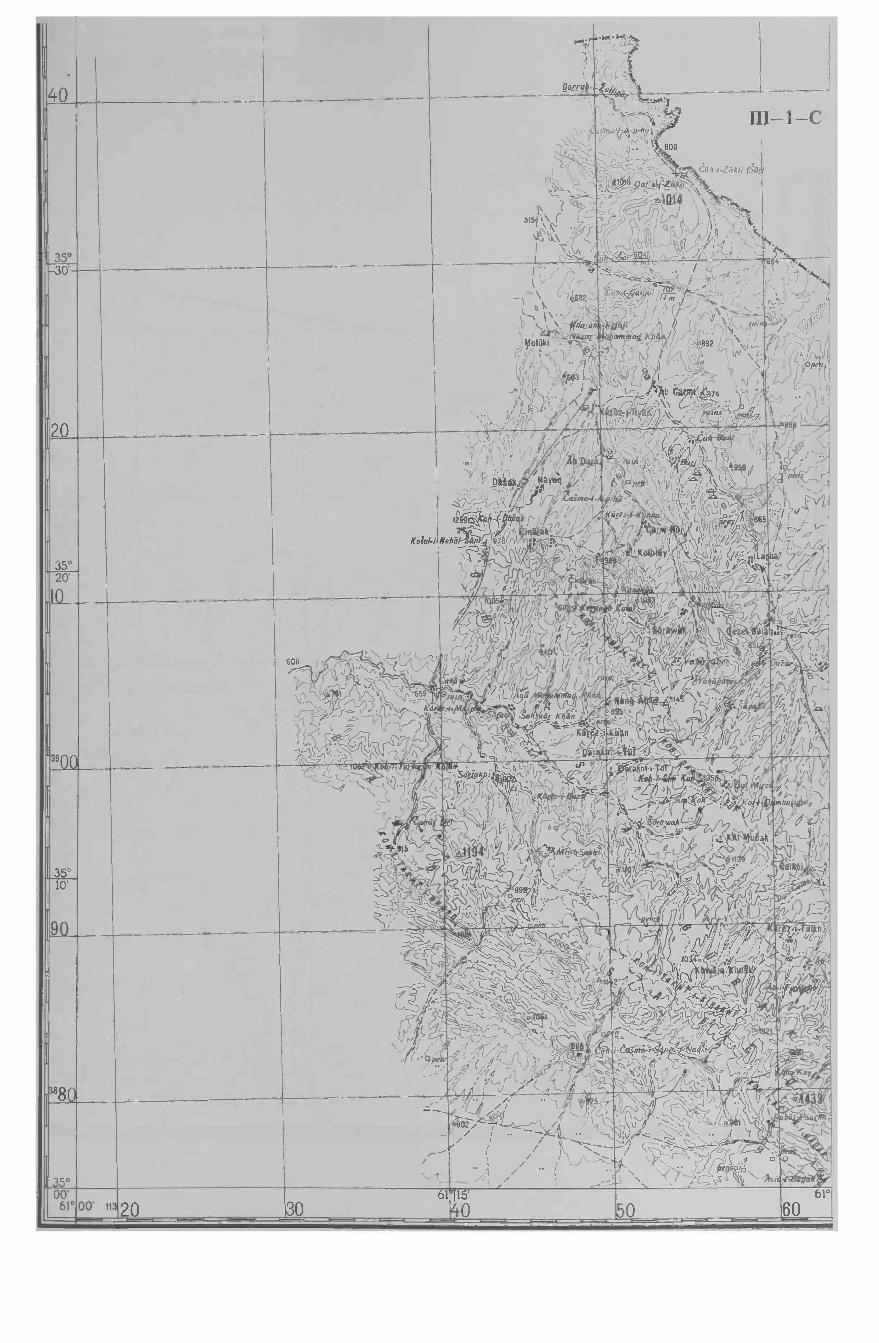
40
,...,!a'`.r'
V
Daa /_1/49èr
'..k. N.
35 °
(-
\\ ,:'14'- -
'i: :? \
\ 005t5t,\ r, -,1i\ í
N.
:, 7,.,,11_tt- III-hLl-i'n,-11-lrú (
,- 4
P809
-,...7._-,,,,;. r, ti rc.iir ,L'hkli >o_
,t1QaBY,...,...,:,..,......-77 `
-\ \/ , \ ti^h. C1r //J ; ` ' -:,
;, ,; 4 ,J ' ^-1, ,, P,.,, , 1 , , '
,1- ,!, --,,?j,,a ;._ -v..lr . ì
1-C
'N._,-F- ; .1 864 ti.?30'
20
e r;`, `f. . / ,,-' - ,f V - i J- `-l. .
.
f;_. -\-\ q682-_ _`^ /m _`,o f w i ' 1 ,/ -. ;. -'c\ . 1 i t. . i N , ` ,, :-a`.,i '1 ', ( f i
fn892
7ÌÀ'»'` ," ---; 1.. ® ` `r - I J _.: ^'\\ f--7',,
/ ,_. . 1' f U . '', se I.\ ;,u` ® ,-_j 1
, " , o ,\T LJ lI t_ b h-n ir 'r ''`I,
/k-:" ö74 _,.%/: %, 4. r. . 2 : \l / . ?.',,..` .
) f ;.., Rr / . áIë2-lydd;l\ ' ns", /p s:`",, ,,/,: , ,,, . , ,.,.. , -
. ti,_) I
' - -.. J ;.
c': /v ...;1.:
J/>nJ`" 'neh,
i,
'` ).-- 1- ,.: .r 'J-' .. ,.
¡ ,( , J ¡ ,,:',- :^,ï f ,, : /' I" ¡Iga I _/'I I`"
,.'ir".:-.'r - \ l ' / v QCS,t:
, . ® -.n,. .\ ?j ;-., ; --... ; r' / Ab Qaa : rt.n tB4íg.'
Y' ,
Uak + /NSyeg j/ 9oe
1 °ß' ' 9 ,g"r,o; 22 f n ,ók ,,
-c:; / . ( asma ., hü' " f ' á ,l ç "--íl:v.,(` , . / - . <- l' . J.. V`.
12 ' n ' ' F r--I, arem!-!C lKlapp,
ff 1 y'.'
_ .f/_ `
, %,J.i;
pYi,Írli(I'ni865'
Mehá ' 76r1'. =+-t ,/" ' .' 1 / 0`, 42 J-,..s's o, ' /1 "11j /'fo
'Q , /,/\_ II , .. .-, /,v P` !/ ::ff 1 . (
1 °I ` ,,,f./ ¡, y -f4 ' /. 1 l a `'' J =s 1r^ `T , >iZ< -a ---k ° / 1,1 A / / (,
S °11 t ;l \; ,' , ,, ` ,, , ,
35°
Kolal-i
20
Q
39 ¡DVI
> ,608 , ^ ` ` ,
I t t/' lu i --,` -`\..\ f ;1 , 659ti1^ P J . 3Jj ..l- --° ," / Ya_ ó ""'-)1'''°
4-..);- s-. 1 r, , /í t-. "- .S- /
, 5a', ' > .r/74ti hl y *98!'r . -
, n.7
til 'r V S -'l % r ;;
í ,' `/ ` ;\... -ll . ' ,- / ri: l^ " 21 l. , 2 -( jc rj¡ / 1 fr/ J..: J! /fLIB
i,1 ,iir K an ;S.` V', ;;--- Ka i.. j;¢-` - ,r. _ - _ - - ;t',
Í ..í%° ' ., P
. 7 . %
' ' , li , ik Ji-'; , I , , I ;" ,--
. ' S ; ;_, ---; \s , , s , ,,' 2' ' - .. .' , ,/. 2 ,
\ i akó f ;c' ' , ' i
'`ç
. . r;l4 f ''i/ ///11
Á/ ' ,1
': `. C' / f ,,, I , % ?
n ' / /,l,, - , 1 A, .
°
N,l,
vk r+r
..
.
35°
1- -TI 1.M`+ ...i2 ` '
' %~./\,, ;C `?lL,,; _
ir. a1p,i ,-Sij0`'- G 1'). _' .\_.C
., 'ji tl ^KZ-ìa4, r tl ,' ,; ,
, \ I 'ì! -,'/t! ; '' - :
_ , , At-(-7-` 4 A: L``fU / 1 l \ ' 3"` Ú 1 o99áj -',...,:,,-.--,
.,,.1, n'- <.
,
/L ,° L- ti ^~\ ` !`. 1 7C,,,1 \ ; J /`
\\.--.1y`
-'\-`' lo, ti,- ,
'-'7
" 1 qp` jL-- . .- 'J\ rj ,;/ ;,,
; ,,; /, . 5.,.....02 --°O_ /// \J; `!,\U--.Li ..
'i\ll\
/ ... __ i , / ;
n,i v j ' ; pl/ `5' y 4.. ;`
A.\ ''j /l, i fÌ%1- _sr-_- í.i ó I mbur#
I ^a ; !; %:;if
-----
.,, ` / ;
,''' j,1!`1r ;d ,-II ,,h-l
/ , vi _ / li'
)
1 _rs `/ -'r.f,- ,.- / ' r 4 h/
.- `,I..,r vi !^;aj!!';:-``j,_: fC! ' 7/-1 V/ '
^ V 1 jN `` ' i¡'/QTp'/y;))y 1JZ `ti- ;, '0 /.s ` :.ti t.- /O) ((''//, Y'' 1+./` 'V/ i \ 1r - I_,.,, ..T / /,¡ /- E
LJ /e `ms °4rf`~ ' '1 . ;, -/,,, ` ; ..
-:íM:
I
u ,,r , F_ `",.-.1 $11 vi `` Oa.,,1 y \\ _. `(_ ^ -1a 1 f l ,,
` )-/ ' SP a .; t` ` ,C- sS i; .
0'
\779 -r%'_--.t`
7vr
\_ ;1,rr --'9' -.
.
38ga
3S°
__
_
L°02o-_ - - -- - -1115'
30- - - 40-- - 60- - -


III- 1 -D
.0 . .
)
;L. \\/
i 4,,,,,,.
i )
j N.) -, ..,.,.,,.
1 J 3ii Alt \V rri4,...1,,
1 imw.,,1 0E3 s\ ) 5 (,) .. I 1 ...1 ..
-1'
.p.,.,....
( )
.7t....\N,v.
(--7*A-
,..
\-I
30'
0V - .,,. .
0
0 . . N - c r'3 \ L' r
-,-,--- ? .' ---- -i ,, ' (.7 I\ it.ji . \ I' \ -/1- N1 \X72 I ,-\J . ;6
)?--) 'L t .\ :
IN f -A1'. '101 \? / p,\ \ J ..' -,rui,as'
"-k-- rp vi \ / / `.,.' s -,\- . fyt
,/(._, ,,:,,i 1 -\ 618 ``
-) (.)
j /I t; :.:.../i1) \J (lz Li \ '
'-/. '',..,,,*1 J/ ...',., rj\--,a t e s),zp 37_,----,-- -=-_,-
.. --- ..-...- a -se) - -
l'tL\ '.4
/\. :
---,77,"--íoPen----"'
) ?'-i ' -
, , -\T"..L--> \ -7v I,
':' i \,, '?'" /-\
35o
/ .;',,,ap' $ \/ '.4 ' ' ' rurn' --..'-'z'°---/;..-- °P e" i )-'-' \ ; i s\- V- --) . 1 )-- 51. '
9-6i I ', ' JP __J \JAI
--_-_,..,,,,.. , iir. \ /%
(A-f) ' \ti, , ,- , _-- _,,_. .. \-.-,. r -- 20'
390 1
_,.._ _iii,.
'' / N /- - -2 Ir
1;1t9 ),--/ ';i/;. I (' i - if ,-V»H::- 1.7 i ,- A______ /1
:I.:. Y .1 ) I
Kamard )
1-\\31Pie\-) )
,t.,'
1 / 1"R----* / S _.,\ ) f/ --.) '',. )
4(% - 1/41 41/k r i'\-1 ./ I V"\J
e 9 -) ,-\ \ ' < / _:.-/\'''m ,,\ 7 I' / n
1t4 23 i ..,- 417i'. / ___? ii 44 Li
- i//
//f\I
I (.-Si j
/,
ii.ki---/r)
\iI
,, -
r'j,
I, i
) /
z 1
::: . f.
"-", ,...-
'''/ /1
0 ; (. ?
:,....,o\'\peg0 Nr
:: .
,
I /
( i il ( il'. \ (V ; / / .
. yuins.. \ N- f. -4eneft k,, \ ( 1 :/' Airs )
, (-'1
... n 4 1) / (h-i- it I,
1./ (-- r)1
"\.
e v
-\,?' L) :(/)ii p Air 1.
(7 ..( \ tst -
1 :...- .: en/. ?V .
v I
\ ( l'O 1161,2 z0, 1., .!," iikteirr bd \ ,-".1
. 7 'C - - (% :.: uk
-,- Les.., . ,.-\ 1..0, ,, ,1), , I / i / ,c,' i '..' ...-., - /// 4 1.t -_, :I'
,n 1 g i r,) ''' . J 71 \
'Pnal) 7 f i i ) t-;\'...- ,,,-..:;.( :0, 04L l',,, ,Th., '' fr / t i/i. /.../,. -2 :1 $'7 1
, '' ) J- " ' 1,' -f - I- ?(' 0.:...:.., . /i ( : `;') rj (--? ' (.-\., `1 1 ., (, --)
)."> a a ,-- ' ,J I 3,-4 / ::. >94'/'ies.) \ )..,,', , I \ // ,) , / 'S .C.rtsli 'e ..,j / /I f 1:-k .__/,
_34'''9's - - ' ' i a i 5 1
L..,i / 4" ?' il ,/ 1 ' i y o8 ' ,. et 7- f "ji:..rui 0 -)/ -\.. f\-, r(
A'Cr °
1.-f\--\,/,,/<-,
--,,,,j.,v/
r'1\I''°
39 ( -1
p \P-- Ai,,,, v,,
ii..-s-'.r
'6/2 I ":)
f\TV,/ I) ..1( (, I 1I 6fi 1(g»016.
ir..
'').^S-s.(-
ii'l
.
1 0/
\,,0,14 (,-) \
( v1
II' e6.,,,f,:\'
n4i 35°-'' 1 f\- hmaikhdn .'''/ o )
\ ....,-r
er: \ I ,I 1
-,./ V 1, ', / 90
I.; */)6.....N")\r\
'61 r44-11'LI
l\
, --): 441.-1:4-
-"/ ' 7
-: jI' 4'pens ,
\'.: I
?- c.c.--..._1g ''-- 0°
. 7... . ?- / `'.
-.'',.s ..2,_,
'-s.
)4 \II. UT,-'-1 -------
a....1 A 1 );.1 ql () , ' ::': - U.....:: .7,--, N
E.: \ 2/7/-,(. ( /
fal4. ...: 4 0 i --A 9Tem ' ) / '1\1-,....Ø 9 .. -) ( / - : ) t'-'
- ._i \ -- A / it(',uullan , ,.../.. ;a (./
1 \ » \ ... -7 -_:...?4.:.70i ,-., A. \ N 'rsuin r v : -f- __T "7
-N80r2i - ..Ì' I i ;:. .71 \ ( (./ d/f( n L\-
. f:,.--, - 5r6. -nrft , i /*.1)(,, if .1 09?......0 '-i );±;'--- --> /71 '1°
(i '
,» ..*:- /`-....:0:..j / I.. ) ';.:1 g'N\ 1 / \
ll\i \\
/' .77/%141?
0/
/..
-- ,11 : Y4 AY/ .s/ \
...'........ t V 1 i ' \
r I' ) A,-,1,1 to 1
-
I '4 43 1 r I '/7 /pen ii .1 ,4i -/ /1 r,
1 / 0(02/ -
i vi ' / 1 / 1\\?9 -1 1/11
It= / ' 38807, . ; ;
,);\ 4 /'''\
.`-' Al
I §Tr ' asie
A .11:
, , /-_)SM - .,F,,... :P,0/ '1....;,. ruins ..I et° :...4-::.. J..
1,' -; Aok 1i/a .:::: , :: ,t,"ite,ri "° --<.)' /---/,
-.)ruin .t
n ,--/.. .-Ipen''
_n -,.N111(.112-i,-IRE ,c'
y 27,7 829
-r--./1/ i i'' \'''\ j\,--S 6/'1(1-/ iltf:-' f'\ "c, ! ,.. .. N. 1
, ,-
11 fr-' 04, 1
V ../ / ..
imAn
, ..14i / / ism - i
A 1\ I (flP 1 \IC (tisfis
I . a L. ...
r\,/ 1. :(.. .. .6
i :.' . 1
. ' ......)- I : 3530' Ab-i-Saf80 3 km Qara BAqh
7016 km 61°
8045'
"4 00 62°00'
00'


III -2 -C
30.
20
.'
\.
8 i1-
y
35°
(fr-,, \\,/v \\,I,':
R__r,ulrIJ'~\6
I 1 /\ti`)//, V
1i`\\
. 1J' rv
J46 çQh~(lnrya7 7
r
.' " \-C47-i- h n(hr rr al1J
\ )r-ti( 2
obp . 1),1ti
l 1ti.
20'
-3900
.'08
%n
) J
C- -
,*1-1,1,7:7
' o ../k ` ;m,rzllY
1%
r! I0-- 1/0)°% , ia
, /11 1;/ fo(-)
()/.J , //° / la
r / D 4 /i 7 tii J 1' V l/ ^ .v, A / n
i `./
tiGJ/ 1 / .gll r¡sd/fr l `
I` Y -lso r -, C/ '
-} I(sa 0 0¿ \ ro, ,
(f°OCQ%n'
/ ,'I/lilGl4 / ' a-y/ Y ç / '`
.. 0 ó,`iQ/ °))( --y '
I ..
I
`'f,L \,(,1
^ Tfa'r`cT"l
e
k ,-Ll; a i7 /''
010l 1',.. .`_C
_l' ,.1 r r1 /ì;- r í.,
_
1 0OQ
y
'' r %) <
c1(-1
/1(1 \ j
1 ,1 - '- Casma-i :a-J '
CñhI 79m (.-
807 .. i'l1dä 7m 'a \ f-71,/ ¡,.//!l/ Alf 1 f,p/ . L¡ ,/ / _1'
' L°i 1
\/
% Y C D ,' a BéZ ` .
> /4 f = q r ¡ ¡--,--4.,,,-__,-----,g/
i lulòm (;ulC
1 p 1er in ltíá/ °' -il:: \
Q / Mili , 1r t '° 38,, i p .m, IS'
wear rPa)o 0 1 T
I , .)Cr ò ; t
9/'P i/ Jr",./4)- p `^ ó O '
lJ a E,
\ A;11.".
,5( Z ,lr 1`Q /,
+ o.- ;. : , . _ ,. D ,--- l/,/(
i , J) , f'. ;riYx` _l % \ 4 'I _1/ ;
,. k/ li Q 1 L
_ 1 l 1 ,Í;; i ( D
411.y/¡A , <,1ta . /1/Il . v; \ _ _+r
°3510'
90c,a
Iol ^ l, ;'/I J ,
` I S ° M/ , g,lj / I' nv rj ./ " l . .ó ti ,ï- vJ,.,,
o; /
, ,.?' ,r1 Q°. r
7, / - r1 `..;' ¡ iíl' I
, ,
Jp.._
. // / )y ,, : ,, 4 (.ti_I
- CJ
e9z.o a
o \l
- S 0 ,, .
1/ 1--I0 ,
( ° /;J ,, Ì (1
D 1v,1 .I o° f/ I
lr Ú/r Io .Irr J '
/ / I,<G / /,%J
1dik )a Jrly' `
( / I°,1,,/ f/ :/
yati
r hl / -/ } 'a./ ,`f
íl' ò r. 1^( l /! , 7 /1
_` -T a- i
1 - ,'_ ,v. u `-
001 ç ehi, fE' _../ , 17
,I file°. J
i tr}V Za,
° , T ^/ D; y1 ; n1r % r
, , ,. /a/Y JQ_-..,, % /'Q / i ,_ -. U,:, n,,t`' r Q IV ` I/` ,/,o., ; / ' Q r ' , '¡/ , 0 ) -. I 1 C, ` `_
r h D / ,
y y,, óa ., ,,, t ,/4`/7; ¡ , A
-/ pJ r i . I 7'1 '' lr :.,
lo -;e , ,r
go ti-;i r Ì
Ij/ //1 ,i \ ( I> ' :;..4
0 ,iy.i °s.1.1\:.::-
a, /, °, .. /r/ ..1
°°: I 11
\: \
;y
1,r,; rr
'
I ;%
:` f / ..) J t1`1°nl ,, y( / ¡ /l ° , % /)1 ,l (O \ r,':pious.. (
I
... 1J /4 / , 'Al
71'i i .g;
oY° t ,ì o
1/l ,-// T , '/ voÌ :
JrrNi ra
f1 `1f °
1 I¡ L1_,e1,. ,i/l'Ì `
Ì / .1 CA
\\ ,
_/ ï ( 'l
G! /' {``` J/r fl r/ 1:,,L,'
V : r, ;fÀ (1 J1/f r 1 (. I r,.. 1 , a/ r r 11Yi'
/%f Oÿ, ` ` 'n <
, yS f¡/J/,,J . ,
I.- , , ,., (1. F'( f T,l _°3500'62°
Qo Ab 20 km00' I0 1420
62°
3015' Herat 83 km KtAk-i-Kohna 25 km
4062°
50


III -2 -D
Pt
iib
ill
III
30'
20
'
::°. l'
.1 Ì n
Î.r
'u ;
' '.,l.,,.. ,,\.
.q Z° --\) 2 ,c GLo} > i
4 Ú Ó ;0(
áQo0,r~ I- . ; - °.1` ) 4 {
U`'k r14.: rsoo0,a' , _ /`Z \io , o .9,1- f _r r, % b' ,- ": ; _ `
l - : , e
1 \ r,tI . -//°
V .1 ?..t' - rr9 .. :'.-s o ha
oí.. n'
3520'
01I //1." -
. f .\lv li/ )
r>-1 7 +/ .rG t._.r..x p f. //`ì Q (ti- 11r ?l" 1'V J . 17
I >ti jJ)oo . z `,1 >---?e,10 Jl/' J o ti
, tiZ2 ',- / -I T r/t°v ,' " .f/ íj'_2./ 2/ 14 (!r <é /
1 ' /0CG,O
4 L-., ..i,;.1 °
^ ^ bJ ,J/r6{J : GiLti ¡ r°J \ ta 14``' ..
V'.,.-,.
. b ., _, , Z,. Z1,- // /7 f ^ -iy y 14 1 g c ``llVr y r1Qlr/l ,% l' ¢ ' 0 nc ; iG. .
\ "'` J
`( `. fy` /'¡, ( .v
Q od'
J1d1 \/
>- i` _`` "Q _,l
. ,oQ.
6 IU Q '
( Q 1 ,\ , ,3` y v
i°'r ,rV `
= r'n1 \Q\ /IJ r n
1 11
1 V ¡ V .I o,} ' G n
1-11)\Q/LJ °,, a ,
. Ca.YI /o r. ;. 0d nQ d+ 0 4
O
O /"" ..
1 krr, j C / iS (ala%. >`' 1(a4
a n.- L
°3s10'
1[¡ \ S44V1 -
A°Q/ .,ip
v"
G 4 80/
IpL, i /Jvo 1 O 1 .,
' I \ C Q /, U J V r ^n
a I C j ^ c-'-k-)li Ip03 V
; f1. ¡ 0\p ,y li -v1 / ,` %, \ l,
11,v
; 'pó/// " U C 'r. _
// 1;',_ r/j ;
.G/a X/' / Z
I ,,IC V \
A
í ..l 5i
n j :l ; o ó..../F,--
((//JJQQ jlj% ,:1,r' '., o .
,' . 5 9i/ ` i ..,a i l "4i F Ì; r -J // !
¡ , ,- p / -/ \ ( ),_- I 1 ( Gz .
OnII 1 Ì 1Y
. . i , p 5,. p; - ' /'! J V;,` . , ' ,
- ;'. 8 1 I
VIIr
S 4`,,/AG fvS.
' ÿ / ¡/ Ú` y;: v ,` ' v.11/ 11 '/ 4/41\- \ t ( w `ji Pe i ,r- v- - /ti
' / 11 ', / /l
pil;
, Ò
1 s, - p.00r' 8 g/';a1' .1 -'.,l
.` _r n ` 1000 '
/y 4 , J o ._` `f./ D _ ¢ % \, ' _ s``, a ._D; -`'` -+--n 4 / ., d ii 7s A ,% Q Ó
-°
-PJ ,f LrY ,I; \ !
L.n VVV ) ll -. ? // . / hi, n 1 ici,/, C ---
°
3530
60- -- 62°70
45' SELSELA KeH-;-
80 114
Ku"sk-i-Kohna 60 km
90 63°0'
00'- - - - --- - - - - - - -


III -3 -A
00' 115 0 063°15'
30 4063°
63°36°00'
3980
70 . ..,- _ r.4. G.
,' ^ rr U (fJ 'V ,' i'' - Ó, )' ` O . ' ;i Q¡ /.,( 0t O
` r-'---- ,
o o ; ó ,,' %o
. .;. ,' V
.11.1
JA
,,....,o°,':p.
/I\
1^ `
(1-
7170.,...--J.1_*_
D',., -
e1,-, \
r ,/ ,4_.'i.,-v
' ---;- J/J'1 ,.\'
%
'
al - l I1 v
' °-Q ¡ ,D ,( D
p I , t,.r < ..
01 (''D a ;.`H .
\ Ip ...J -,.,1 Z`' y0, / \7
ad
35°
'
i J9, i,',' _
1e i I- =7ç .
° -O 't f'\'Q
sai
..,p ~ ~ ` j~'^(
Cb r7
\ V °/''
.9 ;
" A , ,
° a'.. %° V a ;'
° ° ,, ' 00 ,%
/y- ' I Q, %_ ' Y
-- ,./,1_., ,-.-v , v' Oy'°,
' Y/ /'Qr 0
(' p ,, `
a41.s..
4 !, 1'o ò ' 0 ;
d ; 0 )
7 Q V1\
<i `'
,
^,//-
50'
6047,. , /P y ' o ' e o
r ah = , ,. L.' p j--./ ' lln-i- t7` \D . ' 0 - ./- -
- J , f -\, ...
' 1Ja
;C ^ 'I ',i,c-'" ,,' , .' 4 a'c ' ., N U r ` --lis.;;-`` n`+--1t')-)
rf,rY ' 1 f /z, ve io ' %
..- d, o. '' ' ,0,/' O.' ,'--'`
.-',,Z-f-...),;,;,s. ' C
/Ci1 TLpi\\ '
O Ó v ,-'
rr ,',., ,
!i Gì o
OL. _,,_- "
yL-71'4
e- `
..;- ,,o(
., ' , /
, ,,
',Q. o' Q
' / 'Ç `1o-- <> --0)50
350
r'a > v.r , 6,j` .;%' ,.,' °o.' S,,
1 6. J ':
O. ° I- N, . ákza
14:0,..°
. .
y Q M árìz jo d qr'`B,.
J a ..'' `` * ° \ °: l\r 'v a °ar\ i o 4J . i^ . iM660 ' - - ea-t" h' ' . .. . -, .
°/. . _
,, ,, w
/ 4 °0 /' D'Oal
// ---rida
\/,1 / .%r '
; : i n ' ¿-j f,'' ,... - /I. ¡.-
° 0
° a'' g ,_1<
,, /' ,''Y c
, r ,' ' -
/ °i. . 4 - 'VVV
3 I-S
D /%O !/
`ul -I-6JZa1`i`.=-
40'
1409 ___ 4H, ji n ini
5r _._1(71 _"d ` .' d;V/ ;f,
&....4'..., '_°'rmma
, sos.,o 1.
1 7T \ .(v
;1
= `^ \\c'b``áJditihe30
, ® ° '1 72111.. - , \n ,p ,-,
y ' '0- /
À_ - - - , \ 4 h \ ' II ¡ \ \ cv I I
ah ' asI\ e . 2 `
; .' .y, Ls \ ip..; t . .' G
aI p10n,Dá7 ,o'; (ydo , V% J ¡' 4l\ O /I,o , , - o ° / o
4-1.',:. y'-.:
K
% (iK A ` --q `0'ss° a i -1.x,
: ,óy w ;,p' r .D'J d ' n '
\ ° _--___;° \1 C`'
. / a `G.
f.'
35°
_/. ..Q , ,
1 f 1 ' /iISIMPTALTIMMAIONdiev.
% _ - : 1 1


li`.1.)áAL3 Ì`.,Vi 1' '
¡i!j:1J ,1 / , L .. ' 'f Z. 1
, . i
Irj, , 1 '
- _ ,
'' t1EII ElJ,
É''E °' " Ci -', \
G
J v
.,..' ^ :i Aj'. I
4s
r 11 E J , S'( Ì I
. 0 '
D , n' / SS: ° F\ , , J . \.
: :, I
:.I
,
U, r\ ' 1E1 . 0
00 °. ' I
, ..'; h
` D,!/>! , ` r _ a , t:;Pc ``
. . ;; 8
e\ 1 d
\ , nt- yN . i
r , .
I , ... .' `, , , , r o
/ n ti h "4 y/. -V
, Vj
_\ Y /
. p 1 . ,, , t o P
o , /o Cr
, , (v 4
í,.
ó p1 , ,
Q
vU rI
I` \` \ \, 8 m
,o
. ;; ,,, -i ,, 7
í
,
\ (
''G p p c /?í
' \
.. '
o
( r a ..
/( \ +
oSS
10g
II
II
riV
CO il I
O
. ,_, , n
. o oi C I . IE.1 G I ;/f
( ) l' 4 V / '10 ) , p ,,c h 1
tl .,/ ' i . - !1
`, s I t os / . d
:
\ i 4 '
4 `, a f, a
1 I
vJ`; \ I¡ V J
, ` , n J gr °I 4po4o -, \`1ISn4r:.' /
/ , J ,,-' _ 4 )/ w - o ,, i ö 0..,..)---___,____, Di.
y , - - kl Oa7n o , sWJ- h/Ai 0 V / EJ ` _ - O
ao ; - ..' * - o ` \, ;. \ :', ' .
\/¡ /.. \ ) é = J .. - yo u ,
(- C 'L. - .
S
g o M Î/. $ i , ó AL, f °0 p /.-r f a I : ;E , 0. 0 .I
. r 1 4o o - `1 V .,
-----)-`---/___-- \ -Ii.\
v;(°( "-' p, ;. ,1 11ó (., i
i,, e , ! I
,,
4 ti/(, .,, ' . \ /l . ! kta : 4 `
_, .
\ 'J i °> / ' . °y Q} , . \`" _ 4L : 1 c ,. t_} "L \) "'. , ^ ! , .
.!1 c,, r-' J`.,S .1
v .c. l v lJ ji 1 . I
_
s `,` ,.v p s o. , Q v \ \ ) V
J v , .: 'l; `, \oa.%
,? ,y b o , , ti v -' , v eti: = --- v= I ) \\\
4 % 4 .
a \
.-. .f '1-t iD ;b Ì , . D,'
, 711 I , .. Q
o, l' , ll
p ,,
I
8 Q QI
a a
, `a a i
' r \ l ; : i
' . Za f.Th -. . --. .. o
- r n l" , 7 ' ` V
J r P} .
1
I
Hosi
I
IIL
I
II
I
.oS
q 1 J.. S, ór / , v\ L ^ 1 IO Q
BCo )l Jv - ~
0.0...
1
< . p :
r_- a I \ .
_1-)
< i ' r , ' ;- , L 7 " ' :> ç'
/ ,' 2 , , ,. c `' f 7
. Q /) ,r ;, , ` ; í ó
,
I o0 00
c S /- i C ' j rJ. (I' ; -Jr` , v I > in )n ' n S09 Ra3
. .-,-- ' ;, oy 0 .// r ; 0 i ! Jr 0 I
pUò J ,, ó 0
0
i "
0
0 , IL ,' C o , !
. ESn G 4 U!49' u,.-:,, _. . ° 1 \.-- _`:
E Q 4AZ d ^`I To i ; io '
,/ / 714
h h \ i l 1' V ,
I
_ ' i .
I n 0 li `
; 0 I,. bv %
\ O
\1 I
\ I
^I ' 1} 4 I
o I o , .
, Q ó, '
o ,' 0
4 ; I D
Q
- _ 0..(1/4 r o p b t ;
.. ,
¿I-
2-- Q
r
08s£
oo
r1 ,' M, /;
, . 0 .
`a
, ` t , i j -
° ;' ~--, ,-,) T ' s .1
> . i¡. , . J . Cl ,-
D, r., D/ ni. s` 10 \, ì ` ," d
-
,1\204), p 0
,
i
-/" , Ó,} ' e e l, 4 ,' , !
1.6 ; ! 4 öö I, I -. .
U i 1 I '
, . -,
. .
ó
d
, p
4 oo I/'
I o p.. I, "'°o ' , .,. 0 ' . 1rl l V40 °üòv -i
0 D` DÓ
D 00 ; a o . G 0 0 v 0 1
D v / .. / 4
s . . o ; a , °
i -` \i'..,
s < o
, , . , i, . -; : '
. ,. N ` / /,
r) --,
4 t o V
o
.- ,. .
--' ., o
. n . ., .
:: .
0 0
Q a.o°D
° p
p P /I
-a, I I oo l'
1 l ,,
,
,t.
0
. 1 , 1 , c ',
4 0 Q O 4 ,f' ' ,: C .., . 0
° . o v a i
. , . r 4
a '
` ; `, 4 0
ô- A 0
0
, ^ '
' f , '
;
10
/} D ..,. / ,, ..
- ,. ', o
° U '
I° D
Q $
;
.
-"- . i . . 4 . - /` \ Qö
0 9 - - ./ ', io o
Ic
1( l ' S
/12) j,,1 ò.. ° / 'o
,D o '( ,- ^ a
' a ) ,
. o b o ,;'
. , . , .-.
09C 00 .t9 08 5
OL .St 0S9
09 05 .oS


III -3 -C
30'
20
Kolal-i-Mangán
I
j:'''-Q1a r`o 11
D, ¡ , '
I
°/ g
l / s\ v+ ° o'qr i 1? - '' ,-- ° 3 -r ; '1
/ I -Tr / t, ,
1
e . / \. Ì
.
73 a1
.\ i
$22\:I
(( C ,
, 1`, l ;/ " (\ S V
( C ¡ , \ / , I L'i .Y .. I - , o . g',,
' ' l.
; '
/ / I ,C ,,' .°: ` '
.. ._.; ;r ` :á °° 6 : ,
a '` J. i'1 ,`' 't
35°
%,, AA ,r,,:rJVi o988ti. !-i 1; n D
° ° fZJ_=.0
-t _ /.: - . , '. °a9'
\ ` \\ \
\ -_-o _.
i1 /
vl ` °QIl d\\\ /% n
\ / n\\---;,`L L,° I 1 ',/
r; !' - -` ' _ ,. If+
'. ' ¡ l ,..b \ =--.L/: 0 0ó_
-- e
.,1r'' 1 \ //JI ( " ,1. ' n`
JI ' `- f J `(\. N, P ., A. , 2 '
/' ' , ' '/. ' j\, , ' '' (°12( IIh\' -,' 0 C\.;
,__..I / 0 1, (-/. ', '- <'-» l ` /(
---Z s A°; 1
_ ,-i'rba o ,.: ¡Wl
'_, X.
r- o,, ,, , 1t ' ' - g,,
\;.5.' . tr',,-,; _ :/ ti
c .V-1 `i/ 15 °',- -:Z ¡ 11ìalV
l''
, .r'-.., .. i. ,,. - ,/.\d __ nr% -t-or
o!iv!"Q. Y
r ,w ; o ,l'Z. n ,
. ,,' ...'\
; b,ne ° '
1 , , .
20
900
,_ r1 /
' '1
ó, ,
Q , 1\0....&,/ ;' 0, 0 o4:: o.;,Q' Q¡O
o,
- D, ,
,DD4 / ' \' l à \q.
I : a ' ,.-M
> y) 1v ,, /,r "l \ r--77--
"` lL /` .; \ (i.
n , C--`--,I , C; J ! --," f`'- , ,,.",.ry. - /y_` - -
- __ ,toy- `l
.,- ,--..................\\[-^ ;S `!a 4 <
7¡s .
.y` .c''=Y,
- , Y )1'`` ,<-` \-d 1'
KAá'-6Yv ,. :,:- 4 __ - -, ', 1 - °;,; °v\ I 9 , ' .
\ P p ' °'`, - a, -j ìof 'o ,'
- - R:},-TJ,,!
\ 1'r_ \%arf ? rn ;, - ` , '
: ., , v ,_ \ Si' `'1=..C' _'' af A ' 4biiG r 1// .- í-
o° I;,` R, IL ti
., :s1 %I Al .
3j°
0n O r?'pd Q
: o - r. ! <lE JG' .% J_ ,,-,(Aa. ° ,,Jl*71,-------(--` .,..,--.7% _ -- - Q/ '
0 01 .<<_ ''\?` °' ÓBO i ``:ip0 4 . \'.--,--t
: .í w aala Oa U
<^ 1\>-i' 1\ . ° f1\urA .: i C\
-
n ` p`:' r
. j-' ' ''" Y /r.
h 0"'cl V V d ::v., ( `I` ;\, Y /L /.
!o
ílArmll .+`
_,
I7 / ;<f Z /
\ 1 `°\4r\\ oo,r.o '
O
.p 0 \ `.. a ''o - '/ ;r -i-l''na ,
. 1 / r
,
°
I '
,
I,/a'
'',
(
.e .
I--:E-7,,i ". ka
l ' i n , C ,`.a /
' -90O Ì 01,
),,,,0 a _
'.;
a,r'
'o
a /,a
. h
J'ZI1
. -l\
,'Ti..ü
r-
-.\
..
t '°
"r\, 1 Ok1
sa ó0,
'e I
. . O ,\, ,.`._i r1 .a ) uo r ,r atanf
Vi Y \:F6 1.-------. Y .O
ai \ ' ú,O ¡ -,` r --
« a'°1/1
, \!-1:'J
y: J f 1(Ji:ï 1 Ii,;
\ , -- o , ,
`` \ rV .Ö -- ` /S I, f, c , f o
\,-- - f ``, \rès44v/ - l L
"Ú ' - - -- IQ ...r- -V . ' ,r1t. °
\ ,'r L'e
V' tr /_ i
11 IIl` 1. .. T t-e/ f; `::gàn amma
r ; 6,''dri'`ti. : - - .- . - _
`
. x
(il^ 'oi4 (`1'/ rl
(r,/ I ,--^'90 ."
_x .;\ v .1Zi
aki..;, / </
:r,/-v-:
1 Q- '-(L ----, ( ,- o,)
945 ` --f oo-°(
. i(% J!/ ¡
.fMú r AbbA,i,,'M la Tuf1
- óaa QO
°00j
0\o C J/1!,0 JI (V
"` ` rt ,-1c
v <:ÇNL> >,1,C,\ \\rc\ Ì, `aoo
s`
11 `; '' '/),l- 1 I a
\O`, (' 1
' <
D i - -,o,
II o
` 'I;
--y .. ,rr 4.1 ,. -a
¡ °°'/
Jo
° ,;_:ár,r. \',',q-.\, 1 `,:a
`,
> d, %, e o'nil:
a \°° 1 -
\-. . 1
l l' l
. :r = __.Q-
00' "510-- --l'a-i-Naw 2 km Ba63°
ara-i-Naw 11 km 20 30 40 - --- - - - - --- - - - - -


III -3 -D
:*1Z_,n
° ,' oo `
V ,\,-1ä° ¡ \ -,
Ç,11 / ,{
l1 s ,
,c-_-_, 3 1°\\ --\, ,-,/ .;._ 6
.
' '--, ;L` ' 'r; (`
JI \) 1w /
°v <o
r, Lt:: , \'
- .=1 7, ,.` l/
) a .._.../v..../._,/f'
) a ,
aO ar t vim
1T
fG>- jy JJ a', , \\--\¡ ,.
t I
)°-)I-1,.
d ,i
, D
o i i147:!,°
' .
,r./. ,í,
a /
i,
30
I
20
35
s°
r
i , ., r \
.;./ .. " -, lTl,l':3r . -) b
\ ,s
`Y_,' C '°
°vt
,
-, \. ,C
; l+r
ö 0tC
: '%itk.",.3 / l'1'
`
Y$,l ..ijti'r!
n/ %° ^
. ¡1 . ,/ . - -- --. .-.i. , _°i, ' ' '
?i 0
C2oo /7 / .rcJ
í// ,AC----r ^41I
' ¡'\ -'`
. Q ''`T. /'(/ ('' J/ (/ _r ., ,47"
*I A..//
pp,' '_ t 1% rI , . .
¡ ' C`, / /``1íi.Lk- - , - .sM1 A w
' \ 9 '` /'s ; jI'¿,
>r J'Ir .va LP u/,_', .& 1`. ', 1 .'`
"1t/,45ok
`' ,
.OrY: /- ° / -° w , , L ^
'°: ° /1 ó,r 1 1/
. - , . % !!
`, t t \ r
,o
` > `
,;
` r /. /
0/F , j
`b. fr ,l 20
3!I.1,I
I\ ,bI';\I;ìcv
r '' U , /ll1
`c 117p
, , - I. t.."--- {\
,
1 ,
1ij/j'
°
_.
r+
¡J.. ; / ,
oO/ .' ;r
¡/,% _/ m . s, 1.
; ¡,(<Ét "- '3'i.
,,° ,
O _Y O -
_ " ' q.' . :;e-' p _ Kin, h \
cg ' 1/. {": 1
- J . /
--;.i/ ,'ii /1% í1/gQ) Qr
.
//)j /l' ' - E.3É'"1.
' t ® ^ `jIIJL'-- >r . -r,, -___ .91
1805./ `
4
o
.a/_ . /1J_''í`, Fe%/^`_' -`c ,°é ^' . a %7``.ssy=r,>ya %Ì A Cni..i%. o.
14 ,;^r;
-A
Jt...,O :. ..' s M". C,zL.,t-r--''T .tRp 3 'Ç
V ^C1` .,... ,
' \ ° '
`,
- , a '
J0,$:', r¢ t°.c , . .^V,
350
1
', ° ' rL 'o . .
.. ; a ,
' _`/ / 418 7 >r I -,, l. `
.',_¡ :3- `~', o,.1\" F ot -r , : 9; - .-
,N, á- .F ` %> .__ ] 0;
9 0
'' 4\4(/'r-f>,;"",/'"f ,
.
!
pl ;(Q\
ió \d ' e Ot
I
J? \\\ Rel \\ -r/ "
¿r.e:;tr,^ II
V I
'V1
. I
(V/V V
/ \\,ti l
s1 \ill 'k .
YlLR e.r u r
J
C
FIT0
..
i,° °
/ 1541
n Q ..1'¡
I (,I ó
r \ A¡ % i
er2 `\I ' O
,> ){\II i-.re;' ., --`V/ ( \\ J'j "` 2nr' D f kác ñV i/ (° ññ fl. a
V v í! a163 dI 1 \J + ' `
I°
a I `. o
\° c ` J
o \f re i '
r l^;J 1 l y/' .1'..
p
Q '¡ ..
\, D,' ' -> C `ó17!r ' ::,:,.'
' )
,'
rCY.: Y
6rJ
f"
à 4',71`
a ``\ ®d,i:)f -A: i.:tilr....;
' r' 3r)<1 "i r:J>t/t`;d ` IrAk_^
. /c'.CP Oh, °eiN
G/_. V V l/ ,/)'V / en
/ ('° P/1
I1 'tj!/ ¡ ° 9:
'" ` / '1®\ ' /` 4i V itAS' , - ,.:..,.L ..,\` lbi
--
O.r.
38 8 0
3S°
n. . e/'L///
` >(' '/ri-,C,
1111\fkl: t. E :: ;''1y 7c lI
ni¡ % +U'r-sif.,=,.---,r1 ,/ oi372 1
i i J1%_1 .
1_ 1
(`_ JM' r, V/ C`- V 1 1 r \` . -.- -.-- 1`' 0' C,:
_
1
;!7 /q`^(\ S
/
/4 i{/'-1VìI 'I'
_I e f G
,/ /e; ; i% `' ,°f
't-i,. /Ú res, (""/1 _-, L ;
\ /ç, _ '' ` - . " o, __ . _-.`, ° G r \ .
SB RU
,G i
yo/ /1ir
-\._ -.''°, ,_ `I-_r_.
`r1
~ _'!\-,f `.r -1
7T-,
`. L O i {`1k..._ h-^ Vii)
-"lit/r/U , ,' T,,iL.L, )`'1. 1
r . / ' /\j/ , .1 p t, ',/,' _ ó . , .' ;/ `. ; ;. gS ' ...
30'
5063°
6045'
70 1580 ' 00'00.


III -4 -C


III -5 -C
..emzr.r...,.,...,?-,.r!r:?5tilr;arlrlalr!Zcr:r ` . 4;° " \`1
3/6 t1`
O1\,\ ..1 .>7r / .Au. i ' % 7 _ ..
4N4 . 1Ntv
. 3/63 3/73l'J -
. 3/90
. 3280
.w, ,`44A.
3280.
35°00'65°00'
Nfri tkisec
KNWAZAGAK 13 KM.


III-5--D


III -6 -D
30'
3810
` 50-,
34°20
..,_ s
;,__
":¡:7 -'s' s`; S ti Q
r..a .c--. .o. ,.`t`' J r_J/'' 1 Q
G ,/: _*lit'
;,. ,--L o ,QJ 1 1
`ll ri e 9 Cäl i' `r\t v _r1,` .-,). ( '5' ,D qi-n .V`, i %''G e , ??i -- ` 7 G>'~V- .'"'\4 1 -' 'òv -?%ql2,,., MJ , y .
¿
oe .
\ Ò-r---
.Su 4f Q,;
. y :t, t7
,, rai oar7 -- 0.r 1 - i\ _(`-d`v-6.0L
s''`-
o. 90j( _ .` .1 -.0.J. akma_i`,-w _:-
¡ t`1v i L rC-' E
E
o
)N
>U
o34
.J".-70ob
-
..
fl
\ fíUL-I-NAMAs
/r V ï Y- '. --CI ti ' cL°, 4
.Z"s: `J`\ r.. 4%'.-
^ ,- R;
-- -- ;
; ..
QO.. .. .e.
1I'_I / .. 11, ' ,r- ` ``T U.1 '
G ^ ;1ti,,- . - g J? u i-/angalab ;;; `. o'^gL"rf ,- ' v-o
^ - j'fri / / -/ ' /i ,;' / 755 ;'
'....
0737 ;,..
i ;/,,, i' i ¡1'.. ; ,
.. ,A %, m 719 ' ,,,T '.í1 / _, ,'o
i
i i' ,' '. ' /
10
R80Y
î
377 0
34°00'
00'
` 58:óíi-'^ V. '''1
i e. *4
558 ávti rr- -'\
¡d
°`.v
_ , ,,i'i- --r- t`. `%( % , ,fr'' .-i'Kalún .' ,.'', _.' i- r'
6U /-'" `/'___ /_3' `'__ c.e úh-i-&QfFJ
' ----'`'- -------___
\7--- ;---- -'. i /
(OryJ ò -----'-----'-_-\\
'ÌHR
- I -/,` AS.T ,. ---;--
Z' i%'
_
'-"_L- ' _
' ,t9
1
,/ '/1_,,---
"v
l
OKt-'\
\'.1°sss\- ,t, - ,.
e- `, /r!'"-'-'1c i':," r` /; ' ah-i-C:il /.__. /
'N---`_V, '7`T, ` ` * ----í c I LJ \.. i J. f i . ..
essz(n
- *
`-(, /.
7 0 p8 0
60°45'9060°45'0
Cah-i-Mazár 16 km113
_--
( 113 10 61 '`Co_


`, 1' oMI "J¡ ', .. O G-.// i \ . , _-c
o'/-',O
°
11 //lC 1bL^
--
i 9'// \NI. -,
Y, ( %/ ° n
t / .. ;U -.-< ;
--,°,.' " \?;:2
7--' o --
\,, ' "`; 0 °1 c>, .,I ;ÿ , ol ' W. : , '`'
Q I S
v ` '; .. /G , < %
,
ò,:S *k e Í' f ;--,
y ¡J ia t-.` v >
..8N:. ,y/, Q ÓS SS:/ . o n V:
(,,' Ol `
Ló S
\,
íU .L OQ/
1I7" / _
. , II /oG, Po ß
,r%,r' ', I
,P ,..I';'\I V ,' . a.
,-
\.' 1 )\
N1 T«<,, {"
-Il
- _',
/-. , /. -
liT
-''
f1
. \1'..^1\ 'o
) \_ -'-..
O\; Q-
L--, .. / I,
I°/l 'l i
' 81 '. i
0-77' /- -J,-/ /
i.n.iaca / %// I_j'//Ó i''/)//1 --/f/ /i/ . '.
't. / frwn28. ,/'/
JI`E},GP Z ..
¡F - -; " -' / ," -> _-, _1/ /_,-'". . /. - .. , .
I,b '
- ,q j`°-(-- 5 Nff Lj J / 1'ùrni
y.
2,_.
UElS.1'.%, .:$2=(,, hL+ .png./ 41 -
I' \ \'/ y' $MJEQ-I E,E >L,' ' / . .
;0; ' V,G7/ e ' l ---q L
, / c96L \ ,¡^-` , J `f
OE
1
0
- '-- _
..
i/ .
-
..
o
, _, ..4ZL %
` :9b' snßn6: `tow
Ì .%\ o
I,
' `,_17 OL
°aI\\ ,/ '07YJ /\
/
O_/V Ly//4 . \
t-n4-.!: -
\ 0l ,.
1
'
,J/
/\\;' :;
IZII 9-I ' EIEa
WEZib QEqV'ÌgEa
l:
". (
{0 /
I
I
05 I
I
1 S
..
d
O,..
001
1-- Lf,,/-': G..
G
''i
1i!oc;::
< - . .
1/ .o
. Q".. -/- /, ó '/ s U a
/ ^' . !f!7r..!I1F °/ / `__-. _----- 'Li 0 ,- I,
-'°j 'rr_ - .::t-t` y;r r: , . - -..%
_., . 1 6 Q --, - ,.c.'^ ¡Ó b i - i um . yy Cng
/tl
yn7Z08
/ i .. .' Ì, . . /<>i..¡ . . .
, p ( 1 , (i " a' ; " /v) os u a
aoAl. w4' i--1 4 / . ., C
'- --_' ' _^
,.
)) (
/ tad (o
P
l
! °
`o
I
c,)'s
. =-°__ -
1 ,':. ,'/j.; <
13/ ,;;Q
4T!Tz:<::, --, ,o6
>5'"
gf,, ,
,{IM I.;y
N ,
tò- n, )'-( / Y 08 y,2 j-J/
,1 . ,o/ -..
j- 1 a 6' Q
.. .
o /
09I
ós, ad _a-.,- --__ ----\\ 'r/ __ '--\(L\
`' (. !' N
a, - -:- ,,. --; /dy° sn'.. I° á_ l ..
_- i,,f% -,
0 L8
VO
oi9£9
09 0+119 02 0 Z tt.00
. . _- f-, . . -y
V- L- III


III -7 -B
t9and-o
n-i-M
t') ..1 t.p ,yJ1/j ?!
- - ''C./j i.' i' -- - /_'-J
' l V'.
v .L- .a Sán l - l/; °' - ; c k ,-,a í í ,
ihwa`'íAoh / b
? L .Ì \` ; ' / f i'' ! , (i il ^ ; ; ^ ; 1 / 1 f ó
I \;"'-' ; :.' °9 I ' i Car a
_ ' \ ° ` i!/ i /V, I
=/ %/ ° V V I,' . /012,1 II
" 1080 - ,Pi 7, I%.% _ /, / . . ^._-r
,' / p ¡,,- // ot121C1 /'J/i // ../
(l.4241 1,,L J /((''
'U , Kltr.kak1(
( 1 , (( 1078t¡ ila
fit/ 1.1
_
JAyb' 7,.. ,
riz-i-Mawri


III -7 -C
30' ' o g, p `í` J ` "a fQst_ ..r " I ^L, i a ( o
:76 - - , QisVS e Ji., J ; Ij ' ,
I
\\ v2 y 4 ", Q ' \ \806 _:_ - ' 872 l f
1-1L,9 ',c'` J ..
C.--; .1 l .RRp ¡ pi-jr{:
P reservoir P __ \ 1 ` \ Kham-i-J nawJl - Q-- \ - i/ dso2 + -1i c;n .. ' \ F . /; ', .. ---,...A -!
N. <y ° % SJ `c ,^ --_-1 .^ ., To'' .'+/ s ^ ., -J c15 1 \ ` ?, - ),, ; Qalt-iQdzi ; _\ \I jT l íZ ,-; reservo Kw + -I - - _ .® ' nak
. Ca Gaz % T! w è :C..+ Ft>h I .S 878 1S. p CI , :Zängi S bálL'\ ..,38 ~ Q. ^ / / \1sa
I 0 _ .r L .', , ana -/Cífk i una \ S v/0\',\ `, ^Qì f' e 5 s oc
IRusnú
> ° ` `< 1. , , . C } J-J ,'.
Th ' ...,,-. --f-- Dirdn%s_^ ( \ -á " I . ^ \ \\ `I
I (l l \\ S ..___-
_ /v \ L-J ti ,-,.......i' ' ! I
%789 -`--e \ 1d r1,, . ---- `° -' ; ; ; __ ,.. ', I s
p ' y 1 ,\ .. Gazàf;: f _.
IL C. c, ; \ ``- aw6 ,, \\ > '.- Vl., \ V \
Q . °,, ` À '\' - / C N UR ` ` -.-7-x---,.;-\,' \ (rPen,.., % _ \
846 ah[ ñ .b _ r___l' ,. \P Qaf'tl i Wu[an
Fs', ; . \` ,-relara r ,-- \ fC; _i_ ,,khi'i; .. r9.. \. 869 -_ ,* p-..'\ -Y' b: Ghlly n .34° " ? ° t -= "'"¡ 'a \\ s-I '
, N \ Còh-i eh \ '7 v-i20' \\ ' _ -''' ', Z-, = 793o fo-..` \ \ ' / / ` ` T i.,-'on pen ° i
' °ao " ' .¢.ì í' ao ,. ` / ._ _-.. , V,J 5
; , 4°;;t11``F I1 ,''\ `.' ` n Pen. f.,. \
O _Ti.i¡ ///,váiinet-i-Dom .1 ' --- .O / \ i a\
°tl I` % : , , -u , S J ..
, A 992i .. Ì \ í8g /
I - 1 I, ;.v /' , v / ..
f ~822 /
r+79 ` Cah- -'i`i g--/-
/ / r \ r-' / ,a SD r - j' mOph rfyla - ..y/ .. 1 L. 1.1 I) % n . / l r0 0 1/' .
/ -\
A0
90 ` `, . fl .' -. o od . , -. ;_i,/. ,
i ;L!i ?'-8so ' .ci,
c
I i II`';`7 P yj / ° a53 / \
I
..
;l ( / ( I /r / I / / '' / \
% `i
aP5° / ) / ¡¡lï // f on / r>
,' i ; .l l / o pin / _ I
ó ` il " ° o/ / / / ,--- _-_ _ 1 ' J;Y 800 ' / V ) /% --. ,j :925 éh-i=Darúz'i - ,' I ,
34° '
'a" (` 1 ' / 1,,o. , o. /10'' C ./ .. / . .. \ ; ..
' / ¡ `` / / 1 \\\,' ` ,' ,° T, _Ph o! a i ° aos / I
80f,-/ _ -
, Vi , i - IN / C ° , 1 -/, C_ --' 1 I Casmà=i A° `" . D.1 .. / .. _---_, --- -+
® \, i- -- ------ ` \ 1KiS'rtR-,/, àáh-i ialKoh % ,, . " iOZ----' ^-- r-"-...--,
I P/f"4maQ _ '
b' `l' - // / /= ; ,/ ` ' _./ ./_S Q\. o r 1
:.o ; .. < . , .. ., l / (d¡íyAoi- aé, t uÿ. ' H ' \ J87 ,/` / I , ¡ `- Cy1%i' -` / I / 44 /
O 92?...' , j ' .1ìr/ o \ .. --N
,-/oa twit.112- r-
- --- `y ó: \ s S--(-
317,----- / . .. \ I / ` 0
\ p ' a-i-Nayak. \ '0 -í " \ i
` . / \I
Ih/(
J ; 1`,
. , ca , J' J.....-7-_, ,: ,.'
c',, ( ' ,/. , , ,. /` . / 'f ,. fÍ . ` á\\ \U . l,. . . . `- C- . ... 0. /' J -o i, h i-Kultk!i n' e''71 v
,''.'Z-1-;/-' `- a- , C
,\cma`__ ,.t I,
Ha f Cah ' ' ' "\---Q..'`-` o '`\` / r zi GNs c- ~ / 'f J \ __ o `, ( \ ; ,( s``.r-o . r %.730 .' `<, --- . a Vi/ L '- . \ \ `' (.,0i c. 3 Q ^ Z
34° , " . -- "\, -;_ ` " ' ;"T ' ' " r! -J;00' 61°15' 61°61° 00' 1,320 30 40 50 e0


III-7--D
a , ,- _, % .,
5
L'., .A
`---.1--,--ic 1/4---"ik.--/
I_
----))
'1_l .- ,
. - ktr ,
?\-i 21: ,.' -' 2-- ROfr -t,) ..,--, ,
_,-... . \ r\,S0,....... . . . ,:.
,,';.
,, ,
i '---/0 .- .
(:_1.; f -_...,/'Y - - . */ ', A - - - - -- il '-'
I L< ,»,, .''-,,,.". ---' (-'.
- '-'r.,./ 1:,:_-_-_.liepi'
Q---i000'1,--,--\_,0-,,
,- " -.6'2 -. r710i r*.A_J ,r-1 ..n.....r ni:
' d z-_, \ - ` _.5.
.
. 4-,0
_vi.--.1_,3 ji0. --
? 412- L . L_2. \ d ..
,
-_,t) - , ..V/fil 11,
irY-C7' .=,"s : ,L.
-
'7 -- - i*v_
í '''' ) 5 ( N í r, c/n-,s I / \ - (
, ,., .. i----- ) ¡'(/',`, t___P,
," \ -1. Nark,-,--4- la_.1 -,_-,! Ity
,," , _:- - - ..,-, _4(ii,- -:--/ ' .----- r-. .-Vt**P--' .--,' - - - - - h%a.?` 1-1, ----, -'?cr-i:.or c--2- 7 VN. 4(1
.. ._______ i .-.-\,,,---4-,.._,...._.,_"--.-_ _p ,-_-.,,,s---- ,. ......,
_-i',-----)
,_,,,---
H ` i -.7! \
30
-'.,k.c
"1011111T4ftI I b1 o
\ biir--" ' I... 89 :,,,-.-O. ...°--4-02-.
... ,. r ',.1....- ""'4i
-----,- -n- BRran -AbRd
) .,_. roga s
tgl ,- '
. Ming Minda J .........
,_ ,
' ''' ,,,
.
\asTA, '
-( zoo, ...-. ,,/ ,sz 0,--
- .. ., -----,,ft -...-, -----,.......--,_ .2-f -- 31, -
-: .- L-. . ,N
I._.
,c.6,
;,-,
x
. _. __...
.. ,i i
\ Qaa-i-,21-44 I ,'I.. ,. -,_Na bad
. - ,4,
b4d.t---i sx-,;-:-.....
----.,-Li, ------,,-c--Th. c '
,.._..... ..... .. ;,...
-J..: __.--3--- ---- 868-P ---Y: ' 944
i '------. ',42-------,Mamtzakv .° "
----/-''' I Sar7f Abdd
- --' / §-aldbAn : --' --" --' ..-/-7---,,, ('\
' --..., ..k.a. yd-Malt.am L-It'han,, . .
, ; \ , tg Cali\---$--\ \W -/'-'....'-'<:-..,...._ . ,- _.-.r,,, ....-----..../ o r'..',"'. s.:ZindajAnoolso
- . . -/ .' 1 Khardba-i-Pabdt-i-\s'
g.I
Deh-i-Surkh 4.-.. .-.61'
.,.,,,-,/d4b,,-;4_ ..- /
,.: -Ra at-r-Berya -._____.,
s\\ -P uga ___ ....-
° - na... 2(--r--------;\ 9 la-i
,
, S ii '1r --;-0---.....__ ,_,__ j_....
_:,,--_,,-.:_L----=--:"°-- --1'---Z----s. '-...
-,;,,-.
-\,. 0.. -- - - .44 wgh s.
a r'r_64- , '"g) ° °Qalia_zi-Y4igar .0__ ___ . .,....- - ,....111 1 , GI, . ,N, at,, 0.0. ._i. . - _
., . . ud Abad'
-,._ lim- ' ty. -.,.. .- ' ''''' - li.'" h-i-Uzba- ,
. '\ ... , ..
, ,s \ ,---
i1 ss ----- N¡L.-- -----
_...---, s.
iI,
..s.,, I ,
4143.8 ._
` (-', szI
:\-, .. r% . -./
1
i i .. ; i )--1,r A860 v / 1 , r'
',1 / ; ', -, : / ,.- 1,---' ,' / '
- % i : /4- , rY ,: ,, ,,
i i / ; ,------'t k: ,_Ct, Thj , A., .. i
--ir-f \i \ ii/ ' - / )'I ke ' 1,1 i '
/tl'i;,\' /4'6;s_`. V---1, I, /NJ '
- - 10 --/ ---.._ -i f4- z - -- 862
,' /At
, ,,,
-\ - -,/----,-,k, .., -,' ,'..------- v ,
9Q9 ' r-- -4- \ ,,rTo,, `4.11 ' i ',' ,dv)
1! Or,- .
. , .j.,\.'f _,-,_,
-S1 0 *-1--, i...--",
' `''.4.4-..,-,4 .-n_.-:-,---',-
, 0 , ', sq .1i!", .q.. \"),..,_.., , ' -
S..1141., - 1
1 .., ..,
-',,,,-,.....,...
-' ( A. , -
han-.P ' - .J1 ,..f..,\ i' --/ 53 Dzan-i-Kaftar Kh.
'
_--".-, L-(?-1/2.,-, ...) ! V ka '
r7;--/ ---- '...");_)",4. , Kupak,fa 1
Mina
20'
901E
tcov
ix,
34°
-.,,f--.-- .___. .,.. , .__,1
-- \ , , ,..,;, 7_ 0- ,-) V o
t 3 -,K )4/ - \:.,1 ` o .a i-S- rrgr
o , nr-Ls(.,\ --
Ka '-Bsiokutr--
- ) 'o
' ai ...--"=.----- -,_--=="---
a a ..:,,,......
A ,'( --\_, i --- ---v-p-_,-_,_f----, ,--?------,---'-'_f;,; -,_S-'''Nrl -'TI7---1745-f--Y c----. -----"/
\ s 7 -..*-,,,,...___ C.) i
,...., .iss-13.e_h,0\ , ,----'
'CI4--
,.-
--N
0 (J.-2117 , o - .- iriym,.../. - s---
I- f- .
, NJ.1;'0 - '_....
,
-,- ,. o r--:.fi_---.,, . r,_,_,, ,s ---,_
_.._
ra ,k_____ ,N---..
.-----'" ( % 4 . --Z \ JO ',(`J'-.)- 'A , Q"'"' , L?
. s-,,rr.
, ,,, , 'CI-
giteea...,...` /--/ -14-I' --.,7 .'._7 e..._) s
'-. ,__.r----__.11
mmAgM& ,-so. __::----°- 9 -
-
" .......4 474,-, 5 \--"-N- /L., V t__(?)s s.. - -- ., -
- --; if - - - ',...q,,
'-- \S- ,--,.., S.,,,
-.7.re A? --,(1)\,
.s, '
,...64* .. .5,-- - `,...q___,
-, --,, N a
' ---/`- -,' A
- -,i -
J " ,_.
-_0
?. - ' _-0
' 1 -,---z--
__\,____a_.; ': Thi n ,-.., -... _,,...,.._.-_,,,.. 2 , ____, ,
4,...)" ---N....(-_J-2-49E1' ---,Pen -7
----\,-\ <,-7 .: rz---.2 ..Fn. f.--..dr,_-. _. ,...,- L.- ...-:: - - ,,,--- :\
..,-._.:-.---_ ,e---,-
L. .:-. s-7"- i' . , --'-' <7 :-_-_.> , L ,
r \ _S-1 1
---,
-_2,,,r-A, " ,
--"_, ...1---.1
/) - ,
:. C
,,,----"3 ss i.,-,r ,, .. ...,, _, r--'
k_»eJ129
ji 001 -
I /
/ '..4 ,'biii-r-Stifirn / \ ,,
" Kolt/LIPttliY/
,- -------/--- ,, I,, ' I
i'' -, - ---,\--, ), z
, asma-'
(<,--1-( s' \ -N 1, .'li N ,R:'- ' )t:,-\) tV .kil:_5, -<,.., ,' e
-' -2 - ,\\'!` \ r '-'_.:2 ; )_j'AA.,-- \\... 0,,
C=1 \ rn, ,..),,,.4
-,\ `IN( )'
--::JT '7, filitik.....
\---
, -, , ,/_ _ _ ,
--__--......__
_.AvD-,-_.,----- ---, ,7,,,,)4 -,./-------lj - r%
0 I -
L-- ' - /2...).__, __...,-,s ,\,,,, 10'
.,..- tiNidah- -'----J .P/
-.7 - 4 ------- . oítV,-NV
\',, 40// 6.-:....- i, , ...... tir./' "1," /.,,K r ,...4.,.,,,
j / e 't, .. - (.) . -
/' / Si -. rlvamai/ ') . X,V,-,/, ,_, -,.-v-- v-
- Akh dicada. -N, -..-/ ... -, ,.., Kdaz-i-Wa'r
:1 il;.',..\
1, 4ke 1082 J---`/\k
..."r, A.
, -` '-'' ' Pabakth- ' it:Ng,-it 10ii \ o ', ___,
1
......... \ n. "*. :7 '''., 1054' -rA r-k-....
1,,dja,Mohammad , d
,s,..\c_..)n SELS
z E..c., so
i N.ccg)
o''"9
11
3'7 0/ ,,
,-- 'i , 1 i
r.:,
% ; Mtni .- , .,
.,.. ./0 iz-i , , ,
,0.-)' i
(,-,___
..
gdykh
\
f-0
' - - - -: - NJ :17/-/** s (
o --NY-
/1 -...,...17-,Akhund Zdd9_1...-,-722:r.r. N
; --------- S- ''''Th\ /
r..)stAsY5b Aba 34°30' KOH TAPA-I-6EZA
7 061'4 '
90 "400'
00 62° 00'r


III -8 -A
62° 00' IO 11420 30 Tòraghundi 28 km 40 50`° \ /
62° 15' só Khalil 62'00' / \` L . '1KgrézNa , ,` ,/ - - % f I ' " 'i r `-I I . ¢ ( . ,
( " '' ..C' ` i, ' :1 m \ , , s_ .'' , 1
{ 1 ,, . J` h r d ^;' ,< "; , s; , ; I . , , ; .r , h- ?' ; ,,, I
, . I . , \ a ' ,g ' ,;Q, ó ; ' ; ° ' ? r.
-,;i l ; : `,,7 ; ;70 . . i'r .I.9
-,r...).:, 4- s \ , i ,- t i , : ,
)% r ' V' / ' \ ',i' f .
'-,i ` A ; 'í.-r il - (
I I r / I , li \ ,L 6 1 / 1 I ! ' , I i``CC, \ h°h`V' . ..Raw üzi
-. N IF. I1,
' _fi ,- . ' ,!: \ilr/'`, !, '
; \ 1-Y-Il
u . 444 i \. J i( Ibi y; \i l' ,, ; , L, L---,-- '
W zl--`jf,
11 % / , .
!!
¡¡: I . , .'
II
1 i i\I 4 / ; ;C` ¡ ' l : IÍ lef, l ,' A ; S`I/1 , a / l ' ti%'`î ": il . 1 / Q I 1 l 1 -L / .r , ; , V U1,
r,''^ r, ' . í ; ? 0 ,L..f °
b; ;1
. , 2 1 a ' - `, r ; ,, -- +I 1 a :í I . / 11 p 1 1 . :PI
, N f u1 ! ``\ S/ 'l; - . ,¡ [, Q '' ( '1,.__,, .' ' % I , r ,/ ` , 1 ' , ` ' :1 ) rr .1l ;1 nJ ; , ( :,¡`' '. lI.; arire .. rl 'r;, f, 1 , t ., ; L v' /' ( ; ,'1 'r /,r ; J- U{"". ,__
7t , , , , , : -,,r( 3 , /r f > d., -''60 I, : ' , f . 1 n ' ,,b w , : I 1 hVO c , r . .Iv 1 4 __,: r. ì %. . y0I . I 1 . -
I r ' JI AV 1 , l'/ 1, : -' laIa I \I 1de '/ ;
1i /'(;1 k ; j
r-)°1 , , ii f ,1, c .
1P;( ,°` \ ( ,-r _, 1 . Iii ;
Laá R i 1 ÿ/'' Oh j s' , /,' ' i %' 0 -n. m haz, ,
yyrd ; , , ,r vfll 'ì/ . h . .. I / , ,
;,2 : ,' , - h i 6 . - / :'/i ó: l ); ' / ,Jp ; , ,v 1 1
',; + ' n , lr/ o ; / / f wA n ¡/ 1, ., ú ¡ o- ( z ß=a r' ,. ; - , ,` fTa/I 1/ , /iC \ v l - I ,
1, 1t.fi,
; 1`1` 1 ,. ' /'j, . ba l -,1 i
°,¡, 1 1 Ko 4i-D..iA`.' q
16
/,,,,; ,//41 f V . / Döb 7a/
34 'il "M" !!J r : , ír li' á - ¡. , mop °. - / / , ; J1' . I ( , ¡/i 1Y - , .g, ! aa , ,,50'4 " U ''
1
f ré -i , Kim d Al 1 a a/ 1 `\ V ti, ' A!ist 5 1'
,4 r ' Ív ' /-,r I r / 't1- I,°, ' G - ,' 1\>aÁ Larw h; -Safe a I S i` `a sa ! '
i `_-_ , . _ ' ' I, 1 : l+- , r .e \ Sarbun c. i :., - /- , .í/I. __' ' - 1 . 1 . ..
_ ;/' +J: ' , Tru Beg , , Z, I r ',J.. I 1 1 \í3., - _ - -50 í_, - ,, _ ,In . . I , , , ,7 -- .'Kas' -
, J' e á a ,¡ f7 ' I1 \ .1 ' l' 1 .. I e 1 rb ; `/ ;' '_ n 44 / '; :43 r r
I hcî3 : é l'(
Slti. 4
r / ' l rf `"
¡¡` : %,!-1 , lifl t,\ '1 i 1 -_-1/ ' i
l // 1,1 ..g/ '' II °: I ' '- 1.\1 14/ ,
. Ç a , ,
jj''l' p \ ' I ' r C4 I; IB I 1 , 'I d í !%
IfIP
i ` Y,('i,J -, 1. , ; - .d ,,,,i ;',r-!
A4 ,' b' ; ;
1i , ' ) ,'. San r %,, - - ., --. .,, i , : l ° 'V.9 ,... ma . i i,ur n / _l, -°'
r ar / 5 ,-
,- ; ' .n Ia i1, % W "r 'I
N.gtiir:.
,.! 0 1 ,_ z -¡ / _ im4\; ., ¡; ,'rl a II A - ',z.i...'" r1
.
Rg-,- aw/,Z/j--
r,- _1 A; ;
\ dr/- ' 4 ,¡¡ .i' ,,, ' f /. it. ( r
.
r . . __ _ _ ... ,.r-.m' ,. \. -40 1 .r>qí/` ,. í i - -. ., -, -s /I IF*-11t.
r14v ` M r% ^, ar gcsr 00,.....EIVP.. "," Ko a ' ,...! r
,----..:7-_,-
- '' - r J ` :: r1, ; --- , 4 * . J , . .; S, 'v' , ^_ _ _ - !il ',
. f : A -$A :,-,-. 5° , ,N. l c/ .' Á34 - ..40' - ` /
-'j-C-1-~rS c í l`.1 i-y,o - l
%I ' +'
- ` / -!,---../../.::
°OJ' ' (p20. 61r V ' \G 13p - Z 0_, " J! EEllöö31 . =i L `\..' d J t. , \ " -
r / .. 5 2r lj , . g\t r .,.°, , r, `) \ ' a r1 ; . ' ` Cl , , o , Co . r , s(___,' ,v,---
ti ., , ,, ' , < <> .,---3.\.7. , GZ -N LJ , \ r ÌI. i - -1 '- f I -/, ' /` " .` \\\ f. " _ ei' > ' ' C , 1 '_ói -_fi _ r'r ` Ste: '\.\
*11\ 446
- , , v ~ - _- r \ IS,t
1
~, y ,/2 '\\ \ \ ,'; ', - %, O `> t h_.4 'r" / , , ,J rJ ï b -\ ;' , \, . , o ., , , hi,' /(\ /J` (f-- ,y.
,, ; \ e , ,, ns ,,,, I (f v ' ; lL \ , , , `L_ `2 , ln ? , ,í ,/, cs , , ; `P `'' ; ' ; -
á, "i, - .v "
' ' ' I1 /, S
ÿx' v 1' ' L \;/I J; o - " . :' '9, ' J! ? / R' ', 1 -. r \ ) ( T . S:
/+ , -y - ' ' .. 1 , ; ,.a /, % , ,. ' 1 c ti' `' .(' ` ' ' s ` í ^r' 'i 1 \ , , , ' - 11 , 1 , , , '/ p ` ; ,' ; , ; b ` ! ; ,; L 1 % ;` ; ; % -' '.' I ; , 2; oo s` ,J .Lr,/ / ,' ;PFn3 1,
\` :,, i r' '' a: 1 ' ' J'v I'./, 0 O ,,( i , °' ' ñl, " fl , 4 ,,' ' i~i ' Jr -. , ,' 1b' , ' 1 ; , ttr / , , , , + , , "' _J2 ^ I -t15 y
rÿr ° ' / , i ^ , ' ,1 fd, ' , ,, , / ; -. ,-( Lc1 / U I l,':< /.12'
1 , 1 ' , tZ72 _ / ''%" '' ; ' ' \ /... r JJ -_,6% , , } ` r\
I ,,` / /i \ , ; `a b ' ' ;'a f \ , ; , , j, , í
2 0 / / .- Ir` .s , -xL , , :, , r ; ; c26 ,.. í. , r 1,....../7...r '. ,_- _r ï., Mr //
1142 1l i i \r 1.- /, _, , -¡-~`" 38- - 1 C' mahp .. , C- '..`/ 1, fir
34° `.. ,J 1/,`_ ', . 11' ° - `-ti-/1\i' i i l . -

III -8 -B


III-8-C
3 '
b.°
3810
(.,1-7
4,,fs-,
i.x[-.-3 ; ., .,.....__,,- ,r...i--- \ - ,A-v-4 I .._f-(- \-
---' 2- --------,,, :,..
4 -_. -7-a , -
. ,-ii7!: , ,
,,
, n !a '\
, ....,-,/._
' -?-7:CS,-k 5,\I",----.._,
- 4 ) Y.--- -z--.,
- ,.- : ..-$ ' "
')7,4
,'*,
C\. -
%
Ak.._
4.b '"--/ .A ..
or6 t.\A. `,:f F :
, F..i.,'1,
alle.,144711,01- .----,
0 h- r'-6,:...,is '.'-.:._ji- , _:;.
,..--z noo-- ---_,.
1 /1\ --____:,-----2-;-:-- .'"*47.---- ---.' -''Qeh §ilth,,' .,'e.,- -- ";-,' --) 7 ----,
.,..._...,- 4, 'ii i ,' 4.
JA.1 - ,g C/ ,/,'
;.:,---.:,-,-..*.v,A2l - I .,..án.,g_g
- --\(--ii--....._,.....!( )
- 1^ llawil pair P .lv*V - - - J----N* 7-,.., /....t.,;.:-),
,L- -!. (.-1,1---,"\i' ----..\:, .....4- 7 ,__1,- i,-, ^,1-ii.':M3,;-/:.--?-- ....1.,et__,13 --,1,-,___,,- , -,'"r-7---Z - .r -,--.Z
1;.1 i- ,r7'
' 1 ._,,,if Deh. ! a
), are AtSkinas^ i .''' .*. \
( ..t... E.:: .:`, 1, , ;--1)111Q/,' ( ' / 1--..-'--',..., s i '-' ,, '-,-Y,'
12133 '-" 1 - 041 - ear-- 2,, k --,\_. , r,, ,.., ,
-- \r ,-,ThIt i
Ali ---'"--f:ii 'Il '_,
,,' e -da
k /t7 14 ,,,Q'
J. r
Ohulám.(1,sabr `401°
Ma.
,/
.."
E21
" .<_,
c., ,:.'
c II-le.c.co.a.(7)
<.
7.,-,-,..
03
CC
^ 900
..)..<.- I -
,P c.- - 905 N -\- ( (Z._ ..,--S\
c 1-(61 I - --:5
MI - s'N. , _..,,c-v-s-
iiii 1---r
A,.', ;--_-_-,,p._( (12?: )7(,.,,..--, i
. ir7"" ' 4 (-' ed_ 4..-,,, ,,--,-,-.),,Ls ., ,.,.
,L,-;;;,),ar--:. w
/ .., .,..9...,-, --
i atergati ^--- . - ,... -epj -----25:-_--j ../..---L
-
"1- \ -2, ,.7."-....,k, ,,% . / . , 0 ,.........Ni.-1:1--..-..I \ .7 .rt0-'-- Cr.--¡_;*----"----..")3i III2 ,,),
.1 '''' /' \ ..s.1 887 / -q Salm5n r4
) A ,$.)9 ..
-) ,, `-) V\ », / , .0
.\-..."' '-
____D L4_I" _,,,"\-''_129
''3 Li,.., )?
(-- LI
.
-_ Blifi -
:'1,Am_tba
k' Miq \ ,,y
\ ,, \ ss
4M' 877t1.8
Bizzeig nb._.
a. ,
ghat, B la _I 0 P..:-. A-47-' ( - -4ra__ --- o -, .
\ i .-tra c d it,0%o\
E3---fertak:' - o -----°,0,.. o ....1111111 !!,,,!,..* -- 114-* . :'.:. s. n- e
' : *V* ei eumwrico
rii
-
..,..7.5..,
-! -_ -
t'4. f,_ \ , , --.--------,,,,,,, .-..,,,o..........,t, .. .,.
1..1k, \ PaCti,.
.--- " Rabdi.,7 or mom-..,1:-.., -"'. 'I 1
I a .. Itei 5
% '-',,o o \4111111S-N. \ /
AtElb,, ...' .; ,cla,
110,Ab _
S a Na 4Qal'a-/- arif;\\:, 8
drati-i1Whali * o8
°4 .: ai"r-
dslizak --- _,_ --4.-,-_,..,,_--,...-_-_. -
,-ù7,7--.... t. Aba To '-,f. .... VkLawkwailatr_ -
AT* -7-- abit-i-fijNan kvid . - ° /
0 0-.o 7-Taw
a -b 5;9.0\ '-.4ag Mar 4... \ )
414-41,r4Khj,
kk;- -:.77. " perk * !,14_iDa_r4p':-.i-*, 614. r i V', ...... TS;*
10. - -N.4. an_ win° .:-.May., Bp amàn 4. h. 44/: afédiRawintj.
,) - : ¡viaY.-...$
a.. _ 901 .. eZry A ea, ),,.. n
I nd o ,.. r-i....10 bid ,......4. -
4 Ra*e t a la.w. !...- . ala.,. - -daeJa fa - - ..-
_,...s_. h Mir. gawrgFardi'd " o Sa .. 4 :"1,-- -
yi Katp .4..,_
--- --- o waak MazIt a*/ /
d d ' ,* o. le ° Z 1 LOza ,ta I_Z; W. e `'''.
u ugh '°`' -; 1,.,,r
r fiCerdl" 6.:. ,/,?:t7- ":.:4. *. ..h,:: ... . 0 .1.
tr" ..0 9.- -n * '8.. '''._ a-`4
°0
r!- - t. '0- ;.Nosp\-'4,
o
....,_ .0"7'. G- ul waif,- ,,, , à, ---:-.V...t.-- o
-0
.,
N o,,,,-.4.4ez..,
.i.
'-'''', 411311k...°/,,,-,..
,- ."/ :
_.,Estr
;--u
i ,6eh-iNaw-ro'
' , , , , /\, : i ..; -., ,:l, .,.:.ryan-
Z.,......---- - ..,-.....4:',..7,,!.: ,021- 7:`. --- . ----7. ,'.Co.i.
ka d - ---_
-g--Mir Haycla-r,-*--`100,-,
' j\---\v-- Le----,..-......V.--. -.
h-i-Zirak ' ._ .Jam --. - 44114PbVirdll
da kha-n
....amm.
' ---,,, a 1
...----- -, . -----.....&il---- ....
-....../:,
ah e
3420
2.3.10
90
,......,,,,.... 4, uk..-1 ., ....-tiog Mir \ .!.\--; ._ t ..
.. '-i-Na
--- ..........- - ..... ._ e ".....Qay a"--.°.. " ° ° -0--fZ.t..,_ e: . II 1,41-iiS .
,
-- e -e ,, ea -j- , 3' 931Zaninin _eV, aja Alem L-Si I 1 an 1 Iri'---__. -- --, v
8 . .ef .:'. ' 3 4,-;gp.,:.,,,NosiP-N.._.,
- 4'- ..- '-'%"&li'' - 's 401, -, ...,._ ..-..
\;80
'\ 1
4,,,
' -1
"-s.`"
'\ ,'
) I, (
\.1.----
' °TTS_Cifi glba -.0.0, al up ow za al . o., o .. 0. .0. _1 . - ° th -T- --- -- - 11. ° -a ° - - 1 its%i ... f rz4 ..1)e Zaq,',, ,- ° IT-051- \:;.7--- Kòrt....,.. .: . ,... .. . \ __, e, .. Cahi Khina \ ...,/Kdrili-,Tr am #:,,*
.: o .1:5,5, ,,:-.\ '..TiZ- .1 1 ': ' ex'': ' .., , . - utan \
-'.---- .5' % . ''s /o &in 5 \.". li - al'a-i-Mi7 iren .N. ° ....... ,. anaw'Gerd , 969 k. ...... ...k, 0 ,
...: o . e
*tie°§1-n ° e ',Ai (51c-.1:4:4**1"; 41'..'r sa . ...isr9.:6e a-- ,..
,......,,---,i___ -_ ----
-- 075
i i \NS,, - -,Y: - -'_'' ,--.4r.S.
't ;'''' .1%, r ,\1, 's, 's(1
34°
-s. -A hmad Khdn't----- t IL;' rs\''.- s -i-Arhdb FaqTr, I'L 4 - -
' ..1J- arat- t t- - .- --o. la
0 -.-_-_- ---,- - - - - '--- s. /1 /
-- 1'. i
-_,-* t. 837' .IS
,°--,. 4, \f./
_ì \ s /
- --Ar- --ri--- '.."if
.. 6 -t-f-
) \ \, i ', I
', .. V 1 ,--1
41 \ 1 /-3/I \ I ', 1 \
, , ' \' t 1017
, \, \ it
s V ' 'J , ,
./ .\,_,, , \ V.
\, \\\ ' \
.01 -DA -,-
\P ,,' \'-, V s
' :-.7 '... 'r.- i
''
" \\1046, _. .,
A
' ,1\,.,.,
_,,, _Pr,-`n:.::--- N.:...r,Ms'i-:-----\ ;
1 i \ / .
i , ', / "
11 i;
I: ', '4 1 ,'
/' i .
,
'
'.. :. - ,./- -Manpah
1:, , , , '0
j--?.A
-,-/-2
..
) i LI'-y ?I:4
--_-_.m.,
.., ,,...
o -;P,,
, ',
1,s<:Pe ,
:DJr \ , 1 -
.
.-\,,,..p,...--
.. -i id,//
,_--,,,,,- \&'''.'."....\s-' , ----_-
-/-' -\--77-.. T-
._,,-- .,--, - or ,J 5,- _.,--
,14 0 _.,---,
ki ,__-\ ( '',-- ..9 -,
..;"- )v, A,, -'rl- '- 71160 ,'-. ,--, i %
I... i /
.> ii i
.,-N-q-41..1_,L.t. \ ._
J.,---"2-,' ' I<=0
---;-,,t 43'...'"J -*'!:- ! ,,: -2':.4-- .: ...n '.)-'',,,J.--' / i'5- ..., ,,2-' , v '
A- - 34 0 / \;),-1- -I /".° ;
UP kOh ', ! I' / i,
i41 `, t Qmlandi , a
4.1:- .
, i(1
A- s\ , a*.¡ yi '
,:::,%
\ \ ' --.. - i-- ,..3 - ' \ ,
k ts' K--' '-,
, r , , ''s\ , \ , --ci...,---,, -,,.>. ,r--_-.A,1,\-
nanar..r.V/ ,
/' / :' S'-''(j \ 7.1/If" i ' --1
.,... k_)/ r V1(11 I \ ' 0 '.of z,.., \ ,I,k---,,,.. _1..,---4-\,v_
(,.,,es-( A v\ .4,c-:--..,
4P 7 d 1 nqr\ ,r.' ;1,14 -.., . ..).,,;,,,I,'''- ---- ' f' (--_ ',_ r!--iij'A-a,E/ A - -- 7 ,----
s ,
---444-.il-' ; ,...,r i \ , , - -,,'''P-s--,-*- \--1, .;..,r! ,., :,__, ).
L..) .; * , -. ,:,,\.. ,,,,,.,--;),,:-.-, 1, -c.,,
'N /,' S,'' ',`, _s ';';'-- , ; "-Ws \f;,,\r,I, .'... r:--., 4\.\ ..Z.r1
Nt),' .. c. la, SI-.-\s' *h4\ r, . j RI-
.....,4 4-acla-alff ',"-`17,...,:",,,,... 4:...,-..---t,' \r, nJ ',
-,t1 \ ......,..,4....,, k ;-*\*¡\ y
r'-:\jr \ l's\ r .,\,,i , , ,-;.,-,\r , _---- \",f ,,.;`, ' '-(. , r-N, ',/ r-c'IN 41.
r-
- ,v.
'r i - 4
%.21 : ()...\ ,_
.(--`-r---1----,..
!,s4.
"70..,
, ,, ,, ..........--
:-.;\,r,F..,,sdh,
k .Pfti',.,x
,' ,
.T! '''',7".r Er-V
" 1 1#1.1 1v,1 i %-.,./--1 o 1 _,: i ;
" I. ,1258; / -NI,
7 fah L,a/i4e : 1, : k/:, i -A ys ..: .,/ \Y '
.: in t.,'.
' '''' C..., i
s':- t
' ....,-m.;21 0 k, \-.,..N cr ,,,,'.-'..A i
-',,,.........---i--,_ ....,-. N
% ";-,? /-,o 4 I ..-,
s , - -.,-, ,N,n .4.)
'--' 4111 ' " v-,s.--' _71,, 1),L.---,
,-
e- _- -- -'FC--/-s----=- (' Y") i
t,,,\,- (.. ,a.-. ,' ' nr,:--\--1(--->l» ' '' d
4 -'..N,P-S.,ii'ld / 't -....,-,In : 4\
,----, .-----'\[-\ .
. /.r.` //I'S n ,AA t'
i'- 1-\1-\'''' '
-- ,... ...-L.
- ''-. 1', N..--1(1 r-s, s
i,
i ,? \1 ts(-&,,,
A I) M -1,*
-',/.-r/'-_:;VAJ_,,---2.1.--,12---iz_-,,- .-:-¡--.
.
.:,.
, --
,oa._,71c.,
,..t-_,-,
340
00,62°00' "410
endand 83 km 2115'
20 130 4062°
50


III -8 -D
Bên ak+. ,
'a I , //- S2 Nazar
usta ,
'!' `' ahn-i-( -- /®; î_1 .1iR', ri-,a..r'" ii :.,, 1 G 1n'. -_ -
'
N` ,.'`' ''-t.`-.,°` -:,,,_-...--` ansùrS`u¡u. ..\' ` ,' _ f,-''' : _lìrè ÿ ,-,, ` cti. L-b-h C.\ tibkzcr , -} °_ ., -,- '' ,_(-',--z, _[\ , .a..2-i
.,.,. "l'r . l" . ` ` -
,=
. 70 _->- - .'lú :
ir°<- / ¡1 l -at- - _ /'1 / 1 I_ __ _ , ( j 1, :
n.' Cá.Tt` 'l'
,. 5 r tCma,` i-r...:', 1 } \...
ayrl -=- ` ' '" ''_ !l'" 0 ' - 11n/._
J Z `j° I
-.Sanjlr -S /v ,? '.,
j as s'\ -\I n` ,a,1--`r,:\ ° ' .¡, alC 1 C,' ¡tV/ \^, /3 ^/1 / Cl .0 / 1 "y \,' , %-2í%.-'..!d ../ n ar l;' ..,,.- . .-r--,Z `_ %' S ,j . ,\
` \,r/\>-J ` ; 'J
.
' ,nr ), , r -_C r\ r Jl)
_Ç If 1,.- sc e° S,1) `<,---_-C. `- , V \v :. /f ' 1
-7-'1,f----42r '_ l>_``ii Ji.ti_J
30'
I
I 02_:A:----2- '
11` ,'A / J " y
1 ¡n-2i 'j ` 1 J-z:,Fy
-_-c_ -ÿL ,..3 -,-=r .r,i ti,pg_. -'
. `. _I
\\C`'`° '' _ k
-.va11=i-Ir I%-t } Sf ' .,./j / 2 n
)('( 1/if- ¡,q`' ~1_, , F1pp` .-," 1 r
,-- /- ^; ii , % --1, rr\\ JI .1 Y . . `
C :. ,1 ,\. ( / ;ti-r OKäRtd -I W i. °:
_, L1"` ' r.cC ; 5'ah Co'
(\- fJ, {T`n' -_/1; f (( ./j_ï// Lï /_/ 1./: á 11, , .
J ` ú Q `` 1ti', Í I,ZZ
r fJ1, .1,- \II i r A A /I
v` LL_~, I^f'r (`\' ,v ^1r- , ra C` .inÿ+f'V ri/ \ Zi`, l "''-:
, s 1.- J,fv` t o / `/ ` . f I/ l//1pr,; .., ////7. .1 1 \ « II/VRI
_ v_
8 f\ j7.../,-- r ' `
)-8
O O
, l'-, ¡`(. tn íl
i¡V-_-' 1 i / e1\\. - h,\1
r--:l) .^-,,'
i,`\/1-i. !/ / I,. ............ . /-'_ so -/. ° o ' _
ò. ala ró °.
.°-_ ,.,..°T°r; Tuny
k, .+.lr-d
o u fl-,°-: \
t -Sár Áb \P S ...
h ;, -° t-i-
a-
' . I y\ , ti. '( r ¡' ' ís%y V 1 I' . ` `I1, i
+
, -,-`= ,c
, . ,I -:ii,% /
.' / í'/ \_
080` \ ' ,--t` '' , \/--kl:
. ' 1 . 1\I 1' '' N 1_
1 C / , M I\ ,- / '% n1 (%! , -"+,,.,-Ny l .T ' .! f N. i I¡\L. `n j
r L _ Uv,,1\";i (/" \ ....... alI :
y/
; -r W'a Moh., d/` i`. ; , 360
; `,` !' \, I '' , /.
%. _ I- \-1200 -.-_
_ `:=^
113 '(. tfL_ ¡j f\-.,.,
-r{
1 .YPusbas
ah . -/' " '' '
1
\1; Ii' . , 1 ,. ` ', ,,O%..
, , Tuik .añ,r \ \ ,,I1
.i ; " ;, ,'-.
, . V uabf
IiNU,r-
66 ,<,,_^*, e ay,
3 °
E
Y.o
ñ
,m
70
,' 1
a ' 1131 %'';`%_ - ,/ 4` '_-
=' `((stint104 ' - _'_<-? +-- `. -\Ga,`,r
. - `, \\"..'- > ,, "-'- '`__-. -'. - `yc: .. .i gánjetak ,
: 1 I á4-Ti ò' I . . .a..
- ° _ - _ _l- .
Jaz 511
' 1±`_ ` - '° :_-b-1-°.\:-
-.IQeli-i-$ékh° .95
, M. mura-- Ikhyár-'' °/ Qal'a-i Karrm Khán, .. -ti r` 1 pSafelan ,
- iarg)),raz . -.6U1,Mh , ,.1' ! , eiv f -r °-'/.
Ai°. . 'j`' . .'.
. KUok Sérwár; b árfn.,.
..--s./¡'
:° - - .%- t'1 ° .1g.. Gu Bibi ... . +'..1.to -ss . ..°
? .> din{% ' ` r°-: -'¡ y¡i :
. , Z,° , i11ilRàdah
1' ,,A! >( I , , , ,d j, \1 y ' 7.
; 'I ,,r^, n.l r-y- ^\- , nI¡/,'1 V /1=C I /Y\,, , ' ;/ij j.((.\1 ,
f//¡I f ;..e I ;
// ' t,
. '' ""`.',r, '" ' 'r
!1Sr\,-, Z` íí''` ¡r
. ír,r- ^.\. `'1/, .l J` ,v '
-JI- iJ '^;.,.,.
F d. - +[ -. R /!l.o _
i'z,
; '. U . ' `-.J7'urt-i- .: : ,Bul. I l'' .. , °' - ' ' -- . ,,n.7d i i . , -` ...,`...r-lrjí'fi/ A -----------7-A-_-----L.," , , , : / t , "r----;-,,-, ' ...,.. , .--,- 1 ,i.-¡
I I/ \ `I, ; ;
1 1y35\ ` , rl'11 I g _;i /1^/r- 1
1 i " \ '; `,
% ' , \ I'
II\ 1
,- ., at-i-((hwo`a° -
® ahala- Be át_ -{\ '` rA i lJ,-" - ;1'` ,, \.^ , t. ',( I ` v 1177.*!"=;r.y-r' , '
, , `' , ,; " , `\ ' ', '\//'' /1
1 , . l _, /,Nl.-,-'.c --
5 t e 'I
, ,11X2`,,
1,14,1- --,,/' ' Ih..,,.. `. , , , w , ; I J/, 1i )`\ ,+ ' , , , '1\ I -',I1r V °',°/(,' `1, , ` ', . ,J/f. ; +/Ì/' \,\, _ P.. `` ,
I1 I , `; 'r ,f`/ g-. a-,._ ,,\la" `_
_, .'J %'`, -ifñ- .-, l, -. , ".0 ` ,//,
;` `,` . ñ. ( . v' 1" \, -;- --\', -`['1p, O1 \
:¼;ç;1,'\ w-¡ J -' , , `' ' 1, tl "; : '136 C1¡rI,a
, _ 1 , r' / r I' la ' /
73 7 0
l6vj
' J (--..: 5`-'s. .Zl11¡/Ì`\ Ir \,.
>
ì- utt` ;'`',\`= t \,. ', 't.
,\, `vc-, :.
.(1 W'¡-f4- , . +,; (`1 iQ{lj/'\¡' I', r I
. :..I `( S`'
`r '; , .
C1fi I
t^ 1, ,1,,/-1" l' ^i ( ' i\ 5\ ;I.1 j/r ' `,1.
s\ ,,i'"-.r °/ I
I''a
n:-.4 'Aryl 5/ i Y
(Ju7a 1 jJj.
, + ,` n /\ in) f `.. \ 1 , ;I
I\ ^,,r .,, /,'
v%l- - '.r1 ` ,,r , , r\ 1A Z ; .(--. :', ;n`''
`M- ., I> e-i, `,, `\/ . _ ff. .ea1
ff" 1i _'' !l n1~.\(S 'si ! r. o
[',. ;M; l2Ç-, C- r^ /77-, \.,
I ,. ( , I )Ç `(n1 r 1
) '\ ` ``^i !`
S 1 Cl. ,'Irn ' ^ J. _iii(') / "( ' ' ,,..._y?,,. I . / e .,..-_V,
>
1 \D-.. @
,(.\A-
' .1 \ L
c
. ` .
., ., , 2?
u, :,u > ,c ,_ /' 'v lSS/ /]n 'h r r /¡,`d í .J Il \ `
AR:; S .,'_ ;.`f- --
% -` E` - . '
oN
;' 1 ' ,''. I
1 \ l`\ 1 %' /n 1 -
%/ ÿ Q CG _l 't_ `rs ,2_ .
'1
/1f' 1.-["
.I1¡`['y ,.) \S V _ //_ ,- J_-- S .
_r . 1 :,.+sa(Cr`; ." C r,.
1_, i1`r I/r'(
n/////(y7' n
_lY! ,. s;/./I L C, i"', ,_ I
34°30'--- 60
62°45'70 80 1141y 0 63°
00'00'- - - - - -


-s-
17,ST Z IVi W 9YHornIYY7Yew se eYH942nN rY-rYe ws 68
IrNNnx 3.wsnos
.Sb
5R:
9,
,00.5£
.00.£9G.


III -9 -B


III -9 -C
,/
xtík
L
°
o
,///% /
' / % ''
%
:''
,,,
.
1((`i
' ,
.
,
L
,1
f,.i ^
'
,
.
.
.'
IX
.?
o
lr ,
.
14.ors\ _L`1fflo


III -9 -D
i81
s80
15'379
318
317
o' 55 56 45'57
e
34°00'
59 64°00'
EOABKHANA 2 KM.


64 °00'35 °00'
60QAHANE QOi1Bl ] KM.
61 15' 62
III -10 -A
63 3
387
386
oo
45.
, lr .i,. ., :_i. y. . '''' ,02. n.' _ t- 9 .: o p .Ì u' e1 . . ~.,. :.1J382 w. 11A /, %QtM Ys-_ =í- ...-1.w; li\/A..11nll // f./ .. a
.


III -10 -B
.2556
e Surk
ari_ Kar
w:1 ig
' Jar: :. r . ' _'/ ' , othG / %/ , _ .ó
-Ma ,a- t` { L ' o l or
-/7 /a
, / £l..ól
j - - . . ,
!-o/v`l'
, .y' uk -i -: Pato) 660
, hak kz:?!--_-- Kc
00 0 ' 'o .. - ., s.., _. i a
-..llCíif . 1 d _i'i11T . , .
Pasha
ers


III -10 -C
Tim E. 61
KMARKUNAK 22 KM.


III -10 -D


III -11 -A


III- 11 -B


III -11 -C


Q-iI-III


III -12 -A


III -12 -B


III -12 -C
24 15' 25 26(.`EWPUR3`OQA 3 KM.


irlIWIWORAMOOMMUMM.1).0:33MIIIMMISzems lam ...,--,-.-, .
'--,<;klat,e4e . -
1-!,
III-12-D
J.,
% -ro 36o.- .11
116.,-,.St.+11
n77--.....--.1111"
.72 jig I I'41re4IMta44; 442411Alt.1114
Ins Wre4
Pk
340067°00'
QA-IiRAK 6 KM.


III -13 -B
\650 í`ñhe Rabe( t/ 0


III -14 -A
34°00'
__
61°00
376
3755
37 4
45"
31 2
371
32 33 15' 34 35 36 3/ /Pen
oy \O
/¡- \
(--J. ,
e
(0
e1,oo
',,)
J o.
1
e(, rol
L i( _
\ A6, r
6 _ ° _ C,uu,ru{ /',% , .i
Î \ /I^ .. `' ç, pl^ \ -io` (0 o\ "°.So f JO r.' `"
`l 1D
(
0 . l\ rasr/\,J,\ : I _ '1 L,r
^( 0.1 ri
/1 JO on ,\. N O`ì229 /
> > -f'-{>,') ,'V `i .' ;.,i - .r ,,- ó .. )
\..:i <J(4::: j \
,e Gu `'t 0° 1) 0 c-'n /n G-' rC ° /2--`o S J/ /,.Y --67L-,','
O -,
/,___C::211:77--..s., Z2v 0 Co\ir`.c. . ., - /45 P,G 1'.V... ..
ool ro. (, , í/ ;_i
` o /244 4c0
_ -^ (pn
(
PßQ' /
\¡
_ 2
ßPPen.
.-P's plt\ ,..' /(\ \,(,\,., r-' LT
( \....
)
,''°1 /^, o° .r. /oo.
f / .Cr'u1J 0 % fi\`d s
1\ ) 0 -NC) -. _`
(,.;-.en
/i . // o
l C
I\_J
'
.
S . ir\- -,-...!! ID -952 v... r
( 0//- L`..: l-,l ( .. p?, ---'/i v / ,;l/ i, nC/ / C/l i
. Oi , .l/6, .,`-. ( --/) .886 /fori_, OIOnr-- 0 ( /^.,, i o(
> 0 rJ//i v e// { !/ ,' 79 '.% r///B-1shor %%i/<,(/ l'/( /
06(,á%i rt.zu--:..'j % -'
5:e::\¡r ,- a ut\i/SnIn. 11
/.>,vP ' - - \/, Çr'.: 0. -)pDO 7/f, ,
1` 0 !üj \J: {C 0 Jh6 C. Lr .-/'rc n Lr- °°5r f 1 , o ng6 1.Ji'01
., _ ,t -\ -` _T...a/ r, ,' °°o (j
/ i6/06c7 .`ro ol o / ` Ï
o oj o )-S r J ',o ,_; )
_,.,- J
,d--,.=)o^S 1o. o
90 ,'°7,;.-
` \r-tJcr
1`
i'o0 1 ° \ 0 @
oJ l 00 , o°°o f5O2\ i' JOo ' ` ' \ c'( /
C Q i v;: F% `` ,- )
,7 í1,L.13 , l,'; `' l y l\"Sa500 ,, 2c , oC) -\69,
U-',..--/ 1- ..( ..-) 0 fv a l'1 1,
. SL J D.-
.i
° .°)2J
.\°--___\_(.,)_) o //'o p)1%//6 ° 4iihe
S .ti1/3,
0
:::1
105r1e, J J\!Lue
0 1/Q/
o P
. °. -'
- -fi) ' ,1.1.- ..C
. \)/ JC 0ti
0°41` / \, . - \ool °/ .11 J, .' / -/t:\ (`( `- /rJ.
1,
//`/ 000
,962
/(:
)/
J7
/S
/'.l '
\\.
I P^P J --
¡ I
,
( .',~1 \ ¡: . :
¡ ¡;Y-`t_1 l `;:y/, _.'
/,95 ..
,3? . -.. ..'- . '\_ A.,.'.sf
fiQc-.,r'% \\, \ \932 S \\QO i./+ . ° 5
,-, oC- -.` . ...rL- - __ 1 ..
.
\
i `A`'S TJ-..\,:/ /
7/8!:y.r,!l/' /.r, 7-T-1.¡`' \
<~C.;_-=`'%'`-=
'^: ,,L.
\\ '.,.
/\/'
,,,-,/
.ß '.,,.4ROd°
D .. \ _ Cifhe .uskdb..://r - T , `1
,j5/.
c
/i.:' r O,:' S' I-`
` u i . 1ull Búl( 3Ò/ (, r, r.. ?*,;, `!/.b. m:..-Kerñmuil ry) n^ r`b`o
b 1y` ..-.- ' v
Lo ... 6
J I
S 1 r 0 G `v /Jeg áC
6:9°.(,-.,i4rar Q:
vi u tt,,,P; . -:, -. .v I 85' \
, . r 7, n61
. %='
41 NiI
.*: /O I/
ó Ehe Si\ - ti../-. ,--'
.. 'í \) ..._/ l
tBë `FT3-r.--_ '
-- )
- /' //..c, )! ,7ti( /898/ .y)(
1 / ! L~/( /nf i
v / . ( i/ (/Z/850.:¡ '
al Ró/}=''. KLJ¡ .r'`=`' - r': BeX-,,' (
1 `!'-::,'. / .. J /r`_ . r
, '',J,/ `:,C-'.K.. r _l,.: ..M.../` `l i.',r'^ x665 ,%/e
Pès"% CD BM x. :1V al
'1--- ..::.
L. ,../ .. _ ,,,.
Jf+./ parsa`.sj'' . r s,,
.>J'{,,,r \ \ '.../ r-,CJ .11BM " .r
4 v` 44 --ÿCu uii Cú 4.\ ..L . ,l.
(v ~ , \IllardIML. `" `.î-5:7- , i. .J., 2 ::o


III -14 -B
37 3845'
39 4062 °00'
34 °00
316
315
374
45-
///1 I V 6),.'o
-4: ( 0,/\f \ç1\ '-
.'' ,'`., ' i/0n,-./.-\
-=_\
`\ 4101.A-I-KAM- ` C -\1 1245Q
) . . ° -,°V) 11ti ) 1k - J
J r-'1125 74\) riúLc; j.liC/- 1`` ( ^ Fti,A -:.;y`-...-,.ÿ-
373
Con doedh (i)
11., I/' ..
re dqñbi il 1'?-¡, ..
/y. t.'1 y{ ---`
r-riTT r/ti/ ÿ
1_év ~ ci.. _ J ' ..\, a. iy'` .(.1-. 1\ ìatkrshr-
JP r.
1202 (1{lo (. i
ac4 til,k,#4.(fi¿ L j i(pjac
(b cMish). ) 1
7 C \\) ,
he 'ark Pñ0 b`, (brackish) ol12..4r.) Cáhe Lúk._
lYI! ' J' ` ' '¡.,. °
0:Lefan ör )(bra hbrr° - -
6s,,
312
311
-' y( r,.nn


III -15 -A
62°00'34°00'
6
3755
374
45'
31
3
312
371
41 42 4315'44 45,
.a ..._QilYaI I
/ -}
Ì I
; o
.:.c
1
, ;,-
\ /328---
¡¡J
i\ 4-
.
a'2331. ,Ft 1 ,Q; 6 ,C
:' b
. A!I 2Ó0O
1 --..--\---/4 _. T--\% ¡ 1 ii
NPYesfB` \
TJ11l
11`
7
' 1 \ I
h .. . Q ,I , ¡
, ,' '
) .' hava . ,w i..-h,: :,,/ .; - HE e +.' 762 ^` o°
` 1 -/-o ` H-1- .F.. 'W._.
/'
_ \ .w-T. ó
1 ó \i - ° `/o ° '1
)r
./`'- ,_.'r 'u . ° /857 ` i' f O'
\o 0 r/
4 , no-r-K a álh ,1
_ 2057
/ " O l-/ . tl`' / 1\ ','\
11r
rr p,s,. :d ,
' \ I. ( u.;mu,r "
k/ \ 1.-L*,
1 . ...
O
-
/s '
\2042r: lit °r`1
/905
, c ,
ao tio/668ä1..'0 , f .
,: , zur
- \` \` 1i \ I; ?
Qr
l'
/ i r
.. à¡
, ..
p C Q o,,1\` .Íy
1( ó. o1
C'asi?u-r ;lir'u '/74 00, h\ j; \ -slr
,,,..
T-, ..\p
r006 ,
-.,0 , / j0?°
lD . -. ` ò
. .
I tr.._
^..-/7/4, o
A
l
O0
l'- -,
.,0
i
I
p\
I
oD
/ ,.
T /'' 0 '/1(
1
J u( n, I /5/rl
. Lo
I ¡ ;7. // , /. I`
1 l/ 1;L.4
¡ r G-, J\`/ //'.¡ j ¡a . (,.. Jf 1/
' , ci \1 \,) ¿ U ú.0 .r o rcñ 1 1 7¡ I /
Il,jl \ 1, / /) '1
`5 Ì ) ., U (, ,,.` \ J J ¡( /
C\ % , JI /649u
,_,,.-\ 'r' `. (/JL/ pp \ ' -y h ( I -
--'1 \f$`hh
1
..\a i..\h JSÓ3 } f,~ (;`\\ v G,,__
\ i`\`_ L1 r
C 1\ j iII
% ' :Ser,,ir °5 ,//,
..
o.'923 0
,' ,
- ° . s,' ,O
795 1 `ií034/ ' r
f i/ /.
. '0
lIe
D-a,i" 7l,
L 1
t--;----LL--
L'utir ao
\f
'/' 7r.IF.... l _ o --% % o o Whor`-.a o7lrrnJ strddr pr , 7 %' / hOS£/\ { 1507 " .\k (/. r i I ' `
° / 1
r Lay Ce4 k° BIrÁ 4
S/ __ i' c. L ----' X S 3)
n /G
- ' B. ir' ' l'al thunju-I _3,"\.',\(,!;-,2
1377 ack sfi) -ors.Pes . --^ , /fu ° N7 3 -
O -_ - . I\ °(bru
°Cm- ` \- P . >u 7uIyI1r 13r1u ,,: 7 , °e fd S. \ ° ':% =i o \ Z s / Lìl ` /545 °i r o 2 9C/
j,. .-----" #j
.r soo-- v 1450
1 fl .i' . , eo r rl,°
rs'f , ì:,:l:' '1 \4w,../
fain pllistlt_a; - -L ,' '.D i '
[C 'f"6 . a r Pul. o g
; .Kh_az4-.-,- 1 . "Tar" .
°'`Oi // /B/8
, a a. . }V 200
ors o1d ' ir,LIII'
r'V
`/500
/ o,!i
/`'S°\°' .0 a'r
' ''-'#e ;.
(dry) ,/4//Si.-
Perl 3' i`- S C:1/7 ° L ox'-'., % ''it ¡7 fred .' s'Y¡.a,Ql-eDÚh'¡n ar
/l\ 1[
EI lJfÿll !.'. 3 I v 1t p.lj ,\ o ° . c JÌ r' tlu 13u `: s rate't .ñ am Sul 'a (brac sh) v M \ -' y ls (v úrc'ze CRuu ,
/4131rackish)
. ,( ls ,. A' C> 05£r
1 al . . . - --\ ' ;!;k: Pens a : [, ; t o .rhÿ);+1' (
) o 1
I ;: i ' . .n,4 QS' \ , b,r:i , 'b c
s r c,-- Zyare Q Be!. ,' , ; Q,; . ma'- . ognj o Cú cthiur ':; '. '_: ri. ,
(b : rsh\ ',: .s ZeP . , y - a
L sar 60o , a a'
o . { o` ., , . .,
at wájaK r rf a :ma-'V.-'
,
,, ' / / oO '"heb
I i 1 / .\ , i/}, r
/ \ /- \J
.-js ,. -'a_(_Ir' -- -
, ior =AN EBMi , r '5-0,
1
- io, :` i
0 '793 / ;1_ I5 o
á 'o -'csìy ,./\ \,/
./ . rajh. s. ;. . ;?,_--c-..-- o ... -- \ ÿ ens . .\.
v/ ti.
1. : [ .
,.--r rf
F 1vi:r
/ _iL-.
.....'- Íe1,'he S}/ skis\'
,ri p i '. h \},LL[[r.a1, 1..'s
- > '' 0 ' rf,l Peno` i.
pen.., Ó p,ÿ ,/ c iln.
/500'YAR , -# %,4/i , -.`-a .1 y c, /6/3 '-.e


onoo...4i--i
I
'-..(01
I
trd


III- 16-A


III-16-B


III- 16-D
ylL),
c t --/i1VIV .- irmiv
hif
, 4fr,`"41 Vrtffil=1.
- 11
),14At A
59 6400'
troKOmAtE Mier LAMAN 12 KM.


III -1 7 -A

III -17 -B
o' 64 65 66 45'
GARMABAK 3 KM.
67 68


,LP4IPAVY ,7
.


III-18--A
. A1/4 ^L-de iv, IfIA* its'"trtakikkatthiWirira-n, 4,44,...-Aal1/4# Wire' _


FURTHER WORKS OF OUR PUBLISHING HOUSE
HISTORICAL AND POLITICAL GAZETTEER OF AFGHANISTAN
(Edited by Ludwig W. Adamec, Ph. D., Professor, Oriental Studies,The University of Arizona, Tucson)
The present edition includes the formerly secret Gazetteer with corrections and additions ofmaps and considerable new material to take into account developments up to 1970. Size of thevolumes: 18,5 x 27 cm. Scale of the reproduced maps: 1 : 300 000. Binding: full cloth. 6 vols.with approx. 2 400 pp. text, approx. 500 pp. with maps.
Vol. 1 - BadakhshanVol. 2 - FarahVol. 3 - HeratVol. 4 - KandaharVol. 5 - Northern ProvincesVol. 6 - Kabul
Already available
Vol. 1Badakhshan Province and Northeastern Afghanistan
Graz 1972. First publication. 1 vol., 272 pp. text, 52 pp. with maps (scale: 1 : 300 000) inblack and white, 1 folding map (scale: 1 : 25 000) printed in 8 colours, cloth.
Gives a detailed description of the ancient kingdom of Badakhshan and north -eastern Afghanis-tan, which, in the 1970's, is divided into the provinces of Badakhshan, Baghlan, Kunduz, andTakhar.This area is of great cultural and geopolitical interest because it includes such remote areas asthe Wakhan Corridor, once a buffer between the Russian and British empires and now an areawhere the borders of the Soviet Union, China, and the Indo- Pakistani subcontinent meet. Thepopulation in this region is Afghan by nation and Tajik, Pamir Tajik, Ghilzai, Turkman, Uzbak,and Kirghiz by ethnic background.Once noted primarily for its political importance, north -eastern Afghanistan is now the preserveof wealthy hunters in search of the rare Pamir goat, or of mountain climbers attracted by thehigh mountains of the Pamir and Hindu Kush ranges. Anthropologists, sociologists, economists,geographers, and students of the internal and foreign relations of Afghanistan will find in thisvolume a wealth of basic data relevant to their particular interests.

vol. 2Farah and Southwestern Afghanistan
Graz 1973. First publication. 1 vol., 388 pp. text, 79 pp. with maps (scale: 1 : 300 000) inblack and white; size:18,5 x 27,2 cm, cloth.
If we compare the area of Farah, Nimruz and Helmand with the one covered in the first(Badakhshan) volume, Southwestern Afghanistan may be characterized as the seat of ancientcivilization and an area of paramount archaeological importance. Once a fertile and prosperousland, Southwestern Afghanistan did not recover from the ravishes of the Mongol hordes and theinsecurity which prevailed until the 20th century. It is only in this century that the centralgovernment begun the difficult task of bringing land under cultivation, and restoring to it aprosperity not enjoyed for centuries.The Afghans inhabiting this area are primarily of Pashtun, Tajik and Baluch tribal background;many of them are nomads, some are agriculturalists, other are craftsmen and artisans in themajor towns. This second volume describes, under some 1200 entries, a heterogenous popu-lation, its ancient culture and distinct agricultural and social practices, the system of distri-bution of water for irrigation and other agricultural methods. An appendix describes diseasesprevalent in Southwestern Afghanistan and their effect on man and his beasts of burden.Archaeological sites recently located and studied are included under the entry Nimruz and areindicated on a number of maps prepared by German archaeologists. We are looking forwardwith most interest to the following volumes of this important work.
Bibliotheca Orientalis, Jg. 31, No. 1/2, 1974, S. 161
* * *
Ludwig W. AdamecHISTORICAL AND POLITICAL WHO'S WHO OF AFGHANISTAN
Graz 1975, 1 vol., 398 pp. text and 92 pp. with genealogical tables, size: 18,5 x 27 cm. Binding:full cloth.
The first comprehensive biographical dictionary published on Afghanistan. The work containsabout 1,500 entries. It is divided into the following parts:
1) Who is Who, 1945 -19742) Who Was Who, 1747 -19453) Afghan Government Positions, 1901 -19744) Genealogies of Important Afghan Families
The Who's Who is the result of extensive archival research and the collaboration of numerousAfghans and Western experts who assisted the author in his efforts. Professor Adamec hasproduced a work which is an indispensable reference source for Afghanistan, past and present.
AKADEMISCHE DRUCK- u. VERLAGSANSTALTGRAZ - AUSTRIA