GAZETTEER OF AFGfIANISTAN - Afghanistan Digital ...
378
HISTORICAL AND POLITICAL GAZETTEER OF AFGfIANISTAN Vol. 1
-
Upload
khangminh22 -
Category
Documents
-
view
0 -
download
0
Transcript of GAZETTEER OF AFGfIANISTAN - Afghanistan Digital ...
HISTORICAL AND POLITICALGAZETTEER OF AFGfIANISTAN
Vol. 1


BADAKHSHAN PROVINCEAND NORTHEASTERN AFGHANISTAN
Edited by
LUDWIG W. ADAM EC, Ph. D.
AKADEMISCHE DRUCK- u. VERLAGSANSTALTGRAZ - AUSTRIA
1972

This work was generated under a contract with the U.S. Office of Education, Department of Health,Education and Welfare. However, the opinions and other content do not necessarily reflect the positionor policy of that Agency, and no official U.S. government endorsement should be inferred.
The Afghanistan Gazetteer, printed originally for secret official purposes, is here published with addi-tions and editorial changes by permission of the Controller of Her Majesty's Stationery Office, London,United Kingdom.
The present edition includes the formerly secret Gazetteer of Afghanistan (compiledin 1914) with corrections and additions of maps and considerable new material to take
into account developments up to 1970.
© Akademische Druck- u. Verlagsanstalt, Graz 1972
Printed in Austria144/72

CONTENTS
Preface .
Introduction . .
Historical and Political Gazetteer of AfghanistanGlossary of Terms .
Index of Entries . .
Map Section . . . .
Page
.
Errata Sheet
Please correct the following errors in volume 1:
Correction
XI ACKNOWLEDGEMENTSXII Kapul26 BADAKHSHAN 35 -26 to 74 -52
35 -26 to 38 -2939 BAGHAK 36 -45 69 -2984 ISHKAMISH ESHKASHEM
105 KHINJAN 35 -35112 (KIZIL KALA) 15 miles southwest150 SARAB 35 -36 69 -38176 TALOQAN 36 -44 69 -33200 Azhdaba213 Pales
VII1
13198219245
ACKNOWLEDGMENTSKabulBADAKHSHAN 35 -26 to 38 -29
69 -53 to 74 -52BAGHAK 36 -45 69 -32ISHKAMISH ESHKAMESHKHINJAN 35 -3615 miles westSARAB 35 -36 69 -35TALOQAN 36 -44 69 -28AzhdahaPalez


PREFACE
The publication of the Historical and Political Gazetteer of Afghanistan requiresno special justification. General information for the layman and reliable data forthe scholar have been difficult to obtain, and Afghanistan studies has long suf-fered from a lack of basic reference sources.This work, which is the result of a century of accumulative research, will establishAfghanistan studies on a new foundation. Scholars no longer have to start fromscratch and duplicate work that has already been done; researchers in many fieldscan utilize the data of the Gazetteer as a point of departure and contribute to ourknowledge about Afghanistan by examining particular areas in greater detail.For those with a non -specialized interest in Afghanistan this work will also beuseful. It will provide them with concise historical and political information aboutparticular areas, and - according to their needs - it may enable some to planitineraries for trips in the country, to locate an archaeological site or a place ofhistorical significance, or help others to find an area of topical interest referred toin the press or in specialized and non -technical literature about Afghanistan. Thusthe Gazetteer is to serve the dual purpose of being both a tool of research and ageneral reference source.It may be appropriate here to give a short outline of the history of the Gazetteerand the efforts expended in the production of this work.
THE GAZETTEER
The birth of this work is due primarily to political and military considerations:Afghanistan was the "Gateway to India" and thus an area of primary concern.The British government sought to exert control over the "forbidden land" andpenetrate the protective curtain of Afghan isolationism; legions of spies, travelers,native informants, and Britishers who invaded Afghanistan during the Anglo-Afghan wars or spent short visits there as members of official missions, diligentlycollected every scrap of information regarding the country's topography, its tribalcomposition, the climate, the economy, internal politics, and a myriad of similardetail.The first edition of the Gazetteer appeared a hundred years ago in 1871 as asecret reference source, prepared by the General Staff of British India. Subse-quently, revised and expanded editions were compiled in 1882, 1894, 1907, and1914. As new editions appeared government officials were instructed that "allprevious editions of this work are obsolete and should be destroyed." Rules for thecustody and disposal of secret documents specified that "this document is to betreated as a `secret' work, and will be kept in the personal custody of the officialto whom it is issued or subsequently transferred, in accordance with the orderscontained in King's Regulations and the Official Secrets Act." Thus the Gazetteerwas kept secret long after military and political considerations made this neces-
VII
sary. This writer found the document in the archives of the India Office Recordsand Library in London, the depository of archives relating to India and borderingareas, and obtained permission to publish the work with corrections and theaddition of maps and considerable new material to take into account develop-ments up to 1970.
THE SOURCES
The task of making the Gazetteer a reference work relevant to past as well ascontemporary Afghanistan could not have been attempted without the existenceof additional archival sources, research accomplished by Afghan scholars inAfghanistan, and work done under the auspices of the Board of GeographicalNames of the United States Department of the Interior.India Office Records and Library sources and materials produced by the Britishgovernment consisted primarily of maps, such as Asia, Geographical Section,General Staff, London, scale 1:1,000,000; Afghanistan, GSGS, scale 1:253,440;and India and Adjacent Countries, Survey of India, 1928 -1936, scale
1:1,000,000.Other relevant India Office archival documents include the Handbook of Kanda-har Province, General Staff, India, 1933; Routes in Afghanistan, South East,General Staff, India, 1937; and a wealth of material relevant to Afghanistanstudies in the Political and Secret Department Library and the Political and SecretDepartment Files.British archival sources relating to Afghanistan until the late 1930's are uniqueand voluminous. For developments during the subsequent forty years this writerwas able to draw upon the pioneering work done in Afghanistan by Afghanscholars. There is the Qámús e Jughräfiyä --ye Afghanistan, a four - volume geo-graphical dictionary in Persian, compiled by the Anjoman -e Aryána Dà'erat alMa'árif and published in Kabul between 1956 and 1960. Only 500 copies of thiswork were printed therefore it is difficult to obtain even in Kabul. Anotherimportant source was the Pashtu -language Da Afghanistan Jughráfiyá'i Qamus.This is more comprehensive than the Persian Qámús, but only four volumes haveappeared thus far and several more are needed before its completion. TheseGazetteers, which are primarily geographical works with limited informationabout Afghanistan's history and politics, were indispensable for the task of ascer-taining Afghan spellings of place names. Geographical coordinates, such as longi-tude and latitude, did not always appear to be correct; therefore, such data wastaken from maps, and only if place names could not be located on available mapswas this data accepted. Other Afghan sources examined include the Rähnama yeQataghan va Badakhshan (1925), by Burhan al -Din Kushkaki, and material avail-able in various ministries, especially the Ministry of the Interior, which had col-lected a wealth of data from every province of Afghanistan.As far as cartographic material is concerned, by far the most important source wasthe Afghan Cartographic Institute. As part of the Afghan government's program
VIII

of development and modernization in 1959 -1960, an aerial photography project,in which the Soviet Union and the United States assisted, laid the basis for theproduction of excellent maps of 1:250,000, 1:100,000 and 1:50,000 scale.Complete sets of these maps are not generally available. However, the AfghanCartographic Institute, a department of the Royal Afghan Ministry of Mines andIndustry, makes copies available to individuals who wish to do research on aparticular location. Thus maps produced in Afghanistan have found their way intothe libraries of a number of countries. The maps which are used in this volume forexample, can be found in the library of the department of geography of theUniversity of London. Other maps were brought to the United States by Ameri-cans, and this writer knows of efforts by the department of geography, Universityof Wyoming, to collect maps of Afghanistan at the scales of 1:250,000,1;100,000, and 1:50,000 for the purpose of "making them available to all inter-ested parties."Less detailed maps produced in Afghanistan and freely available for purchase are:scale 1:1,500,000 in Persian and English transliteration; scale 1:2,000,000 inPersian and English transliteration; photo `mosaic' maps of major Afghan towns atthe scale of 1:15,000; and a number of geological maps, time -stratification tables,and similar sources. One map of 1:1,200,000 scale was the basis for an atlas ofAfghan provinces, Atlas -e Weláyát -e Afghanistan, published in Kabul in1349/1961. These maps may also be found in the Library of Kabul University.Sources produced in the United States include maps at scales similar to thoseproduced in Afghanistan, including a scale of 1:250,000. Especially fortunate andhelpful in the work on this Gazetteer was the fact that the Geographic NamesDivision, U. S. Army Topographic Command, published in July 1971, a gazetteer,entitled Afghanistan: Official Standard Names Gazetteer. Although this sourcedoes not include as many entries as this writer's Historical and Political Gazetteerof Afghanistan, it was invaluable because of its excellence and accuracy. Thiswriter re- examined all entries on the basis of this work.One very useful work resulting from U. S.- Afghan collaboration is Afghanistan'sProvinces, Cities, Villages, Secondary Schools, and Higher Level Institutions,compiled by Elaine Francis Hashimi, secretary of the University of WyomingTeam at Kabul, published in Kabul in 1970.Nancy H. Dupree (who has also published under the name Nancy H. Wolfe)produced a number of valuable guide books, one of which The Road to Balkh,describes areas covered in this volume.These sources and data, found in such publications as The Kabul Times Annualsof 1967 and 1970, the Sálnáme ye Majalle -ye Sul later renamed Da AfghanistanKálanai, were the basis for this writer's Historical and Political Gazetteer ofAfghanistan.
SCOPE OF THE WORK
Two major decisions had to be made in the course of this project: one was to
IX

define the scope of this work, the other was to chose one of many possible proce-dures for solving the problem of transliteration and indexing of the many thousandsof entries.The abundance of sources available made it necessary to decide how ambitious aproject the Gazetteer was to be. It would have been entirely possible to copyfrom lists produced by the Afghan Cartographic Institute at Kabul all geographi-cal names available in Afghanistan and include them in this work. This was notdone for several reasons: It would have required months of work in Kabul andresulted in a delay of publication. More importantly, this Gazetteer would havedoubled or tripled in size, making its publication economically unfeasible. Lists ofplace names and geographical features of Afghanistan will eventually becomeavailable; the importance of the Historical and Political Gazetteer of Afghanistanis that it combines the most important geographical data with historical, politicaland cultural information.The problem of transliteration and indexing is due to a number of factors: Thegeographical terms included in this work are in a variety of languages whichcannot easily be covered under one system of transliteration. There are Arabic,Persian, Turkish, and Pashtu terms, as well as names originating in other languagesor dialects, some not traceable to any source.Differences between the written and spoken forms are at times such that anyoneunfamiliar with the language will not readily recognize their identity. Zulfikar, avillage in the district of Doshi in the province of Baghlan, might properly betranscribed as Dhú al- Figär. Taloq -än appears in most British and somesources as Talikhan, because the pronunciation of the name often resembles thesecond version. The Perso- Arabic script does not indicate the short vowels of "a""i" "e" "o" "u" therefore place names like Munjan also appear as Minjan andMonjan. Jolga may also be spelled Jilga, Julga and a "h" may be added to thesewords to make it read Jolgeh; Pul -i- Khumri may be Polikhomri, etc.The nomenclature of Afghan place names is by no means standardized. Places inAfghanistan often have several names: the natives of an area will use one, theirneighbours will use another, and the authorities in Kabul yet another. Manyplaces with compound names are written as they are pronounced: Char ratherthan Chahar is often used in compounds like Chärdeh, Charsang, Chárbágh;Chayab rather than Cháh -i -Ab or Cháh Ab; names with the letter "q" are oftenalso spelled with "k" or "kh ", on the other hand Kunduz is on Afghan mapsspelled Qundi z, even though the name originally was Kuhan -diz, old fort, spelledwith "k ". Spellings of place names on Afghan maps were not always consistent,making it at times difficult to decide which to accept as the correct or preferableversion.The problem of transliteration and indexing has been solved in the most practicalmanner by listing all entries as they appear in non -technical literature, such asnewspapers and most scholarly and general publications on Afghanistan. Exacttransliterations, if they are not easily recognizable to the layman, were also cross-
X
listed in alphabetical order, and spellings in Perso- Arabic script were given witheach entry. An index in Perso- Arabic script enables the reader to find an entry hemay have located in Afghan sources in that script. Thus it has been possible tosatisfy the scholar, who wants exact spellings, without confusing the layman witha complex system of transliteration.In conclusion it should be mentioned that, unlike other areas in Afghanistan, thearea covered in this volume has not dramatically changed since the secret Gazet-teer was compiled in 1914. The roads are better now, especially the major roadnorth from Kabul via the Salang to Baghlan and Kunduz then east to Faizabad orwest to Mazar-i-Sharif. Permanent bridges exist now on this route, but once onebranches off these highways, transportation continues in the traditional manner.Thus all entries may be assumed to be generally correct for the period of 1914 aswell as the subsequent fifty years. Local trade and the goods manufactured orcustomarily used in certain areas have been influenced by the expansion ofcommunications, and some descriptions given here are valid only for the earlytwentieth century. Those entries which refer specifically to the situation in 1970have been marked for the reader with asterisks. References in the text to the 1970situation and additions made on the basis of the latest cartographic materialavailable have been written in italics.As to the question of providing exact geographical coordinates, it must beemphasized that longitudes and latitudes are given primarily for the purpose offinding entries in the map section. It was difficult to pinpoint exact locations ofvillages, hamlets, and other settlements, because they often consist of housesscattered over distances of several miles. Geographic features, such as mountainchains, rivers, and lakes, were only in a few cases defined in their entire extent. Itwas felt adequate to give an arbitrary point which enables the reader to locatesuch a geographical feature. Distances given are at times approximate.The reader will notice that some entries in the Gazetteer cannot be located in themap section, whereas there are places indicated on the maps that are not des-cribed in this work. This is of course due to the fact that neither the maps used inthis work nor the descriptive text can be considered all- inclusive, listing all in-habited places in Afghanistan. It is hoped that the publication of this work will en-courage scholars to examine areas of their interest; thus a definitive description ofAfghanistan, which is beyond the scope of one individual, can be accomplished.
ACKNOWLEDGMENTS
This work could not have been attempted without the generous support of theU. S. Office of Education, Department of Health, Education, and Welfare,Washington, D.C. When this writer got permission from the India Office Recordsand Library to revise and publish the Gazetteer, he applied for funds to theForeign Language Area Section, Division of Foreign Studies, Institute of Inter-national Studies of the Office of Education. Funds were provided that paid for all
XI
the research and travel expenses and this writer would like to express his gratitudefor this support.This writer is also obligated to the India Office Library - India Office Records ofthe Foreign and Commonwealth Office in London for permitting him to publish awork which was the result of over half a century of British research.Last but not least, this author must thank the Afghan Cartographic Institute andits staff and the many Afghan scholars of the Afghan Historical Society, theAnjoman -e Aryáná Da'erát al- Ma'áref, the Pashtun Academy and Kabul University,who have contributed their talents and labor to producing the cartographic materialand other sources which were essential for revising and updating the Gazetteer.As to my obligation to individuals of these institutions I want to mention aboveall Miss Julia A. Petrov, Deputy Chief, Research Section, Division of ForeignStudies of the U. S. Office of Education, and Dr. Carl P. Epstein, Program Officerwith the Research Section of the same department. Both have been helpful infacilitating my efforts under the research contract sponsored by their department.At the India Office Library and Records Miss Joan C. Lancaster, the DeputyLibrarian and Deputy Keeper of Records, as well as Mr. Stanley C. Sutton,Librarian and Keeper of Records, have been most helpful to me, as have beenMr. Martin Moir and Mrs. Valerie Weston of the Research Room.As to this writer's obligation to his assistants, his thanks go above all to MissSheila A. Scoville, M. A. Near Eastern Studies, who has been associated with thisproject from beginning to end. Miss Scoville has typed the entire manuscript ofabout six thousand pages, she has assisted with the compiling and editing ofthe material and her services were a most valuable contribution to this work.In Afghanistan this writer's principal collaborator on the Badakhshan volume wasMr. Ghulam Jailani Arez, lecturer in geography at Kabul University. Mr. Arezchecked the geographical coordinates of entries listed in this volume and he pro-vided additional material from various Afghan sources. Since he had access to mapsin the scale of 1:100,000 for this task, this writer accepted the data provided byMr. Arez. Mr. Arez has been compensated for his efforts by a small grant from theAsia Foundation in Kabul and this writer gladly expresses his thanks to Messrs Ghu-lam J. Arez and Glen Bowersox, Representative of the Asia Foundation at Kabul.An obligation of gratitude is also due to the following individuals:Research assistants at the University of Arizona included Sharifa Aslamy, Vir-ginia L. Pouncey, Barbara Sariahmad, and Nooria N. Cruickshank; colleagues whowere helpful with advice included William Schultz and Earl H. Pritchard; FlorenceSundell, departmental secretary, helped solve administrative problems. Edward N.Wise, Coordinator of Research; Warren V. Ford, Associate Comptroller; andRobert T. Maccloskey, Contract Assistant, were helpful in the administration ofthe U. S Office of Education contract.A special obligation for facilitating the research on this project is due to U. S.Ambassador R. Neumann, Dr. Robert W. Macdonald, U. S. Cultural Attache, andmembers of the American community in Kabul; Dr. Rawan Farhadi, deputy
XII

minister, political department of the ministry of foreign affairs, and Mozaffaral -Din Yaqubi, president of the Afghan Cartographic Institute, were helpful withadvice and information. Of course, these persons cannot be held responsible for
any acts of omission or commission by this writer.Finally, this writer wants to thank Dr. Karl Gratzl of the Akademische Druck- u.Verlagsanstalt, Graz, for pointing out technical problems and helping in theirsolution, and Ing. Leopold Schedi who was responsible for preparing the manuscriptfor the press.
L. W. A.
British authorities quoted in this volume include the following:
Afghan Boundary Commission. (A. B. C.)
Abdul Rahim, Munshi.Abdul Subhan, Surveyor.Ata Muhammad, Sub -Surveyor, Afghan Boundary Commission.Barrow, Captain E. G., Gilgit- Chitral Mission, 1886.Bidduiph, General Sir M., 2nd Afghan War.Cockerill, Lieutenant G. K., Intelligence Branch.Davidson, Colonel J., Commanding Chitral, 1896 -97.Davies.Elias, Ney, I. C. S., Mission to Badakhshan, 1885.Gurdon, Major B. E. M., C. I. E., D. S. O., Political Agent, Gilgit."Havildar," The Survey of India Explorer.Holdich, Colonel Sir T. H., R. E., Survey Officer, P. B. C.Intelligence Branch Compilations.Lord, Dr. P. B.Macartney, G., Esquire, C. I. E., Political Assistant at Kashgar.Maitland, Major P. J., A. B. C.Manphul, Pundit, Survey of India Explorer.Moorcroft, W., Explorer, 1830.Muhammad Amin, A. B. C.Muhammad Aslam Khan, Sardar, A. B. C.Muhammad Shah, A. B. C.Pamir Boundary Commission.Peacocke, Captain W., R. E., A. B. C.Raverty, Major H. G.Robertson, Lieutenant W. R., Staff Lieutenant, Intelligence BranchSaiadulla, Sub -Surveyor.Shahzada Taimus, Dafadar, Guides, A. B. C.Tanner.Trotter, Captain H., R. E., Yarkand Mission, 1873 -74.Wood, Captain J., Indian Navy. A discoverer of the sources of the Oxus.
XIII


INTRODUCTION
The area described in this volume was once the kingdom of Badakhshan, later theprovince of Badakhshan and Kataghan, and since the reorganization of administra-tive districts in the early 1960's the area is divided into the provinces of Badakh-shan, Takhar, Kunduz, and Baghlan (See individual entries). In 1914 the area wasdescribed as follows:The great political division of Afghanistan, once known as "Badakhshan,"embraces a good deal more than the ancient kingdom of that name. There weretwo Badakhshans, the political Badakhshan, which comprised the Uzbak provinceof Kataghan, as well as the outlying states known as Wakhan, Shighnan, etc., andthe geographical or historical Badakhshan, which lies between Kataghan and theUpper Oxus.It is the larger or political Badakhshan which will be discussed here.
BOUNDARIES
The province is bounded on the west by Mazar -i- Sharif province; on the south andsoutheast by the Hindu Kush; and on the north and east by the Russian andChinese empires. The boundary with the former was finally agreed upon in 1895and demarcated in its eastern prolongation by the Pamir Boundary Commission ofthat year. The Ab- i- Panja,1 or Upper Oxus, forms the boundary up to the conflu-ence of the Ab- i- Wakhan2 and Great Pamir rivers above Kala Panja, from whichpoint the line follows the Pamir branch up to its source in Lake Victoria, calledKol- i- Chaqmaqtin in Afghanistan. Thence it follows the crest of the Nicolas Rangeto the Urtabel Pass. It then descends to the Aksu and continues down that river forabout eight miles, finally ascending to Peak Povalo Shveikovski in the Sarikolrange, where it terminates on the Chinese frontier.This area is of great cultural interest because of its relative isolation; it was onceof geopolitical importance because the Wakhan Corridor served as a bufferbetween the Russian and British empires. Now this area is bordered by the SovietUnion in the north, the Peoples Republic of China in the east, and Kashmir andthe Indo- Pakistani subcontinent in the south. The provincial boundaries of thisarea touch upon Kunar, Laghman, Kapisa, and Parwan in the south; and onSamangan and Bamyan in the west. Badakhshan and northeastern Afghanistan hasan area of 79,882 square kilometers. Badakshan alone has 42,589 square kilo-meters, Bagh lan has 18,012, Takhar has 11,832 and Kunduz 7,448 square kilo-metres (See Table 1).
PHYSICAL FEATURES
In the northeast the country is for the most part a waste of sterile, rocky,
1 Now called Darya -i -Panj.2 Now called Darya -i- Wakhan.
1

TA
BL
E I
:.
. :: ,
::
::
1
::
32
I
:5
. ..
j.
./
4.
..
.:
' .:
:.
.,:
.s.,
...-.
...,,
.. ,
''
'.~
=g'
9E
10.
..»
,...
.T
;.
:1
r:
...'
:,:~
¡j .
.i
..M
i,
..,,
.' .
. ..,.
:..i
/..
.:
..
.,
¡55
sl
.;
f , :
i.
.....
.=
45.,
..
'. ,,
::.
..
±:
: __
.
....
:s .
. . .
e
. o f
1. B
adak
hshá
n2.
Tak
har
3. K
undu
z4.
Bag
hlán
5. S
aman
gan
6. B
amya
n7.
Par
wán
8. K
apis
a9.
Lag
hman
10. K
unar
11. K
abul
Prov
ince
s of
Nor
thea
ster
n A
fgha
nist
an

snow -capped mountains, divided in the east by the shallow, flat, alluvial depres-sions known as Pamirs. The main feature in this mountainous land is the mightyOxus with its numerous affluents. Rising high up in the Pamirs and draining oneof the largest and loftiest snowfields in the world, this river is remarkable for theforce with which it has cut its way through the deepest gorges, and for the vastmasses of alluvial soil which it has carried to the plains of Central Asia. Themountain ranges for the most part vary from 10,000 to 20,000 feet and theirgeneral direction is from east to west, though there is one great spur which,springing from the Tiraj Mir (25,426 feet) in the Hindu Kush, runs north, forcingthe Oxus to make its great northward bend, while at the same time it forms thenatural eastern boundary of Badakhshan proper. Another point to be noticed inthis region is that all the drainage of Wakhan, Shighnan, Roshan, and the Pamirscollects in the Oxus just below Kala Wamar, while that of Badakhshan proper iscarried to the Oxus by the Kokcha. Finally, we have that stupendous mountainrange, known to us as the Hindu Kush, which with the Himalayas, is the backboneof Asia.With regard to the country north of the Hindu Kush, it will be perceived from themap, that although the Hindu Kush is a single range, distinctly limited on itsnorthern side by the Andarab valley and the deeply sunk course of the Surkhabstream, hills actually extend for a considerable distance northward, in fact towithin a few marches of the Oxus. These spurs, which are rather vaguely repre-sented on some maps as running out from the Nuristan section of the Hindu Kushand from the hills immediately north of the Khawak pass, are at Khost, Anjuman,Farkhar, Warsuj, etc.The ranges, or spurs, lose their mountainous character much sooner than wasrepresented on the old maps. Before reaching the Faizabad- Khanabad road theyhave become grassy downs, high in some places, but in no case mountains. Theonly mountain thereabouts is the isolated mass of the Koh -i- Ambar. The mostwesterly of the high spurs is that which separates Khost from Nahrin. West ofNahrin the hills dividing it from Ghori are much lower and more broken, whileGhori itself and Baghlan are open plains.It must be explained, however, that immediately north of Andarab, and theSurkhab river, the hills are as high, rugged and inaccessible as any commonly metwith in Afghanistan. But they diminish in height and rockiness very rapidly, andnorth of Ghori and Nahrin, though some high hills continue, they appear to berather the scarps of plateaux than distinct ranges, while the lower hills are of softsoil, bare, smooth, and grassy in spring.To the west of Ghori is the lofty Koh -i- Chungur, rising from 5,000 to 6,000 feetabove the Ghori plain, while other high and steep hills continue along the leftbank of the Surkhab to within a short distance of Kunduz. All these hills are theeastern scarp of the great plateau stretching north from the Band -i -Baba to theTurkistan plain.Now, having described the country between the Hindu Kush and the Faizabad-
3

Khanabad road, it will be desirable to say something relative to the country lyingbetween the latter road and the Oxus. The main thing to remember is that all thehills crossed by, or near, the road are of a down -like character. The only excep-tion, as before mentioned, is the Koh -i- Ambar, immediately to the north -east ofKhanabad.East of the Koh -i -Ambar the downs extend to the Oxus, but west of it is the largeopen tract of Hazrat Imam. A considerable portion of this is chol and waterless -though well grassed in spring. But Hazrat Imam itself is in the midst of a highlyproductive plain, and surrounded by villages whose fertile fields are watered bycanals from the Oxus. Along the whole south of the Hazrat Imam plain are theswamps and fens of the Bangi and Kunduz rivers. For another point to beremembered is that the tributaries of the Oxus and the Oxus itself, as soon as theyget out of the hills, run through great reed beds and marshes abounding in game,from tiger to snipe, but exceedingly unhealthy.Since the mid -twentieth century the area of the northern plains and Takhar andKunduz provinces has been greatly developed and turned to agricultural use.Some of the game once found in abundance, such as the tiger, was gradually drivento m ore remote areas.East of Khanabad is the fertile plain of Taloqan probably the healthiest and bestpart of the low country of Khataghan, while to the west are the Kunduz fens.Having cleared the fens, one enters on open desert, with high hills (scarp of thegreat plateau) on the left. The Tashkurghan road crosses a spur of these by theArganak Kota!, and at 28 miles from the Kunduz river reaches Khanabad. Thisplace is the first of the Tashkurghan villages, and is the only spot on this roadwhere water is certainly procurable. This fact is mentioned as partly showing howKhanabad is cut off from Tashkurghan and the fertile plain of Afghan Turkistan.The only important geographical feature of this western portion which now remainsto be mentioned is the Kunduz river, called also the Surkhab and Ak Sarai.This river is formed near Doab -i- Mekhzarin by the junction of the Bamian,Saighan, and Kahmard streams. At first it runs northeast through the Doabdistrict in Afghan Turkistan, and then it runs north to Kunduz and so on to theOxus, receiving the drainage of all the districts lying west of the Khawak pass.
CLIMATE
As the region presents every variety of altitude from that of eternal snow to thelevel of the Oxus plains, about a thousand feet above the sea, every variety ofclimate may naturally be expected. The winters in the eastern half of the region,and, in fact, everywhere above 8,000 feet, may be characterised as intensely cold,and may be said to last from November to April. On the other hand, in the plainsbetween Rustak and the Oxus, the winter is comparatively mild. The summers areextremely muggy and close below Faizabad, while in the highland valleys theclimate is of course delightful. The fens of Kataghan and the riverain districts ofBadakhshan are notoriously unhealthy. The damp cold of Kataghan is equal
4

perhaps to that of the north of Scotland, but it is varied during the winter bythaws and heavy rains, and gives way in summer to heat which must be as great as,if not greater than, that in many parts of India.Precipitation - There is regional diversity and uneven distribution of precipitationresulting from the orographic influence and topographic differentiation. Theannual rainfall varies from about 242 mm in Jalalabad to 910 mm recorded inSalang. Because of the orographic effect, rainfall is more abundant on the wind-ward slopes. The Siberian air masses cause heavy rainfall during the months ofDecember to February.The climate of Afghanistan can be divided into three distinct topographic zones:1) The plains and foothills with a mean temperature in January of -1 °C and inJuly of 32 °C, 2) the medium elevation range from 1,000 to 2,500 meters withmean temperatures of -5 °C and 20° to 25 °C, and 3) the alpine climate withtemperatures between -13°C and 9°C.In the area covered in this volume, Kunduz and Baghlan lie largely in the first ofthese zones; Wakhan and the upper portions of the Hindu Kush are in the alpinezone. For 1965 and 1966 the following data is available:
----VI
OC....bv)
"S'
oW. 085
----
-44)
o
/JO;I..
,
-L
EVi
zi-
-
g6.
it
u
T
,cQa
1966
wC
,,,
-,
t5,,..'-fizL
IQ)....
v)
Z_:*
Cr)
QcQ
Max.Temp. 25 2 173 10 9 14.4 13.1 13.4 18.7 24.5 34.7 36.0 353 29.5
Mean Min.Temp. 8.4* 3.9 -5.2 -22 2.6 2.9 6.1 9.4 13.7 15.5 150 8.8
Mean Temp. 16.0 9.6 2.0 4.9 74 7.6 12.1 172 253 277 26.1 20.0Relativehumrdty
X X X X X X X X X X X XTotal Rain-fall in mm 8.9 37 4 8.6 150 723 1Gí3 51008 318 1.0 09 0 0
Z
toIt.
Mean Max.Temp
26.7 18.4 11.0 152 149 155 21.1 294 378 375 365 315Mean Min.Temp. 9.4 4.0 4.8 -1.8 4.8 62 10.4 133 179 191 174 12.1
Mean Temp. 169 10.1 1.5 5.0 9.1 102 15.1 207 273 275 259 20.0Relativehumidity 64 76 73 69 .82 83 81 62 48 46 51 55fa Rain--Rain-fall in mm 2.5. 6.0 14.0 Tr 54.4 1260 i 6a9 8.1 0 0 0 Tr
Np
Mean Max.Temp. 26.0 18.7 11.0 15.4 15.4 157 21.8 30.6 39.0_389 372 31.1Mean Min.
'
Temp. 12.7' 63 -2.8 09 5.7' 6.5 10.9 15.2 23.0-3.0 24.0 228 163
Mean Temp. 18.8 11.8 3.4 73 102 10.7 16.1 23.0 31.3 31.5 29.8 23.4Relativehumidity 60 74 64 61 77 80 72 51 X
13839 42
Total Rain-fall in mm 16 14.8 118 30 492 118.5 32.5 1.7 0 0 0 0
5
INHABITANTS
The inhabitants of Badakhshan proper are Tajiks and Turks, of whom the formerare the most numerous. These Tajik races probably represent the descents of theoriginal Aryan inhabitants of the Oxus valley. They have a distinctly Aryan typeof face. Their features are good, their complexions fair but weather beaten, andtheir physique respectable.The Turks may be distinguished by the square and high cheek -bones which markthe infusion of Mongol blood.Kataghan is inhabited almost entirely by Uzbaks.The inhabitants of the Ghori and Baghlan plains are mostly Ghilzais. The Pushtu-speaking population of the Badakhshan Province was estimated in 1914 at 2,300families, but their numbers are probably increasing every year. According to somesources, the Afghan or Ghilzai population of Ghori alone is 2,200 families. It isbelieved they are all immigrants of recent date - that is, since the commencementof the reign of Sher Ali. Formerly these places were purely Uzbak, but the latterrace has been gradually ousted by the Ghilzais with the full approval of theGovernment, the fact being that the district, lying as it does on the high -road toBadakhshan and Turkistan, was considered too important to be left in the handsof a more or less disaffected population.Doshi is inhabited by Afghans and Hazaras, while Andarab and Khinjan arepeopled by Tajiks and Hazaras in nearly equal proportion.
POPULATION ESTIMATES 1914
Between the western limit of Kataghan and the Chinese frontier on the Murghabia large area is contained; but the greater part of it is composed of uninhabitablemountains, so that the population is on the whole small, and could not exceed200,000, even on a liberal estimate, and possibly might not even reach that figure:
Badakhshan proper, about 80,000Upper Oxus states and Zebak about 14,0003Kataghan 100,000 to 120,000
The above figures for Kataghan include certain small communities of Afghanssettled at Ghori, Baghlan, Firinj, and Ishkashem.The Intelligence parties of the Afghan Boundary Commision were able to gatherstatistics regarding the population of the districts through which they passed in1886, and they are as follows:
3 The trans -Oxus portions of these states were handed over to Russia in 1895 in exchange for the cis -Oxusportion of Darwaz and some deduction must be made on this account, but the total population of theprovince probably exceeds above total by some 26,000 people.
6

Ghori 20,000Doshi 3,000Andarab and Khinjan 12,000Narin 8,000Baghlan 6,500
Total 49,500
This would leave 50,000 or 60,000 for the population of Kataghan itself which isnot too much if Khost and all the other glens draining to the Bangi river areincluded.Taking one estimate with another, the compiler is inclined to accept the followingfigures:
Souls
Wakhan 10,000Shighnan and RoshanZebak, Ishkashem, and GharanBadakhshan proper (including Rustak) 120,000Kataghan proper 60,000Ghori, Doshi, Andarab, Nahrin and Baghlan 50,000
Total 240,000
What we consider towns hardly exist in the area of the Badakhshan Government.The only places which can have any pretence to be designated as towns are:Faizabad, capital of Badakhshan proper; Khanabad, the capital of the province;Hazrat Imam, chiefly remarkable for its sanctity; Rustak, probably the largestcommercial centre in the province; Chayab, a small walled town; Kunduz, it maybe observed, is now in ruins and almost deserted.4The population in this region is Afghan by nationality and Tajik, Pamir Tajik,Ghilzai, Turkman, Uzbak, and Kirgiz by ethnic background. The combined popu-lation of this area is 2,027,145 divided into four provinces as follows: Badakhshan353,107; Baghlan 751,820; Kunduz 415,582; and Takhar 506,636 (See Table H).The Ghilzais of Badakhshan predominate in the area between Kol -e Shiva andDaria ye Shiva on the eastern slopes of the Koh -e Safid Khirs. They are primarilycattle breeders. These and other Pashtun tribes are concentrated in the area ofTa lo qan, Kunduz, Baghlan, and Takhar.The Tajiks are primarily sedentary agriculturists but also skilled artisans andtraders. They fall into two major groups: the Tajiks inhabiting the plains andvalleys of northeastern Afghanistan, and the Pamir, or Mountain, Tajiks whichpredominate in the Wakhan Corridor.Such Turkic tribes as the Uzbaks and Turkomans are scattered over portions of
4 Kunduz comes from Kohan -Diz, meaning old fort. The area is now a cultivated area with agrowing textileindustry.
7

TA
BL
E I
I
Taj
iks
® P
amir
Taj
iks
Ghi
lzai
s
Tur
kman
Uzb
aks
® K
irgh
is
Dis
trib
utio
n of
Maj
or E
thni
c G
roup
s of
Nor
thea
ster
n A
fgha
nist
an

Takhar, Kunduz, and Baghlan. The Kirghiz, who are of Turko-Mongolian stock,predominate in northeastern Wakhan. They are nomadic. Other ethnic groups innortheastern Afghanistan include the Hozaras and members of Pashtun tribes whocame to this area during the past two decades.Either Pashtu or Dari are spoken throughout Afghanistan, Dr. A. G. RayanFarhadi, an Afghan scholar and head of the political department of the Afghanministry of foreign affairs, describes the country as "a paradise - the beginningand end of every thing, " for a scholar who studies the history of Asian languages.The languages spoken in Afghanistan include the major groups of Indo- Iranian,Turco Mongolian, Semitic, and Dravidian languages. A number of subgroupings ofIndo- Iranian languages, such as Parachi, Munji, and Sanglichi Eshkashimi, are notspoken outside the political boundaries of Afghanistan. (The Kabul TimesAnnual, 1970, pp. 121-124.)
ADMINISTRATION
It is impossible to say with any degree of certainty how far the civil administra-tion of the province has been regulated, and the exact distribution of the severaldistricts into administrative areas. It would seem, however, that under the centralauthority of the Governor of Badakhshan there are various subordinate divisions,usually controlled by Afghan officials called Naib.In 1886 the administrative divisions were somewhat as follows:
Kataghan - with the exception of Khanabad was, in 1886, under the Beg ofTalogan.
Andarab, Khinjan, Doshi - under a Hakim reporting to Khanabad.Ghori, Baghlan, Narin, Khost, Farkhar - probably under separate Naib or
Hakim but all reporting to Khanabad.Rustak - Which apparently includes Chayab, Daung and Pasaku, as well as
Rustak.Shiwa, Ragh - Nothing definite is known regarding the administration of
these districts.Zebak, Ishkasham, Gharan - These three are, or were, under the Naib of
Zebak.Faizabad - Which includes other districts, such as Darem, Sarghilan, etc.Shighnan, Roshan, Wakhan - each under an Afghan Hakim.
For administrative divisions in 1970, see alphabetical entries of Badakhshan,Baghlan, Kunduz, and Takhar.The system of administration in force throughout this province is now that ofAfghanistan. Formerly it was the direct personal rule of the local Khan or Mirs.Regular courts of justice there were none, but custom provided a sort of codewhich was usually observed. For example, in Wakhan, before the advent of the
9

Afghans, murder was punished by a fine of six horses, six guns, and 30 choghas,or, failing this, by the surrender of a son or daughter as a slave to the family ofthe murdered person. Theft was punished by a fourfold restoration of the stolenproperty.A full account of the system of taxation of Badakhshan proper is given in thearticle on that district.The Afghan revenue system requires that land pays from 1 /lo th to 1/5 th and even1/3 of its gross produce, and a poll -tax is levied on non -Afghan subjects of theAmir. Bazar duties also appear to be levied on all sales or transactions, and tollshave to be paid by traders at various places on the main kafila routes. This systemof taxation appears to press more heavily on the people than that levied by theUzbaks and Mirs. Besides the above there is begar and ulagh, or free transport forgovernment purposes.The reason why the Afghan Government has to levy more than the Uzbak jagirdaris explained to be that the whole administration and defence of the country fallsupon their exchequer. A certain number of horses only seem to be contributedyearly by the jagirdar as tartuk, or tribute to the state; but whether these are usedfor the army or not, is not known. On the other hand, Uzbak rule is deprived ofits worst features while under Afghan control. The result practically is that theTajik population contributed, almost alone, to the requirements of the Afghanrule; and though they, in common with the Uzbak, are spared the periodical raidsof the Mirs, yet it is not surprising that discontent should be expressed by aheavily taxed section of a community when they see their immediate neighboursmuch more lightly burdened.
RESOURCES
The general mountainous character of the country, and the scarcity of populationin the level, arable tracts, render the Badakhshan province a very unreliable onefor furnishing supplies in quantities at all proportionate to the requirements ofeven small parties. The highland districts produce scarcely sufficient grain for theirown limited consumption, while the towns of Kataghan have to import grain fromKulab in Bokharan territory. The only supplies which can be counted on areforage, fuel, and meat, for large numbers of sheep and cattle are pastured all overthe country.As regards transport, considerable attention is paid to breeding horses, and poniesof Kataghan, Badakhshan, and Wakhan are famous from Lahore to Central Asia.They are admirable pack animals. Mules and donkeys are also fairly numerous.Carts appear to be unknown, as also are boats, and the whole traffic of thecountry is conducted by pack animals, of which probably large numbers areobtainable.Fuller information regarding supplies, etc., is given under "Badakhshan" and theseveral headings of the other districts of the province.
10

CALENDAR
The following is the Badakhshi calendar, though of course in all written com-munications the ordinary Muslim calendar is used.
Aries (Hamal) 31 Libra (Mizan) 30
Taurus (Saur) 31 Scorpio (Aqrab) 30
Gemini (Jauza) 32 Sagitarius (Qaus) 29
Cancer (Saratan) 31 Capricorn (Jadi) 29
Leo (Asad) 31 Aquarius (Dalw) 30Virgo (Sunbula) 31 Pisces (Hut) 30
The usual cycle of twelve years, each called by the name of an animal, is used inBadakhshan and indeed throughout Afghanistan. They call this method ofcounting mochur turkiya. The names of the animals are: Mouse, goat, tiger, hare,crocodile, snake, horse, sheep, lion, cock, dog and pig. In the Turki language theycall them as follows:
Shajqan ail or yel Loi ail Bechi ailUdi ail Ailan ail Takha kui ailPars ail Yunat ail Ait ailToshqan ail Qui ail Tunguz ail
The computation commences from the Naoroz; 1881 was the snake year; and1906 the year of the horse. The zodiacal names are now used throughout Afghani-stan for the months of the solar year.
MONEY
As regards money: Indian, Afghan and Russian, all pass in the northern districts.Russian gold (5 rouble pieces) is very common in Badakhshan proper. In 1970 theAfghani is the only currency in use throughout Afghanistan.
ARMS AND WARFARE
Previous to Afghan rule the only armed force in the Badakhshan district consistedof the retainers who waited on the various Mirs. There was also the Wulsi fauj, orfeudal militia, who were bound to turn out at the summons of their lord, but asnone of these had any better arms than rude matchlocks and locally made talwars,it cannot be said that they were very formidable. The old Wulsi fauj no longerexists as the Badakhshis are not allowed to carry arms.Fighting in Badakhshan, owing to the mountainous nature of the country, gener-ally partakes of the guerilla character, varied by struggles for particular positionsalong mountain passes. The forts are neither numerous nor strong. They are of theusual Afghan type, built of mud and rubble with square towers at the corners.
11


HISTORICAL AND POLITICAL
GAZETTEER OF AFGHANISTAN


*AB Water, also spelled AO, AW.
*AB BARÌK See AO BARIK 36 -59 70 -23
*AB BAZAN T
36 -56 69 -57. A village on the right bank of the Kokcha river, about 15miles north of Kalafgan and about 20 miles northwest of Keshem.
*AB DAN See AODAN
*AB DAW 9 -' i
36 -15 71 -10. A small village about 16 miles northwest of Zebak. It islocated on the road from Zebak to Faizabad. Most of the inhabitants areTajiks.
AB -I -PANJA See PANJA 37 -6 68 -20
AB- I- WAKHAN ú x;..19 csL U-19 L 136 -58 to 37 -23 72 -40 to 74 -45. This is the name by which the Sarhadbranch of the Panja is generally known in the upper part of its course. Itsmain stream rises in the Hindu Kush, southwest of the Wakhijrui or Wakhjirpass. For about 30 miles it flows in a northwesterly direction withoutreceiving any important tributary. The Little Pamir branch of the river thenjoins it near Bozai Gumbaz. This is a narrow, shallow rivulet, and has noclaim whatever to be considered the main source. From its source to thejunction the main river flows in a shallow shinghly bed, which for the lastfew miles is nearly a mile broad, and it is on this account fordable at alltimes. No vegetation on its banks except dwarf willow. The Pamir on bothsides, which is generally called the Pamir- i- Wakhan, has excellent forage. Atthe point where the Little Pamir branch joins it, the Pamir is about a coupleof miles wide; but a mile below Bozai Gumbaz the Pamir comes to an end,and the river contracts from a broad shallow stream to a narrow deep rapidriver, pent in by cliffs and steep hillsides. Below Langar the hillsides begin tobe dotted with juniper, while the ravines and river bed are well stocked withbirch. The river is never more than 20 yards in width. The only road is alongits right bank, often far above it. At Sarhad it issues from the mountaingorges, and enters a level valley about 3 miles broad, spreading out over ashingly bed into a dozen channels. In summer the whole of this shingly bedis covered, but at Sarhad it is always fordable, though not so lower down.About Rakot the valley closes in, and again at Baba Tangi. At both thesepoints the river is a rapid. Below Kala Panja the river is always spoken ofas the Panja, while above it is generally called the Ab -i- Wakhan or Sarhadriver.
15

ABGACH T
37 -00 72 -42. A hamlet on the left bank of the Ab- i- Wakhan a mileabove the junction of that river with the Great Pamir branch of the UpperOxus. The hamlet is about ten miles southeast of Kala Panja,
AB-KÖL T
36 -31 68 -43. A village in Baghlan on the Kunduz river containingabout 80 houses of Ghilzais. Recent maps show only a place called Aq Qol inthis general area. 36 -22 68 -50.
AGHA CHASHMA See JABARDAGH 36- (5 -13) 69- (5 -11) cs
*AGHDARA See WAGH DARR 35 -27 69 -18
AGHIRDA See YAGHURDA 36 -59 71 -24
AGRAM PASS See NUKSAN36 -18 71 -31. Elevation 16,630 feet.
AHANDARA 64).) T
36 -44 69 -32. A valley in Badakhshan, crossed on the road fromKunduz to Faizabad, and about 22 miles west of Teshkhan. There is also avillage of this name on the Talogan- Faizabad road about 15 miles west of theLataband pass.
AHANGARAN35 -41 69 -18. A group of villages situated at the mouth of the Ahin-garan glen, a small glen which enters the Andarab valley from the southabout 2 miles above Pul -i -Isar. There are about 40 houses of Pashai Tajikshere. Ahingaran is about ten miles northeast of Kala Banu.
AHANGARAN35 -30 68 -4. A hamlet of 12 houses of Hazaras in the Kelas Dara. It isabout 42 miles south -west of Dahana- i- Ghori.
*AHANGARAA See AHANDARA 36 -44 69 -32 Lib ....scT
AJRIM i36 -35 68 -12. A ravine running north to the Turkistan plain, said to becrossed by the Tashkurghan- Khanabad road east of Khairabad. It contains asmall stream of brackish, but drinkable, water. There is a road through itfrom Khairabad over the Tash Bel which joins the Robat- Ak- Gumbaz Ghaz-nigak road. No permanent inhabitants. It is supposed to be the headquarters
16
of the Arab nomads of the Haibak district. A village is located about 12miles from Saripul.
AK BOLAK j )1..9._,.! j T
36 -45 69 -47. A village at the east foot of the Lataband pass. It isdescribed as a thriving place. There are salt mines at this place.
AKHJAR J l. LiT )1-9.----337 -11 69 -47. A village of 112 houses of Hazaras in the Rustak valley,located about four miles to the north of Rustak.
AKHTA KHANA a.j 1_.. a_4. 136 -20 68 -18. A kotal leading over the hills 24 miles to the north-east of Haibak, now Samangan in Samangan (formerly Mazar- i- Sharif) pro-vince.
*AK- AQ- A prefix, meaning white. tJT
AK JILGA 6.-./L.,. j T
37 -7 74 -0. Two small streams flowing into the Little Pamir branch ofthe Wakhan river from the north near Bozai Gumbaz.
AK SARAI Ls j 1
37 -1 68 -15. Another name for the Kunduz or Surkhab river. See"Surkhab."
AKSU Or MURGHAB ,9 T37-24 74 -41. One of the principal tributaries of the Oxus. It rises inLake Chakmaktin in the Little Pamir and flows out of Afghan territory nearKizil Robat about 30 miles from its source in a northeasterly direction. Aftera circuitous course of some 300 miles it unites with the Panja at Kala Warnarin Roshan. For a distance of about 6 miles from pillar No. 7 to pillar No. 8,it forms the boundary between Afghan and Russian territory in the Pamirs.It is here fordable and 200 yards wide.
AK TAPA 4---4-:; L9T
36 -59 68 -34. A kishlak on the road from Kunda Guzar on the Kunduzriver to Hazrat Imam. It is about 10 miles from the latter place, and contains25 Uzbak families.
AK TASH 0,;, 1...,, j T35 -26 68 -39. A branch glen of the Kishanabad valley, a track leads upthe Ak Tash over the Khoknol Kotal to Chaharmagzar.
17

AK TOBA L36 -52 68 -38. A Turkish settlement of 50 families on the Kunduz river,3 miles above Kunda Guzar. It is located about 32 miles southwest ofHazrat-i-Imam.
A L TABAD J T ("Lc.36 -30 68 -54. A place in the Kunduz valley. There are no inhabitants,except nomads and the water procured from a spring or small stream isscanty and brackish. At Aliabad route from Kabul to Khanabad and Kunduzdivides into two branches: one to the left leading to Kunduz, and the otherto the right to Khanabad. The former is good, over level country; it strikesand keeps along the bank of the Kunduz river. The country is fairly popu-lous and well cultivated; several villages are passed, aggregating, it is said,about 1,000 houses, mostly Larkhabis. The distance from Aliabad toKunduz is 18 miles according to 1970 maps.
ALÏM DARA o JThe first halting place on the road from Talikhan to Faizabad. There is said tobe a kishlak of 300 Kataghani families; also cultivation; a stream, and canals.
ALTAN JALAB See ATIN37 -4 70 -9. The 30th stage on the Jalalabad -Faizabad -Rustak road,situated about midway between the two last mentioned places. There aresaid to be some extensive ruins here of the ancient town and fort of Ka1a -i-Zafar. There is a small hamlet by this name about 27 miles southwest ofFaizabad, as well as a stream in the same area.
AMANG36 -18 71 -32. A branch glen which joins the one descending north fromthe Kaoshan Kotal. A road leads up it to Walian.
* AMBAR69 -18. A range of hills east of Khanabad in the district of Haz-
rat -i -Imam. Its eastern slope impinges on the Khanabad- Khwaja Ghar road.Another hill by that name is about ten miles southeast of Pul -i- Khumri.35 -54 68 -52.
* AM RUD
38 -12 71 -19. A small village in Darwaz, Badakhshan, near the AmuDaria.
AMRUT L,,
35 -36 68 -58. A village in the Khinjan valley near the mouth of the
18
Bajgah glen. Inhabitants Koh -i -Gadi Hazaras. Amrut is about 6 miles east ofKhinjan.AMRUTAK:935 -40 68 -37. A pass over the hills of the Surkhab valley, approachedfrom the south by a road which leaves the main valley 2 or 3 miles below theAndarab junction. (Route from Dahan-i- Amrutak to Chasma -i- Sher.) Thepass is said to be about 4 miles from the Surkhab, by a gradual ascent. Thedescent to the north is greater, but there are no stones and the road is good.It is considered to be as high, if not as difficult, as the Sinjitak.
AMU DARIA See OXUS LT!36 -56 to 37 -30 65 -42 to 71 -66. The Oxus is so called below thejunction of the Aksu. According to one authority this name is only given tothe river below the junction of the Waksh and Ak Serai or Surkhab. InAfghanistan the name Amu Dania is used rather than Oxus.
ANDAMIN ty.l I L
37 -24 74 -14. *A pass on the Soviet-Afghan border, called PerevalBenderskogo in the USSR. Afghan sources give various spellings for thename. 1970 maps give Andimin.
ANDARAB i
35 -47 69 -49. In 1914 described as follows: A large stream which risesin the Hindu Kush, in the neighbourhood of the Khawak pass, and flowingwest for about 75 miles, falls into the Surkhab just where the latter comingfrom the opposite direction turns north to break through the hills. Practi-cally, the valleys of the two rivers together form a long narrow troughextending from the Khawak pass to Kahan- i- Iskar. The population (see"Khinjan ") of the valley is Hazara to the west, and Tajik to the east. Theupper division of the valley is known as Andarab, while the lower fromDasht -i -Kalat downwards is successively known as Khinjan and Doshi.Andarab and Khinjan are united under one Hakim who resides at Banu.Above Doshi the Andarab valley is narrow and closes into a width of lessthan half a mile in places. It contains, however, a number of villages withorchards and cultivation round them. There is a slight slope from both sidesto the sunken bed of the river which foams over boulders and is clearlyunfordable in flood time.The hills on the south are spurs of the Hindu Kush. They are high, but throwout smaller spurs and the ends of these abutting on the valley are low andeasy of ascent. The hills on the opposite are all along high, rugged, andforbidding, and, though not inaccessible, would be difficult climbing. Thehills on both sides are bare looking and, though fuel is obtainable in them, it
19

has to be brought from some distance. At Banu, which is 3 marches abovethe junction of the Andarab with the Surkhab and is the principal place inthe valley, there is a group of villages. The valley here opens out to a widthof about 2 miles. Beyond Banu the valley makes a bend to the north -east andis called Sangburan, Sangburan proper being a couple of villages on theeast -southeast and as far as Pul -i -Isar is known as Pashai. Thence upwards it iscalled the Kol -i- Samandan.This upper part of the valley is only one or two furlongs in width, while thehills on both sides are high, steep, and almost impracticable. The river,although shallow, is not easy to cross on account of the current and therocks and boulders. All the bridges in the valley are said to be damaged orcarried away in flood time and are replaced annually. There are bridges atPul -i -Isar, 14 or 15 miles above Banu, and at Banu (the latter is called thePul -i- Darsukh) also at Khinjan.The climate of Khinjan is said to be comparatively mild in winter. The snowis never more than a foot deep and does not lie very long. Doshi is about thesame. Andarab, however, has a severe winter. On the other hand the summeris hot in Doshi and Khinjan and comparatively cool in Andarab. The eleva-tion of the valley varies from 8,450 feet at Doab -i -Til under the Khawak passto 4,895 feet at Banu and to 2,630 feet in Doshi.In September the Andarab is 40 to 60 yards wide and 3 or 4 feet deep at itsmouth. It gradually diminishes till January and remains very low until thespring rains, when it rises again, but is fordable till some time after theNaoroz (21st March). Then the flood produced by the melting of the snowcomes on and is quite unfordable for 3 or 4 months, that is until about themiddle of August.In flood time people cross supported on gourds. They have no mussacks.Route from Doshi to Sangburan runs up the valley; it is practicable forcamels, but it would require considerable labour to make it fit for guns. AtSangburn, which is situated at the junction of the Murgh valley with theAndarab, this route joins Kabul to Khanabad.From the Khawak to the Chahardar pass inclusive there are about a dozenroutes over the Hindu Kush, which lead into Andarab or Doshi. Of theseonly the routes over the two above -mentioned passes can be consideredpracticable for Indian camels.The camels of the Afghan Boundary Commission were taken from Doshi overthe Saozak pass and thence over the Chahardar with great difficulty in 1886.The population of Khinjan was reckoned at 930 families, in 1886, mostlyHazaras. In Andarab proper including its tributary glens the population wasput at 2,590 families, of whom over 2,000 were Tajiks.It is estimated that with sufficient notice 1,200 maunds of ata and rice and2,000 maunds of barley might be collected in the district. Very good donkeytransport is available.
20

*ANDEMAN See ANDAMIN 37 -24
*ANDIMIN See ANDAMIN 37 -24
ANGAT36 -43 71 -33. A hamlet ofpass.
ANJIR
74-14 úto..L1
74 -14 Ls X1
6 houses at the foot of the Ishkashem
1
37 -11 69 -44. A village of 40 houses in Rustak, 7'/ miles belowChayab. From it there is a road by the Anjirak pass to Yang Kala, and alsoone to Daung and Ragh.
AN JIRAK J 1
37 -29 69 -40. A pass across the hills on the left of the Chayab valley.Above Yang Kala the hills close in with the river (Oxus), and the road to theSamti- district, branching off from the river, crosses this pass and descendsinto the valley of Chah -i -ab or Chayab, at the lower end of which are the twovillages of lower and upper Samti (Samti Pain and Samti Bala). The distancefrom Yang Kala to Samti is called two fair marches, and the Anjirak passpresents no difficulties. It probably leads to the village of Anjir 21/2 milesbelow Chayab.
ANJUMAN I
35 -58 70 -16. A valley which joins the Munjan valley from the westabout 12 miles above Sari Sang (see "Kokcha "). It is drained by the peren-nial stream which rises near the Anjuman pass, the main source being thelargest of three lakes in the upper Anjuman valley. Two villages, Anjumanand Anjuman -i- Khurd, 90 and 30 houses respectively, inhabited by Tajiks,are situated about 18 miles from the mouth of the valley. The largest villagein the neighbourhood is called Scarsap or Skop, situated in a branch valleywhich joins the main valley about 14 miles from its mouth. There is goodgrazing about the Anjuman villages. The inhabitants are peaceful and poorlyarmed. The valley is administered by the Hakim of Munjan. The Anjumanpass is the boundary between the Badakhshan and Kabul Provinces. It facesnearly east and west and is passable by laden mules. The difficulty of thedescent into the Anjuman valley renders it impassable for camels. Village35 -53 70 -25; Pass 35-57 70 -24; Stream 36-1 70 -4 0.
AO B ÁRIK ) L,, 1
36 -59 70 -23. A branch glen which joins the one descending north fromthe Kaoshan pass. A village of this name is about 15 miles southwest ofFaizabad.
21

AODAN ú 1 Jy 1
35 -45 69 -21. A village in the Andarab district, situated in the ShashanTagao. It contains 10 houses of Tajiks.
AODAN v 1 J 51
36 -38 68 -32. A reservoir. There are three on the road from Tashkur-ghan to Kunduz and one on the road which goes north from Kunduz toHazrat Imam. There is a robat and well of good water there. This is the onlywater met with between Kunduz and the canal at Hazrat Imam. One reser-voir called Abdan Shebaghli is about 10 miles of Hazrat Imam.
AODAN BASH See AODAN L.A L C)1 J i 1
36 -38 68 -33. A reservoir of water on the road leading from Tashkur-ghan to Kunduz, being the third met with east from the former. It is situatedabout 18 miles west of Kunduz. These reservoirs are constructed of brickcovered over with a dome, and were formerly fed by a canal from Yang Arik;but in 1830 they seemed to derive their supply from the rain alone, and thewater in them was yellow and fetid. The other two reservoirs are about 30miles and 48 miles, respectively, west from Kunduz.
*AO DAW See AB DAW 36 -15 71 -10 9J91
AO -I -DÓ 19 J 91 9 J 91
35 -22 69 -3. A stream running in an east -northeasterly directionfrom the north side of the Sardara pass. It probably drains into the Bajgahglen.
AOLAD ,, y 9 i35 -38 69 -17. A small group of villages of 20 houses in the Dara -i -Shuon the south side of the Andarab valley not far from Sangburan, inhabitedby Tajiks.
*AQ- See AK- for names with this prefix.
*AQ BULAQ See AK BOLAK 36 -45 69 -47
*AQDARA See OGDARA 36 -51 71 -2
*AQ JAR See AKHJAR 37 -11 69 -47
*AQ JILGA See AK JILGA (JOLGEH) 37 -7 74 -00
*AQ SARAY See AK SARAI 37 -1 68 -15
22

*AQ SU See AKSU 37 -24 74 -41
*AQ TAPPA (TEPPEH) See AK TAPA 36 -59 68 -34
*AQ TASH See ÁK TÁSH 35 -26 68 -39
*AQ TOBA See AK TOBA 36 -52 68 -38
*ARAB SHAH See ARBESHAH 35 -40 69 -19
ARAKASH
a JT
d L..; L J.._.ç
d J1
36 -4 68 -59. A small village in Narin, some 3 miles east of Baraki. Thisappears to be in ruins now.
*ARAKHT ., J 137 -22 71 -25. A village between Lake Shiva and the Panj river.
ARBESHAH35 -40 69 -19. A glen joining the Andarab valley from the north about21/2 miles above Sangburan.
*ARCHI t- J1
37 -4 69 -18. A river running into the Kokcha near its confluence withthe Panj.
ARGANAK36 -41 68 -38. A pass crossed by the Tashkurghan -Khanabad andKhulm- Kunduz road at about 56 miles from the first- mentioned place.
ARGANJ KHWAH o
36 -57 70 -49. An iron mine in Badakhshan, in the neighbourhood ofthe village of Khairabad. There is also a valley of this name half way betweenKhairabad and Faizabad. There are 15 villages or 270 houses giving a popula-tion of 1,300 souls in this valley. Also at 37 -14 70 -46.
ARGU 9---5)37 -2 70 -26. A village fort on the right bank of one of the affluents ofthe Kokcha, 14 miles southwest of Faizabad; it is situated in a beautifulplain. The villages in this valley are:
Kamalistan Pahlwan KalandarKashka Dawan Mulla Beg NazarChar Dara Hafiz MughalPost Khur
23

Argu is a large village of 300 houses (Uzbak) in a delightful valley. The plainof Argu is about 15 miles long and 8 broad; it is well cultivated. A consider-able amount of supplies, wood and water are obtainable. Splendid campingand grazing grounds. The inhabitants are estimated at 1,500 families, mostlyUzbaks; they keep large herds of ponies.
ARSAJ See WARSAJ e- J.,
36 -12 70 -02. A place northwest of Farinj said to be the second stageon the road from Doabi of Khost through Farinj to Faizabad. Route fromAndrab to Khost and thence to Faizabad. There is also a district by thisname, about 20 miles south of Farkhar.
*ARTÏN JELOW See ATÌN JILAO 36 -24 70 -8
ARZIAH I
35 -28 69 -16. A ravine which joins the Andarab valley from the south,101/2 miles above Pul -i -Isar. Fifteen families of Hazaras reside in it. A roadup it leads to the Kotal -i- Arziah.Also called Zuria Kotal. There is a track by this pass over the HinduKush which might be used by infantry without baggage to turn the Khawakand Til passes. A village called Arzyu is located near Khairabad. 36 -5971 -10.
ARZINGÁN35-38 69 -18. One of the Sangburan group of villages in the Andarabvalley. It is about 5 miles east of Banu, and contains 40 families of LarkhabiTajiks.The width of the valley at Arzingan is about one and a half miles, and themain road is on the north side of it.
ARZU J a"35- (20 -36) 69 -15. A narrow glen which debouches into the Andarabvalley just above Banu. The village of Arzu, about a mile above the north ofglen, contains 10 families of Kohzi Hazaras.A road leads up the glen to Panjshir. The Arzu Pass is said to be the highestof all the passes over this part of the Hindu Kush. The route is the mostdirect between the Andarab and Panjshir valleys, but is only fit for mules insmall numbers. See Banu.
*ASHNAM36 -37 70 -47. A village in Jurm, located on the Ashnam river about fivemiles from the Kokcha.
24

ASHTERÁGH See ISHTRAGH ;I ... -I I
36 -40 71 -45. * In 1970, the area of Ishteragh is the location of twovillages: one is called Qazi Deh, the other Uchdragh.
*ASK -ALAN ú)1 . 1
36 -50 68 -45. A village about 15 miles notheast of Kunduz.
* ASQALAN See ASKALAN 36 -50 68 -45
ATIN JILAO 1-1-7- 0,137 -4 70 -9. Said to be the name of a small village, (60 houses) about 16miles southeast of Rustak, where there is a bridge over the Kokcha. Knownas the Pul- i- Zafar. * It is inhabited by Tajies.
*AULAD See AOLAD 35 -38 69 -17
*AWLAD See AOLAD 35 -38 69 -17
*AYKHANUM See iKHÁNAM 37 -9 69 -25
91
..) )I 91
AZDIHAR j isa
35 -58 68 -40. Elevation 2,640 feet. A pass in the north of Ghori, lyingbetween Bala Duri and Chashma -i -Sher, and crossed in the 11th stage of theCharikar- Haibak road. The ascent is at a gradient of 1/15 to 1/18; the road isgood, but rather stony. The hills are smooth, bare, and not high, and can beeasily crowned. The top of the pass is reached at 1 mile from the foot. Thedescent at first is very steep, being in places 1/6 or 1/7, and sometimes evenmore for short distances. The road was originally wide and good, but inOctober 1886, owing to the action of the water, it had been broken away inseveral places. The fall from the top is 640 feet. Further south the hills aremuch easier, while a few miles north there is the gap of the Kunduz river,near which is the village of Wazirabad, and though the pass is practicable forbaggage animals, guns would have to go round by the river and Wazirabad.The Bala Duri -Dahna road crosses the hills about 11/2 miles south, by a mucheasier pass, and this would probably be the best route not going by Wazira-bad. All three roads, however, might be utilized by a large force. At the footof the pass the Nahr -i- Darkhat is crossed, and the extensive plain of Ghorientered.
25

BABAR -I -KOL See KÓHBAZI 35- (36 -39) 68- (40 -47)
*BABAR -I -QOL See KÓHBÁZI 35- (36 -39) 68- (40 -47) JBABA TANGI a_. -.111
36 -56 72 -56. A village in Wakhan on the left bank of the Ab- i- Wakhan.It consists of three hamlets - Kharat, Khazgit, and Patur - each of whichhas 8 or 10 houses. In 1886 they were more or less deserted, but the peoplewere returning. It covers a narrow strip, 400 or 500 yards wide, between themountains and the river for 2 or 3 miles. The river itself is here a rapid -running stream through a narrow gorge. Baba Tangi is in the Sad- i- Sarhad.
BADAKHSHAN, 2 6 y .- s3 ? y- s 4.)35 -26 to 74 -5'2 3'ßi -26 to -29. * In 1970, Badakhshan is the north-east frontier province of Afghanistan, bordering the Soviet Union in thenorth, China in the Wakhan Corridor in the east, and Kashmir in the south-east. Badakhshan's provincial boundaries touch upon Kunar, Laghman, andKapisa provinces along the Hindu Kush range in the south, and on Takhar inthe west.Badakhshan is 44,998 square kilometers in size and ranks fifth amongAfghan provinces. Its population is estimated at 353,107, ranking 19thamong the 28 Afghan provinces, and its population density is 7.4 persons tothe square mile. The capital of the province is Faizabad, with a population of64,424.Badakhshan has been a separate state since 1963 and before that time it waspart of the dual state of Badakhshan and Kataghan. At that time Badakhshanincluded the districts of Baghlan, Pul- i- Khumri, Dushi, Dahan -i- Ghori,Khanabad, Andarab, Kunduz, Hazrat -i Imam, and Talogan (Talikhan). Thisarea is since 1963 divided into the four states of Badakhshan, Baghlan,Kunduz, and Takhar.Since 1963 Badakhshan is divided into the following administrative divi-sions: Juror, Second Degree Woleswali; Darwaz, Second Degree Woleswali;Ishkashem, Third Degree Woleswali; Keshm, Third Degree Woleswali;Wakhan, Fourth Degree Woleswali; Ragh, Alakadari; Shahr -i- Buzurg, Ala -kadari; Baharak, Alakadari; Koran and Munjan, Alakadari; Khwahan,Alakadari; Zebak, Alakadari; and Sheghnan, Alakadari.The major rivers in Badakhshan are the Kokcha, the Panj, and the Wakhan;there is also a major lake called lake Shiwa. Major mountains are theWakhan, Hindu Kush, Bum Gah, Kujaw, Beland, Sandar, and Spin Gaw. Themost important passes are the Wakhjir, Waram, Gut Gar, Paghar Pushal, andthe Anjuman. The economy of the province depends primarily on grazing oflivestock and farming in the valleys as well as the exploitation of lapis lazulimines. Rubies, sapphire, gold, and salt are also mined. The major languages
26

and dialects spoken in Badakhshan are: Ishkashemi, Munjani, Shegni, Wakhi,and Zebaki.Educational institutions include about 86 village schools, 36 elementary, 8middle, one high, and one vocational school. Of these one middle school,four elementary, and 8 village schools are for girls.The province is under the administration of a governor (in 1970, Sultan AzizZikria). The major newspaper of this province is called Badakhshan. It wasfounded in 1941, and is a daily morning paper, carrying news in Dari andPash tu.There is a hospital with a capacity of 25 beds.In the 19th century there were two Badakhshans, the political and thegeographical. It is the lesser or geographical Badakhshan with which thefollowing article deals; in other words, Badakhshan proper as described in1914:It is bounded on the north by the Amu Daria or Oxus, on the east by thegreat spur from the Hindu Kush, which separates it from Ishkashem andShighnan, on the south by the Hindu Kush, the watershed separating it fromChitral and Kafiristan, and on the west by the Kataghan district of Badakh-shan. The dividing line between Kataghan and Badakhshan may be said torun along the spurs of the Lataband till these abut on the left bank of theKokcha, and then to follow the line of the Kokcha, to its junction with theOxus at Khwaja Ghar. This line, however, has no signification in dividing theraces of inhabitants. It does not in any way separate the Turks from theTajiks, for to the east and north of it there are districts inhabited entirely byTurks, while all the hill districts to the south and west are Tajik. (The Turksof Kataghan are real Uzbaks, and all Uzbaks must be Turks, but there aremany divisions of Turks who are not Uzbaks, such as the Changisi ordescendants of Changiz Khan.) It is a line, in fact, that indicates what wasusually the limit of the territories ruled, respectively, by the Badakhshi andKunduz Mirs; but it was subject, at various times, to a good deal of fluctua-tion, according to the fortunes of war, and probably was never accuratelyfixed. Even now some slight exceptions have been made for the convenienceof administration. Thus the district of Kala Aoghan, though on the east ofthe Lataband, has been placed under Talikhan (Taloqan), and some smallhamlets on the right bank of the Kokcha, opposite Khwaja Ghar, are in-cluded within the village district of that name.Badakhshan proper may, broadly speaking, be defined as the countrydrained by the Kokcha and its tributaries. Except near the Oxus, that is tosay about Rustak and Chayab, the country is distinctly alpine in character.There are some very high peaks, notably Tirgaran, which may be over 20,000feet in altitude. The rivers of Badakhshan are for the most part rapids, andconsequently difficult to cross. They abound in fish. None of the three greatTartar conquerors, Changiz Khan, Timur Lang, or Shebani Khan, seem to
27
have penetrated so high up the valley of the Oxus; and prior to the irruptionof Uzbak Sunnis, all the inhabitants were of the Shiah persuasion. After this,however, all who could not escape to the hills were converted, and the conse-quence now is that whereas the inhabitants of the valleys and open places areSunnis those of the mountains and more inaccessible spots remain Shiahs.Badakhshan has a length of about 200 miles from Wakhan on the east toTalikhan on the west, and its width from Yang -Kala on the north to theHindu Kush on the south is about 150 miles. Its most important politicaldivisions are as follows:
(1) Zebak, including Gharan, and Ishkasham.(2) Tang Bala, including Warduj, Zardeo, Sarghulam, Munjan, andYamgan.(3) Tang Pain, including Faizabad, Jurm, Haftal Bala, Haftal Pain,Darem, Teshkan and Kishm.(4) Rustak, including Rustak, Chayab, Daung, and Pasaku.(5) Shiva.(6) Ragh.
Wakhan was a separate province, but is now politically included in Badakh-shan. Faizabad is the capital of Badakhshan proper. The Governor of theprovince is said to reside usually at Khanabad but sometimes at Faizabad.The only towns in Badakhshhan proper are Faizabad and Rustak. The roadsof the country are, generally speaking, difficult, but three good pack roadsbifurcate from Faizabad, viz. (1) to Khanabad and Mazar- i- Sharif. (2) ToRustak and the Oxus. (3) To Zebak and thence to Chitral or to Wakhan.The climate of Badakhshan in the winter must be severe, the mountainsbeing impassable from snow early in December, and the rivers being gener-ally frozen. In January 1838, the lowest range of the thermometer at Jurmwas from 14° at sunrise to 26° at noon and 18° at sunset the highest duringthe same time being 32° sunrise, 48° noon, and 35° sunset, the mean for themonth being 23° sunrise, 38° noon, and 281/2 ° sunset.The climate of Badakhshan is, however, very diversified. In the loftier partsthe crops are in some season spoilt by the frosts before ripening. All thechief villages, however, lie in temperate climates. The air is generally still inBadakhshan, owing to the shelter afforded by its lofty mountains, but theprevailing wind is from the north. Rain is said to be abundant - March andApril are the months in which it chiefly falls; May, June, July are the driestand hottest months; August, September and October are also dry, but theheat decreases. In the high and mountainous parts snow begins to fall inNovember, but the chief falls are in December and January.In Rustak, Chayab and Daung the heat in summer is very great, and evenFaizabad is unpleasantly warm. Chest diseases and pleurisy are very commonin winter, while at other seasons the people suffer greatly from fever andsmallpox. Faizabad is particularly unhealthy.
28
The population of Badakhshan is about 80.000. The inhabitants are Tajiksand Turks, of whom the former are most numerous. They are Sunnisspeaking Persian or Turki. Those of the more mountainous countries areTajik Shiahs and have distinct local dialects, though in the principal placesthey also speak Persian. The Turks are richer than the Tajiks, but the latterlook down upon them, apparently because they are a contented, loyal, andquiet people who have never troubled themselves much about politics. Thefollowing are the various Turki tribes:
Ali Moghal Chupchi Moghal AutaranchiChong Chargchi Moghal KalaghKaltatai Yaki Moghal BarluchJan Kudghan Sarai
The Ali Moghal, Chong, Kaltatai, and Chupchi Moghal live in Yamgan,Warduj Zardeo, and Sarghilan. The Chargchi Moghals, Yaki Moghals,Autaranchis and Kalagh live from below Tang Rabat to the banks of theKokcha and the Badakhshan frontier. The Sarai and Barluch live in thecountry of Mashad in Badakhshan. In Rustak they are all Uzbaks, called JanKudghan. The men of Ragh and Yaftul are all Tajiks and Hazaras.The following are some details regarding these tribes:Ali Moghal. Above and below Faizabad in Kokcha valley.Karluk. Some villages on the Kokcha just south of Rustak, known as KarlukAndaruni, or inner Karluks. Also found in other places.Utaranchi. Some villages just below Faizabad on left bank of the Kokcha,and in other places.Chang or Changizi. The descendants of Changiz Khan -- scattered all overBadakhshan, Kataghan, etc., in small numbers.As far as Zebak the people are Sunnis. From Zebak to Wakhan, Roshan, etc.,the people are Ismaili Shiahs, followers of Agha Khan of Bombay; they arelocally spoken of as Rafizis or Maulais.The people as a rule are hospitable, peaceable and well conducted. Theft,robbery, adultery, etc., are seldom heard in Wakhan and Badakhshan;disputes connected with land and irrigation are all that have to be decided bythe village communities, or the higher authorities, such as Aksakals.Besides Tajiks and Turks there is a branch of the Shekh Ali tribe of Hazaras,who are subjects of Kabul, and came and settled in Yaftal. They possessmuch property, but their numbers in this country are small. The Turks andTajiks intermarry with them. Like the Turks, in summer they frequent theShiva highlands.The houses of the Badakhshis are generally placed on the slope of a hill, witha rivulet usually not many paces from the door. The course of this rivulet ishere and there impeded by large boulders, glassy smooth, from the constantaction of running water; while its banks are shaded by a few gnarled walnuttrees, and the lawn adjoining is planted in regular lines with the mulberry.
29

Down in the bottom of the valley, where the rivulet falls into the largerstream, lie the scanty cornfields of the little community. The mountains riseimmediately behind the village and their distant summits retain their snowycoverings throughout the greater part of the year. An enclosure is formed bya dry stone wall round a space proportioned to the wealth of the family. Thespace thus enclosed is divided into compartments, the best of which formthe dwelling houses, whilst the others hold the stock. These latter compart-ments are usually sunk two feet underground, while the floors of the roomsfor the family are elevated a foot or more above it; flat roofs extend over thewhole. In the dwelling -house the smoke escapes by a hole in the middle ofthe roof, to which is fitted a wooden frame to stop the aperture when thesnow is falling. The rafters are lathed above and then coverd with a thickcoat of mud; if the room be large, its roof is supported by four stout pillarsforming a square in the middle of the apartment within which the floor isconsiderably lower than in the other parts, and the benches thus formed areeither strewn with straw or carpeted with felts, and form the seats and bedplaces of the family. The walls of the houses are of considerable thickness;they are smoothly plastered inside with mud and have a similar, thoughrougher coating without. Where the slope of the hill is considerable theenclosing wall is omitted, and the upper row of houses are then entered overthe roofs of the lower. Niches are left in the sides of the walls, and on theseare placed many of the household utensils. All the members of the samefamily are accomodated with the same enclosure. The domestic arrange-ments of these people are as simple as with other mountaineers; a fewwooden bowls, some knives, a frying pan, a wooden pitcher, and a stonelamp completing the whole paraphernalia necessary for house -keeping. Theirvessels for holding water are made from the fir tree, and those for containingflour from the red willow; the latter are circular and hooped. Earthenware isscarce, though in some families very pretty china bowls are to be met with.The bread is baked on a stone gridle; the lamp is of the same material, itsshape being nearly that of the shoe. Their bullet -moulds are also of stone.Besides the lamp, a very convenient light is obtained from a reed called luz,about an inch in circumference. It is pasted round with bruised hemp inbunches, and thus prepared is to be found in every house, suspended gener-ally from the rafters over head. The hillmen of Badakhshan always go armed,but the inhabitants of the open valleys very rarely do so; nevertheless there isnot a house without its quota of rusty old matchlocks. In dress they differlittle from the Uzbaks. They wear the same peaked skull cap, and when aturban is added its colour is generally white. In the winter every man wearsthick coloured worsted stockings and a warm woollen cloak; on cold daysthree of these cloaks being considered as not an unreasonable allowance. Theshoes in use resemble half boots, made from goat's skin and mostly of homemanufacture. Instead of the shawl round the waist, the Badakhshi ties a
30

handkerchief, and no native of the country ever thinks of setting out on ajourney without a staff in his hand.In 1912 Badakhshan paid Rs. 100,000 Kabuli into the Kabul Treasury.The following account is given of the method of computing the revenue ofBadakhshan:The complaints of the people of Badakhshan, and their desire for independ-ence, are not to be wondered at. They are forced to pay very heavy taxes.On this account they are in a deplorable condition. The following are thetaxes realised. Excluding traders the tax -payers are divided into three classes:(1) Zamindars, (2) cattle owners, (3) artisans and labourers.1. A zamindar pays as follows:
Per Plough - Three rupees cash. One kharwar of grain in kind.Per House - Six rupees, one tanga. Cow's skins, value five rupees. Foursheep skins, value two tangas. Nawar (broad cotton tape) eight yards.Jawal one, value two rupees.A cattle -owner pays as follows:Rs. 2 per 1,000 sheep in lieu of horse -shoe tax (sic) one sheep (worthRs. 5) per 1,000 sheep as sheep tax.Rs. 10 per family for house tax. One cow skin. Ten Sheep skins. 20yards of nawar. Four jawals.
3. Artisans and labourers pay as follows:Rs. 4 and 1 tanga, or Rs. 5 and 1 tange, per house.
These taxes are realised from the people who occupy the country as far asZebak. The people of Wakhan, Shighnan, and Roshan pay only Rs. 6 perhouse (In 1901 it was reported that the Amir had issued an order that a taxof Rs. 1 was to be levied on each man in Wakhan. A house in Wakhan isunderstood to contain some 20 inhabitants. See article on Wakhan.) because,owing to the barren nature of the soil, there is very little cultivation, and onaccount of the poverty of the people there are no cattle- owners. Althoughany one well acquainted with the system of Afghan administration wouldnot consider these taxes excessive, yet, taking into consideration the extremepoverty of the people of Badakhshan, they undoubtedly are so. From thefollowing calculation it will be seen how comparatively oppressive thesetaxes really are. The annual produce of one kulba (plough) of land is 21/2Kabuli kharwars. The average price of grain, 15 Kabuli rupees per kharwar.Of the 21/2 kharwar garnered, one goes to meet the Government demand,leaving 11/2 valued at Rs. 22, to the cultivator. Out of this sum he has to payto Government no less than Rs. 17, two tangas, on account of other taxes.Thus only Rs. 41/2 per kulba are left to the cultivator for the support ofhimself, his family and cattle, and for next year's seed.This taxation would appear all the heavier to the Badakhshis, as apparentlyin the days of their own Mirs they were comparatively lightly taxed.
Revenue was in 1879 collected in the following manner:
31

Warduj: 1. Copper money, 500 tangas. 2. Sheep, 140. 3. Woodmonthly, 70 loads.Sarghilan and Zardeo: Sheep, 300. Wood monthly, 140 loads.Yaftul and Ragh: Each house one sheep and one measure of wheat.Tang -Payan annually: One -tenth of the grain. Sheep, 360.Shiwa: Sheep, 120. Wood monthly, 320 loads.The Hazaras: Sheep, 120. Coal as required.Rustak, Kishm, and Jurm are jagirs, fiefs.Faizabad: A tax of half an anna on every rupee is fixed; on marriage afee of one rupee for each wife or the value of a rupee in butter.
The revenue from mines and minerals is separate.Of the two systems of revenue in force in Afghanistan, i.e., the larkut, aportion of the produce taken in kind, and the jam, or fixed taxation at somuch per head or per house, the latter is said to press the more heavily andto cause discontent.The slave trade is now practically extinct except in the shape of gifts.The following is a very full account of the resources of Badakhshan:The articles which are manufactured by the people and sold in Faizabad are:(1) horse furniture; (2) chuwan (cooking pots); (3) shoes; (4) cloth (half silkand half cotton). The horse furniture is eagerly bought at a good price by thepeople of Darwaz, Kulab, Chitral, Wakhan, and Kataghan. The people ofGilgit, Hunza, Nagir, and Yasin, and of Astor, whenever they come, aremuch pleased with it and buy it. Of all the trappings, those made of velvetare very choice; the bridle and everything made of iron in the trapping issilver- plated. The price of trapping is from Rs.16 to Rs.8 sold without thecrupper of the saddle. The trappings which only cost Rs.8 are very rough,and the iron work is only tinned over. The price of velvet trappings is Rs.20.Cooking pots of chuwan are bought for the above -mentioned countries andYarkand. Chuwan is a kind of iron which is brought from a montain to thenorthwest of Payanshahr. This chuwan is melted in large furnaces in Faiza-bad and cast in a mould. Leather shoes are sold in Badakhshan proper and inWakhan. Their shape is like that of the Kabul shoe; but the heel is very high,and there are a number of small nails in it, and a person unaccustomed tothem cannot walk in them. Their price is Rs.8. They also make long boots.The sosi of Badakhshan is the name of a stuff half silk and half cotton. Thepeople of Kataghan, Kolab, Shighnan, up to Roshan, Darwaz, Chitral,Hunza, and Wakhan, like it and buy it. They make chogas of it, and wearthem, and often send them as presents to their friends. They also makestockings and blankets like those of Chitral, but they are not of such goodquality.Iron and chuwan are brought from the northwest of the Kokcha, abovePayanshahr.Gold is obtained in the form of dust from the river Kokcha and, compared
32

with that of Gilgit, it is cheap in Badakhshan. The people generally take thisgold by way of Mazar-i-Sharif to Kabul.Lapislazuli is found in the Kokcha valley. According to the Badakhshis thebest lapislazuli is clear blue, and has specks of gold on its surface. This kindis also most in favour in Bokhara; and the larger the grains are the greater isthe value. Russian merchants buy lapislazuli and take it to their owncountry. One Bokhara seer, which is equal to 360 tolas, is sold in Badakh-shan for 100 Muhammad -shahi rupees, or 125 common rupees. It is a statemonopoly.In the district of Gharan is a ruby mine; but owing to the extent to whichthe mine has been worked, work cannot now be carried on in it without thelight of lamps, for its extent is very great.Bazghanj is a fruit of the pistachio tree. There are a great number ofpistachio trees in Badakhshan, on the right bank of the Kokcha, southwestof Faizabad. One year it gives the fruit of the pistachio (nuts), and the nextyear bazghanj. This is a substance with which they dye leather. Merchantstake it to Yarkand for trading purposes; and the pistachio nuts, which arethe fruit, merchants take to Kabul and Hindustan. In Faizabad they gener-ally burn this tree for firewood. Pistachio charcoal lasts a long time com-pared with other kinds of charcoal.'Dalla' skins. The 'dalla' is an animal called in Kabul dalla -i- khafak (snow-
fox), and is abundant in the hill country of Badakhshan up to Hunza, Nagirand Yasin; but the skin of this animal is blacker in the hills near Badakhshanthan in any other country, and this darkness is considered a trait of beauty.In Badakhshan one skin, which is about the size of that of a cat, fetches onerupee eight annas. Merchants buy these skins and take them to Bokhara andKabul and by Chitral to Peshawar for sale.Horses. In Badakhshan there are no large horses. The real Badakhshanis areof average height, but very strong. A handsome horse, young, free from allblemish, and of good manners, is not worth more than Rs.50, Muhammad-
shahi. The horses that merchants bring by way of Chitral and give out too beBadakhshanis are not really so, but are brought to Badakhshan from Kata-ghan and Kulab; and the men of Badakhshan often go and steal horses inKulab and bring them in by the straight route to Zebak or Chitral, and sellthem to merchants. The price of a large and fine horse from these twocountries is not more than Rs.100, Muhammad -shahi. The export of horseshas been forbidden since 1906.Long - haired goats. They do not take their goats anywhere for sale, but theleather- sellers separate the woolly part (pushm) from the hair and sell itcheap to merchants, and the latter take it to Peshawar and Kabul and make aprofit on it. None of the goats of Badakhshan are without this pushm, and itis so plentiful that they make felts out of it and sell them in Faizabad. InBadakhshan they call this goat's wool `tibut'.
33
Fat -tailed sheep, generally known as the Turki sheep. These sheep are veryplentiful amongst the Turkis and Tajiks from Zardeo Payan, and are verylarge, and there is at least 11/2 maunds (120 lbs.) of meat upon one ofthem, and their tails are about 16 seers (32 lbs.) Merchants take thesesheep to Bokhara and Yarkand for sale, but their flesh is not very wellflavoured.Indian goods in Badakhshan. (1) Sundries; (2) white buzazi (cotton goods) ;(3) Peshawar lungis and Ludhiana lungis, both white and coloured; (4) tea;(5) moist sugar; (6) buttons; (7) tapes; (8) sulphur; (9) broadcloth; (10)kinkabs; (11) Kashmir shawls.But of all the sundries, black pepper, ginger, turmeric, and indigo are mostused.Of white goods, muslin san or latta (longcloth), khassa (cotton stuff) andmarkin are sold, and of red varieties, only chit (chintz) and shawls are soldbecause Russian chit is considered stronger; and another reason that it ispreferred is that it is manufactured and stamped after the Turkistan andTrans -Oxus method, and is stronger in comparison with the English article. IfEnglish chit was made after the fashion of the country the Russian chitwould not hold its own, because Russian goods are dear in comparison withIndian.Inferior Indian lungis, which would sell for Re.1 or 12 annas in Ludhiana,are sold in Badakhshan for Rs.3 Muhammad -shahi, at Faizabad; but thepurchasers of the country buy them from the shopkeepers. Lungis are wortha great deal in Badakhshan, but no one buys black ones, for black cloths areconsidered a sign of mourning.Green tea is much used, and that which is most bitter is known as `bitter tea'(talkh- chai). This is the Badakhshanis drink plain without salt or milk andsugar, but sometimes they make sweet tea of it. The price of this tea is high.There is another variety which is less bitter, and they call it shir -chai, or milktea. When they wake up in the morning they drink `milk tea' with a little saltand milk mixed with it. The price of this kind is lower, but the bitter tea ismore largely used; for milk tea is only drunk once a day, but bitter tea isdrunk all day long.Moist sugar is little sold, for Russian sugar has eclipsed the Indian moist andloaf sugar.Lucifer matches from India are in favour in Badakhshan, for the Russianones are not good or easy to light. The price of the former is higher than thatof the Russian matches.Broadcloth they are very fond of, but merchants bring very little of it, thereason for this is that before the rule of the Afghans the use of broadclothwas not customary, but now, owing to intercourse with the Afghans, theyaffect cloth clothes (i.e., chogas and coats) very much.Kinkabs are little brought into Badakhshan for the Bajauris are not wealthy
34

merchants, nor are the Badakhshis rich; but sometimes merchants bring itfrom Mazar- i- Sharif.They are fond of Kashmir shawls in Badakhshan, and tie them round theirheads, but do not so much care for large shawls, because it is not the customto wear them as shawls.Russian goods. (1) Chit; (2) tik; (3) latta (white cotton stuff); (4) postins;(5) loaf sugar; (6) tea -pots; (7) tea -cups; (8) samavars (tea urns).Chit is of all kinds, like the English prints, but is a little stronger, andconsequently the Badakhshanis prefer to buy it. It is also woven after theTurkistan method.Tik is a stuff which is only used in Badakhshan and throughout Turkistan,and is of two kinds; one, which has a coarse ground, and is simply called tik,and the other, which has a fine ground and stripes lengthwise and closetogether like sosi, the stripes being of various colours; this they call tik -i-shahi. The manufacture of both kinds is like jeen. Shahitik is dearer than theother. From these stuffs they make the coverings of postins and loosetrousers to wear over the under -trousers.San or latta (white cotton stuff) is also brought from Russia, but is verywanting in strength, and the Badakhshis do not care about it and it is littleworn.Tea -pots and Russian cups, which are red, blue or yellow outside, andgenerally white inside, are brought in larger quantities and largely sold. Bothrich and poor buy them, for tea is greatly drunk in Badakhshan and neverwithout tea -cups.The loaf sugar, which is brought from Russia, is very white; it is sweeter thanthe Indian loaf sugar, but very hard, and takes a long time to dissolve in hotor cold water. It is sold in large quantities in Badakhshan, and all kinds ofseetmeats are made from it. Indian moist sugar is, however, used in makingup medicines. The price of a loaf of Russian sugar is Rs.4, Muhammad -shahi,and its weight is about 21/2 seers.Postins made of fox -skin, sinjab (ermine or grey squirrel) and simur (sable),are brought from Russia, but only in small quantities. Russian samavars arebetter than Kashmir ones: some are of brass and some of copper, but mostlyof brass, and of large size.Bokhara goods. (1) Ushtub; (2) be -kasb; (3) kinawez; (4) postins; (5) tascloth; (6) kalin; (7) Russian leather stockings; (8) leather shoes.Ushtub is a stuff which has marks of all kinds on it; the web is of cotton andthe warp of silk; from this and from kinawez they make outer coats, cover-lets, and pillows for people in opulent circumstances.Be -kasb is also a species of stuff.Tas is a stuff like kinkab, woven from gold lace and silk, but it is better thankinkab; it is used for chogas or coats.Postins of the skins of dalla -i- khafak (snow -fox), of good quality, are
35

brought from Bokhara for sale with other skins, (sag- i -abi), otter. Turkomancarpets are brought from Hissar, Shadman, and Bokhara, both small andlarge, and of very good quality, and silk ones are also often brought for sale.Russian leather (bulgar) socks and leather shoes and china plates also comefrom Bokhara, and are very good. The Badakhshis use leather coverings fortheir chinaware, put their cups into these covers, and take them on theirjourneys. In Badakhshan, china plates, are also made, but they are not sopretty. In addition to these things, all kinds of clothing are brought fromBokhara, and are much fancied and bought. All these goods are brought bymerchants from Bokhara by way of Kolab.Kataghan or Kunduz goods. The Kataghan staples of trade are horses, salt,rice (branj -i- basmati) which is called deozira in Badakhshan. The horses ofKataghan are strong -limbed, fleet, and hardy. It has already been previouslystated that in Badakhshan there are no big horses and any which merchantsbring from Badakhshan by way of Chitral are from Kataghan; the price of agood one is not more than Rs.100, Muhammad -shahi. These horses live inherds amongst the Uzbaks.Salt is brought from Kala Aoghan (there are some famous salt mines atIshkamish) and sold in Badakhshan. In this salt there is a great deal of redearth, and the salt is a dull red colour. It is loaded on donkeys in the shapeof long bricks and brought to Faizabad, where a great deal is sold. It is not sosalt as the salt of Pind Dadan Khan or Kohat; where one would use 1/4 seer ofthe Pind Dadan Khan salt or of that from Kohat, you would use about 5chittacks of this salt. Whatever it is thrown into it makes red. You ought firstto dissolve this salt in water, clean it, and then use it.Chitral goods. Lois (blankets), chakmans (soft, woollen chogas), stockings,rice (branj- i- basmati), white honey.The blankets (called Kumpul in Badakhshan) are woven from cotton andwool, or from raw silk and wool. In Badakhshan they place them over thesaddle. They are imitated in Badakhshan, but are not made of quality equalto those of Chitral.Chakmans, the kind called karberi, is very soft. The stockings of Chitral arelong and of good colours. Stockings equal to those of Chitral are not madethroughout the whole Hindu Kush, and they are much valued in Badakh-shan.The rice called deozira is very good, like out best rice, and has a sweet smelland a pleasant taste, but it is brought in small quantities.Gujrat swords are also sometimes brought from Chitral.Merchandise is brought from Yarkand to Badakhshan.Red gold is obtained in Shighnan, and from Zebak sulphur is obtained andfrom there it is taken to Faizabad, Chitral, and Wakhan.In Faizabad there are shoe -makers, leather -workers, bakers, butchers, greengrocers, spice sellers, haberdashers, iron- smiths, carpenters, copper- smiths,
36
and tea -sellers, but there are no barbers, tailors, washermen, shoeing- smithsor house - builders. They themselves do the work of washing, tailoring,shaving, shoeing, and building. Shoeing -smiths and tailors came from Kabul.The Turks are the most industrious of the inhabitants of Badakhshan. Theysell many things in the Faizabad Bazar, such as nose -bags for horses, jhuls,ropes, panniers, and other horse furniture; some bring wood for sale. Theyall have mares for breeding, and they take great care of sheep, which are thelarge fat -tailed kind, and merchants buy them and take them to Yarkand andBokhara for sale. The practice of making kurt is largely carried on, and thebutter of these sheep is brought for sale to Faizabad. The prosperity ofBadakhshan is due to these Turks. The Autaranchis are distinguishedamongst them for their large flocks, and are very wealthy, for they also tradewith Bokhara.The fat -tailed sheep is only found in the lower valleys of Badakhshan. In theWarduj valley, Sarghilan, etc., only the long -tailed variety is met with. Yaksare scarce, and are only met with in cold localities, such as Zebak. Both theone - humped and two- humped camels are used; the latter is called the Kirghizcamel.The country of Tang -bala, or the valley of Warduj, the valley of Sarghilan,Zardeo, and the valley of Yamgan, are all irrigated, and the people of Zardeohave run two large irrigation channels for their lands; one from the valley ofWarduj, and the other from the water of Sarghilan. In Tang -payan there istlittle level ground. The cultivation is in some places on level ground, butchiefly on the tops of the hills. There is little abi, irrigated land; it is chieflylalmi.The chief crops are rice, wheat, barley, millet, beans. Cotton is grown in theplain of Barshahr and Payanshahr, in the lands of Boharak, and fromChakaran Payan in the district of Warduj, and perhaps in Jurm. Above thoseplaces, there is no rice and cotton. About Tang -payan rice is not sown.There is a great deal of white gram produced in Badakhshan. Wild spinachabounds. South of Faizabad there is pistachio jungle. The soil in Badakhshanis good. There is little sand mixed with it. The spring harvest is sown in themonth of Capricornus, corresponding to January. A great quantity of rainfalls in Badakhshan in spring. There is a great deal of waste land fit forcultivation in Badakhshan, but the population is small.Large timber such as deodar is rare in Badakhshan, but birch, poplar, andwillow are common in the higher valleys, and in the lowlands, chinars andfruit trees abound, the commonest being mulberry, apricot, apple, pear,quince, and plum. Peaches and melons and grapes are also plentiful andexcellent.Education in Badakhshan is not at quite such a low ebb, as many of theinhabitants can read and write Persian, while Turki poetry is also studied. Afew know Arabic, which is learnt either at Peshawar or Bokhara. The people
37
are great tea -drinkers, and are also much addicted to opium and ganja. Onthe whole, the Badakhshi is well fed and warmly dressed.
BADKAK j Lii .4-.r
35 -35 68 -12. Elevation 10,818 feet. A pass leading over the southernend of the Koh -i- Chungur from Dahan -i -Iskar in the Surkhab valley to thehead of the Tashkurghan stream, and thence to Doab -i -Shah Pasand or bythe Nai Joshak and Maghzar passes to Saighan. In conjunction with the latterroad this pass serves as an important alternative road to the Surkhab route,and is used in flood season in preference to it, but some of the gradientsappear to be so long and heavy that a good road for artillery could not bemade without considerable labour. It would probably be used in connectionwith the Surkhab road as a means of turning any attempt at defence on thelatter. There are numerous cross -communications between the two roads, adetail of which is given under "Surkhab." The pass is on the boundarybetween the provinces of Badakhshan and Turkistan.The ascent of the Badkak pass is 11/2 miles long. The gradient is too steep forguns without drag ropes; but there is a good 5 -foot pathway practicable fortrains of baggage animals. Soil is clay, easily worked; and there is abundantroom for winding up the open spurs. For guns a road would have to be madefor quite 1 mile, but work would be easy. The Ghori district ends at the pass.The top of the pass is open and gently rounded, and covered with spare grassand bushes. The Kaian stream takes its rise close under the top of the pass.The crest of the ridge is open and level for 11/2 miles on each side of the road,and fire from it sweeps the ascent and its slopes on both sides. These slopesare easily accessible by infantry and cavalry off the road.The descent is 1 mile long; but the total fall and the gradient are much lessthan the ascent. There is a good road 10 to 25 yards wide. Soil is clay, with afew loose stones.
Foot of ascent altitude 5,187 feetTop of pass altitude 10,818 feetFoot of descent altitude 9,454 feet
*BADQAQ KOTAL See BADKAK 35-35 68-12 .1:;5 L9Lg ,4
*BADSHAH-I-JAHAN See PADSHAH-I-JAHAN 36-7 68-42 L:.)1.1._>. o Lw, ..)le
*BADSHAN ( L.A. A
35 -36 68 -12. A pass on the road from Doab Rui to Doshi, about23 miles from Doshi
BAGHAI LA35 -52 68 -46. A pass on the road leading by the right bank of theSurkhab, about 6 miles below Kelagai and about 5 miles from Pul -i- khumri.
38

It crosses a spur which runs down to the river. The following is a report onthe crossing from the north.The road turns suddenly to the east and ascends an ordinary ravine by arough narrow zig -zag path, the gradient of which in many places can hardlybe less than 1 in 4 or 1 in 5. It leads to the top of a spur which is known asthe Baghai pass. It is a bad road for camels, and not over good for mules andponies. The river runs past the end of the spur, and there is no road, except afoot -path, on the right bank. It would not be difficult to make a road. Thedistance is very short, and the rocks are shaly and could be worked withlittle blasting. On the left bank the road is good, and it would be practicable,in autumn and winter to ford below, and again above, thus avoiding the pass.The latter though small would greatly delay the baggage of a large force.From the top there is a view up the river, which is seen to expand, presentinga considerable width of rice fields and numerous trees. This is Kelagai.The descent from the pass is along the hillside to the east. Gradient notgreat. But the only road is by several very narrow, and rather rough, parallelpaths one above the other on the steep slope.It leads to a broad, bare, dry valley said to be called Baghai. This comes fromthe eastward and bends northeast to the river, its wide entrance being justabove the spur crossed by the Baghai pass.The length of the descent is 500 to 600 yards, and the fall from the pass notmuch over 100 feet.Then up the Baghai valley, several hundred yards wide. Broad and good road,with gentle ascent, but rather stony. The hills on either side are of verymoderate height, rocky, but easily accessible.
BAGHAK 3 .:_sit36 -45 69 -lQ. A village in Kataghan on the Tashkurghan -Rustak -SamtiBala road. 11/2 miles northeast of Talogan.
BAGH -I -BAI
35 -30 68 -55. A hamlet in the Kinjan district, on the road which leadssouth from Khinjan by the Kaoshan pass into Ghorband. It is about 8 milessouth of the main valley and contains one house and an orchard.
BAGH -I- MUBARIK ,1; 1.x.0 L37 -3 70 -41. A village of 20 houses 9 miles from Faizabad. It is locatedon the southern bank of the Kokcha river.
BAGH -I -MULLA SHAH o L_,,,;,.,,, L,35 -35 68 -42. A small village in Doshi. It lies on the south side of- theAndarab valley, near its junction with the Surkhab, and in 1886 contained25 families of Chahil Ghori Hazaras.
39

The Bagh -i -Mulla Shah pass crosses a small spur at the junction of theAndarab and Surkhab.
BAGHLAN
40
35 -45 to 36 -13 68 -41 to 69. A district north of Ghori and Narin,south of Kataghan proper, and east of Haibak. It consists of the valley of theSurkhab from where the latter leaves the Ghori district down as far as Jar,that is to say it extends from 18 to 20 miles along that river, which inautumn is about 60 yards wide and 2 feet to 31/2 feet deep, with a gravellybottom and easy banks. In spring, however, the river is quite unfordable. Thewhole southern part is populous, fertile, and well -cultivated, but a good dealof the northern part appears to be bare open plain. It is said that supplies forsix months for two battalions of infantry and a cavalry regiment can becollected in the district without difficulty. There is not much grass, butbhusa should be fairly plentiful.In 1886 Baghlan had a Hakim of its own, but he was subordinate in somerespects to the Hakim of Ghori. His residence was at Kishlak -i -Kazi.The inhabitants (estimated at about 1,000 families) are chiefly Pashtuns andTajiks.The valley is traversed by two routes from Pul -i -Khumri and Chashma -i -Sherwhich unite at Jar and afford lateral communication between the Charikar-Haibak road via Chahardar pass and the main Kabul -Khanabad road viaKhawak pass.*In 1970, Baghlan is described as follows: a north -eastern province ofAfghanistan, constituting the southern part of what used to be the Kataghanprovince. The state, welayat, is bounded by the following provinces: In thenorth - Kunduz; in the east - Takhar and Kapisa; in the south - Kapisa andParwan; in the west Samangan and Bamyan.The province has an area of 13,493 square kilometers, ranking 19th in size;the population is estimated at 751, 820. The province is divided into thefollowing administrative divisions: Andar Ab, Fourth Degree Woleswali;Barga, Alakadari; Dahne Ghori, Alakadari; Doshi, Second Degree Woleswali;Khinjan, Alakadari; Nahrin, Third Degree Woleswali; Pul i- Khumri, FirstDegree Woleswali; Tala Wa Barfak, Alakadari; Khost Wa Fereng, FourthDegree Woleswali.The Major rivers in this province are the Pul- i- Khumri and the Andarab; themajor mountains are the Baghlan, Qara Batur, Chun Ghar, and Mar Khana;and the most important passes are the Rabatak, Barani, Khawak, and Salang.The economy of the province is primarily agricultural, with the cultivationof sugar beets and cotton. Various fruits are exported, especially pome-granates, grapes, and pistachio nuts. The most important industries aretextile, sugar refining, and production of cement. The towns of Kunduz andBaghlan are the industrial centers of the Baghlan province. Two power plants

on the Ghori river produce about 11,000 kilowatts power for the needs ofthe province.Coal is extracted at a mine in the Karkar valley near Pul-i-Khumri, andKarakul sheep are raised in various parts of Baghlan province.The province got its name from Baghlan, its capital and principal town,which has a population of about 103,100. The provincial government,headed in 1970 by a governor, General Roshan Dil, Wardak, is assisted byrepresentatives of Kabul ministries who work in the fields of education,agriculture, public health, press, culture, and information. A general directorsupervises projects of rural development. The most important industry in thetown of Baghlan is sugar production. The industry was started in 1940 withthe establishment of a sugar refinery by Skoda of Czechoslovakia. The planthas a capacity of utilizing 60,000 tons of sugar beets. In 1960 more than7, 000 metric tons were produced and the projection is in excess of 8,000tons for the 1970's. Sugar beets are especially suitable for cultivation inBaghlan. The refinery operates primarily in November and December. Thesugar industry is a private enterprise, but the Afghan National Bank, Bank -i-Milli, owns about 85% of the stocks. The refinery employs about 70 officeworkers and about the same number of laborers in addition to 1, 000 to1,200 seasonal workers. Baghlan has a power station which produces about100 kilowat. A silk industry has also been started since 1951. The town ofBaghlan has a daily newspaper, Ittehad, founded in 1920 which is publishedin Dari and Pashtu. There are, according to some counts, two vocationalschools and one high school in the city and 13 intermediate, 38 elementary,and 51 rural schools in the district of Baghlan. Three hospitals have acombined capacity of 160 beds.
BAHRAK Lsa, )t,36 -55 70 -50. An open plain situated one mile above Khairabad. (Avillage by this name is located about nine miles from Jurm. A place calledBaharak or Baharestan lies between Jurm and Faizabad. 3 7 -00 70 -54). Itis the summer residence of the Governor of Afghan Turkistan, wherehe has a palace, and barracks for his escort. The troops from Faizabadgo there every summer for their annual manoeuvres. There is serai forthe accommodation of merchants and for the storage a year's militarysupplies.
*BM KHWAJA See BAY KHWAJA 37 -47 71 -19 o..73 t.S t.
BAI NAZAR See RUSTAK LsL37 -14 69 -45. *A village about 10 miles north of Rustak in the districtof Taloqan.
41

BAT SAKAI36 -15 68 -32. A dasht in Baghlan, east of the Koh -i- Babular and north-east of Robat in the Haibak district. There is a spring, said to be about 12miles distant from Robat.
BATKRA L
37 -3 73 -55. A place in the Lupsuk ravine near its junction with theAb- i- Wakhan.
*BAT QARRA See BAEKRA 37 -3 73 -55
BAJGA o_S c35 -34 69 -1. A glen which joins the main Andarab valley from thesouth, about 4 miles to the west of Yuch. It is included in the district ofKhinjan, of which it is the most eastern part. At its mouth it is about half amile wide, and cultivated, containing a number of orchard- imbedded hamletsa short distance up. There is a road up the glen to the Bajgah pass from thePanjshir to the Andarab valley.The Bajgah pass is with difficulty passable for Afghan camels. Elevation12,300'. Bajgah village is at the junction of Bajgah glen and the Andarab river.
*BAJGÄH See BAJGA 35 -34 69 -1 oI.SL
BAJGAZ BLS37 -23 73 -52. Elevation 13,100 feet. A plateau crossed by the upper roadbetween Langar and Shaor in Wakhan. Good grazing was found here in Juneand a good supply of drinking water. A village by this name is located in theBamyan province. 35 -21 67-15.
*BAKHTÏNGAN36 -22 70 -7. A village about four miles east of Ifriz.
BÄLÄ DURI Ls 9 y L
36 -2 69 -40. A village in Ghori, situated on the right bank of the Surkhab,one mile below Pul -i- Khumri. It contains 20 families of Pashtuns and Tajiks.In 1886 the Amir ordered supplies to be collected here for 30,000 horsemen,i. e., for a thousand cavalry for one month. This is the Amir's godown andcannot be drawn upon except by his orders.There is a Bala Duri ye Yakom at 36 -4 68 -40; and a Bala Duri yeDovvom at 36 -3 68 -40.
BALUCHANA village in Baghlan containing 50 houses of Tajiks.
42
*BANAM See PANAM 35 -51 70 -51
BANGI a36 -45 69 -12. A river, also known as the Khanabad, which rises in thenorthern slopes of the Hindu Kush and joins the Surkhab northwest ofKunduz. It drains the hill districts between Khanabad and the Latabandrange, and has two important tributaries - the Taloqan and the streamwhich drains Khost and Iskamish. A farsak east of Khanabad, the Faizabad-Khanabad road crosses the Bangi river by a ford. When the river is high insummer it has to be crossed by a ford 21/2 miles upstream. The ford is 3 feetdeep, 50 yards wide, with a shingly bottom and gentle current. The villageBangi is situated at the confluence of the Bangi and Taloqan rivers.
BAND-
35-38 69 -15. Elevation 4,895 feet. The principal place in Andarab,situated on the left bank of the Andarab stream and close to the mouth ofthe Arzu glen.Banu is a very picturesque group of villages imbedded in luxuriant orchards,divided by rough stone walls. It contains about 300 families of Tajiks.Supplies are more plentiful here than might be expected, and the store nowat Bala Duri is said to have been principally filled from the Banu district.Barley and other grains are raised in considerable quantities. Dried mul-berries are exported sometimes when the fruit is unusually plentiful.Locusts have appeared at Banu for eight successive years.In 1905 they all wentsouth to the main range, and the old men say that when this happens they donot reappear. It is asserted that the locusts have never done damage in Pashai.There are several ordinary water mills at Banu, besides the rice- husking mills.A good many safedar (white poplar) grow here and at Kishanabad. Theywould be extremely useful for bridging.A bridge crosses the main stream, just above where it is joined by the Arzubrook. It is known as the Pul -i- Durkashak, and consists of two big logsthrown across the stream and covered with smaller ones, forming a roadway,which is turfed over in the usual manner. Span of bridge 35 feet; breadth ofroadway 4 feet 9 inches. The left bank is here much lower than the right. Onthe former there is a small approach and abutment of rough stones andbrushwood. On the right bank the two logs rest on a third, placed on thebank itself, but this is so much above the left bank that the bridge has aslope of 1 in 10.It is also the residence of the Hakim of Khinjan and Andarab (one district).
BARAK See BAHÁRAK J ) L
36 -55 70 -50. A pass to be crossed by a path leading up the DaraSonlab to Khost. The village of Barak is located north of the pass.
43

BARAK See BOHARAK )LThe Afghans are reported to have built a post on the Oxus at a place of thisname. There appears to be a village, called Barak, on the right bank oppositeSamti. In 1909 Barak was only occupied by 3 or 4 sepoys for the collectionof tolls.
BARAKI <
36 -7 68 -59. Elevation 3,210 feet. A village in the northern part of theNarin valley.The inhabitants live in siahkhanas, and cultivate the district, but in winterthey move northwards to the lower country of Jabardagh and Kataghan.There are 300 families who call themselves Ab Sirinah (Tajiks). There aresaid to be 4 allied tribes: (1) Ab Sirinah, (2) Tabraki, (3) Larkhabi, and (4)Sujani. Collectively they are known in this country as Aimakh.There is plenty of room for camping on the plain around Baraki. Water isbrought from the Narin river by an irrigation cutting. Wheat and barley areextensively cultivated, but there are no fruit trees. Firewood is brought fromthe hills. Baraqi village is located at 36 -3 68 -58. One Baraki is a passdescending to the Oxus river. 3 7 -49 70 -18.
* BARAQI See BARAK' 36 -3 68 -59 r.*BARFAK (,:.L..s AR; r.
35 -21 68 -14. A village in Baghlan, about ten miles northeast of Doab-i- Mikh -i -Zarin and six miles southwest of Tala. The area is also called Tala oBarfak forming in 1970 one Alakadari.
BARGUTAT (5;55AElevation 17,600 feet. A pass over the Nicolas range between the great andLittle Pamirs; only practicable for men on foot.
*BARIKT See BARAKI 36 -7 68 -59 and 37 -49 70 -18
*BAR -I -KHAN See PAR- I -KHAM 37 -21 70 -2
BA ROG HI -.-s36 -54 73 -21. Elevation 12,460 feet. An easy pass over the easternHindu Kush leading from Sarhand in Wakhan to the Yarkhun valley andMastuj, and also to Gilgit via the Darkod pass. It is open all the year roundexcept in April when snow is soft.The Yarkhun stream is, however, unfordable in summer and the route toMastuj by this pass is then closed, but the Kankhun pass leads into theYarkhun valley lower down where the route along it is passable in summer,so that a route from Wakhan to Mastuj is always open by one or the other of
44

these two passes, except in June perhaps when the Kankhun might be closedby snow at the same time as the Yarkhun is unfordable, and in April whenthe Baroghil might be impassable.Baroghil village is located at 36-52 70 -20.
*BAROWGHIL See BAROGHIL 36-54 73-21 9 r.
BAR PAN JA a,,., L37 -32 71 -26. Elevation 6,600 feet, the altitude of the Panja river.A village and fort on the left bank of the Panja in Shighnan, of which districtit is the capital. The valley is said to be a fine one full of houses andcultivation.Bar Panja fort is of native construction and is badly built of uncut stone andmud. It contains all the dwellings of the Mirs, now occupied by the Afghangeneral and his men, a number of other buildings used as barracks, stables,store - houses, etc., and a small line of Afghan butchers' and grocers' stalls, towhich the inappropriate name of bazaar has been given. It is extremelycrowded, though when seen from a distance standing on a cliff overlookingthe river, at a height of some 250 feet, it is picturesque enough. Besides thefort there is no town at Bar Panja, though villages and orchards occupy thehillsides round about.
*BASINJ37 -49 71 -5. A village on the Shiva river.
*BAY See BAI
BAYIK PASS PAYIK37 -35 73 -41. Elevation 15,000 feet. A fairly easy pass leading from theRussian Pamirs over the Sarikol range into the Taghdumbash Pamir.It lies outside Afghan territory, but as the route over it outflanks theMihmanyol and other passes leading from Afghan territory to the Kill passit is here mentioned. It is described as practicable for all arms with theexception of wheeled artillery.
*BAY KHWAJA See PA- i- KHWAJA 37 -47 71 -19
*BAZA'Ì GUNBAD See BOZAI GUMBAZ 37 -8 74
*BAZGIR See BAZGIRAN 36 -38 71 -28
BAZGIRAN
oL
.....*-..s 00 L
36 -38 71 -28. Elevation 9,090 feet. A village in the Zebak district. It
45

lies on the west side of the Sardab or Ishkashem pass, and about 5 milesfrom it on the left side of the valley. It is a fertile place, and just below it aresome splendid meadows, where the inhabitants graze large numbers of cattleand donkeys. The village contains about 40 houses. In the days of Badakhshirule it used to be rent -free, paying instead a tribute of hawks to the Mirs,hence its name.
*BAZGIRAN37 -12 70 -39. A small village in the northern part of Faizabad district,noted for sheep breeding. A village in the same area is called Buzgiran.
BEGZAD a .) 1 )-:36 -8 68 -42. A village about 7 miles southwest of Baghlan; 40 houses ofPashtuns.
*BEGZADA See BEGZAD 36-8 68-42
BENDERSKI ANDAMIN PASS37 -24 74 -14. Elevation 14,700 feet.An easy pass over the Nicolas range between the Great and Little Pamirs. Onits summit there is a small lake which drains both to the north and south.The pass is a wide opening or depression in the range.
BESHGAZA o
36 -36 68 -53. A pass on the road from Baraki in Narin by Kelagai toGhori. It is about seven miles southwest of Baraki and is situated at the headof a valley, which runs northeast from the Dasht -i- Kelagai. The road is saidto be very good, the hills are low, and the pass is easy.
*BESHÏGAZA See BESHGAZA 36 -36 68 -53 o ,S 001.._...
BIBÌANA o,,T of 0136 -4 68 -38. A village in the northern part of the Ghori district. It issituated near the right bank of the river, about seven miles north -northeastof the ruins of Kala Ghori, and is watered by the Nahr -i -Bala Duri. 300families of Ghilzais.
BOHARAK Or BARAK J36 -57 70 -55. Elevation 6,000 feet. Is a small district, or rather acollection of hamlets of 150 houses on the Warduj river. It is bounded on thesouth by the district known as Warduj. At Barak, the Zardev or Sarghilanstream joins the Warduj river from the east, and gives water for all thecultivation at about four or five miles above the junction of the latter with
46
the Kokcha. On the right of the Warduj, the plains of Boharak and Farhadare well cultivated and productive --in strong contrast with the barren, stonyexpanse on the opposite side of the Warduj, which form a peninsula betweenit and the Kokcha. Though of no great extent, Boharak is said to be one ofthe best grain and fruit producing districts of Badakhshan. The grain consistsof rice, wheat and some barley, the quality of the two former being excel-lent. Of fruit, apples, apricots, pears, and mulberries, abound. Duringsummer it is, without doubt, one of the pleasantest spots to be found in anyof these regions. Its groves and orchards along the banks of the Sarghilanstretch for some miles of the valley, while the heavy snows of the mountainsabove Yaghurda send down a never -failing supply of water for irrigation.The altitude is about 6,000 feet above the sea, or more than 2,000 feetahoye Faizabad; the climate, in consequence, is much superior to that ofFaizabad, and previously the Mirs constantly resorted to Boharak as asummer residence, or at times when epidemics raged at their capital. Thepeople are chiefly Tajiks with a small sprinkling of Turkis. The Hakim livesat Jurm in the Yamgan district.
*BOZAI GUMBAD See BOZAI GUMBAZ ..4:4.._.S (st 1
BOZAi GUMBAZ -1-- 5 Ly --.-!
37 -8 74. Elevation 12,600 feet. A domed tomb situated on the rightbank of the Little Pamir stream close to its junction with the Ab- i- Wakhan.There is no evidence to show that the Pamirs were ever the support ofpermanent settlements. Such debris of mud buildings as there are point onlyto recent occupation and have little of a permanent character; the shrinesand domed tombs scattered here and there are of recent character.The remains of a small fort exist not far from the Gumbaz and this is said tohave been built by Bozai, a Kirghiz chief.
*BUBAK See NAWAK 35 -46 70 -2 1
*BUMGAH a LSr 5----.!
38 -16 70 -44. A mountain in northern Badakhshan province, about 15miles south of Darwaz.
*BURGA 45 1----:
36 -13 69 -9. A district in Nahrin, Pul -i- Khumri, about 12 miles fromBaghlan.
BURGUT YASI t5"..-e. , 5.....5 r--.:
37 -2 73 -36. A stream rising in the Nicholas range and running into theLittle Pamir branch of the Ab- i- Wakhan.
47

BURMA ao )...,.Í
35 -57 68 -18. The Kotal -i -Burma is a pass over the Koh- i-Chungurcrossed by the route from Dahana to Haibak. It is located about 18 milesnorthwest of Dahana -i- Ghori.
BUZDARA o j J r..r35 -58 69 -5. A kishlak of 12 Ishan families in Narin, situated about 13miles north of the Buzdara pass.The Buzdara pass is crossed at about 15 miles from Yuch in the Andarabvalley by the route leading north up the Kush valley to Baraki in Narin. Theinformation as to this route is vague.
* BAZGIRAN See BAZGIRAN,
01.._,5r
*BUZIN Cr-ze r.;38 -20 70 -52. A hamlet in Darwaz, located about 26 miles northwest ofRawan village and inhabited mainly by Tajiks.
CHABCHIA village of 60 houses on the right bank of the Lardev stream. It could notbe located on any recent maps.
*CHAHAR DARA (DARRA) - See CHARDARA 36-42 68-47 0 j J JL.t...
CHAHARDEH 4J.)t . of )35 -52 69 -13. A glen descending from the Dambolak mountain into theZardaspan glen in Narin and inhabited by about 12 families of Absirinahs.Two villages of this name are located at 35 -32 67 -13, and35 -40 67 -16.
CHAHARGURILAL JN J 5--S J1.ß35 -35 69 -42. Is given as the name of a valley which joins the Andarabvalley 4 miles below Doab- i -Til. A short distance up it there is a small plain,half a mile long and the same in width. On it is a little fort called KalaChahargurilal, in which live a few families of Tajiks. At the head of the plainfour ravines unite. A track goes up one of them and turning to the right joinsthe Khawak road some distance east. It is practicable for ponies, but theascent is too steep for camels.A spring of this name is located at 35 -29 69 -6.
CHAHARMAGHZA 1 t t-. 1 ;?-,,, j 1,,,r,,,,
35 -40 68 -22. An open space about 11 miles up the Bajgah glen. Thereis open ground on both banks of the stream, that on the right bank being
48

called Chaharmaghza, and that on the left Band -i- Shahkhak. It is all culti-vated by people from Doab at the head of the Salang valley. There is plenty ofroom to camp there and abundance of grass and wood. And 35 -29 69 -6.
CHAHARSANG - --
37 -14 71 -28. A high hill rising about 5 miles to the east of the Murghpass.
CHAH -I -AB See CHAYAB 37 -24 69 -49 ,,T d ...v
CHAHIL GHORi lS 9--ÇA section of Hazaras, numbering about 100 families and living in Doshi.They are a section of the Chagai Hazaras, who are an obscure tribe, pro-fessing kinship to the Tatars of Doab.
CHAHIL KAND. ---37-10 73 -25. A small village and fort in Wakhan; excellent campingground and grazing; a few supplies procurable. See Sarhad -i- Wakhan.
CHAHILTAN38-9 71 -5. A hamlet and shrine on the right bank of the Warduj river inBadakhshan. It consists of about six houses. The people are Maulais (Shiahs),disciples of Shah Abdul Rahim of Zebak. Chahiltan is a khanagah. In thisplace, owing to the severity of the cold, there are no fruit trees, and corndoes not ripen properly. The people are all Tajiks, and speak Persian; theyare related to the people of Zebak.Another shrine of this names is at 35 -23 67 -25.
CHAH- I -SHOR
36 -23 68 -19. A halting place on the road which goes from Robat overthe Akhta Khana pass to Khairabad and Kunduz. It is on the edge of theDasht -i -Gawar in Kataghan, 11/4 miles from Robat. There are six wells ofbrackish, but quite drinkable water. The wells are from 18 to 25 feet deep.
*CHAKAO See CHEKÁO
CHAKARAN ú 1; 1-7,.
36 -55 71 -4. A village on the right bank of the Warduj. This is the chiefvillage of the Warduj territory, and here the arbab and the aksakal reside. Astream from a large ravine runs past this village and emties itself into theWarduj. The village is a large one and is full of fruit trees. Melons andwater -melons are also largely cultivated. Chakaran contains about 80 houses,located about 18 miles southeast of Khairabad.
49
CHAKMAK SHÉKH r*...-...:,35 -35 68 -42. A hamlet in Doshi, situated on the An arab stream, 2
miles above its junction with the Surkhab.
CHAKMAQTIN 0-.,3 S - S z-
37-(12-15) 74- (8 -14) Elev. 13,020 feet. A lake in the Little Pamir whichforms the source of the Aksu river. It is a long, shallow sheet of water about41/2 miles long and 11/2 miles wide at its greatest width; also called Gazkul(or Goose Lake).
*CHAL Jt_36 -32 69 -32. A village about midway between Ishkamish and Talogan.
CHAMKALA 36 -8 68 -45. A village in Baghlan.
*CHAM QALA See CHAMKALA 36 -8 68 -45 t"-CHANDARAN (.) I ..;-.r.-
35-31 68 -56. A branch glen of the glen running north from theKaoshan pass. A path, said to be practicable for Afghan camels, leads up thisglen to Urtakol in the Bajgah glen.
CHANGALWEZ ) y J-S35 -22 68 -54. A footpath leading from the Walian to the Kaoshan passon the north side of the Hindu Kush is known by this name.
*CHAQMAQ SHAYKH See CHAKMAK SHEKH t-r...-...t ..".;, .
35-35 68-42
*CHAQMAQTIN See CHAKMAKTÌN 37- (12 -15) 74- (8 -14)
*CHARBAGH _l. 435 -58 69 -38. A village in Takhar, about six miles southeast of Khost oFereng.
*CHAR CHARAK See SHARSHARAK 36 -10 68 -36 .4-i )-?7 i-:'-
*CHARDARA 6)--`)--;36 -42 68 -47. A district about four miles from Kunduz, containing 24villages. One village called Chardara is located at 36 -34 and 69 -21.
*CHARDEH See CHAHAR DEH 35 -52 69 -13
*CHARGURILAL See CHAHARGURILAL 35 -35 69 -42
50
d J J 1....
tJ JJI''

*CHAR MAGHZ ZAR See CHAHARMAGHZA 35 -40 68 -22 )4.
*CHARSANG See CHAHARSANG 37 -14 71 -28 t.....AWVW
*CHASHMA- I- JUNGAN
35 -55 68 -28. Said to be a village in Ghori, and to contain 300 housesof Pash tuns and Uzbaks.
CHASHMA -I- PARBAND )LS35 -46 69 -21. A village in Andarab, situated in the glen descendingsouth from the Murgh Pass. Ten houses of Tajiks.
CHASHMA- I- SHER ---w
36-3 68-34.68 -34. Elevation 2,050 feet. A halting -place on the Charikar -Haibakroad 35 miles distant from the latter place. At Chashma -i -Sher a number ofsprings burst out of the foot of a spur projecting from the Chungur Koh andform a pond and marsh.The pond is at the head of a fine chaman from 400 to 600 yards wide, whichruns along the whole length of the foot of the spur south, and apparrentlyout into the plain. It is bounded on the north by a narrow strip of marsh,beyond which are chaman reed beds, and cultivation, all more or less mixedup, and difficult to distinguish at a distance on the flat ground. Along thefoot of the hills is a good -sized irrigation canal (the Sehaol) which wouldform a convenient water -supply for a large camp. There is plenty of room,but the chaman is doubtless very damp in winter and spring and perhapsunder water in the latter season.A route from Dahan -i- Kaian, in the Surkhab valley, via the Sinjitak pass joinsthe above -mentioned road at Chashma -i -Sher and another route branches offnorth from here through Baghlan to Jar and Khanabad. Another place bythis name is about 20 miles southwest of Baghlan.
* CHASHNUD37-55 71 -17. A village at the confluence of the Chashnud Dara and thePanj.
*CHASNUD See CHASHNUD 37 -55 71 -17. J
CHAYAB Or CHAH -I -AB kJ37 -24 69 -49. The chief town of a valley of the same draining into theOxus, between Yang Kala and the Samti ferry. The name means wellwater." It is so called because there is no running water in this vicinity, andtherefore wells have been sunk. The fort is an oblong of 75 by 50 paces withmud walls and bastions as usual; the town, surrounded by a wall about
51

21/2 miles in circumference, lies close to the east. It contains about 1,000houses and 200 shops. About 11/4 miles to the east of the city lies a range ofhigh hills, which, branching off from Kizil Dara, turns round, and running bythe head of the Pusht Bahar Dara pass, and thence through the districts ofShahr -i- Buzurg, Daung, Pasaku, and Safed Sang, reaches the Oxus.Chayab is said to be one of the best grain districts in the province.
*CHEHEL AB See CHILAB 37 -14 74 -3
*CHEHEL GHORI See CHAHIL GHORÌ
*CHEHEL KAND See CHAHIL KAND 37 -10 73 -25
*CHEHELTAN See CHAHILTAN 38 -9 71 -5
CHEKAO Or CHAKAO 9 6-.i.A pass in the hills north of the Andarab valley. A path branches off to thewest from the Yuch -Baraki road about 6 miles from the mouth of the KushDara, where the glen divides, and leads over this pass to Kelagai.
CHILAB `- 1.a-k-.- >
37 -14 74 -3. A small lake in the Little Pamir, 7 miles above BozaiGumbaz. It drains both ways, the water flowing west joins the Ab- i- Wakhan,the other outlet flowing east into Lake Chakmaktin, the source of the Aksu.The Chilab lake, therefore, feeds two important branches of the Oxus.
CHINAR -I- GUNJISHKHAN 1.-S.:.......1 ...;.-S L._:_., --
36-47 69 -59. A small village north of the road from Khanabad toFaizabad, 49 miles from former place.
CHINZAI.> v-;-
36 -30 68 -19. A collection of mud and reed huts spread in scattereduntidiness over a considerable area in the northeast of the Ghori district,passed on the Chashma Sher -Bala Duri road. There are 400 families ofGhilzais.
CHiTA c-- -.-- 4.1-.-. 1:,_.t. ?; 1. ._.a37 -6 70 -34. A village of 60 houses in the valley of the Kokcha, situatedon the left bank of the river on an open plain opposite Faizabad. It is thecamping ground for state occasions.
CHOGHA ULYA WA SUFLA Lit-., 9 I:1-.1_0 ai. 9_..a,36 -41 to 36 -43 69 -10 to 69 -12. A village of 12 houses situated11/2 miles east of Khanabad.
52

CHOPA KHAN ú L..> 637 -9 69 -46. A village in Badakhshan situated 41/2 miles north of Rustakon the road leading to Samti Bala.
*CHUN GHAR36 -2 68 -25. A mountain located south of Robatak.
,--y c:v 9--' `
*CHUR CHURAK See SHARSHAR 36-9 68-33 J J .1-11 yY J y. y.
CONCORD .6-_-i j .4;1_5
37 -17 73 -41. Elev. 17,753 feet. A mountain with 3 peaks which forms theconnecting link beween Lake Victoria and the Nicolas range, on the Russo -Afghan boundary line.The name "La Concorde" was given to this mountain in token of the goodfeeling prevailing between the English and Russian Commissions during thedelimitation of the boundary in the Pamirs in 1895.In the Soviet Union the mountain is called Pik Soglasiya. 37 -20 73 -46.
* DAHANA DAHANEH DAHNA o J 6;U JThere are a great many places with the prefix dahana, which means sectionof a stream, the mouth of a stream, or valley.
DAHANA a lhb J
35 -54 68 -30. Elev. 2,346 feet. A large straggling village in Ghori, lying at themouth of the Dahana valley and containing in 1912 about 80 families ofUzbaks and 20 families of Ghilzais.A strong stream issues from the valley and flows through the village. There isa small but stony camping ground just outside the village close to the bazarplace, but a good camping ground can be found about one mile from thevillage on the road to Shulukhtu. Water abundant. Fuel is brought from theChungur mountain from a distance of 7 miles. There is an abundance of pistatrees there, but none close to camp. Supplies procurable. Dahna is thesummer residence of the Hakim of Ghori. In winter he lives in the ruinedcity of Ghori.In spring the Dahna is a strong stream, but in the autumn its water isexpended in cultivation, and reaches no further than the point where theChashma Sher -Dahna road strikes it at 6 miles from the former place. It isdivided into four portions or bolaks, and the water is turned on to eachbolak in rotation. The bolak here met belongs to the Uzbak cultivation ofYamchi taifa; the other bolaks belong to Uzbaks of Larkabi taifa, to Tajiks,and to Hazaras. These bolaks water the upper portion of the Ghori valley.The portion at and below Ghori is watered by juis taken off from the riverKunduz.
53
At 81/4 miles the above -mentioned road crosses the Dahna stream, and closeby is a kibitka hamlet of 50 families of Yamchi Uzbaks. A large ravine,which issues from the side of the Chungur mountain on the right, is calledDara Janghagli.The Dara Dahna is thickly populated, and is cultivated, as also are many ofthe surrounding hillsides, with daimi crops. The population of the valley ismainly Hazaras (Dai Mirak, Kaiak, and Gadhi taifas, with a sprinkling ofUzbaks), and is about 1,000 families. There are 30 water mills at Dahna andin the Dara Dahna.A road leads up the valley to the Kotal -i- Badkak, and thence to Doab; but isnot a main road, and is very hilly and difficult for camels.
*DAHANA -I- ARPAQUL J ,_s o J.T
35 -27 68 -2. A village located north of the Bande Khazar.
*DAHANA- I -GHORI See GHORI, also DAHANA
a.;1.-4, J
u j 9-- 6-AA J
DAHANA -I -ISKAR (DAHANA -I- ESKAR) j LL.... 1 a....; 1....ßa J
35 -35 68 -34. Elev. 2,890 feet. A halting -place in Ghori, on the Chahardar-Haibak road. The name applies to the locality where the Iskar valley de-bouches into the right bank of the Surkhab.The main valley is here 3/4 mile wide, and bounded by high, irregular hillslopes quite destitute of trees or vegetation. The surface of the bed of thevalley is broken and irregular, and cultivated in patches. The river Surkhabfollows a tortuous course down the valley, is about 75 yards average in widthand even in the dry season is passable only at the regular fords. When theriver is at all high, it is quite impassable. There is a good ford about half amile below Dahan -i- Iskar, with sound gravel bottom, and depth of water inautumn 2 feet. The stream is swift. The general character of the banks are avertical clay cliff from 20 to 90 feet high on one bank, with low, shelvinggravel on the other bank, the cliff bank changing from bank to bank at eachalternate bend. The banks are nowhere of a very permanent nature, and noparticularly good place offers itself for the construction of a bridge. The bestsite would probably be in the neighbourhood of the ford, where neitherbank has any extreme height. There is a good camping ground on eitherbank. Little or no supplies are locally procurable, but with notice suppliescould be collected from Barfak and Tala, and from Doshi lower down theriver. Good camel grazing. Little grass or wood, but both are procurablefrom Tala.The road goes up the Iskar valley, over a small pass, the Iskar, across theFasak pass and so on to Chahardar and Kabul. The average width of thevalley is about 200 yards, and the slopes of the hills flanking the valleys areformed of soft sandy clays.
54

The camping ground on the left bank of the Surkhab is the better of the twothat are available, and is situated at the mouth of the Kaian Dara about 2miles below the mouth of the Iskar valley.
*DAHANA- I -KAYÁN 01,1_5 aAA35 -36 68 -32. A village about 28 miles south of Dahana Ghori.
*DAHANA- I -KÏWAN (KAYWAN) c i o !sa J37 -17 69 -45. A village about eight miles south of Chahabad.
DAHANA -I -MAZAR 1 r-O 6.;11a
35 -33 69 -3. A village in Khinjan, situated in the Bajgah glen andcontaining 23 houses. The inhabitants are said to be Tajiks. The village isabout 18 miles southwest of Banu.
*DAHÁNA- I -SHOR37 -30 69 -46. A village located about ten miles north of Chahab.
*DAHANA- I- SIYAHQOL J g__:9 0 ...w a; 1.t J35-33 6 8- 24 . A village south of Dahana -i -Ghori and north of theZardak Dara mountain, Koh -i- Zardak Dara.
I- ,-.4')":" o.; lb J35 -30 68 -17. A village located about nine miles northeast of Tala, Pul-i-Khumri.
*DAHANA -I- WALIYAN ú k--J, a; L35 -36 68 -52. A village located about two miles southwest of Khinjan.
*DAHANEH See DAHANA o.;1.si
*DAHAN- I -ESKAR See DAHAN -I -ISKAR 35 -35 68 -34 ) L 1 á tj J
*DAHLIZ KOTAL See DALiZ 36 -59 73 -30 J ,.S J
*DAHNA See DAHANA asa J* DAHNA__. J36 -26 69 -30. A village in Ghori.
DAT MÏRAK ilA unit of the Shekh Ali Hazaras.
55
DALGAN35 -33 68 -52. A village in the Walian glen inhabited by Pathans andTajiks. In 1970 the village was in ruins.
DALIZ36 -59 73 -30. Elevation 13,700 feet. A pass in Wakhan over a spur, 6miles east of Sarhad. This in summer is the route usually taken to the LittlePamir and Yarkand, as the river route is tortuous and difficult. The pass isabout 2,600 feet above the Wakhan valley. The ascent and descent are verydifficult for laden animals.
DARA d J
37 -1 73 -36. A glen joining the Ab -i- Wakhan from the north about 12miles above Sarhad. The Pamir Boundary Commission crossed this stream inJuly 1895, with 200 baggage ponies. The current was swift and the waterwas 3 feet deep, so that it took two hours to effect the passage.
*DARA- I -KHASH
36 -54 70 -45. A village in _film, about ten miles to the west.
*DARAÏM See DAREM 36 -56 70 -21
*DARA- I -QÁLAT )L:9636 -13 70 -37. A mountain, located about 15 miles northwest of Korano Munjan. A village of this name is located about 11 miles west of KalaBanu. 35-39 69 -1.
*DARA -I -SHOW See DARA SHOW 35 -33 69 -29
*DARA SHÉR See TAGANAK 37 -58 71 -8
*DARA SHOW ......: d J35 -33 69 -29. A village in southeastern Baghlan, just north of the HinduKush. It is about 20 miles southeast of Banu.
*DARÁYM See DAREM 36 -56 70 -21
DARBANDAK J .,_ J35 -37 68 -27. A defile about 70 yards long by 50 feet wide with sides12 feet high in the Kaian valley, about 3 miles from its mouth.The road leading from Dahan -i -Iskar in the Surkhab valley to the Badkakpass passes through the defile.
56

DAREM Or DARAIM ) ."
36 -56 70 -21. A valley tributary to the Kokcha, south of the Arguplain, from which it is separated by a range of hills. It is a narrow valley, butis watered by a beautiful stream of the purest water, bordered by soft velvetturf. The four villages of Darem are about half way down the valley at thepoint where the Faizabad- Kunduz road crosses it. The whole valley is said tocontain 2,000 families mostly Tajiks. The following is a list of villages:
Houses HousesMunji 20 Chirpak 40Deh Khwaja 20 Turgini 25
Nauabad 10 Mughal Tai 25
Kuftar Khana 20 Kham 30Bagh Sufi 30 Deh Mullayan 15
Tut Dara 15 Chashma -i- Kalandar 30Deh Bazar 30 Langar 65Deh Moghal 20 Pingani 100Kaluk 100 Unab 170From the above it would appear that the population of the Darem valley,exclusive of Khandan Shar, is about 4,000, but this is probably excessive.Wheat, barley, peas, and millet are the chief produce of the Darem valley;among the fruits are apples, pears, pistachios (wich flourish in elevatedportions of the valley), and apricots. Mulberries, though grown here, arechiefly obtained from the adjoining valley of Teshkan. The pistachio treebears fruit only in alternate years, in the intermediate years the blossomscalled buz ghanj are made to yield a valuable red dye. Skins of wolves,jackals, and foxes are largely exported. The Hazaras have several settlementsin this and adjoining valleys. The Daraim village is located at36-52 70 -23.
DARKAD .i..s j ..J
37- (15 -35) 69(26 -38). An island in the Oxus. The lower end of theisland is said to be at the ford of Kabul Guzar, perhaps 6 or 8 miles north ofthe Kokcha junction; and the upper end, a short distance below the Jilgaconfluence, nearly opposite an isolated and remarkable hill on the Kulab sidecalled Khwaja Momin, which contains a celebrated salt mine. The island mayperhaps measure some 10 miles in length. The island is also called YangiKala, or Orta Tughay. The village of Yangi Kala is located at37 -23 69 -27.
*DARKAT J .-'
37 -11 68 -56. A small village 13 miles southeast of Hazrat -i -ImamSahib, famous for cultivation of melons.
57

*DÁRMÁDAR See DARMAROKH 37 -20 71 -29 J1..t....4J`
DARMAROKH37 -20 71 -29. A sub -district of Shighnan, consisting of the valley ofthat name draining from the Shiva lake to the Panja.Darmarokh, a village of seven houses, is situated on the right bank of thestream, and some 5 miles up the valley lies another village called DarmarokhBala. In winter, when communication between Shighnan and Badakhshan bythe Ghar Jabin pass is stopped on account of snow, the route through thisvalley and by the Kol -i -Shiva lake is adopted in cases of emergency. SeeShighnan. A village in this area is called Dar Madar. 3 7 -19 71 -26.
*DARQAD See DARKAD 37- (15 -35) 69- (26 -38)
*DARRE-YE KAYAN See KATAN 35 -36 68 -32
DARWAZ Or NESAY .--; )138 -26 70 -47. Formerly a semi -independent state, situated on bothbanks of the Oxus below Roshan. By the settlement of the Russo -Afghanboundary in 1895, the cis -Oxus portion of Darwaz became Afghan territory(see Shighnan). The district before its division was described as follows:Darwaz extends along both banks of the Oxus from the Roshan boundary toabout Khuldusk. It also includes the district of Wakhia. The inhabitants are,as elsewhere in these remote hill states, of Tajik or Ghalcha origin, but theyare for the most part Sunnis. The population of Darwaz is probably under30,000, and the country is extremely poor. The corn supply is insufficientfor the inhabitants and grain has to be imported from Kulab and Karategin.The road along the Oxus is dangerously bad, as in this portion of its coursethe river cuts its way through high cliffs. There is, however, a fairly goodmule road from Karategin, via Wakhia, to Kala Khum, the capital of Darwaz.
DARWAZA a j 1 y J J
35 -40 69 -45. A glen joining the Andarab from the hills to the north ofthe Khawak pass. A rough foot -path leads up it to Khost.
*DARYA -YE BANGI See BANGI 36 -45 69 -12
*DARYA -YE PANJ See PANJA, OXUS, AB- I- WAKHAN
*DARYA -YE SHIWA See SHIWA 37- (21 -25) 71- (16 -23)
DASHT -I -AMANT
37 -2 70 -7. A village of 120 houses on the right bank of the Kokcha inthe Rustak district. There is a bridge near this village.
58

DASHT -I -EESH v .37 -5 to 38 -26 70 -11 to 70 -47. One of the two great grazing groundsof Badakhshan near the Amu Daria northwest of Faizabad. The flocks of thepeople of North Kataghan and Rustak graze there from June till September.This area belongs to the Darwaz district.
*DASHT-I-I SH See DASHT-I-EESH .... ,1 . J37-5 to 38-26 70-11 to 70-47
DASHT -I- FARAKH 1 j--9 `.36 -34 70 -50. A plain on the right bank of the Kokcha river, 4 milesnorth of Jurm, extending along the main road between Jurm and Barak.
DASHT -I -KHASH ,;. lam. ,,., J37 -1 71 -42. A plain in Badakhshan 15 miles from Jurm towardsFaizabad. It is well cultivated, and is inhabited by nomads.
DASHT- I- MACHI -L.o J35 -38 69 -40. A plateau on which there is a spring of water, a few mileswest of the Dasht- i- Sangpur.
DASHT -I -MAZAR ) t.
35 -31 69 -23. A plateau or open space in the Arzu glen about 2 milesfrom the foot of the Arzu pass on the north side. Water, wood, and grassprocurable. Latter abundant in summer. The area is in Andarab, Pul-i-khumri.
*DASHT- I- MIRZAÌ 051 )
36 -54 69 -43. A village about 15 miles northeast of Taloqan and aboutthe same distance northwest of Kalafgan in Takhar province.
*DASHT- I-QALA37 -9 69 -26. A village on the Kokcha river near its confluence with theAmu Daria, located about 28 miles west of Rustak.
DASHT -I- SANGPUR35 -38 69 -45. An open level space, measuring about 2 miles across inany direction and situated about 3 miles to the west of the Khawak pass.Suitable camping ground for a large force. Water abundant and grass plenti-ful in spring and summer.
DAÜNG 9 .37 -28 70 -3. A valley draining into the Oxus between the Ragh andChayab valleys. The road to it lies over a difficult pass from the Chayab
59

valley. The population of Daung and Pasaka is about 3,940 houses. Thevillage is southeast of Chahab and about 16 miles southeast of Shah Darah.There is also a stream in this valley. 3 7 -30 70 -9.
a
*DA'UTI See DAWATI 35 -36 69 -7 Li it
DÁWATT /1-135 -36 69 -7. A village in the Andarab valley lying between Yuch and Banu.It contains 10 families of Tajiks. Location: about seven miles west of Banu.
DEH AKH J35 -36 69 -27. A group of three villages in the Upper Andarab valleycollectively containing 150 Tajik houses. The villages are about 15 miles eastof Banu.
DEH AKHTAR o J
Three hamlets in the south of Baghlan, together containing 70 houses.
*DEH AMANT See DEH AMBE 36 -1 70 -53 Lig-..e` oJ
DEH AMBE . s r? > o J36 -1 70 -53. A hamlet of 14 families close to Shahr -i- Munjan.
*DEH GHULAMAN Or YOR v L.q )1i...s o J
36 -57 73 -8. A village on the Wakhan river about 20 miles west ofBaroghil.
DEH GOL GOL KHANA 4;1_;..1:5 J-5 d J
36 -33 71 -19. A wretched village in the Zebak district on the left bankof the stream from the Nuksan pass. It is the only inhabited place in thevalley and lies about 9 miles from Zebak. There are no trees save a fewstunted poplars. The village contains about a dozen houses. The people weremore or less in league with the Bashgul Kafirs, who used to raid on theNuksan route by way of the Mach pass, from which there is a path leadinginto the Lutku valley, a few miles above Gabar in Chitral.
DEH HATDART Ls) ,.,,,36 -7 69 -7. A village of 25 houses in the Jabardagh district north ofNarin.
*DEH HAYDARI See DEH HAIDARI 36 -7 69 -7
*DEH MIRAK See DAI MIRAK
60
42)
i.g....o oJ

DEH -I -NAO ,.% C J
36 -55 70 -45. A village 15 miles east of Jurm in the Dasht -i -Khas,inhabited by nomads.
*DEH- I- SAIDAN See DEH -I- SAYYDIAN and SAIDAN36 -48 70 -72
*DEH- I- SAYYIDAN See SAID-AN 36 -48 70 -22
úi .14.-.-4., e J
U 1,....,,, o.
*DEH KALAN Y S a .36 -1 69 -47. A village in Khost o Fereng on the Dara Farkheshat.
DEH SALER l,o a35 -41 69 -19. A village in the Andarab valley, situated at the mouth ofthe Murgh glen and containing 20 families of Tajiks.There is room here for the encampment of a large force, supplies procurablefrom neighboring villages and from Banu.
DEH SHAHR 1.t--....1 6 J
37 -37 71 -31. A village in Shighnan, on the left bank of the Panja,about 5 miles below Bar Panja; it contains 109 houses. Opposite it is Yomuj,and there is a ferry between the two places.
*DEH SHAR See DEH SHAHR 37 -37 71 -31
*DHU AL -FIQAR See ZULFIKÁR 35 -37 68 -40 'J"--.9-11 9J
DIGARGAND `. S r$ J X--S r.S J36 -47 72 -1. A hamlet in Wakhan, on the left bank of the Ab- i- Panja. Itis the highest village in the Sad Istragh. About 3 miles below the rivernarrows considerably, and there is a ricketty bridge, fit only for men onfoot.
*DOÀB See also DOÁO
DOÁB L7-1 s J35 -29 68 -52. A village and halting place 12 miles below Surkhbandi inthe Walian glen. Cramped camping ground. Wood and water plentiful. OneDoab is about 35 miles northeast of Faizabad, 37 -18 70 -57; and anothernear Munjan, Jurm, 36 -1 70 -53.
DÓAB Ì (..5--r; T, J36 -1 69 -31. A village in Khost, situated about 11 or 12 miles east ofthe Khirakhana pass. The Hakim of Khost is said to reside there.
61

DÓABÏ cs 1-3
36 -1 69 -4. A village in the north of the Narin district, inhabited by 50families of Chinaki Uzbaks.
*DOAB- I- M1KH- I- ZARR1N See D )AB 35 -29 68 -52 c---. ) } JÍ, .
DOAB -I -TÏL j .---$--; L- 19 ")
34 -36 69 -43. Elev. 8,450 feet. A small village at the junction of the Tiland Khawak glens, 6 miles southwest of the Khawak pass, containing 20
houses of Tili Hazaras.About 1 mile up the Til glen is another small village of 50 huts of TiliHazaras. There is very little cultivation on account of the coldness of theclimate.Where the glens meet there is space about 200 yards wide, and on the southare low spurs of soft earth with easy slopes. Troops could manage to camp orbivouac on the hills, but supplies are not procurable. Grass is probablyabundant in spring and early summer, but there is a great scarcity of fire-.
wood. It has to be brought from a distance.There is a road up the Til glen crossing the Til pass at its head. The mountainsouth of the latter is the Koh- i -Til. This road is not considered practicablefor camels, though salt caravans with light loads are said to use it occasion-ally. But being shorter than the Khawak ponies are frequently taken this way.There is also a road northeast to the Khawak pass.
DOA() DOAB T 9 J 919,,
37 -1 70 -35. A hamlet of about 15 families near Shahr -i- Munjan.
*DOGH GHALAT37 -7 70 -21. A village about 12 miles east of Faizabad.
..6.1_.S 9 J
DORAH PASS a 1 j 936 -7 71 -15. Elevation 14,800 feet. A pass over the Eastern Hindu Kushcrossed by a route leading from Zebak to Chitral.It is situated at the head of the Sanglich tributary of the Warduj which risesin Lake Dufferin at the foot of the pass.It is called the Do -rah from the fact of two roads diverging from it, one toZebak and the other to Nuristan via the Mandal pass: the latter branches offfrom the former at Lake Dufferin and runs up the principal feeder of thelake which rises near the Mandal pass.The Dorah is practicable for laden animals from June to October and ismuch used as a caravan route. A native explorer crossed it on 2nd November1904 with ponies though there was then deep snow for 8 miles, and a partyof traders had been caught in a snowstorm and lost a few days previously.
62

It is free from snow in summer except just at the crest and is undoubtedlythe easiest of the passes leading over the Hindu Kush from Badakhshan intoChitral.It was formerly considered the easiest of all the passes in this portion of theHindu Kush, but latterly reports have been received that the Amir has madea road over the Mandai or one of the passes into the Bashgul valley.The descent from the crest of the Dorah pass on the west side is stony andthe ground is open. At about 3 miles there is a very steep descent of 900yards to the lake which is above 13/$ miles long by 4 miles broad. The roadto Zebak then turns north along the eastern edge of the lake below steepcliffs and enters the ravine by which the lake finds its outlet.
*DORÁJ I ) i37 -56 70 -43. A village on the Darra -i -Kuf Ab river, northwest of theSafid Khers mountain.
DOSHi , .J
35 -37 68 -41. A small district on the Surkhab river. It lies to the westof Khinjan and extends for some distance up the Andarab valley. It is sub-divided into Kelagai and Doshi, the former being a group of villages on theSurkhab next above Shimarg, which belongs to Ghori. Doshi is the Surkhabvalley above Kelagai, and about the confluence of the Andarab. The follow-ing the villages with population of Doshi:
Villages
Kelagai
LarkhabiKelagaiSayed KhelZorabiSang -i- Sulakh
DoshiKaramadDoshiZulfikarZoraghorBaghi-i-Mulla ShahDahan-i-Khwaja ZaidTazanKuru Dara
Tribes Number of families
Larkhabi TajiksSafi PashtunsDittoDittoLarkhab Tajiks
HazarasPashtunsChahil Ghori HazarasGawi HazarasChahil Ghori HazarasGawi HazarasDosti HazarasKuru Hazaras
150200402010
303040
1002560
100100
Total 905
63

The Larkhabi Tajiks are said to be akin to the Tajiks of Ghori, and some ofthe tribe are settled in the Ghori district. They derive their name from theLarkhab valley, a large glen running into the Surkhab valley, on its east side,above Kelagai; but in 1886 they had deserted it, and formed a large settle-ment in Kelagai, below the original villages. This settlement appeared to be,however, only a semi -permanent kishlak. These people have large flocks andgo into ailaks in summer.The Gawi and other Hazaras, except the Chahil Ghoris, appear, to be SheikhMis. The Chahil Ghoris are said to be a branch of the Chagai, an obscuretribe who profess to have some connection with the Tatars of Doab. Itappears probable that they are in reality Tatars, and not true Hazaras.*Tice Aghan Qamus, 1962, lists also the following villages: Bakes, Se Qaum,Kayan, Marw, Kard, Chehel Ghori, Anhangaran, Afghan Dusti, Qarra Dakka,Chehel Kapa, Dalyan, Doab, Gazan, Chandran, Dast Amrud, Daulat, andMurgh.Summary of population in Doshi: FamiliesTajiks, all Larkhabis 160Pashtuns, mostly Safis 230Hazaras (Sheikh Alis and Chahil Ghoris) 460
Total 850The revenue of Doshi is not known.The narrow valleys of the Surkhab and Andarab are very fertile in placesthough not everywhere. Produce, as in Ghori, but in 1886, owing to thelocusts, there was hardly anything but rice. When there are no locusts,supplies for 2,000 sowars for one day can be collected, but in 1886 only halfthat amount was procurable.The Larkhabis are said to have some good, but small, horses, excellent in thehills.There are no camels in Doshi.
DOSHÌ 9 J35 -37 68 -41. Elev. 2,680 feet. Doshi proper is near the confluence of theAndarab and Surkhab. It consists of a village or villages, of 30 houses with ahigh walled fort now in ruins. Inhabitants Pashtuns, Tajiks, and Hazaras.Also several blacksmiths who form a separate class. There is a brokenwooden bridge over the Andarab just above its junction with the Surkhab. Itis, however, usually fordable at this point. The main valley is about 11/3miles wide filled with rice fields, and the river is in several channels.Wood is obtainable. There is good camping southeast of Doshi. A number ofroads diverge from, or pass through, Doshi: From Charikar to Haibak viaDoshi; from Dahan -i- Amrutak to Chashma Sher; from Dahan-i -Kaian toChashma Sher via the Sinjitak pass; from Doshi to Deh Salar (or Saleh) viathe Andarab.
64

DRUMBAK d-!--- y ) J35 -37 to 35 -45 68 -38 to 68 -45. A fine, rocky hill on the left bank ofthe Surkhab in Doshi, rising to a height of fully 4,000 feet above the stream.It is thickly and regularly sprinkled with trees, apparently either pista orkhinjak. A big ravine issuing from it forms a large "fan ", which abuts on theriver in a high scarp.
*DUDGAH Z.) j.)36 -45 70 -23. A village located about 20 miles east of Keshem.
DUFFERIN HAUZ -I -DORAH 61 J 9 J a )1J, jei36 -7 71 -13. Elev. 12,450. Lake Dufferin is situated at the foot of theDorah pass about 23/4 mile long by over 1/4 mile broad. It receives itsprincipal feeder from the south and up this feeder there is a route to theMandat Pass (7 miles distant) by which Kafir raids used to be frequentlymade on the Dorah pass -Rustak road via Zebak which passes along theeastern edge of the lake under steep cliffs.Four or five miles north of the lake, at the junction of the routes from theDorah and Munjan passes, there is a watch tower, which is occupied duringthe summer by a guard of seven khasadars.
DUM BOLAK -~° J = , J35 -56 69 -13. A mountain in Narin at the head of the Chahardeh glenon the western watershed of the Dara Zardaspan.A village called Dumbula is about 16 miles west of Keshm, 3 6 -44 69-47.
*DUMBULA See DUM BÓLAK 35 -56 63 -13
*DURAJ See DO-RAJ 37 -56 70 -43
DURGAN URGUNT "."3),1 S J36 -48 72 -5. A small glen running south from the Nicolas range into theLittle Pamir branch of the Ab- i- Wakhan. At the mouth of this glen there is avillage called Urgunt.
*EFRÏZ ÏFRiZ f.._N,1
36 -21 70 -3. A village located about six miles east of Bakhtingan andabout 12 miles north of Warsaj.
*ÉRGANAK See ARGANAK 36 -41 68 -38 t,1
* ESHKAMESH See ISHKAMISH 36- (17 -32) 69-(15-25)
See ISHKASHEM 36 -42 71 -34
65

*ESKÄN See ISKAN 36-38 70-51
*ESKATUL See ISKATUL 36 -26 71-17
FAIZABAD t_,r 1 cs37 -6 70 -34. Elev. 3,300 feet. The capital of Badakhshan proper. It wasdescribed in 1914 as follows. The town of Faizabad is situated between theright bank of the Kokcha river and the foothills, (which rise in successiveridges to a height of 2,000 feet) at the point where these recede somewhatfrom the river, and where the gorge or tangi may be said to come to an end.Immediately below the town, on the left bank, is a large open plain, wherethere is ample room for a large city, and it is difficult to conjecture whyFaizabad should have been crowded into the small ill- ventilated hollow itnow occupies.Though it lies at an altitude of 3,300 feet above the sea and is supplied withthe purest water from the Kokcha and from a hill stream on the north, still itis almost as unhealthy a place as Khanabad or any of the towns on the plainsof Kataghan except perhaps Kunduz. Sanitary arrangements of course thereare none, and this, combined with the severe heat in summer, great cold inwinter and usually a deadly stillness in the atmosphere, seems to produceconditions that render outbreaks of epidemics of frequent occurrence.Faizabad is a large flourishing town of about 2,000 houses (population 8,000to 9,000) inhabited chiefly by Tajiks, though there are a fair number ofUzbak and Afghans as well, the latter are chiefly emigrants from Koh Damanand Kohistan.There are two bazars, the Bazar Madrasa of 200 shops, and the BazarChaman, situated in a large plain a little to the north, of 85 shops. The townhas two sarais for the convenience of strangers.Markets are held twice a week. Barley, wheat, rice, etc., grow well; the townis surrounded by gardens and groves of fruit trees. Cotton, cotton -cloth andsalt are brought from Taloqan, in the Kataghan territory. Salt is dug out ofmines. Sugar, tea, indigo and all sorts of articles of European manufactureare brought from Peshawar by Bajaur merchants via Chitral and Zebak.Khokand and Bokhara merchants bring Russian sugar, cloth, cutlery andother articles of commerce, and take back horses and sheep.Immediately west of the bazars, between them and the river, is the paradeground and, adjoining the parade ground on the north is a fort 100 yardssquare with 15 feet high walls (loop - holed), with bastions at each cornerwith embrasures for guns. On the west of the parade ground are the barracksand two small square forts. All these three forts are unoccupied by troops,but appear to be used as godowns and magazines. None of these forts haveany field of fire on account of houses.There are also four outlying forts, situated on high ground half a mile
66
beyond the outskirts of the town, three of which are in ruins. The one to thenorth is new, the two to the east are in ruins; the one to the southwest is inruins but commands the Khanabad road bridges.Three roads debouch, from Faizabad, one to Khanabad, another to Rustak,the third to Zebak.The Khanabad road is very good and fit for artillery; it crosses the Kokchariver by a very strong paka brick bridge. The bridge has two bays, is 15 feetwide, and the actual bridge is 50 yards long, though including built upembankments is 100 yards long. The one pier is also of brick. The river hereis very narrow and confined between high banks. The bridge is only about 10feet above water level.The Mirza of Faizabad estimates that 500,000 sheep, 6,000 ponies and 800camels yearly pay toll at this bridge on their way to Shiwa via Barak. Theflocks of Faizabad proper, Jurm and Barak are not included in this estimate.* Faizabad was until 1680 (1091) called Jauz Gun or Jauzun because of itsabundance of nuts, jauz; the name was changed when the robe, khirqa, ofthe Prophet Muhammad was deposited in the town. According to Afghantradition, a holy man, Wais Qaran, brought the robe to Balkh, and two othermen, Muhammad Shaykh Ziya and Shaykh Niyaz, brought it to Faizabad. In1768 (1182) Ahmad Shah Durrani took the khirqa to Qandahar.In remembrance of this honor, the town was called Faizabad, roughly trans-lated as the "abode of divine bounty, blessing, and charity," and it replacedMunjan as the capital of Badakhshan. Many mosques and shrines of historicalsignificance exist in the city.In 1970 Faizabad is still a small town with a limited agricultural base. It issaid to have 5, 000 houses and a population of 64,424. It is relatively isolatedbecause its access roads are not paved. The town has a power station andthere is considerable scope for expansion of hydroelectric power from theKokcha river.Gold is produced in some quantity, primarily from panning in the river.Beryl is found in some areas, and a handicraft industry produces woolengoods.In the area around Faizabad as in the rest of Badakhshan some seven lan-guages are spoken; they are Dari, Munjani, Wakhi, Ishkashemi, Yezgalami, SurQuli, and Shighnani and Roshani. (R. D. Khudayov, Dushanbe, Tajik S. S. R.)
*FALAKHMADEK See FLAKHMARIKH 36 -27 71 -18 j*FALMUL J ,_ Ls
Apparently the same as Falul.
FALUL FALUR j,-I-9 ) 9_1-_i
36 -11 69 -9. A village, said to contain 60 houses of Tajiks, situated in a
67

branch glen, the Shorab valley in Kataghan. It is said to be 12 miles fromHasantal in Baghlan on a road leading thence to Ishkamish. This placeappears in 1970 sources as Falur or Folowl and is divided into an upper,bala, and a lower, pa'in, village with a grid location as 36 -13 69 -16 and36 -13 69-15.
* FALUR See FALUL J
* FARAN GARD36 -29 69 -52. A village on the road from Warsaj to Talogan, locatedabout eight miles south of Farkhar.
*FARASTUFÌ See FRASTÓFi u L).-1 t--9
35 -20 70 -51. A lake and a village about 40 miles south of Ghaz inMunjan. Village location is given as 35 -30 70 -52,
*FARGHAMiRU See FIRGHAMÌRU 36 -45 70 -50
*FARGHAMU See FIRGHAMU 36 -22 70 -44
FARING ,t r936 -13 69 -37. A village on Khost, containing 40 houses. It is said to bepassed on a road leading from Khost to Khanabad at 41 miles south from thelatter place, and about 50 miles south of Talogan.
* FARINJ See FARING 36 -13 69 -37 C...; r,9
FARKHAR36 -26 to 39 79 -50 to 70. Is understood to be a district in the southeastof the province, consisting of one of the long and narrow glens which runout north from the Hindu Kush. There are two villages by the same name,one located about 50 miles southeast of Talogan. 36 -35 79 -51.
FASAK35 -30 68 -37. Elevation 10,020 feet. A pass between the Surkhab andChahardar valleys over a range, which is an offshoot of the Hindu Kush. It iscrossed by a route from Charikar to Haibak via Chahardar and Doshi. Thispass is practicable for well laden mules. The Afghan Boundary Commissionreturned by this route in 1886, but the camel transport diverged at Doshiand went over the Sabzak pass to Chahardar. The areas of Sabzak andChardar are located south of Fasak.The Fasak is a saddle connecting two long and rocky ridges running east andwest, the saddle itself running north and south; and being in extent 200yards from ridge to ridge.
68

*FAYZABAD See FAIZABAD 37 -6 70 -34
*FERENG See FARING 36 -13 69 -37 j-.°
FIJ c--3
35 -37 69 -8. A large village, with many orchards, in the Andarab valley,about 5 miles east of Yuch. It has a population of 50 families of Tajiks.Hazar Chashma is a resort area west of this village.
FIRGHAMÏRU Li.36 -45 70 -50. A village south of Jurm on the Kokcha river.
FIRGAMU FARGHAMUNJ ° -- rg 9-. r-936 -22 70 -44. A village in the valley of the Upper Kokcha on the wayto the lapislazuli mines. The little, uneven ground there is laid out in fields.It is the frontier village in this direction, and the inhabitants seldom wandermuch beyond it on account of the vicinity of the Siahposh Kafirs.It contains about 30 families and is situated on the left bank of the stream.There is no bridge or ford. The valley is here called Kuran.
FLAKHMÄRIKH FALAKHMADEK c36 -27 71 -18. A village of 25 houses on the left bank of the Sanglichbranch of the Warduj river, about 6 miles above Zebak. To the north of thisarea is Dasht Ro bat.
FRASTOFI j5---; owl )- -9
35 -20 70 -51. A halting place in Mtinjan about 14 miles from the footof the Kamarbida pass. Grass and wood obtainable. See also Farastufi.
*FUTUR See PATUR 36 -41 71 -39
GADAIA unit of the Sheikh Ali Hazaras.
GADALI (J o ..L.535 -41 69 -20. A village of Andarab, situated in the Kasan glen,inhabited by 50 families of Tajiks, about ten miles northeast of Banu.
*GADRI See GUDRI 36 -3 69 -17
GANJABÄi cs37-10 73-55. A peak on the Nicolas range in the Pamirs to the east ofthe Urtabel pass. The Russo -Afghan boundary line here leaves the range and
69

descends by a spur to the Aksu. West of this peak is Bozai Gumbaz. Onevillage called Ganj is located at 3 7 -6 69 -59.
*GANJIBAI See GANJABAI 37 -10 73 -55 csL c-L-5
GAÖKHANA36 -32 71 -21. A village in the Zebak district about 3.5 miles west ofZebak. It lies on the left bank of the Warduj river at the lower or northernend of the Zebak plain. Its position is most important, as it completelycloses the route from Faizabad. It contains about a dozen houses. Fuel andforage are abundant.
GARHI Or GIRAHIA unit of the Sheikh Ali Hazaras.
* GOSHTAW GOSHTAW 37 -2 73 -54 See KISHTAW
GATIAN35 -36 69 -41. About 2 miles from Dasht- i- Sangpur on the Doab -i -Tilroad there is some open cultivated ground called Kol -i- Gatian where there issufficient ground to encamp about 2 battalions.
i..,.59
*GATIYAN See GATIAN 35 -36 69 -41 -Ls
GÄUGIRDASHT See GOGARDASHT rS9 LS36 -14 71 -9. A village about 28 miles southwest of Zebak.
GAWIA unit of the Sheikh Ali Hazaras.
GAZAN35 -36 68 -51. Elev.3,425. Two villages Gazan -i -Pain and Gazan -i -Bala,with a fort, in the Khinjan district, situated one on each side of the Andarabstream, and inhabited by 100 Pashtun families. There is a good deal of ricecultivation and many orchards, but not much else; wood is brought from thehills. The Andarab is said to be unfordable from the end of April for three orfour months. In flood time the people cross supported on gourds; they haveno masaks.The Walian route from Ghorband meets here the route up the Andarabvalley.
GAZIKISTAN úS36 -20 71 -8. A camping ground on the road from the Dorah pass to
70

Rustak, via Zebak. It lies about 5 miles below Lake Dufferin on the left sideof the valley. Forage and firewood plentiful; ample space for a large force.
*GAZIQISTÁN See GAZIKISTÁN 36 -20 71 -8
*GAZ KHUN 9--4-37 -1 72-41. A village at the confluence of the Panj and Wakhan rivers.It is also called Ghaz Khan.
GHARAN v 1 ) 137 -5 71 -10. A district on the upper Oxus or Panja, extending for some24 miles along both banks of the river between Shighnan and Ishkasham.Since the settlement of the Russo -Afghan boundary in 1895 the trans -Oxusportion of the district has become Russian territory. See Shighnan.This district, known also as Kucha -i- Gharan, has at all times been famousthroughout the east for its ruby and lapislazuli mines, and has always beensubject to Badakhshan. Gharan was formerly a rich and flourishing country,but appears to have been almost entirely depopulated by the exactions andoppression of successive governors of Badakhshan. The chief road of thecountry runs along the valley of the Panja, which, though generally not morethan a mile in width and shut in by precipitous hills, is studded with villageson both banks. These are generally in ruins and their lands are cultivated bythe people of the neighbouring districts of Ragh and Sar- Ghulam. The firstof these large deserted villages passed after leaving the frontier of Ishkashamis Bar Shahr, about 4 miles below the Sar-i-Shakh ford, and a short distanceabove the point where the Oxus is joined from the east by the Boghaz -Su, alarge stream from the valley of which a road goes to the Shakhdara districtof Shighnan. There is also a road from the Panja valley nearly opposite toBar Shahr which goes to Faizabad (Badakhshan) by the Yagharda pass,which is said to be practicable at all seasons. Marching down -stream towardsShighnan a series of ruined villages are passed on the road, the largest ofwhich - Sheikh Beg on the right bank - contains the remains of about 200houses, and on the same side of the river about 16 miles below Bar Shahr arethe ruby mines. These are situated in a cavern with three entrances about1,000 feet above the level of the river and a mile from the bank. These minesare by no means so productive as they were in former times. The rubies arefound in a soft white stone embedded in the hard rock of the cliff, and theirextraction is said to be a work of some danger owing to difficulties of theground.In addition to rubies, the small state of Gharan produces a certain amount ofgold which is washed for in the sand of a large stream of warm water, knownas the Garm Chashma, which joins the Panja below Sheikh Beg. The peopleemployed in this work are Badakhshis, and farm the washings for 200 rupees
71
per annum. Gold is found in many of the tributaries of the Oxus, but itsdiscovery in Gharan is said to be of recent date. The only other village inGharan worth mentioning is called Gharan Bala, and is situated 4 miles up asmall stream that joins the Panja on the left bank at Sheikh Beg.Gharan, like all the other upper Oxus provinces, is under the Governor ofBadakhshan. Not more than 200 people lived in it. The inhabitants areShighni speaking Tajiks and Rafizis or followers of the Agha Khan ofBombay. The road down the left bank of the river is in very good order forpack animals.
*GHAR JABIN, See GHAR ZABIN 37 -25 71 -25
*GHAR JAWÏN See GHAR ZABIN 37 -25 71 -25
*GHARU 9-36 -13 69 -37. A village in Takhar province about 18 miles north ofKhost Fering.
GHAR ZABIN 6 )637 -25 71 -25. A pass and a valley of Shighnan draining into the Panjariver on its left bank above Bar Panja. It contains three hamlets of the samename. By this valley is the direct road from Bar Panja to Badakhshan. Afterleaving the valley this route crosses the difficult Kotal -i- Haivan Kush andthen descends to the Kul -i -Shiva skirting it on the northwest shore. Thisroute is of course only open in summer.The village is about four miles north of the pass. 3 7 -28 71-27.
GHAZ KHAN See also GAZ KHUN c,i 6- 0'37 -2 72 -41. A hamlet on the right bank of the Ab- i- Wakhan, 7 milesabove Kala Panja. It is near the confluence of the Wakhan and Panj rivers.
GHAZAN36 -50 75 -35. A pass over the Eastern Hindu Kush leading from Baikrain Wakhan into the valley of the Karambar river.
GHAZMARD35 -37 69 -10. A village of Andarab, inhabited by 20 families of AbakaHazaras.
GHORI See DAHANA35 -54 68 -30. A district in the extreme southwest of the province,extending from Baghlan up to Doshi and to Shutarjangal on the Surkhab.The plain of Ghori, though surrounded by hills on all sides, is perfectly flat.
72

Its length is about 16 miles; the breadth 6 to 10 miles. The villages arechiefly in the northern half, particularly on the east side; they are mostly onthe banks of the Surkhab, or on one of the four canals which irrigate theplain. The river, having run from Doshi in a rather rocky and generallynarrow valley, emerges into the plain, and crosses it diagonally. The hillswhich divide Ghori from Baghlan on the north are low and easy, and thoseto the east, separating it from Narin, are also of no great height or difficulty;but to the west is the lofty Koh -i- Chungur, while other high and steep hillscontinue along the left bank of the Surkhab to within a short distance ofKunduz.The district of Ghori river may be roughly said to comprise the plain ofGhori and the country draining directly into it from the surrounding hills.On the Surkhab river, Bala Duri and Shimarg belong to Ghori. To the northSehtut is the lowest village. Below that the Baghlan district commences.Ghori is so called from the ruined fort of Ghori, which stands nearly in thecentre of the valley. It is called by the Uzbaks simply Kurghan, which means`a fort.' East of the Ghori plain is a glen, known as Saiadan, at the top ofwhich, it is said, are the ruins of another of Sultan Ghaiazuddin's fortresses.The large ditch which surrounds Kala Ghori is said to be filled by springsin its bed. On one side it is very deep, and contains large fish. The waterwhich rises here is said to fill the canal known as the Nahr -i- Sehab, whichruns to Chashma Sher, and irrigates the land on the west side of theplain.Besides the Nahr -i- Sehab, there are three canals derived from the river at ornear the point where it enters the plain. These are (1) the Nahr -i- Ajmel,which goes north and is said to enter the Baghlan district; (2) the Nahr -i-Kamarok, or Kumarik; (3) the Nahr -i- Dahkatah.The whole of the northern half of the plain of Ghori is very marshy. Marshychamans, reed beds, and cultivation are intermixed over this part of it. Thesouthern half is bare, and almost waterless.Up to 15 or 20 years ago Ghori was principally populated by Uzbaks; butsince Amir Sher Ali took and destroyed Kala Ghori, the Uzbaks have beenalmost entirely ousted by Ghilzai immigrants, who now form a majority ofthe population.The majority of the old villages, which have trees, are near the course of theriver. There are also a number of new ones mostly south of the Kamarok andSehab canals. These appear to be all Ghilzai settlements.The following is a list of the villages, with population:
Villages Tribes Number of families
Gurgurak Larkhabi Tajiks 15
Shorab Kaghai Hazaras 400Salat Gadai Hazaras 100
73

Villages Tribes Number of families
Dahana of Ghori
Chashma JeganKhwaja DalwarKurghanChinzai
Yamchi TajiksKazlak HazarasPashtuns and UzbaksLarkhabi and Yamchi TajiksTajiksGhilzais
The following are on, or near, the river:
Villages
SehtutBibianaAftab Uluk (Mian Sahib)SakiKelachiBala DuriShimarg
These are the outlying places:
Dara Kalan ( the Surkhabvalley above Dahan-i-Iskar).
Dara Shuluktu, Tund Dara andDahan-i-Iskar.
Dara KaianDara Khwaja Pak or Salman-i-
Pak (above Dahna).Dara Jangagli
Tribes
GhilzaisGhilzaisGhilzaisGhilzaisGhilzaisTajiksHazaras
8050
300200
20400
Number of families
Nekpai Sheikh Ali Hazaras
Dai Mirak SheikhAli Hazaras
Mixed (of above)Kaghai (of above)
300300400200200
2040
140
1, 000
30550
Tokhta (of above) 100
Total 4, 845
The above are supposed to be settled inhabitants, although the Ghilzais andHazaras all go into ailaks with their flocks in summer.The Ghilzais are of the Umar Khel, Chinzai, and Ahmadzai sections. It wouldappear that there are about 500 Ghilzai families, who own no land andmerely winter in the plain; but they are understood to be included in theabove.There are about 500 families of Pasirah Sheikh Alis, who have no land, butbelong to the Ghori district. They winter sometimes in Baghlan, but payzakat on their flocks to the Hakim of Ghori. Also there are certain nomadscalled Paraganda, who are a mixed collection of all sorts of tribes and races,
74

including Tajiks. They winter in the Ghori plain. Their numbers areunknown but may be guessed at two or three hundred families. Some of thenomads are said to hut themselves for the winter.The Tajiks of Ghori are of the Yamchi, Larkhabi, and Urtabulaki tribes. Theformer is the most numerous. The majority of the Larkhabis are in Doshi,the next district. These Tajiks speak a very debased dialect of Persian muchmixed with the Uzbaki dialect of Turki.Summary of population, in round numbers, and including nomads:
Tajiks (practically Uzbaks? )Hazaras, nearly all Sheikh AlisPashtuns GhilzaisUzbaks
350 families2,600 families2,200 families
100 families
Total 5,250 families
Ghori being an old Uzbak district, has a bazar place, according to theuniversal custom in Turkistan. It is situated immediately south of KalaGhori, and there are two market days a week there during the winter; but insummer the markets appear to be held at Dahna. The headquarters of theHakim of Ghori are at Dahna, where he usually resides; but in winter heappears to live sometimes at Ghori Bazar.According to an other informant, the population of Ghori is also subdividedby race into seven portions called ` dastas.' Revenue and military sevice islevied by these dastas.The dastas are as follows:
1. Dai Mirak Hazaras
2. Larkhabi TajiksYamchiTarbulaki or Urtabulak
3. Kaghai HazarasGadai
4. Umarkhel GhilzaisSinizai- ChinzaiAhmadzaiParaganda Pathans
5. Paraganda Hazaras HazarasKarlok*Gadi
6. Pasirah Hazaras
7. Gadi Pashtuns
*Karlok appear to be the Nekpai Sheikh Alis of the Daia Kalan
Revenue. The land revenue is levied throughout on the chaharyak system,that is one -fourth of the produce on all irrigated lands. One- seventh is taken
75
on lalmi cultivation. The zakat (cattle -tax) and sarkhana (house -tax) vary. Inthe first three dastas, zakat is levied at the rate of one shahi (Kabul currency;5 paisa equal 1 shahi; 12 shahis equal 1 Kabuli rupee or 13 annas) on eachsheep or goat up to 50; above that what is called "one zakat," that is 13Kabuli rupees on every 100 head. There are very few, or no, camels in thedastas. In the same three dastas, the sarkhana is 7 Kabuli rupees on eachfamily. In the 4th and 7th dastas, the zakat is 10 Kabulis on every 100 headinstead of 13. These people have camels. Five tangars (20 shahis) is levied oneach camel. Sarkhana is not levied in these two dastas. In the 5th and 6thdastas the zakat on sheep is only 5 Kabulis per 100. On Camels as aboveSarkhana in these two dastas is 5 Kabulis on each family.The total revenue is unknown, but it must be a considerable sum for Af-ghanistan. Sarkhana alone would be over 20,000 Kabuli rupees, and thezakat might be as much more; so possibly the total gross revenue is not farshort of a lakh of Kabulis.Military Service. There is no standing levy in the Ghori district, but men arecalled out for service as required. The population of Ghori is not disarmed,though the carrying of weapons is forbidden. They nearly all possess match-locks, or Afghan guns of some sort (one or two per family), while thePashtuns and Tajiks have also swords.Produce, supplies and transport. The Ghori district produces wheat, barley,rice, millet, maize, etc. The land is good; but there is a superabundance ofwater in the northern half of the plain, and a deficiency in the other half.The Hazaras have lalmi cultivation on the hills, and some irrigated land inthe fertile glens. A great deal of rice is grown in the plain, and of late years(1886) it has, owing to the visitations of locusts become the principal crop.Nevertheless it was stated in 1886 that supplies for 6,000 sowars for one daycould be collected from the plain of Ghori alone. This means about 150maunds of wheat and rice, and 600 maunds of barley and millet. From thewhole district, in good years, such as may now be expected, it is supposedthat about three times the above amounts would be procurable. There is landenough, and also cultivators, to meet the demand if it were made.In 1886 there was an Afghan government store at Bala Duri. It could not bedrawn upon except by the Amir's orders, and does not appear to have beentouched for the Afghan Boundary Commission. This store was said to containfull rations for 30,000 sowars for one day, that is to say, at least 750 maunds ofwheat and rice, and 3,000 maunds of barley and millet. But on account of thedamage comitted by the locusts, most of this grain, or at least most of thebarley, had been collected from the Andarab district. Grass is abundant inGhori, also camel grazing. There is some fruit, and garden produce would nodoubt be forthcoming, if there was demand. Probably melons, lucerne, andcarrots are now procurable to some extent. Mutton is plentiful. The Ghilzaisare said to have about 20,000 sheep. The Hazaras also have large flocks.
76

As to transport, the Ghilzais have about 7,000 camels of all ages. They havealso some 2,000 horses and ponies. All cultivators have plough cattle, andbullocks are used as pack animals. In 1886 a number of the fine two- humpedcamels of Turkistan were in the district. They belonged to `Kazaks,' whowere recent immigrants from trans -Oxus. It was thought the number of thesepeople would increase.
GHULAM MÏNGBASHIL s )35 -54 68 -29. A village in Ghori on the left bank of the Surkhab.
*GÏRÁHÏ See GARHI 0-co
GIRDAB J36 -55 69 -35. A village on the Kokcha close to where the Khanabad-Rustak-Samti Bala road crosses the river by an easy ford. Another place withthe same name is in Puli Sangi, about 69 km north of Kahmard. 35 -23
68 -13.
GODARAH c
35 -37 69 -28. A village on the right bank of the Andarab, 21/2 milesbelow Pul -i -Isar.
GODRI See SONLAB v5 ) ...536 -3 69 -16 A village about ten miles east of Narin.
GOGARDASHT S LSi36 -14 71 -9. A well -known place in the valley of the Sanglich branch ofthe Warduj, about 6 miles below Lake Dufferin. It is really a widening of thebed of the valley which is here for over a mile at least half a mile in width. Agood deal of firewood grows here, and from the cliffs on the west side of thevalley the sulphur is obtained from which the place takes its name. Fourroads meet in Gogardasht: (1) from the Dorah pass; (2) from Zebak andSanglich; (3) from Munjan; (4) from Jurm. Evidently the same as Gaugir-dasht.
*GOL See GUL
GÓRSOKHTA GOWRI SÓKHTA - 5_3
35 -27 68 -58. Elev. 7,200 feet. A halting -place on the road leadingnorth from the Kaoshan pass to the Khinjan valley. Here are the remains ofwalls and terraces, numerous traces of the encampment of caravans.On this slightly- terraced and stone -strewn ground a battalion might encamp,possibly two. In case of a large force it would probably be reserved for the
77

artillery, and other troops would have to bivouac as best they could alongthe stream. There is very little standing ground for horses, and the cavalry ofa force coming down might have to go on 31/2 or 33/4 miles to Malkan, oreven three -quarters of a mile further still, to Takhta Sang, where there is acertain amount of available ground. Or, perhaps, the advanced guard of theforce might be at those places and the cavalry remain at Gorsokhta.Water and wood are abundant, and there is some short grass by the stream,but not much. There would be grass on the hills in spring and early summer,but probably not for long after the pass opens. There is more room on theright bank, and the road is probably better on that side. The stream is amountain torrent, full of boulders, and difficult to cross below the junctionof the Ao Barik, even in autumn.The surrounding hills are fine, high, and of bold outline, but not precipitous.No part of the crest line of the range is visible from here, nor even from thenearest heights, but the heads of the spurs on the east rise to perhaps 4,000feet above the glen, those on the left being scarcely less elevated.About a mile above Gorsokhta camping -ground the glen forks. This isDoshakh. The left -hand branch is the Ao Barik glen up which lies the trackto the Salang pass.About 11/2 miles below the camping -ground the Grosokhta ravine joins themain glen from the east. There is a path up it leading over the Chaharmagh-zar pass to the Bajgah glen. Possibly mountain guns might go by this path,but it is really only a sheep track.
*GOSHTAW See KISHTÁW 37 -2 73 -54 9 "
*GOT GAZ See GUT GAZ and KOTGAZ
*GOWRI SOKHTA See GORSOKHTA 35 -27 68 -58 ar..> J... ja
*GUDRi See GODRI 36 -3 69 -17
*GUL KHANA See DEH GOL 36 -33 71 -19 a.,l J
*GUL PIYAZ 1:1.--4 JS36 -11 69 -41. A mountain located west of Warsaj and east of Gharu andFereng.
*GURGURAK tJ )9''S ) )S36 -5 68 -35. A village in the north of the Ghori district, about 3 milesnorth of Chashma Sher. It contains 15 families of Larkhabi Tajiks who aresemi -nomads. There is a good deal of cultivation here, and excellent camelgrazing.
78

*GUT GAZ36 -35 72 -1. A pass leading from Wakhan into Kashmir.
GUAR KALAN ù N --s 11-5
35-34 68 -25. A ford by which the Shutarjangal - Dahan -i -Iskar roadcrosses the Surkhab about midway between these two places. In September1886 the river, being then at its lowest, was 80 yards wide and 21/2 feetdeep; stony bottom and as swift current.With regard to a site for bridging at Guzar Kalan, there is not much choice asthe river has to be crossed in that short bend. The left bank is above floodlevel, almost to water's edge; but a causeway of about 30 yards would haveto be made across low ground on the right bank, which (in September 1886)was almost flush with the river. This bend is free from rapids.
HAFTAL See YAFTAL --3-- ---HAIDARI HAYDARI
36 -12 69 -7. A village in Jabardagh, passed on a road leading fromNarin to Ishkamish and containing 25 houses of people called Haidari. Alsocalled Deh Haidari.
HAIYAVAN KUSH See GHAR ZABIN
HASANTÁL Also see ISHTARGHAL J1- r..,.36 -13 68 -49. A village of 40 houses in the Baghlan district, situated onthe Narin stream 40 miles south of Kunduz, and 12 miles northeast ofBaghlan. Here the main Kabul -Khanabad road crosses a road from Pul -i-Khomri through Baghlan to Ishkamish. A mountain by this name is locatednorthwest of Narin. 36 -13 68 -53.
HAOZ- I -DORAH o 1) 9 J --36 -18 71 -11. The Afghan name for Lake Dufferin.
*HAÓZ -I -SHAH (HAWZ -I -SHAH PAÌN O BALA) o 1 _ j ...>37 -46 70 -29. A village divided into an upper, bala'i, and a lower, pa'in,section. It is about 20 miles north of Ragh, measured in a straight line fromthe map.
*1AUZ- I -DÓRAH See Lake Dufferin 36 -7 71 -13 +11 9 J , 5-,,.
*HAUZ-I -SHAH PA'iN O BALA See HAOZ -I -SHAH L 0-0137 -46 70 -29
*HAWZ See HAOZ

*HAYAWÁN KUSH See GHAR ZABIN 37 -25 71 -25
*HAYDARI See HAÏDARÏ 36 -12 69 -7
*HAZA-RAS See SHEIKH 'ALI
cs J---d JJ-1:13
*HAZAR SOMOCH d )1
37 -11 69 -54. A village about seven miles northeast of Rustak.
HAZHDAR See AZHDIHAR 35 -58 68 -40
HAZRAT IM-AM IMAM SÁHIB r1.1
Town: 37 -11 68 -54District: 36 -51 to 37 -19. 68 -21 to 69 -23*Hazarat -i -Imam Sahib, or Imam Sahib, as it is listed in the Qamus-i-Ju-ghrafiya-ye Afghanistan, is the name for both a town and a district, locatednorth of Kunduz and south of the Oxus river. In 1970 the town consisted of653 houses, nine Karavansarais, more than 500 shops, two public baths,three schools for boys and two for girls. Including the surrounding areas,Hazrat Imam consists of about 7,000 houses.The climate is cold in winter and hot in summer. Wild birds and animalsabound in the area, and there are good grazing grounds. Orchards provide avariety of fruits. Melons of superb taste are grown in this area, especially inAqsalan. Horses are bred in the area, and carpets are produced in homeindustries.In 1914, Imam Sahib was described as follows:A village which lies to the north, or northeast, of Kunduz at a distance of afew miles from the left bank of the Oxus.It derives its name from a shrine of great repute which in these parts issecond only to that of Mazar-i-Sharif. A bazar is held here twice a weekaccording to Uzbak custom. There is a ferry here in summer. The townstands in the midst of a highly productive plain, surrounded by villageswhose fertile fields are watered by canals from the Oxus. A great fair is heldin spring, like that at Mazar, and at the same time.The road from Hazrat Imam to Kunduz and Khanabad is described as goingthrough cultivated country for one sang (6 miles). Then over sandy chol for2 sang (12 miles) to an aodan, or sardaba, a brick reservoir built by the greatAbdulla Khan. Here the roads divide. That to Kunduz continues aboutsouth, and the town is reached in one march over a good road (the Khanabadstream being crossed somewhere en route). The Khanabad road lies south -southeast, or southeast, from the aodan and is over chol for 2 sang to KizilBurah Kishlak, a village on the right bank of the Khanabad river. Thencealong the left bank by a very good road, passing the end of Koh Ambar, and
80

crossing the stream to Khanabad, which is 3 sang (18 miles) from KizilBurah.It is a village of some 300 houses situated some 3 or 4 miles from the leftbank of the Oxus and some distance (apparently about 16 miles) below thejunction of the Kokcha with that river. There is a kacha brick fort there withwalls about 60 feet high, surrounded by a moat filled with water.The inhabitants of the neighbourhood are said to be Laghmanis who haveousted the original inhabitants.There is a ferry (This is evidently the same as Karaul Tapa ferry which isconnected with Faizabad in Bokhara by what is said to be a good andmuch -used road.) over the Oxus here opposite the Russian post at Sarai. Itconsists of rafts towed by horses and it is said to be open all the year roundas the water in mid -stream never freezes.
*HAZRAT SA'ÌD..W36 -28 70 -46. A village on the Kokcha river, located about ten milesnorth of Farghamu on the road to Jurm.
HAZRAT SHAH37 -7 69 -47. A village about 2'/2 miles north of Rustak.
HINDU KUSH (Eastern) .9 .4
35 -00 to 37 -00 69 -54 to 71 -58. For the purpose of description thisrange is divided into the Eastern, Central, and Western or true, Hindu Kush.Only the first will be now described.This range has its origin on the southern margin of the Pamir region to thenorth of Hunza.From a point a little to the west of the Kilik pass (15,000 feet) three greatwatersheds diverge, i. e. to the north, the Sarikol range, dividing the drainageof the Oxus from that of the Yarkand river of China; and to the southwestand southeast, respectively, the Hindu Kush and Mustagh ranges, thesouthern slopes of which drain into the Indus; so that the snow -fed torrentsfrom the central mountain mass find their way into three distinct riversystems.The Mustagh may be considered a continuation of the Hindu Kush connec-ting that range with the mountains of Tibet and the Himalayas. Over it theKilik and Mintaka passes lead from Hunza into the Taghdumbash Pamir atthe head of the valley of the Yarkand river. From the Taghdumbash againthe Wakhjir pass leads into Wakhan, and the Bayik or Payik pass into theLittle Pamir.From its point of origin, the Hindu Kush after a short southward bendtrends in a direction which is but a little to the south of west, and for adistance of nearly 150 miles the valley of the Panja (upper Oxus), or Ab -i-
81

Wakhan as it is called in its upper portion, runs parallel to the range on itsnorthern side. Gradually bending round to the southwest, it then throws outits first important offshoot to the north from the vicinity of Tirich Mir, alofty peak (25,426 feet) rising to the north of Chitral.This spur forms the range known as the Badakhshan mountains. It runs atfirst west, then north, and finally northwest, dividing the valley of theKokcha from that of the upper Oxus, and causing the great northward bendof the latter river. Over it the easy Sardab pass gives access from Wakhan andIshkasham to Zebak.Continuing its south -westward bend, the main range then runs into the heartof Afghanistan and becomes known as the Central Hindu Kush from theDorah pass onwards to the Khawak pass. A little to the southwest of theformer pass it throws out another spur to the north, which separates theWarduj from the Munjan branch of the Kokcha, and which is crossed by atrack leading over the Munjan pass.The general altitude of the eastern section is above 15,000 feet, the limit ofperpetual snow, and many of its peaks rise to a height of from 20,000 to25,000 feet.It is a rocky and arid sierra, destitute of trees and almost so of herbage ofany sort, except in some of the glens which lie below the snow -line, and ithas been fittingly described as one of the most formidable mountain barriersin the world. Towards the south it throws out numerous spurs, which formthe mountain system of Chitral and Yasin, and the difficulties of the countryare here greater than on the far side of the range, in some cases even con-stituting a greater obstacle to the march of troops than the actual passes overthe main range.
From its origin to Nuristan the range is crossed by the following passes:
1. Irshad 16, 180 feet2. Khora Bohrt 15, 0003. Gazan4. Shawitakh 12, 5605. Baroghil 12, 4606. Kankhun 16, 6007. Uchil * 17, 3508. Kach Kachin 18, 5009. Kotgaz 19, 900
10. Sar Ishtragh 17, 45011. Khatinza 16, 600
12. Nuksan13. Agram
*14. Kilik*15. Wakhjir*16. Afsik*17. Mandal*18. Mangotik
19. Mach20. Uni21. Dorah
16, 050 feet16, 03015, 00016, 15012, 30015, 30015, 43017, 91015, 70014, 800
There is also the Shah Golosch pass, elevation about 16,700 feet, which isused as an alternative to the Uchil, or Ochili, pass.Of these, only the Dorah, Kankhun, Baroghil and its neighbour the
82

Shawitakh are considered practicable for the passage of troops in anynumber accompanied by pack transport.The remainder are not passable, either owing to their elevation and steepgradients, or owing to the fact that the valleys, into which they lead on theChitral side, are rendered impassable by melted snow water about the sametime that the passes themselves are open. The Khora Bohrt, for instance, issaid to be practicable for laden mules from May to November, but theKarumbar valley is closed for about 4 months from June to September, sothat this route could only be used in May and October under the mostfavourable conditions, as far as our present knowledge goes.The Shawitakh, Baroghil, and Kankhun form practically one group leadinginto the Yarkhun valley, and by one or other of these passes a route is openpractically all the year round to Mastuj. (See Baroghil.)Omitting unimportant or entirely impracticable passes, we next come to thegroup leading into the Arkari valley of Chitral, i. e., the Sar Ishtragh fromWakhan, the Khatinza, the Nuksan, the Agram from Zebak. These are ofminor importance and almost valueless. The Nusksan is said to be the easiestof the group, but only a small number of lightly laden animals of thecountry could be taken over it.Between the Arkari group and the Dorah lie the Mach and Uni passes, bothdifficult and only to be crossed by men on foot for the purpose of turningthe Dorah. The route over this latter pass is undoubtedly the easiest of allleading into Chitral.
H I S A R j l,c:L_,..
37 -00 72 -40. Elevation 10,000 feet. A village on a small isolated rockyhill at an elevation of 10,000 feet in the Wakhan valley, near the junction ofthe Ab- i -Wakhan and Great Pamir branch of the Panja.This village is within sight north of Kala Panja. There is a mineral spring closeto the village with a temperature of 116 F. The water is tasteless, but impartsferruginous colour to the ground in its vicinity.It is also called Ashor, which appears to be the Wakhi pronunciation forHisar. There is a large ruined fort at Hisar, which, like all ruins in these parts,is ascribed to the Kafirs.
*IFRIZ See EFRIZ 36 -21 70 -3 u
IKHANAM AYKHANUM 1.> LsT
37-9 69 -25. A hill on the right bank of the Kokcha, above its junctionwith the Oxus. From its summit there is a glorious view of the surroundingcountry. Another name for the hill appears to be Koh -Khanum. This area isimportant as an archaeological site for the Greco -Buddhist periods.
83

*IMAM SÁHIB See HAZRAT IMAM SAHIB 37 -11 68 -54 L Ir
iRGANAK See ARGANAK (ERGANAK) 36 -41 68 -38 aL_ S
*IRGHASK See YARGHASK 36 -29 70 -47 =---t 1
IRSHAD OWN 1
36 -50 74 -8. Elevation 16,180 feet. A pass leading over the EasternHindu Kush, practicable though difficult for laden ponies after June or Julyuntil end of October; open to men on foot from May. Actual pass is moredifficult than the Kilik owing to the steepness of the approaches. It is inreality two passes, the most easterly of which is called Kik -i -Uwin (16,200feet) and the other Kirghiz -Uwin (16,050 feet). The former is higher, butopen earlier, as less snow drifts upon it; they are less than one mile apart,and are alternative to the other for 4 or 5 miles. The pass lies on the mostdirect route between Wakhan and Hunza.
IRUGH t--: I
36 -56 72 -56. A small kishlak in Wakhan on the left bank of the Panja,about one mile below Patur, and two miles southeast of Kala-i-Panj.
ÌSHIK KÓTAL j g.rS
35 -52 68 -22. A large ravine joining the Surkhab valley from the west inGhori is known as the Ishik Kotal dara. A path is said to lead up it (presum-ably over the Ishik pass) to Bai Sakal.
ISHKAMISH ESHK HEiv
36- (17 -32) 69- (15 -25). A small district in Kataghan. Ishkamishproper has 80 houses of mixed Uzabaks, Tajiks, etc. There are also scatteredhamlets around. There is also said to be room for camping troops.From Ishkamish a road leads northwards to Khanabad. It is good and levelfor 3 miles, after which it is undulating, but not bad. Water is scanty. Thisroad joins the Dasht -i- Shorab road before reaching Khanabad. There is nocultivation or inhabitants until Shorab is reached. Another road fromIshkamish leads to Taloqan and Faizabad.Ishkamish is famous for its extensive salt mines. Location of the town:36-23 69 -19.
ISHKAN SATÁT37 -00 73 -23. A glen joining the Ab- i- Wakhan from the north, about 7miles above Sarhad. A village by the same name is located about 13 milessoutheast of .Khaiabad. 36-55 71 -14.
84
ISHKASHEM ESHKASHEM L_ -__0;
36 -42 71 -34. Elev.8,700 feet. A district which was formerly a smallTajik state on the Upper Oxus, tributary to the Mir of Badakhshan. Itsterritories extended for about 16 miles to the north of the village ofthe same name, and were situated on both sides of the river down tothe border of Gharan, in which are the ruby mines for which Badakhshanis famous.Ishkashem, together with Zebak, is under the direct rule of the naib orHakim of Zebak, and therefore indirectly under the governor of Badakhshan.The fertile portion of Ishkashem consists of a sloping valley about 3 mileslong and 2 broad, formed by streams from the watershed between it andZebak. This valley is a fertile one, and contains about 20 villages, one ofwhich is Ishkashem, where there is a wretched mud fort. As a matter of fact,the whole valley may be regarded as one large scattered village, as the cultiva-tion is continuous. The population of the whole valley is probably about1,200 souls. (The estimation of the population as computed by differenttravellers varies considerably. It was estimated at anything between 450 and1,900 souls. However, it may be taken for granted that the population isunder 1,500 and over 1,000. A family in these parts means a family hamletand may mean anything from 15 to 50 people. A rough estimate couldtherefore be obtained by counting the families.)Wheat and barley grow well, and although there is only one harvest, there isabundance of grain. Poplars and a few chinars grow here, but there is verylittle firewood. There are no fruit trees. The climate, though cold, iscertainly much milder than that of Wakhan. The inhabitants are Tajiks,speaking a dialect of their own. They nearly all, however, understandPersian. Like all the people in these regions, they belong to the Maulai sect.They seem a quiet, peaceable people, and are well disposed to travellers.Cloth, salt and cooking pots they obtain through Faizabad. They have noother material wants.The position of Ishkashem is strategically important, as it commands theonly winter route between Badakhshan, Shighnan and Wakhan.
ISHKASHEM PASS Or SARDAB KÓTAL36 -39 71 -32. Elev.9,500 feet. The pass connecting Ishkashem withZebak and hence Badakhshan with Shighnan and Wakhan. It crosses thegreat northward spur from Tirich Mir by a remarkable depression. The ascentfrom Ishkashem is very easy and gradual, being about 800 feet in 4 miles, ornearly 1 in 25. The gap in the mountains, which forms the pass is about halfa mile broad and is more or less cultivated nearly to the crest, which is solevel that it is difficult to say where the watershed may be. The crest isprobably about 9,500 feet above the sea. The descent to Bazgiran (41/2 miles)is equally easy. The pass, though under snow from November till April, is
85

nearly always traversible. It is very similar in character to the Baroghil; a cartroad might easily be taken over it.
ISHPÌNGAO SPÏNGAO --
36-(45-59) 70- (30 -45). A rivulet falling into the Kokcha, 5 milesbeyond Chitah towards Jurm. There is also a mountain with this name in thesame area located west o f Jurm and east of Daraim.
*ISHTARGHAL USHTURGHAL J L--} r---36 -13 68 -53. Also called the Koh -i- Hasantal, a range of hills enclosingthe lower portion of the Narin valley on the east, where it unites with theS urkh ab valley.
ISHTRÁGH UCHDRAG b 91 LI36 -38 71 -43. A village in Wakhan on the left side of the valley. It wasthe residence of the Naib of Wakhan. Here apricot trees are met with. Fromit a very difficult path leads over the Hindu Kush to the Tirich valley ofChitral (the Sad Ishtragh pass). It contains about a hundred inhabitants.This is also known as the Kotgaz pass and should not be confounded withthe Sar Ishtrah pass leading from Ishtragh into the Arkari valley of Chitral(See Hindu Kush). There is also a river by the same name in this valley.36 -38 71 -46.
ISKAN ESKAN36 -38 70 -51. A village of 40 houses in the valley of the Munjan tribu-tary of the Kokcha about 18 miles above Jurm. Supplies plentiful.
ISKATUL ISTAKUL36 -26 71 -17. Elevation 9,200 feet. A large village of at least 60 houseson the left bank of the Sanglich branch of the Warduj. Its fields extend toboth sides of the river, and cover a considerable extent of ground. Firewood,forage, and supplies are procurable. There is a good bridge just below thevillage. Near this there is the most magnificent waterfall in all the HinduKush regions. The volume of water is prodigious; but as it is formed chieflyby melting snow, it is probably very insignificant in winter. The inhabitantsspeak the Ishkashem dialect, but the place is included in the Zebak district.It is about 10 miles south of Zebak.
*ISTAKUL See ISKATUL 36 -26 71 -17
JABARDAGH36-(5 to 13) 69 -(5 to 11). A small district lying north of Narin andsouth of Khanabad at the head of the Dara Shorab. According to native
86
information, it has a population of 1,500 families of Barakah Uzbaks livingin siakhanas. They cultivate, and also possess large flocks of sheep.The Jabardagh valley, also called Agha Chashma Tagao, is said to be1 -1/2 miles wide. It is watered by numerous springs from the hills, and isdescribed as very fertile. There is little or no firewood, and it has to bebrought from a distance.From Jabardagh there are roads to Ishkamish and Khanabad. Close to DehHaidari in this valley is the bazar place of the district said to contain 30houses of Uzbaks.A river by the same name is in the Jabardagh valley, about 15 miles north ofNarin. 36-16 69 -3.
JALÓGIR DARA36 -25 58 -55. A ravine leading from the Murgh (or Margh) pass into theZardaspan glen. It is traversed by the road leading from Kabul to Khanabadwhich here enters a defile. There is a defile, also called the Dara Jalogir,below the junction of the Narin stream with the Surkhab, through which thesame road passes in Stage 17.
*DAMAN- I -SHÓR ) 5_4 .o.._.?.37 -24 74 -27. A pass leading from Wakhan to the Soviet Union.
*JAMARJ- I -BALA38 -17 71 -19. A village in northeastern Badakhshan, located on the Panjriver opposite the Wanj estuary.
JANGAGHLI JANGGHLE 451-s A
35-59 68 -26. A valley in the northwest of the Ghori district, inhabitedby 100 families of the Tokhta section of Sheikh Ali Hazaras.
*JANGAL j36 -11 68 -1. A hamlet in Baghlan, containing 15 houses of Ghilzais.
*JANG 'ALI See JANGAGHLI 35 -59 68 -26
JANGALIK See YUMKHANA 35 -11 67 -43
JANGGHLE See JANGAGHLI 35 -59 68 -26 als
JAN KALA See YANGI KALA37 -28 69 -36. A village situated on the left bank of the Rustak or Jilgariver. There is also a village of this name on the left bank of the Oxusmentioned under Yangi Kala.
87

JAR r---`
36 -18 69 -50. A village in the south of the Kataghan district, said tocontain 100 houses of Uzbaks. It is situated at, or near the junction roadfrom Kabul to Khanabad and from Pul -i -Khumri and Chashma -i -Sher. Thereare a number of villages northeast of Shahr- i- Kohna -i-Baghlan with thisname, or with compounds of this name: Jar-i-Kushk and Jar-i- Qeshlaq.
36 -15 68- (50 -53).
JAUZÁN ú 1
37 -6 70 -34. A stream, on the right bank of which is the town ofFaizabad.
JIRKHÁN ú r---- ú cs---"-
36 -31 70 -47. A large and well populated valley, 10 miles below Iskan.This valley has changed its name to Tandeh and Ghorayd Gharome.
JILGA L.,..
37 -30 69 -27. The name by which the Rustak river is locally known.Jilga or jolga means a glen. A village with this name is about 9 miles north-west of Chah Ab, Yangi Kala. 37-28 69 -41.
*JITA See CHITA 37 -6 70 -34
*JOLGEH See JILGA 37 -30 69 -27
*JORM See JURM 36 -52 70 -51
41_.1.....a.
r j.....A....
*JOW KHÁM JOKHAM r. U-j...,.36 -33 70 -57. A village on the Jokham stream about ten miles fromEskan.
JURM JORM r36 -52 70 -51. Elevation 4,800 feet. A village in Badakhshan proper, onthe left bank of the upper Kokcha, about 7 miles above its junction with theWarduj. It is little more than an extensive cluster of scattered hamlets, with apopulation estimated at 400 families though probably much more.Jurm itself lies on the left bank of the Kokcha river but the Jurm hamletsextend for about 3 miles, up and down stream on both banks. The Hakim ofJurm lives in a large but ruined fort about 112 mile below Jurm on the leftbank of the river. He administers the Yamgan- Warduj and Barak sub -districts.All round Jurm on both banks of the river are the huts of graziers whomigrate with their flocks to the grazing grounds, such as Shiwa, in thesummer.
88
The river is crossed here by a wooden bridge. The place is celebratedthroughout Badakhshan for its fruit and vegetation, its fields and pastures.There is a bazar held at Jurm twice a week, and it has a speciality in whips.The name of the place is said to be derived from the fine or punishmentinflicted on it by Timur Lang on account of a treacherous attack on histroops. Jurm is in the Yamgan district.
KACH or KACHÉN ' ..
36 -52 72 -36. A very difficult pass over the Eastern Hindu Kush leadingfrom Kala Panja into the Turikho valley of Chitral. It is closed by a glacierand its elevation is not less than 18,600 feet.
*KACHEN See KACH 36 -52 72 -36
KÁDARi J--; ,-5 o ) -)u37 -40 70 -28. Elevation 1,892 meters. A pass between Faizabad andDarem. It is very easy, and the hills are low and rounded. On leaving Karachiit turns to the left and ascends the range of hills bounding the Argu plain tothe south. An easy ascent of 3 miles to the top of Kotal -i- Kadari pass, and anequally gentle descent of about 22 miles to Gandak Chashma village (74houses). This village is so called from a small sulphuric spring nearby.
KAGHA1A section of Sheikh Ali Hazaras.
oi
KAIAN KAYAN DARREH -YE KAYAN úiS35-36 68 -32. A glen joining the Surkhab on its left bank just belowDahan -i -Iskar in Doshi. There is good camping -ground on either side of theSurkhab valley here, the best being at Daha -i -Kaian. Route from Dahan -i-Iskar to Doab -i -Shah runs up the Kaian Dara to the Badkak pass.The Kaian hamlets, situated about 5 miles up the glen, contain 20 houses ofSheikh Ali Hazaras. Other names for the hamlets are Dahana -i- Kaian.
KAJGIRD J35 -37 69 -12. A glen joining the Andarab from the south about51/2 miles below Banu.
* KAKAN LS LS37-13 70-20. A village on the northern bend of the Kokcha river,about 25 miles northwest of Faizabad.
*KALA properly transliterated QAL'A }'.-S 6-54.li .),. 4
89

KALA AÓGHÁN QAL `A AFGHAN v t 9,
36 -46 69 -57. Elevation 4,950 feet. Kala Aoghan is a small fort,unarmed, and of no strength, which marks the administrative limit ofBadakhshan in the direction of Kataghan. The plateau may be regarded as akind of shoulder of the spur which forms the Lataband pass, and lies at analtitude of about 4,950 feet above the sea; it is well grassed and, in places, cul-
tivated, although in January it was deep in snow. In May it is a fine, green breezyplain covered with droves of ponies and sheep. There is a salt mine near here.
The village of Kala Aoghan consists of about 250 houses, inhabitantsUzbaks, who possess large herds of ponies. Good camping ground. Somewheat, barley, bhoosa obtainable. Grass, wood and water plentiful.
KALA DARA -I -MULLA35 -37 68 -20. A ruined fort on the left bank of the Surkhab, 21/4 miles
below Shuturjangal. This fort is not marked in Afghan maps.
KALA CHAP See KHWAJA GHAR 37 -3 69-26
S
36 -47 69 -56. A district, Alakadari, and a village on the road fromKeshm to Talogan.
* KALA- I -MIRZA SHAH See MIRZA SHAH37 -24 70 -50
o L .; je-,,,
KALA KHWAJA-- --- -36 -45 71 -45. A village and fort in Wakhan, on the bank of the Panja. Itis the first inhabited place met with coming from Badakhshan.
KALA KHWAJAA village 52 miles from Jurm, and on the banks of the Warduj river. Thisvillage is not indicated on any maps.
KALA LARAIM QALA DARAYM re Id o_p.L i
36 -56 70 -20. A village 15 miles from Teshkan and 83 miles from Jurm,situated in the valley of the Kokcha, on the left bank.
KALAN DARA o j35 -34 68 -31. The Surkhab valley between Shutarjangal and Dahan -i-Iskar is so called. The 1/4 inch map shows a Dara Kalan in Ghori between theDahna and Tun, or Tund, valleys.
KALA PANJA37 -00 72 -34. Elevation 9,150 feet. The capital of Wakhan situated on
90

the left bank of the Panja river, a short distance below the junction of itstwo main branches.It is distant about 63 miles east of Ishkashem and 51 miles west of Sarhad.The fort and village are built on five hillocks: the fort, which is of stonescemented with mud, being on the highest of these, and containing theresidence of the Hakim of Wakhan and most of his followers. Another of thehillocks is crowned by a fort; the other three by ruins, graves, and a fewhouses. There are besides about a dozen hamlets in the plain south of thefort, most of which in 1886 were deserted and in ruins. The valley at KalaPanja is about 2 miles broad, and is for the greater part arable land, theirrigating water being supplied by a glacier stream from the south. Forageand firewood are abundant.The river flows along the north side of the valley, and in the months ofMarch and May was found to be fordable at this place, and flowing in twochannels with a velocity of 81/2 miles an hour. The first of these was 27 yardsbroad and 2 feet deep, and the other 10 yards broad and shallower than theformer.The climate is a severe one, as might be expected from its elevation. Grasscommences to sprout in the middle of April, and cultivators then begin toturn up the soil preparatory to sowing.The name Panja, applied to this village and to the Oxus in its upper course, isderived by some authorities from the Persian panj, and referred to the fivebranches supposed to form the Oxus, or even to the five hillocks abovementioned on which the village is built. The position is of some strategicalimportance as it commands the route from the Great Pamir as well as thatfrom Sarhad and the Little Pamir.A good mule track leads down the valley to Ishkashem and Zebak.At Kala Panja routes in Chitral come in via Shah Golosch.
KALA YUST QAL`A -I -UST 19... e. or.RJ.s
36 -56 72 -53. Elev.9,600 feet. A fort and village in Wakhan on the leftbank of the Ab -i- Panja. It contains about a dozen houses. The fort is about40 yards square, with outer walls, 12 feet high, and a large, low, square mudtower in the centre acting as a keep.
KALA ZAL J 137 -1 68 -26. A place on the right bank of the Kunduz river, 8 miles eastof Khisht Tapa. There are said to be some remains of ancient brick buildingsand cultivation but the place was not inhabited in 1886. In 1970 this is awoleswadi of the Kunduz province with a considerable population, supportedby agriculture and a home industry of carpet weaving, production of textiles.Schools were opened in recent years.
91

KALIMDA QÔLEMDA G -X19- -s
35 -36 70 -50. A pass leading from Sinawi in Munjan over the HinduKush to Vetsergrom in Nuristan.
*KALT L
35 -58 70 -35. A village on the road from Koran o Munjan to Anjuman.
* KAMAH PASS See KAMAR BIDA 35 -59 71 -7 0 41-- -, Jo-5
KAMALi L9.1 LS
35 -30 69 -4. A ravine joining the Chaharmaghzar branch of the Bajgahvalley.
KAMAR BIDA Or KAMAH PASS 9 a ..rte. , ia-.5
35 -59 71-7. This name does not appear to be used locally. Theprincipal pass from Munjan to Nuristan appears to have several names.Elev.15,500 feet. A pass over the Central Hindu Kush from Munjan to thePresun valley of Nuristan, said to be practicable for laden mules (probablycountry mules or ponies).Route from Chigha Sarai to Faizabad, goes over this pass.One pass is listed as 35 -28 70 -52 (U.S. Gazetteer 1971).
*KAND KHAN See KAN KHUN 36 -57 73 -4
KAN- I- SHERWALi See SHASHAN 35 -48 69 -21
r
li. ...-5
51 9 )- .-!`--w (.) 1--5-
KÁNKHUN AN KHUNAN L' r...J. ú 5.......: 636 -53 73 -20. Elev.16,600 feet. A pass over the Eastern Hindu Kushfrom sanin in Wakhan to the Yarkhun valley of Chitral.The pass is an easy one except for a short piece of glacier to be crossed onthe northern side. Open from end of June to end of October. Practicable forladen mules. See Baroghil. The pass is about 30 miles from the Wakhanborder. A village of the name of Kand Khan is located at 36 -57 73 -4.
KAÓSHÄN35 -15 68 -57. Elev.14,320 feet. A pass over the Hindu Kush fromGhorband to Khinjan. It is said to be the pass used by Alexander. It is muchused as a caravan route and could be made practicable for mule transportwith some labour.It is crossed by route from Burj -i- Guljan to Khinjan.
*KARA also spelled QARA G 1-
92

KARA BOLAK o ---937-25 73-46. A plain in Badakhshan, between Kala-i-Aoghan andMashad.
KARA JILGA See ZOR KARA JILGA 37-18 74-17 a
KARAMAD 1-435 -36 68 -41. A village of Doshi, containing 30 houses of Hazaras.
KARA SANG36 -37 71 -7. A halting place between Jurm and Zebak, 23 km from thelatter. The valley is wider here. There is a large stone which marks thecamping ground. Villages in this valley include Sarak, Deh Qalat, Kazdeh,and others.
KARATASH L
37 -23 74 -31. A stream which rises in the Eastern Hindu Kush to thesouth of the Wakhjir pass and which is the source of the Ab- i- Wakhan branchof the Oxus. This area is seasonally inhabited.
KARAZIGHAN QARA KHAWAL J1 01--5
35 -45 68 -30. A hamlet of 30 houses of Nekpai Hazaras in the south ofthe Ghori district, situated in the Surkhab valley, 10 miles from Dalian -i-Iskar. The hamlet seems to be now called Qara Khawal.
KARCHI See KHANDAN SHAHR 36 -55 70 -30 j--5
*KARGUNJAK See KHARGUNJAK 35 -36 68 -49 ,S )LS'
KARKHAN ú36 -31 71 -22. A hamlet of 15 houses about one mile northeast ofZebak.
KASÁB L36 -00 69 -00. A branch glen of the Zardaspan glen in Narin; a trackleads up it to Yakhpaj and Buzdara.
KA SAN vl.,ols35 -45 69 -18. A large glen which drains west from the Shashan rangeand joins the Murgh valley about 4 miles above the junction of the latterwith the Andarab. It contains several villages; the lowest near the mouth isDehzak, with 60 houses. Half a mile higher up is Deh Rashidi with 40
93

houses; above that Gadali, with 30 houses. Above Gadali is Deh Kalli, 15houses. The highest is Kasa Tarash, 50 houses. To the left of the last isanother village called Pasha, containing 40 houses. Inhabitants Tajiks.There is plenty of cultivation in the Kasan glen which is very fertile. It is1,000 to 1,200 yards wide, and there is plenty of room to camp.A road, practicable for Afghan camels, leads up the glen to the Khirskhanapass in the Shashan range, thence to Khost.
KASUR j,
15
37 -2 70 -46. Elev.6,600 feet. A village 13 miles west of Faizabad,situated at the entrance of a tributary glen of the Kokcha. Another Kasur isin the Panjsher valley. 35 -37 69 -59.
KATAGHAN35 -00 to 37 -36 68 -00 to 70 -30. Kataghan is the proper name forwhat was termed "Kunduz ", Kunduz was the town, but the district was, andis, always known as Kataghan.This great division of the Badakhshan province is bounded on the north bythe Oxus. Its western boundary, or in other words the boundary of Badakh-shan, commences at the junction of the Kunduz river with the Oxus, passessouthward across the desert between the mountains and the Oxus to thesmall village of Khairabad on the Tashkurghan- Khanabad road; thence it maybe said to follow roughly the western watershed of the Kunduz river, a highplateau, to the Mirza Had Bel pass, and thence along the crest of theChungur Koh. Then turning southeast it crosses the Surkhab or UpperKunduz river just above Shutarjangal, and, following a spur, gains the water-shed of the Hindu Kush, which, eastwards, forms the southern boundary ofthe Badakhshan province.The dividing line between the Kataghan and Badakhshan divisions of theprovince may be said to run along the spurs of the Lataband, till these abuton the left bank of the Kokcha, and then to follow that river to its junctionwith the Oxus at Khwaja Ghar. It may be observed, however, that KalaAoghan on the main Khanabad -Badakhshan road, though east of Lataband,has been affiliated to Talogan.Thus it will be seen that the Kataghan division comprises a large area ofmountain and plain, but the mountain districts, as a rule, though theyformed part of the old Kunduz state, were really quite distinct from Kata-ghan. Their inhabitants were for the most part Tajiks and not Uzbaks, and inthe Surkhab basin, at all events, Kataghan was only considered to commenceat Jar, north of Baghlan. This distinction was recognised, for while theUzbak districts in the plain country except Khanabad and its neighbourhoodwere till 1888 administered according to Uzbak customs by the Beg ofTaloqan who held the country in fief from the Amir, the mountain districts
94
of Kataghan, such as Andarab, Khinjan, Doshi, Narin, Baghlan, Ghori, etc.,were under the direct control of the Governor of Badakhshan.It is estimated that the whole population of Kataghan, in which all thesouthern districts are included, is 100,000 to 120,000 souls. The people ofthe Kataghan district are nearly all Uzbaks of the Kataghan tribe. TheseUzbaks are said to be descended from one Kata who had about 16 sons, fiveof these by one mother and 11 by different mothers. Each of these gave hisname to a sub -division of the tribe, the first being called collectively BeshBula, the other Chinguna.The following is a list of the divisions, with their numbers, and places oflocation taken from the Gazetteer of 1882:
Besh BulaKaissamarJaug KataghanLukhanTasMusasMardadBasuzSar- i- Kataghan
CharaghChigunaJudubaKataghan KurasiMurad ShahAjaghanKeanKudaghunSimiz
Families2,0002,0005,0005,0007,3001,0001,000
500500
500500200200
1,000140
5,000
Kunduz and KhanabadYang -i -Kala and RustakSangtoda and Kolab2,000 Khanabad, 3,000 Kurj TapaTalogan and Hazrat ImamBaghlanKunduzKunduzBaghlan
Hazrat ImamHazrat ImamHazrat ImamHazrat ImamKunduzKhanabad2,000 Kunduz; 3,000 Kolab Baljavan
Of all these the Kaisamar is confessedly of the highest rank, and to this tribethe chief belongs.The clan Musas has so far exceeded the others in numbers that it is nowdivided into seven clans:
ChuchagurCheckkahYughulSirughTemuzBurkuBerja
1,0001,0001,0001,0002,0001,000
300
Hazrat ImamKhwaja GharTaloganTalogan1,500 Ishkamish and Chal; 500 Hazrat ImamJabardagh and NarinOn river Bangi
95

The description given of the Kataghanis by travellers would lead one tosuppose they are inferior to the average of the Uzbak race. They are des-cribed as follows:The habitation of the Kataghanis is a reed hut, sometimes partly coveredwith reed mats. It is pitched on the bare ground without any kind of flooringand the rain and snow are driven through the crevices as through a sieve. Thekhirgah, or round felt tent, is a much better class of dwelling, but they arecomparatively rare in the country and are only used by the very few who arebetter off than the great majority. The shape of the reed tent is much thesame as that of the khirgah, and it is called a gumbaz or dome, but it isperhaps the worst habitation for an alternately wet and severely cold climatethat it is possible to imagine; so that a village of these huts pitched in thehalf frozen mud of the Kunduz fens, with a Central Asian snowstorm drivingover it, makes up a picture of forbidding gloom not easy to surpass.The Kataghanis' clothing is chiefly of cotton, though woolen coats are notuncommon, but sheep -skin is little used. Perhaps the damp climate renders itunsuitable, for certainly there is no lack of the commodity in the country.There are also certain Pashtun tribes that have settled in Kataghan, namely,Kandaharis, Barakzais, Wazirs, and Garis. The inhabitants are badly armedwith the exception of the above mentioned tribes, and they even are poorlyarmed when compared with the Kabul and Kandahar provinces.According to authority the principal products of Kataghan are sheep andhorses. The latter have a great reputation for stoutness, and cleverness overrough ground. They are strong shortlegged cobs and ponies, with littlepretension to looks or breeding, but useful animals of their kind. They aresaid to be much used in the Afghan artillery.Detailed information regarding population, resources, etc., of the otherdistricts included in the Kataghan division will be found under their respec-tive headings. In 1970 Kataghan is divided into the provinces of Kunduz,Baghian, and Takhar. See individual entries.
KATAGHÁO a L S35 -44 68 -31. A roadside ziarat, 9 miles from Dahan-i -Kaian on theroad over the Sinjitak pass to Chashma -i -Sher. There is a spring of goodwater close by.KATA SANG._.35 -18 68 -55. Elev. 11,200 feet. The 3rd stage on the Burj- i- Guljan-Khinjan road, 61/2 miles north of the Kaoshan pass.
KATWAR35 -58 71 -11. A pass leading from Sinawi in Munjan over the CentralHindu Kush to the Katwar or Kti valley of Nuristan.
96
KAWA ° 9 LS
35 -35 68 -55. A village in the Khinjan valley about 23 miles fromKhinjan, containing 40 families of Garhi Hazaras.
*KAYAN See KAIAN 35 -36 68 -32 LS
KAZAKS j i --9A tribe of immigrants residing in Ghori, who came at the beginning of the20th century from trans -Oxus on account of the Russian advance. Theybrought with them a number of the two -humped camels of Turkistan, whichare now fairly common in Ghori, and are known by the name of "Kazaki,"that is, owned by Kazaks.
KAZMDEH e J crOls36 -40 71 -45. A village of about 200 inhabitants in Wakhan on the leftbank of the Panja about 1 mile below Ishtragh.
KELACHÏ S
36 -46 68 -59. A village in the Ghori district, containing 200 families ofGhilzais. Near by is a ford over the Surkhab known as the Guzar -i- Kelachi.The village is located on the left bank of the Dan ia i- Khanabad.
KÉLAGAI cs-`' 4-4-535 -46 68 -40. A sub -division of the Doshi district.Kelagai is a valley on the course of the Surkhab river. It is about 10 mileslong by 3 or 4 wide, but narrow at each end. This does not include the bareplain of the Dasht -i- Kelagai on the northeast side. The hills are high androcky both on the east and west. There is a good deal of cultivation in thevalley; in September it is mostly rice with a proportion of makai. There arefive villages, all in the upper half of the valley. These are Kelagai proper, andLarkhabi on the east side of the river, also Sang -i- Sulakh, some miles below.The others, Zorabi and Saiad Khel, are on the left bank, about a couple ofmiles below. All of these villages, except Larkhabi, which is only semi-permanent, are surrounded by trees. They are mostly mulberries, and wereplanted by the predecessors of the present population. They are now neglec-ted, and the orchards are unwalled. This adds to the picturesqueness of theplace, which is not without its charm.Half the people are now Pashtuns and half Larkhabi Tajiks. Kelagai andSaiad Khel are the Pashtun villages. The Pashtuns are the most recent im-portation into this country, they are from Laghman and the Jalalabaddistrict. The Amir encourages emigration from the Kabul province into thoseof Turkistan and Badakhshan, and those willing to go are assisted withmoney.
97

It would not be at all easy to move troops about over the cultivated portionof the valley.The river at Kelagai runs in three channels, in a very broad shingly bed. Thechannel is 40 to 50 yards wide, and 21/2 to 3 feet deep at this point. Stonybottom and swift current. Water discoloured. There is a regular ford here.The trees seen opposite are jungle, and not a village, Saiad Khel and Zorabibeing close together lower down. The rise of the river here, according tomarks, is 31/2 to 4 feet in the highest floods.In spite of the amount of rice cultivation, Kelagai, like Ghori, is said to benot unhealthy. But it is acknowledged that the people who spend the springand summer in ailaks suffer from fever to some extent in autumn. TheAfghans, who live here all the year round, declare they never get it.Further information is given under "Doshi."
KELAS Lr) .; S
35 -40 69 -20. A glen joining the Andarab from the north at Deb Salar(Sangburan). The main Kabul -Khanabad road leads up to the Murgh pass.
*KELEGAY See KELAGAI 35 -46 68 -40
*KESHEM36 -48 70 -6. A town on the road from Talogan to Faizabad.
(35 41-s
rLs
*KETEDA See RAM GUL 35 -41 70 -33
*KEZGIT See KHAZGIT 36 -57 72 -58 _S$
KHADAR GURTA small stream rising at the Khora Bohrt pass and joining the Lupsuk glenwhich is a tributary of the Ab -i- Wakhan.
KHAIRABAD ,,LÌ ...: ,.' t... T .....36 -39 68 -22. A place on the high road from Tashkurghan via Kunduzto Khanabad situated at, or opposite to, the mouth of the Ajrim glen. It isalso called Naobad, and Abdulla Khan Karez. There is a karez here and also,it is believed, a sarai. It is considered to be half -way between Tashkurghanand Kunduz. The road to both is said to be very good, but there is nopermanent water till Angarik is reached in one direction, and the Kunduzriver in the other. There is another road south to Robat in the Haibakdistrict. A village of some 60 houses, called Khairabad, is on the right bankof the Warduj, below the junction of the Zardeo. Near it are the iron minesof Arganj Khwa. 37 -1 70 -49.
98

KHAK KANÏ 0.; tom. J .36 -44 68 -48. A place on the Kunduz river, 2 miles below the old townof the name. Here the main road from Tashkurghan via Kunduz and Khana-bad to Samti Bala crosses the river. There is a regular ferry, which is said tohave four boats, two on each side. Fine clay is found on the river bank andtaken to Kunduz for the manufacture of pottery.
*KHÁK KHÁNÌ 36-44 68-48cs'
KHÁKSÁR L35 -13 68 -59. West from Sang -i- Lashm, in the glen descending northfrom the Kaoshan pass, a track ascends the hills on that side and crosses bythe Khaksar pass into the Walian glen. The path is said to be good.
KHAMANUK PASS s ice.
35 -45 70 -6. A pass leading from the Parian valley to Farkhar, impass-able for laden animals.
*KHAMBAK36 -28 70 -20. A village north of the Koh- i- Sar -i- Ushnogan.
KHAMCHAN37 -5 to 37 -9 70 -30 to 70 -33. An ancient city and former capital ofBadakhshan.It lies about 3miles west of Faizabad on both sides of the river Kokcha. It is saidto have been the capital of Badakhshan before the foundation of Faizabad.This ruined city is now well -known as the plain of Kurgh and Khamchan. Inthese two plains a spring crop of corn is sown; there is also a great deal ofwild spinach which the cattle eat.
KHANÁBAD 1...rJ 1.;.
36- (40 -41) 69- (5 -7). Elevation 1,270 feet. The capital of the prov-ince of Badakhshan, distant 237 miles from Kabul, via the Khawak pass, andabout 90 miles from Tashkurghan. It is situated on the south bank of theBangi, among swampy rice- fields. The ruins of the old town, the contem-porary of Kunduz, are opposite on the north bank. It is said that Khanabadthe center of Kataghan, was chosen for the residence of the Governor,because the inhabitants of that country were considered to be badly affectedtoward the Afghans and likely, at any time, to make an effort for theirfreedom.Khanabad has no tactical strength and indeed the place possesses neitherwalls nor fort. The inhabitants do not amount to more than 4,000, but thereis a garrison, and a bazar two days a week.
99

A large quantity of ghi, grain and salt (which is mined here) and also anumber of horses are sent hence to Kabul. Kataghani horses, which are smallbut strong, are used for the Afghan artillery.The people of Khanabad district migrate with their flocks to the Dasht -i-Shiwa via Faizabad from June to September. Faizabad is now the capital ofBadakhshan. A stream, the Darya -ye Khanabad, is located at 36 -52 68-37.
*KHANA- I- GARMATIK.37 -20 73 -7. A hamlet on the Pamir river.
4.NAKAKHA
36-30 69 -10. The 5th stage on a little known route from Khost toKhanabad. About 18 miles south of Khanabad. Another village of this nameis about 16 miles southwest of Taloqan. 36 -33 69 -18. Still another islocated at 36 -40 and 70 -45.
*KHANAQÁ See KHANAKA 36 -30 69 -10 l.KHANDAN SHAHR
36-54 60 -25. A tributary valley of the Darem valley. Through it runsthe road from Faizabad to Kunduz. From the Kadari pass to Darem is about10 miles.The following is a description of a journey up the valley:Turning to the right towards Khandan Shahr valley, and proceeding forabout 21/4 miles along the right bank of the stream, the village of that nameis reached. This is the largest village in the Darem valley. It contains about250 houses and the inhabitants are wealthy and respectable. About 11/4miles higher up the right bank of the stream the hamlet of Balaki (9 houses)is reached. After three quarters of a mile the village of Antalah (40 houses),and about a mile further that of Gavar Bai (30 houses) : both on the rightbank of the stream. There are some houses known as Avar Bai, on the otherbank opposite to the latter. About 13/4 miles farther the road passes by thevillage of Khaspak (30 houses). Preceeding thence for 11/4 miles along agently rising road, Turk Gorgan (30 houses) is reached and about 1 milefurther from the last Karachi (35 houses) .
The total population is given as 2,000, which is doubtless excessive.
*KHAN DAULAT See KHANDUD 36-56 72-20
KHANDUD KHANDUT .:`...36 -57 72 -19. Elev. 8,800 feet. A village in Wakhan, on the left bank ofthe Ab- i -Panja, at some little distance from the river. The place containsabout 200 people and a ruined fort. There is a good deal of cultivation about
100
it, as well as firewood in the shape of willow. The grazing grounds aremagnificent. Meadows extended for miles. On the steep rocky hillsideopposite Khandut is the Kafir fort of Zamr -i -Atish Parast. Khandut is theresidence of an aksakal under whom is the Sad -i- Khandut, one of the fouradministrative divisions of Wakhan. The district extends from Khandut toDigargand, or Dugurgunt. In 1970 the village seems to be called KhanDaulat, listed as being about 18 miles southwest of Kala Panja in Ishkashem,Badakhshan. 36 -56 72 -20.
KHARAT See BABA TANGI c, rS t... 1).......i.
36 -57 72 -58. A village about 28 miles southeast of Kala Panja.
KHARGHUNJAK KARGUNJAK 5 ) jt..35 -36 68 -49. A place in Khinjan, inhabited by 30 families of the Gawisection of Sheikh Ali Hazaras.
KHARPUSHTA L.4.35 -44 69 -17. A village in the Andarab district, situated 5 miles southof the Murgh pass and containing 8 houses of Tajiks. There is a path to thewest up the Kol -i- Kharpushta to Narain, which appears to join the Yakhpajroad. It is only fit for infantry of horsemen traveling light. It is located about12 miles northeast of Banu.
KHARTEZA Or KHATINZA -AN T o. .4.-36 -23 71 -36. Elev. 16,600 feet. A pass over the Hindu Kush fromChitral to Zebak in Badakhshan. It is a very difficult pass; the ascent anddescent are over perpetual snow, extending on the south side for about 71/2miles, on the north for about 9 miles. It is impassable for laden animals, butis used by foot travellers and caravans of petty traders of Badakhshan tradingwith Chitral. The pass is located about 20 miles southeast of Zebak. .
KHASH DAREH O ) J V:. L_,i.
36 -54 70 -45. A narrow valley draining into the Kokcha south of BaghMubarak. It is part of the Jurm district. Another village with this name islocated west of Khanega. 36-33 70-40.
KHASHKA See YAKHPAJ e.L ' '
35 -54 69 -16. Afghan maps list a place named Khushkak.
KHATINZA See KHARTEZA 36 -23 71 -36 v i° c-.
KHAWAK J 19 1_,;.35 -40 69 -47. Elev. 11,640 feet. A pass over the Hindu Kush leading
101
from Andarab into the Panjshir valley. It is crossed by the main Kabul -
Khanabad road and is practicable for camels. It is said to be kept clear ofsnow in the winter by relays of workmen. A village called Deh Khawak isabout six miles east of the pass.
*KHAYRABAD See KHAÏRABAD 36 -39 68 -22
KHAZGIT See BABA TANGI36 -57 72 -58. A village about 28 miles southeast of Kala Panja.
*KHEYRÁBAD See KHAIRABAD 36 -39 68 -22
-JL ,......
KHINJAN ú --- -35 -(30 to 40) 68- (48 -54). A district in the south of the province.The two small districts Khinjan and Andarab are now united under onehakim. They comprise almost the whole of the long valley of the Andarabstream from its head near the Khawak pass to Doshi, in which district thelast few miles of the valley are included; also all the glens draining into theAndarab, down to the Kuru, the north and south boundaries of the districtbeing the watersheds of the stream. The southern boundary is therefore thecrest line of the Hindu Kush.Khinjan is the lower, or western, division. Andarab, the upper, or eastern.Khinjan extends up to the Dasht -i- Kalat, and includes the Bajgah glen. It is con-sidered, however, that all Hazaras belong to Khinjan, and all Tajiks to Andarab.The following is a list of villages, with population:
Villages Tribes FamiliesKarghunjak Gawi Hazaras 30Gazan -i -Pain Pashtuns 60Gazan -i -Bala Pashtuns 40Khinjan Hazaras 150Kawah Hazaras 50Siachob Mazar Hazaras 50Yak Aolang Hazaras 40Dasht -i -Amrut Koh -i- Gadi Hazaras 500
Total 920It is presumed the settlements in the Bajgah glen are included in the 500 fami-lies entered to the Dasht -i- Amrut, where there is only one village. At the sametime it is said that the Koh -i -Gadi Hazaras are semi- nomads, and that many ofthem winter in Kelagai. They also appear to cultivate at the head of the DaraLarkhab.Whether there is any identity between Gadai, or Gadi Hazaras, Garhi Hazarasand Koh- i -Gadi Hazaras cannot now be ascertained. The Koh -i -Gadi Hazarasare also mentioned as Kohadai. All the Hazaras in the district appear to be
102

Sheikh Alis; but that name is, as it were, proscribed. At leastused; and the people call themselves Khinjanis.Andarab Valley
VillagesDash t -i -Kalat
YuchMekhakKush DaraDawatiFijMushiGhazmardKish an ab ad
Pul -i -Khah
Bonu
Tagao KasanPashai KasanGhor SangKastarashGadaliRashidiThal -i- MarghaziChashma ParwanKhwaja Abu SaiadSang -i -Buran
Arzingan
TribesKoh-i-Gadi HazarasAbaka HazarasTajiksAbaka HazarasTajiksTajiksTajiksAbaka HazarasTajiksTajiksTajiks
TajiksTajiksTajiksTajiksTajiksTajiksTajiksTajiksTajiksLarkhabi Tajiks
it is not openly
Number of families403020201060
5
207020
300
Total 595
100206050602010208040
Total 460
Pashai Kasan appears to be a group of villages the people of which are PashaiTajiks.Thal -i- Marghazi and Chashma Parwan are in the Thal -i -Margh valley of whichKasan is a branch. The last three villages are in the main valley, above Banu.
Tagao ShahshanShahshanDeh SalehKhishlak-i-KhijMirwaSar-i-PulAodah
TajiksTajiksTajiksTajiksTajiksTajiks
1502012
152010
Total 227
103

Probably only the villages collectively mentioned under Shahshan are in theShahshan glen. Deh Saleh is in the main valley, at the mouth of the Thal -i-Margh. Sar -i -pul is also in the main valley.
Kol -i -Arzu
Villages FamiliesLaghak 20Arzu 10
Dara-i-Shu, or Sar-i-Ab-i-Andarab.Parandev glen.)
Dara-i-ShuTaghanakTirgiranWagh DaraImamakPas-i-KundiAolad
TribesTajiksKhozi Hazaras
(The Dara -i -Sher of the
TajiksTajiksTajiksTajiksTajiksPas-i-Kundi HazarasWala Hazaras
Total 30map, and the
10060602030
200230
Total 700
Pas -i -Kundi and Aolad would seem to be small tracts of country, and theirHazara inhabitants are probably semi -nomadic. There is a small group ofvillages called Aolad in the main valley, not far from Sangbaran. The groupcontains about 20 houses of Tajiks.Kol -i- Somandan, or Pashai, also called Sar- i- Ab- i- Kunduz. This is the mainvalley from above the Sangbaran villages to its head.
NaobaharDeh Yak (Dehakh)Koh YanAhingaranLakarmarTajikanTambunahLarbaghSar-AbSamandanThul, or Til
Pashai TajiksPashai TajiksPashai TajiksPashai TajiksPashai TajiksPashai TajiksPashai TajiksPashai TajiksPashai TajiksPashai TajiksThuli, or Tili, Hazaras
2010030405040203040
20010
Total 580The Tajiks are of the same race as those of Panjshir and Kohistan generally.It seems pretty certain that they were all Siahposh Kafirs originally. Thesubdistricts, called by the names of various valleys or glens, are not alwaysvery clearly defined. Contiguous villages in the main valley sometimes belongto different sub -divisions.
104

Summary of population:
Families By Tribal AffiliationKhinjan 930Andarab proper 600 Tajiks 2,030Tagao Kasan 460 Hazaras 1,390Tagao Shahshan 230 Pashtuns 100Dara -i -Shu and Kol -i -Arzu 720Kol- i- Samandan 580
Total (approx.) 3.520 Total 3,520
The Sheikh Ali Hazaras, being of the sect of Agha Khan, might possibly beinfluenced through him.The Naibs of the Tajiks, and Mingbashis of the Hazaras, are not merely localheadmen. They are appointed by the Governor of Badakhshan, and arepersonally answerable to him for the revenue. It is said they collect and takeit to him direct. They are, however, responsible to the Hakim of the districtfor maintenance of order and prevention of crime.Revenue. The revenue of the district is not known, but it probably exceedsthat of Ghori, exclusive of the transit dues levied on all pack animals crossingthe Hindu Kush.The khasadars are in charge of the toll -taking place on the roads over theHindu Kush, within the district. Of these there are 13 according to oneaccount, and 11 according to another.Supplies and transport. The valleys and glens are very fertile, and in goodyears, that is when there are no locusts, a considerable amount of supplies ofall kinds can be collected. In 1886. however, almost the only grain beinggrown in Khinjan was rice. In Andarab the locusts never do very muchdamage, and the wheat and barley crops were not much below the average.Fruit is abundant. in season, throughout the district, and garden produce ofall kinds should be procurable.It was said in September 1886 that supplies for 8,000 sowars for one daycould be collected at Banu without much difficult-. This would mean about200 maunds of ata and 88 maunds of barley.The Afghans of Gazan have some camels; otherwise the transport animals ofthe district are bullocks, ponies, and donkeys. A number of camels passthrough the district every year, carrying salt, assafoetida, etc., to Kabul, andreturning with tea, piece goods, and so forth. These being thoroughlyaccustomed to the hills, are useful transport if they can be procured. A gooddeal of the trade is also carried on donkeys. They are loaded up to twomaunds, and travel safely on the most difficult roads.
KHII, JA () r35 -3$ 68 -54. Elev.3, 7 20 feet. The principal place in the Khinjan
105
district. It is situated just above the mouth of the Khinjan glen, up whichleads the Kaoshan pass road, and consists of some 150 scattered houses ofGarhi Hazaras. Bhoosa, wheat, barley obtainable in large quantities. Khinjanis about 30 miles from Jabalus Siraj.
KHIRSKHANA See KASAN 35 -45 69 -35
KHISTAK --36 -39 70 -35. A long valley which joins the Kokcha river on the right
bank, 3 miles below Iskan.
*KHIYABÁN See KÌABAN 35 -37 69 -14
KHOBDAR --35-30 68 -52. A village of 60 houses in the Walian glen 11/2 miles belowDoab.
KHOJA See KHWAJA
KHÓKNOL J,35 -27 69 -6. Elev.11,450 feet. A pass northeast of the Bajgah pass,crossed by a track leading from Chaharmaghzar to the Andarab valley.
*KHOMBOK 36 -28 70 -20 See KHAMBAK.._..._.. -KHORA BORT ) -.i
36 -53 73 -26. Elev.15,000 feet. A pass over the Eastern Hindu Kushleading from Baikra in Wakhan into the Karambar valley in Yasin.The route over this pass was found impracticable for mule transport inAugust 1895 owing to the depth of water in the Karambar stream.
KHÓST ..36 -1 69 -33. A small Tajik district, comprising one of the long andnarrow glens which descend north from the Hindu Kush. It has not beenexplored, but according to information supplied by a native explorer in 1886the valley is 12 miles long, and averages 500 to 600 yards in width, andcontains some 4,000 families. There are villages and orchards, and a gooddeal of cultivation on both sides of the stream which runs down the glen. AtDoabi the glen is joined by another which is also fertile and populated. It issaid that supplies could be collected in the Khost district without difficulty.Fairly good places for camping exist. From Khost, roads lead to Panjshir,Andarab, Talogan, and Khanabad.This area is also called Khost va Fereng.
106
*KHOST VA FERENG 36-1 69-33 S` ;9
KHULDUSK 9 J j 9--}38 -26 70 -47. Two villages on the left bank of the Oxus. The uppervillage of the two is considered to be in Darwaz limits. The most northernvillage on the Badakhshan side being lower Khuldusk, and the next village,upstream, also called Khuldusk, being the most southern settlement inDarwaz. The former is known as Khuldusk -i- Badakhshan, the latter asKhuldusk -i- Darwaz. The total distance from Samti, or Chayab, to lowerKhuldusk is reckoned at four full marches or perhaps five in summer. Inwinter this road is usually closed for all but foot traffic, horses being unableto cross the passes unless during exceptional weather.The road runs up the Chayab valley and then over the hills through Daung.Khuldusk, according to an informant, is entirely in Ragh, and he places theDarwaz boundary higher up.
KHULU KHAK See RAGH 37 -27 70 -37
*KHUMBUK See KHAMBAK BORT 36 -20 70 -20
*KHUNAN KANKHUN 36 -53 73 -20
*KHURA BURT See KHÓRA BÓRT 36 -53 73 -26
*KHUSH See KUSH 35 -37 69 -8
*KHUSH DARA See KUSH DARA 36 -54 71 -10
KHUSHKAB 1
35 -31 69 -2. A village in Khinjan, 13 miles north of the Bajgah pass,containing about 40 houses.
KHUSHNAK ._ ' J L ,36 -40 71 -31. A hamlet of 8 houses in the Zebak district, west of theIshkashem (or the Sardab pass).
*KHVAJEH See KHWAJA
KHWÁHAN "37 -53 70 -13. A district and a fort on the left bank of the Panja,between the Khuldusk and Kof sub -divisions of Darwaz. The fort is of mud,a square with three bastions on each face, and is said to be capable ofholding some 500 or 600 men and is similar to most of the forts on the Panja
107
river. Around it lies a fine expanse of cultivation, measuring about two mileseach way; the abrupt and barren cliffs which form the western wall of thetableland of Shiwa Kalan, rising a short distance behind the fort. The ascentto this great plateau is along a stream which taps the heights of the Kol -i-
Yesh above, and which passes through the village of Par- i -Kham, entering thelast named from the mountains to the north, and then, turning away to thewestward and passing under the walls of Khwahan, enters the Panja near thatfort.Khwahan contains about 160 houses.
KHWAJA ALWAN36 -8 to 36 -13 68 -21 to 68 -35. A wide valley which runs along thesouthwestern foot of the Koh -i- Babular to the Surkhab valley. Its headappears to be near the Akhta Khana pass, whence it runs through the north-east corner of the Haibak district (in the Turkistan province), and thenthrough the northwest of Ghori. It is traversed by a road leading fromCharikar to Haibak and is generally known as the Robat Dara, but particularnames are given to portions of it. Above Robat it appears to be known as theDara Anjir, at Robat it is known as Kul- i- Abdulla, lower down as Dasht -i-Cheb-i-Yabu, and below that as Dasht -i- Khwaja Alwan, and Dasht -i- Gurgarak.Many parts of these dashts have been tilled in the time of the Uzbaks, andwater was then, it is said, more plentiful. In spring these dashts are coveredwith high grass. One -and -a -half miles from Robat, where the road enters thevalley it is about 2 miles wide. It is open, and almost bare of vegetation.Much of the soil could be cultivated but the best of it is rather stony, andthere are many stony watercourses.At 2 miles from Robat a road branches left and runs down the north side ofthe valley to the gap in the east shoulder of the Koh -i- Robat, which isotherwise called Koh -i -Baba Lar- i- Takazar. This gap is named Chucharak, andthe road crosses by it over the shoulder of the hill and is a short cut toBaghlan, if one is going in the direction of Kunduz. It is easy for ladencamels. There is a spring (salt water) of the same name at the mouth of thegap.At 5 miles another road branches left, and runs down the north side of thevalley to Baghlan. This road bifurcation is the boundary of Badakhshan inthis direction.At 8 miles the spring and ziarat of Khwaja Alwan lie half a mile on the rightat the foot of the spurs of the Chungur mountain. The water is good, and isstored in a tank containing enough for 100 sowars at a time. It is frequentedby shepherds. About 3 miles lower down the road enters the Ghori plain.A village called Khwaja Alwan is located southwest of Baghlan, and it is fromthis village that the area to the north got its name. Village: 36-5 68-31.
108

KHWAJA 'ATA AOLIA U, a-7J
35 -51 69 -17. A village in the south of the Narin district, situated in aglen of the same name, and containing 40 houses of Kalta Hazaras. The glen,which is about 600 yards wide at its mouth, debouches into the Zardaspanvalley, 3 miles below the Murgh pass. The hill at the head of Khwaja AtaAolia glen is called the Koh -i- Shah- i -Nao, and is about 4 miles distant fromZardaspan.
*KHWAJA AWLYA See KHWAJA 'ATA AOLIA 35 -51 69 -17W,1 a,,1 ;,
KHWAJA BUZKUSK37-26 71-13.71 -13. The principal range of Shiwa is called the Koh -i- KhwajaBuzkusk.
KHWAJA EJRAN KHWAJA HIJRAN36 -2 69 -15. Elev. 4,780 feet. A village 5 miles southeast of Narin,situated in the main valley, and distant some 67 miles from Khanabad. Sixtyhouses of Tarak Uzbaks. There is cultivation at the bottom of the valley, andalso on the hillsides, which are high and well clothed with trees, mostly archaand pista. The hills are accessible to infantry. Afghan Gazetteers list theplace as Khwaja Hijran, but Afghan maps list Khwaja Jiran.
KHWAJA GHAR L.s a_.. ' 5"".á37 -4 69 -25. Elev.1,040 feet. Khwaja Ghar (or Khoja Ghar) is a largeUzbak village about a mile above the confluence of the Kokcha and Oxus,and immediately opposite the isolated flat -topped hill, called Ai KhanamTagh. From here an extensive view is obtained to the north, over the plain ofTurgha- i -Tipa (Kurghan Tapa? ) and the surrounding ranges. This plain ismarked too broad on our maps. The Rustak hills are much nearer to the rivereven at the southern end of the plain, and abut on its banks a little aboveYang Kala. The latter place also is wrongly marked with reference to theRustak or Jilga river, as it is called. It is said to lie to the south of that river'sjunction with the Oxus, not to the north of it. Again, the Oxus does notdivide into two streams forming an island opposite Khwaja Ghar. The hills atthis point are bold right down to the north bank of the river, which sweepsround them, turning from a southerly course to a westerly one, and joiningwith the Kokcha at the angle. But the Oxus at some distance above theKokcha confluence - probably about 7 or 8 miles - does branch into twoand forms the island of Darkat.There is also a small village of this name in Narin at the junction of theZardaspan and Yaram valleys, where is plenty of room for an encampmenton cultivated ground.Another village of this name is about 35 miles north of Banu, Narin.35 -56 69 -15.
109

* KHWAJA HIJRÁN (IJRAN) See KHWAJA EJRAN36 -2 69 -15
* KHWAJA JIRAN See KHWAJA EJRAN 36 -2 69 -15
L.)1 y.._..sa 4-?-1 "-_-''
(DI Al---"* 41."'. l 9----'
KHWAJA KHAN ú l». a,.,,t 9_..36 -10 68 -43. A village in the south of Baghlan, 11/2 miles fromKishlak -i -Kazi. It is inhabited by 40 families of Tara Khel Ghilzais.
KHWAJA KHIZAR j.,i1---4- a.?.19.__...
36 -00 69 -5. A village in the Narin district, situated in the Yakhpajvalley, and containing 20 houses of Tajiks.
KHWAJALAL J_..___1 a,.19....ß.
36 -4 69 -2. A village in Narin 71/2 miles below Khwaja Hijran on theKabul -Khanabad road. A branch road goes off here to Baghlan, via Baraki.
*KHWAJA LAMTi See KHWAJA LAMTU 36-55 69-38 0:0_1 6..,...1".......
KHWAJA LAMTU ..---.-J o 19_..x.
36 -55 69 -38. A village located about 18 miles northeast of Talogan,located on the road to Rustak, 20 miles to the southwest.
KHWAJA MASHAD ß..t...4:-.- c.. 1 9._.;.35 -5 68 -52. A branch glen of the Walian valley which it joins from thewest. A village of this name is east of the town of Kunduz. 36 -43 68 -53.
KHWAJA MOMIN 0-4 "-, a,.,. t 9r.,;.
36 -25 68 -9. A place said to be 6 or 7 miles north of the Akhta Khanapass.
KHWAJAPAK ZIYARAT JL 6->. 1 3.-.;.35 -52 68 -26. A valley in the west of the Ghori district, draining north-east to Dahana and inhabited by 550 families of Sheikh Ali Hazaras.A ziyarat,shrine, is located south of Chashma -i- Khwaja and Chashma -i -Sher in Ghori.
*KHWAJA PALAK ,_LJ L a,,, 19_ :%.36 -8 69 -6. The eastern section of Khanabad. The town is important as areligious center.
KHWAJA PARWAZ 19 r a--- 15--3-37-18 70 -50. A pass, about 30 miles northeast of Faizabad, leadingfrom the upper end of the Ragh valley to the upper end of the Shiwa valley,
110

and between which it is the boundary. It is also on the route from Yaftal orHaftal -Bala north of Khairabad. The road is described as follows:Cross the stream, and then ascend a valley for about a mile to a place where itseparates into two, and entering the lefthand one continue the ascent alongthe face of the spur between them, first by an easy rising road for about amile, and thence a stiff climb for 1/2 mile to the top of Khoja Parwaz pass.From the ravine a small stream flows down to the valley. The shrine of KhojaParwaz is on a high conspicuous rocky peak about a mile to the left of thepass. Descend gently for a little more than 3/4 of a mile along a spur, with thevalley to the right, then descend a steep path for about two miles to a smallvalley to the left where there is a small stream of water issuing from theKhoja Parwaz peak. Then ascend the next spur for about 1/2 mile and descendgently for 13/4 miles to the main stream of the Shiwa Khurd valley.
KHWAJA SURKH c ' - 9-- a.
37-3 69 -52. The hills separating the Rustak and Chayab districts ofBadakhshan. The road to the Samti ferry crosses these hills. The hills areabout two miles southeast of Rustak.
*KHWAJA TULYA See MASAN 35 -51 69 -17 U 6 ' 9-a
KHWAJA Z.-AID (ZAYD) -1.-.e 1 o_ 1 ?_..à.
35 -32 68 -42. A village in the Andarab valley, 3 miles above Doshi,containing 60 families of Gawi Hazaras. It is situated at the mouth of a ravineof the same name up which a road leads via the Sabzak pass to Chahardar.There is a bridge over the Andarab nearly opposite the village. It is a roughwooden affair, but supposed to be practicable for camels.The camels of the Afghan Boundary Commission were taken by this routeover the Saozak with great difficulty in 1886.
KIABAN KHIYABAN c) L L ú L ----;.
35 -37 69 -14. A small fort, or native stronghold, in the Andarab valley,2 miles. below Bantle
KIRGHIZ -- r:9Nomads of Mongolian origin who frequent the Pamirs in the summer.Their chief occupation is cattle -breeding.The majority of them are Russian subjects and by religion they are SunniMuslims. The four principal Kirghiz tribal divisions are Naiman, Tait, KaraTait, and Kasik.
111

JLT
KISHÁNABAD QISHNA ABAD .35 -37 69 -13. A village in the Andarab district about one mile west ofBanu, situated at the mouth of a glen of the same name, and containing 70Tajik families. The glen drains north and enters the Andarab valley 4 milesbelow Banu. There is cultivation on both sides of the stream, and orchardscan be seen up the glen, through the gap of which a glimpse is obtained of thesnows of the Hindu Kush. There is a road up the Kishanabad defile to the SarDara pass.
KISHLAK- I -KAZI36 -10 68 -43. Elev. 1,900 feet. A village five miles southwest of Bagh-lan, containing 93 houses of mixed Ghilzais. It was the residence of theHakim of the district. In 1970, the governor lives in the town of Baghlan.
KISHM36 -48 70 -6. A large village on the road from Faizabad to Kunduz. It liesin a valley of the same name draining to the Kokcha. In the time of the Mirs,Kishm was the headquarters of a district which included Mashad, Teshkhan,Varsach and Kulagh. This is said to be the warmest part of Badakhshan.Varsach, Kishm and Mashad all lie in the same long, narrow valley whichproduces grain and fruit in abundance. 2,000 is given as the number of housesin the valley, but that figure is certainly excessive.
*KISHTAW See GASHTAW 51..,:`S
37 -2 73 -54. A hamlet on the road from Bozai Gumbaz to Baroghil.
KIZIL BURAH a y_...; J - 336 -50 68 -50. A kishlak on the Khanabad river, distant about 6 milesnorth from Kunduz.
KIZIL DARA c J J ---936 -59 69 -57. A tributary of the Kokcha on its right bank. It comesdown from the Kizil Dara pass, and joins the Kokcha near Atan Jalab (AtinJilao). This ravine is so narrow that in one place, called Kun- i -Gau, two mencannot walk abrest. The road from Faizabad to Rustak runs up this valley.The pass is steep.
KIZIL KALA SHIR KHAN BANDAR37 -11 68 -36. A village about 15 miles west of Hazrat Imam.
KIZIL KUCHA36 -8 68 -56. A defile in the Narin valley about Hasantal through which
112

the Kabul -Khanabad road passes. It is about 13 miles east of Baghlan. Avillage of this name is about 30 miles northeast of Kunduz, located at 36 -58and 69 -21.
KOF j38 -27 70 -49. A fort in Darwaz, situated on a considerable stream whichdrains into the left bank of the Oxus. There is a cemetery in the vicinity andeast of it a large village called Sar-i-Deh.
KOHBAZi &dAr.
35- (36 -39) 68- (40 -47). Opposite Chakmak Sheikh, a village in Doshi,the hills on the north side of the Andarab valley are high and rocky. The rockis all more or less broken and the hills are therefore accessible but withdifficulty. They rise to a height of 1,500 feet at least. Nearly opposite theabove mentioned village a well -marked road is seen crossing these hills. Itappears to be known as the Kohbazi Kotal. The descent on the north side isinto the Babar -i -Kol by which it leads into the Doshi villages.
KOHCHINAR KOK CHINAR J1;-1-5 ) a 9.55
36 -11 68 -41. A village in western Baghlan, containing 60 houses ofGhilzais.
*KOH- I- MAKHAW See MAKHAW 36 -7 69 -58
*KOH-I-NAMAK See NAMAK AB 36-30 69-39 9-5
KOHNA KALA36 -42 69 -9. A village in Khanabad of 90 houses of Tajiks. It is locatedon the right bank of the Daria -i- Khanabad, about three miles northeast ofKhanabad.
*KÓKA BULAQ36 -18 69 -16. A village about ten miles south of Ishkamish.
KÓKCHA36 -1 to 37 -10 69 -24 to 70 -50. The Kokcha may be described as theriver of Badakhshan, as it and its tributaries drain the greater portion ofBadakhshan proper.It is formed by the junction of two important streams about 12 miles aboveFaizabad. The eastern branch rises in Lake Dufferin at the foot of the Dorahpass, and after flowing past Zebak is known as the Warduj river down to itsjunction with the Munjan branch. The latter rises in the Central Hindu Kush,and one of its principal sources is in the neighbourhood of the Kamarbida
113

pass. The upper part of the valley from the source down to just belowShahr -i- Munjan, i. e., for a distance of from 30 to 40 miles is called Munjan:below that it successively becomes known as Kuran and Yumgan. Some 12miles below Shahr -i- Munjan it is joined by the Anjuman tributary from thewest, and flows northward under the name of Kokcha.As far as Firgamu, about 18 to 20 miles below the junction of the Anjuman,the valley is extremely contracted, and is called Kuran, whence it becomesmore open and is cultivated. At Sana, 20 miles below this, the width of theriver is 43 yards, with a depth of 21/2 feet and a medium velocity of 41/2miles an hour; its bed is about 60 feet below the general surface of the valley,and the section of its banks thus exposed shows thick masses of conglomerateresting on horizontal strata of sandstone.A little below Sana it is crossed by a ford leading to Jurm, and joined by theKhustuk rivulet, which enters by a cascade of 20 feet drop. At Jurm thevalley of the Kokcha is about a mile wide. Twenty miles below Jurm theMunjan and Warduj rivers unite, and then the river changes its course with asweep to the west.Below the Warduj junction the valley opens out and is nearly 3 miles wide,but it very soon closes in again - see Tang -i- Faizabad. Below Faizabad verylittle is known of the river, beyond the fact of its flowing into the Oxus nearKhwaja Ghar. It is nowhere navigable and above Faizabad is, generally speak-ing, a rapid.The lapislazuli mines are situated at Sari Sang in Kuran.
*KOK CHINAR See KOHCHINAR 36 -11 68 -41.
KOLEMDA See KALIMDA 35 -36 70 -34
*KONDEH SANG
o ..-4I y_:9
ç,.¡_..r.. b L, -
35 -36 68 -36. A village on the Surkhab river five miles from Doshi.
KOPAK See SÌAH DARA 36 -35 67 -52 d
*KORAN O MUNJAN See KURAN ,,:, .- * s L) I
36 -1 70 -43. A district on the southern bend of the Kokcha river.
* KORTAW See KURTAW 36 -44 68 -34
KOSHLÌSH ; :,i .;, ... + a,. : L_s
36 -26 69 -6. A halting -place on the Jabardagh -Khanabad road, 18 milesfrom the Jabardagh bazar.There is ground to camp, but very little cultivation.
114

KÓTGAZ K JTGAZAN See SAD ISHTRÁGH C.)1 )-S 5-S36 -7 72 -55. A pass, about 70 miles southwest of Kala Panja, Wakhan.
* KOW RI S36 -33 70 -17. A village in Keshem.
KLJCH KAJDARA o J C35 -31 69 -19. A branch glen of the Arzu valley. The bottom of theKuch is very broken and the path up it, rising somewhat rapidly, has somerather awkward places for laden animals. At about half a mile is Runu, apicturesque place with hanging orchards, which are contiguous with those ofMirwa, half a mile further on. A track on the right -hand side of the glen leadsto the kishlaks of Kokzai and Pech.After passing Mirwa, the path is for some distance along the high left bank ofthe hollow, or ravine, in which the stream runs.Then along high cultivated ground on the right bank, passing, at two and aquarter miles, the hamlet of Mainkholam on the right. This part of the road ispretty good. At about two and a half miles the valley turns to the right(south) and runs up between spurs towards the main range, but does notappear to reach it. The kishlak of Kuch is a glen a little way above the turn,and there is cultivation in the glen.There is a path from the head of the glen to the Pech ailak and from thenceto the Parandev pass. It is impracticable for laden ponies, but not very badfor a horseman going light.
*KUK CHINAR See KOHCHINAR 36 -11 68 -41
*KUL- I -SHIWA See SHIWA LAKE 37 -30 70 -50
*KULU KHAK See KHULU KHAK 37 -27 70 -37
*KULUKH TAPPA See KULUK TOBA 36 -59 68 -14
5_5
,-
KULUK TOBA ¡J y.1
36 -59 68 -14. A small mound, near which are traces of an ancient canaland cultivation, 9 miles above Khisht Tapa, at the junction of the Kunduzriver with the Oxus. Toba in this part of the country appears to be a diminu-tive of Tapa or Tepe, and means a little mound. There is a tradition that thesettlement of Kuluk Toba was abandoned on account of mosquitos whichwere certainly very bad in July 1886.
KUNDA GUZAR ,;L o
36 -53 69 -34. A small Kazak settlement on the left bank of the Kunduz
115

river, 30 miles above the Kunduz -Oxus confluence about 20 miles southwestof Hazrat Imam. It is also called Ak Toba.There are no boats at Kunda Guzar, and in summer passengers have to crossby masak rafts, or on single skins. In winter the river is fordable, the waterbeing up to a horse's belly. Kund means day, and the ford is so called becausethe sands shift daily, and the crossing is continually altering; sometimes it is alittle higher, sometimes a little lower. A local guide is absolutely necessary totake people over. The banks here are sandy, and covered with jungle on bothsides.
KUNDUZ .. ..5*36-21 to 3 7 -20 68 -5 to 69 -22. In 1970, Kunduz is described asfollows: a province in north central Afghanistan, constituting the north-western part of what used to be the Kataghan province. The province isbounded by the following provinces or states: In the north - the Amu Dadaand the Soviet Union; in the east - Takhar; in the south - Baghlan; and inthe west - Samangan. The province has an area of 7,448 square kilometers,ranking 24th in size; the population is estimated at 415,582. The province isdivided into the following administrative divisions: Ali Abad, Alakadari;Dashti Archi, Second Degree Woleswali; Hazrat-i Imam Sahib, First DegreeWoleswali; Qala- i -Zal, Second Degree Woleswali; Khanabad, Second DegreeWoleswali; and Chahardara, Fourth Degree Woleswali.The major rivers in this province are the Amu Dada, Khanabad, and Kunduz;the major mountains are the Qara Bator, Kortaw, Ambar, and the KhwajaAbdul Kasim; the most important pass is the Irganak ( Arganak).The economy of the province is primarily agricultural. The major productsgrown are cotton, beet and cane sugar and melons. The Spin Zar Companyproduces textiles and exports cotton, vegetable oil and soap. Carpets areproduced in various parts of the province.The province is under the administration of a governor.Educational institutions include about 51 village schools (four for girls), 27elementary schools (four for girls), 9 middle schools, 2 high schools and onevocational school. Four hospitals in the area are said to have a combinedcapacity of 90 beds.In 1914, Kunduz was described as follows: Once a large fortified town, it isnow in ruins, its modern representative being Khanabad, from which town itis distant 13 miles by a good road. Kunduz itself stands on a peninsula ofraised ground, jutting out from what may be called the `mainland' on thesouth into the sea of swamps and reeds which stretches along the river valley.It must have been a remarkable place in its day, and, in fact, a large town.The walls and gates are high and imposing, and the Bala Hissar or citadelseems, as far as can be judged from the outside to have been crowded withbuildings of a better class than are found now-a -days in this ruined country.
116
All is built of brown earth, and scarcely a tree is to be seen on three sides ofthe town. The walls are breached and washed down in many places by therains, and the great gateways, with their flanking towers, are falling to pieces.
KUNDUZ RIVER See SURKHAB 37 -00 68 -16 M J J
KUNiGAO Also YAKABANDE PYAZGUL35 -40 68 -51. A large ravine draining south and debouching into theAndarab valley opposite the mouth of the Khinjan glen. There is a track upit, which crosses a pass of the same name, descends into the Larkhab glen,thence to Kelagai by the Morcha pass. The Kunigao is said to be much higherand more difficult than the Morcha, but is practicable for laden camels of thecountry. This is a road of some importance, as being a shortcut from Khinjanto Kelagai, and no doubt troops with mule transport and mountain gunswould find little difficulty in traversing it.
KURAN See also KOKCHA ú 1J-536 -1 70 -43. Kuran is the name given to the upper valley of the Kokchariver. It is a sub -district of Badakhshan, and is administratively under theHakim of Zebak, acting through the Naib Hakim of Munjan and Kuran, wholives at Shahran. Its territory extends from the junction of the Munjan andTagao streams in the south to the village of Sari Sang in the main Kokchavalley in the north. Kuran also extends to the village of Iskasap a few milesup the Anjuman river. The Anjuman river flowing from the west and theManjan river from the east unite near Skarzar and then flow almost northunder the name of Kokcha (or locally Kucha). The Munjan branch is con-siderably larger than the Anjuman branch. The valley is wide and the hillsespecially on the right bank are comparatively easy. The hillsides are bare.The country is poor and unproductive though a little better than Munjan,lying at a lower altitude. The crops are wheat and barley; a few fruit trees areseen. Grazing is poor. The people are peaceful and badly armed; they do notown large flocks; a few ponies are kept for the carrying trade in salt withParun and Bashgul. The people most probably belong to the race of Tajiks,the same as the remainder of this part of the country though they are calledKirgis and their language Kirgi. They can all speak Persian, and are Maulais orMurids of the Saiyad of Barak and of the Shahzada Lais of Chitral.The revenue is lightly assessed, but they are very discontented.The villages are composed of badly built houses (timber being scarce) clus-tered together and unfortified. The following are the villages of Kuran withnumber of houses:
Villages Number of houses Villages Number of housesRubat or Rabat 100 Lower Rabat 4Logakhaf 7 Parwara 3
117

Villages Number of houses Villages Number of housesRazar 14 Sar -i -Sang 3Skarzar 50In 1970 part of the river seems to be called Tagab-i-Munjan.
KURGHAN QURGHAN ú37 -12 68 -55. A village in the Ghori district, near the great moundmarking the site of Kala Ghori; hence no doubt the name "Kurghan ", orfort. It lies half a mile off the Charikar- Haibak main road and is distantabout 42 miles southeast from the latter and about 11 miles southeast ofHazrat Imam. Twenty houses of Tajiks.
* KURTÁW
36 -44 68 -34. A mountain about 25 miles northwest of Kunduz.
KURU o 9 j-S37 -34 69 -47. A river in the Yangi Kala district and a valley in theDoshi district, which descends north and debouches into the Andarab valley41/2 miles below Gazan. Up its wide mouth can be seen many orchards, andits fan deposit, about a mile wide, is covered with granite boulders, amongwhich run several small streams. Kuru is the last place in Doshi. There is alittle culitvation on the edge of the high fan, and when this is passed, at 31/4miles from Gazan, the Khinjan district is entered. There are said to besome 100 families of Kuru Hazaras living in the glen. From up the glenare two footpaths, one of which leads to Chahardar, and the other toDo Shakh, or the foot of the Kaoshan pass. The former is said to be thebetter path.
KUSH KHUSH35 -37 69 -8. A glen which debouches into the right of the Andarabvalley, 2 miles above Yuch.The road from Yuch to Baraki in Narin via the Buzdara pass runs up thisglen. It divides at 6 miles, the left hand branch going to Kelagai via Chekaopass, and the right -hand branch to Narin.This road is said to be on the whole better than the road from Banu over theKotal -i -Murgh but the latter is more populated, and therefore used in pre-ference, if possible. However, people from Narin going to Khinjan and Doshiwould take the Buzdara route, while those for Banu and Upper Andarabwould naturally follow the other.
*KUSH DARA KHUSH DARA o J ;, .. o J35 -37 69 -8. A village in the Andarab valley. It is also called DaneKhushdara.
118

Another village named Kush Dara is about 11 miles southeast of Khairabad,Jurm.36 -54 71 -10.
*KLJTGAZAN See KÓTGAZ 36 -7 72 -55 ,-,1 --s' L---- ,-.5LAGHAK.J35 -33 69 -17. A village of Andarab, situated in the Tagao Shashan,inhabited by 20 Tajik families. It lies about three miles southeast of Banu.
LAJWARD SHUT Ly -'.29- -.. )1
36 -14 70 -51. A hamlet in Kuran of about 3 families, 17 miles north ofMunjan. There is also a lake of this name formed by the Kokcha river, twomiles above Sari Sang.
LAKARMAR L )5__J
35 -36 69 -37. A village in the upper part of the Andarab valley, con-taining 50 families of Pashai Tajiks. It is west of Tajikan and east of Pul - -i-Hisar.
LALAKAI a--.J )1
36 -00 68 -39. Three villages in the north of the Ghori district, col-lectively containing 360 families of Ahmadzai Ghilzais.
LALAKAI L5-5-4-1
36 -4 68 -38. A place on the Kunduz river, 2 miles above Khak Kani,southwest of Bibi A`ina.
LANGAR37 -2 73 -47. Elev.12,144 feet. A dasht on the left bank of the Wakhanriver, 27 miles above Sarhad. It is about 2 miles long by 1 broad. At its lowerend is Langar proper, where there are a few graves and ruined houses.The Pamir Boundary Commission camped here in 1895. Grazing good; fueland water plentiful in July. Less water and grazing in September.A village of this name is about 28 miles east of Ishkashem. 37 -4371 -57.Another village is four miles northwest of Daraim. 36 -54 70 -20.
LANGAR KISHT S-
37 -2 72 -42. Elev.9,350 feet. Is the highest inhabited village in thevalley of that branch of the Panja known as the Pamir river which rises inLake Victoria. It is situated at an elevation of 9,350 feet, about 6 miles fromKala Panja and 18 miles down stream from Jangalik or Yum Khana, the nextmarch towards lake Victoria in the Great Pamir. A considerable stream fromthe north joins the Panja at this village.
119

Langar Kisht appears to lie on the right bank of the stream and, if so, is inRussian territory. The Russians maintain a post of 15 men at Langar Kikhin,which is probably the same as Langar Kisht.
LARBAGH LARBASH vM LI JJ )35 -36 69 -36. A village in the upper part of the Andarab valley, situatedon the right bank of the stream, and containing 30 houses of Pashai Tajiks.
The village is about 13 miles southeast of Banu, near the Samandan stream.
*LARBÁSH See LARBAGH 35 -36 69 -36
LARKHAB LARKHAO35 -55 68 -35. A large barren- looking glen,mouth, with a big stony watercourse, debouching into the Surkhab valley,on its east side, above Kelagai. Formerly it was occupied by Larkhabi Tajiks,who derive their name from the glen and are said to be akin to the Tajiks ofGhori; but in 1886 they had deserted it, and formed a large settlement atKelagai. These people are said to have some good (but small) horses, excel-lent in the hills. There is a road up the glen to Narin. It appears to cross theChekao pass, and then to join the western branch of the Kush valley road. Ashort distance up the Larkhab another road branches left to the Larkhabpass, and then runs down a large ravine to Khwaja Sabzposh, where it crossesthe road from Kelagai to Narin.
96-JJ L.--L>)Jover a mile wide at its
* LARKHAO See LARKHAB
*LARKHAWÏ See LARKHAB
LATABAND36 -44 69 -44.
120
toJElev.5,450 feet. A pass across the spur from the Hindu
Kush, which forms the boundary between Badakhshan and Kataghan. Theascent to the Lataband pass from the west commences at the village ofLataband, where there is ample ground for a camp and sufficient water, ifarrangements were made for storing it. Lataband village is 15 miles east ofTalogan. (36 -45 69 -39) The road over the pass is rough and bends to theright, gradient 1 in 6 for half a mile. Beyond this the road is bad, the last 250yards before the summit is rached being particularly so. Gradient 1 in 3 inplaces and at one spot it crosses bare rock for 25 yards and there is fear ofbaggage animals slipping. Blasting is required. The hillsides are wooden withpalosi (mimosa). The top is reached at one mile; the pass is a narrow gap inthe crest. Local camels are said to use this road. It is fit for baggage ponies.Across the pass a plateau is reached falling gently to the east. The road windsdown over undulating ground and at 4 miles there is a steep descent for 300
yards at 1 in 6. There is a spring on the left of the road here. The KalaAoghan valley is entered now and the road keeps to the hillside on the left.All distances are measured from Lataband village.
LOLA TAPA-=
-1-*; 6-15--J36 -14 68 -57. A village in the Baghlan district, on a road from Pul -i-Khumri to Jar. It stands close to the left of the road, and has about 60houses with a mixed population of Tajiks and Ghilzais. About a mile to thenorth is Tajikan, containing 25 houses of Tajiks, and a mile or so furtherstill is Kohna Kala, also 25 houses of mixed population. Jar is about 12 milesnortheast from Lola Tapa.From Lola Tapa (also called Imamuddin Mingbashi) a branch road leads toBaraki in Narin.
LUPSUK37 -1 73 -53. A glen rising in the Eastern Hindu Kush to the east of theKhora Bohrt pass and joining the Ab -i- Wakhan near Baikra, about 9 milesbelow Bozai Gumbaz.A track leads up this glen to the Khora Bohrt pass.A stream, also called Lupsuk, runs about 30 miles east of Sarhad -i- Wakhan.
*MACH AN See MACH PASS 36 -13 71 -24 (D3 C_--°
MACH PASSc.)1
---A
36 -13 71 -24. Elev.17,010 feet. A difficult pass over the Eastern HinduKush leading from Zebak to Chitral. Open to men on foot from June toOctober but impracticable even for unladen animals.
*MADRASA37 -4 71 -7. A village on the road from Ya Asich to Barak, located aboutten miles from the former place.
*MAGH NAWOL J °
36 -3 70 -58. A village on the road from Sanglich to Koran o Munjan.The village is about fifteen miles east of Koran o Munjan.
*MAH -I -NAO 9.....; d L 0
38 -24 70 -41. A village on the Panj river, about ten miles downstreamfrom Darwaz (Nesay in 1970).
*MAKHAW KÓH- I- MAKHAW 9"36 -7 69 -58. A mountain located about ten miles southwest of Warsaj.
121

MALKHAN.35 -21 68 -52. A branch glen of the glen running north from theKaoshan pass, which it joins from the west 21/2 miles below Gorsokhta.
MALKHAN-I-WALiAN WALIYAN ú t_J y c., 6.__L.35 -30 68 -52. A branch glen joining the Walian glen from the east aboveDoao village.A track leads up this glen and over the Amang pass to the Kaoshan glen.
MAMAK NAMAK =1_,- a-., L.35 -33 69 -24. A village of Andarab, containing 30 Tajik families.
*MA MT MAMAEY QALA-I-MAMAY(5.,4
t_,,,
36 -59 69 -36. A village on the Kokcha river.
MANDAL PASS J.A...,;-. Jr 5-.5 J .1.--;_,36 -4 71 -11. Elevation 15,300 feet. A pass over the Central Hindu Kushleading from Lake Dufferin at the head of the Sanglich branch of the Wardujinto the Bashgul valley of Nuristan. Traders with laden donkeys are said touse this pass.It is open from the 15 June to 15th October, though always a very difficultpass for animals.
MARGH Or MURGH r- ° 9-S 7--35 -48 69 -18. Elevation 7,400 feet. A pass practicable for camelsleading from Narin to the Andarab valley, and crossed by the Khanabad-Kabul main road. It is reached from the north by the Zardaspan glen, andthe descent south is by the Marghh valley. The latter is a long straight glen,with several hamlets, leading into the Kelas valley which joins the Andarabvalley at Deh Saleh.
*MAR KHANA a:, .;. LO36 -7 69 -6. A mountain located about five miles north of Narin.
MARPiT c:* - )1---37 -00 73 -36. Elevation 11,050 feet. A camping ground betweenLangar and Sarhad, situated at the junction of the Dara glen with the Wakhanriver on the right bank of the latter. The lower road between the two abovementioned places is practicable in September in consequence of the Wakhanriver being low at that time of year. Marpit, 141/2 miles west of Langar,makes a good halting place. Fuel plentiful, but no grazing. The Dara glen isfordable waist deep.
122

MASAN KHWAJA TLJLYA KHWAJAH AWLYA35 -51 69 -17. A branch glen joining the Zardaspan glen from the westabout 2 miles north of Murgh pass. There is a path up it to the Masan pass atabout 6 miles. Thence there are said to be two roads: one to Andarab, theother to Khinjan. There is a spring near the pass and the hills around are wellwooded.MASHAD.36 -46 70 -6. A village in the Kishm valley, on the road from Faizabadto Kunduz. It contains about 150 houses and a mud fort.The inhabitants are chiefly Baluch, and speak Persian. They say they cameoriginally from Baluchistan. In 1909 they owned 19,000 sheep and 1,000mares. Their flocks go to Shiwa in summer. The river is bridged.The Mashad river is located at 36 -55 69 -54.
*MAY MAY (51-3
38 -25 71 -2. A village on the Panj river, about 30 miles east of Darwaz.
*MAY MAYK -tie. 4 k.*.
38 -14 70 -33. A village on the Panj river about 20 miles south ofDarwaz.
MEKHAK35 -37 69 -5. A small village with cultivation in the Andarab valley,situated on a stony ravine of the same name, 13/4 miles above Yuch, andinhabited by 20 families of Tajiks. On the left bank of the ravine is a placewhere toll is levied. A few hundred yards below the ravine runs into the mainvalley, and just below this point there is a bridge. The Kush valley (orBuzdara) road to Narin goes down the Mekhak ravine and over the bridge;then up the right bank of the river. The bridge is made of logs resting onabutments of rough stone and brushwood. Roadway about four feet. Theabutments are very large, and extend along the banks about 30 feet on theupstream side of the bridge, so it would be a simple matter to widen thelatter.
*MEYMÏK See MAY MAYK 38 -14 70- 33r..L....,oMÏAN DEH See MUNJAN a .1 ú L_..4
35 -51 70 -51. Another village of this name is located at36 -14 69 -55.
MiAN SAHIB36 -3 68 -38. A village in Ghori, on right bank of the Kunduz river,distant five miles north from Kala Ghori. It contains 400 families of Ghilzais.
123

MIHMANYOL DAWAN YOU37-16
--37-16 74 -43. Elevation about 16,000 feet. A difficult pass from theLittle Pamir into the Taghdumbash Pamir over the Sarikol Range. Led horsescan be taken over.
* MINJAN See MUNJAN 36 -9 71 -6
*MIR KAN C.)1-5.936 -28 70 -11. A village located about 15 miles north of Bakhtingan.
*MIROKHAN See MIR KAN 36 -28 70 -11
MIRWA See KUCH 35 -31 69 -19
.Cd L r---
.9 .P"--.4
MIRZA MURAD37 -(2 -3) 73- (53 -56). The Dasht -i -Mirza Murad is a grassy plain, aboutthree miles long by one mile wide, in Wakhan, about seven miles below BozaiGumbaz.
MIRZA SHAH See KALA -I -MIRZA SHAH37 -24 70 -50. A village on the Shiwa river.
*MISGAR See MIZGAR 36 -58 72 -24
*MIYAN DEH See MiAN DEH 35 -51 70 -51 c L
MIZGAR MISGAR . *
36 -58 72 -24. A deserted fort in Wakhan on the top of an isolated hill,200 or 300 feet high, about 9 miles below Kala Panja. The people bring theircattle to graze in the plain at the foot of this fort. The bed of the Panja rivernear this fort is over a mile wide, but fordable.The ravine opposite Mizgar leads to the Uchili pass.
*MOGHOL QESHLAQ '.R,,37 -19 69 -31. A village on the road from Yangi Kala to Khwajaghar.
MORCHA See KUNIGAO 35 -40 68 -51,
J 1S t 5'_. a.á
MUNJAN M IN JANC.s
36 -9 71 -6. A district in the extreme south of Badakhshan proper, beingthe upper portion of the valley of that branch of the Upper Kokcha whichrises in the Central Hindu Kush, west of the upper Pech Valley. The North-ern boundary of Munjan is at the junction of the Taga or Mian Shahr
124

streams; below this the valley is called Kuran. The highest and most southernvillage of Munjan is Nao situated at the junction of the Munjan and Weranstreams. Above this village the river (Munjan) is called Gabarak and is notincluded in the Munjan district. Munjan is under the Hakim of Zebak anddirectly under the Naib Hakim of Munjan and Kuran who lives at Shahran(also known as Shahri -i- Munjan). The inhabitants are called Munjis and havea language of their own, but all can speak Persian. They are Maulais andMurids, followers of the Agha Khan. The valley is wide, the soil is poor,snow falls but does not lie long. The crops are wheat, barley, and a kind ofbran, and owing to the high altitude they are not harvested till late autumn.The surrounding hills are lofty, bare, and difficult. The people keep a fewponies, donkeys, sheep and goats. Grazing is poor. The villages are a collec-tion of wretched huts. The following is a list of villages with population:
VillageMaghnawalMian ShahrTulli or TilliWiluDeh AmbeShahranNao
Number of houses VillageKil'a ShahPanam or Panah
50 Ighdak15 Miandeh15 Sar Junjal
100 Shahi Pari4 Ghaz
Number of houses15204050
3050
The 12 forts are:1. Kala Mian Shahr, 20 families; on a stream from Kotal- i- Sanglich.2. Shahr- i- Munjan, 80 to 100 families.3. Doao, 15 families, close to (2).4. Wilu, 15 families, a few miles above Doao.5. Ghaz, 50 families.6. Shoi Pari, 16 families.7. Waio, 15 families, 5 miles up stream from Shoi Pari.8. Miandeh, 50 families9. Yakhdak, 20 families
10. Panom, 20 families11. Gulbakof, almost deserted, (situated within a short distance of each
other, #8, 9, 10. & 11.)12. Thali, 40 families.
The following passes lead out of the valley commencing from the south:1. Kama (Kamarbida) into the Presun valley of Nuristan.2. Katwar (Sanrapda) into the Kti valley of Nuristan.3. Kalim into the Kalam valley of Nuristan.4. Gobarak or Ramgul into the Ramgul valley of Nuristan.5. Anjuman, whence via Panjshir is a quick and easy road to Kabul. By
125

this route men have reached Kabul in 6 days from the center ofMunjan.
6. Piu, whence a road leads to Farkhar, Talogan, and Khanabad.7. Wulf, whence the road to Apsai in Nuristan is easy.
MUNJAN PASS J 9-S ù -.30 -9 71 -6. Almost any pass leading into Munjan would be so called bynatives. The pass to which this name usually applied in reports and maps isthe one leading eastwards to Sanglich over a spur of the Hindu Kush whichruns north between the valleys of the two principal tributaries of theKokcha.It is passable by men on foot throughout the year, but impracticable foranimals after heavy snow has fallen.
MUNJI -
36 -50 70 -31. A village one mile below the head of the Darem valley.Munji Pa`in (eight houses) is about 3/4 of a mile higher up the left bank, andMunji Bala (12 houses) at the head of the valley is 1/4 of a mile farther. FromMunji Bala the road crosses over a pass to Jurm fort, but is impracticable inwinter on account of snow. The Munji Pass is located south of Munji Pain.
MURGH See MARGH 35 -48 69 -18
MURGHAB See AKSU 37 -9 to 38 -9 73 -57 to 74 -41
*MYAN DEH See WAN DEH 35 -51 70 -51 and 36 -14 69 -55 o
*MYAN SHAHR LA4-036 -1 70 -57. A village located about five miles east of Koran o Munjan.
*NAHRIN See NARIN 36 -1 69 -6
NAICHÁM NAYJAM .;
37 -40 71 -30. A hamlet on the west side of the Ishkashem pass.
*NAMAK AB KOH -I -NAMAK ;kW36 -30 69 -39. A mountain east of Dahana and Chal. A village calledNamakaw is 32 miles southwest of Jabalus Siraj. 35 -51 68 -56.
NAO L,,,,;
35 -44 70 -46. A hamlet in Munjan at the junction of the Munjan andWeran (Paron) streams.
126

NAOBAHAR ) 1. f.._,0-..;
35 -39 29 -22. A village in the Andarab valley, about 7 miles aboveBanu. Twenty houses of Tajiks. The valley is here about 3 miles wide, and iscalled Pashai above Naobahar; below, it is known as Sangburan.
NARIN NAHRiN ßr-11 .)_t__;36 -1 69 -6. Is a narrow valley, very similar to Andarab, except that itsinhabitants are chiefly Uzbaks. There is a good road down it from Andarab,which crosses the watershed at the Murgh pass. The Narin district is said tocontain about 8,000 inhabitants: 7,000 Uzbaks and 1,000 Tajiks.The main glen at first runs from the east, and is there known as the TanduraKalan. A path from Khost, which appears to cross a watershed north of theTandura mountain, runs down it. By this road Khost is said to be distant 16miles from Yaram. At Yaram the glen is joined by the Dara Zardaspan,coming from the Murgh pass.From Yaram the main valley runs north and, here known as Julgah, is at first200 yards wide. Lower down it widens out to about half a mile.The road down it is stony, but not bad. The hills on both sides are high andwooded, but accessible to infantry. The stream runs swiftly over stones andboulders, but is fordable in autumn in many places. The average depth isfrom 1'/2 to 2 feet.Khwaja Ejran is reached at 7 miles, whence the road follows the course ofthe Khwaja Ejran defile. The latter is about 43/4 miles in length, beginning atKhwaja Ejran and ending just before the Sang Haibat pass. It varies a gooddeal in width, but is never less than 100 yards wide. The hills are practicallyinaccessible.The stream is crossed several times, but presents no difficulties to baggageanimals. The Sang Haibat pass is on a small spur, and is the eastern boundaryof Narin proper.Below Khwaja Lal very little is known about the valley. The main road toKhanabad appears to follow the stream, passing Tabakan.Below Tabakan the stream is said to run through the Kizil Kucha defile andto join the Surkhab or Kunduz river just below Jar, the first of the Kataghanvillages.There is an alternative route to Khanabad which leaves the Narin valleywhere the Shindra ravine comes in on the right, 6 miles below Khwaja Ejran.This road, which is said to be fit for camels, leads due north over the easyTawa Shah pass into the Jabardagh valley and thence to Khanabad or toIshkamish.There are also cross roads into Ghori and Baghlan.Narin village with a small bazar is situated on the right bank of the Yaramstream. Here the road from Haibak comes in from the west and the road fromKhanabad from the north. The Hakim of Narin lives here; there is also a robat.
127
NARISTAN ú l J--;
37 -16 70 -28. A village on the Tashkurghan -Samti Bala road, about 2miles northeast of the point where it crosses the Kokcha.
NAUABAD See RAGH e ) ' L... T,.-
37-34 70 -28. A village in Ragh. Another one, Nauabad Imi, is at38 -00 70 -30.
*NAW See NAO g--;
NAWAK BUBAK i y L.35 -46 70 -2. A pass leading over the Central Hindu Kush from Anjuman
into the Parian glen, a branch of the Panjshir valley; said to be practicable forcamels of the country. This is apparently the same as the Anjuman pass.
*NAYJÁM See NAICHAM 37 -40 71 -30
NÉKPAI35 -37 68 -38. A section of the Sheikh Ali Hazaras. A village with about830 houses lies to the west of Kilagai.
*NESAY See DARWAZ 38 -26 70 -47
NICOLAS RANGE
128
( 1%) -J) Lr.,-,
`r )1 A!.....; 65.S 4.14J-..4.,
37- (5 -20) 72 -50 to 73 -36. The watershed between the Great Pamirand Ab- i- Wakhan river, so named by the Joint Boundary Commision, 1895.This range trends eastwards from the junction of the Great Pamir andWakhan rivers, and rapidly culminates in a series of peaks rising to 18,000feet and 19,000 feet which lie packed in the folds of eternal glaciers. It has awide base of at least 25 miles southwest of Lake Victoria, and throws out somany high, rugged weather- beaten spurs on both flanks that the crest isseldom visible from the plains. The total length of the range is about 100miles to the point where it sinks to insignificance north of Kizil Robat.There are no known passes in the western half of the range, but betweenLangar and Kizil Robat on the eastern half are four recognized passesconnecting the Great and Little Pamirs, two of which, the Benderski and theUrtabel, are of the nature of great depressions in the range, with almost flat,open saddles, the approaches to which on either side possess the regularPamir valley characteristics of widish spreads of grass and gentle undulations.The third pass, the Waram, is but a hunter's track. For a few months in theyear it may be passable with difficulty to horsemen, but it cannot be re-garded as a practicable through route from Langar to Lake Victoria. The

fourth is the Bargutai, which, like the Waram, may be occasionally passable,but is not open to laden animal traffic.The Russo -Afghan boundary follows the crest of the eastern half of therange. The Afghan name of this range is Selseleh -i Koh -i- Wakhan.
NERIS SHAH- I -MISR .,ß....,o o L..w, Ly,
37 -58 73 -17. A hamlet of 10 or 12 houses on the Ab- i- Wakhan, about8 miles below Sarhad. It is a place very subject to avalanches. It is locatedbetween Sarhad and Baba Tangi at an elevation of 11,380 feet.
NUKSAN C.)1-'45
36 -22 71 -34. Elev. 16,050 feet. A difficult pass over the Eastern HinduKush between Zebak and Chitral.A track leads up the Deh Gol stream from Zebak to the Khatinza, Nuksan,Agram, and Mach passes. All of these are difficult and are open for about 6months to men on foot only, except the Nuksan and the Agram which canbe crossed by unladen ponies from July to September or October. Accordingto one account, carefully laden animals of the country could be taken overthe Nuksan in small numbers, but none of these might be used by smallnumbers of lightly equipped men for an advance by the Dorah pass.The Khatinza (Kharteza), Nuksan, and Agram lead into the Arkari valley ofChitral and are situated within a short distance of each other. The Mach liesfurther southwest between the Agram and the Uni passes.
*NÜKZA N See NUKSAN 36 -22 71 -34
*NUQSAN -AN See NUKSAN 36 -22 71 -34
OCHÌLi PASS See YUST )36 -50 72 -53. Elevation 17,350 feet. The pass links Chitral and Yust(Ust).
OGARDARA a 91
36 -52 70 -10. A pass in Badakhshan over a spur which divides the valleyof Mashad from that of Teshkan. It is described as steep.
OGDARA AQDARA See TIRGIRAN36-51 71- 2. A village located about 18 miles southeast of Khairabad,juan.
OGHRI SANG s S
35 -35 68-43. A group of hamlets in the Doshi district, situated in theAndarab valley, 7 miles below Doshi.
129

*OMOL UMOWL See UMÖL 36 -49 71 -4
*ORTA TUGHAY See DARKAD and YANGI KALA37- (15 -35) 69- (26 -38)
* OSHKAN See USHKAN 36 -57 70 -59
* OSHNUGAN See USHNUGAN 36 -18 70 -27
*OWNAY See UNI
y.... 4.,,1
OXUS See AMU DARIA ,--4 yL 14136 -40 to 38 -32 65 -40 to 74 -40. As regards its upper course it may bementioned that the Oxus has three main sources -(1) The Abi -i- Wakhan, one branch of which rises in the Little Pamir, the
other, the main source, in the Hindu Kush south of Wakhjir pass.(2) The Pamir river, which rises in Lake Victoria in the Great Pamir and
joins the Ab -i- Wakhan above Kala Panja. Below this junction the river isknown as the Ab -i- Panja.
(3) The Aksu or Murghab, which rises in the Little Pamir and, after acircuitous course through Russian territory, joins the Ab -i -Panja inRoshan. Below this junction the river is locally known as the AmuDaria or Hamun. Previous to the final settlement of the Russo -Afghanboundary line in 1895 there was much discussion as to which branchshould be considered the main stream. West of Lake Victoria theboundary now follows the line of the Pamir river, the Ab -i- Panja, andthe Amu Daria or Oxus.
The Oxus is navigable at least as far up as the ferry near Hazrat Imam.The boats used carry about 150 maunds of cargo and 6 or 8 passengers, andmove with the stream or are worked by long sweeps. Weather permitting,they travel about 35 miles a day. They lie up at night, always on the Russianbank. The boatmen or kekchis are Turkomans who understand Persian. TheOxus is at places a mile wide, at others not more than about 300 yards. Thecountry on either side is generally low -lying with a fringe of high reeds, '/2 amile wide, along the banks. There are small Afghan and Russian postsopposite to each other along the river at distances of from 8 to 12 milesapart. Since the outbreak of the Russo - Japanese war the strength of theposts on the Russian side had been much reduced. The Afghan posts con-sisted of from 7 to 25 men each.
PADSHAH- I -JAHAN36 -7 68 -42. A village in Baghlan, on the right bank of the Kunduz or
130

Surkhab river. The village is about nine miles southwest of Baghlan and itcontains primarily Ghilzai families.
*PAGUÏ See PAKUÏ 36 -58 72 -28 (5 "5.--t
PA -I -K HW A JA 6-7.39......i.. o L
37 -47 71 -19. A sub -district of Roshan on the left bank of the Oxus.
*PÁJ DARA PAJWAR o j J 07,,
37 -55 71 -27. A village in northeastern Badakhshan about 12 milesfrom Roshan.
* PAJWAR See RAJ DARA 37 -55 71 -27
*PÁKH See PUAKH 35 -36 68 -55
PAKUÏ c.s t5---ß
36 -58 72 -28. A village in Wakhan, 51/2 miles from Kala Panja, on theroad to Khandut, from which it is distant 101/2 miles. A track leads hence viathe Kach pass to Turikho.
*PALFÏ -.J L
36 -4 69 -25. A pass said to be crossed by a track which leads up theSonlab valley to Khost. It lies to the east of Sonlab valley.
*PALOWAN TASH PALWANTASH ;1'.1; C)1,-L-.;, t,L ú I ,.lL
36 -18 69 -7. A village on the Shorab stream about 13 miles south ofShorab.
PAMA ao L
35 -28 69 -15. A small range called Koh -i -Pama, located south of Kajdara, Andarab.
PAMIR RIVER See OXUS 37 -26 72 -38 to 74 -30 tr.' ) J Je-43LY
PAMÏRS L
36 -58 to 37 -26 72 to 75. The following is an abridged account takenfrom Sir T. Holdich's description in the "Report on the Proceedings of thePamir Boundary Commission ":The Pamirs are a series of high level valleys falling off from a central moun-tain system wherein prehistoric glacial action aided by ordinary processes ofwind and weather (still in action), has gradually worn down the mountains
131
and filled up the valleys, till wide and comparatively flat plains occur in
alternation with glacier -bound ridges.The word Pamir is a Khokandi Turki word meaning "desert." The Pamirs
are, however, it would seem, never actually deserted; Kirghiz huntsmenhaunt them in winter for the sake of hunting the ovis poli which they rundown with dogs; and in summer they are alive with the encampments ofKirghiz herdsmen.The Pamirs take their rise from one great range running from north to southand dividing the Oxus basin from the plains of Kashgar. The classical nameof this range was Taurus. The name now adopted is Sarikol after the pro-vince which it separates from the Little Pamir.These mountains descend in long gentle gradients to the west of the range;there is in fact but one true Pamir to the east of it, i. e., the Taghdumbash.The general elevation of the Pamir valleys varies from 11,000 feet to 13,000feet and the average height of the mountains which divide them is about17,000 feet to 18,000 feet. The Pamir region is now divided into two parts,the Russian Pamirs and the Afghan Pamirs. The latter lie chiefly south of theNicolas range and consist of the Little Pamir and the Pamir -i- Wakhan.
PANAM35 -51 70 -51. A hamlet of about 20 families in Munjan, about 14 milessouthwest of Ghaz Munjan. The hamlet is located on the left bank of theMunjan river.
PANJA See OXUS ev ...: ;37 -6 68 -20. The name given to the Wakhan branch of the Oxus.Three or four miles above Kala Panja it is joined by its southerly branch, theAb -i- Wakhan. From this point to Urgand the valley is fairly open, beingseldom less than a mile in width; but at Urgand the hills close in and form adefile. Five miles below Urgand the river is spanned by a rickety bridge. AtWarg there is another defile, and here the river commences to take its greatnortherly bend. From Ishkashem downwards the valley is a mile or twowide. On its right bank it receives one large stream, the Suchan, which itselfis formed by the combined waters of the Ghund and Shakh. The valley ofthe Panja at the point of junction opens out to a width of about 4 miles andis well cultivated. Just below Kala Wamar the river is joined by the Murghabior Aksu. The Panja is also called the Amu and the Hamun, but this is onlybelow its junction with the Aksu branch. As far as can be ascertained theterm Panja only applies to the Wakhan branch and below the Aksu junctionit is the Amu or Hamun.
PANJSHAHR37 -4 70 -47. A village 5 miles from Robat bridge, Kokcha river. In the
132
village there is an iron foundry where ore from Shiwa is smelted. Faizabad isabout 15 miles northwest of this village.
*PANOM See PANAM 35 -51 70 -51 L
PARAGANDA e
Is the name given to certain nomads, who are a mixed collection of varioustribes and races, found in Ghori during the winter season. There is also anarea with this name. 36 -16 68 -51.
PARANDEV 1
35 -34 69 -28. A glen which debouches into the left of the Andarabvalley near the Pul -i -Isar. A road leads up it to the main range of the HinduKush, which it crosses by the Parandev pass, and then descends the southernParandev valley to Bazarak in the Panjshir valley. The Parandev pass is said tobe practicable for Afghan camels.The pass is located at 35 -25 69 -24.
PARCH C L.,36 -26 71 -20. A village of 60 houses on the right bank of the Sanglichbranch of the Warduj river about 7 miles above Zebak.
PAR -I -KHAM BAR -I -KHAM37 -21 70 -2. A village of 50 houses in cis -Oxus Darwaz territory, wherethere is a good deal of cultivation. It lies in a ravine about 3 miles from KalaKhawahan; from it there is a road across the mountains to Kala Kof - seeYesh.
PARSHU Or. TULUKSANDA35 -36 70 -49. A pass which connects the head of the Katahal or Lutdehvalley with the Munjan valley, joining the latter 11/2 miles below the villageof Nao on the right bank of the Munjan river. There is only a path leadingover this pass.
PASA o L37 -30 69 -57. Appears to be a range of hills lying northeast of Chayab.
PASHAI LS"--435 -57 69 -39. The name applied to the Andarab valley for a few milesabove Sangburan. The inhabitants of this part of the valley are known asPashai Tajiks. Pashai is said to be the name of a section of Siaposh Kafirs,while the Pashai language is said still to exist in some parts of the Kohistan.The people in Andarab say they never heard of a Pashai language, though
133
they do know of a dialect called Pashagi, spoken by some Kohistanis. Na-turally enough, also they do not like it to be thought that they have been"Kafirs," though such is almost certainly the case.
PASHAI cs 6....-4.-1
35 -44 69 -25. A village in Andarab, situated in the Kasan glen. It has
40 houses of Tajiks.
PAS- I -KUNDI o S cry35 -33 69 -30. In the upper portion of the Andarab valley. It appears tobe a small tract of country inhabited by some 200 families, of Sheikh AliHazaras, who are probably semi- nomadic.
PASIRAA section of the Sheikh Ali Hazaras.
i
PATUKH PATUSH t *);---4 v:-;37 -00 73 -22. A village of 20 houses on the right bank of the Ab -i-Wakhan, 5 miles below Sarhad.
PATUR FUTUR ) 5J J_--7 1v
36 -41 71 -39. A village in Wakhan on the left bank of the Ab- i- Panja. Itis a small place but important as the lowest village belonging to Wakhan. Theactual boundary between Wakhan and Ishkashem is a broad down -like spur,about 2 miles beyond it. The place contains about 60 inhabitants. Poplarsare here very plentiful. It is apparently the same as Paltu.
* PATUSH See PATUKH 37 -00 73 -22
*PAYIK See BÁYIK 37 -35 73 -41
*PAYTAB See PITAB 38 -4 71 -14
*PEGISH See PIGASH 36 -53 72 -14
Li,' ',...r.
.k.l..r..Y.
,,:s4
PIGASH PEGISH y
36 -53 72 -14. A village in Wakhan, a mile or so from the left bank ofthe Panja. It is a pleasantly situated place hidden in willow trees, withsplendid grazing- ground all round it. It contains about 150 inhabitants.
*PIRAKH See PUAKH 35 -36 68 -55
134
t. 1 fe ---1
PIRKHAR36 -56 73 -27. A hamlet lying 3 miles to the south of Sarhad, inWakhan. The Pirkhar stream is one of the earliest tributaries of the Panja.The following is an account of it:The river into the Pirkhar valley is crossed south of Sarhad. At the entranceto the valley, on a high rock to the right, are remains of an ancient fortstanding on a bit of level ground called Sirigh Chaopan.For 2 miles the valley runs due south, and is from 500 to 700 yards wide.This bit of 2 miles is covered with fine grass and perfectly level, so much sothat travelling along it was difficult, from the deep and swampy state of theground caused by perfect drainage. In summer, however, it becomes dry andgood. At Pirkhar the valley narrows and bends for 3/4 mile to the southwest;then opens out; and at 1 mile from Pirkhar is the village of Zarkhar on theright; then for 11/2 miles it bends still more to the west, and ends in a sort ofcul -de -sac, the last 1/2 mile being over a pebbly watercourse. To the southand west the mountains seem to melt away, and no sharp peaks are visible.From the end of the cul -de -sac a track leads up the mountain side due southto the Ashkuman pass; another track leads nearly due west to the Baroghil.The Ashkuman pass is the one we now know as the "Shawitakh." There isreally no pass to speak of, and the road is practically open all the year round.Both Pirkhar and Zarkhar are, properly speaking, ailaks.
PIRNAZAR See ZIYÁRAT-I-HAZRAT SA`ID (SAYYID) ( L )
*PITAB38 -4 71 -14. A village on the Begaw stream, about five miles from itsconfluence with the Panj river.
PIU PINT36 -8 70 -21. A village in Kataghan. There is a pass of this name leadingfrom Anjuman, or Kuran, to Piu on a road from Munjan to Khanabad. It issaid to be more difficult than the Dorah, but laden mules traverse it insummer.
*PIV See NU 36 -8 70 -21
*POKIY See PAKUI 36 -58 72-28
*POL See PUL
*POL -I- KHOMRI See PUL- I- KHUMRI 35 -56 68 -43
*POWKOWY See PAKUI 36 -58 72 -28
135

PUAKH PiRAKH PAKH 1 C ' r--°35 -36 68 -55. Also "Pirakh" on some maps. A large ravine runningsouth into the Andarab valley, 9 miles below Yuch. Through it can be seenhigh cliffs of a different rock to the outer hills. These are known as the AluKamar. There is an ailak up it, of that name, which is gained by a roadrunning up the right -hand side of the valley, the same track as that used bythe people of Khinjan for bringing grass and wood from the hills.
PUL- I -DOSHi
35 -36 68 -54. A wooden bridge over the Andarab river 8 miles aboveGazan. The bridge is 36 feet long and 6 feet wide, the roadway being 12 feetabove the water line. It is not strong enough for laden camels though willtake laden donkeys and ponies.
PUL -I -HISAR PUL -I -SAR35 -37 69 -30. A bridge over the Andarab stream, 16 miles below Doab-i-Til. It is an ordinary wooden bridge about 35 feet long and 11/2 to 2 feet inbreadth. In 1886 it was practicable for horses, but not for camels. The bridgeis only used when the river is high; in autumn and winter it is usual to fordthe stream, though the ford is not very easy.
*PUL- I -ISAR See PUL -I -HISAR 35 -37 69 -30
PUL- I- KHUMIU
35 -56 68 -43. *In 1970, Pul- i- Khumri is an industrial town specializingin the production of textiles and cement. In Kakar, northwest of the towncoal is extracted. The town's development began on a dam on the Ghori riverand an electric power plant was set up. A textile plant was in operation twoyears later, producing by 1970 about 74,000 square meters of cloth. Asecond dam was built some years after completion of the first one, and theircombined capacity in 1960 was about 11,000 kilowat power.Elementary schools for girls and boys were opened in recent years, andcultivation was greatly expanded with the availability ofwater for irrigation.The town greatly increased in size and a huge park has made it greener andmore beautiful. The town got its name from a bridge by which the Charikar-i-Haibak road crosses the Surkhab.
Travellers passes are inspected here. The following is a description of thebridge in 1896:The bridge is a single high -pitched arch of brick. Its span is perhaps 25 feet,and the abutments on both sides rest on rock. In fact the spot has evidentlybeen chosen on account of the unusual narrowness of the channel at thispoint. The arch is said to be old, and the brickwork looks like that of the
136

time of Abdulla Khan. It is good work. The approaches from each bank arenecessarily long and high. They have been built up of stones and logs inlayers, mixed with brushwood and supported by an exterior framework ofwood. To get the large amount of wood necessary for the construction, somefine orchards, which formerly existed here, were cut down. They were theproperty of government. On completion, however, the work was consideredunsatisfactory and the Amir ordered the approaches to be made `pucka'; alsothe bridge itself to be widened, in keeping with the future road along thevalley, which is to be of the standard width of 18 feet. The original roadwayover the arch was about 10 feet wide, or 12 at the most. In 1886 it was beingwidened about 7 feet on each side, and the roadway on the bridge hasprobably a width of 24 feet, or thereabouts. The roadway on the approachesis probably about 36 feet. The bridge is avowedly designed to carry heavyguns. There is no recent information with regard to this bridge.
*PUL -I -SAR See PUL- I -HISAR 35 -37 69 -30 "4"
PUL -I -SUCH . J36 -48 70 -49. A village of 60 houses situated on a plateau on the leftbank of the Munjan branch of the Kokcha, about 7 miles above Jurm, in theYamgan district.
PUL -I -TANG
37 -3 70 -41. A stone bridge over the Kokcha river 131/2 miles belowJurm. The road to Rabat turns west from this bridge.
PULKHAH35 -37 69 -14. A village in the Andarab valley about one mile belowBanu.
*PUSHAL35 -38 70 -31. A pass over the Hindu Kush leading into Nuristan.
PUSHT BAHAR See CHAYAB 37 -24 69 -49 L--361". )
*PYÁZ GUL See KUNiGAO
QADARÏ See KADARI 37 -40 70 -28 cs
*QADGHAN See KATAGHAN 35 -00 to 37 -36 68 to 70 -30 -
*QAL`A See KALA a..1-5
137
*QALA AFGHAN See KALA AOGHAN 36 -46 69 -57
*QAL'A CHAP See KHWAJA GHAR 37 -3 69 -26
*QALA DARA -I -MULLA See KALA DARA -I -MULA35 -37 68 -20
*QAL`A DARAYM See KALA LARAIM 36 -56 70 -20
*QALA- I -MIRZA SHAH See MiRZA SHAH37 -24 70 -50
e i._..: 1 ) r-° 6.54.1-5
*QALA KHWAJA See KALA KHWAJA 4-.-1 y--_;- 4../4.1.:9
*QALA PANJA See KALA PANJA 37-00 72-34 a.. 6.A.1_:9
*QALAT36 -15 70 -17. A mountain in the Alakadari of Warsaj, east of the townof Warsaj.
*QANDAHARI -HA lcb Ls j 1A .Z-.;s
36 -22 86 -45. A series of villages of the same name located north of thetown of
*QARA BÜLAQ See KARA BULÁK 37 -25 73 -46 (j)L.__.
*QARA JOLGEH See KARA JILGA 37 -18 74 -17
*QARAMAD See KARAMAD 35 -36 68 -41
*QARA KHAWAL See KARAZIGHAN 35 -45 68 -30
*QARA SANG See KARA SANG 36 -37 71 -7
r*QARA TASH See KARA TASH 37 -23 74 -31
*QARA ZIGHAN See KARAZIGHÁN 35 -45 68 -30
*QASAB See KASAB 36 -00 69 -00
*QASAN See KA-AN 35 -45 69 -18
*QASHLISH See KOSHLISH 36 -26 69 -6
138
)
ú

* QATAGHAN See KATAGHAN 35 -00 to 37 -36 68 to 70 -30
*QAZAQ See KAZAKS tg
*QAZI DEH See KAZIDEH 36 -40 71 -45 0 , 0°
* QIRGHIZ See KIRGHIZ
*QISHLAQ- I -QAZI See KISHLAK- I -KAZI 36 -10 68 -43 tri,L.3 j )
*QISHNA ABAD See KISHANABAD 35 -37 69 -13 JLera...
*QIZIL BLJRAH See KIZIL BURAH 36 -50 68 -50 o )p...I J J
*QIZIL DARA See KIZIL DARA 36 -59 69 -57 o J J
*QIZIL QAL'A See KIZIL KALA 37 -11 68 -36
* QIZIL KUCHA See KIZIL KUCHA 36 -8 68 -56 a.- 5-5 J
*QOLEMDA See KALIMDA 35 -36 70 -50
*QUNDUZ See KUNDUZ 36 -21 to 37 -20 68 -5 to 69 -22
* QURGHAN See KURGHAN 37 -12 68 -55 LRABABÏAN RUBABI (.51k L L
37 -00 70 -54. A village of 40 houses below Khairabad.
*RABAT See ROBAT and RUBAT
RACHAU RAWCHUN û ß-.-e- 9 J36 -59 to 37 -00 73 -14. Elev.10,500 feet. A hamlet in the Sarhad valleyof Wakhan. It is a windy spot just above the point where the valley contractsinto a narrow gorge.Also spelt Rachau and Rawchun. The latter is the correct spelling.
RAGH37- (30 -39) 70- (22 -35). Village: 37 -32 70 -27. 7.
A valley draining into the Oxus between Darwaz and Dating.The population is estimated at 300 families. Ragh, like the rest of Badakh-shan, is now under Afghan domination.The Ragh country is said to comprise nine large valleys, including those of
139

Turghan, Ab- i- Rewinj, and Sadda. The others are unknown, but probably fallinto the main river of Ab -i -Ragh from the south. Yawan fort, the residenceof the chief of the country, is situated on the right bank of the Sadda, at asufficient altitude to give it a good climate in summer and a severe one inwinter.The people of Ragh, who are all Tajiks and Sunnis, have the reputationamongst the Badakhshis of being the most warlike of all the Panja states. Theair of their highlands is fresh and invigorating without being too severe; theirvalleys are fruitful and their country is so land -locked by nature that theyfear no enemies. Though only a small sub -division of Badakhshan, until theseizure of the country by the Afghans, the chief of Ragh had always man-aged to uphold an independencce not maintained by any of his neighboursexcept Shighnan.Above Yawan fort the country rapidly becomes more elevated, until at BarRagh (upper Ragh) cultivation ceases. Beyond (to the east of) this place, thepasses of Bar Ragh and Khwaja Parwaz having been surmounted, ShiwaKhurd is entered.The natural boundary between Darwaz and Ragh would doubtless be therange known as the Koh -i -Yesh, but it appears that the upper part of thevalleys draining into the Ragh river belong to Darwaz, as a spur south of theHauz Shah Khamosh pass is said to be the boundary between the two States.Ragh is a great grazing district and is frequented by nomads from all thedistricts round. Where villages exist patches of cultivation are met with; thisin the colder region above Gandran consists chiefly of barley and maize.There are no fruit trees, while in the warmer climate near Yawan, wheat andcotton are grown, and fruit trees abound. Assafoetida grows wild betweenDozakh Dara and Dasht Sabz.Below Yawan fort the river is known as the Ragh, above it as the Sadda.From the head of the Ragh valley there is a route, via the Khwaja Parwazpass, to the head of the Shiwa valley and thence to Shighnan. This route isonly open in summer. The principal villages in the Ragh valley are:
HousesSiah Bed 50Nauabad 40Zu 70Wakhnideo 100Khulu Khak 40
RAKOT ROKOWT36 -59 73 -15. A hamlet of about 8 houses on the left bank of theAb- i- Wakhan, about 10 miles below Sarhad.
140

RAMGUL .1-5 r1)35 -41 70 -33. A pass leading from Sinawi in Munjan over the CentralHindu Kush into the Ramgul valley of Nuristan.
RASHAK . ' I
35 -35 69 -32. A ravine descending south and debouching into theAndarab valley, 11 miles below Doab- i -Til. A difficult footpath leads up it,and the hills on both sides are very high and steep. The width of the glen isabout 200 yards.
RASHÏDÏ RASHÏDÏ Ls ..i..w35 -41 69 -20. A village in Andarab, situated in the Kasan glen, con-taining 60 houses of Tajiks. It lies about ten miles northeast of Banu.
*RAWCHUN See RACHAU 36-59 73-14
RAZ A4.36 -00 70 -43. A village in Kuran about 3 miles above Skarzar on theleft bank of the Munjan river. It contains 13 families.
ROBAI See RUBAI Is L37 -3 70 -41. A hamlet situated about one mile below the lapis lazulimines in Kuran. There are many places with this name; one is in Bamyan, 5miles north of Faizabad. 37-9 70 -35. Others: 36-7 70 -55;36-56 70 -48, 37-52 71 -33, 36-23 70 -48.
*ROBATAK See RUBÁTAK 36 -9 68 -24 J, L
ROSHAN Also ZUJAN v lI 937 -56 71 -35. An Afghan district in the valley of the Panja or UpperOxus lying between Shighnan and Darwaz.It formerly included the country on both banks of the river and a consider-able portion of the valley of the Murghab, and was itself included in theprovince of Shighnan; but in 1895 the trans -Oxus provinces of Afghanistanwere ceded to Russia, so that Afghan Roshan now consists only of a narrowstrip of country on the left bank of the Oxus.The climate, like that of Shighnan, is remarkable for its excellence, and thecountry famous for several varieties of fruit and mulberries, as well as for itscrops of wheat and barley, where the ground admits of these being culti-vated; the most favoured portion of the district being the Oxus valley fromWamar down to Wama. Here the river valley is wide, the slopes between theriver and the hills on the left bank are easy and open to the sun, and havelarger culturable spaces than in any part of the district; the climate is warm,
141

for the elevation is little more than 6,000 feet. In consequence the villagesare larger than elsewhere and though bad government has checked prosper-ity, still they are fairly prosperous. The domestic animals of Roshan arecattle, sheep, and the Kirghiz (Bactrian) camel.There are both iron and copper mines in Roshan. The former, which aresituated on the left bank of the Panja opposite Wamar and at Bar Roshan,are still worked, the ore being of a rich quality called Kurch; the latter havebeen abandoned.The principal villages of Roshan are on the right bank of the Oxus, and thepopulation of Afghan Roshan amounts only to some 300 to 400 houses orsay 1,500 people.The people are all Ghalchas, or Tajiks and disciples of the Agha Khan ofBombay. They resemble in every respect their neighbours the Shighnis.
*ROWCHUN See RACHAU 36 -59 to 37 -00 73 -14
*ROKOWT See RAKOT 36 -59 73 -15
LI) 9---Z: 9 J
RUBAT RABAT ROBAT I. L36 -7 70 -55. The first village in Kuran below Munjan; said to contain100 houses.
*RUBATAK ROBATAK 1.
A village and pass on the road from Aybak to Baghlan at 36 -9 68 -24.
RUSTAK (DISTRICT)
142
jVil......r J
37 -00 to 37 -10 69 -38 to 70. Elev. 3,920 feet. A sub -division ofBadakhshan proper. Rustak is a most flourishing and fruitful tract, whichextends from the bridge at Atan Jalab on the Kokcha river to the left bankof the Panja (Upper Oxus) from two to four miles east of Samti, where arange of high hills abuts into the waters of that river, and forming a greatcliff there stops the road along its left bank. This range extends to thesouthward and terminates very near the low, but difficult, pass of Kizil Dara(red valley). It divides Rustak proper from Safed Sang, Pasakuh, and Daung.The open country of Kataghan is situated to the southwest, and the Oxusriver forms its northern and western boundaries.The climate of Rustak is temperate, and verges towards cold on the easternfeeders of the river of Rustak, while in the direction of Samti and theChayab the summer is rather hot. Snow falls even in the lower parts of thecountry, but does not remain on the ground; the higher eastern tracts,however, are covered with it for several months.The mountain chain which runs to the east of Chayab is rocky; grass landonly existing on the upper slopes. The town of Rustak is pleasantly situated,

and has much garden land about it. In every part of the country fruit isplentiful; apples and pears thrive in the higher valleys, and below towards theOxus watermelons and the productions of hot climates flourish. The cropsare likewise those of both cold and warm climates. The supply of snow wateris scanty, and droughts are not unfrequent, at which times the neighbouringstate of Kulab is called on for grain. The chinar tree of Kashmir here thrivesand attains to great size, but, except cultivated fruit trees and poplars, thereis no other shade -giving tree.There is a third division of Rustak, which comprises the more hilly tracts ofPasakuh, Shahr -i- Buzurg, and Daung.The population of the town of Rustak is estimated at 2,000 families say10,000 persons in all.The villages in the Rustak valley are:
Jaryel 70 Baga Bai 70Kozar 60 Akhjar 112 (Hazaras)Sar -i- Rustak 200 Biskhan 60Khwaja Surkh 190 Tolak 75 (Turks)Samarghian 70 Bara 50Batil Khan 8 Kizil Kala 150 (Turks)Kala Sokhta 40 Bai Nazar 80
Jar 60 Yakatut 70Tokha 130 Balkh 200Mahal 15 Deh Baluch 12
Total 1,722
to which, if the town of Rustak, with its 2,000 families, be added, we get apopulation of about 20,000 for the valley.Rustak is separated from Chayab by the Khwaja Surkh hills.It now remains to describe the chief communciations of the country. Owingto the absence of very high mountains, the roads, as a rule, are open through-out the year. Snow lies in winter on the Shar -i- Buzurg passes, but they cangenerally be crossed.From Altan Jalab, 30 miles out of Faizabad, after crossing the Kokcha, thechief and almost only obstacle met with between that place and the ford atSamti on the Oxus is the Kizil Dara Pass. The valley is so narrow in someplaces that loads must be removed from the horses before they can getthrough. There are no rocks, but the sides of the ravine are of hard clay.Water has to be waded through, and then near the end of the valley (which isbut a short one) a very stiff ascent of about a mile has to be made. Meltingsnow or rain makes the face of the slopes so slippery that many horses arelost at this spot. The top of the ridge is flat for a short distance, and then,after a few ups and downs, Dasht Chinar (the plain of chinar trees) is reach-ed.
143

The waters, so far, come from the right and make their way to Pul -i -Begam
on the Kokcha; but beyond this as far as Takhnabad, the waters coming
from the Pasakuh and Dating hills on the east, having united just belowTakhnabad. Below Deh Baluch the river is said to run through fens andjungle. The road from Rustak is easy the whole way to Samti, near which, on
the high precipitous bank of the Oxus, there is a topkhana or guard- tower.
Tolls are levied on goods and cattle crossing over the river at the ferry.
From Sar -i- Rustak a path leads to the right up the Pusht Bahar stream, abovewhich there is a pass over the range to Shahr -i- Buzurg on the other side.Shahr -i- Buzurg is said to be reached from Faizabad in three days.The inhabitants of Rustak are all Tajiks, and talk the Persian language. Much
Bokharian silk is worn by the upper classes, and cotton clothes by the rest.Cotton goods are brought partly from Peshawar and partly from Russianmarkets. Arms and all iron articles are made at home. Tea, paper, indigo andvelvet are obtained from India by way of Kabul, and also through Bajaur,Swat, and Chitral. The Bajaur merchants, who are the chief traders, use theChitral road, and used to take back with them, through Kabul, horses, whichthey exchanged for their goods.Rustak may perhaps be considered the most pleasant part of Badakhshan asregards climate. The general aspect of the country however, is not beautiful.There is generally a want of mountain streams, so numerous in other parts,and the hills are bare. The country is subject to famines, and then food-
grains are brought from the neighbouring state of Kulab, which, being largelyirrigated from springs, never or seldom suffers from drought.
RUSTAK (TOWN) j l37 -7 69 -49. A town in Badakhshan proper, on the left bank of theRustak river, a tributary of the Oxus. It is probably the most importantcommercial centre in the province, and in the time of the Mirs was theheadquarters of a district which included Chayab and Yangi Kala.Rustak is a large place, and has three sarais. The town contains about 2,000families and 195 shops - the latter arranged in two parallel streets, as inFaizabad. Under the Amir's orders supplies sufficient for 1,000 men for oneyear are always kept stock. The fort, situated to the north of the town, is asquare of about 100 paces side. The walls are of mud, about 6 yards thickand 10 yards high. They are provided with parapets for the defenders, arestrengthened by bastions at the four corners, and have a ditch dug roundthem. Here are also two guns which the Afghans brought with them. Be-tween the town and the fort is a large enclosure surrounded by a mud wall,with about 100 temporary sheds along its sides, where markets are heldevery Monday and Thursday. The climate of Rustak is warmer than that ofFaizabad. Cotton grows in Rustak territory, and is woven into differentkinds of alcha cloth. Barley, rice, wheat and other grains are produced, and
144

fruit trees abound. Salt and sugar are imported, as in Faizabad. From thetown a road over the low hills to the southwest leads to Talogan. To thenorth a road leads to Samti Bala. The valley of Rustak is chiefly inhabited byTurks of the Kaluk tribe, who are a very industrious race. They rear flocksand cattle, cultivate land, and are great traders. The Hakim of Zebak districtlives here.
From Rustak four roads lead to various parts of the country. (1) Tothe Dorah pass and Chitral via Faizabad. Fit for camels as far as Zebakand thence for mules.(2) To Khanabad and Tashkurghan. Fit for camels and in all proba-bility for field guns.(3) To the Samti Bala ferry over the Oxus. Fit for camels. Directionnorth.(4) A road leading west to the Oxus and thence down the left bank toHazrat Imam.
Trade with Bokhara is considerable.The imports are silks, carpets and Russian household goods; the exportschiefly hides and furs.
*RUSTAQ See RUSTAK
SABZAK J35 -54 68 -59. A pass crossed by a road leading from Kelagai to Narin.The track leaves the main road at, or near, the Larkhab settlement north ofKelagai village, and turns into the Sabzposh ravine, reaching the spring andziarat of Khwaja Sabzposh at about 6 miles. The pass, at the head of theravine, is said to be reached at 12 or 13 miles from Kelagai. This route isbelieved to be practicable for laden animals, but is not so good as that by theBeshgaza pass. Another Sabzak is located about 80 miles southwest of KalaAybak. 35 -35 67 -36 Koh -e Sabzak is located at 35 -27 68 -39.
SAD -I- ISHTRAGH - I - -1
36 -29 71 -39. One of the four administrative divisions of Wakhan. It isthe most westerly district of that country and was formerly an independentprincipality. The Sad- i- Ishtragh begins on the left bank of the Panja atDigargand, and ends at the crest of the spur between Patur and Ishkashem.
*SAD -I- KHANDUD See KHANDUT 36 -47 72 -00
SAD- I- KHANDUT KHANDUD J y
36 -47 72 -00. One of the four administrative districts of Wakhan. Itextends from Khandut to Digargand.
145

SAD- I- SARHAD .a.2. t....., .1.....w
36 -56. The most easterly of the `sads' or administrative divisions ofWakhan. It extends as far as Baba Tangi, and includes that place. The aksakalof the district lives at Patoch.
SAD ISHTRÁGH t I .,....,., 1 .L..,,,,
36 -28 71 -38. Elevation about 18,900 feet. A pass over the EasternHindu Kush crossed by a very indifferent path leading from Ishtragh inWakhan into the Tirich valley of Chitral; called also the Kotgaz pass; not tobe confused with the Sar Ishtragh pass leading into the Arkari valley.
SAD- I- SIPANJ cs-`w36 -57 72 -20. One of the `sads' or administrative districts of Wakhan. Itextends from Baba Tangi to Khandut, but exclusive thereof.
SAFED DARA e ) J 41_1...36 -39 71 -9. A village in Badakhshan, 50 miles on the road from Jurmto Zebak, from which it is 8 miles. Khairabad is about 42 miles northwest.
*SAFED KHERS (.' )'- 4-37-48 70 -53. A mountain about 12 miles southeast of Doraj. A pass ofthe same name is located at 37 -44 and 70 -38.
SAIADAN SAYYIDAN, DEH -E36 -48 70 -22. A glen to the east of the Ghori plain.
SAI -AL- TARGHAM35 -36 68 -15. A branch glen of the Kaian Dara.
Ú ..i..w
r 6 .);--I I 01---
SAI- ASH -I- SANGUN SANGAN ú .r.., c;,1 L,,.,,,,
35 -36 68 -10. A branch glen of the Kaian Dara.
SAÌAT SAYÁD 1~_,4,
35 -52 68 -26. A place in Ghori, inhabited by 100 families of GadaiSheikh Ali Hazaras. Another place of this name is at 35 -40 and 69 -16.
SA! KARAKSI (SAY)35 -36 68 -22. A branch glen of the Kaian Dara.
*SAI KHIRMISH See SAI KIRMISH 35 -36 68 -17
SAI KIRMISH
146
Lr"-9 t--9
u:,...° ./-.....;- LS LAN
i ...):--0 t--'. (..)Y-O ; cy L...40
35 -36 68 -17. A branch glen of the Kaian Dara.

*SAI QARAQSÌ See SAI KARAKSI 35 -36 68 -22 ts~6-i "--9 o L..,
SAKI & L.A village in Ghori, situated on, or near, the Surkhab river; 200 families ofGhilzais.
SALANG '- .11....,35 -22 69 -4. Elevation about 9,000 feet.A pass over the Hindu Kush lying between the Kaoshan and Bajgah passes. Itis about ten miles northwest of Jabalus Siraj.It is practicable for mules and is crossed by a road from Naoach in the Salangvalley, which leads over the pass into the Ao -i -Do glen and thence over theeasy Bekh-i-Hauz pass into the Ao Batik glen which enters the Kaoshan glen3 miles above Gorsokhta.It was reported in 1907 that the Amir had ordered the road over the pass tobe improved. If this is properly carried out, it will be the most importantroute over the Hindu Kush.In 1970, an excellent, all- weather road and a tunnel make this the major linkwith the north.
SALISBURY PEAK &A:L .....J L.....37 -21 74 -14. Elevation 18,462 feet. A peak on the Nicolas rangesouthwest of and overlooking the Benderski pass.
SAMANDAN ú 1
35 -35 69 -29. A village near the head of the Andarab valley, 6 milesbelow Doab- i -Til. It is at the mouth of the Dara Samandan, a ravine descend-ing from the north. 80 houses of Pashai Tajiks.
SAMARGHIÁN See RUSTAK 06 0 l.s37 -7 69 -52. A village about 11/2 miles east of Rustak with about 105houses inhabited by Tajiks.
SAMTÏ37 -36 69 -52. A large Afghan village of 69 houses under the Governorof Rustak, situated on slightly elevated ground in the low lands on the bankof the river; in times of inundation it is surrounded by the waters of theOxus. The bank of the river from the ruined watchtower to Samti is marshyand overgrown with rank grass, the favourite retreat of wild boar. Afterproceeding for 11/4 miles between cultivated land to the right and a drychannel to the left the ferry is reached. The river which is here divided intofour channels, 109, 207, 680 and 1,012 paces, respectively, in breadth, withonly a few paces of dry land between them is fordable. The current is rapid
147

in the two middle channels, and the water waistdeep. The bed is sandy. Theferry is of the usual Oxus type. A raft is made of skins called jala and istowed across by horses.At Samti there is a small Afghan garrison and custom -house, and on theopposite bank the Bokharan custom -house at Boharak, a village a shortdistance from the ferry on the road to Kulab.At Samti the main road between Faizabad and Kulab crosses the Oxus, butno road other than a footpath leads up the river, for the hills on the north ofthe Chayab valley abut steeply on the river bank and are said to be impass-able for animals. In order to ascend the river from Samti to Ragh, therefore,it is necessary to return up the Chayab valley for some distance, and across apass described as steep and difficult, in order to descend into the interme-diate valley of Daung, from which a similar pass crosses into Ragh.SANA;- - w36 -39 70 -50. A village in Yamgan about 25 miles or so above Jurm.There is a ford here over the Munjan branch of the Kokcha.
SANDUK MAZAR J 1 436 -13 68 -51. A village of 40 houses in Baghian on the road fromGuzar -i- Kelachi to Ishkamish.
*SANGA See SHINGAN 37 -33 70-19
SANGAKÁN35 -37 69 -34. A village of 15 houses in the Andarab just above Pul -i -Isar(Hisar). To the south of it is the mouth of the Sangakan ravine.
SANGARJAH35-38 69-51.
SANGBURAN35-41 69-19.
off.A scarped hill, about 3 miles north of Dasht -i- Sangpur.
ú 1 .
Elevation 5,250 feet. The Andarab valley is known asSangburan at the junction with it of the Kelas or Murgh valley. There appearto be several villages called by this name, Sangburan proper being a couple ofvillages on the east side of the valley 4 miles above Banu.
SANG HAIBAT36 -4 69 -5. A pass crossed by the Kabul -Khanabad road in Narin. Theascent commences at 43/4 miles from Khwaja Ejran, the crest of the passbeing reached at 5 miles. The descent is not stiff, but the track is very rough.
148

SANG- I- LASHAM1
35 -31 68 -55. Seven miles below Gorsokta in the valley running northfrom the Kaoshan pass to Khinjan, a stone wall has been built across anarrow part of the glen, a gap is left in the wall for a road way, and toll istaken here from all travellers. This place is called Sang -i- Lasham.
SANG-I-SULAKH cy `=35 -46 68 -46. A pass crossed by the Surkhab route leading south fromGhori to Doshi. The road crosses this pass for the same reason as it does theBaghai, 12 miles lower down, because a spur runs down to the river, andcannot be passed without fording the latter. It would be more difficult inthis case to make a low level road round the end of the spur, and though theground on the opposite bank would apparently allow of a good road beingeasily made, it is uncertain whether the river could be crossed above thespur, though it can below.It would take a long while to get even one battery over the Sang -i- Sulakhfrom the north, and it might be better to make a road round the end of thespur, even though a good deal of blasting might be required. The rocks arenot very tough. The same pass would also considerable delay the baggage ofa large force, though the track is capable of considerable improvement as acamel road. Even in its condition of 1886 it is crossed by many camelcaravans every year, and is not worse, while very much lower than the southside of the Kara pass or the north side of the Dandan Shikan, on the Bamianroad.However, the road from Doshi to the Ghori plain is considered better on thewhole than that from Dahan -i -Iskar over the Sinjitak pass. At least it wouldbe easier to make a gun road along it. The best way of getting from Doshi toGhori would seem to be to follow the right bank for 6 or 7 miles, and thento throw trestle bridges by which to gain the left bank, which could then befollowed to Ghori. The material for the bridges must be brought.
SANGLÌCH ca-:71 ...36 -18 71 -11. Elevation 10,200 feet. A village on the right bank of theriver draining from the Dorah pass to the Warduj valley. It lies about 17miles from the Dorah pass, and is the highest inhabited place in the valley. Itcontains about 40 houses, and stands amidst considerable cultivation. Thevillage is a compact one with many queer-looking little towers, evidentlybuilt as a protection against Kafir raiders. From here a path runs southeastacross the mountains to the Uni Gol, thus turning the Dorah. It is, however,very difficult, and only open from August to October. The language of theSanglichis is the Ishkashem dialect, but the place belongs to Zebak. There isa bridge across the river opposite the village by which animals can be taken,but it is better to ford it a mile lower down.
149

SANGPAR Y
35 -36 69 -47. A stream which rises at the foot of the Khawak pass and,flowing southwest, joins the stream from the Til pass at Doab- i -Til. A roadpracticable for mules runs down the Sangpar glen and forms a lateralcommunication between the Kabul -Khanabad road, via the Khawak pass and
the branch road over the Til pass.
SANIN ..
36 -56 73 -3. A hamlet on the left bank of the Ab- i- Wakhan, about 32miles above Kala Panj. A track leads up the Sanin ravine to the Kankhunpass.
SANRAP Or SANRAPDAThis appears to be the same as the Katwar pass.
SAÓZAK35 -27 68 -39. Elevation about 10,000 feet. A pass leading from Doshito Chahardar in the Doab district, about 18 miles southwest of Doshi. See"Sabzak ". The camels of the Afghan Boundary Commission were taken overthis pass in 1886.
*SAQI See SAKI
SARAB35 -36 69 -3$. A village of 40 Tajik houses in the upper Andarab valley,about 30 miles east of Banu.
SARDAB See ISHKASHEM PASS t T J36 -40 71 -32. A village located about 4 miles southwest of Ishkashem.
SARDARA J r.µ35 -25 69 -13. A pass over the Hindu Kush crossed by a track leadingfrom Kishanabad in Khinjan to Do -Ao in the Salang glen. Impracticable forladen animals.
SARGHÌLÁN úc j.r,.,36 -57 71 -49. A tributary of the Warduj, which, rising in the watershedbetween Gharan and Badakhshan proper, drains into the Warduj just belowBoharak. Up this valley is the summer route to Gharan by the Yaghurdapass. It now forms part of the Barak district.There is also a village of 600 houses of this name in the valley.
*SAR GHULAM See ZARDÉO 37 -9 71 -2
150
r

SARHAD- I- WAKHÁN37 -00 73 -27. Elevation 10,450 feet. Properly speaking, this nameapplies only to the highest village in Wakhan; but the Afghans apply itcollectively to all the villages in the upper part of the Wakhan valley, andChahikand, Patoch, are all included in the designation. The valley here isabout 3 miles broad, but most of it is occupied by the stony bed of the river,which here runs in numerous channels. Cultivation is poor and there arescarcely any trees; but there is extensive and excellent grazing. At Chahil-kand there is a fort; and at Patoch is the residence of the Aksakal. It is acold, windy place, where snow lies for six months. The Baroghil andBarfidek (Shawitakh) routes strike south from Sarhad. The Sarhad valley isdoubtless an old lake bed. It extends as far west as Rachau.The village of Sarhad on the right bank of the Wakhan river consists of 20houses with 80 inhabitants. There is a small Afghan post here.
SARIKOL ZOR KOL J ,....5 J6'""4 """* ,
37- (24 -26) 73- (30 -46). A range of mountains dividing the basin ofthe Oxus from the plains of Kashgar on the eastern edge of the Pamirs.Its classical name was Taurus; its mediaeval name Bolortagh; it has also beencalled the Nezatash, after one of its principal passes; and the Pamir or Shindirange. The last name adopted is that of Sarikol after the province which itseparates from the Little Pamir. It is now once again, as it has been duringmany centuries at various epochs, the western border of China. The Sarikolwatershed adapts itself at least as far north as the Rangkul Pamir to themeridian of 75 east longitude. About latitude 37 15' it curls westward,forming to the north of it the head of the Little Pamir, and south of it theTaghdumbash Pamir. After about 30 miles of this westerly bend it doublesround again eastward, including in this loop the head of the Taghdumbash;and finally after 12 miles of easterly run it effects a trijunction with theHindu Kush and the Mustagh range.Glacial action has had the effect of wearing the buttresses of this range intoan almost architecturally regular succession of gigantic square -cut spurs, eachfacing the plain with a broad triangular shaped abutment, and each pairembracing a glacier. The range is not so impassable as it appears. Between theLittle Pamir and the Taghdumbash, within the limits of Afghan territory, are3 well known passes, i.e., the Mihmanyol, the Taghramansu, and the ZorKara Jilga. None of them as they stand are practicable for laden animals, butmembers of the Commission passed over the last two with their horses, andit is only necessary to apply local labour, at such intermittent seasons assnow permits, to make them practicable. There are in all 5 known passesleading from the Taghdumbash over the Sarikol range into the Afghan andRussian Pamirs, i.e., the Wakhjir, the Zor Kara Jilga, the Mihmanyol, the
151

Taghramansu, and the Bayik. They have all been reported as fit for ladenanimals except the Taghramansu.The Taghramansu and Mihmanyol are contiguous valleys leading southfrom a point some 3 miles west of Kizil Robat. On the Taghdumbash sidethese two passes are so close that they are sometimes reckoned as one andmistaken for each other. Probably no efforts will ever be made to improvethem as they are all outflanked by the Bayik, an easy pass connecting Kizil
Robat with the lower Taghdumbash. Between the Bayik and,the Aktash (orNezatash or Shindi) pass, connecting Aktash with Tashkurghan, the Sarikolpresents no possibilities for crossing except to men on foot. North of thewell -known Nezatash, the Sarikol watershed sinks, as it gradually runs north-ward, into comparative insignificance and the routes across it north ofTagharma are all known to be easy.
SAR -I -PUL J35 -36 69 -16. A village of Andarab, situated in the Shashan Tagao,inhabited by 20 families of Tajiks.
SAR -I -QOL See SARIKOL 37- (24 -26) 73- (30 -46)
SAR- I- RUSTÁK See RUSTAK37 -1 69 -56. A village about 8 miles southeast of Rustak.
SARI SANG36 -12 70 -47. A village in Kuran on the right bank of the Munjanbranch of the Kokcha inhabited by workmen in the lapislazuli mines, whichare here situated. There are 3 zemindars' houses and 20 houses of the perma-nent staff who supply the skilled labour. Unskilled labour is obtained bybegar, each village of the districts of Yamgan, Kuran and Anjuman having tosupply a given number of men in 10 day reliefs. Blasting was introduced in1906. An Afghan officer, assisted by three sowars, supervises, and about 160maunds of lapislazuli are sent yearly to Kabul.The mines are 8 farsakhs above Shahnasar Pir, and produce rubies, lapislazuli(lajward), lead, iron, sal ammonia, copper, and sulphur. A government guardis maintained in the mines. Where the deposit of lapislazuli occurs, the valleyof the Kokcha is about 20 yards wide; on both sides the mountains are highand naked. The entrance to the mines is in the face of the mountain on theright bank of the stream, and about 1,500 feet above its level. The formationis of black and white limestone, unstratified, though plentifully veined withlines. The summit of the mountains is rugged, and their sides destitute of soilor vegetation. The path by which the mines are approached is steep anddangerous, the effect of neglect rather than of natural difficulties. Themountains have been tried for lapislazuli in various places. The method of
152
extracting the lapislazuli is sufficiently simple. Under the spot to be quarrieda fire is lighted, and its flame, fed by dry furze, is made to flicker over thesurface. When the rock has become sufficiently soft, it is beaten withhammers, and flake after flake is knocked off until the stone, of which theyare in search, is discovered. Deep grooves are then picked out round thelapislazuli, into which crowbars are inserted, and the stone and part of itsmatrix are detached.The workmen enumerate three descriptions of lapislazuli. There are the nili,or indigo colour, the asmani, or light blue, and the sabzi, or green. Theirrelative value is in the order in which they are mentioned. The richestcolours are found in the darkest rock, and the nearer the river, the greater issaid to be the purity of the stone. The search for lapislazuli is only prose-cuted during winter.Another village of this name is located about 14 miles north of Ishka-shem. 36-52 71 -31.
SAR- I- USHNUGÁN See USHNAGAM 36 -18 70-27 l-SW
SARKHIN See SHAWiTAKH 36 -56 73 -26
SAY-AD SAYYÁD36 -4 68 -59. A village in Andarab, situated near the mouth of theMurgh glen. Fifty families of Tajiks. Other places of this name are locatedat: 35 -40 69 -16; 36 -43 71 -35; and 35 -52 68 -26.
SAYAD KHÉL SAYYID KHÉL... ....,35 -47 68 -47. A village in Kelagai. It has 40 houses of Safi Afghans. It isabout 14 miles south of Pul i- Khumri.
*SAYYAD See SAYAD and SALAT
* SAYYID KHÉL See SAYAD KHÉL 35 -47 68- 47--x-*SAYYIDAN See SAÌADÁN 36 -48 70 -22 ú ......
SEHTALA a-.36- (50 -57) 68- (17 -25). Sehtala is the name given to a ridge of nogreat height or length, rising into three small peaks in the middle, situated onthe Khisht Tapa side of the Kunduz river. To southeast of Sehtala, andvisible over its end, is Irganah. To southeast of that, but very indistinctlyseen, is another hill, probably Zal.
SEHTUT _36 -6 68 -39. The first of the Baghlan villages passed on the Pul -i-
153
Khumri -Jar road. It is situated about 500 yards from the right bank of theKunduz river, 121/2 miles below Pul -i- Khumri, and contains 100 houses ofGhilzais. Here hills approach the river on both sides, separating the plain anddistrict of Ghori from that of Baghlan. Across the river, and about half milelower down, there is a plain which would make a good camping ground. It isa mile long and half a mile wide, and could be reached by a ford crossing theriver about 1 mile below the village.
SHABA SHOBA See SHÁHBAH 35-2 69-37 611
*SHADUD See SHADUJ 37 -42 71 -32
SHADUJ SUDUJ 9 J , ¿ 937 -42 71 -32. A hamlet on the left bank of the Oxus or Panja, about 8or 9 miles below Bar Panja. It contains 6 houses, and is important for itsferry.The bed of the river is sandy and the current slow. The place is now calledSuduj.
SHAHBAH a L
35 -2 69 -37. A pass over the Hindu Kush leading from the Andarabvalley to that of Panjshir, situated between the Parandev and Khawak passesand more difficult than either of these; probably impracticable for anytroops but infantry with a few ammunition mules.
SHAH HASAN d L .:,
35 -38 68 -29. A fort and ziarat in the Kaian Dara about 10 miles aboveits mouth; four families of Sheikh Ali Hazaras.
SHAHNASAR PIR See ZIARAT-I-HAZRAT SAYYID36-28 70-49
Al-- ä J.4o L
*SHAHPARI See SHAI PARI 36 -3 70 -49 J-. o L,
* S HAHRAN ú 1 J......35 -58 70 -53. A village on the Munjar stream, about 18 miles north ofBanam.
*SHAHRAWAN ú 19 J37-5 69-13. A village at the confluence of the Shahrawan and Panj rivers.
SHAHR -I- BUZURG See RUSTAK 37 -18 70 -11
154
J1.._...1

SHAHR-I-MUNJAN70 -46. The largest village in the Munjan, situated on the right
bank of the Munjan stream about 14 miles above the Anjuman junction. Itcontains from 80 to 100 families.
SHAHTUT o L.,r,:,
35 -35 69 -1. A village in the Bajgah glen, 2 miles above its junction withthe Andarab.
SHAH WANJI "BAZAR 1) L 9 e 1
37 -13 71 -26. A large, ruined village in Gharan, the houses of which arebuilt of stone and lime. It is situated on the left bank of the Panja, where thelatter is joined by a small stream, 4 miles up which lies the village of GharanBala, containing about 100 houses. It is further described as about a milebelow the ruby mines on the right bank and a few miles above GarmChashma, also on the right bank.
SHAT PARI SHAH PARI 0,--;#. o L-4:
36 -3 70 -49. A village in Munjan about 5 miles above Shahr -i- Munjan,containing about 16 families.There is also a pass of this name, which connects the upper portion of theBashgul valley with the Munjan valley, joining the latter at Shai Pari village.There is only a path leading over this pass.
*SHAMARQ See SHIMARG 35 -52 68 -44. Also Shamarghal.
SHAÓR SHOR37 -00 73 -35. Elevation 11,050 feet. A camping ground betweenLangar and Sarhad -i- Wakhan. It lies up a narrow ravine (called the ShaorNala) which joins the Wakhan river from the north. Firewood abundant, butthe space available for camping is very limited, and would hardly take 200men.
SHARSHAR A36 -9 68 -33. A pass, crossed by a path from Khwaja Ejran in Narin,which leads up the Dara Sonlab, and at Deh Godri turns left over this pass(said to be practicable for camels) to Jabardagh. One Sharshar is listed in theAfghanistan Qamus as about 30 miles northeast of Narin, Pul -i- Khumri.36 -6 69 -12.
SHARSHARAK J t.....36 -10 68 -36. A glen which descends southeastwards from the Dasht -i-
155

Bai Sakal plateau through the Babular range into the valley of the Surkhabbetween Ghori and Baghlan.
SHARWAN See SHAH RAWAN 1., ) a L..:37 -6 69 -14. A ford on the Oxus, 12 miles below the point where theKokcha joins that river. It takes its name from a fort on the left bank of thestream, near which a large canal leaves it with a depth of 40 feet and acurrent of 2 miles an hour, which waters the whole district of Hazrat Imam.
SHASHAN oL.: L._.,;,35 -48 69 -21. A village about 20 miles south of Khwaja Ghar. Also abare and rocky range of hills running northwest and southeast between thedistricts of Andarab and Khost. It is crossed at the head of the Kasan glen bythe Khirskhana pass (see "Kasan "), and by the Suchi or Suji pass at the headof the Shashan glen. Between these two passes is a peak known as Kan -
i- Sher -i -Wali. It is about the highest of the range, and is probably 13,000 feethigh, say 8,500 above Banu in the Andarab valley. At Tal -i -Mir Ghazi, wherethe Shashan glen joins that descending south from the Murgh pass, the valleyis about 11/2 miles wide, and there is plenty of room to camp troops. Thereis water from a stream which is large enough to turn three or four watermills;also cultivation in the valley and on the hills. The village of Shashan is said tobe situated at the foot of the hills, and to contain 70 houses of Tajiks. Theroad which ascends the glen to the Suchi Kotal is understood to be good, butthe descent into Khost is bad, down a stony pr rocky watercourse.
SHAWITAKH Or SARKHIN t......;., i L.
36 -56 73 -26. Elevation 12,500 feet. An easy pass over the EasternHindu Kush, situated close to and east of the Baroghil pass and leading fromSarhad to Showar Shur, whence there are two routes: (1) Via the Darkotpass to Yasin and Gilgit; (2) via the Yarkhun valley to Mastuj and Chitral.The latter route is impracticable in summer owing to the Yarkhun beingunfordable from about June to September. A route from Wakhan to Mastujis then open by the Kankhun pass which leads into the Yarkhun valley lowerdown.The Shawitakh and its neighbour the Baroghil are practicable for all kinds oftransport animals and are open throughout the year, except after a heavysnowstorm, or when the snow is soft.A route is open via these passes to Mastuj in winter, and to Yasin in summer,i. e., from end of June to end of September.
*SHAYKH See SHEIKH
SHEIKH ALI
156
.,"(5.......1......s, t w
A tribe of Hazaras inhabiting the Sheikh Ali, Turkoman, and Jalmish valley
in the Kabul province, and the Surkhab valley in Afghan Turkistan; alsofound in the districts of Ghori, Doshi, Khinjan, and Andarab in the Badak-shan province. A description of the latter is as follows:In Ghori, Hazaras occupy the Surkhab valley and its lateral glens, from theBadakhshan boundary at Shutarjangal to the northward turn of the river inDoshi; also all the glens and valleys on the west side of the district which rundown from the Chungur mountain. In Doshi they have the southern part ofthe district, about the junction of the Andarab stream with the Surkhab, andthe adjacent glens of the Hindu Kush. In Khinjan almost the whole popula-tion is Hazara. This little district comprises the valley of the Andarab streamfrom above the mouth of the Kuru glen to that of the Bajgah glen, and allthe glens of the Hindu Kush running into it. In Andarab the population ismixed Tajik and Hazara nearly up to Banu. Thence it is entirely Tajik,except that there are a number of Hazaras somewhere up the Dara- i -Shu, andalso the Tili or Thuli Hazaras on both sides of the Til pass - that is, partly atthe head of the Andarab and partly at the head of Panjshir. It is not certainwhether all these Hazaras are Sheikh Alis. In fact some, as the Chahil Ghoris,appear to be of quite different origin. But it may be safely assumed that thegreat majority of the Hazaras of Ghori, Doshi and Khinjan are true SheikhAlis, though they do not commonly call themselves so. As for those ofAndarab little is known about them; they are probably Sheikh Alis. It shouldbe remembered that the Hazaras in these districts have no pretence at a tribalorganization, and no chiefs except local headmen. It is, therefore, of butlittle importance whether they actually belong to one tribe or not.As most of the inhabited places lie between 5,000 and 2,000 feet in eleva-tion the climate is not at all cold, and there is little snow in the main valleys.There are two harvests, and a good deal of rice is grown in Doshi andKhinjan.The following is a detailed list of the Hazaras of Ghori, Doshi, Khinjan, andAndarab, by districts:Sheikh Ali Hazaras of Ghori, Doshi, Khinjan, and Andarab, small districts onthe north side of the Hindu Kush, in the province of Badakhshan.
Districts Clans Families LocationGhori: 2,575 fam.
Nekpai 255 Dara Kalan (the Surkhab valley(or Kharlok) between Shutarjangal and Da-
han-i-Iskar), also at Dahana ofGhori.
Dai Mirak 1,000 Dara Shuluktu, Tund Dara,Kam Pirak, Dahan -i -Iskar
Kaghai 550 Pasha Kol and Salman -i -Pak(above Dahana of Ghori)
157

Doshi: 455 fam.
Clans Families Location
Tokhta 100 Jangoghi DaraGadai 100 SaiatPasirs 500 Semi- nomads. They generally
winter in Baghlan.Mixed 70 Shimarg and Para Kaian. These
peoples keep camels; almostthe only Hazara who do so.
Chahil Ghori 95 Karamad, Zulfikar and Bagh -i-Mulla Shah. One authoritycomputes the Chahil Chori at500 families, and locates themin the plain of Ghori. Accord-ing to one authority the ChahilGhori are a clan of the"Chaghai" Hazara, who are anobscure tribe, professing kin-ship to the Tatars of Doab.
Gawi 360 Zaroghar, Dahan- i- Khwaja Zaid,Tazan, and Kuru Dara. TheDosti of Tazan and the Kuruof Kuru Dara are here in-cluded as Gawi.
Sheikh Ali Hazaras of Ghori, Doshi, Khinjan, and Andarab, small districts onthe north side of the Hindu Kush, in the province of Badakhshan - con-tinued.
Khinjan: 830 fam.
Andarab: 740 fam.
158
Gawi 30 Kharghunjak.Garhi or 300 Khinjan, Kawah, Siahchob Ma-Girahi zar and Yak Walang.Koh -i -Gadi 500 Dasht -i -Amrut and Bajgah
Koh -i -Gadi 40 Dasht -i -KalatAbak or 70 Yuch, Khush Dara, and Ghaz-Abgah mard.Pas -i -Kundi 200 Pass -i- Kundi. These are at the
head of Andarab.Wala 230 Aolad. These are at the head
of Andarab.

Tili or 200 At the head of Andarab and atThuli the head of Panjshir.
Total 4,600 Families
Total of Hazaras in the southwest corner of the Badakhshan province,including some who may not be Sheikh Alis, 4,600 to 6,000 families.The above Hazaras are cultivators. They also possess flocks of sheep, somehorses, and a certain number of cattle. They mostly live in mud -built villagesand have orchards; but it is probable that a good many go to ailaks in thespring and summer. They have no forts. Their dress generally resembles thatof their Tajik neighbors, and the distinctive Hazara cap is rarely seen. Theymake barak, felts, jowals, etc. They appear to be very poorly armed. Inreligion they belong to the sect of Agha Khan of Bombay, one of whoseagents is said to appear among them yearly to collect money.In 1886 they appeared to be very quiet, peaceable people, but are said tohave formerly given a good deal of trouble, and to have been addicted toplundering. They seem to be well off.They all pay revenue. It is levied as follows: on each house (family) 5 to 7Kabuli rupees; on each flock of 100 sheep 13 Kabuli rupees; on irrigatedlands, one -fourth of produce; on unirrigated lands, one -tenth of produce.
SHEIKH JALAL J t......,,_.:,
36 -5 68 -54. Elevation 4,310 feet. A low pass, practicable for artillery,leading from Baghlan to Narin. At about 4 miles southwest of Sanduk Mazara track takes off from the high road which runs along the east side of Baghlan,and enters the low hills east of the plain by the Dara Sheikh Jalal. The valleynarrows as the hills get higher, but it is practicable for guns. The hills arecovered with archa (juniper) and pista.At 4 miles to the west is the chashma and ziarat of Sheikh Jalal. Here is avery small stream, but no room for troops to camp.To the south of the defile is a ravine known as the Dara Ahmadi. On theother side is the Dara Tota Kishlak.Half a mile further on the road forks at the foot of the ascent to thewatershed of the hills. The track to the left crosses the Shutar pass, while theother leads over the Sheikh Jalal pass. The former goes to Tabakan the latterto Baraki. The Baraki road is good, over soft soil without stones. The hillsare grassy and wooded.
* SHENGAN See SHINGAN 37 -33 70 -19 .31-5-1----1
SHER35 -3 69 -22. The eastern branch of the Tirigan glen. A road leads up it
159

from the Andarab valley to the Shahbah pass on the main range of the HinduKush.
SHE-RAH
A village understood to be in Khost, 14 miles south of Khanakah on the roadto Khanabad. It has 30 houses.
SHIGHNÁN See ZUJAN71 -28. Formerly an independent Tajik state, situated on both
banks of the Upper Oxus between Roshan and Gharan, and including thetributary valleys of Ghund and Sheikh Dara.It came within the sphere of Afghan domination with the rest of Badakhshanin 1859, and was occupied as an Afghan province in 1883.An agreement, however, had been made between Russia and England in1873 that the Oxus should form the northern boundary of Afghanistan inthis direction.Subsequently at the time of the Durand Mission to Kabul in 1893 the AmirAbdur Rahamn consented to evacuate his territories on the right bank of theOxus in accordance with the terms of this agreement, and the trans -Oxusportions of Shighnan, Roshan, Ishkashem, Gharan and Wakhan were cededto Russia in exchange for the cis -Oxus portion of Darwaz, formerly tributaryto Bokhara. As the Upper Oxus has several branches, a middle course wasadopted for the purpose of determining the boundary, which from LakeVictoria on the east now follows the Great Pamir river to its junction withAb -i- Wakhan and thence the Ab -i -Panja and Oxus down to Khamiab.The northern portion of Shighnan is better known as Roshan and is de-scribed under that heading.To the west the boundary of Shighnan may be taken as the range of moun-tains dividing Shiwa from the valley of the Oxus, while on the south atbetween 4 and 5 miles above the Darmarokht stream the boundary line ofGharan is reached at a spur, or point of rocks, called Sang -i- Surakh.Shighnan is said to be richer than Wakhan. Villages and cultivation aboundon both banks of the Oxus, especially near Bar Panja.The following is the only information available of this district:The valley of the Panja as far as the village of Sachar, situated a few milesbelow the fort of Bar Panja, is wide and fairly populous. The villages in theirorchards stand usually on the open spurs of the hills, at some height abovethe river, and in summer would no doubt look green and fertile enough.Though the fields are somewhat cramped, the fruit is abundant, and atcertain times of the year the inhabitants live on it to the exclusion of almostevery other kind of food, in the same way as in some parts of Kashmir andBaltistan. Mulberries form a regular food -crop. In addition to these, apples,pears, apricots, and walnuts are the most common fruits, and there are also
160

grapes, melons, and plums. Immediately below Sachar the river valleynarrows and only admits of a village every here and there. About 2 milesbefore reaching the mouth of the Bartang valley, it attains what is perhapsthe narrowest point at a spot where a spur or point of rocks juts out fromthe right bank and forms a cliff overlooking the river. This spot is called theDarband. Below this latter place to the topkhanas, or watch -towers, at Varyand Waznud, where it leaves Roshan, it flows between walls of great height,with a stream generally wild and turbulent, which cuts into the cliff some-times on one side of the valley and sometimes on the other. As in Gilgit, theside streams, which are fed by melting snow on the high ridges on eitherhand, furnish water for the cultivation of the fans of debris which they bringdown, and which, when carefully terraced, yield rich crops and a plentifulsupply of fruit. None of the side streams, except the Sheikh Dara, Suchan,and Bartang appear to tap the chains of mountains or the plateaux on bothsides of the valley to any distance: hence the steepness of the beds ofthe smaller feeders and the impossibility of forming terraces on theirbanks.The communications in Shighnan are for the most part of the roughestdescription. They are:(1) The road down the Oxus valley, which is the route between Wakhanand Darwaz at all times, and in winter the only road between Badakhshanand Shighnan. This road is now entirely along the left bank of the river, fromBar Panja to Ishkashem, and it has been so much improved during theAfghan occupation that it is perfectly safe and easy for baggage ponies at alltimes of the year. It fails only in the gradients; otherwise it would be anadmirable hill road. From Deh Shahr onwards through Kala Wamar the roadis along the right bank.(2) From Ragh and Badakhshan by the Shiwa highlands and the Ghar Zabinvalley - a summer route, with a branch from the Shiwa lake to the Dar-
marokh valley.(3) The route up the Murghab to Sonab and Sarez, a very difficult one at alltimes.(4) The route up the Ghund valley and the Alichur Pamir to the Neza Tashpass. This is the main road to Kashgar and Ferghana, and may be consideredfairly good.(5) The route up the Sheikh Dara through Joshangaz to the Great Pamirand Kala Panja.(3), (4) and (5) are in Russian territory, the two latter being only open insummer.There are no towns in Shighnan, but Bar Panja has an approach to a bazarand it and Wamar (Kala Wamar is on the right bank and contains a Russiangarrison.) are places of comparative importance. The climate of Shighnanvaries greatly with altitude. While in Pasar it is extremely rigorous, in the
161

Roshan part of the Oxus valley it is comparatively mild, the altitude herebeing only a little above 6,000 feet.The whole of the inhabitants of Shighnan, Roshan, and Gharan are Shighni-speaking (Called Khugni in their own language.) Tajiks and mostly under-
stand Persian. The whole of the inhabitants of these provinces, as well as alarge proportion of the Darwazis, may be reckoned as Shiahs of the Ismaili
sect, or followers of Agha Khan of Bombay.
SHIMARG SHAMARQ35 -52 68 -44. A small village in Ghori, on the Surkhab river. Inhabit-ants Sheikh Ali Hazaras. One village called Shamarghal is at some distancefrom this place. 37 -3 69 -52.
SHIN35 -3 69 -9. A valley which joins the Narin valley 6 miles below KhwajaEjran. A hamlet of 8 or 10 houses of Uzbaks lies about 3 miles up it.
*SHINGÄN Ú .»
37 -33 70 -19. A village about ten miles from Ragh.
*SHIR See SHER 35 -3 69 -22
*SHIR KHAN BANDAR See KIZIL KALA 37 -11 68 -36 ú CN.
4
SHISH K7i-LAN c.)..535 -33 68 -52. There is a track so called leading from the Walian glen, atone mile below Walian, over several low passes to the west into the KhwajaZaid ravine. It is said to be practicable for camels.
SHIWA37 -30 70 -50. A highland tract between cis -Oxus Darwaz and Ragh,drained by the Shiwa river. In some maps it is marked as the Pamir -i- Khurd,but it is never spoken of as anything but Shiwa or Shiva.The deserted tract of Shiwa is entered from the westward at the pass ofKhwaja Parwaz, whence there is a most extensive view of the surroundingcountries. The principal range of Shiwa, Koh -i- Khwaja Buzkush, is a little tothe east of north, 15 or 20 miles distant, and, like Nanga Parbat in Kashmir,a triple peak, snow -clad, but not so to any great extent. Away to the north-west and north are the high rocky pinnacles of Darwaz, and seen beyondthem, in the far off distance, the snowy chain of the Alai country, whitedown to its very base, towering above all. The great peaks to the south ofIshkashem and Sad Istragh on the Chitral frontier are also conspicuous. Allthe hill tops in the immediate neighbourhood are more or less rocky, but
162

have grassy bases rising out of flat meadow -like land in the valleys, such asappear to constitute Pamir tracts.After descending the rounded grassy slopes of the Khwaja Parwaz pass intoShiwa Khurd, and continuing towards the east, the valley of Doabe Shiwa isentered. The river of that name rises in the Koh- i- Nakhjipar, or `Mountain ofthe Ovis Poli'; and where the road crosses it, the water is deep with a strongflow. The adjacent spurs are grassy, and the aspect of the country Pamir -like.In this neighbourhood, and in Little Shiwa also, the immense number ofruined villages attest a former prosperity which has now given away tocomplete desolation. The remains of Kala Mirza Shah, the ancient capital,are situated some miles down.The once populous Shiwa is now quite unoccupied. In summer, large flocksand herds from Kunduz, Khanabad, Baghlan, Faizabad, and Jurm arrive inShiwa about June, staying till September, it being the great grazing groundof Badakhshan. The owners of these flocks are referred to as Bais. They alsokeep large numbers of ponies and camels, which in summer could be col-lected for transport purposes, but in the entire region, measuring perhaps 50miles north and south by about 40 east and west, there is not a singlepermanently inhabited spot. It is difficult to account for the completeabandonment of a country which seems to have so many points in its favour.Its good climate, its extensive culturable valleys, and its strong positionamidst the fastnesses of its mountains, one might suppose would be suf-ficient to maintain a population for all time to come; but these great des-erted wastes with their temptingly cool valleys are now vacant, and thedescendants of the former inhabitants in exile.
SHÏWA LAKE KUL- I -SHÏWA , 6.9_37-(21-25) 71-(16--23). A lake on the direct Ghar Zabin route fromBadakhshan to Shighnan, to which the Russians in their maps and severaltravellers give varying and conflicting estimates as to its dimensions. It is nota Pamir lake, i. e., a sheet of water occupying a relatively low -lying plain, buta mountain tarn, set, as it were, among the hill tops and having scarcely ayard of level ground round its shores.The altitude of the lake is about 10,000 feet and its dimensions approxi-mately 7 miles in length and 5 miles in breadth.The distance of the eastern shore of the lake from the nearest point of thePanja would be only 53/4 miles (about) as the crow flies, the difference inlevel about 3,400 feet. It is fed by three streams, and has its outlet in thestream flowing to the Darmarokh valley.
SHIWA RIVER ) j37 -59 71 -16. A river draining to the left bank of the Oxus in Darwaz.It rises in Badakhshan territory, but its course through the Shiwa highlands is
163
not quite clear. It probably enters the Oxus just above Khumb. Anyhow itmust be a considerable stream, as it drains a large snow area, and must at theeast be a hundred miles in length. At the point where the Shighnan roadcrosses it, at least 80 miles from its mouth, it is described as waist-deep and50 paces wide.
*SHOBA See SHABAH 35 -2 69 -37
*SHOLUKTU See SHLJLUKTU 35 -46 68 -31
*SHOR See SHAÓR 37 -00 73 -35
SHORAB `.; J ,g.......W
36 -33 69 -00. A valley in the Kunduz district, 18 miles south -southeastof Kunduz. It is fringed by grass -clad hills, rarely exceeding 300 feet inheight, along the base of which in every nook is an Uzbak encampment. Theriver is strongly impregnated with salt, and comes from the Ashak moun-tains.Shorab Ribat is a village nearby. 36 -28 69 -7. Another place calledShorab is about four miles south of Talogan. 36 -21 69 -20.
SHORAB `.N g__,,,.
35 -48 68 -23. A place in the Ghori district, inhabited by 400 families ofKaghai Hazaras.
*SHORABAK See SHORAWAK 37 -4 70 -36
*SHORAW See SHORAB 35 -48 68 -23 and 36 -33 69 -00
SHORAWAK d y l ) ,-. ,
37 -4 70 -36. A village, containing 50 families, on the right bank of theKokcha about 3/4 of a mile above Faizabad.
SHORCHAH 6L-r. J 9--.435 -45 68 -42. Elevation 4,027 feet. About opposite Sang -i- Sulakhvillage in Kelagai, a road goes over a low pass in the hills to the west. Thispass is known as the Shorchah. The road joins the Amrutak road north ofthe pass of that name. It is said to be a tolerable track. The pass is about 18miles south of Pul -i- Khumri.
SHU LUKTUJ-1-5,-1,-----.1
35 -46 68 -31. Elevation 4,027 feet. A pass 13 miles north of Dahan -i-
164

Kaian crossed by a road from that halting place in the Surkhab valley toChashma -i -Sher in Ghori.It is also known as the Umakai pass.The following is a detailed description of the ascent; milage is measured fromDahna:The ascent commences with a gradient of 1 in 4 for 150 yards. The road is12 to 15 feet wide, and smooth, and the hillside easily allows of diversion.Then a rise for 100 yards at 1 in 12 through a clay cutting 10 feet deep.Then 130 yards level; road here good. Then a rise for 120 yards at 1 in 6through clay cutting: road here good and fit for guns. Then a rise of 200yards at 1 in 20: road here only 4 feet wide. Then a rise for 120 yards at 1 in5 through a clay cutting 10' to 20 feet deep: requires widening 2 feet forguns. Then along open hillside for 340 yards, gradient 1 in 8: of this, about100 yards in all would require widening and levelling. Then 100 yards alonghillside, gradient 1 in 8: here the crest of a spur is reached, and road crossesit to the other side of the spur, and for the next 600 yards is fairly level, is16 to 20 feet wide and fit for guns, except two pieces of 30 yards each ofwhich requires cross -levelling. On the right the hillside slopes steeply to thebottom of a ravine 400 feet deep. Then, winding around a shoulder of thehill in the next 100 yards, 20 yards are bad, where a limestone rock cropsout and reduces track to 3 feet: rock would require blasting. Then for 350yards the road is fairly level, and is 15 to 20 feet wide. It then crosses anarrow neck 20 feet wide. This neck is rapidly being cut away by a deepgully on the left. Then for 400 yards rises at 1 in 7, and is mostly good and15 feet wide, but is broken away at three places, and would have to be therewidened 4 feet. Then for 250 yards road rises at 1 in 6, and is very broken,and would require complete remaking. Then for 50 yards road is good androomy. Then for 350 yards rises at 1 in 6, and is very broken and wouldrequire complete remaking. Then 200 yards is level and fit. Then rises for175 yards at 1 in 5 to the top of the ascent.The top of the ascent (altitude 4,027 feet) is reached at 95/8 miles, and theroad emerges on to a small, grassy, undulating upland plateau sloping south-ward into the Dara Shuluktu. The road dips down this upland, and to 101 /8miles is easy. It there crosses a hollow in the plateau, and remains good,except a descent of 100 yards, at 1 in 7, requiring a little widening for 50yards in a cutting where it has been cut up by a gully.At 103/4 miles a short descent of 70 yards at 1 in 4 leads down into the bedof the Dara Shuluktu. The road down this descent is wide and good exceptfor the steepness. The bed of the valley is gravelly, and about 80 yards wide.In it are two water pits containing springs, each pit measuring about 4 feetby 6 feet by 2 feet. There is a third similar pit about 100 yards lower downthe valley. At the present (September) dry season the water is good, but veryscanty and each pit contains on an average 12 inches of water. These Shu-
165

luktu springs are resorted to by the local shepherds, and, with the springs atZiarat -i- Kataghao at 133/4 miles, are the only water- supply met with betweenthe Ghori valley and the Dahan -i- Kaian. The Dara Shuluktu drains to north-east, and apparently joins the Ghori valley.From the springs the road turns up the Dara Shuluktu. The valley is about1/4 to 3/8 mile wide, with a broad, level terrace covered with pista trees oneach side of its main watercourse. The soil is clay, and the road is good as faras 14 miles. At 121/4 miles a few acres of lalmi or daimi cultivation arepassed.At 133/4 miles the roadside ziarat called Kataghao, and in a side ravine on theright, a couple of hundred yards above it, is a good spring called ChashmaKataghao, filling a small basin 10 feet by 6 feet by 1 foot deep. Water isgood. On the left a steep foot track leads over the hills, used by shepherdsand the few straggling nomad inhabitants. Altitude of ziarat, 4,570 feet.Above Kataghao the Dara Shuluktu commences to contract, and becomesstony and rough; at 14th mile it is only 50 yards wide, and the road becomesa mere camel track up the bed of the watercourse. The watercourse is,however, mostly smooth gravel.At 147/8 miles the bed of the ravine contracts to 30 feet, and at 151/3 milesbecomes as narrow as 15 feet.At 151/2 miles the ascent of the Sinjitak pass commences. Altitude of foot,5,160 feet.The Shuluktu Dara is inhabited by families of the Dai Mirak section ofSheikh Ali Hazaras.
SHUTUR See SHEIKH JALAL 36 -9 68 -50 ------w
SHUTURJANGAL r....t35 -31 68 -20. Elev.3,673 feet. A small kishlak of 30 families of NekpaiHazaras, on the right bank of the Surkhab, which here makes an abruptbend. There is more than the usual amount of cultivation here (about 100acres). The valley is very roomy and level in the river bend, and there is agood plain for camping ground. Fuel abundant. Good camel grazing. Nosupplies procurable, except sheep. Good grass.Below the kishlak the river banks are lined with pada trees, forming a jangalmixed with grass and reeds.Above Shuturjangal the Bamian road runs up the left bank. At 1/4 mile itcrosses the low Shutarjangal pass. The ascent is 300 yards long, at one ineight to one in five. There is a good track for laden camels, but it would haveto be widened and cross -levelled. Soil of hillside is easy clay or loose shale,and the trace of the road could easily be altered, so as to reduce gradient.This pass is the only line available for a road, as the river here runs in arockbound gorge and a few rifles on the pass could check a large force. The
166

pass marks the boundary between the province of Samangan and the Ghoridistrict of Badakhshan. It is about 16 miles from Girdab.
SiAH BED See RAGH e L....M . M
SIAHCHOB MAZAR % ._,, .. o
35 -36 68 -58. A village in the Khinjan valley, inhabited by 60 familiesof Garhi Hazaras. The village is south of Charmaghzar.
SiAH DARA o J o35 -47 68 -54. A glen which joins the right of the Narin valley 31/2 milesbelow Khwaja Ejran. A track up it leads to Jabardagh, said to be 8 milesdistant. It is a very bad path, and crosses the Kopak pass at 21/4 miles fromthe main valley. An adjacent mountain is called Koh -i -Siyah Dara.
SIKNAL36 -42 71 -31. A hamlet of 6 houses on the northeast side of theIshkashem pass.
*SÌNA See SANA 36 -39 70 -50
SINJITAK35 -51 68 -55. Elev.5,972 feet. A pass on the road leading from Ghori tothe Surkhab valley, located north of the Koh- i -Siyah Dara. The ascent on thenorth side is about 3/4 of a mile long, and is very steep, the gradient being 1 in5 to 1 in 4. There is a good smooth road, 10 feet wide, all the way up it, butthe length and steepness of the ascent render it impracticable for a battery,and difficult for laden camels. The road rises up the side of a lofty spur; andthough the hillside in the upper half would allow of zig- zagging to reduce thegradient, this could not be done in the lower half of the ascent withoutrepeatedly crossing the main ravine.The top of the main ascent is reached at half a mile, though the road stillcontinues to rise, but very gently, for another quarter of a mile to the truecrest of the pass.To the west of the crest of the pass the ground rises in the steep but openslopes to the higher hills, while to its east the pass overlooks a lower butmuch broken plateau, which apparently ought to afford a better line for theroad than the line it actually follows.The top of the ascent is well suited for defence, as fire from it would sweepthe ascent throughout, as well as the main ravine and its sides. Rise fromfoot about 810 feet.The descent is lmile in length, and is only fit for ponies and mules; and eventhey find it difficult. The camels of the Commission crossed this pass, but
167

made the descent with the greatest difficulty, though some of the worst bitshad been improved by working parties.
*SIYAH See S A-H a i...M,.
SKARZAR36 -01 70 -41. A village of 50 houses situated on the right bank of theAnjuman stream near its junction with the Munjan stream.There is a bridge across the Munjan river, where tolls are levied. A policethana is also situated on the left bank. Supplies of all sorts are available.The Faizabad -Kabul road via Anjuman, Parian and Panjshir branches offfrom here. This road is much used for carrying grain from Badakhshan toKabul. For laden animals (including camels) from Skarzar to Kabul is a sixdays' journey.A fort of this name, Sakarsar, is located further east. 36-53 74 -14.
*SKAZER See SKARZAR 36 -1 70 -41
*SKEMAL See SIKNAL 36 -42 71 -31.
SONLAB
) ) 1--5--"4.
t--- N.;_.....36 -3 69 -4. A valley which descends west to the Narin valley, de,bouching into the latter just below Khwaja Ejran. About half a mile up it isDeh Godri containing 40 houses. As far as this village the road up the valleyis passable for camels. From Godri there are two tracks. The left -hand onegoes over the Sharshar pass to Jabardagh. This is pretty good, and it is saidcamels can go over it. The other leads to Khost; and is practicable for ponies.The village of Sonlab is about 12 miles east of Narin. 3 6 -4 69 -16.
*SPIN GAO See ISHPÏNGAO and SPIN GAW36- (45 -59) 70- (30 -45)
*SPIN GÁW."1--.5*
36 -56 70 -40. A mountain west of Alimoghul and east of the Spin Gawriver.
*SUCH See SHÁSHAN36 -44 70 -52. A village six miles south of Jurm.
*SUDUJ See SHADUJ j37 -42 71 -32. A village at the confluence of the Suduj Dara and thePanj rivers.
168

SUJAN See YAKHPAJ 35 -54 69 -12
SURBAÏTAL....r37 -6 68 -26. Is described as a rocky ridge on the left of the KundaGuzar -Hazrat Imam road. The Oxus passes it by a gorge, in which are stonesand boulders standing out of the water in winter. Sur means to pull, andbaital means a mare, the word thus means "pull mare," and is said to beapplied because alamans used to cross the river here, the men jumping fromrock to rock, and pulling their horses after them. This method of crossing issaid to be still practised occasionally by peaceful travellers, but it is neces-sary to have a guide, as the exact road must be followed. The river here isabout 200 kulach (400 yards) wide in summer, and half that in winter. Thestream at the latter season is not particularly strong.According to an informant the Sur Baital hill is on the left of bank of theOxus, at and above the ferry by which the Kabadian road crosses, some fiveor six miles above the mouth of the Kunduz, and extends down towards thelatter river. But the geography about here is very hazy, and it is probable theSur Baital crossing is some way up, above the mouth of the Waksh. SurBaital is to the north of Kala- i -Zal.
SURKHAB T --35' to 37' 67' to 70' The great river known first as the Sarkhab, after-wards as the Kunduz or the Aksarai, takes its rise in that lofty watershedcalled the Hindu Kush and Koh -i -Baba. Its main sources lie in the districts ofBamian, Saighan, and Kamard. The streams watering these three districtsunite near Doab -i- Mekhzarin, and lower down in Doshi are joined by thestream which drains Andarab. Thence the Surkhab flows north through thedistricts of Doshi, Ghori and Baghlan where it is joined by the importantstream which drains the Narin valley. So far the river is called the Surkhab. Itnow enters Kataghan, where it receives the Turki name of Aksarai; whilefrom Kunduz, where it runs northwest to the Oxus, it is generally known as
the Kunduz river. It joins the Oxus at Kulak Toba, 16 miles above KhistTapa.Information regarding the Saighan and Kamard streams will be found underthose headings in Volume 2; that of Bamian, being the most important of thethree, may be described here, though it properly belongs to the Kabulprovince.The Bamian valley lies in a deep hollow between the snowy heights of themain range on the right and the Koh -i- Ghandak on the left. It runs from eastto west and is about half a mile wide. Broken cliffs of conglomerate 250 to400 feet high abut on the valley. These cliffs are honey -combed by caves,and amongst them are the niches in which the famous Buddha figures stand.The stream is shallow in the autumn, and only a few yards wide. Just below
169
Zohak, 91/2 miles from Kala Sarkari, the valley turns abruptly to the north-east and becomes a narrow defile enclosed by cliffs. This defile is practicableonly to men on foot.From Shikari to Doab -i- Mekhzarin the rocky gorge through which the riverflows is known as the Aodara.It is lined with lofty inaccessible rock cliffs, which occasionally contract to20 yards in width. At the mouth of the numerous lateral ravines which jointhis gorge on each side the cliffs of course recede, and there and at some ofthe bends the bed of the gorge opens out to a quarter mile in width forabout half a mile; but the greater portion of the gorge is a continous chain oflofty, inaccessible rocky precipices, rising abruptly from the river bed.Cultivation extends up the Aodara for about three -quarters of a mile aboveDoab, and then ceases. At 6 miles above Doab, at Baghak, there is a Tajikhamlet perched on the hillside, but its inhabitants mainly cultivate theKaftar Khana and upper Zarsang valleys; and again 13 miles higher up atJalmish there are inhabitants (Sheikh Ali Hazaras), and the gorge opens outto nearly half mile in width for some three miles in length; but betweenthese places, and again between Jalmish and Shikari, the Aodara is a narrow,rock -bound gorge, with a succession of rapids and small waterfalls in the bedof the river.By crossing and recrossing the river about 20 times, a horseman can make hisway (with unshod horse) from Doab to Baghak; but beyond Baghak toJalmish, and again between Jalmish and Shikari, the gorge is impassable,except for men on foot.The river, even in the dry season, is difficult to cross in the narrower por-tions of the gorge. It is a succession of deep holes and rapids over largeboulders. There used to be a better track up the Aodara; but it has beencarried away by the river. When the river is high, the Aodara is quite impas-sable, even for men on foot. Jalmish is now always reached by the road viathe Zarsang; and this is the track followed by the foot- runners who carry theKabul -Badakhshan post in winter. The Saighan stream joins the Aodaraabout three miles above Doab; but even these lower 3 miles, which arecomparatively speaking easy, are impassable by pack animals, though singlehorsemen can go. To make a road up the Aodara for even a lightly equippedinfantry column during military operations would be quite unfeasible; tomake a road even as a civil operation in peace time would be a heavyundertaking.Viewed as a possible line for a railway passing over the Shibar pass and downthe Surkhab valley, as far as the cutting and tunnelling all of which would bein rock - granite, limestone, and trap is concerned, the Aodara could not bepronounced an impossible line; but from Bulola to Doab, 33 miles, the workwould be of the heaviest description and entail heavy bridging and tun-nelling, and the general gradient would be 1 in 44 between these two places.
170

Altitude BulolaAltitude Doab
7, 913 feet4, 092 feet
3, 821 say 4, 000 feet 1
33 miles 44
Even to reduce this gradient to 1 in 60, considerable winding would benecessary; and this the narrow nature of the gorge would not admit of. Apreferable railway line to connect the Shibar pass with the Surkhab valleywould appear to be to diverge up the Birgalich valley; and then tunnellingthe Jalmish pass reach the Surkhab by winding round the Koh -i- Jaolangah,and then down one of the ridges projecting from it towards Barfak.At Nagara Khana, three miles above Doab, (Doab -i- Mekhzarin) the Saighanstream joins from the west, while the Kamard joins at Doab. The Kamard ishere very swift, and though only 20 to 30 feet wide is 5 feet deep, withawkward, steep, red clay banks. The Bamian is equally swift, but its banksare shelving. It is here about 50 to 60 feet wide, but is only 2'6" deep atmost.Down the Saighan valley comes the road from Bamian, being a part of thewinter road from Kabul to Badakhshan, and Turkistan, from Khwajagan toDahan-i- Iskar, which forms a useful lateral communication between the mainroutes from Kabul to Haibak. This winter route follows the Surkhab toGhori. It was the Amir's intention in 1886 to have made this into a gun road,but not much appears to have been done to it. He travelled by it himself inthe spring of 1889, with his whole camp and an escort of troops; it washastily improved day by day as he advanced.From Doab the river runs in a deep narrow valley at the foot of the HinduKush. On the left bank, for more than 20 miles below Doab, the valley isbounded by tremendous cliffs, through which various big ravines break theirway from the watershed on that side. On the right bank are a number ofglens, some of them of great extent, running up to the crest line of theHindu Kush. They are all more or less rocky and difficult. The river isfrequently hemmed in by the ends of spurs, and runs through defiles androckbound gorges, between which are more open spaces. The most remark-able of those are two plains, those of Barfak and Tala. The former is enteredat 131/2 miles from Doab -i- Mekhzarin, and is 41/2 miles in length. Tala is but ashort way below Barfak. It is 31/2 miles long and 11/2 in width. The Doabdistrict ends at the Shutarjangal pass, about 32 miles below Doab -i- Mekhzarin,Shutarjangal itself is a roomy and level space in a bend of the river justbelow, with some cultivation and hamlets. The next open space of anyimportance is Dahan- i- Iskar, 45 miles from Doab -i- Mekhzarin. The valley ishere three -quarters of a mile wide and continues of about the same breadth,with occasional interruptions, for about a dozen miles till it turns north atDoshi.
171

Considering the nature of the country, there seems to be a good deal ofcultivation in this portion of the valley. Besides the rather considerableamount in the plains of Barfak and Tala, particularly in the latter, there arefields in patches in most places where the soil will admit of crops beingraised both in the main valley below Barfak and in the lateral glens. There isalso a rather unusual amount of wood, the river being lined with large padatrees (Populus Euphratica) in many places to a little below Shutarjangal. Thepada trees are sometimes numerous enough to form small woods and groves,mixed with reed beds and jangal of tamarish and reeds. There is also aconsiderable amount of good grass.The river is fordable everywhere above Tala, except for a month or twoduring the spring floods, and frequently in autumn at any point aboveShutarjangal. There are a few wooden bridges here and there, but they arenot to be depended on.The elevation of Doab- i- Mekhzarin is about 4,100 feet and Shutarjangal3,400, while Dahan -i -Iskar is under 3,000. The snowfall at Tala (3,750') issaid to be only 6 inches. Below Shutarjangal it seldom lies at all. Harvests areconsequently early, about July, while rice, millet, etc., can be grown as asecond crop. This portion of the valley is inhabited by Sheikh Ali Hazaraswho depend principally on their flocks, with which they go to ailaks in theupper valleys of the Hindu Kush. They are said to possess at least 25,000head of sheep. They have also between 3,000 and 4,000 small horses andponies, and some cattle, but no camels. They make barak, felts, etc., likeother Hazaras.The following information was obtained in 1886 with regard to that part ofthe valley extending from Doab to Dahan -i- Iskar.A lightly equipped force attended only by mules or ponies and by sappers,could move up this road in dry weather (when the river is fordable), withlittle or no check from its physical difficulties, as the sapper companyworking a few hours in advance could improve the track sufficiently forselected pack animals in small numbers. Such a force would find goodcamping grounds throughout with grass and fuel; and supplies would beprocurable at Tala, Barfak, and Doab. Even if grass were not standing itwould be found cut and stored in every hamlet.The road in 1886 was, however, impassable for any large trains of baggageanimals or for laden camels. It is said that camels carrying salt from theIshkamish mines use this road, but it is difficult to credit this and, though afew individual clever camels may perhaps negotiate the difficult bits in theTangi Anarbuta, a train of laden camels could not do so. To render the roadfit for any large number of baggage animals or laden camels in dry seasonwould require the previous work of sappers for ten days.The estimate of time could not be much reduced by increasing the number ofmen, as the different sites are contracted, and would not admit of larger parties.
172

If the river were high and unfordable, the above estimates would have to belargely increased in skilled labour for bridging. Suitable timber would befound at or close to the sites of bridges.The taifas of Sheikh Ali Hazaras living in the Surkhab and its collateralvalleys are, Nekpai, Ash Khoja, Ali Jam, Kara Mali, Kollak, Gaohi, Turmush,and Gadhi.The Sad -Marda taifa live in the Dara Jalmish; and between them and theSurkhab, Tajiks live at Baghak and up the Dara Zarsang and the Tataris atDoba and up the Kamard valley and at Surkh Kala.Baghak and the Deraghan Hazaras, as far east as the Shibar pass, belong tothe Bamian district.From Doshi to Kelagai the Surkhab valley is not much more than half a milewide. The river bed takes up a considerable portion of it. It flows, generally,near the west side. The remainder of the space is the stony daman of theenclosing hills which is much wider on the right than on the left bank. Alongthe latter there does not seem to be any path practicable for horses. On thatside is the immense rocky mass of the Koh Drumbak. On the other, that isleft of the road, the hills are lower. In fact, next the valley are at first rockyspurs, not very high, behind which the hills rise to a considerable elevation.They are more or less accessible. The river, generally, if not always, in onechannel, is 60 or 70 yards wide, deep, rapid, and unfordable. Its banks arefringed with reeds and small trees.The river, having run from Doshi in a rather rocky and generally narrowvalley, emerges into the Ghori plain and runs diagonally across its northernend. From thence it escapes, through a short gap in the hills; into theBaghlan plain, and flows along the west side of it. But at Pul -i- Khumri theroad to Haibak divides from that to Jar and Khanabad. The former crossesthe Ghori plain and leads to Chashma -i -Sher and thence westward to Haibak.The Badakhshan road continues to follow the Surkhab and passes rightthrough Baghlan to the village of Jar, where the Narin stream comes in. Herethe district of Kataghan is entered, and the river, followed by the road fromKabul to Khanabad, which comes down the Narin valley, passes through adefile said to be called the Dara Jalogir. Of the course of the river from thispoint to the Kunduz we have no information, but the track is said to leadover low hills or downs, on the right bank, and is believed to be a fair camelroad the whole way.The Bangi or Khanabad stream joins the Surkhab (now known as theKunduz) about 3 miles below the old town of Kunduz. They are of nearlythe same size.
SURKHBANDi is -L-- t. J---µ35 -20 68 -55. A halting place 61/2 miles north of the Walian pass on aroute between Ghorband and Khinjan.
173

SUST `..,...36 -59 72 -46. Elevation 9,500 feet. A village in Wakhan on the leftbank of the Ab -i- Panja. The valley is here broad, being certainly 2 miles inwidth and covered with brush wood. There is a miserable mud fort a Sust.Sust is divided into two sections: Sust -i -Bala and Sust-i-Pa'in. The village isabout 15 miles southeast of Kala Panja.
TABAKAN (:)-'' a--:-.Z.
36 -7 68 -56. A village in the north of Narin, containing about 40 housesof Barakah Uzbaks.
TAGANAK '
35 -34 69 -27. A village in Andarab, situated in a branch of the Parandevglen. It contains 100 houses of Pashai Tajiks. Two miles above Taganak isanother village called Dara Sher, which also has about 100 houses of PashaiTajiks.
* TAGHANAK See TAGANAK 35 -34 69- 27.._1TAGHRAMANSU ..4 c:)...... c ,
A pass leading from the Little Pamir into the Taghdumbash Pamir over theSarikol range. It lies 8 miles east by south of the Mihmanyol pass and 2 mileswest of Peak Povalo Shveikovski, where the boundaries of the three empiresmeet.
TÁ JI KAN ú LS----'7 L.-736 -11 68 -44. A small village in Baghlan, about one and a half milesnorth of Kishlak -i -Kazi. It contains 25 houses of Tajiks.
TÁJIKAN ú L.L.,. L..-35 -35 69 -34. A village in the Andarab valley, situated at the mouth ofa large glen which joins on the right of the valley 111/2 miles below Doab- i -Til.It has 40 houses of Pashai Tajiks.Tajikan is on the main road from Khanabad to Kabul which here leaves thevalley and keeps along the hillsides on the north to the Khawak pass. Theroad over the Til pass leads from Tajikan along the main valley to Doab- i -Til,finally joining the main road near Til on the other side of the Hindu Kush. Athird road, which is a bad one, leads up the glen to the north into Khost.
TAJIKS :1__,. l....;Such information as exists regarding this race is given in another part but itmay here be mentioned that the people inhabiting the hill districts of
174
Badakhshan proper are, generally speaking, Tajiks or Ghalchas: in Zebak andShighnan they are almost exclusively Tajiks.These Tajiks probably represent the descendants of the original Aryan typeof face. Their features are good, their complexions fair but weatherbeaten,and their physique respectable; they are polite, hospitable, honest, truthful,with a complete absence of fanaticism, but they are devoid of energy orenterprise, and can scarcely be called warlike though not wanting inhardihood or courage. They belong as a rule to the Shiah sect of theMuhammadan persuasion, but many, especially those in Zebak, Shighnanand Wakhan, have adopted Maulai or Rafizi tenets and are in touch withtheir co- religionists in Bombay. They do not all speak the Ghalcha dialects.In Badakhshan proper and Gharan, a Persian dialect is the mother -tongue,while in Munjan, Ishkashem, Shignan and Wakhan, various Ghalcha dialectsare spoken, though Persian also is very generally understood. Besides those inBadakhshan, there are also some 10,000 Tajiks in the Kataghan districts.
In Andarab and Khinjan 7,000In Narin, about 1,000In Ghori, about 2,000
Total 10,000
*TAKHAR 1...35 -47 to 37 -36 69 -10 to 70 -29. In 1970, Takhar is described asfollows: a province in northeastern Afghanistan, constituting the northernpart of what used to be the Kataghan province. The province, welayat, isbounded by the following provinces or states: In the north - the Amu Daniaand the Soviet Union; in the west - Kunduz and Sarnangan; in the east -Badakhshan; in the south - Kapisa.The province has an area of 17,537 square kilometers, ranking 15th in size;the population is estimated at 506,636. The province is divided into thefollowing administrative divisions: Bangi, Alakadari; Chah Ab, FourthDegree Woleswali; Chal, Alakadari; Eshkamesh, Fourth Degree Woleswali;Farkhar, Fourth Degree Woleswali; Khwaja Ghar, Fourth Degree Woleswali;Rustaq, Second Degree Woleswali; Yangi Kola, Fourth Degree Woleswali;Darqad, Alakadari; Warsaj, Alakadari; Kalafgan, Alakadari.The major rivers in this province are the Amu, Kokcha, and Taloqan; themajor mountains are the Ambar, Makhaw, Kalafgan, Taqcha Khana, GuiPiyaz, and the Warsaj; and the most important passes are the Darwaza andthe Warsaj.The economy of the province depends primarily on farming and handicrafts.Corn, cotton, and wheat are grown and carpets are woven. Two-thirds of thesalt used in Afghanistan comes from Talogan, the capital of Takhar province.Coal and gold is also produced.
175
The province is under the administration of a governor (in 1970, MuhammadKarim Fero tan).Educational institutions include about 65 village schools, 25 elementaryschools, 8 middle schools, 3 high schools, and one vocational school. Ofthese totals, 4 village and 3 primary schools are for girls. (Afghan statisticalinformation varies on the above data). Also see Taloqan and Kataghan.
TAKHNABÁD J LT =-37 -21 69 -46. A village of 154 houses at the southern end of theChayab district, about 2 miles from Chayab.This village is inhabited chiefly by weavers, who carry on their thriving tradeand are well -to-do and respectable people.
TAKHTA SANG :
35 -22 68 -54. A hamlet north of the Kaoshan pass.
TAKHT -I- BADSHAH a 1--, -w ..)L
35 -18 68-58. A halting place 4 miles north of the Kaoshan pass.
TAKHT -I -KABAD QOBAD37 -5 68 -18. A ferry with one boat over the Oxus above the junction ofthe Kunduz river and below that of the Waksh.
*TAL KOTAL -I -TAL see TIL 1..35 -36 69 -44. A pass linking the provinces of Baghlan and Kapisa.
*TALA TALA O BARFAK r.,; 9 a.1 L
35 -25 68 -14. A district, Alakadari, containing the villages of Tala andBarfak, both located on the Pul- i- Khumri river.
*TALOQAN 23 cD136 -44 69 -3,3. *In 1970, Taloqan is the administrative capital of Takharprovince. Before Afghanistan was divided into 28 administrative districts in1963, Taloqan included both the town of that name and part of northernKataghan, which corresponds largely to the present area of Takhar. Thename Taloqan has been spelled variously: older maps usually give Talikhan,which comes closer to the actual pronunciation of the word, while newAfghan maps and gazetteers spell Taloqan or Taloq -an (an being a suffixwith the meaning of pass.). Afghan gazetteers of 1955 give the followingdata regarding the number of extended family units:1. The town of Taloqan and surroundings, 147 homes; Bahak, 450; Ahan-dara, 269; Sarai Sang, 275; Qalburs, 262; Qara Bai, 224; Shush Dara, 226;Nahr Chaman and Nahr Sa'id, (Safid) 191; Badam Dara, 139; Khatayan, 192;
176

Pas Moghol, 110; Shorab, 191; Pusht Rud Tarbuz, 164; Parchap, 113; Surtu,175; Nazar Sham', 118; Chashma Shir, 178; Chaharbaghrai, 57; and otherareas south of the Taloqan river including Dara Namak Ab with 76 villagesand 3,456 houses.2. In Rustak and vicinity there are 12 villages with 1,212 housing units, andin the district there are about 67 more villages with 1,912 units.3. Ishkamish includes in the area of Chal 16 villages with about 1,340 units;and in Bangi and Siyab there are four villages with 360 units. In the rest ofIshkamish there are a few more villages with 510 houses.4. Chah Ab includes 46 villages with 3,500 homes.5. Yangi Kala and Darqad includes 384 units.6. Farkhar and Kalafghan have 954 units, and Warsaj an additional number.7. Khost o Fereng has ten villages with 1610 units and additional villageswith altogether 2,510 homes.8. Khwaja Ghar has four major villages: Nazar Bagh, Mamey, Dasht Archi,and Khushkalani which have altogether 1,100 units. In 1914, Taloqan wasdescribed as follows:A large village 21 miles east of Khanabad, situated in a fertile plain on theright bank of the Talikhan ( Talogan) river, and surrounded by down -likehills. It is said to contain 2,000 inhabitants It is considered the healthiest andbest part of the low country of Kataghan. The road from Faizabad to Khana-bad passes through it. There is also a road to Rustak which is 3 marchesdistant. There is no bridge over the river; only a ford, which is good.There is a bazar of 250 shops, and market is held twice a week. There is alsoa considerable trade in leather and hides with Kabul. Also see Takhar andKataghan.
TAL -Ì -MIR GHAZI Ls) -s-435 -46 69 -19. A village of 15 houses of Tajiks at the junction of theMurgh and Shashan glens.
*TALOQAN See TALIKHÁN 36 -44 69 -33 ú tLJL
*TALUQAN See TALIKHAN 36 -44 69 -33 .....1 L
TAMBUNAH o. a; 9--- -35 -37 69 -35. A village in the Andarab valley, 4 miles above Pul -i -Isar.It contains 20 houses of Pashai Tajiks.
* TANBUNAH See TAMBUNAH 35 -37 69 -35
TANDURA e j 3_.ß,_Z
35 -49 68 -30. The name applied to the head of the Narin valley.
177
The Tandura Kalan mountain is at the head of the Warchi glen, which joinsthe Narin valley from the east, 3 miles below Yaram. See Narin.
TANG! y36 -58 69 -57. The valley of the Kokcha above Faizabad is so called.About 10 miles below Boharak, the plain of Farhad closes in and the Kokchaenters a narrow gorge. In some places this gorge is cliff -bound and obstructedby rocks, over which the river courses, in the flood season, in a succession ofrapids; at others it opens out somewhat, and affords space to a few smallvillages. The gorge may be said to extend the whole way from the lower endof the Farhad plain to Faizabad, a distance of about 14 miles, though justabove the town on the left bank a narrow terrace, of about two miles inlength, is formed at some height above the river. On this terrace, between theriver and the hills, stand the villages and orchards of Chittah -a green andshady strip, the resort, in summer, of all who can escape the stifling heat ofthe town.At Tangi Faizabad, a hamlet about 6 miles above Faizabad, there is said tobe a good wooden bridge over the Kokcha.
TANGSHAB TANGSHU ...,._..,;,
38 -00 71 -16. Also called the Gulsar. A glen which descends from theridge dividing Shiwa from the Oxus valley and joins that river just belowWaznud which is on the opposite (right) bank. The glen forms the boundarybetween Roshan and Darwaz (Afghan).
* TANGSHU See TANGSHAB 38 -00 71 -16
* TANURA See TARNAO 36 -1 69 -19
* TAPAKAN See TABAKAN 36 -7 68 -56
*TARANG36 -55 71 -3. A village located about 17 miles southeast of Khairabad.
TARNAO TANURA d
36 -1 69 -19. A glen which joins the Narin valley from the west aboveKhwaja Ejran. Up it a track, said to be practicable for camels, leads to Narin.The glen is inhabited by 12 families.
TAWA SHAH l 0 91336 -30 69 -18. An easy pass on the road from Khwaja Ejran in Narin toIshkamish. Said to be practicable for camels.
178

*TAZAN 01)1;35 -36 68 -46. A village in the Doshi district, situated along the edge ofa big deposit on the right of the Andarab valley, 5 miles below the village ofGazan. It has a population of 100 families of Gawi Hazaras.
*TESHKAN36 -51 70 -12. A valley in Badakhshan, west of Faizabad. It is a secludedvalley little more than a musket shot across, and is washed by a fine stream,along the margin of which are some large and aged mulberries.The Teshkan valley lies on the Faizabad-Taloqan road between Darem andKishm. The principal villages are Teshkan Muzafari, and an ancient ruinedfort named Kala Zafar on a craggy ridge. Near the latter was once the seat ofgovernment of the ancient Mirs of Badakhshan.
THALI csl-z35 -48 70 -49. A village of 40 families in Munjan. It is south of Kala -i-Shah on the right bank of the Munjan river.
TIL35 -36 69 -44. Elevation about 11,700 feet. A pass over the HinduKush, south of the Khawak, crossed by a road from Tajikan to Til. This is ashort cut to a portion of the main Kabul -Khanabad road which goes over theKhawak pass, but is a more difficult one, the Til pass being only just practi-cable for mules.
*TILI See THALI 35 -48 70 -49 uk.-;
TIRABAD Le 136 -27 71 -18. A village of 30 houses on the left bank of the Sanglichbranch of the Warduj river, about 5 miles above Zebak.
TIRGANI ci 15,E37 -5 70 -36. A village of 20 families on the outskirts of Faizabad. It ison the right bank of the Kokcha, about 1/2 mile east of the town.
TIRGIRAN ù 1)-3 1 --Ñ- -
36 -39 71 -6. A village in the Warduj valley on the right bank of thestream. This village, containing 30 houses, is situated on an elevation abovethe river.A stream takes its rise in a ravine near the village, and, watering the fieldsaround, falls into the Kokcha. Fruit trees, such as apple, pear, walnut,apricot, and mulberry, are abundant. The inhabitants are Shiah Tajiks.
179

A fort to hold the wing of an infantry battalion was being built here in 1904.The village is about 40 miles southeast of Khairabad.
TIRGIRAN 1,)--S r36 -7 70 -58. There is a lofty mountain of this name in Munjan. It is atleast 20,000 feet high and on a clear day can be seen from the Dorah pass ina westwardly direction, apparently about 20 miles distant.
TIRGIRAN ' J--5 J-ä--35-36 69 -28. Elevation 6,450 feet. A village in the Andarab valley,south of Pul -i -Isar. It contains 50 houses of Tajiks. Near it a ravine joins theParandev glen from the right. It is called Ogdara. A village known by thesame name stands at its mouth, and contains 18 houses.
*TOBATAY See TOPATAi 36 -18 68 -56 M
TÔKHA See RUSTAK37 -6 69-47. A village about two miles northwest of Rustak.
TOKHTA -- -A section of the Sheikh Ali Hazaras.
TOLAK See RUSTAK37 -11 69 -46. A village about eight miles north of Rustak.
TOPATAÌ 9-~r
35 -18 68 -56. An aliak in a branch ravine of the Walian glen, north ofKata Sang and Kaoshan.
*TULUKSANDA See PARSHU 35 -36 70 -49
TUN TUND DARA35 -49 68 -30. A valley which descends northeast to the Ghori plain.Where entered by the Chasma -i -Sher to Dahan -i -Kaian road via Dahana, threeand a half miles from the former place, it is a level dasht, about one milewide, covered with rich grass, and numbers of cattle and brood mares belong-ing to the Dai Mirak Sheikh Ali Hazaras graze here. About two miles abovethis point, the valley bends right, contracts to about 200 yards, and is joinedby a lateral ravine. The Dahan-i-Kaian road follows the latter, while a camel -track continues up the main valley to Badkak pass. At the junction of theravine and the Tun Dara stands the Khwaja Khizar Ziarat.
180

UCHIL ÓCHILÌ PASS See YUSTElevation 16,350. 36 -50 72 -53
*UCHDRAGH See ISHTRAGH 36 -38 71 -43
UCH KUDUK 9 9 1 J.. S 9 1
36 -47 69 -37. A village in Kataghan on the Kabul- Khanabad -Rustak-Samti Bala road 81/2 miles northeast of Talogan.There is a pass of that name 31/2 miles beyond the village towards Rustak.
UMAKAÌ See SHULUKTU 35 -46 68 -31 oLo
*UMOL J 1.36 -49 71 -4. A village on the Warduj river about 30 miles north ofZebak.
LJNi OWNAY Li yElevation 15,700 feet. A difficult pass over the Eastern Hindu Kush about10 miles northeast of the Dorah pass. A track leads to it from Sanglich onthe Badakshan side.The pass is quite impracticable for animals, but could be used by men onfoot to turn the Dorah pass. A pass of this name is in Maidan province, westof Kabul.
tJRGAND `.,. X 9 1 .a.;...S y l
36 -49 72 -4. A wretched little village in Wakhan, on the left bank of theAb -i- Panja. It contains perhaps about 50 inhabitants. Both above and belowthe village the valley is narrowed to a defile by projecting spurs. It is the lastvillage in the Sad -i- Khandut.
*ORGUNT See DURGAN and URGUND 36 -49 72-4 ., 91
LJRTABEL j,_,, 6-7)5137 -24 74 -27. Elevation about 14,000 feet. An easy pass over theNicolas range between the Great and Little Pamirs about 15 miles east of theBenderski pass, and about 20 miles northeast of Bozai Gunbad.
*USHKAN36 -57 70 -59. A village on the road from Zebak to Faizabad.
USHNAGAM OSHNUGAN c) LS r 1..ß....,W
36 -17 70 -39. A small valley which joins the Kokcha river on its leftbank, 5 miles above Firgamu. There are several villages in the valley and also
181
a short cut up it to the Anjuman valley for men on foot. A mountain, calledSar-i-Ushnugan is east of the valley at 36 -18 and 70 -27.
*USHTURGHÁL See ISHTARGHÁL 36 -13 68 -53 Jt ....tI
UZBAKS a_..; ;pi
37 -9 70 -16. For information regarding the Uzbaks living in Badakhshan,see Kataghan. A more detailed account of the Uzbak tribe generally is given invol. 5. A village of this name is located about 30 miles northwest of Faizabad.
VAÌR r9 r 1.9
37 -28 71 -30. A well -cultivated valley draining to the left bank of thePanja, nearly opposite the mouth of the Suchan valley. It is the most fertilevalley of Shighnan, and has 12 villages, all lying on the skirts of the GharZabin mountains, with cultivation in the plain.
* VARAM See WARAM 37 -3 73 -49 I')."
*VERAN See KAMAR BMA 35 -28 70 -52 cU J 9
VICTORIA Or SAR -I -KUL See SARIKOL J , l y J .$37- (24 -26) 73- (34 -46). Elev. 13,390 feet. A lake in the Great Pamirat the head of the Pamir branch of the Oxus, which now forms the boundarybetween Russian and Afghan territory.The following is from Pamir Boundary Commission's report: - "LakeVictoria lies about 12 miles west of the watershed between the Pamir riverand a tributary of the Aksu called Kokmamar, and presents the appearanceof an intensely blue mirror, 12 miles long and from 11/2 to 21/2 miles wide,reflecting the rugged outlines of snow -capped mountains on either side.Lake Victoria is only 400 feet higher than Lake Chakmaktin and about 500feet below the watershed. The sources of the lake are warm springs beneath thesurface, and an affluent, about 14 miles long, which rises in the northern slopesof the valley not far from the pass to Jarti Gumbaz known as Yangi Diwan.The relative height of the mountains enclosing the lake is considerablygreater than that estimated by previous travellers. They run to between5,000 and 6,000 feet above the lake level on the south side, and to over4,000 feet on the north.
*WADI YUMGAN See YAMGAN 36 -47 70 -47 015-.0-te, cS J I 9
WAGHAR DARA o J L_.0 ,36 -51 70 -49. A village in Badakhshan, 15 miles west of Jurm, situatedin a well -cultivated valley, which is inhabited by nomads.
182
By the Waghar Dara there is a direct route from Jurm to Faizabad throughIshpingao. The village is about two miles northwest of Jurm.
WAGH DARA AGHDARA 19
35-27 69-18. A village in Khinjan, containing 20 families of Tajiks.
WÁKHAN ú 1 y
36 -51 to 37 -29 72 -45 to 73 -30. A district in the extreme northeastof the province. It lies to the north of the Hindu Kush, and comprises thatportion of the Great Pamir which lies to the south of the Lake Victoriabranch of the Oxus, the Little Pamir, the valley of the Ab -i- Wakhan, and thesouthern half of the valley of the Panja on the left bank of the river fromKala Panja down to Ishkashem.It was formerly ruled by its own Mirs, and included the whole drainage areaof the Panja.Since 1883 the province has been ruled by an Afghan hakim, who is underthe orders of the Governor of Badakhshan. Wakhan is divided into four"sads," each under an aksakal, namely, -
(1) Sad- i- Sarhad. (3) Sad -i- Khandut.(2) Sad- i- Sipanj. (4) Sad- i- Ishtragh.
The last named was once an independent principality. Its aksakal is thehereditary Naib of Wakhan.The population in 1883 was about 6,000, i. e., - 300 houses. A house inWakhan means a family hamlet, and may consist of from 12 to 50 people;but 20 may be taken as a fair average. The population now is probably less asthere is said to have been a considerable emigration to Russian territory oflate years.
Another estimate is as follows:Sad -i- Sarhad, 122 houses Sad -i- Panja, or Sipanj, 65 houses.Sad -i- Khandut, 87 houses. Sad -i- Ishtragh, 60 houses.
The inhabitants of Wakhan are of medium height. The men have a distinctTajik type of face, and, generally speaking are very handsome. Their facesare much tanned by exposure to sun and wind, but they are naturally a fairrace, while blue eyes are very common among them.They wear chapkans or chogas of wool, with postins of untanned sheepskins.Those who can afford it have turbans, but the greater number are contentwith caps fitting close to the head. Their garments being tattered and sadlyout of repair, give them a savage, reckless air. The women wear long, whitewoollen gowns, and those who can procure it tie a piece of cotton clothabout the head. Among the articles which they bring for barter are hand-kerchiefs made from the silk called lab -i -ab, the produce of worms, reared onthe banks of the Oxus. These and ornamented chapkans are intended as
183

presents for the chiefs. To these poorly -clad mountaineers coarse fabrics aremore useful. The flocks of the Wakhi constitute his riches, or rather enablehim to endure the ills to which his bleak, high -lying valley exposes him. Theskin and fleece of the sheep supply him with every article of dress, inpreparing which both women and men find their winter's employment. Thewomen clean and spin the wool while the men weave it into cloth. Thevaluable wool of Tibet, from which the costly shawls of Kashmir are fabri-cated, or at least a wool that has all its good qualities, is yielded by the goatof Wakhan.The principal crops in Wakhan are peas, beans, millet, and barley. Wheat islikewise grown, but only to a very limited extent and that only below KalaPanja. In April the seed is put into the ground, and in July the harvest isreaped. The land requires to be irrigated, and, to yield even a moderate crop,must be richly manured. The strong wind that blows with little intermissionthroughout the winter and spring down the valley of the Oxus is unfavour-able to vegetation.Fruit -trees do not grow in Wakhan, except at Ishtragh. About Kala Panja theonly trees are willow and birch, while above Sarhad juniper is the mostcommon tree. From Khandut downwards thick groves of poplars arecommon in the villages.The houses resemble those in Badakhshan, except that, instead of the centralfire- place, they have large stoves after the Russian fashion. These occupy anentire side of the house, and throw so general a warmth, that a Wakhi'shumble roof is most comfortable quarters. The smoke is somewhat annoy-ing. It is not uncommon for six families to live together, not in separateapartments as in Badakhshan, but in one or at most two rooms. the inhabit-ants of Wakhan are called Wakhis. They nearly all belong to the Maulai sect,and pay fees to Agha Khan of Bombay.They are all Shiahs, and follow the religion of Imam Jafir Sadik. Theyprofess to believe in the transmigration of souls, and deny a heavenlyexistence, and say that when the soul leaves the body, it enters anotherbody, according to good or evil deeds done in this life. (This is disputed bysome as slander of the Ismaili sect.)They do not fast. They have a book called "Kalim- i -Pir" but they show it tono one.They look upon Mir Agha Khan of Bombay as their spiritual leader andalways put aside 'hoof their goods and their alms for him, and they call thesegoods their lord's property - mal- i- sarkar. They entrust it to his representa-tive, whom in this country they call the pir. The abode of Agha Khan, i. e.,Bombay, they look on as their Mecca. Whenever any one has been toBombay, all the inhabitants around about come round him and kiss hishands and feet, and look upon his body as blessed; and in his tribe hereceives the title of Haji.
184
The inhabitants of Wakhan are divided into four tribes, viz, Khaibar- Kitar,Beg -Kitar, Hasan- Kitar, Mirhiya -Kitar.Yaks, cattle, ponies, goats, and sheep are largely reared; in fact, thanks to theexcellent pastures of Wakhan, the chief wealth of the people lies in theirflocks and herds. A considerable amount of wool is exported. Traders fromYarkand bring cotton and silk, and formerly took back ponies, sheep, andwarm chogas. Rice, salt, and cotton cloth are imported from Badakhshan.Dried mulberries from Warduj are used in place of sugar. There are no bazarsin Wakhan, nor any approach to a town. Near Patur there is said to be anabandoned silver mine. The people are generally classed as Ghalchas, andtheir dialect, which like that of the other hill Tajik states is of the Iranianfamily is known as Wakhi; but Persian is also generally spoken. The climate iswithout doubt very severe. Snow lies for half the year, and the fierce windknown as the Bad -i- Wakhan is excessively bitter.The Wakhis have no warlike instincts, are not in the least fanatical, andrarely carry arms. The secluded situation of their country and its unattrac-tive character have saved it from being often subjected to invasion, and thisimmunity has rendered this hardy race gentle and peaceful in character. Thepeople are very hospitable, and decidedly loveable. They have little enter-prise, and seldom travel much.The western boundary of Wakhan is the broad spur between Patur andIshkashem. The best position, however, for defending Wakhan is the long,low spur (an old glacier bed) between Kazideh and Patur.The routes leading southwards from Wakhan lead over the Irshad, KhoraBohrt, Gazan, Shawitakh, Baroghil, Kankhun, Ochili or Yust, Kach, Kotgazor Sad Istragh, passes, all leading to Chitral territory, except the Irshad,which leads to Hunza. The Ochili, Kach and Kotgaz routes are merely foot-paths; the remainder when open are practicable for ponies. There are tworoutes to Yarkand; the one by the Great Pamir is used in summer when theSarhad route is rendered impracticable by water; that by Sarhad and theLittle Pamir in winter, it being the more direct.The Afghans are reported to have established small posts of about 10 meneach (probably Khasadars) on all the routes leading into Wakhan.
WAKHJIR WAKHRUJUI L 19 x-19
37 -6 74 -29. Elevation 16,150 feet. A pass leading from the Taghdum-bash Pamir over the Sarikol range into the Pamir -i- Wakhan, or upper valleyof the Ab -i- Wakhan. It is crossed by a route from Hunza which first leadsover the Kilik pass to the Taghdumbash and thence over the Wakhjir toWakhan. The pass is described as easy except for snow and is practicable forladen mules from about July to September. The Chinese name of the pass is:"Wa Ho Chi Erh Shan K'ou."
185

WÁKHNiDEO See RAGH 37- (30 -39) 70- (22 -35)
*WAKHRUJÚÏ See WAKHJIR 37 -6 74 -29
*WAKHSHÌ See YAKSHI 36 -49 70 -10
t
WALA ail iA section of the Sheikh Ali Hazaras.
WALTAN úL--1935 -16 68 -54. A pass over the Hindu Kush, lying west of the Kaoshan.It is crossed by a road from Khinjan to Ghorband and is said to be practi-cable for Afghan camels.The pass apparently receives its name from Walian, a village containing about60 houses of Pathans and Hazaras, situated in, and about 5 miles from themouth of the glen running north from the foot of the pass into the Khinjanportion of the Andarab valley. The village is called Dahana-ye- Waliyan.36 -36 68 -52.
*WALYÁN See WALiAN 36 -36 68 -52
*WANDYÁN WONDYÁN ú L .a.. 937 -36 70 -13. A village on the Dawang river about 45 miles northeast ofFaizabad.
WARAM 9
37 -3 73 -49. Elevation 12,700 feet. A narrow valley in Wakhan, whichseparates the Dasht -i -Mirza from the Dasht- i- Langar. It forms an excellentencamping ground, as water, forage, and firewood are all abundant.The Waram pass between Lake Victoria and Langar is a mere hunters' track,open only for a few months in the year, and not practicable for ladenanimals.
WARCHI (.s'-". J 935 -59 69 -13. A ravine entering the upper Narin valley from the eastabout three miles below Yaram. Half-a -mile up is a village, partly permanent,of about 40 families of Absinarahs. A path leads up the glen to the TanduraKalan mountain at its head.
WARDUJ WARDUCHc % )
36 -9 to 37 -1 70 -47 to 71 -35. A valley of Badakhshan, watered byone of the branches of the Kokcha river, extending from Robat -i- Chihiltan in
186

the south to Yardar in the north (a distance of about 40 miles) below whichthe Barak district begins.Near Robat -i- Chihiltan the valley is very narrow; it then opens out up toTirgiran, and again becomes very narrow between Tirgiran and Sofian. Thevalley is well cultivated and there are villages at short intervals on bothbanks. The hills are steep and bare. The climate of the valley from Robat -i-Chihiltan to Robat is very cold, and fruit trees do not grow; but fromKazdeh to Safed Dara the climate becomes warmer and fruit trees abound,such as mulberry, apricots, apples, grapes (poor quality) and walnut trees.Cultivation. - Wheat, a little barley and beans are grown. At and belowYardar rice is grown.The villages of Warduj are as follows:
Houses HousesKishran ? Barabara ?
Ushtakan ? Kawe ?
Deh Kilat 50 Yalijgireo ?.
Robat-i-Chihiltan 6 Tirgiran 60Kobak 12 Sufian 10Kazdeh 50 Bashan 8Safed-dara 40 Pasha 4Ghachan ? Yomul 20Rukhshan ? Khush-pin 4Barara 10 Zu 8
Ghaneo ? Yazhkacha ?
Yakh-shira ? Kush-dara 6Twang 8 Dashtak ?
Chakiran 30 Yardar 18Shufachan 30 Pas-i-bash ?.
Uskan ?
The people in this valley are of two races: Turkis and Tajiks. Of Turkis thereare four sections: (1) Ali Mogal; (2) Chonak; (3) Kultatai; (4) Chuchi Mogal.These speak the Turki language. They are not indigenous inhabitants of theWarduj, but bought the land from the people and settled there. The otherrace are Tajiks, and speak Persian. They are related to the Turkis, and theTurkis to them, by marriage. In this valley the Turkis have dumba (fat -tailed)sheep, and the Tajiks ordinary long -tailed sheep. Both Turkis and Tajiks keepponies.The total population of valley down to Yardar may be taken at about 1,000or 1,200 souls.Chakiran is the principal village and the residence of the Arbab. The Hakimof Warduj lives at Jurm.
187
WARG36 -40 71 -50. A village in Wakhan, on the left bank of the Ab -i- Panja. Itconsists of half a dozen tiny hamlets containing in the aggregate about 200people. It is a pleasantly situated village, with large groves of poplars andmuch cultivation. Opposite Warg the river is rapid in a narrow cliff -bounddefile.
*WARK See WARG 36 -40 71 -50
*WARSAJ ........,
35 -49 69 -58. A pass over the Hindu Kush on the road from Warsaj toRokha. There is also a town of Warsaj (36 -13 70 -2) which is the seat ofthe Alakadari of Warsaj, province of Takhar.
WASHARVA 19 I
37 -33 71 -27. A river flowing into the Panja on its left bank, just aboveBar Panja. Up its valley is the summer route to Badakhshan by the GharZabin pass. Near its mouth the river branches off into seven channels, which,with the intervening islets, spread over more than a half a mile, and of whichthe fifth or sixth branches are the deepest and difficult to cross on accountof the rapidity of the current.
W A Z i T .. 936 -59 72 -47. Elevation 9,500 feet. A hamlet on the right bank of theAb- i- Wakhan about 12 miles above Kala Panja.
WILU35 -55 70 -53. A village of 15 to 20 families in Munjan.
*WONDYAN See WANDYAN 37 -36 70 -13
WULF36 -2 71 -15. A small village in Munjan devastated by Kafirs; it hasexcellent cultivation and its lands are tilled by men of Mian Shahr, distant 2miles.The Wulf pass (Alias Nghar) is the name of the pass over the Hindu Kushcrossed between Mian Shahrud Apsai. It is not far from the Wulf cultivation.From Wulf to Ahmad Diwana is one long day's march. The road over thepass is about to be made by the Sipah Salar. It is a very high pass. Horses canwith difficulty cross it in summer.
*WURM See WARAM 37 -3 73 -49 r
188
*WYAR See VAIR 37 -28 71 -30
*YA ASTCH Vi---µ L I L37 -4 71 -17. A village on the Yagharda river about eight miles east ofMadrasa. Afghan gazetteers list a village called Yasij as about 28 miles east ofKhairabad, located at 37 -59 and 71 -15.
YAFTAL, HAFTAL------- -37- (10 -22) 70-(16-37). A district lying immediately north of Faiza-bad. It is a hill tract, fertile and well populated. The people are Tajiks. Thereis a route leading from Haftal Bala to the Khwaja Parwaz Pass between Raghand Shiwa. This is the summer route to Bar Panja.The population of the district is estimated at -
Villages Houses SoulsHaftal Bala 130 2,060 10,300Haftal Pain 93 1,400 7,000
almost certainly an excessive estimate.
YAGHLJRDÁ YAGHARD L
36 -59 71 -24. A pass leading from Andaj in Gharan to the Sarghilanvalley of Badakhshan. It is closed from the end of November till May. Theroute is a difficult one with many ascents and descents. 40 miles east ofKhairabad.
*YAKA BANDE See KLJNiGAO 35 -40 68 -51
YAK ÁOLANG -A village in Khinjan, containing 40 houses or Garhi Hazaras. There is also adistrict of this name in Bamian.
YAKA BUTA aà....; a5.-.:
36 -10 68 -31. An easy pass, practicable for camels, at the head of theSharsharak valley.
YAKHAK35 -25 68 -50. A ravine which runs into the Walian glen from the west.There is a path up it and over a pass into the Kuru glen.
YA KHPA J Ls-t:C_._.35 -54 69 -12. A ravine which descends north to the Narin valley.Above the village of Khwaja Khizar - 20 houses Chinaki Uzbaks - the valleydivides, forming two glens. The right branch is called the Dara Sujan, the
189

other Yakpaj. There is a track up the former to Khinjan, which is considereda good camel road. Abdur Rahman is said to have once followed this routewith a force; but there is reported to be very little water, though the hills aresparsely wooded. The hill at the top of the glen is called the Koh -i- Sujan.The road crosses it by the Khashka pass.Buzdara is a small village in the Yakhpaj valley containing only 12 houses ofIshans. About 4 miles higher up the glen is the spring of Yakhpaj. There is aroad through Buzdara to Andarab, but it is said to be difficult. FromYakhpaj spring to the Kotal -i -Margh it is 12 miles, and there is no water onthe road, neither any habitations.The latter road apparently crosses the Yakhpaj or Kasab pass.
* YAKHPAY See YAKHPAJ 35 -54 69 -12
YAKHSERIGHAR ) -- --- -
35 -39 70 -52. A pass north east of the Kamarbida pass leading from thePresun valley into the Munjan valley. This pass is used by thieves and is onlyopen for a short time in summer.
YAKSHT WÁKHSHÌ 1,36 -49 70 -10. A valley running north and south, east of the Mashadpass. The stream in the valley is bridged. There is also a village of the samename in this valley.
*YÁLUR . J s-37 -37 70 -15. A village on the confluence of the Rawenjab and Panjrivers.
YXMAK LL36 -14 70 -32. A small valley that joins the Anjuman valley from thenorthwest at War-Warzu. There are several small villages up this valley, thelower end of which is densely wooded with small willows.
YAMCHI L
35 -54 68 -29. A section of Tajiks, living at Dahna of Ghori, and num-bering about 80 families. This village is located in the vicinity of Chashma-i-Jungan. Another place of this name is located about two miles north ofRustak.
YAMGAN WADI YUMGAN s-. L
36 -47 70 -47. Yamgan is a district of Badakhshan watered by theKokcha river. The valley is known as Yamgan from below the village ofSar -i -Sang to the limits of the village of Jurm. The Yamgan valley is one of
190
the richest districts of Badakhshan. The principal villages are Jurm andHazrat -Saiyad, which are noted for their orchards. The chief crops are riceand wheat; barley is also grown. The inhabitants are Tajiks who speak Per-sian and are Sunnis. There are also some Maulais. The Hakim of Yamgan livesat Jurm; he also administers the districts of Warduj and Barak.The following are the villages with number of houses of Yamgan.
Villages Number Villages Numberof of
houses housesSpijmi Shujchan 30Giar Farghamiru 40Hazrat Saiyad Iskan 40or Shah Nasir Pir 75 Firgamu 30Kalanzar 40 Gharmai 30Sar -i -Sel 20
*YANG' YANGAY S :36-1 70 -1. A village on the Tagab -i- Miyanshahr, about 18 miles southof Warsaj.
YANG' KALA Or YANG KALA ( )L )
37 -28 69 -36. Also called Jan Kala, a village situated on the left bank ofthe Oxus, south of the junction of the Rustak stream with that river. TheOxus is here crossed by a ford between this village and Sayad on the oppo-site bank.In 1905 a difficulty, which might have developed into a serious boundarydispute, arose owing to a change in the main channel of the Oxus at thispoint. In February of that year the Governor of Badakhshan reported to theAmir that the river at Yangi Kala ran in two channels of which the one onthe Afghan side had formerly been the larger, but that a few years previousto the date of his report the main stream had become deflected near YarimTapa and now flowed through the channel on the Russian side, leaving theleft channel nearly dry.The Russians still claimed the island which had been theirs, but which wasnow by a freak of the river practically a part of the Afghan bank, and senttheir subjects with guards across the main stream to graze on it.The matter has apparently not yet been settled, and if the circumstances stillare as reported in 1905, the Russians have obtained a footing on the leftbank with the opportunity of bridging the main channel when they wish todo so. Also see Jan Kala.In December 1925 another incident occurred in which the island of OrtaTughay, or Darqad, was disputed. The island was finally recognized asAfghan.
191

YAOL J36- (49 -50) 70- (15 -19). Elev.6,600 feet. A village in the Teshkanvalley in Badakhshan. The valley is here very cold and bleak, with a littleterrace cultivation on the hillsides. Beans will not grow here and its fewmulberry trees look sickly. The walnut, however, flourishes and the fewvarieties of stone -fruit which are cultivated succeed well. Wheat is thecommon grain. Donkeys are used here for carriage.
YARAM r r35- (50 -56) 69- (15 -16). Elev.5,830 feet. A village in Narin, situatednear the junction of the Yaram and Zardaspan glens 81/4 miles north of theMurgh pass. The Yaram is in fact the head of the Narin valley. About half amile higher up is another village of the same name; the two together con-tain 300 houses of Tajiks. Very few supplies can be procured, but perhapshalf a battalion might get food for one night. The ravine drains the greaterpart of the Tandura Kalan mountain, and a path leads up it which appears tocross the watershed north of Tandura. Single horsemen, travelling light, canget over it. It leads into Khost, which is said to be 16 miles from Yaram.Yaram is divided into two villages: Yaram Sufla and Yaram Ulya.
YARGHASK iRGHESAKç36 -29 70 -47. A valley which joins the Kokcha river from the east 3miles below the village of Iskan. There is also a village of 30 houses of thesame name in this valley.
*YASH See YESH 37- (40 -50) 70- (30 -45)
*YASÌJ See YA ASICH 37 -4 71 -17 L ire
YAWAK 9
35 -28 68 -31. A valley which joins the Surkhab from the north, 10miles above Dahan- i- Iskar. It is a narrow ravine, and a road runs up it andover the hills to the Kaian. Impassable for laden camels, but used by packbullocks.
YAWAN c:)1 9 L-
37-33 70 -26. A fort in the Ragh valley about two marches from theOxus. It was once the capital of the Mirs of Ragh. It contains about 70houses. Divided into Yawan Bala and Yawan Pa'in.
*YAWAR MIYÁNSHAHR36 -9 70 -3. A village about four miles south of Warsaj. Another villagecalled Yawar is about 30 miles east of Kala Panja. 37 -56 73 -6.
192

*YAWUL See YAOL 36- (49 -50) 70- (15 -19) J,L
YAZIA37 -1 73 -50. A small glen which joins the Lupsuk glen on its left bank,9 miles above Baikra in Wakhan.A footpath leads up the Yazia glen and over the Ghazan pass to SokhtaRobat.
YESH mow..-e
37- (40 -50) 70- (30 -45). The Koh -i -Yesh range separates the Yeshvalley from Darwaz. It is said to be lofty and difficult, but there is a roadacross it from Par -i -Khan to Kala Kof.The Yesh river is understood to join the Oxus somewhere near Khuldask. On1970 maps it is located at 37-(40-50) 70- (14 -45).The following is a report on the road crossing the Koh -i -Yesh range in 1886:Leaving the stream at Par -i -Kham, after a stiff ascent the road reaches thewestern extremity of a crescent of bluffs extending towards the east andthen round to the south, forming a great amphitheatre, below which thePanja makes a similar bend. Bluffs occur on the extremities of the spurs ofthe Koh -i -Yesh range, between two of which, somewhere near the centre ofthe amphitheatre, the river Doaba -i -Yesh descends the cliff as a magnificentcascade. The waterfall is visible on arrival at the crest of the pass abovePar -i -Kham and, though about 4 or 5 miles distant, the air is filled with thesound of the falling waters. It is impossible to estimate the height of thisgrand fall. From the Par -i -Kham pass the road to Ragh leads round and abovethe amphitheatre, crossing the spurs and the drainage from Koh -i -Yesh at ashort distance from the edge of the precipice, and after 5 or 6 miles meets theDoaba -i -Yesh river, which is 44 paces broad and waist deep a few miles abovethe fall, receiving, before it dashes down to the depths below, several of theminor streams just crossed. Below the cascade the river finds its way throughlow, broken hills into the Panja somewhere in the Khuldask country, andprobably a short distance above the fort of that name.The Yesh pass is located about 5 miles south of Kurnaw.
YOMUL UMOWL See UMÖL36 -49 71 -4. A village in Warduj.
*YOR See DEH GHULÁMÁN 36 -57 73 -8 J .9-t1
YUCH35 -37 69 -3. Elev.4,505 feet. A village in the Andarab valley, 12 mileswest of Banu and about 11 miles above Khinjan situated on an undulatingbroken plateau sloping to the west, but having a steep fall to the Yuch ravine
193
on the east. The plateau is of soft soil, and all the west slope is cultivated.Thirty houses of Abak Hazaras.Up the Yuch ravine, which is dry and barren, a path leads to Chaharmaghzarin the Bajgah glen.
YUMKHANA a:'- j37 -12 73 -40. Elev.11,440 feet. Another name for Jangalik, the firstmarch, distance 18 miles, from Langar Kisht, towards the Great Pamir.
YUR See also DEH GHULAMAN J36 -57 73 -6. Elev.10,530 feet. A village in Wakhan, about 40 miles eastof Kala Panja, on the left bank of Panja, situated on the hill slopes above theriver. From Sanin, 2 miles below Yur, a pass, the Kankhun leads over theHindu Kush to the Yarkhun valley.
YUST See KALA YUST 9--e
36 -56 72 -50. A hamlet on the left bank of the Ab -i- Wakhan about 14miles above Kala Panja. A footpath leads from here over the difficult Ochilipass to Rich in Chitral.
ZANGI BABA37 -11 69 -45. A village 21/2 miles north of Rustak on the Kabul- Khana-bad-Samti Bala road.
ZANG iB ÁYAN
36-13 68-44. A village in Baghlan, containing 25 houses of Gada KhelGhilzais.
ZARDÁSPÁN ù Imo:: 1 )35 -53 69 -15. A glen entering the Narin valley from the south at Yaram.The Kabul -Khanabad road leads down it after passing over the Murgh pass.The glen is of varying width, being narrowest at its commencement andopening out to about 700 yards at its mouth.
ZARDEO SAR GHULAM -37 -9 71 -2. A river which joins the Warduj river from the northeastabove Khairabad. The valley is highly cultivated with wheat, rice, and Indiancorn. Fruit is abundant, chiefly pears and apples. The road to Ishkashemruns up the valley. The Sarghilan and Zardeo valleys are said to contain2,000 houses or 10,000 souls, though probably half the number would be amore accurate estimate. Zardiv village is about 22 miles north of Khairabad.
*ZARDIV See ZARDEO 37-9 71-2 J
194

ZARKHÁN ú E---- )36 -35 71 -24. Elev. 8,900 feet. A village in Zebak territory on the roadfrom Bun -i -Kotal to Zebak, about 51/2 miles northeast of Zebak. It containsabout 45 houses, and is a well - built, prosperous - looking place. It and itsMelds occupy the slopes on the west side of the valley, which is here leveland nearly a mile wide; the level portion is a splendid grazing ground.The village is about 10 miles southwest of Ishkashem.
ZARKHAR See PiRKHAR 36 -56 73 -27 J 1--- J.J
ZAROGHAR J5935 -36 68 -40. A village in Doshi, inhabited by 100 families of GawiSheikh Ali Hazaras. The village lies to the west of Doshi.
*ZARTTGAR See ZARTiGHÁR
ZARTÌGHÁR 6 L,36 -55 73 -25. Elev. 10,700 feet. A camping ground in the Baroghil orLacha valley in Wakhan. The two routes over the Eastern Hindu Kush fromthe Yarkhun valley, via the Baroghil and Shawitakh passes, meet here, at 31/2miles from the crest of the latter and lead to Sarhad.Grazing excellent both in July and September and water from spring andstream. Fuel must be brought from a little distance.Supplies in limited quantities from Sarhad, 6 miles distant.
ZEBAK x:111..
36 -32 71 -21. Elev. 8,500 feet. A village in the Zebak district, situatedon the east side of a broad, level, grassy plain, at least a mile wide, formed bythe junction of several valleys.It is reported that the Hakim of the district resides at Zebak, where there is apost office, a custom - house, and some khasadars, and which contains about70 houses.
ZEBAK (DISTRICT) J lf.-36- (14 -34) 71- (5 -22). A district at the southeast corner of the prov-ince. It consist of two main valleys uniting near the village of Zebak.These valleys, with their tributaries, form the sources of the Warduj. Thegeneral elevation of the district is from 8,000 feet to 12,000 feet. Theclimate is severe, and from August to January the strong winds which prevailduring those months are particularly trying. There is only one harvest, andbarley, beans, and millet are the principal crops. Willow, birch, tamarisk, andpoplar are almost the only trees which grow in the district, and there is nofruit. The cultivation is insufficient for the inhabitants, and the deficiency
195

has to be supplied from Jurm, and the Warduj valley. Zebak is a great grazingdistrict; its meadows afford splendid pasturage, and consequently largeflocks and herds are maintained. Ponies and donkeys also are numerous. Thewidth of the two main valleys varies from a few hundred yards to over amile. The villages belonging to Zebak are: in the valley leading from theDorah pass - Sanglich, Iskatul, Pareh, Flakh Marikh, Tirabad, Kedah, Zebak,Karkhan, and Gaokhan. In the valley leading from the Nuksan, pass - DehGul. In what may be called the Zarkhwan branch - Naicham, Khushpak,Bagir, Surkh Dara, Zarkhwan, Kala -i -Dan, Sangak, Naubad. None of thesevillages are large, and there are no forts. The total population is probablyabout 1,500 souls or less, chiefly Persian -speaking Tajiks. At Iskatul andSanglich, however, the Ishkhashem dialect is spoken. The inhabitants there-fore probably emigrated from Ishkashem at some remote period, or elseZebak, Ishkashem, and Sanglich were all once inhabited by the same race,who by a later inroad from Badakhshan were displaced from Zebak andforced back south and east. They all belong to the Maulai sect, and ShahzadaLais, now a refugee in Chitral, is their pir, or spiritual chief.Parts of the Zebak district are very marshy, especially between Bazgir andKala -i -Dan. The position of Zebak is very important, as it commands all theroutes leading from Chitral to Badakhshan, as well as the easy route fromBadakhshan to Wakhan, via Ishkashem. The key of the position is the villageof Gaokhana, which closes the Warduj valley.
ZIARAT ABCHASHMA `-35-14 69 -9. A ziarat in the Zabardagh district round which there is ascattered population.
ZIARAT -I -I AZRAT SAYYID PIR NASIR36 -28 70 -49. A village of 50 families in Yamgan, about 9 miles belowFirgamu. Supplies of all kinds fairly plentiful. This appears to be the same asPirnasar, or Mazar Shah Nasir Khusru.
*ZIYARAT See ZIÁRAT
ZÓRAB T 9
35 -46 68 -46. A small village in Kelagai, on the left bank of the Sur-
khab. It contains 20 houses of Safi Afghans. The village is about 12 milessouth of Pul -i- Khumri.
ZOR KALA JILGA 137 -19 73 -32. A pass leading from the Little Pamir into the Taghdurn-bash Pamir over the Sarikol range.
196

*ZÓR KÓL SAR -I-QOL J 9-s Ji)37 -27 73 -35. A lake, also called Victoria Lake, from which the Pamirriver originates. It forms part of the border with the Soviet Union. SeeSARIKOL.
ZÓROGHAR J--.= ) J)35 -34 68 -35. A village of Doshi, containing 100 houses of GawiHazaras.
ZU JAN ú L-.'- 9
37 -30 71 -28. A name which is sometimes applied to Shighnan andRoshan. It seems possible that some such Persian epithet as Du jan may beapplied to this country, as it may be called "two lives" on account of theexcellence of the climate.
ZULFIKTR DHLJ AL -FIQAR ) t-. _9_J 1, J35 -37 68 -40. A village in Doshi, with a population of about 40 familiesof Chahil Ghori Hazaras.
ZUR J9937 -8 71 -25. Another name for the Arziah pass. A village with thisname is 83 km north of Ishkamish.
197


Ab
Abdan
Aftab
Ahingar
Ahu
Ailak
Aimak
Glossary of Terms
T Water, also a stream or river.
ù 1..ß..,T Used in northern Afghanistan for reser-voir or cistern.
..L_...1 The sun.
A--0T A blacksmith; ahingaran, blacksmiths, isa common name for a village.
Deer; the big deer of the Oxus is calledgawaz; kurk -i -ahu is "kurk" made ofdeer's "pashm "; a gazelle.
A summer camping ground or village, incontradistinction to kishlak, winter camp.
This word means simply nomad; chahar-aimak the four nomad tribes; dowazda-aimak, the twelve nomad tribes, kib-chaks.
{
Ak LiT White; ak- sakal, white beard, the headman of a village.
'ak A diminutive suffix, as bazarak, meaninga little bazar; saraiak, a little sarai.
Akhor, or Aokhor J ;.. ii J , A drinking trough, a cylindrical mudtrough from which horses eat theirbhusa; otherwise a manger; mirakhor,master of the horse, head groom.
Alaf c áI Grass.
Alakadari s )1,) 69) A district, subdivision.
Alaman a! 1 A raid, particularly a Turkoman raid;also a party of raiders; rah -i- alaman, atrack followed by raiding parties.
Alkhani, or Ulkhani
Alparghan or Altarghan
See Ilkhani.
A small bush with a yellow flower, verysimilar to Iskich.
An ü 1 Pass.
199
Anbar lß__;1 A store or granary.
Angur ,L;1 Grapes.
Anjir r.....; i Figs.
Aokhor T See Akhor.
Aolia A ziarat or shrine.
Aorez j j1 k .. A stream of water.
Araba a. 1 ,_.s A cart.
Aral J% ). Island; the Aral Sea is said to be socalled, because it is full of islands.
Arbab L 1 The headman of a village (among Tajiks,and other Persian -speaking peoples).
Archa )1 The juniper tree, "obusht" in Pushtu.
Arg, or Ark S )1 Citadel or keep.
Arik ç9T Canal; yang -arik, the new canal.
Arzan v 1 Millet.
Asia tom+.,., l Watermill; bad -asia, a windmill.
Asp Horse; maidan -i -asp; used as a vaguez
measure of distance, meaning about aquarter, or half, a mile.
Azhdaa Q_.,1 J .1 Dragon, often met with as the name of alocality in connection with some legend.
Bad J L Wind; badasia, wind -mill; badgir, a venti-lator; bad -i -sad -o -bist roz, the wind of120 days, famous in Sistan and Herat.
Bagh LL Garden or orchard; chahar -bagh, a
common name.
Baghat
Bai (Boi in some dialects)
Bairak
200
(.. tits The orchard suburbs of a town or village.
cs L A title applied to any well-to -do Usbakor Turkoman. It implies an owner offlocks.
Literally a standard; a company ofkhasadars.
Baital
Bala
Barn, or Bum
Band
Bandar
Barak
Bash
J Mare.
L High, in contradistinction to "pa'in" low;bala hisar, the high fort, is used indiffer-ently with "ark" for citadel.
1, Terrace, roof, any flat place or plateauon the top of a cliff; apparently also thecliff or scarp itself. The name Bamian isprobably Barn -mian, "between cliffs orterraces."
P
..L. L.1 Literally a dam, frequently used forrange.
Road; never used in the sense of marketor port.
Soft cloth woven from sheep's wool andundyed. Superior barak is called "kurk."
Head; bashi, the headman of anything, assad-bashi, chief of 100, a captain of khasa-dars; mingbashi, chief of a 1,000, was aleader of local levies in northern Afghani-stan; karawalbashi, chief of outposts.
Bast Closed or enclosed; diwal bast, sur-rounded by a wall.
Baz l, Hawk; jangal- i -baz, hawk, wood.
Bazgar r r...,, A tenant cultivator.Bed., Willow.Beg A common title among all Turki- speaking
peoples; a beg is a more important per-son than a "bai;" begler begi, the beg ofbegs, a high title.
Bel J A spade.
Bel This word is a synonym of "kotal" or"gardan," pass.
Bhusa Chopped straw. The straw is naturallybroken small by the process of threshingwith bullocks.
201
Bini Nose; applied to the spur of a hill.
Birinj . Rice.r-r
Bolak j ) Spring.
Bolak, or Buluk ,, 5.1 r Sub -division of a district, a taluk.
Borida a r--: Pierced or cleft; sang- borida, the piercedrock.
BumP
L See "Barn."
Buriabaf its L j Mat or basket -work.
Burj t.... A tower, or bastion.
Burna L j.... High; same as "bala."
Buta ti Small brushwood.
Buzghunj cC. r.; The gall of the pista, pistachio, tree; it isproduced in alternate years with theberry.
Chah dl_-. Well.
Chaharbagh O.; )11,--7,7, See "Bagh."
Chaharmagzar J 1:rA. jt_t_,_, Walnuts; literally "four kernels."
Chakao ' 6.,á. A waterfall.
Chaman c:r. ---. Any grassy place; turf.
Chapchal..
A road cut in rock.
Chashma Common word for a spring, but appliedto a small stream.
Chehildukhtar 1,..,;, ,,,., Forty daughters; a common name oflocality.
Chico i, -.. A clod of earth or sod of turf.
Chinar ) l.ßá Plane tree.
Chir, or Chil ./..._..t. Pine.
Chob .... Wood; or piece of wood; a pole, stick, orclub.
J,,_.,. Turkish for a desert; common in Af-Chol
202

Chopan
Chughur
Dahb ashi
Dagh, or Tagh
Dahan
Dahana
Daima, or Daimi
Daqq
Dara, Darrah
Darakht
Darb and
Daria
Darwaza
Dasht
Dast
Davan
Deh
Dehkan
Dev
o_..- 11 .r
J J
o j
C.,`..i ) J
.L,,;" ) J
L JJ
o1 y) J
L......,..1 J
L.,....w J
Vi J9
ghanistan, and always applied to a sandywaste.
Shepherds.
Deep.
Head of ten; sergeant or havildar.
Range or hill.
Mouth; commonly applied to the lowerpart of a glen, valley, ravine, or stream.
A place at the mouth of a valley, glen, ora stream.
Cultivation not dependent on irrigation;same as "lalmi."
Marsh.
Properly a valley; generally applied to anarrow rocky glen or defile; especiallywith a stream flowing through.
Tree; -darakht, ming -da-rakht, a thousand trees.
A gorge or defile.
A river; Amu Daria, the Oxus.
Literally a door; also applied to a gapbetween hills or short defile.
A gravelly or stony plain or open space;often applied to flat, gravelly plateaux ofsmall size.
Hand or fist.
Pass.
o J Village; dehat, populated country;suburbs or a town.
V 15-AJ
rAn agricultural tenant or laborer.
J Demon or supernatural being; occurs innames, as Dev Kala, Dev Hisar.
203

Diwal
Dongaz
Dost
Duzd
Duz
.El
Farash
Farsakh
Fasl
Gah
Gallah
Gandum
Gao
Gao, or Gai
Gardan, Gardana
Garm-sel
204
Wall.
Understood to be Turkoman for sea orlake.
`,,,,,,, 9 J A friend.
JjJ
v:. t-9
J.-It-""e J--s
Robber; duzdan, robbers; chashmaduzdan the robbers' spring; rah -i- duzdan,a robbers' road implying a difficult, out -of -the -way path.
Salt.
This word is of Turkic origin, meaninglarge or big; ellai (see "Bai "), a manof importance, a large sheep- owner;elband, the great range or dam, said tobe the real name of the Helmand river -Rud-i- Elband, the river of the greatrange, or great dam.
Spread out; sang -i- farash, sheet rock.
Parasang, a measure of length varyingfrom 31/4 to 4 miles, but always called12,000 paces; farsakh -i -gurg, or wolf'sfarsakh, is anything from 7 to 10 miles.Also, 18,000 feet.
Harvest.
Place; kadam -gah, a footprint; shikargah,hunting ground.
A flock, a number, also "in kind."
Wheat.
A cow; post- i -gao, cow skin; occurs morethan once as the name of a place said tohave been measured with a cow's skincut in strips, a hide of land.
Oxen or bullocks.
A low neck, or an easy kotal, where alow place in hill or ridge is crossed.
A low -lying, hot, country.

Gawaz
Gaz
Gaz
Ghar
Gilim
Gosfand
Gowd
Gumbaz, or Gumbad
Gurg
Guzar
Ghrunah
Haizum
Hakim
Hakim
Hamai
Hamun
Hamwar
Haram -sarai
Hauz
Hinduwana
Hing
-----m
0174'
--.1
The large deer of the Oxus.
A yard or pace (varies considerably).
Tamarisk.
A cave; this common word is used for ananimal's den in Hazarajat; mountainrange.
A long narrow carpet.
Sheep; rah- i- gosfand, a sheep track, oftena well marked road, but when known asa "rah- i- gosfand" is impracticable.
Depression.
A domed building; a tomb or shrine.
Wolf; Burg- farsakh, a long farsakh.
A crossing place; a ford; a ferry; used byTurkomans for a place where the banksof a river are practicable, and animalscan go to drink; a watering place.
Mountains, mountain range.
Firewood.
Governor of a province or district.
Doctor.
"Hing," the asafoetida plant.
Literally the sea; any large piece of wateror place where water collects, especiallythe lakes of Sistan.
Level smooth.
See "Sarai."
An artificial reservoir for water; it maybe an open pond, or a brick -built cistern.
Watermelon.
The asafoetida, or angoza,plant.
205

Hisar
Hotpur, or Utpur
Ikhtiar
Ilbai, or Ilbegi
Ilband
Ilkhani
Ishan
Iskich
Ispust
Istikbal
Izbashi
Jala
Jam
Jangal
Jao
Jar
Jarib
Jawal
Jazira
Jehil
206
_
)7:: lib
l e.,.._,;. 1
c.. 1
)L...>
A fort; dev- hisar, the demon's castle.
A tower.
A title among Hazaras and ChaharAimak tribes; an ikhtiar is generally theheadman of a village, kul ikhtiar is ahigher rank, and sahib ikhtiar higherstill, probably a chief of some impor-tance.
See "El."
See "El."
A title of honour; the head of tribe.
A Turkoman, or Uzbak, sayyid.
A small, spreading bush, very common inthe Hazarajat, Taimani country, etc. It ispoor firewood, but rope is said to bemade of the fibres.
Lucerne.
A party sent out to do honour to adistinguished person on arrival at a place;a guard of honour.
A title among Hazaras.
A raft.
Cup.
Forest.
Barley.
A ravine; a small tagao; inhollow; a stream.
A measure of land (not a thing to meas-ure with as in India) .
Turkistan, a
JI) -,-,- Bag.
7, Island.
Lake.

Juft c..-.L.... A pair (of oxen), i. e., a plough land -see "Kulba."
Jui s j-.,,. Irrigation canal or stream.
Julga, Jilga,, A glen..Kabal, or Kabul J t J.; o 6 Sheep -fold.
Kadam r Pace; kadam -gah, a footprint.
Kadim .:_i Ancient.
Kafila 6J-:96 A number of animals carrying merchan-dize or baggage; baggage train.
Kagh Et. See "Kak."
Kah o i5 Grass, dried grass, or hay; kah -i -safed isbhusa.
Kaiak ,L A small boat.
Kafir t._.9 6 Infidel; places called Kafir Kala areinnumerable; at least 50 per cent, of theold ruins in the country are called "KafirKala."
Kok J 6 An open reservoir, or cistern; severalplaces beginning with khak should reallyhave kak.
Kal j S A hollow or ravine.
Kala o__Ri_.:s `NS Fort.
Kalama 4.._,w, Reed; a reed pen.
Kalan v. Great.Kaldar J1 J e )1 .-LS Kallandar, from kallah, cap or head -
Indian money so called on account ofthe head on the obverse.
Kaljao ,_.,,,,LS An inferior, thin- husked, species ofbarley, grown in the higher portions ofthe Hazarajat. Animals, as a rule, takesometime to get accustomed to `kaljao,'and do not eat it readily at first.
Kam (Kaum) r 5-;9 Section of a tribe.
207

Kam
Kamar
Kaman
Kandao, Kandaw
Karez
Karkana
Karwan
Kaus
Kavir
Khaima, or Khima
Khak
Khakistar
Khakmah
Kham
Kham, or Kaj
Khan
Khana
Khandak
Khar
Khar
208
9=;--e.
)6 a-S
. J
L>
Few.
Cliff; kamar kulagh, crow's cliff.
Bow, bend, loop; kaman -i- bihisht, bowof paradise, the name of a place.
Pass.
An underground water channel.
Word used in Turkistan for the lowbrushwood elsewhere called "iskich."
Caravan or "kafila;" also a halting placefor caravans; a karwan -sarai or caravan -sarai.
Arc.
Marsh..
Tent.
Ashes or clay; any clayey soil. See also"K "
Graveyard; ashes.
Camel's hair cloth.
Raw; also means "in kind."
Bent. Used for the bend, or reach, of ariver.
Title of honor; In Herat local governors(hakims) are called Khans of such aplace; khan khel, the chief's family in atribe.
Place; rud- khana, river bed; sar-khana,house or family tax; siah -khana, blacktents, also the people who live in them;safed -khana is sometimes used for peopleliving in houses.
A rock cistern; literally ditch.
Thorn; khar -i- shutur, camel thorn.
Donkey; khargor, wild ass.

Kharabeh
Kharaj, or Kharach
Kharwar
Kharb uza
Khargah, or Khirgah
Khasadar
Khawal
Khima, or Khaima
Khinjak
Khishti
Khum, or Kum
Khuni
Khush
Khushg
Khwaja
Khwar
Kiri
Kishlak
Kish ti
Kizil
Koh, or Kuh
o.y.
o ;.
J1
. .
V~
Ruin(s) .
Toll; kharaj giri, toll bar.
Literally an ass load, about 10 maunds inHerat and 16 in Afghan Turkistan.
Melon.
The ordinary felt tents called by mosttravellers "kibtika." In Turki it is
"oweh."
Irregular foot soldier; the police of thecountry.
A natural cave.
Tent.
Pistaria cabulica, a common tree.
Brick; khisht pukhta is burnt brick.
The sandy soil of the "chol."
Blood guilty, also deadly; barf -i -khuni issaid to be an expression for "fatalsnow."
Pleasant.
D y7+ .
Descendent of a saint or holy man, notnecessarily a sayyid.
Stream.
A low hill.
Any permanent village or settlement; awinter camp as opposed to ailak, asummer camp.
Boat.
Red.
Hill, or mountain; Kohistan, hill coun-try.
209
Kohna
Kol
Kotal
Kowl
Kro
Kucha
Kulach
Kulba, or Zauj
Kum
Kund
Kurghan
Kurk
Kush
Kush (Kushta)
Kushk
Kupruk
Lab
Lag -lag
Lak
Lalmi
Lang
Langar
Lar
210
r-5
J,S
Old.
Glen, wide hollow, or valley.
Common word for a pass or "col" on arange.
Lake.
A kas, one and a half to two miles.
Literally a lane, applied to a narrowdefile, or gorge.
Fathom, 6 feet.
A plough land, i.e., as much of oneplough with one pair of oxen can culti-vate in a year; generally about 30 acres.
See "Khum."
Day.
Fort.
A superior kind of barak, or fine softcloth woven from the under -wool of thesheep.
Li, 5i- Apair.
u--u
Death place.
Elevated; a place.
A bridge; in Turkoman Turki, kupru orkukru.
The edge; lab -i -ab the river side.
Stork.
A word used instead of "kotal" inBaluchistan.
Cultivation not dependent on irrigation.
A ford or passage.
A place of sacrifice or devotion.
Pass.

li, or lik't9-ß
aits1 A locative suffix; Khorasanli, peoplefrom Khorasan; pistalik, a tract wherethe pista tree abounds.
Lig-lig ,, J Trot.
Lut `,'.J A waterless tract; a stony desert, or"dasht," without water.
Ma'dan vo Mine.
Maidan v 1 ...o Plaine; maidan-i -asp, an indefinite meas-ure of distances, about a quarter, or half,a mile.
Mal J L. Livestock; maldar, owner of live stock, aflockmaster.
Malakh -1,. Locusts.
Malik 41.,ß The headman of a village, or of a tribalsection (among Pathans).
Maliya, or Maliyat dJL Taxes in general.
Man ,, A maund.
Manda c a; LA Stream.
Mar J Snake; marpich, zig -zag or winding like asnake's track.
Mash and Mung ÿ,, ß,14 Sorts of dhal or pulse.
Mazar, or Mizar Shrine; a ziarat.
Mehman ú L A guest; mehmandar, a person who hascharge of guests.
Mehtar ,.._,,o Hazara title of honour; a tribal chief.
Mingbashi - Literally head of a thousand the chief ofa local levy in Turkistan.
Mir Chief; mir section the chief's own clan orfamily, the "khan khel" of a tribe; mir-
akhor, master of the horse; mirabashi,the divider of water for irrigation, oftenan important official.
211

Mitigan, or Mirgan
Mawajib
Munj
cv IS' r--r° LL--4
5-*
Shikari, or matchlockman; any footmanarmed with a gun.
Literally pay; the allowance of a chief or"hakim."
Fibre, rope.
Nahr Canal; irrigation canal; used in northernAfghanistan as the equivalent of "jui."
Naju .,,.1; The tree resembling a Scotch fir (pinusreligiosa? ), often seen at ziarats in theHerat province, particularly at Karokh.
Nakhchir ' Game (shikar).
Nam ad i.J Felt.
Nao y_._; New; nao -roz, new year's day, the 21stMarch.
NaraiLs
J,; Pass.
Nawa 1 Ravine or nala; stream.
Nawar 9 L' Tank, lake, intermittent lake.
NehLs--; Reed; naizar reed beds.
Nihang Crocodile; Kafir -nihang, the faithless orunbelieving crocodile, the name of ariver.
Nimaksar A place where salt is obtained; a salt bed,or salt mine.
Nipta In line with, the same as barabar.
Nobala )11.0.--; Glen or ravine.
Obah a, 1 A Turkoman camp in the chol.
Oeh, or Owehßs9
I Felt tent of the Turkomans; a khirgah orkibitka.
Ow 91 Stream.
Padah, or Patoh 41 j1 The padah tree; populus euphratica.
Pal$ L Foot; pai -band, foot of a range; pai-
kotal, foot of a kotal; pai Duldul, footprint of Duldul (a celestial horse).
212
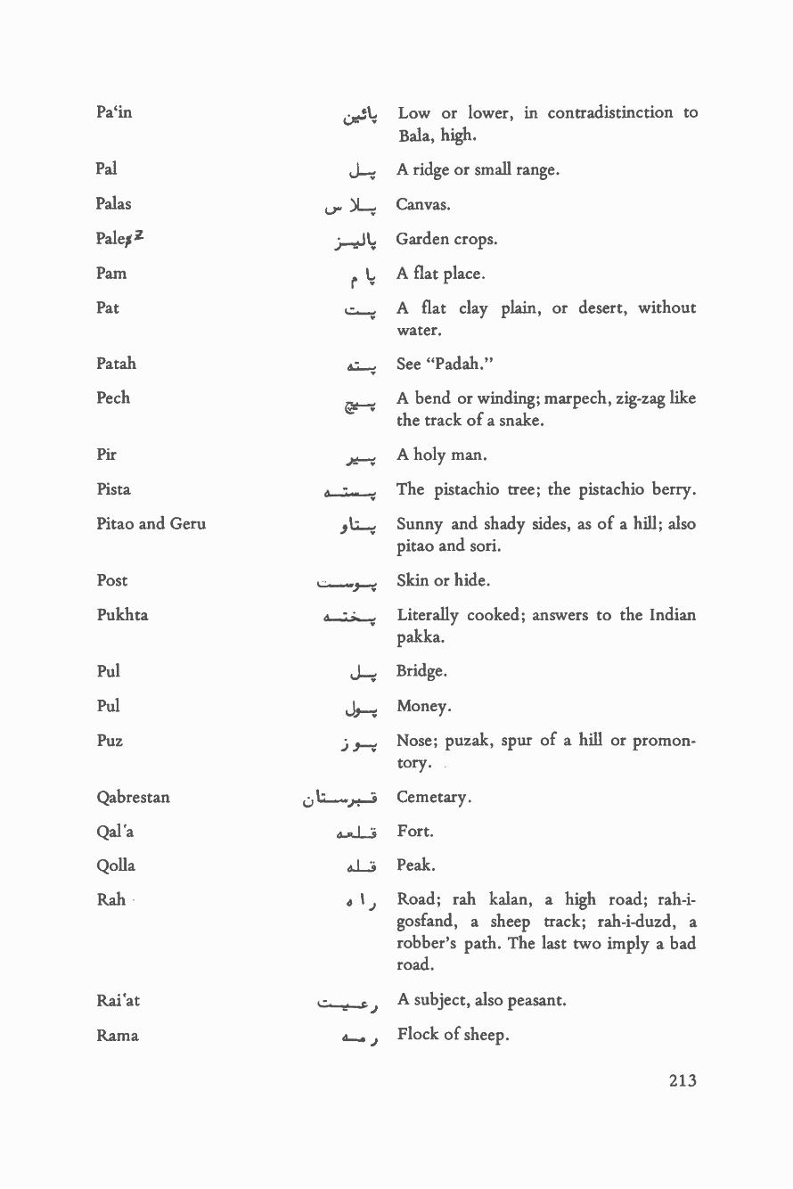
Paint Low or lower, in contradistinction toBala, high.
Pal A ridge or small range.
Palas ) )1_7; Canvas.
Palen Z )........11.4. Garden crops.
Pam r 1 A flat place.v
Pat L..,.,,Y
A flat clay plain, or desert, withoutwater.
Patah ems..., See " Padah."Y
Pech A bend or winding; marpech, zig -zag likeEt"---4
the track of a snake.
Pir y_: -.1. A holy man.
Pista - .. The pistachio tree; the pistachio berry.
Pitao and Geru ti...t. Sunny and shady sides, as of a hill; alsopitao and sori.
Post L:,-1Í.___.. Skin or hide.
Pukhta Literally cooked; answers to the Indianpakka.
Pul j_r. Bridge.
Pul Jß-. Money.
Puz .,---r, Nose; puzak, spur of a hill or promon-tory.
Qabrestan 0 l Cemetary.
Qal `a a.....Ls Fort.
Qolla 4.1i Peak.
Rah e 1 Road; rah kalan, a high road; rah -i-gosfand, a sheep track; rah -i -duzd, arobber's path. The last two imply a badroad.
Rai'at A subject, also peasant.
Rama 6....... j Flock of sheep.
213

Reg
Rishta
Rob at
Rud
Sabz
Sadbashi
Safed
Safeda, or Safedal
Sai
Sailab
Saiyid, Sayyid
Sal
Sanduk-i-daulat
Sang
Sang
Sangreza
Sar, or Nok
Sarai
214
Sand; registan, country of sand - i.e., asand desert.
Guinea worm.
A caravansarai; also sometimes a village.
J y River; rud- khana, river -bed.
Ls--"1"" 111---"°
.. rYl
Green; sabz -barg, autumn crops.
Head of 100; a captain of khasadars.
White; safed barg, spring crops; safedrish, grey beard, a headman or leader;safed khana, people who live in houses,in contradistinction to "siah- khana,"black tents.
White poplar.
A ravine; saiat appears to mean cultiva-tion and habitation in a ravine. There areseveral villages so called in northernAfghanistan.
Flood.
A descendant of the Prophet, ishan inTurki.
A raft.
A locked box into which petitions maybe dropped. One is supposed to be set upin every bazar.
Stone; sang- i- sulakh, pierced stone;sangtoda, a heap of stones.
A farsakh in Turkistan; it is 12,000paces.
Gravel.
Head or peak of a hill.
A house or building; more particulary apublic resting place for travellers;Haram- sarai, the private house of a

Sarband
Sard
Sarhad
"1":4i : ,,,...'"44'
governor or person of importance. Inmost towns there is a sarai which is stateproperty, and all officials of rank, anddistinguished visitors, put up there whenpassing through.
Watershed.
..) r....., Cold; sardaba, a covered brick cistern(this word, though Persian, is used onlyin Turki).
L,. jommaroMi Boundary or frontier; also any countryof moderate height which is neither hotnor cold.
Sarhang S.-..._st. ....,,., In Persia a major, or lieutenant -colonel.In Afghanistan the leader of three"bairaks" of khasadars.
Sarma L,,, Cold.
Sartip r..,., In Persia a colonel or general. In Af-ghanistan the leader of 6 or more,"bairaks" of khasadars. It appears to bein reality an honorary title.
Seh a-..%., Three.
Selsela 41.1. Mountain range.
Sev, or Sib Apple.
Shaft -alu j .g_.,,;, Peach.
Shakh C L4 A branch, whether of a road, a ravine ora tribe.
Shamal J L_..:, Literally north wind, but used apparentlyfor a strong wind from any quarter.
Sharif L - Noble.
Shela 1,_ ,:, A hollow or valley; applied to the entirevalley of a stream the wider parts of whichmay be "tagaos" of various names.
Shewagi t; 0.,. 4. A descent; from shev, low.
Shibar - Mud.
215

Shikan
Shikast
Shinia
Shinai
Shirkhisht
Shirin
Shor
Shutur and Ushtar
Siah
Sipah -salar
Sokhta
Spin
Sulakh
Sultan
Sum
Sur and Surkh
Tabistan
Tagao
Ta`ifa
Tairna
Takht
Tal
216
a Li..rr
eiZaift jr.4411
M Y
1 Jr.",...w
1.146.-,1L
JL
Breaker; dandan -shikan, tooth -breaker.
Broken; shikasta, broken ground.
Juncture of two streams (do -ab) .
Pistacia cabulica, the "khinjak" of Persia.
Manna.
Sweet.
Salt; also salt mud, saltmarsh, or a ravinewith salt water; stream.
Camel.
Black; siah khana, black tents; appliedalso to the dwellers in them.
Commander -in- chief; really the comman-der of the troops in a province, not thecommander -in -chief of the whole army.
Burnt.
White.
Pierced.
A title given to chief of clans amongsome Hazaras, and also among certainother Persian -speaking tribes.
Cave (excavated, not natural); samuch,caves; a cave village.
Red.
Summer.
A hollow, valley, or ravine; generallygrassy. Stream.
A tribal sub- division, or section.
Lower, as opposed to burna, upper.
Any flat place; a seat; a throne; takht -i-rawan, a horse litter.
A hollow, pit, or small basin.

Talkh
Tanab
Tang
Tanga
Tangi
Taoki
Tapa, tappa
Tash
Tawa
Tikan
Tir
Tirkh
Tirma, or Tirima
Tokrak, or Toghrak
Tor
'tu
Tufang
Turb at
Tursh
Uch
Erlang, or Walang
Lr:, L
to 03
4;J 9--;
1-;
.:... ....
uwrr
Bitter.
A measure of land, same as a jarib.
Gorge.
A coin; one -third of a Kabuli rupee.
Defile.
A name applied in Sistan to Baluchtribesmen who are not "asil," i.e., noble,or of pure descent; it means bondsmenor dependants.
A mound; pronounced by Turkomans,also by Persians, "tepeh."
Stone or brick.
Camel.
"Buta;" small shrubs or brushwood usedfor fuel.
An arrow; tirband, a path along the crestline of a range.
A herb growing into a small bush,common all over Afghanistan, andgrazed on by camels and sheep.
Autumn.
Straight.
Black.
A possessive suffix: shibar -tu, a muddyor clayey place; badam -tu, a place wherethere are almonds.
A matchlock; any firearm.
A shrine, ziarat.
Pungent.
Dry.
Grassy place.
217
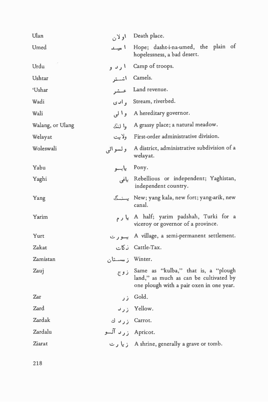
Ulan
Umed
Urdu
Ushtar
`Ushar
Wadi
Wali
Walang, or Ulang
Welayat
Woleswali
Yabu
Yaghi
Yang
Yarim
Yurt
Zakat
Zamistan
Zauj
Zar
Zard
Zardak
Zardalu
Ziarat
218
uae
C5
JJ
Death place.
Hope; dasht -i -na -umed, the plain ofhopelessness, a bad desert.
Camp of troops.
Camels.
Land revenue.
Stream, riverbed.
A hereditary governor.
A grassy place; a natural meadow.
First -order administrative division.
A district, administrative subdivision of awelayat.
Pony.
Rebellious or independent; Yaghistan,independent country.
New; yang kala, new fort; yang -arik, newcanal.
A half; yarim padshah, Turki for aviceroy or governor of a province.
A village, a semi -permanent settlement.
Cattle -Tax.
Winter.
Same as "kulba," that is, a "ploughland," as much as can be cultivated byone plough with a pair oxen in one year.
Gold.
Yellow.
Carrot.
Apricot.
A shrine, generally a grave or tomb.

17, 23
17, 23
18, 23
17, 22
17, 22
22, 129
17, 22
17, 23, 126
16
16
19, 130, 131, 132
16
16
25, 83
15
24, 25
16
25
( c>1r--'
Index of Entries
T 15
T 15
15
jr 15, 19, 129, 131
et J T 15
o . T 22
(s 1 r-w c9T 15
T 16
16
15
17
o J 24, 25
T 24
r.; U. T 16, 183
1.)LrL.1 16,188
w 16
r 17, 22
17, 22
l._.: ú 1 .i T
219

85
25, 86, 181
86, 182
65, 85
65, 85
84
65, 84
24
130, 181
130, 181
129
16
83
80, 84
18
18, 19
18
19
181
220
0--5--. 1 17
E 1 j_za, 1 17, 22
( J l-.r ",,,-,,. ) J L.s j-z:, 1 24, 25
r..,,,:, LS.......:. 1 23
j..rr.S r--..z,L.S,W1 23
Co 1--; 4-- 0 1-5-.-.: 1 24
A 1 24
r t"-`"1 84
1 S.....11 23
o LS r.,,: I 23, 24
S ' cs ,rs 1 23
C)T rP 24
c L; r....; 1.,__,i....J 1 182
.: _..,,, Lo r 1..,, 1 25, 80
( .0.-.....r...s ) e 5___S ,.-,..-. 1 25, 80
j_.,, 1 66,86
., t.._.,4 1 25
J--.: 1 t, 1 66, 86, 130, 181
4.5.-_L4 1 66, 86
22
22
181
57, 58, 130, 191
65, 181
65, 181
181
19, 130, 131, 132
129
22, 25
180
130, 181
23, 65, 84
84
84
65, 83
26, 98, 102
120
42
18
130, 181, 193
21
rr, 1 25, 181
ßs-1- --..:y 1
cs-i-e`t- 1 1
4:.)i.,1 I
0:, L.r 0 1 ,,,, 1
221
41, 45, 120
42
42
45
41
26, 113
42
26
38
44
44
44
47
47
48
44, 45
48
48
45, 47
222
e.3- 1 .9._.. (.51-.! 42
`1--"' ' o-5.--- s LI 42
e J--9 s L 120
( J.-t 1--4 ) J. , L,, 38
j-.L.; s Lr 38, 130
J...9 ,...,,_., 45
ú 1 l' : : .;_, 44, 133
L') 1----:.--;" ..L.-.; 41, 43, 44
j L.i -4.--: 44
J...i J....í 44
Ls; r. 45, 46
05 f.--; 45, 46
; J._..1 45, 46
a._S ,.. 39
a-. >----: 39
J--ei ) 1---: 39
e J J 1----e 39
r-1 )e-S;---e 38
4-4--:--3 ts ----J' ! 42
e Lt...?- L._..

133
44, 133
133, 180
133
r Li. J 1--r
r J 1----4
drriWY
131 `J L./131 ,..);, L.; ù 1 5...1 L,, 43, 132
131 4.___, L_r, 43, 58
19, 130, 131, 132 J___,r,o 1..........v 43
43, 132, 133 r L.; L_r 47
131 a---?. 1,-...i. s L.--t 47
45, 134 `j___, L. 43, 44, 46LI
134 ( t 9-i- ) c):, 46
133 4 1,.,Z..,.S 1 133, 134
133 .,---..: v 19 rr, 46
134 s .i..:S L,....---v, 69, 134
134 1 t..._,_ v 131
49, 137 ( T o 1__-?,- ) J 1--,-/--.. k_..- ' ,; 131
133, 134 (5--i 4-.4-.--... 131, 134, 136
133, 134 ( v 19 J---,1 ) lSr5 6.....Z.---v 38, 130
48
45
46
40
42
Lr---e. ----:
cs`M"'
cv X--;-.!
s 1
r
.
J Lt--=
4_,_.; T L5' (r-'
,-.. l-,
J 9--.:'. 1--
ú L--t.-.2... e L.,;, ,J L__4
223

135, 196 r-1.-.; ).-..-.$ 131, 135
134 134
135 "-el 137
174 el----} 1--3 136
174 ( el._.." L-- ) ú 1-S---- 1-; 137
179 0 I 1z. 135, 136
176, 177 o 1-1-1 L.; 136
175 °-J L.-= 136, 137
44, 176 411--:9)-: 9 oJ 1 137
177 cS 1--Ç t---J c,--1 1z 120
178 d L.:. 0 5 1---; 43, 132, 133
174, 178 C7-S a--I--; 132
175 j1.i,-..; 19, 58, 129, 131
176 4 L...:, j 1 137
176 J 1..-.-9 ez.---4.-; 131, 135
180 4-z->.--; 117, 137, 189
176 L.' a,.-.;...i..-z 134, 135
176 J L.-; 3 0-ÿ 131, 134, 136
178 ' )_.....; 135
224

179 (5-.1.- 179
87 y L., L 174
87, 191 ( 0S_.1.,.e 15 1__!, 174
16, 86 t J 176, 179
52 a..,. 179
88 r,;, 177
88 ___.,, 177
88 .. ' .._.,. 177, 180
88 L ,. 177, 180
88 r 178
57 J-vf ;_.y 178
88 e 5 178
876 J J J .,. 180
87 J-; r,S ) J r--- ir+- 180
87 1, 180
87 1..,ç : ,, ) 6---L-s í 180
87 179
87, 194 ' 179
88 r .-- --+.?- 179, 180
J( -- ) -----
' ) `' .r
J -

50, 53 9---S )--- t--r- 88 cd 1
50 88 L
50, 53 J t_. 88 ú1... -.
51 ..1._s._-; j L-r 50 1-.. ) L...
L.. ° ' 50 ° j J t.51 . Y
:hi'''''''-50 0 J L.,..
51 »'W ` Y
51 JyL.:- 49, 51 `' 1_,.;!..
50 i...,,,.z. 48, 50 J y j_S , 1. ÿ.
48, 50 J y.0,-S Lá.50 ..c.,--..z.-i--..-1.--;
49, 52 I t-..,....r. 48, 51 1 4)-- J L.
50 48, 51 J 1 'r--- J L.?.w V
50 t-.-&:, ,01 - .. 49 c.> 1 rs 4
50 4-&-.1.3 r, 50 J 1---r-
_50 ( r._,.,;. ) 49 ( 1--d--'7 ) 1 o L.?.
52 v 1 S -. :.5 L.á 49 j g._.w o L,.-
50 ú 1 .4--r- 48 u ?
52 Ls :) ú--, . 53 L_;. d_ r_..
50 ; 9 J l-S-z--t- 52 ( ) Lr.,.>
52 ( NL--9--.µ9 Ilç ) a.. .c 9--_-^Z7 52 d.z ?,
226

101 A w...,.. r L.. 5 3 ú ,---t-
93, 101 ( e4.._S ) LS ) a......,-..;_...:+s j L. 48, 50 6 J J j 1-1--'t
101 (0:, L....:, co) J ) o j J 01% 1_,.;, 50, 52 Lr ar J--t--t-
99 0:, L..> .J 1_,;, 49, 52 Cr-, 4-jrt,_,.>
99 ) t------s L..-;- 49, 52 LS J r- 4.1--e---r
106 J ,-; J L..;. 49, 52 -LS Ji--i ,.
99 8-6 L, 51 L.. ..v
99 J L.,, i' o Li, 52 Li_z.
93, 100 .1__1-_.w o 1 ..L. L.. 52 4-..;-...,.
100, 145 c.:. j J ú L... 50,52 ( L. sr tit--. ) t.., )t--4,_r_>
100, 145 J9
J o L...;. 79 J L.r (:)_.,_,,
100, 145 -.19 J L,1i. 83 j L..a..,,,
100 L_ä__; L_.;. 80, 84 .,.._,. L,,,o r L 1 . j.,o.
100 1.`o r.S a..; L..i. 81 ,.,._,., }à,.,,,,
101 J 19 t.__;, 81 o L....1 LI, j.6_,
101 o T o> v--r-- 79o 1 ) 9 J U; 9
98 . )-.S ) .i._..;. 79 o L..,:, LA'_.,.
26, 101 ( `:. 1J.._.s ) . 1 r,..;. 79, 80 Ls j ....t.a.
106 or; L.. L.,- .1.4" 79, 80 (..,:-.5 ú 1,-t,--2~
227
OTT
£ZI `ITT `60T
OTT
OTT
OTT
601
601
£ZT `OTT `601
801
66
SOT `ZOT
66
LOT `90T `66
.--- r p r
r r o
n
,c--me. .c---9 o--C o-n
.-s .--y ,d---r
LOT .1--4 i --9 ?-1 r
TOT ( `541 -c-v 1 Gr:-1
901
90I
ZO T `86
9fI
r--61 s- c---o --- `4 1 '`"-° ?
-141 r -r
8ZZ
LOT
LIT `901
8I T `LOT
LOT `901
901
LOT '90T
901
LOT
OTT `601
OTT
OTT
OTT
OTT
601
601
601
ITT
TIT
OTT
56 o J J 107 =1--W9 J J t.....
56 0;, L;, co J 107, 115 J._.... ,__1_S _ a_.:, yJ 9_.
56 C0J J 92, 107 ú L-;,--""
56, 174 J.-d,,:, ` o J J 106, 111 0 Le L.
56 c:. )`:s o J J 98, 102 J L, T J_..>
19,129 "_4, Ls L. J J 58 J I.... J 1 J
120 J-eO L-4., is L.;,, J J 56 0 1..5.....1 1 J
15, 19, 58, 129, 131 e s Le J J 60 Ls-': `, 1 J
_116, 169 '= 1 t J._, (.s Lr J J 55 JL.5 1 .,
58, 162 o ".,;, L J 56, 57-e Ì J
116 ).4_.S 0 L..e. J J 56 .,...I,Í J J
58, 182L') L..-:". 1, LS L J J ..L.s J J
58 L. L. 1 - , J 57, 58, 130, 191 ( .i:9 J J co J_;. )-- )
123 J I J^'' 1:0 ,: J 57 ..S J J
59 ,J:.e. i `,,r,,;, J 65, 181 LP--J J
59 :, L_. c.....:,,: J 58 t) L. J .)
59 J..1 S ' Q.-%.--4, J 58, 128 tr._;, - 19 J J
59 t 1 J._9 _:=:- J 58 o 19 J J
59 ( 4AL9 ) y,_9 L J 65 dl----I-.3 J j
229
62
59
60
60
60
53
54
54, 55
55
55
55
54
55
55
55
55
60
61, 146, 153
61
230
119
e _: 59
e1 a J 59
r ; 1 d J 59
J 61
a...; 61
1 ` a_; L_A J 65
J L 1 °a_._; Lib J 65
9--; J 61, 62
Lco J 62
J 9--- `a_.: L J 62
j 61, 62
`a-% 1....sa J 62
u9 (5-S ` a_..,; LJb J 65
J 1 r.° d--% L_ J 63, 65
Lib J 62
aJ 65,78
cv 1-l'----w d J 65, 181
63, 64
cS 9 1--4.
. L. ,.,,, J
J J
J
C. J J -+e
aJ
19J
J
_. 19
0-5 J9 J
r141,142 .b L,r J 61 -t-- a
141, 142, 197 ,J.[ t,, 61 _.! L,.,o o J
140 J 60, 134, 193 v L. )1_i o J
142,144,145 j 1.....J 61 ú :'),-5. mJ
140 cs -a-.,w J 60 ( o--% ) a o J
140, 142 , 9-S j 55, 56 J__.; J
139, 141, 142 v 11-.9) 55, 60 ( J t...,,. Vr 1 J) J 1.,a o J
141 ú L,,,. 9 J 61 g.; o J
194 J Li cs-.-; J ) 55 a_1-.4a J
195 J--5 cs-: 61 (.4,,,;,,S j.._S J) .1...,5 J_5* cs J
195 J L_.i. .; 61, 197 J LW 19 .;
195 v _.JJ 140 ( J J )J1J
194 0 l.. v`..,,r I j J 140 4 I
194 9..-..e. J 139, 141, 142 ,.--z, 1
93, 138, 196 ,( e r+ ) J ; 1391 J
196 j 9--S J) 140, 142 , t..S i J
195 J-39 J ; 141 r I)194 i---.c LI cy-5--; ) 138 ts--_; 1---:.)
194 c; Lr L.. L5-5-; ; 139 ( cr`' L.. ) ) ú L., L. J
231
168
146
100, 145
100, 145
197
196
197
197
146 p--w ...,., 4, 197
146 e..;;, .. 197
_150 - 1 -- 196
129, 153, 181 o IS'?i--:,1 7. 135, 196
152 t--- 195
151 ú L.> 11 ..1.. J-" 145, 147 cs-9 L---
169 `, Ï J_... 147 o.RL9 L fr..,...1 l..r..
173 ks .:_.:._ t j--- 147 ( J-z- 1--5 ) ' 1153, 156 .. .. 146 L.... (.; i s L.,.
150 `, T J r,r, 146 r Lz _..J 1 s L.
150 4 J J-..nr 14 6 Li-di J..... s L.....,
152 Li L:.--µ J 146 0- j-3 s L.
152 'n., r.,w, 14 6 i-+ J....s )L^... r-S LS L.
150 ù J--^v 145 J 'r.,......
.14'.44 rY, .0_,_,, v, J Li.
- J
151, 152, 182, 197 Lr J 1-.--5- Jj-:9* 86, 168
232

148
149
149
149
148
148, 162
168
148, 167
150
169, 189
168, 189
154, 168
169
150
153
174
146
146
..J S 168nAiY
/`< - 168
167, 168
128
147
147
147
147
167
J..y._v.1 r.., 150
150
ol. .", 148
153 150
o J kY . r...._...
167 o 148
167 J 1 -o r-? L--e," 148 t j --:-....
167 o J 149 `:1-1-~"v
233

r ^-- r7)
,,-1 ° 7-1 °"--r
7--1 ° r
7----1 VS T
7-1 ° =-c SS T
r--r r SST 17S T ;,."' r ,.,.`, o
,r,,.__,1 0 ^ ° ( 5---4 t9 T `tS T 7."'""c r 1 ,r.. r 1 '"T' )
C'? 9SI 'EST
:-1 Z9I `SST 7----ce i^
7-1 7-I (7 891 '99 T r
,.r--:---d L 9 T `817.1
r 89 `L9 T . .
^
CST ":"-=' 57( n
1 ' CST `9t7T `T9 t"-r ` 5-c ="f'
CST ('
891 `i7S I
991
991 7-- "I n
V9 T `VS T
r SST 74"--? 1"-r-4'
96T `VS T 'SET r
9 S T `VS T 7-4-f °''"%."--1
t£Z
Z9T
109T
Z9T `ZIT
Z9T `6S T
9ST
6ST
SST
ST
T8T `79T
j9T
.179T
1791
1791
1791 `SST
Z9T `SST
L6T `09T
Z9T
SST
SST

68 c.:_4. 1.i. J l-i, 159, 162 0K: -:
68 `L..- L__.9 162 o 1__..,
69, 134 ( J 9--; 1---V ) J I--+-. 163 1.---t j .., o w69 ' 115,163 J"--5 o y...w.,_,4,1,
136 t 1 J---- 148 J 1 j-4 c9 1-,.,c
68, 69 0_,_3 r,_.; 1 t---9 146, 153 J 1_ ,, -o
68 J Li. J___i 23 o L_..,;, ._. J--.z
68, 69 ,__-4 L___i. J, 25 ú j1
68, 69 ' J- Lc .)---i 18 J 1.,, T Ls__1_,s
111, 139 ri J._9 18 4 J J
68 9 .t1-.,4 1 ay r-s 18 .)--4-4-s
67 J)5 0 r--'s 17 o 1 i____0.
68 ,_; r..-i 72 ( v-r - ) cJ'y`:`-'' J Ls
68, 69 .....r r-9 72 J
67, 69 vi .4.;.__Li ) rJ j 1 - ;1
9 72 i J Li
67
67, 68
67, 68
66, 69
J 72
J 9---L.9 72
J 9--j--s 77
J LTu:r..9 72
ú1;-
JJ_,.,o j.-.i
235
112, 139
112, 139
112, 139
93, 138
94, 137, 139
138
89, 137
90, 138
90, 138
90, 109, 138
90, 138
90, 138
90, 138
91
122
90, 138
91, 194
116, 139
138
236
89, 137
L9 j x..r.: `s 93, 138
J L,, Ï 114, 138
93, 138
97, 139
118,139
111, 139
1.....+91 ` 93,138
A - 93, 138
...r 93, 138, 196
93, 138
F.-id 93, 138
93, 138
J 1 ; ` 93, 183
s-°l &A-Li 97, 139
j 112, 139
` a_.x.L9 112, 139
112, 139
j lra : +,` 112, 139
o J cs-° L9
o t-9
- ,_S J ;..
115
89
89
26, 101
114, 117
26, 101
93
93
118
98, 102
112, 139
70, 78, 112
107, 118
107, 118
98, 112
90, 138 ( ù Li,
90
92
115
e J Jr_S 92, 114, 139
J --$ 93, 101
,s
94
89
89
92
92
92, 156
53
-S 97
L_, ï L.,;.S 98, 141
9-1.,,4..S 141,142
154
s-s LS
úT ú " LS
1-5
rS y_1._ _ r.S..,; LS
o LS_ i LS
o J J S 159
4, 129
96
96
96
_., a__S
237

114,118 91; )yS 90 0
115 Ls) 5-5 107, 115 6.1;, y_LS
92 ú L_:, 9-5 92 0.___J LS
114 '.. ' 9-S 92 0 _... ; do.....s
113 v 9---S 116, 117, 139, 169 .1_...:_-$ - ) --5
113, 114, 115 j 1_.;_-t. J 9--5 114 --µ 4 41.-5
113 4--;,,.-5 ,--5 115 j..L_S 0 .i..5
113 j X-- a.S ys 117 , LS (5--;-.S
115 6-- ;--: t a--J r5 114 d--.19-5
117, 136, 189 ,L 0-' ,---5 115, 119 ú 1 LS c, g--S
113 s L0 9 115 t, 1 )._:.:, 1.a...., _ tS , ,._S
47 4 LS r 9--s 0 9-S 38 ú 1_..:, J 1...1 v..: S.
113,114,115 )L--,-. 45...5 89,137 cs j J L_i j_:, 9__S
53 r._i. U9.?- 0 yS 79, 115 r... , 9_S J-: 5-S
56 `. N..;9 ' 0 j J 45----S 122, 126 L t-. J...r p---S
168 , L._S 0-er.--µ 4 9--S 122 j .4.-._o j_.; 5-5
130, 153, 181 ú LS -a--L-4 1 r- 0 9----S 188 e"-µ J9 J-3 9-S
146 v- r-,;- -4 .:° w 0 9_.r5. 115
138
238
L:i (3¢.S 117
c 5----s
V 1 ) ,---5

6£Z
s-1
1 "r '""'9
S-1 '.`'"'¡
5Tl r
OL ^'"
LL `OL
OL
OL
ZL `IL
69
OL
86 `L6
S":7( "e' 86
31-1 --s L6
1:"Tc1-1'
S
r r ;:., r r--o-
:--v 6 " --t-
5--6 o ,
34-7r)
°
r
L6 `68 `8S
S-r-D ;---1
OZT
6TT
LL `OL
8L
8L `LL
6L `8L
OL `69
OL
8L `69
ZIT `8L `OL
TL `OL
ZL `IL
TIT j ( r LL
LIT n OL
£6T `Z6T rrs ( s";( 6L
9ZT `CTI s-r' s/ 69
TZI 'CT' s`-7" ° f 69 8L r 8L' LL `69
8 T T `t I T s (° L L
121
121
121
17, 23, 126
122, 126
124
123
124
121
122
122
124
126
126
122
117, 124
124
123, 124, 126
126
240
J-' ,-5 r... 120
yli.--e 119 0-5 4--.1
( L -° Jz 9--5 ) E t--'°
121
120
120
120
119
119
119
121
0 1--.!--6 122
J----, 9--5 o L------.... 122
111, 123
( J a-6 J--r 9-s ) J ..L....6 122, 126
0 1
6---"r ) g-r° 122
9 J J 9-:! ú 1-"--1--
o J j 1_.....zio
.r--..,. v --°
121
123
,s-J
133 ( o ,A...:,,,5 1 .,-.1 ) 4._9 j-3-Z-.
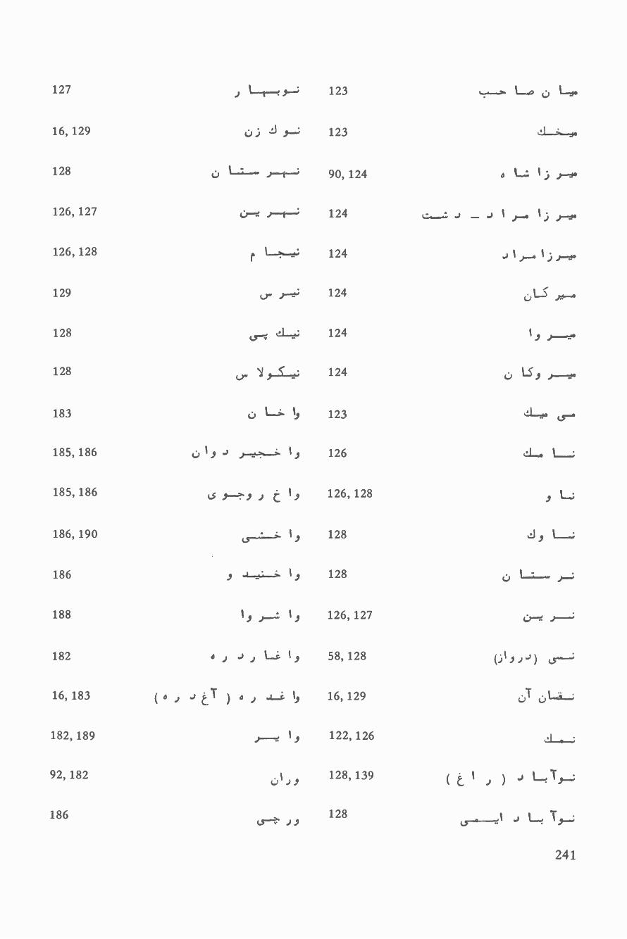
127 r 123 . Lo c L1
16, 129 o ) J 9--; 123 tli.-.
128 ú L j--t---; 90, 124 a Lt 1.-) t--14
126, 127 tt-e rtr--:' 124 ,,__,,:, J _ J 1)-4 1))-0.
126,128 f L*-es 124 J1r°1 rfti,,
129 u. r--e; 124 LS .)..._.
128 tr.;, e.L.4.:, 124 ii )--128 9_,.5.,,;, 124 ú 1-3 9 1----
183 o 1--i- I, 123 Le..
185, 186 19 t-.._.; 1 j 126 :L. L.,
185, 186 Ls y.. , ) t 19 126, 128 J I,,,_;
186, 190 ,,:,. 19 128 ,J 9 L___;
186 9 -1-4.1- 1 y 128 c) li.... ,,;
188 19 )..,,;, 1 j 126, 127 4,:re )..._---;
182 d ) ) Li 19 58, 128 1 '( 9 ) 5`16, 183 ( o j J T ....z 19 16, 129 v ú l...'s...:,
182, 189 r.-. 19 122, 126 af1 .
92, 182 0 1) 9128, 139 (L I )) J L, Ïi..,;
186L.5-1-77 9
128(5-4,.._.-21 J L sr9-j
241

193 L..e..ò Lr 186
189 , t--ç Le 188
16, 189 1.) 9_c Le 188
190 )9-1 Le 182, 186, 188
190 E L L 188
190 J Lt 188
190 ._..?+_ L. 188
190 ( c, L.,,o L, 186
192 19 L. 186, 188
192 J9 L 182, 189
192 J 9 L, 188
192, 193 (aJ 9 L ) 9 L, 80
t
189, 190 (5---: 80, 156
190 J L.s ... 25, 80
189 `!_.?...e 79, 189
84, 192 80,i.j-te 81
192 r J.--.r 189, 192
192, 193 ( O 9---5 ) -» --ol-e. 192
79, 189 J 189, 192
242
C9 "P J9
J9
r J9
.1-..74--cc,
C-1-4* L=
)rJt..,,

193
193, 194
194
194
130,181,193
a-.., Li. r ,JENA
189
189
117, 136, 189
182, 190
191
191 ( )),--3 ) ti....4-1_ S 1 e
243


MAP SECTION


38°
37°
36°
35° 68
°
1
AB
2A
B
CD
CD
34
AB D
5 AB
6A
B
7
CD
C
13Ax-
14D B
rk.
D
C
A
D
1
CD
C
10A C
B _11
AB
12A
B
DC
DC
DC
to A
17A
B
18A
B
1 AB
CD
CD
CD
Inde
x
69°
70°
71°
7 2°
Map
s I
-1 to
I -
19

System of Transliteration
(Compiled by Muzaffarud Din Yaqubi)
1. Signs for Letters
English Equivalents(in capital letters)
ExamplesEnglish Pashto / Farsi
LettersRoman Pashto /Farsi No.
A .At, Out, Eye Alefbá L.,.: J 1 a I I
Bank Band ..1-1.. b
.
L.. "+
9 A
Pull, Push Pasto ?i-- p r
T with the top of thetongue against theupper teeth
Tel t'j_
Tomb T51 J 9_-0;; t2 Lit 0
THree
DZiy
Sabet
jay
c -- L_. s
j
,,:r.
sa C1
Y,
L.51.----/ A
JudGE Jazirah o ff,. j i.7. A
TSánga, yachTSman Cianga o ..' c t_ I
CHeek ò'B e -7.- Cl ` 1
A sound between Hand KH Hami4 h (,.- 1 1
/KHán Khwája o.?- j Kh C 1 l'
D with the tip of thetongue against theupper teeth Din
,,
7-: J d . 1 r
Doubt Doday (.5..b9..Ú d .4 1 t
THat, THus 2a1í1 1_, J J i J 1 o
As Spanish `r' Rahmat .,,o..,_...A. r J ) i
Road, fiRst Lamray L; 4-4,---i r ,i ) 1
Zenith Zñza a) 9 . z 1 A
azureYZara
, ,of 1 i ) 1
, . ,rmeaSure Kaia o .r..) z ., C
Spread:alam
)L_Tn e i
s L N 1
SHore Söraw 91 ) .9-"' ~s ¶
A sound between SHand KH
YSár
,
J s (..)7 i i
249

English Equivalents(in capital letters)
ExamplesEnglish Pashto /Farsi
LettersRoman Pashto/Farsi No.
SWim
FayDZábád
THWileb
MoZWaffar, ZWálemi
As ' `Ayn' in Arabic .
GHazni
Finish
Samad
Faydzábád
Táleb
Mozaffar
'Hlem
Ghol-m
Fath
Ya'qñbi
Káréz
Gata
Gar
Laylá
Muhtaram
Nuqrah
Manay
Wall
Palw
Tór
Kabúd
Hamdam
Ra's
YCasina-i-
mKaóna°
Wádi
Yaman
Káréz
at 4
Spay
Zaynab
.,14-.4)
J i.T 42e-3^
_.,1L..1,.,.
i..o
_s
dz
t
z
'
Gh
f
q
k
g
g
1
m
n
n
w
w
o
ú
h
'
-i-
i
Y
é
i
y
ay
.;r
ï
e.
L.
Li
JSr_
r
(I)
4f....
jLfu 9.1.a_.,.o
ci 9 .)-R°
s,-
1,,,,,
0......
a tr. 55 05 L
J1''`L°
J 9-1---.'--* ,
j 9 l-`44
(.5_...01.,
a.: - ,
Y i
i 0
T 1
i V
V A
T 1
r
i' 1
r iTi r
i íi 0
r i
r Y
i Ji
r 1
t
i. 1
ivi
12j,..
, cA A /
Cì.9. ." A ,of .sut..-.I , )1,
a._,.1
)":"5i A
t3,L.1^ , / A )_.oA wa;
, 1_..,,o
9.A ,;) -'
$ eJJ÷S,
4 o ,A,, c 1
/ Aa,.; ) `ao...__.
z
:5;,A
, ,c)---'--
'*, ) 1..5
;,
Can, Kit
Get, Good
Guard
Latitude
Meat
Number
What
OUt
flOOr
shrEWd
Hamper
--------
marrY
Yoke
mAln
bEEt, mEAt
spUY
bItE
J-....
n A I
'74_4!
250

2. Signs for Vowel Sounds
English Equivalents(in capital letters)
ExamplesTransliteration Pashto / Farsi
Vowel SoundsTransliteration Pashto / Farsi No.
,
mAn, bAt, thAt
fUnd, bUt
BI r`Andâ r
Band
Mândeh, Bal
Jazira- Dargad
Kohe Baba
Selsela
Syáh
Hindu
Moqur
Masalan
Jadden
Hukmun
Mohammad 9
Ahmad
Bili
Doáb
Sarasyáb
E'dazn
Fsán-Ewri-Dara
Istálef
injá
Obé
Ór
Uzbak
-Uzgad
Wardák
Wádi
A iJ7-=
r i.t:--.
j___,j___, i.._o
,
â j...e9b
a o L 5.-5
a`é
-i-, e5
e6
i7
i o
u8
an
en
un
Letterdoubled
a o i7,55
a Js: 9L'
á
e 413"),,..24:9....4.
é .,9-"
i e L ?..<
i 4 J'Wg-'
o o L;U 9u o L9.
(,lµú 9s.w o ir
o-a+.-..°, 96
á.a.--i
j J 9 )
L59 Lp 1
LW
t _., l""
t
=-,. ,,.,.
,L,.A;,
L
..._.
o
1
i"
i
a
1
Alnu, IcE
agrEssive
bEt, sEt, mEt
pEOn
It, sIt
hollO
pUt
someONE
mEN
intONate, yON
suDDen
AlkAli
dwArf
top
bOUGHt
sEt, IEt
AId, AtE
tIn, bIt
EAt, bEEt
Obey, Obedient
OAr, OAt
Othman, Uzziel, Osram
EWE
WOrd
WAsh
.a.j:o:
'°o Jr! r.,r..^ /./ ar1 9 , J
CC o iL.5.
, "Qi.......M..L.4,.
01:1-40d
^ > A
9 ..t:__.. ;
1 11-5
/ r 1)L...o
..í...,/ JP_,._,
,.L. . 3
...L....._.2.1
)1 L., o,L.9 L.rt-.o L
1
` LCo .,.rtA 1/
co
4 ao.._,.,i) L
I
L -1
A )T 9 J- n - n /.. i..+,,,1
J"`""
A - n1 -t cl,. , w ' O
o .r j _gel LI) L:.r 1i, ,J +.A 1, .'.....; 1
t
(.s...r,1)
, 91
:` 191
A A I: J 9
.cS ..) 19
251

English Equivalents Examples(in capital letters) Transliteration
WEld Weláyát Wérsak
WhErE Wyálay 6
Weste
WAIting Wéwáya
Winter Wino; Winu
WEEd Wis
WEAry Wiyatnám
WOmen Woli;
Wowaya
mOrE Ráwór ;
Dwo
WOrn Wulwala
WOOi Sowúnké
YAma Yakawlang' °
YAhoo Y-asin
YEt TangT
Sayedán
YAlE Byayéd
bUOY (bui) Nabiyi
YEAst S"áyin-Xyin
YIEld Qásúri Bá.la
gEOcentric Yoma
YOke, Yolk Yógh
gEOstatic Yughlin
YOU, YOUth Yúm
Aybak
sIGHt Aynabak
minE ByanZay
Alda Yanamáyi
Pashto I FarsiVowel SoundsTransliteration Pashto I Farsi No.
f` r'" r "1"4
L9J I-- 9
r
w
w
w
J9>L,
1-;
y
ay
ay
Lys'ayi 17: wJ9 I9-J'
A
252
English Equivalents(in capital letters)
ExamplesTransliteration Pashto I Frasi
Vowel SoundsTransliteration Pashto/Farsi No.
Nlnnay
Reg
Jinaw
M5hi
Jehil
Á'in
Boyára
Jdy
Wuy
Miiy, Búy
Mamakaw
Azáw
Alezgrew
Dew, Sew
Niwal
Niw Y°'ark
Koh, Pasto
Tór, Ghóri
Jaghatu
Cehel Sotún
Ra' san,
Be' sa ,
Mu' men
Mo' assesa! rCalma-i-gara
10:5_:.;
'^
J'^ I n:.u.
ay L.5--L. 05 J i )e j y-t-?'°
i ac L= i °
i
_ L o w.Ji 997A°
_9-oy L` c ,O L;°y J5-t--.---- 9 3 9 t-:
uy >. `eo_. l..
I
uy v 9 1-4-43 91 9 LJaw o."+ 9 1
áw 9ew o 1.33-. >
V-éw 5L 1.; , J-96
51"----439iw d 1,, S, ,oja
iw'C'7.' 9
+oÿ .o LA:o" 9
.11;,--5 Jó I
:
aN
1
"
I
°\
i
k
1 1
1T
I T
1r
?t
11
)Y
rAIn, fAll
bingo
copY
mEAI, mEEn
bOY, OYster
bUOY (bñi )
fOUnd
thOUsand
,,,
1......0.,'..
.:
0 ) ;.n 9
t5 9-----" ..,t5 9
., -,9 ..,,cS 9---' cS 9-43
^ -C i .9- o.._,o._...o''
91 j 1" , ,
LEO
9 r, ---JI. '- ,3-_..,., 9-, /
^J)--e-#:A A /
) L y._;,:qwi >
,,,,,Y o 9c5 Js ) 9
/ A -, e .5:1-?-
6 a rÙ 9-`14" <i-e-t-. ,f
c1
/ w
`L.)4----'1/A A
A.o `oc.).-0
eo. ._,o.
,n, ç;,..
New York
dOrmitory, Opinion
flOOr
tWO
mOOn
c..r--!
u o 1.395
ú 12
'
.
'
i-._.
9`-9 9 J'943
1"tj. 914
05 1-- a
.s oU 1
253

3. Explanatory Notes
1 In some cases a Roman (English) letter has been used three times in order to express different(although similar) letters of the Pashto and Farsi alphabet.Distinction of the pronunciation isexpressed by adding a bar over or under the letter. The bar has been placed over the letter the firsttime it appears in the sequence of the Pashto /Farsi alphabet. The second time it appears it carries nodiacritic, and the third time it is used a bar is placed under the letter. Example: `t,t,t.
2 Letters in the Pashto /Farsi alphabet which are pronounced similar to their corresponding letters inthe Roman (English) alphabet are always transliterated by a plain letter without any diacritic.
3 The following three points are to be considered on the letter `h':a. Whenever `h' comes after the composite forms `kh' and `gh' and after `k' and `g', (as may happenwhen forming the plural of a word by adding the syllable `ha') the `h' has to be separated from the
`gh', `k' and `g' by a hyphen. Example: Saykh -há; bágh -hä: täk -hä: sang -há.b. Whenever `h' appears after any other consonant it is pronounced separately. Example: Qal'a -i-Fath; ayläghä.c. Excepting the cases in which `h' appears after the composite forms 'kh' and `gh', the `h' is neverdoubled. For instance, a word ending on `h' will get its plural form by adding `á' only, not 'ha'.
YExample: Sah, Sähä; máh, mähä.
4 The 'ee' -sound (yä- i- ma`riif) is written with `i' whenever the vowel is short and by `i' wheneverthe vowel is long, as explained in the following:a. The `ee' -sound (yá- i- ma' -rüf) at the end of a word is always pronounced short and will alwaysbe expressed by T. Example: Wali, Wáli.b. An `ee' -sound in the middle of a word followed by a syllable is also always pronounced shortand will be expressed by T. Example:Jazira.c. An `ee' -sound followed by a consonant only is pronounced long and is expressed by `i'.Example: Ta'mir.d. A word in its original form transliterated according to rules (4 a,b,c) above, when appearing in adifferent grammatical form, which makes the `ya i- ma'rinf sound longer or shorter, will not bemade subject to any changes in the transliteration of the `yä- i- ma'rüf. Examples: Miránsäh Kalay- Mirsäh Kalay; Amu - Amiri.
5 The `kasra -i- edzafi' is transliterated as explained in the following:a. It is expressed by adding an `e' to the generic term whenever the term ends with a consonant.Example: Koh, Kohe Bäbä.b. Whenever the generic term ends with a vowel (including `hamza' but excluding `yä- i- ma'rüf) the`kasra -i- edzafi' is expressed by inserting ` - - %' between the generic term and the proper noun.Examples: JazTira, Jazira -i- Darqad; Darakhthá, Darakhthá i- Munfared; Darya, Daryä-i- Kabul.c. If the `kasra- i- edzäfi' is to be expressed immediately after a `yä- i- ma'rúf, , it is simply transliteratedby adding a bar over the `ya- i- ma'rüf (`i'). Examples: Wadi, Wadi Helmand; Ghundi, Ghundi Ya'güb.
6 `Kasra- i -khaf f is always expressed by `e', except in the cases where the next letter would be thetransliterated letter `y'. Since the `kasra- i- khafif' -sound is fully covered by the `y', the `e' will beomitted in this case. Example: Senjed; Myän.
7 ` Kasra-i- edzafi' "sounds like the short `ya- i- ma'rrir" and is expressed by T. Example: Sinkay. (Seenote 4 -a,b).
8 The `dzamma' is expressed by `o' if the sound is smooth and by `u' if the sound is sharp. The rulesare as follows:a. A `dzamma' immediately followed by a syllable will usually be pronounced smoothly and istransliterated by `o'. Example: `Omar(`O -mar); Mohammad(Mo-hammad).b. A `dzamma' immediately followed by one or more consonants will usually be pronounced sharplyand is expressed by `u'. Examples: `U'smán(`Us -man) ; `Ulyä(`Ul -yá) ; Muhr (Mu -hr) .
254

c. A word, in its original form transliterated according to rules 8 -b or 8 -a above, when appearing ina different grammatic form which makes the `dzamma' sound smoother or sharper, will not be madesubject to any change in the transliteration of the `dzamma'. Example: Pul, Pule Khumri. Moghul,Moghuláne Bä1á. De Haji Multi Golán Kalay, De Haji Mullá Gol Kalay.
9 Numerous cases exist in which the transliteration requires the use of double letters (e. g. the double`m' in `Mohammad'). However the letters `w' and `y' are never doubled, even though the pronuncia-tion of a word might lead one to think it should. Example: Awal, qowah; Qayúm, Molayena.
10 When a geographic name is composed of more than one word and a stress appears only in one ofthem, the name shall be written as one word, e. g. Yakawlang; if a stress appears in more than one of
&helwords, then each word having a stress shall be written separately, e. g. &hel Sotiin.
255
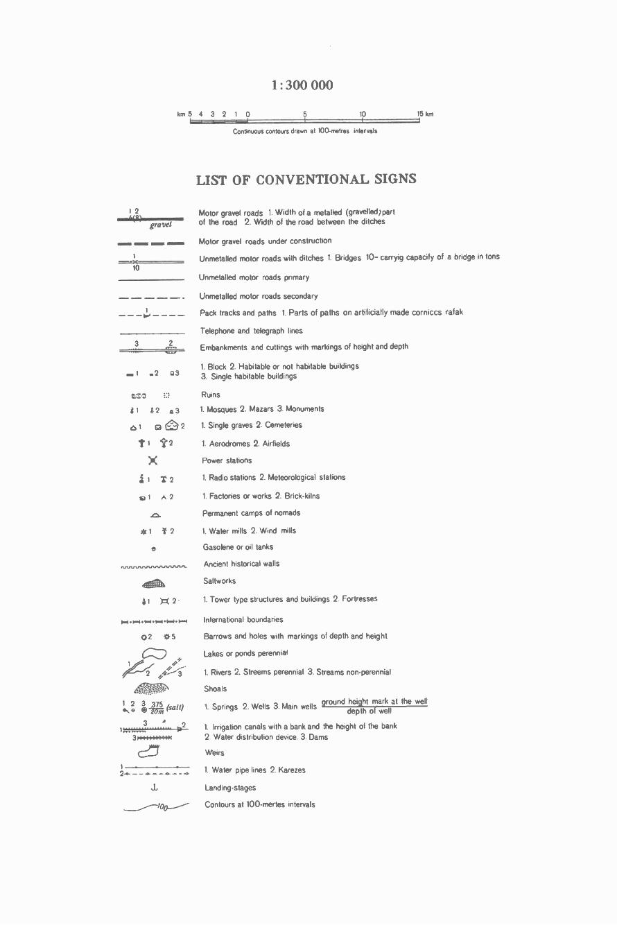
1: 300 000
km 5 4 3 2 1 0 5 10 15 km
Continuous contours drawn at 100- metres intervals
LIST OF CONVENTIONAL SIGNS
1 2 Motor gravel roads 1. Width of a metalled (gravelled )part
gravel of the road 2. Width of the road between the ditches
MIN.R s i
1Ò
1
3 2
.. 1 .2 Q3
UZI
31 d2 a3
a 1 C] 0 2t1 't2
X1 T2
1 A2
e
40141 T=( 2 -
04 1=.I111111--11-+
©2 -1.1-5
CZ)2r.
¡ó p (salt)
Motor gravel roads under construction
Unmetalled motor roads with ditches 1. Bridges 10- carryig capacify of a bridge in tons
Unmetalled motor roads primary
Unmetalled motor roads secondary
Pack tracks and paths 1. Parts of paths on artificially made corniccs rafak
Telephone and telegraph lines
Embankments and cuttings with markings of height and depth
1. Block 2. Habitable or not habitable buildings3. Single habitable buildings
Ruins
1. Mosques 2. Mazars 3. Monuments
1. Single graves 2. Cemeteries
1. Aerodromes 2. Airfields
Power stations
1. Radio stations 2. Meteorological stations
1. Factories or works 2. Brick -kilns
Permanent camps of nomads
1. Water mills 2. Wind mills
Gasolene or oil tanks
Ancient historical walls
Saltworks
1. Tower type structures and buildings 2. Fortresses
International boundaries
Barrows and holes with markings of depth and height
Lakes or ponds perennial
1. Rivers 2. Streems perennial 3. Streams non -perennial
Shoals
1. Springs 2. Wells 3. Main wellsground height mark at the well
depth of well.31;.., `1;..,
2 1. Irrigation canals with a bank and the height of the bank
314+6+44:4444 2. Water distribution device. 3. Dams
CZ-mi Weirs
1 1. Water pipe lines 2. Karezes2-0_ --a--8---0
Landing- stages
Contours at 100 -mertes intervals

pl o2 .3
Cl
Q Q c a
°1 ."2
o ° ° °
° °
S S 1s s
4 4 1
sill on nil111 111
III,p
2
:. .
77157
r''TT''
Contours.at 50- metres intervals
1 Trigonometrical points 2. Points of polygonometry and horizontal controlstations with underground centre 3. Spot heights
Passes
1. Precipices 2. Earth mounds
1. Shoot- stones 2. Rocks
1. Hollows washed out by water 2. Norrow ravines
Dry river beds
1. Boulders 2. Karst
Forest or wood
Rare forests, thin trees
Isolated trees
Shrubbery
1 Shrub 2. Saksaoul
Stripe of shrubs
Orchards
Vineyards
Rice fields
Cultivated areas
Marshes, swamps
Meadow grass vegetation: 1. over 1 metre 2. below 1 metre
Reeds
Semidesert vegetation
Tussocky surfaces
Salt marshes
Takirs
Hilly surfaces
1. Stony surfaces 2. Stone fields
1. Sands 2. Sands with very thin grass vegetation
1. Sandhills 2. Sand dunes
1. Sand ridges 2. Barkhan sands
Glaciers
The international boundary between Afghanistan and theUSSR is shown according to the demarcation of 1947 -48.
The boundaries shown in these maps are not, in some in-stances, finally determined and their reproduction does notimply any endorsement or recognition.
Pages I -13 -D, I -16 -B, and I -20 are not shown in themap section because they represent border areas.


I-1-C
I 30'
60
.
50
, 38°20'
0
(
I30
38°10'
20
210r'.111((-.r11C
,---., ,;i . tr.:,!f;
, ;,%% ,!,í`.¡z`\. ¡\4,\\J:~` _~__ÿ , ,
/! /,r llfi ''tt _ì)71>,, j''
38°
p ,.,/ '\ _ , r 1 \\`r:/ .j¡'/,%`\_~~;r/1' `1l /l A1j r Op.4.0...7-t-
.
f.f . ;; f' ,f ,., _c ,5:. a.
1\,1tt1
.
00.70° 00' 125 9 0 12600
70° 15'
10 20
70°
30.-. .


I-1-D
:-,//-/1`-1-, a---,--1ti -^ . .: :\ " .. . `r ,= p . a . nJlli;-i/1!%1/d/
J<<f_;\ <<1,7y' á' n, .`>>ia,:; _ ,.11Jo 1 .
a ;( (1 ' `- / ".
4_, .(llK l( " ;
\ '"_, , , I , ¡ ..,
P41!/ _
etP
OIPau t,,``ALL1;~
WIt!?-- 7> l0)1; °3 -^ iY ), `1l,. <
0 . ht ti-r. .t ., .
(.-


I-2-C
30'
IO 0
I
50
IrL'20'
347.\a.
*4_
11'II"
--
,,J 1,
, O\\4 " l.,', .. ,.r
p., \I, l\ ',/?w_,;-Ji.á:_ {p...í., .- i`'i----'
/
> I n4/II
kL\ ) ¡'\\' I'\!ti%k ¡ 4 \,_\ A
Í%\
4<<
1\f'..;-:
I
\\\ _
/ \fi4,+r ,r'-:r,
. .. ,9j 4%C,\i r\_wiín Á, .n, , ,...-- :/ ,,,. 7 ..-,.. . w!''^f¡ 1.
(Rro V.. )>^, `=r oI - 1 I ~ rf r
`1 ,,II'' ' F `4«c(( kti_ .c!1.I` ),,- ; -\ . 1i%%,i- 3, , /i , r-_g`1`'-.
\
p;o\ p
1498. r,,i w /. i,t,/,. r, : ,1 tí40_ ;L ti ,.{%r--
q ^%/AI1C,(1rtJIY'i7(/í,rjiíiì^ ,'+ I^,5. :,, i,;,! ¡-. 111" \:« pi y'li{ ,.
1rr11t s13 ,. ,,1/s_\', ( ` ; %, --
", a` : ,.`- 1
I^ 1 -, o., .., , ,,0 ó 4óó' o_, W - - . Í
_ m ..,. I11/d
-
,-.1i4dt112
30
` \,n,, \.:dsR -!,.ir ,
_ ,a -Zt-/ /.4:. ,,So-. -o.-ory,f
_' /a`'_ ,,
°t J!/1, r' L "
.,,,,,,e''';_., ,- ,..; /:/ /r, I
1 !11--I%¡ ' /r//77,.-`i r(,v; °T, V7I,,r .l=:, . j`,
r J,!;.! . .
:..-i J --lJ ,-- --A' : -J )91-_----
i 4 30u`; ,, , A,.ï, >>1 (ÿv;. 7% `l l `' i. / \ . ` !1S4` , , . ,, J,:,-; , . ,,`-, ,<J;tlJ. .. ,`,.:, ,Ï'
.,_-_,- ;:,. ,'-38°
,. ._. .'4.-- \¡ ) ' gr
l
.
a ((¡1:(({:
k .-+ ?` Itl/
\` -fr!wwi:1 i >í_,. )S'_ e ' r , ,,. -
N. ...e.',\ `` S( --: _ ..;..
1tl;\ .-\--J ` `4¡¡1 . co 1
L.-- >o,,1, ó:.-'_=;:-E;' ( `'`l I7 . .J. f ..,N _ = _
1 + l 7 ^ v, , .^ . ¡ ,\ \\ o i \/r. --
¡`C .. / ci-ic,-___-_____,
, R ,`_ _
o jj,r ,a;1- ` >C a:)) 1 /Ipi ) ~,,,,
,1 ,l«.\`
D.
4{l .
S)`i ,1 (..`v,,._/R. / )-_ '
10'
I20
I
I4210
38
..`r -,,,. -> >!"1`f I ,r,. o,%'.,,(L` (J1i . ,> /r/ir
, .,..,:'-7.7.."_ f ;
; \r
, ..,,
L,1.
'/{_:` \ - y_
1 I/ fT1UK9. . . ': Ç ''`: ' yíi,!°j
r JL ;1P/Ijy/, ._., ,,. , \- ,, ,
i \ K \1 ; ° 1 n ,.-:, l.
v, -,:o,,K=
.,ÿ.J,.: -- C/ Oc'
,\[ya,.
-rL' ' CrJ00r
' 1682
_f ,.J ..-. -/ `
(!__
_y,
r-,.
,
`,s , ,._ ,_...c- <.J,-r.\ .,:I0, A` r^,` F .I ' ' 1\ í i "" _'t ., 1`I r .' \ 'r l ®\\ r G'.s r
.a . / -°' ;, / 1.» q ' .y \ :, ,
.-----jJ 1 :36 i' t..,-;, '<<
rs lr ) ` :_ :`_...v..r...,` ,IZ1'1.,,../_,::
,... .V- ÿ hjf I 4¡ (Kiï-` l'1 t,
jr. ! J i. `r - %.,,f .E`1« . :'.. Ì).:iJl.ll..,í71%Ltil),f1t.ní11
;.r,1. __
71°15'12680 90 12700 10
71°00'
71°00' . - -,

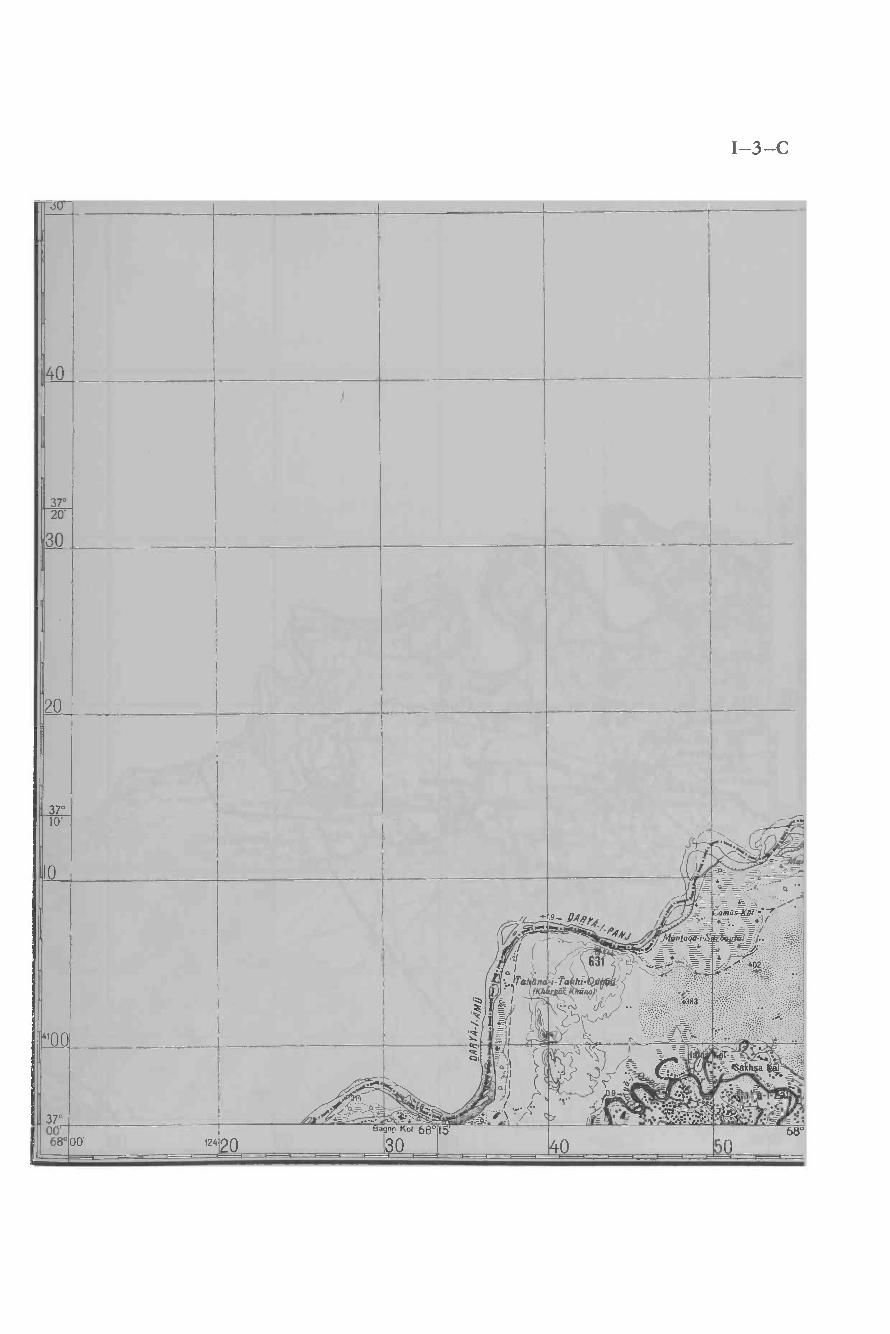
I-3-C
140
130
SU'
37°
t
20'
20
37°
^;grikm.,....--í--
:./-f __~a_,_ ,i _
10.
0
4100
i :_.r',: ± ..
--
'
Q'o
?.dy.. : ..._ .
.
i... Tal.1ana--i-Ta(.
1
ji A_i.1! _ 1 S
1
=I -=
9= Dqy ¡'-/P~
. -. .
hi-t , , ,-- Ká
:r.. N-,
6 _7 :,:;'_ _, :.::
i - =a- ..a.... ..
/_+ _=
_
`i-o-ma :: -7
-,=_L
;.
i
,:-.:. ':-.i:
::'::.:
_::.
t
.
.ï:::
..'T-_ _.%=-a-r'
.'s\'al - . i\;. ., :--° ; . =% .. . ; _ _ ..°37
_a Ìj? a 1- / rJ
+: ï ..: , .
` t - == - :.V` , Z _ - :, ,.. _ ;o-.. r
r áG . r9 :. : ..,..: " o ' .:es.: ,;,y' .': ': ' '; .. ,, .' L!= ; _ .o¡ti,- .::c:
00'68° 00
124
Baghri
20Kbl 680
3 015'
068°
0-

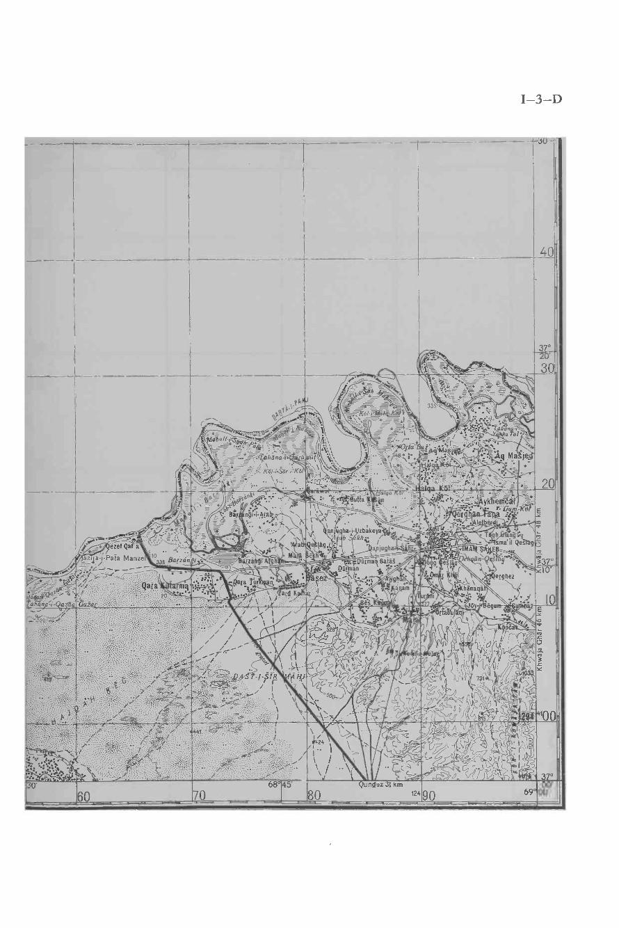
I-3-D
JU -'
40II 37°20
03
I,®j=
P
Pp9:1-N"
(}
. y - v = :hñna-ti- it`.-/1._ ' ié \- Kól i Sór-1'Ko
p`= p.. °-_
/! ,.; ?'+ t_ _h =s! ÿ- °--t=
>.: - °=,, ;7Cs! ,hlF -",: ::1 z . , -+ =,1
=' = -\
+ \\\\ :\, - ' `'i'
_ \ \`i _\-+* i.
\ = ''. -Q',:..I ` ' '.i \-}_(
: __y_r .. _=_; ..
I + '....M\ ,,-1 - é- ..--L_- _-- - - ..
A:0=7, +-. r - __7_,5,47-7..- ...-_ ' , _+ ._ -' z. Q.- n=
j:..`:,:y. ° . _° _ ll_.al úna-i
.. i = -- +/°°. ``1\\ti,. S1 - .., : : AMaje!
at. - - r +-7 : _F1.:-......=.4-'r--i/
;+.--.-S _ .:.j á . +- _ 1. l'. s
------. ?_
+-_ ¡Ií,á'i°" ,aria-i-0aó,
?JaQi _ ,.
.- ;7,./...--4-_ -
e: _.i,=ézel Qaa\\ '\F
-1-Paia Manze o338 Barzán_.v_z./=:G-._T_-_
._- - . :+`_ag° °. -= - " \ : - ° :u'ttá .n _\.""+ . ,= =
= + ,* x °=;_
... +:Bal ngii _Arab , `N I ;. ,--- +_ . ,.
_+ _ - .- - x r . -'..7. --.= -_ _ ::_ z =+_ ....4,...../ ' anj ha-i- zbakeya'
= ; _ .; .; . / N ,,b khti / ; °_ ,
= y- .:-:.. ? a,Qe : / . -__..r -2- lR' C \ J?' ° 'a¡lu9ha-
'
'% . _+-... , u
.°r . [ h :
ó -- I.
° : :r ° °-,` .::t.0po. MA,p
+ '' - -+_..kerrr;t
s= Ggm-7Csfa :.b: .° .
.;T,gh an-0:
'-sma'il Qeslg,'.E:., Ma : h r__°_, n.: . PD an lb\4¡,qg° a ®áq y
:'. l' -. Yerghez'b r : ° er hez' \' - \ - :.°,, : °
. ' h.na a'
--. Q . .°° ti ., .
,c1.
'Jo áì
°
+.i\i ty¡.-' . ° .. Durmarl Batát
- 7 t.ç. DG n * .". :: °Mi ; ; 4-/ . i ,..,,° Se ._ ,4, ghaara ur:e.. . / :: \. ,.. .,. . ,i . ám .; \ arQ K ar f x,c YI / \ / i+
I
1'
..-7¢- r
Qara m.:f L`.:'_°''Gu-a - / \ , Ls:.r.\\
-Q.
.
'.C:.?.._:.
A
. .
.a.-f. . -är
t,
P ,1 i . .
s , Tu. /1
.. ..- I
i/ I /_ ai ]/ r % .i_ i (/ - n
// // ` `, ,Y7 /rV/ / / Y' /\ V Q,r- / .. i ' h
®L r , D )
if ` \ .- - - /7\' c' l1
0
. /;f, -/-S1R HI ( _r 1/JG Zf _ ,
` o 5t 00 ) .
-z \ \ \ li;- /.J I \- 1 '/.j
v.-
-''egurtä s y JV I
/,', ; a
II
. ,'I 1`D "' I . ' t ''-,1 I
; e`./ t 11,o r
!>"/ I/n ) ,}
o D r 9 }.I5 r _ ::
I
!
11
37°
=- . `_;: ;. .;.:,;:...':.. , .;t, :j-.lIrc.'1:.0'
r -----¢¢,,
. ¡ sf /f /r4-.:' :,f ,-
60
. ti ,%Vp;;
" \ J 1s.-/./ f44 2 '^ I / .{-
. , , \ cL.i , .
. ; o -.jS I
Z\ ó / ' I" o I
' . -' . . i68
0Qunduz 31 km
80 12490 69'00'00'
-__-- - - - - -


I-4-A
- - _69°
38°00' 12510
- - -20
69°115'
- -30 0
69°
00'
4200
I
90
I 37°50'
80
I
17037°40
II
160
,.s,,
370 ` äla Mu ,, ,.


I-4-B
. - --- --30'
- - -50 60
69° 45'
-70 125 80 70° 00'
201,
°00'
901
Í
,I
37° ',50'
l
I
801
I
.n-ri- ,' ' _-----
: %'
/ + /: ,t,'Hadzrat-i-BOstân
#'1 --- Q
KaJtut
' ] ,1 ./ G
`; ,.....Ci- ±°..477-#.: -' .%_x ÿ,r'War(ca.
Y9,= :-i. `t,,...- -
.'
r.rr%;1 arnli /ú `
37°40'
a,1 _
,' { ,\-oas3
:° 60, ' r''. ' b.
- .., "
:5r. r;i Éi , ;
` -- ' " - - !! L sLai n,t' "1° - ì pAB= ( G''liaráwul.a'a ¡, ,/i w.. - f;% / , \ --, _o,°
/...li- ', tt / r + $... .z.):"...;:\-s.
..// / - , .r 1 - .`. ,' /1.
(7`/r : b .. Zf o8i e- / í. J ' \ V ':/ \/ Q,. 1 r-_.` . `_ n, %\ ,.,./,i
Q O ¡ -- _r .. , p .....z---P / ¡ , ¡C , ^ 1 ary Sbr. `- Li # ? - 1 r- . r. ' 1: r / 80. 9 , L _:
: /y +''` ' ' 4 :, ' ; S ``Ape . á a.' . /la :i v (I l i L,
l Í,/''Di on,, u\1,- .Js
.., ''% ` ,_3:,-_---:,,
1`9 ,(( 40 l,4_? ¡r''/ /
r77,/ li ,r', :it t,
-_'/,
,,i.rp 0 - .% '-
., _ 5
. f 5.
1 ,/
. ,.'''
__
a1l
,-y1 o37


I-4-C
- .Taraki
Mal Tri
a-i-Kñkul
P. ).
jIt:Qyárti Tum§uq
i I. : '.' j ....
16. .4Tatina Ñ /
á = ° %`'`.') r,' akkGajir> \ ' . .t
Qe§laq;
Art Kh
Man alhá..4
' ` .
Táluqàn 39 km


I-4-D
iT ` b '$c !a ,,r ' %«.
69° 45'60 70
00'70° 00'


:'àr
(
_°
s.
1
.
tiS
_
`
n.
J
(
;
/
l
/
i`
-
`
/
1
`
(,
/b
`
,
'
l
,
a
.
'
,
-
'C
K%
:
;
.
,,
/t
`
.
'
_
`
1
-
(
,".
.
.7
=
`
-
h
`,.
,.,
w:
,
;
yi.1
^,
!
,1\
"
l
/,N
/S
fv ,
1b,
i
H,1
,''
.;rl0
:
.y:
.
,
V
._. ;
.
/ lrI,lfIJ,}I
ÌÍYf1Iv
L
.o
.1
a
'
.
./
r
\,
/i«!.0
J
4.-,
.
!
`/
,
,
c
. /
I
,?L: `
i
Ci
-
'
ÌC
`
r
i
`Ç
'
rÚ
l
`
,
iy
l
^-
s,.F
1
,iJ_u
I
,
,
,'
G
"
=
//,
;,
'
.?
.;
,
"
J
;,I
»
,
vi, u
*`.w4.'
r..
1
._
:
+
,
-J4
b1
i'-
4
uJ`
a
\o
\,V
1 1%'' ï:e
, »
'
r
'N
,
4
,l(R
3
t
,
^^ 4(_-
fr °
)1/1)
ic.
-
`\ . ]\\irri%\ - \ \ .\\\Y!t(ll\


),..;t11.hf,)1)1)H T , e1 -
))»"'\ì\
ii// n` ` -; tÌ1 ¡ . .a. oJ.. . .:_6;',1 1,. . \ . ` .%Arti,, 071,.----....a . >> - ,, $ _ _ ., ,. .,.I,
rÌ$11.
®
, , ,--¡/// t a << % r1 , -. `,U `\ _r--;sr-t----4fJJ.'I -V / 1/ t--,4-::(/'-^-%,i 7ri -ï, _ ,r,./ I 11{ A'r) :>Zt,"


I-5-C
Ke'sem 27 km
126


I-5 -D


¡-6--A
_


g- 9-I

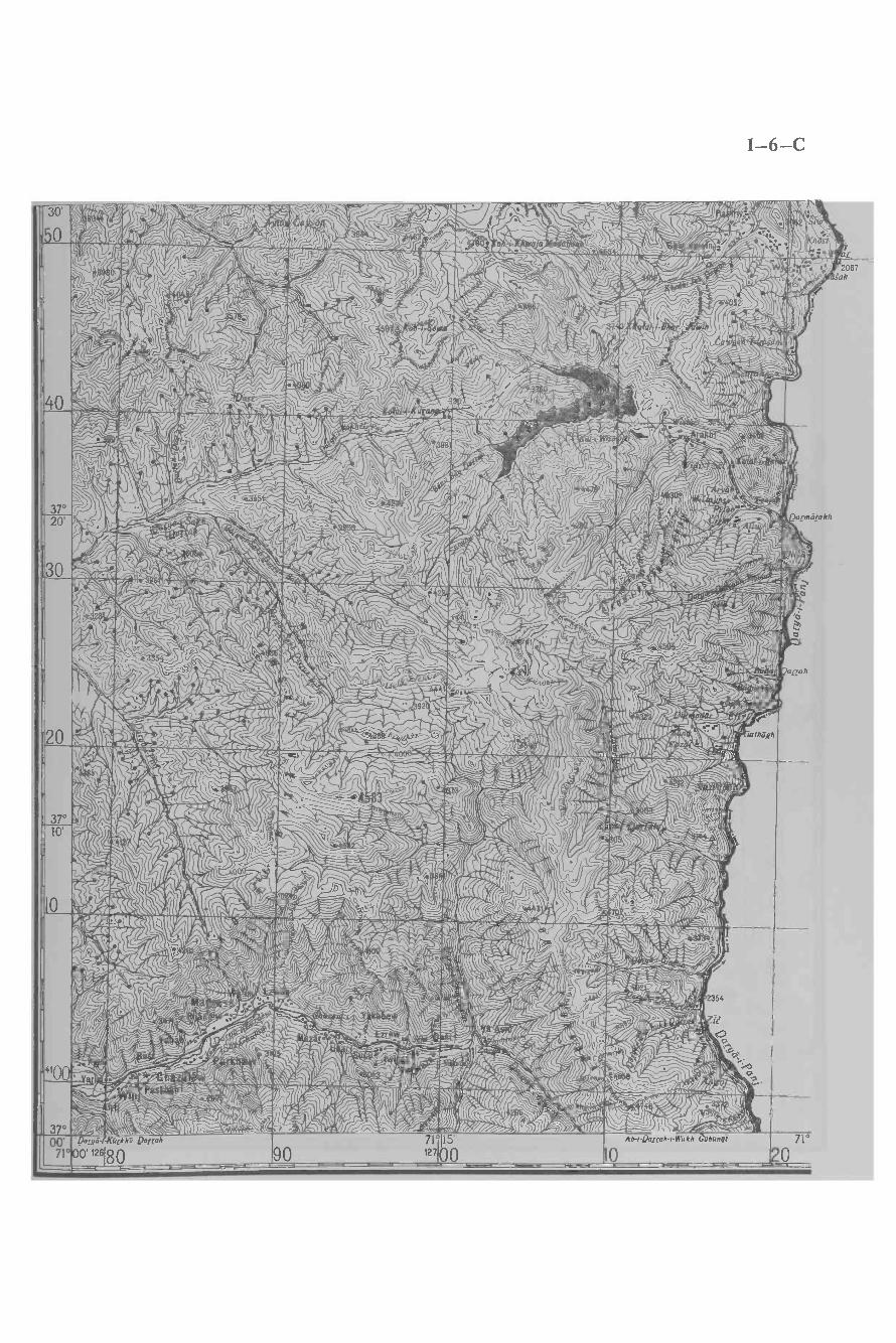
' 1 J. .`? ``'\`M %%%'7)1, _
: /j1,
Now,``." , . 1 - r--i-1
I-6-C
N ,,; f,,..s;rrr

I-7-D


I-8 -C

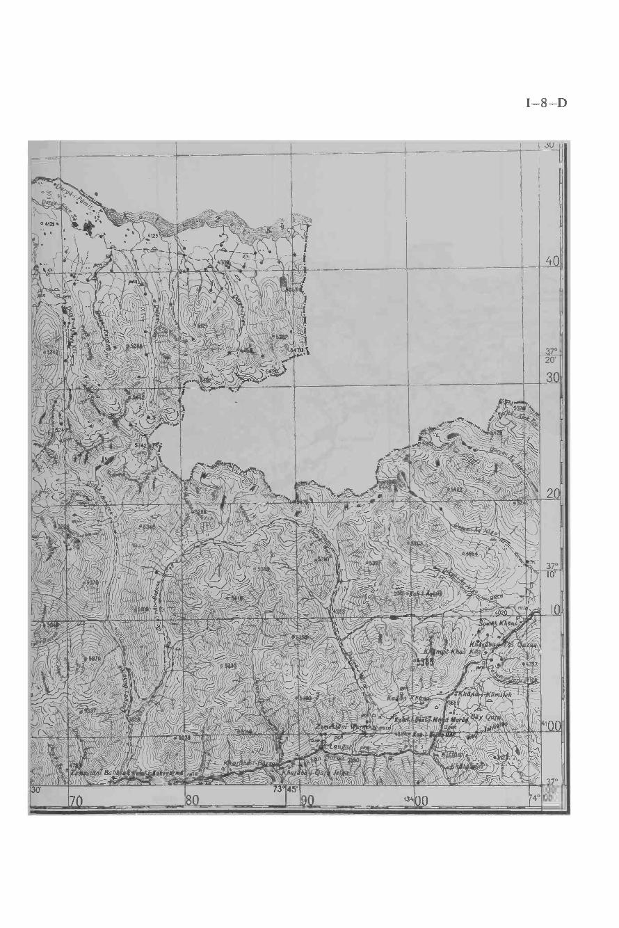
I-8-Du
'Nl'.` V
%
ti
.a 4f`
ir-o3Y
¡zy ,a ` `
%\ ,\` --,
°
30'...
fi3°
$045'9Q
t34Q
ï4°Ö
000'
--


I-9-C
30'
40
5
5187}jjy,'"'._
_ ^5285L
.'. 753
I3o
~ Q1
4552r a .' r +r
`. ",.16 o
8
°, <CW
\, o \:> '
" _Kola/-/-Ja/ Ja
,4
`,1i', -i.,;!/
...rrai1"'j4[tdñ-rkLrgan
4- 97 =-
I
I
0 . _ ..` . _ - - -.._ -- , ,1 `\ :! . Je! a= -V ,` 1 . , _ ap 0_`-
. .30yJ \'^ ,. .
o i`/ / ,\pÌt` I` .,. , t
/'-'4,4:44.c/ 1---
. ..,! I
I
20I
5471 .r;,` , ,\\ -'. C,`i
`1` `_ ',1\ `'1l4).t.___-_,L'. ` ,.A\' `\ '-,.-,\ . , ik.- ,r , ;j, '
*..V /1\,
,%; ``h, 1 ,.,>.. ' - r.\ ..` %>>, ' J' , _ ,
\ ` SO v?. -
, J ¡tf/ I\
Q\ \1®
iic ó°< i-!-- .
`-_ + r_1 Ì ~` \ , I,./ ! / /. /-.,_ a-12, ` "
;`` \ ' ' u` \ ¡- 101-1-Biga lek
' ,, .. ,_" ; ,l rE:
,:11... ....y. , ..._ ,® ..
,;.`1`N+[á.rt+.`:: i_.-
I
I. ( l\` \
\
I
37°
,/.- - - .
`-.\3/ /
; \`\ , -,0,,, - ;. ;'h", 43,,:. R.%oo .m,a
.% ` Ik/ A
wh a'a T#rabreSlóni-%zft .^'`
- ,-I `J.i?.,^1\ Y ,lí,
ì r1, i
or- r 3
:! ¡.:>>11 =\\
Il.',
_ r=_r r, ,1_ 11, `r , '' gr,./' ,_,. r _ : , >.
, 1 ,_lll 5 \ ('ll.!''` `J``':n
II++ ,ti`J,i111 v4 /\" ill, ; , ;;A« .>
1-,u1 \ 11 iì \, l d ellI1 1
.i\
"10
1 0
I
,
,' olä` i'T;' `r `í,`,i/îslC., o. ,"-s- 450Ò i'v`, ` \` 11 1``
`"s v v.¡ ,'` °, I.. . .. _`J, i '\ IIII >rI1
. /l/. n\- K r> ,
_ , ,K' lí , - -
11, wp;j \ rCjS, d/ d?-`- wQ, -.y, t ,: .,z a w;
` (-----)\ ' ).5--------'-000,1;'' . r r, abrt ;
s 7 L`-,, -\
; Gárrìk- ` ' _T_. e9JQai-i-Dulgularias__° _ e.r! 1
" , D , y. .. ,.1.._ a, !._.
.yo,J' ~l`; /{,
4? r11 ; r--.r - 1 - ```-,.._' r //p K 12' 1 % 1 -1 N i ----1 - LiG / ` l ,/.-' \ i! ,p' A. . /_ -_r
1 - i J`. á );' ì ' Js l .a2 ,
o3700'74°
- l o ñ ,,,.7.-r-1, : ' o I `{¡{ I' Í/ / Ì ) /-''? Il\\\NN'/ .%/ l `- IJyi,,^..-
_ ,\ I' ,`.. 1,12,\..,\ _, _
. 1` \ `\ ,,, -J \a I ^ I', ,
¡7 v'1\^` ' 1/ , = i I (f, I /' 'k .,,, \ l ° `, . , , ,,. ( nl ( ,00' 13420
74°15'
30 4074°
50


I-9-D
L.SU-
40.
.1 '
ft, -
I,r"-..
ri_.ì -r..' Í ll
...J!!!rill?,+, `
iilli`4!iirM((7.
0
ar á-,0 8 ¡', 7
'Kol-i-Ha. ir rIf a5it
1 ',j,.
1---( 1.t, . 1.r,,/ 1,.ttkli \;, r: ` rsl ! ''all1 ,I: r í }}:_a `-.:-I
' _( lc ` ì
., aL i. 5i` . . .\? e4552
/ 1\1
/ ^/ ',ilk >
'
Kl-rBakhmard
..
.J
! -__,;,,3v
~y./li'.4
_
r
Dr Kil
0s \_,,
, l,',
410 1s25\`;
_
.....c37°-- ,
,r1) ',L.. ; vJ. ! uÌ _ú:dr...JA1.,,` a
. «'!. ./j, ;;J,,: r3
% 't,='
20
30`? "',I;.,.! :
` ,l " 43'. 5
20
37°10'
Io
4100
370
30'
6 . 74°45'70 $0 13490
00'75°00'.


I-10-A


I-10-B
60 70 80 12490 69° 00'30' 68°45' Qezel Qal'a 31 km 37°
O
00'40,,
Tapapa
! Guzár o
a 442
Zulm Abed
ajal har Qarrah
Khan
°,:Kat. hl
- ..:Qun_ hárrj .
-duiTá! . ° 7ana `.` `-- - I 4 o '-
S,\NT `Knmar-, _
T :'.\ 'Ambár; //érdam
(/ / y
.
è;711//i() '! mar KC-(U , ,
,.. C-i ''\ I.
I, t ':-.1ár Gu.zar "'
Qara Qeslaq -::= .\rl`aqeyan '- --_ Ñaw
\ ___--:-...15
ESAN,1íP :`t.
:Nagel A/ ' _ t:,4 / _ -\ . .)
`,\ 1I, -- // / '..f ?. ( ''
%) adrasa `M ?<8' \\ ._ .r,
: a..,_MIA i...Km...mee sa vIMPwt \a71t..L` .\ 11\iM.VLv/f% 'I!T/ / `/ ` i' 36°-


I-10-C
\
30' ____>1,--,-
zagli,_ ,,-5-1, p818. k \; . a Bu( !.
,-'.o.' 1
, \ ,,1
( 1 ) 1- Iy ; tio \1 D ;,'' ,
' - \`fr_ , \'
I 1
II E > ''; k`( \ ', A nl,j P (30 _
1(ti.
1\A
,`.
l`` N),¡I..,' ,S;,,-i ,. . T
'i
(\' I 1,i`\
1,(-, l' ` t °'
I.. )r., \1i , , ,`\ ,\\1 ` 't ..
!\ \l_ . a
". ,%;/ %62
G ;,;v) Ú,,.,,)
1 y ./ L 1 / rN
1
,/ /f , r1. \ i:Ì44 %\ 41+ ,V V , .1. , í
', ., l ..l /,,,_Y y , j.
,tI ,
( - I\ \ a .. r,
4 ° ,'-(.Ur
1( 'bn,
c ,`h''f'
`,; ..
r
1!'1 'INv o WU o ,`j R s ,,
2 , Y V Y
c r. (' 7'\ \ , ° áaL r' \ñVi' ' , J,/,..,\,,,,(2(
;l, li1/V 1I\`, )1 , ,, ,/
% Y'I ,/ \ -
,'I,1..- w
2 \\w\'I
al uQul', g.¡\G
Kól<aY ,k°\ \ \V i \^\ ,` ' \' ), ,
I~\ ,'`, , , ,L ` `
`
,? '` ,
, r- ;I I
" ..w ." . , a- 3 _`ti / ( r _ó
_ / ¡ r, +2 1 -._ -'36° .. \ %t
' ( l /RU 1 i/0 \\` _\,> ¡`, ,.11 . .rdl _,1 !(I \V--)". .S"---,t$ .\;. - Ç, , r (; -a?' "I \ y: :1, \,. l. .
. ' '-,:;,2_n\ ll'. ;.:11
, 1-}. \ j ''`<.\.\ 1 , i )
P \' 7' l ,. 4 , la 1^ \ \\\ i _'
k Kny": '' V
, a --á :,.1?`' af \_`,1),
i? , ,\. \ .(/ \ ,tii, V i so _)\ l, 0 " t \ ) ( 1 -, A : '\ Q, á
1'1"' / r(
ñ1 i ,. _- 1', Z.\< . . \. r : . /L ;;
V .ti (/ -L _ ?- -g ! `
I . jt *:\j.,. s a
Ì, 1\ r-',-., _ ' %,11 l _ 1Yf1j >, ' \000, fí ..1? ,J a : ' ''`- :
,7(a ° ' ; :1_, -.yJ ;
) 6 a ,, :7 r )1a (1 1J '(C l_ -, ,`{' ,'/ , i!j/j <.f/ \
, 1 ,,(../ ,>'
a .ì ] 1-// !i`:Z y` f , ?- ' i% !y r
,ti'"
ó
a
\\
' t1
1 l'ií, 11'
'13".P)1)520' =p41 l,\ `, r.\ ,'`1¿'1 w
i:/.1
' d1, r' rt_-- -' '-t7 i -a,'\`,,
\} (SAMAó /,..TasTóL °0 '
° ®: .\ -- '-. ' °: Carm nl.'.w«;.-,,,\0 ,Sabi-k. .}
i 1 T . .-:3 ,F
ti - \
<I° paiaCAIiv__-^ '
1
I óZI /..
7_ % `, \1Ji.::
; ', _-_ _ i
kutú' Ll' .'I'iV. u
ti .1,\:
r .. rllr.'l' -_
` L,.. -J ,; ~;o
a
\
tIì\ \ ' a 'lJ" , r.
,
%.
Q2
'
) (-,)4),, \ '` r,-.,T_,;-. ' .'C`as -i-Ma j 1-rhj-Zèn à _-Yr' ,,Z ': ..-1C1419.1 l --` -N-11.r
n7-:---:- C'1-- ``
` Ì i it:' 1, \r%"'\I f ^If5Ó9 `:-1t" : 1.
, : r
F.J t ^/)r - ,, o- ,----7-- ' :- '. /-J\ Ì.) \\ l''- Q(' .- ' Í
i`, :''í `
-' v .. : t\ti : , r :-h % ' r
(`',^ l \;%: a' 1. ' ( ''7 L V ':t`'\1 r ../
' ` - \;0....\ aj.,:;a`l('.,. /.., -., )!p a
) \: % ' Ìí r. 1 7--
` ` / -:Ya(svlt
r
1 '..ZD' v ,,ZL,1 C`A lV a M. `\ J,"' .'` i` \ n J`lRV _
)\,,' ¡ _`1`.`- i 1. ,`,
:C
r01^iAi/ -' '
r
: í_,_' y ... - , a'-l'. ,2 1
:. ,
R.1 1, l 111ll ,t
1.A '
yp1- _
0' - - -,- `' "'y;L > 4. --'`5 ,,, ' .Raÿ',¡k'( `rr °ál°__U
, ,4 1 ../ i' 9 4:..
_N,ti:
. :/S .. C`
'AA
3990
w c.Z / b I
) -J °3 ° 1:.,-1-' . - . <` ,Y\'.
6 ;. Y \-a, , `J ! s /
,,. 771. _r-I.,. .
)21 ` .- -s" V J :; .. y`r +. ÿ ,,1;;¿_\,',,
, S .í % ` '.r- d - K
,FLAj7S1T
.,%/" i.
r
° \ 1 ' r
.\' . ,, -' :°_`"
In / \ `d L1 tee, Ç _`Cdh-i-M. :l-,,, C -- .,e- ' `, W
SELA t /f:' ai éii-Ba pá"E>,:I' ( BU_n'h ; j ?j`, `
!T. o V 8àbä. Q2[[ikat :.. ;.tOr
- 1S ° `r.. ' -168 a /T--, - _ `..
\:.r-'r- J`17 V` `- 1t1` " ,10,,--,
lld a'é2 /!,i1_- g .NatyKásu\41",,!` 19àìbar; \ i-'1/--` \ -z\oo r. 1974 'i : n L- . ñ Q by AWa`QQ"..
.-_ y.¡i4 )v "/`ÿ, - V
----v..\ y r' 1 fL
ÎrJ 1`./__'8ç
a .. . \iJ' ,,;,. .
1 # .vjSurichak Oa` a , ^ l.(L. . , .,
` 'ql :Òk' J'C, '1'.('',Jr 1.\ ; \c /.:-,,,,,,,,,G a , ., ; :. :. i A?- : ( v..'a Q
. , ' ri8 / I , I
$85/^I
k
4---,-)
.,
5 :CG 1á'r '
^ ' ' J
36°
.rSai B$
':; 5 :`;1L , .(. -Z -,
, , b i :iát. .. z8 a: ._ -fQhNa ,i 11 1; Kun a-i1( .......\ (C :J 'E, l , ..
J, <;_`- ,, );,d a ( Khê
---l:<' : ` vUL `181Ó,
.r' \\;°4. s: . . "\ lth', ( .,/¡ti' , / `-- r-- J'íL , ., ..;s. .rai á 1.'4Tà ` y
rr,^ -s* - !1 Q,\r. 10Kh>dî ' QSQ$_ :. at` \ `` VVV
,-'. \ i. r C"
S:
+_ .,( ) ,i c',,,.Ò (q2g2 / . ,
_ \ -, , r
- lkJ4' a:í \c s21
fc-.:,--',1. .
S'V L`í q _) 1
/r.01?- o> a .."9. l-. '
.l-eaia`--)i1i0.. -J"\-9-1, .à s' I% ` ``a :
iQ J , ;,t:`- r3142 ( ' =o... _./,1
,' :'ti
1
-, CñJ00'6s°oo'
Deh-IKa1an,24r0
68°15'
30 4068'
0, -
_ - - - - - -- ---- -- - - - -


"lp --Tr 1
I-10-D
.Gerda
O;Oi..:; Chu
. .BF' la Qes
uc- -'°' .Bulak Mur
..o =:AN ?K- 1
- -KOHN,
- j.- ( 11tiL
O; / :. Yafca jj
id KamaS\s,
124g,
1201
69°00'


I-11-A
5069 °00'
3T00'
409
408
407
45'
4Ó6
o2
o
405
z
404
51 5215'
53
KHW.;JA GHA6 8 KM.54
3
-- /= ; \.
_l 'iL1
',,\. /
.;>-
- T . n iVv\` ' l\
OIIJYa /\ l
.\?\' L
'` 7...1v/
I
/. ;',-
OiCD') ,!
.
.''1 !
- , :/'/ '¿.í
gihrdk0hn
.
,
//=°
/
11
;,W1
N.\ \ / ,,¡/` \..\- /'^
.r /.- / \, \ I ' ^
\- J¿ I
` ;, ,'
0 0 'i qt.
o( /
ói fLv,, I lo _ /- * . . /!.
° i , `IJi ,-` /,6-."---- o o,,,'"T-, i v , f,
` ! CR r_.(:)5'( `_'- I, ,`
1 0+
' r1
eZlskhsfi
. . ./
/í/2(:/a ; ,,,'!! Ì
1
1
1
\ ,
.9 : , \ i/_. .' /
:1
a i , ' i 1,i ..--S 1 :` \ .0 i % '+o. 10 1
' lP'rti \, ! Y
, ' 'c1
\,' '1 .. -_ --- _
rI
_, / ,',sl (
1 -` I , >'', , ,o. P1-'( \' \ -'
\ \ yesl g ,vl .-.
U1 Xi_ ' , `
d I . g'^'- +.'
,
î ; ;, 01
rsF, ?:
/.' ,_/1 \` , ,
1.) i il l \(
,2. ' '/ ¡ALEJ A
[L-?-rit\;' .(4
A// 4'---- .. `
G1' /1, :/ ÍÌ46o `J
Iii' ,
F ,; ;./i . 1 \ );---'' _..e
ZT\N', ,!.*. . .i :` ` ,`-¡if n':.\. \\ \'., .'\`. '' t\ 1
`, . . \. .\ i
' .. : . . .,,bl.
- ,?I'A ll/ ( I
:(1
'1 . p
3 N"¡,`, . v\ r `_ ;,
,. , , ... ;s'` ,,.. ..`.,,.i\,-3-` \ v ,\\ /.,
: - . .-'- %°'
., - - , - 1 -,
.\ ÌI (I
- / f
'/ Id ¡ 'f i
yo.1 , ..y _ . /.%.6., . tü`/!
- #ar ; : reg . .\ r ` 4
A .1R1a j/
' J. . Y-' '' '. _'.
' \u'. \,e ; ; :.., W á. a. ,' . .' '". , .`,'i: i' ' ` ri _. . - y, .-, -_.,"' '; !!R.
i ; 7" %
i ,.
,
sv,,,, ,.,, ,;_
1.'I._°A r7t
-
,
; ,,j,292.: .
n .r/"/ \
¡.r,rJ./-.
`.ìY^'Ty'/yJJ, \
' 'il(uhrga,!, =,-
r! . . . he RMF
.
1. 'q'` Q,
o,. . : -.+.' `: ..Hi r
t1 . : '. . I'
-
i ```--\'lJ t .7'_
"v/J. I..a .
.
=V_1, . _
_ ,,, :''- .
. .:,_ .."Kh sbà\`a.
. `;,' ' .
1
a
' ' \''1i ' .
` .._a_ - .' '. .
4 ' 0/F0Ll-=_ ,..-.!'y1
1
`' '-`\!O. .h f
' `i, ' ': '...,?.'
VF-,\yI . . ''''',..-.7:7-7 _ 4v: a `:
/ `, .1 pe
.
B ' 2-- _-- -'r,
. . r.1 ell
'.
1
O /
I.11.-
. /9
L L
t
Ó*.:;. . :_ __ a.¡
(,.. l\ - . //\ MYOI;_' nfb--=i';'1:- . ! AP.::
,' `.ósy111cf1 /%.' `` ` \%
Kala #\ .25 %o ` fio ' ,nn5 \ iVv`.. .. A/' F. t : \'
o\ °
_ -' ''- ' .--- .
° °_G\,. \.' -clin \, ,.\ !IF1...
- - ...1 L1
.,: \:. ;:,. .,
.f . A\ - t\YVV'11[L'
- \...- . \
\' - `1v j 4
/" /-, °° 0 ', :..
o h.. ,1\ V,,'--
1 ,
\ ' <
^)1
'.
c ';I! '. .
*
( 0 ,o O
p -
-ò":':r
,,
`q
, ,ItR -ii \
. ó ;_-
\ ,\\ .` `\ 0\0
a-. ,
':f.
aáiN1ZwAr' =.ilL1W.iltlt Tì `W.. .¢


I-11-B


c, 8
m
9,40141-AN111 CM
3990000m. N.
DM'4111112111iiag:ZOVIEIT'B111111011=101111=114
t. 62313051":'".tinIEEE'YOgill= 1438E51
1,,., ' - 11BFIEZIED -11111
'11;AigE F
061-Tel
-._ cligr: HUH
--,--., A tillr..7a AL,_...
c.,..-2., - nidIP.-.3..9411111-P' iiIIII.:17.141iBlitillgS:44491111IlgOBIU: 'AR '
BIREZ:21111E:-'7.4H9BS-EIE illIE dB ...IIBMEI ' "30Er-'1,;4111014 TSB -
'dB.
1 .,
,IihliRE.54 !Ea. . .PE,',,T.1=2.44 iir -_,4gEr
.1.x.ts
C
---iIBBtr- -pi.. IIBBSEEBLIGA.F.4110......B11 ' IraBIDIBL.,.. 4
oe...awasHMEZHIMBPOROBB.. - - 01301=1K.31=IIIIBBI.TEIL-.H ' -.-1111::P &':-',FIPIIIIIII-!-EBBOBLIACEBB. 1=0110.
i B1111=11F".1 ' 1r i!..-Z-'52':30M1101111=`..11BEE431.
Iu 11141g14111111.41' .,Ii!,'=. , ' -'"BilINII 1 9--.-..iitz*.e.t#4.:11H,-....f. i
IIIIIIBBECIIIIKMEOP.:hWAIMILIEalli11111P' -a111111..,:.: -,91111BIMEPErlir-.,--a Mill
*a0.7-44.14.4_11=I.111BEE-2.141110=1,.':,FIEW1419_ . "IIIIP.U1 11LIBIIIIIIP. i'LETIlig.121;iiIII
115ød AI_IPHig-7-141119FITZEHIIP.5BINIF.21.-KiHrr..:-.-dF.4-91110Br.2.91'..;:i1EPV-IlaIlOBEE,V.40
BBB= 1 :HIIIMIgEl!
a
118110=1E1IPA-Eb,521-Erl'Il'==1---_11:11_8Brisr;.° 111110=1111dii-ci.-.-Yr41.9.r-41BRB115%1BBA.10
111131121E'BROBEEZIBBBBEWBB6.1212W.4,eir.:11112=1111BBEMBBBBM9BOUBMTBBBEt-e_..i.-,',A.:
- -1111 ..7.-.21i6BIIM911B1111Erg=?FIVERABg!'11-14111- mom .
All 41-511Bilk
:111141iiC.S=A; ;-16=VIIMEBEt 2067. -
JuemeeeetomeeeMIBBBIIIIIMBNOMBHOP
BBIIMIEBBHMO";99"-"1.71giCHIMBELsEIB9171-'
4.41E9512"54111,141Bti."-'2 311.6
3F1'Ariaik
.1011610V1.41187e6.'="7,7,4111''" IS41&-R"'RBI iggylE':Ii=1, BBB.
i
C
$
: \
Vt. 1- Jib. IT .01\1411/


I-11-D


I-12-A


I-12-B


swwrur.iMiiiai.iwnuromAR 'll/p/I/JJfUf" ll
_:. `' . ,/ \ _{ . \4 ,_l.
I-12-C

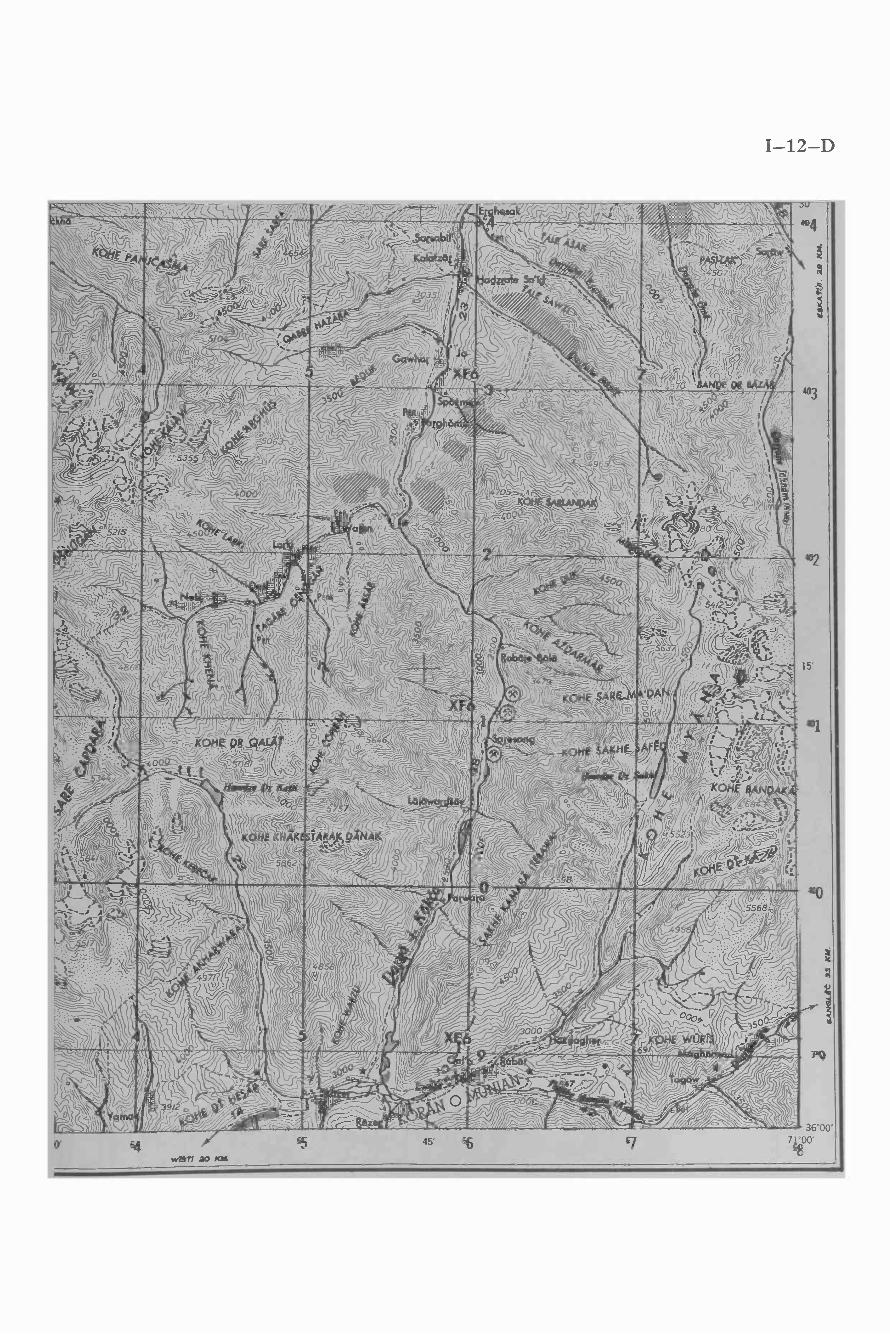
I-12-D


" (
r ,.
y ' rs ",
., n:
m
... ""yJ -r.,
.. _b
..,5,.j , ;l.-i1
k!"
%. s
r-/ -
/ .1f C, ^
,/ L 1,,, _-.%
ivt..r
.---.
'1'oT
-o
,, , ,
;44
\4.
/ Ir'
'-
!%y
+. ¡
,y,
,r n
....
/r
'
/G'J
,¡»,
7 j1
1,fí
,/
11l
.
6'}
,,;irr
r//
}YJ¡
/jlb
rr''`(:``f
'ii`
1,<
.l`1(
--`,
,,^jl
j,çt
-?ii.
% e
_.i..
>>L_
-.,
l¡1iV
N/
V `
'
' '.I
,'__\
`
J1ft¡
Uj¡
-.,.
.r..s
.../ ,
.au
,
=_.
-`. =
``.
..-.,r
`s;
na4
.'.c'
.. ^
,
¶mLL
k'
'\\\
/, i/
y/_J
,w
-,/%
rr
,7
I1
, -4
i,5
`r
; ,,.
-I(
(!
-r-
taw
,-.
,.
.fai
/.`
\IJA
ÉJa
IIU
í11i
1\
/44U.._
;_
"Jl
//j\`
v"
r--
-d
:A
a


I-13-B


I-13-C
,30 i Y,y_ / `'i . ''' 1[I ' J)J1JIJ,,, a1°. `C.' . 7
% nf Itaaptirtikt,st;t,--rv. ,,
.
30
I
36
,.r1; ..i'=t r rcs,'_:r(ir f\-,./. ~- ` -.l v , )(` ,1- :\ > yL. _..a s,
I (/ ,,t 1 J 111 y.- ! C irav f1r ) / c_z Ji ( ~` = U=`1= \ /". / .
11 ' % ; .. .',".\\v ` `f /--,.<e i._- ,. ,, ...= . , ,
_ ..- 1 ._ .-; ',, . .r /r- . `+.i %Jll 1 ,,..= %-'+
,L' ,-_
- 1, .',\ r ) ,r\ . /._> ,
-, .-.Ji' - `,c, , _ q i,.. .` .a4,,,-, `,/ h;¡ti ,.' +V¡ l ÿ\. r ¡
< ,.rñ ,. . ` .. . (vi`r
;,,.,{. l
=a 1a,.',:+' , kde
.«c.
1
`` ..I JI : : ' h> .,^ h. Pnruk,r ^ ; 'Y 7
.;^ : r 2-- "i . y ,% )'. .,. . -zS » ,..;.
. ,._.w..', .c.;_-r,,1r.
ti 1)\v1( --w4. .,i.J (c%L_.,_ ¡ `/ Y/
{/t C-` ...',./20,l-0 =/J oj,, ,+L , ..'r`,1\Jl,\.._;, ,._:1v`-`=.,._ :° -,,,--994/.------ ,ÿ-._s_'-;74.(-!:',-,,_-_,,, . ,
, r''. ..` i4,\&.,!..$:
,"Ì.,,.,-\ ` (J
'LA 0 `/ \i (...,:l.41 /Lf' \ `Y ttF
,
)),\i,I r,. : rJ
. , r 'J, r-, , f lI , '., .; ;,J.. /i , . ,-, i .
20'
20
10
36°10'
4000
'90
36°0ö
° 00' 12 9071°15'
'2700 10 2071°

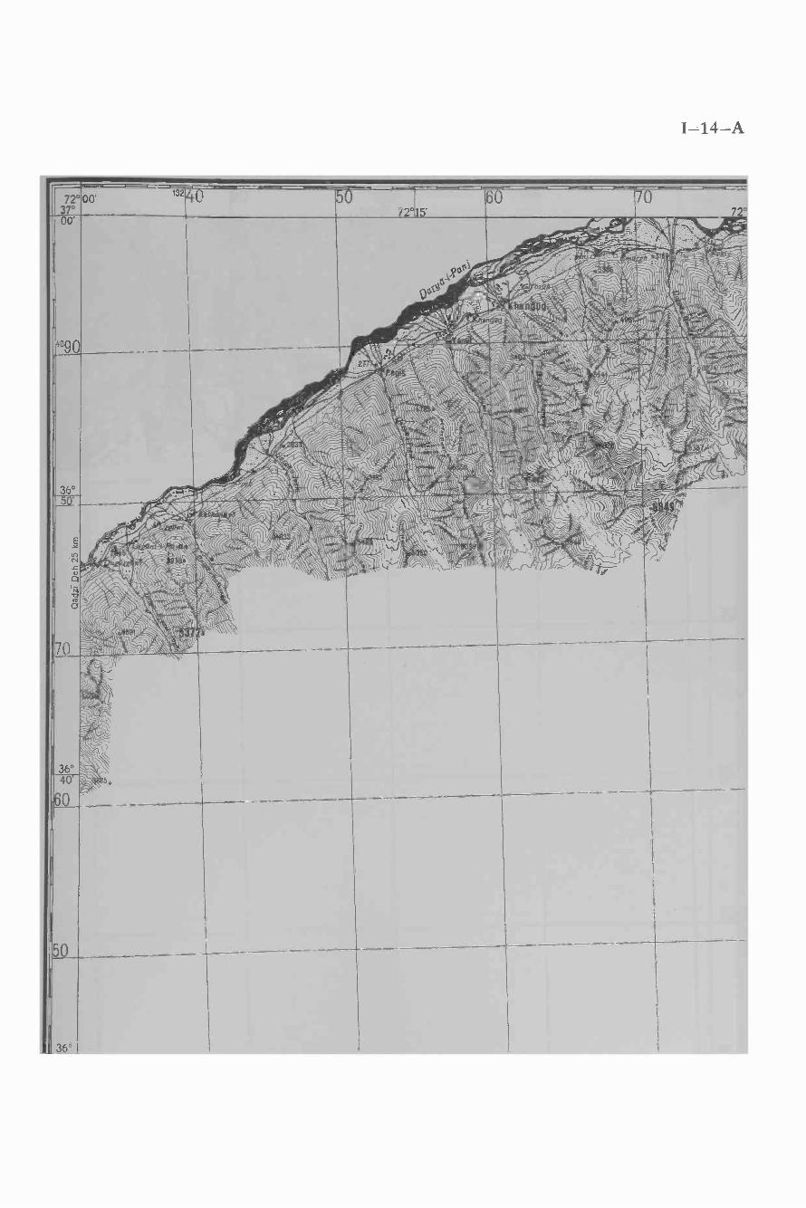
I-14-A


N-Pto(


I-15-A
73°00'370
--- r--- f-133 3O 0
Rowan 73°
r- -y50
15' Ndlkhawl
._r e- r--- r-- r---60
_Satbad 2 km sa.had 73°'r 11
_` ¡O..-~ lw.q \`// / .i.-. . . 1,` .,.jr1 í, t,.,. , o ':,; r `"`,.:`^ t` IL ,f - `` ¡'
=,.- ; , . : :y ; .^ ^-:l \ . . 'i 1 M... .
.._s
00 '
JNN,
Cn('-70..,.,.
80
1 7°./ ; L-Vl/ IHII h \\i/ ,í i óy. +``_\ t (-' - /)i ' l iO \!''wte/i-_VI` Ì '/ `J \rr,J ,014.44.-é jvr` p0 i - T^,¡ , \.J /I +` l .. % ... 5 - ; ,, . .,.` J ti-.!f% 1 " ,c^í!r-: r- +'i -i,.. n. -., ; .. r ^1;;;...,1 i.. . , > f . -, .^-,/.. %: f`, ;t,, - c\\ -^,T . , 1
-..-.,...._...:;,,-.,.. :.,,. .=...,,..-- ,t - ; i . :1c;. ti` _ry-r ,/r/ : .? /` r ',.,, `Yi . \\\Q .,_ ,.. 6 ^' . -.' 1 \,llr.`.,...._-.® - I - /' ` íZi« :%.P._- _ V J _. Ì . .,.;- =-c- . , .. J ./i.`,; // . u `
t r:r^fs.. z4,\./ ' ; ¡L), éÿlj,'.`li n j7T1 .V /=^ j - l.!, .r ç \ ti ' , '-, ( ,.r C ( ,1'_... :,.: .i, .s '"
' ,i'H. . ,/., ::"" - a.,....s`, ,`4/`<,T,%:'. % `%``IrJ`_ :17"-k.:10.4.1..... -: U _lt'a
, ~ :.,,. y;;3; -Jyif,/ , .
P^--1,¡'; " Y f. ; J.. ._T'....!..__-_- lá r-`v/"i/.,-- ,I/ - ill ;,\` 1, w
;lp. ,-; , 1. ,-. \ 1(_
: .: Jit ;,_. .l,rl', >..' '
>; ., ., ; . .a`m± - .,. ...,at_o 13 \a `._` .? ,¡ '` - lit 1.y _ tJ) ; ' _ \s ,: ,,
1 `« 'r i :f JJ :_.,, 'J``;. t,?- _,., O',/71,1.\, ,.`\
,., . - ,-±1,; IC; `"ií=.-r.J\, il ,- r;: /,``t\ .i ,` .: -`' -, .
\ '/. ,: ;J\ . ' =j,,..,2/ / , v`=v,-414,
j `e
.<<1((( ; 'a6 , l[ ` . A4 -. o .
-, ; =, ia
V,. ,, < 22', ;rr
36°50'
36°40'
36°


I-15-B
- - -30''.',F Yi
?' ,' _°'i/` `' <;`; ;.iJ 1 G..1--.,--e\J:,-:` ' '
11 Is
-70
Langar 24 km Wakhan Darya^ 'G`i, lls:,11111
i1' l,`.,.r r¢:,":'` ^ :; ,.; r,, . ,. Ì
, . -r ;`, 4. : ` -, ,.f t:1 - ",.At<< / ;1o.
-80 90 134
73°45'
---- -00Darya-1-Bay Qara
-37°/ . gl1)' w
1)",..,,T-t.(^ :,.. . It \ - ' ;,v% j IS l. .:: , -. , , " . .r;'h ,- ::r, ' ííi, ' .,, j. =!!* ,i;r , . t
1` hl , 1 1111' ,, :. } - ,t. .1¡ %Ì 1 r i r uÿ l
.r , , " (K, t ?,1,1,c`: . ,
1 ` \ 7, t')íi I ''. ,. _1. ,.l 1 ., 1 .-,.. ' ii' . `'.h ` 1.;, ,,. _...,,r ., . ' ì;: ::: ". :' -.- ' , :' ` í1 1`. ; ..;A- l ti L ` ._-. í 1 >> 1Z_ í C. ..- -% `" l .íl- L,-,, ti :J ..t,..,,t<<,
: ) ;;'' ``.. ~ Vt.-It'll`cc )Js,,,.%JN!. 11-; 11`..11-.
-- 00
40 í10: ,. ..,.,,-..L-i/NI1!'r'\j
' * .(r, iitttI a
/ , ., . :~
: 11i,,i ;,,.,K `"!.. `k+ \//vYl\\1 l,l
,. _r r ;,, , ;.,.,` !®J
,,1. _ ,. (,oiïiì'.. hi11 w ' I t.riJ N,< < ÌA.F ,1 ., ,-, , , '` v,+ ` .:., .,, ( . <« %f.%` +nl.=i` ' 1l 11 Li ,'
YJ 4 v`,\,, ,,,--.st .--`>>\f ,K? 1\'.. /l i, \` 1, . ` t
80
36°50'
70
6 0I
36°40'
50
36°

I-16-A
00' I.a ái-T
Ilrikó t °
111
I ',or 3-i-Mo ammo, Na or . l; a ,°74°
3700e..
409,C
180
-- ..,, A:3'
. -__ )\`'j'/r'! -.1``r 1(
^; ..7` TPn iJ -;). ó t.J1\ .ú. -~1p ..`_\` , ',. ?
-w {{ c i)
4ge\(1 ( - Ï `í!i
ks),s.'
' 1/._
\\\ \-*`.
Y O
/1))7.1:\_,
1 'NJ)
j11' ,Eli/(`N . (
_
\!'t 3
0 l:l(; ,
. 1(1 ,
%. /-<<
\
- ' -
f-iJ ;15\7Ae \\J;l\ . "J1:
çtÌ
Lo
I
70
I
60
36°40'
I
50
I
36°

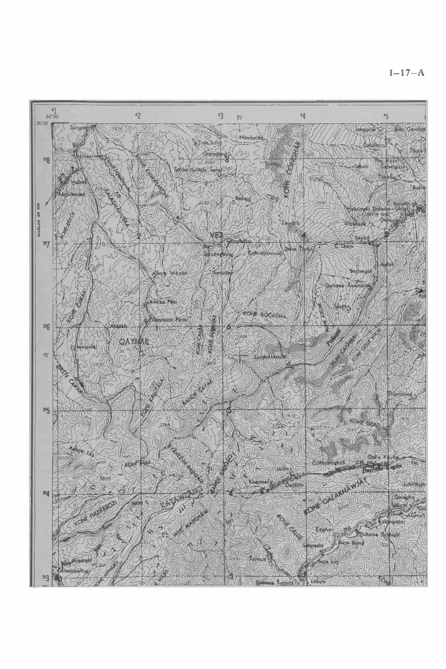
I-17-A
"' }ACC,.
Yí/ s / I- ` `D
I(A JCL.AMWRkZti1%la.ti à`% S<<

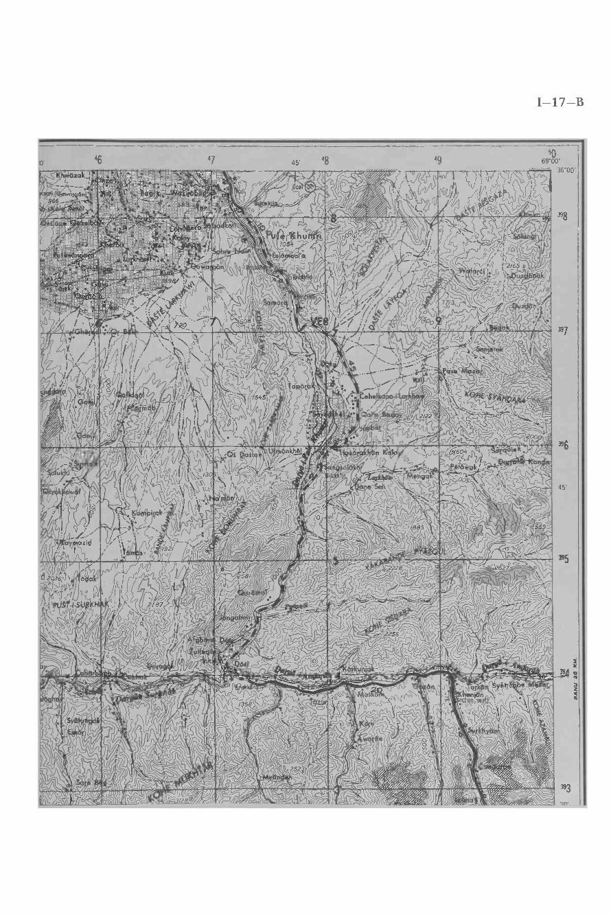
¡R /i.[ ' CÁRAFéA,,s....1..é=1887,-w°hiNe, - aBBSdBi.=t2Bêi:.z.rnbBmM-;:idi /qlb áBE i!ti:B'aE.A=- .
': R,,: fidbd:BBG!ó :'110_ . iT. I.Z1 ' l - 7+ GdB °t'B9_ f,7.dBlBBIBBa:°ó!9.SdB:;PB®BH05°''a99® ML..;BBdmlyCBm;Ba6ñMBBB M :8B9BJPW+IB1®5?°®áAd z+oBâqSdBo=BB'9'"91PB=Hyl , , , \
,BBBólB6®A;"Bmfin'aBBEááBB,;BBGeIBBos39]B®dFBHÿAJB6'J -:=BdAilIód@dIMM®BOaM;.BBb =vBBéá;BBâqm BBaBEú12BB óm8B6A1= aBNdB MM ,N o\ !CBhbBBp9P;:a88BB0äoBB1BBB:° r!"-/.ó86N' dL'G"h®°BaB6'.8,a.,: °fBeEsIBB.9!1°.1® ABémMBB8===ôE0BQ°7B7B 3ha6a° :4'8BA®NPBBImBBBBF:-,Bbd óE_E.° mBIIBb'.9h 4®®`;iá P98Ba.-tlg8ar:18®BBA9m:?Bn.,;49BEreS3H.VA 1a1Bñ.
''iC,:MtltltlMraótltlö°eá'+LtitlOatld°Kí-.4BA®BAF.'d6BEIm8E"m B ..®BBM']iB<''BB5i'°a=IdBB' 8@?
C d m':':B8®.:B9E,, útlBBBBP,_:8'0.'''i, 9f470B114%,óBBBBá=ib9hB®BpBî,fdpm;ABbftBBBf :58ABo; 9BBAt - ., ,... _, i ` ' r=âBBBBb,+òalJk8tl r--- . IPBA mtov: 9,,. :.aotlöNtic. _` ®BBBB !r-e Brft .-. gB®eas;aeB9' 1ñ:v.'?,nAA°--


r_ . .'..,r-
i_,
r ,"' ---
O !-:vlt« :. << . -- T ^,1«C . t, `S ^.:'i1 _ _A


I-17-D


I-18 -A
5069 °00'
36 °00'
398
397
396
45'
395
394
393
nry
51 52 15' 53 54
_w,i.\ \:Ì li dr` Al&,,,:. ,,`\(' ^,d,1 1


r r. - !.r - r - \ ii , r 'A :=i. s . : =` /,/:"' ,F" . ;i,N + i. JI_..r .1t v .
'- 'i\` °° ° - ' :.: \Ìw-\`,_'_' 'eVo1r. ; c ,l
o . o - . . :;.p o_... 1 ... "L"_ w . - :_-.., , . -- - - - l`P1111:. ':. `/f///f'i[(li.'11i1C11\lr q%/lILtCN 011mYai11Int1rkronraminurrQCí


I-18-C
"27
2z
z
391
15'
00
35°00'
69°00'500000m.E
51 KALAKAN 25 KM.KABUL 63 KM
52 15' 5354 3


I-18-D


I-19-A
t Llailk .lti i

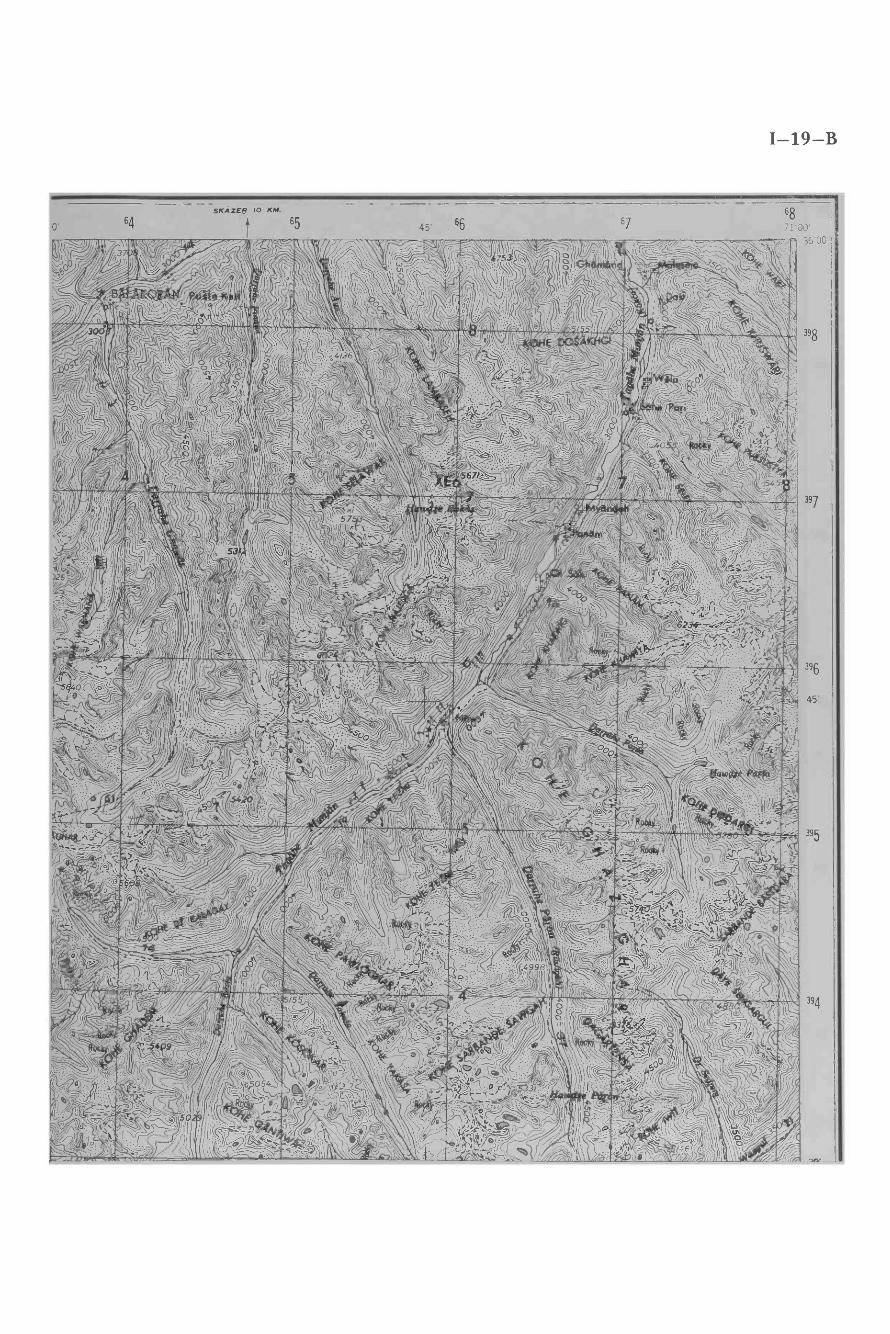
I-19-B
o
SKAZER 10 KM.
64 65

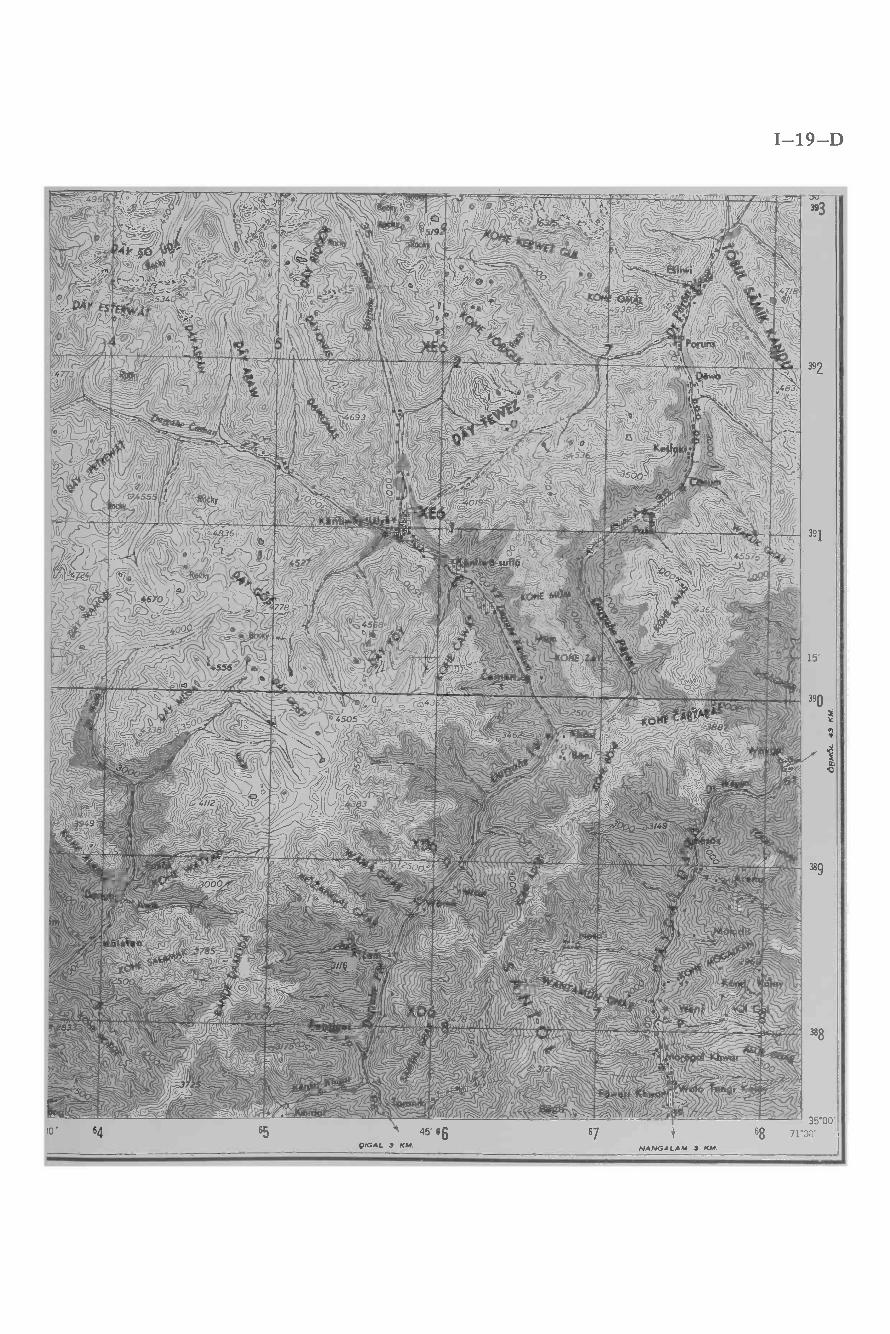
I-19-D
Are.. Y(:. )r'"'N.^`
QIGAL 3 KM. NANGALAM 3 KM.

The maps which form part of this volume are the most comprehensive andtechnically exact cartographic sources available to date. However a greatdeal can and needs to be done to cover areas in even more detail, and it ishoped that both Afghan and foreign scholars will continue their efforts toadd to what has been produced. An example of such research is the appendedmap (see back cover) which is the result of an Austrian expedition to theWakhan in 1970. The map is at a scale of 1:25,000 and is executed in sixcolors. Black: contour lines in rock gravel and boulders, buildings, roads andfootpaths. Green: trees and rivers and streams, irrigation canals, opencrevasses and ice walls. Light blue: glaciers, inner parts of lakes and rivers.Brown: contour lines in vegetational areas.
It is hoped that this Gazetteer, and the wealth of sources it contains,will be helpful for scholars to produce a definitive description of Afghanistan.


1fA
bi V
54
HOHER HINDUKUSCHKoh -e- Keshnikhan
AFGHANISTANWakhan
71° wi
® e-,:.-
7,°Shkraar
7t°
Ubersichtskarte
71°
1 : 32 Mill. Location Diagram
U S S R
1_tiaJ-' t)
ÿ3
I R A N
D;
Q jj
)u-9" CHINESISCHEVOLKSREPUBLIK
4
' P. S PAKISTAN ÌPolio
.f
w MASKATY yy ONO
Q OMAN
Übersichtskarte
Q
ï"
I N D I E N
1 i 500.000 Location Diagram
Herausgeber:
Osterresch sche Forschungsexpedition in denWakhan 1970. Mit Unterstützung des Oster-eichischen Alpenvereins, des Fonds zur För-
derung der wissenschaftlichen Forschung inOsterreich, der Länder Steiermark und Tirol,der Städte Innsbruck, Wien und Graz undzahlreicher anderer Förderer.
Complied and edited by:The Austrian Scientific Expedition in theWakhan 1970. Supported by the AustrianAlpine Club, the Fund for the Promotion ofScientific Research in Austria, the govern-ments of Styria and Tyrol, the cities of Inns-bruck, Vienna and Graz, and numerous othersupporters.
~ Jta/''^'l, ` ' ^'t'ï" c _
Übersichtskarte
Zelehenerklërung:Legend:
HäuserBuildings
StraßenRoads
lFußstelgeFoot paths
BaumgruppenTrees MOH
BuschwerkBrush
Wiesen und FelderMeadows and fields
HochweidenAlpine pastures
F.;:;.;: r;l
Flosse und BächeRivers and streams
SeenLakes
BewässerungskanäleIrrigation canals
Offene Spalten und EiswändeOpen crevasses and ice walls
MorenenwalinMoraine
Schutt und BlockwerkScree and boulders
FelsenRock rW7Telephonleitungtelephone circuit
Umrechnung der Höhen von 2600 m bis 7200 menglische Fuß:
Metric measures converted into feet:
26002800300032W34003600380040004200440046004800
feet8.5309.1869.843
10.49911.15511.81112.46713.12413.78014.43615.09215.748
500052005400560058006000620064006600680070007200
feet16.40417.06117.71718.37319.02919.68520.34220.99821.65422.31022.96623.622
Geedätlsche Unterlagen:Afghanische Landesaufnahme 1 :100.000des Kabul Institute of Cartography 1962,Vergrößerung auf 1 :50.000, Blatt Qadzi-Deh 224 B IV und Blatt Darya -i- Qadzi-Deh 224 D11
Geodätische Feldarbeit:R. Kostkaunter Mitarbeit von W. Kusche)
Berechnung und Auswertung:R. Kostka an der I. Lehrkanzel für Geo-däsie der Technischen Hochschule inGraz
Topographische Feldarbeiten:Darstellung der Felsen und des Ge-ländes: F. Ebster
Kartographische Bearbeltungund Gestaltung:F. Ebster unter Mitarbeit von G. Mos e r(beide QAV- Kartographie, Innsbruck)
Die Geländearbeiten wurden durch dieMitwirkung aller Expeditionsteilnehmerermöglicht:
Location Diagram
EilteneterrestrlsM-photogrammMri-sMe AufneM1me.
Terrestrial p g metro plateaby R. Koatke.o
Aighaniache 'rage 1:100.000,Auinahm
ero
e
Maps of Afghanistan, scalebesetl open eerlelphoto-
Photographien der OsterreichlamanHindukusch- Expedition dersektlau Austria n des nOster-reiMischen Alpenvereins (Leiter:G. yid)
Photos of the Austrian HIndukusch-pedinon 1970
Vienna of th Austrian t
SectionAlpine Club
(leader: G. Virt)
Geodetic sources:Survey of Afghanistan, Scale 1 :100.000,Kabul Institute of Cartography 1962,enlarged to 1 :50.000, Chart 224 B IVQadei -Deh and Chart 224 D11 Darya -i-Qadzi -Deh
Geodetic field work:R. Kostkawith assistance from W. Kuschel
Evaluation and planing:R. Kostka of the First Chair for Geodesyof the Technical University of Graz
Topographic field work,Representation of rock structures andterrain: F. Ebster
Cartography:
F. Ebster with assistance from G. Moser(both from the Cartographic Section ofthe Austrian Alpine Club, Innsbruck)
Field work was made possible by the 36°cooperation of all members of the ex-pedition:
R. Senarclens de Grency (Expeditionsleiter - leader of the expedition), H. Gemerith,K. Gratzl, G. Glaser, R. Kostka, W. Kusdhel, F. Ebster, G. Koller, R. Widerhofer,D. Breslau, H. Shahir ( Dolmetscher - interpreter)
HA henlinienabsiände beiverschiedener Neigung:
Contour intervals atdifferent gradients:
Böschungsmaßstab:Scale of gradient:
Maßstab 1:25.000 Seele1 cm = 250 m 1 inch = 2083 feet
HAhenlinienebstend 20 m = 66 Fuß100 et Höhenlinien verstärktHöhen in Metern
Contour intervals 20 m = 66 feetStressed contours 100 m = 328 feetAltitudes in metres
Druck:Printed by:Kartographische Anstalt Freytag- Berndtund Artarie, Wien 1972
71° aa 71° ea 71° 71°
Feldarbeiten: Juli-August 1970 Alle Rechte vorbehaltenCopyright reservedField work: July- August 1970
n° aM