FARGO-MOORHEAD AREA FLOOD DIVERSION TASK FORCE
43
Fargo-Moorhead Area Flood Diversion Task Force: Final Report Appendix A Fargo Moorhead Metropolitan Area Flood Risk Management Project Supplemental Environmental Assessment Document
-
Upload
khangminh22 -
Category
Documents
-
view
0 -
download
0
Transcript of FARGO-MOORHEAD AREA FLOOD DIVERSION TASK FORCE

Fargo-Moorhead Area Flood Diversion Task Force: Final Report
Appendix A
Fargo Moorhead Metropolitan Area
Flood Risk Management Project
Supplemental Environmental Assessment Document

This page intentionally left blank
0
FARGO-MOORHEAD AREA FLOOD
DIVERSION TASK FORCE:
FINAL REPORT
January 18, 2018
1
I. Fargo-Moorhead Area Flood Diversion Task Force
Summary
North Dakota Governor Doug Burgum and Minnesota Governor Mark Dayton created a joint Task
Force to propose the framework for flood risk management for the Fargo-Moorhead region. The
Governors served as the Task Force Co-Chairs. Each Governor appointed eight members seeking
to represent the range of perspectives in the region. Over a series of five meetings between October
23 and December 11, 2017, the Task Force’s role was to discuss flood control options and make
recommendations. These recommendations are available for consideration by the Diversion
Authority for a future permit application for flood control.
Purpose
The purpose of the Task Force was to develop design principles and concept-level engineering
solutions to achieve balanced flood risk management for the Fargo-Moorhead region, including
upstream- and downstream communities and properties.
Key Parameters
At the meeting held on October 4th between Governor Burgum and Governor Dayton, two key
parameters for the Task Force’s work were identified and agreed to:
1. Find solutions within the parameters established by applicable Minnesota, North Dakota and
local law.
2. Maintain federal authorization and associated funding for permanent flood protection,
unless more expedient and low-cost options are presented that provide protection for a one
percent chance flood (i.e., 100-year flood as defined by the Task Force) accreditation by
FEMA under the National Flood Insurance Program.
Task Force Members
Minnesota Task Force Members:
• Del Rae Williams, Mayor, Moorhead.
• Heidi Durand, City Council Member, Moorhead.
• Joel Paulsen, City Council Member, Moorhead.
• Jenny Mongeau, Clay County Commissioner.
• Tim Fox, Former Wilkin County Attorney.
• Mark Anderson, Treasurer, Buffalo-Red River Watershed District.
• Curt Johannsen, Mayor, Hendrum.
• Steve Jacobson, Norman County Commissioner.
Fargo Moorhead Metropolitan Area Flood Risk Management Project Supplemental Environmental Assessment - Appendix A
2
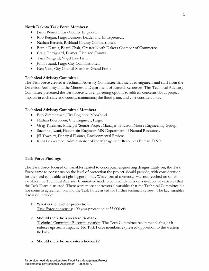
North Dakota Task Force Members:
• Jason Benson, Cass County Engineer.
• Rob Bergan, Fargo Business Leader and Entrepreneur.
• Nathan Berseth, Richland County Commissioner.
• Bernie Dardis, Board Chair, Greater North Dakota Chamber of Commerce.
• Craig Hertsgaard, Farmer, Richland County.
• Tami Norgard, Vogel Law Firm.
• John Strand, Fargo City Commissioner.
• Ken Vein, City Council Member, Grand Forks Technical Advisory Committee The Task Force created a Technical Advisory Committee that included engineers and staff from the
Diversion Authority and the Minnesota Department of Natural Resources. This Technical Advisory
Committee presented the Task Force with engineering options to address concerns about project
impacts in each state and county, maintaining the flood plain, and cost considerations.
Technical Advisory Committee Members
• Bob Zimmerman, City Engineer, Moorhead.
• Nathan Boerboom, City Engineer, Fargo.
• Greg Thielman, Principal/Senior Project Manager, Houston Moore Engineering Group.
• Suzanne Jiwani, Floodplain Engineer, MN Department of Natural Resources.
• Jill Townley, Principal Planner, Environmental Review.
• Kent Lokkesmoe, Administrator of the Management Resources Bureau, DNR.
Task Force Findings
The Task Force focused on variables related to conceptual engineering designs. Early on, the Task Force came to consensus on the level of protection the project should provide, with consideration for the need to be able to fight bigger floods. While formal consensus was not reached on other variables, the Technical Advisory Committee made recommendations on a number of variables that the Task Force discussed. There were more controversial variables that the Technical Committee did not come to agreement on, and the Task Force asked for further technical review. The key variables discussed include:
1. What is the level of protection?
Task Force consensus: 100 year protection at 33,000 cfs
2. Should there be a western tie-back? Technical Committee Recommendation: The Tech Committee recommends this, as it reduces upstream impacts. No Task Force members expressed opposition to the western tie-back.
3. Should there be an eastern tie-back?
Fargo Moorhead Metropolitan Area Flood Risk Management Project Supplemental Environmental Assessment - Appendix A
3
Technical Committee Recommendation: The Tech Committee recommends this, as it reduces upstream impacts. No Task Force members expressed opposition to the eastern tie-back, though at least one member expressly reserved judgment regarding the correct alignment.
4. How much water runs through town?
Technical Committee Recommendation: Design for a river stage of 37 feet through town. Note: The Army Corps said they would be able to certify 100-year protection for a system that runs 37 feet through town and also said this approach would likely work for the current authorization. Over the past 100 years, a river stage of 37 feet through Fargo and Moorhead was exceeded for 28 days.
5. Is there northern storage in the downstream area?
Technical Committee Recommendation: The Tech Committee was neutral. It would store water in the northwest part of the project area; however, it reduces the staging area elevations 0.03 feet. It does maintain natural floodplain acres, which is important overall for Minnesota permittability.
6. Is there a change in the embankment structure?
For the purpose of identifying a potential alignment recommendation, the Technical Committee considered different options for the dam alignment--- 7A, B and C were presented to the Task Force. It was discussed how 7A would likely not be permittable by the Minnesota DNR. The Army Corps of Engineers had concerns with 7B and maintaining federal authorization. Option 7C maintained more floodplain than 7A and less than 7B, DNR said that 7C would likely need some additional storage added to be permittable. The combining of the options to maximize storage was suggested by some Task Force members and DNR. Combinations of 7A, 7B, and 7C as well as 7C alone were discussed by the Task Force.
7. Is there an increase in downstream water levels? This is an issue related to dam operation, rather than constructed project features. The Technical Committee considered an operational approach that would allow up to six inches of stage increase downstream. This would occur at Climax, MN because of a narrowing of the river. A six-inch stage rise at Climax would translate to less than 0.5 inches at the Canadian border. The Task Force Charter called for more balanced impacts upstream and downstream, which implies more flow to the downstream area. However, the impact on water levels at the Canadian border and other downstream communities were significant concerns for several Task Force members. Further determination of this issue can be considered in the operating plan for the dam.
Fargo Moorhead Metropolitan Area Flood Risk Management Project Supplemental Environmental Assessment - Appendix A

4
II. Technical Advisory Group Final Report Background: The Technical Advisory Group (TAG) was created as an advisory group to the Fargo-Moorhead Area Flood Diversion Task Force to assess components and alternatives and provide technical guidance to the Task Force. Members of the TAG include: Kent Lokkesmoe - DNR Manager; Suzanne Jiwani – DNR Floodplain Engineer Jill Townley – DNR EIS Manager Bob Zimmerman - Moorhead City Engineer Nathan Boerboom - Fargo Division Engineer Gregg Thielman - Diversion Authority Engineer The TAG held public meetings on November 14, 2017 and November 28, 2017. As part of these meetings the TAG:
• Defined criteria to evaluate alternatives and components. This includes the following key criteria (not in particular order):
o Satisfy Task Force Charter o Meet Laws and Ordinances o Minimize Residual Risk o Reduce Floodplain Impacts o Reduce Environmental Effects o Limit Impacts to Structures o Resilience/Robustness of Design o Cost and Engineering Feasibility o Upstream and Downstream Impacts o Impacts at the U.S./Canadian Border
• Screened components and alternatives for further evaluation. Components that were considered include:
o Distributed Storage Alternative o Western Tie-back Levee o Additional Flows Through Town (River Stage (RS) 35’, 37’, 38’, and 39’) o Levee-only Alternative o Change Location of Dam/Southern Embankment o Northern Storage Option o Allowing Increased Downstream Impacts (up to 6 inches maximum) o Wild Rice River-only Diversion o Eastern Tie-back change
• Reviewed technical data and developed information for presentation to the Task Force at their November 29, 2017 and December 11, 2017 meetings.
Fargo Moorhead Metropolitan Area Flood Risk Management Project Supplemental Environmental Assessment - Appendix A
5
The Task Force did not discuss funding sources or other financing opportunities for any consensual or majority recommendations. Meeting notes, and guidance documents developed by the TAG are included in Appendix A. The Task Force directed the TAG to use full period of record hydrology for its analysis. Based on this direction, the analysis uses a 1-percent annual chance (100-year) discharge of 33,000 cubic feet per second (cfs) at the USGS Fargo stream gage. November 29, 2017 Task Force Meeting: The TAG presentation, titled “Component Analysis” as well as technical data presented at the November 29, 2017 Task Force meeting are included in Appendix B. Following is a summary of project components that were developed and presented by the TAG:
• Western Tie-back Levee – This component shifts the Limited Service Spillway for the dam/southern embankment to the west along an existing natural ridge. This reduces the staging elevation and utilizes more storage in North Dakota. It was included in components 1, 3, 4, and 5 that were presented.
• Consideration of Distributed Storage – It is recognized that Distributed Storage provides overall basin-wide benefit, but due to the implementation schedule and need for in-place storage for potentially reducing the 100-year discharge for accreditation purposes, this alternative was not analyzed as part of any components or alternatives by the TAG. To the extent that distributed storage (owned by a public body) is constructed and operational prior to completion of the Fargo-Moorhead project, the resulting changes in hydrology could be incorporated into the Letter of Map Revision (LOMR) for the Fargo-Moorhead project. Distributed storage completed after approval of the LOMR for the Fargo-Moorhead project would serve to increase the level of risk reduction (beyond a 100-year event).
• Components #1a-1d - Additional Flows Through Town – The TAG presented information on the impacts of increasing the flow through town from RS35’ to RS37’, RS38’, and RS39’. Results were presented using the proposed project alignment.
• Component #2 – Levees Only – The TAG presented a conceptual ring levee plan that could potentially achieve FEMA Accreditation and protect the communities of Fargo and Moorhead.
• Components #3a-3c – Dam/Southern Embankment Alignments – The TAG presented 3 conceptual revised alignments for the southern embankment/dam. These include the North of the Wild Rice River (3a), Northern Alignment Alternative (3b) and Modified Storage Area 1 (3c) alignments.
• Component #4 – Northern Storage Option – The TAG presented a component that would increase flows into the flood damage reduction area through the Sheyenne and Maple River
Fargo Moorhead Metropolitan Area Flood Risk Management Project Supplemental Environmental Assessment - Appendix A
6
Aqueducts. This would reduce the amount of lost floodplain storage in the northwest project area.
• Component #5 – Change Operation Plan to allow up to 6 inches of Downstream Impacts – The TAG presented a component that would change the project operation to allow up to a maximum of 6 inches of impact downstream from the project.
• Component #6 – Wild Rice River Diversion with Levees (no dam) – The TAG evaluated a component that would divert the Wild Rice River through the proposed project diversion channel and not divert water from the Red River or include a dam/southern embankment to mitigate impacts. This component would result in downstream impacts in excess of 1.5 feet in some areas along the Red River.
During the November 29, 2017 Task Force meeting, the Task Force directed the TAG to further evaluate components and bring information back to the December 11, 2017 Task Force meeting as follows:
• Include the Western Tie-back levee in all options
• Distributed Storage is part of a long-term strategy and will not be included in the current analysis
• Develop 3 alignment options for consideration
• Include results for RS37’, RS38’, and RS39’
• Include option that allows up to 6 inches of downstream impacts Additional criteria the TAG was asked to consider in developing alternatives include:
• Strive for equity in impacts – ND/MN
• Minimize acres removed from the floodplain
• Minimize newly impacted acreage and structures
• Consider economics – cost increases and reductions December 11, 2017 Task Force Meeting: The TAG presentation, titled “Option Analysis” as well as technical data presented at the December 11, 2017 Task Force meeting are included in Appendix C. Following is a summary of project components that were developed by the TAG and presented:
• Western Tie-back Levee – As noted above, this component shifts the Limited Service Spillway for the dam/southern embankment to the west along an existing natural ridge.
o This component was recommended by TAG and included in all of the options that were presented.
• Eastern Tie-back – The proposed project eastern tie-back for the dam/southern embankment extends to existing high ground near Clay County Highway 11 between Sections 7 and 8 of Alliance Township in Clay County, MN. This component turns the eastern tie-back south in Section 2 of Holy Cross Township, Clay County and extends south
Fargo Moorhead Metropolitan Area Flood Risk Management Project Supplemental Environmental Assessment - Appendix A
7
for approximately 5.5 miles and ties into existing high ground in Section 36 of Holy Cross Township near Clay County Highway 50.
o This component reduces the acreage of newly impacted floodplain in Minnesota and was recommended by TAG. It was included in all of the options that were presented.
• Northern Storage/Diversion Channel Alignment – In an attempt to lower the staging area elevation and have more balanced impacts, the Task Force recommended storing more water in the northwest portion of the flood damage reduction area. Instead of increasing the size of the aqueducts to pass more water into the lower Sheyenne and Maple Rivers (which would be very costly), changing the diversion alignment was evaluated. This change would have the potential to preserve more existing floodplain. An alignment change that shifts the project east between the BNSF Prosper Subdivision rail line and Interstate 29 was considered and presented. This shift preserves approximately 1800 acres of existing floodplain, but only reduces the 100-year elevation in the staging area by 0.03 feet. Other options to shift the alignment further east were considered, but were not analyzed further due to existing residential developments and structures and the multiple river and roadway crossings in this area.
o The TAG was neutral on this component due to the limited reduction in the staging elevation it provided and it was not included in any of the options that were presented.
• Additional Flows Through Town – The TAG presented information on the impacts of increasing the flow through town from RS35’ to RS37’, RS38’, and RS39’. Results were presented using the proposed project alignment.
o The TAG recommended that a flow through town that results in a RS37’ during the 100-year flood event be carried forward and RS37’ was used for all of the options that were presented. The communities will have to construct additional protection to manage the additional flows through town associated with RS37’.
• Allow Downstream Impacts up to 6 inches – The TAG evaluated and presented options for changing the project operation to allow up to a maximum of 6 inches of downstream impact to achieve a balance between upstream and downstream interests. The 6-inch maximum impact would occur on the Red River in the vicinity of the city of Climax, MN, where the floodplain is relatively narrow. Analysis was performed for Options 7A, 7B, and 7C and the change results in a maximum staging area reduction at the dam of 0.3’ to 0.4’, depending on the option. Concerns with this component include potential impacts extending beyond the U.S./Canadian border and potential downstream mitigation costs associated impacted residential structures and existing community flood protection systems. It may be possible to allow downstream impacts less than 6 inches without causing an impact across the U.S./Canadian border. This was not an analysis that TAG completed.
o The TAG identified this is a policy/permit decision that will be evaluated more going forward. This is an operational issue and does not directly impact design considerations.
• Change Location of Dam/Southern Embankment – The TAG developed and evaluated 3 alignment options for the dam/southern embankment. These alignments all shift the dam north (from the proposed project alignment) and added storage in North Dakota. Option 7A is very similar to Component 3c that was presented at the November 29, 2017 Task Force meeting and shifts the alignment north to the west of Interstate 29 and adds
Fargo Moorhead Metropolitan Area Flood Risk Management Project Supplemental Environmental Assessment - Appendix A
8
approximately 3,000 acres of storage. Option 7B (which includes the area that is part of Option 7A) shifts the alignment further north to the west of Interstate 29 and adds approximately 5,200 acres. Option 7C shifts the alignment further north both west and east of Interstate 29 and adds approximately 4,800 acres of storage. All three options reduce the staging area elevation; shift more floodplain into North Dakota; and reduce the area removed from the floodplain within the protected area. They also reduce the newly impacted floodplain acreages in Richland County, North Dakota and Wilkin County, Minnesota. Preliminary cost estimates associated with these options were also developed.
o The TAG did not recommend an Option for changing the dam/southern embankment alignment.
Issues Yet to be Resolved:
• Dam/Southern Embankment Location o Due to time constraints, the TAG was not able to evaluate other potential
alignments other than 7A, 7B, and 7C. o Shifting the alignment north of the proposed project alignment, similar to the
options presented by TAG, seemed to be acceptable to most Task Force members. The exact alignment of the dam would still need to be determined.
• Amount of storage in North Dakota o Increasing storage in North Dakota reduces the staging area elevations and reduces
new inundation impacts in Minnesota. The exact proportion of new and/or total inundation impacts between North Dakota and Minnesota that would result in a permittable project was not specified. It seemed that most Task Force members were favorable to the reduced newly inundated acres in Richland and Wilkin Counties as shown by TAG in the presented options, as well as the improved equity of impacts between Minnesota and North Dakota.
• Project Permittability o The TAG’s primary objective was to serve as a technical advisory group to the Task
Force, and therefore, TAG did not provide any recommendations on alignment. o The TAG advised that 7A would likely not receive a Minnesota permit, but that 7B
and 7C, or a combination thereof, might be more permittable. o Future permittability questions will be a discussion between the Diversion Authority
and both the Minnesota DNR and North Dakota SWC.
Fargo Moorhead Metropolitan Area Flood Risk Management Project Supplemental Environmental Assessment - Appendix A
9
III. Statements from Governors
Governor Dayton:
I want to thank our Task Force's Co-Chair, Governor Doug Burgum, for his excellent leadership
throughout this process. We have forged a good working partnership, which will be important for
this and other collaborative projects, involving our two states.
I also thank the Task Force Members for their tremendous work. Their dedication was the key to
our successful completion. And I greatly appreciate the enormously important contributions made
by Members of the Technical Advisory Committee, by North Dakota and Minnesota agency experts,
and by our two staffs. This was a team effort all the way.
The many important considerations that were presented from a wide range of stakeholders and
experts provide a framework for moving forward on flood risk management for the Fargo-
Moorhead region. Just as important was the model we established for a truly inclusive, collaborative
process, rather than its one-sided, adversarial predecessor.
Reliable and effective flood protection for the cities of Moorhead and Fargo and their surrounding
regions is essential. It is a prerequisite for successful future economic growth, business expansion,
job creation, and social vitality. Yet it cannot come at the excessive sacrifice of other people's lands,
lives, and livelihoods. For a project of this magnitude and complexity, those considerations are also
essential.
It would be naive to believe that such a re-routing of massive amounts of water throughout widely
divergent climate conditions over the next one hundred years and beyond could avoid any negative
impacts on someone. That is why it is so critical to have the different stakeholders represented in
this public process. For Minnesota, that would mean representation on the Diversion Authority
from the areas both north and south of Fargo-Moorhead, in addition to the Members from those
two cities. For the sake of continuity, it would be most desirable to add to the Authority Board
individuals, who have served on this Task Force.
The project that was previously submitted to the Minnesota Department of Natural Resources did
not meet our state's laws and regulations. Minnesota is committed to helping identify a solution, but
major changes must be made to the proposed project.
I am hopeful that the Task Force’s work has provided guidelines for the Authority's re-fashioning of
its previous proposal to meet those laws and regulations. I emphasize that the necessary approvals
will be decided by the Minnesota DNR, in accordance with those requirements and without
interference by myself or anyone else. The active participation on the Task Force by the DNR's
Commissioner and technical experts should not be construed as predetermining their permitting
decisions.
There are other critical components of the project, which were not made known to the Task Force.
Most important is the just compensation for any losses, temporary or permanent, suffered by any
landowner, business, or other entity, resulting from the project. Committing publicly that fair
compensation will be provided without delays or difficulties, is, in my view, absolutely necessary
Fargo Moorhead Metropolitan Area Flood Risk Management Project Supplemental Environmental Assessment - Appendix A
10
before the project proceeds. Also needed to be made public is a detailed budget, for both the capital
investments and the annual operating expenditures, the anticipated sources and amounts of funds,
and the intended fiscal and operating authorities.
The Diversion Authority now has the responsibility to take all of these views and recommendations
and combine them into a permittable application to the Minnesota DNR. I stand ready to work
with my colleague, Governor Burgum, on other matters regarding this important project.
Governor Burgum:
Reviving the stalled effort to provide permanent flood protection for the greater Fargo-Moorhead
area has been an exercise in the art of the possible. I extend my gratitude to Governor Dayton, task
force members, the technical advisory group, Minnesota and North Dakota regulatory agencies, and
the engaged citizens who made this public process so productive.
We put collaboration ahead of litigation and gathered informed and passionate perspectives from all
sides around the same table. We explored a variety of concepts to provide regional protection and,
through the process of elimination, made notable strides in identifying approaches that could ensure
permanent protection in a cost-effective manner.
Still, much work remains with needed additional collaboration between the Diversion Authority,
Minnesota DNR, Army Corps of Engineers and Richland-Wilkin JPA. As stated at the convening
meeting, we must develop a project that is permittable under North Dakota and Minnesota law.
It remains clear that a diversion channel with control structures is the only economically viable
solution that will provide certifiable protection for citizens, relieving thousands of ND and MN
homeowners of the need to purchase flood insurance and allow the region to fight floods beyond a
100-year event.
The need for permanent flood protection is well understood. A solution has been nearly a decade in
the making; and now, protection can and must be completed in an expedited fashion. We cannot
afford to risk another event like the devastating 1997 Grand Forks-East Grand Forks flood. The
Fargo-Moorhead-West Fargo greater metro is the region’s largest economic engine – and must be
protected from a catastrophic flood event.
We are deeply grateful for the dedicated engagement from all parties involved to move the
conversation closer to resolution. My office will continue to work in partnership with Governor
Dayton toward finalizing a permittable project, and I commend him for his commitment and
engagement throughout this process and his dedication to finding a solution.
Fargo Moorhead Metropolitan Area Flood Risk Management Project Supplemental Environmental Assessment - Appendix A
11
IV. Task Force Member Statements Each Task Force member was afforded the opportunity to submit a statement after the final meeting of the Task Force on December 11, 2017. The following statements have been submitted directly from Task Force members. These statements are published “as is” and have not been reviewed for factual accuracy, spelling or grammar. They represent the opinions of the individual Task Force members and do not represent the views of the governors’ offices, the Task Force as a whole, or the entities referenced therein.
Minnesota Representatives:
Mark Anderson- Treasurer, Buffalo-Red River Watershed District
I think that the Task Force should be looked at as a good starting point. Fargo and the Diversion
Authority need to embrace a process to achieve permanent flood protection for Fargo-Moorhead.
This process has to involve the people and agencies that will be affected by any project. The
agencies, government entities, and people that should be at the table during the development
process, are: the Minnesota DNR, the Minnesota DOT, Burlington Northern Santé Fe Railroad,
Buffalo-Red River Watershed District, Holy Cross Township, Village of Comstock, and the
downstream and upstream concerns of the homeowners and landowners affected by the project.
This process will help identify problems at the beginning, not at the end. Some problems that have
not been adequately addressed are flowage easements, land values, the raising of Trunk Highway
No. 75 and County Road No. 2, and raising of the Burlington Northern Santé Fe Railroad tracks.
The proposed eastern tieback levy also has some problems regarding local drainage. If a project of
this magnitude is to succeed, it must follow all current laws and procedures. I am confident that the
State of Minnesota and the Minnesota DNR will have the Diversion Authority comply with all the
applicable laws and rules that the citizens of Minnesota must comply with. Thank you.
Heidi Durand- City Council Member, Moorhead
The intent of this report is to express the continued concerns upon the conclusion of the work done
by the taskforce. The group of people who will be responsible for creating a flood protection
project will need to assure the impacted communities by proving it is the least impactful, the most
fair, follows moral and ethical principles; meets the basic needs of the community; and follows state
and local laws.
Fargo Moorhead Metropolitan Area Flood Risk Management Project Supplemental Environmental Assessment - Appendix A
12
There is no question the Fargo-Moorhead and surrounding communities are in need of
permanent flood protection. Without a doubt, floodwaters have affected everyone in this
community in some way. Everyone has a flood story to share. The need for protection is not in
question. It is the manner in which protection is achieved that continues to be in question. Who
pays and how much? Who is inundated and who is protected? What level of protection is wanted
and what is needed? What is fair mitigation? What is a balance of impacts?
It is my strong belief that you cannot displace your water problem upon someone who has
never had the problem; and those who benefit the most from a project must assume the most
impacts associated with the project. Elected officials have an obligation to everyone impacted by a
project in which their municipality is involved. If the city of Moorhead is involved in a project that
has negative impacts for people outside the city’s boundaries, the councilmembers are still obligated
to think about those people and their well-being in decision-making. The notion that Moorhead
should not “care” about the concerns of people in Clay or Wilkin, Cass or Richland counties is
wrong.
The following is a list of remaining concerns and questions I have regarding the purpose and
parameters of the taskforce and the key variables identified in the taskforce summary.
1. The purpose of the taskforce was to develop design principles and concept-level
engineering solutions to achieve balanced flood risk management for the Fargo
Moorhead region.
a. My continuing question is if Cass County is expected to receive 80-90
percent of the benefit of the project should they not assume 80-90 percent of
the impacts? Those involved with the project are quick to point out that
North Dakota and Cass County are assuming 90 percent of the financial
costs but “impacts” include more things than just dollars. Impacts should
include inundation and dedicated flood plain preservation as well.
2. Two key parameters for the taskforce’s work include solutions that were within the
parameters of Minnesota, North Dakota, and local law; and that maintained federal
authorization.
a. Maintaining federal authorization restricted the taskforce’s ability to develop
alternatives. Every option that may have resulted in lower costs or less
impacts was shot down before it even had a chance to be discussed. Critics
were always quick to assert, “It could result in a change that would jeopardize
federal authorization.” This parameter held back discussions and was
detrimental to the work.
3. Key variables of concern:
a. The eastern tieback was presented and many agreed it was worth more
studying. However, there are consequences that were not thoroughly
discussed or presented. Perhaps a better solution would be to use an existing
feature, such as highway 75, which could also function as a tieback.
Fargo Moorhead Metropolitan Area Flood Risk Management Project Supplemental Environmental Assessment - Appendix A
13
b. Northern storage was briefly discussed and many people favored studying it
further. The only option presented appeared to be a sliver of what could be
pulled in for additional storage. We heard repeatedly that floodplain
preservation was the best way to fight floods. This is an opportunity to do
just that and must be a part of any future project.
c. More drastic changes in the embankment (high hazard dam) need to be
explored. This is where the operational variable and the high hazard dam are
connected. We were often told the dam was necessary to reduce the
downstream impacts. If the State of North Dakota will follow the State of
Minnesota’s statutes regarding downstream impacts like they said they would,
the height of the high dam could be reduced or perhaps even eliminated. The
taskforce received information on mitigation work done in Manitoba. We
were told that people “learn to live with the water” and rural homesteads are
all ring-diked. If it works for Manitoba, perhaps it could work in the Red
River Valley as well and mitigate any downstream impacts.
4. The use of the phrase “newly impacted structures.” I repeatedly expressed my
concern with this notion of identifying areas as “newly impacted.” It is my belief this
phrase was misleading and used inaccurately. For example, if a structure never had
protection to begin with it, but changes to the plan would no longer benefit from the
project, it should not be considered “newly impacted.” This catchphrase was used to
steer conversations away from several flood plain preservation options.
At the end of the last taskforce meeting, I left doubting there were enough changes or
modifications made that would result in a permitable project. Many members tried to reiterate this
point and make it clear that the current plan violates Minnesota law and cannot be permitted.
However, it did not seem to matter to the handful who continued to resist any major changes.
The lack of changes in the dam structure/alignment and the Minnesota impacts left largely
untouched leave us where we started. Despite the DNR’s willingness to assist well-intended
individuals who came to the table ready to work toward a project that could gain wider support,
meet the needs of the communities, and be permitable, the refusal by some to look at major changes
has done nothing but solidify the demise of the project. The DNR cannot “change their mind” and
permit this project without jeopardizing their credibility. After all, who will bother to wait for a
permit after witnessing the Diversion Authority do as they wish without obtaining necessary
permits?
Tim Fox- Former Wilkin County Attorney
The Task Force received several presentations of varying relevance. Presentations by the Diversion
Authority and Army Corps were intended to persuade the Task Force that the current project
should proceed without change. It was not until the final meeting that a realistic effort was made to
begin the process of addressing Federal and State laws intended to preserve existing floodplains. The
Fargo Moorhead Metropolitan Area Flood Risk Management Project Supplemental Environmental Assessment - Appendix A
14
crux of the dispute is the transfer of floodplain impacts either down stream or upstream. The
current plan, as confirmed by Governor Burgum when referencing the development of another
subdivision near Davis High School, is to continue development in both south and northwest Fargo
in areas that are currently in the floodplain and unfit for development.
There were several points of persuasion used throughout the presentation and discussion by project
proponents that were misleading or made with faulty assumptions.
1) Base Line Comparisons: Using the current project, a project that has been denied a DNR
permit, as a base line for comparisons or modifications was misleading and could only lead
to false assumptions. One of the most obvious misleading assumptions was the designation
of the unlawfully constructed inlet structure as a starting or ending point for the alignment
of the diversion channel. The vast sums of money spent on Oxbow have clouded the clear
benefit of maintaining the south Fargo floodplain while removing or greatly diminishing the
impacts of Oxbow, Hickson and Bakke being in the staging area, and incidentally resulted in
a $150 million savings. But for unlawful action of the DA, these saving should be a
legitimate consideration. Numerous land acquisitions Northwest of Fargo have let to
speculative land development in a floodplain area. The slate does need to be wiped clean in
order to develop flood protection conforming with Federal and State legal and regulatory
criteria. Floodplain Development or previous errors in judgment cannot be the guiding force
in pursuing a permittable flood protection project for Fargo.
2) Army Corps Legal/Regulatory Comments: On several occasions the Corps was asked to
provide legal or regulatory comments. The Corps refused, when asked, to acknowledge the
regulatory authority of the State of Minnesota. By commencing construction of the project,
not only once but twice, only to be stopped by the Federal Court, asking the Corps to
provide comments about regulations or rules seemed strange at best. The Corps made
responses in the nature of what made them comfortable or uncomfortable. If defying
Minnesota law and proceeding into construction of a project while legal action was pending,
did not make them uncomfortable, little deference should be given to any Corps opinion.
3) Newly Impacted Structures: The entire process of having data provided that tallied newly
impacted or not impacted structures was clearly questionable. During the three most recent
major floods, the entire area between Oxbow and South Fargo was nothing but a lake. How
are there newly impacted structures in an area that is and has been a floodplain and regularly
under water? When were these homes/schools built? Why does construction continue today
in an area that should be preserved for floodplain to protect Fargo? On the opposite
spectrum, there will be numerous farm sites and structures in South Clay and Cass Counties
and North Richland and Wilkin Counties impacted by the dam and staging area. Many of
the uncounted structures in these areas are considered already impacted though they have
never flooded and are not in a floodplain. The distortions created by not recognizing truly
impacted structures’, to skew the support of the current project, will lead to years of
Fargo Moorhead Metropolitan Area Flood Risk Management Project Supplemental Environmental Assessment - Appendix A
15
litigation when impacted property owners, flooded by a dam on the Red River, have never
having been compensated or consented to a flowage easement. Again, this data as presented
during the Task Force meetings seemed to be readily accepted by diversion proponents but
carefully questioned by others. Conclusions of this nature should be closely scrutinized for
accuracy.
4) Levee Only Option: At my suggestion this option was again reviewed. However, the
conclusion as presented was in a single line of a report. The conclusion stated that it was
rejected because of cost, suggesting the cost was $1.9 Billion. There were not any details as
to how that cost was determined. Interestingly, that would be a savings over the current
proposal and have far less negative impacts. It is another proposal with less negative impacts
and reduced costs.
5) Minnesota Diversion: Little attention was given to the option, though it was the preferred
option costing less with fewer negative impacts. Governor Dayton originally excluded it
from consideration but later stepped back from that position. It should remain an option
and be used as the baseline for comparisons of project configurations rather than the
currently proposed project.
6) Final Day Options: The only real progress, though limited, occurred on the last day of the
task force meeting. Three individual options were presented. It was immediately evident,
that at a minimum, a combination of all options would be an excellent starting point. That
suggestion was met with decisive opposition from Governor Burgum.
7) My Option: Following up on the presentation by Charlie Anderson, a rough draft of an
alignment was put together prior the last task force meeting. That draft/map was distributed
towards the end of the Task Force meeting. At one-point Governor Dayton inquired as to
what my alternative would be. My initial response was reciting floodplain policy, indicating
that preserving the floodplain was the top priority. Governor Dayton than discovered the
draft map that was handed out. Keeping in mind that neither I, Richland/Wilkin JPA or the
Upstream Coalition have engineering firms at our “beck and call” there were joint
discussions on obtaining an independent engineering analysis. As a follow up to the
comments of Governor Dayton, Charlie Anderson has been retained to provide a more
detailed analysis of a design the would preserve floodplain while providing flood protection
to Fargo.
Steve Jacobson- Norman County Commissioner
It is generally accepted that Fargo-Moorhead needs flood protection. What level of protection and
at what cost is the issue of debate. Minimizing the cost, both in dollars, and adverse impacts, is of
most importance in developing flood protection for FM.
Fargo Moorhead Metropolitan Area Flood Risk Management Project Supplemental Environmental Assessment - Appendix A
16
All should be done to minimize upstream and downstream impacts of the project that will give
adequate flood protection to developed areas of the Fargo-Moorhead community.
I came into this task force thinking that, there is no way on earth that the DNR will permit a control
structure in the channel of the Red River. I’m not so sure of that anymore. The diversion plan will
not work without the control structure. Federal funding will not be available without it.
So something is going to have to give on this. If the DNR does not issue a permit for a southern
embankment control structure, Fargo-Moorhead flood protection is going to have to take a different
approach.
Curt Johannsen- Mayor, Hendrum
There is no doubt that the people of the Fargo-Moorhead area need and deserve flood protection,
just like anyone else in the Red River Valley; however, the debate occurs on what is the proper and
best way to achieve it. I believe flood protection is obtainable if people listen to one another and
collaborate on a solution as much as they do when they are helping to protect their neighbors from a
flood. Unfortunately, this spirit of collaboration has been missing from the discussion for quite
some time. However, Governor Mark Dayton and Governor Doug Burgum were able to create a
cooperative dialogue through the establishment of the Fargo-Moorhead Area Flood Diversion Task
Force which was able to offer some recommendations to the Diversion Authority. The following is
my comments on the task force’s recommendations.
As much as I support basin wide retention efforts, I believe that distributed storage alone cannot
achieve the certifiable level of protection that is necessary to protect Fargo-Moorhead; however,
retention efforts should be pursued simultaneously in order to increase the Fargo-Moorhead area’s
level of protection as well as assist in providing basin wide protection. I also do not believe that a
levee only alternative is an acceptable solution since the cost would be comparable to that of a
diversion and provide less protection with considerable impacts. Therefore, I support the diversion
concept as long as impacts both upstream and downstream are minimized and mitigated to the best
of the ability.
I strongly support the task force’s consensus of using the full period of record hydrology to
determine that the one percent annual chance (100 year) flood level would be at 33,000 cubic feet
per second. Furthermore, I agree with the Technical Advisory Group’s recommendation for the
Western Tie-back Levee as well as the modifications to the Eastern Tie-back Levee in order to
reduce upstream impacts, increase floodplain in North Dakota and reduce newly inundated
floodplain in Minnesota. In addition, I am in favor of pursuing a design that would allow up to 37
feet passing through town on the Red River during a one percent chance event.
I do not support the Northern Storage Option and adjusted diversion alignment resulting from it.
Even though this option preserves more of the natural floodplain, it results in minimal staging area
reduction therefore doing very little to reduce upstream impacts. The outcome is less area being
Fargo Moorhead Metropolitan Area Flood Risk Management Project Supplemental Environmental Assessment - Appendix A
17
protected with a diversion channel that will have sharp bends resulting in an increase in maintenance
costs due to erosion in the channel.
Probably the most significant change to the diversion design would be the Southern embankment
alignment. Unfortunately, the Task Force could not come to an agreement on where the alignment
should be. Even though each option (7A, B, and C) had their own pros and cons, I strongly believe
that a combination of these three alignments could offer the most benefits in reducing upstream
impacts. I don’t think it is worthwhile to further investigate option 7A since the Minnesota
Department of Natural Resources will likely not permit it, and 7B since the Army Corps of
Engineers had concerns with it maintaining authorization. Instead, I believe that a combination of
both options 7A and 7C warrants further investigation. Whatever the result is, shifting the Southern
embankment alignment further North is necessary in order to utilize more of the natural flood plain
which will considerably reduce negative impacts.
Despite the fact that allowing more water downstream would result in a modification to the
operation plan rather than a change in the diversion design, it still warrants discussion here. The
reason that the original design of the diversion had upstream storage built into it was to mitigate
downstream impacts. Although the staging area influences the upstream, those effects are
considerably less then what the negative impacts would be to the downstream without it. Not only
would more structures be affected downstream, which would require costly mitigation, but the
potential exists to also cause an increase in water levels at the United States/Canadian border which
would require approval from International Joint Commission under the Boundary Waters Treaty.
The six inches of additional water that the Technical Advisory Group evaluated sending
downstream would cause an impact at the International Border thus violating the treaty unless
approval was obtained. Even if approval could be obtained, the process would definitely add several
years to the diversion timeline. Not to mention, is it worth upsetting our great neighbors to the
North for something that may not even be possible? Furthermore, any additional water sent
downstream has the potential to negatively impact existing community flood protection measures
and their ability to maintain certification which would require costly mitigation. Any additional water
sent downstream that has the potential to negatively affect the agricultural industry must also be
taken into consideration.
In closing, I would like to express my gratitude to Governor Dayton and Governor Burgum for the
great leadership they showed by establishing the Fargo-Moorhead Area Flood Diversion Task Force.
Furthermore, I would like to show my appreciation to the task force members for their valuable,
professional input and their collaborative effort to help the Fargo-Moorhead area achieve certifiable
flood protection with minimal impacts to their neighbors. I would also like to thank the Technical
Advisory Group for all their hard work and expertise. I hope the Diversion Authority continues
with this spirit of cooperation by allowing all affected parties, including those both upstream and
downstream, to have a voting seat on the Diversion Authority as well as on a future operation plan
committee. I wish the Diversion Authority the best of luck in their endeavor of achieving flood
protection for the Fargo-Moorhead area.
Fargo Moorhead Metropolitan Area Flood Risk Management Project Supplemental Environmental Assessment - Appendix A
18
Jenny Mongeau- Clay County Commissioner
The commitment by Governor Dayton and Governor Burgum to help us work collectively
to achieve flood protection is significant. The task force had good dialog and is recommending a
solid set of parameters.
The first consensus item that task force agreed to recommend was the full period of record,
33,000 cfs 100 year. We also agreed to recommend allowing additional flows through town of 37-
foot. I believe this level is appropriate, having the ability to allow an increased flow through town of
up to one foot during extreme flood events should be an option outlined in an operational plan.
Given the previous facts of findings from the Minnesota DNR, I still have significant
concerns over the ability for DNR to permit a dam on the Red River. During task force discussion
we did not discuss modifying the proposed size of a dam, this is something that may need to be
looked at to make it more permittable. Location was discussed and the current alignment
incorporates some natural drainage into the river. An issue that I have struggled with is how the
percentage of physical impacts and benefits will be divided among the two states. Land that has
historically seen flooding during flood events are better suited areas to stage water in comparison to
areas that are out of the floodplain. Any plan should focus on allowing water to naturally reside in
lower areas.
In terms of how the southern embankment could be aligned in North Dakota we discussed
options 7A, 7B, and 7C. My recommendation is to implement a combination of options 7A and 7C.
Designing an embankment with limited 90-degree turns will increase structural resilience and
decrease overall cost. Surrounding land is within existing floodplain and keeping it as such would
offer reduced new impacts. The inclusion of a Western tieback was also an addition that was
proposed and the majority of the task force felt it would beneficial to add to the project to keep
water within the natural floodplain.
With the designed tieback levy in Minnesota a large amount of staged water will be shifted
onto higher ground. I have considerable concern with the amount of newly impacted properties
with the project. Doing so would conflict with local water ordinances in Holy Cross township and
Fargo Moorhead Metropolitan Area Flood Risk Management Project Supplemental Environmental Assessment - Appendix A
19
Wilkin County. Those issues would need to be addressed to follow Minnesota law. An Eastern
tieback levy in Minnesota would run north and south. This would dissect Clay County Ditch #59
and JD #1 running east and west. Significant engineering and reroute would need to be done to
those systems to ensure drainage is not hindered.
Within the Minnesota staging area there are approximately 15 sections of land that would be
placed into the flood plain. There are concerns in regards to the city of Comstock’s infrastructure
and access during flood events. I question if ring dike protection will be certifiable because of
railroad access points. US Highway 75 and the BNSF railroad, both run north and south and are
heavily used corridors. Each system would experience deep inundation of floodwater with a
proposed project and a significant road and rail raise must take place. My proposal is to engineer US
Highway 75 to the standards of what the Eastern tieback would be, make it the tieback levy. The
Army Corps had stated that levies could be used in this capacity. By doing this the land between the
road and the Red River could be used as staging, the vast majority of that land is currently
susceptible to flooding due to its proximity to the river. Doing this would preserve valuable
farmland, eliminate the need to ring dike the city, prevent disruption to Hoff and Comstock
cemeteries, and offer huge cost savings by eliminating the need for a rail raise.
In looking at other possible changes The Northern Storage-Channel Alignment did not
prove to offer any change to impacts, I’m not sure a change is necessary, but if keeping existing
floodplain is important to getting a permit it may be an option.
Keeping impacts at the Canadian border neutral is an important factor. A small threshold
exists to allow for minor downstream impacts that could help ease the burden upstream. By allowing
up to 4 or 5 inches downstream impact we could see a measurable decrease in the staging area.
Ultimately reducing flow into the mainstem of the Red River south of the metro will
continue to serve as an integral part of reducing flood levels. Managing flow of the Wild Rice
specifically has been identified as something that could drastically decrease mainstem levels.
A comment has been made in reference to the amount of money the task force
recommended alternatives add to the final product. While there is truth in the statement, the reality
is that these are proposed elements that could potentially allow a project to be permitted. Without
Fargo Moorhead Metropolitan Area Flood Risk Management Project Supplemental Environmental Assessment - Appendix A
20
altering the previously denied project we are stifling our ability to achieve flood protection for the
region.
One crucial element of this project is what a final operational plan will look like. We are
dealing with an unpredictable mother nature and without having an operational structure in place
there is an enormous level of unpredictability that exists. Key questions need to be answered and
without knowing how these issues will be addressed, it makes it hard to endorse components of a
project. Knowing with certainty how the project will be run will allow for better development of
mitigation and evolution of proper easement plans.
The opportunity to have region wide dialog on the components of the Diversion has been
important. We’ve had inclusive, intense conversations to find the best possible alternative. I
continue to believe that any project moving forward will be stronger if we continue to include
perspectives from all involved. I appreciate the opportunity to have had a seat at this table and I
look forward to having further dialog and collaboration.
Joel Paulsen- City Council Member, Moorhead
“Information is the resolution of uncertainty”
-Claude Shannon, American Mathematician
1916-2001
The preceding quote by Mr. Shannon clarifies the mission of the Fargo-Moorhead Area Flood
Diversion Task Force. Flood events and the natural weather conditions that create them are by
nature uncertain events. At best, our scientific advancements and knowledge have allowed us to
somewhat accurately predict the weather only a few days in advance. The purpose of the Task Force
was to develop design principles and concept-level engineering solutions to achieve balanced flood
risk management for the Fargo-Moorhead region, including up and downstream communities and
properties. These concept level engineering solutions were based on an intensive review of
information that has been compiled about flooding and flood control in the Red River Valley, with
the intent of defining our risk and determining the proper project to deal with that uncertainty.
Governor Dayton and Governor Burgum appointed a group of diverse members with an
intent to explore all perspectives related to finding a project that will provide the greatest protection,
minimize negative impacts, and is economically feasible. This summary contains a list of Task Force
Findings that I believe, when implemented, will meet the objectives of the Task Force, meet the
Fargo Moorhead Metropolitan Area Flood Risk Management Project Supplemental Environmental Assessment - Appendix A

21
legal requirements of the States of Minnesota and North Dakota, and fulfill the federal legal
requirements as defined in Executive Order 11988 – Floodplain Management. I am encouraged by
the work that was done by the Task Force and I look forward to implementing the findings and
recommendations of the Task Force and the continued work of the Technical Advisory Group in
my role as one of the City of Moorhead’s representatives on the Flood Diversion Board of
Authority. This is a defining moment for the Metro Area, one that will minimize our flood risk
significantly and ensure our metro community remains vibrant, safe, and secure. Nevertheless, I
remain concerned about the individuals impacted by the construction and operation of a proposed
flood control project. Every effort needs to be done to mitigate potential negative consequences of
the project and treat affected citizens fairly throughout project development and implementation.
The Task Force process allowed the discussion of major policy decisions with input from all
points of view. It allowed a robust discussion on the science and engineering behind the
implementation of physical elements of the project. Finally, it allowed a deep and straightforward
conversation with Federal and State regulators. Only when science, engineering, policy, and
regulations align will a feasible project present itself.
In closing, we will never be able to fully know what Mother Nature has in store for us,
however, we can make prudent decisions to manage the uncertainty and risk through sound
engineering judgement and scientific analysis while recognizing and minimizing the sacrifices people
have to make to implement a sound, just, and reasonable flood risk management plan.
Del Rae Williams- Mayor, Moorhead
Need for Flood Protection
The City of Moorhead needs additional flood protection and has been a local sponsor of the FM Metro
Flood Diversion Project since its inception in 2008. Even with the work that has been done in Moorhead,
including the construction of over 12 miles of levees and floodwalls and almost 250 acquisitions, our work is
not done. We came to realize that we can no longer complete the work alone as a city, nor should we. The
problem of flooding in the Red River Valley is bigger than Moorhead and we need to work together with
surrounding communities, in Minnesota and North Dakota, to provide the level of protection we need in a
way that makes sense.
Working with Fargo and other members of the Diversion Authority, we developed a good project which was
able to get federal authorization and federal appropriations. This was not an easy task. The Diversion Project
is big, complex, and comes with a hefty price, both financially and due to impacts. Unfortunately, the project
was unable to obtain a permit from the DNR in the form it was in. This left Moorhead without a path to
provide the level of flood protection it needs, and it left over 1,000 homes in the city with the risk of being
placed in the FEMA 100-year floodplain, therefore stuck with expensive mandatory flood insurance policies.
The people of Moorhead are grateful to Governor Mark Dayton for stepping in and helping usher a solution
and a way forward. It was clear that his strong leadership and considerable empathy was needed to bring all
parties to the table, resolve what could be resolved, and to help everyone better understand the needs and
challenges associated with keeping the public safe from flooding. Together, the Governors were able to do
Fargo Moorhead Metropolitan Area Flood Risk Management Project Supplemental Environmental Assessment - Appendix A
22
what we have not been able to locally. They created a forum for healthy dialogue and a renewed sense of
commitment amongst the region that we have not had in many years. It is my sincerest hope that these talks
will continue and lead to not just flood protection for Moorhead, but additional joint efforts that can have a
lasting positive impact on our region of the country.
Task Force Efforts
I am so proud of the work we have been able to accomplish in Moorhead. With the support from those in St.
Paul, we have made real strides and our citizens know it. The downside of doing such great work is that
people have assumed we are done. This was apparent at the start of the Task Force meeting when much of
the discussion was dedicated to what level of protection we are at, and a number of false assumptions were
expressed. I want this report to make that issue clear. Not only did the Task Force identify and agree with the
significant work that needs to be done to make sure the entire city is safe, the Task Force actually made
recommendations that will require an additional $50 million worth of work that should be done within city
limits.
I think it is important to address the financial implications to Moorhead and Minnesota. The DNR previously
identified a figure of 2 percent as the benefit to Minnesota. The 2 percent benefit figure has been used to
calculate the anticipate funding level from the state, which amounts to approximately $43 million. With the
changes from the Task Force, this $43 million is likely to go up using the same math. In addition, the $50
million of additional work in town will also have to be funding through the State.
What this tells me is that the project previously developed was a good deal for Minnesota. With the changes
from the Task Force to allow for a permittable project, I think the project is still a good deal, but it means our
local legislators will have to do a lot of work to obtain that additional funding and continued support from
those working in St. Paul is needed.
I also wonder if we would be better off taking this opportunity to truly gain environmental benefits, rather
than so narrowly focus on temporary impacts to farmland that will remain farmland. Rather than having the
state spend $50 million to buyout more homes and displace families, we could create real environmental
benefits such as retention for flood control and water quality improvements, buffer strips, wildlife habitat, etc.
Instead, there remains an intense focused on preserving floodplain that is in the flood fringe and could be
developed anyway over time.
DNR Dam Safety Permit
The Task Force brought more voices to the table. It was a good venue to discuss a project with a regional
level of protection. It was also important for the discussion on where the impacts should be. It’s a strange
concept that isn’t totally unique to water projects, but is certainly more prevalent. In order to protect the
urban areas from being under water during a flood, you need to find a more appropriate place to store it. In
essence, you have the unfortunate task of deciding where that water goes, and who ends up impacted. The
changes suggested impact more people, more homes, and more farmsteads. This is unfortunate, but it also
allows us to create less new floodplain land, which is important to obtaining a Minnesota permit.
It is now up to regulators at the DNR to be fair and give direction to our technical team as it submits a new
permit. I urge them to work quickly so permitting can be completed early this year to allow the use of the
construction season before we lose out to another long winter. Governor Dayton laid out a path forward for
us so that failure is not an option, and I expect all parties to move along that same path to obtain a permit,
end litigation, and protect Minnesotans.
Fargo Moorhead Metropolitan Area Flood Risk Management Project Supplemental Environmental Assessment - Appendix A

23
North Dakota Representatives:
Jason Benson- Cass County Engineer
The Governors’ Diversion Task Force was a much needed process to bring all parties to the table.
While there are many challenges ahead, I am in concurrence on the following items: 33,000 cfs for
the 100-year flood, changes to the eastern and western tieback levee, 37-feet of flow through town,
no change to the channel alignment from the inlet north to the outlet, and moving forward with
option 7c for the southern embankment. While I concur with the items above, I feel the Task Force
process never fully addressed the requirements of the Dam Safety Permit. In the end, the
recommendations brought forward increase the cost of the project while decreasing the “dam
safety” by making the project less robust, less resilient, and less reliable.
The Task Force was an excellent opportunity to learn about the current project. Over eight years we
have studied, analyzed, and developed plans in order to reduce impacts and ensure a robust project
was developed to protect the Fargo-Moorhead area both now and into the future. I think the Task
Force meetings showed the current project design is the most cost-effective design for providing
100-year FEMA certifiable flood protection with the ability to fight up to a 500-year flood event.
The Task Force meetings also made it clear that changes to the current design would need to be
made for the MDNR to permit the project.
The changes brought forward were viable, but many of these options fell short when looking at the
other criteria.
• Costs: Prior to meeting, there were several media interviews given by members of the Task
Force in which the public was told there was a cheaper, better option available. It is clear
now that every option evaluated increased the cost of the project by hundreds of millions of
dollars. Adding substantial cost increases are not viable without a significant influx of new
money from Minnesota and North Dakota. Citizens in Fargo and Cass County have already
voted to tax themselves until 2084. Our local residents have shouldered their share of the
financial burden. I ask both Governors to provide additional state funding to address these
new costs.
• Reduce Environmental Impacts: The suggested changes reduce the newly impacted acres
in Minnesota and better balance the impacts between the states.
• Minimize Residual Risk: The suggested changes increased residual risk to the project.
• Limit Impacts to Structures: Every significant option presented impacted a significantly
higher number of rural farmsteads and residences. In addition, the 37-feet of flow
dramatically impacts city and rural properties and cuts off a number of additional access
roads.
Fargo Moorhead Metropolitan Area Flood Risk Management Project Supplemental Environmental Assessment - Appendix A
24
• Resilience and Robustness of Design: Increasing to 37-feet of flow, along with changes
to the southern embankment only add to the length and complexity of the embankment and
reduce the project’s resiliency and robustness.
Several Task Force principles were not resolved.
1. I encourage future operational plan discussions to include both upstream and downstream
involvement once a final alignment is known.
2. Compensation program for the inundated lands should remain a top priority to be finalized
in the near future.
A reoccurring challenge was the moving target in what the MDNR deemed would be a permitable
project. Given the goal was to obtain a Dam Safety Permit, it is frustrating that every option
considered increased the cost while decreasing the safety of the dam. No alternative was presented
that actually made the dam safer. I was also frustrated in the downplaying of the permanent impacts
due to construction. Over 7,900 acres of permanent impacts under the diversion channel and
embankment are in ND and 433 acres in MN. These permanent impacts should be treated with a
greater weight than a temporary impact. For comparison, there are 6,900 acres of newly impacted
acres in MN, but these temporary impacts were a primary point of discussion. Also, these
temporary impacts would have only occurred less than 30 days over the last 115 years and allowing
the land to be farmed every year. However, the 7,900 acres in ND will never be farmed again and
forever changed. These permanent impacts are likely the reason Gov. Dayton declared the
Minnesota alignment was not possible and so they should be thoroughly addressed by the MDNR in
its analysis.
It is critical the permitting requirements are clear. The discussion of a conditional permitting process
is encouraging. In hopes of continuing the successful communications of the Task Force, I want to
request that the DNR attend our Diversion Authority meetings and provide routine updates.
In the end, our efforts all serve the same taxpayers. With this in mind, it is essential that we move
quickly to address the soon to expire contract between the Corps and Ames Construction for the
completion of the inlet control structure. A March 2018 deadline is approaching and failure to
address this issue would result in costing tax payers millions of dollars.
As Gov. Dayton expressed at the Task Force Meeting, acquiring the lands necessary needs to be a
top priority and should start up again as soon as possible. Given past communications which led to
halting these activities, the MDNR needs to expressly respond to, and support this position.
Fargo and Moorhead, along with Cass and Clay Counties formed the Diversion Authority to work
jointly across two great states to provide permanent flood protection. With the additional leadership
displayed by the leaders of Minnesota and North Dakota, I believe we reviewed the more than one
hundred alternatives previously studied and identified the substantial changes needed to obtain a
Minnesota permit. These changes will result in hundreds of millions of dollars of additional
taxpayer dollars, including nearly $100 million from Minnesota alone. These changes will not be easy
to implement, or easy to explain to the owners of the additional homes and farmsteads impacted. It
Fargo Moorhead Metropolitan Area Flood Risk Management Project Supplemental Environmental Assessment - Appendix A
25
is my hope that the state of Minnesota will act swiftly on conditional permitting and then help us as
we communicate the changes to the public.
Ron Bergan- Fargo Business Leader and Entrepreneur
I appreciated being part of the Task Force and all the work the MN DNR put forth working with
the Task Force. Also, thanks to Governor Dayton for attending every meeting. We learned a lot
about floods and flood protection for the F/M area. The 100 year protection consensus of the Task
Force is low compared to the 250, 500, 700, 1,000 and even larger floods that could occur. It was
reported that the Minot flood was about 10 times the 100 year protection they had in place. It was
reported that the storage dams also in place were full at the start of this flood. They probably
caused the flood to be much larger with the entire flood flow going over the dam. At some point
concerns of dam failure cause you to open the control gates and the flood becomes larger than
without the dam. See attached report showing the effect of dams on flooding. The ‘mean annual
flood’ is reduced by ½ while the size of the flood likely to recur every 50 years barely changed. The
risk of dam failure in 100 year and larger floods makes dams “dangerously deceptive”. Grand Fork,
Minot and Bismarck all have had floods greater than the 100 year level in recent years.
The Diversion will allow us to have a chance to win a 500 year flood fight. Looking at the 500 year
flood map, the flood extends west of Mapleton and looks more like a large lake.
The Diversion is designed to give us protection for 100’s of years. I am concerned that changes we
are considering will cause the risk of failure to increase significantly especially in the very long term.
Failures was one of the concerns of the DNR. We need to consider the Red River Basin
Commission recommendation that the population should grow in cities protected from flooding,
therefore we need adequate area for expansion in F/M.
The Task Force found that all reasonable alternatives were or had been studied and a Diversion is
the only alternative to give us the desired protection. I believe the Corps and the local engineers did
a very good job also of selecting the route for the diversion balancing the environmental concerns,
costs, etc. The western and eastern tie-back levies and allowing 37’ through town are acceptable
compromises to the Minnesota DNR. It should be noted that the 37’ flow affects 82 additional
homes in Fargo and adds significant costs.
The northern storage area is not acceptable to me.
Fargo Moorhead Metropolitan Area Flood Risk Management Project Supplemental Environmental Assessment - Appendix A
26
The alternatives for additional storage – 7A, 7B and 7C were presented to the Task Force at the last
meeting but we were not given adequate time to study the data. After looking at the data I feel the
impacts on additional homes and structures that would need to be removed is very significant.
There is only a small change in looking at the upstream impacted acres or the protected floodplain
acres. These alternatives greatly impact many people for the sake of a few acres of land. The
upstream floodplain acres are only affected 38 days in the full period of record. The approximately
8,000 acres permanently removed from production for the Diversion Channel in ND are not shown
in the spreadsheet. The cost estimate for 7C alone is $180M (26 more homes in Cass County and
about seven more miles of the Dam).
The operating plans for the Diversion should be modified to consider reducing the peak flow at
downstream cities for their floods which may not be the same as the peak at the Diversion outlet.
More flow may be ok earlier versus later when considering the effects of the other rivers
downstream.
Excerpted from Silenced Rivers: The Ecology and Politics of Large Dams
Patrick McCully. October 10, 2007
Even if flood control is not an intended consequence of a project, a storage dam will almost always
delay floods downstream and reduce the size of average flood peaks, commonly by more than a
quarter (even a flood control dam, however, may have little effect upon extremely large and
infrequent floods — making the 'flood control' offered by dams often dangerously deceptive for
people who move onto the downstream floodplain). The Warragamba Dam in Australia, for
example, reduced the 'mean annual flood' (a flood likely to recur on average every 2.3 years) by more
than half, while the size of the flood likely to recur every 50 years barely changed.
Nathan Berseth- Richland County Commissioner
1. Apply Least Impact Principles: The Minnesota Environmental Policy Act prohibits DNR from permitting a project when there are feasible alternatives which significantly reduce the environmental impacts. The least impact principle permeates all of the regulations governing dam permitting and public waters permitting.
2. Address Permit Conditions: During the task force deliberations, very little effort was made expressly to apply the permit requirement. The focus of the deliberations was to find a project that reduced impacts and which Diversion Authority could accept. On occasion, a Minnesota official would point out that the configuration being discussed was likely not permittable. That should have led to a discussion of what, then, must be done in order to meet permit conditions. We cannot arrive at an acceptable project unless the Commissioner’s permit conditions are itemized and the parties then work through each condition and find ways to meet those
Fargo Moorhead Metropolitan Area Flood Risk Management Project Supplemental Environmental Assessment - Appendix A
27
conditions.
3. Minnesota Project Sets Ceiling on Permissible Impacts. The North Dakota alignment has significantly greater downstream Impacts than Minnesota alignment of the same capacity and results in nearly twice the stage increase. This doubling of impact results because the LPP eliminates floodplain storage south and northwest of Fargo. Engineer Anderson put it this way:
“The North Dakota diversion flows through a low floodplain area thus draining floodplain and also isolating existing floodplain areas, by levees along its alignment, resulting in excessive loss of floodplain storage. The MN Diversion flows through higher ground generally not within the floodplain thereby having minimal effect on floodplain storage along the alignment.”
To avoid these impacts, the project must abandon its attempt to flood protect the undeveloped
floodplain, whether the diversion flows through Minnesota or North Dakota.
4. Minnesota Alternative Meets National Objectives. The USACE selected the Minnesota diversion as the least impact project which best meets national objectives. The LPP costs $1 billion more than the least impact project, eliminates 50 square miles of floodplain storage more than the Minnesota diversion, and consequently develops more downstream impacts. The billion dollars saved could then be used for distributed storage or other needed improvements.
5. Change the operative underlying principles—maximize floodplain retention. If a North Dakota alternative is deemed desirable, the Technical Panel should have been asked-- to design a North Dakota project that maximizes floodplain retention. None of the options studied by the Technical panels were based on that concept. Rather, the task force was continually pressured to foster as much flood plain development as possible. As a result, the task force never considered, options that fully minimize floodplain loss. The Technical Panel inappropriately eliminated options which preserved the floodplain northwest of Fargo. Developing that floodplain is bad for Fargo’s sound development: In separate articles, Governor Burgum is quoted in the Fargo Forum as follows: “
The reverse of smart growth, in Burgum's view, is sparse development on the city's edge, where it costs the city more to deliver services than developed property contributes in property tax revenues…. Our city has an ability to grow and grow smarter than other cities by growing more densely as opposed to growing horizontally," he told the Planning Commission. "The 52 square miles is enough to hold us for a long time."
Over half of the flood storage eliminated in the LPP is found on the Northwest floodplain.
Instead of eliminating that storage, it should be enhanced.
6. Federal and State Law Prohibits Avoidable Floodplain Development. The current project
Fargo Moorhead Metropolitan Area Flood Risk Management Project Supplemental Environmental Assessment - Appendix A
28
violates section 1962-3. Under that law, the projectmust avoid the unwise use of floodplains and flood-prone areas and minimize adverse impacts and vulnerabilities.
7. Apply Sound Engineering Concepts Designed to Minimize Impacts. DNR should be applying the concepts described by engineer Anderson:
a. Implement a major system of coordinated distributed storage throughout the basin. (achieves approximately 2 feet reduction in peak flow)
b. Move the North Dakota Alignment East
c. Reduce tributary crossings
d. Redesign the dikework and structures along the channel to restrict inflows from the tributaries and allow water to enter the floodplain area on the west side
e. Alter the configuration so flood protection follows the edge of the developed area as close as practical.
f. Provide an understandable operating plan that can be modelled.
8. Use Distributed Storage: During deliberations, some have advocated that distributed storage should exclusively be used to mitigate floodwaters not caused by the project instead of mitigating excess flood water from the Fargo area. This is a false dichotomy. Distributed storage properly placed in watersheds tributary to the Red River will accomplish both objectives and reduce peak flows by two feet. Given any project design, the peak flows on the Red below Fargo will be two feet lower with distributed storage than without.
9. Use Federal Funding Available under WRRDA to leverage state funding for distributed storage. The reluctance to consider distributed storage stems from the misperception by Diversion Authority that project opponents have advanced distributed storage as a standalone solution. JPA sees distributed storage as a project enhancer that will significantly reduce project impacts and benefit the entire basin in Minnesota. If distributed storage accompanies this project, it becomes eligible for WRRDA funding that will benefit the entire basin and could trigger a major commitment of state bonding dollars to support the basin wide improvements that would then flow from the project. As modified, the project could offer significant benefits to Minnesota.
10. Involve all parties in Examination of the Operating Plan. The operating plan is a critical component of any flood control project. Stakeholders cannot understand the impact of the project without understanding the operating plan.
11. Develop Dialog on the Takings and Compensation Implications of the Project. A major flaw in the project as submitted to the DNR is that it failed to provide a defensible realistic approach to takings.
Fargo Moorhead Metropolitan Area Flood Risk Management Project Supplemental Environmental Assessment - Appendix A
29
Bernie Dardis- Board Chair, Greater North Dakota Chamber of Commerce
Being chosen as one of the members of the Governors’ Task Force was a true honor. After seeing
the toil flooding has taken on the region, being a part of providing a permanent solution is
something I hope I will always be able to look proudly back on. I say I hope, because the work is
not done. Several large changes to the project were recommended, but we left unknowing how the
DNR would consider these through the permitting process or how we would pay the additional
costs, which are considerable.
When Governor Burgum asked me to serve, it gave me pause because I wasn’t sure what I had to
offer. I have paid attention to the Diversion Project closely, but I was not familiar with all the
details. The more I thought about it, the more I realized I might be in a unique situation to provide
perspective. I was identified as Chairman of the Greater North Dakota Chamber, but I didn’t feel
that meant I was looking out for only North Dakota. As CEO of Indigo Signs, we had significant
business interests across North Dakota and Minnesota. I often thought about the economic
prosperity of both states as I made my way between locations on trips back and forth on I-94. It is
with this mindset that I set out to do my job as a member of the Task Force.
Flood Insurance
When discussing flood protection with those more technically inclined than myself, the conversation
usually turns to river stages, flows per second, and other hydraulic factors. While these are important
when designing a project, they are not the first things on the minds of the public. When I’m at
meetings around town or talking to neighbors, the topic that comes up most frequently is something
much closer to the pocket book, flood insurance.
The technical presentations from city engineers in Fargo and Moorhead showed that more than
1,000 homes in Moorhead and more than 11,000 in Fargo are at risk of being mandated to carry
federal flood insurance. Too often, this topic is ignored when we talk about the need for flood
protection and the speed at which we need to accomplish it. We know that the flood risk is the
highest in early spring, the risk of flood insurance is something that impacts people every day.
According to the information at the Task Force from the DNR’s website, a primary $200,000
residential property can expect to pay in excess of $4,000 a year in flood insurance. The kicker here
is that this rate is actually subsidized by the federal government. Over the last several years, we have
seen Congress slowly chisel away at this subsidy to work towards a more actuarial rate. The DNR’s
document estimates that a non-subsidized rate for a similar house that sits at an elevation similar to
the 2009 flood would face almost double the rate at $8,000 a year. This is 4% of the price of the
house every year! I have seen estimates that across Fargo-Moorhead this could mean $30-50 million
in annual premiums. This would be money leaving our economy, rather than being reinvested here
locally. This is an economic catastrophe that worries me as much or more than the risk of actual
flooding.
The long-term results of these flood insurance requirements will mean the detriment of our existing
housing stock, the tumbling of property values, the loss of family’s retirement nest eggs, and the loss
Fargo Moorhead Metropolitan Area Flood Risk Management Project Supplemental Environmental Assessment - Appendix A
30
of considerable tax revenue for government entities in North Dakota and Minnesota. It was clear
from FEMA’s testimony, the longer we wait, the more we are putting our economies at risk. These
requirements aren’t going away, they are only getting more fiscally stringent. The time to act is now.
More than Fargo and Moorhead
As a proud resident of West Fargo, I fully understand the frustrations, challenges, and the benefits
of living outside of Fargo or Moorhead city limits. The FM Diversion provides protection to much
more than just those Fargo and Moorhead. Fargo-Moorhead is a regional center for employment,
entertainment, healthcare, and more. Like we’ve seen during past floods, when it floods in Fargo-
Moorhead, every community within 100 miles feels it and pitches in to help solve it. This is how it is,
but what was concerning to me was during the Task Force when the focus seemed to only be on the
area within city limits. Fargo’s and Moorhead’s flood problems have never been dealt with solely by
city residents, why start now? The changes being recommended mostly come at the expense of
protection to the areas around Horace, West Fargo, Harwood and other rural areas that have always
headed the call to sandbag when needed. I urge the Minnesota DNR to place a value on those
homes in rural areas as those families are just as tough to displace as those in town.
Next Steps
I think it was Governor Dayton at the Task Force who said something like, don’t let the perfect get
in the way of good. I worry about where we left the implementation of the project. We made a lot of
progress on a number of items and it seemed there was a majority consensus around modifying the
location of the dam to option C. The DNR said option A would not be permittable and the Corps
said option B would lose authorization. Engineers are a godsend, but if left to deliberate, study, and
model scenarios, the strive towards perfect could be longer than we can afford. I urge Governor
Dayton and Commissioner Landwehr, who I sincerely enjoyed getting to know over the last few
months, to stay the course and help drive for a solution. While we have spent months meeting, the
public has waited far longer for leaders to decide their fate. We owe to the citizens of Fargo and
Moorhead, and to those in surrounding communities of West Fargo, Dilworth, Harwood and across
Cass and Clay Counties, a project that protects them.
Craig Hertsgaard- Farmer, Richland County
The Task Force was charged with finding flood control solutions for Fargo-Moorhead that met two
Key Parameters. The first was that solutions providing FEMA accredited 100 year flood protection
must meet Minnesota and North Dakota statutes, and the second that federal authorization and
associated funding tied to the Diversion Authority’s project be maintained unless a lower cost
method of flood control could be developed. Maintaining federal authorization, if needed, doesn’t
appear to be a problem. Army Corps representatives stated that the Undersecretary for Civil Works
has broad powers to interpret Congressional directives, and communications with unified elected
officials from both states would be influential in making their decision. It was also pointed out that
Fargo Moorhead Metropolitan Area Flood Risk Management Project Supplemental Environmental Assessment - Appendix A
31
there are fast track remedies to alter previous authorizations that would not significantly delay the
project. There was little discussion of the likelihood of full funding for the current or alternate
projects.
The Task Force never arrived at a flood solution that met the stated goals and could be permitted by
both states. The North Dakota State Engineer appears willing to permit any project the Diversion
Authority has proposed. The Task Force would not have been assembled if the same were true of
the DNR. The focus of the Task Force then becomes finding a project that meets the requirements
of Minnesota law.
DNR Commissioner Tom Landwehr and Administrator Kent Lokkesmoe on several occasions
defined Minnesota statutes as requiring the project conform to federal and state floodplain policies
and have as little adverse impacts on population and the socioeconomic base as possible. Federal
directives say projects should not encourage flood plain development, and Minnesota rules require
governmental units to prohibit floodplain development. The task must be to find a flood control
project that removes as little of the natural flood plain as possible, and has the least amount of
negative impact on the surrounding region.
Identifying area to be protected.
The Task Force identified the area needed to be protected. Presentations from city engineers of
Fargo and Moorhead delineated areas that needed flood protection. That area was similarly
identified in technical committee modeling labeled Levee Only.
Level of Protection
The Task Force agreed on a level of protection of 33,000 cfs, or approximately 41.3 feet. City
engineers described current dikes and levees as being constructed to levels between 42.5 and 44.5
feet. The State of North Dakota appropriated funds for Fargo to complete levees that would
provide certifiable flood protection of 39.4 feet.
Protection above a 100 year flood
It was generally agreed that a diversion structure could provide additional protection needed to the
100 year flood level of 33,000 cfs. Representatives of the DNR as well as many Task Force
members recommended Distributed Storage be constructed to provide protection beyond the 100
year level.
Diversion Channel Alignment
The Task Force never developed a process for determining diversion channel alignment, and as a
result, did not make any recommendations. Several alignment options were reviewed at the Task
Force’s final meeting, with little time for critical evaluation or tracing the source of the proposals.
None of the proposals presented seemed likely to be permitted by the DNR.
Fargo Moorhead Metropolitan Area Flood Risk Management Project Supplemental Environmental Assessment - Appendix A
32
Moving Forward
It is clear that a different approach must be taken to meet the original goals of the Task Force. The
group was restricted in their deliberations by adhering to features of a project proposal that is in
violation of federal and state laws. If federal floodplain guidelines, and Minnesota statues are to be
enforced, a successful design must be made on the following basis:
1. Only the most reasonable contiguous developed area must be protected. Fargo,
and to some extent, Moorhead, are built in a flood plain. While there was good reason
for their location 150 years ago, those reasons do not apply to future growth. Moorhead
has virtually unlimited area to grow outside the 100, and 500 hundred year flood plains.
Transportation arteries and existing infrastructure and development can be protected
within state and federal floodplain laws. The natural floodplain and river channels
weren’t determined by state or federal law. It is a waste of the region’s economic
resources to design a project with provincial protection instead of regional flood
protection.
2. A diversion alignment must remove as little natural floodplain as possible. The
identified alignment that has the least floodplain impact is the original plan proposed by
the Army Corps on the Minnesota side of the river. If that is not adopted, then any
North Dakota route must follow the edges of the contiguous developed area as closely
possible to avoid draining the natural floodplain. Rural structure counts used to justify
large scale destruction of the flood plain are misleading and easily manipulated. Rural
flood plain destruction requires a one to one trade with areas upstream and downstream
that do not currently flood. The size of the rural 100 year floodplain transfer has huge
impacts on communities, school districts, and townships, with no inexpensive
compensation plan identified.
3. Distributed storage should be utilized for protection above the 100 year flood
level. The cost of DSA construction can be shared regionally and nationally. A smaller,
and less costly diversion can be constructed if it is sized for a 100 year flood.
4. State and local officials should consider a plan that is locally sponsored and
constructed. It is clear that the length and complexity of any diversion is going to make
the project costly. The Army Corps has constructed two simple diversions of less than
five miles in length in the region in the last ten years. Both doubled in cost. Fargo
engineers reported to the Task Force that their levee system will double in cost. The
Oxbow ring dike and country club enhancement project doubled in cost. There is no
reason to expect this project would be any different. The size of the proposed diversion
will make an Army Corps directed project financially unsustainable.
Thank you for the opportunity to serve on the Task Force.
Fargo Moorhead Metropolitan Area Flood Risk Management Project Supplemental Environmental Assessment - Appendix A

33
Tami Norgard- Managing Partner, Vogel Law Firm’
I appreciate the opportunity to engage in this important and historic process. While another month
would bring us closer to a permittable levee alignment, the Task Force succeeded in identifying new
key features that significantly reduce impacts of the project for upstream entities and Minnesota while
retaining federal authorization.
The MNDNR's involvement provides a permitting advantage moving forward. While the original
project was not permitted for a variety of reasons, MNDNR now studied the options and identified
features, which should increase its understanding of the social and economic impacts of proposed
project modifications that were merely conceptual when suggested as the original permit was denied.
MNDNR now has a stronger basis on which to permit a new project, given the lack of or impact of
alternatives.
The Technical Team brought forth solutions that optimized numerous important factors; not just
minimizing the amount of floodplain removed, but also considering financial and social costs,
additional home buyouts and added risk to the communities. MNDNR should find an iteration similar
to 7A or 7C to be permittable. The permitability does not rise or fall on whether there is another
alternative that removes less floodplain acreage. The entire metro area is within a floodplain, so feature
selection is a precarious balancing act, identifying where to draw the lines of protection. The crucial
inquiry is how many homes and citizens should be protected, at what cost and at what burden to
upstream landowners. Either 7A or 7C represents a significant victory for Richland and Wilkin
Counties, and an enormous compromise of the Diversion Authority.
MNDNR should be reasonable in encouraging an affordable embankment alignment. Since 1900,
only 5 flood events would have impounded any water upstream with alignment 7C and 37 feet of
water through town. Most of that inundation would happen during spring flooding, resulting in little
or no impact on planting. This is not constant or regular flooding.
The Tech Team's optimizing of critical factors should be viewed favorably by MNDNR in permitting.
Implementing 7C and 37 feet through town, for example, distributes newly impacted upstream acreage
more equitably, with the ND/MN impacts split 45/55. In addition, the channel impacts over 8000
acres, 95% of which is in ND. 7C reduces newly impacted acreage in Richland and Wilkin Counties
from 1124 and 1391 acres down to 337 and 239, respectively, mostly impacting low areas like creek
bottoms. 7C reduces the need to mitigate homes in Richland County from 3 to 2, and in Wilkin
County from 5 to 2.
The 7C and 37 feet through town option would be a significant compromise. 8000 less acres will be
protected in the metro in order to save 2700 acres upstream from having flood easements. 102 more
homes would be removed and metro families displaced in order to save 6 homes in Richland, Wilkin
and Clay counties. There will be more risk to thousands of city residents by sending 37' of water
through town, causing more pressure on levees and less freeboard in many areas. Further, this is only
100 year protection, which is a huge compromise since the 100 year protection levels have been
Fargo Moorhead Metropolitan Area Flood Risk Management Project Supplemental Environmental Assessment - Appendix A

34
surpassed in many communities in recent years all over the country. And importantly for ND entities,
this higher risk, less protection project will cost approximately $350-400 million more.
The 7C option example represents a significant compromise by all. If much more is required by
MNDNR, it may incentivize the Diversion Authority to spend 18 months continuing litigation rather
than spend $500 million or more in additional concessions. While I respect the Court's preliminary
injunction and the resulting push to settle this dispute, I believe the chance that a permanent injunction
would be issued or be upheld on appeal is uncertain. The Corps of Engineers builds projects across
the country using this same arrangement, each of which will be compromised if the Court issues a
permanent injunction. When imposing its preliminary injunction, the Court held that the Corps'
arrangement was a federal scheme where the sponsor agreed to comply with state permitting, with the
Court questioning whether to hold them to it. If upheld, this purported federal scheme provides an
inordinate amount of power to local governments since the JPA argued that MNDNR cannot issue a
permit if a project violates a city or township's ordinance (i.e., the Holy Cross township ordinance that
was passed to stop this project). If taken to its logical extreme, in order for a permanent injunction
to be imposed, a Court would have to find that Congress intended that this federal scheme would be
vulnerable to wasting millions of dollars of federal investment and time if a local government passed
an ordinance during project development that prohibited the project. The very concept of federal
sovereign immunity allows the Corps to develop projects without being subjected to a plethora of
lawsuits by project opponents or by local governments that deny permits for or spot zone to prohibit
an unpopular project. If a permanent injunction were issued, it would mark a significant shift away
from federal sovereignty and could compromise thousands of federal projects across the country. My
point is not to predict the outcome of the merits of a permanent injunction, but to underscore that
there is incentive for the MNDNR to be reasonable, and for the JPA to engage in settlement
discussions.
The metro area needs flood protection, like other Red River Valley cities have enjoyed without this
level of regulatory intervention or required mitigation. The Diversion Authority suggested
numerous concessions in hopes of finding a permittable project. If the Diversion Authority is met
with too hard a line, it may understandably continue litigation in order to save $350-400 million, 102
homes and protect 8000 more acres. Continued litigation is expensive and risky for everyone. All
parties should instead choose to actively work towards a reasonable solution and find a way to
provide this community with affordable, feasible, permittable flood protection.
John Strand- Fargo City Commissioner
Understanding another's perspective is usually the best means to solve a disagreement. I was honored to be asked to serve on the Task Force by Governor Burgum to help bring people with diverse perspectives together to find a common understanding. Together with Governor Dayton, these two great leaders rose to the top -- leading the Task Force with mutual respect and poise. While the Task Force pointed us in the right direction, work remains on a number of topics that will continue to benefit from the leadership and guidance of the Governors and local stakeholders.
Fargo Moorhead Metropolitan Area Flood Risk Management Project Supplemental Environmental Assessment - Appendix A
35
Balancing the Costs and Impacts of Providing Public Safety
We already know the costs of comprehensive, adequate flood protection for Fargo-Moorhead will exceed $2 billion. The Task Force discovered there is neither a cheaper nor more affordable alternative. In fact, the Task Force's recommended changes, while balancing the location of impacts along with the impact on the floodplain, have increased the overall cost to the taxpayer an estimated $200 - $400 million. The ability to pay is finite while the need to provide for public protection is not. We must be prudent as we balance funding challenges with public safety needs of our citizens and future generations.
Remember the Land Permanently Sacrificed
Much of the focus of the Task Force was on impacts upstream where water is estimated to be staged once every 21 years, which is a lower frequency as a result of the Task Force recommendation to increase flows through town to 37 feet. Though I support this change, it's not without strong reservations and concerns about increased public safety risks associated with allowing greater water levels pushing against the over 20 miles of levees and floodwalls Fargo has built since 2009.
I felt the Task Force could have been provided a more detailed report during the presentation regarding the goal to balance the impacts between the two states.
In addition to upstream property impacts, we also can't overlook the great sacrifice being asked of many landowners who will permanently lose farmland under the footprint of construction. Over 8,000 acres, almost all tillable, would be lost permanently due to construction and will need to be acquired outright. Over 95% of this land is located within the State of North Dakota. Any further comparison of impacts between the two states must include these impacted acres as well.
Compromise and Continued Communication
The Task Force allowed for an open exchange of ideas that resulted in numerous compromises. Nothing is achieved successfully, for the long-term, unless compromise is sought at the start. These compromises will ensure a viable, responsible and successful project. This communication cannot stop now. I expect that these few meetings, which have already increased dialogue, will lead to further collaboration among the Diversion Authority and the folks upstream and downstream, and of course our neighbors in Minnesota.
Fargo Moorhead Metropolitan Area Flood Risk Management Project Supplemental Environmental Assessment - Appendix A
36
An End to Litigation
It is my sincere hope that the effort by so many through this Task Force will result in the end of the litigation that has plagued our communities, counties and states for over four years. Taxing our citizens to pay for our courtroom battles must come to a close. The Governors' report should serve as a beginning to an end and a means to close the door on our legal debate. I urge all parties, who were present at the Task Force, to form a bonding agreement that finds a path forward where compromise and cooperation can be codified and the permanent flood protection we need is realized.
Process Should Drive the Policy of the Southern Embankment
I have heard of no item more contentious than the location of the dam and the southern embankment. The Task Force had a number of positive discussions about this topic, but I accept that it is our failure that we did not provide a clear path forward on this topic.
At the last meeting, three options were presented showing attempts to balance impacts and find compromise among the varied interests. Mr. Lokkesmoe stated clearly that Option A could not be permitted and both his words and the data shown put options B and C as nearly identical toward the goals set forth in the Task Force Charter. After that, Colonel Calkins spoke of the increased public safety risks associated with doubling the length of the embankment so near a dense population that option B would not meet the standards set by federal authorization. While many spoke in support for Option C as the preferred choice, discussion was ended before clear direction was given.
Understanding the need for further study of the exact location, there was only one option that met the goals of the Charter to further balance the impacts between the states, reduce the impacts mostly out of neighboring counties, maintain authorization, and was equal toward getting to a permit. This was Option C, and I urge the technical group to include this option in its final report.
The Task Force was more successful than many could have hoped. The leadership and contributions of the governors was most appreciated. As Governor Dayton stated, "failure is not an option." The legacy we leave future generations is ours to script here and now.
Fargo Moorhead Metropolitan Area Flood Risk Management Project Supplemental Environmental Assessment - Appendix A
37
Ken Vein- City Council Member, Grand Forks
Governors and Task Force members agreed to the ‘Task Force Charter’ which defines Purpose and
Key Parameters. Purpose was to develop ‘Design Principles’ and ‘Concept-Level Engineering
Solutions’ to achieve balanced flood risk management for Fargo-Moorhead region. Key Parameters
are ‘Finding Solutions that ‘Meet Applicable Local and State Law’ and ‘Maintain Federal
Authorization and Appropriations’ (unless more expedient and low-cost options are presented). I
felt it was essential to use this charter as the framework for my recommendations to achieve
balanced flood risk management.
The Key Parameter of ‘finding solutions that meet local and state law’ was frustrating as I was
never able to understand Minnesota law requirements and why the current project did not receive a
permit. On several occasions task force member Tami Norgard asked for clarification of state law,
but answers never had clarity I could understand. It appears the intent of MN DNR was to more
closely balance new water storage between both states and to send more water downstream.
The second Key Parameter of ‘maintaining federal authorization and funding’ indicated the current
project remains the base project, but subject to ‘expedient and low-cost options’ to meet applicable
local and state law.
I commend the Governors for establishing and utilizing the Technical Advisor Group (TAG). TAG
was able to quickly analyze Concept Level Engineering Solutions. They, along with their support
staff and consultants, should be commended.
Task Force agreed on the ‘Design Principles’ of setting 100-year flood flow at 33,000 cfs. I felt there
was general agreement that Distributed Storage has basin-wide benefits but wouldn’t be
incorporated into project design.
Task Force assessed six Concept-Level Engineering Solutions studied by TAG. My level of support
is as follows:
I support adding both Western Tie-Back Levee and Eastern Tie-Back Levee. Both solutions
were supported by TAG as they reduce upstream impacts and are expedient and low-cost.
Fargo Moorhead Metropolitan Area Flood Risk Management Project Supplemental Environmental Assessment - Appendix A
38
I do not support increasing the river stage of water through town to 37 ft. It creates more
risk, significantly increases cost to construct and operate, protects fewer properties and
negatively impacts life-safety for those within the project limits. This option is neither
expedient nor low cost.
I do not support adding Northern Storage. Very minimal benefit (reduction in elevation of
up-stream staging area) and TAG was neutral.
I do not support moving the southern embankment further north. Moving a high hazard dam
closer to populated areas and adding considerable length to the dam adds risk and cost. It also
reduces the geographic area protected and results in impacting more people and structures.
This option is neither expedient nor low cost.
At this time, I do not support an increase in downstream water levels because impacts have
not been studied and would be felt all the way to the Canadian border. Canada has a history of
suing ND on water issues which historically has delayed projects. Mitigation costs in the
Grand Forks/East Grand Forks area alone could easily exceed $100 M. This option is neither
expedient nor low cost.
The Task Force made progress but did not come to final consensus. A significant benefit to the
process was bringing Governor Dayton and Governor Burgum to the table. It was very impressive
how both Governors were engaged, dedicating time and effort to the process. With both
Governors co-chairing the meetings, they brought a sense of authority and respect that helped the
process work. It was very beneficial to have all 16 task force members at the table, allowing us to
hear from different perspectives.
Critical Take Away’s from Process.
• NED plan is a Minnesota diversion, which Minnesota has refused to allow.
• Minnesota DNR has declined to permit the project, so changes are required for a permit to
be issued. We need to understand what changes are required for a permit to be issued.
• Tie-back levees and diversion channel of this magnitude have a significant footprint and
forever impact the physical day to day operations of adjacent land owners. The 8,000 acre
footprint should be considered in the impact balance between the states.
• Both upstream and downstream impacted property owners are not sure of overall mitigation
strategy.
Fargo Moorhead Metropolitan Area Flood Risk Management Project Supplemental Environmental Assessment - Appendix A
39
• The Operations plan will have a significant impact on adjacent properties and needs to be
developed
• The southern embankment is a high hazard dam that will primarily operate as a dry dam.
History has shown there will be a very limited number of days where water will be
impounded.
• The primary diversion structure is a mechanical system that will typically operate at sub-
freezing temperatures, and will have operational risk.
• Several Concept-Level Engineering solutions had significant cost increases. It was not clear
who would pay the increased costs and/or if the funding was available.
• The current project was designed by the Corps of Engineers under a consistent set of
national standards with no personal or political bias.
• Credit needs to be given to Diversion Authority for designating funding for future storage
projects.
My Recommendations:
1 Leave all major project features intact
2 Add both the Western and Eastern Tie-Back Levee’s to the project
3 Continue a strong collaborative process with DNR to achieve permitability
a. DNR needs to define permit requirements
b. Keep TAG process engaged
c. TAG should study additional features such as creating new wetlands, buffer strips,
retention sites, etc. that could be incorporated into the project as environmental benefits
to the region and to reduce upstream impacts
d. Corps of Engineers needs to be part of this process as they are essential to maintaining
federal authorization and appropriations
e. Collaborate with downstream entities in a comprehensive study of potential downstream
impacts and how to mitigate
4 Diversion Authority consider:
a. Add up-stream and down-stream representatives to the Authority
b. Communicate a Comprehensive Mitigation Plan to address mitigation of all negative
impacts, upstream and downstream
c. Create an Operations Committee to establish Operation Plan
5 Governors continue to collaborate with each other, making sure there is a process for all
constituencies to be heard
6 Act swiftly as project needs to proceed asap
###
Fargo Moorhead Metropolitan Area Flood Risk Management Project Supplemental Environmental Assessment - Appendix A
40
V. Technical Advisory Group Appendices
Appendices from the Technical Advisory Group can be downloaded individually on the Minnesota DNR’s and Diversion Authority’s websites.
Fargo Moorhead Metropolitan Area Flood Risk Management Project Supplemental Environmental Assessment - Appendix A


![.Noah's Flood WTJ2004[1]](https://static.fdokumen.com/doc/165x107/631c39e73e8acd997705cf6b/noahs-flood-wtj20041.jpg)