
Environmental Assessment of the Proposed National Infantry ...
73
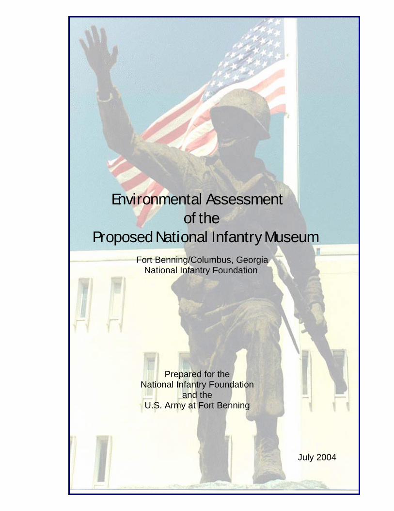
Environmental Assessment of the Proposed National Infantry Museum Fort Benning/Columbus, Georgia National Infantry Foundation Prepared for the National Infantry Foundation and the U.S. Army at Fort Benning July 2004
-
Upload
khangminh22 -
Category
Documents
-
view
0 -
download
0
Transcript of Environmental Assessment of the Proposed National Infantry ...
Environmental Assessment of the
Proposed National Infantry Museum
Fort Benning/Columbus, Georgia National Infantry Foundation
Prepared for the National Infantry Foundation
and the U.S. Army at Fort Benning
July 2004

Printed on 30% post-consumer recycled paper


ii
Table of Contents
Section Page 1.0 Purpose and Need
1.1 Purpose 1 1.2 Need 1
2.0 Description of Proposed Action and Alternatives
2.1 Proposed Action 3 2.2 Alternatives Studied 6
2.2.1 Alternative “A” – No Action/Status Quo 7 2.2.2 Alternative “B” – Upgrade and Expand the 7 Existing NIM 2.2.3 Alternative “C” – Fort Benning Boulevard Site 8 (the 2.2.4 Preferred Alternative) 2.2.4 Alternatives Studied but Not Analyzed in Detail 8
3.0 Affected Environment and Environmental Consequences
3.1 General 10 3.2 Land Use 11 3.3 Soils 13 3.4 Water Quality 16 3.5. Wetlands 18 3.6 Vegetation 20 3.7 Wildlife 25 3.8 Cultural Resources 27 3.9 Air Quality 31 3.10 Aesthetics 33 3.11 Public Health and Safety 35
3.12 Human Environment 37 4.0 Conclusions and Recommendations
4.1 Conclusions 41 4.2 Recommendations 42
5.0 Preparation, Consultation, and References
5.1 Preparation 43 5.2 Persons and Agencies Consulted 43 5.3 References 44
iii

Appendices
Appendix Page Appendix A: Figures Figure 1: General Location of Fort Benning and Columbus, Georgia 47 Figure 2: Preferred Alternative: Project Area Map 49 Figure 3: Site Plan for the Preferred Alternative 51 Appendix B: Mitigation and Monitoring Plan 53
iv
Environmental Assessment of the Proposed National Infantry Museum July 2004
Section 1.0
Purpose and Need for the
Proposed Action
1.1 PURPOSE
The purpose of the proposed action is to build a new museum and related facilities to
replace the existing National Infantry Museum (NIM) and increase the space available for the
museum’s collection of artifacts and its supporting functions. The existing facility is inadequate
for the museum’s needs and is deteriorating.
This new museum would considerably increase the space available for the NIM
collection and its supporting functions and enhance the ability of the NIM to fulfill its mission to
provide education and training to the soldiers, military dependents, and the general public for all
facets of the history of the United States Infantry from its inception in 1775 to the present; to
describe the origin and development of Fort Benning; and to present an overview of the United
States Army. The goal of this action by the National Infantry Foundation (NIF) is to honor the
service and sacrifice of all United States Infantrymen in protecting and serving the nation; to
serve as a proponent of a sense of time, place, and belonging (esprit de corps) for the Infantry;
and to instill knowledge of the Infantry, Fort Benning, and the U.S. Army.
1.2 NEED
The NIM has existed at Fort Benning, Georgia, since 1959, operating initially in
converted World War II era wooden barracks In 1977, the NIM moved to its present location in
Building 396 (Bradley Hall), the Installation’s former hospital. The museum, operating under the
direction of the United States Army Infantry Center (USAIC), Fort Benning, Georgia, and the
U.S. Army Center of Military History (CMH) in Washington, D.C., has assembled and preserved
an important collection of artifacts ranging from colonial times to the present. In addition to its
exhibition function, the NIM also serves an important role as a venue for soldier training. The
NIM supports the Commander in accomplishing the major organizational mission of the USAIC;
collects, preserves, and interprets artifacts; supports the training and education of soldiers on the
Infantry’s heritage; promotes awareness of the Infantry’s contributions to national defense
military personnel, their dependents, Army civilians, and other visitors; provides Infantry related
1

Environmental Assessment of the Proposed National Infantry Museum July 2004
information and educational services to soldiers, Army civilians, and the general public; preserves
Fort Benning’s material culture; and implements all other actions necessary to fulfill its mission.
Bradley Hall, the current location of the NIM, was constructed in 1925 and contains
approximately 48,000 gross square feet of space occupied by the museum for galleries, storage
and collection management, and administrative functions. Limited improvements were made to
the building at the time of relocation of the museum in 1977, but increasing age of the structure
and its mechanical systems, in addition to demanding functional and operational requirements
have created an increasing number of challenges to the NIM. Only a small fraction of the
museum’s collection can be displayed at any one time (less than 15%) and visitor circulation
within the galleries is impeded. Amenities such as restrooms and meeting areas are limited, as is
space for storage of artifacts, resulting in poor accessibility to the collection. Furthermore,
numerous artifacts are stored at several locations elsewhere on Fort Benning under less than
desirable climatic and security regimes. Environmental conditions in Bradley Hall, such as
temperature and humidity, are frequently out of required ranges for proper collection
management. Accessibility for the handicapped has been provided but is marginal due to the
configuration of the structure and adjacent grounds.
Soldier training is presently the primary basis of the museum, with soldiers making up a
significant number of the museum’s visitors. The training sessions cannot reach their full
potential because the large numbers of soldiers at any given time results in overcrowding; in
addition, the limited number of staff and outdated exhibits lessen the learning experience (Lord,
2002).
Recent investigations indicate that renovation or reconstruction of the present facilities
would be cost prohibitive. The high costs are due to the extent of work that would have to be
performed to fully abate hazardous material (asbestos and lead-based paint), and to mitigate
potential effects of the building on the Main Post Historic District. Extensive additions would be
required to the facility to provide necessary gallery and administrative areas to accommodate the
current museum, projected growth, and full compliance with handicap access requirements.
In addition, since the events of September 11, 2001 have resulted in heightened security
requirements on military Installations, it is the goal of Army museums to seek new locations that
can be better accessed in times of increased security on post. Such locations would be off the
Installation or immediately adjacent to the boundary allowing visitor access regardless of the
security condition on post.
2

Environmental Assessment of the Proposed National Infantry Museum July 2004
Section 2.0
Description of Proposed
Action and Alternatives
2.1 PROPOSED ACTION
The National Infantry Foundation (NIF), a 501(c)(3) charitable organization, in full
cooperation with the U. S. Army, proposes to build a new and expanded museum and related
facilities to replace the existing NIM at Fort Benning. The new museum would be located on an
approximately 200-acre site along Fort Benning Boulevard.
The proposed action includes:
• The construction and operation of a museum and related structures, galleries,
and exhibits to accommodate the NIM collection;
• Development of the site to include local access and parking;
• Vehicular and pedestrian circulation; creation of a Parade Ground, amphitheater,
Memorial Walk of Honor and similar site-related amenities;
• Relocation of a portion of the Columbus Riverwalk;
• Replication of a jump tower (approximately 200 feet tall) similar to, at four-
fifths scale, those located on the main post area of the Installation;
• Re-creation of a World War II Company Street;
• Provision of all necessary utilities
The U.S. Army Center of Military History (CMH) would retain ownership of the
collection and all artifacts that are displayed or stored at the new NIM. Programs and conditions
for soldier training would be improved considerably with better access to the collection, larger
meeting and display areas, and upgraded exhibits and interpretations of the history of the Infantry
through the use of more modern and engaging museum techniques.
This concept was approved by the Army’s Assistant Chief of Staff for Installation
Management (ACSIM) on 16 May 2000, and is the subject of a Memorandum of Agreement
(MOA) dated 31 October 2000, and executed among the Garrison Commander for Fort Benning,
the Chief Curator of the Army for the CMH, and the President of the National Infantry
Association for the NIF. This MOA describes the roles of the signatory parties and the conditions
3
Environmental Assessment of the Proposed National Infantry Museum July 2004
for development and operation of the new NIM and is being supplemented as new information
becomes available.
Fort Benning is located in southwestern Georgia, 100 miles southwest of Atlanta. The city
of Columbus, Georgia, borders the Installation along its north and northwest boundary. The town of
Phenix City, Alabama, located just across the Chattahoochee River west of Fort Benning, is the
nearest Alabama incorporated population center (see Figure 1). The Installation is accessible
primarily by Interstate 185, U.S. Route 27, Georgia Highways 1/520, 26, and Alabama Highway
165, in addition to other smaller county and Installation maintained roads. The Chattahoochee
River, which serves as the border between Georgia and Alabama, traverses the southwest tip of the
Installation.
The new NIM would be constructed on an approximately 200-acre site lying between
Fort Benning Boulevard and South Lumpkin Road, north of Custer Road, and owned in part by
the U.S. Government [Fort Benning Military Installation (Army)] and in part by the
Consolidated Government of Columbus/Muscogee County, Georgia (City). See the Area Map in
the Appendix (Figure 2). The Army property, approximately 104.23 acres, comprises the
southern end of the site and extends northward along Fort Benning Boulevard to the “stone gates”
and the northern extent of, and traditional entrance to the Installation. This property contains out-
grants to Georgia Power and Southern Bell for their overhead transmission lines, as well as a
sanitary sewer presently operated by the Army. An extension of the scenic Riverwalk from
downtown Columbus to Fort Benning passes through the property. There are no other
improvements on this land other than an electrical lighting system that follows the Riverwalk and
a few drainage structures remaining from the earlier presence of the Fort Benning Railroad,
removed several decades ago. The Army would lease the Fort Benning property to the NIF for
the proposed new museum.
The City property, consisting of approximately 90.63 acres, contains a small park with a
vehicular parking area, a picnic shelter and restroom facility, and exterior lighting. There are no
other improvements on this land. Title to the City property would be transferred to the NIF for
the new museum prior to the start of construction.
The new museum is the subject of a Master Plan prepared for the National Infantry
Foundation by Lord Cultural Resources Planning and Management (Lord, 2002). The Master
Plan describes the overall conceptual plan for the NIM, including galleries and exhibits,
programs, governance, and a proposed schedule of implementation. The Plan describes the
proposed physical concept of the museum, the site, and related facilities and includes a
preliminary estimate of capital costs.
4

Environmental Assessment of the Proposed National Infantry Museum July 2004
The NIM would consist of a main museum building of approximately 161,000 square feet
and would contain the galleries and exhibits, public spaces, and supporting amenities and
administrative areas (see Figure 3). A receiving/restoration facility of up to 49,800 square feet
would be provided for restoration and curatorial activities and related staff space as well as
storage areas for the museum’s collection. Parking would be provided in several surface lots with
the number spaces estimated for 600 cars and 50 buses. All of the space occupied by the NIM in
Bradley Hall would be vacated and made available for other uses. Future use of the vacated
space in this building by the Army or others would possibly consist of training or administrative
activities similar to the surrounding buildings but has not been determined. Appropriate
documentation and environmental analysis under the National Environmental Policy Act (NEPA)
and other regulatory requirements will be undertaken by the Army at Fort Benning for this later
action.
The NIF would relocate seven World War II era buildings from two locations on Fort
Benning to the site of the new museum. Six of these buildings are presently located on Bergen
Street at the rear of the existing museum, where they were moved in 1993 for stabilization and
initial restoration; a chapel presently remains in its original location in the Harmony Church area
of Fort Benning. The buildings at Bergen Street have been abated for hazardous materials and
stabilized to preclude further deterioration. To date, no such work has been performed on the
Chapel. These seven buildings are the subjects of an Interpretive Plan (Jaeger, 2000) and a
license was issued to the NIF covering the in situ abatement and stabilization (DACA21-3-99-
6463, Restoration of Historic Buildings, executed 19 July 2000 and amended 10 May 2001 and
10 May 2004). Once relocated to the new NIM site, these buildings would be restored and
interpreted in accordance with the Interpretive Plan to recreate a Company Street as it would have
appeared during the mobilization for World War II.
A Memorial Walk of Honor would be created in the vicinity of the new NIM and the new
Parade Ground. This wide paved walk would provide for relocation of memorials from the
existing NIM and Sacrifice Field (south of Baltzell Avenue across from Bradley Hall), as well as
for the construction of new memorials from private organizations.
The NIF also proposes to construct a scale replica of the inactive controlled descent Jump
Tower that is located on the northeast corner of Eubanks Field in the Main Post area of the
Installation. The control or “rigger” building at the base of the structure would be replicated and
would contain restrooms, a concession area to support the Parade Ground, and an interpretive
gallery describing the Jump Tower’s role in training at Fort Benning.
5
Environmental Assessment of the Proposed National Infantry Museum July 2004
The NIF would construct a Parade Ground which would be used for demonstrations and
graduations that are presently conducted at other locations on Fort Benning. An Amphitheater
would be provided for small assemblies and special events associated with the museum.
The proposed action would include provision of all utilities necessary to support the
facility. This includes storm water management, site lighting, security, and environmental
controls. Construction of the NIM would require the relocation of approximately 6000 linear feet
of a high voltage transmission line (Georgia Power) that generally follows the path of the former
Fort Benning Railroad through the site. This line would be relocated to the west of the museum
along the east side of South Lumpkin Road.
Appropriate permits would be obtained prior to construction from local, state, and
Federal regulatory agencies having jurisdiction over the site/project as discussed later in this
document. Construction would include, but not be limited to, construction of access roads
including any temporary access to the site, Installation of erosion control measures in accordance
with State Erosion and Sedimentation (E&S) Act of 1975 and the Manual for Erosion and
Sediment Control in Georgia, and all site development and building construction for a complete
NIM facility. Periodic monitoring of the site would be provided during construction to ensure
that erosion and siltation from construction activities is kept to a minimum and there is no
damage to cultural resources. Permits under the National Pollutant Elimination Discharge
System (NPDES) would need to be coordinated with both the City of Columbus and with Fort
Benning for state requirements. Land disturbance within the city property will also be regulated
with the local issuing authority as established in the Columbus, Georgia Soil Erosion and
Sedimentation Control Ordinance. The NIF would transfer the museum building to the Army
within six months after Beneficial Occupancy and the Army will maintain the Museum. The NIF
would lease certain portions of the Museum to collocate the management and operational staff of
the NIF who are engaged in carrying out its responsibilities for raising funds, operation of
revenue generating activities, and coordination of NIM activities such as volunteer coordination.
All conditions of operations and maintenance of the NIM project would be defined in the lease
between the Army and the NIF.
2.2 ALTERNATIVES STUDIED
A site study for the proposed NIM was prepared several years ago (Kaiser, 1999) wherein
four potential sites locations were addressed. This included sites at the intersection of Interstate
185 and Victory Drive (Victory Drive Site), at the intersection of Interstate 185 and Custer Road
(Custer Road Site), Fort Benning Boulevard (the current Alternative C below), and a variation of
6
Environmental Assessment of the Proposed National Infantry Museum July 2004
the potential expansion of the site at the current NIM (Existing Museum Site, the current
Alternative B). This study used a comparative analysis of such categories as accessibility,
utilities, and environmental considerations including storm water management, cultural resources,
wetlands, land use compatibility, and ecology. The report recommended Fort Benning Boulevard
as the preferred site for development of the new NIM. The sites eliminated from further review
(Victory Drive and Custer Road) are discussed later in this chapter under “Alternatives Studied
but Not Analyzed in Detail”.
2.2.1 Alternative A – No Action/Status Quo
Under this alternative, the NIM would remain at its present location in Bradley Hall and
would undergo no expansion or major improvements. The NIM would continue to function in its
present capacity with periodic minor improvements and updates to the galleries and exhibits.
Soldier training would continue and visitation would be expected to remain at current post-9/11
levels. Additionally, parts of the collection not on display as well as new artifact acquisitions
would continue to be stored in Bradley Hall and in other off-site locations.
The World War II Company Street would be developed on the location of the current six
buildings on Bergen Street at the rear of the NIM. The Chapel would be moved from its location
in Harmony Church to the north end of Bergen Street. These buildings would be restored and
interpreted in accordance with the Interpretive Plan to recreate a Company Street as it would have
appeared during the mobilization for World War II. Visitor circulation between this feature and
the NIM in Bradley Hall would be provided, including additional parking and handicap facilities
in the immediate vicinity of the Company Street. Memorials would remain at the NIM and on
Sacrifice Field and new ones would likely be located in the immediate vicinity. Graduations
would continue to be held at other locations on Fort Benning where they are presently conducted.
2.2.2 Alternative B – Upgrade and Expand the Existing NIM
This alternative, essentially the same as the Existing Museum Site alternative under the
1999 study (Kaiser, 1999), would involve upgrading and major improvements to Bradley Hall as
well as expansion of the building to accommodate the greater exhibit and gallery area proposed
and additional storage and administrative space needed for the new NIM. Structures would be
modified to provide all necessary amenities, accessibility for the handicapped, and better
circulation among galleries and administrative and functional areas.
The functions of the Receiving/Restoration Facility (up to another 49,800 square feet)
would have either to be deleted from the Master Plan or located elsewhere in off-site facilities as
7
Environmental Assessment of the Proposed National Infantry Museum July 2004
are being used at present. Expanded visitor parking would most likely be accommodated on the
present site with utilization of the paved areas west of the NIM. Utilities would likely be
sufficient to handle the increased museum size, with possible upgrades necessary, and facilities
would have to be constructed to provide for storm water management.
The World War II Company Street would be developed on the location of the current six
buildings on Bergen Street at the rear of the NIM. The Chapel would be moved from its location
in Harmony Church to the north end of Bergen Street. These buildings would be restored and
interpreted in accordance with the Interpretive Plan to recreate a Company Street as it would have
appeared during the mobilization for World War II. Memorials would remain at the NIM and on
Sacrifice Field and new ones would likely be located in the immediate vicinity. Graduations
would continue to be held at other locations on Fort Benning where they are presently conducted.
2.2.3 Alternative C – Fort Benning Boulevard Site (the Preferred Alternative)
The Preferred Alternative would involve development of the new NIM on the site
between Fort Benning Boulevard and South Lumpkin Road, north of Custer Road, and would
include property of the U. S. Government and the City of Columbus totaling approximately 200
acres. Facilities as described in the Master Plan and noted in Section 2.1 would be constructed on
this site. Space occupied by the NIM in Bradley Hall would be vacated and made available for
other uses. Future use of the vacated space in this building by the Army or others would possibly
consist of training or administrative use similar to the use of surrounding buildings but has not
been determined.
2.2.4 Alternatives Studied but Not Analyzed in Detail
The Victory Drive site described in the 1999 study (Kaiser, 1999) was rejected due to
conflict with current and adjacent land uses (Loyd Elementary and Spencer High Schools),
extraordinary grading and storm water management costs, and inability to accommodate all the
desired functions of the proposed NIM. The Custer Road site would have required extensive
grading to create sufficient developable areas outside of the flood plain of Upatoi Creek. There
would have been extensive impacts to wetlands at this site, and there was concern whether
sufficient area would be available to create the full scope of the NIM. Consequently, this site was
removed from further consideration. (Note that base security and increased concern over
accessibility during times of national emergency were not the major concerns that they are at
present. The Custer Road site, inside the new Access Control Point on Interstate 185, would be
further degraded in acceptability on this account. The Victory Drive site would have received a
8

Environmental Assessment of the Proposed National Infantry Museum July 2004
favorable rating under this criterion due to its location on the Installation boundary and
accessibility from public thoroughfares.)
9
Environmental Assessment of the Proposed National Infantry Museum July 2004
Env
EnviroConse
3.1 GENERAL
The Fort Benning baseline affected environment has been described in several
impact analyses during the past several years. The Final Environmental Impact St
Digital Multi-Purpose Range Complex Environmental Impact Statement (April
the most recent and detailed summary of this environment and is available for rev
at http://www-benning.army.mil/EMD/_program_mgt/legal/index.htm
This section of the environmental assessment describes, by resource area (cul
water quality, wildlife, etc.), the specific affected environment (environmental
potential impact for each alternative. The Final Rule on Environmental Ana
Actions (32 CFR 651.48(b) (1) encourages elimination of issues from detailed
which are minor. The proposed action would have very minor or negligible
impacts to geology, topography, climate, and other minor resource issues that ar
further in this environmental assessment. The affect of noise is briefly discussed
Use and Aesthetics sections. Several Executive Orders protect children and minor
populations. Those impacts are discussed under the Public Health and Safet
Environment sections.
Cumulative impacts upon selected resources were also evaluated and pre
section. The construction and operation of the proposed National Infantry Museu
very localized effects, including cumulative impacts. The cumulative impacts an
upon potential impacts of the proposed action in addition to impacts of pas
reasonably foreseeable future actions in the Fort Benning, Columbus-Phenix City
The Final EIS for the DMPRC provides the most recent description of regional a
considered in the cumulative impact analysis in this EA (Fort Benning, April 2004)
10
Section 3.0
Affected ironment
and nmental quences
environmental
atement for the
2004) provides
iew on the web
tural resources,
baseline) and
lysis of Army
consideration
environmental
e not analyzed
under the Land
ity/low income
y and Human
sented in this
m would have
alysis is based
t, present, and
communities.
ctions that are
.
Environmental Assessment of the Proposed National Infantry Museum July 2004
The threshold level of significance for each resource area is defined, followed by description
of current conditions (affected environment), potential environmental impacts and required
mitigation measures, and cumulative impacts for each resource.
3.2 LAND USE
The threshold level of significance for land use would be to alter the existing land use in
such a manner as to cause severe incompatibility with adjacent land uses. The region of influence
(ROI) for land use is the area of South Lumpkin Road from Victory Drive south to the Fort
Benning cantonment area.
3.2.1 Alternative A -- No-Action / Status-Quo
The existing museum is located within the “urbanized” cantonment area of Fort Benning
on Baltzell Avenue in the northeastern end of the cantonment area. The museum is contained
within one building, Bradley Hall, the Installation’s former hospital. Several other buildings in
the immediate vicinity of Bradley Hall that were also part of the hospital complex at one time are
presently used mainly for instruction and administration. Sacrifice Field, a large open area across
Baltzell Avenue from the NIM, is the location of several memorials and monuments. Officers’
housing is northwest of the museum along Rainbow Avenue and also to the south of Baltzell
Avenue and to the east of Sacrifice Field. Several holes of the “Follow Me” golf course lie to the
rear of Bradley Hall and the former hospital complex. This alternative would not change existing
land use and there is no adverse effect on land use. No mitigation is proposed.
3.2.2 Alternative B (Upgrade and Expand Existing NIM)
Alternative B encompasses the existing site as described in Alternative A along with the
lands to the east and northeast that include additional urban landscape. This alternative would
impact the open recreational land use (golf course) and remove some urban wooded areas.
Expanded development and use of this site would conflict with nearby residences because of
increased traffic and congestion. The expansion and new construction of facilities would impact
several holes on the golf course; that conflict represents a moderately adverse impact because the
golf holes would have to be relocated at considerable expense (ICF Kaiser, 1999). The short-
term noise during construction would also conflict with adjacent residential use, and there is no
adverse effect on land use. No mitigation is proposed.
11

Environmental Assessment of the Proposed National Infantry Museum July 2004
3.2.3 Alternative C (Preferred Alternative)
The Preferred Alternative site is currently characterized by tree-covered woodlands and
grass covered fields. A former railroad bed crosses the property from north to south. Power
transmission lines cross the property adjacent to the railroad bed and in an east-west direction
across the center of the site.
The Preferred Alternative site is bordered on the east by Fort Benning Boulevard, across
which is undeveloped land and adjoining post housing (Battle Park homes). At the south end of
the site and immediately adjacent to the proposed Parade Ground is the location of a new Access
Control Point (ACP), one of several new ACP’s being constructed as part of new force protection
requirements. The subject site is bordered on the south by Custer Road, across which is the
former welcome center for the Installation (now closed). To the north, immediately adjacent to
and outside the Installation boundary, the subject site is bordered by a multi-family residential
development. The property is bordered on the west by several entities: in the north by wooded
property owned by Boral Bricks; in the central portion by property owned by the City of
Columbus, Georgia and occupied by the Oxbow Meadows Golf Course; and in the south by a
construction and demolition landfill operated by the City, an Elks Lodge, the Environmental
Learning Center of Columbus State University, a mobile home residential community, and
several small retail and commercial businesses.
The Fort Benning Master Plan Long Range Component indicates that the Fort Benning
Boulevard site is currently classified as “open space”, with future land use options,
recommending its continued use as such. This alternative would change the land use from open
space forest corridor to developed low-density public use. The proposed National Infantry
Museum is compatible with, and may increase visitation to, the Oxbow Meadows Environmental
Learning Center. The Preferred Alternative is also compatible with the other land uses along
South Lumpkin Road. The short-term noise during construction would cause minor short-term
adverse impacts to adjacent land use, especially for visitors to the Oxbow Meadows
Environmental Learning Center. The City of Columbus is presently updating its Oxbow
Meadows development plan for the area. The NIM is an identified land use in this plan.
Overall, implementing the Preferred Alternative would have minor adverse impacts to
land use as open space forest corridor is removed and noise increases from traffic and
construction equipment. No mitigation is proposed.
12
Environmental Assessment of the Proposed National Infantry Museum July 2004
3.2.4 Cumulative Impacts to Land Use
Growth in the Fort Benning, Columbus-Phenix City area continues to result in
construction of undeveloped areas such as the Fort Benning Boulevard site. Minor adverse long-
term cumulative impacts to regional undeveloped lands are likely to continue regardless of which
NIM alternative is chosen. Leadership in Energy and Environmental Design (LEED) is a national
standard of building construction that would help reduce cumulative impacts to land use. The
Foundation will endeavor to build to the intent of LEED and will employ techniques to evaluate
life cycle costing. The minimum level of sustainable design is achieved with good design, solid
waste management, and construction oversight with no additional cost burden (USBGC, 2002)
and would result in no significant adverse impacts to land use. Adherence to local government
planning and zoning requirements outside of Fort Benning also helps to mitigate cumulative land
use impacts.
3.3 SOILS
The threshold level of significance for soils is any ground disturbance or other activities
that would violate applicable Federal or state laws and regulations, such as the Georgia Erosion
and Sedimentation Control Act (ESCA), and the potential for Notices of Violation (NOV) for the
failure to receive applicable state permits, such as a National Pollutant Discharge Elimination
System (NPDES) construction because the area is relatively flat. The ROI for soils includes
soil/fill material borrow areas, construction site, staging areas, and areas within the local
watershed including the Chattahoochee River, Upatoi Creek, and unnamed streams and drainages
into these waterways.
3.3.1 Alternative A – No Action/Status Quo
At the site of the existing NIM, the soil type is classified as Orangeburg-Urban land
complex (Gary Hollon, pers.com, 2004). The Orangeburg series consists of very deep, well-
drained, moderately permeable soils that formed in loamy and clayey sediments of the Coastal
Plain. Slopes range from 0 to 25 percent (NRCS, 2004). The urban land complex map unit
consists of areas that are more than 85 percent covered by buildings, streets, houses, schools, and
shopping centers. The open areas are usually lawns and are so small they could not be separated
on the soil map. Soils in these open areas have been so reworked that they can no longer be
recognized.
13
Environmental Assessment of the Proposed National Infantry Museum July 2004
Continued operation of the NIM on this site would not affect soils. No mitigation is
planned or required.
3.3.2 Alternative B – Upgrade and Expand the Existing NIM
Soils at the existing NIM are Orangeburg-Urban land complex as described above.
Construction of expanded facilities east of the existing NIM would disturb soils during
construction and it would permanently replace some soils with new buildings.
Construction contractors would be required to follow the Erosion, Sedimentation and
Pollution Control Plan (ESPCP) prepared by the designer to minimize soil impacts
during construction.
As part of the NPDES Permit BMPs and Fort Benning requirements, the contractor would
be required to prepare and implement a Spill Prevention, Control and Countermeasure (SPCC)
Plan during construction operations. The SPCC will delineate measurements and practices that
will be implemented to prevent spill/release from hazardous materials into the soil resources.
Overall, this alternative would cause minor adverse impacts to soils that have been
disturbed previously. As part of the NPDES Permit BMPs and Fort Benning mitigation
requirements, the proponent/contractor would be required to prepare and implement a Spill
Prevention, Control and Countermeasure (SPCC) Plan during construction operations. The SPCC
will delineate measurements and practices that will be implemented to prevent spill/release from
hazardous materials into the soil resources. No additional mitigation is proposed.
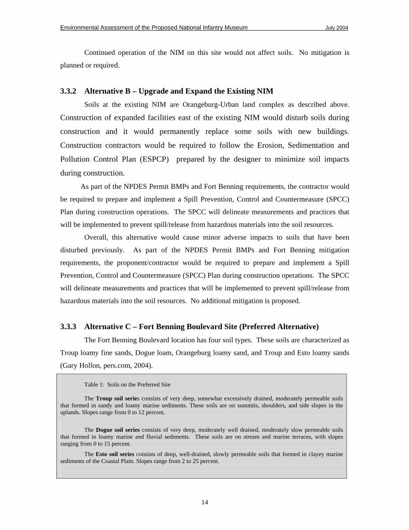
3.3.3 Alternative C – Fort Benning Boulevard Site (Preferred Alternative)
The Fort Benning Boulevard location has four soil types. These soils are characterized as
Troup loamy fine sands, Dogue loam, Orangeburg loamy sand, and Troup and Esto loamy sands
(Gary Hollon, pers.com, 2004). Table 1: Soils on the Preferred Site The Troup soil series consists of very deep, somewhat excessively drained, moderately permeable soils
that formed in sandy and loamy marine sediments. These soils are on summits, shoulders, and side slopes in the uplands. Slopes range from 0 to 12 percent.
The Dogue soil series consists of very deep, moderately well drained, moderately slow permeable soils
that formed in loamy marine and fluvial sediments. These soils are on stream and marine terraces, with slopes ranging from 0 to 15 percent.
The Esto soil series consists of deep, well-drained, slowly permeable soils that formed in clayey marine sediments of the Coastal Plain. Slopes range from 2 to 25 percent.
14
Environmental Assessment of the Proposed National Infantry Museum July 2004
Willmer Engineering, Inc. prepared a Site Characterization Study for the preferred
alternative and deemed that the soils are favorable for supporting the planned development using
shallow foundations (Willmer Engineering, 2003). Shrink-swell potential needs to be considered
in selecting building sites (ICF Kaiser, 1999). Shrink-swell is the extent to which the soil
shrinks as it dries out or swells when it gets wet.
This alternative would involve soil disturbance during any excavation and/or the
construction process, resulting in minor adverse effect on soils. Construction may result in the
migration of airborne or waterborne soil particles onto adjacent lands and streams, which
contribute to sedimentation of off-site areas and can interfere with pollination of adjacent
vegetation or other ecological processes.
Overall, potential minor adverse effects to soils would result from implementing this
alternative. Adherence to the Erosion, Sedimentation and Pollution Control Plan (ESPCP),
NPDES permit, the SPCC Plan, and best management practices would be required for this site to
minimize impacts to soils. No additional mitigation is required; additional discretionary
mitigation is described in the Mitigation and Monitoring Plan in the Appendix.
3.3.4 Cumulative Impacts to Soils
The ROI includes areas within the local watershed including the Chattahoochee River, Upatoi
Creek, and unnamed streams and drainages into these waterways. Development, construction,
and other activities planned for the Fort Benning, Columbus-Phenix City area, inevitably result in
the disturbance of soils. Past, present, and foreseeable future actions in the ROI include
construction and road maintenance, and have the potential to contribute to soil disturbance,
erosion, and the loss of vegetative cover. In particular, the privatization of the water/wastewater
system and the large scale construction projects on Fort Benning and in Columbus has the
potential for moderate adverse effects to soils in the Fort Benning portion of the ROI. The
construction of the Oxbow Meadows development and marina would have the potential for minor
adverse effects to soils in the Columbus portion of the ROI. Adherence to mitigation required in
the Federal and state permits for these projects would minimize potential effects.
There is a moderate adverse cumulative impact to soils as regional growth continues and
topsoil is removed; however, use of the same mitigation measures discussed above and detailed in
the NIM Mitigation & Monitoring Plan would help minimize the adverse effects.
15

Environmental Assessment of the Proposed National Infantry Museum July 2004
3.4 WATER QUALITY
The Chattahoochee River dominates the surface water regime at Fort Benning. The
principal tributaries to the Chattahoochee on the Installation are Bull Creek and Upatoi Creek,
each of which has several lesser tributaries flowing into them. Most streams found within the
Installation boundary drain into the Chattahoochee River. Near Columbus, the Chattahoochee
River is characterized as a ninth-order stream represented by channel beds of loose mud, silt,
sand, and organic detritus (Georgia DNR). Backwater sloughs and oxbow ponds are more
prevalent in this area in part because the broad floodplain is defined by little elevation change.
The threshold level of significance for water quality is the violation of applicable Federal
or state laws and regulations, such as the Clean Water Act and the Georgia Water Quality Control
Act, and the failure to receive and follow applicable Federal and state permits, such as a National
Pollutant Discharge Elimination System (NPDES) permit (required for all projects one acre or
more in size), prior to initiating a proposed action.
The ROI for water quality consists of the streams and other surface water bodies within
the local watershed including the Chattahoochee River, Upatoi Creek, and unnamed streams and
drainages into these waterways.
3.4.1 Alternative A – No Action/Status Quo
The existing museum is at about 400 feet mean sea level (MSL) elevation. The existing
site storm water drains to the west into a ravine that flows into Upatoi Creek about a mile to the
north. The site is not in the 100-year floodplain.
Overall, there would be no adverse effect to water quality from storm water run-off or
other existing facilities or activities under Alternative A. No mitigation is proposed.
3.4.2 Alternative B – Upgrade and Expand the Existing NIM
The existing museum is at about 400 feet mean sea level (MSL) elevation. The existing
site storm water drains to the west into a ravine that flows into Upatoi Creek about a mile to the
north. The site is not in a flood prone area, and is not in the 100-year floodplain.
An Erosion, Sedimentation and Pollution Control Plan (ESPCP) will be in place to
control, reduce, prevent and minimize pollution of waterways from storm water discharges.
There would be a very minor temporary adverse effect to water quality to Upatoi Creek
downstream from sediments released during construction, even with best management practices
(BMP) in place to control erosion and run-off. The small increase in impermeable surfaces
(buildings, walkways, roads, parking areas) would reduce the amount of slow percolation of
16
Environmental Assessment of the Proposed National Infantry Museum July 2004
precipitation through ground cover and soils to the groundwater supply, leading to a slight
increase in storm water run-off.
As part of the NPDES Permit BMPs and Fort Benning requirements, the contractor would
be require to prepare and implement a Spill Prevention, Control and Countermeasure (SPCC)
Plan during construction operations. The SPCC delineates measurements and practices that will
be implemented to prevent spill/release from hazardous materials into water ways (including
storm drainages along access roads and/or near project areas) to protect the water quality.
Overall, a temporary minor adverse effect to water quality would occur under this
alternative. No additional mitigation is proposed.
3.4.3 Alternative C – Fort Benning Boulevard Site (Preferred Alternative)
Elevations on this site vary from 225 to 280 feet MSL with a large generally flat area to
the west of the railroad corridor. The Preferred Alternative’s storm water is carried toward the
Chattahoochee River to the west through pipes under the abandoned railroad bed and through
several small creek channels. Many of these small channels flow into Oxbow Creek, a tributary
to the Chattahoochee River, which is a well-defined perennial stream flowing through the site that
drains a portion of the urbanized area of south Columbus. Flood Insurance Rating Maps (FIRM)
do not show any flood plains on this site.
Conventional surface drainage and piped systems and storm water retention areas would
be integrated with construction to control sedimentation and storm water run-off. An ESPCP will
be in place to control, reduce, prevent and minimize pollution of waterways from storm water
discharges. There would a minor short-term decrease in water quality to the Chattahoochee River
downstream from the site due to sediments, vehicle emissions, and debris potentially released
during construction; the impact to water quality would not be detectable due to the quantity of
urban water flowing through the site, and would be minimized by the employment of BMP and
sedimentation control measures. The increase in impervious surfaces (buildings, walkways,
roads, and parking areas) across the site would reduce the slow percolation of rainwater into
ground cover and soils. The resultant increase in storm water run-off could be reduced if semi-
pervious surfaces were used for parking areas in accordance with sustainable design standards
(Army, 2001).
Overall, minor adverse effects would occur under this alternative from the increased
impervious surfaces. Adherence to the ESPCP, NPDES permit, the SPCC Plan, and best
management practices would be required for this site to minimize impacts to water resources. No
17
Environmental Assessment of the Proposed National Infantry Museum July 2004
additional mitigation is required; additional discretionary mitigation is described in the Mitigation
and Monitoring Plan in the Appendix.
3.4.4 Cumulative Impacts to Water Quality
The ROI for water quality consists of the streams and other surface water bodies within
the local watershed. Past, present, and foreseeable future actions in the ROI include construction
and road maintenance, and have the potential to contribute to soil disturbance, erosion, and the
loss of vegetative cover which would have moderate adverse effects to water quality within the
watershed. In particular, the privatization of the water/wastewater system and the large scale
construction projects on Fort Benning and in Columbus have the potential for moderate adverse
effects to water quality in the Fort Benning portion of the ROI. The construction of the Oxbow
Meadows development and marina would have the potential for moderate adverse effects to water
quality in the Columbus portion of the ROI. Overall, there would be moderate adverse
cumulative impacts to water quality with in the ROI. Adherence to mitigation required in the
Federal and state permits for these projects would minimize these potential effects.
3.5 WETLANDS
Gulf Engineers Consultants completed a mapping overlay of the wetland areas on Fort
Benning. These overlays are available at the Fort Benning Directorate of Public Works (DPW)
for review. This map was generated from data gleaned from National Wetland Inventory maps
(also available at DPW for review) and USDA Natural Resources Conservation Service county
soil surveys that show soils classified as hydric, color infrared aerial photographs, and the Terrain
analysis for Fort Benning (Fort Benning, 2003). A wetland delineation of the preferred
alternative site was conducted.
The threshold of significance for wetlands would be an adverse change from one wetland
type or function to another. The ROI is within the construction site and the downstream
watershed.
3.5.1 Alternative A – No Action/Status Quo
The existing site does not lie in a flood prone area or 100-year floodplain, and there are
no wetlands or conditions conducive to wetlands in the immediate vicinity of the area. There is
no adverse effect to wetlands under this alternative. No mitigation is proposed.
18
Environmental Assessment of the Proposed National Infantry Museum July 2004
3.5.2 Alternative B – Upgrade and Expand the Existing NIM
The existing site, including the expansion areas to the south and east, do not lie in a flood
prone area a flood prone area, and there are no wetlands or conditions conducive to wetlands in
the immediate vicinity of the area. There is no adverse effect to wetlands under this alternative.
No mitigation is proposed.
3.5.3 Alternative C – Fort Benning Boulevard Site (Preferred Alternative)
There are jurisdictional wetlands present on the proposed site of this alternative (ERA,
2001). Like the vegetation on the majority of the site, the wetlands are characteristic of Coastal
Plain areas. Dominant species include laurel-leaf greenbrier (Smilax laurifolia), sweetbay
magnolia (Magnolia virginiana), swamp tupelo (Nyssa biflora), red maple (Acer rubrum), and
wax-myrtle (Myrica cerifera). The forested wetlands serve to enhance water resources by
detaining overflows during flood periods and by acting as water-storage basins during dry
seasons. The wetlands replenish both surface water and groundwater systems and naturally filter
pollutants from water supplies.
Preliminary plans avoid most wetland impacts and incorporate an aesthetic wetland
boardwalk tour into the development plans. Current plans would only construct a walkway over
the narrowest section of a wetland. It is unlikely that an individual permit would be required
under Section 404 of the Clean Water Act because there would be no direct filling of any
wetlands except for driving posts into a few parts of the wetland for the walkway.
Potential adverse impacts to wetlands would include loss of buffer areas due to
vegetation removal for construction, and increased runoff from buildings and pavement.
Conventional storm water run-off controls would likely reduce the status of these impacts to a
very minor adverse impact to wetlands. The design and implementation of an Erosion,
Sedimentation and Pollution Control Plan (ESPCP) and implementation of Spill Prevention,
Control and Countermeasure (SPCC) measurements during construction operations would also
help out in the control, reduce, prevent and minimize pollution of wetlands from storm water
discharges.
Overall, very minor adverse impact to wetlands would result from this alternative. No
additional mitigation is proposed.
19

Environmental Assessment of the Proposed National Infantry Museum July 2004
3.5.4 Cumulative Impacts to Wetlands
There would be no adverse cumulative impact to wetlands as the result of implementing
any of the alternative courses of action. Additional development in Oxbow Meadows area and
South Lumpkin Road would require wetland permits review if any wetlands would be filled. The
Oxbow Meadows Environmental Learning Center plans to construct additional outdoor
classrooms, a series of walking trails, and pavilion. The construction of a 350-slip capacity
marina on the Chattahoochee River is also planned. The marina would add cumulative impact to
wetlands and stream banks within the ROI through dredging, filling, and construction activities.
The Chattahoochee River Restoration project is planned for 2005 and consists of
breaching the Eagle-Phenix Dam and City Mills Dam. The purpose is to help restore the natural
flow of water along this section of the river. The project would have a cumulative positive effect
to wetlands in this area.
Alternative C, with the wetlands boardwalk and the nearby environmental education
activities at Oxbow Meadows Environmental Learning Center may have a minor positive
cumulative impact to wetlands through informing citizens of the value of retaining and
conserving wetlands for storm water run-off retention, flood control, groundwater recharge, and
wildlife habitat diversity.
3.6 VEGETATION
Fort Benning is included within the Longleaf Pine Ecosystem. Historically, this region
was dominated by longleaf and other pine species on upland areas, with wetter, lower, or less fire
frequented areas dominated by oaks. As a result of changes in agricultural and forestry practices
and of land ownership through the past 150 years, however, the original vegetative cover has
been modified to a predominantly coniferous/deciduous mixture. Loblolly (Pinus taeda) and
longleaf pine (Pinus palustris) are the principal conifers on the Installation.
There are more than 1,275 species of plants on Fort Benning. Trees and other plants are
extremely important. They provide shade, erosion control, wildlife habitat, timber products, and
realistic training scenarios. Some species such as relict trillium (Trillium reliquum) are federally
listed under the Endangered Species Act. Relict trillium (Trillium reliquum) is Federally listed as
“endangered” and is limited mostly to the northern end of the Installation (Fort Benning, September
2001). Management strategies on Fort Benning for this species are defined in an Endangered
Species Management Plan (ESMP) and consist of placing signs prohibiting digging adjacent to
20

Environmental Assessment of the Proposed National Infantry Museum July 2004
known populations, conducting additional surveys for unknown populations, and maintaining the
habitat in which they live.
The threshold level of significance for vegetation is loss of vegetation at a level that
would eliminate occurrence of a plant species on Fort Benning (local extirpation) or degrade the
habitat so that the population of a dependent animal species is measurably reduced on the
Installation. The ROI for vegetation includes soil/fill material borrow areas, construction site,
staging areas, and areas within the local watershed including the Chattahoochee River, Upatoi
Creek, and unnamed streams and drainages into these waterways.
3.6.1 Alternative A – No Action/Status Quo
The site of the existing National Infantry Museum is an open park-like area with several
mature hardwoods and pines. Some observed species include several species of Pine (Pinus sp.),
live oak (Quercus virginiana), and tulip poplar (Liriodendron tulipifera). The surrounding areas
are typical of heavy use areas consisting of various buildings, which include the former hospital
complex in which the existing NIM is located, and administrative buildings. Across Baltzell
Avenue is a large, park-like setting named Sacrifice Field. This is a mainly open area with
scattered large trees.
All open areas are maintained (mowed/trimmed), except for the natural vegetation growth
to the north of the site to the museum. Common plant species and urban wildlife species occur in
this area. There are no sensitive plant communities on the existing site.
There is no adverse effect to vegetation under this alternative. No mitigation is proposed.
3.6.2 Alternative B – Upgrade and Expand the Existing NIM
The Alternative has the same type of vegetation as Alternative A, but the site comprises
part of the golf course (disturbing several holes) which has even less quality natural plant
communities.
In order to achieve the desired extent of an expanded facility, considerable restoration of
existing buildings and construction of new buildings would be required on this site. With proper
planning, impact to any existing larger trees that serve as habitat for urban wildlife would likely
be avoided.
Fort Benning completed a Historic District Tree Management Plan in 1995 to aid the
management of the landscape associated with the numerous Installation historic structures.
Removal of a small number of trees would cause a negligible local impact to vegetation due to
similar urban plant community available both in Sacrifice Field and in neighboring residential
21

Environmental Assessment of the Proposed National Infantry Museum July 2004
areas. Construction contractors would be required to adhere to all requirements of the 1995 Fort
Benning Historic District Tree Management Plan to ensure no individual trees that contribute to
character of the Main Post Historic District are affected.
During construction, there would be potential for soil erosion and vegetation loss, which
would be minimized through compliance with Installation, state and federal regulations.
Depending on final design, vegetation may be adversely impacted by the removal of certain
larger trees to make room for new construction.
Overall, a minor adverse effect to vegetation would occur under this alternative. No
additional mitigation is proposed.
3.6.3 Alternative C – Fort Benning Boulevard Site (the Preferred Alternative)
Environmental Resource Analysts was contracted to perform a biological species
assessment (BSA) for the Preferred Alternative site (Alternative C). The BSA was performed in
order to provide a baseline for the analysis of alternatives and assessment of impacts of the
proposed NIM and to enable informed decisions regarding potential land planning.
The biological assessment performed by Environmental Resource Analysts, Inc.,
indicates the presence of distinguishable vegetative associations. There is a remnant of the native
longleaf pine-turkey oak sandhill vegetative community in the southern portion of the property.
This community occurs in areas with rolling topography (Stout and Marion 1993) and generally
occurs on well-drained, dry to xeric soils (Myers 1990). The natural fire return interval is
believed to be every 1 to 3 years (Stout and Marion 1993). Frequent, low-intensity surface fires
maintain this community (Christensen 1988). Community structure is characterized by an open,
sparse canopy of pine, an open understory dominated by scrubby oaks (which are often stunted
and gnarled) and an herbaceous ground layer consisting of various grasses and forbs (Myers
1990). In the fall line sandhill association, ridge tops are dominated by turkey oak. Downslope,
and with increasing clay content in the soil, blackjack oak, sandhill post oak, and bluejack oak
share understory dominance. Other understory trees include blackgum, persimmon, and
sweetgum (Liquidambar styraciflua). The ground cover is dominated by wiregrass and also
includes dwarf huckleberry and blueberry (Vaccinium spp.). Prunus americana and Crataegus
spp. were also observed. Reduced fire frequency may lead to an increase in stature of understory
woody vegetation and a decrease in ground vegetation, followed by succession to a xeric
hardwood/mixed pine community (Stout and Marion 1993).
There also appears to be a remnant of a Broadleaf Deciduous-Needleleaf Evergreen
Upland Forest near the northeast corner of the central parking area. This association is quite
22

Environmental Assessment of the Proposed National Infantry Museum July 2004
similar to the Alluvial River and Swamp System which encompasses the majority of the site, but
is distinguished by the presence of Hydrangea quercifolia as a locally common shrub, and
Uvalaria sp., Polygonatum biflorum and Hexastylis arifolia as locally common herbs (ERA,
2001).
The majority of the tract is a successional oak-pine woodland/bottomland hardwood
forest that conforms to the Alluvial River and Swamp-System-Coastal Plain forest vegetative
association (ERA, 2001). It is dominated by black oak (Quercus nigra), swamp laurel oak
(Quercus laurifolia), Willow Oak (Quercus phellos), Tulip poplar (Liriodendron tulipifera),
Sweetgum (Liquidambar styraciflua), and Loblolly pine (Pinus taeda). Red maple and sycamore
(Platanus occidentalis) are also common. The shrub layer is fairly developed with various
species of dogwood (Cornus sp.), Elm (Ulmus sp.), Crataegus (Crataegus sp.), Holly (Ilex sp.),
and others being noticeable.
In addition to these vegetative associations, there is a considerable amount of urban
landscape on the tract. There is an old railbed, some of which has been developed into a paved
bicycle trail/footpath. A large utility line with a cleared and maintained right of way bisects the
site. Additionally, there are parking, picnic areas, and scattered mowed/lawn areas.
The impact to these vegetative associations would vary with location and final design if
the preferred location were selected. The Dwarf Oak Forest exists in a heavily disturbed state
because of its proximity to development and poor maintenance practices. As this area is not
slated for active development, the potential impacts are highly variable. If the land is not
developed, a positive impact could occur in that maintenance of the area may increase due to
higher use and visibility; this attention would help to control exotic species and perhaps the
reintroduction of properly managed controlled burning, which would lead to gradual
redevelopment of inherent species structure if an adequate seed source is present. Construction
and increased usage of the site would result in potentially adverse minor impacts to this system
because increased disturbance can result in more aggressive invasion by exotic species and the
introduction of human or construction debris including sediment runoff.
The remnant Broadleaf Deciduous-Needleleaf Evergreen Upland Forest would have a
minor long-term adverse impact because it lies directly in the path of new construction according
to current plans.
The remainder of the plant communities would have effects as varied as the above. Some
may benefit by increased maintenance, while other sections would be removed for development.
Other adverse impacts to the vegetation would be result from air emissions from construction and
reduction in buffer area from urban activities.
23

Environmental Assessment of the Proposed National Infantry Museum July 2004
One species of sensitive plant listed by Army land managers was located on this site.
Two well-developed and flowering individuals of Stylisma pickeringii var. pickeringii (Georgia
threatened plant species) were found growing in the open margin of the Dwarf Oak Forest on top
of the sandhill in the southeast corner of the parcel (ERA, 2001). It is possible more plants exist
in the area, as a thorough and comprehensive investigation was not undertaken. The specific area
is not identified for construction in preliminary plans, and with proper protective measures in
place, this plant is likely to suffer no adverse consequences from selection of this alternative.
No other reported sensitive plant or animal species were found during the 2001 survey,
but the potential for several existed. A follow-up survey conducted in 2003 found several trillium
species, but not the endangered relict trillium even though they would have been conspicuous if
they occurred on the site. Two field surveys found no evidence of the relict trillium on the
Preferred Alternative site (Gunn, 2003).
Only common plant communities and associated species would be removed during
development of this alternative. Any merchantable trees to be removed would require review of the
Fort Benning Land Management Branch. No species would be impacted to the extent that their
population on Fort Benning or surrounding areas would be significantly diminished. There would
be no impact to Federally listed endangered or threatened plant species.
ESPCP and NPDES Permit requirements would help minimize potential adverse effects
to vegetation. No additional mitigation is required; additional discretionary mitigation is
described in the Mitigation and Monitoring Plan in the Appendix.
3.6.4 Cumulative Impacts to Vegetation
Columbus/Muscogee County, with 50% forested land and 32% urban development land
use breakdown (Georgia DNR, 2002), has a disproportionately high percentage of land in urban
usage as compared to the Piedmont and Coastal Plain provinces as a whole. Both of these
Provinces have forested land representing 68% of the land use, with urban development
representing 14% and 4% of land use respectively.
Activities planned for the Columbus-Phenix City area have the potential to result in the
disturbance and displacement of vegetative cover. There is a minor long-term adverse cumulative
impact to vegetation as regional growth continues.
24

Environmental Assessment of the Proposed National Infantry Museum July 2004
3.7 WILDLIFE
Fort Benning is inhabited by approximately 345 species of wildlife (Fort Benning
DMPRC FEIS, 2004). These include 152 species of birds, 47 species of mammals, 47 species of
reptiles, 24 species of amphibians, 67 species of fish, and 8 species of mussels (shellfish).
Wildlife has many values including outdoor recreation, aesthetics, environmental monitoring,
ensuring proper functioning of the ecosystem, providing sources of domestic stock, contributions
toward medical knowledge, and many more.
The most recent information indicates that 96 Georgia (State), Alabama (State), and
Federal Threatened, Endangered, Candidate, and Special Concern animal and plant species can be
found on Fort Benning (Swiderek, 2004). Fort Benning considers a species “of conservation
concern” if it is listed by the U.S. Fish and Wildlife Service or by a State as threatened (T) or
endangered (E) or is otherwise identified as a candidate species (C), species of special concern,
rare species, unusual species, or a watch-list species. Army Installations must be sensitive to
those species listed as endangered or threatened under State law, but not federally listed (AR 200-
3). State listed species are not protected under the Endangered Species Act (ESA); however,
whenever feasible, Installations cooperate with State authorities in efforts to conserve these
species and identify State listed species in the Installation’s Integrated Natural Resources
Management Plan (INRMP). For example, State listed species are identified and addressed in the
Fort Benning INRMP.
The Red Cockaded Woodpecker (RCW) is the most prominent Federally–listed
endangered species on the Installation. The RCW was placed on the Federal list of endangered
species in 1970. The RCW is known to coexist with humans and their activities and, through
proper management, this species is compatible with most of the Installation’s training, operations,
and maintenance activities.
3.7.1 Alternative A – No Action/Status Quo
The predominant wildlife variation in the area is typical of those areas heavily influenced
by human usage – common urban wildlife species such as English sparrows, starlings, gray
squirrels, moles, voles, mice, raccoons, cottontail rabbits, snakes, toads, skinks, passerine birds,
etc. The lack of ‘natural’ areas in the immediate vicinity impedes the existence of those species
typically adapted to large areas that are either enclosed or not prone to regular intervention by
human activities.
Overall, there would no effect to wildlife. No mitigation is proposed.
25
Environmental Assessment of the Proposed National Infantry Museum July 2004
3.7.2 Alternative B – Upgrade and Expand the Existing NIM
The wildlife habitat and species are as described above in Alternative A. It is likely that
there would be temporary minor adverse effects to some wildlife that are intolerable to the
increased noise, traffic, and activity resulting from restoration and construction activities. Some
minor habitat loss would occur to construct the new facilities and associated roadways,
walkways, and parking areas.
The red-cockaded woodpecker (RCW) is the only Federally protected species known to
reside in any area affected by the three alternatives. One active RCW cluster has the potential to be
impacted by any expansion of the existing NIM. The documented presence of RCWs within a
half-mile of the construction would call for consultation with the U.S. Fish and Wildlife Service
prior to any construction activities to ensure the project would not impact this endangered
species. There would be no anticipated significant impact to the RCW because the half-mile
distance is on the fringe of foraging areas and the quality of habitat in the cantonment area is
marginal.
Overall, there would be minor adverse effects to wildlife under this alternative because
the habitat in the cantonment area is marginal. A more detailed analysis of impacts to the RCW
would be required in accordance with Section 7 of the Endangered Species Act prior to selection
of this alternative. No mitigation is proposed; however, Section 7 consultation with the US Fish
and Wildlife Service (USFWS) may have mitigation requirements.
3.7.3 Alternative C – Fort Benning Boulevard Site (the Preferred Alternative)
Due to the high level of development in the area, this narrow site may represent a habitat
corridor for animal species that typically thrive in unfragmented forested areas. The loss of the
existing native vegetation would result in a change in both species composition and abundance in
this alternative area. Construction on this site would make the prevalence of backyard/urban
species more noticeable. However, the area itself including the wetland habitats have been
heavily modified by human usage and presented no evidence of rare or endangered faunal
species. Potential habitat was present for such species, but the biological assessment from
Environmental Resource Analysts suggest the site of greatest potential is the aforementioned
upland sandhill in the southern portion of the site, which can be protected from the impacts of
development. Should such protection be implemented, minor adverse impacts to wildlife,
26

Environmental Assessment of the Proposed National Infantry Museum July 2004
primarily loss of habitat for common wildlife species, would result from implementation of this
alternative.
Overall, there would be minor adverse effects to wildlife habitat and populations of
common wildlife species under this alternative. No mitigation is proposed.
3.7.4 Cumulative Impacts to Wildlife
Implementation of either Alternative B or C would contribute to the cumulative wildlife
habitat loss that the Fort Benning, Columbus-Phenix City area is experiencing as the region
continues to grow and develop. Wildlife species may move temporarily into adjacent habitat
when their existing habitat is disturbed or removed; however, there is a trend toward native
wildlife species population decline as their available habitat is reduced. This decline of common
wildlife species is a national trend in urban and suburban areas, and this wildlife habitat loss and
species decline is a minor adverse cumulative impact to the region because Fort Benning
maintains a large land base of generally undeveloped wildlife habitat.
3.8 CULTURAL RESOURCES
The threshold level of significance for cultural resources is the violation of applicable
Federal laws and regulations, such as the National Historic Preservation Act (NHPA), the
Archeological Resources Protection Act (ARPA), the Native American Grave Protection and
Repatriation Act (NAGPRA), and others. The ROI is the area of potential effect (APE) from the
proposed action. That includes any areas physically disturbed or viewsheds within the Main Post
Historic District that are changed as a result of the proposal or any of the alternatives.
3.8.1 Alternative A – No Action/Status Quo
The existing museum lies with the Fort Benning Main Post Historic District that
generally encompasses the Main Post. Most buildings in this area were constructed in the 1920s
and have been modified and renovated for various uses over the years (ICF Kaiser, 1999).
Because all proposed actions within this district are handled in accordance with the draft
Installation Cultural Resources Management Plan (ICRMP) and the existing facilities would be
maintained, no effect to cultural resources would result from this alternative. No mitigation is
proposed.
27
Environmental Assessment of the Proposed National Infantry Museum July 2004
3.8.2 Alternative B – Upgrade and Expand the Existing NIM
This alternative also lies within the Fort Benning Main Post Historic District and all
proposed actions within this district are handled in accordance with the ICRMP. Any renovations
with potential to degrade the historic character of either the structures located within the Main
Post Historic District or any sites eligible or potentially eligible for listing with the NRHP would
be coordinated with the State Historic Preservation Officer (SHPO). New facilities would be
constructed to the south and east of the existing NIM.
Bradley Hall (current NIM facility), Sacrifice Field, and the proposed new construction
under this alternative are located within the Main Post Historic District and ROI. Upgrading and
expanding the NIM on this site and areas that fall with in the viewshed of the Main Post Historic
District. Bradley Hall and Sacrifice Field would continue to be used in a manner that they have
been used historically. Physical land disturbance and construction of new buildings and support
facilities would cause minor adverse effects within the Main Post Historic District.
The proponent would conduct surveys to reduce the potential for adverse effects to
ensure no significant impacts to archaeological or historic resources would occur under this
alternative. Findings, facility plans and designs, and any proposed mitigation would be
coordinated with the SHPO and Native American Tribal representatives before a course of action
is decided and implemented.
Overall, implementing this alternative would have a minor adverse effect to cultural
resources. Mitigation would be as developed through consultation with the SHPO and Native
American Tribal representatives.
3.8.3 Alternative C – Fort Benning Boulevard Site (the Preferred Alternative)
This site has no historic buildings but four archaeological sites are present on the tract.
Southern Research Historic Preservation Consultants conducted an archeological assessment of the
Preferred Alternative site and the following data and analysis is either directly quoted
from or derived from their report (Southern Research Historic Preservation Consultants, 2001).
Two sites, 9Me373 and 9Me374, are located on the City of Columbus lands and have been
recommended as not significant. The other two sites, 9Me63 and 9Me216, show evidence of
multiple American Indian occupations on this site back to nearly 10,000 years ago. Test
excavations resulted in identification of components dating to the Early Archaic, terminal late
Archaic, Early to Middle Woodland, Mississippian, and 19th and possible 20th century periods (See
Table 2). These two sites contain contextually intact and significant archeological remains and both
are considered potentially eligible for listing in the National Register of Historic Places.
28

Environmental Assessment of the Proposed National Infantry Museum July 2004
Table 2: Summary of Aboriginal Time Periods on Fort Benning Aboriginal Period Time Span
Early to Middle Paleoindian 12,000 to 9,000 BC Late/Transitional Paleoindian 9,000 to 8,000 BC Early Archaic 8000 to 5500 BC Middle Archaic 5500 to 3000 BC Late Archaic 3000 to 1000 BC Terminal Archaic 2500 to 700 BC Early Woodland 700 to 300 BC Middle Woodland 300 BC to 100 AD Late Woodland 100 to 900 AD Emergent and Early Mississipian 900 to 1250 AD Middle Mississipian 1250 to 1400 AD Late Mississippian 1400 to 1550 AD Protohistoric and Historic Aboriginal 1550 to 1827 AD
The proposed project would have an impact to 9Me63 and 9Me216 due in part to
museum and related site development and in part due to the relocation of the Georgia Power
transmission line. This relocation will move a portion of the line from its location along the old
Fort Benning Railroad corridor to the west side of the site in the east shoulder of South Lumpkin
Road and will require clearing of no less than a 60-foot wide strip of wooded area.
Complete avoidance of these sites does not appear to be feasible, and the proposed
mitigation for the adverse effects anticipated for the sites is the preparation and implementation of
a data recovery plan. Generally, the location of excavations will be dependent on the
construction/grading plan, combined with archaeological data collected during survey and testing
of the site (Jaeger, 2004). Data recovery would be designed to address the nature of the Early
Archaic occupations, the complex Late Woodland/Early Mississippian ceramic chronology, and
the nature of the ceramic-era occupations (SRHPC, 2001). Critical components of the research
would include excavation, geophysical, and geoarcheological investigations and the collection of
absolute dating samples. Until a decision has been reached concerning the final deposition of
these sites, both would be protected from any ground disturbance which may affect the sites’
integrity. However, recent revisions to the Master Plan for the NIM has resulted in avoidance of
most of these two sites reducing potential impacts from significant to moderate. Further design
work will attempt to minimize these impacts further.
Consultation with the SHPO and Native American Tribal representatives has been
initiated to develop a course of action that would protect or mitigate these important resources to
ensure that no significant adverse impact to sites recommended as eligible for the National
Register of Historic Places occurs.
29

Environmental Assessment of the Proposed National Infantry Museum July 2004
Fort Benning Boulevard is a contributing property to the Fort Benning Main Post Historic
District. Fort Benning Boulevard has been determined to possess integrity in the areas of location
and setting. The road is on its original location and the setting remains undeveloped with limited
designed plantings along its route, and in close proximity to a military Installation. The roadway
is four-laned as it has been since the 1950s and therefore retains integrity of design, materials, and
workmanship. The boulevard retains integrity of feeling and association as the boulevard has
changed little since its initial construction in the 1930s and its expansion in the 1950s and remains
as a formal entrance road to the Installation.
Project implementation will result in a change in the character of the property’s physical
features within the property’s setting that contribute to its historic significance. New road cuts
would disturb the roadway medians. In addition, the development of the new NIM would disrupt
the current rural, undeveloped setting of the road. The project site, located to the west of Fort
Benning Boulevard is currently undeveloped and, as such, is a contributing component of the
resource’s setting outside of the property boundary. The development of the NIM facilities on the
site will alter the historic setting of the roadway. Project implementation would result in the
introduction of visual elements that diminish the integrity of the property’s significant historic
characteristics and features. The proposed improvements would be visible from travel lanes in
both directions on Fort Benning Boulevard. While the roadway will remain the same, the medians
would be disturbed to accommodate new access/turnaround roadways for cars traveling in either
direction along Fort Benning Boulevard. The construction would require traffic control, signage,
lighting, stacking lanes, and in some locations major grading which would have minor adverse
effects to the aesthetics of the viewshed. The relocation of the Georgia Power transmission line,
as well as burial of other overhead utilities across the NIM site, will return the area to how it
looked historically.
Overall, the construction of the NIM would have a minor adverse effect on cultural
resources because of the impacts to Fort Benning Boulevard and disturbance of, and mitigation
for, sites 9Me63 and 9Me216. Mitigation requirements are described in the Mitigation and
Monitoring Plan in the Appendix, and such work would be coordinated with the State Historic
Preservation Officer (SHPO).
3.8.4 Cumulative Impacts to Cultural Resources
The ROI is the area of potential effect (APE) from the proposed action. That includes
any areas physically disturbed or Main Post Historic District viewsheds that are changed as a
result of the proposal or any of the alternatives. Proposed actions on Fort Benning require review
30
Environmental Assessment of the Proposed National Infantry Museum July 2004
by the Installation’s Environmental Management Division (EMD). The EMD cultural resources
staff, led by the Installation Archaeologist, reviews any project with a potential effect to cultural
resources. The result has been an increasing knowledge of our heritage and enhanced protection
of cultural resources.
Regardless of the efforts to preserve cultural resources by Fort Benning, Tribes, citizens,
and local governments, increasing growth in the region will continue to have potential for minor
adverse cumulative impacts to cultural resources as additional construction and development result
in losses of important archeological sites on private lands. There are no known significantly
adverse cumulative effects to cultural resources that are directly related to the area of potential
effect of the proposed action.
3.9 AIR QUALITY
Fort Benning is currently in attainment for the six air quality criteria pollutants (carbon
monoxide, lead, ozone, nitrogen dioxide, sulfur dioxide, and particulate matter 10 and 2.5
microns in size, or PM 10 and PM 2.5, respectively). GA EPD and ADEM have designated the
Muscogee County Phenix City Consolidated Statistical Area as non-attainment for PM 2.5. The
CSA contains all of Fort Benning. US EPA will certify non attainment areas in December 2004.
If the non attainment status holds, then Fort Benning projects will be evaluated for general
conformity determination. Sources of potential air emissions at the northwestern portion of the
Installation include particulate matter (PM) from construction and road dust and sulfur dioxide
and nitrous oxides from the combustion of fuels.
The threshold level of significance for Air Quality is the violation of applicable Federal
or state laws and regulations, such as the Clean Air Act, and the potential for Notices of Violation
(NOV) for the failure to receive applicable state permits (such as those required for construction
projects) prior to initiating a proposed action or the failure to follow permit requirements. The
ROI is the Muscogee County Phenix City CSA.
3.9.1 Alternative A – No Action/Status Quo
The no action alternative would have greater long-term air emissions through continued
use of older heating ventilation and air conditioning (HVAC) systems that are less efficient and
result in higher energy usage. This alternative would avoid short-term air emissions from
construction activities. No mitigation is proposed.
31
Environmental Assessment of the Proposed National Infantry Museum July 2004
3.9.2 Alternative B – Upgrade and Expand the Existing NIM
This alternative would have greater long-term air emissions through continued use of
older heating ventilation and air conditioning (HVAC) systems at the existing NIM. The new
construction would have separate, more energy efficient HVAC systems that would have lower
emission rates.
Removal of floor and wall coverings, ceiling tiles and other materials may release
asbestos. Fort Benning facilities scheduled for maintenance, remodeling and demolition are
inspected for presence of Asbestos-Containing Materials (ACM), when required by law or as a
precautionary measure when ACM is removed through outside contracts by licensed specialized
firms. The construction contractor must follow Fort Benning ACM abatement procedures to ensure
there is no airborne release of asbestos fibers.
The NIF’s construction contractor would have to obtain a construction permit from the
GA Environmental Protection Division Air Protection Branch prior to the initiation of
construction on the site. The permit would stipulate other mitigation measures and/or BMPs, as
needed for the project.
Overall, the only change to air emissions, compared to Alternative A, would be the
temporary minor impacts to air quality from vehicle and equipment emissions and fugitive dust
releases during construction/restoration. No mitigation is proposed.
3.9.3 Alternative C – Fort Benning Boulevard Site (Preferred Alternative)
No long-term impacts to air quality are expected because modern and efficient HVAC
systems would reduce emissions compared with older HVAC systems in existing buildings.
Construction equipment and construction activities would generate temporary air
emissions during the building phase. Post-construction emissions would include emissions from
vehicular traffic and operation of the NIM facilities’ HVAC systems.
Adherence to existing requirements to minimize effects to air quality includes spraying
disturbed soils with water during construction to control fugitive dust and/or PM emissions.
Covering truck beds carrying materials with the potential to become airborne dust will also help
reduce adverse effects on air quality. The NIF’s construction contractor would have to obtain a
construction permit from the GA Environmental Protection Division Air Protection Branch prior
to the initiation of construction on the site. The permit would stipulate other mitigation measures
and/or BMPs, as needed for the project.
Overall, implementing this alternative would have temporary minor adverse effects to air
quality that are off-set by long-term positive effects to air quality through more energy efficient
32
Environmental Assessment of the Proposed National Infantry Museum July 2004
HVAC systems. No additional mitigation is required; discretionary mitigation is described in the
Mitigation and Monitoring Plan in the Appendix.
3.9.4 Cumulative Impacts to Air Quality
The ROI is the Muscogee County Phenix City Consolidated Statistical Area. The local
government agencies and Fort Benning are working together to reduce emissions in the region.
The Fort Benning, Columbus-Phenix City area is at risk of being designated as non-attainment for
ozone and/or PM 2.5 within the next few years. Regional population growth and construction
development would continue to cause a moderate adverse cumulative impact to air quality unless
cost-effective innovative solutions are implemented.
3.10 AESTHETICS
The people who live and work at Fort Benning enjoy an environment of high visual
quality and Fort Benning personnel strive to promote an outstanding planned community and
environment. Development in the cantonment areas has occurred in a series of major building
programs that have left distinct zones scattered throughout the Installation. There are three basic
types of built-up areas on Main Post: those that were planned and have maintained their
identities; those that were planned and have not maintained their identities; and those that were
not planned and have little or no image identity (Fort Benning, 1999).
The Main Post Historic District, of which historic Fort Benning Boulevard is a part, has a
single unified image. The prevalent building materials are stucco, brick, ashlar cut stone
detailing, and terracotta tile roofing. The buildings, streets, and open spaces layout is typical of
the style of city planning known as the “City Beautiful Movement.” The prevalent architectural
style of the major buildings is Spanish Colonial Revival. The Fort Benning Boulevard viewshed
(or visual area) is primarily forested, with a landscaped aesthetic appeal. The Stone Gate area
(the area running east from Fort Benning Boulevard to Torch Hill Road) viewshed is a recently
cleared area running east-west along the Installation boundary. Fort Benning completed a
Historic District Tree Management Plan in 1995 to aid the management of the landscape
associated with the numerous Installation historic structures. Without a carefully managed
landscaping plan, the various historic districts located within the Installation would lose part of
their characteristics. The remaining potential historic districts, combining more than five hundred
buildings and/or structures, are: the Lawson Army Airfield Historic District, the Parachute Jump
33
Environmental Assessment of the Proposed National Infantry Museum July 2004
Tower Historic District, the Army Ground Forces Board #3 Historic District, and the
Ammunition Storage Area Historic District.
Visual and audible (noise) aspects are considered in this evaluation of impacts on
aesthetics. The ROI is the very local areas immediately adjacent to each alternative site where
construction of new facilities is observed and noise from construction can be heard. The
threshold of significance would be visually incompatible NIM facilities or excessive construction
or museum activity noise levels that disturb sleep between the hours of 10 p.m. and 6 a.m.
3.10.1 Alternative A – No Action/Status Quo
The existing museum is overcrowded and maintenance of facilities is sometimes lacking.
Some NIM artifacts are stored in less than ideal conditions (temperature and humidity) and only a
small percentage of the artifacts in the collection can be displayed for public viewing because of
limited space. These factors contribute to a degrading aesthetic quality of museum. Since this
alternative does not expand space available or increase maintenance of existing facilities, the
visual aesthetic quality of the NIM would diminish. There would be no effect due to noise levels
that would impact the peacefulness of residential areas within the existing NIM area.
Overall, implementing this alternative would have minor adverse impact to aesthetics.
No mitigation is proposed.
3.10.2 Alternative B – Upgrade and Expand the Existing NIM
This alternative would upgrade the existing NIM and construct new facilities. The
construction would remove urban habitat to the east of the existing NIM, to include displacement of
several holes on the golf course. The disruption of existing areas and construction of new facilities
would cause minor adverse or minor positive (depending upon public perception) impacts to
aesthetic resources. The construction noise levels would be moderate but would only occur
during daytime hours. Any construction within the Main Post Historic District would require
coordination with the SHPO to ensure that the visual integrity of the District is not degraded.
Increased visitation and expanded museum activities may result in higher noise levels but only
during daylight hours.
Overall, implementing this alternative would have very minor adverse effects to
aesthetics. No mitigation is proposed.
34

Environmental Assessment of the Proposed National Infantry Museum July 2004
3.10.3 Alternative C – Fort Benning Boulevard Site (Preferred Alternative)
This alternative would clear part of a partially forested corridor along a pleasant
parkway-like entrance to Fort Benning and construct visually attractive new facilities for the NIM
that are compatible (or in character) with the Main Post Historic District. The construction noise
levels would be minor because they would occur during daytime hours and the area to the west
along South Lumpkin Road is a commercial land use.
The removal of existing forested areas would be a minor adverse effect to the aesthetics of
the parkway drive along Fort Benning Boulevard. Construction of an attractive new museum to
honor soldiers would have positive effect to visually aesthetic resources. As described under
cultural resources, a released study does conclude that implementation of this alternative would
result in an adverse impact to the Main Post Historic District (Jaeger, 2004). Increased visitation
and expanded museum activities may result in higher noise levels but only during daylight hours.
Overall, implanting this alternative would have a minor positive affect to aesthetic
resources. No mitigation is proposed.
3.10.4 Cumulative Impacts to Aesthetics
The continued development of the Fort Benning, Columbus-Phenix City area has both
positive and adverse impacts to aesthetics in the region. The proposed project does not contribute
to any significantly adverse aesthetic impacts resulting from the construction development and
activities at Fort Benning and in adjacent areas in Columbus.
3.11 PUBLIC HEALTH AND SAFETY
Public health risks occur when individuals are exposed to toxic or hazardous materials
though ingestion, inhalation or absorption through the skin. Public safety impacts occur when
individuals are exposed to dangers or high-risk areas.
The threshold of significance for this proposed action is any exposure to toxic or
hazardous materials that would likely cause serious physical or medical harm to an individual or
any safety risk that would likely cause serious physical harm to an individual. The ROI is the
immediate project sites for each alternative.
3.11.1 Alternative A – No Action/Status Quo
The existing museum contains lead-based paint (LBP) and asbestos containing materials
(ACM). Both are public health hazards if the material is not in good condition and contained.
Any renovation of Bradley Hall and other existing facilities would require clear specifications on
35
Environmental Assessment of the Proposed National Infantry Museum July 2004
the location, amount, and condition of LBP and require that the contractor submit a safety plan
that demonstrates their capability and experience with proper removal and disposal of these
materials. Removed of LBP and ACM would be properly transported off post and disposed in
licensed facilities in accordance with Installation policies and guidelines.
Because this alternative does not assume any substantial renovation work at the existing
NIM, this alternative would cause no effect to public health or safety. No mitigation is proposed.
3.11.2 Alternative B – Upgrade and Expand the Existing NIM
This Alternative would have greater environmental health and safety risks and
management requirements than Alternative A due to extensive renovation of the existing
facilities. There has been no pre-construction contamination survey (Army Regulation 415-15),
which is similar to a Phase I Environmental Site Assessment, for the expanded construction sites
to the east of the existing museum. Because of the wooded, urban landscape, and lack of any
industrial sites, this area probably has a low risk for any public health exposures. Residual
pesticides near the golf course are possible, but would not likely pose a health risk. A pre-
construction contamination survey would be required before new construction could occur under
Alternative B.
Because of the safety precautions that renovation and construction contractors must
follow, this alternative would cause no significant adverse public health or safety risks. There are
no impacts to children or minority or low-income populations because existing facilities would be
used and the expansion area would occur primarily within the former hospital complex and
possibly on the Installation golf course area.
Overall, implementing this alternative would have very minor adverse effects to public
health and safety. No additional mitigation is proposed.
3.11.3 Alternative C – Fort Benning Boulevard Site (the Preferred Alternative)
Geotechnical & Environmental Consultants, Inc. (GEC, 2004) performed a Phase I
Environmental Site Assessment (ESA) for both tracts, in conjunction with an Environmental
Baseline Survey (EBS) for this site. As part of the ESA, a review of reasonably obtainable
government documents was performed (EDR site area regulatory database search), as well as the
review of historical aerial photographs, historical topographic maps, prior environmental
assessments, and a site reconnaissance. Based on information detailed in the GEC report, it is not
anticipated that asbestos, lead-based paint, radon, unexploded ordnance, petroleum products,
PCBs, or pesticides pose a threat of release to the subject site, other than the following:
36

Environmental Assessment of the Proposed National Infantry Museum July 2004
• Based on groundwater flow direction, a landfill west of South Lumpkin Road would not
impact this site.
• Five 55-gallon drums (containing the asphaltic material) located on the subject site would
be removed, as well as any material that may have leaked or spilled from them, and
impacted soils.
• A concrete container and batteries were found on the site and would be removed.
Sampling of the soils for lead would be performed in the area of the container and
displaced batteries. Any remedial activities would be based on sample results and
recommended at that time. Additional, lead impacts to the site are not anticipated.
• An onsite well appears to be associated with the land application of municipal solid waste
sludge in the southeastern portion of the property. GEC did not recommend any sampling
of the monitoring well or sludge application area.
Human health and safety risk from constructing and operating the NIM on the Fort
Benning Boulevard site would be very low because the potential hazards are very minor and
standard safety measures would be used during construction. There are no impacts to children or
inequitable impacts to minority or low-income populations because this Alternative is located on
lands adjacent to a developed area along South Lumpkin Road.
Overall, implementing this alternative would have very minor adverse effects to public
health and safety. No additional mitigation is proposed.
3.11.4 Cumulative Impacts to Public Health and Safety
The construction projects described in the Fort Benning DMPRC Final EIS all have
potential for minor adverse cumulative effects to public health and safety. This risk is primarily
for construction workers and any others who enter these areas during construction.
3.12 HUMAN ENVIRONMENT
The ROI is the Columbus, Georgia, Metropolitan Statistical Area (MSA), which
consists of Muscogee, Harris, and Chattahoochee Counties, Georgia and Russell County,
Alabama, encompasses approximately 4,125 square miles. The majority of the social and
economic effects of Fort Benning are felt in the Columbus MSA. In 1980, the Columbus MSA
had a population of 254,660. This figure increased to 260,860 by 1990 and to 274,624 by 2000,
representing increases of 2.43 percent and 7.83 percent respectively from 1980 (U.S. Census Data,
2001). The majority of these people reside in Columbus, Georgia (Muscogee County), the second
37
Environmental Assessment of the Proposed National Infantry Museum July 2004
largest city in the state. In 2000, the largest single ethnical group in the Columbus MSA was
Caucasian, accounting for 51.7 percent of the population. African Americans accounted for 44.7
percent of the population, and represent the predominant ethnic group. Hispanic Americans
accounted for 2.96 percent of the population and Asian Americans represented 0.65 of the
population (U.S. Census Data, 2001). A majority of the population of the Columbus MSA resides
in urban areas; seven of the eleven secondary counties have a majority of their population living
in rural settings.
The Columbus MSA supplies most of the employment opportunities in the area. The
MSA serves as a regional trade, service, retail, wholesale, medical and cultural center, serving not
only the city, but also the surrounding rural area. In 2000, Fort Benning employed approximately
7,152 civilian personnel. Construction contractors also employ a significant number of workers.
In 2000, approximately 101 million dollars were spent on construction contracts on Fort Benning.
In 2000, the impact of Fort Benning employment (to include military pay) on the MSA economy
was estimated at approximately 1.7 billion dollars (2001 Fort Benning Command Data
Summary).
There are ample recreational opportunities for residents and visitors of the Fort Benning
and Columbus, Georgia, and the Phenix City, Alabama, areas. Most recreation and leisure
programs on Fort Benning are managed and administered by the Directorate of Communities
Activities (DCA) under the Morale, Welfare and Recreation (MWR) Program. The operation and
maintenance of those facilities and areas are the responsibility of the DCA and the Directorate of
Public Works.
The Fort Benning area is served by several Federal, state, and county roads located in both
Georgia and Alabama. Because of its juxtaposition to the Columbus and Phenix City areas, primary
access to Fort Benning is predominantly from the north. In terms of average daily traffic the four
most utilized access roads are Fort Benning Boulevard, Lindsay Creek Parkway (I-185), South
Lumpkin Road, and Victory Drive (U.S. 280). Primary access to the Installation is I-185 south of
its intersection with Victory Drive. The traditional main gate to Fort Benning is located at the
intersection of Fort Benning Boulevard and Custer Road just within the Installation boundary. The
only form of commercial mass transit in the Fort Benning, Columbus-Phenix City area is bus
service and limited daily air service to Atlanta.
Executive Order (EO) 12898, Federal Actions to Address Environmental Justice in
Minority populations and Low-Income populations, was issued on 11 February 1994. The EO
requires Federal agencies to consider disproportionately high and adverse environmental effects
on minority and low-income populations. A Presidential Memorandum that accompanied the EO
38

Environmental Assessment of the Proposed National Infantry Museum July 2004
specified that minority and low-income populations be given access to information and
opportunities to provide input to decision-making on Federal actions. There are fragments of the
population within the Columbus MSA which could be classified as “minority” or “low income”
populations and which would be entitled to protection under EO 12898.
The threshold for significance consists of a combination of factors including unusual
population changes, unusual increase/decrease in housing demands, substantial increase/decrease
in demands on public services, potential to substantially increase/decrease employment; and
violation of the EO 12898. The ROI is the Columbus, Georgia, Standard Metropolitan
Statistical Area.
3.12.1 Alternative A – No Action/Status Quo
The existing museum site will not be heavily modified under this alternative. Visitation
would likely remain at current levels and there would be no significant change in
socioeconomics, employment, transportation, recreation, or environmental justice impacts as a
result of this alternative. Because of limited scope of this alternative, implementing this
alternative would have no effect to any aspect of the human environment. No mitigation is
proposed.
3.12.2 Alternative B – Upgrade and Expand the Existing NIM This Alternative would result in more construction contract and job opportunities than
Alternative A and as such would have a positive socioeconomic effect. The expansion of the
existing NIM would likely increase visitation and may lead to modest increases in traffic
especially late in the afternoon on weekdays when there would be a concentrated exodus of
visitors in combination with many of Fort Benning’s civilian employees leaving the Installation.
There are no impacts to children or minority or low-income populations because existing
facilities would be used and the expansion area would occur primarily within the former hospital
complex and possibly on the Installation golf course area.
Overall, this alternative would have a minor positive effect to the human environment.
No mitigation is proposed.
3.12.3 Alternative C – Fort Benning Boulevard Site (the Preferred Alternative)
Alternative C would provide more construction contract and job opportunities and short-
term economic gain than Alternative B. The museum will generate 30 or more jobs (Lord, 2001)
and as many as eight new jobs could be generated in the community (Greater Columbus Chamber
39
Environmental Assessment of the Proposed National Infantry Museum July 2004
of Commerce, 2004) as a result of this action. Additionally, the proximity of this action to low-
income neighborhoods and minority populations would result in a positive effect on
environmental justice.
While the increased employment generated by the new NIM would be negligible in terms
of effect on traffic, the visitor traffic in higher attendance months may increase congestion at
certain times during weekdays. Traffic would be managed to minimize impacts on local
thoroughfares and the adjacent Access Control Point (ACP) on Fort Benning Boulevard.
Overall, implementing this alternative would have a minor positive effect on the human
environment. No mitigation is planned.
3.12.4 Cumulative Impacts to the Human Environment
The construction projects described in the Fort Benning DMPRC Final EIS all have
potential for adverse cumulative effects to the human environment through increased construction
contracts, employments and services. All these construction projects have a cumulative positive
impact to the human environment, primarily the economy and employment, within the ROI.
40

Environmental Assessment of the Proposed National Infantry Museum July 2004
Section 4.0
Conclusions and
Recommendations
4.1 CONCLUSIONS
No effect is expected as a result of implementing Alternative A (No Action/Status Quo)
to soils, vegetation, water quality, wetlands, wildlife, or other resources because the museum
would continue to operate essentially as it does today. The opportunity for energy savings and
reduced air emissions would be lost because new, more energy efficient space would not be
constructed. The opportunity for improved and more efficient storage and display of artifacts and
would also not occur. Overall, implementing this alternative would have no change in effect on
the environment.
Alternative B has minimal environmental impacts but would require additional
coordination with the SHPO for impact to the Main Post Historic District and with the USFWS
because there are RCWs in the vicinity east of the construction site. This alternative would have
an adverse impact on nearby residential communities. Overall, implementing this alternative
would have a very minor adverse effect to the environment.
Alternative C (Preferred Alternative) has significant archaeological sites and historical
resources that are potentially eligible and would require further consultation with the SHPO and
Native American Tribal representatives. Through data recovery on a portion of these sites, they
could be catalogued and recorded and the NIM could be designed to protect some of these
archaeological resources, then there would appear to be no other sensitive environmental
resources that would be impacted significantly on this tract. Current plans would only construct a
walkway over the narrowest section of a wetland. It is unlikely that an individual permit would
be required under Section 404 of the Clean Water Act because there would be no direct filling of
any wetlands except for driving posts into a few parts of the wetland for the walkway. No
Federally listed endangered or threatened species exist in the construction area of the site.
Several State species of concern would be impacted, but not significantly, by development of the
site.
41

Environmental Assessment of the Proposed National Infantry Museum July 2004
4.2 RECOMMENDATIONS
The recommendation is to proceed with the proposed action at the Alternative C site.
Recommend continued consultation with the SHPO and Native American Tribal representatives
regarding the archaeological sites and historical site that are potentially eligible for the National
Register of Historic Places. Recommend distribution of the EA and draft FNSI for public review.
The FNSI could be signed and a course of action selected if no substantive new issues are
identified during the public involvement period and favorable outcome from the consultation with
the SHPO and Native American Tribal representatives regarding the archaeological sites and
historical site that are potentially eligible for the National Register of Historic Places.
42
Environmental Assessment of the Proposed National Infantry Museum July 2004
Section 5.0
Preparation, Consultation,
and References
5.1 PREPARERS
John Esson Senior NEPA Consultant ECW Environmental Group Cristen Taylor Environmental Analyst ECW Environmental Group
5.2 PERSONS & AGENCIES CONSULTED Bufford, Rusty, GIS Coordinator, Directorate of Facilities Logistics and Engineering, 2004. Brown, John, NEPA Program Manager, Environmental Management Division, Fort Benning, GA, 2004. Clarke, Mignon J., Asbestos/Lead-Based Paint/PCB Program Manager, Environmental Programs Branch, Environmental Management Division, Fort Benning, GA, 2004 Greater Columbus Chamber of Commerce, personal communication, 2004. Hamilton, Christopher E., Staff Archaeologist/Cultural Resources Program Manager, Environmental Programs Branch, Environmental Management Division, Fort Benning, GA, 2004. Hollon, Gary, U.S. Natural Resources Conservation Service, Environmental Management Division, Fort Benning, GA, 2004. Kendrick, Melissa B., NEPA Coordinator Environmental Programs Branch, Environmental Management Division, Fort Benning, GA, 2004. Rivinus, Randolph P., P.E., Midland Engineering, Midland, Georgia, 2003-2004. Veenstra, Linda, Environmental Attorney-Advisor, Office of the Staff Judge Advocate, Fort Benning, GA, 2004.
43
Environmental Assessment of the Proposed National Infantry Museum July 2004
5.3 REFERENCES
Christensen, N.L., "Vegetation of the Southeastern Coastal Plain," in M.G.
Barbour and W.D. Billings (eds), North American Terrestrial Vegetation. Cambridge University Press, New York, 1988.
Council on Environmental Quality, “Considering Cumulative Effects Under the
National Environmental Policy Act,” Executive Office of the President, Washington, D.C., January 1997.
Environmental Resource Analysts, Inc., “Biological Assessment at the Proposed
National Infantry Museum in Columbus, Georgia,” 2001. Environmental Resource Analysts, Inc., “Wetland Delineation at the Proposed
National Infantry Museum in Columbus, Georgia,” 2001. Fort Benning, “Environmental Assessment of the Fort Benning Reinterment Site,
Fort Benning, GA,” 2003. Fort Benning, “Draft Environmental Impact Statement of the Digital Multi-
purpose Range Complex,” February 2004. Fort Benning, “Programmatic Environmental Assessment for the Upgrading of
Lawson Army Airfield,” September 1999. Geotechnical & Environmental Consultants, Inc., “Environmental Baseline
Survey, National Infantry Museum Site, Fort Benning Tract, Fort Benning Boulevard,” 2004. GEC Project No.: CLE-04-0364A.
Gunn, Scott C, Southeastern Botanical Survey, Memorandum reporting results
from follow-up sensitive plant species survey. 12 April 2003. ICF Kaiser Engineers, “Site Study for Proposed National Infantry Museum,”
1999. The Jaeger Company. “Assessment of Effects, National Infantry Museum Site,
Fort Benning, Georgia, Assessment of No Adverse Effect To: Battle Park Homes, Fort Benning Railroad Corridor, Fort Benning Cemetery, Main Post Historic District, Site 9Me216, and Assessment of Adverse Effect To: Fort Benning Boulevard, Site 9Me63.” Gainesville, GA, March 2004.
Lord Cultural Resources Planning and Management, “Towards a New National
Infantry Museum, Master Plan”, June 2002. Myers, R.L., "Scrub and High Pine," in R.L. Myers and J.J. Ewel (eds),
Ecosystems of Florida. University of Central Florida Press, Orlando, FL, 1990.
44

Environmental Assessment of the Proposed National Infantry Museum July 2004
Southern Research Historic Preservation Consultants, “Draft Report:
Archaeological Testing at Sites 9Me63 and 9Me216, Proposed National Infantry Museum, Fort Benning Military Reservation, Muscogee County, Georgia,” 2001.
Stout, I.J., and W.R. Marion, "Pine Flatwoods and Xeric Pine Forests of the
Southern (Lower) Coastal Plain," in W.H. Martin, S.G. Boyce, and A.C. Echternacht (eds), Biodiversity of the Southeastern United States. John Wiley & Sons, Inc., New York, 1993.
U.S.D.A., Natural Resources Conservation Service, “Soil Survey of
Chattahoochee and Marion Counties, Georgia,” 1997. U.S.D.A., Natural Resources Conservation Service, “Soil Survey of Muscogee
County, Georgia,”1983. U.S. Department of the Army, Corps of Engineers, “Sustainable Design for Army
Facilities.” Engineering Technical Letter No. 1110-3-491, 1 May 2001. U.S. Green Building Council, “Leadership in Energy and Environmental Design
(LEED) Intermediate Training,” Pittsburgh, PA, 6 December 2002. Willmer Engineering, Inc, “Report of Site Characterization Study.” Proposed
National Infantry Museum at Fort Benning Military Reservation, Muscogee County, Georgia,” February 2003.
45

Environmental Assessment of the Proposed National Infantry Museum July 2004
APPENDICES
46
Environmental Assessment of the Proposed National Infantry Museum July 2004
Appendix A: Figures
Figure 1: General Location of Fort Benning and Columbus, Georgia
47


Environmental Assessment of the Proposed National Infantry Museum July 2004
Figure 2: Preferred Alternative: Project Area Map
49


Environmental Assessment of the Proposed National Infantry Museum July 2004
Figure 3: Site Plan for the Preferred Alternative
51


Environmental Assessment of the Proposed National Infantry Museum July 2004
Appendix B: Mitigation and Monitoring Plan
for the National Infantry Museum
1. Introduction
a. Definitions of Mitigation
The President’s Council on Environmental Quality (CEQ) describes mitigation as:
Avoidance: Avoid the impact by changing the plan. Do not take certain actions that
would cause the environmental effect.
Minimization: Minimize impacts by changing the intensity, timing, or duration of the
action and its implementation.
Rectifying: Fix, repair, or restore damage that may be caused by implementing the
proposed action.
Reducing: Reduce or eliminate the impact over time.
Compensation: Compensate for the impact by replacing the damage by improving the
environment elsewhere or by providing other substitute resources such as funds to pay for
the environmental impact.
2. Proposed Mitigation and Monitoring Measures
This section identifies proposed mitigation measures, by media, for the NIM. It is applicable for
both the construction and operation and maintenance phases of the proposed action.
a. Land Use
For encroachment monitoring, the Chief of EMD should routinely verify that community
projects near the Installation boundary have been properly coordinated with Fort Benning per the
Georgia legal requirement. Coordination between the Real Estate Branch of the Engineering
Division of DPW will be required for this verification. Also, Fort Benning and the community
are planning to participate in a Joint Land Use Study (JLUS), which could identify further
measures to address encroachment concerns in the future, however initiation of JLUS is not
considered mitigation.
The sustainable design criteria are mitigation measures by design that would mitigate
some environmental concerns, such as efficient land use and construction of facilities in an
53

Environmental Assessment of the Proposed National Infantry Museum July 2004
environmentally friendly manner. Sustainable design may also be used to help develop a
sustainable land use.
b. Soils and Vegetation
Mitigation
Impacts to soils and vegetation are anticipated from construction of the NIM. Construction of
the NIM and its associated support facilities will require the construction contractor to prepare
and to obtain a National Pollution Discharge Elimination System (NPDES) permit, which will
mandate the preparation and implementation of a Erosion Sedimentation and Pollution Control
Plan (ESPCP).
The specifications of the NPDES permit will be discussed in more detail under water
quality, but it is relevant to minimization mitigation for soils in that it includes submission of an
Erosion Sedimentation Pollution Control Plan (ESPCP) to the Georgia EPD, with a copy
furnished to Chief of EMD or designee. The ESPCP would include a project description, soil
information, changes to existing contours, existing drainage patterns, general location of
structural best management practices (BMPs), BMP specifications, quantity, and cost estimates,
BMP inspection and maintenance requirements, detailed preconstruction and during-construction
drawings, and a construction schedule (Fifield, 2001). The BMPs likely to be included in the
SEC plan include erosion control matting, channel stabilization, silt fencing, storm drain outlet
protection, stone check dams, rock filter dams, temporary and permanent seeding and the
application of mulch. Silt fencing, stone check dams, and rock filter dams will be used to trap
sediment on the site. Disturbed areas will be seeded with temporary and permanent grasses to
stabilize the area. The construction contractor will submit a NPDES permit as required and will
make any modifications to the ESPCP at that time to meet all requirements at the Alternative C
site.
Selective cutting in the wetland areas may be required for construction of the boardwalk
and relocation of the Georgia Power transmission line. Forestry Best Management Practices
(BMPs) for water quality, streamside management zones (SMZ’s), and timber harvesting will be
implemented .
Other BMPs to be used during the construction phase to mitigate soil and sedimentation
issues may include: buffer zones, dust control on disturbed areas, construction exit, construction
road stabilization, stream diversion channel, temporary stream crossing, and storm drain outlet
protection. Construction exits would be built in areas where traffic will be leaving the
54

Environmental Assessment of the Proposed National Infantry Museum July 2004
construction site to a major roadway (to include paved roads such as Lumpkin Road and Ft.
Benning Boulevard to reduce or eliminate the transport of mud from the construction area.
Monitoring
Any merchantable trees to be removed would require review of the Fort Benning Land
Management Branch.
The design engineer is required to conduct a site visit to certify BMPs. Monitoring
requirements are stated in the ESPCP. Per Georgia NPDES requirements, the construction
contractor must provide qualified personnel to conduct inspections, sampling and monitoring of
BMPs from the ESPCP. The contracting officer for the construction contract should monitor
mitigation measures described in the ESPCP to further ensure the success of mitigation. The
ESPCP should include detailed vegetation establishment specifications, which ensure the timely
installation and establishment of vegetation. Vegetation is significant because it controls soil
erosion rather than captures eroded sediment. It is also the most effective BMP with success
percentages in the ninety percent range as opposed to half that for some structural BMPs such as
silt fence (Fifield 2001).
The construction contractor must adhere to the ESPCP and NPDES permit. All
monitoring reports shall be submitted to the Construction Manager within 24 hours of inspection
and then forwarded to EMD. A new GA NPDES permit which changes the inspection
requirements of the permittee became effective August 13, 2003. The new Monitoring
requirements are:
• Daily – Inspect all areas where petroleum products are stored, used, or handled
for spills and leaks. Inspect all locations where vehicles exit or enter the site
for evidence of off-site tracking. Measure rainfall once each twenty-four hour
period at the site.
• Once every 7 calendar days and within 24 hours of a storm that is 0.5 inches or
greater – Inspect disturbed areas and storage areas that are exposed to
precipitation that have not undergone final stabilization. Inspect structural
control measures.
• Once per month during term of permit – Inspect areas that have undergone
final stabilization for evidence of or potential for, pollutants entering the
drainage system and receiving waters.
55

Environmental Assessment of the Proposed National Infantry Museum July 2004
Based on the results of each inspection, the site description and pollution prevention and control
measures identified in the ESPCP shall be revised no later than 7 calendar days following each
inspection. The contractor has an additional obligation to sample all receiving waters or outfalls
at two times during the construction process.
1. After the first rain event that reaches 0.5 inch and allows monitoring during normal
business hours when construction activity is being conducted that occurs after all clearing and
grubbing operations have been completed in the drainage area.
2. The first rain event that reaches or exceeds 0.5 inch and allows for sampling during
normal business hours that occurs either 90 days after the first sampling event or after all
mass grading operations have been completed. Additional monitoring and sampling may
be required if corrective action is mandated by the sampling results.
Construction contractor will submit applicable reports to the GA EPD per the NPDES
requirement as specified in the ESPCP, with a copy to the Construction Contracting Officer and
to EMD.
The ESPCP should detail the procedures to be followed for monitoring and sampling efforts
which can be derived from General Permit No. GAR100001.
c. Water Quality
Mitigation
Adherence to applicable Federal and state laws and regulations and Army regulations is
required and would minimize impacts. All tree clearing and construction activities greater than
one acre in size and/or as part of a common development area, such as this proposed action,
require a NPDES Permit for Storm Water Discharges from construction activities. The general
permit establishes requirements such as:
• Notice of Intent and Notice of Termination
• Payment of Fees
• Development and implementation of a ESPCP
• Site inspections for facilities with discharges authorized by the permit
• Amendments to plans as necessary to keep them current
• Retention of records for at least three years from the date of final stabilization.
Additional minimization of impacts would be provided in the construction contract
specifications which generally include stormwater management measures that reduce the average
56
Environmental Assessment of the Proposed National Infantry Museum July 2004
annual total suspended solids load in the development site’s post-construction runoff by 80%.
This would be accomplished through conveyance of stormwater through BMPs, as discussed
under Soils and Vegetation Mitigation, which in turn would lessen the deposition of sediments
into adjacent surface waters at the site of disturbance.
The preparation and implementation of a Spill Prevention Control and Countermeasure
(SPCC) Plan and/or its requirements during construction activities will prevent and/or minimize
spill/release from hazardous materials into waterways. The SPCC is just one aspect of the larger
ESPCP that will be required for construction to commence. The ESPCP should specifically
address the implementation of discharge from control areas for equipment maintenance or repair,
waste locations, wash-down locations, and sanitary facility areas.
Monitoring
The construction contract specifications will require all water areas affected by
construction activities to be monitored. The monitoring and sampling requirements under the
NPDES permit and the ESPCP are explained above in Soils and Vegetation Mitigation. The
construction contractor would submit required monitoring results to the Construction Manager, in
addition to the State - required submittals.
d. Wetlands and Streambanks
Mitigation
Wetland mitigation and stream bank mitigation measures may be implemented as a part
of the mitigation for the proposed NIM and would be in accordance with a Section 404 permit for
the project if one is required. Prior to the initiation of clearing activities, streambank buffer zones
and wetlands would be marked. To reduce potential sources of sedimentation, logging decks and
defined skid trails would be located outside the buffer zones. Stream buffer zones will be at least
25 feet on each side of the stream. The construction contractor will also utilize additional erosion
control measures as needed. The SPCC Plan and erosion control BMPs would also be
implemented to avoid impacts to desirable habitat during construction (see Water Quality and
Soils and Vegetation above for more details).
Monitoring
Prior to timber harvest or any ground disturbing activity, EMD or local officials will
ensure that all wetlands and stream buffers to remain relatively undisturbed are marked with
paint, flags or preferably stakes to indicate the sensitivity of these areas and signal the necessity
of low impact clearing methods in these areas. After timber harvest, wetland and streambank
areas may have to be remarked because the timber operations will likely destroy flags, stakes, and
57

Environmental Assessment of the Proposed National Infantry Museum July 2004
other marking devices. This refreshed demarcation is necessary to ensure no incidental
disturbance by construction machinery.
e. Cultural Resources
Mitigation
Two sites, 9Me63 and 9Me216, show evidence of multiple Native American occupations
on this site back to nearly 10,000 years ago. These two sites contain contextually intact and
significant archeological remains and both are considered potentially eligible for listing in the
National Register of Historic Places (NRHP). The Preferred Alternative would have an adverse
effect to site 9Me63 and 9Me216 and to Fort Benning Boulevard, a contributing property to the
Main Post Historic District, if no mitigation measures were implemented.
The proposed mitigation measures will eliminate adverse effects to the historic
properties, thereby resulting in a determination of no adverse effects to cultural resources sites for
Alternative C. The proposed mitigation measures for historically eligible cultural resources
within the preferred alternative consist of full data recovery.
Avoidance of direct effects to sites 9Me63 and 9Me216 does not appear to be feasible, and
data recovery plans would be prepared and implemented for each site. Data recovery would be
designed to address the nature of the Early Archaic occupations, the complex Late
Woodland/Early Mississippian ceramic chronology, and the nature of the ceramic-era
occupations (SRHPC, 2001). Critical components of the research would include
geoarcheological investigations and the collection of absolute dating samples. Until a decision
has been reached concerning the final deposition of these sites, both must be protected from any
ground disturbance which may affect the sites’ integrity.
The Preferred Alternative would be developed within the viewshed of Fort Benning
Boulevard, and adverse visual effect can not be avoided. The NIF proposes to mitigate adverse
effects to Fort Benning Boulevard through design changes and interpretation, including the
following methods:
• Submitting a site plan to the Georgia State Historic Preservation Division.
• Use native and/or historic plant species to buffer the view along Fort Benning
Boulevard and Custer Road.
• Use native and/or historic plant species to re-vegetate selected areas of the former
utility corridor and along South Lumpkin Road
• Minimize disturbance of current topography when making road cuts along Fort
Benning Boulevard.
58
Environmental Assessment of the Proposed National Infantry Museum July 2004
• The Fort Benning Railroad and the railroad corridor would be interpreted in the
museum exhibit.
Monitoring
All data recovery operations and investigations should be completed prior to
groundbreaking operations on the site. If they are not, the cultural resources will be demarcated
prior to timber harvest to indicate the sensitive nature of the area and the requirement for
specialized timber harvest procedures. Any demarcations will be generic rather than identify the
locations as cultural resource, to protect against damage while also preventing information release
that could facilitate looting.
The construction contractor’s Environmental Protection Plan should include a cultural
resources management plan. That plan would be reviewed and approved by the Chief of EMD or
designee before construction begins and should incorporate relevant Standard Operating
Procedures from the Installation ICRMP. If unknown cultural resources sites are discovered
during the construction, the finding entity will notify the Chief of EMD immediately for further
action. Fort Benning will make an eligibility determination after consultation with appropriate
parties, and eligible sites will require either (1) avoidance of impacts to the site’s integrity
through purposeful design of the NIM; (2) excavation to acquire the scientific and historic
information inherent within its archeological and historical context; or (3) other mitigation as
determined through consultation.
f. Air Quality
Mitigation
Adherence to existing requirements to minimize effects to air quality includes spraying
disturbed soils with water to control fugitive dust and/or particulate matter (PM) emissions.
During construction of the NIM, disturbed soils would be sprayed with water when necessary to
control fugitive dust and/or PM emissions. This mitigation measure would also be effective for
unpaved roads in the area. Opacity of fugitive dust cannot exceed 20% during the construction
phases, so the construction contractor will periodically make readings of the opacity to document
compliance. When feasible, access roads should have either a graveled or paved surface, to
further reduce fugitive dust and PM emissions. Covering truck beds carrying materials with the
potential to become airborne dust will also help reduce adverse effects on air quality.
Prior to the initiation or construction on the site, a construction permit may have to be
obtained from the GA EPD Air Protection Branch, which will stipulate mitigation measures
59
Environmental Assessment of the Proposed National Infantry Museum July 2004
and/or BMPs that are needed for the project depending on the initiation of certain activities. The
Construction Manager will ensure the contractors are in compliance with the air quality
requirements by inspections on a periodic basis. For guidance on other aspects of air quality, the
contracting officer will consult with the Installation’s Air Quality Program Manager. Operations
which cause emissions to be released into the atmosphere which may result in air pollution may
be required to install, maintain, and use emission monitoring devices, to sample such specific
emissions; to make periodic reports on the nature and amounts of emissions and provide such
other information; and to maintain such records as the EPD may prescribe so as to determine
whether emissions from such operations are in compliance with the provisions of the Act or any
rules and regulations promulgated there under. Records of information requested shall be
submitted on forms in a format acceptable to and in the permit. The information obtained shall be
retained for a period and shall be reported at time intervals to be specified in the permit. Records
shall be kept current and be available for inspection (Georgia EPD, 2004).
g. Hazardous Materials
Efforts should be made during the design process to avoid the use of hazardous materials
if substitute materials are available.
Support facilities where hazardous materials would be stored or used must be designed to
meet SPCC Plan requirements to prevent or to minimize soil and water contamination. The
SPCC will include the procedures, instructions, and reports to be used in the event of an
unforeseen spill of a regulated substance. Monitoring of POL areas is described under Water
Quality Monitoring. SPCC requirements are also require during the construction activities as part
of the ESPCP.
References
Fifield, Jerald S., 2001. Designing For Effective Sediment and Erosion Control on Construction
Sites, Forester Communications, Santa Barbara, CA.
Georgia Department of Natural Resources, Environmental Protection Division, August 2003.
Authorization to Discharge under the National Pollutant Discharge Elimination System, Storm
Water Discharges Associated with Construction Activity for Stand Alone Construction Projects.
General Permit No. GAR100001.
60

Environmental Assessment of the Proposed National Infantry Museum July 2004
The Jaeger Company. March 2004. Assessment of Effects – National Infantry Museum Site,
Columbus, Muskogee County, Georgia.
www.air.dnr.state.ga.us/sspp/otherforms.html Georgia Department of Natural Resources
Environmental Protection Division, Air Protection Branch, February 2004.
61