
eni australia - NOPSEMA
98
This document is the property of Eni Australia Ltd Confidentiality shall be maintained at all times. This document will be deemed uncontrolled when printed. WOOLLYBUTT OPERATIONAL AND SCIENTIFIC MONITORING PROGRAM PR-DE 01 24/11/20 Final Issue Eni Validity Status Rev. Number Date Description Prepared by Checked by Approved by Contractor Approval Company Approval Revision index eni australia Project name WOOLLYBUTT Company identification 000105_DV_PR.HSE.1025.000 Job N. ___ Contractor identification Contract ___ Vendor identification ……………………………….. Order N………………………. Facility Name WOOLLYBUTT Location Scale Sheet of Sheets 1:1 1 / 98 Document Title WOOLLYBUTT OPERATIONAL AND SCIENTIFIC MONITORING PROGRAM Supersedes N……………… Superseded by N………….. Plant Area Plant Unit
-
Upload
khangminh22 -
Category
Documents
-
view
0 -
download
0
Transcript of eni australia - NOPSEMA

This document is the property of Eni Australia Ltd
Confidentiality shall be maintained at all times. This document will be deemed uncontrolled when printed.
WOOLLYBUTT OPERATIONAL AND
SCIENTIFIC MONITORING PROGRAM
PR-DE 01 24/11/20 Final Issue Eni
Validity
Status
Rev.
Number
Date Description Prepared by Checked
by
Approved by Contractor
Approval
Company
Approval
Revision index
eni australia
Project name
WOOLLYBUTT
Company identification
000105_DV_PR.HSE.1025.000
Job N. ___
Contractor identification
Contract ___
Vendor identification
………………………………..
Order N……………………….
Facility Name
WOOLLYBUTT
Location
Scale Sheet of Sheets
1:1 1 / 98
Document Title
WOOLLYBUTT OPERATIONAL AND SCIENTIFIC MONITORING PROGRAM
Supersedes N………………
Superseded by N…………..
Plant Area Plant Unit

eni australia
Company document
identification
000105_DV_PR.HSE.1025.000
Owner
document
identification
Rev. index. Sheet of
sheets
2 / 98
Validity
Status
Rev.
No.
PR-DE 01
This document is the property of Eni Australia Ltd
Confidentiality shall be maintained at all times. This document will be deemed uncontrolled when printed.
This page has been intentionally left blank

eni australia
Company document
identification
000105_DV_PR.HSE.1025.000
Owner
document
identification
Rev. index. Sheet of
sheets
3 / 98
Validity
Status
Rev.
No.
PR-OP 01
This document is the property of Eni Australia Ltd
Confidentiality shall be maintained at all times. This document will be deemed uncontrolled when printed.
TABLE OF CONTENTS
ACRONYMS ................................................................................................................. 9
1. INTRODUCTION ................................................................................................ 10
1.1 Scope ........................................................................................................ 10
1.2 Zone of Potential Impact ............................................................................. 10
1.3 Objectives ................................................................................................. 12
1.4 Operational and Scientific Monitoring ............................................................ 12
1.4.1 Operational Monitoring Programs ........................................................... 13
1.4.2 Scientific Monitoring Programs .............................................................. 13
1.4.3 Scientific Monitoring Studies Approach ................................................... 16
1.4.4 Pre Spill Assessment of Potential Study Designs and Approach ................... 17
1.5 OMP and SMP Implementation ...................................................................... 19
1.5.1 Environmental Panel Capability ............................................................. 24
1.5.2 Contract timeframes ............................................................................ 25
1.5.3 Third party scientific monitoring support ................................................. 26
2. RISK ASSESSMENT AND DATA MANAGEMENT ................................................... 30
2.1 Risk Assessment, Occupational Health and Safety Considerations ..................... 30
2.1.1 Vessel Surveys ................................................................................... 30
2.1.2 Aerial Surveys .................................................................................... 30
2.2 Data Management and QA/QC ...................................................................... 31
3. LOGISTICS ........................................................................................................ 32
3.1 Vessel Mobilisation ...................................................................................... 32
3.2 Aircraft Mobilisation .................................................................................... 32
3.3 Permit requirements ................................................................................... 32
4. OMP1 – MONITORING OF SURFACE HYDROCARBON DISTRIBUTION AT SEA AND
VISUAL OBSERVATION OF MEGAFAUNA............................................................ 39
4.1 Monitoring Rationale ................................................................................... 39
4.1.1 Objectives ......................................................................................... 39
4.2 Resources Available .................................................................................... 39
4.3 Activation of this Plan .................................................................................. 40
4.4 Termination of this Plan ............................................................................... 40
4.5 Predictive Modelling to Assess Resources at Risk............................................. 41
4.5.1 Metocean Data ................................................................................... 41
4.5.2 Mobilisation of Predictive Modelling ........................................................ 42

eni australia
Company document
identification
000105_DV_PR.HSE.1025.000
Owner
document
identification
Rev. index. Sheet of
sheets
4 / 98
Validity
Status
Rev.
No.
PR-OP 01
This document is the property of Eni Australia Ltd
Confidentiality shall be maintained at all times. This document will be deemed uncontrolled when printed.
4.6 Satellite Monitoring to Detect Resources at Risk ............................................. 42
4.7 Vessel Survey ............................................................................................ 42
4.8 Unmanned Aerial Vehicle (UAV) .................................................................... 43
4.9 Aerial Survey ............................................................................................. 43
4.10 Visual Observation of Megafauna .................................................................. 46
4.11 Personnel Resource Requirements ................................................................ 48
5. OMP2 – MONITORING OF HYDROCARBONS: WEATHERING AND BEHAVIOUR IN
MARINE WATERS .............................................................................................. 49
5.1 Monitoring Rationale ................................................................................... 49
5.1.1 Objectives ......................................................................................... 49
5.2 Resources Available .................................................................................... 49
5.3 Activation of this Plan .................................................................................. 50
5.4 Termination of this Plan ............................................................................... 50
5.5 Survey Methodology.................................................................................... 50
5.5.1 Water sampling .................................................................................. 51
5.5.2 Laboratory Analytical Methods .............................................................. 51
5.6 Equipment ................................................................................................. 51
5.7 Data and Information Requirements .............................................................. 51
5.8 Logistics .................................................................................................... 52
5.9 Personnel Resource Requirements ................................................................ 53
6. OMP3 – SHORELINE ASSESSMENT SURVEYS ..................................................... 54
6.1 Monitoring Rationale and Objectives .............................................................. 54
6.1.1 Objectives ......................................................................................... 54
6.2 Resources available ..................................................................................... 54
6.2.1 Shoreline Assessment Teams ................................................................ 55
6.3 Activation of this Plan .................................................................................. 55
6.4 Termination of this Plan ............................................................................... 55
6.5 Survey Methodology.................................................................................... 55
6.5.1 Pre-survey Planning ............................................................................ 56
6.5.2 Field Survey ....................................................................................... 58
6.5.3 Reporting .......................................................................................... 59
6.6 Data and Information Requirements .............................................................. 59
6.7 Field Equipment .......................................................................................... 59
6.8 Logistics .................................................................................................... 60
6.9 Personnel Resource Requirements ................................................................ 60
7. SMP1 – WILDLIFE IMPACT MONITORING AND SAMPLING ................................ 62
7.1 Monitoring Rationale ................................................................................... 62
7.1.1 Resources at Risk ............................................................................... 62

eni australia
Company document
identification
000105_DV_PR.HSE.1025.000
Owner
document
identification
Rev. index. Sheet of
sheets
5 / 98
Validity
Status
Rev.
No.
PR-OP 01
This document is the property of Eni Australia Ltd
Confidentiality shall be maintained at all times. This document will be deemed uncontrolled when printed.
7.1.2 Objectives ......................................................................................... 62
7.2 Resources Available .................................................................................... 62
7.3 Activation of this Plan .................................................................................. 63
7.4 Termination of this Plan ............................................................................... 63
7.5 Survey Methodology.................................................................................... 64
7.5.1 Pre-survey Planning ............................................................................ 64
7.5.2 Field Survey Assessment ...................................................................... 65
7.5.3 Live Stranding and Carcass Recording .................................................... 67
7.5.4 Laboratory ......................................................................................... 68
7.6 Data and Information Requirements .............................................................. 68
7.7 Field Equipment .......................................................................................... 68
7.8 Logistics .................................................................................................... 69
7.9 Personnel Resource Requirements ................................................................ 69
8. SMP2 – SHORELINE ECOLOGICAL ASSESSMENT AERIAL SURVEYS ................... 70
8.1 Monitoring Rationale ................................................................................... 70
8.1.1 Objectives ......................................................................................... 70
8.2 Resources Available .................................................................................... 70
8.3 Activation of this Plan .................................................................................. 71
8.4 Termination of this Plan ............................................................................... 71
8.5 Survey Methodology.................................................................................... 71
8.5.1 Pre-survey Planning ............................................................................ 71
8.5.2 Field Survey ....................................................................................... 72
8.6 Data and Information Requirements .............................................................. 72
8.7 Field Equipment .......................................................................................... 73
8.8 Logistics .................................................................................................... 73
8.9 Personnel Resource Requirements ................................................................ 73
9. SMP3 –ASSESSMENT OF FISH FOR THE PRESENCE OF HYDROCARBONS ........... 74
9.1 Monitoring Rationale ................................................................................... 74
9.1.1 Objective ........................................................................................... 74
9.2 Resources Available .................................................................................... 74
9.3 Activation of this Plan .................................................................................. 75
9.4 Termination of this Plan ............................................................................... 75
9.5 Survey Methodology.................................................................................... 75
9.5.1 Field Sampling .................................................................................... 75
9.5.2 Sampling Protocol ............................................................................... 76
9.5.3 Laboratory Chemical Analysis ............................................................... 76
9.6 Data and Information Requirements .............................................................. 77
9.7 Field Equipment .......................................................................................... 77

eni australia
Company document
identification
000105_DV_PR.HSE.1025.000
Owner
document
identification
Rev. index. Sheet of
sheets
6 / 98
Validity
Status
Rev.
No.
PR-OP 01
This document is the property of Eni Australia Ltd
Confidentiality shall be maintained at all times. This document will be deemed uncontrolled when printed.
9.8 Personnel Resource Requirements ................................................................ 78
10. SMP4 –FISHERIES ASSESSMENT ....................................................................... 79
10.1 Monitoring Rationale ................................................................................... 79
10.1.1 Objective ........................................................................................... 79
10.2 Resources Available .................................................................................... 79
10.3 Activation of this Plan .................................................................................. 79
10.4 Termination of this Plan ............................................................................... 80
10.5 Survey Methodology.................................................................................... 80
10.5.1 Field Sampling .................................................................................... 81
10.5.2 Laboratory Analysis ............................................................................. 82
10.5.3 Recovery monitoring ........................................................................... 82
10.6 Data and Information Requirements .............................................................. 83
10.7 Field Equipment .......................................................................................... 83
10.8 Logistics .................................................................................................... 83
10.9 Personnel Resource Requirements ................................................................ 83
11. SMP5 – SHORELINE ECOLOGICAL SURVEYS ...................................................... 85
11.1 Monitoring Rationale ................................................................................... 85
11.1.1 Resources at Risk ............................................................................... 85
11.1.2 Objectives ......................................................................................... 85
11.2 Resources Available .................................................................................... 85
11.3 Monitoring Initiation Criteria ......................................................................... 86
11.4 Monitoring Termination Criteria .................................................................... 86
11.5 Survey Methodology.................................................................................... 86
11.5.1 Mangrove Monitoring ........................................................................... 86
11.6 Data and Information Requirements .............................................................. 88
11.7 Field Equipment .......................................................................................... 89
11.8 Logistics .................................................................................................... 89
11.9 Personnel Resource Requirements ................................................................ 89
11.9.1 Coordination of field teams ................................................................... 90
12. SMP6 – HYDROCARBON FATE AND EFFECTS ASSESSMENT ................................ 91
12.1 Monitoring Rationale ................................................................................... 91
12.1.1 Objective ........................................................................................... 91
12.2 Resources Available .................................................................................... 91
12.3 Activation of this Plan .................................................................................. 91
12.4 Termination of this Plan ............................................................................... 92
12.5 Survey Methodology.................................................................................... 92
12.5.1 Hydrocarbon Properties........................................................................ 92
12.5.2 Distribution and Fate of Hydrocarbons .................................................... 92

eni australia
Company document
identification
000105_DV_PR.HSE.1025.000
Owner
document
identification
Rev. index. Sheet of
sheets
7 / 98
Validity
Status
Rev.
No.
PR-OP 01
This document is the property of Eni Australia Ltd
Confidentiality shall be maintained at all times. This document will be deemed uncontrolled when printed.
12.6 Data and Information Requirements .............................................................. 94
12.7 Field Equipment .......................................................................................... 94
12.8 Logistics .................................................................................................... 94
12.9 Personnel Resource Requirements ................................................................ 94
13. SMP7 – INTERTIDAL AND SUBTIDAL BENTHIC HABITATS ................................ 95
13.1 Monitoring Rationale ................................................................................... 95
13.1.1 Objective ........................................................................................... 95
13.2 Resources Available .................................................................................... 95
13.3 Activation of this Plan .................................................................................. 96
13.4 Termination of this Plan ............................................................................... 96
13.5 Survey Methodology.................................................................................... 96
13.6 Data and Information Requirements .............................................................. 96
13.7 Field Equipment .......................................................................................... 96
13.8 Logistics .................................................................................................... 97
13.9 Personnel Resource Requirement .................................................................. 97
14. REFERENCES ..................................................................................................... 98
TABLES
Table 1.1: Credible spill scenarios and thresholds applied to create ZPI ............................ 10
Table 1.2: Operational monitoring programs ................................................................. 13
Table 1.3: Scientific monitoring programs ..................................................................... 13
Table 1.4: Sensitivities to be monitored as part of the OSMP ........................................... 15
Table 1.5: Scientific monitoring programs studies approach ............................................ 18
Table 1.6: OSMP monitoring programs contracts and capability / resourcing
requirements ............................................................................................. 20
Table 1.7: Environmental Panel Capability ....................................................................... 24
Table 1.8 Third party scientific monitoring specialists ........................................................ 27
Table 3.1: Vessel contracts contact details .................................................................... 32
Table 3.2: Aerial contracts contact details ..................................................................... 32
Table 3.3: Commonwealth and state permit requirements for field monitoring activities...... 33
Table 4.1 Resources available for OMP1 .......................................................................... 40
Table 4.2: Satellite monitoring contact details ............................................................... 42
Table 5.1 Resources available for OMP2 .......................................................................... 50
Table 5.2: Data and information requirements for OMP2 ................................................. 52
Table 5.3: Logistics for OMP2 ...................................................................................... 52
Table 6.1 Resources available for OMP3 .......................................................................... 54

eni australia
Company document
identification
000105_DV_PR.HSE.1025.000
Owner
document
identification
Rev. index. Sheet of
sheets
8 / 98
Validity
Status
Rev.
No.
PR-OP 01
This document is the property of Eni Australia Ltd
Confidentiality shall be maintained at all times. This document will be deemed uncontrolled when printed.
Table 6.2: Objectives, rationale and monitoring methods that will be applied to pre-
survey planning and field surveys in OMP3. Guideline refers to those listed in
AMSA (2016) ............................................................................................. 56
Table 7.1 Resources available for OMP1 .......................................................................... 62
Table 7.2 Example marine fauna data record sheet ....................................................... 66
Table 7.3: Wildlife data capture for every individual captured .......................................... 68
Table 7.4: Data and information requirements for SMP1 ................................................. 68
Table 7.5 Resources available for OMP1 .......................................................................... 69
Table 8.1 Resources available for SMP2 ........................................................................... 70
Table 8.2: Example aerial data record sheet .................................................................. 72
Table 8.3: Data and information requirements for SMP2 ................................................. 72
Table 9.1: Resources available for SMP3 ....................................................................... 74
Table 9.2: Laboratory services contractor contact details ................................................ 74
Table 9.3: Data and information requirements for SMP3 ................................................. 77
Table 10.1 Resources available for SMP4 ......................................................................... 79
Table 10.2: Data and information requirements for SMP3 ................................................. 83
Table 11.1 Resources available for SMP5 ......................................................................... 85
Table 11.2: Example of coastal flora data parameters and methods (AMSA 2016) ................ 86
Table 11.3: Example of invertebrate beach fauna data parameters and methods ................. 87
Table 11.4: Data and information requirements for SMP5 ................................................. 88
Table 13.1 Resources available for SMP7 ......................................................................... 95
FIGURES
Figure 1.1: Zone of Potential Impact ............................................................................. 11
Figure 4.1: Flight search patterns (OSRL, 2011) ............................................................. 44
Figure 4.2: Spill quantification procedure (OSRL, 2016) ................................................... 44
Figure 4.3: Standard pollution observation/detection log example (OSRL, 2017) ................. 45
Figure 4.4: The BAOAC for categorising slick thickness and colour (OSRL, 2018) ................. 46
Figure 4.5: Percent coverage chart (AMSA, 2016) ........................................................... 46

eni australia
Company document
identification
000105_DV_PR.HSE.1025.000
Owner
document
identification
Rev. index. Sheet of
sheets
9 / 98
Validity
Status
Rev.
No.
PR-OP 01
This document is the property of Eni Australia Ltd
Confidentiality shall be maintained at all times. This document will be deemed uncontrolled when printed.
ACRONYMS
ACRONYM Definition
ADIOS II Automated Data Inquiry for Oil Spills
BACI Before After Control Impact
BAOAC Bonn Agreement Oil Appearance Code
BIA Biologically important areas
CEP Condensate Export Pipeline
Eni Eni Australia BV
EP Environment Plan
GEP Gas Export Pipeline
HSE Health, Safety and Environment
KEF Key ecological features
M-BACI Multiple BACI
MGO Marine Grade Oil
NDVI Normalised Difference Vegetation Index
NOSPEMA National Offshore Petroleum Safety and Environmental Management
Authority
NT DoT Northern Territory Department of Transport
OMP Operational and Scientific Monitoring Program
OPEP Oil Pollution Emergency Plan
OSMP Operational and Scientific Monitoring Program
ppb Parts per billion
SAP Sampling and analysis plan
SMP Scientific Monitoring Plans
SPM Single Point Mooring
WA DoT Western Australian Department of Transport
WHP Well Head Platform
YGP Yelcherr Gas Plant
ZPI Zone of Potential Impact
eni australia
Company document
identification
000105_DV_PR.HSE.1025.000
Owner
document
identification
Rev. index. Sheet of
sheets
10 / 98
Validity
Status
Rev.
No.
PR-OP 01
This document is the property of Eni Australia Ltd
Confidentiality shall be maintained at all times. This document will be deemed uncontrolled when printed.
1. INTRODUCTION
The Operational and Scientific Monitoring Program (OSMP) is the principal plan for
providing situational awareness and determining the extent, severity and persistence of
environmental impacts from an oil spill and determining whether environmental
protection goals are met.
Eni has prepared this OSMP for its activities in the Joseph Bonaparte Gulf, for use in the
event of a level 2 or 3 spill. The OSMP provides guidance on how and when monitoring
data will be collected in the event of a Level 2 or 3 hydrocarbon spill.
1.1 Scope
In the event of a Level 2 or Level 3 hydrocarbon release or where requested by the
Control Agency, a number of monitoring studies may be implemented. Operational
Monitoring Plans (OMPs) may be used to inform the spill response and provide
contextual information for impact assessment. Scientific Monitoring Plans (SMPs) may
be used to evaluate the impacts and recovery to the marine environment. Spill levels
are defined in the OPEP.
1.2 Zone of Potential Impact
The ZPI is based on the largest credible spill scenarios identified and modelled during
the risk assessment process, these are presented in Table 1.1 along with the thresholds
applied. Individual ZPIs for each of the scenarios were combined to create an overall
ZPI (Figure 1.1) for the activities.
Table 1.1: Credible spill scenarios and thresholds applied to create ZPI
Spill scenario Threshold applied to create ZPI
Subsea release of Woollybutt
crude due to loss of well control
during P&A activities
(10,589 m³ over 74 days)
Shoreline contact hydrocarbon (10 g/m²)
Surface hydrocarbon (1 g/m²)
Entrained hydrocarbon (100 ppb)
Dissolved aromatic hydrocarbon (6 ppb)
Subsea release of Woollybutt
crude during field management
due to corrosion and valve
failure (14,490.5 m³ over
365 days)
Shoreline contact hydrocarbon (10 g/m²)
Surface hydrocarbons (1 g/m²)
Dissolved WAF (6 ppb)
Total WAF (70 ppb)
Vessel or IV collision leading to
release of (100 m³) marine
diesel
Shoreline contact hydrocarbon (10 g/m²)
Surface hydrocarbons (1 g/m²)
Dissolved WAF (6 ppb)
Total WAF (70 ppb)

eni australia
Company document
identification
000105_DV_PR.HSE.1025.000
Owner
document
identification
Rev. index. Sheet of
sheets
11 / 98
Validity
Status
Rev.
No.
PR-OP 01
This document is the property of Eni Australia Ltd
Confidentiality shall be maintained at all times. This document will be deemed uncontrolled when printed.
Figure 1.1: Zone of Potential Impact

eni australia
Company document
identification
000105_DV_PR.HSE.1025.000
Owner
document
identification
Rev. index. Sheet of sheets
12 / 98
Validity
Status
Rev.
No.
PR-OP 01
This document is the property of Eni Australia Ltd
Confidentiality shall be maintained at all times. This document will be deemed uncontrolled when printed.
1.3 Objectives
The overarching objectives of the OSMP are to:
Guide Eni staff through the decisions and responses which will be required to monitor
a spill and any environmentally sensitive receptors surrounding or in contact with the
spill.
Provide overall integrated monitoring logistics and coordination to carry out the
operational monitoring studies to inform response planning/measures and scientific
monitoring studies to quantify impacts to the environment and their subsequent
recovery.
Provide the strategy for each of the monitoring studies including an overview of the
monitoring rationale, objectives, methodology and resources required.
Determine the magnitude of short and long term environmental impacts associated
with the spill (and its response), including the extent, severity and persistence of the
impacts.
Support the planning and execution of the hydrocarbon spill response activities set
out in the OPEP.
Inform remediation efforts, if required.
Determine whether environmental performance outcomes have been achieved.
The objectives of each operational and scientific monitoring program vary and are
presented for each program.
1.4 Operational and Scientific Monitoring
In a response to an oil spill, environmental monitoring may be operational (Type I) or
scientific (Type II). Operational and scientific monitoring have very different objectives
which significantly influence the monitoring methods likely to be used, the degree of
scientific rigour required to meet the monitoring objectives, and the scope of studies.
The type of monitoring programme implemented, however, will predominantly depend
on the scale and nature of the incident and the potential sensitive receptors at risk. This
OSMP consists of:
Operational Monitoring Programs (OMPs) – aimed at obtaining situational awareness
of a spill and providing information on potential impacts to environmental and
socioeconomic receptors. A secondary objective of the OMPs is to assess the efficacy
and potential impacts (both positive and negative) of spill response strategies.
Scientific Monitoring Programs (SMPs) – outlines the process for conducting scientific
assessment of spill impacts and the recovery of environmental and socio-economic
receptors following a spill.
An Implementation Plan.
The objectives of each OMP and SMP are summarised in Table 1.2 (OMPs) and Table 1.3
(SMPs).

eni australia
Company document
identification
000105_DV_PR.HSE.1025.000
Owner
document
identification
Rev. index. Sheet of sheets
13 / 98
Validity
Status
Rev.
No.
PR-OP 01
This document is the property of Eni Australia Ltd
Confidentiality shall be maintained at all times. This document will be deemed uncontrolled when printed.
1.4.1 Operational Monitoring Programs
The following OMPs have been developed to obtain and process information regarding
the nature and scale of a hydrocarbon spill and the resources at risk, so it can be acted
upon as quickly as possible (Table 1.2).
Table 1.2: Operational monitoring programs
Study Study Title Description
OMP1 Monitoring of
Surface Hydrocarbon
Distribution at Sea
and Visual
Observation of
Megafauna
The study will monitor the distribution of hydrocarbons at
sea, including the extent and possible exposure to
environmental receptors. This study includes:
Aerial and vessel observations
Oil spill trajectory modelling
Satellite imagery
Opportunistic observations of Marine Megafauna
Opportunistic observations of marine mammals, large
cartilaginous fish or marine reptiles will be recorded to help
inform the oiled wildlife response and SMP1.
OMP2 Monitoring of
Hydrocarbons:
Weathering and
Behaviour in Marine
Waters
The study will obtain data on the physical and chemical
properties of the hydrocarbon that is released. This will be
used to inform the selection of response strategies and
predict the potential impacts on the environment. This will
include in situ hydrocarbon and water sampling and analysis.
Data from this study will be used to assist in the
determination of the extent of surface, entrained and
dissolved hydrocarbons.
OMP3 Shoreline
Assessment Surveys
The study will collect pre- and post-impact data for the
shorelines, specifically the areas predicted to be impacted by
the spill. The study will provide clean up recommendations
to inform a shoreline response and data may be used to help
inform SMP2 and SMP5.
1.4.2 Scientific Monitoring Programs
Scientific monitoring will provide qualitative or quantitative data for the assessment of
short term and longer term impacts and recovery of sensitive receptors.
The monitoring programs listed in Table 1.3 have been selected as relevant for the
nature and scale of the Zone of Exposure (Figure 1.1).
Table 1.3: Scientific monitoring programs
Study Study Title Description
SMP1 Wildlife Impact
Monitoring and Sampling
The study will include determination of
cause of death for wildlife carcasses
(i.e. tissue analysis) (if any).

eni australia
Company document
identification
000105_DV_PR.HSE.1025.000
Owner
document
identification
Rev. index. Sheet of sheets
14 / 98
Validity
Status
Rev.
No.
PR-OP 01
This document is the property of Eni Australia Ltd
Confidentiality shall be maintained at all times. This document will be deemed uncontrolled when printed.
Study Study Title Description
SMP2 Shoreline Ecological
Assessment Aerial
Surveys
The study will collect shoreline data to
evaluate the presence or absence of
sensitive receptors and provide
qualitative data on sensitive receptors
for the assessment of impacts in SMP5.
SMP3 Assessment of fish for
the presence of
hydrocarbons
The study will obtain data to determine
the presence of hydrocarbons in fish,
including species caught by commercial
and subsistence fishermen. This will
include in-field collection of fish species
and lab analysis of the fish caught
SMP4 Fisheries Assessment The study will collect data to assess the
effects on fish and fisheries in the
Joseph Bonaparte Gulf arising from the
hydrocarbon spill. This will involve
desktop and in-field studies.
SMP5 Shoreline Ecological
Surveys
The study will obtain data to assess the
impacts on and recovery of the
shoreline environment. This will include
ground surveys, which will be informed
by SMP2.
SMP6 Hydrocarbon Fate and
Effects Assessment
The study will obtain data to better
understand the physical and chemical
weathering of the hydrocarbon. This
will be used to understand and inform
the assessment of impacts on the
environment and will follow on from
OMP2.
SMP7 Assessment of subtidal
benthic communities
The study will assess the potential
impacts to subtidal benthic
communities through the collection of
sediment samples (analysed for the
presence/absence of contaminants)
and seabed imagery.
Linkages between the environmental sensitivities identified in the EP and the relevant
operational and scientific monitoring plans are summarised in Table 1.4.

eni australia
Company document
identification
000105_DV_PR.HSE.1025.000
Owner
document
identification
Rev. index. Sheet of sheets
15 / 98
Validity
Status
Rev.
No.
PR-OP 01
This document is the property of Eni Australia Ltd
Confidentiality shall be maintained at all times. This document will be deemed uncontrolled when printed.
Table 1.4: Sensitivities to be monitored as part of the OSMP
Sensitivity Spatial Extent Hydrocarbon
Phase
Applicable
OSMP
Program
Marine megafauna
foraging and
migration areas
Most of the megafauna species
identified in the EP have the
potential to occur across the ZPI and
regional waters. See the Woollybutt
EP (Section 4)
For Zone of Potential Impact see
Appendix C of the Woollybutt EP
Surface
bound
Entrained
Dissolved
OMP1, SMP1
Commercial and
recreational fish
species
Commercial and recreational fishing
occurs within the extent of the ZPI
and Zone of Exposure. See the
Woollybutt EP (Section 4)
For Zone of Potential Impact see
Appendix C of the Woollybutt EP
Surface
bound
Entrained
Dissolved
OMP2, SMP3,
SMP4
Marine avifauna
foraging areas
All waters identified in the EP could
function as feeding areas for
seabirds and/or migratory species.
See the Woollybutt EP (Section 4)
For Zone of Potential Impact see
Appendix C of the Woollybutt EP
Surface
bound
OMP1, OMP3,
SMP2
Turtle foraging
and migration
areas
Turtles may travel through the area.
See the Woollybutt EP (Section 4)
For Zone of Potential Impact see
Appendix C of the Woollybutt EP
Surface
bound
OMP1, OMP2,
SMP1
Intertidal reefs
(including coral
communities,
intertidal limestone
pavement and
macroalgae
communities)
Intertidal reefs are located at:
- Ningaloo Reef
- Barrow/Montebello Island
groups
- Muiron Islands
Surface
Bound,
Entrained and
Dissolved
OMP1, OMP2,
SMP7
Submerged
features
Ancient Coastline at 125 m Depth
Contour KEF
Continental Slope demersal fish
communities KEF
Canyons linking the Cuvier Abyssal
Plain and the Cape Range Peninsula
KEF
Commonwealth Waters Adjacent to
Ningaloo Reef KEF
Entrained and
Dissolved
OMP1, OMP2,
SMP7

eni australia
Company document
identification
000105_DV_PR.HSE.1025.000
Owner
document
identification
Rev. index. Sheet of sheets
16 / 98
Validity
Status
Rev.
No.
PR-OP 01
This document is the property of Eni Australia Ltd
Confidentiality shall be maintained at all times. This document will be deemed uncontrolled when printed.
1.4.3 Scientific Monitoring Studies Approach
Study Design
To ensure that scientific monitoring plans can maximise the opportunities to utilise data
collected from the operational monitoring programs, the Scientific Monitoring studies
would be designed during the response phase.
A sampling and analysis plan (SAP) would be prepared for each activated SMP. These
plans would be developed by experienced Environmental Consultants from ENI’s
Environmental Consultancy Panel. A Senior Environmental Consultant from ENI’s
Environmental Consultancy Panel would be responsible for the preparation of the SAPs.
Each SAP would consider which of the below survey designs is most appropriate, with
consideration given to the spill trajectory and available baseline data information.
Before After Control Impact (BACI) Study Design
BACI studies may be considered where no baseline data exists and there is sufficient
time to collect baseline data prior to impact. Data must also be collected at
control/reference site(s) to ensure any temporal changes can be assessed against any
natural variation. Where sufficient time is available or where there is sufficient pre-
existing baseline data, consideration of a Multiple BACI (M-BACI) study design should
be considered, using multiple impact and reference sites with data collected over a
period of time before and after impact.
Where suitable existing baseline data is available or where trajectory modelling
completed as part of OMP1 shows contact is not predicted within 20 days, this survey
approach may be considered.
Eni will notify consultancies of the ENI Environmental Panel Contract at the time of a
large spill event (Level 2/3) with the potential for scientific monitoring studies to be
triggered, this will allow mobilisation and monitoring to be undertaken within
approximately 20 days which allows for sufficient time to source vessels/aircraft, finalise
the monitoring design, prepare HSE documentation and mobilise to site.
Inference from Change Over Time
For some spills and some receptors there may not be suitable reference sites that can
be considered comparable to the impact sites. Where suitable control/reference sites
are not available, an Inference from Change Over Time study design should be
considered. This study design is reliant on robust baseline information at sites that will
be contacted from the spill. This data could be collected pre-impact where impact is not
predicted until at least 20 days to allow for sufficient planning and preparation time, or
where there are existing suitable baseline data sets. The data presented in Table 1.4
would be considered during the preparation of the SAP to determine whether the study
can be replicated to inform an Inference from Change Over Time study design.

eni australia
Company document
identification
000105_DV_PR.HSE.1025.000
Owner
document
identification
Rev. index. Sheet of sheets
17 / 98
Validity
Status
Rev.
No.
PR-OP 01
This document is the property of Eni Australia Ltd
Confidentiality shall be maintained at all times. This document will be deemed uncontrolled when printed.
Inference from Change Over Space (gradient design)
This study design would be considered where limited or no pre-impact baseline data
exists and data cannot be collected prior to impact. The studies would focus on
representative sites at increasing distances from the source of impact (the spill).
Additional temporal data may need to be considered when using this study design to
account for other environmental factors (seasonality). Control or reference sites may be
used in the design of these gradient based studies to help in the assessment of
restoration.
Data from OMP1, OMP2 and OMP3 would be used in defining the area impacted from
the spill when considering sites to assess the gradient of impact.
SAP assurance measures
A Senior Environmental Consultant from ENI’s Environmental Consultancy Panel would
be responsible for the preparation of the SAPs.
The following science assurance measures will be applied where appropriate to ensure
SAPs are appropriate to meet the study objectives:
Peer review;
Input from environmental representatives from relevant State/Territory agencies.
Peer review may be used for SAPs for medium to long term studies. Peer review will be
coordinated by the responsible panel consultant, who will select an expert third party
provider to undertake the review, including but not limited to specialists identified in
Table 1.8.
Input from environmental representatives from relevant State/Territory agencies will be
sought through the IMT liaison channels where available.
SAPs will also be prepared in accordance with relevant standards and guidelines, such
as the Oil Spill Monitoring Handbook (CSIRO 2016a) and Sediment Quality Assessment
(CSIRO 2016b).
1.4.4 Pre Spill Assessment of Potential Study Designs and Approach
The spill modelling presented in the Environment Plan (000105_DV_PR.HSE.1011.000)
has been considered when assessing the most suitable study design and assessing the
scale of the SMPs.
The modelling results have been used to complete a preliminary screening of study
designs Table 1.5. These designs are subject to change dependent on the nature and
scale of the actual spill.

eni australia
Company document
identification
000105_DV_PR.HSE.1025.000
Owner
document
identification
Rev. index. Sheet of sheets
18 / 98
Validity
Status
Rev.
No.
PR-OP 01
This document is the property of Eni Australia Ltd
Confidentiality shall be maintained at all times. This document will be deemed uncontrolled when printed.
Table 1.5: Scientific monitoring programs studies approach
Scientific
Monitoring Plan
Sensitivity Suggested study approach
SMP 1 Marine Fauna Existing studies will be used to provide context on
the existing distribution, behaviour and abundance
of marine fauna. Marine fauna observations during
and following a spill would be used to assess
qualitatively whether marine fauna are
demonstrating any signs of stress and whether
there are any notable changes to distribution
and/or abundance.
Assessments of
the cause of
wildlife deaths
This study would use scientific analysis of tissue
data and post mortems to determine whether
wildlife deaths are caused by hydrocarbon
pollution. No baseline data is required for this
survey.
Marine avifauna Figure 5.11 of the EP shows the locations of BIAs
for seabirds in relation to the ZPI. Modelling does
not predict contact at impact thresholds, there is
expected to be sufficient time to collect pre-impact
baseline data at these BIAs in a MBACI survey
design if trajectory modelling predicts impact.
SMP2 Shoreline - Aerial
Surveys
Data collected as part of SMP2 would be used to
inform the SAP for SMP5. Where data is collected
prior to impact as part of SMP2 it may be used to
inform an MBACI study. Where data is collected
post impact it may be used to support a gradient
survey design where there is sufficient spatial
distribution of a receptor.
SMP3 Fish A gradient survey design would be used for this
study to ensure the area of impact is clearly
delineated.
SMP4 Fisheries A gradient survey design would be used for this
study to ensure the area of impact is clearly
determined by the study where feasible. An M-
BACI study design may also be used where there is
suitable pre-impact data for the fishery.
SMP5 Turtle nesting
beaches
A major green turtle rookery is located on the west
coast of Barrow Island within the ZPI and one of the
largest known flatback turtle rookeries in WA is
located along the east coast of Barrow Island. The
WA loggerhead turtle population nests on mainland
beaches from Carnarvon to the Ningaloo Marine Park
and offshore islands from Shark Bay to the Muiron
Islands (Limpus, 2009). In the event of an extended

eni australia
Company document
identification
000105_DV_PR.HSE.1025.000
Owner
document
identification
Rev. index. Sheet of sheets
19 / 98
Validity
Status
Rev.
No.
PR-OP 01
This document is the property of Eni Australia Ltd
Confidentiality shall be maintained at all times. This document will be deemed uncontrolled when printed.
Scientific
Monitoring Plan
Sensitivity Suggested study approach
leak (over 365 days), modelling shows the potential
for a maximum of 14.9 m3 of crude to be stranded
on the Ningaloo coast. A qualitative assessment of
impacts to turtle nesting would be completed. This
would involve a summary of all previous monitoring,
literature and observations from the shoreline
ecological surveys and analysis of sediment samples
collected along impacted coastlines.
Mangroves The impacted shorelines are not considered to be a
significant mangrove area. Isolated groups of
mangroves are within the ZPI, particularly around
Barrow Island and along the Ningaloo coastline.
Data from aerial surveys and the SMP2 program
would be used to determine the baseline health of
the mangroves. This would be compared with
additional aerial data (including Normalised
Difference Vegetation Index (NDVI)) and onground
Mangrove surveys to determine whether there has
been any impact to mangrove health or distribution.
Mangrove health results would be compared with
the sediment data when assessing the cause and
effect pathway.
SMP6 Water Quality A gradient survey design would be used to define
the area of potential impacts to water quality.
SMP7 Ancient Coastline
at 125 m Depth
Contour KEF
Continental Slope
demersal fish
communities
(CSDFC) KEF
Canyons linking
the Cuvier
Abyssal Plain and
the Cape Range
Peninsula KEF
Commonwealth
Waters Adjacent
to Ningaloo Reef
KEF
In the event of an extended leak (over 365 days),
modelling shows the KEFs of the Ancient Coastline
and the CSDFC were predicted to be contacted by
total WAF exceeding 70 ppb.
An M-BACI study design may also be used where
there is suitable pre-impact data. Where impact is
localised, a gradient study design may be
considered for this SMP.
1.5 OMP and SMP Implementation
Table 1.6 details the contracts that Eni have in place to implement each OSMP program,
along with the timeframes to implement from mobilisation.

eni australia
Company document identification
000105_DV_PR.HSE.1025.000
Owner document identification Rev. index. Sheet of sheets
20 / 98
Validity Status Rev.
No.
PR-OP 01
This document is the property of Eni Australia Ltd
Confidentiality shall be maintained at all times. This document will be deemed uncontrolled when printed.
Table 1.6: OSMP monitoring programs contracts and capability / resourcing requirements
Study Study Title Contracts Timeframes Required personnel capability / resourcing requirements
OMP1 Monitoring of Surface
Hydrocarbon
Distribution at Sea
and Marine
Megafauna
Observations
24 hours (AMOSC, OSRL personnel)
24 hours (KSAT)
Visual observations from chartered vessels
occur within 72 hours of mobilisation.
Visual observation – from vessels of
opportunity occur within 24 hours of
mobilisation.
Visual observation – from aircraft/
helicopter within 24 hours of mobilisation.
Best endeavours for access to AUV glider
via OSRL
Given the small area with any surface expression of floating oil, a single aircraft and observer are considered
appropriate for mapping the floating oil distribution. Opportunistic observations of Marine Megafauna would
be recorded during each aerial survey.
The monitoring team would be required to consist of at least:
1 x trained observer
1 x person with oil spill assessment training
Vessel and aircraft operators
Additional shoreline assessment teams would be mobilised as required.
OMP2 Monitoring of
Hydrocarbons:
Weathering and
Behaviour in Marine
Waters
24 hours (ORSL personnel)
Best endeavours basis for access to single
monitoring unit (AUV)
Typically 48 hours – 5 days (Intertek
access)
Vessels within 24 hours of mobilisation.
A single monitoring unit (Autonomous Underwater Vehicle (AUV) equipped with fluorometer or towed
fluorometry unit) is considered suitable to monitor the progressing spill front.
The AUV monitoring team would be required to consist of at least:
1 x AUV engineer to operate the AUV and support data integration into a response (the engineer
would be sourced from the AUV provider); and
1 x vessel and crew for AUV deployment.
OR
1 x OSRL personnel to operate the OSRL fluorometry unit; and
1 x vessel and crew for towing the fluorometry unit.
Additional water quality analysis equipment may be sourced from Eni’s laboratory services provider, Intertek.
For further information refer to Section 5.9 (Logistics).
Vessels and Aircraft are accessed as per Section 3.
OMP3 Shoreline Assessment
Surveys
Onsite within 5 days, or 24 hours prior to
shoreline contact (if prolonged time to
shoreline contact).
Best endeavours basis for access to single
monitoring unit (UAV)
Vessels and aircrafts within 24 hours of
mobilisation.
A single response team may cover approximately 2km per day. Initial team would consist of:
1 x shoreline assessment team lead / shoreline clean-up specialist; and
2 x shoreline surveyors.
Additional shoreline assessment teams would be mobilised as required, by the control agency.
Specifics and further details on the personnel resource requirements are detailed in Section 6.9

eni australia
Company document identification
000105_DV_PR.HSE.1025.000
Owner document identification Rev. index. Sheet of sheets
21 / 98
Validity Status Rev.
No.
PR-OP 01
This document is the property of Eni Australia Ltd
Confidentiality shall be maintained at all times. This document will be deemed uncontrolled when printed.
Study Study Title Contracts Timeframes Required personnel capability / resourcing requirements
For further information on equipment requirements refer to Section 6.7
Refer to Section 6.8 for logistic required for this OMP. Vessels and Aircraft are accessed as per Section 3.
SMP1 Wildlife Impact
Monitoring and
Sampling
N/A. Contracting timeframe as per
Section 1.5.2
Vessels and aircrafts within 24 hours of
mobilisation.
Given the nature and scale of a spill, one wildlife monitoring team (2 x MFOs) would be mobilised to conduct
daily marine fauna observations for a period of at least one month. A vet would also be contracted to
complete post mortems and respond to reports of Marine Fauna fatalities.
The MFOs may be aboard the response vessel/s or aircraft/s.
Specifics and further details on the personnel resource requirements are detailed in Section 7.9
For further information on equipment requirements refer to Section 7.7
Refer to Section 7.8 for logistic required for this SMP. Vessels and Aircraft are accessed as per Section 3.
SMP2 Shoreline Ecological
Assessment Aerial
Surveys
N/A. Contracting timeframe as per
Section 1.5.2
Aircrafts within 24 hours of mobilisation.
Best endeavours basis for access to Drone
/ AUV through OSRL.
Initial shoreline monitoring team would be required consisting of:
1 x Drone operator (where the drone is soured through the Environmental Panel Contracts);
1 x Environmental Consultant for fieldwork;
1 x Environmental Consultant for reporting; and
1 X GIS specialist.
1 x subject matter expert selected from Table 1.10 or other suitable provider
Additional shoreline monitoring teams would be mobilised as required, by the control agency.
The OSRL unmanned aerial vehicle (UAV) team would consist of the following additional personnel
1 x experienced UAV pilot;
1 x Sensor operator; and
1 x OSRL response specialist.
Specifics and further details on the personnel resource requirements are detailed in Section 8.9
For further information on equipment requirements refer to Section 8.7
Refer to Section 8.8 for logistic required for this SMP. Aircraft are accessed as per Section 3.
SMP3 Assessment of fish for
the presence of
hydrocarbons
N/A. Contracting timeframe as per
Section 1.5.2
Typically 48 hours – 5 days (Intertek
access)
Vessels within 24 hours of mobilisation.
The team for SMP3 would consist of the following personnel. The field team would require experience in the
handling of samples for analysis of environmental impacts:
2 x Environmental Consultants for fieldwork
1 x Environmental Consultant for reporting
1 x laboratory for analysis
1 x subject matter expert selected from Table 1.10 or other suitable provider
Specifics and further details on the personnel resource requirements are detailed in Section 9.8.
For further information on equipment requirements refer to Section 9.7
Refer to Section 3 for logistic required for this SMP and vessel access.

eni australia
Company document identification
000105_DV_PR.HSE.1025.000
Owner document identification Rev. index. Sheet of sheets
22 / 98
Validity Status Rev.
No.
PR-OP 01
This document is the property of Eni Australia Ltd
Confidentiality shall be maintained at all times. This document will be deemed uncontrolled when printed.
Study Study Title Contracts Timeframes Required personnel capability / resourcing requirements
SMP4 Fisheries Assessment
N/A. Contracting timeframe as per
Section 1.5.2
Typically 48 hours – 5 days (Intertek
access)
Vessels within 24 hours of mobilisation.
The team for SMP4 would consist of the following personnel:
2 x Environmental Consultants for fieldwork
1 x Environmental Consultant for reporting
1 x Vessel and trawl equipment
1 x laboratory for analysis
1 x subject matter expert selected from Table 1.10 or other suitable provider.
Specifics and further details on the personnel resource requirements are detailed in Section 10.9.
For further information on equipment requirements refer to Section 10.7.
Refer to Section 10.8 for logistic required for this SMP. Vessels are accessed as per Section 3.
SMP5 Shoreline Ecological
Surveys
N/A. Contracting timeframe as per
Section 1.5.2
Vessels within 24 hours of mobilisation.
Best endeavours basis for participation of
Traditional Owners
Given the scale of shoreline contact, one shoreline monitoring team would be required consisting of:
2 x Environmental Consultants for fieldwork
1 x Environmental Consultant for reporting
1 x small vessel for shoreline access
2 x Traditional Owners to facilitate site access (depending on impact area, consultation and
availability).
1 x subject matter expert selected from Table 1.10
Specifics and further details on the personnel resource requirements are detailed in Section 11.9
For further information on equipment requirements refer to Section 11.7
Refer to Section 11.8 for logistic required for this SMP. Vessels are accessed as per Section 3.
SMP6 Hydrocarbon Fate and
Effects Assessment
N/A. Contracting timeframe as per
Section 1.5.2
Vessels within 24 hours of mobilisation.
The team completing the scope of works for OMP2 would continue to monitor water quality using a sea glider
or fluorometry unit. The team would consist of:
1 x AUV engineer to operate the AUV and support data integration into a response (the engineer
would be sourced from the AUV provider); and
1 x vessel and crew for AUV deployment.
OR
1 x OSRL personnel to operate the OSRL fluorometry unit; and
1 x vessel and crew for towing the fluorometry unit
Specifics and further details on the personnel resource requirements are detailed in Section 12.9.11.9
For further information on equipment requirements refer to Section 12.7.
Refer to Section 12.8 for logistic required for this SMP. Vessels are accessed as per Section 3.
SMP7 Subtidal habitat
assessment
N/A. Contracting timeframe as per
Section 1.5.2
Vessels within 24 hours of mobilisation.
A single team is considered appropriate to implement a gradient monitoring design assessing potential
impacts to the submerged features of the KEFs. The team would consist of:
2 x Environmental Consultants for fieldwork

eni australia
Company document identification
000105_DV_PR.HSE.1025.000
Owner document identification Rev. index. Sheet of sheets
23 / 98
Validity Status Rev.
No.
PR-OP 01
This document is the property of Eni Australia Ltd
Confidentiality shall be maintained at all times. This document will be deemed uncontrolled when printed.
Study Study Title Contracts Timeframes Required personnel capability / resourcing requirements
Best endeavours for ROV, divers and other
ancillary services.
1 x Environmental consultant for reporting
1 x vessel with ROV and operators
1 x commercially qualified diver team (if required)
2 x towed/drop camera unit
2 x sediment grabs
1 x subject matter expert selected from Table 1.10
Specifics and further details on the personnel resource requirements are detailed in Section 13.9.
For further information on equipment requirements refer to Section 13.7.
Refer to Section 13.8 for logistic required for this SMP. Vessels are accessed as per Section 3.

eni australia
Company document
identification
000105_DV_PR.HSE.1025.000
Owner
document
identification
Rev. index. Sheet of sheets
24 / 98
Validity
Status
Rev.
No.
PR-OP 01
This document is the property of Eni Australia Ltd
Confidentiality shall be maintained at all times. This document will be deemed uncontrolled when printed.
1.5.1 Environmental Panel Capability
The Eni Environmental and Social Impact Consultancy Services Panel (Contract No.
) provides an existing framework for immediate
engagement of a contractor.
Eni will ensure they have an agreed contract with an Environmental Service Provider
capable of supplying personnel to support the OSMP throughout the life of EP. The
number of panel contract providers and capability may vary over the five years of the
EP but as a minimum the contract will include access to the capability outlined Table
1.6.
The total required number of personnel to implement this OSMP will be dependent on
the nature and scale of the spill, however to implement all scientific monitoring plans
concurrently, eleven field personnel would be required, based on the total personnel
detailed in Table 1.6. Maintaining a panel with the minimum requirements outlined in
Table 1.7 ensures access to at least two Senior Environmental professionals to develop
the SAPs required to implement the SMPs and to manage the implementation of the
SMPs. Maintaining access to at least eleven Environmental Professionals across the
panel ensures access to enough consultants to complete the initial field programs
required to be implemented by ENIs panel contractors.
Additional support to manage and assist with the implementation of each SMP may be
contracted as required depending on the nature and scale of the spill. If additional
resources are required, ENI would either contract these directly or request additional
resources through the Environmental Panel Contract.
Table 1.7: Environmental Panel Capability
Minimum Requirements Ability to deliver or contract the
following services
Access to a Marine Sciences team with
demonstrated experience of conducting
marine environmental surveys including:
Marine sediment sampling surveys
Water quality surveys
Mangrove monitoring surveys
Project management of large marine
sciences scopes
The combined Marine Sciences team has at
least eleven (11) Environmental
professionals in Australia with an
Environmental-based degree, plus at least
one GIS professional.
Has at least 2 Senior personnel with an
Environmental based degree and 12+ years’
experience, with demonstrated
Access to a marine sciences team that has
the ability to deliver/manage/subcontract the
following services:
Fisheries assessments
Shorebird surveys
Turtle monitoring programs
Shoreline ecological assessments
Subtidal habitat assessment

eni australia
Company document
identification
000105_DV_PR.HSE.1025.000
Owner
document
identification
Rev. index. Sheet of sheets
25 / 98
Validity
Status
Rev.
No.
PR-OP 01
This document is the property of Eni Australia Ltd
Confidentiality shall be maintained at all times. This document will be deemed uncontrolled when printed.
Minimum Requirements Ability to deliver or contract the
following services
environmental study design and
implementation experience.
SMP1 – Wildlife Impact Monitoring and Sampling
2 x MFOs
1 x vet
Relevant subject matter experts
SMP2 – Shoreline Ecological Assessment Aerial Surveys
SMP5 - Shoreline Ecological Surveys
2 x Environmental Consultant for
fieldwork;
1 x Environmental Consultant for
reporting; and
1 X GIS specialist.
1 x subject matter expert
SMP3 - Assessment of fish for the presence of hydrocarbons
SMP4 - Fisheries Assessment
2 x Environmental Consultants for
fieldwork
1 x Environmental Consultant for
reporting
1 x laboratory for analysis
1 x subject matter expert
SMP6 - Hydrocarbon Fate and Effects Assessment
1 x Environmental Consultant for
fieldwork / reporting
SMP7 - Subtidal habitat assessment
2 x Environmental Consultants for
fieldwork
1 x Environmental consultant for
reporting
Field monitoring equipment, including
towed/drop camera units, sediment
grabs
1 x subject matter expert
1. AUV, UAV and operators are available through OSRL master service agreement held by Eni
2. Traditional Owner involvement will be facilitated by Eni
3. Vessels, ROV and divers are available through Eni logistics contracts.
An annual audit of ENI’s Environmental Panel contract capability will be completed
against the capability listed in Table 1.7 to ensure capability is maintained over the
period of the Environment Plan.
1.5.2 Contract timeframes
Eni have OSRL and AMOSC contracts in place with guaranteed response timeframes and
availability for OMP1 and OMP 3.

eni australia
Company document
identification
000105_DV_PR.HSE.1025.000
Owner
document
identification
Rev. index. Sheet of sheets
26 / 98
Validity
Status
Rev.
No.
PR-OP 01
This document is the property of Eni Australia Ltd
Confidentiality shall be maintained at all times. This document will be deemed uncontrolled when printed.
The environmental panel will be available and engaged based on ‘best endeavours’ and
typical contracting/procurement timeframes. Typically Eni are able to raise a Purchase
Order within the environmental panel within 2-3 days. In emergency situations, the
turnaround time for a Purchase Order can be within 1 day. Once a PO is raised
mobilisation of the resource is likely to be within 2-3 days.
Eni have the ability to contract third party scientific monitoring specialists, through the
environmental panel contractors. Subcontracts through the environmental panel will be
executed on a best endeavours basis. Typically a PO can be raised by an environmental
panel contractor within one week when an existing contract exists with the third party
contractor.
Eni or the environmental panel would contract third party scientific monitoring
specialists as identified in Section 1.5.3.
1.5.3 Third party scientific monitoring support
Eni have also identified third party scientific monitoring specialists, as identified in Table
1.8. Where required, Eni may engage them directly or through a contractor.

eni australia
Company document identification
000105_DV_PR.HSE.1025.000
Owner document
identification
Rev. index. Sheet of sheets
27 / 98
Validity
Status
Rev.
No.
PR-OP 01
This document is the property of Eni Australia Ltd
Confidentiality shall be maintained at all times. This document will be deemed uncontrolled when printed.
Table 1.8 Third party scientific monitoring specialists
Study Study Title Supplementary
capability
Company and Contact Details Names of specialists and Demonstrated
Experience
SMP1 Wildlife Impact
Monitoring and
Sampling
Marine Fauna Observation
Studies and studies into
the death of marine fauna
C
SMP2 Shoreline Ecological
Assessment Aerial
Surveys
Drone providers capable of
surveying, including NDVI
assessments
SMP3 Assessment of fish for
the presence of
hydrocarbons
Analysis to determine the
presence of hydrocarbons
in fish, including species
caught by commercial and

eni australia
Company document identification
000105_DV_PR.HSE.1025.000
Owner document
identification
Rev. index. Sheet of sheets
28 / 98
Validity
Status
Rev.
No.
PR-OP 01
This document is the property of Eni Australia Ltd
Confidentiality shall be maintained at all times. This document will be deemed uncontrolled when printed.
Study Study Title Supplementary
capability
Company and Contact Details Names of specialists and Demonstrated
Experience
subsistence fishermen.
This will include in-field
collection of fish species
and lab analysis of the fish
caught
SMP4 Fisheries Assessment Subject matter experts to
collect data to assess the
effects on fish and
fisheries in the Joseph
Bonaparte Gulf arising
from the hydrocarbon spill.
This will involve desktop
and in-field studies.
SMP5 Shoreline Ecological
Surveys
Capability available
within environmental
panel. Additional
providers identified to
provide supplementary
expertise and personnel
where required.

eni australia
Company document identification
000105_DV_PR.HSE.1025.000
Owner document
identification
Rev. index. Sheet of sheets
29 / 98
Validity
Status
Rev.
No.
PR-OP 01
This document is the property of Eni Australia Ltd
Confidentiality shall be maintained at all times. This document will be deemed uncontrolled when printed.
Study Study Title Supplementary
capability
Company and Contact Details Names of specialists and Demonstrated
Experience
SMP6 Hydrocarbon Fate and
Effects Assessment
The study will obtain data
to better understand the
physical and chemical
weathering of the
hydrocarbon. This will be
used to understand and
inform the assessment of
impacts on the
environment and will
follow on from OMP2.
SMP7 Assessment of
subtidal benthic
communities
Capability available
within environmental
panel. Additional
providers identified to
provide supplementary
expertise and personnel
where required.

eni australia
Company document
identification
000105_DV_PR.HSE.1025.000
Owner
document
identification
Rev. index. Sheet of sheets
30 / 98
Validity
Status
Rev.
No.
PR-OP 01
This document is the property of Eni Australia Ltd
Confidentiality shall be maintained at all times. This document will be deemed uncontrolled when printed.
2. RISK ASSESSMENT AND DATA MANAGEMENT
Risk assessment, data management and quality assurance and control must be
considered for ALL operational and scientific monitoring programs.
These considerations are described below.
2.1 Risk Assessment, Occupational Health and Safety Considerations
It is essential that the appropriate personal protective equipment (PPE) always be worn
during a response. The PPE requirements may vary with work location and the type of
survey work undertaken. A minimum requirement will be the use of appropriate sun
protection (including head gear) and long sleeves and pants.
2.1.1 Vessel Surveys
Vessel fieldwork must consider health and safety risks associated with marine activities.
Eni’s safety management processes should be followed in a spill response situation,
including aspects of:
risk management (permit to work, Job Safety Analysis [JSA]);
marine safety;
occupational hygiene (PPE).
All personnel should be aware of the limitations and safe operating procedures of all
equipment used in the response operation. This should, where necessary, involve a risk
assessment and the development of a site-specific health and safety plan, including
details for induction and briefing procedures. Examples of hazards to be considered are:
access, e.g. to and from location;
exposure, e.g. ingestion of hydrocarbons;
inhalation of toxic components;
heat stress;
manual handling;
ignition sources and fuel source;
skin contact with oil and other chemicals – resulting in a possible degreasing effect
on skin tissue and inflammation of skin. Prolonged or repeated skin contact may result
in dermatitis as well as increased body uptake of some crude oil components.
Increased sensitivity to oils can also occur as a result of repeated exposures.
2.1.2 Aerial Surveys
Aerial survey work must consider health and safety risks associated with monitoring
activities. Eni’s safety management processes should be followed in a spill response
situation, including aspects of:
risk management (permit to work, JSA);
eni australia
Company document
identification
000105_DV_PR.HSE.1025.000
Owner
document
identification
Rev. index. Sheet of sheets
31 / 98
Validity
Status
Rev.
No.
PR-OP 01
This document is the property of Eni Australia Ltd
Confidentiality shall be maintained at all times. This document will be deemed uncontrolled when printed.
aerial safety;
occupational hygiene (Material Safety Data Sheet [MSDS], PPE).
All personnel should be aware of the limitations and safe operating procedures of all
equipment used in the response operation. This should, where necessary, involve a risk
assessment and the development of a site-specific health and safety plan, including
details for induction and briefing procedures. Examples of hazards to be considered are:
access, e.g. weather forecast;
heat stress;
manual handling.
2.2 Data Management and QA/QC
Monitoring is likely to result in data generated from a number of sources in a number of
different formats:
logs and forms;
photographs and video recordings (digital);
annotated maps;
portable GPS/GIS units.
Management of the generated data requires extensive data storage, analysis, backup
and archiving. Samples should be treated as legal evidence and secured against loss or
tampering. Data records and results of analysis should be delivered to
[email protected] and [email protected]. Copies of data sheets
and analysis should be archived by Eni Document Control

eni australia
Company document
identification
000105_DV_PR.HSE.1025.000
Owner
document
identification
Rev. index. Sheet of sheets
32 / 98
Validity
Status
Rev.
No.
PR-OP 01
This document is the property of Eni Australia Ltd
Confidentiality shall be maintained at all times. This document will be deemed uncontrolled when printed.
3. LOGISTICS
3.1 Vessel Mobilisation
The IMT Leader has authorisation to request the mobilisation of AMSA and AMOSC
resources, including vessels and aircraft.
Eni may also engage vessel operators and owners in WA, NT and Singapore to charter
suitable vessels through .
The vessel specifications should allow for the coverage of the required sampling area,
safe access to water for sampling and sufficient deck space for storage of field
equipment and samples.
Table 3.1: Vessel contracts contact details
Company Function Contact Details
3.2 Aircraft Mobilisation
The IMT Leader has authorisation to request the mobilisation of AMSA and AMOSC
resources, including vessels and aircraft.
Eni also has contracts in place to charter helicopters from and aircraft from
. Contact details are listed in Table 3.2. Aerial surveillance
can be mobilised within 24 hours.
Table 3.2: Aerial contracts contact details
Company Contact Details
A
3.3 Permit requirements
OSMP field sampling and monitoring activities may be undertaken in Commonwealth
waters (>3NM from shore), WA state waters (<3NM from WA coast) and Northern
Territory waters (<3NM from NT coast).
Permits that may be required for field monitoring activities are outlined in Table 3.3.

eni australia
Company document identification
000105_DV_PR.HSE.1025.000
Owner document
identification
Rev. index. Sheet of sheets
33 / 98
Validity
Status
Rev.
No.
PR-OP 01
This document is the property of Eni Australia Ltd
Confidentiality shall be maintained at all times. This document will be deemed uncontrolled when printed.
Table 3.3: Commonwealth and state permit requirements for field monitoring activities
Permit Relevance Legislation and
Agency
Remarks
Commonwealth
General Permit Application for:
Threatened species and
ecological communities
Migratory species
Whales and dolphins
Listed marine species
Required for scientific
sampling of matters listed
under the Environment
Protection and Biodiversity
Conservation Act 1999 (EPBC
Act)
EPBC Act
Department of the
Environment and
Energy
It would also be beneficial to apply for an exemption from
Part 13 permitting requirements under section 303A of the
EPBC Act. The Minister would then consider whether it is in
the national interest to grant an exemption.
The EPBC Act provides that certain actions are not offences
and, therefore, would not require a permit.
However, the survey(s) (i.e. ‘the action’) would need to
satisfy one of the criteria set out at section 197 and it is
not immediately apparent that it would do so. If it did,
there would still be a requirement to notify the Secretary if
the action was taken.
Access to Biological Resources
in a Commonwealth Area for
Non-commercial Purposes
An applicant must obtain
written permission from each
Access Provider. The Access
Provider must state
permission for the applicant
to:
enter the Commonwealth
area
take samples from the
biological resources of the
area
remove samples from the
area.

eni australia
Company document identification
000105_DV_PR.HSE.1025.000
Owner document
identification
Rev. index. Sheet of sheets
34 / 98
Validity
Status
Rev.
No.
PR-OP 01
This document is the property of Eni Australia Ltd
Confidentiality shall be maintained at all times. This document will be deemed uncontrolled when printed.
Permit Relevance Legislation and
Agency
Remarks
Western Australia
Application for an exemption
to collect aquatic organisms
(alive or dead) for commercial
purposes, including:
the eggs, spat, spawn,
seeds, spores, fry, larvae or
other source of reproduction
or offspring of an aquatic
organism (including plants
and algae), and
a part only of an aquatic
organism, including the
shell or tail.
Exclusions from permit
requirements include aquatic
mammals, aquatic reptiles,
aquatic birds, amphibians or
(except in relation to Part 3
and Division 1 of Part 11)
pearl oysters
Exemption under Section
7(2)(b) of the Fish Resources
Management Act 1994
Fish Resources
Management Act
1994
Department of
Primary Industries
and Regional
Development
(DPIRD)
Required anywhere in WA State waters and out to 200
nautical miles (NM). In the event that OSMP sampling was
required within WA state waters, DPIRD may either
consider expediting the application process or providing a
ministerial exemption
Application for a licence to
take (i.e. capture, collect,
disturb or study) fauna for
scientific purposes
(Regulation 17), and/or
Fauna means:
any animal indigenous to
any State or Territory of
the Commonwealth or the
territorial waters of the
Commonwealth
Wildlife
Conservation Act
1950
Required in WA State waters to three nm, and for
collection of biological resources in Commonwealth waters
requiring transit through WA state waters. Permits require
nomination of a person in charge who must be on site
during sampling. Due to the potential for shift rotations
during the permitted period, it is recommended that

eni australia
Company document identification
000105_DV_PR.HSE.1025.000
Owner document
identification
Rev. index. Sheet of sheets
35 / 98
Validity
Status
Rev.
No.
PR-OP 01
This document is the property of Eni Australia Ltd
Confidentiality shall be maintained at all times. This document will be deemed uncontrolled when printed.
Permit Relevance Legislation and
Agency
Remarks
application form for a
Scientific or Other
Prescribed Purposes Licence
to take protected flora from
Crown Land for
noncommercial purposes
(CLM59)
any animal that
periodically migrates to
and lives in any State or
Territory of the
Commonwealth or the
territorial waters of the
Commonwealth.
The Act specifically refers to
licensing the taking of
protected fauna. However, it
is recommended to have this
in place for collection of any
fauna should any protected
fauna be inadvertently
collected
Department of
Biodiversity,
Conservation and
Attraction (DBCA)
separate permits be obtained for party chiefs/Field leads
involved (where multiple names cannot be included in a
single permit).
In the event that OSMP sampling was required within WA
state waters, DBCA may either consider expediting the
application process or providing a ministerial exemption
Entry Permits for access to
Aboriginal Land, and
requirements for disturbance
or relocation of Aboriginal
Heritage sites
Legally required for transit
through an Aboriginal
Reserve, under Part II of the
Aboriginal Affairs Planning
Authority Act 1972
Natural Heritage Listed
places are protected under
the EPBC Act.
Assessment under this Act
may be required for any
disturbance to the values for
which these areas were listed
(e.g. Aboriginal Heritage).
Removal, relocation or
Aboriginal
Affairs Planning
Authority Act
1972
EPBC Act
Aboriginal
Heritage Act
1972
Department of
Planning, Lands
and Heritage
(DPLH)
A Section 18 permit may take in excess of 18 months to
obtain under normal conditions

eni australia
Company document identification
000105_DV_PR.HSE.1025.000
Owner document
identification
Rev. index. Sheet of sheets
36 / 98
Validity
Status
Rev.
No.
PR-OP 01
This document is the property of Eni Australia Ltd
Confidentiality shall be maintained at all times. This document will be deemed uncontrolled when printed.
Permit Relevance Legislation and
Agency
Remarks
interference with Aboriginal
Heritage objects or sites
requires Ministerial approval
under Section 18 of the
Aboriginal Heritage Act 1972
(via DPLH) The DPLH
maintains a register of
Aboriginal sites, which can be
accessed via the enquiry
system at
www.daa.wa.gov.au
Northern Territory
Application for a permit to
undertake scientific research
on wildlife
A permit is required for
taking or interfering with
wildlife for scientific
purposes.
Territory Parks
and Wildlife
Conservation Act
2006
NT Department of
Primary Industry
and Resources
https://nt.gov.au/environment/animals/wildlife-
permits/permits-take-interfere-with-wildlife
Application for a special permit
under Section 17 of the
Fisheries Act
A permit is required to take
fish or aquatic life or be in
the possession of fishing
gear that is other not
permitted, for research.
Fisheries Act
NT Department of
Primary Industry
and Resources –
Fisheries Division
$725 application fee

eni australia
Company document identification
000105_DV_PR.HSE.1025.000
Owner document
identification
Rev. index. Sheet of sheets
37 / 98
Validity
Status
Rev.
No.
PR-OP 01
This document is the property of Eni Australia Ltd
Confidentiality shall be maintained at all times. This document will be deemed uncontrolled when printed.
Permit Relevance Legislation and
Agency
Remarks
Land access permit A permit is a written
document authorised by NLC
on advice of the Traditional
Owners that sets out
permission, terms and
conditions to enter the
private land and/or intertidal
waters of a group of
Aboriginal people.
Aboriginal Land
(Northern
Territory) Act
1978
Northern Territory
Aboriginal Sacred
Sites Act
Administering
agency:
Department of
Planning, Lands
and Heritage
Permit issuer:
Relevant Land
Council
Land access must be organised with the relevant Land
Council for landowner approval, typically via the Northern
Land Council
If an application is successful, the permit holder is advised
to contact the Aboriginal Areas Protection Authority (phone
numbers 8981 4700 / 8952 6366) before commencing any
activities.
A permit holder undertaking scientific research is required
to credit intellectual property rights appropriately and
agree that nothing in the permit is intended to affect or
derogate from any rights, title or interest in indigenous
cultural expression or intellectual property.
Aboriginal Affairs Planning
Authority (AAPA) Lands Permit
(ALPS)
People passing through or
visiting communities on
Aboriginal Lands Trust
reserves proclaimed under
Part III of the Aboriginal
Affairs Planning Authority Act
1972 (the Act) must obtain
an Aboriginal Affairs Planning
Authority (AAPA) Lands
Permit (ALPS) to comply with
the Act.
Aboriginal Affairs
Planning Authority
Act 1972
Administering
agency:
Department of
Planning, Lands
and Heritage
Permit issuer:
Aboriginal Affairs
Planning Authority
The permit type will depend on the purpose and mode of
travel.
https://www.dplh.wa.gov.au/information-and-
services/online-services/entry-permits-for-access-to-
aboriginal-lands

eni australia
Company document identification
000105_DV_PR.HSE.1025.000
Owner document
identification
Rev. index. Sheet of sheets
38 / 98
Validity
Status
Rev.
No.
PR-OP 01
This document is the property of Eni Australia Ltd
Confidentiality shall be maintained at all times. This document will be deemed uncontrolled when printed.
Permit Relevance Legislation and
Agency
Remarks
Equipment-specific exemptions (all states and Commonwealth waters)
Fisheries exemption for use of
sub-legal mesh sizes
For demersal fish populations
studies (including juveniles)
as part of scientific monitoring
Local regulations
(e.g. the Fisheries
Management
(South East Trawl
Fishery)
Regulations) made
under the Fisheries
Management Act
1991
Relevant Fisheries
Departments

eni australia
Company document
identification
000105_DV_PR.HSE.1025.000
Owner
document
identification
Rev. index. Sheet of sheets
39 / 98
Validity
Status
Rev.
No.
PR-OP 01
This document is the property of Eni Australia Ltd
Confidentiality shall be maintained at all times. This document will be deemed uncontrolled when printed.
4. OMP1 – MONITORING OF SURFACE HYDROCARBON DISTRIBUTION AT SEA AND VISUAL OBSERVATION OF
MEGAFAUNA
4.1 Monitoring Rationale
The spatial and temporal extent of hydrocarbon distribution in the marine environment
will be determined after a hydrocarbon spill. Information on the distribution of
hydrocarbons provides the details necessary to assist in selecting appropriate response
strategies and determining resource requirements. Additionally, wildlife resources
present in the area will be determined to assess what resources are likely to be affected
during a spill. The distribution of hydrocarbons simulated in models can further assist
with the selection of appropriate response strategies and the required resources through
predicting the spill trajectory pathway.
The purpose of OMP1 is to locate and confirm a reported hydrocarbon spill and record
any opportunistic observations of marine mammals, large cartilaginous fish or marine
reptiles. Monitoring during the operations phase will focus on identifying and qualifying
the marine wildlife at risk and identify if strategies to manage and mitigate this risk are
required. If confirmed, monitoring should focus on the movement of the spill to
determine what resources/receptors are likely to be affected (at risk) and may require
protection or clean-up, and to guide response and recovery operations. This will be
achieved by assessing hydrocarbon spill trajectory using modelling tools and rapidly
collecting data to verify the actual distribution of the hydrocarbon spill (size and
movement) in real time, including satellite imagery, vessel and aerial based surveys
where appropriate.
4.1.1 Objectives
The objectives of this OMP are to:
evaluate the spatial extent of a hydrocarbon spill (spatially and temporally) via
satellite imagery;
track the movement of the hydrocarbon spill;
if necessary, identify areas of potential shoreline contact and sensitive resources/
environmental receptors at risk to enable timely prioritisation of protection priorities
to guide the management and execution of hydrocarbon spill response operations.
record any observations of marine mammals, large cartilaginous fish or marine
reptiles.
4.2 Resources Available
See Table 4.1 for available resources. Contracts are summarised in Section 1.5.
The IMT Leader has authorisation to request the mobilisation of AMSA, AMOSC or OSRL
resources if required or requested by the Control Agency.
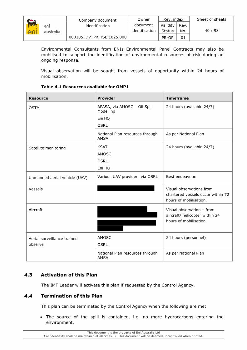
eni australia
Company document
identification
000105_DV_PR.HSE.1025.000
Owner
document
identification
Rev. index. Sheet of sheets
40 / 98
Validity
Status
Rev.
No.
PR-OP 01
This document is the property of Eni Australia Ltd
Confidentiality shall be maintained at all times. This document will be deemed uncontrolled when printed.
Environmental Consultants from ENIs Environmental Panel Contracts may also be
mobilised to support the identification of environmental resources at risk during an
ongoing response.
Visual observation will be sought from vessels of opportunity within 24 hours of
mobilisation.
Table 4.1 Resources available for OMP1
Resource Provider Timeframe
OSTM APASA, via AMOSC – Oil Spill Modelling
Eni HQ
OSRL
24 hours (available 24/7)
National Plan resources through AMSA
As per National Plan
Satellite monitoring KSAT
AMOSC
OSRL
Eni HQ
24 hours (available 24/7)
Unmanned aerial vehicle (UAV) Various UAV providers via OSRL Best endeavours
Vessels Visual observations from
chartered vessels occur within 72
hours of mobilisation.
Aircraft
Visual observation – from
aircraft/ helicopter within 24
hours of mobilisation.
Aerial surveillance trained
observer
AMOSC
OSRL
24 hours (personnel)
National Plan resources through AMSA
As per National Plan
4.3 Activation of this Plan
The IMT Leader will activate this plan if requested by the Control Agency.
4.4 Termination of this Plan
This plan can be terminated by the Control Agency when the following are met:
The source of the spill is contained, i.e. no more hydrocarbons entering the
environment.

eni australia
Company document
identification
000105_DV_PR.HSE.1025.000
Owner
document
identification
Rev. index. Sheet of sheets
41 / 98
Validity
Status
Rev.
No.
PR-OP 01
This document is the property of Eni Australia Ltd
Confidentiality shall be maintained at all times. This document will be deemed uncontrolled when printed.
Oil is no longer observed (as described by the Bonn Agreement Oil Appearance Code-
BAOAC) at rainbow or metallic sheen or discontinuous or continuous true oil colour.
Hydrocarbon thicknesses below these thresholds indicate that the thickness is less
than 0.3 microns and poses little threat of harm to environmental receptors.
OSTM indicates entrained hydrocarbons are below the 100 ppb threshold and that
sensitive receptors are not under threat.
Relevant stakeholders (e.g. WA DoT, NT DoT) agree that no further impacts to
shorelines or marine megafauna are likely to be observed.
4.5 Predictive Modelling to Assess Resources at Risk
Accurate and timely detection of hydrocarbon impacts will depend on a good
understanding of the actual and predicted slick trajectory and fate estimates
(weathering) of the hydrocarbon.
Data input on the various parameters in the model are to assume a ‘worst-case’ so as
to overestimate the possible locations of the hydrocarbon spill. Spill trajectories can be
updated and re-analysed with Metocean forecasts.
Manual input data to be provided for modelling includes:
1. spill release point (latitude and longitude or easting and northing)
2. spill start date and time
3. manual wind speed/direction and sea temperature
4. hydrocarbon type and grade (hydrocarbon name; American Petroleum Institute
[API]; specific gravity; pour point; wax content; sulfur content) – this information is
available in the EP
5. estimated spill release rate and volume (instantaneous or total; continuous release).
Geo-referenced surveillance information and observations from the spill scene should
be used to update the model daily. This will include details from satellite imagery on the
spatial extent and forecast meteorological data.
4.5.1 Metocean Data
Information on weather conditions – i.e. prevailing winds and currents from Metocean
office; relevant tidal and current station data; sea state; temperature;
visibility/precipitation, etc. – will be provided to Eni’s modelling contractor and can be
obtained from:
Metocean data
– http://imos.aodn.org.au/imos/.
real-time meteorological data:
– www.bom.gov.au/wa/observation
– www.eldersweather.com.au/wa

eni australia
Company document
identification
000105_DV_PR.HSE.1025.000
Owner
document
identification
Rev. index. Sheet of sheets
42 / 98
Validity
Status
Rev.
No.
PR-OP 01
This document is the property of Eni Australia Ltd
Confidentiality shall be maintained at all times. This document will be deemed uncontrolled when printed.
– www.transport.wa.gov.au/imarine/19138.asp.
4.5.2 Mobilisation of Predictive Modelling
OSTM will be undertaken on an initial and daily basis through AMOSC by a third-party
contractor (i.e. APASA). Eni Headquarters in Milan, Italy, also has capability to
undertake oil spill trajectory modelling.
Oil weathering modelling can be undertaken using the Automated Data Inquiry for Oil
Spills (ADIOS) model developed by the US National Oceanographic and Atmospheric
Administration. ADIOS can be operated by Eni’s Environmental Advisor. To run the
model, inputs are required about oil type, volume, weather conditions, water properties
and release type (e.g. instantaneous or continuous). Further information on ADIOS can
be found at:
<http://response.restoration.noaa.gov/oil-and-chemical-spills/oilspills/responsetools/
adios.html>
4.6 Satellite Monitoring to Detect Resources at Risk
Eni has contracted KSAT to provide satellite monitoring for its operations.
KSAT provide high fidelity photographs using different spectrums to identify the
trajectory of the oil. In case of a spill reported to KSAT by Eni, KSAT will activate its
Emergency Response Team that is targeted to be assembled within 24 hours. Contact
details are outlined in Table 4.2.
Table 4.2: Satellite monitoring contact details
Company Contact Details
KSAT
Direct phone: +47 77 60 02 51
Switchboard: +47 77 60 02 50
Fax: +47 77 60 02 99
4.7 Vessel Survey
Prior to the arrival of aircraft for aerial surveillance, vessels at the scene or vessels of
opportunity will be used to provide initial observational data.
If required, the IMT Leader has authorisation to request the mobilisation of AMSA
resources, including vessels. A field vessel will be deployed within 72 hours. Refer to
Section 3 for deployment of vessels.
Vessels will be instructed to follow the leading edge of the hydrocarbon slick.

eni australia
Company document
identification
000105_DV_PR.HSE.1025.000
Owner
document
identification
Rev. index. Sheet of sheets
43 / 98
Validity
Status
Rev.
No.
PR-OP 01
This document is the property of Eni Australia Ltd
Confidentiality shall be maintained at all times. This document will be deemed uncontrolled when printed.
4.8 Unmanned Aerial Vehicle (UAV)
UAVs can utilise multiple sensors including Visual (HD), Infrared, and Ultraviolet to
support a response and can provide real-time monitoring of the spill.
UAVs can be mobilised through contacting OSRL and are available on a best endeavours
basis and dependent upon obtaining permission to fly and availability of the UAV
suppliers to respond.
4.9 Aerial Survey
Aerial reconnaissance surveys will use either a rotary or fixed wing aircraft to track and
monitor the spill movement. Eni has contracts in place to charter helicopters from
Babcock Helicopters Australia and aircraft from FCM. Contact details are outlined in
Section 3. Aerial surveillance will be mobilised within 24 hours.
Flight paths will be confirmed prior to each flight and will be planned to start and finish
within daylight hours for clear observation of the sea surface. A flight plan will be
prepared in advance and agreed with the pilot and relevant authorities and take account
of any information that will reduce the search area (i.e. last known sighting and
expected trajectory of the oil). The search altitude is likely to be determined by the
prevailing visibility, but as a guide from ITOPF (2011):
clear conditions over the open ocean should set altitude at 300–450 m;
clear conditions close to shore, 120–150 m assuming no restrictions.
The surveys will continue until the termination criteria are reached. The control agencies
IMT will be responsible for flight timetabling and flight paths.
Trained aerial observers can be mobilised through AMOSC. A trained AMOSC aerial
observer should:
confirm the location of the spill using ladder or spiral search paths (see Figure 4.1);
quantify the amount of oil on the water and verify the results from modelling.

eni australia
Company document
identification
000105_DV_PR.HSE.1025.000
Owner
document
identification
Rev. index. Sheet of sheets
44 / 98
Validity
Status
Rev.
No.
PR-OP 01
This document is the property of Eni Australia Ltd
Confidentiality shall be maintained at all times. This document will be deemed uncontrolled when printed.
Figure 4.1: Flight search patterns (OSRL, 2011)
Photographs or video should be taken during the aerial survey to record the hydrocarbon
spill. Where possible, features such as ships and the coastline should be included to
provide an estimate of scale. The photographer should follow these guidelines:
take photograph as vertically as possible (53°);
use the shortest exposure time (1/250 or faster);
overlap photographs by about 20%;
use a polarised filter to reduce the brilliance of the surface of the water.
Figure 4.2 provides a visual representation of the spill quantification procedures.
Figure 4.2: Spill quantification procedure (OSRL, 2016)

eni australia
Company document
identification
000105_DV_PR.HSE.1025.000
Owner
document
identification
Rev. index. Sheet of sheets
45 / 98
Validity
Status
Rev.
No.
PR-OP 01
This document is the property of Eni Australia Ltd
Confidentiality shall be maintained at all times. This document will be deemed uncontrolled when printed.
Observations will be recorded via a standard aerial surveillance observer log (Figure
4.3) and include:
day, time, observer name, altitude, visibility;
location and extent, latitude and longitude using a global positioning system (GPS)
for location;
colour of oil slick or sheen: using Bonn Agreement Oil Appearance Code (see Figure
4.4);
character: i.e. windrow, slick, patch, streak (use consistent descriptive phrases
throughout);
features, e.g. leading edge;
coverage, percent coverage description (see Figure 4.5).
Figure 4.3: Standard pollution observation/detection log example (OSRL, 2017)

eni australia
Company document
identification
000105_DV_PR.HSE.1025.000
Owner
document
identification
Rev. index. Sheet of sheets
46 / 98
Validity
Status
Rev.
No.
PR-OP 01
This document is the property of Eni Australia Ltd
Confidentiality shall be maintained at all times. This document will be deemed uncontrolled when printed.
Figure 4.4: The BAOAC for categorising slick thickness and colour (OSRL, 2018)
Figure 4.5: Percent coverage chart (AMSA, 2016)
4.10 Visual Observation of Megafauna
The purpose of this survey is to record and collate observations of any marine
megafauna during the implementation of OMP1 Given the low precision of
data/knowledge on the distribution and abundances of most marine fauna in the area,
quantification of abundance is unlikely. Qualitative data on numbers of marine fauna
recorded, presence and any behavioural impacts will be recorded. Methods are
principally designed to collect information on presence/absence, mortality and the
status of those individuals encountered (i.e. behaviour, oiling, etc.).

eni australia
Company document
identification
000105_DV_PR.HSE.1025.000
Owner
document
identification
Rev. index. Sheet of sheets
47 / 98
Validity
Status
Rev.
No.
PR-OP 01
This document is the property of Eni Australia Ltd
Confidentiality shall be maintained at all times. This document will be deemed uncontrolled when printed.
Aerial Survey
Aerial surveillance for marine fauna should ideally be undertaken daily in conjunction
with the aerial survey OMP1. As such the survey will only detect visible animals without
confidence of estimates of abundance. Visual and photographic/video data should be
collected and information on sea state and flight path as outlined below. Ideally the
following should apply if possible:
Information is to be recorded about sea state (using Beaufort Sea state scale), cloud
cover (in octaves), glare (strength and area affected) and overall sighting conditions
(good; moderate; poor) at the beginning of each survey and when conditions change.
Line-transect, extending 400 m either side of the flight path, for a flight time of
approximately ten minutes are to be completed with observers recording numbers
and identification to the lowest taxonomic level possible (see AMSA 2016).
Flight paths should be confirmed prior to each flight, but strip transects should be
based on a grid or ladder approach to capture both the area affected by the slick, and
the unaffected area immediately around the slick.
All sightings are to be marked with location coordinates (GPS).
Data is to be collected in standardised observation logbook records. For each cetacean
sighting, data collated should include: location; species; group size; group
composition (adults and calves); behaviour (directional swimming; non-directional
swimming; feeding; resting), cue (underwater; body at surface; splash; blow);
swimming direction and reaction to the survey craft.
Video (high definition) and photographic (still image) data is to be collected to provide
a permanent record (if possible).
500 ft is the preferred flight height for identification purposes but will be dependent
on the flight height utilised for the aerial surveys.
Vessel Surveys
A vessel-based survey for presence of marine mammals is likely to occur
opportunistically. If required, the IMT leader has authorisation to request vessel
resources. Refer to Section 3.
Gathering observational data on any marine mammals in close proximity to the surface
slicks and documenting any unusual behaviour or ill health will be undertaken in addition
to details on species, location, etc.
Standardised survey methods can however still be applied by a trained observer and
include the following:
Position the observer at the highest accessible point.
At the beginning and end of each observation period record time, ship’s location,
course and speed. Record information on sea state (using Beaufort Sea state scale),
cloud cover (in octaves), glare (strength and area affected) and overall sighting
conditions (good, moderate, poor) at the beginning of each survey and when
conditions change.

eni australia
Company document
identification
000105_DV_PR.HSE.1025.000
Owner
document
identification
Rev. index. Sheet of sheets
48 / 98
Validity
Status
Rev.
No.
PR-OP 01
This document is the property of Eni Australia Ltd
Confidentiality shall be maintained at all times. This document will be deemed uncontrolled when printed.
Collect effort data every 30 minutes, or more frequently if there are marked changes
in ship course or speed, or sighting conditions change.
Aerial observations will be made concurrent with vessel and/or ground-based
surveillance where required.
4.11 Personnel Resource Requirements
Given the small area with any surface expression of floating oil, a single aircraft and
observer are considered appropriate for mapping the floating oil distribution.
Opportunistic observations of Marine Megafauna would be recorded during each aerial
survey.
The monitoring team would be required to consist of at least:
1 x trained observer
1 x person with oil spill assessment training
Vessel and aircraft operators
Additional shoreline assessment teams would be mobilised as required.

eni australia
Company document
identification
000105_DV_PR.HSE.1025.000
Owner
document
identification
Rev. index. Sheet of sheets
49 / 98
Validity
Status
Rev.
No.
PR-OP 01
This document is the property of Eni Australia Ltd
Confidentiality shall be maintained at all times. This document will be deemed uncontrolled when printed.
5. OMP2 – MONITORING OF HYDROCARBONS: WEATHERING AND
BEHAVIOUR IN MARINE WATERS
5.1 Monitoring Rationale
Each spill will have unique physical and chemical properties and behaviours when
released to the environment. This will be dependent on the type of oil, sea temperatures
and weather conditions as well as how the oil is released (e.g. a subsurface or surface
release). Hence it is necessary to establish a fingerprint of the freshly released oil. Once
hydrocarbons have been released to the environment, weathering and/or attenuation
processes such as evaporation, dispersion, dissolution and sedimentation will lead to
the degradation or removal of hydrocarbons from the water column, while emulsification
can result in its persistence. The speed and importance of these processes will depend
on the components within the hydrocarbon involved in the spill and the oceanographic
conditions present at the time of the spill. Therefore, the fate (where it goes) and its
persistence (how long it remains in the system) can vary considerably in time and space.
While laboratory analysis has been undertaken to determine the chemical and physical
properties of Woollybutt crude, monitoring the changes to the oil properties during a
spill is still required to verify the laboratory results and to feed back into the current and
planned spill response operations. Various spill response actions will depend on the
physical properties of oil (e.g. viscosity can affect skimming operations) and the
information will inform what strategies will be most effective.
Sampling of hydrocarbons in the water column will provide data on the behaviour of the
hydrocarbon, its dispersal, and the chemical properties and toxicity of compounds as it
weathers (which will be used to predict effects on the identified resources and receptors
at risk).
5.1.1 Objectives
The objectives of this OMP are to:
provide field-based information on the presence, type, quantity, properties, behaviour
and weathering of the spilled oil to assist in spill response operations;
provide information on the temporal and spatial extent of the hydrocarbon plume
determine the distribution and concentrations of hydrocarbons in the water column
during the spill event
The information collected under this OMP will be used to feedback into OMP1 for input
into the forecast modelling and verification of the surveillance observations.
5.2 Resources Available
See Table 5.1 for available resources. Contracts are summarised in Section 1.5.
Eni through OSRL have access to an Autonomous Underwater Vehicle (AUV). OSRL have
partnered with Blue Ocean Monitoring Limited and an agreement provides OSRL access
to Blue Oceans Riptide and Slocum Glider for preparedness and response operations.
The AUV capability is provided on a best endeavours basis.

eni australia
Company document
identification
000105_DV_PR.HSE.1025.000
Owner
document
identification
Rev. index. Sheet of sheets
50 / 98
Validity
Status
Rev.
No.
PR-OP 01
This document is the property of Eni Australia Ltd
Confidentiality shall be maintained at all times. This document will be deemed uncontrolled when printed.
Eni also have access to Turner C3 Fluorometers through OSRL which can be attached to
the AUV or deployed separately in a towed configuration. To monitor for the
presence/absence of hydrocarbons in the water column, water samples would be
analysed under an existing agreement with Intertek laboratory.
Table 5.1 Resources available for OMP2
Resource Provider Timeframe
1 x Turner C3 Fluorometer
(submersible)
1 x OSRL fluorometry unit
operator
24 hours (OSRL personnel)
1 x Autonomous underwater
vehicle (AUV) with fluorometry
sensor
1 x AUV engineer
Best endeavours basis
Vessels Vessels within 24 hours of mobilisation.
Laboratory analysis services and
sample containers
Typically 48 hours – 5 days to
raise a PO
5.3 Activation of this Plan
The IMT Leader will activate this plan if requested by the Control Agency.
5.4 Termination of this Plan
This plan can be terminated by the Control Agency when:
it can be demonstrated that no further environmental improvement outcomes can be
achieved through continued implementation of this OMP;
physical response options are no longer being considered and/or implemented;
it is determined that there is no risk of shoreline impacts from the spill;
Monitoring objectives have been met.
5.5 Survey Methodology
Sampling design will be confirmed with the ENI IMT prior to mobilisation of the vessel
to the spill location. Sample design will be depend on the location of the spill
(surface/subsurface).
It has been estimated that in a first strike response a field team using a single vessel
will be capable of covering 27 nm / day per (12 hour) day during towed sampling
activities. This figure is calculated with the following equation;

eni australia
Company document
identification
000105_DV_PR.HSE.1025.000
Owner
document
identification
Rev. index. Sheet of sheets
51 / 98
Validity
Status
Rev.
No.
PR-OP 01
This document is the property of Eni Australia Ltd
Confidentiality shall be maintained at all times. This document will be deemed uncontrolled when printed.
Max sample speed = 2 knots = 2.3 nm/h
12 hour day x 2.3 nm = 27.6 nm a day / vessel
This sampling range is considered appropriate to cover an advancing spill front in the
early phases of a response.
5.5.1 Water sampling
Water samples will be collected as part of this program to verify chemical, hydrocarbon
and nutrient concentrations. Water samples would be collected during fluorometry
tows.
5.5.2 Laboratory Analytical Methods
Water samples will be analysed by Intertek laboratory for the following analytes:
Total recoverable hydrocarbons (TRHs);
Polycyclic Aromatic Hydrocarbons (PAHs); and
BTEX.
Water sampling laboratory analyses, in particular TRH, will be used to better interpret
field fluorescence data. Eni has a contract with Intertek for laboratory services, including
the above analysis. Unless otherwise advised by ENIs IMT Leader, samples will be sent
to Intertek’s Darwin laboratory for analysis.
5.6 Equipment
Several specialised pieces of equipment will be used to undertake OMP2 in the event of
a spill. The equipment is specified below:
fluorometers and backscatter sensors to detect hydrocarbon presence and
estimate oil concentrations in the marine environment.
water sampler to undertake water sampling alongside the fluorometry tows to
allow for the potential to calibrate the fluorometry unit.
5.7 Data and Information Requirements
This OMP will rely on the outputs from the OMP1 and on the extent of the oil spill from
both the predictions of the oil spill distribution and oil spill surveillance.

eni australia
Company document
identification
000105_DV_PR.HSE.1025.000
Owner
document
identification
Rev. index. Sheet of sheets
52 / 98
Validity
Status
Rev.
No.
PR-OP 01
This document is the property of Eni Australia Ltd
Confidentiality shall be maintained at all times. This document will be deemed uncontrolled when printed.
Table 5.2: Data and information requirements for OMP2
Information Details
OMP1 Distribution of oil.
Metocean data Integrated Marine Observing System (IMOS):
http://imos.aodn.org.au/imos/
Real-time meteorological
data
www.bom.gov.au/wa/observation
www.eldersweather.com.au/wa
www.transport.wa.gov.au/imarine/19138.asp
Satellite imagery https://asset.joubeh.com/
5.8 Logistics
Monitoring equipment will be sourced locally where available, otherwise typically
transported to Darwin by commercial flight.
BOM personnel and AUV (through OSRL) are based in Perth and BOM will organise
transport to Darwin via commercial flight. The AUV will be mobilised to the spill location
by vessel and deployed into the water by a davit arm or crane.
Implementation of this OMP will require a field deployment vessel. The vessel
specifications should allow for;
covering the required sampling area
vessel class and service category
safe access to water for sampling; and
davit arm or crane for AUV deployment, if required.
It is expected to be no larger than the project vessel used for the Woollybutt activities.
Table 5.3: Logistics for OMP2
Location Mobilisation/deployment
Sampling and analysis
equipment
Darwin and
interstate
Mobilisation to Darwin by commercial flight
Deployment to spill location by vessel (Eni)
OSRL fluorometer Singapore
BOM AUV Perth
Mobilisation to Darwin by commercial flight
(organised by BOM)
Deployment to spill location by vessel (Eni)
and into water by davit arm or crane
Charter vessels Darwin Mobilise from Darwin Harbour and arrive at
spill location within 72 hours.
Refer to Section 3 for deployment of vessels.

eni australia
Company document
identification
000105_DV_PR.HSE.1025.000
Owner
document
identification
Rev. index. Sheet of sheets
53 / 98
Validity
Status
Rev.
No.
PR-OP 01
This document is the property of Eni Australia Ltd
Confidentiality shall be maintained at all times. This document will be deemed uncontrolled when printed.
5.9 Personnel Resource Requirements
A single monitoring unit (Autonomous Underwater Vehicle (AUV) equipped with
fluorometer or towed fluorometry unit) is considered suitable to monitor the progressing
spill front.
The monitoring team would be required to consist of at least:
1 x AUV engineer to operate the AUV and support data integration into a response
(the engineer would be sourced from the AUV provider); and
1 x vessel and crew for AUV deployment.
OR
1 x OSRL personnel to operate the OSRL fluorometry unit; and
1 x vessel and crew for towing the fluorometry unit.

eni australia
Company document
identification
000105_DV_PR.HSE.1025.000
Owner
document
identification
Rev. index. Sheet of sheets
54 / 98
Validity
Status
Rev.
No.
PR-OP 01
This document is the property of Eni Australia Ltd
Confidentiality shall be maintained at all times. This document will be deemed uncontrolled when printed.
6. OMP3 – SHORELINE ASSESSMENT SURVEYS
6.1 Monitoring Rationale and Objectives
Understanding the extent and nature of shoreline predicted to be, or actually contacted
by a hydrocarbon spill, is critical to developing an effective spill response. The collection
of data on the shoreline condition should be undertaken in a rapid and systematic way,
taking account of spill conditions and hydrocarbon type.
The scope of OMP3 is to provide a rapid assessment of shoreline areas to determine the
scale of hydrocarbon contamination and to inform treatment/cleanup response options,
constraints or limitations. Geographical and spatial results of the shoreline and/or oiling
conditions will be used by the IMT for response planning. Information obtained in OMP3
may also inform long-term scientific monitoring of shoreline habitats under SMP2 and
SMP5.
6.1.1 Objectives
The objectives of this OMP are to:
undertake a preliminary assessment of the shoreline and coastal habitats to assist
in making decisions on appropriate management and response actions and inform
scientific monitoring;
provide a high-level determination of potential effects on shoreline communities in
order to inform clean up, deflection or containment operations; and
identify post-spill physical characteristics of the shoreline in terms of access
constraints and substrate.
The priority for gathering rapid shoreline data is for enabling the operational response.
Consideration should be given to scientific data needs but not at the expense of the
operational requirement for rapid access to data to inform the planning of an appropriate
response.
6.2 Resources available
See Table 6.1 for available resources. Contracts are summarised in Section 1.5.
The IMT Leader has authorisation to request the mobilisation of OSRL, AMSA or AMOSC
resources if required or requested by the Control Agency.
Table 6.1 Resources available for OMP3
Resource Provider Timeframes
Shoreline assessment team
Shoreline surveyors
A
Onsite within 5 days, or 24
hours prior to shoreline contact
(if prolonged time to shoreline
contact).
Unmanned aerial vehicle (UAV) Best endeavours

eni australia
Company document
identification
000105_DV_PR.HSE.1025.000
Owner
document
identification
Rev. index. Sheet of sheets
55 / 98
Validity
Status
Rev.
No.
PR-OP 01
This document is the property of Eni Australia Ltd
Confidentiality shall be maintained at all times. This document will be deemed uncontrolled when printed.
Resource Provider Timeframes
Vessels Visual observations from
chartered vessels occur within
72 hours of mobilisation.
Aircraft
Visual observation – from
aircraft/ helicopter within 24
hours of mobilisation.
6.2.1 Shoreline Assessment Teams
Shoreline Assessment Teams will be deployed initially with the specialist skills to make
an assessment of the actual and potential impact to the shoreline sensitivities and the
resources that are required to implement a clean-up operation.
Shoreline assessment team onsite within 5 days, or 24 hours prior to shoreline contact
(if prolonged time to shoreline contact). Initial assessment of shoreline areas predicted
for impact would take initially 1-2 days post spill.
6.3 Activation of this Plan
The IMT Leader will activate this plan if requested by the Control Agency.
6.4 Termination of this Plan
This plan can be terminated by the Control Agency when:
it can be demonstrated that no further environmental improvement outcomes can be
achieved through continued implementation of this OMP;
physical response options are no longer being considered and/or implemented;
it is determined that there is no risk of shoreline impacts from the spill;
Monitoring objectives have been met.
6.5 Survey Methodology
The shoreline assessment is intended to document and quantify hydrocarbon spill extent
at the shoreline to determine condition and to assess potential impact. This information
will be used by the IMT to determine the most appropriate response. Execution of
sampling and communication of results are required quickly, with initial information
typically necessary for approval to implement response activities by regulatory agencies.
Following a hydrocarbon spill, a judgment must be made about whether monitoring is
“necessary”, and whether the scope of the monitoring is “reasonable”, to reach
appropriate spill response decisions in an appropriate time frame, and with an
acceptable level of accuracy. This OMP outlines a range of methods to allow flexibility
for planning a monitoring program that will account for individual spill conditions, the
nature of the hydrocarbon released, and the emergency response implemented.

eni australia
Company document
identification
000105_DV_PR.HSE.1025.000
Owner
document
identification
Rev. index. Sheet of sheets
56 / 98
Validity
Status
Rev.
No.
PR-OP 01
This document is the property of Eni Australia Ltd
Confidentiality shall be maintained at all times. This document will be deemed uncontrolled when printed.
The approach outlined includes elements of published guidelines for a Shoreline Clean-
up Assessment Technique termed SCAT (e.g. NOAA 2000, Maritime and Coastguard
Agency 2007) to collect data on shoreline oiling conditions and support decision-making
for shoreline cleanup. The SCAT process continues past the initial assessment to verify
clean-up effectiveness and conduct final evaluations.
Detailed methods have been divided into the following components:
1. Pre-survey Planning.
2. Field Survey.
3. Monitoring Design.
4. Reporting.
Table 6.2 identifies the processes, rationale and monitoring methods that will be applied
to pre-survey planning and field surveys in OMP3.
Table 6.2: Objectives, rationale and monitoring methods that will be applied to
pre-survey planning and field surveys in OMP3. Guideline refers to
those listed in AMSA (2016)
Primary
Objective
Rationale Secondary Objectives Monitoring Method
Shoreline Assessment
Geographical distribution influences monitoring design
Collect qualitative information on the presence/absence of environmental receptors at affected shorelines.
Verify aerial surveys and existing data.
Video/photographic records
Determine sector segment boundaries
Characterise substrate
Determine beach profile
Determine surface oil
Determine subsurface oil
Field detection of petroleum hydrocarbons
6.5.1 Pre-survey Planning
A rapid review of the extent and condition of habitat types will be conducted on impacted
and at risk of being impacted shorelines as determined by the monitoring of hydrocarbon
distribution (OMP1) and the fate and effects of hydrocarbons (OMP2). The shorelines
will be assessed with regards to their sensitivity to impacts from the hydrocarbon spill
and accessibility for clean-up operations. Pre-survey planning includes:
identification of shoreline segments;
determination of the survey requirements; and
preparation for field survey.
A guideline for designing a monitoring program is provided (see AMSA 2016). This
guideline forms the basis of the following pre-survey planning considerations.

eni australia
Company document
identification
000105_DV_PR.HSE.1025.000
Owner
document
identification
Rev. index. Sheet of sheets
57 / 98
Validity
Status
Rev.
No.
PR-OP 01
This document is the property of Eni Australia Ltd
Confidentiality shall be maintained at all times. This document will be deemed uncontrolled when printed.
Identification of Shoreline Segments
A guideline for selecting shoreline segments is provided (see AMSA 2016). Shoreline
segments will be defined using the following considerations:
Likelihood of hydrocarbon contact on shorelines as determined in OMP1.
Homogeneity of habitats, physical features and sediment type to define shoreline
segments and assign location identifier.
Determine segment length considering resolution needs to detail the distribution of
hydrocarbon. As a guide, segments should be in the range of 0.2–2 km in length.
Practical aspects that can be used by the IMT for deployment of response (i.e. access
and staging locations).
Determination of Survey Requirements
The scale of the spill will determine the level of effort required for the shoreline
assessment study. Planning of the survey method should take into account the following
questions to specify if the proposed survey is “reasonable” and “appropriate” in scope,
design and subsequent cost:
Are results of significant value in the design, execution or assessment of response
actions?
Is the scope of the programme, and speed of obtaining results, the minimum
necessary to fulfil the stated objectives?
To execute the OMP, decisions are required by the IMT for each of the four monitoring
components which include:
Ground Surveys: What physical, biological and chemical variables do we need to
consider in the shoreline cleanup? At what scale will the information be collected:
– Broad-scale: Information required over multiple segments which would include
combined aerial and/or remote sensing surveys with ground surveys.
– Medium-scale: A small number of segments required for sampling using broad
scale ground survey methods.
– Fine-scale: Data required from targeted segments.
Develop clean-up guidelines: What is the required communication timeframe? What
clean-up methods are inappropriate and can be removed from consideration before
monitoring?
Preparation for Field Survey
The IMT will need to plan for shoreline assessments prior to mobilising the field team.
A typical field plan may incorporate the following considerations:
Identify and acquire shoreline assessment survey equipment, create checklist before
mobilising to field.
Identify requirement for aircraft, vessels, or special vehicles for remote locations.

eni australia
Company document
identification
000105_DV_PR.HSE.1025.000
Owner
document
identification
Rev. index. Sheet of sheets
58 / 98
Validity
Status
Rev.
No.
PR-OP 01
This document is the property of Eni Australia Ltd
Confidentiality shall be maintained at all times. This document will be deemed uncontrolled when printed.
Development of the types of communications needed (e.g. radios, cellular phones)
between field team and IMT.
For each shoreline type, identify clean-up methods that will not be suitable for the
habitat. This will limit the field evaluation to only those methods which may be
approved.
Identify other OMPs which may operate simultaneously with the rapid shoreline
assessment study.
6.5.2 Field Survey
Aerial Surveillance
A guideline for undertaking aerial surveillance of shorelines is provided (see AMSA
2016). Aerial surveillance provides a reliable and rapid method for defining the overall
extent of a spill area, and identifying oiled shorelines and those at threat from the spill.
A guideline for identifying extent and distribution of oiled shorelines is provided (see
AMSA 2016). Photos, video, mapping and verbal feedback all provide basic information
that can be used to define information needs and response priorities. Helicopters can be
useful in combining aerial surveillance with ground surveys.
Ground Surveys
Ground surveys allow more detailed observations of shoreline conditions including the
physical structure, ecological character, and human use of shorelines. This monitoring
approach can provide comprehensive detail on the resources and activities likely to be
affected by a spill, the potential extent of oiling and logistical considerations for different
response methods.
Rapid shoreline survey methods will be agreed by the IMT to ensure the priorities
relating to the spill response activities are the primary objective of the ground survey.
Ground surveys for operational monitoring will target potential impact areas.
Physical Monitoring
Physical monitoring will determine how oil will behave over time, how the shoreline can
most effectively be cleaned and the likelihood that it can be damaged by oil and clean-
up activities. The physical character of the shoreline segment will be described in terms
of:
Verification of the extent of shoreline habitat and segment boundaries.
Surface and sub-surface oil observations (see AMSA 2016).
Substrate type (see AMSA 2016).
Form: geomorphological type, dimensions, profile or gradient (see AMSA 2016).
Energy: winds, waves (see AMSA 2016)
Provide photographic evidence and observation of access restrictions.

eni australia
Company document
identification
000105_DV_PR.HSE.1025.000
Owner
document
identification
Rev. index. Sheet of sheets
59 / 98
Validity
Status
Rev.
No.
PR-OP 01
This document is the property of Eni Australia Ltd
Confidentiality shall be maintained at all times. This document will be deemed uncontrolled when printed.
6.5.3 Reporting
Shoreline assessment should be entered into established forms and communicated to
the shoreline assessment coordinator on a daily basis. Communications will include
recommended clean-up methods, with consideration of NEBA to inform response
strategies (Efroymson et al. 2003; IPIECA 2000). Shoreline clean-up methods must:
specify generic and site-specific constraints for clean-up activities;
determine the need for follow-up surveys if sensitive resource values are present;
establish clean-up priorities for shoreline resources; and
identify safety concerns for clean-up operations.
A final report for OMP3 will be prepared post the rapid shoreline assessment study. It is
essential survey reports include detailed information on the methods used and the level
of search effort adopted. This includes who was involved, what work was done, where
the work took place, when the survey occurred and how the survey was carried out. The
final report should follow the standard aims, methods, results and discussion format
common to all scientific research.
6.6 Data and Information Requirements
Information on the hydrocarbon distribution (OMP1 and OMP2) will be essential for
development of an appropriate assessment design and to define the overall scope of
this OMP. In addition, the following existing data and information will be reviewed as
part of OMP3:
mapping of sensitive resources and key receptors;
review available previous shoreline survey data;
review ongoing monitoring data of shorelines; and
knowledge of current survey designs implemented for other OMP activities, and if
available any proposed designs for SMP activities.
Key data related to the above categories can initially be acquired from the Australian
Ocean Data Network (AODN), which is a publically funded data repository.
6.7 Field Equipment
Typical monitoring equipment:
tide tables;
clipboards and data sheets;
radio;
compass;
ruler;
tape measure;
flags and stakes (to mark the location of buried oil);

eni australia
Company document
identification
000105_DV_PR.HSE.1025.000
Owner
document
identification
Rev. index. Sheet of sheets
60 / 98
Validity
Status
Rev.
No.
PR-OP 01
This document is the property of Eni Australia Ltd
Confidentiality shall be maintained at all times. This document will be deemed uncontrolled when printed.
camera and video equipment; and
GPS.
6.8 Logistics
Implementation of this OMP will require a field deployment vessel or aircraft. The vessel
or aircraft specifications should allow for covering the required sampling area and safe
access to water for sampling. The vessel that would be used is expected to be no larger
than the project vessel used for the Woollybutt Operations.
A field vessel or aircraft will be deployed within 72 hours from Darwin.
Shoreline assessment teams will be deployed from Perth and Darwin (AMOSC) and
Singapore (OSRL).
Refer to Section 3 for deployment of vessels.
6.9 Personnel Resource Requirements
Shoreline impact is only predicted in the event of an extended spill (365 days), which
would result in low shoreline loadings at a number of coastlines. A single response team
with (1 x shoreline assessment team lead and 2 x shoreline surveyors) may cover
approximately 2km per day. Additional shoreline assessment teams would be mobilised
as required
Field teams will use individuals who are trained in techniques, procedures, and
terminology of shoreline assessment. Team members are required to have a thorough
understanding of the response goals and objectives and will consider safety concerns in
cleanup recommendations. Shoreline assessments should be carried out by teams
assigned to individual, pre-defined coastline segments. It is recommended that an
assessment team comprises of individuals with the following skills:
Hydrocarbon spill experience and SCAT training – to identify and document
hydrocarbon distribution (from air or ground).
Emergency response representative – to identify logistical and other feasibility issues
and evaluate likely resources required and level of effort where cleanup/treatment
is required.
Where more than one survey team is deployed, a Shoreline Assessment Coordinator
experienced in hydrocarbon spill assessment and coordination may be required and will
act as a communication point between the field teams and the IMT. This coordinator will
be providing the following information to the IMT:
prioritisation of shoreline segments;
consideration of access and staging issues;
potential clean up options; and
report and map-generation.

eni australia
Company document
identification
000105_DV_PR.HSE.1025.000
Owner
document
identification
Rev. index. Sheet of sheets
61 / 98
Validity
Status
Rev.
No.
PR-OP 01
This document is the property of Eni Australia Ltd
Confidentiality shall be maintained at all times. This document will be deemed uncontrolled when printed.
Support staff includes office-based personnel, vessel aircraft crews and IMT
communications support will be required to support rapid shoreline assessment field
teams.

eni australia
Company document
identification
000105_DV_PR.HSE.1025.000
Owner
document
identification
Rev. index. Sheet of sheets
62 / 98
Validity
Status
Rev.
No.
PR-OP 01
This document is the property of Eni Australia Ltd
Confidentiality shall be maintained at all times. This document will be deemed uncontrolled when printed.
7. SMP1 – WILDLIFE IMPACT MONITORING AND SAMPLING
7.1 Monitoring Rationale
During the operational phase of the response data would be collected as part of the
Oiled Wildlife Response (Section 8.4 of the Woollybutt Oil Pollution Emergency Plan).
Following the cessation of the oiled wildlife response this program would be mobilised
to assess and quantify impacts and to provide ongoing support should oiled wildlife be
observed that were not detected as part of the Oiled Wildlife Response.
In the event of a hydrocarbon spill a number of OMPs will be initiated. Monitoring of
wildlife will be continued throughout the response activities, including opportunistic
observations from aircraft, vessels and the shoreline during the implementation of
OMP1, OMP2 and OMP3. This data would be used when assessing the impact to wildlife.
7.1.1 Resources at Risk
The key sensitive receptors that may be affected from an accidental oil spill including
that will be assessed under SMP1 are:
marine mammals;
marine reptiles;
fish and sharks;
avifauna.
7.1.2 Objectives
The objectives of this SMP are to:
undertake wildlife impact monitoring and sampling to determine the cause of death
for wildlife carcasses (i.e. tissue analysis) following the cessation of the oiled wildlife
response.
Determine the potential impact to wildlife populations.
7.2 Resources Available
See Table 7.1 for available resources. Contracts are summarised in Section 1.5.
Table 7.1 Resources available for OMP1
Resources Provider Timeframes
Wildlife monitoring team (2 x
MFOs)
Environmental Panel Contracts
and ability to contract third
party specialists as detailed in
Table 1.8
N/A. Contracting timeframe as
per Section 1.5.2
Vessels Visual observations from
chartered vessels occur within
72 hours of mobilisation.

eni australia
Company document
identification
000105_DV_PR.HSE.1025.000
Owner
document
identification
Rev. index. Sheet of sheets
63 / 98
Validity
Status
Rev.
No.
PR-OP 01
This document is the property of Eni Australia Ltd
Confidentiality shall be maintained at all times. This document will be deemed uncontrolled when printed.
Resources Provider Timeframes
Aircraft
Visual observation – from
aircraft/ helicopter within 24
hours of mobilisation.
During the operational response phase impacts to wildlife would be recorded as part of
the Oiled Wildlife Response. Following the cessation of this response SMP1 would be
mobilised to determine whether any wildlife deaths may be attributable to the spill
through tissue analysis.
As this response would be mobilised following the operational phase of the response,
sufficient time would be available to contract the require resources for this program,
which may include:
Marine megafauna observers
Marine avifauna specialists
Vets for the collection of tissue samples following the death of wildlife
Aircraft to complete marine megafauna and avifauna surveys
Laboratory to complete tissue analysis
Eni also maintains an Environmental and Social Impact Consultancy Services Panel. The
panel includes Marine Scientists and Consultants with the ability to assess the data from
the operational and post response phase and assess the impacts to wildlife. Eni
Headquarters also may provide specialists to assist.
7.3 Activation of this Plan
The IMT Leader will activate this plan if requested by the Control Agency in response to
a Level 2 or Level 3 spill if impacts to wildlife are observed in the Oiled Wildlife Response
or during the implementation of OMP1, OMP2 or OMP3.
7.4 Termination of this Plan
This plan can be terminated by the Control Agency when the following are met:
Measures have been taken to assess the effects or impact of the spill on marine
wildlife.
Restoration of key biological processes (e.g. abundance, distribution, breeding)
necessary to ensure post-impact recovery is demonstrated and/or can be predicted.
Spill impacts on marine wildlife are no longer detectable.
Consultation with relevant stakeholders has determined that no further monitoring is
required. For example, consultation with the DNP for termination of monitoring within
the JBG AMP.

eni australia
Company document
identification
000105_DV_PR.HSE.1025.000
Owner
document
identification
Rev. index. Sheet of sheets
64 / 98
Validity
Status
Rev.
No.
PR-OP 01
This document is the property of Eni Australia Ltd
Confidentiality shall be maintained at all times. This document will be deemed uncontrolled when printed.
Monitoring objectives have been met.
7.5 Survey Methodology
Vessel and Aerial reconnaissance surveys may be used to record and collate
observations of any marine mammals within the area of interest using reconnaissance
aerial or boat based surveys. Rapid and systematic identification is required using
standardised survey protocols. Given the low precision of data/knowledge on the
distribution and abundances of most marine fauna in the Joseph Bonaparte Gulf area,
quantification of abundance is unlikely. Qualitative assessment, and assessment of
numbers, presence and any impacts to individuals, where observed, is however
possible. Methods are principally designed to collect information on presence/absence;
mortality and the status of those individuals encountered (i.e. behaviour, oiling etc.).
Methods have been divided into the following components:
pre-survey planning (see Section 7.5.1); and
field survey assessment (see Section 7.5.2).
It is important to note that the priority of resources and receptors and the sites
themselves will change under different spill or weather conditions, the seasonal
presence of key species, or the life stage of the species present. It is likely that a
judgment will need to be made at the time of the survey about the relative value of
different sites and sampling design.
A degree of flexibility is therefore required in the implementation of the SMP. Details of
methods provided below outline a number of potential approaches to the collection of
the necessary information. The actual methods to be used should be selected at the
time of the survey.
7.5.1 Pre-survey Planning
Given the impracticalities of monitoring all potential receptors under the marine
megafauna grouping, the use of indicator species will be used to provide a method to
track the potential impact.
Depending on location of the spill and its predicted extent, potential indicator species
for assessing impact to marine mammals have been identified. The selection of indicator
species has been based on:
currently available information/data on abundance/distribution/migration patterns
within the region;
ability to observe/detect and correctly identify the species;
likelihood of exposure to hydrocarbons;
sensitivity to hydrocarbon spills;
regulatory protection status (i.e. EPBC listed species).
Based on these considerations, the recommended indicator species includes:
flatback turtles;
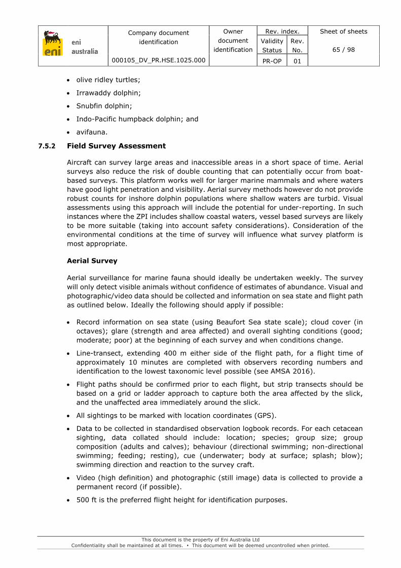
eni australia
Company document
identification
000105_DV_PR.HSE.1025.000
Owner
document
identification
Rev. index. Sheet of sheets
65 / 98
Validity
Status
Rev.
No.
PR-OP 01
This document is the property of Eni Australia Ltd
Confidentiality shall be maintained at all times. This document will be deemed uncontrolled when printed.
olive ridley turtles;
Irrawaddy dolphin;
Snubfin dolphin;
Indo-Pacific humpback dolphin; and
avifauna.
7.5.2 Field Survey Assessment
Aircraft can survey large areas and inaccessible areas in a short space of time. Aerial
surveys also reduce the risk of double counting that can potentially occur from boat-
based surveys. This platform works well for larger marine mammals and where waters
have good light penetration and visibility. Aerial survey methods however do not provide
robust counts for inshore dolphin populations where shallow waters are turbid. Visual
assessments using this approach will include the potential for under-reporting. In such
instances where the ZPI includes shallow coastal waters, vessel based surveys are likely
to be more suitable (taking into account safety considerations). Consideration of the
environmental conditions at the time of survey will influence what survey platform is
most appropriate.
Aerial Survey
Aerial surveillance for marine fauna should ideally be undertaken weekly. The survey
will only detect visible animals without confidence of estimates of abundance. Visual and
photographic/video data should be collected and information on sea state and flight path
as outlined below. Ideally the following should apply if possible:
Record information on sea state (using Beaufort Sea state scale); cloud cover (in
octaves); glare (strength and area affected) and overall sighting conditions (good;
moderate; poor) at the beginning of each survey and when conditions change.
Line-transect, extending 400 m either side of the flight path, for a flight time of
approximately 10 minutes are completed with observers recording numbers and
identification to the lowest taxonomic level possible (see AMSA 2016).
Flight paths should be confirmed prior to each flight, but strip transects should be
based on a grid or ladder approach to capture both the area affected by the slick,
and the unaffected area immediately around the slick.
All sightings to be marked with location coordinates (GPS).
Data to be collected in standardised observation logbook records. For each cetacean
sighting, data collated should include: location; species; group size; group
composition (adults and calves); behaviour (directional swimming; non-directional
swimming; feeding; resting), cue (underwater; body at surface; splash; blow);
swimming direction and reaction to the survey craft.
Video (high definition) and photographic (still image) data is collected to provide a
permanent record (if possible).
500 ft is the preferred flight height for identification purposes.

eni australia
Company document
identification
000105_DV_PR.HSE.1025.000
Owner
document
identification
Rev. index. Sheet of sheets
66 / 98
Validity
Status
Rev.
No.
PR-OP 01
This document is the property of Eni Australia Ltd
Confidentiality shall be maintained at all times. This document will be deemed uncontrolled when printed.
Vessel Surveys
A vessel-based survey for presence of marine mammals is likely to be required if the
slick has contacted nearshore environments with high turbidity. Gathering observational
data on any marine mammals in close proximity to the surface slicks and documenting
any unusual behaviour or ill health will be undertaken in addition to details on species,
location etc.
Standardised survey methods can however still be applied by a trained observer and
include the following:
Observer should be positioned at the highest accessible point.
At the beginning and end of each observation period record time; ship’s location,
course and speed. Record information on sea state (using Beaufort Sea state scale);
cloud cover (in octaves); glare (strength and area affected) and overall sighting
conditions (good; moderate; poor) at the beginning of each survey and when
conditions change.
Collection of effort data each 30 minutes, or more frequently if there are marked
changes in ship course or speed, or sighting conditions change.
An example data record sheet is shown in Table 7.2. This provides an example of the
type of information that should be recorded during the survey.
Table 7.2 Example marine fauna data record sheet
Resource Type/Species Number Location Behaviour/Comment
Turtles Species
Age/size
Adult _________
Juvenile _________
Lat ____________
Long ___________
Nesting activity.
Proximity of oil to nests.
(surface and subsurface).
Observed oiling of turtles.
Observed behaviour/fitness of turtles if present.
Carcases.
Dolphins Age/size
Adult _________
Juvenile _________
Calf _________
Lat ____________
Long ___________
Proximity of oil.
Observed oiling of dolphins.
Observed behaviour/fitness.
Carcases.
Sea snakes Species
Size
Lat ____________
Long ___________
Breeding or other activity.
Observed oiling of snakes.
Observed behaviour/fitness of snakes.
Carcases.
Birds Species
Age/size
Nesting
Roosting
Lat ____________
Long ___________
Proximity to oil to nests and roosting areas.
Location of roosting/ nesting activity
Observed oiling.
Observed behaviour/fitness of birds.
Presence of oil on eggs (if present).
Carcases.
Hatching or fledging rates.

eni australia
Company document
identification
000105_DV_PR.HSE.1025.000
Owner
document
identification
Rev. index. Sheet of sheets
67 / 98
Validity
Status
Rev.
No.
PR-OP 01
This document is the property of Eni Australia Ltd
Confidentiality shall be maintained at all times. This document will be deemed uncontrolled when printed.
Resource Type/Species Number Location Behaviour/Comment
Other Details for each Observation Location
Ambient Conditions at Each Location
Date:
Photographic/ Video Record
Date and Time of Each:
Time: Video/Photo Clip Number:
Weather Conditions: Brief Description:
Visibility: GPS Link:
7.5.3 Live Stranding and Carcass Recording
Any live strandings or carcass recordings within the area affected by the spill should be
recorded as follows. Trained professionals will need to be involved in the handling of
any marine mammal strandings encountered. In Western Australia, Wildcare (08 9474
9055) is the lead stranding network organisation. In Northern Territory, Marine
Wildwatch (1800 453 941) is the lead stranding network organisation.
During the operational phase, recording of strandings information will be required.
Where carcasses are observed physical details (species, length, sex, condition, etc.) will
be documented and photographs taken.
It may be appropriate to collect tissue samples which will be analysed. The state of
decomposition of any carcasses will need to be evaluated to determine the viability of
the collection of samples for specific analysis, with some analysis unlikely on severely
decomposed carcasses.
Standardised protocols are available for carcass handling with the following to be
adopted:
DoEE 2006, Standardised protocols for the collection of biological samples from
stranded cetaceans, Department of Environmental and Heritage. View at
<https://www.environment.gov.au/resource/standardised-protocols-collection-
biological-samples-stranded-cetacean>.
Eros C, Marsh H, Bonde R, O’Shea T, Beck C, Recchia C, Dobbs K, Turner M, Lemm
S, Pears R and Bowater R, 2007, Procedures for the Salvage and Necropsy of the
Dugong (Dugong dugon). Second Edition. Great Barrier Reef Marine Park Authority.
View at <http://elibrary.gbrmpa.gov.au/jspui/bitstream/11017/403/1/Procedures-
for-the-salvage-and-necropsy-of-the-Dugong-Dugong-Dugon.pdf>.
Flint M, Patterson-Kane JC, Mills PC, Limpus CJ, 2009, A veterinarian’s guide for sea
turtle post mortem examination and histological investigation. View at
<https://veterinary-science.uq.edu.au/filething/get/4226/pm-guide-msf.pdf>.
In most instances the cause of death will not be determined until tissue is analysed.
Trained professionals will need to be involved in handling any strandings encountered.
Where carcasses are observed, physical details (species, length, sex, condition, etc.)
will be documented and photographs taken. There will also be a need to collect basic
biological information and where appropriate tissue samples for laboratory analysis.
Where appropriate, a necropsy should be undertaken by a pathologist to determine
cause of death. Careful and consistent documentation of strandings is needed and
clinical pathology is required to determine whether the cause of the mortality can be
attributed to the oil spill event.

eni australia
Company document
identification
000105_DV_PR.HSE.1025.000
Owner
document
identification
Rev. index. Sheet of sheets
68 / 98
Validity
Status
Rev.
No.
PR-OP 01
This document is the property of Eni Australia Ltd
Confidentiality shall be maintained at all times. This document will be deemed uncontrolled when printed.
Table 7.3: Wildlife data capture for every individual captured
Date and time of capture:
Location of capture:
Species:
Degree of oiling:
%
Cover of oil: Oil distribution on body:
Condition of animal:
Any field treatments:
7.5.4 Laboratory
Carcasses of oil-affected wildlife should be retained and tested to determine their cause
of death, including tissue sampling and/or external examination. The samples will be
analysed for an agreed set of parameters which may include determining the
concentrations of:
polynuclear aromatic hydrocarbons (PAH) and the standard EPA list of 16 priority
pollutants via normal phase silica chromatography and gas chromatography mass
spectrometry (GCMS);
saturated hydrocarbons in the C10 to C36 range via by flame ionisation gas
chromatography (GC);
volatile hydrocarbons via purge and trap into a GCMS.
As well as reporting on tissue levels of hydrocarbons, other diagnostic chemical
characteristics relevant to the spilled oil (such as various ratios) will be screened to
confirm contaminant source.
7.6 Data and Information Requirements
The information in Table 7.4 will be used to assist in collecting data for SMP1.
Table 7.4: Data and information requirements for SMP1
Information Details
Standard Forms for Field Survey See section 7.5.
Sensitive Resources and Receptors i.e. Draft EIAs, EPs existing environment, etc.
OMP1, OMP2 and OM3 Observations and findings.
7.7 Field Equipment
The following list is not exhaustive, but includes common items that may be used:
survey platform: marine vessels;
hand-held video camera;
digital camera (with GPS where possible);

eni australia
Company document
identification
000105_DV_PR.HSE.1025.000
Owner
document
identification
Rev. index. Sheet of sheets
69 / 98
Validity
Status
Rev.
No.
PR-OP 01
This document is the property of Eni Australia Ltd
Confidentiality shall be maintained at all times. This document will be deemed uncontrolled when printed.
GPS;
a pair of binoculars;
nautical charts;
log book/observation sheets (see section 7.5).
7.8 Logistics
Implementation of this SMP may require aircraft or vessels. The vessel specifications
should allow for storage of field equipment and samples.
A field vessel will be deployed within 72 hours from Darwin. Refer to Section 3 for
deployment of vessels.
7.9 Personnel Resource Requirements
See Table 1.6 for the capability / personnel resourcing requirements for this program.
Table 7.5 Resources available for OMP1
Personnel Duration Required skills
2 x Marine Fauna
Observers (MFOs)
Minimum one month Marine mammal expert knowledge and field skills
to identify and quantify abundance (essential).
Experience in marine mammal surveys from aerial
surveys (desirable).
1 x vet As required Veterinary and pathology expertise on call for
diagnosis of cause of death with experience in
record keeping (chain-of command procedures),
and advising on diagnosis of death.

eni australia
Company document
identification
000105_DV_PR.HSE.1025.000
Owner
document
identification
Rev. index. Sheet of sheets
70 / 98
Validity
Status
Rev.
No.
PR-OP 01
This document is the property of Eni Australia Ltd
Confidentiality shall be maintained at all times. This document will be deemed uncontrolled when printed.
8. SMP2 – SHORELINE ECOLOGICAL ASSESSMENT AERIAL SURVEYS
8.1 Monitoring Rationale
SMP 2 helps to provide qualitative information on the presence/absence of species along
the potentially affected shorelines. This study considers the seasonality of some species
and habitats present on the shorelines of the Joseph Bonaparte Gulf including:
Turtle Nesting
Shorebirds
Mangroves
The study would be used to inform the design of the shoreline ecological surveys (SMP5)
which aim to quantify any potential impacts. Data from the aerial surveys may also be
used when defining impact and reference locations.
8.1.1 Objectives
The objectives of this SMP are to:
identify the presence and extent of environmental receptors pre-impact, including
any existing damage;
understand the spatial extent of the impact from the hydrocarbon spill on the
environmental receptors;
provide data to identify suitable impact and reference sites.
8.2 Resources Available
See Table 8.1 for available resources. Contracts are summarised in Section 1.5.
Data from OMP1 may be used to determine areas that are likely to have been impacted
and data collected (aerial observation imagery overlapping shorelines, satellite imagery
overlapping shorelines) may be used to support the targeted aerial surveys completed
as part of the SMP2 program.
This monitoring program would be completed following shoreline contact from
hydrocarbons and completion of the response. Eni maintains an Environmental and
Social Impact Consultancy Services Panel. The panel includes Marine Scientists and
Consultants with the ability to assess the data from the operational and post response
phase for the presence/absence of receptors and to identify suitable impact and
reference sites for the study design.
Table 8.1 Resources available for SMP2
Resources Provider Timeframes
Shoreline Ecological Assessment
Team – fieldwork, reporting and
GIS
Environmental Panel Contracts
and ability to contract third
party specialists as detailed in
Table 1.8
N/A. Contracting timeframe as
per Section 1.5.2

eni australia
Company document
identification
000105_DV_PR.HSE.1025.000
Owner
document
identification
Rev. index. Sheet of sheets
71 / 98
Validity
Status
Rev.
No.
PR-OP 01
This document is the property of Eni Australia Ltd
Confidentiality shall be maintained at all times. This document will be deemed uncontrolled when printed.
Resources Provider Timeframes
Unmanned Aerial Vehicle (UAV)
drone and operators
OSRL
Environmental Panel Contracts
and ability to contract third
party specialists as detailed in
Table 1.8
Best endeavours
Aircraft
Visual observation – from
aircraft/ helicopter within 24
hours of mobilisation.
8.3 Activation of this Plan
OMP1 and/or OMP3 indicate shorelines have been impacted by hydrocarbons.
8.4 Termination of this Plan
This plan can be terminated by the Control Agency when the following are met:
it can be demonstrated that no further environmental improvement outcomes can be
achieved through continued implementation of this SMP;
physical response options are no longer being considered and/or implemented;
it is determined that there is no risk of shoreline impacts from the spill;
Monitoring objectives have been met.
8.5 Survey Methodology
Georeferenced aerial imagery would be collected as part of OMP1. Data collected as part
of OMP3 may also be used to supplement the data collected as part of OMP1.
Data would be interpreted in the IMT to determine whether the following is
present/absent along the potentially affected shorelines:
Turtle activity including nesting
Aggregations of shorebirds at potentially contacted shorelines
Mangrove stands and the inferred health of any mangroves from the aerial imagery.
8.5.1 Pre-survey Planning
It should be noted that SMP2 would not be used to assess impact, but that information
collected as part of this program would be used to assist with planning more detailed
quantitative assessments of shoreline impact as part of SMP5. Flight paths would be
determined based on the shorelines that are potentially impacted/impacted by
hydrocarbons.

eni australia
Company document
identification
000105_DV_PR.HSE.1025.000
Owner
document
identification
Rev. index. Sheet of sheets
72 / 98
Validity
Status
Rev.
No.
PR-OP 01
This document is the property of Eni Australia Ltd
Confidentiality shall be maintained at all times. This document will be deemed uncontrolled when printed.
8.5.2 Field Survey
Georeferenced imagery should be collected along the shorelines that may be impacted.
The imagery should be of sufficient resolution to determine the presence/absence of
hydrocarbons, shorebirds and evidence of turtle nesting activity (tracks).
The use of infra-red and false colour aerial surveillance techniques may be used to
monitor environmental receptors, such as mangroves. Other remote sensing options
may be explored depending on the environmental receptors impacted by the
hydrocarbon spill.
Records of aerial photography and video footage can be used to aid scientists in
determining the impact to shorelines from the spill and the rate of recovery post spill
clean-up.
Aerial observations will be made concurrent with vessel and/or ground-based
surveillance where required (see SMP5). Observations will be recorded using a data
record sheet, for example the information listed in Table 8.2 and georeferenced imagery
will be sent to the IMT for further analysis.
Table 8.2: Example aerial data record sheet
Resource Form Location Description
Seagrass
Species
Intertidal
Emergent
Subtidal
Start and stop:
Lat _____________
Long ____________
Length along shore
Distance from shore to seaward edge
Percentage cover
Percentage dead/discoloured (location if isolated)
Corals
Form
Emergent
Subtidal
Start and stop:
Lat _____________
Long ____________
Length along shore
Distance from shore to seaward edge
Percentage cover
Percentage dead/bleached (location if isolated)
Mangroves (wetlands)
Species
Form
Start and stop:
Lat _____________
Long ____________
Length along shore
Distance from seaward edge to inner edge.
Zonation if evident
Percentage cover
Percentage dead/discoloured (location if isolated)
Other Details for each Observation Location
Ambient Conditions at Each Location
Date:
Photographic/ Video Record
Date and Time of Each:
Time: Video/Photo Clip Number:
Weather Conditions: Brief Description:
Visibility: GPS Link:
8.6 Data and Information Requirements
The following existing data and information will be reviewed as part of the SMP2 and
used to assist in the assessment of the presence/absence of receptors.
Table 8.3: Data and information requirements for SMP2
Information Details
Standard Forms for Field Survey See Table 8.2.

eni australia
Company document
identification
000105_DV_PR.HSE.1025.000
Owner
document
identification
Rev. index. Sheet of sheets
73 / 98
Validity
Status
Rev.
No.
PR-OP 01
This document is the property of Eni Australia Ltd
Confidentiality shall be maintained at all times. This document will be deemed uncontrolled when printed.
Information Details
Sensitive Resources and Receptors i.e. Draft EIAs, EPs existing environment etc.
OMP1 Georeferenced imagery
8.7 Field Equipment
The following list is not exhaustive, but includes common items that may be used:
tide tables;
clipboards and data sheets;
radio;
compass;
camera and video equipment; and
GPS.
8.8 Logistics
Implementation of this SMP will require suitable aircraft and aerial observers as required
under OMP1.
8.9 Personnel Resource Requirements
Field teams will use aerial observers as outlined in OMP1. An Environmental Scientist
(e.g. from the Environmental and Social Impact Consultancy Services Panel) will be
used to interpret the aerial imagery data and provide an assessment on the
presence/absence of environmental receptors.
Shoreline impact is only predicted in the event of an extended spill (365 days), which
would result in low shoreline loadings at a number of coastlines. The initial shoreline
monitoring team would be required consisting of:
1 x Drone operator (where the drone is soured through the Environmental Panel
Contracts);
1 x Environmental Consultant for fieldwork;
1 x Environmental Consultant for reporting; and
1 X GIS specialist.
1 x subject matter expert selected from Table 1.10 or other suitable provider
Additional shoreline assessment teams would be mobilised as required
The OSRL unmanned aerial vehicle (UAV) team would consist of the following additional
personnel
1 x experienced UAV pilot;
1 x Sensor operator; and
1 x OSRL response specialist.

eni australia
Company document
identification
000105_DV_PR.HSE.1025.000
Owner
document
identification
Rev. index. Sheet of sheets
74 / 98
Validity
Status
Rev.
No.
PR-OP 01
This document is the property of Eni Australia Ltd
Confidentiality shall be maintained at all times. This document will be deemed uncontrolled when printed.
9. SMP3 –ASSESSMENT OF FISH FOR THE PRESENCE OF
HYDROCARBONS
9.1 Monitoring Rationale
The Operational Area is located approximately 40km west of Barrow Island. Commercial
fisheries that operate in the waters of the NWS are centred in Onslow, 65 km to the
south of the field; Exmouth, 120 km to the southwest, and Dampier, approximately 180
km to the east. This study focuses on the potential impacts to fish health.
9.1.1 Objective
The objective of this SMP is to monitor for any hydrocarbons in representative
commercial and recreational fish species to assess impacts and recovery.
9.2 Resources Available
See Table 9.1 for available resources. Contracts are summarised in Section 1.5.
Personnel will use the recommended methods to collect, store and transport tissue and
organ samples for analysis at NATA-accredited laboratories.
ENI can commission Lab analysis through Intertek. Eni has also identified alternative
providers in Table 1.8.
Table 9.1: Resources available for SMP3
Resource Provider Timeframe
Fish assessment team and
subject matter experts Environmental Panel
Contracts and ability to
contract third party
specialists as detailed in
Table 1.8
N/A. Contracting timeframe
as per Section 1.5.2
Laboratory analysis services Typically 48 hours – 5 days
(Intertek access)
Vessels
Vessels within 24 hours of
mobilisation.
Table 9.2: Laboratory services contractor contact details
Company Contact Details Address

eni australia
Company document
identification
000105_DV_PR.HSE.1025.000
Owner
document
identification
Rev. index. Sheet of sheets
75 / 98
Validity
Status
Rev.
No.
PR-OP 01
This document is the property of Eni Australia Ltd
Confidentiality shall be maintained at all times. This document will be deemed uncontrolled when printed.
9.3 Activation of this Plan
This plan will be activated if:
The IMT Leader requests to activate this plan if requested by the Control Agency in
response to a Level 2 or Level 3 spill, as defined in Table 3.1 of the OPEP
It is suspected (e.g. through public reports) that significant levels of hydrocarbons
have contaminated commercial or subsistence fishing areas.
Fishing vessels fish stocks, fishing equipment and/or by-catch have been exposed to
hydrocarbons.
9.4 Termination of this Plan
This plan can be terminated by the Control Agency when the following are met:
Physiological and biochemical parameters in the studied fish species are comparable
with fish sampled from reference sites unaffected by the spill.
Contamination in the edible portion or in the stomach/intestinal contents of fish
attributable to the spill is no longer detected.
Monitoring objectives have been met
9.5 Survey Methodology
9.5.1 Field Sampling
The most commercially important species in the area will be targeted as part of this
SMP:
Albacore Tuna (Thunnus alalunga); and
Bigeye tuna (Thunnus obesus); and
Yellowfin tuna (Thunnus albacares); and
Broadbill sword fish (Xiphius gladius).
Of the targeted species, twenty fish will be collected within the oil-impacted area and
the same number of samples from the control area.
Fish will be collected using long-lines from within a vessel at both impacted and control
sites. The number of sites within each area will be determined at the time of the spill in
accordance to the scale and nature of the spill.
Upon capture all fish will be identified, observed for any outwardly visible signs of
abnormality or physical stress, and measured. The sex and reproductive stage will also
be recorded. Approximately 100g of muscle tissue will be taken per sample for
hydrocarbon analysis. The remaining muscle tissue will be kept for later taste or
olfactory testing analysis if required. Two gut samples per species from each site will be
kept for hydrocarbon analysis.

eni australia
Company document
identification
000105_DV_PR.HSE.1025.000
Owner
document
identification
Rev. index. Sheet of sheets
76 / 98
Validity
Status
Rev.
No.
PR-OP 01
This document is the property of Eni Australia Ltd
Confidentiality shall be maintained at all times. This document will be deemed uncontrolled when printed.
Water samples will be collected at each site using a weighted 1 L glass bottle which will
be suspended 1 m below the sea surface. Each sample will be collected from an area
ahead of the vessel (i.e. not disturbed by the passage of the hull). Two 1 L samples and
one smaller 40 ml sample will be collected from each site. One 1 L sample will be
immediately frozen, while the other 1 L and 40 ml sample will be refrigerated.
9.5.2 Sampling Protocol
To avoid hydrocarbon contamination from other sources, fish samples will be collected
using the following protocol:
Fish for analysis will be placed on a clean oil-free surface for examination and
dissection. These surfaces will be cleaned with methanol prior to fish contact.
All instruments will be cleaned with detergent and water and then rinsed with
methanol.
Tissues for hydrocarbon analysis will be placed in glass jars with Teflon-lined lids. A
replicate sample will be wrapped in methanol-treated aluminium foil, then placed in
a zip lock plastic bag.
The jars and plastic bags will be labelled with all relevant information including:
species, location, identification number and date.
The sample number will be related to a record containing species name, size, type of
tissue, handling details, capture location, capture depth and all observations of health,
presence of visible oil, etc.
All samples will be immediately placed in a freezer and transported frozen. The
shipping container will have a “chain of custody tag” attached. This ensures samples
can be tracked to ensure validity until they reach the analytical lab.
9.5.3 Laboratory Chemical Analysis
Fish samples will be defrosted and then prepared in a mechanical blender. Hydrocarbons
will be extracted with dichloromethane. Internal standards will be added to extracts to
track recovery. Extracts will then have interfering lipids removed by gel permeation
chromatography. Half of the extract will be further cleaned by normal phase silica
chromatography and analysed by selected ion monitoring for PAH by GC/MS. Samples
will be analysed for the standard EPA list of 16 priority pollutants. A high ratio of
phenanthrene to pyrene in samples would indicate unburned oil content.
The other half of the extract will be cleaned by acidified silica gel chromatography (Muijs
and Jonker 2009) and analysed for saturated hydrocarbons in the C10 to C36 range by
flame ionization GC.
Volatile hydrocarbons (C6 to C9) will be analysed by purge and trap into a GC/MS. An
aliquot of methanol will be added to a water filled Purge & Trap vial and analysed by
Purge & Trap GC/MS. This method is suitable for the determination of BTEX and
hydrocarbons in the TPH C6 to C9 range.

eni australia
Company document
identification
000105_DV_PR.HSE.1025.000
Owner
document
identification
Rev. index. Sheet of sheets
77 / 98
Validity
Status
Rev.
No.
PR-OP 01
This document is the property of Eni Australia Ltd
Confidentiality shall be maintained at all times. This document will be deemed uncontrolled when printed.
The analysis will be done using GC/MS set to SIM/SCAN mode. All chromatograms will
be checked for trace PAHs down to the detection limit i.e. the LOR is 0.01 mg/kg which
equates to approximately 0.003 mg/kg detection limit. The GC/MS will also set up to
analyse selected oil markers (tetramethyl naphthalenes and dibenzothiophene, SIM
mode) which are good indicators (if used).
Eni has a contract with Intertek for laboratory services, including the above analysis.
Unless otherwise advised, samples will be sent to Intertek’s Darwin laboratory for
analysis.
9.6 Data and Information Requirements
The information in Table 10.2 will be used to assist in collecting data for SMP3.
Table 9.3: Data and information requirements for SMP3
Information Details
Sensitive Resources and Receptors i.e. Draft EIAs, EPs existing environment, etc.
Fisheries Data Effort and catch rate data from fisheries, location
and number of fishing vessels, etc.
OMP1 and OMP2 Results and findings.
Knowledge of current survey designs
implemented for other SMP activities -
9.7 Field Equipment
The following list is not exhaustive, but includes common items that may be used for
sampling:
survey platform: marine vessels
digital camera (with GPS where possible)
GPS
a pair of binoculars
nautical charts
fishing equipment (long-line rods, knives)
dissection kits, whirlpaks for fish samples
freezer and refrigerator space
water quality testing equipment (1 litre bottles, 40 ml vials, niskin bottle).
Implementation of this SMP will require a field vessel. The vessel specifications should
allow for storage of field equipment and samples. It is expected to be similar in size and
no larger than the project vessel used for field management activities.
Refer to Section 3 for deployment of vessels.

eni australia
Company document
identification
000105_DV_PR.HSE.1025.000
Owner
document
identification
Rev. index. Sheet of sheets
78 / 98
Validity
Status
Rev.
No.
PR-OP 01
This document is the property of Eni Australia Ltd
Confidentiality shall be maintained at all times. This document will be deemed uncontrolled when printed.
9.8 Personnel Resource Requirements
The team for SMP3 would consist of the following personnel. The field team would
require experience in the handling of samples for analysis of environmental impacts:
2 x Environmental Consultants for fieldwork
1 x Environmental Consultant for reporting
1 x laboratory for analysis
1 x subject matter expert selected from Table 1.10 or other suitable provider.
Specific skill sets required to complete the SMP:
Experience in the catching of fish (local knowledge of their habitats).
Experience in the correct dissection of fishes for analysis, including correct storage
and transfer of samples

eni australia
Company document
identification
000105_DV_PR.HSE.1025.000
Owner
document
identification
Rev. index. Sheet of sheets
79 / 98
Validity
Status
Rev.
No.
PR-OP 01
This document is the property of Eni Australia Ltd
Confidentiality shall be maintained at all times. This document will be deemed uncontrolled when printed.
10. SMP4 –FISHERIES ASSESSMENT
10.1 Monitoring Rationale
A hydrocarbon spill has the potential to impact on commercial fisheries and other limited
recreational fishery areas.
10.1.1 Objective
The objective of this SMP is to:
Collect relevant data to assess the short-term and/or long-term effects on fish and
fisheries from the hydrocarbon spill.
Understand the geographic extent of exposure of fish to hydrocarbons from the spill.
Assessing the impacts to fish health, including reproductive health associated with
hydrocarbons from the spill.
10.2 Resources Available
See Table 10.1 for available resources. Contracts are summarised in Section 1.5.
Eni maintains blanket contracts with a panel of HSE consultants with the capabilities in
designing and implementing fish surveys using both dedicated and opportunistic
vessels, including working with recreational and commercial fishers.
Table 10.1 Resources available for SMP4
Resources Provider Timeframes
Fisheries Assessment Team and
subject matter experts
Environmental Panel Contracts
and ability to contract third
party specialists as detailed in
Table 1.8
N/A. Contracting timeframe as
per Section 1.5.2
Vessels
Vessels within 24 hours of
mobilisation.
Laboratory analytical services Typically 48 hours – 5 days
Environmental Panel Contracts
and ability to contract third
party specialists as detailed in
Table 1.8
N/A. Contracting timeframe as
per Section 1.5.2
10.3 Activation of this Plan
The IMT Leader will activate this plan if requested by the Control Agency in response to
a Level 2 or Level 3 spill, as defined in Table 3.1. of the OPEP

eni australia
Company document
identification
000105_DV_PR.HSE.1025.000
Owner
document
identification
Rev. index. Sheet of sheets
80 / 98
Validity
Status
Rev.
No.
PR-OP 01
This document is the property of Eni Australia Ltd
Confidentiality shall be maintained at all times. This document will be deemed uncontrolled when printed.
It is suspected (e.g. through public reports) that significant levels of hydrocarbons
have contaminated commercial or subsistence fishing areas.
Fishing vessels fish stocks, fishing equipment and/or by-catch have been exposed to
hydrocarbons.
10.4 Termination of this Plan
This plan can be terminated by the Control Agency when the following are met:
evidence that catch rates, species composition, community abundance, distribution
and age structure of commercial fisheries and their by-catches have returned to pre-
spill levels; and
agreement with relevant stakeholders (e.g. fishing organisations, Government
authorities) that fish stocks are no longer impacted or damaged as a result of the
spill.
Monitoring objectives have been met
10.5 Survey Methodology
The focus will be analysing the levels of biomarkers in the target species.
The study will collect commercial and subsistence fish and prawn species from impacted
and non-impacted (i.e. control sites), in consultation with relevant stakeholders.
The target species will be determined prior to mobilisation based on the hydrocarbon
spill characteristics. The samples collected from the control sites will be used to
comparison purposes—i.e. the impacted specimens against the non-impacted
specimens.
The following biomarkers will be measured in fish:
Liver detoxification enzymes: The hydrocarbons absorbed by the fish are metabolised
by the liver using detoxification enzymes. These are quantified in the liver.
PAH Biliary Metabolites: Hydrocarbon compounds are directed to the bile for
elimination out of the body. Biliary metabolites of petroleum compounds represent
the most sensitive biomarker of exposure to crude oil, and can inform on the temporal
and geographical extent of the exposure to very low levels.
DNA Damage: Several contaminants, including petroleum compounds, can alter the
integrity of the DNA molecule. This biomarker evaluates the damage done to the DNA
molecules.
Serum sorbitol dehydrogenase (SDH): Serum SDH provides an understanding of the
liver integrity and liver functions, which might be affected if exposure to
hydrocarbons is high.
Other physiological biomarkers such as condition factor, liver somatic index and
gonado-somatic index will be determined along with total weight, length, condition,
parasites, egg development, testes development, etc. All abnormalities, if any, will
be photographed.
Biomarkers to be measured in prawns, include:

eni australia
Company document
identification
000105_DV_PR.HSE.1025.000
Owner
document
identification
Rev. index. Sheet of sheets
81 / 98
Validity
Status
Rev.
No.
PR-OP 01
This document is the property of Eni Australia Ltd
Confidentiality shall be maintained at all times. This document will be deemed uncontrolled when printed.
DNA Damage: Several contaminants, including petroleum compounds, can alter the
integrity of the DNA molecule. This biomarker evaluates the damage done to the DNA
molecules.
Lipid ratios: amphipods exposed to the water-accommodated fraction of
hydrocarbons have altered lipid ratios (Olsen et al. 2007). These changes may affect
the health of the exposed benthic invertebrates but also the benthic invertebrates
may not as good a food item for higher trophic level organisms.
Other physiological biomarkers such as parasites, total weight, length and condition
will be determined. All abnormalities, if any, will be photographed.
Fecundity, time between molts, embryo development, hatching rates and larval survival
may also be investigated to understand the impacts to prawns.
All reports of dead prawns, e.g. found washed up on beaches, will be investigated.
Amphipods, filter-feeding bivalves and urchins are thought to be among the most
sensitive organisms to oil contamination in subtidal communities. Thus the abundance
of amphipods has been found to be a good indicator of oil exposure and recovery in
soft-bottom subtidal communities (Gomez Gesteria and Dauvin 2005).
Recovery phase monitoring will therefore include quantifying abundance in the
environment or through measuring catch volumes.
10.5.1 Field Sampling
Prawns will be collected using trawl at both impacted and control sites. The number of
sites within each area will be determined at the time of the spill in accordance to the
scale and nature of the spill. The fishing industry will be consulted during planning and
field sampling.
Trawling will be conducted in accordance with the Marine sampling Field Manual for
Benthic Sleds and Bottom Trawls (Przeslawski 2018). Sample collection and handling
will be done in accordance with the Australian code for the care and use of animals for
scientific purposes (NHMRC 2013).The fish/prawns captured at each site will be kept
alive in live tanks equipped with flow through, as biopsies need to be collected on freshly
scarified animals. Each specimen will be initially measured for length (using a mm scale
ruler) and for weight using an electronic spring balance. Each specimen will be examined
for external abnormalities including lesions or damage.
Fish captured for biopsy collection (approximately 20 of each target species from each
site) will be sacrificed by iki jimi (spike through the brain) and a vacuutainer and needle
were used to collect blood from the caudal vein. These blood samples will be allowed to
coagulate at 4°C for up to 20 minutes and then centrifuged at 2400 x g for 10 mins and
the serum supernatant divided into two samples: one of which is frozen at –20°C and
the other placed in liquid nitrogen. The fish will be then dissected along the ventral line
and inspected internally.
The following biopsies will be collected:
1. Serum samples (see above);
2. Bile will be collected from the gall bladder using a 1 ml syringe and frozen at – 20°C;

eni australia
Company document
identification
000105_DV_PR.HSE.1025.000
Owner
document
identification
Rev. index. Sheet of sheets
82 / 98
Validity
Status
Rev.
No.
PR-OP 01
This document is the property of Eni Australia Ltd
Confidentiality shall be maintained at all times. This document will be deemed uncontrolled when printed.
3. The liver will be removed, weighed and subsamples frozen in liquid nitrogen for
analysis;
4. The gonads will be removed and weighed. Where available the gonads of 10 male
and 10 female fish of each species from the impacted area and reference area were
preserved in glutaraldehyde for histology;
5. Carcass (body less viscera) was weighed using the electronic spring balance.
Stomach and intestinal contents will also be collected from 10 of each species at each
location where available.
10.5.2 Laboratory Analysis
Laboratory analysis will be undertaken by a NATA-approved Laboratory for the following
analyses:
Fish
- liver detoxification enzymes (EROD activity);
- biliary metabolites;
- SDH activity;
- oxidative DNA damage; and
- gonad histology.
Prawns
- oxidative DNA damage; and
- lipid ratios.
Biomarker analyses will be undertaken at government or academic laboratories with
experience in the area.
Statistical analyses of these results will then be undertaken to assess the differences (if
any) between the impacted and control site species.
10.5.3 Recovery monitoring
Recovery phase monitoring will include quantifying abundance in the environment or
through measuring catch volumes. This will be undertaken by trawling, in consultation
with and likely with assistance from the fishing industry.
In addition, indices of community health and resilience may also be considered in
monitoring recovery, such as the index of biological integrity (King and Richardson
2003) and community structure analysis to quantify abundance, diversity and condition
of different taxonomic groups in the area. Community structure analysis involves
surveying the abundance of different organisms, recording the age, size class, sex and
condition of organisms. It is recommended that this surveying be done to the level of
species or taxa, to identify any changes in the community structure (e.g. .disappearance
of sensitive taxa and or increase in hydrocarbon-degrading bacteria and fungi).

eni australia
Company document
identification
000105_DV_PR.HSE.1025.000
Owner
document
identification
Rev. index. Sheet of sheets
83 / 98
Validity
Status
Rev.
No.
PR-OP 01
This document is the property of Eni Australia Ltd
Confidentiality shall be maintained at all times. This document will be deemed uncontrolled when printed.
10.6 Data and Information Requirements
The information in Table 10.2 will be used to assist in collecting data for SMP3.
Table 10.2: Data and information requirements for SMP3
Information Details
Sensitive Resources and Receptors i.e. Draft EIAs, EPs existing environment, etc.
Fisheries Data Effort and catch rate data from fisheries, location
and number of fishing vessels, etc.
OMP1 and OMP2 Results and findings.
Knowledge of current survey designs
implemented for other SMP activities -
10.7 Field Equipment
The following list is not exhaustive, but includes common items that may be used for
sampling:
survey platform: marine vessels
trawl with spare(s)
trawl box(es)
digital camera (with GPS where possible)
GPS
a pair of binoculars
nautical charts
dissection kits, whirlpaks for samples
1 L and 10 L buckets with lids
Sample labels, pre-printed on waterproof paper
freezer and refrigerator space
10.8 Logistics
Implementation of this SMP will require a field vessel. The vessel specifications should
allow for storage of field equipment and samples. It is expected to be similar in size and
no larger than the project vessel used for field management activities.
Refer to Section 3 for deployment of vessels.
10.9 Personnel Resource Requirements
The team for SMP4 would consist of the following personnel:
2 x Environmental Consultants for fieldwork
1 x Environmental Consultant for reporting

eni australia
Company document
identification
000105_DV_PR.HSE.1025.000
Owner
document
identification
Rev. index. Sheet of sheets
84 / 98
Validity
Status
Rev.
No.
PR-OP 01
This document is the property of Eni Australia Ltd
Confidentiality shall be maintained at all times. This document will be deemed uncontrolled when printed.
1 x laboratory for analysis
1 x subject matter expert selected from Table 1.10 or other suitable provider.
Specific skill sets required to complete the SMP:
Experience in the catching of fish (local knowledge of their habitats).
Experience in the correct dissection of fishes for analysis, including correct storage
and transfer of samples.

eni australia
Company document
identification
000105_DV_PR.HSE.1025.000
Owner
document
identification
Rev. index. Sheet of sheets
85 / 98
Validity
Status
Rev.
No.
PR-OP 01
This document is the property of Eni Australia Ltd
Confidentiality shall be maintained at all times. This document will be deemed uncontrolled when printed.
11. SMP5 – SHORELINE ECOLOGICAL SURVEYS
11.1 Monitoring Rationale
This study will aim to quantify impacts to receptors observed to be potentially impacted
during SMP2.
11.1.1 Resources at Risk
SMP2 summarises the key sensitive receptors that may be affected from an accidental
oil spill including:
1. turtle nesting beaches
2. mangroves
11.1.2 Objectives
The objectives of this SMP are:
Quantify the impacts to shorelines species.
Quantifying, where possible, exposure of environmental receptors to the
hydrocarbon.
Assessing the recovery of environmental receptors.
11.2 Resources Available
See Table 11.1 for available resources. Contracts are summarised in Section 1.5.
Eni maintains blanket contracts with a panel of HSE consultants that would be used to
complete the surveys for SMP5.
Specifics and further details on the personnel resource requirements are detailed in
Section 11.9
For further information on equipment requirements refer to Section 11.7 Refer to
Section 11.8 for logistic required for this SMP. Vessels are accessed as per Section 3.
Table 11.1 Resources available for SMP5
Resources Provider Timeframes
Shoreline Ecological Survey
team and subject matter
experts
Environmental Panel Contracts
and ability to contract third
party specialists as detailed in
Table 1.8
N/A. Contracting timeframe as
per Section 1.5.2
Traditional Owner support,
indigenous knowledge
tbc Best endeavours
Vessels
Vessels within 24 hours of
mobilisation.

eni australia
Company document
identification
000105_DV_PR.HSE.1025.000
Owner
document
identification
Rev. index. Sheet of sheets
86 / 98
Validity
Status
Rev.
No.
PR-OP 01
This document is the property of Eni Australia Ltd
Confidentiality shall be maintained at all times. This document will be deemed uncontrolled when printed.
11.3 Monitoring Initiation Criteria
It has been observed or is predicted (e.g. through the SMP2 program) that shorelines
will be impacted by the hydrocarbon spill and sensitive receptors are present at the
affected shorelines.
11.4 Monitoring Termination Criteria
This plan can be terminated by the Control Agency when the following are met:
Monitoring objectives have been met.
Biological monitoring demonstrates that the ecological components of the shoreline
environment are returned to pre-spill state (as determined from baseline data and/or
control sites).
11.5 Survey Methodology
11.5.1 Mangrove Monitoring
A guideline for monitoring the potential impact on coastal flora are provided (see AMSA
2016; Table 11.2). Methods suggested include combining remote sensing and ground
surveys using quadrats or transects. Sub-lethal effects such as foliage density, chlorosis
(bleaching), canopy height can be detected using ground surveys. Much of this
information can be collected without much additional effort and provides valuable
baseline data of the health of the ecosystem and is useful for the scientific program
design. Suitable coastal flora found within shoreline habitats of the ZPI that may be
used as bio-indicators may include mangroves, and microalgae on tidal flats, and
macroalgae species on intertidal flats and rocky shores.
Table 11.2: Example of coastal flora data parameters and methods (AMSA 2016)
Resource Form Comments
Number of abundance of plants
% cover of the sediment Ground and aerial survey (large areas only) (see SMP2).
Numbers May occur in days/weeks.
Biomass: mass of plants per m2
Intrusive. Detailed study based on sampling in affected and control sites.
Distribution of plants or damage
Tidal zone/elevation Ground survey - using transects or beach gradient.
Distribution of oil on plant mat
% of plant area oiled Ground survey – suitable for algaes and seagrasses.
Distribution of oil on plant
Maximum and minimum height of oil
Ground survey – suitable for macrophytes such as mangroves. % cover of whole plant
% cover of foliage
Position on plant Ground survey – roots, leaves and truck.
Mortality
Number or area of dead plants
Ground surveys - using quadrats or transects.
Area or %loss Aerial survey (see SMP2).

eni australia
Company document
identification
000105_DV_PR.HSE.1025.000
Owner
document
identification
Rev. index. Sheet of sheets
87 / 98
Validity
Status
Rev.
No.
PR-OP 01
This document is the property of Eni Australia Ltd
Confidentiality shall be maintained at all times. This document will be deemed uncontrolled when printed.
Resource Form Comments
Other possible effects
Chlorosis Ground surveys – leaves or fronds go yellow, lose colour.
Black/curled leaves (dead)
Ground surveys – sometimes called ‘burning’.
Leaf/frond loss Ground surveys – may occur within days, weeks or even months in the case of mangroves.
Loss of plants Ground surveys – may occur within days/weeks.
Changes in level of fungal or insect damage
Ground surveys – may occur with weeks/months.
Epifauna Sampling
A guideline for monitoring the potential impact on invertebrate shoreline fauna are
provided (Table 11.3). The suitable method suggested is ground surveys using quadrats
or transects. Invertebrate fauna species found on the littoral fringe and upper eulittoral,
the zone of highest impact, should be used as target indicators. Suitable indicator
intertidal invertebrate epifauna for monitoring may include molluscs, barnacles and
chitons on rocky shores, and burrowing crabs in tidal flats and mangrove and
depositional shorelines.
Table 11.3: Example of invertebrate beach fauna data parameters and methods
Parameter Comments
Number of organisms
% cover of the sediment
This can be done as an estimate (similar to oil cover).
Photo documentation.
Number of individuals per m2
Use of quadrat frames.
Count or photo-documentation to speed up field work.
Position of organisms Record distance along a transect or height on rock.
Oil cover/impact on organisms
% of oil organisms Use of quadrates or transects.
% of area oiled Suitable alternative to number of oiled/unoiled organisms.
Damage to ‘sheet’. E.g. shellfish, barnacles, polychaetes
% are of sheet that is covered by dead animals/bare ‘holes’
Indicated by presence of unattached individuals or holes in the sheet, particularly mussels and oysters. Damage to the sheet can result in additional future damage by wave action.
Mortality
Number/mass/area of dead organisms Data from impacted sites needs to be checked
against control areas.
Seasonal mortalities occur with some species. Number/mass/area of live organisms
Chemical Monitoring
Chemical monitoring provides a greater level of accuracy for determining the presence
and concentration of hydrocarbons. If seafloor communities are to be monitored it is
advisable to simultaneously monitor water and sediment contaminant levels. In this way

eni australia
Company document
identification
000105_DV_PR.HSE.1025.000
Owner
document
identification
Rev. index. Sheet of sheets
88 / 98
Validity
Status
Rev.
No.
PR-OP 01
This document is the property of Eni Australia Ltd
Confidentiality shall be maintained at all times. This document will be deemed uncontrolled when printed.
any relationships between contaminant levels and biological effects can be examined.
Chemical fingerprinting of surface oils conducted in OMP2 form an important initial step
for identifying the difference between natural and anthropogenic oil sources. Usually,
operational monitoring will require information to be collected and processed rapidly
with a low level of sampling and accuracy.
Water and Sediment Sampling
Sampling of water are described in OMP2. Chemical monitoring of water will include:
In-situ tests conducted to validate of the presence hydrocarbons in water
In-situ methods for determining the concentration of oil in water (e.g. fluorometer
readings, hydrocarbon sensors on water quality units, see OMP2 for more detail).
Physico-chemical sampling of the water using multi-parameter water quality
instruments (see OMP2 for more detail).
Obtaining a limited selection of water and sediment samples to be sent to the
laboratory for chemical analysis (see OMP2 for methods for collection of water
samples).
Biological chemical testing of indicator shoreline flora and fauna species may also be
implemented if time permits.
Turtle Nesting Beaches and Avifauna
The shoreline monitoring of turtle nesting beaches and avifauna that may be potentially
present during a hydrocarbon spill will include:
Monitoring of damage to coastal birds including, number of individuals, type present,
oil distribution on birds, activity of oil birds (see AMSA 2016).
Monitoring of damage to coastal reptiles including, numbers of individuals, species
present, oil distribution on organisms, mortality rates (see AMSA 2016).
11.6 Data and Information Requirements
This SMP will rely on the outputs from OMP1 and OMP3 on the extent of the oil spill from
both the predictions of the oil spill distribution, oil spill surveillance and observational
data from the field.
Table 11.4: Data and information requirements for SMP5
Information Details
Standard Forms for Field Survey See Table 11.2 and Table 11.3.
Sensitive Resources and Receptors i.e. Draft EIS, EPs existing environment etc.
OMP3 and SMP2 Results and findings.
Knowledge of current survey designs implemented for other SMP activities
-

eni australia
Company document
identification
000105_DV_PR.HSE.1025.000
Owner
document
identification
Rev. index. Sheet of sheets
89 / 98
Validity
Status
Rev.
No.
PR-OP 01
This document is the property of Eni Australia Ltd
Confidentiality shall be maintained at all times. This document will be deemed uncontrolled when printed.
11.7 Field Equipment
The following list is not exhaustive, but includes common items that may be used:
survey platform: vessel to reach remote shoreline areas;
tide tables;
clipboards and data sheets;
radio;
compass;
ruler;
quadrant frames;
sampling bags;
sieves;
spade;
tape measure;
flags and stakes (to mark the location of buried oil);
camera and video equipment; and
GPS.
11.8 Logistics
Implementation of this SMP will require a field vessel. The vessel specifications should
allow for storage of field equipment and samples. It is expected to be similar in size and
no larger than the project vessel used for field management activities.
Access to shoreline areas may require Indigenous Land Access Permits and permission
from the relevant Traditional Owner and/or Traditional Owner participation.
Refer to Section 3 for deployment of vessels.
11.9 Personnel Resource Requirements
Specific skill sets required to complete the SMP are:
Capable of conducting sampling (including quadrats, transects),
Assessment of mangrove health
Assessment of changes to turtle nesting over time
It is also recommended team members have experience in:
Conducting field surveys in remote environments
Understanding of field techniques for impact assessment
Given the potential scale of shoreline contact, one shoreline monitoring team would be
required consisting of:

eni australia
Company document
identification
000105_DV_PR.HSE.1025.000
Owner
document
identification
Rev. index. Sheet of sheets
90 / 98
Validity
Status
Rev.
No.
PR-OP 01
This document is the property of Eni Australia Ltd
Confidentiality shall be maintained at all times. This document will be deemed uncontrolled when printed.
2 x Environmental Consultants for fieldwork
1 x Environmental Consultant for reporting
1 x small vessel for shoreline access
2 x Traditional Owners to facilitate site access (depending on impact area,
consultation and availability).
1 x subject matter expert selected from Table 1.10
11.9.1 Coordination of field teams
Field teams will use individuals who are trained in techniques, procedures, and
terminology of shoreline assessment. Team members are required to have a thorough
understanding of the response goals and objectives and will consider safety concerns in
cleanup recommendations. Shoreline assessments should be carried out by teams
assigned to individual, pre-defined coastline segments.
Where more than one survey team are deployed, a Shoreline Assessment Coordinator
experienced in hydrocarbon spill assessment and coordination may be required and will
act as a communication point between the field teams and the IMT. This coordinator will
be providing the following information to the IMT:
prioritisation of shoreline segments;
consideration of access and staging issues;
potential clean up options; and
report and map-generation.
Support staff includes office-based personnel, vessel aircraft crews and IMT
communications support will be required to support rapid shoreline assessment field.

eni australia
Company document
identification
000105_DV_PR.HSE.1025.000
Owner
document
identification
Rev. index. Sheet of sheets
91 / 98
Validity
Status
Rev.
No.
PR-OP 01
This document is the property of Eni Australia Ltd
Confidentiality shall be maintained at all times. This document will be deemed uncontrolled when printed.
12. SMP6 – HYDROCARBON FATE AND EFFECTS ASSESSMENT
12.1 Monitoring Rationale
This SMP describes the level and type of hydrocarbon of exposure to sensitive receptors
at risk as a function of time. This allows a relationship between hydrocarbon exposure
and other values to be derived as part of long-term monitoring of the effects of
hydrocarbon exposure.
Monitoring requires consistent repeat-measures to determine trends over time. The
current SMP is reliant on baseline data; either from existing regional studies or
monitoring programs for hydrocarbons in the environment, or from post-spill,
pre-impact sampling conducted as part of OMP2. The data collected in response to the
incident should be directly comparable to baseline data that results from monitoring
results that have been collected as part of OMP2.
In particular, sampling and analysis methods should be consistent to ensure the post
incident results are comparable.
12.1.1 Objective
Monitoring objectives are to:
understand the distribution and fate of hydrocarbons attributable to the spill through
time on the surface, water column and sediments
determine the physical properties of the hydrocarbon as it weathers on the sea, on
shorelines and in marine sediments
determine the chemical properties of the hydrocarbon as it weathers at sea, on
shorelines and in marine sediments
assess water and sediment quality against accepted guidelines
verify the source of identified hydrocarbons and attribute them to the spill, natural,
pyrogenic or petrogenic sources.
12.2 Resources Available
See Section 5 OMP2 for resources available to conduct water quality monitoring.
Contracts are summarised in Section 1.5.
12.3 Activation of this Plan
The IMT Leader will activate this plan if requested by the Control Agency in response to
a Level 2 or Level 3 spill, as defined in Table 3.1 of the OPEP, or if OSTM and/or
surveillance indicate there are:
persistent hydrocarbons on or in the water at the end of the response
persistent hydrocarbons in sediments at the end of the response, or
actual or potential impacts on environmental receptors due to the hydrocarbon spill.

eni australia
Company document
identification
000105_DV_PR.HSE.1025.000
Owner
document
identification
Rev. index. Sheet of sheets
92 / 98
Validity
Status
Rev.
No.
PR-OP 01
This document is the property of Eni Australia Ltd
Confidentiality shall be maintained at all times. This document will be deemed uncontrolled when printed.
12.4 Termination of this Plan
This plan can be terminated by the Control Agency when the following are met:
Monitoring objectives have been met.
Consultation with relevant stakeholders has determined that no further monitoring is
required. For example, consultation with the DNP has determined no further
monitoring is required within the JBG AMP.
12.5 Survey Methodology
12.5.1 Hydrocarbon Properties
The extent of the sampling will be dependent on the scale and nature of the hydrocarbon
spill. Samples will be taken from on the surface, water column and sediments (shoreline
sediments will be collected under SMP5) so that the full geographic extent of the spill is
captured.
Water Samples
Water quality sampling is further detailed in OMP2 (Section 5).
Sediment Samples (shoreline sediments will be taken under SMP5)
A number of samples should be collected (using a corer/grab) in impacted areas and
reference sites.
The collection of samples in impacted areas can be based on the outcomes of OMP2
and the modelling undertaken in OMP1.
12.5.2 Distribution and Fate of Hydrocarbons
To understand the spatial and temporal distribution of hydrocarbons on and in the
sediments and in the water column samples will be collected either along a gradient
from the source and/or randomly within target areas. If hydrocarbons are detected on
the initial survey, samples will be collected on an ongoing basis to understand temporal
extent of hydrocarbons on/in sediments and the water column. The geographic extent
of sampling will be dependent on oil distribution and predicted movement (OMP1) and
measured hydrocarbons in sediment and within the water column as determined
through OMP2.
If specific natural resources are identified to be at risk and the individual scientific
monitoring plan is triggered additional sampling locations will be added at relevant
impact and reference sites to provide water quality and marine sediment data to assist
in determining impacts for those resources.
Sediment Sampling Design
Two types of experimental design will be considered for sediment sampling:
1. Gradient approach.
2. Random sampling with in a target area.

eni australia
Company document
identification
000105_DV_PR.HSE.1025.000
Owner
document
identification
Rev. index. Sheet of sheets
93 / 98
Validity
Status
Rev.
No.
PR-OP 01
This document is the property of Eni Australia Ltd
Confidentiality shall be maintained at all times. This document will be deemed uncontrolled when printed.
The gradient approach will involve monitoring radially from around the source of the
spill and collecting sediment samples along these transects. The exact number and
length of transects will be determined based on spatial extent of spill. Samples will be
collected on an ongoing basis (if detected during the initial survey and attributable to
the spill) until the termination triggers are reached. The frequency will be dependent on
the results from the initial survey and the extent and duration of the spill. Subsequent
sampling, if required, will occur at fixed sampling sites.
The targeted sampling approach incorporates a BACI design (Before-After-Control-
Impact). Outputs from OMP1 will identify potential impact areas which can be sampled
which will allow sampling of sediment prior to impact (post-spill) under OMP2. These
samples will allow an assessment of hydrocarbon presence and concentration and PSD
prior to impact. Impact areas will be based on locations where there is a likelihood of
hydrocarbons sinking and becoming entrained in sediments. These areas include:
1. Areas underlying burned or sinking hydrocarbons.
2. Areas which have high levels suspended sediments (generally nearshore areas).
3. Areas underlying convergence zones were hydrocarbons on water can potentially
become concentrated.
Within these identified areas sediment samples will be collected from random sites, the
number of sites sampled within each area will be dependent on the size of the area.
Samples will also be taken from reference sites both prior to the impact (under OMP2)
and post the spill response. Samples will be collected on an ongoing basis (if detected
during the initial survey and attributable to the spill) until the termination triggers are
reached. The frequency will be dependent on the results from the initial survey and the
extent and duration of the spill. Subsequent sampling, if required, will occur at fixed
sampling sites.
Sediment samples taken using a corer/grab either from a vessel or using an ROV.
Water Quality Sampling Design
Monitoring will be based on a gradient approach to determine both the spatial and
temporal distribution of hydrocarbons on the water and entrained within the water
column. The geographic extent of the area to be monitored will be based upon the oil
distribution and predicted movement of the hydrocarbon spill as determined through
OMP1 and measured hydrocarbons in sediment and within the water column as
determined through OMP2.
The gradient approach will involve monitoring radially from around the source of the
spill and collecting water samples along transects. The exact number and length of
transects will be determined based on spatial extent of spill. Samples will be collected
on an ongoing basis (if detected during the initial survey and attributable to the spill)
until the termination triggers are reached. The frequency will be dependent on the
results from the initial survey and the extent and duration of the spill. Subsequent
sampling, if required, will occur at fixed sampling sites. Water quality sampling is further
detailed in OMP2 (Section 5).

eni australia
Company document
identification
000105_DV_PR.HSE.1025.000
Owner
document
identification
Rev. index. Sheet of sheets
94 / 98
Validity
Status
Rev.
No.
PR-OP 01
This document is the property of Eni Australia Ltd
Confidentiality shall be maintained at all times. This document will be deemed uncontrolled when printed.
Marine Sediment Sampling
Marine sediments can be sampled using a corer or grab
Containers should to be as full as possible so there is no air to minimize volatilization
of hydrocarbons
Appropriate CoC must be maintained and samples secured.
12.6 Data and Information Requirements
This SMP will rely on the outputs from OMP1 on the extent of the oil spill from both the
predictions of the oil spill distribution, oil spill surveillance and observational data from
the field. Information required includes:
spill type;
spill volume and duration;
spatial extent of the spill and movements; and
all data collected during OMP2.
Baseline Information
In order to understand the changes in hydrocarbon content on the water, in the water
column and within sediments it is necessary to understand the sediment and water
quality in the predicted impact areas (and reference areas) prior to the spill event.
However as the nature of the Woollybutt crude is that there are few persistence
components it is likely that no significant volumes of hydrocarbons will remain within
the water column once this SMP is triggered and it unlikely to reach the sediments.
Baseline data will be largely comprise of pre-impact/post-spill monitoring or
identification of suitable reference sites.
12.7 Field Equipment
Refer to Section 5.6.
12.8 Logistics
Implementation of this SMP will require a field vessel. The vessel specifications should
allow for storage of field equipment and samples. It is expected to be similar in size and
no larger than the project vessel used for field management activities.
See Section 5 OMP2 for logistics related to deployment of water quality monitoring
equipment.
Refer to Section 3 for deployment of vessels.
12.9 Personnel Resource Requirements
See Section 5 OMP2 for capability / personnel resourcing requirements related to water
quality monitoring.

eni australia
Company document
identification
000105_DV_PR.HSE.1025.000
Owner
document
identification
Rev. index. Sheet of sheets
95 / 98
Validity
Status
Rev.
No.
PR-OP 01
This document is the property of Eni Australia Ltd
Confidentiality shall be maintained at all times. This document will be deemed uncontrolled when printed.
13. SMP7 – INTERTIDAL AND SUBTIDAL BENTHIC HABITATS
13.1 Monitoring Rationale
This SMP is designed to monitor the potential impacts to subtidal benthic communities.
The purpose is to determine whether any impacts observed at subtidal benthic habitats
are attributable to hydrocarbons or whether they may be attributable to natural
fluctuations in the physical environment.
13.1.1 Objective
Monitoring objectives are to:
Collect quantitative data on subtidal habitats that have been exposed to hydrocarbons
from the spill as determined by OMP 2
Monitor recovery to baseline or reference levels.
13.2 Resources Available
See Table 13.1 for available resources. Contracts are summarised in Section 1.5.
Eni maintains blanket contracts with a panel of HSE consultants that would be used to
complete the surveys for SMP7. Consultants on ENI’s Environment Panel have
demonstrated capability of completing surveys off the West Coast of Australia including
dive surveys, drop and towed camera surveys to assess the health of benthic
communities.
Specifics and further details on the personnel resource requirements are detailed in
Section 13.9.
Table 13.1 Resources available for SMP7
Resources Provider Timeframes
Subtidal habitat assessment
team
Environmental Panel Contracts
and ability to contract third
party specialists as detailed in
Table 1.8
N/A. Contracting timeframe as
per Section 1.5.2
Vessels Visual observations from
chartered vessels occur within
72 hours of mobilisation.
ROV
Divers
Best endeavours

eni australia
Company document
identification
000105_DV_PR.HSE.1025.000
Owner
document
identification
Rev. index. Sheet of sheets
96 / 98
Validity
Status
Rev.
No.
PR-OP 01
This document is the property of Eni Australia Ltd
Confidentiality shall be maintained at all times. This document will be deemed uncontrolled when printed.
13.3 Activation of this Plan
The IMT Leader will activate this plan if requested by the Control Agency in response to
a Level 2 or Level 3 spill, as defined in Table 3.1 of the OPEP, or if OMP1 shows that
submerged benthic communities have been contacted by the spill.
13.4 Termination of this Plan
This plan can be terminated by the Control Agency when the following are met:
Monitoring objectives have been met.
13.5 Survey Methodology
Survey methodology will be determined dependent on the receptor(s)
contacted/potentially contacted. Where enough existing data is available a BACI study
design may be considered. A BACI design may also be considered when there is enough
time to collect baseline data prior to contact. Where there is no existing data/there isn’t
time to collect baseline data prior to contact control or reference sites may be used to
infer pre-contact health of benthic communities.
Data of subtidal habitats would be collected using one of the below methods:
ROV data
Towed/drop camera data
Diver surveys
Prior to mobilisation the survey design would be agreed in a sampling and analysis plan.
13.6 Data and Information Requirements
This SMP will rely on the outputs from OMP1 on the extent of the oil spill from both the
predictions of the oil spill distribution, oil spill surveillance and observational data from
the field to inform the survey design.
13.7 Field Equipment
The following list is not exhaustive, but includes common items that may be used:
Vessel with A-Frame and Winch
clipboards and data sheets;
ROV, drop/towed camera system;
GPS.

eni australia
Company document
identification
000105_DV_PR.HSE.1025.000
Owner
document
identification
Rev. index. Sheet of sheets
97 / 98
Validity
Status
Rev.
No.
PR-OP 01
This document is the property of Eni Australia Ltd
Confidentiality shall be maintained at all times. This document will be deemed uncontrolled when printed.
13.8 Logistics
Implementation of this SMP will require a field vessel. The vessel specifications should
allow for safe deployment of field equipment, including ROV if required. It is expected
to be similar in size and no larger than the project vessel used for field management
activities.
Refer to Section 3 for deployment of vessels.
13.9 Personnel Resource Requirement
A single team is considered appropriate to implement a gradient monitoring design
assessing potential impacts to the Carbonate Bank and Terrace System of the Sahul
Shelf and other intertidal and subtidal benthic habitats. The team would consisting of:
2 x Environmental consultants for fieldwork;
1 x Environmental consultant for reporting;
1 x vessel with ROV and operators;
1 x commercially qualified diver team (if required);
2 x towed/drop camera unit;
2 x sediment grabs;
1 x subject matter expert selected from Table 1.10.
A team lead/party chief would be required on each vessel with experience in the
assessment of subtidal habitats and the deployment of subsea video systems.

eni australia
Company document
identification
000105_DV_PR.HSE.1025.000
Owner
document
identification
Rev. index. Sheet of sheets
98 / 98
Validity
Status
Rev.
No.
PR-OP 01
This document is the property of Eni Australia Ltd
Confidentiality shall be maintained at all times. This document will be deemed uncontrolled when printed.
14. REFERENCES
AMSA 2016, Oil Spill Monitoring Handbook. Prepared by Wardrop Consulting and the
Cawthron Institute for the Australian Maritime Safety Authority (AMSA) and the Marine
Safety Authority of New Zealand (MSA). Published by AMSA, Canberra.
ANZECC 2000, Australian and New Zealand guidelines for fresh and marine water
quality. Australian Government, Canberra.
Bannister, JL, Kemper, CM and Warneke, RM 1996, The Action Plan for Australian
Cetaceans. [Online]. Canberra: Australian Nature Conservation Agency. Available from:
http://www.environment.gov.au/coasts/publications/cetaceans-action-
plan/pubs/whaleplan.pdf.
Efroymson, RA, Nicolette, JP, Suter II, GW, 2003, A framework for Net Environmental
Benefit Analysis for remediation or restoration of petroleum-contaminated sites. Report
ORNL/TM-2003/17. Oakridge National Laboratory Environmental Sciences Division: Oak
Ridge TN. 51 pages.
Muijs, B, and Jonker, MTO, 2012, Does equilibrium passive sampling reflect actual in
situ bioaccumulation of PAHs and petroleum hydrocarbon mixtures in aquatic worms?
Environmental Science and Technology, 46(2), 937-944.
NAILSMA 2006, Dugong and Marine Turtle Knowledge Handbook.
OSRL 2011, Aerial Surveillance Field Guide: A guide to aerial surveillance for oil spill
operations, Version Number 2. Date Released: December 2011. Prepared by Oil Spill
Response Limited.
Przeslawski R, Foster S [Eds.]. 2018. Field Manuals for Marine Sampling to Monitor
Australian Waters, Version 1. 2018. Report to the National Environmental Science
Programme, Marine Biodiversity Hub. 212 pp.
http://dx.doi.org/10.11636/9781925297669
Stevens, L and Wardrop, J, 2005, Oil spill monitoring handbook. International Oil Spill
Conference Proceedings: May 2005, Vol. 2005, No. 1, pp. 937-941.
Storr, GM, Smith, LA and Johnstone, RE 1986, Snakes of Western Australia. WA
Museum, Perth, Western Australia.
Wilson, BR, and Allen, G 1987, Major Components and Distribution of Marine Fauna. In:
Fauna of Australia, Vol 1a - General Articles. Australian Government Publishing Service,
Canberra 1987.
Walker, D, Wells, F and Russell Hanley, J 1996, Marine biological survey of the eastern
Kimberley, Western Australia. Unpublished report by UWA, WAM and MARNT.