Putative mechanisms of drought tolerance in maize (Zea mays ...
IntroductionMany centers of crop domestication and diver-
sity are experiencing rapid changes in agriculturepractices resulting in the loss of crop varieties andthe knowledge and customs that have sustainedthem (Brush 2004; Harlan 1975). Germplasmdiversity is threatened by several factors includ-ing: replacement by high-yielding varieties, a shiftto cash crop cultivation, change in land use, eco-nomic incentives to migrate or work off-farm,market integration, a dramatic reduction in the
proportion of the population that farms, and in-frastructure development (Aguirre et al. 2000;Bellon 2000; Serratos-Hernández 2002; VanDusen 2000; Zimmerer 1991, 1996). Thus,more economically developed areas may have agreater probability of a loss of traditional land-races (Aguirre et al. 2000). In this paper, we ex-amine sites of early maize (Zea mays) collection(undertaken in the 1940s and 1950s) to assesspersistence of traditional varieties in an area ofrapid agricultural and socioeconomic change.
Since the development of modern (high-yield-ing or commercial hybrid) crop varieties (MVs),there has been a concern that these are replacingthe genetic diversity of important food crops(Harlan 1975; Plucknett et al. 1983). Many pro-
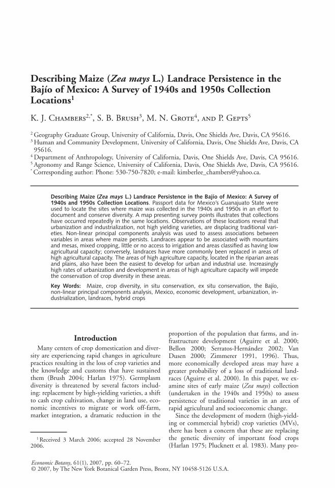
Describing Maize (Zea mays L.) Landrace Persistence in theBajío of Mexico: A Survey of 1940s and 1950s CollectionLocations1
K. J. Chambers2,*, S. B. Brush3, M. N. Grote4, and P. Gepts5
2 Geography Graduate Group, University of California, Davis, One Shields Ave, Davis, CA 95616.3 Human and Community Development, University of California, Davis, One Shields Ave, Davis, CA95616.
4 Department of Anthropology, University of California, Davis, One Shields Ave, Davis, CA 95616.5 Agronomy and Range Science, University of California, Davis, One Shields Ave, Davis, CA 95616.* Corresponding author: Phone: 530-750-7820; e-mail: [email protected].
Describing Maize (Zea mays L.) Landrace Persistence in the Bajío of Mexico: A Survey of1940s and 1950s Collection Locations. Passport data for Mexico’s Guanajuato State wereused to locate the sites where maize was collected in the 1940s and 1950s in an effort todocument and conserve diversity. A map presenting survey points illustrates that collectionshave occurred repeatedly in the same locations. Observations of these locations reveal thaturbanization and industrialization, not high yielding varieties, are displacing traditional vari-eties. Non-linear principal components analysis was used to assess associations betweenvariables in areas where maize persists. Landraces appear to be associated with mountainsand mesas, mixed cropping, little or no access to irrigation and areas classified as having lowagricultural capacity; conversely, landraces have more commonly been replaced in areas ofhigh agricultural capacity. The areas of high agriculture capacity, located in the riparian areasand plains, also have been the easiest to develop for urban and industrial use. Increasinglyhigh rates of urbanization and development in areas of high agriculture capacity will impedethe conservation of crop diversity in these areas.
Key Words: Maize, crop diversity, in situ conservation, ex situ conservation, the Bajío,non-linear principal components analysis, Mexico, economic development, urbanization, in-dustrialization, landraces, hybrid crops
Economic Botany, 61(1), 2007, pp. 60–72.© 2007, by The New York Botanical Garden Press, Bronx, NY 10458-5126 U.S.A.
1 Received 3 March 2006; accepted 28 November2006.
31371_U06.qxd 3/15/07 10:55 AM Page 60

ponents of the Green Revolution assumed thatdevelopment in traditional agroecosystems wouldinevitably require the replacement of local cropvarieties (landraces) with improved ones, and thatthe economic and technological integration oftraditional farming systems into the global systemwould be a positive step enabling increased pro-duction, income, and well-being (Tripp 1996;Wilkes and Wilkes 1972). As Brush (2004: 175)notes, “. . . it has been assumed that modern cropvarieties, which are broadly adapted, disease re-sistant and high yielding, have a natural and irre-sistible ability to replace traditional varieties thatare locally adapted, disease prone, and loweryielding.” Beginning in the 1940s, concerned ob-servers cautioned that agricultural industrializa-tion and the replacement of traditional varietiescould have several negative impacts including: in-creased genetic uniformity, simplification ofagroecosystems, and a trend toward monoculture(Wilkes and Wilkes 1972). In a letter to theRockefeller Foundation in 1941, geographer CarlO. Sauer warned that “A good aggressive bunchof American agronomists and plant breederscould ruin native resources for good and all bypushing their American commercial stocks . . .The example of Iowa is about the most danger-ous of all for Mexico” (cited in Wright 1984:137). The introduction of modern varieties hasresulted in monocropping and the virtual elimi-nation of traditional varieties of maize in theAmerican Corn Belt (Brush 2004). This commontheory—that widespread adoption of high-yielding varieties has led to a reduction of biodi-versity—is still prevalent. Supporting evidence isprovided when looking at the agriculture of ricein the Philippines, India, and Bangladesh wherehigh-yielding varieties have replaced more than300 traditional varieties (Thrupp 2004).
Agricultural development institutions, such asthe Rockefeller Foundation, responded to thesepotential problems in areas of agriculture originsand dispersals (Cotter 2003). In 1943, the Rock-efeller Field Office opened in Mexico with thegoal to “help Mexico help itself.” One of the firstprojects concentrated on the collection and cate-gorization of seeds from all over Mexico, NorthAmerica, and South America. As a staff memberof a Rockefeller Foundation-Mexico collaborativebreeding program in the 1940s and 1950s,Edwin J. Wellhausen coordinated and took partin the systematic collection and preservation ofnative Mesoamerican maize germplasm against
2007] CHAMBERS ET AL.: MAIZE LANDRACE PERSISTENCE IN THE BAJÍO 61
the day of its possible replacement or extinction.The result of Welhausen’s work was the first thor-ough and uniform treatment of maize fromthroughout Latin America documented in a seriesof booklets describing the Latin American maizeraces (e.g., Wellhausen et al. 1952, 1957). ForMexico, Wellhausen et al. (1952) described andillustrated 25 races and three sub-races; moreover,there was mention of seven types poorly knownat the time of the study.
After 60 years of concern, debate still existsabout the impact of industrial agriculture andmodern crop breeding on traditional varieties(Brush et al. 1992; Zimmerer 1996). Mexico isan important center for both agricultural diver-sity and development programs, yet it is still pri-marily planted in landraces of maize (Aquino etal. 2001). As Goodman (2004) notes, “Scientifi-cally-improved corn has been around in Mexicosince at least the mid or early 1930s. Yet this hashad remarkably little effect on maize in Mexico.”
There are arguments to support concerns thatlandraces are being replaced by high yielding vari-eties and that this is only occurring in a smallpercentage of agriculture areas. Brush (2004)notes that despite 30 years of crop collection andresearch, the replacement of traditional diversityby modern uniformity in crops remains more apresumption of what is likely to occur than ademonstrated fact. Furthermore, Brush (2004)draws attention to the fact that although geneticerosion has been a plausible “folk model” amongcrop scientists it has not been articulated thor-oughly nor tested explicitly.
Aguirre et al. (2000) divided southeasternGuanajuato State into four environments basedon growing degree days and with contrasting po-tential for agricultural productivity and infra-structure. Their findings indicate that landracesare dominant in all environments surveyed andthat statistical differences in diversity arise whenthe development of infrastructure interacts withagroecological factors in an environment (Aguirreet al. 2000).
This paper presents data on the Bajío (Mexico)to understand the extent of the replacement oftraditional maize varieties by high-yielding vari-eties and to identify common variables where lan-draces persist or have been replaced. As has beennoted, if landraces are to be replaced by modernvarieties, it is hypothesized that this will occur inareas of high agriculture capacity such as theBajío. This study also addresses recent research
31371_U06.qxd 3/15/07 10:55 AM Page 61

drawing attention to concerns with ex situ collec-tions (Berger et al. 2003; Hijmans et al. 2000;Jarvis et al. 2005). Early ex situ collection loca-tions (dating from the 1940s and 1950s) were re-surveyed to assess the comprehensiveness of earlymaize accessions from the Bajío region.
Biogeography and AgriculturalHistory of the Study Site
The Bajío region is situated at the center of themodern Mexican Republic within the states ofGuanajuato, Querétaro, Jalisco, and Michoacán.It is an extensive, fertile, and predominantly levelarea of approximately 26,000 square kilometers(km2) without clearly defined boundaries. Al-though the word Bajío means “lowland,” its ele-vation is mostly between 1,500 and 2,000 metersabove sea level. The overall landscape is one ofopen plains interrupted by mountains. Besides itstopography and varied environments, agriculturein the Bajío also has been shaped by the absenceof intensive agriculture in Pre-Hispanic times, ir-rigation systems built during the Colonial period,evolving patterns of land ownership, and currenteconomic pressures.
The Bajío is a complex, three-dimensional mo-saic of soils and vegetation that partly masks thezonal effects of increasing aridity towards thenorth. Virtually all of the Bajío falls within thelimits of the climatic region commonly known asthe “tierra templada” since average daily tempera-tures do not vary much beyond 14° C in Januaryto 22° C in May (Vivó Escoto 1964). About 80%of all rains fall in the summer months from Juneto September in the form of afternoon thunder-storms, with another 10% that falls in May andOctober. Considerable variations occur in boththe intensity and incidence of these summer rainsand the mountains accentuate rain-shadow ef-fects. Portions of the Bajío nearly always suffer aperiod of water stress in the spring and failures ofsummer rains can occasionally bring severedroughts (Murphy 1986).
In contrast to most of Mesoamerica, the thriv-ing agriculture systems of the Bajío were primar-ily the work of the Colonial period and not ofPre-Hispanic Mexican civilizations. During theColonial period, the importance of the Bajío layin its capacity to raise surplus food to supply thebooming mining communities (Murphy 1986); acharacteristic that gave it the description as “Elgranero de Mexico” (The granary of Mexico).The subsequent history of the Bajío was, in large
62 ECONOMIC BOTANY [VOL. 61
measure, governed by the combination of a fertilesoil and the absence of fixed settlement before theSpanish Conquest. It was the pattern of heavy,but highly variable summer rains preceded by arelatively hot, dry spring that determined therange of natural vegetation types and the limits ofColonial-period agriculture. Maize, which wasplanted by both landholders and share croppers,flourished in this climate and type of soil,whereas wheat required irrigation or proximity torunning water if it were to survive the dry wintermonths (Murphy 1986).
The historical pattern of land tenure is re-flected in the Bajío today, characterized by whatBrading (1978) refers to as an unsuspected com-plexity in the pattern of land tenure. The landtenure pattern remains largely a mosaic of moder-ately sized haciendas and rented ranchos, but withoccasional great estates and small independentfarmers. In particular, the existence of a numberof small landholders and tenant farmers,rancheros, is unique. Mexican agrarian reform(beginning in 1910) affected the highlands ofMexico where indigenous populations were al-ready settled but did not have the same impacton farming systems of the Bajío. However,throughout Mexico, including the Bajío, agrarianreform granted primarily marginal, rain-fed landsto peasants (small-scale farmers), leaving devel-oped and often-irrigated lands to large landholderfarmers (Collier 1994).
Agriculture has retained its importance in theBajío through the intensive cultivation of thelimited expanse of good arable land. In someareas, irrigation has exploited water to the pointof dangerously reducing the water table (Murphy1986). The pattern that was established in theColonial period—where owners farmed wheaton irrigated land and left the marginal areas formaize—continues today with cash crops (pri-marily for export to the United States) beingfarmed on irrigated land and peasant farmersgrowing maize for subsistence on non-irrigatedland.
Today the Bajío is a center of industrializationand booming export agriculture. Broccoli is themajor export crop, followed by cauliflower, cab-bage, asparagus, garlic, onion, and strawberries.Tomatoes, green peppers, chilies, prickly pearcactus, green peas, snap beans, carrots, potatoes,eggplant, sorghum, and maize are produced fordomestic consumption. The area is also impor-tant for fruit tree production, particularly avo-
31371_U06.qxd 3/15/07 10:55 AM Page 62

cado, guava, apples, and peaches. According toMexico’s Instituto Nacional de Estadística Ge-ografía e Informática (INEGI), approximately90% of the farming population in the Bajío arepoor and depend on about 10% of the land de-spite the wealth of agricultural exports (INEGI1980).
Recently, major urban centers such as Celaya,Irapuato, and Querétaro have become part of anew industrial corridor from Mexico City, acrossthe Bajío, to León. This corridor symbolizes thecontemporary Bajío, which is an area of rapid in-dustrialization, booming export agriculture, and apopulation of over 4 million that is rapidly grow-ing (Gobierno del Estado de Guanajuato 2006).The Bajío has received many migrants from Mex-ico City resulting in increasing population pres-sure while the state of Guanajuato has high labormigration to the United States, making it the sec-ond largest state in Mexico in terms of the num-ber of migrants (Smith 2003).
Investigations in areas such as the Bajío canhelp provide a greater understanding of the inter-face between modern and traditional agricultureand whether landraces can persist in areas whereit is theorized that only MVs and cash crops willcome to dominate. Research has found that inthe Bajío of Mexico—despite market integration,cash cropping, advanced infrastructure, a pre-dominance of modern crop varieties, and a highpercentage of labor out-migration—farmers con-tinue to grow traditional varieties of maize(Aguirre et al. 2000).
Materials and MethodsFor collections made in Guanajuato State in
the 1940s and 1950s, passport information wasobtained from CIMMYT (The InternationalMaize and Wheat Improvement Center) and theUnited States Department of Agriculture. Dataon collections are recorded by states, and not re-gions such as the Bajío; therefore, state data wereused. Information on collections from the 1940sand 1950s was selected because these representthe earliest efforts to collect and document maizediversity in Mexico and were made during a timewhen MVs had minimal impact.
Topographic maps (1:50,000 scale) for the en-tire State of Guanajuato were obtained fromGuanajuato’s INEGI office. The latitude and lon-gitude coordinates for each of the 1940s and1950s collection locations were marked on themaps with coordinates referring to an area that is
2007] CHAMBERS ET AL.: MAIZE LANDRACE PERSISTENCE IN THE BAJÍO 63
1.5 kilometers (km) by 1.5 km. Given that farm-ers do not always grow the same crops in thesame field each year and that farms often havemore than one field, we determined that findingmaize 55 to 65 years later within these dimen-sions would represent maize persistence in thearea where original collections were made. Usinga GPS unit (GPSMAP 76S, Garmin Interna-tional Inc., Olathe, KS) and the marked topo-graphic maps, we located the original collectionsites. We then surveyed the entire 1.5 km by1.5 km site for maize fields. Based on the terrainand vegetation cover, it was relatively easy to sur-vey the entire quadrant and to determine thepresence or absence of maize. In urban areas, wedrove or walked a grid (transects north/south andeast/west). If no maize fields were visible (particu-larly in urban areas), we asked numerous people(local residents, shopkeepers, workers in nurseriesand seed stores, market vendors, etc.) about thepossible existence of maize in the area (includingkitchen or home gardens). We also asked if theyremembered the last fields of maize in the area. Ifwe were still unable to locate maize, using a GPSreceiver, a data point was taken at the center ofthe 1.5 by 1.5 km plot and we recorded latitude,longitude, and elevation. We then assessedwhether or not the site was rural or urban. We es-timated topography based on the four descrip-tions included in Butzer and Butzer (1997) (ri-parian/riverine, level plains, rough uplands[mesas], and mountains). If more than one acces-sion had been collected in the same latitude andlongitude coordinates, we treated these combinedpoints as one site because more than one collec-tion of the same information would be redun-dant.
For locations with maize fields we collecteddata using a GPS receiver (latitude, longitude,and elevation); noted topography; and calibratedplot size, slope, and aspect. We then asked resi-dents and farmers in the area for the person whofarmed the survey field. We interviewed the per-son responsible for the maize field to determineagricultural practices and varieties in the field. Weasked the owner/renter if the field was planted inlandraces (criollos) or modern varieties (híbridos)and, if they used irrigation, what method. If thefield was planted in landraces, we asked howmany varieties, how long they had been growingthose varieties, and what other crops were plantedin the field. For all maize fields we asked if pesti-cides, herbicides, and fertilizers were used. All
31371_U06.qxd 3/15/07 10:55 AM Page 63
farmers agreed to be interviewed. We took a datacollection point at each field site and the field wassketched, described, and photo points taken. Ifthere was more than one previous collectionpoint for the 1.5 km by 1.5 km site, we attemptedto find as many individual maize fields as collec-tions and treated each as an individual point. Inother words, if, during the 1940s and 1950s, 11collections had been made in the same quadrant,we searched for up to 11 fields of maize andrecorded information for each as an individualpoint. When observations are taken repeatedly atthe same relative geographical coordinates (in the1940s and in 2004), it is expected that such ob-servations share many more characteristics in theexplanatory variables and the persistence of lan-draces than truly spatially independent observa-tions would share. Maize fields were surveyed onboth non-commercial and commercial farms.
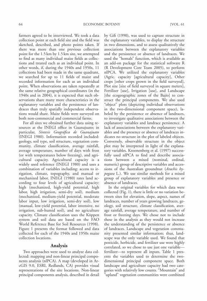
For all sites we obtained further data using re-sources at the INEGI office in Guanajuato; inparticular, Síntesis Geográfica de Guanajuato(INEGI 1980). Information recorded included:geology, soil type, soil structure, vegetation com-munity, climate classification, average rainfall,average temperature, number of days with frost(or with temperatures below freezing), and agri-cultural capacity. Agricultural capacity is awidely used reference (INEGI 1980) and uses acombination of variables including: access to ir-rigation, climate, topography, and manual ormechanized labor. INEGI (1980) rates land ac-cording to four levels of agricultural capacity:high (mechanized, high-yield potential, highlabor, high irrigation, semi-dry soil), medium(mechanized, medium-yield potential, moderatelabor input, low irrigation, semi-dry soil), low(manual, low-yield potential, labor intensive, noirrigation, sub-humid soil), and no agriculturecapacity. Climate classification uses the Köppensystem and soil data are based on the FAOWorld Reference Base for Soil Resources (1998).Figure 1 presents the format followed and datacollected for each of the 1940s and 1950s maizecollection locations.
AnalysisTwo approaches were used to analyze data col-
lected: mapping and non-linear principal compo-nents analysis (nlPCA). A map (developed in Ar-cGIS 9.0, ESRI, Redlands, CA) provides visualrepresentations of the site locations. Non-linearprincipal components analysis, described in detail
64 ECONOMIC BOTANY [VOL. 61
by Gifi (1990), was used to capture structure inthe explanatory variables, to display the structurein two dimensions, and to assess qualitatively theassociations between the explanatory variablesand the persistence or absence of landraces. Weused the “homals” function, which is available asan add-on package for the statistical software R(R Development Core Team 2005), to performnlPCA. We utilized the explanatory variables(Agric. capacity [agricultural capacity], Othercrops [other crops grown in the field surveyed],Plot size [size of field surveyed in square meters],Fertilizer [use], Irrigation [use], and Landscape[the ecogeographic zones of the Bajío] to con-struct the principal components. We also used“object” plots (depicting individual observationsin the two-dimensional component space), la-beled by the persistence or absence of landraces,to investigate qualitative associations between theexplanatory variables and landrace persistence. Alack of associations between the explanatory vari-ables and the presence or absence of landraces in-dicates no structure in the plot of labeled objects.Conversely, observable structure in the objectplot may be interpreted in light of the explana-tory variables. Kroonenberg et al. (1997) success-fully used nlPCA to find and describe associa-tions between a mixed (nominal, ordinal,numeric) group of descriptive variables and acces-sions of the Australian groundnut (Arachis hy-pogaea L.). We use similar methods for a mixedgroup of explanatory variables and presence orabsence of landraces.
In the original variables for which data werecollected (Fig. 1), there is little or no variation be-tween sites for elevation, slope, aspect, names oflandraces, number of years growing landraces, ge-ology, soil structure, climate classification, aver-age rainfall, average temperature, and number offrost or freezing days. We chose not to includethese in the analysis as they would not increasethe understanding of the persistence or absenceof landraces. Landscape and vegetation commu-nity presented similar information; thus, land-scape was the only variable used. We found thatpesticide, herbicide, and fertilizer use were highlycorrelated, so we chose to use just one variable—fertilizer—to represent all inputs. Table 1 pres-ents the variables used to determine the two-dimensional principal component space. Bothlandscape and agriculture capacity had two cate-gories with relatively low counts. “Mountain” and“upland” vegetation communities were combined
31371_U06.qxd 3/15/07 10:55 AM Page 64

to provide more numerically stable results. Thesame is true of “none” and “low” agriculture ca-pacity. The variables used in the analysis representkey characteristics of maize locations in the Bajío.
ResultsOf the 74 collections from Guanajuato made
in the 1940s and 1950s, seven did not have loca-tion coordinates and four had incorrect latitudeand longitude coordinates. We found that the re-maining 63 points did not represent a diversity oflocations throughout Guanajuato State, but wererepeated in samples from 21 sites. The early sam-pling sites repeatedly visited over the 20-year pe-riod are primarily located in the southern portionof the state. Geographic limitation in the collec-tions makes it difficult to truly assess change in
2007] CHAMBERS ET AL.: MAIZE LANDRACE PERSISTENCE IN THE BAJÍO 65
terms of MVs (modern varieties) replacing lan-draces and could mean that the diversity of vari-eties grown in Guanajuato during the 1940s and1950s was not fully surveyed. A total of 51 points(or fields or individual points for sites with nomaize) were surveyed in the 21 sites with thenumber of accessions per site ranging from 1 to11. Figure 2 illustrates the concentration of datacollection points in 21 sites.
Errors with original data in early collectionshave been previously noted by Jarvis et al. (2005)who observed that, frequently, the locality dataare missing or erroneous, especially for older col-lections. Furthermore, collecting localities oftenare distributed non-randomly in space, shapingdistinct geographical biases (Marshall 1989; Hij-mans et al. (2000).
Fig. 1. A schematic of questions asked and data collected at each of the 1940s and 1950s collection sites sur-veyed.
31371_U06.qxd 3/15/07 10:55 AM Page 65

66 ECONOMIC BOTANY [VOL. 61
Table 1. Variables Observed for Maize Fields in Guanajuato (Mexico)Based on Accession Locations from the 1940s and 1950s (46 Data Points)
Abbreviation Description Category definitions
Binary descriptors:Landrace landraces of maize yes, no
observed?Irrigation irrigation used? yes, noFertilizer fertilizers used? yes, noOther crops other crops in the field? yes, no
Ordinal descriptorsAgric. capacity* agriculture capacity none or low, medium,
high
Unordered multicategoryLandscape** topography, vegetation, riparian, plain, upland
soils or mountain
NumericalPlot size size of maize field meters2
* Secretaría de Programación y Resupuesto, Coordinación General de los Servicios Na-cionales de Estadística, Geografía e Informática. 1980. Síntesis Geográfica de Guanajuato.Mexico, D.F.
** Butzer, K. W. and E. K. Butzer. 1997. The ‘natural’ vegetation of the Mexican Bajío:Archival documentation of a 16th-century savanna environment. Quaternary International43(44):161–172.
Fig. 2. Elevation map of Guanajuato State (Mexico) indicating the 20 sites (based on latitude and longitudecoordinates) where accessions were collected in the 1940s and 1950s.*
*Twenty-one sites were sampled but two of the sites are too close in proximity to appear separately on the map. How manytimes a site was visited is indicated by the numbers beside the symbols. Elevation is not to scale but has been accentuated inorder to emphasize contrasts.Data Sources: Collection points surveyed summer 2004; Elevation data Hole-filled seamless SRTM data V1, 2004, Interna-tional Centre for Tropical Agriculture (CIAT), avbailable from http://gisweb.ciat.cgiar.org/sig/90m_data_tr0pics.htm.
31371_U06.qxd 3/15/07 10:55 AM Page 66

There were 46 data collection points wheremaize was present and of these, 14 were MVs.We used nlPCA to describe characteristics com-mon to points where landraces persist and, incontrast, where landraces have been replaced byMVs. A key aspect of nlPCA is the production ofoptimal scalings of the variables—mappings ofthe variable categories into a two-dimensionalprincipal component space. Ordinal, numeric(real-valued), and binary variables have rank-oneoptimal scalings, meaning that the ordering ofcategories is the same in dimensions 1 and 2. Thenominal variables have rank-two optimal scalings,meaning that the ordering of categories can bedifferent in dimensions 1 and 2. Factor loadingsare correlation coefficients between the optimallyscaled explanatory variables and the two principalcomponents. The loadings measure how well theprincipal components succeed in accounting forthe variability of the optimally scaled explanatoryvariables (Kroonenberg et al. 1997). Factor load-ings for the variables of Table 1 are given in Table2. The loadings are small to moderate, indicatingthat the two components capture some (thoughlimited) structure in these data. The relativelylarge, positive loading 0.35 for Agric. capacity ondimension 1 indicates a positive association be-tween the first principal component and increas-ing agricultural capacity, whereas the small load-ing for Agric. capacity on dimension 2 indicates
2007] CHAMBERS ET AL.: MAIZE LANDRACE PERSISTENCE IN THE BAJÍO 67
little discrimination of the levels of this variableby the second principal component.
These properties are illustrated by the notablyhorizontal orientation of Agric. capacity in thevariable plot of Figure 3a. Variables with similarpatterns (larger loadings on dimension 1 than ondimension 2) may be interpreted in an analogousway. The variables Landscape, Irrigation, and Fer-tilizer have loadings of similar magnitudes onboth dimensions 1 and 2; therefore, both princi-pal components are needed to describe structurein these variables. Landrace is treated here as apassive variable, and has not been used to deter-mine the two principal components. Nonethe-less, loadings for landrace can be calculated forthe two dimensions determined by the other vari-ables.
Continuing with the variable plots, Figure 3cshows that plot size is discriminated by the firstprincipal component (with smaller plots in thenegative part of dimension 1), and to a lesser ex-tent by the second principal component. In Fig-ures 3b, 3d, and 3e, principal component 1 isseen to discriminate mixed-crop fields lacking fer-tilizer and irrigation from fertilized and irrigatedsingle-crop fields, and principle component 2further discriminates the use of fertilizer and irri-gation. Figure 3f shows that principal component1 discriminates upland and mountain vegetationcommunities from plain and riparian communi-ties, whereas principal component 2 discrimi-nates plains communities from the others.
The plot of labeled object scores can now beinterpreted using the two principal components.Each MV observation (labeled with “x”) in thenoticeable cluster in the upper right corner of theobject plot shown in Figure 4 corresponds to irri-gated fields in riparian areas. Because these obser-vations have positive scores in dimension 1, theyalso tend to share characteristics of medium tohigh agriculture capacity, larger plot sizes, use offertilizer, and monocropping. The three MV ob-servations in the lower right corner of the objectplot have unique characteristics; for example, onemight be the farmer who is a butcher in the dryupland mesa growing MVs for livestock and an-other might be the farmer in the midst of urbandevelopment on the irrigated plain who contin-ues to grow landraces.
Turning now to the fields in which landracespersist (objects labeled with open circles), wenote that these observations are found through-out the object plot. A broad conclusion sup-
Table 2. Loadings for the Optimally ScaledVariables on the First Two Dimensions*
Correlation coefficients
Variable name Dimension 1 Dimension 2
Agric. capacity 0.35 −0.01Other crops 0.27 0.04Plot size 0.28 −0.12Fertilizer −0.27 0.16Irrigation −0.26 −0.24Landscape (1st −0.28
dimension)**Landscape (2nd −0.24
dimension)**Landrace 0.24 0.05
* Loadings are correlation coefficients between the opti-mally scaled variable and the two dimensions, respectively.
** Because Landscape was treated as an unordered multicat-egory descriptor, it received separate independent quantifica-tions for each dimension and thus the correlations betweenLandscape and the two components pertain to these two inde-pendent quantifications (based on Kroonenberg et al. 1997).
31371_U06.qxd 3/15/07 10:55 AM Page 67

ported here is that landraces persist under a widerange of circumstances from mountainous areasto irrigated valleys, large to small fields, and areasof high to low agriculture capacity. The notice-able cluster of landrace observations in the upper
68 ECONOMIC BOTANY [VOL. 61
left quadrant of the object plot share the charac-teristics of none to low agriculture capacity, smallplot sizes, upland or mountain vegetation com-munities, and lack of fertilizers. Because these ob-jects have negative scores in dimension 1, they
Fig. 3. Optimal scalings of six explanatory variables along the 1st and 2nd principal component vectors,based on the summer 2004 surveys of 1940s and 1950s collection sites.
31371_U06.qxd 3/15/07 10:55 AM Page 68

also tend to lack irrigation and experience mixedcropping. Speaking with farm laborers harvestingfields of MVs on the edge of Salamanca (an irri-gated area), one told us that they come downfrom the hills to work on the fields of MVs butin the mountains they grow criollos, or local lan-drace varieties. The use of the maize from thesefields was also differentiated, with many farmers
2007] CHAMBERS ET AL.: MAIZE LANDRACE PERSISTENCE IN THE BAJÍO 69
stating that the MVs were for animals or com-mercial seed, and the laborers adding that to findmaize for food—tortilla maize—we would haveto go the hills. The association of large plot sizeswith MVs and smaller plots with landraces re-flects the legacy of Colonial period landholdingsin the Bajío, when large haciendas grew grainssuch as wheat and maize for commercial produc-
Fig. 4. Object scores in the two-dimensional principal component space, with objects labeled by presence(open circles) or absence (“x”) of landraces.*
*The object score of an observation is the position of the observation in the two-dimensional space determined by the firsttwo principal components. Objects located in specific regions of the two-dimensional space have similar values of the explana-tory variables, and can be broadly characterized by the variable categories seen in Figure 3 to map to the same region. For ex-ample, observations located in the upper right corner of the object plot tend to be in riparian areas with irrigation.
31371_U06.qxd 3/15/07 10:55 AM Page 69

tion and peasant farmers produced maize for sub-sistence on small plots of land in the more mar-ginal agriculture production areas.
DiscussionSince the 1970s, there has been a concern that
MVs of maize will replace traditional or landracevarieties (Harlan 1975). However, farmers con-tinue to grow landraces to reduce productionrisks, manage pests and pathogens, avoid or min-imize labor bottlenecks, fit different budget con-straints, provide variety to diets, provide specialconsumption items, fulfill rituals, generate pres-tige, and forge social ties (Bellon 1996). Further-more, MVs are not well adapted to the diversityof environments often found in farmers’ fields oragriculture landscapes where irrigation is notavailable and soils may be poor. Another explana-tion why farmers are not adopting MVs is be-cause they cannot afford the seed and requiredinputs such as fertilizers, pesticides, and herbi-cides. In Jaral and Acambaro, farmers told us thatthey were only growing MVs because they hadbeen “given” the seed by Monsanto and Pioneer,respectively.
It appears that landraces are being replaced byindustrialization and urbanization, not by mod-ern and commercial maize varieties. The majorityof the collection locations were clustered alongmajor roadways and close to, or now within,urban areas. Of the 21 sites (representing clustersof the 51 survey points in 1.5 by 1.5 km areas)surveyed, five were found to no longer containmaize and three of these were in urban areas. Theother two sites had recently switched to growingwheat and sorghum. Only four of 21 sites werefound to have MVs and no landraces. For the in-dividual data collection points, 46 of 51 hadmaize and 14 of these were MVs.
Like rare plants left in the remnants of land-scapes and marginal habitats, some landraces ofmaize persisted in fragmented urban landscapestoo steep for development. Urban developmentappears to influence whether or not maize is pres-ent, but does not necessarily inform on landracepersistence. Other maize fields persevere in en-claves surrounded by encroaching urbanization,particularly in the cities on the relatively flatplain, such as León and Silao. In Silao, housingdevelopments spread around fields of maize ontwo sides with the main Guadalajara-Mexico Citytoll road a third side, and large factories, includ-ing Toyota, on the fourth. Farmers in these fields
70 ECONOMIC BOTANY [VOL. 61
spoke of a constant pressure to sell their land andstated that yields suffer as a result of theft fromthe neighboring housing developments (basicallyshanty towns) that have grown up to the edges oftheir fields. In León, the one maize field we wereable to find within the coordinates was adjacentto a large Coca-Cola factory. The farmer told usthat he only rented the field and did not thinkthat the owners would renew his lease next year;there was a large “for rent” sign on the edge ofthe field adjacent to a major road. In Cortázar,the expanding highway passed through the quad-rant and the maize fields were located underneatha freeway overpass.
In Commonfort, Guanajuato, and Valle deSantiago, the terrain is varied and in places verysteep. It is on these slopes and in home gardenswhere we found small maize fields. It has beenlong recognized that maize diversity is found inenvironmental niches where different varieties re-spond to factors such as rainfall, temperature,soils, and freezing days (Brush 2004). To this wecan add the concept of maize occupying “niches”in developed areas where there is nowhere else forthe crop to grow.
An increasing concern is that the greatestthreat to diversity may be when farmers abandonfarming (Taylor 2003). The exodus of rural farm-ers to cities is occurring at a rapid pace aroundthe world, not just in Mexico. The loss of diver-sity when farmers leave their fields is now beingcompounded by losses as cities swell to accom-modate an exploding population and encroachon the surrounding agricultural areas.
Aguirre et al. (2000) concluded that landracesare dominant in all environments and that statis-tical differences in diversity are apparent whenthe development of infrastructure interacts withagroecological factors in an environment. Our re-search finds that landraces are more commonlyfound in marginal agricultural production areasand MVs increase in the areas of high agriculturalproduction. These differences could result fromthe fact that the research area Aguirre et al.(2000) used was southeastern Guanajuato Stateand our research was the entire state. We add tothe work performed by Aguirre et al. (2000) theobservation that urbanization and industrializa-tion are impacting the presence or absence of lan-draces. Given industrial and urban demands forland and the added pressures for water, landracesof maize will likely continue to be marginalizedinto the areas of lower agricultural capacity and
31371_U06.qxd 3/15/07 10:55 AM Page 70

MVs, if present at all, will be replaced by build-ings. This pattern is not unique to the Bajío, oreven Mexico, but is an acknowledged trend thatis occurring in important agriculture areasaround the world such as the Central Valley ofCalifornia and the Fraser Valley in British Co-lumbia.
Concerns over genetic erosion in maize refer tonot only those varieties grown in areas of loweragriculture capacity but to the varieties that havedone well in the lowlands and fertile plains ofMexico as well. These varieties may carry impor-tant traits for future adaptations and can providealternatives to MVs in areas where the water tableis dropping or the climate is shifting; varietiesthat require less water would be beneficial. Theirrigation system of the Bajío is a legacy of Colo-nial Mexico that pre-dates the development ofMVs (Murphy 1986). In general, the Bajío hasvery little water with only one perennial river.Many of the reservoirs are silting up, and there isan increased pressure from industrial develop-ment, resulting in additional loss of water quan-tity and quality. Landraces generally require lesswater than MVs and may provide a solution tothe concern over reduced water in the future.
Both ex situ and in situ conservation are im-portant for protecting crop diversity. Finding waysfor in situ conservation to persist in these areas ofhigh agriculture capacity with increasingly highurbanization and development may be the great-est challenge in the near future. Although smallareas with traditional maize populations are likelyto persist in an industrialized and urbanized land-scape, further research is needed on the viabilityof these populations for the purpose of in situconservation. Viability may be compromised bysuch things as inbreeding and lack of heterozygos-ity, the lack of knowledge of seed sources, or socialnetworks to obtain seed. Our research suggeststhat the most likely area for the loss of traditionalmaize is in the region with high agricultural andurban/industrial capacity. While in situ conserva-tion of maize within the core area of this regionmay not be practicable, it is possible that verysimilar maize populations will persist in the pe-riphery of the high capacity region, and thesewould make ideal targets for in situ conservation.
AcknowledgmentsPartial funding for this research was provided
by UCMEXUS, the University of California,
2007] CHAMBERS ET AL.: MAIZE LANDRACE PERSISTENCE IN THE BAJÍO 71
Davis Geography Graduate Group, HemisphericInstitute on the Americas, The Center for Inter-national Agricultural Development, and an Asso-ciation of American Geographers DissertationResearch Grant. We are grateful to AlfonsoAguirre of INIFAP in Celaya for his assistanceand to the many people of the Bajío who pro-vided hospitality and information.
Literature CitedAguirre Gomez, J. A., M. R. Bellon, and M. Smale.
2000 A regional analysis of maize biological diver-sity in southeastern Guanajuato, Mexico. EconomicBotany 54(1):60–72.
Aquino, P., F. Carrión, R. Calvo, and D. Flores. 2001.Selected maize statistics. Pages 45–57 in P. L. Pin-gali, ed., CIMMYT 1999–2000 world maize factsand trends, meeting world maize needs: Technolog-ical opportunities and priorities for the public sec-tor. International Maize and Wheat ImprovementCenter (CIMMYT), Mexico D. F.
Bellon, M. R. 1996. The dynamics of crop infraspecificdiversity: A conceptual framework at the farmerlevel. Economic Botany 50:26–39.
———. 2000. Demand and supply of crop infraspe-cific diversity on farms: Towards a policy frameworkfor on-farm conservation: International Maize andWheat Improvement Center (CIMMYT) Econom-ics Working Paper 01-01. CIMMYT, Mexico D.F.
Berger, J., S. Abbot, and N. C. Turner. 2003. Ecogeog-raphy of annual wild Cicer species: The poor stateof the world collection. Crop Science 43:1076–1090.
Brading, D. A. 1978. Haciendas and ranchos in theMexican Bajío: León 1700–1860. Cambridge Uni-versity Press, Cambridge, UK.
Brush, S. B., J. E. Taylor, and M. R. Bellon. 1992 Bio-logical diversity and technology adoption in An-dean potato agriculture. Journal of DevelopmentEconomics 39:365–87.
———. 2004. Farmers’ bounty: Locating crop diver-sity in the contemporary world. Yale UniversityPress, New Haven (CT) and London.
Butzer, K. W. and E. K. Butzer. 1997. The ‘natural’vegetation of the Mexican Bajío: Archival docu-mentation of a 16th-century savanna environment.Quaternary International 43(44):161–172.
Collier, G. A. 1994. Reforms of Mexico’s agrariancode: Impacts of the peasantry. Research in Eco-nomic Anthropology 1:105–127.
Cotter, J. 2003. Troubled harvest: Agronomy and revo-lution in Mexico, 1880–2002. Praeger Publishers,Westport, CT.
Food and Agriculture Organization of the United Na-tions (FAO). (1998) World reference base for soilresources: 84 World Soil Resource Reports. Interna-tional Society of Soil Science, Rome, Italy.
31371_U06.qxd 3/15/07 10:55 AM Page 71

Gifi, A. 1990. Nonlinear multivariate analysis. JohnWiley and Sons, Chichester, UK.
Gobierno del Estado de Guanajuato. 2006. AboutGuanajuato. URL: http://www.guanajuato.gob.mx[Accessed January 23, 2006].
Goodman, M. 2004 Are GM crops a threat to biologi-cal diversity? AgBiotech Buzz, Pew Initiative onFood and Biotechnology: Washington, DC. Vol3(5), URL:http://pewagbiotech.org/buzz/index.php3?Is-sueID=23 [Accessed October 10, 2005].
Harlan, J. R. 1975. Our vanishing genetic resources.Science 188:618–621.
Hijmans, R. J., K. A. Garrett, Z. Human, D. P. Zhang,M. Schreuder, and M. Bonierbale. 2000. Assessingthe geographic representativeness of genebank col-lections: The case of Bolivian wild potatoes. Con-servation Biology 14:1755–1765.
Instituto Nacional de Estadística, Geografía e Infor-mática (INEGI). 1980. Síntesis Geográfica de Gua-najuato Secretaría de Programación y Resupuesto.Coordinación General de los Servicios Nacionales deEstadística, Geografía e Informática, Mexico, D. F.
Jarvis, A., S. Yearman, L. Guarino, and J. Tohme.2005. The role of geographic analysis in locating,understanding, and using plant genetic diversity.Methods in Enzymology 395:279–298.
Kroonenberg, P. M, B. D. Harch, K. E. Basford, andA. Cruickshank. 1997. Combined analysis of cate-gorical and numerical descriptors of Australiangroundnut accessions using nonlinear principalcomponents analysis. Journal of Agricultural, Bio-logical, and Environmental Statistics 2(3):294–312.
Marshall, D. R. 1989. Limitations to the use ofgermplasm collections. Pages 105–120 in A. H. D.Brown, O. H. Frankel, D. R. Marshall, J. T.Williams, eds., The use of plant genetic resources.Cambridge University Press, Cambridge, UK.
Murphy, M. E. 1986. Irrigation in the Bajío region ofcolonial Mexico: Dellplain Latin American Studies,No. 19. Westview Press, Boulder, CO.
Plucknett, D. L., N. J. H. Smith, J. T. Williams, andN. Murthi Anishetty. 1983. Crop germplasm con-servation and developing countries. Science220:165–169.
R Development Core Team. 2005. A language and en-vironment for statistical computing. R Foundationfor Statistical Computing, Vienna, Austria. URL:http://www.R-project.org.
72 ECONOMIC BOTANY [VOL. 61
Serratos-Hernández, J. A. (coordinator). 2002. Con-sensus document on the biology of maize. Interna-tional Maize and Wheat Improvement Center (IN-IFAP-CIMMYT), Mexico D.F.
Smith, M. P. 2003. Transnationalism, the state, and theextraterritorial citizen. Politics and Society 31(4):467–502.
Taylor, E. J. 2003. The microeconomics of globaliza-tion: Evidence from China and Mexico. Pages 213–231 in Organization for Economic Co-operationand Development (OECD), Agricultural trade andpoverty: Making policy analysis count. OECD,Paris.
Thrupp, L. A. 2004. The importance of biodiversity inagroecosystems. Pages 315–337 in D. Clementsand A. Shrestha, eds., New dimensions in agroecol-ogy. Food Products Press, Binghamton, NY.
Tripp, R. 1996. Biodiversity and modern crop vari-eties: Sharpening the debate. Agriculture andHuman Values 13:48–62.
Van Dusen, E. 2000. In situ conservation of crop ge-netic resources in the Mexican milpa system. Ph.D.Dissertation, Agricultural and Resource Economics,University of California, Davis, CA.
Vivó Escoto, J. A. 1964. Weather and climate of Mex-ico and Central America. Pages 187–215 in R. C.West, ed., Handbook of Middle American Indians,Vol. 1: Natural Environment and Early Cultures.University of Texas Press, Austin, TX.
Welhausen, E. J., L. M. Roberts, and E. Hernandez X.1952. Races of maize in Mexico. Bussey Institute,Harvard University, Cambridge, MA.
———, A. Fuenets, A. H. Corso, and P. C. Mangels-dorf. 1957. Races of maize in Central America.Publication 511, NAS-NRC, Washington, DC.
Wilkes, H. G. and K. K. Wilkes. 1972. The green rev-olution. Environment 14:32–39.
Wright, A. 1984. Innocents abroad: American agricul-ture research in Mexico. Pages 135–151 in W. Jack-son, W. Berry, and B. Coleman, eds., Meeting theexpectations of the land: Essays in sustainable agri-culture and stewardship. North Point Press, SanFrancisco, CA.
Zimmerer, K. S. 1991. Managing diversity in potatoand maize fields of the Peruvian Andes. Journal ofEthnobiology 11:23–49.
———. 1996. Changing fortunes: Biodiversity andpeasant livelihood in the Peruvian Andes. Univer-sity of California Press, Berkeley, CA.
31371_U06.qxd 3/15/07 10:55 AM Page 72
Copyright © 2022 FDOKUMEN