


Datascape. Survey and Data Integration in Landscape and Heritage Planning
34
Datascape The Amstelland Atlas project Survey and Data Integration in Landscape and Heritage Planning Jaap Evert Abrahamse Erik Schmitz Cultural Heritage Agency of The Netherlands Ministry of Education, Culture and Science Amsterdam City Archives
-
Upload
cultureelerfgoed -
Category
Documents
-
view
4 -
download
0
Transcript of Datascape. Survey and Data Integration in Landscape and Heritage Planning

Datascape The Amstelland Atlas project Survey and Data Integration in Landscape and Heritage Planning Jaap Evert Abrahamse Erik Schmitz
Cultural Heritage Agency of The Netherlands Ministry of Education, Culture and Science
Amsterdam City Archives

The Amstelland Atlas project
2/29
History of a complex landscape that was shaped by the presence of the city
Emphasis on rural landscape Multidisciplinary landscape biography
approach Multi-layered ‘datascape’ takes the form of a
GIS-based landscape atlas Integration of datasets from different
sources Tool for the integration of landscape
planning and heritage management
Work in progress: book publication planned for November, 2012

3/29
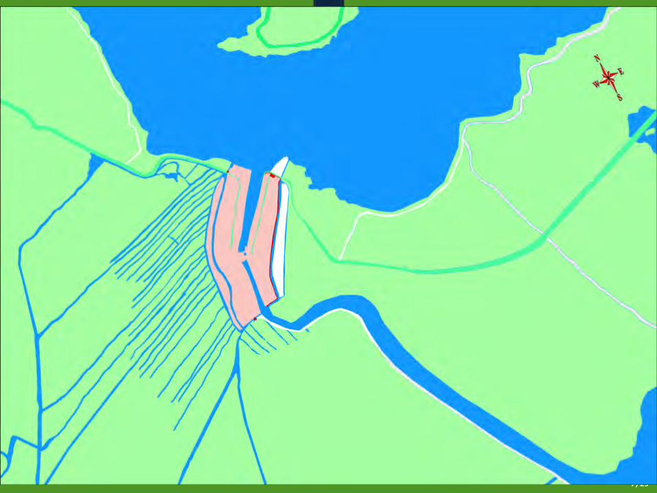
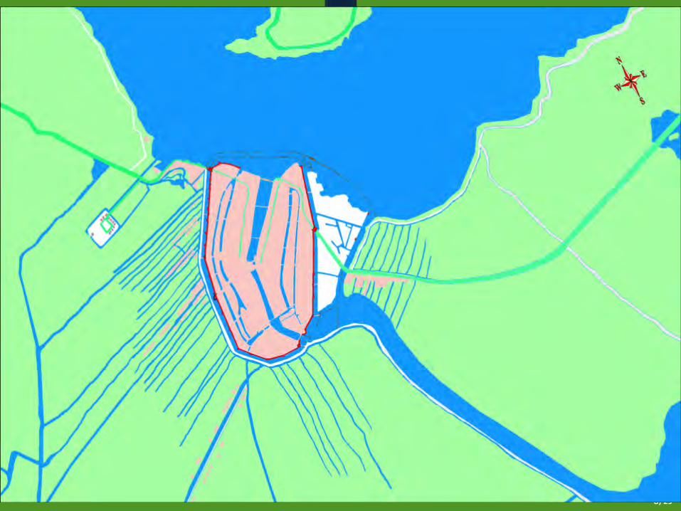
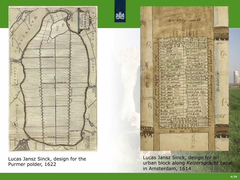
From medieval times onwards, surveyors have shaped the form of the peat landscape. During the ‘Great Reclamation’ of the western Netherlands, ‘locatores’ took care of the drainage of moors. The landscape was divided into parcels by the digging of drainage ditches. The structure that resulted, reflects the landownership up to the present time.
4/29
Lucas Jansz Sinck, design for the Purmer polder, 1622
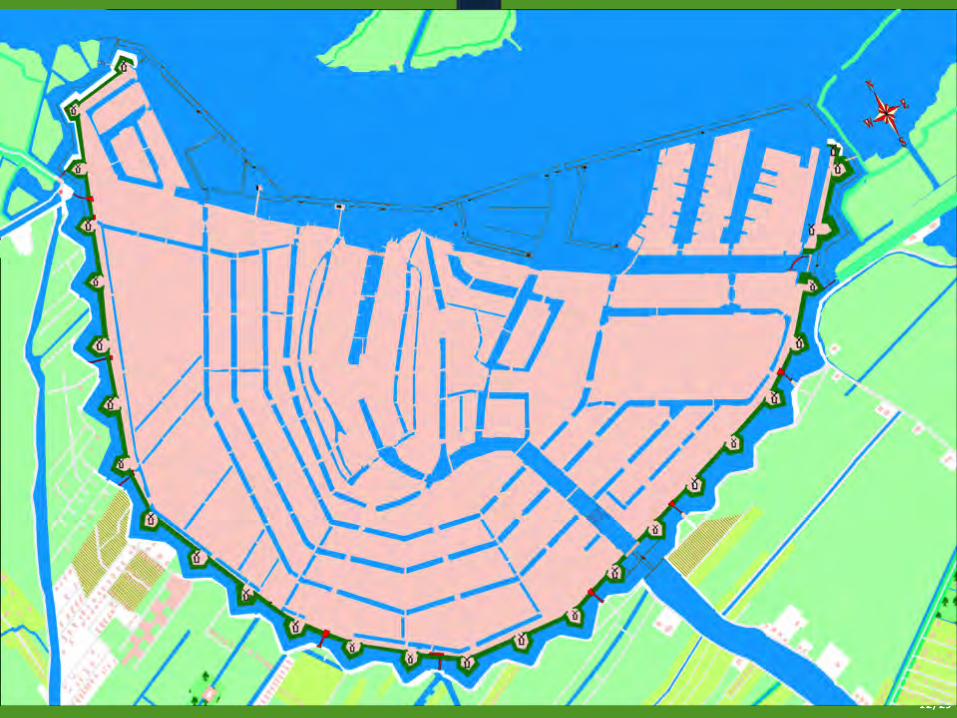
Lucas Jansz Sinck, design for an urban block along Keizersgracht canal in Amsterdam, 1614
5/29
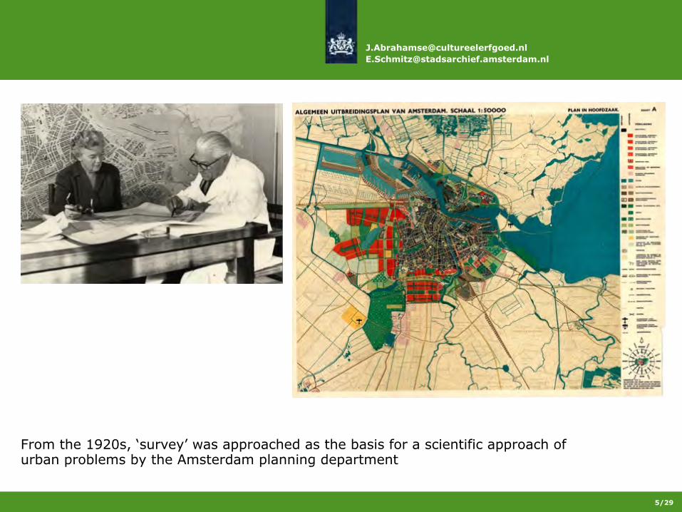
From the 1920s, ‘survey’ was approached as the basis for a scientific approach of urban problems by the Amsterdam planning department

6
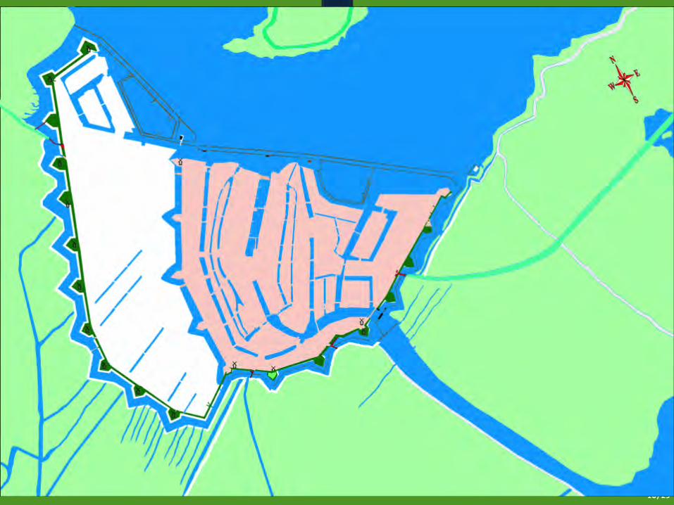
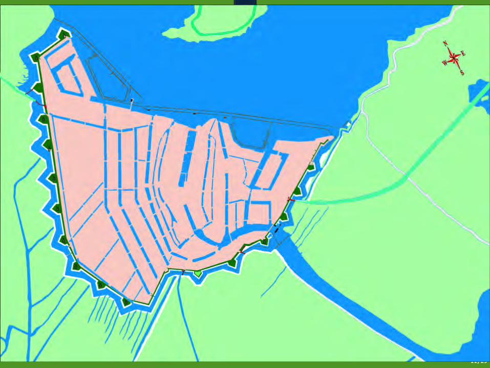
Modernist planning was based on tabula rasa, empty space. The existing landscape and its regular, medieval structure disappeared under thick layers of sand.
13
14

15

16

18/29
1555 map, made as a result of a conflict between the City of Amsterdam and the bishop of Utrecht over the levying of tithes

20/29
1640: land owned by Amsterdam citizens (red), urban institutions (green), and a citizen of Dordrecht (yellow)
21
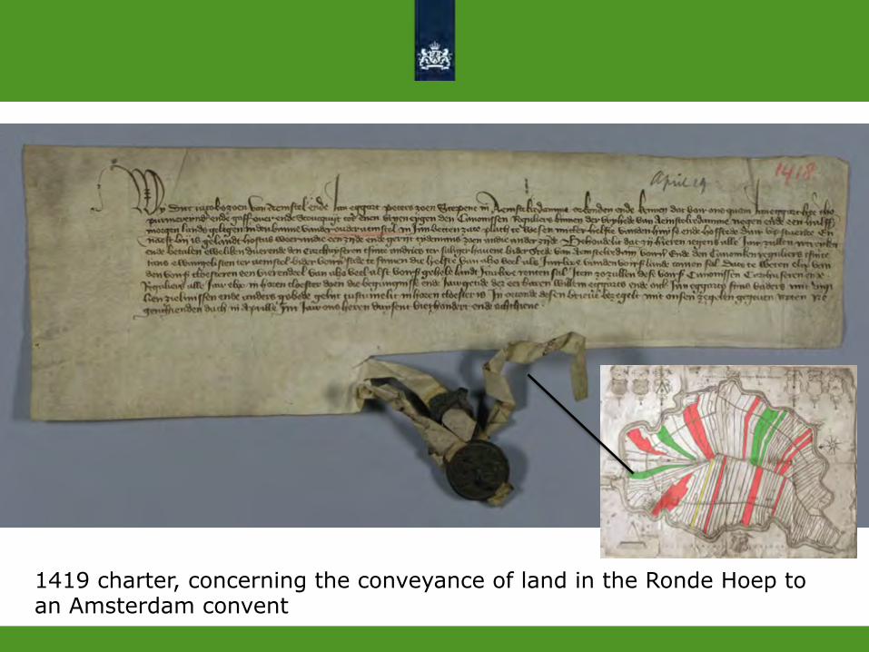
1419 charter, concerning the conveyance of land in the Ronde Hoep to an Amsterdam convent
22/29
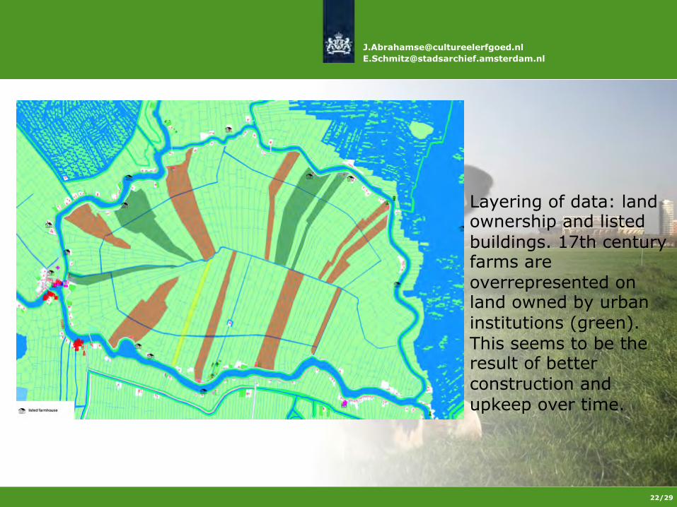
Layering of data: land ownership and listed buildings. 17th century farms are overrepresented on land owned by urban institutions (green). This seems to be the result of better construction and upkeep over time.
23/29
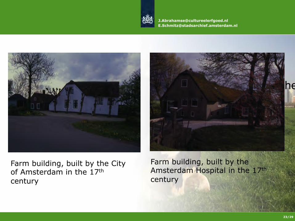
" Farm building, built by the
City of Amsterdam
Farm building, built by the City of Amsterdam in the 17th century
Farm building, built by the Amsterdam Hospital in the 17th century

24/29
The 1985-86 archaeological survey shows scarce medieval finds. Presumed house sites are mainly traced on the eastern side of the polder because of differences in the way the peat area was reclaimed in medieval times.

Cultural Heritage Agency of The Netherlands Ministry of Education, Culture and Science
Datascape The Amstelland Atlas project
Survey and Data Integration in Landscape and Heritage Planning Jaap Evert Abrahamse Erik Schmitz
Amsterdam City Archives