CRA LTD - FIELD INVESTIGATIVE PROGRAM - Records ...
262
18 FIELD INVESTIGATIVE PROGRAM Watson Street and Plant Site St. Louis, Michigan prepared for: Bidley & Auatin October S 1BB&
-
Upload
khangminh22 -
Category
Documents
-
view
1 -
download
0
Transcript of CRA LTD - FIELD INVESTIGATIVE PROGRAM - Records ...

18
FIELD INVESTIGATIVE PROGRAMWatson Street and Plant SiteSt. Louis, Michigan
prepared for:Bidley & AuatinOctober S1BB&
FIELD INVESTIGATIVE PROGRAMWatson Street and Plant SiteSt. Louie, Michigan
prepared for:Sidley S. AuetlnOctober ,1988
Ref. No. 1113 CONESTOGA-ROVERS 4 ASSOCIATES LIMITED

TABLE OF CONTENTS
1.0 INTRODUCTION
1.1 GENERAL
1.2 PRESEARCH INC.
1.3 AUTHORIZATION TO ENTER PRIVATE LANDS
2.0 FIELD INVESTIGATIVE PROGRAM 4
2.1 PRELIMINARY INVESTIGATIONS 42.1.1 June 1982 Investigation 42.1.2 July 21, 1982 Investigation 6
2.2 SEPTEMBER 8, 1982 INVESTIGATION 82.2.1 Purpose 82.2.2 Equipment 82.2.3 Sampling Stations 92.2.4 Collection of Petroleum Based Liquid 9
Samples2.2.5 Total Oil Observer 112.2.6 Laboratory Analysis 122.2.7 Analytical Results 12
2.3 SEPTEMBER 15 TO OCTOBER 21, 1982 13INVESTIGATIVE PROGRAM2.3.1 Purpose 132.3.2 Equipment 142.3.3 Augering Stations 142.3.4 Excavation of Test Pits 152.3.5 Sampling Stations 172.3.6 Field Observations 172.3.7 Defined Areas of Contamination 222.3.8 Groundwater 2 42.3.9 Laboratory Analysis 282.3.10 Analytical Results 282.3.11 Restoration of Private Lands 29
3.0 EXISTING PIPELINES 31
3.1 TOTAL OIL OBSERVER 38
3.2 TOTAL OIL PIPELINE TRANSMISSION PRODUCTS 38
3.3 PHOTOGRAPHIC LOG 41
4,0 DISCUSSION AND CONCLUSIONS 60

TABLE OF CONTENTS (Cont'd)
APPENDIX A
APPENDIX B
APPENDIX C
APPENDIX D
APPENDIX E
APPENDIX F
APPENDIX G
APPENDIX H
APPENDIX I
APPENDIX J
APPENDIX K
APPENDIX L
AUTHORIZATION TO ENTER PRIVATE LANDS
"EXPLORATORY SUBSURFACE INVESTIGATION- PLANT SITE - ST. LOUIS, MICHIGAN"FIGURES, BOREHOLE LOGS AND LABORATORYANALYSIS
"FIELD INVESTIGATIVE PROGRAM- WATSON STREET - ST. LOUIS, MICHIGAN"FIGURES, BOREHOLE LOGS AND LABORATORYANALYSIS
ANALYTICAL G.C./M.S. DATA FORSEPTEMBER 8, 1982 PROGRAM
GULF RESEARCH & DEVELOPMENT COMPANYCORRESPONDENCE REGARDING G.C./M.S.ANALYTICAL DATA
ROCKY MOUNTAIN ANALYTICAL LABORATORIESDATA
TOTAL PETROLEUM INC. ANALYTICAL DATAAND REVIEW CORRESPONDENCE OF ANALYTICALRESULTS BY GULF RESEARCH & DEVELOPMENT COMPANY
BOREHOLE LOGS - SEPTEMBER 19, 1982AUGERING PROGRAM
OBSERVATION WELL - BOREHOLE LOGS
ANALYTICAL G.C./M.S. DATA FORSEPTEMBER 21, 1982 SAMPLING PROGRAM
ROCKY MOUNTAIN ANALYTICAL LABORATORIES DATASEPTEMBER 21, 1982 SAMPLING PROGRAM
ROCKY MOUNTAIN ANALYTICAL LABORATORIES DATAOCTOBER, 1982 - SOIL/LIQUID SAMPLES
I
LIST OF TABLES
Page
f TABLE I GROUNDWATER ELEVATIONS - PLANT SITE 27
TABLE II SAMPLING DATA 40
ILIST OF FIGURES
I FIGURE 1 SAMPLING LOCATIONS SEPTEMBER 8, 1982 PROGRAM
I10
FIGURE 2 AUGER HOLE LOCATIONS 16
FIGURE 3 TEST PIT AND TRENCH LOCATIONS FORVISUAL CHARACTERIZATION 18
FIGURE 4 SAMPLING LOCATIONS - SEPTEMBER 8 & 21, 1982 19PROGRAM
1 FIGURE 5 ESTIMATED EXTENT OF SUBSURFACE PETROLEUM 231 BASED CONTAMINATION
1 ^ FIGURE 6 GROUNDWATER CONTOURS, OCTOBER 1982 26
FIGURE 7 LOCATION OF EXISTING PIPELINE FACILITIES 35
I FIGURE 8 CROSS-SECTION A-A, EXISTING PIPELINE 36FACILITIES
] FIGURE 9 SAMPLING LOCATIONS - SEPTEMBER AND 371 OCTOBER, 1982 PROGRAM
( FIGURE 10 PIPELINE LOCATION - NORTHWEST CORNER 39OF PLANT SITE
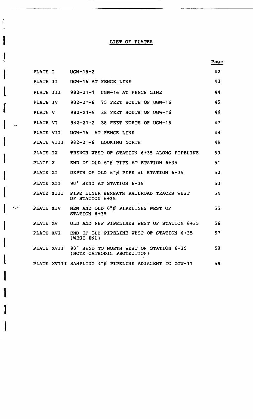
LIST OF PLATES
PLATE I
PLATE II
PLATE III
PLATE IV
PLATE V
PLATE VI
PLATE VII
PLATE VIII
PLATE IX
PLATE X
PLATE XI
PLATE XII
PLATE XIII
PLATE XIV
PLATE XV
PLATE XVI
PLATE XVII
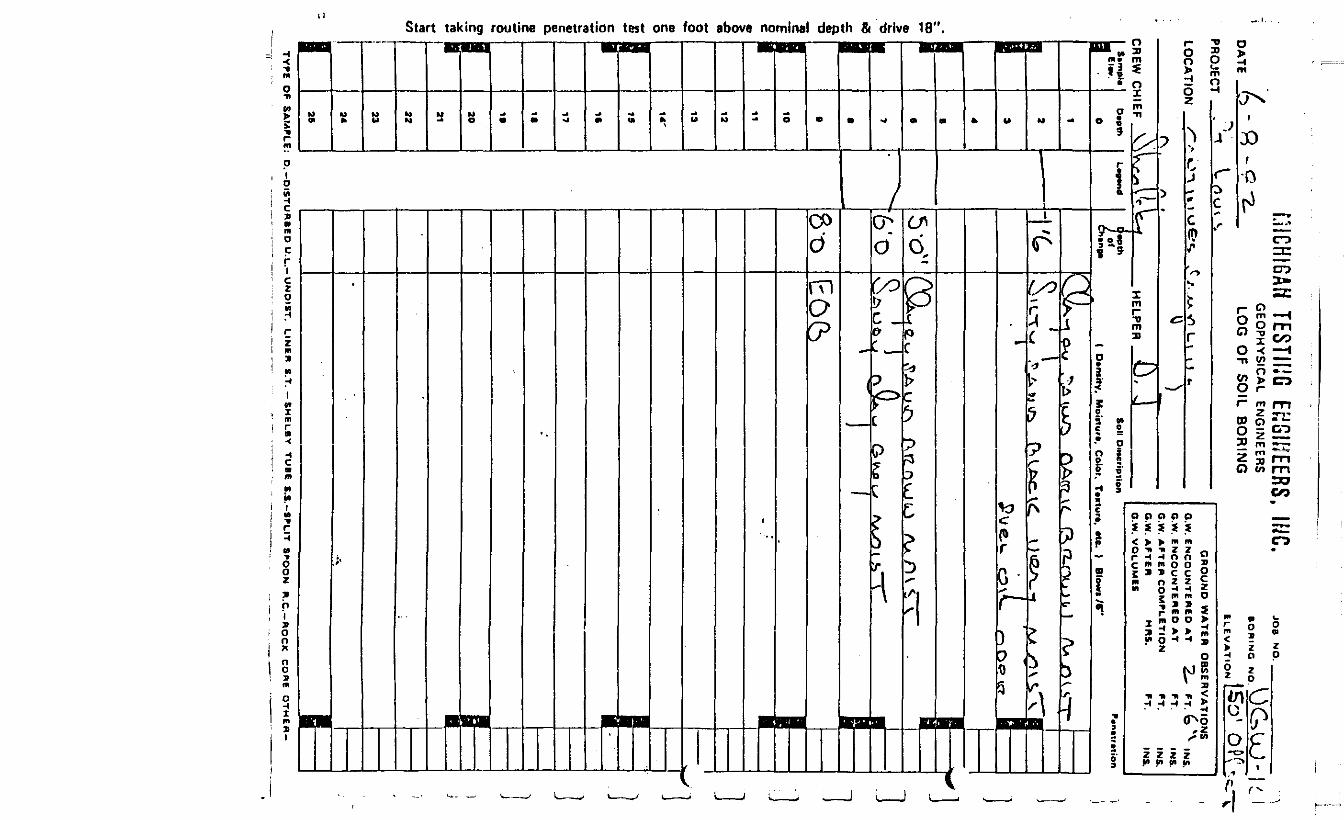
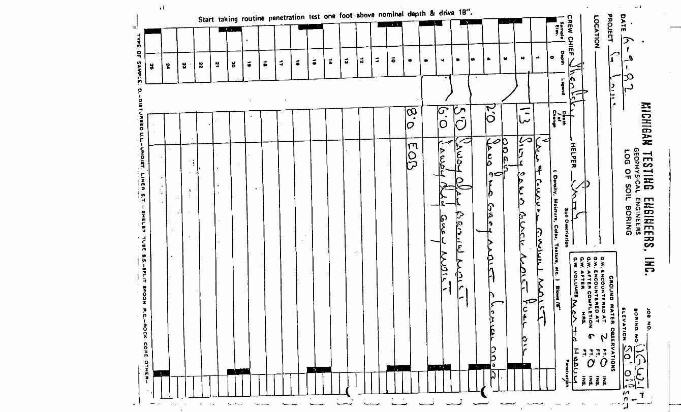
UGW-16-2
UGW-16 AT FENCE LINE
982-21-1 UGW-16 AT FENCE LINE
982-21-6 75 FEET SOUTH OF UGW-16
982-21-5 38 FEET SOUTH OF UGW-16
982-21-2 38 FEET NORTH OF UGW-16
UGW-16 AT FENCE LINE
982-21-6 LOOKING NORTH
TRENCH WEST OF STATION 6+35 ALONG PIPELINE
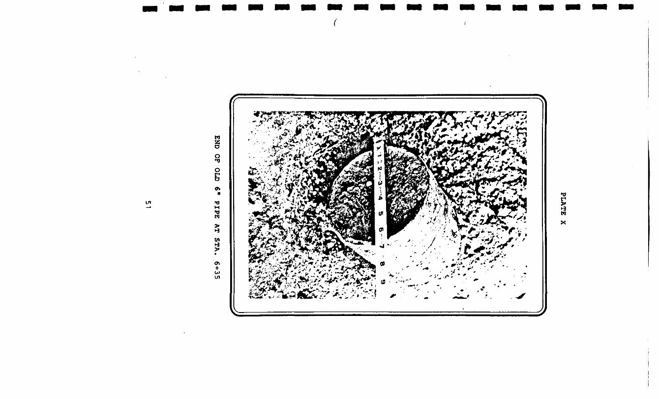
END OF OLD 6"0 PIPE AT STATION 6+35
DEPTH OF OLD 6"0 PIPE at STATION 6+35
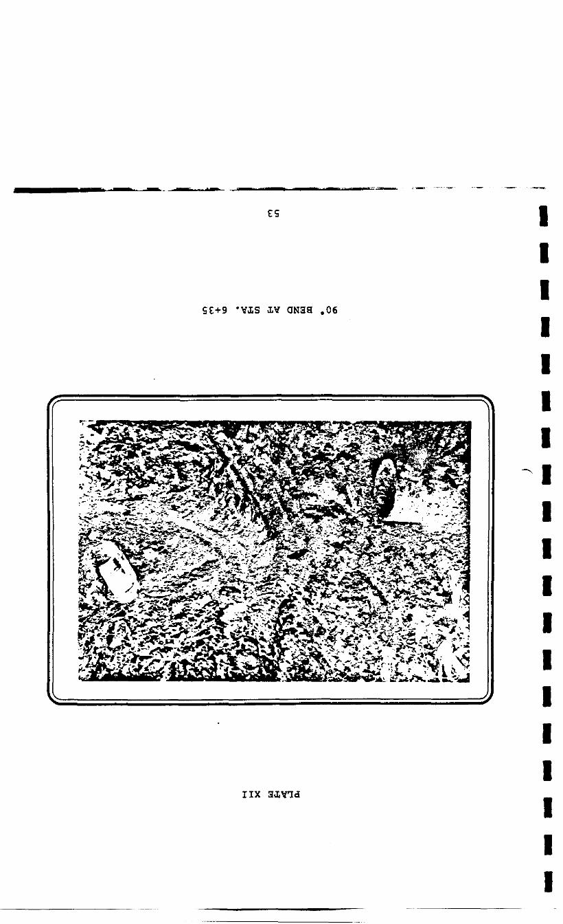
90° BEND AT STATION 6+35
PIPE LINER BENEATH RAILROAD TRACKS WESTOF STATION 6+35
NEW AND OLD 6"0 PIPELINES WEST OFSTATION 6+35
OLD AND NEW PIPELINES WEST OF STATION 6+35
END OF OLD PIPELINE WEST OF STATION 6+35(WEST END)
90° BEND TO NORTH WEST OF STATION 6+35(NOTE CATHODIC PROTECTION)
PLATE XVIII SAMPLING 4"0 PIPELINE ADJACENT TO UGW-17
Page
42
43
44
45
46
47
48
49
50
51
52
53
54
55
56
57
58
59

1.0 INTRODUCTION
1.1 GENERAL
During collection of soil samples
in May 1982 along the line of the proposed upgradient
containment wall, a petroleum based liquid was
identified in several boreholes on Velsicol's St. Louis
Plant Site property west of the easterly plant boundary
fence line and north of Highway M-46. Subsequent
preliminary field investigative work completed in late
June 1982, defined the approximate horizontal and
vertical extent of the petroleum based liquid beneath
the Velsicol Plant Site. Details and conclusions of
this preliminary investigative program are contained
within the report entitled "Exploratory Subsurface
Investigation - Plant Site, St. Louis, Michigan".
This report was submitted to Sidley & Austin on July 6,
1982.
On July 15, 1982, Conestoga-Rovers
& Associates Limited (CRA) was directed to proceed with
a further preliminary field and laboratory
investigative program which would define the extent of
petroleum based liquid contamination beneath private
lands east of the easterly plant boundary fence line
and north of Highway M-46. Details and conclusions of
[I this preliminary investigative program are contained
( within the report entitled "Field Investigative
* Program, Watson Street, St. Louis, Michigan". This
I report was submitted to Sidley & Austin on July 25,
1982.i* A third investigative program was
( authorized on September 2, 1982. The intent of this- •program initially, was to more accurately define the
I extent of the petroleum based liquid contamination
I beneath private lands east of the easterly plant
" boundary fence line and north of Highway M-46, and to
1 sample and chemically characterize the liquid
contaminant. The program was subsequently expanded on
I September 10, 1982 to include redefinition of petroleum
. based contaminated areas west of the easterly plant
boundary fence line between the easterly plant boundary
I fence line and the Pine River north of Highway M-46 and
sampling and chemical characterizations of the observed
I contaminant. This report presents the details and
field and laboratory observations of this investigatory
program.
iI
I 1.2 PRESEARCH INC.
I On August 31, 1982, Presearch
Inc., was retained by Velsicol to provide expert
I testimony and to assist in the identification
I of the source and type of contaminant encountered.
II Mr. J. Leslie Goodier, P.E., of
Presearch Inc. was present at the Plant Site and
• ~ observed the field investigative and sampling
1described hereafter.
procedures undertaken during the investigative program
i1.3 AUTHORIZATION TO ENTER PRIVATE LANDS
iOn September 3 and again on
j ^ September 13, 1982, CRA personnel met with the three
homeowners whose lands were anticipated to be affected
' by petroleum based contaminants. Each homeowner was
I requested to sign an authorization that allowed entry
of personnel and equipment onto the lands in question.
j Copies of the signed authorizations are contained
within Appendix A. A condition of authorization to
• enter was that all vegetation and lands damaged by
I equipment or vehicles would be restored to no worse
than pre-existing conditions at Velsicol's expense.i

II 2»° FIELD INVESTIGATIVE PROGRAM
I 2'1 PRELIMINARY INVESTIGATIONS
2.1.1 June 1982 Investigation
iThe preliminary field
J investigative program completed in late June
. 1982, confirmed the presence and identified the
* extent of petroleum based contaminants beneath
I Velsicol land, and lands adjacent to the
easterly plant boundary fence line and north of
J Highway M-46. Two areas of contamination were
- identified; an area within which the soil
• contained free petroleum based liquid, and an
1 area within which soil contamination by
petroleum based material was determined by odor
| ^ The horizontal extent of these two zones, as
. inferred from the field investigation and the
* supporting borehole logs, are presented in
j Appendix B. In all cases the presence of a
petroleum based contaminant was limited to the
I upper five to six feet of soil. The vertical
migration of the oily material was apparently
• restricted by an underlying dense clay till
I strata. Preliminary laboratory analysis of
collected samples tentatively identified theii
« contaminant to be a No. 6 or lighter fuel oil,
on the basis of BTU value, color, viscosity and
] sulphur content.
I On July 12, 1982, as part of this
I initial field investigative program, Mr. N.
LaPaugh and Mr. B. White of Total Oil were
) present at the Plant Site to witness the
excavation of a test pit on Velsicol property.
* The pit was allowed to sit open overnight and an
1 oily liquid sample was collected by Total Oil on
the morning of July 13, 1982. This sample was
I split with CRA.
During this period, a program was
also underway to excavate a continuous trench
adjacent to the line of the proposed upgradient
I ^ containment wall in order to identify and remove
all subsurface utilities or services which
* entered the Velsicol property. On July 13, this
\ trenching program had reached the general area
of the test pit. While the test pit was being
1 sampled by Total Oil and CRA personnel, the
backhoe involved in the trenching operation
* encountered an isolated section of four inch
I diameter pipeline. This section of pipeline was
approximately 30 feet long, cut but uncapped at
j both ends, and completely full of a black
odorless oily liquid. A sample was collected
from the pipeline and split with Total Oil.
Preliminary laboratory analysis of
both the test pit and the pipeline samples
tentatively identified the liquid in each case
to be No. 6 fuel oil on the basis of BTU value,
color, viscosity and sulphur content.
Laboratory results of samples taken during the
June 1982 investigation are presented within
Appendix B.
The 4" diameter pipeline was again
sampled on October 19, 1982 and analyzed by
Rocky Mountain Analytical Laboratory. Analysis
confirmed that the material within the pipeline
was a No. 6 oil. Analytical data is contained
within Appendix L.
I 2.1.2 July 21, 1982 Investigation
* The purpose of the July 21, 1982
I investigation was to identify by field drilling,
the horizontal and vertical limits of soils
I contaminated by petroleum based material beneath
• private lands, east of the easterly plant
i

- boundary fence line and north of Highway M-46.
In addition, preliminary laboratory analysis of
1 selected liquid samples collected east of the
plant boundary fence line was performed to
I confirm that the contaminant was similar to that
. previously encountered west of the boundary
* fence line.iOn the basis of the June, 1982
fI ^- investigative program, an initial 150 foot by 50
I foot sampling grid was established east of the
proposed upgradient containment wall line.
I Additional intermediate sampling stations were
established in the field, where required, to
I delineate the contaminated and uncontaminated
• zones. The horizontal extent of the oily
contamination in the backyards of the Watson
I ^ Street homes, as identified by this field
investigation and the supporting borehole logs
I are contained within Appendix C.
An open pit approximately 3' x 31
J was dug by backhoe, ten (10) feet east of the
plant boundary fence line adjacent to UGW-16, on
] July 21, 1982 and allowed to sit overnight. A
* petroleum based liquid sample was collected from
this pit on the morning of July 22, 1982 and
r forwarded to the laboratory for preliminary
characterization. Laboratory analysis suggested
I that the contaminant was a product similar to
kerosene. Laboratory results are contained
I within Appendix C.
i 2.2 SEPTEMBER 8, 1982 INVESTIGATION
I s " " 2.2.1 Purpose
The purpose of the Sept. 8, 1982 investigation
I was to confirm the horizontal and vertical limits
of petroleum based contaminants north of Highway
I M-46 beneath private lands east of the easterly
i plant boundary fence line and beneath Velsicol
lands immediately west of the plant easterly
I ^ boundary fence line, and to sample and chemically
characterize the encountered petroleum based
* contaminants.
i2.2.2 Equipmenti
A tractor-backhoe was utilized toiI excavate test pits on private lands east of the
| plant's easterly boundary and also on the Plant
Site, within the southeast sector.ii
2.2.3 Sampling Stations
Four sampling pits were excavated
on the Plant Site and three sampling pits were
excavated on private lands east of the easterly
plant boundary fence line. Figure 1 details the
location of sampling stations established for
this investigative program.
2.2.4 Collection of Petroleum Based Liquid Samples
Open pits approximately 61 x 61
were dug by backhoe on the morning of
September 7, 1982. The vertical limit of
excavation was defined by the top of the clay
till. The excavated test pits were allowed to
sit over-night and the samples were collected the
following day.
New disposable vinyl gloves were
worn by the sampler at each location.
Samples were collected by skimming
surficial oily contaminants from the surface of
the groundwater with a large spoon.
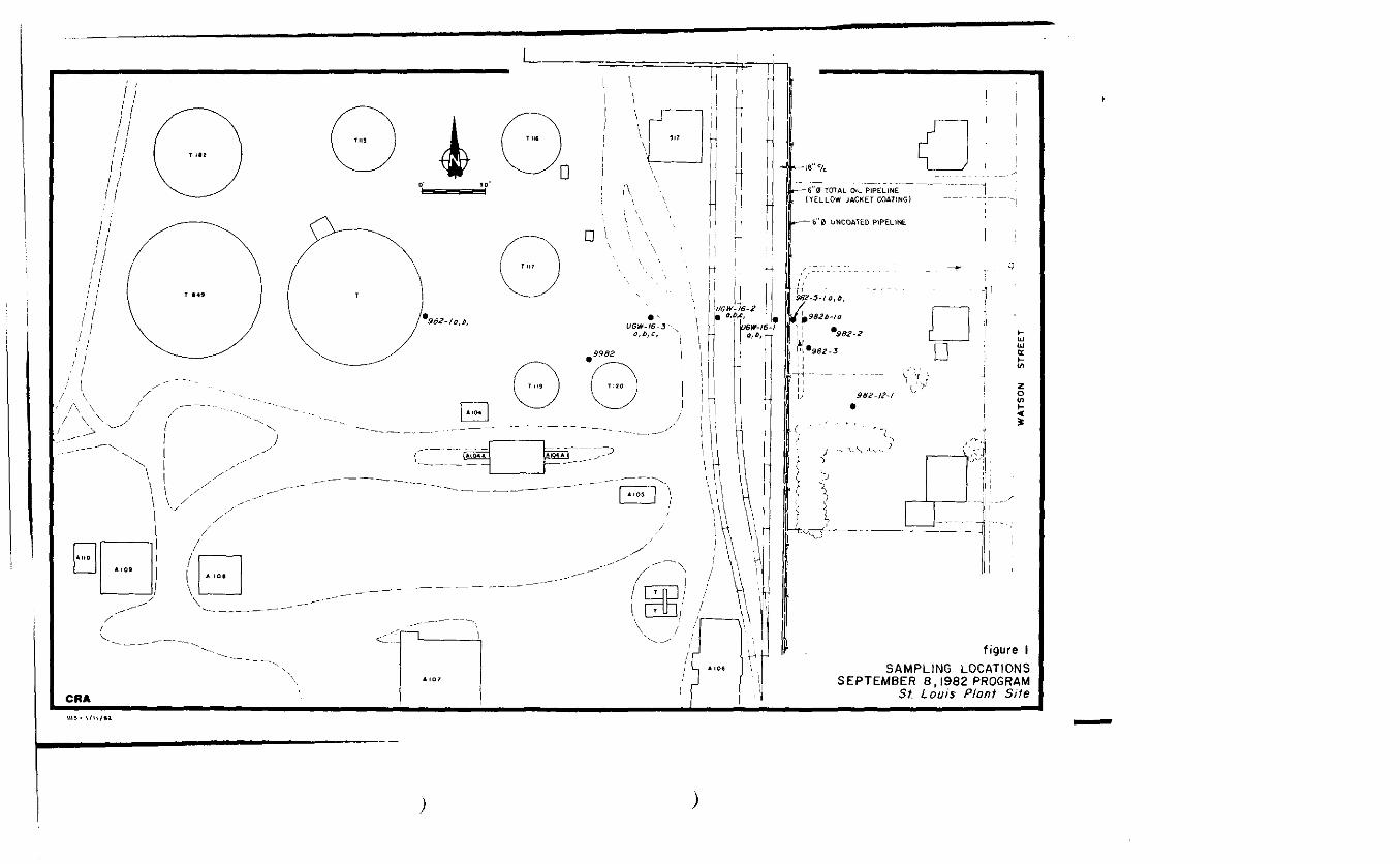
-6"fJ TOTAL OIL PIPELINE(YELLOW JACKET COATING)
6' 0 UNCOATED PIPELINE
S82-5-I a, D,
9826-to
I *982-2
*\*98Z-3 n
figure ISAMPLING LOCATIONS
SEPTEMBER 8 ,1982 PROGRAMSt. Louis Plant Site
1119 • I/II/II
I1 All tools utilized in the sampling
of the oily contaminants received an
I acetone-hexane-acetone-distilled water wash after
. each sample was collected.
f All sample bottles were washed
using an acetone-hexane-acetone-distilled water
I wash sequence and were subsequently oven dried at
I a minimum temperature of 200*F for 30 minutes
prior to being used. Aluminum foil was placed
] between the neck of the jar and the standard cap.
Samples were shipped to the analyzing laboratory
I by commercial courier under chain of custody
. protocol on the same day as collection.
i2-2.5 Total Oil Observeri -
Mr. Pat Lincoln of Total Oil was
" present on-site on September 8, 1982 and observed
! all investigative proceedings on that day.
J On the basis of verbal
_ authorization received from Mr. J.G. Archer, Esq.
* of Sidley & Austin, CRA provided Mr. Lincoln with
! a split from samples UGW16-1, UGW16-2, UGW16-3
and 982-5-1.
11
II 2.2.6 Laboratory Analysis
I Collected samples were split 3 ways,
- The first set was forwarded to Environmental
- Research Group (ERG) laboratories by CRA for gas
I chromatograph/mass spectrometer analys is. The
second set was retained by Presearch Inc. for
J subsequent analysis by Rocky Mountain Analytical
- Laboratories (RMAL). The third set was retained
by Mr. Pat Lincoln of Total Oil for subsequent
i analysis at Total Oil facilities.
J In addition, GC/MS analytical data
- was reviewed by Gulf Research & Development
* Company.
I] ^ 2.2.7 Analytical Results
* GC/MS analytical data is presented
1 in Appendix D. ERG opined that the petroleum
based contaminant was similar to a No. 2 diesel
I fuel.
• On the basis of a review of the
1 GC/MS data, Gulf Research & Development Company
opined that the data indicated the contaminant wasii
I( a No. 2 fuel oil (diesel fuel and No. 2 fuel oil
are commonly used interchangeably).
| Correspondence from Gulf Research & Development
I Company is contained within Appendix E.
f Analytical data from RMAL is
contained within Appendix F. Chromatographic
I comparision indicated that all samples except
• sample no. 9982 originated from the same source
and that sample no. 982-b-1a was collected from
I an area near the contaminant source. Boiling
ranges of the four related samples corresponded
J to diesel oils and kerosenes.
IAnalytical results provided by
J Total Oil for samples split with and analysed by
Total Oil are contained within Appendix G. Gulf
J ^ Research & Development Company's evaluation of
. this analytical data is also contained within
Appendix G.
2.3 SEPTEMBER 15 TO OCTOBER 21, 1982 INVESTIGATIVE PROGRAM
2.3.1 Purpose
The purpose of the September 15 to
October 21 1982 investigative program was to
13
II redefine areas of petroleum based contamination
north of Highway M-46, from east of the easterly
I plant boundary fence line to the Pine River.
f Encountered contaminants would be sampled and
* chemically characterized.
iI 2.3.2 Equipment
" A CME 75 truck mounted drill rig
1 equipped with solid stem augers was used to
advance borings into the area of suspected
J contamination.
I• A Case 580 B tractor backhoe was
I used to excavate test pits.
i -I 2.3.3 Augering Stations11 A 20' x 20' grid was established
east of the easterly plant boundary fence line
I referenced to the previous UGW series of
. sampling stations initially located for the
upgradient containment wall sampling program. A
I 50' x SO1 grid was established west of the
ii 14
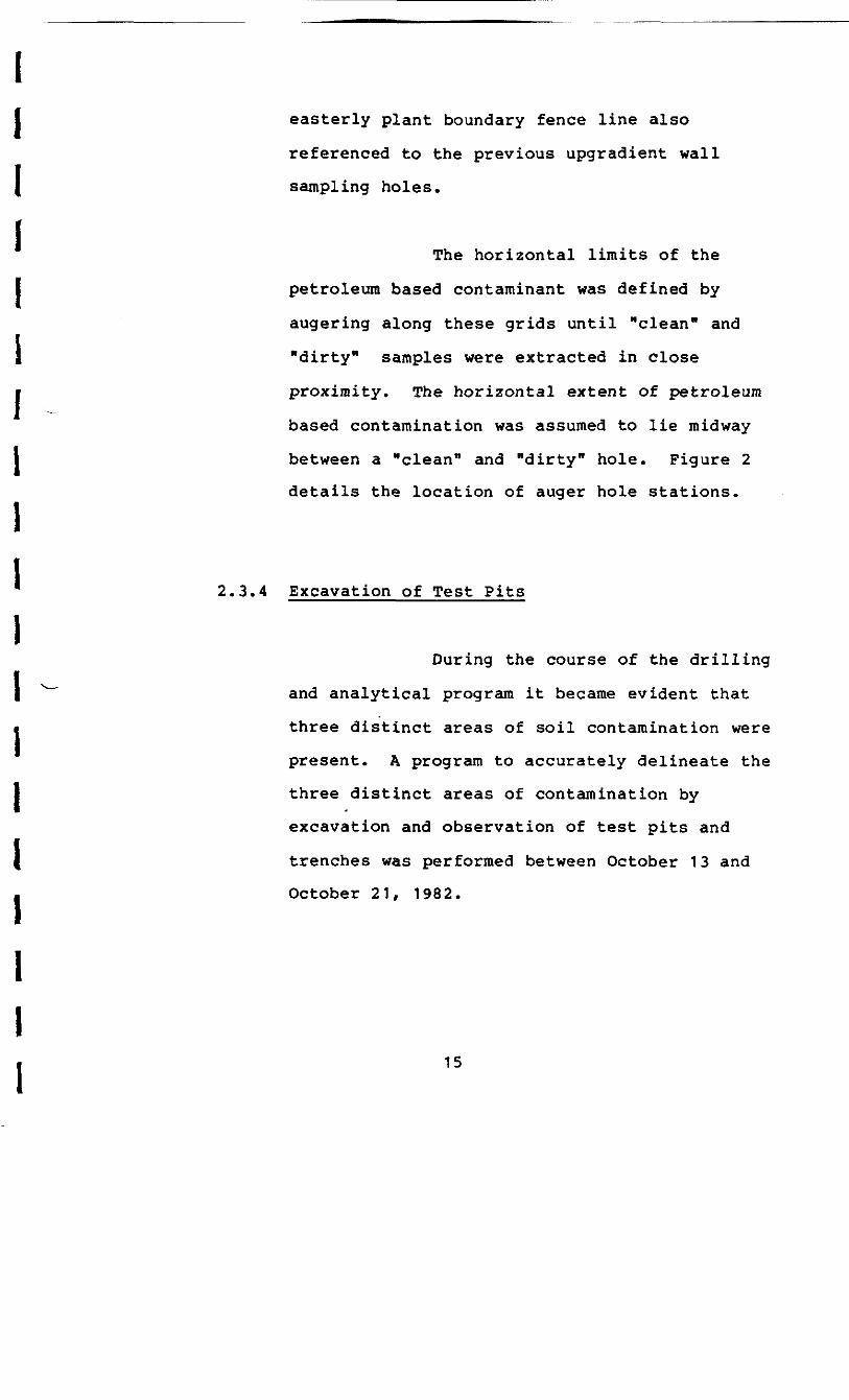
I easterly plant boundary fence line also
referenced to the previous upgradient wall
( sampling holes.
The horizontal limits of the
I petroleum based contaminant was defined by
augering along these grids until "clean" and
I "dirty" samples were extracted in close
• proximity. The horizontal extent of petroleum
based contamination was assumed to lie midway
I between a "clean" and "dirty" hole. Figure 2
details the location of auger hole stations.i* 2.3.4 Excavation of Test Pitsi
During the course of the drilling
1 ^" and analytical program it became evident that
i three distinct areas of soil contamination were
present. A program to accurately delineate the
1 three distinct areas of contamination by
excavation and observation of test pits and
{ trenches was performed between October 13 and
. October 21, 1982.
iii
UGW-15 SAMPLING STATIONSUPGRADIENT CONTAINMENT WALL
10 AUGER STATIONS (SEPT. 1982) /
53 It 31
6"0 TOTflL OIL PIPELINE(VELLOW JACKET COATINC
WASHINGTON AVE.
figure 2AUGER HOLE LOCATIONS

II The locations of the test pits and
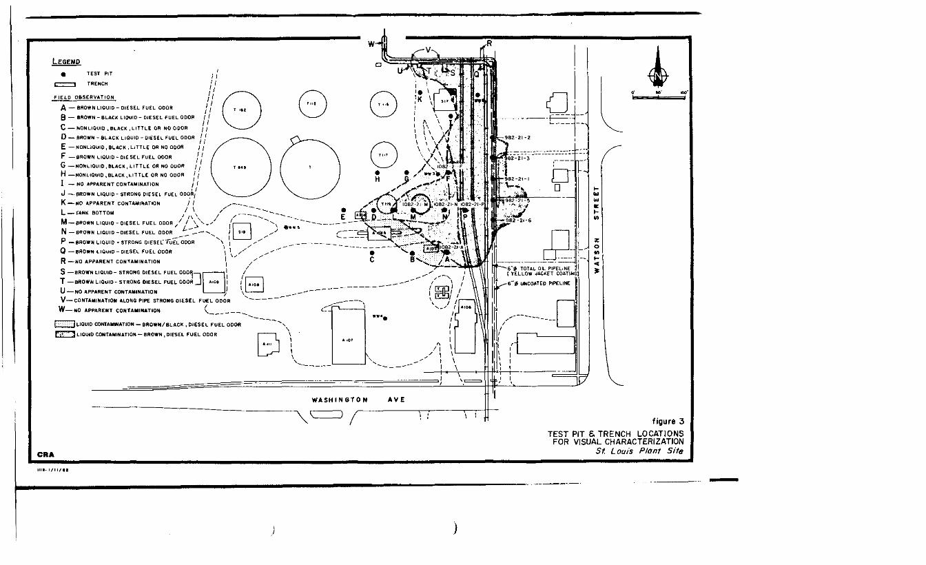
trenches are detailed on Figure 3.i• 2.3.5 Sampling Stations
iThree sample pits, approximately
J • 6'x4' were excavated and sampled on September 21
• adjacent to the easterly plant boundary fence
line. Sampling protocol was identical to that
I described in Section 2.2.4. The location of the
sample pits is detailed on Figure 4.i• Soil samples were collected from
three sample pits excavated in the southwesterly
I portion of the Plant Site within areas exhibiting
non liquid, black, petroleum based contamination.
I ^ These sampling locations are also indicated on
. Figure 4.ii
2.3.6 Field Observationsii 2.3.6.1 Soil Horizon
I Borelogs for each augering station
are contained within Appendix H.ii 17
LEGENDft TEST PIT
TRENCH
_F_IEI.D__06SeRVATION_
A — BROWN LIQUID-DIESEL FUEL OOOR
0 — BROWN -BLACK LIQUID- DIESEL FUEL ODOR
C — NONLIQUID, BLACK, LITTLE OR NO ODOR
D — BROWN - BLACK LIQUID - DIESEL FUEL ODOR
E — NONLIQUID , BLACK , LITTLE OR NO ODOR
F —BROWN LIQUID- DIESEL FUEL OOOR
6 —NONLIQUID, BLACK, LITTLE OR NO ODOR
H —NONLIQUID, BLACK, LITTLE OR NO ODOR
I — NO APPARENT CONTAMINATION
J —BROWN LIQUID- STRONG DIESEL FUEL ODOR,
K —— NO APPARENT CONTAMINATION / /
L —— TANK BOTTOM
M — 6ROWN LIQUID- DIESEL FUEL ODOR
N —BROWN LIQUID-DIESEL FUEL ODOR ^
P —BROWN LIQUID - STRONG DIESEL'fuEL ODOR
Q —BROWN LIQUID-DIESEL FUEL ODOR
R—NO APPARENT CONTAMINATION
S —BROWN LIQUID- STRONG DIESEL FUEL ODOR
T —BROWN LIQUID- STRONG DIESEL FUEL ODOR
U —NO APPARENT CONTAMINATION
V—CONTAMINATION ALONG PIPE STRONG DIESEL FUEL ODOR
W—NO APPARENT CONTAMINATION
._) UQUIO CONTAMINATION — BROWN/BLACK. DIESEL FUEL ODOR
f-T" 1 LIQUID CONTAMINATION — BROWN . DIESEL FUEL ODOR
CRA
figure 3TEST PIT & TRENCH LOCATIONS
FOR VISUAL CHARACTERIZATIONSf. Louis Plant Site
- - - 6 0 TOTAL OIL PIPELINE( Y E L L O W JACKET COATiNGl
6 0 UNCOATED PIPELINE
o.tf,
\ \JGW-I6-Ia,t
LEGEND
- SAMPLING LOCATION SEPT 6, 1982
- SAMPLING LOCATION SEPT 21,1982
- SAMPLING LOCATION OCTOBER ,1982
figure 4SAMPLING LOCATIONS
SEPTEMBER 8 AND 21. 1982St. Louis Plant Site
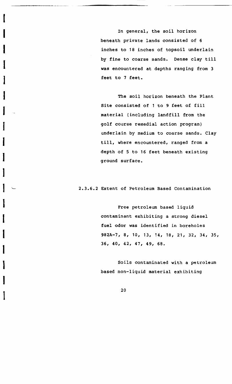
In general, the soil horizon
beneath private lands consisted of 6
inches to 18 inches of topsoil underlain
by fine to coarse sands. Dense clay till
was encountered at depths ranging from 3
feet to 7 feet.
The soil horizon beneath the Plant
Site consisted of 1 to 9 feet of fill
material (including landfill from the
golf course remedial action program)
underlain by medium to coarse sands. Clay
till, where encountered, ranged from a
depth of 5 to 16 feet beneath existing
ground surface.
2,3.6.2 Extent of Petroleum Based Contamination
Free petroleum based liquid
contaminant exhibiting a strong diesel
fuel odor was identified in boreholes
982A-7, 8, 10, 13, 14, 18, 21, 32, 34, 35,
36, 40, 42, 47, 49, 68.
Soils contaminated with a petroleum
based non-liquid material exhibiting
20

II little or no odor were identified in
boreholes 982A-43, 44, 45, 46, 50, 51, 52
I 53, 54, 55, 56, 57, 60, 61, 62, 65, 79,
82, 83, 85, 86, 88, 92, 95, 96, 100, 101,
1 105, 106, 107.
Contamination inferred by a diesel
I fuel odor only was identified in
boreholes 982A-1, 2, 3, 4, 5, 6, 9, 11,
] 12, 15, 16, 17, 19, 20, 22, 23, 24, 25,
j 26, 27, 28, 29, 30, 31, 37, 38, 39, 41,
66, 67, 70, 71, 73, 75, 76, 77, 91, 103,
No petroleum based liquid or
non-liquid contaminant or odor was
identified in boreholes 982A-58, 59, 63,
64, 72, 74, 78, 80, 81, 84, 87, 89, 90,
93, 94, 97, 98, 99, 102.
Free petroleum based liquid with a•
very strong diesel fuel type odor and
I light brown color was identified in test
pits 982-21-1, 982-21-2, 982-21-3,
982-21-5, 982-21-6, 1082-21-A, 1082-21-F,
1082-21-L, 1082-21-M, 1082-21-N,
21

II 1082-21-P and trenches 1082-21-Q,
- 1082-21-S, 1082-21-T and 1082-21-V.
i2.3.7 Defined Areas of Contaminationi
I Borehole and test pit examination
* indicated that subsurface soils and/or
I ^, groundwater was contaminated by petroleum based
materials within the southern sector of the PlantII Site. The defined areas of contamination are
• indicated on Figure 5. Four distinct zones were
identified on the basis of visual examination of
sampling boreholes and test pits.
Zone A was characterized by the
presence of a free flowing brown liquid petroleum
based contaminant exhibiting a strong diesel fuel
type odor.
Zone B was characterized by a dark
petroleum based liquid having much greater
viscosity relative to liquids in Zone A and
exhibiting a diesel fuel type odor.
Zone C was characterized by soils
containing a very black, highly viscous
22
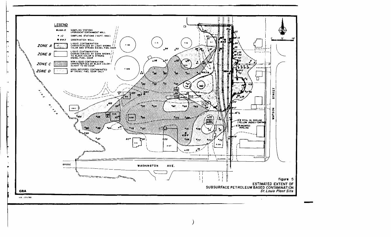
LEGENDU6W-I5 SAMPLING STATIONS
UPGRACHENT CONTAINMENT WALL
SAMPLING STATIONS I SEPT. 19621
• WW2 OBSERVATION WELL' i f \
LIQUID CONTAMINATION /, f ]CHARACTERIZED 8Y LIGHT BROWN ' /COLOR AND STRONG DIESEL FUEL ODOR
LIQUID CONTAMINATION ICHARACTERIZED BY DARK BROWNTO BLACK COLOR B STRONGDIESEL FUEL ODOR
NON LIQUID CONTAMINATION /CHARACTERIZED BY BLACK COLOR-SLIGHT TO NO ODOR\ ZONECAREA INFERRED CONTAMINATEDBY DIESEL FUEL ODOR ONLY
6 0 TOTAL OIL PIPELINEJACKET COATtW
6"0UNCOATEDPIPELINE
CRA
figure 5ESTIMATED EXTENT OF
SUBSURFACE PETROLEUM BASED CONTAMINATIONSt. Louis Plant Site
Icontaminant having little to no odor. Theigroundwater within Zone C exhibited no odor or
I oil type contamination.
1 Zone D was characterized by a
i diesel fuel type odor only.
j The vertical extent of petroleum
based contamination is apparently limited to the
* ^ soils overlying the clay strata and was generally
\ found between 2 feet and 7 feet below original
ground surface.
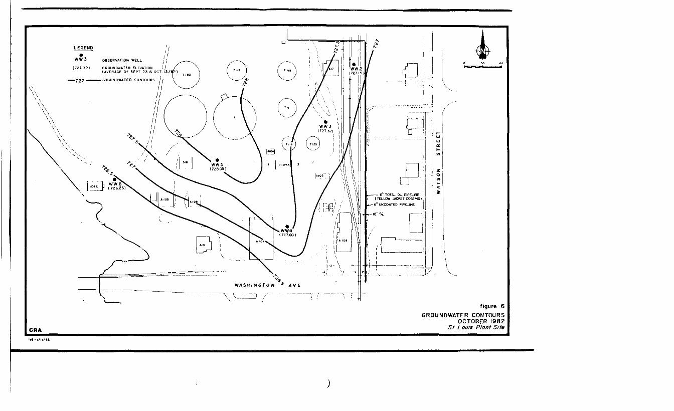
2.3.8 Groundwater
Groundwater was encountered
throughout the area sampled at depths ranging
from 1 foot to 4 feet below the original ground
surface. The surface of the lands east of the
plant boundary fence line were very soft and
spongy, and considerable damage and rutting to
grassed areas occurred from equipment movement
during sampling and augering operations.
In addition to well WW2, installed
during the upgradient wall sampling program, four
24
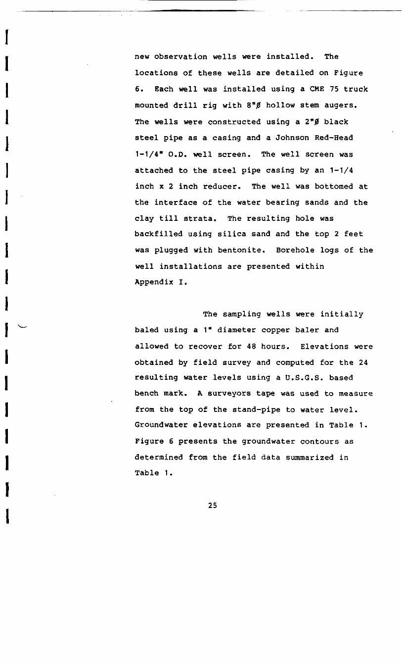
II new observation wells were installed. The
locations of these wells are detailed on Figure
I 6. Each well was installed using a CMB 75 truck
mounted drill rig with 8"0 hollow stem augers.
1 The wells were constructed using a 2"0 black
i steel pipe as a casing and a Johnson Red-Head
1-1/4" O.D. well screen. The well screen was
j attached to the steel pipe casing by an 1-1/4
inch x 2 inch reducer. The well was bottomed at
the interface of the water bearing sands and the
clay till strata. The resulting hole was
backfilled using silica sand and the top 2 feet
was plugged with bentonite. Borehole logs of the
well installations are presented within
Appendix I.
The sampling wells were initially
baled using a 1" diameter copper baler and
allowed to recover for 48 hours. Elevations were
obtained by field survey and computed for the 24
resulting water levels using a U.S.G.S. based
bench mark. A surveyors tape was used to measure
from the top of the stand-pipe to water level.
Groundwater elevations are presented in Table 1.
Figure 6 presents the groundwater contours as
determined from the field data summarized in
Table 1.
25
OBSERVATION WELL ,
(727.32) GROUNDWATER ELEVATION / /(AVERAGE OF SEPT 25 6 OCT. I2/
GROUNDWATER CONTOURS I
r—— — g" TOTAL OIL PIPELINE(YELLOW JACKET COATING I6"UNCOATED PIPELINE
oW A S H I N G T O N ' * AVE
figure 6GROUNDWATER CONTOURS
OCTOBER 1982St. Louis Plant Site

TABLE I
GROUNDWATER ELEVATIONS - PLANT SITE
ELEVATIONSAMPLING TOP OF DISTANCE, TOP OFWELL STANDPIPE STANDPIPE TO W.L. GROUNDWATER ELEVATION
Sept. 23/82 Oct. 12/82 Average
735.56 8.17 727.39 726.91 727.15
739.07 11.83 727.24 727.40 727.32
740.00 12.79 727.21 727.98 727.60
743.40 15.25 728.15 727.90 728.03
732.20 5.73 726.47 726.05 726.26

II 2.3.9 Laboratory Analysis
Liquid samples collected from the
1 three sampling stations described previously in
Section 2.3.5 were split two ways with the first
J set forwarded to ERG Laboratories for gas
- chromatograph/mass spectrometric analysis. The
second set was forwarded to RMAL for gas
i chromatograph, boiling point and metal analysis.
] Soil samples collected from the
. three sampling stations described previously in
" Section 2.3.5 were forwarded to RMAL for gas
| chromatograph analysis.
i2.3.10 Analytical Results
I ^~
I 2.3.10.1 Liquid Samples
| GC/MS analytical data from
. ERG is presented within Appendix J.
1 Analytical data from RMAL is
presented within Appendix K.iii 28
II The chromatograms of each of the
three samples were comparable to
sample 982-b-l which was previously
I identified as the source sample. The
boiling range corresponded to diesels
j and kerosenes.
i1 2.3.10.2 Soil Samples
I Analytical data from RMAL is
presented in Appendix L. Analysis
' does not indicate positive correlation
1 with the source sample (982-b-l) or
with any other samples. One sample
] did not contain adequate contaminant
for analysis.
1 "
i2.3.11 Restoration of Private Landsi
In an effort to maintain good
* public relations with the affected land-owners,
1 a temporary repair to all properties which
sustained surficial damage was made by the
I application of topsoil and grass seed.
i1 29

I• The affected land-owners were
assured that a more permanent repair would be
I made at the conclusion of all works in the area.
iiiiiiiii -iiiiii
30
I• 3.0 EXISTING PIPELINES
1 During the course of the
subsurface investigation, a 6" diameter pipeline was exposed
1 at a depth approximately 3 feet below the existing ground
• surface running in a north-south direction, two feet west of
the east plant boundary fence line north of Highway M-46.
I This pipeline was found to be coated with a yellow plastic
material and was laid through the area where the heaviest
] ^ petroleum liquid contamination was encountered.
1 The soil and groundwater
j immediately beneath this section of pipeline was heavily
contaminated by a petroleum based liquid exhibiting a strong
1 diesel fuel type odor.
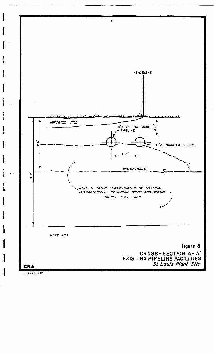
Three liquid and three soil
I ^- samples were collected in this area on September 21, 1982.
Sample locations are indicated on Figure 9. Liquid samples
I were analyzed by ERG and RMAL. Analysis indicates that the
• contaminant is a No. 2 fuel oil and that all three samples
are highly comparable with the sample previously identified
1 by RMAL as being nearest the source of contamination. Soil
samples have been stored at the Plant Site offices.
I Analytical data is contained within Appendix J & K.
During the sampling program, an
I additional 6 inch diameter pipeline was encountered
31

II approximately 1'-6" east of the protective coated
pipeline. This pipe was not protectively coated.iThis uncoated pipeline was
I subsequently exposed in a northerly direction and was
1 found to have been cut at Station 6+35. This is at a
location where the yellow-jacketed pipeline makes a 90°
1 turn to the west.
I ^- The cut end of the 6"0 uncoated
i pipeline was found to be plugged with a sandy clay
material which was saturated with a petroleum product
1 having a strong diesel-like odor. The ground below and
around the pipeline was also found to be heavily
j contaminated with the same petroleum product. The
i pipeline contained a liquid which resembled water but
also had a distinctive diesel fuel odor.i -Samples were obtained from the
I liquid and soil contents of the pipeline and also from
• soil immediately beneath the exposed cut end. Sample
locations are indicated on Figure 9. One liquid and two
I soil samples were analyzed by RMAL. Analysis indicates
that the chromatograph of the contaminants within one
I soil and the one liquid sample correlated with the
| chromatograph of the contaminant contained in sample
982-b-la, which was previously identified as the sourcei32i
sample. The second soil sample did not contain
sufficient contaminant for accurate analysis.
Analytical data is contained within Appendix L.
The two 6 inch pipelines were also
exposed to the west beyond the 90° bend. The older
uncoated 6"J3 pipeline was found to be cut approximately
155 feet west of the turn and plugged in a similar
fashion with soil. Again, heavy contamination of the
soils underlying the pipeline by a material having a
strong diesel fuel odor was evident.
Samples were obtained from the soil
plug within the cut ends and from beneath the pipeline.
Two soil samples were analyzed by RMAL. Analysis
indicates that the chromatograph for one of the samples
matches the chromatograph for the contaminant contained
in sample 982-b-1a, which was previously identified as
the source sample, although some weathering with loss of
the lighter ends was noted. The second sample did not
contain sufficient contaminant for accurate analysis.
Analytical data is contained within Appendix L.
The coated pipeline was found to
turn approximately 90* to the north. No contamination
was evident in this area.
33
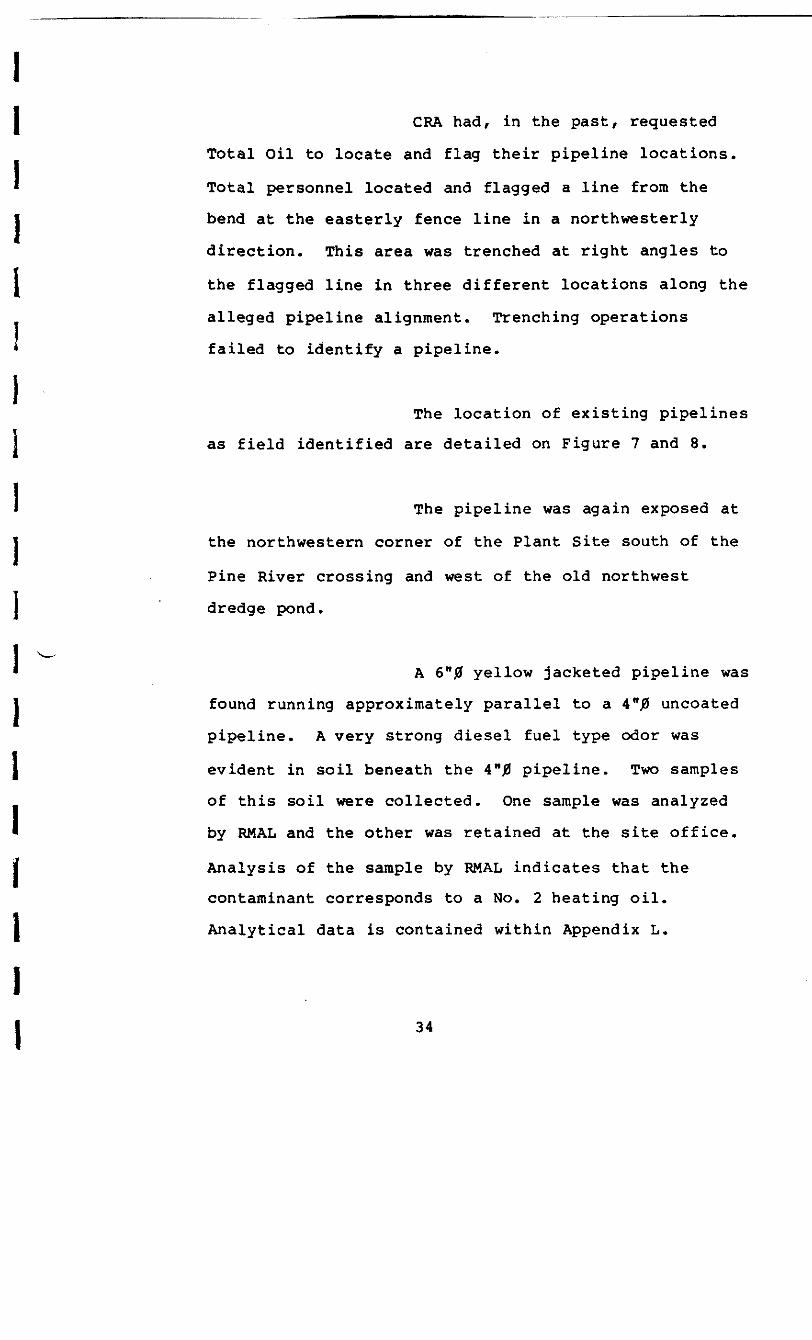
II CRA had, in the past, requested
Total Oil to locate and flag their pipeline locations.
• Total personnel located and flagged a line from the
I bend at the easterly fence line in a northwesterly
direction. This area was trenched at right angles to
1 the flagged line in three different locations along the
alleged pipeline alignment. Trenching operations
* failed to identify a pipeline.
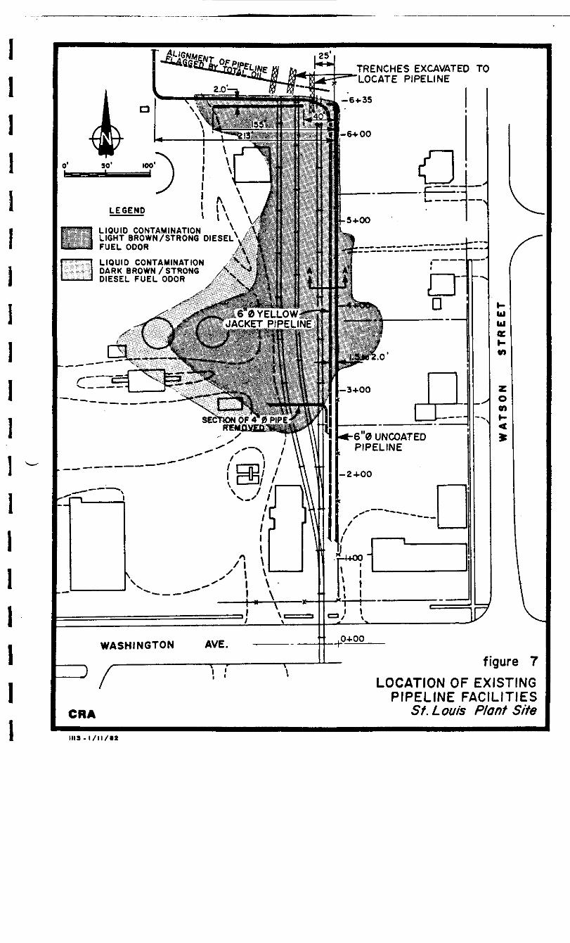
The location of existing pipelines
as field identified are detailed on Figure 7 and 8.
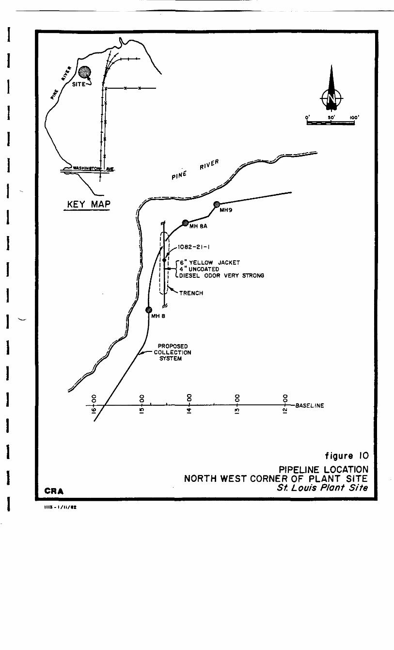
The pipeline was again exposed at
the northwestern corner of the Plant Site south of the
Pine River crossing and west of the old northwest
j dredge pond.
1 ^1 A 6"# yellow jacketed pipeline was
1 found running approximately parallel to a 4"J3 uncoated
pipeline. A very strong diesel fuel type odor was
J evident in soil beneath the 4"j0 pipeline. Two samples
of this soil were collected. One sample was analyzed
• by RMAL and the other was retained at the site office.
t Analysis of the sample by RMAL indicates that the
contaminant corresponds to a No. 2 heating oil.
I Analytical data is contained within Appendix L.
ii
TRENCHES EXCAVATED TOLOCATE PIPELINE
LIQUID CONTAMINATIONLIGHT BROWN/STRONG DIESELFUEL ODOR
LIQUID CONTAMINATIONDARK BROWN/STRONGDIESEL FUEL ODOR
YELLOWJACKET PIPELINE]
SECTION OF 4" 0
60 UNCOATEDPIPELINE
tt .O+OOWASHINGTON
LOCATION OF EXISTINGPIPELINE FACILITIES
St. Lout's Plant Site
FENCELINE
6"0 YELLOW JACKET 9PIPELINE . *»
6"0 UNCOATEO PIPELINE
•H
SOIL & WATER CONTAMINATED BY MATERIALCHARACTERIZED BY BROWN COLOR AND STRONG
DIESEL FUEL ODOR
CLAY TILL
CRAIllS-l/ll/lt
figure 8CROSS-SECTION A - A '
EXISTING PIPELINE FACILITIESSt Louis Plant Site
1082-13-SIIO82-/3- SttOBZ'13-Li
SEPTEMBER, 1962 SAMPLING LOCATIONS
HO82-I9-3 OCTOBER, 1982 SAMPLING LOCATIONS
LWUD CONTAMINATION CHARACTERIZED BYLIGHT BROWN COLOR AND STRONG DIESEL fUEL ODOR
—— LIQUID CONTAMINATION CHARACTERIZED BY DARKBROWN TO BLACK COLOR AND STRONG DIESELFUEL ODOR 6 9 TOTAL OIL PIPELINE
(YELLOW JACKET COATING)
6"0 UNCOATED PIPELINE
ioas-ia-4 \ \ /
figure 9SAMPLING LOCATIONS
SEPTEMBER G OCTOBER,1982 PROGRAMSt. Louis Plant Site
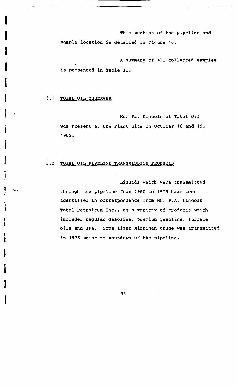
This portion of the pipeline and
sample location is detailed on Figure 10.
A summary of all collected samples•is presented in Table II.
3-1 TOTAL OIL OBSERVER
Mr. Pat Lincoln of Total Oil
was present at the Plant Site on October 18 and 19,
1982.
3.2 TOTAL OIL PIPELINE TRANSMISSION PRODUCTS
Liquids which were transmitted
I ^ through the pipeline from 1960 to 1975 have been
identified in correspondence from Mr. P.A. Lincoln11 Total Petroleum Inc., as a variety of products which
I included regular gasoline, premium gasoline, furnace
oils and JP4. Some light Michigan crude was transmitted
1 in 1975 prior to shutdown of the pipeline.
iiii
' "6" YELLOW JACKET
too'
LDIESEL ODOR VERY STRONG
PROPOSEDCOLLECTION
SYSTEM
Oo_,_ro
ooH——BASELINE
CRA
figure 10PIPELINE LOCATION
NORTH WEST CORNER OF PLANT SITESt. Louis Plant Site
III3-I/M/M
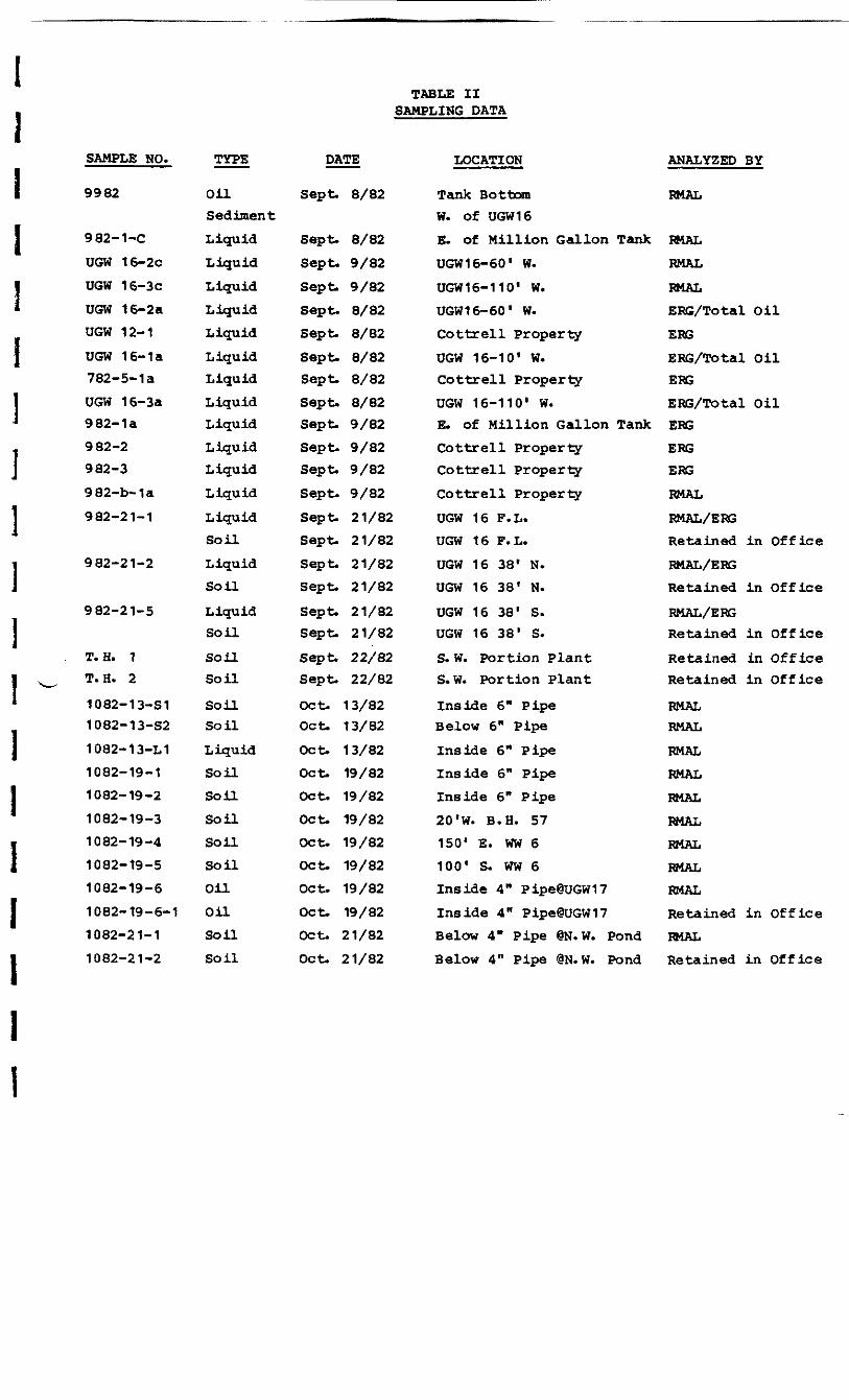
TABLE IISAMPLING DATA
SAMPLE NO. TYPE DATE
9982
982-1-C
UGW 16-2C
UGW 16-3cUGW 16-2aUGW 12-1
UGW 16-1a782-5-1 a
UGW 16-3a982-1a982-2982-3
982-b-1a
982-21-1
982-21-2
982-21-5
T. H. 1T. H. 2
1 082-1 3-S11082-13-S2
1082-13-L11082-19-11082-19-2
1082-19-31082-19-4
1082-19-51082-19-6
1082-19-6-1
1082-21-11082-21-2
OilSedimentLiquidLiquidLiquidLiquidLiquid
LiquidLiquidLiquid
Liquid
LiquidLiquidLiquidLiquidSoilLiquidSoil
LiquidSoil
SoUSoil
SoilSoil
LiquidSoilSoil
SoilSoilSoil
Oil
OilsonSoil
Sept. 8/82
Sept. 8/82Sept. 9/82Sept. 9/82Sept. 8/82Sept. 8/82Sept. 8/82Sept. 8/82
Sept- 8/82Sept. 9/82Sept. 9/82Sept. 9/82
Sept. 9/82Sept. 21/82Sept. 21/82
Sept. 21/82Sept. 21/82
Sept. 21/82Sept. 21/82Sept. 22/82Sept. 22/82
Oct. 13/82Oct. 13/82
Oct. 13/82Oct. 19/82Oct. 19/82
Oct. 19/82Oct. 19/82Oct. 19/82Oct. 19/82
Oct. 19/82Oct. 21/82
Oct. 21/82
LOCATION
Tank BottomW. of UGW16
E. of Million Gallon Tank
UGW 16-60' W.
UGW16-110' W.UGW16-601 W.
Cottrell PropertyUGW 16-101 W.Cottrell PropertyUGW 16-1101 W.E. of Million Gallon TankCottrell PropertyCottrell PropertyCottrell PropertyUGW 16 F.L.UGW 16 F.L.
UGW 16 38' N.UGW 16 38f N.
UGW 16 38' S.UGW 16 38' S.
S. W. Portion PlantS. W. Portion Plant
Inside 6" PipeBelow 6" PipeInside 6" PipeInside 6" PipeInside 6" Pipe20'W. B.H. 57
1501 E. WW 61001 S. WW 6Inside 4" Pipe@UGW17Inside 4" Pipe@UGW17Below 4" Pipe @N.W. PondBelow 4" Pipe @N.W. Pond
ANALYZED BY
RMAL
RMAL
RMAL
RMAL
ERG/TOtai oilERGERG/Total OilERGERG/Total OilERGERG
ERG
RMAL
RMAL/ERG
Retained in OfficeRMAL/ERG
Retained in Office
RMAL/ERGRetained in OfficeRetained in OfficeRetained in Office
RMALRMAL
RMAL
RMAL
RMAL
RMAL
RMAL
RMAL
RMAL
Retained in OfficeRMALRetained in Office
II 3.3 PHOTOGRAPHIC LOG
1 During the course of these
investigative programs, a photographic log was
1 maintained in order to visually document subsurface
• pipelines and soil conditions. Excerpts from this log
are presented as follows:iI •—
iiiii -iiiiii
41
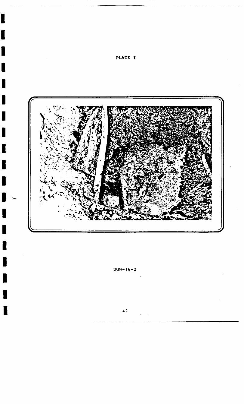
PLATE I
UGW-16-2
42

PLATE II
5&fc:^£&rM&.i
» v .*-,*»' 1.^ -«— _ %.
UGW-16 AT FENCELINE
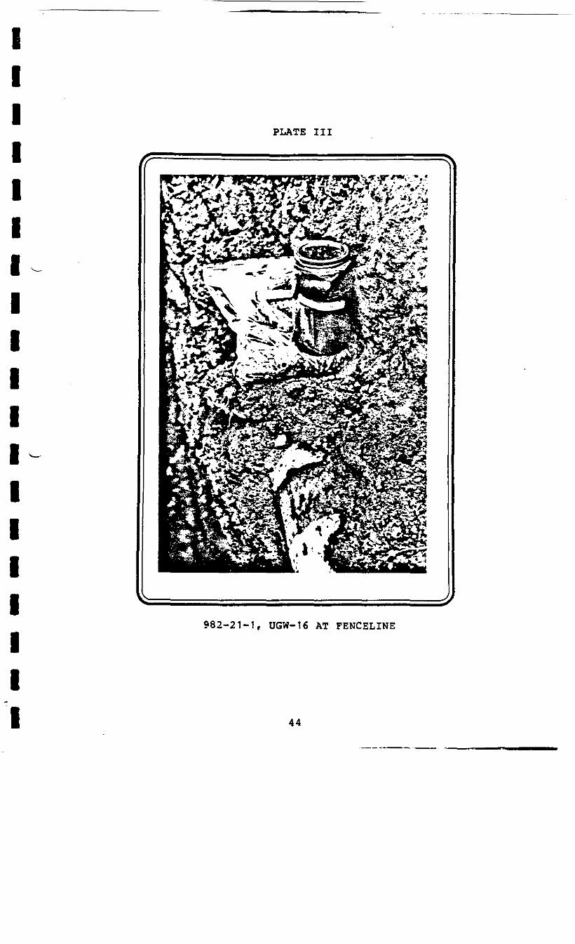
PLATE III
982-21-1, OGW-16 AT FENCELINE
44
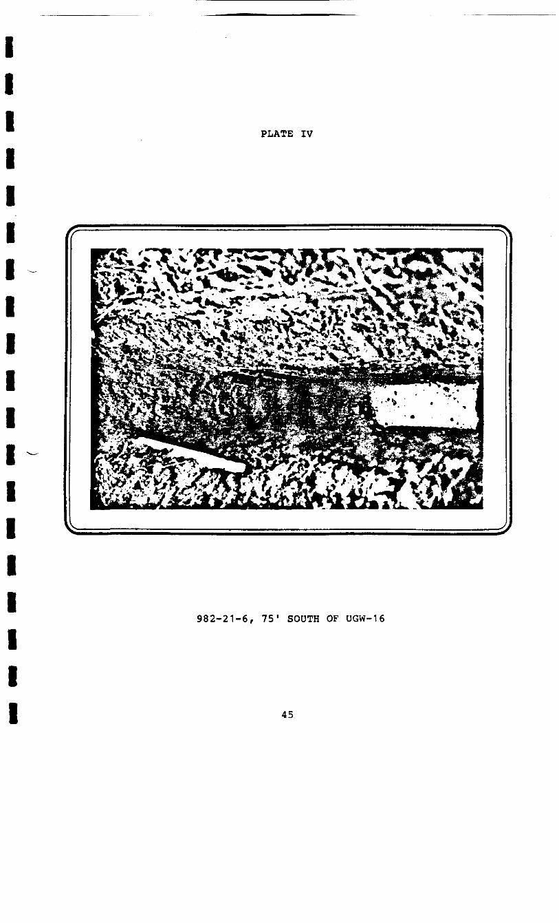
PLATE IV
982-21-6, 75' SOUTH OF UGW-16
45
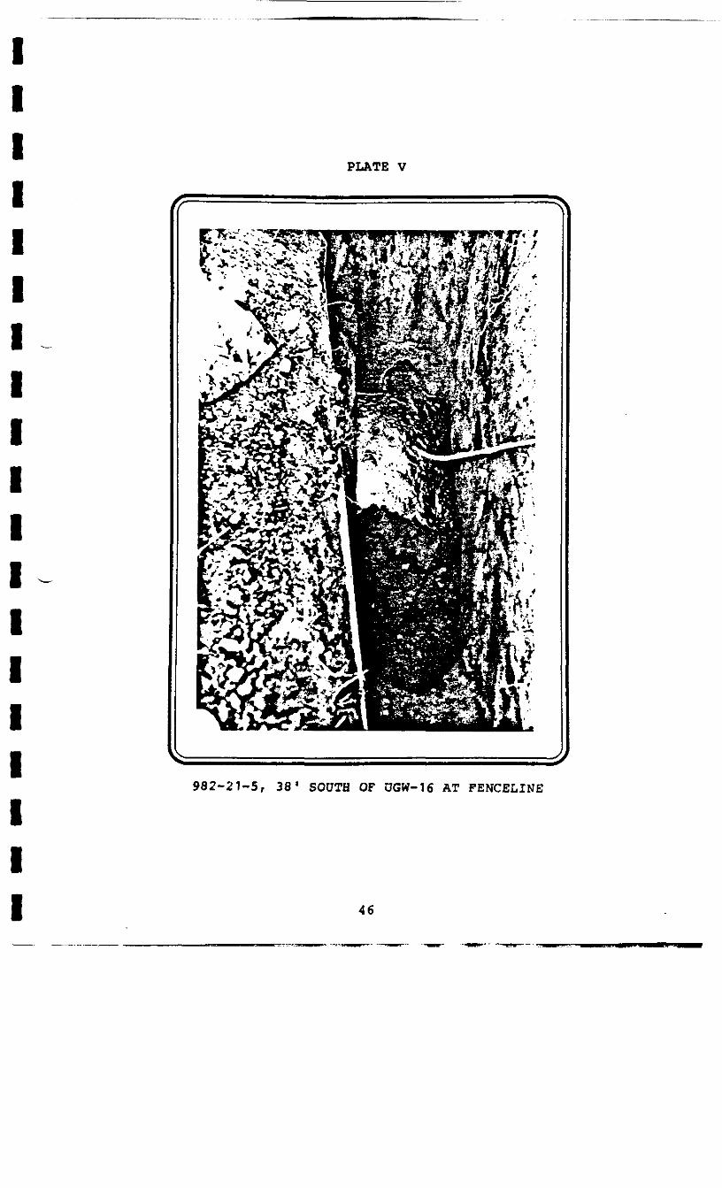
PLATE V
982-21-5, 38' SOUTH OF OGW-16 AT FENCELINE
46

PLATE VI
982-21-2, 38' NORTH OF UGW-16 AT FENCELINE
47

I
PLATE VII
UGW-*6 AT FENCELINE
48

PLATE VIII
982-21-6 LOOKING NORTH
49
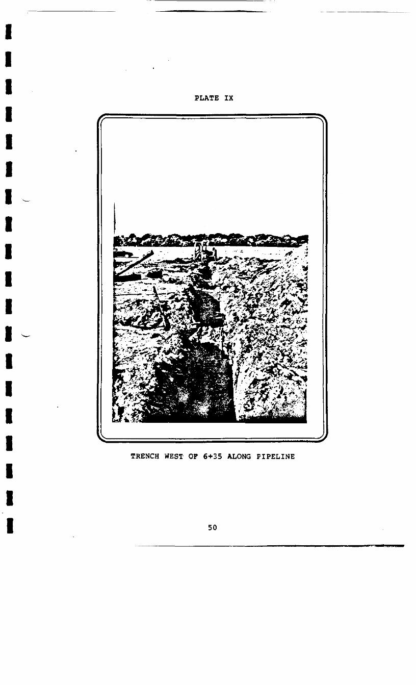
PLATE IX
TRENCH WEST OF 6+35 ALONG PIPELINE
50
woo
oB
toUl
x

PLATE XI
DEPTH OP OLD 6" PIPE AT STA. 6+35
52
S€+9 -YXS CIN3H .06
i ix
IIIIIIIII1IIIIIIIII
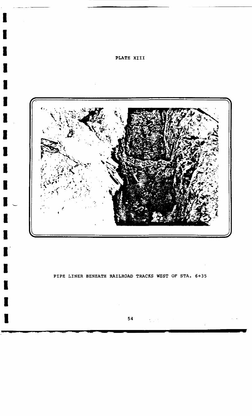
PLATE XIII
PIPE LINER BENEATH RAILROAD TRACKS WEST OF STA. 6+35
54
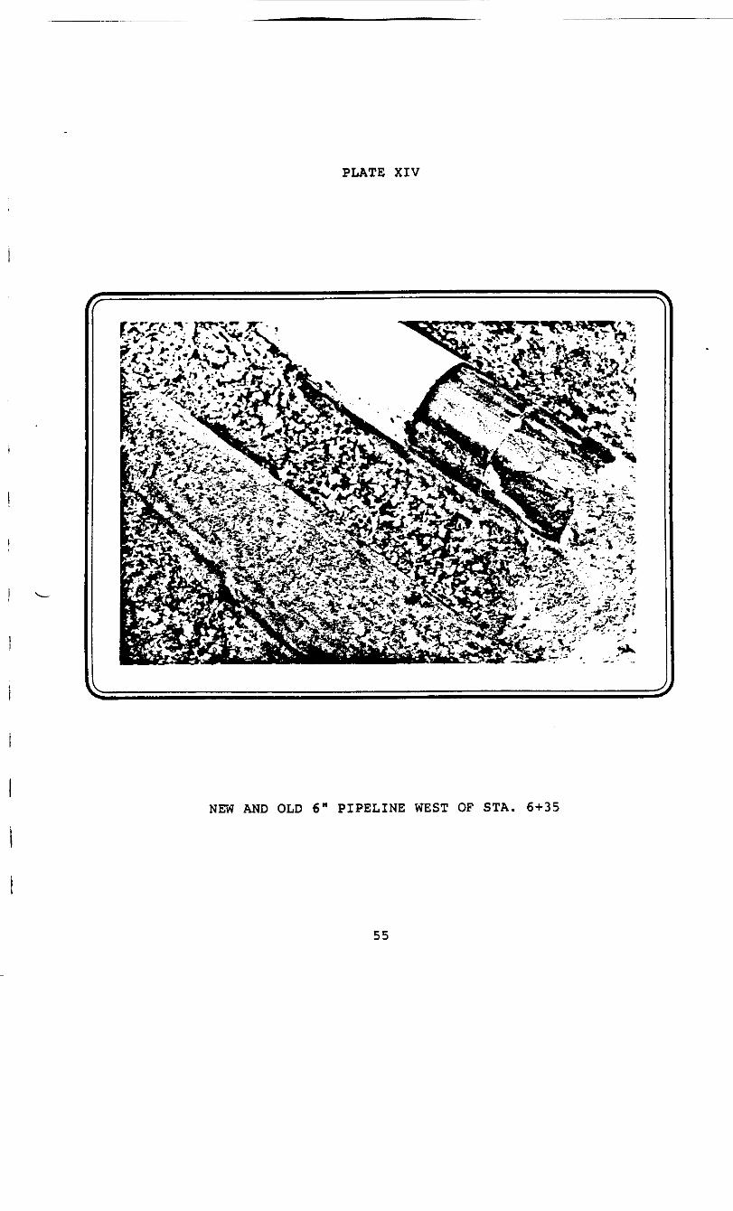
PLATE XIV
NEW AND OLD 6" PIPELINE WEST OF STA. 6 + 35
55
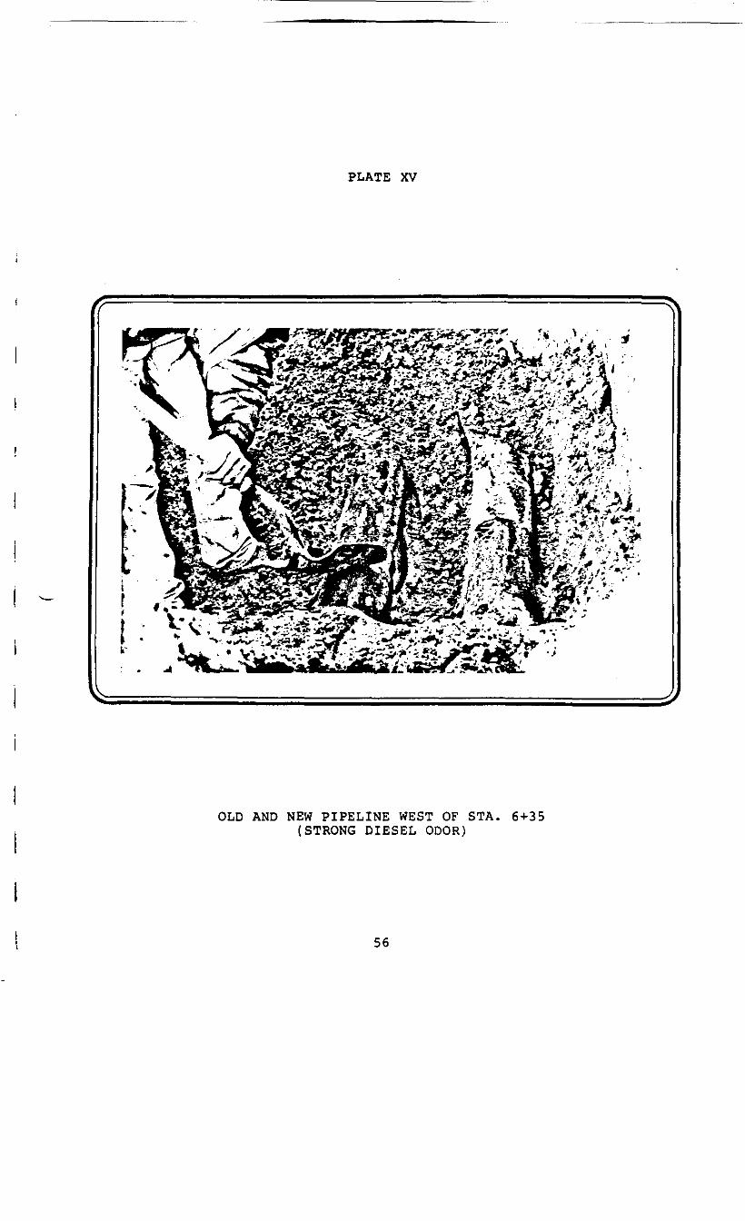
PLATE XV
t : Vv
OLD AND NEW PIPELINE WEST OF STA. 6+35(STRONG DIESEL ODOR)
56
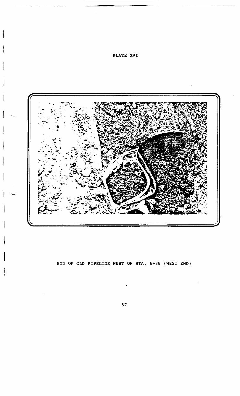
PLATE XVI
•*.; *•*- .*
END OF OLD PIPELINE WEST OF STA. 6+35 (WEST END
57
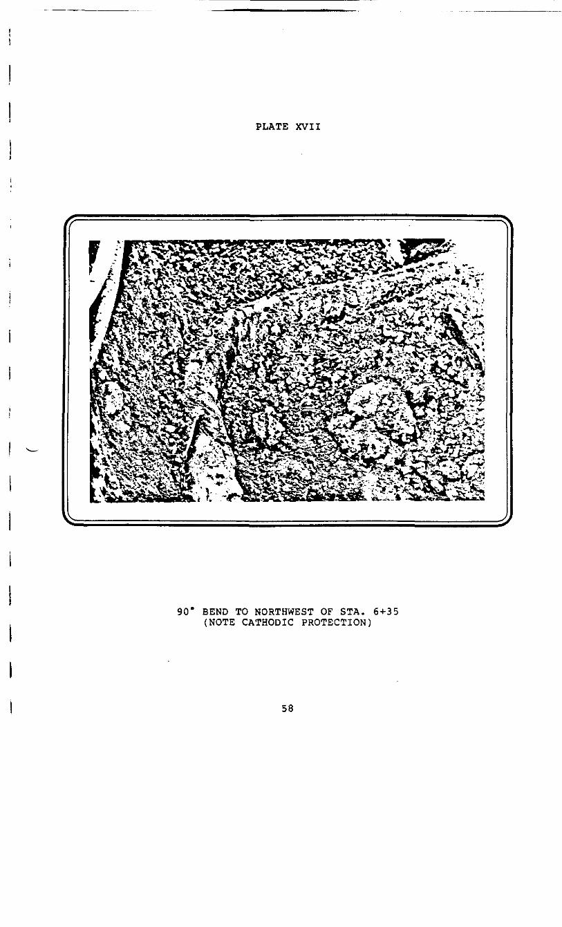
PLATE XVII
SSSSI f ys SS PI IP-w _ fcX .a. ?S .* .*r _• Ti - r.«3 . • .
90" BEND TO NORTHWEST OF STA. 6+35(NOTE CATHODIC PROTECTION)
58

PLATE XVIII
SAMPLING 4M0 PIPELINE ADJACENT TO UGW-17
59
4.0 DISCUSSION AND CONCLUSIONS
A) It is concluded that subsurface soil and/or groundwater
beneath Velsicol lands and private property have been
contaminated by petroleum based materials* This
contamination is limited in horizontal extent to a
portion of the southerly sector of the Plant Site
property and a limited area of private lands immediately
east of the easterly plant boundary fence line. The
vertical extent of contamination is within the coarse to
fine sands overlying the clay till strata and is
generally within a depth of two to seven feet from
original ground surface.
B) The contaminated area is comprised of three visually
distinct zones.
Contamination beneath the westerly one half of the
southerly sector of the Plant Site (hereafter referred
to as Zone C) is by a very viscous, black, petroleum
based material exhibiting little to no odor.
Contamination of the easterly one-third of the southerly
sector of the Plant Site (hereafter referred to as
Zone A) is by a brown, liquid, free flowing petroleum
based material exhibiting a strong diesel fuel type
odor.
60

Between Zones A and C lies an area which contains a
brown to black free flowing petroleum based material
exhibiting a diesel fuel type odor. This zone
(hereafter referred to as Zone B) appears to be a mixing
interface zone between Zones A and C.
C) The contaminant within Zones A and B is highly mobile
and may seriously impact installation of the proposed
Plant Site upgradient containment wall and storm sewer
unless it is contained or removed prior to construction
of the noted structures. Further, a long term potential
of discharge of this contaminant to the Pine River
exists, unless the contaminant is contained or removed
from the land area to be dewatered by the proposed storm
sewer.
The contaminant within Zone C appears to be immobile.
It is concluded that this contaminant will not in the
short term impact construction of the proposed Plant
Site downgradient containment wall, and will be securely
contained in the long term by the noted structure.
D) Laboratory characterization has identified the
freeflowing liquid contaminant in Zone A to be a No. 2
fuel oil, No. 2 diesel oil, or a kerosene.
61
Laboratory characterization has identified the immobile
contaminant in Zone C to be a mixture of unidentified
but unrelated substances and diesel or fuel oil, since
samples 1082-19-3 and 1082-19-4 exhibit some correlation
to the previously identified source sample. Sample
1082-19-5 does not correlate to any other sample.
E) Adjacent to the easterly plant boundary fence line north
of Highway M-46, two approximately parallel 6"0
pipelines have been identified and uncovered. Total
Petroleum Inc. officials have verbally stated the two
identified pipelines are owned by Total Pipeline
Corporation. One pipeline is coated with yellow plastic
material while the second line is uncoated. Total Oil
officials have stated, and documents in Velsicol's
possession indicate, that the existing six inch
pipeline(s) replaced two four inch pipelines in the
1950's.
F) At the point where the pipeline installation bends to
the west into the Plant Site from the easterly fence
line, and again at the point where this pipeline
installation bends to the north in the interior of the
Plant Site, the uncoated six inch pipeline has been cut
and removed. The cut ends were found to have soil plugs
and one section of line contained liquid with a distinct
diesel fuel odor.
62
G) In the north west quadrant of the Plant Site, the six
inch coated pipeline was uncovered and found to be
running parallel to a four inch uncoated pipeline.
The soil adjacent to and beneath the pipeline
installation was found to be contaminated with petroleum
based material having a strong diesel fuel odor.
H) Along the easterly fenceline portion of the pipeline
installation, soil and groundwater beneath the pipelines
are heavily contaminated with the brown liquid petroleum
product characterized by a strong diesel fuel type odor.
At other points where the pipeline installation was
uncovered, soils adjacent to and beneath the pipeline
were heavily contaminated with a petroleum based
material characterized by a strong diesel odor. In
these other areas no attempt was made to observe
groundwater.
I) Samples of groundwater and/or soils were collected from
four locations at the pipeline installation along the
easterly plant boundary fence line, and at three other
locations at the pipeline installation within the
interior of the Plant Site.
Laboratory characterization of these samples has
identified the major petroleum based contaminant to be
63
No. 2 diesel oils or kerosene. The analyzing
laboratories have also identified the contaminant
collected at the easterly fence line installation as
being nearest to the source of contamination.
Characterization of the contaminant samples from Zone A
west of the easterly fence line indicate the material is
related to the 'source1 samples but has undergone
varying degrees of weathering, generally being more
weathered the further west from the pipeline the
material was located.
J) Total Petroleum Inc. has stated that products similar to
the contaminant in Zone A have been pumped through the
pipeline facilities previously discussed.
K) The area identified by the analyzing laboratories as the
'source1 area of contamination is located east of the
easterly plant boundary fence line as it existed during
plant operational periods. Records do not indicate that
the plant at any time stored or handled No. 2 diesel
fuel, No. 2 fuel oil, or kerosene in the 'source1 area.
The only facility of record within the 'source1 area
which handled one or more of the identified petroleum
based contaminants is the transmission pipeline facility
apparently owned by Total Pipeline Corporation.
64
L) On the basis of evidence to date, it is concluded that
the highly mobile petroleum contaminant within Zone A
originated from the pipeline facility as it now exists
or from former pipelines in the same location replaced
by the existing facility.
All of which is respectfully submitted
CONESTOGA-ROVERS & ASSOCIATES LIMITED
Richard G. Shepherd, P. Eng
Frank A. Rovers, P. Eng
Donald Robinson
65
I4
I
APPENDIX A
iiiii
AUTHORIZATION TO ENTER PRIVATE LANDS
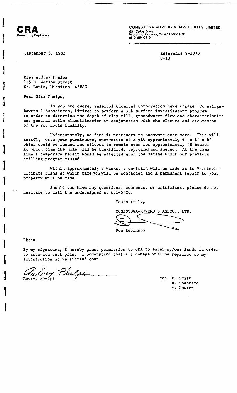
CONESTOGA-ROVERS & ASSOCIATES LIMITED651 Colby Drive,
Con.ultlng Eng!n».ri Waterloo, Ontario, Canada N2V 1C2" (519)884-0510
III11111I1I1III11
September 3, 1982 Reference 9-1078C-13
Miss Audrey Phelps115 N. Watson StreetSt. Louis, Michigan 48880
Dear Miss Phelps,
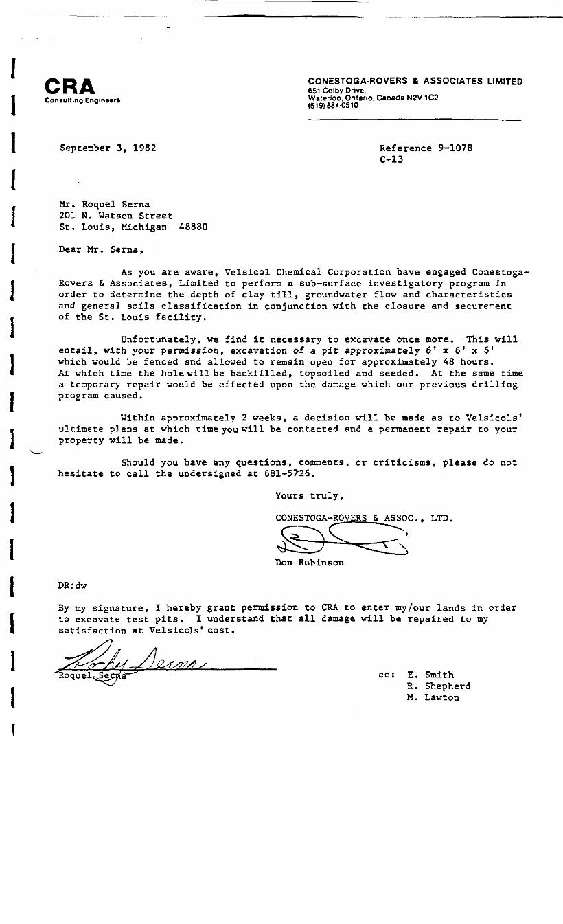
As you are aware, Velsicol Chemical Corporation have engaged Conestoga-Rovers & Associates, Limited to perform a sub-surface investigatory programin order to determine the depth of clay till, groundwater flow and characteristicsand general soils classification in conjunction with the closure and securementof the St. Louis facility.
Unfortunately, we find it necessary to excavate once more. This willentail, with your permission, excavation of a pit approximately 61 x 6' x 6'which would be fenced and allowed to remain open for approximately 48 hours.At which time the hole will be backfilled, topsoiled and seeded. At the sametime a temporary repair would be effected upon the damage which our previousdrilling program caused.
Within approximately 2 weeks, a decision will be made as to Velsicols*ultimate plans at which time you will be contacted and a permanent repair to yourproperty will be made.
Should you have any questions, comments, or criticisms, please do nothesitate to call the undersigned at 681-5726.
Yours truly,
CONESTOGA-ROVERS & ASSOC., LTD.
Don Robinson
DR:dw
By my signature, I hereby grant permission to CRA to enter my/our lands in orderto excavate test pits. I understand that all damage will be repaired to mysatisfaction at Velsicols' cost.
•Sudrey Phelps / cc: E. SmithR. ShepherdM. Lawton
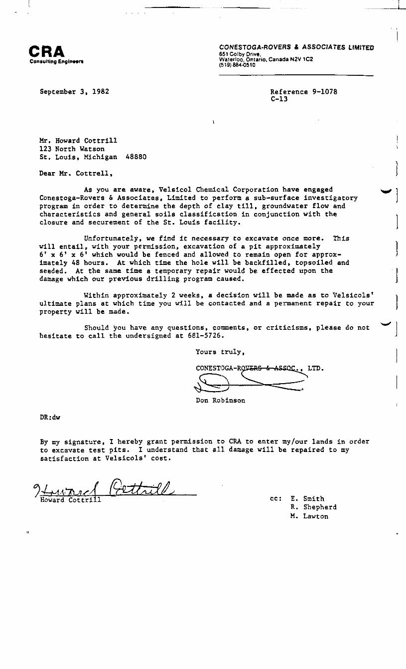
CONESTOGA-ROVERS & ASSOCIATES LIMITED651 Colby Drive.
Consulting EngfnMn ^9)664^0^°'
September 3, 1982 Reference 9-1078C-13
Mr. Howard Cottrill123 North WatsonSt. Louis, Michigan 48880
Dear Mr. Cottrell,
As you are aware, Velsicol Chemical Corporation have engagedConestoga-Rovers & Associates, Limited to perform a sub-surface investigatoryprogram in order to determine the depth of clay till, groundwater flow andcharacteristics and general soils classification in conjunction with theclosure and securement of the St. Louis facility.
Unfortunately, we find it necessary to excavate once more. Thiswill entail, with your permission, excavation of a pit approximately6? x 61 x 6f which would be fenced and allowed to remain open for approx-imately 48 hours. At which time the hole will be backfilled, topsoiled andseeded. At the same time a temporary repair would be effected upon thedamage which our previous drilling program caused.
Within approximately 2 weeks, a decision will be made as to Velsicols*ultimate plans at which time you will be contacted and a permanent repair to yourproperty will be made.
Should you have any questions, comments, or criticisms, please do nothesitate to call the undersigned at 681-5726.
Yours truly,
LTD.CONESTQGA-RQOTRS
Don Robinson
DR:dw
By my signature, I hereby grant permission to CRA to enter my/our lands in orderto excavate test pits. I understand that all damage will be repaired to mysatisfaction at Velsicols1 cost.
Howard Cottrill . cc: E. SmithR. ShepherdM. Lawton
CONESTOGA-ROVERS & ASSOCIATES LIMITED651 Colby Drive,
Consulting Engln»r« £"Aft«£°i5,n«artO* Canada N2V 1C2(519) B84-0510
September 3, 1982 Reference 9-1078C-13
Mr. Roquel Serna201 N. Watson StreetSt. Louis, Michigan 48880
Dear Mr. Serna,
As you are aware, Velsicol Chemical Corporation have engaged Conestoga-Rovers & Associates, Limited to perform a sub-surface investigatory program inorder to determine the depth of clay till, groundwater flow and characteristicsand general soils classification in conjunction with the closure and securementof the St. Louis facility.
Unfortunately, we find it necessary to excavate once more. This willentail, with your permission, excavation of a pit approximately 61 x 6' x 61which would be fenced and allowed to remain open for approximately 48 hours.At which time the hole will be backfilled, topsoiled and seeded. At the same timea temporary repair would be effected upon the damage which our previous drillingprogram caused.
Within approximately 2 weeks, a decision will be made as to Velsicols'ultimate plans at which time you will be contacted and a permanent repair to yourproperty will be made.
Should you have any questions, comments, or criticisms, please do nothesitate to call the undersigned at 681-5726.
Yours truly,
CONESTOGA-ROVERS& ASSOC., LTD.
Don Robinson
DR:dw
By my signature, I hereby grant permission to CRA to enter my/our lands in orderto excavate test pits. I understand that all damage will be repaired to mysatisfaction at Velsicols1 cost.
"Roque 1 ssSer-ria"-"" cc: E. Smith^^ R. Shepherd
M. Lawton
CRAConsulting Engineer*
CONESTOGA-ROVERS & ASSOCIATES LIMITED651 Colby Drive,Waterloo, Ontario, Canada N2V 1C2(519)864-0510
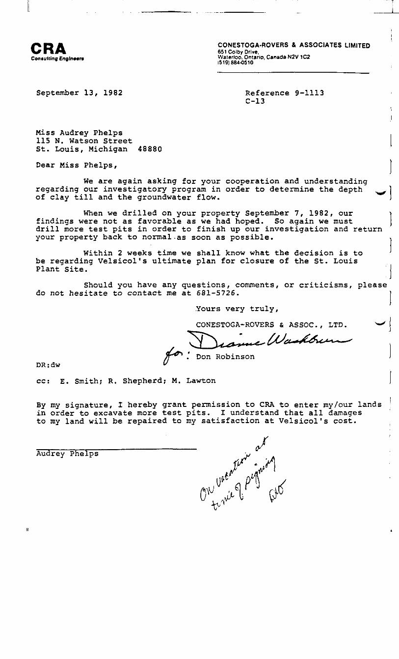
September 13, 1982 Reference 9-1113C-13
Miss Audrey Phelps115 N. Watson StreetSt. Louis, Michigan 48880
Dear Miss Phelps,
We are again asking for your cooperation and understandingregarding our investigatory program in order to determine the depthof clay till and the groundwater flow™
When we drilled on your property September 7, 1982, our ifindings were not as favorable as we had hoped. So again we must )drill more test pits in order to finish up our investigation and returnyour property back to normal.as soon as possible. -,
Within 2 weeks time we shall know what the decision is to J
be regarding Velsicol's ultimate plan for closure of the St. LouisPlant Site. I
Should you have any questions, comments, or criticisms, pleasedo not hesitate to contact me at 681-5726. |
.Yours very truly,
CONESTOGA-ROVERS & ASSOC., LTD.
. Don RobinsonDR:dw
cc: E. Smith; R. Shepherd; M. Lawton
By my signature, I hereby grant permission to CRA to enter my/our landsin order to excavate more test pits. I understand that all damagesto my land will be repaired to ray satisfaction at Velsicol's cost.
Audrey Phelps /

CRACon tutting Engineers
CONESTOGA-ROVERS & ASSOCIATES LIMITED651 Colby Drive.Waterloo, Ontario. Canada N2V 1C2(519}884-0510
September 13, 1982 Reference 9-1113C-13
Mr. Howard Cottrill123 North WatsonSt. Louis, Michigan 48880
Dear Mr. Cottrill,
We are again asking for your cooperation and understandingregarding our investigatory program in order to determine the depthof clay till and the groundwater flow.
When we drilled on your property September 7, 1982, ourfindings were not as favorable as we had hoped. So again we mustdrill more test pits in order to finish up our investigation and returnyour property back to normal as soon as possible.
Within 2 weeks time we shall know what the decision is tobe regarding Velsicol's ultimate plan for closure of the St. LouisPlant Site.
Should you have any questions, comments, or criticisms, pleasedo not hesitate to contact me at 681-5726.
Yours very truly
CONESTOGA-ROVERS & ASSOC., LTD.
' Don RobinsonA "" * *
DR:dv
cc: E. Smith; R. Shepherd? M. Lawton
By my signature, I hereby grant permission to CRA to enter my/our landsin order to excavate more test pits. I understand that all damagesto my land will be repaired to my satisfaction at Velsicol's cost.
Howard Cottrill
CRAConsulting EnglriMf*
CONESTOGA-ROVERS & ASSOCIATES LIMITED651 Cotby Drive,Waterloo, Ontario, Canada N2V 1C2(519)884-0510
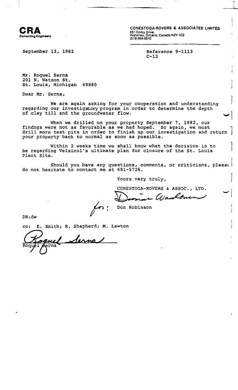
September 13, 1982 Reference 9-1113C-13
Mr. Roquel Serna201 N. Watson St.St. Louis, Michigan
Dear Mr. Serna,
48880
We are again asking for your cooperation and understandingregarding our investigatory program in order to determine the depthof clay till and the groundwater flow*
When we drilled on your property September 7, 1982, ourfindngs were not as favorable as we had hoped. So again, we must ndrill more test pits in order to finish up our investigation and return jyour property back to normal as soon as possible.
Within 2 weeks time we shall know what the decision is tobe regarding Velsicol's ultimate plan for closure of the St. Louis 'Plant Site.
Should you have any questions, comments, or criticisms, pleastdo not hesitate to contact me at 681-5726.
Yours very truly,
CONESTOGA-ROVERS & ASSOC., LTD.
Don Robinsonff 'DR:dw
cc: E. Smith; R. Shepherd; M. Lawton

APPENDIX B
* "EXPLORATORY SUBSURFACE INVESTIGATION
1 - PLANT SITE - ST. LOUIS, MICHIGAN"
I FIGURES, BOREHOLE LOGS AND LABORATORY ANALYSIS
ii

0* 100* 200'
FENCELINE ON PROPERTY BOUNDARY
AREA CONTAINING LIQUIDCONTAMINANTAREA DETERMINED CONTAMINATEDBY ODOR
OIL PIPELINE (ABANDONED)
ucw-is UPGRADIENT CONTAINMENT WALLBOREHOLES
QJ/s-50 SUBSURFACEBOREHOLES
SOIL INVESTICAT(ON
UGWW-Z MONITORING WELL
WASHINGTON AVENUE
CRA
figure 4ESTIMATED EXTENT OFSUBSURFACE OIL PLUME
Sf. Louis P/ont S/'fe

//T182"~TII5 TI I6 J
TII6
A
B
FORMER STORAGE TANKSAND DESIGNATOR
AREA.CONTAINING LIQUID2 CONTAMINANT
CRA
AREA DETERMINED CONTAMINATEDBY ODOROIL PIPELINE (ABANDONED)
FENCEL1NE ON VELSICOLPROPERTY LINE
figure 5ORIGINAL SITE CONDITIONS
St. Louis Plant Site1076 -28/06/82

UICIHBAH TESTIIIG EKGIL'EERS, INC.GEOPHYSICAL ENGINEERS
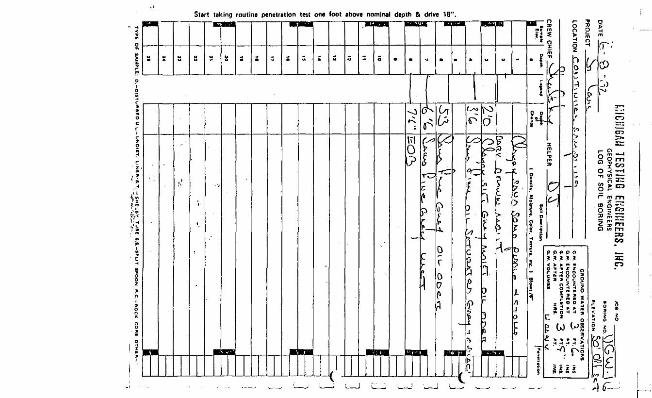
_ LOG OF SOIL BORING
JOB NO
BOWING NO
ELEVATION
PROJECT
LOCATK
CREW C1 S«mp>«• El*v>
•
.
i-
9•i|
9_
9M ——————
If
\
1
GROUND WATER OBSERVATIO-»w , G.W. ENCOUNTERED AT / FT? 1
G.W. ENCOUNTERED AT PT.t-V f\ , n _ ——— - GW AFTITR COMPLETION / PTC'
\t \ \\ <\ 1 G.W. AFTER , MRS. *T.H1EF "s^V iJ : V w HPLPER Ki Vj _ aw VOLUMES LVf.v^-^-
D»pth
0
1
2
3'
4
6
a
7
.
.
10 v
11
12
13
14
16
16
17
1.
19
20
21
22
23
24
26
L*"*nd
\
NS
INS-INS.
' INS.INS.
DiBPth Soft DMCfipilon .
• Chano* ( D»ntiTy, Moinuri, Color. Texture, Btc. ) Blow* /6**
oto.O I
• V't,i ^^
dL r -Jxo^ ^O-^r, CoA/S^-^-^OU^
M ^\
^ o(L r A ov <-r-\j «'SC* . ( >i **^ V A . -* i ** w«- •_*• A J /i \ ( \i i / '
\3.O& i /1 _I ——————
1
IRHB "^H
J
S !i;
———______ 1
IIi —————• ii
11——B
> IStart taking routine penetration test one foot above nominal depth & drive 18".
DATE
f;.ICHI6AM TESTING ENGINEERS, INC.. - GEOPHYSICAL ENGINEERSr>*- Q"8~L LOG OF SOIL BORING
JOB NO.
SORING NO ^AtPROJECT IXLOCATION <~: OlM-r U.JO
CREW CHIEF HFIPER
GROUND WATER OBSERVATIONSG.W. ENCOUNTERED ATG.W. ENCOUNTERED ATG.W. AFTER COMPLETIONG.W. AFTER MRS.G.W, VOLUMES
FT.FT.FT.
,NS
INS.INS.INS.
] &*mpla
J
1iK--•pL1
^
i
D*piti
O
1
2
3
4
B
6
7
.
B
10
11
12
13
14
IS
16
17
IB
1ft
20
21
22
23
24
25
L**""d
"A
D*rtfi Soil DMcnptlon / f
Ch«n»» ( Density. Moiitur*. Color. Tcxturi, etc. ) Blows /«*'
-
I'3U
^^^ V 3
5'^6'o
-
>fto^ - , -r0 JNJ^iO^v 5,t L.T £^MG. ^ O / S f S t r ' l_\ •» V-T"(} ' rA 'c\JcAcrf r n \s~\ e » » v ^ i*. HUJ vj r^t~$ v * vSA ' N, 0, « « -r-^ iA^ -t-i /o^l &*tL,\t V- V) i O v l O oe-irt. u»>-cJT\
R1 l ' v 8O f "i fr<Lb*^SL V \w^t. (S-CA^-^ \JU-Aj ^
tFO(S J H ——1K1 —
-
I1-
x - 1i
. - •*
""'%'f' • • • " ' 1 —
i•«
1
VioO
i%**1«t
O)
V1
Start taking routine penetration test one foot above nominal depth & drive 18".

DATE
C.ICHI6AM TESTING ENGINEERS. INC.GEOPHYSICAL ENGINEERS
_ LOG OF SOIL BORING
I
JOB NO
BONING
ELEVATION'ROJECT
LOCATIC
^REW CS«mpl*
_ El*v.
,
1
^.|
B•j
iI•
1
i1
I
GROUND WATER OBSERVATION"»W , ,„_. ,. G.W ENCOUNTERED AT FT.
G.W. ENCOUNTERED AT FT,G.W. AFTER COMPLETION FT.
VI ( i V r\ "^- G.W. AFTER MRS. FT.HtEF \ \V ^..V<r V r / HFI PER V^s . li „ GW VOLUMES
D«Ptti
O
1
a
3
4
s
6
7
a
6
10
11
la
13
14
IS
16
17
1B
19
70
21
33
33
2«
as
L*9«nd
JSINS.
INS.INS.INS.
b«th So" D^cription P.n.u.tion1 Of -
Ch*n** |x ' D»niit£ Moiftur*. Color. Ttxlura. «te. t Blewi /S" y^i
3'^
y u / nsJAuJ^w O>AO A c\xU.\ijJ N./^vt'T* V Vww
1 x a — iv-
a•
\CcU-o.-Ai _ 1 '
___
•1—— e
i
-
1;tt)
0>Q.Oct-«
O
rre
TYPE OF SAMPLE: D.-D1STURB6D U.L.-UNOIST. LINER S.T. -SMELBV TUBE I.S.-SPLIT SPOON R.C.-ROCK CORE OTHER-
Start taking routine penetration test one foot above

KICHIB* DATE £~> "" I " ft 7^
ri;
:;\2Ito
Jj
OO
i**i/tflj* ;
CO1o>
1c
!1I
'ROJEC7
-OCATIC
:REW cSample
_ Elev.
11111 —
11
F
rI
1
<L u.,.>AN TFSTIHG FKRIt,'FERSr IMC.
GEOPHYSICAL ENGINEERS R|N N 0^?Uj- | 'LOG OF SOIL BORING .^y Qp(.
GROUND WATER OBSERVATIONIN ._. , , , . , . . . , , GW ENCOUNTERED AT ^£_ FT. ^
G.W. ENCOUNTERED AT FT.^ H\ t . G <* AFTF« COMPLETION FTVyt I' V \ V G.W. AFTER MRS. FT.
•4IPF «A>\£r> VCV t HPIPER V)f^N-r^- G* VOLUMES . . - . — - --
Depth
0
1
a
3
4
B
B
7
.
9
10
11
12
13
14
IS
16
17
IB
19
20
21
22
23
24
2.
L-ndDepth
Chenpe
/ ' O9 'Co
5'of e -o
8-0
JS
INS.INS.INS.INS.
Soil Description i •
( Density. Moifturt, Color. Texture, etc. ) Blow* /B"
^.-,- A^u«-t rsmA^/ii,^^ AJuniCT
3 1 ^ !A*-o-^ "AAP A r n.^ to v <? P O OMI >L\ ^*vj"\ \ C*V •
xJ \ U~li M O ^ M »O S 0 ^ 6 fi C /W^V v.. i^* *~. LN C * i ' LLJ C. H
o ^- V *fV^~r O. ^*w Q >^ \ r & i— f**> o <? ci 1 —.... . . ...... ... • .... . . .... . ......... .n __....^ r- m^ jA vu sOvj ^ \ A ^ /S n r w 1 1 u i - rO^"\ i i Vp i Jjv / i M<? v r / BiTorb' —
|—IB——— i
|—1
-
-
. •
• " . .- . .
- ' • | ——_ . Bfl
J__

biiunia' / ^ Cf . O o
DATE (-» ! '* C
f on icri
LOCATK
CREW C1 S»mpl«U Elw.
1I
:f*L1Q- 1a
'
e no
mln
a
£JOA**
§
SO
1;%iswaI3sI1r00
1-
1-
1
.-- ' <-%» 1i t
HH icoi i t .u chDiucrna r m^. Jn. M0 iGEOPHYSICAL ENGINEERS ( >^v, 1 i n 1
• DRIMQ NO 'V. ^-' ' ( )
LOG OF SOIL BORING \rn' n'r<ELFVATiON 1 O^, A ' *^ ' •• -
GROUND WATER OBSERVATIONSIN . ___^ O.W fhlCOUNTERep AT fj: |NS
O.W. ENCOUNTERED AT FT. INS.G.W. AFTER COMPLETION ft IN;
\'\ U \ V ( O.W. AFTER MRS. FT. INiHIEF \\V .. V^ \t-»* HFIPER ^lA^>-\\* _ a.w. VOLUMU V I A - .
O*pth
0
1
3
3
4
s
«7
.
•
10
11
13
13
14
18
16
17
H
19
30
31
33
33
34
as
L*** ( Depthol
3*o
Sol) D**crlpt)on _
( Dtnihy. Moiituri. Color, Texture, etc. ) Btowt/(H/^A
^^ A(/. , ys,^, ,., ^/V.-T- ( fe.^\ 1 ——i - 1
••|
£05 (^^(lo.A^ ' 1 ——1 — *I
1••gJ —•••
,*
-
B-
'ii
)
)
1^1
/
11]
-1
1
1
'l
J
s
TYPE OF SAMPLE: O.-DISTURBED U.L.-UNOIST. LINER S.T. - SMELBY TUBE S.S.-SPL1T S^OON R.C.-ROCK CORE OTHER-
LABORATORY ANALYSIS REPORT
er
Submitted To:
Conestoga-Rovers Associates, LTD.c/o Velslcol Chemical Corporation500 North Bankson StreetSt. Louis, MI 48880
Attn: Mr. Richard G. Shepherd
Report Date:
Certified By:
June 24, 1982
/ HamAnn Arb&r gp'erations Manager
Samples Received By: June 8, 1982
Client P .O . Number: Letter
ERG Project Number: 8695
ENVIRONMENTAL RESEARCH GROUP, INC. • 117 N. FIRST • ANN ARBOR, MICHIGAN 48104 • 313/662-3104
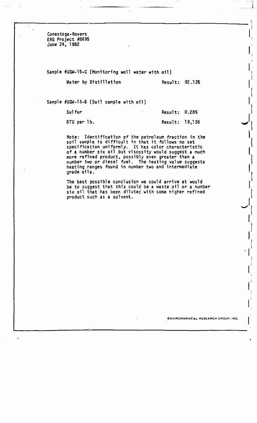
Conestoga-RoversERG Project #8695June 24, 1982
Sample IUGW-15-C (Monitoring well water with oil)
Water by Distillation Result: 92.13%
Sample IUGW-15-B (Soil sample with oil)
Sulfur Result: 0.28*
BTU per Ib. Result: 19,136 i
Note: Identification of the petroleum fraction 1n the I,soil sample 1s difficult in that 1t follows no set Ispecification uniformly. It has color characteristic •*of a number six oil but viscosity would suggest a much )more refined product, possibly even greater than a ]number two or diesel fuel. The heating value suggests 1heating ranges found 1n number two and intermediate Igrade oils. j
The best possible conclusion we could arrive at would jbe to suggest that this could be a waste oil or a number Isix oil that has been diluted with some higher refined Iproduct such as a solvent. 1
1
ENVIRONMENTAL RESEARCH GROUP, INC.
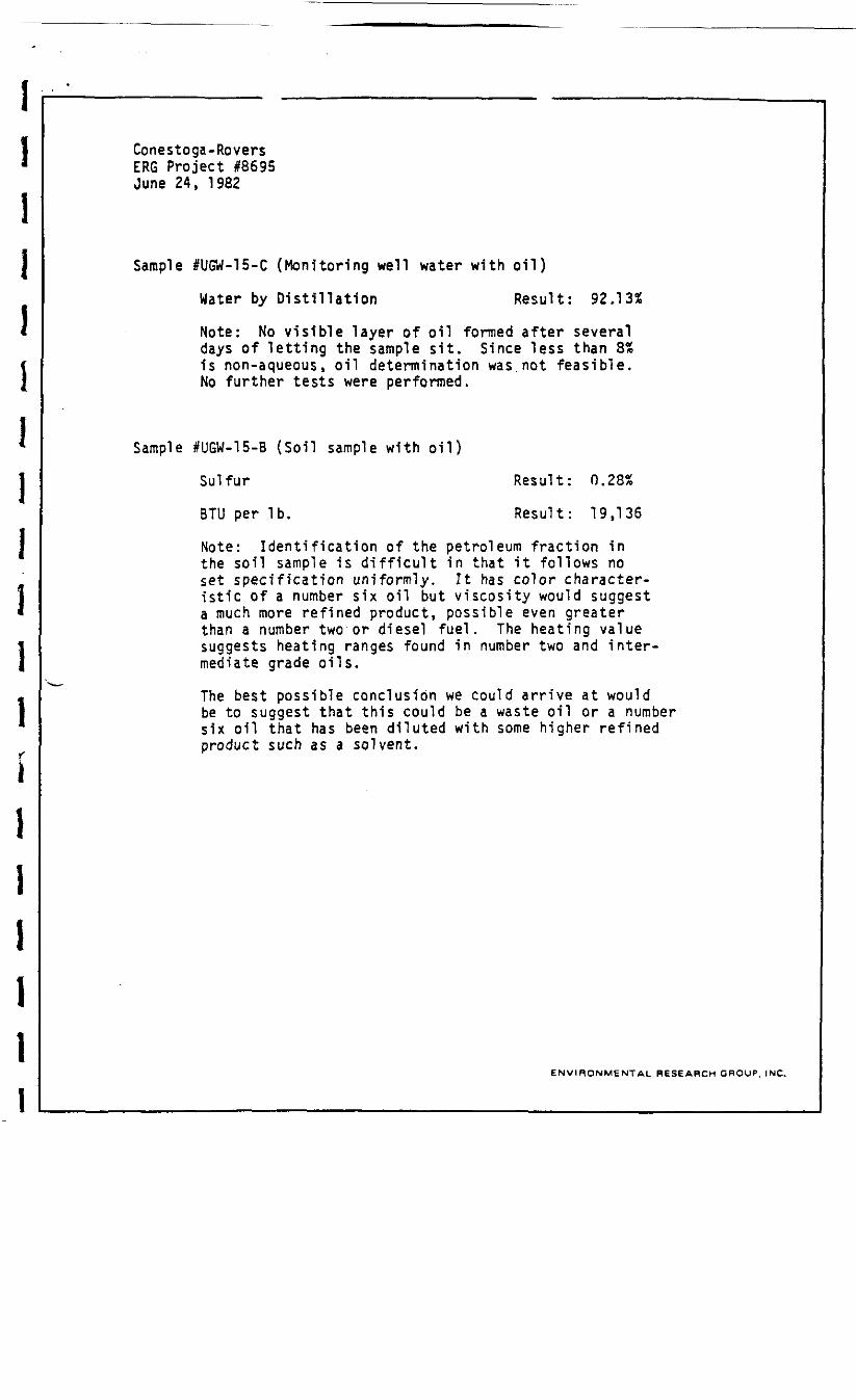
Conestoga-RoversERG Project 18695June 24, 1982
Sample #UGW-15-C (Monitoring well water with oil)
Water by Distillation Result: 92.13%
Note: No visible layer of oil formed after severaldays of letting the sample sit. Since less than 8%is non-aqueous, oil determination was.not feasible.No further tests were performed.
Sample IUGW-15-B (Soil sample with oil)
Sulfur Result: 0.28%
BTU per Ib. Result: 19,136
Note: Identification of the petroleum fraction inthe soil sample is difficult in that it follows noset specification uniformly. It has color character-istic of a number six oil but viscosity would suggesta much more refined product, possible even greaterthan a number two or diesel fuel. The heating valuesuggests heating ranges found in number two and inter-mediate grade oils.
The best possible conclusion we could arrive at wouldbe to suggest that this could be a waste oil or a numbersix oil that has been diluted with some higher refinedproduct such as a solvent.
ENVIRONMENTAL RESEARCH GROUP, INC.
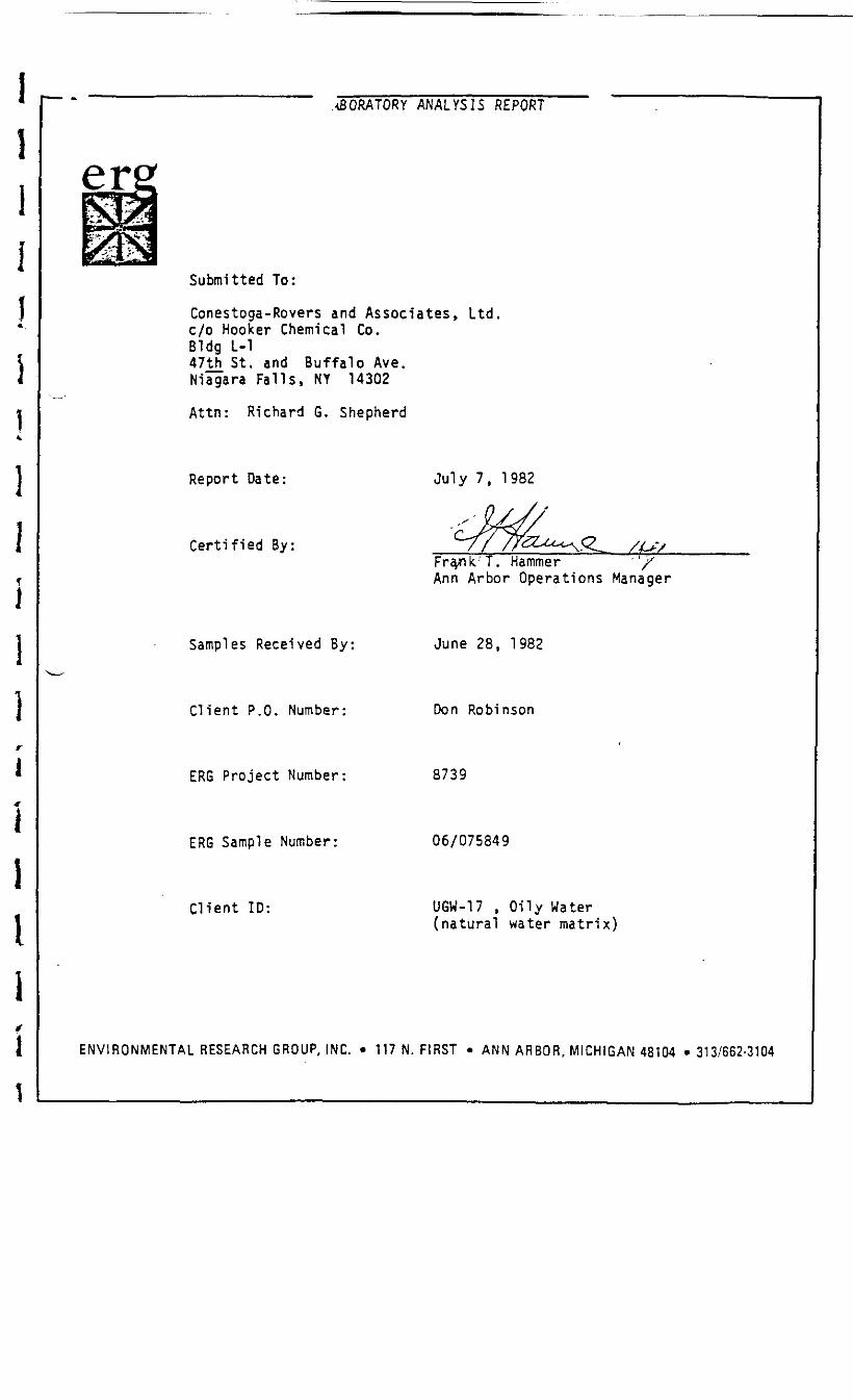
.MORATORY ANALYSIS REPORT
Submitted To:
Conestoga-Rovers and Associates, Ltdc/o Hooker Chemical Co.Bldg L-147th St. and Buffalo Ave.Niagara Falls, NY 14302
Attn: Richard G. Shepherd
Report Date:
Certified By:
July 7, 1982
Fra/ik'T. "Hammer " " ' ' XAnn Arbor Operations Manager
Samples Received By: June 28, 1982
Client P.O. Number: Don Robinson
ERG Project Number: 8739
ERG Sample Number: 06/075849
Client ID: UGW-17 . Oily Water(natural water matrix)
ENVIRONMENTAL RESEARCH GROUP, INC. • 117 N. FIRST • ANN A R B O R , MICHIGAN 48104 •313/662-3104
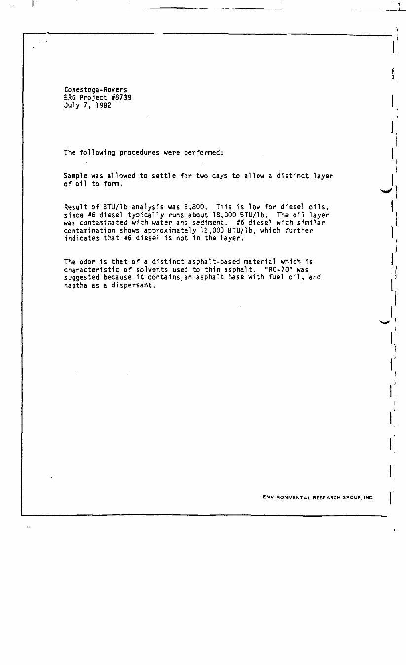
Conestoga-RoversERG Project #8739July 7, 1982
The following procedures were performed:
Sample was allowed to settle for two days to allow a distinct layerof oil to form.
Result of BTU/lb analysis was 8,800. This is low for diesel oils,since #6 diesel typically runs about 18,000 BTU/lb. The oil layerwas contaminated with water and sediment. #6 diesel with similarcontamination shows approximately 12,000 BTU/lb, which furtherindicates that #6 diesel is not in the layer.
The odor is that of a distinct asphalt-based material which ischaracteristic of solvents used to thin asphalt. "RC-70" wassuggested because it contains an asphalt base with fuel oil, andnaptha as a dispersant.
ENVIRONMENTAL RESEARCH GROUP. INC.
LABORATORY ANALYSIS REPORT
Submitted To:
Conestoga-Rovers & Associates500 Bankson StreetSt. Louis, MI 48880
Attn: Rick Shepherd
Report Date:
Certified By:John WilsonManager, Inorganics Laboratory
Samples Received By: July 14, 1982
Client P.O. Number: Don Robinson (7/13/82)
ERG Project Number 8781
ENVIRONMENTAL RESEARCH GROUP, INC. • 117 N. FIRST • ANN ARBOR, MICHIGAN 48104 • 313/662-3104
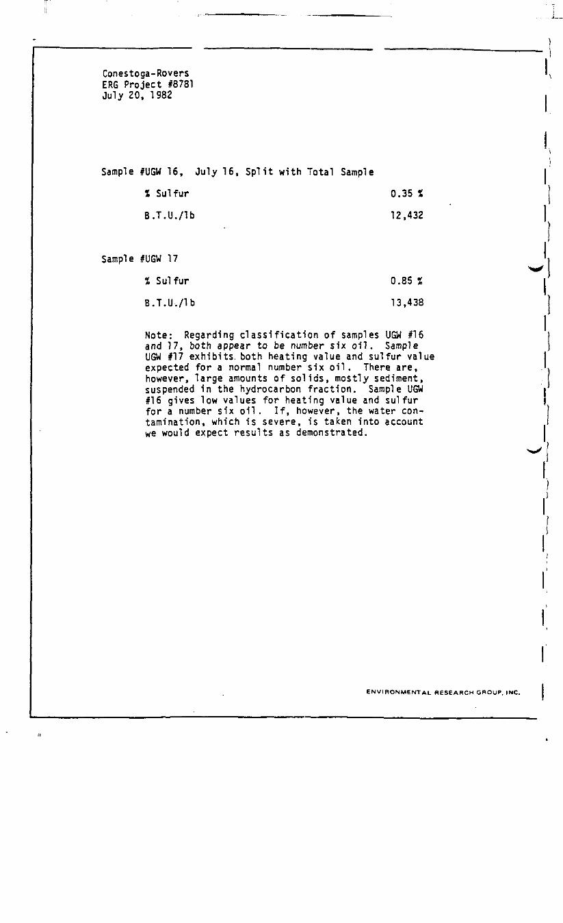
Conestoga-RoversERG Project #8781July 20, 1982
Sample IUGW 16, July 16, Split with Total Sample
% Sulfur 0.35 %
B.T.U./lb 12,432
Sample #UGW 17
% Sulfur 0.85 %
B.T.U./lb 13.438
Note: Regarding classification of samples UGW #16and 17, both appear to be number six oil. SampleUGW 117 exhibits, both heating value and sulfur valueexpected for a normal number six oil. There are,however, large amounts of solids, mostly sediment,suspended in the hydrocarbon fraction. Sample UGW116 gives low values for heating value and sulfurfor a number six oil. If, however, the water con-tamination, which is severe, is taken into accountwe would expect results as demonstrated.
ENVIRONMENTAL RESEARCH GROUP, INC.

APPENDIX C
"FIELD INVESTIGATIVE PROGRAM
- WATSON STREET - ST. LOUIS, MICHIGAN"
FIGURES, BOREHOLE LOGS AND LABORATORY ANALYSIS

UGW- 15
732-
0 txf 4tf
U6W-I6
EAST PLANT SITEPROPERTY BOUNDARY
782-13
USW-17LEGEND
SAMPLING STATIONSJULY 21 , 1982SAMPLING STATIONSUPGRADtENT CONTAINMENT WALL
FENCE ON PLANT SITEPROPERTY BOUNDARY
UGW-18
• UGW-19
782-2 782-3m BB a 782-19
_&T82-4
I______._
if_ _PJT_Cb __ — —
782-8"^^ 782-9m s ,
ct-i a
CB
i
, 782-6 DQ
««-*
782-12S LJ _ .
•*———*•
782-17
I
iv
1-co
zoCO
•: M-46 :WASHINGTN.:AVE.-
f igure 2SAMPLING LOCATIONS EAST
OF VELSICOL PROPERTY LINESt. Louis Plant
107 i -XC/07/12
(5
L E G E N D
FENCE ON PLANT SITEPROPERTY BOUNDARY
SAMPLING STATIONSMAY & JUNE PROGRAMS
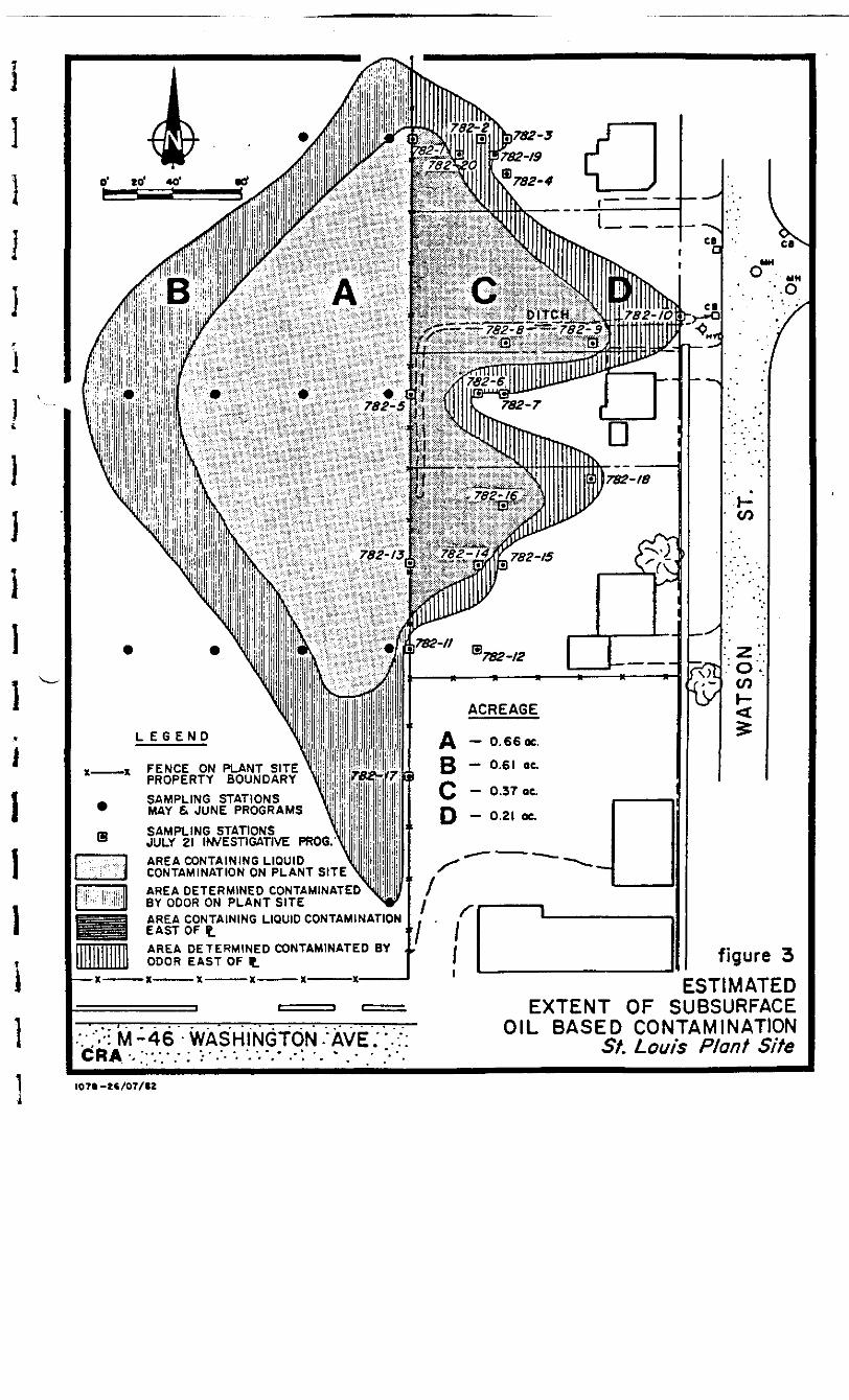
SAMPLING STATIONSJULY 21 INVESTIGATIVE PROG.AREA CONTAINING LIQUIDCONTAMINATION ON PLANT SITEAREA DETERMINED CONTAMINATEDBY ODOR ON PLANT SITEAREA CONTAINING LIQUID CONTAMINATIONEAST OF tAREA DETERMINED CONTAMINATED BY ^ODOR EAST OF t
V ;>:M-46-WASHINGTON-•AVE.".::CRA- . " • • • . - ; > • - • - - . • - • - * . - -*: •- - . - • *•'.
figure 3ESTIMATED
EXTENT OF SUBSURFACEOIL BASED CONTAMINATION
St. Louis Plant Site
I07I-2C/07/IZ

-o-LABOBATORY ANALYSIS REPORT
erSubmitted To:
Conestoga-Rovers Associates, LTD.c/o Velsicol Chemical Corporation500 North Bankson StreetSt. Louis, MI 48880
Attn: Mr. Richard G. Shepherd
Report Date:
Certified By: •
August 4, 1
FranOperations r, Ann Arbor
Samples Received By: July 23, 1982
Cl i en t P . O . Number : Don Robinson
ERfa Project Number: 8805
ENVIRONMENTAL RESEARCH GROUP, INC. • 117 N. FIRST • ANN ARBOR, MICHIGAN 48104 • 313/662-3104
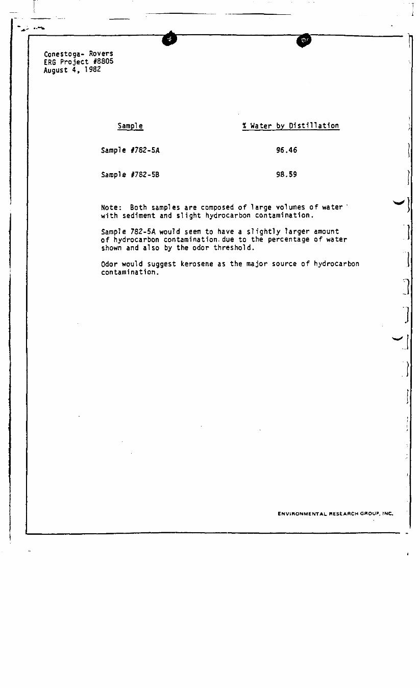
Conestoga- RoversERG Project 18805August 4, 1982
Sample % Water by Distillation
Sample #782-5A 96.46
Sample I7S2-5B 98.59
Note: Both samples are composed of large volumes of waterwith sediment and slight hydrocarbon contamination.
Sample 782-5A would seem to have a slightly larger amount |of hydrocarbon contamination, due to the percentage of water 'shown and also by the odor threshold.
Odor would suggest kerosene as the major source of hydrocarboncontamination.
ENVIRONMENTAL RESEARCH GROUP, INC.
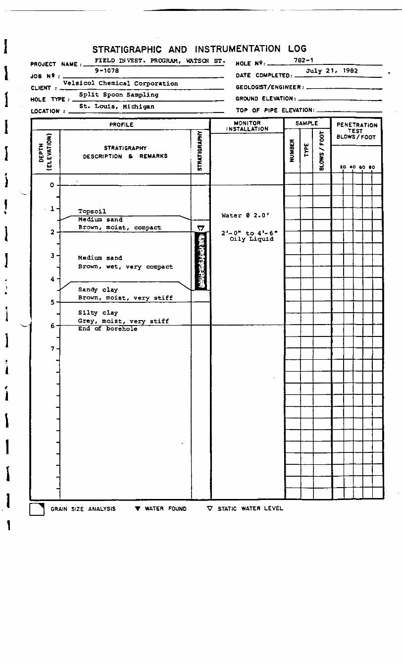
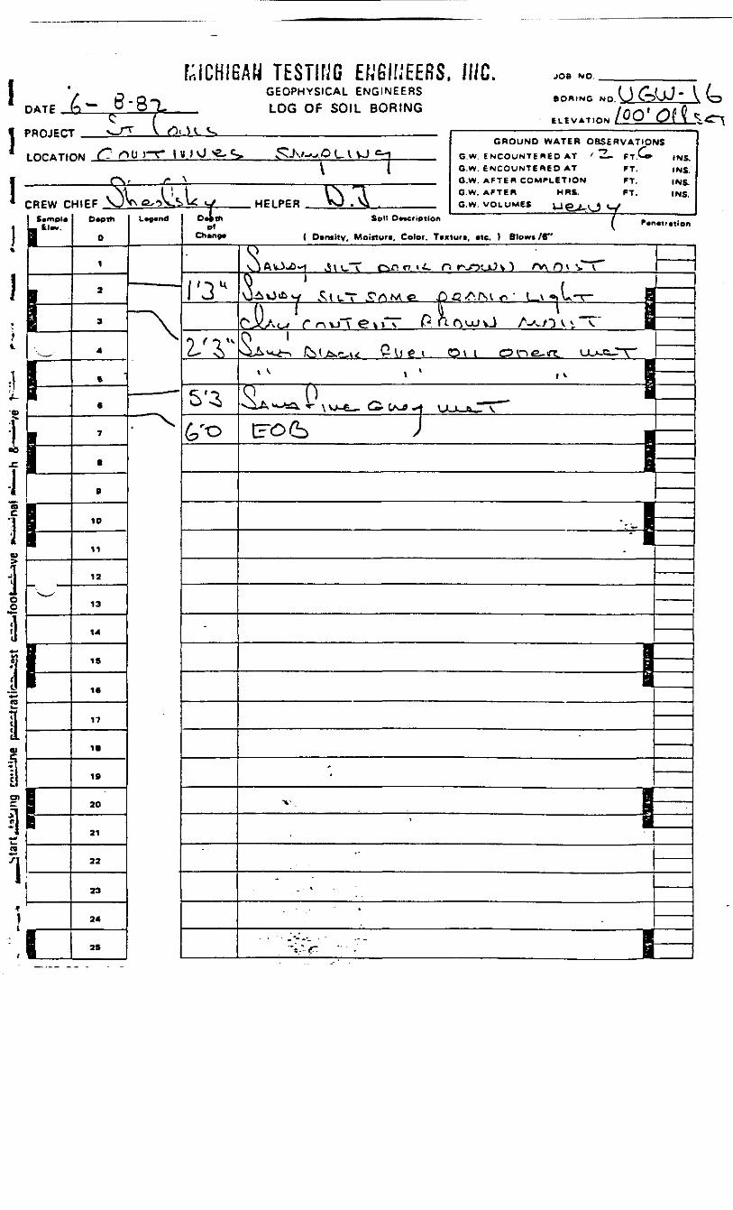
PROJECT NAME :
JOB N* : _^_
STRATIGRAPH1C AND INSTRUMENTATION LOGFIELD INVEST. PROGRAM, WftTSCN ST. HOL£ Ng.___ 782-1
9-1078
CLIENT :Velsicol Chemical Corporation
DATE COMPLETED:July 21, 1982
HOLE TYPE :Split Spoon Sampling
GEOLOGIST/ENGINEER:
GROUND ELEVATION: _
LOCATION :St. Louis, Michigan TOP OF PIPE ELEVATION:
PROFILE
DEP
TH(E
LEVA
TION
)
0 -
1-
2-
3-
4 -
5-
6-
7-
STRATIGRAPHYDESCRIPTION 6 REMARKS
Tops oil- *" Medium sand "*"•-
Brown, moist, compact
Medium sandBrown, wet, very compact
' Sandy clay ^-Brown, moist, very stiff
Silty clayGrey, moist, very stiffEnd of borehole
2(9
iE
T7m '
E:^I*
~^ GRAIN SIZE ANALYSIS T WATER FOUND
MONITORINSTALLATION
Water @ 2 .0*
2'-0" to 4 l-6"Oily Liquid
SAMPLE
NUM
BER
f-
ou.w
OD
PENETRATIONTESTBLOWS / FOOT
20 40 60 «0
V STATIC WATER LEVEL

PROJECT NAME :
JOB N« : ____
STRATIGRAPHIC AND INSTRUMENTATION LOGFIELD INVEST. PROGRAM, WATSCN ST.
HOLE N«:7B2-2
9-1078
CLIENT : Velsicol Chemical CorporationDATE COMPLETED:
July 21, 1982
HOLE TYPE :Split Spoon Sampling
GEOLOGIST/ENGINEER:
GROUND ELEVATION: _
LOCATION : St. Louis, Michigan TOP OF PIPE ELEVATION:
PROFILE
DE
PTH
(ELE
VA
TIO
N)
o-
1-
2-
3-
4-
5-
6-
7-
STRATIGRAPHYDESCRIPTION a REMARKS
Tops oil
Medium sandbrown, wet
Silty claygrey, moist
—— End of borehole ——————————
STR
ATIG
RAP
HY
T
MONITORINSTALLATION
-
Water @ 2 '6"
Faint fuelOil odor @ 4'0"
'
-
SAMPLE
NUM
BER
i-
BLOW
S /
FOO
T
PENETRATIONTEST
BLOWS /FOOT
20 40 60 »0
,
Js-
J GRAIN SIZE ANALYSIS WATER FOUND V STATIC WATER LEVEL

STRATIGRAPHIC AND INSTRUMENTATION LOGPROJECT NAME :
JOB N» : ____
FIELD INVEST. PROGRAM, WftTSCK ST.
9-1078
HOLE N*:
DATE
782-3
July 21, 1982
CLIENT : .Velsicol chemical Corporation^
HOLE TYPE : Split Spoon jamplinq_____
LOCATION : St. Louis, Midiigan_____
GEOLOGIST/ENGINEER:
GROUND ELEVATION: _
TOP OF PIPE ELEVATION:
PROFILE
DEP
TH(E
LEV
ATI
ON
)
0 -
1-
2 -
3-
4 -
5 -
6-
7-
STRATIGRAPHYDESCRIPTION & REMARKS
Topsoil ^
Medium sand - brown, moist
Medium sand - brown, wet
Silty clay - grey, moist
—— End of borehole - —————————
STRA
TIGR
APHY
k*7-f\.
t.:/:5
MONITORINSTALLATION
Water @ 2 ' 6 M
2' to 4' fuel oilodor strong/
4'
SAMPLE
NUM
BER ua.
i-
BLOW
S / F
OO
T
PENETRATIONTEST
BLOWS / FOOT
20 40 60 BO
J GRAIN SIZE ANALYSIS T WATER FOUND V STATIC WATER LEVEL
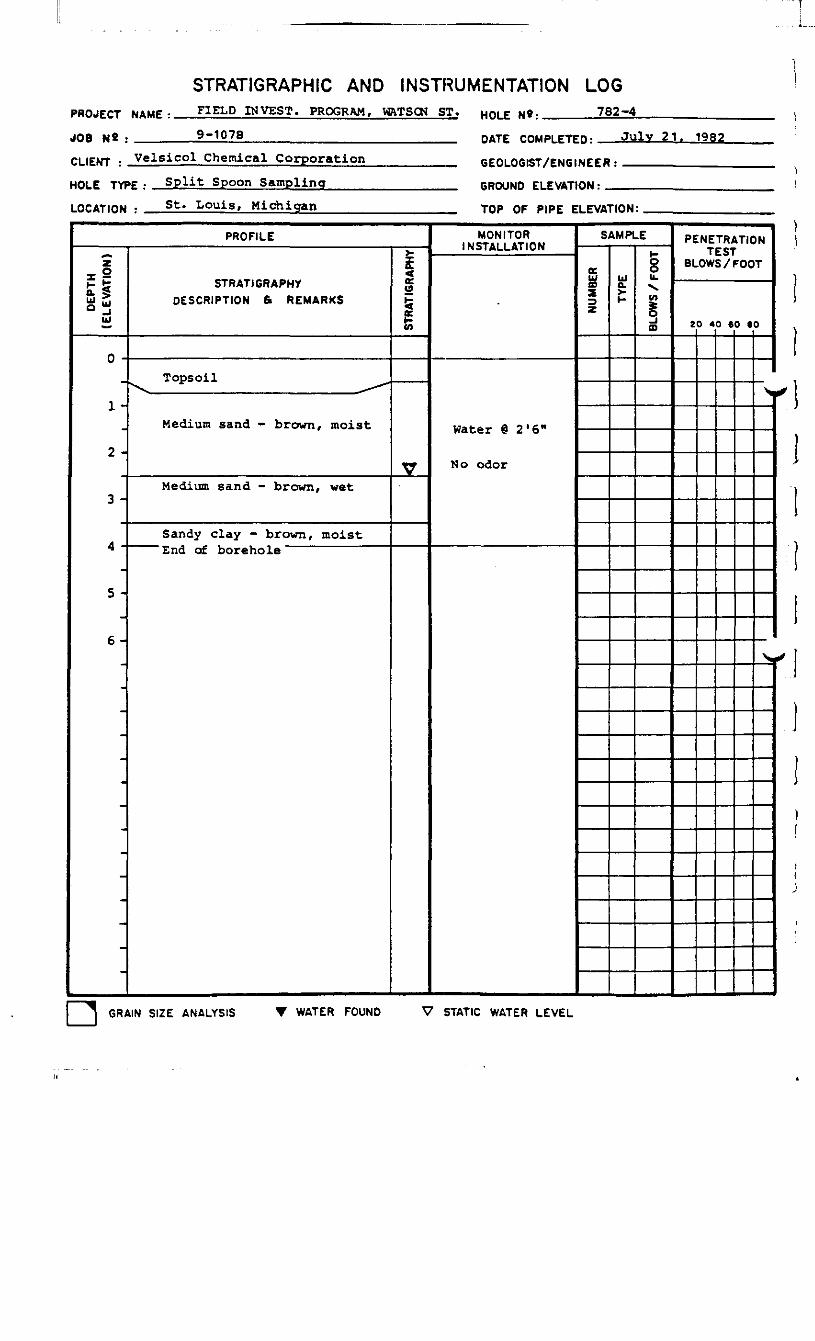
STRATIGRAPHIC AND INSTRUMENTATION LOGPROJECT NAME :
JOB N« : ____
CLIENT :
FIELD INVEST. PROGRAM, WRTSCN ST. HOLE N*. 782-4
9-1078 DATE COMPLETED: July 21. 1982Chemical Corporation
HOLE TYPE .- Split Spoon Sampling
LOCATION : St. Louis, Michigan
GEOLOGIST/ENGINEER:
GROUND ELEVATION: _
TOP OF PIPE ELEVATION:
PROFILE
DE
PTH
(ELE
VA
TIO
N)
0 -™
1-
2 -
3 -
4 -
5 -
6 -
-
STRATIGRAPHYDESCRIPTION ft REMARKS
Tops oil
Medium sand - brown, moist
Medium sand - brown, wet
Sandy clay - brown, moist&nd or borehole
STR
ATIG
RAP
HY
V
MONITORINSTALLATION
Water @ 2'6"
No odor
SAMPLE
NU
MBE
R bJQ.
t-
8U.
v>
m
PENETRATIONTEST
BLOWS /FOOT
20 40 60 SO
S.
\.
f
-/
GRAIN SIZE ANALYSIS T WATER FOUND STATIC WATER LEVEL
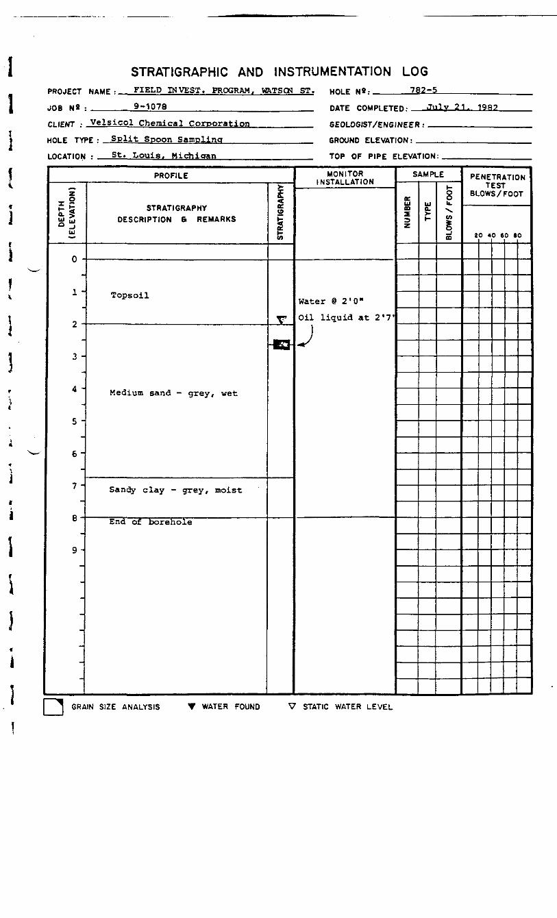
STRATIGRAPHIC AND INSTRUMENTATION LOGPROJECT NAME •
JOB N« : ____
FIELD INVEST. PROGRAM, W&TSCN ST.
9-1078HOLE N»:
DATE
782-5
July 2 1
CLIENT : Velsicol Chemical Corporation
HOLE TYPE : Split Spoon Sampling____
LOCATION : St. Louis. Michigan_____
GEOLOGIST/ENGINEER:
GROUND ELEVATION: _
TOP OF PIPE ELEVATION:
PROFILE
DE
PTH
(ELE
VA
TIO
N)
0 -
1 -
2 -
3 -
4 -
5 -
6 -
7 -
9 -
-
-
STRATIGRAPHYDESCRIPTION & REMARKS
Tops oil
Medium sand - grey, wet
Sandy clay - grey, moist
End of borehole
STR
ATIG
RAP
HY
V
HQ
MONITORINSTALLATION
Water @ 2'0"
Oil liquid at 2 '?'
J
SAMPLE
NU
MBE
R bJ0.>1-
oob.•s.CO
_;CD
PENETRATIONTEST
BLOWS /FOOT
20 40 60 80
J GRAIN SIZE ANALYSIS T WATER FOUND V STATIC WATER LEVEL

STRATIGRAPHIC AND INSTRUMENTATION LOGPROJECT MAMF • FIELD INVEST. PROGRAM, MRTSCN ST. H O L E N » : 782-6
JOB N8 .
CLIENT : .
9-1078 DATE COMPLETED :Chemical Corporation
Spoon SamplingHOLE TYPE •
LOCATION : St. Louis, Michigan
GEOLOGIST/ENGINEER:
GROUND ELEVATION: _
TOP OF PIPE ELEVATION:
PROFILE
DEP
TH(E
LEVA
TION
)
0 -
1-
2 -
3-
4-
5-
6-
7-
8-
9-
STRATIGRAPHYDESCRIPTION 6 R E M A R K S
Tops oil
Medium sand - brown, moist
Medium sand - grey, wet
Medium sand - grey, wet
Sandy clay - grey, moist
——— End of borehole ——————————
STRA
TIGR
APHY
VV.V.V.
MONITORINSTALLATION
Water @ 2 i O "
Faint fuel odor at*) i f
^
SAMPLE
NUM
BER ua.
I-
&ou.X.CO§CD
PENETRATIONTEST
BLOWS /FOOT
20 40 SO BO
^
~N«
GRAIN SIZE ANALYSIS T WATER FOUND V STATIC WATER LEVEL

STRATIGRAPHIC AND INSTRUMENTATION LOGPROJECT NAME :
JOB N« : ____
FIELD INVEST. PROGRAM, VRTSCN ST. HOLE 782-7
9-1078 DATE COMPLETED:——JVlY 21, 1962
CLIENT : Velsicol Chemical Corporation
HOLE TYPE : Split Spoon Sampling____
LOCATION : St. Louis, Michigan_____
GEOLOGIST/ENGINEER:
GROUND ELEVATION; _
TOP OF PIPE ELEVATION:
PROFILE
DEP
TH -
(ELE
VATI
ON
)
o -
1 -
2 -
3-
4 -
5 -
6-
7-
;-
STRATIGRAPHYDESCRIPTION & REMARKS
Topsoil
Medium sand - brown, wet
Sandy clay - grey, moist
""•"'" End of borehole
STRA
TIG
RAPH
Y
V
iKvK
MONITORINSTALLATION
Water @ 1 '611
2f to 41 faintfuel odor
J
SAMPLE
NU
MBE
R ma.i-
BLO
WS
/ FO
OT
PENETRATIONTEST
BLOWS / FOOT
20 40 60 BO
GRAIN SIZE ANALYSIS WATER FOUND V STATIC WATER LEVEL
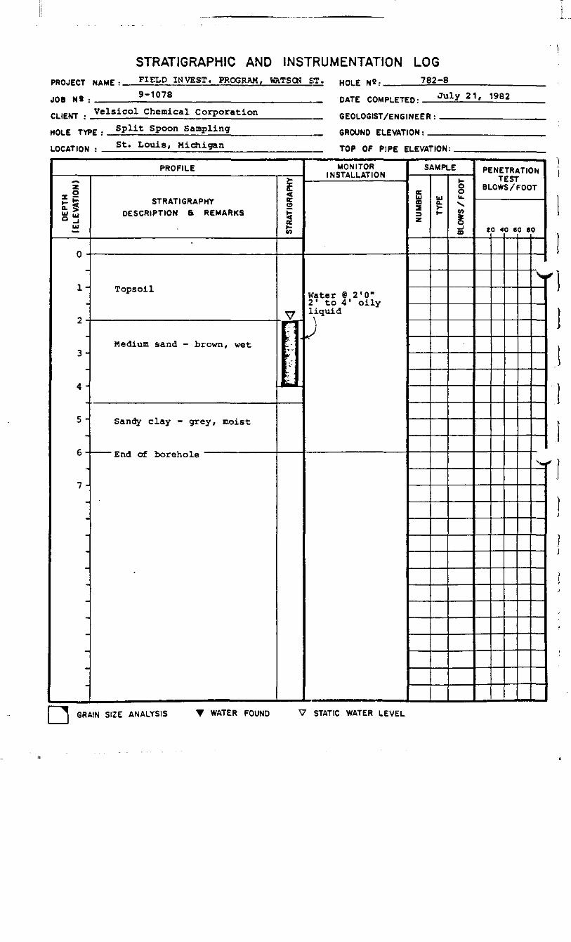
STRATIGRAPHIC AND INSTRUMENTATION LOGPROJECT NAME :
JOB N« : _____
FIELD INVEST. PROGRAM, HRTSCN ST. HOLE N«: 782-8
9-1078 DATE COMPLETED r
CLIENT • Velsico1 Chemical Corporation
HOLE TYPE • Split Spoon Sampling____
LOCATION : St. Louis, Michigan______
GEOLOGIST/ENGINEER:
GROUND ELEVATION:_
TOP OF PIPE ELEVATION:
PROFILE
DE
PTH
(ELE
VA
TIO
N)
0 -
1-
2 -
3 -
4 -
5 -
6-
7 -
STRATIGRAPHYDESCRIPTION 6 REMARKS
-
Tops oil
Medium sand - brown, wet
Sandy clay - grey, moist
— "• •• End of borehole
c(9
iKfe
V
I-
MONITORINSTALLATION
Water @ 2'0"2' to 4' oilyliquid;
SAMPLE
NU
MBE
R
UJa.
BLO
WS
/ FO
OT
PENETRATIONTEST
BLOWS /FOOT
20 40 60 BO
S|
,
] GRAIN SIZE ANALYSIS T WATER FOUND V STATIC WATER LEVEL
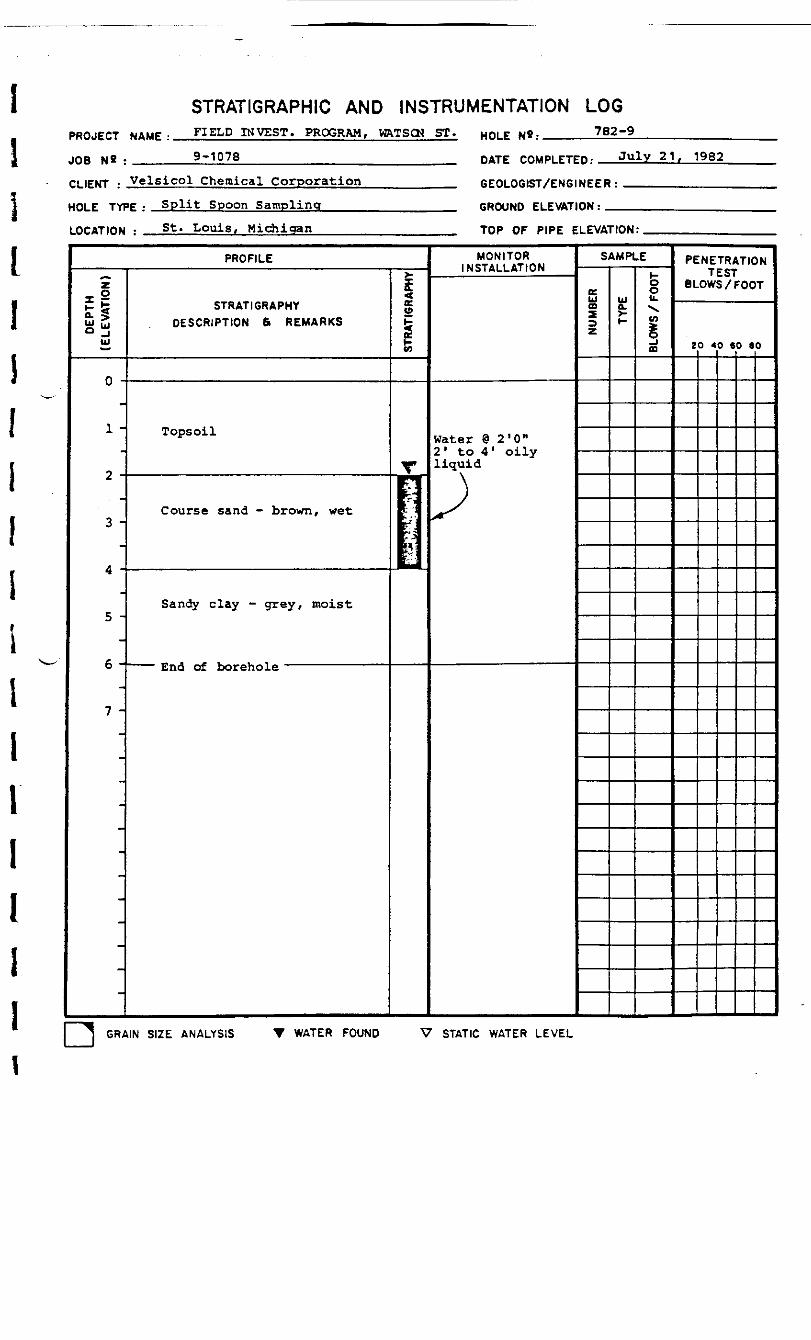
STRATIGRAPHIC AND INSTRUMENTATION LOG
I
PROJECT NAME :
JOB N« : ____
FIELD INVEST. PROGRAM, VftTSCK ST.
9-1078
HOLE N«r 782-9
DATE rnuPiFTFp. July 21, 1982
CLIENT : Velsicol Chemical Corporation
HOLE TYPE: Split Spoon Sampling_____
LOCATION : St. "Louis, Michigan_____
GEOLOGIST/ENGINEER:
GROUND ELEVATION: _
TOP OF PIPE ELEVATION:
PROFILE
DE
PTH
(ELE
VA
TIO
N)
0 -
1 -
2 -
3 -
4 -
5 -
6 -
7 -
-
-
STRATIGRAPHYDESCRIPTION 6> REMARKS
Tops oil
Course sand - brown, wet
Sandy clay - grey, moist
End of borehole
STR
ATIG
RAP
HY
1I1
MONITORINSTALLATION
Water @ 2 '0"2' to 4' oilyliquid
J>
SAMPLE
NU
MBE
R
ISt-
&ou.>vIfl§00
PENETRATIONTEST
BLOWS /FOOT
20 40 SO 80
GRAIN SIZE ANALYSIS T WATER FOUND V STATIC WATER LEVEL

STRATIGRAPHIC AND INSTRUMENTATION LOGPROJECT NAME :
JOB N« : ____
FIELD INVEST. PROGRAM, HftTSCN ST. HQL£ 782-10
9-1078 DATE COMPLETED: July 21, 1982
CLIENT • Ve^s*co* Chemical Corporation
HOLE TYPE• Split Spoon Sampling____
LOCATION : St. Louis, Michigan_____
GEOLOGIST/ENGINEER:
GROUND ELEVATION: _
TOP OF PIPE ELEVATION:
PROFILE
DE
PTH
(ELE
VA
TIO
N)
0 -
1 -
2 .
3 .
4 .
5 .
6 .
7 .
STRATIGRAPHYDESCRIPTION 6 REMARKS
Tops oil
Medium sand - brown, wet
Sandy clay - grey, moist
— — End of borehole ——————————
STR
ATIG
RAP
HY
V:|:|:|:¥:
MONITORINSTALLATION
water @ 2 '0M
2' to 4' faintfuel oil odor
'
SAMPLE
NU
MBE
R
I-
BLO
WS
/ FO
OT
PENETRATIONTEST
BLOWS /FOOT
20 40 SO 80
^
r*-i
GRAIN SIZE ANALYSIS WATER FOUND V STATIC WATER LEVEL
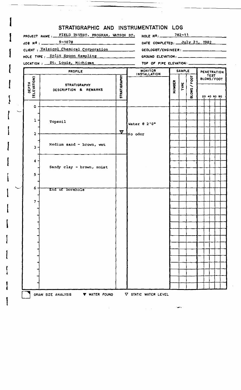
STRATIGRAPHIC AND INSTRUMENTATION LOGPROJECT NAME :
JOB N« : ____
FIELD INVEST. PROGRAM, WVTSQ3 ST.
9-1078_______________________
CLIENT : Velsicol Chemical Corporation__________
HOLE TYPE : Split Spoon Sampling______________
LOCATION : St. Louis, Michigan_______________
HOLE N»:
DATE
782-11
July 21, 1982
GEOLOGIST/ENGINEER:
GROUND ELEVATION: _
TOP OF PIPE ELEVATION:
PROFILE
DEP
TH(E
LEV
ATI
ON
)
0 -
In
2 -
•} _
4 -
5 -
6-
7 -
STRATIGRAPHYDESCRIPTION & REMARKS
Topsoil
Medium sand - brown, wet
Sandy clay - brown, moist
End of borehole
STR
ATIG
RAP
HY
v
MONITORINSTALLATION
water @ 2*0 "
No odor
SAMPLE
NUM
BER
Ul0.
l-
oou.V.en§ID
PENETRATIONTEST
BLOWS /FOOT
20 40 60 80
GRAIN SIZE ANALYSIS V WATER FOUND V STATIC WATER LEVEL

STRATIGRAPHIC AND INSTRUMENTATION LOGPROJECT NAME :
JOB NS : ____
INVEST. PROGRAM, VfrTSCN ST.. HOL£ 782-12
9-1078DATE COMPLETED:
July 21, 1982
CLIENT Velsicol Chemical Corporation
HOLE TYPE : Split Spoon Sampling
LOCATION :
GEOLOGIST/ENGINEER:
._ GROUND ELEVATION : __St. Louis, Michigan „ TOP OF PIPE ELEVATION:
PROFILE
DE
PTH
(ELE
VATI
ON
)
0 -
1-
2 -
3-
4 -
5 -
6-
7-
STRATIGRAPHYDESCRIPTION & REMARKS
Tops oil
Medium sand - brown
Silty clay - moist
End of borehole
STR
ATIG
RAP
HY
MONITORINSTALLATION
Water - noneencountered
Ho odor
SAMPLE
NU
MBE
R
Ua.i-
8Ik"vo>s0
PENETRATIONTEST
BLOWS /FOOT
20 40 60 80
s.
s_
r*
^*
J GRAIN SIZE ANALYSIS T WATER FOUND V STATIC WATER LEVEL
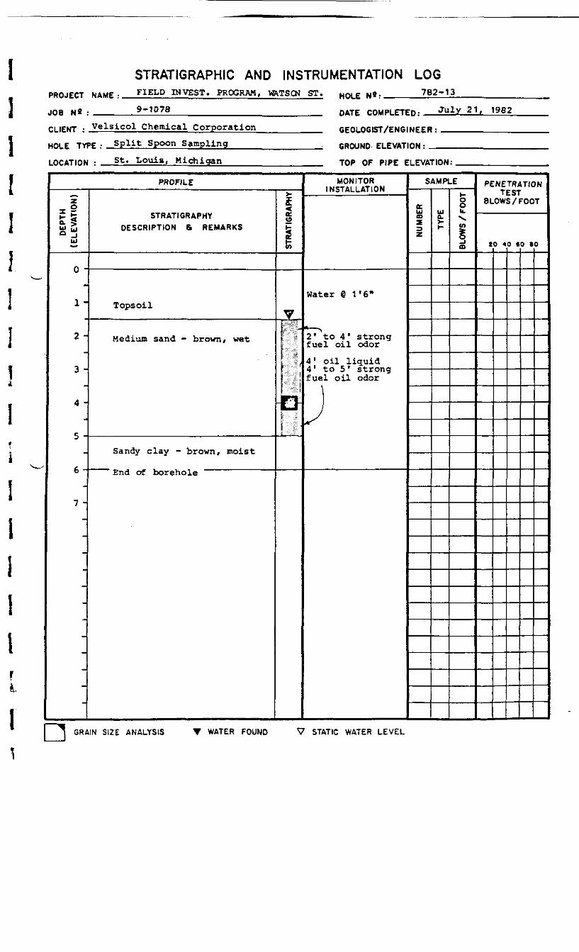
STRATIGRAPHIC AND INSTRUMENTATION LOGPROJECT NAME • FIELD INVEST. PROGRAM, VRTSCN ST. HOLEN«:______782-13
JOB N« : ____ 9-1078 DATE rnup. rrrp. July 21, 19B2
CLIENT : Velsicol Chemical Corporation
HOLE TYPE : Split Spoon Sampling____
LOCATION : St. Louis, Michigan_____
GEOLOGIST/ENGINEER:
GROUND ELEVATION: _
TOP OF PIPE ELEVATION:
PROFILE
DEP
TH(E
LEV
ATI
ON
)
o -
1-
2 -
3 -
4 -
5 -
6 -
7 -
-
-
-
STRATIGRAPHYDESCRIPTION 8 REMARKS
Tops oil
Medium sand - brown, wet
Sandy clay - brown, moist
end of borehole
STRA
TIGR
APHY
7
I
MONITORINSTALLATION
Water @ 1 '611
i — x2* to 4 ' strongfuel oil odor4 ' oil liquid4" to 5 * strongfuel oil odor
}
SAMPLE
<DxUJo.H
OOb.V.vt
ffi
PENETRATIONTEST8 LOWS /FOOT
20 40 60 80
GRAIN SIZE ANALYSIS T WATER FOUND V STATIC WATER LEVEL
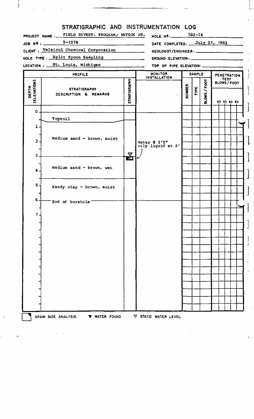
STRATIGRAPH1C AND INSTRUMENTATION LOGPROJECT MAMF •
JOB NS :
FIELD INVEST. PROGRAM/ VRTSCN ST. HQLE N9. 782-14
9-1078 DATE CQMPtFTFn- July 21, 1982
CLIENT : Velsicol Chemical Corporation
HOLE TYPE : Split Spoon Sampling
LOCATION : St. Louis, Michigan
GEOLOGIST/ENGINEER:
GROUND ELEVATION :
TOP OF PIPE ELEVATION:
PROFILE
DE
PTH
(ELE
VA
TIO
N)
0-
™
1-
2-
3-
4 -
5-
6-
7-
-
-
STRATIGRAPHYDESCRIPTION a REMARKS
^^ Tops oil _^.
Medium sand - brown, moist
Medium sand - brown, wet
Sandy clay - brown, moist
cna ot Dorehole
STR
ATIG
RAP
HY
•&
MONITORINSTALLATION
Water @ a 'O"oily liquid at 3'
J
SAMPLE
NU
MBE
R
UJa.t-
8U.
!O
PENETRATIONTEST
BLOWS /FOOT
20 40 60 BO
X«
<^^
GRAIN SIZE ANALYSIS T WATER FOUND V STATIC WATER LEVEL

STRATIGRAPHIC AND INSTRUMENTATION LOGPROJECT NAME :
J08 Nfl : ____
FIELD INVEST. PROGRAM, WftTSCN ST. HOLE N»: 782-15
9-1078 DATE COMPLETED: Julv 21. 1982
CLIENT : Velsicol Chemical Corporation
HOLE TYPE : Split Spoon Sampling____
LOCATION : St. Louis, Michigan_____
GEOLOGIST/ENGINEER:
GROUND ELEVATION:_
TOP OF PIPE ELEVATION:
PROFILE
DE
PTH
(ELE
VA
TIO
N)
0 -
1-
2 -
3 -
4 -
5 •
6-
7 -
STRATIGRAPHYDESCRIPTION & REMARKS
Tops oil
Medium sand - brown, moist
Medium sand - brown, wet
Sandy clay - brown, moist
End of borehole
STR
ATIG
RAP
HY
V
MONITORINSTALLATION
Water @ 2'0"
No odor
SAMPLE
NU
MBE
R uja.t-
oou.\v>§a
PENETRATIONTEST
BLOWS /FOOT
20 40 60 80
GRAIN SIZE ANALYSIS T WATER FOUND V STATIC WATER LEVEL
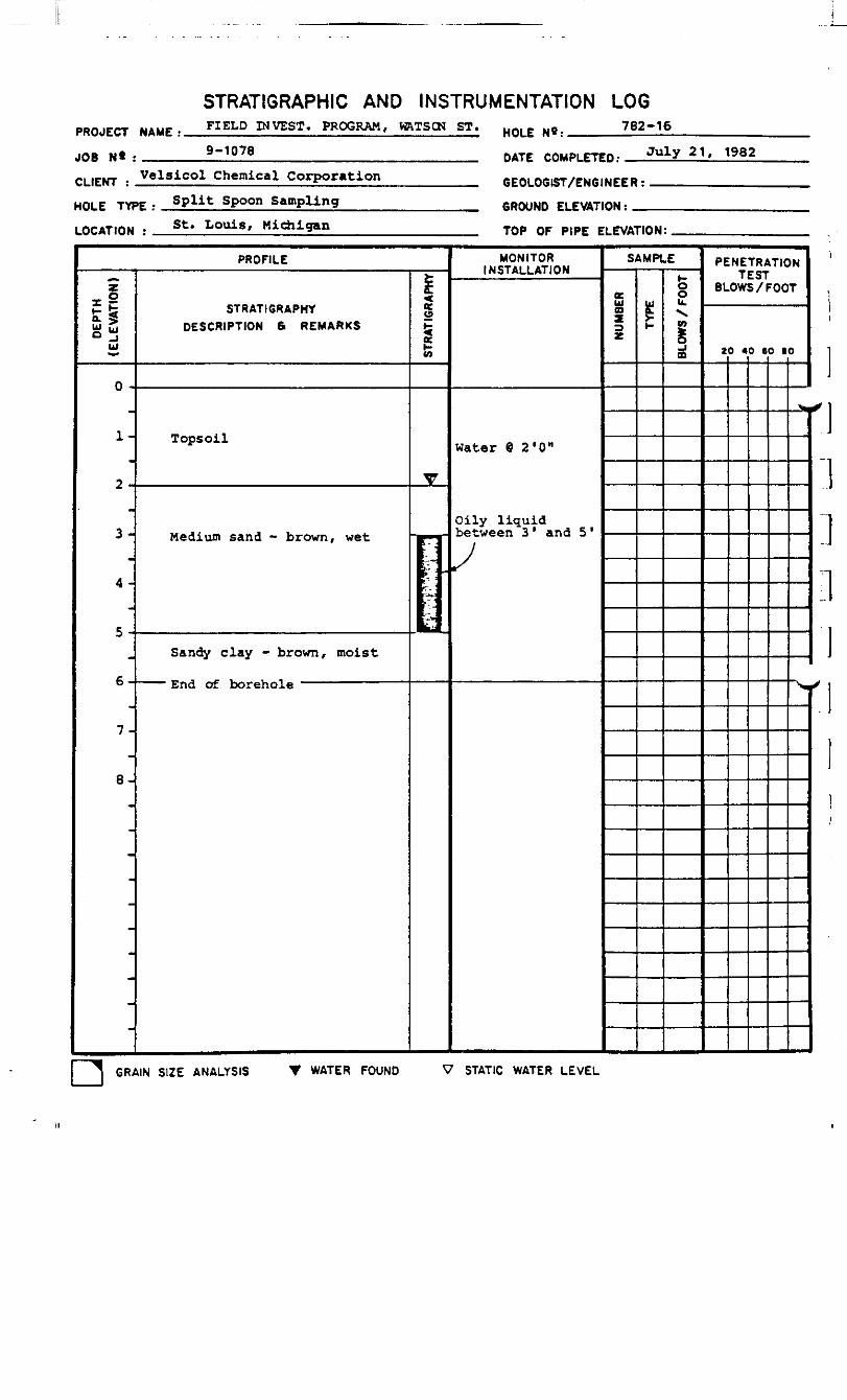
STRATIGRAPHIC AND INSTRUMENTATION LOGPROJECT NAME :
JOB N* : ____
FIELD INVEST. PROGRAM, VRTSCN ST.
9-1078HOLE N»: 782-16
DATE COMPLETED: July 21, 1982
CLIENT • Ve*sico* Chemical Corporation
HOLE TYPE • Split Spoon Sampling ____
LOCATION
GEOLOGIST/ENGINEER:
GROUND ELEVATION: _St. Louis, Michigan TOP OF PIPE ELEVATION:
PROFILE
DEPT
H(E
LEVA
TION
)
0 -
1-
2 -
3 -
4 -
5 -
6-
7-
8-
STRATIGRAPHYDESCRIPTION 6 REMARKS
Topsoil
Medium sand - brown, wet
Sandy clay - brown, moist
'• End of borehole
<eo
1
T
,- '
MONITORINSTALLATION
Water @ 2'0"
Oily liquidbetween 3 ' and 5 '
SAMPLE
NUM
BER
£
BLOW
S / F
OOT
PENETRATIONTEST
BLOWS /FOOT
20 40 60 80
_*
^
]:i
] GRAIN SIZE ANALYSIS T WATER FOUND V STATIC WATER LEVEL

STRAT1GRAPHIC AND INSTRUMENTATION LOGPROJECT NAME :
JOB N» : ^_
CLIENT :
.FIELD INVEST. PROGRAM. WRTSCN ST.
9-1078_________________________
Chemical
HOLE N*r 782-17
DATE COMPLETED: July 21. 1982
HOLE TYPE : Spli,t Spoon Sampling
LOCATION : St. T-ouis.
GEOLOGIST/ENGINEER:
GROUND ELEVATION: _
TOP OF PIPE ELEVATION:
PROFILE
DE
PTH
(ELE
VATI
ON
)
0 -
1 -
2 -
3 -
4 -
5 -
6 -
7 -
-
-
STRATIGRAPHYDESCRIPTION & REMARKS
Tops oil
Mixed sand fill - moist
Medium sand - brown, wet
-"^ Sandy clay - brown, moist ">NS-
End of borehole
STR
ATIG
RAP
HY
V
— H^v—^—
MONITORINSTALLATION
Water @ 4*0"
N o odor
SAMPLE
NU
MBE
R
£Oou.V.v>Io
PENETRATIONTEST
BLOWS / FOOT
20 40 60 BO
GRAIN SIZE ANALYSIS T WATER FOUND V STATIC WATER LEVEL
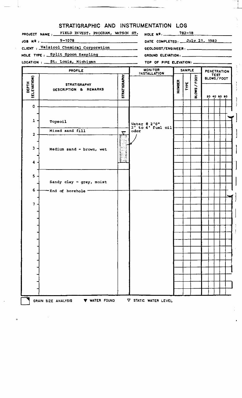
STRAT1GRAPHIC AND INSTRUMENTATION LOGPROJECT NAME :
JOB N« : ____
FIELD INVEST. PROGRAM, VRTSCN ST. HQLE Ng. 782-18
9-1078 DATE COMPLETED: July 21. 1982
CLIENT : Velsicol Chemical Corporation
HOLE TYPE : Split Spoon Sampling____
LOCATION : St. Louis, Michigan_____
GEOLOGIST/ENGINEER:
GROUND ELEVATION: _
TOP OF PIPE ELEVATION:
PROFILE
DEPT
H(E
LEVA
TIO
N)
0 -
1 -
2 -
3 -
4 -
5 -
6 -
7 -
STRATIGRAPHYDESCRIPTION 6 REMARKS
Tops oil
Mixed sand fill
Medium sand - brown, wet
Sandy clay - grey, moist
End of borehole
STRA
TIG
RAPH
Y
V
1
MONITORINSTALLATION
Water @ 2'0"2' to 4' fuel oilodor
»
SAMPLE
NUM
BER
UJa.u.X.w
ffl
PENETRATIONTEST
BLOWS / FOOT
20 40 CO SO
^
"*vf
GRAIN SIZE ANALYSIS T WATER FOUND V STATIC WATER LEVEL

PROJECT NAME :
JOB N« : ____
STRATIGRAPHIC AND INSTRUMENTATION LOGFIELD INVEST. PROGRAM, WftTSCN ST. HQLE N,.__ 782-199-1078
CLIENT : Velsicol Chemical CorporationDATE COMPLETED: July 21, 1982
HOLE TYPE :
LOCATION : _
Split Spoon SamplingGEOLOGIST/ENGINEER:
GROUND ELEVATION: _St. Louis, Michigan TOP OF PIPE ELEVATION:
PROFILE
DEP
TH(E
LEV
ATI
ON
)
0 -
1-
2-
3-
4 -
5-
6-
7-
-
STRATIGRAPHYDESCRIPTION & REMARKS
Tops oil
Medium sand - brown, moist
Medium sand - brown, wet
Sandy clay - grey, moist
—— —End of borehole ——————————— -
STRA
TIGR
APHY
v
••:•:•:•••:••
MONITORINSTALLATION
Water @ 2'6"
Very faint fueloil odor @ 4' to
•T-fc"
./
SAMPLE
NUM
BER Ua
i-
oou.\w
o
PENETRATIONTEST
BLOWS /FOOT
ZO 40 60 SOI
I
GRAIN SIZE ANALYSIS T WATER FOUND V STATIC WATER LEVEL
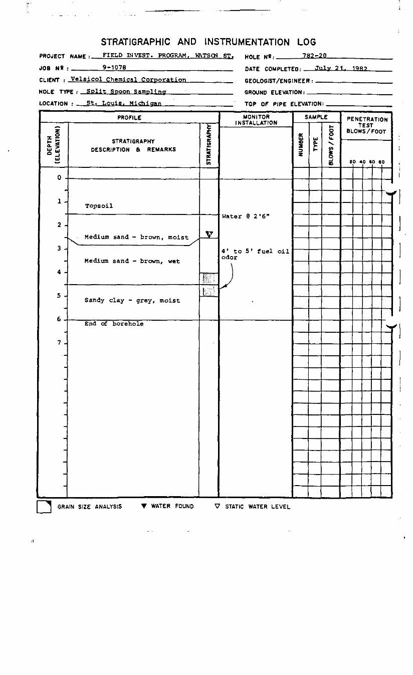
STRATIGRAPHIC AND INSTRUMENTATION LOGPROJECT NAMF , FIELD PI VEST. PROGRAM, M&TSQN ST. HOL£N«:______782-20____
JOB NS :_______9-1076________________________ DATE rnupig-Trp. July 21.
CLIENT : Velsicol Chemical Corporation_________
HOLE TYPE : Split Spoon Sampling____;__________
LOCATION : St. Louis. Michigan________________
GEOLOGIST/ENGINEER:
GROUND ELEVATION: _
TOP OF PIPE ELEVATION:
PROFILE
DE
PTH
(ELE
VATI
ON
)
0 -
_•
1 -,
2 -
3 -
4 -
5 -
6 -
7 -
-
-
-
STRATIGRAPHYDESCRIPTION & REMARKS
Tops oil
Medium sand - brown, moist .,
Medium sand - brown, wet
Sandy clay - grey, moist
End of borehole
STR
ATIG
RAP
HY
V
!H!;,,:-
MONITORINSTALLATION
Water @ 2 '6"
4' to 51 fuel oilodor
)
SAMPLE
NU
MBE
R ug
8k.X.to
§o
PENETRATIONTEST
8 LOWS /FOOT
ZO 40 60 60
>•
.
] GRAIN SIZE ANALYSIS T WATER FOUND V STATIC WATER LEVEL
APPENDIX D
ANALYTICAL G.C./M.S.
FOR SEPTEMBER 8, 1982 PROGRAM
ENVIRONMENTAL RESEARCH GROUP, INC.
117 N. First Ann Arbor, Michigan 48104 (313) 662-3104
er
September 24, 1982
Mr. Rick ShepherdConestoga-RoversBox 876Oswego, New York 13126
Dear Rick:
As we discussed during our phone conversation of September 23, I havecompleted tabulation of the GC/MS data for your eight oil samples.Unfortunately, I was unable to get it typed today. 1 am thereforesending you a handwritten copy of the results, and a typed copy will bemailed Monday, September 27.
All samples except your ID 982-3 were prepared by skimming an aliquot ofoil from the sample and weighing out approximately 0.5 grams. Thisaliquot was then diluted 1:10 with methylene chloride and analyzed byGC/FID. This showed that the samples are similar to a number 2 dieselfuel. The samples were then diluted an additional 1:5 and analyzed byGC/MS. All components detectable in the samples were identified and arereported as percent of the total based on total ion current of the basepeaks.
Sample number 982-3 was mainly aqueous and was prepared by taking a 20gram sample from the top (taking care to obtain as much oil as possible)and extracting with 4 ml of methylene chloride. Analysis by both GC/FIDand GC/MS revealed no compounds present at a detection limit of 0,1 mg/Kg,
If you have any questions or if you require further information, pleasefeel free to call .
Sincerely,
FaasManager, Organic Studies
LF/cjEnclosurescc: R. O'Brien
Ann Arbor Chicago Cleveland San Francisco Minneapolis-Si. Paul

......tisl...... Now. -.r i (G Projec t #(1943September 27, 19(12
KRG Sample Number:Client III:
Compound
Saturated Hydrocarbons
r-9r - in'•11
';M
r'!fic?ii lnsalnrated Hydrocarbons
C9
C l l(-UcH
f-u
79340I IGW16-1
J%L
79341UGW16-2
0.971.31.8
2.51.83.2
0.700.742.54.45.51.59.84.04.40.620.40
79342I IGW16-3
J1L
1.24.9_..4.39.77.92.7--4.24 . 42.1----
1.31.11.52.50.726.12.55.05.04.82.70.260.48
_ _--—_ __-.--2.6--_6.9--_ _--
3.7
3.14 . 2
79343902.1
*L
2.0
79344982.2
JIL
3.5
1.4
79346782-5-1
_I*L
79347782-12-1
J£L
_ _1.41.0
11120.6_ _
4.65.83.04.16.22.80.50
—3.42.44.4
122.9__
5.67.27.5
15102.6--2.8
_ _----3.33.23.32.9
1.61.73.53.65.71.80.74
0.771.34.2
131.11.71.7
0.823.05.0--_ _3.1--
Conns toija HoversMM! PnvJiKt 08943September ?/, )<M2
F.IUi Sample Number:Client II):
Compound
Aroma t ics (continued)
phenylalkanes MW 204phenylalkanes MW 218phenylalkanes MW 232phenylalkanes MW 246phenylalkanes MW 260( 1 -me thylnonyl) -benzene( 1-methyldecyl ) -benzene(4-mothylphenyl ) phenylmethanonedecahydronaphthalenemethyl -decahydronaphthalenetHtrahydronaphthalenemethyl -tetrahydronaphthalenesC^-tetrahydronaphthal enesmethyl naphthalenesC^-naphthalenesC3_naphthalenesphenanthrenemethyl -phenananthrenesCjj-phenanthreneschrysene9ll-f luoreneC^-phenanthrenespyrene
MOVES:
All results reported as % of totalMW = molecular weight
79340UGW16-1
J*L
1.71.21.4----—--—0.420,52—1.61.61.84.0_ _0.911.8_ _—--_ _--
*
Sample Number 79345, Client II) 982-3: no
79341IIGW16-2
J1L
0.820.580.800.180.18—----0.140.?80.420.490.801.32.72.30.491.20.85—--0.38--
cop-bounds were
79342 793431IGW16-3 982.1
J1L J%L
._0.44
_-——2.1 0.654.6 1.00.75-__ _
0.871.62.05.25.8
2.34.9 0.94_.4.9 0.651.1
0.40_ _--
detectable with a de/ectlon
79344982.2
J1L
1.9—1.10.20—--——0.360.670.842.01.81.83.11.50.83--0.31_ _----0.10
limit of
79346782-5-1
J*L
1.7———0.601.01.6-__ _0.46—0.640.69—1.51.80.66_---—------
0.1 mg/Kg.
b
79347782-12-1
J L
0.79--—--—0.360.46—--0.540.282.4--...2.4--0.29--_. .----_ _—
11 ~11] REGARDING G.C./M.S. ANALYTICAL DATA
l
IIIIlli
APPENDIX E
GULF RESEARCH & DEVELOPMENT COMPANY CORRESPONDENCE
R A. PlundoIE»«l»TH(f.- MANAGE"
P. O, Drawer 2O36Pittsburgh. PA
October 26, 1982Reference: 5-530TR80
Mr. J. Leslie GoodierPresearch Incorporated2361 S. Jefferson Davls HighwayArlington, VA 22202
Dear Mr. Goodier:
Our chromatography and mass spectrometry experts have evalu-ated the data you submitted with your letter of October 1, 1982. With afew minor exceptions we agree with the findings of the two other inde-pendent laboratories that the samples examined are diesel fuel/#2 fueloil. (These two names are often used interchangeably.)
Three of the five chromatograms prepared by the Rocky MountainAnalytical Laboratory are typical of those for diesel fuel. The boilingranges match, and the peak relationships match. The last two samples donot appear to be diesel fuel. Sample UGW-16-3C may contain highlyweathered diesel fuel, but it also contains heavier components, as shownby the large undifferentiated bulge on the right side of the chromato-gram, and by the increase in boiling range. It is possible to loselight components by weatherization, but it is not possible to gainheavier components, whose presence is verified by the 736°F end point.The fifth sample, 9982, is definitely not diesel fuel. It is too highboiling and has the wrong peak pattern (fingerprint).
Hydrocarbon compositionResearch Group via GC/MS analysesfuel. All components identifiedfound in No. 2 diesel fuel. Thecomponents (above C22), shown inratory. However, since the samp!between laboratories, we are not
data provided by the Environmentalare consistent with data from diesel
in the seven samples are typicallyGC/MS data does not show the heavychromatograms from the first labo-e numbering systems seem to differsure which samples are comparable.
O« SUL' OIL COBPOOATlQN
S
41 2 6*5' fiOOC

DATE 10/26/82 "«OM w. C. Picking TO Mr. J. L. Goodier SHEETNO
Charges for this work are $250. You will be billed by Gulf OilCompany - U.S., Virginia/North Carolina I&C Marketing. If you have anyquestions, please contact me. Thanks for the opportunity to be ofservice.
Very truly yours,
W. C. Picking
SUBSIDIABV OF GULF OIL 4 i 2 / 3 6 2 - i 6 O O
APPENDIX F
ROCKY MOUNTAIN ANALYTICAL LABORATORIES DATA
Rec'd CRA
PRESEARCH .INCORPORATED SEP ' ° 1982
2361 S . J E F F E R S O N D A V I S H I G H W A Y . A R L I N G T O N . V I R G I N I A 222O2 ( 7 O 3 ) 5S3-27OO
24 September 1982
Sidley and AustinOne First National PlazaChicago, Illinois 60603
Attention: James G. Archer, Esquire
Reference: Velsicol Plant, St. Louis, MI, Project No. 9-1113,Presearch Contract No. VEL-1__________________
Dear Jim:
Today I received a copy of the oil sample analyticalresults from Rocky Mountain Analytical Laboratory, they aremost encouraging. In brief, Sample 982-b-l(a) taken from theimmediate area of the pipeline is classed as the "sourcesample". This means that this oil is the closest to thenatural state. It is, however, aged and weathered and positiveidentification is not possible, but from it's boiling range, itcorresponds to diesels and kerosenes. With the exception ofSample 9982 Cw^ich I gained from a surficial, very heavy,sludge/oil pool in the the area where the 1,000,000/gal storagetank bottom was buried), the remaining three samples are allrelated to the source sample. There has been change from aging,weathering, evaporation and filtering through the sediments,and passage through the aquifer, but the analysis indicates thatthey are related to the source sample. This includes thesample taken from the site of the originally diked storage tankarea.
I understand that Rick Shepherd is sending additionalsamples to the Rocky Mountain Laboratory for analysis. Some ofthese samples were drawn from the SW corner of the plant at theedge of the river. It will be interesting to see if thesesamples relate to the "source sample".
I have learned that Rick exposed the 6 in pipeline andfound that there were two 6 in lines, one protectively wrappedand one unprotected and patched. I am awaiting Rick's reportof findings and photographs of the exposed lines. With theanalyses, Rick's findings and a response from Pat Lincoln toquestions raised in my first letter to you, I will shortly bein a position to formally report my findings.
P R E S E A R C H I N C O R P O R A T E D
I honestly believe that the situation todate looks verygood for Velsicol. Sample 9982, the tank bottom sludge, isnot incidently related to the source sample.
Very truly yours,
PRESEARCH INCORPORATED
J. Leslie GoodierSenior Scientist
JLG/lml
cc: *UPeter Gustafson Esq., Grand Rapids, MIDon Robinson, St. Louis, MO
w/copies of analytical reports
ANALYTICAL RESULTS
for
Presearch,Inc.
On September 15 and 16, 1982, five samples were received for analysis. The samples werelabelled as follows:
Sample Description Laboratory Number Date Received Type
99829-82-1CUGW-16-2CUGW-16-3C982b-l (a)
2210-012210-022210-032210-0*2210-05
September 15September 15September 15September 15September 16
OilOil/waterOil/ waterOil/waterOil/water
The samples were received under chain-of-custody. The original custody recordsreceived with the samples are attached.
Results
Chromatographic Comparison; The chromatograms of each oil or extract are shown inthe attachment. The top four chromatograms show an oil originating from the samesource. The chromatogram at the bottom shows no relationship with the top foursamples. Sample 982-b-l (a) appears to be closest to the source. Its pattern is completewith both light and heavy ends. The boiling range is approximately 350 to 696° F.Sample UGW-16-2C shows some weathering or loss of the light ends. There is excellentcorrespondence to the pattern in Sample 982-b-l (a). The boiling range is 385 to 696° F.Sample 9-82-1C shows the next best correlation. The pattern is complete but somevariations are apparent. The boiling range is a bit higher at ^21 to 696° F. Finally,Sample UGW-16-3C shows extreme weathering of the oil. The 'light ends, below C,2,are almost gone but the pattern In the top three samples is still present. The boilingrange is 488 to 736° F.
The last sample shown is a much higher boiling material. The boiling range isapproximately 488 to 825° F. There is no correlation with the patterns in the other foursamples. This sample is therefore of different origin than the others.
Rocky Mountain Analytical Laboratory 5530 Marshall Street. Arvada. CO. 30002 (303) 421-6611

The boiling ranges for Samples 982-b-l (a), UGW-16-2C and 9-S2-1C correspond to idiesels and kerosenes. Because of weathering, however, exact assignment is not possible.
Sample UGW-16-3C does not correspond directly with commercial refined cuts but fromthe similarity of the chromatograms as discussed above, it probably originated fromdiesel or kerosene. Sample 9932 does not correspond to any common refined CJts either.Its appearance is that of a tank bottom or residue.
Metals Analysis! Metals results and nickel/vanadium ratio are reported in the attachedtable. The results show no sound comparison of the samples. This is probably due to the ^ [nature of the samples where they have been moved through the aquifer, been mixed withwater and exposed to other minerals in the soil. )
Methodology -j
Chromatographic comparison; Three of the samples (UGW-16-2C, 9-S2-1C and UGW-ib-3C) had an oil layer and it was light enough to be directly injected onto a gas jchromatograph (GC). The other two samples could not be handled with a syringe andthey were extracted with a small amount of pentane. The pentane peak is apparent at Ithe start of the chromatograms. Boiling ranges were estimated by comparison to astandard of linear alkyl hydrocarbons analyzed under the same conditions.
Metals Analysis; Oil was recovered from each water sample by skimming the oil slickand removing the material. The oils were then diluted in xyiene and analyzed byinductively coupled plasma spectroscopy. Concentrations were based on the Conoco oilreference standard.
9/20/82
CHROMATOGRAPHIC COMPARISON OF OILS AND EXTRACTS
1 -=• 0}
9826-1 (a) (2210-05)
UGW-16-2C (2210-03
9-82-1C (2210-02)
UGW-16-3C 2210-04
ANALYTICAL RESULTS
for
Presearch, Inc.
Client Description: 9982 9-82-1C UGW-16-2C UGW-16-3C 982-b-l (a)RMA Numberi 2210-01 2210-02 2210-03 2210-0* 2210-05
Parameter Units
Nickel/Vanadium ratio (Calc.) -Silver mg/kgAluminum mg/kgBoron mg/kgBarium mg/kg
CalciumCadmiumChromiumCopperIron
MagnesiumManganeseMolybdenumSodiumNickel
PhosphorusLeadSiliconTitaniumVanadiumZinc
mg/kgmg/kgmg/kgmg/kgmg/kg
mg/kgmg/kgmg/kgmg/kgmg/kg
mg/kgmg/kgmg/kgmg/kgmg/kgmg/kg
DetectionLimit
0.89.01.51.0
100.501.00.52.5
301.51.5
2002.0
0.50153.00.250.750.35
1.2NDND42
ND
950NDND2.0
2*
40ND2.3ND
18
NDND
200.3*
150.62
5.3ND
5610
2.6
60NDND
0.7178
NDND1.5ND6.9
ND7319
9.11.3
0.35
NDNDNDND
2*NDND6.5
15
NDNDND
, ND4.0
NDND1402.6NDND
12ND
4019
1.3
1200.762.24.237
ND1.85.2220
38
ND26
4203.83.2ND
ND22
NDND
29NDND
0.8733
NDNDNDND
13
NDNDND2.0NDND
ND means not detected.C

i1IiI1i1I11II
APPENDIX G
TOTAL PETROLEUM INC.
ANALYTICAL DATA
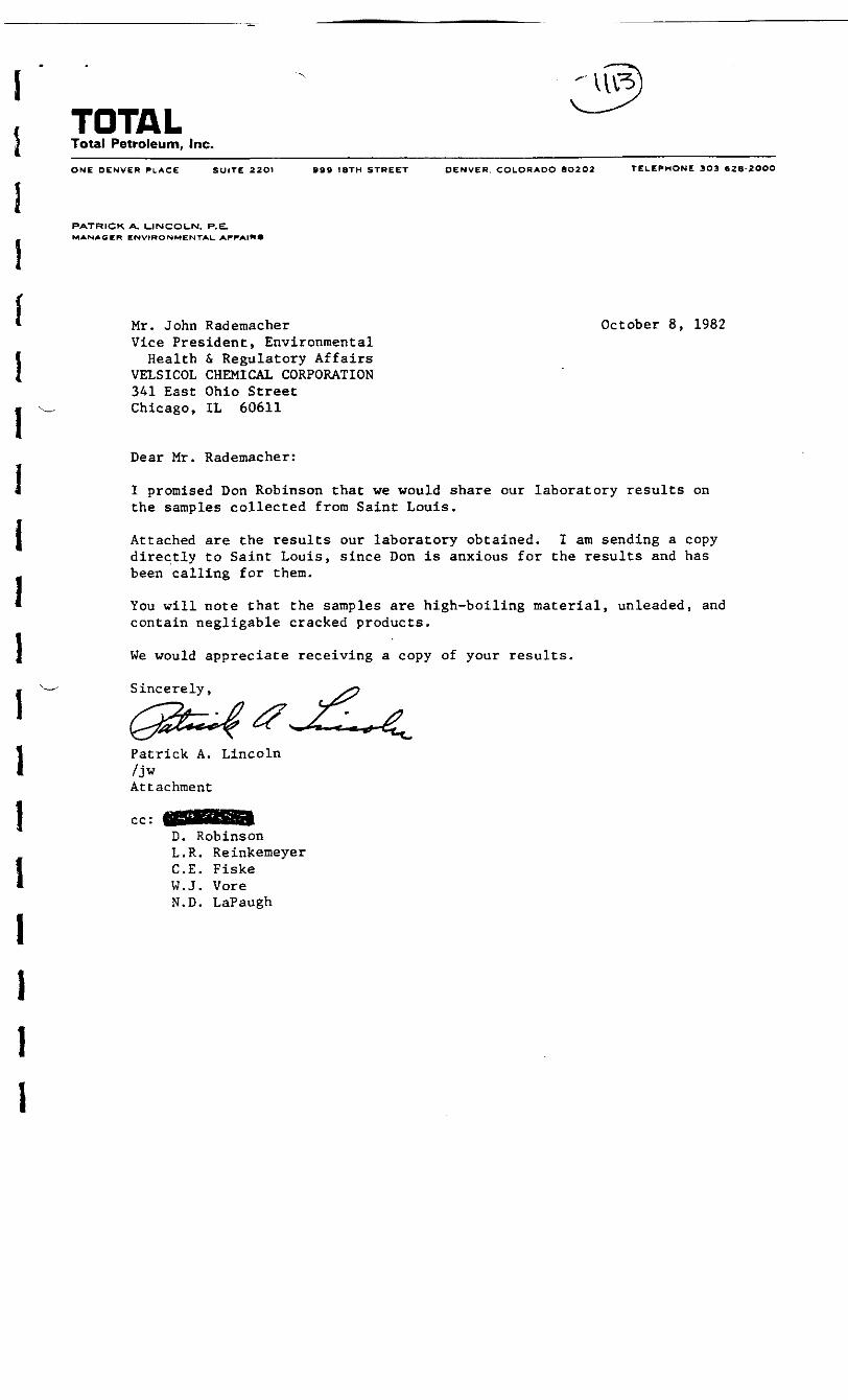
IIIIIIIlIiIIl
TOTALTotal Petroleum, Inc.
ONE DENVER PLACE SUITE 22OI 999 18TH STREET DENVER. COLORADO 8O2O2 TELEPHONE 303 «2B-2OOO
PATRICK A. LJNCOt_N. P.E.MANAGER ENVIRONMENTAL. AFFAIRS
Mr. John Rademacher October 8, 1982Vice President, EnvironmentalHealth & Regulatory Affairs
VELSICOL CHEMICAL CORPORATION341 East Ohio StreetChicago, IL 60611
Dear Mr. Rademacher:
I promised Don Robinson that we would share our laboratory results onthe samples collected from Saint Louis.
Attached are the results our laboratory obtained. I am sending a copydirectly to Saint Louis, since Don is anxious for the results and hasbeen calling for them.
You will note that the samples are high-boiling material, unleaded, andcontain negligable cracked products.
We would appreciate receiving a copy of your results.
Sincerely,
Patrick A. Lincoln/jwAttachment
cc:D. RobinsonL.R. ReinkemeyerC.E. FiskeW.J. VoreN.D. LaPaugh

P.A. LincolnTo: J-M. Rademacher10/8/82TOTAL LAB RESULTS ON SAMPLES FROM VELSICOL SITEPage 2
II. July 21, 1982 Samples:
Water samples from pit near boring 782-5 were not analyzed. There wasnot enough oil available for analysis.
Soil samples of 782-5 and 782-6 borings were analyzed as follows: Oiland grease were determined by soxhlet extraction of the soil sample.The other values were run on a distilled water extract, which was filter-ed prior to analysis. All values are on an as received soil basis.
Sample Oil &' Grease Cl Ca Mg Na ]No. (mg/kg)____ PH (mg/kg) (mg/kg) (mg/kg) (mg/kg)
782-5 1(1 to 2 ft) 22. 6.9 840. 190. 6.9 81. J
782-5 ](5 ft depth) 39. 6.9 310. 300. 8.8 170. J
782-6 "J(just under Jtopsoil) 55. 7.0 520. 240. 7.2 60.
1 P.A. LincolnTo: J.M. Rademacher10/8/82TOTAL LAB RESULTS ON SAMPLES FROM VELSICOL SITEPage 3
III. September 8, 1982 Samples:
Total Petroleum received samples of water from pits dug at UGW-16-3,UGW-16-2, UGW-16-1, and 782-5-1, There was insufficient material in782-12 for a second sample and 782-8 showed no sign of oil, so neitherof us sampled that location. A hole was dug at the 2 million gallontank on 9/9/82 and a sample 982-1 obtained.
We were able to recover oil from samples UGW-16-3, UGW-16-2, and 982-1by centrifuging. The other two samples were not analyzed. UGW-16-1contained too little oil for testing any parameters, and 782-5-1 had
. "virtually no scum on top" according to the chemist. Distillationrange was run by GC because of limited sample size. The results ob-tained were:
UGW-16-3 UGW-16-2 982-1
API Gravity @ 60°F 30.0Specific Gravity @60°F (gm/ml) 0.876
Bromine Number 1.5Kinematic Viscosity
(cSt @ 100°F) 8.1Sulfur (wt %) 0.39Lead (ppm wt) 7.2Distillation °F (ASTM D 2887)
IBP 2975% 37610% 40820% 45730% 49740% 53450% 57460% 61870% 67580% 75990% 89295% 971FBP 1081
29.8
0.8772.1
8.80.439.3
3033924284845295676046456987789019831117
21.6
0.9240.5
220.0.7535.
402550615700766823878933993
1061117212431313
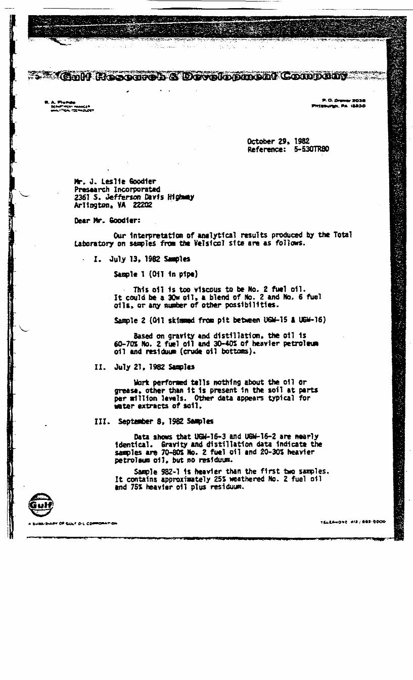
It. A. ».O-
October 29. 1982Reference: 5-S30TR80
Mr, J. Leslie toodlerPresearch Incorporated2361 5* Jefferson Davls KlgiwtyArlington. VA 22202
Dear Hr* Goodltr:Our Interpretation of analytical results produced by the Total
Laboratory on Maples fron the Velslcol site are as follows.
I. July 13, 1082 StaplesSaople 1 (Oil In pipe)
This oil 1$ too viscous to be No. 2 fuel oil.It could be a 30* oil. a blend of Mo. 2 and No, 6 fueloils* or any runfaer of other possibilities.Saaple 2 ((HI skfened frt» pit between UQMS I U&f*16)
Based on gravity *nd distillation* the oil 1s60-70% No. 2 fuel oil and 30-405 of heavier petroleunoil and reslduuB (crude oil bottoas).
II. July 21, 1982 SaaplesWork performed tells nothing about the oil or
grease, other than It 1s present in the soil at partsper vlllion levels. Other data appears typical forMter extracts of sol U
III. September 8, 1982 StaplesData shows that UGW-16-3 and U&M6-2 are nearly
Identical* Gravity and distillation data Indicate thestaples are 70-801 No. 2 fuel oil and 20-30% heavierpetroleoa oil. but no resl&njc.
Sasple 982-1 Is heavier than the first two sables.It contains approxiaately 25% weathered No. 2 fuel oiland 75% heavier oil plus residue.
O-l.

10/29/82 ,.0* V. C. PickingTS .- HS'"-?. -i>^ t-'-!"X*« "I
For your Infonwtlwi, typical boiling ranges for petrolei*are:
1. Gasoline (D96)2* Kerosene (D86)3. Ho. 2 P.O. (086)4. Lube (His (D1160)5. Residue* (D1160)
75"F to 425*F325*F to 550*F350°F to 680*F680*F to 1050Vt€60*F plus
The gas chnwtograpnfc -slaulated dlstniatlw procedure. ASTO 02^7always shows lower over points and higher end points than ASTM D86 orASTM 01160*
Charges for this worfc are $160. You will be billed by GulfOil C«**ny - U.S., Virginia/north Carolina UC Marketing. If you haveany questions please contact «e. Thanks for the opportunity to be ofservice.
Very truly yourst
|Tl C. . ...«. C. Picking 0
APPENDIX H
BOREHOLE LOGS
SEPTEMBER 19, 1982
AOGERING PROGRAM
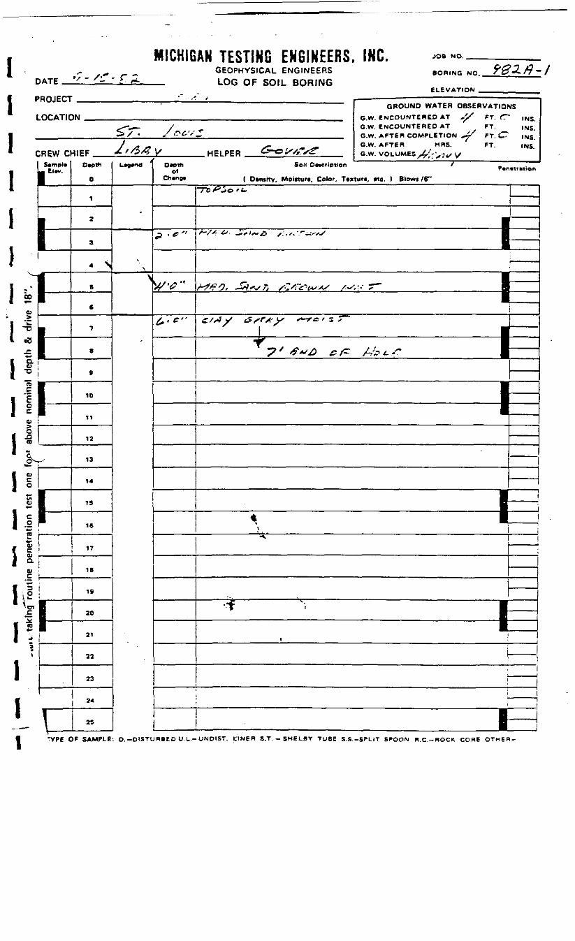
I1
DATE -/r- rMICHIGAN TESTING ENGINEERS. INC.
GEOPHYSICAL ENGINEERS— LOG OF SOIL BORING
JOB NO.
BORING NO.
ELEVATION'ROJECT
.OCAT1C
:REW ct
i-i
[
1-
1•
.
Ii
GROUND WATtH OBStRVATIOW O* ENCOUNTERED AT ,^/ FT f
f^^^- / ^ G.W. ENCOUNTERED AT FT.— > / • S &&•''-, G.W AFTER COMPLETION -4^ FT tTT
J j* S9 S^" s* °'W' AFTCR HRS" ' FT-^1EF Z/O/^ V/ HELPER O-O^Tx^ a.w. uni UMES U**.«..^
Owpth
0
1
2
3
- ss
6
7
8
9
10
11
12
13
14
15
16
17
18
19
20
21
22
23
24
\ 25
iL*0«nd
-
\
>
D«pthof
Ch»ng»
P - - "
*•'"
MS
INS.INS.INS.INS.
Son DMcriptien / _Pcnmntion
( D*mfty, Moisture, Color, Tcxturi, me. ) Blow* /£"
-nPZo'i. j ———
•
""""" """'""*' 1 ———
£/*>J V f£s?A' ' V* •*-rc ' s s '
—— * ——— - — ; ————— 1"7 ' #**£ ff f~ £•'£> *-''~ m^ *^ ' y^--- . •1=-
————————— l=i.
_^ ————————————— |i
——————
1 t
\ "
i 1
D•
*J
1 0.QJ
'
TYPE OF SAMPLE: D.-OtSTUHBED U.L.-UNDIST. tINER S.T. - SMELBY TUBE S.S.-SPLIT SPOON B.C.-ROCK CORE OTHER-

DATE
MICHIGAN TESTING ENGINEERS. INC.GEOPHYSICAL ENGINEERS
_ LOG OF SOIL BORING
JOB NO.
BORING NO.
ELEVATION'.HUJtL.1
.OCATIC
:REW aS*mpl«
• El«v.
hF•
L
1
GROUND WATER OBSERVATIONSN „.,._ .._, GW. ENCOUNTERED AT J? ff £-. ,N5
.---__ y G.W. ENCOUNTERED AT FT. INS._j >• , ~.&V'-ft M M- GIM AFTER COMPLETION ^ fT ^-r|NS
/ - _ ^ __ G.W. AFTER MRS. FT. INS.•IIEF .,, , ^//Zf2^/ HP! PER ^ OX/"//C GW VOLUMES /S.->*,..is
O«Dth
0
1
2
3
4
S
6
7
e
.10
11
12
13
14
15
16
17
10
19
20
21
22
23
24
25
L*e*nd/
Depthof
Ching*
/•C"
-?r / "
S'O"
.X" / /*» ^^ •* TSoil DMCriotion ^
P*n«tr«tion
( Dvntity, Moisluri, Color. T«xtur«, #te. ) Blowt/6"
Tr/fc-'i r ' *>
/*v;-".; . '.v,' /!>. -.'---^
————— 1^S~t/r'&, 5/:+sK /.t'.'*t<s'*s ^t ' 'r"
C />« \s (< /r/* ix y— -*<^ ' -• r? ——"ex i
F=
————— IE
———————— IE—
1——
———
n
I
1
ii
11
"JJ!jj
00
D.a>TD
"5
o
0)
O
0)01aCD
O
O
ffl*»•trt
j ;
TYPE OF SAMPLE: O.-DISTURBED U.L.-UNDIST. LINER S.T. -SHELB^ TUBi S.S.-SPLIT SPOON R.C.-ROCK CORE OTHER-
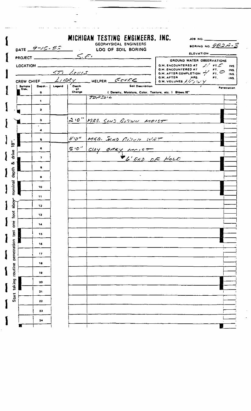
1DATE
MICHIGAN TESTING ENGINEERS, INC.GEOPHYSICAL ENGINEERS
_ LOG OF SOIL BORING
JOB NO.
BORING NO.
ELEVATION
I PROJECT
LOCATIC
1CREW O
I I Sample
• "*
} VL- 1
1
1
L—1-1£ I
01 1
ML, 11 0-• rtj
«- -o
!lill• CD
oo
* of
1 4)
i**eo
i 1* a
1 £en•-
L.re,.
1
l-n
1i
1-
GROUND WATER OBSERVATIONSW .,_ ,,., G.W ENCOUNTERED AT ^/ .'' FT X"" ,Nfj
__^ . G.W. ENCOUNTERED AT FT. INS.*!Tx""' X/VXX_T ,_ G.W AFTER COMPLETION -^T FT <— * ms
/ ^ G.W. AFTER ^MRS. FT. INS^IEF £//2tfV HELPER tf-Wf^. GW VOLUMES yx>. . ' - / VX
Depth •
0
1
3
3
4
6
6
7
8
9
10
11
12
13
14
IS
16
17
18
IS
20
31
22
23
24
•
L*e*nd Depthof
Cheno*
rl'C'-
4"e>«
£T (O
Soil Deccrtption / _Penetretion
( Dertstty, Moisture, Color. Texture, etc. ) Blowt/6"
y'jy/^S'o '
\
•
f*3tt&> w-^*V'0 X?/ "**^ .V ii'^.'f-^^ tS^
C//< V tf-/«e vx- x-^^ / c- •* —'4r
•
|
|
———
1 '
!
——— I
.,_.,.. J
———
1
! __ 1i
——1 —— !
• !
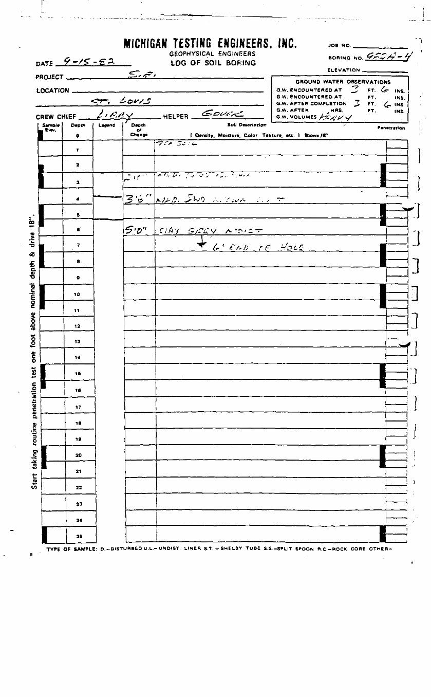
MICHIGAN TESTING ENGINEERS, INC. JOB NO.
D.„ ^./s-.eaPROJECT
LOCATIO
C
m
00
0>
•O
cS£a0)
'I2§M«o
JDn*-OO
VCo
C
"a?!uaO)
11I.w
1EW Ct-
Etw.
1-
1
.£7,*=%
GEOPHYSICAL ENGINEERS &*-"*! *• BORING NO. V>- •*•/*> — '
LOG Oh SOIL BORINGELEVATION .., , . .,
GROUND WATER OBSERVATIONSM G.W ENCOUNTERED AT _f. Cf v— )Nij
T / r G.W. ENCOUNTERED AT FT. INS.*"V ' ' *-O**/-i Q.w_ AFTER COMPLETION ^J BT £,|N5
} , - > * . SZ.r>tS,' ~- G.W. AFTER MRS. FT. ,NS.HEF / ' A,/? V ME1 PER C- '^ ^— G.W VOLUMES ^^ ^/^.y
0
1
2
3
4
6
6
7
B
0
10
11
12
13
14
16
16
17
IB
19
20
21
22
23
24
2S
L-"a Dcothei
Ch«ng«
" t f ' '
3 , ^ <»ft5
^'0"
Soil DMcrlptlon /
( Otniity. Moiftur*. Color. T*xiu», etc. ) Btowi/6"
-V-'V ^^ •' —
\-^——————————————————————————— 1 ——r/rly i?/rcv /- fn'£ —
' ^'x , . .,^^ If ' /'///} *- /" ^ t A ri1-
!
———————— lEE——
___
————
:
————————— |E———————
——
t \f
1
11
rl]
J
1
TYPE OF SAMPLE: D.-DISTURBED U.L.-UNDIST. LINER S.T,-SMEL6Y TUBE S.S.-SPLIT SPOON R.C.-ROCK, CORE OTHER-

1Di -L
I
MICHIGATE <"- •'•"---
ADJECT
OCATIC
CREW Ct
I ] Sampler1--f1 ii «!1
j |• ttJ 1
* * I*•] •£ I&P•ore •
Pi•
• **VT'
Ooli1 ?
i%
{ %I §
i!I ?
re
.
1-
1
^- ..
AN TESTING ENGINEERS. INC.GEOPHYSICAL ENGINEERS <£cr -7 -J. .
• OHING NO. 7 C ** *^^—LUG Oh SOIL BORING
ELEVATION .,.„_,. l—. — — .— ___ __ —— __ — — -— ——— -
GROUND WATER OBSERVATIONS»M ., G.W. ENCOUNTERED AT £ FT fo ,N5
.- ___ / ^ G.W. ENCOUNTERED AT FT. (Ng.~ "'^ '-*. G.W. AFTEB CnM^LeTlOIS) ^ FT ^- |NS
•• s~ G.W. AFTER HRS. FT. INS4\tf .-' '/;/- V HFIPER C=-^^^^- s.w .VOLUMI=«; j j . v * . . . .
Deptti
0
1
2
3
4
6
6
7
e
9
10
11
12
13
14
15
16
17
18
19
20
21
22
23
24
25
U^d Oeoth01
Change
/Y-"
J"6"
5-t>»
Soil Description /
( Dentttv, Moinurt, Color. Ttxture, etc. ) Blowi /6"
i
f
=fulff ^ ^ .__ __ i
——__
''^•s- j" ' 1
j
———
———
;1
——————
—
i
i
.
•
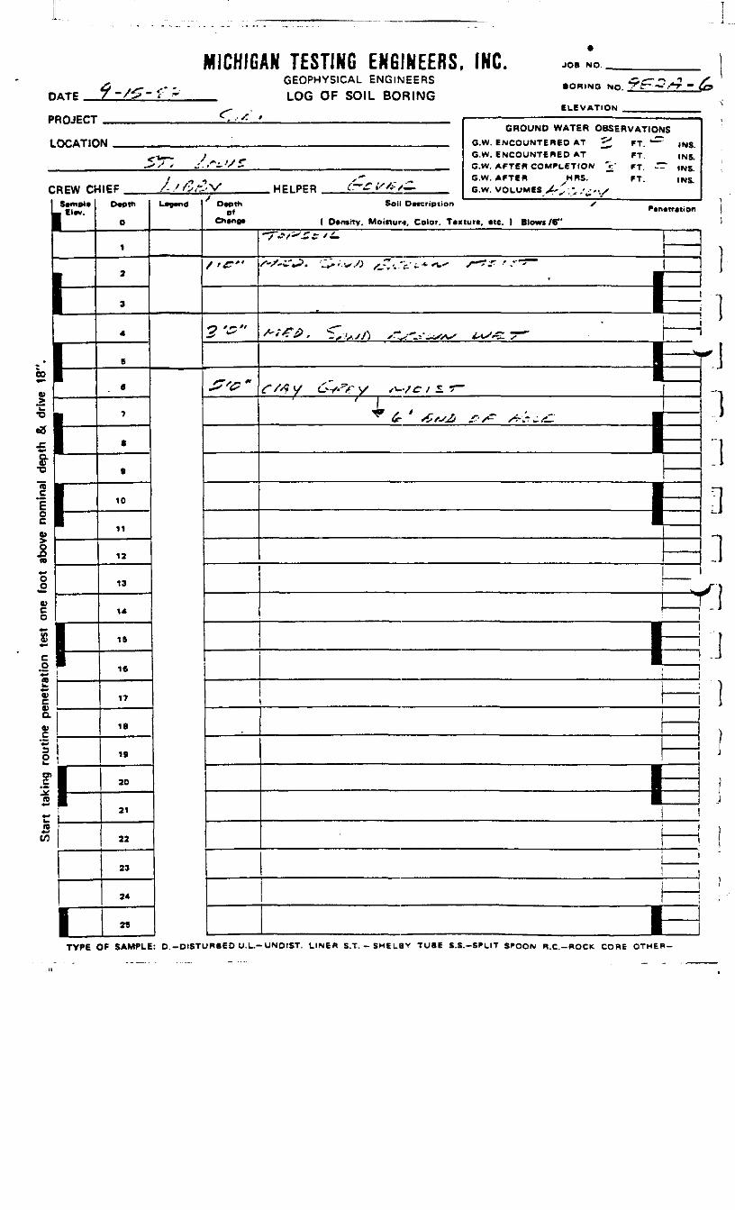
D
PI
L
MICHIGATE 7 -/£"-£"
HOJECT
OCATIC
CREW Cr
!
i*m»l*Elev.
-
• r— r
*a«.£F£01
ia**00;g
Sta
rt ta
king
rou
tine
pene
tratio
n te
st
II
I-———
1
<T,,c
AN TESTING ENGINEERS.GEOPHYSICAL ENGINEERS
LOG OF SOIL BORING/
N
4IEF /- / /U, V HFI PER ^- ^/-:/—
O
1
a
3
4
6
6
7
.
9
10
11
12
13
14
1ft
16
17
IB
19
20
21
22
23
24
25
—— Depth Soil Deccripiionof
Change ( DentrTy. Moifturn, Color. Tex
/ /,£"'
2 '$"
*'**
^/ •?t*r-Z* £ * i—
s-S-^. :>;,../; xjr,.v.*^
^-^. <r.w/> ,-^-^^
INL. JOB NO
BORING NO. ^£" •*•' /*T "
ELEVATION „ ,
GROUND WATER OBSERVATIONS
a.w. ENCOUNTERED AT ^ FT. ^ INS.G.W. ENCOUNTERED AT FT. INS.G.W. AFTER COMPLETION V (=T. ^" INS.G.W. AFTER ^HRS. "~ FT. INS.G.W. VOLUMES -Ax.^/^'-.X
Penetretionture, etc. ) Blowt /6"
S~?f •' .' ^~
^ __ " —————
^1
1
i
r/^y «S>VV ,w^/-r-
' ^ &.'*„*
•—————————————— | ——
f^ *--<•- m1—
:
1
]
:
—— T.I
t1
__
—————i-
::i!ii
j
|j
TYPE OF SAMPLE: D.-DISTURBED U.L.-UNOIST. LINER S.T. - SMELflV TUBE S.S.-SFLIT SPOON R.C.-ROCK CORE OTHER-
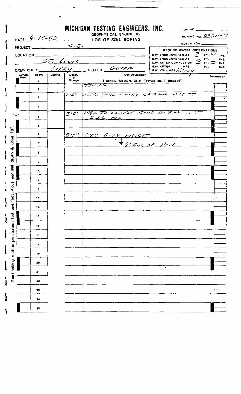
DATE "~<rr *»MICHIGAN TESTING ENGINEERS, INC.
GEOPHYSICAL ENGINEERS_ LOG OF SOIL BORING
JOB NO.
BORING NO.
ELEVATION
•ROJECT
LOCATIC
:REW cSemple
_ El«v.
"1-^
11-f11
1^1
*—. ,r- ' . ———————————————— - ——————————— .GROUND WATER OBSERVATIONS
1M .„ B.W ENCOUNTERED AT ^ FT ^T? ,N5
,-._,- / G.W. ENCOUNTERED AT FT. (NS.•^^ ' ^-ELS/5 __ GW AFT** COMPLETION 2 " ^^ INS
/ ^ s-s*^f* G-w- AFTEB HRS- FT. INS^IEF ^//:Sl V WPI PER C^o/^f>c- ^ Q w VOLUMEfi /-^^^Depth
0
1
2
3
4
S
6
7
B
B
10
11
12
13
14
IS
16
17
18
19
20
21
22
23
24
25
LM Depth Soil De*cription / .,_f ' Peoetretlon
C*»eng» ( Density. Moisture. Color. Textun, etc. ) Blows /S"
/ •£»
3<c<>
*S v
I7rV^'^^'-
s~-js'/>f <r-»j^ •' -'*: y <,.* 'jGi*~-**' '• * r- —~
————————— 1=fl**£'0< /•? tr^as'^x &>fvj f_~,*^*-*~-'^ -^ -. T-
JZi^>s? £-. <^t/ £
'*'/? ',' {?•'; 7- V /-/&.'£.? ——
' Jr"^ <£ ' /^V/> /? //^ i /"
—————— 1^1
—
;
———
—————————— fe——
i___ j
\ ——I ——
CO
-cZ
1 *j C* O)
CLQJ
*D
T5
ocV
1 8l ;g (0f fc,1 *riI I
i %\ *I ro• +*
S
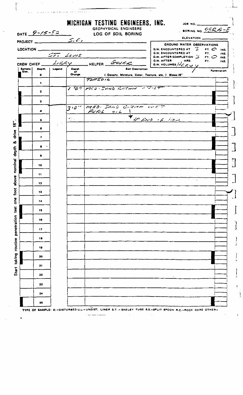
DATE
MICHIGAN TESTING ENGINEERS, INC.GEOPHYSICAL ENGINEERS
__ LOG OF SOIL BORING
JOB NO.
. BORING NO. •' -T
ELEVATION»ROJECT
LOCATIC
;REW ci-
I-
1
^ , / . —————————————————— .GROUND WATER OBSERVATIONS
N „ __ Q-W ENCOUNTEH6D AT "Z ST <O ,NS
,-- — — y G.W. ENCOUNTERED AT FT. INS.
/ ^ ^ _ G.W. AFTER HBS. FT. INS.t * ^ j ^ y^ .A. \x * t * PH p^ i_^^Td/ ** jf^m / /1IEF , *-Sf^s.f y HFi pf p *— *^K«=- A«. ^ w v/OLU"PS -^K- -^ . . i .
D«pth
O
1
2
3
*
6
fl
7
8 •
B
10
11
12
13
14
IS
16
17
IB
IB
2O
21
22
23
2<
25
L^<of
/ <C'->
? * O ' '
*•
Sol" Pncrlptlon /
( Dtnsrty, Moijturt, Color. T*xtur«, «te. 1 Blowi /6"y^£/y£T& t £• j
i/"7/f^ • JTV»*/£ tLrf?~+s '• '-~>--^~
—————— Pf-tStC-C -~, < \ i
<_ • N
Jf /ss~'-f> * s~- /.•'.•?-'. m i|
i
————— ————— fe
—— >
———
1—1—
i—•—
i
i-i
!'!3.111
00
V
outin
e pe
neak
ing
S
I
TYPE OF SAMPLE: D.-DISTURBEO U.L.-UNOIST. LINEft S.T. - SMELBV TUBE S.S.-SPLIT SPOON B.C.-ROCK CORE OTHER-

MICHIGAN TESTING ENGINEERS, INC.GEOPHYSICAL ENGINEERS
_ LOG OF SOIL BORING
JOB NO.
8ORING NO.
ELEVATION'ROJECT
LOCATIC
;REW oS»mpl»
— El«v.
L—g
11
1-
GROUND WATER OBSERVATIONS*K| _ . , _ , G W ENCOUNTEBeo AT ^ FT.Or* 1NR
— _ y _ G.W. ENCOUNTERED AT __ FT. . •• (NS..>/ r *— •-'OX. , _ G w APTER COMPLETION - FT -~ )NS
/ ,-- , ^ _, G.W. AFTER HRS. FT. INS•IIFF ^"C^V HFLPER wJ-^^J-x-— Gw. VOLUMES T.-C .,,,,,
0
1
2
3
4
S
6
7
8
9
10
11
12
13
14
IS
16
17
18
18
20
21
22
23
24
L"""' OfChcnp*
<?„
3't'"
S'f
Soil OvKription / -
( Diniitv, Motcturt, Color. T«xturt, «tc. ) Blowt /6"
x-^--~-- ^ ___ |,*•,-/ ') ' .,* •/*> ') !'. :' '- x-V-- S* ' ' •' —• '
:
^ - __ i/'**£•/;, ^/ZfJ.O /", ± ^•-'/-S .'•->;- / !
_j
- ;x / X/V /.^^x xu x,*? -'j 7 —4-* tr'^Z ;r ,^s* •1—
!
| ——— 1
——— 1t
•j
——— ,
!
___ I
I *ii— i—i ____ ;
00
V
•oeB
I -I °-I ^
^
II\
I
I11
ca
D)
TO*^CO
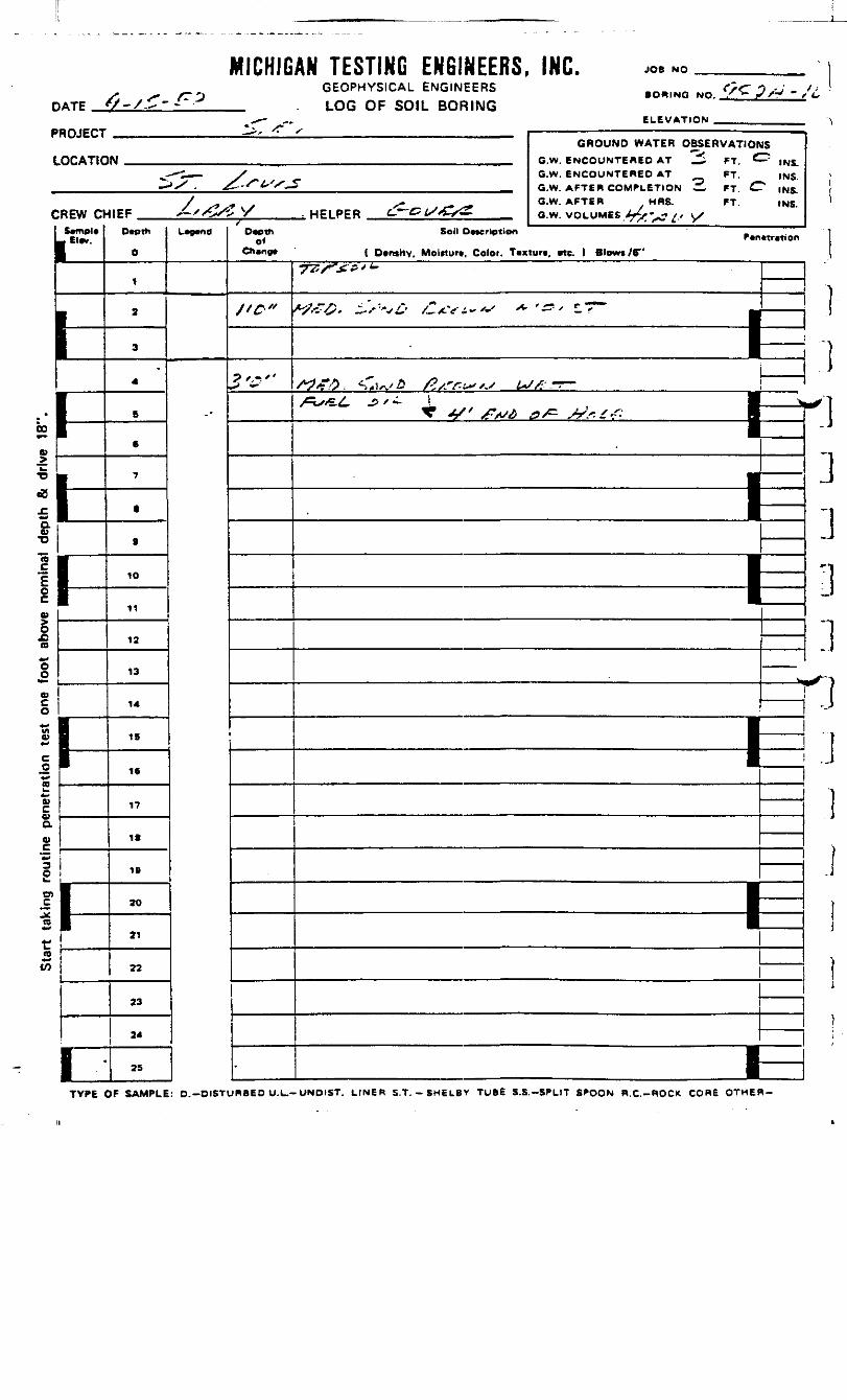
DATE
MICHIGAN TESTING ENGINEERS, INC.GEOPHYSICAL ENGINEERS
__ . LOG OF SOIL BORING
JOB NO.
• ORING NO.
ELEVATION
P /V - / L,
'RDJECT
LOCATIC
:REW cvS*mp<«
1=1-
i
h
1
GROUND WATER OBSERVATIOHN _..„ e.w. ENCOUNTERED AT _i FT C
„,-— i—— . / G.W. ENCOUNTERED AT FT.— >.X . ^-S*t''S'*5 __ G.W AFTER COMPLETION —— FT £!
/ _ ^ ^. O.W. AFTER HRS. FT.1IEF /-"tZ/'sy HFIPER L-—&t/*C/£> QW VOLUMES 4-.-. /, ^
0
1
2
3
4
B
6
7
.
B
10
11
12
13
14
15
16
17
18
IB
20
21
22
23
24
25
L^o«/
O*c> th
Ctiangt
//r*
3-c"
•
IS~«""" INS.
INS.INS.INS.
Sell Dncrlption
( Dvnsitv. MoiHurt. Color. Taxtun, rtc. t Blows /B"7J"w'; , —————— 1=/^^ <, a /?,^^,, ^.r- —
\
11
I y.,. i
——— i——— i
i—i———————— tE|
——
I—
.13]3]
^"k.
.
1JI!)
00
a01•o"5
o
(O
TYPE OF SAMPLE: D.-DISTURBED U.L.-UNDIST. LINER S.T. - SHELBY TUBE S.S.-SPLIT SPOON R.C.-ROCK CORE OTHER-

Ii DATE
MICHIGAN TESTING ENGINEERS, INC.GEOPHYSICAL ENGINEERS
_ LOG OF SOIL BORING
JOB NO. _____________ __
O.JT •? • " / IBORING NO .- £.- •."* X^ "" / /
ELEVATION __.._._______>ROJECT
LOCATIC
DREW Cr
El*v.
tL11i
•
GROUND WATER OBSERVATIONStM Q.W. ENCOUNTERED AT "^ FT ,NS
^^^ y G.W. ENCOUNTERED AT FT. INS.
^X^« ^£f£^jt^ G.W. AFTER COMPLETION ^ FT t> IN<>
J /f sy ^* G.W. AFTER MRS. FT. INS.•II EF X J*,*?y WFI PER Cf~GP&4C- „._ G.W. VOLUMES ,^-^L- y-
Dvoih
0
1
2
3
4
5
6
7
B
9
10
11
12
13
14
15
16
17
18
19
20
21
22
23
24
L^d D.cth Soil Omrlptlon / P.n«r.non
Ch»n9* ( Density. MoiRurt. Color. Texture. «te. 1 Blow* /B"
£"
•S-9"
W
"7~D^^*O '*•S^r^fL \ i^fi,' f^. *^ f*tfsA'^S /•>/* £' ^tr* s\^s ,4- .•£."* • *~ "^"~ r
'
!;
____/ ^v, .r- , , i————————————————————— 1 —£if*\J /-^ A •/;••' V" / -.-T ' — >
' / '
^ {»' # "L> o f- ,~c- i '- •I—j——— ji • i
Ii ——
I ::•
————
' ———— |i
j!
1
——
•
00
I *
f £
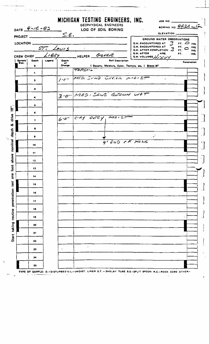
DATE
MICHIGAN TESTING ENGINEERS, INC.GEOPHYSICAL ENGINEERS
_ LOG OF SOIL BORING
JOB NO.
BORING NO.
ELEVATION _
ROJECT
.OCATIC
REW oS«mDl*
_ Elwr.
h1-h1-
1-
i-i
GROUND WATER OBSERVATIONSIN _.,,, e.w. eweoMWTSBSo AT *? *j <^> 1^5
•^ —— y*. ;> <• G.W. ENCOUNTERED AT "T FT. __ INS.-'/' y 4-&L/S _5 . ^ G.W AFTSBCOMPLETIOW _£ CT *— J ,N5
y . X f - ^ SZ^VJtS* O.W. AFTER MRS. FT. INS.4IEF 4-J&t*y HPLPER C-O^^/S a w VOL.IMM _,//-., , ../
D*pth
0
1
2
3
4
5
«
7
B
B
10
11
12
13
14
16
16
17
18
18
20
21
22
23
24
25
/L»g«nd O*eih
ofChing*
/•*"
3 -0"
&'*"
•
Soil D ••crip t ion 'P*n«tr«tion
( D»n»itv, Moitturt. Color. Tixturi, «tc. ) Blowt/6"
-rz>/3£.s'±
/WA ^.r'f't'^ tli-xV. tvV -*- '»3 .r ""
——————— |E/V7/?£> ' Srfsjt &/?&£>"J l^f *""
I~-J__
c'^y <^x-'<r v 'A-T'^''-=; — i1 i! 1—!
r^ x A//I; O ^" & ^^ *-& •
•|
i1
—————————————————————————— j
\ !
I Ii_1! 1
1
-
—————————— I1
——————
1 I
j ______
M
CO
•o00
s
O)
(B»*CO
TYPE OF SAMPLE: O.-DISTURBED U.L.-UNDlST. LINER S.T.-SHELBV TUBE S.S.-SPLIT SPOON R.C.-ROCK CORE OTHER-
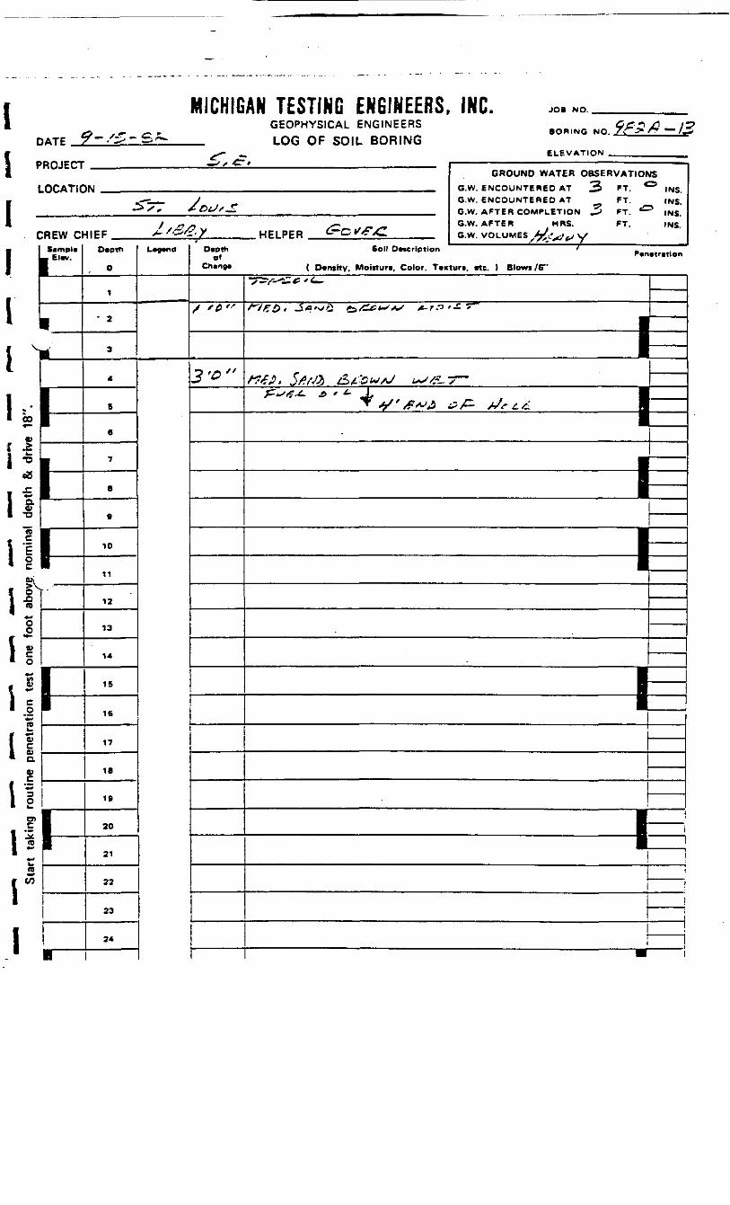
DATE
MICHIGAN TESTING ENGINEERS, INC.GEOPHYSICAL ENGINEERS
_ LOG OF SOIL BORING
JOB NO.
BORING NO.
ELEVATION
PROJECT
LOCATIC
CREW Cl| SampUL- Elw.
r'
*•*IIJSre
OOi*-Vco
s*"<1IIaw
fC
re
to
1tt
1-Hln™
1•
1•
GROUND WATER OBSERVATIONS1W .,. , G.W ENCOUNTEBEn AT %> FT G |N5
- . J G.W. ENCOUNTERED AT FT. INS.-* S ' £&tJ/~ G.W. AFTER COMPLETION ^ FT t£=>
)NS
/ ^- /~ f, _ G.W. AFTER MRS. FT. INSHIEF >-/' 'i.X HELPER C-C •/TXI B.w vot UMES A/--.-,.,vx
D«ptn
0
i
' 2
3
4
6
6
7
B
9
10
11
12
13
14
IS
16
17
18
19
20
21
22
23
24
•
L"""1Depth
0*
/ '0 "
3-D"
Sol' Description ' f
( Dcntttv. Moinuri, Color. Tvxturt, etc. ) Blows /G"
•Tsv-s.*-*- ———
/~yj?& • _5«0'v£ to/Ctf^*-^^^ ^-r ."3 '— >~ I—————— ^f?£$i 5#fJ% &£*&&/*/ L*JS* 7""~
fjs^-t. & * *- Af •' *y ' £*J£ & /^- +Jr £.£ fl
1_
—————— f^—————— 1
—.
—
———————————— tE
—11———•
i
i
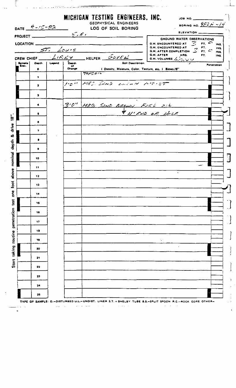
DATE
MICHIGAN TESTING ENGINEERS, INC.GEOPHYSICAL ENGINEERS
_ LOG OF SOIL BORING
JOB NO.
BORING NO.
ELEVATION _
'ROJECT
LOCATIC
:REW cf••mot*
11
1-1
1
I-1
GROUND WATER OBSERVATIONSM _ ff,^ f wcrou"TB«ep AT -^ *T ^ 1N5
^* - / G.W. ENCOUNTERED AT . ^ FT. |NS,->X " ^"PiJ •' £ _ ___ S W A*Te« CO^'l-CTlOw ^r BT •^ tNS
/ o , -- _ > O.W. AFTER MRS. FT. INSHEF J-'f'sA. V HELPER -^^ X^A^ e w Uftl .,„« x '.-. . . .
O»pth
0
1
2
3
4
B
6
7
B
B
10
11
12
13
14
15
16
17
1B
19
20
21
22
23
24
25
L^
tDvetnof
Chano*
/<£"
3'$"
Soil Description /•
( Dtniity, Moicturn, Color. Tvxtur*. etc. 1 Blow* /6"
Tcy^T^-'i-
/< -r ? -v^ o .'„. . -. .AX /<- T ' - -r—
j•
Aff.O/ £,Jf<sA &>£G*SS~/ s^sr^. j»/£dr , I* ^"X%<^ IP/ J&4-C/? •
|
1B1|
————— -fe—
——————————————————————————————————————————————————— - ——————————— S
I———I
———
••
•
—B—
*
J
VH
UN
W
*•
~^a
j•-»
t-•D
V
tt>aa>c
O
Ol
TO**CO
TYPE OF SAMPLE: 0.-DISTURBED U.L.- UNDIST. LINER S.T. - SHELBV TUBE S.S.-SPLIT SPOON R.C.-ROCK CORE OTHER-
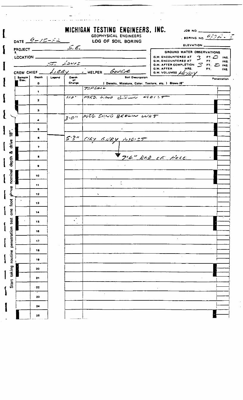
MICHIGAN TESTING ENGINEERS, INC. JOB NO.
DATEGEOPHYSICAL ENGINEERSLOG OF SOIL BORING
. BORING NO.
ELEVATION
1 PROJECT
LOCATIC
IC
IIK
REW Cl
El*v.
'
1 • t1 CD •
0)
I*,'\I °-1 °*I T5
TO
lUV
OO
liIS|!• Q.
w
1!1
Ifrar|
1-
1--
h11—
i
GROUND WATER OBSERVATIONSIN _ ._ G.W. ENCOUNTERED AT ^ FT. ^ IMC
^ __ / G.W. ENCOUNTERED AT ""' FT. INS._^^-* sZ-^^'Z G.W. AFTER COMPLETION *? FT ^^ ^5
y - >, G.W. AFTER HRS. FT. INSHIEF Xx ^XSV * HELPER A?i/^x« G.W. VOLUMES ±J",i,, ix
Dvpth
0
1
a
3
4
6
6
7
B
&
10
11
12
13
14
15
16
17
18
19
20
21
22
23
24
26
Lwn° *D«pth
of
"•*'
? '^ ''
S'3"
'"
Soil 0«cription ' P.n.tr.tior,
( Otntitv, Moirtur*, Color. Tcxturt, »tc. 1 Blows /6"
TS^- ' -
>*-?>T5- -i-J-v^ ^.^:^^-^ *-» / i r —
««. r/y.^J «4T**.^ tcx/ry ———
1_' 'i 1T» •
7*6*^ £*•'£ C/~ /rffeg, ' I
1-•
•*.
—
—
————
i1 1— 1
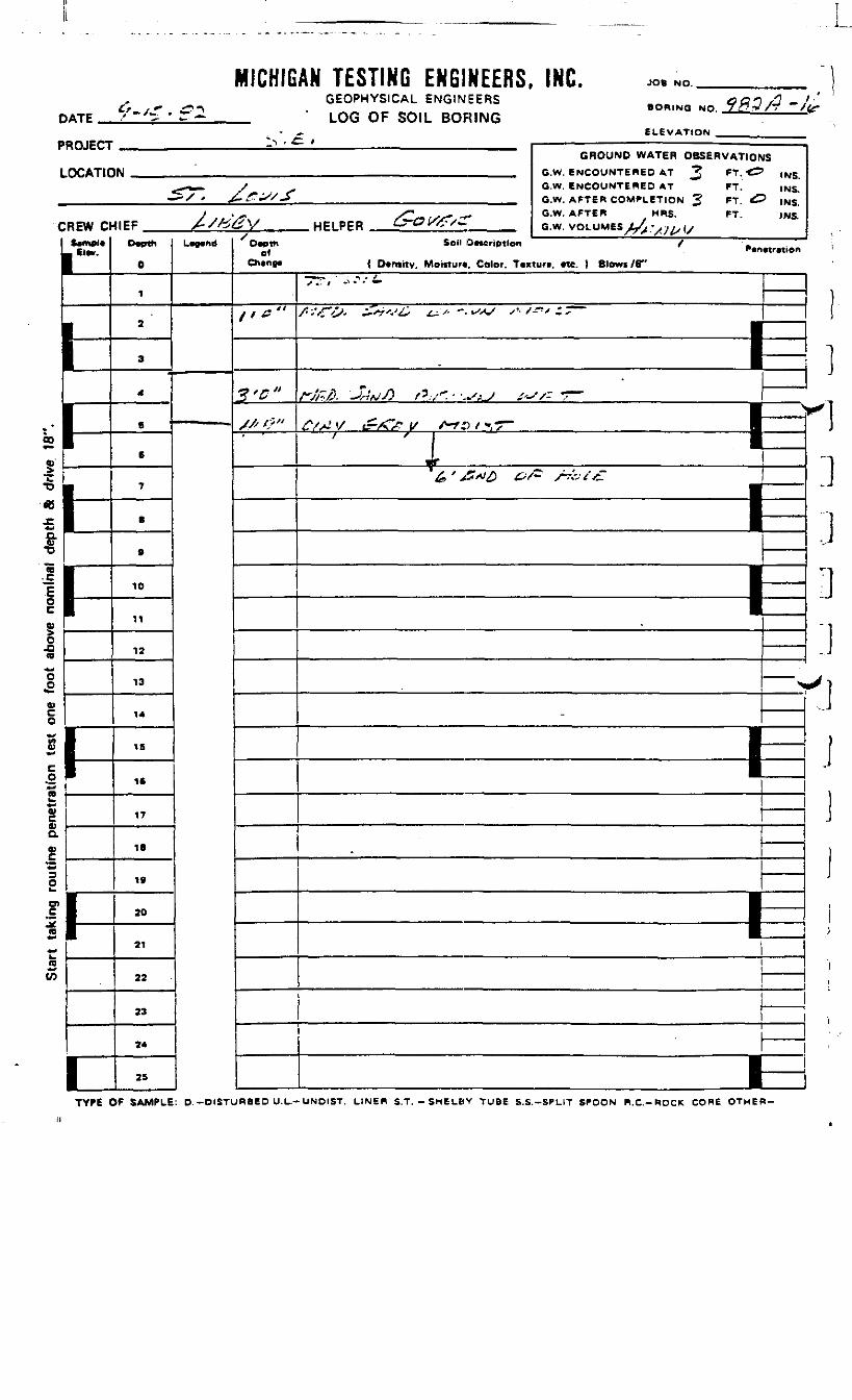
DATE
MICHIGAN TESTING ENGINEERS, INC.GEOPHYSICAL ENGINEERS
_ ' LOG OF SOIL BORING
JO6 NO.
BORING NO. 7iff.V/r "/tf
ELEVATION ^____________"ROJECT
LOCATIC
:REW DSwnpl*1 El**.
1-
k
1
GROUND WATER OBSERVATIOfiIN GW ENCOUNTERED AT ? PT, -£Z
4***— / G.W. ENCOUNTERED AT FT.—— •/ - £.£^/-S G.W. AFTER COMPLBTinN J1 CT ^!
y .*- xC>-»/X^- •*• G.W. AFTER MRS. FT.4IEF /*/te&V HPIPFR C^7f^T^ a.*. vmuMM i-/. -.....,,
Dwth
0
1
2
3
4
6
6
7
8
ft
10
11
12
13
14
IS
1C
17
IB
19
20
21
22
23
24
25
U*Md Dwtthof
/ '*"
ye"//< t"
f - * f r .
ISINS.INS.
? INS.INS.
Soil QMcrtption / -P«n«tr«ion
{ Dvntitv. Motitur*. Color. Tcxturt. «tc. ) Slows /B"
x .'- / -1 * •' «*
/'Vn>- ±*i'J& £^+ -.*s*S s'/-^'C~
HFfl '-Pv/> /''"' • --^ ' /r -r-
1 ^1
,&'&**£> &S- s-*a££
——————— 1——————— 1
-
^
————
I-
00
V
a)a
09*-(O
']]]D:i'i.1
TYPE OF SAMPLE: D. -DISTURBED U.L.-UNDIST. LINER S.T. - SHE LEY TUBE S.S.-SPLIT SPOON R.C.-ROCK CORE OTHER-
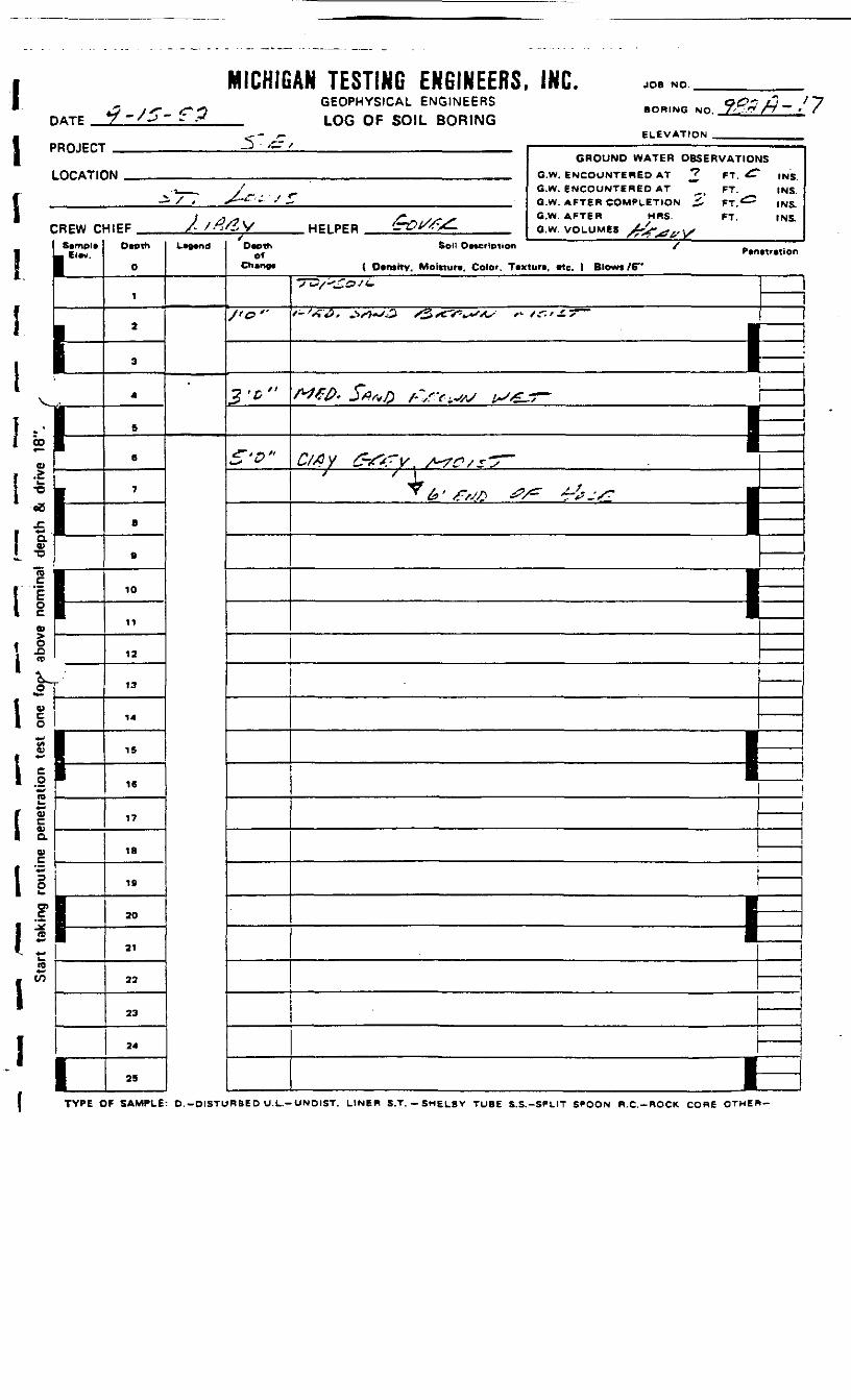
MICHIGAN TESTING ENGINEERS, INC. JOB NO.
IDATE
GEOPHYSICAL ENGINEERSLOG OF SOIL BORING
BORING NO.
'ROJECT
LOCATIC
CREW ClSemple• Elev.
1 —————
FHr
1-
1
1i
1
3 - /£T / 1 ————————————————————— - —————————— —— i..-GROUND WATER OBSERVATIOr
IN ..„.,_. ,.™ fi.W. BWCOUNTteiEB AT *? FT ^T
--,__ /^ G.w. ENCOUNTERED AT ^( FT._i. / , X-*r'- '' — . Q.W. AFTER COMPLETION ^' PT,«^
1 3 SJ /* SS^jT G-W' AFT6B HRS fT
^IEF /- A^V HPIPER (rOW^- a.w. VOLUMES . .,.Depth
0
1
2
3
4
5
6
7
B
9
10
11
12
13
14
IS
16
17
18
19
20
21
22
23
24
25
L-nd
fDepth
ofChange
J<t>'-
2-D"
S-o"
JS
INS.
INS.INS.INS
Soli Description / .Penetration
( Density. Moinure. Color. Texture, Me. 1 Blows /6"
-TV/'-tott.
*-'*•#. .. -O <3/cV^4^*o- f- sr.f^s-^ I
'.
W0.S*»o /->v.^ ts*f- ——
7 '4,7 '^- ,, j —p—————— 1
1-•
—l-l
CO
*
'
ion
teou
tine
pene
akin
gt
tak
S
TYPE OF SAMPLE: D.-OISTURBE D U.L.-UNDIST. LINER S.T. - SMELBV TUBE S.S.-SPLIT SPOON R.C.-ROCK CORE OTHER-
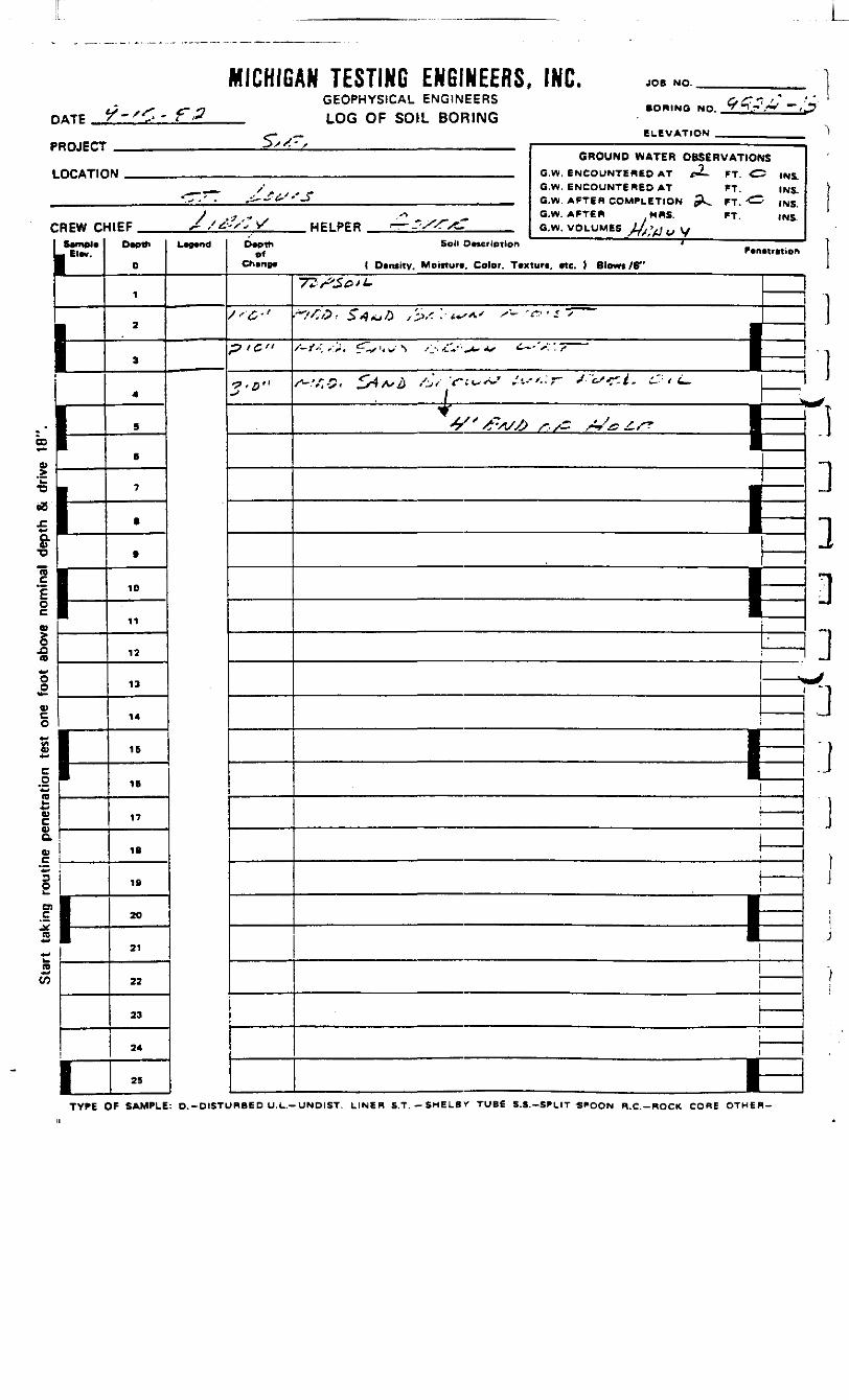
MICHIGAN TESTING ENGINEERS, INC.GEOPHYSICAL ENGINEERS
_ LOG OF SOIL BORING
JOB NO.
BORING NO.
ELEVATION _'ROJECT
LOCAT1C
:REW aSamel*
.. Elw.
1-
1
P
1-
1
GROUND WATER OBSERVATIONSM ,.. G.W. BNCOUNTEItep AT f2- fj ^1 ,N1
__ / ^_ G.W. ENCOUNTERED AT FT. INS.•"TV. ,i-.iV''_> _ G.W. AFTF.H COMPLETION pL, FT, ^ (N5
J ,? •» . ." . O.W. AFTER H«S. FT. INS4IEF X /*•-''• HELPFR r— J-'/ VcI. G w voi LJMS« //,.. ..
0
1
2
3
4
S
B
7
.
9
10
11
12
13
14
16
16
17
18
19
20
21
22
23
24
25
^^Depth
ofChino*
,'•&";="c"3-D"
Soil DMcripTion *Fcncimion
( Density. Moitturf, Color. Taxtura, ate. ) Blowt/6"
"77'/^5^>i.
**^/^" -1 C~ J* A '*-, s • *• ji > <x~— - '/*"* ' ' 7* ^
"^^ '"f*"' *"'"' "*' """
, |
; "1
———— N
——
————————————— M————
———————— 1=—————
——
1—
11
"]3]E
*s33
00
Ol
TYPE OF SAMPLE: O.-D1STURBED U.L.-UNDIST. LINER S.T. -SHELBV TUBE S.S.-SPLIT S^OON R.C.-ROCK CORE OTHER-
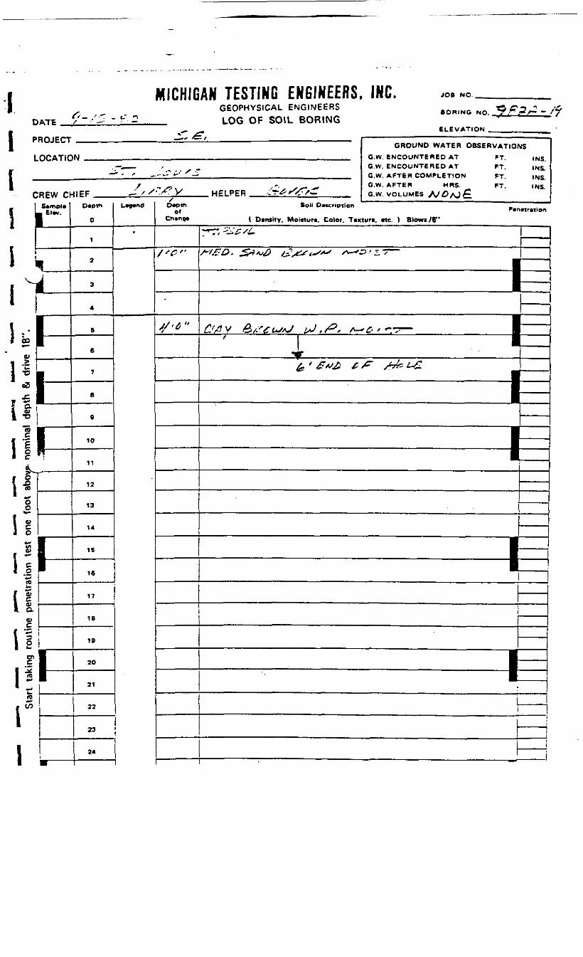
1D
1 -L
MICHIG<^_ ' T _ t." ^iTP / •- -
ROJECT
OCATIC
CREW a1 S*mpl«I L ....1 pj
1 I1 "11
\
i
!••!' -1 GO
0) 1
'i*!
**&•°is11{ sI "* •-•oo
hJ 0
V)O)
i =* .2*re
1 0
£aa>c
t =1 s01
ll1 ^* »Jk,«ri
1
hiW
1-,-
*' x
AN TESTING ENGINEERS, INC.GEOPHYSICAL ENGINEERS BOB1NG NQ 9*^ _ ,LOG OF SOIL BORING
ELEVATION; , ___ —————————— - —————— - ———————————————— . ——— ——— ,
GROUND WATER O&SERVATIOI^J _,., , GW. ENCOUNTERED AT FT
.— ___ , _ G.W. ENCOUNTERED AT FT.— ' - f ^--'- "'' ^— . ..__ G.W. AFTER COMPLETION FT
/ ^ -• -. ^ G.W. AFTER MRS- FT.JIFF ^ / S^S-'y HELPER LT0 »<£s~ _ _ GW. VOLUMES A>^AJ^
O«ptti
0
1
2
3
4
5
6
7
B
9
10
11
12
13
14
16
16
17
18
19
20
21
22
23
24
L*p«nd
'
sO«pTt1
ofCh»n»B
/'^"
-
4/'^ "
SIS
INS.
INS.INS.INS.
Soil DMcription _P«n«tr«ion
( Dwnrty, Moiiturt, Color. T«xtun. «c. ) Blowi/6"
7^" •^•^/i-
/'IgD. £r*v£> jJ2s&'t~'*' s>— '&'*,/—————— IE* " 1'&'£*£ £/=- /7ki~£ J
•11
——————— 11—————— 1=|
————————————— tE
j i
———— : ————————— _. —— _... J i

DATE
MICHIGAN TESTING ENGINEERS, INC.GEOPHYSICAL ENGINEERS
_ LOG OF SOIL BORING
JOB NO.
) j ••• OWING NO. T-^P-'A - »CT
ELEVATION _________'ROJECT
LOCATIC
:REW CrSample
_ Elev.
h
1-
^
1-
i
GROUND WATER OBSERVATIONIN ..... <?«* ENCOUNTERED AT ' *J —
(-_i__ / G.W. ENCOUNTERED AT __ FT. ^.— '•> ' * .'-^tS'S^ ,_ GW AFTER COMPLETION ..; PJ ""
/ - , xi x- , G.W. AFTEW ,HRS. FT.«EF ,— .'x:./W HFIPPR t"^>/ <. ew VOLUMES * -•• „ . , v x
Death
0
1
2
3
4
8
6
7
8
9
10
11
12
13
14
15
16
17
18
10
20
21
22
23
24
25
L*9*nd/•Death
ofChinpft
/ '£"
3'G"
y-c*1
IS
INS., INS.
INS.fNS.
Soil Description • Brtrntritlon
(Density, Mo«turt, Color. Texturt, etc. ) Blow*/6"
•73/=»£^ '.'
**^O- ^X/v^ to/."sr^* / ''—• *• •• r T~
__
—————— N/^/ <; !>•- ^/'S-Si^ /> /•• Z-^SAJ -*•' - - ~ i
| ———— -
I 1*
,V^'^^^> -/= >>.v;. J
•11
————— 1N
—1—B
——————
———————— tEi
——
I-H
)]
:i'i3333
"3:ii
i
00
o
1
0)c(Ua
01
TYPE OF SAMPLE: D.-D1STJRBED U.L.-UNDIST. LINER S.T.-SMELBY TUBE B.S.-SPLIT S^OON R.C.-ROCK CORE OTHER-
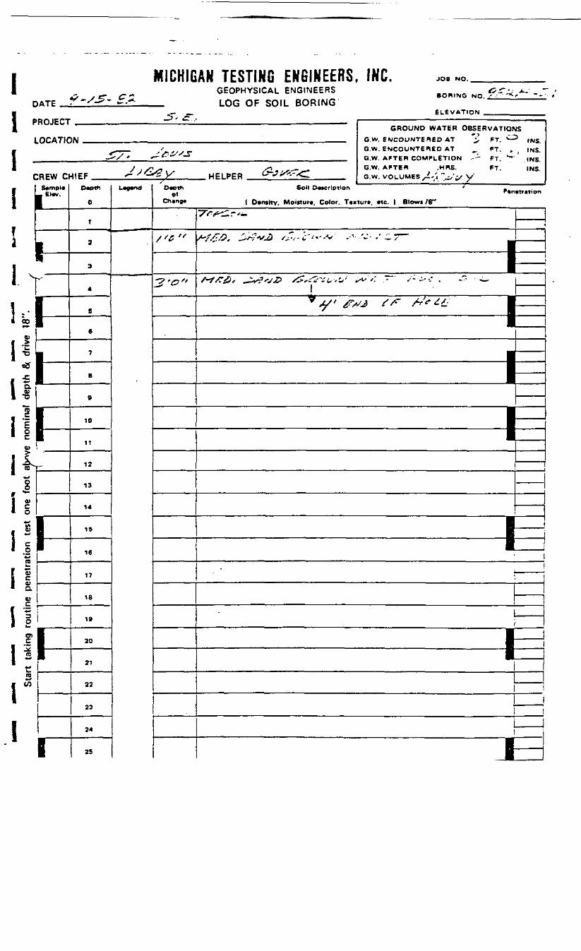
IDATE
MICHIGAN TESTING ENGINEERS. INC.GEOPHYSICAL ENGINEERS
_ LOG OF SOIL BORING
JOB NO.
BORING NO. *
ELEVATION
IROJECT
uOCATIC
:REW ctS*mpl«
_ El«w.
I——•
L-
\-t1
1-
h
I
GROUND WATER OBSERVATIONSiw ,. „„, .. G w. ewmiJNTEAsn AT *v FT, CJ3 ,N5
^ ___ ' , G.W. ENCOUNTERED AT , FT. . ( INS.-— '/ ' f~£:»' J _ _ GW APTEB COMPLETION .- -- *T, "-- ,NS
/ .XVl. /2."jXtx- G.W. AFTER .MRS. FT. INS.•1IEF *~ ' -^ y" WFI PPR &*•' *"•'<<-. G.W. VOLUMES ,', " -,'-y W
O«Pth
0
1
a
3
4
5
6
7
8
9
10
11
12
13
14
15
16
17
18
19
20
21
22
23
24
25
L-""' Dvothof
Ch«nj»
''*"
2'o"
Soil Description ' .P*n>tntion
t D»nthy, Moicturc, Color. Ttxturt, «tc. ) Blows /6"
~7'Ff*'^.T'—
rt^Q -sf-vM / - -T. j-/,-.v ,-•- '-•• ." •" "? —
- ——————— : ————— 1
=!^\
\
——i•——
IIj
fl.I*CO
V
IJI*^a
I E1 io>
I*1 0.s
b_
I w£n
I
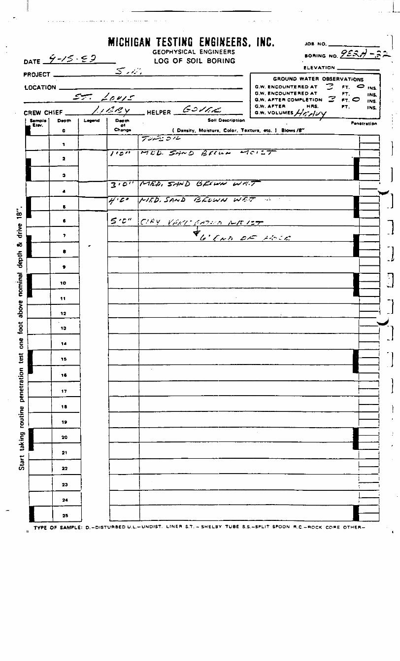
MICHIGAN TESTING ENGINEERS, INC. JOB NO.
DATEGEOPHYSICAL ENGINEERS
LOG OF SOIL BORINGBORING NO. X <--J
ELEVATION
'ROJECT
LOCATIO
:REW a-Sample
1-
1-
1
GROUND WATER OBSERVATIONSM ., G.W. BNCOUNTERCD AT "^ PT, ^INS
-r-_^— y G.W. ENCOUNTERED AT FT. INS.—— - -^ . ^_ /5 *V*_ G.M< AFTEB COMPLETION ^ fj £3 |NS
y •* j^ /" ^ Xx- * G'w- APTEP5 HRS. FT. INS.*IPF /•/tf'Zy HELPPR te*—S/;<4.f O.W.WOLUMM L/+*^.^,
Dwth
0
1
2
3
4
6
6
7
8
9
10
11
12
13
14
15
16
17
IB
19
20
21
22
23
24
25
L""n< ofCh»nf)«
/'*"
3 'D"
S/'C*
ST"
Soil D»*cripilon 'P«n«mtion
( Dimity, Moiituri, Color. Ttxiun, «e. ) Blows /S"
7>^s:^^ ———r-JKb. S*+~& £frt,*.+* —IctLs
/ '>£-y5/ S^y 'Z) (££** ***** b*S*?~S \\— '
^"/A1 V ^>'X - 1^^7.-. -/) ,,u./r /;-T-«#r
£if / >v- -/i ^ /^- j+-^t*> ^ S •F1
1 -
i1
i >
1—1
——
—
———i—
ii
3J
1
00
0)
&
esou
tine
pene
akS
TYPE OF SAMPLE: O.-DISTURBED U.L.—UNDIST. LtNER S.T. - SHEUBV TUBE S.S.-SPLIT SPOON R.C.-ROCK CORE OTHER-

1 DATE «£__ /."" - & £»
MICHIGAN TESTING ENGINEERS, INC.GEOPHYSICAL ENGINEERS
_ LOG OF SOIL BORING
JOB NO.
• ORING NO
ELEVATION .
>ROJECT
LOCATIC
:REW CFSample. Eiev.
FhhI1^pr
GROUND WATER OBSERVATIONSIM iw_ni G.W. ENCOUNTERED AT ">' FT ^ .uc;
^- ___ / G.W. ENCOUNTERED AT , PT. INS.•^'- ' ^-3±JS£ ^ G.W. AFTER COMPLETION ^- FT ~ tNS
/ ^, ^- G.W. AFTER ,MRS. PT. INS.J ff F A ' ' 't. y H E I PE R «^» X«=X^ _ G w_ VOLUMES .-:T'X>ty W
Death
0
1
2
3
4
5
6
7
8
9
10
11
12
13
14
15
16
17
18
19
20
21
22
23
24
25
L*e«nd Depthof
China*
/• 0"
-/'<?"
S'S"
Soil Description _Penetmlon
( Density. Motftur*. Color. Texture, etc. ) Blows /6"
X^/^-^T^'^-
rt££. S"^A/^) /£/J+i~'*' s-i£'-- —
————————— P1 _ |i i
__€*>'' v. grS/Z is /T~*£>/ «5. 7 —
' /V ^ ' £*'£> t/~ tJ&C£ •
•|
—————————— 1=
I I!!
1 i———___ i
———————————————————————— _ — ——————————— ,
———————— 1=m, ——— '1 1
i i
... .., - ... i j
—————————————————————————— JZ !• i• i
IVf
u1**V £
1 £I T)
1
0)cO)av
"•530
0>
2ra
to**to
•rvDC nc ei ii i-— UNDIST LINER fi T --RHti BY TiiBP «: e _«n tT «S*noN B r _«nr>c rnBP OTHER-
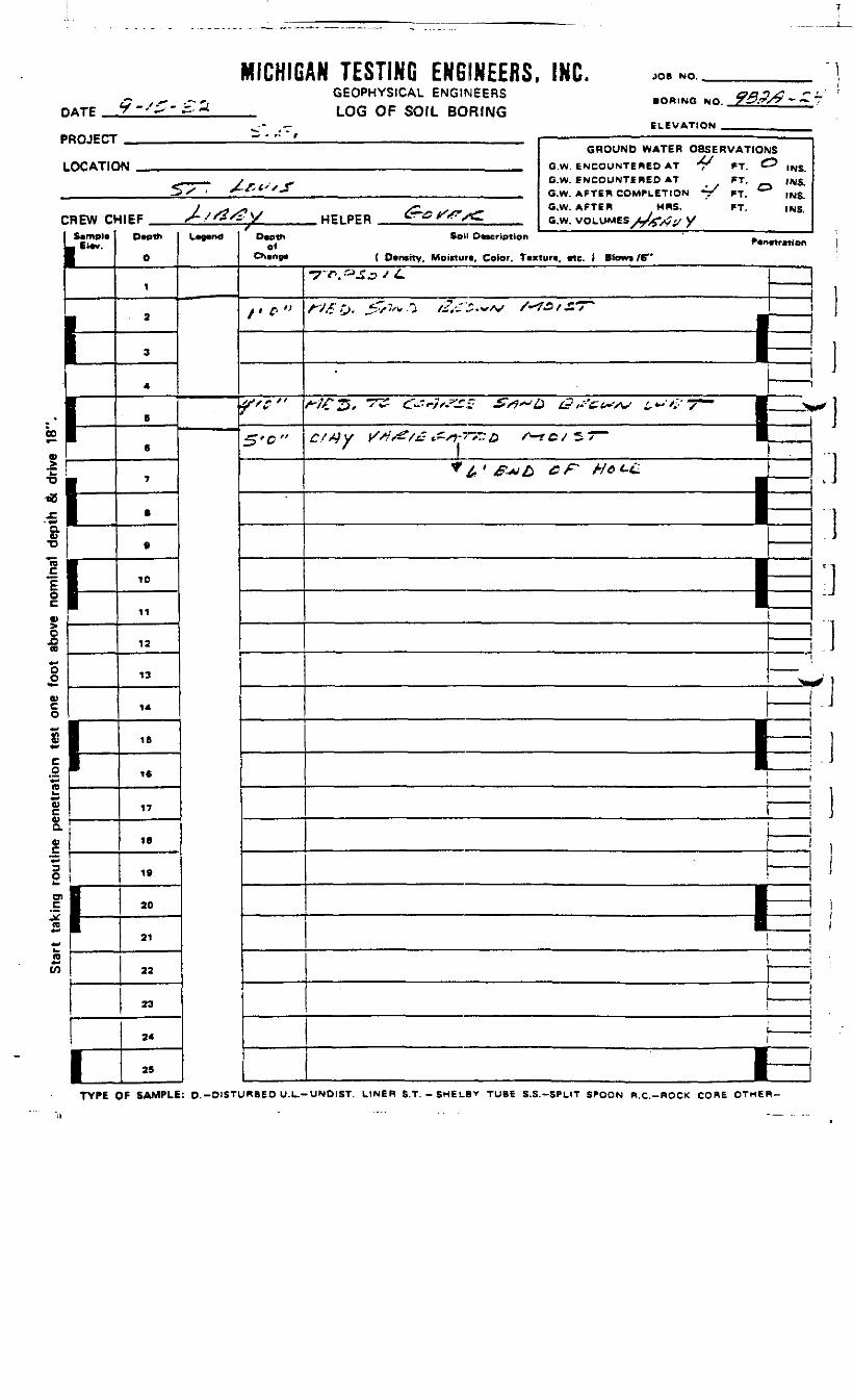
0
pL
MICHIGiTp t-s5-£3*
ROJECT
OCATIC
CREW C*I SampUL El«v.
r
.*a*,> !
•D •
1CL0)•o
c 1
i|0)
oto**OoVcotn*«
C.2*-2•*gVQ.«
»*
O
_cn*->«-<k.to*-
I-
I-
11
1
*•. i -
AN TESTING ENGINEERS, INC.GEOPHYSICAL ENGINEERS .OR,NG NQ 9BM-ZLU(J Uh SOIL BORING
ELEVATION
GROUND WATER OBSERVATIONSkM .. G.W EMCOUNTERED AT 'T' FT C? |NS
____ j f. ^ G.W. ENCOUNTERED AT FT. (NS.5^ ' X-/-*''-- __ G.W AFTER COMPLETION -1/ FT, ° INg
^ ,S?S>U ^./S* «~ G.W. AFTER HRS. FT. ,NS.<IEF S~/r^szf \s HEI PPR u- ^^^ /«^ aw VOLUMES AJ^tS,, \s
o
i
• a
3
4
5
6
7
.
9
10
11
12
13
14
IB
16
17
IB
19
20
21
22
23
24
25
L~nfl
fDepth
ofOtsnga
/' T »
ft "
5'c"
Sell OMcription ' .
( Dcntity, Moictun, Color. Tcxtun, etc. \ Blowt /6"
T'^.^-S^ / ^»
A"^fO. Jtv-7/v.O //,'-"£• wv /~*£>s£T~
.
*-*"~ ***"*"* '""* *-***'" *-**' —— jzzj1 .. , 1 -. — —
J1
- M.
—
———————— lEE————
————
——i
TYPE OF SAMPLE: O.-DISTURBED U.L.-UNDIST. LtNEH S.T. -SHEL.BY TUBE S.S.-SPLIT SPOON R.C.-ROCK CORE OTHER-
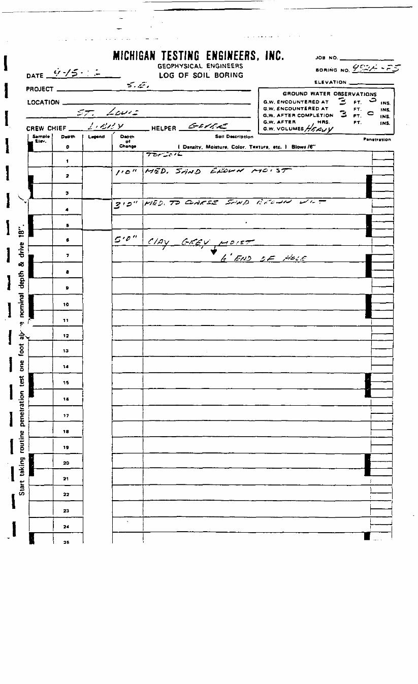
DATE -
MICHIGAN TESTING ENGINEERS, INC.GEOPHYSICAL ENGINEERS
_ LOG OF SOIL BORING
JOB NO.
BORING NO.
ELEVATION
'ROJECT
LOCATIC
:REW ciSemple
1r
tk
I
GROUND WATER OBSERVATIOrIN _..,.,„.,. .,..__ G.W. ENCOUNTERED AT "3 *T *"
c-_r_ / „ O.W. ENCOUNTERED AT _ FT.^^ • •— i£*-/-'— ___ Gw AFTER COMPLETION ^ PT C
t , j _s~ .^s- if G.W. AFTER HRS. FT.-MEF ^ /e/_ Y HELPER iS-^X^vC. Gw VOLUMES MJ-S,. , *S
Depth
0
1
2
3
4
5
6
7
8
9
10
11
12
13
14
15
16
17
18
19
20
21
22
23
24
25
L-","Death
ofChange
/'C"
2,p-<
C'C"
- r - -—— f
JS
=> .NS.„ INS.* INS.
INS.
Soil Description _Penmetion1 Density, Moisture, Color. Texturt, etc. ) Blow* /6"
-rtr-^-'L.
Wz&f 5''7*/£ £,£&t*"*s s-r& ' s-T^
/•*}£$! 7~3 ££**3/f£*£i ^f-'*1/} fcf-~£'^f'^ f *- ~
C /X^V L^/L £ ' V /-*r&s£*F~/ / t
————————————— 1
•1H
i
i.
00
I1
1 0
?Ql
a
rn
I

MICHIGAN TESTING ENGINEERS, INC.DATE
GEOPHYSICAL ENGINEERSLOG OF SOIL BORING
JOB NO. ____
BORING NO.
ELEVATION .PROJECT
LOCATIC
CREW D
Elw.
I»r01
1
I1"1
f(B
O
V
Oa
OO
0)
O
I
Sta
rt ta
king
rou
tine
pene
tratio
n
1-
1
GROUND WATER OBSERVATtQftK| .._ , G.W_ tNCOLJNTSREQ AT ^5 BT ^
—__„- / G.W. ENCOUNTERED AT _ FT.•~> / * £&£*/•* " m| _ G.W. AFTER COM^LCTIrtW —— 1 *T ^
/ /?^J /^/StSS*^' G.W. AFTER ,HRS. FT.41EF j-/f9ff£y HELPER ^ &*£?*£ G w vni uutEft ^-^>- ,.^,>
Dwth
0
1
2
3
4
5
6
7
B
e
10
11
12
13
14
15
16
17
IB
IB
30
21
22
23
24
25
• — , Depth0*
/ *C "
3-c"
S'c-
ISINS.INS.
•"* INS,INS,
Soil Dncflption fP«netretion
( Dtrwttv. Moisture, Color, Texture, «U. ) Blown /6"
•y*^jfc./A
rtffb. £rf*s£ /?,&'±~>*j /i*i&/s^-——
•
HM-rc r~A-,- <-• A ,?^^ /.'/»—— ———
K- ^——————————————————————————————— ___ ———————————————————————————————————————— • ——————
Cite £-&*? , A^/C ' *- / •
— • —— i —._^ — —— i
^——— 1
—————
,
I s
—————
—————
—
0
TYPE OF SAMPLE: D.-DISTURBED U.L.-UNDIST. LINER S.T.-SHELBY TUBE S.S.-SPLIT SPOON Pi.C.-ROCK CORE OTHER-
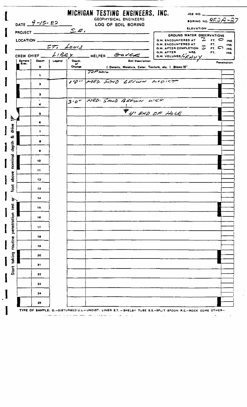
IDATE -yg* gp
MICHIGAN TESTING ENGINEERS, INC.GEOPHYSICAL ENGINEERS
_ LOG OF SOIL BORING
JOB NO.
BORING NO.
ELEVATION _PROJECT
LOCATIC
C
i£
*ID
'EIoo
"oo«fc.
V,
REW CSampl*
-\-^*rn —————*ri
0)
n.0)
*^O_ 1Ol 1
1*- !
rID
1I
1
GROUND WATER OBSERVATIONS•? JP«II•JW _ G.W. ENCOUNTERED AT — FT. <^> (NS
__—_,— f G.W. ENCOUNTERED AT FT. INS— ' X ' £•&&'£ __ G.W. AFTER COMPLETION 5 FT. C"> tu<;
/- — , G.W. AFTER HRS. FT. INS
f f £ & y «FIPER &~*lS<C^ G.W VOLUMES >d^,^/vyD*ptti
0
1
2
3
4
s
e
7
B
9
10
11
12
13
14
15
16
17
18
19
20
21
22
23
24
25
L^n*e
Of
XV"
2-o"
Sail Description / -
( Dtntttv. Mowturt, Color. Tcxturt, «te. ) Blow»/6"/73/ ij>;» |
/*•/>?£• £&*£ £ /r^-us*s s--r& t*-. -?—
^&. &~i> a**u,~ ~'^ ——•^ • __^ 1
i
——————
| ______
———
TYPE OF SAMPLE; D.-DISTURBED U.L.-UNOIST. LINER S.T.-SHEL8V TUBE S.S.-SPLIT SPOON R.C.-ROCK CORE OTHER-
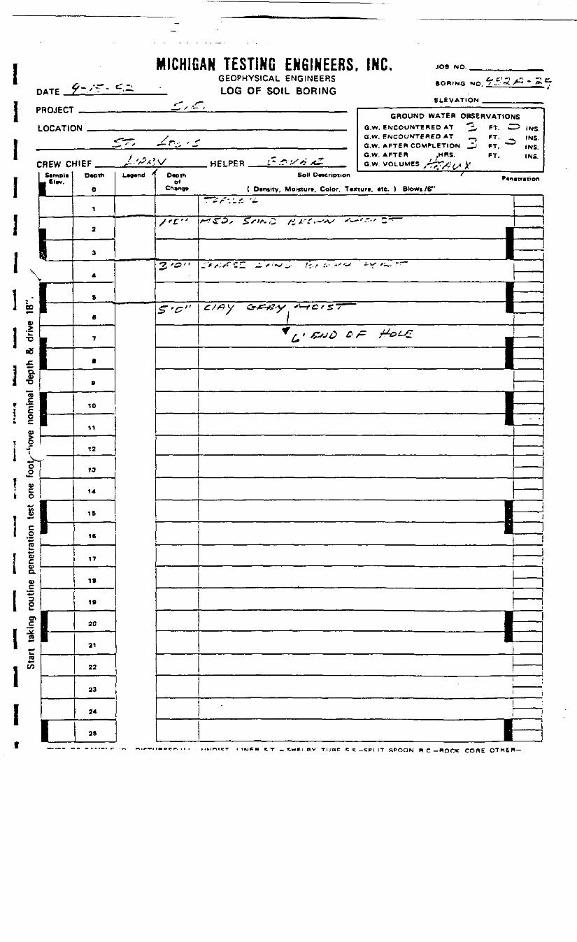
MICHIGAN TESTING ENGINEERS, INC. JOB NO.
DATEGEOPHYSICAL ENGINEERSLOG OF SOIL BORING
BORING NO.
ELEVATION .
L* t -
PROJECT
LOG AT! C
CREW Cl1 Sampli
\V
m
'
<*aO>
.1!o
oowCoyw
Jre
Ca>O.
0)
1
I2rreCO
1
h
I1
I1
1
GROUND WATER OBSERVATIO*«U GW. ENCOUNTERED AT ^ FT ^
tr^s__ /^ ^ G.W. ENCOUNTERED AT _ ? FT. „— ' -" ' —— *"V- ' -" G.W. AFTER COMPLETION .JL- FT *~
y „ _ — G.W. AFTER .MRS. FT.^IEF >i '/'^?V HPl PPR :-.-r>iX*fr"xi GW VOLUMES ^tAr^i.ji*
D«pth
0
1
2
3
4
fi
6
7
8
9
10
11
12
13
14
15
16
17
IB
19
20
21
22
23
24
25
L*9*tld ' *T
/'£"
3'&-
Z'C"
IS^ INS.
. INS.INS.(NS.
Soil DMCripiion / „Pcntmtton( Dvnstty, Moirturf, Color. Tixiurt, «te. ) Blows /6"
~r^'f-.'-f- '+•
^£2, £sts,2 /i/-'r.*--v >•—•'.-" 2-
———————————— P
/ ' /CV^^? ^ /" ^~&t-£
——— s ——————— 1——————————— 1
i ———————————————————————————————————————————— _ ——— B ————I
1
——————————— 1——i
i
I =I s
,~.e-r . tucn e T - C M P I B V TLIRP «: c _«;*i rT SPOON R C -POCK CORE OTHER-
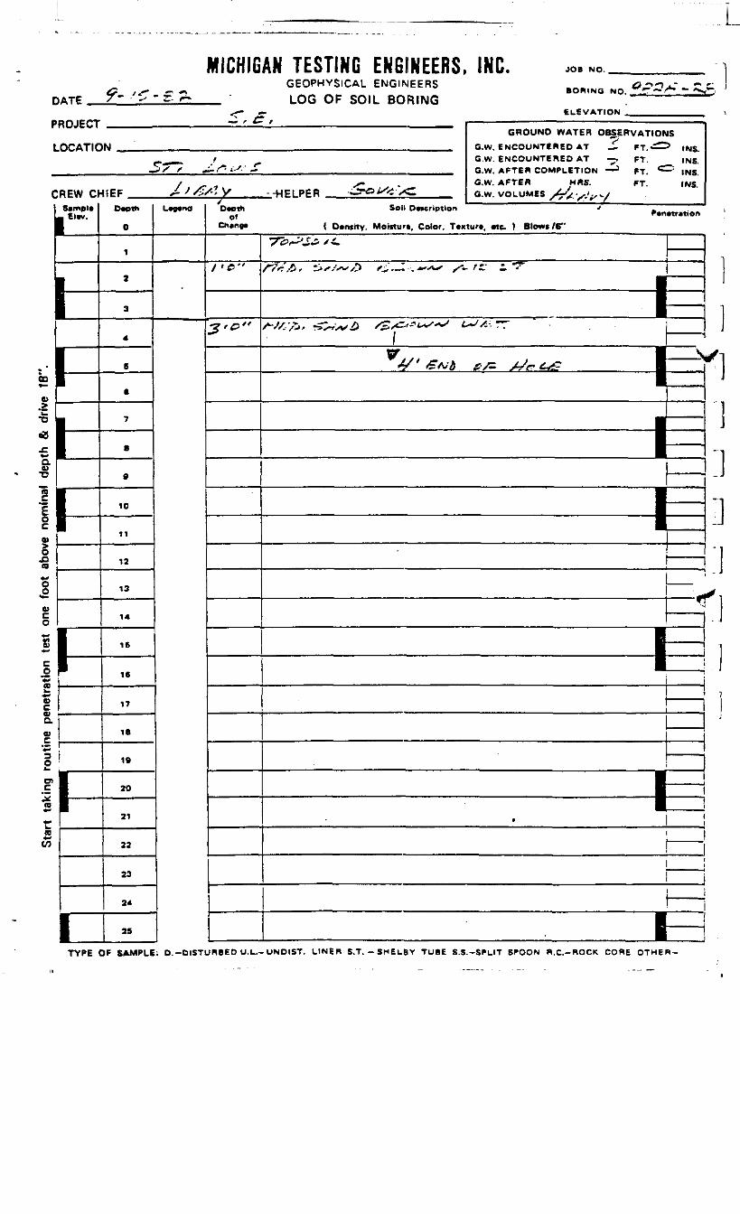
DATE 9- >C - £MICHIGAN TESTING ENGINEERS, INC.
GEOPHYSICAL ENGINEERS_ LOG OF SOIL BORING
JOB NO.
BORING NO.
ELEVATION'ROJECT
LOG ATI C
SREW OSample
- Elev.
*-
Nhi
GROUND WATER OBSERVATIONS)M ,.,._, ,. G.W ENCOUNTERED AT — f-r^> .Nr;
_ f G.W. ENCOUNTERED AT -^- FT. INS.,5x /• ^.^ i-'.' ~ G.W. AFTER COMPLETION —— > ff, <^ )N<;
/ X- . G.W. AFTER MRS. FT. INS41EF j-J&S'.y --HPLPER *Jr«^<iv<C o.w VOLUMES >^/-. ,>...>
Depth
0
1
2
3
4
6
6
7
.
0
10
11
12
13
14
15
16
17
IBi
19
20
21
22
23
24
25
Legend Depthof
Chenge
/>£>•'
3'°"
Soil Deccrlpilon > .Penetretipn{ Dentitv, Morcturi, Color. Texture, etc. ) Blows /B"
•7Z>^£& st~
f?<:£' ^s/~S> /£,-,-.*"*-'• X- '£' - "^
M».^~0 &^*~~ ' m~.. ———— ]
I V1
—————— 1^off<T7
=31
——i
-
————r
———
B —
•£toO£Vco
esak
S
]
TYPE OF SAMPLE: D.-DISTURBED U.L.-UNDIST. LINER S.T.-SMELBY TUBE S.S.-SPLIT SPOON R.C.-ROCK CORE OTHER-

DATE
MICHIGAN TESTING ENGINEERS, INC.GEOPHYSICAL ENGINEERS
_ LOG OF SOIL BORING
JOB NO.
• BORING NO
ELEVATION
"ROJECT
LOCATIC
:REW aEl«V.
1
GROUND WATER OBSERVATIONSM ,,. 0 W. SNCOUNTERED AT ^ FT -=> (N?
^ / ^ G.W. ENCOUNTERED AT FT. INS.— / • ,/.&&.' i. .. ' Q.W AFTER COMPLETION 3 FT & tNS
/ , , ^- G.W. AFTER MRS. FT. INSUEF 2-*i-*tS.y HELPER - e- .4* : owi v/n.uMes ^1 .*., ., i^
O*pth
0
1
2
3
4
B
0
7
8
9
10
11
12
13
14
IS
1«
17
18
19
20
21
22
23
24
25
L~n" D*ethof
Chine*
I-L,"
3'°"
5'B"
S - - - r - ' f
Soil Oneription ' _
( Dtniity, Moisturt, Color. Tcxtun, «te. ) Blows /6"VrxSe/4
y^yZJj -H'l^Zi /StV'Cta**-xV f*lC* t i7^"———— ^^>-,>' .£- ^^^) «xsst«^ M/* /_ ———
^
^/x? y trTi'' *)'' ?*•**? £tt —T™"i
1
—— -,—
31
————
| ————
t ____
i
——
t
j ————
£
jw
00
a«>•oTo
O
«g.O
TYPE OF SAMPLE: O.-DISTURBED U.L.-UNDIST. LINER S.T.-SMELBY TUBE S.S.-SPLIT S*»OON R.C.-HOCK CORE OTHER-
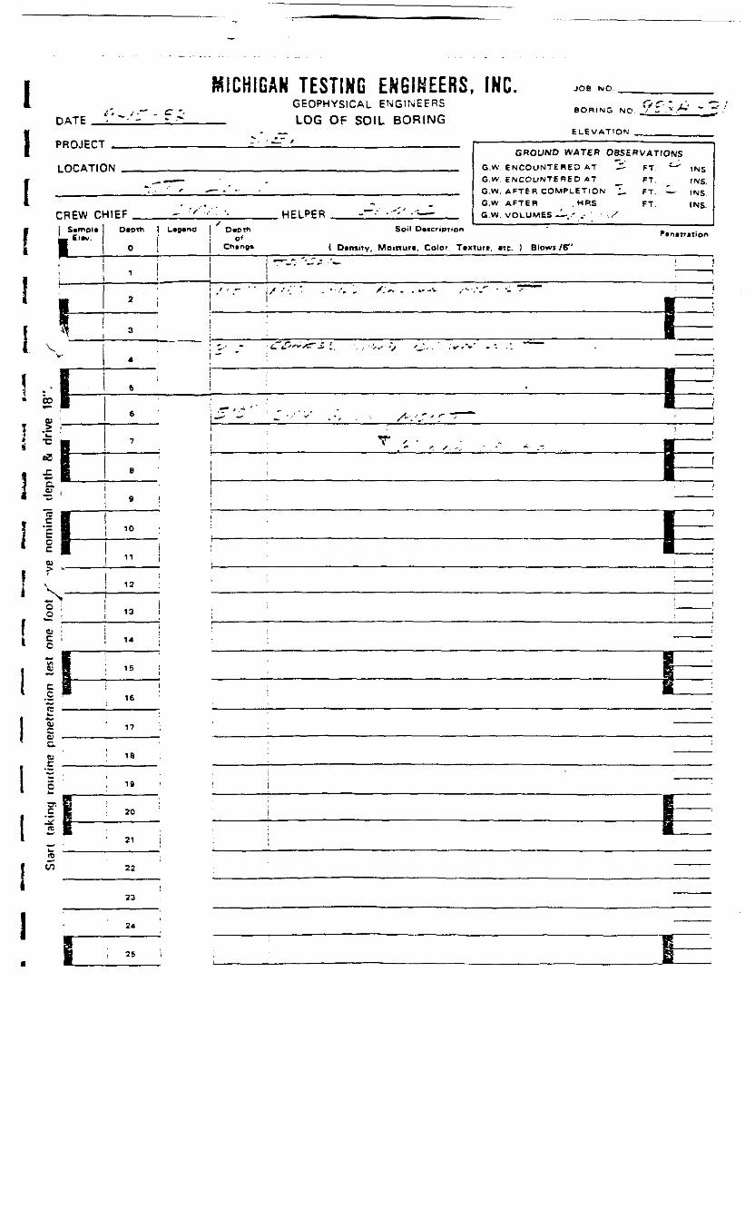
I MICHIGAN TESTING ENGINEERS. IHC. JOB NO
DATE
GEOPHYSICAL ENGINEERSLOG OF SOIL BORING
BORING NO ' - .v X' - ~
ELEVAT1ON
PROJECT
LOCATIC
CREW C[ SimpleL- Elev.
1
I" i • .IT" t r- —————— — — - —— • — - — —— — —
•JN . , __ ., , „ ._
HIEF - •'"•• "• '- HELPER .. -~-' •''>' ---^-Depth I Legend | D«DT^ Soil Datcription
j ! 0*0 i | Chenge ( DensiTv. Moinur*. Color. Tex
GROUND WATERG.W ENCOUNTERED ATG.W. ENCOUNTERED ATG.W. AFTER COMPLETIONG.W AFTER . HRSG.W. VOLUMES - -.r .-
tore, etc. ) Blowi /6"
OBSERVATIONS2~ FT.
— FT-FT. — •FT.
P.netr
INSINS.INSINS.
.ti.n
\ />. . . ~.v
l~.~Jt~ -- /•6. t'f**T * ••'•> -J
CO
\ I
10
12
13
14
15
16
17
tr.I » 20
21
22
24
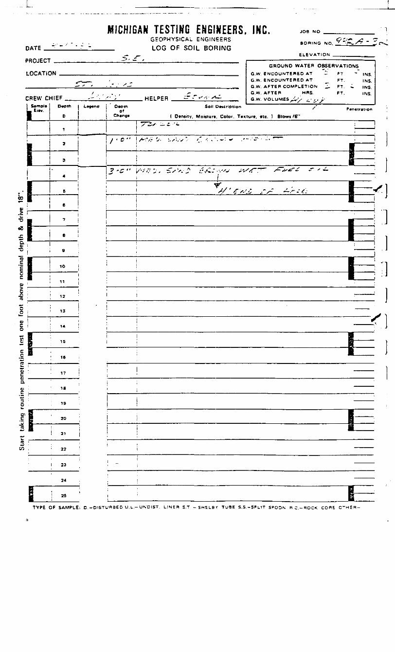
MICHIGAN TESTING ENGINEERS. INC. JOB NO
DATEGEOPHYSICAL ENGINEERS
LOG OF SOIL BORINGBORING NO
PROJECT
CREW CHIEF HELPER .- xt-1
GROUND WATER OBSERVATIONS
G.W. ENCOUNTERED AT __ FT. INS.G.W. AFTER COMPLETION ^ FT. i INS.G.W. AFTER MRS. FT. INS.G.W
Simple D»pth
1
L*Q«n6 O«Otti Soil OMcription /' -
Ch»ng« { Density, Moifturi. Color. Tvxiur*. «tc. ) Blowi fS"
' ~' ~ '. —————— i
f)t
10
13
feil"]
a<y
15
IS
CT_C^re
20
(B '—• •to , 22
i 23
24
TYPE OF SAMPLE: D. -D'STU^BE D U. L-- UNDIST. LrNER S.T -SHELBr TUBE S.S.-SPL1T S^OON R C . - R O C K CORE

I
1
li!
' — /DATE ~ /
PRO 1CTT
LOCATION
CREW CHIEF _! S»mpl« D*ptL_ Et*v.
11f 1!
• 2
B• 3
' 4
V
E 5
6a; :.2
** B 700 B£ 8 BC. ^O) i
•0 . 9
= BE 1^1 11oO
"re ; 12
L • is
1 • ! IA7 B~ B 15
E *•— > 1 67c . —————————L. 1
1 :C.
C 18
- • ;C ! 19^
•- i 20
2 • :— • ;
K ,
tO ! 22
23
24
: "
raiLniuHR ir^iinu cnamccn^r inu. JOP NO^ . - GEOPHYSICAL ENGINEERS BORING ND :'-_;., _ -
-- - i nr; ni- win HOMINGFl EVAT10N „„.._ ni iiiimii-
GROUND WATER OBSERVATIONS, ,__^ ft W FMeO;.)WTFRED AT ^- FT ~ ,N5
G.W. ENCOUNTERED AT , FT. |NS.— • - • - • . . ' . - • " - GW AFTF.R rnrmPLETiON '7 FT «^ )N5
/ . -. ^- , G.W. AFTER MRS. FT. (Ng-• '•" ' / HPI PFR -""^ **,+— GW VOLUME* • ', . ^,-
* ' -- -~h L«9«nd O*cth Soil Description ' _
Ch»no« ( Dtntity, Momuf*. Color. T«xtur«, »tc. I Blowi /6"
** /:> -"'•'• * / r '" " - —————
i 1
BB
| _ ;
j^ '-r1" I-*-.".-".'*. .:.rVw.i -X .- ' „- . .'.-' .v'/;'',"- r^.''^^. £.- •• , —— •
! B .•
C'-" C'^-- i~*'/ s s~?~'z-r~~t 1 !
1 '"
; i !i i
<
( . ^ r~ .
: ;; ' i
' j ; t
i : ; t: • 1
I: I• \: ———— 1
| : ' ——— i,
i ;
{ ;
i•
1
,
{ ''
TYPE OF SAMPLE: D -DISTURBED U.L.- UNDiST. LINEP S .T . -SHELBV TUBE S.S-SPLIT SPQON R .C-HOCK CORE OTHER-

MICHIGAN TESTING ENGINEERS, INC. JOB NO.
DATEGEOPHYSICAL ENGINEERS
LOG OF SOIL BORING•ORINO NO.
ELEVATION .PROJECT — /
LOCATION//-) JJ
X— *-^^—
CREW CHIEF HF1 ppfi
GROUND WATER OBSERVATIONSG.W. ENCOUNTERED AT FT. |NS.G.W. ENCOUNTERED AT FT. )NS.
G.W. AFTER COMPLETION FT. INS.G.W. AFTER MRS. _ FT. INS.G.W. VOLUMES
ftampl*L
h1-
1
I
'
1
Depth
0
1
2
3
4
8
6
7
a
.10
11
12
13
14
IS
16
17
18
IB
20
21
22
23
24
25
L*9"")D*pttt Soil Description -
Change ( Density, Moitturw, Color. Tcxturt, etc. } Blowt /6"
ff'ffi"
WX .i*A/£ j c/ty &U, ^ro/^,
—————— 1: —————
r//Q.y rt4<csf&r}T4'-Z) **?&<* 7~ •/ T
^f f * / M I ^M' ^ *" &fii& £>f- / ±. t /^ ••|
h-——————————— 1
———————————— i———————— 13
l—I— i—
1—
00
•B£Q.0)•o
Io
.0ra
0)c0)aw.£*<20
01_cJ(D
r(0*-w
TYPE OF SAMPLE: D.-DISTURBED U.L.-UNDIST. LINER S.T. * SMELBV TUBE S.S.-SPLIT SPOON R.C.-ROCK CORE OTHER-
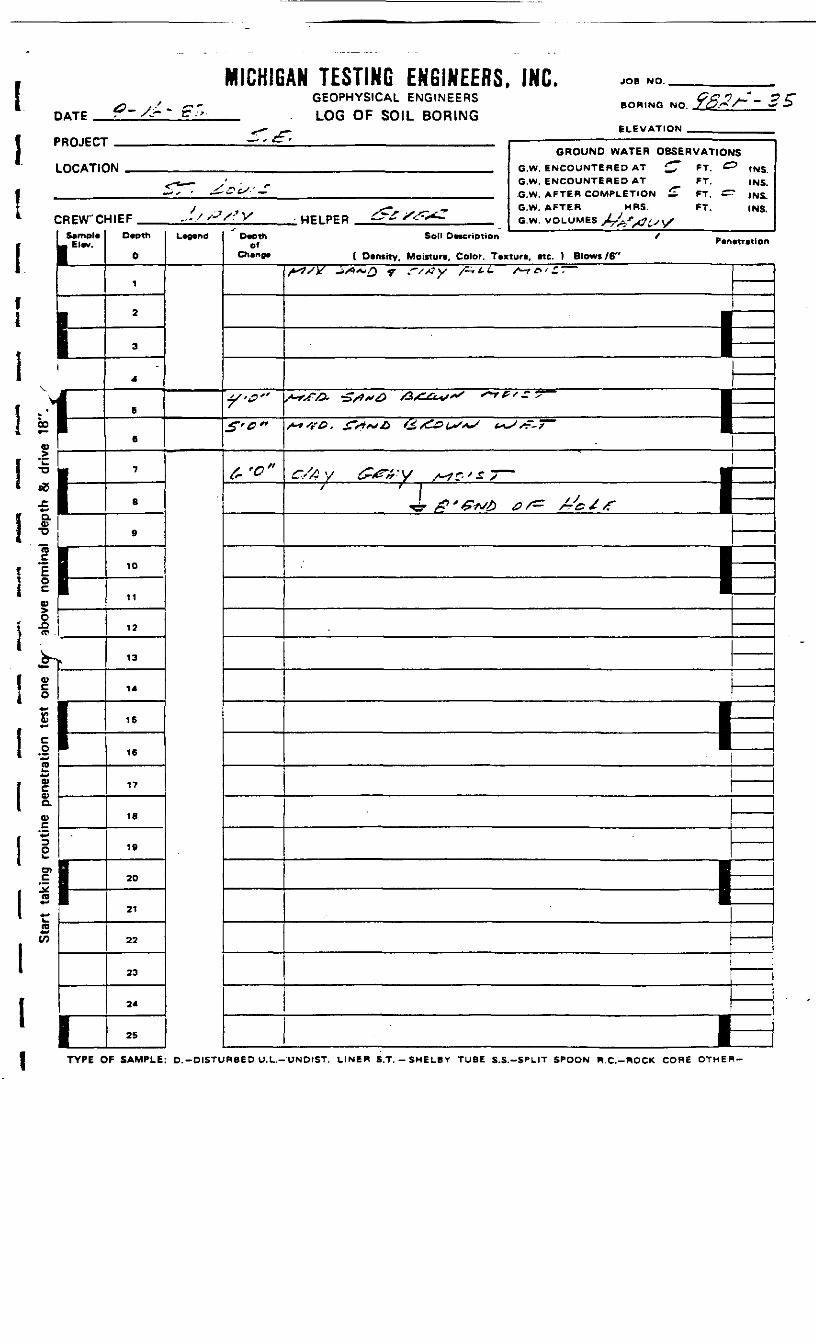
MICHIGAN TESTING ENGINEERS, INC. JOB NO.
DATEGEOPHYSICAL ENGINEERSLOG OF SOIL BORING
BORING NO.
PROJECT
LOCATIC
C
V
9
l>>
5B^
>5 i
REVTC
-- 1= I'I —• Pll
*1IIill|lrfVs;32.
D
•*
i 1^
t3
0
1
1i
1
^^^N
HIEF .,-//'-7/:'V HFIPPR ^f X^X^TDepth
0
1
2
a
4
5
6
7
8
9
10
11
12
13
14
15
16
17
18
19
20
21
22
33
24
25
L""d^*
Depth Soil Descriptionof
Ch»rtO» ( Dentitv, Moiflore, Color. Tex
^-<?"S-c"
f. '0"
GROUND WATER OBSERVATlOfO.W. ENCOUNTERED AT £" FT. ^G.W. ENCOUNTERED AT FT.G.W. AFTER COMPLETION £ FT. ^G.W. AFTER MRS. FT.G.W. VOLUMES jLJffjtft^jy
JS5 INS.
tNS.INS.INS.
Penetrationtun. etc. ) Blows /6"
^^y ^~Q , r,*y *.,.<. ~»,z.
S«fA -S*«6 ****," -"
~«t>. £•**£, &&>*,*; *.
r/AV &PVY ^rxr-
' 1 -"tfVuiO
f~ ' I
j j*^ * ^B
1 —— : —————— I—<;? /^ X-i / *f 1
———— 1
———
———
ii
i—
00
I
l
TYPE OF SAMPLE: D.-DISTURBED U.L.-UND1ST. UINER S.T.-SMELBY TUBE S.S.-SPLIT SPOON W.C.-ROCK CORE OTHER-
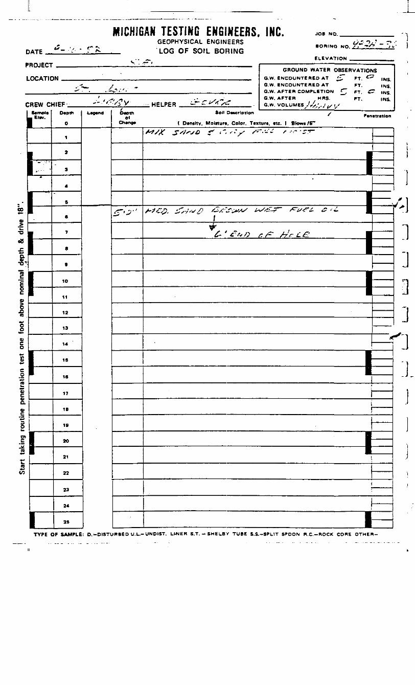
MICHIGAN TESTING ENGINEERS. INC. JOB NO.
DATEGEOPHYSICAL ENGINEERSLOG OF SOIL BORING
V . •— *
BORING NO.
ELEVATION .PROJECT
LOCATIC
C
L
>
*EW D
Elev.
GROUND WATER OBSERVATIONIM S W SNCDUNTFR6D AT £ ff &
^.-^_ / _ G.W. ENCOUNTERED AT FT.•^ • .t~J;'- ~ ._ Q.W. AFTER COMPLETION £J pT J=
',.-,-, -- * „ „ G.W. AFTER MRS. FT.4IEF "" '• /* y HELPER — *" ^* S~ a.w UOLUUEB Jj. •.,...,
Depth
0
1
2
3
4
B
6
7
B
9
10
11
12
13
14
16
16
17
18
IS
20
21
22
23
24
25
, —— , Depthel
Change
£-•*•'
JS
" INS.INS.
" INS.INS.
Soil Description /* Penetration
( Demity. Moisture, Color. Taxturt. etc. ) Blowi /6"
/•7/Vf ^s'jrjQ +* t~. ' • jS S~-'-~ /" •'--"' ' 2~
I
•I1
——
- -- ~- ,~ • t)/
^"
£- J £.' f*O £ /^ far L£^ H
—————— 1
*I
—————— |
i—
00
»
•o
.01C
OO)aV
po>.*
CO
rn
TYPE OF SAMPLE: D.-DISTURBED U.L.-UNDIST. LINER S.T.-SHELBY TUBE S.S.-SPLIT SPOON R.C.-ROCK CORE OTHER-

I MICHIGAN TESTING ENGINEERS, INC. JOB NO.
DATEGEOPHYSICAL ENGINEERSLOG OF SOIL BORING
BORING NO.
ELEVATION _1 PROJECT
LOCATK
• CREW C
r Ir1"'1i •fI ^fi 00
u
1 «4 oU .
••• •
I D.'ft)
*
1 11 -
03
!?7O
1 i*-
li_ k.
V
|1cn
I -S;ra<£ii
!
GROUND WATER OBSERVATION*1W G.W. ENCOUNTERED AT J» FT. -
S^^- / G.W. ENCOUNTERED AT FT.-xx' ' £~-&tSSf G.W. AFTER COMPLETION ^ FT.
/ , - j^ s ~ " °'W- AFTER / MRS- FT-rllEF ^-'tf&V HP1PER G-&rsF,*Z Gw VOLUMES J~-j's*.m/
O«Dth
O
1
2
3
4
S
e
7
8
0
10
11
12
13
14
15
16
17
IB
19
20
21
22
23
24
25
L^« Depthof
Chane*
f'C"'"*
JS
"" INS., INS.' INS.
INS.
Soil D«crlp<lor / P.™,,,,lon
( Dtftsrty, Morcturt, Color. Ttxtur*, «c. t Blows /6" '
/-/^ JT^^> .^4-^^ ^./^ ^X^£9"
e ss*y r#r~ss5 t-s?-rx.'0 *-* o'± * —
^ 1^ ' 1
———————— 1.•
———————— 1———
1 ___
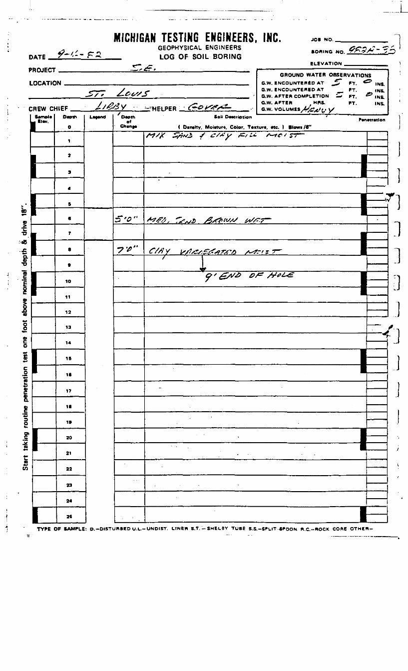
DATE
MICHIGAN TESTING ENGINEERS, INC.GEOPHYSICAL ENGINEERS
_ LOG OF SOIL BORING
JOi NO.
• ORINC NO.
ELEVATIONPROJECT
LOCATIC
CREW DSemole1 Elev.
1-
I-r
GROUND WATER OBSERVATIOfIN CW ENCOUNTERED AT _^ FT *
>r- _,— y -. O.W. ENCOUNTERED AT __ FT.^,/ * £-&<S/3 __ r fi W AFTEH COMPLETION £T *T
J t / P t f i t s~ •* G.W. AFTER MRS. «T.<IFF ^/^oy ^«PIPER - fr^X^/*^- e.w.voLUM«^>-.^.iy
Depth
0
1
2
3
4
S
«
7
S
ft
10
11
12
13
14
IB
16
17
11
IB
20
21
22
23
24
28
Legend Depthof
Chenge
:T'*"
^ '£
IS
INS.INS.
^ INS.INS.
Soil Deurlption ' _Penetretlon( OensrTv. Moisturt. Color. Texture, etc. 1 Blows /C"
/*?/)( jSvAii T^ tfT/'+'l/ /CT/ fci S^~fC ' *?7~~ \S ——————
——— 11—I "1pd
„, * " ———— iC//f Y }s/}/£s.£Z?#7>rt> s*tf?t r T"~ •
^ r 1^ x £/v& &f* /y*?/^£" H
1I|| ——
_ ——— J*V
-
———— i.
i—
1
I•+rf
8
one
outin
e pe
neak
Star
t
]
TYPE OF SAMPLE: D. -DISTURBED U.L.-UNOIST. LTNER S.t.-SHELBY TUBE S.S.-SPL1T *POON R.C.-ROCK CORE OTHER-
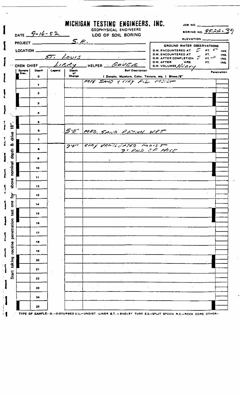
DATE
MICHIGAN TESTING ENGINEERS, INC.GEOPHYSICAL ENGINEERS
_ LOG OF SOIL BOFUNG
JOB NO.
IBORINO NO.
ELEVATION
"•
PROJECT
LOCAT1C
- c
'-00
o
•D
*•
•o
REW CSemple
1*F*CP I
in0)
o
Ic.0"*-aa>a>D.w
iO)
rre
,—>»/. ' " —————————————————— " ' ————————GROUND WATER OBSERVATIOP
•\ft ' B W, FwrO»lWTeREp AT _^.- *T, C
. —— y G.W. ENCOUNTERED AT FT.-S/« /-&UJJZ __ G.W AFTER COMPLETION ^ rT"^5
/ _ ^» -" G.W, AFTER HRS. FT.mEF ^ '/ttfV WPI PER « r- > «-V. x^ e.w. VOLUMES jJs- * ^. .
Depth
0
1
2
3
4
S
6
7
8
B
10
11
12
13
14
15
IB
17
18
19
30
21
22
23
24
25
L^nd Depthof
Cheno*
5-t>"
7'e"
- r ' -f
JS
INS.INS.INS.INS,
Soil Description / .
( Densitv, Moinure, Color. Texture, etc. ) Blowt/6"
S^S)f £st>^s£ f {'/£ y /^s£- /-*?*'/ £~ ™"
—————— 1•
—
—————— 1
1-
I k
1 I* *-
*tf
I !
TYPE OF SAMPLE: -D.-DISTURBED U.L,—UNDIST. LINER S.T. -SM£LBY TUBE S.S.-SPLIT SPOON R.C.-ROCK CORE OTHER-
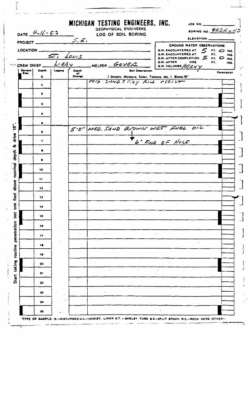
DATE
MICHIGAN TESTING ENGINEERS. INC.GEOPHYSICAL ENGINEERS
_ LOG OF SOIL BORING
JOB NO.
BORING NO.
ELEVATION _PROJECT
LOCATIC
C
i1i
;
ii23
REWO
ElM.
I-
1-
1
GROUND WATER OBSERVATION»N i?w ewcauNTSRen AT ^* »T. C
_g™ /' ^ G.W. ENCOUNTERED AT FT.
-IICF ^•/ ^/3 V HFI PER £-6 Vg/2. G;w; VOLUMES V-T^t ,* \sDvpth
0
1
2
3
4
6
6
7
8
.
10
11
12
13
14
IB
16
17
1.
IB
20
21
22
23
24
25
L^nd Oapthof
f'D"
US
7 INS.INS.
^ INS.INS.
Sol« PMCriptlon /Pcnitwiofl
( Oinsitv, Moiftur*, Color. Tvxturt. «e. 1 Blowi/B"
/"^^X i'^A/^J r ".' y /C/i£ X-/5 / s 7" "
————————— 1Nmi—^^^f
—— -^ ——— <8^ ^ (
^ * ^VW^ ^ A" /4^9 £<£* •
——••
I
1 "
—————
———— **
1 ——
——————————————— 1
————————— I
1
00
es
: je> CDf +•"
! rto*•>(O
.1
0
TYPE OF SAMPLE: D.-DISTURBED U.L.-UNDIST. LINEB-S.T. - SH€1.B> TUBE S.S.-SPLIT SPOON R.C.-HOCK CORE OTHER-
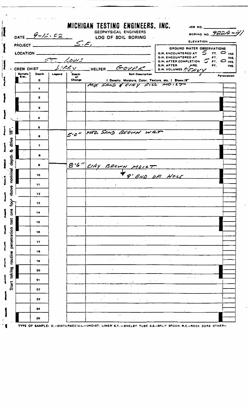
DATE
MICHIGAN TESTING ENGINEERS, INC.GEOPHYSICAL ENGINEERS
_ LOG OF SOIL BORING
JOB NO.
BORING NO.
ELEVATION»ROJtCl
LOCATK
:REW cScmpla- Cl«v.
y
Hi-i-^1
— j r / / — ————————————————————————GROUND WATER OBSERVATIOr
IN G.W. ENCOUNTERED AT ^> FT C.
^—^s- y _ G.W. ENCOUNTERED AT ^ __ FT.-1 ' f .-£-&lS/S -. GW- AFTER COMPLETION '^" PT. £
/ .. - ^^ O.W. AFTER ,HRS. FT.HIEF ^.'/V/^V HPIPER &-0M?A? -. G.W. VOLUMES A>~^ , ., x
D«pth
0
1
2
3
4
B
6
7
8
9
10
11
12
13
14
16
16
17
IB
19
20
21
22
23
24
25
L«9*nd D«pthof
Chang*
£'*"
8'6"
IS^ INS.
INS.^ INS.
INS.
Soil DMcripllon / _ .^ ' Pvnctrnlen( OtntKy, Moitturt, Color. Ttxturt, Me. } Blowc/6"
/*«#r -s^^o f' *v>*» y /=•/ <-£- /^c> / 5 -^-
———————— N1
———————— 1c/dy &/zci~>*s MQS&-T~
± IT^'<£W£ ^>/^ X^^^ 11
•
—————— 1-
—————— 1
I—
00
+•>
1 ^^^ji
c0)aa>
I!1 si rr
CO**to
TYPE OF SAMPLE: D. -DISTURBED U.U-ONDIST. LHNER S.T. —SHELBY TUBE S.S.-SPLIT SPOON R.C.-ROCK CORE OTHER-
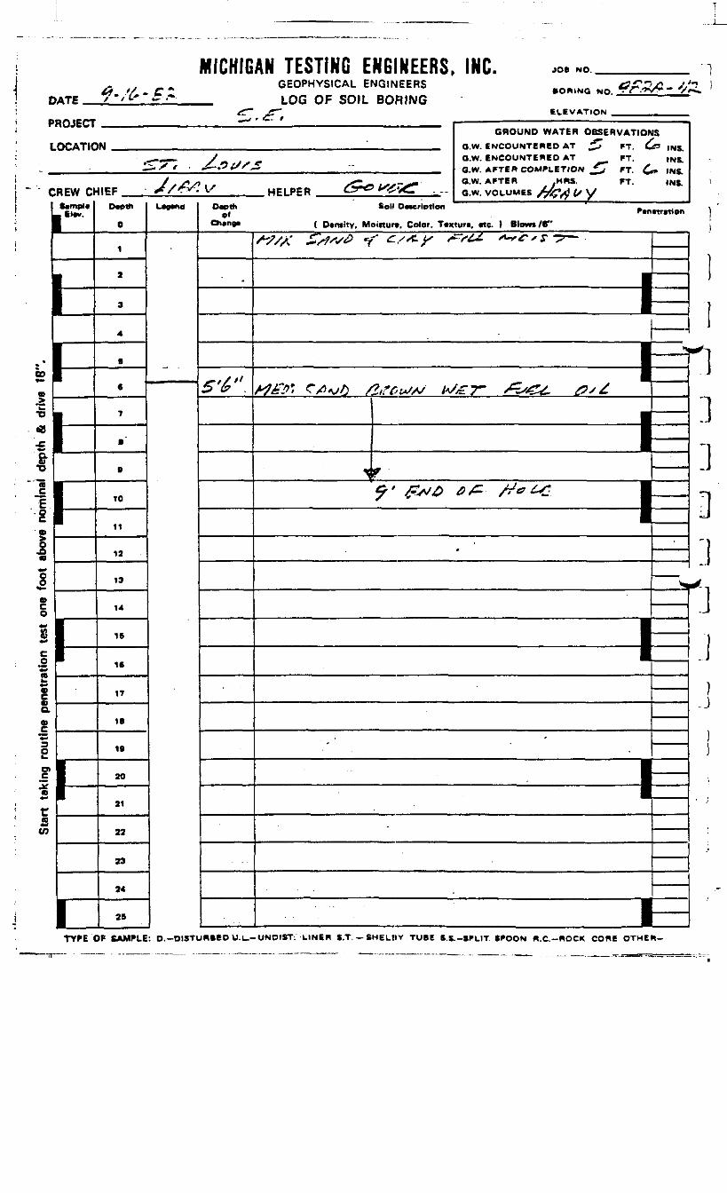
DATE
MICHIGAN TESTING ENGINEERS, INC.GEOPHYSICAL ENGINEERSLOG OF SOIL BORING
JOB NO.
• OWING NO.
ELEVATION _
PROJECT
LOCATIC
CREW Cr
El«v.
>-
GROUND WATER OBSERVATIONSIN " _ Q W ENCOUNTERED AT £ FT &3 |N5
*«-•——- /- j., f Q.W. ENCOUNTERED AT FT. INS.^--X/ ' ~—<P£/S~> " _ __ ___ GW AFTER COMPLETION ^7 FT £. )NR
KEF J/AS? I/ HPl PER &^ K^V^T „ «;*; VOLUMSS A^»^1 /y WDwth
0
1
2
3
4
S
6
7
.
B
10
11
12
13
14
15
16
17
IB
IB
30
31
22
33
34
25
LWd Oapthel
f
S'&".
Self Ocwrlptlon _
( Density, Moinurt, Color. T*xtura. «e. 1 Blows IV
/~?/y £/$ss& ff c-/st-¥ ^f&z. *-*&*$ "2 - • i————— — — ^
i -i.
i—_—— L
1
-
————— I
CO
m«•*.8
esou
tine
pene
akSt
art
0
TYPE OF SAMPLE: O.-DISTURBED U.L.-UNOIST. LINE* S.T. — SHELflV TUBE S.S.-SPLIT SPOON R.C.-ROCK CORE OTHER-

MICHIGAN TESTING ENGINEERS, INC.GEOPHYSICAL ENGINEERSLOG QF SO)L
JOB NO.
BORING NO.
ELEVATION
IPROJECT
LOCATIC
;REW cSample
L Elev.
.
J——1
GROUND WATER OBSERVATIONSIN .... a.w ENCOUNTERED AT ^3 FT *^ .ue
<r-»—« - / G.W. ENCOUNTERED AT FT.— »/ •> <£-&tS/£ ' -S.W. AFTER COMPLETION ^ FT.
/ ^-r^»> ^^T f± . j j e»> ., -G.W, AFTER _ MRS. FT.H1EF J-/&fZy HP! PER :"-*'*r>ev<- B w: VOLUMES .A^Vl /. L/
Depth
0
1
2
3
4
5
8
7
6
• fi
10
11
12
13
14
15
16
17
18
19
20
21
22
23
24
L"™Depth
of
S'6>"
"
INS.INS.INS.
Soil Description ' BP*netretion
( Demitv, Moisture. Color. Texture, etc. ) Blowi/6"
1
_ j
——
—————
-
\-
————————————— 1• " •
--
-
I si v
-I
Ivo**S
V
0)aa>1 1vc
1 5:I
aW
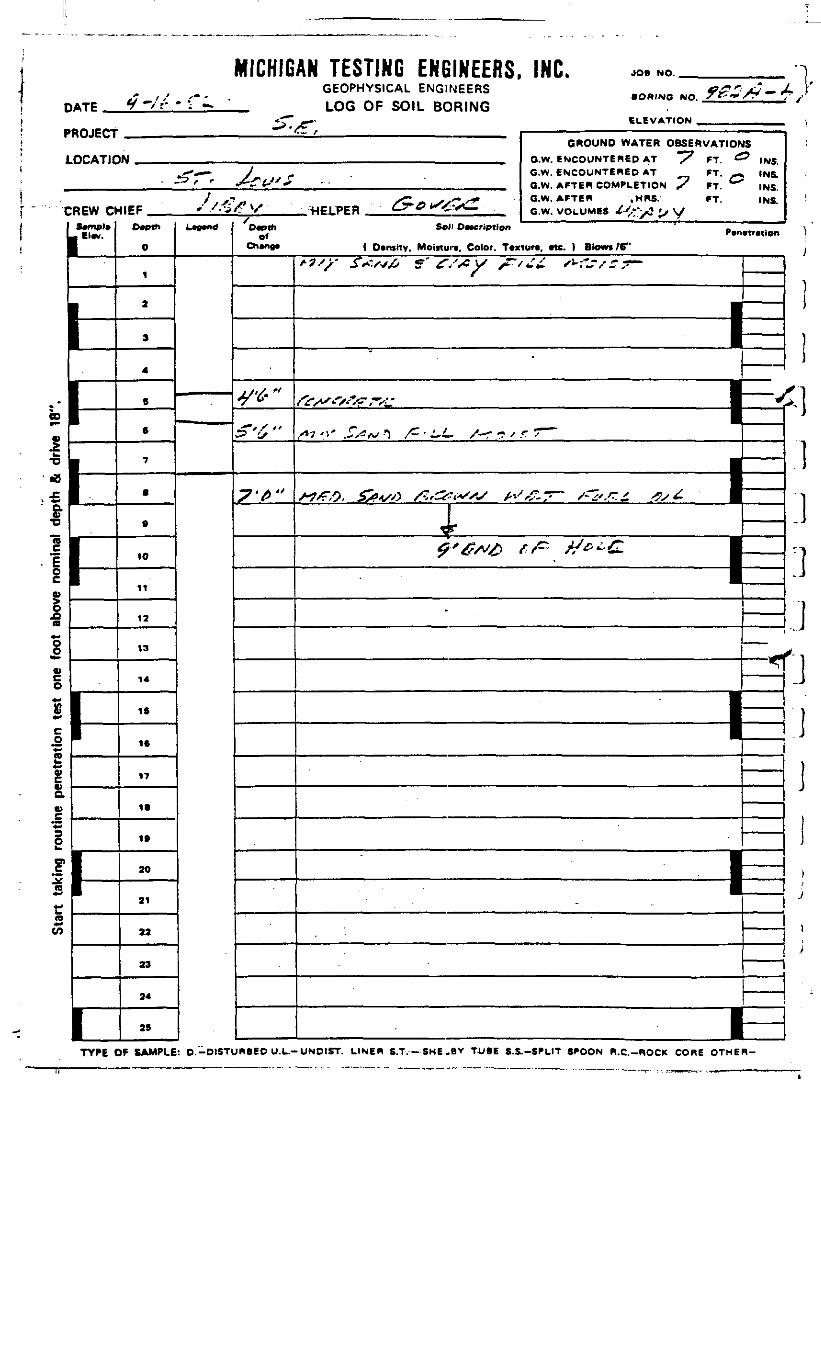
DATE
MICHI6AN TESTING ENGINEERS, INC.GEOPHYSICAL ENGINEERS
__ LOG OF SOIL BORING
JOB NO.
BORING NO.
ELEVATION _PROJECT
LOCATIC
C
ss1•o•B-£fr'SE£
1-s£os4^
I+•*
S*-s•>aI=s1*si•«to
REW O•mpl»El*w.
1
GROUND WATER OBSERVATION1W „„.„...„ OW etOCQLJNTERED AT ~7 tT £
^T-— ~ 7 ^ G.W. ENCOUNTERED AT PT. —• -^ f f ^CtS' + •• _ ||MI_ Q_W. AFTER COMPLETION S '*
/,.** SC»*^s~'+ G.W.APTCR ,HRS. FT.41EF *• /• 'J/r V HELPER t^-^ " ?* -;..,11. a.w. VOLUMES U.-^ *, y
Ocpttt
0
1
2
3
4
S
6
7
•
9
10
11
12
13
14
IS
1ft
IT
18
19
20
21
22
23
24
25
L*g*nd
ts5 INS.
INS.INS.INS.
0~* S°" °—— W«" P.n.w.,lDn
Ch»ne* ( Dtnsitv. Moitturt, Color. Tcxtun. Me. } Blows /6"
-^tf"
v-5"'i "
^'^"
^S'V S*n& 5' £S#y £'/££ *?J'/S7—
———— li—^V .'x^<r,-VL- 1 ^
•/*7'i' ^^--5 /~-i-L- S~? ? * r * " '
,•I
Wrft, $#4/*> /ZttfAS fr'&s /~&.F.£ $s£. I
tr 1^'^A^> ^ ^-^ 1
|
1 ——————————————— —
——————— N
' ——————— 1=1
i—
1
)
j
)
!
f1
I:i:ijf:i|
)i)ij
)>
TYPE OF SAMPLE: D.-DISTURBEO U.L.-UND1ST. LINER S.T.— SHEILflV TUBE S.S.-SPL1T SPOON R.C.-ROCK CORE OTHER-
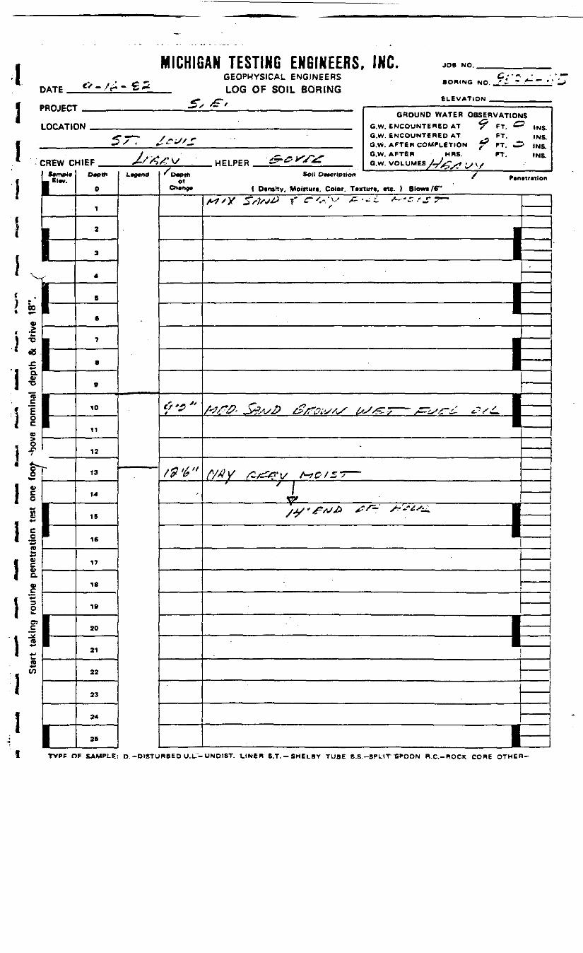
DATE
MICHIGAN TESTING ENGINEERS, INC.GEOPHYSICAL ENGINEERSLOG OF SOIL BORING
.*• *—
JOB NO.
SORING NO.
ELEVATION _PROJECT
LOCATK
CREW C
1f-r
N
r
GROUND WATER OBSERVATIONIN G.W. ENCOUNTERED AT *? FT £
5 ~""~ / - • - / * • - G.W. ENCOUNTERED AT FT.* ' *-^i//— __ GW_ AFTER COMPLETION *< FT ^
y . . • — _ ixvv °-w- *FT6R HRS- rr-HIEF ^-//VX* V/ HELPER £?~^ .^^ , ,.. o.w. VOLUMES /- >* LJ V
D«pth
0
1
a
3
4
B
6
7
0
9
10
11
12
13
14
15
16
17
18
19
20
21
22
23
24
25
LWd
•— ^••^ni
JS
" !NS.INS.
? INS.INS.
olChmrtgi ( Dcnstty, Moiftun, Color. T«xtur«, «te. ( Blowi /S"
/
/94"-
f I
—————————————
—————— l*1 ^^ r" 1
i m* n
/•"J/-™' jy?/V& &/!r&bS/>S fa//^ s s^LSS~f <-V*C •
-
WY r-&?v ™>z —/ j i
——
.
—1—
*1 =* ^"* ^-
•I0)
™-D
1 SI ^
re
i!1
CP
Ox»
0
I Mft
S
ll<D
1 ft)
°-
MO)S
l!I1
CO*•V)
TVPP OF SAMPLE: D.-DISTURBED U.L.-UND1ST. LINER S.T.-SHELBY TUBE S.S.-SPL1T "S^OON R.C.-ROCK CORE OTHEH-
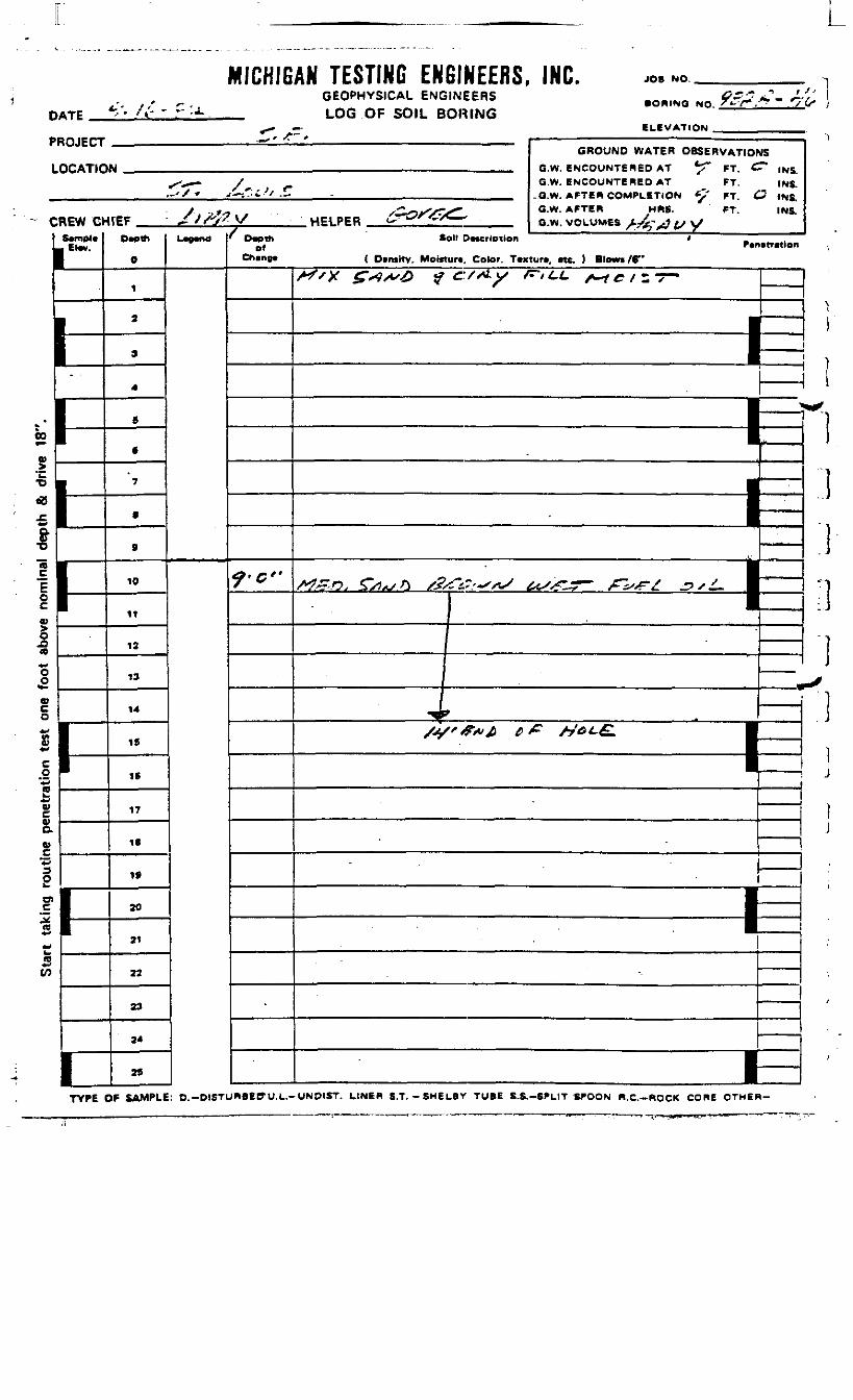
DATE
MICHIGAN TESTING ENGINEERS, INC.GEOPHYSICAL ENGINEERS
_ LOG OF SOIL BORING
JOB NO.t '•
• ORINO NO. *-";
ELEVATION
PROJECT
LOCATIO
Cl
00
0),>•O
«0
£.
1n£Fo0)§.0(0*•*00
»co*p*£**
I*-<a*•*u
1gssI.*«***rfis»-
CO
*EW ChSempJeEtev.
*^f />- , ' ••"" ——————— • ^GROUND WATER OBSERVATIONS
N mmmim a w ewrniiNTPRen AT *<" ET £T* IW.- -' / O.W. ENCOUNTERED AT FT. INS.
._'/* rf—— .^i^/ .-. - „...,.,,., ___ , , «*« A^TPB COfLtT'CM ^' FT C? INS
y s, xCoxVS^" G.W. AFTER MRS. FT. INS.irEF JiWV HE! PER i-T^^ /C^ aw VOLUM« >^^^'V
Depth
O
1
2
9
4
8
€
7
•
»
10
11
12
13
14
IS
16
17
IB
IS
20
21
22
23
24
75
Legend/
Depthof
Chenge
?'G"
Soil Description < MPenemtlon< Ovnsitv, Moisture. Color. Texture, etc. ) Blowi/f
A^x £<**'<& $ c/st-y F-tCL s-i c , - -7-
————— 1—
• *|I|J•I•
,,h—
^—— i ————— h
/tf'<F#A £> £ /7&^£. ••I
1———
I-
———————— feE.
!
i-
1)
)i1ii0"i
P>
.1j
ijii
>TYPE OF SAMPLE: D.-DISTURBEDU.L.-UNDIST. LINER S.T.-SHELBY TUBE S.S.-SPL1T SPOON B.C.-ROCK CORE OTHER-
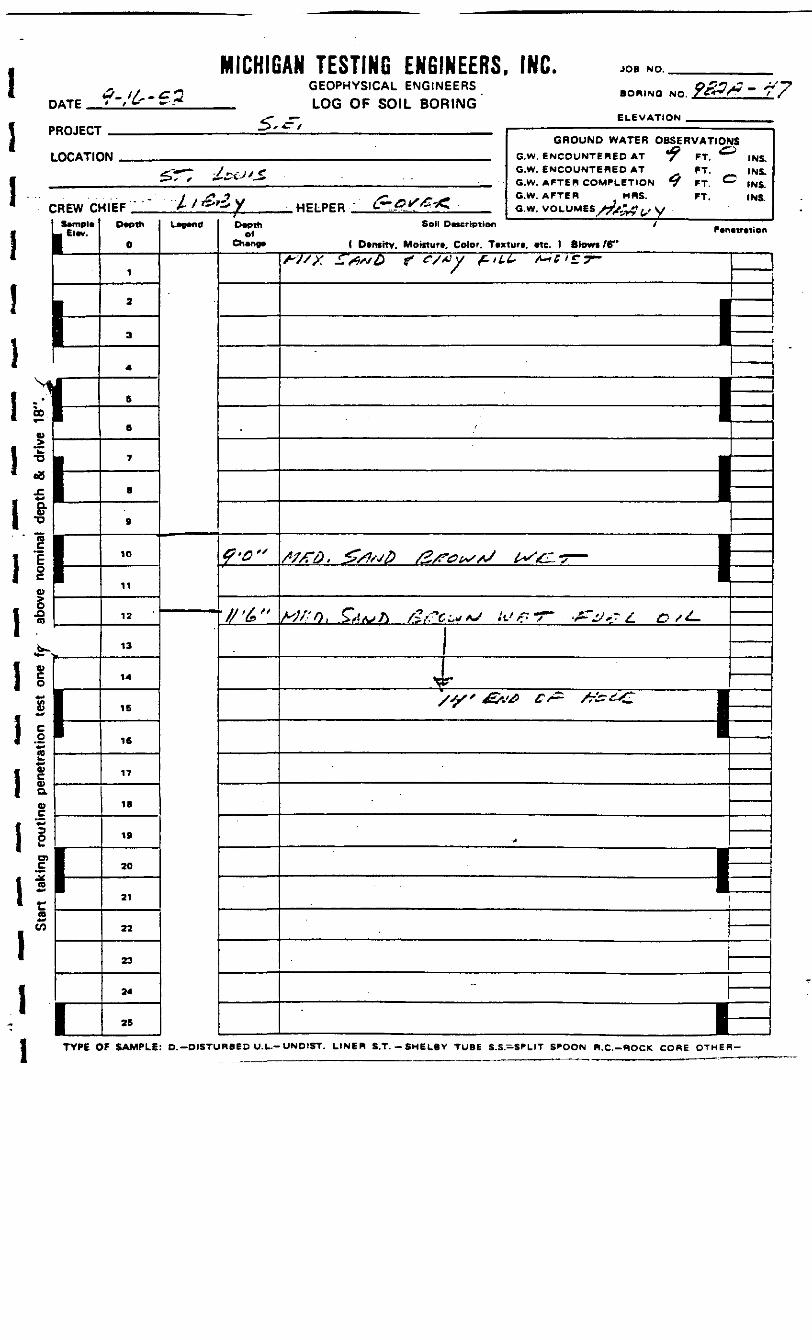
D
I I1 ,;1!1
miomu
ATE ?-/&*-€ *
^OJECT
OCATIC
REW ClSempl*El*v.
1^ V§> . -1
l h1efl •, t F^l
MICHIGAN TESTING ENGINEERS, INC. JOB NO.
DATEGEOPHYSICAL ENGINEERSLOG OF SOIL BORING
BORING NO.
ELEVATION
PROJECT
LOCATIC
:REW Dtempi*. Ele*.
J
F
1
GROUND WATER OBSERVATIOf>N - e w. SNCOMWTeBEO AT *T
£.«•—. y G.W. ENCOUNTERED AT FT.^S * ,——OU/—— _ QW AFTER COMPLETION BJ
/ y, - x« , " ' G.W. AFTER MRS. FT.•11EF -A/«*«y HELPER &-£r/f *Z a.w.voL-uuH AJ**t£>
Depth
0
1
2
3
A
S
6
7
.
B
10
11
12
13
14
15
16
17
IB
19
20
21
22
23
24
25
Lw"d*
Depthof
Change
£'&"
«
INS.INS.INS.INS.
Soli Description _Penetration
< Density. Moiiturt, Color. Texture, etc. 1 Blowi/B"
/^XA- ^/x,/. ^ «y/«X ^'*^ <^*'S7-
———
1 —— •
1
' I
&Af/} G Jy& C~j£ , ••
V\Br***-*c T 'TiTj C ^iifnii n"aHi. t_t * r\*»»6ff» Co^kS^ •
V^^V ^Cv«*fs%^£Ct£ 1 "— —— 1———— i ——————————— —————
M——— 1•'
——— 11—
r
«*
IA
esou
tine
pene
akin
gSt
art
;]
TYPE OF SAMPLE: D.--OI8TURBED U.L.-UNOIST. LINER S.T.-SNCLBY TUBE S.S.-SPLIT SPOON R.C.-ROCK CORE OTHER
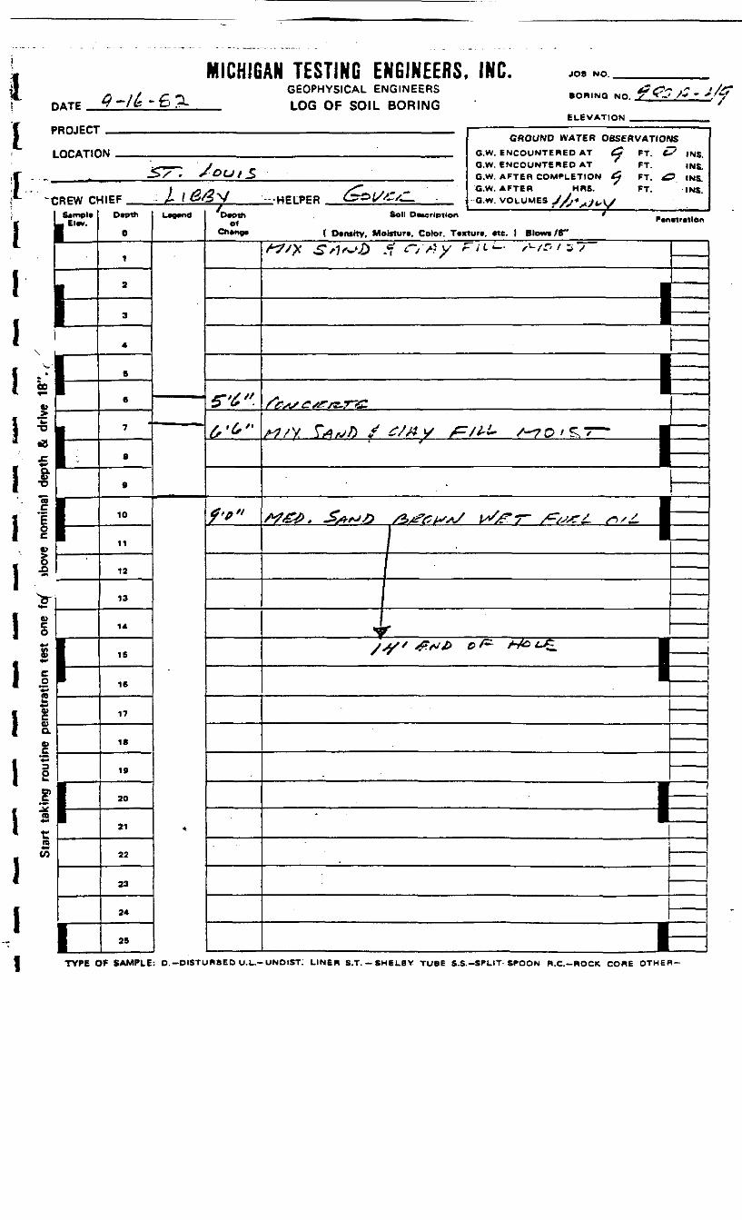
1I
MICHIGAN TESTING ENGINEERS, INC.DATE
PROJECT
LOCATION
f
C oo
1
GEOPHYSICAL ENGINEERSLOG OF SOIL BORING
JOB NO. _
BORING NO. ~7.*'•»'
ELEVATION
TYPE OF SAMPLE: D.-DISTURBED U.L.-UNDIST: LINER S.T.-SH6LBV TUBE S.S.-SPLIT-SPOON R.C.-ROCK CORE OTHER-
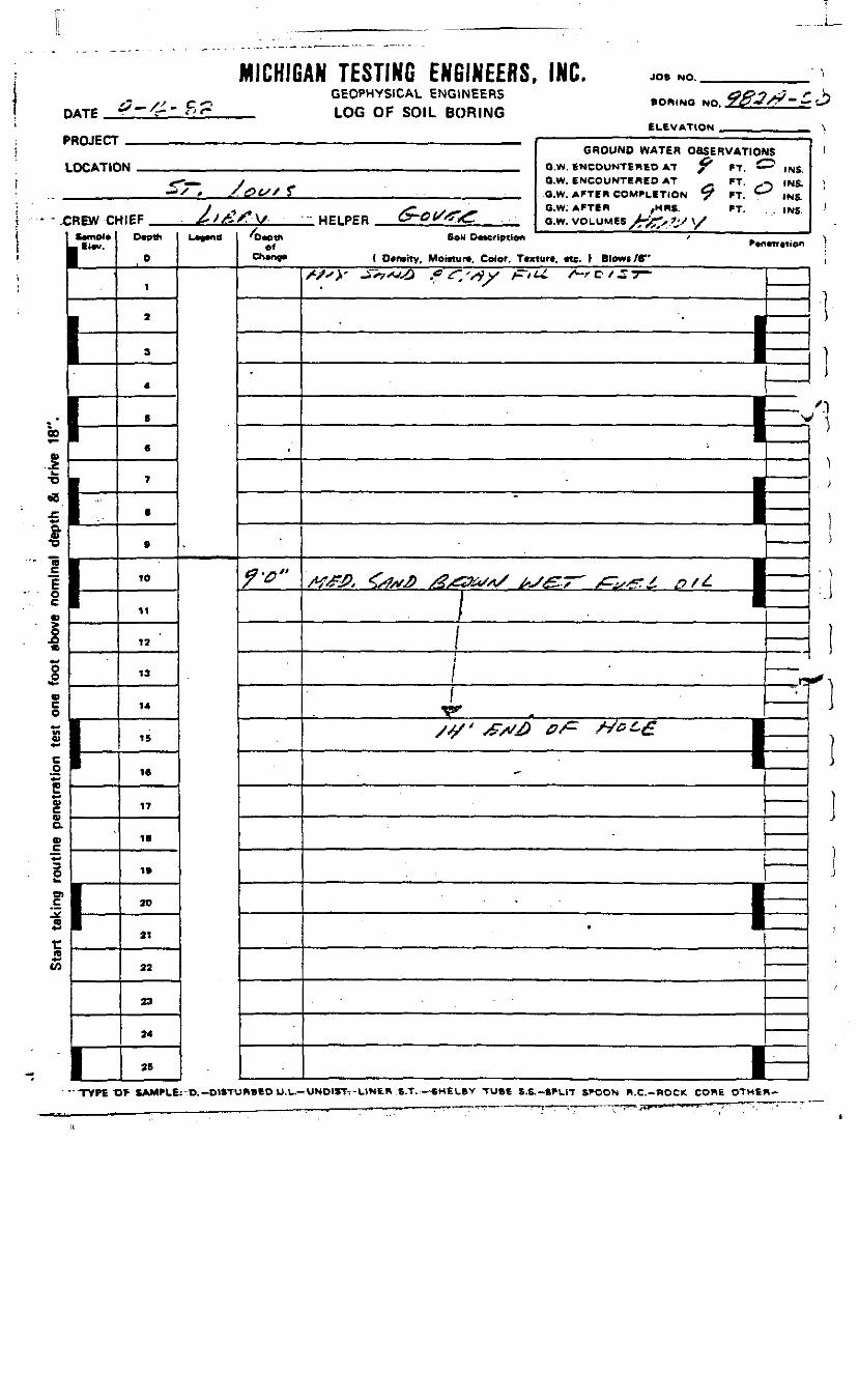
DATE
MICHIGAN TESTING ENGINEERS, INC.GEOPHYSICAL ENGINEERS
_ LOG OF SOIL BORING
JOB NO.
BORING NOELEVATION
-~ J?
PROJECT
LOCATIC
-C KEW Oftvmol*El«v.
L|-
1
GROUND WATER OBSERVATION1M _ O.W BNCOUNTPHSD AT f *T C
<•-—» y O.W. ENCOUNTERED AT FT. ,— *X * ./.0tSJ T _„,._ Q-W AFTER COMPLETION ^ rT C
/ , >*" v*^*. °'W- *FTBB /MRS. FT.•IIEF .,._ , ^yA/TV/ '• HPIPER C2"~OtS&& awvnLUMEs /-^-',?'/\y
Dwth
0
1
2
a
4
S
6
7
.
0
10
11
12
13
14
15
16
17
IB
19
20
21
22
23
24
25
l_*e*ndof
-
,'
fV"
JS
" INS.} INS.
INS.INS.
So l DMcrlptfon '
( Dcraity, Mo«tur«, Color, Tcxturt. «te. ) Blewi/6"/^X^" _^^VX^) G S~'^y jZ'tLt. S~rC</£7~ I
' ———— —————
| —————————————————— 1
.
———————— 1————— JE:
" ^T ' ' ~" ' Ii
f
————
'
3
——— ———— 1- •
I—
CO
.£
w
|
I
s
•s
"TYPE OF SAMPLE: D,-DISTURBED U.L. UNDIST7-UJNER S.T.—SHELBV TUBE S.S.-SPLIT SPOON R.C.-ROCK CORE OTHER-
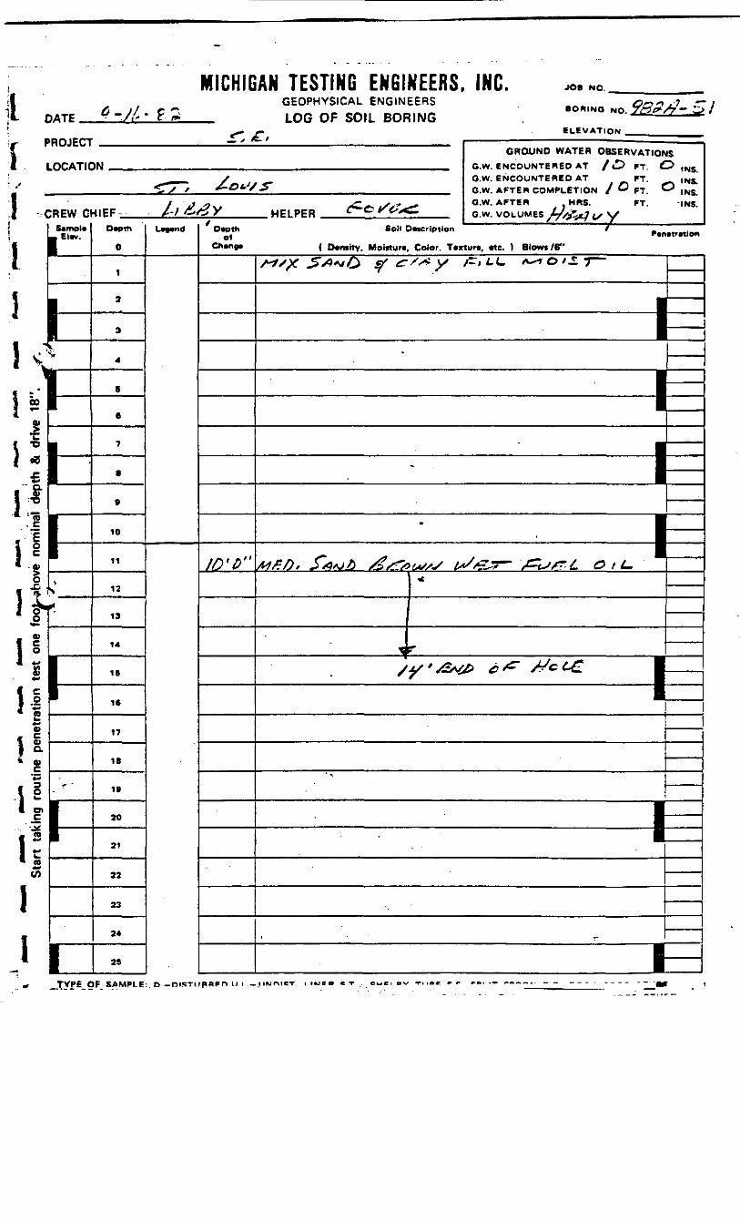
DATE
MICHIGAN TESTING ENGINEERS, INC.GEOPHYSICAL ENGINEERS
_ LOG OF SOIL BORING
JOB NO.
• OR.NO NO.
ELEVATION
~ £>/
[ PROJECT
LOCATIC_*
[ CREW C
fUrnpl*£l«v.
i <1 In'I8
1
S *1 *
J=
I £
. C
. E
It
1|i %\ °ls
M* flB)
t S1 a* 0)
C
I 3h1si «* »
a5ii
p*
V-
GROUND WATER OBSERVATIOf1M .. ._ GW ENCOUNTERED AT / 4^ PT ^
^_,__ y G.W. ENCOUNTERED AT *FT-^ T V > £-&*S/JT G.W AFTER COMPLETION S O p-f (
•4IEF- /-/ ^^X HELPER ^e ^^^T G w VOLUMES J^jy. x/Dwth
0
1
2
3
4
B
6
7
8
e
10
11
12
13
14
IS
16
17
18
19
20
21
22
23
24
25
L*".ndD«pth Soil Description ' _
Ch»no» ( Dtmitv. Moiituri, Color. Ttxlurt, «tc. I Blows /6"
ID'D"
IS•^ tNS.-* INS." INS.
INS.
•tmion
_____ f „ ^ _______ ,
————————————————— 1
————————————————— 1
———— : ——————— IMFft* S*Q*j£ s£/**/>u/sS ts/&5~' /^isS? ' L O t L~
=—
\-^ r
-
—————————— 1
, _
_ifVPE_pF SAMPLE:. D — niBTUpBFn II i — ,1 iwrMCT i iweo «T . cue . «.v TUBC *»• ^B. .- "---•• - -

PROJECT
MICHIGAN TESTING ENGINEERS. INC.GEOPHYSICAL ENGINEERS
_ LOG OF SOIL BORING<r j-
GCt* *BORING NO Tt>* //
ELEVATION
LOCATION
CREW CHIEF Death
Ei«v.
HELPERD»oth
elSoil Description
( Demttv. Moiitur*. Color. Texturt. etc. ) Blowi/6"
GROUND WATER OBSERVATIONSC.W. ENCOUNTERED AT ^ FT. ^? INS.G.W. ENCOUNTERED AT FT. INS
C.W. AFTER .MRS. FT. INS.
G.W. VOLUMES^rT^tJ^ V
"I
o£>(6
O
Q.
0 \
O).£!irer lratn
I
ID
11
12
13
14
IB
16
17
IS
20
21
22
23
25
S'cr
i
t
3 ]
ITYPE OF SAMPLE: O.-DlSTUR«ED U.L.-UNDIST. LINER S.T. - SMtLBY TUBE S.S.-SPLIT SPOON R.C.-KOCK CORE OTHER-
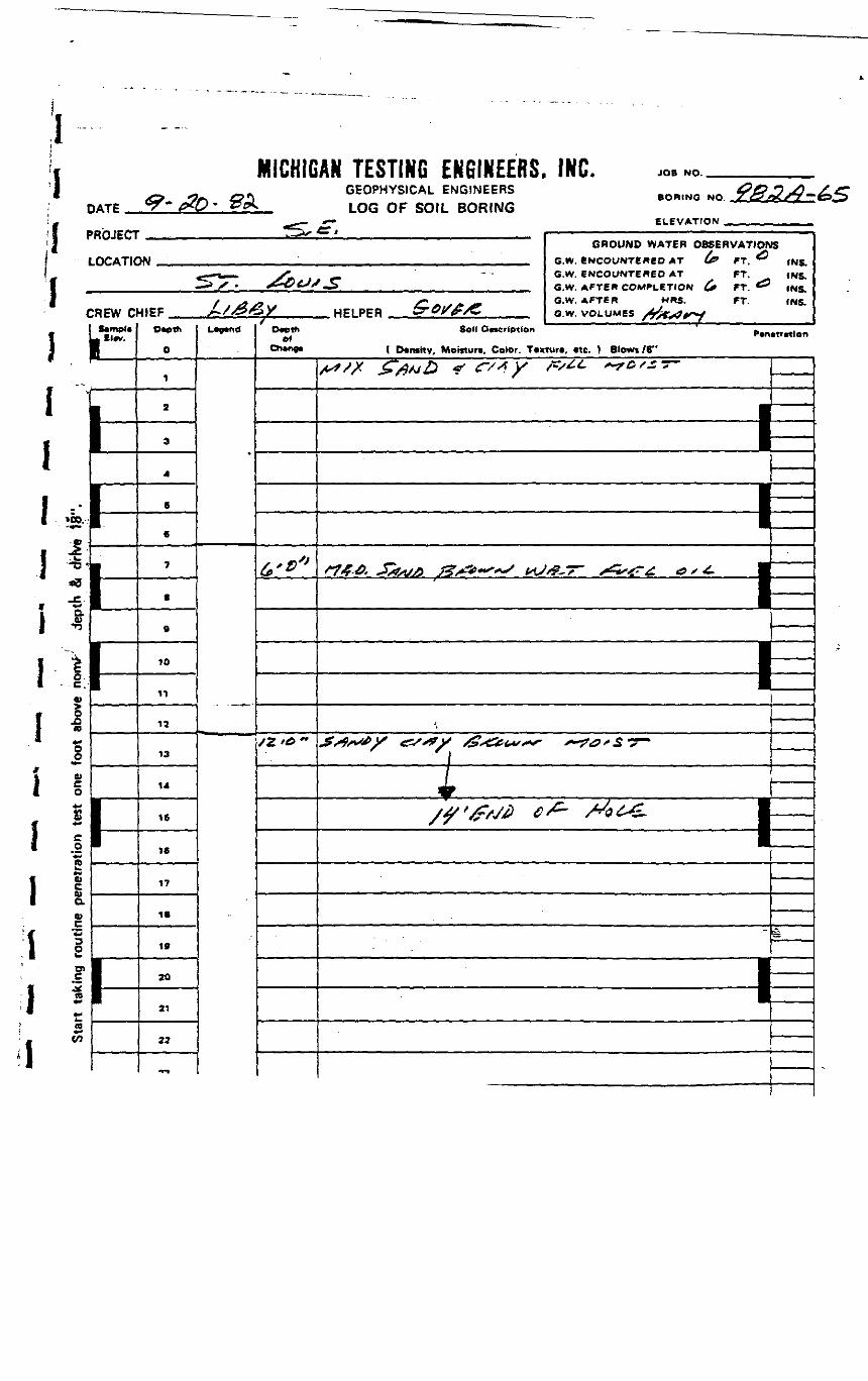
I
MICHIGAN TESTING EKGIKEEBS, IHC. JOB NO.
!l
I
PROJECT
LOCATION
II
i
\\
CREW CHIEF
4•*8
*
8
e*-B)CQ>a
s
sen
10
11
12
13
14
15
16
17
19
20
ai
22
GEOPHYSICAL ENGINEERSLOG OF SOIL BORING
SORING NO.
^S-t -^^ff——-—-—
ELEVATION
HELPERD*eth
ofSoil 0«crlptton
GROUND WATER OBSERVATIONSG.W. ENCOUNTERED AT (*»G.W. ENCOUNTERED ATG.W. AFTER COMPLETION C*G.W. AFTER HRS.G.W. VOLUMES
FT.FT.FT.FT.
INS.INS.INS.INS.
P.n.tr«len
( E>*nsiTv. Moiiuir*. Color. Tvxtun. «te. t Blows /6"
5
_i_

DATE
MICHIGAN TESTING ENGINEERS, INC.GEOPHYSICAL ENGINEERSLOG OF SOIL BORING
JOB NO.
NO.
ELEVATION
PROJECT
LOCATIC
CREW aS«mpl*
1
GROUND WATER OBSERVATIONSbM Q W ENCOUNTERED AT <y ft ^ ,NS
--,«- y O.W. ENCOUNTERED AT FT. INS.S /* i ' -£t24-//-_r . ft W. AFTER COMPLETION ^ FT O ,N«j
Z*j2sA\s /^AtS*^* O.W. AFTER HRS. FT. INS,4IEF ^/>S^»y HELPFR CrOr&SZ: aw. WALUUM 4/* -..*,.*
0
1
2
3
4
B
B
7
B
9
10
11
12
13
14
15
IB
17
IB
19
20
21
22
23
24
25
L~"" of
©•a"& » 0 "
J3.-0*
Soil DM-ription X - __ „._r r_n_tr_tlon
t Dtntltv. Moitturi, Color. Ttxturt. *tt } Blows /B™
^^ sx £**fct& f f/s? y /£/££. x^a/ST*™" I
|
•
J — '• ___ .•1|1•1I
c-.**~a*e | ——•
tf#& . -S-5W_O X? /ST^A^/^ A/^ /^r*/^r7^ _5 / tf- •1
——
_5xfn<PX c^^y ^stfevft/ *#&/$• 7~ j/ - / • - • - ' . - . , _ . , . , , „ ^
•r • __
H
———————— feE
—————
l-i
CO
•3
_-
I1
aJ;
0**
I
ta+*en
TVPf OF SAMPLE: O.-DISTURBED U.L-UNOIST. LINER S.T. -SHELBY TUBE S.S.-S^LIT SPOON K.C.-ROCK CORE OTHER-
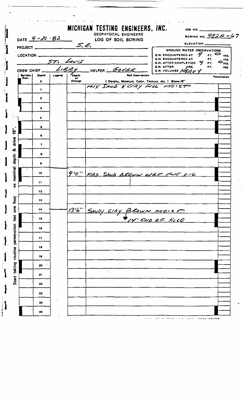
DATEi1ii
MICHIGAN TESTING ENGINEERS, INC.GEOPHYSICAL ENGINEERS
_ LOG OF SOIL BORING
JOB f4O. _
BORINQ NO.
ELEVATION .PROJECT
LOCATIC
C
L
n
REW ClftemeleElev.
1
GROUND WATER OBSERVATION1M _ fi.W ENCOUNTERED AT ? *T, ^
S • G.W. ENCOUNTERED AT FT.^*7~r •£*&f/S*r G.W. AFTER COMPLETION ^ FT
J ^ * '^. G.W. AFTER MRS. FT.•IIEF *•'*%&¥ HELPPB &-6*/S?<<: GW VOLUMES X4r^/> u/
Depth
0
1
2
3
4
6
6-
7
8
0
10
11
12
13
14
15
16
17
1B
19
20 •
21
22
23
24
25
L^< 'Depthof
Chene*
/ &
f3'C'
JS
INS.INS.INS.INS.
Soil Deacrlption Penetr tlan
1 Density. Moisture, Color. Texture, etc. ) Blows /&"
+*sy **<"* f'&<*y <*="U. ^O.ST- ——1••I• i—
! =1
&WM C/*V &**^~ S-«0f*^
± I^ S*f ' -PX/4 & A'c ££ •1
————————— 1
t-
1 liCO
«
•O
•8
a0)•o
! .§
S is:(D**cn
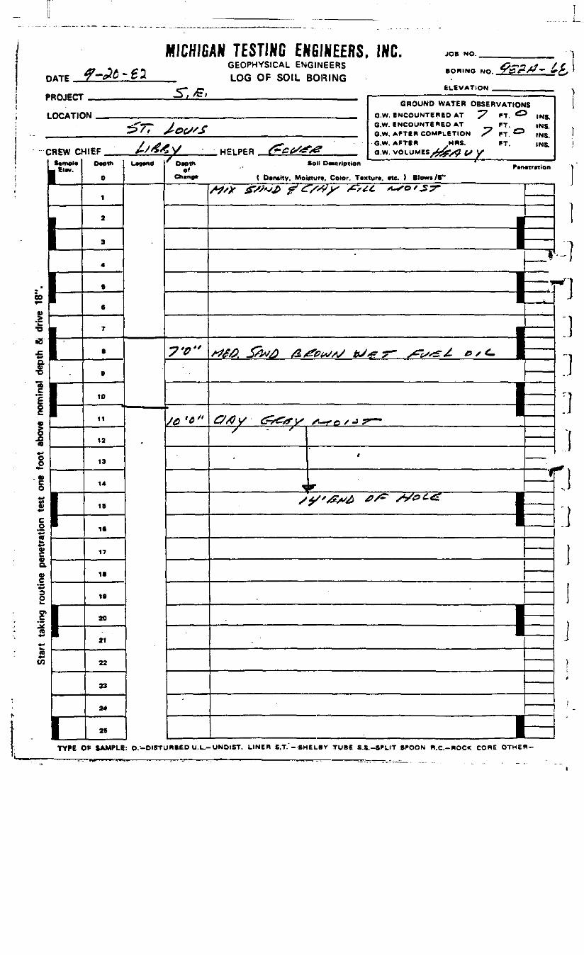
MICHIGAN TESTING ENGINEERS, INC.GEOPHYSICAL ENGINEERS
_ LOG OF SOIL BORING
JOB NO.
BORING NO,
ELEVATIONPROJECT
LOCATIC
C
b5±
i:*IEi*
|:8
- 0)§*rf£;£MafcQ)
0>a««->oi•s~r$V)
REW a•mpl*ClM.
I-
I
GROUND WATER OBSERVATIONSIM nw *MCr>UNTERED AT ^7 «T O m,
•<*7 "• V ,- >• O.W. ENCOUNTERED AT FT. INS,'.' JrQC/Sf aw AFTER COMPLETION -X »T ^ ,N5'
/ > ^ y S* s*t*.->* °-W' AFTBB MRS. FT. INS.«EF A-XO^V HeiPER f~GG/'ffs& ___ a.w. VOLUMES /rferf V y
Dwth
0
1
2
3
4
B
6
7
B
B
10
11
12
13
14
16
IB
17
18
IB
20
21
22
23
24
28
L^«df « ———————————— ——— = ———— - ——— — f. - —————————— .— n
Ch*np« ( Dcntitv. MoUtuni, Color. T«xtur«, etc. ) Btowi/B"
7'0"
/6<C»
M'X **** frs#y mi ^o/^r- i ——I•IIi-'
?.
\ ——
———— fe£//V y &-/£& X /^-^ o / J ™"
/ - '
———————————————————————————— ___ f
:M
I
I-I
MgT~)\
}
piI]t
I
TYPE OF SAMPLE: ©.-DISTURBED U.L.-UNDIST. LINER S.T."--SHEI.BY TUBE S.S.-SPLIT SPOON R..C.-ROCK CORE OTHER-
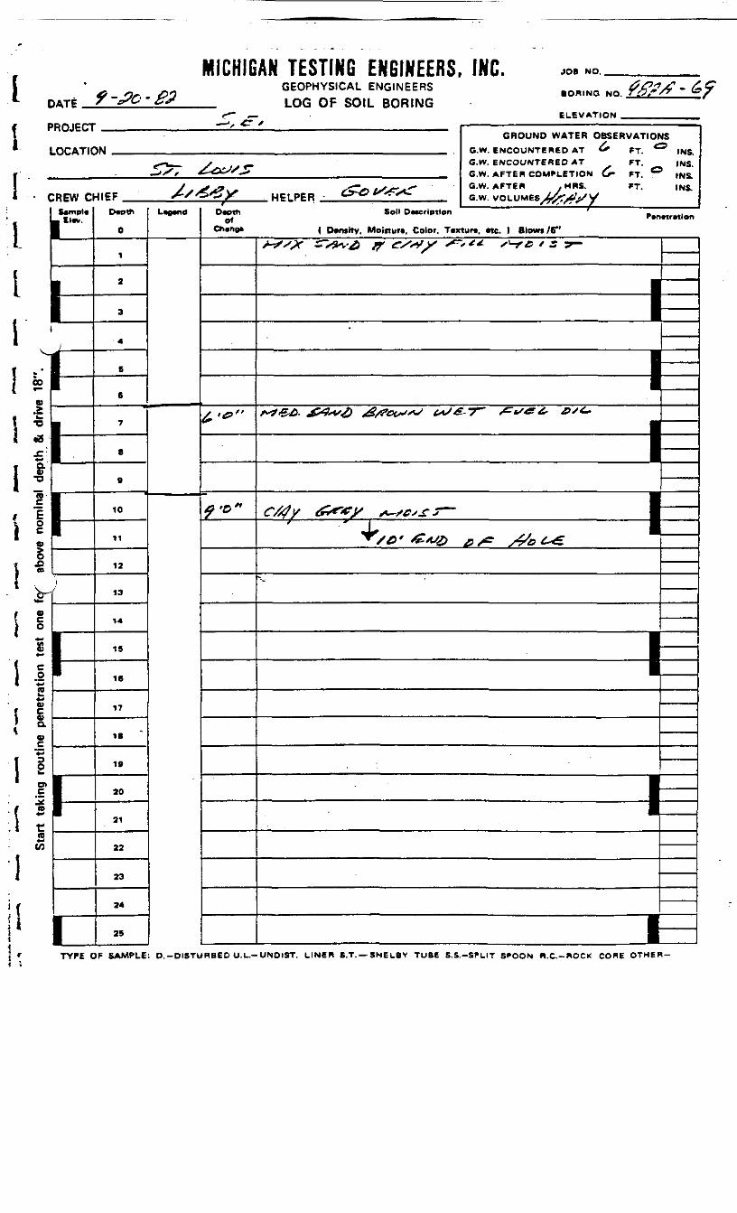
I .! ;!.;iiii r . — .
miuniu
ATF ^ '*&' * &
HOJECT
OCATIC
REW Cl
11 si
i!i»riii if-»
1\ -s1 l — '
f Si :£*-
1 -iI ~2o>
f c1 «{ aw
1 !1 D>
i :to
V)
1(
t
ff~
->, £?
an iconnu cubinccno,GEOPHYSICAL ENGINEERSLOG OF SOIL BORING
/
w
-tlEF XX^-^X WPIPPR - C^Ot^^^
0
1
2
a
4
B
6
7
8
9
10
11
12
13
14
1S
16
17
18
19
20
21
22
23
24
25
'"-"'
•• "•
rOaoth Soli DMcriptfon
ofCh«r«a« { D»nsity, Moiitur*. Color. T«x
f>0»
inf.. JOB NO
BORING NO i&f"/^ ~ «*
ELEVATION
GROUND WATER OBSERVATIONSG.W. ENCOUNTERED AT ^ FT. ^* INS.G.W. ENCOUNTERED AT FT. |NS.G.W. AFTER COMPLETION £• FT. ° INS.
G.W. AFTER . MRS. FT. INS.
tur*. «tc. ) Blows /6"+*,* ^s^& # es«,y ^.** ^cisy- ———
— =P———
^^. x»^> *****> <*;* "
h-' ^^C- >^? ^-^
"~
TYPE OF SAMPLE: D.-DISTURBED U.L.-UNDIST. LINER S.T. —SNEL8Y TUBE S.S.-SPLIT SPOON H.C.-ROCK CORE OTHER-
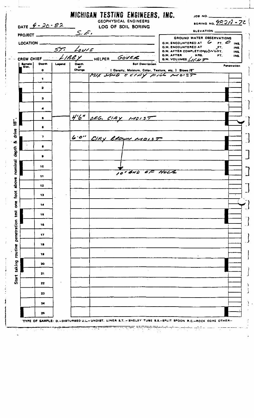
HATP
MICHIGAN TESTING ENGINEERS, INC.GEOPHYSICAL ENGINEERSLOG OF SOIL BORING
JOB NO.
BORING NQ.
ELEVATIONPROJECT
LOCATIC
c
.
00
o.>™•o<eX4-<QV•o
REW Oft*mpl«
Elw.
.:
1•pJCO
it»-
«o*-£*-co"*-c*-«OJQ.
?*-
sfJCst(Q«H
(0
GROUND WATER OBSERVATIOh»N _ G.W. ENCOUNTERED AT ^ FT ^
<--r-- / G.W. ENCOUNTERED AT _FT.5s* +~0£//£ _ Q.w. AFTER COMPLETION/L^Vt^TT
y *j*S> \S S~ *~ -^ O.W. AFTER HRS. FT.4IEF S-/&ey HPIPER GrOl/£/£ Q.w. VOLUMK //^-^ T~
D«)th
O
1
2
3
4
B
6
7
•
B
10
11
12
13
14
IB
16
17
IB
IB
20
21
22
33
24
25
l>9«nd
IS? INS.
INS.INS.INS.
°»* »°" O-"*"'*" P.ftMr.,ten
Ch«n«* ( Dtmtty. Moinur*. Color. Tcxtur*, Me. ) Blows /6"
*/%«
fo"
tt/f ^?**& f £SSJy s=zs*^- s^so'57— 1 ___
————————— — —— -E———— 1^1—.^
—/ J—I I —* j mse<**s& e/^ &&4SS. |
~r~
—— (*
————— 1
————— 1
i—
--
' 1
f
-.]]:]r]:ij
i•
1
TYPE OF SAMPLE: O.-DISTURBED U.L.-UNDIST. LIN6R S.T. - SHELIIY TUBE S.S.-SPLIT SPOON W.C.-ROCK CORE OTHER-

I
MICHIGAN TESTING ENGINEERS, INC. JOB NO.
DATE ^-^- f fPGEOPHYSICAL ENGINEERSLOG OF SOIL BORING
SORING NO.
ELEVATION .'ROJECT
LOCATK
:REW c$*mpl«
_ El«v.
1-H ———————
nI
•
"-
GROUND WATER OBSERVATIONIN .__ r. w, Pwcni,iNTCRPD AT *T,
^C^ / ^ O-W- ENCOUNTERED AT FT._>/ - ^> OtfX /_j QW AFTER COMPLETION FT
/ .4 j- X" - -**• G.W. AFT6R MRS. FT.-UEF ^VO^Ty HF1PPR Cy*Gl/tr^ Bw v/n.uMts^V/S^^/T-
Ovptf*
0
1
2
3
4
6
6
7
8
ft
10
11
12
13
14
15
16
17
IS
19
20
21
22
23
Li0wtdfOveth
01Chvno*
•r^X/
7'tf"
asINS.INS.
INS.INS.
Soil DMcription .P*nttritien( Dtntity. Motrturt, Color. Tcxtura, «te. ) Blowi /6"
WX £>!*/£> &<rs*Sf &*<-<- A-^e/c-T" 1 ___
J•
I|
—
—————————— 1f/#v o*e&. **?D'Z7~ •
i
•
•
r//^y &€&**-> A-*=?>_r-r— 1/
1x^'-tf^^ */*" xV^^^r |
—————— i•—————— i
=——
_
eoo>™•o«S
*-&•D3 *
I I
I .".*-e>
1 2• 4 4-
s
V
Va
i «o>J£ra'i s
I ra«^(A
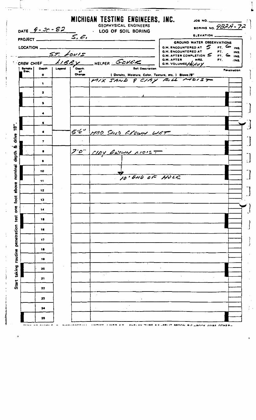
MICHIGAN TESTING ENGINEERS, INC. JOB NO.
D
P
L
" C
«
:a'|
i'**1V
o
ilc•s
ATE T * -3f' "" O *
10JECT
OCATIC
REW Oimpl«
l-£ lA] 1
£ 1ac
o
!*-r2CO
1-
1
^1 x£V
GEOPHYSICAL ENGINEERS .Dq,NO No f^/?- 7LOG Oh SOIL BORING
ffLEVATION _„.„__...
GROUND WATER OBSERVATIOhM aw EMCOUMTEIlen AT ^T FT 6
_, y O.W. ENCOUNTERED AT FT..S^X^T *£~QtSS^ m M GW- AFTEH COMPLETION £T FT &
y ^^ x,* j ****** O.W. AFTER HflS. FT.HIEF X/>?X^y . HELPFR C>-<5*<<-*C aw vniuMEfiX/^^ix
Depth
0
1
2
3
4
S
6
7
a
9
10
11
12
13
14
IS
16
17
16
19
• 20
21
22
23
24
25
L^nd Owihof
5-'^"
^•tf"
.-^ .- ' - rr - - r
JS
* INS.INS.
» INS.• INS.
5oll E)0tCriOliOft ' "•mtf yfj o n( D*nsttv, Motfturc, Color. Tcxturt, «te. ) Blows /•"
/-V* ^V^/v^ f --/^^ xS, -^ox.**- | ———
1
—
—————— 1,
^«^__
____ ^
, " —————— fe(. //) \/ fS'flf.f'-faSf^ /*.-,? 0*1*' •
/ I
1 —————————, —————————————————————————— S£ ——————————————————————————— „ .__ , . . •
S
——————————————————————————————— 1
—————————
1 ————
^ 1I
\
11J
r.}:i:i:i:i'ij)i;

D„ f-?r,.Sfff PROJECT
* LOCAT1Ci
>i •.„I:liiI'-r
REW Cltampl*
I -' 1« r0>
1*11
11
- 1i &r1 H .I 0i < r
! S1 so
1 1**£*-*1 i« •*ra**
f *1 »1 °-
o>
1 iO>
I «1 "• rn*->cnii
1
^™" ^
GEOPHYSICAL ENGINEERS . &£~/~ - ~?• ORINQ NO.™^-''- ' 'LOG OF SOIL BORING
GROUND WATER OBSERVATIONSIN __ „_ G.W. ENCOUNTERED AT G» FT. ^ IMIC;
— --•-*- -^, -f^- G-w- ENCOUNTERED AT FT. INS.^ X" ' ^-&t>'£& _ G w AFTEn COMPLETION «» FT ^O 1MR
/ trfj^ S~* rS^J* G'W- AFTER , / HRS" FT' INS-4IEF S*f&#y HPIPFR &rOCS<F<~ Gw VOLUMES X^Vf/t^Depth
0
1
2
3
4
5
6
7
8
9
10
11
12
13
14
15
16
17
18
IB
20
21
22
23
24
25
' D«pthof
Changa
£•*"
#0"
SO" D^crlptton P»n.U.tiOn
( Darwitv, Motstura, Color. Taxtur*, •te. } Btowi /6"A7/X 5~st*s& f? er/sf)' ^/^- y*-^c/s7^
—————————— 1=
1
———— ^ ——— ^ ^. | ____
1
—————————— 1
——————————— 1=——
. . ——

D
P
L
C
r
*
*
IE
1
1
ne p
enet
ratio
n te
st o
ne
o
!««•*W
MICHIGATF 7~rC* S'P
ROJECT
OCATIC
REW CtS«mpl*Elm.
I-
k
1
J «•
AN TESTING ENGINEERS, INC. J0. «0GEOPHYSICAL ENGINEERS #£>2X7- ^
BORINO NO 7&0*rs *LOG Oh SOIL BORING
j~ ELEVATION _ _
GROUND WATER OBSERVATION1*1 m Q.W. ENCOUNTERED AT FT.
-i / _ o.w. ENCOUNTERED AT FT.^S.r *-^t>/—— O.W. AFTER COMPLETION FT,
4IEF A /^*> / HFI PER 6-° *^^X , , _ a!w! VOLUMES //^XIX/T
0
1
2
3
4
B
B
7
B
9
10
11
12
13
14
IS
16
17
IB
19
20
31
22
23
34
29
L* d
SINSINS,INS.INS.
Dooth Soil Description _ ,of Ptnttfitlon
ChBno* ( Density, Moinur*. Color. T«1urt. Me. ) Blows /S"
S'0"
/,v"
"'——'-'———- ———— J=
I
1£s*C?<^r GrSS? y •————
J ___^ —— g~ t
———— : — : ——— =,
1 "—•
———— 1
1—
' J
i
f'
'
1J
1- J
;w\Jj
(
TYPE OF SAMPLE: D.-DISTURBED U.L.-UNDIST. LINER S.T.-SHELBY TUBE S.S.-SPLIT S^OON R.C.-ROCK CORE OTHER-

IDATE_ZT-
MICHIGAN TESTING ENGINEERS, INC.GEOPHYSICAL ENGINEERS
_ LOG OF SOIL BORING
JO* NO,
f -II *cB
! -1 1
IOo
6 Vi ;w0)av
oO)
ra*-C/)
I
BORING NO
ELEVATION
'ROJECT
LOCATIC
;REW c— ClBV,
•
K
1
GROUND WATER OBSERVATIO*IN , „ B.W. ENCOUNTERED AT ^ FT C
^^•m^f J G.W. ENCOUNTERED AT rj.^/ . ^£><^/^ ' G.W. AFTER COMPLETlONXX3X/^fe,
/A /2 t £.*,/;* <* G.W. AFTER .MRS. FT.
/ O O / HEI PER *"** *^«^- G w. VOLUMES Xx^X^-T ——Dmth
0
1
2
*
4
B
6
7
e
B
10
11
12
13
14
16
16
17
IS
19
20
21
22
23
24
LVMOf
£•*"
/0'0«
s* INS.
INS.INS.INS.
, Soil D*ftcriptlon _ ,
( Dvnshv, Moifturi, Color. Tcxturt, rte. ) Blowt/6"^/X, &"& f r'*y r,^ ^*'lr- ———
1•11
—••1
^
,,
._.
——
1
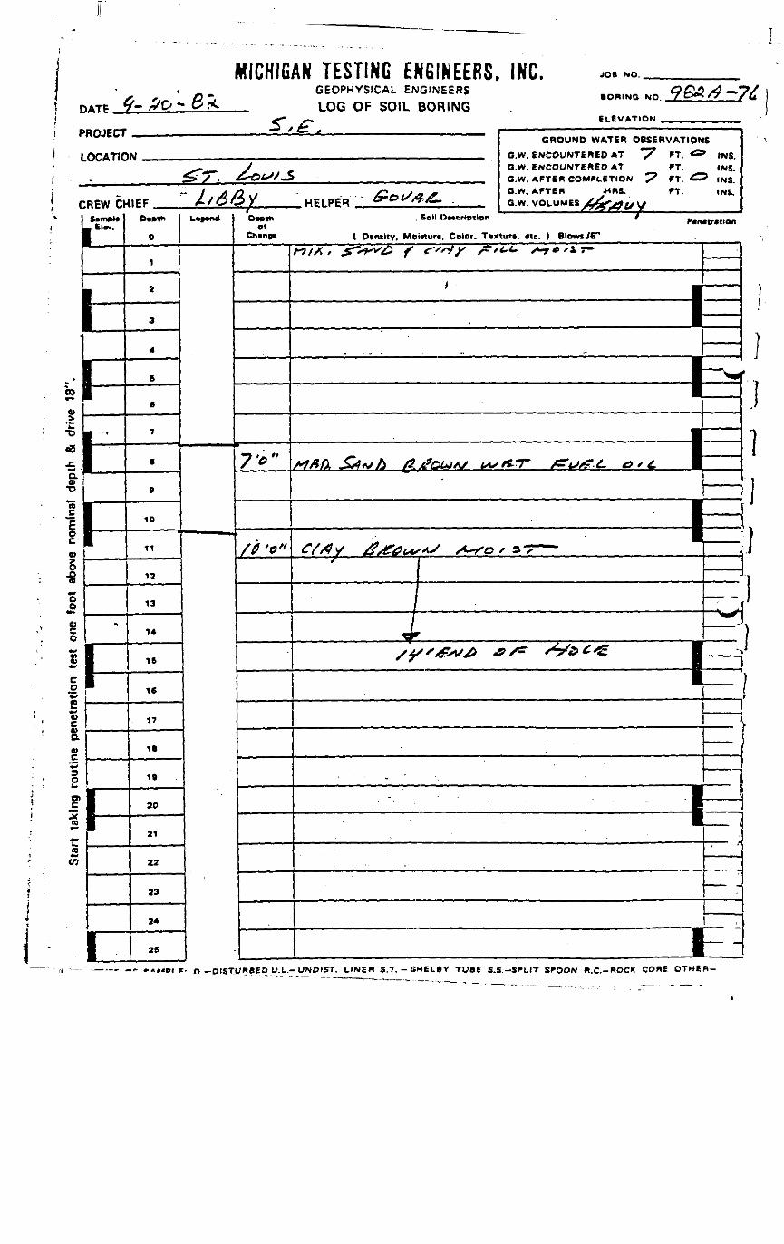
1 D
MICH1G
I| PROJECT
1 LOCAT1C
! - - .i( CREW Cf
t S*m»l*i L KM*.
f-hu1feli| —
Si"*]lTD
(0
1O
91
Oa
OO
toO*•>
$*«
C£Vjo•»*uc0)a.0)
O
I1*w
£
.
-
I1
1
5\
AN TESTING ENGINEERS, INC.GEOPHYSICAL ENG.NEERS .OR.NG NO ^BA/)-',LOG OF SOIL BORING
,-„ SL^W^TIOM
GROUND WATER OBSERVATIONM . , _ GW. ENCOUNTERED AT "7 FT.
-*-— „. >/ O.W. ENCOUNTERED AT FT.^7~. &&tS/*S mm m _ Q.w. AFTER COMPLETION ^ FT. ^
/ j^ *^J * " j^? 4*^ t ^9 j& C.W,~AFTEB WRS, FT-41EF A/'CStty HFIPPR "" &"»*^^^- -IM ___ GW VOLUMES /j^^^ \f
OiDth
0
1
*
9
4
S
6
7
.
9
10
11
12
13
14
16
16
17
IB
1»
20
21
22
23
34
25
L*,.«d
S* INS.
INS.3 INS.
INS.
DM* Soil OMCrlptlor. / p.n«r«tonol
Ching* ( Dvnsity. Motstun. Color. T*xturt, etc. ) Blowi/6"
70"
/t '*"
HI*. f1~£> f <T'*r r"->- ^C'LT-
———————————————— 1
1 —————— 1|
'
1 ————————————
.
C/rty £s£0t*s*»S S~~ro f s ^
=4 ————————— i
——————
—— _ ,
————— -
_ ^ y_ j*"" H
' BE
>
-...»._
1 —— i- • • • - I — \^•— '
— _
In
?t
•
ii'!'
——.— -,- *Ah.ni f. n —DIST_UHBED U.L.-UNDIST. LINER S.T.-SHELBY TUBE S.S.-SPLIT SPOON Pi.C.-WOCK CORE OTHER-

DATE
PROJECT
LOCATION
CREW CHIEF
k•o•9
oQ)O
f £» i•V*
ID
w111 i
GEOPHYSICAL ENGINEERSLOG OF SOIL BORING
BORING NO.
ELEVATION
HELPER
GROUND WATER OBSERVATIONSG.W. ENCOUNTERED AT FT. INS.G.W. ENCOUNTERED AT FT. INS.G.W. AFTER COMPLETION FT. INS.G.W. AFTER HRS. FT. INS.G.W. VOLUMES
Sftmpti. Ei»v-
B
_^
^
I1—
D*ptt>
O
1
a
3
4
6
e
7
B
fi
10
11
12
13
14
15
16
17
IB
19
20
21
22
23
24
2S
L*p»nd
- —
DM* Soli 0«criPtton F MTionof
ChBHp* { Otnsity, Motfturt. Color. Tcxturi, «tc. ) Btowi /C"
3'k"
W"
-?'G"
t~9/X* g~*'V£> f friy ^*t.t- /-y*/ir-
——————————— 1-C&*sC&& 7& 4 £*&&& &LL
x~ SG* GfJ& Of=- */ott£
—————————— 1
•
TYPE OF SAMPLE: O.-DISTURBED U.L.-UNOIST. LINER S.T. - SMELBY TUBE S.S.-SfLIT SfOON R.C.-ROClt CORi OTHER-

DATE
MICHIGAN TESTING ENGINEERS. INC.GEOPHYSICAL ENGINEERS
_ LOG OF SOIL BORING
JOB NO.
BORING NO.
ELEVATION .PROJECT
LOCATIC
:REW o| S*mp4e« Kiev.
,1———
i=11•
1
GROUND WATER OBSERVATIONSIN ' .__ O W ENCOUNTERED AT *T, |nj
^*>_^ J G.W. ENCOUNTERED AT FT. INS.i> ../ . £~&(>S/-$ __ _ G.W AFTER COMPLETION *T ,M^
/ *A& *S /CoL/^S G.W. AFTER MRS. FT. INS.•4IEF A 'OOy HELPER w-f *"/*•*- G.W VOLUMES A Irtx \tZ
Depth
O
1
2
3
4
B
6
7
.
9
10
11
12
13
14
15
16
17
18
19
20
21
23
23
24
25
L""ld
-
Depthof
3-t"
. Boll Description f
i Density, Moiftuct. Color. Texiurt. etc. ) Blowf /C"/^M * g~*W£> f C~"*ty S=*f4-t- S-fC'l^
]
I I
a** ***«», »*,~r~ • ' h J•^ ' /= y/ • i^ ^ 1 1
}
I f
1
1-L
—————————— 1^1————— ' 1
——————————————— —3———————————————— 1B i
ii
———————————————— = j'
' . • ' . . - • . " " . : . , —• |n
——— :
" ' • " ' " ' \
..: . ' : • —• - • • . h- .1-
0)
*CTD
•B
Q.01
Vc0)o.0)_c**
oO)
to
re*-en
,«P «;-SPLIT S^OON B.C.-ROCK CORE OTHER-
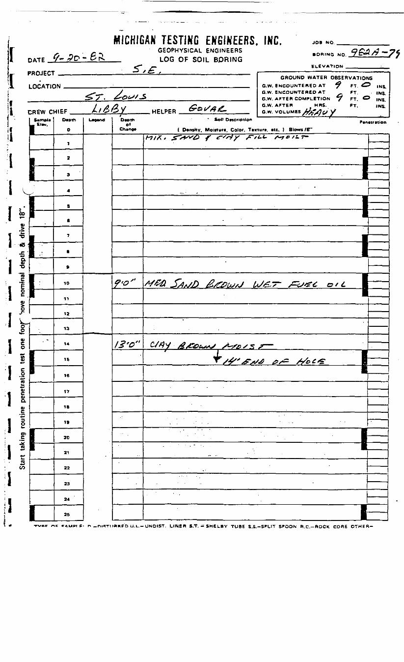
[ DATE
PROJE(
f-
;T .,£D-
m
e^MICHIGAN TESTING ENGINEERS. INC.
GEOPHYSICAL ENGINEERSLOG OF SOIL BORING
JOB NO.
BORING NO.
ELEVATION
C& ft '^
PROJECT
LOCATIC
C
V
*C
;REW c(ampleEtev.
I
•o 1
J1:flj '
Star
t ta
king
rou
tine
pene
tratio
n te
st o
ne f
oof
Sov
1-
-
II
I1 ——
I
_ X t .. , ——————————————— ' ——————— —GROUND WATER OBSERVATIOP
iw • , , , . , . G.W. ENCOUNTERED AT *? FT ^^r^^. J f G-W. ENCOUNTERED AT FT,^ > . &r&(>S/^ G.W. AFTER COMPLETION ^ FT C
/A rt . J^ *.. .* G.W. AFTER MRS. FT,
I&&Y HF1PER Cror&£. GW VOLUMES J^TVJ^A/
Depth
0
1
2
3
4
B
t
7
8
9
10
11
12
13
14
15
16
17
18
19
20
21
22
23
24
25
LOT, Depth01
Ch»ne*
?>o"
IS'O"
JS
' INS.INS.
5 INS.INS.
* Soil Description ' ~
1 Density. Mowtuti, Color. T*Kturt. etc. ) Blowi tfA*7/X / Jf^^X^ /* fsjy /^*/<.t- f~yv/z.7~
-
—————— EE-
—————— 1
c/4y £&t^ ^s»ssr-Jr ; I^ X^" "x/ ^/*^ /V^1 £ El
. . - • - . " ' - -
- _ '
- . . .
t—
II I
woe nc CAMPI p. n —niCTKBBED U.L.-UNDIST. LIHER S.T.-SHELBY TUBE S.S.-SPLIT SPOON R.C.—ROCK CORE OTHER-
Start taking routine penetration test one foot above nominal depth & drive 18".
o5<orCEmVI
^
1\
O5»TlHm»
*I)VI
•»^
ZIft
os>F
TE
R C
OM
PL
m-1OZ
M11H
0z*"
oSmZnOcznXmO>-1
•n-1
ZV>
OSmZooczHmXrnO>H
M•»H
0ZVI
GR
OU
ND
W
>Hm9
Osma<>6zV)
niO>
c~:EEers>
•" a -o m
S ° rr0 5e/O -< —•n w =
•~ o a
8 ? ^r- m rr
si?3) m aZ SSo i/i rr

nvrc-.
> S ;
MICHIGAN TESTING ENGINEERS, INC.GEOPHYSICAL ENGINEERSLOG OF SOIL BORING
JOB NO.
BORING NO
!lELEVATION
PROJECT
LOCATIC
CREW C| Simple
I''"'
iLIr-h•|^
-
l-
1i
— - ' 4— ——————————————————— ———————————GROUND WATER OBSERVATIOf
Ifd ,.. IB G.W ENCOUNTERED AT ^^ FT C
^^^ y G.W. ENCOUNTERED AT FT.^> / . ^"O^^-S G.W AFTER COMPLETION./ FT O
H1EF / / & / WE1 PER ^° */#£- _ G.W VOLUMES J«fe*3 eS\J
0
1
2
3
4
6
6
7
B
9
10
11
12
13
14
IS
16
17
18
19
20
21
22
23
24
Lw"dof
to'*"
12,' o"
-
-
JS
• INS,INS.INS.INS.
Soil DMerlptlDft ' P.n.tr.fioft
( Dimity, Moiftur*, Color. Tvxiurt, *tc. ) Blows /6"
A-J/X / £~sjsw& ^" frty j?ftri~ s~f * '£ y*
————————— 1
,
&#y &&&y *-*?& ts ? —^
R1
1
_____ 1
• " • ' • ' - HH
• - . . . p
-"
*•*
I -1 :
li
O)
1 0CCD:
DATE
MICHIGAN TESTING ENGINEERS, INC.GEOPHYSICAL ENGINEERS
_ LOG OF SOIL BORING
JOB NO.
NO.
ELEVATION _PROJECT
LOCATIC
CREW CfI SamoltU Elw.
b0)1t0.0)•o
e no
mina
SJD«*^OO
V
o*-£*^c_om*-V
&w£*-*•3O
o>£-k!(0w
r2w
1-
-
1I
1
GROUND WATER OBSERVATIOft)M IIM ,„ G W FMPOUMTEMEn AT *f *T £
x-*. y - G.W. ENCOUNTERED AT FT.^> y . ^Dt^S.S' _ GW AFTER COMPLETION *? KT C
//> /) it j£l~.,Ss*^ O.W. AFTBB MRS. FT.
t&&Y HFLPER fre«^4S. a.*.w«_UMK/A^;wDepth
0
1
2
3
4
6
C
7
•
»
10
11
13
13
14
IB
16
17
IB
19
20
21
22
33
24
25
L«0W>0
-
- -
/Oaoth
ofCh«n0«
3'fi"
/#'*"•
ISINS.
INS.' INS.
INS.
Koll DMeriptlon _ . _P«n«umon
( D»n«ity, Moiftur*, Color. Tvxturi, Me. ) Blows /6"A?M, £***+•*& f c-ss-iy Ftt-L. *-,c*s.-y-
t
——————— 1— w
——————— 1±——————— 1
————
1——
W
——— .
rJ*y &&>**">. s^r&'S *— m
+ m/£'&**> &/* &OLQ. ———
————
—— i———
•
u=d
n
)
!111]1
\11)
i
DATE_Zn
MICHIGAN TESTING ENGINEERS, INC.GEOPHYSICAL ENGINEERS
_ LOG OF SOIL BORING
JOB NO.
NO
ELEVATION
>ROJECT
LOCATIC
:REW c&*mpu
_ Elm.
•
r•1
h-ij
-
_ f i^ f — — . — . —— , , . -.... ———GROUND WATER OB5ERVATIOI*
M\| , „ a W ElyCOUNTEBED AT ^ fT C
^^_^ > O.W. ENCOUNTERED AT FT. ,^» / „ £&tS*^ _ O.W. AFTEft COMPLETION ^ FT C
/ JS A */ 4£.*,S*9S G.W. AFTER MRS. FT.41EF ^/OteY HFI PFR CyDVfiK- G w VOLUMES 4/*>.rt.S^/
D*ot»i
0
1
2
3
4
5
6
7
8
9
10
11
12
13
14
15
16
17
18
19
20
21
22
23
24
L«9«nd/Dvptti
ofChangt
<?'&"
/Z'0"
IW
*SiINS
j INS.INS.INS.
. So*J D*Mri01ton * _P*n«tr«tion
I Dftftttty, Mo'nturi, Color. Tvxturt. «tc. ) Blows /6"A-7/*/ X^v^ /- frty J=*tt-t- A^r/ir-
——————————— f^
——————————— 1——————————— 1^A4f'£ -J^v^ Bseew* *V//^T— •
•1
MG&. -£**>/) X^/fiaPWAS ^X"7"~ /^&£ ctt-
—— ( —————V/7'>£>>/> c*^ yM=>^£*
I•Q——— . ———————————————————————— | ——
-
•
CD
*>
c.*
>
I JD1 :
1 5re"
va

PATE V-
MICHIGAN TESTING ENGINEERS, INC.GEOPHYSICAL ENGINEERS
_ LOG OF SOIL BORING
JOB NO. ___
BORING NO.
ELEVATION .PROJECT
LOCATIC
CREW C
'T
'.
11
-
\-
I1
•
_~ * *__ > ' — — ——— —— ——————————— — ——— - ———— -
GROUND WATER OBSERVATlOUIN . . ._ G.W BNCOUNTERED AT «f FT. 4
<-~^- y _ G-w. ENCOUNTERED AT ' FT.£• / ' &^(S/^ __ BVl( ArTEB CDMPLfTION ^ 'T. O
y A&,\i /£ntS&S O.W. AFTER MRS. FT.•ItEF A/^5Oy HEtPER' GrOrf9£~ GW VOLUMES jJ^^ff\/
0
1
2
3
4
5
6
7
B
ft
10
11
12
13
14
16
16
17
IB
19
20
21
22
23
24
L~"° D*pihof
<?'0"
/Z'<?"
-
Soil Dvmcriptlon / _r%W
( Oftnfitv. Moinur i. Color. Tcxtun, «te. } Blows IV
Hi*. &"& f r»*r r<" w*r»
JS
? INS.INS,
INS.
•tt.,ior.
!
^
i
1 !1
. __|
" " I1
<T//9y <£&*>„ MO,IT-
'J-
- •
UJ]
^_)-I
:
H.•
•:.: " • — '' - . — •. - • —
CO
c0>Q.
V
**
O
i
i,r
:i1
u01
i!* «ZJ
1*
Star
t ta
king
rou
tine
pene
tratio
n te
st o
ne f
oot
abov
e^ ^
mi
MICHIG^&TC V** .VC* "* W S*
ROJECT
.OCAT1C
;REW c
•
5*mpl«Elm.
1111-\-
-
Ifr—
I
*
AN TESTING EGEOPHYSICAL ELOG OF SOIL
,£•>
W _, „. , „.. ,. , , _
It'A&V HP.PER &°S
0
1
2
3
4
s
6
7
B
S
10
11
12
13
14
15
16
17
18
19
20
21
22
23
24
LW"'
NGINEERS,^GINEERSBORING
^/2^
INL. JOB NO.
Gd£ *3 -mfBORING NO yC™/? ~I-
ELEVATION
GROUND WATER OBSERVATIONSO.W. ENCOUNTERED AT C+ FT. INS.O.W, ENCOUNTERED AT FT. INS.G.W. AFTER COMPLETION (# FT. ^ INS.G.W. AFTER .MRS. FT. INS.G.W. VOLUMES j-fgA (jy
Dwth Soil D~crlptlon / F.n.w«ionO'
C*«np* ( Dtnsitv. Moifturt, Color. Tixturi, Me. ) Blowi /6"
-
6.'0"
/o-&"
/^/A* „£*>*'*'£> f £"*'•* y s^/t-L, /-/r/iT—
——————— 1-
/-?/£^ -5 -'-*0 ^XSfc? '/V U&7~' £?**'+-£• Of 4*
^-^ V /O? y/ ^^
></'.
x-^,o^s:r————— ^ •
•*•• ' ^ ^———
. . - . • - •
•
-
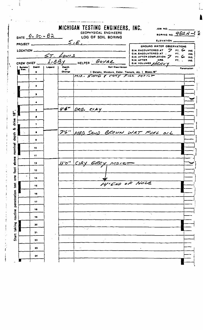
MICHIGAN TESTING ENGINEERS, INC. JO» NO.
DATEGEOPHYSICAL ENGINEERSLOG OF SOIL BORING
NO.
ELEVATIONPROJECT
LOCATIC
CREW O1 $*mpi«
IFV-^M
'
L
»
'..
-
•
— ' t- y - ———— —— ——— • ————— — ""• "' ' ——————————GROUND WATER OBSERVATION
1M _.„, . Bw ENCOUNTERED AT ^7 fT <£
^*-^. y c O-w. ENCOUNTERED AT , rT.>/ . ^-^*^/_S __ BW AFTER COMPLETION ^7 *T £.
X >) X? */ /C«L/^2 OlW> AFTiP* HRS- PT- */C5*j5y HFIPER OrO^^ .. Q w VOLUME* tA'^f^^
D*eth
0
1
2
3
4
5
<
7
•
9
10
11
12
13
14
15
16
17
18
»
20
21
22
23
2'
1
L"*nd
-
OM>fhof
y./"
7'&"
JJ'o"
iTS
• INS.INS.
> INS.INS.
tSoli Dvccrtption ' .
1 D»mhy. Moirturt, Color. T«xtur«, «te, ) Blows /6"
«/A. JTT^V^ < WX ^ ^e,^r-
" 1
_ 5=T•
X 1
i
|
|
•| -*
Ri———— nr——— fr
r.1
•————————— r~
.
i—— ^-i•H
-
——
CO
•w•o•B
aw•oTo
o
JDID
§
V
Va0)
n**LO
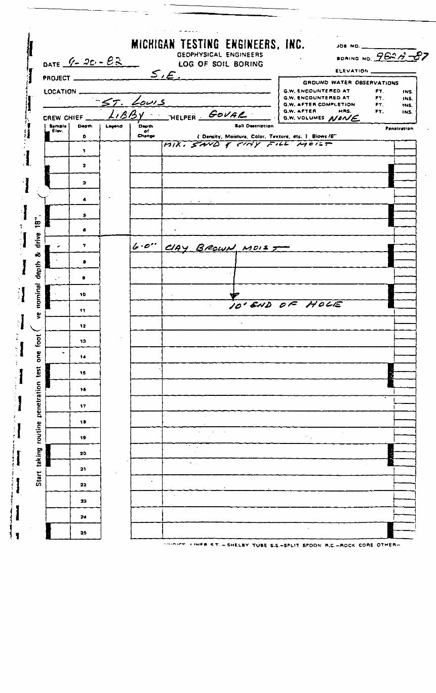
I DATE
MICHIGAN TESTING ENGINEERS, INC.GEOPHYSICAL ENGINEERS
_ LOG OF SOIL BORING
JOB NO. ___
BORING NO.
ELEVATION .
'i l
\
II
CO
CB
*c•D
•8
a•8"5
oc0)
I t/I
:_o*Jra*_•O)c<ua
to+•>
rto£
'ROJECT
LOCATK
;REW cSample
« Elw.
h-rIi
,1i-
9•
i
__ / 4^ . — « . ———————— ~ — - , ... - — . ———————
GROUND WATER OBSERVATIOAIN . _ , a.w. ENCOUNTERED AT FT
- __ -x -.— y - G.W. ENCOUNTERED AT FT.> > . ^-^t-V«S __ G.W. AFTER COMPLETION FT
/ ,j\ .^O / . ^ X j» j^ G*W, AFTER MftS. FT.HtEF , X/C5C?y " ." -HELPER - Gr&r&Z,. ew VOLUMES */A*S*?
D«pth
0
1
2
3
4
S
6
7
e
s
10
11
12
13
14
15
16
17
IB
19
20
21
22
23
24
25
L""<<
.. 1 •• II "•
/
D*pihof
IS
INSINS.INS.INS.
I Dtnfftv, Moinurt, Color. Ttxturt, itc. ) Blom /F*
«/A. X - < X /r i. »^T-
————————————— tE
•E•
'• ^^m^^mm.
tI~
ST.-SMELBV TUBE s.s.-SPLIT SPOON R.C.—ROCK CORE OTHER-
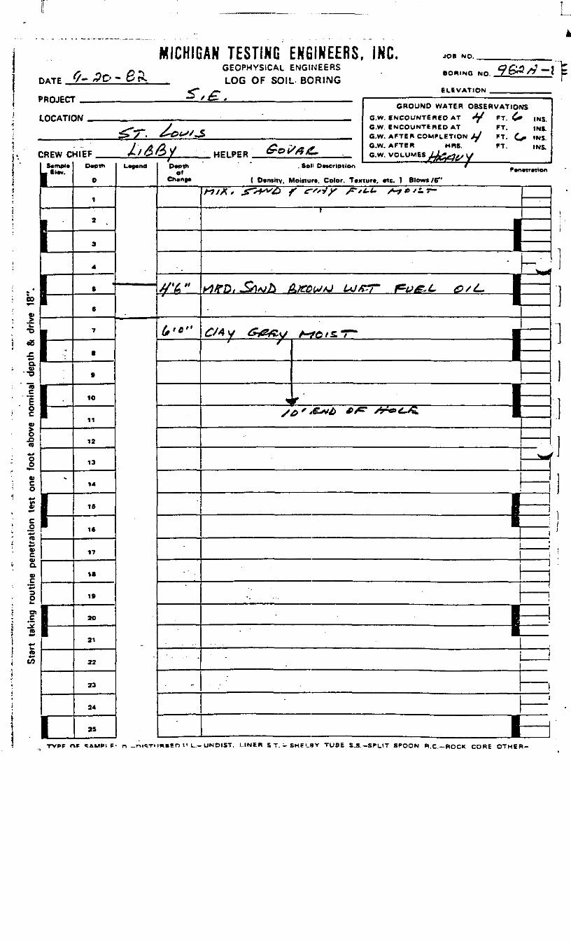
DATE '/-
MICHIGAN TESTING ENGINEERS, INC.GEOPHYSICAL ENGINEERS
_ LOG OF SOIL BORING
JOB NO.
BORING NO.
ELEVATION
PROJECT
LOCATK
CREW CS«mpl«- Etw.
b!-
-
I1
1
— ' i— * " ————————— ' —— ' ————————————GROUND WATER OBSERVATlOP
IN ' GW ENCOUNTERED AT ^ ft ^
^**^. J f C.W. ENCOUNTERED AT FT.^y • &&t**S*& , __ _ fiW AFTER COMF1 FTirtN ,y KT ^
/ A A 1 j£ ~Js**> GJW. AFTER HRS. * FT.HIEF 4/&&Y HFIPFR &0I//3& o.w. VOLUMM JL^--——
Cwpth
0
1
2
3
4
«6
e
7
•
•
10
11
12
13
14
IS
1ft
17
IB
19
30
21
22
23
24
25
L«9«nd
•MMHBMMH
/
Depthof
Ch*ne*
f'6"
£,«>"
-
tfS
' INS.INS.
^ INS.INS.
. Soli DMcrlotion / .r«n«trnien
( D»n»rty, Moisturt, Color. T«xturt, «tc. } Blows /6"
/-7M* X>^^ f *-"*>" ^ i- S-f6'S~r-
t
—————— 1^^^1I*"*
^/^y (*i&fiv ATO/ST" •1—^ 1—v/^'-e^/> *^ /^«^^ |
— M
1——— I
——— •
--
_
———i
00
•-*Q.
Q>aa>.£™3O
DlC
) 4-1
n4->(A
1
TVPF nt <AMPI F- n _r»i«TimBeO U L.-UNOIST. I..INER ST . -SME"_aV TUBE S.S.-SPLIT SPOON R.C.—ROCK CORE OTHER-
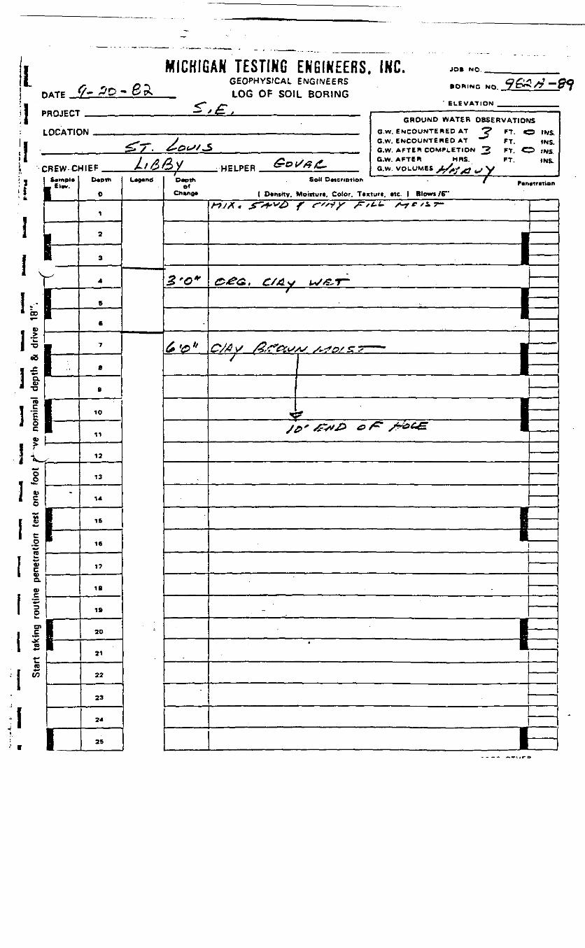
IDATE
MICHIGAN TESTING ENGINEERS, INC.GEOPHYSICAL ENGINEERS
_ LOG OF SOIL BORING<T /r
JO» NO. _
BORING NO.
' ELEVATION _PROJECT
LOCATIC
CREW-CI
llw.
r1
Il1-/
-
i'
i
— - y 4__ f ——————————————————————— • —— ——————————
GROUND WATER OBSERVATIOtIN „ ,.,_ Q.w ENCOUNTERED AT ^ FT <
^^^ _ > G.W. ENCOUNTERED AT FT.>/ . &*&tSS*£ _ __ G.W AFTER COMPLETION 3 FY C
/* /} , S* j - * G.W. AFTER MRS. FT
t f* M^ 1 / ^^m 0^ if -^ j& * •/OOX HELPER erc?^/?^ _ G.w VOLUMES j ^^ ^ y
0
1
. 2
3
4
6
6
7
a
9
10
11
12
13
14
IS
16
17
18
19
20
21
22
23
24
25
C r*
JS
3 INS.INS.
5 INS.INS.
Otottt . Soil DttcripTion " < f K _.Of
Ch»r»e» ( Dvtnttv. Moinurt, Color. Ttxtun. «tc. ) Blows /6"
2-0*
•
6v»
MX. &ȣ> f r',^ ^,^ s-r"i.
&*<Z C/xJv ^^1-— ————— 1'' * " '" \—
•B•
-
i—
I.00^
8»
I V;to(B•Jo>C0)Q.w
I so
I i^2
o>cJ*
CO
n•*W
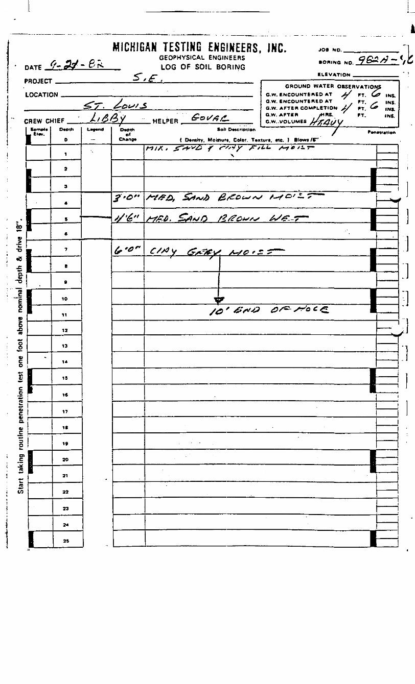
DATE/• «-yv - 3* -
MICHIGAN TESTING ENGINEERS, INC.GEOPHYSICAL ENGINEERSLOG OF SOIL BORING
JOB NO.
• OflINO MO
ELEVATIONPROJECT
LOCATIC
CREW CtI SimpleL Elw.
|
1!
\~\
\1 -
* I
*•^ 1D.P —————O 1•°l .1g.0TO
OoO)c0
t:£1(0
V0.
CJ
o
_cre
n
1-
-
1\
1
1M
4IEF ^ 'ItA&V HPIPFR tfe«^«
0
1
a
3
4
5
6
7
B
9
10
11
12
13
14
15
16
17
18
19
20
21
22
23
24
25
L""-
"-
• - «™««
O*pth iof
Ch»ng« ( D*mity, Moil
£•0"
'/•&»
(,'0~
A7/A » £~*+v£} f
f^-~
toll DMtriptlen
luff. Color. T«x
*"**•?¥ /*"/\
GROUND WATER OBSERVATIONSG.W. ENCOUNTERED AT ^ FT. W? INS.Q.W. ENCOUNTERED AT FT. ^- INS.G.W. AFTER COMPLETION X/ 'T. & INS.O.W. AFTER <HRS. FT. INS.G.W. -VOLUMES V^JT^/yl/
' ' f/ f^'lf r
turt. Me. ) Blows /6"
«.*. X^./I.T-
————— EE/*#&, &~» &<e*~«s ,^,0'^T—
/-?££, £**& f?/?C**"*>
C/S?y &&f-V /-/&'*' S
1
/£?
? " ^^
——
yy- _ I _AX*C-7^ I
1
: ————— 1±1
I
—— *^
ii
i
-
——
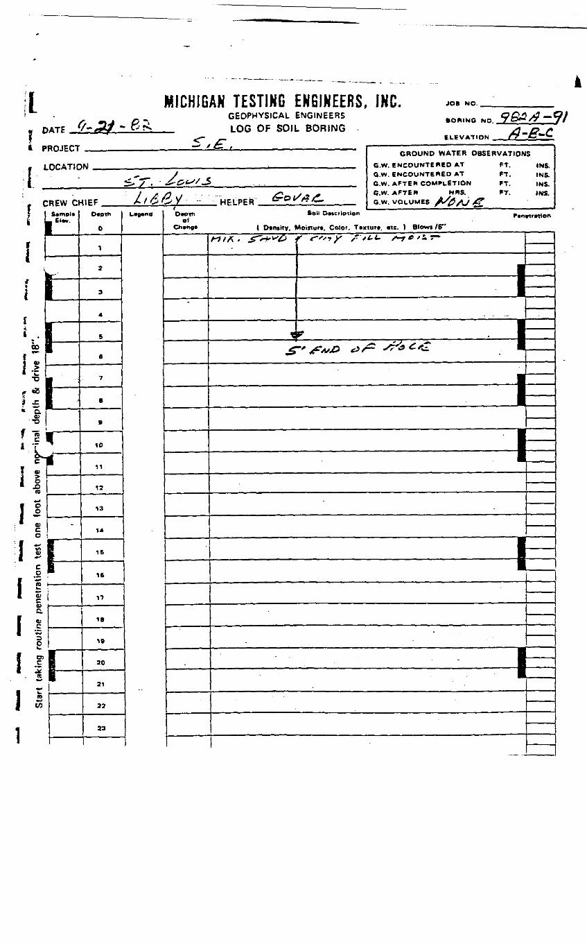
MICHIGAN TESTING ENGINEERS, INC. JOB NO.! L
* PROJECT
1LOCAT1C
'. CREW Cl-s I Samplti L "-•
i L.* Ej Ii •
! • —1 • I'si —
!<o 1*r"° L
* g-' S ''•v,il
to**
\ J.1 gO
1 ~tnV-
§
1 11 cua
I I1 3O
1 !reI s1 w
1
11
-
1t—
GEOPHYSICAL ENGINEERSLOG OF SOIL BORING
£ .N . . . . . . .
41EF / /^^/ HFLPPR &° *O«0th
t>
,
a
3
4
5
6
7
B
B
ID
11
12
13
14
15
16
T?
IB
19
ao
21
22
23
L-"d
*fi£~
Q£}*> j& ~otBORING NO / O** f7 it
ELEVATION _ rZ^.***"^
GROUND WATER OBSERVATIONSG.W. ENCOUNTERED AT FT. INS.G.W. ENCOUNTERED AT FT. INS.G.W. AFTER COMPLETION FT. INS.G.W. AFTER MRS. FT. INS.
G.W. VOLUMES X^A/ /?*
D«.W So" D«cf»ption P.n«rMlono!
Ch»ng» | Density, Moisture. Color. Taxiurt. «te. ) Blows /6"
ttt*. . £^-**£> j
\
£
r <",-,? s,t.>. +*•>**- j ——
f"S"*> *'
———— E=1^ -^-& £<i •
———— P\—
———— 1=
———— 1
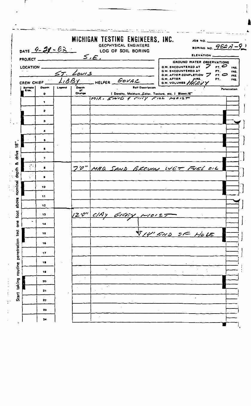
MICHIGAN TESTING ENGINEERS,GEOPHYSICAL ENGINEERS
PATP ^-5/- &f^ LOG OF SOIL BORING
PROJECT
LOCATIC
CREW O1 C«mal*1"""
hrCD
w
•S
a0)
n
F•c
^5^^aoooco*•>£*"•
c_onw**a>cVa.«£*-3O
SPaw*-w
;".
".
-
|I—
5"^• £TtM
<IEF ' l/6£y HELPER ^OX/?/TD*Ott\
0
1
2
3
4
6
«
7
8
0
ID
11
13
13
14
15
16
17
IS
IS
20
21
2?
23
24
LWd
-
Ovottt Collof
C*»»n9« ( D»r»ttv, Moiftur
•7V"
/Z '<?"
DMcriptton
n. folor. T«x
INL. JOB NO.
• ORINC NO 7C&/7 ~
ELEVATION —
GROUND WATER OBSERVATIONSO.W. ENCOUNTERED AT 7 FT. ^^ INS.O.W. ENCOUNTERED AT FT. INS.C.W, AFTER COMPLETION ^7 FT. O |NS.O.W, AFTER MRS. FT. INS.G.W. VOLUMES S&&£f/ X
ff
turit *tc. ) Blowt/6"
«/X. X>»"^ < '"-/' /•'*«• ^"^ | ———
——— • N*
-
/V/F/5, J>/ix>0 /$s£&is«s
———— 1^1
•
£/S3y ^sttv* s
<•
^^^ £ _ ——
'?/*" <
———^«
•
—
•
———
• ———
————
•
*L
n
.]
f i
i
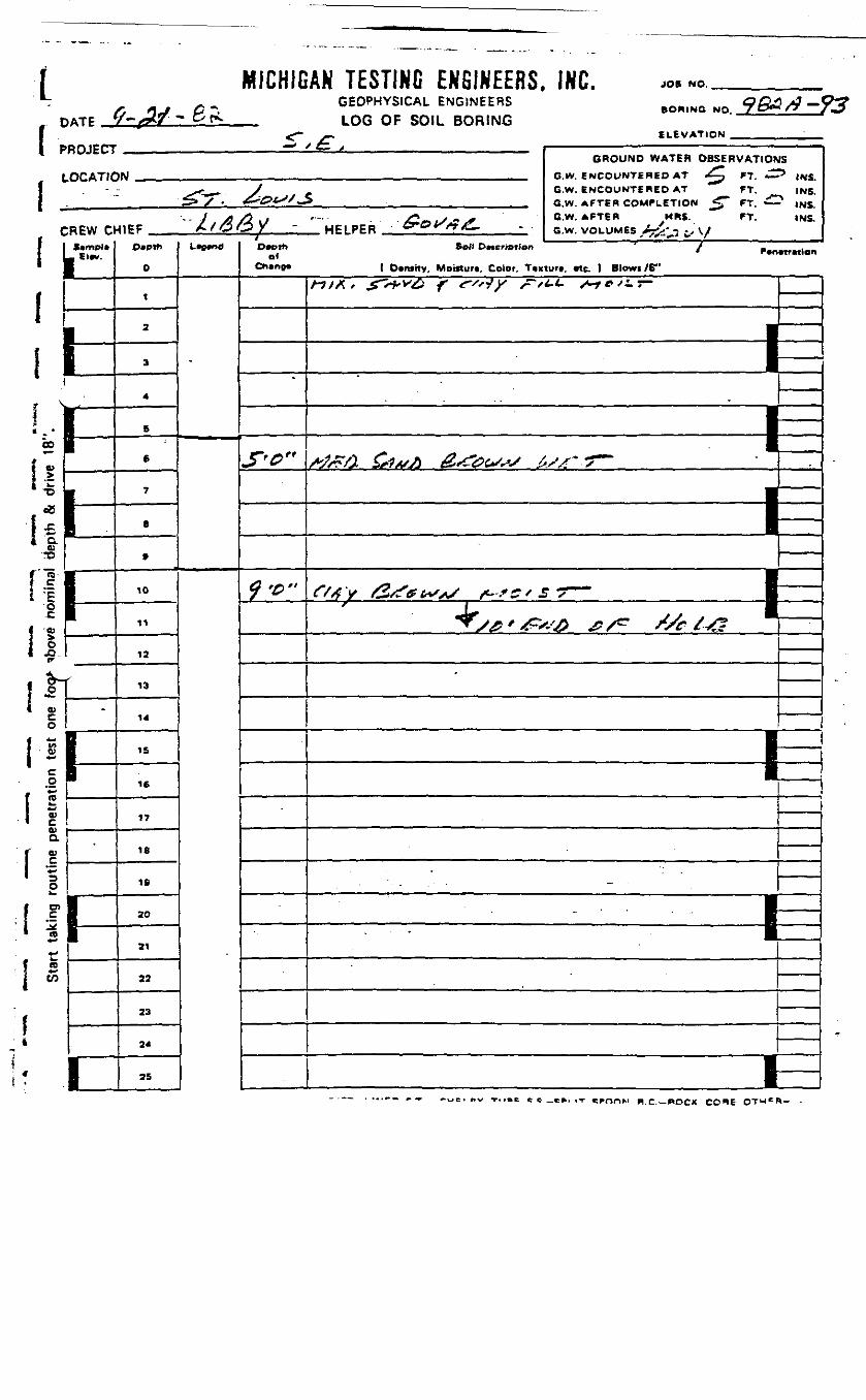
(1
MICHIGAN TESTING ENGINEERS, INC. JOB NO.
GEOPHYSICAL ENGINEERSLOG OF SOIL BORING
BORING NO.
ELEVATION .
-93
PROJECT
LOCATION
CREW CHIEF HELPER
GROUND WATER OBSERVATIONSG.W. ENCOUNTERED AT . FT. ^^ INS.G.W. ENCOUNTERED AT FT. INS.G.W. AfTER COMPLETION <"" FT. £2 (NS.G.W. AFTERG.W. VOLUMES
MRS. FT. INS.
S*mpl*_ El*v.
1f-
-
|-m
-
IP
i
O»Ptti
0
1
2
3
4
6
6
7
8
9
10
11
12
13
14
15
16
17
IB
19
20
31
22
23
24
25
L*e«nd
"
D.Dth Soil DMer.»tion ' / F.n.wM.on01
Ch»ng* ( Dtrtsrty, Moifturt, Color. Ttxiur*, «t. ) Blowi /B"
J"^rr
^ '^"
-
/•7M, g^vte f <r''*ty /=-/*.<- s~tc'^T-
——————————— 13
/i /Jt £?x/^ &<tfe&**s £./f*~ *r~
—————— Pi—^y^'^xt^ ^/^ ^xr/^F
•
————————————— 13
i——— : —— : ——————————————————————— | ——
1-
00
Q.03•o
"ra
oft
o
I *-• 8*•
vcQJD.
{ 1I X
* e _«», ,T H.C.— POCK CO«*E

DATE
MICHIGAN TESTING ENGINEERS, INC.GEOPHYSICAL ENGINEERS
_ LOG OF SOIL BORING .<r *•
JOB NO,
• OWING NO.
ELEVATION .PROJECT
LOCATIC
CREW O-
L El*r.
rihi
2 1
!i•0 1*aV
I"1
1JDto
"o
«>
O~fij.1*Jf
V
a>aa>
O
_c(C
k.(D
in
hl-
-
t-
i-
GROUND WATER OBSERVATION'M _.. _.. _ G.W. f *JCC"^WTeR6P AT +^* FT. C
^^~ J c O.W. ENCOUNTiRED AT *** FT.> / . J>0t**'^ BW AFTeReOM^LtTlQW ^" *T
1 . A /jL*j /Oo L/^ & °'w> AFTew /<W. "^ FT.41EF . , A ' *2 *— * 7 "HPI f^CR ^- &"&fL~ ft w, voi IIMK /V>e»_.". ,. r
0
1
2
3
4
5
fi
7
.
9
10
11
12
13
14
1S
16
17
18
IB
20
21
22
23
24
U~n*D«Oth
el
$'&*
/£-o"
as13 INS,
3 INS.INS.
I Dcnsitv. Moinurt, (elor. Tcxturt, «ie. ) Btowi /C"HI*. *-*•*& f r'*y r<±>- ^c^r-
——— r•=*
, ——— ii•
BI
———— IEEC/*J V C—/^/?' V .s-'TC'S / ~
1
•sr
S^
' / B1 —
:,
—————
——————
M 1 H
3
MICHIGAN TESTING ENGINEERS, INC.GEOPHYSICAL ENGINEERS
_ LOG OF SOIL BORING
iII
JOB NO.
BORING NO
ELEVATION
-9S'ROJECT
LOCATIC
CREW C1 Strnpl*L Elwr.
1
L1
if-|
1P
— * 1 1— • i ——————— ———— •• • —— - —————GROUND WATER OBSERVATIOf
1M GW ENCOUNTERED AT /£L_ FT *-• _ J ' G.W. ENCOUNTERED AT FT.
> X • ^- i-^^-S c w AFTER COMPLETION / &L FT <
y /^/-^ \/ /Coi/X;/* G.W. AFTER I^RS-. FT.NIEF „ , A /c5OX WPI PER ty»*^/?^- Gw VOLUMES ^Ss-*^ i .* \.
D*ptt>
O
1
2
3
4
5 '
6
7
8
9
ID
11
12
13
14
15
16
17
IB
IS
20
21
22
23
24
25
L-"",
-
Depthof
Chtnoa
'
/£*->'<
/t'C"
«
~ INS.INS.
~* INS.INS.
. Soil Description / •r r«n«trnlon
( Density, Moittur*, Color. Ttxiurt. «tc. ) Blow* /6"
A^/A * £~sffi''& f fSrj y ^~tt.t~ /^-y c /4 T~
"-
•
^tfXi * ^?^r/s**£) ^s/dVf (,"*-- A^1 ••L--'<r-— 1?^™" X^X^^ e^ _
r//a^ ^^>'u x^xrxsr— --^ —— ^^ /y ^/v£ Q f~~ /^o££. mm
-
i— i
* >
[en
TYPE OF SAMPLE: O.-DtSTURBED U.L.- UNDIST. LINER S.T. -SMELBY TUBE S.S.-SPL1T SPOON R.C.-ROCK CORE OTHER-
L
nATC ff_M-&^PROJECT
LOCATIO
CREW Ct-1 S*mpl«L Etw.
rLIi..•
!r.£ I " " "'
*• -3 II. n
- O
- ftS.DIB
'oO
Star
t ta
king
rou
tine
pene
tratio
n te
st o
ne 1
-
i-
I
5",
GEOPHYSICAL ENGINEERS BOpuNO NQ 9&fl/? -LOG OF SOIL BORING
ELEVATIONA- . , ——— , ——————————————————————————————— .
GROUND WATER OBSERVATIONN .... ... . e w SNeouNTSRtn AT /••>? FT £
^ -1-. y C.W. ENCOUNTERED AT FT.S>y . ^•^f'/JS , QIM AFTER COMPLETION /^ FT £!
/A A i ~ &nt/&/* G.W. AFTER MRS. FT.
t&f$y HP1PER CyOr&G. ., . GW UOLUM« jJ-&4tS\/
D«eth
O
1
• 2
3
4
B
6
7
.
a
10
11
13
13
14
16
16
17
IB
19
20
21
22
23
24
2ft
L—— nd
S3 INS.
INS.^ INS.
INS.
0«th Soil Dwcfipilon ' / *.n.u.ti<»no<
Ch»no» ( Density, Moinurt, Color. Ttxturf. «tc. ) Blows /6"
Jl'G~
i& *•
«/A. S~*«>0 f <-«*y S.L*. +*•*!..
'
————— 1——— tf
———————— I•——————
i
1
•
0/}y f&rv x.,e/£7 —• • ' \
—————
—————
-" ~ - \*T' - " " - - |/9 &4/J) & ^~ ST-G (~£L B
I
• ————
1* K
f
\
i
ii
•1]:i\
iI
OTHER —

| MICHIG
1 PROJECT
LOCATIC
' i , -
' ^»
AN TESTING ENGINEERS. INC.GEOPHYSICAL ENGINEERS BO*«NG NO _9&3/7 —LOG OF SOIL BORING
_ ELEVATinro$ t± . —————————————————————————————
GROUND WATER OBSERVATIOr
VJ C.W ENCOUNTERED AT ^ FT ^
.^^ V G.W. ENCOUNTERED AT FT.^/". £>&LSJ '^S G.W. AFTER COMPLETION ^ FT ^
CREW CHIEF , A/iSC?/- HEIPER &P>/t9£- __ OW- VOLUMES A/ft.rf ^ y
\ L'EE*
1 I
1 1—; v
! V-' I> n — — -
'•1 ~\*\ <u 1i*iL= Sg| :• • - L
i
ij2| ..^3 HB
(0
i- 0
I °i J,* o>| §
il ^* C* & *ij Ii* c
'1 _C ———————
i i!l id;L *l —\ r 1- 1 ra• 1 *"|1 t/3
i:
il ——t!k 1
D
1
2
3
4
5
6
7
8
9
10
11
12
13
14
15
16
17
IB
IS
20
21
22
23
24
75
L^nd
'•
JS
-* INS.
_ INS.INS.INS,
D-th Soil D«CMOiton / p.r,.Ultion
Ch«no» ( Dtntity. Moinuri, Color. T»xturc, tic. ) Blowi IS"
<9'0"
l?'0"
-
rt/A, &>*># f <r',iy r<^ S~t*<±>
*
—————————— I
• " ,
CSAv A&rt, +-,£»**-*r ^ I
•^— — ^™
J4~s * *z: j/~i -* XT ^r& £*& BS*f /HJS2S * *^ * * *^ B —————
E
'
97
MICHIGAN TESTING ENGINEERS,GEOPHYSICAL ENGINEERS
T>ATP __^- A/ - C'S. LOG OF SOIL BORING
PROJECT
LOCATIC
CREW a1 S*rrtpl«L_ El*v.
b[-.1
!°rfi>
\ ~_>~ 1•D W
"-C 1- ^1 1
-•§•-c •E 1ilow
101
o*rf
•»*
c,0•Maw»*
C
aV
1
1rIB*•>to
-
1'
i-
£ ,w —— : ——
<IEF //^O/ HF1PPR ^O*//*^.
Depth
O
1
2
3
4
S
6
7
B
9
10
11
12
13
14
19
16
17
18
19
20
21
22
23
24
L nd
,
-
INC, J09 NO.
• ORINC NO ^&&-/7 ~"
ELEVATION . .
GROUND WATER OBSERVATIONSo.w. ENCOUNTERED AT /^ FT. t^ INS.G.w. ENCOUNTERED AT FT. INS.G.W. AFTER COMPLETION /^ FT. tfp INS.G.W. AFTER MRS. FT. INS.G.w. VOLUMES £/&/$£/ \S
?c
Dw* *«>» D«eription / P.n.tr«tionof
ChcnoB ( Dtntitv, Moiitur«, Color. T*xturt. «tc. 1 Blowt /6"
/&'*"
/ft?*
Htfi.* *r'+v£> f c-*'s*ty ,- /u- s-retiT-'
M/z/?* ^s9*S/> *2 S£dss*S
--\^^^A
————— 1
————— 1
£//>V &^r ^*,*
——— ^
——————
J —————
S / t
/•?'£^J er "'^
•
——————
——————
1——1
———
—————
1
]t
)-)]]
]j1]i1jh
}

DATE
MICHIGAN TESTING ENGINEERS. INC.GEOPHYSICAL ENGINEERS
_ LOG OF SOIL BORING
JOS NO.
BORING NO.
ELEVATION
1 PROJECT
LOCATIC
[ -r-<i•,i!
REW ClUmpl*El«v.
«^
i 1i fcl ——
1 1 ———————
*•10 i
1 - •! •&[rzl•*« 1
I- c
•*w 1I P 1!^r°> §f &
Ij4**ID
!ft£Vae>
1 ' S2o0)
I EJC5rto1 *
1I
I-
-
L1
1i
1
— • f *— y ——————————————— ' —— — ————————GROUND WATER OBSERVATIOr
1W ,_ .__ , , C W ENCOUNTERED AT / XT' FT d
^•^ V G.W. ENCOUIMT6RED AT FT, ^>X • £*&**>/,» _ GW. AFTEH COMPLETION ^ ^ FT ——
/ ^ /9 .y j?l-*,s * -* Q-w- AFTER HRS. FT.^IFP /X^/2 / MF. PFR frOf*-*. G w VOLUMES A/r_- v^y y
D«Dth
0
1
2 .
3
4
6
6
7
8
9
10
11
12
13
14
IS
16
17
18
10
2O
21
22
23
24
25
L*0*n0
-
JS
-- INS.^ INS.' INS,
INS.
D»th Sot. D^Mptio* / P.n.u,Tlono>
Ch«np* ( Dvruitv, Moisturi, Color. Tvxtutt. «ic. ) BIowi /6"
/?'?"
//•<?"
/-?/A* £~*+v£> f frty ,r*n- /uyr/ir-
——————————— P——————————— 1——————————— 1
——
/rvfva ^rt^n &>s?&<^ss t^s& T —
^r/ ^K ^X^-X-^K. /^/^x^> •I i——————— f ———————————————— 1 ——
S5'*^& tf-/cr .4^^^?i
i
i— iOTHCB—
DATE
KICHIGAK TESTIKG ENGINEERS. INC.GEOPHYSICAL ENGINEERSLOG OF SOIL BORING
PROJECT
LOCATION
CREW CHIEF
GROUND WATER OBSERVATIONS
G.w. ENCOUNTERED AT /£^ ". & <NSG.w. ENCOUNTERED AT ^^ FT. INSG.W. AFTER COMPLETION J 3_ T~\, & INS
CW. AFTERG.W. VOLUMES
.HAS. INS
1Ei
10
11
- !i - .1*
16
17
18
19
30
21
22
33
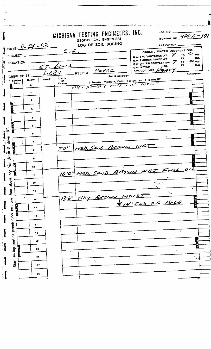
ii MICHIGAN TESTING ENGINEERS. INC.GEOPHYSICAL ENGINEERS
LOG OF SOIL BORING
JOB
GROUND WATER OBSERVATIONS"^ ^s
ENCOUNTERED AT S.G.W. ENCOUNTERED AT
-
G.W. AFTERG.W. VOLUMES
CREW CHIEFD»Pth
/-?/*, jr's+w f

KICH1G
\ PROJECT
LQCATIC
C
i
I;•s i*1
REW C*
____
S|
11—f ^
1. i
i1O)
o,0n'ooV
6V-
C
!c.
.EoO)
(G
*•>
*Bto
15—
-
ii
-
AN TESTING EKBIHFFRS, m."" ""«/«." ------GEOPHYSICAL ENGUJEEBE ORINO NO 3&£/7—/OiLOG OF SOIL BORING
S /i: , —— _ ———————————————GROUND WATER OBSERVATIONS
fj ,, „ , , . . , . nw fcwCOUNTtREO AT *"7 FT ^? i*-?--^ .. y r G w. ENCOUNTERED AT FT. INS
S> 7". 'C't-' -S „ . , . , _ S«U AFTER COMPLETION "^ FT" <"> IW^
4|pp A/C'O/ HPIPFR frOX/r/ —— BMy VOLUMES /rfajf^tJ (/
0
1
2
3
,
ft
6
7
8
Ct
10
11
13
13
14
IS
16
11
1 IB
——— '
I
i
i
IS
20
21
22
33
\\ •»
L^d
'
Owth Soil DMCrlpi.0n ' r.n.ir.iion01 ' 1
Ch»t»9» | Dvmrty, Motfiun . Color. T«ntu»«. «tc. ) Blow* /S**
-
7&"
tt/X. , g^s+vte f I"'**' y /- rt-t~ ,A-j*>/iT- i
_ 1I —
— *r\i— j1—— ———————————————— | — J
/ ^A ^Xxv^ ^xr £* iX / -T" • t^
1 — J
/**>"
i
j-J
£V/J y ^»€5 i/ A*S& s s ?~" " i- ;i^^j
,r 1 —— I/p'' &*£> O/^ sSe C^z |i_i- «
i u1 'r - - - - - - • • - " ' ----- - - . - . . . . |. .. >
h-1t t•
-— —
—i ! |- -.
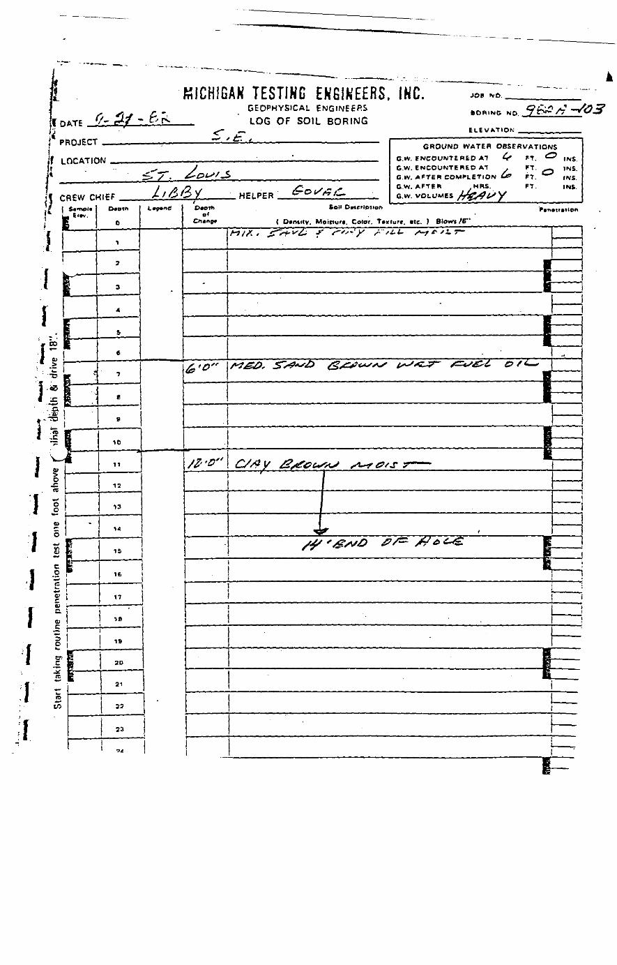
L
foi piif L
KICHIG^Tf /' *+* * tv fs.
ROJECT
OCATIC
j| CREW Oji »,
!*I1
•
IS
ill- 0.- a;
i i
1 8• ' ta-
(u
I t!o
i iocI cu
C.
I V.fC
re
1 II
i-"1"j'1 ___ , —
•r —— ' —;ii\
i;1
-
• " **"
'J — K — — -- ——— _ __
AN TESTING ENGINEERS. INC. *.«."" '^GEOPHYSICAL ENGINEERS BOR.NO NO 9 &*/*-*"LOG OF SOIL BORING
~> t £ , i _______ ' ————————————— • ————————— • — • ————— -iGROUND WATER OBSERVATIONS
^ • ' — ___ „ C.W. ENCOUNTERED AT 4" FT. ^ IM£
- ^ J G.W. ENCOUNTERED AT . FT. -^ INS.•£> ~7~' &*&*<" J> _ G.W. AFTER COMPLETION & FT. tMfi
1 A /} , /"' S ~ <• G.W. AFTER MRS. FT. INS.41PF A/CJO/ HELPFR fZ'&l/fiyf^ fi w VDLLJMEB fafy^ LS y
0
1
2
3
4
S
6
7
e
9
10
11
12
13
14
15
16
17
IBi!
19
ife
20
21
22
23
C^C
-
D.oth Soli Dncripnon r.n.t..tlo«
C «np« ( Dcmity. Moiiturt. Color. T»«tute. »tc. ) Blowi /6"
-
&'0»
-
//- -^"
_
A-7/A » ^TV^-^^ *' f~'*"*- y /• /i*- x*-f^'i*
B1 _B
1 ../*?&£>* Z>*0*'£> &<&s<*s**s is~"z~j? £ris£^£. & f t-*
\ —BBK.
^//?y £%s£Gt«S*S ,*-** 0fS 7 ——— ('
____ :
4^- <X-^ x^>v^> ^?/^ s&£>£~& E
BEi
1 i
1 ^t \
Ii
———
PpB
1
h~
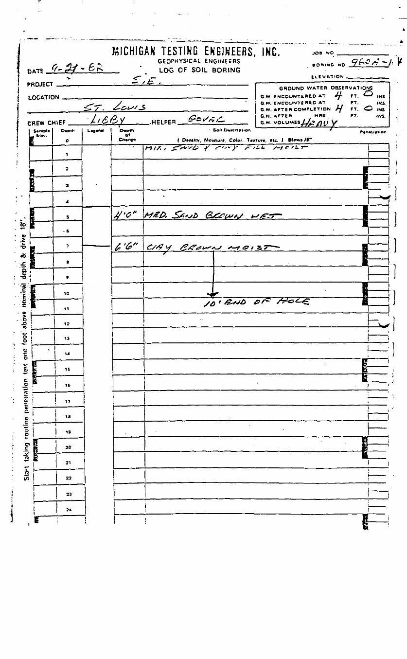
DATE
PROJECT
LOCATION
MICHIGAN TESTING ENGINEERS. INC.GEOPHYSICAL ENGINEERS
_ " LOG OF SOIL BORINGELEVATION
GROUND WATER OBSERVATIONS// j-*^
G W. ENCOUNTERED AT FT. (KSG.W. AFTER COMPLETION Sf FT. O INSG.W. AFTER . MRS. FT. INS.
Sol' Dncripiion
( D«n»itv. MomuK, Color. Tixturt. *te. ) Blows /C"
co
C£
fc
I '•eu& iO ,
re*-CO
r
15
1C
6E
i
*
10
11
12
13
14
I
iki
17
18
IB
2D
21
23
23

.ifi!';i;;
W
i «1 ST
T5
|t*>
1 0o<•->
I =1 !s
1 I1 !
C
I \i !; re
tn
I
HICHIG)ATE •- ffV.r, PJ>:, .
ROJECT
OCATtC
REW C
I11"-
g
. — -•
i|_-1
Ii
-
cit
<~
- - - - - - _ __^ • "•"""•""' •••••u^ ^ ^ ^ ^"" J """"*••— - - _. _ , _ ^^^^ " " ~- '"III ... _ ..
AN TESTING ENGINEERS, INC.GEOPHYSICAL ENGINEERS .*.,.,»• *,« 9r>#/V— /HDntV>lL> IV U ^^t ' «
LOG OF SOIL BORING^ C\.^UATIOK
/ /- , . —————— . ————————————————— — ———— - ———————————————— ,
GROUND WATER OBSERVATIONS
IN __ , GW ENCOUNTERED AT & FT 1^5 INS.
^ J G w. ENCOUNTERED AT FT. INS.£sj". £*-&fJ:> , . , , . . , Cw AFTER COMPLETION £J FT. 1WK
/ f . f l l /"_ y - *• G.W. AFTER .MRS FT. INS.
/oOx HPIPPR &"°^*r: . B-« vOLUMESyW>^V
0
12
3
4
6
6
7
B .
S
10
11
13
13
"**
15
" 1 -ii i *i i8
1 !
1 1 "fc
21
i 7,1
1 »
1
i-____L.2*___
u^a
-
Owth Soil DMC'iDMDt. f f.n«r.tion
Cn»n9* ( OftnsiTv, Motttur*. Colot. Tkxiure. Me. 1 Blowi ^6"
8'Q"
I/<G*>
•
* I ———————I iI _______
I
M££), SA*ifo Q&OWAJ i*jt&?~ t^is&t, &/ 1~ \
i1 __ i
' ' \ —[ !
/AS ' &fS& &/^ /->£o C& \ '1 i
&!
i ——!—
- . : ———
1 ———
—\ . i—
i—1—
-- eutti BY TUBE S.S-SfLIT SPOON R.C.-ROCK CORE OTHER-

DATE
1 PROJECTJ
* LOCATION
KICHIGAK TESTING ENBIHLhH*. INU.GEOPHYSICAL ENGINEERSLOG OF SOIL BORING
JOB
GROUND WATER OBSERVATIONS
{ D.nnty. Moinuf*. Color. T»»iu
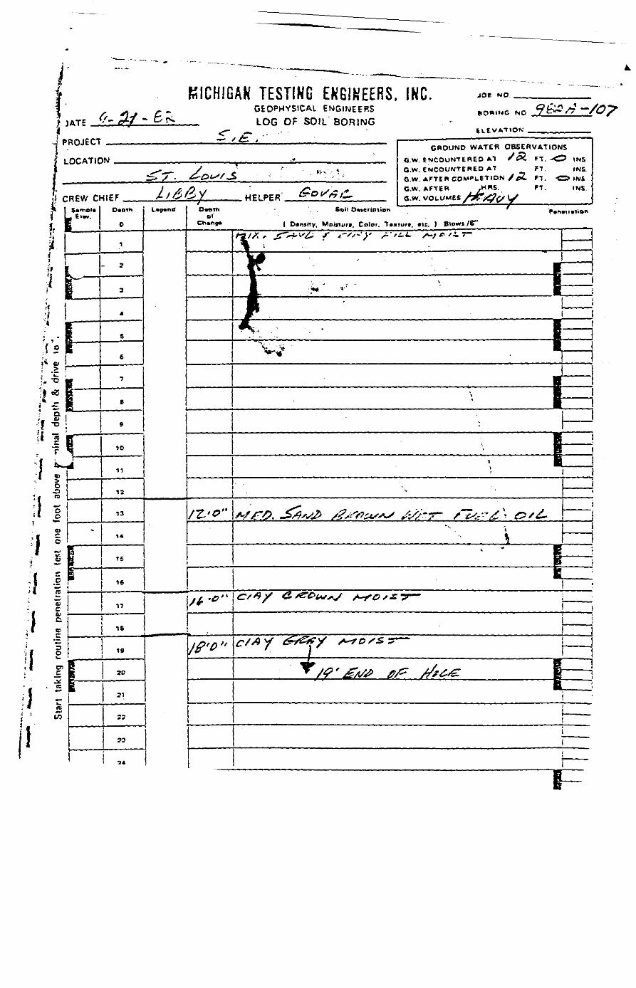
i KICHIG
J PROJECT
| LOCATIC
ji CREW O
jL^r-i
h•« '
l;|'|;**? Q'f "
!l|'
. r
1 ;' 5o-D!i1 I• t!
£
~V
!
QJ
C
a:
1V.£
. re
rii—s15 ——— .
iA
-
Ir~
<r
AK TESTINR EKGIKEERS. INC, «.«..GEOPHYSICAL ENGINEERS fcomNG NO q&A/j-jLOG OF SOIL BORING
f £- • . ———— . ————— . ————————————————————— iGROUND WATER OBSERVATIONS
IN -» CW fNCOUNTEREO AT /^i FT. -^? (NS^.^ y J "" • iv.. -* G.W. ENCOUNTERED AT FT. INS.
^> / . ^-£>i- /_S r .; GW AFTER COMPLETION / 02. FT. -O tN&
/ /f /2 V/ /Cft/X- * C.W. AFTER /I?*5'- FT- INS
4IEF A/^)/>y HFIPER tT'O^^/^.. Gw VOLUMES /^^^^
o
1
3
3
,
S
6
•J
B
.
10
11
12
13
14
15
16
«
t 18
r~1 70
31
23
33
•34
L.p.nfl
DMTh • So>l DMCription ' p*n*v»iionCh*"ff* ( Dcniitv. Moinurt, Color. Texture. «ie. ) BIOWI /6"
————————
rt>°"
/t •*"
l£»0 «
^^ "^ ' ; ^ / 'I
"l*K ' '. • •
• " - % Em, •?* *" KK • - ___
———
^•»
B•, B
BH
:
BP
i"*
^*" • • • --1 _ . _ . _ _ _
* "" SBE
<=,«/ a.^C'^^f ^0,£-r- ___
f* I rf /I G? * fr f ^**f ff r J> i* \
^ B ___ " 1* /?' £A/<P ff/z* //?£&• E —— !
" I -
————
1 ——

APPENDIX I
OBSERVATION WELL
BOREHOLE LOGS
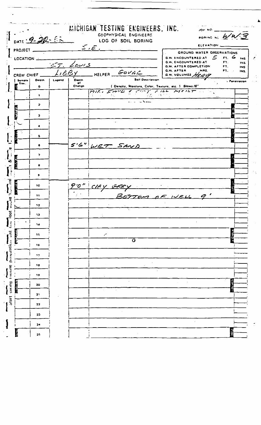
MICHIGAN "TESTING EKGIKEERS. INC. JOI'
i 1 • <? *b£ - ' IL•<• DM? V- -rfftC- .->-
'1 PROJECT
LOCATK
, CREW Ci
"J s
l -1 1-PIIL.* j*• ' !
£ 1OJ »
Oo
1?I1 i
•r"
GEOPHYSICAL ENGINEERS ^^ fa/b/:3LOG OF SOIL BORING "OR-NO *. . _ s^
__ E^ EVAt ION ._. ...
/ /• , . ————————————————————————————————————————————————— .
GROUND WATER OBSERVATIONS-)fO - , .,. G-W t NCOUNTSHED AT ^T FT. ^ fNt;
. ^^_ _ V G.w. ENCOUNTERED AT FT. )NS^* / • &•&**'/-$ ._,.„„_.,.„,,.,,.._ S.W AFTER COMPLETION FT ,N5
/ >i /J , S**n S " ** C.W. AFTER MRS. FT. - IMSMIFF A / O O X HE1PPR "-0^/r/— Gw VOLL,MES Jfarfty
0
i
2
3
4
S
6 ^
7
e
t-
10
11
12
13
14
IS
II 5 : 16
if: i „
li ——18
\i ; »1 11 " jg- ^r- tra
1^^
—
30
22
23
ii 25
L.»*ndO.«h Soil D«cnp,.0* -" ,>.n..r«ion
C* iCh»r»9» ( Dvntitv. Moniuft. Color. Tvxturr, «lc. ) Blow* /B"
S'6>»
^/x.jr*-^ ' -"'-'"^ ^.'At. ^-'^/-' -. —— !
| —————— j
I— •| ———
5 !
Us£L*7~ £**4*v/) ' \
9<o"* . _
R ;C/jA y <&c%* v . • - - e i
/ * B!**>£>7~*7~C>s**^ S> /C" t **/&-£-(- & ^
j _ . ——
^
——— !
1 !
S ______ "
O J
! ————————
• ' i !
————
g ____ 1
1I
————I
! ! ;
1 —
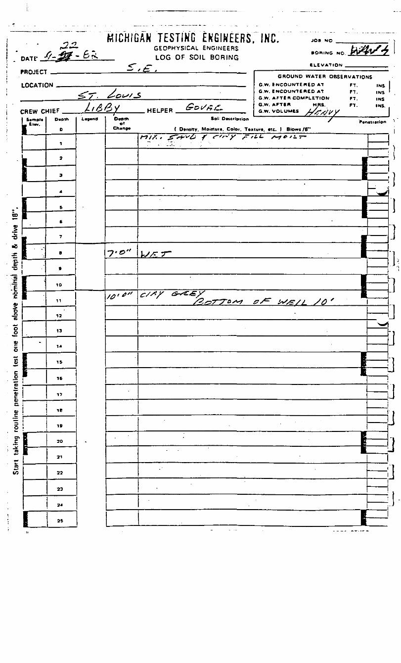
T E S T I N G E N G I N E E R S ; INC.•
r22-
«TP -0-33- 6<PROJECT!
LOCATIC
CREW C1 Svmpl*L Elw.
I
CO
w>™
*'e**
ii-E*l
JD(C
"oo
Ing
roul
ine
pene
irolio
n te
st o
ne
re*«
k.tcLO
h
• -•
-
1|—
-
fE —
^^
GEOPHYSICAL ENGINEERS
LOG OF SOIL BORING
3N ————— : —————————————————
UMPF //^3/2/ HFIPER &Ot/#jC-
Daoth
0
1
2
3
4
6
6
7
8
B
10
11
12
13
1*
IS
16
17
IB
5fe
1
19
20
21
22
23
24
25
L^d D*et*> Koli' O*«crlp)ienof
Ch»np« ( Dtnsrtv. Moiftuti. Color. T««
7.0"
/0""
/-?/A * jTVf'V^; ^ fs*~y ,- /---.. .
• ORING NO _PV^V^*7
CI.EVATION _
GROUND WATER OBSERVATIONS
c.w. ENCOUNTERED AT FT. INSG.W. AFTER COMPLETION FT. INS
G.W. VOLUMES yAvTV^X
luft, etc. ) Biowc /6"
**" /U**'ir"
-
k/yTT-
~w
•
I j
tf/X/- d^T^X^^^^ 1——__ ———————— . ——— | ——
"—
> l
•
B£
-
———
BE^
_____
_
1
)
JI1J
bjjjjjj
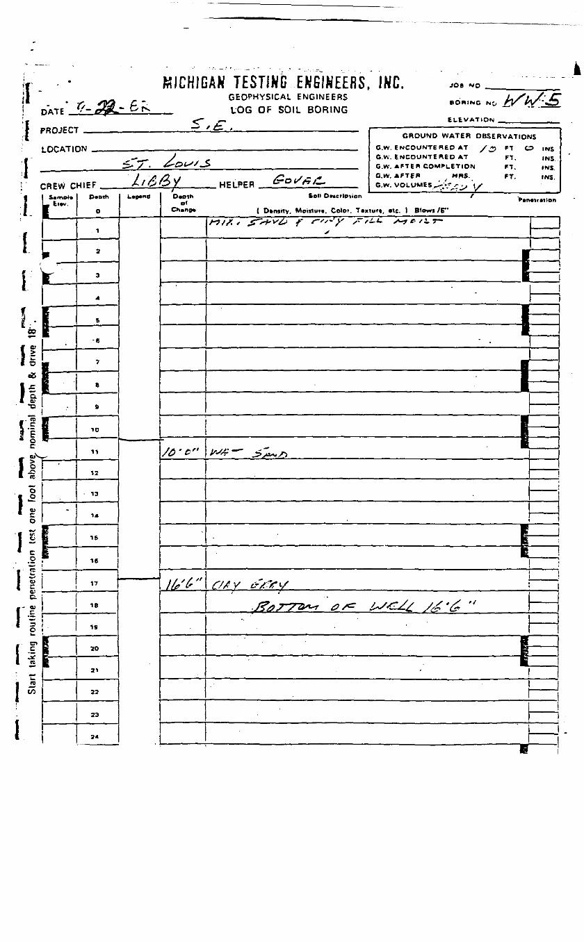
;f .
!H-
it
iC - s
CO
II1 o
1 a.'' Xi
_-"c5I cIE* o
I "re
.1' I
1!.2I s1 !c.
il1 1
1
WILFUL
- * ?y *ffi P '•DATF - - tr&*r & f> .PROJECT
LOCATI
:REW cSamel*
_ tl*v.
f
ri*i—1 ——
i
i
.
1ft
<rF —
AR ICOimU CfiGlHUIin^, (fib. JOB *o _GEOPHYSICAL ENGINEERS L/1*/' CBORING MO rv W *OLOG OF SOIL BORING ~ " '^^
_ ELEVATION/ **- _____ , ————————————————————————— _________ — •— -
GROUND WATER OBSERVATIONSpw , ._,..,..,.,.., GW PWCOUNTERED AT y *, e-f ^ INS
,„--__ y _ G.W. ENCOUNTERED AT ' FT. INS.^. / . ^•^t^-'-S _ ,„._.. , .,„ GW A F T E R COMPLETION ^7 (N5
// A/^V/ /Cot/^y" G.W. AFTER MRS. FT. INS.W1FF At&&Y HFLPER ^ °*^/»/— e.w. VOLUMES ^ ^ .. ix
O«Dih
0
1
2
3
a
5
•6
7
8
S
ID
11
12
13
14
IS
16
„
18
19
20
21
22
23
?*
L.p.nS D*othof
/£ ' Gr
1 / ' / "
Soil DMcrtpiien / -
( Dfcnirty, Moiltut*. Colo*. Taxtuft, *tc. ) Blowi /E"
X "~
•
•B
^ "™* ^~^l**i
•
iBB•y~*& ~~ ^?y*^r>
j
—EpE
!
1 1
^7/ V £.WX^" *•/^
•J^07~~?&*** & s*^ £*/4^Z.£ /<£ '&
1 —•i—
• ' —— .—
E
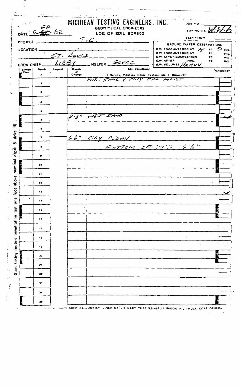
(1
i 1!
c
b1
•X-6;
1IO)
O-D(0
"oC
wcc«cc_cR
nicc.V_c"
5wo>cn
*••t_ID
«
.. • „ KICHIG3ATE_J^-^3£> £fV
ROJECT.OCATK
:REW cfS?
Iii1—lE ——
!I—
i
t
1*
:
E
^f
AN TESTING ENGINEERS. INC. ». «'GEOPHYSICAL ENGINEERS Jb/V../ ^
• ORINC NC KT- i^r ' fiLOG OF SOIL BORING **-/•- — K-i<— ELEVATION
/ £: , - ,— ————————————————— — ————— , •,GROUND WATER OBSERVATlOf
•\$1 • „ __ BW fN^OUNTtREO AT ^Z-X ff <f
• ^^^^ ,/ O.W. ENCOUNTERED AT ' FT.^> X . ^GftSS-S m m n W AFTER COMP1ETIQN r-f
t /> fl 1 /* X - * C.W, AFTER .MRS. FT^IFP A /OO/ HELPER tirOf/*/-.. a w, WOL UMES V... ^ /> tx
0
1
2
9
4
5
> e
7
a
»
10
11
12
13
14
15
16
17
16
!19
20
21
22
33
94
25I
L^-d01
. Chine*
"
/'^"
t'6"
OS
^ INS.
INS.INS iINS .
Boll Dftcrlption
{ Density. Moitturn. Color. Ttxturt. «tc. t Blow* /E"
A?/A, ^T^^^ / ^-'^->' /- /^i /*-*£> /iT- J '
' 1
———————— [Z•__ j
iX£^? -S>M^> B ,. /j
1 I1J->l
£'$ y /^s±7£><*s/s B II 1
& c TTC s-i &/- ' : <X '/ £ '6 " | ——— 1
T
]J
1;B
____ J|
^™^^^* 1
__ ji
*l ——— "^
—— i— ;•— *^ •
i
B :i» i
i
— ;i — i1 1
i ———————————————— pzJiIRBEO U.L.-UNDtST. LINE R S.T. - SMI: LB v ' "TUBE S.S.-SPL17 SPOON B.C.-ROCK CORE OTHER-
APPENDIX J
ANALYTICAL G.C./M.S. DATA
FOR SEPTEMBER 21, 1982
SAMPLING PROGRAM
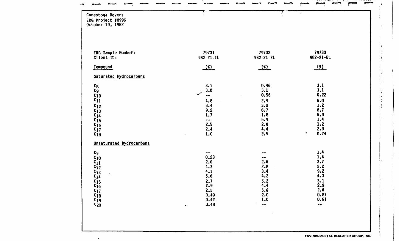
Conestoga RoversERG Project #8996October 19, 1982
ERG Sample Number:Client ID:
Compound
Saturated Hydrocarbons
C8C9ClOCllCj2C13Cl4Cl5Cl6C17C18
Unsaturated Hydrocarbons
CgClOCiiCl2Cl3 ,Cl4Cl5Cl6Cl7Cl8
C20
f
79731982-21-IL
J*L
3.1^ 3.0"
4.83.49.21.7«2.52.41.0
— —
0.232.04.34.15.62.72.92.50.400.420.48
f
79732982-21-2L
JiL
0.463.10.562.93.06.71.85.92.84.42.5
f-.—2.62.83.44.25.24.45.62.01.0
•
79733982-21 -5L
JSL
3.13.10.225.01.28.75.31.41.22.3
v 0.74
1.41.43.72.29.24.33.12.92.60.870.61
ENVIRONMENTAL RESEARCH GROUP. INC.

Conestoga RoversERG Project #8996October 19, 1982
ERG Sample Number:Client ID:
Compound
Cyclic Hydrocarbons
C13
Cl5Cj6CjyC18C19C20pentylcyclohexanebutyl cyclohexanehexylcyclohexaneoctyl cycl ohexane
Aromatlcs
C3-subst1tuted benzenesC4-subst1tuted benzenesCs-substltuted benzenesphenylalkanes MW 162phenylalkanes MW 176phenylalkanes MW 190phenylalkanes MW 204phenylalkanes MW 218phenylalkanes MW 232phenylalkanes MW 246phenylalkanes MW 260
•
79731982-21-IL
J*L
3.41.41.21.2....0.280.502.01.02.43.1
2.03.8——0.580.701.0—0.18--0.19
..„„,,, t
79732982-21 -2L
J*L
2.92.01.81.5__«—1.30.571.93.1
0.340.34--0.551.11.0--0.280.280.31
1
79733982-21 -5L
J*L
1.80.83----0.320.360.381.30.831.82.2
1.62.81.50.770.820.830.880.120.270.280.11
•VlRC-r, —— -UAL,— -. 3UP,
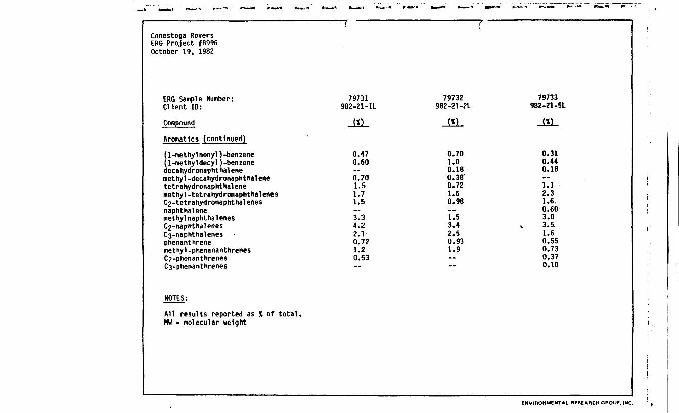
Conestoga RoversERG Project #8996October 19, 1982
ERG Sample Number:Client ID:
Compound
Aromatlcs (continued)
(1-methylnonyl)-benzene{1-methyldecyl)-benzenedecahydronaphthalenemethyl.decahydronaphthalenetetrahydronaphthalenemethyl-tetrahydronaphthalenesCg-tetrahydronaphthalenesnaphthalenemethyl naphthalenesCg-naphthalenesC3-naphthalenesphenanthrenemethyl-phenananthrenesC2-phenanthrenesC3-phenanthrenes
NOTES:
All results reported as % of total*MW = molecular weight
79731982-21-IL
0.470.60
0.701.51.71.5
3.34.22*10.721.20.53
79732982-21-2L
0.701.00.180.380.721.60.98
1.53.42.50.931.9
79733982-21-51
0.310.440.18
1.12.31.6.0.603.03.5.1.60.550.730.370.10
ENVIRONMENTAL RESEARCH GROUP, INC.
II1IIi _1I APPENDIX K
I ROCKY MOUNTAIN ANALYTICAL LABORATORIES DATA
iSEPTEMBER 21, 1982
SAMPLING PROGRAM
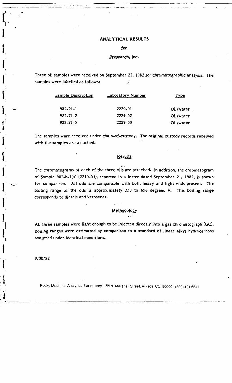
ANALYTICAL RESULTS
for
Presearch, Inc.
Three oil samples were received on September 22, 1982 for chromatographic analysis. Thesamples were labelled as follows: /
Sample Description Laboratory Number Type
982-21-1 2229-01 Oil/water982-21 -2 2229-02 Oil/water982-21-5 2229-03 Oil/water
The samples were received under chain-of-custody. The original custody records receivedwith the samples are attached.
Results
The chromatograms of each of the three oils are attached. In addition, the chrornatogramof Sample 982-b-l(a) (2210-05), reported in a letter dated September 21, 1982, is shownfor comparison. AIJ oils are comparable with both heavy and light ends present. Theboiling range of the oils is approximately 350 to 696 degrees F. This boiling rangecorresponds to diesels and kerosenes.
Methodology
All three samples were light enough to be injected directly into a gas chromatograph (GC).Boiling ranges were estimated by comparison to a standard of linear alkyl hydrocarbonsanalyzed under identical conditions.
9/30/82
Rocky Mountain Analytical Laboratory 5530 Marshall Sueei. Arvada. CO 80002 (303) 421 -66 n
^k»V^-rf\ -/\ ~^f
CHROMATOGRAPHIC COMPARISON OF OILS
982-b-l(a) (2210-05)
(2229-01)
(2229-02)
982-21-5 (2229-03) o
j3
jj
i
APPENDIX L
ROCKY MOUNTAIN ANALYTICAL LABORATORIES DATA
OCTOBER, 1982
SOIL/LIQUID SAMPLES
November 3,1932
Rocky Mountain Analytical Laboratory
Mr. Don RobinsonConestoga-Roversc/o Hooker Chemical & PlasticsBuilding L-lNiagara Falls, NY 14302
Dear Mr. Robinson:
Enclosed is the report of the analyses of the ten samples you submitted.
Please call me if you have any questions.
Best regards,
O. Sohn LogsdonManager, Organic Chemistry
OJL/blsEnclosure (1)
cc: Mr. Leslie GoodierPresearch, Inc.
RMA #2281
ANALYTICAL RESULTS
for
Conestoga-Rovers
On October 18, 20 and 22, 1982, a total of ten samples were received for analysis. Thesamples were received under chaln-of -custody and were labelled as follows: j
Sample Description Laboratory Number Date Received Type ]
1082-13-51 2281-01 October 18, 1982 Soil _,1082-12-52 2281-02 October 18, 1982 Soil )1082-1- - October 20, 1982 Soil j
October 20, 1982 SoilOctober 20, 1982 Soil ^
1082-19-3 2281-031082-19-4 2281-041082-19-5 2281-05
1082-19^6 2281-06 October 20, 1982 Oil1082-19-1 2281-07 October 20, 1982 Soil1082-19-2 2281-08 October 20, 1982 Soil10S2-13-1L 2281-09 October 20, 1982 Water1082-21-1 2281-10 October 22, 1982 Soil
Results
Chromatograms for each sample extract are attached. Also attached is a copy of theinitial Chromatograms for samples reported on September 21, 1982.
1082-19-4 The sample contains components in the boiling range of 421 - 736" F. Thechromatogram shows some correlation with the heavier ends in past sample 982 b-1 (a).The lighter ends, before "C" however do not provide a good comparison. There is alsocomparison of the heavier ends of this sample to those in Samples 1082-13-51, 1082-13-1L,1082-19-2 and 1082-19-3.
1082-13-51 This sample contains components in the boiling range of 345 - 736" F. Thechromatogram shows correlation with past sample 982 b-1 (a). Because the correlation isacross the entire range of components, these two samples are probably of the same origin
Rocky Mountain Analytical Laboratory 5530 Marshall Street. Arvada. CO. 80002 (303) 421 -6611
I
III
i
and have been exposed to similar weathering conditions. This sample also correlates wellwith Sample 1082-13-1L. The heavier ends above "B" and "C" correlate with 1082-19-2,1082-19-3 and 1082-19-4. This Implies that these samples are of similar origin but havebeen exposed to more extreme weathering or loss of light ends.
1082-19-6 This sample contains components that boil in the range of 548 ->774* F. This.is a heavier hydrocarbon than the previous samples. It does correlate with past sample9982.
1082-13-1L, 1082-19-2 and 1082-19-3 These samples all correlate to past sample 982* b-l(a). The boiling ranges for 1082-13-1L and 1082-19-2 are similar at 345 - 696° F.
While sample 1082-19-3 has a higher range of 345 - 774* F. Sample 1082-19-3 alsocorrelates with past sample 9-82- 1C.
t 1082-21-1 This sample contains a series of hydrocarbons boiling from 421 - 755*F.| The pattern of these components does not correlate with any of the other samples.
1082-19-5. 1082-13-52^1082-19-1 These samples do not show any patterns thatcorrelate with other samples.
Methodology
The soil samples were extracted with 5 ml of pentane per 2 grams of sample. The oil wasdiluted in pentane and the water sample was extracted with pentane. The pentaneextracts were analyzed by gas chromatography using a flame ionization detector. Thepentane solvent peak appears at the beginning, of each sample chromatogram. Boilingranges were estimated by comparison to a standard of linear alkyl hydrocarbons analyzedunder the same conditions.
11/3/82
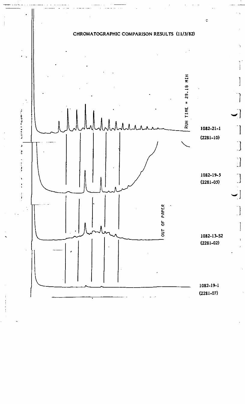
CHROMATOGRAPHIC COMPARISON RESULTS (11/3/82)
^y^*
1082-21-1
(2281-10)
1082-19-5(2281-05)
1082-13-52(2281-02)
1082-19-1(2281-07)

II
CHROMATOGRAPHIC COMPARISON RESULTS (11/3/82)
1082-13-S1 (2281-01)
B
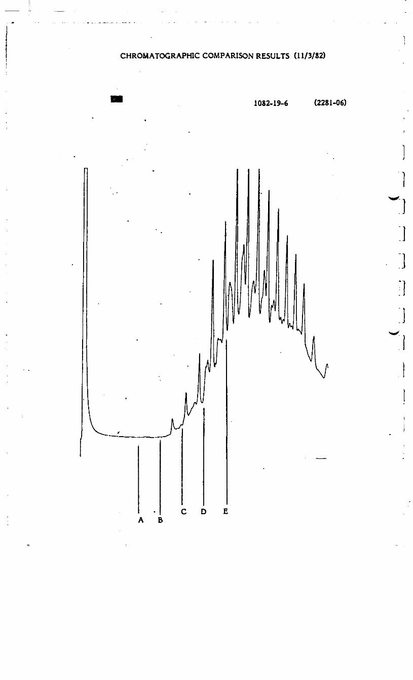
CHROMATOGRAPHIC COMPARISON RESULTS (11/3/82)
1082-19-6 (2281-06)
C D EA B

CHROMATOGRAPHIC COMPARISON OF OILS AND EXTRACTS (9/21/82)
1L
9825-1 (a) (2210-05)
UGW-16-2C (2210-03)
9-S2-1C (2210-02)
UGW-16-3C (2210-04)
9982 (2210-01)

CHROMATOGRAPHIC COMPARISON RESULTS (11/3/82)
1082-19-4 (2281-04)
i
3
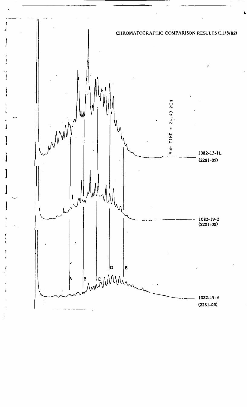
CHROMATOGRAPHIC COMPARISON RESULTS (11/3/82)
B
1082-13-1L(2281-09)
1082-19-2(2281-08)
1082-19-3(2281-03)
; ADDITIONAL ANALYTICAL RESULTStfor*
i Conestoga-Rovers
1 On November 5 and 8, 1982, additional review was performed of the results reported onNovember 3, 1982. The following statements summarize the findings.
*;* 1082-21-1 The distribution of hydrocarbons in this sample corresponds to that of No. 2| ^- heating oil.
1082-19-3, 1082-19-», 1082-19-5 Samples 1082-19-3 and 1082-19-* show correpondencei of some components between "C" and "EH. Sample 1082-19-5 did not show a comparison
because the components of interest were not concentrated enough. The three peaks couldI be background from the extraction solvent because the sensitivity of the analysis was4
increased to try and detect the pattern. Samples 1082-19-3 and 1082-19-* correlate some} with 9-81-1C in the area of "C" and "D". Lighter ends however are not related. Their* origin could be of the same source or different sources producing a similar product or
using similar feedstocks.
— 1082-19-6 This sample shows a pattern and boiling range similar to those of a No. 6 oil.This sample also shows correlation with the past sample 9982.
1 1Q82-13-SI. 1082-13-1L, 1082-J3-S2 Samples 1082-13-S1 and 1082-13-1L correlate over* the entire range of peaks detected. These samples are most likely from the same source.
!
Sample 1082-13-S2 did not contain enough recoverable material in this analysis to show acomparison. The two largest peaks may originate from analytical background because thesensitivity of the test was increased to try and detect a pattern.
f1
1082-19-1 Not enough material was recovered in the analysis to show a pattern.
1082-19-2 This, sample shows slight correlation with 1082-13-1L. The heavier endsT abgyc--HB" and "C^-snow correlation in component peaks at similar retention times buti their responses are somewhat different. Possibly, 1082-13-1L contains additional
Rocky Mountain Analytical Laboratory 5530 Marshall Street. Arvada, CO. 80002 (303) 421-6611

components that mask the pattern of 1082-19-2. Possibly 1082-19-2 has additionalcomponents. The correspondence is present but weak. This sample also shows a slightcorrespondence with 1082-19-4 (reported earlier). This relationship is also weak.
11/8/82
jjj
a
Instruments Ltd.
October 29, 1982
-r ^ x u Rec'dT. CrutcherAssoc.Conestoga-Rovers Ass'n • -»v - b 1982651 Col by Dr.,Waterloo, OntarioCanadaN2V 1C2
Dear M. Crutcher,
Thank you for your inquiry regarding our groundwater instrumentationas advertised in the Ground Water Monitoring Review. Enclosed is abrochure describing our MP System.
If you have a specific project in mind or wish more detailedinformation on our products, please call us.
] Sincere!
i Erik Rehtlane
ER/deEnclosure
507 East Third Street, North Vancouver, B,C. V7L1G4 Telephone (604)984-4215 Telex 04-352606