COMMISSION FOR AERONAUTICAL METEOROLOGY
179
uJYI 0 T'C cAc t1 1\ '0(; WORLD METEOROLOGICAL ORGANIZATION. _ ........... ... COMMISSION - FOR AERONAUTICAL METEOROLOGY ABRIDGED FINAL REPORT OF THE 1974 EXTRAORDINARY SESSION (Held in part conjointly with the Eighth Air Navigation Conference of ICAO and in part conjointly with the MET Divisional Me.eting of ICAO) " Montreal, 22 April. 17 May 1974 WMO .. No. 406 Secretariat of the World Meteorological Organization • Geneva • Switzerland 1975
-
Upload
khangminh22 -
Category
Documents
-
view
0 -
download
0
Transcript of COMMISSION FOR AERONAUTICAL METEOROLOGY

uJYI 0T'C cAc t1
1\ '0(;
WORLD METEOROLOGICAL ORGANIZATION._...........-~~- ...
COMMISSION- ~--
FOR AERONAUTICAL METEOROLOGYABRIDGED FINAL REPORT
OF THE
1974 EXTRAORDINARY SESSION(Held in part conjointly with the Eighth Air Navigation Conference
of ICAO and in part conjointly with the MET Divisional Me.eting of ICAO)
"
Montreal, 22 April. 17 May 1974
WMO .. No. 406
Secretariat of the World Meteorological Organization • Geneva • Switzerland
1975

© 1975, World Meteorological Organization
ISBN 92 - 63 - 10406 - 9
NOTE
The designations employed and the presentation of the material in this publication do notimply the expression of any opinion whatsoever on the part of the Secretariat of the WorldMeteorological Organization cQncerning the legal status of any country or territory or of itsauthorities, or concerning the delimitation of its frontiers.

CON TEN T S
List of persons attending the session V-IX
Agenda ••••••••••••• 11 11 •• 11 •• 11 •• 11 • 11 • 11 • 11 •••• 11 ••• 11 •• 11 ••• 11 3 •• XI-XII
List of recommendations adopted by the session ..•...•...........•..
Opening, organization and closure of the session " .•.............•.
Meteorological observing systems at aerodromes ......••..•..........
Meteorological service for pre-flight operational planning .....•..•
Meteorological offices at aerodromes .....••..••.••...........•...••
Consideration of the revision of those parts of WMO TechnicalRegulations, Chapters ~12.1-7 and L-12.2-l/ICAO Annex 3 and thePANS-MET ~hich are not within the theme of the CAeM Ext. (1974)/Eighth Air Navigation Conference (The sole item of the ICAO METDivisional Meeting) ••••••••.••..•.••••••..•••.••.••••••••.•••••••.•
XIII-XV
1-3
12-1/12-36
13-1/13-46
14-1/14-6
1-1/8-1


LIST OF PERSONS ATTENPING THE SESSION
1. Officers of the session
P. DuvergeR. R. Dodds
2. Representatives of Members of WMO
M BelbachirM. Kanoun
presidentvice-president
principal delegate Algeriadelegate
R. Gnus principal delegateR. R. Maresco observerEo P. Quaranta observer
R. B. Crowder principal delegate
B. Knirsch principal delegateH. Maier delegate
M. Quoilin principal delegateR. Waegeneer delegate
F. C. Chede. principal delegateA. Doria del~gate
C. Eo Berridge principal delegate
Eo D. Quan principal delegate
R. R. Dodds principal delegateJ. P. O'Reilly delegateR. Sierolawski delegate
C. Alarcon principal delegate
H. H. Krarup principal delegate
Eo F. Banoub principal delegateF. O. Abd-El Nasser delegate
Argentina
Australia
Austria
Belgium
Brazil .
British CaribbeanTerritories
Camerooni UnitedRepublic of
Canada
Cuba
Denmark
Egypt

VI LIST OF PERSONS ATTENDING THE SESSION
" Representatives of Members of \>/MO (contd.)L.
J. Riissanen principal delegate FinlandM. S. Prusi delegate
P. Duverge principal delegate FranceJ. Calzi delegateJ. Renard delegateP. Wagner-Autesserre delegate
H. Wehner principal delegate German DemocraticR. Merta delegate Republic
J. Engler principal delegate Germany, FederalW. Lamp delegate Republic ofC. Zehnpfund observer
C. A. A.. Obuobie principal delegate Ghana
P. P. Sham principal delegate Hong Kong
Miss I. Lepp principal delegate Hungary
R. R. Wirjomidjojo principal delegate IndonesiaK. Barkah delegateL. H. Siregar delegate
G. Siropian principal delegate Iraq
M. Kadhim . delElgate
D. L Linehan principal delegate Ireland
Y. L. Tokatly principal delegate Israel
V. Mastino principal delegate Italy·
A. Cissoko principal delegate Ivory Coast
M. N. Mattocks principal delegate Jamaica·
D. Sagara principal delegate Japan
M. E. Mlaki principal delegate Kenya
J. Agin delegate
K. M. A. Alyagout principal delegate KuwaitA. N. Al-Asfoor delegate
LIST OF PERSONS ATTENDING THE SESSION VII
2. Representatives of Members of WMO (contd.)
K. Kanhalikham principal delegate LaosK. Soukhathammavong delegate
A. Aboul-Hosn principal delegate Lebanon
A. Gammudi principal delegate Libyan Arab Republic
P. Ranaivoson delegate Madagascar
B. Fi tz-John principal delegate MalawiI. w. Lakioni delegate
A. Reyes delegate MexicoA. Avila delegateL. Casasola delegate
J. Kastelein principal delegate Netherlands
G. 1. Ewulu delegate Nigeria
P. Dannevig principal delegate Norway
B. Cabacungan principal delegate Philippines
L. Lorenz principal delegate Romania
M. Nowailaty principal delegate Saudi Arabia1. Khodair delegate
A. Diouf delegate Senegal
w. A. L. Scott principal delegate Sierra Leone
T. A. Bosua principal delegate South Africa
J. Alia Pous principal delegate SpainA. Lines observerJ. Perez Escudero delegate
C. Morales principal delegate Sweden
A. Jeannet principal delegate Switzerland
A. w. Kabakibo principal delegate Syrian Arab Republic

VIII LIST OF PERSONS ATTENDING THE SESSION
2. Representatives of Members of WMO (contd.)
M. E. Mlaki principal delegate Tanzania, UnitedJ. Agin delegate Republic of
C. Singhachan principal delegate Thailand
T. Tuna principal delegate Turkey
M. E. Mlaki principal delegate UgandaJ. Agin delegate
V. U. Kossenko principal delegate Union of SovietV. V. Kassatkin delegate Socialist RepublicsN. V. Petrenko delegateA. P. Vjunnik delegate
L. Sugden principal delegate United Kingdom ofC. Hinkel delegate Great Britain and
Northern Ireland
J. W. Connolly principal delegate United StatesT. F. Gladney delegate of AmericaR. P. James delegateS. Pearse delegateP. H. Peridier delegate
S. Y. Traore principal delegate Upper Volta
A. M. Mbuyamba principal delegate Zaire
3. Observers from International Organizations
H. Schwarz
M. Pittavino
M. H. Gidamy
S. F. V. Froeschl
C. S. Logsdon
International Civil Aviation Organization (ICAO)
Agency for the Safety of Air Navigation inAfrica- and Madagascar (ASECNA)
Civil Aviation Council of Arab States (CACAS)
Federation Aeronautique Internationale (FAI)
International Council of Aircraft Owner andPilot Associations (IAOPA)

LIST OF PERSONS ATTENDING THE SESSION
3. Observers from International Organizations (contd.)
IX
E. ChambersS. CalabreseH. DreylingO. GierloffJ. G. Walker
L. Sonesson
4. WMO Secretariat
A. MastrangeliH. L. RosertD. J. Bargman
International Air Transport Association (lATA)
International Telecommunication Union (ITU)
Representative of the Secretary-General


AGE N D A
1. OPENING OF THE SESSION
2. CONSIDERATION OF THE REPORT ON CREDENTIALS
3. ORGANIZATION OF THE SESSION
3.1 Adoption of the agenda
3.2 Establishment of Committees
4. METEOROLOGICAL OBSERVING SYSTEMS AT-AERODROMES (Item 12 of the ICAO EighthAir Navigation Conference)
Development of methods and procedures in respect of meteorological observingsystems, in particular for the automated measurement and reporting forCategory 11 and III operations:
(a) Surface wind;
(b) Low-level turbulence and wind shear;
(c) Visibility and runway visual range;
(d) Slant visual range;
(e) Cloud;
(f) Aerodrome pressure.
5. METEOROLOGICAL SERVICE FOR PRE-FLIGHT OPERATIONAL PLANNING (Item 13 of theICAO Eighth Navigation Conference)
Revision of methods and procedures to meet present and future meteorologicalrequirements, in particular for centralized flight planning by operatorstaking into account progressive centralization of MET services;
(a) Information for computer flight planning;
(b) Pre-flight documentation for pilots;
(c) Meteorological briefing for pilots, controllers and other users;
(d) Supply of warnings, amendments and other non-routine datg.

XII AGENDA
6. METEOROLOGICAL OFFICES AT AERODROMES (Item 14 of the ICAO Eighth Air Navigation Conference)
Review of the functions and of the classification of meteorological officesat aerodromes, in the light of increasing automation and centralization ofaeronautical and meteorological services and taking into account difficultiesexperienced with the present classification.
7. CONSIDERATION OF THE REVISION OF THOSE PARTS OF WMO TECHNICAL REGULATIONS,CHAPTERS L-12.1-! and L-12.2-!/ICAO ANNEX 3 AND THE PANS-MET WHICH ARE NOTWITHIN THE THEME OF THE CAeM EXT. 1974/EIGHTH AIR NAVIGATION CONFERENCE (Thesole item of the ICAO MET Divisional Meeting)
8. CLOSURE OF THE SESSION.

LIST OF RECOMMENDATIONS *
12/1 Criteria for the preparation of selected special reportsrelating to changes in cloud amount and height of cloud base
12/2 Guidance criteria on representativeness of wind observationsat an aerodrome •...••.....•..•.••....•.••.•.••••••••••.•.••••
12/3 - .RSPP - Inclusion of revised definition of runway visual rangein Chapter 1 of the new Annex 3/Technical Regulations LC.3.17
12/4 Slant visual range ••.•••••••.•.•.••••.. o ••••••••••••••••••••••
12/5 RSPP - Present weather abbreviations and codes - Amendmentsto PANS-ABC and to WMO codes .•....•.•..•..•....•....••••••.•.
12/6 Aeronautical requirements for vertical wind shear and signifi-cant variation of the wind .....••..•••.•.•..•..• ~ •..•..•.••..
12/7 Studies of vertical wind shear and significant variationof the wind ••••..•.•.•.••••..••••...••.••.•..•.••..••••••••••
12/8 Guidance material on vertical wind shear and significantvariation of the wind ••........•.••..••...•..•••...••..••....
12/9 Order of information in routine and special reports •...•••••.
12/10 Aeronautical meteorological codes - Order of information inMETAR and SPECI code forms ••.••••.••.•..••.•••••.•.•••••.•..•
12/11 RSPP - Inclusion of Chapter 4 (Meteorological observationsand reports) and related Attachments in the new Annex 3/Technical Regulations LC.3.17 .
12/12 Aeronautical meteorological codes - Alignment of Notes tothe METAR and SPECI code forms ••...•.•..••..•••..•••..•.•••.•
12-2
12-3
12-4
12-7
12-8
12-10
12-10
12-11
12-12
12-13
12-14
12-14
* For ease of reference, the original ICAO numbering of recommendations has beenmaintained (see also the note on page 3 regarding presentation of the report).
NOTE: Recommendations annotated "RSPP" relate to proposals for amendments ofstandards, recommended practices and procedures, or guidance material in thenew WMO Technical Regulations LC.3.1J.

XIV
13/1
"13/2
13/3
13/4
LIST OF RECOMMENDATIONS"
RSPP - Inclusion of Chapter 9 (Services for operators andflight crew members.) and related Appendix in the new Annex 3/Technical Regulations LC.3.y " .RSPP - Inclusion of Chapter 6 (Forecasts) and Chapter 7(SIGMET information and aerodrome warnings) and relatedAttachments in the new Annex 3/Technical Regulations LC.3.yRSPP - Inclusion of revised specifications relating to areaforecast centres in Chapter 3 of the new Annex 3/TechnicalRegulations LC.. 3.y "Review of regional Area Forecast Systems ...••...•••...•.•..•••
13-6
13-7
13-8
13-9
13/5 Provisional requirement for information on marked temperatureinversions ,............................. 13-9
13/6
13/7
13/8
13/9
14/1
14/2
14/3
1/1
1/2
Review of provisional requirement for information on markedtemperature inversions .•••..•••.....•..•.•••••.••••.••.••..•.
Review of contents of terminal weather information for flightplann ing .......•.••••.•••.••••.••••...••.•.•..•..•.•..••..••
Aeronautical meteorological codes - FIFOR, PROAR, PRORO andPROFI code forms .••••.••..••.•••.•.•••••••••.•...•••••.•..••.
Aeronautical meteorological codes - GRID code form •.••.••••••
RSPP - Inclusion of revised specifications relating to aerodrome meteorological offices in Chapter 3 of the new Annex 3/Technical Regulations LC.3.y .RSPP - Inclusion of definition of aerodrome meteorologicaloffice in Chapter 1 of the new Annex 3/Technical RegulationsLC.3.y .Allocation of forecasters to aerodrome meteorological offices
- RSPP - Inclusion of Chapter 1 (Definitions) in the newAnnex 3/Technical Regulations LC.3.y .RSPP - Amendment of Chapter 9 (Service for operators andflight crew ~embers) of the new Annex 3jTechnical Regula-tion s Le. 3 ~g 'I • ~ ••••••••••••••••••••• '.1 •••••••
13-10
13-11
13-11
13-11
14-2
14-2
14-3
1-1
1-2

1/3
3/1
4/1
5/1
~2
6/1
7/1
*7/3
~
8/1
LIST OF RECOMMENDATIONS
RSPP - Amendment of Chapter 3 (Area forecast centres, aerodrome meteorological offices, meteorological watch offices)of the new Annex 3/Technical Regulations LC.3.17 .Definition of nephanalysis .............•....•....•••.•••••...
RSPP - Inclusion of Chapter 2 (General provisions) in the newAnnex 3/Technical Regulations LC.3.17 .RSPP - Inclusion in Chapter 3 (Area forecast centres, aerodrome meteorological offices, meteorological watch offices)of the new Annex 3/Technical Regulations LG.3.b! of revisedspecifications relating to meteorological watch offices ....••
RSPP - Inclusion of Chapter 5 (Aircraft observations andreports) in the new Annex 3/Technical Regulations LC.3.17RSPP - Inclusion of Chapter 8 (Aeronautical climatologicalinformation) in the new Annex 3/Technical Regulations LC.3.17Aeronautical climatological information
RSPP - Inclusion of Chapter 10 (Service for air trafficcontrol and for search and rescue units) in the new Annex 3/Technical Regulations LC.3.17 .Review of the requirements for communications between ATSunits and associated meteorological offices and stations ••••.
Date-time group in the WMO abbreviated headings for forecasts
Status of paragraphs 11.2.3, 11.2.4 and 11.2.6 of Chapter 11
RSPP - Inclusion of Chapter 11 (Requirements for the use ofcommunication~in the new Annex 3 /Technical RegulationsLC·3·17 .RSPP - New Annex 3/Technical Regulations LC.3.17 .
1-2
1-3
2-1
3-1
4-1
5-1
5-2
6-1
7-1
7-2
7-3
7-4
8-1
xv


1.
1974 EXTRAORDINARY SESSION OF CAeM
OPENING OF THE SESSION (Agenda item 1)
1.1 The 1974 Extraordinary Session of the Commission for Aeronautical Meteoro-logy was held at the headquarters of the International Civil Aviation Organization(ICAO) in Montreal, from 22 April to 17 May 1974. The session was held in part conjointly with the ICAO Eighth Air Navigation Conference (Agenda items 4, 5 and 6) andin part conjointly with the 1974 MET Divisional Meeting of ICAO (Agenda item 7)
1.2 The session was opened by the president of the Commission, Mr. P. Duverge(France) at 10.00 a.m. on 22 April 1974.
1.3 Mr. A. Mastrangeli, on behalf of the Secretary-General of the WorldMeteorological Organization, welcomed all participants and representatiyes of international organizations. He emphasized that the task before the meeting, namely therevision of the WHO/ICAO regulatory material, was a difficult one and that a basicpaper in this relation had been prepared by the ICAO and WHO Secretariats for consideration and approval by the session. With the hope that the outcome of the discussions would result in material which would prove satisfactory for many years tocome, he wished the session every success.
1.4 The meeting was then addressed by Mr. W. J. Nemerever, Acting Secretary-General of the International Civil Aviation Organization. He stated that ICAO lookedforward to a very fruitful meeting, resulting in a completely new version of thejoint regulatory documents on aeronautical meteorology. Mr. Nemerever concluded bystating that ICAO would do all it could to assist in the work and to make everyone'sstay pleasurable.
1.5 Finally, Mr. Duverge gave his presidential address, in which he reviewedthe recent developments in aviation and the collaboration between WHO and ICAO andpaid tribute to the increasing and friendly assistance he had received from bothSecretariats. He mentioned that, whatever the merits of those who originally prepared the WMO Technical Regulations/lCAO Annex 3 in 1947 after over 20 years ofamendments and additions, the document had become complex and difficult to cons~lt.
The need for a complete revision of the existing material was recognizedby the 1969 Extraorainary Session of CAeM/Sixth Air Navigation Conference of ICAOwhich invited both organizations to undertake this task. The first draft of thisrevision was prepared by the ICAO Secretariat, combining Annex 3 and PANS-MET inone single document and subsequently stupied and refined by the WHO Secretariat andad-hoc working group of CAeM. A last inter-Secretariat meeting had produced thetext which would have to be considered by the meeting. Mr. Duverge concluded bywishing the meeting success in this task.

2 1974 EXTRAORDINARY SESSION OF CAeM
1.6 Ninety-one delegates from 57 Member countries and 11 observers fromseven international organizations attended the session. The WMO Secretariat wasrepresented by Mr. A. Mastrangeli, representative of the Secretary-General,Mr, H. L. Rosert and Mr. D. Bargman.
A complete list of delegates, experts and observers is given in thebeginning of this report.
2. CONSIDERATION OF THE REPORT ON CREDENTIALS (Agenda item 2)
A provisional list of participants and the capacities in which theywere attending the session was presented by the representative of the SecretaryGeneral. The list was accepted as the report on credentials.
3.
3.1
ORGANIZATION OF THE SESSION (Agenda item 3)
Adoption of the agenda
The provisional agenda was adopted without amendment. The final agendais reproduced at the beginning of this report, together with the list of recommendations adopted by the session.
3.2 Establishment of committees
To deal with items 4, 5 and 6 of its agenda the CAeM met conjointly withCommittee C of the Eighth Air Navigation Conference of ICAO which was speciallyestablished to deal with the meteorological items of this conference (items 12, 13and 14). Dr. J. Engler (Federal Republic of Germany) was elected chairman of thiscommittee and Mr. M. E. Mlaki (Kenya) elected vice-chairman. Messrs. A. Mastrangeli(WMO Secretariat) and U. Schwarz (ICAO Secretariat) acted as secretaries to thecommittee.
Item 7 of the agenda was dealt with conjointly with the MeteorologicalDivisional Meeting of ICAO which was convened for the purpose of dealing with thoseaspects of WMO Technical Regulations/lCAO Annex 3. relating to the en-route phase offlight not comprised in the theme of the Eighth Air Navigation Conference, i.e."aerodrome and its vicinity". Mr. P. Duverge (France, president of the CAeM) waselected chairman of this conjoint meeting; Dr. J. Engler (Federal Republic of·Germany) was elected chairman of the Committee of the Whole; Mr. K. M. A. Alyagout(Kuwait) first vice-chairman and Mr. R. Bermudez (Panama) second vice-chairman ofthis committee. Messrs. A. Mastrangeli (WMO Secretariat) and U. Schwarz (ICAOSecretariat) acted as secretaries •.
Co-ordination Committee. A Steering Committee was set up for the duration of that-part-of-the-I974-Extraordinary Session of the Commission for Aeronautical

1974 EXTRAORDINARY SESSION OF CAeM 3
Meteorology which met with the ICAO Eighth Air Navigation Conference. The presidentof CAeM, the chairman of Committee C, Messrs. A. Mastrangeli and U. Schwarz respectively participated in their capacity as Vice-Chairman of the ICAO Eighth Air Navigation Conference, chairman of Committee C and secretaries of this committee. For theremaining part of the CAeM which met conjointly with the Meteorological DivisionalMeeting of ICAO a Co-ordination Committee was established and formed by the presidentof CAeM, the chairman of the Committee of the Whole and Messrs. A. Mastrangeli andU. Schwarz as secretaries.
4. CLOSURE OF THE SESSION (Agenda item 8)
4.1 In closing the session, the president expressed his appreciation toDr. J. Engler, chairman of Committee C, and to the delegates and the Secretariat,for having completed so difficult a task in so short a time. The new WMO TechnicalRegulations LC.3.17/ICAO Annex 3, which was both clear and up to date, was the product of the fruitful collaboration between WHO and ICAO and between their respectiveSecretariats.
4.2 On behalf of the Secretary-General of WMO, Mr. A. Mastrangeli thankedthe Secretariat of ICAO for the excellent facilities made available and for theirfriendly collaboration.
4.3 On behalf of the International Civil Aviation Organization, Mr. U. Schwarzthanked the president and Mr. Mastrangeli for their kind words and their collaboration throughout the meeting.
The session closed at 4-30 p.m. on 17 May 1974.
NOTE: For ease of reference between the WMO and IeAO reports and for reasons ofeconomy, maximum use has been made of the ICAO page format for the presentationof the abridged final report of the session.


ITEM 4 - METEOROLOGICAL OBSERVING SYSTEMS AT AERODROMES
(This item was considered during that partheld conjointly with the ICAO Eighth AirConference where it formed Item 12 of thepagination is in the ICAO format for easebetween the WMO and ICAO reports)
of the sessionNavigationagenda;of reference


Report on Agenda Item 12
Agenda Item 12: Meteorological observing systems at aerodromes
12-1
12.1 General
12.1.1 The Meeting commenced its work by considering the general problems associatedwith observing systems at aerodromes and paid special attention to the introductionof automated systems for making meteorological observations. These systems can provideCategory 11 and III operations with the accurate and real time information they require.Although observations of many meteorological parameters may be obtained from automatedobservations, some require human intervention, particularly in respect of significantdirectional variations of visibility, cloud amount and present weather. The Meeting notedthe capacity of integrated automatic systems, associated with a computer, to meet operational requirements by providing updated real time information disseminated, in whole orin part, to distant points by different telecommunications means.
12.1.2 The Meeting then reviewed the standards and recommended practices contained inChapter 4, Meteorological Observations and Reports, of a new draft Annex 3/TechnicalRegulations le. 3.11, prepared by the ICAO and WMO Secretariats, taking into account thevarlOUS comm;nts ~nd suggestions from Contracting States and International Organizations.
12.2 Aeronautical meteorological stations and observations
12.2.1 In the review of the regulatory material on aeronautical met~orological
stations the Meeting made some changes to the draft text. Considerable attention was givento the need for observations and measurements to be representative for aeronautical operations. In considering the support required from automated equipment in Category 11 andIII operations, some changes were made to the draft textj in using the words "certainaerodromes" in sub-paragraph 4.1.7 the Meeting wished to convey not only a concept of sizebut also a high volume of traffic and a large proportion of these types of operation. Anew sub-paragraph was developed as 4.1.8 to allow the insertion of man-made observationsinto the output of integrated automatic systems.
12.3 Routine observations and reports
12.3.1 The Meeting made only minor changes of an editorial nature to the text concern-ing routine observations and reports in the draft Annex 3/Technical Regulations Le.3.!I.

12-2
12.4
Report on Agenda Item 12
Special observations, special reports and selected special reports
12.4.1 In its consideration of special observations and special reports the Meetingdecided that it was necessary to establish a practice whereby a simultaneous report of adeterioration and an improvement is treated as a deterioration, this being complementaryto the other standards and recommended practices on making and reporting special observationo.
12.4.2 The discussion on the criteria for making selected special reports for changesin the wind speed and direction led the Meeting to clarify that these criteria were scalarin nature and were not vector changes.
12.4.3 A suggestion to include the value of 8 000 metres as an alternative to 5 000metres as a criterion for selected special reports on visibility was accepted, because inmany states this was the lower limit for VFR operations.
12.4.4 It was agreed that the criteria relating to cloud amount and height of cloudbase reflected the stated operational requirements but that some doubt existed as to theircontinued validity. The Meeting thus decided a further review was necessary on the operational requirements for preparing selected special reports resulting from changes in theamount and height of base of low cloud. In particular one point of view questioned thecriterion according to which changes in height of cloud base required a selected specialreport, with cloud amount being only 5/8; 6/8 was suggested as being more appropriate.On the other hand there was a point of view that changes in cloud amount and cloud baseshould be treated individually, with those for cloud base in the approach zone being quiteindependent of cloud amount. Accordingly the following Recommendation was made:
RECOMMENDATION 12/1 - CRITERIA FOR THE PREPARATION OFSELECTED SPECIAL REPORTS RELATING TOCHANGES IN CLOUD AMOUNT' AND HEIGHTOF CLOUD BASE
That ICAO reVlew the aeronautical requirements establishing the criteria for the preparation of selectedspecial reports relating to changes in the amount andheight of base of low cloud.
12.5 Observing and reporting of surface wind
12.5.1 In the draft of Annex 3/Technical Regulations /C.3.17 it had been proposed toupgrade to recommended practices the material in the curr;nt PANS-MET/Technical Regulations,Chapter /l2.27, Attachment G, dealing with the operationally desirable accuracy of measurement or ob~e;vation. In its consideration of a proposed sUb-paragraph on the accuracy ofwind measurements the Meeting decided that the material in this, and similar sub-paragraphson other parameters was not mature enough for inclusion as recommended practices. It was

Report on Agenda Item 12 12-3
agreed that the consolidated list of desirable accuracies and updated attainable accuraciesshown in Appendix 1 to the Report on Item 12.shoulo. appear as an Attachment to the newAnnex 3/Technical Regulations LP.3.!7 (see Recommendation 12/11).
12.5.2 The Meeting considered a proposal by a State to establish guidance criteriafor the representativeness of wind measurements at aerodromes. It was agreed that thedevelopment of such criteria had considerable merit as they would facilitate the selectionof optimum sites for wind sensors and the determination of the minimum instrumentationneeded to meet operational requirements. The criteria would have to be based on operational requirements specified.in Annex 3/Technical Regulations /C.3.l7~ Chapter 4, paragraph4.4, and the operationally desirable accuracy requirements as~conialned in the revisedAttachment G to the PANS-MET/Technical RegUlations, Chapter L12.gj. The criteria couldbe indicated as the modulus of a vector difference which could be tolerated on a certain percentage of ocdasions between the measured wind and the wind at the same time and place forwhich representative observations are required operationally. The application of theseguidance criteria would of course require judgement and experimentation at the individualaerodrome concerned with a view to determining the differences that could be expected inwind measurements carried out at various sites and between those sites and the operationally significant portions of the runways.
12.5.3 It was agreed that further study was needed before such guidance criteria couldbe developed and therefore the following Recommendation was made:
RECOMMENDATION 12/2 - GUIDANCE CRITERIA ON REPRESENTATIVENESSOF WIND OBSERVATIONS AT AN AERODROME
That IOAO} in collaboration with WMO} develop guidance criteriadesigned to determine whether measurements of surface wind atan aerodrome can be considered to be representative and to meetoperational requirements as specified in Annex 3/TechnicalRegulations LB.3.~.
12.5.4 The work done in the recent past on defining the averaging periods for windobservations was noted by the Meeting and it was concluded that in the Annex 3/TechnicalRegulations LB.3.!7 it was no longer necessary to refer to the provisional status of the2-minute averaging period for reports used at the aerodrome for take-off and landing, andfor wind indicators in air traffic services units.
12.5.5 The Meeting upgraded to a standard the present prOVlSlons concerning the locationof surface wind indicators in meteorological stationsa~d.of corresponDin~ indicators Inair traffic services units, in order to align them with corresponding standards inChapter 7 of Annex 11 (paragraph 4.4.3), .
12.5.6 It was also decided that the criteria for reporting wind variations should beamended so that the extreme variations of direction and the extreme speed variations whichare reported should be those which have been observed during the past 10 minutes (paragraph 4.4.5).

12-4 Report on Agenda Item 12
12.5. 7 In reviewing the recomn~nded practices for reporting wind speed and directionthe Meeting noted that with light winds (below 5 knots) of fluctuating directions, therewas a tendency to report .the direction as "variable". Operational considerations at takeoff required that under these circumstances there was a need to report, whenever possible,the segment within which the directional variations occurred (paragraph 4.4.6).
12.6 Observing and reporting of visibility
12.6.1 It was proposed that 3 kilometres should become the limit at which reportingincrements, in abbreviated plain language, changed from 100 m to whole kilometres, andthat the upper limit at which no further increment would be reported should be 8 kilometres. After some discussion the Meeting decided that there should be no change inexisting methods of reporting visibility.
12.7 Observing and reporting of runway visual range
12.7.1 The Meeting noted the latest comments on the subject by the ICAO All WeatherOperations Panel and took them into account in reviewing the material in the draft Annex 3/Technical Regulations LC.3.!!.
12.7.2 The Meeting discussed procedures connected with the assessment of runway visualrange (RVR) at great length. In view of new procedures_which it developed and incorporatedin Chapter 4 of the new Annex 3/Technical Regulations LC.3.!!, a new definition of RVR wasrequired which called for amendments to the existing definition in all ICAO and WMO documents. Accordingly, the following Recommendation was made:
RSPP RECOHHENDATION 12/3 - INCLUSION OF REVISED DEFINITION OFRUNWAY VISUAL RANGE IN CHAPTER 1 OF THEm'l ANNEX 3!rECHNICAL REGULATIONS LC.3.V
That ICAO and WMO arrange for the following definition ofrunway visual range to replace the existing definition for,this elenent in Chanter 1 of the new Annex 3/Technical Regulations~.3.17 and in all ;ther documents where it is included:
Runway visual range is the range over which the pilot ofan aircraft on the centre line of a runway can see therunway surface markings or the lights delineating therunway or identifying its centre line.
Note 1. - The height of approximately 5 metres (16 feet)is regarded as corresponding to the average eye levelof a pilot in an aircraft on the centre line of a runway.
Note 2. - In practice, runway visUal range cannot bemeasured directly from the position specified in thedefinition but is an assessment of what a pilot wouldsee from that position.

Report on Agenda Item 12 12-5
12.7.3 In considering the representativeness of RVR observations made by instrumentalmeans the Meeting considered proposals to position instruments forming part of multipleRVR assessment installations on alternate sides of the runway. Another proposal was tohave the instruments, particularly those for the touchdown zone, sited on the fog-proneside of the runway. The Meeting felt that there was merit in these ideas, but that theproblems of RVR observations at individual aerodromes were so complex that attempts todevelop regulatory.material.on these points would result in less flexibility. in. sitingand thus less representativeness In observations. While at certaIn aerodromes the ideasproposed could well improve the representativeness of RVR Observations, the Meetingbelieved that States were sufficiently aware of them. The Meeting also considered, butfound unacceptable, proposals for changing the criteria for locating the sites forObservation of RVR at the touchdown zone and for the middle and far sections of the runway.
12.7.4 It was decided that the averaging period for transmissometer measurements shouldbe not less than 30 seconds and not more than 1 minute, and relevant procedures were developed (paragraph 4.6.7).
12.7.5 The Meeting felt that the concept of Recommendation 6:2/22 (Effective Intensityof Runway Lights used for the Determination of RVR) of the 5th Air Navigation Conference/CAeM-IV, was now mature enough for incorporation into the regulatory material and thatguidance material prepared by the. Fifth Meeting of the ICAO All. Weather Operations Panelon lights to be used for assessment of runway visualrang~ (Appendix 2 to the ~ort_onItem 12) should be included as an Attachment to Annex 3/Technical Regulations /C.3.1/,together with the present Attachment I to the PANS-MET/Technical Regulations /12.2;-(SeeRecommendation 12/11). - -
12.7.6 The reporting increments for RVR were studied and it was decided to makeprovision for reporting RVR in increments of 25 metres in the lower part of the scale.Some clarification was made to the text by indicating that when observations are beingmade by an observer.! the increments referred to the runway edge lights (paragraph 4.6. 9) •
12.7.7 With respect to a lower limit for reporting RVR, the Meeting noted that theCAeM Working Group on Aeronautical Requirements for Meteorological Observations andSpecialized Instruments had questioned the need for reporting RVR below 50 metres in viewof difficulties connected with the assessment of very low RVR values. In the light of anoperational requirement expressed subsequently by the All Weather Operations Panel theMeeting agreed on a procedure according to which RVR below 50 metres would be reported as"RVR below 50 metres" (paragraph 4.6.10).

12-6 Report on Agenda Item 12
12.7.8 It was decided to change the existing reporting procedures for cases where theRVR is above the m~ximum value which can be determined by the system, to permit such amaximum value to lle between 1 500 metres and 2 000 metres (para 4.6.12).
12.7.9 In completing the work on RVR the Meeting adopted a recommended practice forassessing RVR with a multi-runway computerized RVR installation taking into accountsituations where the runway lighting is not in service on one or more runways (paragraph4.6.14).
12.8 Slant visual range
12.8.1 The Meeting noted that the CAeM Working Group on Aeronautical ReQuirements forMeteorological Observations and Specialized Instruments had concluded in December 1972 thatmany practical Questions and the physical structure of the lower atmosphere in periods ofpoor visibility made-it impossible to satisfy Aircraft Operational Requirement No. 5 (FifthAir Navigation Conference/CAeM-IV). It also noted that the Working Group felt that progressmight be made with the development of an observing system, if a specific reference point inspace could be defined to which the slant visual range could be related. Such a valueshould relate to a particular height, on a particular approach slope and with a visualsegment intercept on the ground of a certain length.
12.8.2 The question raised by the CAeM Working Group was referred by the rCAO AirNavigation Commission to the All Weather Operations Panel for advice on whether itsatisfied the aeronautical requirement. The view-s expressed by the Panel Members were:
The longer term objective should be to meet in full the completeaeronautical requirement, which includes two basic concepts:
a) the height at which ground cues become evident, i.e.,probable contact height; and
b) the degree to which this reference lS maintained as thedescent is continued.
The Panel thought a possible approach to such a complete solution may be to determine andto report to arriving aircraft the height at which a pilot will see and continue to seea minimum ground segment equivalent to five light bars of approach lights at 30 metrespaclngs.
12.8.3 However, the Panel realized that for the time being, it was not possibleto build a slant visual range observing system which is capable of providing all of therequired data and suggested that efforts SllOUld be made to develop and test a system oflimited performance of the type envisaged by the CAeM-Working Group. The Meeting decidedthat States should be encouraged to pursue efforts both to satisfy the long term ends,and to provide a more immediate limited solution. Accordingly, the following RecommendationWR,S I'lB,de:

Report on ~genda Item 12
RECOMMENDATION 12/4 - SLANT VISUAL RANGE
That ICAO and WMO invite States/Members:
12-7
12.9
a) to continue efforts to develop Slant Visual Rangeequipment that will in the long term satisfy thestated operational requirement;
b) to develop and test a system of limited performance sufficient to determine and to report to arriving aircraftthe slant distance to the farthest high-intensity runwayedg~llght, or approachllght, which a pilot willsee from a height H above runway threshold elevationon the approach path. The height to which thereported slant visual range related should also begiven.
Not~" - Until sUbstant:fai practical exp~rience is available with the use of such a system under Category 11and III conditions, the height H should not be automatically fixed for all aerodromes and all operating conditions.Firstly, there is a need to take into account t~rrain
conditions and obstacles; at aerodromes where hlgherdecision heights are used because of local factors, Hshould be chosen accordingly. Secondly, at the same aerodrome and using the same glide path, different aircraftmay operate down to different decision heights, dependingon whether they are, for example, equipped for Category 11and III operations. ~ system capable of indicating slantvisual range for heights of 20, 30, 40 and 60 metres wouldbe desirable; except that for use at a given aerodromeany of the nominated heights may be deleted where theyare lower than the minimum decision height permitted tobe used.
Observing and reporting of present weather
12.9.1 The list of present weather phenomena was reviewed and it was decided to makesome changes in order to satisfy operational requirements. The abbreviation HZ -Dusthaze was to be conside~e~ as covering the groups (05, 06) of the WMO Code 4677, and Duststorm, sandstorm and rlslng dust or sand - SA was to be regarded as covering groups(07, 30-32). Mist -BR (10) and Snow grains - SG (77) were introduced as a new and aseparate entry respectively. It was also felt desirable that "recent snow showers" bedifferentiated from "recent rain showers" and it was decided that "recent snow showers"should be given the abbreviation RESNSH (26). Changes would be necessary to Doe 8400,ICAO Abbreviations and Codes and to WMO, Code 4678, w'w'. Accordingly the followingRecommendation was made:

12-8
RSPP
Report on Agenda Item 12
RECOMMENDATION 12/5 - PRESENT WEATHER ABBREVIATIONS ANDCODES - AMENDMENTS TO PANS-ABC AND TOvWiO CODES
1. That ICAO include in PANS-lCAO Abbreviations and Codes,Doc 8400:
Dust st orm, sandstorm or ~~si?g dust or sand - SAMist --.:. BR -
Snow grains - SG
2. That WMO be invited to include In Code 4678, w'w'the following elements:
Dust haze - HZ (05, 06)Mist - BR (10)Recent snow showers - RESNSH (26)Snow grains - SG (77)Duststorm , sandstorm or rising dust or sand - SA
(O?, 30-32).
12.10
12.9.2 The Meeting also decided that the inclusion of recent weather phenomena Inreports disseminated beyond the aerodrome should be made In accordance with regional alrnavigation agreement (paragraph 4.7.3).
Observing and reporting of cloud and vertical visibility
12.10.1 While provisions fm- observing and reporting cloud were not changed, anoperational requirement was expressed for a pilot operating in conditions where the skywas obscured to be provided with information which would allow him to anticipate theheight at which ground cues were likely to become available.
12.10.2 It was felt that a report of vertical visibili~y was the only means atpresent available of assisting the pilot in this respect.
12.10.3 It was recognized that the definition and assessment of vertical visibilitypresented difficulties. Nevertheless, many States were providing information on verticalvisibility, and it was agreed that where such an assessment was being made, it should bereported. It was therefore felt that the existing procedure in respect of verticalvisibility should be retained in substance (paragraph 4.8.4).
12.11
12.11.1temperatureout details
Observing and reporting of air temperature and dew point temperature
After some discussion on representativeness of temp~rature observations, ofconditions above runways, it was decided that it was not necessary to spellof how representativeness could be obtained.

12.12
Report on Agenda Item 12
Observing and reporting of pressure values
12-9
12.12.1 The Meeting noted that the subject of the rounding down of QNH and QFE andthe accuracy of measurement had been the subject of a recent enQuiry with States andInternational Organizations. It was further noted that amendments to PANS-MET/TechnicalRegulations, Chapter L12.'5:..7 and the WMO Manual on Codes had been approved in both ICAOand WMO to come into force on 27 February 1975. The substance of these amendments wastherefore incorporated into the text of Annex 3/Technical Regulations Le.3.!7 (paragraph4.10.4) •
12.13 Uoserving and reporting of other pnenomena
12.13.1 After a ~eneral discussion on tl!e phenomena to be included under this heading,it was emphasized that some of the elements could be observed from the ground, but thatother elements, such as moderate and severe turbulence, vertical wind shear and mode-;cate andsevere icing could not and that knowledge of their presence depended on pilot report~.It was decided that this should be indicated in the regulatory material by means of anote (paragraph 4.11.1).
12.13.2 It was noted that in respect of wind shear, the MET/OPS/CAeM-III Meeting andthe 5th AN Conference/CAeM-IV developed requirements, criteria and procedures forthe measurement and reporting of ve~ti~al wind shear. Howe~er, considerable difficultieshad been encountered in applying these criteria and procedures particularly because ofthe lack of an operational system for the reliable measurement of vertical wind shear.The discussion on the subject confirmed the operational importance of this element inlanding and take-off operations, as also stressed by the lOth Meeting of the ICAO Airworthiness Committee. Other points that emerged from the discussion were that pilots reQuiredinformation not only on "vertical" "rind shear but any significant variation of the windalong the flight path including t~~t - resulting from turbulence occurring during landingand take-off operations. Furthermore, as maximum shear values could occur at heightswell above 60 metres, it was ~ound that the present height limit of 60 metres for verticalwind shear was inSUfficient.
12.13.3 In the light of results of studies undertaken by States and the ICAOSecretariat on theoretical and practical aspects of wind shear occurrence and measurement,and Recommendation 3/3 of the lOth Meeting of the Airworthiness Committee-, it was agreedthat Aircraft. ReQuirement No. 8_(Vertical winq..f?hear _.inform~tioJ:.l) q.eveloped by. the 5th AirNavigation Conference/CAeM-IV needed improvement. It was felt that the Meeting hadinsufficient information to develop an improved version of the ReQUirement at this time. Inthe meantime, the text of new Annex 3/Technical Regulations cc.3.17 would reflect the requirement for any significant variation of the wind a~d not merely vertical wind shear. It wasalso agreed that states/Members should be invited to continue studies and the development of

12-10 Report on Agenda Item 12
equipment permitting the measurement of significant variations of the wind whatever theircauses (vertical or horizontal shear, turbulence, etc.) along the glide path/take-off path,and at arriving at effective reporting procedures for this information. Finally, theMeeting recommended that guidance material be developed to assist meteorologists to makethe best use of available information for warning arriving and departing aircraft ofobserved or forecast significant variation of the wind, and to assist pilots in understanding the meaning and significance of the information provided and the need for theiractive co-operation in supplying information on wind variation encountered. Accordingly,the following Recommendations were made:
mx:;OMMENDAT!ON 12/6 - AERONAUTICAL REQUIRmENTS FORVERrICAL WIND SHEAR AND SIGNIFICANTVARIATION OF THE WIND
That ICAO revise Aircraft Operational Requirement No. 8<Vertical wind shear information) developed by the 5th ANCbnference:CAeM-IV, to take account of:
a) the fact that pilots need information not only onvertical wind shear but also on any significantvariation of the wind along the glide path and takeoff flight path;
b) the requirements stated by the lOth Meeting of theAirworthiness Committee in respect of significantmagnitude of vertical wind shear for all types ofoperations;
c) the need to review the upper height limit to which it isnecessary to provide information on vertical wind shear.
mx:;OMMENDATION 12/7 - STUDIES OF VERrICAL WIND SHEAR ANDSIGNIFICANT VARIATION OF THE WIND
That ICAO and WHO invite States/Members to continue studiesof vertical wind shear and significant variation of the windalong the glide path and take-off flight path in order todevelop equipment permitting the measurement of thesephenomena and effective reporting methods and procedures.

Report on Agenda Item 12
RmOMMENDATION 12/8 - GUIDANCE MATERIAL ON VERl'ICAL WINDSHEAR AND SIGNIFICANT VARIATION OFTHE WIND
12-11
That ICAO and WHO develop guidance material on vertical windshear and significant variation of the wind along the glidepath and take-off flight path with a view to assistingmeteorologists and pilots in making the best use of available information and to including it eventually as anAttachment to Annex 3/Technical Regulations LC.3.17 with aBU.itable cro.ss-re.feren.ce. in paragraph 4.11 (Observing andreporting of other phenomena).
Note. - An example of the possible layout of such guidancematerial is given in Appendix 3 to the Report onAgenda Ite!~ 12.
i2.13.4 During t:.e discussion on turbulence in the approach ana c~imb-out areas t~e
(juestiun of 1;JaJ.::e L,.rimlencewas bl'OUg~lt up and it was pointed out that information on the:9resence, l)ersistenc(~ aT!c:. ;:iuveuent u:..' wa:,~e turbulence Vias 0:"· impor-cEillce in determininglonG·~tUQinal sena~·v,,~i;)n. 'l'i.e Heeting note0. that there were meteorological aopects to thisproi:Jlem and tilat a,;, IeA0 fm·ther <ieveloped i ts requ~.rements in this fielq. there may bea futm'e need ~'Oj' ueteorological studies leading to observing and l'eporting practices.
12.13.5 The importance of reporting the location of cumulonimbus and thunderstorms,-las emphasized by the Meeting in adopting a text on this subject; also emphasized "rasthe need to report significant directional variations in visibility(paras 4.11.1 and 4.11.3).The Observer from IFALPA proposed that the location of cumulonimbus cloud and, if a~plic8bl.,
thunderstorm should be reported not under "Other phenomena" at the end of the report, butimmediately after the reference to the presence· of cumulonimbus under "Clouds". After som.discussion during which the importance of the location of these phenomena for pilots duringapproach and landing and take-off was fully appreciated, it was agreed that for the timebeing information on the location of these phenomena should continue to be included under"Other phenomena" at the end of the report. It was expected that the question of improvements in the provision of information on cumulonimbuB and thunderstorms, e.g., derivedfrom weather radar data, would be considered in depth by more appropriate meetings suchas the tentatively planned 9th AN Conference.
12.13.6 The present provisions for reporting freezing rain were broadened to cover thecase of freezing drizzle which was agreed to be of operetional significance (para. 4.11.1).

l2-l2 Report on Ag~nda Item l2
12.13.7 After a discussion on the need for observing and reporting marked temperatureinversions in the approach and climb-out areas it was agreed that the need could be metby information in the form of forecasts. It was therefore decided to deal with thequestion under Agenda Item 13.
l2.l4 Contents of reports
l2.l4.l There was a long discussion on the order in which the varlOUS parametersshould appear. Various suggestions for re-ordering were examined but, with one exception(see paragraph l2.l4.2 below) it was felt that at this time no change should be made tothe order currently appearing in the procedures. This decision did not reflect on therelevance of the proposals, Which, in many cases, were logical and offered some improvementto the present text, but was based largely on the grounds that - radical changes wouldrequire major changes to the WMO MErAR and SPECI code forms and-to the iudividual codesused in them for the different parameters. These new codes could not be brought intoforce before the tentatively planned Ninth Air Navigation Conference where decisions onthe information needed to be given to the pilot could well overtake events. It was therefore decided that the question of order should be studied by ICAO and WMO prior toreferring it to a suitable meeting such as the Ninth Air Navigation Conference. In themeantime, the order of information should not be upgraded to a standard as had beenproposed in the draft Ann~x 3iTe-;hnicalRegulations /C.3.l7, particularly as a considerablepart of the world used a different order. However, a large majority felt that when studying the question of order of information in routine and special reports, the desirabilityof a world-wide standard should be borne in mind from the meteorological as well as theoperational point of view.
RECOMMENDATION l2/9 - ORDER OF INFORMATION IN ROUTINEAND SPECIAL REPORTS
That IeAO and WMO stUdy the question of the order ofinformation to be contained in routine and specialreports and refer the results of the study to asuitable m~eting. This study would take intoaccount the desirability of a world-wide standardsequence of order of information.
l2.l4.2 The one change that was agreed for both routine and special' reports was theinterchange of the order of "time of observation" and "location indicator". The Meetingfelt that the first important information for a pilot when listening to reports was thelocation indicator. It was realized that this decision may cause -some problems withcollective reports in WMO code forms exchanged ground-to-ground where the time ofobservation only appears once at the beginning of the bulletin. However, it was feltthat this problem could be overcome. The following Recommendation was therefore made:

Report on Agenda Item 12 12-13
REr:OMMENDATION 12/10 - AEBJNAUTICAL MEl'lOOROLOGICAL CODES ORDER OF INFORMATION IN MEl'AR ANDSPECI CODE FORMS
That WMO be invited:
a) to make changes to the MEl'AR and SPECI code forms byinterchanging the order of the "location indicator"and "time of observation" groups;
Note. - This change should not await the outcome ofthe study called for by Recommendation 12/9.
b) to develop procedures in which will be retained theprinciple that, in bulletins, the time group appearsonly once.
12.14.3 I~th~ examination of the use of CAVO~ it was decided, in accordance with th8decisions made on obs·erving- and reporting visibility, to retain 10 kilometres as the ..visibility criterion. With regard to the criteria on cloud the Meeting noted that thelimit of 1 500 metres (5 000 feet) caused difficulties at some aerodromes where thehighest minimum sector altitude was above this height and agreed to amend the text tocater for this case. An additional phrase was also added to this section preventing theuse of CAVOK when cumulonimbus was present; this cleared up an anomaly that had existedin observing practices for some time. It was also decided that CAVOK should not be usedwhen shallow fog or low drifting snow were present and an appropriate addition was madeto the text (paragraph 4.12.3).
12.15
12.15.1
12.16
Format of reports
The Me~ting accepted the draft text with only mlnor editorial changes (para 4.13).
Examples of reports
12.16.1 The examples given in the draft text were reviewed and aligned with the changesmade to the text.
12.17 Inclusion of Chapter 4 (Meteorological Observations and Reports)and connected Attachmentsin the new Annex 3/Technical Regulations LC.3.i7

12-14 Report on Agenda Item 12
12.17.1 In the light of its discussions on Agenda Item 12 described above, the Meetingmade the following Recommendations:"
RSPP RECOMMENDATION 12/11 - INCLUSION OF CHAPTER 4 (METEOROLOGICAL OBSERVATIONS AND REPORTS)AND RELATED ATTACHMENTS IN THENEW ANNEX 3/TECHNICAL REGULATIONSLC.3.!7
That the following material be included in the new Annex 3/Technical Regulations LC.3.!7:
a) Chapter 4 (Meteorological Observations and Reports)as given in Appendix 4 to the report on Item 12;
b) A new Attachment C consisting of Attachment I to thePANS-MET/Technical Regulations Chapter L12.~ asamended by the addition of the material given inAppendix 2 to the report on Item 12.;
c) A new Attachment A containing guidance material onthe operationally desirable and currently attainableaccuracies of measurements or observations as givenin Appendix 1 to the report on Item 12.
REX::OMMENDATION 12/12 - AERONAUTICAL MEl'EOIDLOGICAL CODES ALIGNMENT OF NOTES TO THE MEl'AR ANDSP:roI CODE FORMS
That WMO be invited to align the Notes to the MEl'AR and SPECIcode forms with changes introduced in the text of Chapter 4of the neW Annex 3/rechnical Regulations LC.3.V.

Report on Agenda Item 12
APPENDIX 1
ATTACHMENT AOPERATIONALLY DESIRABLE AND dl:i'RRENTLY ATTAINABLE
ACCURACIES OF MEASUill}lENTS OR OBSERVATIONS
12-15
Element to be observed
1.- Mean surface wind
~.- Variations from themean surface wind
Operationally desirableaccuracy of measurement.
or observation
(2)
Direction :I: 100iSpeed :I: 1 knot up to10 knots, thereafter ± 10%of the value
+ 2 knots, in terms oflongitudinal and lateralcomponents
Currently attainable*accuracy of measurement
or observation
Direction + 10 0 •- )Speed + 2 knots up to 20knots,-thereafter + 10%
+ 2 knots
3.- Horizontal visibility
+ 50 m up to 500 m + 100 m up to 1 000 rn**- lCf{o between-
+ 500 m and + 200 m between 1 000 m- -1 500 m and 2 000 m
+ 2Cf{o above 1 500 m + 20% above 2 000 m up to-10 Km
4.- Runway visual range
5. - Cloud amount
~ 25 m up to 150 m~ 50 m between 150 m
.500 m+ 100 m between .500 m
1 000 m! 200 m above 1 000 m:!: 1/8
+ 50 m up to 500 rn**-and + 100 m between 500 m and-
1 000 mand + 200 m above 1 uOO m up-
to 2 000 m
Using an observer, an accuracy to the nearest 1/8at the point of observationin daylight conditions canbe obtained. Under nighttime conditions, and in anyconditions when atmosphericphenomena prevent adequatevieWing of lower layers ofcloud, some difficulties inmeeting this accuracy willbe experienced.
* "Currently attainable" refers to early ;t.97~•.** The accuracies stated here refer to instrumental measurements; they are not
normally attainable in observations made without the aid of instruments.
(Continued)

12-16 Report on Agenda Item 12
APPENDIX 1 (cont'd)
OPERATIONALLY DESIRABLE AND CURRENTLY ATTAINABLEACCURACIES OF MEAStJRD\ENTS OR OBSERVATIONS (Contd.)
Operationally desirable Currently attainable*Element to be observed accuracy of measurement accuracy of measurement
or observation or observatiOG
(1) ( 2) (3)~=I 6.- Cloud height + 15 m up to 150 m
I + 50 m tl.p t.o 1 000 In*it
If 10% between i50 m and -
5% tu 10% above+ 1 aGO m300 m --
+ 2r::Y1o above 300 m-i
-------J7.- Temperature and 1°C 1°C
I+ + ;
dew point - - II
-----18. - Pressure value + 0.5 mb 0.5 mb+
I- -
* "Currently attainable" refers to early 1974.** The accuracies stated here refer to instrumental measurements; they are not
normally attainable in observations made without the aid of instruments.

Report on Agenda Item 12
APPENDIX 2
ATTACHMENT C - PART 2
GUIDANCE.MATERIAL ON LIGHTS TO BE USED FOR ASSESSMENT OF RUNWAY VISUAL RANGE
12-17
1. The following guidance material is necessarily general in nature, since itis recognized that there can be a wide variance in individual lighting configurationsand light characteristics. The major concern is that there be the greatest degree ofstandardization possible, so that runway visual range readings will give uniform resultsworldwlde and it is the function of States to ensure that runway visual range valuesare as representative as possible of actual visibility conditions:
a) For runways on which the centre line and edge lights conform to thespecifications for Precision Approach Runways, given in Annex 14,Table V-l, runway visual range assessments should be based on the edgelights, since these lights give a representative indication of thevisual guidance provided by the whole system.
b) For runways on which the centre line and edge lights do not conform tothe specifications referred to in a) above, runway visual range reportsshould be based on one or both sets of lights over certain ranges ofvalues determined as follows, where RC is the runway visual range basedon centre line lights and RE is that cased on edge lights:
1) runway visual range should normally be determined as RC forvalues of RC up to about 350 metres (1 150 feet).
Note. ~ An upper limit for RC between 300 and 350 metres '(1 000 andi 150 feet) may be satisfactory where the guidance providedby the edge lights is abnormally high compared with thatprovided by the centre line lights (e.g., because of unusualrelative intensities or beam spreads). An upper limit above350 metres (1 150 feet) may be satisfactory where theopposite is the case (e.g., where the edge lights haveunusuallywid~.lateralspacing.qr the centre line lightshave unusually favourable characteristics).

12-18
APPENDIX 2 (cont 1 d)
2) runway visual range should be determined as RE for values ofRE ~ore than about 250 metres (820 feet) above the upper.ll.ml.t for RC.
Note. - The lower limit for RE may need to be raised in a "fewcases to avoid having, in the transition zone, toorapid a change in runway visual range with meteorological visibility or with the atmospheric transmissionfactor for the transmissometer baseline "
3) the transition from the upper limit of RC to the lowerlimit of RE should be approximately linear between thecorrespondl.ng points on graphs of Rc and ~ versusmeteorological visibility or atmospfieric transmissionfactor for the transmissometer baseline.

Report on Agenda Item 12
APPENDIX 3
GUIDANCE MATERIAL ON WIND SHEAR(EXAMPLE OF A POSSIBLE LAYOUT)
12-19
Nature of available information on wind shear
Example of information tobe given to arriving anddeparting aircraft
Remarks
Strong vertioal wind shearobserved near take-offflight path. Wind speed50 knots at 120 metres.
Aircraft report on strong windshear during approach
During stable (usually nighttime inversion) situation, ifinformation on wind speedexceeding 50 knots (low-leveljet stream) is available frompilot balloon observation.
During severe turbulence(gusty surface wind),if gust information is available from a tower or from anaircraft.
Strong wind shear in approac~ The aircraft report may bearea reported by aircraft. oaused by natural wind shear
or by induced shear resultin@from buildings.Surface wind will normallybe calm or light and variableand the reported surface windtogether with the upper windwill indicate the wind shearsituation to the pilot.
Severe turbulent wind shear Surface wind will normally bein approach and climb-out strong and/or gusty.areas. Gusts up to 70 knots~
During frontal situations,if wind shear between layersis suspected from markeddifferences between surfacewind and known wind directionand speed at a higher level.
Wind shear suspected alongglide path. Wind at 40m150 degrees/30 knots.
For take-off, a head wind atground level followed by a3O-knot tailwind at 40 metrescould be hazardous. Surfacewind together with upper windwill indicate the wind shearsituation to the pilot.


Report on Agenda Item 12
APPENDIX 4
CHAPrER 4 - MFrIDliJWGICAL OBSERVATIONS AND REPORrS
4.1 Aeronautical meteorological stations and observations
12-21
4.1.1 Each Contracting State shall establish at aerodromes and other pointsof significance to international air navigation, in its territory, such aeronauticalmeteorological stations as it determines, to be necessary. An aeronautical meteorologicalstation may be a separate station or may be combined with a synoptic station.
4.1.2 Aeronautical meteorological stations shall make routine observationsat fixed intervals. At aerodromes,' the routine obs'ervations shall be 'supplemented byspecial observations whenever specified changes occur in respect of surface wind, visibiiity, runway visual range, present weather and/or cloud. other non-routine observations,such as observations for take-off and landing, shall be made on request and as agreedbetween the Meteorological Authority and the appropriate ATS Authority.
4.1.3 Recommendation. - The meteorological instruments used at an aerodrome should besituated in such a way as to provide data which are representative of the area for whichthe measurements are required.
4.1.4 Recommendation~ - Meteorological instruments at aeronautical meteorological stationsshould be exposed, operated and maintained in accordance with the practices, proceduresand specifications promulgated by the World Meteorologfcal Organization.
4.1.5 Recommendation. - The observers at an aerodrome should be located, insofar aspracticable, so as to provide data which are repreeentative of the area for which theobservations are required.
4.1.6 Recommendation. - Each Contracting State should arrange for its aeronautical meteorological stat'ions to be :inspecte.d at sUffiCiently freq.uent i~terval,~".t·o'-ensure th~ta high standard of observations is maintained and that instruments and all their indicators are functioning correctly and to check whether the exposure of the instruments haschanged significantly.
4.1.7 Recommendation. -At aerodromes suitable observation systems should be provided tocomplement the aids for final approach and landing. Where precision approache~ and in parti-
• -+ -.. • - ,- ••
cular,where Category II, IlIA andIIIBloperations are planned, those systems should includeautomated equipment for measuring or evaluating, as appropria.te, and -for monitoring andfor remotely indicating surface wind, runway visual range, cloud height, and, where thestate of technology permits, other meteorological parameters affecting landing and take-off operations. At certain aerodromes,. where high levels of traffic make this necessary,these devices should be integrated automatic systems for acquisition, processing,dissemination/display in real time of the meteorological parameters affecting landingand take-off operations •.

=1~2=-~2~2 ...:;R:.::e:.t:p:.::o...:;r.;:t-:;.:0ll...A..Eenda Item 12
APPENDIX 4(cont'd)
Note. - Operational performance categories are described in Annex 10, Volume I,Attachment C to Part I.
4,1,8. Recommendati~m. -When an integrated automatic syst~ is used fOF the dipseminationldisplay of meteorological informati6n t it should be capable of accepting the manualinsertion of observations of meteorological elements which cannot be made by automaticmeans.
4.1.9 The observations shall form the basis for the preparation of reportsto be disseminated at the aerodrome of origin and for reports to be disseminated beyondthe aerodrome of origin.
4.1.10 Owing to the variability of meteorological elements in space and time,to limitations of observing techniques and to limitations caused by the definitions ofsome of the elements, the specific value of any of the elements given in a report shallbe understood by the recipient to be the best approximation to the actual conditions atthe time of observation.
Note. - Guidance material on the operationally desirable and currently attainableaccuraCles of measurements or observations is given in Attachment A.
4.2 Routine observations and reports
4.2.1 At aerodromes, routine observations shall be made throughout the 24hours each day. except as otherwise agreed between the Meteorological Authority, theappropriate ATS Authority and the operator concerned. Such observations shall be madeat intervals of one hour or, if so determined by regional air navigation agreement, atintervals of one half-hour. At other aeronautical meteorological stations, such observations shall be made as determined by the Meteorological Authority taking into account therequirements of air traffic services units and aircraft operations.
4.2.2 Reports of routine observations shall be issued as routine reports tolocal air traffic services units as required and shall be made available to thelocal representatives and to others concerned at the aerodrome.
4.2.3 Recommendation. - Routine reports should be disseminated beyond the aerodrome oforigin in accordance with regional air navigation agreement.
4.3 Special observations, special repor~s and selected special reports
4.3.1 A list of criteria for special observations shall be established by theMeteoroloffical Authority, in consultation with the appropriate ATS Authority, operatorsand others concerned. The list shall include those values which:
a) most closely correspond with the operating minimaof the operators using the aerodrome;

12-23~PENDIX 4(cont'q)
Report on Agenda Item 12
b) satisfy other local requirements of the air trafficservices units and of the operators;
c) constitute criteria for selected special reports.
Note. - A selected special report is a special report selected according tocriteria listed in paragraph 4.3.4 for dissemination beyond the aerodrome of origin.
4.3.2 Reports of special observations shall be prepared for use at the aero-drome of origin; they shall be issued as special reports to local.airtraffic.servicesunits as soon as the .specified conditions occur. However, by agreement between theMeteorological Authority and the appropriate ATS authority, they need not be issued Inrespect of:
a) any element for which there is in the local air trafficservices unit an indicator corresponding to the one inthe meteorological station, and where arrangements arein force for the use of this indicator to make observations to meet the needs for reports for landing and take-off;
.b) runway visual range,when all changes of one or more steps onthe reporting scale in use are being reported to the localair traffic services unit by an observer on the aerodrome.
Special reports shall also be made available to the operators' local representatives andto other. users.
4.3.3 When a deterioration of one weather element is accompanied by animprovement in another element,a single special report shall be issued; it shall then betreated as a deterioration report.
4.3.4 Recommendation. - Reports of special observations indicating changes in accordance with the following criteria should be prepared as selected special reportsprimarily for dissemination beyond the aerodrome of origin:
a) when the mean surface wind direction has changed by 30 degrees ormore from that given in the latest report, the mean speedbefore an~or after the change being 20 knots or more;
b) when the mean surface wind speed has changed by 10 knots ormore from that given in the latest report, the mean speedbefore an~or after the change being 30 knots or more;
c) when the variation from the mean surface wind speed (gusts)has increased by 10 knots or more from that given in thelatest report, the mean speed before an~or after the changebeing 15 knots or more;

=1=2=_=2::.4 ...R_e....p~o.r.:!_ on Agenda Item 12
APPENDIX 4 (cont' d)
d) when the visibility changes to or passes 800, ] 500, *5 000 or*8 000 metres except that selected special reports relating to800 and 1 500 metres are not required when runway visualrange is given;
e) when the runway visual range changes to or passes 200,400 or 800 metres;
f) when a thunderstorm, hail, snow and rain mixed, freezingprecipitation, drifting snow, duststorm, sandstorm, squallor funnel cloud (tornado or waterspout) begins or ends orchanges in intensity;
g) when the height of base of cloud covering more than half ofthe sky changes to or passes 60, 150 or 300 metres (200,500 or 1 000 feet).
4.3.5 Recommendation. - A selected special report representing a deterioration inconditions should be disseminated immediately after the Observation. A selected specialreport representing an improvement in conditions should be disseminated only after theimprovement has been maintained for 10 minutes; it should be amended before dissemination,if necessary, to indicate the conditions prevailing at the end of that ID-minute period.A selected special report representing a deterioration of one weather element and an" "improvement in another element should be disseminated immediately after the observation.
4.3.6 Recommendation. - Selected special reports should be disseminated beyond theaerodrome of origin in accordance with regional air navigation agreement.
4.4 Observing and reporting of surface wind
4.4.1 Recommendation. - For reports for take-off,the surface wind observations should berepresentative of the average lift-off area, and for reports for landing the observationsshould be representative of the average touchdown area. Surface wind information for takeoff and landing should relate to a height of 6 to 10 metres above the runway. Surfacewind observations made for reports disseminated beyond the aerodrome should be representative of the whole runway at a height of 6 to 10 metres.
4.4.2 Recommendation. - Representative wind observations should be obtained by using oneor more sensors appropriately placed according to local conditions; for example, sepa-rate sensors may be needed to'obtalh" measurements representative of the lift-off andtouchdown areas~
*As applicable: 1) to the minimum VFR visibility criteria in effect in the Stateconcerned, and
2) when significant numbers of VFR operations normally occurduring visual meteorological conditions in the area concerned.

Report on Agenda Item 12 12-25
APPENIiIX 4 (cont' d)
4.4.3 One surface wind indicator, for example, recorder and dials,or more if required, shall be located in the meteorological station. with ~orrespo~ding
indicators, for example, dials or digital indicators, in the appropr~ate a~r traff~c
services units. The indicators in the meteorological station and in the air traff~c
services units shall. be connected to the same ·sensor(s).
4.4.4 Recommendation. - The averaging period for wind observations should be:
a) 10 minutes for reports disseminated beyond the aerodrome;
b) 2 minu~es for reports used at the aerodrome for take-offand landing and for wind indicators in air trafficservices units.
4.4.5 Recommendation. - For reports for take-off and landing, variations in the -winddirection should be reported when the total variation is 60 degrees or more with meanspeeds above. 5 knots; such directional variations should be expressed as the two extremedirections between. which the wind has varied during the past ten minutes. Variationsfrom the mean ~na speed (gusts) during the past ten minutes should be reported only when thevariation from the mean speed has exceeded 10 knots; such speed variatio~s (gusts) should beexpressed as the maximum hnQ minimum speeds attained. In reports for take-off, surfacewinds of 5 knots or less should include a range of wind directions, whenever possible.
4.4.6 Recommendation. - In reports in abbreviated plain language, the wind directionshould be given in three figures rounded to the nearest ten degrees true, for example,277 degrees should be given as "280"; this should be followed by 111'1 and by the wind speed.The units used for speed should be knots and should not be indicated in the written formof the message; when units other than knots are used in connexion with wind speed theyshould be specified in the report. When directional variations are to be reported, thetwo extreme directions between which the wind has varied should be reported in degrees,for example, IIVRB BTN 350/ AND 050/ 11. When variations from the mean speed are to bereported they should be reported as the maximum and minimum values of the speed attainedin knots in the form 1lMAX35 MNMlOII. When the wind is calm, this should be indicated by theterm IlCALMII. In reports for take-off, light variable winds of 5 knots or less and variationsin wind direction less than 180 degrees should be indicated in the form "VRB BTN 350/ AND050/3; in other reports variable wind direction should be indicated by the term IIVRBII inthe form IIVilli311 •
Note. - Specifications concerning reports ~n abbreviated plain language are givenin paragraph 4.13.5.
4.4.7 Recommendation. - In reports disseminated beyond the aerodrome variations from themean wind direction and minimum wind speed should not be ~iven and maximum wind speedshould be included only if it exceeds the mean speed by 10 knots or more.

1.2-26 Report on Agenda Item 12
APPENDIX 4(cont'd)
4.5 Observing and reporting of visibility
4.5.1 Recommendation. - The horizontal visibility should be measured or be observed byreference to objects whose distance from the point of observation is known.
4.5.2 Recommendation. - For reports for take-off the visibility observations should berepresentative of the take-off and climb-out area, and for reports for landing theobservations should be representative of the approach and landing area. Visibilityobservations made for reports disseminated beyond the aerodrome should be representativeof the aerodrome and its immediate vicinity; in such observations special attentionshould be given to significant directional v~riations.
4.5.3 Recommendation. - In reports in abbreviated plain language, the name of the elementshould be given and the units used for visibility should be specified clearly. When thevisibility is 5 kilometres or less, it should be expressed in increments of 100metres, in the form "VIS 300M"; When it is more than 5 kilometres, but less than 10 kilometres, the units should be kilometres, in the form "VIS ?KM"; and when it is 10 kilometres or more, it should be given as 10 kilometres,except when the conditions for the useof CAVOK apply.
4.6 Observing and reporting of runway visual range
4.6.1 Recommendation. - Since, in practice, the runway visual range cannot be measureddirectly on the runway and, in view of other limitations imposed Qy observation methods,a runway visual range observation should be the best possible assessment of the rangeover which the pilot of an aircraft on the centre line of a runway can see! the runwaysurface markings or the lights delineating the runway or identifying its centre line.
4.6.2 Recommendation. - Runway visual range observations should be representative of thetouchdown zone and, as may be selected by the authority concerned, of the middle and farsections of the runway.
Note. - Specifications concerning the touchdown zone,and its markings are givenln Annex 14, Part V.'
4.6.3 Recommendation. - Runway visual range observations should be made on all runwaysintended for use during periods of reduced visibility and in particular on:
a) precision approach runways;
b) runways used for take-off and having high-intensityedge lighting and/or centre line lighting.
Note. - The definition of a precision approach runway is given ln Annex 14,Chapter 1.

Report on Agenda Item 12
APPENDIX 4 (cont'd)
12-27
4.6.4 Recommendation. - Runway visual range observations should be carried out at alateral distance from the runway centre line of not more than 120 metres. The site forobservations to be representative of the touchdown zone should be located about 300metres along the runway from the threshold. The sites for observations to be representative of the middle and far sections of the runway should be located at a distance of1 000 to 1 500 metres along the runway from the threshold and at a distance of about 300metres from the other end of the runway. The exact position of these sites and, ifnecessary, additional sites should be decided after considering aeronautical, meteorological and climatological factors such as long runways, swamps and other fog-prone areas.
4.6.5 Recommendation. - Runway visual range observations should be made during periodswhen the horizontal visibility is less than 1 500 metres.
4.6.6 Recommendation. - Where runway visual range is determined by instrumental means,one indicator, for example, recorder and dials, or more if required, should be locatedin the meteorological station with corresponding indicators, for example, dials or digitalindicators, in the appropriate air traffic services units. The indicators in the meteorological station and in the air traffic services units should be connected to the samemeasuring device(s).
4.6.7range:
Recommendation. - Where a transmiss'ometer lS used for determination of runway visual
a) the conversion of its readings should be based on theappropriate intensitY,of the runway lights;
b) the averaging period of its readings should be a periodof between 30 seconds and one minute; and
c) its readings should be updated as necessary to permit theprovision of current, representative values.
Note. - Guidance concerning the conversion of transmissometer readings into runwayvisual range and concerning the lights to be used for assessment' of runway visual rangeis given in 'Attachment C. '
4.6.8 Recommendation. - The units providing air traffic service and aeronautical information service for an aerodrome should be kept informed without delay of changes in the,serviceability status of the runway visual range observing system.
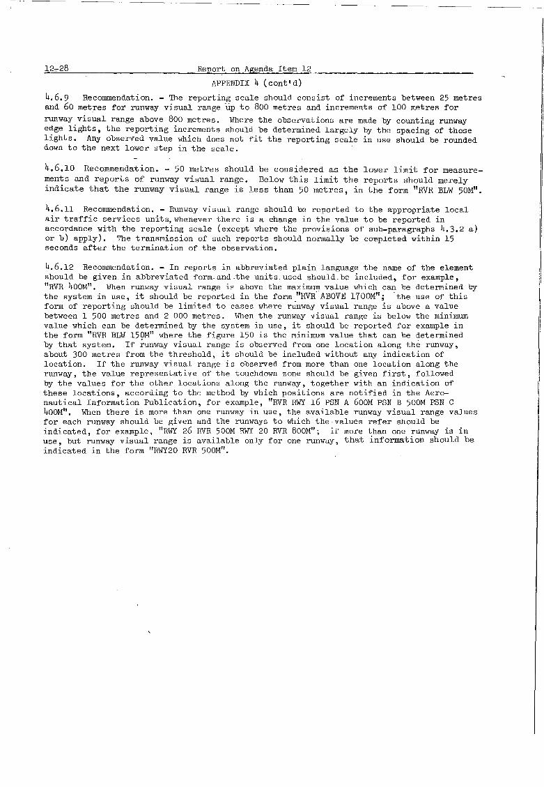
Report on Agenda Item 12
APPENDIX 4 (cont'd)
4.6.9 Recommendation. - The reporting scale should consist of increments between 25 metresand 60 metres for runway visual range up to 800 metres and increments of 100 metres for
runway visual range above 800 metres. Where the observations are made by counting runwayedge lights, the reporting increments should be determined largely by the spacing of thoselights. Any observed value which does not fit the reporting scale in use should be roundeddown to the next lower step in the scale.
4.6.10 Recommendation. - 50 metres should be considered as the lower limit for measurements and reports of runway visual range. Below this limit the reports should merelyindicate that the runway visual range is less than 50 metres, in the form "RVR BLW 50M".
4.6.11 Recommendation. - Runway visual range should be reported to the appropriate localair traffic services units, whenever there is a change in the value to be reported inaccordance with the reporting scale (except where the provisions of sub-paragraphs 4.3.2 a)or b) apply). The transmission of such reports should normally be completed within 15seconds after the termination of the observation.
4.6.12 Recommendation. - In reports in abbreviated plain language the name of the elementshould be given. in abbreviated formand.the units. used should be included, for example,"RVR 400M". 1fuen runway visual range i~ above the maximum value which can be determined bythe system in use, it should be reported in the form "RVR-·ABOVE l700M"; -the use of thisform of reporting should be limited to cases where runway visual range is above a valuebetween 1 500 metres and 2 000 metres. \fuen the runway visual range is below the minimumvalue which can be determined by the system in use, it should be reported for example inthe form "RVR BLW 15QM" where the figure 150 is the minimum value that can be determinedby that system. If runway visual range is observed from one location along the runway,about 300 metres from the threshold, it should be included without any indication oflocation. If the runway visual range is observed from more than one location along therunway, the value representative of the touchdown zone should be given first, followedby the values for the other locations along the runway, together with an indication ofthese locations, according to the method by which positions are notified in the Aeronautical Information Publication, for example, "RVR RWY 16 PSN A 600M PSN B 500M PSN C400M". When there is more than one runway in use, the available runway visual range valuesfor each runway should be given and the runways to which the-values refer should beindicated, for example, "RWY 26 RVR 500M RWY 20 RVR 800M"; II more than one runway is inuse, but runway visual range is available only for one runway, that information should beindicated in the form "RWY20 RVR 500M".

Report on Agenda Item 12
APPENDIX 4 (cont'd)
12-:>9
4.6.13 Recommendation. - In reports disseminated beyond the aerodrome only the valuerepresentative of the touchdown zone should be given and no indication of location on therunway should be included. When there is more than one runway in use and there are significant differences in runway visual range between those runways, values for more than onerunway should be included in accordance with agreement between the authorities and theoperators concerned and the runways to which the values refer should be indicated in theform "RWY 26 RVR 500M RWY 20 RVR BOOM".
4.6.14 Recommendation. - At an aerodrome with several runways used simultaneously forlanding and take-off, the runway visual range should be computed separately for eachrunway; these computations should be based on the runway light intensities currentlyused for each runway. When one or more of the runways are temporarily out of use, therunway visual range for these runways should be computed on the basis of the lightintensity currently used for the runway or runways in service or, the highest lightintensity currently being used for any of the runways in service, if the intensitiesare different. When all runway lights are switched off, the runway visual range should becomputed on the basis of the appropriate light intensity which would normally be used.
4.7 Observing and reporting of present weather
4.7.1 Recommendation. - For reports for take-off and landing,the present weather information should be representative, as far as practicable, of the take-off and climb-out areaor of the approach and landing area respectively. Observations of present weather madefor reports disseminated beyond the aerodrome should be representative of the aerodromeand its immediate vicinity.
4.7.2 Recommendation. - The present weather phenomena which should be reported if theyare occurring at or near the aerodrome are set out below, together with the abbreviations-for those phenomena that should be used in reports in abbreviated plain language, and thecorresponding code figures used in the METAR and SPECI code forms:

_1:::.;..2~--,3::.;Q:;.,.. ~ ~Rge:.!<p~Q~r.::.t~o~.u~...;;A~g~e:.=u:;:::d~a:..;;:.I.::t:::;em:,:::.....;1:::;2=-- _
APPENDIX 4 (cout'd)
(19)(89, 93)
(90, 94)(87, 88)(27)(10)
(58-63, 91)(64-65,92)(66)(67)(68)(69)(21)(24)(23)
Drizzle - DZ
Heavy drizzle - XXDZFreezing drizzle - FZDZHeavy fr~ezing drizzle - XXFZDZRecent drizzle - REDZ
Dust devils - PO
Dust haze - HZ
Duststorm, sandstorm, risingdust or sand - SAHeavy duststorm orsandstorm - XXSA
Fog - FG
Fog patches - BCFGFreezing fog - FZFGShallow fog - MIFG
Funnel cloud (or Tornadoor Waterspout) - Fe
Hail - GR
Heavy hail - XXGRSoft hail - GRRecent hail - REGR
Mist - BR
Rain - RA
Heavy rain - XXRAFreezing rain - FZRAHeavy freezing rain - XXFZRARain and snow - RASNHeavy rain and snow - XXRASNRecent rain - RERARecent freezing rain - REFZRARecent rain and snow - RERASN
(50-53)(54, 55)(56)(57)(20)
(08)
(0::;, 06)
(07, 30-32)
(33-35)(42-47)(40-41)(48-49)(11,12)
Showers - RASH
Heavy showers - XXSHShowers of rain and
snow - RASNHeavy showers of rain and
snow - XXRASNSnow showers - SNSHHeavy snow showers - XXSNSHRecent showers - RESHRecent snow showers - RESNSH
Smoke - FU
Snow - SN
Blow~ng snow - BLSNLow drifting snow - DRSNHeavy snow - XXSNIce pellets - PERecent snow - RESNSnowgrains - SG
Squall - SQ
Thunderstorm - TS
Heavy thunderstorm - XXTSThunderstorm with hail - TSGRThunderstorm with duststorm
or sandstorm - TSSAHeavy thunderstorm with
hail - XXTSGRRecent thunderstorm - RETS
(80)
(81, 82)
(83)
(84)(85)(86)(25)(26)(04)(70-73)(38,39)(36,37)(74,75)(79)(22)
(77)
(18)
(17,95) .(97)(96)
(98)
(99)(29)
4.7.3 Recommendation. - The modifier "recent" stould be applied, if the phenomenon wasobserved during the hour preceding the time of observation, and should be used only inreports disseminated beyond an aerodrome in accordance with regional air navigationagreement.

Report on Agenda Item 12
APPENDIX 4 (cont' d)
4.8 Observing and reporting of cloud
-'.2-31
4.8.1 Recommendation. - Cloud amount, type and height of base should be observed asnecessary to describe the general cloud distribution.
4.8.2 Recommendation. - Cloud observations for reports for landing should be representative of the approach area or, in the case of aerodromes with precision approach runways,of the middle marker site of the instrument landing system. Cloud observations made forreports disseminated beyond the aerodrome should be representative of the aerodrome andits immediate vicinity.
Note. - Information concerning the siting of ILS middle markers lS given inAnnex 10, Volume I, Part I.
4.8.3 Recommendation. - The height of the base of cloud should normally be reported aboveaerodrome elevation. When a precision approach runway is in use which has a thresholdelevation 15 metres (50 feet) or more below the aerodrome elevation, local arrangementsshould be made in order that the height of clouds reported to arriving aircraft shouldrefer to the threshold elevation.
4.8.4 Recommendation. - For repQrts i~ ~bb~evi~ted plain language cloud amountshQuld begiven in oktas, for example, "6/8". If there are no clouds, and the term "CAVOK" is notappropriate, the term "SKC" should be used. When the sky is obscured and information onvertical visibility is available, it should be reported in the form "VER VIS", followedby the value of the vertical visibility and the units used. When several layers or massesof cloud are observed, their amount and height should be reported in the follo~ing order:
a) the lowest layer or mass, regardless of amount;
b) the next layer or mass, covering more than 2/8;
c) the next higher layer or mass, covering more than 4/8;
d) cumulonimbus clouds, whenever observed and notreported in a) to c) above.
The type of cloud needs to be reported only for cumulonilllbu8 when it is obaerY'ed at ornear the aerodrome. This should be given Il8 "CB". Th~ height of base of cloud should b.given together vith the units used in the form "500MlI or 1f2000Fl'1I. When the cloud base isdiffuse or ragged or fluctuating rapidly, the minimum height of the cloud, or cloud fragments, should be given, followed by the term ''DIF'' or "RAG" or ''FLUe''.4.9 Observing and reporting of air temperature and dew point temperature
4.9.1 Recommendation. - The air temperature and the dew point temperature should bereported in whole degrees Celsius.

__ ..Report oIL-Agenda Item 12
APPENDIX- 4 (cont ' d)
4.9.2 Recommendation. - Observations of air temperature and dew point temperature shouldbe representative of the runways.
4.9.3 Recommendation. - In reports in abbreviated plain language, the air temperatureshould be identified by "T" and the dew point temperature by "DP" in the form "T21. DP8".For a temperature below 00 Celsius, the value should be preceded by "MS".
4.9'.A' RElcommendatiori-• ...;, Air -temperature and dew point temperature should be includedin reports disseminated beyond the aerodrome of origin in accordance with regional airnavigation agreement.
4.10 Observing and reporting of pressure values
4.10.1 Recommendation. - The atmospheric pressure should be measured and QNH and/or QFEvalues should be computed in tenths of a millibar.
4.10.2 Recommendation. - For local air traffic services units QNH and, if required,~FE should be kept current by routine issues, supplemented by the issue of new datawhenever changes occur which exceed an agreed magnitude. Such supplementary data need notbe issued when the air traffic services unit is equipped with a remote indicator fromthe barometer in the meteorological office, or with a separate barometer, and wherearrangements are in force for the use of this remote indicator,or separate-barometer~to
make observations to meet the _n~ed for reports for landing and take-off.
4.10.3 Recommendation. - The reference level for the computation of QFE should be theaerodrome elevation. For instrument runways, the thresholds of which are 2 metres ormore below the aerodrome elevation, and for precision approach runways,the QFE, ifrequired, should refer to the relevant threshold elevation.
4.10.4 Recommendation. - In routine reports disseminated at the aerodrome QNH should beincluded regularly and QFE should be included either on request or, if so agreed locally,on a regular basis. Those values should be rounded do~m to the nearest whole millibar.J!'or example, QNH 995.6 millibars should be given as "QNH 995".
4.10.5 Recommendation. - In routine reports disseminated beyond the aerodrome of orlglnQI~d values should be included in accordance with regional air navigation agreement. Thosevalues should be rounded down to the nearest whole millibar.
4.11 Observing and reporting of other phenomena
4.11.1 Recommendation. - Observations made at aerodromes should inClude the availableinformation concerning significant meteorological conditions, particularly those in theapproach and climb-out areas, and specifically the location of cumulonimbus or thunderstorm,

Report on Agenda Item 12
APPENDIX 4 (cont' d)
12-33
moderate or severe turbulence*, vertical wind shear*, hail,severe line squall, moderate orsevere icing*, freezing precipitation, marked mountain waves, sandstorm, duststorm,blowing snow or funnel cloud (tornado or waterspout).
Note. - The elements indicated by * cannot now be observed from the ground andevidence of their existence should be obtained from pilot reports.
4.11.2 Recommendation. - Significant directional variations in visibility, particularlythose affecting the approach area, should be observed and reported.
4.11.3 Recommendation. - The available ~n!ormation should be included in abbreviated plainlanguage. A method of reporting vertical wind shear" in the approach area uses the formIISURFACE WIND 320/10 WIND AT 60M 360/25 IN APCH". Moderate turbulence and icing in cloudin the climb-out area should be reported as "MOD TURB AND ICE INC IN CLIMB-OUT". Directional variations in visibility should be reported with an indication of the direction ofobservation, for example, "VIS 2000M TO S"•.
4.11.4 Recommendation. - Where fog dispersal operations are being carried out this shouldbe indicated by adding the term IIDENEB".
4.11.5 Recommendation. - Significant directional variations in visibility and indicationsof fog dispersal operations should be added in reports disseminated beyond the aerodromewhile other significant information regarding meteorological conditions should be addedin- such reports only in accordance with regional air navigation agreement.
4.12 Contents of reports
4.12.1 Recommendation. - Routine reports should contain the following information in theorder indicated:
a) identification of the type of report;
b) location indicator;
c) time of the observation;
d) surface wind direction and speed;
e) visibility;
f) runway visual range, when applicable;
g) present weather;
h) cloud amount, type (only in the case of cumulonimbus) and height;
i) air temperature;

l2-~4. Report on Agenda Item 12
APPENDIX 4 (cont' d)
j) dew point temperature;
k) QNH and, when applicable, QFE;
1) other significant information.
Note. - The location indicators referred to under (b) and their significations are published in ICAO Doe. 7910 - Location Indicators.
4.12.2 Recommendation. - Special reports should contain the sm~e information as routinereports and in the smne order, except that air temperature, dew point temperature andQNH/QFE values need not be included.
4.12.3observation:
When the following conditions obtain simultaneously at the time of
a) visibility, 10 kilometres or more;
b) no cloud below 1 500 metres (5 000 feet) or below the highestminimum sector altitude, whichever is greater, and no cumulonimbus;
c) no precipitation and no thunderstorm;
d) no shallow fog or low drifting snow,
information on visibility, runway visual range, present weather and cloud amount, typeand height shall be replaced in all meteorological reports by the term "CAVOK"..
4.12.4 Recommendation. - Where reports for take-off and landDlg are required by thelocal aerodrome control tower and/or approach control office, the contents of suchreports should be determined by local agreement. All elements included in reports fortake-off and landing should be based on observations which are representative ofconditions existing immediately prior to the transmission of the report.
4.13 Format of reports
4.13.1 Routine and special reports and, where required, reports for take-offand landing,which are not disseminated beyond the aerodrome of origin shall be in a formagreed with the air traffic services units, operators and other aeronautical users concerned.
4.13.2 Routine and selected special reports which are exchanged betweenmeteorological offices shall be:
a) in the MEI'AR or SPECI code forms prescribedby the World Meteorological Organization; or

Report on Agenda Item 12
APPE~~IX 4 (cont'd)
b) when agreed between the Meteorological Authoritiesconcerned in abbreviated plain language or in teletypewriter characters and symbols, the significanceof which has been agreed upon by the MeteorologicalAuthorities concerned.
12-35
Note. - The NETAR and SPECl code forms are reproduced in Attachment D.
4.13.3 Recommendation. - Routine reports in the METAR code form and selected specialreports in the SPECI code form should normally contain all information which the codesprovide for, except the meteorological elements given in optional groups which should beincluded in accordance with regional air navigation agreemen~
4.13.4 Recommendation. - Routine reports from aeronautical meteorological stations n~tat international aerodromes should, when disseminated in a code form prescribed by theWorld Meteorological Organization, be in the METAR code form except that, if so desired bythe Meteorological Authority responsible for their preparation, they may be in the SllWPcode form. -
4.13.5 Reports in abbreviated plain language shall convey to aeronauticalpersonnel a directly intelligible meaning through the use of:
a) abbreviations approved by lCAO for use in theinternational aeronautical telecommunication service; and
b) numerical values of self-explanatory nature,
supplemented, if suitable approved abbreviations are not available, by the vocabulary of anational language, taken with its usual meaning in aviation. With the exception of QNHand QFE, no signals of the Q Code shall be used in such reports.
Note. - The abbreviations referred to under a) are contained in theProcedures for Air Navigation Services - ICAO Abbreviations and Codes (Doe. 8400).
4.13.6 Recommendation. - Routine reports in abbreviated plain language should beidentified as "i1:~T REPORT" and special reports as "SPECIAL". When a group of routinereports is disseminated, the identifier need only be used with the first report, exceptthat in the case of selected special reports the identifier should always be included witheach report. The actual time of making the Observation should be given in hours GMT andminutes, using four figures in the form "2230". The letters "GMl''' should not be includedin the message. When a group of reports is included in a message, the actual time of thefirst report contained in the message should be given; the time of any other report included in the message should be given only if it differs from the time of the first reportby more than 10 minutes.
4.13.7 Recommendation. - The terminology, units and scales employed in reports for takeoff and landing should be the same as those used in routine and special reports for thesame ilerodrome.

12-36 _Report qp. Agenda Item 12APPENDIX 4 (cont'd)
Examples of reports
Example 1. - Routine report
a) METAR for YU1>O (Donlon/tnternational) *:
l~~~ runo 1630** 2400e 0600 RI000 42FG 3SCOIO 17/16 1018
b) e re ort (same location and weather conditions
MET REPORT YUOO 1630** 240/8 VIS 600M RVR 1000M FG 3/8 1000FT T17 ~P16 QNH i018
c) Meaning of both reports:
Routine report for Donlon/lnternational* at 1630 GMT; surface wind direction240 degrees; wind speed 8 knots; visibility 600 metres; rumTay visual range1 000 metres; fog (the plain language version does not give the code figure);3 oktas of stratocumulus cloud at 1 000 feet (the plain language version doesnot give the cloud type); air temperature 17 degrees Celsius/dew point
__________t~e~m.p_e_r_ature ~6 degrees Celsius; QNH 1018 millibars.*Fictitious location
-**Not yet approved by WMO
Example 2. - Selected special report
a) SPECI for YUDO (Donlon/International)*:
SPECI YUDO 1115** 05025/37 2500 95TS 7CB005
b) and weather conditions
SPECIAL YUDO 1115** 059/25 MAX37 VIS 2500M TS 7/8 CB 500 FT
c) Meaning of both reports :
Selected special report for Donlon/International* at 1115 GMT; surface winddirection 50 degrees; wind speed 25 knots with gusts to 37 knots;visibility 2500 metres; thunderstorm (the plain language version does notgive the code figure); 7 oktas of cumulonimbus cloud at 500 feet.
------*Fiditious location
**Not yet approved by WMO

Report on Agenda Item 13
Agenda Item 13: Meteorological service for pre-flight operational planning
Introduction
13-1
13.1.1 Consideration of this Agenda Item commenced with a broad review of the methodsand procedures for providing meteorological service for flight planning by operators.This review included a,discussion of the principles to be applied ~o meet presentand future meteorological requirements, in particular for computer flight planning byoperators, taking into account the progressive centralization of meteorological services.
13.1.2 It was noted that, ever the years, international commercial air transport hadbecome less dependent on detailed meteorological information for individual flight planning and that many flight operations were being conducted on the basis of standard flightplans, without the need for meteorological information to be produced specifically for anindividual flight. Also, increasing-use was being made by airlines, and planned by themfor the future, of multi-stage flight planning by computer or otherwise. Consequently,it was recognized that the trend towards less need by pilots for routine briefings,consultations and flight planning - which had already been apparent for several years would be likely to continue in future.
13.1.3 On the other hand, the Meeting recognized that the number of flights by international general aviation, in most cases consisting of low-level flights under the visualflight rules, had continued to grow rapidly and that for these operations pilots were inneed of meteorological information designed for their particular requirements. Also, itwas appreciated that, in cases of difficult weather conditions, of long routes, of nonroutine flights and for other reasons there would continue to be a need by pilots ofcommercial transport aircraft for individual briefing, consultation and/or flight documentation to be made available by meteorological offices.
13.1.4 For the Meteorological Services these developments had brought about correspond-ing changes. To meet the requirements of the increasing number of flights, the meteorological offices had gradually changed their working methods from individual, often bulky,flight documentation folders prepared for individual flights to the presentation in chartform of information over a wide area, valid for a number of hours and capable of servinga number of flights on different routes.
13.1.5 Similarly, oral briefing by a meteorologist, which in the earlier years ofaviation was an integral part of the planning for every flight, had become more difficultto carry out. This was partly because it had'become increasingly'~ifficult for pilots orother flight- crew meml:iers to'visit the meteorological office 'in" person. -

13-2 Report on Agenda Item 13
13.1.6 Against this background, the Meeting reviewed the standards and recommendedpractices contained in Chapter 6 - Forecasts, Chapter 7 - SIGMET information and aerodrome warnings and Chapter 9 - Servic~ for_operators and flight crew members, of a newdraft Annex 3/Technical Regulations /C.3.1/, prepared Qy the ICAO and WMO Secretariats,taking into account the various comm;nts ~nd suggestions from Contracting States/Membersand International Organizations. The Meeting also considered a draft Chapter 9 preparedby the ICAO Secretariat in response to Recommendation 11.1/6 of the Sixth Air NavigationConference/CAeM Ext. (69) which requested a review of the related operational requirementsin the light of changing aeronautical factors, such as methods of operational flightplanning, flight distances and altitudes. After some discussion on the revised operationalrequirements that appeared to emerge from this review, the Meeting agreed to use, as abasis for discussion, the draft Annex 3/Technical Regulations /C.3.17 using, where itappeared appropriate, certain ideas set out in the draft Chapt;r 9 drawn up by the ICAOSecretariat.
13.2 Chapter 9 - Service for operators and flight crew.members ~ General provisions
13.2.1 The title and contents of this Chapter were designed to specify the prov~slon
of meteorological service to "operators ll, which may include local representatives as
well as computerized flight planning centres, and to "flight crew memberslt , rather thannecessarily to the pilot-in-command. These changes reflected existing airline and meteorological practice in a growing number of countries.
13.2.2 It was agreed to simplify the specifications by grouping them under three mainsub-headings relating to:
a) pre-flight planning by the operator;
b) use by flight crew members before departure;
c) in-flight planning.
For each of these planning phases the Meteorological Authority, in consultation with theoperator, would determine the type and format of the information to be supplied by a givenmeteorological office and the means and methods to be used for this purpose.
13.2.3 To clarify the intended scope of the meteorological information in respect oftime, altitude and geographical extent. of the flight, comprehensive general specificationswere developed in Section 9.1, covering all types of aircraft and all phases of.flightoperations from flight planning through take-off to landing. These general specificationswere designed to set out in broad terms the required information on en-route weather,upper winds and upp~r air temperatures as well as the required aerodrome reports and.forecasts for regular and alternate aerodromes.

Report on Agenda Item 13
13.3 Information for pre-flight planning by operators
1~3
13.3.1 In Section 9.2 - Information for pre-flight planning by operators, theMeeting combined the former specifications for preliminary and pre-flight planning. Thecontents of this Section were amended to reflect that in many cases the meteorologicalinformation is provided to airlines and other operators by routine issues of products 'ofarea forecast centres covering the en-route phase of flights and by routine issues ofaerodrome reports an~or aerodrome forecasts covering the terminal phase of flights.Consequently, it was possible to express the specifications in a much shorter and simplerform. .
13.3.2 Taking into account the increasing use of computers, the provisions concerningthe upper air data for grid points for computer flight planning by operators wereamplified; in particular, a new procedure was included concerning the use of the newGRID code form which had been developed by WMO, taking into account the relevant aeronautical requirements developed by ICAO in accordance with Recommendation 9.3/2 of theSixth Air Navigation Conference/CAeM Ext.(69). No additional requirements were stated forthe exchange of aerodrome reports and forecasts for centralized flight planning, and nochange in procedures was made for this purpose.
13.4 Briefing, consultation and display
13.4.1 The specifications relating to briefing, consultation and display were reviewedand up-dated, as required, and were included in consolidated form in Section 9.3.
13.4.2 It was recognized that briefing and consultation may not always be requiredroutinely for all flights and that at some aerodromes local circumstances may makepersonal contact difficult or impracticable. Therefore, the ne~ specifications
were drafted to ensure that where briefing anq/or consultation had been requested by anoperator and agreed to by the Meteorological Authority, the service would be provided either directly or by means of suitable telecommunications facilities - and that, on theother hand, the flight crew member or other flight operations personnel for whom theservices had been requested would, in fact, attend the agreed briefing/consultation.It was also accepted that, subject to agreement between the Meteorological Authority andthe operator, briefing an~or consultation might be provided in lieu of flight documentation.
13.4.3 Several improvements in respect of details were agreed upon in respect ofdisplay of meteorological information and its use for and by flight crew members and otherflight operations personnel. Specifically, it was agreed that a display may be used inlieu of briefing an~or consultation.

13-4 Report on .(lgenda It.em 13
13.5 Flight documentation - General
13.5.1 In Section 9.4 the Meeting included broad specifications applicable to all typesof flight documentation; this "material" comprised specifications derived from the PANS-MET/Technical Regulations, Chapter /i2.il and from lCAO Regional Plans which had been developedby Regional Air Navigation MeetIngs-in all parts of the world and which reflected currentpractices of many States. The Meeting agreed to recommend that most of these specificationsbe given the status of recommended practices, and the remainder that of standards.
13.5.2 Considerable discussion took place on the status of the models of charts andf~rms to be used in the preparation of flight documentation which are to be included in anAppendix to the new Annex 3/Technical Regulations Je.3.i7. In the interest of world-wideuniformity in flight documentation. it was agreed that the status of the models should beraised from guidance material to recommended practice. The Meeting recognized that theaeronautical requirements in this respect are stated by ICAO and that the development ofmodel forms and charts and the methods for completing them was a WMO responsibility; thiswas r~flected in a Note attached to the relevant paragraph.
13.5.3 A suggestion to increase the number of charts of upper wind and upper airtemperature data to be included in the flight documentation was not accepted. Instead,the Meeting adopted a specification aiming at keeping to a minimum the number of chartsincluded in flight documentation.
13.5.4 The Meeting noted with interest a proposal to include in the new Annex 3/Technical Regulations LC.3.!7, Appendix 1, a new model of tabular upper wind and temperatureforecasts in the form of data for grid points at 5 degree latitude/longitude intervals.Since the proposal was already being considered by the CAeM Working Group on Briefing andDocumentation Practices, it was agreed that no further action on the matter was required bythe Meeting.
13.5.5 Proposals were presented to the Meeting that aerodrome reports be introducedinto flight documentation, by agreement between the Meteorological Authority and theoperator, for short-range flights up to 2 hours' duration. The rATA Observer suggestedthat,by agreement between the Meteorological Authority and· the operator,aerodrome reportscould even replace flight documentation for very short flights. However, while there wassome support for this proposal, the majority felt that aerodrome reports should continueto be used only for briefing or consultation, for display, for VOLMET broadcasts, etc.,and that there should be no worldwide procedure for aerodrome reports either to be includedin flight documentation or to replace it.
13.5.6 The Meeting examined a proposal a1m1ng at expressing height indicationsrelating to en-route meteorological conditions, preferably in flight levels. It concludedthat while the intent was quite acceptable, the specifications should leave open thepossibility also to express heights in pressure altitude, pressure or altitude.

Report on Agenda Item 13
Flight documentation - Upper wind and upper air temperature information
13-5
13.6.1 In Section 9.5 the existing specifications on the subject were consolidated andtheir wording improved, without significant changes in substance~
Flight documentation - Significant weather charts
13.7.1 The specifications relating to significant weather charts were consolidatedin .s~(:tion 9.6 of the new Annex 3/rechnical Regulations /C.3.J.7. It was stressed thatsignificant weather charts should not have a specified period-of validity but that theyshould be valid for a fixed time. In order to avoid any misunderstanding, the Meetingaccepted the use of the expression "significant weather charts valid for a specified fixedtime".
Flight documentation - Aerodrome forecasts
1308 0 1 In Section 907 the Meeting included all specifications relating to aerodromeforecasts. Detailed consideration was given by the Meeting to aerodrome forecasts foralternate aerodromes. It was decided to accept a proposal aimed at selecting one or moresuitable alternate aerodrome forecast(s), by agreement between the Meteorological Authorityand the operator from the list of alternate aerodromes contained in the relevant RegionalAir Navigation Plan.
1308.2 The Meeting recognized a need for a limited number of forecasts for en-routealternate aerodromes and for aerodromes at which intermediate stops are plannedo Itdeveloped a specification calling for the use, in such cases, of available forecasts forregular aerodromes o
Flight documentation - Supplementary charts and other forme of presentation
13.9.1 The Meeting agreed to combine in Section 9.8 the specifications relating totropopause/vertical wind shear charts, tropopause/maximum wind charta, upper air charts~rith tropopause information, cross-sections and tabular forecaste of en-route conditions,as well as forecasts in the form of a continuous plain language text.
13.9.2 In examining the contents of flight documentation for low-level flights, theMeeting clarified the expression "phenomena causing widespread reduction of visibility",by adding "to less than 10 kilometres".
13.9.3 Considerable discussion took place about a proposal aimed at increasing thealtitude,up to which upper winds and temperatures are given;from Flight Level 100 toFlight Level 120. As this proposal raised many Qbjec~ions and had repercussions on otherparts of the new Annex 3/Technical Regulations Le.3.!/, it was not accepted by the Meeting.However, it was agreed that, when available, this information could be given in intervalsnot exceeding 900 metres (3000 feet) instead o~as usual, in intervals of 1 500 metres(5 000 feet).

13-6
13.10
Report on Agenda Item 13
Information for aircraft in flight
13.10.1 In Section 9.9 the Meeting consolidated the specifications covering the provisionof meteorological information for aircraft in flight, including that provided to operatorsfor in-flight planning by local representatives.
13.10.2 In reviewing the content of information for planning by the operator for air-craft in flight, the Meeting accepted a proposal aimed at restricting the provision ofspecial air-reports relevant to the flight to those which have not been the subject ofa SIGMET message.
13.ll Inclusion of Chapter 9 (Service for operators and flight crew members) andrelated Appendix in the new Annex 3/rechnioal Regulations LC.3.V
13.11.1 In the light of its discussions on Agenda Item 13 described above, the Meetingmade the following Recommendation:
RSPP RECOMMENTIATION 13/1 - INCLUSION OF CHAPTER 9 (SERVICE FOROPERATORS ANTI FLIGHT CREW MEMBERS) ANDRELATED APPENTIIX IN THE NEW ANNEX 3/TECHNICAL REGULATIONS LG.3.!7
That the following material be included in the new Annex 3/Technical Regulations LG.3.!!:
a) Chapter 9 (Service for operators and flight crew members)as given in Appendix 1 to the report on Item 13;
b) Appendix 1 (Flight documentation - Model charts andforms) as given in Appendix 2 to the report on Item 13.
Chapter 6 - Forecasts
13.12.1 Draft Chapter 6 was reviewed, as planned, to verify that its contents had beensatisfactorily transcribed from the existing provisions by the ICAO and WMO Secretariats.In this review all corrections and suggestions for improvements received from ContractingStates/Members and from CAeM Members were taken into account. These and a number ofconsequential amendments arising from Agenda Items 12 to 14 and, in particular, fromChapters 4 and 9 of the new Annex 3/Technical Regulations. In.3.i7 were incorporated intothe draft Chapter, as appropriate. - -
13.12.2 Subject to these corrections and improvements the Meeting found the Chapteracceptable. Its scope covers a general provision on interpretation and use of forecasts,and detailed specifications for aerodrome forecasts, landing forecasts, forecasts fortake-off, as well as area,. fligh.t .and. route .forecasts.; :;I. not~. was iaolwled to eXDlainthat the specifications conceining area,flight a~d route forecasts do not apply to theproducts of area forecast centres.

Report on Agenda Item 13 13-7
13.12.3 The Meeting discussed the possibility of establishing as a standard the exchangeof aerodrome forecasts in the TAF code form. The purpose of this was to try to solveproblems certain States have in receiving aerodrome forecasts from other States in a codeor plain language that cannot be understood. While it was generally agreed that the TAFcode form should be used, certain States indicated that this would be impracticable. Sinceagreement could not be reached, it was not possible to recommend that the exchange of aerodrome forecasts in TAF cpde form be raised to the status of a standard.
13.13 Chapter 7 - SIGMET information and aerodrome warnings
13.13.1 Draft Chapter 7 was reviewed in the same manner as draft Chapter 6; it wasalso found acceptable, subject to a small number of corrections and improvements.
13.13.2messages,aerodromeaerodrome
13.14
Chapter 7 covers the contents, format and exchange of SIGMET informationand also includes specifications relating to the preparation and contents ofwarnings, which are intended to safeguard parked aircraft and for use by the(ground) services, such as snow clearance services.
Inclusion of Chapter 6 (Forecasts) and Chapter 7 (SIGMET information andaerodrome warnings) and related Attachments in the new Annex 3/TechnicalRegulations LC.3.17.
13.14.1 In the light of its discussions on Chapters 6 and 7 described above, theMeeting made the following Recommendation:
RSPP RECOMMENDATION 13/2 - INCLUSION OF CHAPTER 6 (FORECASTS)AND CHAPTER 7 (SIGMET INFORMATIONAND AERODROME WARNINGS) AND RELATEDATTACHMENTS IN THE NEW ANN~3/
TECHNICAL REGULATIONS ffi.3.Y
That the following material be inclu.Qed in the newAnnex 3/Technical Regulations !.C.3.Y: ~ ..
Chapter 6 (Forecasts) as given in Appendix 3 tothe report on Item 13;
Chapter 7 (SIGMET information and aerodrome warnin~s)as given in Appendix 6 to the report on Item 13;
c) Attachment B giving gUidance on the ·operationallydesirable accuracies of forecasts as given la Appendix 4to the report on Item 13;
Attachment D reproducing the aeronautical meteorologicalcode form~ and notes on their use as given in Appendix 5to the report on Item 13.*
* For inclusion only In Annex 3 and not In the Technical Regulations LC.3.i7.

13-8 Report on Agenda Item 13
Consequential amendments to Chapter 3 concerning the Area Forecast System
13.15.1 It was noted that Area Forecast.. Systel!ls had been planned over the years byRegional Air Navigation Meetings for all ICAO ~gions and that they had been or were beingimplemented by States. The Meeting noted with satisfaction that the area forecast centreswere providing valuable services for aviation which were widely appreciated by aeronauticalusers.
13.15.2 The intrOduction of centralized flight planning and the increasing automationof meteorological services called for greater standardization in respect of some of theprocedures relating to area forecast centres while, on the other hand, maintaining certaindifferences in procedures between various parts of the world.
13.15.3 Accordingly, the Meeting reviewed the specifications for the Area ForecastSystems; existing texts were simplified and updated as required and consolidated into anew Section 3.1 for inclusion in Chapter 3 - Area forecast cen.tresl aerodrome m~teorolo~ical
offices, meteorological watch offices, of draft new Annex 3/Technical Regulations LC.3.b/.
13.15.4 Experience had shown many similarities between the regional procedures developedby Regional Air Navigation Meetings, e.g., in respect of charts of significant en-routeweather phenomena and of upper winds and upper air temperatures, as well as in respect oftimes of issue, times of validity and layers. The Meeting accordingly agreed toreduce the number of regional options, replacing them where possible by correspondingworldwide specifications.
13.15.5 In the light of these considerations the Meeting made the followingrecommendation:
RSPP RECOMMENDATION 13/3 - INCLUSION OF REVISED SPECIFICATIONSRELATING TO AREA FORECAST CENTRES INCHAPTER 3 OF THE NEW ANNEX 3/TECHNICAL REGULATIONS LC.3.17
That the material presented in-Appendix 7 to the Report onAgenda Item 13, relating to area forecast centres, be includedin Chapter 3 (Area forecast centres, aerodrome meteorologicaloffices, meteorological watch offices) of the new Annex 3/Technical Regulations LC.3.!7.
13.15.6 With the completion of the planning of regional Area Forecast Systems for allICAO reg~ons, it was fe~t that the time had come for a fundamental review of these regionalsystems ~n order to ach~eve, as far as practicable. a unified, worldwide system. Thereview should include, in particular, the areas of 'chart coverage in order to reduce

Report on Agenda Item 13 13-9
dUPlication and overlap. The review should also achieve greater standardization in practicesand procedures and take into account any necessary co-ordination between Area ForecastSystem and WWW Planning. The Meeting, therefore, made the following recommendation:
REX:X>MMENDATION 13/4 - REVIEW OF RmIONAL AREA romx:AST ,SYSTDfS
That ICAO, in consultation with WMO undertake a fundamentalreview of regional Area Forecast Systems with a view tocreating, as far as practicable, a unified, worldwidesystem by improving inter-regional co-ordination, increasing standardization and reducing, as much as possible,duplication and overlap; this review should also takeinto account any necessary co-ordination between Area ForecastSystem and WWW planning.
13.16 Information for pilots on marked temperature inversions near the surface
13.16.1 A provisional operational requirement was stated by lATA and IFALPA for pilots tobe informed, prior to departure, of the existence or expected existence of marked temperature inversions in the lowest levels of the atmosphere up t~lQ~~etres (1 000 feet) aboveground level. This request was bas~d on the fact that a marked temperature invef.sion nearthe surface resulting in a rise in temperature along the flight path had, in a number "ofcases, caused a sudden deterioration in alrcraft performance. It was agreed by the Meetingthat this matter should be brought to the attention of States/Members together withsuggestions for desirable contents and format of information to be provided to pilots,whenever necessary and possible.
13.16.2 During the discussion, there was uncertainty as to whether the information discussed in 13.16.1 above was needed by all aircraft on all occasions of marked surfacetemperature inversion. In particulartthe Meeting was in doubt whether such information wasneeded during cold periods with temperatures below those of the International StandardAtmosphere. Further, several Delegations doubteQ, wl'.l.E~th~J;' "marked" "~t:lVeJ;'aioJ?S.W~:l;'~ '", "those exceeding a temperature difference of 10 degrees Celsius or only those exceeding ahigher value, e.g., 20 degrees Celsius. Accordingly, the following recommendations wereadopted:
RIDOMMENDATION 13/5 - PROVISIONAL ~UIREMENT FOR INFORMATIONON MARKED T»lPERATURE INVERSIONS
That ICAO and WMO advise States/Members that there is aprovisional operational requirement for pilots to be informedprior to departure of any marked temperature inversion in thelowest levels of the atmosphere up to 300 metres (1 000 feet)above grounq level. The information should refer to markedinversions exceeding a temperature difference of 10- degreesCelsius between the surface and any point up to 300 metres.The desirable accuracy for this temperature information

13-10 Report on Agenda Item 13
is ± 5 degrees Celsius. Depending on the data available,and, pending the results of the review requested inRecommendation 13/6, information could be given to the pilots,for example, in the form "marked temperature inversion nearthe surface" or in the form "temperature. inversion exceeding12 degrees Celsius betweeIl 100 and 200 metres".
REXX>MMENDATION 13/6 - REllIEW OF PIlOVISIONAL REQUIREMENT roRINFORMATION ON MA:ma:D TEMPERATUREINVERSIONS
1) That ICAO review the provisional operational requirementreferred to in Recommendation 13/5 with a view to determiningthe temperature range over which the information is operationally needed and the magnitude of the inversion calling for anotification to pilots prior to departure.
2) That ICAO inform Contracting States and InternationalOrganizations concerned of the results of this review.
Review of contents of terminal weather information for flight planning
13.17.1 Uncertainty was encountered by the Meeting concerning the degree of detailneeded for flight planning in respect of weather conditions expected at destination andalternate aerodromes. It was noted that TAF messages contained a number of details whichdid not entirely meet the needs of operators and flight crew members for determiningwhether the meteorological conditions at the terminal aerodrome would be above or belowthe specified operational minima~
13.17.2 For these reasons it was agreed that the operational requirements for the contentsof terminal weather information should be reviewed by ICAO and that subsequ~ntly the formatfor providing such information sh0l:lld be reviewed by WMO~
13.17.3 The Meeting recognized that the Asi~acific Regional Air Navigation Meeting(1973) had in its Recommendation 2/1 called for a study'by ICAO aimed at the developmentof a system which would provide aircraft in flight with operationally integrated MET, ATSand AIS information. As this study was likely to involve consideration of the contentsand format of terminal weather information for aircraft in flight, it was agreed that theaction mentioned in 13.17.2 above should be co-ordinated as applicable with the follow-upof the Asia/PAC Recommendation.

Report on Agenda Item 13 13-11
RECOMMENDATION 13/7 - REVIEW OF CONTENTS OF TERMINAL WEATHERINFORMATION FOR FLIGHT PLANNING
1) That ICAO review the operational requirements for thecontents of terminal weather information, as needed for preflight planning, and co-ordinate this review, if required, .with the follow-up of Recommendation 211 of the Asi~acificRegional Air Navigation Meeting (1973).
2) That WHO be invited to review,on the basis of resultsachieved under 1) above, the possibility of satisfying therequirements and the format for providing the required information.
13.18 Aeronautical meteorological codes
13.18.1 The Meeting agreed that, over a number of years, the use of the PBOAR, PHDFI andPRORO code forms had declined to a point where there no longer existed an operationalrequirement for them. Similarly, it was felt that the FIFOR code form had become redundant.
Accordingly, the Meeting adopted the following recommendation:
RECOMMENDATION 13/8 - AEHDNAUTICAL..M.li:r:EX>ll>LPG.ICAL...OO:QES .. FIFOR, PROAR, PRORO AND PROFI CODEFORMS
That WMO note that there is no longer an aeronauticalrequirement for the retention of code forms: FM 55.E, FIFOR;FM 56.D, PROAR; FM 57.D, PBOOO and FM 58.D, PHDFI.
l3.l8.3 The Meeting also noted that the aeronautical part of the Q~ID' cod~. form,developed by WMO to meet operational reQuirements stated by ICAO, permitted a largenumber of options. It concluded that the code should be further developed withconsideration being given to reducing the number of options in the light of experienceand comments by States/Members currently providing or planning to provide informationin this code form, and by International Organizations concerned.
l3.l8.4 The Meeting accordingly approved the following Recommendation:
RECOMMENDATION l3/9 - AERONAUTICAL METEOROLOGICAL CODES GRID CODE FORM
That WMO further develop precise specifications for theaeronautical version of FM 47.E GRID, which will bestmeet the expressed aeronautical reQuirements, takinginto account the experience gained and comments byStates/Members currently providing or planning toprovide information in this code form, and by International Organizations concerned.


Report on !6enda Item 13
APPENDIX 1
CHAPl'ER 9 - SERVICE FOR OPERATORS AND FLIGHT CREW MEMBERS
General provieions
Meteorological information shall be supplied to operators and flight crewmembers for:
a) pre-flight planning by operators;·
b) use by flight crew members before departur,e;
c) aircraft in flight.
13-13
9.1.2 Meteorological information supplied to operators and flight crew members shall coverthe flight in respect of time, altitude and geographical extent. Accordingly, the information shall relate to appropriate fixed times or periods of time and shall extend to thataerodrome of intended landing at which new information is to be provided. On request, orwhenever conditions1mpose doubt as to the practicability of landing at that aerodrome,additional information shall be included covering the meteorological conditions expectedbetween the aerodrome of intended landing and one alternate aerodrome designated by theoperator. In addition, if agreed between the Meteorological Authority and the operator,information up to a further aerodrome may be provided.
9.1.3 Meteorological information supplied to operators and flight crew members shallinclude upper winds and upper air temperatures, significant en-route weather phenomena,meteorological ~eports, aerodrome forecasts, forecasts for take-off, landing forecasts,SIm~T information and air-reports which are available at the meteorological office andwhich are relevant to the planned flight operations.
9.1.4 Meteorological information supplied to operators and flight crew members shallinclude forecasts for the aerodromes of departure and intended landing. On request,forecasts shall also be supplied for one or more suitable alternate aerodromes as requiredby the operator to complete the operational flight plan.
9.1.5 Recommendation. - Aerodrome forecasts additional to those referred to in 9.1.4which may be required by an operator, should be supplied, if available, by agreementbetween the Meteorological Authority and the operator.
9.1.6 Recommendation. - Meteorological information supplied to operators and flight crewmembers should include aerodrome reports for the aerodromes of departure, intended landingand alternates located within 2 hours' flying time of the aerodrome of departure but withpossible exceptions for certain routes and operations as determined by regional airnavigation agreement. Additional relevant reports should be supplied if available.

]3=14 Report on Agenda Item 13
APPENDIX 1 (cont' d)
9.1.7 Recommendation. - (m request by the operator, the meteorological information suppliedfor flight planning should include data for th~ determination of the lowest usable flightlevel.
9.1.8 Where necessary, the Meteorological Authority of the State providing service foroperators and flight crew members shall initiate co-ordinating action with the MeteorologicalAuthorities of other States with a view to obtaining from them the reports and/or forecastsrequired.
9. L 9 Meteorological informaticn shall be supplied. t:: olierators and flight crew ]::embersby one or more of the followir.g, as agreed between the H~tf:orologicalAuthority and oper'atGrconcerned and with the order sh0m1 below not implying pri0rities:
a) written or printed material, including charts anc specified forms;
b) grid point values in digital form;
c) briefing;
d) consultation;
e) display.
9.1.10 The Meteorological Authority, in consultation with the operator, shall determine:
a) the type and format of meteorological information to be supplied;
b) methods and means of supplying that information.
9.1.11 Meteorological information shall be supplied to operatoru and flight crew membersat the location to be determined by the Meteorological Authority after consultation with theoperators and at the time to be agreed upon between the meteorological office and the
operator concerned. The service shall normally be confined to flights originating withinthe territory of the State concerned unless otherwise agreed.between the MeteorologicalAuthority and the operator concerned. At an'aerodrome ~thout a meteorological office,arrangements for the supply of meteorological information shall be as agreed upon betweenthe Meteorological Authority and the operator concerned.

Report on Aflenda Item 13
APPENDIX 1 (cont' d)
9.2 Information for pre-flight planning by operators
9.2.1 Meteorological information for pre-flight planning by operators shall includeany or all of the following information.,as required:
a) existing and/o~ expected significant en-route weather phenomena;
b) current and/or forecast upper winds. upper alr temperatures andtropopause topography;
c) a forecast for take-off;
d) aerodrome reports ar).d/or a.erodrome forecasts.
9.2.2 Recommendation. - MeteoroLogical information for pre-flight planning by operatorsfor supersonic transport aircraft should include data covering the levels used fortransonic and supersonic flight together with the levels that may be used £or sUbsonicflight. Particular mention of occurrence and expected occur~ence. location and verticalextent of cumulonimbus clouds. turbulence and precipitation should be included.
9.2.3 When upper air information is supplied in chart form it shall consist ofcharts for standard isobaric surfaces and/or other types of urper air charts as applicable.
9.2.4 Recommendation. - When computer processed upper air data fOr grid points are madeavailable in digital form for centralized flight planning by computer. the contents, formatand transmission arrangements should be as agreed between the Meteorological Authorityand the operators. Where the data are supplied in a code form prescribed,by.~be,W9r~d.
Meteorological Organization. use should be made of 'the GRID code fOrm employing 'the' .option provided therein for upper air forecast data for aeronautical pl.lrposes. The data.should normally be supplied as soon as practicable after the processing of the forecastshas been completed.
Note. - The GRID code form is reproduced in Attachment n.9.2.5 Recommendation. - The significant en-route weather information and the upper windand upper air temperatur: information requested for pre-flight planning by the operatorshould normally be supplled as soon as it becomes available but not later than 3 hoursbefore departure. Other meteorological information requested for pre-flight planning bythe operator should normally be supplied as soon as practicable.
9.2.6 Recommendation. - Whenever it becomes apparent that the meteorological informationto be included in the flight documentation will differ materially from that made availablefor pre-flight planning by operators, the operator should be advised immediately and.if practicable. be provided with the revised information.

13=16
9.3
Report on Agenda Item 13
APPENDIX 1 (cont' d)
Briefing, consultation and display
9.3.1 Briefing and/or consultation s~all,be provided, on request, to flight crewmembers and/or other flight 9perations persqnnel. Its purpose shall be to provide thelatest available information on existing ~d_expected meteorQlogical con~jtions a~ong theroute to be flown, at the aerodrome of intended landing, alternate aerodromes and otheraerodromes as relevant, either to explain and amplify the information contained in theflight documentation or, if so agreed between the Meteorological Authority and theoperator, in lieu of fiight documentation.
9.3.2 Meteorological information used for briefing and consultation shall include anyor all of the following,'as required:
a) existing and/or expected significarrt en-route weather phenomena;
b) current and/or forecast upper winds, upper air temperatures andtropopause topography;
c) a forecast for take-off;
d) aerodrome reports and/or aerodrome forecasts.
9.3.3 Recommendation. - Briefing and/or consu~t~tion for flight crew'members of supersonictransport aircraft should include meteorological information covering the flight levels oftransonic and supersonic flight. Particular mention of occurrence and expected occurrence,location and vertical extent of cumulonimbus clouds, turbulence and precipitation shouldbe included.
9.3.4 Recommendation. - Briefing and/or consultation for low-level flights, includingthose under the visual flight rules, should include meteorological information coveringaltitudes up to Flight Level 100 (about 700 millibars). It should, additionally, includedetails of the occurrence or expected occurrence of precipitation, fog and other phenomenacausing widespread reduction of visibility to less than 10 kilometres, as well as theoccurrence or expected occurrence of clouds which may affect'the flight.

Report on Agenda Item 13
APPENDIX 1 (cont' d)
13-17
9.3.5 If the meteorological office expresses an opinion on the development of themeteorological conditions at an aerodrome which differs appreciably from the aerodromeforecast included in the flight documentation, the attention of flight crew members shall bedrawn to the divergence. The portion of the briefing dealing with the divergence shall berecorded at the time of briefing and this record shall be made available to the operator.
9.3.6 The required briefing, consultation, display an~or flight documentation shallnormally be provided by the meteorological office associated with the aerodrome of departure.At an aerodrome where these services are not available, arrangements to meet the requirementso~ fli&ht crew members shall be determined b~ the M~teorologicaiAuthority after consultat10n W1th the operator concerned. In except10nal c1rcumstances, such as an undue delay,the meteorological office associated with the aerodrome shall provide or, if that is notpracticable, arrange for the provision of a new briefing, consultation an~or flightdocumentation as necessary.
9.3.7 Recommendation. - The flight crew member or other flight operations personnel forwhom briefing and/or documentation has been requested should visit the meteorological officeat the time agreed upon between the meteorological office and the operator concerned.Where local circumstances at an aerodrome make personal briefing or consultation impracticable, the meteorological office should provide those services by telephone or other suitabletelecommunications facilities.
9.3.8To.a~sist the flight crew me~bers and others concerned with the preparation offlight and for use in briefing and consultation, the meteorological office shall displaythe latest available:
a) routine and selected special reports;
b) aerodrome and landing forecasts;
c) forecasts for take-off;
d) air reports including pictorial cross-sectionscontained in completed AIREP forms;
the

1)-18 Report on Agenda Item 13
APPmDIX 1 (cont' cl)
e) SIGMEr information;
f) synoptic and prognostic charts;
g) meteorological satellite photographs or mosaics and/ornephana1yses;
h) ground-based weather radar information.
9.3.9 Recommendation. - The material displayed should be readily accessible to the fli~ht
crew members or other flight operations personnel concerned. By agreement between the Meteorological Authority and the user, the display may be used in lieu of briefing and/orconsultat iop..
9.4 flight documentation - General
9.4.1 Recommendation. - Flight documentation should comprise information on:
a) expected significant en-route weather phenomena;
b) upper winds, upper air temperatures an4·, if relevant, tropopause topography;
c) aerodrome forecasts.
9.4.2 Recommendation. - The flight documentation should be presented in the form of charts,tabular forms, cross-sections or abbreviated plain language texts. Aerodrome forecastsshould be presented in the TAF code form; they may also be presented in tabular form orin abbreviated plain language texts. Models of charts and forms, which should be adheredto for use in the preparation of flight documentation, are given in Appendix 1.
Note. - The model forms and charts and methods for their completion are developedby the World Meteorological Organization on the basis of the relevant operational requirements.
9.4.3 Recommendation. - For flights of a duration of 2 hours or more, the charts includedin flight documentation should comprise at least a significant weather chart and one chartof upper wind and upper air temperature data appropriate to the cruising level and, ifrelevant, information concerning the tropopause topography.

Report on Asenda Item 13
APPENDIX 1 (cont' d)
13-19
9.4.4 Recommendation. - For flights of a duration of less than ~ ~ours, the chartsincluded in flight documentation should comprise at least a signlflc~n~ weather chart and,either one chart of wind and temperature data appropriate to the crulslng level ora tabular presentation of upper winds and upper air temperatures..
9.4.5 Recommendation. - The number of charts included ln flight documentation should bekept to a minimum.
9.4.6 Recommendation. - Flight documentation should normally be supplied as shortlybefore departure as practicable.
9:4.7 Recommendation. - Whenever necessary and possible, the flight documentation shouldbe brought up to date, in writing or orally, before issue. In cases where a need foramendment arises after the flight documentation has been issued, and before take-off ofthe aircraft, the meteorological office should, as agreed locally, supply the necessaryinformation to the operator's local representative or to the local air traffic serVicesunit, for transmission to a flight crew member.
9.4.8 Recommendation. - In flight documentation height indications should be given asfollows:
a) all references to en-route meteorological conditions, such asheight indications of upper winds, turbulence or bases and topsof clouds should preferably be expressed in flight levels; theymay also be expressed in pressure altitude, pressure, altitude orheight above ground level;
b) all references to aerodrome meteorological conditions, such asheight indications of the bases of clouds, should be expressed inheight above the aerodrome elevat~on. .
9.4.9 Recommendation. - The forms and charts included in flight documentation should beprinted in one of the Organization's official languages; they should preferably becompleted in one of those languages using, where appropriate, approved abbreviations. Theunits employed for each element should be indicated; they should normally be those employedby the Meteorological Authority concerned.
9.4.10 The Meteorological Authority shall retain a copy of the written or printed flightdocumentation, including charts and specified forms, supplied to flight crew members, for aperiod of at least 30 days from the date of issue. Flight documentation shall be madeavailable, on request, for enquiries or investigations and, for these purposes, shall beretained until the enquiry or investigation is completed.

Report on Agenda Item 13
APPENDIX 1 (cont I d)
9.5 Flight documentation - Upper wind and upper aIr temperature information
9.5.1 Where u~per wind and upper air temperature information is provided in chartform to flight crew members before departure, the charts shall be fixed time prognosticcharts for standard _isobaric surfaces. In tropical areas, or for short flights, currentcharts may be provided in lieu of prognostic charts; in such cases, the levels depictedshall correspond to the standard isobaric levels.
9.5.2 Recommendation. - The upper air charts should depict the wind direction by isohypses(contours) or by streamlines (in the tropics) and should depict the wind speed qy isotachs;on such charts the temperatures should be given for selected points. Alternatively, thecharts should depict the wind direction and speed for selected points using, for example,arrows with an appropriate number of feathers to indicate the wind direction and speed,and the temperatures given for selected points or by isotherms, the latter using, forexample, dashed lines.
9.5.3 Recommendation. - On upper air charts for supersonic transport aircraft isoplethsof temperature should be depicted,boldly and should preferably b~ labelled in departuresfrom the International Standard Atmosphere.
Note. - Examples of the form of presentation of upper wind and upper airtemperature charts are given in Appendix 1. Section 1.
9.5.4 Recommendation. - Where upper wind and upper air temperature information isprovided in tabular form, it should include data for the same standard isobaric surfacesas for upper air charts. This information should be given either for route segments orfor spot locations.
Note. - Examples of the form of presentation of tabular forecasts of upperwinds and upper air temperatures are given in Appendix 1, Section 2.

9.6
ReR0rt on blendaltem 13
APPENDIX 1 (cont'd)
Flight documentation -.Significant weather charts
13-21
9.6.1 Where information on significant en-route weather phenomena is provided inchart form to fli~ht crew members before' departure, the charts shall be significantweather charts valid for a specified f~xed time •. Such charts shall show, as appropriateto the flight:
+a) fronts and convergence zones and ·their expected movement;
b) areas and levels affected by thunderstorm, tropical revolving storm,severe line squall, hail, moderate or severe turbulence in cloudor in clear air , moderate or severe aircraft icing, marked mountainwaves and associated downdrafts, widespread sandstorm or duststorm,freezing precipitation;
c) clouds associated with the significant en-route weather phenomenaindicated in b) aboVe;
d) pressure centres and their expected movement;
e) height indication of 0 degree 'Celsius level(s).
9.6.2 Recommendation. - On significant weather charts for subsonic jet aircraft operatingabove Flight Level 250 (about 400 millibars) those phenomena and clouds which are expectedto occur above that level should be shown.
9.6.3 Recommendation~ - Significant weather charts for supersonic transport aircraftshould include cumulonimbus tops, moderate and severe turbulence, and precipitation at orabove Flight Level 500 (about 100 millibars).
9.6.4 Recommendation. - Significant weather charts for low-level flights, includingthose under the visuaJ flight rules, operating 'up to Fiight Level 100 (about 700millibars) should show. as appropria~e to t~e f*ight:
a) fronts and convergence zones and their expected movement;
b) areas and levels affected by thunderstorm, tropical revolving storm,line squall, hail, moderate or severe turbulence in cloud or inclear air, aircraft icing conditions, mountain waves and associateddowndrafts, freezing precipitation; widespread sandstorm or duststorm, fog, precipitation and other phenomena causing widespreadreduction of visibility to less than 10 kilometres;

13-22
c)
d)
e)
Report on Agenda Item l~
APPENDIX 1 (cont'd)
cloud amount, type and height indications of bases and tops;
surface visibility, if lees than 10 kilometres;
pressure centres and their expected movement;..
height indication of 0 degree Celsius level(s) if lower than thetop of the airspace for which the forecast is provided.'
r
I,
ilfi
Note. - Examples of the form of presentation of significant weather chartsare given in Appendix 1, Section ~.
9.7 Flight documentation - Aerodrome forecasts
9.7.1 The flight documentation shall in all cases include the aerodrome forecasts forthe aerodrome of departure, and for the aerodrome of intended landing. In addition, theflight documentation shall include aerodrome forecasts for one or more suitable alternateaerodromes, as needed to complete the operational flight plan and as selected by agreementbetween the Meteorological Authority and the operators, from the list of alternateaerodromes contained in the relevant Re~ional Plan. Aerodrome forecasts received fromother meteorological offices shall be included in flight documentation without changein substance.
9.7.2 Recommendation. - By agreement between the Meteorological Authority and the operator the flight documentation should include forecasts for a limited number of en-routealternates end of aerodromes where intermediate stops are planned. In such casee ueeshould be made o~ available forecasts for regUlar aerodromes.
9.7.3 Recommendation. - When an aerodrome forecast is not received in time, the meteorological office associated with the aerodrome of departure should make all practicableefforts to obtain the forecast but, if unobtainable, the office should. if possible,prepare a provisional forecast. The meteorological office should inform the flight crewmember that the forecast is provisional and record its origin in the flight documentation.
9.7.4 Recommendation. - Aerodrome .forecasts should be presented in the TAF code form; theymay also be presented in tabular form or in the form of a continuous plain language text.Where presentation in the TAF code form is used, the location indicators and the abbreviationsused should be explained in the flight documentation. If several aerodrome forecasts areincluded in the TAF code form, they should be presented in a manner which permits theready identification of the beginning and end of each forecast.
N·ne. - Examples of the form of presentation of aerodrome forecasts are givenIn Appendix 1, Section 4.

Report on Agenda Item 13
APPmDII 1 (cont1d)
13-23
9.8 Flight documentation - Supplementary charts and other forms of presentation
9.8.1 Recommendation. - Where information on the tropopause configuration is providedin chart form, the charts should be tropopause and vertical wind shear ch~rts,
or tropopause and max~mum" w~nd charts or, alternatively, in the tropics."" "constantpressure or streamline charts with tropopause information. Such chartsshould provide height indications of and the mean temperature at the tropopause. Thevertical wind shear information, if given, should be indicated as an arithmetic mean ofthe absolute values of the shear from 2 400 metres (8 000 feet) below to 1 200 metres(4 000 feet) above the tropopause. The maximum wind information, if given, should includethe height indication and configuration of jet streams.
Note. - Examples of the form of presentation of tropopause and vertical windshear and of tropopause and maximum wind charts are given in Appendix 1, Section 5.
9.8.2 Where flight documentation is provided in the form of a cross-section, it shallshow, as appropriate to the route to be flown:
a) fronts and convergence zones;
b) significant en-route weather phenomena;
c) clouds associated with the significant en-route weather phenomena;
d) upper winde and upper air temperaturea.
9.8.3 Recommendation. - As agreed between the Meteorological Authority and the operator,a cross-section should also show supplementary information, including height indicationsof the 0 degree Celsius isotherm and of the tropopause and the lowest mean sea levelpressure.
9.8.4 Recommendation. - Where information for the transonic and supersonic climb bysupersonic transport aircratt i8 provided in the form of a cross-section, it should showupper winds, upper air temperatures and the location and vertical extent of cumulonimbuBclouds, moderate and" severe turbulence and precipitation.
9.8.5 Recommendation. - Where flight documentation covering the significant en-routeweather conditions is not provided in chart or cross-section form, it should be presentedin tabular form and/or as a continuous plain language text.
Note. - Examples of the form of presentation ot cross-section and tabularforecasts of en-route conditione are given in Appendix 1", Sectio.n 6.

..;1.3-".;;;.12..4....· ~rt on Agenda Item 1;2,
APPENDIX 1 (cont' d)
908.6 Recommendation. - Flight documentation in the form of a continuous plain languagetext should cover the route to be flown.
9.8.7 Recommendation. - Flight documentation for low-level flights including those underthe visual flight rules should contain the following information as appropriate to theflight and, where the forecasts are issued in the form of a continuous plain language text,in the order indicated:
a) pressure centres, fronts and convergence zones and their expectedmovements and developments;
b) significant weather phenomena as specified in 9.6.4 b);
c) cloud amount, type and height indications of bases and tops;
d) surface visibility, if less than 10 kilometres;
e) surface pressure data for altimeter setting, if required;
f) height indication of 0 degree Celsius isotherm, if lower thanthe top of the airspace for which the forecast is provided;
g) upper winds and upper air temperatures for points separated byno more than 500 kilometres (300 nautical miles) and for altitudeintervals not exceeding 1 500 metres (5 000 feet) up to FlightLevel 100. If available, upper winds and upper air temperaturesshould be provided for altitude intervals not exceeding 900 metres(3 000 feet);
h) if necessary, a brief general indication (outlook) concerningchanges which are expected to occur after the termination of theforecast period.
9.9 Information for aircraft in flight
9.9.1 Mcteorol00 jcal inf0r~ation for use by aircraft in flicht shall be supplied bya meteorological office to its associated air traffic services unit and throuch VOLI·;£:;7broadcasts. Metcorolo~ical inforr.lation for planning by the operator fo!' aircraft in flightshall be supplied on request, as agreed between the Meteorological Authority or Authoritiesand the operator concerned.

Report on Agenda Item 13
APPENDIX 1 (cont' d)
1~25
9.9.2 Meteorological information for use Qy aircraft_ in flight-shall be supplied toair traffic services units in accordance witn the specifications of Chapter 10.
9.9.3 Recommendation. - Meteorological information should be supplied throu~l VO~~
broadcasts as determined by regional air navigation agreement.
9.9.4 Recommendation. - If, in exceptional circumstances, an aircraft in flight requestsmeteorological information, the meteorological office which receives the request shouldarrange to supply the information with the assistance, if necessary, of another meteorological office.
9.9.5 Recommendation. - For supersonic transport aircraft in ~light the meteorologicaloffice serving the aerodrome of intended landing should, on request.by the operator,supply a forecast covering the transonic deceleration and descent phases and issue thisforecast to the area control centre or flight information centre concerned within the twohours before arrival. The operator should advise the meteorological office, in good time,of the location of the descent path and of the time at which-the aircraft is expected tocommence the descent.
9.9.6 Recommendation. - Meteorological information for planning by the operator for aircraft in flight should be supplied during the period of the flight and should normallyconsist of any or &11 of the following:
a) routine and special reports, aerodrome forecasts and landing forecasts;
b) SIGMET information and special air-reports relevant to the flight,unless the latter have been the subject of a SIGl~T message;
c) upper wind and upper air temperature information.


Report on Agenda Item 13
APPENDIX 2
APPDIDIX 1 - FLIGHT DOCUMENTATION - I«>DEL CBARrS AND roRMS
Section 1. - Upper wind and upper air temperature charts
13-27
Model ISModel ITModel SIS
Chart for standard isobaric surface using isohypses (contours)- Chart for standard isobaric surface using s:t;,~~amli~es- Chart for standard isobaric surface for supersonic
transport aircraft
Section 2. - Tabular forecasts of upper winds and upper air temperatures
Model TR - Tabular forecast of upper winds and upper air temperaturesfor route segments
Model TS - Tabular forecast of upper winds and upper air temperaturesfor spot locations
Section 3. - Significant weather charts
Model SW - Significant weather chart
Section 4. - Aerodrome forecasts
Model ATModel A
Aerodrome forecasts in TAF code formAerodrome forecasts in tabular form
Section 5. - Tropopause charts
Model TV - Tropopauae and vertical wind shear chartModel TM - Tropopauae and maximum wind ohart
Section 6. - Cross-section and tabular forecasts
Model CRModel CSModel TB
- Cross-section forecast of en-route conditionsCross-section forecast for transonic and supersonic climb
- Tabular forecast of en-route conditions
Explanatory Note. - For reMons of economy, the model charts and forms have not beenreproduced here. The model charts and forms contained in the PANS-MET/Technical RegulationsLi2.21 will be in,cluded, without change in substance. Sequence rearranged to accord withtext of Chapter 9i model designatiODs (e.g., TV) slightly simplified and, in some cases,titles aligned with new text of Chapter 9.


Report on Agenda Item 13
APPENDIX 3
CHAPl'ER 6 - EURreASTS
Interpretation and use of forecasts
13-29
6.1.1 Owing to the variability of meteorologi,cal elements in space andtime, to limitations of forecasting techniques and to limitations caused by thedefinitions of some of the elements, the specific value of any of the elements given in aforecast shall be understood by the recipient to be the most probable Talue which theelement is likely to asBUlD6 during the period of the forecast. Similarly, when the timeof occurrence or change of an element is given in a forecast, this time shall be understoodto be the most probable time.
6.1.2 The issue of a new forecast by a meteorological office, such as a routineaerodrome forecast, shall be understood to cancel automatically any forecast of the sametype previously issued for the same place and for the same period of validity or partthereof.
6.2 Aerodrome forecasts
6.2.1 An aer...·~,1)me forecast shall be prepared by the meteorological officedesignated by the Meteorological Authority concerned.
6.2.2 An aerodrome forecast shall consist of a concise statement of theexpected meteorological conditions at an aerodrome during a specified p~riodj it shallinclude surface wind, visibility, weather and cloud.
6.2.3 Recommendation. - Forecasts of air temperature and of any other elements in aerodrome forecasts for local dissemination should be included by agreement between theMeteorological Authority and the operators concerned.
6.2.4 Recommendation. - The criteria for the use of change groups or for the amendment of. aerodrome forecasts >3hould tt, the same as the .criteria for selected special reports.
6.2.5 Neteorolc.gical offices prenaring aerodrome forecasts shall keep the~orecasts under continuo~s review and, when necessary, shall issue amendments promptly.The length of the forecast messages and the number of changes indicated in theforecast shall be kept to a minimum.
6.2.6 Recommendation. - The period of validity of routine aerodrome forecasts should benot less than 9 hours nor more than 24 hoursi this period should be determined by regionalair navigation agreemen~. Routine aerodrome forecasts valid for less than 12 hours shouldbe issued every 3 hours and those valid for 12 to 24 hours should be issued every 6 hours.

APPmDIX 3 (cont Id)
6.2.7 Recommendation. - Aerodrome forecasts and amendments to aerodrome forecasts whichare disseminated locally should be in the form prescribed tor the exchange of suchinformation between meteorologicl!l1 offices, or in another form as agreed locl!l11y.
6.2.8 Aerodrome forecasts and amendments thereto which are exchanged betweenmeteorological offices shall be:
a) in the TAF code form prescribed by the World MeteorologicalOrganization;
b) in abbreviated plain language; or
c) in teletypewriter characters and symbols, the significanceof which has been agreed upon by the Meteorological ~uthorities
concerned.
Note. - The TAF code form is reproduced in AttachmentD.
6.2.9 Recommendation. - Aerodrome forecasts should be exchanged in the TAF code fom excentas otherwise determined by regionl!U. air navigation agreement, or by agreement between theMeteorological Authorities concerned.
6.2.10 Recommendation. - Aerodrome forecasts in the TAF code form should contain allinfnrmation for which the· code provides except ~hat the optional groups should beused in accordance with regional air navigation agreement or agreement between theMeteorological Authorities concerned. Changes and probabilities should be indicatedusing the appropriate abbreviation, for example, "GRADD 1316" (meaning "gradually betvTeen2300 GMT and 1600 GMT"); the figure code for the change indicator should not be used.
6.2.11 Recommendation. - An aerodrome forecast in abbreviated plain language should ceidentified as "FCST" and an amendment thereto as "AMD FCST". The period of validity of' theforecast should be given in a time group indicating the beginning and the end of thatperiod by two figures each, separated by "/"; for example, a period of validity from 1200GMT to 2100 GMT should be given as "12/21".
6.2.12 Recommendation. - The order of the elements and the teminology, un!ts and scalesu.ed in aerodrOlle foreoasts in abbreTi&t8d plain language should be the 88IIIe as tholleused in routine and special reports for the same aerodrome. Changes and probabilitiesshould be indicated in such forecasts by means of the Bame abbreviations as are used inforecasts for the same aerodrome prepared in the TAF cod~ form.

Report on Agenda Item 13
APPENDIX 3 (cont' d)
Examples of aerodrome forecasts
a) TAF for !UDO (Donlon/International)*:
TAF YUDO 0918 13010 9000 6SC020 GRADU 1316 3000 50DZ 8STo06
b) Abbreviated plain l.c.:1guage (same location and weather conditions):
13-31
FCST YUDO 09/18 130/10 VIS 9KM 6/8 2000FT GRADU 13/16 VIS 3000M DZ 8/8 600FT
c) Meaning of both forecasts:
Aerodrome forecast for Donlon/L~ternational*valid from 0900 GMT to 1800 GMT;surface wind direction 130 degrees; wind speed 10 knots; visibility 9 kilometres; 6 oktas of stratocumulus cloud at 2 000 feet (the plain languageversion does not give the cloud type); gradual change between 1300 GMT and1600 GMT with visibility becoming 3 kilometres in drizzle and 8 oktas ofstratus cloud at 600 feet.
*Fictitious location
6.3 Landing forecasts
6.3.1 A landing forecast shall be prepared by the meteorological officedesignated by the Meteorological Authority concerned; such forecasts are intended to meetrequirements of local users and of aircraft within about one hour's flying time from theaerodrome.
6.3.2 Recommendation. - Landing forecasts should be prepared either in the form of aself-contained forecast or in the form of a trend-type forecast, as determined by regionalair navigation agreement.
6.3.3 A self-contained landing forecast shall consist of a concise statementof the expected meteorological conditions at the aerodrome concerned and it shall containany or all of the elements surface wind, visibility, significant weather, cloud. othersignificant information shall be included as agreed between the Meteorological Authorityand the operator concerned. The period of validity of a self-contained landing forecastshall not exceed 2 hours from the time of issue.

13-32 Report on_ A.e:enda Item 13
APPENDIX 3 (cont' d)
6.3.4 A trend-type landing fo~ecast shall consist of a routine, special orselected special report for an aerodrome to which is appended a concise statement of theexpected trend of the meteorological conditions at that aerodrome. The period of validityof a trend-type landing forecast shall be 2 hours from the time of the report which formspart of the landing forecast. The trend-type landing forecast shall indicate changes inrespect of one or more of the elements surface wind, visibility, weather and cloud. Onlythose elements shall be included for which a change is expected. When none of the changesis expected to occur, this shall be indicated by the term "OOSIG", in both the MEl'AR codeform and the abbreviated plain language version.
6.3.5 Recommendation. - Elements other than surface wind, visibility, weather and cloudshould, if so agreed between the Meteorological Aut.hority and the operator concerned, beincluded in a trend-type landing forecast.
6.3.6 When a change is expected to occur, the trend part of the trend-typeforecast message shall begin with one of the change indicators "GRADU", "RAPID", "Tn-IPO","INTER" or ''TmD''. The time group is used only when appropriate and shall follow thechange indicator. Dependent on the change indicator used, this group indicates eitherthe time of the change or the beginning of the period during which the change is expectedto take place. For example, a gradual change expected to commence at 1730 hours (GMT)shall be indicated in the form "GRADU 1730HR", (MErAR code form) or "GRADU 1730"(abbreviated plain language). The change indicators shall be used as follows:
a) "GRADU" shall be used if the changes are expected to takeplace at an approximately constant rate throughout theforecast period, or during a specified part thereof;
b) "RAPID" shall be used instead of "GRADU" when the changesare expected to take place during a period lasting lessthan half an hour;
c) "TEMPO" shall be used if the changes are expected to lastfor a period of less than one hour and, changes take placesufficiently infrequently for the prevailing conditions toremain those of the report;
d) "INTER" shall be used if the changes are expected to occurfrequently for short periods of time, the conditions fluctuatingalmost constantly between those in the report or those in thepreceding part of the forecast, and those in the forecastitself;

Report on Agenda Item 13
APPENDIX 3 (cont' d)
13=33
e) "TEND" shall be used if !lone of the terms "GRADU", "RAPID","TEMPO" and "INTER" applies. It shall not be used if some otherindicator has already appeared in the preceding part.
6.3.7 Recommendation. - The indicator "PROE" should not be used in trend-type landingforecasts.
6.3.8 The trend part of the trend-type landing forecast shall indicate changesin the surface wind which involve:
a) a change in the mp-an vind direction of 30 degrees. or more, themean speei befvre and/or after the change being 20 knots ormore;
b) a change in mean wind speed of 10 knots, or more, themean speed before and/or after the change being 30 knotsor more.
For example, an expected interI:littent surface vind from 250 degrees at 35 knots vith maximumspeeds (gusts) to 50 knoL 2~.,·_,~~ be indicated in the forTI "UTTER 25035/50" (METAR codeform) or "INTER 250/35 MAX50" (abbrevia~ed plain language).
6.3.9 Recommendation. - When the visibility is less than or is expected to become lessthan *5 kilometres or *8 kilometres, as appropriate, the trend part of the trend-typelanding forecast should indicate changes to or passing anyone of the following values:200, 400, 600, 800, I 500 I 3 000 and either *5 000 or *8 000 metres in accordance with theminimum criteria for flights under the visual flight rules in effect in the State concerned.For example, a temporary reduction of the visibility to 750 metres in fog should be roundeddown to 700 metres and indicated in the form ''TEMPO 0700" (ME:rAR code form) or "TEMPO VIS700W' (abbreviated plain language).
6.3.10 When the onset or cessation of a thunderstorm or freezing precipitationis expected, the trend part of the trend-type landing forecast shall indicate changes.For example, intermittent freezing rain shall be indicated in the form "INrER 66FZRA"(MEl'AR code form) or "rnTER FZRA" (abbreviated plain language). The expected end ofoccurrence of those phenomena shall be indicated by ''WJ{ NIL". For example, an expectedrapid cessation at 1630 hours (GMT) of significant weather, such as a thunderstorm, shallbe indicated in the form "RAPID 1630HRWX NIL" (MErAR code form) or "RAPID 1630 WX NIL"(abbreviated plain language).
*As applicable to the minimum VFR visibility criteria in ef~cct in the State concernedand when significant numbers of VFR operations normally occur during visual meteorological conditions in the area concerned.

""13~-....34,.,,,,;,..~ ~R.:;:~ort on A6enda Item hl _
APPENDIX 3 Ccant Id)
6.3.11 Recommendation. - When the height of the base of cloud covering more than 4 oktasis below or is expected to fall below 450 metres (1 500 feet) the trend part of the trendtype landing forecast should indicate changes to or passing anyone of the following values:30, 60, 90, 150, 300 and 450 metres (100, 200, 300, 500, 1 000 and 1 500 feet). When theheight of the base of cloud is below or is expected to fall below 450 metres (1 500 feet)the· trend part of the trend-type landing forecast should also indicate changes in cloudamount from 4 oktas or less to more than 4 oktas or changes from more than 4 oktas to4 oktas or less. For example, a trend from 4 oktas or less towards 8 oktas of stratuscloud at 300 metres (1 000 feet) should be indicated in the form "TEND 8srolO" (MEIrARcode form) or IlTEND 8/8 3OOM" (abbr<;viated plain language).
6.3.12 The order of the elements and the terminology, units and scales usedin the trend part of the trend-type landing forecast shall be the same as those used inthe reports to which they are appended.
6.4 Forecasts for take-off
6.4.1 A forecast for take-off shall be prepared by the meteorological officed~signated by the Meteorological Authority concerned.
6.4.2 Recommendation. - A forecast for take-off should refer to a specified period of timeand should contain information on expected conditions Over the runway complex in regard tosurface wind direction and speed and any variations thereof, temperature, pressure (QNH),and any other elements as agreed locally.
6.4.3 Recommendation. - A forecast for take-off should be supplied to operators and fliphtcrew members on request within the 3 hours before the expected time of departure.
6.4.4 Recommendation. - The format of the forecast should be as agreed between 'theMeteorological Authority and the operator concerned. The order of the elements and theterminology, units and scales used in forecasts for take-off should be the Bame aB thoseused in reports for the same aerodrome.
6.5 Area, flight anu route .1.0recast8
Note. - The provisions of this Section do not apply to forecastsprepared by area forecast centres.
6.5.1 Area, flight and route forecasts shall contain upper winds, upper airtemperatures, significant en-route we~ther phenomena and associated clouds. Other elementsmay be added as required. This information shall cover the flight operations for whichthey are intended in respect of time, altitude and geographical extent.

Report on Agenda Item 13
APPENDIX 3 (cont'd)
13-35
6.5.2 Recommendation. - When the density of traffic operating below Flight Level 100warrants the routine issue and dissemination of area forecasts for such operationa, thefrequency of issue and the fixed time or period of validity of those forecasts should bedetermined by the Meteorological Authority in consultation with the users.
6.5'-3 Meteorological offices preparing area, flight and route forecasts shallkeep the forecasts under continuous review and issue amendments as necessary.
6.5.4 A list of criteria for amendments to area, flight and route forecastsshall be established by the Meteorological Authority, in consultation with operators andother users concerned.
6.5.5 Recommendation. - The list of criteria for amendments to area, flight and routeforecasts should include at least the following criteria:
Upper winds
Upper airtemperatures
Aircraft icingand turbulence
Other significanten route weatherphenomena
Change in direction of 30 degrees or more,provided the wind speed is 30 knots or morebefore or after the change; change in speedof 20 knots or more.
Change of more than 5 degrees Celsius
New expectation; intensity increasing; intensitydecreasing from severe to light or from moderateto nil.
New expectation; no longer expected.
6.5.6 Area, flight and route forecasts, and amendments thereto, disseminatedlocally, shall be in one of the forms prescribed for the exchange of such informationbetween meteorological offices or in another form as agreed locally.
6.5.7 Area, flight and route forecasts and amendments thereto which areexchanged between meteorological offices in a code form prescribed by the World Meteorological Organization shall be in the ARFOR, ARMET or ROFeR code form.
Attachment D.Note. - The ARFOR, ARr-mr and ROFOR code forms are reproduced in

Report on -Menda Item 13
APPmDIX 3 (cont' d)
6.5.8 Recommendation. - The order of the elements in area, flight and route forecasts(or amendments thereto) in abbreviated plain language should normally follow that of thecorresponding coded form of message. The 'terminology, units and scales employed shouldbe consistent with those used in the related aerodrome reports and forecasts. The identifier employed should be "AREA FCST", "FLT FCST", or "ROUTE FCST" respectively, precededin the case of amendments by "AMD". The CAVOK procedure applied in aerodrome forecastsshould not be used in area, flight and route forecasts.

Report on Agenda Item 13
APPENDIX 4
ATTACHMENT B , - OPERATIONALLY DESIRABLE ACCURACIES OF FORECASTS
13-37
Element to Operationally desirable Minimum percentage ofbe forecast accuracy of forecast cases within range
S:rorION A - AEK:lDlIlME FO~ASTS
Wind direction
Wind speed
Visibility
Precipitation
Cloud amount
Cloud height
Temperature
Wind direction
Wind speed
Visibility
Precipitation
Cloud amount
Cloud height
t 30 degrees
:!: 5 knots up to 25 knots! 20% above 25 knots
± 200 metres UP to 700 metres;:!: 30% between 700 metres and 10 kilometres;
Occurrence or non-occurrence
:!: 2 oktas
~ 30 metres (100 feet) up to 120 metres+ (400 feet)- 30% between 120 metres (400 feet) and
3 000 metres (10 000 feet)
± 1 degree Celsiue
SEX:TION B - LANDING FOREX:ASTS
± 30 degrees
:!: 5 knots up to 25 knots:!: 2ed. above 25 knots
± 200 metres up to 700 metres± 30% between 700 metres and 10 kilometres
Occurrence or non-occurrence
± 2 oktas
t 30 metres (100 feet) up to 120 metres(lfOO feet)
+ 30% between 120 metree (400 feet) and3 000 metres (10 000 feet)
80% of cases
80% of cases
80% of cases
80% of cases
70% of cases
70% of cases
7ed. of cases
90% of cases
90% of cases
90% of cases
90% of cases
90% of cases
90% of caees

Report on Agenda Item 13
APPnIDIX 4 (cont'd)
Element to Operationally desirable Minimum percentagebe forecast accuracy of forecast of cases within range
SrorION C - FOREX:ASTS FOR TAKE-OFF
Wind direction
Wind speed
Temperature
Pressure (QNH)
:t: 30 degrees
± 5 knots up to 25 knots~ 20% above 25 knots
± 1 degree Celsiust 1 millibar
90% of cases
90% of cases
90% of cases
90% of cases
SEX:TION D - AREA, FLIGHT AND ROUTE FOREX:ASTS
Upper alr temperature
Upper winds
Significant en-routeweather phenomena andclouds
+ 3 degrees Celsius(Mean for 900 kilometres/500 nautical miles)
+ 15 knots up to FL250:; 20 knots above FL250(Modulus of vector difference for900 kilometres/500 nautical miles)
Occurrence or non-nC2urrence
Location: + 100 kilometres/60 nautical miles
Vertical extent: ~ 600 metres/2 000 feet
90% of cases
90% of cases
80% of cases
70% of cases
70% of cases.

Report on Agenda Item 13
APPENDIX 5
ATTAcmtENT D . _ AERONAUTICAL METEX)lDLOGlCAL CODE FORMS AND NOTES ON THEIR USE
13-..39
(The code forms contained in this Attachment and the notes for their use are developed and promulgated by the World Meteorological Organization; they are considered to meetthe requirements of international air navigation, as established by the Council.)
METAR - Aviation routine weather report
SPECI - Aviation selected special weather report
TAF - Aerodrome forecast
ARFOR - Area forecast for aviation
ARMET Forecast upper wind and temperature at specified pointsfor aeronautical purposes
HOFOR - Route forecast for aviation
GRID Processed data in the form of grid point v~lues.
Explanatory Note. - For reasons of economy, details of the above code forms havenot been reproduced here.


Report on Agenda Item 13
APPENDIX 6
CHAP.rER 7 - SIGMEr nm:>RMATION AND AEOODOOME lrIAmn«lS
7.1 SIGHET information - General provisions
13-41
7.1.1 SIGMET information shall be prepared by a meteorological watch officeand shall consist of a concise description of specified en-route weather phenomena, whichmay affect the safety of aircraft operations, and of the development of those phenomenain time and space. The information shall include the occurrence and/or expectedoccurrence of one or more of the following:
a) at subsonic cruising levels:
- active thunderstorm area- tropical revolving storm- severe line squall- heavy hail- severe turbulence- severe icing- marked mountain waves- widespread sandstorm/duststorm;
b) at transonic levels and supersonic cruising levels:
- moderate or severe turbulence- cumulonimbus clouds- hail.
7.1.2 Recommendation. - SIGHET information should not contain unnecessary descriptivematerial. For example, messages concerning an active thunderstorm area, a tropicalrevolving storm or a severe line squall should not include references to associated turbulence, icing or hail, unless the associated phenomena are considered to warrant specialattention. In tropical areas, during periods when thunderstorm activity is a frequentoccurrence, SIGMET information relating to that phenomenon should only be issued inrespect of intense or widespread thunderstorms.
7.1.3 SIGHm' information shall be cancelled when the phenomena are no longeroccurring or are no longer expected to occur in the area.
7.2 Format and exchange of SIGMET messages
7.2.1 SIGMET messages shall contain the following information as necessaryand in the order indicated:
a) the identification of the meteorologioal watch officeoriginating the message;

13-42 Report on Agenda Item 13
APPENDIX 6 (cont Id)
b) message identification and sequence nu~ber;
for example, SlGMET 5;
c) period of validity; for example, valid from 1215 GMTto 1600 GMT;
d) phenomenon causing the message; for example. severe turbulence;
e) description of the phenomenon; for example. in clear air;
f) indication whether the information is observed or forecastand related time; for exanple, observed at 1210 GMT;
g) location and level; for example, over DONLON at flight level 250;
h) movement or expected movement; for example, moving aut at 20 knots;
i) changes in intensity; using, as appropriate, the terms "intensifying","weakening" or "no change".
7.2.2 SIGMET messages shall be prepared in abbreviated plain language, usingapproved leAO abbreviations and numerical values of self-explanatory nature supplemented,if suitable approved abbreviations are not available, by the vocabulary of a nationallanguage, taken with its usual meaning in aviation.
7.2.3 Messages containing SIGMET information for subsonic aircraft shall beidentified as "SIGMET" , those containing information for supersonic transport aircraftduring transonic or supersonic flight shall be identified as "SIGMEr BST".
7.2.4 The sequenc~ number referred to in 7.2.1 b) shall correspond with thenumber of SrOKEr messages issued for the flight information· region since 0001 GMT on theday concerned.
7.2.5 Recommendation. - The period of validity of SlGMET messages should preferably be3 to'4 hours, in any case not more than 6 hours, from the time of issue. It should beindicated by the term "VALID" followed by the beginning and the end of that period in fourfigures each, separated by "I"; for example, a period of validity for 1215 GMT to 1600 GMTshould be given as "VALID. 121511600". The period of validity should be understood to Of'that period during which the information is valid for transmission to aircraft in flii~ln..
7.2.6 Recommendation. - A SIGMET message relating to the expected occurrence of aweather phenomenon should be issued prior to the expected time of occurrence of thatphenomenon within a time period not greater than the period of validity.

Report on Agenda Item 13
APPENDIX 6 (cont1d)
7.2.7 Recommendation. - SIGMET messages· prepared by a meteorological watch office shouldbe disseminated to meteorological watch offices and to other meteorological offices inaccordance with regional air navigation agreement.
Example of SIGMET message
*YUDO SIGMET 5 VALID 1215/1600 - SEV CAT OBS AT 1210 YUDO FL250 - MOV E 20KT WKN
Meaning: The fifth SIGMET message originated by the Donlon/International*meteorological watch office since 0001 GMT valid from 1215 GMT to 1600 GMT;severe clear air turbulence was observed at 1210 GMT over Donlon/International*at Flight Level 250; the turbulence is expected to move eastwards at 20 knotsand to weaken in intensity.
* Fictitious location
7.3 Aerodrome warnings
7.3.1 Aerodrome warnings shall provide concise information, in plain language, ofmeteorological conditions which could adversely affect aircraft on the ground, includingparked aircraft, and the aerodrome facilities and services. The warnings shall be issuedin accordance with local arrangements to operators, aerodrome services and ·to othersconcerned, by the meteorological office designated to provide service for that aerodrome.
7.3.2 Recommendation. - Aerodrome warnings should relate to the occurrence or expectedoccurrence of one or more of the following phenomena:
- tropical revolving storm- thunderstor.m- hail- snow- freezing precipitation- hoar frost or rlme- sandstorm- duststor.m- rising sand or dust- strong surface wind and gusts- squall- frost

1}-44 Report on Agenda Item 13
APPENDIX 6 (cont'd)
7.3.3 Re~ommendation. - When quantitative criteria are necessary for the issue of aerodrome warnings covering, for example, the expected maximum wind speed or the expectedtotal snow fall, the criteria should be established by agreement between the meteorologicaloffice and the users of the warnings.

Report on Agenda Item 13
APPENDIX 7
CI!AP.CER 3 - AREA FO~AST CENrRES, A..EOODBOME ME:r:EX>IDLOOICAL OFFICES,MmroIDLOOICAL WATCH OFFICES
3.1 Area forecast centres
13-4-5
3.1.1 A Contracting State, having accepted the responsibility for providing areaforecast services within the framework of the Area Forecast System in accordance withregional air navigation agreement shall:
a) establish one or more area forecast centres; and
b) make available means, or arrange for access to meansfor the centres to disseminate their forecasts.
3 0 1.2 Area forecast centres shall issue and disseminate forecasts for the areas orroutes for which they are responsible.
3.1.3 Recommendation. - The forecasts issued by an area forecast centre should containsignificant en-route weather phenomena, upper winds and upper air temperatures.
3.1.4 Recommendation. - Unless otherwise determined by regional air navigation agreement,the forecasts should be iSffiled four times a day, be valid for 0000, 0600, 1200 and 1800GMT/respectively/and be issued approximately 12 hours pefore their valid time.
3.1.5 Recommendation. - The forecasts issued by an area forecast centre should cover thefollowing layers:
a) the layer between Flight Levels 300 and 400;
b) the layer between Flight Levels 500 and 600, as determined by r-egionalair navigation agreement for flights by supersonic transport aircraft;
c) the layer up to Flight Level 100, as determined by regional air naVigationagreement for low-level flights, including those under the visualflight rules;
d) other layers as determined by regional air navigation agreement.
3.1.6 Recommendation. - The number of levels for which forecasts are to be issued by anarea forecast centre,as determined by regional air navigation agreement, should be kept toa minimum.

13-46 Report on Agenda Item 13
APPENDIX 7(cont'J)
3.1.7 Recommendation. - The forecasts issued by an area forecast centre should be in chartform or, as determined by regional air navigation agreement, in tabulated grid-pointvalues or_ other non-pictorial forms.
3.1.8 Recommendation. - Forecasts issued by an area forecast centre in chart form shouldconsist of fixed time prognostic charts and should be disseminated by facsimile.
3.1.9 Recommendation. - Forecasts issued by an area forecast centre in tabulated grid-point values shOUld be given in the ARMET code form or, as determined by regional air navigation agreement, in another appropriate code form,-and should be disseminated by teletypewriter.
3.1.10 Recommendation. Area forecast centres should provide an amendment service.
3.1.11 Recommendation. - Services required from area forecast centres should be determinedby regional air navigation agreement. Such agreement should include:
a) the area of responsibility for preparation of forecasts;
b) the types of the forecasts;
c) the extent of dissemination of the forecasts to cover the operationalrequirements.

ITEM 6 - METEOROLOGICAL OFFICES AT AERODROMES
(This item was considered during that part ofthe session held conjointly with the ICAOEighth Air Navigation Conference where itformed Item 14 of the agenda; pagination ~s
in the ICAO format for ease of referencebetween the WMO and ICAO reports)


Report on Agenda Item 14
A[enda Item 14: Heteorological offices at aerodromes
14.1 Classification of ceteol'v10,i5.. ,;al offices
14-1
14.1.1 The Meeting noted that the classification I, 11 and III of aeronauticalmeteorological offices, developed by the Sixth AN Conference/CAeM Ext. (1969) to takeaccount of-increasing automation and centralization of aeronautical meteorological offices,had proved difficult to apply at ReGional Air Navigation Meetings. The difficulty stemmedfrom the fact that the classification combined requirements for services with methods forimnlementin~ them; furthermore, the increased centralization of forecasting services hadmade it difficult to decide, whether services to be provided required local forecastingcapability, and to distinguish between the need for a Class I or 11 office. For example,it was found that a given meteorological office could be considered as acting as a Class Ioffice for a particular category of flight (general aviation and short-haul flights, forinstance), as a Class 11 office for medium-haul flights and even as a Class III office forverv lon~ fli~hts, since in the last case, the office had no basic information for the:arthest'-section of the fliGht and merely handed out flight documentation received froman area forecast centre.
ll~.1.2 The H8etin[: agreed that since the classification of offices was intended to beused for ?lnruling purposes, an indication was wanted of the services required,TC'tLc" t~_~n 0" the cann-er in \.!hicl: they were to be provided; the methods of meeting therequirements would have to be decided by States in the light'of available resources andrelevant technical and administrative considerations. This course of action had beenfollowed by all recent Regional Air Navigation Meetings which had tried to overcome thedifficulty of applying the classification by listing offices as "IIII" to show that eitherone or the other type of office would meet the aeronautical requirements, leaving it toStates to show in their Aeronautical Information Publications (AIPs) the actual class ofmeteorological office provided by them, namely, either Class I or Class 11.
14.1.3 It was also noted that following Recommendation 11.1/3 of the Sixth ANConference/CAeM ~t. (1969), "Ulere the classification of Classes I, 11 and .111 was developed,detailed inforrlation on neteorological services available at aerodromes could be adequatelyprovidpc; ::or in States' AIPs, and that there vias no need for Regional Air Navigation Planpublications to be used for this purpose.
14.1.4 It was, therefore, generally agreed that no classification of meteorologicaloffices was necessary but that Regional Air Navigation meetings should list the meteorological services to be provided by aeronautical meteorological offices at internationalaerodromes. It was also agreed that the provisions in the existing Annex 3ITechnicalReGulations, Volume II, relating to the designation of area forecast centres and meteorological watch offices caused no difficulty and did not need to be amended.

14-2 Report on Agenda Item 14
14.1.5 It was, therefore, recommended that in the new draft Annex 3/Technical Regula-tions Lrr.3.17, Chapter 3, there should be no references to Class I, 11 and III meteorological offices but provision should be made for the determination by regional air navigation agreement of details concerning the services to be provided by aerodrome meteorologicaloffices.
RSPP RECOHHENDATION 14/1 - INCLUSION OF REVIS:;:-;O SP:::X;EICA'i'IONSmLATING TO AEROD~IE IL:iE=<):'lOLOGICALOFFICES IN CHA.PTER 3 O:? l'rf.<; tEll ANl'f& 3/T~CHNICAL REGULATIONS CC.3.17
That the prov1s10ns shown in the Appendix to the Reporton Agenda Item 14 be included in Ch~ter 3 of the newAnnex 3/Technical Regulations ~.3.l!.
14.1.6 The Meeting agreed that there was a need for a definition of aerodrome meteoro-logical office and made the following recommendation:
RSPP mx;OHHENDATION 14/2 - INCLUSION O? DEFINITIOn 0.1" A::;OODWNEHErEOIDLOGICAL OFFICE IN CHAPTER 1 O?THE NEVl ANNEX 3/T::<':CHNICAL B:SGULATIONSLC.3.17
That IOAO and WHO arrange for the following definition ofaerodrome meteorological office to be included in Chapter 1of the new Annex 3/Technical Regulations /.C.3.17:
"Aerodrome meteorological office. An office, located at anaerodrome, designated to provide meteorological service forinternational air "navigation."
14.2 Allocation of forecasters to aerodrome meteorological offices
14.2.1 The Meeting expressed the view that the fact that it was not necessary toclassify meteorological offices did not change the present provisions in respect of theallocation of forecasters to aerodrome meteorological offices. The Meeting furtherexpressed the view that the increasing importance of accurate aerodrome and landing forecasts, particularly when related to operations in marginal meteorological conditions, wasemphasizing the need in many cases for local forecasting capability. The Meeting ap;reed thatit was for States,when allocating forecasters to aerodrome meteorological offices, todo so on the basis of the service which they have to provide at the aerodrome and ofthe technical facilities available. States in n'akinp; this allocation "Tere expected toconsider all pertinent aspects including, in particular, the availability of communicationswhich would ensure speedy and uninterrupted reception at the aerodrome of all requiredinformation from outside sources.

Report on Agenda Item 14 14-3
RECOMMENDATION 14/3 - ALLOCATION OF JroRmASTERS TO AERODROMEMErIDROLOGICAL OFFICES
That ICAO and WMO invite States/Members when allocating forecasters to aerodrome meteorological offices, to take intoaccount, among other things, local weather conditions, thefrequency of marginal weather conditions, the volume anddiversity of aircraft operations and the availability ofadequate communication facilities to ensure the speedyand uninterrupted reception at the aerodrome of allinformation required.


14-:5
APPEWIX
CHAPTER 3 - AREA FOREX;AST CENTRES, AEOODK>ME Mm'IDIDLOGICAL OFFICES,MErIDK>LOGICAL WAroH OFFICES . .
3.1 Area fo~ecast centres
(See Report on Agenda Item 13)
3.2 Aerodrome meteorological offices
3.2.1 Each Contracting State shall establish one or more aerodrome meteorologicaloffices which shall be adequate for the provision of the meteorological service requiredto satisfy operational needs.
3.2.2 An aerodrome meteorological office shall carry out all or some of the followingfunctions as necessary to meet the needs of flight operations at the aerodrome:
a) prepare anq/or obtain forecasts and other relevant information forflights with which it is concerned; the extent of its responsibilitiesto prepare forecasts ahall be related to the looal availability anduse of en-route and aerodrome forecast material received from otheroffices;
b) prepare anq/or obtain forecaste of local meteorological conditions;
c) maintain a continuous ~ey of meteorological conditions over theaerodromes for which it·is designated to prepare forecasts;
d) in accordance with the procedures prescribed in Annex 3/TechnicalRegulations (C.3.17, as appropriate:
1) supply the following to aeronautical personnel and aeronauticalusers:
_ meteorological information and flight documentatiQn1
- briefing;_ consultation;

14-6 Report on Agenda Item 14
APPENDIX (cont'd)
2) display meteorological information;
3) exchange meteorological information with other meteorologicaloffices.
3.2.3 Recommendation. - The aerodrome meteorological offices, at which briefing, consultation and/or flight documentation are required, as well as the area to be covered by suchdocumentation and briefing, should be determined by regional air navigation agreement andas necessary by supplementary agreement between the Meteorological Authority and theoperator concerned.
3.2.4 Recommendation. - The aerodromes for which landing forecasts are required should bedetermined by regional air navigation agreement.
3.2.5 The extent to which an aerodrome meteorological office shall make use of assist-ance from area forecast centres and other sources,or shall have forecasting capability atthe aerodrome, shall. be determined-by the Meteorological Authority concerned.
For aerodromes without meteorological offices:
a) the Meteorological Authority concerned shall designate one ormore meteorological offices to supply meteorologicalinformation as required;
b) the oompetent authorities shall establish means by which suchinformation can be supplied to the aerodromes concerned.
Meteorological watch offices
(To be dealt with by the Meteorology Divisional Meeting (1974):CAeM Extraordinary Session (1974))

ITEM 7 - CONSIDERATION OF THE REVISION OF THOSE PARTS OFWHO TECHNICAL REGULATIONS, CHAPTERS 12.1 and12.2/ICAO ANNEX 3 AND PANS-MET WHICH ARE NOTWITHIN THE THEME OF THE CAeM EXT. (1974)/EIGHTHAIR NAVIGATION CONFERENCE (The sole item of theICAO Met Divisional Meeting)
(This item was considered during that part of the sessionheld conjointly with the ICAO Meteorology DivisionalMeeting; pagination, in common with the ICAO report,is by reference to the chapters of the draft TechnicalRegulations LC.3.17 Annex 3)


Part 1.
1.1
Report on the Agenda
New Annex 3/Technical Regulations LC.3.1/ Chapter 1 - Definitions
General
1-1
1.1.1 The Meeting reviewed the list of definitions contained in the draft newAnnex 3/Technical Regulations [C.3.l/, Chapter 1, which had been ~repared Qy the ICAOand WMO Secretariats (AN Conf/8-WP/3:CAeM Ext. (74)/Doc 4).
1.2 New definitions
1.2.1 The Meeting felt that, primarily as a result of changes made by the 8th ANConference/CAeM Ext. (74) and the present Meeting to the draft new document, newdefinitions should also be included for:
- aerodrome meteorological office- aeronautical telecommunication station- flight crew member- grid-point data in digital form- grid-point data in numerical form- meteorological message- transition altitude- visual meteorological conditions.
1.2.2 In addition, the definition of runway visual range as revised Qy the 8th ANConference/CAeM Ext.(74) was provisionally included in the list pending subsequentapproval by ICAO and WMO. The Meeting accordingly made the following recommendation:
RSPP RECOMMENDATION 1/1 - INCLUSION OF CHAPTER 1 (DEFINITIONS)IN THE NEW ANNEX 3/rmHNICALREGULATIONS LC.3.17
That the fol1o\'ring material be included in the new Annex 3/Technical Regulations LC.3.17:
Chapter 1 (Definitions) as given in the Appendix toPart 1 of the Report on the Agenda.
1.203 The Meeting noted that in the Report of the 8th AN Conference/CAeM Ext. (74)certain provisions were recommended under Agenda Item 13 concerning the supply ofmeteorological information to operators and flight crew members by means of "grid-pointvalues in digital form" (Appendix 1 to Item 13, para 9.1.9 b». However, in the development of definitions by the present Meeting, it was agreed to include new definitionsfor "grid-point data in numerical form" and "grid-point data in digital form" todifferentiate clearly between information intended mainly for manual use and informationintended almost exclusively for computer-to-computer exchange. Taking into account

1-2 Report on the Agenda
that para. 9.1.9 b) referred to computer-to-computer exchanges and that paragraphs 3.1.7and 3.1.9 (Appendix 7 to Agenda Item 13, 8th AN Conference) referred to exchanges formanual use, it was agreed that these paragraphs needed to be aligned with_the newdefinit ions.
The Meeting therefore made the following recommendat:i.onS:
RSPP
RSPP
RECOMMENDATION 1/2 - AMENDMENT OF CHAP.rER 9 (SERVICE FOROPERATORS AND FLIGHT CREW MEMBERS) OF THENEW ANNEX 3trECHNICAL RmULATIONS LC.3.l7
That p~ragraph 9.1.9 b) of Annex 3/~ech~~_calR.~~lat-iorJ.s" :-" _Lc.3.!!, as given in Ap~endix 1 to Agend.a. Item 13 of the 8thAN Conference/CAeM Ext. (74) be_amended to read as follows:
'tb) grid';"point data in digital form"
,.
RECOMMENDATION 1/3 - AMENDMENT OF CHAPTER 3, (AREA FORECAST f
CENTRES, AERODROME METEOROLOGICAL OFFiCEs,METEOROLOGICAL WATCH OFFICES) OF THE NEWANNEX 3/TECHNICAL REGULATIONS LC.3.!7
T~at p~agraphs 3.1.7 and 3.1.9 of Annex 3/Technical Regulations/C.3.1/, as given in Appendix 7 to Agenda:Iteir 13 of the 8thAN Co';ference/CAeM Ext. (74) be am:ende-d -t~ read as follows:
"3.1. 7 Recommendation. - The forecasts issued by an areaforecastcerit"re should.-be -giVen ":in' chart form or, asdeterininedby regioriai"air navigation agreement~ theyshould be given as grid point data in numerical form orin other non-pictOTlal forms."
"3.1.9 Recommendation. - Forecasts issued by an areaforecast centre as grid point data in numerical formshould be given in the ARMET code form or, as determinedby regional air navigation agreement, in anotherappropriate code form, and should be disseminated byteletypewriter. "
1.2.5 The Meeting recognized that no definition of nephanalysis had been developedby WMO. Such a definition was thought to be necessary and the Meeting therefore agreed tothe inclusion of a provisional definition in Annex 3 pending development by WMO-of asuitable definition and recommended as follows:

Report on the Agenda
RECOMMENDATION 1/4 - DEFINITION OF NEPHANALYSIS
1-3
1. That WMO develop a definition for nephanalysis, takinginto account the provisional definition included in theAppendix to Part 1 of the Report on the Agenda.
That after completion of the above review, Annex 3/Technical Regulations LC.3.17 be amended as necessary.
1.2.6 The Meeting considered the need to modify the definition of consultation,toindicate that the person providing the service was a meteorologist. However, it wasagreed that the question of qualification of personnel was a matter for States. Similarly,when considering the definition of operator's local representative, the point was madethat in some cases the agent of the operator was not regarded to be capable of taking fulladvantage of the meteorological service provided. The question arose whether the definitionshould therefore include the term "qualified agent", but it was agreed that the qualification of the agent was the responsibility of the organization or enterprise concerned.
1.2.7 In several Chapters of the new Annex 3/Technical Regulations /C.3.17 the term"widespread" occurs in association with significant weather phenomena. Since the areacovered by such phenomena varies considerably depending on climatological and other factors,it was not found practicable to develop a comprehensive definition for "widespread".


Report on the Agenda
APPENDIX to Part 1
CHAPTER 1 - DEFINITIONS
1.1 Definitions
1.1.1 When the following terms are used in the Standards and RecommendedPractices for Meteorologioal Service for International Air Navigation, they have thefollowing meanings:
1- 5
Aerodrome. A defined area on land or water (including any buildings,installations and equipment) intended to be used either wholly or in part for the arrival,departure and movement of aircraft.
Aerodrome climatological summary. A statistical presentation providinginformation on the observed occurrence of specified meteorological conditions or valueson an aerodrome.
Aerodrome control tower.control service to aerodrome traffic.
A unit established to provide air traffic
Aerodrome elevation. The elevation of the highest point of thelanding area.
·Aerodrome meteorological office. An office, located at an aerodrome,designated to provide meteorological service for international air navigation.
Aeronautical fixed service (AFS). A telecommunication service betweenspecified fixed points provided primarily for the safety of air navigation and for theregular, efficient and economical operation of air servioes.
Aeronautical fixed telecommunication network (AFTN). An integratedworld-wide system of aeronautical fixed circuits provided, as part of the AeronauticalFixed Service, for the exchange of messages between the aeronautical fixed stationswithin the network~
* From Recommendation 14/2 (8th Al~ Conference: CAeIvi .i!;rlraordina;rySession (1974))

i~J.i}'EFiDIX to Part 1 (Coni;)
Note. - lIIntegrated ll is to be interprl.'lted as a mode of operationnecessary to ensure that messages can be transmitted from any aeronautical fixed stationwithin the network to any other aeronautical fixed station within the network.
Aeronautical meteorological station. A station designated to makeobservations and meteorological reports for use in international air navigation.
Aeronautical mobile service. A radiocommunication service betweenaircraft stations and aeronautical stations, or between aircraft stations.
Aeronautical telecommunication station~ A station in the aeronauticaltelecommunication service.
Aircraft. Any machine that can dsri.....e support in the atmospherefrom the reactions of the air other than the reactions of the air against the earth'ssurface.
Aircraft observation. The evaluation of one or more meteorologicalelements made from an aircraft in flight.
Air-report& A report prepared by a flight crew member during the courseof a flight in conformity with requirements for position, operational or meteorologicalreporting in the AIREP forma
Air traffic services unit. A generic term meaning variously airtraffic control unit, flight information centre or air traffic services reporting office.

Report on the Agenda
APPENDIX to Part 1 (Cont.)
1-7
Alternate aerodrome. An aerodrome speoified in the flight plan towhich a flight may prooeed when it becomes inadvisable to land at the aerodrome ofintended landing.
Note. - An alternate aerodrome may be the aerodrome of departure.
Altitude. The vertical distance of a level, a point or an objectconsidered as a point, measured from mean sea level.
Approach control office. A unit established to provide air trafficcontrol service to controlled flights arriving at, or departing from, one or more aerodromes.
Appropriate ATS Authority. The relevant authority designated by the Stateresponsible for providing air traffic services in the airspace concerned.
Area control centre. A unit established to provide air traffic controlservice to controlled flights in control areas under its jurisdiction.
Area forecast centre. A meteorological centre designated by regionalair navigation agreement to provide aeronautical forecasts for one or more specified areas.
Area forecast system. A co-ordinated system by which area forecastcentres provide standardized aeronautical meteorological services.
Briefing. Oral commentary on existing an~or expected meteorologicalconditions.
air-reports.Collecting centre. A meteorological office designated to collect
. Computer. A device which performs sequences of arithmetical andlog1cal steps upon data without human intervention.
Note.-.When the word computer is used in this document is may denotea computer complex, which 1ncludes one or more computers and peripheral equipment.
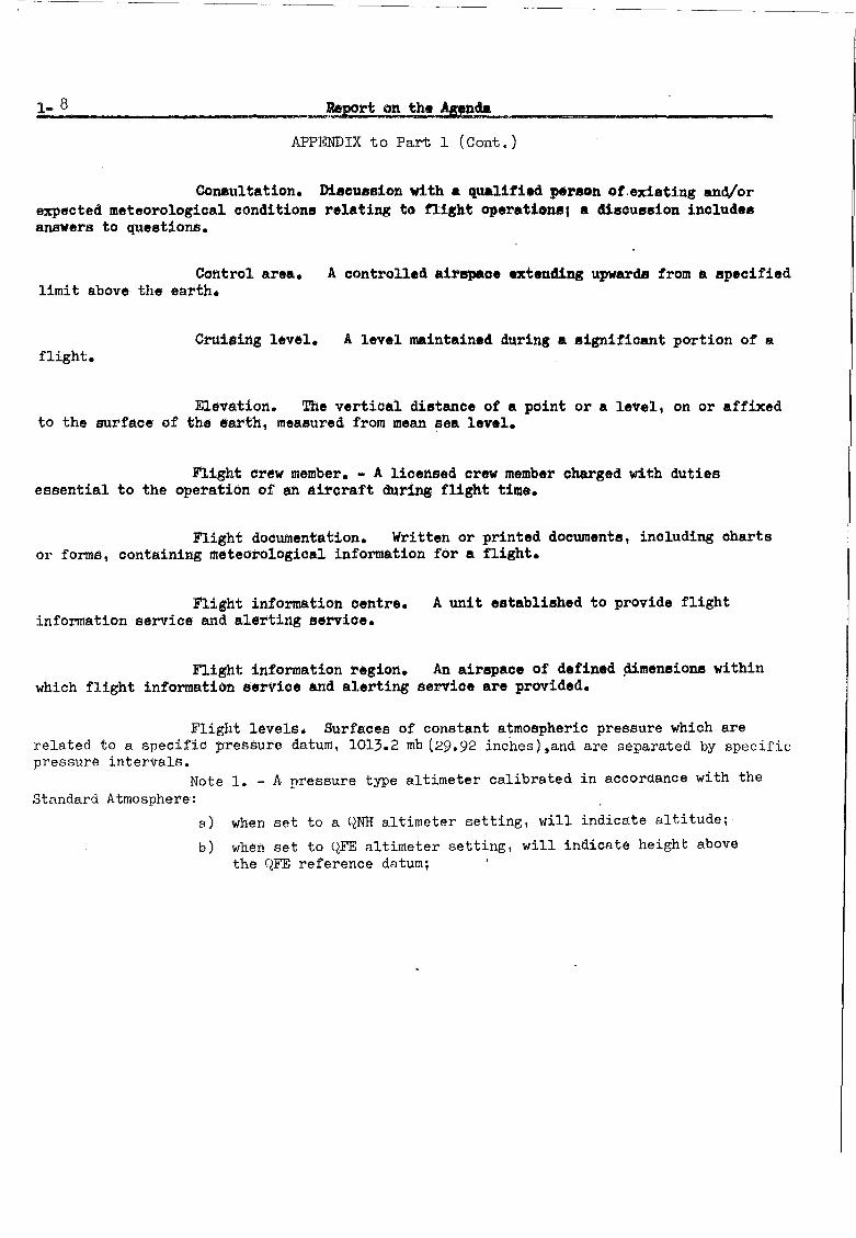
1-8 Report on the !ienu
APPENDIX to Part 1 (Cont.)
Co1U!lultation. Discussion with a qualified p&r80n of.existing and/orexpected meteorological conditione relating to flight operational a discussion includesanswers to questions.
Control area. A controlled airepaoe extending upwards from a specifiedlimit above the earth.
Cruising level. A level maintained during a significant portion of aflight.
Elevation. The vertical distance of a point or a level, on or affixedto the su·rface of the 6arth, measured from mean sea level.
Flight crew member. - A licensed crew member charged with dutiesessential to the operation of an aircraft during flight time.
Flight documentation. Written or printed documents, including chartsor forms, containing meteorological information for a flight.
Flight information oentre.information service and alerting servioe.
A unit established to provide flight
Flight information region. An airspaoe of defined ~mensions withinwhich flight information service and alerting servioe are provided.
Flight levels. Su·rfaces of constant atmospheric pressure which arerelated to a specific pressure datum, 1013.2 mb (29.92 inches)tand are separated by specificpressure intervals.
Note 1. - A pressure type altimeter calibrated in accordance with theStandard Atmosphere:
a) when set to a QNH altimeter setting, will indicate altitude;
b) when set to QFE altimeter setting, will indicate height abovethe QFE reference datum;

Report on the Agenda
APPENDIX to Part 1 (Cont.)
1-9
c) when set to a pressure of 1013.2 mb (29.92 inchesl, may be used toindicate flight levels.
Note 2. - The terms height and altitude used in Note 1 above, indicatealtimetric rather than geometric heights, and altitudes.
Forecast. A statement of expected meteorological conditions for aspecified time or period, and for a specified area or portion of' airspace.
Grid-point data in digital form. Computer processed meteorologicaldata concerning grid-point values in appropriate code form/for automated use by meteorological services or aeronautical users and normally transmitted on medium or high speedtelecommunication channels from a meteorological computer to another computer.
Grid-point data in numerical form. Processed meteorological dataconcerning grid-point values in numerical code form/for manual use by meteorologicalservices or aeronautical users' and transmitted on low speed telecommunication channels.
Height. (1) The vertical distance of a level, a point or an objectconsidered as a point, measured from a specified datum.
Note. - The datum may be specified either in the text or in anexplanatory note in the publication concerned.
(2) The vertical dimension of an object.Note. - The term height may also be used in a figurative sense for a
dimension other than vertical, e.g., the height of a letter or a figure painted on arunway.
Meteorological Authority. The authority providing or arranging forthe provision of meteorological service for international air navigation on behalf of aContracting State.
Meteorological information. Meteorological'reports, analyses,forecasts, and any other statement relating to existing or expected meteorologicalconditions.

1-10
or forecast.
....... Report on ~he Aienda
APPENDIX to Part 1 (Cont.)
Meteorological meeuge. A 8111818 meteorological report, analysis
Meteorological observation (Observation).more meteorological elements.
The eval~t1on of one or
Meteorological office (aeronautical). An office designated to providemeteorological service for international air navigation.
Meteorological report. A statement of obeerved meteorological conditionsrelated to a specified time and location.
Meteorological satellite. An artificial Earth eatellite making meteorological observations and transmitting these observations to Earth.
*Nephanalysis.from meteorological satellites.
Graphical depiction of cloud data obtained prinoip~lly
Operational flight plan. The operator's plan for the safe oonduct ofthe flight based On oonsiderations of aeroplane performance, other operating limitationsand relevant expected conditions on the route to be followed and at the aerodromesconcerned.
operator.Operational planning. The planning of flight operations by an
Operator. A person, organization or enterprise engaged in or offeringto engage in an aircraft operation.
Operator's local representative. An agent of the operator suitablylocated to permit the ready Bupply of operational information to the local meteorologioaloffice and to receive meteorological information for operational purposes.
Pilot-in-command.of the aircraft during flight time.
The pilot responsible for the operation and safety
*Provisional definition pending WMO action on Recommendation 1/4.

Report on the Agenda
APPENDIX to Part 1 (Cont.)
1-11
Prognostio ohart. A forecast of:··a specified meteorological element (8)for a specified time or period and a specified surface or portion of airspace, depictedgraphically on a chart.
Regional air navigation agreement. Agreement approved by the Councilof ICAO normally on the advice of a Regional Air Navigation Meeting.
Regional collecting centre.air-reports on a regional basie.
Collecting centre designated to collect
Regular aerodrome. An aerodrome whioh may be listed in the flightplan as an aerodrome of intended landing ..
Reporting point. A specified geographical location in relation towhich the position of an aircraft can be reported.
Rescue co-ordination centre. A oentre established within an assignedsearch and rescue area to promote efficient organization of search and rescue.
Runway. A defined rectangular area, on a land aerodrome, prepared forthe landing and take-off run of aircraft along its length.
*Runway visual range. The range over which the pilot of an aircrafton the centre line of a runway can see the runway surface markings or the lights delineatingthe runway or i~entifying its centre line.
Note le - The height of approximately 5 metres (16 feet) is regardedas corresponding to the average eye level of a pilot in an aircraft on the centre lineof a runway.
Note 2. - In practice, runway visual range cannot be measured directlyfrom the position specified in the definition but is an assessment of what a pilot wouldsee from that position.
* From Recommendation 12/3 (8th AN Conference/CAeM ExtraordinarySession (1974»

1-12
APl?ENDIX to Part 1 (Cont.)
SIGMm' information. Information bsued by a meteor~logical watch officeconcerning the occurrence or expected occurrence of specified en-route weather nhenomenawhich may affect the safety of aircraft operations.
Stanc:laTd :t.I!IQbaric surface. An il!lobaric surface used' on a world-widebasis for representing and analYeing the cQnditiona in the atmo8phere.
landing.Threshold. ~e beginning of that portion of the runway usable for
Transition altitude. The altitude in the vicinity of an aerodrome at orbelow which the vertioal position of an aircraft is controlled by reference to altitudes.
Transition level.transition altitude.
The lOwest flight level available for use above the
Upper-air chart. A weather Ohart on which meteorological conditions orelements relating to a specified upper-air surface or to a specified layer of the atmosphereare represented.
Visual meteorological oonditions. Meteorological conditions expressed interms of visibility, distance from cloud, and ceiling* equal to or better.than specified"minima.
Note. - The specified minima are contained in Annex 2.
VOLMET broadcast.aircraft in flight.
* As defined In Annex 2, Chapter 1
Routine broadcast of meteorological info~tion for

Report on the Agenda
APPENDIX to Part 1 (Cont.)
1.2 Terms used with a limited meaning
1.2.1 For the purpose of this Annex, the following terms are used with alimited meaning as indicated below:
a) to avoid confusion in respect of the term "service" between theMeteorological Service considered as an administrative entity andthe service which is provided, "Meteorological Authority" is usedfor the former and "service" for the latter;
1-13
b) "provide" is used solely in connexion with the provision of service;
c) "issue" is used solely in connexion with cases where the obligationspecifically extends to sending out the information to a user;
d) "make available" is used solely in connexion with cases where theobligation ends with making the information accessible to a user;
e) "supply" is used solely in connexion with cases where the information is either issued or made available to a user.
- - - - - - - - - - -


Part 2.
Report on the Agenda
New Annex 3/Technical Regulations LC.3.!7 Chapter 2 - General ~rovisions
2-1
2.1 The Meeting considered the General Provisions as contained in the draft newAnnex 3/Technical Regulations L'C.3.17, Chapter 2.
1.,.ere
2.2the
Minor changes to the text were introduced8th Air Navigation Conference/CAeM ExtraorQinaryeffected in order to improve the clarity of the
to reflect recommendations made bySession (1974) and editorial changesmaterial.
2.3 Difficulty was experienced during the drafting of paragraph 2.2.2 and, inparticular, 1.,.ith the Standard that meteorological information shall be in "a form as torequire a minimum of interpretation by users". The Meeting noted that, while efforts toincrease the self-evidency of the METAR/TAF code forms are continuing and while the useof these codes by aeronautical personnel ,is'being'e~couraged, the whole question of theforms in which meteorological information is provided to users ~s likely to be con~id~red_,~r
the 9th Air Navig~tion Conference during its review of MET/ATS co-ordination.
2.4 The Recommended Practice calling for aerodrome meteorological offices to besituated so as to' facilitate personal contact with users of meteorological information wasdeleted,as it was thought to be obsolete and/or impracticable to implement at many modernaerodromes, particularly in the case of aerodromes with multiple terminals.
2.5 The Meeting accordingly made the following Recommendation:
RSPP RECOMMENDATION 2/1 - INCLUSION OF CHAPTER 2 (GENERALPROVISIONS) IN THE NEW ANNEX: 3/TECHNICAL REGULATIONS LC.3.!7
That the following material be included in the new Annex 3/Technical Regulations LC.3.i7:
Chapter 2 (General provisions) as given III the Appendixto Part 2 of the Report on the Agenda.


CHAPTER 2 - GENERAL PROVISIONS
Report on the Agenda
APPENDIX to Part 2
2-3
Introductory Note. - It is recognized that the prOV1S1GfiS of this Annexwith respect to meteorological information are subject to the understanding that the obligation of a Contracting State is for the supply, under Article 28 of the Convention, ofmeteorological information and that the responsibility for the use made of such informationis that of the user.
2.1 lbjective, determination and provision of meteorological service
2.1.1 The objective of meteorological service for international air navigationshall be to contribute towards the safe, regular, efficient and economical conduct ofinternational air navigation.
2.1.2 This objective shall be achieved by supplying operators, flight crewmembers, air traffic services units, rescue units, airport managements and others concernedwith the conduct or development of international air navigation with the meteorologicalinformation necessary for the performance of their respective functions.
2.1.3 Each Contracting State shall determine the meteorological service whichit will provide to meet the needs of international air navigation. This determinationshall be made in accordance with the provisions of this Annex and with due regard toregional air navigation agreements; it shall include the determination of the meteorological service to be provided for international air navigation over international watersand other areas which lie outside the territory of the State concerned.
2.1.4 Each Contracting State shall designate the authority, hereinafter referred to as the Meteorolo~ical Authority, to provide or to arrange for the provision ofmeteorolOGical service for international air navigation on its behalf.
2.2 Supply and use of meteorological information
2.2.1 Close liaison shall be maintained between those concerned with thesupply and those concerned with the use of meteorological information on matters whichaffect the provision of meteorological service.
2.2.2 The meteorological information supplied to aeronautical personnel shallbe up to date and shall be in forms·which require a minimum of interpretation by users,as specified in the following chapters.

_P~£ort_ on the Agenda
APPENDIX to Part 2 (Cont.)
2.3 Notifications re~uired from operators
2.3.1 Operators re1uiring meteorolo~ical service or ch"n~e3 i~ existi~g
meteorological service shall notify, sufficiently in advance, the Meteol'ological Authoritiesor meteorological offices concerned as indicated in this Section 2.3. The minimum amountof advance notice required shall be as agreed betwsGn the Meteorological Authorities ormeteorological offices concerned and the operator.
2.3.2service when:
Meteorological Authorities shall be notified by operators requiring
a) new routes or new types of operations are planned;
b) changes of a lasting character are to be made in scheduledoperations;
c) new offices for operators' local representatives are planned;
d) other changes, affecting the provision of meteorological service,are planned.
Such information shall contain all details necessary for the plannin~ of appropriatearraneements by the Meteoro1or,ica1 Authorities.
2.3.3 The aerodrome meteoro1o~ica1 office or the meteorological officeconcerned shall be notified by the operator or a flight crew member:
a) -of fli~ht schedules;
t) wh"n non-sch"Clule'l flights are to re 0!,"''''·.t"rj;
c) when flights are delayed, advanced or cancelled.
2.3.4 Recommendation. - The notification to the aerodrome meteoro1o~ical office or themeteorological office concerned of individual fli~hts should contain the following information except that, in the case of scheduled flights, the require~ent for Eone or all of thisinformation may be waived by agreement between the meteorological office and the operator:
a) aerodrome of departure and estimated time of de~arture;
b) destination and estimated time of arrival;

Renort on the Agenda
APPE~IX to Part 2 (Cont.)
c) route to be flown and estimated times of arrival at, anddeparture from,any intermediate aerodrome(s);
2-5
d) alternate aerodroees needed to complete the operational flightplan and taken from the relevant list contained in the regional plans;
e) cruising leyel;
f) for supersonic transport flights,the alternative subsoniccruising level and the locations of the transonic accelerationand deceleration areas and of the climb and descent paths;
g) type of flight, whether und.er the visual or the instrument ;flightrules;
h) type of meteorological information requested fur a flight crewmember _,_.w!I_~ther flip;ht documentation and/or brieflng or consultation;
i) time(s) at which briefing, consultation and/or flight documentation is required.


Part 3.
Report on the Agenda
New Annex 3/Technical Regulations /C.3.Y - Chapter 3 - Area forecasteentres, aerodrome meteorological ~ffices, meteorological watch offices
3-1
3.1 The Meeting considered the provisions relating_to meteorological watch officescontained in the draft new Annex 3/Technical Regulations LC.3.Y, Chapter 3.
3.2 The Meeting felt that some improvement was needed with respect to theprovision relating to the establishment of meteorological watch offices o It thereforeagreed to incJnde more details in this provision.
3.3 The Meeting_noted that the provisions agreed for inclusion in Annex 3/Technical Regulations LC.3.y by the 8th Air Navigation Conference/CAeM ExtraordinarySession (1974) in respect of the functions of aerodrome meteorological offices wereStandards. It was therefore agreed that provisions relating to the function of meteorological watch offices should also have Standard status.
3·4 In the light of the Meeting's consideration of the subject, it made thefollowing recommendation:
RSPP RECONMENDATION 3/1 - INCLUSION IN CHAPTER 3 (AREAFORECAST CENTRES, AERODROMEMETEOROLOGICAL OFFICES, METEOROIDGICAL WATCHOFFICES) OF THE NEW ANNEX 3/TECHNICALREGULATIONS !J5.3.Y OF REVISEDSPECIFICATIONS RELATING TO HETEOROLOGICAL I1ATCH OFFICES
That the material presented in the Appendix to Part 3of the Report on the Agenda be included in Chapter 3(Area forecast centres, aerodrome meteorological offices,meteorological watch offices) of the new Annex 3/Technical Regulations L.C.3.y.


Report on the Agenda
APPENDIX to Part 3
CHAPTER 3 - AREA FORECAST CENTRES, AERODROME METEOROLOGICAL OFFICES,METEOROLOGICAL WATCH OFFICES
3.1 (Cont~ned in Appendix 7 to the Report on Agenda Item 13 of the 8th AirNavigation Conference:CAeM Extraordinary Session (1974).)
3.2 (Contained in the Appendix to the'Report on Agenda Item 14 of the 8th All'Navigation Conference:CAeM Extraordinary Session (1974).)
3-3
3.3 Meteorological watch offices
3.3.1 A Contracting State having accepted the responsibility for a flight informationregion or a control area shall establish one or more meteorological watch offices, orarrange for another Contracting State to do so, in accordance with requirements laid downby regional air navigation agreement.
3.3.2 A meteorological watch office shall:
a) maintain watch over meteorological conditions affecting flightoperations within its area of responsibility;
b) prepare SIGMET information relating to its area of responsibility;
c) supply SIGMET information and, as required, other meteorologicalinformation to associated air traffic services units;
d) disseminate SIGMET information.
Note. The contents, preparation and dissemination of SIGMET information are specified lnother chapters of this document.
3.3.3 Recommendation. - The boundaries of the area over which meteorological watch is tobe maintained by a meteorological watch office should, in so far as practicable, becoincident with the boundaries of a flight information region or a control area or acombination of flight information regions and/or control areas.
3.3.4 Recommendation. - Meteorological watch should be maintained continuously; however,ln areas with a low density of traffic the watch may be restricted to the period relevantto expected flight operations.


Part 4.
Report on the Agenda
New Annex 3/Technical Regulations [C.3.i! Chapter 5 - Aircraft observations and reports
4-1
4.1 The Meeting considered the provisions relating to aircraft observations andreports contained in the draft new Annex 3/Technical Regulations [C.3.!/, Chapter 5.
4.2 Minor changes to the text were introduced to reflect recommendations made atthe 8th Air Navigation Conference/CAeM Ext. (1974) and editorial changes were effected inorder to improve the clarity of the material.
4.3 The Meeting accordingly made the following recommendation;
RSPP RECOMMENDATION 4/1 - INCLUSION OF CHAPTER 5 (AIRCRAFTOBSERVATIONS AND REPORTS) IN THE NEWANNEX 3/TECHNICAL REGULATIONS [c.3.!7
That the following material be included in the new Annex 3/Technical Regulations [C.3.i!:
Chapter 5 (Aircraft observations and reports)as given in the Appendix to Part 4 of the Reporton the Agenda.


Report on the Agenda
APPENDIX to Part 4
CHAPTER 5 - AIRCRAFT OBSERVATIONS AND REPORTS
5.1 Obligations of States
5.1.1 Each Contracting State shall arrange, according to the provisions ofthis chapter, for observations to be made by aircraft of its registry operating oninternational air routes and for the recording and reporting of these observations with dueregard to regional air navigation agreements.
5.2 Aircraft observations
The following aircraft observations shall be made:
a) routine aircraft observations;
b) special aircraft observations;
c) aircraft observations during climb-out and approach; and
d) other aircraft observations on request.
5.3 Routine aircraft observations
5.3.1 Routine observations shall be made in relation to those air trafficserv~ces reporting points, lines or intervals:
a) at which the applicable air traffic services proceduresrequire routine position reports, and
b) which are those separated by distances corresponding mostclosely to intervals of one hour of flying time.
An aircraft shall be exempted from making routine observations when:
a) the flight duration is 2 hours or less; nr
b) the aircraft is at a distance equivalent to less than onehour of flying time from the next intended point of landing; or
c) the altitude of the flight path is below 1 500 metres (5 000 feet).

..:.4.-_4...:...,__- .:.:R:::;.eP&:::o~r:.;t~o~n:..~th::.:e~Ag~e~n~da~ .~ _
APPENDIX to Part 4 (Cont.)
5.3.3 Recommendation. - Additional exemptions may be prescribed by regional air naviga-tion agreement for flights over routes and areas with high density air traffic an~or withadequate synoptic networks. Such procedures should take the form of exemption or designation procedures and should:
a) make it possible for the m1n1mum requirements foraircraft observations of all meteorological officesconcerned to be met;
b) take into consideration the need for data for the planningof high-level operations of the future;
c) be as simple as possible to implement and preferably beof a routine nature not involving consideration of individualcases;
d) be such that, as far as is practicable, all offices involvedare aware of the aircraft from which observations should b.available.
5.4 Special aircraft observations
5.4.1 Special observations shall be made by all aircraft operating oninternational air routes whenever:
a) severe turbulence or severe icing is encountered; or
b} moderate turbulence. hail or cumulonimbus clouds areencountered during transonic or supersonic flight; or
c} other meteorological conditions, for example, the other en routeweather phenomena specified for SIGMET messages, are encountered,which, in the opinion of the pilot-in-command, may affect the safetyor markedly affect the efficiency of other aircraft operations.
5.5 Aircraft observations during climb-out and ~proach
5.5.1 Observgtions shall be made by all aircraft of meteorolo~ical conditionsencountered during the climb-out or approach phases of flight, not previously reported tothe pi1ot-in-command, which in his opinion are likely to affect the safety of other aircraft operations.

Report on the Agenda
APPENDIX to Part 4 (Cont.)
5.6 Other aircraft observations
5.6.1 Observations shall also be made by airoraft:
4-5
a)
b)
,if an aerodrome meteorological office providing meteorologicalservice for a flight or a meteorological watch office makes arequest for ~ecific data; or
by agreement between a Meteorological Authority and an operator.
5.7 Record of aircraft observations
5.7.1 Routine and special aircraft observations shall be recorded on theAIREP :form. A copy of the form shall be included w!1;h the flight dooumentationunlessit has been provided by the operator.
Note. - The AlREP form and detailed inetructions forrecording and reporting aircraft observations and for the contents and format of AlREPmpssages are given in the PANS-RAC. Appendix 1.
5.7.2 Recommendation. - Aircraft observations requested by a meteorological office. ormade by agreement between a Meteorological Authority and an operator. should be recordedonly when this is specifioally agreed upon; they should then be ;recorded on the AIBEP form.
5.8 Reporting.of aircraft observations during flight
5.8.1 Routine aircraft observations shall be reported during flight as rou-tine air-reports at times of transmission of the associated position report. Specialaircraft observations shall be reported during flight as special air-reports,as soonafter they have been made as is practicable.
5.8.2 Aircraft observations made during the climb-out and approach phase offlight shall be reported as soon as practicable.
5.8.3 Recommendation. - Aircraft observations requested by a meteorological office. ormade by agreement between a Meteorological Authority and an ·operator, should be reportedin flight, unless it has been agreed that such reporting is not necessary. If they arereported; they should be addressed so as to reach the office or authority that requestedthe observations.

4-6
5.8.4shall be:
Report on the Agenda
APPENDIX to Part 4 (Cort.). I
The elements contained in air-reports and th~ir order in the message
Messa~e type designator
Section 1(Positioninforniation)
Section 2(Operationalinformation)
Section 3(Meteorologicalinforlllaticn)
(Aircraft identification\ Position
l'TimeFlight level or altitudeNext position and time over
{Estimated time of arrivalEndurance
(Air temperatureWind
tTurbulenceAircraft icingSupplementary information
Note. - The message type designators specified in the PANS-RAC are"ARP" for routine air-reports bd "ARS" for epecial air-reports.
5.8.5 The Meteorological Authority concerned shall make such arrangementswith the appropriate ATS Authority as are necessary to ensure that meteorological observations reported by aircraft in flight to air traffic services units are delivered to theassociated meteorological office without delay.
5.9 Post-flight reporting
5.9.1 On arrival of a flight at an aerodrome, the completed AIREP form shallbe delivered by the operator or a flight crew member, without delay, to the meteorologicaloffice at the aerodrome. If there is no meteorological office at the aerodrome, or whenthe meteorological office at the aerodrome is not easily accessible to arriving flightcrew members, the completed form shall be dealt with in accordance with local arrangementsmade b,y the Meteorological Authority and the operator.
5.9.2 Recommendation. - Oral comments on the meteorological conditions experienced duringthe flight should be given by a flight crew member to supplement the information containedin the AIREP form.

Report on the Agenda
ApPENDIX to Part 4 (Cont.)
5.10 Exchange of air-reports between meteorological offices
5.10.1 Air-reports received by a meteorological office shall bedisseminated tQ the meteorological office designated as"a collecting centre inaccordance with regional air navigation agreement, unless there is evidence that thereports have already been received by a collecting centre.
4-7
5.10.2 Recommendation. - Meteorological information derived from AlREP forms and fromoral comments by a flight crew member should be disseminated by aerodrome meteorologicaloffices to their designated collecting centres, unless it has already been reported.
5.10.3 The collecting centres shall assemble the routine air-reportsreceived and shall disseminate them to other meteorological offices in accordancewith regional air navigation agreement. The exchange of collectives on an hourlybasis may be found desirable when reports are numerous.
5.10.4 Special air-reports received by a meteorological office or a collecting centre shall be disseminate~as soon after they have been received as is practicable,to other meteorological offices in accordance with regional air navigation agreement.
5.10.5 Collecting centres shall disseminate the air-reports received tothe regional collecting centre, designated by the World Meteorological Organization,which requires the reports for further dissemination as baSic meteorological data.
5.10.6 Recommendation. - Where supplementary dissemination of air-reports is required tosatisfy special aeronautical or meteorological requirements, such dissemination should bearranged between the Meteorological Authorities concerned.
5.10.7 _~commendation. - Air-reports received more than 8 hours after their related timeof observation should only be disseminated by collecting centres if more recent reportsfrom the area concerned are not available.
5.10.8 Air-reports shall be exchanged between meteorological offices_in theform in which they are received, except that:
a) Section 1, Item 5 - Next position and time over, andSection 2 - Operational information, may"be omitted; and
b) when the position is given by reference to a reportingpoint it may be converted, by a meteorological office,into the corresponding latitude and longitude.


Part 5.
5.1
Report on the Agenda
New Annex 3/Technical Regulations /C.3.17 -Chapter 8 - Aeronautical climatological-information
General
5-1
5.1.1 The Meeting considered the provlslons relating to aeronautical climatologycontained in the draft new Annex 3/Technical Regulations [C.3.!7, Chapter 8, and madethe following recommendation:
RSPP RECOMMENDATION 5/1 - INCLUSION OF CHAPTER 8 (AERONAUTICALCLIMATOLOGICAL INFORMATION) IN THE NEWANNEX 3/TECHNICAL REGULATIONS /C.3.b!
That the following material be included in the new Annex 3/Technical Regulations [c.3.!7:
Chapter 8 (Aeronautical Climatological Information)as given in the Appendix to Part 50f the Reporton the Agenda.
Basic list of elements
5.2.1 The Meeting noted that there was a demand for a wide range of aeronauticalclimatological information to meet the needs of planning for international general aviationoperations on the one hand, and supersonic transport operations on the other. Also, morecomplex planning was taking place, because aerodromes were getting larger, and becauseaerodromes were increasingly used in marginal weather conditions. Because of theresulting need for a wide range of information, it was becoming difficult for many Statesto pUblish all the climatological information that might be re~uired. Also, the publishingof all the climatological information presently called for in Chapter 12.4 of the WMOTechnical Regulations resulted in voluminous documents, much of the contents of whichwere little used.
5.2.2 Considerable attention was therefore devoted to the ~uestion of specifyingthose elements for which aeronautical climatological information should normally beavailable. The Meeting compiled the following minimum list of such elements consideredessential for the purpose:
Surface windVisibility/Run~ayvisual rangeCloud height and amountTemperaturePressure

5-2 Report on the Agenda
5.2.3 In drawi~ up this list,it was recognized that the preparation of RVR statisticspresented numerous practical difficulties, in particular this was affected by standard lightsettings used for assessing RVR. Nevertheless, in view of the operational importance ofthis element, it was believed that efforts should be made to overcome these difficulties,e.g., by providing RVR statistics based on a standard light intensity and, where thiscannot be done, by giving statistics based on the most frequently used light intensity,which should be stated. The Meeting noted that ICAO, at the request of WHO, was engagedin developing aeronautical requirements for climatological information based on viewsexpressed by States, IATA and IFALPA, and on requirements expressed by various RAN Meetings;these requirements aimed, among other things, at bringing about standardization of RVRstatistics.
5.2.4 As the terms of reference of the Meeting did not permit fundamental changes toexisting provisions, it was agreed that the basic list developed and shown in paragraph5.2.2 above, should be considered by ICAO and ~40 for inclusion in the new Annex 3/Technical Regulations /c.3.ll, if necessary after further study and development in the light ofthe aeronautical-requIrements for climatological information prepared by ICAO. Subsequently,~O should review the existing climatological models and, as necessary, develop new modelsto meet the new provisions and requirements.
The Meeting therefore made the following Recommendation:
RECOMMENDATION 5/2 - AERONAUTICAL CLlMATOLOGICAL INFORMATION
1. That ICAO and ~O consider the inclusion in the newAnnex 3/Technical Regulations /c.3.l1 of the followingbasic list of elements for whi~h ae;onautical climatological inforrration should normally be available:
Surface windVisibility/Runway visual ~nge
Cloud height and amountTemperaturePressure.
2. That WHO, taking into account the operational requirementsexpressed in this respect,
a) develop new models or improve the existingmodels to present the required climatologicalinformation in a concise form, and include thesemodels in the WHO Technical Regulations LTI.3.37;and
b) review the guidelines for the development ofaeronautical descriptive climatologicalmemoranda.

Report on the Agenda
APPENDIX to Part 5
CBAP~~ 8 - AERONAUTICAL CLIV~TOLOGICAL INFOffilATION
8.1 General provisions
5-3
8.1.1 Aeronautical climatological information shall be prepared in the form of aerodromeclimatological summaries, aerodrome climatological tables and aeronautical descriptiveclimatological memormlda. Such information shall be supplied to aeronautical users as-9.greed between the Heteorological Authority and those users.
8.1.2 Recommendation.tables and aeronauticalforms, and/or according
The aerodrome climatological summaries, aerodrome climatologicaldescriptiveclimatological memoranda should be prepared in theto the procedures prescribed by the World Meteorological Organization.
3.1.3 Recommendation.- The aerodrome climatological summaries, aerodrome climatologicaltables and the aeronautical descriptive climatological memoranda should be exchanged onrequest between Meteorological Authorities. Operators and other aeronautical usersdesiring such information should normally apply to the Meteorological Authority responsiblefor its preparation or to the Meteorological Authority of the State with which theoperator's aircraft are registered.
8.2 Aerodrome climatological su~~aries
8.2.1 Recommendation.- Each Contracting State should prepare and publish or otherwisemake available aerodrome climatological summaries for each regular international andalternate international aerodrome within the territory of that State.
8.2.2 Recommendation.- The su~~aries should contain information based on observationsmade over a number of years of elements required for aeronautical planning or research.The sUlamaries should consist of a statistical presentation providing information on thenumber of occasions when specified values of one element or of a combination of twv ormore elements were observed.
8.3 ~erodrome climatological tables
8.3.1 Recommendation.- Each Contracting State should have the data and capabilityto prepare and make available aerodrome climatological tables within a time period asagreed between th~ Meteorological Authority and the aeronautical user.
8.4 Aeronautical descriptive climatological memoranda
8.4.1 Reconmendation.- Each Contracting State should prepare and publish, or otherwisemake available aeronautical descriptive climatological memoranda for specific areas orportions of air rQutes and fer aeronautical meteorological stations as appropriate. Thesememoranda should be produced by States either individually or collectively by agreementamongst the Meteorological Authorities concerned.

5-4 Report on the Agenda
APPENDIX to Part 5 (CoLt.)
8.4.2 Recommendation.- Similar memoranda should be prepared and published or otherwisemade available for specific areas or portions of air routes over international waterseither individually by the Contracting State responsible for the flight information region,or collectively by agreement amongst the Contracting States concerned.
8.5 Copies of meteorological obse~vational data
8.5.1 Recommendation.- Each Meteorologicaf Authority, on request and to the extentpracticable, should make available to any other Meteorological Authority, operators andto others concerned with the application of meteorology to international air navigation,copies of original meteorological observational data required for research, investigationor operational analysis.

Part 6.
Report on the Agenda
New Annex 3/Technical Regulations LC.3.l7 -Chapter 10 - Service for Air Traffic Control and for Search and Rescue Units
6-1
6.1 The Meeting considered the provisions relating to service for air traffic controland for search and rescue units contained in the draft new Annex 3/Technical RegulationsLC.3.!/, Chapter 10.
6.2 Minor changes to the text were introduced to reflect recommendations made by the8th Air Na'igation Conference/CAeM Ext.(1974) and editorial changes were effected in orderto improve the clarity of the material.
6.3 The Meeting accordingly made the following recommendation:
RSPP RECOMMENDATION 6/1 - INCLUSION OF CHAP~ER 10 (SERVICE FORAIR TRAFFIC CONTROL AND FOR SEARCH ANDRESCUE UNITS) IN THE NEW ANNEX 3/TECHNICAL REGULATIONS LC.. 3.!/ -
That the following material be included in the new Annex 3/Technical Regulations LC.3.17:
Chapter 10 (Service for air traffic control and forsearch and rescue Units) as given in the Appendixto Part 6 of the Report on the Agenda.


6-3
APPENDIX to Part 6
CHAPTER 10. - SERVICE FOR AIR TRAFFIC CONTROL AND FOR SEARCH AND RESCUE UNITS
10.1 Information for air traffic services units
10.1.1 Meteorological offices designated by the Meteorological Authority shallsupply air traffic services units with up-ta-date meteorological reports, forecasts,
SIGMET information and appropriate special air-reports which are necessary for the conductof the respective fun?tions of these units.
10.1.2 Recommendation. - The associated meteorological office for an aerodrome controltower or approach control office should be an aerodrome meteorological office.
10.1.3 The associated meteorological office for a flight information centreor an area control centre shall be a meteorological watch office.
10.1.4 Recommendation. - Where, owing to local circumstances, it is convenient for theduties of an associated meteorological office to be shared between two or ~ore meteorological Offices, the division of responsibility should be determined by the MeteoEologicalAuthority in consultation with the appropriate ATS Authority.
10.1.5 The following meteorological information shall be supplied, as necessary,to an aerodrome control tower by its associated aerodrome meteorological office:
a) routine and special meteorological reports, includingcurrent pressure data, aerodrome and landing forecastsand amendments thereto for the aerodrome concerned;
b) SIGMET information and aerodrome warnings;

6-4 Report on the Agenda
APPENDIX to Part 6 (Cont.)
c) any additional meteorological information agreed uponlocally, such as reports for take-off or forecastsof surface wind for the dete,-,'nination of possible runwaychanges.
10.1.6 The following meteorological information shall be supplied, as necessary,to an approach control office by its associated aerodrome meteorological office:
a) routine and special meteorological reports, includingcurrent pressure data, aerodrome and landing forecastsand amendments thereto for the aerodrome(s) with whichthe approach control office is concerned;
b) SIGMET information and appropriate special air-reportsrelevant to the airspace with which the approach controloffice is concerned and aerodrome warnings;
c) any additional meteorological information agreed uponlocally, such as reports for landing.
10.1.7 The following meteorological information, as necessary, shall besupplied to a flight information centre or an area control centre by its associatedmeteorological watch office:
a) routine reports and selected special reports, includingcurrent pressure data for aerodromes and other locations,aerodrome forecasts and landing forecasts and amendmentsthereto, covering the flight information re~ion or thecontrol area and, if required by the fligh~-information
centre or area "control centre, covering aerodromes innei~hbouri~ flight information regions, as determined byregional air navigation agreement;
b) forecasts of upper winds, upper air temperatures and significant en-route weather conditions and amendments thereto,SIGHET information and appropriate special air-reports for theflight information region or control area and,if determined byregional air navigation agreement and required by the flightinformation centre or area control centr~for neighbouring flightinformation regions;

Report on the Agenda
APP~NDIX to Part 6 (Cont.)
c) any other meteorological information required by theflight information centre or area control centre tomeet requests from aircraft in flight; if the information requested is not available in the associatedmeteorological watch office, that office shall requestthe assistance of another meteorological office inproviding it.
6-5
10.1.8 Meteorological information requested by an air traffic services unit inconnexion with an aircraft emergency shall be supplied as rapidly as possible. It shallinclude the necessary meteorological inforMation, as selected from the list of the elementsto be suppliei to rescue co-ordi~ati0n centces and presented in paragraph 10.2.2.
~U.l.Y Recommendation. - 1~e information supplied to flight information centres ardarea control centres for supersonic transport aircraft should cover the levels used fortransonic and supersonic flight and should include forecasts for descent paths to aerodromes in the flight information region.
10.1.10 Where necessary for flight information purposes, current meteorologicalreports and forecasts shall be supplied to designated aeronautical telecommunicationstations. A copy of such informatio~ sh~ll be forwarded,if required,to the flight information centre or the area control centre.
10.1.11 Recommendation. - Routine, special and selected special reports, aerodrome andlanding forecasts, SIGMET information, upper wind and upper air temperature forecasts andamendments thereto should be supplied to air traffic services units in the form in whichthey are prepared, disseminated to other meteorological offices or received from othermeteorological offices, unless otherwise agreed locally.
10.1.12 Recommendation. - When computer-processed upper air data for grid points are~ade available to air traffic services units in digital form for direct use by air trafficcontrol computers, the contents, format and-transmission arrangements should be as agreedbetween the Meteorological Authority and the appropriate ATS Authority.
10.2 Information Ior search and rescue services
10.2.1 Meteorological offices designated by the Meteorological Authority inaccordance with regional air navigation agreement shall supply rescue co-ordination centreswith the meteorological information they require in a form established by mutual agreement. For that purpose, the designated meteorological office shall maintain liaison withthe rescue co-ordination centre tbrou~hout a search and rescue operation.

6-6 Report on the Agenda
APPENDIX to Part 6 (Cont.)
10.2.2 Information to be supplied to rescue co-ordination centres shall includethe meteorological c~)nditions that existed in the last known position of a missing aircraftand along the intended route of that aircraft with particular reference to:
a) hazardous flying conditions, such as aircrafticing or turbulence;
b) cloud amount and type, particularly cumulonimbusjheight indications of baaes and tops;
c) visibility and phenomena reducingvisibility;
d) surface wind and upper wind;
e) state of ground, in particular, any snow cover or flooding;
f) state of the sea and swell, if relevant to the search area;
g) sea level pressure data.
10.2.3 Recommendation. - On request from the rescue co-ordination centre, the designatedmeteorological office should arrange to obtain details of the flight documentation whichwas supplied to the flight crew member of the missing aircraft, together with any amendments to the forecast which were transmitted to the aircraft in flight.
10.2.4 Recommendation. - To facilitate search and rescue operations the designatedmeteorological office should, on request, provide:
a) complete and detailed information on the currentand forecast meteorological conditions in the searcharea;
b) current and forecast conditions en route, covering flightsby search aircraft from and returning to the aerodromefrom which the search is being conducted.
10.2.5 Recommendation. - On request from the rescue co-ordination centre the designatedmeteorological office should supply, or arrange for the supply of, meteorologicalinformation required by ships undertaking search and re8cue operations.

Part 7.
7.1
Report on the Agenda
New Annex 3/Technical Regulations LC.3.!7 -Chapter 11 - Requirements for and use. of communications
General
7-1
7.1.1 Under Chapter 11 the Meeting considered the requirements by aeronauticalmeteorological offices for the communications facilities needed for obtaining and disseminating operational meteorological information and the use to be made by those offices ofthe telecommunications facilities concerned.
7.1.2 For this purpose it was agreed to consolidate in Chapter 11 relevant speci-fications from a variety of ICAO and WMO documents. Apart from the common regulatorydocuments, the sources used included I~AO Annex 10 - Aeronautical Telecommunications,Annex 11 - Air Traffic Services, WMO Publication No. 9; TP.4, Volume C - WeatherReporting - Transmissions, as well as material widely used in ICAO Regional AirNavigation Plan PUblic~ti~ns. Ail ~f this s~urce m~t~rial had, - therefore, b~en previouslyconsidered, agreed upon or widely used by States; however, the selection made and itsconsolidation as a new Chapter 11 of Annex 3/Technical Regulations {C.3.!7 were new.
7.2 Section 11.1 - Requirements for communications
7.2.1 In this Section the Meeting included specifications relating to suitablecommunications facilities between meteorological offices or stations and their associatedair traffic services units, rescue co-ordination centres and aeronautical telecommunications stations. This part of Chapter 11 was largely based on the existing specificationsin Annex 11, Chapter 6 (paragraphs 6.2.1.1, 6.2.1.1.2, 6.2.1.2 and 6.2.1.2.1), which setout the air traffic servic~s requirements for communications with meteorological officesand in Annex 12, Chapter 3 (paragraphs 3.2.2 and 3.2.3) which reflect tpe requireme~ts
of rescue co-ordination centres.
7.2.2 In this context the view was expressed that the specifications in Annex 11 wereto some extent out of date, particularly with regard to direct speech communications,because they did not take account of a variety of modern means of communications, e.g.,closed circuit television and automated telephone switching systems. Accordingly, theMeeting agreed to make the following recommendation:
RECOMMENDATION 7/1 - REVIEW OF THE REXtU:r.RmEN.rS FORCOMMUNICATIONS BErWEEN ATS UNITS ANDASSOCIATED MErOORDLOGICAL OFFICESAND STATIONS
1. That ICAO review and, as necessary, update the prov1s1onsin Annex 11, Chapter 6, concerning requirements forcommunications between ATS units and meteorologicaloffices and stations, taking into account that meteorological information is being supplied to ATS units by avariety of means.

7-2 Report on the Agenda
2. That, following completion of the above review, therelevant parts of Annex 3ITechnical Regulations LC.3.17be amended to accord with the amendments to Annex 11,Chapter 6.
7.2.3cal officesnate and/or
Section 11.1 also includes a specification calling for aeronautical meteorologito be connected to other meteorological offices,to which they are to dissemifrom which they are to receive operational meteorological information.
Section 11.2 - Use of aeronautical fixed service communications
7.3.1 Specifications were included in this Section concerning the origination byaeronautical meteorological offices of meteorological messages to be transmitted via theaeronautical fixed service and concerning the filing times for'such messages.
7.3.2 In order to promote world-wide uniformity and co-ordination between ICAO andWMO telecommunications procedures, specifications were included calling for the use ofWMO abbreviated headings for all meteorological messages to be transmitted via aeronauticalfixed service facilities, following any AFS/AFTN heading/address that may be required.This material was derived from WMO Publication No. 9, TP.4, Volume C.
7.3.3 In connexion with the wt10 procedures for the date-time group to be used in theheadings of aerodrome, route and area forecasts, the Meeting considered proposals submitted by States and by the Regional Planning Group for the Meteorological OperationalTelecommunications Network, Europe (MOTNE); these proposals were aimed at amending theexisting WMO procedures by replacing the standard time of observation in GMT on which theforecast is based, by the full hour in GMT preceding the transmission time. A similarprocedure had already been introduced, since 1 March 1974, on a trial basis on the MOTNESystem. It was recognized that such a procedure was likely to have advantages for themanual handling and display of routine messages, as well as for computer handling ofroutine messages. However, the majority of Delegations felt unable to assess the implications of such a change, including its use for non-routine messages, because many of themhad not had adequate time - prior to the- 11eeting - to study such implications. It wasaccordingly decided to include in Chapter 11 the existing procedure and to make thefollowing related Recommendation:
RECOMMENDATION 7/2 - DATE-TIME GROUP IN THE WMO ABBREVIATEDHEADINGS FOR FORECASTS
1. That WMO review, as a matter of urgency, the proceduresfor the date-time group in abbreviated headings foraerodrome, route and area forecasts with a view to

Reuort on the Agenda
relating them to the full hour in GMT preceding thetransmission time, instead of the standard time ofobservation in GMT on which the forecast is based.This review should include consideration of the suitability of such a new procedure in respect of amendments,re~uested and other non-routine forecast messages.
2. That after completion of the above review, Annex 3/Technical Regulations L~.3.l!, Chapter 11, be amendedas necessary.
7-3
7.3.4 During the course of the Meeting, proposals were also presented by States tointroduce ,for use in the headings of operational meteorological messages transmitted viathe aeronautical fixed service, the two-figure indicator {ii) to differentiatetlVO or more bUlletins from the same geographical area and the three letter indicatorsRI'D, COR and AMD. These proposals were supported in principle and their substancewas incorporated in Chapter 11, paragraphs 11. 2. 3, 11. 2.4 and 11. 2.6; however, becausethe majority of De1egations had not had sufficient time before the Meeting to studythese parts of the procedures and the implications of their use in operationalmeteorological messages, the paragraphs were given the status of Recommended Practices,
rather than of Standards. In this connexion the following Recommendation was agreed upon:
RECOMMENDATION 7/3 - STAWS OF PARAGRAPHS 11. 2. 3, 11. 2.4 AND11.2.6 OF CHAPTER 11
That when circulating the new Annex 3/Technical Regulations!C.3.1! to States/Members for comments and approval, ICAO andWMO i;vite specific comments on the desirability of upgradingparagraphs 11. 2. 3, 11. 2. 4 and 11. 2. 6 of Chapter 11 fromRecommended Practices to Standards. In this connexion, States/Members should be advised of the reasons, indicated in paragraph 7.3.4, why the Meeting had felt obliged to give thesespecifications a lower status than their substance mightwarrant.
7.4 Section 11.3 - Dissemination of area forecasts
7.4.1 It was agreed to consolidate in this Section widely used procedures, derivedfrom all Regional Air Navigation Plans, concerning the communications arrangements forthe dissemination by facsimile of charts originated by area forecast centres. The Meetingfelt that such consolidation was desirable to foster worldwide uniformity.

7-4
7.5
Report on the Agenda
Section 11.4 - Use of aeronautical mobile serVlce communications
7.5.1 Brief specifications covering the use of aeronautical mobile service communica-tions for the transmission of meteorological reports, forecasts and SIGMET informationto aircraft in flight and for the tranEmission by aircraft of air-reports were includedin this Section. Most of the material was consolidated from existing specifications in
Annex 3~ANS-MET/TechnicalRegulations Li2.17 and Li2.~.
7.6 Section 11.5 - Use of aeronautical broadcast service - Cpntents of VOLMETbroadcasts
7.6.1 In order to promote worldwide uniformity in respect of the contents of VHFand of HF VOLMET broadcasts, the Meeting agreed to broaden the scope of the existingworldwide procedures in PANS-MET/Technical Regulation~paragraph 2.5.3.3,by incorporatingwidely used, largely identical regional procedures derived from all Regional Air NavigationPlans.
7.6.2 The consolidated material was included in Section 11.5; the principal speci-fications were drafted as Standards, the remainder as Recommended Practices.
7.7 In the light of the above indicated considerations the Meeting made thefollowing recommendation:
RSPP RECOMMENDATION 7/4 - INCLUSION OF CHAPTER 11 (REQUIREMENTSFOR AND USE OF COMMUNICATIONS) IN THENEW ANNEX 3/TECHNICAL REGULATIONS LC.3.!!
That the foilowing material be included in the new Annex 3/Technical Regulations LC.3.!!:
Chapter 11 (Requirements for and use of communications)as given in the Appendix to Part 7 of the Report onthe Agenda.

Report on the Agenda
APPENDIX to'Part 7
CHAPTER 11 - RERPIREMENTS FOR AND USE OF COMMUNICATIONS
Note. - It is recognized that it is for each Contracting Stateto decide upon its own internal organization and responsibility for implementing thecommunication facilities referred to in this Chapter.
7-5
11.1 Requirements for communications
11.1.1. Suitable telecommunications f~cilities shall be made available topermit aerodrome meteorological offices and, as necessary, aeronautical meteorologicalstations to supply the required meteorological information to air traffic services unitson the aerodromes for which those offices and stations are responsible, and in particularto aerodrome control towers, approach control offices and to the aeronautical teleco~~unications stations serving these aerodromes.
11.1.2 Suitable telecommunications facilities shall be made available topermit meteorological watch offices to supply the required meteorological information toair traffic services and search and rescue units in respect of the flight informationregions. control areas and search and rescue regions for which those offices are responsible and in particular to flight information centres, area control centres and rescue coordination centres and to the associated aeronautical telecommunications stations.
11.1.3 Telecommunications facilities between meteorological offices or, asnecessary, aeronautical meteorological stations and aerodrome control towers or approachcontrol offices shall permit communications by direct speech, the speed with which thecommunications can be established being such that the required points may normally becontacted within approximately 15 seconds.-
11.1.4 Recommendation. - Telecommunications facilities between meteorological offices andflight information centres, area control centres, rescue co-ordination centres and aerona'.ltical telecommunications stations should pennit:
a) communications by direct speech, the speed with which thecommunications can be established being such that the requiredpoints may normally be contacted within approximately 15seconds; and
b) printed communications, when a record is required by therecipients; the message transit time should not exceed 5minutes.

7-6 Report on theAg~nda
APPENDIX to Part 7 (Cont.)
Note. - Indication by time of the speed with which the communicationshould be established is provided as a gUide to communication services, particularlyto dete!'Jl1ine the types of communication channels required, e.g., "approximately15 seconds" is intended to refer to communications involving svTitchboard operationand "5 minutes" to mean methods involving retransmission.
11.1.5 Recommendation. - The telecommunications facilities required in accordance withparagraphs 11.1.3 and 11.1.4 should be supplemented as and where necessary by other formsof visual or audio Communications, for example closed circuit television.
11.1.6 Recommendation. - As agreed between the MeteorOlogical Authority and operators,provision should be made to enable operators to establish suitable telecommunicationsfacilities for obtaining meteorological information from aerodrome meteorological o~fices
or other appropriate sOurces.
11.1.7 Suitable tel'.;('O.1tlllUnicattons facilities shall be made available topermit meteorOlogical offices to ~xchffilge operational meteorological information withother meteorological offices.
11.1.8 Recommendation. - The telecommunications facilities for the transmission ofoperational meteoro1ogicai 'info!'Jl1ation between meteorological offices and the relatedtransit time requirements shOUld be determined by regional air navigation agreement.
1. ,-.2 Use 0f aeronautical fixed service communications
L ,,2.1 Meteorological messages containing operational meteorological informa-tion to be transmitted via the aeronautical fixed service shall be originated by theappropriate ~eteorological office or aeronautical meteorological station.
Note. - Meteorological messages containing operational meteorologicalinformation authorized for trffilsmission via the aeronautical fixed service are listed inAn~~x 10, Volwje 11, Chapter 4, together with the relevant priorities and priorityindica.tors.
11.2.2 Recommendation. - Meteorological messages required for scheduled transmissiohs~mould be f1 l'~d rf<;rt11a.1''!.y and at the prescribed scheduled times. Aerodrome reportsshould be filed for tra~S~156iun not later than 5 minutes after the actual time ofobservation. ;V,_'oJ.r·ome i'or~casts should be filed for transmission at least one hour beforethe Cl)r[:':lenCei: :.n'~ of theil' period of validity. unless otherwise determined by regional airn9.vigatio~..... c3_;~_~~e::1en+ .•

Report on the Agenda
APPO:NDIX ta Part 7 (Cant.)
7-7
11.2.3 Recommendation. - Meteorological messages containing operational meteorologicalinformation to be transmitted via the aeronautical fixed service facilities should containa heading consisting of:
a) an identifier of four letters and,if required, one ortwo figures;
b) the ICAO four-letter location indicator corresponding to thegeographical location of the meteorological office originatingor compiling the message;
c) a date-time group;
d) if required, a three letter indicator.
Note 1. - Detailed specifications of format and contents ofthe heading are given in WHO Publication No. 9, Volume C, Chapter 1.
Note 2. - lCAO location indicators are listed in lCAO Doe 7910 Location Indicators.
11.2.4 Recommendation. - The identifier should consist of four letters and, if required,two figures:
a) first and second letters: data designator;
b) third and fourth letters: geographical designator;
c) two figures: used to differentiate two or more messages whichcontain data in the same code and which originate from the samegeographical area and have the same originating centre.
Note. - Data designators and geographical designators for operationalmeteorological messages transmitted via aeronautical fixed service facilities are listedin Appendix 2.
11.2.5 Recommendation. - The date-time group should consist of six figures with the firsttwo figures indicating the day of the month and the following four figures indicating:
a) for routine and selected special reports, the timeof observation in GMT;

7-8 Report o~ the Agenda
APPENDIX to Part 7 (Cent.)
1-',) fe:: forecasts, the standard time of observation inGMr' on which the forecast is based;
c) for other messages, such as SIGMET information, thetime of origin in GMT of the text of the message.
11.2.6 Recommendation. - The three letter indicator should identify delayed, correctedand amend ' ."",;;;sages and should use the following abbreviations:
RTD - delayed messagesCOR - corrected messagesAMD - amended messa~es
In the case of a delayed message the remainder of the heading should remain unchangedwhile in the cases of amended and corrected messages the remainder of the headingshould be that of the original bulletin to be amended or corrected.
11.2.7 Meteorological messages containing operationa~ meteorolog~ca~
information to be transmitted via the aeronautical fixed telecommunication network (AFTN)shall be encapsulated in the text part of the AFTN message format.
11.3 Dissemination of area forecasts
11.3.1 Recommendation. - Where area forecast centres originate their forecasts in the formof charts, the facilities used for their transmission should be such as to permit receptionin all States as determined by regional air navigation agreement.
11.3.2 Recommendation. - The quality of the charts received should be such as to permitreproduction in a sufficiently legible form for flight planning and documentation. Chartsreceived should be legible over 95% of their area.
11.3.3 Recommendation. - Transmissions should be such as to ensure that their interruptionshould not exceed ten minutes during any period of 6 hours.
ll.!f. Use of aeronautical mobile service communications
11.4.1 Reports, forecasts and SIGMET information transmitted to aircraft shallbe consistent with the provisions of Chapters 4, 6 and 7 of this Annex. Transmissions byradiotelephony shall be consistent with the provisions of Annex 10, Volume Il, Chapter 5.

Report on the Agenda
APPENDIX to Part 7 (Cont.)
7-9
11.4.2 Recommendation. - Air-reports transmitted by aircraft should be consistent withthe provisions of Chapter 5 of this Annex and of the PANS-RAC, Appendix 1.
11.4.3 The substance of meteorological messages transmitted via the aeronau-tical mobile service shall remain unchanged from that contained in the message as originated.
11.5 Use of aeronautical broadcast service - Contents of VOLMET broadcaats
11.5.1 Continuous VOLMET broadcasts, normally on VKF, shall contain currentaerodrome weather reports, with trend parts where available.
11.5.2 Scheduled VOLMET broadcasts, normally on HF; shall contain currentaerodrome reports, with trend parts where available, and aerodrome forecasts.
11.5.3 Recommendation. - The aerodromes for which reports and forecasts are to beincluded in VOLMET broadcasts, the sequence in which they are to be transmitted and thebroadcast times should be determined by regional air navigation agreement.
11.5.4 Recommendation. - When a report has not arrived from an aerodrome in time for abroadcast, the latest available report should be included in the broadcast, together withthe time of observation.
11.5.5 Recommendation. - Aerodrome forecasts included in scheduled VOLMET broadcasts shouldhave a period of validity of 9 hours; they should be amended as necessary so as to ensurethat each forecast, when transmitted, reflects the latest opinion of the meteorologicaloffice concerned.
11.5.6 Recommendation. - SIGMET messages should be included in scheduled VOLMET broadcastsif determined by regional air navigation agreement. Where this is done, the SIGMET messageor an indication of "NIL SIGMET" should be transmitted at the beginning of the broadcastor of a five-minute time block.
11.5.7 Recommendation. - Reports, forecasts and SIGMET information included in VOLMETbroadca~ts should be consistent with the provisions of Chapters 4, 6 and 7 of this Annex,as appl~cable to messages disseminated beyond the aerodrome of origin. Transmission byradiotelephony should be consistent with the provisions of Annex 10, Volume 11, Chapter 7.


Report on the Agenda 7-11
APPJ~NDIX to Part 7 (Cont.)
APPENDIX 2 - DATA DESIGNATORS AND GEOGRAPHICAL DESIGNATORS FOR OPERATIONAL METEOROLOGICAL MESSAGES TRANSMITTED VIA AERONAUTICAL FIXED SERVICES FACILITIES
Designators listed in this Appendix are selected from the relevantlists developed and promulgated by the World Meteorological Organization.
Part 1. - Data designators
Routine reports. including trend part and other information, if a~pendedSelected special reports, including trend part and other informat~on,
if appendedAerodrome forecasts, period of validity greater than 12 hoursAerodrome forecasts, period of validity 12 hours or lessSlGMET informationAir-reportsArea forecastsFlight forecastsRoute forecastsGrid point forecastsHurricone warningsTropical cyclone (typhoon) warningsWarnings (other)
Part 2. - Geographical designator$
SA
SF
F"1'FeWSUAFAFIFRFGWHWTWO
.AfghanistanAlbaniaAlgeriaArgentinaAustralia
:3ahrain3angladesh (People's Rep. of):jarbCldos::'elgi'.lm~olivia
30:swana_:raz~..L
3u~.:;a.ria
3urma31 ~ :':lD ,-1 i
AHABALAGAUOS
(BN)BWBRBXBOBCBZBUBMBl
Cameroon (United Rep. of )CanadaCentral African Rep.ChadChileChina (People's Rep. of)ColombiaCongo (People's Rep. of)Costa RicaCubaCyprusCzechoslovak Socialist Rep.DahomeyDemocratic YemenDen.tl1arkDominican Republio
KMCNCETECHClCOCGCSCUCYCZDHADDNDn

7-12 Report on the Agenda
APPENDIX to Part 7 (Cont.)
Ecuador ~ Liberia LIEgypt (Arab Rep. of) UB 1.:1. h ,fall Arab Republic LYEl Salvador SV Luxembourg EXEquatorial Guinea RM Madagascar MG
Malawi RNEthiopj.a ErMSEJ MalaysiaFiji
Maldives MYFinland FI Mali FSFrance FR Malta MLGabon GO Mauritania HTGambia GB Mauritius MAGerman Dremocratic Republic DD Mexico MXGermany (Federal Rep. of) DL Mongolia MOGhana GC Morocco FMGreece GR Nepal NPGuatemala GU Netherlands (Kingdom of the) NLGuinea GNNew Zealand NZGuyana BG Nicaragua NKHaiti HA Niger FMHonduras HO Nigeria NIHungary HUNorway NOIceland IL Oman OMIndia IN Pakistan PKIndonesia ID Panama PMIran IR Paraguay PYIraq IQ Peru PRIreland lE Philippines PHIsrael IS Poland PLItaly IY Portugal POIvory Coast IV';~atar C~T)Jamaica JM Romania ROJapan JP Rwanda RWJordan TJ Saudi Arabia 3DKenya KN Senegal "I"'JuKhmer Rep. CD Sierra Leone SLKorea (Republic of) KO Singapore 3RKuwait KW Somalia PT
J..LLaos LA South Africa (Republic of) ZALebanon LE Spain SPLesotho BD

Report9n the Agenda
APPENDIX to Part 7 (Cont.)
Sri Lanka CL Union of Soviet SocialistSudan SU Republics RSSwaziland WZ United Arab Emirates OMSweden SN United Kingdom UKSwitzerland SW United States USSyrian Arab Republic SY Upper Volta RVTanzania (United Rep. of) TN Uruguay UYThailand TH Venezuela VNTonga TO Viet-Nam (Rep. of) VMTogo TG Western Samoa ZMTrinidad and Tobago TD Yemen YETunisia TS Yugoslavia YGTurkey TU Zaire (Republic of) RZUganda UG Zambia ZB
7-13
Temporary Note: This list is intended to comprise all areas/countries which originateoperational meteorological messages. The few designators shown inparentheses are provisional entries.


Part 8.
Report on the Agenda
New Annex 3/Technical Regulations Le.3.!!
8-1
8.1 Having completed the review of Cha£ters_l, 2, 3 (paragraph 3.3), 5, 8, 10 and11 of the new Annex 3/Technical Regulations /C.3.1/ the Meeting agreed that, together ,nthChapters 3 (paragraphs 3.1 and 3.2), 4, 6, 7-and 9" r"eviewed by the 8th Air Navigat;ionConference/CAeM Extraordinary Session (1974), these Chapters and the relevant Appendicesand Attachments recommended by both Meetings should replace the existing Annex 3/TechnicalRegulations Ll2.!/ and PANS-MET/Technical Regulations Ll2.iT. It therefore made thefollowing Recommendation:
RSPP RECOMMENDATION 8/1 - NEW ANNEX 3/TECHNICAL REGULATIONSLe.3.!!
That. the new Annex" 3/Te~hnical ~egulation? Le.3,.y- - ..-
- Meteorological Service for International Air Navigationcomposed of Chapters 1 ~ 11 and the relevant Appendicesand Attachments recommended by the 8th Air NavigationConference/CAeM Extraordinary Session (1974) (Recommendations 12/11, 13/1, 13/2, 13/3 and 14/1) and by theMeteorology Divisional Meeting (1974)/CAeM ExtraordinarySession (1974) (Recommendations 1/1, 1/2, 1/3, 2/1, 3/1, 4/1,5/1, 6/1 and 7/4, replace the existing Annex 3/TechnicalRegulations /l2.1! and PANS-MET/Technical Regulations[l2.?J. --
- END -

W0 R L D MET E 0 R 0 LOG I C A L 0 R G A N I Z A T ION=================================================================
SUPPLEMENT TO WMO PUBLICATION N° 406
ABRIDGED FINAL REPORT OF THE 1974 EXTRAORDINARY SESSION
OF THE COMMISSION FOR AERONAUTICAL METEOROLOGY
DECISIONS OF THE EXECUTIVE COMMITTEE ON THE
ABRIDGED FINAL REPORT OF THE 1974 EXTRAORDINARY SESSION
OF-THE COMMISSION FOR AERONAUTICAL METEOROLOGY
This document should be considered as a guide
to the status of the decisions adopted at that session

,II1
I1
I~ I
!
i lI

-3-
A. DECISIONS RECORDED IN THE GENERAL SUMMARY OF
THE TWENTY-SEVENTH SESSION OF THE EXECUTIVE COMMITTEE
(Relevant extracts)
3.3.2 Aeronautical Meteoroloand the abridged report(Agenda item 3.3)
resident of CAeMSession, 1974, of CAeM
I
3.3.2.1 The Committee noted that since its twenty-sixth session further progresshad been made in dealing with the recommendations of ~the con joint session. Withregard to the material relating to the Technical Regulations Le.3.y (Annex 3 of ICAO),the Committee noted that the dual consultation had been completed, that the commentsarising from the consultation were under review by the two Secretariats and that thefinal version of the new Technical Regulations Lc.3.17 (Annex 3 of rc~o) would beconsidered by the ICAO Council, probably in September 1975, and, thereafter, by theExecutive Committee. In order to permit the introduction of the revised TechnicalRegulations Lc.3.17 in August 1976 the Committee authorized the President of theOrganization to take action on its behalf in approving the new text. The Committeealso decided that Members should be given the maximum possible notice of the changesand that this would be best done by providing them, as usual, with an advanced copyof the final version prior to its consideration by rCAO Council. Notification of anysubsequent minor amendments, of the approval by the President and of the date on whichthe new regulations would come into effect would be made as soon as possible after theconsideration by ICAO Council.
3.3.2.2 With regard to the material not dealing with changes to the TechnicalRegulations the Committee satisfied itself that the allocation of responsibilitiesbetween the two organizations for follow-up action was in accordance with the ICAOIWMO Working Arrangements. It noted that, urgent actian having been requested byICAO on Recommendations 12/4, 12/7, 13/5 and 14/3, the President of the Organizationhad approved them on behalf of the Executive Committee, acting under General Regulation 9 (5). It also noted that as a result of the dual consultation, no action wasrequired at this stage from WMO on Recommendation 12/9 in respect of the order ofinformation in routine and special reports (with the exception of the order of the"location indicator" dnd "time of observationU groups which is dealt with in Recommendation 12/10). No immediate action was necessary in respect of Recommendation 711on the requirements for communi~D+ion between ATS units and associated meteorologicaloffices and stations as IeAO was referring the question to the Ninth Air NavigationConference which >:ould be conjoint with the sixth session of CAeM. The conclusionsof the Executive Committee on the remaining recommendations are contained in Resolution 8 (EC-XXVII).

-4-
3.3.2.3 The Committee approved the proposal by the president of the Commissionfor Aeronautical Meteorology to convene in 1976 a session of the Commission conjointlywith the Ninth Air Navigation Conjerence of lC~O, followed. by a ~eparQte session-ofCAeM for an overall duration of about three weeks.
3.3.2.4 The Committee approved the proposal by the president of CAeM for theappointment of a rapporteur and of an ad-hoc working group to ensure adequate CAeMpre-session documentation for the conjoint session with the Ninth Air NavigationConference of lCAO.
*
* *

I·
-5-
B. RESOLUTION
Resolution 8 (EC-XXVII)
REPORT OF THE 1974 EXTRAORDINARY SESSION OF
THE COMMISSION FOR AERONAUTICAL METEOROLOGY
HELD IN PART CONJOINTLY WITH THE
EIGHTH AIR NAVIGATION CONFERENCE OF ICAO AND
IN PART CONJOINTLY WITH THE MET DIVISIONAL MEETING OF ICAO
THE EXECUTIVE COMMITTEE,
HAVING CONSIDERED the recommendations adopted at the 1974 ExtraordinarySession of ~he Commission for Aeronautical Meteorology held in part conjointly withthe Eighth Air Navigation Conference of ICAO and in part conjointly with the METDivisional Meeting of ICAO,
DECIDES:
'(1) To note the report of the session;
(2) To note that, under the terms of the Working Arrangements between theWorld Meteorological Orgonization (WHO) and the International Civil Aviation Organization (ICAO), action on the following recommendations is being taken by ICAO althoughrelated or subsequent developments resulting from some of these recommendations maypossibly involve some responsibility for WHO:
Recommendations.12/1, 12/2, 12/5 (Part 1), 12/6, 13/4, 13/6, 13/7 (Port 1) and 7/1(Part 1);
(3) To take action on the following recommendations, as indicated:
(a) Notes the recommendation;
(b) Notes further that CBS has already initiated action with a view to formulatinga definition of "nephanalysis";
(c) Requests the Secretary-General, after the approval of the definition, toarrange, in consultation with the president of CAeM and in collaboration withthe Secretary~General of reAD, for the simultaneous introduction of the definition into the Technical Regulations LC.3.1l (Annex 3 of ICAO);

-6-
(a) Notes the recommendation;
(b) Notes that as a result of a dual consultation the basic list of elements forwhich aeronautical climatological information should normally be availablewill be included in the new draft Technical Regulations LC.3.!7;
(c) Requests the president of CAeM to arrange:
(i) for the development of new models or improvements to the existing models'to be used in the presentation of the require~ climatological information;
(ii) for a review of the guidelines for the development of aeronauticaldescriptive climatological memoranda;
(a) Notes that the action by CBS called for by EC-XXVI on this recommendation hasbeen completed;
(b) Approved Recommendation 23 (75-CBS) - Amendments to the definition of thetime group O6gg in the abbreviated heading of meteorological bulletins containing forecasts and analyses;
(c) Requests the president of CAeM, in collaboration with ICAO, to arrange for thedevelopment of consequential amendments to Technical Regulations LE·3·ll;
(a) Notes the recommendation;
(b) Requests the president of CBS to arrange for a study to be made of thequestion and then recommend on the inclusion of these elements in Code 4678w'w' ;
.!!e.£o.!!!.m!:.n~a!i.£n_lY~ .::. Qu.!d~n.£e_m~t!:.r.!.a! .£n_v!:.r!i.£a! ~i.!ld_s.!!e~r_a.!!d_s.!g.!liii.£a.!!t_v~r.!a.::.tion of the wind--------(a) Notes the recommendation;
(b) Requests the president of CAeM, in collaboration with ICAO, to arrange forthe development of proposals for guidance material on vertical wind shear andon significant variation of the wind along the glide path and take-off flightpath;
•

-7-
(a) Notes the recommendation;
(b) Requests the president of CBS to arrange:
(i) for a study of the matter and to recommend on the necessary changesto the METAR and SPECl code forms;
(ii) for the development of the procedures in which the principle be retainedthat in bulletins, the time group appears only' once;
.Re.£0.!!!m~n~a!i.2.n_lY12..;..-_A~r.2.n!!.u!i.£al.!!!e!e.2.r.2.l.2.gi.c!!.l_c.2.d~s_-_Ali.s.n.!!!e.!!.t_oi.!20!e.! !o_theMETAR and SPECl code forms-------------(a) Notes the recommendation;
(b) Requests the president of CBS to arrange for a study of the matter and thento recommend the necessary changes to the Manual on Codes;
(a) Notes the recommendation;
(b) Requests the president of CAeM to arrange for a study to be made on the basisof the review of the operational requirements by lCAO, of the possibility ofsatisfying the requirements;
(c) Requests the president of CAeM, and the president of CBS in so far as codeforms may be concerned, to arrange for studies to be made on the format ofproviding the information;
(a) Notes the recommendation;
(b) Requests the president of CBS to examine whether there is a non-aeronauticalrequirement for the code forms FM 55 E. FlFOR; FM 56 D. PROAR; FM 57 D.PRORO and FM 58 D. P-ROFl failing which these code forms are to be deletedfrom the manual on codes;

-8-
(a) Notes the recommendation;
(b) Requests the president of CBS in consultation with the president of CAeM toarrang~ as a matter of urgency, for further development of the GRID code inthe parts dealing with meteorological information specific to aviation, takinginto account the experience gained by Members and the requirements stated byICAO.
(4) To authorize the President of the Organization to take action on itsbehalf in approving changes to the Technical Regulations and annexes arising fromthe actions to be taken by CBS in complying with the various requests in (3).