Coastal Navigation Pt. 1 - MIT Sailing
91
Coastal Navigation Pt. 1 ● Introduction to Navigation ● Coordinate Systems ● Nautical Charts ● Aids to Navigation ● The Magnetic Compass Coastal Navigation Pt. 2 ● Tides ● Obtaining a Fix ● Dead Reckoning ● Navigation Rules ● Electronic Instruments
-
Upload
khangminh22 -
Category
Documents
-
view
5 -
download
0
Transcript of Coastal Navigation Pt. 1 - MIT Sailing

Coastal Navigation Pt. 1● Introduction to Navigation● Coordinate Systems● Nautical Charts● Aids to Navigation● The Magnetic Compass
Coastal Navigation Pt. 2● Tides● Obtaining a Fix● Dead Reckoning● Navigation Rules● Electronic Instruments
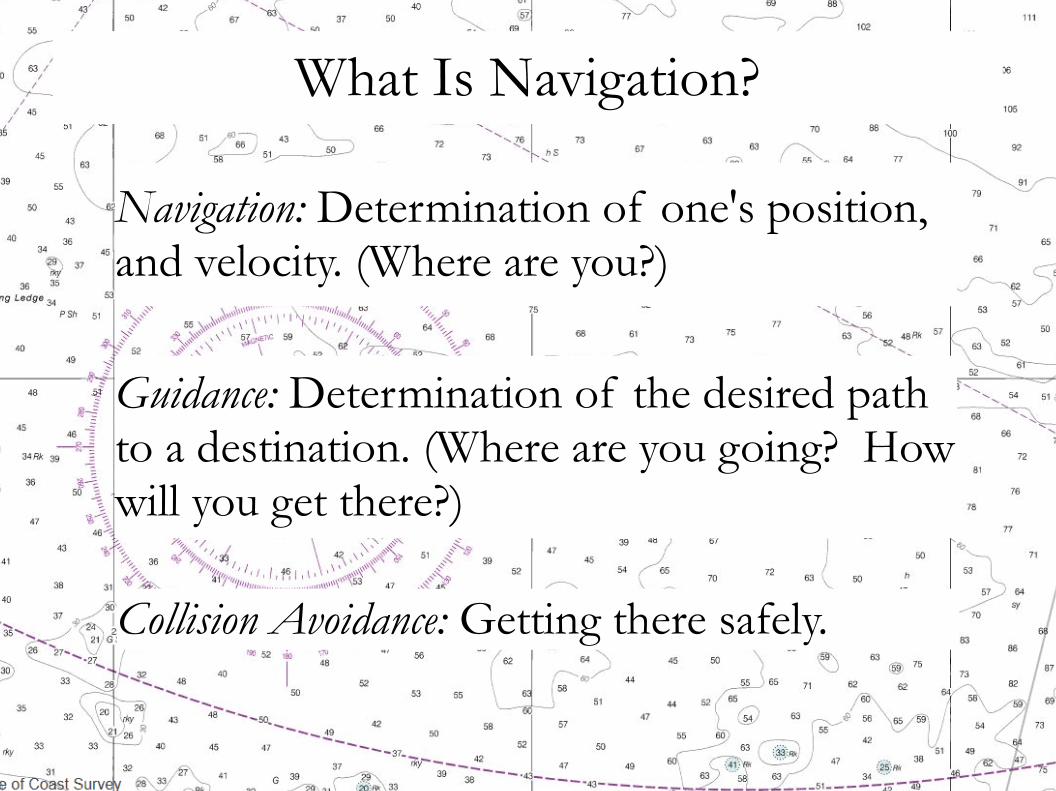
What Is Navigation?
Collision Avoidance: Getting there safely.
Guidance: Determination of the desired path to a destination. (Where are you going? How will you get there?)
Navigation: Determination of one's position, and velocity. (Where are you?)
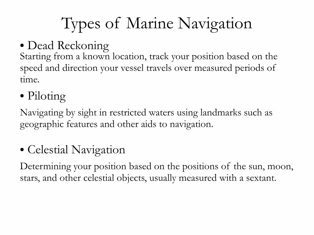
Types of Marine Navigation● Dead ReckoningStarting from a known location, track your position based on the speed and direction your vessel travels over measured periods of time.
● PilotingNavigating by sight in restricted waters using landmarks such as geographic features and other aids to navigation.
● Celestial NavigationDetermining your position based on the positions of the sun, moon, stars, and other celestial objects, usually measured with a sextant.

Types of Marine Navigation● Radio NavigationDetermining your position based on radio signals (e.g. RDF, LORAN).
● Radar NavigationUsing radar to determine direction and distance to nearby objects.
● Inertial Navigation
Use of accelerometers and gyroscopes to keep an electronic dead reckoning. Not used much on sailboats.
● Satellite NavigationUse of satellite based electronic systems; primarily GPS.
Marine Navigation
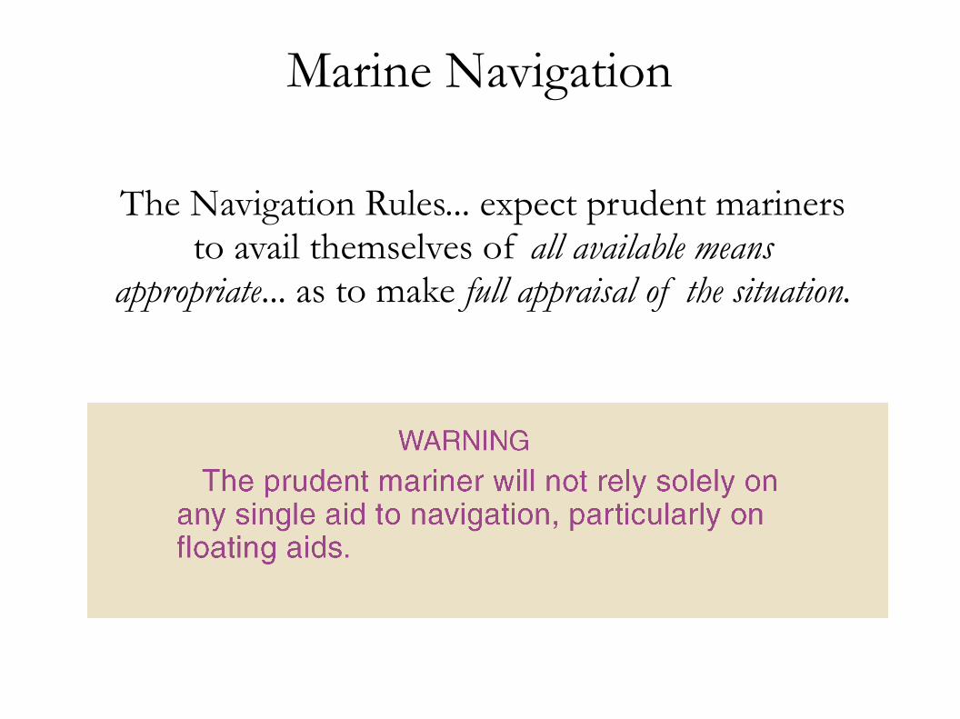
The Navigation Rules... expect prudent mariners to avail themselves of all available means
appropriate... as to make full appraisal of the situation.

Latitude and Longitude
Parallels of Latitude: Position North or South of EquatorMeridians of Longitude: Position East or West of Prime Meridian
(Greenwich)

Specifying Latitude and Longitude360 degrees (°) in a circle60 minutes (') in 1 degree60 seconds (") in 1 minute
42° 21' 30.4" N, 71° 5' 15.6" W42° 21.507' N, 71° 5.260' W42.35845° N, 71.08776° W42.35845, -71.08776
North & East: positiveSouth & West: negative
Coordinates of MIT Sailing Pavilion:
Latitude should be written first

Specifying Latitude and Longitude360 degrees (°) in a circle60 minutes (') in 1 degree60 seconds (") in 1 minute
42° 21' 30.4" N, 71° 5' 15.6" W42° 21.507' N, 71° 5.260' W42.35845° N, 71.08776° W42.35845, -71.08776
North & East: positiveSouth & West: negative
Coordinates of MIT Sailing Pavilion:
When specifying coordinates for use in navigation, use degrees and minutes. Be sure to include at least one decimal place for the minutes.

Nautical Mile
1 nautical mile = 1852 meters (exactly)1 nautical mile ≈ one minute of latitude1 nautical mile ≈ 1.15 statute miles1 nautical mile ≈ 6076.1 feet
1 knot = 1 nautical mile per hour1 knot = 1.852 kph (exactly)1 knot ≈ 1.15 mph

Latitude and Longitude Distances
Latitude:Parallels are evenly spaced.1 minute ≈ 1 nm.
Longitude:Meridians converge at poles.1 minute ≈ cos(lat) × 1 nm.
In Boston Harbor: 1 minute longitude ≈ .74 nm.

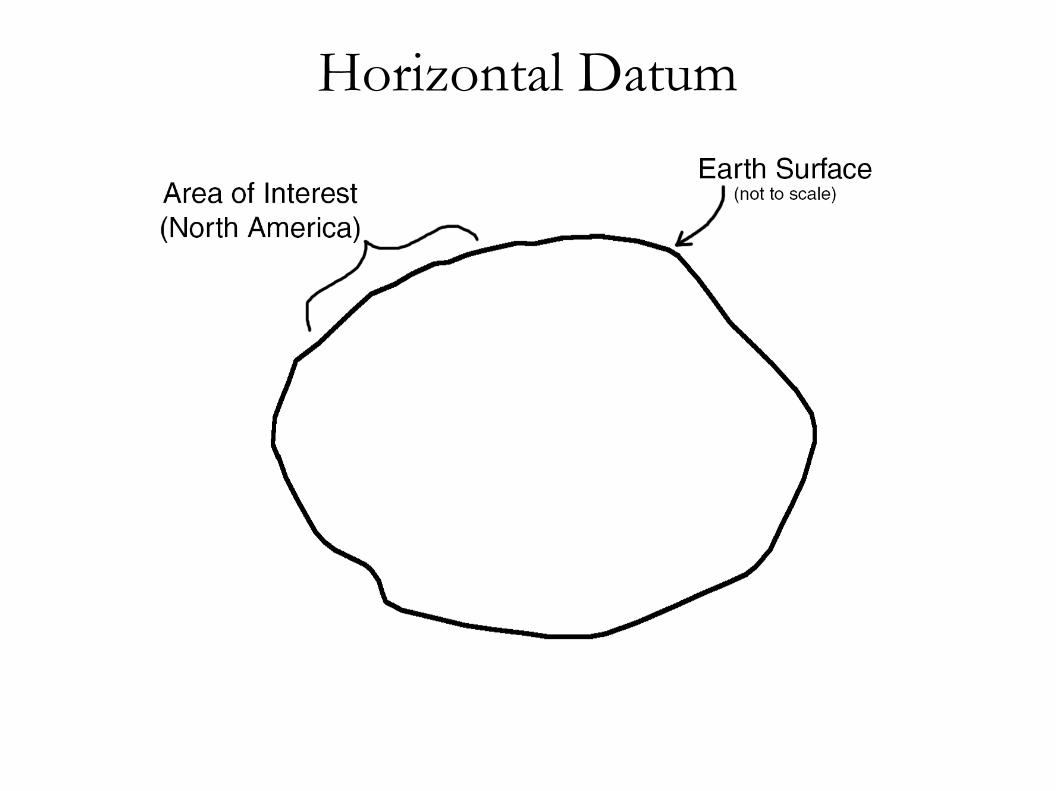
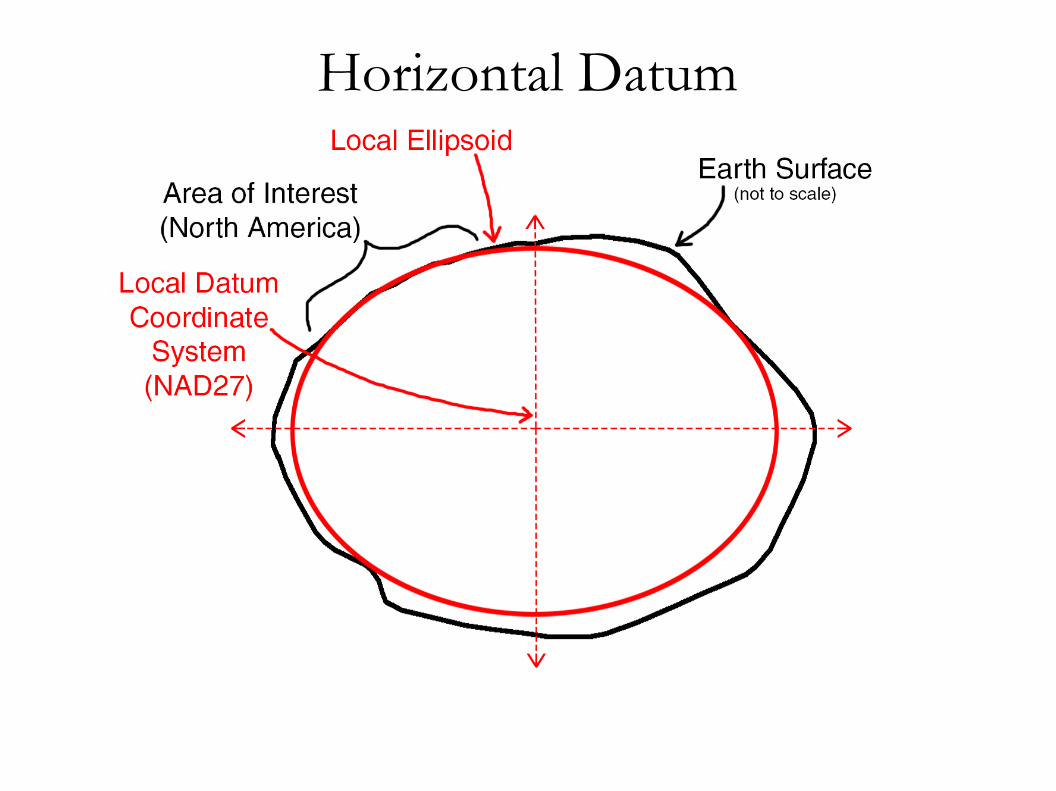
Horizontal DatumCoordinate system and set of reference points for assigning geographic coordinates (latitude and longitude) to physical locations on the Earth.
Location of Prime Meridian (where longitude = 0)

Horizontal DatumMake sure your GPS and other navigation instruments are using the same Horizontal Datum as your charts.
● World Geodetic System 1984 (WGS84) : global standard
● North American Datum 1983 (NAD83) : official datum used on all U.S. Charts – varies less than 2 m from WGS84.
● North American Datum 1927 (NAD27) : outdated – can vary up to 100 m from WGS84
● Hundreds of other local datums in use around the world.
Horizontal Datum
Horizontal Datum

Horizontal Datum

Horizontal Datum

Horizontal Datum

Nautical Charts● Map Projections (Mercator, etc.)
● Chart Features (legend, scale, etc.)
● Chart Symbols
● Aids to Navigation

Map Projections

Map Projections

Mercator Projection
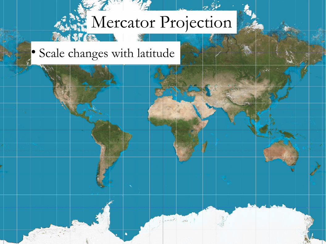
Mercator Projection
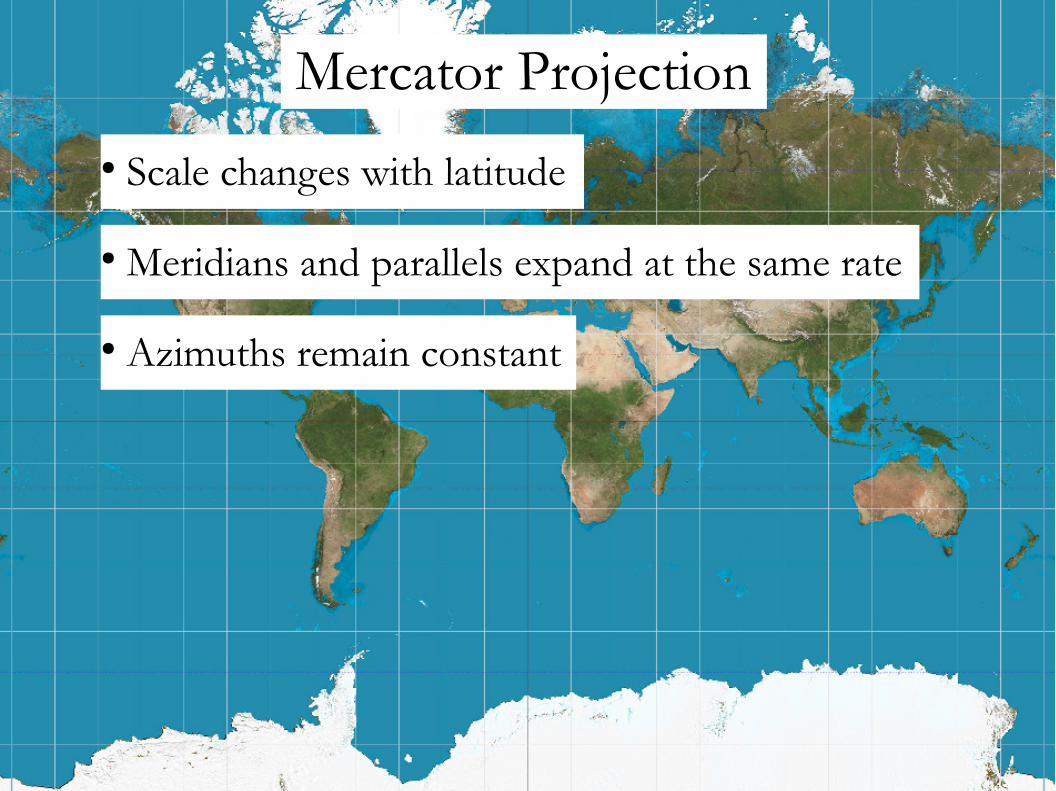
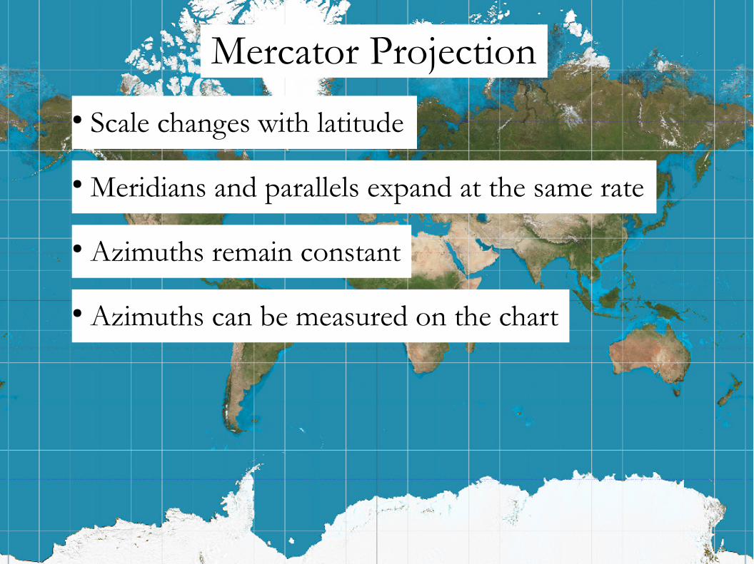
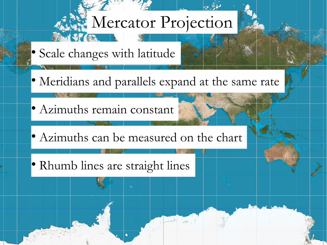
● Scale changes with latitude

Mercator Projection
● Scale changes with latitude

Mercator Projection
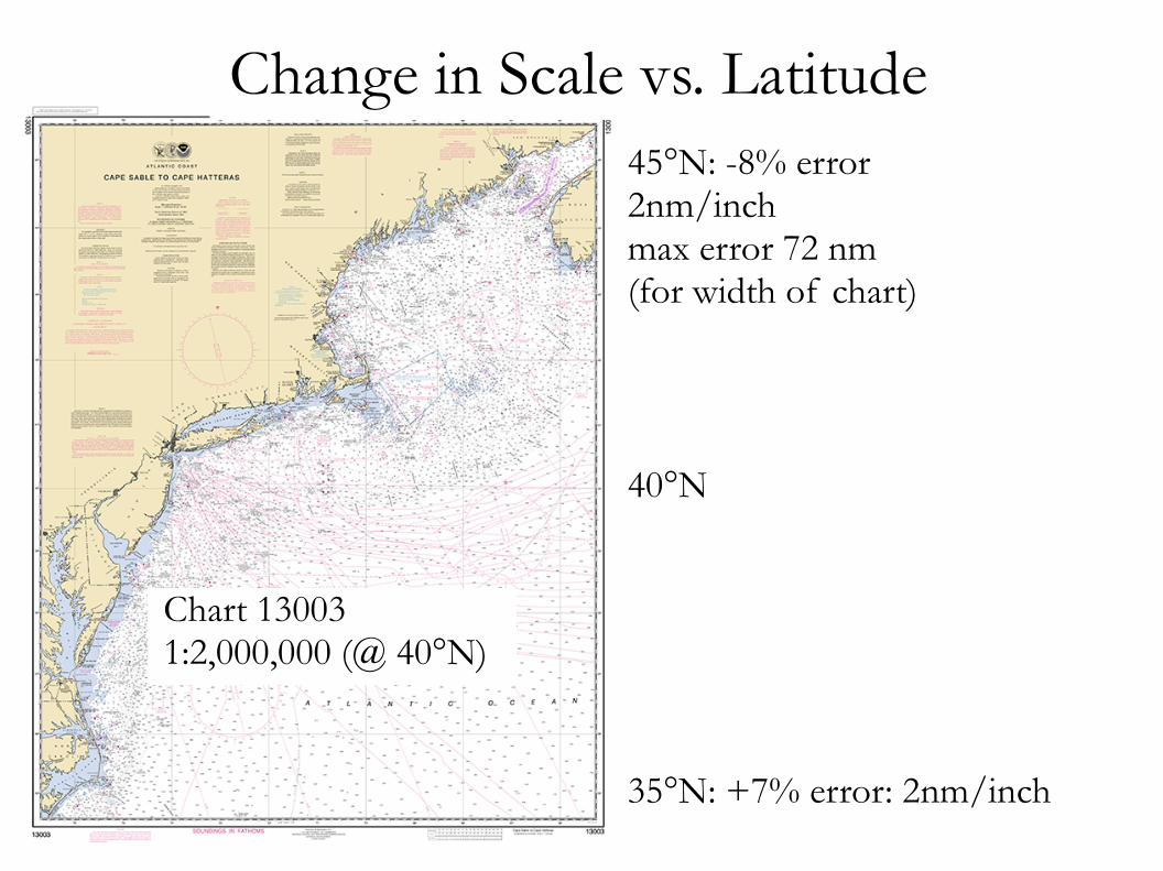
Chart 130031:2,000,000 (@ 40°N)
Change in Scale vs. Latitude45°N: -8% error2nm/inchmax error 72 nm(for width of chart)
40°N
35°N: +7% error: 2nm/inch
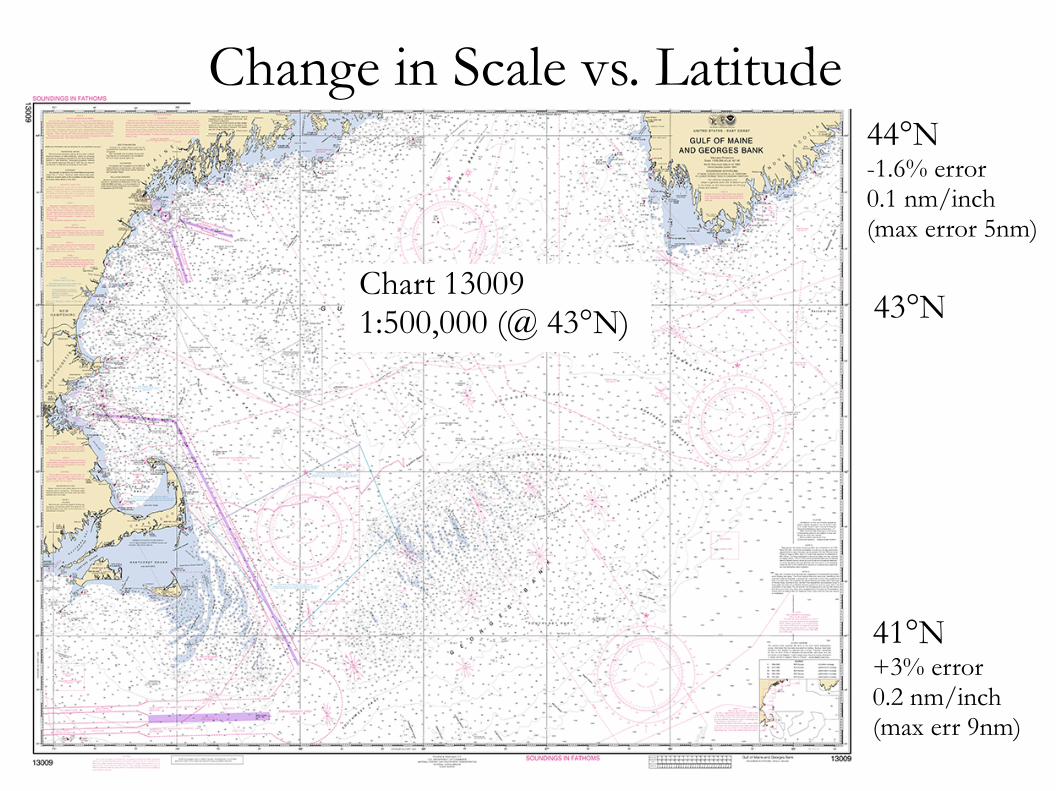
Chart 130091:500,000 (@ 43°N)
Change in Scale vs. Latitude44°N-1.6% error0.1 nm/inch(max error 5nm)
43°N
41°N+3% error0.2 nm/inch(max err 9nm)

Chart 132671:80,000 (@ 42°20'N)
Change in Scale vs. Latitude42°35'N-0.4% error27 feet/inch(max error 0.2nm)
42°20'N
42°05'N +0.4% error 27 feet/inch
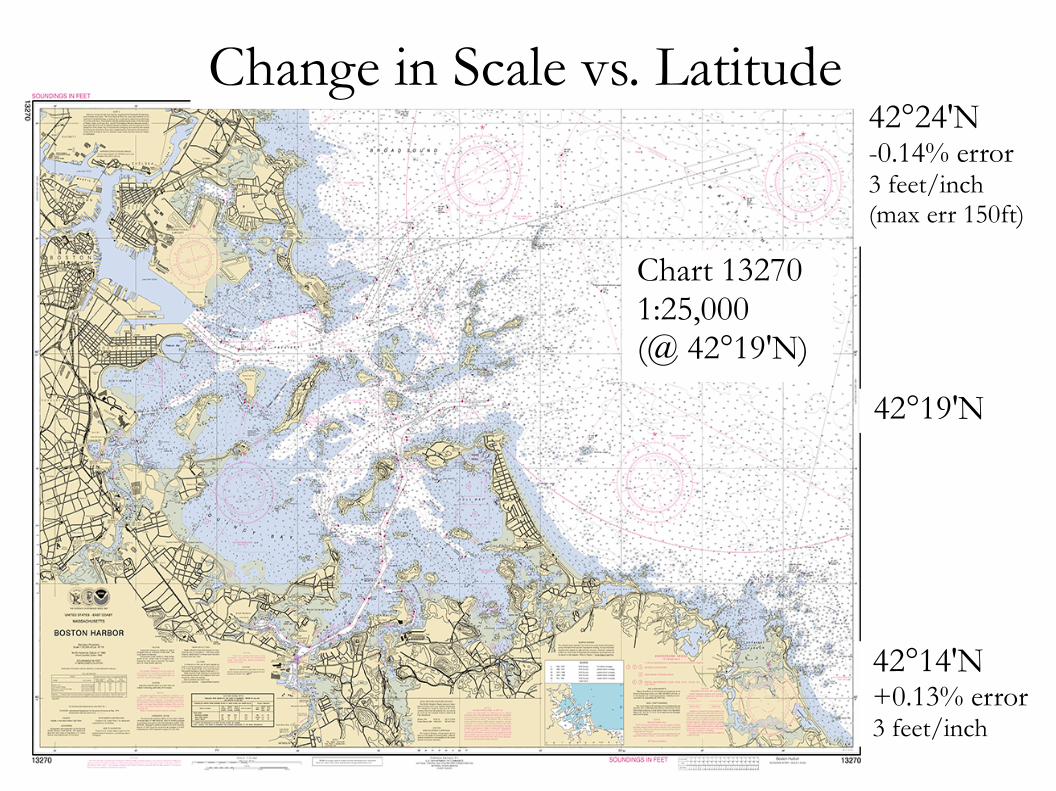
Chart 132701:25,000 (@ 42°19'N)
Change in Scale vs. Latitude42°24'N-0.14% error3 feet/inch(max err 150ft)
42°19'N
42°14'N +0.13% error 3 feet/inch

Mercator Projection
● Scale changes with latitude ● Meridians and parallels expand at the same rate
Mercator Projection
● Scale changes with latitude ● Meridians and parallels expand at the same rate ● Azimuths remain constant
Mercator Projection
● Scale changes with latitude ● Meridians and parallels expand at the same rate ● Azimuths remain constant ● Azimuths can be measured on the chart

Mercator Projection

Mercator Projection

Mercator Projection
Mercator Projection
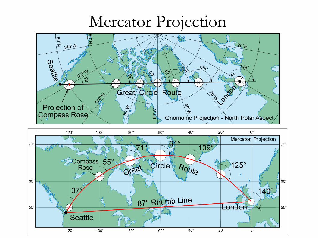
● Scale changes with latitude ● Meridians and parallels expand at the same rate ● Azimuths remain constant ● Azimuths can be measured on the chart ● Rhumb lines are straight lines
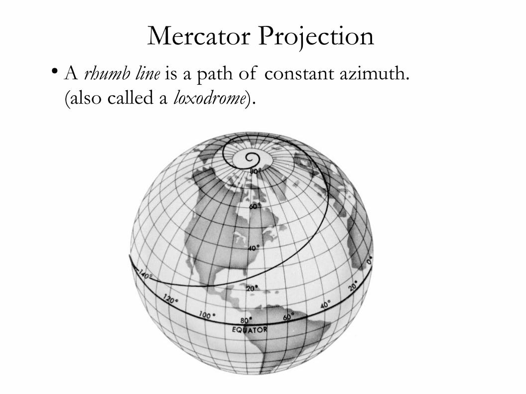
Mercator Projection ● A rhumb line is a path of constant azimuth. (also called a loxodrome).

Mercator Projection ● The shortest distance between two points on a sphere is along a great circle.

Mercator Projection
● Scale changes with latitude ● Meridians and parallels expand at the same rate ● Azimuths remain constant ● Azimuths can be measured on the chart ● Rhumb lines are straight lines ● Great circles are curved
Mercator Projection
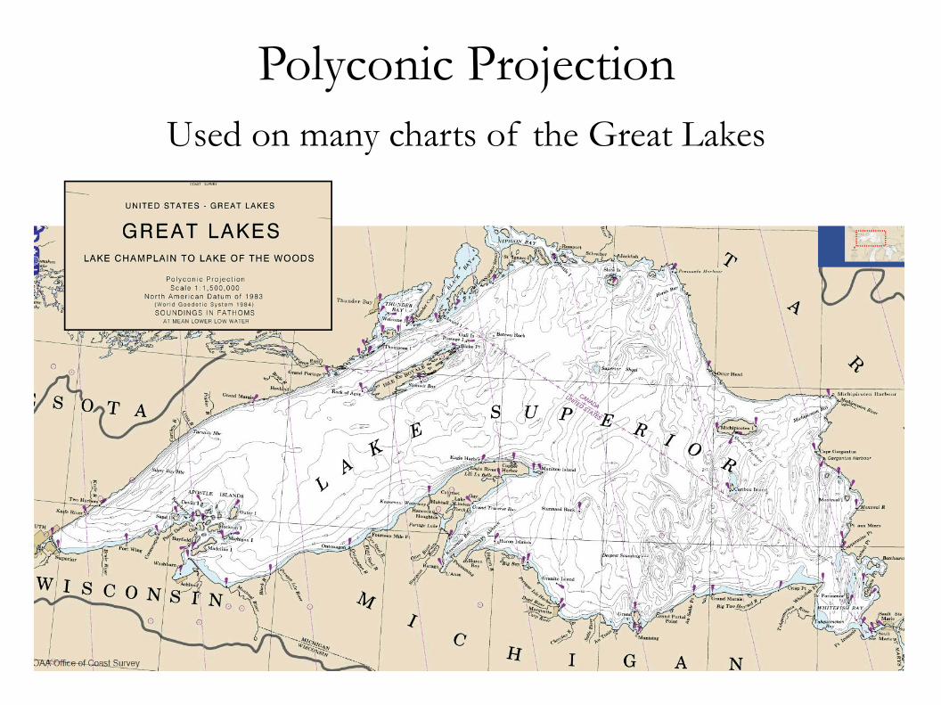
Polyconic Projection Used on many charts of the Great Lakes
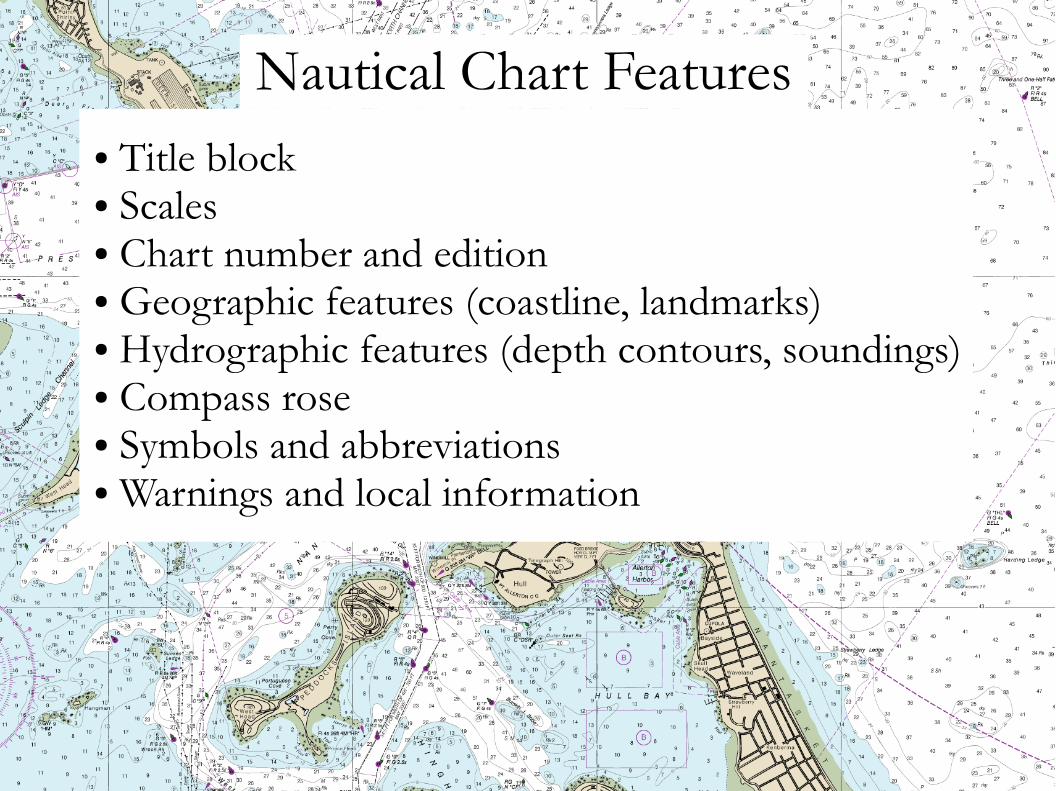
Nautical Chart Features ● Title block● Scales● Chart number and edition● Geographic features (coastline, landmarks)● Hydrographic features (depth contours, soundings)● Compass rose● Symbols and abbreviations● Warnings and local information

Chart Title Block
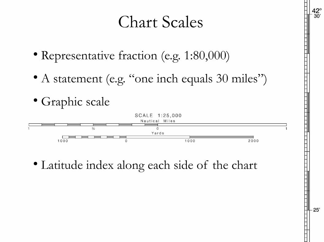
Chart Scales
● Representative fraction (e.g. 1:80,000)
● Graphic scale
● Latitude index along each side of the chart
● A statement (e.g. “one inch equals 30 miles”)

Chart Scales
● 73,913 inches per nautical mile 1:72,000 scale → 1 nm. ≈ 1 inch1:25,000 scale → 1 nm. ≈ 3 inches1:800,000 scale → 1 nm. ≈ 1/10 inch
● “Large Scale” vs. “Small Scale” Refers to the size of the printed images on the chart:
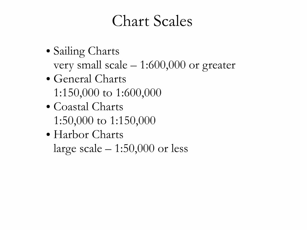
Chart Scales
● Sailing Charts very small scale – 1:600,000 or greater
● General Charts 1:150,000 to 1:600,000
● Coastal Charts 1:50,000 to 1:150,000
● Harbor Charts large scale – 1:50,000 or less

Chart Number and Edition
● Chart number: 5 digits● Above number is edition number and print date● Corrections to charts are published in Notices to Mariners (NM) and Local Notices to Mariners (LNM)● New corrections should be applied to chart
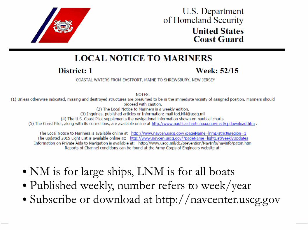
● NM is for large ships, LNM is for all boats● Published weekly, number refers to week/year● Subscribe or download at http://navcenter.uscg.gov

Chart Geographic Features ● Land: tan● Intertidal Zone: green
● Water: white● Shallow Water: blue
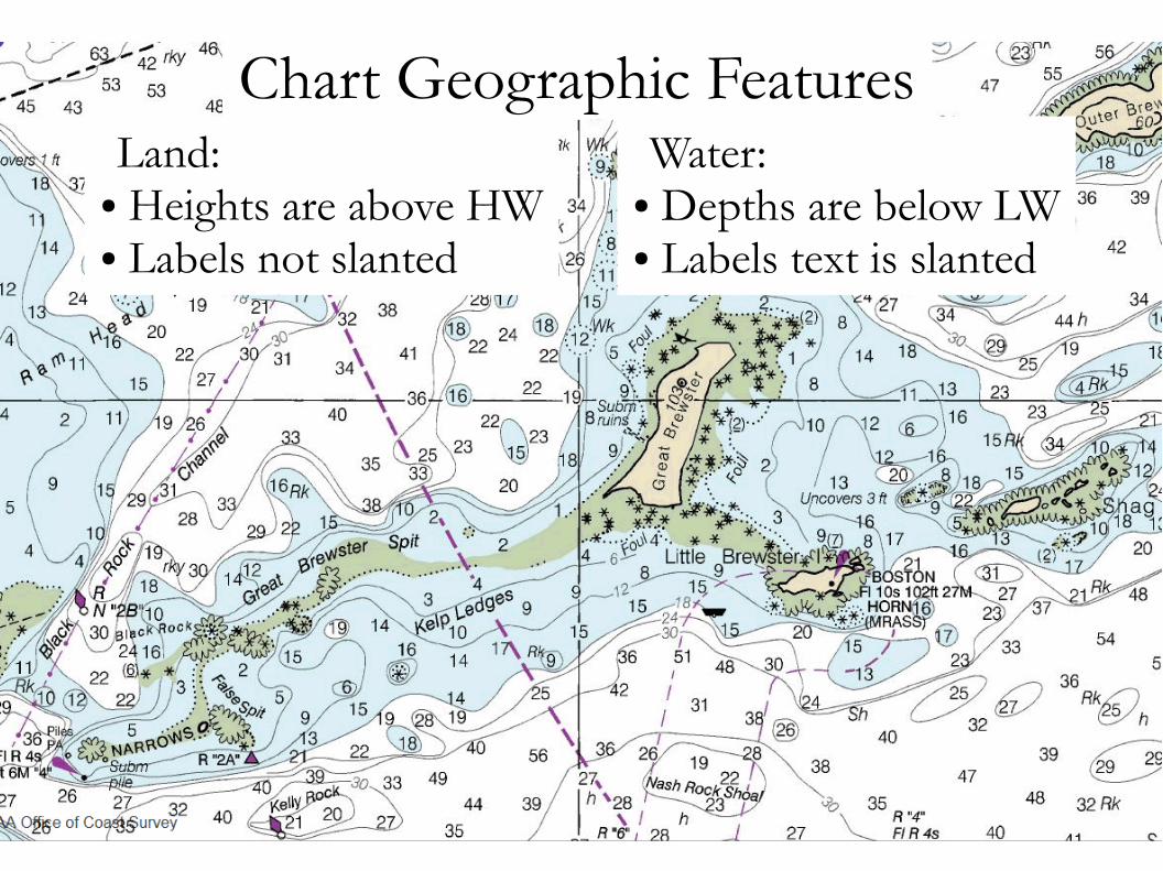
Land:● Heights are above HW● Labels not slanted
Water:● Depths are below LW● Labels text is slanted
Chart Geographic Features
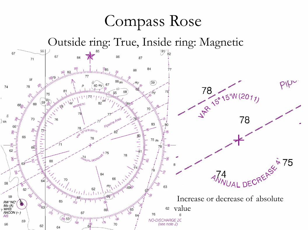
Compass Rose Outside ring: True, Inside ring: Magnetic
Increase or decrease of absolute value

Chart Symbols

Lower Middle Channel

Chart Symbols All chart symbols are listed in “Chart No. 1”
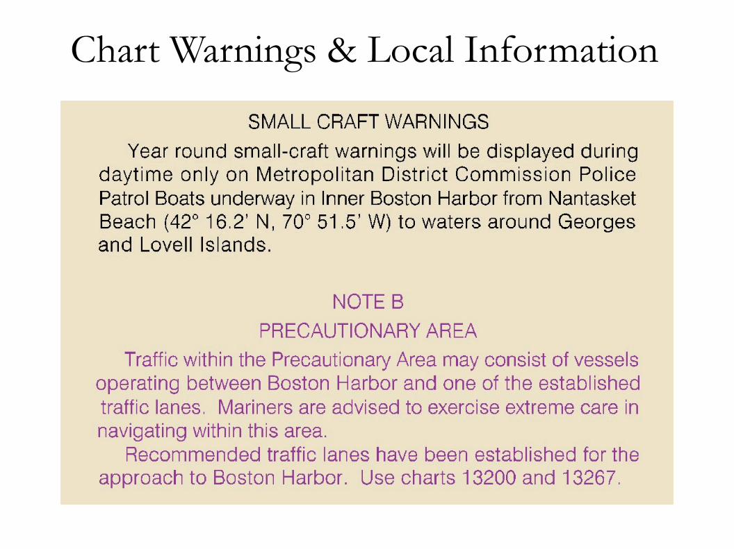
Chart Warnings & Local Information
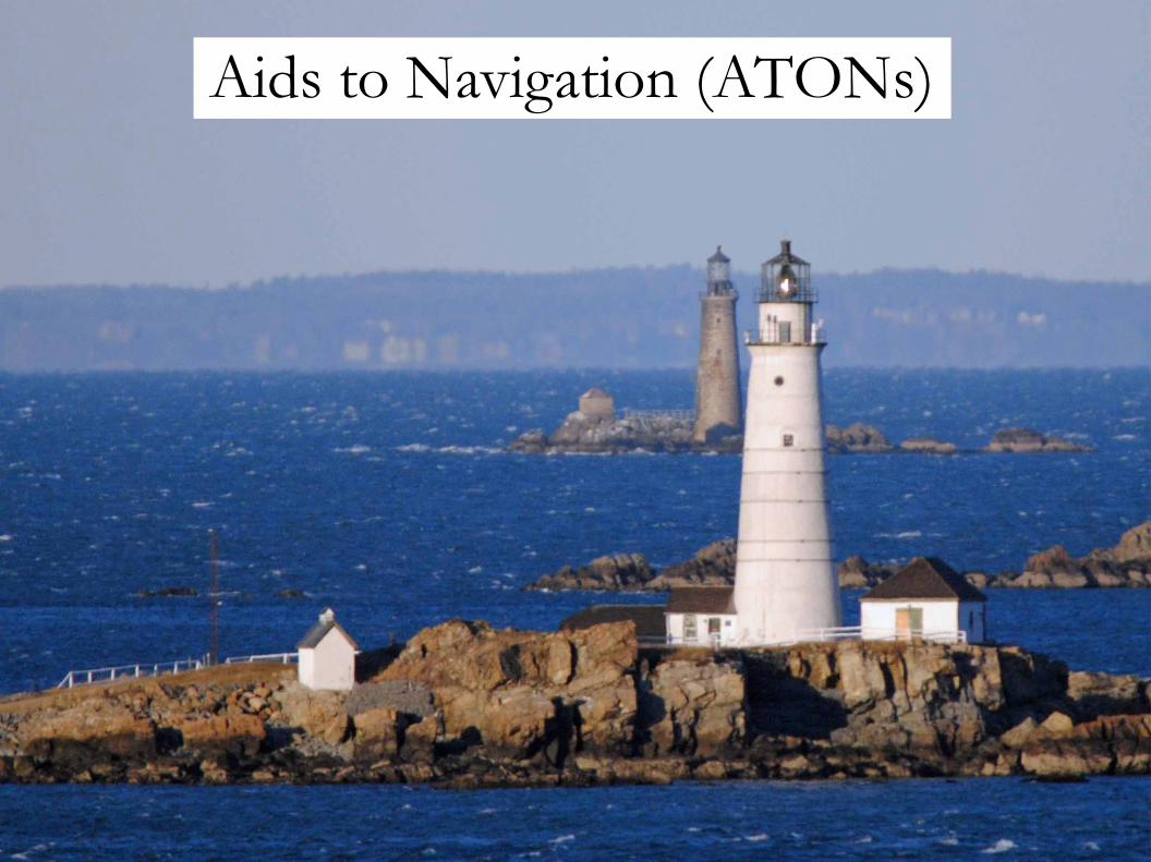
Aids to Navigation (ATONs)

ATONs
● Buoys – floating, anchored to bottom● Beacons – fixed to land, lit or unlit
● Lights – fixed to land and lit● Daybeacons – fixed to land and unlit

ATON Identification
Features of ATONs:● Floating (buoys) or fixed to land (beacons)● Color (red, green, yellow, etc.)● Shape (cylinder, cone, tower, ball, etc.)● Topmark (ball, cone)● Light color and pattern● Numbers or letters● Sound (bell, gong, whistle, fog horn)● Radar transponder (RACON)
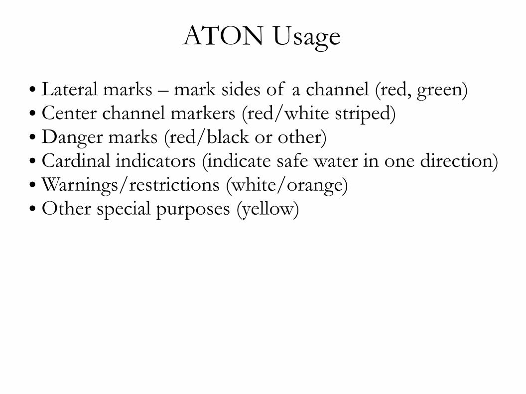
ATON Usage
● Lateral marks – mark sides of a channel (red, green)● Center channel markers (red/white striped)● Danger marks (red/black or other)● Cardinal indicators (indicate safe water in one direction)● Warnings/restrictions (white/orange)● Other special purposes (yellow)
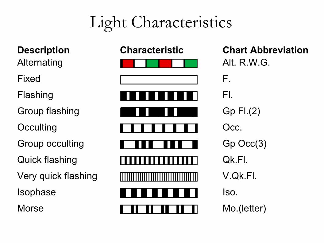
Light Characteristics
Very quick flashing
Description Characteristic Chart AbbreviationAlternating
Fixed
Flashing
Group flashing
Occulting
Group occulting
Quick flashing
Isophase
Morse
Alt. R.W.G.
F.
Fl.
Gp Fl.(2)
Occ.
Gp Occ(3)
Qk.Fl.
V.Qk.Fl.
Iso.
Mo.(letter)
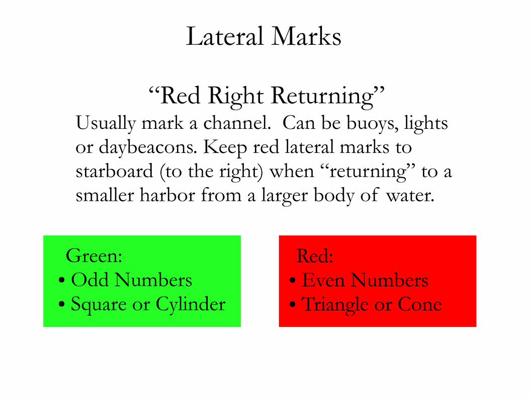
Lateral Marks
Green:● Odd Numbers● Square or Cylinder
“Red Right Returning”Usually mark a channel. Can be buoys, lights or daybeacons. Keep red lateral marks to starboard (to the right) when “returning” to a smaller harbor from a larger body of water.
Red:● Even Numbers● Triangle or Cone

Cans & Nuns
Cans:● Green● Odd number
● Are never lighted.● Never have sounds● When used as lateral marks:
Nuns:● Red● Even number
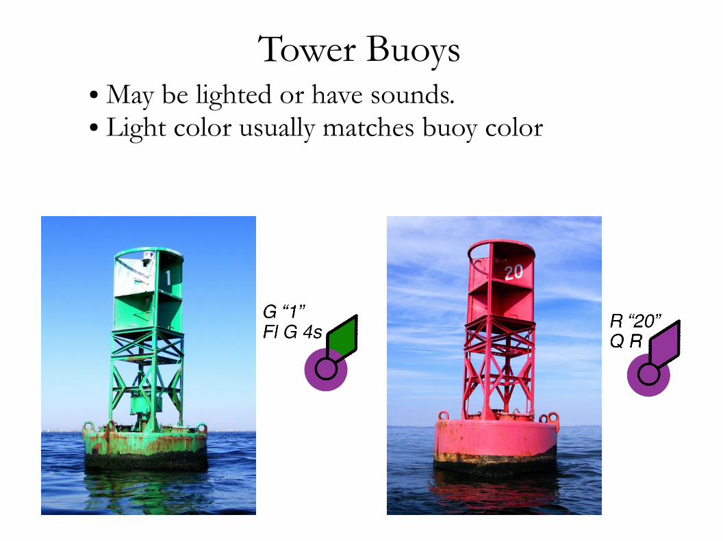
Tower Buoys ● May be lighted or have sounds.● Light color usually matches buoy color

Preferred Channel Buoys ● Red/Green/Red or Green/Red/Green● Placed at channel intersections● Top color indicates preferred channel● No numbers, may be lettered

Lateral System

Center Channel Buoys ● Red & white vertical stripes● Ball topmark● If lit, white morse-A light pattern (• –)● Sometimes have whistles● Sometimes have radar transponders

Danger Buoys ● Red & black● Two black ball topmarks● No numbers, may be lettered● If lit, white (2) group flashing pattern

Lights
Scituate North Jetty Light 2AFlashing Red 4s23 feet above high water4 miles nominal visibility

Lights
Minot LightGroup flashing (1+4+3) 45 sec.85 feet above high water10 miles nominal visibilityFog Horn (MRASS)

Daybeacons ● No lights and fixed to land.
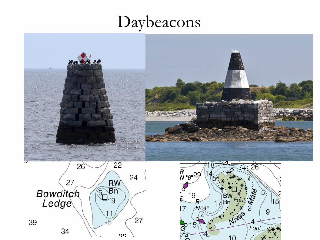
Daybeacons

Do Not Tie Up to Navigational Aids


Bridges
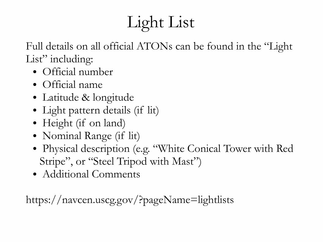
Light ListFull details on all official ATONs can be found in the “Light List” including:
● Official number● Official name● Latitude & longitude● Light pattern details (if lit)● Height (if on land)● Nominal Range (if lit)● Physical description (e.g. “White Conical Tower with Red
Stripe”, or “Steel Tripod with Mast”)● Additional Comments
https://navcen.uscg.gov/?pageName=lightlists
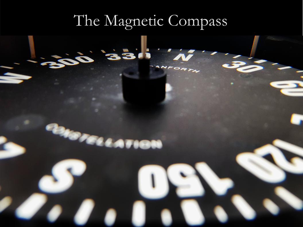
The Magnetic Compass
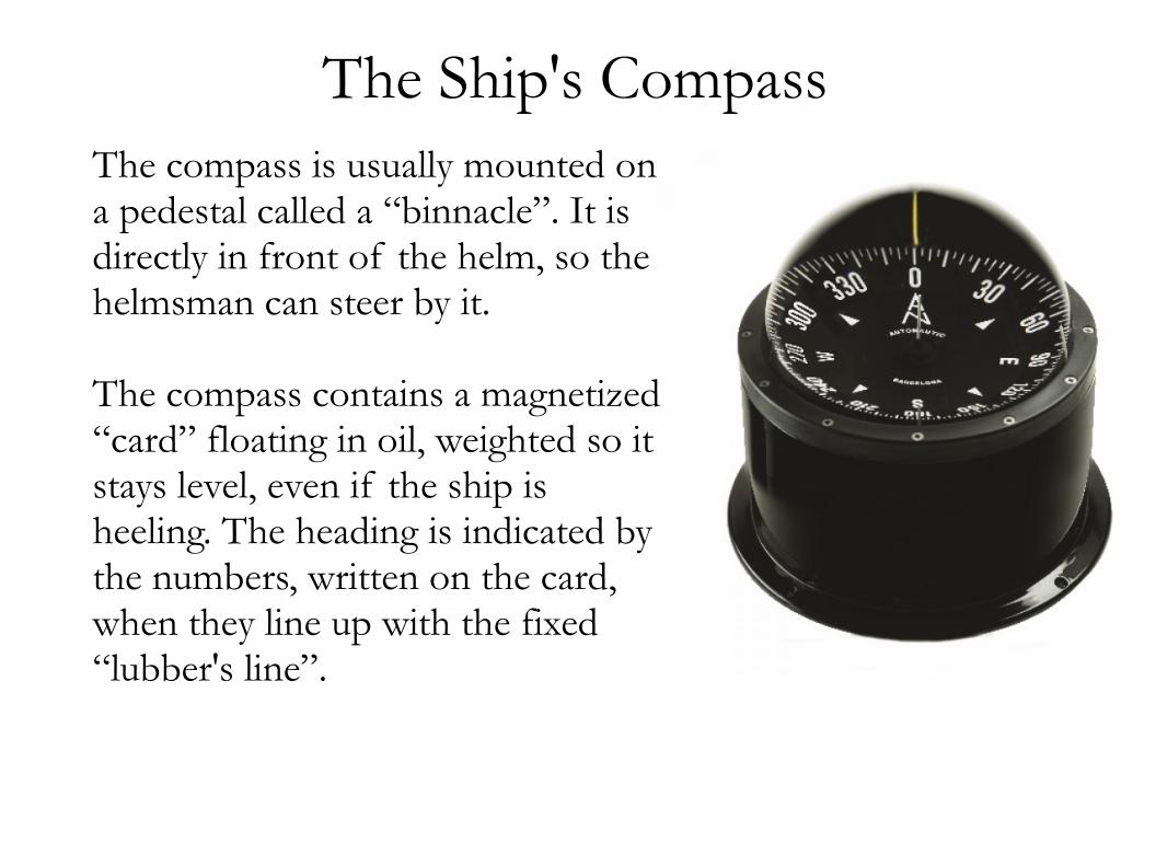
The Ship's Compass The compass is usually mounted on a pedestal called a “binnacle”. It is directly in front of the helm, so the helmsman can steer by it.
The compass contains a magnetized “card” floating in oil, weighted so it stays level, even if the ship is heeling. The heading is indicated by the numbers, written on the card, when they line up with the fixed “lubber's line”.
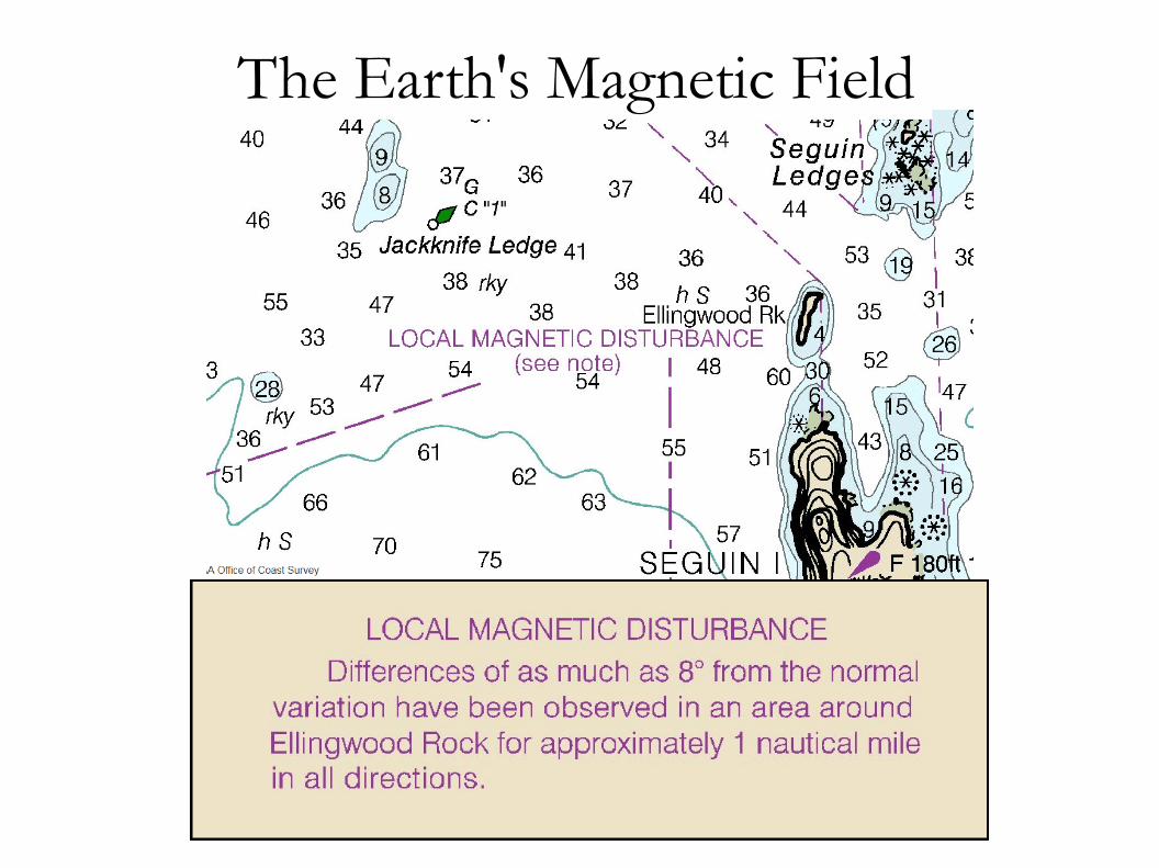
The Earth's Magnetic Field
The Earth's magnetic field is a three-dimensional vector field that changes in magnitude and direction over the surface of the Earth.
The magnetic field also varies slowly over time.
The magnetic poles (created by the Earth's magnetic field) do not line up with the geographic poles (defined by the rotation of the planet).
The Earth's Magnetic Field
The geomagnetic field can be described at any given location on the surface of the Earth by two components.
● The vertical component (called the “dip”)● The horizontal component (called the
“declination” by land-lubbers, and called the “variation” by sailors).
Because of the dip, a compass needs to be kept level to give accurate readings.

The Earth's Magnetic Field

Compass Rose Outside ring: True, Inside ring: Magnetic
The Earth's Magnetic Field
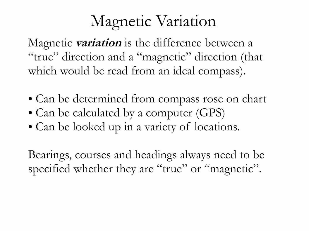
Magnetic Variation Magnetic variation is the difference between a “true” direction and a “magnetic” direction (that which would be read from an ideal compass).
● Can be determined from compass rose on chart● Can be calculated by a computer (GPS)● Can be looked up in a variety of locations.
Bearings, courses and headings always need to be specified whether they are “true” or “magnetic”.

Magnetic Deviation Magnetic deviation is the error in the compass reading caused by nearby magnetic field sources:
● Electric currents in nearby wires● Nearby steel or other ferrous metals● Nearby magnets (speakers, magnetized metal, etc).
Deviation is a function of the direction the compass is pointing. Each compass on each boat will have a slightly different deviation function.

Magnetic Deviation
To determine deviation of a ship's compass:
● Point the boat in a known heading (!)● Take a compass reading● Correct for magnetic variation● Write down the difference● Repeat for several different headings● Plot the results on a graph● Create a table of deviations for each heading

Magnetic Deviation

Compass Heading Correction
CanDeadMenVote
Twice?
(at Elections)
CompassDeviationMagneticVariationTrue
(add East)

Compass Heading Correction
CanDeadMenVote
Twice?
(at Elections)
CompassDeviationMagneticVariationTrue
(add East)
195°3°E
198°15°W183°

Compass Heading De-correction
TrueVirgins
MakeDull
Companions
(add Whiskey)
TrueVariationMagneticDeviationCompass
(add West)

Compass Heading De-correction
TrueVirgins
MakeDull
Companions
(add Whiskey)
TrueVariationMagneticDeviationCompass
(add West)
46°15°W
61°2°E59°
Online Resourceshttp://navcen.uscg.gov/http://tidesandcurrents.noaa.gov/ http://nauticalcharts.noaa.gov/Magnetic Variation: http://ngdc.noaa.gov/geomag/WMM/DoDWMM.shtml
http://mailman.mit.edu/mailman/listinfo/bluewater

Further ReadingChapman Piloting and Seamanship by Jonathan EatonAnnapolis Book of Seamanship by John RousmanierePiloting and Dead Reckoning by Capt. H.H. Shufeldt and G.D. DunlapAmerican Practical Navigator (BOWDITCH) https://msi.nga.mil/NGAPortal/MSI.portal
● https://en.wikipedia.org/wiki/Geodetic_datum● https://en.wikipedia.org/wiki/Tide● https://en.wikipedia.org/wiki/Dead_reckoning● https://en.wikipedia.org/wiki/Piloting_(navigation) ● https://en.wikipedia.org/wiki/Magnetic_declination● https://en.wikipedia.org/wiki/Rhumb_line