Coastal livelihood and physical infrastructure after cyclone Aila
20
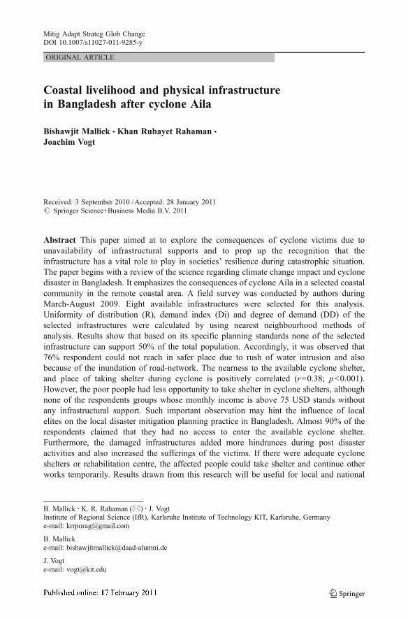
ORIGINAL ARTICLE Coastal livelihood and physical infrastructure in Bangladesh after cyclone Aila Bishawjit Mallick & Khan Rubayet Rahaman & Joachim Vogt Received: 3 September 2010 / Accepted: 28 January 2011 # Springer Science+Business Media B.V. 2011 Abstract This paper aimed at to explore the consequences of cyclone victims due to unavailability of infrastructural supports and to prop up the recognition that the infrastructure has a vital role to play in societies’ resilience during catastrophic situation. The paper begins with a review of the science regarding climate change impact and cyclone disaster in Bangladesh. It emphasizes the consequences of cyclone Aila in a selected coastal community in the remote coastal area. A field survey was conducted by authors during March-August 2009. Eight available infrastructures were selected for this analysis. Uniformity of distribution (R), demand index (Di) and degree of demand (DD) of the selected infrastructures were calculated by using nearest neighbourhood methods of analysis. Results show that based on its specific planning standards none of the selected infrastructure can support 50% of the total population. Accordingly, it was observed that 76% respondent could not reach in safer place due to rush of water intrusion and also because of the inundation of road-network. The nearness to the available cyclone shelter, and place of taking shelter during cyclone is positively correlated (r =0.38; p <0.001). However, the poor people had less opportunity to take shelter in cyclone shelters, although none of the respondents groups whose monthly income is above 75 USD stands without any infrastructural support. Such important observation may hint the influence of local elites on the local disaster mitigation planning practice in Bangladesh. Almost 90% of the respondents claimed that they had no access to enter the available cyclone shelter. Furthermore, the damaged infrastructures added more hindrances during post disaster activities and also increased the sufferings of the victims. If there were adequate cyclone shelters or rehabilitation centre, the affected people could take shelter and continue other works temporarily. Results drawn from this research will be useful for local and national Mitig Adapt Strateg Glob Change DOI 10.1007/s11027-011-9285-y B. Mallick : K. R. Rahaman (*) : J. Vogt Institute of Regional Science (IfR), Karlsruhe Institute of Technology KIT, Karlsruhe, Germany e-mail: [email protected] B. Mallick e-mail: [email protected] J. Vogt e-mail: [email protected]
Transcript of Coastal livelihood and physical infrastructure after cyclone Aila
ORIGINAL ARTICLE
Coastal livelihood and physical infrastructurein Bangladesh after cyclone Aila
Bishawjit Mallick & Khan Rubayet Rahaman &
Joachim Vogt
Received: 3 September 2010 /Accepted: 28 January 2011# Springer Science+Business Media B.V. 2011
Abstract This paper aimed at to explore the consequences of cyclone victims due tounavailability of infrastructural supports and to prop up the recognition that theinfrastructure has a vital role to play in societies’ resilience during catastrophic situation.The paper begins with a review of the science regarding climate change impact and cyclonedisaster in Bangladesh. It emphasizes the consequences of cyclone Aila in a selected coastalcommunity in the remote coastal area. A field survey was conducted by authors duringMarch-August 2009. Eight available infrastructures were selected for this analysis.Uniformity of distribution (R), demand index (Di) and degree of demand (DD) of theselected infrastructures were calculated by using nearest neighbourhood methods ofanalysis. Results show that based on its specific planning standards none of the selectedinfrastructure can support 50% of the total population. Accordingly, it was observed that76% respondent could not reach in safer place due to rush of water intrusion and alsobecause of the inundation of road-network. The nearness to the available cyclone shelter,and place of taking shelter during cyclone is positively correlated (r=0.38; p<0.001).However, the poor people had less opportunity to take shelter in cyclone shelters, althoughnone of the respondents groups whose monthly income is above 75 USD stands withoutany infrastructural support. Such important observation may hint the influence of localelites on the local disaster mitigation planning practice in Bangladesh. Almost 90% of therespondents claimed that they had no access to enter the available cyclone shelter.Furthermore, the damaged infrastructures added more hindrances during post disasteractivities and also increased the sufferings of the victims. If there were adequate cycloneshelters or rehabilitation centre, the affected people could take shelter and continue otherworks temporarily. Results drawn from this research will be useful for local and national
Mitig Adapt Strateg Glob ChangeDOI 10.1007/s11027-011-9285-y
B. Mallick :K. R. Rahaman (*) : J. VogtInstitute of Regional Science (IfR), Karlsruhe Institute of Technology KIT, Karlsruhe, Germanye-mail: [email protected]
B. Mallicke-mail: [email protected]
J. Vogte-mail: [email protected]

level planners, as well as international donors for future disaster mitigation planning in thestudied area and the methodology can be applied in similar countries and geographicalterritories.
Keywords Coastal . Livelihood . Infrastructure . Cyclone . Bangladesh
1 Introduction
1.1 Background
This paper aims to answer the question how the coastal societies of developingcountries react on the menace and risk of climate change; and how they perceive it,particularly during cyclone, and how they improve their infrastructural facilities or builtenvironment i.e. houses, road network, health facilities etc. Most of the industrializedcountries of the North have several established state sponsored programs to respond onthe vulnerability issues of their coastal areas - for example, the Netherlands orGermany’s coasts are secured through extensive embankment construction, and othermeasures; which are primarily cannot be seen in most developing countries. Neithertechnical knowledge and relevant government responsibilities nor appropriate materialresources are available in the developing countries; some appear as an unmatcheddream forever for those poor countries of the South in comparison with the hightechnical and societal standards of the North. Despite of huge financial expenses inprevention, prediction and protection of the natural disasters, the highly technologicallydeveloped country like the United States also responds to hurricanes with frighteninghelplessness in their coastal regions (SDR 2003). In this line, what should be done indeveloping countries, where almost all the settings are missing, unplanned andunimplemented? This study worked exactly with this problem in Bangladesh, one ofthe most vulnerable and poorest countries in the world. About 10% of the territory ofBangladesh is only 1 m above the mean sea level (Mohal et al. 2006). Ali and Ahmad(1992) estimated that a sea level rise of 1.0 and 1.5 m would inundate 10% and nearly16% of the country, respectively. To protect such inundation, reconstruction of coastalinfrastructure is urgent. In the sixties, 123 polders and supporting infrastructure wereconstructed to protect low-lying coastal area against tidal flood and salinity intrusion inBangladesh. Past experience has identified “overtopping” of an embankment of a polderto be the most important factor for the polder’s damage during cyclones. Furthermore, inthe case of storm surges roads are important for rescue and rehabilitation. Dasgupta et al.(2010) had estimated that around 4000 km road of coastal area will be exposed toinundation depth of less than 1 m.
Furthermore, infrastructure refers to the systems needed for the functioning of a community(Scawthorn 2009) and the community cannot survive long given the wholesale failure of anyof these systems (road networks, water supply, drainage, embankments, telecommunicationsetc.). These systems are also in relation with disaster management termed as “lifelines” andplay the role as the “vain” for circulation of disaster mitigation programs. The inadequacy ofthis infrastructural supports introduce the “vulnerability due to infrastructure” and raises thequestion, how effectively one can manage the post-disaster activities.
The discussion outlined here serve to underline and support the recognition that theinfrastructure have a vital role to play in society’s resilience to disastrous situation.Particularly, this paper aims at explore the consequences of cyclone victims due to
Mitig Adapt Strateg Glob Change

unavailability of infrastructural supports in a selected coastal community of Bangladesh andto recommend future adaptive infrastructural supports.
Combining the most recent empirical data, we estimate the community risk on the basisof available infrastructural facilities i.e. cyclone shelter, health care facilities and roadnetwork. We focus on the equality of the distribution of such facilities in the study area, byusing the nearest neighbourhood analysis (Clark and Evans 1954). The result will be usefulfor local and national level decision makers, as well as international donors for futuredisaster mitigation planning in the studied area and the methodology can be applied forsimilar continent and geographical territories.
The remainder of the paper is organized as, recent scientific evidence on cyclone disasterrisk in Bangladesh; it’s causes with relevance to infrastructural vulnerability assessment forregional planning and motivations of the paper. Afterwards, it describes the researchstrategy and data sources that state the methodology and analysis of information. In the end,we present detail results for further discussion including concluding remarks for countingthis inevitable issue as a major stake of disaster management plan and for sustainabledevelopment in coastal countries.
1.2 Motivation
Bangladesh now supports about 146 million of people within a land area of 144000 km²with a density of population over 1000 per km². It is situated on deltas of large riversflowing from Himalayas: the Ganges unites with Jamuna and later joins the Meghna toeventually empty in the Bay of Bengal. The country is sloping gently from the north tosouth, meeting the Bay of Bengal in the southern end. Three main rivers and their numeroustributaries carry water from the catchments of Himalayas and flood a third of the country innormal years. When they rise at the same time and the draining to the sea is impeded byhigh tide in the sea, the country suffers floods with inundation of over 50% of the land area.Furthermore, a cyclone hazard is also very much familiar to the coastal community of thecountry. Dasgupta et al. (2010) had found out some reasons of large impact of storm surgeson the Bangladesh coast: (a) phenomenon of re-curvature of tropical cyclones in the Bay ofBengal, (b) shallow continental shape, (c) high tidal range, (d) tri-angular shape at the headof Bay of Bengal, and (e) high density of population and coastal protection system. Gray(1985) estimated that 10% of the world’s tropical cyclones form in Bay. If the Bay’s share is10% of the world cyclones, the percentage of the world total hitting Bangladesh is 1.4%(Ali 1996). Singh et al. (2001) had considered 122 years (1877 to 1998) of tropical cyclonedata to answer the question whether the intense cyclones have become more frequent overthe north Indian Ocean. Their results show that there is indeed a trend in the enhancedcyclogenesis during November and May. About five to six cyclones form in Bay of Bengaland Arabian Sea every year (Khan et al. 2000; Singh et al. 2001; Emanuel et al. 2008).
There has been great concern that the frequency and intensity of tropical cyclones mayincrease in the future as a result of climate change (Emanuel 2005). Since the sea surface iswarming due to climate change and the development of tropical storms depends on anocean temperature greater than 27°C. The increase in sea temperatures increases the forceof cyclone; rising sea levels threaten large areas of the coastal areas (Danard and Murty1987; Mohanti 1990; Kausher et al. 1993; Ali 1996; Islam 2001; Brooks and Adger 2005;Birkmann 2006; IPCC 2007; Emanuel et al. 2008; Dasgupta et al. 2009). The modernclimate scientists argue about the increasing trend of cyclone disasters in the coastal areasaround the world (Ali 1996; Khan et al. 2000; Dasgupta et al. 2009). Between 1877 and2009 Bangladesh was hit by 159 cyclones (including 48 severe cyclonic storms, 43
Mitig Adapt Strateg Glob Change

cyclonic storms, 68 tropical depressions). On average, a severe cyclone strikes Bangladeshevery 3 years (GoB 2009). More recently tropical cyclone Sidr (November 2007), cycloneAila (May 2009) in Bangladesh and cyclone Nargis (May 2008) in the Irrawaddy delta ofMyanmar provided examples of devastating storm-surge impacts in coastal areas. Theseaffect population, livelihoods, socio-economic systems, environments, and health. Nicholls(2003) pointed out that during the past 200 years, 2.6 million people drowned during tidalsurges events. It is estimated that 49% of the world’s total deaths due to cyclones occurredin Bangladesh (Ali 1996). Under such circumstances, even incrementally small elevationsin sea level would do severely negative effects on coastal territory. A 10% futureintensification of sea level rise increases the potential inundation zone from today’s19.5%to 25.7% (Dasgupta et al. 2009) and the coastal areas will be the potentially-deadly localesas the present coastal embankment condition is mostly outdated (Dasgupta et al. 2009,Dasgupta et al. 2010). The coastal zone of Bangladesh is one of the top 10 potentially-deadly locales (Dasgupta et al. 2009), where live 29% (40 million) of the total population ofthe country. A 1 m increase in sea level will make an additional 15 million people landlesswho will become environmental refugees (Hossain 2008). The inundation will not onlycause the loss of agricultural land, but also of existing homestead, roads and othercommunication infrastructure.
Sea level rise will affect food and agricultural production by increasing the intensity ofsaline intrusion in the dry season and the depth of flooding in the west season from tidalfluctuations. It will also cause rise in the salinity concentration in the water and soil in theSundarbans. Increased salinity will change the habitat pattern of the forest and may increasedisease pressure for many species. It will affect livelihoods of several million coastal peopledependent on forests. It will also weaken protection of coastal people from cyclones as themangrove swamps serves as natural barriers against strong winds and tidal surges.
Additionally, disasters have the ability to severely disrupt economic growth and hinder aperson’s ability to emerge from poverty. The protective characteristics of the builtenvironment i.e. infrastructural supports offer an important means by which humanity canreduce the risk posed by hazards, thereby preventing a disaster (ICZMP 2008; Dasgupta etal. 2009; Scawthorn 2009;). Conversely, post-disaster, the loss of critical buildings andinfrastructure can greatly increase a community’s vulnerability to hazards in the future.Accordingly, the individual and local nature of the built environment, shaped by context,restricts our ability to apply generic mitigation and reconstruction solutions (Scawthorn2009; Dasgupta et al. 2010).
Infrastructural development in the coastal community i.e. embankment along thecoastline, good road infrastructure inside the community can prevent the movement ofstorm surges inland and reduce the damages and losses (MPCS 1992; Mallick et al. 2005;Dasgupta et al. 2010). The ideal solutions for protecting human lives is to build the housesabove the surge level and make them strong enough to resist the lateral forces due to highwind and the accompanying surges. The next option is evacuation to high ground above thesurge level. It is observed that the building of cyclone shelters though inadequate in numberand an improved system of cyclone warnings have helped to reduce death tolls from severecyclones. The number of deaths during the 2007 cyclone Sidr was substantially lessbecause of such shelters and an effective early warning system. The death toll was 133882and 2380, during 1991 cyclone and 2007 cyclone Sidr respectively. The government andcivil society have also demonstrated grater effectiveness in managing disaster risks. TheBangladesh Meteorological Department (BMD) reported that combined death toll in thosestorms stands around one million people (BDMIC 2007). Therefore, it is important to takeinitiatives for the betterment of coastal livelihood through proper planning.
Mitig Adapt Strateg Glob Change

As Bangladesh is already extremely densely settled, relocation of coastal people ininland region is not possible. Indeed many landless households from inlands now migrate tothe coast and settle in new accreted char lands (Khas-lands) which are heavily exposed todevastation during cyclones. So, local level management is of utmost priority to mitigatethe adverse impact of climate change. Planning and construction of relevant infrastructurewill be the foremost important task of those initiatives. Exploring the existing situation isthe prime tasks to start up any planning process. Therefore, this paper is a methodologicalinitiative to assess the existing infrastructural supports in a coastal union of Bangladesh Weconsiders here a cyclone as climatic events and the pre-and post cyclone livelihood scenarioof the victims as a totality factor of vulnerability to define community risk. In particular, theanalysis used the information related with problem and effects of devastation during thecyclone Aila in May 2009.
1.3 Study area
Our study focused in Gabura Union1 of Shyamnagor Upazila2 of Satkhira district.3 Theunion is an island, surrounded by two big rivers (Map 1). On the southern part standsSundarbans. It is one of the last settlement areas in southern coast. People are mostlydependent on resources of Sundarbans. Fishing is the widely practiced occupation in thiscommunity. The population of the study area comprises with different age groups andalmost 28% population is staying in the age group 0 to 10. The literacy rate is 31.40%. Atotal of 37666 numbers of people live in an area of 41 sq. km. and all of them were affectedby cyclone Aila and in aftermath of cyclone by water-logging. Death toll was counted as24, crops and fisheries damages counted as US$ 1328571 and in total 35.25 km roads weredamaged (DMB-GoB 2010, CRF 2010).
2 Methodology
2.1 Research strategy and data source
In general, roadbed in the rural coastal Bangladesh includes embankments, pavement,culverts, bridges, and different temporal arrangement of drainage facilities in specific uses,like shrimp production, irrigation channels, etc. Conventional bridges, culverts, non-pavedroads and the so-called “temporal drainage facilities” are vulnerable to flood and tidalsurges, particularly those over waterways and subjected to a velocity component. Thoughthe water velocity may be not high, but the embankment can be broken due to erosion ofsoils and unanticipated intrusion-cannels for shrimp-farming. It was particularly seen in thestudy area, namely the Gabura union of Satkhira districts. In this paper, we consider theexisting infrastructural facilities especially cyclone shelter, health care facilities, religiousinstitutional supports and road infrastructures available in the study area.
Our analysis includes exposure indicators for affected people i.e. income opportunities,availability of infrastructural supports and housing conditions. Immediate after cyclone Ailaduring June-September 2009, a field survey was conducted in the study area. A total of 178face-to-face interviews were conducted with the help of data collectors. Group discussion
1 Union is the third lowest tier of official administrative unit of local government in Bangladesh2 The upazilas are the second lowest tier of administrative unit of local government in Bangladesh.3 The Districts are the first tier of administrative unit of local government in Bangladesh
Mitig Adapt Strateg Glob Change

sessions were conducted with the victims and several in-depth interviews were undertaken.Literatures and other relevant documents have been reviewed carefully and it has beenfound that this is a kind of pioneer exercise for Bangladesh in this area. We have employedgeographic information system (GIS) software to overlay the critical impact elements(housing condition, family size and income level) within the catchments zone of selectedinfrastructure, like cyclone shelter and health-care facilities. We have used the best availablespatial data sets obtained from Local Government Engineering Department (LGED) ofBangladesh including field data, collected by GPS (Global Positioning System). Table 1shows data sources for assessments and analysis (Table 2).
2.2 Methods of analysis
Considering a multi-step procedures like map collections, household survey, data analysis,database management etc., we follow Clarks and Evans (1954) in assuming the equality ofdistribution of the available infrastructure by using “nearest neighbourhood scale (R)” andBhat (2003) in assuming the weightage for each facility. More details of these steps are asfollows:
(i) For “uniformity of distribution”, we used the geographic data collected from LocalGovernment and Engineering Department (LGED). Due to unavailability of spatialdata based on cyclone shelter of the study area, we considered the location of primaryschool as the cyclone shelter. Because, during normal period the cyclone shelter isused as primary school in all over the coastal belt and it is the prime concept forregular maintenance of those facilities. Furthermore, we consider the location ofprimary health care facility in the locality, religious places, high school, Madrasa(Islamic educational institutes), and the safe drinking water facilities and the conditionof road network. It is noteworthy here that all the institutions which is also termed hereas an infrastructural objects and infrastructure means only the public infrastructure, notthe private ones. We use the following indicator for the analysis of “uniformity ofdistribution” of respective infrastructure:
The catchments areas for a typical primary school would have a total population ofaround 2,000 persons. Here 500 m distance for primary school/cyclone shelter fromthe respondent’s households is considered because of the standard of primary schooldesign. It is explained in the design manual that people who reside within 500 mdistance from a primary school can be able to take shelter safely during anyemergencies, if there is good road communication like, paved or unpaved, using tri-cycles or walking on foot etc. For primary health care facilities, we consider 1 kmradial distance, though presently the local government and health ministry of
Table 1 Summary of data sources
Data type Unit Sources
Socio-economic data per union Upazila Statistics Office, Shyamnagor, Satkhira
Damages and losses dueto cyclone Aila
Per union Upazila Statistics Office, Shyamnagor, Satkhira
Upazila map Per union LGED
Field survey Household (HH) level Field Survey conducted by Researcher duringMarch – August 2009, a total of 178 households
Mitig Adapt Strateg Glob Change

Bangladesh had implemented only one primary health care facility for each union. Forother institution and infrastructure (i.e. high school, market place, mosque, paved roadetc.) we fixed up the distance as per the result of group discussion (mostly focusedgroup discussion during the field survey) with local citizen. Likely, they claimed thatthey should have paved road within 100 m distance from their house so that they couldmove quickly in emergency situation, Similarly they thought that they should have onemarket place within 1 km from their living areas so that they could buy the necessarygoods and could prepare themselves well in advance to mitigate the disaster impacts. Itis important here to mention that at present the average distance between thehouseholds and major roads (paved road) is about 2 km.
In the calculation of “uniformity of distribution”, we used the following formula.
Ri ¼ SHi
SH
where, Ri = Uniformity of Distribution Value of the I-th infrastructure, SH = TotalNumber of Sample, SHi = No. of sampled HH are possessing the chance of ithinfrastructure.
The Ri varies between ‘0 to 1’ (0≥Ri≤1). So, if the value of Ri = 1, then the ithinfrastructure is equally distributed and support 100% of the total population; similarlyif Ri=0, then there is no support of the ith infrastructure.
(ii) In addition the services and facilities such as cyclone shelter, hospital/primary healthcare center, etc. were also included in the analysis. For analyzing the “centrality offunctions (infrastructure/Institutions)”, firstly a ‘demand index’ of each respectiveinfrastructure is developed by using the following formula:
Di ¼ Ei»SH
Shi
Where Di = Total Demand of the ith infrastructure according to the existing supportservices in the study area without considering the population growth; Ei = TotalNumber ith infrastructure presently exist in the study area.
By using the Di and Ei value, a ‘degree of demand (DD)’ of the ith infrastructure(DDi) is calculated as:
DDi ¼ Di� Ei
Di
Table 2 Infrastructure and its parameters
Infrastructure Parameters (# of HH residewithin radius of)
Primary school/ cyclone shelter 500 m
High school 1000 m
Primary health care centre 1000 m
Market 1000 m
Madrasa 500 m
Religious building (Mosque, temple) 1000 m
Safe drinking water source (tube well, Pond-Sand-filter, rain-water-harvesting) 500 m
Paved road 100 m
Mitig Adapt Strateg Glob Change

The DDi varies between ‘0 to 1’ (0≥Ri≤1). So, if the value of DDi=0, then the ithinfrastructure supports 100% of the total population; similarly if DDi=1, then there isno support of the ith infrastructure. It also explains that the Ri value is the contraproductive with DDi value.
This analysis helped us to find out the future spatial planning provision. Vogt et al.(2009) had described in the study on “Social supremacy and location of Cyclone shelter”that the location of any support service in rural Bangladesh depends on the rural powerstructure and their influential motivational choice. In this regard the present analysis maycontribute an example for further planning provisions of cyclone shelter, primary healthcare facilities, road network as well as necessary infrastructural development.
(iii) After finding out the DDi and Ri, this paper tries to find out the result’s correlationwith social and economical conditions of the affected people. This section tries toanswer how the lack of infrastructural supports, here termed as ‘vulnerability due toinfrastructure’, affect the societal cyclone mitigation process. The available incomeopportunity after cyclone, changes in occupation, losses due to infrastructure, genderand age are considered to analyze this situation (Fig. 1).
(iv) In ArcGIS, Buffer geo-processing has been carried out for all the serviceinfrastructures (Primary school, mosque, road etc) with their respective catchmentsarea. Then the maximum infrastructural services (defined by catchments area buffer)available for each household location is identified. For this, new integer field“NoOfService” was inserted in the attribute table of the household location featureclass. A raster surface was then generated by IDW interpolation of the values of“NoOfService” field. The raster surface is thus represents the infrastructural servicecoverage for the whole study area (Fig. 2). It depicts that 20% of the total settlementareas has no infrastructural supports.
3 Results
3.1 Existing infrastructure – demand and distribution
This measurement of the spatial pattern of intra-institute variations in the inter-householddistances as well as the analysis by the nearest institute as a measure of the pattern revealsthe tendency towards uniformity in distribution (R) of the selected supportive institutes. TheR value varies here from 0.49 to 0.16 in the study area (Table 3). These variations can beexplained by differences in public infrastructural supports taken by the government. Thehighest R-value is equal to 0.49 refers to 49% of the community people have the chance topossess the benefit of the respective infrastructure and there is a provision of furtherdevelopment for the rest 51% community people, i.e. the DDi value for the sameinfrastructure is 0.51 (Table 3).
Here we found that none of the selected infrastructure can support 50% of the totalpopulation (show it in a map too) i.e. the significance of vulnerability due to infrastructure(VoI) is very high here. Firstly, primary school or so called cyclone shelter, and religiousbuilding premises are more equally distributed as well as support services than any otherselected public infrastructure in the area. The absence of good road infrastructure isremarkably found here, it supports only 5% of the whole community. None of those weremeeting the demand of the community and raised the importance of further provisions. Thesame observation was also drawn by using the catchments area analysis of the existingpublic infrastructure in ArcGIS (Fig. 2).
Mitig Adapt Strateg Glob Change

Fig. 1 Gabura Union
Mitig Adapt Strateg Glob Change

Fig. 2 Infrastructural support and distribution of respondents
Mitig Adapt Strateg Glob Change

The method of analyzing of degree of demand index (DDi) is applied here to express theimportance of further provision of the respective infrastructure and how much they areneglected from the central functions of such public infrastructure (Table 3). The followingsection shows, initially some basic information regarding the perception and response of theaffected people in the study area and then, how this unavailability of infrastructuralsupports affects their livelihood during cyclone Aila in the study area.
3.2 Infrastructural supports and approach to cope with cyclone Aila
How does this inadequate infrastructural supports affect during an emergency or disastersituation on a coastal city? It may be answered by calculating the damages and losses.However, we have tried to answer this question in terms of the interrelation between theinfrastructural supports and societal information, so that further planning problems can beunderstood well in advance. It was observed from the field data that 76% respondent couldnot reach in a safer place due to rush of water intrusion and also because of the roads wereinundated immediately. The effect of saline water intrusion inside polders caused thedestruction of houses, roads, culverts etc. It added more obstacles for the post disasteractivities and also increased the sufferings of the victims. If there were adequate cycloneshelters or rehabilitation center, the affected people could take shelter and continue otherworks temporarily. Though the people understood the existing weather signal, they werenot timely alert about Cyclone Aila by the metrological department. After receiving theweather information usually they tried to make them safe. Table 3 shows what was theirresponse to Aila either they were informed or not.
According to the Table 4, majority of people of the study area received the news ofcyclone Aila and their immediate responses were only a simple discussion of familymembers and decided to stay at home. After receiving news only 16% household tookinitiative to save their family, they were decided to bring their family members to thecyclone shelter and neighbour’s house. None of them had taken initiative to save theirlivestock, 50% had tried to save their houses, 21% had reserved food and 23% preserveddrinking water. They preserve water in plastic bottle and in cans, which was not enoughmore than 2 days.
Though people received news of Aila in time but they do not pay attention, which wasthe primary cause of extreme losses. They did not pay any attention as they had very little
Table 3 Uniformity of Distribution (R) and Degree of Demand (DD) of selected public infrastructure
Infrastructure SHi Ei Ri DDi % of HH possessingthe supports
Primary school/Cyclone shelter 219 6 0.45 0.55 45
High school 132 1 0.27 0.73 27
Primary health care center 78 1 0.16 0.84 16
Religious Institute (i.e. Madarasa) 176 3 0.36 0.64 36
Religious building (i.e. Mosque, Temple) 236 27 0.49 0.51 49
Safe drinking water source (i.e. Pond-Sand-Filter) 168 12 0.35 0.65 35
Rural market 194 5 0.36 0.64 36
Accessibility of paved road 25 a 0.05 0.95 5
a Only 2% of the total road was constructed with brick-soling (information is collected from the UpazilaLGED Office, Shyamnagor 2009)
Mitig Adapt Strateg Glob Change

faith about the early warning messages delivered from radio Bangladesh. Another factor isthe distance of safe shelters. Here the public infrastructures i.e. cyclone shelters, hospitals,school premises, religious buildings etc. were considered as safer place during the cycloneevents. The average distance reported from field data is presented in the Table 4. Thecyclone shelters were situated on an average distant of 1.53 km, whereas the health centresare reported as 1.06 km distance. Minimum distance counted as 100 m for everyinfrastructure except the primary health care support. Such spatial distribution of publicinfrastructural facilities explains the low level of infrastructural supports in the study area.
Table 5 also gives an outlook about the perception of the local people regarding thespatial distances. If we consider here, the both the minimum spatial and temporal distanceof cyclone shelter, it is observed that for 100 m to walk they need in minimum 2 min i.e. forone kilometre distance they require 20 min. Now if we consider the minimum distance ofhospitals that depicts 200 m distances to walk require 5 min i.e. one kilometre distancerequire 25 min. Further comparable statistics like high school, police station, union parishadheadquarters, water sources etc. depicts the same complexity of perceived distance andactual distances. This individual perception level has also an influence on taking theemergency decision during any hazards. This knowledge helps them to design the
Table 4 Receiving warnings of Aila and immediate response of the respondents
Immediate response News received (% of respondent)
Yes (87) N0 (13)
Discuss with family members and decide to stay in your home 57.1 2.3
Discuss with neighbours 2.8 0
Take decision by self 15.4 2.4
Do not pay any attention about the news 11.7 8.3
Table 5 Distance to public infrastructure from the respondent’s house
Type of publicinfrastructure/institute
Distance in kilometers Walking distance in minutes
Minimum Maximum Mean Std.deviation
Minimum Maximum Mean Std.deviation
Cyclone Shelter/Primary school
0.1 3 1.53 2.15 2 45 22.82 13.04
Drinking watersources
0.1 3 0.62 0.88 2 100 14.38 20.38
Market places 0,1 2 0.32 0.31 4 45 13.22 12.58
High schools 0.2 4 5.63 3.68 10 60 31.14 18.13
Mosque/temple/church
0.3 5 2.29 1.76 10 180 63.99 61.98
Union Parishad headquarter
1 7 3.98 5.39 20 150 67.50 46.09
Health center/privateclinics
1 5 1.06 2.21 15 210 104.77 60.83
Police station 1 15 6.96 5.04 18 210 125.94 74.41
Hospitals 0.2 10 2.09 2.67 5 300 64.78 73.59
Mitig Adapt Strateg Glob Change

prevention and precaution steps against hazards. Here, the nearness to the cyclone shelterand place of taking shelter during cyclone is positively correlated (r=0.38; p <0.001).Accordingly people having quality houses depicts a positive correlation (r=0.18; p<0.001)i.e. though they are very near to cyclone shelter are also motivated taking place in cycloneshelter. Here house quality is defined in regards of their roof and wall constructionmaterials. For this analysis, we defined ‘quality house’ whose roof and wall constructionmaterials CI sheet and mud, respectively. Amongst the respondents it was observed thatmostly 70% of them used CI sheet for roof materials and 50% used ‘mud’ as wall materials.None of them had used bricks as wall materials.
The status of residential house construction materials explicitly denotes the economiccharacteristics and socio-cultural status of the community. Here we observed that people whohave amonthly incomemore than 125USD possess at least a quality house (r=0.555; p=0.001).In this stage we look for the relationship between the income level and proximity to cycloneshelter. Here we consider the monthly income and investment to the residential houseconstruction. Usually peoples in rural Bangladesh invest money for a good quality houseaccordingly their financial capability. Mallick & Vogt (2010) used “social supremacy index” toanalysis the local politics of planning of local level disaster mitigation infrastructure likecyclone shelter. In this study, we used their concept to analysis the proximity of social supremeto such disaster mitigating public infrastructure (Fig. 3).
Figure 3 depicts that none of the respondents groups whose monthly income is above 75USD stands without any infrastructural support. Such simple observation may hints to theinfluence of local elites on the local disaster mitigation planning practice in Bangladesh.89% of the respondent claimed that they had no access to enter the available cycloneshelter. Firstly, they (67%) were living in an average of 1 km distance; secondly they (78%)are the poor segment of the society and have different political views (56%). They raisedthe issue that how such local infrastructural development was carried on. During groupdiscussion with the affected people, it was found that the cyclone shelter, even the drinkingwater support like PSF (pond sand filter) was also built nearby the rich or dominant peopleof the society. It was occurred mainly in two reasons: economic solvency and politicalpower exercise. It ensured the influential role of local power structure in local levelplanning (Vogt et al. 2009). Thus, not only the inadequacy of infrastructure was the causeof increasing livelihood problems, but also the local social power system executed morecomplications for the general people.
3.3 Situation due to lack of infrastructural supports – after cyclone Aila
Even though Aila was a weak category cyclone by the definition, its economic costoutweighs the impacts of Super cyclone ‘Sidr’ of 2007 and brought in long-term sufferingsfor the south-western people of Bangladesh. About 2.3 million people were affected by Ailaand many of them stranded in flooded villages as they had no alternative to savethemselves. The following section outlays some important impacts of cyclone Aila in thestudied coastal community.
3.3.1 Livelihood
Fishing, especially Shrimp farming is one of the major occupations in South-westerncoastal region of Bangladesh. Our study area follows similar occupational pattern andshrimp farming alone constitutes 50% of the total occupation. Rest of the employed peopleare engaged with small holding agriculture (20%) and wage labour activities (30%).
Mitig Adapt Strateg Glob Change

Fig. 3 Respondent distribution according to their monthly income
Mitig Adapt Strateg Glob Change

Cylcone Aila devastated almost 90% bases of the livelihood of the respondents. Mostunfortunate thing is that till now most of the affected people could not be able to recover thedamages. Our study depicts that almost 75% of the respondents are struggling to maintain asubsistence living. Some of those are now engaged with wage labour activities offered bydifferent GO’s and NGO’s to repair roads and embankments. However, these activities willbe run for 40 days and after that their earning source is uncertain. Such contingency makesthem frustrated and results into suicide of some of the affected people.
Furthermore, our findings indicates that 80% workers lost their jobs, 40% bound tochange their occupation, and at least one person of the family members was hunting forrelief aid and rehabilitation supports either from the government or from developmentorganizations. Shifting of jobs from farmers or fishermen to day labour is mostly identicalhere i.e. 78% of the total, who are bound to change their occupation due to water loggingsituation aftermath cyclone Aila. Another problem arises from people’s employmentseeking behaviour. The study indicates that middle class family neither can seek relief norcan engaged themselves with day labour activities due to their social status andpsychological barrier and it is contributing to increase their vulnerabilities, but most oftenit remains unnoticed.
Peoples are now struggling to manage minimum life sustaining requirements likeadequate food, shelter, water and sanitation facilities. Women and children are experiencingmost inhuman situation and they become more vulnerable as the male earning member ofthe family either faced death or migrated for managing family needs and livelihoods.Majority of the affected people (68% of the respondents) are staying on the embankmentsin makeshift tents as their living places are still under water. Some of their agricultural landis still under water or have become barren from saline water intrusion. A number of schoolsor other educational institutions still remain closed and dropout rate is alarmingly on therise. Thus, people in the affected areas have been passing an inhuman situation withouthaving minimum life sustaining arrangements.
3.3.2 Water and sanitation
Usually ponds are largely used by households as a major source of drinking water.Respondent reported that they used pond water for their 90% daily activities. 55%household used to drink pond-sand-filter (PSF) water whereas the rest 44% drink pondwater directly. Women and girls, who are generally responsible for household watercollection, now have to travel long distance to fetch pure drinking water. Discussion withthe community people depicted that now women and girls in the affected area have to spendadditional 2.5 h every day to collect drinking water from nearby localities.
Almost 12 months passed after cyclone Aila, saline water intrusion could not be stoppedas the wrecked embankments were not reconstructed yet. PSF was under the water andcaused drinking water scarcity. For this reason water-borne diseases were broken out i.e.dysentery, cholera, diarrheal diseases, skin diseases and fever. However, access to medicalfacilities for the people of the area is very limited. More than two-third of the respondentdid not have the ability to consult with doctors or to buy medicines due to their economicconditions. Though there were several medical camps were organized by relieforganizations, which was running with very limited resources – only few oral saline andwater purification tablets.
Since most of the area is still water logged, women and girls have to use boat orsometimes walk in the polluted salt water to collect drinking water. Many of the schoolgoing girls are now engaged with household water collection instead of going to school.
Mitig Adapt Strateg Glob Change

The dropout rate, therefore, has increased sharply in the study area after cyclone Aila. Eventhough, some NGOs are distributing drinking water in the affected areas, however theseattempts are pretty insufficient compared to demands. Moreover, disrupted communicationsystem results into irregular supply.
Sound sanitation system is an essential element for safe and healthy life of the localpeople in the studied area. 44.84% respondents had sanitary latrines before cyclone Aila,whereas 47.47% had non-sanitary latrines and others had no specific arrangement. Aftercyclone Aila, the situation reported that 78.2% of the respondents had no specificarrangement of sanitary latrines; most of them used the temporary hanging latrine providedby relief organizations. Most of the victims started to settle down on the embankment andhad no permanent sanitation facilities.
3.3.3 Housing and relocation of settlement
Due to the Cyclone Aila and for aftermath water logging situation, infrastructural problemshave been grasped the shelters including safe sanitation system, and raised vulnerability forpeople’s livelihood. It was mainly occurred due to insufficient institutional as well asinfrastructural supports for them. It changes their routine work, their income opportunities,and caused their social as well as geographical displacement. Even after 1 year of Ailadissipation, only 20% families have been able to repair or reconstruct their houses. Majorityof the Aila affected people in the study areas were forced to relocate their houses inembankments or raised land due to abolition of their houses by tidal surge and subsequentwater logging. However, the relocated houses are mostly temporary and made of plasticsheets, bamboo or even wood collected from Sundarbans which is demonstrating theirfinancial and structural inability to reconstruct durable brick built or wooden houses. Thesehouses are at risk of further structural damage even with a cyclone-1 category wind speed.
3.3.4 Agriculture and livestock
The most affected segment of the livelihood is agriculture and as almost all the productiveagriculture land went under saline water and consequently those farmers became workless.It was happened only due to the wrecked embankment. Now the question is how and whythe embankment was wrecked. The tidal surge height of about 10–13 m dropped on theregion washed away the huge number of households, lives, livestock, crops and all otherresources of the affected region. Pressure of high tide reduced the capacity of embankmentand broken it. Unlimited excavation of tunnel through out the embankment for saline waterintrusion inside the shrimp farm was also an important cause of wrecking embankment.
In the study areas almost all the agriculture land (>90%) and homestead gardens (>95%)were flooded and 90% of the green vegetation were damaged. Most of the water sensitivefruit trees and vegetables died due to water logging. Only some Palme and Xerophiticspecies still survive but the greenery is about to vanish. All the respondents in the studyarea argued that it would not be possible to produce vegetables in salinity contaminatedfield before 2 to 5 years and for fruit species they have to wait for another 5 to 10 years.
Eighty five percent respondents reported that Aila damaged their 95% livestock resources.The livestock and poultry death is continuing even after Aila due to food and drinking watershortage. Nowmost of the houses are devoid of livestock and poultry resources in the affectedarea and many farmers are selling their remaining livestock as they cannot provide them withadequate food and drinking water. Respondents (78%) think that it would be better to sellrather than letting them to face brutal death without having food and drinking water.
Mitig Adapt Strateg Glob Change

The adverse effect of salt-water intrusion observed significant in agriculture and freshwater fish production. Aila incurred loss of about 4324 ha. Shrimp farm of the study area.Again due to the stagnation of water inside the embankment, there seemed to be no end tothe catastrophe till several months. Though initially the water started to recede and thingsseemed to be stabilized, but then high tidal waves came in and flooded the place all overagain. The embankment, though broken at many points, was already overloading withpeople who had sought shelter on there.
3.3.5 Relief and rehabilitation programme
At the initial stage organizations were much more concerned with the emergency needs andresponses. A number of GOs and NGOs provided food and non-food (cloths, wallet etc.)items to the affected families. Medical care, temporary shelter materials and wash kits weredistributed by a numbers of local and international NGOs among the affected households.38% respondent reported that the emergency relief did not reach to them. It was alsoreported that due to wrecked embankment and water-logged situation all over the roads, itwas not possible to catch all the victims in time by the GOs or NGOs. The front-liner orthose who resides near the market places collected more relief goods and helps. Actually theroad communication systems were totally broken, only the boat transport was functional.
Sixty three percent respondents claimed that local government bodies are distributing therelief materials among their relatives and own political viewers. On the other hand 32%respondents claimed that micro-credit providing NGOs are only distributing loan and reliefto their cooperative members. The vast majority of the affected people are still out of anyformal and informal relief programme. Third party interference is another problem of reliefmanagement, which deprives the real victim of getting fare share. NGOs are nowdistributing micro-credit to them who can repay the loan. 43% respondents claimed thatNGOs are not interested to provide them with micro-credit as they do not have anypermanent earning source so that they could recover the loan timely.
Now, GOs and NGOs have been working to recover structural damages. Most of theembankments are still damaged and in some parts they are fully disappeared, where it ishardly possible to distinguish the locality from the water body. In every high tide waterenters into locality through breaches and there is a risk of further inundation of the wholearea in case of 5 m high tide.
4 Discussion
The study identifies the entire livelihood option in the affected area was destroyed by cycloneAila and the affected people faces problem with drinking water scarcity, sub-mergedagricultural land, destroyed road communication network, wrecked embankment as well asless income opportunities. It may run employment generating activities such as food for work,small scale entrepreneurship with equitable and fair representation of all affected people.Moreover, alternative livelihood opportunities may be created by using locally availablenatural resources. In long term, small scale job opportunities may be introduced from the localinvestors, government and NGOs, i.e. training on craft, tailoring, poultry and fish feed firming,ice factory, umbrellas’ bat factory, match factory, cold storage and other small and mediumscale industries may be introduced to alleviate the poverty and reduce vulnerability of the localpeople. Disaster preparedness programme may focus awareness and capacity building of thelocal people to increase their adaptive capacity in facing different natural calamities.
Mitig Adapt Strateg Glob Change

However, the most important one is to fight against future disaster is to improve theinfrastructural conditions. Damaged embankments and communication system should berepaired, and where necessary reconstructed, as priority basis to protect the affected areafrom further flooding and tidal surges. Height of the embankments should be increasedtogether with proper afforestation with suitable tree species at both sides of theembankments. At present, number of cyclone shelter is not enough to protect maximumnumber of people at the study sites. Therefore, sufficient number of cyclone shelters shouldbe constructed at the sites before any other cyclone attack.
Obtaining funds to provide sufficient shelters in the future may be a forlorn hope. Itmay be necessary to consider alternative community-based solutions in the intermediateterm. Access to shelters is dominated by the elites and inactive shelter managementcommittees (Vogt et al. 2009). Minority groups and others may not be granted entry.Shelters should provide facilities for both sexes. Studies have shown that unless acyclone shelter is within 500 m of a house, it may be too far, a reflection of the factthat local people postpone their withdrawal to the shelter to the eleventh hour. Unlessthese issues can be addressed in a community-managed plan, it may be futile toconstruction further refuges.
One possible solution would be to establish a consensus at community level and agreethat all public and private building above one storey could act as ‘safe havens’ accessibleto all. This might require some resisting of important community infrastructure but couldbe planned with local people to determine the optimum placement of these refuges. Thereare clear advantages in having smaller shelters which are nearer to the communities:less time is required to reach the shelters and people will remain much closer to theirhomes. All shelters should have an adjacent killa (high place, where cattle are being takencare of during any disaster) for livestock. Access routes from the communities to sheltersshould be metallic and those roads or tracks to be reinforced should be identified at thecommunity level.
Local people need more knowledge of where and when to take shelters during the unwantednatural events. Embankments often give a false sense of security to some people who wronglyimagine they can take refugee on them. The construction of coastal embankments withappropriate heights and slopes, based upon predicated water level conditions is now a veryimportant task for the government of Bangladesh. However, there will still be a need forcyclone shelters to provide protection from the high winds and rain. The seaward slopes ofembankment will be much shallower than inland-side. In addition great care needs to be takento ensure that adequate drainage for rainfall runoff is provided. Such embankments need to bedesigned, construction and managed in a multi-purpose way to maximize their benefits asplaces of residence, economic production from forestry and also roads.
A major negative impact of such huge construction is the effect on the movement ofmigratory fish species and significant conflicts arise in cases where settled land has to beacquired for construction purposes. Disruption to navigation can also be an issue but withcareful planning this can normally be mitigated.
5 Conclusion
In general, a close correlation between the developing countries and developed countries interms of their cyclone hazard adaptation strategies is absent. The strong influence of humandevelopment status on disaster risk is also apparent. Mostly rural populations seem to be morevulnerable to cyclone hazard than urban ones. However, disaster mitigation generally consists
Mitig Adapt Strateg Glob Change

of action that can be categorized as: structural, locational, operational and risk transfer(Scawthorn 2009). Structural actions consists of hardware fixes to physical facilities i.e.availability of cyclone shelter; local actions consists of moving, dispersing or otherwiseusing distance as a protective measure i.e. nearness of cyclone shelter from the house;operational actions also termed as preparedness and response; and risk transfer explains therisk reduction through proper disaster mitigation work. An obstacle to satisfactory supportsand availability of the respective structural actions is the dichotomy of vulnerability due toinfrastructure. Worldwide, construction or reconstruction of physical infrastructure has beena proven means of preparedness as the vulnerable populations can be evacuated to thoseinfrastructures immediately after receiving the early warning. Similarly, the sustainability ofsuch infrastructural development depends on the uses and maintenance during rest of theyear when there are no natural hazards happening.
Our empirical example shows the suffering during a hazardous event due toinadequate infrastructural supports. The situation may be similar along the coastal beltof Bangladesh. It may vary with some numbers, but the overall livelihood situation aswell as infrastructural supports in developing countries is like presented here. Residentsin coastal areas will have no recourse but to take refuge in rescue-shelter in the future.Engaging academic institutes and structural engineers to explore on sustainable buildingmaterials improvement and to understand ‘non-engineered’ and ‘owner-built’ housingconstruction process is further important. Otherwise, it will not be possible to save thepopulations who are living in such coastal areas. The prospect of climate change and sea-level rise increases the need to prepare for cyclones and tornadoes, whilst thedevelopment of an international climate adaptation regime increases the opportunities todo so. Our conclusion emphasises the need to focus on Disaster Risk Reduction inparallel to the disaster preparedness planning. Further technical assessment needs to bedone to ensure that the mass-produced public infrastructures as well as family shelters areable to withstand category four or a lesser intensity of cyclones and to some extent floodand tidal surges. This should be an ongoing learning process and needs to be donetogether with technical expertise from the government, academic institutes andinfrastructure working group member agencies. The urgency to prepare for climatechange might lead to a number of large infrastructural development projects indeveloping countries in near future.
Acknowledgement This research was supported by a doctoral study grant from the Catholic AcademicExchange Service (KAAD), Germany and field research grants from Karlsruhe House of Young Scientists(KHYS) of Karlsruhe Institute of Technology (KIT). Special thanks go to the community leaders and victimsof cyclone Aila who supported and participated in this research work. Thoughtful comments from theanonymous reviewers and the journal editors are also sincerely appreciated.
References
Ali A (1996) Vulnerability of Bangladesh to climate change and sea level rise through tropical cyclones andstorm surges. Water Air Soil Pollut 92:171–179
Ali A, Ahmad AAZ (1992) Impact of sea level rise on other disasters in Bangladesh. Paper presented at anIOC/UNEP Workshop on Impact of Sea Level Rise due to global warming for the South Asian Regions,16–19 December, Dhaka, Bangladesh
Bangladesh Disaster Management Information Center (BDMIC) (2007) Cyclonic Storm “Sidr”, Nov. 26.http://www.reliefweb.int/rw/RWFiles2007.nsf/FilesByRWDocUnidFilename/EDIS-79BQ9Z-full_report.pdf/$File/full_report.pdf
Mitig Adapt Strateg Glob Change

Birkmann J (2006) Measuring vulnerability to natural hazards – towards disaster resilience society. UnitedNations University Press
Brooks N, Adger WN (2005) The determinants of vulnerability and adaptive capacity at the national leveland the implications for adaptation. Glob Environ Change 15:151–163
Clark PJ, Evans FC (1954) Distance to nearest neighbour as a measure of spatial relationship in population.Ecology 35:445–453
CRF (2010) Living with cyclone Aila. Coastal Research Foundation, KhulnaDanard M, Murty TS (1987) On effects of CO2 warming on coastal flooding in Bangladesh. Draft report of
the task team on the implication of climatic changes and the impact of rise in sea level in the SouthAsian Seas Region. National Institute of Oceanography, Karachi
Dasgupta S, B Laplante, C Meisner, D Wheeler, J Yan (2009) The impact of sea-level rise on developingcountries: a comparative analysis. Forthcoming in Climatic Change
Dasgupta S, Huq M, Khan ZH, Ahmed MMZ, Mukherjee N, Khan MF, Pandey K (2010) Vulnerability ofBangladesh to cyclones in a changing climate – potential damages and adaptation cost. Policy ResearchWorking Paper 5280. The World Bank
DMB-GoB (2010) National plan for disaster management 2010–2015. Disaster management bureau, disastermanagement and relief division, Government of Bangladesh
Emanuel K (2005) Increasing destructiveness of tropical cyclones over the past 30 years. Nature 436:686–688Emanuel K, Sundararajan R, William J (2008) Hurricanes and global warming: results from downscaling
IPCC AR4 simulations. J Climate 89:347–367Government of Bangladesh (GoB) (2009) Bangladesh climate change strategy and action plan 2009Gray WM (1985) Tropical cyclone global climatology. WMO technical document, WMO/TD No. 72, Vol. I:
3–19, WMO, Geneva, SwitzerlandHossain, M. (2008) Sea level rise, natural disasters and threats to human security in Bangladesh, Paper presented
in “South Asia: Environment and Human Securities Conference”, 2–3 October 2008. Canbera, AustraliaICZMP (2008) Data on coastal district, integrated coastal zone management project, online unter http://www.
iczmpbangladesh.org/district_info/dis_info.htm, Cited 18 Feb. 2008IPCC (2007) Climate change 2007: the physical science basis: summary for policymakers. Contribution of
the working group 1 to the fourth assessment report of the intergovernmental panel on climate change.Cambridge University Press, Cambridge
Islam MS (2001) Sea-level changes in Bangladesh: the last ten thousand years. Asiatic Society ofBangladesh, Dhaka
Kausher A, Kay RC, Asaduzzaman M, Paul S (1993) Climate change and sea level rise: the cause of thecoast, briefing documents no. 6. Bangladesh Unnayan Parishad, Dhaka
Khan TM, Singh OP, Rahman MdS (2000) Recent sea level and sea surface temperature trends along theBangladesh Coast in relation to the frequency of intense cyclones. Marine Geodasy 23:103–116
Mallick B, Vogt J (2010) Social supremacy and its role in local level disaster mitigation planning inBangladesh”, Disaster Prevention and Management, Manuscript ID DPM-May-2010-0030.R2
Mallick DL, Rahman A, Alam A, Juel ASM, Ahmad AN, Alam SS (2005) Floods in Bangladesh: a shift fromdisaster management towards disaster preparedness, case study 3: Bangladesh. IDS Bull 36(4):53–70
Mohal N, Khan ZH, Rahman N (2006) Impact of sea level rise on coastal rivers of Bangladesh, InternationalRiversymposium, Brisbane, online unter http://www.riversymposium.com/index.php?element=06MO-HALNasreen; Cited 17 December 2007
Mohanti M (1990) Sea level rise: background, global concerns and implications for Orissa Coast, India. In:Rajamanickam GV (ed) Sea level variation and its impact on coastal environment. National Institute ofOceanography, Goa, pp 197–238
Multipurpose Cyclone Shelter Programme (MCSP) (1992) Final report, Annex- D3, Storm surge analysis.UNDP/World Bank/ GOB Project/91/025. Planning Commission, Dhaka
Nicholls RJ (2003) An expert assessment of storm surge ‘hotspots’. Final report to centre for hazards and riskresearch, Lamont-Dohert Observatory, Columbia University
Scawthorn C (2009) Disaster management for infrastructure. In: Shaw, Krishnamurthy (eds) Disastermanagement –Global challenges and local solutions. Universities Press (India) Private Limited, Hyderabad
Singh OP, Masood T, Rahman MS (2001) Has the frequency of intense tropical cyclones increased in thenorth Indian Ocean? Current Science 80(4):575–580
Subcommittee on Disaster Reduction (SDR) (2003): Reducing disaster vulnerability through science andtechnology. An interim report of the subcommittee on disaster reduction, National Science andTechnology Council, Executive Office of the President of the United States, Available online http://www.sdr.gov/SDR_Report_ReducingDisasterVulnerability2003.pdf, [accessed on 12.01.2008]
Vogt J, Mallick B, Mahboob AS (2009) Social supremacy and location of cyclone centre: a determinant ofsocial vulnerability analysis in a coastal union of Bangladesh. Paper presented in 2nd InternationalConference Water & Flood Management, March 15–17, 2009. Dhaka, Bangladesh
Mitig Adapt Strateg Glob Change