Catchment Hydrology, Resources, Economics and Management (ChREAM): Integrated Modelling of Rural...
17
Analysing the Agricultural Costs and Non-market Benefits of Implementing the Water Framework Directive Ian J. Bateman, Roy Brouwer, Helen Davies, Brett H. Day, Amelie Deflandre, Salvatore Di Falco, Stavros Georgiou, David Hadley, Michael Hutchins, Andrew P. Jones, David Kay, Graham Leeks, Mervyn Lewis, Andrew A. Lovett, Colin Neal, Paulette Posen, Dan Rigby, R. Kerry Turner 1 Abstract Implementation of the Water Framework Directive (WFD) represents a funda- mental change in the management of water in Europe with a requirement that member states ensure ‘good ecological status’ for all water bodies by 2015. Agri- culture is expected to bear a major share of WFD implementation costs as it is compelled to reduce the emission of diffuse water pollutants. The research out- lined here comprises interdisciplinary modelling of agricultural land use, hydrol- ogy and consequent water quality effects to consider both agricultural costs and the non-market recreational use (and potentially non-use) values that implemen- tation of the Directive may generate. A theme throughout the research is the spatial distribution of the costs and benefits of WFD implementation, which is addressed through the use of GIS techniques in the modelling of agricultural land use, the integration of land use and hydrological models, and the estimation, aggregation and transfer of the economic value of the benefits. Keywords: Benefits transfer; GIS; non-point pollution; Water Framework Directive. 1 Ian Bateman ([email protected]), joint corresponding author, is at the Centre for Social and Economic Research on the Global Environment (CSERGE), School of Environmental Sciences, University of East Anglia, Norwich NR4 7TJ, UK, as are Brett Day, Salvatore Di Falco, Stavros Georgiou, David Hadley, Andrew Jones, Andrew Lovett, Paulette Posen and Kerry Turner. Roy Brouwer is at the Institute for Environmental Studies (IVM), Vrije Uni- versiteit, Amsterdam. Helen Davies, Amelie Deflandre, Michael Hutchins, Graham Leeks and Colin Neal are at the NERC Centre for Ecology and Hydrology, Wallingford. David Kay is at the Institute of Geography and Earth Sciences (IGES), University of Wales, Aber- ystwyth. Mervyn Lewis is head of the Farm Business Survey, Askham-Bryan College, York. Dan Rigby ([email protected]), joint corresponding author, is at the Department of Eco- nomics, University of Manchester. The authors are grateful to two anonymous referees and the Editor for a variety of useful comments on an earlier draft of this paper. Remaining errors are the sole responsibility of the authors. Journal of Agricultural Economics, Vol. 57, No. 2, 2006, 221–237 Ó Blackwell Publishing Ltd. 2006, 9600 Garsington Road, Oxford OX4 2DQ, UK and 350 Main Steet, Malden, MA 02148, USA.
-
Upload
eastanglia -
Category
Documents
-
view
2 -
download
0
Transcript of Catchment Hydrology, Resources, Economics and Management (ChREAM): Integrated Modelling of Rural...

Analysing the Agricultural Costs andNon-market Benefits of Implementingthe Water Framework Directive
Ian J. Bateman, Roy Brouwer, Helen Davies, Brett H. Day,Amelie Deflandre, Salvatore Di Falco, Stavros Georgiou,David Hadley, Michael Hutchins, Andrew P. Jones, DavidKay, Graham Leeks, Mervyn Lewis, Andrew A. Lovett,Colin Neal, Paulette Posen, Dan Rigby, R. Kerry Turner1
Abstract
Implementation of the Water Framework Directive (WFD) represents a funda-mental change in the management of water in Europe with a requirement thatmember states ensure ‘good ecological status’ for all water bodies by 2015. Agri-culture is expected to bear a major share of WFD implementation costs as it iscompelled to reduce the emission of diffuse water pollutants. The research out-lined here comprises interdisciplinary modelling of agricultural land use, hydrol-ogy and consequent water quality effects to consider both agricultural costs andthe non-market recreational use (and potentially non-use) values that implemen-tation of the Directive may generate. A theme throughout the research is thespatial distribution of the costs and benefits of WFD implementation, which isaddressed through the use of GIS techniques in the modelling of agricultural landuse, the integration of land use and hydrological models, and the estimation,aggregation and transfer of the economic value of the benefits.
Keywords: Benefits transfer; GIS; non-point pollution; Water FrameworkDirective.
1 Ian Bateman ([email protected]), joint corresponding author, is at the Centre for Socialand Economic Research on the Global Environment (CSERGE), School of EnvironmentalSciences, University of East Anglia, Norwich NR4 7TJ, UK, as are Brett Day, Salvatore Di
Falco, Stavros Georgiou, David Hadley, Andrew Jones, Andrew Lovett, Paulette Posen andKerry Turner. Roy Brouwer is at the Institute for Environmental Studies (IVM), Vrije Uni-versiteit, Amsterdam. Helen Davies, Amelie Deflandre, Michael Hutchins, Graham Leeks
and Colin Neal are at the NERC Centre for Ecology and Hydrology, Wallingford. DavidKay is at the Institute of Geography and Earth Sciences (IGES), University of Wales, Aber-ystwyth. Mervyn Lewis is head of the Farm Business Survey, Askham-Bryan College, York.
Dan Rigby ([email protected]), joint corresponding author, is at the Department of Eco-nomics, University of Manchester. The authors are grateful to two anonymous referees andthe Editor for a variety of useful comments on an earlier draft of this paper. Remainingerrors are the sole responsibility of the authors.
Journal of Agricultural Economics, Vol. 57, No. 2, 2006, 221–237
� Blackwell Publishing Ltd. 2006, 9600 Garsington Road, Oxford OX4 2DQ, UK and 350 Main Steet, Malden, MA 02148, USA.

1. Introduction: The Water Framework Directive
The Water Framework Directive (WFD) (European Parliament, 2000) represents afundamental change in the management of water quality in Europe. The Directiveimposes outcome-based targets, requiring a shift away from standards framed interms of the chemical composition of water in favour of an approach which asses-ses the ecological quality of water bodies. These standards will be water bodyspecific and hence require differentiated action. However, there is a generalrequirement to improve all European waters to ‘good ecological status’ by 2015.Although the definition of such status depends upon reference conditions, it isgenerally agreed that implementation of the WFD will require substantial reduc-tions in pollutant inputs to rivers both from point and diffuse sources. Whilegood ecological status is required, there is reference within the Directive to thecosts of such improvements and the scope for time derogations and the setting ofless restrictive targets because of disproportionate costs. The assessment of dispro-portionality is to be by Member States and is intended to be based on an econo-mic assessment.2
The WFD specifically requires the control of diffuse emissions into water bodies,the primary source of which is agriculture. The impacts of the WFD in the UK areuncertain but may well be substantial. A recent report suggested that to meet therequirements of the WFD by simply reducing inputs and production might requirelarge-scale changes in agricultural land use including reductions in fertiliser applica-tion rates to crops and grass by 50%, halving sheep stocking rates and cutting cattlestocking rates by 25% (Haygarth et al., 2003). Such major changes are serious foran already economically fragile rural economy and appear to clash with other offi-cial priorities for supporting the farming sector (DEFRA and HM Treasury, 2004).Another area of uncertainty concerns the benefits which implementation of theWFD might generate. Many benefits from WFD implementation are anticipatedincluding enhancing the ecological and chemical status of waterbodies and wetlandsand reducing pollution of them, lessening the frequency and extent of floods anddroughts, encouraging participation in water-based recreation, etc. The economicbenefits are likely to be many although only a minority are likely to be easily amen-able to quantification, for example, reduced water treatment costs. One importantmotivation for the WFD appears to be the creation of non-market environmentalbenefits, such as open-access recreation (see Articles 4, 9 and 11 of the WFD andEnvironment Directorate-General, 2005).In this context there is an urgent policy requirement for better understanding of
the aggregate agricultural costs and non-market benefits of WFD implementation,as well their distribution and the ability of those bearing the costs to do so. How-ever, it seems self-evident that the impacts of the policy will be geographicallyuneven. The extent and spatial variability of the changes required is illustrated inFigure 1, which shows the current assessment of the risks of rivers in England andWales failing WFD objectives in terms of phosphate, nitrogen and pesticide levels.As can be seen, the changes required for WFD compliance are likely to be substan-tial and geographically variable.
2Disproportionality is not interpreted simply as where costs exceed benefits. The ability topay of those affected by the measures is also to be part of the assessment (RPA, 2003).
222 Ian J. Bateman et al.
� Blackwell Publishing Ltd. 2006

Variation in the physical environment and agri-economic context implies thatWFD implementation will involve spatially differentiated responses from farmersand land managers. For example, contrasting soil types, topography, rainfall, etc.could mean that the impacts of a given land use upon water quality will differradically by location. Similarly the benefits of WFD-induced water quality changeswill vary across space in a complex manner, depending not just on the distributionand physical response of catchments, rivers and estuaries, but also upon the distri-bution of present and potential future beneficiaries. A primary challenge forresearch is, therefore, to capture the complex interplay and spatial distribution ofkey costs and benefits of possible WFD implementation strategies.The Catchment Hydrology, Resources, Economics And Management (ChREAM)
project,3 recently funded under the RELU programme, sets out to assess the agri-cultural costs and key non-market benefits associated with the introduction of theWFD and to consider the impacts of alternative implementations of that policy.These impacts will involve geographically varied changes in land use patterns andwater quality. Hence the spatial dimension is central to the project’s aims and meth-odology. The project comprises integrated hydrological, economic, agronomic andgeographical elements designed to allow analysis of the effects of WFD implementa-tion from required changes in water quality back through the hydrological systemto consequent constraints upon land use and resulting impacts upon farm revenues
Figure 1. The risk of rivers in England and Wales failing WFD objectives.Source: Adapted from Environment Agency (2004).
3 The ChREAM project (RES-227-25-0024) is funded by the UK Research Councils’ Rural
Economy and Land Use (RELU) Programme. RELU is funded jointly by the Economic andSocial Research Council, the Biotechnology and Biological Sciences Research Council andthe Natural Environment Research Council, with additional funding from the Department
for Environment, Food and Rural Affairs and the Scottish Executive Environment and RuralAffairs Department. For project details see http://www.uea.ac.uk/env/cserge/research/54.htm.A paper detailing the research is provided at http://www.uea.ac.uk/env/cserge/pub/wp/edm/edm_2006_05.htm.
223Costs and Benefits of the Water Framework Directive
� Blackwell Publishing Ltd. 2006
and profits. To do this an integrated model of land use and hydrology at the catch-ment scale is being developed.There have been important precedents combining land use and hydrological mod-
els, perhaps most notably in the UK, the NERC/ESRC Land Use Modelling Pro-gramme, NELUP (O’Callaghan, 1995, 1996; Moxey and White, 1998). In light ofthis, the core of this paper focuses upon the contemporary intellectual and practicalchallenges facing the ChREAM project as it begins its research, and the methodolo-gical and empirical contributions it seeks to make. By way of introduction, thestudy area and existing hydrological models of that area are now briefly describedand the land use modelling approach outlined. The paper then assesses the chal-lenges for and contribution to be made by the project in the assessment of the scaleand distribution of WFD non-market benefits. The paper concludes by discussingthe project’s approach to interdisciplinarity.
2. Integrated Hydrological–Economic Modelling of the Agricultural Costs
of WFD Implementation
2.1. The study area
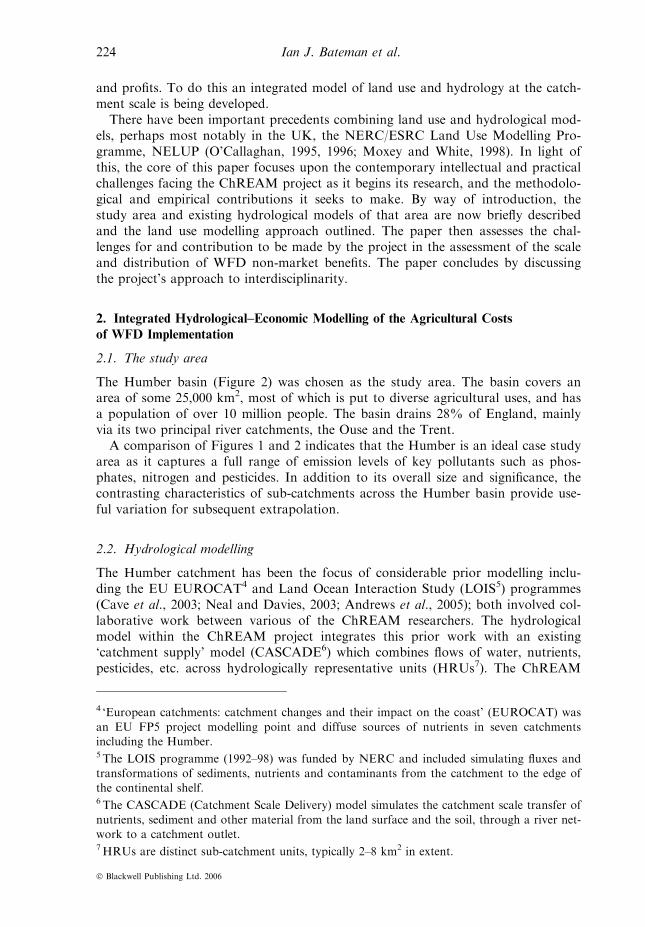
The Humber basin (Figure 2) was chosen as the study area. The basin covers anarea of some 25,000 km2, most of which is put to diverse agricultural uses, and hasa population of over 10 million people. The basin drains 28% of England, mainlyvia its two principal river catchments, the Ouse and the Trent.A comparison of Figures 1 and 2 indicates that the Humber is an ideal case study
area as it captures a full range of emission levels of key pollutants such as phos-phates, nitrogen and pesticides. In addition to its overall size and significance, thecontrasting characteristics of sub-catchments across the Humber basin provide use-ful variation for subsequent extrapolation.
2.2. Hydrological modelling
The Humber catchment has been the focus of considerable prior modelling inclu-ding the EU EUROCAT4 and Land Ocean Interaction Study (LOIS5) programmes(Cave et al., 2003; Neal and Davies, 2003; Andrews et al., 2005); both involved col-laborative work between various of the ChREAM researchers. The hydrologicalmodel within the ChREAM project integrates this prior work with an existing‘catchment supply’ model (CASCADE6) which combines flows of water, nutrients,pesticides, etc. across hydrologically representative units (HRUs7). The ChREAM
4 ‘European catchments: catchment changes and their impact on the coast’ (EUROCAT) was
an EU FP5 project modelling point and diffuse sources of nutrients in seven catchmentsincluding the Humber.5 The LOIS programme (1992–98) was funded by NERC and included simulating fluxes and
transformations of sediments, nutrients and contaminants from the catchment to the edge ofthe continental shelf.6 The CASCADE (Catchment Scale Delivery) model simulates the catchment scale transfer of
nutrients, sediment and other material from the land surface and the soil, through a river net-work to a catchment outlet.7HRUs are distinct sub-catchment units, typically 2–8 km2 in extent.
224 Ian J. Bateman et al.
� Blackwell Publishing Ltd. 2006

model also incorporates a further module to assess point source discharges, e.g.,from sewage treatment works (Kay et al., 2005). Synthesis with an ‘in-stream’component (QUESTOR8) is intended to capture pollutant transport and impacts(Hutchins et al., 2006).An initial research objective is to capture the processes by which potential pollut-
ants such as nitrogen, phosphorus, pesticide and faecal material are attenuatedbefore entering the river channel. This entails modelling how the application of,say, a specified fertiliser at a given location will, after accounting for the environ-mental and land use characteristics of that location (soil type and depth, slope,underlying geology, cropping pattern, etc.), leach into water bodies (Davies andNeal, 2004; Neal et al., 2005). The modelling must capture the modification of dif-fuse pollutants in-river, supplemented by the addition of point source discharges
Figure 2. The case study area: the Humber Basin’s rivers and major cities.Maps are based on Ordnance Survey material with the permission of Ordnance Survey onbehalf of the Controller of Her Majesty’s Stationary Office � Crown copyright. All rights
reserved. NERC, 100017897, 2005.
8QUESTOR (Quality Evaluation and Simulation Tool for River-systems) is software used tosupport in-stream water quality modelling.
225Costs and Benefits of the Water Framework Directive
� Blackwell Publishing Ltd. 2006

and analyse how together these pollutants affect aquatic biology. In combination,such analysis takes us from a given land use and nutrient application regime at aspecified location, to, for example, the prediction of the rate of algal bloom withina receiving waterway.The spatial dimension is crucial to all aspects of the project, from water process
modelling, through land use interactions, to the analysis of the non-market benefitsof water quality improvement. Consequently, the project will make extensive use ofspatially sensitive modelling routines and geographical information systems (GIS).
2.3. Land use modelling and integration with the hydrological model
A number of studies have already examined the impact of water pollution policiesupon agriculture (Rigby and Young, 1996; Rigby, 1997; Gomann et al., 2004).Within the ChREAM project, farm activities will be modelled by an econometricprocess analysis (Antle and Capalbo, 2001) estimated using Farm Business Survey(FBS) panel data, Agricultural Census information, and other geographical contextvariables. Production decisions will be specified as a function of farm characteris-tics, inputs, bio-physical characteristics of the production site, and market condi-tions. Other types of production models, such as farm programming models, deriveoptimal resource allocations for one or more farms which are ‘representative’ of thearea or region. These models are extremely amenable to the imposition of (envi-ronmental) restrictions, for example, through restrictions in fertiliser application orabstraction rates. However, they are more limited in application where there ishighly significant spatial variation and heterogeneity both in environmental charac-teristics and processes and in farm-economic behaviour. For example, the relativehomogeneity of production systems on the two Scottish catchments modelled inHanley et al. (2006) allows production to be modelled as a single representativefarm producing potatoes, arable crops and grassland. This is in stark contrast tothe size of, and heterogeneity within, the Humber catchment with farm types ran-ging from intensive arable or livestock production in lowland areas to more exten-sive mixed enterprises in upland regions. In the proposed approach, the farm orsite-specific spatial information are included in the model to control for such effects.This will remove possible biophysical sources of bias in the estimates.The integration of farm economic and hydrological models will be achieved at
the scale of HRUs. The ‘catchment supply’ model, CASCADE, is based on monthlyprofiles of nutrient inputs (e.g., nitrates) from a range of land use (e.g., differentcrop type) and livestock sources. Ward scale data from the DEFRA June Agricul-tural Census9 on land cover and livestock numbers will be interpolated to providebaseline profiles for HRUs10 and also provide a framework for scaling up produc-tion decisions modelled at the farm scale to generate alternative sets of such pro-files. This will allow different economic or policy scenarios to be modelled in termsof their implications for such variables as fertiliser use. These estimates will, in turn,become inputs for the hydrological models. By exogenously setting water quality tosome policy determined level (such as that commensurate with ‘good ecological sta-tus’ under the WFD) it should also be possible to drive these linkages ‘backwards’
9 See http://www.defra.gov.uk/esg/work_htm/publications/cs/farmstats_web/default.htm10 For a discussion of relevant techniques see, for example, Moxey and Allanson (1994).
226 Ian J. Bateman et al.
� Blackwell Publishing Ltd. 2006

from the hydrological to farm models, determining the maximum level of farminputs commensurate with that particular outcome.The economic welfare implications of any state (pre- or post-WFD) of the pro-
duction process can be captured via the associated profit function given the expec-ted output price. This procedure simultaneously estimates both supply and costfunctions and is designed to incorporate alterations to parameters such as the out-put price changes associated with CAP reform or revisions to agri-environmentalpolicy regimes.The integrated nature of this modelling approach and its ability to represent dif-
ferent levels of farming activity also provides a framework to analyse farmer reac-tions to shocks such as a limit on input use resulting from WFD implementationmeasures. Limits upon fertiliser inputs are likely to generate an incentive for farm-ers to substitute away from intensive nutrient input production towards alternativeactivities. However, sole reliance upon a model estimated within one state to accu-rately predict for the potentially substantially different farm business environmentpost-WFD implementation is risky. Therefore, the response modelling exercise willbe supplemented in the research by a two-stage farm survey. In the first stage, infor-mation will be gathered regarding farmers’ own estimates of their likely response tothe input and activity constraints imposed by WFD implementation. This will feedinto the integrated modelling information through the probabilities of simulatedresponse strategies. The second survey will take resulting model predictions back outto farms and elicit their response to these estimates, these responses being incorpor-ated within a further revision of the model. This allows refinement of the models andtheir simulated responses to WFD implementation to better capture the range ofadjustment measures producers undertake. The surveys will also be used to testvarious models of farm behaviour (a recognised research priority for WFD implemen-tation; Haygarth et al., 2003), especially deviations from a standard profit maximisingassumption. These will again be used to refine the agricultural simulation process.
3. Assessing the Non-market Benefits of the WFD
Thus far the focus has been upon the means of assessing the scale and distributionof the agricultural costs of WFD implementation. It is claimed that the Directivewill also deliver substantial benefits. However, perhaps surprisingly for such a majorpolicy change, there does not appear to have been any formal economic assessmentof these benefits. While the policy may generate a number of market benefits, suchas reductions in water treatment costs for water companies and manufacturers, ourresearch focuses upon the less tangible, but potentially major, non-market valuesgenerated by the WFD. These benefits include use values such as improved oppor-tunities for, and qualities of, informal recreation and non-use benefits, such as thevalues individuals may hold for improvements in wildlife habitat which are notincorporated within recreation and amenity values. These benefits form an import-ant part of the assessment of the proportionality of costs which should informWFD implementation.
3.1. Use and non-use values and preference robustness
It is an early research objective of the ChREAM project to decide the non-marketvalues upon which to focus and the methods most appropriate for estimating those
227Costs and Benefits of the Water Framework Directive
� Blackwell Publishing Ltd. 2006

values. In part, this focus will be informed by interactions with stakeholder groupsincluding representatives from DEFRA, the Environment Agency, Ofwat, YorkshireWater and the CLA. An overriding concern will be the likelihood of providing sig-nificant contributions to methodology in this field. There are a number of possiblemethods to be considered. Where preferences for environmental goods are wellformed (as described in basic economic theory11) then it is a reasonable test of valu-ation techniques as to whether robust and accurate estimates of corresponding val-ues can be obtained. However, if preferences are only poorly formed12 (and perhapsinternally inconsistent) then conventional economic valuation techniques of thiskind cannot provide robust and accurate measures of such constructs. The benefitsgenerated by the WFD are likely to provide examples of both well-formed andpoorly formed preferences. For example, compared to inexperienced visitors, high-intensity recreational users of waterways, such as anglers, are more likely to havewell-formed preferences for those resources and have robust values for the changesgenerated by the WFD. Following Plott (1996), it is the high degree of consumption(use) experience which leads to the development of robust, theoretically consistent,economic preferences. Following this logic, it seems likely that the absence of suchexperience is likely to mean that preferences for the non-use benefits of the WFDwill be less well formed and, therefore, derived values are more liable to exhibitanomalies relative to standard theoretical expectations.Arguably, these problems can be exacerbated by the fact that such non-use values
can only be elicited through ‘stated preference’ (SP) methods (Bateman et al., 2002).These methods apply surveys designed to directly ask a representative sample ofrespondents about their values for some change in the provision of a good, suchas a WFD-inspired increase in the quality of river water and the consequenteffects upon flora and fauna. SP studies typically obtain these values via one of twomethods:
• By asking respondents in a choice experiment (CE) to choose their preferredoption among several, with each option defined by a series of attributes of theriver and some cost attribute. Implicit trade-offs can be observed and valuesinferred from the (repeated) choices made.
• By asking respondents direct contingent valuation (CV) questions regarding will-ingness-to-pay (WTP) or willingness-to-accept (WTA) compensation for changesin the provision of some good.
Each approach has strengths and weaknesses. However, both are liable to thecharge that, armed only with poorly formed prior preferences, respondents mayreact to SP surveys by ‘constructing preferences’ based upon what they perceive to
11 For example, they are transitive; if A is preferred to B and B preferred to C then A shouldalso be preferred to C. Such theoretically consistent preferences are the basis of economicdecision-making techniques such as cost–benefit analysis.12 For example, if the value of a good varied according to factors such as the presence orabsence of an inferior substitute (Bateman et al., 2005). Notice however, that such effects canoccur for market priced goods (Doyle et al., 1999) leading to the likelihood that double
standards are applied to valuations depending upon whether they are elicited within or with-out markets. Indeed Shogren (2006) argues that all values, market or otherwise, are contex-tual and, therefore, to some degree malleable according to the frame in which they areobtained.
228 Ian J. Bateman et al.
� Blackwell Publishing Ltd. 2006

be cues given by the valuation survey itself or the context in which it is undertaken(Tversky and Kahneman, 1974; Bateman and Mawby, 2004).13 Such preferences aremalleable, changing with the frame of the question rather than just the nature ofthe good and as such are frequently judged to be unsuitable for inclusion within astrict cost–benefit analysis. Even when prior preferences are well formed, unfamiliar-ity with such hypothetical markets adds a further layer of complexity to the uncer-tainty associated with non-use values. In effect, respondents need not only to‘discover’ their preferences for such goods, but also learn how these valuation meth-ods work (Braga and Starmer, 2005).Addressing such research challenges is an important part of the justification for
projects such as ChREAM and successful SP analysis of benefits has the potentialto provide a rich diversity of information about such values. Extending the Plottargument, it may be possible for individuals to develop robust, consistent prefer-ences and an associated understanding of contingent and choice markets as theyexperience valuation experiments. Techniques to promote such learning in valuationstudies offer some promise here, including those pioneered by Bjornstad et al.(1997) and our own work on the transparency of valuation tasks (Bateman et al.,2004). The ChREAM project will seek to extend previous work in this area, forexample, applying and extending research in the psychological sciences showing thatthe presentation of information in visual, as opposed to numeric and textual, formcan substantially reduce choice errors (Hibbard and Peters, 2003). In our own work,we have used virtual reality visualisations as a medium for enhancing understandingand eliciting values for land use change (Bateman et al., 2006b; Dockerty et al.,2006). Throughout such exercises, the key test is to assess the comparative stabilityand theoretical consistency of preferences both before and after the application ofsuch preference discovery and visual information tools.It seems clear that non-use, rather than use, preferences are likely to be less well
formed and, therefore, more difficult to assess. Whether or not our own research willinclude non-use values remains, at present, an open question. However, the greaterrobustness of users’ preferences does suggest that these provide a superior target forapplying these techniques. Furthermore, unlike the non-use case, in estimating usevalues, we are not constrained solely to SP methods. We can also examine users’ pref-erences via their behaviour as analysed through revealed preference (RP) techniques.
3.2. The spatial aspect of revealed preferences (RP)
The most commonly applied RP technique is the travel cost random utility model.14
This examines data on recreationalists’ choices of visits to a variety of sites offering
13 Indeed it may well be that, even when preferences are well formed, respondents may ‘truth-fully overstate’ their values because of the ‘focusing illusion’ (Kahneman and Sugden, 2005)that ‘nothing in life is as important as you think it is when you’re thinking about it’. For
this reason the Revealed Preference analysis discussed subsequently might be particularlyimportant.14 Such methods actually rely upon the same underlying random utility model of behaviour
(McFadden, 1974) as SP approaches. However, the RP use of observed behaviour is oftenviewed as an advantage. Whether this aura of respectability is completely deserved is a pointof debate as RP methods are dependent upon a number of assumptions holding (see, forexample, Randall, 1994; Champ et al., 2003).
229Costs and Benefits of the Water Framework Directive
� Blackwell Publishing Ltd. 2006

different recreational experiences. These experiences are characterised by the attrib-utes of each site including its water quality, facilities and accessibility. Attributesvary from site to site (e.g., different activities and water qualities) as do economiccosts incurred visiting each site (in terms of varying direct travel expenditures, dif-ferent travel times, etc.). Accordingly, visit choices reveal how recreationalists areprepared to make trade-offs between site attributes and costs. In turn, this providesa basis for our own research in estimating in monetary terms the benefits of WFD-inspired improvements in water quality.15
Travel cost analysis is inherently spatial and is, therefore, also highly amenable tothe analytic opportunities afforded by application of GIS. The technique explicitlyrecognises that recreationalists’ choices are made in the context of numerous substi-tute and complementary sites. Inadequate incorporation of all pertinent alternativesites is liable to result in inaccurate estimates of benefit values, these being eithertoo high or too low depending upon the balance of substitutes or complementswhich are ignored. The ChREAM research project aims to substantially improvethe travel cost technique through application of GIS both to: (i) improve the way inwhich site accessibility is measured (Bateman et al., 1996), allowing for the distri-bution and varying road speed and congestion quality of the road network and;(ii) ensure the comprehensive inclusion of all alternative sites (Jones et al., 2002).This latter extension will include not only other waterways, but also other types ofrecognised outdoor recreation site (woodlands, wetlands, beaches, National Parks,etc.) and man-made recreation facilities (built heritage, zoos, parks, cinemas andother urban attractions which might conceivably substitute for waterway visits).Such qualitatively different sites are frequently omitted from travel cost analyses ofopen-access recreational sites, an omission which may have resulted in an overesti-mation of the value of a given site. Furthermore, the modelling of this data willseek to assess the cross-substitution effects of improvements in the water qualitynot just of one waterway but multiple and perhaps all waterways, as envisagedunder the WFD. As each site is improved to ‘good ecological status’ so the margi-nal value of improving the next site declines. Incorporating this shift is vital to theaccurate estimation of total values.The implementation of RP techniques clearly entails a number of spatial analytic
issues including the aggregation of benefits across the population, benefits transferand the distributional analysis of those benefits. Throughout these assessments ofbenefits a GIS-based approach will be used, together with census demographic data,to provide a spatial element to the analysis. These issues of benefit aggregation,transfer and distribution are now discussed in more detail.
3.3. Benefits aggregation
As noted above, the value an individual holds for the improvement of a certain sitewill vary according to numerous spatially variable factors such as the availability ofsubstitute sites. Furthermore, when aggregating across individuals, their characteris-
15 This technique has been applied in numerous previous studies to estimate the recreationalvalue of water quality improvements, for example, through changes in fish species densities(Kling and Thomson, 1996) or through changes in measured water quality (e.g., Feenbergand Mills, 1980).
230 Ian J. Bateman et al.
� Blackwell Publishing Ltd. 2006

tics also vary spatially (for example, those with higher incomes may live closer to agiven set of sites). A consideration of space is, therefore, vital to the accurate aggre-gation of benefit values for improvements to amenity waterways (and indeed mostspatially confined environmental resources). The spatial analytic capabilities ofgeographical information systems (GIS) provide an ideal medium for harmonisingthe diverse data necessary to undertaking such an aggregation exercise (Batemanet al., 2000). In particular, GIS readily allows the researcher to specify a valuationfunction which varies across space according to a variety of factors including: (i)the distribution of rivers, lakes, estuaries, etc.; (ii) the change in quality to thoseresources, with improvements tending to convert former non-users into users in aspatially non-random manner; (iii) the accessibility of complementary and substituteassets; and (iv) the distribution and socio-economic/demographic characteristics ofthe relevant population. The inclusion of such factors allows the analyst to observeany ‘distance decay’ in values as we consider households which are progressivelymore remote from a given improvement. Furthermore, once such a valuationfunction is estimated, by applying it within a GIS to data detailing explanatoryvariables for all locations we can define the appropriate ‘economic jurisdiction’ (thatarea within which values are non-zero) for calculating total benefit values (Batemanet al., 2006a). This avoids common aggregation problems associated with artificial‘political jurisdictions’ typically defined by convenient administrative areas ratherthan the benefits generated by a scheme.16
3.4. Benefits transfer
The estimation of spatially sensitive valuation functions also allows us to investigatethe potential for ‘benefit transfers’ (Brouwer, 2000; Ready et al., 2004). Here valuefunctions, estimated as outlined above, are applied to generate values for sites whichmay not of themselves have been part of a valuation exercise. In theory, once arobust valuation function has been estimated the researcher need only know theattribute levels and improvement scheme which characterises an unsurveyed site toestimate (via the valuation function) the benefit generated by improving that site.However, in practice the track record of benefits transfer work is strewn with failurewith many analyses failing recognised tests of transfer validity (see, for example,Vandenberg et al., 2001; Ready et al., 2004).Despite the empirical problems of benefit transfer, its potential to obviate the
need for conducting individual site surveys each time an environmental improve-ment is to be assessed makes it an attractive method. Indeed this approach under-pins contemporary Environment Agency assessments in England. However, atpresent these are conducted not via a value function transfer but rather by trans-ferring mean values from a relatively small pool of existing studies, of which few,if any, were conducted for such a purpose. Transferring well-specified functions
16The typical problem here arises when survey sampling is predefined to occur in a set areawhich is not representative of the economic jurisdiction. In such cases, aggregation approa-
ches which do not rely upon valuation functions but instead use survey sample means mayresult in substantial bias, although this is not inevitable. For example, if sampling is confinedto an area close to a site but the sample mean is applied to a larger aggregation area thentotal value assessments may be upwardly biased.
231Costs and Benefits of the Water Framework Directive
� Blackwell Publishing Ltd. 2006

(if they can be estimated) rather than mean values allows the analyst to obtain avalue which is adjusted for the characteristics and environs of the site in question.The key issue, therefore, is to determine the robustness or otherwise of the valu-ation function to be transferred. This is typically undertaken by taking a functionestimated from one subset of observations and using it to estimate values for analternative set of sites for which independent value estimates are already held. TheChREAM project will investigate such robustness analysis. In doing so, we willbe guided in part by our recent findings which suggest that the transfer of statisti-cal ‘best-fit’ functions may inflate value estimation errors (Brouwer and Bateman,2005). This is because such functions may include site-specific contextual factorswhich are not relevant to those sites to which the function is transferred. Con-versely, the specification of functions on the basis of those general factors identi-fied in core economic theory (e.g., cost, income level and usage parameters) couldproduce valid transfers which outperform simple mean value approaches in termsof the errors generated.
3.5. Distributional analysis
A final advantage offered by our spatially sensitive GIS-based methodology is anability to examine the distributional implications of the water quality improve-ments offered by the WFD. While valuation studies often note an associationbetween WTP and household income, the implications of this association arerarely explored. Furthermore, given that the distribution of benefits is likely to beboth spatially and socially uneven, the potential exists for some groups to farebetter than others in capturing the non-market benefits of WFD implementation.The estimation of a value function, which varies across space and socio-economicdimensions, allows us to use the GIS to link census measures of deprivation andcorresponding WFD benefit values. It seems likely that many environmental bene-fits, such as those generated by National Parks, are disproportionately capturedby the wealthier sections of the society. This may also be the case with waterquality benefits, although the case is less clear-cut. Informal waterway recreationis open to all and, unlike National Parks, is much more widespread and access-ible. Furthermore, if the WFD is indeed implemented as it stands then it seemslikely that the benefits and beneficiaries may be clustered within urban andsurrounding areas. However, while this Directive seems potentially redistributivein terms of its benefits, their urban concentration contrasts markedly with thepredominantly rural and agricultural incidence of WFD costs. The extent of thetensions between efficiency, equity, certainty of achieving targets and other policy-relevant criteria can be explored through the simulation of alternative WFDimplementations in which these criteria are given different weights.
4. Further Issues: Outputs, Users and Interdisciplinarity
As noted earlier in this paper, previous hydrological–economic research was under-taken under the NELUP programme. In commenting on this programme followingits conclusion, Moxey and White (1998) highlighted three key problems which hadlimited its effectiveness: (i) an overly ambitious attempt to produce a complete soft-ware ‘Decision Support System’ (DSS) capable of dealing with too great a diversityof scenarios and which research users saw as usurping the decision process; (ii) an
232 Ian J. Bateman et al.
� Blackwell Publishing Ltd. 2006

attempt to cater to an overly diverse stakeholder group and one which was notidentified from the outset; and (iii) discipline territoriality between researchers. Informulating the ChREAM project, the researchers have attempted to set the projecton a course designed to avoid these problems, although only time will tell howsuccessfully.To be more specific, the project builds on a history of collaboration between a
number of the partners and substantial previous experience of interdisciplinaryworking (see Turner, 2000; Cave et al., 2003). Combining GIS methods with valu-ation techniques to produce spatially distributed benefits assessments has been pion-eered by project members (Bateman et al., 2003). As a consequence, issues such asthe integration of data and units of analyses are being addressed at the outsetbecause of the potential difficulties resulting from fundamental differences in thelevels of spatial and temporal aggregation across economics, ecology and hydrology(Moxey and White, 1998). Practical measures (such as the use of Access Grid Nodevideoconferencing and budget provision for researchers to spend time at other insti-tutions) are being used to address the problems that can arise from physical dis-tance between partners (Tress et al., 2005) because, as commented in past workamong the project team, ‘there is no substitute for regular contact between research-ers from different disciplines in the context of a common research problem and ajoint learning curve’ (Turner, 2000: 459). Such visits and discussions have alreadyclarified that the resolution of available databases make it impractical to achieveintegration of hydrological and economic models at the level of the individual farmand instead a framework of geographical areas is being sought where FBS, Agricul-tural Census and Hydrological Response Units can be linked with both sufficientdetail and accuracy.Providing a clear focus and objectives is also important in such interdisciplinary
research. To this end, ChREAM is not attempting to provide a DSS addressing awide range of scenarios and instead adopts a narrower remit concerning the estima-tion of select agricultural costs and non-market benefits within a single (if complex)policy environment: the implementation of the WFD. Allied to this, the project isseeking the early and ongoing assistance of a relatively focussed group of users,principally policy makers and those affected by the WFD. Through such anapproach, we hope to achieve a situation where discipline experts can combineacross subject or paradigm boundaries to generate new insights and work with non-academic partners in a way that is characteristic of transdisciplinary studies asdefined by Tress et al. (2005). Such an approach seems to us central to the RELUprogramme and necessary to address the challenges posed by WFD implementation.
5. Concluding Remarks
The spatial variation in the distribution of the agricultural costs and non-marketbenefits of alternative WFD implementations is a central theme of this study. Onthe cost side, the combination of spatially explicit physical and farm economic dataunderpins a new hydrological–economic model of agricultural land use. It is thespatial dimension which also underpins the linkage of the economic analysis withmodels of nutrient transport, diffuse pollution and consequent biological effectswithin the water environment. Similarly, it is the spatial dimension which underpinsthe variegated impacts upon farm welfare predicted when the linked models are dri-ven ‘backwards’, from water quality to farm production.
233Costs and Benefits of the Water Framework Directive
� Blackwell Publishing Ltd. 2006

Analysis of the farm level costs likely to be imposed by the WFD is balanced byinvestigation of some of the key non-market potential benefits which the Directivemay generate. Here we investigate an integrated mix of RP and SP methods toassess the non-market values which are a major focus of the policy. As in our farmmodelling exercise, the use of GIS-based methodology is critical in extending previ-ous research to address the aggregation, transfer and distribution issues of suchbenefits.The programme of research is highly interdisciplinary and policy orientated but,
as the discussion above indicates, it also addresses current frontier issues in the lit-erature on land use modelling, non-market benefits analysis and the spatial aspectsof both. It is not the first, nor is it likely to be the last, large-scale land use–hydro-logical modelling study. Nevertheless, we contend that its clear focus upon a definedand contemporary policy-relevant issue, combined with new approaches to estab-lished research problems, should constitute a useful contribution to knowledge inthis area.
References
Andrews, J., Beaumont, N., Brouwer, R., Cave, R., Jickells, T., Ledoux, L. and Turner, R. K.
‘Integrated assessment for catchment and coastal zone management: The case of theHumber’, in J. Vermaat, L. Brouwer, K. Turner and W. Salomons (eds.), Managing Euro-pean Coasts: Past, Present and Future (Berlin: Springer, 2005, pp. 323–350).
Antle, J. M. and Capalbo, S. M. ‘Econometric-process models for integrated assessment ofagricultural production systems’, American Journal of Agricultural Economics, Vol. 83,(2001) pp. 389–401.
Bateman, I. J. and Mawby, J. ‘First impressions count: A study of the interaction of inter-viewer appearance and information effects in contingent valuation studies’, EcologicalEconomics, Vol. 49, (2004) pp. 47–55.
Bateman, I. J., Garrod, G. D., Brainard, J. S. and Lovett, A. A. ‘Measurement, valuation
and estimation issues in the travel cost method: A geographical information systemsapproach’, Journal of Agricultural Economics, Vol. 47, (1996) pp. 191–205.
Bateman, I. J., Langford, I. H. and Nishikawa, N. and Lake, I. ‘The Axford debate revisited:
A case study illustrating different approaches to the aggregation of benefits data’, Journalof Environmental Planning and Management, Vol. 43, (2000) pp. 291–302.
Bateman, I. J., Carson, R. T., Day, B., Hanemann, W. M., Hanley, N., Hett, T., Jones-
Lee, M., Loomes, G., Mourato, S., Ozdemiroglu, E., Pearce, D. W., Sugden, R. andSwanson, J. Economic Valuation with Stated Preference Techniques: A Manual (Cheltenham:Edward Elgar Publishing, 2002, pp. 458).
Bateman, I. J., Lovett, A. A. and Brainard, J. S. Applied Environmental Economics: A GIS
Approach to Cost-Benefit Analysis (Cambridge: Cambridge University Press, 2003).Bateman, I. J., Cole, M., Cooper, P., Georgiou, S., Hadley, D. and Poe, G. L. ‘On visiblechoice sets and scope sensitivity’, Journal of Environmental Economics and Management,
Vol. 47, (2004) pp. 71–93.Bateman, I. J., Munro, A. and Poe, G. L. Asymmetric Dominance Effects in Choice Experi-ments and Contingent Valuation, CSERGE Working Paper EDM 2005–06, (Centre for
Social and Economic Research on the Global Environment, University of East Anglia,2005).
Bateman, I. J., Day, B. H., Georgiou, S. and Lake, I. ‘The aggregation of environmentalbenefit values: Welfare measures, distance decay and total WTP’, Ecological Economics,
(2006a), in press.Bateman, I. J., Jones, A. P., Jude, S. and Day, B. H. ‘Reducing gains/loss asymmetry: A vir-tual reality choice experiment (VRCE) of land use change’ (presented at The Third World
234 Ian J. Bateman et al.
� Blackwell Publishing Ltd. 2006

Congress of Environmental and Resource Economists, Kyoto International Conference
Hall, Japan, 3–7 July, 2006b).Bjornstad, D., Cummings, R. and Osborne, L. ‘A learning design for reducing hypotheticalbias in the contingent valuation method’, Environmental and Resource Economics, Vol. 10,
(1997) pp. 207–221.Braga, J. and Starmer, C. ‘Preference anomalies, preference elicitation, and the discoveredpreference hypothesis’, Environmental and Resource Economics, Vol. 32, (2005) pp. 55–89.
Brouwer, R. ‘Environmental value transfer: State of the art and future prospects’, EcologicalEconomics, Vol. 32, (2000) pp. 137–152.
Brouwer, R. and Bateman, I. J. ‘Benefits transfer of willingness to pay estimates and func-tions for health-risk reductions: A cross-country study’, Journal of Health Economics,
Vol. 24, (2005) pp. 591–611.Cave, R., Ledoux, L., Turner, R. K., Jickells, T., Andrews, J. E. and Davies, H. ‘The Hum-ber catchment and its coastal area: From UK to European perspectives’, The Science of
the Total Environment, Vol. 314–316, (2003) pp. 31–52.Champ, P. A., Boyle, K. and Brown T. C. (eds.) A Primer on Non-market Valuation,The Economics of Non-market Goods and Services, (Dordrecht: Kluwer Academic Press,
2003).Davies, H. and Neal, C. ‘GIS based methodologies for assessing nitrate, nitrite and ammo-nium distributions across a major UK basin, the Humber’, Hydrology and Earth SystemSciences, Vol. 8, (2004) pp. 823–833.
Defra and HM Treasury. Developing Measures to Promote Catchment Sensitive Farming: AJoint Consultation (London: HM Stationary Office, 2004).
Dockerty, T., Lovett, A., Appleton, K., Bone, A. and Sunnenberg, G. ‘Developing scenarios
and visualisations to illustrate potential policy and climatic influences on future agri-cultural landscapes’, Agriculture, Ecosystems and Environment, Vol. 114, (2006) pp. 103–120.
Doyle, J. R., O’Connor, D. J., Reynolds, G. M. and Bottomley, P. A. ‘The robustness ofthe asymmetrically dominated effect: Buying frames, phantom alternatives, and in-storepurchases’, Psychology and Marketing, Vol. 16, (1999) pp. 225–243.
Environment Directorate-General. ‘Introduction to the new EU Water Framework Directive’,
(Brussels: Environment DG, 2005). Available at http://europa.eu.int/comm/environment/water/water-framework/overview.html.
European Parliament. (2000). Directive 2000/60/EC (The EU Water Framework Directive),
Official Journal (OJ L 327): 22 December.Feenberg, D. and Mills, E. S. Measuring the Benefits of Water Pollution Abatement (NewYork: Academic Press, 1980).
Gomann, H., Kreins, P., Kinkel, R. and Wendland, F. ‘Model based impact analysis of pol-icy options aiming at reducing diffuse pollution by agriculture – A case study for the RiverEms and a sub-catchment of the Rhine’, Environmental Modelling and Software, Vol. 20,(2004) pp. 261–271.
Hanley, N., Aftab, A. and Black, A. (2006) Economic Incentives, Non-Point Pollution andIntegrated Catchment Management: Testing for the Transferability of Policy Choice acrossCatchments (Paper presented to AES conference, Paris, 2006).
Haygarth, P., Johnes, P., Butterfield, D., Foy, B. and Withers, P. (2003) ‘Land Use forAchieving ‘Good Ecological Status’ of Waterbodies in England and Wales: A TheoreticalExploration for Nitrogen and Phosphorus’, Report to DEFRA, IGER, Oakhampton.
Hibbard, J. H. and Peters, E. ‘Supporting informed consumer health care decisions: Datapresentation approaches that facilitate the use of information in choice’, Annual Review ofPublic Health, Vol. 24, (2003) pp. 413–433.
Hutchins, M. G., Deflandre, A., Boorman, D. B. ‘Performance benchmarking linked diffuse
pollution and in-stream water quality models’, Archiv fur Hydrobiologie – Large Rivers,(2006), in press.
235Costs and Benefits of the Water Framework Directive
� Blackwell Publishing Ltd. 2006
Jones, A. P., Bateman, I. J. and Wright, J. (2002) Estimating Arrival Numbers and Values for
Informal Recreational Use of British Woodlands, Report to the Forestry Commission, Edin-burgh. http://www.forestry.gov.uk. Last accessed 01/04/2005.
Kahneman, D. and Sugden, R. ‘Experienced utility as a standard of policy evaluation’,
Environmental and Resource Economics, Vol. 32, (2005) pp. 161–81.Kay, D., Wyer, M. D., Crowther, J., Stapleton, C., Bradford, M., McDonald, A. T.,Greaves, J., Francis, C. and Watkins, J. ‘Predicting faecal indicator fluxes using digital
land use data in the UK’s sentinel Water Framework Directive catchment: The Ribblestudy’, Water Research, Vol. 39, (2005) pp. 655–667.
Kling, C. L. and Thomson, C. J. ‘The implications of model specification for welfare esti-mation in nested logit models’, American Journal of Agricultural Economics, Vol. 78, (1996)
pp. 103–114.McFadden, D. ‘Conditional logit analysis of qualitative choice behaviour’, in Zarembka, P.(ed.), Frontiers in Econometrics VI (New York: Academic Press, 1974, pp. 105–142).
Moxey, A. P. and Allanson, P. ‘Areal interpolation of spatially extensive variables: A compar-ison of alternative techniques’, International Journal of Geographical Information Systems,Vol. 8, (1994) pp. 479–487.
Moxey, A. P. and White, B. ‘NELUP: Some reflections on undertaking and reporting inter-disciplinary river catchment modelling’, Journal of Environmental Planning and Manage-ment, Vol. 41/3, (1998) pp. 397–402.
Neal, C. and Davies, H. ‘Water quality fluxes for eastern UK rivers entering the North
Sea: A summary of information from the Land Ocean Interaction Study (LOIS).Land ocean interaction: Processes, functioning and environmental management: A UKperspective’, The Science of the Total Environmental, Vol. 314–316, (2003) pp. 821–
882.Neal, C., Jarvie, H. P., Neal, M., Love, A. J., Hill, L. and Wickham, H. ‘Water quality oftreated sewage effluent in a rural area of the upper Thames Basin, southern England, and
the impacts of such effluents on riverine phosphorus concentrations’, Journal of Hydrology,Vol. 304, (2005) pp. 103–117.
O’Callaghan, J. R. ‘NELUP: An introduction’, Journal of Environmental Planning and Man-agement, Vol. 38/1, (1995) pp. 5–20.
O’Callaghan, J. R. (ed.) The Interaction of Economics, Ecology and Hydrology (London:Chapman & Hall, 1996).
Plott, C. R. ‘Rational individual behaviour in markets and social choice processes: The
discovered preference hypothesis’, in Arrow, K., Colombatto, E., Perleman, M. andSchmidt, C. (eds.), Rational Foundations of Economic Behavior (London: Macmillan andNY: St. Martin’s, 1996, pp. 225–250).
Randall, A. ‘A difficulty with the travel cost method’, Land Economics, Vol. 70, (1994)pp. 88–96.
Ready, R. C., Navrud, S., Day, B., Dubourg, R., Machado, F., Mourato, S., Spanninks, F.and Rodriquez, M. X. V. ‘Benefit transfer in Europe. How reliable are transfers between
countries?’ Environmental and Resource Economics, Vol. 29, (2004) pp. 67–82.Rigby, D. ‘European community guidelines to reduce water pollution by nitrates from agri-culture: An analysis of their impact on UK dairy farms’, Journal of Agricultural Economics,
Vol. 48, (1997) pp. 71–82.Rigby, D. and Young, T. ‘European environmental regulations to reduce water pollution: Ananalysis of their impact on UK dairy farms’, European Review of Agricultural Economics,
Vol. 23, (1996) pp. 59–78.RPA. Water Framework Directive – Indicative Costs of Agricultural Measures (Loddon,Norfolk: RPA Consultants, 2003).
Shogren, J. ‘Experimental methods and valuation’, in Maler, K.-G. and Vincent, J. (eds.),
Handbook of Environmental Economics, Vol. 2 (Amsterdam: North-Holland, 2006,pp. 969–1027).
236 Ian J. Bateman et al.
� Blackwell Publishing Ltd. 2006

Tress, B., Tress, G., Fry, G. ‘Integrative studies on rural landscapes: Policy expectations and
research practice’, Landscape and Urban Planning, Vol. 70, (2005) pp. 177–191.Turner, R. K. ‘Integrating natural and socio-economic science in coastal management’,Journal of Marine Systems, Vol. 25, (2000) pp. 447–460.
Tversky, A. and Kahneman, D. ‘Judgement under uncertainty: Heuristics and biases’,Science, Vol. 185, (1974) pp. 1124–1131.
VandenBerg, T. P., Poe, G. L. and Powell, J. R. ‘Assessing the accuracy of benefits transfer:
Evidence from a multi-site contingent valuation study of groundwater quality’, In J. C.Bergstrom, K. J. Boyle and G. L. Poe (eds.), The Economic Value of Water Quality (Mass:Edward Elgar, 2001, pp. 100–120).
237Costs and Benefits of the Water Framework Directive
� Blackwell Publishing Ltd. 2006