Appendix H - L.A. County C.E.O.
756
Appendix H Phase I Environmental Site Assessment
-
Upload
khangminh22 -
Category
Documents
-
view
0 -
download
0
Transcript of Appendix H - L.A. County C.E.O.

Appendix H
Phase I Environmental Site Assessment

Prepared for: Prepared by:Manatt, Phelps & Phillips, LLP AECOMLos Angeles, California Long Beach, California
60506707.1July, 2016
Environment
Phase I Environmental Site Assessment Los Angeles County Museum of Art (LACMA),5905 Wilshire Boulevard,Los Angeles, California 90036

Prepared for: Prepared by:Manatt, Phelps & Phillips, LLP AECOMLos Angeles, California Long Beach, California
60506707.1July, 2016
Environment
Phase I Environmental Site Assessment Los Angeles County Museum of Art(LACMA),5905 Wilshire Boulevard,Los Angeles, California 90036

AECOM Environment i
July 2016 60506707.1
Contents
1.0 Executive Summary ......................................................................................................1-1
1.0 Introduction....................................................................................................................1-5
1.1 Purpose................................................................................................................................1-5
1.2 Scope of Work .....................................................................................................................1-5
1.3 Study Limitations..................................................................................................................1-5
1.4 Site-Related Limiting Conditions .........................................................................................1-7
1.5 Data Gaps/Data Failure.......................................................................................................1-7
2.0 Site Description .............................................................................................................2-1
2.1 Site Location and Parcel Description ..................................................................................2-1
2.2 Site Ownership.....................................................................................................................2-1
2.3 Site Visit ...............................................................................................................................2-1 2.3.1 Site and Facility Description .................................................................................2-2 2.3.2 Surrounding Properties.........................................................................................2-2 2.3.3 Petroleum Products and Hazardous Materials ....................................................2-2 2.3.4 Polychlorinated Biphenyls ....................................................................................2-3 2.3.5 Aboveground Storage Tanks................................................................................2-3 2.3.6 Underground Storage Tanks................................................................................2-3 2.3.7 Solid Waste ...........................................................................................................2-4 2.3.8 Hazardous Waste .................................................................................................2-4 2.3.9 Water.....................................................................................................................2-4 2.3.10 Wastewater ...........................................................................................................2-4 2.3.11 Stormwater............................................................................................................2-4 2.3.12 Heating and Cooling .............................................................................................2-4 2.3.13 Dumping................................................................................................................2-4 2.3.14 Pits, Ponds, or Lagoons .......................................................................................2-4 2.3.15 Stained Soil or Pavement .....................................................................................2-5 2.3.16 Stressed Vegetation .............................................................................................2-5 2.3.17 Onsite Wells ..........................................................................................................2-5 2.3.18 Surrounding Site Observations ............................................................................2-5
2.4 Non-Scope Considerations .................................................................................................2-5 2.4.1 Asbestos................................................................................................................2-5 2.4.2 Lead-Based Paint .................................................................................................2-5 2.4.3 Radon....................................................................................................................2-5 2.4.4 Other Concerns.....................................................................................................2-6

AECOM Environment ii
July 2016 60506707.1
3.0 Environmental Setting ..................................................................................................3-1
3.1 Topography..........................................................................................................................3-1
3.2 Soil/Geology.........................................................................................................................3-1
3.3 Groundwater/Hydrology.......................................................................................................3-1
4.0 Site and Area History ....................................................................................................4-1
4.1 Subject Property ..................................................................................................................4-1
4.2 Off-site Properties ................................................................................................................4-2
4.3 Previously Prepared Environmental Reports......................................................................4-2
5.0 Database and Records Review ....................................................................................5-1
5.1 User Provided Information...................................................................................................5-1
5.2 Title Records/Environmental Liens .....................................................................................5-2
5.3 Database Information ..........................................................................................................5-2 5.3.1 Subject Property ...................................................................................................5-2 5.3.2 Surrounding Sites .................................................................................................5-3
5.4 Vapor Encroachment Screening .........................................................................................5-4 5.4.1 Subject Property ...................................................................................................5-4 5.4.2 Off-site...................................................................................................................5-4
5.5 Agency File Review .............................................................................................................5-5 5.5.1 Local ......................................................................................................................5-5 5.5.2 County ...................................................................................................................5-5 5.5.3 State ......................................................................................................................5-5 5.5.4 Federal ..................................................................................................................5-6
6.0 Findings and Opinions..................................................................................................6-1
6.1 Recognized Environmental Conditions ...............................................................................6-1
6.2 Controlled Recognized Environmental Conditions .............................................................6-1
6.3 Historical Recognized Environmental Conditions...............................................................6-1
6.4 De Minimis Conditions.........................................................................................................6-1
6.5 Potential Business Risks .....................................................................................................6-1
7.0 Conclusions ...................................................................................................................7-1
8.0 Quality Control/Quality Assurance ..............................................................................8-1
8.1 Site Visit, Research, and Report Preparation .....................................................................8-1

AECOM Environment iii
July 2016 60506707.1
8.2 Quality Control Review ........................................................................................................8-1
8.3 Environmental Professional Statement...............................................................................8-1
9.0 References .....................................................................................................................9-1
9.1 Persons Interviewed ............................................................................................................9-1
9.2 Agencies Contacted.............................................................................................................9-1
9.3 Documents Reviewed..........................................................................................................9-2

AECOM Environment iv
July 2016 60506707.1
List of AppendicesAppendix A Representative Site Photographs
Appendix B EDR Database Report
Appendix C EDR Historical Sources
Appendix D Prior Environmental Reports
Appendix E NETR Environmental Lien Search Report
Appendix F Agency Documentation
Appendix G Qualifications of Environmental Professional
List of FiguresFigure 1 – Vicinity Map
Figure 2 – Site Map

AECOM Environment 1-1
July 2016 60506707.1
Executive Summary
Manatt, Phelps & Phillips, LLP contracted with AECOM Technical Services, Inc. (AECOM) to perform a Phase I Environmental Site Assessment (ESA) of a portion of the Los Angeles County Museum of Art (LACMA) campus located at 5905 Wilshire Boulevard, Los Angeles, California (subject property). This Phase I ESA was performed in general conformance with the scope and limitations of American Standard of Testing Materials (ASTM) Standard Practice Designation E 1527-13 for ESAs. Exceptions to, or deletions from, this practice are described in this report.
The site visit occurred on June 16, 2016. The subject property consists of three non-contiguousparcels of land identified by Assessor Parcel Numbers (APNs) 5508-016-901 (excluding La Brea Tar Pits and Hancock Park), 5089-011-154, and 5086-010-032 (Lots 74, 75, and 76 only), which total approximately 8.8 acres. The subject property contains four conjoining museum buildings (APN 5508-016-901), an at-grade asphalt paved parking lot (APN 5089-011-154), and an enclosed Metro construction yard [APN 5086-010-032 (Lots 74, 75, and 76)]. For the purposes of this report, LACMA West, the La Brea Tar Pits and Hancock Park are not considered subject property. No visual evidence of underground storage tanks (e.g., vent pipes, fill ports), potable water wells, monitoring wells, clarifiers, dry wells, septic tanks, or leach fields was observed during the site visit.
The subject property is bordered to the north by Hancock Park and the La Brea Tar Pits, with residential development beyond. The subject property is bordered to the south by commercial office buildings and residential buildings. The subject property is bordered to the east by Hancock Park and the La Brea Tar Pits, with commercial office buildings beyond. The subject property is bordered to the west by the remainder of the LACMA facility. Gasoline service stations and dry cleaners were not observed in the immediate vicinity (approximately 500 feet) of the subject property. Other off-site sources of concern were not identified in the immediate vicinity.
Two 55-gallon drums containing waste paints were observed in the art conservation/restoration areaof the Hammer building. Additionally, waste solvents and solids generated within the laboratories located in the art restoration area are stored in 5- and 20-gallon containers. The wastes are generated from the restoration of art and removed from the site by Thomas Gray & Associates, Inc., alicensed hauler, approximately once a year.
The following is a review of the historical research for each of the subject property parcels:
� APN 5508-016-901 consisted of vacant, undeveloped land from at least 1923 until the western portion was developed for residential use (residence and greenhouse) sometime prior to 1950. The remainder of the property (east) comprised a portion of Hancock Park. By 1965, the parcel was improved with the existing Ahmanson, Bing and Hammer buildings to be occupied by LACMA. The Art of Americas building was added in 1987.Since that time, the subject property buildings have undergone various additions and renovations.
� APN 5086-010-032 (Lots 74, 75, and 76) consisted of vacant, undeveloped land from at least 1923 until sometime prior to 1927 when the southern portion was developed for residential use. By 1928, the northern portion was improved with a multi-tenant commercial structure (715-721 South Ogden Drive). Occupants of the commercial structure included a shoe store and offices. By 1964, the residential and commercial structures had been demolished and the subject property parcel was improved with an asphalt-paved surface parking lot. In 2009,

AECOM Environment 1-2
July 2016 60506707.1
the subject property parcel was excavated in preparation of the development of a proposed commercial structure. However, the project was never completed and the area was eventually backfilled with imported soil and paved for use as a parking lot. The subject property parcel remains developed as a surface parking lot.
� APN 5089-011-154 consisted of vacant, undeveloped land from at least 1923 until it was improved with the existing surface parking lot by 1964, with the exception of an apparent oil well and oil cuttings pit located in the northeast portion in 1923 (removed by 1938).
The subject property is identified on the Facility and Manifest Data (HAZNET), Statewide Environmental Evaluation and Planning System (SWEEPS UST), California Facility Inventory Database (CA FID UST), Emissions Inventory Data (EMI), Enforcement Action Listing (ENF), National Pollutant Discharge Elimination System (NPDES), Hazardous Substance Storage Container (HIST UST), and Los Angeles County Street Number List (LOS ANGELES CO. HMS) environmental databases reviewed for this assessment. The HAZNET listing identifies LACMA as a hazardous waste generator for the years 1993 through 2014. Hazardous wastes reportedly generated onsite include photochemicals/photoprocessing waste, unspecified oil-containing waste, unspecified solvent mixture, other organic solids, asbestos containing waste, other inorganic solid wastes, waste oil and mixed oil, paint sludge, liquids with halogenated organic compounds, laboratory waste chemicals, liquids with cyanides greater than or equal to 1,000 milligrams per liter (mg/l), polychlorinated biphenyls (PCBs) and material containing PCBs, off-specification, aged or surplus organics, liquids with mercury greater than or equal to 20 mg/l, aqueous solution with total organic residues 10 percent or more, liquids with pH less than or equal to 2, alkaline solution without metals pH greater than or equal to 12.5, and other unreported wastes. The data in the HAZNET database is extracted from hazardous waste manifests received annually by the Department of Toxic Substances Control (DTSC). This database listing indicates that the waste generated was properly disposed. No violations were identified with respect to the hazardous waste listings. According to the SWEEPS UST, CA FID UST, and HIST UST listings, the subject property was equipped with two 6,000-gallon diesel underground storage tanks (USTs) installed in 1982. Based on historical research and information provided by the User, the USTs were located on the LACMA West campus and not on the subject property. For more information refer to Section 5.1. The EMI listing pertains to permits issued to LACMA by South Coast Air Quality Management District (SCAQMD) in 1987 and 1995. For more information refer to Section 5.5.3. According to the NPDES listing, the subject property is enrolled in the NPDES program for storm water control related to onsite construction activities, and the ENF indicates that LACMA has been issued enforcement notices for failure to provide monthly reports related to the NPDES requirements. Based on the lack of listings in other databases indicating violations and/or a release, it is AECOM’sopinion that these listings do not represent an environmental concern for the subject property at this time.
A number of surrounding sites were identified in the environmental database search report. However, the majority of these sites were listed on non-contamination-related databases. Based on AECOM’s review and analysis of the database listings, none of the surrounding sites are expected to present a recognized environmental condition (REC) to the subject property, based on their distance (generally greater than 500 feet), regulatory status (i.e. regulatory closure, no violations found), media impacted (soil only), and/or topographical position relative to the subject property (i.e. down-gradient or cross-gradient).
AECOM Environment 1-3
July 2016 60506707.1
An Environmental Lien Search report, dated May 17, 2016, was provided by Nationwide Environmental Title Research (NETR). No environmental liens or activity use limitations were identified for the subject property.
The following REC was identified during this assessment:
� Aerial photographs indicate an apparent oil well and associated cuttings pit to be located on the subject property in 1923. The oil well and associated cuttings pit appear to have been removed from the subject property by 1938. The potential exists that soils are impacted with heavy-end petroleum hydrocarbons associated with the former cuttings pit, and the former oil well and associated cuttings pit are considered a REC. Furthermore, information pertaining to the abandonment status of the well was not provided in any of the resources reviewed for this report. Proper re-abandonment of the well may be required prior to any redevelopment activities in this portion of the subject property.
No controlled RECs (CRECs) or historical RECs (HRECs) were identified during this assessment.The following Potential Business Risk was identified during this assessment:
� According to the City of Los Angeles Department of City Planning, the subject property is located within an area that has been identified as a Methane Zone by the City of Los Angeles and the California Division of Oil, Gas and Geothermal Resources under Ordinance Number 175790, which took effect in March 2004. There is a potential methane hazard at the site due to its proximity within or adjacent to a known methane gas source (such as a landfill, oil well, oil field, or underground gas storage facility). AECOM recommends that any new construction at the subject property be designed and permitted to the requirements established by the City of Los Angeles Department of Building and Safety for sites located within the Methane Zone.
� Three emergency generators are utilized at the subject property. The generator located within an enclosure to the north of the Ahmanson Building is fueled by an integrated 2,000-gallon steel diesel belly tank within secondary containment. The generator located in the central portion of the Ahmanson Building is fueled by an integrated 10-gallon steel diesel belly tank within secondary containment. The generator located in the southern portion of the Bing Building is fueled by an integrated 30-gallon steel diesel belly tank within secondary containment. A 55-gallon drum containing diesel fuel was observed adjacent to the generator. Additionally, four oil-containing transformers, approximately 50-gallons in size, were observed within the Ahmanson Building and Art of Americas buildings, respectively. No evidence of leaks or staining was observed in the vicinity of the generators, drum, or transformers, with the exception of surficial staining observed in the vicinity of two of the transformers located in the Art of the Americas building. No other tanks were observed at the subject property. Based on the surficial nature of staining and the good condition of the transformers and aboveground storage tanks (ASTs), it is AECOM’s opinion that the transformers and ASTs do not represent a significant environmental concern to the subject property. AECOM recommends the removal of the transformers and ASTs to the proper regulatory guidelines prior to any demolition activities.
� During the site visit, approximately six pad-mounted transformers were observed in the subject property buildings. As discussed above, four of the transformers contain oil. The remaining transformers were dry-type. Labeling indicating PCB content was not observed on the transformers. Surficial staining was observed in the vicinity of two of the transformers located in the Art of Americas building. Staining was not observed at the base of the other transformers. Based on the surficial nature, the staining is not expected to represent a
AECOM Environment 1-4
July 2016 60506707.1
significant environmental concern to the subject property. Ten hydraulic elevators service the subject property buildings. AECOM observed the elevator machine rooms and no leaks or stains were observed on the concrete floors. No other hydraulic equipment (transformers, trash compactors, lifts) was observed on the subject property. The on-site loading docks are manually operated. AECOM recommends the removal of the aforementioned equipment to the proper regulatory guidelines prior to any demolition activities.
The following de minimis conditions (DMCs) were identified during this assessment:
� Naturally occurring tar was observed in vegetated area to the north of the Ahmanson and Hammer buildings. Furthermore, naturally occurring tar was reported in borings during a geotechnical investigation at the subject property in 1984. The naturally occurring tar is considered a de minimis condition with respect to the subject property. However, based on the proposed redevelopment of the subject property, it is expected that soils with naturally occurring tar will be encountered during construction activities.

AECOM Environment 1-5
July 2016 60506707.1
1.0 Introduction
1.1 PurposeThis Phase I Environmental Site Assessment (ESA) was performed pursuant to AECOM Technical Services, Inc. (AECOM’s) written proposal, dated May 2016. This assessment was performed in advance of the future redevelopment of the subject property. The purpose of this Phase I ESA is to provide the client with information for use in evaluating recognized environmental conditions (RECs)associated with the subject property.
Per the ASTM standard, potential findings can include RECs, including historical RECs (HRECs), controlled RECs (CRECs), and de minimis conditions. A REC is defined by the ASTM standard as “the presence or likely presence of any hazardous substances or petroleum products in, on, or at a property: (1) due to any release to the environment; (2) under conditions indicative of a release to the environment; or (3) under conditions that pose a material threat of a future release to the environment.” The term includes hazardous substances or petroleum products even under conditions in compliance with laws. HRECs are a past release of any hazardous substances or petroleum products that has occurred in connection with the property and has been addressed to the satisfaction of the applicable regulatory authority or meeting unrestricted use criteria established by a regulatory authority, without subjecting the property to any required controls. CRECs are a recognizedenvironmental condition resulting from a past release of hazardous substances or petroleum products that has been addressed to the satisfaction of the applicable regulatory authority, with hazardous substances or petroleum products allowed to remain in place subject to the implementation of required controls. De minimis conditions are those situations that do not present a material risk of harm to public health or the environment and generally would not be subject to enforcement action if brought to the attention of the regulating authority.
This assessment is based on a review of existing conditions, reported pre-existing conditions, and observed operations at the subject property and adjacent properties.
1.2 Scope of WorkThe Phase I ESA included a site visit, regulatory research, historical review, and a review and anenvironmental database analysis of the subject property. In conducting the Phase I ESA, AECOM assessed the subject property for visible signs of possible contamination, researched public records for the subject property and adjacent properties (as applicable), and conducted interviews with persons knowledgeable about the subject property.
This project was performed in general accordance with ASTM Standard Practice Designation E 1527-13 and AECOM’s proposal, dated May 17, 2016. Conclusions reached in this report are based upon the assessment performed and are subject to limitations set forth in Sections 1.3, 1.4, and 1.5 below.
1.3 Study LimitationsThis report describes the results of AECOM's Phase I ESA to identify the presence of contamination-related liabilities materially affecting the subject facility and/or property. In the conduct of this

AECOM Environment 1-6
July 2016 60506707.1
assessment, AECOM assessed the presence of such problems within the limits of the established scope of work as described in our proposal.
As with any due diligence assessment, there is a certain degree of dependence upon oral information provided by facility or site representatives, which is not readily verifiable through visual observations or supported by any available written documentation. AECOM shall not be held responsible for conditions or consequences arising from relevant facts that were concealed, withheld, or not fully disclosed by facility or site representatives at the time this assessment was performed. In addition, the findings and opinions expressed in this report are subject to certain conditions and assumptions, which are noted in the report. Any party reviewing the findings of the report must carefully review and consider all such conditions and assumptions.
This report and all field data and notes were gathered and/or prepared by AECOM in accordance with the agreed upon scope of work and generally accepted engineering and scientific practice in effect at the time of AECOM's assessment of the subject property. The statements, findings and opinions contained in this report are only intended to give approximations of the environmental conditions at the subject property.
As specified in the ASTM standard (referred to below as "this practice"), it is incumbent that the client and any other parties who review and rely upon this report understand the following inherent conditions surrounding any Phase I ESA:
� Uncertainty Not Eliminated - No ESA can wholly eliminate uncertainty regarding the potential for REC in connection with a property. Performance of this practice is intended to reduce, but not eliminate, uncertainty regarding the potential for REC in connection with a property, and this practice recognizes reasonable limits of time and costs. (Section 4.5.1 of the ASTM standard)
� Not Exhaustive - "All appropriate inquiry" does not mean an exhaustive assessment of a clean property. There is a point at which the cost of information obtained outweighs the usefulness of the information and, in fact, may be a material detriment to the orderly completion of transactions. One of the purposes of this practice is to identify a balance between the competing goals of limiting the costs and time demands inherent in performing an ESA and the reduction of uncertainty about unknown conditions resulting from additional information. (Section 4.5.2 of the ASTM Standard)
� Comparison with Subsequent Inquiry - ESAs must be evaluated based on the reasonableness of judgments made at the time and under the circumstances in which they were made. Subsequent ESAs should not be considered valid standards to judge the appropriateness of any prior assessment based on hindsight, new information, use of developing technology or analytical techniques, or other factors. (Section 4.5.4 of the ASTM Standard)
A similar set of inherent limitations exist in cases where the Phase I ESA included a screening-level assessment of vapor migration or vapor encroachment; such an assessment is a required part of a Phase I ESA when the ASTM E1527-13 standard is employed. According to the ASTM E2600-10 Standard Guide for Vapor Encroachment Screening on Property Involved in Real Estate Transactions, the following limitations apply:
� Uncertainty Not Eliminated in Screening - No vapor encroachment screen (VES) can wholly eliminate uncertainty regarding the identifications of vapor encroachment conditions (VECs) in connection with the target property. (Section 4.5.1)

AECOM Environment 1-7
July 2016 60506707.1
� Not Exhaustive - The guide is not meant to be an exhaustive screening. There is a point at which the cost of information obtained outweighs the usefulness of the information and, in fact, may be a material detriment to the orderly completion of real estate transactions. One of the purposes of this guide is to identify a balance between the competing goals of limiting the costs and time demands inherent in performing a VES and the reduction of uncertainty about unknown conditions resulting from additional information. (Section 4.5.2)
� Comparison with Subsequent Investigations - It should not be concluded or assumed that an investigation was not adequate because the investigation did not identify any VECs in connection with a property. The VES must be evaluated based on the reasonableness of judgments made at the time and under the circumstances in which they were made. Subsequent VESs should not be considered valid bases to judge the appropriateness of any prior screening if based on hindsight, new information, use of developing technology oranalytical techniques, or similar factors. (Section 4.5.4)
This report was prepared pursuant to an agreement between Manatt, Phelps & Phillips, LLP on behalf of Museum Associates, doing business as the Los Angeles County Museum of Art (Client) and AECOM and is for the exclusive use of the Client. No other party is entitled to rely on the conclusions, observations, specifications, or data contained herein without first obtaining AECOM's written consent.
The passage of time may result in changes in technology, economic conditions, site variations, or regulatory provisions, which would render the report inaccurate. Reliance on this report after the date of issuance as an accurate representation of current site conditions shall be at the user's sole risk.
1.4 Site-Related Limiting ConditionsThe following site-specific limitations were encountered during the course of this assessment:
� It was not feasible to evaluate every individual room or space within the subject property buildings during the site visit. AECOM's evaluation of these buildings focused on areas where hazardous substances are handled. Based on the use of the subject property (office/administrative), this particular site-related limiting condition is not expected to have a significant limitation to this assessment.
� During the site visit, AECOM did not access the portion of the subject property located at APN5089-011-154 (Lots 74, 75, and 76). The area is reportedly leased and utilized by Metro as a construction staging area for a nearby railway construction project. Based on this information, this particular site-related limiting condition is not expected to have a significant limitation to this assessment.
� During the site visit, AECOM observed two concrete vaults located in central portion (Room 118) of the Ahmanson building (APN 5508-016-901). The purpose and use of the vaults was not identified during the site visit and interviews. The site contact did not report any hazardous materials associated with the vaults. Based on this information, this particular site-related limiting condition is not expected to have a significant limitation to this assessment.
� During the site visit, AECOM did not access Level Two of the Art of Americas building (APN 5508-016-901) as the area was being renovated for a future art exhibition. Based on the use of the area as an art exhibition, this particular site-related limiting condition is not expected to have a significant limitation to this assessment.
1.5 Data Gaps/Data FailureThe following data failure/data gaps were encountered during the course of this assessment:
AECOM Environment 1-8
July 2016 60506707.1
� As specified in the agreed upon scope of work, a title search was not conducted as part of this ESA. However, based upon historical data collected from other sources, this data gap is not expected to impact the results of this assessment.
� AECOM could not identify all historical occupants of the former commercial structure located at APN 5086-010-032 (Lots 74, 75, and 76) and associated with the addresses 715, 717, 719, and 721 South Ogden Drive. The structure was developed between 1927 and 1928 and had been demolished by 1964. Some historical uses of the structure include a shoe store and offices. In 2009, the subject property at APN 5086-010-032 (Lots 74, 75, and 76) was excavated in preparation of the development of a proposed commercial structure. However, the project was never completed and the area was eventually backfilled with imported soil and paved to be used as a parking lot. Based on the lack of evidence to suggest uses of concern and the excavation and backfilling of soils in the location of the former commercial structure, this data gap is not expected to impact the results of this assessment.
� It should be noted that not all standard historical sources, as defined per ASTM, were reviewed as part of this assessment. In addition to recorded land title records, building department records were not reviewed. Based on information provided from the remaining standard historical sources, additional historical information obtained from building department records would not likely have assisted in meeting the historical use requirement; therefore, this data gap is not expected to impact the results of this assessment.
� Per ASTM, past owners, operators, and occupants of the subject property who are likely to have material information regarding the potential for contamination at the subject property shall be contacted to the extent that they can be identified and that the information likely to be obtained is not duplicative of information already obtained from other sources. AECOM was unable to interview past owners and/or operators at the subject property. However, based upon historical data collected from other sources, this data gap is not expected to impact the results of this assessment.
AECOM Environment 2-1
July 2016 60506707.1
2.0 Site Description
2.1 Site Location and Parcel DescriptionThe subject property is located at 5905 Wilshire Boulevard, Los Angeles, Los Angeles County, California. Other addresses associated with the subject property include 5864, 5886, 5892, and 5896 Wilshire Boulevard and 716 Spaulding Avenue at APN 5089-011-154 and 715, 717, 717, 719, 723, 729 and 731 South Ogden Drive at APN 5086-010-032 (Lots 74, 75, and 76). The subject property is situated approximately 2-mile north of the 10 Freeway, approximately 725 feet east of the intersection of South Fairfax Avenue and Wilshire Boulevard. The subject property is accessed from Wilshire Boulevard, South Spaulding Avenue, and South Ogden Drive (western property boundary).
According to the Los Angeles Assessor’s Office, the subject property consists of three non-contiguousparcels of land identified by Assessor Parcel Numbers (APNs) 5508-016-901 (excluding La Brea Tar Pits and Hancock Park), 5089-011-154, and 5086-010-032 (Lots 74, 75, and 76 only). The approximate location of the subject property is illustrated on Figure 1 - Vicinity Map.
The subject property comprises a portion of the LACMA campus. For the purposes of this report, LACMA West, the La Brea Tar Pits and Hancock Park are not considered subject property. LACMA West is defined as the property bounded by West 6th Street to the north, Wilshire Boulevard to the south, LACMA East to the east, and Fairfax Avenue to the west.
2.2 Site OwnershipAccording to the Los Angeles Assessor’s Records and information provided by NETR, the subject property at APN 5508-016-901 is owned by “County of Los Angeles, State of California, a body politic and corporate”, the subject property at APN 5089-011-154 is owned by “Museum Associates doing business as Los Angeles County Museum of Art, a California non-profit public benefit corporation”, and the subject property at APN 5086-010-032 (Lots 74, 75,and 76) is owned by “Museum Associates, a California public benefit corporation.”
2.3 Site VisitMs. Alexandria Wadsworth-Brice with AECOM’s Long Beach, California office visited the subject property on June 16, 2016. During the site visit, Ms. Wadsworth-Brice was accompanied through the general office area by Ms. Stephanie Odenheimer (Architecture & Project Management Assistant) and Mr. Christian Balagtas (Security Officer) of LACMA. Ms. Odenheimer and Mr. Balagtas have been associated with the subject property for 1 ½ years and 7 months, respectively. Site-related limiting conditions encountered during this assessment were previously summarized in Section 1.4.
The site visit methodology consisted of walking over accessible areas of the subject property, including the building interior and exterior, the perimeter, and the portions of the surrounding area.The following sections summarize the results of the site visit.

AECOM Environment 2-2
July 2016 60506707.1
2.3.1 Site and Facility DescriptionThe 8.8-acre subject property contains four conjoining museum buildings located at APN 5508-016-901, an at-grade asphalt paved parking lot at APN 5089-011-154, and an enclosed Metro construction yard at APN 5086-010-032 (Lots 74, 75, and 76).
The conjoining adjoining museum buildings are of concrete masonry construction on concrete slab foundation, and consist of the Ahmanson, Bing, Art of Americas, and Hammer buildings. The Ahmanson, Bing and Hammer buildings were constructed in 1963 and The Art of Americas building was constructed in 1987. The combined size of the buildings is 392,871 square feet and buildings comprise a portion of the Los Angeles County Museum of Art (LACMA). The remaining portions of the subject property at APN 5508-016-901 consist of landscaped and concrete paved access ways, and loading areas. AECOM observed evidence of discolored soils in the landscaped areas, consistent with naturally occurring tar located in the surrounding area.
No visual evidence of significant corrosion was observed on the floors or walls of the subject propertybuilding or on the exterior of the subject property. The general layout of the subject property is illustrated on Figure 2 - Site Map and Representative Site Photographs are provided in Appendix A.
2.3.2 Surrounding PropertiesThe subject property is bordered to the north by Hancock Park and the La Brea Tar Pits, with residential development beyond. The subject property is bordered to the south by commercial office buildings and residential buildings. The subject property is bordered to the east by Hancock Park and the La Brea Tar Pits, with commercial office buildings beyond. The subject property is bordered to the west by the remainder of the LACMA facility.
AECOM did not observe any gasoline service stations or dry cleaners in the immediate vicinity (500 feet) of the subject property. In addition, no sensitive receptors (i.e. day care centers, schools, hospitals, water bodies) are located adjacent to the subject property, with the exception of a man-made lake in the La Brea Tar Pits to the west of the subject property. Based on AECOM’s site reconnaissance of the surrounding neighborhood, no off-site sources of concern were identified.
2.3.3 Petroleum Products and Hazardous MaterialsSmall quantities (less than 5-gallons) of gasoline, motor oil and petroleum-based lubricants were observed in a flammables cabinet located within a janitorial supply room on Level 1 of the Ahmansonbuilding. Additionally, paints, solvents, and household cleaning supplies were stored in containers of 5-gallons or less on shelving or in flammables cabinets in the art conservation/restoration area in thenorth portion of the Hammer building and the wood/paint shop and the loading bay area of the Ahmanson building. No staining was observed on the concrete floor adjacent to the cabinets and containers. Other hazardous materials were not identified by AECOM during the site visit. Chemical inventories provided by LACMA are discussed in Section 5.1.
Naturally occurring tar was observed in vegetated area to the north of the Ahmanson and Hammer buildings, which is considered a de minimis condition with respect to the subject property. However, based on the proposed redevelopment of the subject property, it is expected that soils with naturally occurring tar will be encountered during construction activities.

AECOM Environment 2-3
July 2016 60506707.1
2.3.4 Polychlorinated BiphenylsPolychlorinated biphenyls (PCB)-containing dielectric fluids have been widely used as coolants and lubricants in transformers, capacitors, and other electric equipment due to their insulating and nonflammable properties. Based on the age of the subject property (pre-1979), the potential exists for PCBs to be present on-site.
During the site visit, approximately six pad-mounted transformers were observed in the subject property buildings. Four of the transformers contain oil. The remaining transformers were dry-type. Labeling indicating PCB content was not observed on the transformers. Surficial staining was observed in the vicinity of two of the transformers located in the Art of Americas building. Staining was not observed at the base of the other transformers. Based on the surficial nature, the staining is not expected to represent a significant environmental concern to the subject property.
Ten hydraulic elevators service the subject property buildings. AECOM observed the elevator machine rooms and no leaks or stains were observed on the concrete floors.
No other hydraulic equipment (transformers, trash compactors, lifts) was observed on the subject property. The on-site loading docks are manually operated.
AECOM recommends the removal of the aforementioned equipment to the proper regulatory guidelines prior to any demolition activities.
2.3.5 Aboveground Storage Tanks Three emergency generators are utilized at the subject property. The generator located within an enclosure to the north of the Ahmanson Building is fueled by an integrated 2,000-gallon steel diesel belly tank within secondary containment. The generator located in the central portion of the Ahmanson Building is fueled by an integrated 10-gallon steel diesel belly tank within secondary containment. The generator located in the southern portion of the Bing Building is fueled by an integrated 30-gallon steel diesel belly tank within secondary containment. A 55-gallon drum containing diesel fuel was observed adjacent to the generator. Additionally, four oil-containing transformers, approximately 50-gallons in size, were located in the Ahmanson Building and Art of Americas buildings, respectively. No evidence of leaks or staining was observed in the vicinity of the generators, ASTs, drum, or transformer, with the exception of surficial staining observed in the vicinity of two of the transformers located in the Art of the Americas building (see Section 2.3.4). No other tanks were observed at the subject property. Based on the surficial nature of staining and the good condition of the ASTs, it is AECOM’s opinion that the ASTs do not represent a significant environmental concern to the subject property. AECOM recommends the removal of the ASTs to the proper regulatory guidelines prior to any demolition activities.
2.3.6 Underground Storage TanksVisual evidence of underground storage tanks (USTs) (e.g., vent pipes, fill ports) was not observed during the site visit. Ms. Odenheimer and Mr. Balagtas indicated that no USTs are located on the subject property or have historically been located on the subject property. Former USTs were reportedly removed from LACMA West in 1998. For more information refer to Section 5.1.

AECOM Environment 2-4
July 2016 60506707.1
2.3.7 Solid WasteSix solid waste dumpsters and an aboveground grease trap were observed to the north of the Ahmanson building. No evidence of inappropriate disposal activities and no significant staining wereobserved in the vicinity of the dumpster. The grease trap is reportedly emptied on a monthly basis.
2.3.8 Hazardous WasteTwo 55-gallon drums containing waste paints were observed in the art conservation/restoration area of the Hammer building. Additionally, waste solvents and solids generated within the laboratories located in the art restoration area are stored in 5- and 20-gallon containers. The wastes are generated from the restoration of art and removed from the site by Thomas Gray & Associates, Inc., alicensed hauler, approximately once a year.
2.3.9 WaterThe facility receives its potable water supply from the City of Los Angeles water system. No potable water wells were observed at the subject property or reported by the site contact.
2.3.10 WastewaterWastewater discharges at the subject property include effluent from human consumptive use, floor drains located in restrooms, kitchen areas, conservation areas, and mechanical rooms, which, according to the site contact, discharge directly to the municipal sanitary sewer system. The site operates two grease interceptors which are used to remove solids and oils from cooking operations from the wastewater prior to entering the sewer system. The interceptors are reportedly emptied on a monthly basis. Staining or visual evidence of a hazardous materials release was not observed in the vicinity of the floor drains.
2.3.11 StormwaterStormwater from the subject property appears to drain via sheet flow to the numerous stormwaterdrains located throughout the paved portions of the subject property. The subject property is connected to the municipal stormwater sewer system. No staining was observed in the vicinity of the storm drains.
2.3.12 Heating and CoolingThe buildings are heated and cooled by forced air-natural gas and water heated ventilation and air conditioning (HVAC) units. The City of Los Angeles provides electricity and Southern California Gassupplies natural gas service for heating to the subject property.
2.3.13 DumpingNo evidence of unauthorized dumping of hazardous substances or petroleum products was observed or reported onsite during the site reconnaissance.
2.3.14 Pits, Ponds, or LagoonsNo pits, ponds, or lagoons associated with hazardous waste disposal were observed or reported
onsite during site reconnaissance.

AECOM Environment 2-5
July 2016 60506707.1
2.3.15 Stained Soil or PavementAECOM observed evidence of discolored soils in the landscaped areas which is consistent with naturally occurring tar seepage in the surrounding area. No stained pavement was observed or reported during the site reconnaissance.
2.3.16 Stressed VegetationNo stressed vegetation was observed or reported onsite during the site reconnaissance.
2.3.17 Onsite WellsNo evidence of potable water wells, monitoring wells, dry wells, septic tanks, or leach fields was observed or reported during the site reconnaissance. Review of the aerial photographs indicates that an oil well was formerly located on the subject property at APN 5089-011-154. For more information refer to Section 5.5.3.
2.3.18 Surrounding Site ObservationsAt the time of the site visit, no observations of environmental concerns were made on the surrounding sites, including poor housekeeping, bulk chemical storage, or other environmental conditions, which could potentially adversely impact the subject property.
2.4 Non-Scope Considerations2.4.1 AsbestosAn asbestos survey was not included as part of this Phase I ESA. Based on the date of construction of the structures (1950 and 1965), there is potential for asbestos containing building materials to be present at the site. Building materials were observed to be in good condition. An asbestos survey is recommended prior to any renovation or redevelopment activities.
2.4.2 Lead-Based PaintA lead-based paint survey was not included as part of this Phase I ESA. Based on the date of construction of the structures (1950 and 1965), there is potential for lead-based paints to be present at the site. Paint surfaces were observed to be in good condition. A lead-based paint survey is recommended prior to any renovation or redevelopment activities.
2.4.3 RadonAECOM reviewed the United States Environmental Protection Agency (USEPA) Map of Radon Zones in California for information regarding radon concentrations in the subject property area. The map was produced in conjunction with the United States Geological Survey (USGS). The USEPA survey of indoor radon concentrations listed the radon zone level for Los Angeles County, California, as Zone 2. Zone 2 areas are predicted to have an average indoor radon screening potential between 2.0 picoCuries per liter of air (pCi/l) and 4.0 pCi/l for the general area of the subject property. The USEPA

AECOM Environment 2-6
July 2016 60506707.1
action level for radon is 4.0 pCi/l. Therefore, no further assessment for radon is recommended for the subject property.
2.4.4 Other ConcernsNo other environmental concerns were noted or reported during the assessment.

AECOM Environment 3-1
July 2016 60506707.1
3.0 Environmental Setting
3.1 TopographyAccording to the United States Geological Survey (USGS) topographic map of the subject property area (Hollywood quadrangle) and a review of the environmental database report provided by Environmental Data Resources (EDR), the elevation of the subject property is approximately 175 feet above mean sea level (msl). Based on a review of these technical resources and AECOM’s site visit, the subject property appears to be generally flat with a slight downward slope toward the west.
3.2 Soil/GeologySite-specific geologic information was not identified during the course of this assessment. According to provided geotechnical reports for the LACMA facility, the subject property is underlain with variable soil types. These soils consist of sandy and silty clays to approximately 5 feet below ground surface (bgs), and include asphaltic soils.
According to geologic information provided in the environmental database report, the bedrock geology of the subject property is of the Cenozoic era, Quaternary system, Quaternary Series.
3.3 Groundwater/HydrologySite-specific hydrologic information was not identified during the course of this assessment. Based on the topographic gradient in the area of the subject property, the groundwater flow beneath the subject property and in the surrounding area is anticipated to flow to the west. Groundwater was encountered at approximately 4 feet below ground surface (bgs) during prior geotechnical investigations at the subject property in 1984 (Section 5.1). However, the actual groundwater flow direction and depth in the vicinity of the subject property cannot be determined without site-specific, recent groundwater monitoring well data.

AECOM Environment 4-1
July 2016 60506707.1
4.0 Site and Area History
Historical information for the subject property and surrounding properties is based on AECOM’s review and analysis of the following historical sources:
� Aerial photographs dated 1923, 1928, 1938, 1948, 1952, 1964, 1972, 1977, 1983, 1989, 1994, 2002, 2005, 2009, 2010, and 2012;
� Sanborn maps dated 1926, 1927, 1950, and 1969;
� Topographic maps dated 1894, 1896, 1898, 1900, 1902, 1921, 1924, 1926, 1950/1953, 1966, 1972, 1981, 1991/1994, and 2012;
� City directories for the years 1929, 1933, 1937, 1942, 1951, 1958, 1967, 1971, 1975, 1976, 1980, 1981, 1986, 1990, 1995, 2000, 2006, 2008, and 2013; and
In addition, an interview was conducted with Ms. Stephanie Odenheimer who has been associated with the subject property for the past 1 ½ years and information was obtained from the LACMA website. The EDR historical reports are provided in Appendix C.
4.1 Subject PropertyThe following is a review of the historical research for each of the subject property parcels:
� APN 5508-016-901 consisted of vacant, undeveloped land from at least 1923 until developed for residential use (residence and greenhouse) in the west portion sometime prior to 1950.The remainder of the property (east) comprised a portion of Hancock Park. By 1965, the parcel was improved with the existing Ahmanson, Bing and Hammer buildings to be occupied by LACMA. The Art of Americas building was added in 1987.Since that time, the subject property buildings have undergone various additions and renovations.
� APN 5086-010-032 (Lots 74, 75, and 76) consisted of vacant, undeveloped land from at least 1923 until developed for residential purpose in the south portion some time prior to 1927. By 1928, the northern portion was improved with a multi-tenant commercial structure (715-721 South Ogden Drive). Occupants of the commercial structure included a shoe store and offices. By 1964, the residential and commercial structures had been demolished and the subject property parcel was improved with an asphalt-paved surface parking lot. In 2009, the subject property parcel was excavated in preparation of the development of a proposed commercial structure. However, the project was never completed and the area was eventually backfilled with imported soil and paved for use as a parking lot. The subject property parcel remains developed as surface parking lot.
� APN 5089-011-154 consisted of vacant, undeveloped land from at least 1923 until it was improved with the existing surface parking lot by 1964, with the exception of an apparent oil well and oil cuttings pit located in the northeast portion in 1923 (removed by 1938).
Historical research indicates that an oil well was advanced at the subject property at APN 5089-011-154. For more information refer to Section 5.5.3.

AECOM Environment 4-2
July 2016 60506707.1
4.2 Off-site PropertiesSurrounding properties appear to have been first developed with residential structures in the early 1920s. By the late 1930s, commercial development had occurred along Wilshire Boulevard, including a gasoline service station at 6000 Wilshire Boulevard on Lot 84 of APN 5086-010-032 (not subject property). No other historical off-site sources of concern were identified.
� Lot 84 of APN 5086-010-032, adjacent to the north of the subject property at APN 5086-010-032 (Lots 74, 75, and 76), was developed with a gasoline service station by at least 1938. The site was redeveloped with a multi-story commercial building by 1964, which had been demolished by 2010. Based on the redevelopment of the site and the lack of evidence of a release, it is AECOM’s opinion that the former gasoline service station does not represent an REC to the subject property at this time.
4.3 Previously Prepared Environmental ReportsA previous environmental report prepared for the subject property was provided for AECOM’s review during the course of this assessment. A brief summary of the report is presented below. A copy of the prior report is provided in Appendix D.
Phase I Environmental Site Assessment (Work In Progress), Draft Phase I Environmental Site Assessment, LACMA, Phase III Transformation Project, 5905 West Wilshire Boulevard, Los Angeles, not dated. Prepared by Shannon & Wilson, Inc. for LACMA.
According to the provided report, the focus of Shannon & Wilson’s assessment included the LACMA East campus (entirety of Parcel 5508-016-901), and the parking lot located at the corner of Spaulding Avenue and Wilshire Boulevard (Parcel 5089-011-154). The use of the property was for museum and associated parking purposes. As the report was a Work In Progress, portions of the report are incomplete and include boilerplate language and/or portions of text highlighted in yellow. AECOM’s review of the provided report did not identify any new environmental concerns for the subject property.

AECOM Environment 5-1
July 2016 60506707.1
5.0 Database and Records Review
5.1 User Provided Information On June 22, 2016, Ms. Stephanie Odenheimer, architect with LACMA, provided AECOM with responses to the ASTM 1527-13 User Questionnaire which summarized her knowledge of title records, environmental liens, specialized knowledge, and/or real estate value reduction issues associated with the subject property. Ms. Odenheimer was not aware of any environmental liens or activity use limitations having been placed on the subject property. Ms. Odenheimer indicated that a gas station was located at the north corner of 6th Street and Fairfax Avenue (not subject property) and she is aware of methane and tar to be present at the site. Based on the distance of the former gas station from the subject property (excess of 500 feet), it is AECOM’s opinion that the gas station does not represent an environmental concern to the subject property.
Ms. Odenheimer provided several documents and reports for the LACMA facility, which includes but is not limited to the subject property. Salient points of the provided documentation are summarized below with respect to the subject property:
A grading permit, dated December 1, 2009, for the backfilling and grading of the subject property at APN 5508-010-032. The area was reportedly excavated in 2009 in preparation of the development of a proposed commercial structure by previous owners. However, the project was never completed and the area was backfilled with imported soil and paved to be used as a parking lot.
The documentation included geotechnical investigations by LeRoy Crandall and Associates in 1984 performed prior to additions to the subject property buildings. The geotechnical investigationsconsisted of the advancement of borings to depths ranging from 36 to 50 feet below ground surface (bgs). Groundwater was encountered at 4 feet bgs and naturally occurring “asphalt-type material’ (or tar) was encountered in soils between 5 and 15 feet bgs. Naturally occurring tar was also observed during AECOM’s site visit (see Section 2.3.3.). Gaseous odors were also noted as a result of the tar.According to the provided documentation, the subject property is equipped with a methane mitigation system consisting of gas detection systems throughout the existing buildings. Methane mitigation measures will likely be required for future redevelopments.
A notice of non-compliance was issued to Museum Association Corp in 1998 for maintaining underground storage tanks (USTs) in the City of Los Angeles without a valid Los Angeles Fire Department (LAFD) permit. The permit identifies the USTs to be located at 6067 Wilshire Boulevard, an address associated with LACMA West (not subject property). A no further action letter issued by and dated December 21, 1998, is also included in the documentation. According to the letter, the tanks were removed as documented in the Tank Removal Report, dated November 3, 1998, by The Tyree Organization, Ltd (TTO). However, AECOM has not been provided the final TTO report.Based on the reported location of the USTs at LACMA West and the no further action letter issued by LAFD, the USTs are not considered a REC for the subject property.
Ms. Allison Akbaroff, Chemical Hygiene Officer at LACMA, provided inventories of the chemicals utilized in onsite art conservation and restoration operations. According to the inventories, the chemicals include various cleaners, polishes, conditioners, resins, paints, emulsions, epoxies, glues, waxes, hardeners, and dyes. Based on the proper handling and disposal practices observed and

AECOM Environment 5-2
July 2016 60506707.1
documented, the relatively small quantity of chemicals used in these operations (5-gallons or less), and the lack of evidence of a release, these chemicals are not considered a REC for the subject property.
5.2 Title Records/Environmental LiensPer the agreed upon scope of work, a chain-of-title report was not performed as part of this assessment. An Environmental Lien Search report, dated June 16, 2016, was provided by NETR. No environmental liens or activity use limitations were identified for the subject property. A copy of the NETR Environmental Lien Search Report is included as Appendix E.
5.3 Database InformationIn accordance with the scope of work and ASTM Standard E-1527-13, a search of various governmental databases was conducted by EDR. The site-specific environmental database report was reviewed to evaluate if soil and or groundwater from an on-site and/or off-site sources of concernhas the potential to impact the subject property. The database abbreviations are provided in the site-specific environmental database report.
The database report includes various reports detailing database information for each of the sites identified/geocoded within the specified radius. Additional sites were identified within the database report; however EDR was not able to map them to specific locations due to insufficient/contradicting address information. These sites were included in the database report as "orphan" sites. Based upon AECOM's review, there does not appear to be any significant concerns associated with any of the orphan sites. A summary of AECOM’s review and analysis of the site-specific environmental database report is presented below. A copy of the EDR Database Report is provided in Appendix B.
Based on AECOM’s research, the subject property is not located on or within a 1-mile radius of tribal lands.
5.3.1 Subject PropertyThe subject property is identified on the Facility and Manifest Data (HAZNET), Statewide Environmental Evaluation and Planning System (SWEEPS UST), California Facility Inventory Database (CA FID UST), Emissions Inventory Data (EMI), Enforcement Action Listing (ENF), National Pollutant Discharge Elimination System (NPDES), Hazardous Substance Storage Container (HIST UST), and Los Angeles County Street Number List (LOS ANGELES CO. HMS) environmental databases reviewed for this assessment. The HAZNET listing identifies LACMA as a hazardous waste generator for the years 1993 through 2014. Hazardous wastes reportedly generated onsite include photochemicals/photoprocessing waste, unspecified oil-containing waste, unspecified solvent mixture, other organic solids, asbestos containing waste, other inorganic solid wastes, waste oil and mixed oil, paint sludge, liquids with halogenated organic compounds, laboratory waste chemicals, liquids with cyanides greater than or equal to 1,000 milligrams per liter (mg/l), polychlorinated biphenyls (PCBs) and material containing PCBs, off-specification, aged or surplus organics, liquids with mercury greater than or equal to 20 mg/l, aqueous solution with total organic residues 10 percent or more, liquids with pH less than or equal to 2, alkaline solution without metals pH greater than or equal to 12.5, and other unreported wastes. The data in the HAZNET database is extracted from hazardous waste manifests received annually by the Department of Toxic Substances Control (DTSC). This database listing indicates that the waste generated was properly disposed. No violations were identified with respect to the hazardous waste listings. According to the SWEEPS UST, CA FID UST, and HIST UST listings, the LACMA

AECOM Environment 5-3
July 2016 60506707.1
facility was equipped with two 6,000-gallon diesel underground storage tanks (USTs) installed in 1982. Based on historical research and information provided by the User, the USTs were locatedon the LACMA West campus and not the subject property. For more information refer to Section 5.1. The EMI listing pertains to permits issued to LACMA by South Coast Air Quality Management District (SCAQMD) in 1987 and 1995. For more information refer to Section 5.5.3. According to the NPDES listing, the subject property is enrolled in the NPDES program for storm water control related to onsite construction activities, and the ENF indicates that LACMA has been issued enforcement notices for failure to provide monthly reports related to the NPDES requirements.Based on the lack of listings in other databases indicating violations and/or a release, it is AECOM’s opinion that these listings do not represent an environmental concern for the subject property at this time.
5.3.2 Surrounding SitesAccording to the environmental database report, numerous sites (over 20) were identified within their respective ASTM and/or EDR search distances from the subject property. Based on AECOM’s review of these database listings, none of these sites are expected to present a REC to the subject property based on their distance from the subject property, regulatory status (i.e. closed, no violations found), media impacted (i.e. soil only), and/or topographical position from the subject property (i.e. down-gradient or cross-gradient). Due to its proximity to the subject property, the following site is discussed in additional detail.
� George C Page Museum (B6) located at 5801 Wilshire Boulevard is located in Hancock Park, adjacent to the east of subject property at APN 5508-016-901. This site is listed on the RCRA-SQG, FINDS, and Enforcement and Compliance History Online (ECHO) databases. According to the site-specific environmental database report, this site was registered as a small quantity generator of hazardous wastes in 1996 and no violations were found. Based on the lack of violations or evidence of a release, it is AECOM’s opinion that these listings do not represent a REC to the subject property at this time.
� Mobile Cleaners (C7) located at 5900 Wilshire Boulevard is located adjacent to the south of the subject property at APN 5508-016-901, across Wilshire Boulevard, and adjacent to the west of the subject property at APN 5089-011-154, across South Spaulding Avenue. This site is listed on the EDR Cleaners proprietary database. According to the site-specific environmental database report, this site was occupied by Mobile Cleaners in 2001. No permits for dry cleaning equipment were identified for the site on South Coast Air Quality Management District (SCAQMD) Facility Information Detail (FIND) database. Based on the lack of violations or evidence of a release, it is AECOM’s opinion that these listings do not represent a REC to the subject property at this time.
� 5900 Wilshire Blvd Building / The Shorenstein Co (C8, C9, and C12) located at 5900 Wilshire Boulevard is located adjacent to the south of the subject property at APN 5508-016-901, across Wilshire Boulevard, and adjacent to the west of the subject property at APN5089-011-154, across South Spaulding Avenue. The site is listed on the HIST UST, SWEEPS UST, EMI, PROC, and RCRA-LQG databases. According to the UST listings, the site was equipped with a 10,000-gallon gasoline UST and 8,000-gallon gasoline UST. Additionally, the EMI listing indicates that the site was issued permits for air emissions equipment in 1990 and 1995. The RCRA-LQG listing identifies the site as a large quantity generator of hazardous wastes, registered in 1990, and no violations were found. The PROC listing identifies the site as a certified processor site. Based on the lack of violations or

AECOM Environment 5-4
July 2016 60506707.1
evidence of a release, it is AECOM’s opinion that these listings do not represent a REC to the subject property at this time.
� D D B Needham Worldwide Inc (C13) located at 5900 Wilshire Boulevard is located adjacent to the south of the subject property at APN 5508-016-901, across Wilshire Boulevard, and adjacent to the west of the subject property at APN 5089-011-154, across South Spaulding Avenue. The site is listed on the RCRA-SQG, FINDS, HAZNET, and ECHO databases. According to the site-specific environmental database report, the site was registered as a small quantity generator of hazardous wastes in 1992 and no violations were found. Hazardous wastes reportedly generated onsite include photochemicals/photoprocessing waste in 1993 and 1995. Based on the lack of violations or evidence of a release, it is AECOM’s opinion that these listings do not represent a REC to the subject property at this time.
5.4 Vapor Encroachment ScreeningAECOM conducted a Tier 1 vapor encroachment screening (VES) as part of this assessment. This screening was conducted in general accordance with the ASTM E2600 Standard Guide for Vapor Encroachment Screening on Property Involved in Real Estate Transactions dated June 2010. The objective of the VES was to evaluate the following:
1. A vapor encroachment condition (VEC) exists, or2. Is likely to exist, or3. Cannot be ruled out, or4. Can be ruled out because it does not exist or is not likely to exist.
To meet this objective, AECOM reviewed listings for the subject property and surrounding area in the EDR Database Report to evaluate the potential for vapors from known or suspected releases to have migrated to the subsurface of the subject property.
5.4.1 Subject PropertyNo on-site sources of vapor encroachment (e.g. UST, contaminated soil, groundwater plume, etc) were identified during this assessment.
5.4.2 Off-siteTo conduct the VES of the nearby area, AECOM conducted a detailed review and analysis of the site-specific environmental database report with particular focus on the follow two types of sites:
1. Off-site properties that are impacted by chlorinated volatile organic compounds (VOCs) and/or semi-volatile-organic compounds (SVOCs) and are located within approximately 1,750 feet of the subject property, and
2. Off-site properties that are impacted by petroleum hydrocarbons and are located within approximately 525 feet of the subject property.
The following paragraph summarizes the results of AECOM’s VES of the nearby area.
A review of the site-specific environmental database indicates that no chlorinated VOC/SVOC and 2petroleum hydrocarbon impacted sites are located with the above-described radii of the subject property. However, the petroleum hydrocarbon-impacted sites can be ruled out due to their

AECOM Environment 5-5
July 2016 60506707.1
regulatory status (i.e. regulatory closure has been issued), media impacted (i.e. soil only), and/or topographical position from the subject property (i.e. down-gradient or cross-gradient). Based on this information, it is AECOM’s opinion that a VEC at the subject property can be ruled out because it does not exist or is not likely to exist.
5.5 Agency File Review5.5.1 LocalAECOM submitted public records requests to the City of Los Angeles Fire Department (LAFD) Hazardous Materials Division (LAFD HazMat), LAFD Central Industrial Unit (LAFD CIU), LAFD Underground Storage Tank Division (LAFD USTD), and the City of Los Angeles Bureau of Sanitation (LABS) to determine if they have files related to hazardous materials, underground storage tanks, and industrial wastewater permits at the subject property.
According to a response from LAFD CIU on June 27, 2016, there are no records for the subject property. As of the date of this report, a response has not been received from LAFD UST.
LAFD HazMat provided hazardous materials inventory and business plan information and an inspection records for the LACMA facility. Hazardous materials reportedly stored at the site include compressed gases (acetylene, carbon dioxide, nitrogen, and oxygen), diesel fuel (1,200 gallons), liquid nitrogen (3,390-gallons), lubrication oils (60-gallons), refrigerants, vinyl wash pretreatment, acetone (10-gallons), various paints, resins, fixers, and reducers, and other small quantity laboratory chemicals. According to the records, during an inspection on June 26, 2015, LACMA was issued violations for failure to provide/submit a Hazardous Materials Business Plan, Business Activities page, and Business Owner Operator Identification Page, Hazardous Materials Inventory ChemicalDescription page, an annotated site plan map, and Emergency Response Plan. Based on the administrative nature of these violations, they are not considered a REC.
According to information provided by LABS, LACMA has been issued permits for wastewater generated from air conditioning units and laboratory film processing. The wastewater for the aforementioned permits was discharged to the public sewer and no pretreatment devices are listed. Additionally, Patina Group Newco LLC dba Patina Restaurant Group was issued an industrial wastewater permit for the discharge of wastewater generated from restaurant operations. The wastewater was reportedly discharged to the public sewer via stationary screens and a 2,500-gallon grease interceptor with sample box. The LABS files did not identify any RECs for the subject property.
5.5.2 CountyAECOM submitted public records requests to the Los Angeles County Department of Health Services Public Health Investigations (LAC DHS PHI) for records pertaining to hazardous materials at thesubject property. On June 30, LAC DHS PHI provided a response indicating that there are records for this subject property. However, at the time of this report, LAC DHS PHI has not provided access to the files.
5.5.3 StateAECOM submitted public records requests to the Department of Toxic Substance Control (DTSC) Chatsworth and Cypress offices and the Los Angeles Regional Water Quality Control Board (LARWQCB) to determine if they have files related to hazardous materials releases at the subject
AECOM Environment 5-6
July 2016 60506707.1
property. Additionally, AECOM searched DTSC’s online EnviroStor and Hazardous Waste Tracking System (HWTS) databases, the State Water Resources Control Board’s (SWRCB) online GeoTracker database, the South Coast Air Quality Management District’s (SCAQMD) online Facility Information Detail (FIND) database and the Department of Oil, Gas, and Geothermal Resources (DOGGR) Oil Well Finder database for information pertaining to the subject property.
According to a responses received on June 20, 2016, the DTSC Chatsworth and Cypress offices maintain no records for the subject property. As of the date of this report, a response has not been received from LARWQCB. The subject property is not listed on the EnviroStor or GeoTracker databases. The HWTS database identified LACMA as a hazardous waste generator. For more information regarding hazardous waste generated at the site refer to Section 5.3.1.
According to information provided by FIND, LACMA has been issued air emissions permits by SCAQMD for oil field machinery, spray paint booths, and contaminated soil. However, oil field machinery and spray paint booths maintained by LACMA are not located on the subject property and contaminated soil relates to petroleum hydrocarbon impacted soils identified during the redevelopment of the LACMA West campus (not subject property). Additionally, LACMA has been issued air emissions permits for boilers, diesel-powered electrical generators, and cooling towers and The Patina Group, LLC has been issued air emissions permits for natural gas and wood charbroilers.Based on the nature of the permits for mechanical equipment or restaurant operations, the permits are not considered a REC for the subject property.
According to the DOGGR Oil Well Finder database, an oil well (API 03714696) was mapped on the south adjoining property to the subject property at APN 5089-011-154. A file obtained from the database indicates that the well is located approximately 260 feet north of 8th Street and 260 feet east of Spaulding Avenue, placing the well on the south adjoining property. The well was reportedly abandoned in 1980. However, aerial photographs indicate an apparent oil well and associated cuttings pit to be located on the subject property in 1923. The oil well and associated cuttings pit appear to have been removed from the subject property by 1938. By 1938, the oil well and cuttings pit are not visible in aerial photographs. The potential exists that soils are impacted with heavy-end petroleum hydrocarbons associated with the former cuttings pit, and the former oil well and associated cuttings pit are considered a REC. Furthermore, information pertaining to the abandonment status of the well was not provided in any of the resources reviewed for this report. Proper re-abandonment of the well may be required prior to any redevelopment activities in this portion of the subject property.
5.5.4 FederalAECOM searched the U.S. EPA’s Envirofacts and Superfund Enterprise Management System (SEMS) online databases. The SEMS database replaced the Comprehensive Environmental Response, Compensation and Liability Information System (CERCLIS) which has since been retired. SEMS includes the same data fields and content as CERCLIS. The subject property was not listed on the Envirofacts or SEMS databases.

AECOM Environment 6-1
July 2016 60506707.1
6.0 Findings and Opinions
AECOM performed a Phase I ESA of the subject property in conformance with the scope and limitations of ASTM Practice E 1527-13, which meets the requirements of Title 40, Code of Federal Regulations Part 312 and is intended to constitute all appropriate inquiry for purposes of the landowner liability protections. Any exceptions to, or deletions from, this practice are described in Section 1.3 through 1.5 of this report.
The following sections summarize the findings and opinions of this Phase I ESA of the subject property.
6.1 Recognized Environmental ConditionsThe following RECs were identified during this assessment:
� Aerial photographs indicate an apparent oil well and associated cutting pit to be located on the subject property in 1923. The potential exists that soils are impacted with heavy-end petroleum hydrocarbons associated with the former cuttings pit, and the former oil well and associated cuttings pit are considered a REC. Furthermore, information pertaining to the abandonment status of the well was not provided in any of the resources reviewed for this report. Proper re-abandonment of the well may be required prior to any redevelopment activities in this portion of the subject property.
6.2 Controlled Recognized Environmental ConditionsBased on the above-described activities, no CRECs were identified in connection with the subject property.
6.3 Historical Recognized Environmental ConditionsBased on the above-described activities, no HRECs were identified in connection with the subject property.
6.4 De Minimis ConditionsThe following DMCs were identified during this assessment:
� Naturally occurring tar was observed in vegetated area to the north of the Ahmanson and Hammer Buildings. Furthermore, naturally occurring tar was reported in borings during a geotechnical investigation at the subject property in 1984. The naturally occurring tar is considered a de minimis condition with respect to the subject property. Based on the proposed redevelopment of the subject property, it is expected that soils with naturally occurring tar will be encountered during construction activities. Additionally, methane mitigation measures will likely be required for future redevelopments.
6.5 Potential Business RisksThe following Potential Business Risk was identified during this assessment:

AECOM Environment 6-2
July 2016 60506707.1
� According to the City of Los Angeles Department of City Planning, the subject property is located within an area that has been identified as a Methane Zone by the City of Los Angeles and the California Division of Oil, Gas and Geothermal Resources under Ordinance Number 175790, which took effect in March 2004. There is a potential methane hazard at the site due to its proximity within or adjacent to a known methane gas source (such as a landfill, oil well, oil field, or underground gas storage facility). AECOM recommends that any new construction at the subject property be designed and permitted to the requirements established by the City of Los Angeles Department of Building and Safety for sites located within the Methane Zone.
� Three emergency generators are utilized at the subject property. The generator located within an enclosure to the north of the Ahmanson Building is fueled by an integrated 2,000-gallon steel diesel belly tank within secondary containment. The generator located in the central portion of the Ahmanson Building is fueled by an integrated 10-gallon steel diesel belly tank within secondary containment. The generator located in the southern portion of the Bing Building is fueled by an integrated 30-gallon steel diesel belly tank within secondary containment. A 55-gallon drum containing diesel fuel was observed adjacent to the generator. Additionally, four oil-containing transformers, approximately 50-gallons in size, were observed within the Ahmanson Building and Art of Americas buildings, respectively. No evidence of leaks or staining was observed in the vicinity of the generators, drum, or transformers, with the exception of surficial staining observed in the vicinity of two of the transformers located in the Art of the Americas building. No other tanks were observed at the subject property. Based on the surficial nature of staining and the good condition of the transformers and ASTs, it is AECOM’s opinion that the transformers and ASTs do not represent a significant environmental concern to the subject property. AECOM recommends the removal of the transformers and ASTs to the proper regulatory guidelines prior to any demolition activities.
� During the site visit, approximately six pad-mounted transformers were observed in the subject property buildings. As discussed above, four of the transformers contain oil. The remaining transformers were dry-type. Labeling indicating PCB content was not observed on the transformers. Surficial staining was observed in the vicinity of two of the transformers located in the Art of Americas building. Staining was not observed at the base of the other transformers. Based on the surficial nature, the staining is not expected to represent a significant environmental concern to the subject property. Ten hydraulic elevators service the subject property buildings. AECOM observed the elevator machine rooms and no leaks or stains were observed on the concrete floors. No other hydraulic equipment (transformers, trash compactors, lifts) was observed on the subject property. The on-site loading docks are manually operated. AECOM recommends the removal of the aforementioned equipment to the proper regulatory guidelines prior to any demolition activities.

AECOM Environment 7-1
July 2016 60506707.1
7.0 Conclusions
We have performed a Phase I ESA in conformance with the scope and limitations of ASTM Practice E 1527-13 of a portion of the Los Angeles County Museum of Art (LACMA) East campus located at 5905 Wilshire Boulevard (APN 5508-016-901, excluding La Brea Tar Pits and Hancock Park), and theparcels located at 5864, 5886, 5892, and 5896 Wilshire Boulevard and 716 Spaulding Avenue (APN 5089-011-154) and 715, 717, 717, 719, 723, 729 and 731 South Ogden Drive (APN 5086-010-032,Lots 74, 75, and 76 only), Los Angeles, California, the property. Any exception to, or deletions from, this practice are described in Sections 1.3 through 1.5 of this report. This assessment has revealed no evidence of RECs, HRECs, or CRECs in connection with the property except the following:
� Aerial photographs indicate an apparent oil well and associated cutting pit to be located on the subject property in 1923. The potential exists that soils are impacted with heavy-end petroleum hydrocarbons associated with the former cuttings pit, and the former oil well and associated cuttings pit are considered a REC. Furthermore, information pertaining to the abandonment status of the well was not provided in any of the resources reviewed for this report. Proper re-abandonment of the well may be required prior to any redevelopment activities in this portion of the subject property.

AECOM Environment 8-1
July 2016 60506707.1
8.0 Quality Control/Quality Assurance
8.1 Site Visit, Research, and Report PreparationThe site visit was conducted by Ms. Alexandria Wadsworth-Brice with AECOM’s Long Beach,California office.
Signature: ___________________________
The research, and report preparation were conducted by Mr. Gareth Howell, in AECOM’s LongBeach, California office.
Signature: ___________________________
8.2 Quality Control ReviewA first level review of this report was conducted by Ms. Christiane Tamayo, in AECOM’s Long Beach,California office.
Signature: ___________________________
A second level review of this report was conducted by Mr. Garry Lay, in AECOM’s Los Angeles,California office.
Signature: ___________________________
8.3 Environmental Professional StatementMs. Tamayo was the Environmental Professional (EP) for this project. Ms. Tamayo’s EP statement isbelow and her resume is provided in Appendix G:
I declare that, to the best of our professional knowledge and belief, I meet the definition of an EP asdefined in §312.10 of 40 Code of Federal Regulations (CFR) and that I have the specific qualificationsbased on education, training, and experience to assess a property of the nature, history, and setting ofthe subject property. I have developed and performed all the appropriate inquiries in conformancewith the standards and practices set forth in 40 CFR Part 312.
Signature: ___________________________ Date: August 16, 2016

AECOM Environment 9-1
July 2016 60506707.1
9.0 References
9.1 Persons InterviewedMs. Stephanie Odenheimer, Architecture & Project Management Assistant, LACMA, [email protected]. Provided site walk escort, completed ASTM 1527-05 user questionnaireand site history.
Mr. Christian Balagatas, Security Officer, LACMA. Provided site walk escort.
9.2 Agencies ContactedAssessor parcel information, reviewed for Los Angeles County, California at http://portal.assessor.lacounty.gov/. This information was reviewed online by Mr. Alex De Vera with AECOM on June 22, 2016.
City of Los Angeles Fire Department (LAFD) Hazardous Materials Division (LAFD HazMat), 200 North Main Street, 17th Floor, Los Angeles, California 90012. They provided information on hazardous materials at the subject property.
LAFD Central Industrial Unit (LAFD CIU), 200 North Main Street, 17th Floor, Los Angeles, California 90012. They were contacted for information on hazardous materials at the subject property.
LAFD Underground Storage Tank Division (LAFD USTD), 200 North Main Street, 17th Floor, Los Angeles, California 90012. They were contacted for information on underground storage tanks at the subject property.
City of Los Angeles Bureau of Sanitation (LABS), 2714 Media Center Drive, Los Angeles, California 90065. They provided information on industrial wastewater permits for the subject property.
Los Angeles County Department of Health Services Public Health Investigations (LAC DHS PHI),5555 Ferguson Drive, Commerce, California 90022. They were contacted for information on hazardous materials and hazardous wastes at the subject property.
Department of Toxic Substances Control (DTSC) Chatsworth office, 9211 Oakdale Avenue, Chatsworth, California 91311. They were contacted for information on hazardous materials releases at the subject property.
Department of Toxic Substances Control (DTSC) Cypress office, 5796 Corporate Avenue, Cypress, California 90630. They were contacted for information on hazardous materials releases at the subject property.
Regional Water Quality Control Board (LARWQCB) Los Angeles office, 320 West 4th Street, Suite 200, Los Angeles, California 90013. They were contacted for information on hazardous materials releases at the subject property.
AECOM Environment 9-2
July 2016 60506707.1
DTSC EnviroStor database, http://www.envirostor.dtsc.ca.gov/public/. This database was accessed on June 15, 2016.
DTSC Hazardous Waste Tracking System (HWTS) database, http://www.hwts.dtsc.ca.gov/. This database was accessed on June 15, 2016.
State Water Resources Control Board (SWRCB) GeoTracker database,http://geotracker.waterboards.ca.gov/. This database was accessed on June 15, 2016.
South Coast Air Quality Management District (SCAQMD) Facility Information Detail (FIND) database,http://www.aqmd.gov/home/tools/public/find. This database was accessed on June 15, 2016.
Department of Oil, Gas, and Geothermal Resources (DOGGR) Oil Well Finder database, http://www.conservation.ca.gov/dog/Pages/wellfinder.aspx. This database was accessed on June 22, 2016.
Environmental Protection Agency CERCLIS database -http://www.epa.gov/enviro/facts/cerclis/search.html
Environmental Protection Agency Envirofacts database - http://www.epa.gov/enviro/
Environmental Protection Agency Superfund Enterprise Management System (SEMS) database, https://cumulis.epa.gov/supercpad/cursites/srchsites.cfm .
9.3 Documents ReviewedEDR 7.5 Minute Topographic Maps, prepared for 5905 Wilshire Boulevard, Los Angeles, California 90036, dated June 15, 2016. Inquiry number 4647858.4. Topographic Maps 1894, 1896, 1898, 1900, 1902, 1921, 1924, 1926, 1950/1953, 1966, 1972, 1981, 1991/1994, and 2012. Report prepared by Environmental Data Resources Inc., 6 Armstrong Road, Shelton, Connecticut 06484, (800) 352-0050, www.edrnet.com.
EDR Aerial Photos Decade Package prepared for 5905 Wilshire Boulevard, Los Angeles, California 90036, dated June 16, 2016. Inquiry number 4647858.9. Aerial photographs dated 1923, 1928, 1938, 1948, 1952, 1964, 1972, 1977, 1983, 1989, 1994, 2002, 2005, 2009, 2010, and 2012. Report prepared by Environmental Data Resources Inc., 6 Armstrong Road, Shelton, Connecticut 06484, (800) 352-0050, www.edrnet.com.
EDR City Directory Abstract prepared for 5905 Wilshire Boulevard, Los Angeles, California 90036, dated June 15, 2016. Inquiry number 4647858.5. City directories reviewed included 1929, 1933, 1937, 1942, 1951, 1958, 1967, 1971, 1975, 1976, 1980, 1981, 1986, 1990, 1995, 2000, 2006, 2008, and 2013. Report prepared by Environmental Data Resources Inc., 6 Armstrong Road, Shelton, Connecticut 06484, (800) 352-0050, www.edrnet.com.
EDR Radius Map with GeoCheck®, prepared for 5905 Wilshire Boulevard, Los Angeles, California 90036, dated June 15, 2016. Inquiry number 4647858.2s. Report prepared by Environmental Data Resources Inc., 6 Armstrong Road, Shelton, Connecticut 06484, (800) 352-0050, www.edrnet.com.

AECOM Environment 9-3
July 2016 60506707.1
EDR Sanborn Map Report, prepared for 5905 Wilshire Boulevard, Los Angeles, California 90036, dated June 17, 2016. Inquiry number 4647858.3. Report prepared by Environmental Data Resources Inc., 6 Armstrong Road, Shelton, Connecticut 06484, (800) 352-0050, www.edrnet.com.
The NETR Environmental Lien Search Report, prepared for LACMA, 5905 Wilshire Boulevard, Los Angeles, California 90036, dated June 16, 2016. Project number: L16-01615. Report prepared by Nationwide Environmental Title Research, LLC (NETR).

AECOM Environment
July 2016 60506707.1
Figures

FIGURE 1
Vicinity MapSubject Property
5905 Wilshire BoulevardLos Angeles, California 90036
SOURCE: EDR, 2016
N 0 0.75 1.5 MilesApproximate Scale
SITE

Site Map
Subject Property5905 Wilshire Boulevard
Los Angeles, California 90036
Project BoundaryLine
LEGEND
Hancock ParkBoundary

AECOM Environment
July 2016 60506707.1
Appendix A
Representative Site Photographs

\\USLGB2FP0001\Projects\000 - DUE DILIGENCE\LACMA\LACMA Project Photolog.doc
Phase I Site Reconnaissance PhotosLACMALos Angeles, CA
PHOTOGRAPH 1.
LACMA courtyard
Direction : South
PHOTOGRAPH 2.
La Brea Tar Pits property adjacent tothe East of subject site
Direction : North
PHOTOGRAPH 3.
Wilshire Blvd, including west view ofBroad Contemporary Art Museum.
Direction : West

\\USLGB2FP0001\Projects\000 - DUE DILIGENCE\LACMA\LACMA Project Photolog.doc
Phase I Site Reconnaissance PhotosLACMALos Angeles, CA
PHOTOGRAPH 4.
Spaulding Parking Lot, adjacent toLACMA Museum.
Direction : North West
PHOTOGRAPH 5.
Entrance to the LACMA Eastcampus at Art of the Americasbuilding
Direction : North.
PHOTOGRAPH 6.
Dumpster area and building thathouses a 2,000 diesel AST, backupgenerator.
Direction : North

\\USLGB2FP0001\Projects\000 - DUE DILIGENCE\LACMA\LACMA Project Photolog.doc
Phase I Site Reconnaissance PhotosLACMALos Angeles, CA
PHOTOGRAPH 7.
Central Plant, chiller chemicalsstorage
Direction : East
PHOTOGRAPH 8.
Hydraulic lift, of loading dock
Direction : East
PHOTOGRAPH 9.
Loading dock, entrance in tomaintenance area.
View: East

\\USLGB2FP0001\Projects\000 - DUE DILIGENCE\LACMA\LACMA Project Photolog.doc
Phase I Site Reconnaissance PhotosLACMALos Angeles, CA
PHOTOGRAPH 10.
2 – 55 gallon, waste paint drums inLevel 1 of Hammer Building room.
Direction : West
PHOTOGRAPH 11.
Main hallway connecting AhansomBuilding with the Hammer building.
Direction : East
PHOTOGRAPH 12.
Waste solvent containers inConservation lab area.
Direction : East
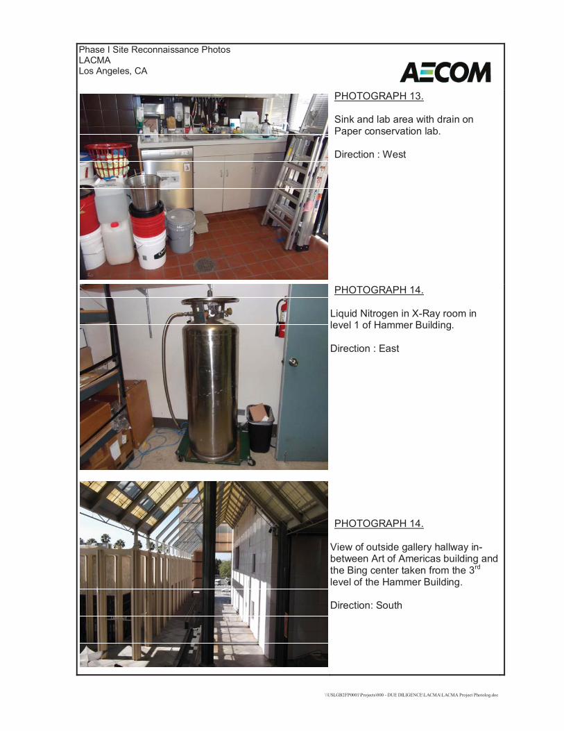
\\USLGB2FP0001\Projects\000 - DUE DILIGENCE\LACMA\LACMA Project Photolog.doc
Phase I Site Reconnaissance PhotosLACMALos Angeles, CA
PHOTOGRAPH 13.
Sink and lab area with drain onPaper conservation lab.
Direction : West
PHOTOGRAPH 14.
Liquid Nitrogen in X-Ray room inlevel 1 of Hammer Building.
Direction : East
PHOTOGRAPH 14.
View of outside gallery hallway in-between Art of Americas building andthe Bing center taken from the 3rd
level of the Hammer Building.
Direction: South

\\USLGB2FP0001\Projects\000 - DUE DILIGENCE\LACMA\LACMA Project Photolog.doc
Phase I Site Reconnaissance PhotosLACMALos Angeles, CA
PHOTOGRAPH 15.
Example of interior gallery space, inthe Art of the Americas.
PHOTOGRAPH 16.Methane gas detection system onlevel 1 of the Bing Center building.
PHOTOGRAPH 17.
Oil transformer in transformer roomadjacent to the Central Plan.
Direction : South

AECOM Environment
July 2016 60506707.1
Appendix B
EDR Database Report

FORM-LBC-SPM
®kcehCoeGhtiwtropeR™paMsuidaRRDEehT
6 Armstrong Road, 4th floorShelton, CT 06484Toll Free: 800.352.0050www.edrnet.com
LACMA5905 Wilshire BoulevardLos Angeles, CA 90036
Inquiry Number: 4647858.2sJune 15, 2016

SECTION PAGE
Executive Summary ES1
Overview Map 2
Detail Map 3
Map Findings Summary 4
Map Findings 8
Orphan Summary 80
Government Records Searched/Data Currency Tracking GR-1
GEOCHECK ADDENDUM
Physical Setting Source Addendum A-1
Physical Setting Source Summary A-2
Physical Setting Source Map A-15
Physical Setting Source Map Findings A-16
Physical Setting Source Records Searched PSGR-1
TC4647858.2s Page 1
Thank you for your business.Please contact EDR at 1-800-352-0050
with any questions or comments.
Disclaimer - Copyright and Trademark NoticeThis Report contains certain information obtained from a variety of public and other sources reasonably available to Environmental DataResources, Inc. It cannot be concluded from this Report that coverage information for the target and surrounding properties does not exist fromother sources. NO WARRANTY EXPRESSED OR IMPLIED, IS MADE WHATSOEVER IN CONNECTION WITH THIS REPORT. ENVIRONMENTALDATA RESOURCES, INC. SPECIFICALLY DISCLAIMS THE MAKING OF ANY SUCH WARRANTIES, INCLUDING WITHOUT LIMITATION,MERCHANTABILITY OR FITNESS FOR A PARTICULAR USE OR PURPOSE. ALL RISK IS ASSUMED BY THE USER. IN NO EVENT SHALLENVIRONMENTAL DATA RESOURCES, INC. BE LIABLE TO ANYONE, WHETHER ARISING OUT OF ERRORS OR OMISSIONS, NEGLIGENCE,ACCIDENT OR ANY OTHER CAUSE, FOR ANY LOSS OF DAMAGE, INCLUDING, WITHOUT LIMITATION, SPECIAL, INCIDENTAL,CONSEQUENTIAL, OR EXEMPLARY DAMAGES. ANY LIABILITY ON THE PART OF ENVIRONMENTAL DATA RESOURCES, INC. IS STRICTLYLIMITED TO A REFUND OF THE AMOUNT PAID FOR THIS REPORT. Purchaser accepts this Report "AS IS". Any analyses, estimates, ratings,environmental risk levels or risk codes provided in this Report are provided for illustrative purposes only, and are not intended to provide, norshould they be interpreted as providing any facts regarding, or prediction or forecast of, any environmental risk for any property. Only a Phase IEnvironmental Site Assessment performed by an environmental professional can provide information regarding the environmental risk for anyproperty. Additionally, the information provided in this Report is not to be construed as legal advice.
Copyright 2016 by Environmental Data Resources, Inc. All rights reserved. Reproduction in any media or format, in wholeor in part, of any report or map of Environmental Data Resources, Inc., or its affiliates, is prohibited without prior written permission.EDR and its logos (including Sanborn and Sanborn Map) are trademarks of Environmental Data Resources, Inc. or its affiliates. All othertrademarks used herein are the property of their respective owners.
TABLE OF CONTENTS

EXECUTIVE SUMMARY
TC4647858.2s EXECUTIVE SUMMARY 1
A search of available environmental records was conducted by Environmental Data Resources, Inc (EDR).The report was designed to assist parties seeking to meet the search requirements of EPA’s Standardsand Practices for All Appropriate Inquiries (40 CFR Part 312), the ASTM Standard Practice forEnvironmental Site Assessments (E 1527-13) or custom requirements developed for the evaluation ofenvironmental risk associated with a parcel of real estate.
TARGET PROPERTY INFORMATION
ADDRESS
5905 WILSHIRE BOULEVARDLOS ANGELES, CA 90036
COORDINATES
34.0639870 - 34˚ 3’ 50.35’’Latitude (North): 118.3568160 - 118˚ 21’ 24.53’’Longitude (West): Zone 11Universal Tranverse Mercator: 374787.8UTM X (Meters): 3769886.5UTM Y (Meters): 175 ft. above sea levelElevation:
USGS TOPOGRAPHIC MAP ASSOCIATED WITH TARGET PROPERTY
5630741 HOLLYWOOD, CATarget Property Map:2012Version Date:
5630733 BEVERLY HILLS, CAWest Map:2012Version Date:
AERIAL PHOTOGRAPHY IN THIS REPORT
20140515, 20140513Portions of Photo from:USDASource:

4647858.2s Page 2
39 WILSHIRE LABREA 5220 WILSHIRE BOULEV SLIC, BROWNFIELDS, ENF, NPDES Higher 1828, 0.346, ESE
38 SHELL 6101 OLYMPIC BLVD LUST, HIST CORTESE Lower 1657, 0.314, SW
37 GLYCERE KERNER 400 S BURNSIDE SWEEPS UST, HIST UST, CA FID UST Higher 1277, 0.242, NE
36 PARAMOUNT CLEANERS 487 S FAIRFAX AVE DRYCLEANERS Lower 1240, 0.235, NW
35 WESTSIDE HOSPITAL 910 S FAIRFAX AVE SWEEPS UST, HIST UST, CA FID UST Lower 1137, 0.215, SW
G34 PREPRESS STUDIO 5657 WILSHIRE BLVD RCRA NonGen / NLR, FINDS Higher 922, 0.175, ESE
G33 5670 WILSHIRE L L P 5670 WILSHIRE BLVD RCRA-SQG Higher 876, 0.166, ESE
G32 SERVICE STATION 7152 5670 WILSHIRE BLVD HIST UST Higher 829, 0.157, ESE
G31 PACIFIC PARKING CORP 5670 WILSHIRE BLVD HIST UST Higher 829, 0.157, ESE
G30 SERVICE STATION 7152 5670 WILSHIRE BLVD SWEEPS UST, CA FID UST Higher 829, 0.157, ESE
G29 CALIFORNIA FEDERAL P 5670 WILSHIRE BLVD HIST UST Higher 829, 0.157, ESE
E28 AL-SAL OIL (OLD UNOC 6050 006TH ST W LUST, HIST CORTESE Lower 792, 0.150, West
G27 LA SALLE PARTNERS AS 5700 WILSHIRE BLVD UST, SWEEPS UST Higher 717, 0.136, ESE
G26 J H SNYDER CO & CALI 5700 WILSHIRE BLVD CA FID UST, CHMIRS, EMI Higher 717, 0.136, ESE
E25 MAY CO WILSHIRE SERV 600 S FAIRFAX AVE EDR Hist Auto Lower 654, 0.124, WNW
F24 6100 HOLDINGS PARTNE 6100 WILSHIRE BLVD UST, SWEEPS UST Lower 591, 0.112, WSW
F23 THE HARA COMPANY 6100 WILSHIRE BLVD CA FID UST, EMI Lower 591, 0.112, WSW
F22 SPENCE J E 6100 WILSHIRE BLVD EDR Hist Auto Lower 591, 0.112, WSW
21 BENEFICIAL STANDARD 5700 WILSHIRE BLVD RCRA-SQG, FINDS, ECHO Higher 574, 0.109, SE
E20 KWIK #32 6050 W 6TH ST SWEEPS UST, CA FID UST Lower 572, 0.108, WNW
E19 KWIK #32 6050 W 6TH ST # 32 UST Lower 572, 0.108, WNW
D18 MUSEUM SQUARE 5757 WILSHIRE HIST CORTESE Higher 360, 0.068, ESE
D17 MUSEUM SQUARE ASSOC 5757 WILSHIRE BLVD LUST, CA FID UST, EMI Higher 360, 0.068, ESE
D16 LA SALLE PARTNERS AS 5750 WILSHIRE BLVD UST, SWEEPS UST Higher 342, 0.065, SE
D15 EL ENTERTAINMENT TEL 5750 WILSHIRE BLVD CA FID UST, HAZNET Higher 342, 0.065, SE
14 6060 WILSHIRE BLVD EDR Hist Auto Lower 294, 0.056, WSW
C13 D D B NEEDHAM WORLDW 5900 WILSHIRE BLVD RCRA-SQG, FINDS, HAZNET, ECHO Lower 246, 0.047, SW
C12 5900 WILSHIRE BLVD B 5900 WILSHIRE BLVD. RCRA-LQG Lower 246, 0.047, SW
B11 5757 WILSHIRE BLVD EDR Hist Auto Higher 116, 0.022, SE
B10 5757 WILSHIRE BLVD EDR Hist Cleaner Higher 116, 0.022, SE
C9 THE SHORENSTEIN CO 5900 WILSHIRE BLVD SWEEPS UST, HIST UST, EMI, PROC Lower 42, 0.008, SSW
C8 5900 WILSHIRE BOULEV 5900 WILSHIRE BLVD HIST UST Lower 42, 0.008, SSW
C7 5900 WILSHIRE BLVD EDR Hist Cleaner Lower 42, 0.008, SSW
B6 GEORGE C PAGE MUSEUM 5801 WILSHIRE BOULEV RCRA-SQG, FINDS, ECHO Higher 18, 0.003, SE
A5 MUSEUM OF ART 5905 WILSHIRE BOULEV HIST UST, LOS ANGELES CO. HMS TP
A4 LACMA HEIZER ROCK PR 5905 WILSHIRE BLVD NPDES TP
A3 LA CO., MUSEUM OF AR 5905 WILSHIRE BLVD EMI, ENF TP
A2 MUSEUM OF ART 5905 WILSHIRE BLVD SWEEPS UST, CA FID UST TP
A1 LOS ANGELES COUNTY/M 5905 WILSHIRE BLVD HAZNET TP
MAPPED SITES SUMMARY
Target Property Address:5905 WILSHIRE BOULEVARDLOS ANGELES, CA 90036
Click on Map ID to see full detail.
MAP RELATIVE DIST (ft. & mi.)ID DATABASE ACRONYMS ELEVATION DIRECTIONSITE NAME ADDRESS

4647858.2s Page 3
J48 LA BREA DODGE 339 LA BREA ENVIROSTOR, VCP, HIST CORTESE Higher 3508, 0.664, ENE
J47 LA BREA AVENUE MOTOR 359 SOUTH LA BREA AV ENVIROSTOR Higher 3390, 0.642, ENE
46 LA BREA AVENUE MOTOR 401 SOUTH LA BREA AV ENVIROSTOR Higher 3263, 0.618, ENE
45 LOS ALTOS CLEANERS 453 S LA BREA ENVIROSTOR, EMI Higher 2850, 0.540, ENE
I44 THE GROVE AT FARMERS 6301 WEST THIRD ST SLIC Higher 2383, 0.451, NNW
I43 THE GROVE AT FARMERS 6301 003RD SLIC Higher 2381, 0.451, NNW
H42 MAS AUTO SERVICE 371 FAIRFAX LUST, HIST CORTESE Higher 2083, 0.395, NNW
H41 MAS AUTO SERVICE 371 SOUTH FAIRFAX AV LUST Higher 2053, 0.389, NNW
H40 HANCOCK PARK ELEMENT 408 SOUTH FAIRFAX AV ENVIROSTOR, SCH Higher 1845, 0.349, NW
MAPPED SITES SUMMARY
Target Property Address:5905 WILSHIRE BOULEVARDLOS ANGELES, CA 90036
Click on Map ID to see full detail.
MAP RELATIVE DIST (ft. & mi.)ID DATABASE ACRONYMS ELEVATION DIRECTIONSITE NAME ADDRESS

EXECUTIVE SUMMARY
TC4647858.2s EXECUTIVE SUMMARY 4
TARGET PROPERTY SEARCH RESULTS
The target property was identified in the following records. For more information on thisproperty see page 8 of the attached EDR Radius Map report:
EPA IDDatabase(s)Site
LOS ANGELES COUNTY/M5905 WILSHIRE BLVDLOS ANGELES, CA 90036
N/AHAZNETGEPAID: CAL000026751
MUSEUM OF ART5905 WILSHIRE BLVDLOS ANGELES, CA 90063
N/ASWEEPS USTStatus: ATank Status: AComp Number: 1489
CA FID USTFacility Id: 19005204Status: A
LA CO., MUSEUM OF AR5905 WILSHIRE BLVDLOS ANGELES, CA 90036
N/AEMIFacility Id: 21717
ENFStatus: WithdrawnStatus: HistoricalFacility Id: 235703
LACMA HEIZER ROCK PR5905 WILSHIRE BLVDLOS ANGELES, CA 90036
N/ANPDESFacility Status: Terminated
MUSEUM OF ART5905 WILSHIRE BOULEVLOS ANGELES, CA 90063
N/AHIST USTLOS ANGELES CO. HMSFacility ID: 012555-012719
DATABASES WITH NO MAPPED SITES
No mapped sites were found in EDR’s search of available ("reasonably ascertainable ") governmentrecords either on the target property or within the search radius around the target property for thefollowing databases:
STANDARD ENVIRONMENTAL RECORDS
Federal NPL site listNPL National Priority List

EXECUTIVE SUMMARY
TC4647858.2s EXECUTIVE SUMMARY 5
Proposed NPL Proposed National Priority List SitesNPL LIENS Federal Superfund Liens
Federal Delisted NPL site listDelisted NPL National Priority List Deletions
Federal CERCLIS listFEDERAL FACILITY Federal Facility Site Information listingSEMS Superfund Enterprise Management System
Federal CERCLIS NFRAP site listSEMS-ARCHIVE Superfund Enterprise Management System Archive
Federal RCRA CORRACTS facilities listCORRACTS Corrective Action Report
Federal RCRA non-CORRACTS TSD facilities listRCRA-TSDF RCRA - Treatment, Storage and Disposal
Federal RCRA generators listRCRA-CESQG RCRA - Conditionally Exempt Small Quantity Generator
Federal institutional controls / engineering controls registriesLUCIS Land Use Control Information SystemUS ENG CONTROLS Engineering Controls Sites ListUS INST CONTROL Sites with Institutional Controls
Federal ERNS listERNS Emergency Response Notification System
State- and tribal - equivalent NPLRESPONSE State Response Sites
State and tribal landfill and/or solid waste disposal site listsSWF/LF Solid Waste Information System
State and tribal leaking storage tank listsINDIAN LUST Leaking Underground Storage Tanks on Indian Land
State and tribal registered storage tank listsFEMA UST Underground Storage Tank ListingAST Aboveground Petroleum Storage Tank FacilitiesINDIAN UST Underground Storage Tanks on Indian Land

EXECUTIVE SUMMARY
TC4647858.2s EXECUTIVE SUMMARY 6
State and tribal voluntary cleanup sitesVCP Voluntary Cleanup Program PropertiesINDIAN VCP Voluntary Cleanup Priority Listing
ADDITIONAL ENVIRONMENTAL RECORDS
Local Brownfield listsUS BROWNFIELDS A Listing of Brownfields Sites
Local Lists of Landfill / Solid Waste Disposal SitesWMUDS/SWAT Waste Management Unit DatabaseSWRCY Recycler DatabaseHAULERS Registered Waste Tire Haulers ListingINDIAN ODI Report on the Status of Open Dumps on Indian LandsDEBRIS REGION 9 Torres Martinez Reservation Illegal Dump Site LocationsODI Open Dump Inventory
Local Lists of Hazardous waste / Contaminated SitesAOCONCERN San Gabriel Valley Areas of ConcernUS HIST CDL Delisted National Clandestine Laboratory RegisterHIST Cal-Sites Historical Calsites DatabaseSCH School Property Evaluation ProgramCDL Clandestine Drug LabsToxic Pits Toxic Pits Cleanup Act SitesUS CDL National Clandestine Laboratory Register
Local Land RecordsLIENS Environmental Liens ListingLIENS 2 CERCLA Lien InformationDEED Deed Restriction Listing
Records of Emergency Release ReportsHMIRS Hazardous Materials Information Reporting SystemCHMIRS California Hazardous Material Incident Report SystemLDS Land Disposal Sites ListingMCS Military Cleanup Sites ListingSPILLS 90 SPILLS 90 data from FirstSearch
Other Ascertainable RecordsFUDS Formerly Used Defense SitesDOD Department of Defense SitesSCRD DRYCLEANERS State Coalition for Remediation of Drycleaners ListingUS FIN ASSUR Financial Assurance InformationEPA WATCH LIST EPA WATCH LIST2020 COR ACTION 2020 Corrective Action Program ListTSCA Toxic Substances Control Act

EXECUTIVE SUMMARY
TC4647858.2s EXECUTIVE SUMMARY 7
TRIS Toxic Chemical Release Inventory SystemSSTS Section 7 Tracking SystemsROD Records Of DecisionRMP Risk Management PlansRAATS RCRA Administrative Action Tracking SystemPRP Potentially Responsible PartiesPADS PCB Activity Database SystemICIS Integrated Compliance Information SystemFTTS FIFRA/ TSCA Tracking System - FIFRA (Federal Insecticide, Fungicide, & Rodenticide Act)/TSCA (Toxic Substances Control Act)MLTS Material Licensing Tracking SystemCOAL ASH DOE Steam-Electric Plant Operation DataCOAL ASH EPA Coal Combustion Residues Surface Impoundments ListPCB TRANSFORMER PCB Transformer Registration DatabaseRADINFO Radiation Information DatabaseHIST FTTS FIFRA/TSCA Tracking System Administrative Case ListingDOT OPS Incident and Accident DataCONSENT Superfund (CERCLA) Consent DecreesINDIAN RESERV Indian ReservationsFUSRAP Formerly Utilized Sites Remedial Action ProgramUMTRA Uranium Mill Tailings SitesLEAD SMELTERS Lead Smelter SitesUS AIRS Aerometric Information Retrieval System Facility SubsystemUS MINES Mines Master Index FileFINDS Facility Index System/Facility Registry SystemUXO Unexploded Ordnance SitesDOCKET HWC Hazardous Waste Compliance Docket ListingCA BOND EXP. PLAN Bond Expenditure PlanCortese "Cortese" Hazardous Waste & Substances Sites ListCUPA Listings CUPA Resources ListFinancial Assurance Financial Assurance Information ListingHWP EnviroStor Permitted Facilities ListingHWT Registered Hazardous Waste Transporter DatabaseMINES Mines Site Location ListingMWMP Medical Waste Management Program ListingPEST LIC Pesticide Regulation Licenses ListingNotify 65 Proposition 65 RecordsLA Co. Site Mitigation Site Mitigation ListUIC UIC ListingWASTEWATER PITS Oil Wastewater Pits ListingWDS Waste Discharge SystemWIP Well Investigation Program Case ListECHO Enforcement & Compliance History InformationFUELS PROGRAM EPA Fuels Program Registered Listing
EDR HIGH RISK HISTORICAL RECORDS
EDR Exclusive RecordsEDR MGP EDR Proprietary Manufactured Gas Plants
EDR RECOVERED GOVERNMENT ARCHIVES
Exclusive Recovered Govt. ArchivesRGA LF Recovered Government Archive Solid Waste Facilities List

EXECUTIVE SUMMARY
TC4647858.2s EXECUTIVE SUMMARY 8
RGA LUST Recovered Government Archive Leaking Underground Storage Tank
SURROUNDING SITES: SEARCH RESULTS
Surrounding sites were identified in the following databases.
Elevations have been determined from the USGS Digital Elevation Model and should be evaluated ona relative (not an absolute) basis. Relative elevation information between sites of close proximityshould be field verified. Sites with an elevation equal to or higher than the target property have beendifferentiated below from sites with an elevation lower than the target property.Page numbers and map identification numbers refer to the EDR Radius Map report where detaileddata on individual sites can be reviewed.
Sites listed in bold italics are in multiple databases.
Unmappable (orphan) sites are not considered in the foregoing analysis.
STANDARD ENVIRONMENTAL RECORDS
Federal RCRA generators listRCRA-LQG: RCRAInfo is EPA’s comprehensive information system, providing access to data supportingthe Resource Conservation and Recovery Act (RCRA) of 1976 and the Hazardous and Solid Waste Amendments (HSWA)of 1984. The database includes selective information on sites which generate, transport, store, treat and/ordispose of hazardous waste as defined by the Resource Conservation and Recovery Act (RCRA). Large quantitygenerators (LQGs) generate over 1,000 kilograms (kg) of hazardous waste, or over 1 kg of acutely hazardouswaste per month.
A review of the RCRA-LQG list, as provided by EDR, and dated 12/09/2015 has revealed that there is 1 RCRA-LQG site within approximately 0.25 miles of the target property.
PageMap IDDirection / Distance Address Lower Elevation ____________________ ________ ___________________ _____ _____
5900 WILSHIRE BLVD B 5900 WILSHIRE BLVD. SW 0 - 1/8 (0.047 mi.) C12 22
RCRA-SQG: RCRAInfo is EPA’s comprehensive information system, providing access to data supportingthe Resource Conservation and Recovery Act (RCRA) of 1976 and the Hazardous and Solid Waste Amendments (HSWA)of 1984. The database includes selective information on sites which generate, transport, store, treat and/ordispose of hazardous waste as defined by the Resource Conservation and Recovery Act (RCRA). Small quantitygenerators (SQGs) generate between 100 kg and 1,000 kg of hazardous waste per month.
A review of the RCRA-SQG list, as provided by EDR, and dated 12/09/2015 has revealed that there are 4 RCRA-SQG sites within approximately 0.25 miles of the target property.
PageMap IDDirection / Distance Address Equal/Higher Elevation ____________________ ________ ___________________ _____ _____
GEORGE C PAGE MUSEUM 5801 WILSHIRE BOULEV SE 0 - 1/8 (0.003 mi.) B6 16 BENEFICIAL STANDARD 5700 WILSHIRE BLVD SE 0 - 1/8 (0.109 mi.) 21 32 5670 WILSHIRE L L P 5670 WILSHIRE BLVD ESE 1/8 - 1/4 (0.166 mi.) G33 44
PageMap IDDirection / Distance Address Lower Elevation ____________________ ________ ___________________ _____ _____
D D B NEEDHAM WORLDW 5900 WILSHIRE BLVD SW 0 - 1/8 (0.047 mi.) C13 23

EXECUTIVE SUMMARY
TC4647858.2s EXECUTIVE SUMMARY 9
State- and tribal - equivalent CERCLISENVIROSTOR: The Department of Toxic Substances Control’s (DTSC’s) Site Mitigation and BrownfieldsReuse Program’s (SMBRP’s) EnviroStor database identifes sites that have known contamination or sites for whichthere may be reasons to investigate further. The database includes the following site types: FederalSuperfund sites (National Priorities List (NPL)); State Response, including Military Facilities and StateSuperfund; Voluntary Cleanup; and School sites. EnviroStor provides similar information to the informationthat was available in CalSites, and provides additional site information, including, but not limited to,identification of formerly-contaminated properties that have been released for reuse, properties whereenvironmental deed restrictions have been recorded to prevent inappropriate land uses, and riskcharacterization information that is used to assess potential impacts to public health and the environment atcontaminated sites.
A review of the ENVIROSTOR list, as provided by EDR, and dated 02/01/2016 has revealed that there are 5 ENVIROSTOR sites within approximately 1 mile of the target property.
PageMap IDDirection / Distance Address Equal/Higher Elevation ____________________ ________ ___________________ _____ _____
HANCOCK PARK ELEMENT 408 SOUTH FAIRFAX AV NW 1/4 - 1/2 (0.349 mi.) H40 59Facility Id: 19000014Status: Inactive - Needs Evaluation
LOS ALTOS CLEANERS 453 S LA BREA ENE 1/2 - 1 (0.540 mi.) 45 70Facility Id: 60001631Status: No Further Action
LA BREA AVENUE MOTOR 401 SOUTH LA BREA AV ENE 1/2 - 1 (0.618 mi.) 46 72Facility Id: 60001610Status: No Further Action
LA BREA AVENUE MOTOR 359 SOUTH LA BREA AV ENE 1/2 - 1 (0.642 mi.) J47 74Facility Id: 60001611Status: No Further Action
LA BREA DODGE 339 LA BREA ENE 1/2 - 1 (0.664 mi.) J48 76Facility Id: 60001395Status: No Further Action
State and tribal leaking storage tank listsLUST: The Leaking Underground Storage Tank Incident Reports contain an inventory of reportedleaking underground storage tank incidents. The data come from the State Water Resources Control Board LeakingUnderground Storage Tank Information System.
A review of the LUST list, as provided by EDR, and dated 03/14/2016 has revealed that there are 5 LUST sites within approximately 0.5 miles of the target property.
PageMap IDDirection / Distance Address Equal/Higher Elevation ____________________ ________ ___________________ _____ _____
MUSEUM SQUARE ASSOC 5757 WILSHIRE BLVD ESE 0 - 1/8 (0.068 mi.) D17 27Status: Completed - Case ClosedFacility Id: 900360143Status: Case ClosedGlobal Id: T0603700895Global ID: T0603700895
MAS AUTO SERVICE 371 SOUTH FAIRFAX AV NNW 1/4 - 1/2 (0.389 mi.) H41 61

EXECUTIVE SUMMARY
TC4647858.2s EXECUTIVE SUMMARY 10
Status: Open - RemediationGlobal Id: T0603700891
MAS AUTO SERVICE 371 FAIRFAX NNW 1/4 - 1/2 (0.395 mi.) H42 68Facility Id: 900360107Status: Remediation PlanGlobal ID: T0603700891
PageMap IDDirection / Distance Address Lower Elevation ____________________ ________ ___________________ _____ _____
AL-SAL OIL (OLD UNOC 6050 006TH ST W W 1/8 - 1/4 (0.150 mi.) E28 38Status: Completed - Case ClosedFacility Id: 900360125Status: Case ClosedGlobal Id: T0603700893Global ID: T0603700893
SHELL 6101 OLYMPIC BLVD SW 1/4 - 1/2 (0.314 mi.) 38 50Status: Completed - Case ClosedFacility Id: 900480098Status: Remediation PlanGlobal Id: T0603701109Global ID: T0603701109
SLIC: SLIC Region comes from the California Regional Water Quality Control Board.
A review of the SLIC list, as provided by EDR, and dated 03/14/2016 has revealed that there are 3 SLIC sites within approximately 0.5 miles of the target property.
PageMap IDDirection / Distance Address Equal/Higher Elevation ____________________ ________ ___________________ _____ _____
WILSHIRE LABREA 5220 WILSHIRE BOULEV ESE 1/4 - 1/2 (0.346 mi.) 39 55Facility Status: Completed - Case ClosedGlobal Id: T10000000618
THE GROVE AT FARMERS 6301 003RD NNW 1/4 - 1/2 (0.451 mi.) I43 69Facility Status: Post Remediation Monitoring
THE GROVE AT FARMERS 6301 WEST THIRD ST NNW 1/4 - 1/2 (0.451 mi.) I44 70Facility Status: Open - Verification MonitoringGlobal Id: SL2049G1726
State and tribal registered storage tank listsUST: The Underground Storage Tank database contains registered USTs. USTs are regulated underSubtitle I of the Resource Conservation and Recovery Act (RCRA). The data come from the State Water ResourcesControl Board’s Hazardous Substance Storage Container Database.
A review of the UST list, as provided by EDR, and dated 03/14/2016 has revealed that there are 4 UST sites within approximately 0.25 miles of the target property.
PageMap IDDirection / Distance Address Equal/Higher Elevation ____________________ ________ ___________________ _____ _____
LA SALLE PARTNERS AS 5750 WILSHIRE BLVD SE 0 - 1/8 (0.065 mi.) D16 26

EXECUTIVE SUMMARY
TC4647858.2s EXECUTIVE SUMMARY 11
Facility Id: 25273
LA SALLE PARTNERS AS 5700 WILSHIRE BLVD ESE 1/8 - 1/4 (0.136 mi.) G27 38Facility Id: 25269
PageMap IDDirection / Distance Address Lower Elevation ____________________ ________ ___________________ _____ _____
KWIK #32 6050 W 6TH ST # 32 WNW 0 - 1/8 (0.108 mi.) E19 31Facility Id: 23603
6100 HOLDINGS PARTNE 6100 WILSHIRE BLVD WSW 0 - 1/8 (0.112 mi.) F24 35Facility Id: 25298
State and tribal Brownfields sitesBROWNFIELDS: A listing of sites the SWRCB considers to be Brownfields since these are sites have cometo them through the MOA Process.
A review of the BROWNFIELDS list, as provided by EDR, and dated 02/29/2016 has revealed that there is 1 BROWNFIELDS site within approximately 0.5 miles of the target property.
PageMap IDDirection / Distance Address Equal/Higher Elevation ____________________ ________ ___________________ _____ _____
WILSHIRE LABREA 5220 WILSHIRE BOULEV ESE 1/4 - 1/2 (0.346 mi.) 39 55
ADDITIONAL ENVIRONMENTAL RECORDS
Local Lists of Registered Storage TanksSWEEPS UST: Statewide Environmental Evaluation and Planning System. This underground storage tanklisting was updated and maintained by a company contacted by the SWRCB in the early 1990’s. The listing is nolonger updated or maintained. The local agency is the contact for more information on a site on the SWEEPSlist.
A review of the SWEEPS UST list, as provided by EDR, and dated 06/01/1994 has revealed that there are 8 SWEEPS UST sites within approximately 0.25 miles of the target property.
PageMap IDDirection / Distance Address Equal/Higher Elevation ____________________ ________ ___________________ _____ _____
LA SALLE PARTNERS AS 5750 WILSHIRE BLVD SE 0 - 1/8 (0.065 mi.) D16 26Status: AComp Number: 6478
LA SALLE PARTNERS AS 5700 WILSHIRE BLVD ESE 1/8 - 1/4 (0.136 mi.) G27 38Status: AComp Number: 6544
SERVICE STATION 7152 5670 WILSHIRE BLVD ESE 1/8 - 1/4 (0.157 mi.) G30 41Comp Number: 908
GLYCERE KERNER 400 S BURNSIDE NE 1/8 - 1/4 (0.242 mi.) 37 49Comp Number: 2571
PageMap IDDirection / Distance Address Lower Elevation ____________________ ________ ___________________ _____ _____
THE SHORENSTEIN CO 5900 WILSHIRE BLVD SSW 0 - 1/8 (0.008 mi.) C9 19

EXECUTIVE SUMMARY
TC4647858.2s EXECUTIVE SUMMARY 12
Comp Number: 8323
KWIK #32 6050 W 6TH ST WNW 0 - 1/8 (0.108 mi.) E20 31Status: ATank Status: AComp Number: 601
6100 HOLDINGS PARTNE 6100 WILSHIRE BLVD WSW 0 - 1/8 (0.112 mi.) F24 35Status: AComp Number: 6433
WESTSIDE HOSPITAL 910 S FAIRFAX AVE SW 1/8 - 1/4 (0.215 mi.) 35 47Status: ATank Status: AComp Number: 3112
HIST UST: Historical UST Registered Database.
A review of the HIST UST list, as provided by EDR, and dated 10/15/1990 has revealed that there are 7 HIST UST sites within approximately 0.25 miles of the target property.
PageMap IDDirection / Distance Address Equal/Higher Elevation ____________________ ________ ___________________ _____ _____
CALIFORNIA FEDERAL P 5670 WILSHIRE BLVD ESE 1/8 - 1/4 (0.157 mi.) G29 41Facility Id: 00000066213
PACIFIC PARKING CORP 5670 WILSHIRE BLVD ESE 1/8 - 1/4 (0.157 mi.) G31 43Facility Id: 00000056039
SERVICE STATION 7152 5670 WILSHIRE BLVD ESE 1/8 - 1/4 (0.157 mi.) G32 43Facility Id: 00000007904
GLYCERE KERNER 400 S BURNSIDE NE 1/8 - 1/4 (0.242 mi.) 37 49
PageMap IDDirection / Distance Address Lower Elevation ____________________ ________ ___________________ _____ _____
5900 WILSHIRE BOULEV 5900 WILSHIRE BLVD SSW 0 - 1/8 (0.008 mi.) C8 18Facility Id: 00000063362
THE SHORENSTEIN CO 5900 WILSHIRE BLVD SSW 0 - 1/8 (0.008 mi.) C9 19Facility Id: 00000007909
WESTSIDE HOSPITAL 910 S FAIRFAX AVE SW 1/8 - 1/4 (0.215 mi.) 35 47
CA FID UST: The Facility Inventory Database contains active and inactive underground storage tanklocations. The source is the State Water Resource Control Board.
A review of the CA FID UST list, as provided by EDR, and dated 10/31/1994 has revealed that there are 8 CA FID UST sites within approximately 0.25 miles of the target property.
PageMap IDDirection / Distance Address Equal/Higher Elevation ____________________ ________ ___________________ _____ _____
EL ENTERTAINMENT TEL 5750 WILSHIRE BLVD SE 0 - 1/8 (0.065 mi.) D15 25Facility Id: 19015731Status: A
MUSEUM SQUARE ASSOC 5757 WILSHIRE BLVD ESE 0 - 1/8 (0.068 mi.) D17 27Facility Id: 19008997Status: A
J H SNYDER CO & CALI 5700 WILSHIRE BLVD ESE 1/8 - 1/4 (0.136 mi.) G26 36

EXECUTIVE SUMMARY
TC4647858.2s EXECUTIVE SUMMARY 13
Facility Id: 19031230Status: A
SERVICE STATION 7152 5670 WILSHIRE BLVD ESE 1/8 - 1/4 (0.157 mi.) G30 41Facility Id: 19011644Status: I
GLYCERE KERNER 400 S BURNSIDE NE 1/8 - 1/4 (0.242 mi.) 37 49Facility Id: 19055519Status: A
PageMap IDDirection / Distance Address Lower Elevation ____________________ ________ ___________________ _____ _____
KWIK #32 6050 W 6TH ST WNW 0 - 1/8 (0.108 mi.) E20 31Facility Id: 19023598Status: A
THE HARA COMPANY 6100 WILSHIRE BLVD WSW 0 - 1/8 (0.112 mi.) F23 34Facility Id: 19026156Status: A
WESTSIDE HOSPITAL 910 S FAIRFAX AVE SW 1/8 - 1/4 (0.215 mi.) 35 47Facility Id: 19048393Status: A
Other Ascertainable RecordsRCRA NonGen / NLR: RCRAInfo is EPA’s comprehensive information system, providing access to data supportingthe Resource Conservation and Recovery Act (RCRA) of 1976 and the Hazardous and Solid Waste Amendments (HSWA)of 1984. The database includes selective information on sites which generate, transport, store, treat and/ordispose of hazardous waste as defined by the Resource Conservation and Recovery Act (RCRA). Non-Generators donot presently generate hazardous waste.
A review of the RCRA NonGen / NLR list, as provided by EDR, and dated 12/09/2015 has revealed that there is 1 RCRA NonGen / NLR site within approximately 0.25 miles of the target property.
PageMap IDDirection / Distance Address Equal/Higher Elevation ____________________ ________ ___________________ _____ _____
PREPRESS STUDIO 5657 WILSHIRE BLVD ESE 1/8 - 1/4 (0.175 mi.) G34 46
DRYCLEANERS: A list of drycleaner related facilities that have EPA ID numbers. These are facilitieswith certain SIC codes: power laundries, family and commercial; garment pressing and cleaners’ agents; linensupply; coin-operated laundries and cleaning; drycleaning plants except rugs; carpet and upholster cleaning;industrial launderers; laundry and garment services.
A review of the DRYCLEANERS list, as provided by EDR, and dated 02/08/2016 has revealed that there is 1 DRYCLEANERS site within approximately 0.25 miles of the target property.
PageMap IDDirection / Distance Address Lower Elevation ____________________ ________ ___________________ _____ _____
PARAMOUNT CLEANERS 487 S FAIRFAX AVE NW 1/8 - 1/4 (0.235 mi.) 36 48EPA Id: CAL000264885

EXECUTIVE SUMMARY
TC4647858.2s EXECUTIVE SUMMARY 14
HIST CORTESE: The sites for the list are designated by the State Water Resource Control Board [LUST],the Integrated Waste Board [SWF/LS], and the Department of Toxic Substances Control [CALSITES]. Thislisting is no longer updated by the state agency.
A review of the HIST CORTESE list, as provided by EDR, and dated 04/01/2001 has revealed that there are 4 HIST CORTESE sites within approximately 0.5 miles of the target property.
PageMap IDDirection / Distance Address Equal/Higher Elevation ____________________ ________ ___________________ _____ _____
MUSEUM SQUARE 5757 WILSHIRE ESE 0 - 1/8 (0.068 mi.) D18 30Reg Id: 900360143
MAS AUTO SERVICE 371 FAIRFAX NNW 1/4 - 1/2 (0.395 mi.) H42 68Reg Id: 900360107
PageMap IDDirection / Distance Address Lower Elevation ____________________ ________ ___________________ _____ _____
AL-SAL OIL (OLD UNOC 6050 006TH ST W W 1/8 - 1/4 (0.150 mi.) E28 38Reg Id: 900360125
SHELL 6101 OLYMPIC BLVD SW 1/4 - 1/2 (0.314 mi.) 38 50Reg Id: 900480098
PROC: A listing of certified processors.
A review of the PROC list, as provided by EDR, and dated 03/15/2016 has revealed that there is 1 PROC site within approximately 0.5 miles of the target property.
PageMap IDDirection / Distance Address Lower Elevation ____________________ ________ ___________________ _____ _____
THE SHORENSTEIN CO 5900 WILSHIRE BLVD SSW 0 - 1/8 (0.008 mi.) C9 19Cert Id: PR0462Reg Id: 19183
EDR HIGH RISK HISTORICAL RECORDS
EDR Exclusive RecordsEDR Hist Auto: EDR has searched selected national collections of business directories and has collectedlistings of potential gas station/filling station/service station sites that were available to EDRresearchers. EDR’s review was limited to those categories of sources that might, in EDR’s opinion, includegas station/filling station/service station establishments. The categories reviewed included, but were notlimited to gas, gas station, gasoline station, filling station, auto, automobile repair, auto service station,service station, etc. This database falls within a category of information EDR classifies as "High RiskHistorical Records", or HRHR. EDR’s HRHR effort presents unique and sometimes proprietary data about pastsites and operations that typically create environmental concerns, but may not show up in current governmentrecords searches.
A review of the EDR Hist Auto list, as provided by EDR, has revealed that there are 4 EDR Hist Auto sites within approximately 0.125 miles of the target property.
PageMap IDDirection / Distance Address Equal/Higher Elevation ____________________ ________ ___________________ _____ _____
Not reported 5757 WILSHIRE BLVD SE 0 - 1/8 (0.022 mi.) B11 22
PageMap IDDirection / Distance Address Lower Elevation ____________________ ________ ___________________ _____ _____
Not reported 6060 WILSHIRE BLVD WSW 0 - 1/8 (0.056 mi.) 14 25
EXECUTIVE SUMMARY
TC4647858.2s EXECUTIVE SUMMARY 15
PageMap IDDirection / Distance Address Lower Elevation ____________________ ________ ___________________ _____ _____
SPENCE J E 6100 WILSHIRE BLVD WSW 0 - 1/8 (0.112 mi.) F22 34 MAY CO WILSHIRE SERV 600 S FAIRFAX AVE WNW 0 - 1/8 (0.124 mi.) E25 35
EDR Hist Cleaner: EDR has searched selected national collections of business directories and has collectedlistings of potential dry cleaner sites that were available to EDR researchers. EDR’s review was limited tothose categories of sources that might, in EDR’s opinion, include dry cleaning establishments. The categoriesreviewed included, but were not limited to dry cleaners, cleaners, laundry, laundromat, cleaning/laundry, wash& dry etc. This database falls within a category of information EDR classifies as "High Risk HistoricalRecords", or HRHR. EDR’s HRHR effort presents unique and sometimes proprietary data about past sites andoperations that typically create environmental concerns, but may not show up in current government recordssearches.
A review of the EDR Hist Cleaner list, as provided by EDR, has revealed that there are 2 EDR Hist Cleaner sites within approximately 0.125 miles of the target property.
PageMap IDDirection / Distance Address Equal/Higher Elevation ____________________ ________ ___________________ _____ _____
Not reported 5757 WILSHIRE BLVD SE 0 - 1/8 (0.022 mi.) B10 21
PageMap IDDirection / Distance Address Lower Elevation ____________________ ________ ___________________ _____ _____
Not reported 5900 WILSHIRE BLVD SSW 0 - 1/8 (0.008 mi.) C7 18

EXECUTIVE SUMMARY
TC4647858.2s EXECUTIVE SUMMARY 16
Due to poor or inadequate address information, the following sites were not mapped. Count: 5 records.
Site Name Database(s)____________ ____________
FARMERS MARKET CAR WASH (FORMER) LUSTFREE PORT - MCMURAN OIL & GAS SLICBELMONT/HOLLYWOOD NO. 1 ENVIROSTOR, SCHCENTRAL LOS ANGELES MIDDLE SCHOOL ENVIROSTOR, SCHSALT LAKE PROPERTY ENVIROSTOR

EDR Inc.EDR Inc.EDR Inc.EDR Inc.EDR Inc.EDR Inc.EDR Inc.EDR Inc.EDR Inc.EDR Inc.EDR Inc.EDR Inc.EDR Inc.EDR Inc.EDR Inc.EDR Inc.EDR Inc.EDR Inc.EDR Inc.EDR Inc.EDR Inc.EDR Inc.EDR Inc.EDR Inc.EDR Inc.EDR Inc.EDR Inc.EDR Inc.EDR Inc.EDR Inc.EDR Inc.EDR Inc.EDR Inc.EDR Inc.EDR Inc.EDR Inc.EDR Inc.EDR Inc.EDR Inc.EDR Inc.
Natural Gas

EDR Inc.EDR Inc.EDR Inc.EDR Inc.EDR Inc.EDR Inc.EDR Inc.EDR Inc.EDR Inc.EDR Inc.EDR Inc.EDR Inc.EDR Inc.EDR Inc.EDR Inc.EDR Inc.EDR Inc.EDR Inc.EDR Inc.EDR Inc.EDR Inc.EDR Inc.EDR Inc.EDR Inc.EDR Inc.EDR Inc.EDR Inc.EDR Inc.EDR Inc.EDR Inc.EDR Inc.EDR Inc.EDR Inc.EDR Inc.EDR Inc.EDR Inc.EDR Inc.EDR Inc.EDR Inc.EDR Inc.

MAP FINDINGS SUMMARY
SearchTargetDistance Total
Database Property(Miles) < 1/8 1/8 - 1/4 1/4 - 1/2 1/2 - 1 > 1 Plotted
STANDARD ENVIRONMENTAL RECORDS
Federal NPL site list 0 NR 0 0 0 0 1.000NPL 0 NR 0 0 0 0 1.000Proposed NPL 0 NR NR NR NR NR TPNPL LIENS
Federal Delisted NPL site list 0 NR 0 0 0 0 1.000Delisted NPL
Federal CERCLIS list 0 NR NR 0 0 0 0.500FEDERAL FACILITY 0 NR NR 0 0 0 0.500SEMS
Federal CERCLIS NFRAP site list 0 NR NR 0 0 0 0.500SEMS-ARCHIVE
Federal RCRA CORRACTS facilities list 0 NR 0 0 0 0 1.000CORRACTS
Federal RCRA non-CORRACTS TSD facilities list 0 NR NR 0 0 0 0.500RCRA-TSDF
Federal RCRA generators list 1 NR NR NR 0 1 0.250RCRA-LQG 4 NR NR NR 1 3 0.250RCRA-SQG 0 NR NR NR 0 0 0.250RCRA-CESQG
Federal institutional controls /engineering controls registries
0 NR NR 0 0 0 0.500LUCIS 0 NR NR 0 0 0 0.500US ENG CONTROLS 0 NR NR 0 0 0 0.500US INST CONTROL
Federal ERNS list 0 NR NR NR NR NR TPERNS
State- and tribal - equivalent NPL 0 NR 0 0 0 0 1.000RESPONSE
State- and tribal - equivalent CERCLIS 5 NR 4 1 0 0 1.000ENVIROSTOR
State and tribal landfill and/orsolid waste disposal site lists
0 NR NR 0 0 0 0.500SWF/LF
State and tribal leaking storage tank lists 5 NR NR 3 1 1 0.500LUST
TC4647858.2s Page 4

MAP FINDINGS SUMMARY
SearchTargetDistance Total
Database Property(Miles) < 1/8 1/8 - 1/4 1/4 - 1/2 1/2 - 1 > 1 Plotted
0 NR NR 0 0 0 0.500INDIAN LUST 3 NR NR 3 0 0 0.500SLIC
State and tribal registered storage tank lists 0 NR NR NR 0 0 0.250FEMA UST 4 NR NR NR 1 3 0.250UST 0 NR NR NR 0 0 0.250AST 0 NR NR NR 0 0 0.250INDIAN UST
State and tribal voluntary cleanup sites 0 NR NR 0 0 0 0.500VCP 0 NR NR 0 0 0 0.500INDIAN VCP
State and tribal Brownfields sites 1 NR NR 1 0 0 0.500BROWNFIELDS
ADDITIONAL ENVIRONMENTAL RECORDS
Local Brownfield lists 0 NR NR 0 0 0 0.500US BROWNFIELDS
Local Lists of Landfill / SolidWaste Disposal Sites
0 NR NR 0 0 0 0.500WMUDS/SWAT 0 NR NR 0 0 0 0.500SWRCY 0 NR NR NR NR NR TPHAULERS 0 NR NR 0 0 0 0.500INDIAN ODI 0 NR NR 0 0 0 0.500DEBRIS REGION 9 0 NR NR 0 0 0 0.500ODI
Local Lists of Hazardous waste /Contaminated Sites
0 NR 0 0 0 0 1.000AOCONCERN 0 NR NR NR NR NR TPUS HIST CDL 0 NR 0 0 0 0 1.000HIST Cal-Sites 0 NR NR NR 0 0 0.250SCH 0 NR NR NR NR NR TPCDL 0 NR 0 0 0 0 1.000Toxic Pits 0 NR NR NR NR NR TPUS CDL
Local Lists of Registered Storage Tanks 9 NR NR NR 4 4 0.250 1SWEEPS UST 8 NR NR NR 5 2 0.250 1HIST UST 9 NR NR NR 4 4 0.250 1CA FID UST
Local Land Records 0 NR NR NR NR NR TPLIENS 0 NR NR NR NR NR TPLIENS 2 0 NR NR 0 0 0 0.500DEED
Records of Emergency Release Reports 0 NR NR NR NR NR TPHMIRS
TC4647858.2s Page 5

MAP FINDINGS SUMMARY
SearchTargetDistance Total
Database Property(Miles) < 1/8 1/8 - 1/4 1/4 - 1/2 1/2 - 1 > 1 Plotted
0 NR NR NR NR NR TPCHMIRS 0 NR NR NR NR NR TPLDS 0 NR NR NR NR NR TPMCS 0 NR NR NR NR NR TPSPILLS 90
Other Ascertainable Records 1 NR NR NR 1 0 0.250RCRA NonGen / NLR 0 NR 0 0 0 0 1.000FUDS 0 NR 0 0 0 0 1.000DOD 0 NR NR 0 0 0 0.500SCRD DRYCLEANERS 0 NR NR NR NR NR TPUS FIN ASSUR 0 NR NR NR NR NR TPEPA WATCH LIST 0 NR NR NR 0 0 0.2502020 COR ACTION 0 NR NR NR NR NR TPTSCA 0 NR NR NR NR NR TPTRIS 0 NR NR NR NR NR TPSSTS 0 NR 0 0 0 0 1.000ROD 0 NR NR NR NR NR TPRMP 0 NR NR NR NR NR TPRAATS 0 NR NR NR NR NR TPPRP 0 NR NR NR NR NR TPPADS 0 NR NR NR NR NR TPICIS 0 NR NR NR NR NR TPFTTS 0 NR NR NR NR NR TPMLTS 0 NR NR NR NR NR TPCOAL ASH DOE 0 NR NR 0 0 0 0.500COAL ASH EPA 0 NR NR NR NR NR TPPCB TRANSFORMER 0 NR NR NR NR NR TPRADINFO 0 NR NR NR NR NR TPHIST FTTS 0 NR NR NR NR NR TPDOT OPS 0 NR 0 0 0 0 1.000CONSENT 0 NR 0 0 0 0 1.000INDIAN RESERV 0 NR 0 0 0 0 1.000FUSRAP 0 NR NR 0 0 0 0.500UMTRA 0 NR NR NR NR NR TPLEAD SMELTERS 0 NR NR NR NR NR TPUS AIRS 0 NR NR NR 0 0 0.250US MINES 0 NR NR NR NR NR TPFINDS 0 NR 0 0 0 0 1.000UXO 0 NR NR NR NR NR TPDOCKET HWC 0 NR 0 0 0 0 1.000CA BOND EXP. PLAN 0 NR NR 0 0 0 0.500Cortese 0 NR NR NR 0 0 0.250CUPA Listings 1 NR NR NR 1 0 0.250DRYCLEANERS 1 NR NR NR NR NR TP 1EMI 1 NR NR NR NR NR TP 1ENF 0 NR NR NR NR NR TPFinancial Assurance 1 NR NR NR NR NR TP 1HAZNET 4 NR NR 2 1 1 0.500HIST CORTESE 1 NR NR NR NR NR TP 1LOS ANGELES CO. HMS 0 NR 0 0 0 0 1.000HWP
TC4647858.2s Page 6

MAP FINDINGS SUMMARY
SearchTargetDistance Total
Database Property(Miles) < 1/8 1/8 - 1/4 1/4 - 1/2 1/2 - 1 > 1 Plotted
0 NR NR NR 0 0 0.250HWT 0 NR NR NR NR NR TPMINES 0 NR NR NR 0 0 0.250MWMP 1 NR NR NR NR NR TP 1NPDES 0 NR NR NR NR NR TPPEST LIC 1 NR NR 0 0 1 0.500PROC 0 NR 0 0 0 0 1.000Notify 65 0 NR NR NR NR NR TPLA Co. Site Mitigation 0 NR NR NR NR NR TPUIC 0 NR NR 0 0 0 0.500WASTEWATER PITS 0 NR NR NR NR NR TPWDS 0 NR NR NR 0 0 0.250WIP 0 NR NR NR NR NR TPECHO 0 NR NR NR 0 0 0.250FUELS PROGRAM
EDR HIGH RISK HISTORICAL RECORDS
EDR Exclusive Records 0 NR 0 0 0 0 1.000EDR MGP 4 NR NR NR NR 4 0.125EDR Hist Auto 2 NR NR NR NR 2 0.125EDR Hist Cleaner
EDR RECOVERED GOVERNMENT ARCHIVES
Exclusive Recovered Govt. Archives 0 NR NR NR NR NR TPRGA LF 0 NR NR NR NR NR TPRGA LUST
67 0 4 10 19 26 8- Totals --
NOTES:
TP = Target Property
NR = Not Requested at this Search Distance
Sites may be listed in more than one database
TC4647858.2s Page 7

MAP FINDINGSMap IDDirection
EDR ID NumberDistanceEPA ID NumberDatabase(s)SiteElevation
Off-specification, aged or surplus organicsWaste Category: Los AngelesTSD County: CAD044429835TSD EPA ID: Los AngelesGen County: LOS ANGELES, CA 900364523Mailing City,St,Zip: 5905 WILSHIRE BLVDMailing Address: Not reportedMailing Name: 3239325899Telephone: ALLISON AKBAROFFContact: CAL000026751GEPAID: 2014Year: S113031343envid:
Los AngelesFacility County: (H010-H129) Or (H131-H135) Storage, Bulking, And/Or Transfer Off Site--No Treatment/ReoveryMethod Decode: Liquids with pH <= 2 with metalsCat Decode: 0.0005Tons: (H010-H129) Or (H131-H135) Storage, Bulking, And/Or Transfer Off Site--No Treatment/ReoveryDisposal Method: Liquids with pH <= 2 with metalsWaste Category: 99TSD County: TXD982560294TSD EPA ID: Los AngelesGen County: LOS ANGELES, CA 900364523Mailing City,St,Zip: 5905 WILSHIRE BLVDMailing Address: Not reportedMailing Name: 3239325899Telephone: ALLISON AKBAROFFContact: CAL000026751GEPAID: 2014Year: S113031343envid:
Los AngelesFacility County: (H010-H129) Or (H131-H135) Storage, Bulking, And/Or Transfer Off Site--No Treatment/ReoveryMethod Decode: Liquids with pH <= 2Cat Decode: 0.06Tons: (H010-H129) Or (H131-H135) Storage, Bulking, And/Or Transfer Off Site--No Treatment/ReoveryDisposal Method: Liquids with pH <= 2Waste Category: 99TSD County: TXD982560294TSD EPA ID: Los AngelesGen County: LOS ANGELES, CA 900364523Mailing City,St,Zip: 5905 WILSHIRE BLVDMailing Address: Not reportedMailing Name: 3239325899Telephone: ALLISON AKBAROFFContact: CAL000026751GEPAID: 2014Year: S113031343envid:
HAZNET:
Site 1 of 5 in cluster A
Actual:175 ft.
Property LOS ANGELES, CA 90036Target 5905 WILSHIRE BLVD N/AA1 HAZNETLOS ANGELES COUNTY/MUSEUM OF ARTS S113031343
TC4647858.2s Page 8
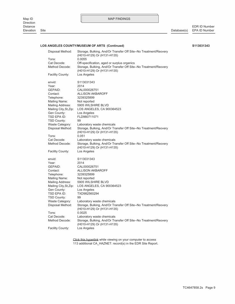
MAP FINDINGSMap IDDirection
EDR ID NumberDistanceEPA ID NumberDatabase(s)SiteElevation
113 additional CA_HAZNET: record(s) in the EDR Site Report.Click this hyperlink while viewing on your computer to access
Los AngelesFacility County: (H010-H129) Or (H131-H135) Storage, Bulking, And/Or Transfer Off Site--No Treatment/ReoveryMethod Decode: Laboratory waste chemicalsCat Decode: 0.0025Tons: (H010-H129) Or (H131-H135) Storage, Bulking, And/Or Transfer Off Site--No Treatment/ReoveryDisposal Method: Laboratory waste chemicalsWaste Category: 99TSD County: TXD982560294TSD EPA ID: Los AngelesGen County: LOS ANGELES, CA 900364523Mailing City,St,Zip: 5905 WILSHIRE BLVDMailing Address: Not reportedMailing Name: 3239325899Telephone: ALLISON AKBAROFFContact: CAL000026751GEPAID: 2014Year: S113031343envid:
Los AngelesFacility County: (H010-H129) Or (H131-H135) Storage, Bulking, And/Or Transfer Off Site--No Treatment/ReoveryMethod Decode: Laboratory waste chemicalsCat Decode: 0.051Tons: (H010-H129) Or (H131-H135) Storage, Bulking, And/Or Transfer Off Site--No Treatment/ReoveryDisposal Method: Laboratory waste chemicalsWaste Category: 99TSD County: FLD980711071TSD EPA ID: Los AngelesGen County: LOS ANGELES, CA 900364523Mailing City,St,Zip: 5905 WILSHIRE BLVDMailing Address: Not reportedMailing Name: 3239325899Telephone: ALLISON AKBAROFFContact: CAL000026751GEPAID: 2014Year: S113031343envid:
Los AngelesFacility County: (H010-H129) Or (H131-H135) Storage, Bulking, And/Or Transfer Off Site--No Treatment/ReoveryMethod Decode: Off-specification, aged or surplus organicsCat Decode: 0.0055Tons: (H010-H129) Or (H131-H135) Storage, Bulking, And/Or Transfer Off Site--No Treatment/ReoveryDisposal Method:
LOS ANGELES COUNTY/MUSEUM OF ARTS (Continued) S113031343
TC4647858.2s Page 9

MAP FINDINGSMap IDDirection
EDR ID NumberDistanceEPA ID NumberDatabase(s)SiteElevation
ActiveStatus: Not reportedComments: Not reportedEPA ID: Not reportedNPDES Number: Not reportedDUNs Number: Not reportedContact Phone: Not reportedContact: LOS ANGELES 900630000Mailing City,St,Zip: Not reportedMailing Address 2: 1100 N EASTERN AVEMailing Address: Not reportedMail To: 2132672242Facility Phone: Not reportedSIC Code: Not reportedCortese Code: 00020899Regulated ID: UTNKARegulated By: 19005204Facility ID:
CA FID UST:
Not reportedNumber Of Tanks: DIESELContent: PSTG: M.V. FUELTank Use: 04-20-88Active Date: 6000Capacity: ATank Status: 19-050-001489-000002SWRCB Tank Id: Not reportedOwner Tank Id: 02-29-88Created Date: 01-22-93Action Date: 01-22-93Referral Date: 44-011798Board Of Equalization: 4Number: 1489Comp Number: ActiveStatus:
2Number Of Tanks: DIESELContent: PSTG: M.V. FUELTank Use: 04-20-88Active Date: 6000Capacity: ATank Status: 19-050-001489-000001SWRCB Tank Id: Not reportedOwner Tank Id: 02-29-88Created Date: 01-22-93Action Date: 01-22-93Referral Date: 44-011798Board Of Equalization: 4Number: 1489Comp Number: ActiveStatus:
SWEEPS UST:
Site 2 of 5 in cluster A
Actual:175 ft.
Property LOS ANGELES, CA 90063Target CA FID UST5905 WILSHIRE BLVD N/AA2 SWEEPS USTMUSEUM OF ART S101617584
TC4647858.2s Page 10

MAP FINDINGSMap IDDirection
EDR ID NumberDistanceEPA ID NumberDatabase(s)SiteElevation
Not reportedNAICS Code 1: Not reportedSIC Desc 3: Not reportedSIC Code 3: Not reportedSIC Desc 2: Not reportedSIC Code 2: Museums and Art GalleriesSIC Desc 1: 8412SIC Code 1: -118.358061Place Longitude: 34.062654Place Latitude: 1# Of Agencies: County AgencyAgency Type: All other facilitiesFacility Type: Service/Commercial Site, NECPlace Subtype: Service/CommercialPlace Type: Los Angeles Cnty Museum of ArtAgency Name: 235703Facility Id: 4Region:
ENF:
0Part. Matter 10 Micrometers and Smllr Tons/Yr: 0Particulate Matter Tons/Yr: 0SOX - Oxides of Sulphur Tons/Yr: 0NOX - Oxides of Nitrogen Tons/Yr: 0Carbon Monoxide Emissions Tons/Yr: 2Reactive Organic Gases Tons/Yr: 2Total Organic Hydrocarbon Gases Tons/Yr: Not reportedConsolidated Emission Reporting Rule: Not reportedCommunity Health Air Pollution Info System: SOUTH COAST AQMDAir District Name: 8412SIC Code: SCAir District Name: 21717Facility ID: SCAir Basin: 19County Code: 1995Year:
0Part. Matter 10 Micrometers and Smllr Tons/Yr: 0Particulate Matter Tons/Yr: 0SOX - Oxides of Sulphur Tons/Yr: 0NOX - Oxides of Nitrogen Tons/Yr: 0Carbon Monoxide Emissions Tons/Yr: 0Reactive Organic Gases Tons/Yr: 0Total Organic Hydrocarbon Gases Tons/Yr: Not reportedConsolidated Emission Reporting Rule: Not reportedCommunity Health Air Pollution Info System: SOUTH COAST AQMDAir District Name: 8221SIC Code: SCAir District Name: 21717Facility ID: SCAir Basin: 19County Code: 1987Year:
EMI:
Site 3 of 5 in cluster A
Actual:175 ft.
Property LOS ANGELES, CA 90036Target ENF5905 WILSHIRE BLVD N/AA3 EMILA CO., MUSEUM OF ART S106834124
TC4647858.2s Page 11
MAP FINDINGSMap IDDirection
EDR ID NumberDistanceEPA ID NumberDatabase(s)SiteElevation
WithdrawnStatus: 08/03/2010EPL Issuance Date: Not reportedACL Issuance Date: 10/19/2010Termination Date: Not reportedAchieve Date: Not reportedAdoption/Issuance Date: 08/03/2010Effective Date: Expedited Payment LetterEnforcement Action Type: R4-2010-0133-MOrder / Resolution Number: 4Region: 375464Enforcement Id(EID): PassiveDirection/Voice: 15 - WDRs pending rescissionFee Code: IIndividual/General: YStatus Enrollee: Not reportedWDR Review - Planned: Not reportedWDR Review - Pending: Not reportedWDR Review - No Action Required: Not reportedWDR Review - Rescind: Not reportedWDR Review - Revise/Renew: Not reportedWDR Review - Amend: 02/09/2012Termination Date: 06/05/2013Expiration/Review Date: 06/09/2005Effective Date: 02/10/2012Status Date: HistoricalStatus: 4800Application Fee Amt Received: Not reported301H: Not reportedDredge Fill Fee: N - NoReclamation: OTHNpdes Type: MinorMajor-Minor: CAG994004Npdes# CA#: R4-2008-0032Order #: 4Region: EnrolleeReg Measure Type: 176698Reg Measure Id: 4B197500070WDID: 1# Of Programs: NPDESWWProgram Category2: NPDESWWProgram Category1: NPDNONMUNIPRCSProgram: Not reportedFacility Waste Type 4: Not reportedFacility Waste Type 3: Not reportedFacility Waste Type 2: Not reportedFacility Waste Type: X - Facility is not a POTWPretreatment: Not reportedComplexity: Not reportedThreat To Water Quality: 0.3Design Flow: Reg MeasSource Of Facility: 1# Of Places: Not reportedNAICS Desc 3: Not reportedNAICS Code 3: Not reportedNAICS Desc 2: Not reportedNAICS Code 2: Not reportedNAICS Desc 1:
LA CO., MUSEUM OF ART (Continued) S106834124
TC4647858.2s Page 12
MAP FINDINGSMap IDDirection
EDR ID NumberDistanceEPA ID NumberDatabase(s)SiteElevation
$0.00Total $ Paid/Completed Amount: $0.00Project $ Completed: $0.00Liability $ Paid: $0.00Project $ Amount: $0.00Liability $ Amount: $0.00Initial Assessed Amount: $0.00Total Assessment Amount: 1# Of Programs1: Not reportedLatest Milestone Completion Date: NPDNONMUNIPRCSProgram: reports. EPL Withdrawn per 10/19/10 letter. Museum of Art CI 8904 in the amount $21,000 for 3 late EPL No. R4-2010-0133-M 08/03/2010 for Los Angeles CntyDescription: CI 8904 EPL No. R4-2010-0133-M 08/03/2010 for Los Angeles Cnty Museum of ArtTitle:
LA CO., MUSEUM OF ART (Continued) S106834124
Not reportedOPERATOR ZIP: Not reportedOPERATOR STATE: Not reportedOPERATOR CITY: Not reportedOPERATOR ADDRESS: Not reportedOPERATOR NAME: Not reportedFACILITY CONTACT EMAIL: Not reportedFACILITY CONTACT PHONE EXT: Not reportedFACILITY CONTACT PHONE: Not reportedFACILITY CONTACT TITLE: Not reportedFACILITY CONTACT NAME: Not reportedPLACE SIZE UNIT: Not reportedPLACE SIZE: Not reportedSTATUS DATE: Not reportedSTATUS CODE NAME: Not reportedPROCESSED DATE: Not reportedRECEIVED DATE: 90036Discharge Zip: CaliforniaDischarge State: Los AngelesDischarge City: 5905 Wilshire BlvdDischarge Address: Los Angeles Cnty Museum of ArtDischarge Name: 06/12/2013Termination Date Of Regulatory Measure: Not reportedExpiration Date Of Regulatory Measure: 05/17/2011Effective Date Of Regulatory Measure: Not reportedAdoption Date Of Regulatory Measure: ConstructionProgram Type: 4 19C360998WDID: Not reportedPlace Id: EnrolleeRegulatory Measure Type: 2009-0009-DWQOrder No: 414773Regulatory Measure Id: 4Region: 0Agency Id: TerminatedFacility Status: CAS000002Npdes Number:
NPDES:
Site 4 of 5 in cluster A
Actual:175 ft.
Property LOS ANGELES, CA 90036Target 5905 WILSHIRE BLVD N/AA4 NPDESLACMA HEIZER ROCK PROJECT U001562345
TC4647858.2s Page 13

MAP FINDINGSMap IDDirection
EDR ID NumberDistanceEPA ID NumberDatabase(s)SiteElevation
Not reportedDischarge Address: Not reportedDischarge Name: 6/12/2013Termination Date Of Regulatory Measure: Not reportedExpiration Date Of Regulatory Measure: Not reportedEffective Date Of Regulatory Measure: Not reportedAdoption Date Of Regulatory Measure: Not reportedProgram Type: 4 19C360998WDID: Not reportedPlace Id: ConstructionRegulatory Measure Type: Not reportedOrder No: 414773Regulatory Measure Id: 4Region: Not reportedAgency Id: Not reportedFacility Status: Not reportedNpdes Number:
Not reportedTERTIARY SIC: Not reportedSECONDARY SIC: Not reportedPRIMARY SIC: Not reportedCERTIFICATION DATE: Not reportedCERTIFIER TITLE: Not reportedCERTIFIER NAME: Not reportedRECEIVING WATER NAME: Not reportedDIR DISCHARGE USWATER IND: Not reportedCONSTYPE WATER SEWER IND: Not reportedCONSTYPE UTILITY IND: Not reportedCONSTYPE UTILITY DESCRIPTION: Not reportedCONSTYPE TRANSPORT IND: Not reportedCONSTYPE RESIDENTIAL IND: Not reportedCONSTYPE RECONS IND: Not reportedCONSTYPE OTHER IND: Not reportedCONSTYPE OTHER DESRIPTION: Not reportedCONSTYPE INDUSTRIAL IND: Not reportedCONSTYPE GAS LINE IND: Not reportedCONSTYPE ELECTRICAL LINE IND: Not reportedCONSTYPE COMMERTIAL IND: Not reportedCONSTYPE COMM LINE IND: Not reportedCONSTYPE CABLE LINE IND: Not reportedCONSTYPE BELOW GROUND IND: Not reportedCONSTYPE ABOVE GROUND IND: Not reportedEMERGENCY PHONE EXT: Not reportedEMERGENCY PHONE NO: Not reportedCONSTYPE LINEAR UTILITY IND: Not reportedDEVELOPER CONTACT TITLE: Not reportedDEVELOPER CONTACT NAME: Not reportedDEVELOPER ZIP: Not reportedDEVELOPER STATE: Not reportedDEVELOPER CITY: Not reportedDEVELOPER ADDRESS: Not reportedDEVELOPER NAME: Not reportedOPERATOR TYPE: Not reportedOPERATOR CONTACT EMAIL: Not reportedOPERATOR CONTACT PHONE EXT: Not reportedOPERATOR CONTACT PHONE: Not reportedOPERATOR CONTACT TITLE: Not reportedOPERATOR CONTACT NAME:
LACMA HEIZER ROCK PROJECT (Continued) U001562345
TC4647858.2s Page 14

MAP FINDINGSMap IDDirection
EDR ID NumberDistanceEPA ID NumberDatabase(s)SiteElevation
Not reportedPRIMARY SIC: 05-MAY-11CERTIFICATION DATE: Not reportedCERTIFIER TITLE: Randall MurphyCERTIFIER NAME: Not reportedRECEIVING WATER NAME: NDIR DISCHARGE USWATER IND: Not reportedCONSTYPE WATER SEWER IND: Not reportedCONSTYPE UTILITY IND: Not reportedCONSTYPE UTILITY DESCRIPTION: Not reportedCONSTYPE TRANSPORT IND: Not reportedCONSTYPE RESIDENTIAL IND: Not reportedCONSTYPE RECONS IND: Not reportedCONSTYPE OTHER IND: Not reportedCONSTYPE OTHER DESRIPTION: Not reportedCONSTYPE INDUSTRIAL IND: Not reportedCONSTYPE GAS LINE IND: Not reportedCONSTYPE ELECTRICAL LINE IND: YCONSTYPE COMMERTIAL IND: Not reportedCONSTYPE COMM LINE IND: Not reportedCONSTYPE CABLE LINE IND: Not reportedCONSTYPE BELOW GROUND IND: Not reportedCONSTYPE ABOVE GROUND IND: Not reportedEMERGENCY PHONE EXT: 323-965-8019EMERGENCY PHONE NO: NCONSTYPE LINEAR UTILITY IND: Project ManagerDEVELOPER CONTACT TITLE: Julie WietechaDEVELOPER CONTACT NAME: 90670DEVELOPER ZIP: CaliforniaDEVELOPER STATE: Santa Fe SpringsDEVELOPER CITY: 9814 Norwalk BlvdDEVELOPER ADDRESS: Matt ConstructionDEVELOPER NAME: OtherOPERATOR TYPE: [email protected] CONTACT EMAIL: Not reportedOPERATOR CONTACT PHONE EXT: 322-385-7472OPERATOR CONTACT PHONE: Not reportedOPERATOR CONTACT TITLE: Randall MurphyOPERATOR CONTACT NAME: 90036OPERATOR ZIP: CaliforniaOPERATOR STATE: Los AngelesOPERATOR CITY: 5905 Wilshire BlvdOPERATOR ADDRESS: Los Angeles Cnty Museum of ArtOPERATOR NAME: [email protected] CONTACT EMAIL: Not reportedFACILITY CONTACT PHONE EXT: 323-965-8019FACILITY CONTACT PHONE: Project ManagerFACILITY CONTACT TITLE: Julie WietechaFACILITY CONTACT NAME: AcresPLACE SIZE UNIT: 2.2PLACE SIZE: 8/19/2013STATUS DATE: TerminatedSTATUS CODE NAME: 5/17/2011PROCESSED DATE: 5/5/2011RECEIVED DATE: Not reportedDischarge Zip: Not reportedDischarge State: Not reportedDischarge City:
LACMA HEIZER ROCK PROJECT (Continued) U001562345
TC4647858.2s Page 15
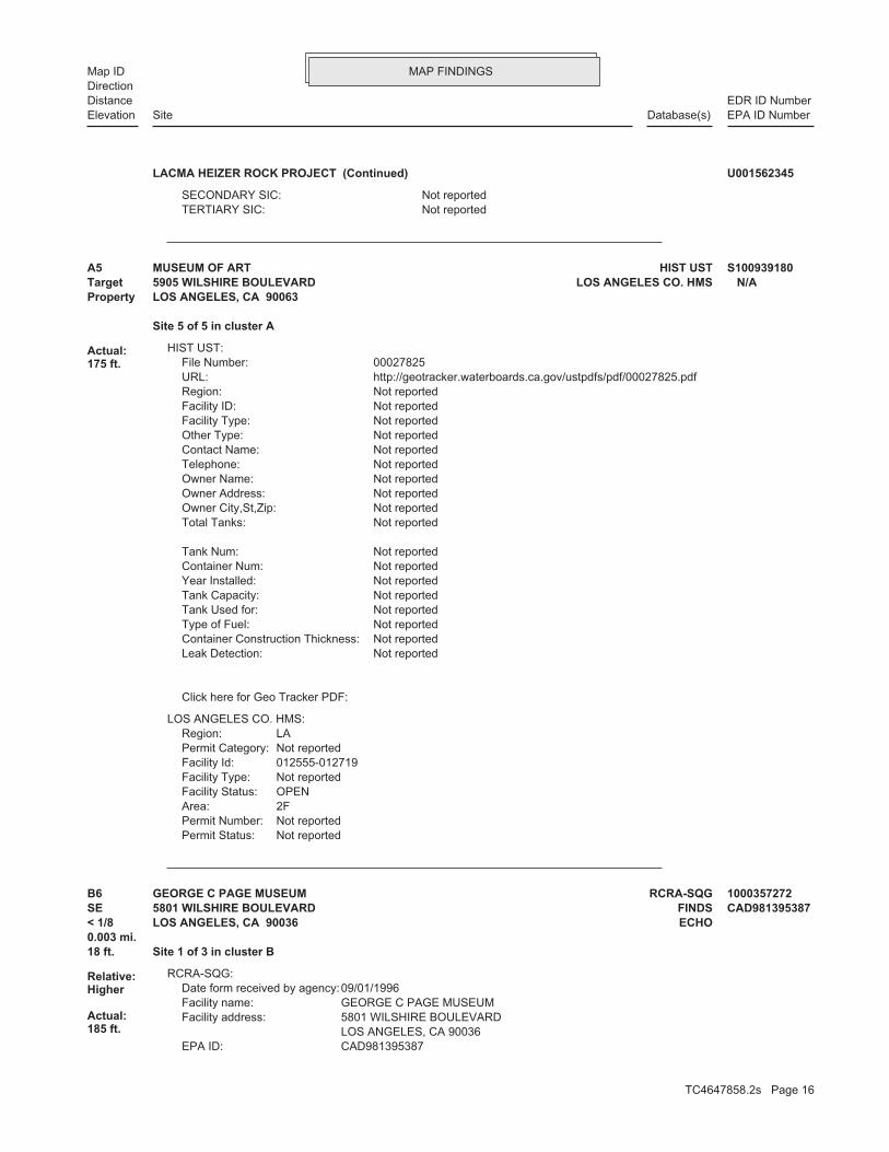
MAP FINDINGSMap IDDirection
EDR ID NumberDistanceEPA ID NumberDatabase(s)SiteElevation
Not reportedTERTIARY SIC: Not reportedSECONDARY SIC:
LACMA HEIZER ROCK PROJECT (Continued) U001562345
Not reportedPermit Status:Not reportedPermit Number:2FArea:OPENFacility Status:Not reportedFacility Type:012555-012719Facility Id:Not reportedPermit Category:LARegion:
LOS ANGELES CO. HMS:
Click here for Geo Tracker PDF:
Not reportedLeak Detection: Not reportedContainer Construction Thickness: Not reportedType of Fuel: Not reportedTank Used for: Not reportedTank Capacity: Not reportedYear Installed: Not reportedContainer Num: Not reportedTank Num:
Not reportedTotal Tanks: Not reportedOwner City,St,Zip: Not reportedOwner Address: Not reportedOwner Name: Not reportedTelephone: Not reportedContact Name: Not reportedOther Type: Not reportedFacility Type: Not reportedFacility ID: Not reportedRegion: http://geotracker.waterboards.ca.gov/ustpdfs/pdf/00027825.pdfURL: 00027825File Number:
HIST UST:
Site 5 of 5 in cluster A
Actual:175 ft.
Property LOS ANGELES, CA 90063Target LOS ANGELES CO. HMS5905 WILSHIRE BOULEVARD N/AA5 HIST USTMUSEUM OF ART S100939180
CAD981395387EPA ID: LOS ANGELES, CA 90036 5801 WILSHIRE BOULEVARDFacility address: GEORGE C PAGE MUSEUMFacility name: 09/01/1996Date form received by agency:
RCRA-SQG:
18 ft. Site 1 of 3 in cluster B0.003 mi.
Relative:Higher
Actual:185 ft.
< 1/8 ECHOLOS ANGELES, CA 90036SE FINDS5801 WILSHIRE BOULEVARD CAD981395387B6 RCRA-SQGGEORGE C PAGE MUSEUM 1000357272
TC4647858.2s Page 16

MAP FINDINGSMap IDDirection
EDR ID NumberDistanceEPA ID NumberDatabase(s)SiteElevation
Large Quantity GeneratorClassification: GEORGE C PAGE MUSEUMSite name: 04/14/1986Date form received by agency:
Historical Generators:
NoUsed oil transporter: NoUsed oil transfer facility: NoUsed oil Specification marketer: NoUsed oil fuel marketer to burner: NoUser oil refiner: NoUsed oil processor: NoUsed oil fuel burner: NoFurnace exemption: NoOn-site burner exemption: NoUnderground injection activity: NoTreater, storer or disposer of HW: NoTransporter of hazardous waste: NoRecycler of hazardous waste: NoMixed waste (haz. and radioactive): NoU.S. importer of hazardous waste:
Handler Activities Summary:
Not reportedOwner/Op end date: Not reportedOwner/Op start date: OwnerOwner/Operator Type: CountyLegal status: (415) 555-1212Owner/operator telephone: Not reportedOwner/operator country: NOT REQUIRED, ME 99999 NOT REQUIREDOwner/operator address: LOS ANGELES COUNTYOwner/operator name:
Not reportedOwner/Op end date: Not reportedOwner/Op start date: OperatorOwner/Operator Type: CountyLegal status: (415) 555-1212Owner/operator telephone: Not reportedOwner/operator country: NOT REQUIRED, ME 99999 NOT REQUIREDOwner/operator address: NOT REQUIREDOwner/operator name:
Owner/Operator Summary:
hazardous waste at any time waste during any calendar month, and accumulates more than 1000 kg of hazardous waste at any time; or generates 100 kg or less of hazardous waste during any calendar month and accumulates less than 6000 kg of Handler: generates more than 100 and less than 1000 kg of hazardousDescription: Small Small Quantity GeneratorClassification: 09EPA Region: Not reportedContact email: Not reportedContact telephone: USContact country: Not reported Not reportedContact address: Not reportedContact:
GEORGE C PAGE MUSEUM (Continued) 1000357272
TC4647858.2s Page 17

MAP FINDINGSMap IDDirection
EDR ID NumberDistanceEPA ID NumberDatabase(s)SiteElevation
http://echo.epa.gov/detailed_facility_report?fid=110002692765DFR URL: 110002692765Registry ID: 1000357272Envid:
ECHO:
corrective action activities required under RCRA.program staff to track the notification, permit, compliance, andand treat, store, or dispose of hazardous waste. RCRAInfo allows RCRAevents and activities related to facilities that generate, transport,Conservation and Recovery Act (RCRA) program through the tracking ofRCRAInfo is a national information system that supports the Resource
facilities.generators, transporters, and treatment, storage, and disposalprovides California with information on hazardous waste shipments forCalifornia Hazardous Waste Tracking System - Datamart (HWTS-DATAMART)
Environmental Interest/Information System
110002692765Registry ID:
FINDS:
No violations foundViolation Status:
GEORGE C PAGE MUSEUM (Continued) 1000357272
5900 WILSHIRE BLVDAddress: 2001Year: MOBILE CLEANERSName:
EDR Historical Cleaners:
42 ft. Site 1 of 5 in cluster C0.008 mi.
Relative:Lower
Actual:173 ft.
< 1/8 LOS ANGELES, CA 90036SSW 5900 WILSHIRE BLVD N/AC7 EDR Hist Cleaner 1015077921
0002Total Tanks: LOS ANGELES, CA 90036Owner City,St,Zip: 5900 WILSHIRE BLVD.Owner Address: MILTON MEYER & CO.Owner Name: 2139376550Telephone: ROBERT ALKUSContact Name: Not reportedOther Type: Gas StationFacility Type: 00000063362Facility ID: STATERegion: http://geotracker.waterboards.ca.gov/ustpdfs/pdf/00027C4F.pdfURL: 00027C4FFile Number:
HIST UST:
42 ft. Site 2 of 5 in cluster C0.008 mi.
Relative:Lower
Actual:173 ft.
< 1/8 LOS ANGELES, CA 90036SSW 5900 WILSHIRE BLVD N/AC8 HIST UST5900 WILSHIRE BOULEVARD BUILDI U001561414
TC4647858.2s Page 18

MAP FINDINGSMap IDDirection
EDR ID NumberDistanceEPA ID NumberDatabase(s)SiteElevation
Click here for Geo Tracker PDF:
Stock InventorLeak Detection: Not reportedContainer Construction Thickness: UNLEADEDType of Fuel: WASTETank Used for: 00008000Tank Capacity: 1971Year Installed: 2Container Num: 002Tank Num:
Stock InventorLeak Detection: Not reportedContainer Construction Thickness: PREMIUMType of Fuel: PRODUCTTank Used for: 00009940Tank Capacity: 1971Year Installed: 2Container Num: 001Tank Num:
5900 WILSHIRE BOULEVARD BUILDI (Continued) U001561414
0002Total Tanks: LOS ANGELES, CA 90010Owner City,St,Zip: 3701 WILSHIRE BOULEVARD-SUITEOwner Address: UNION OIL COMPANY OF CALIFORNIOwner Name: 0000000000Telephone: MILTON MEYER & COMPANYContact Name: Not reportedOther Type: Gas StationFacility Type: 00000007909Facility ID: STATERegion: http://geotracker.waterboards.ca.gov/ustpdfs/pdf/000290AB.pdfURL: 000290ABFile Number:
HIST UST:
Not reportedNumber Of Tanks: Not reportedContent: Not reportedSTG: Not reportedTank Use: Not reportedActive Date: Not reportedCapacity: Not reportedTank Status: Not reportedSWRCB Tank Id: Not reportedOwner Tank Id: Not reportedCreated Date: Not reportedAction Date: Not reportedReferral Date: Not reportedBoard Of Equalization: Not reportedNumber: 8323Comp Number: Not reportedStatus:
SWEEPS UST:
42 ft. Site 3 of 5 in cluster C0.008 mi. PROC
Relative:Lower
Actual:173 ft.
< 1/8 EMILOS ANGELES, CA 90011SSW HIST UST5900 WILSHIRE BLVD N/AC9 SWEEPS USTTHE SHORENSTEIN CO U001561435
TC4647858.2s Page 19

MAP FINDINGSMap IDDirection
EDR ID NumberDistanceEPA ID NumberDatabase(s)SiteElevation
PROC:
0Part. Matter 10 Micrometers and Smllr Tons/Yr: 0Particulate Matter Tons/Yr: 0SOX - Oxides of Sulphur Tons/Yr: 0NOX - Oxides of Nitrogen Tons/Yr: 0Carbon Monoxide Emissions Tons/Yr: 0Reactive Organic Gases Tons/Yr: 0Total Organic Hydrocarbon Gases Tons/Yr: Not reportedConsolidated Emission Reporting Rule: Not reportedCommunity Health Air Pollution Info System: SOUTH COAST AQMDAir District Name: 8742SIC Code: SCAir District Name: 81377Facility ID: SCAir Basin: 19County Code: 1995Year:
0Part. Matter 10 Micrometers and Smllr Tons/Yr: 0Particulate Matter Tons/Yr: 0SOX - Oxides of Sulphur Tons/Yr: 0NOX - Oxides of Nitrogen Tons/Yr: 0Carbon Monoxide Emissions Tons/Yr: 0Reactive Organic Gases Tons/Yr: 0Total Organic Hydrocarbon Gases Tons/Yr: Not reportedConsolidated Emission Reporting Rule: Not reportedCommunity Health Air Pollution Info System: SOUTH COAST AQMDAir District Name: 8742SIC Code: SCAir District Name: 81377Facility ID: SCAir Basin: 19County Code: 1990Year:
EMI:
Click here for Geo Tracker PDF:
Stock InventorLeak Detection: Not reportedContainer Construction Thickness: UNLEADEDType of Fuel: PRODUCTTank Used for: 00010000Tank Capacity: Not reportedYear Installed: 0347-1Container Num: 002Tank Num:
Stock InventorLeak Detection: Not reportedContainer Construction Thickness: UNLEADEDType of Fuel: PRODUCTTank Used for: 00008000Tank Capacity: Not reportedYear Installed: 0347-2Container Num: 001Tank Num:
THE SHORENSTEIN CO (Continued) U001561435
TC4647858.2s Page 20
MAP FINDINGSMap IDDirection
EDR ID NumberDistanceEPA ID NumberDatabase(s)SiteElevation
Not reportedSunday Hours Of Operation: Not reportedSaturday Hours Of Operation: 8:00 am - 5:00 pmFriday Hours Of Operation: 8:00 am - 5:00 pmThursday Hours Of Operation: 8:00 am - 5:00 pmWednesday Hours Of Operation: 8:00 am - 5:00 pmTuesday Hours Of Operation: 8:00 am - 5:00 pmMonday Hours Of Operation: N/AAgency: NBimetal: YPlastic: YGlass: YAluminium: 02/01/2008Operation Begin Date: N/ARural: N/AGrand Father: (323) 939-4300Phone Number: Not reportedEmail: Not reportedWebsite: 90210Mailing Zip Code: CAMailing State: Beverly HillsMailing City: P O Box 5568Mailing Address: Berg Mill Supply Co IncOrganization Name: 19183Organization Id: PR0462Cert Id: 19183Reg Id:
THE SHORENSTEIN CO (Continued) U001561435
5757 WILSHIRE BLVDAddress: 2012Year: MOBILE CLEANERSName:
5757 WILSHIRE BLVDAddress: 2011Year: MOBILE CLEANERSName:
5757 WILSHIRE BLVDAddress: 2004Year: MOBILE CLEANERSName:
5757 WILSHIRE BLVDAddress: 2003Year: MOBILE CLEANERSName:
EDR Historical Cleaners:
116 ft. Site 2 of 3 in cluster B0.022 mi.
Relative:Higher
Actual:188 ft.
< 1/8 LOS ANGELES, CA 90036SE 5757 WILSHIRE BLVD N/AB10 EDR Hist Cleaner 1015076845
TC4647858.2s Page 21

MAP FINDINGSMap IDDirection
EDR ID NumberDistanceEPA ID NumberDatabase(s)SiteElevation
5757 WILSHIRE BLVDAddress: 2008Year: SAN DIEGO AUTO WAREHOUSE INCName:
EDR Historical Auto Stations:
116 ft. Site 3 of 3 in cluster B0.022 mi.
Relative:Higher
Actual:188 ft.
< 1/8 LOS ANGELES, CA 90036SE 5757 WILSHIRE BLVD N/AB11 EDR Hist Auto 1015558997
NoUsed oil fuel marketer to burner: NoUser oil refiner: NoUsed oil processor: NoUsed oil fuel burner: NoFurnace exemption: NoOn-site burner exemption: NoUnderground injection activity: NoTreater, storer or disposer of HW: NoTransporter of hazardous waste: NoRecycler of hazardous waste: NoMixed waste (haz. and radioactive): NoU.S. importer of hazardous waste:
Handler Activities Summary:
100 kg of that material at any time hazardous waste during any calendar month, and accumulates more than from the cleanup of a spill, into or on any land or water, of acutely of any residue or contaminated soil, waste or other debris resulting kg of acutely hazardous waste at any time; or generates 100 kg or less hazardous waste during any calendar month, and accumulates more than 1 waste during any calendar month; or generates 1 kg or less of acutely cleanup of a spill, into or on any land or water, of acutely hazardous residue or contaminated soil, waste or other debris resulting from the during any calendar month; or generates more than 100 kg of any calendar month; or generates more than 1 kg of acutely hazardous waste Handler: generates 1,000 kg or more of hazardous waste during anyDescription: Large Quantity GeneratorClassification: 09EPA Region: Not reportedContact email: (415) 772-7153Contact telephone: USContact country: Not reported Not reportedContact address: NEAL P COLOMBOContact: SAN FRANCISCO, CA 94111 ONE CALIFORNIA ST, SUITE 2900Mailing address: CAD000321489EPA ID: SAN FRANCISCO, CA 90036 5900 WILSHIRE BLVD.Facility address: 5900 WILSHIRE BLVD BLDGFacility name: 04/09/1990Date form received by agency:
RCRA-LQG:
246 ft. Site 4 of 5 in cluster C0.047 mi.
Relative:Lower
Actual:173 ft.
< 1/8 SAN FRANCISCO, CA 90036SW 5900 WILSHIRE BLVD. CAD000321489C12 RCRA-LQG5900 WILSHIRE BLVD BLDG 1007198632
TC4647858.2s Page 22
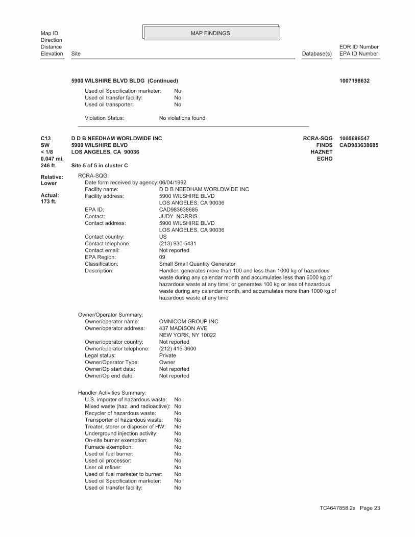
MAP FINDINGSMap IDDirection
EDR ID NumberDistanceEPA ID NumberDatabase(s)SiteElevation
No violations foundViolation Status:
NoUsed oil transporter: NoUsed oil transfer facility: NoUsed oil Specification marketer:
5900 WILSHIRE BLVD BLDG (Continued) 1007198632
NoUsed oil transfer facility: NoUsed oil Specification marketer: NoUsed oil fuel marketer to burner: NoUser oil refiner: NoUsed oil processor: NoUsed oil fuel burner: NoFurnace exemption: NoOn-site burner exemption: NoUnderground injection activity: NoTreater, storer or disposer of HW: NoTransporter of hazardous waste: NoRecycler of hazardous waste: NoMixed waste (haz. and radioactive): NoU.S. importer of hazardous waste:
Handler Activities Summary:
Not reportedOwner/Op end date: Not reportedOwner/Op start date: OwnerOwner/Operator Type: PrivateLegal status: (212) 415-3600Owner/operator telephone: Not reportedOwner/operator country: NEW YORK, NY 10022 437 MADISON AVEOwner/operator address: OMNICOM GROUP INCOwner/operator name:
Owner/Operator Summary:
hazardous waste at any time waste during any calendar month, and accumulates more than 1000 kg of hazardous waste at any time; or generates 100 kg or less of hazardous waste during any calendar month and accumulates less than 6000 kg of Handler: generates more than 100 and less than 1000 kg of hazardousDescription: Small Small Quantity GeneratorClassification: 09EPA Region: Not reportedContact email: (213) 930-5431Contact telephone: USContact country: LOS ANGELES, CA 90036 5900 WILSHIRE BLVDContact address: JUDY NORRISContact: CAD983638685EPA ID: LOS ANGELES, CA 90036 5900 WILSHIRE BLVDFacility address: D D B NEEDHAM WORLDWIDE INCFacility name: 06/04/1992Date form received by agency:
RCRA-SQG:
246 ft. Site 5 of 5 in cluster C0.047 mi. ECHO
Relative:Lower
Actual:173 ft.
< 1/8 HAZNETLOS ANGELES, CA 90036SW FINDS5900 WILSHIRE BLVD CAD983638685C13 RCRA-SQGD D B NEEDHAM WORLDWIDE INC 1000686547
TC4647858.2s Page 23

MAP FINDINGSMap IDDirection
EDR ID NumberDistanceEPA ID NumberDatabase(s)SiteElevation
110002877940Registry ID: 1000686547Envid:
ECHO:
Los AngelesFacility County: RecyclerMethod Decode: Photochemicals/photoprocessing wasteCat Decode: 0.87570000000Tons: RecyclerDisposal Method: Photochemicals/photoprocessing wasteWaste Category: Not reportedTSD County: CAD982524613TSD EPA ID: Not reportedGen County: LOS ANGELES, CA 900360000Mailing City,St,Zip: 5900 WILSHIRE BLVDMailing Address: Not reportedMailing Name: 2124153600Telephone: OMNICOM GROUP INCContact: CAD983638685GEPAID: 1993Year: 1000686547envid:
Los AngelesFacility County: RecyclerMethod Decode: Photochemicals/photoprocessing wasteCat Decode: .2502Tons: RecyclerDisposal Method: Photochemicals/photoprocessing wasteWaste Category: Not reportedTSD County: CAD003963592TSD EPA ID: Not reportedGen County: LOS ANGELES, CA 900360000Mailing City,St,Zip: 5900 WILSHIRE BLVDMailing Address: Not reportedMailing Name: 2124153600Telephone: OMNICOM GROUP INCContact: CAD983638685GEPAID: 1995Year: 1000686547envid:
HAZNET:
corrective action activities required under RCRA.program staff to track the notification, permit, compliance, andand treat, store, or dispose of hazardous waste. RCRAInfo allows RCRAevents and activities related to facilities that generate, transport,Conservation and Recovery Act (RCRA) program through the tracking ofRCRAInfo is a national information system that supports the Resource
Environmental Interest/Information System
110002877940Registry ID:
FINDS:
No violations foundViolation Status:
NoUsed oil transporter:
D D B NEEDHAM WORLDWIDE INC (Continued) 1000686547
TC4647858.2s Page 24
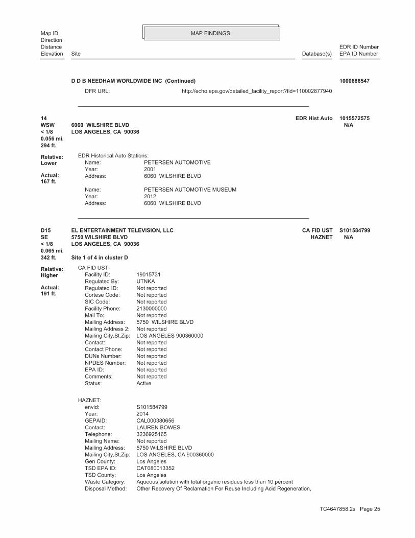
MAP FINDINGSMap IDDirection
EDR ID NumberDistanceEPA ID NumberDatabase(s)SiteElevation
http://echo.epa.gov/detailed_facility_report?fid=110002877940DFR URL:
D D B NEEDHAM WORLDWIDE INC (Continued) 1000686547
6060 WILSHIRE BLVDAddress: 2012Year: PETERSEN AUTOMOTIVE MUSEUMName:
6060 WILSHIRE BLVDAddress: 2001Year: PETERSEN AUTOMOTIVEName:
EDR Historical Auto Stations:
294 ft.0.056 mi.
Relative:Lower
Actual:167 ft.
< 1/8 LOS ANGELES, CA 90036WSW 6060 WILSHIRE BLVD N/A14 EDR Hist Auto 1015572575
Other Recovery Of Reclamation For Reuse Including Acid Regeneration,Disposal Method: Aqueous solution with total organic residues less than 10 percentWaste Category: Los AngelesTSD County: CAT080013352TSD EPA ID: Los AngelesGen County: LOS ANGELES, CA 900360000Mailing City,St,Zip: 5750 WILSHIRE BLVDMailing Address: Not reportedMailing Name: 3236925165Telephone: LAUREN BOWESContact: CAL000380656GEPAID: 2014Year: S101584799envid:
HAZNET:
ActiveStatus: Not reportedComments: Not reportedEPA ID: Not reportedNPDES Number: Not reportedDUNs Number: Not reportedContact Phone: Not reportedContact: LOS ANGELES 900360000Mailing City,St,Zip: Not reportedMailing Address 2: 5750 WILSHIRE BLVDMailing Address: Not reportedMail To: 2130000000Facility Phone: Not reportedSIC Code: Not reportedCortese Code: Not reportedRegulated ID: UTNKARegulated By: 19015731Facility ID:
CA FID UST:
342 ft. Site 1 of 4 in cluster D0.065 mi.
Relative:Higher
Actual:191 ft.
< 1/8 LOS ANGELES, CA 90036SE HAZNET5750 WILSHIRE BLVD N/AD15 CA FID USTEL ENTERTAINMENT TELEVISION, LLC S101584799
TC4647858.2s Page 25

MAP FINDINGSMap IDDirection
EDR ID NumberDistanceEPA ID NumberDatabase(s)SiteElevation
Not reportedFacility County: Organics Recovery Ect Other Recovery Of Reclamation For Reuse Including Acid Regeneration,Method Decode: Not reportedCat Decode: 0.021Tons: Organics Recovery Ect Other Recovery Of Reclamation For Reuse Including Acid Regeneration,Disposal Method: Not reportedWaste Category: Los AngelesTSD County: CAT080013352TSD EPA ID: Los AngelesGen County: LOS ANGELES, CA 90036Mailing City,St,Zip: 5750 WILSHIRE BLVDMailing Address: Not reportedMailing Name: 3236925165Telephone: LAUREN BOWESContact: CAL000380656GEPAID: 2013Year: S101584799envid:
Los AngelesFacility County: Organics Recovery Ect Other Recovery Of Reclamation For Reuse Including Acid Regeneration,Method Decode: Aqueous solution with total organic residues less than 10 percentCat Decode: 1.638Tons: Organics Recovery Ect
EL ENTERTAINMENT TELEVISION, LLC (Continued) S101584799
Not reportedNumber Of Tanks: Not reportedContent: Not reportedSTG: Not reportedTank Use: Not reportedActive Date: Not reportedCapacity: Not reportedTank Status: Not reportedSWRCB Tank Id: Not reportedOwner Tank Id: 02-29-88Created Date: 11-17-93Action Date: 05-18-93Referral Date: Not reportedBoard Of Equalization: 1Number: 6478Comp Number: ActiveStatus:
SWEEPS UST:
-118.353115Longitude: 34.063314Latitude: LOS ANGELES, CITY OFPermitting Agency: 25273Facility ID:
UST:
342 ft. Site 2 of 4 in cluster D0.065 mi.
Relative:Higher
Actual:191 ft.
< 1/8 LOS ANGELES, CA 90036SE SWEEPS UST5750 WILSHIRE BLVD N/AD16 USTLA SALLE PARTNERS ASSET MGMT. U003879607
TC4647858.2s Page 26

MAP FINDINGSMap IDDirection
EDR ID NumberDistanceEPA ID NumberDatabase(s)SiteElevation
T0603700895Global Id:
02/01/1996Status Date: Open - Site AssessmentStatus: T0603700895Global Id:
11/14/1995Status Date: Open - Case Begin DateStatus: T0603700895Global Id:
05/21/1996Status Date: Completed - Case ClosedStatus: T0603700895Global Id:
Status History:
Not reportedPhone Number: [email protected]: LOS ANGELESCity: 200 North Main Street, Suite 1780Address: LOS ANGELES, CITY OFOrganization Name: ELOY LUNAContact Name: Local Agency CaseworkerContact Type: T0603700895Global Id:
Not reportedPhone Number: [email protected]: Los AngelesCity: 320 W. 4TH ST., SUITE 200Address: LOS ANGELES RWQCB (REGION 4)Organization Name: YUE RONGContact Name: Regional Board CaseworkerContact Type: T0603700895Global Id:
Contact:
Click here to access the California GeoTracker records for this facility:
Not reportedSite History: DieselPotential Contaminants of Concern: Aquifer used for drinking water supplyPotential Media Affect: Not reportedFile Location: Not reportedLOC Case Number: 900360143RB Case Number: LOS ANGELES, CITY OFLocal Agency: YRCase Worker: LOS ANGELES RWQCB (REGION 4)Lead Agency: 05/21/1996Status Date: Completed - Case ClosedStatus: LUST Cleanup SiteCase Type: -118.3540344Longitude: 34.0621903Latitude: T0603700895Global Id: STATERegion:
LUST:
360 ft. Site 3 of 4 in cluster D0.068 mi.
Relative:Higher
Actual:191 ft.
< 1/8 EMILOS ANGELES, CA 90036ESE CA FID UST5757 WILSHIRE BLVD N/AD17 LUSTMUSEUM SQUARE ASSOC S101584149
TC4647858.2s Page 27

MAP FINDINGSMap IDDirection
EDR ID NumberDistanceEPA ID NumberDatabase(s)SiteElevation
3/26/1996Pollution Characterization Began: Not reportedPreliminary Site Assessment Began: 2/1/1996Preliminary Site Assessment Workplan Submitted: UNKSource of Cleanup Funding: 6010.9254573193770651558694433Approx. Dist To Production Well (ft): Not reportedWell Name: Not reportedWater System: OLD CASE #960313-02Operator: UNKLeak Source: UNKCause of Leak: Not reportedHow Leak Stopped: Tank ClosureHow Leak Discovered: 5/21/1996Date the Case was Closed: 5/15/1996Date Case Last Changed on Database: 11/14/1995Date Leak Stopped: Not reportedDate Confirmation Began: 3/13/1996Date Leak Record Entered: 11/14/1995Date Leak First Reported: 11/14/1995Date Leak Discovered: Not reportedEnforcement Type: Not reportedCross Street: 19050Local Agency: UNKStaff: Not reportedW Global ID: T0603700895Global ID: Excavate and DisposeAbatement Method Used at the Site: GroundwaterCase Type: Not reportedLocal Case No: Not reportedSubstance Quantity: DieselSubstance: Case ClosedStatus: 900360143Facility Id: Los AngelesCounty: 04Regional Board: 4Region:
LUST REG 4:
Leak StoppedAction: 11/14/1995Date: OtherAction Type: T0603700895Global Id:
Leak ReportedAction: 11/14/1995Date: OtherAction Type: T0603700895Global Id:
Leak DiscoveryAction: 11/14/1995Date: OtherAction Type: T0603700895Global Id:
Regulatory Activities:
03/26/1996Status Date: Open - Site AssessmentStatus:
MUSEUM SQUARE ASSOC (Continued) S101584149
TC4647858.2s Page 28

MAP FINDINGSMap IDDirection
EDR ID NumberDistanceEPA ID NumberDatabase(s)SiteElevation
0Carbon Monoxide Emissions Tons/Yr: 0Reactive Organic Gases Tons/Yr: 0Total Organic Hydrocarbon Gases Tons/Yr: Not reportedConsolidated Emission Reporting Rule: Not reportedCommunity Health Air Pollution Info System: SOUTH COAST AQMDAir District Name: 6512SIC Code: SCAir District Name: 35485Facility ID: SCAir Basin: 19County Code: 1987Year:
EMI:
ActiveStatus: Not reportedComments: Not reportedEPA ID: Not reportedNPDES Number: Not reportedDUNs Number: Not reportedContact Phone: Not reportedContact: LOS ANGELES 900360000Mailing City,St,Zip: Not reportedMailing Address 2: 5757 WILSHIRE BLVDMailing Address: Not reportedMail To: 2130000000Facility Phone: Not reportedSIC Code: Not reportedCortese Code: Not reportedRegulated ID: UTNKARegulated By: 19008997Facility ID:
CA FID UST:
Not reportedSummary: Not reportedAssigned Name: Not reportedSuspended: Not reportedCleanup Fund Id: Not reportedPriority: Not reportedBeneficial Use: PEJLocal Agency Staff: 34.0621903 / -1Lat/Long: LUSTProgram: 5757 WILSHIRE BLVD LOS ANGELES 90036RP Address: MUSEUM SQUAREResponsible Party: Not reportedOwner Contact: Not reportedOrganization: Not reportedSoil Qualifier: Not reportedGW Qualifier: Not reportedSignificant Interim Remedial Action Taken: Not reportedHist Max MTBE Conc in Soil: Not reportedHist Max MTBE Conc in Groundwater: Not reportedHistorical Max MTBE Date: Not reportedEnforcement Action Date: Not reportedPost Remedial Action Monitoring Began: Not reportedRemedial Action Underway: Not reportedRemediation Plan Submitted:
MUSEUM SQUARE ASSOC (Continued) S101584149
TC4647858.2s Page 29

MAP FINDINGSMap IDDirection
EDR ID NumberDistanceEPA ID NumberDatabase(s)SiteElevation
0Part. Matter 10 Micrometers and Smllr Tons/Yr: 0Particulate Matter Tons/Yr: 0SOX - Oxides of Sulphur Tons/Yr: 2NOX - Oxides of Nitrogen Tons/Yr: 1Carbon Monoxide Emissions Tons/Yr: 0Reactive Organic Gases Tons/Yr: 0Total Organic Hydrocarbon Gases Tons/Yr: Not reportedConsolidated Emission Reporting Rule: Not reportedCommunity Health Air Pollution Info System: SOUTH COAST AQMDAir District Name: 5499SIC Code: SCAir District Name: 59976Facility ID: SCAir Basin: 19County Code: 1990Year:
0Part. Matter 10 Micrometers and Smllr Tons/Yr: 0Particulate Matter Tons/Yr: 0SOX - Oxides of Sulphur Tons/Yr: 0NOX - Oxides of Nitrogen Tons/Yr: 0Carbon Monoxide Emissions Tons/Yr: 0Reactive Organic Gases Tons/Yr: 0Total Organic Hydrocarbon Gases Tons/Yr: Not reportedConsolidated Emission Reporting Rule: Not reportedCommunity Health Air Pollution Info System: SOUTH COAST AQMDAir District Name: 8742SIC Code: SCAir District Name: 35485Facility ID: SCAir Basin: 19County Code: 1990Year:
0Part. Matter 10 Micrometers and Smllr Tons/Yr: 0Particulate Matter Tons/Yr: 0SOX - Oxides of Sulphur Tons/Yr: 0NOX - Oxides of Nitrogen Tons/Yr:
MUSEUM SQUARE ASSOC (Continued) S101584149
900360143Reg Id: LTNKAReg By: 19Facility County Code: CORTESERegion:
HIST CORTESE:
360 ft. Site 4 of 4 in cluster D0.068 mi.
Relative:Higher
Actual:191 ft.
< 1/8 LOS ANGELES, CA ESE 5757 WILSHIRE N/AD18 HIST CORTESEMUSEUM SQUARE S103978714
TC4647858.2s Page 30

MAP FINDINGSMap IDDirection
EDR ID NumberDistanceEPA ID NumberDatabase(s)SiteElevation
-118.36144Longitude: 34.06486Latitude: LOS ANGELES, CITY OFPermitting Agency: 23603Facility ID:
UST:
572 ft. Site 1 of 4 in cluster E0.108 mi.
Relative:Lower
Actual:170 ft.
< 1/8 LOS ANGELES, CA 90036WNW 6050 W 6TH ST # 32 N/AE19 USTKWIK #32 U003940300
02-29-88Created Date: 03-03-93Action Date: 03-03-93Referral Date: 44-011300Board Of Equalization: 1Number: 601Comp Number: ActiveStatus:
Not reportedNumber Of Tanks: REG UNLEADEDContent: PSTG: M.V. FUELTank Use: 04-20-88Active Date: 12000Capacity: ATank Status: 19-050-000601-000002SWRCB Tank Id: Not reportedOwner Tank Id: 02-29-88Created Date: 03-03-93Action Date: 03-03-93Referral Date: 44-011300Board Of Equalization: 1Number: 601Comp Number: ActiveStatus:
3Number Of Tanks: REG UNLEADEDContent: PSTG: M.V. FUELTank Use: 04-20-88Active Date: 12000Capacity: ATank Status: 19-050-000601-000001SWRCB Tank Id: Not reportedOwner Tank Id: 02-29-88Created Date: 03-03-93Action Date: 03-03-93Referral Date: 44-011300Board Of Equalization: 1Number: 601Comp Number: ActiveStatus:
SWEEPS UST:
572 ft. Site 2 of 4 in cluster E0.108 mi.
Relative:Lower
Actual:170 ft.
< 1/8 LOS ANGELES, CA 90036WNW CA FID UST6050 W 6TH ST N/AE20 SWEEPS USTKWIK #32 1000266493
TC4647858.2s Page 31

MAP FINDINGSMap IDDirection
EDR ID NumberDistanceEPA ID NumberDatabase(s)SiteElevation
ActiveStatus: Not reportedComments: Not reportedEPA ID: Not reportedNPDES Number: Not reportedDUNs Number: Not reportedContact Phone: Not reportedContact: LOS ANGELES 900360000Mailing City,St,Zip: Not reportedMailing Address 2: 5121 SUNSET BLVDMailing Address: Not reportedMail To: 2139310708Facility Phone: Not reportedSIC Code: Not reportedCortese Code: 00005430Regulated ID: UTNKARegulated By: 19023598Facility ID:
CA FID UST:
Not reportedNumber Of Tanks: REG UNLEADEDContent: PSTG: M.V. FUELTank Use: 04-20-88Active Date: 12000Capacity: ATank Status: 19-050-000601-000003SWRCB Tank Id: Not reportedOwner Tank Id:
KWIK #32 (Continued) 1000266493
hazardous waste at any time waste during any calendar month, and accumulates more than 1000 kg of hazardous waste at any time; or generates 100 kg or less of hazardous waste during any calendar month and accumulates less than 6000 kg of Handler: generates more than 100 and less than 1000 kg of hazardousDescription: Small Small Quantity GeneratorClassification: 09EPA Region: Not reportedContact email: (213) 387-8400Contact telephone: USContact country: LOS ANGELES, CA 90010 5700 WILSHIRE BLVDContact address: ENVIRONMENTAL MANAGERContact: LOS ANGELES, CA 90010 WILSHIRE BLVDMailing address: CAD982033060EPA ID: LOS ANGELES, CA 90010 5700 WILSHIRE BLVDFacility address: BENEFICIAL STANDARD LIFE INS COFacility name: 08/31/1987Date form received by agency:
RCRA-SQG:
574 ft.0.109 mi.
Relative:Higher
Actual:193 ft.
< 1/8 ECHOLOS ANGELES, CA 90010SE FINDS5700 WILSHIRE BLVD CAD98203306021 RCRA-SQGBENEFICIAL STANDARD LIFE INS CO 1000202244
TC4647858.2s Page 32

MAP FINDINGSMap IDDirection
EDR ID NumberDistanceEPA ID NumberDatabase(s)SiteElevation
110002783480Registry ID: 1000202244Envid:
ECHO:
corrective action activities required under RCRA.program staff to track the notification, permit, compliance, andand treat, store, or dispose of hazardous waste. RCRAInfo allows RCRAevents and activities related to facilities that generate, transport,Conservation and Recovery Act (RCRA) program through the tracking ofRCRAInfo is a national information system that supports the Resource
Environmental Interest/Information System
110002783480Registry ID:
FINDS:
No violations foundViolation Status:
NoUsed oil transporter: NoUsed oil transfer facility: NoUsed oil Specification marketer: NoUsed oil fuel marketer to burner: NoUser oil refiner: NoUsed oil processor: NoUsed oil fuel burner: NoFurnace exemption: NoOn-site burner exemption: NoUnderground injection activity: NoTreater, storer or disposer of HW: NoTransporter of hazardous waste: NoRecycler of hazardous waste: NoMixed waste (haz. and radioactive): NoU.S. importer of hazardous waste:
Handler Activities Summary:
Not reportedOwner/Op end date: Not reportedOwner/Op start date: OperatorOwner/Operator Type: PrivateLegal status: (415) 555-1212Owner/operator telephone: Not reportedOwner/operator country: NOT REQUIRED, ME 99999 NOT REQUIREDOwner/operator address: NOT REQUIREDOwner/operator name:
Not reportedOwner/Op end date: Not reportedOwner/Op start date: OwnerOwner/Operator Type: PrivateLegal status: (415) 555-1212Owner/operator telephone: Not reportedOwner/operator country: NOT REQUIRED, ME 99999 NOT REQUIREDOwner/operator address: CALIFORNIA FEDERAL SAVINGSOwner/operator name:
Owner/Operator Summary:
BENEFICIAL STANDARD LIFE INS CO (Continued) 1000202244
TC4647858.2s Page 33

MAP FINDINGSMap IDDirection
EDR ID NumberDistanceEPA ID NumberDatabase(s)SiteElevation
http://echo.epa.gov/detailed_facility_report?fid=110002783480DFR URL:
BENEFICIAL STANDARD LIFE INS CO (Continued) 1000202244
GASOLINE AND OIL SERVICE STATIONSType: 1942Year: SPENCE J EName:
GASOLINE AND OIL SERVICE STATIONSType: 1937Year: ONEIL FRANDSENName:
EDR Historical Auto Stations:
591 ft. Site 1 of 3 in cluster F0.112 mi.
Relative:Lower
Actual:165 ft.
< 1/8 LOS ANGELES, CA WSW 6100 WILSHIRE BLVD N/AF22 EDR Hist AutoSPENCE J E 1009081636
0NOX - Oxides of Nitrogen Tons/Yr: 0Carbon Monoxide Emissions Tons/Yr: 0Reactive Organic Gases Tons/Yr: 0Total Organic Hydrocarbon Gases Tons/Yr: Not reportedConsolidated Emission Reporting Rule: Not reportedCommunity Health Air Pollution Info System: SOUTH COAST AQMDAir District Name: 6512SIC Code: SCAir District Name: 68479Facility ID: SCAir Basin: 19County Code: 1990Year:
EMI:
ActiveStatus: Not reportedComments: Not reportedEPA ID: Not reportedNPDES Number: Not reportedDUNs Number: Not reportedContact Phone: Not reportedContact: LOS ANGELES 900480000Mailing City,St,Zip: Not reportedMailing Address 2: 6100 WILSHIRE BLVDMailing Address: Not reportedMail To: 2130000000Facility Phone: Not reportedSIC Code: Not reportedCortese Code: Not reportedRegulated ID: UTNKARegulated By: 19026156Facility ID:
CA FID UST:
591 ft. Site 2 of 3 in cluster F0.112 mi.
Relative:Lower
Actual:165 ft.
< 1/8 LOS ANGELES, CA 90048WSW EMI6100 WILSHIRE BLVD N/AF23 CA FID USTTHE HARA COMPANY S101585603
TC4647858.2s Page 34

MAP FINDINGSMap IDDirection
EDR ID NumberDistanceEPA ID NumberDatabase(s)SiteElevation
0Part. Matter 10 Micrometers and Smllr Tons/Yr: 0Particulate Matter Tons/Yr: 0SOX - Oxides of Sulphur Tons/Yr:
THE HARA COMPANY (Continued) S101585603
Not reportedNumber Of Tanks: Not reportedContent: Not reportedSTG: Not reportedTank Use: Not reportedActive Date: Not reportedCapacity: Not reportedTank Status: Not reportedSWRCB Tank Id: Not reportedOwner Tank Id: 02-29-88Created Date: 03-18-94Action Date: 09-22-93Referral Date: Not reportedBoard Of Equalization: 1Number: 6433Comp Number: ActiveStatus:
SWEEPS UST:
-118.360541Longitude: 34.064137Latitude: LOS ANGELES, CITY OFPermitting Agency: 25298Facility ID:
UST:
591 ft. Site 3 of 3 in cluster F0.112 mi.
Relative:Lower
Actual:165 ft.
< 1/8 LOS ANGELES, CA 90048WSW SWEEPS UST6100 WILSHIRE BLVD N/AF24 UST6100 HOLDINGS PARTNERS U003781561
GASOLINE AND OIL SERVICE STATIONSType: 1942Year: MAY CO WILSHIRE SERVICE STATIONName:
EDR Historical Auto Stations:
654 ft. Site 3 of 4 in cluster E0.124 mi.
Relative:Lower
Actual:169 ft.
< 1/8 LOS ANGELES, CA WNW 600 S FAIRFAX AVE N/AE25 EDR Hist AutoMAY CO WILSHIRE SERVICE STATION 1009083488
TC4647858.2s Page 35

MAP FINDINGSMap IDDirection
EDR ID NumberDistanceEPA ID NumberDatabase(s)SiteElevation
ContractorCleanup By: Merchant/BusinessSpill Site: Storm DrainWaterway: YesWaterway Involved: Not reportedFacility Telephone: Not reportedReport Date: Not reportedReporting Officer Name/ID: Not reportedCompany Name: Not reportedCA DOT PUC/ICC Number: Not reportedVehicle Id Number: Not reportedVehicle State: Not reportedVehicle License Number: Not reportedVehicle Make/year: Not reportedOthers Number Of Fatalities: Not reportedOthers Number Of Injuries: Not reportedOthers Number Of Decontaminated: Not reportedResponding Agency Personel # Of Fatalities: Not reportedResponding Agency Personel # Of Injuries: Not reportedResp Agncy Personel # Of Decontaminated: Not reportedMore Than Two Substances Involved?: Not reportedProperty Management: Not reportedEstimated Temperature: Not reportedSurrounding Area: Not reportedTime Completed: Not reportedTime Notified: Not reportedAgency Incident Number: Not reportedAgency Id Number: Not reportedProperty Use: Not reportedDate Completed: Not reportedOES Time: Not reportedOES Date: 06/20/2013OES notification: 13-3751OES Incident Number:
CHMIRS:
ActiveStatus: Not reportedComments: Not reportedEPA ID: Not reportedNPDES Number: Not reportedDUNs Number: Not reportedContact Phone: Not reportedContact: LOS ANGELES 900360000Mailing City,St,Zip: Not reportedMailing Address 2: 5700 WILSHIRE BLVDMailing Address: Not reportedMail To: 2130000000Facility Phone: Not reportedSIC Code: Not reportedCortese Code: Not reportedRegulated ID: UTNKARegulated By: 19031230Facility ID:
CA FID UST:
717 ft. Site 1 of 8 in cluster G0.136 mi.
Relative:Higher
Actual:193 ft.
1/8-1/4 EMILOS ANGELES, CA 90036ESE CHMIRS5700 WILSHIRE BLVD N/AG26 CA FID USTJ H SNYDER CO & CALIF FED SAV S101585853
TC4647858.2s Page 36
MAP FINDINGSMap IDDirection
EDR ID NumberDistanceEPA ID NumberDatabase(s)SiteElevation
0Part. Matter 10 Micrometers and Smllr Tons/Yr: 0Particulate Matter Tons/Yr: 0SOX - Oxides of Sulphur Tons/Yr: 1NOX - Oxides of Nitrogen Tons/Yr: 0Carbon Monoxide Emissions Tons/Yr: 0Reactive Organic Gases Tons/Yr: 0Total Organic Hydrocarbon Gases Tons/Yr: Not reportedConsolidated Emission Reporting Rule: Not reportedCommunity Health Air Pollution Info System: SOUTH COAST AQMDAir District Name: 6512SIC Code: SCAir District Name: 68513Facility ID: SCAir Basin: 19County Code: 1990Year:
EMI:
contractor will conduct clean-up. the street curb and storm drain. Caller states a the gas cap. Caller states substance released to Caller states substance released due to a hole inDescription: Not reportedComments: Not reportedFatals: Not reportedInjuries: Not reportedEvacs: Not reported#3 Vessel >= 300 Tons: Not reported#2 Vessel >= 300 Tons: Not reported#1 Vessel >= 300 Tons: Not reported#3 Pipeline: Not reported#2 Pipeline: Not reported#1 Pipeline: Not reportedNumber of Fatalities: Not reportedNumber of Injuries: Not reportedEvacuations: Not reportedSubstance #3: Not reportedSubstance #2: Not reportedUnknown: 3Quantity Released: DieselSubstance: Not reportedE Date: Storm DrainSite Type: YesContained: Not reportedAmount: Los Angeles City Fire DepartmentAdmin Agency: 6/20/2013Incident Date: Pacific Labor GrpAgency: 2013Year: 1000Date/Time: Not reportedOther: Gal(s)Measure: Not reportedType: Not reportedWhat Happened: Not reportedContainment:
J H SNYDER CO & CALIF FED SAV (Continued) S101585853
TC4647858.2s Page 37

MAP FINDINGSMap IDDirection
EDR ID NumberDistanceEPA ID NumberDatabase(s)SiteElevation
Not reportedNumber Of Tanks: Not reportedContent: Not reportedSTG: Not reportedTank Use: Not reportedActive Date: Not reportedCapacity: Not reportedTank Status: Not reportedSWRCB Tank Id: Not reportedOwner Tank Id: 02-29-88Created Date: 11-17-93Action Date: 08-27-93Referral Date: Not reportedBoard Of Equalization: 1Number: 6544Comp Number: ActiveStatus:
SWEEPS UST:
-118.3522181Longitude: 34.0630215Latitude: LOS ANGELES, CITY OFPermitting Agency: 25269Facility ID:
UST:
717 ft. Site 2 of 8 in cluster G0.136 mi.
Relative:Higher
Actual:193 ft.
1/8-1/4 LOS ANGELES, CA 90036ESE SWEEPS UST5700 WILSHIRE BLVD N/AG27 USTLA SALLE PARTNERS ASSET MGMT. U003781538
YUE RONGContact Name: Regional Board CaseworkerContact Type: T0603700893Global Id:
Contact:
Click here to access the California GeoTracker records for this facility:
Not reportedSite History: GasolinePotential Contaminants of Concern: Aquifer used for drinking water supplyPotential Media Affect: Not reportedFile Location: Not reportedLOC Case Number: 900360125RB Case Number: LOS ANGELES, CITY OFLocal Agency: YRCase Worker: LOS ANGELES RWQCB (REGION 4)Lead Agency: 07/30/1996Status Date: Completed - Case ClosedStatus: LUST Cleanup SiteCase Type: -118.3603376Longitude: 34.0646731Latitude: T0603700893Global Id: STATERegion:
LUST:
792 ft. Site 4 of 4 in cluster E0.150 mi.
Relative:Lower
Actual:167 ft.
1/8-1/4 LOS ANGELES, CA 90036West HIST CORTESE6050 006TH ST W N/AE28 LUSTAL-SAL OIL (OLD UNOCAL) S102423794
TC4647858.2s Page 38

MAP FINDINGSMap IDDirection
EDR ID NumberDistanceEPA ID NumberDatabase(s)SiteElevation
T0603700893Global ID: Not reportedAbatement Method Used at the Site: GroundwaterCase Type: Not reportedLocal Case No: Not reportedSubstance Quantity: GasolineSubstance: Case ClosedStatus: 900360125Facility Id: Los AngelesCounty: 04Regional Board: 4Region:
LUST REG 4:
Leak ReportedAction: 08/27/1994Date: OtherAction Type: T0603700893Global Id:
Leak DiscoveryAction: 01/26/1994Date: OtherAction Type: T0603700893Global Id:
Regulatory Activities:
01/13/1995Status Date: Open - Site AssessmentStatus: T0603700893Global Id:
08/27/1994Status Date: Open - Site AssessmentStatus: T0603700893Global Id:
01/26/1994Status Date: Open - Case Begin DateStatus: T0603700893Global Id:
07/30/1996Status Date: Completed - Case ClosedStatus: T0603700893Global Id:
Status History:
Not reportedPhone Number: [email protected]: LOS ANGELESCity: 200 North Main Street, Suite 1780Address: LOS ANGELES, CITY OFOrganization Name: ELOY LUNAContact Name: Local Agency CaseworkerContact Type: T0603700893Global Id:
Not reportedPhone Number: [email protected]: Los AngelesCity: 320 W. 4TH ST., SUITE 200Address: LOS ANGELES RWQCB (REGION 4)Organization Name:
AL-SAL OIL (OLD UNOCAL) (Continued) S102423794
TC4647858.2s Page 39
MAP FINDINGSMap IDDirection
EDR ID NumberDistanceEPA ID NumberDatabase(s)SiteElevation
900360125Reg Id: LTNKAReg By: 19Facility County Code: CORTESERegion:
HIST CORTESE:
Not reportedSummary: Not reportedAssigned Name: Not reportedSuspended: Not reportedCleanup Fund Id: Not reportedPriority: Not reportedBeneficial Use: PEJLocal Agency Staff: 34.0646731 / -1Lat/Long: LUSTProgram: 3410 E. FOOTHILL BLVD., PASADENA, CA 91107RP Address: AL-SAL OIL COMPANY, INC.Responsible Party: Not reportedOwner Contact: Not reportedOrganization: Not reportedSoil Qualifier: Not reportedGW Qualifier: NoSignificant Interim Remedial Action Taken: Not reportedHist Max MTBE Conc in Soil: Not reportedHist Max MTBE Conc in Groundwater: Not reportedHistorical Max MTBE Date: Not reportedEnforcement Action Date: Not reportedPost Remedial Action Monitoring Began: Not reportedRemedial Action Underway: Not reportedRemediation Plan Submitted: 1/13/1995Pollution Characterization Began: Not reportedPreliminary Site Assessment Began: 8/27/1994Preliminary Site Assessment Workplan Submitted: UNKSource of Cleanup Funding: 5870.2467939727901815689784835Approx. Dist To Production Well (ft): Not reportedWell Name: Not reportedWater System: SAME AS ABOVEOperator: UNKLeak Source: UNKCause of Leak: Not reportedHow Leak Stopped: Subsurface MonitoringHow Leak Discovered: 7/30/1996Date the Case was Closed: 7/10/1997Date Case Last Changed on Database: Not reportedDate Leak Stopped: Not reportedDate Confirmation Began: 4/27/1995Date Leak Record Entered: 8/27/1994Date Leak First Reported: 1/26/1994Date Leak Discovered: Not reportedEnforcement Type: FAIRFAX AVECross Street: 19050Local Agency: UNKStaff: Not reportedW Global ID:
AL-SAL OIL (OLD UNOCAL) (Continued) S102423794
TC4647858.2s Page 40

MAP FINDINGSMap IDDirection
EDR ID NumberDistanceEPA ID NumberDatabase(s)SiteElevation
Click here for Geo Tracker PDF:
Visual, Stock InventorLeak Detection: XContainer Construction Thickness: 1Type of Fuel: WASTETank Used for: 00005000Tank Capacity: 1966Year Installed: 1Container Num: 001Tank Num:
0001Total Tanks: LOS ANGELES, CA 90024Owner City,St,Zip: 5670 WILSHIRE BLVD.Owner Address: CALIFORNIA FEDERALOwner Name: 2132081172Telephone: JOHN ROUNTREEContact Name: PARKING STRUCTUREOther Type: OtherFacility Type: 00000066213Facility ID: STATERegion: http://geotracker.waterboards.ca.gov/ustpdfs/pdf/00026962.pdfURL: 00026962File Number:
HIST UST:
829 ft. Site 3 of 8 in cluster G0.157 mi.
Relative:Higher
Actual:194 ft.
1/8-1/4 LOS ANGELES, CA 90024ESE 5670 WILSHIRE BLVD N/AG29 HIST USTCALIFORNIA FEDERAL PLAZA U001561076
Not reportedReferral Date: 44-011475Board Of Equalization: Not reportedNumber: 908Comp Number: Not reportedStatus:
4Number Of Tanks: REG UNLEADEDContent: PRODUCTSTG: M.V. FUELTank Use: Not reportedActive Date: 7500Capacity: Not reportedTank Status: 19-050-000908-000001SWRCB Tank Id: Not reportedOwner Tank Id: Not reportedCreated Date: Not reportedAction Date: Not reportedReferral Date: 44-011475Board Of Equalization: Not reportedNumber: 908Comp Number: Not reportedStatus:
SWEEPS UST:
829 ft. Site 4 of 8 in cluster G0.157 mi.
Relative:Higher
Actual:194 ft.
1/8-1/4 LOS ANGELES, CA 90036ESE CA FID UST5670 WILSHIRE BLVD N/AG30 SWEEPS USTSERVICE STATION 7152 S101617385
TC4647858.2s Page 41

MAP FINDINGSMap IDDirection
EDR ID NumberDistanceEPA ID NumberDatabase(s)SiteElevation
LOS ANGELES 900360000Mailing City,St,Zip: Not reportedMailing Address 2: 3701 WILSHIRE BLVDMailing Address: Not reportedMail To: 2132081172Facility Phone: Not reportedSIC Code: Not reportedCortese Code: 00007904Regulated ID: UTNKIRegulated By: 19011644Facility ID:
CA FID UST:
Not reportedNumber Of Tanks: REG UNLEADEDContent: PRODUCTSTG: M.V. FUELTank Use: Not reportedActive Date: 7500Capacity: Not reportedTank Status: 19-050-000908-000004SWRCB Tank Id: Not reportedOwner Tank Id: Not reportedCreated Date: Not reportedAction Date: Not reportedReferral Date: 44-011475Board Of Equalization: Not reportedNumber: 908Comp Number: Not reportedStatus:
Not reportedNumber Of Tanks: REG UNLEADEDContent: PRODUCTSTG: M.V. FUELTank Use: Not reportedActive Date: 7500Capacity: Not reportedTank Status: 19-050-000908-000003SWRCB Tank Id: Not reportedOwner Tank Id: Not reportedCreated Date: Not reportedAction Date: Not reportedReferral Date: 44-011475Board Of Equalization: Not reportedNumber: 908Comp Number: Not reportedStatus:
Not reportedNumber Of Tanks: REG UNLEADEDContent: PRODUCTSTG: M.V. FUELTank Use: Not reportedActive Date: 7500Capacity: Not reportedTank Status: 19-050-000908-000002SWRCB Tank Id: Not reportedOwner Tank Id: Not reportedCreated Date: Not reportedAction Date:
SERVICE STATION 7152 (Continued) S101617385
TC4647858.2s Page 42
MAP FINDINGSMap IDDirection
EDR ID NumberDistanceEPA ID NumberDatabase(s)SiteElevation
InactiveStatus: Not reportedComments: Not reportedEPA ID: Not reportedNPDES Number: Not reportedDUNs Number: Not reportedContact Phone: Not reportedContact:
SERVICE STATION 7152 (Continued) S101617385
Click here for Geo Tracker PDF:
Pressure TestLeak Detection: Not reportedContainer Construction Thickness: UNLEADEDType of Fuel: PRODUCTTank Used for: 00007500Tank Capacity: 1964Year Installed: 1Container Num: 001Tank Num:
0001Total Tanks: LOS ANGELES, CA 90036Owner City,St,Zip: 5670 WILSHIRE BLVD.Owner Address: PACIFIC PARKING CORP.Owner Name: 2139382691Telephone: CLIFF LAFFERTYContact Name: Not reportedOther Type: Gas StationFacility Type: 00000056039Facility ID: STATERegion: http://geotracker.waterboards.ca.gov/ustpdfs/pdf/00027B8E.pdfURL: 00027B8EFile Number:
HIST UST:
829 ft. Site 5 of 8 in cluster G0.157 mi.
Relative:Higher
Actual:194 ft.
1/8-1/4 LOS ANGELES, CA 90036ESE 5670 WILSHIRE BLVD N/AG31 HIST USTPACIFIC PARKING CORP U001561433
3701 WILSDHIRE BOULEVARD-SUITEOwner Address: UNION OIL COMPANY OF CALIFORNIOwner Name: 0000000000Telephone: PACIFIC PARKING CORP.Contact Name: Not reportedOther Type: Gas StationFacility Type: 00000007904Facility ID: STATERegion: http://geotracker.waterboards.ca.gov/ustpdfs/pdf/000290A0.pdfURL: 000290A0File Number:
HIST UST:
829 ft. Site 6 of 8 in cluster G0.157 mi.
Relative:Higher
Actual:194 ft.
1/8-1/4 LOS ANGELES, CA 90036ESE 5670 WILSHIRE BLVD N/AG32 HIST USTSERVICE STATION 7152 U001561436
TC4647858.2s Page 43

MAP FINDINGSMap IDDirection
EDR ID NumberDistanceEPA ID NumberDatabase(s)SiteElevation
Click here for Geo Tracker PDF:
Stock InventorLeak Detection: Not reportedContainer Construction Thickness: REGULARType of Fuel: PRODUCTTank Used for: 00007500Tank Capacity: Not reportedYear Installed: 7152-2AContainer Num: 004Tank Num:
Stock InventorLeak Detection: Not reportedContainer Construction Thickness: PREMIUMType of Fuel: PRODUCTTank Used for: 00007500Tank Capacity: Not reportedYear Installed: 7152-1BContainer Num: 003Tank Num:
Stock InventorLeak Detection: Not reportedContainer Construction Thickness: PREMIUMType of Fuel: PRODUCTTank Used for: 00007500Tank Capacity: Not reportedYear Installed: 7152-1AContainer Num: 002Tank Num:
Stock InventorLeak Detection: Not reportedContainer Construction Thickness: PREMIUMType of Fuel: PRODUCTTank Used for: 00007500Tank Capacity: Not reportedYear Installed: 7152-2BContainer Num: 001Tank Num:
0004Total Tanks: LOS ANGELES, CA 90010Owner City,St,Zip:
SERVICE STATION 7152 (Continued) U001561436
(323) 965-5546Contact telephone: USContact country: LOS ANGELES, CA 90036 5670 WILSHIRE BLVDContact address: RAUL DIAZContact: CAD981690225EPA ID: LOS ANGELES, CA 90036 5670 WILSHIRE BLVDFacility address: 5670 WILSHIRE L L PFacility name: 02/19/2002Date form received by agency:
RCRA-SQG:
876 ft. Site 7 of 8 in cluster G0.166 mi.
Relative:Higher
Actual:195 ft.
1/8-1/4 LOS ANGELES, CA 90036ESE 5670 WILSHIRE BLVD CAD981690225G33 RCRA-SQG5670 WILSHIRE L L P 1000252257
TC4647858.2s Page 44

MAP FINDINGSMap IDDirection
EDR ID NumberDistanceEPA ID NumberDatabase(s)SiteElevation
TETRACHLOROETHYLENE. Waste name: D039. Waste code:
CORROSIVE WASTE. Waste name: D002. Waste code:
IGNITABLE WASTE. Waste name: D001. Waste code:
NoUsed oil transporter: NoUsed oil transfer facility: NoUsed oil Specification marketer: NoUsed oil fuel marketer to burner: NoUser oil refiner: NoUsed oil processor: NoUsed oil fuel burner: NoFurnace exemption: NoOn-site burner exemption: NoUnderground injection activity: NoTreater, storer or disposer of HW: NoTransporter of hazardous waste: NoRecycler of hazardous waste: NoMixed waste (haz. and radioactive): NoU.S. importer of hazardous waste:
Handler Activities Summary:
Not reportedOwner/Op end date: Not reportedOwner/Op start date: OperatorOwner/Operator Type: PrivateLegal status: (415) 555-1212Owner/operator telephone: Not reportedOwner/operator country: NOT REQUIRED, ME 99999 NOT REQUIREDOwner/operator address: NOT REQUIREDOwner/operator name:
Not reportedOwner/Op end date: Not reportedOwner/Op start date: OwnerOwner/Operator Type: PrivateLegal status: (323) 965-5546Owner/operator telephone: Not reportedOwner/operator country: LOS ANGELES, CA 90036 5670 WILSHIRE BLVDOwner/operator address: J H SNYDER L POwner/operator name:
Owner/Operator Summary:
hazardous waste at any time waste during any calendar month, and accumulates more than 1000 kg of hazardous waste at any time; or generates 100 kg or less of hazardous waste during any calendar month and accumulates less than 6000 kg of Handler: generates more than 100 and less than 1000 kg of hazardousDescription: Small Small Quantity GeneratorClassification: 09EPA Region: Not reportedContact email:
5670 WILSHIRE L L P (Continued) 1000252257
TC4647858.2s Page 45

MAP FINDINGSMap IDDirection
EDR ID NumberDistanceEPA ID NumberDatabase(s)SiteElevation
No violations foundViolation Status:
Small Quantity GeneratorClassification: 5670 WILSHIRE L L PSite name: 09/01/1996Date form received by agency:
Historical Generators:
SPENT SOLVENTS AND SPENT SOLVENT MIXTURES. IN F002, F004, AND F005; AND STILL BOTTOMS FROM THE RECOVERY OF THESE ONE OR MORE OF THE ABOVE HALOGENATED SOLVENTS OR THOSE SOLVENTS LISTED CONTAINING, BEFORE USE, A TOTAL OF TEN PERCENT OR MORE (BY VOLUME) OF FLUOROCARBONS; ALL SPENT SOLVENT MIXTURES/BLENDS USED IN DEGREASING 1,1,1-TRICHLOROETHANE, CARBON TETRACHLORIDE AND CHLORINATED TETRACHLOROETHYLENE, TRICHLORETHYLENE, METHYLENE CHLORIDE, THE FOLLOWING SPENT HALOGENATED SOLVENTS USED IN DEGREASING:. Waste name: F001. Waste code:
5670 WILSHIRE L L P (Continued) 1000252257
NoUnderground injection activity: NoTreater, storer or disposer of HW: NoTransporter of hazardous waste: NoRecycler of hazardous waste: NoMixed waste (haz. and radioactive): NoU.S. importer of hazardous waste:
Handler Activities Summary:
Not reportedOwner/Op end date: Not reportedOwner/Op start date: OwnerOwner/Operator Type: PrivateLegal status: (213) 938-3956Owner/operator telephone: Not reportedOwner/operator country: LOS ANGELES, CA 90036 5657 WILSHIRE BLVD STE 350Owner/operator address: JIM BRETTOwner/operator name:
Owner/Operator Summary:
Handler: Non-Generators do not presently generate hazardous wasteDescription: Non-GeneratorClassification: 09EPA Region: Not reportedContact email: (818) 247-8610Contact telephone: USContact country: GLENDALE, CA 91206 2612 E GLENOAKS BLVDContact address: JIM BRETTContact: CAD983665043EPA ID: LOS ANGELES, CA 90036 5657 WILSHIRE BLVD STE 350Facility address: PREPRESS STUDIOFacility name: 06/11/1997Date form received by agency:
RCRA NonGen / NLR:
922 ft. Site 8 of 8 in cluster G0.175 mi.
Relative:Higher
Actual:195 ft.
1/8-1/4 LOS ANGELES, CA 90036ESE FINDS5657 WILSHIRE BLVD STE 350 CAD983665043G34 RCRA NonGen / NLRPREPRESS STUDIO 1000820466
TC4647858.2s Page 46

MAP FINDINGSMap IDDirection
EDR ID NumberDistanceEPA ID NumberDatabase(s)SiteElevation
corrective action activities required under RCRA.program staff to track the notification, permit, compliance, andand treat, store, or dispose of hazardous waste. RCRAInfo allows RCRAevents and activities related to facilities that generate, transport,Conservation and Recovery Act (RCRA) program through the tracking ofRCRAInfo is a national information system that supports the Resource
Environmental Interest/Information System
110002896929Registry ID:
FINDS:
No violations foundViolation Status:
NoUsed oil transporter: NoUsed oil transfer facility: NoUsed oil Specification marketer: NoUsed oil fuel marketer to burner: NoUser oil refiner: NoUsed oil processor: NoUsed oil fuel burner: NoFurnace exemption: NoOn-site burner exemption:
PREPRESS STUDIO (Continued) 1000820466
Not reportedTelephone: Not reportedContact Name: Not reportedOther Type: Not reportedFacility Type: Not reportedFacility ID: Not reportedRegion: http://geotracker.waterboards.ca.gov/ustpdfs/pdf/0002630F.pdfURL: 0002630FFile Number:
HIST UST:
1Number Of Tanks: DIESELContent: PSTG: M.V. FUELTank Use: 04-20-88Active Date: 500Capacity: ATank Status: 19-050-003112-000001SWRCB Tank Id: Not reportedOwner Tank Id: 02-29-88Created Date: 03-18-94Action Date: 08-30-93Referral Date: Not reportedBoard Of Equalization: 1Number: 3112Comp Number: ActiveStatus:
SWEEPS UST:
1137 ft.0.215 mi.
Relative:Lower
Actual:156 ft.
1/8-1/4 CA FID USTLOS ANGELES, CA 90036SW HIST UST910 S FAIRFAX AVE N/A35 SWEEPS USTWESTSIDE HOSPITAL S101617387
TC4647858.2s Page 47

MAP FINDINGSMap IDDirection
EDR ID NumberDistanceEPA ID NumberDatabase(s)SiteElevation
ActiveStatus: Not reportedComments: Not reportedEPA ID: Not reportedNPDES Number: Not reportedDUNs Number: Not reportedContact Phone: Not reportedContact: LOS ANGELES 900360000Mailing City,St,Zip: Not reportedMailing Address 2: 414 N CAMDEN DRMailing Address: Not reportedMail To: 2139383431Facility Phone: Not reportedSIC Code: Not reportedCortese Code: 00055873Regulated ID: UTNKARegulated By: 19048393Facility ID:
CA FID UST:
Click here for Geo Tracker PDF:
Not reportedLeak Detection: Not reportedContainer Construction Thickness: Not reportedType of Fuel: Not reportedTank Used for: Not reportedTank Capacity: Not reportedYear Installed: Not reportedContainer Num: Not reportedTank Num:
Not reportedTotal Tanks: Not reportedOwner City,St,Zip: Not reportedOwner Address: Not reportedOwner Name:
WESTSIDE HOSPITAL (Continued) S101617387
487 S FAIRFAX AVEContact Address: JOSEPH SHABATIAN/OWNERContact Name: 3239331421Owner Telephone: Not reportedOwner Address 2: 487 S FAIRFAX AVEOwner Address: PARAMOUNT CLEANERSOwner Name: Not reportedFacility Addr2: Not reportedInactive Date: NoFacility Active: 01/14/2003Create Date: Power Laundries, Family and CommercialSIC Description: 7211SIC Code: Drycleaning and Laundry Services (except Coin-Operated)NAICS Description: 81232NAICS Code: CAL000264885EPA Id:
DRYCLEANERS:
1240 ft.0.235 mi.
Relative:Lower
Actual:173 ft.
1/8-1/4 LOS ANGELES, CA 90036NW 487 S FAIRFAX AVE N/A36 DRYCLEANERSPARAMOUNT CLEANERS S106077027
TC4647858.2s Page 48

MAP FINDINGSMap IDDirection
EDR ID NumberDistanceEPA ID NumberDatabase(s)SiteElevation
Not reportedRegion Code: 3Owner Fax: 900360000Mailing Zip: CAMailing State: LOS ANGELESMailing City: Not reportedMailing Address 2: 487 S FAIRFAX AVEMailing Address 1: JOSEPH SHABATIAN/OWNERMailing Name: 3239331421Contact Telephone: Not reportedContact Address 2:
PARAMOUNT CLEANERS (Continued) S106077027
Not reportedLeak Detection: Not reportedContainer Construction Thickness: Not reportedType of Fuel: Not reportedTank Used for: Not reportedTank Capacity: Not reportedYear Installed: Not reportedContainer Num: Not reportedTank Num:
Not reportedTotal Tanks: Not reportedOwner City,St,Zip: Not reportedOwner Address: Not reportedOwner Name: Not reportedTelephone: Not reportedContact Name: Not reportedOther Type: Not reportedFacility Type: Not reportedFacility ID: Not reportedRegion: http://geotracker.waterboards.ca.gov/ustpdfs/pdf/00026BCF.pdfURL: 00026BCFFile Number:
HIST UST:
1Number Of Tanks: UNKNOWNContent: PRODUCTSTG: CHEMICALTank Use: Not reportedActive Date: 1Capacity: Not reportedTank Status: 19-050-002571-000001SWRCB Tank Id: Not reportedOwner Tank Id: Not reportedCreated Date: Not reportedAction Date: Not reportedReferral Date: 44-012422Board Of Equalization: Not reportedNumber: 2571Comp Number: Not reportedStatus:
SWEEPS UST:
1277 ft.0.242 mi.
Relative:Higher
Actual:198 ft.
1/8-1/4 CA FID USTLOS ANGELES, CA 90036NE HIST UST400 S BURNSIDE N/A37 SWEEPS USTGLYCERE KERNER S101617380
TC4647858.2s Page 49

MAP FINDINGSMap IDDirection
EDR ID NumberDistanceEPA ID NumberDatabase(s)SiteElevation
ActiveStatus: Not reportedComments: Not reportedEPA ID: Not reportedNPDES Number: Not reportedDUNs Number: Not reportedContact Phone: Not reportedContact: LOS ANGELES 900360000Mailing City,St,Zip: Not reportedMailing Address 2: 400 S BURNSIDE-APARTMENTMailing Address: Not reportedMail To: 2139312208Facility Phone: Not reportedSIC Code: Not reportedCortese Code: 00047371Regulated ID: UTNKARegulated By: 19055519Facility ID:
CA FID UST:
Click here for Geo Tracker PDF:
GLYCERE KERNER (Continued) S101617380
T0603701109Global Id:
2135766714Phone Number: [email protected]: R4 UNKNOWNCity: Not reportedAddress: LOS ANGELES RWQCB (REGION 4)Organization Name: DANIEL PIROTTONContact Name: Regional Board CaseworkerContact Type: T0603701109Global Id:
Contact:
Click here to access the California GeoTracker records for this facility:
Not reportedSite History: GasolinePotential Contaminants of Concern: Other Groundwater (uses other than drinking water)Potential Media Affect: Regional BoardFile Location: 30466LOC Case Number: 900480098RB Case Number: LOS ANGELES, CITY OFLocal Agency: DPPCase Worker: LOS ANGELES RWQCB (REGION 4)Lead Agency: 02/20/2014Status Date: Completed - Case ClosedStatus: LUST Cleanup SiteCase Type: -118.3638796Longitude: 34.0582343Latitude: T0603701109Global Id: STATERegion:
LUST:
1657 ft.0.314 mi.
Relative:Lower
Actual:153 ft.
1/4-1/2 LOS ANGELES, CA 90048SW HIST CORTESE6101 OLYMPIC BLVD N/A38 LUSTSHELL S102436926
TC4647858.2s Page 50

MAP FINDINGSMap IDDirection
EDR ID NumberDistanceEPA ID NumberDatabase(s)SiteElevation
01/15/2010Date: RESPONSEAction Type: T0603701109Global Id:
Leak ReportedAction: 10/25/1991Date: OtherAction Type: T0603701109Global Id:
Leak DiscoveryAction: 09/07/1988Date: OtherAction Type: T0603701109Global Id:
Monitoring Report - QuarterlyAction: 01/15/2013Date: RESPONSEAction Type: T0603701109Global Id:
Regulatory Activities:
11/13/2008Status Date: Open - Site AssessmentStatus: T0603701109Global Id:
10/26/2007Status Date: Open - Site AssessmentStatus: T0603701109Global Id:
10/25/1991Status Date: Open - RemediationStatus: T0603701109Global Id:
10/07/2008Status Date: Open - ReferredStatus: T0603701109Global Id:
06/04/2013Status Date: Open - Eligible for ClosureStatus: T0603701109Global Id:
09/07/1988Status Date: Open - Case Begin DateStatus: T0603701109Global Id:
02/20/2014Status Date: Completed - Case ClosedStatus: T0603701109Global Id:
Status History:
Not reportedPhone Number: [email protected]: LOS ANGELESCity: 200 North Main Street, Suite 1780Address: LOS ANGELES, CITY OFOrganization Name: ELOY LUNAContact Name: Local Agency CaseworkerContact Type:
SHELL (Continued) S102436926
TC4647858.2s Page 51

MAP FINDINGSMap IDDirection
EDR ID NumberDistanceEPA ID NumberDatabase(s)SiteElevation
Site Assessment ReportAction: 04/05/2013Date: RESPONSEAction Type: T0603701109Global Id:
Monitoring Report - QuarterlyAction: 10/15/2011Date: RESPONSEAction Type: T0603701109Global Id:
Closure/No Further Action LetterAction: 02/20/2014Date: ENFORCEMENTAction Type: T0603701109Global Id:
Other Report / DocumentAction: 04/15/2009Date: RESPONSEAction Type: T0603701109Global Id:
Monitoring Report - QuarterlyAction: 04/15/2013Date: RESPONSEAction Type: T0603701109Global Id:
Monitoring Report - QuarterlyAction: 07/15/2011Date: RESPONSEAction Type: T0603701109Global Id:
Monitoring Report - Semi-AnnuallyAction: 04/15/2010Date: RESPONSEAction Type: T0603701109Global Id:
Monitoring Report - QuarterlyAction: 07/15/2013Date: RESPONSEAction Type: T0603701109Global Id:
Monitoring Report - Semi-AnnuallyAction: 04/15/2011Date: RESPONSEAction Type: T0603701109Global Id:
Staff LetterAction: 11/13/2008Date: ENFORCEMENTAction Type: T0603701109Global Id:
Request for Closure - Regulator RespondedAction: 09/05/2013Date: RESPONSEAction Type: T0603701109Global Id:
Monitoring Report - Semi-AnnuallyAction:
SHELL (Continued) S102436926
TC4647858.2s Page 52

MAP FINDINGSMap IDDirection
EDR ID NumberDistanceEPA ID NumberDatabase(s)SiteElevation
RESPONSEAction Type: T0603701109Global Id:
Monitoring Report - Semi-AnnuallyAction: 10/15/2010Date: RESPONSEAction Type: T0603701109Global Id:
Site Assessment ReportAction: 10/25/2010Date: RESPONSEAction Type: T0603701109Global Id:
Other Report / DocumentAction: 07/13/2009Date: RESPONSEAction Type: T0603701109Global Id:
Site Assessment ReportAction: 07/05/2012Date: RESPONSEAction Type: T0603701109Global Id:
Monitoring Report - QuarterlyAction: 07/15/2012Date: RESPONSEAction Type: T0603701109Global Id:
Notification - PreclosureAction: 12/11/2013Date: ENFORCEMENTAction Type: T0603701109Global Id:
Other Report / DocumentAction: 01/15/2009Date: RESPONSEAction Type: T0603701109Global Id:
Other Report / DocumentAction: 02/11/2014Date: RESPONSEAction Type: T0603701109Global Id:
Well Destruction ReportAction: 07/15/2014Date: RESPONSEAction Type: T0603701109Global Id:
Monitoring Report - QuarterlyAction: 01/15/2012Date: RESPONSEAction Type: T0603701109Global Id:
Monitoring Report - QuarterlyAction: 10/15/2013Date: RESPONSEAction Type: T0603701109Global Id:
SHELL (Continued) S102436926
TC4647858.2s Page 53

MAP FINDINGSMap IDDirection
EDR ID NumberDistanceEPA ID NumberDatabase(s)SiteElevation
Not reportedHist Max MTBE Conc in Soil: Not reportedHist Max MTBE Conc in Groundwater: Not reportedHistorical Max MTBE Date: Not reportedEnforcement Action Date: Not reportedPost Remedial Action Monitoring Began: Not reportedRemedial Action Underway: 10/25/1991Remediation Plan Submitted: Not reportedPollution Characterization Began: Not reportedPreliminary Site Assessment Began: Not reportedPreliminary Site Assessment Workplan Submitted: UNKSource of Cleanup Funding: 3312.3731493686932080008875361Approx. Dist To Production Well (ft): Not reportedWell Name: Not reportedWater System: BASS, K.Operator: UNKLeak Source: UNKCause of Leak: Not reportedHow Leak Stopped: OMHow Leak Discovered: Not reportedDate the Case was Closed: 12/13/1991Date Case Last Changed on Database: Not reportedDate Leak Stopped: Not reportedDate Confirmation Began: 12/11/1991Date Leak Record Entered: 10/25/1991Date Leak First Reported: 9/7/1988Date Leak Discovered: Not reportedEnforcement Type: FAIRFAX AVECross Street: 19050Local Agency: UNKStaff: Not reportedW Global ID: T0603701109Global ID: Not reportedAbatement Method Used at the Site: SoilCase Type: Not reportedLocal Case No: Not reportedSubstance Quantity: GasolineSubstance: Remediation PlanStatus: 900480098Facility Id: Los AngelesCounty: 04Regional Board: 4Region:
LUST REG 4:
Other Report / DocumentAction: 10/15/2009Date: RESPONSEAction Type: T0603701109Global Id:
Monitoring Report - QuarterlyAction: 04/15/2012Date: RESPONSEAction Type: T0603701109Global Id:
Monitoring Report - QuarterlyAction: 10/15/2012Date:
SHELL (Continued) S102436926
TC4647858.2s Page 54

MAP FINDINGSMap IDDirection
EDR ID NumberDistanceEPA ID NumberDatabase(s)SiteElevation
900480098Reg Id: LTNKAReg By: 19Facility County Code: CORTESERegion:
HIST CORTESE:
Not reportedSummary: Not reportedAssigned Name: Not reportedSuspended: Not reportedCleanup Fund Id: Not reportedPriority: Not reportedBeneficial Use: PEJLocal Agency Staff: 34.0582343 / -1Lat/Long: LUSTProgram: 511 BROOKHURST ST., N., ANAHEIM, 92801RP Address: SHELL OIL COMPANYResponsible Party: Not reportedOwner Contact: Not reportedOrganization: Not reportedSoil Qualifier: Not reportedGW Qualifier: Not reportedSignificant Interim Remedial Action Taken:
SHELL (Continued) S102436926
with occasional fine grained sand layers to approximately 30 feet the Site is generally underlain by alternating silt and clay layers Based on the information from the soil borings completed on the Site, Sub-basin of the Coastal Plain of the Los Angeles Groundwater Basin. subterranean parking. The Site is situated within the Central housing complete with ground floor retail and two levels of vacant since 2006 and is planned to be redeveloped for residential and a three-story church with a basement. The 3.2-acre Site has been residences and commercial structures including a former dry cleaners the Site had been occupied by a combination of single-family initially developed in the late 1920s or early 1930s. Since that time Background: Based on information generated from the RAW, the Site wasSite History: Tetrachloroethylene (PCE), Heating Oil / Fuel Oil, MethanePotential Contaminants of Concern: Not reportedPotential Media Affected: Not reportedFile Location: 1237RB Case Number: Not reportedLocal Agency: NACase Worker: Cleanup Program SiteCase Type: -118.343798Longitude: 34.061903Latitude: Not reportedLead Agency Case Number: LOS ANGELES RWQCB (REGION 4)Lead Agency: T10000000618Global Id: 11/15/2013Status Date: Completed - Case ClosedFacility Status: STATERegion:
SLIC:
1828 ft.0.346 mi. NPDES
Relative:Higher
Actual:197 ft.
1/4-1/2 ENFLOS ANGELES, CA 90036ESE BROWNFIELDS5220 WILSHIRE BOULEVARD N/A39 SLICWILSHIRE LABREA S109349199
TC4647858.2s Page 55

MAP FINDINGSMap IDDirection
EDR ID NumberDistanceEPA ID NumberDatabase(s)SiteElevation
0.36Design Flow: Reg MeasSource Of Facility: 1# Of Places: Not reportedNAICS Desc 3: Not reportedNAICS Code 3: Not reportedNAICS Desc 2: Not reportedNAICS Code 2: Not reportedNAICS Desc 1: Not reportedNAICS Code 1: Not reportedSIC Desc 3: Not reportedSIC Code 3: Not reportedSIC Desc 2: Not reportedSIC Code 2: General Contractors-Residential Buildings, Other Than Single-FamilySIC Desc 1: 1522SIC Code 1: -118.34378Place Longitude: 34.06204Place Latitude: 1# Of Agencies: Privately-Owned BusinessAgency Type: All other facilitiesFacility Type: Residence, NECPlace Subtype: Residence/EducationPlace Type: BRE Properties, Inc.Agency Name: 766603Facility Id: 4Region:
ENF:
T10000000618Global ID:BROWNFIELDS:
Click here to access the California GeoTracker records for this facility:
the proposed removal activities. dewatering and removal of the impacted groundwater is expected during shallow depth to groundwater (approximately 16-20 feet bgs), table across the entire of the 3.2-acre Site. Due to the relatively related excavation will remove all soil up to or below the water Consequently, it is our understanding that this redevelopment and approximately 16 feet to 20 feet below current street grade. that would result in excavation of nearly the entire Site to structure. This would require significant Site grading activities redevelopment plan includes construction of the subterranean Parking Building since 1960. Remedial Action Plan: The proposed Site hydraulic service elevator that was located within the Wilshire removal is found. Two hydraulic passenger elevators and one former were reportedly removed from the Site, however no record of this 120-gallon and 280-gallon waste oil underground storage tanks (USTs) South La Brea) operated a dry cleaning from 1986 through 1996. Two three following areas of concern (AOCs): AA Custom Cleaners (732 evidence of recognized environmental conditions (RECs) except for conducted at the Site. Results of Phase-I investigations revealed no several Phase-I and Phase-II environmental investigations were flow direction or gradient has not been established. Since 1999, lack of appropriate onsite groundwater monitoring wells, groundwater encountered at depths ranging between 17 to 24 feet bgs. Due to a below ground surface (bgs). Groundwater beneath the Site was
WILSHIRE LABREA (Continued) S109349199
TC4647858.2s Page 56

MAP FINDINGSMap IDDirection
EDR ID NumberDistanceEPA ID NumberDatabase(s)SiteElevation
$0.00Liability $ Amount: $0.00Initial Assessed Amount: $0.00Total Assessment Amount: 1# Of Programs1: Not reportedLatest Milestone Completion Date: NPDNONMUNIPRCSProgram: Not reportedDescription: NOV 07/03/2013 for BRE Properties, Inc.Title: HistoricalStatus: Not reportedEPL Issuance Date: Not reportedACL Issuance Date: 07/13/2013Termination Date: Not reportedAchieve Date: 07/03/2013Adoption/Issuance Date: 07/03/2013Effective Date: Notice of ViolationEnforcement Action Type: Not reportedOrder / Resolution Number: 4Region: 392583Enforcement Id(EID): PassiveDirection/Voice: 62 - Treatment system to meet priority pollutant limit Category 1Fee Code: IIndividual/General: YStatus Enrollee: Not reportedWDR Review - Planned: Not reportedWDR Review - Pending: Not reportedWDR Review - No Action Required: Not reportedWDR Review - Rescind: Not reportedWDR Review - Revise/Renew: Not reportedWDR Review - Amend: 09/10/2013Termination Date: 06/05/2013Expiration/Review Date: 08/11/2011Effective Date: 09/11/2013Status Date: HistoricalStatus: 6969Application Fee Amt Received: Not reported301H: Not reportedDredge Fill Fee: N - NoReclamation: OTHNpdes Type: MinorMajor-Minor: CAG994004Npdes# CA#: R4-2008-0032Order #: 4Region: EnrolleeReg Measure Type: 380424Reg Measure Id: 4B198900095WDID: 1# Of Programs: NPDESWWProgram Category2: NPDESWWProgram Category1: NPDNONMUNIPRCSProgram: Not reportedFacility Waste Type 4: Not reportedFacility Waste Type 3: Not reportedFacility Waste Type 2: MiscellaneousFacility Waste Type: X - Facility is not a POTWPretreatment: Not reportedComplexity: Not reportedThreat To Water Quality:
WILSHIRE LABREA (Continued) S109349199
TC4647858.2s Page 57

MAP FINDINGSMap IDDirection
EDR ID NumberDistanceEPA ID NumberDatabase(s)SiteElevation
Not reportedEMERGENCY PHONE EXT: Not reportedEMERGENCY PHONE NO: Not reportedCONSTYPE LINEAR UTILITY IND: Not reportedDEVELOPER CONTACT TITLE: Not reportedDEVELOPER CONTACT NAME: Not reportedDEVELOPER ZIP: Not reportedDEVELOPER STATE: Not reportedDEVELOPER CITY: Not reportedDEVELOPER ADDRESS: Not reportedDEVELOPER NAME: Not reportedOPERATOR TYPE: Not reportedOPERATOR CONTACT EMAIL: Not reportedOPERATOR CONTACT PHONE EXT: Not reportedOPERATOR CONTACT PHONE: Not reportedOPERATOR CONTACT TITLE: Not reportedOPERATOR CONTACT NAME: Not reportedOPERATOR ZIP: Not reportedOPERATOR STATE: Not reportedOPERATOR CITY: Not reportedOPERATOR ADDRESS: Not reportedOPERATOR NAME: Not reportedFACILITY CONTACT EMAIL: Not reportedFACILITY CONTACT PHONE EXT: Not reportedFACILITY CONTACT PHONE: Not reportedFACILITY CONTACT TITLE: Not reportedFACILITY CONTACT NAME: Not reportedPLACE SIZE UNIT: Not reportedPLACE SIZE: Not reportedSTATUS DATE: Not reportedSTATUS CODE NAME: Not reportedPROCESSED DATE: Not reportedRECEIVED DATE: 92617Discharge Zip: CADischarge State: IrvineDischarge City: 5141 California Avenue 250Discharge Address: BRE Properties, Inc.Discharge Name: 09/10/2013Termination Date Of Regulatory Measure: 06/05/2013Expiration Date Of Regulatory Measure: 08/11/2011Effective Date Of Regulatory Measure: Not reportedAdoption Date Of Regulatory Measure: NPDNONMUNIPRCSProgram Type: 4B198900095WDID: 766603Place Id: EnrolleeRegulatory Measure Type: R4-2008-0032Order No: 380424Regulatory Measure Id: 4Region: 5184Agency Id: HistoricalFacility Status: CAG994004Npdes Number:
NPDES:
$0.00Total $ Paid/Completed Amount: $0.00Project $ Completed: $0.00Liability $ Paid: $0.00Project $ Amount:
WILSHIRE LABREA (Continued) S109349199
TC4647858.2s Page 58

MAP FINDINGSMap IDDirection
EDR ID NumberDistanceEPA ID NumberDatabase(s)SiteElevation
Not reportedTERTIARY SIC: Not reportedSECONDARY SIC: Not reportedPRIMARY SIC: Not reportedCERTIFICATION DATE: Not reportedCERTIFIER TITLE: Not reportedCERTIFIER NAME: Not reportedRECEIVING WATER NAME: Not reportedDIR DISCHARGE USWATER IND: Not reportedCONSTYPE WATER SEWER IND: Not reportedCONSTYPE UTILITY IND: Not reportedCONSTYPE UTILITY DESCRIPTION: Not reportedCONSTYPE TRANSPORT IND: Not reportedCONSTYPE RESIDENTIAL IND: Not reportedCONSTYPE RECONS IND: Not reportedCONSTYPE OTHER IND: Not reportedCONSTYPE OTHER DESRIPTION: Not reportedCONSTYPE INDUSTRIAL IND: Not reportedCONSTYPE GAS LINE IND: Not reportedCONSTYPE ELECTRICAL LINE IND: Not reportedCONSTYPE COMMERTIAL IND: Not reportedCONSTYPE COMM LINE IND: Not reportedCONSTYPE CABLE LINE IND: Not reportedCONSTYPE BELOW GROUND IND: Not reportedCONSTYPE ABOVE GROUND IND:
WILSHIRE LABREA (Continued) S109349199
NONE SPECIFIEDPotential Description: NONE SPECIFIEDConfirmed COC: NONE SPECIFIEDPotential COC: * UNKNOWNPast Use: 5509018902APN: -118.3602Longitude: 34.06950Latitude: School DistrictFunding: NONE SPECIFIEDSite Mgmt Req: NORestricted Use: Not reportedSpecial Program: 26Senate: 50Assembly: Southern California Schools & Brownfields OutreachDivision Branch: Thomas CotaSupervisor: Not reportedProgram Manager: SMBRPLead Agency: SMBRPRegulatory Agencies: NONPL: 0Acres: SchoolSite Type Detailed: School InvestigationSite Type: 300796Site Code: 11/22/2005Status Date: Inactive - Needs EvaluationStatus: 19000014Facility ID:
ENVIROSTOR:
1845 ft. Site 1 of 3 in cluster H0.349 mi.
Relative:Higher
Actual:177 ft.
1/4-1/2 LOS ANGELES, CA 90036NW SCH408 SOUTH FAIRFAX AVENUE N/AH40 ENVIROSTORHANCOCK PARK ELEMENTARY SCHOOL S105628457
TC4647858.2s Page 59

MAP FINDINGSMap IDDirection
EDR ID NumberDistanceEPA ID NumberDatabase(s)SiteElevation
NORestricted Use: 11/22/2005Status Date: Inactive - Needs EvaluationStatus: Not reportedSpecial Program Status: 26Senate: 50Assembly: 300796Site Code: Southern California Schools & Brownfields OutreachDivision Branch: Thomas CotaSupervisor: Not reportedProject Manager: DTSC - Site Cleanup ProgramLead Agency Description: SMBRPLead Agency: SMBRPCleanup Oversight Agencies: NONational Priorities List: 0Acres: NONE SPECIFIEDSite Mgmt. Req.: SchoolSite Type Detail: School InvestigationSite Type: 19000014Facility ID:
SCH:
Not reportedSchedule Revised Date: Not reportedSchedule Due Date: Not reportedSchedule Document Type: Not reportedSchedule Sub Area Name: Not reportedSchedule Area Name: Not reportedFuture Due Date: Not reportedFuture Document Type: Not reportedFuture Sub Area Name: Not reportedFuture Area Name:
Not reportedComments: 02/10/2000Completed Date: Environmental Oversight AgreementCompleted Document Type: Not reportedCompleted Sub Area Name: PROJECT WIDECompleted Area Name:
Not reportedComments: 05/17/2002Completed Date: Cost Recovery Closeout MemoCompleted Document Type: Not reportedCompleted Sub Area Name: PROJECT WIDECompleted Area Name:
Completed Info:
Envirostor ID NumberAlias Type: 19000014Alias Name: Project Code (Site Code)Alias Type: 300796Alias Name: APNAlias Type: 5509018902Alias Name: Alternate NameAlias Type: LOS ANGELES UNIFIED SCHOOL DISTRICTAlias Name: Alternate NameAlias Type: HANCOCK PARK ELEMENTARY SCHOOLAlias Name: Alternate NameAlias Type: HANCOCK PARK ELEM. SCHOOLAlias Name:
HANCOCK PARK ELEMENTARY SCHOOL (Continued) S105628457
TC4647858.2s Page 60

MAP FINDINGSMap IDDirection
EDR ID NumberDistanceEPA ID NumberDatabase(s)SiteElevation
Not reportedSchedule Revised Date: Not reportedSchedule Due Date: Not reportedSchedule Document Type: Not reportedSchedule Sub Area Name: Not reportedSchedule Area Name: Not reportedFuture Due Date: Not reportedFuture Document Type: Not reportedFuture Sub Area Name: Not reportedFuture Area Name:
Not reportedComments: 02/10/2000Completed Date: Environmental Oversight AgreementCompleted Document Type: Not reportedCompleted Sub Area Name: PROJECT WIDECompleted Area Name:
Not reportedComments: 05/17/2002Completed Date: Cost Recovery Closeout MemoCompleted Document Type: Not reportedCompleted Sub Area Name: PROJECT WIDECompleted Area Name:
Completed Info:
Envirostor ID NumberAlias Type: 19000014Alias Name: Project Code (Site Code)Alias Type: 300796Alias Name: APNAlias Type: 5509018902Alias Name: Alternate NameAlias Type: LOS ANGELES UNIFIED SCHOOL DISTRICTAlias Name: Alternate NameAlias Type: HANCOCK PARK ELEMENTARY SCHOOLAlias Name: Alternate NameAlias Type: HANCOCK PARK ELEM. SCHOOLAlias Name: NONE SPECIFIEDPotential Description: NONE SPECIFIEDConfirmed COC: NONE SPECIFIEDPotential COC: * UNKNOWNPast Use: 5509018902APN: -118.3602Longitude: 34.06950Latitude: School DistrictFunding:
HANCOCK PARK ELEMENTARY SCHOOL (Continued) S105628457
09/16/2005Status Date: Open - RemediationStatus: LUST Cleanup SiteCase Type: -118.3615357Longitude: 34.0703499Latitude: T0603700891Global Id: STATERegion:
LUST:
2053 ft. Site 2 of 3 in cluster H0.389 mi.
Relative:Higher
Actual:177 ft.
1/4-1/2 LOS ANGELES, CA 90048NNW 371 SOUTH FAIRFAX AVE N/AH41 LUSTMAS AUTO SERVICE S114458527
TC4647858.2s Page 61
MAP FINDINGSMap IDDirection
EDR ID NumberDistanceEPA ID NumberDatabase(s)SiteElevation
T0603700891Global Id:
11/25/1991Status Date: Open - Site AssessmentStatus: T0603700891Global Id:
09/16/2005Status Date: Open - RemediationStatus: T0603700891Global Id:
11/10/2004Status Date: Open - RemediationStatus: T0603700891Global Id:
06/18/2004Status Date: Open - RemediationStatus: T0603700891Global Id:
09/22/2003Status Date: Open - RemediationStatus: T0603700891Global Id:
11/25/1991Status Date: Open - Case Begin DateStatus: T0603700891Global Id:
Status History:
Not reportedPhone Number: [email protected]: LOS ANGELESCity: 200 North Main Street, Suite 1780Address: LOS ANGELES, CITY OFOrganization Name: ELOY LUNAContact Name: Local Agency CaseworkerContact Type: T0603700891Global Id:
2135766714Phone Number: [email protected]: R4 UNKNOWNCity: Not reportedAddress: LOS ANGELES RWQCB (REGION 4)Organization Name: DANIEL PIROTTONContact Name: Regional Board CaseworkerContact Type: T0603700891Global Id:
Contact:
Click here to access the California GeoTracker records for this facility:
Not reportedSite History: GasolinePotential Contaminants of Concern: Aquifer used for drinking water supplyPotential Media Affect: Regional BoardFile Location: Not reportedLOC Case Number: 900360107RB Case Number: LOS ANGELES, CITY OFLocal Agency: DPPCase Worker: LOS ANGELES RWQCB (REGION 4)Lead Agency:
MAS AUTO SERVICE (Continued) S114458527
TC4647858.2s Page 62

MAP FINDINGSMap IDDirection
EDR ID NumberDistanceEPA ID NumberDatabase(s)SiteElevation
Staff LetterAction: 04/08/2008Date: ENFORCEMENTAction Type: T0603700891Global Id:
Monitoring Report - Semi-AnnuallyAction: 07/15/2013Date: RESPONSEAction Type: T0603700891Global Id:
Staff LetterAction: 07/13/2015Date: ENFORCEMENTAction Type: T0603700891Global Id:
Monitoring Report - QuarterlyAction: 10/15/2007Date: RESPONSEAction Type: T0603700891Global Id:
Remedial Progress ReportAction: 10/15/2004Date: RESPONSEAction Type: T0603700891Global Id:
Corrective Action Plan / Remedial Action Plan - Regulator RespondedAction: 04/15/2014Date: RESPONSEAction Type: T0603700891Global Id:
Soil and Water Investigation Workplan - Regulator RespondedAction: 09/25/2013Date: RESPONSEAction Type: T0603700891Global Id:
Leak ReportedAction: 11/25/1991Date: OtherAction Type: T0603700891Global Id:
Site Visit / Inspection / SamplingAction: 03/29/2005Date: ENFORCEMENTAction Type: T0603700891Global Id:
Clean Up Fund - 5-Year Review SummaryAction: 01/27/2011Date: RESPONSEAction Type: T0603700891Global Id:
Regulatory Activities:
04/14/1999Status Date: Open - Site AssessmentStatus: T0603700891Global Id:
12/07/1998Status Date: Open - Site AssessmentStatus:
MAS AUTO SERVICE (Continued) S114458527
TC4647858.2s Page 63

MAP FINDINGSMap IDDirection
EDR ID NumberDistanceEPA ID NumberDatabase(s)SiteElevation
RESPONSEAction Type: T0603700891Global Id:
Monitoring Report - QuarterlyAction: 07/15/2002Date: RESPONSEAction Type: T0603700891Global Id:
Monitoring Report - QuarterlyAction: 04/15/2002Date: RESPONSEAction Type: T0603700891Global Id:
In Situ Physical/Chemical Treatment (other than SVE)Action: 01/15/2004Date: REMEDIATIONAction Type: T0603700891Global Id:
Staff LetterAction: 06/25/2002Date: ENFORCEMENTAction Type: T0603700891Global Id:
Monitoring Report - Semi-AnnuallyAction: 07/15/2011Date: RESPONSEAction Type: T0603700891Global Id:
Staff LetterAction: 09/11/2012Date: ENFORCEMENTAction Type: T0603700891Global Id:
Monitoring Report - QuarterlyAction: 01/15/2006Date: RESPONSEAction Type: T0603700891Global Id:
Staff LetterAction: 04/24/2003Date: ENFORCEMENTAction Type: T0603700891Global Id:
Staff LetterAction: 05/07/2015Date: ENFORCEMENTAction Type: T0603700891Global Id:
Monitoring Report - QuarterlyAction: 01/15/2005Date: RESPONSEAction Type: T0603700891Global Id:
Well Installation Workplan - Regulator RespondedAction: 06/15/2015Date: RESPONSEAction Type: T0603700891Global Id:
MAS AUTO SERVICE (Continued) S114458527
TC4647858.2s Page 64

MAP FINDINGSMap IDDirection
EDR ID NumberDistanceEPA ID NumberDatabase(s)SiteElevation
Well Installation ReportAction: 10/31/2015Date: RESPONSEAction Type: T0603700891Global Id:
Pilot Study/ Treatability ReportAction: 07/15/2016Date: RESPONSEAction Type: T0603700891Global Id:
Clean Up Fund - 5-Year Review SummaryAction: 01/27/2014Date: RESPONSEAction Type: T0603700891Global Id:
Clean Up Fund - 5-Year Review SummaryAction: 01/19/2012Date: RESPONSEAction Type: T0603700891Global Id:
Monitoring Report - Semi-AnnuallyAction: 07/15/2014Date: RESPONSEAction Type: T0603700891Global Id:
Well Installation ReportAction: 07/15/2014Date: RESPONSEAction Type: T0603700891Global Id:
Request for ClosureAction: 11/11/2013Date: RESPONSEAction Type: T0603700891Global Id:
Monitoring Report - Semi-AnnuallyAction: 10/15/2013Date: RESPONSEAction Type: T0603700891Global Id:
Staff LetterAction: 09/22/2003Date: ENFORCEMENTAction Type: T0603700891Global Id:
Staff LetterAction: 04/14/1999Date: ENFORCEMENTAction Type: T0603700891Global Id:
Soil and Water Investigation ReportAction: 07/15/2002Date: RESPONSEAction Type: T0603700891Global Id:
Other Report / DocumentAction: 07/31/2002Date:
MAS AUTO SERVICE (Continued) S114458527
TC4647858.2s Page 65

MAP FINDINGSMap IDDirection
EDR ID NumberDistanceEPA ID NumberDatabase(s)SiteElevation
ENFORCEMENTAction Type: T0603700891Global Id:
Monitoring Report - QuarterlyAction: 05/08/2003Date: RESPONSEAction Type: T0603700891Global Id:
Monitoring Report - QuarterlyAction: 05/08/2003Date: RESPONSEAction Type: T0603700891Global Id:
In Situ Physical/Chemical Treatment (other than SVE)Action: 04/06/2004Date: REMEDIATIONAction Type: T0603700891Global Id:
Monitoring Report - Semi-AnnuallyAction: 01/15/2015Date: RESPONSEAction Type: T0603700891Global Id:
Monitoring Report - Semi-AnnuallyAction: 07/15/2015Date: RESPONSEAction Type: T0603700891Global Id:
Pilot Study/ Treatability ReportAction: 07/15/2016Date: RESPONSEAction Type: T0603700891Global Id:
Soil and Water Investigation WorkplanAction: 07/27/2012Date: RESPONSEAction Type: T0603700891Global Id:
Staff LetterAction: 01/13/2016Date: ENFORCEMENTAction Type: T0603700891Global Id:
Monitoring Report - QuarterlyAction: 07/15/2003Date: RESPONSEAction Type: T0603700891Global Id:
Waste Discharge RequirementsAction: 01/13/2016Date: ENFORCEMENTAction Type: T0603700891Global Id:
Monitoring Report - QuarterlyAction: 07/15/2006Date: RESPONSEAction Type: T0603700891Global Id:
MAS AUTO SERVICE (Continued) S114458527
TC4647858.2s Page 66

MAP FINDINGSMap IDDirection
EDR ID NumberDistanceEPA ID NumberDatabase(s)SiteElevation
Monitoring Report - QuarterlyAction: 07/15/2005Date: RESPONSEAction Type: T0603700891Global Id:
Remedial Progress ReportAction: 07/15/2004Date: RESPONSEAction Type: T0603700891Global Id:
Monitoring Report - QuarterlyAction: 07/15/2004Date: RESPONSEAction Type: T0603700891Global Id:
CAP/RAP - Final Remediation / Design PlanAction: 07/15/2004Date: RESPONSEAction Type: T0603700891Global Id:
CAP/RAP - Feasibility Study ReportAction: 06/25/2003Date: RESPONSEAction Type: T0603700891Global Id:
Monitoring Report - QuarterlyAction: 10/15/2003Date: RESPONSEAction Type: T0603700891Global Id:
Monitoring Report - Semi-AnnuallyAction: 07/15/2012Date: RESPONSEAction Type: T0603700891Global Id:
Soil and Water Investigation ReportAction: 01/15/2013Date: RESPONSEAction Type: T0603700891Global Id:
Monitoring Report - Semi-AnnuallyAction: 01/15/2013Date: RESPONSEAction Type: T0603700891Global Id:
Staff LetterAction: 12/16/2013Date: ENFORCEMENTAction Type: T0603700891Global Id:
Remedial Progress ReportAction: 07/15/2005Date: RESPONSEAction Type: T0603700891Global Id:
Staff LetterAction: 06/15/2009Date:
MAS AUTO SERVICE (Continued) S114458527
TC4647858.2s Page 67

MAP FINDINGSMap IDDirection
EDR ID NumberDistanceEPA ID NumberDatabase(s)SiteElevation
Monitoring Report - QuarterlyAction: 10/15/2002Date: RESPONSEAction Type: T0603700891Global Id:
CAP/RAP - Feasibility Study ReportAction: 04/15/2004Date: RESPONSEAction Type: T0603700891Global Id:
Monitoring Report - QuarterlyAction: 04/15/2005Date: RESPONSEAction Type: T0603700891Global Id:
Monitoring Report - QuarterlyAction: 04/15/2004Date: RESPONSEAction Type: T0603700891Global Id:
Monitoring Report - QuarterlyAction: 10/15/2004Date: RESPONSEAction Type: T0603700891Global Id:
MAS AUTO SERVICE (Continued) S114458527
Not reportedHow Leak Stopped: Not reportedHow Leak Discovered: Not reportedDate the Case was Closed: 7/16/2002Date Case Last Changed on Database: Not reportedDate Leak Stopped: Not reportedDate Confirmation Began: 11/10/1991Date Leak Record Entered: 11/25/1991Date Leak First Reported: Not reportedDate Leak Discovered: SELEnforcement Type: FOURTH STCross Street: 19050Local Agency: MSHStaff: Not reportedW Global ID: T0603700891Global ID: Excavate and DisposeAbatement Method Used at the Site: GroundwaterCase Type: Not reportedLocal Case No: Not reportedSubstance Quantity: GasolineSubstance: Remediation PlanStatus: 900360107Facility Id: Los AngelesCounty: 04Regional Board: 4Region:
LUST REG 4:
2083 ft. Site 3 of 3 in cluster H0.395 mi.
Relative:Higher
Actual:177 ft.
1/4-1/2 LOS ANGELES, CA 90036NNW HIST CORTESE371 FAIRFAX N/AH42 LUSTMAS AUTO SERVICE S101296987
TC4647858.2s Page 68

MAP FINDINGSMap IDDirection
EDR ID NumberDistanceEPA ID NumberDatabase(s)SiteElevation
900360107Reg Id: LTNKAReg By: 19Facility County Code: CORTESERegion:
HIST CORTESE:
QTR GW MON RPT 2000 2ND QTR GW MON RPT 2000; 9/19/00 3RD QTR GW MON RPT 2000; 1/8/01 4TH QUARTERLY GW MONITORING RPT; 5/18/00 1ST QTR GW MON RPT 2000; 7/14/00Summary: Not reportedAssigned Name: Not reportedSuspended: Not reportedCleanup Fund Id: Not reportedPriority: Not reportedBeneficial Use: PEJLocal Agency Staff: 34.0703499 / -1Lat/Long: LUSTProgram: 6351 COLGATE AVE.RP Address: KIYUKO YOSHIOKAResponsible Party: Not reportedOwner Contact: Not reportedOrganization: Not reportedSoil Qualifier: Not reportedGW Qualifier: YesSignificant Interim Remedial Action Taken: Not reportedHist Max MTBE Conc in Soil: 840Hist Max MTBE Conc in Groundwater: 12/19/2000Historical Max MTBE Date: 4/14/1999Enforcement Action Date: 11/25/1991Post Remedial Action Monitoring Began: Not reportedRemedial Action Underway: 3/25/2004Remediation Plan Submitted: 4/14/1999Pollution Characterization Began: 12/7/1998Preliminary Site Assessment Began: 11/25/1991Preliminary Site Assessment Workplan Submitted: UNKSource of Cleanup Funding: 6716.6290563079577834084051655Approx. Dist To Production Well (ft): Not reportedWell Name: Not reportedWater System: Not reportedOperator: UNKLeak Source: UNKCause of Leak:
MAS AUTO SERVICE (Continued) S101296987
John GerochStaff:TPHSubstance:0898SLIC:Post Remediation MonitoringFacility Status:4Region:
SLIC REG 4:
2381 ft. Site 1 of 2 in cluster I0.451 mi.
Relative:Higher
Actual:185 ft.
1/4-1/2 LOS ANGELES, CA 90036NNW 6301 003RD N/AI43 SLICTHE GROVE AT FARMERS MARKET S104404706
TC4647858.2s Page 69

MAP FINDINGSMap IDDirection
EDR ID NumberDistanceEPA ID NumberDatabase(s)SiteElevation
Click here to access the California GeoTracker records for this facility:
prevents additional excavation. requirements. The site has been redeveloped as commercial land-use The complete site improvements satisfied human health protection system for indoor air exposure pathway was permitted and installed. system under residential landuse including vapor barrier and venting remediation were conducted through 2000. Site soil gas mitigation environmental assessments including health risk assessment and aquifer is at 5 to 25 feet below grade. Several phases of supply well is located within three miles from the site. Shallow hydrocarbons. No free product is present at the site. No municipal and groundwater beneath the property are impacted by petroleum historically related to oil production operations. Soil, soil gas, The Grove is a 16-acre commercial development site, has beenSite History: Not reportedPotential Contaminants of Concern: Indoor Air, Aquifer used for drinking water supply, Soil, Soil VaporPotential Media Affected: Regional BoardFile Location: 0898RB Case Number: Not reportedLocal Agency: ABLCase Worker: Cleanup Program SiteCase Type: -118.358632Longitude: 34.071211Latitude: Not reportedLead Agency Case Number: LOS ANGELES RWQCB (REGION 4)Lead Agency: SL2049G1726Global Id: 01/21/2000Status Date: Open - Verification MonitoringFacility Status: STATERegion:
SLIC:
2383 ft. Site 2 of 2 in cluster I0.451 mi.
Relative:Higher
Actual:182 ft.
1/4-1/2 LOS ANGELES, CA NNW 6301 WEST THIRD ST N/AI44 SLICTHE GROVE AT FARMERS MARKET S106484026
26Senate: 50Assembly: Cleanup ChatsworthDivision Branch: Javier HinojosaSupervisor: Not reportedProgram Manager: SMBRPLead Agency: SMBRPRegulatory Agencies: NONPL: 0.1Acres: EvaluationSite Type Detailed: EvaluationSite Type: 301558Site Code: 05/15/2012Status Date: No Further ActionStatus: 60001631Facility ID:
ENVIROSTOR:
2850 ft.0.540 mi.
Relative:Higher
Actual:212 ft.
1/2-1 LOS ANGELES, CA 90036ENE EMI453 S LA BREA N/A45 ENVIROSTORLOS ALTOS CLEANERS S106834719
TC4647858.2s Page 70

MAP FINDINGSMap IDDirection
EDR ID NumberDistanceEPA ID NumberDatabase(s)SiteElevation
Not reportedSchedule Revised Date: Not reportedSchedule Due Date: Not reportedSchedule Document Type: Not reportedSchedule Sub Area Name: Not reportedSchedule Area Name: Not reportedFuture Due Date: Not reportedFuture Document Type: Not reportedFuture Sub Area Name: Not reportedFuture Area Name:
Sent out VCA end letterComments: 04/12/2012Completed Date: Voluntary Cleanup Agreement Termination NotificationCompleted Document Type: Not reportedCompleted Sub Area Name: PROJECT WIDECompleted Area Name:
NFA Letter issuedComments: 04/04/2012Completed Date: Preliminary Endangerment Assessment ReportCompleted Document Type: Not reportedCompleted Sub Area Name: PROJECT WIDECompleted Area Name:
NFA Letter issuedComments: 04/04/2012Completed Date: No Further Action LetterCompleted Document Type: Not reportedCompleted Sub Area Name: PROJECT WIDECompleted Area Name:
CRU memo sent.Comments: 05/15/2012Completed Date: Cost Recovery Closeout MemoCompleted Document Type: Not reportedCompleted Sub Area Name: PROJECT WIDECompleted Area Name:
VCAComments: 02/24/2012Completed Date: Voluntary Cleanup AgreementCompleted Document Type: Not reportedCompleted Sub Area Name: PROJECT WIDECompleted Area Name:
Completed Info:
Envirostor ID NumberAlias Type: 60001631Alias Name: Project Code (Site Code)Alias Type: 301558Alias Name: APNAlias Type: 5508-006-012Alias Name: SOIL, SVPotential Description: Tetrachloroethylene (PCEConfirmed COC: Tetrachloroethylene (PCEPotential COC: DRY CLEANINGPast Use: 5508-006-012APN: -118.3441Longitude: 34.06635Latitude: Responsible PartyFunding: NONE SPECIFIEDSite Mgmt Req: NORestricted Use: Not reportedSpecial Program:
LOS ALTOS CLEANERS (Continued) S106834719
TC4647858.2s Page 71

MAP FINDINGSMap IDDirection
EDR ID NumberDistanceEPA ID NumberDatabase(s)SiteElevation
0Part. Matter 10 Micrometers and Smllr Tons/Yr: 0Particulate Matter Tons/Yr: 0SOX - Oxides of Sulphur Tons/Yr: 0NOX - Oxides of Nitrogen Tons/Yr: 0Carbon Monoxide Emissions Tons/Yr: 0Reactive Organic Gases Tons/Yr: 2Total Organic Hydrocarbon Gases Tons/Yr: Not reportedConsolidated Emission Reporting Rule: Not reportedCommunity Health Air Pollution Info System: SOUTH COAST AQMDAir District Name: 7216SIC Code: SCAir District Name: 36789Facility ID: SCAir Basin: 19County Code: 1990Year:
0Part. Matter 10 Micrometers and Smllr Tons/Yr: 0Particulate Matter Tons/Yr: 0SOX - Oxides of Sulphur Tons/Yr: 0NOX - Oxides of Nitrogen Tons/Yr: 0Carbon Monoxide Emissions Tons/Yr: 0Reactive Organic Gases Tons/Yr: 2Total Organic Hydrocarbon Gases Tons/Yr: Not reportedConsolidated Emission Reporting Rule: Not reportedCommunity Health Air Pollution Info System: SOUTH COAST AQMDAir District Name: 7216SIC Code: SCAir District Name: 36789Facility ID: SCAir Basin: 19County Code: 1987Year:
EMI:
LOS ALTOS CLEANERS (Continued) S106834719
26Senate: 50Assembly: Cleanup ChatsworthDivision Branch: Javier HinojosaSupervisor: Not reportedProgram Manager: SMBRPLead Agency: SMBRPRegulatory Agencies: NONPL: 1.25Acres: EvaluationSite Type Detailed: EvaluationSite Type: 301552Site Code: 04/03/2012Status Date: No Further ActionStatus: 60001610Facility ID:
ENVIROSTOR:
3263 ft.0.618 mi.
Relative:Higher
Actual:207 ft.
1/2-1 LA BREA, CA 90036ENE 401 SOUTH LA BREA AVENUE N/A46 ENVIROSTORLA BREA AVENUE MOTORS - 401 S. LA BREA PROPERTY S111418021
TC4647858.2s Page 72
MAP FINDINGSMap IDDirection
EDR ID NumberDistanceEPA ID NumberDatabase(s)SiteElevation
Not reportedCompleted Sub Area Name: PROJECT WIDECompleted Area Name:
April 3, 2012. the Report. DTSC issued No Further Action Determination Letter on environmental investigation of the Site is not required and approves DTSC concurs with the conclusion of the SSI Report that furtherComments: 04/03/2012Completed Date: Site Characterization ReportCompleted Document Type: Not reportedCompleted Sub Area Name: PROJECT WIDECompleted Area Name:
Not reportedComments: 02/21/2012Completed Date: Site Characterization WorkplanCompleted Document Type: Not reportedCompleted Sub Area Name: PROJECT WIDECompleted Area Name:
DTSC determined FA is required.Comments: 02/10/2012Completed Date: Preliminary Endangerment Assessment ReportCompleted Document Type: Not reportedCompleted Sub Area Name: PROJECT WIDECompleted Area Name:
VCA executedComments: 12/09/2011Completed Date: Voluntary Cleanup AgreementCompleted Document Type: Not reportedCompleted Sub Area Name: PROJECT WIDECompleted Area Name:
CRU Closeout MemoComments: 05/15/2012Completed Date: Cost Recovery Closeout MemoCompleted Document Type: Not reportedCompleted Sub Area Name: PROJECT WIDECompleted Area Name:
DTSC issued NFA Determination Letter April 3, 2012.Comments: 04/03/2012Completed Date: No Further Action LetterCompleted Document Type: Not reportedCompleted Sub Area Name: PROJECT WIDECompleted Area Name:
Completed Info:
Envirostor ID NumberAlias Type: 60001610Alias Name: Project Code (Site Code)Alias Type: 301552Alias Name: OTH, SOIL, SVPotential Description: 30022-NO 30025-NO 30027-NOConfirmed COC: Tetrachloroethylene (PCE TPH-gas Trichloroethylene (TCEPotential COC: RETAIL - VEHICLES, VEHICLE MAINTENANCEPast Use: NONE SPECIFIEDAPN: -118.3442Longitude: 34.06668Latitude: Responsible PartyFunding: NONE SPECIFIEDSite Mgmt Req: NORestricted Use: Voluntary Cleanup ProgramSpecial Program:
LA BREA AVENUE MOTORS - 401 S. LA BREA PROPERTY (Continued) S111418021
TC4647858.2s Page 73

MAP FINDINGSMap IDDirection
EDR ID NumberDistanceEPA ID NumberDatabase(s)SiteElevation
Not reportedSchedule Revised Date: Not reportedSchedule Due Date: Not reportedSchedule Document Type: Not reportedSchedule Sub Area Name: Not reportedSchedule Area Name: Not reportedFuture Due Date: Not reportedFuture Document Type: Not reportedFuture Sub Area Name: Not reportedFuture Area Name:
VCA Termination Letter. NFA determinationComments: 04/12/2012Completed Date: Voluntary Cleanup Agreement Termination NotificationCompleted Document Type:
LA BREA AVENUE MOTORS - 401 S. LA BREA PROPERTY (Continued) S111418021
Not reportedCompleted Sub Area Name: PROJECT WIDECompleted Area Name:
Completed Info:
Envirostor ID NumberAlias Type: 60001611Alias Name: Project Code (Site Code)Alias Type: 301551Alias Name: OTH, SOIL, SVPotential Description: 31001-NO 30022-NO 30024-NO 30025-NO 30192-NO 3002502-NO 30027-NO 30194-NOConfirmed COC: 1,1-Dichloroethylene TPH-MOTOR OIL Trichloroethylene (TCE 1,1-Dichloroethane Under Investigation Tetrachloroethylene (PCE TPH-diesel TPH-gasPotential COC: VEHICLE MAINTENANCEPast Use: NONE SPECIFIEDAPN: -118.3442Longitude: 34.06714Latitude: Responsible PartyFunding: NONE SPECIFIEDSite Mgmt Req: NORestricted Use: Voluntary Cleanup ProgramSpecial Program: 26Senate: 50Assembly: Cleanup ChatsworthDivision Branch: Javier HinojosaSupervisor: Not reportedProgram Manager: SMBRPLead Agency: SMBRPRegulatory Agencies: NONPL: 0.31Acres: EvaluationSite Type Detailed: EvaluationSite Type: 301551Site Code: 04/03/2012Status Date: No Further ActionStatus: 60001611Facility ID:
ENVIROSTOR:
3390 ft. Site 1 of 2 in cluster J0.642 mi.
Relative:Higher
Actual:212 ft.
1/2-1 LA BREA, CA 90036ENE 359 SOUTH LA BREA AVENUE N/AJ47 ENVIROSTORLA BREA AVENUE MOTORS - 359 S. LA BREA PROPERTY S111418022
TC4647858.2s Page 74
MAP FINDINGSMap IDDirection
EDR ID NumberDistanceEPA ID NumberDatabase(s)SiteElevation
Not reportedSchedule Sub Area Name: Not reportedSchedule Area Name: Not reportedFuture Due Date: Not reportedFuture Document Type: Not reportedFuture Sub Area Name: Not reportedFuture Area Name:
VCA Termination. NFA required.Comments: 04/12/2012Completed Date: Voluntary Cleanup Agreement Termination NotificationCompleted Document Type: Not reportedCompleted Sub Area Name: PROJECT WIDECompleted Area Name:
April 3, 2012. the Report. DTSC issued No Further Action Determination Letter on environmental investigation of the Site is not required and approves DTSC concurs with the conclusion of the SSI Report that furtherComments: 04/03/2012Completed Date: Site Characterization ReportCompleted Document Type: Not reportedCompleted Sub Area Name: PROJECT WIDECompleted Area Name:
Not reportedComments: 02/15/2012Completed Date: *Correspondence - ReceivedCompleted Document Type: Not reportedCompleted Sub Area Name: PROJECT WIDECompleted Area Name:
DTSC approved the work plan on 02/21/2012Comments: 02/21/2012Completed Date: Site Characterization WorkplanCompleted Document Type: Not reportedCompleted Sub Area Name: PROJECT WIDECompleted Area Name:
necessary. impacts. Additional soil gas investigation and GW assessment is DTSC determined FA is required to fully assess potential siteComments: 02/10/2012Completed Date: Preliminary Endangerment Assessment ReportCompleted Document Type: Not reportedCompleted Sub Area Name: PROJECT WIDECompleted Area Name:
DTSC issued No Further Action Determination Letter on April 3, 2012.Comments: 04/03/2012Completed Date: No Further Action LetterCompleted Document Type: Not reportedCompleted Sub Area Name: PROJECT WIDECompleted Area Name:
CRU Closeout MemoComments: 05/15/2012Completed Date: Cost Recovery Closeout MemoCompleted Document Type: Not reportedCompleted Sub Area Name: PROJECT WIDECompleted Area Name:
VCA executed.Comments: 12/09/2011Completed Date: Voluntary Cleanup AgreementCompleted Document Type:
LA BREA AVENUE MOTORS - 359 S. LA BREA PROPERTY (Continued) S111418022
TC4647858.2s Page 75

MAP FINDINGSMap IDDirection
EDR ID NumberDistanceEPA ID NumberDatabase(s)SiteElevation
Not reportedSchedule Revised Date: Not reportedSchedule Due Date: Not reportedSchedule Document Type:
LA BREA AVENUE MOTORS - 359 S. LA BREA PROPERTY (Continued) S111418022
No Further Action LetterCompleted Document Type: Not reportedCompleted Sub Area Name: PROJECT WIDECompleted Area Name:
Not reportedComments: 07/22/2011Completed Date: Cost Recovery Closeout MemoCompleted Document Type: Not reportedCompleted Sub Area Name: PROJECT WIDECompleted Area Name:
Completed Info:
Envirostor ID NumberAlias Type: 60001395Alias Name: Project Code (Site Code)Alias Type: 301517Alias Name: APNAlias Type: 5508-001-010Alias Name: APNAlias Type: 5508-001-009Alias Name: APNAlias Type: 5508-001-008Alias Name: OTHPotential Description: Tetrachloroethylene (PCE Trichloroethylene (TCEConfirmed COC: Tetrachloroethylene (PCE Trichloroethylene (TCEPotential COC: VEHICLE MAINTENANCEPast Use: 5508-001-008, 5508-001-009, 5508-001-010APN: -118.3440Longitude: 34.06775Latitude: Responsible PartyFunding: NONE SPECIFIEDSite Mgmt Req: NORestricted Use: Voluntary Cleanup ProgramSpecial Program: 26Senate: 50Assembly: Cleanup ChatsworthDivision Branch: Javier HinojosaSupervisor: Not reportedProgram Manager: SMBRPLead Agency: SMBRPRegulatory Agencies: NONPL: 0.37Acres: Voluntary CleanupSite Type Detailed: Voluntary CleanupSite Type: 301517Site Code: 02/14/2012Status Date: No Further ActionStatus: 60001395Facility ID:
ENVIROSTOR:
3508 ft. Site 2 of 2 in cluster J0.664 mi.
Relative:Higher
Actual:214 ft.
1/2-1 HIST CORTESELOS ANGELES, CA 90036ENE VCP339 LA BREA N/AJ48 ENVIROSTORLA BREA DODGE S105024639
TC4647858.2s Page 76

MAP FINDINGSMap IDDirection
EDR ID NumberDistanceEPA ID NumberDatabase(s)SiteElevation
02/14/2012Status Date: No Further ActionStatus: Voluntary Cleanup ProgramSpecial Programs Code: 26Senate: 50Assembly: 301517Site Code: Cleanup ChatsworthDivision Branch: Javier HinojosaSupervisor: Not reportedProject Manager: DTSC - Site Cleanup ProgramLead Agency Description: SMBRPLead Agency: SMBRPCleanup Oversight Agencies: NONational Priorities List: 0.37Acres: NONE SPECIFIEDSite Mgmt. Req.: Voluntary CleanupSite Type Detail: Voluntary CleanupSite Type: 60001395Facility ID:
VCP:
Not reportedSchedule Revised Date: Not reportedSchedule Due Date: Not reportedSchedule Document Type: Not reportedSchedule Sub Area Name: Not reportedSchedule Area Name: Not reportedFuture Due Date: Not reportedFuture Document Type: Not reportedFuture Sub Area Name: Not reportedFuture Area Name:
Sent letterComments: 06/16/2011Completed Date: Voluntary Cleanup Agreement Termination NotificationCompleted Document Type: Not reportedCompleted Sub Area Name: PROJECT WIDECompleted Area Name:
DTSC issued NFA letter. Response to DTSC comments on Risk Assessment considered acceptable.Comments: 06/10/2011Completed Date: Risk Assessment ReportCompleted Document Type: Not reportedCompleted Sub Area Name: PROJECT WIDECompleted Area Name:
DTSC issued letter requesting Risk Assessment.Comments: 03/30/2011Completed Date: Preliminary Endangerment Assessment ReportCompleted Document Type: Not reportedCompleted Sub Area Name: PROJECT WIDECompleted Area Name:
VCA executedComments: 01/11/2011Completed Date: Voluntary Cleanup AgreementCompleted Document Type: Not reportedCompleted Sub Area Name: PROJECT WIDECompleted Area Name:
Issued NFA LetterComments: 06/10/2011Completed Date:
LA BREA DODGE (Continued) S105024639
TC4647858.2s Page 77

MAP FINDINGSMap IDDirection
EDR ID NumberDistanceEPA ID NumberDatabase(s)SiteElevation
Not reportedFuture Area Name:
Sent letterComments: 06/16/2011Completed Date: Voluntary Cleanup Agreement Termination NotificationCompleted Document Type: Not reportedCompleted Sub Area Name: PROJECT WIDECompleted Area Name:
DTSC issued NFA letter. Response to DTSC comments on Risk Assessment considered acceptable.Comments: 06/10/2011Completed Date: Risk Assessment ReportCompleted Document Type: Not reportedCompleted Sub Area Name: PROJECT WIDECompleted Area Name:
DTSC issued letter requesting Risk Assessment.Comments: 03/30/2011Completed Date: Preliminary Endangerment Assessment ReportCompleted Document Type: Not reportedCompleted Sub Area Name: PROJECT WIDECompleted Area Name:
VCA executedComments: 01/11/2011Completed Date: Voluntary Cleanup AgreementCompleted Document Type: Not reportedCompleted Sub Area Name: PROJECT WIDECompleted Area Name:
Issued NFA LetterComments: 06/10/2011Completed Date: No Further Action LetterCompleted Document Type: Not reportedCompleted Sub Area Name: PROJECT WIDECompleted Area Name:
Not reportedComments: 07/22/2011Completed Date: Cost Recovery Closeout MemoCompleted Document Type: Not reportedCompleted Sub Area Name: PROJECT WIDECompleted Area Name:
Completed Info:
Envirostor ID NumberAlias Type: 60001395Alias Name: Project Code (Site Code)Alias Type: 301517Alias Name: APNAlias Type: 5508-001-010Alias Name: APNAlias Type: 5508-001-009Alias Name: APNAlias Type: 5508-001-008Alias Name: OTHPotential Description: 30022,30027Confirmed COC: 30022, 30027Potential COC: VEHICLE MAINTENANCEPast Use: 5508-001-008, 5508-001-009, 5508-001-010APN: 34.06775 / -118.3440Lat/Long: Responsible PartyFunding: NORestricted Use:
LA BREA DODGE (Continued) S105024639
TC4647858.2s Page 78
MAP FINDINGSMap IDDirection
EDR ID NumberDistanceEPA ID NumberDatabase(s)SiteElevation
900360034Reg Id: LTNKAReg By: 19Facility County Code: CORTESERegion:
HIST CORTESE:
Not reportedSchedule Revised Date: Not reportedSchedule Due Date: Not reportedSchedule Document Type: Not reportedSchedule Sub Area Name: Not reportedSchedule Area Name: Not reportedFuture Due Date: Not reportedFuture Document Type: Not reportedFuture Sub Area Name:
LA BREA DODGE (Continued) S105024639
TC4647858.2s Page 79

ORPHAN SUMMARY
City EDR ID Site Name Site Address Zip Database(s)
Count: 5 records.
LOS ANGELES S105180961 FARMERS MARKET CAR WASH (FORMER) 118 FAIRFAX AVE 90036 LUSTLOS ANGELES S107735906 BELMONT/HOLLYWOOD NO. 1 OAKWOOD AVENUE/JUANITA AVENUE 90004 ENVIROSTOR, SCHLOS ANGELES S106092350 SALT LAKE PROPERTY 111 S.STANLEY AVE. 90036 ENVIROSTORLOS ANGELES S118504725 FREE PORT - MCMURAN OIL & GAS SAN VICENTE BOULEVARD 90048 SLICLOS ANGELES S107736104 CENTRAL LOS ANGELES MIDDLE SCHOOL VERMONT AVENUE/WILSHIRE BOULEV 90020 ENVIROSTOR, SCH
TC4647858.2s Page 80

To maintain currency of the following federal and state databases, EDR contacts the appropriate governmental agencyon a monthly or quarterly basis, as required.
Number of Days to Update: Provides confirmation that EDR is reporting records that have been updated within 90 daysfrom the date the government agency made the information available to the public.
STANDARD ENVIRONMENTAL RECORDS
Federal NPL site list
NPL: National Priority ListNational Priorities List (Superfund). The NPL is a subset of CERCLIS and identifies over 1,200 sites for prioritycleanup under the Superfund Program. NPL sites may encompass relatively large areas. As such, EDR provides polygoncoverage for over 1,000 NPL site boundaries produced by EPA’s Environmental Photographic Interpretation Center(EPIC) and regional EPA offices.
Date of Government Version: 03/07/2016Date Data Arrived at EDR: 04/05/2016Date Made Active in Reports: 04/15/2016Number of Days to Update: 10
Source: EPATelephone: N/ALast EDR Contact: 04/05/2016Next Scheduled EDR Contact: 04/18/2016Data Release Frequency: Quarterly
NPL Site Boundaries
Sources:
EPA’s Environmental Photographic Interpretation Center (EPIC)Telephone: 202-564-7333
EPA Region 1 EPA Region 6Telephone 617-918-1143 Telephone: 214-655-6659
EPA Region 3 EPA Region 7Telephone 215-814-5418 Telephone: 913-551-7247
EPA Region 4 EPA Region 8Telephone 404-562-8033 Telephone: 303-312-6774
EPA Region 5 EPA Region 9Telephone 312-886-6686 Telephone: 415-947-4246
EPA Region 10Telephone 206-553-8665
Proposed NPL: Proposed National Priority List SitesA site that has been proposed for listing on the National Priorities List through the issuance of a proposed rulein the Federal Register. EPA then accepts public comments on the site, responds to the comments, and places onthe NPL those sites that continue to meet the requirements for listing.
Date of Government Version: 03/07/2016Date Data Arrived at EDR: 04/05/2016Date Made Active in Reports: 04/15/2016Number of Days to Update: 10
Source: EPATelephone: N/ALast EDR Contact: 04/05/2016Next Scheduled EDR Contact: 04/18/2016Data Release Frequency: Quarterly
NPL LIENS: Federal Superfund LiensFederal Superfund Liens. Under the authority granted the USEPA by CERCLA of 1980, the USEPA has the authorityto file liens against real property in order to recover remedial action expenditures or when the property ownerreceived notification of potential liability. USEPA compiles a listing of filed notices of Superfund Liens.
Date of Government Version: 10/15/1991Date Data Arrived at EDR: 02/02/1994Date Made Active in Reports: 03/30/1994Number of Days to Update: 56
Source: EPATelephone: 202-564-4267Last EDR Contact: 08/15/2011Next Scheduled EDR Contact: 11/28/2011Data Release Frequency: No Update Planned
TC4647858.2s Page GR-1
GOVERNMENT RECORDS SEARCHED / DATA CURRENCY TRACKING

Federal Delisted NPL site list
Delisted NPL: National Priority List DeletionsThe National Oil and Hazardous Substances Pollution Contingency Plan (NCP) establishes the criteria that theEPA uses to delete sites from the NPL. In accordance with 40 CFR 300.425.(e), sites may be deleted from theNPL where no further response is appropriate.
Date of Government Version: 03/07/2016Date Data Arrived at EDR: 04/05/2016Date Made Active in Reports: 04/15/2016Number of Days to Update: 10
Source: EPATelephone: N/ALast EDR Contact: 04/05/2016Next Scheduled EDR Contact: 04/18/2016Data Release Frequency: Quarterly
Federal CERCLIS list
FEDERAL FACILITY: Federal Facility Site Information listingA listing of National Priority List (NPL) and Base Realignment and Closure (BRAC) sites found in the ComprehensiveEnvironmental Response, Compensation and Liability Information System (CERCLIS) Database where EPA Federal FacilitiesRestoration and Reuse Office is involved in cleanup activities.
Date of Government Version: 11/13/2015Date Data Arrived at EDR: 01/06/2016Date Made Active in Reports: 05/20/2016Number of Days to Update: 135
Source: Environmental Protection AgencyTelephone: 703-603-8704Last EDR Contact: 04/08/2016Next Scheduled EDR Contact: 07/18/2016Data Release Frequency: Varies
SEMS: Superfund Enterprise Management SystemSEMS (Superfund Enterprise Management System) tracks hazardous waste sites, potentially hazardous waste sites,and remedial activities performed in support of EPA’s Superfund Program across the United States. The list wasformerly know as CERCLIS, renamed to SEMS by the EPA in 2015. The list contains data on potentially hazardouswaste sites that have been reported to the USEPA by states, municipalities, private companies and private persons,pursuant to Section 103 of the Comprehensive Environmental Response, Compensation, and Liability Act (CERCLA).This dataset also contains sites which are either proposed to or on the National Priorities List (NPL) and thesites which are in the screening and assessment phase for possible inclusion on the NPL.
Date of Government Version: 03/07/2016Date Data Arrived at EDR: 04/05/2016Date Made Active in Reports: 04/15/2016Number of Days to Update: 10
Source: EPATelephone: 800-424-9346Last EDR Contact: 04/05/2016Next Scheduled EDR Contact: 08/01/2016Data Release Frequency: Quarterly
Federal CERCLIS NFRAP site list
SEMS-ARCHIVE: Superfund Enterprise Management System Archive
TC4647858.2s Page GR-2
GOVERNMENT RECORDS SEARCHED / DATA CURRENCY TRACKING

SEMS-ARCHIVE (Superfund Enterprise Management System Archive) tracks sites that have no further interest underthe Federal Superfund Program based on available information. The list was formerly known as the CERCLIS-NFRAP,renamed to SEMS ARCHIVE by the EPA in 2015. EPA may perform a minimal level of assessment work at a site whileit is archived if site conditions change and/or new information becomes available. Archived sites have been removedand archived from the inventory of SEMS sites. Archived status indicates that, to the best of EPA’s knowledge,assessment at a site has been completed and that EPA has determined no further steps will be taken to list thesite on the National Priorities List (NPL), unless information indicates this decision was not appropriate orother considerations require a recommendation for listing at a later time. The decision does not necessarily meanthat there is no hazard associated with a given site; it only means that. based upon available information, thelocation is not judged to be potential NPL site.
Date of Government Version: 03/07/2016Date Data Arrived at EDR: 04/05/2016Date Made Active in Reports: 04/15/2016Number of Days to Update: 10
Source: EPATelephone: 800-424-9346Last EDR Contact: 04/05/2016Next Scheduled EDR Contact: 08/01/2016Data Release Frequency: Quarterly
Federal RCRA CORRACTS facilities list
CORRACTS: Corrective Action ReportCORRACTS identifies hazardous waste handlers with RCRA corrective action activity.
Date of Government Version: 12/09/2015Date Data Arrived at EDR: 03/02/2016Date Made Active in Reports: 04/05/2016Number of Days to Update: 34
Source: EPATelephone: 800-424-9346Last EDR Contact: 03/30/2016Next Scheduled EDR Contact: 07/11/2016Data Release Frequency: Quarterly
Federal RCRA non-CORRACTS TSD facilities list
RCRA-TSDF: RCRA - Treatment, Storage and DisposalRCRAInfo is EPA’s comprehensive information system, providing access to data supporting the Resource Conservationand Recovery Act (RCRA) of 1976 and the Hazardous and Solid Waste Amendments (HSWA) of 1984. The databaseincludes selective information on sites which generate, transport, store, treat and/or dispose of hazardous wasteas defined by the Resource Conservation and Recovery Act (RCRA). Transporters are individuals or entities thatmove hazardous waste from the generator offsite to a facility that can recycle, treat, store, or dispose of thewaste. TSDFs treat, store, or dispose of the waste.
Date of Government Version: 12/09/2015Date Data Arrived at EDR: 03/02/2016Date Made Active in Reports: 04/05/2016Number of Days to Update: 34
Source: Environmental Protection AgencyTelephone: (415) 495-8895Last EDR Contact: 03/30/2016Next Scheduled EDR Contact: 07/11/2016Data Release Frequency: Quarterly
Federal RCRA generators list
RCRA-LQG: RCRA - Large Quantity GeneratorsRCRAInfo is EPA’s comprehensive information system, providing access to data supporting the Resource Conservationand Recovery Act (RCRA) of 1976 and the Hazardous and Solid Waste Amendments (HSWA) of 1984. The databaseincludes selective information on sites which generate, transport, store, treat and/or dispose of hazardous wasteas defined by the Resource Conservation and Recovery Act (RCRA). Large quantity generators (LQGs) generateover 1,000 kilograms (kg) of hazardous waste, or over 1 kg of acutely hazardous waste per month.
Date of Government Version: 12/09/2015Date Data Arrived at EDR: 03/02/2016Date Made Active in Reports: 04/05/2016Number of Days to Update: 34
Source: Environmental Protection AgencyTelephone: (415) 495-8895Last EDR Contact: 03/30/2016Next Scheduled EDR Contact: 07/11/2016Data Release Frequency: Quarterly
TC4647858.2s Page GR-3
GOVERNMENT RECORDS SEARCHED / DATA CURRENCY TRACKING

RCRA-SQG: RCRA - Small Quantity GeneratorsRCRAInfo is EPA’s comprehensive information system, providing access to data supporting the Resource Conservationand Recovery Act (RCRA) of 1976 and the Hazardous and Solid Waste Amendments (HSWA) of 1984. The databaseincludes selective information on sites which generate, transport, store, treat and/or dispose of hazardous wasteas defined by the Resource Conservation and Recovery Act (RCRA). Small quantity generators (SQGs) generatebetween 100 kg and 1,000 kg of hazardous waste per month.
Date of Government Version: 12/09/2015Date Data Arrived at EDR: 03/02/2016Date Made Active in Reports: 04/05/2016Number of Days to Update: 34
Source: Environmental Protection AgencyTelephone: (415) 495-8895Last EDR Contact: 03/30/2016Next Scheduled EDR Contact: 07/11/2016Data Release Frequency: Quarterly
RCRA-CESQG: RCRA - Conditionally Exempt Small Quantity GeneratorsRCRAInfo is EPA’s comprehensive information system, providing access to data supporting the Resource Conservationand Recovery Act (RCRA) of 1976 and the Hazardous and Solid Waste Amendments (HSWA) of 1984. The databaseincludes selective information on sites which generate, transport, store, treat and/or dispose of hazardous wasteas defined by the Resource Conservation and Recovery Act (RCRA). Conditionally exempt small quantity generators(CESQGs) generate less than 100 kg of hazardous waste, or less than 1 kg of acutely hazardous waste per month.
Date of Government Version: 12/09/2015Date Data Arrived at EDR: 03/02/2016Date Made Active in Reports: 04/05/2016Number of Days to Update: 34
Source: Environmental Protection AgencyTelephone: (415) 495-8895Last EDR Contact: 03/30/2016Next Scheduled EDR Contact: 07/11/2016Data Release Frequency: Varies
Federal institutional controls / engineering controls registries
LUCIS: Land Use Control Information SystemLUCIS contains records of land use control information pertaining to the former Navy Base Realignment and Closureproperties.
Date of Government Version: 05/28/2015Date Data Arrived at EDR: 05/29/2015Date Made Active in Reports: 06/11/2015Number of Days to Update: 13
Source: Department of the NavyTelephone: 843-820-7326Last EDR Contact: 05/16/2016Next Scheduled EDR Contact: 08/29/2016Data Release Frequency: Varies
US ENG CONTROLS: Engineering Controls Sites ListA listing of sites with engineering controls in place. Engineering controls include various forms of caps, buildingfoundations, liners, and treatment methods to create pathway elimination for regulated substances to enter environmentalmedia or effect human health.
Date of Government Version: 09/10/2015Date Data Arrived at EDR: 09/11/2015Date Made Active in Reports: 11/03/2015Number of Days to Update: 53
Source: Environmental Protection AgencyTelephone: 703-603-0695Last EDR Contact: 05/25/2016Next Scheduled EDR Contact: 09/12/2016Data Release Frequency: Varies
US INST CONTROL: Sites with Institutional ControlsA listing of sites with institutional controls in place. Institutional controls include administrative measures,such as groundwater use restrictions, construction restrictions, property use restrictions, and post remediationcare requirements intended to prevent exposure to contaminants remaining on site. Deed restrictions are generallyrequired as part of the institutional controls.
Date of Government Version: 09/10/2015Date Data Arrived at EDR: 09/11/2015Date Made Active in Reports: 11/03/2015Number of Days to Update: 53
Source: Environmental Protection AgencyTelephone: 703-603-0695Last EDR Contact: 05/25/2016Next Scheduled EDR Contact: 09/12/2016Data Release Frequency: Varies
TC4647858.2s Page GR-4
GOVERNMENT RECORDS SEARCHED / DATA CURRENCY TRACKING

Federal ERNS list
ERNS: Emergency Response Notification SystemEmergency Response Notification System. ERNS records and stores information on reported releases of oil and hazardoussubstances.
Date of Government Version: 03/28/2016Date Data Arrived at EDR: 03/30/2016Date Made Active in Reports: 05/20/2016Number of Days to Update: 51
Source: National Response Center, United States Coast GuardTelephone: 202-267-2180Last EDR Contact: 03/30/2016Next Scheduled EDR Contact: 07/11/2016Data Release Frequency: Annually
State- and tribal - equivalent NPL
RESPONSE: State Response SitesIdentifies confirmed release sites where DTSC is involved in remediation, either in a lead or oversight capacity.These confirmed release sites are generally high-priority and high potential risk.
Date of Government Version: 02/01/2016Date Data Arrived at EDR: 02/03/2016Date Made Active in Reports: 03/22/2016Number of Days to Update: 48
Source: Department of Toxic Substances ControlTelephone: 916-323-3400Last EDR Contact: 05/04/2016Next Scheduled EDR Contact: 08/15/2016Data Release Frequency: Quarterly
State- and tribal - equivalent CERCLIS
ENVIROSTOR: EnviroStor DatabaseThe Department of Toxic Substances Control’s (DTSC’s) Site Mitigation and Brownfields Reuse Program’s (SMBRP’s)EnviroStor database identifes sites that have known contamination or sites for which there may be reasons to investigatefurther. The database includes the following site types: Federal Superfund sites (National Priorities List (NPL));State Response, including Military Facilities and State Superfund; Voluntary Cleanup; and School sites. EnviroStorprovides similar information to the information that was available in CalSites, and provides additional site information,including, but not limited to, identification of formerly-contaminated properties that have been released forreuse, properties where environmental deed restrictions have been recorded to prevent inappropriate land uses,and risk characterization information that is used to assess potential impacts to public health and the environmentat contaminated sites.
Date of Government Version: 02/01/2016Date Data Arrived at EDR: 02/03/2016Date Made Active in Reports: 03/22/2016Number of Days to Update: 48
Source: Department of Toxic Substances ControlTelephone: 916-323-3400Last EDR Contact: 05/04/2016Next Scheduled EDR Contact: 08/15/2016Data Release Frequency: Quarterly
State and tribal landfill and/or solid waste disposal site lists
SWF/LF (SWIS): Solid Waste Information SystemActive, Closed and Inactive Landfills. SWF/LF records typically contain an inve ntory of solid waste disposalfacilities or landfills. These may be active or i nactive facilities or open dumps that failed to meet RCRA Section4004 criteria for solid waste landfills or disposal sites.
Date of Government Version: 02/15/2016Date Data Arrived at EDR: 02/17/2016Date Made Active in Reports: 04/01/2016Number of Days to Update: 44
Source: Department of Resources Recycling and RecoveryTelephone: 916-341-6320Last EDR Contact: 05/18/2016Next Scheduled EDR Contact: 08/29/2016Data Release Frequency: Quarterly
State and tribal leaking storage tank lists
TC4647858.2s Page GR-5
GOVERNMENT RECORDS SEARCHED / DATA CURRENCY TRACKING

LUST REG 7: Leaking Underground Storage Tank Case ListingLeaking Underground Storage Tank locations. Imperial, Riverside, San Diego, Santa Barbara counties.
Date of Government Version: 02/26/2004Date Data Arrived at EDR: 02/26/2004Date Made Active in Reports: 03/24/2004Number of Days to Update: 27
Source: California Regional Water Quality Control Board Colorado River Basin Region (7)Telephone: 760-776-8943Last EDR Contact: 08/01/2011Next Scheduled EDR Contact: 11/14/2011Data Release Frequency: No Update Planned
LUST REG 6L: Leaking Underground Storage Tank Case ListingFor more current information, please refer to the State Water Resources Control Board’s LUST database.
Date of Government Version: 09/09/2003Date Data Arrived at EDR: 09/10/2003Date Made Active in Reports: 10/07/2003Number of Days to Update: 27
Source: California Regional Water Quality Control Board Lahontan Region (6)Telephone: 530-542-5572Last EDR Contact: 09/12/2011Next Scheduled EDR Contact: 12/26/2011Data Release Frequency: No Update Planned
LUST REG 5: Leaking Underground Storage Tank DatabaseLeaking Underground Storage Tank locations. Alameda, Alpine, Amador, Butte, Colusa, Contra Costa, Calveras, ElDorado, Fresno, Glenn, Kern, Kings, Lake, Lassen, Madera, Mariposa, Merced, Modoc, Napa, Nevada, Placer, Plumas,Sacramento, San Joaquin, Shasta, Solano, Stanislaus, Sutter, Tehama, Tulare, Tuolumne, Yolo, Yuba counties.
Date of Government Version: 07/01/2008Date Data Arrived at EDR: 07/22/2008Date Made Active in Reports: 07/31/2008Number of Days to Update: 9
Source: California Regional Water Quality Control Board Central Valley Region (5)Telephone: 916-464-4834Last EDR Contact: 07/01/2011Next Scheduled EDR Contact: 10/17/2011Data Release Frequency: No Update Planned
LUST REG 4: Underground Storage Tank Leak ListLos Angeles, Ventura counties. For more current information, please refer to the State Water Resources ControlBoard’s LUST database.
Date of Government Version: 09/07/2004Date Data Arrived at EDR: 09/07/2004Date Made Active in Reports: 10/12/2004Number of Days to Update: 35
Source: California Regional Water Quality Control Board Los Angeles Region (4)Telephone: 213-576-6710Last EDR Contact: 09/06/2011Next Scheduled EDR Contact: 12/19/2011Data Release Frequency: No Update Planned
LUST REG 3: Leaking Underground Storage Tank DatabaseLeaking Underground Storage Tank locations. Monterey, San Benito, San Luis Obispo, Santa Barbara, Santa Cruz counties.
Date of Government Version: 05/19/2003Date Data Arrived at EDR: 05/19/2003Date Made Active in Reports: 06/02/2003Number of Days to Update: 14
Source: California Regional Water Quality Control Board Central Coast Region (3)Telephone: 805-542-4786Last EDR Contact: 07/18/2011Next Scheduled EDR Contact: 10/31/2011Data Release Frequency: No Update Planned
LUST REG 2: Fuel Leak ListLeaking Underground Storage Tank locations. Alameda, Contra Costa, Marin, Napa, San Francisco, San Mateo, SantaClara, Solano, Sonoma counties.
Date of Government Version: 09/30/2004Date Data Arrived at EDR: 10/20/2004Date Made Active in Reports: 11/19/2004Number of Days to Update: 30
Source: California Regional Water Quality Control Board San Francisco Bay Region (2)Telephone: 510-622-2433Last EDR Contact: 09/19/2011Next Scheduled EDR Contact: 01/02/2012Data Release Frequency: Quarterly
LUST REG 1: Active Toxic Site InvestigationDel Norte, Humboldt, Lake, Mendocino, Modoc, Siskiyou, Sonoma, Trinity counties. For more current information,please refer to the State Water Resources Control Board’s LUST database.
TC4647858.2s Page GR-6
GOVERNMENT RECORDS SEARCHED / DATA CURRENCY TRACKING

Date of Government Version: 02/01/2001Date Data Arrived at EDR: 02/28/2001Date Made Active in Reports: 03/29/2001Number of Days to Update: 29
Source: California Regional Water Quality Control Board North Coast (1)Telephone: 707-570-3769Last EDR Contact: 08/01/2011Next Scheduled EDR Contact: 11/14/2011Data Release Frequency: No Update Planned
LUST REG 6V: Leaking Underground Storage Tank Case ListingLeaking Underground Storage Tank locations. Inyo, Kern, Los Angeles, Mono, San Bernardino counties.
Date of Government Version: 06/07/2005Date Data Arrived at EDR: 06/07/2005Date Made Active in Reports: 06/29/2005Number of Days to Update: 22
Source: California Regional Water Quality Control Board Victorville Branch Office (6)Telephone: 760-241-7365Last EDR Contact: 09/12/2011Next Scheduled EDR Contact: 12/26/2011Data Release Frequency: No Update Planned
LUST: Geotracker’s Leaking Underground Fuel Tank ReportLeaking Underground Storage Tank Incident Reports. LUST records contain an inventory of reported leaking undergroundstorage tank incidents. Not all states maintain these records, and the information stored varies by state. Formore information on a particular leaking underground storage tank sites, please contact the appropriate regulatoryagency.
Date of Government Version: 03/14/2016Date Data Arrived at EDR: 03/16/2016Date Made Active in Reports: 05/16/2016Number of Days to Update: 61
Source: State Water Resources Control BoardTelephone: see region listLast EDR Contact: 06/14/2016Next Scheduled EDR Contact: 09/26/2016Data Release Frequency: Quarterly
LUST REG 9: Leaking Underground Storage Tank ReportOrange, Riverside, San Diego counties. For more current information, please refer to the State Water ResourcesControl Board’s LUST database.
Date of Government Version: 03/01/2001Date Data Arrived at EDR: 04/23/2001Date Made Active in Reports: 05/21/2001Number of Days to Update: 28
Source: California Regional Water Quality Control Board San Diego Region (9)Telephone: 858-637-5595Last EDR Contact: 09/26/2011Next Scheduled EDR Contact: 01/09/2012Data Release Frequency: No Update Planned
LUST REG 8: Leaking Underground Storage TanksCalifornia Regional Water Quality Control Board Santa Ana Region (8). For more current information, please referto the State Water Resources Control Board’s LUST database.
Date of Government Version: 02/14/2005Date Data Arrived at EDR: 02/15/2005Date Made Active in Reports: 03/28/2005Number of Days to Update: 41
Source: California Regional Water Quality Control Board Santa Ana Region (8)Telephone: 909-782-4496Last EDR Contact: 08/15/2011Next Scheduled EDR Contact: 11/28/2011Data Release Frequency: Varies
INDIAN LUST R10: Leaking Underground Storage Tanks on Indian LandLUSTs on Indian land in Alaska, Idaho, Oregon and Washington.
Date of Government Version: 01/07/2016Date Data Arrived at EDR: 01/08/2016Date Made Active in Reports: 02/18/2016Number of Days to Update: 41
Source: EPA Region 10Telephone: 206-553-2857Last EDR Contact: 04/29/2016Next Scheduled EDR Contact: 08/08/2016Data Release Frequency: Quarterly
INDIAN LUST R4: Leaking Underground Storage Tanks on Indian LandLUSTs on Indian land in Florida, Mississippi and North Carolina.
TC4647858.2s Page GR-7
GOVERNMENT RECORDS SEARCHED / DATA CURRENCY TRACKING

Date of Government Version: 02/05/2016Date Data Arrived at EDR: 04/29/2016Date Made Active in Reports: 06/03/2016Number of Days to Update: 35
Source: EPA Region 4Telephone: 404-562-8677Last EDR Contact: 04/26/2016Next Scheduled EDR Contact: 08/08/2016Data Release Frequency: Semi-Annually
INDIAN LUST R7: Leaking Underground Storage Tanks on Indian LandLUSTs on Indian land in Iowa, Kansas, and Nebraska
Date of Government Version: 10/09/2015Date Data Arrived at EDR: 02/12/2016Date Made Active in Reports: 06/03/2016Number of Days to Update: 112
Source: EPA Region 7Telephone: 913-551-7003Last EDR Contact: 04/29/2016Next Scheduled EDR Contact: 08/08/2016Data Release Frequency: Varies
INDIAN LUST R6: Leaking Underground Storage Tanks on Indian LandLUSTs on Indian land in New Mexico and Oklahoma.
Date of Government Version: 12/11/2015Date Data Arrived at EDR: 02/19/2016Date Made Active in Reports: 06/03/2016Number of Days to Update: 105
Source: EPA Region 6Telephone: 214-665-6597Last EDR Contact: 04/29/2016Next Scheduled EDR Contact: 08/08/2016Data Release Frequency: Varies
INDIAN LUST R8: Leaking Underground Storage Tanks on Indian LandLUSTs on Indian land in Colorado, Montana, North Dakota, South Dakota, Utah and Wyoming.
Date of Government Version: 10/13/2015Date Data Arrived at EDR: 10/23/2015Date Made Active in Reports: 02/18/2016Number of Days to Update: 118
Source: EPA Region 8Telephone: 303-312-6271Last EDR Contact: 04/27/2016Next Scheduled EDR Contact: 08/08/2016Data Release Frequency: Quarterly
INDIAN LUST R9: Leaking Underground Storage Tanks on Indian LandLUSTs on Indian land in Arizona, California, New Mexico and Nevada
Date of Government Version: 02/25/2016Date Data Arrived at EDR: 04/27/2016Date Made Active in Reports: 06/03/2016Number of Days to Update: 37
Source: Environmental Protection AgencyTelephone: 415-972-3372Last EDR Contact: 04/27/2016Next Scheduled EDR Contact: 08/08/2016Data Release Frequency: Quarterly
INDIAN LUST R1: Leaking Underground Storage Tanks on Indian LandA listing of leaking underground storage tank locations on Indian Land.
Date of Government Version: 10/27/2015Date Data Arrived at EDR: 10/29/2015Date Made Active in Reports: 01/04/2016Number of Days to Update: 67
Source: EPA Region 1Telephone: 617-918-1313Last EDR Contact: 04/29/2016Next Scheduled EDR Contact: 08/08/2016Data Release Frequency: Varies
INDIAN LUST R5: Leaking Underground Storage Tanks on Indian LandLeaking underground storage tanks located on Indian Land in Michigan, Minnesota and Wisconsin.
Date of Government Version: 02/17/2016Date Data Arrived at EDR: 04/27/2016Date Made Active in Reports: 06/03/2016Number of Days to Update: 37
Source: EPA, Region 5Telephone: 312-886-7439Last EDR Contact: 04/27/2016Next Scheduled EDR Contact: 08/08/2016Data Release Frequency: Varies
TC4647858.2s Page GR-8
GOVERNMENT RECORDS SEARCHED / DATA CURRENCY TRACKING

SLIC: Statewide SLIC CasesThe SLIC (Spills, Leaks, Investigations and Cleanup) program is designed to protect and restore water qualityfrom spills, leaks, and similar discharges.
Date of Government Version: 03/14/2016Date Data Arrived at EDR: 03/16/2016Date Made Active in Reports: 05/16/2016Number of Days to Update: 61
Source: State Water Resources Control BoardTelephone: 866-480-1028Last EDR Contact: 06/14/2016Next Scheduled EDR Contact: 09/26/2016Data Release Frequency: Varies
SLIC REG 1: Active Toxic Site InvestigationsThe SLIC (Spills, Leaks, Investigations and Cleanup) program is designed to protect and restore water qualityfrom spills, leaks, and similar discharges.
Date of Government Version: 04/03/2003Date Data Arrived at EDR: 04/07/2003Date Made Active in Reports: 04/25/2003Number of Days to Update: 18
Source: California Regional Water Quality Control Board, North Coast Region (1)Telephone: 707-576-2220Last EDR Contact: 08/01/2011Next Scheduled EDR Contact: 11/14/2011Data Release Frequency: No Update Planned
SLIC REG 2: Spills, Leaks, Investigation & Cleanup Cost Recovery ListingThe SLIC (Spills, Leaks, Investigations and Cleanup) program is designed to protect and restore water qualityfrom spills, leaks, and similar discharges.
Date of Government Version: 09/30/2004Date Data Arrived at EDR: 10/20/2004Date Made Active in Reports: 11/19/2004Number of Days to Update: 30
Source: Regional Water Quality Control Board San Francisco Bay Region (2)Telephone: 510-286-0457Last EDR Contact: 09/19/2011Next Scheduled EDR Contact: 01/02/2012Data Release Frequency: Quarterly
SLIC REG 3: Spills, Leaks, Investigation & Cleanup Cost Recovery ListingThe SLIC (Spills, Leaks, Investigations and Cleanup) program is designed to protect and restore water qualityfrom spills, leaks, and similar discharges.
Date of Government Version: 05/18/2006Date Data Arrived at EDR: 05/18/2006Date Made Active in Reports: 06/15/2006Number of Days to Update: 28
Source: California Regional Water Quality Control Board Central Coast Region (3)Telephone: 805-549-3147Last EDR Contact: 07/18/2011Next Scheduled EDR Contact: 10/31/2011Data Release Frequency: Semi-Annually
SLIC REG 4: Spills, Leaks, Investigation & Cleanup Cost Recovery ListingThe SLIC (Spills, Leaks, Investigations and Cleanup) program is designed to protect and restore water qualityfrom spills, leaks, and similar discharges.
Date of Government Version: 11/17/2004Date Data Arrived at EDR: 11/18/2004Date Made Active in Reports: 01/04/2005Number of Days to Update: 47
Source: Region Water Quality Control Board Los Angeles Region (4)Telephone: 213-576-6600Last EDR Contact: 07/01/2011Next Scheduled EDR Contact: 10/17/2011Data Release Frequency: Varies
SLIC REG 5: Spills, Leaks, Investigation & Cleanup Cost Recovery ListingThe SLIC (Spills, Leaks, Investigations and Cleanup) program is designed to protect and restore water qualityfrom spills, leaks, and similar discharges.
Date of Government Version: 04/01/2005Date Data Arrived at EDR: 04/05/2005Date Made Active in Reports: 04/21/2005Number of Days to Update: 16
Source: Regional Water Quality Control Board Central Valley Region (5)Telephone: 916-464-3291Last EDR Contact: 09/12/2011Next Scheduled EDR Contact: 12/26/2011Data Release Frequency: Semi-Annually
TC4647858.2s Page GR-9
GOVERNMENT RECORDS SEARCHED / DATA CURRENCY TRACKING

SLIC REG 6V: Spills, Leaks, Investigation & Cleanup Cost Recovery ListingThe SLIC (Spills, Leaks, Investigations and Cleanup) program is designed to protect and restore water qualityfrom spills, leaks, and similar discharges.
Date of Government Version: 05/24/2005Date Data Arrived at EDR: 05/25/2005Date Made Active in Reports: 06/16/2005Number of Days to Update: 22
Source: Regional Water Quality Control Board, Victorville BranchTelephone: 619-241-6583Last EDR Contact: 08/15/2011Next Scheduled EDR Contact: 11/28/2011Data Release Frequency: Semi-Annually
SLIC REG 6L: SLIC SitesThe SLIC (Spills, Leaks, Investigations and Cleanup) program is designed to protect and restore water qualityfrom spills, leaks, and similar discharges.
Date of Government Version: 09/07/2004Date Data Arrived at EDR: 09/07/2004Date Made Active in Reports: 10/12/2004Number of Days to Update: 35
Source: California Regional Water Quality Control Board, Lahontan RegionTelephone: 530-542-5574Last EDR Contact: 08/15/2011Next Scheduled EDR Contact: 11/28/2011Data Release Frequency: No Update Planned
SLIC REG 7: SLIC ListThe SLIC (Spills, Leaks, Investigations and Cleanup) program is designed to protect and restore water qualityfrom spills, leaks, and similar discharges.
Date of Government Version: 11/24/2004Date Data Arrived at EDR: 11/29/2004Date Made Active in Reports: 01/04/2005Number of Days to Update: 36
Source: California Regional Quality Control Board, Colorado River Basin RegionTelephone: 760-346-7491Last EDR Contact: 08/01/2011Next Scheduled EDR Contact: 11/14/2011Data Release Frequency: No Update Planned
SLIC REG 8: Spills, Leaks, Investigation & Cleanup Cost Recovery ListingThe SLIC (Spills, Leaks, Investigations and Cleanup) program is designed to protect and restore water qualityfrom spills, leaks, and similar discharges.
Date of Government Version: 04/03/2008Date Data Arrived at EDR: 04/03/2008Date Made Active in Reports: 04/14/2008Number of Days to Update: 11
Source: California Region Water Quality Control Board Santa Ana Region (8)Telephone: 951-782-3298Last EDR Contact: 09/12/2011Next Scheduled EDR Contact: 12/26/2011Data Release Frequency: Semi-Annually
SLIC REG 9: Spills, Leaks, Investigation & Cleanup Cost Recovery ListingThe SLIC (Spills, Leaks, Investigations and Cleanup) program is designed to protect and restore water qualityfrom spills, leaks, and similar discharges.
Date of Government Version: 09/10/2007Date Data Arrived at EDR: 09/11/2007Date Made Active in Reports: 09/28/2007Number of Days to Update: 17
Source: California Regional Water Quality Control Board San Diego Region (9)Telephone: 858-467-2980Last EDR Contact: 08/08/2011Next Scheduled EDR Contact: 11/21/2011Data Release Frequency: Annually
State and tribal registered storage tank lists
FEMA UST: Underground Storage Tank ListingA listing of all FEMA owned underground storage tanks.
Date of Government Version: 01/01/2010Date Data Arrived at EDR: 02/16/2010Date Made Active in Reports: 04/12/2010Number of Days to Update: 55
Source: FEMATelephone: 202-646-5797Last EDR Contact: 04/11/2016Next Scheduled EDR Contact: 07/25/2016Data Release Frequency: Varies
TC4647858.2s Page GR-10
GOVERNMENT RECORDS SEARCHED / DATA CURRENCY TRACKING

UST: Active UST FacilitiesActive UST facilities gathered from the local regulatory agencies
Date of Government Version: 03/14/2016Date Data Arrived at EDR: 03/16/2016Date Made Active in Reports: 05/04/2016Number of Days to Update: 49
Source: SWRCBTelephone: 916-341-5851Last EDR Contact: 06/14/2016Next Scheduled EDR Contact: 09/26/2016Data Release Frequency: Semi-Annually
AST: Aboveground Petroleum Storage Tank FacilitiesA listing of aboveground storage tank petroleum storage tank locations.
Date of Government Version: 08/01/2009Date Data Arrived at EDR: 09/10/2009Date Made Active in Reports: 10/01/2009Number of Days to Update: 21
Source: California Environmental Protection AgencyTelephone: 916-327-5092Last EDR Contact: 03/11/2016Next Scheduled EDR Contact: 07/11/2016Data Release Frequency: Quarterly
INDIAN UST R5: Underground Storage Tanks on Indian LandThe Indian Underground Storage Tank (UST) database provides information about underground storage tanks on Indianland in EPA Region 5 (Michigan, Minnesota and Wisconsin and Tribal Nations).
Date of Government Version: 11/05/2015Date Data Arrived at EDR: 11/13/2015Date Made Active in Reports: 01/04/2016Number of Days to Update: 52
Source: EPA Region 5Telephone: 312-886-6136Last EDR Contact: 04/27/2016Next Scheduled EDR Contact: 08/08/2016Data Release Frequency: Varies
INDIAN UST R4: Underground Storage Tanks on Indian LandThe Indian Underground Storage Tank (UST) database provides information about underground storage tanks on Indianland in EPA Region 4 (Alabama, Florida, Georgia, Kentucky, Mississippi, North Carolina, South Carolina, Tennesseeand Tribal Nations)
Date of Government Version: 02/05/2016Date Data Arrived at EDR: 04/29/2016Date Made Active in Reports: 06/03/2016Number of Days to Update: 35
Source: EPA Region 4Telephone: 404-562-9424Last EDR Contact: 04/26/2016Next Scheduled EDR Contact: 08/08/2016Data Release Frequency: Semi-Annually
INDIAN UST R1: Underground Storage Tanks on Indian LandThe Indian Underground Storage Tank (UST) database provides information about underground storage tanks on Indianland in EPA Region 1 (Connecticut, Maine, Massachusetts, New Hampshire, Rhode Island, Vermont and ten TribalNations).
Date of Government Version: 10/20/2015Date Data Arrived at EDR: 10/29/2015Date Made Active in Reports: 01/04/2016Number of Days to Update: 67
Source: EPA, Region 1Telephone: 617-918-1313Last EDR Contact: 04/29/2016Next Scheduled EDR Contact: 08/08/2016Data Release Frequency: Varies
INDIAN UST R6: Underground Storage Tanks on Indian LandThe Indian Underground Storage Tank (UST) database provides information about underground storage tanks on Indianland in EPA Region 6 (Louisiana, Arkansas, Oklahoma, New Mexico, Texas and 65 Tribes).
Date of Government Version: 12/03/2015Date Data Arrived at EDR: 02/04/2016Date Made Active in Reports: 06/03/2016Number of Days to Update: 120
Source: EPA Region 6Telephone: 214-665-7591Last EDR Contact: 04/29/2016Next Scheduled EDR Contact: 08/08/2016Data Release Frequency: Semi-Annually
TC4647858.2s Page GR-11
GOVERNMENT RECORDS SEARCHED / DATA CURRENCY TRACKING

INDIAN UST R7: Underground Storage Tanks on Indian LandThe Indian Underground Storage Tank (UST) database provides information about underground storage tanks on Indianland in EPA Region 7 (Iowa, Kansas, Missouri, Nebraska, and 9 Tribal Nations).
Date of Government Version: 09/23/2014Date Data Arrived at EDR: 11/25/2014Date Made Active in Reports: 01/29/2015Number of Days to Update: 65
Source: EPA Region 7Telephone: 913-551-7003Last EDR Contact: 04/29/2016Next Scheduled EDR Contact: 08/08/2016Data Release Frequency: Varies
INDIAN UST R8: Underground Storage Tanks on Indian LandThe Indian Underground Storage Tank (UST) database provides information about underground storage tanks on Indianland in EPA Region 8 (Colorado, Montana, North Dakota, South Dakota, Utah, Wyoming and 27 Tribal Nations).
Date of Government Version: 01/26/2016Date Data Arrived at EDR: 02/05/2016Date Made Active in Reports: 06/03/2016Number of Days to Update: 119
Source: EPA Region 8Telephone: 303-312-6137Last EDR Contact: 04/29/2016Next Scheduled EDR Contact: 08/08/2016Data Release Frequency: Quarterly
INDIAN UST R10: Underground Storage Tanks on Indian LandThe Indian Underground Storage Tank (UST) database provides information about underground storage tanks on Indianland in EPA Region 10 (Alaska, Idaho, Oregon, Washington, and Tribal Nations).
Date of Government Version: 01/07/2016Date Data Arrived at EDR: 01/08/2016Date Made Active in Reports: 02/18/2016Number of Days to Update: 41
Source: EPA Region 10Telephone: 206-553-2857Last EDR Contact: 04/29/2016Next Scheduled EDR Contact: 08/08/2016Data Release Frequency: Quarterly
INDIAN UST R9: Underground Storage Tanks on Indian LandThe Indian Underground Storage Tank (UST) database provides information about underground storage tanks on Indianland in EPA Region 9 (Arizona, California, Hawaii, Nevada, the Pacific Islands, and Tribal Nations).
Date of Government Version: 02/25/2016Date Data Arrived at EDR: 04/27/2016Date Made Active in Reports: 06/03/2016Number of Days to Update: 37
Source: EPA Region 9Telephone: 415-972-3368Last EDR Contact: 04/27/2016Next Scheduled EDR Contact: 08/08/2016Data Release Frequency: Quarterly
State and tribal voluntary cleanup sites
INDIAN VCP R1: Voluntary Cleanup Priority ListingA listing of voluntary cleanup priority sites located on Indian Land located in Region 1.
Date of Government Version: 07/27/2015Date Data Arrived at EDR: 09/29/2015Date Made Active in Reports: 02/18/2016Number of Days to Update: 142
Source: EPA, Region 1Telephone: 617-918-1102Last EDR Contact: 04/01/2016Next Scheduled EDR Contact: 07/11/2016Data Release Frequency: Varies
VCP: Voluntary Cleanup Program PropertiesContains low threat level properties with either confirmed or unconfirmed releases and the project proponentshave request that DTSC oversee investigation and/or cleanup activities and have agreed to provide coverage forDTSC’s costs.
Date of Government Version: 02/01/2016Date Data Arrived at EDR: 02/03/2016Date Made Active in Reports: 03/22/2016Number of Days to Update: 48
Source: Department of Toxic Substances ControlTelephone: 916-323-3400Last EDR Contact: 05/04/2016Next Scheduled EDR Contact: 08/15/2016Data Release Frequency: Quarterly
TC4647858.2s Page GR-12
GOVERNMENT RECORDS SEARCHED / DATA CURRENCY TRACKING

INDIAN VCP R7: Voluntary Cleanup Priority LisitngA listing of voluntary cleanup priority sites located on Indian Land located in Region 7.
Date of Government Version: 03/20/2008Date Data Arrived at EDR: 04/22/2008Date Made Active in Reports: 05/19/2008Number of Days to Update: 27
Source: EPA, Region 7Telephone: 913-551-7365Last EDR Contact: 04/20/2009Next Scheduled EDR Contact: 07/20/2009Data Release Frequency: Varies
State and tribal Brownfields sites
BROWNFIELDS: Considered Brownfieds Sites ListingA listing of sites the SWRCB considers to be Brownfields since these are sites have come to them through the MOAProcess.
Date of Government Version: 02/29/2016Date Data Arrived at EDR: 03/07/2016Date Made Active in Reports: 05/04/2016Number of Days to Update: 58
Source: State Water Resources Control BoardTelephone: 916-323-7905Last EDR Contact: 06/02/2016Next Scheduled EDR Contact: 09/19/2016Data Release Frequency: Varies
ADDITIONAL ENVIRONMENTAL RECORDS
Local Brownfield lists
US BROWNFIELDS: A Listing of Brownfields SitesBrownfields are real property, the expansion, redevelopment, or reuse of which may be complicated by the presenceor potential presence of a hazardous substance, pollutant, or contaminant. Cleaning up and reinvesting in theseproperties takes development pressures off of undeveloped, open land, and both improves and protects the environment.Assessment, Cleanup and Redevelopment Exchange System (ACRES) stores information reported by EPA Brownfieldsgrant recipients on brownfields properties assessed or cleaned up with grant funding as well as information onTargeted Brownfields Assessments performed by EPA Regions. A listing of ACRES Brownfield sites is obtained fromCleanups in My Community. Cleanups in My Community provides information on Brownfields properties for which informationis reported back to EPA, as well as areas served by Brownfields grant programs.
Date of Government Version: 12/22/2015Date Data Arrived at EDR: 12/23/2015Date Made Active in Reports: 02/18/2016Number of Days to Update: 57
Source: Environmental Protection AgencyTelephone: 202-566-2777Last EDR Contact: 03/22/2016Next Scheduled EDR Contact: 07/04/2016Data Release Frequency: Semi-Annually
Local Lists of Landfill / Solid Waste Disposal Sites
WMUDS/SWAT: Waste Management Unit DatabaseWaste Management Unit Database System. WMUDS is used by the State Water Resources Control Board staff and theRegional Water Quality Control Boards for program tracking and inventory of waste management units. WMUDS is composedof the following databases: Facility Information, Scheduled Inspections Information, Waste Management Unit Information,SWAT Program Information, SWAT Report Summary Information, SWAT Report Summary Data, Chapter 15 (formerly Subchapter15) Information, Chapter 15 Monitoring Parameters, TPCA Program Information, RCRA Program Information, ClosureInformation, and Interested Parties Information.
Date of Government Version: 04/01/2000Date Data Arrived at EDR: 04/10/2000Date Made Active in Reports: 05/10/2000Number of Days to Update: 30
Source: State Water Resources Control BoardTelephone: 916-227-4448Last EDR Contact: 05/06/2016Next Scheduled EDR Contact: 08/22/2016Data Release Frequency: No Update Planned
SWRCY: Recycler DatabaseA listing of recycling facilities in California.
TC4647858.2s Page GR-13
GOVERNMENT RECORDS SEARCHED / DATA CURRENCY TRACKING

Date of Government Version: 03/15/2016Date Data Arrived at EDR: 03/16/2016Date Made Active in Reports: 05/09/2016Number of Days to Update: 54
Source: Department of ConservationTelephone: 916-323-3836Last EDR Contact: 06/14/2016Next Scheduled EDR Contact: 09/26/2016Data Release Frequency: Quarterly
HAULERS: Registered Waste Tire Haulers ListingA listing of registered waste tire haulers.
Date of Government Version: 04/07/2016Date Data Arrived at EDR: 04/12/2016Date Made Active in Reports: 06/01/2016Number of Days to Update: 50
Source: Integrated Waste Management BoardTelephone: 916-341-6422Last EDR Contact: 05/13/2016Next Scheduled EDR Contact: 08/22/2016Data Release Frequency: Varies
INDIAN ODI: Report on the Status of Open Dumps on Indian LandsLocation of open dumps on Indian land.
Date of Government Version: 12/31/1998Date Data Arrived at EDR: 12/03/2007Date Made Active in Reports: 01/24/2008Number of Days to Update: 52
Source: Environmental Protection AgencyTelephone: 703-308-8245Last EDR Contact: 04/27/2016Next Scheduled EDR Contact: 08/15/2016Data Release Frequency: Varies
DEBRIS REGION 9: Torres Martinez Reservation Illegal Dump Site LocationsA listing of illegal dump sites location on the Torres Martinez Indian Reservation located in eastern RiversideCounty and northern Imperial County, California.
Date of Government Version: 01/12/2009Date Data Arrived at EDR: 05/07/2009Date Made Active in Reports: 09/21/2009Number of Days to Update: 137
Source: EPA, Region 9Telephone: 415-947-4219Last EDR Contact: 04/21/2016Next Scheduled EDR Contact: 08/08/2016Data Release Frequency: No Update Planned
ODI: Open Dump InventoryAn open dump is defined as a disposal facility that does not comply with one or more of the Part 257 or Part 258Subtitle D Criteria.
Date of Government Version: 06/30/1985Date Data Arrived at EDR: 08/09/2004Date Made Active in Reports: 09/17/2004Number of Days to Update: 39
Source: Environmental Protection AgencyTelephone: 800-424-9346Last EDR Contact: 06/09/2004Next Scheduled EDR Contact: N/AData Release Frequency: No Update Planned
Local Lists of Hazardous waste / Contaminated Sites
US HIST CDL: National Clandestine Laboratory RegisterA listing of clandestine drug lab locations that have been removed from the DEAs National Clandestine LaboratoryRegister.
Date of Government Version: 02/18/2016Date Data Arrived at EDR: 03/07/2016Date Made Active in Reports: 06/03/2016Number of Days to Update: 88
Source: Drug Enforcement AdministrationTelephone: 202-307-1000Last EDR Contact: 03/01/2016Next Scheduled EDR Contact: 06/13/2016Data Release Frequency: No Update Planned
HIST CAL-SITES: Calsites DatabaseThe Calsites database contains potential or confirmed hazardous substance release properties. In 1996, CaliforniaEPA reevaluated and significantly reduced the number of sites in the Calsites database. No longer updated by thestate agency. It has been replaced by ENVIROSTOR.
TC4647858.2s Page GR-14
GOVERNMENT RECORDS SEARCHED / DATA CURRENCY TRACKING

Date of Government Version: 08/08/2005Date Data Arrived at EDR: 08/03/2006Date Made Active in Reports: 08/24/2006Number of Days to Update: 21
Source: Department of Toxic Substance ControlTelephone: 916-323-3400Last EDR Contact: 02/23/2009Next Scheduled EDR Contact: 05/25/2009Data Release Frequency: No Update Planned
SCH: School Property Evaluation ProgramThis category contains proposed and existing school sites that are being evaluated by DTSC for possible hazardousmaterials contamination. In some cases, these properties may be listed in the CalSites category depending on thelevel of threat to public health and safety or the environment they pose.
Date of Government Version: 02/01/2016Date Data Arrived at EDR: 02/03/2016Date Made Active in Reports: 03/22/2016Number of Days to Update: 48
Source: Department of Toxic Substances ControlTelephone: 916-323-3400Last EDR Contact: 05/04/2016Next Scheduled EDR Contact: 08/15/2016Data Release Frequency: Quarterly
CDL: Clandestine Drug LabsA listing of drug lab locations. Listing of a location in this database does not indicate that any illegal druglab materials were or were not present there, and does not constitute a determination that the location eitherrequires or does not require additional cleanup work.
Date of Government Version: 09/30/2015Date Data Arrived at EDR: 01/19/2016Date Made Active in Reports: 03/22/2016Number of Days to Update: 63
Source: Department of Toxic Substances ControlTelephone: 916-255-6504Last EDR Contact: 04/21/2016Next Scheduled EDR Contact: 07/25/2016Data Release Frequency: Varies
TOXIC PITS: Toxic Pits Cleanup Act SitesToxic PITS Cleanup Act Sites. TOXIC PITS identifies sites suspected of containing hazardous substances where cleanuphas not yet been completed.
Date of Government Version: 07/01/1995Date Data Arrived at EDR: 08/30/1995Date Made Active in Reports: 09/26/1995Number of Days to Update: 27
Source: State Water Resources Control BoardTelephone: 916-227-4364Last EDR Contact: 01/26/2009Next Scheduled EDR Contact: 04/27/2009Data Release Frequency: No Update Planned
US CDL: Clandestine Drug LabsA listing of clandestine drug lab locations. The U.S. Department of Justice ("the Department") provides thisweb site as a public service. It contains addresses of some locations where law enforcement agencies reportedthey found chemicals or other items that indicated the presence of either clandestine drug laboratories or dumpsites.In most cases, the source of the entries is not the Department, and the Department has not verified the entryand does not guarantee its accuracy. Members of the public must verify the accuracy of all entries by, for example,contacting local law enforcement and local health departments.
Date of Government Version: 02/18/2016Date Data Arrived at EDR: 03/07/2016Date Made Active in Reports: 06/03/2016Number of Days to Update: 88
Source: Drug Enforcement AdministrationTelephone: 202-307-1000Last EDR Contact: 05/31/2016Next Scheduled EDR Contact: 09/12/2016Data Release Frequency: Quarterly
Local Lists of Registered Storage Tanks
SWEEPS UST: SWEEPS UST ListingStatewide Environmental Evaluation and Planning System. This underground storage tank listing was updated andmaintained by a company contacted by the SWRCB in the early 1990’s. The listing is no longer updated or maintained.The local agency is the contact for more information on a site on the SWEEPS list.
TC4647858.2s Page GR-15
GOVERNMENT RECORDS SEARCHED / DATA CURRENCY TRACKING
Date of Government Version: 06/01/1994Date Data Arrived at EDR: 07/07/2005Date Made Active in Reports: 08/11/2005Number of Days to Update: 35
Source: State Water Resources Control BoardTelephone: N/ALast EDR Contact: 06/03/2005Next Scheduled EDR Contact: N/AData Release Frequency: No Update Planned
UST MENDOCINO: Mendocino County UST DatabaseA listing of underground storage tank locations in Mendocino County.
Date of Government Version: 11/25/2015Date Data Arrived at EDR: 12/01/2015Date Made Active in Reports: 12/17/2015Number of Days to Update: 16
Source: Department of Public HealthTelephone: 707-463-4466Last EDR Contact: 06/01/2016Next Scheduled EDR Contact: 09/12/2016Data Release Frequency: Annually
HIST UST: Hazardous Substance Storage Container DatabaseThe Hazardous Substance Storage Container Database is a historical listing of UST sites. Refer to local/countysource for current data.
Date of Government Version: 10/15/1990Date Data Arrived at EDR: 01/25/1991Date Made Active in Reports: 02/12/1991Number of Days to Update: 18
Source: State Water Resources Control BoardTelephone: 916-341-5851Last EDR Contact: 07/26/2001Next Scheduled EDR Contact: N/AData Release Frequency: No Update Planned
CA FID UST: Facility Inventory DatabaseThe Facility Inventory Database (FID) contains a historical listing of active and inactive underground storagetank locations from the State Water Resource Control Board. Refer to local/county source for current data.
Date of Government Version: 10/31/1994Date Data Arrived at EDR: 09/05/1995Date Made Active in Reports: 09/29/1995Number of Days to Update: 24
Source: California Environmental Protection AgencyTelephone: 916-341-5851Last EDR Contact: 12/28/1998Next Scheduled EDR Contact: N/AData Release Frequency: No Update Planned
Local Land Records
LIENS: Environmental Liens ListingA listing of property locations with environmental liens for California where DTSC is a lien holder.
Date of Government Version: 03/08/2016Date Data Arrived at EDR: 03/11/2016Date Made Active in Reports: 05/04/2016Number of Days to Update: 54
Source: Department of Toxic Substances ControlTelephone: 916-323-3400Last EDR Contact: 06/02/2016Next Scheduled EDR Contact: 09/19/2016Data Release Frequency: Varies
LIENS 2: CERCLA Lien InformationA Federal CERCLA (’Superfund’) lien can exist by operation of law at any site or property at which EPA has spentSuperfund monies. These monies are spent to investigate and address releases and threatened releases of contamination.CERCLIS provides information as to the identity of these sites and properties.
Date of Government Version: 02/18/2014Date Data Arrived at EDR: 03/18/2014Date Made Active in Reports: 04/24/2014Number of Days to Update: 37
Source: Environmental Protection AgencyTelephone: 202-564-6023Last EDR Contact: 04/26/2016Next Scheduled EDR Contact: 08/08/2016Data Release Frequency: Varies
DEED: Deed Restriction Listing
TC4647858.2s Page GR-16
GOVERNMENT RECORDS SEARCHED / DATA CURRENCY TRACKING

Site Mitigation and Brownfields Reuse Program Facility Sites with Deed Restrictions & Hazardous Waste ManagementProgram Facility Sites with Deed / Land Use Restriction. The DTSC Site Mitigation and Brownfields Reuse Program(SMBRP) list includes sites cleaned up under the program’s oversight and generally does not include currentor former hazardous waste facilities that required a hazardous waste facility permit. The list represents deedrestrictions that are active. Some sites have multiple deed restrictions. The DTSC Hazardous Waste ManagementProgram (HWMP) has developed a list of current or former hazardous waste facilities that have a recorded landuse restriction at the local county recorder’s office. The land use restrictions on this list were required bythe DTSC HWMP as a result of the presence of hazardous substances that remain on site after the facility (orpart of the facility) has been closed or cleaned up. The types of land use restriction include deed notice, deedrestriction, or a land use restriction that binds current and future owners.
Date of Government Version: 03/07/2016Date Data Arrived at EDR: 03/08/2016Date Made Active in Reports: 05/04/2016Number of Days to Update: 57
Source: DTSC and SWRCBTelephone: 916-323-3400Last EDR Contact: 06/07/2016Next Scheduled EDR Contact: 09/19/2016Data Release Frequency: Semi-Annually
Records of Emergency Release Reports
HMIRS: Hazardous Materials Information Reporting SystemHazardous Materials Incident Report System. HMIRS contains hazardous material spill incidents reported to DOT.
Date of Government Version: 06/24/2015Date Data Arrived at EDR: 06/26/2015Date Made Active in Reports: 09/02/2015Number of Days to Update: 68
Source: U.S. Department of TransportationTelephone: 202-366-4555Last EDR Contact: 03/30/2016Next Scheduled EDR Contact: 07/11/2016Data Release Frequency: Annually
CHMIRS: California Hazardous Material Incident Report SystemCalifornia Hazardous Material Incident Reporting System. CHMIRS contains information on reported hazardous materialincidents (accidental releases or spills).
Date of Government Version: 12/16/2015Date Data Arrived at EDR: 01/27/2016Date Made Active in Reports: 03/22/2016Number of Days to Update: 55
Source: Office of Emergency ServicesTelephone: 916-845-8400Last EDR Contact: 04/27/2016Next Scheduled EDR Contact: 08/08/2016Data Release Frequency: Varies
LDS: Land Disposal Sites ListingThe Land Disposal program regulates of waste discharge to land for treatment, storage and disposal in waste managementunits.
Date of Government Version: 03/14/2016Date Data Arrived at EDR: 03/16/2016Date Made Active in Reports: 05/16/2016Number of Days to Update: 61
Source: State Water Qualilty Control BoardTelephone: 866-480-1028Last EDR Contact: 06/14/2016Next Scheduled EDR Contact: 09/26/2016Data Release Frequency: Quarterly
MCS: Military Cleanup Sites ListingThe State Water Resources Control Board and nine Regional Water Quality Control Boards partner with the Departmentof Defense (DoD) through the Defense and State Memorandum of Agreement (DSMOA) to oversee the investigationand remediation of water quality issues at military facilities.
Date of Government Version: 03/14/2016Date Data Arrived at EDR: 03/16/2016Date Made Active in Reports: 05/16/2016Number of Days to Update: 61
Source: State Water Resources Control BoardTelephone: 866-480-1028Last EDR Contact: 06/14/2016Next Scheduled EDR Contact: 09/26/2016Data Release Frequency: Quarterly
TC4647858.2s Page GR-17
GOVERNMENT RECORDS SEARCHED / DATA CURRENCY TRACKING

SPILLS 90: SPILLS90 data from FirstSearchSpills 90 includes those spill and release records available exclusively from FirstSearch databases. Typically,they may include chemical, oil and/or hazardous substance spills recorded after 1990. Duplicate records that arealready included in EDR incident and release records are not included in Spills 90.
Date of Government Version: 06/06/2012Date Data Arrived at EDR: 01/03/2013Date Made Active in Reports: 02/22/2013Number of Days to Update: 50
Source: FirstSearchTelephone: N/ALast EDR Contact: 01/03/2013Next Scheduled EDR Contact: N/AData Release Frequency: No Update Planned
Other Ascertainable Records
RCRA NonGen / NLR: RCRA - Non Generators / No Longer RegulatedRCRAInfo is EPA’s comprehensive information system, providing access to data supporting the Resource Conservationand Recovery Act (RCRA) of 1976 and the Hazardous and Solid Waste Amendments (HSWA) of 1984. The databaseincludes selective information on sites which generate, transport, store, treat and/or dispose of hazardous wasteas defined by the Resource Conservation and Recovery Act (RCRA). Non-Generators do not presently generate hazardouswaste.
Date of Government Version: 12/09/2015Date Data Arrived at EDR: 03/02/2016Date Made Active in Reports: 04/05/2016Number of Days to Update: 34
Source: Environmental Protection AgencyTelephone: (415) 495-8895Last EDR Contact: 03/30/2016Next Scheduled EDR Contact: 07/11/2016Data Release Frequency: Varies
FUDS: Formerly Used Defense SitesThe listing includes locations of Formerly Used Defense Sites properties where the US Army Corps of Engineersis actively working or will take necessary cleanup actions.
Date of Government Version: 01/31/2015Date Data Arrived at EDR: 07/08/2015Date Made Active in Reports: 10/13/2015Number of Days to Update: 97
Source: U.S. Army Corps of EngineersTelephone: 202-528-4285Last EDR Contact: 06/10/2016Next Scheduled EDR Contact: 09/19/2016Data Release Frequency: Varies
DOD: Department of Defense SitesThis data set consists of federally owned or administered lands, administered by the Department of Defense, thathave any area equal to or greater than 640 acres of the United States, Puerto Rico, and the U.S. Virgin Islands.
Date of Government Version: 12/31/2005Date Data Arrived at EDR: 11/10/2006Date Made Active in Reports: 01/11/2007Number of Days to Update: 62
Source: USGSTelephone: 888-275-8747Last EDR Contact: 04/15/2016Next Scheduled EDR Contact: 07/25/2016Data Release Frequency: Semi-Annually
FEDLAND: Federal and Indian LandsFederally and Indian administrated lands of the United States. Lands included are administrated by: Army Corpsof Engineers, Bureau of Reclamation, National Wild and Scenic River, National Wildlife Refuge, Public Domain Land,Wilderness, Wilderness Study Area, Wildlife Management Area, Bureau of Indian Affairs, Bureau of Land Management,Department of Justice, Forest Service, Fish and Wildlife Service, National Park Service.
Date of Government Version: 12/31/2005Date Data Arrived at EDR: 02/06/2006Date Made Active in Reports: 01/11/2007Number of Days to Update: 339
Source: U.S. Geological SurveyTelephone: 888-275-8747Last EDR Contact: 04/15/2016Next Scheduled EDR Contact: 07/25/2016Data Release Frequency: N/A
SCRD DRYCLEANERS: State Coalition for Remediation of Drycleaners ListingThe State Coalition for Remediation of Drycleaners was established in 1998, with support from the U.S. EPA Officeof Superfund Remediation and Technology Innovation. It is comprised of representatives of states with establisheddrycleaner remediation programs. Currently the member states are Alabama, Connecticut, Florida, Illinois, Kansas,Minnesota, Missouri, North Carolina, Oregon, South Carolina, Tennessee, Texas, and Wisconsin.
TC4647858.2s Page GR-18
GOVERNMENT RECORDS SEARCHED / DATA CURRENCY TRACKING

Date of Government Version: 03/07/2011Date Data Arrived at EDR: 03/09/2011Date Made Active in Reports: 05/02/2011Number of Days to Update: 54
Source: Environmental Protection AgencyTelephone: 615-532-8599Last EDR Contact: 05/20/2016Next Scheduled EDR Contact: 08/29/2016Data Release Frequency: Varies
US FIN ASSUR: Financial Assurance InformationAll owners and operators of facilities that treat, store, or dispose of hazardous waste are required to provideproof that they will have sufficient funds to pay for the clean up, closure, and post-closure care of their facilities.
Date of Government Version: 09/01/2015Date Data Arrived at EDR: 09/03/2015Date Made Active in Reports: 11/03/2015Number of Days to Update: 61
Source: Environmental Protection AgencyTelephone: 202-566-1917Last EDR Contact: 05/18/2016Next Scheduled EDR Contact: 08/29/2016Data Release Frequency: Quarterly
EPA WATCH LIST: EPA WATCH LISTEPA maintains a "Watch List" to facilitate dialogue between EPA, state and local environmental agencies on enforcementmatters relating to facilities with alleged violations identified as either significant or high priority. Beingon the Watch List does not mean that the facility has actually violated the law only that an investigation byEPA or a state or local environmental agency has led those organizations to allege that an unproven violationhas in fact occurred. Being on the Watch List does not represent a higher level of concern regarding the allegedviolations that were detected, but instead indicates cases requiring additional dialogue between EPA, state andlocal agencies - primarily because of the length of time the alleged violation has gone unaddressed or unresolved.
Date of Government Version: 08/30/2013Date Data Arrived at EDR: 03/21/2014Date Made Active in Reports: 06/17/2014Number of Days to Update: 88
Source: Environmental Protection AgencyTelephone: 617-520-3000Last EDR Contact: 05/09/2016Next Scheduled EDR Contact: 08/22/2016Data Release Frequency: Quarterly
2020 COR ACTION: 2020 Corrective Action Program ListThe EPA has set ambitious goals for the RCRA Corrective Action program by creating the 2020 Corrective ActionUniverse. This RCRA cleanup baseline includes facilities expected to need corrective action. The 2020 universecontains a wide variety of sites. Some properties are heavily contaminated while others were contaminated buthave since been cleaned up. Still others have not been fully investigated yet, and may require little or no remediation.Inclusion in the 2020 Universe does not necessarily imply failure on the part of a facility to meet its RCRA obligations.
Date of Government Version: 04/22/2013Date Data Arrived at EDR: 03/03/2015Date Made Active in Reports: 03/09/2015Number of Days to Update: 6
Source: Environmental Protection AgencyTelephone: 703-308-4044Last EDR Contact: 05/12/2016Next Scheduled EDR Contact: 08/22/2016Data Release Frequency: Varies
TSCA: Toxic Substances Control ActToxic Substances Control Act. TSCA identifies manufacturers and importers of chemical substances included on theTSCA Chemical Substance Inventory list. It includes data on the production volume of these substances by plantsite.
Date of Government Version: 12/31/2012Date Data Arrived at EDR: 01/15/2015Date Made Active in Reports: 01/29/2015Number of Days to Update: 14
Source: EPATelephone: 202-260-5521Last EDR Contact: 03/24/2016Next Scheduled EDR Contact: 07/04/2016Data Release Frequency: Every 4 Years
TRIS: Toxic Chemical Release Inventory SystemToxic Release Inventory System. TRIS identifies facilities which release toxic chemicals to the air, water andland in reportable quantities under SARA Title III Section 313.
TC4647858.2s Page GR-19
GOVERNMENT RECORDS SEARCHED / DATA CURRENCY TRACKING

Date of Government Version: 12/31/2014Date Data Arrived at EDR: 11/24/2015Date Made Active in Reports: 04/05/2016Number of Days to Update: 133
Source: EPATelephone: 202-566-0250Last EDR Contact: 05/24/2016Next Scheduled EDR Contact: 09/05/2016Data Release Frequency: Annually
SSTS: Section 7 Tracking SystemsSection 7 of the Federal Insecticide, Fungicide and Rodenticide Act, as amended (92 Stat. 829) requires allregistered pesticide-producing establishments to submit a report to the Environmental Protection Agency by March1st each year. Each establishment must report the types and amounts of pesticides, active ingredients and devicesbeing produced, and those having been produced and sold or distributed in the past year.
Date of Government Version: 12/31/2009Date Data Arrived at EDR: 12/10/2010Date Made Active in Reports: 02/25/2011Number of Days to Update: 77
Source: EPATelephone: 202-564-4203Last EDR Contact: 04/25/2016Next Scheduled EDR Contact: 08/08/2016Data Release Frequency: Annually
ROD: Records Of DecisionRecord of Decision. ROD documents mandate a permanent remedy at an NPL (Superfund) site containing technicaland health information to aid in the cleanup.
Date of Government Version: 11/25/2013Date Data Arrived at EDR: 12/12/2013Date Made Active in Reports: 02/24/2014Number of Days to Update: 74
Source: EPATelephone: 703-416-0223Last EDR Contact: 06/07/2016Next Scheduled EDR Contact: 09/19/2016Data Release Frequency: Annually
RMP: Risk Management PlansWhen Congress passed the Clean Air Act Amendments of 1990, it required EPA to publish regulations and guidancefor chemical accident prevention at facilities using extremely hazardous substances. The Risk Management ProgramRule (RMP Rule) was written to implement Section 112(r) of these amendments. The rule, which built upon existingindustry codes and standards, requires companies of all sizes that use certain flammable and toxic substancesto develop a Risk Management Program, which includes a(n): Hazard assessment that details the potential effectsof an accidental release, an accident history of the last five years, and an evaluation of worst-case and alternativeaccidental releases; Prevention program that includes safety precautions and maintenance, monitoring, and employeetraining measures; and Emergency response program that spells out emergency health care, employee training measuresand procedures for informing the public and response agencies (e.g the fire department) should an accident occur.
Date of Government Version: 08/01/2015Date Data Arrived at EDR: 08/26/2015Date Made Active in Reports: 11/03/2015Number of Days to Update: 69
Source: Environmental Protection AgencyTelephone: 202-564-8600Last EDR Contact: 04/25/2016Next Scheduled EDR Contact: 08/08/2016Data Release Frequency: Varies
RAATS: RCRA Administrative Action Tracking SystemRCRA Administration Action Tracking System. RAATS contains records based on enforcement actions issued under RCRApertaining to major violators and includes administrative and civil actions brought by the EPA. For administrationactions after September 30, 1995, data entry in the RAATS database was discontinued. EPA will retain a copy ofthe database for historical records. It was necessary to terminate RAATS because a decrease in agency resourcesmade it impossible to continue to update the information contained in the database.
Date of Government Version: 04/17/1995Date Data Arrived at EDR: 07/03/1995Date Made Active in Reports: 08/07/1995Number of Days to Update: 35
Source: EPATelephone: 202-564-4104Last EDR Contact: 06/02/2008Next Scheduled EDR Contact: 09/01/2008Data Release Frequency: No Update Planned
TC4647858.2s Page GR-20
GOVERNMENT RECORDS SEARCHED / DATA CURRENCY TRACKING

PRP: Potentially Responsible PartiesA listing of verified Potentially Responsible Parties
Date of Government Version: 10/25/2013Date Data Arrived at EDR: 10/17/2014Date Made Active in Reports: 10/20/2014Number of Days to Update: 3
Source: EPATelephone: 202-564-6023Last EDR Contact: 05/12/2016Next Scheduled EDR Contact: 08/22/2016Data Release Frequency: Quarterly
PADS: PCB Activity Database SystemPCB Activity Database. PADS Identifies generators, transporters, commercial storers and/or brokers and disposersof PCB’s who are required to notify the EPA of such activities.
Date of Government Version: 07/01/2014Date Data Arrived at EDR: 10/15/2014Date Made Active in Reports: 11/17/2014Number of Days to Update: 33
Source: EPATelephone: 202-566-0500Last EDR Contact: 04/12/2016Next Scheduled EDR Contact: 07/25/2016Data Release Frequency: Annually
ICIS: Integrated Compliance Information SystemThe Integrated Compliance Information System (ICIS) supports the information needs of the national enforcementand compliance program as well as the unique needs of the National Pollutant Discharge Elimination System (NPDES)program.
Date of Government Version: 01/23/2015Date Data Arrived at EDR: 02/06/2015Date Made Active in Reports: 03/09/2015Number of Days to Update: 31
Source: Environmental Protection AgencyTelephone: 202-564-5088Last EDR Contact: 04/08/2016Next Scheduled EDR Contact: 07/25/2016Data Release Frequency: Quarterly
FTTS: FIFRA/ TSCA Tracking System - FIFRA (Federal Insecticide, Fungicide, & Rodenticide Act)/TSCA (Toxic Substances Control Act)FTTS tracks administrative cases and pesticide enforcement actions and compliance activities related to FIFRA,TSCA and EPCRA (Emergency Planning and Community Right-to-Know Act). To maintain currency, EDR contacts theAgency on a quarterly basis.
Date of Government Version: 04/09/2009Date Data Arrived at EDR: 04/16/2009Date Made Active in Reports: 05/11/2009Number of Days to Update: 25
Source: EPA/Office of Prevention, Pesticides and Toxic SubstancesTelephone: 202-566-1667Last EDR Contact: 05/20/2016Next Scheduled EDR Contact: 09/05/2016Data Release Frequency: Quarterly
FTTS INSP: FIFRA/ TSCA Tracking System - FIFRA (Federal Insecticide, Fungicide, & Rodenticide Act)/TSCA (Toxic Substances Control Act)A listing of FIFRA/TSCA Tracking System (FTTS) inspections and enforcements.
Date of Government Version: 04/09/2009Date Data Arrived at EDR: 04/16/2009Date Made Active in Reports: 05/11/2009Number of Days to Update: 25
Source: EPATelephone: 202-566-1667Last EDR Contact: 05/20/2016Next Scheduled EDR Contact: 09/05/2016Data Release Frequency: Quarterly
MLTS: Material Licensing Tracking SystemMLTS is maintained by the Nuclear Regulatory Commission and contains a list of approximately 8,100 sites whichpossess or use radioactive materials and which are subject to NRC licensing requirements. To maintain currency,EDR contacts the Agency on a quarterly basis.
Date of Government Version: 03/07/2016Date Data Arrived at EDR: 03/18/2016Date Made Active in Reports: 04/15/2016Number of Days to Update: 28
Source: Nuclear Regulatory CommissionTelephone: 301-415-7169Last EDR Contact: 05/06/2016Next Scheduled EDR Contact: 08/22/2016Data Release Frequency: Quarterly
TC4647858.2s Page GR-21
GOVERNMENT RECORDS SEARCHED / DATA CURRENCY TRACKING
COAL ASH DOE: Steam-Electric Plant Operation DataA listing of power plants that store ash in surface ponds.
Date of Government Version: 12/31/2005Date Data Arrived at EDR: 08/07/2009Date Made Active in Reports: 10/22/2009Number of Days to Update: 76
Source: Department of EnergyTelephone: 202-586-8719Last EDR Contact: 06/09/2016Next Scheduled EDR Contact: 09/19/2016Data Release Frequency: Varies
COAL ASH EPA: Coal Combustion Residues Surface Impoundments ListA listing of coal combustion residues surface impoundments with high hazard potential ratings.
Date of Government Version: 07/01/2014Date Data Arrived at EDR: 09/10/2014Date Made Active in Reports: 10/20/2014Number of Days to Update: 40
Source: Environmental Protection AgencyTelephone: N/ALast EDR Contact: 06/10/2016Next Scheduled EDR Contact: 09/19/2016Data Release Frequency: Varies
PCB TRANSFORMER: PCB Transformer Registration DatabaseThe database of PCB transformer registrations that includes all PCB registration submittals.
Date of Government Version: 02/01/2011Date Data Arrived at EDR: 10/19/2011Date Made Active in Reports: 01/10/2012Number of Days to Update: 83
Source: Environmental Protection AgencyTelephone: 202-566-0517Last EDR Contact: 04/26/2016Next Scheduled EDR Contact: 08/08/2016Data Release Frequency: Varies
RADINFO: Radiation Information DatabaseThe Radiation Information Database (RADINFO) contains information about facilities that are regulated by U.S.Environmental Protection Agency (EPA) regulations for radiation and radioactivity.
Date of Government Version: 07/07/2015Date Data Arrived at EDR: 07/09/2015Date Made Active in Reports: 09/16/2015Number of Days to Update: 69
Source: Environmental Protection AgencyTelephone: 202-343-9775Last EDR Contact: 04/08/2016Next Scheduled EDR Contact: 07/18/2016Data Release Frequency: Quarterly
HIST FTTS: FIFRA/TSCA Tracking System Administrative Case ListingA complete administrative case listing from the FIFRA/TSCA Tracking System (FTTS) for all ten EPA regions. Theinformation was obtained from the National Compliance Database (NCDB). NCDB supports the implementation of FIFRA(Federal Insecticide, Fungicide, and Rodenticide Act) and TSCA (Toxic Substances Control Act). Some EPA regionsare now closing out records. Because of that, and the fact that some EPA regions are not providing EPA Headquarterswith updated records, it was decided to create a HIST FTTS database. It included records that may not be includedin the newer FTTS database updates. This database is no longer updated.
Date of Government Version: 10/19/2006Date Data Arrived at EDR: 03/01/2007Date Made Active in Reports: 04/10/2007Number of Days to Update: 40
Source: Environmental Protection AgencyTelephone: 202-564-2501Last EDR Contact: 12/17/2007Next Scheduled EDR Contact: 03/17/2008Data Release Frequency: No Update Planned
HIST FTTS INSP: FIFRA/TSCA Tracking System Inspection & Enforcement Case ListingA complete inspection and enforcement case listing from the FIFRA/TSCA Tracking System (FTTS) for all ten EPAregions. The information was obtained from the National Compliance Database (NCDB). NCDB supports the implementationof FIFRA (Federal Insecticide, Fungicide, and Rodenticide Act) and TSCA (Toxic Substances Control Act). SomeEPA regions are now closing out records. Because of that, and the fact that some EPA regions are not providingEPA Headquarters with updated records, it was decided to create a HIST FTTS database. It included records thatmay not be included in the newer FTTS database updates. This database is no longer updated.
TC4647858.2s Page GR-22
GOVERNMENT RECORDS SEARCHED / DATA CURRENCY TRACKING

Date of Government Version: 10/19/2006Date Data Arrived at EDR: 03/01/2007Date Made Active in Reports: 04/10/2007Number of Days to Update: 40
Source: Environmental Protection AgencyTelephone: 202-564-2501Last EDR Contact: 12/17/2008Next Scheduled EDR Contact: 03/17/2008Data Release Frequency: No Update Planned
DOT OPS: Incident and Accident DataDepartment of Transporation, Office of Pipeline Safety Incident and Accident data.
Date of Government Version: 07/31/2012Date Data Arrived at EDR: 08/07/2012Date Made Active in Reports: 09/18/2012Number of Days to Update: 42
Source: Department of Transporation, Office of Pipeline SafetyTelephone: 202-366-4595Last EDR Contact: 05/04/2016Next Scheduled EDR Contact: 08/15/2016Data Release Frequency: Varies
CONSENT: Superfund (CERCLA) Consent DecreesMajor legal settlements that establish responsibility and standards for cleanup at NPL (Superfund) sites. Releasedperiodically by United States District Courts after settlement by parties to litigation matters.
Date of Government Version: 12/31/2014Date Data Arrived at EDR: 04/17/2015Date Made Active in Reports: 06/02/2015Number of Days to Update: 46
Source: Department of Justice, Consent Decree LibraryTelephone: VariesLast EDR Contact: 03/24/2016Next Scheduled EDR Contact: 07/11/2016Data Release Frequency: Varies
BRS: Biennial Reporting SystemThe Biennial Reporting System is a national system administered by the EPA that collects data on the generationand management of hazardous waste. BRS captures detailed data from two groups: Large Quantity Generators (LQG)and Treatment, Storage, and Disposal Facilities.
Date of Government Version: 12/31/2013Date Data Arrived at EDR: 02/24/2015Date Made Active in Reports: 09/30/2015Number of Days to Update: 218
Source: EPA/NTISTelephone: 800-424-9346Last EDR Contact: 05/27/2016Next Scheduled EDR Contact: 09/05/2016Data Release Frequency: Biennially
INDIAN RESERV: Indian ReservationsThis map layer portrays Indian administered lands of the United States that have any area equal to or greaterthan 640 acres.
Date of Government Version: 12/31/2005Date Data Arrived at EDR: 12/08/2006Date Made Active in Reports: 01/11/2007Number of Days to Update: 34
Source: USGSTelephone: 202-208-3710Last EDR Contact: 04/15/2016Next Scheduled EDR Contact: 07/25/2016Data Release Frequency: Semi-Annually
FUSRAP: Formerly Utilized Sites Remedial Action ProgramDOE established the Formerly Utilized Sites Remedial Action Program (FUSRAP) in 1974 to remediate sites whereradioactive contamination remained from Manhattan Project and early U.S. Atomic Energy Commission (AEC) operations.
Date of Government Version: 03/11/2016Date Data Arrived at EDR: 03/15/2016Date Made Active in Reports: 06/03/2016Number of Days to Update: 80
Source: Department of EnergyTelephone: 202-586-3559Last EDR Contact: 05/09/2016Next Scheduled EDR Contact: 08/22/2016Data Release Frequency: Varies
UMTRA: Uranium Mill Tailings SitesUranium ore was mined by private companies for federal government use in national defense programs. When the millsshut down, large piles of the sand-like material (mill tailings) remain after uranium has been extracted fromthe ore. Levels of human exposure to radioactive materials from the piles are low; however, in some cases tailingswere used as construction materials before the potential health hazards of the tailings were recognized.
TC4647858.2s Page GR-23
GOVERNMENT RECORDS SEARCHED / DATA CURRENCY TRACKING

Date of Government Version: 09/14/2010Date Data Arrived at EDR: 10/07/2011Date Made Active in Reports: 03/01/2012Number of Days to Update: 146
Source: Department of EnergyTelephone: 505-845-0011Last EDR Contact: 05/23/2016Next Scheduled EDR Contact: 09/05/2016Data Release Frequency: Varies
LEAD SMELTER 1: Lead Smelter SitesA listing of former lead smelter site locations.
Date of Government Version: 11/25/2014Date Data Arrived at EDR: 11/26/2014Date Made Active in Reports: 01/29/2015Number of Days to Update: 64
Source: Environmental Protection AgencyTelephone: 703-603-8787Last EDR Contact: 04/07/2016Next Scheduled EDR Contact: 07/18/2016Data Release Frequency: Varies
LEAD SMELTER 2: Lead Smelter SitesA list of several hundred sites in the U.S. where secondary lead smelting was done from 1931and 1964. These sitesmay pose a threat to public health through ingestion or inhalation of contaminated soil or dust
Date of Government Version: 04/05/2001Date Data Arrived at EDR: 10/27/2010Date Made Active in Reports: 12/02/2010Number of Days to Update: 36
Source: American Journal of Public HealthTelephone: 703-305-6451Last EDR Contact: 12/02/2009Next Scheduled EDR Contact: N/AData Release Frequency: No Update Planned
US AIRS (AFS): Aerometric Information Retrieval System Facility Subsystem (AFS)The database is a sub-system of Aerometric Information Retrieval System (AIRS). AFS contains compliance dataon air pollution point sources regulated by the U.S. EPA and/or state and local air regulatory agencies. Thisinformation comes from source reports by various stationary sources of air pollution, such as electric power plants,steel mills, factories, and universities, and provides information about the air pollutants they produce. Action,air program, air program pollutant, and general level plant data. It is used to track emissions and compliancedata from industrial plants.
Date of Government Version: 10/20/2015Date Data Arrived at EDR: 10/27/2015Date Made Active in Reports: 01/04/2016Number of Days to Update: 69
Source: EPATelephone: 202-564-2496Last EDR Contact: 03/24/2016Next Scheduled EDR Contact: 07/11/2016Data Release Frequency: Annually
US AIRS MINOR: Air Facility System DataA listing of minor source facilities.
Date of Government Version: 10/20/2015Date Data Arrived at EDR: 10/27/2015Date Made Active in Reports: 01/04/2016Number of Days to Update: 69
Source: EPATelephone: 202-564-2496Last EDR Contact: 03/24/2016Next Scheduled EDR Contact: 07/11/2016Data Release Frequency: Annually
US MINES: Mines Master Index FileContains all mine identification numbers issued for mines active or opened since 1971. The data also includesviolation information.
Date of Government Version: 02/09/2016Date Data Arrived at EDR: 03/02/2016Date Made Active in Reports: 04/15/2016Number of Days to Update: 44
Source: Department of Labor, Mine Safety and Health AdministrationTelephone: 303-231-5959Last EDR Contact: 06/02/2016Next Scheduled EDR Contact: 09/12/2016Data Release Frequency: Semi-Annually
US MINES 2: Ferrous and Nonferrous Metal Mines Database ListingThis map layer includes ferrous (ferrous metal mines are facilities that extract ferrous metals, such as ironore or molybdenum) and nonferrous (Nonferrous metal mines are facilities that extract nonferrous metals, suchas gold, silver, copper, zinc, and lead) metal mines in the United States.
TC4647858.2s Page GR-24
GOVERNMENT RECORDS SEARCHED / DATA CURRENCY TRACKING

Date of Government Version: 12/05/2005Date Data Arrived at EDR: 02/29/2008Date Made Active in Reports: 04/18/2008Number of Days to Update: 49
Source: USGSTelephone: 703-648-7709Last EDR Contact: 06/03/2016Next Scheduled EDR Contact: 09/12/2016Data Release Frequency: Varies
US MINES 3: Active Mines & Mineral Plants Database ListingActive Mines and Mineral Processing Plant operations for commodities monitored by the Minerals Information Teamof the USGS.
Date of Government Version: 04/14/2011Date Data Arrived at EDR: 06/08/2011Date Made Active in Reports: 09/13/2011Number of Days to Update: 97
Source: USGSTelephone: 703-648-7709Last EDR Contact: 06/03/2016Next Scheduled EDR Contact: 09/12/2016Data Release Frequency: Varies
FINDS: Facility Index System/Facility Registry SystemFacility Index System. FINDS contains both facility information and ’pointers’ to other sources that contain moredetail. EDR includes the following FINDS databases in this report: PCS (Permit Compliance System), AIRS (AerometricInformation Retrieval System), DOCKET (Enforcement Docket used to manage and track information on civil judicialenforcement cases for all environmental statutes), FURS (Federal Underground Injection Control), C-DOCKET (CriminalDocket System used to track criminal enforcement actions for all environmental statutes), FFIS (Federal FacilitiesInformation System), STATE (State Environmental Laws and Statutes), and PADS (PCB Activity Data System).
Date of Government Version: 07/20/2015Date Data Arrived at EDR: 09/09/2015Date Made Active in Reports: 11/03/2015Number of Days to Update: 55
Source: EPATelephone: (415) 947-8000Last EDR Contact: 06/08/2016Next Scheduled EDR Contact: 09/19/2016Data Release Frequency: Quarterly
UXO: Unexploded Ordnance SitesA listing of unexploded ordnance site locations
Date of Government Version: 10/25/2015Date Data Arrived at EDR: 01/29/2016Date Made Active in Reports: 04/05/2016Number of Days to Update: 67
Source: Department of DefenseTelephone: 571-373-0407Last EDR Contact: 04/18/2016Next Scheduled EDR Contact: 07/04/2016Data Release Frequency: Varies
DOCKET HWC: Hazardous Waste Compliance Docket ListingA complete list of the Federal Agency Hazardous Waste Compliance Docket Facilities.
Date of Government Version: 03/01/2016Date Data Arrived at EDR: 03/03/2016Date Made Active in Reports: 04/05/2016Number of Days to Update: 33
Source: Environmental Protection AgencyTelephone: 202-564-0527Last EDR Contact: 05/25/2016Next Scheduled EDR Contact: 09/12/2016Data Release Frequency: Varies
CA BOND EXP. PLAN: Bond Expenditure PlanDepartment of Health Services developed a site-specific expenditure plan as the basis for an appropriation ofHazardous Substance Cleanup Bond Act funds. It is not updated.
Date of Government Version: 01/01/1989Date Data Arrived at EDR: 07/27/1994Date Made Active in Reports: 08/02/1994Number of Days to Update: 6
Source: Department of Health ServicesTelephone: 916-255-2118Last EDR Contact: 05/31/1994Next Scheduled EDR Contact: N/AData Release Frequency: No Update Planned
CORTESE: "Cortese" Hazardous Waste & Substances Sites ListThe sites for the list are designated by the State Water Resource Control Board (LUST), the Integrated WasteBoard (SWF/LS), and the Department of Toxic Substances Control (Cal-Sites).
TC4647858.2s Page GR-25
GOVERNMENT RECORDS SEARCHED / DATA CURRENCY TRACKING

Date of Government Version: 03/28/2016Date Data Arrived at EDR: 03/30/2016Date Made Active in Reports: 05/09/2016Number of Days to Update: 40
Source: CAL EPA/Office of Emergency InformationTelephone: 916-323-3400Last EDR Contact: 03/30/2016Next Scheduled EDR Contact: 07/11/2016Data Release Frequency: Quarterly
DRYCLEANERS: Cleaner FacilitiesA list of drycleaner related facilities that have EPA ID numbers. These are facilities with certain SIC codes:power laundries, family and commercial; garment pressing and cleaner’s agents; linen supply; coin-operated laundriesand cleaning; drycleaning plants, except rugs; carpet and upholster cleaning; industrial launderers; laundry andgarment services.
Date of Government Version: 02/08/2016Date Data Arrived at EDR: 02/24/2016Date Made Active in Reports: 04/01/2016Number of Days to Update: 37
Source: Department of Toxic Substance ControlTelephone: 916-327-4498Last EDR Contact: 06/02/2016Next Scheduled EDR Contact: 09/19/2016Data Release Frequency: Annually
EMI: Emissions Inventory DataToxics and criteria pollutant emissions data collected by the ARB and local air pollution agencies.
Date of Government Version: 12/31/2014Date Data Arrived at EDR: 03/22/2016Date Made Active in Reports: 05/09/2016Number of Days to Update: 48
Source: California Air Resources BoardTelephone: 916-322-2990Last EDR Contact: 03/22/2016Next Scheduled EDR Contact: 07/04/2016Data Release Frequency: Varies
ENF: Enforcement Action ListingA listing of Water Board Enforcement Actions. Formal is everything except Oral/Verbal Communication, Notice ofViolation, Expedited Payment Letter, and Staff Enforcement Letter.
Date of Government Version: 01/26/2016Date Data Arrived at EDR: 01/29/2016Date Made Active in Reports: 03/22/2016Number of Days to Update: 53
Source: State Water Resoruces Control BoardTelephone: 916-445-9379Last EDR Contact: 05/23/2016Next Scheduled EDR Contact: 08/08/2016Data Release Frequency: Varies
Financial Assurance 1: Financial Assurance Information ListingFinancial Assurance information
Date of Government Version: 01/28/2016Date Data Arrived at EDR: 01/29/2016Date Made Active in Reports: 03/22/2016Number of Days to Update: 53
Source: Department of Toxic Substances ControlTelephone: 916-255-3628Last EDR Contact: 04/21/2016Next Scheduled EDR Contact: 08/08/2016Data Release Frequency: Varies
Financial Assurance 2: Financial Assurance Information ListingA listing of financial assurance information for solid waste facilities. Financial assurance is intended to ensurethat resources are available to pay for the cost of closure, post-closure care, and corrective measures if theowner or operator of a regulated facility is unable or unwilling to pay.
Date of Government Version: 02/17/2016Date Data Arrived at EDR: 02/23/2016Date Made Active in Reports: 04/01/2016Number of Days to Update: 38
Source: California Integrated Waste Management BoardTelephone: 916-341-6066Last EDR Contact: 05/25/2016Next Scheduled EDR Contact: 08/29/2016Data Release Frequency: Varies
HAZNET: Facility and Manifest DataFacility and Manifest Data. The data is extracted from the copies of hazardous waste manifests received each yearby the DTSC. The annual volume of manifests is typically 700,000 - 1,000,000 annually, representing approximately350,000 - 500,000 shipments. Data are from the manifests submitted without correction, and therefore many containsome invalid values for data elements such as generator ID, TSD ID, waste category, and disposal method. Thisdatabase begins with calendar year 1993.
TC4647858.2s Page GR-26
GOVERNMENT RECORDS SEARCHED / DATA CURRENCY TRACKING

Date of Government Version: 12/31/2014Date Data Arrived at EDR: 10/14/2015Date Made Active in Reports: 12/11/2015Number of Days to Update: 58
Source: California Environmental Protection AgencyTelephone: 916-255-1136Last EDR Contact: 04/15/2016Next Scheduled EDR Contact: 07/25/2016Data Release Frequency: Annually
HIST CORTESE: Hazardous Waste & Substance Site ListThe sites for the list are designated by the State Water Resource Control Board [LUST], the Integrated Waste Board[SWF/LS], and the Department of Toxic Substances Control [CALSITES]. This listing is no longer updated by thestate agency.
Date of Government Version: 04/01/2001Date Data Arrived at EDR: 01/22/2009Date Made Active in Reports: 04/08/2009Number of Days to Update: 76
Source: Department of Toxic Substances ControlTelephone: 916-323-3400Last EDR Contact: 01/22/2009Next Scheduled EDR Contact: N/AData Release Frequency: No Update Planned
HWP: EnviroStor Permitted Facilities ListingDetailed information on permitted hazardous waste facilities and corrective action ("cleanups") tracked in EnviroStor.
Date of Government Version: 02/22/2016Date Data Arrived at EDR: 02/24/2016Date Made Active in Reports: 04/01/2016Number of Days to Update: 37
Source: Department of Toxic Substances ControlTelephone: 916-323-3400Last EDR Contact: 05/25/2016Next Scheduled EDR Contact: 09/05/2016Data Release Frequency: Quarterly
HWT: Registered Hazardous Waste Transporter DatabaseA listing of hazardous waste transporters. In California, unless specifically exempted, it is unlawful for anyperson to transport hazardous wastes unless the person holds a valid registration issued by DTSC. A hazardouswaste transporter registration is valid for one year and is assigned a unique registration number.
Date of Government Version: 04/11/2016Date Data Arrived at EDR: 04/12/2016Date Made Active in Reports: 06/01/2016Number of Days to Update: 50
Source: Department of Toxic Substances ControlTelephone: 916-440-7145Last EDR Contact: 04/12/2016Next Scheduled EDR Contact: 07/25/2016Data Release Frequency: Quarterly
MINES: Mines Site Location ListingA listing of mine site locations from the Office of Mine Reclamation.
Date of Government Version: 03/15/2016Date Data Arrived at EDR: 03/16/2016Date Made Active in Reports: 05/09/2016Number of Days to Update: 54
Source: Department of ConservationTelephone: 916-322-1080Last EDR Contact: 06/14/2016Next Scheduled EDR Contact: 09/26/2016Data Release Frequency: Varies
MWMP: Medical Waste Management Program ListingThe Medical Waste Management Program (MWMP) ensures the proper handling and disposal of medical waste by permittingand inspecting medical waste Offsite Treatment Facilities (PDF) and Transfer Stations (PDF) throughout thestate. MWMP also oversees all Medical Waste Transporters.
Date of Government Version: 02/29/2016Date Data Arrived at EDR: 03/08/2016Date Made Active in Reports: 05/04/2016Number of Days to Update: 57
Source: Department of Public HealthTelephone: 916-558-1784Last EDR Contact: 06/07/2016Next Scheduled EDR Contact: 09/19/2016Data Release Frequency: Varies
NPDES: NPDES Permits ListingA listing of NPDES permits, including stormwater.
TC4647858.2s Page GR-27
GOVERNMENT RECORDS SEARCHED / DATA CURRENCY TRACKING

Date of Government Version: 02/16/2016Date Data Arrived at EDR: 02/17/2016Date Made Active in Reports: 04/01/2016Number of Days to Update: 44
Source: State Water Resources Control BoardTelephone: 916-445-9379Last EDR Contact: 05/18/2016Next Scheduled EDR Contact: 08/29/2016Data Release Frequency: Quarterly
PEST LIC: Pesticide Regulation Licenses ListingA listing of licenses and certificates issued by the Department of Pesticide Regulation. The DPR issues licensesand/or certificates to: Persons and businesses that apply or sell pesticides; Pest control dealers and brokers;Persons who advise on agricultural pesticide applications.
Date of Government Version: 03/07/2016Date Data Arrived at EDR: 03/08/2016Date Made Active in Reports: 05/16/2016Number of Days to Update: 69
Source: Department of Pesticide RegulationTelephone: 916-445-4038Last EDR Contact: 06/07/2016Next Scheduled EDR Contact: 09/19/2016Data Release Frequency: Quarterly
PROC: Certified Processors DatabaseA listing of certified processors.
Date of Government Version: 03/15/2016Date Data Arrived at EDR: 03/16/2016Date Made Active in Reports: 05/09/2016Number of Days to Update: 54
Source: Department of ConservationTelephone: 916-323-3836Last EDR Contact: 06/14/2016Next Scheduled EDR Contact: 09/26/2016Data Release Frequency: Quarterly
NOTIFY 65: Proposition 65 RecordsListings of all Proposition 65 incidents reported to counties by the State Water Resources Control Board and theRegional Water Quality Control Board. This database is no longer updated by the reporting agency.
Date of Government Version: 09/10/2015Date Data Arrived at EDR: 01/05/2016Date Made Active in Reports: 02/12/2016Number of Days to Update: 38
Source: State Water Resources Control BoardTelephone: 916-445-3846Last EDR Contact: 04/18/2016Next Scheduled EDR Contact: 07/04/2016Data Release Frequency: No Update Planned
UIC: UIC ListingA listing of wells identified as underground injection wells, in the California Oil and Gas Wells database.
Date of Government Version: 02/12/2016Date Data Arrived at EDR: 03/16/2016Date Made Active in Reports: 06/13/2016Number of Days to Update: 89
Source: Deaprtment of ConservationTelephone: 916-445-2408Last EDR Contact: 03/16/2016Next Scheduled EDR Contact: 06/27/2016Data Release Frequency: Varies
WASTEWATER PITS: Oil Wastewater Pits ListingWater officials discovered that oil producers have been dumping chemical-laden wastewater into hundreds of unlinedpits that are operating without proper permits. Inspections completed by the Central Valley Regional Water QualityControl Board revealed the existence of previously unidentified waste sites. The water board?s review found thatmore than one-third of the region?s active disposal pits are operating without permission.
Date of Government Version: 04/15/2015Date Data Arrived at EDR: 04/17/2015Date Made Active in Reports: 06/23/2015Number of Days to Update: 67
Source: RWQCB, Central Valley RegionTelephone: 559-445-5577Last EDR Contact: 01/15/2016Next Scheduled EDR Contact: 04/25/2016Data Release Frequency: Varies
WDS: Waste Discharge SystemSites which have been issued waste discharge requirements.
TC4647858.2s Page GR-28
GOVERNMENT RECORDS SEARCHED / DATA CURRENCY TRACKING

Date of Government Version: 06/19/2007Date Data Arrived at EDR: 06/20/2007Date Made Active in Reports: 06/29/2007Number of Days to Update: 9
Source: State Water Resources Control BoardTelephone: 916-341-5227Last EDR Contact: 05/20/2016Next Scheduled EDR Contact: 09/05/2016Data Release Frequency: Quarterly
WIP: Well Investigation Program Case ListWell Investigation Program case in the San Gabriel and San Fernando Valley area.
Date of Government Version: 07/03/2009Date Data Arrived at EDR: 07/21/2009Date Made Active in Reports: 08/03/2009Number of Days to Update: 13
Source: Los Angeles Water Quality Control BoardTelephone: 213-576-6726Last EDR Contact: 03/28/2016Next Scheduled EDR Contact: 07/11/2016Data Release Frequency: Varies
ECHO: Enforcement & Compliance History InformationECHO provides integrated compliance and enforcement information for about 800,000 regulated facilities nationwide.
Date of Government Version: 09/20/2015Date Data Arrived at EDR: 09/23/2015Date Made Active in Reports: 01/04/2016Number of Days to Update: 103
Source: Environmental Protection AgencyTelephone: 202-564-2280Last EDR Contact: 03/23/2016Next Scheduled EDR Contact: 07/04/2016Data Release Frequency: Quarterly
FUELS PROGRAM: EPA Fuels Program Registered ListingThis listing includes facilities that are registered under the Part 80 (Code of Federal Regulations) EPA FuelsPrograms. All companies now are required to submit new and updated registrations.
Date of Government Version: 02/22/2016Date Data Arrived at EDR: 02/24/2016Date Made Active in Reports: 05/20/2016Number of Days to Update: 86
Source: EPATelephone: 800-385-6164Last EDR Contact: 05/25/2016Next Scheduled EDR Contact: 09/05/2016Data Release Frequency: Quarterly
EDR HIGH RISK HISTORICAL RECORDS
EDR Exclusive Records
EDR MGP: EDR Proprietary Manufactured Gas PlantsThe EDR Proprietary Manufactured Gas Plant Database includes records of coal gas plants (manufactured gas plants)compiled by EDR’s researchers. Manufactured gas sites were used in the United States from the 1800’s to 1950’sto produce a gas that could be distributed and used as fuel. These plants used whale oil, rosin, coal, or a mixtureof coal, oil, and water that also produced a significant amount of waste. Many of the byproducts of the gas production,such as coal tar (oily waste containing volatile and non-volatile chemicals), sludges, oils and other compoundsare potentially hazardous to human health and the environment. The byproduct from this process was frequentlydisposed of directly at the plant site and can remain or spread slowly, serving as a continuous source of soiland groundwater contamination.
Date of Government Version: N/ADate Data Arrived at EDR: N/ADate Made Active in Reports: N/ANumber of Days to Update: N/A
Source: EDR, Inc.Telephone: N/ALast EDR Contact: N/ANext Scheduled EDR Contact: N/AData Release Frequency: No Update Planned
EDR Hist Auto: EDR Exclusive Historic Gas StationsEDR has searched selected national collections of business directories and has collected listings of potentialgas station/filling station/service station sites that were available to EDR researchers. EDR’s review was limitedto those categories of sources that might, in EDR’s opinion, include gas station/filling station/service stationestablishments. The categories reviewed included, but were not limited to gas, gas station, gasoline station,filling station, auto, automobile repair, auto service station, service station, etc. This database falls withina category of information EDR classifies as "High Risk Historical Records", or HRHR. EDR’s HRHR effort presentsunique and sometimes proprietary data about past sites and operations that typically create environmental concerns,but may not show up in current government records searches.
TC4647858.2s Page GR-29
GOVERNMENT RECORDS SEARCHED / DATA CURRENCY TRACKING
Date of Government Version: N/ADate Data Arrived at EDR: N/ADate Made Active in Reports: N/ANumber of Days to Update: N/A
Source: EDR, Inc.Telephone: N/ALast EDR Contact: N/ANext Scheduled EDR Contact: N/AData Release Frequency: Varies
EDR Hist Cleaner: EDR Exclusive Historic Dry CleanersEDR has searched selected national collections of business directories and has collected listings of potentialdry cleaner sites that were available to EDR researchers. EDR’s review was limited to those categories of sourcesthat might, in EDR’s opinion, include dry cleaning establishments. The categories reviewed included, but werenot limited to dry cleaners, cleaners, laundry, laundromat, cleaning/laundry, wash & dry etc. This database fallswithin a category of information EDR classifies as "High Risk Historical Records", or HRHR. EDR’s HRHR effortpresents unique and sometimes proprietary data about past sites and operations that typically create environmentalconcerns, but may not show up in current government records searches.
Date of Government Version: N/ADate Data Arrived at EDR: N/ADate Made Active in Reports: N/ANumber of Days to Update: N/A
Source: EDR, Inc.Telephone: N/ALast EDR Contact: N/ANext Scheduled EDR Contact: N/AData Release Frequency: Varies
EDR RECOVERED GOVERNMENT ARCHIVES
Exclusive Recovered Govt. Archives
RGA LF: Recovered Government Archive Solid Waste Facilities ListThe EDR Recovered Government Archive Landfill database provides a list of landfills derived from historical databasesand includes many records that no longer appear in current government lists. Compiled from Records formerly availablefrom the Department of Resources Recycling and Recovery in California.
Date of Government Version: N/ADate Data Arrived at EDR: 07/01/2013Date Made Active in Reports: 01/13/2014Number of Days to Update: 196
Source: Department of Resources Recycling and RecoveryTelephone: N/ALast EDR Contact: 06/01/2012Next Scheduled EDR Contact: N/AData Release Frequency: Varies
RGA LUST: Recovered Government Archive Leaking Underground Storage TankThe EDR Recovered Government Archive Leaking Underground Storage Tank database provides a list of LUST incidentsderived from historical databases and includes many records that no longer appear in current government lists.Compiled from Records formerly available from the State Water Resources Control Board in California.
Date of Government Version: N/ADate Data Arrived at EDR: 07/01/2013Date Made Active in Reports: 12/30/2013Number of Days to Update: 182
Source: State Water Resources Control BoardTelephone: N/ALast EDR Contact: 06/01/2012Next Scheduled EDR Contact: N/AData Release Frequency: Varies
COUNTY RECORDS
ALAMEDA COUNTY:
Contaminated SitesA listing of contaminated sites overseen by the Toxic Release Program (oil and groundwater contamination fromchemical releases and spills) and the Leaking Underground Storage Tank Program (soil and ground water contaminationfrom leaking petroleum USTs).
Date of Government Version: 04/12/2016Date Data Arrived at EDR: 04/14/2016Date Made Active in Reports: 06/01/2016Number of Days to Update: 48
Source: Alameda County Environmental Health ServicesTelephone: 510-567-6700Last EDR Contact: 04/11/2016Next Scheduled EDR Contact: 07/25/2016Data Release Frequency: Semi-Annually
TC4647858.2s Page GR-30
GOVERNMENT RECORDS SEARCHED / DATA CURRENCY TRACKING

Underground TanksUnderground storage tank sites located in Alameda county.
Date of Government Version: 04/06/2016Date Data Arrived at EDR: 04/14/2016Date Made Active in Reports: 06/01/2016Number of Days to Update: 48
Source: Alameda County Environmental Health ServicesTelephone: 510-567-6700Last EDR Contact: 04/11/2016Next Scheduled EDR Contact: 07/25/2016Data Release Frequency: Semi-Annually
AMADOR COUNTY:
CUPA Facility ListCupa Facility List
Date of Government Version: 03/21/2016Date Data Arrived at EDR: 03/22/2016Date Made Active in Reports: 05/04/2016Number of Days to Update: 43
Source: Amador County Environmental HealthTelephone: 209-223-6439Last EDR Contact: 06/02/2016Next Scheduled EDR Contact: 09/19/2016Data Release Frequency: Varies
BUTTE COUNTY:
CUPA Facility ListingCupa facility list.
Date of Government Version: 02/19/2016Date Data Arrived at EDR: 02/23/2016Date Made Active in Reports: 04/01/2016Number of Days to Update: 38
Source: Public Health DepartmentTelephone: 530-538-7149Last EDR Contact: 05/23/2016Next Scheduled EDR Contact: 07/25/2016Data Release Frequency: No Update Planned
CALVERAS COUNTY:
CUPA Facility ListingCupa Facility Listing
Date of Government Version: 02/02/2016Date Data Arrived at EDR: 02/04/2016Date Made Active in Reports: 02/22/2016Number of Days to Update: 18
Source: Calveras County Environmental HealthTelephone: 209-754-6399Last EDR Contact: 03/28/2016Next Scheduled EDR Contact: 07/11/2016Data Release Frequency: Quarterly
COLUSA COUNTY:
CUPA Facility ListCupa facility list.
Date of Government Version: 02/22/2016Date Data Arrived at EDR: 02/24/2016Date Made Active in Reports: 04/01/2016Number of Days to Update: 37
Source: Health & Human ServicesTelephone: 530-458-0396Last EDR Contact: 05/23/2016Next Scheduled EDR Contact: 08/22/2016Data Release Frequency: Varies
CONTRA COSTA COUNTY:
TC4647858.2s Page GR-31
GOVERNMENT RECORDS SEARCHED / DATA CURRENCY TRACKING

Site ListList includes sites from the underground tank, hazardous waste generator and business plan/2185 programs.
Date of Government Version: 02/24/2016Date Data Arrived at EDR: 02/26/2016Date Made Active in Reports: 04/01/2016Number of Days to Update: 35
Source: Contra Costa Health Services DepartmentTelephone: 925-646-2286Last EDR Contact: 05/02/2016Next Scheduled EDR Contact: 08/15/2016Data Release Frequency: Semi-Annually
DEL NORTE COUNTY:
CUPA Facility ListCupa Facility list
Date of Government Version: 01/22/2016Date Data Arrived at EDR: 02/05/2016Date Made Active in Reports: 03/07/2016Number of Days to Update: 31
Source: Del Norte County Environmental Health DivisionTelephone: 707-465-0426Last EDR Contact: 04/29/2016Next Scheduled EDR Contact: 08/15/2016Data Release Frequency: Varies
EL DORADO COUNTY:
CUPA Facility ListCUPA facility list.
Date of Government Version: 02/22/2016Date Data Arrived at EDR: 02/24/2016Date Made Active in Reports: 04/01/2016Number of Days to Update: 37
Source: El Dorado County Environmental Management DepartmentTelephone: 530-621-6623Last EDR Contact: 05/02/2016Next Scheduled EDR Contact: 08/15/2016Data Release Frequency: Varies
FRESNO COUNTY:
CUPA Resources ListCertified Unified Program Agency. CUPA’s are responsible for implementing a unified hazardous materials and hazardouswaste management regulatory program. The agency provides oversight of businesses that deal with hazardous materials,operate underground storage tanks or aboveground storage tanks.
Date of Government Version: 04/04/2016Date Data Arrived at EDR: 04/06/2016Date Made Active in Reports: 05/04/2016Number of Days to Update: 28
Source: Dept. of Community HealthTelephone: 559-445-3271Last EDR Contact: 04/04/2016Next Scheduled EDR Contact: 07/18/2016Data Release Frequency: Semi-Annually
HUMBOLDT COUNTY:
CUPA Facility ListCUPA facility list.
Date of Government Version: 03/16/2016Date Data Arrived at EDR: 03/21/2016Date Made Active in Reports: 05/04/2016Number of Days to Update: 44
Source: Humboldt County Environmental HealthTelephone: N/ALast EDR Contact: 05/23/2016Next Scheduled EDR Contact: 09/05/2016Data Release Frequency: Varies
IMPERIAL COUNTY:
TC4647858.2s Page GR-32
GOVERNMENT RECORDS SEARCHED / DATA CURRENCY TRACKING

CUPA Facility ListCupa facility list.
Date of Government Version: 01/25/2016Date Data Arrived at EDR: 01/27/2016Date Made Active in Reports: 02/22/2016Number of Days to Update: 26
Source: San Diego Border Field OfficeTelephone: 760-339-2777Last EDR Contact: 04/21/2016Next Scheduled EDR Contact: 08/08/2016Data Release Frequency: Varies
INYO COUNTY:
CUPA Facility ListCupa facility list.
Date of Government Version: 09/10/2013Date Data Arrived at EDR: 09/11/2013Date Made Active in Reports: 10/14/2013Number of Days to Update: 33
Source: Inyo County Environmental Health ServicesTelephone: 760-878-0238Last EDR Contact: 05/23/2016Next Scheduled EDR Contact: 09/05/2016Data Release Frequency: Varies
KERN COUNTY:
Underground Storage Tank Sites & Tank ListingKern County Sites and Tanks Listing.
Date of Government Version: 03/01/2016Date Data Arrived at EDR: 03/03/2016Date Made Active in Reports: 05/09/2016Number of Days to Update: 67
Source: Kern County Environment Health Services DepartmentTelephone: 661-862-8700Last EDR Contact: 05/09/2016Next Scheduled EDR Contact: 08/22/2016Data Release Frequency: Quarterly
KINGS COUNTY:
CUPA Facility ListA listing of sites included in the county’s Certified Unified Program Agency database. California’s Secretaryfor Environmental Protection established the unified hazardous materials and hazardous waste regulatory programas required by chapter 6.11 of the California Health and Safety Code. The Unified Program consolidates the administration,permits, inspections, and enforcement activities.
Date of Government Version: 02/23/2016Date Data Arrived at EDR: 02/25/2016Date Made Active in Reports: 04/01/2016Number of Days to Update: 36
Source: Kings County Department of Public HealthTelephone: 559-584-1411Last EDR Contact: 05/23/2016Next Scheduled EDR Contact: 09/05/2016Data Release Frequency: Varies
LAKE COUNTY:
CUPA Facility ListCupa facility list
Date of Government Version: 02/09/2016Date Data Arrived at EDR: 02/12/2016Date Made Active in Reports: 04/01/2016Number of Days to Update: 49
Source: Lake County Environmental HealthTelephone: 707-263-1164Last EDR Contact: 04/18/2016Next Scheduled EDR Contact: 08/01/2016Data Release Frequency: Varies
LOS ANGELES COUNTY:
TC4647858.2s Page GR-33
GOVERNMENT RECORDS SEARCHED / DATA CURRENCY TRACKING

San Gabriel Valley Areas of ConcernSan Gabriel Valley areas where VOC contamination is at or above the MCL as designated by region 9 EPA office.
Date of Government Version: 03/30/2009Date Data Arrived at EDR: 03/31/2009Date Made Active in Reports: 10/23/2009Number of Days to Update: 206
Source: EPA Region 9Telephone: 415-972-3178Last EDR Contact: 03/21/2016Next Scheduled EDR Contact: 07/04/2016Data Release Frequency: No Update Planned
HMS: Street Number ListIndustrial Waste and Underground Storage Tank Sites.
Date of Government Version: 03/30/2016Date Data Arrived at EDR: 04/01/2016Date Made Active in Reports: 05/09/2016Number of Days to Update: 38
Source: Department of Public WorksTelephone: 626-458-3517Last EDR Contact: 04/01/2016Next Scheduled EDR Contact: 07/25/2016Data Release Frequency: Semi-Annually
List of Solid Waste FacilitiesSolid Waste Facilities in Los Angeles County.
Date of Government Version: 04/18/2016Date Data Arrived at EDR: 04/20/2016Date Made Active in Reports: 06/01/2016Number of Days to Update: 42
Source: La County Department of Public WorksTelephone: 818-458-5185Last EDR Contact: 04/20/2016Next Scheduled EDR Contact: 08/01/2016Data Release Frequency: Varies
City of Los Angeles LandfillsLandfills owned and maintained by the City of Los Angeles.
Date of Government Version: 01/01/2016Date Data Arrived at EDR: 01/26/2016Date Made Active in Reports: 03/22/2016Number of Days to Update: 56
Source: Engineering & Construction DivisionTelephone: 213-473-7869Last EDR Contact: 04/18/2016Next Scheduled EDR Contact: 08/01/2016Data Release Frequency: Varies
Site Mitigation ListIndustrial sites that have had some sort of spill or complaint.
Date of Government Version: 03/29/2016Date Data Arrived at EDR: 04/06/2016Date Made Active in Reports: 06/13/2016Number of Days to Update: 68
Source: Community Health ServicesTelephone: 323-890-7806Last EDR Contact: 03/28/2016Next Scheduled EDR Contact: 08/01/2016Data Release Frequency: Annually
City of El Segundo Underground Storage TankUnderground storage tank sites located in El Segundo city.
Date of Government Version: 03/30/2015Date Data Arrived at EDR: 04/02/2015Date Made Active in Reports: 04/13/2015Number of Days to Update: 11
Source: City of El Segundo Fire DepartmentTelephone: 310-524-2236Last EDR Contact: 04/18/2016Next Scheduled EDR Contact: 08/01/2016Data Release Frequency: Semi-Annually
City of Long Beach Underground Storage TankUnderground storage tank sites located in the city of Long Beach.
Date of Government Version: 11/04/2015Date Data Arrived at EDR: 11/13/2015Date Made Active in Reports: 12/17/2015Number of Days to Update: 34
Source: City of Long Beach Fire DepartmentTelephone: 562-570-2563Last EDR Contact: 01/25/2016Next Scheduled EDR Contact: 05/09/2016Data Release Frequency: Annually
TC4647858.2s Page GR-34
GOVERNMENT RECORDS SEARCHED / DATA CURRENCY TRACKING

City of Torrance Underground Storage TankUnderground storage tank sites located in the city of Torrance.
Date of Government Version: 04/05/2016Date Data Arrived at EDR: 04/26/2016Date Made Active in Reports: 06/01/2016Number of Days to Update: 36
Source: City of Torrance Fire DepartmentTelephone: 310-618-2973Last EDR Contact: 01/11/2016Next Scheduled EDR Contact: 04/25/2016Data Release Frequency: Semi-Annually
MADERA COUNTY:
CUPA Facility ListA listing of sites included in the county’s Certified Unified Program Agency database. California’s Secretaryfor Environmental Protection established the unified hazardous materials and hazardous waste regulatory programas required by chapter 6.11 of the California Health and Safety Code. The Unified Program consolidates the administration,permits, inspections, and enforcement activities.
Date of Government Version: 03/02/2016Date Data Arrived at EDR: 03/07/2016Date Made Active in Reports: 05/04/2016Number of Days to Update: 58
Source: Madera County Environmental HealthTelephone: 559-675-7823Last EDR Contact: 05/23/2016Next Scheduled EDR Contact: 09/05/2016Data Release Frequency: Varies
MARIN COUNTY:
Underground Storage Tank SitesCurrently permitted USTs in Marin County.
Date of Government Version: 04/07/2016Date Data Arrived at EDR: 04/26/2016Date Made Active in Reports: 06/01/2016Number of Days to Update: 36
Source: Public Works Department Waste ManagementTelephone: 415-499-6647Last EDR Contact: 04/18/2016Next Scheduled EDR Contact: 07/18/2016Data Release Frequency: Semi-Annually
MERCED COUNTY:
CUPA Facility ListCUPA facility list.
Date of Government Version: 02/26/2016Date Data Arrived at EDR: 03/01/2016Date Made Active in Reports: 05/04/2016Number of Days to Update: 64
Source: Merced County Environmental HealthTelephone: 209-381-1094Last EDR Contact: 06/02/2016Next Scheduled EDR Contact: 09/05/2016Data Release Frequency: Varies
MONO COUNTY:
CUPA Facility ListCUPA Facility List
Date of Government Version: 03/03/2016Date Data Arrived at EDR: 03/07/2016Date Made Active in Reports: 05/04/2016Number of Days to Update: 58
Source: Mono County Health DepartmentTelephone: 760-932-5580Last EDR Contact: 05/25/2016Next Scheduled EDR Contact: 09/12/2016Data Release Frequency: Varies
MONTEREY COUNTY:
TC4647858.2s Page GR-35
GOVERNMENT RECORDS SEARCHED / DATA CURRENCY TRACKING
CUPA Facility ListingCUPA Program listing from the Environmental Health Division.
Date of Government Version: 03/15/2016Date Data Arrived at EDR: 03/18/2016Date Made Active in Reports: 05/04/2016Number of Days to Update: 47
Source: Monterey County Health DepartmentTelephone: 831-796-1297Last EDR Contact: 05/23/2016Next Scheduled EDR Contact: 09/05/2016Data Release Frequency: Varies
NAPA COUNTY:
Sites With Reported ContaminationA listing of leaking underground storage tank sites located in Napa county.
Date of Government Version: 12/05/2011Date Data Arrived at EDR: 12/06/2011Date Made Active in Reports: 02/07/2012Number of Days to Update: 63
Source: Napa County Department of Environmental ManagementTelephone: 707-253-4269Last EDR Contact: 05/25/2016Next Scheduled EDR Contact: 09/12/2016Data Release Frequency: No Update Planned
Closed and Operating Underground Storage Tank SitesUnderground storage tank sites located in Napa county.
Date of Government Version: 01/15/2008Date Data Arrived at EDR: 01/16/2008Date Made Active in Reports: 02/08/2008Number of Days to Update: 23
Source: Napa County Department of Environmental ManagementTelephone: 707-253-4269Last EDR Contact: 05/25/2016Next Scheduled EDR Contact: 09/12/2016Data Release Frequency: No Update Planned
NEVADA COUNTY:
CUPA Facility ListCUPA facility list.
Date of Government Version: 01/27/2016Date Data Arrived at EDR: 02/04/2016Date Made Active in Reports: 02/22/2016Number of Days to Update: 18
Source: Community Development AgencyTelephone: 530-265-1467Last EDR Contact: 04/29/2016Next Scheduled EDR Contact: 08/15/2016Data Release Frequency: Varies
ORANGE COUNTY:
List of Industrial Site CleanupsPetroleum and non-petroleum spills.
Date of Government Version: 02/01/2016Date Data Arrived at EDR: 02/12/2016Date Made Active in Reports: 04/01/2016Number of Days to Update: 49
Source: Health Care AgencyTelephone: 714-834-3446Last EDR Contact: 05/09/2016Next Scheduled EDR Contact: 08/22/2016Data Release Frequency: Annually
List of Underground Storage Tank CleanupsOrange County Underground Storage Tank Cleanups (LUST).
Date of Government Version: 02/01/2016Date Data Arrived at EDR: 02/12/2016Date Made Active in Reports: 04/01/2016Number of Days to Update: 49
Source: Health Care AgencyTelephone: 714-834-3446Last EDR Contact: 05/09/2016Next Scheduled EDR Contact: 08/22/2016Data Release Frequency: Quarterly
TC4647858.2s Page GR-36
GOVERNMENT RECORDS SEARCHED / DATA CURRENCY TRACKING

List of Underground Storage Tank FacilitiesOrange County Underground Storage Tank Facilities (UST).
Date of Government Version: 05/01/2016Date Data Arrived at EDR: 05/11/2016Date Made Active in Reports: 06/01/2016Number of Days to Update: 21
Source: Health Care AgencyTelephone: 714-834-3446Last EDR Contact: 05/11/2016Next Scheduled EDR Contact: 08/22/2016Data Release Frequency: Quarterly
PLACER COUNTY:
Master List of FacilitiesList includes aboveground tanks, underground tanks and cleanup sites.
Date of Government Version: 03/07/2016Date Data Arrived at EDR: 03/09/2016Date Made Active in Reports: 05/04/2016Number of Days to Update: 56
Source: Placer County Health and Human ServicesTelephone: 530-745-2363Last EDR Contact: 06/02/2016Next Scheduled EDR Contact: 09/19/2016Data Release Frequency: Semi-Annually
RIVERSIDE COUNTY:
Listing of Underground Tank Cleanup SitesRiverside County Underground Storage Tank Cleanup Sites (LUST).
Date of Government Version: 04/13/2016Date Data Arrived at EDR: 04/15/2016Date Made Active in Reports: 05/09/2016Number of Days to Update: 24
Source: Department of Environmental HealthTelephone: 951-358-5055Last EDR Contact: 03/21/2016Next Scheduled EDR Contact: 07/04/2016Data Release Frequency: Quarterly
Underground Storage Tank Tank ListUnderground storage tank sites located in Riverside county.
Date of Government Version: 04/13/2016Date Data Arrived at EDR: 04/15/2016Date Made Active in Reports: 06/01/2016Number of Days to Update: 47
Source: Department of Environmental HealthTelephone: 951-358-5055Last EDR Contact: 03/21/2016Next Scheduled EDR Contact: 07/04/2016Data Release Frequency: Quarterly
SACRAMENTO COUNTY:
Toxic Site Clean-Up ListList of sites where unauthorized releases of potentially hazardous materials have occurred.
Date of Government Version: 02/02/2016Date Data Arrived at EDR: 04/06/2016Date Made Active in Reports: 06/01/2016Number of Days to Update: 56
Source: Sacramento County Environmental ManagementTelephone: 916-875-8406Last EDR Contact: 04/06/2016Next Scheduled EDR Contact: 07/18/2016Data Release Frequency: Quarterly
Master Hazardous Materials Facility ListAny business that has hazardous materials on site - hazardous material storage sites, underground storage tanks,waste generators.
Date of Government Version: 02/02/2016Date Data Arrived at EDR: 04/06/2016Date Made Active in Reports: 06/01/2016Number of Days to Update: 56
Source: Sacramento County Environmental ManagementTelephone: 916-875-8406Last EDR Contact: 04/06/2016Next Scheduled EDR Contact: 07/18/2016Data Release Frequency: Quarterly
SAN BERNARDINO COUNTY:
TC4647858.2s Page GR-37
GOVERNMENT RECORDS SEARCHED / DATA CURRENCY TRACKING

Hazardous Material PermitsThis listing includes underground storage tanks, medical waste handlers/generators, hazardous materials handlers,hazardous waste generators, and waste oil generators/handlers.
Date of Government Version: 03/15/2016Date Data Arrived at EDR: 03/18/2016Date Made Active in Reports: 05/09/2016Number of Days to Update: 52
Source: San Bernardino County Fire Department Hazardous Materials DivisionTelephone: 909-387-3041Last EDR Contact: 05/09/2016Next Scheduled EDR Contact: 08/22/2016Data Release Frequency: Quarterly
SAN DIEGO COUNTY:
Hazardous Materials Management Division DatabaseThe database includes: HE58 - This report contains the business name, site address, business phone number, establishment’H’ permit number, type of permit, and the business status. HE17 - In addition to providing the same informationprovided in the HE58 listing, HE17 provides inspection dates, violations received by the establishment, hazardouswaste generated, the quantity, method of storage, treatment/disposal of waste and the hauler, and informationon underground storage tanks. Unauthorized Release List - Includes a summary of environmental contamination casesin San Diego County (underground tank cases, non-tank cases, groundwater contamination, and soil contaminationare included.)
Date of Government Version: 09/23/2013Date Data Arrived at EDR: 09/24/2013Date Made Active in Reports: 10/17/2013Number of Days to Update: 23
Source: Hazardous Materials Management DivisionTelephone: 619-338-2268Last EDR Contact: 06/02/2016Next Scheduled EDR Contact: 09/19/2016Data Release Frequency: Quarterly
Solid Waste FacilitiesSan Diego County Solid Waste Facilities.
Date of Government Version: 10/31/2015Date Data Arrived at EDR: 11/07/2015Date Made Active in Reports: 01/04/2016Number of Days to Update: 58
Source: Department of Health ServicesTelephone: 619-338-2209Last EDR Contact: 04/21/2016Next Scheduled EDR Contact: 08/08/2016Data Release Frequency: Varies
Environmental Case ListingThe listing contains all underground tank release cases and projects pertaining to properties contaminated withhazardous substances that are actively under review by the Site Assessment and Mitigation Program.
Date of Government Version: 03/23/2010Date Data Arrived at EDR: 06/15/2010Date Made Active in Reports: 07/09/2010Number of Days to Update: 24
Source: San Diego County Department of Environmental HealthTelephone: 619-338-2371Last EDR Contact: 06/02/2016Next Scheduled EDR Contact: 09/19/2016Data Release Frequency: No Update Planned
SAN FRANCISCO COUNTY:
Local Oversite FacilitiesA listing of leaking underground storage tank sites located in San Francisco county.
Date of Government Version: 09/19/2008Date Data Arrived at EDR: 09/19/2008Date Made Active in Reports: 09/29/2008Number of Days to Update: 10
Source: Department Of Public Health San Francisco CountyTelephone: 415-252-3920Last EDR Contact: 05/06/2016Next Scheduled EDR Contact: 08/22/2016Data Release Frequency: Quarterly
TC4647858.2s Page GR-38
GOVERNMENT RECORDS SEARCHED / DATA CURRENCY TRACKING

Underground Storage Tank InformationUnderground storage tank sites located in San Francisco county.
Date of Government Version: 11/29/2010Date Data Arrived at EDR: 03/10/2011Date Made Active in Reports: 03/15/2011Number of Days to Update: 5
Source: Department of Public HealthTelephone: 415-252-3920Last EDR Contact: 05/06/2016Next Scheduled EDR Contact: 08/22/2016Data Release Frequency: Quarterly
SAN JOAQUIN COUNTY:
San Joaquin Co. USTA listing of underground storage tank locations in San Joaquin county.
Date of Government Version: 04/06/2016Date Data Arrived at EDR: 04/08/2016Date Made Active in Reports: 05/04/2016Number of Days to Update: 26
Source: Environmental Health DepartmentTelephone: N/ALast EDR Contact: 04/04/2016Next Scheduled EDR Contact: 07/04/2016Data Release Frequency: Semi-Annually
SAN LUIS OBISPO COUNTY:
CUPA Facility ListCupa Facility List.
Date of Government Version: 02/22/2016Date Data Arrived at EDR: 02/24/2016Date Made Active in Reports: 04/01/2016Number of Days to Update: 37
Source: San Luis Obispo County Public Health DepartmentTelephone: 805-781-5596Last EDR Contact: 05/23/2016Next Scheduled EDR Contact: 09/05/2016Data Release Frequency: Varies
SAN MATEO COUNTY:
Business InventoryList includes Hazardous Materials Business Plan, hazardous waste generators, and underground storage tanks.
Date of Government Version: 10/14/2015Date Data Arrived at EDR: 10/15/2015Date Made Active in Reports: 11/16/2015Number of Days to Update: 32
Source: San Mateo County Environmental Health Services DivisionTelephone: 650-363-1921Last EDR Contact: 05/27/2016Next Scheduled EDR Contact: 09/26/2016Data Release Frequency: Annually
Fuel Leak ListA listing of leaking underground storage tank sites located in San Mateo county.
Date of Government Version: 03/14/2016Date Data Arrived at EDR: 03/15/2016Date Made Active in Reports: 05/09/2016Number of Days to Update: 55
Source: San Mateo County Environmental Health Services DivisionTelephone: 650-363-1921Last EDR Contact: 06/08/2016Next Scheduled EDR Contact: 09/26/2016Data Release Frequency: Semi-Annually
SANTA BARBARA COUNTY:
CUPA Facility ListingCUPA Program Listing from the Environmental Health Services division.
TC4647858.2s Page GR-39
GOVERNMENT RECORDS SEARCHED / DATA CURRENCY TRACKING

Date of Government Version: 09/08/2011Date Data Arrived at EDR: 09/09/2011Date Made Active in Reports: 10/07/2011Number of Days to Update: 28
Source: Santa Barbara County Public Health DepartmentTelephone: 805-686-8167Last EDR Contact: 05/23/2016Next Scheduled EDR Contact: 09/05/2016Data Release Frequency: Varies
SANTA CLARA COUNTY:
Cupa Facility ListCupa facility list
Date of Government Version: 02/22/2016Date Data Arrived at EDR: 03/04/2016Date Made Active in Reports: 05/09/2016Number of Days to Update: 66
Source: Department of Environmental HealthTelephone: 408-918-1973Last EDR Contact: 05/23/2016Next Scheduled EDR Contact: 09/05/2016Data Release Frequency: Varies
HIST LUST - Fuel Leak Site Activity ReportA listing of open and closed leaking underground storage tanks. This listing is no longer updated by the county.Leaking underground storage tanks are now handled by the Department of Environmental Health.
Date of Government Version: 03/29/2005Date Data Arrived at EDR: 03/30/2005Date Made Active in Reports: 04/21/2005Number of Days to Update: 22
Source: Santa Clara Valley Water DistrictTelephone: 408-265-2600Last EDR Contact: 03/23/2009Next Scheduled EDR Contact: 06/22/2009Data Release Frequency: No Update Planned
LOP ListingA listing of leaking underground storage tanks located in Santa Clara county.
Date of Government Version: 03/03/2014Date Data Arrived at EDR: 03/05/2014Date Made Active in Reports: 03/18/2014Number of Days to Update: 13
Source: Department of Environmental HealthTelephone: 408-918-3417Last EDR Contact: 05/25/2016Next Scheduled EDR Contact: 09/12/2016Data Release Frequency: Annually
Hazardous Material FacilitiesHazardous material facilities, including underground storage tank sites.
Date of Government Version: 02/05/2016Date Data Arrived at EDR: 02/10/2016Date Made Active in Reports: 04/01/2016Number of Days to Update: 51
Source: City of San Jose Fire DepartmentTelephone: 408-535-7694Last EDR Contact: 05/23/2016Next Scheduled EDR Contact: 08/22/2016Data Release Frequency: Annually
SANTA CRUZ COUNTY:
CUPA Facility ListCUPA facility listing.
Date of Government Version: 02/26/2016Date Data Arrived at EDR: 03/01/2016Date Made Active in Reports: 05/04/2016Number of Days to Update: 64
Source: Santa Cruz County Environmental HealthTelephone: 831-464-2761Last EDR Contact: 05/23/2016Next Scheduled EDR Contact: 09/05/2016Data Release Frequency: Varies
SHASTA COUNTY:
TC4647858.2s Page GR-40
GOVERNMENT RECORDS SEARCHED / DATA CURRENCY TRACKING

CUPA Facility ListCupa Facility List.
Date of Government Version: 03/18/2016Date Data Arrived at EDR: 03/21/2016Date Made Active in Reports: 05/04/2016Number of Days to Update: 44
Source: Shasta County Department of Resource ManagementTelephone: 530-225-5789Last EDR Contact: 05/23/2016Next Scheduled EDR Contact: 09/05/2016Data Release Frequency: Varies
SOLANO COUNTY:
Leaking Underground Storage TanksA listing of leaking underground storage tank sites located in Solano county.
Date of Government Version: 03/14/2016Date Data Arrived at EDR: 03/22/2016Date Made Active in Reports: 05/09/2016Number of Days to Update: 48
Source: Solano County Department of Environmental ManagementTelephone: 707-784-6770Last EDR Contact: 06/08/2016Next Scheduled EDR Contact: 09/26/2016Data Release Frequency: Quarterly
Underground Storage TanksUnderground storage tank sites located in Solano county.
Date of Government Version: 03/14/2016Date Data Arrived at EDR: 03/21/2016Date Made Active in Reports: 05/04/2016Number of Days to Update: 44
Source: Solano County Department of Environmental ManagementTelephone: 707-784-6770Last EDR Contact: 06/08/2016Next Scheduled EDR Contact: 09/26/2016Data Release Frequency: Quarterly
SONOMA COUNTY:
Cupa Facility ListCupa Facility list
Date of Government Version: 04/05/2016Date Data Arrived at EDR: 04/08/2016Date Made Active in Reports: 05/04/2016Number of Days to Update: 26
Source: County of Sonoma Fire & Emergency Services DepartmentTelephone: 707-565-1174Last EDR Contact: 03/28/2016Next Scheduled EDR Contact: 07/11/2016Data Release Frequency: Varies
Leaking Underground Storage Tank SitesA listing of leaking underground storage tank sites located in Sonoma county.
Date of Government Version: 04/01/2016Date Data Arrived at EDR: 04/05/2016Date Made Active in Reports: 05/09/2016Number of Days to Update: 34
Source: Department of Health ServicesTelephone: 707-565-6565Last EDR Contact: 03/28/2016Next Scheduled EDR Contact: 07/11/2016Data Release Frequency: Quarterly
SUTTER COUNTY:
Underground Storage TanksUnderground storage tank sites located in Sutter county.
Date of Government Version: 03/14/2016Date Data Arrived at EDR: 03/15/2016Date Made Active in Reports: 05/04/2016Number of Days to Update: 50
Source: Sutter County Department of AgricultureTelephone: 530-822-7500Last EDR Contact: 06/02/2016Next Scheduled EDR Contact: 09/19/2016Data Release Frequency: Semi-Annually
TUOLUMNE COUNTY:
TC4647858.2s Page GR-41
GOVERNMENT RECORDS SEARCHED / DATA CURRENCY TRACKING

CUPA Facility ListCupa facility list
Date of Government Version: 03/08/2016Date Data Arrived at EDR: 03/11/2016Date Made Active in Reports: 05/09/2016Number of Days to Update: 59
Source: Divison of Environmental HealthTelephone: 209-533-5633Last EDR Contact: 04/21/2016Next Scheduled EDR Contact: 08/08/2016Data Release Frequency: Varies
VENTURA COUNTY:
Business Plan, Hazardous Waste Producers, and Operating Underground TanksThe BWT list indicates by site address whether the Environmental Health Division has Business Plan (B), WasteProducer (W), and/or Underground Tank (T) information.
Date of Government Version: 12/28/2015Date Data Arrived at EDR: 01/29/2016Date Made Active in Reports: 03/22/2016Number of Days to Update: 53
Source: Ventura County Environmental Health DivisionTelephone: 805-654-2813Last EDR Contact: 04/25/2016Next Scheduled EDR Contact: 08/08/2016Data Release Frequency: Quarterly
Inventory of Illegal Abandoned and Inactive SitesVentura County Inventory of Closed, Illegal Abandoned, and Inactive Sites.
Date of Government Version: 12/01/2011Date Data Arrived at EDR: 12/01/2011Date Made Active in Reports: 01/19/2012Number of Days to Update: 49
Source: Environmental Health DivisionTelephone: 805-654-2813Last EDR Contact: 04/04/2016Next Scheduled EDR Contact: 07/18/2016Data Release Frequency: Annually
Listing of Underground Tank Cleanup SitesVentura County Underground Storage Tank Cleanup Sites (LUST).
Date of Government Version: 05/29/2008Date Data Arrived at EDR: 06/24/2008Date Made Active in Reports: 07/31/2008Number of Days to Update: 37
Source: Environmental Health DivisionTelephone: 805-654-2813Last EDR Contact: 05/13/2016Next Scheduled EDR Contact: 08/22/2016Data Release Frequency: Quarterly
Medical Waste Program ListTo protect public health and safety and the environment from potential exposure to disease causing agents, theEnvironmental Health Division Medical Waste Program regulates the generation, handling, storage, treatment anddisposal of medical waste throughout the County.
Date of Government Version: 12/28/2015Date Data Arrived at EDR: 01/29/2016Date Made Active in Reports: 03/22/2016Number of Days to Update: 53
Source: Ventura County Resource Management AgencyTelephone: 805-654-2813Last EDR Contact: 04/25/2016Next Scheduled EDR Contact: 08/08/2016Data Release Frequency: Quarterly
Underground Tank Closed Sites ListVentura County Operating Underground Storage Tank Sites (UST)/Underground Tank Closed Sites List.
Date of Government Version: 02/26/2016Date Data Arrived at EDR: 03/17/2016Date Made Active in Reports: 05/04/2016Number of Days to Update: 48
Source: Environmental Health DivisionTelephone: 805-654-2813Last EDR Contact: 03/17/2016Next Scheduled EDR Contact: 06/27/2016Data Release Frequency: Quarterly
YOLO COUNTY:
TC4647858.2s Page GR-42
GOVERNMENT RECORDS SEARCHED / DATA CURRENCY TRACKING

Underground Storage Tank Comprehensive Facility ReportUnderground storage tank sites located in Yolo county.
Date of Government Version: 04/12/2016Date Data Arrived at EDR: 04/19/2016Date Made Active in Reports: 06/01/2016Number of Days to Update: 43
Source: Yolo County Department of HealthTelephone: 530-666-8646Last EDR Contact: 04/04/2016Next Scheduled EDR Contact: 07/18/2016Data Release Frequency: Annually
YUBA COUNTY:
CUPA Facility ListCUPA facility listing for Yuba County.
Date of Government Version: 02/01/2016Date Data Arrived at EDR: 02/05/2016Date Made Active in Reports: 02/22/2016Number of Days to Update: 17
Source: Yuba County Environmental Health DepartmentTelephone: 530-749-7523Last EDR Contact: 04/29/2016Next Scheduled EDR Contact: 08/15/2016Data Release Frequency: Varies
OTHER DATABASE(S)
Depending on the geographic area covered by this report, the data provided in these specialty databases may or may not becomplete. For example, the existence of wetlands information data in a specific report does not mean that all wetlands in thearea covered by the report are included. Moreover, the absence of any reported wetlands information does not necessarilymean that wetlands do not exist in the area covered by the report.
CT MANIFEST: Hazardous Waste Manifest DataFacility and manifest data. Manifest is a document that lists and tracks hazardous waste from the generator throughtransporters to a tsd facility.
Date of Government Version: 07/30/2013Date Data Arrived at EDR: 08/19/2013Date Made Active in Reports: 10/03/2013Number of Days to Update: 45
Source: Department of Energy & Environmental ProtectionTelephone: 860-424-3375Last EDR Contact: 05/13/2016Next Scheduled EDR Contact: 08/29/2016Data Release Frequency: No Update Planned
NJ MANIFEST: Manifest InformationHazardous waste manifest information.
Date of Government Version: 12/31/2013Date Data Arrived at EDR: 07/17/2015Date Made Active in Reports: 08/12/2015Number of Days to Update: 26
Source: Department of Environmental ProtectionTelephone: N/ALast EDR Contact: 04/12/2016Next Scheduled EDR Contact: 07/25/2016Data Release Frequency: Annually
NY MANIFEST: Facility and Manifest DataManifest is a document that lists and tracks hazardous waste from the generator through transporters to a TSDfacility.
Date of Government Version: 02/01/2016Date Data Arrived at EDR: 02/03/2016Date Made Active in Reports: 03/22/2016Number of Days to Update: 48
Source: Department of Environmental ConservationTelephone: 518-402-8651Last EDR Contact: 05/06/2016Next Scheduled EDR Contact: 08/15/2016Data Release Frequency: Annually
TC4647858.2s Page GR-43
GOVERNMENT RECORDS SEARCHED / DATA CURRENCY TRACKING

PA MANIFEST: Manifest InformationHazardous waste manifest information.
Date of Government Version: 12/31/2014Date Data Arrived at EDR: 07/24/2015Date Made Active in Reports: 08/18/2015Number of Days to Update: 25
Source: Department of Environmental ProtectionTelephone: 717-783-8990Last EDR Contact: 04/18/2016Next Scheduled EDR Contact: 08/01/2016Data Release Frequency: Annually
RI MANIFEST: Manifest informationHazardous waste manifest information
Date of Government Version: 12/31/2013Date Data Arrived at EDR: 06/19/2015Date Made Active in Reports: 07/15/2015Number of Days to Update: 26
Source: Department of Environmental ManagementTelephone: 401-222-2797Last EDR Contact: 06/06/2016Next Scheduled EDR Contact: 09/05/2016Data Release Frequency: Annually
WI MANIFEST: Manifest InformationHazardous waste manifest information.
Date of Government Version: 12/31/2015Date Data Arrived at EDR: 04/14/2016Date Made Active in Reports: 06/03/2016Number of Days to Update: 50
Source: Department of Natural ResourcesTelephone: N/ALast EDR Contact: 06/13/2016Next Scheduled EDR Contact: 09/26/2016Data Release Frequency: Annually
Oil/Gas PipelinesSource: PennWell CorporationPetroleum Bundle (Crude Oil, Refined Products, Petrochemicals, Gas Liquids (LPG/NGL), and SpecialtyGases (Miscellaneous)) N = Natural Gas Bundle (Natural Gas, Gas Liquids (LPG/NGL), and Specialty Gases(Miscellaneous)). This map includes information copyrighted by PennWell Corporation. This informationis provided on a best effort basis and PennWell Corporation does not guarantee its accuracy nor warrantits fitness for any particular purpose. Such information has been reprinted with the permission of PennWell.
Electric Power Transmission Line DataSource: PennWell CorporationThis map includes information copyrighted by PennWell Corporation. This information is provided on a besteffort basis and PennWell Corporation does not guarantee its accuracy nor warrant its fitness for anyparticular purpose. Such information has been reprinted with the permission of PennWell.
Sensitive Receptors: There are individuals deemed sensitive receptors due to their fragile immune systems and special sensitivityto environmental discharges. These sensitive receptors typically include the elderly, the sick, and children. While the location of allsensitive receptors cannot be determined, EDR indicates those buildings and facilities - schools, daycares, hospitals, medical centers,and nursing homes - where individuals who are sensitive receptors are likely to be located.
AHA Hospitals:Source: American Hospital Association, Inc.Telephone: 312-280-5991The database includes a listing of hospitals based on the American Hospital Association’s annual survey of hospitals.
Medical Centers: Provider of Services ListingSource: Centers for Medicare & Medicaid ServicesTelephone: 410-786-3000A listing of hospitals with Medicare provider number, produced by Centers of Medicare & Medicaid Services,a federal agency within the U.S. Department of Health and Human Services.
Nursing HomesSource: National Institutes of HealthTelephone: 301-594-6248Information on Medicare and Medicaid certified nursing homes in the United States.
Public SchoolsSource: National Center for Education StatisticsTelephone: 202-502-7300The National Center for Education Statistics’ primary database on elementaryand secondary public education in the United States. It is a comprehensive, annual, national statisticaldatabase of all public elementary and secondary schools and school districts, which contains data that arecomparable across all states.
TC4647858.2s Page GR-44
GOVERNMENT RECORDS SEARCHED / DATA CURRENCY TRACKING
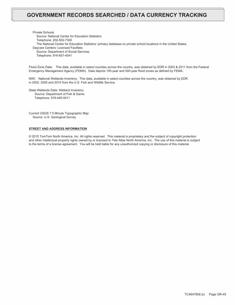
Private SchoolsSource: National Center for Education StatisticsTelephone: 202-502-7300The National Center for Education Statistics’ primary database on private school locations in the United States.
Daycare Centers: Licensed FacilitiesSource: Department of Social ServicesTelephone: 916-657-4041
Flood Zone Data: This data, available in select counties across the country, was obtained by EDR in 2003 & 2011 from the FederalEmergency Management Agency (FEMA). Data depicts 100-year and 500-year flood zones as defined by FEMA.
NWI: National Wetlands Inventory. This data, available in select counties across the country, was obtained by EDRin 2002, 2005 and 2010 from the U.S. Fish and Wildlife Service.
State Wetlands Data: Wetland InventorySource: Department of Fish & GameTelephone: 916-445-0411
Current USGS 7.5 Minute Topographic MapSource: U.S. Geological Survey
STREET AND ADDRESS INFORMATION
© 2015 TomTom North America, Inc. All rights reserved. This material is proprietary and the subject of copyright protectionand other intellectual property rights owned by or licensed to Tele Atlas North America, Inc. The use of this material is subjectto the terms of a license agreement. You will be held liable for any unauthorized copying or disclosure of this material.
TC4647858.2s Page GR-45
GOVERNMENT RECORDS SEARCHED / DATA CURRENCY TRACKING

TC4647858.2s Page A-1
geologic strata.of the soil, and nearby wells. Groundwater flow velocity is generally impacted by the nature of theGroundwater flow direction may be impacted by surface topography, hydrology, hydrogeology, characteristics
2. Groundwater flow velocity. 1. Groundwater flow direction, and
Assessment of the impact of contaminant migration generally has two principal investigative components:
forming an opinion about the impact of potential contaminant migration.EDR’s GeoCheck Physical Setting Source Addendum is provided to assist the environmental professional in
2012Version Date:5630733 BEVERLY HILLS, CAWest Map:
2012Version Date:5630741 HOLLYWOOD, CATarget Property Map:
USGS TOPOGRAPHIC MAP
175 ft. above sea levelElevation:3769886.5UTM Y (Meters): 374787.8UTM X (Meters): Zone 11Universal Tranverse Mercator: 118.356816 - 118˚ 21’ 24.54’’Longitude (West): 34.063987 - 34˚ 3’ 50.35’’Latitude (North):
TARGET PROPERTY COORDINATES
LOS ANGELES, CA 900365905 WILSHIRE BOULEVARDLACMA
TARGET PROPERTY ADDRESS
®GEOCHECK - PHYSICAL SETTING SOURCE ADDENDUM®

TC4647858.2s Page A-2
should be field verified.on a relative (not an absolute) basis. Relative elevation information between sites of close proximitySource: Topography has been determined from the USGS 7.5’ Digital Elevation Model and should be evaluated
SURROUNDING TOPOGRAPHY: ELEVATION PROFILES
Ele
vatio
n (ft
)E
leva
tion
(ft)
TP
TP0 1/2 1 Miles✩Target Property Elevation: 175 ft.
North South
West East
122
138
168
172
176
185
177
183
182
175
180
184
187
190
196
198
200
205
210139
142
144
146
149
156
164
168
171
175
183
192
195
198
200
200
203
204
204
General WestGeneral Topographic Gradient:TARGET PROPERTY TOPOGRAPHY
should contamination exist on the target property, what downgradient sites might be impacted.assist the environmental professional in forming an opinion about the impact of nearby contaminated properties or,Surface topography may be indicative of the direction of surficial groundwater flow. This information can be used toTOPOGRAPHIC INFORMATION
collected on nearby properties, and regional groundwater flow information (from deep aquifers).sources of information, such as surface topographic information, hydrologic information, hydrogeologic datausing site-specific well data. If such data is not reasonably ascertainable, it may be necessary to rely on otherGroundwater flow direction for a particular site is best determined by a qualified environmental professionalGROUNDWATER FLOW DIRECTION INFORMATION
®GEOCHECK - PHYSICAL SETTING SOURCE SUMMARY®

TC4647858.2s Page A-3
For additional site information, refer to Physical Setting Source Map Findings.
S1/2 - 1 Mile WestA2S1/2 - 1 Mile WestA1
GENERAL DIRECTIONLOCATIONGROUNDWATER FLOWFROM TPMAP ID
hydrogeologically, and the depth to water table.authorities at select sites and has extracted the date of the report, groundwater flow direction as determinedflow at specific points. EDR has reviewed reports submitted by environmental professionals to regulatoryEDR has developed the AQUIFLOW Information System to provide data on the general direction of groundwater
AQUIFLOW®
Search Radius: 1.000 Mile.
Not found Status:1.25 miles Search Radius:
Site-Specific Hydrogeological Data*:
* ©1996 Site−specific hydrogeological data gathered by CERCLIS Alerts, Inc., Bainbridge Island, WA. All rights reserved. All of the information and opinions presented are those of the cited EPA report(s), which were completed undera Comprehensive Environmental Response Compensation and Liability Information System (CERCLIS) investigation.
contamination exist on the target property, what downgradient sites might be impacted.environmental professional in forming an opinion about the impact of nearby contaminated properties or, shouldof groundwater flow direction in the immediate area. Such hydrogeologic information can be used to assist theHydrogeologic information obtained by installation of wells on a specific site can often be an indicatorHYDROGEOLOGIC INFORMATION
YES - refer to the Overview Map and Detail MapHOLLYWOOD
NATIONAL WETLAND INVENTORYNWI ElectronicData CoverageNWI Quad at Target Property
Not ReportedAdditional Panels in search area:
06037C - FEMA DFIRM Flood dataFlood Plain Panel at Target Property:
YES - refer to the Overview Map and Detail MapLOS ANGELES, CA
FEMA FLOOD ZONEFEMA FloodElectronic DataTarget Property County
and bodies of water).Refer to the Physical Setting Source Map following this summary for hydrologic information (major waterways
contamination exist on the target property, what downgradient sites might be impacted.the environmental professional in forming an opinion about the impact of nearby contaminated properties or, shouldSurface water can act as a hydrologic barrier to groundwater flow. Such hydrologic information can be used to assistHYDROLOGIC INFORMATION
®GEOCHECK - PHYSICAL SETTING SOURCE SUMMARY®

TC4647858.2s Page A-4
> 10 inchesDepth to Bedrock Max:
> 10 inchesDepth to Bedrock Min:
Not ReportedCorrosion Potential - Uncoated Steel:
Hydric Status: Soil does not meet the requirements for a hydric soil.
Not reportedSoil Drainage Class:
Not reportedHydrologic Group:
variableSoil Surface Texture:
URBAN LANDSoil Component Name:
The following information is based on Soil Conservation Service STATSGO data.in a landscape. Soil maps for STATSGO are compiled by generalizing more detailed (SSURGO) soil survey maps.for privately owned lands in the United States. A soil map in a soil survey is a representation of soil patternsSurvey (NCSS) and is responsible for collecting, storing, maintaining and distributing soil survey informationThe U.S. Department of Agriculture’s (USDA) Soil Conservation Service (SCS) leads the National Cooperative Soil
DOMINANT SOIL COMPOSITION IN GENERAL AREA OF TARGET PROPERTY
Map, USGS Digital Data Series DDS - 11 (1994).of the Conterminous U.S. at 1:2,500,000 Scale - a digital representation of the 1974 P.B. King and H.M. BeikmanGeologic Age and Rock Stratigraphic Unit Source: P.G. Schruben, R.E. Arndt and W.J. Bawiec, Geology
ROCK STRATIGRAPHIC UNIT GEOLOGIC AGE IDENTIFICATION
Stratifed SequenceCategory:CenozoicEra:QuaternarySystem:QuaternarySeries:QCode: (decoded above as Era, System & Series)
at which contaminant migration may be occurring.Geologic information can be used by the environmental professional in forming an opinion about the relative speedGEOLOGIC INFORMATION IN GENERAL AREA OF TARGET PROPERTY
move more quickly through sandy-gravelly types of soils than silty-clayey types of soils.characteristics data collected on nearby properties and regional soil information. In general, contaminant plumesto rely on other sources of information, including geologic age identification, rock stratigraphic unit and soilusing site specific geologic and soil strata data. If such data are not reasonably ascertainable, it may be necessaryGroundwater flow velocity information for a particular site is best determined by a qualified environmental professionalGROUNDWATER FLOW VELOCITY INFORMATION
®GEOCHECK - PHYSICAL SETTING SOURCE SUMMARY®

TC4647858.2s Page A-5
clay loamsilty clay loamgravelly - fine sandy loamsandweathered bedrockvery fine sandy loamstratifiedvery gravelly - sandy loamsandy loamgravelly - sandy loamDeeper Soil Types:
sandsilty clayclaysandy clay loamsandy claygravelly - loamfine sandy loamShallow Soil Types:
fine sandy loamsandgravelly - sandfine sandclaysilt loamgravelly - sandy loamsandy loamSurficial Soil Types:
fine sandy loamsandgravelly - sandfine sandclaysilt loamgravelly - sandy loamsandy loamSoil Surface Textures:
appear within the general area of target property.Based on Soil Conservation Service STATSGO data, the following additional subordinant soil types may
OTHER SOIL TYPES IN AREA
Min: 0.00Max: 0.00
Min: 0.00Max: 0.00Not reportedNot reportedvariable 6 inches 0 inches 1
Soil Layer Information
Boundary ClassificationPermeabilityRate (in/hr)
Layer Upper Lower Soil Texture Class AASHTO Group Unified Soil Soil Reaction(pH)
®GEOCHECK - PHYSICAL SETTING SOURCE SUMMARY®

TC4647858.2s Page A-6
1/8 - 1/4 Mile NNECAOG11000210784 F141/8 - 1/4 Mile NECAOG11000210354 B131/8 - 1/4 Mile ENECAOG11000210754 E121/8 - 1/4 Mile EastCAOG11000210351 E111/8 - 1/4 Mile ENECAOG11000210353 E101/8 - 1/4 Mile NNECAOG11000210776 B91/8 - 1/4 Mile SSWCAOG11000210370 C81/8 - 1/4 Mile NWCAOG11000210775 D71/8 - 1/4 Mile NorthCAOG11000210785 A61/8 - 1/4 Mile NNECAOG11000210357 B51/8 - 1/4 Mile SSWCAOG11000210371 C41/8 - 1/4 Mile NNECAOG11000210770 A31/8 - 1/4 Mile NECAOG11000210778 B21/8 - 1/4 Mile NorthCAOG11000210783 A1
STATE OIL/GAS WELL INFORMATION
LOCATIONFROM TPWELL IDMAP ID
OTHER STATE DATABASE INFORMATION
No Wells Found
STATE DATABASE WELL INFORMATION
LOCATIONFROM TPWELL IDMAP ID
Note: PWS System location is not always the same as well location.
No PWS System Found
FEDERAL FRDS PUBLIC WATER SUPPLY SYSTEM INFORMATION
LOCATIONFROM TPWELL IDMAP ID
No Wells Found
FEDERAL USGS WELL INFORMATION
LOCATIONFROM TPWELL IDMAP ID
1.000State DatabaseNearest PWS within 0.001 milesFederal FRDS PWS1.000Federal USGS
WELL SEARCH DISTANCE INFORMATION
SEARCH DISTANCE (miles)DATABASE
opinion about the impact of contaminant migration on nearby drinking water wells.professional in assessing sources that may impact ground water flow direction, and in forming anEDR Local/Regional Water Agency records provide water well information to assist the environmental
LOCAL / REGIONAL WATER AGENCY RECORDS
®GEOCHECK - PHYSICAL SETTING SOURCE SUMMARY®

TC4647858.2s Page A-7
1/4 - 1/2 Mile NNECAOG11000210771 R701/4 - 1/2 Mile ENECAOG11000210757 Q691/4 - 1/2 Mile NWCAOG11000210745 N681/4 - 1/2 Mile SSECAOG11000210365 671/4 - 1/2 Mile NorthCAOG11000210799 P661/4 - 1/2 Mile NECAOG11000210792 M651/4 - 1/2 Mile NorthCAOG11000210796 O641/4 - 1/2 Mile NWCAOG11000210583 N631/4 - 1/2 Mile ENECAOG11000210755 L621/4 - 1/2 Mile NECAOG11000210793 611/4 - 1/2 Mile NWCAOG11000210244 N601/4 - 1/2 Mile NECAOG11000210751 M591/4 - 1/2 Mile ENECAOG11000210765 K581/4 - 1/2 Mile SECAOG11000210638 571/4 - 1/2 Mile NNWCAOG11000210780 561/4 - 1/2 Mile ENECAOG11000210749 K551/4 - 1/2 Mile EastCAOG11000210759 L541/4 - 1/2 Mile ENECAOG11000210358 L531/4 - 1/2 Mile NorthCAOG11000210797 J521/4 - 1/2 Mile EastCAOG11000210515 L511/4 - 1/2 Mile EastCAOG11000210753 L501/4 - 1/2 Mile ENECAOG11000210750 K491/4 - 1/2 Mile NorthCAOG11000210795 J481/4 - 1/2 Mile NECAOG11000210764 K471/4 - 1/2 Mile SSWCAOG11000210372 461/4 - 1/2 Mile NNWCAOG11000210798 451/4 - 1/2 Mile SSECAOG11000210368 441/4 - 1/2 Mile ENECAOG11000210514 L431/4 - 1/2 Mile NWCAOG11000210579 421/4 - 1/2 Mile ENECAOG11000210352 K411/4 - 1/2 Mile NECAOG11000210761 H401/4 - 1/2 Mile ENECAOG11000210748 K391/4 - 1/2 Mile NNECAOG11000210767 381/4 - 1/2 Mile WSWCAOG11000205260 371/4 - 1/2 Mile NorthCAOG11000210779 J361/4 - 1/2 Mile NNWCAOG11000210777 351/4 - 1/2 Mile NNWCAOG11000210782 G341/4 - 1/2 Mile NECAOG11000210763 H331/4 - 1/2 Mile NECAOG11000210356 H321/4 - 1/2 Mile ENECAOG11000210752 E311/4 - 1/2 Mile EastCAOG11000210513 I301/4 - 1/2 Mile WestCAOG11000210586 291/4 - 1/2 Mile NECAOG11000210747 H281/4 - 1/2 Mile ENECAOG11000210516 E271/4 - 1/2 Mile ENECAOG11000210517 E261/4 - 1/2 Mile EastCAOG11000210758 I251/4 - 1/2 Mile NECAOG11000210756 H241/4 - 1/2 Mile NNECAOG11000210762 F231/4 - 1/2 Mile NWCAOG11000210787 D221/4 - 1/2 Mile NorthCAOG11000210794 F211/4 - 1/2 Mile WNWCAOG11000210773 201/4 - 1/2 Mile NECAOG11000210760 E191/4 - 1/2 Mile SECAOG11000210369 181/4 - 1/2 Mile NNWCAOG11000210781 D171/4 - 1/2 Mile NNWCAOG11000210769 G161/4 - 1/2 Mile NNECAOG11000210359 F15
STATE OIL/GAS WELL INFORMATION
LOCATIONFROM TPWELL IDMAP ID
®GEOCHECK - PHYSICAL SETTING SOURCE SUMMARY®

TC4647858.2s Page A-8
1/2 - 1 Mile NorthCAOG11000188558 AI1261/2 - 1 Mile NorthCAOG11000192180 AI1251/2 - 1 Mile NorthCAOG11000193040 AI1241/2 - 1 Mile NorthCAOG11000193039 AI1231/2 - 1 Mile NorthCAOG11000192993 AI1221/2 - 1 Mile NNWCAOG11000210334 AE1211/2 - 1 Mile NWCAOG11000210589 AG1201/2 - 1 Mile NNECAOG11000210530 AH1191/2 - 1 Mile NWCAOG11000210712 AC1181/2 - 1 Mile NWCAOG11000210575 AG1171/2 - 1 Mile ENECAOG11000210791 Y1161/2 - 1 Mile NECAOG11000210549 AB1151/2 - 1 Mile NorthCAOG11000210324 AA1141/2 - 1 Mile NECAOG11000210553 AF1131/2 - 1 Mile SSECAOG11000210360 Z1121/2 - 1 Mile ESECAOG11000210637 1111/2 - 1 Mile NECAOG11000210552 AD1101/2 - 1 Mile NNWCAOG11000210333 AE1091/2 - 1 Mile NECAOG11000210537 AD1081/2 - 1 Mile WNWCAOG11000210713 AC1071/2 - 1 Mile ENECAOG11000210768 1061/2 - 1 Mile NNWCAOG11000210744 V1051/2 - 1 Mile NNECAOG11000210316 X1041/2 - 1 Mile NNECAOG11000210529 X1031/2 - 1 Mile NECAOG11000210550 AB1021/2 - 1 Mile NorthCAOG11000210524 AA1011/2 - 1 Mile NWCAOG11000210590 W1001/2 - 1 Mile NECAOG11000210774 AB991/2 - 1 Mile NECAOG11000210551 U981/2 - 1 Mile NWCAOG11000210710 S971/2 - 1 Mile NNWCAOG11000210332 V961/2 - 1 Mile NECAOG11000210526 U951/2 - 1 Mile NorthCAOG11000210323 AA941/2 - 1 Mile SouthCAOG11000210367 Z931/2 - 1 Mile ENECAOG11000210790 Y921/2 - 1 Mile NorthCAOG11000210329 911/2 - 1 Mile NNECAOG11000210547 X901/2 - 1 Mile WNWCAOG11000210714 891/2 - 1 Mile NNECAOG11000210315 X881/2 - 1 Mile NNECAOG11000210528 X871/2 - 1 Mile NECAOG11000210525 U861/2 - 1 Mile NWCAOG11000210576 W851/2 - 1 Mile NNWCAOG11000210331 T841/2 - 1 Mile NNWCAOG11000210801 V831/2 - 1 Mile WNWCAOG11000210709 821/2 - 1 Mile NECAOG11000210772 U811/2 - 1 Mile NorthCAOG11000210330 P801/2 - 1 Mile NNECAOG11000210527 R791/2 - 1 Mile NNWCAOG11000210800 T781/4 - 1/2 Mile SECAOG11000210364 771/4 - 1/2 Mile NWCAOG11000210574 S761/4 - 1/2 Mile NorthCAOG11000210328 P751/4 - 1/2 Mile NNECAOG11000210314 R741/4 - 1/2 Mile NNECAOG11000210322 O731/4 - 1/2 Mile WestCAOG11000210715 721/4 - 1/2 Mile ENECAOG11000210766 Q71
STATE OIL/GAS WELL INFORMATION
LOCATIONFROM TPWELL IDMAP ID
®GEOCHECK - PHYSICAL SETTING SOURCE SUMMARY®

TC4647858.2s Page A-9
1/2 - 1 Mile NWCAOG11000210716 AN1821/2 - 1 Mile NNWCAOG11000210522 1811/2 - 1 Mile ENECAOG11000210788 1801/2 - 1 Mile NNECAOG11000210535 AM1791/2 - 1 Mile NECAOG11000210570 AF1781/2 - 1 Mile NNECAOG11000210318 AL1771/2 - 1 Mile NorthCAOG11000210325 AL1761/2 - 1 Mile NECAOG11000210641 AK1751/2 - 1 Mile NECAOG11000210556 AK1741/2 - 1 Mile NWCAOG11000210335 AJ1731/2 - 1 Mile NNECAOG11000210531 AH1721/2 - 1 Mile NECAOG11000210554 AD1711/2 - 1 Mile WNWCAOG11000210721 1701/2 - 1 Mile NNECAOG11000210536 AD1691/2 - 1 Mile NECAOG11000210555 AD1681/2 - 1 Mile NECAOG11000210548 AB1671/2 - 1 Mile NorthCAOG11000193178 AI1661/2 - 1 Mile NorthCAOG11000193157 AI1651/2 - 1 Mile NorthCAOG11000193106 AI1641/2 - 1 Mile NorthCAOG11000193083 AI1621/2 - 1 Mile NorthCAOG11000193084 AI1631/2 - 1 Mile NorthCAOG11000214636 AI1611/2 - 1 Mile NorthCAOG11000193262 AI1601/2 - 1 Mile NorthCAOG11000193259 AI1591/2 - 1 Mile NorthCAOG11000193071 AI1581/2 - 1 Mile NorthCAOG11000193256 AI1571/2 - 1 Mile NorthCAOG11000193135 AI1561/2 - 1 Mile NorthCAOG11000193158 AI1551/2 - 1 Mile NorthCAOG11000193086 AI1541/2 - 1 Mile NorthCAOG11000193150 AI1531/2 - 1 Mile NorthCAOG11000193149 AI1521/2 - 1 Mile NorthCAOG11000214637 AI1511/2 - 1 Mile NorthCAOG11000214223 AI1501/2 - 1 Mile NorthCAOG11000214224 AI1491/2 - 1 Mile NorthCAOG11000192188 AI1481/2 - 1 Mile NorthCAOG11000192184 AI1471/2 - 1 Mile NorthCAOG11000192183 AI1461/2 - 1 Mile NorthCAOG11000192172 AI1451/2 - 1 Mile NorthCAOG11000192174 AI1441/2 - 1 Mile NorthCAOG11000192181 AI1431/2 - 1 Mile NorthCAOG11000192175 AI1421/2 - 1 Mile NorthCAOG11000192185 AI1411/2 - 1 Mile NorthCAOG11000192187 AI1401/2 - 1 Mile NorthCAOG11000192173 AI1391/2 - 1 Mile NorthCAOG11000192182 AI1381/2 - 1 Mile NorthCAOG11000192186 AI1371/2 - 1 Mile NorthCAOG11000189038 AI1361/2 - 1 Mile NNECAOG11000210317 AH1351/2 - 1 Mile NorthCAOG11000192176 AI1341/2 - 1 Mile NorthCAOG11000193272 AI1331/2 - 1 Mile NorthCAOG11000193277 AI1321/2 - 1 Mile NorthCAOG11000189006 AI1311/2 - 1 Mile NorthCAOG11000192178 AI1301/2 - 1 Mile NorthCAOG11000192179 AI1291/2 - 1 Mile NorthCAOG11000193024 AI1281/2 - 1 Mile NorthCAOG11000192177 AI127
STATE OIL/GAS WELL INFORMATION
LOCATIONFROM TPWELL IDMAP ID
®GEOCHECK - PHYSICAL SETTING SOURCE SUMMARY®
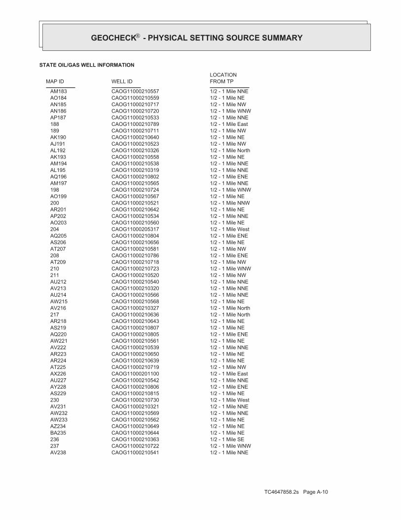
TC4647858.2s Page A-10
1/2 - 1 Mile NNECAOG11000210541 AV2381/2 - 1 Mile WNWCAOG11000210722 2371/2 - 1 Mile SECAOG11000210363 2361/2 - 1 Mile NECAOG11000210644 BA2351/2 - 1 Mile NECAOG11000210649 AZ2341/2 - 1 Mile NECAOG11000210562 AW2331/2 - 1 Mile NNECAOG11000210569 AW2321/2 - 1 Mile NNECAOG11000210321 AV2311/2 - 1 Mile WestCAOG11000210730 2301/2 - 1 Mile NECAOG11000210815 AS2291/2 - 1 Mile ENECAOG11000210806 AY2281/2 - 1 Mile NNECAOG11000210542 AU2271/2 - 1 Mile EastCAOG11000201100 AX2261/2 - 1 Mile NWCAOG11000210719 AT2251/2 - 1 Mile NECAOG11000210639 AR2241/2 - 1 Mile NECAOG11000210650 AR2231/2 - 1 Mile NNECAOG11000210539 AV2221/2 - 1 Mile NECAOG11000210561 AW2211/2 - 1 Mile ENECAOG11000210805 AQ2201/2 - 1 Mile NECAOG11000210807 AS2191/2 - 1 Mile NECAOG11000210643 AR2181/2 - 1 Mile NorthCAOG11000210636 2171/2 - 1 Mile NorthCAOG11000210327 AV2161/2 - 1 Mile NECAOG11000210568 AW2151/2 - 1 Mile NNECAOG11000210566 AU2141/2 - 1 Mile NNECAOG11000210320 AV2131/2 - 1 Mile NNECAOG11000210540 AU2121/2 - 1 Mile NWCAOG11000210520 2111/2 - 1 Mile WNWCAOG11000210723 2101/2 - 1 Mile NWCAOG11000210718 AT2091/2 - 1 Mile ENECAOG11000210786 2081/2 - 1 Mile NWCAOG11000210581 AT2071/2 - 1 Mile NECAOG11000210656 AS2061/2 - 1 Mile ENECAOG11000210804 AQ2051/2 - 1 Mile WestCAOG11000205317 2041/2 - 1 Mile NECAOG11000210560 AO2031/2 - 1 Mile NNECAOG11000210534 AP2021/2 - 1 Mile NECAOG11000210642 AR2011/2 - 1 Mile NNWCAOG11000210521 2001/2 - 1 Mile NECAOG11000210567 AO1991/2 - 1 Mile WNWCAOG11000210724 1981/2 - 1 Mile NNECAOG11000210565 AM1971/2 - 1 Mile ENECAOG11000210802 AQ1961/2 - 1 Mile NNECAOG11000210319 AL1951/2 - 1 Mile NNECAOG11000210538 AM1941/2 - 1 Mile NECAOG11000210558 AK1931/2 - 1 Mile NorthCAOG11000210326 AL1921/2 - 1 Mile NWCAOG11000210523 AJ1911/2 - 1 Mile NECAOG11000210640 AK1901/2 - 1 Mile NWCAOG11000210711 1891/2 - 1 Mile EastCAOG11000210789 1881/2 - 1 Mile NNECAOG11000210533 AP1871/2 - 1 Mile WNWCAOG11000210720 AN1861/2 - 1 Mile NWCAOG11000210717 AN1851/2 - 1 Mile NECAOG11000210559 AO1841/2 - 1 Mile NNECAOG11000210557 AM183
STATE OIL/GAS WELL INFORMATION
LOCATIONFROM TPWELL IDMAP ID
®GEOCHECK - PHYSICAL SETTING SOURCE SUMMARY®
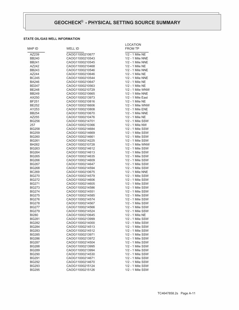
TC4647858.2s Page A-11
1/2 - 1 Mile SSWCAOG11000215126 BG2951/2 - 1 Mile SSWCAOG11000215124 BG2931/2 - 1 Mile SSWCAOG11000214670 BG2921/2 - 1 Mile SSWCAOG11000214671 BG2911/2 - 1 Mile SSWCAOG11000214530 BG2901/2 - 1 Mile SSWCAOG11000213994 BG2891/2 - 1 Mile SSWCAOG11000213995 BG2881/2 - 1 Mile SSWCAOG11000214504 BG2871/2 - 1 Mile SSWCAOG11000213972 BG2861/2 - 1 Mile SSWCAOG11000213971 BG2851/2 - 1 Mile SSWCAOG11000214512 BG2831/2 - 1 Mile SSWCAOG11000214513 BG2841/2 - 1 Mile SSWCAOG11000214000 BG2821/2 - 1 Mile SSWCAOG11000213999 BG2811/2 - 1 Mile NECAOG11000210645 BI2801/2 - 1 Mile SSWCAOG11000214524 BG2791/2 - 1 Mile SSWCAOG11000214566 BG2771/2 - 1 Mile SSWCAOG11000214567 BG2781/2 - 1 Mile SSWCAOG11000214574 BG2761/2 - 1 Mile SSWCAOG11000214585 BG2751/2 - 1 Mile SSWCAOG11000214551 BG2741/2 - 1 Mile SSWCAOG11000214586 BG2731/2 - 1 Mile SSWCAOG11000214605 BG2711/2 - 1 Mile SSWCAOG11000214606 BG2721/2 - 1 Mile SSWCAOG11000214579 BG2701/2 - 1 Mile NNECAOG11000210675 BC2691/2 - 1 Mile SSWCAOG11000214594 BG2681/2 - 1 Mile SSWCAOG11000214647 BG2671/2 - 1 Mile SSWCAOG11000214609 BG2661/2 - 1 Mile SSWCAOG11000214635 BG2651/2 - 1 Mile SSWCAOG11000214613 BG2641/2 - 1 Mile SSWCAOG11000214612 BG2631/2 - 1 Mile WNWCAOG11000210728 BH2621/2 - 1 Mile SSWCAOG11000214225 BG2611/2 - 1 Mile SSWCAOG11000214661 BG2601/2 - 1 Mile SSWCAOG11000214669 BG2591/2 - 1 Mile SSWCAOG11000214684 BG2581/2 - 1 Mile NWCAOG11000210366 2571/2 - 1 Mile SSWCAOG11000214701 BG2561/2 - 1 Mile NECAOG11000210476 AZ2551/2 - 1 Mile NNECAOG11000210670 BB2541/2 - 1 Mile ENECAOG11000210808 AY2531/2 - 1 Mile WNWCAOG11000216606 BE2521/2 - 1 Mile NECAOG11000210816 BF2511/2 - 1 Mile EastCAOG11000213973 AX2501/2 - 1 Mile NNECAOG11000210665 BB2491/2 - 1 Mile WNWCAOG11000210729 BE2481/2 - 1 Mile NECAOG11000210563 BD2471/2 - 1 Mile NECAOG11000210647 BA2461/2 - 1 Mile NNECAOG11000210544 BC2451/2 - 1 Mile NECAOG11000210646 AZ2441/2 - 1 Mile NNECAOG11000210546 BB2431/2 - 1 Mile NECAOG11000210468 AZ2421/2 - 1 Mile NNECAOG11000210545 BB2411/2 - 1 Mile NNECAOG11000210543 BB2401/2 - 1 Mile NECAOG11000210677 AZ239
STATE OIL/GAS WELL INFORMATION
LOCATIONFROM TPWELL IDMAP ID
®GEOCHECK - PHYSICAL SETTING SOURCE SUMMARY®
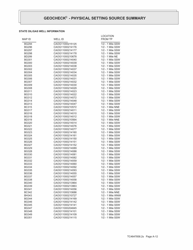
TC4647858.2s Page A-12
1/2 - 1 Mile SSWCAOG11000214115 BG3511/2 - 1 Mile SSWCAOG11000214109 BG3491/2 - 1 Mile SSWCAOG11000214101 BG3481/2 - 1 Mile SSWCAOG11000204845 BG3471/2 - 1 Mile SSWCAOG11000214141 BG3451/2 - 1 Mile SSWCAOG11000214142 BG3461/2 - 1 Mile SSWCAOG11000214169 BG3441/2 - 1 Mile WNWCAOG11000210727 BH3431/2 - 1 Mile NNECAOG11000210686 BC3421/2 - 1 Mile SSWCAOG11000214056 BG3411/2 - 1 Mile SSWCAOG11000213963 BG3391/2 - 1 Mile SSWCAOG11000213964 BG3401/2 - 1 Mile SSWCAOG11000214058 BG3381/2 - 1 Mile SSWCAOG11000214057 BG3371/2 - 1 Mile SSWCAOG11000214055 BG3361/2 - 1 Mile SSWCAOG11000214093 BG3351/2 - 1 Mile SSWCAOG11000214092 BG3341/2 - 1 Mile SSWCAOG11000214060 BG3331/2 - 1 Mile SSWCAOG11000214059 BG3321/2 - 1 Mile SSWCAOG11000214082 BG3311/2 - 1 Mile SSWCAOG11000214081 BG3301/2 - 1 Mile SSWCAOG11000214088 BG3281/2 - 1 Mile SSWCAOG11000214089 BG3291/2 - 1 Mile SSWCAOG11000214152 BG3271/2 - 1 Mile SSWCAOG11000214151 BG3261/2 - 1 Mile SSWCAOG11000214150 BG3251/2 - 1 Mile SSWCAOG11000214161 BG3241/2 - 1 Mile SSWCAOG11000214160 BG3231/2 - 1 Mile SSWCAOG11000214077 BG3221/2 - 1 Mile SSWCAOG11000214076 BG3211/2 - 1 Mile SSWCAOG11000214014 BG3201/2 - 1 Mile NNECAOG11000210564 BD3191/2 - 1 Mile SSWCAOG11000214012 BG3181/2 - 1 Mile SSWCAOG11000214010 BG3161/2 - 1 Mile SSWCAOG11000214011 BG3171/2 - 1 Mile NNECAOG11000210572 BC3151/2 - 1 Mile SSWCAOG11000214047 BG3131/2 - 1 Mile SSWCAOG11000214048 BG3141/2 - 1 Mile SSWCAOG11000214072 BG3121/2 - 1 Mile SSWCAOG11000214022 BG3101/2 - 1 Mile SSWCAOG11000214023 BG3111/2 - 1 Mile SSWCAOG11000214029 BG3081/2 - 1 Mile SSWCAOG11000214030 BG3091/2 - 1 Mile SSWCAOG11000214032 BG3071/2 - 1 Mile SSWCAOG11000214031 BG3061/2 - 1 Mile SSWCAOG11000214035 BG3051/2 - 1 Mile SSWCAOG11000214034 BG3041/2 - 1 Mile SSWCAOG11000214037 BG3021/2 - 1 Mile SSWCAOG11000214038 BG3031/2 - 1 Mile SSWCAOG11000214039 BG3001/2 - 1 Mile SSWCAOG11000214040 BG3011/2 - 1 Mile NECAOG11000210678 BD2991/2 - 1 Mile SSWCAOG11000214178 BG2981/2 - 1 Mile SSWCAOG11000214177 BG2971/2 - 1 Mile SSWCAOG11000214176 BG2961/2 - 1 Mile SSWCAOG11000215125 BG294
STATE OIL/GAS WELL INFORMATION
LOCATIONFROM TPWELL IDMAP ID
®GEOCHECK - PHYSICAL SETTING SOURCE SUMMARY®

TC4647858.2s Page A-13
1/2 - 1 Mile SSWCAOG11000214309 BG4071/2 - 1 Mile SSWCAOG11000214413 BG4051/2 - 1 Mile SSWCAOG11000214412 BG4041/2 - 1 Mile SSWCAOG11000214411 BG4031/2 - 1 Mile ENECAOG11000210817 BJ4021/2 - 1 Mile SSWCAOG11000214316 BG3991/2 - 1 Mile SSWCAOG11000214318 BG4011/2 - 1 Mile SSWCAOG11000214317 BG4001/2 - 1 Mile SSWCAOG11000214484 BG3981/2 - 1 Mile SSWCAOG11000214483 BG3971/2 - 1 Mile SSWCAOG11000214312 BG3941/2 - 1 Mile SSWCAOG11000214314 BG3961/2 - 1 Mile SSWCAOG11000214313 BG3951/2 - 1 Mile SSWCAOG11000214478 BG3931/2 - 1 Mile SSWCAOG11000214477 BG3921/2 - 1 Mile SSWCAOG11000214472 BG3901/2 - 1 Mile SSWCAOG11000214473 BG3911/2 - 1 Mile SSWCAOG11000214466 BG3881/2 - 1 Mile SSWCAOG11000214467 BG3891/2 - 1 Mile SSWCAOG11000200659 BG3871/2 - 1 Mile SSWCAOG11000200658 BG3861/2 - 1 Mile SSWCAOG11000214153 BG3851/2 - 1 Mile SSWCAOG11000214571 BG3831/2 - 1 Mile SSWCAOG11000214572 BG3841/2 - 1 Mile SSWCAOG11000214170 BG3811/2 - 1 Mile SSWCAOG11000214171 BG3821/2 - 1 Mile SSWCAOG11000214298 BG3801/2 - 1 Mile SSWCAOG11000214205 BG3771/2 - 1 Mile SSWCAOG11000214206 BG3781/2 - 1 Mile SSWCAOG11000214207 BG3791/2 - 1 Mile SSWCAOG11000214479 BG3741/2 - 1 Mile SSWCAOG11000214480 BG3751/2 - 1 Mile SSWCAOG11000214481 BG3761/2 - 1 Mile SSWCAOG11000214194 BG3711/2 - 1 Mile SSWCAOG11000214195 BG3721/2 - 1 Mile SSWCAOG11000214196 BG3731/2 - 1 Mile SSWCAOG11000214305 BG3701/2 - 1 Mile SSWCAOG11000214304 BG3691/2 - 1 Mile SSWCAOG11000214299 BG3671/2 - 1 Mile SSWCAOG11000214300 BG3681/2 - 1 Mile SSWCAOG11000213970 BG3661/2 - 1 Mile SSWCAOG11000213969 BG3651/2 - 1 Mile NECAOG11000210484 BI3641/2 - 1 Mile SSWCAOG11000214204 BG3631/2 - 1 Mile SSWCAOG11000214203 BG3621/2 - 1 Mile SSWCAOG11000213991 BG3611/2 - 1 Mile SSWCAOG11000213990 BG3601/2 - 1 Mile SSWCAOG11000213989 BG3591/2 - 1 Mile SSWCAOG11000214182 BG3561/2 - 1 Mile SSWCAOG11000214184 BG3581/2 - 1 Mile SSWCAOG11000214183 BG3571/2 - 1 Mile SSWCAOG11000214112 BG3551/2 - 1 Mile SSWCAOG11000214111 BG3541/2 - 1 Mile SSWCAOG11000214100 BG3531/2 - 1 Mile SSWCAOG11000214099 BG3521/2 - 1 Mile SSWCAOG11000214114 BG350
STATE OIL/GAS WELL INFORMATION
LOCATIONFROM TPWELL IDMAP ID
®GEOCHECK - PHYSICAL SETTING SOURCE SUMMARY®

TC4647858.2s Page A-14
1/2 - 1 Mile NECAOG11000210493 BI4261/2 - 1 Mile NNECAOG11000210688 BK4251/2 - 1 Mile WNWCAOG11000210251 4241/2 - 1 Mile WNWCAOG11000210726 4231/2 - 1 Mile NNECAOG11000210687 4221/2 - 1 Mile NNECAOG11000210705 BL4211/2 - 1 Mile NWCAOG11000210725 4201/2 - 1 Mile WNWCAOG11000210731 BH4191/2 - 1 Mile NECAOG11000210648 BI4181/2 - 1 Mile NECAOG11000210469 BF4171/2 - 1 Mile NNECAOG11000210707 BL4161/2 - 1 Mile NNECAOG11000210689 BK4151/2 - 1 Mile ENECAOG11000210809 BJ4141/2 - 1 Mile NECAOG11000210477 4131/2 - 1 Mile SSWCAOG11000214490 BG4101/2 - 1 Mile SSWCAOG11000214492 BG4121/2 - 1 Mile SSWCAOG11000214491 BG4111/2 - 1 Mile SSWCAOG11000213976 BG4081/2 - 1 Mile SSWCAOG11000213977 BG4091/2 - 1 Mile SSWCAOG11000214308 BG406
STATE OIL/GAS WELL INFORMATION
LOCATIONFROM TPWELL IDMAP ID
®GEOCHECK - PHYSICAL SETTING SOURCE SUMMARY®

EDR Inc.EDR Inc.EDR Inc.EDR Inc.EDR Inc.EDR Inc.EDR Inc.EDR Inc.EDR Inc.EDR Inc.EDR Inc.EDR Inc.EDR Inc.EDR Inc.EDR Inc.EDR Inc.EDR Inc.EDR Inc.EDR Inc.EDR Inc.EDR Inc.EDR Inc.EDR Inc.EDR Inc.EDR Inc.EDR Inc.EDR Inc.EDR Inc.EDR Inc.EDR Inc.EDR Inc.EDR Inc.EDR Inc.EDR Inc.EDR Inc.EDR Inc.EDR Inc.EDR Inc.EDR Inc.EDR Inc.
1 2 0
12
0
20
0
12
0
2 4 0
24
0
2 4 0
12
0
1 2 0
1 2 0
2 0 0
2 0 0
20
0
2 0 0
1 6 0
1 60
1 6 0
16
0
16
0
1 6 0
CA

TC4647858.2s Page A-16
Date: 06/24/1991Average Water Depth: 40Deep Water Depth: Not ReportedShallow Water Depth: Not ReportedGroundwater Flow: SSite ID: I-16144A2
West1/2 - 1 MileLower
38094AQUIFLOW
Date: 06/24/1991Average Water Depth: 40Deep Water Depth: Not ReportedShallow Water Depth: Not ReportedGroundwater Flow: SSite ID: I-16144A1
West1/2 - 1 MileLower
38095AQUIFLOW
Map IDDirectionDistanceElevation EDR ID NumberDatabase
®GEOCHECK - PHYSICAL SETTING SOURCE MAP FINDINGS®

TC4647858.2s Page A-17
A3NNE1/8 - 1/4 Mile
CAOG11000210770OIL_GAS
CAOG11000210778Site id:POGGissymbol:UnknownDirectiona:Not ReportedCompletion:Not ReportedAbandonedd:
0Redrillfoo:0Welldeptha:
Not ReportedSpuddate:NConfidenti:NHydraulica:NEpawell:32Wellnumber:Salt LakeLeasename:
Not ReportedComments:hudGissourcec:Not ReportedLocationde:
Not ReportedElevation:SBBase meridian:14WRange:01STownship:21Section:Any AreaArea name:Salt LakeFieldname:Los AngelesCounty name:
Chevron U.S.A. Inc.Operator name:PWell status:NDryhole:Not ReportedRedrill can:NBlm well:03715207Api number:1District nun:
B2NE1/8 - 1/4 Mile
CAOG11000210778OIL_GAS
CAOG11000210783Site id:POGGissymbol:UnknownDirectiona:Not ReportedCompletion:Not ReportedAbandonedd:
0Redrillfoo:0Welldeptha:
Not ReportedSpuddate:NConfidenti:NHydraulica:NEpawell:38Wellnumber:Salt LakeLeasename:
Not ReportedComments:hudGissourcec:Not ReportedLocationde:
Not ReportedElevation:SBBase meridian:14WRange:01STownship:21Section:Any AreaArea name:Salt LakeFieldname:Los AngelesCounty name:
Chevron U.S.A. Inc.Operator name:PWell status:NDryhole:Not ReportedRedrill can:NBlm well:03715212Api number:1District nun:
A1North1/8 - 1/4 Mile
CAOG11000210783OIL_GAS
Map IDDirectionDistance EDR ID NumberDatabase
®GEOCHECK - PHYSICAL SETTING SOURCE MAP FINDINGS®

TC4647858.2s Page A-18
hudGissourcec:Not ReportedLocationde:
Not ReportedElevation:SBBase meridian:14WRange:01STownship:21Section:Any AreaArea name:Salt LakeFieldname:Los AngelesCounty name:
Chevron U.S.A. Inc.Operator name:PWell status:NDryhole:Not ReportedRedrill can:NBlm well:03714682Api number:1District nun:
B5NNE1/8 - 1/4 Mile
CAOG11000210357OIL_GAS
CAOG11000210371Site id:POGGissymbol:UnknownDirectiona:Not ReportedCompletion:Not ReportedAbandonedd:
0Redrillfoo:0Welldeptha:
Not ReportedSpuddate:NConfidenti:NHydraulica:NEpawell:2Wellnumber:Not ReportedLeasename:
Not ReportedComments:hudGissourcec:Not ReportedLocationde:
Not ReportedElevation:SBBase meridian:14WRange:01STownship:28Section:Any AreaArea name:Salt Lake, SouthFieldname:Los AngelesCounty name:
Wilshire Oil Producers Co.Operator name:PWell status:NDryhole:Not ReportedRedrill can:NBlm well:03714696Api number:1District nun:
C4SSW1/8 - 1/4 Mile
CAOG11000210371OIL_GAS
CAOG11000210770Site id:POGGissymbol:UnknownDirectiona:Not ReportedCompletion:Not ReportedAbandonedd:
0Redrillfoo:0Welldeptha:
Not ReportedSpuddate:NConfidenti:NHydraulica:NEpawell:24Wellnumber:Salt LakeLeasename:
Not ReportedComments:hudGissourcec:Not ReportedLocationde:
Not ReportedElevation:SBBase meridian:14WRange:01STownship:21Section:Any AreaArea name:Salt LakeFieldname:Los AngelesCounty name:
Chevron U.S.A. Inc.Operator name:PWell status:NDryhole:Not ReportedRedrill can:NBlm well:03715199Api number:1District nun:
®GEOCHECK - PHYSICAL SETTING SOURCE MAP FINDINGS®

TC4647858.2s Page A-19
CAOG11000210775Site id:POGGissymbol:UnknownDirectiona:Not ReportedCompletion:Not ReportedAbandonedd:
0Redrillfoo:0Welldeptha:
Not ReportedSpuddate:NConfidenti:NHydraulica:NEpawell:29Wellnumber:Salt LakeLeasename:
Not ReportedComments:hudGissourcec:Not ReportedLocationde:
Not ReportedElevation:SBBase meridian:14WRange:01STownship:21Section:Any AreaArea name:Salt LakeFieldname:Los AngelesCounty name:
Chevron U.S.A. Inc.Operator name:PWell status:NDryhole:Not ReportedRedrill can:NBlm well:03715204Api number:1District nun:
D7NW1/8 - 1/4 Mile
CAOG11000210775OIL_GAS
CAOG11000210785Site id:POGGissymbol:UnknownDirectiona:Not ReportedCompletion:Not ReportedAbandonedd:
0Redrillfoo:0Welldeptha:
Not ReportedSpuddate:NConfidenti:NHydraulica:NEpawell:40Wellnumber:Salt LakeLeasename:
Not ReportedComments:hudGissourcec:Not ReportedLocationde:
Not ReportedElevation:SBBase meridian:14WRange:01STownship:21Section:Any AreaArea name:Salt LakeFieldname:Los AngelesCounty name:
Chevron U.S.A. Inc.Operator name:PWell status:NDryhole:Not ReportedRedrill can:NBlm well:03715214Api number:1District nun:
A6North1/8 - 1/4 Mile
CAOG11000210785OIL_GAS
CAOG11000210357Site id:POGGissymbol:UnknownDirectiona:Not ReportedCompletion:Not ReportedAbandonedd:
0Redrillfoo:0Welldeptha:
Not ReportedSpuddate:NConfidenti:NHydraulica:NEpawell:413Wellnumber:Salt LakeLeasename:
Not ReportedComments:
®GEOCHECK - PHYSICAL SETTING SOURCE MAP FINDINGS®
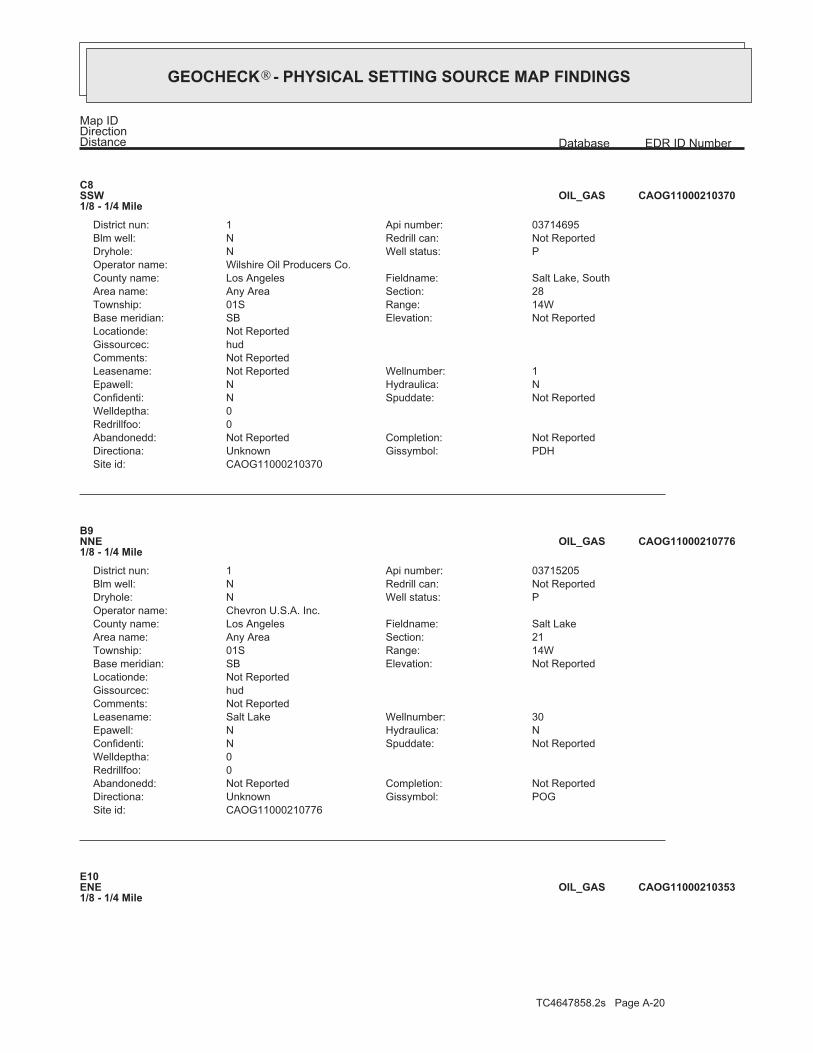
TC4647858.2s Page A-20
E10ENE1/8 - 1/4 Mile
CAOG11000210353OIL_GAS
CAOG11000210776Site id:POGGissymbol:UnknownDirectiona:Not ReportedCompletion:Not ReportedAbandonedd:
0Redrillfoo:0Welldeptha:
Not ReportedSpuddate:NConfidenti:NHydraulica:NEpawell:30Wellnumber:Salt LakeLeasename:
Not ReportedComments:hudGissourcec:Not ReportedLocationde:
Not ReportedElevation:SBBase meridian:14WRange:01STownship:21Section:Any AreaArea name:Salt LakeFieldname:Los AngelesCounty name:
Chevron U.S.A. Inc.Operator name:PWell status:NDryhole:Not ReportedRedrill can:NBlm well:03715205Api number:1District nun:
B9NNE1/8 - 1/4 Mile
CAOG11000210776OIL_GAS
CAOG11000210370Site id:PDHGissymbol:UnknownDirectiona:Not ReportedCompletion:Not ReportedAbandonedd:
0Redrillfoo:0Welldeptha:
Not ReportedSpuddate:NConfidenti:NHydraulica:NEpawell:1Wellnumber:Not ReportedLeasename:
Not ReportedComments:hudGissourcec:Not ReportedLocationde:
Not ReportedElevation:SBBase meridian:14WRange:01STownship:28Section:Any AreaArea name:Salt Lake, SouthFieldname:Los AngelesCounty name:
Wilshire Oil Producers Co.Operator name:PWell status:NDryhole:Not ReportedRedrill can:NBlm well:03714695Api number:1District nun:
C8SSW1/8 - 1/4 Mile
CAOG11000210370OIL_GAS
Map IDDirectionDistance EDR ID NumberDatabase
®GEOCHECK - PHYSICAL SETTING SOURCE MAP FINDINGS®

TC4647858.2s Page A-21
hudGissourcec:Not ReportedLocationde:
Not ReportedElevation:SBBase meridian:14WRange:01STownship:21Section:Any AreaArea name:Salt LakeFieldname:Los AngelesCounty name:
Chevron U.S.A. Inc.Operator name:PWell status:NDryhole:Not ReportedRedrill can:NBlm well:03715183Api number:1District nun:
E12ENE1/8 - 1/4 Mile
CAOG11000210754OIL_GAS
CAOG11000210351Site id:POGGissymbol:UnknownDirectiona:Not ReportedCompletion:Not ReportedAbandonedd:
0Redrillfoo:0Welldeptha:
Not ReportedSpuddate:NConfidenti:NHydraulica:NEpawell:406Wellnumber:Salt LakeLeasename:
Not ReportedComments:hudGissourcec:Not ReportedLocationde:
Not ReportedElevation:SBBase meridian:14WRange:01STownship:21Section:Any AreaArea name:Salt LakeFieldname:Los AngelesCounty name:
Chevron U.S.A. Inc.Operator name:PWell status:NDryhole:Not ReportedRedrill can:NBlm well:03714676Api number:1District nun:
E11East1/8 - 1/4 Mile
CAOG11000210351OIL_GAS
CAOG11000210353Site id:POGGissymbol:UnknownDirectiona:Not ReportedCompletion:Not ReportedAbandonedd:
0Redrillfoo:0Welldeptha:
Not ReportedSpuddate:NConfidenti:NHydraulica:NEpawell:408Wellnumber:Salt LakeLeasename:
Not ReportedComments:hudGissourcec:Not ReportedLocationde:
Not ReportedElevation:SBBase meridian:14WRange:01STownship:21Section:Any AreaArea name:Salt LakeFieldname:Los AngelesCounty name:
Chevron U.S.A. Inc.Operator name:PWell status:NDryhole:Not ReportedRedrill can:NBlm well:03714678Api number:1District nun:
®GEOCHECK - PHYSICAL SETTING SOURCE MAP FINDINGS®

TC4647858.2s Page A-22
CAOG11000210784Site id:POGGissymbol:UnknownDirectiona:Not ReportedCompletion:Not ReportedAbandonedd:
0Redrillfoo:0Welldeptha:
Not ReportedSpuddate:NConfidenti:NHydraulica:NEpawell:39Wellnumber:Salt LakeLeasename:
Not ReportedComments:hudGissourcec:Not ReportedLocationde:
Not ReportedElevation:SBBase meridian:14WRange:01STownship:21Section:Any AreaArea name:Salt LakeFieldname:Los AngelesCounty name:
Chevron U.S.A. Inc.Operator name:PWell status:NDryhole:Not ReportedRedrill can:NBlm well:03715213Api number:1District nun:
F14NNE1/8 - 1/4 Mile
CAOG11000210784OIL_GAS
CAOG11000210354Site id:POGGissymbol:UnknownDirectiona:Not ReportedCompletion:Not ReportedAbandonedd:
0Redrillfoo:0Welldeptha:
Not ReportedSpuddate:NConfidenti:NHydraulica:NEpawell:409Wellnumber:Salt LakeLeasename:
Not ReportedComments:hudGissourcec:Not ReportedLocationde:
Not ReportedElevation:SBBase meridian:14WRange:01STownship:21Section:Any AreaArea name:Salt LakeFieldname:Los AngelesCounty name:
Chevron U.S.A. Inc.Operator name:PWell status:NDryhole:Not ReportedRedrill can:NBlm well:03714679Api number:1District nun:
B13NE1/8 - 1/4 Mile
CAOG11000210354OIL_GAS
CAOG11000210754Site id:POGGissymbol:UnknownDirectiona:Not ReportedCompletion:Not ReportedAbandonedd:
0Redrillfoo:0Welldeptha:
Not ReportedSpuddate:NConfidenti:NHydraulica:NEpawell:8Wellnumber:Salt LakeLeasename:
Not ReportedComments:
®GEOCHECK - PHYSICAL SETTING SOURCE MAP FINDINGS®
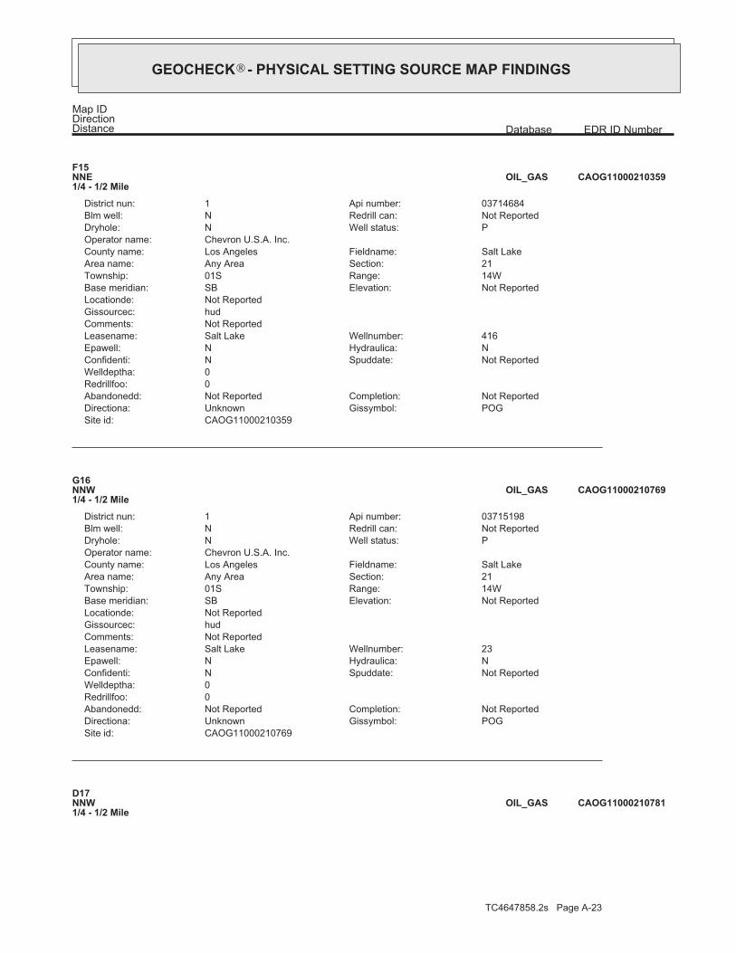
TC4647858.2s Page A-23
D17NNW1/4 - 1/2 Mile
CAOG11000210781OIL_GAS
CAOG11000210769Site id:POGGissymbol:UnknownDirectiona:Not ReportedCompletion:Not ReportedAbandonedd:
0Redrillfoo:0Welldeptha:
Not ReportedSpuddate:NConfidenti:NHydraulica:NEpawell:23Wellnumber:Salt LakeLeasename:
Not ReportedComments:hudGissourcec:Not ReportedLocationde:
Not ReportedElevation:SBBase meridian:14WRange:01STownship:21Section:Any AreaArea name:Salt LakeFieldname:Los AngelesCounty name:
Chevron U.S.A. Inc.Operator name:PWell status:NDryhole:Not ReportedRedrill can:NBlm well:03715198Api number:1District nun:
G16NNW1/4 - 1/2 Mile
CAOG11000210769OIL_GAS
CAOG11000210359Site id:POGGissymbol:UnknownDirectiona:Not ReportedCompletion:Not ReportedAbandonedd:
0Redrillfoo:0Welldeptha:
Not ReportedSpuddate:NConfidenti:NHydraulica:NEpawell:416Wellnumber:Salt LakeLeasename:
Not ReportedComments:hudGissourcec:Not ReportedLocationde:
Not ReportedElevation:SBBase meridian:14WRange:01STownship:21Section:Any AreaArea name:Salt LakeFieldname:Los AngelesCounty name:
Chevron U.S.A. Inc.Operator name:PWell status:NDryhole:Not ReportedRedrill can:NBlm well:03714684Api number:1District nun:
F15NNE1/4 - 1/2 Mile
CAOG11000210359OIL_GAS
Map IDDirectionDistance EDR ID NumberDatabase
®GEOCHECK - PHYSICAL SETTING SOURCE MAP FINDINGS®

TC4647858.2s Page A-24
hudGissourcec:Not ReportedLocationde:
Not ReportedElevation:SBBase meridian:14WRange:01STownship:21Section:Any AreaArea name:Salt LakeFieldname:Los AngelesCounty name:
Chevron U.S.A. Inc.Operator name:PWell status:NDryhole:Not ReportedRedrill can:NBlm well:03715189Api number:1District nun:
E19NE1/4 - 1/2 Mile
CAOG11000210760OIL_GAS
CAOG11000210369Site id:POGGissymbol:UnknownDirectiona:Not ReportedCompletion:Not ReportedAbandonedd:
0Redrillfoo:0Welldeptha:
Not ReportedSpuddate:NConfidenti:NHydraulica:NEpawell:101Wellnumber:Not ReportedLeasename:
Not ReportedComments:hudGissourcec:Not ReportedLocationde:
Not ReportedElevation:SBBase meridian:14WRange:01STownship:28Section:Any AreaArea name:Salt Lake, SouthFieldname:Los AngelesCounty name:
Utah California Consolidated Co.Operator name:PWell status:NDryhole:Not ReportedRedrill can:NBlm well:03714694Api number:1District nun:
18SE1/4 - 1/2 Mile
CAOG11000210369OIL_GAS
CAOG11000210781Site id:POGGissymbol:UnknownDirectiona:Not ReportedCompletion:Not ReportedAbandonedd:
0Redrillfoo:0Welldeptha:
Not ReportedSpuddate:NConfidenti:NHydraulica:NEpawell:36Wellnumber:Salt LakeLeasename:
Not ReportedComments:hudGissourcec:Not ReportedLocationde:
Not ReportedElevation:SBBase meridian:14WRange:01STownship:21Section:Any AreaArea name:Salt LakeFieldname:Los AngelesCounty name:
Chevron U.S.A. Inc.Operator name:PWell status:NDryhole:Not ReportedRedrill can:NBlm well:03715210Api number:1District nun:
®GEOCHECK - PHYSICAL SETTING SOURCE MAP FINDINGS®

TC4647858.2s Page A-25
CAOG11000210794Site id:POGGissymbol:UnknownDirectiona:Not ReportedCompletion:Not ReportedAbandonedd:
0Redrillfoo:0Welldeptha:
Not ReportedSpuddate:NConfidenti:NHydraulica:NEpawell:67Wellnumber:Salt LakeLeasename:
Not ReportedComments:hudGissourcec:Not ReportedLocationde:
Not ReportedElevation:SBBase meridian:14WRange:01STownship:21Section:Any AreaArea name:Salt LakeFieldname:Los AngelesCounty name:
Chevron U.S.A. Inc.Operator name:PWell status:NDryhole:Not ReportedRedrill can:NBlm well:03715223Api number:1District nun:
F21North1/4 - 1/2 Mile
CAOG11000210794OIL_GAS
CAOG11000210773Site id:AOGGissymbol:UnknownDirectiona:Not ReportedCompletion:Not ReportedAbandonedd:
0Redrillfoo:0Welldeptha:
Not ReportedSpuddate:NConfidenti:NHydraulica:NEpawell:27Wellnumber:Salt LakeLeasename:
Not ReportedComments:hudGissourcec:Not ReportedLocationde:
Not ReportedElevation:SBBase meridian:14WRange:01STownship:21Section:Any AreaArea name:Salt LakeFieldname:Los AngelesCounty name:
Chevron U.S.A. Inc.Operator name:BWell status:NDryhole:Not ReportedRedrill can:NBlm well:03715202Api number:1District nun:
20WNW1/4 - 1/2 Mile
CAOG11000210773OIL_GAS
CAOG11000210760Site id:POGGissymbol:UnknownDirectiona:Not ReportedCompletion:Not ReportedAbandonedd:
0Redrillfoo:0Welldeptha:
Not ReportedSpuddate:NConfidenti:NHydraulica:NEpawell:14Wellnumber:Salt LakeLeasename:
Not ReportedComments:
®GEOCHECK - PHYSICAL SETTING SOURCE MAP FINDINGS®

TC4647858.2s Page A-26
H24NE1/4 - 1/2 Mile
CAOG11000210756OIL_GAS
CAOG11000210762Site id:POGGissymbol:UnknownDirectiona:Not ReportedCompletion:Not ReportedAbandonedd:
0Redrillfoo:0Welldeptha:
Not ReportedSpuddate:NConfidenti:NHydraulica:NEpawell:16Wellnumber:Salt LakeLeasename:
Not ReportedComments:hudGissourcec:Not ReportedLocationde:
Not ReportedElevation:SBBase meridian:14WRange:01STownship:21Section:Any AreaArea name:Salt LakeFieldname:Los AngelesCounty name:
Chevron U.S.A. Inc.Operator name:PWell status:NDryhole:Not ReportedRedrill can:NBlm well:03715191Api number:1District nun:
F23NNE1/4 - 1/2 Mile
CAOG11000210762OIL_GAS
CAOG11000210787Site id:POGGissymbol:UnknownDirectiona:Not ReportedCompletion:Not ReportedAbandonedd:
0Redrillfoo:0Welldeptha:
Not ReportedSpuddate:NConfidenti:NHydraulica:NEpawell:42Wellnumber:Salt LakeLeasename:
Not ReportedComments:hudGissourcec:Not ReportedLocationde:
Not ReportedElevation:SBBase meridian:14WRange:01STownship:21Section:Any AreaArea name:Salt LakeFieldname:Los AngelesCounty name:
Chevron U.S.A. Inc.Operator name:PWell status:NDryhole:Not ReportedRedrill can:NBlm well:03715216Api number:1District nun:
D22NW1/4 - 1/2 Mile
CAOG11000210787OIL_GAS
Map IDDirectionDistance EDR ID NumberDatabase
®GEOCHECK - PHYSICAL SETTING SOURCE MAP FINDINGS®

TC4647858.2s Page A-27
hudGissourcec:Not ReportedLocationde:
Not ReportedElevation:SBBase meridian:14WRange:01STownship:21Section:Any AreaArea name:Salt LakeFieldname:Los AngelesCounty name:
Chevron U.S.A. Inc.Operator name:PWell status:NDryhole:Not ReportedRedrill can:NBlm well:03714900Api number:1District nun:
E26ENE1/4 - 1/2 Mile
CAOG11000210517OIL_GAS
CAOG11000210758Site id:POGGissymbol:UnknownDirectiona:Not ReportedCompletion:Not ReportedAbandonedd:
0Redrillfoo:0Welldeptha:
Not ReportedSpuddate:NConfidenti:NHydraulica:NEpawell:12Wellnumber:Salt LakeLeasename:
Not ReportedComments:hudGissourcec:Not ReportedLocationde:
Not ReportedElevation:SBBase meridian:14WRange:01STownship:21Section:Any AreaArea name:Salt LakeFieldname:Los AngelesCounty name:
Chevron U.S.A. Inc.Operator name:PWell status:NDryhole:Not ReportedRedrill can:NBlm well:03715187Api number:1District nun:
I25East1/4 - 1/2 Mile
CAOG11000210758OIL_GAS
CAOG11000210756Site id:POGGissymbol:UnknownDirectiona:Not ReportedCompletion:Not ReportedAbandonedd:
0Redrillfoo:0Welldeptha:
Not ReportedSpuddate:NConfidenti:NHydraulica:NEpawell:10Wellnumber:Salt LakeLeasename:
Not ReportedComments:hudGissourcec:Not ReportedLocationde:
Not ReportedElevation:SBBase meridian:14WRange:01STownship:21Section:Any AreaArea name:Salt LakeFieldname:Los AngelesCounty name:
Chevron U.S.A. Inc.Operator name:PWell status:NDryhole:Not ReportedRedrill can:NBlm well:03715185Api number:1District nun:
®GEOCHECK - PHYSICAL SETTING SOURCE MAP FINDINGS®

TC4647858.2s Page A-28
CAOG11000210747Site id:POGGissymbol:UnknownDirectiona:Not ReportedCompletion:Not ReportedAbandonedd:
0Redrillfoo:0Welldeptha:
Not ReportedSpuddate:NConfidenti:NHydraulica:NEpawell:1Wellnumber:Salt LakeLeasename:
Not ReportedComments:hudGissourcec:Not ReportedLocationde:
Not ReportedElevation:SBBase meridian:14WRange:01STownship:21Section:Any AreaArea name:Salt LakeFieldname:Los AngelesCounty name:
Chevron U.S.A. Inc.Operator name:PWell status:NDryhole:Not ReportedRedrill can:NBlm well:03715176Api number:1District nun:
H28NE1/4 - 1/2 Mile
CAOG11000210747OIL_GAS
CAOG11000210516Site id:POGGissymbol:UnknownDirectiona:Not ReportedCompletion:Not ReportedAbandonedd:
0Redrillfoo:0Welldeptha:
Not ReportedSpuddate:NConfidenti:NHydraulica:NEpawell:405Wellnumber:Salt LakeLeasename:
Not ReportedComments:hudGissourcec:Not ReportedLocationde:
Not ReportedElevation:SBBase meridian:14WRange:01STownship:21Section:Any AreaArea name:Salt LakeFieldname:Los AngelesCounty name:
Chevron U.S.A. Inc.Operator name:PWell status:NDryhole:Not ReportedRedrill can:NBlm well:03714899Api number:1District nun:
E27ENE1/4 - 1/2 Mile
CAOG11000210516OIL_GAS
CAOG11000210517Site id:POGGissymbol:UnknownDirectiona:Not ReportedCompletion:Not ReportedAbandonedd:
0Redrillfoo:0Welldeptha:
Not ReportedSpuddate:NConfidenti:NHydraulica:NEpawell:401Wellnumber:Salt LakeLeasename:
Not ReportedComments:
®GEOCHECK - PHYSICAL SETTING SOURCE MAP FINDINGS®

TC4647858.2s Page A-29
E31ENE1/4 - 1/2 Mile
CAOG11000210752OIL_GAS
CAOG11000210513Site id:POGGissymbol:UnknownDirectiona:Not ReportedCompletion:Not ReportedAbandonedd:
0Redrillfoo:0Welldeptha:
Not ReportedSpuddate:NConfidenti:NHydraulica:NEpawell:402Wellnumber:Salt LakeLeasename:
Not ReportedComments:hudGissourcec:Not ReportedLocationde:
Not ReportedElevation:SBBase meridian:14WRange:01STownship:21Section:Any AreaArea name:Salt LakeFieldname:Los AngelesCounty name:
Chevron U.S.A. Inc.Operator name:PWell status:NDryhole:Not ReportedRedrill can:NBlm well:03714896Api number:1District nun:
I30East1/4 - 1/2 Mile
CAOG11000210513OIL_GAS
CAOG11000210586Site id:AOGGissymbol:UnknownDirectiona:Not ReportedCompletion:Not ReportedAbandonedd:
0Redrillfoo:0Welldeptha:
Not ReportedSpuddate:NConfidenti:NHydraulica:NEpawell:10Wellnumber:Not ReportedLeasename:
Not ReportedComments:hudGissourcec:Not ReportedLocationde:
Not ReportedElevation:SBBase meridian:14WRange:01STownship:20Section:Any AreaArea name:Salt Lake, SouthFieldname:Los AngelesCounty name:
Chevron U.S.A. Inc.Operator name:BWell status:NDryhole:Not ReportedRedrill can:NBlm well:03714970Api number:1District nun:
29West1/4 - 1/2 Mile
CAOG11000210586OIL_GAS
Map IDDirectionDistance EDR ID NumberDatabase
®GEOCHECK - PHYSICAL SETTING SOURCE MAP FINDINGS®

TC4647858.2s Page A-30
hudGissourcec:Not ReportedLocationde:
Not ReportedElevation:SBBase meridian:14WRange:01STownship:21Section:Any AreaArea name:Salt LakeFieldname:Los AngelesCounty name:
Chevron U.S.A. Inc.Operator name:PWell status:NDryhole:Not ReportedRedrill can:NBlm well:03715192Api number:1District nun:
H33NE1/4 - 1/2 Mile
CAOG11000210763OIL_GAS
CAOG11000210356Site id:POGGissymbol:UnknownDirectiona:Not ReportedCompletion:Not ReportedAbandonedd:
0Redrillfoo:0Welldeptha:
Not ReportedSpuddate:NConfidenti:NHydraulica:NEpawell:411Wellnumber:Salt LakeLeasename:
Not ReportedComments:hudGissourcec:Not ReportedLocationde:
Not ReportedElevation:SBBase meridian:14WRange:01STownship:21Section:Any AreaArea name:Salt LakeFieldname:Los AngelesCounty name:
Chevron U.S.A. Inc.Operator name:PWell status:NDryhole:Not ReportedRedrill can:NBlm well:03714681Api number:1District nun:
H32NE1/4 - 1/2 Mile
CAOG11000210356OIL_GAS
CAOG11000210752Site id:POGGissymbol:UnknownDirectiona:Not ReportedCompletion:Not ReportedAbandonedd:
0Redrillfoo:0Welldeptha:
Not ReportedSpuddate:NConfidenti:NHydraulica:NEpawell:6Wellnumber:Salt LakeLeasename:
Not ReportedComments:hudGissourcec:Not ReportedLocationde:
Not ReportedElevation:SBBase meridian:14WRange:01STownship:21Section:Any AreaArea name:Salt LakeFieldname:Los AngelesCounty name:
Chevron U.S.A. Inc.Operator name:PWell status:NDryhole:Not ReportedRedrill can:NBlm well:03715181Api number:1District nun:
®GEOCHECK - PHYSICAL SETTING SOURCE MAP FINDINGS®

TC4647858.2s Page A-31
CAOG11000210777Site id:POGGissymbol:UnknownDirectiona:Not ReportedCompletion:Not ReportedAbandonedd:
0Redrillfoo:0Welldeptha:
Not ReportedSpuddate:NConfidenti:NHydraulica:NEpawell:31Wellnumber:Salt LakeLeasename:
Not ReportedComments:hudGissourcec:Not ReportedLocationde:
Not ReportedElevation:SBBase meridian:14WRange:01STownship:21Section:Any AreaArea name:Salt LakeFieldname:Los AngelesCounty name:
Chevron U.S.A. Inc.Operator name:PWell status:NDryhole:Not ReportedRedrill can:NBlm well:03715206Api number:1District nun:
35NNW1/4 - 1/2 Mile
CAOG11000210777OIL_GAS
CAOG11000210782Site id:POGGissymbol:UnknownDirectiona:Not ReportedCompletion:Not ReportedAbandonedd:
0Redrillfoo:0Welldeptha:
Not ReportedSpuddate:NConfidenti:NHydraulica:NEpawell:37Wellnumber:Salt LakeLeasename:
Not ReportedComments:hudGissourcec:Not ReportedLocationde:
Not ReportedElevation:SBBase meridian:14WRange:01STownship:21Section:Any AreaArea name:Salt LakeFieldname:Los AngelesCounty name:
Chevron U.S.A. Inc.Operator name:PWell status:NDryhole:Not ReportedRedrill can:NBlm well:03715211Api number:1District nun:
G34NNW1/4 - 1/2 Mile
CAOG11000210782OIL_GAS
CAOG11000210763Site id:POGGissymbol:UnknownDirectiona:Not ReportedCompletion:Not ReportedAbandonedd:
0Redrillfoo:0Welldeptha:
Not ReportedSpuddate:NConfidenti:NHydraulica:NEpawell:17Wellnumber:Salt LakeLeasename:
Not ReportedComments:
®GEOCHECK - PHYSICAL SETTING SOURCE MAP FINDINGS®

TC4647858.2s Page A-32
38NNE1/4 - 1/2 Mile
CAOG11000210767OIL_GAS
CAOG11000205260Site id:PDHGissymbol:UnknownDirectiona:Not ReportedCompletion:Not ReportedAbandonedd:
0Redrillfoo:0Welldeptha:
Not ReportedSpuddate:NConfidenti:NHydraulica:NEpawell:1Wellnumber:Seibu CoreholeLeasename:
Not ReportedComments:hudGissourcec:Not ReportedLocationde:
Not ReportedElevation:SBBase meridian:14WRange:01STownship:29Section:Any AreaArea name:Salt Lake, SouthFieldname:Los AngelesCounty name:
Chevron U.S.A. Inc.Operator name:PWell status:NDryhole:Not ReportedRedrill can:NBlm well:03706336Api number:1District nun:
37WSW1/4 - 1/2 Mile
CAOG11000205260OIL_GAS
CAOG11000210779Site id:POGGissymbol:UnknownDirectiona:Not ReportedCompletion:Not ReportedAbandonedd:
0Redrillfoo:0Welldeptha:
Not ReportedSpuddate:NConfidenti:NHydraulica:NEpawell:33Wellnumber:Salt LakeLeasename:
Not ReportedComments:hudGissourcec:Not ReportedLocationde:
Not ReportedElevation:SBBase meridian:14WRange:01STownship:21Section:Any AreaArea name:Salt LakeFieldname:Los AngelesCounty name:
Chevron U.S.A. Inc.Operator name:PWell status:NDryhole:Not ReportedRedrill can:NBlm well:03715208Api number:1District nun:
J36North1/4 - 1/2 Mile
CAOG11000210779OIL_GAS
Map IDDirectionDistance EDR ID NumberDatabase
®GEOCHECK - PHYSICAL SETTING SOURCE MAP FINDINGS®

TC4647858.2s Page A-33
hudGissourcec:Not ReportedLocationde:
Not ReportedElevation:SBBase meridian:14WRange:01STownship:21Section:Any AreaArea name:Salt LakeFieldname:Los AngelesCounty name:
Chevron U.S.A. Inc.Operator name:PWell status:NDryhole:Not ReportedRedrill can:NBlm well:03715190Api number:1District nun:
H40NE1/4 - 1/2 Mile
CAOG11000210761OIL_GAS
CAOG11000210748Site id:POGGissymbol:UnknownDirectiona:Not ReportedCompletion:Not ReportedAbandonedd:
0Redrillfoo:0Welldeptha:
Not ReportedSpuddate:NConfidenti:NHydraulica:NEpawell:2Wellnumber:Salt LakeLeasename:
Not ReportedComments:hudGissourcec:Not ReportedLocationde:
Not ReportedElevation:SBBase meridian:14WRange:01STownship:21Section:Any AreaArea name:Salt LakeFieldname:Los AngelesCounty name:
Chevron U.S.A. Inc.Operator name:PWell status:NDryhole:Not ReportedRedrill can:NBlm well:03715177Api number:1District nun:
K39ENE1/4 - 1/2 Mile
CAOG11000210748OIL_GAS
CAOG11000210767Site id:POGGissymbol:UnknownDirectiona:Not ReportedCompletion:Not ReportedAbandonedd:
0Redrillfoo:0Welldeptha:
Not ReportedSpuddate:NConfidenti:NHydraulica:NEpawell:21Wellnumber:Salt LakeLeasename:
Not ReportedComments:hudGissourcec:Not ReportedLocationde:
Not ReportedElevation:SBBase meridian:14WRange:01STownship:21Section:Any AreaArea name:Salt LakeFieldname:Los AngelesCounty name:
Chevron U.S.A. Inc.Operator name:PWell status:NDryhole:Not ReportedRedrill can:NBlm well:03715196Api number:1District nun:
®GEOCHECK - PHYSICAL SETTING SOURCE MAP FINDINGS®

TC4647858.2s Page A-34
CAOG11000210579Site id:POGGissymbol:UnknownDirectiona:Not ReportedCompletion:Not ReportedAbandonedd:
0Redrillfoo:0Welldeptha:
Not ReportedSpuddate:NConfidenti:NHydraulica:NEpawell:4Wellnumber:Not ReportedLeasename:
Not ReportedComments:hudGissourcec:Not ReportedLocationde:
Not ReportedElevation:SBBase meridian:14WRange:01STownship:20Section:Any AreaArea name:Salt LakeFieldname:Los AngelesCounty name:
Chevron U.S.A. Inc.Operator name:PWell status:NDryhole:Not ReportedRedrill can:NBlm well:03714963Api number:1District nun:
42NW1/4 - 1/2 Mile
CAOG11000210579OIL_GAS
CAOG11000210352Site id:POGGissymbol:UnknownDirectiona:Not ReportedCompletion:Not ReportedAbandonedd:
0Redrillfoo:0Welldeptha:
Not ReportedSpuddate:NConfidenti:NHydraulica:NEpawell:407Wellnumber:Salt LakeLeasename:
Not ReportedComments:hudGissourcec:Not ReportedLocationde:
Not ReportedElevation:SBBase meridian:14WRange:01STownship:21Section:Any AreaArea name:Salt LakeFieldname:Los AngelesCounty name:
Chevron U.S.A. Inc.Operator name:PWell status:NDryhole:Not ReportedRedrill can:NBlm well:03714677Api number:1District nun:
K41ENE1/4 - 1/2 Mile
CAOG11000210352OIL_GAS
CAOG11000210761Site id:POGGissymbol:UnknownDirectiona:Not ReportedCompletion:Not ReportedAbandonedd:
0Redrillfoo:0Welldeptha:
Not ReportedSpuddate:NConfidenti:NHydraulica:NEpawell:15Wellnumber:Salt LakeLeasename:
Not ReportedComments:
®GEOCHECK - PHYSICAL SETTING SOURCE MAP FINDINGS®

TC4647858.2s Page A-35
45NNW1/4 - 1/2 Mile
CAOG11000210798OIL_GAS
CAOG11000210368Site id:AOGGissymbol:UnknownDirectiona:Not ReportedCompletion:Not ReportedAbandonedd:
0Redrillfoo:0Welldeptha:
Not ReportedSpuddate:NConfidenti:NHydraulica:NEpawell:3Wellnumber:Lease 2Leasename:
Not ReportedComments:hudGissourcec:Not ReportedLocationde:
Not ReportedElevation:SBBase meridian:14WRange:01STownship:28Section:Any AreaArea name:Salt Lake, SouthFieldname:Los AngelesCounty name:
Utah California Consolidated Co.Operator name:IWell status:NDryhole:Not ReportedRedrill can:NBlm well:03714693Api number:1District nun:
44SSE1/4 - 1/2 Mile
CAOG11000210368OIL_GAS
CAOG11000210514Site id:POGGissymbol:UnknownDirectiona:Not ReportedCompletion:Not ReportedAbandonedd:
0Redrillfoo:0Welldeptha:
Not ReportedSpuddate:NConfidenti:NHydraulica:NEpawell:403Wellnumber:Salt LakeLeasename:
Not ReportedComments:hudGissourcec:Not ReportedLocationde:
Not ReportedElevation:SBBase meridian:14WRange:01STownship:21Section:Any AreaArea name:Salt LakeFieldname:Los AngelesCounty name:
Chevron U.S.A. Inc.Operator name:PWell status:NDryhole:Not ReportedRedrill can:NBlm well:03714897Api number:1District nun:
L43ENE1/4 - 1/2 Mile
CAOG11000210514OIL_GAS
Map IDDirectionDistance EDR ID NumberDatabase
®GEOCHECK - PHYSICAL SETTING SOURCE MAP FINDINGS®

TC4647858.2s Page A-36
hudGissourcec:Not ReportedLocationde:
Not ReportedElevation:SBBase meridian:14WRange:01STownship:21Section:Any AreaArea name:Salt LakeFieldname:Los AngelesCounty name:
Chevron U.S.A. Inc.Operator name:PWell status:NDryhole:Not ReportedRedrill can:NBlm well:03715193Api number:1District nun:
K47NE1/4 - 1/2 Mile
CAOG11000210764OIL_GAS
CAOG11000210372Site id:POGGissymbol:UnknownDirectiona:Not ReportedCompletion:Not ReportedAbandonedd:
0Redrillfoo:0Welldeptha:
Not ReportedSpuddate:NConfidenti:NHydraulica:NEpawell:3Wellnumber:Not ReportedLeasename:
Not ReportedComments:hudGissourcec:Not ReportedLocationde:
Not ReportedElevation:SBBase meridian:14WRange:01STownship:28Section:Any AreaArea name:Salt Lake, SouthFieldname:Los AngelesCounty name:
Wilshire Oil Producers Co.Operator name:PWell status:NDryhole:Not ReportedRedrill can:NBlm well:03714697Api number:1District nun:
46SSW1/4 - 1/2 Mile
CAOG11000210372OIL_GAS
CAOG11000210798Site id:POGGissymbol:UnknownDirectiona:Not ReportedCompletion:Not ReportedAbandonedd:
0Redrillfoo:0Welldeptha:
Not ReportedSpuddate:NConfidenti:NHydraulica:NEpawell:90Wellnumber:Salt LakeLeasename:
Not ReportedComments:hudGissourcec:Not ReportedLocationde:
Not ReportedElevation:SBBase meridian:14WRange:01STownship:21Section:Any AreaArea name:Salt LakeFieldname:Los AngelesCounty name:
Chevron U.S.A. Inc.Operator name:PWell status:NDryhole:Not ReportedRedrill can:NBlm well:03715227Api number:1District nun:
®GEOCHECK - PHYSICAL SETTING SOURCE MAP FINDINGS®

TC4647858.2s Page A-37
CAOG11000210750Site id:POGGissymbol:UnknownDirectiona:Not ReportedCompletion:Not ReportedAbandonedd:
0Redrillfoo:0Welldeptha:
Not ReportedSpuddate:NConfidenti:NHydraulica:NEpawell:4Wellnumber:Salt LakeLeasename:
Not ReportedComments:hudGissourcec:Not ReportedLocationde:
Not ReportedElevation:SBBase meridian:14WRange:01STownship:21Section:Any AreaArea name:Salt LakeFieldname:Los AngelesCounty name:
Chevron U.S.A. Inc.Operator name:PWell status:NDryhole:Not ReportedRedrill can:NBlm well:03715179Api number:1District nun:
K49ENE1/4 - 1/2 Mile
CAOG11000210750OIL_GAS
CAOG11000210795Site id:POGGissymbol:UnknownDirectiona:Not ReportedCompletion:Not ReportedAbandonedd:
0Redrillfoo:0Welldeptha:
Not ReportedSpuddate:NConfidenti:NHydraulica:NEpawell:81Wellnumber:Salt LakeLeasename:
Not ReportedComments:hudGissourcec:Not ReportedLocationde:
Not ReportedElevation:SBBase meridian:14WRange:01STownship:21Section:Any AreaArea name:Salt LakeFieldname:Los AngelesCounty name:
Chevron U.S.A. Inc.Operator name:PWell status:NDryhole:Not ReportedRedrill can:NBlm well:03715224Api number:1District nun:
J48North1/4 - 1/2 Mile
CAOG11000210795OIL_GAS
CAOG11000210764Site id:POGGissymbol:UnknownDirectiona:Not ReportedCompletion:Not ReportedAbandonedd:
0Redrillfoo:0Welldeptha:
Not ReportedSpuddate:NConfidenti:NHydraulica:NEpawell:18Wellnumber:Salt LakeLeasename:
Not ReportedComments:
®GEOCHECK - PHYSICAL SETTING SOURCE MAP FINDINGS®

TC4647858.2s Page A-38
J52North1/4 - 1/2 Mile
CAOG11000210797OIL_GAS
CAOG11000210515Site id:POGGissymbol:UnknownDirectiona:Not ReportedCompletion:Not ReportedAbandonedd:
0Redrillfoo:0Welldeptha:
Not ReportedSpuddate:NConfidenti:NHydraulica:NEpawell:404Wellnumber:Salt LakeLeasename:
Not ReportedComments:hudGissourcec:Not ReportedLocationde:
Not ReportedElevation:SBBase meridian:14WRange:01STownship:21Section:Any AreaArea name:Salt LakeFieldname:Los AngelesCounty name:
Chevron U.S.A. Inc.Operator name:PWell status:NDryhole:Not ReportedRedrill can:NBlm well:03714898Api number:1District nun:
L51East1/4 - 1/2 Mile
CAOG11000210515OIL_GAS
CAOG11000210753Site id:POGGissymbol:UnknownDirectiona:Not ReportedCompletion:Not ReportedAbandonedd:
0Redrillfoo:0Welldeptha:
Not ReportedSpuddate:NConfidenti:NHydraulica:NEpawell:7Wellnumber:Salt LakeLeasename:
Not ReportedComments:hudGissourcec:Not ReportedLocationde:
Not ReportedElevation:SBBase meridian:14WRange:01STownship:21Section:Any AreaArea name:Salt LakeFieldname:Los AngelesCounty name:
Chevron U.S.A. Inc.Operator name:PWell status:NDryhole:Not ReportedRedrill can:NBlm well:03715182Api number:1District nun:
L50East1/4 - 1/2 Mile
CAOG11000210753OIL_GAS
Map IDDirectionDistance EDR ID NumberDatabase
®GEOCHECK - PHYSICAL SETTING SOURCE MAP FINDINGS®

TC4647858.2s Page A-39
hudGissourcec:Not ReportedLocationde:
Not ReportedElevation:SBBase meridian:14WRange:01STownship:21Section:Any AreaArea name:Salt LakeFieldname:Los AngelesCounty name:
Chevron U.S.A. Inc.Operator name:PWell status:NDryhole:Not ReportedRedrill can:NBlm well:03715188Api number:1District nun:
L54East1/4 - 1/2 Mile
CAOG11000210759OIL_GAS
CAOG11000210358Site id:AOGGissymbol:UnknownDirectiona:Not ReportedCompletion:Not ReportedAbandonedd:
0Redrillfoo:0Welldeptha:
Not ReportedSpuddate:NConfidenti:NHydraulica:NEpawell:415Wellnumber:Salt LakeLeasename:
Not ReportedComments:hudGissourcec:Not ReportedLocationde:
Not ReportedElevation:SBBase meridian:14WRange:01STownship:21Section:Any AreaArea name:Salt LakeFieldname:Los AngelesCounty name:
Chevron U.S.A. Inc.Operator name:BWell status:NDryhole:Not ReportedRedrill can:NBlm well:03714683Api number:1District nun:
L53ENE1/4 - 1/2 Mile
CAOG11000210358OIL_GAS
CAOG11000210797Site id:POGGissymbol:UnknownDirectiona:Not ReportedCompletion:Not ReportedAbandonedd:
0Redrillfoo:0Welldeptha:
Not ReportedSpuddate:NConfidenti:NHydraulica:NEpawell:88Wellnumber:Salt LakeLeasename:
Not ReportedComments:hudGissourcec:Not ReportedLocationde:
Not ReportedElevation:SBBase meridian:14WRange:01STownship:21Section:Any AreaArea name:Salt LakeFieldname:Los AngelesCounty name:
Chevron U.S.A. Inc.Operator name:PWell status:NDryhole:Not ReportedRedrill can:NBlm well:03715226Api number:1District nun:
®GEOCHECK - PHYSICAL SETTING SOURCE MAP FINDINGS®

TC4647858.2s Page A-40
CAOG11000210780Site id:POGGissymbol:UnknownDirectiona:Not ReportedCompletion:Not ReportedAbandonedd:
0Redrillfoo:0Welldeptha:
Not ReportedSpuddate:NConfidenti:NHydraulica:NEpawell:34Wellnumber:Salt LakeLeasename:
Not ReportedComments:hudGissourcec:Not ReportedLocationde:
Not ReportedElevation:SBBase meridian:14WRange:01STownship:21Section:Any AreaArea name:Salt LakeFieldname:Los AngelesCounty name:
Chevron U.S.A. Inc.Operator name:PWell status:NDryhole:Not ReportedRedrill can:NBlm well:03715209Api number:1District nun:
56NNW1/4 - 1/2 Mile
CAOG11000210780OIL_GAS
CAOG11000210749Site id:POGGissymbol:UnknownDirectiona:Not ReportedCompletion:Not ReportedAbandonedd:
0Redrillfoo:0Welldeptha:
Not ReportedSpuddate:NConfidenti:NHydraulica:NEpawell:3Wellnumber:Salt LakeLeasename:
Not ReportedComments:hudGissourcec:Not ReportedLocationde:
Not ReportedElevation:SBBase meridian:14WRange:01STownship:21Section:Any AreaArea name:Salt LakeFieldname:Los AngelesCounty name:
Chevron U.S.A. Inc.Operator name:PWell status:NDryhole:Not ReportedRedrill can:NBlm well:03715178Api number:1District nun:
K55ENE1/4 - 1/2 Mile
CAOG11000210749OIL_GAS
CAOG11000210759Site id:POGGissymbol:UnknownDirectiona:Not ReportedCompletion:Not ReportedAbandonedd:
0Redrillfoo:0Welldeptha:
Not ReportedSpuddate:NConfidenti:NHydraulica:NEpawell:13Wellnumber:Salt LakeLeasename:
Not ReportedComments:
®GEOCHECK - PHYSICAL SETTING SOURCE MAP FINDINGS®

TC4647858.2s Page A-41
M59NE1/4 - 1/2 Mile
CAOG11000210751OIL_GAS
CAOG11000210765Site id:POGGissymbol:UnknownDirectiona:Not ReportedCompletion:Not ReportedAbandonedd:
0Redrillfoo:0Welldeptha:
Not ReportedSpuddate:NConfidenti:NHydraulica:NEpawell:19Wellnumber:Salt LakeLeasename:
Not ReportedComments:hudGissourcec:Not ReportedLocationde:
Not ReportedElevation:SBBase meridian:14WRange:01STownship:21Section:Any AreaArea name:Salt LakeFieldname:Los AngelesCounty name:
Chevron U.S.A. Inc.Operator name:PWell status:NDryhole:Not ReportedRedrill can:NBlm well:03715194Api number:1District nun:
K58ENE1/4 - 1/2 Mile
CAOG11000210765OIL_GAS
CAOG11000210638Site id:AOGGissymbol:UnknownDirectiona:Not ReportedCompletion:Not ReportedAbandonedd:
0Redrillfoo:0Welldeptha:
Not ReportedSpuddate:NConfidenti:NHydraulica:NEpawell:1Wellnumber:Not ReportedLeasename:
Not ReportedComments:hudGissourcec:Not ReportedLocationde:
Not ReportedElevation:SBBase meridian:14WRange:01STownship:28Section:Any AreaArea name:Any FieldFieldname:Los AngelesCounty name:
J. C. PollockOperator name:BWell status:NDryhole:Not ReportedRedrill can:NBlm well:03715058Api number:1District nun:
57SE1/4 - 1/2 Mile
CAOG11000210638OIL_GAS
Map IDDirectionDistance EDR ID NumberDatabase
®GEOCHECK - PHYSICAL SETTING SOURCE MAP FINDINGS®

TC4647858.2s Page A-42
hudGissourcec:Not ReportedLocationde:
Not ReportedElevation:SBBase meridian:14WRange:01STownship:21Section:Any AreaArea name:Salt LakeFieldname:Los AngelesCounty name:
Chevron U.S.A. Inc.Operator name:PWell status:NDryhole:Not ReportedRedrill can:NBlm well:03715222Api number:1District nun:
61NE1/4 - 1/2 Mile
CAOG11000210793OIL_GAS
CAOG11000210244Site id:POGGissymbol:UnknownDirectiona:Not ReportedCompletion:Not ReportedAbandonedd:
0Redrillfoo:0Welldeptha:
Not ReportedSpuddate:NConfidenti:NHydraulica:NEpawell:201Wellnumber:ArcturusLeasename:
Not ReportedComments:hudGissourcec:Not ReportedLocationde:
Not ReportedElevation:SBBase meridian:14WRange:01STownship:20Section:Any AreaArea name:Salt LakeFieldname:Los AngelesCounty name:
Chevron U.S.A. Inc.Operator name:PWell status:NDryhole:Not ReportedRedrill can:NBlm well:03714541Api number:1District nun:
N60NW1/4 - 1/2 Mile
CAOG11000210244OIL_GAS
CAOG11000210751Site id:POGGissymbol:UnknownDirectiona:Not ReportedCompletion:Not ReportedAbandonedd:
0Redrillfoo:0Welldeptha:
Not ReportedSpuddate:NConfidenti:NHydraulica:NEpawell:5Wellnumber:Salt LakeLeasename:
Not ReportedComments:hudGissourcec:Not ReportedLocationde:
Not ReportedElevation:SBBase meridian:14WRange:01STownship:21Section:Any AreaArea name:Salt LakeFieldname:Los AngelesCounty name:
Chevron U.S.A. Inc.Operator name:PWell status:NDryhole:Not ReportedRedrill can:NBlm well:03715180Api number:1District nun:
®GEOCHECK - PHYSICAL SETTING SOURCE MAP FINDINGS®

TC4647858.2s Page A-43
CAOG11000210583Site id:POGGissymbol:UnknownDirectiona:Not ReportedCompletion:Not ReportedAbandonedd:
0Redrillfoo:0Welldeptha:
Not ReportedSpuddate:NConfidenti:NHydraulica:NEpawell:6Wellnumber:Not ReportedLeasename:
Not ReportedComments:hudGissourcec:Not ReportedLocationde:
Not ReportedElevation:SBBase meridian:14WRange:01STownship:20Section:Any AreaArea name:Salt LakeFieldname:Los AngelesCounty name:
Chevron U.S.A. Inc.Operator name:PWell status:NDryhole:Not ReportedRedrill can:NBlm well:03714967Api number:1District nun:
N63NW1/4 - 1/2 Mile
CAOG11000210583OIL_GAS
CAOG11000210755Site id:POGGissymbol:UnknownDirectiona:Not ReportedCompletion:Not ReportedAbandonedd:
0Redrillfoo:0Welldeptha:
Not ReportedSpuddate:NConfidenti:NHydraulica:NEpawell:9Wellnumber:Salt LakeLeasename:
Not ReportedComments:hudGissourcec:Not ReportedLocationde:
Not ReportedElevation:SBBase meridian:14WRange:01STownship:21Section:Any AreaArea name:Salt LakeFieldname:Los AngelesCounty name:
Chevron U.S.A. Inc.Operator name:PWell status:NDryhole:Not ReportedRedrill can:NBlm well:03715184Api number:1District nun:
L62ENE1/4 - 1/2 Mile
CAOG11000210755OIL_GAS
CAOG11000210793Site id:POGGissymbol:UnknownDirectiona:Not ReportedCompletion:Not ReportedAbandonedd:
0Redrillfoo:0Welldeptha:
Not ReportedSpuddate:NConfidenti:NHydraulica:NEpawell:61Wellnumber:Salt LakeLeasename:
Not ReportedComments:
®GEOCHECK - PHYSICAL SETTING SOURCE MAP FINDINGS®

TC4647858.2s Page A-44
P66North1/4 - 1/2 Mile
CAOG11000210799OIL_GAS
CAOG11000210792Site id:POGGissymbol:UnknownDirectiona:Not ReportedCompletion:Not ReportedAbandonedd:
0Redrillfoo:0Welldeptha:
Not ReportedSpuddate:NConfidenti:NHydraulica:NEpawell:54Wellnumber:Salt LakeLeasename:
Not ReportedComments:hudGissourcec:Not ReportedLocationde:
Not ReportedElevation:SBBase meridian:14WRange:01STownship:21Section:Any AreaArea name:Salt LakeFieldname:Los AngelesCounty name:
Chevron U.S.A. Inc.Operator name:PWell status:NDryhole:Not ReportedRedrill can:NBlm well:03715221Api number:1District nun:
M65NE1/4 - 1/2 Mile
CAOG11000210792OIL_GAS
CAOG11000210796Site id:POGGissymbol:UnknownDirectiona:Not ReportedCompletion:Not ReportedAbandonedd:
0Redrillfoo:0Welldeptha:
Not ReportedSpuddate:NConfidenti:NHydraulica:NEpawell:87Wellnumber:Salt LakeLeasename:
Not ReportedComments:hudGissourcec:Not ReportedLocationde:
Not ReportedElevation:SBBase meridian:14WRange:01STownship:21Section:Any AreaArea name:Salt LakeFieldname:Los AngelesCounty name:
Chevron U.S.A. Inc.Operator name:PWell status:NDryhole:Not ReportedRedrill can:NBlm well:03715225Api number:1District nun:
O64North1/4 - 1/2 Mile
CAOG11000210796OIL_GAS
Map IDDirectionDistance EDR ID NumberDatabase
®GEOCHECK - PHYSICAL SETTING SOURCE MAP FINDINGS®

TC4647858.2s Page A-45
hudGissourcec:Not ReportedLocationde:
Not ReportedElevation:SBBase meridian:14WRange:01STownship:20Section:Any AreaArea name:Salt LakeFieldname:Los AngelesCounty name:
Chevron U.S.A. Inc.Operator name:PWell status:NDryhole:Not ReportedRedrill can:NBlm well:03715174Api number:1District nun:
N68NW1/4 - 1/2 Mile
CAOG11000210745OIL_GAS
CAOG11000210365Site id:AOGGissymbol:UnknownDirectiona:Not ReportedCompletion:Not ReportedAbandonedd:
0Redrillfoo:0Welldeptha:
Not ReportedSpuddate:NConfidenti:NHydraulica:NEpawell:5Wellnumber:MasselinLeasename:
Not ReportedComments:hudGissourcec:Not ReportedLocationde:
Not ReportedElevation:SBBase meridian:14WRange:01STownship:28Section:Any AreaArea name:Salt LakeFieldname:Los AngelesCounty name:
Union Oil Company of CaliforniaOperator name:BWell status:NDryhole:Not ReportedRedrill can:NBlm well:03714690Api number:1District nun:
67SSE1/4 - 1/2 Mile
CAOG11000210365OIL_GAS
CAOG11000210799Site id:POGGissymbol:UnknownDirectiona:Not ReportedCompletion:Not ReportedAbandonedd:
0Redrillfoo:0Welldeptha:
Not ReportedSpuddate:NConfidenti:NHydraulica:NEpawell:93Wellnumber:Salt LakeLeasename:
Not ReportedComments:hudGissourcec:Not ReportedLocationde:
Not ReportedElevation:SBBase meridian:14WRange:01STownship:21Section:Any AreaArea name:Salt LakeFieldname:Los AngelesCounty name:
Chevron U.S.A. Inc.Operator name:PWell status:NDryhole:Not ReportedRedrill can:NBlm well:03715228Api number:1District nun:
®GEOCHECK - PHYSICAL SETTING SOURCE MAP FINDINGS®
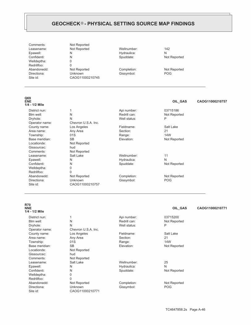
TC4647858.2s Page A-46
CAOG11000210771Site id:POGGissymbol:UnknownDirectiona:Not ReportedCompletion:Not ReportedAbandonedd:
0Redrillfoo:0Welldeptha:
Not ReportedSpuddate:NConfidenti:NHydraulica:NEpawell:25Wellnumber:Salt LakeLeasename:
Not ReportedComments:hudGissourcec:Not ReportedLocationde:
Not ReportedElevation:SBBase meridian:14WRange:01STownship:21Section:Any AreaArea name:Salt LakeFieldname:Los AngelesCounty name:
Chevron U.S.A. Inc.Operator name:PWell status:NDryhole:Not ReportedRedrill can:NBlm well:03715200Api number:1District nun:
R70NNE1/4 - 1/2 Mile
CAOG11000210771OIL_GAS
CAOG11000210757Site id:POGGissymbol:UnknownDirectiona:Not ReportedCompletion:Not ReportedAbandonedd:
0Redrillfoo:0Welldeptha:
Not ReportedSpuddate:NConfidenti:NHydraulica:NEpawell:11Wellnumber:Salt LakeLeasename:
Not ReportedComments:hudGissourcec:Not ReportedLocationde:
Not ReportedElevation:SBBase meridian:14WRange:01STownship:21Section:Any AreaArea name:Salt LakeFieldname:Los AngelesCounty name:
Chevron U.S.A. Inc.Operator name:PWell status:NDryhole:Not ReportedRedrill can:NBlm well:03715186Api number:1District nun:
Q69ENE1/4 - 1/2 Mile
CAOG11000210757OIL_GAS
CAOG11000210745Site id:POGGissymbol:UnknownDirectiona:Not ReportedCompletion:Not ReportedAbandonedd:
0Redrillfoo:0Welldeptha:
Not ReportedSpuddate:NConfidenti:NHydraulica:NEpawell:142Wellnumber:Not ReportedLeasename:
Not ReportedComments:
®GEOCHECK - PHYSICAL SETTING SOURCE MAP FINDINGS®

TC4647858.2s Page A-47
O73NNE1/4 - 1/2 Mile
CAOG11000210322OIL_GAS
CAOG11000210715Site id:POGGissymbol:UnknownDirectiona:Not ReportedCompletion:Not ReportedAbandonedd:
0Redrillfoo:0Welldeptha:
Not ReportedSpuddate:NConfidenti:NHydraulica:NEpawell:49Wellnumber:Not ReportedLeasename:
Not ReportedComments:hudGissourcec:Not ReportedLocationde:
Not ReportedElevation:SBBase meridian:14WRange:01STownship:20Section:Any AreaArea name:Salt Lake, SouthFieldname:Los AngelesCounty name:
Chevron U.S.A. Inc.Operator name:PWell status:NDryhole:Not ReportedRedrill can:NBlm well:03715144Api number:1District nun:
72West1/4 - 1/2 Mile
CAOG11000210715OIL_GAS
CAOG11000210766Site id:POGGissymbol:UnknownDirectiona:Not ReportedCompletion:Not ReportedAbandonedd:
0Redrillfoo:0Welldeptha:
Not ReportedSpuddate:NConfidenti:NHydraulica:NEpawell:20Wellnumber:Salt LakeLeasename:
Not ReportedComments:hudGissourcec:Not ReportedLocationde:
Not ReportedElevation:SBBase meridian:14WRange:01STownship:21Section:Any AreaArea name:Salt LakeFieldname:Los AngelesCounty name:
Chevron U.S.A. Inc.Operator name:PWell status:NDryhole:Not ReportedRedrill can:NBlm well:03715195Api number:1District nun:
Q71ENE1/4 - 1/2 Mile
CAOG11000210766OIL_GAS
Map IDDirectionDistance EDR ID NumberDatabase
®GEOCHECK - PHYSICAL SETTING SOURCE MAP FINDINGS®

TC4647858.2s Page A-48
hudGissourcec:Not ReportedLocationde:
Not ReportedElevation:SBBase meridian:14WRange:01STownship:21Section:Any AreaArea name:Salt LakeFieldname:Los AngelesCounty name:
Gilmore Oil CompanyOperator name:PWell status:NDryhole:Not ReportedRedrill can:NBlm well:03714642Api number:1District nun:
P75North1/4 - 1/2 Mile
CAOG11000210328OIL_GAS
CAOG11000210314Site id:POGGissymbol:UnknownDirectiona:Not ReportedCompletion:Not ReportedAbandonedd:
0Redrillfoo:0Welldeptha:
Not ReportedSpuddate:NConfidenti:NHydraulica:NEpawell:1Wellnumber:Not ReportedLeasename:
Not ReportedComments:hudGissourcec:Not ReportedLocationde:
Not ReportedElevation:SBBase meridian:14WRange:01STownship:21Section:Any AreaArea name:Salt LakeFieldname:Los AngelesCounty name:
Gilmore Oil CompanyOperator name:PWell status:NDryhole:Not ReportedRedrill can:NBlm well:03714628Api number:1District nun:
R74NNE1/4 - 1/2 Mile
CAOG11000210314OIL_GAS
CAOG11000210322Site id:POGGissymbol:UnknownDirectiona:Not ReportedCompletion:Not ReportedAbandonedd:
0Redrillfoo:0Welldeptha:
Not ReportedSpuddate:NConfidenti:NHydraulica:NEpawell:9Wellnumber:Not ReportedLeasename:
Not ReportedComments:hudGissourcec:Not ReportedLocationde:
Not ReportedElevation:SBBase meridian:14WRange:01STownship:21Section:Any AreaArea name:Salt LakeFieldname:Los AngelesCounty name:
Gilmore Oil CompanyOperator name:PWell status:NDryhole:Not ReportedRedrill can:NBlm well:03714636Api number:1District nun:
®GEOCHECK - PHYSICAL SETTING SOURCE MAP FINDINGS®

TC4647858.2s Page A-49
CAOG11000210364Site id:AOGGissymbol:UnknownDirectiona:Not ReportedCompletion:Not ReportedAbandonedd:
0Redrillfoo:0Welldeptha:
Not ReportedSpuddate:NConfidenti:NHydraulica:NEpawell:4Wellnumber:MasselinLeasename:
Not ReportedComments:hudGissourcec:Not ReportedLocationde:
Not ReportedElevation:SBBase meridian:14WRange:01STownship:28Section:Any AreaArea name:Any FieldFieldname:Los AngelesCounty name:
Union Oil Company of CaliforniaOperator name:BWell status:NDryhole:Not ReportedRedrill can:NBlm well:03714689Api number:1District nun:
77SE1/4 - 1/2 Mile
CAOG11000210364OIL_GAS
CAOG11000210574Site id:POGGissymbol:UnknownDirectiona:Not ReportedCompletion:Not ReportedAbandonedd:
0Redrillfoo:0Welldeptha:
Not ReportedSpuddate:NConfidenti:NHydraulica:NEpawell:1Wellnumber:Not ReportedLeasename:
Not ReportedComments:hudGissourcec:Not ReportedLocationde:
Not ReportedElevation:SBBase meridian:14WRange:01STownship:20Section:Any AreaArea name:Salt LakeFieldname:Los AngelesCounty name:
Chevron U.S.A. Inc.Operator name:PWell status:NDryhole:Not ReportedRedrill can:NBlm well:03714958Api number:1District nun:
S76NW1/4 - 1/2 Mile
CAOG11000210574OIL_GAS
CAOG11000210328Site id:POGGissymbol:UnknownDirectiona:Not ReportedCompletion:Not ReportedAbandonedd:
0Redrillfoo:0Welldeptha:
Not ReportedSpuddate:NConfidenti:NHydraulica:NEpawell:15Wellnumber:Not ReportedLeasename:
Not ReportedComments:
®GEOCHECK - PHYSICAL SETTING SOURCE MAP FINDINGS®

TC4647858.2s Page A-50
P80North1/2 - 1 Mile
CAOG11000210330OIL_GAS
CAOG11000210527Site id:POGGissymbol:UnknownDirectiona:Not ReportedCompletion:Not ReportedAbandonedd:
0Redrillfoo:0Welldeptha:
Not ReportedSpuddate:NConfidenti:NHydraulica:NEpawell:3Wellnumber:Not ReportedLeasename:
Not ReportedComments:hudGissourcec:Not ReportedLocationde:
Not ReportedElevation:SBBase meridian:14WRange:01STownship:21Section:Any AreaArea name:Salt LakeFieldname:Los AngelesCounty name:
Southern California Edison Co.Operator name:PWell status:NDryhole:Not ReportedRedrill can:NBlm well:03714911Api number:1District nun:
R79NNE1/2 - 1 Mile
CAOG11000210527OIL_GAS
CAOG11000210800Site id:POGGissymbol:UnknownDirectiona:Not ReportedCompletion:Not ReportedAbandonedd:
0Redrillfoo:0Welldeptha:
Not ReportedSpuddate:NConfidenti:NHydraulica:NEpawell:99Wellnumber:Salt LakeLeasename:
Not ReportedComments:hudGissourcec:Not ReportedLocationde:
Not ReportedElevation:SBBase meridian:14WRange:01STownship:21Section:Any AreaArea name:Salt LakeFieldname:Los AngelesCounty name:
Chevron U.S.A. Inc.Operator name:PWell status:NDryhole:Not ReportedRedrill can:NBlm well:03715229Api number:1District nun:
T78NNW1/2 - 1 Mile
CAOG11000210800OIL_GAS
Map IDDirectionDistance EDR ID NumberDatabase
®GEOCHECK - PHYSICAL SETTING SOURCE MAP FINDINGS®

TC4647858.2s Page A-51
hudGissourcec:Not ReportedLocationde:
Not ReportedElevation:SBBase meridian:14WRange:01STownship:20Section:Any AreaArea name:Salt LakeFieldname:Los AngelesCounty name:
Chevron U.S.A. Inc.Operator name:PWell status:NDryhole:Not ReportedRedrill can:NBlm well:03715138Api number:1District nun:
82WNW1/2 - 1 Mile
CAOG11000210709OIL_GAS
CAOG11000210772Site id:POGGissymbol:UnknownDirectiona:Not ReportedCompletion:Not ReportedAbandonedd:
0Redrillfoo:0Welldeptha:
Not ReportedSpuddate:NConfidenti:NHydraulica:NEpawell:26Wellnumber:Salt LakeLeasename:
Not ReportedComments:hudGissourcec:Not ReportedLocationde:
Not ReportedElevation:SBBase meridian:14WRange:01STownship:21Section:Any AreaArea name:Salt LakeFieldname:Los AngelesCounty name:
Chevron U.S.A. Inc.Operator name:PWell status:NDryhole:Not ReportedRedrill can:NBlm well:03715201Api number:1District nun:
U81NE1/2 - 1 Mile
CAOG11000210772OIL_GAS
CAOG11000210330Site id:POGGissymbol:UnknownDirectiona:Not ReportedCompletion:Not ReportedAbandonedd:
0Redrillfoo:0Welldeptha:
Not ReportedSpuddate:NConfidenti:NHydraulica:NEpawell:21Wellnumber:Not ReportedLeasename:
Not ReportedComments:hudGissourcec:Not ReportedLocationde:
Not ReportedElevation:SBBase meridian:14WRange:01STownship:21Section:Any AreaArea name:Salt LakeFieldname:Los AngelesCounty name:
Gilmore Oil CompanyOperator name:PWell status:NDryhole:Not ReportedRedrill can:NBlm well:03714644Api number:1District nun:
®GEOCHECK - PHYSICAL SETTING SOURCE MAP FINDINGS®

TC4647858.2s Page A-52
CAOG11000210331Site id:POGGissymbol:UnknownDirectiona:Not ReportedCompletion:Not ReportedAbandonedd:
0Redrillfoo:0Welldeptha:
Not ReportedSpuddate:NConfidenti:NHydraulica:NEpawell:27Wellnumber:Not ReportedLeasename:
Not ReportedComments:hudGissourcec:Not ReportedLocationde:
Not ReportedElevation:SBBase meridian:14WRange:01STownship:21Section:Any AreaArea name:Salt LakeFieldname:Los AngelesCounty name:
Gilmore Oil CompanyOperator name:PWell status:NDryhole:Not ReportedRedrill can:NBlm well:03714645Api number:1District nun:
T84NNW1/2 - 1 Mile
CAOG11000210331OIL_GAS
CAOG11000210801Site id:POGGissymbol:UnknownDirectiona:Not ReportedCompletion:Not ReportedAbandonedd:
0Redrillfoo:0Welldeptha:
Not ReportedSpuddate:NConfidenti:NHydraulica:NEpawell:102Wellnumber:Salt LakeLeasename:
Not ReportedComments:hudGissourcec:Not ReportedLocationde:
Not ReportedElevation:SBBase meridian:14WRange:01STownship:21Section:Any AreaArea name:Salt LakeFieldname:Los AngelesCounty name:
Chevron U.S.A. Inc.Operator name:PWell status:NDryhole:Not ReportedRedrill can:NBlm well:03715230Api number:1District nun:
V83NNW1/2 - 1 Mile
CAOG11000210801OIL_GAS
CAOG11000210709Site id:POGGissymbol:UnknownDirectiona:Not ReportedCompletion:Not ReportedAbandonedd:
0Redrillfoo:0Welldeptha:
Not ReportedSpuddate:NConfidenti:NHydraulica:NEpawell:35Wellnumber:Not ReportedLeasename:
Not ReportedComments:
®GEOCHECK - PHYSICAL SETTING SOURCE MAP FINDINGS®

TC4647858.2s Page A-53
X87NNE1/2 - 1 Mile
CAOG11000210528OIL_GAS
CAOG11000210525Site id:POGGissymbol:UnknownDirectiona:Not ReportedCompletion:Not ReportedAbandonedd:
0Redrillfoo:0Welldeptha:
Not ReportedSpuddate:NConfidenti:NHydraulica:NEpawell:1Wellnumber:Not ReportedLeasename:
Not ReportedComments:hudGissourcec:Not ReportedLocationde:
Not ReportedElevation:SBBase meridian:14WRange:01STownship:21Section:Any AreaArea name:Salt LakeFieldname:Los AngelesCounty name:
Southern California Edison Co.Operator name:PWell status:NDryhole:Not ReportedRedrill can:NBlm well:03714909Api number:1District nun:
U86NE1/2 - 1 Mile
CAOG11000210525OIL_GAS
CAOG11000210576Site id:POGGissymbol:UnknownDirectiona:Not ReportedCompletion:Not ReportedAbandonedd:
0Redrillfoo:0Welldeptha:
Not ReportedSpuddate:NConfidenti:NHydraulica:NEpawell:3Wellnumber:Not ReportedLeasename:
Not ReportedComments:hudGissourcec:Not ReportedLocationde:
Not ReportedElevation:SBBase meridian:14WRange:01STownship:20Section:Any AreaArea name:Salt LakeFieldname:Los AngelesCounty name:
Chevron U.S.A. Inc.Operator name:PWell status:NDryhole:Not ReportedRedrill can:NBlm well:03714960Api number:1District nun:
W85NW1/2 - 1 Mile
CAOG11000210576OIL_GAS
Map IDDirectionDistance EDR ID NumberDatabase
®GEOCHECK - PHYSICAL SETTING SOURCE MAP FINDINGS®

TC4647858.2s Page A-54
hudGissourcec:Not ReportedLocationde:
Not ReportedElevation:SBBase meridian:14WRange:01STownship:20Section:Any AreaArea name:Salt LakeFieldname:Los AngelesCounty name:
Chevron U.S.A. Inc.Operator name:PWell status:NDryhole:Not ReportedRedrill can:NBlm well:03715143Api number:1District nun:
89WNW1/2 - 1 Mile
CAOG11000210714OIL_GAS
CAOG11000210315Site id:POGGissymbol:UnknownDirectiona:Not ReportedCompletion:Not ReportedAbandonedd:
0Redrillfoo:0Welldeptha:
Not ReportedSpuddate:NConfidenti:NHydraulica:NEpawell:2Wellnumber:Not ReportedLeasename:
Not ReportedComments:hudGissourcec:Not ReportedLocationde:
Not ReportedElevation:SBBase meridian:14WRange:01STownship:21Section:Any AreaArea name:Salt LakeFieldname:Los AngelesCounty name:
Gilmore Oil CompanyOperator name:PWell status:NDryhole:Not ReportedRedrill can:NBlm well:03714629Api number:1District nun:
X88NNE1/2 - 1 Mile
CAOG11000210315OIL_GAS
CAOG11000210528Site id:POGGissymbol:UnknownDirectiona:Not ReportedCompletion:Not ReportedAbandonedd:
0Redrillfoo:0Welldeptha:
Not ReportedSpuddate:NConfidenti:NHydraulica:NEpawell:4Wellnumber:Not ReportedLeasename:
Not ReportedComments:hudGissourcec:Not ReportedLocationde:
Not ReportedElevation:SBBase meridian:14WRange:01STownship:21Section:Any AreaArea name:Salt LakeFieldname:Los AngelesCounty name:
Southern California Edison Co.Operator name:PWell status:NDryhole:Not ReportedRedrill can:NBlm well:03714912Api number:1District nun:
®GEOCHECK - PHYSICAL SETTING SOURCE MAP FINDINGS®

TC4647858.2s Page A-55
CAOG11000210329Site id:POGGissymbol:UnknownDirectiona:Not ReportedCompletion:Not ReportedAbandonedd:
0Redrillfoo:0Welldeptha:
Not ReportedSpuddate:NConfidenti:NHydraulica:NEpawell:16Wellnumber:Not ReportedLeasename:
Not ReportedComments:hudGissourcec:Not ReportedLocationde:
Not ReportedElevation:SBBase meridian:14WRange:01STownship:21Section:Any AreaArea name:Salt LakeFieldname:Los AngelesCounty name:
Gilmore Oil CompanyOperator name:PWell status:NDryhole:Not ReportedRedrill can:NBlm well:03714643Api number:1District nun:
91North1/2 - 1 Mile
CAOG11000210329OIL_GAS
CAOG11000210547Site id:POGGissymbol:UnknownDirectiona:Not ReportedCompletion:Not ReportedAbandonedd:
0Redrillfoo:0Welldeptha:
Not ReportedSpuddate:NConfidenti:NHydraulica:NEpawell:23Wellnumber:Not ReportedLeasename:
Not ReportedComments:hudGissourcec:Not ReportedLocationde:
Not ReportedElevation:SBBase meridian:14WRange:01STownship:21Section:Any AreaArea name:Salt LakeFieldname:Los AngelesCounty name:
Southern California Edison Co.Operator name:PWell status:NDryhole:Not ReportedRedrill can:NBlm well:03714931Api number:1District nun:
X90NNE1/2 - 1 Mile
CAOG11000210547OIL_GAS
CAOG11000210714Site id:POGGissymbol:UnknownDirectiona:Not ReportedCompletion:Not ReportedAbandonedd:
0Redrillfoo:0Welldeptha:
Not ReportedSpuddate:NConfidenti:NHydraulica:NEpawell:46Wellnumber:Not ReportedLeasename:
Not ReportedComments:
®GEOCHECK - PHYSICAL SETTING SOURCE MAP FINDINGS®

TC4647858.2s Page A-56
AA94North1/2 - 1 Mile
CAOG11000210323OIL_GAS
CAOG11000210367Site id:PDHGissymbol:UnknownDirectiona:Not ReportedCompletion:Not ReportedAbandonedd:
0Redrillfoo:0Welldeptha:
Not ReportedSpuddate:NConfidenti:NHydraulica:NEpawell:1Wellnumber:Not ReportedLeasename:
Not ReportedComments:hudGissourcec:Not ReportedLocationde:
Not ReportedElevation:SBBase meridian:14WRange:01STownship:28Section:Any AreaArea name:Salt Lake, SouthFieldname:Los AngelesCounty name:
Utah California Consolidated Co.Operator name:IWell status:NDryhole:Not ReportedRedrill can:NBlm well:03714692Api number:1District nun:
Z93South1/2 - 1 Mile
CAOG11000210367OIL_GAS
CAOG11000210790Site id:POGGissymbol:UnknownDirectiona:Not ReportedCompletion:Not ReportedAbandonedd:
0Redrillfoo:0Welldeptha:
Not ReportedSpuddate:NConfidenti:NHydraulica:NEpawell:50Wellnumber:Salt LakeLeasename:
Not ReportedComments:hudGissourcec:Not ReportedLocationde:
Not ReportedElevation:SBBase meridian:14WRange:01STownship:21Section:Any AreaArea name:Salt LakeFieldname:Los AngelesCounty name:
Chevron U.S.A. Inc.Operator name:PWell status:NDryhole:Not ReportedRedrill can:NBlm well:03715219Api number:1District nun:
Y92ENE1/2 - 1 Mile
CAOG11000210790OIL_GAS
Map IDDirectionDistance EDR ID NumberDatabase
®GEOCHECK - PHYSICAL SETTING SOURCE MAP FINDINGS®
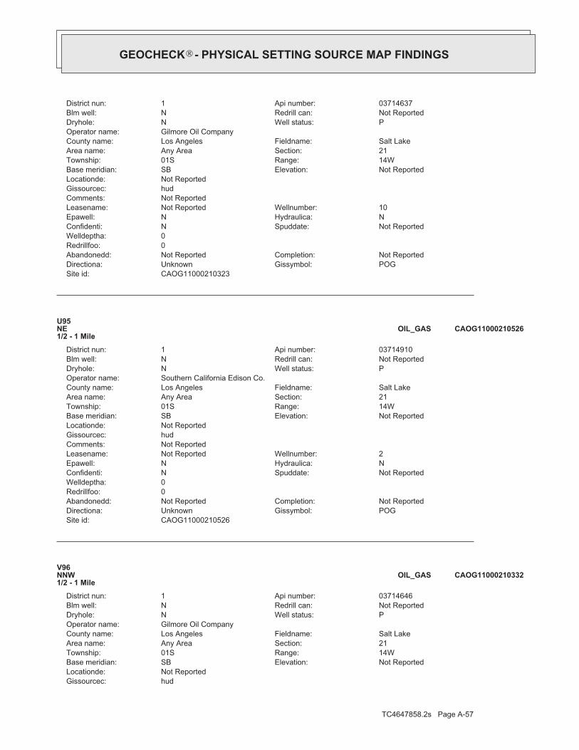
TC4647858.2s Page A-57
hudGissourcec:Not ReportedLocationde:
Not ReportedElevation:SBBase meridian:14WRange:01STownship:21Section:Any AreaArea name:Salt LakeFieldname:Los AngelesCounty name:
Gilmore Oil CompanyOperator name:PWell status:NDryhole:Not ReportedRedrill can:NBlm well:03714646Api number:1District nun:
V96NNW1/2 - 1 Mile
CAOG11000210332OIL_GAS
CAOG11000210526Site id:POGGissymbol:UnknownDirectiona:Not ReportedCompletion:Not ReportedAbandonedd:
0Redrillfoo:0Welldeptha:
Not ReportedSpuddate:NConfidenti:NHydraulica:NEpawell:2Wellnumber:Not ReportedLeasename:
Not ReportedComments:hudGissourcec:Not ReportedLocationde:
Not ReportedElevation:SBBase meridian:14WRange:01STownship:21Section:Any AreaArea name:Salt LakeFieldname:Los AngelesCounty name:
Southern California Edison Co.Operator name:PWell status:NDryhole:Not ReportedRedrill can:NBlm well:03714910Api number:1District nun:
U95NE1/2 - 1 Mile
CAOG11000210526OIL_GAS
CAOG11000210323Site id:POGGissymbol:UnknownDirectiona:Not ReportedCompletion:Not ReportedAbandonedd:
0Redrillfoo:0Welldeptha:
Not ReportedSpuddate:NConfidenti:NHydraulica:NEpawell:10Wellnumber:Not ReportedLeasename:
Not ReportedComments:hudGissourcec:Not ReportedLocationde:
Not ReportedElevation:SBBase meridian:14WRange:01STownship:21Section:Any AreaArea name:Salt LakeFieldname:Los AngelesCounty name:
Gilmore Oil CompanyOperator name:PWell status:NDryhole:Not ReportedRedrill can:NBlm well:03714637Api number:1District nun:
®GEOCHECK - PHYSICAL SETTING SOURCE MAP FINDINGS®
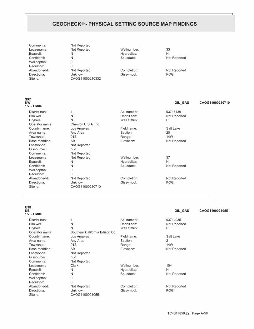
TC4647858.2s Page A-58
CAOG11000210551Site id:POGGissymbol:UnknownDirectiona:Not ReportedCompletion:Not ReportedAbandonedd:
0Redrillfoo:0Welldeptha:
Not ReportedSpuddate:NConfidenti:NHydraulica:NEpawell:104Wellnumber:ClarkLeasename:
Not ReportedComments:hudGissourcec:Not ReportedLocationde:
Not ReportedElevation:SBBase meridian:14WRange:01STownship:21Section:Any AreaArea name:Salt LakeFieldname:Los AngelesCounty name:
Southern California Edison Co.Operator name:PWell status:NDryhole:Not ReportedRedrill can:NBlm well:03714935Api number:1District nun:
U98NE1/2 - 1 Mile
CAOG11000210551OIL_GAS
CAOG11000210710Site id:POGGissymbol:UnknownDirectiona:Not ReportedCompletion:Not ReportedAbandonedd:
0Redrillfoo:0Welldeptha:
Not ReportedSpuddate:NConfidenti:NHydraulica:NEpawell:37Wellnumber:Not ReportedLeasename:
Not ReportedComments:hudGissourcec:Not ReportedLocationde:
Not ReportedElevation:SBBase meridian:14WRange:01STownship:20Section:Any AreaArea name:Salt LakeFieldname:Los AngelesCounty name:
Chevron U.S.A. Inc.Operator name:PWell status:NDryhole:Not ReportedRedrill can:NBlm well:03715139Api number:1District nun:
S97NW1/2 - 1 Mile
CAOG11000210710OIL_GAS
CAOG11000210332Site id:POGGissymbol:UnknownDirectiona:Not ReportedCompletion:Not ReportedAbandonedd:
0Redrillfoo:0Welldeptha:
Not ReportedSpuddate:NConfidenti:NHydraulica:NEpawell:33Wellnumber:Not ReportedLeasename:
Not ReportedComments:
®GEOCHECK - PHYSICAL SETTING SOURCE MAP FINDINGS®

TC4647858.2s Page A-59
AA101North1/2 - 1 Mile
CAOG11000210524OIL_GAS
CAOG11000210590Site id:POGGissymbol:UnknownDirectiona:Not ReportedCompletion:Not ReportedAbandonedd:
0Redrillfoo:0Welldeptha:
Not ReportedSpuddate:NConfidenti:NHydraulica:NEpawell:22Wellnumber:Not ReportedLeasename:
Not ReportedComments:hudGissourcec:Not ReportedLocationde:
Not ReportedElevation:SBBase meridian:14WRange:01STownship:20Section:Any AreaArea name:Salt LakeFieldname:Los AngelesCounty name:
Chevron U.S.A. Inc.Operator name:PWell status:NDryhole:Not ReportedRedrill can:NBlm well:03714975Api number:1District nun:
W100NW1/2 - 1 Mile
CAOG11000210590OIL_GAS
CAOG11000210774Site id:POGGissymbol:UnknownDirectiona:Not ReportedCompletion:Not ReportedAbandonedd:
0Redrillfoo:0Welldeptha:
Not ReportedSpuddate:NConfidenti:NHydraulica:NEpawell:28Wellnumber:Salt LakeLeasename:
Not ReportedComments:hudGissourcec:Not ReportedLocationde:
Not ReportedElevation:SBBase meridian:14WRange:01STownship:21Section:Any AreaArea name:Salt LakeFieldname:Los AngelesCounty name:
Chevron U.S.A. Inc.Operator name:PWell status:NDryhole:Not ReportedRedrill can:NBlm well:03715203Api number:1District nun:
AB99NE1/2 - 1 Mile
CAOG11000210774OIL_GAS
Map IDDirectionDistance EDR ID NumberDatabase
®GEOCHECK - PHYSICAL SETTING SOURCE MAP FINDINGS®

TC4647858.2s Page A-60
hudGissourcec:Not ReportedLocationde:
Not ReportedElevation:SBBase meridian:14WRange:01STownship:21Section:Any AreaArea name:Salt LakeFieldname:Los AngelesCounty name:
Southern California Edison Co.Operator name:PWell status:NDryhole:Not ReportedRedrill can:NBlm well:03714913Api number:1District nun:
X103NNE1/2 - 1 Mile
CAOG11000210529OIL_GAS
CAOG11000210550Site id:AOGGissymbol:UnknownDirectiona:Not ReportedCompletion:Not ReportedAbandonedd:
0Redrillfoo:0Welldeptha:
Not ReportedSpuddate:NConfidenti:NHydraulica:NEpawell:103Wellnumber:ClarkLeasename:
Not ReportedComments:hudGissourcec:Not ReportedLocationde:
Not ReportedElevation:SBBase meridian:14WRange:01STownship:21Section:Any AreaArea name:Salt LakeFieldname:Los AngelesCounty name:
Southern California Edison Co.Operator name:IWell status:NDryhole:Not ReportedRedrill can:NBlm well:03714934Api number:1District nun:
AB102NE1/2 - 1 Mile
CAOG11000210550OIL_GAS
CAOG11000210524Site id:POGGissymbol:UnknownDirectiona:Not ReportedCompletion:Not ReportedAbandonedd:
0Redrillfoo:0Welldeptha:
Not ReportedSpuddate:NConfidenti:NHydraulica:NEpawell:1Wellnumber:Verne CommunityLeasename:
Not ReportedComments:hudGissourcec:Not ReportedLocationde:
Not ReportedElevation:SBBase meridian:14WRange:01STownship:21Section:Any AreaArea name:Salt LakeFieldname:Los AngelesCounty name:
Shell Western Exploration & Production Inc.Operator name:PWell status:NDryhole:Not ReportedRedrill can:NBlm well:03714908Api number:1District nun:
®GEOCHECK - PHYSICAL SETTING SOURCE MAP FINDINGS®

TC4647858.2s Page A-61
CAOG11000210744Site id:POGGissymbol:UnknownDirectiona:Not ReportedCompletion:Not ReportedAbandonedd:
0Redrillfoo:0Welldeptha:
Not ReportedSpuddate:NConfidenti:NHydraulica:NEpawell:140Wellnumber:Not ReportedLeasename:
Not ReportedComments:hudGissourcec:Not ReportedLocationde:
Not ReportedElevation:SBBase meridian:14WRange:01STownship:20Section:Any AreaArea name:Salt LakeFieldname:Los AngelesCounty name:
Chevron U.S.A. Inc.Operator name:PWell status:NDryhole:Not ReportedRedrill can:NBlm well:03715173Api number:1District nun:
V105NNW1/2 - 1 Mile
CAOG11000210744OIL_GAS
CAOG11000210316Site id:POGGissymbol:UnknownDirectiona:Not ReportedCompletion:Not ReportedAbandonedd:
0Redrillfoo:0Welldeptha:
Not ReportedSpuddate:NConfidenti:NHydraulica:NEpawell:3Wellnumber:Not ReportedLeasename:
Not ReportedComments:hudGissourcec:Not ReportedLocationde:
Not ReportedElevation:SBBase meridian:14WRange:01STownship:21Section:Any AreaArea name:Salt LakeFieldname:Los AngelesCounty name:
Gilmore Oil CompanyOperator name:PWell status:NDryhole:Not ReportedRedrill can:NBlm well:03714630Api number:1District nun:
X104NNE1/2 - 1 Mile
CAOG11000210316OIL_GAS
CAOG11000210529Site id:POGGissymbol:UnknownDirectiona:Not ReportedCompletion:Not ReportedAbandonedd:
0Redrillfoo:0Welldeptha:
Not ReportedSpuddate:NConfidenti:NHydraulica:NEpawell:5Wellnumber:Not ReportedLeasename:
Not ReportedComments:
®GEOCHECK - PHYSICAL SETTING SOURCE MAP FINDINGS®

TC4647858.2s Page A-62
AD108NE1/2 - 1 Mile
CAOG11000210537OIL_GAS
CAOG11000210713Site id:POGGissymbol:UnknownDirectiona:Not ReportedCompletion:Not ReportedAbandonedd:
0Redrillfoo:0Welldeptha:
Not ReportedSpuddate:NConfidenti:NHydraulica:NEpawell:44Wellnumber:Not ReportedLeasename:
Not ReportedComments:hudGissourcec:Not ReportedLocationde:
Not ReportedElevation:SBBase meridian:14WRange:01STownship:20Section:Any AreaArea name:Salt LakeFieldname:Los AngelesCounty name:
Chevron U.S.A. Inc.Operator name:PWell status:NDryhole:Not ReportedRedrill can:NBlm well:03715142Api number:1District nun:
AC107WNW1/2 - 1 Mile
CAOG11000210713OIL_GAS
CAOG11000210768Site id:AOGGissymbol:UnknownDirectiona:Not ReportedCompletion:Not ReportedAbandonedd:
0Redrillfoo:0Welldeptha:
Not ReportedSpuddate:NConfidenti:NHydraulica:NEpawell:22Wellnumber:Salt LakeLeasename:
Not ReportedComments:hudGissourcec:Not ReportedLocationde:
Not ReportedElevation:SBBase meridian:14WRange:01STownship:21Section:Any AreaArea name:Salt LakeFieldname:Los AngelesCounty name:
Chevron U.S.A. Inc.Operator name:BWell status:NDryhole:Not ReportedRedrill can:NBlm well:03715197Api number:1District nun:
106ENE1/2 - 1 Mile
CAOG11000210768OIL_GAS
Map IDDirectionDistance EDR ID NumberDatabase
®GEOCHECK - PHYSICAL SETTING SOURCE MAP FINDINGS®

TC4647858.2s Page A-63
hudGissourcec:Not ReportedLocationde:
Not ReportedElevation:SBBase meridian:14WRange:01STownship:21Section:Any AreaArea name:Salt LakeFieldname:Los AngelesCounty name:
Southern California Edison Co.Operator name:PWell status:NDryhole:Not ReportedRedrill can:NBlm well:03714936Api number:1District nun:
AD110NE1/2 - 1 Mile
CAOG11000210552OIL_GAS
CAOG11000210333Site id:POGGissymbol:UnknownDirectiona:Not ReportedCompletion:Not ReportedAbandonedd:
0Redrillfoo:0Welldeptha:
Not ReportedSpuddate:NConfidenti:NHydraulica:NEpawell:39Wellnumber:Not ReportedLeasename:
Not ReportedComments:hudGissourcec:Not ReportedLocationde:
Not ReportedElevation:SBBase meridian:14WRange:01STownship:20Section:Any AreaArea name:Salt LakeFieldname:Los AngelesCounty name:
Gilmore Oil CompanyOperator name:PWell status:NDryhole:Not ReportedRedrill can:NBlm well:03714647Api number:1District nun:
AE109NNW1/2 - 1 Mile
CAOG11000210333OIL_GAS
CAOG11000210537Site id:POGGissymbol:UnknownDirectiona:Not ReportedCompletion:Not ReportedAbandonedd:
0Redrillfoo:0Welldeptha:
Not ReportedSpuddate:NConfidenti:NHydraulica:NEpawell:13Wellnumber:Not ReportedLeasename:
Not ReportedComments:hudGissourcec:Not ReportedLocationde:
Not ReportedElevation:SBBase meridian:14WRange:01STownship:21Section:Any AreaArea name:Salt LakeFieldname:Los AngelesCounty name:
Southern California Edison Co.Operator name:PWell status:NDryhole:Not ReportedRedrill can:NBlm well:03714921Api number:1District nun:
®GEOCHECK - PHYSICAL SETTING SOURCE MAP FINDINGS®

TC4647858.2s Page A-64
CAOG11000210360Site id:AOGGissymbol:UnknownDirectiona:Not ReportedCompletion:Not ReportedAbandonedd:
0Redrillfoo:0Welldeptha:
Not ReportedSpuddate:NConfidenti:NHydraulica:NEpawell:1Wellnumber:BrashearLeasename:
Not ReportedComments:hudGissourcec:Not ReportedLocationde:
Not ReportedElevation:SBBase meridian:14WRange:01STownship:28Section:Any AreaArea name:Salt Lake, SouthFieldname:Los AngelesCounty name:
Union Oil Company of CaliforniaOperator name:BWell status:NDryhole:Not ReportedRedrill can:NBlm well:03714685Api number:1District nun:
Z112SSE1/2 - 1 Mile
CAOG11000210360OIL_GAS
CAOG11000210637Site id:PDHGissymbol:UnknownDirectiona:Not ReportedCompletion:Not ReportedAbandonedd:
0Redrillfoo:0Welldeptha:
Not ReportedSpuddate:NConfidenti:NHydraulica:NEpawell:1Wellnumber:Not ReportedLeasename:
Not ReportedComments:hudGissourcec:Not ReportedLocationde:
Not ReportedElevation:SBBase meridian:14WRange:01STownship:28Section:Any AreaArea name:Any FieldFieldname:Los AngelesCounty name:
Mesa Oil & Gas Co.Operator name:IWell status:NDryhole:Not ReportedRedrill can:NBlm well:03715057Api number:1District nun:
111ESE1/2 - 1 Mile
CAOG11000210637OIL_GAS
CAOG11000210552Site id:POGGissymbol:UnknownDirectiona:Not ReportedCompletion:Not ReportedAbandonedd:
0Redrillfoo:0Welldeptha:
Not ReportedSpuddate:NConfidenti:NHydraulica:NEpawell:105Wellnumber:ClarkLeasename:
Not ReportedComments:
®GEOCHECK - PHYSICAL SETTING SOURCE MAP FINDINGS®

TC4647858.2s Page A-65
AB115NE1/2 - 1 Mile
CAOG11000210549OIL_GAS
CAOG11000210324Site id:POGGissymbol:UnknownDirectiona:Not ReportedCompletion:Not ReportedAbandonedd:
0Redrillfoo:0Welldeptha:
Not ReportedSpuddate:NConfidenti:NHydraulica:NEpawell:11Wellnumber:Not ReportedLeasename:
Not ReportedComments:hudGissourcec:Not ReportedLocationde:
Not ReportedElevation:SBBase meridian:14WRange:01STownship:21Section:Any AreaArea name:Salt LakeFieldname:Los AngelesCounty name:
Gilmore Oil CompanyOperator name:PWell status:NDryhole:Not ReportedRedrill can:NBlm well:03714638Api number:1District nun:
AA114North1/2 - 1 Mile
CAOG11000210324OIL_GAS
CAOG11000210553Site id:POGGissymbol:UnknownDirectiona:Not ReportedCompletion:Not ReportedAbandonedd:
0Redrillfoo:0Welldeptha:
Not ReportedSpuddate:NConfidenti:NHydraulica:NEpawell:106Wellnumber:ClarkLeasename:
Not ReportedComments:hudGissourcec:Not ReportedLocationde:
Not ReportedElevation:SBBase meridian:14WRange:01STownship:21Section:Any AreaArea name:Salt LakeFieldname:Los AngelesCounty name:
Southern California Edison Co.Operator name:PWell status:NDryhole:Not ReportedRedrill can:NBlm well:03714937Api number:1District nun:
AF113NE1/2 - 1 Mile
CAOG11000210553OIL_GAS
Map IDDirectionDistance EDR ID NumberDatabase
®GEOCHECK - PHYSICAL SETTING SOURCE MAP FINDINGS®
TC4647858.2s Page A-66
hudGissourcec:Not ReportedLocationde:
Not ReportedElevation:SBBase meridian:14WRange:01STownship:20Section:Any AreaArea name:Salt LakeFieldname:Los AngelesCounty name:
Chevron U.S.A. Inc.Operator name:PWell status:NDryhole:Not ReportedRedrill can:NBlm well:03714959Api number:1District nun:
AG117NW1/2 - 1 Mile
CAOG11000210575OIL_GAS
CAOG11000210791Site id:POGGissymbol:UnknownDirectiona:Not ReportedCompletion:Not ReportedAbandonedd:
0Redrillfoo:0Welldeptha:
Not ReportedSpuddate:NConfidenti:NHydraulica:NEpawell:51Wellnumber:Salt LakeLeasename:
Not ReportedComments:hudGissourcec:Not ReportedLocationde:
Not ReportedElevation:SBBase meridian:14WRange:01STownship:21Section:Any AreaArea name:Salt LakeFieldname:Los AngelesCounty name:
Chevron U.S.A. Inc.Operator name:PWell status:NDryhole:Not ReportedRedrill can:NBlm well:03715220Api number:1District nun:
Y116ENE1/2 - 1 Mile
CAOG11000210791OIL_GAS
CAOG11000210549Site id:POGGissymbol:UnknownDirectiona:Not ReportedCompletion:Not ReportedAbandonedd:
0Redrillfoo:0Welldeptha:
Not ReportedSpuddate:NConfidenti:NHydraulica:NEpawell:102Wellnumber:ClarkLeasename:
Not ReportedComments:hudGissourcec:Not ReportedLocationde:
Not ReportedElevation:SBBase meridian:14WRange:01STownship:21Section:Any AreaArea name:Salt LakeFieldname:Los AngelesCounty name:
Southern California Edison Co.Operator name:PWell status:NDryhole:Not ReportedRedrill can:NBlm well:03714933Api number:1District nun:
®GEOCHECK - PHYSICAL SETTING SOURCE MAP FINDINGS®

TC4647858.2s Page A-67
CAOG11000210530Site id:POGGissymbol:UnknownDirectiona:Not ReportedCompletion:Not ReportedAbandonedd:
0Redrillfoo:0Welldeptha:
Not ReportedSpuddate:NConfidenti:NHydraulica:NEpawell:6Wellnumber:Not ReportedLeasename:
Not ReportedComments:hudGissourcec:Not ReportedLocationde:
Not ReportedElevation:SBBase meridian:14WRange:01STownship:21Section:Any AreaArea name:Salt LakeFieldname:Los AngelesCounty name:
Southern California Edison Co.Operator name:PWell status:NDryhole:Not ReportedRedrill can:NBlm well:03714914Api number:1District nun:
AH119NNE1/2 - 1 Mile
CAOG11000210530OIL_GAS
CAOG11000210712Site id:POGGissymbol:UnknownDirectiona:Not ReportedCompletion:Not ReportedAbandonedd:
0Redrillfoo:0Welldeptha:
Not ReportedSpuddate:NConfidenti:NHydraulica:NEpawell:43Wellnumber:Not ReportedLeasename:
Not ReportedComments:hudGissourcec:Not ReportedLocationde:
Not ReportedElevation:SBBase meridian:14WRange:01STownship:20Section:Any AreaArea name:Salt LakeFieldname:Los AngelesCounty name:
Chevron U.S.A. Inc.Operator name:PWell status:NDryhole:Not ReportedRedrill can:NBlm well:03715141Api number:1District nun:
AC118NW1/2 - 1 Mile
CAOG11000210712OIL_GAS
CAOG11000210575Site id:POGGissymbol:UnknownDirectiona:Not ReportedCompletion:Not ReportedAbandonedd:
0Redrillfoo:0Welldeptha:
Not ReportedSpuddate:NConfidenti:NHydraulica:NEpawell:2Wellnumber:Not ReportedLeasename:
Not ReportedComments:
®GEOCHECK - PHYSICAL SETTING SOURCE MAP FINDINGS®

TC4647858.2s Page A-68
AI122North1/2 - 1 Mile
CAOG11000192993OIL_GAS
CAOG11000210334Site id:POGGissymbol:UnknownDirectiona:Not ReportedCompletion:Not ReportedAbandonedd:
0Redrillfoo:0Welldeptha:
Not ReportedSpuddate:NConfidenti:NHydraulica:NEpawell:47Wellnumber:Not ReportedLeasename:
Not ReportedComments:hudGissourcec:Not ReportedLocationde:
Not ReportedElevation:SBBase meridian:14WRange:01STownship:20Section:Any AreaArea name:Salt LakeFieldname:Los AngelesCounty name:
Gilmore Oil CompanyOperator name:PWell status:NDryhole:Not ReportedRedrill can:NBlm well:03714648Api number:1District nun:
AE121NNW1/2 - 1 Mile
CAOG11000210334OIL_GAS
CAOG11000210589Site id:POGGissymbol:UnknownDirectiona:Not ReportedCompletion:Not ReportedAbandonedd:
0Redrillfoo:0Welldeptha:
Not ReportedSpuddate:NConfidenti:NHydraulica:NEpawell:21Wellnumber:Not ReportedLeasename:
Not ReportedComments:hudGissourcec:Not ReportedLocationde:
Not ReportedElevation:SBBase meridian:14WRange:01STownship:20Section:Any AreaArea name:Salt LakeFieldname:Los AngelesCounty name:
Chevron U.S.A. Inc.Operator name:PWell status:NDryhole:Not ReportedRedrill can:NBlm well:03714974Api number:1District nun:
AG120NW1/2 - 1 Mile
CAOG11000210589OIL_GAS
Map IDDirectionDistance EDR ID NumberDatabase
®GEOCHECK - PHYSICAL SETTING SOURCE MAP FINDINGS®

TC4647858.2s Page A-69
gpsGissourcec:Not ReportedLocationde:
198.347Elevation:SBBase meridian:14WRange:01STownship:21Section:Any AreaArea name:Salt LakeFieldname:Los AngelesCounty name:
McFarland Energy, Inc.Operator name:PWell status:NDryhole:Not ReportedRedrill can:NBlm well:03720149Api number:1District nun:
AI124North1/2 - 1 Mile
CAOG11000193040OIL_GAS
CAOG11000193039Site id:PWDGissymbol:UnknownDirectiona:Not ReportedCompletion:Not ReportedAbandonedd:
0Redrillfoo:0Welldeptha:
Not ReportedSpuddate:NConfidenti:NHydraulica:NEpawell:9Wellnumber:GilmoreLeasename:
64002239.ssfComments:gpsGissourcec:Not ReportedLocationde:
198.347Elevation:SBBase meridian:14WRange:01STownship:21Section:Any AreaArea name:Salt LakeFieldname:Los AngelesCounty name:
McFarland Energy, Inc.Operator name:PWell status:NDryhole:Not ReportedRedrill can:NBlm well:03720149Api number:1District nun:
AI123North1/2 - 1 Mile
CAOG11000193039OIL_GAS
CAOG11000192993Site id:POGGissymbol:Directionally drilledDirectiona:Not ReportedCompletion:Not ReportedAbandonedd:
0Redrillfoo:0Welldeptha:
Not ReportedSpuddate:NConfidenti:NHydraulica:NEpawell:8Wellnumber:MetropolitanLeasename:
64002239.ssfComments:gpsGissourcec:Not ReportedLocationde:
198.228Elevation:SBBase meridian:14WRange:01STownship:21Section:Any AreaArea name:Salt LakeFieldname:Los AngelesCounty name:
McFarland Energy, Inc.Operator name:PWell status:NDryhole:Not ReportedRedrill can:NBlm well:03720017Api number:1District nun:
®GEOCHECK - PHYSICAL SETTING SOURCE MAP FINDINGS®

TC4647858.2s Page A-70
CAOG11000188558Site id:POGGissymbol:UnknownDirectiona:Not ReportedCompletion:Not ReportedAbandonedd:
0Redrillfoo:0Welldeptha:
Not ReportedSpuddate:NConfidenti:NHydraulica:NEpawell:6Wellnumber:U-93Leasename:
64002239.ssfComments:gpsGissourcec:Not ReportedLocationde:
198.643Elevation:SBBase meridian:14WRange:01STownship:21Section:Any AreaArea name:Salt LakeFieldname:Los AngelesCounty name:
McFarland Energy, Inc.Operator name:PWell status:NDryhole:Not ReportedRedrill can:NBlm well:03700024Api number:1District nun:
AI126North1/2 - 1 Mile
CAOG11000188558OIL_GAS
CAOG11000192180Site id:POGGissymbol:Directionally drilledDirectiona:Not ReportedCompletion:Not ReportedAbandonedd:
0Redrillfoo:0Welldeptha:
Not ReportedSpuddate:NConfidenti:NHydraulica:NEpawell:5Wellnumber:U-93Leasename:
64002239.ssfComments:gpsGissourcec:Not ReportedLocationde:
199.656Elevation:SBBase meridian:14WRange:01STownship:21Section:Any AreaArea name:Salt LakeFieldname:Los AngelesCounty name:
McFarland Energy, Inc.Operator name:PWell status:NDryhole:Not ReportedRedrill can:NBlm well:03715055Api number:1District nun:
AI125North1/2 - 1 Mile
CAOG11000192180OIL_GAS
CAOG11000193040Site id:PWDGissymbol:UnknownDirectiona:Not ReportedCompletion:Not ReportedAbandonedd:
0Redrillfoo:0Welldeptha:
Not ReportedSpuddate:NConfidenti:NHydraulica:NEpawell:9Wellnumber:GilmoreLeasename:
64002239.ssfComments:
®GEOCHECK - PHYSICAL SETTING SOURCE MAP FINDINGS®

TC4647858.2s Page A-71
AI129North1/2 - 1 Mile
CAOG11000192179OIL_GAS
CAOG11000193024Site id:POGGissymbol:Directionally drilledDirectiona:Not ReportedCompletion:Not ReportedAbandonedd:
0Redrillfoo:0Welldeptha:
Not ReportedSpuddate:NConfidenti:NHydraulica:NEpawell:9Wellnumber:MetropolitanLeasename:
64002239.ssfComments:gpsGissourcec:Not ReportedLocationde:
200.284Elevation:SBBase meridian:14WRange:01STownship:21Section:Any AreaArea name:Salt LakeFieldname:Los AngelesCounty name:
McFarland Energy, Inc.Operator name:PWell status:NDryhole:Not ReportedRedrill can:NBlm well:03720119Api number:1District nun:
AI128North1/2 - 1 Mile
CAOG11000193024OIL_GAS
CAOG11000192177Site id:POGGissymbol:Directionally drilledDirectiona:Not ReportedCompletion:Not ReportedAbandonedd:
0Redrillfoo:0Welldeptha:
Not ReportedSpuddate:NConfidenti:NHydraulica:NEpawell:1Wellnumber:U-93Leasename:
64002239.ssfComments:gpsGissourcec:Not ReportedLocationde:
199.679Elevation:SBBase meridian:14WRange:01STownship:21Section:Any AreaArea name:Salt LakeFieldname:Los AngelesCounty name:
McFarland Energy, Inc.Operator name:PWell status:NDryhole:Not ReportedRedrill can:NBlm well:03715052Api number:1District nun:
AI127North1/2 - 1 Mile
CAOG11000192177OIL_GAS
Map IDDirectionDistance EDR ID NumberDatabase
®GEOCHECK - PHYSICAL SETTING SOURCE MAP FINDINGS®
TC4647858.2s Page A-72
gpsGissourcec:Not ReportedLocationde:
197.196Elevation:SBBase meridian:14WRange:01STownship:21Section:Any AreaArea name:Salt LakeFieldname:Los AngelesCounty name:
McFarland Energy, Inc.Operator name:PWell status:NDryhole:Not ReportedRedrill can:NBlm well:03702077Api number:1District nun:
AI131North1/2 - 1 Mile
CAOG11000189006OIL_GAS
CAOG11000192178Site id:POGGissymbol:Directionally drilledDirectiona:Not ReportedCompletion:Not ReportedAbandonedd:
0Redrillfoo:0Welldeptha:
Not ReportedSpuddate:NConfidenti:NHydraulica:NEpawell:3Wellnumber:U-93Leasename:
64002239.ssfComments:gpsGissourcec:Not ReportedLocationde:
199.089Elevation:SBBase meridian:14WRange:01STownship:21Section:Any AreaArea name:Salt LakeFieldname:Los AngelesCounty name:
McFarland Energy, Inc.Operator name:PWell status:NDryhole:Not ReportedRedrill can:NBlm well:03715053Api number:1District nun:
AI130North1/2 - 1 Mile
CAOG11000192178OIL_GAS
CAOG11000192179Site id:POGGissymbol:Directionally drilledDirectiona:Not ReportedCompletion:Not ReportedAbandonedd:
0Redrillfoo:0Welldeptha:
Not ReportedSpuddate:NConfidenti:NHydraulica:NEpawell:4Wellnumber:U-93Leasename:
64002239.ssfComments:gpsGissourcec:Not ReportedLocationde:
199.006Elevation:SBBase meridian:14WRange:01STownship:21Section:Any AreaArea name:Salt LakeFieldname:Los AngelesCounty name:
McFarland Energy, Inc.Operator name:PWell status:NDryhole:Not ReportedRedrill can:NBlm well:03715054Api number:1District nun:
®GEOCHECK - PHYSICAL SETTING SOURCE MAP FINDINGS®

TC4647858.2s Page A-73
CAOG11000193272Site id:POGGissymbol:Directionally drilledDirectiona:Not ReportedCompletion:Not ReportedAbandonedd:
0Redrillfoo:0Welldeptha:
Not ReportedSpuddate:NConfidenti:NHydraulica:NEpawell:5Wellnumber:OakwoodLeasename:
64002239.ssfComments:gpsGissourcec:Not ReportedLocationde:
196.429Elevation:SBBase meridian:14WRange:01STownship:21Section:Any AreaArea name:Salt LakeFieldname:Los AngelesCounty name:
McFarland Energy, Inc.Operator name:PWell status:NDryhole:Not ReportedRedrill can:NBlm well:03721119Api number:1District nun:
AI133North1/2 - 1 Mile
CAOG11000193272OIL_GAS
CAOG11000193277Site id:POGGissymbol:Directionally drilledDirectiona:Not ReportedCompletion:Not ReportedAbandonedd:
0Redrillfoo:0Welldeptha:
Not ReportedSpuddate:NConfidenti:NHydraulica:NEpawell:6Wellnumber:OakwoodLeasename:
64002239.ssfComments:gpsGissourcec:Not ReportedLocationde:
197.189Elevation:SBBase meridian:14WRange:01STownship:21Section:Any AreaArea name:Salt LakeFieldname:Los AngelesCounty name:
McFarland Energy, Inc.Operator name:PWell status:NDryhole:Not ReportedRedrill can:NBlm well:03721131Api number:1District nun:
AI132North1/2 - 1 Mile
CAOG11000193277OIL_GAS
CAOG11000189006Site id:POGGissymbol:Directionally drilledDirectiona:Not ReportedCompletion:Not ReportedAbandonedd:
0Redrillfoo:0Welldeptha:
Not ReportedSpuddate:NConfidenti:NHydraulica:NEpawell:2Wellnumber:U-93Leasename:
64002239.ssfComments:
®GEOCHECK - PHYSICAL SETTING SOURCE MAP FINDINGS®

TC4647858.2s Page A-74
AI136North1/2 - 1 Mile
CAOG11000189038OIL_GAS
CAOG11000210317Site id:POGGissymbol:UnknownDirectiona:Not ReportedCompletion:Not ReportedAbandonedd:
0Redrillfoo:0Welldeptha:
Not ReportedSpuddate:NConfidenti:NHydraulica:NEpawell:4Wellnumber:Not ReportedLeasename:
Not ReportedComments:hudGissourcec:Not ReportedLocationde:
Not ReportedElevation:SBBase meridian:14WRange:01STownship:21Section:Any AreaArea name:Salt LakeFieldname:Los AngelesCounty name:
Gilmore Oil CompanyOperator name:PWell status:NDryhole:Not ReportedRedrill can:NBlm well:03714631Api number:1District nun:
AH135NNE1/2 - 1 Mile
CAOG11000210317OIL_GAS
CAOG11000192176Site id:POGGissymbol:Directionally drilledDirectiona:Not ReportedCompletion:Not ReportedAbandonedd:
0Redrillfoo:0Welldeptha:
Not ReportedSpuddate:NConfidenti:NHydraulica:NEpawell:7Wellnumber:MetropolitanLeasename:
64002239.ssfComments:gpsGissourcec:Not ReportedLocationde:
197.993Elevation:SBBase meridian:14WRange:01STownship:21Section:Any AreaArea name:Salt LakeFieldname:Los AngelesCounty name:
McFarland Energy, Inc.Operator name:PWell status:NDryhole:Not ReportedRedrill can:NBlm well:03715051Api number:1District nun:
AI134North1/2 - 1 Mile
CAOG11000192176OIL_GAS
Map IDDirectionDistance EDR ID NumberDatabase
®GEOCHECK - PHYSICAL SETTING SOURCE MAP FINDINGS®

TC4647858.2s Page A-75
gpsGissourcec:Not ReportedLocationde:
198.414Elevation:SBBase meridian:14WRange:01STownship:21Section:Any AreaArea name:Salt LakeFieldname:Los AngelesCounty name:
McFarland Energy, Inc.Operator name:PWell status:NDryhole:Not ReportedRedrill can:NBlm well:03715130Api number:1District nun:
AI138North1/2 - 1 Mile
CAOG11000192182OIL_GAS
CAOG11000192186Site id:POGGissymbol:UnknownDirectiona:Not ReportedCompletion:Not ReportedAbandonedd:
0Redrillfoo:0Welldeptha:
Not ReportedSpuddate:NConfidenti:NHydraulica:NEpawell:7Wellnumber:GilmoreLeasename:
64002239.ssfComments:gpsGissourcec:Not ReportedLocationde:
198.928Elevation:SBBase meridian:14WRange:01STownship:21Section:Any AreaArea name:Salt LakeFieldname:Los AngelesCounty name:
McFarland Energy, Inc.Operator name:PWell status:NDryhole:Not ReportedRedrill can:NBlm well:03715134Api number:1District nun:
AI137North1/2 - 1 Mile
CAOG11000192186OIL_GAS
CAOG11000189038Site id:POGGissymbol:UnknownDirectiona:Not ReportedCompletion:Not ReportedAbandonedd:
0Redrillfoo:0Welldeptha:
Not ReportedSpuddate:NConfidenti:NHydraulica:NEpawell:8Wellnumber:GilmoreLeasename:
64002239.ssfComments:gpsGissourcec:Not ReportedLocationde:
196.23Elevation:SBBase meridian:14WRange:01STownship:21Section:Any AreaArea name:Salt LakeFieldname:Los AngelesCounty name:
McFarland Energy, Inc.Operator name:PWell status:NDryhole:Not ReportedRedrill can:NBlm well:03702957Api number:1District nun:
®GEOCHECK - PHYSICAL SETTING SOURCE MAP FINDINGS®

TC4647858.2s Page A-76
CAOG11000192187Site id:POGGissymbol:Directionally drilledDirectiona:Not ReportedCompletion:Not ReportedAbandonedd:
0Redrillfoo:0Welldeptha:
Not ReportedSpuddate:NConfidenti:NHydraulica:NEpawell:1Wellnumber:MetropolitanLeasename:
64002239.ssfComments:gpsGissourcec:Not ReportedLocationde:
198.101Elevation:SBBase meridian:14WRange:01STownship:21Section:Any AreaArea name:Salt LakeFieldname:Los AngelesCounty name:
McFarland Energy, Inc.Operator name:PWell status:NDryhole:Not ReportedRedrill can:NBlm well:03715135Api number:1District nun:
AI140North1/2 - 1 Mile
CAOG11000192187OIL_GAS
CAOG11000192173Site id:POGGissymbol:Directionally drilledDirectiona:Not ReportedCompletion:Not ReportedAbandonedd:
0Redrillfoo:0Welldeptha:
Not ReportedSpuddate:NConfidenti:NHydraulica:NEpawell:4Wellnumber:MetropolitanLeasename:
64002239.ssfComments:gpsGissourcec:Not ReportedLocationde:
201.429Elevation:SBBase meridian:14WRange:01STownship:21Section:Any AreaArea name:Salt LakeFieldname:Los AngelesCounty name:
McFarland Energy, Inc.Operator name:PWell status:NDryhole:Not ReportedRedrill can:NBlm well:03715048Api number:1District nun:
AI139North1/2 - 1 Mile
CAOG11000192173OIL_GAS
CAOG11000192182Site id:POGGissymbol:Directionally drilledDirectiona:Not ReportedCompletion:Not ReportedAbandonedd:
0Redrillfoo:0Welldeptha:
Not ReportedSpuddate:NConfidenti:NHydraulica:NEpawell:2Wellnumber:GilmoreLeasename:
64002239.ssfComments:
®GEOCHECK - PHYSICAL SETTING SOURCE MAP FINDINGS®
TC4647858.2s Page A-77
AI143North1/2 - 1 Mile
CAOG11000192181OIL_GAS
CAOG11000192175Site id:POGGissymbol:Directionally drilledDirectiona:Not ReportedCompletion:Not ReportedAbandonedd:
0Redrillfoo:0Welldeptha:
Not ReportedSpuddate:NConfidenti:NHydraulica:NEpawell:6Wellnumber:MetropolitanLeasename:
64002239.ssfComments:gpsGissourcec:Not ReportedLocationde:
200.731Elevation:SBBase meridian:14WRange:01STownship:21Section:Any AreaArea name:Salt LakeFieldname:Los AngelesCounty name:
McFarland Energy, Inc.Operator name:PWell status:NDryhole:Not ReportedRedrill can:NBlm well:03715050Api number:1District nun:
AI142North1/2 - 1 Mile
CAOG11000192175OIL_GAS
CAOG11000192185Site id:POGGissymbol:Directionally drilledDirectiona:Not ReportedCompletion:Not ReportedAbandonedd:
0Redrillfoo:0Welldeptha:
Not ReportedSpuddate:NConfidenti:NHydraulica:NEpawell:6Wellnumber:GilmoreLeasename:
64002239.ssfComments:gpsGissourcec:Not ReportedLocationde:
200.163Elevation:SBBase meridian:14WRange:01STownship:21Section:Any AreaArea name:Salt LakeFieldname:Los AngelesCounty name:
McFarland Energy, Inc.Operator name:PWell status:NDryhole:Not ReportedRedrill can:NBlm well:03715133Api number:1District nun:
AI141North1/2 - 1 Mile
CAOG11000192185OIL_GAS
Map IDDirectionDistance EDR ID NumberDatabase
®GEOCHECK - PHYSICAL SETTING SOURCE MAP FINDINGS®

TC4647858.2s Page A-78
gpsGissourcec:Not ReportedLocationde:
199.932Elevation:SBBase meridian:14WRange:01STownship:21Section:Any AreaArea name:Salt LakeFieldname:Los AngelesCounty name:
McFarland Energy, Inc.Operator name:PWell status:NDryhole:Not ReportedRedrill can:NBlm well:03715047Api number:1District nun:
AI145North1/2 - 1 Mile
CAOG11000192172OIL_GAS
CAOG11000192174Site id:POGGissymbol:Directionally drilledDirectiona:Not ReportedCompletion:Not ReportedAbandonedd:
0Redrillfoo:0Welldeptha:
Not ReportedSpuddate:NConfidenti:NHydraulica:NEpawell:5Wellnumber:MetropolitanLeasename:
64002239.ssfComments:gpsGissourcec:Not ReportedLocationde:
201.708Elevation:SBBase meridian:14WRange:01STownship:21Section:Any AreaArea name:Salt LakeFieldname:Los AngelesCounty name:
McFarland Energy, Inc.Operator name:PWell status:NDryhole:Not ReportedRedrill can:NBlm well:03715049Api number:1District nun:
AI144North1/2 - 1 Mile
CAOG11000192174OIL_GAS
CAOG11000192181Site id:POGGissymbol:Directionally drilledDirectiona:Not ReportedCompletion:Not ReportedAbandonedd:
0Redrillfoo:0Welldeptha:
Not ReportedSpuddate:NConfidenti:NHydraulica:NEpawell:1Wellnumber:GilmoreLeasename:
64002239.ssfComments:gpsGissourcec:Not ReportedLocationde:
198.315Elevation:SBBase meridian:14WRange:01STownship:21Section:Any AreaArea name:Salt LakeFieldname:Los AngelesCounty name:
McFarland Energy, Inc.Operator name:PWell status:NDryhole:Not ReportedRedrill can:NBlm well:03715129Api number:1District nun:
®GEOCHECK - PHYSICAL SETTING SOURCE MAP FINDINGS®

TC4647858.2s Page A-79
CAOG11000192184Site id:POGGissymbol:Directionally drilledDirectiona:Not ReportedCompletion:Not ReportedAbandonedd:
0Redrillfoo:0Welldeptha:
Not ReportedSpuddate:NConfidenti:NHydraulica:NEpawell:5Wellnumber:GilmoreLeasename:
64002239.ssfComments:gpsGissourcec:Not ReportedLocationde:
196.958Elevation:SBBase meridian:14WRange:01STownship:21Section:Any AreaArea name:Salt LakeFieldname:Los AngelesCounty name:
McFarland Energy, Inc.Operator name:PWell status:NDryhole:Not ReportedRedrill can:NBlm well:03715132Api number:1District nun:
AI147North1/2 - 1 Mile
CAOG11000192184OIL_GAS
CAOG11000192183Site id:POGGissymbol:Directionally drilledDirectiona:Not ReportedCompletion:Not ReportedAbandonedd:
0Redrillfoo:0Welldeptha:
Not ReportedSpuddate:NConfidenti:NHydraulica:NEpawell:3Wellnumber:GilmoreLeasename:
64002239.ssfComments:gpsGissourcec:Not ReportedLocationde:
198.789Elevation:SBBase meridian:14WRange:01STownship:21Section:Any AreaArea name:Salt LakeFieldname:Los AngelesCounty name:
McFarland Energy, Inc.Operator name:PWell status:NDryhole:Not ReportedRedrill can:NBlm well:03715131Api number:1District nun:
AI146North1/2 - 1 Mile
CAOG11000192183OIL_GAS
CAOG11000192172Site id:POGGissymbol:Directionally drilledDirectiona:Not ReportedCompletion:Not ReportedAbandonedd:
0Redrillfoo:0Welldeptha:
Not ReportedSpuddate:NConfidenti:NHydraulica:NEpawell:3Wellnumber:MetropolitanLeasename:
64002239.ssfComments:
®GEOCHECK - PHYSICAL SETTING SOURCE MAP FINDINGS®

TC4647858.2s Page A-80
AI150North1/2 - 1 Mile
CAOG11000214223OIL_GAS
CAOG11000214224Site id:POGGissymbol:UnknownDirectiona:Not ReportedCompletion:Not ReportedAbandonedd:
0Redrillfoo:0Welldeptha:
Not ReportedSpuddate:NConfidenti:NHydraulica:NEpawell:2Wellnumber:U-169Leasename:
Not ReportedComments:hudGissourcec:Not ReportedLocationde:
Not ReportedElevation:SBBase meridian:14WRange:01STownship:21Section:Any AreaArea name:Salt LakeFieldname:Los AngelesCounty name:
McFarland Energy, Inc.Operator name:PWell status:NDryhole:Not ReportedRedrill can:NBlm well:03721228Api number:1District nun:
AI149North1/2 - 1 Mile
CAOG11000214224OIL_GAS
CAOG11000192188Site id:POGGissymbol:Directionally drilledDirectiona:Not ReportedCompletion:Not ReportedAbandonedd:
0Redrillfoo:0Welldeptha:
Not ReportedSpuddate:NConfidenti:NHydraulica:NEpawell:2Wellnumber:MetropolitanLeasename:
64002239.ssfComments:gpsGissourcec:Not ReportedLocationde:
195.474Elevation:SBBase meridian:14WRange:01STownship:21Section:Any AreaArea name:Salt LakeFieldname:Los AngelesCounty name:
McFarland Energy, Inc.Operator name:PWell status:NDryhole:Not ReportedRedrill can:NBlm well:03715136Api number:1District nun:
AI148North1/2 - 1 Mile
CAOG11000192188OIL_GAS
Map IDDirectionDistance EDR ID NumberDatabase
®GEOCHECK - PHYSICAL SETTING SOURCE MAP FINDINGS®

TC4647858.2s Page A-81
gpsGissourcec:Not ReportedLocationde:
199.691Elevation:SBBase meridian:14WRange:01STownship:21Section:Any AreaArea name:Salt LakeFieldname:Los AngelesCounty name:
McFarland Energy, Inc.Operator name:PWell status:NDryhole:Not ReportedRedrill can:NBlm well:03720577Api number:1District nun:
AI152North1/2 - 1 Mile
CAOG11000193149OIL_GAS
CAOG11000214637Site id:POGGissymbol:Directionally drilledDirectiona:Not ReportedCompletion:Not ReportedAbandonedd:
0Redrillfoo:0Welldeptha:
Not ReportedSpuddate:NConfidenti:NHydraulica:NEpawell:2Wellnumber:U-168Leasename:
Not ReportedComments:hudGissourcec:Not ReportedLocationde:
Not ReportedElevation:SBBase meridian:14WRange:01STownship:21Section:Any AreaArea name:Salt LakeFieldname:Los AngelesCounty name:
McFarland Energy, Inc.Operator name:PWell status:NDryhole:Not ReportedRedrill can:NBlm well:03721194Api number:1District nun:
AI151North1/2 - 1 Mile
CAOG11000214637OIL_GAS
CAOG11000214223Site id:POGGissymbol:Directionally drilledDirectiona:Not ReportedCompletion:Not ReportedAbandonedd:
0Redrillfoo:0Welldeptha:
Not ReportedSpuddate:NConfidenti:NHydraulica:NEpawell:3Wellnumber:U-168Leasename:
Not ReportedComments:hudGissourcec:Not ReportedLocationde:
Not ReportedElevation:SBBase meridian:14WRange:01STownship:21Section:Any AreaArea name:Salt LakeFieldname:Los AngelesCounty name:
McFarland Energy, Inc.Operator name:PWell status:NDryhole:Not ReportedRedrill can:NBlm well:03721227Api number:1District nun:
®GEOCHECK - PHYSICAL SETTING SOURCE MAP FINDINGS®

TC4647858.2s Page A-82
CAOG11000193086Site id:POGGissymbol:Directionally drilledDirectiona:Not ReportedCompletion:Not ReportedAbandonedd:
0Redrillfoo:0Welldeptha:
Not ReportedSpuddate:NConfidenti:NHydraulica:NEpawell:7Wellnumber:U-93Leasename:
64002239.ssfComments:gpsGissourcec:Not ReportedLocationde:
197.946Elevation:SBBase meridian:14WRange:01STownship:21Section:Any AreaArea name:Salt LakeFieldname:Los AngelesCounty name:
McFarland Energy, Inc.Operator name:PWell status:NDryhole:Not ReportedRedrill can:NBlm well:03720354Api number:1District nun:
AI154North1/2 - 1 Mile
CAOG11000193086OIL_GAS
CAOG11000193150Site id:POGGissymbol:Directionally drilledDirectiona:Not ReportedCompletion:Not ReportedAbandonedd:
0Redrillfoo:0Welldeptha:
Not ReportedSpuddate:NConfidenti:NHydraulica:NEpawell:13Wellnumber:GilmoreLeasename:
64002239.ssfComments:gpsGissourcec:Not ReportedLocationde:
200.373Elevation:SBBase meridian:14WRange:01STownship:21Section:Any AreaArea name:Salt LakeFieldname:Los AngelesCounty name:
McFarland Energy, Inc.Operator name:PWell status:NDryhole:Not ReportedRedrill can:NBlm well:03720607Api number:1District nun:
AI153North1/2 - 1 Mile
CAOG11000193150OIL_GAS
CAOG11000193149Site id:POGGissymbol:Directionally drilledDirectiona:Not ReportedCompletion:Not ReportedAbandonedd:
0Redrillfoo:0Welldeptha:
Not ReportedSpuddate:NConfidenti:NHydraulica:NEpawell:12Wellnumber:GilmoreLeasename:
64002239.ssfComments:
®GEOCHECK - PHYSICAL SETTING SOURCE MAP FINDINGS®

TC4647858.2s Page A-83
AI157North1/2 - 1 Mile
CAOG11000193256OIL_GAS
CAOG11000193135Site id:POGGissymbol:UnknownDirectiona:Not ReportedCompletion:Not ReportedAbandonedd:
0Redrillfoo:0Welldeptha:
Not ReportedSpuddate:NConfidenti:NHydraulica:NEpawell:11Wellnumber:GilmoreLeasename:
64002239.ssfComments:gpsGissourcec:Not ReportedLocationde:
206.5Elevation:SBBase meridian:14WRange:01STownship:21Section:Any AreaArea name:Salt LakeFieldname:Los AngelesCounty name:
McFarland Energy, Inc.Operator name:PWell status:NDryhole:Not ReportedRedrill can:NBlm well:03720509Api number:1District nun:
AI156North1/2 - 1 Mile
CAOG11000193135OIL_GAS
CAOG11000193158Site id:PWDGissymbol:Directionally drilledDirectiona:Not ReportedCompletion:Not ReportedAbandonedd:
0Redrillfoo:0Welldeptha:
Not ReportedSpuddate:NConfidenti:NHydraulica:NEpawell:16Wellnumber:GilmoreLeasename:
64002239.ssfComments:gpsGissourcec:Not ReportedLocationde:
201.391Elevation:SBBase meridian:14WRange:01STownship:21Section:Any AreaArea name:Salt LakeFieldname:Los AngelesCounty name:
McFarland Energy, Inc.Operator name:PWell status:NDryhole:Not ReportedRedrill can:NBlm well:03720662Api number:1District nun:
AI155North1/2 - 1 Mile
CAOG11000193158OIL_GAS
Map IDDirectionDistance EDR ID NumberDatabase
®GEOCHECK - PHYSICAL SETTING SOURCE MAP FINDINGS®

TC4647858.2s Page A-84
gpsGissourcec:Not ReportedLocationde:
197.983Elevation:SBBase meridian:14WRange:01STownship:21Section:Any AreaArea name:Salt LakeFieldname:Los AngelesCounty name:
McFarland Energy, Inc.Operator name:PWell status:NDryhole:Not ReportedRedrill can:NBlm well:03721094Api number:1District nun:
AI159North1/2 - 1 Mile
CAOG11000193259OIL_GAS
CAOG11000193071Site id:POGGissymbol:Directionally drilledDirectiona:Not ReportedCompletion:Not ReportedAbandonedd:
0Redrillfoo:0Welldeptha:
Not ReportedSpuddate:NConfidenti:NHydraulica:NEpawell:10Wellnumber:GilmoreLeasename:
64002239.ssfComments:gpsGissourcec:Not ReportedLocationde:
198.427Elevation:SBBase meridian:14WRange:01STownship:21Section:Any AreaArea name:Salt LakeFieldname:Los AngelesCounty name:
McFarland Energy, Inc.Operator name:PWell status:NDryhole:Not ReportedRedrill can:NBlm well:03720251Api number:1District nun:
AI158North1/2 - 1 Mile
CAOG11000193071OIL_GAS
CAOG11000193256Site id:POGGissymbol:Directionally drilledDirectiona:Not ReportedCompletion:Not ReportedAbandonedd:
0Redrillfoo:0Welldeptha:
Not ReportedSpuddate:NConfidenti:NHydraulica:NEpawell:2Wellnumber:OakwoodLeasename:
64002239.ssfComments:gpsGissourcec:Not ReportedLocationde:
197.855Elevation:SBBase meridian:14WRange:01STownship:21Section:Any AreaArea name:Salt LakeFieldname:Los AngelesCounty name:
McFarland Energy, Inc.Operator name:PWell status:NDryhole:Not ReportedRedrill can:NBlm well:03721090Api number:1District nun:
®GEOCHECK - PHYSICAL SETTING SOURCE MAP FINDINGS®

TC4647858.2s Page A-85
CAOG11000214636Site id:POGGissymbol:Directionally drilledDirectiona:Not ReportedCompletion:Not ReportedAbandonedd:
0Redrillfoo:0Welldeptha:
Not ReportedSpuddate:NConfidenti:NHydraulica:NEpawell:1Wellnumber:U-168Leasename:
Not ReportedComments:hudGissourcec:Not ReportedLocationde:
Not ReportedElevation:SBBase meridian:14WRange:01STownship:21Section:Any AreaArea name:Salt LakeFieldname:Los AngelesCounty name:
McFarland Energy, Inc.Operator name:PWell status:NDryhole:Not ReportedRedrill can:NBlm well:03721193Api number:1District nun:
AI161North1/2 - 1 Mile
CAOG11000214636OIL_GAS
CAOG11000193262Site id:POGGissymbol:Directionally drilledDirectiona:Not ReportedCompletion:Not ReportedAbandonedd:
0Redrillfoo:0Welldeptha:
Not ReportedSpuddate:NConfidenti:NHydraulica:NEpawell:4Wellnumber:OakwoodLeasename:
64002239.ssfComments:gpsGissourcec:Not ReportedLocationde:
197.607Elevation:SBBase meridian:14WRange:01STownship:21Section:Any AreaArea name:Salt LakeFieldname:Los AngelesCounty name:
McFarland Energy, Inc.Operator name:PWell status:NDryhole:Not ReportedRedrill can:NBlm well:03721100Api number:1District nun:
AI160North1/2 - 1 Mile
CAOG11000193262OIL_GAS
CAOG11000193259Site id:POGGissymbol:Directionally drilledDirectiona:Not ReportedCompletion:Not ReportedAbandonedd:
0Redrillfoo:0Welldeptha:
Not ReportedSpuddate:NConfidenti:NHydraulica:NEpawell:3Wellnumber:OakwoodLeasename:
64002239.ssfComments:
®GEOCHECK - PHYSICAL SETTING SOURCE MAP FINDINGS®

TC4647858.2s Page A-86
AI164North1/2 - 1 Mile
CAOG11000193106OIL_GAS
CAOG11000193083Site id:PWDGissymbol:UnknownDirectiona:Not ReportedCompletion:Not ReportedAbandonedd:
0Redrillfoo:0Welldeptha:
Not ReportedSpuddate:NConfidenti:NHydraulica:NEpawell:4Wellnumber:GilmoreLeasename:
64002239.ssfComments:gpsGissourcec:Not ReportedLocationde:
197.339Elevation:SBBase meridian:14WRange:01STownship:21Section:Any AreaArea name:Salt LakeFieldname:Los AngelesCounty name:
McFarland Energy, Inc.Operator name:PWell status:NDryhole:Not ReportedRedrill can:NBlm well:03720314Api number:1District nun:
AI162North1/2 - 1 Mile
CAOG11000193083OIL_GAS
CAOG11000193084Site id:PWDGissymbol:UnknownDirectiona:Not ReportedCompletion:Not ReportedAbandonedd:
0Redrillfoo:0Welldeptha:
Not ReportedSpuddate:NConfidenti:NHydraulica:NEpawell:4Wellnumber:GilmoreLeasename:
64002239.ssfComments:gpsGissourcec:Not ReportedLocationde:
197.339Elevation:SBBase meridian:14WRange:01STownship:21Section:Any AreaArea name:Salt LakeFieldname:Los AngelesCounty name:
McFarland Energy, Inc.Operator name:PWell status:NDryhole:Not ReportedRedrill can:NBlm well:03720314Api number:1District nun:
AI163North1/2 - 1 Mile
CAOG11000193084OIL_GAS
Map IDDirectionDistance EDR ID NumberDatabase
®GEOCHECK - PHYSICAL SETTING SOURCE MAP FINDINGS®

TC4647858.2s Page A-87
gpsGissourcec:Not ReportedLocationde:
198.09Elevation:SBBase meridian:14WRange:01STownship:21Section:Any AreaArea name:Salt LakeFieldname:Los AngelesCounty name:
McFarland Energy, Inc.Operator name:PWell status:NDryhole:Not ReportedRedrill can:NBlm well:03720826Api number:1District nun:
AI166North1/2 - 1 Mile
CAOG11000193178OIL_GAS
CAOG11000193157Site id:POGGissymbol:Directionally drilledDirectiona:Not ReportedCompletion:Not ReportedAbandonedd:
0Redrillfoo:0Welldeptha:
Not ReportedSpuddate:NConfidenti:NHydraulica:NEpawell:15Wellnumber:GilmoreLeasename:
64002239.ssfComments:gpsGissourcec:Not ReportedLocationde:
200.299Elevation:SBBase meridian:14WRange:01STownship:21Section:Any AreaArea name:Salt LakeFieldname:Los AngelesCounty name:
McFarland Energy, Inc.Operator name:PWell status:NDryhole:Not ReportedRedrill can:NBlm well:03720647Api number:1District nun:
AI165North1/2 - 1 Mile
CAOG11000193157OIL_GAS
CAOG11000193106Site id:POGGissymbol:Directionally drilledDirectiona:Not ReportedCompletion:Not ReportedAbandonedd:
0Redrillfoo:0Welldeptha:
Not ReportedSpuddate:NConfidenti:NHydraulica:NEpawell:14Wellnumber:GilmoreLeasename:
64002239.ssfComments:gpsGissourcec:Not ReportedLocationde:
200.872Elevation:SBBase meridian:14WRange:01STownship:21Section:Any AreaArea name:Salt LakeFieldname:Los AngelesCounty name:
McFarland Energy, Inc.Operator name:PWell status:NDryhole:Not ReportedRedrill can:NBlm well:03720388Api number:1District nun:
®GEOCHECK - PHYSICAL SETTING SOURCE MAP FINDINGS®

TC4647858.2s Page A-88
CAOG11000210555Site id:POGGissymbol:UnknownDirectiona:Not ReportedCompletion:Not ReportedAbandonedd:
0Redrillfoo:0Welldeptha:
Not ReportedSpuddate:NConfidenti:NHydraulica:NEpawell:108Wellnumber:ClarkLeasename:
Not ReportedComments:hudGissourcec:Not ReportedLocationde:
Not ReportedElevation:SBBase meridian:14WRange:01STownship:21Section:Any AreaArea name:Salt LakeFieldname:Los AngelesCounty name:
Southern California Edison Co.Operator name:PWell status:NDryhole:Not ReportedRedrill can:NBlm well:03714939Api number:1District nun:
AD168NE1/2 - 1 Mile
CAOG11000210555OIL_GAS
CAOG11000210548Site id:AOGGissymbol:UnknownDirectiona:Not ReportedCompletion:Not ReportedAbandonedd:
0Redrillfoo:0Welldeptha:
Not ReportedSpuddate:NConfidenti:NHydraulica:NEpawell:101Wellnumber:ClarkLeasename:
Not ReportedComments:hudGissourcec:Not ReportedLocationde:
Not ReportedElevation:SBBase meridian:14WRange:01STownship:21Section:Any AreaArea name:Salt LakeFieldname:Los AngelesCounty name:
Southern California Edison Co.Operator name:IWell status:NDryhole:Not ReportedRedrill can:NBlm well:03714932Api number:1District nun:
AB167NE1/2 - 1 Mile
CAOG11000210548OIL_GAS
CAOG11000193178Site id:POGGissymbol:Directionally drilledDirectiona:Not ReportedCompletion:Not ReportedAbandonedd:
0Redrillfoo:0Welldeptha:
Not ReportedSpuddate:NConfidenti:NHydraulica:NEpawell:1Wellnumber:OakwoodLeasename:
64002239.ssfComments:
®GEOCHECK - PHYSICAL SETTING SOURCE MAP FINDINGS®

TC4647858.2s Page A-89
AD171NE1/2 - 1 Mile
CAOG11000210554OIL_GAS
CAOG11000210721Site id:POGGissymbol:UnknownDirectiona:Not ReportedCompletion:Not ReportedAbandonedd:
0Redrillfoo:0Welldeptha:
Not ReportedSpuddate:NConfidenti:NHydraulica:NEpawell:65Wellnumber:Not ReportedLeasename:
Not ReportedComments:hudGissourcec:Not ReportedLocationde:
Not ReportedElevation:SBBase meridian:14WRange:01STownship:20Section:Any AreaArea name:Salt LakeFieldname:Los AngelesCounty name:
Chevron U.S.A. Inc.Operator name:PWell status:NDryhole:Not ReportedRedrill can:NBlm well:03715150Api number:1District nun:
170WNW1/2 - 1 Mile
CAOG11000210721OIL_GAS
CAOG11000210536Site id:POGGissymbol:UnknownDirectiona:Not ReportedCompletion:Not ReportedAbandonedd:
0Redrillfoo:0Welldeptha:
Not ReportedSpuddate:NConfidenti:NHydraulica:NEpawell:12Wellnumber:Not ReportedLeasename:
Not ReportedComments:hudGissourcec:Not ReportedLocationde:
Not ReportedElevation:SBBase meridian:14WRange:01STownship:21Section:Any AreaArea name:Salt LakeFieldname:Los AngelesCounty name:
Southern California Edison Co.Operator name:PWell status:NDryhole:Not ReportedRedrill can:NBlm well:03714920Api number:1District nun:
AD169NNE1/2 - 1 Mile
CAOG11000210536OIL_GAS
Map IDDirectionDistance EDR ID NumberDatabase
®GEOCHECK - PHYSICAL SETTING SOURCE MAP FINDINGS®

TC4647858.2s Page A-90
hudGissourcec:Not ReportedLocationde:
Not ReportedElevation:SBBase meridian:14WRange:01STownship:20Section:Any AreaArea name:Salt LakeFieldname:Los AngelesCounty name:
Gilmore Oil CompanyOperator name:PWell status:NDryhole:Not ReportedRedrill can:NBlm well:03714649Api number:1District nun:
AJ173NW1/2 - 1 Mile
CAOG11000210335OIL_GAS
CAOG11000210531Site id:POGGissymbol:UnknownDirectiona:Not ReportedCompletion:Not ReportedAbandonedd:
0Redrillfoo:0Welldeptha:
Not ReportedSpuddate:NConfidenti:NHydraulica:NEpawell:7Wellnumber:Not ReportedLeasename:
Not ReportedComments:hudGissourcec:Not ReportedLocationde:
Not ReportedElevation:SBBase meridian:14WRange:01STownship:21Section:Any AreaArea name:Salt LakeFieldname:Los AngelesCounty name:
Southern California Edison Co.Operator name:PWell status:NDryhole:Not ReportedRedrill can:NBlm well:03714915Api number:1District nun:
AH172NNE1/2 - 1 Mile
CAOG11000210531OIL_GAS
CAOG11000210554Site id:POGGissymbol:UnknownDirectiona:Not ReportedCompletion:Not ReportedAbandonedd:
0Redrillfoo:0Welldeptha:
Not ReportedSpuddate:NConfidenti:NHydraulica:NEpawell:107Wellnumber:ClarkLeasename:
Not ReportedComments:hudGissourcec:Not ReportedLocationde:
Not ReportedElevation:SBBase meridian:14WRange:01STownship:21Section:Any AreaArea name:Salt LakeFieldname:Los AngelesCounty name:
Southern California Edison Co.Operator name:PWell status:NDryhole:Not ReportedRedrill can:NBlm well:03714938Api number:1District nun:
®GEOCHECK - PHYSICAL SETTING SOURCE MAP FINDINGS®

TC4647858.2s Page A-91
CAOG11000210641Site id:POGGissymbol:UnknownDirectiona:Not ReportedCompletion:Not ReportedAbandonedd:
0Redrillfoo:0Welldeptha:
Not ReportedSpuddate:NConfidenti:NHydraulica:NEpawell:3Wellnumber:Not ReportedLeasename:
Not ReportedComments:hudGissourcec:Not ReportedLocationde:
Not ReportedElevation:SBBase meridian:14WRange:01STownship:21Section:Any AreaArea name:Salt LakeFieldname:Los AngelesCounty name:
Rancho La Brea Oil co.Operator name:PWell status:NDryhole:Not ReportedRedrill can:NBlm well:03715061Api number:1District nun:
AK175NE1/2 - 1 Mile
CAOG11000210641OIL_GAS
CAOG11000210556Site id:POGGissymbol:UnknownDirectiona:Not ReportedCompletion:Not ReportedAbandonedd:
0Redrillfoo:0Welldeptha:
Not ReportedSpuddate:NConfidenti:NHydraulica:NEpawell:109Wellnumber:ClarkLeasename:
Not ReportedComments:hudGissourcec:Not ReportedLocationde:
Not ReportedElevation:SBBase meridian:14WRange:01STownship:21Section:Any AreaArea name:Salt LakeFieldname:Los AngelesCounty name:
Southern California Edison Co.Operator name:PWell status:NDryhole:Not ReportedRedrill can:NBlm well:03714940Api number:1District nun:
AK174NE1/2 - 1 Mile
CAOG11000210556OIL_GAS
CAOG11000210335Site id:POGGissymbol:UnknownDirectiona:Not ReportedCompletion:Not ReportedAbandonedd:
0Redrillfoo:0Welldeptha:
Not ReportedSpuddate:NConfidenti:NHydraulica:NEpawell:55Wellnumber:Not ReportedLeasename:
Not ReportedComments:
®GEOCHECK - PHYSICAL SETTING SOURCE MAP FINDINGS®

TC4647858.2s Page A-92
AF178NE1/2 - 1 Mile
CAOG11000210570OIL_GAS
CAOG11000210318Site id:POGGissymbol:UnknownDirectiona:Not ReportedCompletion:Not ReportedAbandonedd:
0Redrillfoo:0Welldeptha:
Not ReportedSpuddate:NConfidenti:NHydraulica:NEpawell:5Wellnumber:Not ReportedLeasename:
Not ReportedComments:hudGissourcec:Not ReportedLocationde:
Not ReportedElevation:SBBase meridian:14WRange:01STownship:21Section:Any AreaArea name:Salt LakeFieldname:Los AngelesCounty name:
Gilmore Oil CompanyOperator name:PWell status:NDryhole:Not ReportedRedrill can:NBlm well:03714632Api number:1District nun:
AL177NNE1/2 - 1 Mile
CAOG11000210318OIL_GAS
CAOG11000210325Site id:POGGissymbol:UnknownDirectiona:Not ReportedCompletion:Not ReportedAbandonedd:
0Redrillfoo:0Welldeptha:
Not ReportedSpuddate:NConfidenti:NHydraulica:NEpawell:12Wellnumber:Not ReportedLeasename:
Not ReportedComments:hudGissourcec:Not ReportedLocationde:
Not ReportedElevation:SBBase meridian:14WRange:01STownship:21Section:Any AreaArea name:Salt LakeFieldname:Los AngelesCounty name:
Gilmore Oil CompanyOperator name:PWell status:NDryhole:Not ReportedRedrill can:NBlm well:03714639Api number:1District nun:
AL176North1/2 - 1 Mile
CAOG11000210325OIL_GAS
Map IDDirectionDistance EDR ID NumberDatabase
®GEOCHECK - PHYSICAL SETTING SOURCE MAP FINDINGS®

TC4647858.2s Page A-93
hudGissourcec:Not ReportedLocationde:
Not ReportedElevation:SBBase meridian:14WRange:01STownship:21Section:Any AreaArea name:Salt LakeFieldname:Los AngelesCounty name:
Chevron U.S.A. Inc.Operator name:PWell status:NDryhole:Not ReportedRedrill can:NBlm well:03715217Api number:1District nun:
180ENE1/2 - 1 Mile
CAOG11000210788OIL_GAS
CAOG11000210535Site id:POGGissymbol:UnknownDirectiona:Not ReportedCompletion:Not ReportedAbandonedd:
0Redrillfoo:0Welldeptha:
Not ReportedSpuddate:NConfidenti:NHydraulica:NEpawell:11Wellnumber:Not ReportedLeasename:
Not ReportedComments:hudGissourcec:Not ReportedLocationde:
Not ReportedElevation:SBBase meridian:14WRange:01STownship:21Section:Any AreaArea name:Salt LakeFieldname:Los AngelesCounty name:
Southern California Edison Co.Operator name:PWell status:NDryhole:Not ReportedRedrill can:NBlm well:03714919Api number:1District nun:
AM179NNE1/2 - 1 Mile
CAOG11000210535OIL_GAS
CAOG11000210570Site id:POGGissymbol:UnknownDirectiona:Not ReportedCompletion:Not ReportedAbandonedd:
0Redrillfoo:0Welldeptha:
Not ReportedSpuddate:NConfidenti:NHydraulica:NEpawell:123Wellnumber:ClarkLeasename:
Not ReportedComments:hudGissourcec:Not ReportedLocationde:
Not ReportedElevation:SBBase meridian:14WRange:01STownship:21Section:Any AreaArea name:Salt LakeFieldname:Los AngelesCounty name:
Southern California Edison Co.Operator name:PWell status:NDryhole:Not ReportedRedrill can:NBlm well:03714954Api number:1District nun:
®GEOCHECK - PHYSICAL SETTING SOURCE MAP FINDINGS®

TC4647858.2s Page A-94
CAOG11000210716Site id:POGGissymbol:UnknownDirectiona:Not ReportedCompletion:Not ReportedAbandonedd:
0Redrillfoo:0Welldeptha:
Not ReportedSpuddate:NConfidenti:NHydraulica:NEpawell:57Wellnumber:Not ReportedLeasename:
Not ReportedComments:hudGissourcec:Not ReportedLocationde:
Not ReportedElevation:SBBase meridian:14WRange:01STownship:20Section:Any AreaArea name:Salt LakeFieldname:Los AngelesCounty name:
Chevron U.S.A. Inc.Operator name:PWell status:NDryhole:Not ReportedRedrill can:NBlm well:03715145Api number:1District nun:
AN182NW1/2 - 1 Mile
CAOG11000210716OIL_GAS
CAOG11000210522Site id:AOGGissymbol:UnknownDirectiona:Not ReportedCompletion:Not ReportedAbandonedd:
0Redrillfoo:0Welldeptha:
Not ReportedSpuddate:NConfidenti:NHydraulica:NEpawell:3Wellnumber:RossLeasename:
Not ReportedComments:hudGissourcec:Not ReportedLocationde:
Not ReportedElevation:SBBase meridian:14WRange:01STownship:20Section:Any AreaArea name:Salt LakeFieldname:Los AngelesCounty name:
James F. RossOperator name:IWell status:NDryhole:Not ReportedRedrill can:NBlm well:03714906Api number:1District nun:
181NNW1/2 - 1 Mile
CAOG11000210522OIL_GAS
CAOG11000210788Site id:POGGissymbol:UnknownDirectiona:Not ReportedCompletion:Not ReportedAbandonedd:
0Redrillfoo:0Welldeptha:
Not ReportedSpuddate:NConfidenti:NHydraulica:NEpawell:43Wellnumber:Salt LakeLeasename:
Not ReportedComments:
®GEOCHECK - PHYSICAL SETTING SOURCE MAP FINDINGS®

TC4647858.2s Page A-95
AN185NW1/2 - 1 Mile
CAOG11000210717OIL_GAS
CAOG11000210559Site id:POGGissymbol:UnknownDirectiona:Not ReportedCompletion:Not ReportedAbandonedd:
0Redrillfoo:0Welldeptha:
Not ReportedSpuddate:NConfidenti:NHydraulica:NEpawell:112Wellnumber:ClarkLeasename:
Not ReportedComments:hudGissourcec:Not ReportedLocationde:
Not ReportedElevation:SBBase meridian:14WRange:01STownship:21Section:Any AreaArea name:Salt LakeFieldname:Los AngelesCounty name:
Southern California Edison Co.Operator name:PWell status:NDryhole:Not ReportedRedrill can:NBlm well:03714943Api number:1District nun:
AO184NE1/2 - 1 Mile
CAOG11000210559OIL_GAS
CAOG11000210557Site id:POGGissymbol:UnknownDirectiona:Not ReportedCompletion:Not ReportedAbandonedd:
0Redrillfoo:0Welldeptha:
Not ReportedSpuddate:NConfidenti:NHydraulica:NEpawell:110Wellnumber:ClarkLeasename:
Not ReportedComments:hudGissourcec:Not ReportedLocationde:
Not ReportedElevation:SBBase meridian:14WRange:01STownship:21Section:Any AreaArea name:Salt LakeFieldname:Los AngelesCounty name:
Southern California Edison Co.Operator name:PWell status:NDryhole:Not ReportedRedrill can:NBlm well:03714941Api number:1District nun:
AM183NNE1/2 - 1 Mile
CAOG11000210557OIL_GAS
Map IDDirectionDistance EDR ID NumberDatabase
®GEOCHECK - PHYSICAL SETTING SOURCE MAP FINDINGS®

TC4647858.2s Page A-96
hudGissourcec:Not ReportedLocationde:
Not ReportedElevation:SBBase meridian:14WRange:01STownship:21Section:Any AreaArea name:Salt LakeFieldname:Los AngelesCounty name:
Southern California Edison Co.Operator name:PWell status:NDryhole:Not ReportedRedrill can:NBlm well:03714917Api number:1District nun:
AP187NNE1/2 - 1 Mile
CAOG11000210533OIL_GAS
CAOG11000210720Site id:POGGissymbol:UnknownDirectiona:Not ReportedCompletion:Not ReportedAbandonedd:
0Redrillfoo:0Welldeptha:
Not ReportedSpuddate:NConfidenti:NHydraulica:NEpawell:63Wellnumber:Not ReportedLeasename:
Not ReportedComments:hudGissourcec:Not ReportedLocationde:
Not ReportedElevation:SBBase meridian:14WRange:01STownship:20Section:Any AreaArea name:Salt LakeFieldname:Los AngelesCounty name:
Chevron U.S.A. Inc.Operator name:PWell status:NDryhole:Not ReportedRedrill can:NBlm well:03715149Api number:1District nun:
AN186WNW1/2 - 1 Mile
CAOG11000210720OIL_GAS
CAOG11000210717Site id:AOGGissymbol:UnknownDirectiona:Not ReportedCompletion:Not ReportedAbandonedd:
0Redrillfoo:0Welldeptha:
Not ReportedSpuddate:NConfidenti:NHydraulica:NEpawell:58Wellnumber:Not ReportedLeasename:
Not ReportedComments:hudGissourcec:Not ReportedLocationde:
Not ReportedElevation:SBBase meridian:14WRange:01STownship:20Section:Any AreaArea name:Salt LakeFieldname:Los AngelesCounty name:
Chevron U.S.A. Inc.Operator name:BWell status:NDryhole:Not ReportedRedrill can:NBlm well:03715146Api number:1District nun:
®GEOCHECK - PHYSICAL SETTING SOURCE MAP FINDINGS®
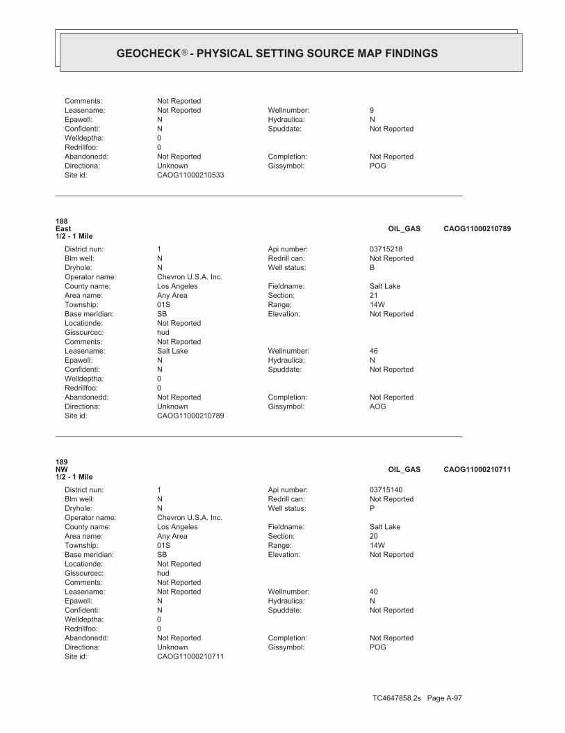
TC4647858.2s Page A-97
CAOG11000210711Site id:POGGissymbol:UnknownDirectiona:Not ReportedCompletion:Not ReportedAbandonedd:
0Redrillfoo:0Welldeptha:
Not ReportedSpuddate:NConfidenti:NHydraulica:NEpawell:40Wellnumber:Not ReportedLeasename:
Not ReportedComments:hudGissourcec:Not ReportedLocationde:
Not ReportedElevation:SBBase meridian:14WRange:01STownship:20Section:Any AreaArea name:Salt LakeFieldname:Los AngelesCounty name:
Chevron U.S.A. Inc.Operator name:PWell status:NDryhole:Not ReportedRedrill can:NBlm well:03715140Api number:1District nun:
189NW1/2 - 1 Mile
CAOG11000210711OIL_GAS
CAOG11000210789Site id:AOGGissymbol:UnknownDirectiona:Not ReportedCompletion:Not ReportedAbandonedd:
0Redrillfoo:0Welldeptha:
Not ReportedSpuddate:NConfidenti:NHydraulica:NEpawell:46Wellnumber:Salt LakeLeasename:
Not ReportedComments:hudGissourcec:Not ReportedLocationde:
Not ReportedElevation:SBBase meridian:14WRange:01STownship:21Section:Any AreaArea name:Salt LakeFieldname:Los AngelesCounty name:
Chevron U.S.A. Inc.Operator name:BWell status:NDryhole:Not ReportedRedrill can:NBlm well:03715218Api number:1District nun:
188East1/2 - 1 Mile
CAOG11000210789OIL_GAS
CAOG11000210533Site id:POGGissymbol:UnknownDirectiona:Not ReportedCompletion:Not ReportedAbandonedd:
0Redrillfoo:0Welldeptha:
Not ReportedSpuddate:NConfidenti:NHydraulica:NEpawell:9Wellnumber:Not ReportedLeasename:
Not ReportedComments:
®GEOCHECK - PHYSICAL SETTING SOURCE MAP FINDINGS®

TC4647858.2s Page A-98
AL192North1/2 - 1 Mile
CAOG11000210326OIL_GAS
CAOG11000210523Site id:AOGGissymbol:UnknownDirectiona:Not ReportedCompletion:Not ReportedAbandonedd:
0Redrillfoo:0Welldeptha:
Not ReportedSpuddate:NConfidenti:NHydraulica:NEpawell:4Wellnumber:RossLeasename:
Not ReportedComments:hudGissourcec:Not ReportedLocationde:
Not ReportedElevation:SBBase meridian:14WRange:01STownship:20Section:Any AreaArea name:Salt LakeFieldname:Los AngelesCounty name:
James F. RossOperator name:IWell status:NDryhole:Not ReportedRedrill can:NBlm well:03714907Api number:1District nun:
AJ191NW1/2 - 1 Mile
CAOG11000210523OIL_GAS
CAOG11000210640Site id:POGGissymbol:UnknownDirectiona:Not ReportedCompletion:Not ReportedAbandonedd:
0Redrillfoo:0Welldeptha:
Not ReportedSpuddate:NConfidenti:NHydraulica:NEpawell:2Wellnumber:Not ReportedLeasename:
Not ReportedComments:hudGissourcec:Not ReportedLocationde:
Not ReportedElevation:SBBase meridian:14WRange:01STownship:21Section:Any AreaArea name:Salt LakeFieldname:Los AngelesCounty name:
Rancho La Brea Oil co.Operator name:PWell status:NDryhole:Not ReportedRedrill can:NBlm well:03715060Api number:1District nun:
AK190NE1/2 - 1 Mile
CAOG11000210640OIL_GAS
Map IDDirectionDistance EDR ID NumberDatabase
®GEOCHECK - PHYSICAL SETTING SOURCE MAP FINDINGS®

TC4647858.2s Page A-99
hudGissourcec:Not ReportedLocationde:
Not ReportedElevation:SBBase meridian:14WRange:01STownship:21Section:Any AreaArea name:Salt LakeFieldname:Los AngelesCounty name:
Southern California Edison Co.Operator name:PWell status:NDryhole:Not ReportedRedrill can:NBlm well:03714922Api number:1District nun:
AM194NNE1/2 - 1 Mile
CAOG11000210538OIL_GAS
CAOG11000210558Site id:POGGissymbol:UnknownDirectiona:Not ReportedCompletion:Not ReportedAbandonedd:
0Redrillfoo:0Welldeptha:
Not ReportedSpuddate:NConfidenti:NHydraulica:NEpawell:111Wellnumber:ClarkLeasename:
Not ReportedComments:hudGissourcec:Not ReportedLocationde:
Not ReportedElevation:SBBase meridian:14WRange:01STownship:21Section:Any AreaArea name:Salt LakeFieldname:Los AngelesCounty name:
Southern California Edison Co.Operator name:PWell status:NDryhole:Not ReportedRedrill can:NBlm well:03714942Api number:1District nun:
AK193NE1/2 - 1 Mile
CAOG11000210558OIL_GAS
CAOG11000210326Site id:POGGissymbol:UnknownDirectiona:Not ReportedCompletion:Not ReportedAbandonedd:
0Redrillfoo:0Welldeptha:
Not ReportedSpuddate:NConfidenti:NHydraulica:NEpawell:13Wellnumber:Not ReportedLeasename:
Not ReportedComments:hudGissourcec:Not ReportedLocationde:
Not ReportedElevation:SBBase meridian:14WRange:01STownship:21Section:Any AreaArea name:Salt LakeFieldname:Los AngelesCounty name:
Gilmore Oil CompanyOperator name:PWell status:NDryhole:Not ReportedRedrill can:NBlm well:03714640Api number:1District nun:
®GEOCHECK - PHYSICAL SETTING SOURCE MAP FINDINGS®

TC4647858.2s Page A-100
CAOG11000210802Site id:POGGissymbol:UnknownDirectiona:Not ReportedCompletion:Not ReportedAbandonedd:
0Redrillfoo:0Welldeptha:
Not ReportedSpuddate:NConfidenti:NHydraulica:NEpawell:200Wellnumber:Salt LakeLeasename:
Not ReportedComments:hudGissourcec:Not ReportedLocationde:
Not ReportedElevation:SBBase meridian:14WRange:01STownship:21Section:Any AreaArea name:Salt LakeFieldname:Los AngelesCounty name:
Chevron U.S.A. Inc.Operator name:PWell status:NDryhole:Not ReportedRedrill can:NBlm well:03715231Api number:1District nun:
AQ196ENE1/2 - 1 Mile
CAOG11000210802OIL_GAS
CAOG11000210319Site id:POGGissymbol:UnknownDirectiona:Not ReportedCompletion:Not ReportedAbandonedd:
0Redrillfoo:0Welldeptha:
Not ReportedSpuddate:NConfidenti:NHydraulica:NEpawell:6Wellnumber:Not ReportedLeasename:
Not ReportedComments:hudGissourcec:Not ReportedLocationde:
Not ReportedElevation:SBBase meridian:14WRange:01STownship:21Section:Any AreaArea name:Salt LakeFieldname:Los AngelesCounty name:
Gilmore Oil CompanyOperator name:PWell status:NDryhole:Not ReportedRedrill can:NBlm well:03714633Api number:1District nun:
AL195NNE1/2 - 1 Mile
CAOG11000210319OIL_GAS
CAOG11000210538Site id:POGGissymbol:UnknownDirectiona:Not ReportedCompletion:Not ReportedAbandonedd:
0Redrillfoo:0Welldeptha:
Not ReportedSpuddate:NConfidenti:NHydraulica:NEpawell:14Wellnumber:Not ReportedLeasename:
Not ReportedComments:
®GEOCHECK - PHYSICAL SETTING SOURCE MAP FINDINGS®

TC4647858.2s Page A-101
AO199NE1/2 - 1 Mile
CAOG11000210567OIL_GAS
CAOG11000210724Site id:POGGissymbol:UnknownDirectiona:Not ReportedCompletion:Not ReportedAbandonedd:
0Redrillfoo:0Welldeptha:
Not ReportedSpuddate:NConfidenti:NHydraulica:NEpawell:86Wellnumber:Not ReportedLeasename:
Not ReportedComments:hudGissourcec:Not ReportedLocationde:
Not ReportedElevation:SBBase meridian:14WRange:01STownship:20Section:Any AreaArea name:Salt LakeFieldname:Los AngelesCounty name:
Chevron U.S.A. Inc.Operator name:PWell status:NDryhole:Not ReportedRedrill can:NBlm well:03715153Api number:1District nun:
198WNW1/2 - 1 Mile
CAOG11000210724OIL_GAS
CAOG11000210565Site id:POGGissymbol:UnknownDirectiona:Not ReportedCompletion:Not ReportedAbandonedd:
0Redrillfoo:0Welldeptha:
Not ReportedSpuddate:NConfidenti:NHydraulica:NEpawell:118Wellnumber:ClarkLeasename:
Not ReportedComments:hudGissourcec:Not ReportedLocationde:
Not ReportedElevation:SBBase meridian:14WRange:01STownship:21Section:Any AreaArea name:Salt LakeFieldname:Los AngelesCounty name:
Southern California Edison Co.Operator name:PWell status:NDryhole:Not ReportedRedrill can:NBlm well:03714949Api number:1District nun:
AM197NNE1/2 - 1 Mile
CAOG11000210565OIL_GAS
Map IDDirectionDistance EDR ID NumberDatabase
®GEOCHECK - PHYSICAL SETTING SOURCE MAP FINDINGS®

TC4647858.2s Page A-102
hudGissourcec:Not ReportedLocationde:
Not ReportedElevation:SBBase meridian:14WRange:01STownship:21Section:Any AreaArea name:Salt LakeFieldname:Los AngelesCounty name:
Rancho La Brea Oil co.Operator name:PWell status:NDryhole:Not ReportedRedrill can:NBlm well:03715062Api number:1District nun:
AR201NE1/2 - 1 Mile
CAOG11000210642OIL_GAS
CAOG11000210521Site id:AOGGissymbol:UnknownDirectiona:Not ReportedCompletion:Not ReportedAbandonedd:
0Redrillfoo:0Welldeptha:
Not ReportedSpuddate:NConfidenti:NHydraulica:NEpawell:2Wellnumber:RossLeasename:
Not ReportedComments:hudGissourcec:Not ReportedLocationde:
Not ReportedElevation:SBBase meridian:14WRange:01STownship:20Section:Any AreaArea name:Salt LakeFieldname:Los AngelesCounty name:
James F. RossOperator name:IWell status:NDryhole:Not ReportedRedrill can:NBlm well:03714905Api number:1District nun:
200NNW1/2 - 1 Mile
CAOG11000210521OIL_GAS
CAOG11000210567Site id:POGGissymbol:UnknownDirectiona:Not ReportedCompletion:Not ReportedAbandonedd:
0Redrillfoo:0Welldeptha:
Not ReportedSpuddate:NConfidenti:NHydraulica:NEpawell:120Wellnumber:ClarkLeasename:
Not ReportedComments:hudGissourcec:Not ReportedLocationde:
Not ReportedElevation:SBBase meridian:14WRange:01STownship:21Section:Any AreaArea name:Salt LakeFieldname:Los AngelesCounty name:
Southern California Edison Co.Operator name:PWell status:NDryhole:Not ReportedRedrill can:NBlm well:03714951Api number:1District nun:
®GEOCHECK - PHYSICAL SETTING SOURCE MAP FINDINGS®

TC4647858.2s Page A-103
CAOG11000210560Site id:POGGissymbol:UnknownDirectiona:Not ReportedCompletion:Not ReportedAbandonedd:
0Redrillfoo:0Welldeptha:
Not ReportedSpuddate:NConfidenti:NHydraulica:NEpawell:113Wellnumber:ClarkLeasename:
Not ReportedComments:hudGissourcec:Not ReportedLocationde:
Not ReportedElevation:SBBase meridian:14WRange:01STownship:21Section:Any AreaArea name:Salt LakeFieldname:Los AngelesCounty name:
Southern California Edison Co.Operator name:PWell status:NDryhole:Not ReportedRedrill can:NBlm well:03714944Api number:1District nun:
AO203NE1/2 - 1 Mile
CAOG11000210560OIL_GAS
CAOG11000210534Site id:POGGissymbol:UnknownDirectiona:Not ReportedCompletion:Not ReportedAbandonedd:
0Redrillfoo:0Welldeptha:
Not ReportedSpuddate:NConfidenti:NHydraulica:NEpawell:10Wellnumber:Not ReportedLeasename:
Not ReportedComments:hudGissourcec:Not ReportedLocationde:
Not ReportedElevation:SBBase meridian:14WRange:01STownship:21Section:Any AreaArea name:Salt LakeFieldname:Los AngelesCounty name:
Southern California Edison Co.Operator name:PWell status:NDryhole:Not ReportedRedrill can:NBlm well:03714918Api number:1District nun:
AP202NNE1/2 - 1 Mile
CAOG11000210534OIL_GAS
CAOG11000210642Site id:POGGissymbol:UnknownDirectiona:Not ReportedCompletion:Not ReportedAbandonedd:
0Redrillfoo:0Welldeptha:
Not ReportedSpuddate:NConfidenti:NHydraulica:NEpawell:4Wellnumber:Not ReportedLeasename:
Not ReportedComments:
®GEOCHECK - PHYSICAL SETTING SOURCE MAP FINDINGS®

TC4647858.2s Page A-104
AS206NE1/2 - 1 Mile
CAOG11000210656OIL_GAS
CAOG11000210804Site id:POGGissymbol:UnknownDirectiona:Not ReportedCompletion:Not ReportedAbandonedd:
0Redrillfoo:0Welldeptha:
Not ReportedSpuddate:NConfidenti:NHydraulica:NEpawell:217Wellnumber:Salt LakeLeasename:
Not ReportedComments:hudGissourcec:Not ReportedLocationde:
Not ReportedElevation:SBBase meridian:14WRange:01STownship:21Section:Any AreaArea name:Salt LakeFieldname:Los AngelesCounty name:
Chevron U.S.A. Inc.Operator name:PWell status:NDryhole:Not ReportedRedrill can:NBlm well:03715233Api number:1District nun:
AQ205ENE1/2 - 1 Mile
CAOG11000210804OIL_GAS
CAOG11000205317Site id:PDHGissymbol:UnknownDirectiona:Not ReportedCompletion:Not ReportedAbandonedd:
0Redrillfoo:0Welldeptha:
Not ReportedSpuddate:NConfidenti:NHydraulica:NEpawell:1Wellnumber:Tower CoreholeLeasename:
Not ReportedComments:hudGissourcec:Not ReportedLocationde:
Not ReportedElevation:SBBase meridian:14WRange:01STownship:20Section:Any AreaArea name:Salt Lake, SouthFieldname:Los AngelesCounty name:
Chevron U.S.A. Inc.Operator name:PWell status:NDryhole:Not ReportedRedrill can:NBlm well:03706478Api number:1District nun:
204West1/2 - 1 Mile
CAOG11000205317OIL_GAS
Map IDDirectionDistance EDR ID NumberDatabase
®GEOCHECK - PHYSICAL SETTING SOURCE MAP FINDINGS®

TC4647858.2s Page A-105
hudGissourcec:Not ReportedLocationde:
Not ReportedElevation:SBBase meridian:14WRange:01STownship:21Section:Any AreaArea name:Salt LakeFieldname:Los AngelesCounty name:
Chevron U.S.A. Inc.Operator name:PWell status:NDryhole:Not ReportedRedrill can:NBlm well:03715215Api number:1District nun:
208ENE1/2 - 1 Mile
CAOG11000210786OIL_GAS
CAOG11000210581Site id:POGGissymbol:UnknownDirectiona:Not ReportedCompletion:Not ReportedAbandonedd:
0Redrillfoo:0Welldeptha:
Not ReportedSpuddate:NConfidenti:NHydraulica:NEpawell:5Wellnumber:Not ReportedLeasename:
Not ReportedComments:hudGissourcec:Not ReportedLocationde:
Not ReportedElevation:SBBase meridian:14WRange:01STownship:20Section:Any AreaArea name:Salt LakeFieldname:Los AngelesCounty name:
Chevron U.S.A. Inc.Operator name:PWell status:NDryhole:Not ReportedRedrill can:NBlm well:03714965Api number:1District nun:
AT207NW1/2 - 1 Mile
CAOG11000210581OIL_GAS
CAOG11000210656Site id:POGGissymbol:UnknownDirectiona:Not ReportedCompletion:Not ReportedAbandonedd:
0Redrillfoo:0Welldeptha:
Not ReportedSpuddate:NConfidenti:NHydraulica:NEpawell:18Wellnumber:Not ReportedLeasename:
Not ReportedComments:hudGissourcec:Not ReportedLocationde:
Not ReportedElevation:SBBase meridian:14WRange:01STownship:21Section:Any AreaArea name:Salt LakeFieldname:Los AngelesCounty name:
Rancho La Brea Oil co.Operator name:PWell status:NDryhole:Not ReportedRedrill can:NBlm well:03715076Api number:1District nun:
®GEOCHECK - PHYSICAL SETTING SOURCE MAP FINDINGS®

TC4647858.2s Page A-106
CAOG11000210723Site id:PWFGissymbol:UnknownDirectiona:Not ReportedCompletion:Not ReportedAbandonedd:
0Redrillfoo:0Welldeptha:
Not ReportedSpuddate:NConfidenti:NHydraulica:NEpawell:84Wellnumber:Not ReportedLeasename:
Not ReportedComments:hudGissourcec:Not ReportedLocationde:
Not ReportedElevation:SBBase meridian:14WRange:01STownship:20Section:Any AreaArea name:Salt LakeFieldname:Los AngelesCounty name:
Chevron U.S.A. Inc.Operator name:PWell status:NDryhole:Not ReportedRedrill can:NBlm well:03715152Api number:1District nun:
210WNW1/2 - 1 Mile
CAOG11000210723OIL_GAS
CAOG11000210718Site id:POGGissymbol:UnknownDirectiona:Not ReportedCompletion:Not ReportedAbandonedd:
0Redrillfoo:0Welldeptha:
Not ReportedSpuddate:NConfidenti:NHydraulica:NEpawell:59Wellnumber:Not ReportedLeasename:
Not ReportedComments:hudGissourcec:Not ReportedLocationde:
Not ReportedElevation:SBBase meridian:14WRange:01STownship:20Section:Any AreaArea name:Salt LakeFieldname:Los AngelesCounty name:
Chevron U.S.A. Inc.Operator name:PWell status:NDryhole:Not ReportedRedrill can:NBlm well:03715147Api number:1District nun:
AT209NW1/2 - 1 Mile
CAOG11000210718OIL_GAS
CAOG11000210786Site id:POGGissymbol:UnknownDirectiona:Not ReportedCompletion:Not ReportedAbandonedd:
0Redrillfoo:0Welldeptha:
Not ReportedSpuddate:NConfidenti:NHydraulica:NEpawell:41Wellnumber:Salt LakeLeasename:
Not ReportedComments:
®GEOCHECK - PHYSICAL SETTING SOURCE MAP FINDINGS®

TC4647858.2s Page A-107
AV213NNE1/2 - 1 Mile
CAOG11000210320OIL_GAS
CAOG11000210540Site id:POGGissymbol:UnknownDirectiona:Not ReportedCompletion:Not ReportedAbandonedd:
0Redrillfoo:0Welldeptha:
Not ReportedSpuddate:NConfidenti:NHydraulica:NEpawell:16Wellnumber:Not ReportedLeasename:
Not ReportedComments:hudGissourcec:Not ReportedLocationde:
Not ReportedElevation:SBBase meridian:14WRange:01STownship:21Section:Any AreaArea name:Salt LakeFieldname:Los AngelesCounty name:
Southern California Edison Co.Operator name:PWell status:NDryhole:Not ReportedRedrill can:NBlm well:03714924Api number:1District nun:
AU212NNE1/2 - 1 Mile
CAOG11000210540OIL_GAS
CAOG11000210520Site id:AOGGissymbol:UnknownDirectiona:Not ReportedCompletion:Not ReportedAbandonedd:
0Redrillfoo:0Welldeptha:
Not ReportedSpuddate:NConfidenti:NHydraulica:NEpawell:AWellnumber:RossLeasename:
Not ReportedComments:hudGissourcec:Not ReportedLocationde:
Not ReportedElevation:SBBase meridian:14WRange:01STownship:20Section:Any AreaArea name:Salt LakeFieldname:Los AngelesCounty name:
James F. RossOperator name:IWell status:NDryhole:Not ReportedRedrill can:NBlm well:03714904Api number:1District nun:
211NW1/2 - 1 Mile
CAOG11000210520OIL_GAS
Map IDDirectionDistance EDR ID NumberDatabase
®GEOCHECK - PHYSICAL SETTING SOURCE MAP FINDINGS®

TC4647858.2s Page A-108
hudGissourcec:Not ReportedLocationde:
Not ReportedElevation:SBBase meridian:14WRange:01STownship:21Section:Any AreaArea name:Salt LakeFieldname:Los AngelesCounty name:
Southern California Edison Co.Operator name:PWell status:NDryhole:Not ReportedRedrill can:NBlm well:03714952Api number:1District nun:
AW215NE1/2 - 1 Mile
CAOG11000210568OIL_GAS
CAOG11000210566Site id:POGGissymbol:UnknownDirectiona:Not ReportedCompletion:Not ReportedAbandonedd:
0Redrillfoo:0Welldeptha:
Not ReportedSpuddate:NConfidenti:NHydraulica:NEpawell:119Wellnumber:ClarkLeasename:
Not ReportedComments:hudGissourcec:Not ReportedLocationde:
Not ReportedElevation:SBBase meridian:14WRange:01STownship:21Section:Any AreaArea name:Salt LakeFieldname:Los AngelesCounty name:
Southern California Edison Co.Operator name:PWell status:NDryhole:Not ReportedRedrill can:NBlm well:03714950Api number:1District nun:
AU214NNE1/2 - 1 Mile
CAOG11000210566OIL_GAS
CAOG11000210320Site id:POGGissymbol:UnknownDirectiona:Not ReportedCompletion:Not ReportedAbandonedd:
0Redrillfoo:0Welldeptha:
Not ReportedSpuddate:NConfidenti:NHydraulica:NEpawell:7Wellnumber:Not ReportedLeasename:
Not ReportedComments:hudGissourcec:Not ReportedLocationde:
Not ReportedElevation:SBBase meridian:14WRange:01STownship:21Section:Any AreaArea name:Salt LakeFieldname:Los AngelesCounty name:
Gilmore Oil CompanyOperator name:PWell status:NDryhole:Not ReportedRedrill can:NBlm well:03714634Api number:1District nun:
®GEOCHECK - PHYSICAL SETTING SOURCE MAP FINDINGS®

TC4647858.2s Page A-109
CAOG11000210636Site id:POGGissymbol:UnknownDirectiona:Not ReportedCompletion:Not ReportedAbandonedd:
0Redrillfoo:0Welldeptha:
Not ReportedSpuddate:NConfidenti:NHydraulica:NEpawell:1Wellnumber:Not ReportedLeasename:
Not ReportedComments:hudGissourcec:Not ReportedLocationde:
Not ReportedElevation:SBBase meridian:14WRange:01STownship:21Section:Any AreaArea name:Salt LakeFieldname:Los AngelesCounty name:
Macco Corp.Operator name:PWell status:NDryhole:Not ReportedRedrill can:NBlm well:03715056Api number:1District nun:
217North1/2 - 1 Mile
CAOG11000210636OIL_GAS
CAOG11000210327Site id:POGGissymbol:UnknownDirectiona:Not ReportedCompletion:Not ReportedAbandonedd:
0Redrillfoo:0Welldeptha:
Not ReportedSpuddate:NConfidenti:NHydraulica:NEpawell:14Wellnumber:Not ReportedLeasename:
Not ReportedComments:hudGissourcec:Not ReportedLocationde:
Not ReportedElevation:SBBase meridian:14WRange:01STownship:21Section:Any AreaArea name:Salt LakeFieldname:Los AngelesCounty name:
Gilmore Oil CompanyOperator name:PWell status:NDryhole:Not ReportedRedrill can:NBlm well:03714641Api number:1District nun:
AV216North1/2 - 1 Mile
CAOG11000210327OIL_GAS
CAOG11000210568Site id:POGGissymbol:UnknownDirectiona:Not ReportedCompletion:Not ReportedAbandonedd:
0Redrillfoo:0Welldeptha:
Not ReportedSpuddate:NConfidenti:NHydraulica:NEpawell:121Wellnumber:ClarkLeasename:
Not ReportedComments:
®GEOCHECK - PHYSICAL SETTING SOURCE MAP FINDINGS®

TC4647858.2s Page A-110
AQ220ENE1/2 - 1 Mile
CAOG11000210805OIL_GAS
CAOG11000210807Site id:POGGissymbol:UnknownDirectiona:Not ReportedCompletion:Not ReportedAbandonedd:
0Redrillfoo:0Welldeptha:
Not ReportedSpuddate:NConfidenti:NHydraulica:NEpawell:235Wellnumber:Salt LakeLeasename:
Not ReportedComments:hudGissourcec:Not ReportedLocationde:
Not ReportedElevation:SBBase meridian:14WRange:01STownship:21Section:Any AreaArea name:Salt LakeFieldname:Los AngelesCounty name:
Chevron U.S.A. Inc.Operator name:PWell status:NDryhole:Not ReportedRedrill can:NBlm well:03715236Api number:1District nun:
AS219NE1/2 - 1 Mile
CAOG11000210807OIL_GAS
CAOG11000210643Site id:POGGissymbol:UnknownDirectiona:Not ReportedCompletion:Not ReportedAbandonedd:
0Redrillfoo:0Welldeptha:
Not ReportedSpuddate:NConfidenti:NHydraulica:NEpawell:5Wellnumber:Not ReportedLeasename:
Not ReportedComments:hudGissourcec:Not ReportedLocationde:
Not ReportedElevation:SBBase meridian:14WRange:01STownship:21Section:Any AreaArea name:Salt LakeFieldname:Los AngelesCounty name:
Rancho La Brea Oil co.Operator name:PWell status:NDryhole:Not ReportedRedrill can:NBlm well:03715063Api number:1District nun:
AR218NE1/2 - 1 Mile
CAOG11000210643OIL_GAS
Map IDDirectionDistance EDR ID NumberDatabase
®GEOCHECK - PHYSICAL SETTING SOURCE MAP FINDINGS®

TC4647858.2s Page A-111
hudGissourcec:Not ReportedLocationde:
Not ReportedElevation:SBBase meridian:14WRange:01STownship:21Section:Any AreaArea name:Salt LakeFieldname:Los AngelesCounty name:
Southern California Edison Co.Operator name:PWell status:NDryhole:Not ReportedRedrill can:NBlm well:03714923Api number:1District nun:
AV222NNE1/2 - 1 Mile
CAOG11000210539OIL_GAS
CAOG11000210561Site id:POGGissymbol:UnknownDirectiona:Not ReportedCompletion:Not ReportedAbandonedd:
0Redrillfoo:0Welldeptha:
Not ReportedSpuddate:NConfidenti:NHydraulica:NEpawell:114Wellnumber:ClarkLeasename:
Not ReportedComments:hudGissourcec:Not ReportedLocationde:
Not ReportedElevation:SBBase meridian:14WRange:01STownship:21Section:Any AreaArea name:Salt LakeFieldname:Los AngelesCounty name:
Southern California Edison Co.Operator name:PWell status:NDryhole:Not ReportedRedrill can:NBlm well:03714945Api number:1District nun:
AW221NE1/2 - 1 Mile
CAOG11000210561OIL_GAS
CAOG11000210805Site id:AOGGissymbol:UnknownDirectiona:Not ReportedCompletion:Not ReportedAbandonedd:
0Redrillfoo:0Welldeptha:
Not ReportedSpuddate:NConfidenti:NHydraulica:NEpawell:218Wellnumber:Salt LakeLeasename:
Not ReportedComments:hudGissourcec:Not ReportedLocationde:
Not ReportedElevation:SBBase meridian:14WRange:01STownship:21Section:Any AreaArea name:Salt LakeFieldname:Los AngelesCounty name:
Chevron U.S.A. Inc.Operator name:BWell status:NDryhole:Not ReportedRedrill can:NBlm well:03715234Api number:1District nun:
®GEOCHECK - PHYSICAL SETTING SOURCE MAP FINDINGS®

TC4647858.2s Page A-112
CAOG11000210639Site id:POGGissymbol:UnknownDirectiona:Not ReportedCompletion:Not ReportedAbandonedd:
0Redrillfoo:0Welldeptha:
Not ReportedSpuddate:NConfidenti:NHydraulica:NEpawell:1Wellnumber:Not ReportedLeasename:
Not ReportedComments:hudGissourcec:Not ReportedLocationde:
Not ReportedElevation:SBBase meridian:14WRange:01STownship:21Section:Any AreaArea name:Salt LakeFieldname:Los AngelesCounty name:
Rancho La Brea Oil co.Operator name:PWell status:NDryhole:Not ReportedRedrill can:NBlm well:03715059Api number:1District nun:
AR224NE1/2 - 1 Mile
CAOG11000210639OIL_GAS
CAOG11000210650Site id:POGGissymbol:UnknownDirectiona:Not ReportedCompletion:Not ReportedAbandonedd:
0Redrillfoo:0Welldeptha:
Not ReportedSpuddate:NConfidenti:NHydraulica:NEpawell:12Wellnumber:Not ReportedLeasename:
Not ReportedComments:hudGissourcec:Not ReportedLocationde:
Not ReportedElevation:SBBase meridian:14WRange:01STownship:21Section:Any AreaArea name:Salt LakeFieldname:Los AngelesCounty name:
Rancho La Brea Oil co.Operator name:PWell status:NDryhole:Not ReportedRedrill can:NBlm well:03715070Api number:1District nun:
AR223NE1/2 - 1 Mile
CAOG11000210650OIL_GAS
CAOG11000210539Site id:POGGissymbol:UnknownDirectiona:Not ReportedCompletion:Not ReportedAbandonedd:
0Redrillfoo:0Welldeptha:
Not ReportedSpuddate:NConfidenti:NHydraulica:NEpawell:15Wellnumber:Not ReportedLeasename:
Not ReportedComments:
®GEOCHECK - PHYSICAL SETTING SOURCE MAP FINDINGS®

TC4647858.2s Page A-113
AU227NNE1/2 - 1 Mile
CAOG11000210542OIL_GAS
CAOG11000201100Site id:PDHGissymbol:UnknownDirectiona:Not ReportedCompletion:Not ReportedAbandonedd:
0Redrillfoo:0Welldeptha:
Not ReportedSpuddate:NConfidenti:NHydraulica:NEpawell:1Wellnumber:Highland CoreholeLeasename:
Not ReportedComments:hudGissourcec:Not ReportedLocationde:
Not ReportedElevation:SBBase meridian:14WRange:01STownship:22Section:Any AreaArea name:Any FieldFieldname:Los AngelesCounty name:
Chevron U.S.A. Inc.Operator name:PWell status:YDryhole:Not ReportedRedrill can:NBlm well:03701151Api number:1District nun:
AX226East1/2 - 1 Mile
CAOG11000201100OIL_GAS
CAOG11000210719Site id:POGGissymbol:UnknownDirectiona:Not ReportedCompletion:Not ReportedAbandonedd:
0Redrillfoo:0Welldeptha:
Not ReportedSpuddate:NConfidenti:NHydraulica:NEpawell:60Wellnumber:Not ReportedLeasename:
Not ReportedComments:hudGissourcec:Not ReportedLocationde:
Not ReportedElevation:SBBase meridian:14WRange:01STownship:20Section:Any AreaArea name:Salt LakeFieldname:Los AngelesCounty name:
Chevron U.S.A. Inc.Operator name:PWell status:NDryhole:Not ReportedRedrill can:NBlm well:03715148Api number:1District nun:
AT225NW1/2 - 1 Mile
CAOG11000210719OIL_GAS
Map IDDirectionDistance EDR ID NumberDatabase
®GEOCHECK - PHYSICAL SETTING SOURCE MAP FINDINGS®

TC4647858.2s Page A-114
hudGissourcec:Not ReportedLocationde:
Not ReportedElevation:SBBase meridian:14WRange:01STownship:21Section:Any AreaArea name:Salt LakeFieldname:Los AngelesCounty name:
Chevron U.S.A. Inc.Operator name:PWell status:NDryhole:Not ReportedRedrill can:NBlm well:03715244Api number:1District nun:
AS229NE1/2 - 1 Mile
CAOG11000210815OIL_GAS
CAOG11000210806Site id:POGGissymbol:UnknownDirectiona:Not ReportedCompletion:Not ReportedAbandonedd:
0Redrillfoo:0Welldeptha:
Not ReportedSpuddate:NConfidenti:NHydraulica:NEpawell:219Wellnumber:Salt LakeLeasename:
Not ReportedComments:hudGissourcec:Not ReportedLocationde:
Not ReportedElevation:SBBase meridian:14WRange:01STownship:21Section:Any AreaArea name:Salt LakeFieldname:Los AngelesCounty name:
Chevron U.S.A. Inc.Operator name:PWell status:NDryhole:Not ReportedRedrill can:NBlm well:03715235Api number:1District nun:
AY228ENE1/2 - 1 Mile
CAOG11000210806OIL_GAS
CAOG11000210542Site id:POGGissymbol:UnknownDirectiona:Not ReportedCompletion:Not ReportedAbandonedd:
0Redrillfoo:0Welldeptha:
Not ReportedSpuddate:NConfidenti:NHydraulica:NEpawell:18Wellnumber:Not ReportedLeasename:
Not ReportedComments:hudGissourcec:Not ReportedLocationde:
Not ReportedElevation:SBBase meridian:14WRange:01STownship:21Section:Any AreaArea name:Salt LakeFieldname:Los AngelesCounty name:
Southern California Edison Co.Operator name:PWell status:NDryhole:Not ReportedRedrill can:NBlm well:03714926Api number:1District nun:
®GEOCHECK - PHYSICAL SETTING SOURCE MAP FINDINGS®

TC4647858.2s Page A-115
CAOG11000210321Site id:POGGissymbol:UnknownDirectiona:Not ReportedCompletion:Not ReportedAbandonedd:
0Redrillfoo:0Welldeptha:
Not ReportedSpuddate:NConfidenti:NHydraulica:NEpawell:8Wellnumber:Not ReportedLeasename:
Not ReportedComments:hudGissourcec:Not ReportedLocationde:
Not ReportedElevation:SBBase meridian:14WRange:01STownship:21Section:Any AreaArea name:Salt LakeFieldname:Los AngelesCounty name:
Gilmore Oil CompanyOperator name:PWell status:NDryhole:Not ReportedRedrill can:NBlm well:03714635Api number:1District nun:
AV231NNE1/2 - 1 Mile
CAOG11000210321OIL_GAS
CAOG11000210730Site id:POGGissymbol:UnknownDirectiona:Not ReportedCompletion:Not ReportedAbandonedd:
0Redrillfoo:0Welldeptha:
Not ReportedSpuddate:NConfidenti:NHydraulica:NEpawell:108Wellnumber:Not ReportedLeasename:
Not ReportedComments:hudGissourcec:Not ReportedLocationde:
Not ReportedElevation:SBBase meridian:14WRange:01STownship:20Section:Any AreaArea name:Salt Lake, SouthFieldname:Los AngelesCounty name:
Chevron U.S.A. Inc.Operator name:BWell status:NDryhole:Not ReportedRedrill can:NBlm well:03715159Api number:1District nun:
230West1/2 - 1 Mile
CAOG11000210730OIL_GAS
CAOG11000210815Site id:POGGissymbol:UnknownDirectiona:Not ReportedCompletion:Not ReportedAbandonedd:
0Redrillfoo:0Welldeptha:
Not ReportedSpuddate:NConfidenti:NHydraulica:NEpawell:252Wellnumber:Salt LakeLeasename:
Not ReportedComments:
®GEOCHECK - PHYSICAL SETTING SOURCE MAP FINDINGS®

TC4647858.2s Page A-116
AZ234NE1/2 - 1 Mile
CAOG11000210649OIL_GAS
CAOG11000210562Site id:POGGissymbol:UnknownDirectiona:Not ReportedCompletion:Not ReportedAbandonedd:
0Redrillfoo:0Welldeptha:
Not ReportedSpuddate:NConfidenti:NHydraulica:NEpawell:115Wellnumber:ClarkLeasename:
Not ReportedComments:hudGissourcec:Not ReportedLocationde:
Not ReportedElevation:SBBase meridian:14WRange:01STownship:21Section:Any AreaArea name:Salt LakeFieldname:Los AngelesCounty name:
Southern California Edison Co.Operator name:PWell status:NDryhole:Not ReportedRedrill can:NBlm well:03714946Api number:1District nun:
AW233NE1/2 - 1 Mile
CAOG11000210562OIL_GAS
CAOG11000210569Site id:POGGissymbol:UnknownDirectiona:Not ReportedCompletion:Not ReportedAbandonedd:
0Redrillfoo:0Welldeptha:
Not ReportedSpuddate:NConfidenti:NHydraulica:NEpawell:122Wellnumber:ClarkLeasename:
Not ReportedComments:hudGissourcec:Not ReportedLocationde:
Not ReportedElevation:SBBase meridian:14WRange:01STownship:21Section:Any AreaArea name:Salt LakeFieldname:Los AngelesCounty name:
Southern California Edison Co.Operator name:PWell status:NDryhole:Not ReportedRedrill can:NBlm well:03714953Api number:1District nun:
AW232NNE1/2 - 1 Mile
CAOG11000210569OIL_GAS
Map IDDirectionDistance EDR ID NumberDatabase
®GEOCHECK - PHYSICAL SETTING SOURCE MAP FINDINGS®
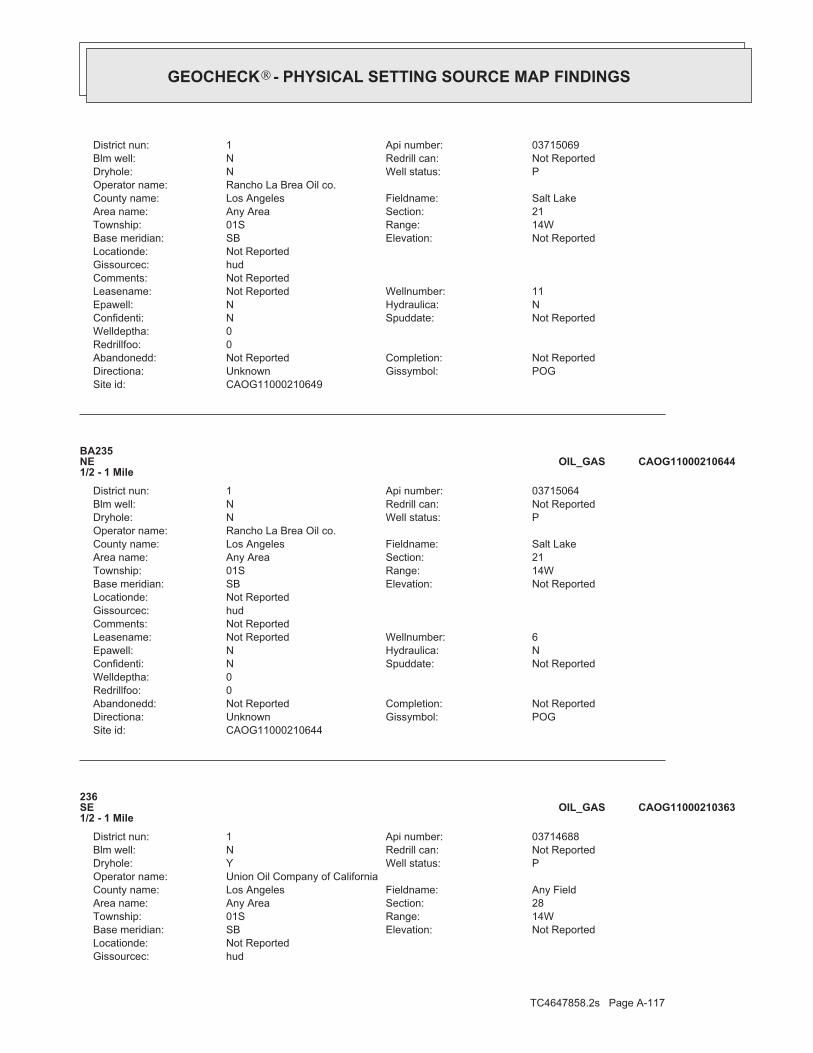
TC4647858.2s Page A-117
hudGissourcec:Not ReportedLocationde:
Not ReportedElevation:SBBase meridian:14WRange:01STownship:28Section:Any AreaArea name:Any FieldFieldname:Los AngelesCounty name:
Union Oil Company of CaliforniaOperator name:PWell status:YDryhole:Not ReportedRedrill can:NBlm well:03714688Api number:1District nun:
236SE1/2 - 1 Mile
CAOG11000210363OIL_GAS
CAOG11000210644Site id:POGGissymbol:UnknownDirectiona:Not ReportedCompletion:Not ReportedAbandonedd:
0Redrillfoo:0Welldeptha:
Not ReportedSpuddate:NConfidenti:NHydraulica:NEpawell:6Wellnumber:Not ReportedLeasename:
Not ReportedComments:hudGissourcec:Not ReportedLocationde:
Not ReportedElevation:SBBase meridian:14WRange:01STownship:21Section:Any AreaArea name:Salt LakeFieldname:Los AngelesCounty name:
Rancho La Brea Oil co.Operator name:PWell status:NDryhole:Not ReportedRedrill can:NBlm well:03715064Api number:1District nun:
BA235NE1/2 - 1 Mile
CAOG11000210644OIL_GAS
CAOG11000210649Site id:POGGissymbol:UnknownDirectiona:Not ReportedCompletion:Not ReportedAbandonedd:
0Redrillfoo:0Welldeptha:
Not ReportedSpuddate:NConfidenti:NHydraulica:NEpawell:11Wellnumber:Not ReportedLeasename:
Not ReportedComments:hudGissourcec:Not ReportedLocationde:
Not ReportedElevation:SBBase meridian:14WRange:01STownship:21Section:Any AreaArea name:Salt LakeFieldname:Los AngelesCounty name:
Rancho La Brea Oil co.Operator name:PWell status:NDryhole:Not ReportedRedrill can:NBlm well:03715069Api number:1District nun:
®GEOCHECK - PHYSICAL SETTING SOURCE MAP FINDINGS®

TC4647858.2s Page A-118
CAOG11000210541Site id:AOGGissymbol:UnknownDirectiona:Not ReportedCompletion:Not ReportedAbandonedd:
0Redrillfoo:0Welldeptha:
Not ReportedSpuddate:NConfidenti:NHydraulica:NEpawell:17Wellnumber:Not ReportedLeasename:
Not ReportedComments:hudGissourcec:Not ReportedLocationde:
Not ReportedElevation:SBBase meridian:14WRange:01STownship:21Section:Any AreaArea name:Salt LakeFieldname:Los AngelesCounty name:
Southern California Edison Co.Operator name:AWell status:NDryhole:Not ReportedRedrill can:NBlm well:03714925Api number:1District nun:
AV238NNE1/2 - 1 Mile
CAOG11000210541OIL_GAS
CAOG11000210722Site id:POGGissymbol:UnknownDirectiona:Not ReportedCompletion:Not ReportedAbandonedd:
0Redrillfoo:0Welldeptha:
Not ReportedSpuddate:NConfidenti:NHydraulica:NEpawell:82Wellnumber:Not ReportedLeasename:
Not ReportedComments:hudGissourcec:Not ReportedLocationde:
Not ReportedElevation:SBBase meridian:14WRange:01STownship:20Section:Any AreaArea name:Salt LakeFieldname:Los AngelesCounty name:
Chevron U.S.A. Inc.Operator name:PWell status:NDryhole:Not ReportedRedrill can:NBlm well:03715151Api number:1District nun:
237WNW1/2 - 1 Mile
CAOG11000210722OIL_GAS
CAOG11000210363Site id:PDHGissymbol:UnknownDirectiona:Not ReportedCompletion:Not ReportedAbandonedd:
0Redrillfoo:0Welldeptha:
Not ReportedSpuddate:NConfidenti:NHydraulica:NEpawell:20Wellnumber:Las Cienegas Core HoleLeasename:
Not ReportedComments:
®GEOCHECK - PHYSICAL SETTING SOURCE MAP FINDINGS®

TC4647858.2s Page A-119
BB241NNE1/2 - 1 Mile
CAOG11000210545OIL_GAS
CAOG11000210543Site id:POGGissymbol:UnknownDirectiona:Not ReportedCompletion:Not ReportedAbandonedd:
0Redrillfoo:0Welldeptha:
Not ReportedSpuddate:NConfidenti:NHydraulica:NEpawell:19Wellnumber:Not ReportedLeasename:
Not ReportedComments:hudGissourcec:Not ReportedLocationde:
Not ReportedElevation:SBBase meridian:14WRange:01STownship:21Section:Any AreaArea name:Salt LakeFieldname:Los AngelesCounty name:
Southern California Edison Co.Operator name:PWell status:NDryhole:Not ReportedRedrill can:NBlm well:03714927Api number:1District nun:
BB240NNE1/2 - 1 Mile
CAOG11000210543OIL_GAS
CAOG11000210677Site id:POGGissymbol:UnknownDirectiona:Not ReportedCompletion:Not ReportedAbandonedd:
0Redrillfoo:0Welldeptha:
Not ReportedSpuddate:NConfidenti:NHydraulica:NEpawell:39Wellnumber:Not ReportedLeasename:
Not ReportedComments:hudGissourcec:Not ReportedLocationde:
Not ReportedElevation:SBBase meridian:14WRange:01STownship:21Section:Any AreaArea name:Salt LakeFieldname:Los AngelesCounty name:
Rancho La Brea Oil co.Operator name:PWell status:NDryhole:Not ReportedRedrill can:NBlm well:03715097Api number:1District nun:
AZ239NE1/2 - 1 Mile
CAOG11000210677OIL_GAS
Map IDDirectionDistance EDR ID NumberDatabase
®GEOCHECK - PHYSICAL SETTING SOURCE MAP FINDINGS®
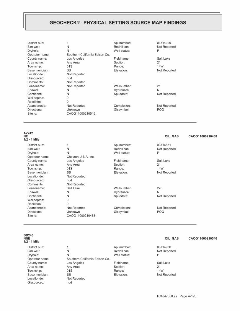
TC4647858.2s Page A-120
hudGissourcec:Not ReportedLocationde:
Not ReportedElevation:SBBase meridian:14WRange:01STownship:21Section:Any AreaArea name:Salt LakeFieldname:Los AngelesCounty name:
Southern California Edison Co.Operator name:PWell status:NDryhole:Not ReportedRedrill can:NBlm well:03714930Api number:1District nun:
BB243NNE1/2 - 1 Mile
CAOG11000210546OIL_GAS
CAOG11000210468Site id:POGGissymbol:UnknownDirectiona:Not ReportedCompletion:Not ReportedAbandonedd:
0Redrillfoo:0Welldeptha:
Not ReportedSpuddate:NConfidenti:NHydraulica:NEpawell:270Wellnumber:Salt LakeLeasename:
Not ReportedComments:hudGissourcec:Not ReportedLocationde:
Not ReportedElevation:SBBase meridian:14WRange:01STownship:21Section:Any AreaArea name:Salt LakeFieldname:Los AngelesCounty name:
Chevron U.S.A. Inc.Operator name:PWell status:NDryhole:Not ReportedRedrill can:NBlm well:03714851Api number:1District nun:
AZ242NE1/2 - 1 Mile
CAOG11000210468OIL_GAS
CAOG11000210545Site id:POGGissymbol:UnknownDirectiona:Not ReportedCompletion:Not ReportedAbandonedd:
0Redrillfoo:0Welldeptha:
Not ReportedSpuddate:NConfidenti:NHydraulica:NEpawell:21Wellnumber:Not ReportedLeasename:
Not ReportedComments:hudGissourcec:Not ReportedLocationde:
Not ReportedElevation:SBBase meridian:14WRange:01STownship:21Section:Any AreaArea name:Salt LakeFieldname:Los AngelesCounty name:
Southern California Edison Co.Operator name:PWell status:NDryhole:Not ReportedRedrill can:NBlm well:03714929Api number:1District nun:
®GEOCHECK - PHYSICAL SETTING SOURCE MAP FINDINGS®
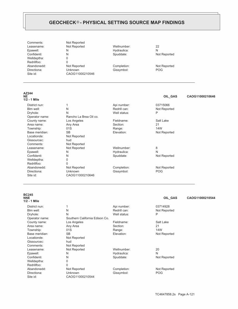
TC4647858.2s Page A-121
CAOG11000210544Site id:POGGissymbol:UnknownDirectiona:Not ReportedCompletion:Not ReportedAbandonedd:
0Redrillfoo:0Welldeptha:
Not ReportedSpuddate:NConfidenti:NHydraulica:NEpawell:20Wellnumber:Not ReportedLeasename:
Not ReportedComments:hudGissourcec:Not ReportedLocationde:
Not ReportedElevation:SBBase meridian:14WRange:01STownship:21Section:Any AreaArea name:Salt LakeFieldname:Los AngelesCounty name:
Southern California Edison Co.Operator name:PWell status:NDryhole:Not ReportedRedrill can:NBlm well:03714928Api number:1District nun:
BC245NNE1/2 - 1 Mile
CAOG11000210544OIL_GAS
CAOG11000210646Site id:POGGissymbol:UnknownDirectiona:Not ReportedCompletion:Not ReportedAbandonedd:
0Redrillfoo:0Welldeptha:
Not ReportedSpuddate:NConfidenti:NHydraulica:NEpawell:8Wellnumber:Not ReportedLeasename:
Not ReportedComments:hudGissourcec:Not ReportedLocationde:
Not ReportedElevation:SBBase meridian:14WRange:01STownship:21Section:Any AreaArea name:Salt LakeFieldname:Los AngelesCounty name:
Rancho La Brea Oil co.Operator name:PWell status:NDryhole:Not ReportedRedrill can:NBlm well:03715066Api number:1District nun:
AZ244NE1/2 - 1 Mile
CAOG11000210646OIL_GAS
CAOG11000210546Site id:POGGissymbol:UnknownDirectiona:Not ReportedCompletion:Not ReportedAbandonedd:
0Redrillfoo:0Welldeptha:
Not ReportedSpuddate:NConfidenti:NHydraulica:NEpawell:22Wellnumber:Not ReportedLeasename:
Not ReportedComments:
®GEOCHECK - PHYSICAL SETTING SOURCE MAP FINDINGS®

TC4647858.2s Page A-122
BE248WNW1/2 - 1 Mile
CAOG11000210729OIL_GAS
CAOG11000210563Site id:POGGissymbol:UnknownDirectiona:Not ReportedCompletion:Not ReportedAbandonedd:
0Redrillfoo:0Welldeptha:
Not ReportedSpuddate:NConfidenti:NHydraulica:NEpawell:116Wellnumber:ClarkLeasename:
Not ReportedComments:hudGissourcec:Not ReportedLocationde:
Not ReportedElevation:SBBase meridian:14WRange:01STownship:21Section:Any AreaArea name:Salt LakeFieldname:Los AngelesCounty name:
Southern California Edison Co.Operator name:PWell status:NDryhole:Not ReportedRedrill can:NBlm well:03714947Api number:1District nun:
BD247NE1/2 - 1 Mile
CAOG11000210563OIL_GAS
CAOG11000210647Site id:POGGissymbol:UnknownDirectiona:Not ReportedCompletion:Not ReportedAbandonedd:
0Redrillfoo:0Welldeptha:
Not ReportedSpuddate:NConfidenti:NHydraulica:NEpawell:9Wellnumber:Not ReportedLeasename:
Not ReportedComments:hudGissourcec:Not ReportedLocationde:
Not ReportedElevation:SBBase meridian:14WRange:01STownship:21Section:Any AreaArea name:Salt LakeFieldname:Los AngelesCounty name:
Rancho La Brea Oil co.Operator name:PWell status:NDryhole:Not ReportedRedrill can:NBlm well:03715067Api number:1District nun:
BA246NE1/2 - 1 Mile
CAOG11000210647OIL_GAS
Map IDDirectionDistance EDR ID NumberDatabase
®GEOCHECK - PHYSICAL SETTING SOURCE MAP FINDINGS®

TC4647858.2s Page A-123
hudGissourcec:Not ReportedLocationde:
Not ReportedElevation:SBBase meridian:14WRange:01STownship:22Section:Any AreaArea name:Any FieldFieldname:Los AngelesCounty name:
Chevron U.S.A. Inc.Operator name:PWell status:YDryhole:Not ReportedRedrill can:NBlm well:03720045Api number:1District nun:
AX250East1/2 - 1 Mile
CAOG11000213973OIL_GAS
CAOG11000210665Site id:POGGissymbol:UnknownDirectiona:Not ReportedCompletion:Not ReportedAbandonedd:
0Redrillfoo:0Welldeptha:
Not ReportedSpuddate:NConfidenti:NHydraulica:NEpawell:27Wellnumber:Not ReportedLeasename:
Not ReportedComments:hudGissourcec:Not ReportedLocationde:
Not ReportedElevation:SBBase meridian:14WRange:01STownship:16Section:Any AreaArea name:Salt LakeFieldname:Los AngelesCounty name:
Rancho La Brea Oil co.Operator name:PWell status:NDryhole:Not ReportedRedrill can:NBlm well:03715085Api number:1District nun:
BB249NNE1/2 - 1 Mile
CAOG11000210665OIL_GAS
CAOG11000210729Site id:POGGissymbol:UnknownDirectiona:Not ReportedCompletion:Not ReportedAbandonedd:
0Redrillfoo:0Welldeptha:
Not ReportedSpuddate:NConfidenti:NHydraulica:NEpawell:104Wellnumber:Not ReportedLeasename:
Not ReportedComments:hudGissourcec:Not ReportedLocationde:
Not ReportedElevation:SBBase meridian:14WRange:01STownship:20Section:Any AreaArea name:Salt LakeFieldname:Los AngelesCounty name:
Chevron U.S.A. Inc.Operator name:PWell status:NDryhole:Not ReportedRedrill can:NBlm well:03715158Api number:1District nun:
®GEOCHECK - PHYSICAL SETTING SOURCE MAP FINDINGS®

TC4647858.2s Page A-124
CAOG11000216606Site id:AOGGissymbol:UnknownDirectiona:Not ReportedCompletion:Not ReportedAbandonedd:
0Redrillfoo:0Welldeptha:
Not ReportedSpuddate:NConfidenti:NHydraulica:NEpawell:103Wellnumber:NewLeasename:
Not ReportedComments:unkGissourcec:Not ReportedLocationde:
Not ReportedElevation:SBBase meridian:14WRange:01STownship:20Section:Any AreaArea name:Salt LakeFieldname:Los AngelesCounty name:
Chevron U.S.A. Inc.Operator name:BWell status:NDryhole:Not ReportedRedrill can:NBlm well:03726469Api number:1District nun:
BE252WNW1/2 - 1 Mile
CAOG11000216606OIL_GAS
CAOG11000210816Site id:POGGissymbol:UnknownDirectiona:Not ReportedCompletion:Not ReportedAbandonedd:
0Redrillfoo:0Welldeptha:
Not ReportedSpuddate:NConfidenti:NHydraulica:NEpawell:254Wellnumber:Salt LakeLeasename:
Not ReportedComments:hudGissourcec:Not ReportedLocationde:
Not ReportedElevation:SBBase meridian:14WRange:01STownship:21Section:Any AreaArea name:Salt LakeFieldname:Los AngelesCounty name:
Chevron U.S.A. Inc.Operator name:PWell status:NDryhole:Not ReportedRedrill can:NBlm well:03715245Api number:1District nun:
BF251NE1/2 - 1 Mile
CAOG11000210816OIL_GAS
CAOG11000213973Site id:PDHGissymbol:UnknownDirectiona:Not ReportedCompletion:Not ReportedAbandonedd:
0Redrillfoo:0Welldeptha:
Not ReportedSpuddate:NConfidenti:NHydraulica:NEpawell:2Wellnumber:Highland CoreholeLeasename:
Not ReportedComments:
®GEOCHECK - PHYSICAL SETTING SOURCE MAP FINDINGS®

TC4647858.2s Page A-125
AZ255NE1/2 - 1 Mile
CAOG11000210476OIL_GAS
CAOG11000210670Site id:POGGissymbol:UnknownDirectiona:Not ReportedCompletion:Not ReportedAbandonedd:
0Redrillfoo:0Welldeptha:
Not ReportedSpuddate:NConfidenti:NHydraulica:NEpawell:32Wellnumber:Not ReportedLeasename:
Not ReportedComments:hudGissourcec:Not ReportedLocationde:
Not ReportedElevation:SBBase meridian:14WRange:01STownship:16Section:Any AreaArea name:Salt LakeFieldname:Los AngelesCounty name:
Rancho La Brea Oil co.Operator name:PWell status:NDryhole:Not ReportedRedrill can:NBlm well:03715090Api number:1District nun:
BB254NNE1/2 - 1 Mile
CAOG11000210670OIL_GAS
CAOG11000210808Site id:POGGissymbol:UnknownDirectiona:Not ReportedCompletion:Not ReportedAbandonedd:
0Redrillfoo:0Welldeptha:
Not ReportedSpuddate:NConfidenti:NHydraulica:NEpawell:237Wellnumber:Salt LakeLeasename:
Not ReportedComments:hudGissourcec:Not ReportedLocationde:
Not ReportedElevation:SBBase meridian:14WRange:01STownship:22Section:Any AreaArea name:Salt LakeFieldname:Los AngelesCounty name:
Chevron U.S.A. Inc.Operator name:PWell status:NDryhole:Not ReportedRedrill can:NBlm well:03715237Api number:1District nun:
AY253ENE1/2 - 1 Mile
CAOG11000210808OIL_GAS
Map IDDirectionDistance EDR ID NumberDatabase
®GEOCHECK - PHYSICAL SETTING SOURCE MAP FINDINGS®

TC4647858.2s Page A-126
hudGissourcec:Not ReportedLocationde:
Not ReportedElevation:SBBase meridian:14WRange:01STownship:20Section:Any AreaArea name:Salt LakeFieldname:Los AngelesCounty name:
Utah California Consolidated Co.Operator name:PWell status:NDryhole:Not ReportedRedrill can:NBlm well:03714691Api number:1District nun:
257NW1/2 - 1 Mile
CAOG11000210366OIL_GAS
CAOG11000214701Site id:AOGGissymbol:Directionally drilledDirectiona:Not ReportedCompletion:Not ReportedAbandonedd:
0Redrillfoo:0Welldeptha:
Not ReportedSpuddate:NConfidenti:NHydraulica:NEpawell:P-87Wellnumber:Not ReportedLeasename:
Not ReportedComments:hudGissourcec:Not ReportedLocationde:
Not ReportedElevation:SBBase meridian:14WRange:01STownship:29Section:Any AreaArea name:Salt Lake, SouthFieldname:Los AngelesCounty name:
Freeport-McMoRan Oil & Gas LLCOperator name:IWell status:NDryhole:Not ReportedRedrill can:NBlm well:03721448Api number:1District nun:
BG256SSW1/2 - 1 Mile
CAOG11000214701OIL_GAS
CAOG11000210476Site id:POGGissymbol:UnknownDirectiona:Not ReportedCompletion:Not ReportedAbandonedd:
0Redrillfoo:0Welldeptha:
Not ReportedSpuddate:NConfidenti:NHydraulica:NEpawell:287Wellnumber:Salt LakeLeasename:
Not ReportedComments:hudGissourcec:Not ReportedLocationde:
Not ReportedElevation:SBBase meridian:14WRange:01STownship:21Section:Any AreaArea name:Salt LakeFieldname:Los AngelesCounty name:
Chevron U.S.A. Inc.Operator name:PWell status:NDryhole:Not ReportedRedrill can:NBlm well:03714859Api number:1District nun:
®GEOCHECK - PHYSICAL SETTING SOURCE MAP FINDINGS®

TC4647858.2s Page A-127
CAOG11000214669Site id:AOGGissymbol:Directionally drilledDirectiona:Not ReportedCompletion:Not ReportedAbandonedd:
0Redrillfoo:0Welldeptha:
Not ReportedSpuddate:NConfidenti:NHydraulica:NEpawell:P-80Wellnumber:Not ReportedLeasename:
Not ReportedComments:hudGissourcec:Not ReportedLocationde:
Not ReportedElevation:SBBase meridian:14WRange:01STownship:29Section:Any AreaArea name:Salt Lake, SouthFieldname:Los AngelesCounty name:
Freeport-McMoRan Oil & Gas LLCOperator name:AWell status:NDryhole:Not ReportedRedrill can:NBlm well:03721422Api number:1District nun:
BG259SSW1/2 - 1 Mile
CAOG11000214669OIL_GAS
CAOG11000214684Site id:AOGGissymbol:Directionally drilledDirectiona:Not ReportedCompletion:Not ReportedAbandonedd:
0Redrillfoo:0Welldeptha:
Not ReportedSpuddate:NConfidenti:NHydraulica:NEpawell:P-86Wellnumber:Not ReportedLeasename:
Not ReportedComments:hudGissourcec:Not ReportedLocationde:
Not ReportedElevation:SBBase meridian:14WRange:01STownship:29Section:Any AreaArea name:Salt Lake, SouthFieldname:Los AngelesCounty name:
Freeport-McMoRan Oil & Gas LLCOperator name:AWell status:NDryhole:Not ReportedRedrill can:NBlm well:03721437Api number:1District nun:
BG258SSW1/2 - 1 Mile
CAOG11000214684OIL_GAS
CAOG11000210366Site id:POGGissymbol:UnknownDirectiona:Not ReportedCompletion:Not ReportedAbandonedd:
0Redrillfoo:0Welldeptha:
Not ReportedSpuddate:NConfidenti:NHydraulica:NEpawell:1Wellnumber:Not ReportedLeasename:
Not ReportedComments:
®GEOCHECK - PHYSICAL SETTING SOURCE MAP FINDINGS®

TC4647858.2s Page A-128
BH262WNW1/2 - 1 Mile
CAOG11000210728OIL_GAS
CAOG11000214225Site id:AOGGissymbol:Directionally drilledDirectiona:Not ReportedCompletion:Not ReportedAbandonedd:
0Redrillfoo:0Welldeptha:
Not ReportedSpuddate:NConfidenti:NHydraulica:NEpawell:P-77Wellnumber:Not ReportedLeasename:
Not ReportedComments:hudGissourcec:Not ReportedLocationde:
Not ReportedElevation:SBBase meridian:14WRange:01STownship:29Section:Any AreaArea name:Salt Lake, SouthFieldname:Los AngelesCounty name:
Freeport-McMoRan Oil & Gas LLCOperator name:AWell status:NDryhole:Not ReportedRedrill can:NBlm well:03721236Api number:1District nun:
BG261SSW1/2 - 1 Mile
CAOG11000214225OIL_GAS
CAOG11000214661Site id:AOGGissymbol:Directionally drilledDirectiona:Not ReportedCompletion:Not ReportedAbandonedd:
0Redrillfoo:0Welldeptha:
Not ReportedSpuddate:NConfidenti:NHydraulica:NEpawell:P-79Wellnumber:Not ReportedLeasename:
Not ReportedComments:hudGissourcec:Not ReportedLocationde:
Not ReportedElevation:SBBase meridian:14WRange:01STownship:29Section:Any AreaArea name:Salt Lake, SouthFieldname:Los AngelesCounty name:
Freeport-McMoRan Oil & Gas LLCOperator name:AWell status:NDryhole:Not ReportedRedrill can:NBlm well:03721414Api number:1District nun:
BG260SSW1/2 - 1 Mile
CAOG11000214661OIL_GAS
Map IDDirectionDistance EDR ID NumberDatabase
®GEOCHECK - PHYSICAL SETTING SOURCE MAP FINDINGS®
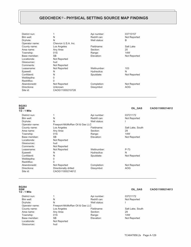
TC4647858.2s Page A-129
hudGissourcec:Not ReportedLocationde:
Not ReportedElevation:SBBase meridian:14WRange:01STownship:29Section:Any AreaArea name:Salt Lake, SouthFieldname:Los AngelesCounty name:
Freeport-McMoRan Oil & Gas LLCOperator name:IWell status:NDryhole:Not ReportedRedrill can:NBlm well:03721172Api number:1District nun:
BG264SSW1/2 - 1 Mile
CAOG11000214613OIL_GAS
CAOG11000214612Site id:AOGGissymbol:Directionally drilledDirectiona:Not ReportedCompletion:Not ReportedAbandonedd:
0Redrillfoo:0Welldeptha:
Not ReportedSpuddate:NConfidenti:NHydraulica:NEpawell:P-73Wellnumber:Not ReportedLeasename:
Not ReportedComments:hudGissourcec:Not ReportedLocationde:
Not ReportedElevation:SBBase meridian:14WRange:01STownship:29Section:Any AreaArea name:Salt Lake, SouthFieldname:Los AngelesCounty name:
Freeport-McMoRan Oil & Gas LLCOperator name:IWell status:NDryhole:Not ReportedRedrill can:NBlm well:03721172Api number:1District nun:
BG263SSW1/2 - 1 Mile
CAOG11000214612OIL_GAS
CAOG11000210728Site id:AOGGissymbol:UnknownDirectiona:Not ReportedCompletion:Not ReportedAbandonedd:
0Redrillfoo:0Welldeptha:
Not ReportedSpuddate:NConfidenti:NHydraulica:NEpawell:103Wellnumber:Not ReportedLeasename:
Not ReportedComments:hudGissourcec:Not ReportedLocationde:
Not ReportedElevation:SBBase meridian:14WRange:01STownship:20Section:Any AreaArea name:Salt LakeFieldname:Los AngelesCounty name:
Chevron U.S.A. Inc.Operator name:BWell status:NDryhole:Not ReportedRedrill can:NBlm well:03715157Api number:1District nun:
®GEOCHECK - PHYSICAL SETTING SOURCE MAP FINDINGS®

TC4647858.2s Page A-130
CAOG11000214609Site id:AOGGissymbol:Directionally drilledDirectiona:Not ReportedCompletion:Not ReportedAbandonedd:
0Redrillfoo:5781Welldeptha:
Not ReportedSpuddate:NConfidenti:NHydraulica:NEpawell:P-72Wellnumber:Not ReportedLeasename:
Not ReportedComments:hudGissourcec:Not ReportedLocationde:
Not ReportedElevation:SBBase meridian:14WRange:01STownship:29Section:Any AreaArea name:Salt Lake, SouthFieldname:Los AngelesCounty name:
Freeport-McMoRan Oil & Gas LLCOperator name:IWell status:NDryhole:Not ReportedRedrill can:NBlm well:03721167Api number:1District nun:
BG266SSW1/2 - 1 Mile
CAOG11000214609OIL_GAS
CAOG11000214635Site id:AOGGissymbol:Directionally drilledDirectiona:Not ReportedCompletion:Not ReportedAbandonedd:
0Redrillfoo:1275Welldeptha:
Not ReportedSpuddate:NConfidenti:NHydraulica:NEpawell:P-75BWellnumber:Not ReportedLeasename:
Not ReportedComments:hudGissourcec:Not ReportedLocationde:
Not ReportedElevation:SBBase meridian:14WRange:01STownship:29Section:Any AreaArea name:Salt Lake, SouthFieldname:Los AngelesCounty name:
Freeport-McMoRan Oil & Gas LLCOperator name:AWell status:NDryhole:Not ReportedRedrill can:NBlm well:03721192Api number:1District nun:
BG265SSW1/2 - 1 Mile
CAOG11000214635OIL_GAS
CAOG11000214613Site id:AOGGissymbol:Directionally drilledDirectiona:Not ReportedCompletion:Not ReportedAbandonedd:
0Redrillfoo:0Welldeptha:
Not ReportedSpuddate:NConfidenti:NHydraulica:NEpawell:P-73Wellnumber:Not ReportedLeasename:
Not ReportedComments:
®GEOCHECK - PHYSICAL SETTING SOURCE MAP FINDINGS®

TC4647858.2s Page A-131
BC269NNE1/2 - 1 Mile
CAOG11000210675OIL_GAS
CAOG11000214594Site id:AOGGissymbol:Directionally drilledDirectiona:Not ReportedCompletion:Not ReportedAbandonedd:
0Redrillfoo:0Welldeptha:
Not ReportedSpuddate:NConfidenti:NHydraulica:NEpawell:P-71Wellnumber:Not ReportedLeasename:
Not ReportedComments:hudGissourcec:Not ReportedLocationde:
Not ReportedElevation:SBBase meridian:14WRange:01STownship:29Section:Any AreaArea name:Salt Lake, SouthFieldname:Los AngelesCounty name:
Freeport-McMoRan Oil & Gas LLCOperator name:AWell status:NDryhole:Not ReportedRedrill can:NBlm well:03721144Api number:1District nun:
BG268SSW1/2 - 1 Mile
CAOG11000214594OIL_GAS
CAOG11000214647Site id:AOGGissymbol:Directionally drilledDirectiona:Not ReportedCompletion:Not ReportedAbandonedd:
0Redrillfoo:0Welldeptha:
Not ReportedSpuddate:NConfidenti:NHydraulica:NEpawell:P-74Wellnumber:Not ReportedLeasename:
Not ReportedComments:hudGissourcec:Not ReportedLocationde:
Not ReportedElevation:SBBase meridian:14WRange:01STownship:29Section:Any AreaArea name:Salt Lake, SouthFieldname:Los AngelesCounty name:
Freeport-McMoRan Oil & Gas LLCOperator name:AWell status:NDryhole:Not ReportedRedrill can:NBlm well:03721210Api number:1District nun:
BG267SSW1/2 - 1 Mile
CAOG11000214647OIL_GAS
Map IDDirectionDistance EDR ID NumberDatabase
®GEOCHECK - PHYSICAL SETTING SOURCE MAP FINDINGS®

TC4647858.2s Page A-132
hudGissourcec:Not ReportedLocationde:
Not ReportedElevation:SBBase meridian:14WRange:01STownship:29Section:Any AreaArea name:Salt Lake, SouthFieldname:Los AngelesCounty name:
Freeport-McMoRan Oil & Gas LLCOperator name:IWell status:NDryhole:Not ReportedRedrill can:NBlm well:03721161Api number:1District nun:
BG272SSW1/2 - 1 Mile
CAOG11000214606OIL_GAS
CAOG11000214579Site id:AOGGissymbol:Directionally drilledDirectiona:Not ReportedCompletion:Not ReportedAbandonedd:
0Redrillfoo:0Welldeptha:
Not ReportedSpuddate:NConfidenti:NHydraulica:NEpawell:P-66Wellnumber:Not ReportedLeasename:
Not ReportedComments:hudGissourcec:Not ReportedLocationde:
Not ReportedElevation:SBBase meridian:14WRange:01STownship:29Section:Any AreaArea name:Salt Lake, SouthFieldname:Los AngelesCounty name:
Freeport-McMoRan Oil & Gas LLCOperator name:AWell status:NDryhole:Not ReportedRedrill can:NBlm well:03721125Api number:1District nun:
BG270SSW1/2 - 1 Mile
CAOG11000214579OIL_GAS
CAOG11000210675Site id:POGGissymbol:UnknownDirectiona:Not ReportedCompletion:Not ReportedAbandonedd:
0Redrillfoo:0Welldeptha:
Not ReportedSpuddate:NConfidenti:NHydraulica:NEpawell:37Wellnumber:Not ReportedLeasename:
Not ReportedComments:hudGissourcec:Not ReportedLocationde:
Not ReportedElevation:SBBase meridian:14WRange:01STownship:16Section:Any AreaArea name:Salt LakeFieldname:Los AngelesCounty name:
Rancho La Brea Oil co.Operator name:PWell status:NDryhole:Not ReportedRedrill can:NBlm well:03715095Api number:1District nun:
®GEOCHECK - PHYSICAL SETTING SOURCE MAP FINDINGS®

TC4647858.2s Page A-133
CAOG11000214586Site id:AOGGissymbol:Directionally drilledDirectiona:Not ReportedCompletion:Not ReportedAbandonedd:
0Redrillfoo:0Welldeptha:
Not ReportedSpuddate:NConfidenti:NHydraulica:NEpawell:P-68Wellnumber:Not ReportedLeasename:
Not ReportedComments:hudGissourcec:Not ReportedLocationde:
Not ReportedElevation:SBBase meridian:14WRange:01STownship:29Section:Any AreaArea name:Salt Lake, SouthFieldname:Los AngelesCounty name:
Freeport-McMoRan Oil & Gas LLCOperator name:AWell status:NDryhole:Not ReportedRedrill can:NBlm well:03721135Api number:1District nun:
BG273SSW1/2 - 1 Mile
CAOG11000214586OIL_GAS
CAOG11000214605Site id:AOGGissymbol:UnknownDirectiona:Not ReportedCompletion:Not ReportedAbandonedd:
0Redrillfoo:4099Welldeptha:
Not ReportedSpuddate:NConfidenti:NHydraulica:NEpawell:P-70Wellnumber:Not ReportedLeasename:
Not ReportedComments:hudGissourcec:Not ReportedLocationde:
Not ReportedElevation:SBBase meridian:14WRange:01STownship:29Section:Any AreaArea name:Salt Lake, SouthFieldname:Los AngelesCounty name:
Freeport-McMoRan Oil & Gas LLCOperator name:IWell status:NDryhole:Not ReportedRedrill can:NBlm well:03721161Api number:1District nun:
BG271SSW1/2 - 1 Mile
CAOG11000214605OIL_GAS
CAOG11000214606Site id:AOGGissymbol:UnknownDirectiona:Not ReportedCompletion:Not ReportedAbandonedd:
0Redrillfoo:4099Welldeptha:
Not ReportedSpuddate:NConfidenti:NHydraulica:NEpawell:P-70Wellnumber:Not ReportedLeasename:
Not ReportedComments:
®GEOCHECK - PHYSICAL SETTING SOURCE MAP FINDINGS®

TC4647858.2s Page A-134
BG276SSW1/2 - 1 Mile
CAOG11000214574OIL_GAS
CAOG11000214585Site id:AOGGissymbol:Directionally drilledDirectiona:Not ReportedCompletion:Not ReportedAbandonedd:
0Redrillfoo:0Welldeptha:
Not ReportedSpuddate:NConfidenti:NHydraulica:NEpawell:P-67Wellnumber:Not ReportedLeasename:
Not ReportedComments:hudGissourcec:Not ReportedLocationde:
Not ReportedElevation:SBBase meridian:14WRange:01STownship:29Section:Any AreaArea name:Salt Lake, SouthFieldname:Los AngelesCounty name:
Freeport-McMoRan Oil & Gas LLCOperator name:AWell status:NDryhole:Not ReportedRedrill can:NBlm well:03721132Api number:1District nun:
BG275SSW1/2 - 1 Mile
CAOG11000214585OIL_GAS
CAOG11000214551Site id:AOGGissymbol:Directionally drilledDirectiona:Not ReportedCompletion:Not ReportedAbandonedd:
0Redrillfoo:0Welldeptha:
Not ReportedSpuddate:NConfidenti:NHydraulica:NEpawell:P-65Wellnumber:Not ReportedLeasename:
Not ReportedComments:hudGissourcec:Not ReportedLocationde:
Not ReportedElevation:SBBase meridian:14WRange:01STownship:29Section:Any AreaArea name:Salt Lake, SouthFieldname:Los AngelesCounty name:
Freeport-McMoRan Oil & Gas LLCOperator name:AWell status:NDryhole:Not ReportedRedrill can:NBlm well:03721056Api number:1District nun:
BG274SSW1/2 - 1 Mile
CAOG11000214551OIL_GAS
Map IDDirectionDistance EDR ID NumberDatabase
®GEOCHECK - PHYSICAL SETTING SOURCE MAP FINDINGS®

TC4647858.2s Page A-135
hudGissourcec:Not ReportedLocationde:
Not ReportedElevation:SBBase meridian:14WRange:01STownship:29Section:Any AreaArea name:Salt Lake, SouthFieldname:Los AngelesCounty name:
Freeport-McMoRan Oil & Gas LLCOperator name:AWell status:NDryhole:Not ReportedRedrill can:NBlm well:03721097Api number:1District nun:
BG277SSW1/2 - 1 Mile
CAOG11000214566OIL_GAS
CAOG11000214567Site id:AOGGissymbol:Directionally drilledDirectiona:Not ReportedCompletion:Not ReportedAbandonedd:
0Redrillfoo:0Welldeptha:
Not ReportedSpuddate:NConfidenti:NHydraulica:NEpawell:P-69Wellnumber:Not ReportedLeasename:
Not ReportedComments:hudGissourcec:Not ReportedLocationde:
Not ReportedElevation:SBBase meridian:14WRange:01STownship:29Section:Any AreaArea name:Salt Lake, SouthFieldname:Los AngelesCounty name:
Freeport-McMoRan Oil & Gas LLCOperator name:AWell status:NDryhole:Not ReportedRedrill can:NBlm well:03721097Api number:1District nun:
BG278SSW1/2 - 1 Mile
CAOG11000214567OIL_GAS
CAOG11000214574Site id:AOGGissymbol:Directionally drilledDirectiona:Not ReportedCompletion:Not ReportedAbandonedd:
0Redrillfoo:0Welldeptha:
Not ReportedSpuddate:NConfidenti:NHydraulica:NEpawell:P-64Wellnumber:Not ReportedLeasename:
Not ReportedComments:hudGissourcec:Not ReportedLocationde:
Not ReportedElevation:SBBase meridian:14WRange:01STownship:29Section:Any AreaArea name:Salt Lake, SouthFieldname:Los AngelesCounty name:
Freeport-McMoRan Oil & Gas LLCOperator name:AWell status:NDryhole:Not ReportedRedrill can:NBlm well:03721117Api number:1District nun:
®GEOCHECK - PHYSICAL SETTING SOURCE MAP FINDINGS®

TC4647858.2s Page A-136
CAOG11000210645Site id:POGGissymbol:UnknownDirectiona:Not ReportedCompletion:Not ReportedAbandonedd:
0Redrillfoo:0Welldeptha:
Not ReportedSpuddate:NConfidenti:NHydraulica:NEpawell:7Wellnumber:Not ReportedLeasename:
Not ReportedComments:hudGissourcec:Not ReportedLocationde:
Not ReportedElevation:SBBase meridian:14WRange:01STownship:21Section:Any AreaArea name:Salt LakeFieldname:Los AngelesCounty name:
Rancho La Brea Oil co.Operator name:PWell status:NDryhole:Not ReportedRedrill can:NBlm well:03715065Api number:1District nun:
BI280NE1/2 - 1 Mile
CAOG11000210645OIL_GAS
CAOG11000214524Site id:AOGGissymbol:Directionally drilledDirectiona:Not ReportedCompletion:Not ReportedAbandonedd:
0Redrillfoo:0Welldeptha:
Not ReportedSpuddate:NConfidenti:NHydraulica:NEpawell:P-60Wellnumber:Not ReportedLeasename:
Not ReportedComments:hudGissourcec:Not ReportedLocationde:
Not ReportedElevation:SBBase meridian:14WRange:01STownship:29Section:Any AreaArea name:Salt Lake, SouthFieldname:Los AngelesCounty name:
Freeport-McMoRan Oil & Gas LLCOperator name:IWell status:NDryhole:Not ReportedRedrill can:NBlm well:03721000Api number:1District nun:
BG279SSW1/2 - 1 Mile
CAOG11000214524OIL_GAS
CAOG11000214566Site id:AOGGissymbol:Directionally drilledDirectiona:Not ReportedCompletion:Not ReportedAbandonedd:
0Redrillfoo:0Welldeptha:
Not ReportedSpuddate:NConfidenti:NHydraulica:NEpawell:P-69Wellnumber:Not ReportedLeasename:
Not ReportedComments:
®GEOCHECK - PHYSICAL SETTING SOURCE MAP FINDINGS®

TC4647858.2s Page A-137
BG284SSW1/2 - 1 Mile
CAOG11000214513OIL_GAS
CAOG11000214000Site id:AWFGissymbol:Directionally drilledDirectiona:Not ReportedCompletion:Not ReportedAbandonedd:
0Redrillfoo:0Welldeptha:
Not ReportedSpuddate:NConfidenti:NHydraulica:NEpawell:P-6Wellnumber:Not ReportedLeasename:
Not ReportedComments:hudGissourcec:Not ReportedLocationde:
Not ReportedElevation:SBBase meridian:14WRange:01STownship:29Section:EastArea name:Beverly HillsFieldname:Los AngelesCounty name:
Freeport-McMoRan Oil & Gas LLCOperator name:AWell status:NDryhole:Not ReportedRedrill can:NBlm well:03720104Api number:1District nun:
BG282SSW1/2 - 1 Mile
CAOG11000214000OIL_GAS
CAOG11000213999Site id:AWFGissymbol:Directionally drilledDirectiona:Not ReportedCompletion:Not ReportedAbandonedd:
0Redrillfoo:0Welldeptha:
Not ReportedSpuddate:NConfidenti:NHydraulica:NEpawell:P-6Wellnumber:Not ReportedLeasename:
Not ReportedComments:hudGissourcec:Not ReportedLocationde:
Not ReportedElevation:SBBase meridian:14WRange:01STownship:29Section:EastArea name:Beverly HillsFieldname:Los AngelesCounty name:
Freeport-McMoRan Oil & Gas LLCOperator name:AWell status:NDryhole:Not ReportedRedrill can:NBlm well:03720104Api number:1District nun:
BG281SSW1/2 - 1 Mile
CAOG11000213999OIL_GAS
Map IDDirectionDistance EDR ID NumberDatabase
®GEOCHECK - PHYSICAL SETTING SOURCE MAP FINDINGS®

TC4647858.2s Page A-138
hudGissourcec:Not ReportedLocationde:
Not ReportedElevation:SBBase meridian:14WRange:01STownship:29Section:EastArea name:Beverly HillsFieldname:Los AngelesCounty name:
Freeport-McMoRan Oil & Gas LLCOperator name:AWell status:NDryhole:Not ReportedRedrill can:NBlm well:03720044Api number:1District nun:
BG285SSW1/2 - 1 Mile
CAOG11000213971OIL_GAS
CAOG11000214512Site id:PWFGissymbol:Directionally drilledDirectiona:Not ReportedCompletion:Not ReportedAbandonedd:
0Redrillfoo:0Welldeptha:
Not ReportedSpuddate:NConfidenti:NHydraulica:NEpawell:P-61Wellnumber:Not ReportedLeasename:
Not ReportedComments:hudGissourcec:Not ReportedLocationde:
Not ReportedElevation:SBBase meridian:14WRange:01STownship:29Section:EastArea name:Beverly HillsFieldname:Los AngelesCounty name:
Freeport-McMoRan Oil & Gas LLCOperator name:PWell status:NDryhole:Not ReportedRedrill can:NBlm well:03720983Api number:1District nun:
BG283SSW1/2 - 1 Mile
CAOG11000214512OIL_GAS
CAOG11000214513Site id:PWFGissymbol:Directionally drilledDirectiona:Not ReportedCompletion:Not ReportedAbandonedd:
0Redrillfoo:0Welldeptha:
Not ReportedSpuddate:NConfidenti:NHydraulica:NEpawell:P-61Wellnumber:Not ReportedLeasename:
Not ReportedComments:hudGissourcec:Not ReportedLocationde:
Not ReportedElevation:SBBase meridian:14WRange:01STownship:29Section:EastArea name:Beverly HillsFieldname:Los AngelesCounty name:
Freeport-McMoRan Oil & Gas LLCOperator name:PWell status:NDryhole:Not ReportedRedrill can:NBlm well:03720983Api number:1District nun:
®GEOCHECK - PHYSICAL SETTING SOURCE MAP FINDINGS®

TC4647858.2s Page A-139
CAOG11000214504Site id:AWFGissymbol:UnknownDirectiona:Not ReportedCompletion:Not ReportedAbandonedd:
0Redrillfoo:7545Welldeptha:
Not ReportedSpuddate:NConfidenti:NHydraulica:NEpawell:P-62Wellnumber:Not ReportedLeasename:
Not ReportedComments:hudGissourcec:Not ReportedLocationde:
Not ReportedElevation:SBBase meridian:14WRange:01STownship:29Section:EastArea name:Beverly HillsFieldname:Los AngelesCounty name:
Freeport-McMoRan Oil & Gas LLCOperator name:AWell status:NDryhole:Not ReportedRedrill can:NBlm well:03720972Api number:1District nun:
BG287SSW1/2 - 1 Mile
CAOG11000214504OIL_GAS
CAOG11000213972Site id:AOGGissymbol:Directionally drilledDirectiona:Not ReportedCompletion:Not ReportedAbandonedd:
0Redrillfoo:0Welldeptha:
Not ReportedSpuddate:NConfidenti:NHydraulica:NEpawell:P-7Wellnumber:Not ReportedLeasename:
Not ReportedComments:hudGissourcec:Not ReportedLocationde:
Not ReportedElevation:SBBase meridian:14WRange:01STownship:29Section:EastArea name:Beverly HillsFieldname:Los AngelesCounty name:
Freeport-McMoRan Oil & Gas LLCOperator name:AWell status:NDryhole:Not ReportedRedrill can:NBlm well:03720044Api number:1District nun:
BG286SSW1/2 - 1 Mile
CAOG11000213972OIL_GAS
CAOG11000213971Site id:AOGGissymbol:Directionally drilledDirectiona:Not ReportedCompletion:Not ReportedAbandonedd:
0Redrillfoo:0Welldeptha:
Not ReportedSpuddate:NConfidenti:NHydraulica:NEpawell:P-7Wellnumber:Not ReportedLeasename:
Not ReportedComments:
®GEOCHECK - PHYSICAL SETTING SOURCE MAP FINDINGS®

TC4647858.2s Page A-140
BG290SSW1/2 - 1 Mile
CAOG11000214530OIL_GAS
CAOG11000213994Site id:AOGGissymbol:Directionally drilledDirectiona:Not ReportedCompletion:Not ReportedAbandonedd:
0Redrillfoo:0Welldeptha:
Not ReportedSpuddate:NConfidenti:NHydraulica:NEpawell:P-8Wellnumber:Not ReportedLeasename:
Not ReportedComments:hudGissourcec:Not ReportedLocationde:
Not ReportedElevation:SBBase meridian:14WRange:01STownship:29Section:EastArea name:Beverly HillsFieldname:Los AngelesCounty name:
Freeport-McMoRan Oil & Gas LLCOperator name:IWell status:NDryhole:Not ReportedRedrill can:NBlm well:03720100Api number:1District nun:
BG289SSW1/2 - 1 Mile
CAOG11000213994OIL_GAS
CAOG11000213995Site id:AOGGissymbol:Directionally drilledDirectiona:Not ReportedCompletion:Not ReportedAbandonedd:
0Redrillfoo:0Welldeptha:
Not ReportedSpuddate:NConfidenti:NHydraulica:NEpawell:P-8Wellnumber:Not ReportedLeasename:
Not ReportedComments:hudGissourcec:Not ReportedLocationde:
Not ReportedElevation:SBBase meridian:14WRange:01STownship:29Section:EastArea name:Beverly HillsFieldname:Los AngelesCounty name:
Freeport-McMoRan Oil & Gas LLCOperator name:IWell status:NDryhole:Not ReportedRedrill can:NBlm well:03720100Api number:1District nun:
BG288SSW1/2 - 1 Mile
CAOG11000213995OIL_GAS
Map IDDirectionDistance EDR ID NumberDatabase
®GEOCHECK - PHYSICAL SETTING SOURCE MAP FINDINGS®

TC4647858.2s Page A-141
hudGissourcec:Not ReportedLocationde:
Not ReportedElevation:SBBase meridian:14WRange:01STownship:29Section:EastArea name:Beverly HillsFieldname:Los AngelesCounty name:
Freeport-McMoRan Oil & Gas LLCOperator name:IWell status:NDryhole:Not ReportedRedrill can:NBlm well:03721425Api number:1District nun:
BG292SSW1/2 - 1 Mile
CAOG11000214670OIL_GAS
CAOG11000214671Site id:AWFGissymbol:Directionally drilledDirectiona:Not ReportedCompletion:Not ReportedAbandonedd:
0Redrillfoo:0Welldeptha:
Not ReportedSpuddate:NConfidenti:NHydraulica:NEpawell:P-84Wellnumber:Not ReportedLeasename:
Not ReportedComments:hudGissourcec:Not ReportedLocationde:
Not ReportedElevation:SBBase meridian:14WRange:01STownship:29Section:EastArea name:Beverly HillsFieldname:Los AngelesCounty name:
Freeport-McMoRan Oil & Gas LLCOperator name:IWell status:NDryhole:Not ReportedRedrill can:NBlm well:03721425Api number:1District nun:
BG291SSW1/2 - 1 Mile
CAOG11000214671OIL_GAS
CAOG11000214530Site id:AWFGissymbol:Directionally drilledDirectiona:Not ReportedCompletion:Not ReportedAbandonedd:
0Redrillfoo:0Welldeptha:
Not ReportedSpuddate:NConfidenti:NHydraulica:NEpawell:P-63Wellnumber:Not ReportedLeasename:
Not ReportedComments:hudGissourcec:Not ReportedLocationde:
Not ReportedElevation:SBBase meridian:14WRange:01STownship:29Section:EastArea name:Beverly HillsFieldname:Los AngelesCounty name:
Freeport-McMoRan Oil & Gas LLCOperator name:AWell status:NDryhole:Not ReportedRedrill can:NBlm well:03721009Api number:1District nun:
®GEOCHECK - PHYSICAL SETTING SOURCE MAP FINDINGS®

TC4647858.2s Page A-142
CAOG11000215126Site id:AOGGissymbol:Directionally drilledDirectiona:Not ReportedCompletion:Not ReportedAbandonedd:
0Redrillfoo:0Welldeptha:
Not ReportedSpuddate:NConfidenti:NHydraulica:NEpawell:P-88Wellnumber:Not ReportedLeasename:
Not ReportedComments:hudGissourcec:Not ReportedLocationde:
Not ReportedElevation:SBBase meridian:14WRange:01STownship:29Section:EastArea name:Beverly HillsFieldname:Los AngelesCounty name:
Freeport-McMoRan Oil & Gas LLCOperator name:IWell status:NDryhole:Not ReportedRedrill can:NBlm well:03723490Api number:1District nun:
BG295SSW1/2 - 1 Mile
CAOG11000215126OIL_GAS
CAOG11000215124Site id:AOGGissymbol:Directionally drilledDirectiona:Not ReportedCompletion:Not ReportedAbandonedd:
0Redrillfoo:0Welldeptha:
Not ReportedSpuddate:NConfidenti:NHydraulica:NEpawell:P-88Wellnumber:Not ReportedLeasename:
Not ReportedComments:hudGissourcec:Not ReportedLocationde:
Not ReportedElevation:SBBase meridian:14WRange:01STownship:29Section:EastArea name:Beverly HillsFieldname:Los AngelesCounty name:
Freeport-McMoRan Oil & Gas LLCOperator name:IWell status:NDryhole:Not ReportedRedrill can:NBlm well:03723490Api number:1District nun:
BG293SSW1/2 - 1 Mile
CAOG11000215124OIL_GAS
CAOG11000214670Site id:AWFGissymbol:Directionally drilledDirectiona:Not ReportedCompletion:Not ReportedAbandonedd:
0Redrillfoo:0Welldeptha:
Not ReportedSpuddate:NConfidenti:NHydraulica:NEpawell:P-84Wellnumber:Not ReportedLeasename:
Not ReportedComments:
®GEOCHECK - PHYSICAL SETTING SOURCE MAP FINDINGS®

TC4647858.2s Page A-143
BG297SSW1/2 - 1 Mile
CAOG11000214177OIL_GAS
CAOG11000214176Site id:AOGGissymbol:Directionally drilledDirectiona:Not ReportedCompletion:Not ReportedAbandonedd:
0Redrillfoo:0Welldeptha:
Not ReportedSpuddate:NConfidenti:NHydraulica:NEpawell:P-9Wellnumber:Not ReportedLeasename:
Not ReportedComments:hudGissourcec:Not ReportedLocationde:
Not ReportedElevation:SBBase meridian:14WRange:01STownship:29Section:EastArea name:Beverly HillsFieldname:Los AngelesCounty name:
Freeport-McMoRan Oil & Gas LLCOperator name:AWell status:NDryhole:Not ReportedRedrill can:NBlm well:03720672Api number:1District nun:
BG296SSW1/2 - 1 Mile
CAOG11000214176OIL_GAS
CAOG11000215125Site id:AOGGissymbol:Directionally drilledDirectiona:Not ReportedCompletion:Not ReportedAbandonedd:
0Redrillfoo:0Welldeptha:
Not ReportedSpuddate:NConfidenti:NHydraulica:NEpawell:P-88Wellnumber:Not ReportedLeasename:
Not ReportedComments:hudGissourcec:Not ReportedLocationde:
Not ReportedElevation:SBBase meridian:14WRange:01STownship:29Section:EastArea name:Beverly HillsFieldname:Los AngelesCounty name:
Freeport-McMoRan Oil & Gas LLCOperator name:IWell status:NDryhole:Not ReportedRedrill can:NBlm well:03723490Api number:1District nun:
BG294SSW1/2 - 1 Mile
CAOG11000215125OIL_GAS
Map IDDirectionDistance EDR ID NumberDatabase
®GEOCHECK - PHYSICAL SETTING SOURCE MAP FINDINGS®

TC4647858.2s Page A-144
hudGissourcec:Not ReportedLocationde:
Not ReportedElevation:SBBase meridian:14WRange:01STownship:21Section:Any AreaArea name:Salt LakeFieldname:Los AngelesCounty name:
Rancho La Brea Oil co.Operator name:PWell status:NDryhole:Not ReportedRedrill can:NBlm well:03715098Api number:1District nun:
BD299NE1/2 - 1 Mile
CAOG11000210678OIL_GAS
CAOG11000214178Site id:AOGGissymbol:Directionally drilledDirectiona:Not ReportedCompletion:Not ReportedAbandonedd:
0Redrillfoo:0Welldeptha:
Not ReportedSpuddate:NConfidenti:NHydraulica:NEpawell:P-9Wellnumber:Not ReportedLeasename:
Not ReportedComments:hudGissourcec:Not ReportedLocationde:
Not ReportedElevation:SBBase meridian:14WRange:01STownship:29Section:EastArea name:Beverly HillsFieldname:Los AngelesCounty name:
Freeport-McMoRan Oil & Gas LLCOperator name:AWell status:NDryhole:Not ReportedRedrill can:NBlm well:03720672Api number:1District nun:
BG298SSW1/2 - 1 Mile
CAOG11000214178OIL_GAS
CAOG11000214177Site id:AOGGissymbol:Directionally drilledDirectiona:Not ReportedCompletion:Not ReportedAbandonedd:
0Redrillfoo:0Welldeptha:
Not ReportedSpuddate:NConfidenti:NHydraulica:NEpawell:P-9Wellnumber:Not ReportedLeasename:
Not ReportedComments:hudGissourcec:Not ReportedLocationde:
Not ReportedElevation:SBBase meridian:14WRange:01STownship:29Section:EastArea name:Beverly HillsFieldname:Los AngelesCounty name:
Freeport-McMoRan Oil & Gas LLCOperator name:AWell status:NDryhole:Not ReportedRedrill can:NBlm well:03720672Api number:1District nun:
®GEOCHECK - PHYSICAL SETTING SOURCE MAP FINDINGS®

TC4647858.2s Page A-145
CAOG11000214039Site id:AOGGissymbol:Directionally drilledDirectiona:Not ReportedCompletion:Not ReportedAbandonedd:
0Redrillfoo:8450Welldeptha:
Not ReportedSpuddate:NConfidenti:NHydraulica:NEpawell:P-19Wellnumber:Not ReportedLeasename:
Not ReportedComments:hudGissourcec:Not ReportedLocationde:
Not ReportedElevation:SBBase meridian:14WRange:01STownship:29Section:EastArea name:Beverly HillsFieldname:Los AngelesCounty name:
Freeport-McMoRan Oil & Gas LLCOperator name:AWell status:NDryhole:Not ReportedRedrill can:NBlm well:03720293Api number:1District nun:
BG300SSW1/2 - 1 Mile
CAOG11000214039OIL_GAS
CAOG11000214040Site id:AOGGissymbol:Directionally drilledDirectiona:Not ReportedCompletion:Not ReportedAbandonedd:
0Redrillfoo:8450Welldeptha:
Not ReportedSpuddate:NConfidenti:NHydraulica:NEpawell:P-19Wellnumber:Not ReportedLeasename:
Not ReportedComments:hudGissourcec:Not ReportedLocationde:
Not ReportedElevation:SBBase meridian:14WRange:01STownship:29Section:EastArea name:Beverly HillsFieldname:Los AngelesCounty name:
Freeport-McMoRan Oil & Gas LLCOperator name:AWell status:NDryhole:Not ReportedRedrill can:NBlm well:03720293Api number:1District nun:
BG301SSW1/2 - 1 Mile
CAOG11000214040OIL_GAS
CAOG11000210678Site id:POGGissymbol:UnknownDirectiona:Not ReportedCompletion:Not ReportedAbandonedd:
0Redrillfoo:0Welldeptha:
Not ReportedSpuddate:NConfidenti:NHydraulica:NEpawell:40Wellnumber:Not ReportedLeasename:
Not ReportedComments:
®GEOCHECK - PHYSICAL SETTING SOURCE MAP FINDINGS®

TC4647858.2s Page A-146
BG304SSW1/2 - 1 Mile
CAOG11000214034OIL_GAS
CAOG11000214037Site id:AWFGissymbol:Directionally drilledDirectiona:Not ReportedCompletion:Not ReportedAbandonedd:
0Redrillfoo:0Welldeptha:
Not ReportedSpuddate:NConfidenti:NHydraulica:NEpawell:P-18Wellnumber:Not ReportedLeasename:
Not ReportedComments:hudGissourcec:Not ReportedLocationde:
Not ReportedElevation:SBBase meridian:14WRange:01STownship:29Section:EastArea name:Beverly HillsFieldname:Los AngelesCounty name:
Freeport-McMoRan Oil & Gas LLCOperator name:AWell status:NDryhole:Not ReportedRedrill can:NBlm well:03720292Api number:1District nun:
BG302SSW1/2 - 1 Mile
CAOG11000214037OIL_GAS
CAOG11000214038Site id:AWFGissymbol:Directionally drilledDirectiona:Not ReportedCompletion:Not ReportedAbandonedd:
0Redrillfoo:0Welldeptha:
Not ReportedSpuddate:NConfidenti:NHydraulica:NEpawell:P-18Wellnumber:Not ReportedLeasename:
Not ReportedComments:hudGissourcec:Not ReportedLocationde:
Not ReportedElevation:SBBase meridian:14WRange:01STownship:29Section:EastArea name:Beverly HillsFieldname:Los AngelesCounty name:
Freeport-McMoRan Oil & Gas LLCOperator name:AWell status:NDryhole:Not ReportedRedrill can:NBlm well:03720292Api number:1District nun:
BG303SSW1/2 - 1 Mile
CAOG11000214038OIL_GAS
Map IDDirectionDistance EDR ID NumberDatabase
®GEOCHECK - PHYSICAL SETTING SOURCE MAP FINDINGS®

TC4647858.2s Page A-147
hudGissourcec:Not ReportedLocationde:
Not ReportedElevation:SBBase meridian:14WRange:01STownship:29Section:EastArea name:Beverly HillsFieldname:Los AngelesCounty name:
Freeport-McMoRan Oil & Gas LLCOperator name:AWell status:NDryhole:Not ReportedRedrill can:NBlm well:03720234Api number:1District nun:
BG306SSW1/2 - 1 Mile
CAOG11000214031OIL_GAS
CAOG11000214035Site id:AOGGissymbol:Directionally drilledDirectiona:Not ReportedCompletion:Not ReportedAbandonedd:
0Redrillfoo:0Welldeptha:
Not ReportedSpuddate:NConfidenti:NHydraulica:NEpawell:P-17Wellnumber:Not ReportedLeasename:
Not ReportedComments:hudGissourcec:Not ReportedLocationde:
Not ReportedElevation:SBBase meridian:14WRange:01STownship:29Section:EastArea name:Beverly HillsFieldname:Los AngelesCounty name:
Freeport-McMoRan Oil & Gas LLCOperator name:AWell status:NDryhole:Not ReportedRedrill can:NBlm well:03720268Api number:1District nun:
BG305SSW1/2 - 1 Mile
CAOG11000214035OIL_GAS
CAOG11000214034Site id:AOGGissymbol:Directionally drilledDirectiona:Not ReportedCompletion:Not ReportedAbandonedd:
0Redrillfoo:0Welldeptha:
Not ReportedSpuddate:NConfidenti:NHydraulica:NEpawell:P-17Wellnumber:Not ReportedLeasename:
Not ReportedComments:hudGissourcec:Not ReportedLocationde:
Not ReportedElevation:SBBase meridian:14WRange:01STownship:29Section:EastArea name:Beverly HillsFieldname:Los AngelesCounty name:
Freeport-McMoRan Oil & Gas LLCOperator name:AWell status:NDryhole:Not ReportedRedrill can:NBlm well:03720268Api number:1District nun:
®GEOCHECK - PHYSICAL SETTING SOURCE MAP FINDINGS®

TC4647858.2s Page A-148
CAOG11000214030Site id:AOGGissymbol:Directionally drilledDirectiona:Not ReportedCompletion:Not ReportedAbandonedd:
0Redrillfoo:0Welldeptha:
Not ReportedSpuddate:NConfidenti:NHydraulica:NEpawell:P-16AWellnumber:Not ReportedLeasename:
Not ReportedComments:hudGissourcec:Not ReportedLocationde:
Not ReportedElevation:SBBase meridian:14WRange:01STownship:29Section:EastArea name:Beverly HillsFieldname:Los AngelesCounty name:
Freeport-McMoRan Oil & Gas LLCOperator name:AWell status:NDryhole:Not ReportedRedrill can:NBlm well:03720232Api number:1District nun:
BG309SSW1/2 - 1 Mile
CAOG11000214030OIL_GAS
CAOG11000214032Site id:AOGGissymbol:Directionally drilledDirectiona:Not ReportedCompletion:Not ReportedAbandonedd:
0Redrillfoo:0Welldeptha:
Not ReportedSpuddate:NConfidenti:NHydraulica:NEpawell:P-15Wellnumber:Not ReportedLeasename:
Not ReportedComments:hudGissourcec:Not ReportedLocationde:
Not ReportedElevation:SBBase meridian:14WRange:01STownship:29Section:EastArea name:Beverly HillsFieldname:Los AngelesCounty name:
Freeport-McMoRan Oil & Gas LLCOperator name:AWell status:NDryhole:Not ReportedRedrill can:NBlm well:03720234Api number:1District nun:
BG307SSW1/2 - 1 Mile
CAOG11000214032OIL_GAS
CAOG11000214031Site id:AOGGissymbol:Directionally drilledDirectiona:Not ReportedCompletion:Not ReportedAbandonedd:
0Redrillfoo:0Welldeptha:
Not ReportedSpuddate:NConfidenti:NHydraulica:NEpawell:P-15Wellnumber:Not ReportedLeasename:
Not ReportedComments:
®GEOCHECK - PHYSICAL SETTING SOURCE MAP FINDINGS®

TC4647858.2s Page A-149
BG310SSW1/2 - 1 Mile
CAOG11000214022OIL_GAS
CAOG11000214023Site id:AOGGissymbol:Directionally drilledDirectiona:Not ReportedCompletion:Not ReportedAbandonedd:
0Redrillfoo:0Welldeptha:
Not ReportedSpuddate:NConfidenti:NHydraulica:NEpawell:P-13Wellnumber:Not ReportedLeasename:
Not ReportedComments:hudGissourcec:Not ReportedLocationde:
Not ReportedElevation:SBBase meridian:14WRange:01STownship:29Section:EastArea name:Beverly HillsFieldname:Los AngelesCounty name:
Freeport-McMoRan Oil & Gas LLCOperator name:AWell status:NDryhole:Not ReportedRedrill can:NBlm well:03720196Api number:1District nun:
BG311SSW1/2 - 1 Mile
CAOG11000214023OIL_GAS
CAOG11000214029Site id:AOGGissymbol:Directionally drilledDirectiona:Not ReportedCompletion:Not ReportedAbandonedd:
0Redrillfoo:0Welldeptha:
Not ReportedSpuddate:NConfidenti:NHydraulica:NEpawell:P-16AWellnumber:Not ReportedLeasename:
Not ReportedComments:hudGissourcec:Not ReportedLocationde:
Not ReportedElevation:SBBase meridian:14WRange:01STownship:29Section:EastArea name:Beverly HillsFieldname:Los AngelesCounty name:
Freeport-McMoRan Oil & Gas LLCOperator name:AWell status:NDryhole:Not ReportedRedrill can:NBlm well:03720232Api number:1District nun:
BG308SSW1/2 - 1 Mile
CAOG11000214029OIL_GAS
Map IDDirectionDistance EDR ID NumberDatabase
®GEOCHECK - PHYSICAL SETTING SOURCE MAP FINDINGS®

TC4647858.2s Page A-150
hudGissourcec:Not ReportedLocationde:
Not ReportedElevation:SBBase meridian:14WRange:01STownship:29Section:EastArea name:Beverly HillsFieldname:Los AngelesCounty name:
Freeport-McMoRan Oil & Gas LLCOperator name:AWell status:NDryhole:Not ReportedRedrill can:NBlm well:03720323Api number:1District nun:
BG314SSW1/2 - 1 Mile
CAOG11000214048OIL_GAS
CAOG11000214072Site id:AWFGissymbol:Directionally drilledDirectiona:Not ReportedCompletion:Not ReportedAbandonedd:
0Redrillfoo:0Welldeptha:
Not ReportedSpuddate:NConfidenti:NHydraulica:NEpawell:P-12Wellnumber:Not ReportedLeasename:
Not ReportedComments:hudGissourcec:Not ReportedLocationde:
Not ReportedElevation:SBBase meridian:14WRange:01STownship:29Section:EastArea name:Beverly HillsFieldname:Los AngelesCounty name:
Freeport-McMoRan Oil & Gas LLCOperator name:IWell status:NDryhole:Not ReportedRedrill can:NBlm well:03720407Api number:1District nun:
BG312SSW1/2 - 1 Mile
CAOG11000214072OIL_GAS
CAOG11000214022Site id:AOGGissymbol:Directionally drilledDirectiona:Not ReportedCompletion:Not ReportedAbandonedd:
0Redrillfoo:0Welldeptha:
Not ReportedSpuddate:NConfidenti:NHydraulica:NEpawell:P-13Wellnumber:Not ReportedLeasename:
Not ReportedComments:hudGissourcec:Not ReportedLocationde:
Not ReportedElevation:SBBase meridian:14WRange:01STownship:29Section:EastArea name:Beverly HillsFieldname:Los AngelesCounty name:
Freeport-McMoRan Oil & Gas LLCOperator name:AWell status:NDryhole:Not ReportedRedrill can:NBlm well:03720196Api number:1District nun:
®GEOCHECK - PHYSICAL SETTING SOURCE MAP FINDINGS®

TC4647858.2s Page A-151
CAOG11000210572Site id:POGGissymbol:UnknownDirectiona:Not ReportedCompletion:Not ReportedAbandonedd:
0Redrillfoo:0Welldeptha:
Not ReportedSpuddate:NConfidenti:NHydraulica:NEpawell:1Wellnumber:Yavneh CoreholeLeasename:
Not ReportedComments:hudGissourcec:Not ReportedLocationde:
Not ReportedElevation:SBBase meridian:14WRange:01STownship:16Section:Any AreaArea name:Salt LakeFieldname:Los AngelesCounty name:
Chevron U.S.A. Inc.Operator name:PWell status:NDryhole:Not ReportedRedrill can:NBlm well:03714956Api number:1District nun:
BC315NNE1/2 - 1 Mile
CAOG11000210572OIL_GAS
CAOG11000214047Site id:AOGGissymbol:Directionally drilledDirectiona:Not ReportedCompletion:Not ReportedAbandonedd:
0Redrillfoo:0Welldeptha:
Not ReportedSpuddate:NConfidenti:NHydraulica:NEpawell:P-14Wellnumber:Not ReportedLeasename:
Not ReportedComments:hudGissourcec:Not ReportedLocationde:
Not ReportedElevation:SBBase meridian:14WRange:01STownship:29Section:EastArea name:Beverly HillsFieldname:Los AngelesCounty name:
Freeport-McMoRan Oil & Gas LLCOperator name:AWell status:NDryhole:Not ReportedRedrill can:NBlm well:03720323Api number:1District nun:
BG313SSW1/2 - 1 Mile
CAOG11000214047OIL_GAS
CAOG11000214048Site id:AOGGissymbol:Directionally drilledDirectiona:Not ReportedCompletion:Not ReportedAbandonedd:
0Redrillfoo:0Welldeptha:
Not ReportedSpuddate:NConfidenti:NHydraulica:NEpawell:P-14Wellnumber:Not ReportedLeasename:
Not ReportedComments:
®GEOCHECK - PHYSICAL SETTING SOURCE MAP FINDINGS®
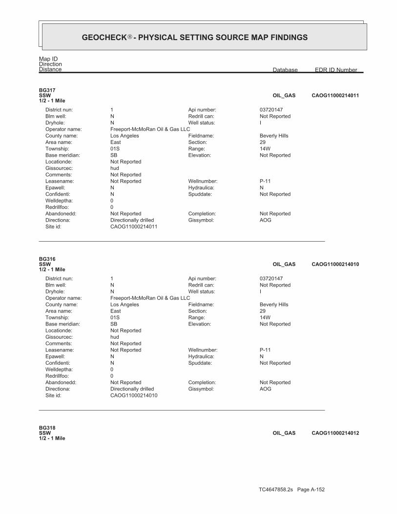
TC4647858.2s Page A-152
BG318SSW1/2 - 1 Mile
CAOG11000214012OIL_GAS
CAOG11000214010Site id:AOGGissymbol:Directionally drilledDirectiona:Not ReportedCompletion:Not ReportedAbandonedd:
0Redrillfoo:0Welldeptha:
Not ReportedSpuddate:NConfidenti:NHydraulica:NEpawell:P-11Wellnumber:Not ReportedLeasename:
Not ReportedComments:hudGissourcec:Not ReportedLocationde:
Not ReportedElevation:SBBase meridian:14WRange:01STownship:29Section:EastArea name:Beverly HillsFieldname:Los AngelesCounty name:
Freeport-McMoRan Oil & Gas LLCOperator name:IWell status:NDryhole:Not ReportedRedrill can:NBlm well:03720147Api number:1District nun:
BG316SSW1/2 - 1 Mile
CAOG11000214010OIL_GAS
CAOG11000214011Site id:AOGGissymbol:Directionally drilledDirectiona:Not ReportedCompletion:Not ReportedAbandonedd:
0Redrillfoo:0Welldeptha:
Not ReportedSpuddate:NConfidenti:NHydraulica:NEpawell:P-11Wellnumber:Not ReportedLeasename:
Not ReportedComments:hudGissourcec:Not ReportedLocationde:
Not ReportedElevation:SBBase meridian:14WRange:01STownship:29Section:EastArea name:Beverly HillsFieldname:Los AngelesCounty name:
Freeport-McMoRan Oil & Gas LLCOperator name:IWell status:NDryhole:Not ReportedRedrill can:NBlm well:03720147Api number:1District nun:
BG317SSW1/2 - 1 Mile
CAOG11000214011OIL_GAS
Map IDDirectionDistance EDR ID NumberDatabase
®GEOCHECK - PHYSICAL SETTING SOURCE MAP FINDINGS®
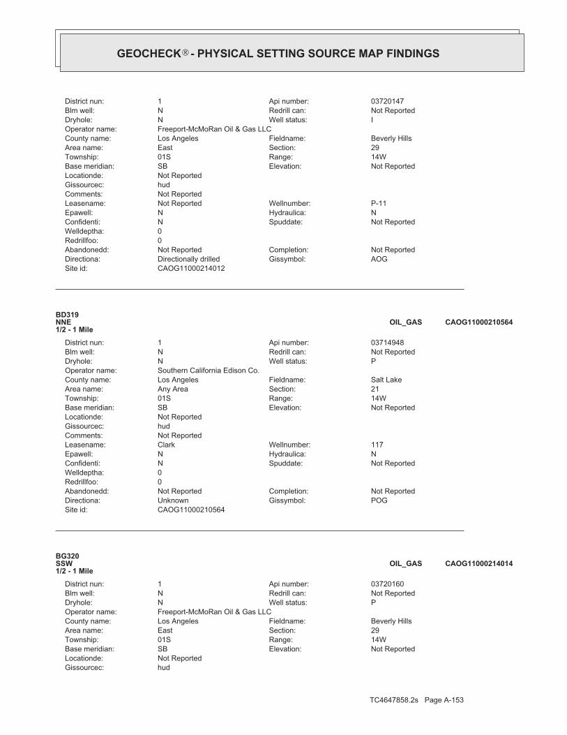
TC4647858.2s Page A-153
hudGissourcec:Not ReportedLocationde:
Not ReportedElevation:SBBase meridian:14WRange:01STownship:29Section:EastArea name:Beverly HillsFieldname:Los AngelesCounty name:
Freeport-McMoRan Oil & Gas LLCOperator name:PWell status:NDryhole:Not ReportedRedrill can:NBlm well:03720160Api number:1District nun:
BG320SSW1/2 - 1 Mile
CAOG11000214014OIL_GAS
CAOG11000210564Site id:POGGissymbol:UnknownDirectiona:Not ReportedCompletion:Not ReportedAbandonedd:
0Redrillfoo:0Welldeptha:
Not ReportedSpuddate:NConfidenti:NHydraulica:NEpawell:117Wellnumber:ClarkLeasename:
Not ReportedComments:hudGissourcec:Not ReportedLocationde:
Not ReportedElevation:SBBase meridian:14WRange:01STownship:21Section:Any AreaArea name:Salt LakeFieldname:Los AngelesCounty name:
Southern California Edison Co.Operator name:PWell status:NDryhole:Not ReportedRedrill can:NBlm well:03714948Api number:1District nun:
BD319NNE1/2 - 1 Mile
CAOG11000210564OIL_GAS
CAOG11000214012Site id:AOGGissymbol:Directionally drilledDirectiona:Not ReportedCompletion:Not ReportedAbandonedd:
0Redrillfoo:0Welldeptha:
Not ReportedSpuddate:NConfidenti:NHydraulica:NEpawell:P-11Wellnumber:Not ReportedLeasename:
Not ReportedComments:hudGissourcec:Not ReportedLocationde:
Not ReportedElevation:SBBase meridian:14WRange:01STownship:29Section:EastArea name:Beverly HillsFieldname:Los AngelesCounty name:
Freeport-McMoRan Oil & Gas LLCOperator name:IWell status:NDryhole:Not ReportedRedrill can:NBlm well:03720147Api number:1District nun:
®GEOCHECK - PHYSICAL SETTING SOURCE MAP FINDINGS®

TC4647858.2s Page A-154
CAOG11000214077Site id:AOGGissymbol:Directionally drilledDirectiona:Not ReportedCompletion:Not ReportedAbandonedd:
0Redrillfoo:0Welldeptha:
Not ReportedSpuddate:NConfidenti:NHydraulica:NEpawell:P-25Wellnumber:Not ReportedLeasename:
Not ReportedComments:hudGissourcec:Not ReportedLocationde:
Not ReportedElevation:SBBase meridian:14WRange:01STownship:29Section:EastArea name:Beverly HillsFieldname:Los AngelesCounty name:
Freeport-McMoRan Oil & Gas LLCOperator name:AWell status:NDryhole:Not ReportedRedrill can:NBlm well:03720429Api number:1District nun:
BG322SSW1/2 - 1 Mile
CAOG11000214077OIL_GAS
CAOG11000214076Site id:AOGGissymbol:Directionally drilledDirectiona:Not ReportedCompletion:Not ReportedAbandonedd:
0Redrillfoo:0Welldeptha:
Not ReportedSpuddate:NConfidenti:NHydraulica:NEpawell:P-25Wellnumber:Not ReportedLeasename:
Not ReportedComments:hudGissourcec:Not ReportedLocationde:
Not ReportedElevation:SBBase meridian:14WRange:01STownship:29Section:EastArea name:Beverly HillsFieldname:Los AngelesCounty name:
Freeport-McMoRan Oil & Gas LLCOperator name:AWell status:NDryhole:Not ReportedRedrill can:NBlm well:03720429Api number:1District nun:
BG321SSW1/2 - 1 Mile
CAOG11000214076OIL_GAS
CAOG11000214014Site id:POGGissymbol:Directionally drilledDirectiona:Not ReportedCompletion:Not ReportedAbandonedd:
0Redrillfoo:0Welldeptha:
Not ReportedSpuddate:NConfidenti:NHydraulica:NEpawell:P-10Wellnumber:Not ReportedLeasename:
Not ReportedComments:
®GEOCHECK - PHYSICAL SETTING SOURCE MAP FINDINGS®

TC4647858.2s Page A-155
BG325SSW1/2 - 1 Mile
CAOG11000214150OIL_GAS
CAOG11000214161Site id:AOGGissymbol:Directionally drilledDirectiona:Not ReportedCompletion:Not ReportedAbandonedd:
0Redrillfoo:4711Welldeptha:
Not ReportedSpuddate:NConfidenti:NHydraulica:NEpawell:P-28Wellnumber:Not ReportedLeasename:
Not ReportedComments:hudGissourcec:Not ReportedLocationde:
Not ReportedElevation:SBBase meridian:14WRange:01STownship:29Section:EastArea name:Beverly HillsFieldname:Los AngelesCounty name:
Freeport-McMoRan Oil & Gas LLCOperator name:AWell status:NDryhole:Not ReportedRedrill can:NBlm well:03720643Api number:1District nun:
BG324SSW1/2 - 1 Mile
CAOG11000214161OIL_GAS
CAOG11000214160Site id:AOGGissymbol:Directionally drilledDirectiona:Not ReportedCompletion:Not ReportedAbandonedd:
0Redrillfoo:4711Welldeptha:
Not ReportedSpuddate:NConfidenti:NHydraulica:NEpawell:P-28Wellnumber:Not ReportedLeasename:
Not ReportedComments:hudGissourcec:Not ReportedLocationde:
Not ReportedElevation:SBBase meridian:14WRange:01STownship:29Section:EastArea name:Beverly HillsFieldname:Los AngelesCounty name:
Freeport-McMoRan Oil & Gas LLCOperator name:AWell status:NDryhole:Not ReportedRedrill can:NBlm well:03720643Api number:1District nun:
BG323SSW1/2 - 1 Mile
CAOG11000214160OIL_GAS
Map IDDirectionDistance EDR ID NumberDatabase
®GEOCHECK - PHYSICAL SETTING SOURCE MAP FINDINGS®

TC4647858.2s Page A-156
hudGissourcec:Not ReportedLocationde:
Not ReportedElevation:SBBase meridian:14WRange:01STownship:29Section:EastArea name:Beverly HillsFieldname:Los AngelesCounty name:
Freeport-McMoRan Oil & Gas LLCOperator name:AWell status:NDryhole:Not ReportedRedrill can:NBlm well:03720624Api number:1District nun:
BG327SSW1/2 - 1 Mile
CAOG11000214152OIL_GAS
CAOG11000214151Site id:AOGGissymbol:Directionally drilledDirectiona:Not ReportedCompletion:Not ReportedAbandonedd:
0Redrillfoo:7365Welldeptha:
Not ReportedSpuddate:NConfidenti:NHydraulica:NEpawell:P-29Wellnumber:Not ReportedLeasename:
Not ReportedComments:hudGissourcec:Not ReportedLocationde:
Not ReportedElevation:SBBase meridian:14WRange:01STownship:29Section:EastArea name:Beverly HillsFieldname:Los AngelesCounty name:
Freeport-McMoRan Oil & Gas LLCOperator name:AWell status:NDryhole:Not ReportedRedrill can:NBlm well:03720624Api number:1District nun:
BG326SSW1/2 - 1 Mile
CAOG11000214151OIL_GAS
CAOG11000214150Site id:AOGGissymbol:Directionally drilledDirectiona:Not ReportedCompletion:Not ReportedAbandonedd:
0Redrillfoo:7365Welldeptha:
Not ReportedSpuddate:NConfidenti:NHydraulica:NEpawell:P-29Wellnumber:Not ReportedLeasename:
Not ReportedComments:hudGissourcec:Not ReportedLocationde:
Not ReportedElevation:SBBase meridian:14WRange:01STownship:29Section:EastArea name:Beverly HillsFieldname:Los AngelesCounty name:
Freeport-McMoRan Oil & Gas LLCOperator name:AWell status:NDryhole:Not ReportedRedrill can:NBlm well:03720624Api number:1District nun:
®GEOCHECK - PHYSICAL SETTING SOURCE MAP FINDINGS®

TC4647858.2s Page A-157
CAOG11000214088Site id:AWFGissymbol:Directionally drilledDirectiona:Not ReportedCompletion:Not ReportedAbandonedd:
0Redrillfoo:0Welldeptha:
Not ReportedSpuddate:NConfidenti:NHydraulica:NEpawell:P-27Wellnumber:Not ReportedLeasename:
Not ReportedComments:hudGissourcec:Not ReportedLocationde:
Not ReportedElevation:SBBase meridian:14WRange:01STownship:29Section:EastArea name:Beverly HillsFieldname:Los AngelesCounty name:
Freeport-McMoRan Oil & Gas LLCOperator name:AWell status:NDryhole:Not ReportedRedrill can:NBlm well:03720463Api number:1District nun:
BG328SSW1/2 - 1 Mile
CAOG11000214088OIL_GAS
CAOG11000214089Site id:AWFGissymbol:Directionally drilledDirectiona:Not ReportedCompletion:Not ReportedAbandonedd:
0Redrillfoo:0Welldeptha:
Not ReportedSpuddate:NConfidenti:NHydraulica:NEpawell:P-27Wellnumber:Not ReportedLeasename:
Not ReportedComments:hudGissourcec:Not ReportedLocationde:
Not ReportedElevation:SBBase meridian:14WRange:01STownship:29Section:EastArea name:Beverly HillsFieldname:Los AngelesCounty name:
Freeport-McMoRan Oil & Gas LLCOperator name:AWell status:NDryhole:Not ReportedRedrill can:NBlm well:03720463Api number:1District nun:
BG329SSW1/2 - 1 Mile
CAOG11000214089OIL_GAS
CAOG11000214152Site id:AOGGissymbol:Directionally drilledDirectiona:Not ReportedCompletion:Not ReportedAbandonedd:
0Redrillfoo:7365Welldeptha:
Not ReportedSpuddate:NConfidenti:NHydraulica:NEpawell:P-29Wellnumber:Not ReportedLeasename:
Not ReportedComments:
®GEOCHECK - PHYSICAL SETTING SOURCE MAP FINDINGS®

TC4647858.2s Page A-158
BG332SSW1/2 - 1 Mile
CAOG11000214059OIL_GAS
CAOG11000214082Site id:AOGGissymbol:Directionally drilledDirectiona:Not ReportedCompletion:Not ReportedAbandonedd:
0Redrillfoo:0Welldeptha:
Not ReportedSpuddate:NConfidenti:NHydraulica:NEpawell:P-26Wellnumber:Not ReportedLeasename:
Not ReportedComments:hudGissourcec:Not ReportedLocationde:
Not ReportedElevation:SBBase meridian:14WRange:01STownship:29Section:EastArea name:Beverly HillsFieldname:Los AngelesCounty name:
Freeport-McMoRan Oil & Gas LLCOperator name:AWell status:NDryhole:Not ReportedRedrill can:NBlm well:03720441Api number:1District nun:
BG331SSW1/2 - 1 Mile
CAOG11000214082OIL_GAS
CAOG11000214081Site id:AOGGissymbol:Directionally drilledDirectiona:Not ReportedCompletion:Not ReportedAbandonedd:
0Redrillfoo:0Welldeptha:
Not ReportedSpuddate:NConfidenti:NHydraulica:NEpawell:P-26Wellnumber:Not ReportedLeasename:
Not ReportedComments:hudGissourcec:Not ReportedLocationde:
Not ReportedElevation:SBBase meridian:14WRange:01STownship:29Section:EastArea name:Beverly HillsFieldname:Los AngelesCounty name:
Freeport-McMoRan Oil & Gas LLCOperator name:AWell status:NDryhole:Not ReportedRedrill can:NBlm well:03720441Api number:1District nun:
BG330SSW1/2 - 1 Mile
CAOG11000214081OIL_GAS
Map IDDirectionDistance EDR ID NumberDatabase
®GEOCHECK - PHYSICAL SETTING SOURCE MAP FINDINGS®

TC4647858.2s Page A-159
hudGissourcec:Not ReportedLocationde:
Not ReportedElevation:SBBase meridian:14WRange:01STownship:29Section:EastArea name:Beverly HillsFieldname:Los AngelesCounty name:
Freeport-McMoRan Oil & Gas LLCOperator name:AWell status:NDryhole:Not ReportedRedrill can:NBlm well:03720477Api number:1District nun:
BG334SSW1/2 - 1 Mile
CAOG11000214092OIL_GAS
CAOG11000214060Site id:AOGGissymbol:Directionally drilledDirectiona:Not ReportedCompletion:Not ReportedAbandonedd:
0Redrillfoo:8697Welldeptha:
Not ReportedSpuddate:NConfidenti:NHydraulica:NEpawell:P-21Wellnumber:Not ReportedLeasename:
Not ReportedComments:hudGissourcec:Not ReportedLocationde:
Not ReportedElevation:SBBase meridian:14WRange:01STownship:29Section:EastArea name:Beverly HillsFieldname:Los AngelesCounty name:
Freeport-McMoRan Oil & Gas LLCOperator name:AWell status:NDryhole:Not ReportedRedrill can:NBlm well:03720365Api number:1District nun:
BG333SSW1/2 - 1 Mile
CAOG11000214060OIL_GAS
CAOG11000214059Site id:AOGGissymbol:Directionally drilledDirectiona:Not ReportedCompletion:Not ReportedAbandonedd:
0Redrillfoo:8697Welldeptha:
Not ReportedSpuddate:NConfidenti:NHydraulica:NEpawell:P-21Wellnumber:Not ReportedLeasename:
Not ReportedComments:hudGissourcec:Not ReportedLocationde:
Not ReportedElevation:SBBase meridian:14WRange:01STownship:29Section:EastArea name:Beverly HillsFieldname:Los AngelesCounty name:
Freeport-McMoRan Oil & Gas LLCOperator name:AWell status:NDryhole:Not ReportedRedrill can:NBlm well:03720365Api number:1District nun:
®GEOCHECK - PHYSICAL SETTING SOURCE MAP FINDINGS®

TC4647858.2s Page A-160
CAOG11000214055Site id:AWFGissymbol:UnknownDirectiona:Not ReportedCompletion:Not ReportedAbandonedd:
0Redrillfoo:0Welldeptha:
Not ReportedSpuddate:NConfidenti:NHydraulica:NEpawell:P-22Wellnumber:Not ReportedLeasename:
Not ReportedComments:hudGissourcec:Not ReportedLocationde:
Not ReportedElevation:SBBase meridian:14WRange:01STownship:29Section:EastArea name:Beverly HillsFieldname:Los AngelesCounty name:
Freeport-McMoRan Oil & Gas LLCOperator name:IWell status:NDryhole:Not ReportedRedrill can:NBlm well:03720360Api number:1District nun:
BG336SSW1/2 - 1 Mile
CAOG11000214055OIL_GAS
CAOG11000214093Site id:AOGGissymbol:Directionally drilledDirectiona:Not ReportedCompletion:Not ReportedAbandonedd:
0Redrillfoo:0Welldeptha:
Not ReportedSpuddate:NConfidenti:NHydraulica:NEpawell:P-24Wellnumber:Not ReportedLeasename:
Not ReportedComments:hudGissourcec:Not ReportedLocationde:
Not ReportedElevation:SBBase meridian:14WRange:01STownship:29Section:EastArea name:Beverly HillsFieldname:Los AngelesCounty name:
Freeport-McMoRan Oil & Gas LLCOperator name:AWell status:NDryhole:Not ReportedRedrill can:NBlm well:03720477Api number:1District nun:
BG335SSW1/2 - 1 Mile
CAOG11000214093OIL_GAS
CAOG11000214092Site id:AOGGissymbol:Directionally drilledDirectiona:Not ReportedCompletion:Not ReportedAbandonedd:
0Redrillfoo:0Welldeptha:
Not ReportedSpuddate:NConfidenti:NHydraulica:NEpawell:P-24Wellnumber:Not ReportedLeasename:
Not ReportedComments:
®GEOCHECK - PHYSICAL SETTING SOURCE MAP FINDINGS®

TC4647858.2s Page A-161
BG340SSW1/2 - 1 Mile
CAOG11000213964OIL_GAS
CAOG11000214058Site id:AOGGissymbol:Directionally drilledDirectiona:Not ReportedCompletion:Not ReportedAbandonedd:
0Redrillfoo:9391Welldeptha:
Not ReportedSpuddate:NConfidenti:NHydraulica:NEpawell:P-23Wellnumber:Not ReportedLeasename:
Not ReportedComments:hudGissourcec:Not ReportedLocationde:
Not ReportedElevation:SBBase meridian:14WRange:01STownship:29Section:EastArea name:Beverly HillsFieldname:Los AngelesCounty name:
Freeport-McMoRan Oil & Gas LLCOperator name:AWell status:NDryhole:Not ReportedRedrill can:NBlm well:03720363Api number:1District nun:
BG338SSW1/2 - 1 Mile
CAOG11000214058OIL_GAS
CAOG11000214057Site id:AOGGissymbol:Directionally drilledDirectiona:Not ReportedCompletion:Not ReportedAbandonedd:
0Redrillfoo:9391Welldeptha:
Not ReportedSpuddate:NConfidenti:NHydraulica:NEpawell:P-23Wellnumber:Not ReportedLeasename:
Not ReportedComments:hudGissourcec:Not ReportedLocationde:
Not ReportedElevation:SBBase meridian:14WRange:01STownship:29Section:EastArea name:Beverly HillsFieldname:Los AngelesCounty name:
Freeport-McMoRan Oil & Gas LLCOperator name:AWell status:NDryhole:Not ReportedRedrill can:NBlm well:03720363Api number:1District nun:
BG337SSW1/2 - 1 Mile
CAOG11000214057OIL_GAS
Map IDDirectionDistance EDR ID NumberDatabase
®GEOCHECK - PHYSICAL SETTING SOURCE MAP FINDINGS®

TC4647858.2s Page A-162
hudGissourcec:Not ReportedLocationde:
Not ReportedElevation:SBBase meridian:14WRange:01STownship:29Section:EastArea name:Beverly HillsFieldname:Los AngelesCounty name:
Freeport-McMoRan Oil & Gas LLCOperator name:AWell status:NDryhole:Not ReportedRedrill can:NBlm well:03720362Api number:1District nun:
BG341SSW1/2 - 1 Mile
CAOG11000214056OIL_GAS
CAOG11000213963Site id:AWFGissymbol:UnknownDirectiona:Not ReportedCompletion:Not ReportedAbandonedd:
0Redrillfoo:0Welldeptha:
Not ReportedSpuddate:NConfidenti:NHydraulica:NEpawell:P-2Wellnumber:Not ReportedLeasename:
Not ReportedComments:hudGissourcec:Not ReportedLocationde:
Not ReportedElevation:SBBase meridian:14WRange:01STownship:29Section:EastArea name:Beverly HillsFieldname:Los AngelesCounty name:
Freeport-McMoRan Oil & Gas LLCOperator name:IWell status:NDryhole:Not ReportedRedrill can:NBlm well:03720011Api number:1District nun:
BG339SSW1/2 - 1 Mile
CAOG11000213963OIL_GAS
CAOG11000213964Site id:AWFGissymbol:UnknownDirectiona:Not ReportedCompletion:Not ReportedAbandonedd:
0Redrillfoo:0Welldeptha:
Not ReportedSpuddate:NConfidenti:NHydraulica:NEpawell:P-2Wellnumber:Not ReportedLeasename:
Not ReportedComments:hudGissourcec:Not ReportedLocationde:
Not ReportedElevation:SBBase meridian:14WRange:01STownship:29Section:EastArea name:Beverly HillsFieldname:Los AngelesCounty name:
Freeport-McMoRan Oil & Gas LLCOperator name:IWell status:NDryhole:Not ReportedRedrill can:NBlm well:03720011Api number:1District nun:
®GEOCHECK - PHYSICAL SETTING SOURCE MAP FINDINGS®

TC4647858.2s Page A-163
CAOG11000210727Site id:POGGissymbol:UnknownDirectiona:Not ReportedCompletion:Not ReportedAbandonedd:
0Redrillfoo:0Welldeptha:
Not ReportedSpuddate:NConfidenti:NHydraulica:NEpawell:102Wellnumber:Not ReportedLeasename:
Not ReportedComments:hudGissourcec:Not ReportedLocationde:
Not ReportedElevation:SBBase meridian:14WRange:01STownship:20Section:Any AreaArea name:Salt LakeFieldname:Los AngelesCounty name:
Chevron U.S.A. Inc.Operator name:PWell status:NDryhole:Not ReportedRedrill can:NBlm well:03715156Api number:1District nun:
BH343WNW1/2 - 1 Mile
CAOG11000210727OIL_GAS
CAOG11000210686Site id:POGGissymbol:UnknownDirectiona:Not ReportedCompletion:Not ReportedAbandonedd:
0Redrillfoo:0Welldeptha:
Not ReportedSpuddate:NConfidenti:NHydraulica:NEpawell:48Wellnumber:Not ReportedLeasename:
Not ReportedComments:hudGissourcec:Not ReportedLocationde:
Not ReportedElevation:SBBase meridian:14WRange:01STownship:16Section:Any AreaArea name:Salt LakeFieldname:Los AngelesCounty name:
Rancho La Brea Oil co.Operator name:PWell status:NDryhole:Not ReportedRedrill can:NBlm well:03715106Api number:1District nun:
BC342NNE1/2 - 1 Mile
CAOG11000210686OIL_GAS
CAOG11000214056Site id:AWFGissymbol:UnknownDirectiona:Not ReportedCompletion:Not ReportedAbandonedd:
0Redrillfoo:0Welldeptha:
Not ReportedSpuddate:NConfidenti:NHydraulica:NEpawell:P-20Wellnumber:Not ReportedLeasename:
Not ReportedComments:
®GEOCHECK - PHYSICAL SETTING SOURCE MAP FINDINGS®

TC4647858.2s Page A-164
BG345SSW1/2 - 1 Mile
CAOG11000214141OIL_GAS
CAOG11000214142Site id:AOGGissymbol:Directionally drilledDirectiona:Not ReportedCompletion:Not ReportedAbandonedd:
0Redrillfoo:0Welldeptha:
Not ReportedSpuddate:NConfidenti:NHydraulica:NEpawell:P-37Wellnumber:Not ReportedLeasename:
Not ReportedComments:hudGissourcec:Not ReportedLocationde:
Not ReportedElevation:SBBase meridian:14WRange:01STownship:29Section:EastArea name:Beverly HillsFieldname:Los AngelesCounty name:
Freeport-McMoRan Oil & Gas LLCOperator name:AWell status:NDryhole:Not ReportedRedrill can:NBlm well:03720603Api number:1District nun:
BG346SSW1/2 - 1 Mile
CAOG11000214142OIL_GAS
CAOG11000214169Site id:AWFGissymbol:Directionally drilledDirectiona:Not ReportedCompletion:Not ReportedAbandonedd:
0Redrillfoo:0Welldeptha:
Not ReportedSpuddate:NConfidenti:NHydraulica:NEpawell:P-38Wellnumber:Not ReportedLeasename:
Not ReportedComments:hudGissourcec:Not ReportedLocationde:
Not ReportedElevation:SBBase meridian:14WRange:01STownship:29Section:EastArea name:Beverly HillsFieldname:Los AngelesCounty name:
Freeport-McMoRan Oil & Gas LLCOperator name:IWell status:NDryhole:Not ReportedRedrill can:NBlm well:03720660Api number:1District nun:
BG344SSW1/2 - 1 Mile
CAOG11000214169OIL_GAS
Map IDDirectionDistance EDR ID NumberDatabase
®GEOCHECK - PHYSICAL SETTING SOURCE MAP FINDINGS®

TC4647858.2s Page A-165
hudGissourcec:Not ReportedLocationde:
Not ReportedElevation:SBBase meridian:14WRange:01STownship:29Section:EastArea name:Beverly HillsFieldname:Los AngelesCounty name:
Freeport-McMoRan Oil & Gas LLCOperator name:AWell status:NDryhole:Not ReportedRedrill can:NBlm well:03720520Api number:1District nun:
BG348SSW1/2 - 1 Mile
CAOG11000214101OIL_GAS
CAOG11000204845Site id:PDHGissymbol:UnknownDirectiona:Not ReportedCompletion:Not ReportedAbandonedd:
0Redrillfoo:0Welldeptha:
Not ReportedSpuddate:NConfidenti:NHydraulica:NEpawell:1Wellnumber:Packard CoreholeLeasename:
Not ReportedComments:hudGissourcec:Not ReportedLocationde:
Not ReportedElevation:SBBase meridian:14WRange:01STownship:29Section:EastArea name:Beverly HillsFieldname:Los AngelesCounty name:
Chevron U.S.A. Inc.Operator name:PWell status:NDryhole:Not ReportedRedrill can:NBlm well:03705686Api number:1District nun:
BG347SSW1/2 - 1 Mile
CAOG11000204845OIL_GAS
CAOG11000214141Site id:AOGGissymbol:Directionally drilledDirectiona:Not ReportedCompletion:Not ReportedAbandonedd:
0Redrillfoo:0Welldeptha:
Not ReportedSpuddate:NConfidenti:NHydraulica:NEpawell:P-37Wellnumber:Not ReportedLeasename:
Not ReportedComments:hudGissourcec:Not ReportedLocationde:
Not ReportedElevation:SBBase meridian:14WRange:01STownship:29Section:EastArea name:Beverly HillsFieldname:Los AngelesCounty name:
Freeport-McMoRan Oil & Gas LLCOperator name:AWell status:NDryhole:Not ReportedRedrill can:NBlm well:03720603Api number:1District nun:
®GEOCHECK - PHYSICAL SETTING SOURCE MAP FINDINGS®

TC4647858.2s Page A-166
CAOG11000214115Site id:AOGGissymbol:Directionally drilledDirectiona:Not ReportedCompletion:Not ReportedAbandonedd:
0Redrillfoo:0Welldeptha:
Not ReportedSpuddate:NConfidenti:NHydraulica:NEpawell:P-36Wellnumber:Not ReportedLeasename:
Not ReportedComments:hudGissourcec:Not ReportedLocationde:
Not ReportedElevation:SBBase meridian:14WRange:01STownship:29Section:EastArea name:Beverly HillsFieldname:Los AngelesCounty name:
Freeport-McMoRan Oil & Gas LLCOperator name:AWell status:NDryhole:Not ReportedRedrill can:NBlm well:03720562Api number:1District nun:
BG351SSW1/2 - 1 Mile
CAOG11000214115OIL_GAS
CAOG11000214109Site id:AWFGissymbol:Directionally drilledDirectiona:Not ReportedCompletion:Not ReportedAbandonedd:
0Redrillfoo:0Welldeptha:
Not ReportedSpuddate:NConfidenti:NHydraulica:NEpawell:P-34Wellnumber:Not ReportedLeasename:
Not ReportedComments:hudGissourcec:Not ReportedLocationde:
Not ReportedElevation:SBBase meridian:14WRange:01STownship:29Section:EastArea name:Beverly HillsFieldname:Los AngelesCounty name:
Freeport-McMoRan Oil & Gas LLCOperator name:AWell status:NDryhole:Not ReportedRedrill can:NBlm well:03720547Api number:1District nun:
BG349SSW1/2 - 1 Mile
CAOG11000214109OIL_GAS
CAOG11000214101Site id:AWFGissymbol:UnknownDirectiona:Not ReportedCompletion:Not ReportedAbandonedd:
0Redrillfoo:0Welldeptha:
Not ReportedSpuddate:NConfidenti:NHydraulica:NEpawell:P-32Wellnumber:Not ReportedLeasename:
Not ReportedComments:
®GEOCHECK - PHYSICAL SETTING SOURCE MAP FINDINGS®

TC4647858.2s Page A-167
BG353SSW1/2 - 1 Mile
CAOG11000214100OIL_GAS
CAOG11000214099Site id:AOGGissymbol:Directionally drilledDirectiona:Not ReportedCompletion:Not ReportedAbandonedd:
0Redrillfoo:0Welldeptha:
Not ReportedSpuddate:NConfidenti:NHydraulica:NEpawell:P-33Wellnumber:Not ReportedLeasename:
Not ReportedComments:hudGissourcec:Not ReportedLocationde:
Not ReportedElevation:SBBase meridian:14WRange:01STownship:29Section:EastArea name:Beverly HillsFieldname:Los AngelesCounty name:
Freeport-McMoRan Oil & Gas LLCOperator name:AWell status:NDryhole:Not ReportedRedrill can:NBlm well:03720512Api number:1District nun:
BG352SSW1/2 - 1 Mile
CAOG11000214099OIL_GAS
CAOG11000214114Site id:AOGGissymbol:Directionally drilledDirectiona:Not ReportedCompletion:Not ReportedAbandonedd:
0Redrillfoo:0Welldeptha:
Not ReportedSpuddate:NConfidenti:NHydraulica:NEpawell:P-36Wellnumber:Not ReportedLeasename:
Not ReportedComments:hudGissourcec:Not ReportedLocationde:
Not ReportedElevation:SBBase meridian:14WRange:01STownship:29Section:EastArea name:Beverly HillsFieldname:Los AngelesCounty name:
Freeport-McMoRan Oil & Gas LLCOperator name:AWell status:NDryhole:Not ReportedRedrill can:NBlm well:03720562Api number:1District nun:
BG350SSW1/2 - 1 Mile
CAOG11000214114OIL_GAS
Map IDDirectionDistance EDR ID NumberDatabase
®GEOCHECK - PHYSICAL SETTING SOURCE MAP FINDINGS®

TC4647858.2s Page A-168
hudGissourcec:Not ReportedLocationde:
Not ReportedElevation:SBBase meridian:14WRange:01STownship:29Section:EastArea name:Beverly HillsFieldname:Los AngelesCounty name:
Freeport-McMoRan Oil & Gas LLCOperator name:AWell status:NDryhole:Not ReportedRedrill can:NBlm well:03720553Api number:1District nun:
BG355SSW1/2 - 1 Mile
CAOG11000214112OIL_GAS
CAOG11000214111Site id:AOGGissymbol:Directionally drilledDirectiona:Not ReportedCompletion:Not ReportedAbandonedd:
0Redrillfoo:0Welldeptha:
Not ReportedSpuddate:NConfidenti:NHydraulica:NEpawell:P-35Wellnumber:Not ReportedLeasename:
Not ReportedComments:hudGissourcec:Not ReportedLocationde:
Not ReportedElevation:SBBase meridian:14WRange:01STownship:29Section:EastArea name:Beverly HillsFieldname:Los AngelesCounty name:
Freeport-McMoRan Oil & Gas LLCOperator name:AWell status:NDryhole:Not ReportedRedrill can:NBlm well:03720553Api number:1District nun:
BG354SSW1/2 - 1 Mile
CAOG11000214111OIL_GAS
CAOG11000214100Site id:AOGGissymbol:Directionally drilledDirectiona:Not ReportedCompletion:Not ReportedAbandonedd:
0Redrillfoo:0Welldeptha:
Not ReportedSpuddate:NConfidenti:NHydraulica:NEpawell:P-33Wellnumber:Not ReportedLeasename:
Not ReportedComments:hudGissourcec:Not ReportedLocationde:
Not ReportedElevation:SBBase meridian:14WRange:01STownship:29Section:EastArea name:Beverly HillsFieldname:Los AngelesCounty name:
Freeport-McMoRan Oil & Gas LLCOperator name:AWell status:NDryhole:Not ReportedRedrill can:NBlm well:03720512Api number:1District nun:
®GEOCHECK - PHYSICAL SETTING SOURCE MAP FINDINGS®

TC4647858.2s Page A-169
CAOG11000214184Site id:AOGGissymbol:Directionally drilledDirectiona:Not ReportedCompletion:Not ReportedAbandonedd:
0Redrillfoo:0Welldeptha:
Not ReportedSpuddate:NConfidenti:NHydraulica:NEpawell:P-31Wellnumber:Not ReportedLeasename:
Not ReportedComments:hudGissourcec:Not ReportedLocationde:
Not ReportedElevation:SBBase meridian:14WRange:01STownship:29Section:EastArea name:Beverly HillsFieldname:Los AngelesCounty name:
Freeport-McMoRan Oil & Gas LLCOperator name:AWell status:NDryhole:Not ReportedRedrill can:NBlm well:03720688Api number:1District nun:
BG358SSW1/2 - 1 Mile
CAOG11000214184OIL_GAS
CAOG11000214183Site id:AOGGissymbol:Directionally drilledDirectiona:Not ReportedCompletion:Not ReportedAbandonedd:
0Redrillfoo:0Welldeptha:
Not ReportedSpuddate:NConfidenti:NHydraulica:NEpawell:P-31Wellnumber:Not ReportedLeasename:
Not ReportedComments:hudGissourcec:Not ReportedLocationde:
Not ReportedElevation:SBBase meridian:14WRange:01STownship:29Section:EastArea name:Beverly HillsFieldname:Los AngelesCounty name:
Freeport-McMoRan Oil & Gas LLCOperator name:AWell status:NDryhole:Not ReportedRedrill can:NBlm well:03720688Api number:1District nun:
BG357SSW1/2 - 1 Mile
CAOG11000214183OIL_GAS
CAOG11000214112Site id:AOGGissymbol:Directionally drilledDirectiona:Not ReportedCompletion:Not ReportedAbandonedd:
0Redrillfoo:0Welldeptha:
Not ReportedSpuddate:NConfidenti:NHydraulica:NEpawell:P-35Wellnumber:Not ReportedLeasename:
Not ReportedComments:
®GEOCHECK - PHYSICAL SETTING SOURCE MAP FINDINGS®

TC4647858.2s Page A-170
BG360SSW1/2 - 1 Mile
CAOG11000213990OIL_GAS
CAOG11000213989Site id:AWFGissymbol:Directionally drilledDirectiona:Not ReportedCompletion:Not ReportedAbandonedd:
0Redrillfoo:0Welldeptha:
Not ReportedSpuddate:NConfidenti:NHydraulica:NEpawell:P-3Wellnumber:Not ReportedLeasename:
Not ReportedComments:hudGissourcec:Not ReportedLocationde:
Not ReportedElevation:SBBase meridian:14WRange:01STownship:29Section:EastArea name:Beverly HillsFieldname:Los AngelesCounty name:
Freeport-McMoRan Oil & Gas LLCOperator name:IWell status:NDryhole:Not ReportedRedrill can:NBlm well:03720090Api number:1District nun:
BG359SSW1/2 - 1 Mile
CAOG11000213989OIL_GAS
CAOG11000214182Site id:AOGGissymbol:Directionally drilledDirectiona:Not ReportedCompletion:Not ReportedAbandonedd:
0Redrillfoo:0Welldeptha:
Not ReportedSpuddate:NConfidenti:NHydraulica:NEpawell:P-31Wellnumber:Not ReportedLeasename:
Not ReportedComments:hudGissourcec:Not ReportedLocationde:
Not ReportedElevation:SBBase meridian:14WRange:01STownship:29Section:EastArea name:Beverly HillsFieldname:Los AngelesCounty name:
Freeport-McMoRan Oil & Gas LLCOperator name:AWell status:NDryhole:Not ReportedRedrill can:NBlm well:03720688Api number:1District nun:
BG356SSW1/2 - 1 Mile
CAOG11000214182OIL_GAS
Map IDDirectionDistance EDR ID NumberDatabase
®GEOCHECK - PHYSICAL SETTING SOURCE MAP FINDINGS®

TC4647858.2s Page A-171
hudGissourcec:Not ReportedLocationde:
Not ReportedElevation:SBBase meridian:14WRange:01STownship:29Section:EastArea name:Beverly HillsFieldname:Los AngelesCounty name:
Freeport-McMoRan Oil & Gas LLCOperator name:PWell status:NDryhole:Not ReportedRedrill can:NBlm well:03720727Api number:1District nun:
BG362SSW1/2 - 1 Mile
CAOG11000214203OIL_GAS
CAOG11000213991Site id:AWFGissymbol:Directionally drilledDirectiona:Not ReportedCompletion:Not ReportedAbandonedd:
0Redrillfoo:0Welldeptha:
Not ReportedSpuddate:NConfidenti:NHydraulica:NEpawell:P-3Wellnumber:Not ReportedLeasename:
Not ReportedComments:hudGissourcec:Not ReportedLocationde:
Not ReportedElevation:SBBase meridian:14WRange:01STownship:29Section:EastArea name:Beverly HillsFieldname:Los AngelesCounty name:
Freeport-McMoRan Oil & Gas LLCOperator name:IWell status:NDryhole:Not ReportedRedrill can:NBlm well:03720090Api number:1District nun:
BG361SSW1/2 - 1 Mile
CAOG11000213991OIL_GAS
CAOG11000213990Site id:AWFGissymbol:Directionally drilledDirectiona:Not ReportedCompletion:Not ReportedAbandonedd:
0Redrillfoo:0Welldeptha:
Not ReportedSpuddate:NConfidenti:NHydraulica:NEpawell:P-3Wellnumber:Not ReportedLeasename:
Not ReportedComments:hudGissourcec:Not ReportedLocationde:
Not ReportedElevation:SBBase meridian:14WRange:01STownship:29Section:EastArea name:Beverly HillsFieldname:Los AngelesCounty name:
Freeport-McMoRan Oil & Gas LLCOperator name:IWell status:NDryhole:Not ReportedRedrill can:NBlm well:03720090Api number:1District nun:
®GEOCHECK - PHYSICAL SETTING SOURCE MAP FINDINGS®
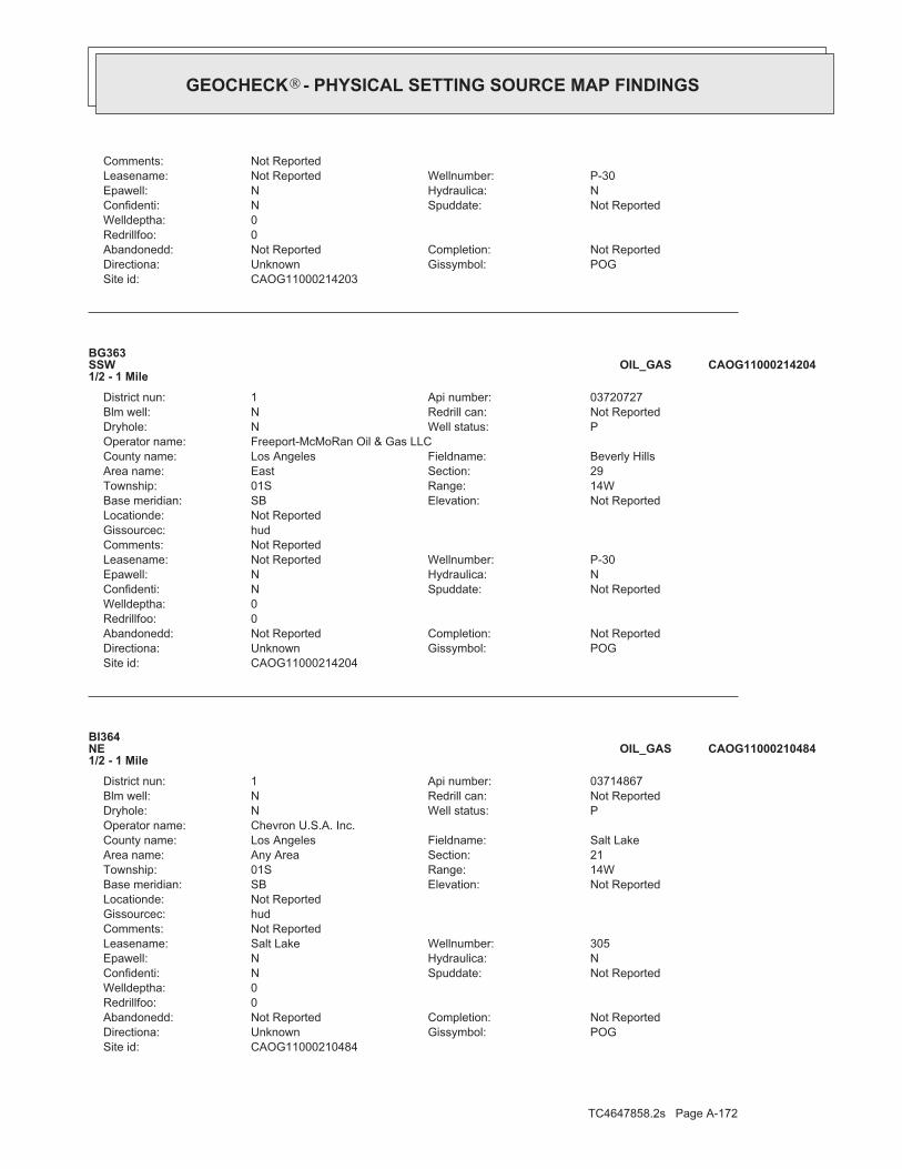
TC4647858.2s Page A-172
CAOG11000210484Site id:POGGissymbol:UnknownDirectiona:Not ReportedCompletion:Not ReportedAbandonedd:
0Redrillfoo:0Welldeptha:
Not ReportedSpuddate:NConfidenti:NHydraulica:NEpawell:305Wellnumber:Salt LakeLeasename:
Not ReportedComments:hudGissourcec:Not ReportedLocationde:
Not ReportedElevation:SBBase meridian:14WRange:01STownship:21Section:Any AreaArea name:Salt LakeFieldname:Los AngelesCounty name:
Chevron U.S.A. Inc.Operator name:PWell status:NDryhole:Not ReportedRedrill can:NBlm well:03714867Api number:1District nun:
BI364NE1/2 - 1 Mile
CAOG11000210484OIL_GAS
CAOG11000214204Site id:POGGissymbol:UnknownDirectiona:Not ReportedCompletion:Not ReportedAbandonedd:
0Redrillfoo:0Welldeptha:
Not ReportedSpuddate:NConfidenti:NHydraulica:NEpawell:P-30Wellnumber:Not ReportedLeasename:
Not ReportedComments:hudGissourcec:Not ReportedLocationde:
Not ReportedElevation:SBBase meridian:14WRange:01STownship:29Section:EastArea name:Beverly HillsFieldname:Los AngelesCounty name:
Freeport-McMoRan Oil & Gas LLCOperator name:PWell status:NDryhole:Not ReportedRedrill can:NBlm well:03720727Api number:1District nun:
BG363SSW1/2 - 1 Mile
CAOG11000214204OIL_GAS
CAOG11000214203Site id:POGGissymbol:UnknownDirectiona:Not ReportedCompletion:Not ReportedAbandonedd:
0Redrillfoo:0Welldeptha:
Not ReportedSpuddate:NConfidenti:NHydraulica:NEpawell:P-30Wellnumber:Not ReportedLeasename:
Not ReportedComments:
®GEOCHECK - PHYSICAL SETTING SOURCE MAP FINDINGS®

TC4647858.2s Page A-173
BG368SSW1/2 - 1 Mile
CAOG11000214300OIL_GAS
CAOG11000213970Site id:AOGGissymbol:Directionally drilledDirectiona:Not ReportedCompletion:Not ReportedAbandonedd:
0Redrillfoo:8160Welldeptha:
Not ReportedSpuddate:NConfidenti:NHydraulica:NEpawell:P-4AWellnumber:Not ReportedLeasename:
Not ReportedComments:hudGissourcec:Not ReportedLocationde:
Not ReportedElevation:SBBase meridian:14WRange:01STownship:29Section:EastArea name:Beverly HillsFieldname:Los AngelesCounty name:
Freeport-McMoRan Oil & Gas LLCOperator name:IWell status:NDryhole:Not ReportedRedrill can:NBlm well:03720043Api number:1District nun:
BG366SSW1/2 - 1 Mile
CAOG11000213970OIL_GAS
CAOG11000213969Site id:AOGGissymbol:Directionally drilledDirectiona:Not ReportedCompletion:Not ReportedAbandonedd:
0Redrillfoo:8160Welldeptha:
Not ReportedSpuddate:NConfidenti:NHydraulica:NEpawell:P-4AWellnumber:Not ReportedLeasename:
Not ReportedComments:hudGissourcec:Not ReportedLocationde:
Not ReportedElevation:SBBase meridian:14WRange:01STownship:29Section:EastArea name:Beverly HillsFieldname:Los AngelesCounty name:
Freeport-McMoRan Oil & Gas LLCOperator name:IWell status:NDryhole:Not ReportedRedrill can:NBlm well:03720043Api number:1District nun:
BG365SSW1/2 - 1 Mile
CAOG11000213969OIL_GAS
Map IDDirectionDistance EDR ID NumberDatabase
®GEOCHECK - PHYSICAL SETTING SOURCE MAP FINDINGS®

TC4647858.2s Page A-174
hudGissourcec:Not ReportedLocationde:
Not ReportedElevation:SBBase meridian:14WRange:01STownship:29Section:EastArea name:Beverly HillsFieldname:Los AngelesCounty name:
Freeport-McMoRan Oil & Gas LLCOperator name:AWell status:NDryhole:Not ReportedRedrill can:NBlm well:03720769Api number:1District nun:
BG369SSW1/2 - 1 Mile
CAOG11000214304OIL_GAS
CAOG11000214299Site id:AOGGissymbol:Directionally drilledDirectiona:Not ReportedCompletion:Not ReportedAbandonedd:
0Redrillfoo:0Welldeptha:
Not ReportedSpuddate:NConfidenti:NHydraulica:NEpawell:P-48Wellnumber:Not ReportedLeasename:
Not ReportedComments:hudGissourcec:Not ReportedLocationde:
Not ReportedElevation:SBBase meridian:14WRange:01STownship:29Section:EastArea name:Beverly HillsFieldname:Los AngelesCounty name:
Freeport-McMoRan Oil & Gas LLCOperator name:IWell status:NDryhole:Not ReportedRedrill can:NBlm well:03720760Api number:1District nun:
BG367SSW1/2 - 1 Mile
CAOG11000214299OIL_GAS
CAOG11000214300Site id:AOGGissymbol:Directionally drilledDirectiona:Not ReportedCompletion:Not ReportedAbandonedd:
0Redrillfoo:0Welldeptha:
Not ReportedSpuddate:NConfidenti:NHydraulica:NEpawell:P-48Wellnumber:Not ReportedLeasename:
Not ReportedComments:hudGissourcec:Not ReportedLocationde:
Not ReportedElevation:SBBase meridian:14WRange:01STownship:29Section:EastArea name:Beverly HillsFieldname:Los AngelesCounty name:
Freeport-McMoRan Oil & Gas LLCOperator name:IWell status:NDryhole:Not ReportedRedrill can:NBlm well:03720760Api number:1District nun:
®GEOCHECK - PHYSICAL SETTING SOURCE MAP FINDINGS®

TC4647858.2s Page A-175
CAOG11000214196Site id:AOGGissymbol:Directionally drilledDirectiona:Not ReportedCompletion:Not ReportedAbandonedd:
0Redrillfoo:0Welldeptha:
Not ReportedSpuddate:NConfidenti:NHydraulica:NEpawell:P-44Wellnumber:Not ReportedLeasename:
Not ReportedComments:hudGissourcec:Not ReportedLocationde:
Not ReportedElevation:SBBase meridian:14WRange:01STownship:29Section:EastArea name:Beverly HillsFieldname:Los AngelesCounty name:
Freeport-McMoRan Oil & Gas LLCOperator name:AWell status:NDryhole:Not ReportedRedrill can:NBlm well:03720715Api number:1District nun:
BG373SSW1/2 - 1 Mile
CAOG11000214196OIL_GAS
CAOG11000214305Site id:AOGGissymbol:Directionally drilledDirectiona:Not ReportedCompletion:Not ReportedAbandonedd:
0Redrillfoo:8599Welldeptha:
Not ReportedSpuddate:NConfidenti:NHydraulica:NEpawell:P-49Wellnumber:Not ReportedLeasename:
Not ReportedComments:hudGissourcec:Not ReportedLocationde:
Not ReportedElevation:SBBase meridian:14WRange:01STownship:29Section:EastArea name:Beverly HillsFieldname:Los AngelesCounty name:
Freeport-McMoRan Oil & Gas LLCOperator name:AWell status:NDryhole:Not ReportedRedrill can:NBlm well:03720769Api number:1District nun:
BG370SSW1/2 - 1 Mile
CAOG11000214305OIL_GAS
CAOG11000214304Site id:AOGGissymbol:Directionally drilledDirectiona:Not ReportedCompletion:Not ReportedAbandonedd:
0Redrillfoo:8599Welldeptha:
Not ReportedSpuddate:NConfidenti:NHydraulica:NEpawell:P-49Wellnumber:Not ReportedLeasename:
Not ReportedComments:
®GEOCHECK - PHYSICAL SETTING SOURCE MAP FINDINGS®

TC4647858.2s Page A-176
BG376SSW1/2 - 1 Mile
CAOG11000214481OIL_GAS
CAOG11000214194Site id:AOGGissymbol:Directionally drilledDirectiona:Not ReportedCompletion:Not ReportedAbandonedd:
0Redrillfoo:0Welldeptha:
Not ReportedSpuddate:NConfidenti:NHydraulica:NEpawell:P-44Wellnumber:Not ReportedLeasename:
Not ReportedComments:hudGissourcec:Not ReportedLocationde:
Not ReportedElevation:SBBase meridian:14WRange:01STownship:29Section:EastArea name:Beverly HillsFieldname:Los AngelesCounty name:
Freeport-McMoRan Oil & Gas LLCOperator name:AWell status:NDryhole:Not ReportedRedrill can:NBlm well:03720715Api number:1District nun:
BG371SSW1/2 - 1 Mile
CAOG11000214194OIL_GAS
CAOG11000214195Site id:AOGGissymbol:Directionally drilledDirectiona:Not ReportedCompletion:Not ReportedAbandonedd:
0Redrillfoo:0Welldeptha:
Not ReportedSpuddate:NConfidenti:NHydraulica:NEpawell:P-44Wellnumber:Not ReportedLeasename:
Not ReportedComments:hudGissourcec:Not ReportedLocationde:
Not ReportedElevation:SBBase meridian:14WRange:01STownship:29Section:EastArea name:Beverly HillsFieldname:Los AngelesCounty name:
Freeport-McMoRan Oil & Gas LLCOperator name:AWell status:NDryhole:Not ReportedRedrill can:NBlm well:03720715Api number:1District nun:
BG372SSW1/2 - 1 Mile
CAOG11000214195OIL_GAS
Map IDDirectionDistance EDR ID NumberDatabase
®GEOCHECK - PHYSICAL SETTING SOURCE MAP FINDINGS®

TC4647858.2s Page A-177
hudGissourcec:Not ReportedLocationde:
Not ReportedElevation:SBBase meridian:14WRange:01STownship:29Section:EastArea name:Beverly HillsFieldname:Los AngelesCounty name:
Freeport-McMoRan Oil & Gas LLCOperator name:AWell status:NDryhole:Not ReportedRedrill can:NBlm well:03720916Api number:1District nun:
BG374SSW1/2 - 1 Mile
CAOG11000214479OIL_GAS
CAOG11000214480Site id:AOGGissymbol:Directionally drilledDirectiona:Not ReportedCompletion:Not ReportedAbandonedd:
0Redrillfoo:10423Welldeptha:
Not ReportedSpuddate:NConfidenti:NHydraulica:NEpawell:P-43Wellnumber:Not ReportedLeasename:
Not ReportedComments:hudGissourcec:Not ReportedLocationde:
Not ReportedElevation:SBBase meridian:14WRange:01STownship:29Section:EastArea name:Beverly HillsFieldname:Los AngelesCounty name:
Freeport-McMoRan Oil & Gas LLCOperator name:AWell status:NDryhole:Not ReportedRedrill can:NBlm well:03720916Api number:1District nun:
BG375SSW1/2 - 1 Mile
CAOG11000214480OIL_GAS
CAOG11000214481Site id:AOGGissymbol:Directionally drilledDirectiona:Not ReportedCompletion:Not ReportedAbandonedd:
0Redrillfoo:10423Welldeptha:
Not ReportedSpuddate:NConfidenti:NHydraulica:NEpawell:P-43Wellnumber:Not ReportedLeasename:
Not ReportedComments:hudGissourcec:Not ReportedLocationde:
Not ReportedElevation:SBBase meridian:14WRange:01STownship:29Section:EastArea name:Beverly HillsFieldname:Los AngelesCounty name:
Freeport-McMoRan Oil & Gas LLCOperator name:AWell status:NDryhole:Not ReportedRedrill can:NBlm well:03720916Api number:1District nun:
®GEOCHECK - PHYSICAL SETTING SOURCE MAP FINDINGS®
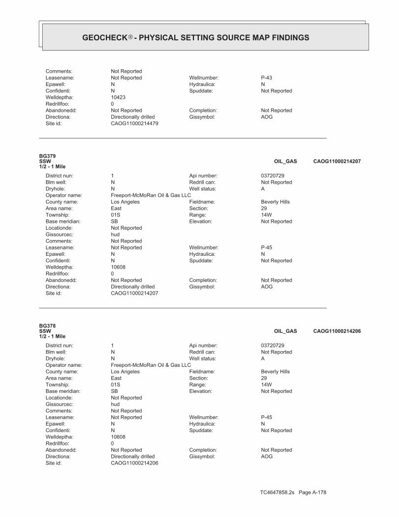
TC4647858.2s Page A-178
CAOG11000214206Site id:AOGGissymbol:Directionally drilledDirectiona:Not ReportedCompletion:Not ReportedAbandonedd:
0Redrillfoo:10608Welldeptha:
Not ReportedSpuddate:NConfidenti:NHydraulica:NEpawell:P-45Wellnumber:Not ReportedLeasename:
Not ReportedComments:hudGissourcec:Not ReportedLocationde:
Not ReportedElevation:SBBase meridian:14WRange:01STownship:29Section:EastArea name:Beverly HillsFieldname:Los AngelesCounty name:
Freeport-McMoRan Oil & Gas LLCOperator name:AWell status:NDryhole:Not ReportedRedrill can:NBlm well:03720729Api number:1District nun:
BG378SSW1/2 - 1 Mile
CAOG11000214206OIL_GAS
CAOG11000214207Site id:AOGGissymbol:Directionally drilledDirectiona:Not ReportedCompletion:Not ReportedAbandonedd:
0Redrillfoo:10608Welldeptha:
Not ReportedSpuddate:NConfidenti:NHydraulica:NEpawell:P-45Wellnumber:Not ReportedLeasename:
Not ReportedComments:hudGissourcec:Not ReportedLocationde:
Not ReportedElevation:SBBase meridian:14WRange:01STownship:29Section:EastArea name:Beverly HillsFieldname:Los AngelesCounty name:
Freeport-McMoRan Oil & Gas LLCOperator name:AWell status:NDryhole:Not ReportedRedrill can:NBlm well:03720729Api number:1District nun:
BG379SSW1/2 - 1 Mile
CAOG11000214207OIL_GAS
CAOG11000214479Site id:AOGGissymbol:Directionally drilledDirectiona:Not ReportedCompletion:Not ReportedAbandonedd:
0Redrillfoo:10423Welldeptha:
Not ReportedSpuddate:NConfidenti:NHydraulica:NEpawell:P-43Wellnumber:Not ReportedLeasename:
Not ReportedComments:
®GEOCHECK - PHYSICAL SETTING SOURCE MAP FINDINGS®

TC4647858.2s Page A-179
BG382SSW1/2 - 1 Mile
CAOG11000214171OIL_GAS
CAOG11000214298Site id:AWFGissymbol:Directionally drilledDirectiona:Not ReportedCompletion:Not ReportedAbandonedd:
0Redrillfoo:0Welldeptha:
Not ReportedSpuddate:NConfidenti:NHydraulica:NEpawell:P-46Wellnumber:Not ReportedLeasename:
Not ReportedComments:hudGissourcec:Not ReportedLocationde:
Not ReportedElevation:SBBase meridian:14WRange:01STownship:29Section:EastArea name:Beverly HillsFieldname:Los AngelesCounty name:
Freeport-McMoRan Oil & Gas LLCOperator name:IWell status:NDryhole:Not ReportedRedrill can:NBlm well:03720759Api number:1District nun:
BG380SSW1/2 - 1 Mile
CAOG11000214298OIL_GAS
CAOG11000214205Site id:AOGGissymbol:Directionally drilledDirectiona:Not ReportedCompletion:Not ReportedAbandonedd:
0Redrillfoo:10608Welldeptha:
Not ReportedSpuddate:NConfidenti:NHydraulica:NEpawell:P-45Wellnumber:Not ReportedLeasename:
Not ReportedComments:hudGissourcec:Not ReportedLocationde:
Not ReportedElevation:SBBase meridian:14WRange:01STownship:29Section:EastArea name:Beverly HillsFieldname:Los AngelesCounty name:
Freeport-McMoRan Oil & Gas LLCOperator name:AWell status:NDryhole:Not ReportedRedrill can:NBlm well:03720729Api number:1District nun:
BG377SSW1/2 - 1 Mile
CAOG11000214205OIL_GAS
Map IDDirectionDistance EDR ID NumberDatabase
®GEOCHECK - PHYSICAL SETTING SOURCE MAP FINDINGS®

TC4647858.2s Page A-180
hudGissourcec:Not ReportedLocationde:
Not ReportedElevation:SBBase meridian:14WRange:01STownship:29Section:EastArea name:Beverly HillsFieldname:Los AngelesCounty name:
Freeport-McMoRan Oil & Gas LLCOperator name:AWell status:NDryhole:Not ReportedRedrill can:NBlm well:03721114Api number:1District nun:
BG384SSW1/2 - 1 Mile
CAOG11000214572OIL_GAS
CAOG11000214170Site id:AOGGissymbol:Directionally drilledDirectiona:Not ReportedCompletion:Not ReportedAbandonedd:
0Redrillfoo:0Welldeptha:
Not ReportedSpuddate:NConfidenti:NHydraulica:NEpawell:P-42Wellnumber:Not ReportedLeasename:
Not ReportedComments:hudGissourcec:Not ReportedLocationde:
Not ReportedElevation:SBBase meridian:14WRange:01STownship:29Section:EastArea name:Beverly HillsFieldname:Los AngelesCounty name:
Freeport-McMoRan Oil & Gas LLCOperator name:IWell status:NDryhole:Not ReportedRedrill can:NBlm well:03720664Api number:1District nun:
BG381SSW1/2 - 1 Mile
CAOG11000214170OIL_GAS
CAOG11000214171Site id:AOGGissymbol:Directionally drilledDirectiona:Not ReportedCompletion:Not ReportedAbandonedd:
0Redrillfoo:0Welldeptha:
Not ReportedSpuddate:NConfidenti:NHydraulica:NEpawell:P-42Wellnumber:Not ReportedLeasename:
Not ReportedComments:hudGissourcec:Not ReportedLocationde:
Not ReportedElevation:SBBase meridian:14WRange:01STownship:29Section:EastArea name:Beverly HillsFieldname:Los AngelesCounty name:
Freeport-McMoRan Oil & Gas LLCOperator name:IWell status:NDryhole:Not ReportedRedrill can:NBlm well:03720664Api number:1District nun:
®GEOCHECK - PHYSICAL SETTING SOURCE MAP FINDINGS®

TC4647858.2s Page A-181
CAOG11000214153Site id:AWFGissymbol:UnknownDirectiona:Not ReportedCompletion:Not ReportedAbandonedd:
0Redrillfoo:0Welldeptha:
Not ReportedSpuddate:NConfidenti:NHydraulica:NEpawell:P-40BWellnumber:Not ReportedLeasename:
Not ReportedComments:hudGissourcec:Not ReportedLocationde:
Not ReportedElevation:SBBase meridian:14WRange:01STownship:29Section:EastArea name:Beverly HillsFieldname:Los AngelesCounty name:
Freeport-McMoRan Oil & Gas LLCOperator name:AWell status:NDryhole:Not ReportedRedrill can:NBlm well:03720625Api number:1District nun:
BG385SSW1/2 - 1 Mile
CAOG11000214153OIL_GAS
CAOG11000214571Site id:AOGGissymbol:Directionally drilledDirectiona:Not ReportedCompletion:Not ReportedAbandonedd:
0Redrillfoo:7026Welldeptha:
Not ReportedSpuddate:NConfidenti:NHydraulica:NEpawell:P-39Wellnumber:Not ReportedLeasename:
Not ReportedComments:hudGissourcec:Not ReportedLocationde:
Not ReportedElevation:SBBase meridian:14WRange:01STownship:29Section:EastArea name:Beverly HillsFieldname:Los AngelesCounty name:
Freeport-McMoRan Oil & Gas LLCOperator name:AWell status:NDryhole:Not ReportedRedrill can:NBlm well:03721114Api number:1District nun:
BG383SSW1/2 - 1 Mile
CAOG11000214571OIL_GAS
CAOG11000214572Site id:AOGGissymbol:Directionally drilledDirectiona:Not ReportedCompletion:Not ReportedAbandonedd:
0Redrillfoo:7026Welldeptha:
Not ReportedSpuddate:NConfidenti:NHydraulica:NEpawell:P-39Wellnumber:Not ReportedLeasename:
Not ReportedComments:
®GEOCHECK - PHYSICAL SETTING SOURCE MAP FINDINGS®

TC4647858.2s Page A-182
BG389SSW1/2 - 1 Mile
CAOG11000214467OIL_GAS
CAOG11000200659Site id:AOGGissymbol:Directionally drilledDirectiona:Not ReportedCompletion:Not ReportedAbandonedd:
0Redrillfoo:0Welldeptha:
Not ReportedSpuddate:NConfidenti:NHydraulica:NEpawell:P-1Wellnumber:Not ReportedLeasename:
Not ReportedComments:hudGissourcec:Not ReportedLocationde:
Not ReportedElevation:SBBase meridian:14WRange:01STownship:29Section:EastArea name:Beverly HillsFieldname:Los AngelesCounty name:
Freeport-McMoRan Oil & Gas LLCOperator name:AWell status:NDryhole:Not ReportedRedrill can:NBlm well:03700029Api number:1District nun:
BG387SSW1/2 - 1 Mile
CAOG11000200659OIL_GAS
CAOG11000200658Site id:AOGGissymbol:Directionally drilledDirectiona:Not ReportedCompletion:Not ReportedAbandonedd:
0Redrillfoo:0Welldeptha:
Not ReportedSpuddate:NConfidenti:NHydraulica:NEpawell:P-1Wellnumber:Not ReportedLeasename:
Not ReportedComments:hudGissourcec:Not ReportedLocationde:
Not ReportedElevation:SBBase meridian:14WRange:01STownship:29Section:EastArea name:Beverly HillsFieldname:Los AngelesCounty name:
Freeport-McMoRan Oil & Gas LLCOperator name:AWell status:NDryhole:Not ReportedRedrill can:NBlm well:03700029Api number:1District nun:
BG386SSW1/2 - 1 Mile
CAOG11000200658OIL_GAS
Map IDDirectionDistance EDR ID NumberDatabase
®GEOCHECK - PHYSICAL SETTING SOURCE MAP FINDINGS®

TC4647858.2s Page A-183
hudGissourcec:Not ReportedLocationde:
Not ReportedElevation:SBBase meridian:14WRange:01STownship:29Section:EastArea name:Beverly HillsFieldname:Los AngelesCounty name:
Freeport-McMoRan Oil & Gas LLCOperator name:AWell status:NDryhole:Not ReportedRedrill can:NBlm well:03720904Api number:1District nun:
BG391SSW1/2 - 1 Mile
CAOG11000214473OIL_GAS
CAOG11000214466Site id:AOGGissymbol:Directionally drilledDirectiona:Not ReportedCompletion:Not ReportedAbandonedd:
0Redrillfoo:0Welldeptha:
Not ReportedSpuddate:NConfidenti:NHydraulica:NEpawell:P-55Wellnumber:Not ReportedLeasename:
Not ReportedComments:hudGissourcec:Not ReportedLocationde:
Not ReportedElevation:SBBase meridian:14WRange:01STownship:29Section:EastArea name:Beverly HillsFieldname:Los AngelesCounty name:
Freeport-McMoRan Oil & Gas LLCOperator name:AWell status:NDryhole:Not ReportedRedrill can:NBlm well:03720896Api number:1District nun:
BG388SSW1/2 - 1 Mile
CAOG11000214466OIL_GAS
CAOG11000214467Site id:AOGGissymbol:Directionally drilledDirectiona:Not ReportedCompletion:Not ReportedAbandonedd:
0Redrillfoo:0Welldeptha:
Not ReportedSpuddate:NConfidenti:NHydraulica:NEpawell:P-55Wellnumber:Not ReportedLeasename:
Not ReportedComments:hudGissourcec:Not ReportedLocationde:
Not ReportedElevation:SBBase meridian:14WRange:01STownship:29Section:EastArea name:Beverly HillsFieldname:Los AngelesCounty name:
Freeport-McMoRan Oil & Gas LLCOperator name:AWell status:NDryhole:Not ReportedRedrill can:NBlm well:03720896Api number:1District nun:
®GEOCHECK - PHYSICAL SETTING SOURCE MAP FINDINGS®

TC4647858.2s Page A-184
CAOG11000214477Site id:AOGGissymbol:Directionally drilledDirectiona:Not ReportedCompletion:Not ReportedAbandonedd:
0Redrillfoo:10286Welldeptha:
Not ReportedSpuddate:NConfidenti:NHydraulica:NEpawell:P-57Wellnumber:Not ReportedLeasename:
Not ReportedComments:hudGissourcec:Not ReportedLocationde:
Not ReportedElevation:SBBase meridian:14WRange:01STownship:29Section:EastArea name:Beverly HillsFieldname:Los AngelesCounty name:
Freeport-McMoRan Oil & Gas LLCOperator name:AWell status:NDryhole:Not ReportedRedrill can:NBlm well:03720915Api number:1District nun:
BG392SSW1/2 - 1 Mile
CAOG11000214477OIL_GAS
CAOG11000214472Site id:AOGGissymbol:Directionally drilledDirectiona:Not ReportedCompletion:Not ReportedAbandonedd:
0Redrillfoo:6399Welldeptha:
Not ReportedSpuddate:NConfidenti:NHydraulica:NEpawell:P-56Wellnumber:Not ReportedLeasename:
Not ReportedComments:hudGissourcec:Not ReportedLocationde:
Not ReportedElevation:SBBase meridian:14WRange:01STownship:29Section:EastArea name:Beverly HillsFieldname:Los AngelesCounty name:
Freeport-McMoRan Oil & Gas LLCOperator name:AWell status:NDryhole:Not ReportedRedrill can:NBlm well:03720904Api number:1District nun:
BG390SSW1/2 - 1 Mile
CAOG11000214472OIL_GAS
CAOG11000214473Site id:AOGGissymbol:Directionally drilledDirectiona:Not ReportedCompletion:Not ReportedAbandonedd:
0Redrillfoo:6399Welldeptha:
Not ReportedSpuddate:NConfidenti:NHydraulica:NEpawell:P-56Wellnumber:Not ReportedLeasename:
Not ReportedComments:
®GEOCHECK - PHYSICAL SETTING SOURCE MAP FINDINGS®
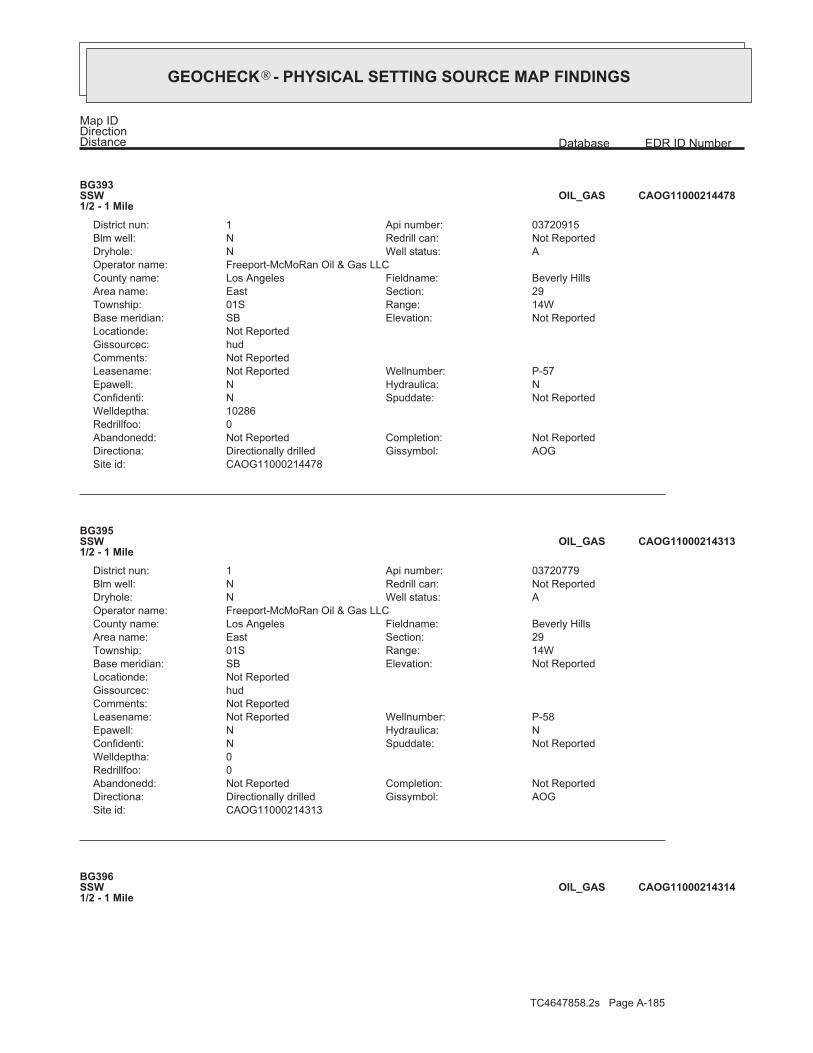
TC4647858.2s Page A-185
BG396SSW1/2 - 1 Mile
CAOG11000214314OIL_GAS
CAOG11000214313Site id:AOGGissymbol:Directionally drilledDirectiona:Not ReportedCompletion:Not ReportedAbandonedd:
0Redrillfoo:0Welldeptha:
Not ReportedSpuddate:NConfidenti:NHydraulica:NEpawell:P-58Wellnumber:Not ReportedLeasename:
Not ReportedComments:hudGissourcec:Not ReportedLocationde:
Not ReportedElevation:SBBase meridian:14WRange:01STownship:29Section:EastArea name:Beverly HillsFieldname:Los AngelesCounty name:
Freeport-McMoRan Oil & Gas LLCOperator name:AWell status:NDryhole:Not ReportedRedrill can:NBlm well:03720779Api number:1District nun:
BG395SSW1/2 - 1 Mile
CAOG11000214313OIL_GAS
CAOG11000214478Site id:AOGGissymbol:Directionally drilledDirectiona:Not ReportedCompletion:Not ReportedAbandonedd:
0Redrillfoo:10286Welldeptha:
Not ReportedSpuddate:NConfidenti:NHydraulica:NEpawell:P-57Wellnumber:Not ReportedLeasename:
Not ReportedComments:hudGissourcec:Not ReportedLocationde:
Not ReportedElevation:SBBase meridian:14WRange:01STownship:29Section:EastArea name:Beverly HillsFieldname:Los AngelesCounty name:
Freeport-McMoRan Oil & Gas LLCOperator name:AWell status:NDryhole:Not ReportedRedrill can:NBlm well:03720915Api number:1District nun:
BG393SSW1/2 - 1 Mile
CAOG11000214478OIL_GAS
Map IDDirectionDistance EDR ID NumberDatabase
®GEOCHECK - PHYSICAL SETTING SOURCE MAP FINDINGS®

TC4647858.2s Page A-186
hudGissourcec:Not ReportedLocationde:
Not ReportedElevation:SBBase meridian:14WRange:01STownship:29Section:EastArea name:Beverly HillsFieldname:Los AngelesCounty name:
Freeport-McMoRan Oil & Gas LLCOperator name:AWell status:NDryhole:Not ReportedRedrill can:NBlm well:03720936Api number:1District nun:
BG397SSW1/2 - 1 Mile
CAOG11000214483OIL_GAS
CAOG11000214312Site id:AOGGissymbol:Directionally drilledDirectiona:Not ReportedCompletion:Not ReportedAbandonedd:
0Redrillfoo:0Welldeptha:
Not ReportedSpuddate:NConfidenti:NHydraulica:NEpawell:P-58Wellnumber:Not ReportedLeasename:
Not ReportedComments:hudGissourcec:Not ReportedLocationde:
Not ReportedElevation:SBBase meridian:14WRange:01STownship:29Section:EastArea name:Beverly HillsFieldname:Los AngelesCounty name:
Freeport-McMoRan Oil & Gas LLCOperator name:AWell status:NDryhole:Not ReportedRedrill can:NBlm well:03720779Api number:1District nun:
BG394SSW1/2 - 1 Mile
CAOG11000214312OIL_GAS
CAOG11000214314Site id:AOGGissymbol:Directionally drilledDirectiona:Not ReportedCompletion:Not ReportedAbandonedd:
0Redrillfoo:0Welldeptha:
Not ReportedSpuddate:NConfidenti:NHydraulica:NEpawell:P-58Wellnumber:Not ReportedLeasename:
Not ReportedComments:hudGissourcec:Not ReportedLocationde:
Not ReportedElevation:SBBase meridian:14WRange:01STownship:29Section:EastArea name:Beverly HillsFieldname:Los AngelesCounty name:
Freeport-McMoRan Oil & Gas LLCOperator name:AWell status:NDryhole:Not ReportedRedrill can:NBlm well:03720779Api number:1District nun:
®GEOCHECK - PHYSICAL SETTING SOURCE MAP FINDINGS®

TC4647858.2s Page A-187
CAOG11000214317Site id:AOGGissymbol:Directionally drilledDirectiona:Not ReportedCompletion:Not ReportedAbandonedd:
0Redrillfoo:8685Welldeptha:
Not ReportedSpuddate:NConfidenti:NHydraulica:NEpawell:P-52AWellnumber:Not ReportedLeasename:
Not ReportedComments:hudGissourcec:Not ReportedLocationde:
Not ReportedElevation:SBBase meridian:14WRange:01STownship:29Section:EastArea name:Beverly HillsFieldname:Los AngelesCounty name:
Freeport-McMoRan Oil & Gas LLCOperator name:AWell status:NDryhole:Not ReportedRedrill can:NBlm well:03720790Api number:1District nun:
BG400SSW1/2 - 1 Mile
CAOG11000214317OIL_GAS
CAOG11000214484Site id:AOGGissymbol:Directionally drilledDirectiona:Not ReportedCompletion:Not ReportedAbandonedd:
0Redrillfoo:0Welldeptha:
Not ReportedSpuddate:NConfidenti:NHydraulica:NEpawell:P-53Wellnumber:Not ReportedLeasename:
Not ReportedComments:hudGissourcec:Not ReportedLocationde:
Not ReportedElevation:SBBase meridian:14WRange:01STownship:29Section:EastArea name:Beverly HillsFieldname:Los AngelesCounty name:
Freeport-McMoRan Oil & Gas LLCOperator name:AWell status:NDryhole:Not ReportedRedrill can:NBlm well:03720936Api number:1District nun:
BG398SSW1/2 - 1 Mile
CAOG11000214484OIL_GAS
CAOG11000214483Site id:AOGGissymbol:Directionally drilledDirectiona:Not ReportedCompletion:Not ReportedAbandonedd:
0Redrillfoo:0Welldeptha:
Not ReportedSpuddate:NConfidenti:NHydraulica:NEpawell:P-53Wellnumber:Not ReportedLeasename:
Not ReportedComments:
®GEOCHECK - PHYSICAL SETTING SOURCE MAP FINDINGS®

TC4647858.2s Page A-188
BJ402ENE1/2 - 1 Mile
CAOG11000210817OIL_GAS
CAOG11000214316Site id:AOGGissymbol:Directionally drilledDirectiona:Not ReportedCompletion:Not ReportedAbandonedd:
0Redrillfoo:8685Welldeptha:
Not ReportedSpuddate:NConfidenti:NHydraulica:NEpawell:P-52AWellnumber:Not ReportedLeasename:
Not ReportedComments:hudGissourcec:Not ReportedLocationde:
Not ReportedElevation:SBBase meridian:14WRange:01STownship:29Section:EastArea name:Beverly HillsFieldname:Los AngelesCounty name:
Freeport-McMoRan Oil & Gas LLCOperator name:AWell status:NDryhole:Not ReportedRedrill can:NBlm well:03720790Api number:1District nun:
BG399SSW1/2 - 1 Mile
CAOG11000214316OIL_GAS
CAOG11000214318Site id:AOGGissymbol:Directionally drilledDirectiona:Not ReportedCompletion:Not ReportedAbandonedd:
0Redrillfoo:8685Welldeptha:
Not ReportedSpuddate:NConfidenti:NHydraulica:NEpawell:P-52AWellnumber:Not ReportedLeasename:
Not ReportedComments:hudGissourcec:Not ReportedLocationde:
Not ReportedElevation:SBBase meridian:14WRange:01STownship:29Section:EastArea name:Beverly HillsFieldname:Los AngelesCounty name:
Freeport-McMoRan Oil & Gas LLCOperator name:AWell status:NDryhole:Not ReportedRedrill can:NBlm well:03720790Api number:1District nun:
BG401SSW1/2 - 1 Mile
CAOG11000214318OIL_GAS
Map IDDirectionDistance EDR ID NumberDatabase
®GEOCHECK - PHYSICAL SETTING SOURCE MAP FINDINGS®

TC4647858.2s Page A-189
hudGissourcec:Not ReportedLocationde:
Not ReportedElevation:SBBase meridian:14WRange:01STownship:29Section:EastArea name:Beverly HillsFieldname:Los AngelesCounty name:
Freeport-McMoRan Oil & Gas LLCOperator name:AWell status:NDryhole:Not ReportedRedrill can:NBlm well:03720831Api number:1District nun:
BG404SSW1/2 - 1 Mile
CAOG11000214412OIL_GAS
CAOG11000214411Site id:AOGGissymbol:Directionally drilledDirectiona:Not ReportedCompletion:Not ReportedAbandonedd:
0Redrillfoo:8039Welldeptha:
Not ReportedSpuddate:NConfidenti:NHydraulica:NEpawell:P-54Wellnumber:Not ReportedLeasename:
Not ReportedComments:hudGissourcec:Not ReportedLocationde:
Not ReportedElevation:SBBase meridian:14WRange:01STownship:29Section:EastArea name:Beverly HillsFieldname:Los AngelesCounty name:
Freeport-McMoRan Oil & Gas LLCOperator name:AWell status:NDryhole:Not ReportedRedrill can:NBlm well:03720831Api number:1District nun:
BG403SSW1/2 - 1 Mile
CAOG11000214411OIL_GAS
CAOG11000210817Site id:POGGissymbol:UnknownDirectiona:Not ReportedCompletion:Not ReportedAbandonedd:
0Redrillfoo:0Welldeptha:
Not ReportedSpuddate:NConfidenti:NHydraulica:NEpawell:255Wellnumber:Salt LakeLeasename:
Not ReportedComments:hudGissourcec:Not ReportedLocationde:
Not ReportedElevation:SBBase meridian:14WRange:01STownship:22Section:Any AreaArea name:Salt LakeFieldname:Los AngelesCounty name:
Chevron U.S.A. Inc.Operator name:PWell status:NDryhole:Not ReportedRedrill can:NBlm well:03715246Api number:1District nun:
®GEOCHECK - PHYSICAL SETTING SOURCE MAP FINDINGS®

TC4647858.2s Page A-190
CAOG11000214309Site id:AWFGissymbol:Directionally drilledDirectiona:Not ReportedCompletion:Not ReportedAbandonedd:
0Redrillfoo:0Welldeptha:
Not ReportedSpuddate:NConfidenti:NHydraulica:NEpawell:P-50BWellnumber:Not ReportedLeasename:
Not ReportedComments:hudGissourcec:Not ReportedLocationde:
Not ReportedElevation:SBBase meridian:14WRange:01STownship:29Section:EastArea name:Beverly HillsFieldname:Los AngelesCounty name:
Freeport-McMoRan Oil & Gas LLCOperator name:AWell status:NDryhole:Not ReportedRedrill can:NBlm well:03720777Api number:1District nun:
BG407SSW1/2 - 1 Mile
CAOG11000214309OIL_GAS
CAOG11000214413Site id:AOGGissymbol:Directionally drilledDirectiona:Not ReportedCompletion:Not ReportedAbandonedd:
0Redrillfoo:8039Welldeptha:
Not ReportedSpuddate:NConfidenti:NHydraulica:NEpawell:P-54Wellnumber:Not ReportedLeasename:
Not ReportedComments:hudGissourcec:Not ReportedLocationde:
Not ReportedElevation:SBBase meridian:14WRange:01STownship:29Section:EastArea name:Beverly HillsFieldname:Los AngelesCounty name:
Freeport-McMoRan Oil & Gas LLCOperator name:AWell status:NDryhole:Not ReportedRedrill can:NBlm well:03720831Api number:1District nun:
BG405SSW1/2 - 1 Mile
CAOG11000214413OIL_GAS
CAOG11000214412Site id:AOGGissymbol:Directionally drilledDirectiona:Not ReportedCompletion:Not ReportedAbandonedd:
0Redrillfoo:8039Welldeptha:
Not ReportedSpuddate:NConfidenti:NHydraulica:NEpawell:P-54Wellnumber:Not ReportedLeasename:
Not ReportedComments:
®GEOCHECK - PHYSICAL SETTING SOURCE MAP FINDINGS®

TC4647858.2s Page A-191
BG408SSW1/2 - 1 Mile
CAOG11000213976OIL_GAS
CAOG11000213977Site id:AOGGissymbol:Directionally drilledDirectiona:Not ReportedCompletion:Not ReportedAbandonedd:
0Redrillfoo:6640Welldeptha:
Not ReportedSpuddate:NConfidenti:NHydraulica:NEpawell:P-5Wellnumber:Not ReportedLeasename:
Not ReportedComments:hudGissourcec:Not ReportedLocationde:
Not ReportedElevation:SBBase meridian:14WRange:01STownship:29Section:EastArea name:Beverly HillsFieldname:Los AngelesCounty name:
Freeport-McMoRan Oil & Gas LLCOperator name:AWell status:NDryhole:Not ReportedRedrill can:NBlm well:03720055Api number:1District nun:
BG409SSW1/2 - 1 Mile
CAOG11000213977OIL_GAS
CAOG11000214308Site id:AWFGissymbol:Directionally drilledDirectiona:Not ReportedCompletion:Not ReportedAbandonedd:
0Redrillfoo:0Welldeptha:
Not ReportedSpuddate:NConfidenti:NHydraulica:NEpawell:P-50BWellnumber:Not ReportedLeasename:
Not ReportedComments:hudGissourcec:Not ReportedLocationde:
Not ReportedElevation:SBBase meridian:14WRange:01STownship:29Section:EastArea name:Beverly HillsFieldname:Los AngelesCounty name:
Freeport-McMoRan Oil & Gas LLCOperator name:AWell status:NDryhole:Not ReportedRedrill can:NBlm well:03720777Api number:1District nun:
BG406SSW1/2 - 1 Mile
CAOG11000214308OIL_GAS
Map IDDirectionDistance EDR ID NumberDatabase
®GEOCHECK - PHYSICAL SETTING SOURCE MAP FINDINGS®

TC4647858.2s Page A-192
hudGissourcec:Not ReportedLocationde:
Not ReportedElevation:SBBase meridian:14WRange:01STownship:29Section:EastArea name:Beverly HillsFieldname:Los AngelesCounty name:
Freeport-McMoRan Oil & Gas LLCOperator name:AWell status:NDryhole:Not ReportedRedrill can:NBlm well:03720946Api number:1District nun:
BG412SSW1/2 - 1 Mile
CAOG11000214492OIL_GAS
CAOG11000214491Site id:AOGGissymbol:Directionally drilledDirectiona:Not ReportedCompletion:Not ReportedAbandonedd:
0Redrillfoo:10043Welldeptha:
Not ReportedSpuddate:NConfidenti:NHydraulica:NEpawell:P-59BWellnumber:Not ReportedLeasename:
Not ReportedComments:hudGissourcec:Not ReportedLocationde:
Not ReportedElevation:SBBase meridian:14WRange:01STownship:29Section:EastArea name:Beverly HillsFieldname:Los AngelesCounty name:
Freeport-McMoRan Oil & Gas LLCOperator name:AWell status:NDryhole:Not ReportedRedrill can:NBlm well:03720946Api number:1District nun:
BG411SSW1/2 - 1 Mile
CAOG11000214491OIL_GAS
CAOG11000213976Site id:AOGGissymbol:Directionally drilledDirectiona:Not ReportedCompletion:Not ReportedAbandonedd:
0Redrillfoo:6640Welldeptha:
Not ReportedSpuddate:NConfidenti:NHydraulica:NEpawell:P-5Wellnumber:Not ReportedLeasename:
Not ReportedComments:hudGissourcec:Not ReportedLocationde:
Not ReportedElevation:SBBase meridian:14WRange:01STownship:29Section:EastArea name:Beverly HillsFieldname:Los AngelesCounty name:
Freeport-McMoRan Oil & Gas LLCOperator name:AWell status:NDryhole:Not ReportedRedrill can:NBlm well:03720055Api number:1District nun:
®GEOCHECK - PHYSICAL SETTING SOURCE MAP FINDINGS®

TC4647858.2s Page A-193
CAOG11000210477Site id:POGGissymbol:UnknownDirectiona:Not ReportedCompletion:Not ReportedAbandonedd:
0Redrillfoo:0Welldeptha:
Not ReportedSpuddate:NConfidenti:NHydraulica:NEpawell:289Wellnumber:Salt LakeLeasename:
Not ReportedComments:hudGissourcec:Not ReportedLocationde:
Not ReportedElevation:SBBase meridian:14WRange:01STownship:21Section:Any AreaArea name:Salt LakeFieldname:Los AngelesCounty name:
Chevron U.S.A. Inc.Operator name:PWell status:NDryhole:Not ReportedRedrill can:NBlm well:03714860Api number:1District nun:
413NE1/2 - 1 Mile
CAOG11000210477OIL_GAS
CAOG11000214490Site id:AOGGissymbol:Directionally drilledDirectiona:Not ReportedCompletion:Not ReportedAbandonedd:
0Redrillfoo:10043Welldeptha:
Not ReportedSpuddate:NConfidenti:NHydraulica:NEpawell:P-59BWellnumber:Not ReportedLeasename:
Not ReportedComments:hudGissourcec:Not ReportedLocationde:
Not ReportedElevation:SBBase meridian:14WRange:01STownship:29Section:EastArea name:Beverly HillsFieldname:Los AngelesCounty name:
Freeport-McMoRan Oil & Gas LLCOperator name:AWell status:NDryhole:Not ReportedRedrill can:NBlm well:03720946Api number:1District nun:
BG410SSW1/2 - 1 Mile
CAOG11000214490OIL_GAS
CAOG11000214492Site id:AOGGissymbol:Directionally drilledDirectiona:Not ReportedCompletion:Not ReportedAbandonedd:
0Redrillfoo:10043Welldeptha:
Not ReportedSpuddate:NConfidenti:NHydraulica:NEpawell:P-59BWellnumber:Not ReportedLeasename:
Not ReportedComments:
®GEOCHECK - PHYSICAL SETTING SOURCE MAP FINDINGS®

TC4647858.2s Page A-194
BL416NNE1/2 - 1 Mile
CAOG11000210707OIL_GAS
CAOG11000210689Site id:POGGissymbol:UnknownDirectiona:Not ReportedCompletion:Not ReportedAbandonedd:
0Redrillfoo:0Welldeptha:
Not ReportedSpuddate:NConfidenti:NHydraulica:NEpawell:51Wellnumber:Not ReportedLeasename:
Not ReportedComments:hudGissourcec:Not ReportedLocationde:
Not ReportedElevation:SBBase meridian:14WRange:01STownship:16Section:Any AreaArea name:Salt LakeFieldname:Los AngelesCounty name:
Rancho La Brea Oil co.Operator name:PWell status:NDryhole:Not ReportedRedrill can:NBlm well:03715109Api number:1District nun:
BK415NNE1/2 - 1 Mile
CAOG11000210689OIL_GAS
CAOG11000210809Site id:POGGissymbol:UnknownDirectiona:Not ReportedCompletion:Not ReportedAbandonedd:
0Redrillfoo:0Welldeptha:
Not ReportedSpuddate:NConfidenti:NHydraulica:NEpawell:238Wellnumber:Salt LakeLeasename:
Not ReportedComments:hudGissourcec:Not ReportedLocationde:
Not ReportedElevation:SBBase meridian:14WRange:01STownship:22Section:Any AreaArea name:Salt LakeFieldname:Los AngelesCounty name:
Chevron U.S.A. Inc.Operator name:PWell status:NDryhole:Not ReportedRedrill can:NBlm well:03715238Api number:1District nun:
BJ414ENE1/2 - 1 Mile
CAOG11000210809OIL_GAS
Map IDDirectionDistance EDR ID NumberDatabase
®GEOCHECK - PHYSICAL SETTING SOURCE MAP FINDINGS®

TC4647858.2s Page A-195
hudGissourcec:Not ReportedLocationde:
Not ReportedElevation:SBBase meridian:14WRange:01STownship:21Section:Any AreaArea name:Salt LakeFieldname:Los AngelesCounty name:
Rancho La Brea Oil co.Operator name:PWell status:NDryhole:Not ReportedRedrill can:NBlm well:03715068Api number:1District nun:
BI418NE1/2 - 1 Mile
CAOG11000210648OIL_GAS
CAOG11000210469Site id:POGGissymbol:UnknownDirectiona:Not ReportedCompletion:Not ReportedAbandonedd:
0Redrillfoo:0Welldeptha:
Not ReportedSpuddate:NConfidenti:NHydraulica:NEpawell:272Wellnumber:Salt LakeLeasename:
Not ReportedComments:hudGissourcec:Not ReportedLocationde:
Not ReportedElevation:SBBase meridian:14WRange:01STownship:22Section:Any AreaArea name:Salt LakeFieldname:Los AngelesCounty name:
Chevron U.S.A. Inc.Operator name:PWell status:NDryhole:Not ReportedRedrill can:NBlm well:03714852Api number:1District nun:
BF417NE1/2 - 1 Mile
CAOG11000210469OIL_GAS
CAOG11000210707Site id:POGGissymbol:UnknownDirectiona:Not ReportedCompletion:Not ReportedAbandonedd:
0Redrillfoo:0Welldeptha:
Not ReportedSpuddate:NConfidenti:NHydraulica:NEpawell:69Wellnumber:Not ReportedLeasename:
Not ReportedComments:hudGissourcec:Not ReportedLocationde:
Not ReportedElevation:SBBase meridian:14WRange:01STownship:16Section:Any AreaArea name:Salt LakeFieldname:Los AngelesCounty name:
Rancho La Brea Oil co.Operator name:PWell status:NDryhole:Not ReportedRedrill can:NBlm well:03715127Api number:1District nun:
®GEOCHECK - PHYSICAL SETTING SOURCE MAP FINDINGS®

TC4647858.2s Page A-196
CAOG11000210725Site id:POGGissymbol:UnknownDirectiona:Not ReportedCompletion:Not ReportedAbandonedd:
0Redrillfoo:0Welldeptha:
Not ReportedSpuddate:NConfidenti:NHydraulica:NEpawell:99Wellnumber:Not ReportedLeasename:
Not ReportedComments:hudGissourcec:Not ReportedLocationde:
Not ReportedElevation:SBBase meridian:14WRange:01STownship:20Section:Any AreaArea name:Salt LakeFieldname:Los AngelesCounty name:
Chevron U.S.A. Inc.Operator name:PWell status:NDryhole:Not ReportedRedrill can:NBlm well:03715154Api number:1District nun:
420NW1/2 - 1 Mile
CAOG11000210725OIL_GAS
CAOG11000210731Site id:POGGissymbol:UnknownDirectiona:Not ReportedCompletion:Not ReportedAbandonedd:
0Redrillfoo:0Welldeptha:
Not ReportedSpuddate:NConfidenti:NHydraulica:NEpawell:114Wellnumber:Not ReportedLeasename:
Not ReportedComments:hudGissourcec:Not ReportedLocationde:
Not ReportedElevation:SBBase meridian:14WRange:01STownship:20Section:Any AreaArea name:Salt LakeFieldname:Los AngelesCounty name:
Chevron U.S.A. Inc.Operator name:PWell status:NDryhole:Not ReportedRedrill can:NBlm well:03715160Api number:1District nun:
BH419WNW1/2 - 1 Mile
CAOG11000210731OIL_GAS
CAOG11000210648Site id:POGGissymbol:UnknownDirectiona:Not ReportedCompletion:Not ReportedAbandonedd:
0Redrillfoo:0Welldeptha:
Not ReportedSpuddate:NConfidenti:NHydraulica:NEpawell:10Wellnumber:Not ReportedLeasename:
Not ReportedComments:
®GEOCHECK - PHYSICAL SETTING SOURCE MAP FINDINGS®

TC4647858.2s Page A-197
423WNW1/2 - 1 Mile
CAOG11000210726OIL_GAS
CAOG11000210687Site id:POGGissymbol:UnknownDirectiona:Not ReportedCompletion:Not ReportedAbandonedd:
0Redrillfoo:0Welldeptha:
Not ReportedSpuddate:NConfidenti:NHydraulica:NEpawell:49Wellnumber:Not ReportedLeasename:
Not ReportedComments:hudGissourcec:Not ReportedLocationde:
Not ReportedElevation:SBBase meridian:14WRange:01STownship:21Section:Any AreaArea name:Salt LakeFieldname:Los AngelesCounty name:
Rancho La Brea Oil co.Operator name:PWell status:NDryhole:Not ReportedRedrill can:NBlm well:03715107Api number:1District nun:
422NNE1/2 - 1 Mile
CAOG11000210687OIL_GAS
CAOG11000210705Site id:POGGissymbol:UnknownDirectiona:Not ReportedCompletion:Not ReportedAbandonedd:
0Redrillfoo:0Welldeptha:
Not ReportedSpuddate:NConfidenti:NHydraulica:NEpawell:67Wellnumber:Not ReportedLeasename:
Not ReportedComments:hudGissourcec:Not ReportedLocationde:
Not ReportedElevation:SBBase meridian:14WRange:01STownship:16Section:Any AreaArea name:Salt LakeFieldname:Los AngelesCounty name:
Rancho La Brea Oil co.Operator name:PWell status:NDryhole:Not ReportedRedrill can:NBlm well:03715125Api number:1District nun:
BL421NNE1/2 - 1 Mile
CAOG11000210705OIL_GAS
Map IDDirectionDistance EDR ID NumberDatabase
®GEOCHECK - PHYSICAL SETTING SOURCE MAP FINDINGS®

TC4647858.2s Page A-198
hudGissourcec:Not ReportedLocationde:
Not ReportedElevation:SBBase meridian:14WRange:01STownship:15Section:Any AreaArea name:Salt LakeFieldname:Los AngelesCounty name:
Rancho La Brea Oil co.Operator name:PWell status:NDryhole:Not ReportedRedrill can:NBlm well:03715108Api number:1District nun:
BK425NNE1/2 - 1 Mile
CAOG11000210688OIL_GAS
CAOG11000210251Site id:AOGGissymbol:UnknownDirectiona:Not ReportedCompletion:Not ReportedAbandonedd:
0Redrillfoo:0Welldeptha:
Not ReportedSpuddate:NConfidenti:NHydraulica:NEpawell:1Wellnumber:RodeoLeasename:
Not ReportedComments:hudGissourcec:Not ReportedLocationde:
Not ReportedElevation:SBBase meridian:14WRange:01STownship:20Section:Any AreaArea name:Salt LakeFieldname:Los AngelesCounty name:
Chevron U.S.A. Inc.Operator name:BWell status:NDryhole:Not ReportedRedrill can:NBlm well:03714549Api number:1District nun:
424WNW1/2 - 1 Mile
CAOG11000210251OIL_GAS
CAOG11000210726Site id:POGGissymbol:UnknownDirectiona:Not ReportedCompletion:Not ReportedAbandonedd:
0Redrillfoo:0Welldeptha:
Not ReportedSpuddate:NConfidenti:NHydraulica:NEpawell:101Wellnumber:Not ReportedLeasename:
Not ReportedComments:hudGissourcec:Not ReportedLocationde:
Not ReportedElevation:SBBase meridian:14WRange:01STownship:20Section:Any AreaArea name:Salt LakeFieldname:Los AngelesCounty name:
Chevron U.S.A. Inc.Operator name:PWell status:NDryhole:Not ReportedRedrill can:NBlm well:03715155Api number:1District nun:
®GEOCHECK - PHYSICAL SETTING SOURCE MAP FINDINGS®
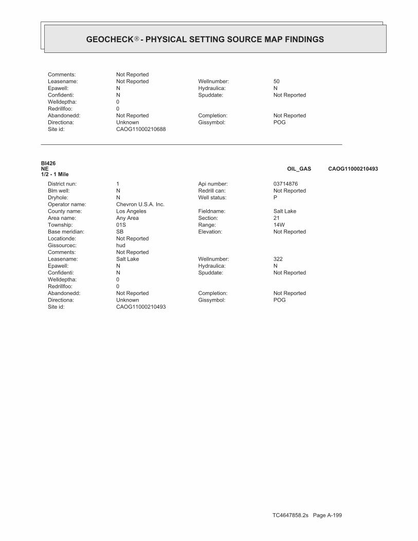
TC4647858.2s Page A-199
CAOG11000210493Site id:POGGissymbol:UnknownDirectiona:Not ReportedCompletion:Not ReportedAbandonedd:
0Redrillfoo:0Welldeptha:
Not ReportedSpuddate:NConfidenti:NHydraulica:NEpawell:322Wellnumber:Salt LakeLeasename:
Not ReportedComments:hudGissourcec:Not ReportedLocationde:
Not ReportedElevation:SBBase meridian:14WRange:01STownship:21Section:Any AreaArea name:Salt LakeFieldname:Los AngelesCounty name:
Chevron U.S.A. Inc.Operator name:PWell status:NDryhole:Not ReportedRedrill can:NBlm well:03714876Api number:1District nun:
BI426NE1/2 - 1 Mile
CAOG11000210493OIL_GAS
CAOG11000210688Site id:POGGissymbol:UnknownDirectiona:Not ReportedCompletion:Not ReportedAbandonedd:
0Redrillfoo:0Welldeptha:
Not ReportedSpuddate:NConfidenti:NHydraulica:NEpawell:50Wellnumber:Not ReportedLeasename:
Not ReportedComments:
®GEOCHECK - PHYSICAL SETTING SOURCE MAP FINDINGS®

TC4647858.2s Page A-200
0%0%100%0.933 pCi/LBasementNot ReportedNot ReportedNot ReportedNot ReportedLiving Area - 2nd Floor0%2%98%0.711 pCi/LLiving Area - 1st Floor
% >20 pCi/L% 4-20 pCi/L% <4 pCi/LAverage ActivityArea
Number of sites tested: 63
Federal Area Radon Information for LOS ANGELES COUNTY, CA
: Zone 3 indoor average level < 2 pCi/L. : Zone 2 indoor average level >= 2 pCi/L and <= 4 pCi/L. Note: Zone 1 indoor average level > 4 pCi/L.
Federal EPA Radon Zone for LOS ANGELES County: 2
14890036
______________________> 4 pCi/LNum TestsZipcode
Radon Test Results
State Database: CA Radon
AREA RADON INFORMATION
®GEOCHECK - PHYSICAL SETTING SOURCE MAP FINDINGSRADON
®

TOPOGRAPHIC INFORMATION
USGS 7.5’ Digital Elevation Model (DEM)Source: United States Geologic SurveyEDR acquired the USGS 7.5’ Digital Elevation Model in 2002 and updated it in 2006. The 7.5 minute DEM correspondsto the USGS 1:24,000- and 1:25,000-scale topographic quadrangle maps. The DEM provides elevation datawith consistent elevation units and projection.
Current USGS 7.5 Minute Topographic MapSource: U.S. Geological Survey
HYDROLOGIC INFORMATION
Flood Zone Data: This data, available in select counties across the country, was obtained by EDR in 2003 & 2011 from the FederalEmergency Management Agency (FEMA). Data depicts 100-year and 500-year flood zones as defined by FEMA.
NWI: National Wetlands Inventory. This data, available in select counties across the country, was obtained by EDRin 2002, 2005 and 2010 from the U.S. Fish and Wildlife Service.
State Wetlands Data: Wetland InventorySource: Department of Fish & GameTelephone: 916-445-0411
HYDROGEOLOGIC INFORMATION
AQUIFLOW Information SystemRSource: EDR proprietary database of groundwater flow informationEDR has developed the AQUIFLOW Information System (AIS) to provide data on the general direction of groundwater
flow at specific points. EDR has reviewed reports submitted to regulatory authorities at select sites and hasextracted the date of the report, hydrogeologically determined groundwater flow direction and depth to water tableinformation.
GEOLOGIC INFORMATION
Geologic Age and Rock Stratigraphic UnitSource: P.G. Schruben, R.E. Arndt and W.J. Bawiec, Geology of the Conterminous U.S. at 1:2,500,000 Scale - A digitalrepresentation of the 1974 P.B. King and H.M. Beikman Map, USGS Digital Data Series DDS - 11 (1994).
STATSGO: State Soil Geographic DatabaseSource: Department of Agriculture, Natural Resources Conservation Service (NRCS)The U.S. Department of Agriculture’s (USDA) Natural Resources Conservation Service (NRCS) leads the nationalConservation Soil Survey (NCSS) and is responsible for collecting, storing, maintaining and distributing soilsurvey information for privately owned lands in the United States. A soil map in a soil survey is a representationof soil patterns in a landscape. Soil maps for STATSGO are compiled by generalizing more detailed (SSURGO)soil survey maps.
SSURGO: Soil Survey Geographic DatabaseSource: Department of Agriculture, Natural Resources Conservation Service (NRCS)Telephone: 800-672-5559SSURGO is the most detailed level of mapping done by the Natural Resources Conservation Service, mappingscales generally range from 1:12,000 to 1:63,360. Field mapping methods using national standards are used toconstruct the soil maps in the Soil Survey Geographic (SSURGO) database. SSURGO digitizing duplicates theoriginal soil survey maps. This level of mapping is designed for use by landowners, townships and countynatural resource planning and management.
TC4647858.2s Page PSGR-1
PHYSICAL SETTING SOURCE RECORDS SEARCHED

LOCAL / REGIONAL WATER AGENCY RECORDS
FEDERAL WATER WELLS
PWS: Public Water SystemsSource: EPA/Office of Drinking WaterTelephone: 202-564-3750Public Water System data from the Federal Reporting Data System. A PWS is any water system which provides water to at
least 25 people for at least 60 days annually. PWSs provide water from wells, rivers and other sources.
PWS ENF: Public Water Systems Violation and Enforcement DataSource: EPA/Office of Drinking WaterTelephone: 202-564-3750Violation and Enforcement data for Public Water Systems from the Safe Drinking Water Information System (SDWIS) after
August 1995. Prior to August 1995, the data came from the Federal Reporting Data System (FRDS).
USGS Water Wells: USGS National Water Inventory System (NWIS)This database contains descriptive information on sites where the USGS collects or has collected data on surfacewater and/or groundwater. The groundwater data includes information on wells, springs, and other sources of groundwater.
STATE RECORDS
Water Well DatabaseSource: Department of Water ResourcesTelephone: 916-651-9648
California Drinking Water Quality DatabaseSource: Department of Public HealthTelephone: 916-324-2319The database includes all drinking water compliance and special studies monitoring for the state of California
since 1984. It consists of over 3,200,000 individual analyses along with well and water system information.
OTHER STATE DATABASE INFORMATION
California Oil and Gas Well LocationsSource: Department of ConservationTelephone: 916-323-1779Oil and Gas well locations in the state.
RADON
State Database: CA RadonSource: Department of Health ServicesTelephone: 916-324-2208Radon Database for California
Area Radon InformationSource: USGSTelephone: 703-356-4020The National Radon Database has been developed by the U.S. Environmental Protection Agency(USEPA) and is a compilation of the EPA/State Residential Radon Survey and the National Residential Radon Survey.The study covers the years 1986 - 1992. Where necessary data has been supplemented by information collected atprivate sources such as universities and research institutions.
EPA Radon ZonesSource: EPATelephone: 703-356-4020Sections 307 & 309 of IRAA directed EPA to list and identify areas of U.S. with the potential for elevated indoorradon levels.
TC4647858.2s Page PSGR-2
PHYSICAL SETTING SOURCE RECORDS SEARCHED

OTHER
Airport Landing Facilities: Private and public use landing facilitiesSource: Federal Aviation Administration, 800-457-6656
Epicenters: World earthquake epicenters, Richter 5 or greaterSource: Department of Commerce, National Oceanic and Atmospheric Administration
California Earthquake Fault Lines: The fault lines displayed on EDR’s Topographic map are digitized quaternary fault lines,prepared in 1975 by the United State Geological Survey. Additional information (also from 1975) regarding activity at specific faultlines comes from California’s Preliminary Fault Activity Map prepared by the California Division of Mines and Geology.
STREET AND ADDRESS INFORMATION
© 2015 TomTom North America, Inc. All rights reserved. This material is proprietary and the subject of copyright protectionand other intellectual property rights owned by or licensed to Tele Atlas North America, Inc. The use of this material is subjectto the terms of a license agreement. You will be held liable for any unauthorized copying or disclosure of this material.
TC4647858.2s Page PSGR-3
PHYSICAL SETTING SOURCE RECORDS SEARCHED

AECOM Environment
July 2016 60506707.1
Appendix C
EDR Historical Sources

����������� ���������������������
Inquiry Number:
����������� �������������������������������������������������!!!�������"�
LACMA5905 Wilshire Boulevard
Los Angeles, CA 90036
June 16, 2016
4647858.9

���������� ���������
Search Results:
Disclaimer - Copyright and Trademark �otice
EDR and its logos (including Sanborn and Sanborn Map) are trademarks of Environmental Data Resources, Inc. or its affiliates. All other trademarks used herein arethe property of their respective owners.
page�
Environmental Data Resources, Inc. (EDR) Aerial Photo Decade Package is a screening tool designed to assistenvironmental professionals in evaluating potential liability on a target property resulting from past activities. EDR’sprofessional researchers provide digitally reproduced historical aerial photographs, and when available, provide one photoper decade.
When delivered electronically by EDR, the aerial photo images included with this report are for ONE TIME USEONLY. Further reproduction of these aerial photo images is prohibited without permission from EDR. For moreinformation contact your EDR Account Executive.
���� ����� �� �������
��������������� ������������������������ ������ ��
2012 1"=500' Flight Year: 2012 USDA/NAIP2010 1"=500' Flight Year: 2010 USDA/NAIP2009 1"=500' Flight Year: 2009 USDA/NAIP2005 1"=500' Flight Year: 2005 USDA/NAIP2002 1"=500' Flight Date: June, 10 2002 USDA1994 1"=500' Acquisition Date: May, 31 1994 USGS/DOQQ1989 1"=500' Flight Date: August, 22 1989 USDA1983 1"=500' Flight Date: November, 19 1983 EDR Proprietary Brewster Pacific1977 1"=500' Flight Date: April, 25 1977 EDR Proprietary Brewster Pacific1972 1"=500' Flight Date: November, 21 1972 EDR Proprietary Brewster Pacific1964 1"=500' Flight Date: July, 28 1964 USGS1952 1"=500' Flight Date: August, 01 1952 USGS1948 1"=500' Flight Date: July, 10 1948 USGS1938 1"=500' Flight Date: May, 22 1938 USDA1928 1"=500' Flight Date: January, 01 1928 FAIR1923 1"=500' Flight Date: January, 01 1923 FAIR
06/16/16
LACMA AECOM5905 Wilshire Boulevard 915 Wilshire Blvd, Suite 700Los Angeles, CA 90036 Los Angeles, CA 90017
4647858.9 Jessica Himebauch
This Report contains certain information obtained from a variety of public and other sources reasonably available to Environmental Data Resources, Inc. It cannotbe concluded from this Report that coverage information for the target and surrounding properties does not exist from other sources. NO WARRANTYEXPRESSED OR IMPLIED, IS MADE WHATSOEVER IN CONNECTION WITH THIS REPORT. ENVIRONMENTAL DATA RESOURCES, INC. SPECIFICALLYDISCLAIMS THE MAKING OF ANY SUCH WARRANTIES, INCLUDING WITHOUT LIMITATION, MERCHANTABILITY OR FITNESS FOR A PARTICULAR USEOR PURPOSE. ALL RISK IS ASSUMED BY THE USER. IN NO EVENT SHALL ENVIRONMENTAL DATA RESOURCES, INC. BE LIABLE TO ANYONE,WHETHER ARISING OUT OF ERRORS OR OMISSIONS, NEGLIGENCE, ACCIDENT OR ANY OTHER CAUSE, FOR ANY LOSS OF DAMAGE, INCLUDING,WITHOUT LIMITATION, SPECIAL, INCIDENTAL, CONSEQUENTIAL, OR EXEMPLARY DAMAGES. ANY LIABILITY ON THE PART OF ENVIRONMENTALDATA RESOURCES, INC. IS STRICTLY LIMITED TO A REFUND OF THE AMOUNT PAID FOR THIS REPORT. Purchaser accepts this Report "AS IS". Anyanalyses, estimates, ratings, environmental risk levels or risk codes provided in this Report are provided for illustrative purposes only, and are not intended toprovide, nor should they be interpreted as providing any facts regarding, or prediction or forecast of, any environmental risk for any property. Only a Phase IEnvironmental Site Assessment performed by an environmental professional can provide information regarding the environmental risk for any property.Additionally, the information provided in this Report is not to be construed as legal advice.
Copyright 2016 by Environmental Data Resources, Inc. All rights reserved. Reproduction in any media or format, in whole or in part, of any report or map ofEnvironmental Data Resources, Inc., or its affiliates, is prohibited without prior written permission.
4647858 9 2

4647858.9
2012
= 500'

4647858.9
2010
= 500'

4647858.9
2009
= 500'
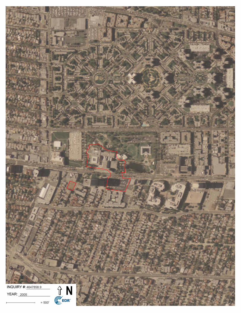
4647858.9
2005
= 500'
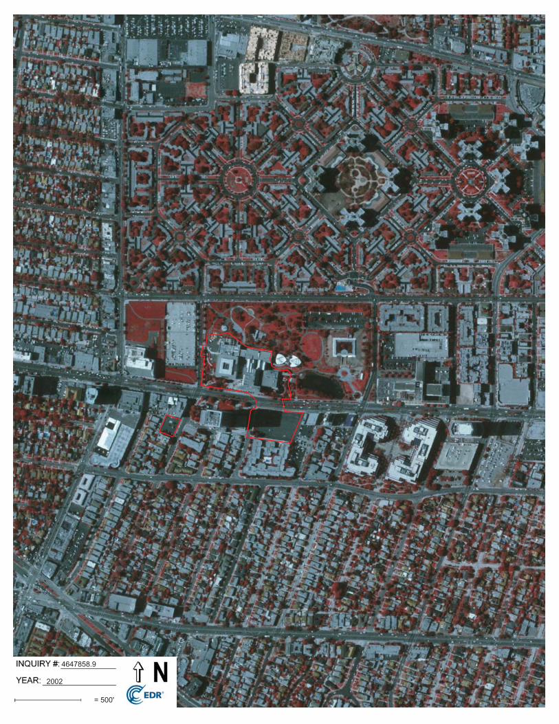
4647858.9
2002
= 500'

4647858.9
1994
= 500'

4647858.9
1989
= 500'

4647858.9
1983
= 500'

4647858.9
1977
= 500'

4647858.9
1972
= 500'

4647858.9
1964
= 500'

4647858.9
1952
= 500'

4647858.9
1948
= 500'

4647858.9
1938
= 500'

4647858.9
1928
= 500'

4647858.9
1923
= 500'

����������� �������������
Inquiry Number:
����������� �������������������������������������������������!!!�������"�
LACMA5905 Wilshire Boulevard
Los Angeles, CA 90036
June 17, 2016
4647858.3

����������� �������������
����������� ��� Results:
Disclaimer - Copyright and Trademark �otice
EDR and its logos (including Sanborn and Sanborn Map) are trademarks of Environmental Data Resources, Inc. or its affiliates. All other trademarks used hereinare�the property of their respective owners.
page�
The Sanborn Library includes more than 1.2 millionfire insurance maps from Sanborn, Bromley, Perris &Browne, Hopkins, Barlow and others which trackhistorical property usage in approximately 12,000American cities and towns. Collections searched:
Library of Congress
University Publications of America
EDR Private Collection
The Sanborn Library LLC Since 1866™
Limited Permission To Make Copies
Sanborn® Library search results�
�� � �� ����
��������� ������� �
��������� �� ��������
����
�����
196919501927
06/17/16
LACMA AECOM5905 Wilshire Boulevard 915 Wilshire Blvd, Suite 700Los Angeles, CA 90036 Los Angeles, CA 90017
4647858.3 Jessica Himebauch
The Sanborn Library has been searched by EDR and maps covering the target property location as provided by AECOM were identified forthe years listed below. The Sanborn Library is the largest, most complete collection of fire insurance maps. The collection includes mapsfrom Sanborn, Bromley, Perris & Browne, Hopkins, Barlow, and others. Only Environmental Data Resources Inc. (EDR) is authorized togrant rights for commercial reproduction of maps by the Sanborn Library LLC, the copyright holder for the collection. Results can beauthenticated by visiting www.edrnet.com/sanborn.
The Sanborn Library is continually enhanced with newly identified map archives. This report accesses all maps in the collection as of theday this report was generated.
7E5D-468B-B32960506707.1LACMA
Maps Provided:
Certification #: 7E5D-468B-B329
AECOM (the client) is permitted to make up to FIVE photocopies of this Sanborn Map transmittal and each fire insurance map accompanying this report solely for thelimited use of its customer. No one other than the client is authorized to make copies. Upon request made directly to an EDR Account Executive, the client may bepermitted to make a limited number of additional photocopies. This permission is conditioned upon compliance by the client, its customer and their agents with EDR'scopyright policy; a copy of which is available upon request.
This Report contains certain information obtained from a variety of public and other sources reasonably available to Environmental Data Resources, Inc. It cannotbe concluded from this Report that coverage information for the target and surrounding properties does not exist from other sources. NO WARRANTYEXPRESSED OR IMPLIED, IS MADE WHATSOEVER IN CONNECTION WITH THIS REPORT. ENVIRONMENTAL DATA RESOURCES, INC. SPECIFICALLYDISCLAIMS THE MAKING OF ANY SUCH WARRANTIES, INCLUDING WITHOUT LIMITATION, MERCHANTABILITY OR FITNESS FOR A PARTICULAR USEOR PURPOSE. ALL RISK IS ASSUMED BY THE USER. IN NO EVENT SHALL ENVIRONMENTAL DATA RESOURCES, INC. BE LIABLE TO ANYONE,WHETHER ARISING OUT OF ERRORS OR OMISSIONS, NEGLIGENCE, ACCIDENT OR ANY OTHER CAUSE, FOR ANY LOSS OF DAMAGE, INCLUDING,WITHOUT LIMITATION, SPECIAL, INCIDENTAL, CONSEQUENTIAL, OR EXEMPLARY DAMAGES. ANY LIABILITY ON THE PART OF ENVIRONMENTALDATA RESOURCES, INC. IS STRICTLY LIMITED TO A REFUND OF THE AMOUNT PAID FOR THIS REPORT. Purchaser accepts this Report "AS IS". Anyanalyses, estimates, ratings, environmental risk levels or risk codes provided in this Report are provided for illustrative purposes only, and are not intended toprovide, nor should they be interpreted as providing any facts regarding, or prediction or forecast of, any environmental risk for any property. Only a Phase IEnvironmental Site Assessment performed by an environmental professional can provide information regarding the environmental risk for any property.Additionally, the information provided in this Report is not to be construed as legal advice.
Copyright 2016 by Environmental Data Resources, Inc. All rights reserved. Reproduction in any media or format, in whole or in part, of any report or map ofEnvironmental Data Resources, Inc., or its affiliates, is prohibited without prior written permission.
4647858 3 2

page�
Sanborn Sheet ���This Certified Sanborn Map Report is based upon the following SanbornFire Insurance map sheets.
1969 Source Sheets
Volume 22, Sheet 2246 Volume 22, Sheet 2247 Volume 22, Sheet 2260 Volume 23, Sheet 2308
1950 Source Sheets
Volume 23, Sheet 2308 Volume 22, Sheet 2246 Volume 22, Sheet 2260
1927 Source Sheets
Volume 23, Sheet 2308
4647858 3 4

This Certified Sanborn Map combines the following sheets.Outlined areas indicate map sheets within the collection. 0 Feet 150 300 600
� page
����������� �������Site Name:
Address:
City, ST, ZIP:
Client: AECOM
EDR Inquiry: 4647858.3Order Date: 06/17/2016Certification # 7E5D-468B-B329
7E5D
-468
B-B
329
Copyright
LACMA
5905 Wilshire Boulevard
Los Angeles, CA 90036
1969
1969
Volume 23, Sheet 2308Volume 22, Sheet 2260Volume 22, Sheet 2247Volume 22, Sheet 2246
4647858 3 5

This Certified Sanborn Map combines the following sheets.Outlined areas indicate map sheets within the collection. 0 Feet 150 300 600
� page
����������� �������Site Name:
Address:
City, ST, ZIP:
Client: AECOM
EDR Inquiry: 4647858.3Order Date: 06/17/2016Certification # 7E5D-468B-B329
7E5D
-468
B-B
329
Copyright
LACMA
5905 Wilshire Boulevard
Los Angeles, CA 90036
1950
1950
Volume 22, Sheet 2260Volume 22, Sheet 2246Volume 23, Sheet 2308
4647858 3 6

This Certified Sanborn Map combines the following sheets.Outlined areas indicate map sheets within the collection. 0 Feet 150 300 600
� page
����������� �������Site Name:
Address:
City, ST, ZIP:
Client: AECOM
EDR Inquiry: 4647858.3Order Date: 06/17/2016Certification # 7E5D-468B-B329
7E5D
-468
B-B
329
Copyright
LACMA
5905 Wilshire Boulevard
Los Angeles, CA 90036
1927
1927
Volume 23, Sheet 2308
4647858 3 7

����������� �������������
Inquiry Number:
����������� �������������������������������������������������!!!�������"�
LACMA5905 Wilshire Boulevard
Los Angeles, CA 90036
June 17, 2016
4647858.3
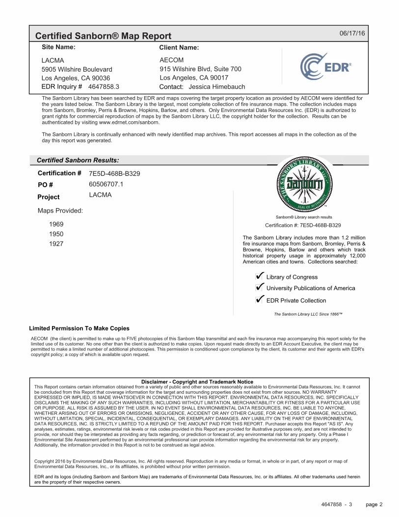
����������� �������������
����������� ��� Results:
Disclaimer - Copyright and Trademark �otice
EDR and its logos (including Sanborn and Sanborn Map) are trademarks of Environmental Data Resources, Inc. or its affiliates. All other trademarks used hereinare�the property of their respective owners.
page�
The Sanborn Library includes more than 1.2 millionfire insurance maps from Sanborn, Bromley, Perris &Browne, Hopkins, Barlow and others which trackhistorical property usage in approximately 12,000American cities and towns. Collections searched:
Library of Congress
University Publications of America
EDR Private Collection
The Sanborn Library LLC Since 1866™
Limited Permission To Make Copies
Sanborn® Library search results�
�� � �� ����
��������� ������� �
��������� �� ��������
����
�����
196919501927
06/17/16
LACMA AECOM5905 Wilshire Boulevard 915 Wilshire Blvd, Suite 700Los Angeles, CA 90036 Los Angeles, CA 90017
4647858.3 Jessica Himebauch
The Sanborn Library has been searched by EDR and maps covering the target property location as provided by AECOM were identified forthe years listed below. The Sanborn Library is the largest, most complete collection of fire insurance maps. The collection includes mapsfrom Sanborn, Bromley, Perris & Browne, Hopkins, Barlow, and others. Only Environmental Data Resources Inc. (EDR) is authorized togrant rights for commercial reproduction of maps by the Sanborn Library LLC, the copyright holder for the collection. Results can beauthenticated by visiting www.edrnet.com/sanborn.
The Sanborn Library is continually enhanced with newly identified map archives. This report accesses all maps in the collection as of theday this report was generated.
7E5D-468B-B32960506707.1LACMA
Maps Provided:
Certification #: 7E5D-468B-B329
AECOM (the client) is permitted to make up to FIVE photocopies of this Sanborn Map transmittal and each fire insurance map accompanying this report solely for thelimited use of its customer. No one other than the client is authorized to make copies. Upon request made directly to an EDR Account Executive, the client may bepermitted to make a limited number of additional photocopies. This permission is conditioned upon compliance by the client, its customer and their agents with EDR'scopyright policy; a copy of which is available upon request.
This Report contains certain information obtained from a variety of public and other sources reasonably available to Environmental Data Resources, Inc. It cannotbe concluded from this Report that coverage information for the target and surrounding properties does not exist from other sources. NO WARRANTYEXPRESSED OR IMPLIED, IS MADE WHATSOEVER IN CONNECTION WITH THIS REPORT. ENVIRONMENTAL DATA RESOURCES, INC. SPECIFICALLYDISCLAIMS THE MAKING OF ANY SUCH WARRANTIES, INCLUDING WITHOUT LIMITATION, MERCHANTABILITY OR FITNESS FOR A PARTICULAR USEOR PURPOSE. ALL RISK IS ASSUMED BY THE USER. IN NO EVENT SHALL ENVIRONMENTAL DATA RESOURCES, INC. BE LIABLE TO ANYONE,WHETHER ARISING OUT OF ERRORS OR OMISSIONS, NEGLIGENCE, ACCIDENT OR ANY OTHER CAUSE, FOR ANY LOSS OF DAMAGE, INCLUDING,WITHOUT LIMITATION, SPECIAL, INCIDENTAL, CONSEQUENTIAL, OR EXEMPLARY DAMAGES. ANY LIABILITY ON THE PART OF ENVIRONMENTALDATA RESOURCES, INC. IS STRICTLY LIMITED TO A REFUND OF THE AMOUNT PAID FOR THIS REPORT. Purchaser accepts this Report "AS IS". Anyanalyses, estimates, ratings, environmental risk levels or risk codes provided in this Report are provided for illustrative purposes only, and are not intended toprovide, nor should they be interpreted as providing any facts regarding, or prediction or forecast of, any environmental risk for any property. Only a Phase IEnvironmental Site Assessment performed by an environmental professional can provide information regarding the environmental risk for any property.Additionally, the information provided in this Report is not to be construed as legal advice.
Copyright 2016 by Environmental Data Resources, Inc. All rights reserved. Reproduction in any media or format, in whole or in part, of any report or map ofEnvironmental Data Resources, Inc., or its affiliates, is prohibited without prior written permission.
4647858 3 2

page�
Sanborn Sheet ���This Certified Sanborn Map Report is based upon the following SanbornFire Insurance map sheets.
1969 Source Sheets
Volume 22, Sheet 2245 Volume 22, Sheet 2246 Volume 22, Sheet 2248 Volume 23, Sheet 2307
1950 Source Sheets
Volume 23, Sheet 2307 Volume 22, Sheet 2245 Volume 22, Sheet 2246 Volume 22, Sheet 2248
1927 Source Sheets
Volume 23, Sheet 2307
4647858 3 4

This Certified Sanborn Map combines the following sheets.Outlined areas indicate map sheets within the collection. 0 Feet 150 300 600
� page
����������� �������
7E5D
-468
B-B
329
7E5D-468B-B329
1969
1969
Order Date: 06/17/2016Certification #
Site Name:
Address:
LACMA
5905 Wilshire Boulevard
City, ST, ZIP: Los Angeles, CA 90036
EDR Inquiry: 4647858.3
Client: AECOM
Copyright
Volume 23, Sheet 2307Volume 22, Sheet 2248Volume 22, Sheet 2246Volume 22, Sheet 2245
4647858 3 5

This Certified Sanborn Map combines the following sheets.Outlined areas indicate map sheets within the collection. 0 Feet 150 300 600
� page
����������� �������
7E5D
-468
B-B
329
7E5D-468B-B329
1950
1950
Order Date: 06/17/2016Certification #
Site Name:
Address:
LACMA
5905 Wilshire Boulevard
City, ST, ZIP: Los Angeles, CA 90036
EDR Inquiry: 4647858.3
Client: AECOM
Copyright
Volume 22, Sheet 2248Volume 22, Sheet 2246Volume 22, Sheet 2245Volume 23, Sheet 2307
4647858 3 6

This Certified Sanborn Map combines the following sheets.Outlined areas indicate map sheets within the collection. 0 Feet 150 300 600
� page
����������� �������
7E5D
-468
B-B
329
7E5D-468B-B329
1927
1927
Order Date: 06/17/2016Certification #
Site Name:
Address:
LACMA
5905 Wilshire Boulevard
City, ST, ZIP: Los Angeles, CA 90036
EDR Inquiry: 4647858.3
Client: AECOM
Copyright
Volume 23, Sheet 2307
4647858 3 7

����������� �������������
Inquiry Number:
����������� �������������������������������������������������!!!�������"�
LACMA5905 Wilshire Boulevard
Los Angeles, CA 90036
June 17, 2016
4647858.3
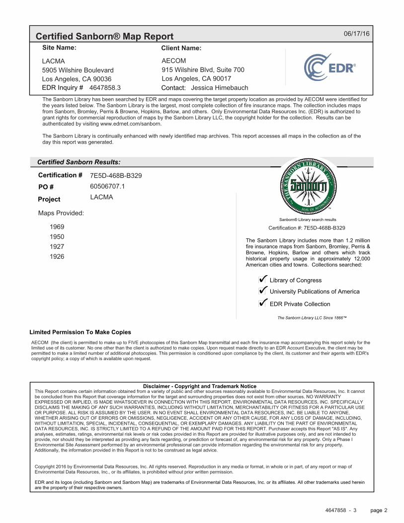
����������� �������������
����������� ��� Results:
Disclaimer - Copyright and Trademark �otice
EDR and its logos (including Sanborn and Sanborn Map) are trademarks of Environmental Data Resources, Inc. or its affiliates. All other trademarks used hereinare�the property of their respective owners.
page�
The Sanborn Library includes more than 1.2 millionfire insurance maps from Sanborn, Bromley, Perris &Browne, Hopkins, Barlow and others which trackhistorical property usage in approximately 12,000American cities and towns. Collections searched:
Library of Congress
University Publications of America
EDR Private Collection
The Sanborn Library LLC Since 1866™
Limited Permission To Make Copies
Sanborn® Library search results�
�� � �� ����
��������� ������� �
��������� �� ��������
����
�����
1969195019271926
06/17/16
LACMA AECOM5905 Wilshire Boulevard 915 Wilshire Blvd, Suite 700Los Angeles, CA 90036 Los Angeles, CA 90017
4647858.3 Jessica Himebauch
The Sanborn Library has been searched by EDR and maps covering the target property location as provided by AECOM were identified forthe years listed below. The Sanborn Library is the largest, most complete collection of fire insurance maps. The collection includes mapsfrom Sanborn, Bromley, Perris & Browne, Hopkins, Barlow, and others. Only Environmental Data Resources Inc. (EDR) is authorized togrant rights for commercial reproduction of maps by the Sanborn Library LLC, the copyright holder for the collection. Results can beauthenticated by visiting www.edrnet.com/sanborn.
The Sanborn Library is continually enhanced with newly identified map archives. This report accesses all maps in the collection as of theday this report was generated.
7E5D-468B-B32960506707.1LACMA
Maps Provided:
Certification #: 7E5D-468B-B329
AECOM (the client) is permitted to make up to FIVE photocopies of this Sanborn Map transmittal and each fire insurance map accompanying this report solely for thelimited use of its customer. No one other than the client is authorized to make copies. Upon request made directly to an EDR Account Executive, the client may bepermitted to make a limited number of additional photocopies. This permission is conditioned upon compliance by the client, its customer and their agents with EDR'scopyright policy; a copy of which is available upon request.
This Report contains certain information obtained from a variety of public and other sources reasonably available to Environmental Data Resources, Inc. It cannotbe concluded from this Report that coverage information for the target and surrounding properties does not exist from other sources. NO WARRANTYEXPRESSED OR IMPLIED, IS MADE WHATSOEVER IN CONNECTION WITH THIS REPORT. ENVIRONMENTAL DATA RESOURCES, INC. SPECIFICALLYDISCLAIMS THE MAKING OF ANY SUCH WARRANTIES, INCLUDING WITHOUT LIMITATION, MERCHANTABILITY OR FITNESS FOR A PARTICULAR USEOR PURPOSE. ALL RISK IS ASSUMED BY THE USER. IN NO EVENT SHALL ENVIRONMENTAL DATA RESOURCES, INC. BE LIABLE TO ANYONE,WHETHER ARISING OUT OF ERRORS OR OMISSIONS, NEGLIGENCE, ACCIDENT OR ANY OTHER CAUSE, FOR ANY LOSS OF DAMAGE, INCLUDING,WITHOUT LIMITATION, SPECIAL, INCIDENTAL, CONSEQUENTIAL, OR EXEMPLARY DAMAGES. ANY LIABILITY ON THE PART OF ENVIRONMENTALDATA RESOURCES, INC. IS STRICTLY LIMITED TO A REFUND OF THE AMOUNT PAID FOR THIS REPORT. Purchaser accepts this Report "AS IS". Anyanalyses, estimates, ratings, environmental risk levels or risk codes provided in this Report are provided for illustrative purposes only, and are not intended toprovide, nor should they be interpreted as providing any facts regarding, or prediction or forecast of, any environmental risk for any property. Only a Phase IEnvironmental Site Assessment performed by an environmental professional can provide information regarding the environmental risk for any property.Additionally, the information provided in this Report is not to be construed as legal advice.
Copyright 2016 by Environmental Data Resources, Inc. All rights reserved. Reproduction in any media or format, in whole or in part, of any report or map ofEnvironmental Data Resources, Inc., or its affiliates, is prohibited without prior written permission.
4647858 3 2

page�
Sanborn Sheet ���This Certified Sanborn Map Report is based upon the following SanbornFire Insurance map sheets.
1969 Source Sheets
Volume 22, Sheet 2208 Volume 22, Sheet 2242 Volume 22, Sheet 2245 Volume 22, Sheet 2248
Volume 23, Sheet 2306
1950 Source Sheets
Volume 22, Sheet 2208 Volume 22, Sheet 2242 Volume 22, Sheet 2245 Volume 22, Sheet 2248
Volume 23, Sheet 2306
4647858 3 4

page�
Sanborn Sheet ���This Certified Sanborn Map Report is based upon the following SanbornFire Insurance map sheets.
1927 Source Sheets
Volume 23, Sheet 2306
1926 Source Sheets
Volume 22, Sheet 2208 Volume 22, Sheet 2242
4647858 3 5

This Certified Sanborn Map combines the following sheets.Outlined areas indicate map sheets within the collection. 0 Feet 150 300 600
� page
����������� �������
7E5D
-468
B-B
329
7E5D-468B-B329
1969
1969
Order Date: 06/17/2016Certification #
Site Name:
Address:
LACMA
5905 Wilshire Boulevard
City, ST, ZIP: Los Angeles, CA 90036
EDR Inquiry: 4647858.3
Client: AECOM
Copyright
Volume 23, Sheet 2306Volume 22, Sheet 2248Volume 22, Sheet 2245Volume 22, Sheet 2242Volume 22, Sheet 2208
4647858 3 6

This Certified Sanborn Map combines the following sheets.Outlined areas indicate map sheets within the collection. 0 Feet 150 300 600
� page
����������� �������
7E5D
-468
B-B
329
7E5D-468B-B329
1950
1950
Order Date: 06/17/2016Certification #
Site Name:
Address:
LACMA
5905 Wilshire Boulevard
City, ST, ZIP: Los Angeles, CA 90036
EDR Inquiry: 4647858.3
Client: AECOM
Copyright
Volume 23, Sheet 2306Volume 22, Sheet 2248Volume 22, Sheet 2245Volume 22, Sheet 2242Volume 22, Sheet 2208
4647858 3 7

This Certified Sanborn Map combines the following sheets.Outlined areas indicate map sheets within the collection. 0 Feet 150 300 600
� page
����������� �������
7E5D
-468
B-B
329
7E5D-468B-B329
1927
1927
Order Date: 06/17/2016Certification #
Site Name:
Address:
LACMA
5905 Wilshire Boulevard
City, ST, ZIP: Los Angeles, CA 90036
EDR Inquiry: 4647858.3
Client: AECOM
Copyright
Volume 23, Sheet 2306
4647858 3 8

This Certified Sanborn Map combines the following sheets.Outlined areas indicate map sheets within the collection. 0 Feet 150 300 600
� page
����������� �������
7E5D
-468
B-B
329
7E5D-468B-B329
1926
1926
Order Date: 06/17/2016Certification #
Site Name:
Address:
LACMA
5905 Wilshire Boulevard
City, ST, ZIP: Los Angeles, CA 90036
EDR Inquiry: 4647858.3
Client: AECOM
Copyright
Volume 22, Sheet 2242Volume 22, Sheet 2208
4647858 3 9

��������������������������
Inquiry Number:
����������� �������������������������������������������������!!!�������"�
��������������
LACMA5905 Wilshire Boulevard
Los Angeles, CA 90036
June 15, 2016
4647858.4
����� �� ������������������
�� ������� �
Search Results:
�����������
�������� ����
Disclaimer - Copyright and Trademark �otice
EDR and its logos (including Sanborn and Sanborn Map) are trademarks of Environmental Data Resources, Inc. or its affiliates. All other trademarks used hereinare�the property of their respective owners.
page�
�����������:
��������������������������������������!�����"�����!��#$�%������
�������
��������� �� ��������
20121991, 19941981197219661950, 195319261924
192119021900189818961894
06/15/16
LACMA AECOM5905 Wilshire Boulevard 915 Wilshire Blvd, Suite 700Los Angeles, CA 90036 Los Angeles, CA 90017
4647858.4 Jessica Himebauch
EDR Topographic Map Library has been searched by EDR and maps covering the target property location as provided byAECOM were identified for the years listed below. EDR’s Historical Topo Map Report is designed to assist professionals inevaluating potential liability on a target property resulting from past activities. EDRs Historical Topo Map Report includes asearch of a collection of public and private color historical topographic maps, dating back to the late 1800s.
60506707.1 34.063987 34° 3' 50" NorthLACMA -118.356816 -118° 21' 25" West
Zone 11 North374790.623770081.25174.39' above sea level
This Report contains certain information obtained from a variety of public and other sources reasonably available to Environmental Data Resources, Inc. It cannotbe concluded from this Report that coverage information for the target and surrounding properties does not exist from other sources. NO WARRANTYEXPRESSED OR IMPLIED, IS MADE WHATSOEVER IN CONNECTION WITH THIS REPORT. ENVIRONMENTAL DATA RESOURCES, INC. SPECIFICALLYDISCLAIMS THE MAKING OF ANY SUCH WARRANTIES, INCLUDING WITHOUT LIMITATION, MERCHANTABILITY OR FITNESS FOR A PARTICULAR USEOR PURPOSE. ALL RISK IS ASSUMED BY THE USER. IN NO EVENT SHALL ENVIRONMENTAL DATA RESOURCES, INC. BE LIABLE TO ANYONE,WHETHER ARISING OUT OF ERRORS OR OMISSIONS, NEGLIGENCE, ACCIDENT OR ANY OTHER CAUSE, FOR ANY LOSS OF DAMAGE, INCLUDING,WITHOUT LIMITATION, SPECIAL, INCIDENTAL, CONSEQUENTIAL, OR EXEMPLARY DAMAGES. ANY LIABILITY ON THE PART OF ENVIRONMENTALDATA RESOURCES, INC. IS STRICTLY LIMITED TO A REFUND OF THE AMOUNT PAID FOR THIS REPORT. Purchaser accepts this Report "AS IS". Anyanalyses, estimates, ratings, environmental risk levels or risk codes provided in this Report are provided for illustrative purposes only, and are not intended toprovide, nor should they be interpreted as providing any facts regarding, or prediction or forecast of, any environmental risk for any property. Only a Phase IEnvironmental Site Assessment performed by an environmental professional can provide information regarding the environmental risk for any property.Additionally, the information provided in this Report is not to be construed as legal advice.Copyright 2016 by Environmental Data Resources, Inc. All rights reserved. Reproduction in any media or format, in whole or in part, of any report or map ofEnvironmental Data Resources, Inc., or its affiliates, is prohibited without prior written permission.
4647858 4 2

page
Topo Sheet ���This EDR Topo Map Report is based upon the following USGS topographic map sheets.
�
2012 Source Sheets
Hollywood
7.5-minute, 24000
Beverly Hills
7.5-minute, 24000
1991, 1994 Source Sheets
Hollywood
7.5-minute, 24000Photo Inspected 1991Photo Revised 1981
Beverly Hills
7.5-minute, 24000Photo Inspected 1991Photo Revised 1981
1981 Source Sheets
Beverly Hills
7.5-minute, 24000Photo Revised 1981Aerial Photo Revised 1978
Hollywood
7.5-minute, 24000Photo Revised 1981Aerial Photo Revised 1978
1972 Source Sheets
Hollywood
7.5-minute, 24000Photo Revised 1972Aerial Photo Revised 1972
Beverly Hills
7.5-minute, 24000Photo Revised 1972Aerial Photo Revised 1972
4647858 4 4

page
Topo Sheet ���This EDR Topo Map Report is based upon the following USGS topographic map sheets.
�
1966 Source Sheets
Beverly Hills
7.5-minute, 24000Aerial Photo Revised 1964
Hollywood
7.5-minute, 24000Aerial Photo Revised 1964
1950, 1953 Source Sheets
Beverly Hills
7.5-minute, 24000Aerial Photo Revised 1947Edited 1950
Hollywood
7.5-minute, 24000Aerial Photo Revised 1952
1926 Source Sheets
Hollywood
7.5-minute, 24000
1924 Source Sheets
Hollywood
7.5-minute, 24000
4647858 4 5

page
Topo Sheet ���This EDR Topo Map Report is based upon the following USGS topographic map sheets.
�
1921 Source Sheets
Santa Monica
15-minute, 62500Edited 1920
1902 Source Sheets
Santa Monica
15-minute, 62500
1900 Source Sheets
Los Angeles
15-minute, 62500
1898 Source Sheets
Santa Monica
15-minute, 62500
4647858 4 6

page
Topo Sheet ���This EDR Topo Map Report is based upon the following USGS topographic map sheets.
�
1896 Source Sheets
Santa Monica
15-minute, 62500
1894 Source Sheets
Los Angeles
15-minute, 62500
4647858 4 7

� �� ������������
page
SITE NAME:ADDRESS:
CLIENT:
This �eport includes information from the following map sheet(s).
�
%*
�� � �
�* � �
2012
0 Miles 0.25 0.5 1 1.5
LACMA5905 Wilshire BoulevardLos Angeles, CA 90036AECOM
TP, Hollywood, 2012, 7.5-minuteW, Beverly Hills, 2012, 7.5-minute
4647858 4 8

� �� ������������
page
SITE NAME:ADDRESS:
CLIENT:
This �eport includes information from the following map sheet(s).
�
%*
�� � �
�* � �
1991, 1994
0 Miles 0.25 0.5 1 1.5
LACMA5905 Wilshire BoulevardLos Angeles, CA 90036AECOM
TP, Hollywood, 1991, 7.5-minuteW, Beverly Hills, 1994, 7.5-minute
4647858 4 9

� �� ������������
page
SITE NAME:ADDRESS:
CLIENT:
This �eport includes information from the following map sheet(s).
�
%*
�� � �
�* � �
1981
0 Miles 0.25 0.5 1 1.5
LACMA5905 Wilshire BoulevardLos Angeles, CA 90036AECOM
TP, Hollywood, 1981, 7.5-minuteW, Beverly Hills, 1981, 7.5-minute
4647858 4 10

� �� ������������
page
SITE NAME:ADDRESS:
CLIENT:
This �eport includes information from the following map sheet(s).
�
%*
�� � �
�* � �
1972
0 Miles 0.25 0.5 1 1.5
LACMA5905 Wilshire BoulevardLos Angeles, CA 90036AECOM
TP, Hollywood, 1972, 7.5-minuteW, Beverly Hills, 1972, 7.5-minute
4647858 4 11

� �� ������������
page
SITE NAME:ADDRESS:
CLIENT:
This �eport includes information from the following map sheet(s).
�
%*
�� � �
�* � �
1966
0 Miles 0.25 0.5 1 1.5
LACMA5905 Wilshire BoulevardLos Angeles, CA 90036AECOM
TP, Hollywood, 1966, 7.5-minuteW, Beverly Hills, 1966, 7.5-minute
4647858 4 12

� �� ������������
page
SITE NAME:ADDRESS:
CLIENT:
This �eport includes information from the following map sheet(s).
�
%*
�� � �
�* � �
1950, 1953
0 Miles 0.25 0.5 1 1.5
LACMA5905 Wilshire BoulevardLos Angeles, CA 90036AECOM
TP, Hollywood, 1953, 7.5-minuteW, Beverly Hills, 1950, 7.5-minute
4647858 4 13

� �� ������������
page
SITE NAME:ADDRESS:
CLIENT:
This �eport includes information from the following map sheet(s).
�
%*
�� � �
�* � �
1926
0 Miles 0.25 0.5 1 1.5
LACMA5905 Wilshire BoulevardLos Angeles, CA 90036AECOM
TP, Hollywood, 1926, 7.5-minute
4647858 4 14

� �� ������������
page
SITE NAME:ADDRESS:
CLIENT:
This �eport includes information from the following map sheet(s).
�
%*
�� � �
�* � �
1924
0 Miles 0.25 0.5 1 1.5
LACMA5905 Wilshire BoulevardLos Angeles, CA 90036AECOM
TP, Hollywood, 1924, 7.5-minute
4647858 4 15

� �� ������������
page
SITE NAME:ADDRESS:
CLIENT:
This �eport includes information from the following map sheet(s).
�
%*
�� � �
�* � �
1921
0 Miles 0.25 0.5 1 1.5
LACMA5905 Wilshire BoulevardLos Angeles, CA 90036AECOM
TP, Santa Monica, 1921, 15-minute
4647858 4 16

� �� ������������
page
SITE NAME:ADDRESS:
CLIENT:
This �eport includes information from the following map sheet(s).
�
%*
�� � �
�* � �
1902
0 Miles 0.25 0.5 1 1.5
LACMA5905 Wilshire BoulevardLos Angeles, CA 90036AECOM
TP, Santa Monica, 1902, 15-minute
4647858 4 17

� �� ������������
page
SITE NAME:ADDRESS:
CLIENT:
This �eport includes information from the following map sheet(s).
�
%*
�� � �
�* � �
1900
0 Miles 0.25 0.5 1 1.5
LACMA5905 Wilshire BoulevardLos Angeles, CA 90036AECOM
TP, Los Angeles, 1900, 15-minute
4647858 4 18

� �� ������������
page
SITE NAME:ADDRESS:
CLIENT:
This �eport includes information from the following map sheet(s).
�
%*
�� � �
�* � �
1898
0 Miles 0.25 0.5 1 1.5
LACMA5905 Wilshire BoulevardLos Angeles, CA 90036AECOM
TP, Santa Monica, 1898, 15-minute
4647858 4 19

� �� ������������
page
SITE NAME:ADDRESS:
CLIENT:
This �eport includes information from the following map sheet(s).
�
%*
�� � �
�* � �
1896
0 Miles 0.25 0.5 1 1.5
LACMA5905 Wilshire BoulevardLos Angeles, CA 90036AECOM
TP, Santa Monica, 1896, 15-minute
4647858 4 20

� �� ������������
page
SITE NAME:ADDRESS:
CLIENT:
This �eport includes information from the following map sheet(s).
�
%*
�� � �
�* � �
1894
0 Miles 0.25 0.5 1 1.5
LACMA5905 Wilshire BoulevardLos Angeles, CA 90036AECOM
TP, Los Angeles, 1894, 15-minute
4647858 4 21
� �� ���� �������� �����!��#$�� %�&����( �% ���)*
������� ��+:�� ;*;<=�=>�?��� @�( [�@*
�!�����"� #�� ���#� $���
����������� ��������������������������������������������������� ��� ������� �������������� ��� ������� �������������� ��� ������� �������������� ��� ������� ���

� %����&��������'
'���(��
�)��* ���'*���#
& �� �+�
� #�� ���#�(��+��
�������������� ��������\����� ������� �� �� @�=���)�[�����
]��� ��� ��������� �� ��++����>
� ���� ���"����# +!�����������,��� ��^��� ��_��� �������� ������� ��`��+����� �:�����# `��+ � !������ �` _�:��� ��# ����� ������� �������:�� �!����:�� �� �!����+����� ���� ���������( ���> �� ������ :� ������#�# `��+ ���� ��_��� ���� ��!���&� ��`��+����� `�� ��� ���&�� ��# �������#��& _��_������ #��� ��� �j��� `��+ ����� �������> ���- �� ��.��/���''������(���(��0�('�� ���-� �'��1���(���������(���-(�����('�������2���1(������� ��� � ���'�3���'0�(��2�'���(&(� ��.��('�� (�'������ 4(�5��&� �.�'3���- �� ��(�'0�(���3�(�5�-(���3���(�(� �(��0������ �� %(�(�.����&(���''�&��� �� ��(�3� ��3'������3���'�2� ����('4�('� ''3����%.�����3'��2�(������1����'� �����1(������� ��� � ���'�3���'0�(��2�%���( %������ �.���0�-������� �('(�5��3���&������'������(''(��'0���5�(5����0� ��(�������� �.�������� 3'�0�&��� �.���''����� � 5�0�(���3�(�50�-(���3���(�(� �(��0�'���( �0�(��(���� �0����'�63���( �0�����/���� �.�� � 5�'2� �.��( %(�(�.��������� ����&���1(������� ��� � ���'�3���'0�(��2�('�'��(���.��(�(������� ���&3����&����� ��3���� (��&�����('�������2�\�������� ����_�� ���� ��_��� q%� ��q> %�� ��������( ����+����( �����&�( ��!����+����� ���z ��!��� �� ���z ��#�� _��!�#�# �� ���� ��_��� ��� _��!�#�# `�� ����������!� _��_���� ����( ��# ��� ��� �����#�# �� _��!�#�( ��� �����# ���� :� �����_����# �� _��!�#��& ��� `���� ��&��#��&( �� _��#������ ��`������� �`( ��� ��!����+����� ���z `�� ��� _��_����> {��� � \���� � �!����+����� ���� %�����+��� _��`��+�# :� �� ��!����+����� _��`�������� ��� _��!�#� ��`��+����� ��&��#��& ��� ��!����+����� ���z `�� ��� _��_����> %##���������( ��� ��`��+����� _��!�#�# �� ���� ��_��� �� ��� �� :� ��������# �� ��&�� �#!���>
��_���&�� [�@* :� �!����+����� ���� ���������( ���> %�� ��&��� �����!�#> ��_��#������ �� ��� +�#�� �� `��+��( �� ]���� �� �� _���( �` ��� ��_��� �� +�_ �` �!����+����� ���� ���������( ���> �� ��� �``������� �� _����:���# ]������ _���� ]������ _��+������>
�� ��# ��� ��&�� |�����#��& ���:��� ��# ���:��� }�_~ ��� ���#�+��z� �` �!����+����� ���� ���������( ���> �� ��� �``�������> %�� ����� ���#�+��z� ���# ������ ��� ��� _��_���� �` ����� ���_����!� �]����>

�/��3�(1��'3�� �.
��'��(��(��
�!����+����� ���� ���������( ���>�� |��~ ���� ��������� %:������ �� � ��������& ���� #���&��# �� ������ ��!����+����� _��`��������� �� �!�������& _�������� ���:����� �� � ���&�� _��_���� ��������& `��+ _��� ����!�����> ���� ���� ��������� %:������ �����#�� � ������ ��# �:������ �` �!����:�� ���� #�������� #���> ��� ���� �##����( ��� #�������� ����� ��� ��+� �` ��� ������_��#��& ����_��� �� `�!� ���� �����!���>
�������� #���������� �����#��& ����( ����� ��`������ ��# ����_���� #���������� ]��� ��!��]�#( �` �!����:��( �� �__��j�+����� `�!� ���� �����!��� `�� ��� ����� �_�����& @�[� �����&� [�@)> ^��� ��_��� ��+_���� ��`��+����� &������# �� ���� ��!��] :� &����#��& ��� ������#� ��# ���&���#� �` _��_������ �#����`��# ��# &�������& ��`��+����� �:��� _��_������ ]����� ))[ `��� �` ��� ���&�� _��_����>
% ��++��� �` ��� ��`��+����� �:�����# �� _��!�#�# �� ��� ��j� �` ���� ��_���>
��'� ����'3�� �.
^�� `����]��& �������� ������� ]��� ��������# �� ��� _��_������� �` ���� ��_���> %� q�q ��#������ ]���� ��`��+����� ]�� �#����`��# �� ��� ������ ��# _��!�#�# �� ���� ��_���>
���� ������ �������� ������ ������ ����������
[�@) ���� ��`��+����� ���!���� � � � ����� ��`��+����� ���!���� � � � �
[��= ���� ��`��+����� ���!���� � � � ����� ��`��+����� ���!���� � � � �
[��* ������ ��+_���( ���> � � � �[��; ������ ��+_��� � � � �[��) ������ � ��+_��� � � � �[��@ ������ ��+_���( ���> � � � �[��� ������ � ��+_��� � � � �@��� ������ ��+_��� � � � �@��* �^ � � � �@��� \���`�� ���� � � � �@��[ \%����� �$$ ���^ \%�� � � � �@��@ \���`�� ���� � � � �@��� \���`�� ���� � � � �@�=* \���`�� ���� � � � �@�=� \���`�� ���� � � � �@�=@ \���`�� ^���_���� � � � �@�=� \���`�� ^���_���� � � � �@�<* \���`�� ^���_���� � � � �@�<� \���`�� ^���_���� � � � �@�<[ �> $> \��z � ��> � � � �@�<@ \���`�� ^���_���� � � � �@�<� \���`�� ^���_���� � � � �@�*� \���`�� ^���_���� � � � �
;*;<=�=� � \�&� @

�/��3�(1��'3�� �.
���� ������ �������� ������ ������ ����������
@�*< \���`�� ^���_���� � � � �@�** \���`�� ^���_���� � � � �@�*� \���`�� ^���_���� � � � �@�*; \���`�� ^���_���� � � � �@�*) \���`�� ^���_���� � � � �@�*[ \���`�� ^���_���� � � � �@�*@ �> $> \��z � ��> � � � �@�*� \���`�� ^���_���� � � � �@��= \���`�� ^���_���� � � � �
\���`�� ^���_���� � � � �@��< \���`�� ^���_���� � � � �@��* \���`�� ^���_���� � � � �@��� �> $> \��z � ��> � � � �@��; �> $> \��z � ��> � � � �@��[ $�� %�&���� ��������� ��> � � � �@��@ \���`�� ^���_���� � ^���&��_� ��> � � � �
\���`�� ^���_���� � ^���&��_� ��> � � � �@��� \���`�� ^���_���� � � � �@�;� $�� %�&���� ��������� ��> � � � �@�;= %��������# ^���_���� ��+_���( $�#> � � � �@�;< \���`�� ��������� ��> � � � �@�;* �������� ����`����� ^���_���� �� � � � �@�;� �> $> \��z � ��> � � � �@�;; �> $> \��z � ��> � � � �@�;[ $�� %�&���� ��������� ��> � � � �
$�� %�&���� ��������� ��> � � � �@�;� $�� %�&���� ��������� ��> � � � �@�)� $�� %�&���� ��������� ��> � � � �@�)= $�� %�&���� ��������� ��+_���
\�:�������� � � �
@�)< $�� %�&���� ��������� ��> � � � �$�� %�&���� ��������� ��> � � � �
@�)* $�� %�&���� ��������� ��> � � � �@�)� $�� %�&���� ��������� ��> � � � �@�); $�� %�&���� ��������� ��> � � � �@�)) $�� %�&���� ��������� ��> � � � �
$�� %�&���� ��������� ��> � � � �@�)[ $�� %�&���� ��������� ��> � � � �@�)@ ^��������� \��$������ �{> � � � �@�)� $�� %�&���� ��������� ��> � � � �@�[� $�� %�&���� ��������� ��> � � � �
$�� %�&���� ��������� ��> � � � �@�[= $�� %�&���� ��������� ��> � � � �
;*;<=�=� � \�&� [

�/��3�(1��'3�� �.
���� ������ �������� ������ ������ ����������
@�[< $�� %�&���� ��������� ��> � � � �@�[* $�� %�&���� ��������� ��> � � � �@�[� $�� %�&���� ��������� ��> � � � �@�[; $�� %�&���� ��������� ��> � � � �@�[) $�� %�&���� ��������� ��> � � � �@�[@ $�� %�&���� ��������� ��> � � � �@�[� $�� %�&���� ��������� ��> � � � �
;*;<=�=� � \�&� )

�/��3�(1��'3�� �.
'�������� ����''�'
^�� `����]��& �##������ ]��� �������# :� ��� ������( `�� �� �� ��������> %� q�q ��#������ ]���� ��`��+����� ]�� �#����`��#>
������� ���� ��������
*��� �������� ��!# ������������ �
<@* � �_���#��& %!� ������������
�=*; �������� ��!# ������������
�=�* �������� ��!# ������������
�=�[ �������� ��!# ������������
�==* �������� ��!# ������������
<@� � {&#�� �� ������������
<@< � {&#�� �� ������������ �
<@� � {&#�� �� ������������ �
<[) � {&#�� �� ������������ �
<[� � {&#�� �� ������������ �
<)@ � {&#�� �� ������������ �
�=�@ �������� ��!# ������������ �
;*;<=�=� � \�&� ;

&(��(�5'
� �5����������.�(�&��� �(��
����''���� �������� �����!��#$�� %�&����( �% ���)*
&(��(�5'���� (�^��&�� \��_���� �������� #�����>
'��+�����
789��'��+�����
���� ��� ����
787��'��+�����
���� ��� ����
@��= �\��% }���{ ���^{} }%� ��{� ��� �����
\���`�� ^���_����
@��@ � {&#� �� �_���� +�#�� �����+ }�#� ����� ��� �����
\���`�� ^���_���� � ^���&��_� ��>
78:��'��+�����
���� ��� ����
@��= ���� % � ������� \���`�� ^���_����
@��@ ���� % � �� ��� \���`�� ^���_���� � ^���&��_� ��>
� {&#� �� \���`�� ^���_���� � ^���&��_� ��>
@�;[ �{�� % � ����#�� ��# ��!���_�� �` }������ }��� �������� ��!#
$�� %�&���� ��������� ��>
7;<��'��+�����
���� ��� ����
@��= ��]��# ���� � \���`�� ^���_����
@�;[ �%����� ����� +��# $�� %�&���� ��������� ��>
���� ?��� }������� % $�� %�&���� ��������� ��>
@�)< ����� ?��� ?����� $�� %�&���� ��������� ��>
����� ?��� } ��z $�� %�&���� ��������� ��>
@�)) %������ �����# � ������� ���+��� � ? \�+����
$�� %�&���� ��������� ��>
}� ����� ���+��# ������� ��� $�� %�&���� ��������� ��>
^������ ���&���� $�� %�&���� ��������� ��>
;*;<=�=� � \�&� �

���� ��� ����
&(��(�5'
���� ��� ����
@�[� ������ �������� % \������ _��� � % ������ � �� %��+��� $�:�������� ��# ��#�� �]��_ �� �
$�� %�&���� ��������� ��>
7;:��'��+�����
���� ��� ����
@��@ � {&#� �� ���#����� ��� % }�� � \���`�� ^���_���� � ^���&��_� ��>
@�;[ �%}�$^{� #] { ������ } $�� %�&���� ��������� ��>
@�)) �}�^� �+ $ $�� %�&���� ��������� ��>
@�[� �$$� ��&� ������#� ��]��� $�� %�&���� ��������� ��>
��^ � {�!���� }�� � $�� %�&���� ��������� ��>
'��5������
7<8��'��5������
���� ��� ����
[�@) }���} %��{��%^� ���� ��`��+����� ���!����
'��+�����
7<8��'��+�����
���� ��� ����
@��= �����+: � % \���`�� ^���_����
@��@ � {&#� �� �����+: � % � \���`�� ^���_���� � ^���&��_� ��>
@�;[ ^%�${� ���+��# � ���� $�� %�&���� ��������� ��>
^%�${� ?��� ���� $�� %�&���� ��������� ��>
^%�${� $������ ]�# ���� $�� %�&���� ��������� ��>
^%�${� }������� � ���� $�� %�&���� ��������� ��>
@�)< ���� %#����#� � ���� ���� ��� $�� %�&���� ��������� ��>
�{��� %��� � ���� ^ �+_����� $�� %�&���� ��������� ��>
��&��� ��� ���� $�� %�&���� ��������� ��>
}�$$� }����� % $�� %�&���� ��������� ��>
{��{�� ���� � ���� +&� ��+��� %������� ���:
$�� %�&���� ��������� ��>
@�)) ���� %#����#� � ���� $�� %�&���� ��������� ��>
���`� }��#��# }�� $�� %�&���� ��������� ��>
{��{�� ���� � $�� %�&���� ��������� ��>
;*;<=�=� � \�&� *

���� ��� ����
&(��(�5'
'�'��*�� �+� ��
78=��'�'��*�� �+� ��
���� ��� ����
- ��! ��%���
9>=?��- ��! ��%���
���� ��� ����
9>>=��- ��! ��%���
���� ��� ����
9>:;��- ��! ��%���
���� ��� ����
9>:=��- ��! ��%���
���� ��� ����
-(�'�(���%�1�
9:@9��-(�'�(���%�1�
���� ��� ����
[�@) �{��^� {� ${� %��$� ���� ��`��+����� ���!����
�%�� ���� ��`��+����� ���!����
[��= �{��^� {� ${� %��$� ���� ��`��+����� ���!����
$ % �{��^� }���} {� %�^ ���� ��`��+����� ���!����
$%�}% ���� ��`��+����� ���!����
}���} %��{��%^� ���� ��`��+����� ���!����
[��* �%�%$�� ������ ��+_���( ���>
���$���� ������ ��+_���( ���>
�$��� ������ ��+_���( ���>
�{���$^��� ������ ��+_���( ���>
���%^�{� ������ ��+_���( ���>
$% �{ }�} %�^ ������ ��+_���( ���>
$% �{��^� ������ ��+_���( ���>
$%�{ }�}%�^ ������ ��+_���( ���>
;*;<=�=� � \�&� <

���� ��� ����
&(��(�5'
���� ��� ����
[��* $%�{}�}%�^ ������ ��+_���( ���>
$%��^��� �\{�^� ������ ��+_���( ���>
}��% �$%^�{�� ������ ��+_���( ���>
}}�����\ ������ ��+_���( ���>
}���} {� %�^ ������ ��+_���( ���>
��^��^�{� ������ ��+_���( ���>
^$%�{ }�}%�^ ������ ��+_���( ���>
^{��� ������ ��+_���( ���>
[��� $% �{ }�} %�^ ���%^�{� )[) = � ������ � ��+_���
$% �{ }�} %�^ ���{ )[) *� � ������ � ��+_���
$% �{ }�} %�^ }��% �$%^�{�� ������ � ��+_���
$% �{ }�} %�^ }}�����\ ������ � ��+_���
$% �{ }�} %�^ ��^$ [) * � ������ � ��+_���
$% �{ }�} %�^ ��{\ ������ � ��+_���
$% �{ }�} %�^ ^��^ ������ � ��+_���
$% �{ }�} %�^ ^�� )[[ �)< � ������ � ��+_���
$% �{ }�} %�^ ^{��� )[);� � < �� ������ � ��+_���
$% �{ }�} {� %�^ [); � < * } ������ � ��+_���
@��� %��� ����� %#+���������� \���`�� ����
������� ��`��+����� \���`�� ����
$�� %�&���� ������ }����+ {` %�^��% \���`�� ����
${� %��$� �{��^� {� }���} {� %�^
\���`�� ����
@��� $ % �{��^� }���} {� %�^ �%� \���`�� ����
�{}��^ �%^��� �%� \���`�� ����
@�=* �%��� �{$�}%� \����� � %��{��%^�
\���`�� ����
\�{\�^ �{{�� $ % �{��^� %�^ }���} �%�^��%
\���`�� ����
@�=@ $ % �{��^� ����% �����^ \���`�� ^���_����
\�{\�^ �{{���$ % �{��^� %�^ }���} �%�^��%
\���`�� ^���_����
@�=� ${� %��$� �{��^� {� }���} {� %�^
\���`�� ^���_����
${� %��$� �{��^� {� }���} {� %�^ }%�� {��
\���`�� ^���_����
${� %��$� �{��^� {� }���} {� %�^ }%�� {�� ��$���� �� ${� %��$�
\���`�� ^���_����
}��� {`� \���`�� ^���_����
}�]��� }� �����+���`�� \���`�� ^���_����
;*;<=�=� � \�&� =

���� ��� ����
&(��(�5'
���� ��� ����
@�=� }���} {� %�^ }��� {` � \���`�� ^���_����
@�<* \��_��� ���#� $�� %�&���� ������ %������ }����+ ��`������
\���`�� ^���_����
@�<� ${� %��$� �{��^� {� % %�{\^�{�� �\^
\���`�� ^���_����
${� %��$� �{��^� {� }���} {� %�^
\���`�� ^���_����
}��� {`� \���`�� ^���_����
@�<@ %�� }����+ $�� %�&���� ������ \���`�� ^���_����
��`��+����� \���`�� ^���_����
${� %��$� �{��^� {� }���} {� %�^ }��� {`�
\���`�� ^���_����
}��� {`� \���`�� ^���_����
@�*< %�� }����+ $�� %�&���� ������ \���`�� ^���_����
� � � % \���`�� ^���_����
��++����� �� ������ ������� %�� \���`�� ^���_����
��`��+����� \���`�� ^���_����
$�� %�&���� ������ �` }���} {� %�^ \���`�� ^���_����
}��� {`� \���`�� ^���_����
;*;<=�=� � \�&� �

&(��(�5'
�A�(�(�5��������.���� (�
^�� `����]��& %#������& \��_���� �##������ ]��� ���������# `�� ���� ��_���> �������# `��#��&� ��� _��!�#�# `�� ���� �##����>
'�'� 3��(�5
7;;��'�'� 3��(�5
���� ��� ����
@�<@ ���#:��& %��� \���`�� ^���_����
����� ���� � \���`�� ^���_����
@�*< ����� ���� � \���`�� ^���_����
@�*[ ����� ���� � \���`�� ^���_����
��&�� ������� \���`�� ^���_����
'�'� 3��(�5� 1�
7@?��'�'� 3��(�5� 1�
���� ��� ����
@�*[ ��$� ��� �{ \���`�� ^���_����
@��= ��^ �%$\� } �{ ��� \���`�� ^���_����
\^��� ������%^�{� � ���^�� �{���$^%�^�
\���`�� ^���_����
%$��� %$��^ % %^^� \���`�� ^���_����
78?��'�'� 3��(�5� 1�
���� ��� ����
@�*� �{}}���%$ ^�\���^� �{ ��� \���`�� ^���_����
@�*[ �{}}���%$ ^�\���^� �{ ��� \���`�� ^���_����
7;;��'�'� 3��(�5� 1�
���� ��� ����
@��= ����� ���� � \���`�� ^���_����
@�;[ ��%�^ ������� } ���� _�:�� ������ ��������
$�� %�&���� ��������� ��>
����� ���� ���� %��� ������� $�� %�&���� ��������� ��>
��#��� }�� ]��� �]�� $�� %�&���� ��������� ��>
7;?��'�'� 3��(�5� 1�
���� ��� ����
@�*� �^%^ }{�^�%� �{ \���`�� ^���_����
;*;<=�=� � \�&� @�

���� ��� ����
&(��(�5'
���� ��� ����
@�*� �%� ���{ �}\��%$ ���{� �{}\%��
\���`�� ^���_����
��$� ��� �{ \���`�� ^���_����
@�*[ }?^ }�^�%$ ����� ��� \���`�� ^���_����
@��= ����{���� \���`�� ^���_����
����{���� \���`�� ^���_����
%#�� }����� \���`�� ^���_����
@�;[ ��$}%� }��&� $�� %�&���� ��������� ��>
��&:� }���� � $�� %�&���� ��������� ��>
7;=��'�'� 3��(�5� 1�
���� ��� ����
@�*[ ���� }�j \���`�� ^���_����
@��= ���z����� ����� }�� \���`�� ^���_����
���� }�j \���`�� ^���_����
@�;[ ����+�� ��+� ? ���� ����+�� � ������ $�� %�&���� ��������� ��>
���� }�j ����� $�� %�&���� ��������� ��>
7;7��'�'� 3��(�5� 1�
���� ��� ����
[��* � }���^�� ���#� ������ ��+_���( ���>
@�<* \����` %���� \���`�� ^���_����
@��= ��j }���� � \���`�� ^���_����
@�;[ ���� ���� ��&��� $�� %�&���� ��������� ��>
@�)< �{� ���� ��&��� $�� %�&���� ��������� ��>
7;>��'�'� 3��(�5� 1�
���� ��� ����
@�<� ���� � ����� }\${�� ��� %��^
\���`�� ^���_����
@��= ����:��& ��!�# \���`�� ^���_����
@�;[ ���� ��� ��% $�� %�&���� ��������� ��>
���� %:� ���#� $�� %�&���� ��������� ��>
}�&�� ����� }�� $�� %�&���� ��������� ��>
�^%�� }��� $�� %�&���� ��������� ��>
@�)< $%��%� � } }���� $�� %�&���� ��������� ��>
7;:��'�'� 3��(�5� 1�
���� ��� ����
[��* �� ������� $�����& ������ ��+_���( ���>
@�=@ � $% \�% �^�$$% � �%��% \���`�� ^���_����
;*;<=�=� � \�&� @@

���� ��� ����
&(��(�5'
���� ��� ����
@�=@ }%����� ?�%��^% � \���`�� ^���_����
}%����� ?�%��^% }�� \���`�� ^���_����
@�<* �� �� \��� ������� \���`�� ^���_����
}�&��#�� ?������ � \���`�� ^���_����
}�&��#�� ?������ }�� \���`�� ^���_����
@��= ������#�� ������# \���`�� ^���_����
������#�� ���#� }������ \���`�� ^���_����
@�;[ ���� �� ������ $�� %�&���� ��������� ��>
@�)< ^��++�� }��� � $�� %�&���� ��������� ��>
^�__�� }��&� � $�� %�&���� ��������� ��>
7<@��'�'� 3��(�5� 1�
���� ��� ����
@�;[ �_��&��+�� ��!��& ��� +&� ��_��+� ��+� ���� �� ���
$�� %�&���� ��������� ��>
@�)< $���!��� ?��z � ���� $�� %�&���� ��������� ��>
7<8��'�'� 3��(�5� 1�
���� ��� ����
[��* � �%^�%#�+ ������ ��+_���( ���>
@��� ��{� }���%$ \���`�� ����
\��� }��% �$%^�{�� \���`�� ����
\�% ��%�$^ \���`�� ����
@�=@ ���{� ���%��% \���`�� ^���_����
@��= $�!� ?�� � \���`�� ^���_����
7<;��'�'� 3��(�5� 1�
���� ��� ����
@�*[ ���] � ������� \���`�� ^���_����
@��= ���] � ������� \���`�� ^���_����
��#���� ���� \���`�� ^���_����
@�;[ ��%� ����z � $���:���� ��� ����� ���] {�� ��
$�� %�&���� ��������� ��>
}�$$� ��!�# \���� _��� $�� %�&���� ��������� ��>
@�)< %$$� ���&���� ? ���� %��:���z ���!�#���� � %��:���z
$�� %�&���� ��������� ��>
%$$� ?���� % }�� $�� %�&���� ��������� ��>
@�)) ������ ��� $ ������� _��� ^���j ��� $�� %�&���� ��������� ��>
������ ������� }�� ! _��� ^���j ��� $�� %�&���� ��������� ��>
@�[� �}�^� ����� � }���� ���+� � } ������ � $�� %�&���� ��������� ��>
\������ �+ $ ���� � $�� %�&���� ��������� ��>
;*;<=�=� � \�&� @[

���� ��� ����
&(��(�5'
���� ��� ����
@�[� \������ �+ $ ���� ���+� � ? ���z��� � $�� %�&���� ��������� ��>
7<<��'�'� 3��(�5� 1�
���� ��� ����
[��* �� ������� $�����& ������ ��+_���( ���>
@��� �$��^{� � % \���`�� ����
����� $%��% \���`�� ����
@�=* �%� ��� � ?�$�% \���`�� ����
@�<* \��z �+ \���`�� ^���_����
@��= }��� %��� \���`�� ^���_����
�����{{� �{�\{�%^�{� \���`�� ^���_����
7<?��'�'� 3��(�5� 1�
���� ��� ����
@�*[ ��������+�#� ���+� \���`�� ^���_����
@��= ��������+�#� ���+� \���`�� ^���_����
@�;[ ��������+�#� \������ $�� %�&���� ��������� ��>
���� }����+ $�� %�&���� ��������� ��>
���� %+���� ]�# ������ $�� %�&���� ��������� ��>
��������+�#� ���+� $�� %�&���� ��������� ��>
@�)< ���#��� }���� } ������ `������ $�� %�&���� ��������� ��>
��������+�#� ���+� ��z $�� %�&���� ��������� ��>
��������+�#� \������ ��z $�� %�&���� ��������� ��>
@�[� ��:������� $�� � ����� +&� $��!��� ���� \������ ��
$�� %�&���� ��������� ��>
7<9��'�'� 3��(�5� 1�
���� ��� ����
[��* � �^�}\ ����&� ������ ��+_���( ���>
@��� ��$}{�� $%���� � \���`�� ����
@�=* ��$}{�� $%���� � \���`�� ����
@�=@ }%^${���� � \���`�� ^���_����
�^%}%� � \���`�� ^���_����
@�<* {������ ^ � \���`�� ^���_����
@��= ��#�+�� ��� \���`�� ^���_����
7<7��'�'� 3��(�5� 1�
���� ��� ����
@�=* }{{� }%^^�� \���`�� ����
$��^ �^�� \���`�� ����
;*;<=�=� � \�&� @)

���� ��� ����
&(��(�5'
���� ��� ����
@�<* ���#+�� ��������� \���`�� ^���_����
@�*� ��$}���^%���{�^� �^%^�{��� �{
\���`�� ^���_����
@�*[ ���}���^%���{�^� �^%^�{��� �{
\���`�� ^���_����
@��= ������+ % ? \���`�� ^���_����
���}���^%���{�^� �^%^�{��� �{
\���`�� ^���_����
7<>��'�'� 3��(�5� 1�
���� ��� ����
@�*[ �+:��+�� %��� \���`�� ^���_����
@��= ^�:���`` }��� \���`�� ^���_����
%__��`���# \���`�� ^���_����
���_�� ������ \���`�� ^���_����
�+:��+�� %��� \���`�� ^���_����
$�]�� ����� }�� \���`�� ^���_����
}���� ������ \���`�� ^���_����
}���� �#� \���`�� ^���_����
��������� ?����� \���`�� ^���_����
@�;[ ���#�� ���� � %�&��� � ��z $�� %�&���� ��������� ��>
������ #��� ���� $�� %�&���� ��������� ��>
������ $���� $�� %�&���� ��������� ��>
������ ���#� $�� %�&���� ��������� ��>
��_��� ���� ���� ��& $�� %�&���� ��������� ��>
���`��# ���� $������ ��#�]z� $�� %�&���� ��������� ��>
��%� ����� $�� %�&���� ��������� ��>
?%�{��� ���� �_� +&� $�� %�&���� ��������� ��>
��$� $ � $�� %�&���� ��������� ��>
����:�] ����� ]�# ��+�� $�� %�&���� ��������� ��>
@�)< ���� � ��� ��& $�� %�&���� ��������� ��>
${�� \����_ � #������ $�� %�&���� ��������� ��>
}� ���� ������ #�� $�� %�&���� ��������� ��>
�����+�� }�j %���� &�� $�� %�&���� ��������� ��>
^���� #] � $�� %�&���� ��������� ��>
��`�& �+ � ����&��� _��� $�� %�&���� ��������� ��>
�%$^�� }����� � }�:�� $�� %�&���� ��������� ��>
@�)) ����{\ ����� � ����� $�� %�&���� ��������� ��>
�{{$��� #] $ ������#� ���+� %���� ����� � }��� ��
$�� %�&���� ��������� ��>
;*;<=�=� � \�&� @;

���� ��� ����
&(��(�5'
���� ��� ����
@�)) #� ��� !�� %�#��]����� ��&� ����� +&� %���� ^���� ���
$�� %�&���� ��������� ��>
���+z� %�+� } ���]� $�� %�&���� ��������� ��>
${�� \����_ � #������ $�� %�&���� ��������� ��>
\���� ������ � ��]��� $�� %�&���� ��������� ��>
@�[� ���� ���� { }�:�� ���� $�� %�&���� ��������� ��>
{^^ ��!��� $ ������ ��� $�� %�&���� ��������� ��>
?%���{� ?��� � }�� ���� $�� %�&���� ��������� ��>
�{{\� ?��� � }�� ���� $�� %�&���� ��������� ��>
�{{\� ������� ��z $�� %�&���� ��������� ��>
�%��� ?����� }�� �_�� $�� %�&���� ��������� ��>
���z���#� }��&� ��z $�� %�&���� ��������� ��>
�$�} ��#��� ������� ���+� ���#�� �������� �������
$�� %�&���� ��������� ��>
7<:��'�'� 3��(�5� 1�
���� ��� ����
[��* � ��������\����� ������ ��+_���( ���>
@��� %�^{� � \���`�� ����
@�=* �{���%�^� ^{�� \���`�� ����
@�=@ ������ ��^� }�� \���`�� ^���_����
}��� }���%} \���`�� ^���_����
�{���%�^� ^{�� \���`�� ^���_����
@�<* ����� }����� $ \���`�� ^���_����
����:��& #��� }�� \���`�� ^���_����
���:�� � \���`�� ^���_����
}���� }����+ \���`�� ^���_����
@��= ��]#�� ������� � \���`�� ^���_����
���]� ����� \���`�� ^���_����
���#��� ��+�� }�� \���`�� ^���_����
���#��z� }����� \���`�� ^���_����
@�;[ �%���� ����� � }�� $�� %�&���� ��������� ��>
^�{�\ � ����� ?��� _����& $%\� $�� %�&���� ��������� ��>
��]#�� ?����� \ ������� $�� %�&���� ��������� ��>
\����� ����z }�� $�� %�&���� ��������� ��>
\����� ����z } ������ $�� %�&���� ��������� ��>
\^�� � $��%�^� }�� ��z $�� %�&���� ��������� ��
$�� %�&���� ��������� ��>
@�)< ������ ?��� $ %��������# ^��``�� }&�� $�� %�&���� ��������� ��>
;*;<=�=� � \�&� @�

���� ��� ����
&(��(�5'
���� ��� ����
@�)< ��]#�� ?����� \ ������� ��_ +#�� #�_� ������� ��� ��
$�� %�&���� ��������� ��>
\^�� ������� $�� %�&���� ��������� ��>
\^�� � $��%�^� }�� ��z $�� %�&���� ��������� ��
$�� %�&���� ��������� ��>
@�)) ������ ?��� $ ���� `�� �&� ��:��� �� �� $�� %�&���� ��������� ��>
������ $�� � }���� ���``�� +&� \�__��� ����� ��
$�� %�&���� ��������� ��>
������ }��� } ]�# \ � $�� %�&���� ��������� ��>
�{��� ?����� \ ������� ��� ��_� ������� ������� ��
$�� %�&���� ��������� ��>
��&�#��� � ����� ���+� $�� %�&���� ��������� ��>
�{{\� ?��� � ������ $�� %�&���� ��������� ��>
7?@��'�'� 3��(�5� 1�
���� ��� ����
@�)< ����:��& %�� ���]� $�� %�&���� ��������� ��>
7?;��'�'� 3��(�5� 1�
���� ��� ����
@��= ���z��� � $ \���`�� ^���_����
������#�� $���� \���`�� ^���_����
������#�� ���_��# ? \���`�� ^���_����
}���] ����� \���`�� ^���_����
\�#� ����� }�� \���`�� ^���_����
����� ������ \���`�� ^���_����
��]��� ?���_���� } \���`�� ^���_����
���``�� ���� \���`�� ^���_����
@�;[ ��{{�� $����� � }�� ��:�� ����� � � ������
$�� %�&���� ��������� ��>
����!��&�� $����� � ]��� {}��!��� ��&�������� � �����
$�� %�&���� ��������� ��>
���!��&�� $���� � $�� %�&���� ��������� ��>
�� $�� ����� $ }�� $�� %�&���� ��������� ��>
�%��$$ ���� ? %���� $�� %�&���� ��������� ��>
�{� ���&���� }�� $�� %�&���� ��������� ��>
����{$�{� ������� $�� %�&���� ��������� ��>
^{��$� ��� � }��&������ &�� +&� ��`�]��
$�� %�&���� ��������� ��>
��$�{� ?��� } ��� $�� %�&���� ��������� ��>
��$�{� }����� � }�� $�� %�&���� ��������� ��>
@�)< ����� ���� :z_� \���`�� �� $�� %�&���� ��������� ��>
;*;<=�=� � \�&� @*

���� ��� ����
&(��(�5'
���� ��� ����
@�)< }{�^{� }�� � :����� �_� $�� %�&���� ��������� ��>
\�#&��� ��� � ���&���� ��z $�� %�&���� ��������� ��>
\���#�� ?��������� ���� �����# %������ ���_
$�� %�&���� ��������� ��>
\���� $�����# � ������� ���� +��� $�� %�&���� ��������� ��>
^�{}�{� ���� }�� $�� %�&���� ��������� ��>
^������� ���� } }�� $�� %�&���� ��������� ��>
^�{��^{� }��&� � $�� %�&���� ��������� ��>
@�)) ����# ���� � }�� ���� $�� %�&���� ��������� ��>
����# ����� � ���+� $�� %�&���� ��������� ��>
�%��� ?��z � ����+��� � ���+� % } ���#��
$�� %�&���� ��������� ��>
$���� %##� � #�_ ����� � � ��� ��! $�� %�&���� ��������� ��>
$���� ���� $�� %�&���� ��������� ��>
$��� ��:� }��� � $�� %�&���� ��������� ��>
@�[� ��##�� �����# ? ���+� $�� %�&���� ��������� ��>
��##�� }��#��# ���� $�� %�&���� ��������� ��>
��##�� ��#�� }�� $�� %�&���� ��������� ��>
��!�� ?���� ? ��]��� $�� %�&���� ��������� ��>
�$��� ?�� � ����� ���+� ������# ������ ����� _���`��& ��
$�� %�&���� ��������� ��>
������ ��:� ? ���� #��� +&� �����`��+ ����������& ��
$�� %�&���� ��������� ��>
�$� }��&� ��z $�� %�&���� ��������� ��>
}��#�� }����+�� ���� ���+� ��� ���� $�� %�&���� ��������� ��>
{��{�� %���� :����� �_� $�� %�&���� ��������� ��>
7?<��'�'� 3��(�5� 1�
���� ��� ����
[��* � �{� %��� ������ ��+_���( ���>
�%$�^� ������ ������ ��+_���( ���>
@�=@ �{� ?{� � \���`�� ^���_����
@�<* ���� ?�� � \���`�� ^���_����
@��= ���: ��� \���`�� ^���_����
@�;[ ��++��� ��+�� }����� ]���+z� $�� %�&���� ��������� ��>
��++��� ���� � $�� %�&���� ��������� ��>
��++��� }����� � ���� $�� %�&���� ��������� ��>
@�)) ������� ?��� ���!��� ��� ��#� $�� %�&���� ��������� ��>
;*;<=�=� � \�&� @<

���� ��� ����
&(��(�5'
'�-(�'�(���%�1�
9:@@��'�-(�'�(���%�1�
���� ��� ����
@�<* ����&� ?���_� � %��������� ��� ��� \���`�� ^���_����
9:@9��'�-(�'�(���%�1�
���� ��� ����
@�<* }���} {� %�^ }��� {`� \���`�� ^���_����
${� %��$� �{��^� {� ����# \���`�� ^���_����
'� 3��(�5� 1��'
7;;��'� 3��(�5� 1��'
���� ��� ����
@��@ � �_���#�& ��&�� \ � � \���`�� ^���_���� � ^���&��_� ��>
� �_���#�& ����� ������� � \���`�� ^���_���� � ^���&��_� ��>
-(�'�(��
9:@@��-(�'�(��
���� ��� ����
@��� }�^�%$ ����^ $����{�\{�%^ ����^� ������{�
\���`�� ����
-(�'�(���%�1�
9>@8��-(�'�(���%�1�
���� ��� ����
[�@) �{��^� {� ${� %��$� ���� ��`��+����� ���!����
[��= �{��^� {� ${� %��$� ���� ��`��+����� ���!����
\%� }���} $ % �{��^� {� ���� ��`��+����� ���!����
$ % �{��^� }���} �%^��$ ���^� ���� ��`��+����� ���!����
- ��! ��%���
9>@8��- ��! ��%���
���� ��� ����
[��* $%�{ }�} ��� ������ ��+_���( ���>
$% �{ {}����}%� ������ ��+_���( ���>
�\^ }�} ������ ��+_���( ���>
\%� }���} $% ������ ��+_���( ���>
;*;<=�=� � \�&� @=
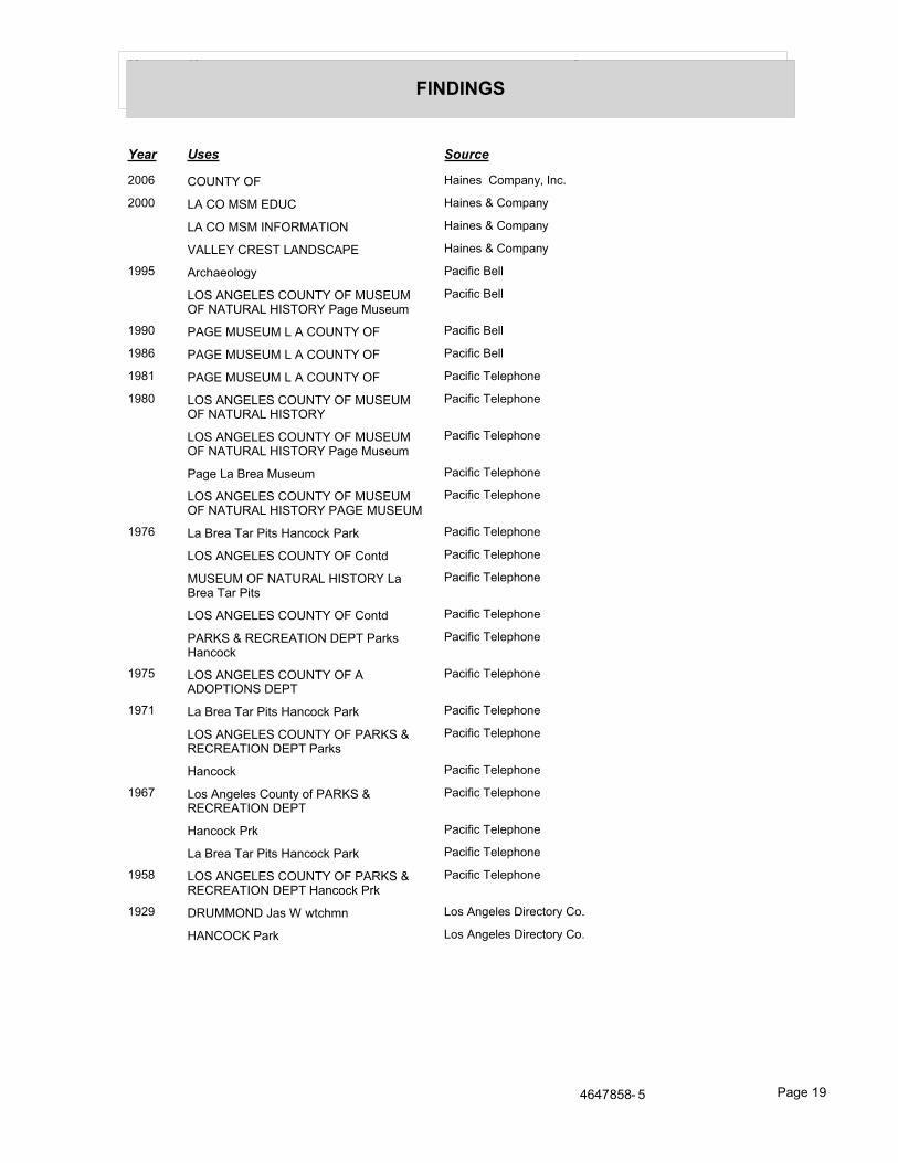
���� ��� ����
&(��(�5'
���� ��� ����
[��* �{��^� {� ������ ��+_���( ���>
[��� $% �{ }�} ��� ������ � ��+_���
$% �{ }�} ���{�}%^�{� ������ � ��+_���
�%$$� ���^ $%����%\ ������ � ��+_���
@��� %��������&� \���`�� ����
${� %��$� �{��^� {� }���} {� �%^��%$ ���^{�� \�&� }����+
\���`�� ����
@��� \%� }���} $ % �{��^� {� \���`�� ����
@�=* \%� }���} $ % �{��^� {� \���`�� ����
@�=@ \%� }���} $ % �{��^� {� \���`�� ^���_����
@�=� ${� %��$� �{��^� {� }���} {� �%^��%$ ���^{��
\���`�� ^���_����
${� %��$� �{��^� {� }���} {� �%^��%$ ���^{�� \�&� }����+
\���`�� ^���_����
\�&� $� ���� }����+ \���`�� ^���_����
${� %��$� �{��^� {� }���} {� �%^��%$ ���^{�� \%� }���}
\���`�� ^���_����
@�<* $� ���� ^�� \��� ������z \��z \���`�� ^���_����
${� %��$� �{��^� {� ����# \���`�� ^���_����
}���} {� �%^��%$ ���^{�� $� ���� ^�� \���
\���`�� ^���_����
${� %��$� �{��^� {� ����# \���`�� ^���_����
\%��� � ���%^�{� �\^ \��z� ������z
\���`�� ^���_����
@�<� ${� %��$� �{��^� {� % %�{\^�{�� �\^
\���`�� ^���_����
@�<@ $� ���� ^�� \��� ������z \��z \���`�� ^���_����
${� %��$� �{��^� {� \%��� � ���%^�{� �\^ \��z�
\���`�� ^���_����
������z \���`�� ^���_����
@�*< $�� %�&���� ������ �` \%��� � ���%^�{� �\^
\���`�� ^���_����
������z \�z \���`�� ^���_����
$� ���� ^�� \��� ������z \��z \���`�� ^���_����
@��= ${� %��$� �{��^� {� \%��� � ���%^�{� �\^ ������z \�z
\���`�� ^���_����
@�[� ���}}{�� ?�� � ]���+� $�� %�&���� ��������� ��>
�%��{�� \��z $�� %�&���� ��������� ��>
;*;<=�=� � \�&� @�

���� ��� ����
&(��(�5'
-(�'�(���%�1�
9>>>��-(�'�(���%�1�
���� ��� ����
@��� \^� ^�\{��%\��� \�{^{^�\ �{��
\���`�� ����
9:@@��-(�'�(���%�1�
���� ��� ����
[�@) �$}%� ���� ��`��+����� ���!����
� ��� ���� ��`��+����� ���!����
${���}�^� % [; �{�� ���� ��`��+����� ���!����
\ � � \��{��$ ������ ��� ���� ��`��+����� ���!����
\%��{} \%��{$$ $$� ���� ��`��+����� ���!����
����� }��% ���� ��`��+����� ���!����
$���{} ��%����� �%$� ���� ��`��+����� ���!����
${� %��$� }%�%��� ���� ��`��+����� ���!����
���� ��$���� ���� ��`��+����� ���!����
%$���}�� %��{��%^�{� ���� ��`��+����� ���!����
�{�� }%�� �\% ���� ��`��+����� ���!����
$%� {����� {� }�^��$$ �%�%�{� ���� ��`��+����� ���!����
��^���� ���� ��`��+����� ���!����
%$%��� ^�%����� ���� ��`��+����� ���!����
�%��� �$%�� �%}�$� $%� $$� ���� ��`��+����� ���!����
$%� {����� {� $��${� ��%�� ���� ��`��+����� ���!����
\ � � ^}\� ���� ��`��+����� ���!����
� [ �����^�� \�{���^�{�� ��� ���� ��`��+����� ���!����
%��%�%}� �%�����$ }%��{$�� ����{�
���� ��`��+����� ���!����
�^�^%��}�^ %�^ �{�� ���� ��`��+����� ���!����
�%}\%��� �{� %��{��%�$ �{����� ^�
���� ��`��+����� ���!����
�$���^� ^%$�^ \�{���^�{�� ���� ��`��+����� ���!����
�{���^�{� ��� �^�^%��}�^ ���� ��`��+����� ���!����
�{� ��^�%�^�� �%$� ���� ��`��+����� ���!����
��^�$ �{}\%�� ���� ��`��+����� ���!����
�%}{� �� } $%� {����� {� ���� ��`��+����� ���!����
\���^{${�� ���� ��`��+����� ���!����
^� $% ���� ��`��+����� ���!����
%�� }���%$ �^%����� ���� ��`��+����� ���!����
%��� ^�%���� �{}\%�� ���� ��`��+����� ���!����
;*;<=�=� � \�&� [�

���� ��� ����
&(��(�5'
���� ��� ����
[�@) �}���� �%��$ ���� ��`��+����� ���!����
?�� � }{��%� � �{ ��� ���� ��`��+����� ���!����
�{�{��%� $%� ���} ���� ��`��+����� ���!����
$%� {����� {� �%� $%��^�� ���� ��`��+����� ���!����
\%����� ��� ���� ��`��+����� ���!����
@�� \{��^ ) ^� �{��� ���� ��`��+����� ���!����
%$^��%^�� }%��^��� �{$�^�{��
���� ��`��+����� ���!����
�%}��% %����{�� ���� ��`��+����� ���!����
�������$$ }%�%�}�^ �{�\ ���� ��`��+����� ���!����
�{�� {��� � $��^}%� $$\ ���� ��`��+����� ���!����
$%� {���� {� �%^��% �%$^� ���� ��`��+����� ���!����
�}%���%��%� �^�^%��}�^ ��� ���� ��`��+����� ���!����
{^\ ������� }%�%�}�^ ��� ���� ��`��+����� ���!����
^�� ��^��� �^���{� ���� ��`��+����� ���!����
���� ��$���� ���^�� ���^� ���� ��`��+����� ���!����
% $%� ���} ���� ��`��+����� ���!����
��{��%�^^��� ��� ���� ��`��+����� ���!����
$��{^^��% ���� ��`��+����� ���!����
\%��{� ����%�� � ���� ��`��+����� ���!����
^%� �^��� \��$�� �$%^�{�� ���� ��`��+����� ���!����
^$�\ ��^��%^�{�%$ ���� ��`��+����� ���!����
?{�� �%��%���{ }%�%�}�^ ���� ��`��+����� ���!����
[��= �$%������ �$% }%��^ ��� ���� ��`��+����� ���!����
�${� {�^ ��� ���� ��`��+����� ���!����
�������$$ \%����� �{���$^%�^� ���� ��`��+����� ���!����
�%$��{���% ��%�$ �{���$^��� ���� ��`��+����� ���!����
${� %��$� �{����$ {� ?���� {���
���� ��`��+����� ���!����
�%^�{�%$ ��%��� ��{�\ ? ��� ���� ��`��+����� ���!����
�{�%$� � ��$�{� %^^{��� ���� ��`��+����� ���!����
^$�\ ��� ���� ��`��+����� ���!����
��^���� $\ ���� ��`��+����� ���!����
^�� ��^��� }���%$ �^�\����
���� ��`��+����� ���!����
��$} � }���� �^�^%��}�^ ���� ��`��+����� ���!����
��� ������� }���%$ ���� ��`��+����� ���!����
}%?{� }%��^ ^$����{� �%$� ���
���� ��`��+����� ���!����
}�$� ��}%� ^���� ��{�\ ���� ��`��+����� ���!����
;*;<=�=� � \�&� [@

���� ��� ����
&(��(�5'
���� ��� ����
[��= �$%���� ����� ��� ���� ��`��+����� ���!����
�^%$�% �%$ ��^ ��� ���� ��`��+����� ���!����
%$^��%^�� }%��^��� �{$�^�{� $$�
���� ��`��+����� ���!����
��{��\{��^ ���� ��`��+����� ���!����
^� �%}\%��� �{� %��{��%�$ �{�����
���� ��`��+����� ���!����
���^ ��� ���� ��`��+����� ���!����
^{����� �%\�^%$ }%�%�}�^ $$�
���� ��`��+����� ���!����
%�\ %�^{}%^�� �%^% \�{������ ���� ��`��+����� ���!����
}%�^��� $%� ���� ��`��+����� ���!����
��{��{{� \%��%���� �{�\ ���� ��`��+����� ���!����
�{� }}^ ��� ���� ��`��+����� ���!����
��{} %��^ }%�%�}�^ �{�\ ���� ��`��+����� ���!����
^$�\ ��^��%^�{�%$ ���� ��`��+����� ���!����
{� ^� ��� \�{���^�{�� ��� ���� ��`��+����� ���!����
}��� �%� ���� ��`��+����� ���!����
}{��� }{} ��� ���� ��`��+����� ���!����
?% %} ���^}� ��� ���� ��`��+����� ���!����
�� {� $���^ }���%$ ��� ���� ��`��+����� ���!����
$���{} ���� ��`��+����� ���!����
${}%� � %��{��%^� \� ���� ��`��+����� ���!����
\{\$� �%�� {� �%$��{���% ���� ��`��+����� ���!����
\�{����� ��$}� ���� ��`��+����� ���!����
^�%� �\��� ��� ���� ��`��+����� ���!����
��{�� � %��{��%^� ���� ��`��+����� ���!����
�^���{ ; �^�{��� ���� ��`��+����� ���!����
%� ����� �^�\���� ���� ��`��+����� ���!����
)��^�{ ���� ��`��+����� ���!����
}�^�%^�� �{$����� ��� ���� ��`��+����� ���!����
��^� �\{�^� �%$^� ��^� ���� ��`��+����� ���!����
� [ �����^�� \�{���^�{�� ���� ��`��+����� ���!����
${� %��$� }%�%��� ���� ��`��+����� ���!����
�\ }\${�}�^ ������� \%�^��� ��
���� ��`��+����� ���!����
$�� �{} ��� ���� ��`��+����� ���!����
�{��{�\ ���� ��`��+����� ���!����
���^ �} �%��{ {� ���� ��`��+����� ���!����
%$$�^%^ �%��{�\ ��� ���� ��`��+����� ���!����
;*;<=�=� � \�&� [[

���� ��� ����
&(��(�5'
���� ��� ����
[��= �$� {�%� }{�^�%� � � %$�^� ���� ��`��+����� ���!����
�^% ^�%�$ ��� ���� ��`��+����� ���!����
�^��� ^%� \��$�� �$%^�{�� ���� ��`��+����� ���!����
}�^�%^�� ��� ���� ��`��+����� ���!����
�${�{�^ ��� � ��{$�%$ }���%����
���� ��`��+����� ���!����
�%� ���� ���� ��`��+����� ���!����
�{�{��%� � �{��}%�� $$\ ���� ��`��+����� ���!����
\%^� }%�%�}�^ �{ ���� ��`��+����� ���!����
^%��^ }���%$ \%�^��� {\�%^��� �{
���� ��`��+����� ���!����
^� �%^ ���� ��`��+����� ���!����
^� }�$� ��{�\ $$� ���� ��`��+����� ���!����
\��{ �%$^� ��� ���� ��`��+����� ���!����
{����% ��{�\ $$� ���� ��`��+����� ���!����
%$���}�� %��{��%^�{� ���� ��`��+����� ���!����
��% }���%�^ ��^� ���� ��`��+����� ���!����
���� ��$���� $$� ���� ��`��+����� ���!����
}{�� $�� �����%�� �{ ���� ��`��+����� ���!����
^� ����%�� ?{���{� ���%^�{� ����
���� ��`��+����� ���!����
$ % ��^��%^ ���� ��`��+����� ���!����
\��{ ������� ��� ���� ��`��+����� ���!����
$%� {����� {� ��� � %$��^� ���� ��`��+����� ���!����
\%^��{^ �{}� ����{ �� $$� ���� ��`��+����� ���!����
^{��{\{\ ��� ���� ��`��+����� ���!����
^^� �����^��� ��� ���� ��`��+����� ���!����
����^ �%\�^%$ �{}}�� ���� ��`��+����� ���!����
��%�� �{���{ �}}���%^�{� $% ���� ��`��+����� ���!����
?��� ?{ ��� ���� ��`��+����� ���!����
�%}{� �� } $%� {����� {� ���� ��`��+����� ���!����
$���%� ^�%�$ ��� ���� ��`��+����� ���!����
��� {� ��$� ���� ��`��+����� ���!����
[��* ���$���� ������ ��+_���( ���>
%�� $�^ ������ ��+_���( ���>
}���%$ �^%����� ������ ��+_���( ���>
%$%��� ^�%����� ������ ��+_���( ���>
%$�%��� ������ ��+_���( ���>
%�^�{�� %^^� ������ ��+_���( ���>
%$$ %}���%� ������ ��+_���( ���>
;*;<=�=� � \�&� [)
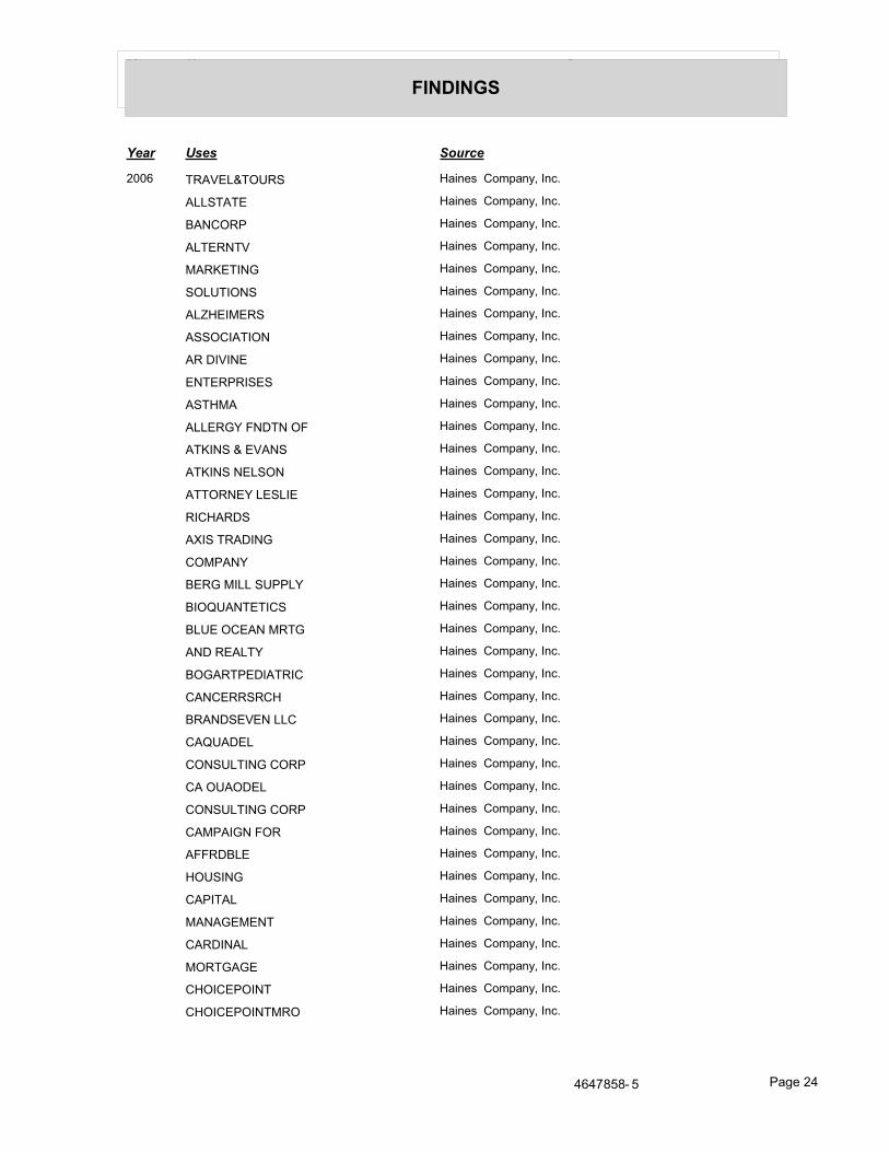
���� ��� ����
&(��(�5'
���� ��� ����
[��* ^�%�$�^{��� ������ ��+_���( ���>
%$$�^%^ ������ ��+_���( ���>
�%��{�\ ������ ��+_���( ���>
%$^��^� ������ ��+_���( ���>
}%��^��� ������ ��+_���( ���>
�{$�^�{�� ������ ��+_���( ���>
%$���}�� ������ ��+_���( ���>
%��{��%^�{� ������ ��+_���( ���>
%� ����� ������ ��+_���( ���>
�^�\���� ������ ��+_���( ���>
%�^�}% ������ ��+_���( ���>
%$$��� ���^� {� ������ ��+_���( ���>
%^���� � �%�� ������ ��+_���( ���>
%^���� �$�{� ������ ��+_���( ���>
%^^{��� $�$� ������ ��+_���( ���>
����%��� ������ ��+_���( ���>
%��� ^�%���� ������ ��+_���( ���>
�{}\%�� ������ ��+_���( ���>
��� }�$$ ��\\$� ������ ��+_���( ���>
��{��%�^^��� ������ ��+_���( ���>
�$� {�%� }�^� ������ ��+_���( ���>
%�� �%$^� ������ ��+_���( ���>
�{�%�^\��%^��� ������ ��+_���( ���>
�%�������� ������ ��+_���( ���>
��%����� $$� ������ ��+_���( ���>
�%��%�$ ������ ��+_���( ���>
�{���$^��� �{�\ ������ ��+_���( ���>
�% {�%{�$ ������ ��+_���( ���>
�{���$^��� �{�\ ������ ��+_���( ���>
�%}\%��� �{� ������ ��+_���( ���>
%�����$ ������ ��+_���( ���>
�{����� ������ ��+_���( ���>
�%\�^%$ ������ ��+_���( ���>
}%�%�}�^ ������ ��+_���( ���>
�%����%$ ������ ��+_���( ���>
}{�^�%� ������ ��+_���( ���>
��{��\{��^ ������ ��+_���( ���>
��{��\{��^}�{ ������ ��+_���( ���>
;*;<=�=� � \�&� [;

���� ��� ����
&(��(�5'
���� ��� ����
[��* ������ ������ ��+_���( ���>
�������$$ ������ ��+_���( ���>
}%�%�}�^ ������ ��+_���( ���>
��^��%^ ������ ��+_���( ���>
��^��\{�^� )[) �)= � � ������ ��+_���( ���>
}����� ������ ��+_���( ���>
�${� {�^ ��� ������ ��+_���( ���>
�{$}%� �%��$ ������ ��+_���( ���>
�{���^�{� ������ ��+_���( ���>
�^�^%��}�^ ������ ��+_���( ���>
�{� ��^�%�^�� ������ ��+_���( ���>
�%$� ������ ��+_���( ���>
�%�$� \$%�^ ������ ��+_���( ���>
}%��^��� ������ ��+_���( ���>
�%�{�{ ��%��� ������ ��+_���( ���>
�^�\��� ������ ��+_���( ���>
��$%�� ������ ��+_���( ���>
�%�� ����� � ������ ��+_���( ���>
�\���^ ������ ��+_���( ���>
}{�^�%� ������ ��+_���( ���>
� @ ��^ �%\�^%$ ������ ��+_���( ���>
�{}}�� ������ ��+_���( ���>
�{$���%�� ������ ��+_���( ���>
$%� {���� ������ ��+_���( ���>
��^�� �{{� ������ ��+_���( ���>
�{$�^�{�� $$� ������ ��+_���( ���>
�}%���%��%� ������ ��+_���( ���>
�^�^%��}�^ ������ ��+_���( ���>
��^���� ������ ��+_���( ���>
��^���� ������ ��+_���( ���>
��^���� ������ ��+_���( ���>
��^�$ �{}\%�� ������ ��+_���( ���>
?���}�$� ������ ��+_���( ���>
?{�� ���^� } ������ ��+_���( ���>
?��� ?{ ��� ������ ��+_���( ���>
� � � �^�\���� ������ ��+_���( ���>
���^���{�� ������ ��+_���( ���>
���^��� ������ ��+_���( ���>
;*;<=�=� � \�&� [�

���� ��� ����
&(��(�5'
���� ��� ����
[��* �{�{��%� ������ ��+_���( ���>
�{��}%�� $$\ ������ ��+_���( ���>
�{�{� = %� ������ ��+_���( ���>
�{��}%�� $$\ ������ ��+_���( ���>
$% ��^� �%^ ������ ��+_���( ���>
$% }%�%��� ������ ��+_���( ���>
$%���^� ^� ������ ��+_���( ���>
$%���^�^� ������ ��+_���( ���>
$%� {�� {� }%�?� ������ ��+_���( ���>
� ��%��%�� ������ ��+_���( ���>
$���%�^�%�$ ������ ��+_���( ���>
$����� ������ ��+_���( ���>
%��{��%^� ������ ��+_���( ���>
���{}��� ������ ��+_���( ���>
${}%�}$%�� ������ ��+_���( ���>
} } ^ �%$� ��� ������ ��+_���( ���>
}%�^��� $%� ������ ��+_���( ���>
}^�{ ^���^ ������ ��+_���( ���>
}����%� ������ ��+_���( ���>
}�^�%^�� ������ ��+_���( ���>
}�^�%^�� ������ ��+_���( ���>
}�^�%^�� ������ ��+_���( ���>
}$ }%�%�}�^ ������ ��+_���( ���>
}{�^�%� ������ ��+_���( ���>
�{$�^�{�� ������ ��+_���( ���>
�%��%{ ������ ��+_���( ���>
�%}� �{}}��^�� ������ ��+_���( ���>
\ � � \���$ ��� ������ ��+_���( ���>
\ � � ^}\� ������ ��+_���( ���>
\%^��{^ �{}� ������ ��+_���( ���>
\{\$� ������ ��+_���( ���>
}{�^�%� ������ ��+_���( ���>
$����� ������ ��+_���( ���>
\��{ ������� ��� ������ ��+_���( ���>
\���^{${�� ������ ��+_���( ���>
\�{����� ��$}� ������ ��+_���( ���>
�%��{ {� ������ ��+_���( ���>
�%}{� �� } ������ ��+_���( ���>
;*;<=�=� � \�&� [*

���� ��� ����
&(��(�5'
���� ��� ����
[��* $%� {����� {� ������ ��+_���( ���>
��{}%��^ ������ ��+_���( ���>
}%��}�^�{�\ ������ ��+_���( ���>
�}� }%��^�� ������ ��+_���( ���>
\�\�^� ������ ��+_���( ���>
}%�%�}�^ ������ ��+_���( ���>
�{�� ���� ������ ��+_���( ���>
��^�� ������ ��+_���( ���>
���{�%$ {�� ������ ��+_���( ���>
�%� ��%� ������ ��+_���( ���>
�����^�� ��� ������ ��+_���( ���>
��{��{{� ������ ��+_���( ���>
\%��%���� {� �% ������ ��+_���( ���>
��{��{{� ������ ��+_���( ���>
\%��%���� {� �% ������ ��+_���( ���>
��{��{{� ������ ��+_���( ���>
\%��%���� {� �$� ������ ��+_���( ���>
�{�$� � �� ������ ��+_���( ���>
��^��%$ \���^�� ������ ��+_���( ���>
�{�^������ ������ ��+_���( ���>
$�}�^� ������ ��+_���( ���>
^%��^}��% ������ ��+_���( ���>
\%�^��� ������ ��+_���( ���>
^%� �^��� ������ ��+_���( ���>
\��$�� �$%^�{�� ������ ��+_���( ���>
^$�\ ��� ������ ��+_���( ���>
^$�\ ������ ��+_���( ���>
��^��%^�{�%$ ������ ��+_���( ���>
^� �%^ ���{�� ������ ��+_���( ���>
^� $%� {�� {� ������ ��+_���( ���>
��%� � �{$� ������ ��+_���( ���>
^{����� �%\^$ ������ ��+_���( ���>
}%��}�^ $$� ������ ��+_���( ���>
^�%�$%��{�^� ������ ��+_���( ���>
^�� \�{���^�{�� ������ ��+_���( ���>
��% }���%�^ ������ ��+_���( ���>
��^� ������ ��+_���( ���>
�%$$� �%^ ������ ��+_���( ���>
;*;<=�=� � \�&� [<

���� ��� ����
&(��(�5'
���� ��� ����
[��* ��^�{�$���� ������ ��+_���( ���>
���{� �����{{� ������ ��+_���( ���>
� ���$� ������ ��+_���( ���>
�{�� �$$� ������ ��+_���( ���>
� [ �����^�� ������ ��+_���( ���>
\�{���^�{�� ��� ������ ��+_���( ���>
� [ �����^�� ������ ��+_���( ���>
\�{���^�{�� ��� ������ ��+_���( ���>
���$� ������ ��+_���( ���>
�{���%^�{� ^� ������ ��+_���( ���>
[��� ���$���� % � �����^�� ������ � ��+_���
% � � � ��%��� ������ � ��+_���
% } � % � ������ � ��+_���
%���� �${�%$ ������ � ��+_���
%$�%��� % %^^� ������ � ��+_���
%$$ %}� ^��$ � ^{�� ������ � ��+_���
%$���}�� %��{� ������ � ��+_���
%}� ���^� %��� ������ � ��+_���
%}� ������ �^� �%^��^�{^� ������ � ��+_���
%}� \%�{�%}% ��� ������ � ��+_���
%}� �� }%�� �%��� ���%$ ������ � ��+_���
%������{� ������ � ��+_���
%�}��� ���%$ ���{$�^ ��
������ � ��+_���
%��� � \%�^��� �{�\ ������ � ��+_���
%�^�}% � %$$��� �{���%^�{� ������ � ��+_���
%^���� �$�{� %^^� ������ � ��+_���
%^���� � �%�� ������ � ��+_���
� � � }��% \��{��$ ������ � ��+_���
�%�� �%\{%$�} ������ � ��+_���
�%��� �%��%�% �%�$� %^^� ������ � ��+_���
�%�%�� %���^����� ������ � ��+_���
��� }�$$ ��\\$� �{ ������ � ��+_���
�^� �%^��^�{^� ������ � ��+_���
����� ������ � ��+_���
�{�� ?%�^ $ ������ � ��+_���
���^{� % $ \�{���^�{�� ������ � ��+_���
������� ����� ��� ������ � ��+_���
���� ?%���{� ��%�}%�� ������ � ��+_���
;*;<=�=� � \�&� [=

���� ��� ����
&(��(�5'
���� ��� ����
[��� � � � ��� ������ � ��+_���
�%����%$ }{�^�%� ������ � ��+_���
�%����� ��{^^ % ������ � ��+_���
����� $ }%���� %^^� %^ $%� ������ � ��+_���
�������$$ }%�%�}�^ �{�\ ������ � ��+_���
��^� �\{�^� }����� ������ � ��+_���
�{}\�^%�$� ������ � ��+_���
�{��^�� �{�^�{$� ��{�\ ������ � ��+_���
�{� ��^�%�^�� �%$� ������ � ��+_���
��{�� � %��{��%^� ������ � ��+_���
��{�$� $ �{��% %^^� ������ � ��+_���
��{�� ��^� �%\�^%$ }%��}�^ $^� ������ � ��+_���
�%����� ��%�% �����%�� ��� ������ � ��+_���
�\��\ ������ � ��+_���
����� ���% � %^^� ������ � ��+_���
�{��$%� �%��� ������ � ��+_���
%�^� ���� ������ � ��+_���
�%�� ����� � %^^� ������ � ��+_���
�{���%^�{� �{� %��� ��%��� ������ � ��+_���
��������{� � �{��� ������ � ��+_���
��^��^���� �{���$^��� ��{�\ ������ � ��+_���
�%�$^ }�$$%� ��� ������ � ��+_���
�${� ��{�\ ^� ������ � ��+_���
�{$%� ?%�� %^^� ������ � ��+_���
�%��%� ���%���%$ ��{�\ ������ � ��+_���
�%$^� }%�%�}�^ ��{���� ������ � ��+_���
�$$�% ������ � ��+_���
�}}���%^� $%� {��� ������ � ��+_���
��^$ ���� �����%�� ��{��� ������ � ��+_���
���%�� }{�% ������ � ��+_���
�^%$�% �%$ %���^����� ��� ������ � ��+_���
? � } � �{ ������ � ��+_���
?%%} ���^}� ������ � ��+_���
� � � ^ ��� {�� ������ � ��+_���
� � � ^ ��� {�� ������ � ��+_���
����%�� ��� ������ � ��+_���
$%� {��� ��$�{� � ��� ������ � ��+_���
$%�%��� �^�� � $%� {����� ������ � ��+_���
;*;<=�=� � \�&� [�

���� ��� ����
&(��(�5'
���� ��� ����
[��� $�%^ �%�� } ������ � ��+_���
$��� � %��{��%^� ������ � ��+_���
$���{} )[) � ������ � ��+_���
${}%� }$%�� %^^� ������ � ��+_���
${�� �{{�� �\% ������ � ��+_���
} � ������ � ��+_���
} } ^ �%$� ��� ������ � ��+_���
} ���%�� ��� ������ � ��+_���
}%��% ���^� �{�\ ������ � ��+_���
}%�� }��% ������ � ��+_���
}%�� }���%$ ������ � ��+_���
}^�{ ^���^ �� �{ ������ � ��+_���
}���%$ ����� %^^� %^ $%� ������ � ��+_���
}���$$ ����� %^^� %^ $%� )[) *@ *��=; � }�� ��$���� }{�^�%�
������ � ��+_���
}�$^{� �%^�{� �����%�� ��� ������ � ��+_���
}���%^�� }���} ������ � ��+_���
}��%�$ }�$ ������� ��^� ������ � ��+_���
}{�� }�^�%$ �� ������ � ��+_���
}{��%� ����� ��� ������ � ��+_���
}���{��� ?{�� ������ � ��+_���
}���} {� }���%^�� ������ � ��+_���
}���� �^ ������ � ��+_���
�%}� �{}}��^�� ��� ������ � ��+_���
�%^$ }���%$ ���� ������ � ��+_���
�%^$ ��%��� ��{�\ )[) � ������ � ��+_���
{� ^� ��� \���^� ������ � ��+_���
{� ^� ��� \���^� ������ � ��+_���
\ � � \���$ ��� ��� ������ � ��+_���
\ � � ^}\� ������ � ��+_���
\ } % � ��� ������ � ��+_���
\%� %�}%�$ ��� ������ � ��+_���
\%� ������� ����^}^� ��\ ��� ������ � ��+_���
\%��� �{���$^��� ������ � ��+_���
\%^��{^ �{}� ��� ������ � ��+_���
\{\$� �%�� {� �% ������ � ��+_���
\{\$� �%�� {� �% }%�� {�� ������ � ��+_���
\^�^ $�^ ��{\ ������ � ��+_���
\�{��� %�^��^� %���� ������ � ��+_���
;*;<=�=� � \�&� )�

���� ��� ����
&(��(�5'
���� ��� ����
[��� \��^��� ��� ������ � ��+_���
\{\��� ����%�� %^^� ������ � ��+_���
\{\��� ��%}�� � �{$%� $%� {����
������ � ��+_���
� } � }%��^�� \�{\�^� }�� ������ � ��+_���
�{���{ ��%�� ������ � ��+_���
�{^� }�^��$$ %^^� ������ � ��+_���
�{�%$ %$$�%�� ������ � ��+_���
����� }���%$ � %��{� ������ � ��+_���
� ^ % ^�%�$ ������ � ��+_���
� [ �{} ������ � ��+_���
�%$^�}%� �{}}����%^�{� ������ � ��+_���
����}%^�� �%�� ^�%��%�^�{�� )[) ��[ <
������ � ��+_���
���{� �%� }%�%�}�^ ������ � ��+_���
��%}�� ��^� %^^� ������ � ��+_���
����$� %��{��%^� ������ � ��+_���
��{����� ��$}� %}� )[) �[� [*� � ��{����� �$�}� %}�
������ � ��+_���
��{��{{� \%��%���� {� �% ��� )[) ;[ ) }
������ � ��+_���
��{��{{� \%��%���� {� �% ��� )[)�;� ��; }
������ � ��+_���
��%\ �{�^�%� ������ � ��+_���
�\%�$���� �%\�^%$ ��{�\ )[) � ������ � ��+_���
�^%�$� � %��{��%^� $\ ������ � ��+_���
�^%�$���^ ���$���� ���^� )[) *); � } � �
������ � ��+_���
�^%�� �^�^�}�^ ^%$�^ �%�^�� )[) �[ ^
������ � ��+_���
�^���^ ^�%�$ �^�{�� ������ � ��+_���
^%��^ }��% \%� ������ � ��+_���
^$�\ ��� ������ � ��+_���
^$�\ ��^��%^�{�%$ )[) ;)* �@; ��
������ � ��+_���
^� �%^ ��� {�� )[) ;); @ � ������ � ��+_���
� � � �%$ �^%^ �{�\{�%^�{� ������ � ��+_���
� { � ��%^�{�� )[) * �� < � � ������ � ��+_���
�$$�\���� }��% ��� ������ � ��+_���
��^�� ������� ��^�� ������ � ��+_���
��^�� ���� �{�\ )[) �) � ������ � ��+_���
;*;<=�=� � \�&� )@

���� ��� ����
&(��(�5'
���� ��� ����
[��� ��$�{� �{�%$� � $%� {����� ������ � ��+_���
�%��{\��� \��$$�\ ������ � ��+_���
���$���� � %��{� %^^�� %^ $%� ������ � ��+_���
�%�� }{^�{� \ �^� )[ � )�)�)� � ���$� �{���%^�{� ^�
������ � ��+_���
�����}%� �%��$ ��\ )[) ; � ������ � ��+_���
������� } ������ � ��+_���
@��� %��� �{^ $�� \���`�� ����
%��� �������� \���`�� ����
%+������ ����#����� %�#� �������� \���`�� ����
}� ������� ������� ���] ���� \���`�� ����
}��{��$$ ���^^{� ��� %^^� \���`�� ����
@��@ %} ���%� �{�� �%^�{� %��� � � %���
\���`�� ����
���+����� ���� � ���� \���`�� ����
���#� ^��� ���� \���`�� ����
���#� ^��� \���`�� ����
}� ������� ������� ���] ���� \���`�� ����
}� ������� � \���`�� ����
}����� ����`�� $�`� ��� �� ^�� ����� %&����
\���`�� ����
%��� ��%��� \���`�� ����
%}�%� \���`�� ����
%}���%� �{���%^�{� %��� ��%���
\���`�� ����
%�{�^� �^%�$� %^^� \���`�� ����
%�����{�$� %���^����� ��� \���`�� ����
�{��� �{�� �%�� �%$$�� \���`�� ����
�������$ }%�%�}�^ �{�\ �{�^��
\���`�� ����
�{}}%��� {�$ �{ $^� \���`�� ����
�{��^{?�}%^^�%^$%� \���`�� ����
���}���� %���� %^^� \���`�� ����
$ % �${�� ��{\ � \$%�^ �^{� �{�� ? �{��% �
\���`�� ����
}�^�%$ ����^ $�� ��� �{ ^� ����� %����
\���`�� ����
\{^^��� ��� ^� \���`�� ����
�{�� �{��� �%�� �%$$�� \���`�� ����
���^� }%�%��� \���`�� ����
;*;<=�=� � \�&� )[

���� ��� ����
&(��(�5'
���� ��� ����
@��@ �{��% � �{�� � $ % �${�� ��{\ � \$%�^ �^{�
\���`�� ����
�^�%�^ ���� � �^�%�^ ���� � %^^�
\���`�� ����
�^�%�^ ���� � %^^� \���`�� ����
^��%��$ �{}}����%^�{�� ��� ���^� }%�%���
\���`�� ����
%��� ��%��� \���`�� ����
%}�%� \���`�� ����
%+������ ����#����� %�#� �������� \���`�� ����
%����� ������� ���� \���`�� ����
%���� ����# %#!�������& ��� \���`�� ����
%���� �����# \���`�� ����
��::�� ���� ���� ������� \���`�� ����
�������� }���&�+��� ���_ ������� \���`�� ����
��++��#�� {�� �� $�# \���`�� ����
������� ?�+ %��� %� $�] \���`�� ����
������z� � [�)�[** \���`�� ����
����]�� ������#� ^ \���`�� ����
���� % *�[�@<[ \���`�� ����
���� %�� ��*)�;@ \���`�� ����
`��+ $�� %�&���� ^���_����� ���� =<�*<;=
\���`�� ����
���}���� %���� ���� \���`�� ����
$ % ���]�� ���_ � \���� ����� ����&� ? ������
\���`�� ����
}����� ����`�� $�`� ��� �� ^�� ����� %&����
\���`�� ����
\�����& ���# ^�� \���`�� ����
���� ��::�� ���� ������� \���`�� ����
���� ��::� ���� =[@*��) \���`�� ����
���� ���# ${� %��$� [���*)* \���`�� ����
���� ���# ���)��; \���`�� ����
��!������ }�&����� \���`�� ����
������ ����&� � $ % ���]�� ���_ � \���� �����
\���`�� ����
���]��� ����� � ������ ����� � ���� \���`�� ����
���]��� � �%�^% }{���% ;��@<[* \���`�� ����
��]��� �? �%�^% }{���% ;����[� \���`�� ����
������ ����� � ���� \���`�� ����
������ ����� � [=��*) \���`�� ����
;*;<=�=� � \�&� ))

���� ��� ����
&(��(�5'
���� ��� ����
@��@ ������ � \%����� \%$��%�� ;�;**) \���`�� ����
^����&�� ��++���������� ��� ��!������ }�&�����
\���`�� ����
@��� {�^�{� $�^� � �{�$ �$�}%� {�^�{� ����$� � �$��� % $%� �{�\{�%^�{�
\���`�� ����
% � � �^�{��� \���`�� ����
%��� ��%��� \���`�� ����
%}\�{ \%����� ${� %��$� \���`�� ����
%�}�� }%�%�}�^ �{��^� \���`�� ����
%}���%� �{���%^�{� %��� ��%���
\���`�� ����
%}���%� �%$ �^%^ ����^}�^
\���`�� ����
%��$�{ ^{��� ��� \���`�� ����
%��$��{ ^{��� ��� \���`�� ����
%����^�^��%$ ����^ \���`�� ����
%����^�^��%$ ����^ \���`�� ����
%����^�^��%$ ����^ \���`�� ����
%���^� ? �$%�� �{�$ �$�}%� {�^�{� ����$� � �$��� % $%� �{�\{�%^�{�
\���`�� ����
%�{�^� �^%�$� %^^� \���`�� ����
%�{�^� �^%�$� %^^� \���`�� ����
%�����{�$� %���^����� ��� \���`�� ����
%�^{� ��{%��%�^ ��{�\ \���`�� ����
%�^{� ��{%��%�^ ��{�\ \���`�� ����
%^���� � �%�� \���`�� ����
%^���� �$�{� $ %^^� \���`�� ����
%^^{��� �{^$ $�� \���`�� ����
� � � }��% ������ \���`�� ����
�%�� ��{�\ ^� \���`�� ����
�%�� ����%�� } }�^�%$ ����^ $�� ��� �{
\���`�� ����
�%�� �^\�� � }�^� \���`�� ����
�%���� }%�� $�\\� �{�$ �$�}%� {�^�{� ����$� � �$��� % $%� �{�\{�%^�{�
\���`�� ����
�%�� �%��� % �\% \���`�� ����
���{� }%���� �{�$ �$�}%� {�^�{� ����$� � � �$��� % $%� �{�\{�%^�{�
\���`�� ����
����^�� ���� �^� \���`�� ����
;*;<=�=� � \�&� );

���� ��� ����
&(��(�5'
���� ��� ����
@��� ���{� � ���{� \���`�� ����
�{��� �{�� �%�� �%$$�� \���`�� ����
�{� %\\^�^ \���`�� ����
����$� � \%�^��� \���`�� ����
� \ � \���`�� ����
�������$$ }%�%�}�^ �{�\ ����^��
\���`�� ����
�{�� \%�$ �{�$ �$�}%� {�^�{� ����$� � �$��� % $%� �{�\{�%^�{�
\���`�� ����
�{}}%��� {�$ �{ $^� \���`�� ����
�{�^���^%$ \�{��$� }%�%��� \���`�� ����
��%}{$�� �%�$ � %^^� \���`�� ����
��%}{$�� �%�$ � %^^� \���`�� ����
������{ $���% } %^^� \���`�� ����
��� ���%} �{�$���� ��� \���`�� ����
�%��{�� }�% �{�$ �$�}%� {�^�{� ����$� � �$��� % $%� �{�\{�%^�{�
\���`�� ����
� �{}���� \%^^� \���`�� ����
�$$% �}��% }��%} � � � � \���`�� ����
����� ���% � %^^� \���`�� ����
%�^���^ �^�{�� ��� \���`�� ����
%�^�� ���� }%�%��� \���`�� ����
��}%�� � ��}%�� %^^�� \���`�� ����
��}%�� ��%��� %^^� \���`�� ����
��}%�� ����^ � %^^� \���`�� ����
��$� ��%�$� �\% \���`�� ����
��$� � ��� % \�{����{�%$ %��{��^%��� �{�\{�%^�{�
\���`�� ����
�%�� ����� � %^^� \���`�� ����
�%�^{� ^� � ��� ���%} �{�$���� ���
\���`�� ����
�$�}%� $%��� � �{�$ �$�}%� {�^�{� ����$� � �$��� % $%� �{�\{�%^�{�
\���`�� ����
�{�$ �%�$ �{�$ �$�}%� {�^�{� ����$� � ����� % $%� �{�\{�%^�{�
\���`�� ����
�{�$ �$�}%� {�^�{� ����$� � �$��� % $%� �{�\{�%^�{�
\���`�� ����
�{�^ � �%%}{�� ��� \���`�� ����
�{���%^�{� �{� %��� ��%��� \���`�� ����
;*;<=�=� � \�&� )�

���� ��� ����
&(��(�5'
���� ��� ����
@��� ���� ����%�� � \���`�� ����
����}%� %%�{� � �{�$ �$�}%� {�^�{� ����$� � �$��� % $%� �{�\{�%^�{�
\���`�� ����
����{� � � ��^��%^�{�%$ \���`�� ����
�$%��}%� �{�%$� � %^^� \���`�� ����
�{��{� �%�� �{ \���`�� ����
����{�� ��^%��%�^ ^� \���`�� ����
��}\�^� ��^$� ���� %��� %���
\���`�� ����
�%$$ ?�$� �{�$ �$�}%� {�^�{� ����$� � �$��� % $%� �{�\{�%^�{�
\���`�� ����
�%��� ^�{� %^^� \���`�� ����
�%��� ^�{� %^^� \���`�� ����
�%��� %�^�{�� � \���`�� ����
��$$ %�� ��{�$^{� ��� \���`�� ����
�{} }%�%��� \���`�� ����
�{} }%�%��� \���`�� ����
�{} }%�%��� �{} \$%�� \���`�� ����
�{} }%�%��� �{} \$%�� \���`�� ����
�{^$ }%��^��� ��^��%^�{�%$ \���`�� ����
�{��^{� � %��{��%^� \���`�� ����
���{�������� � ��%}�� %���^�����
\���`�� ����
�����^�� �{���$^%�^� \���`�� ����
��^��%^�{�%$ ��%\��� %�^� ������
\���`�� ����
?�} � �{ \���`�� ����
?����{� ?���$%��% %^^� \���`�� ����
?�$�� ��� �{�$ �$�}%� {�^�{� ����$� � �$��� % $%� �{�\{�%^�{�
\���`�� ����
�%^� ��$��^ �{�$ �$�}%� {�^�{� ����$� � �$��� % $%� �{�\{�%^�{�
\���`�� ����
�$��� ?{$ � �{�$ �$�}%� {�^�{� ����$� � �$��� % $%� �{�\{�%^�{�
\���`�� ����
��%\\ �{}}����%^�{�� �{�\ \���`�� ����
�{���{$� ?��� ^ �{�$ �$�}%� {�^�{� ����$� � �$��� % $%� �{�\{�%^�{�
\���`�� ����
�{��^^ ?�} %^^� %^ $%� \���`�� ����
;*;<=�=� � \�&� )*

���� ��� ����
&(��(�5'
���� ��� ����
@��� ���}���� %���� %^^� \���`�� ����
$ % �${�� ��{\ � \$%�^ �^{� �{�� ? �{��% �
\���`�� ����
$%� ���} {� �%��� � ����%�} \���`�� ����
$%�%^ �%�� } \���`�� ����
$ ��� ��${\}�^ �{�\ \���`�� ����
$���^�� ?{� � �{�$ �$�}%� {�^�{� ����$� � �$��� % $%� �{�\{�%^�{�
\���`�� ����
$������ ��^� � %^^� \���`�� ����
} } ^ �%$� ��� \���`�� ����
}%��% ���^� �{�\ \���`�� ����
}%�%�}�^ �����^�� ${� %��$�
\���`�� ����
}%� �%�{$ � �{�$ �$�}%� {�^�{� ����$� � �$��� % $%� �{�\{�%^�{�
\���`�� ����
}%� $ ��^��%^$ ��� \���`�� ����
}%� �%�{$ � �{�$ �$�}%� {�^�{� ����$� � �$��� % $%� �{�\{�%^�{�
\���`�� ����
}%� $ ��^��%^$ ��� \���`�� ����
}��%$$ � }%�%��� \���`�� ����
}��{��$$ ���^^{� ��� %^^� \���`�� ����
}��{��$$ ��%}{$�� �%��� � �^{�����
\���`�� ����
}��{��$$ ��%}{$�� �%��� � �^{����� %^^��
\���`�� ����
}��{��$$ ��%}{$�� �%��� � �^{����� %^^��
\���`�� ����
}��% ����� \���`�� ����
}��% }%��^��� %�� �%$� ���^�� }��% ������
\���`�� ����
}^�{\{$�^%� ^���^ �� �{ \���`�� ����
}�� }�$^{� � �{ \���`�� ����
}�$$�{� �{$$%� ���{ �{�\ \���`�� ����
}�^�%$ ����^ �{}\%��� ^� ����� %����
\���`�� ����
}�^�%$ ����^ �{ \���`�� ����
}�^�%$ ����^ $�� �����%�� �{ {� ��%�� � ?
\���`�� ����
}�^�%$ ����^ $�� �����%�� �{ {� ��%�� � ?
\���`�� ����
}�^�%$ ����^ $�� \���{� �\^ \���`�� ����
;*;<=�=� � \�&� )<

���� ��� ����
&(��(�5'
���� ��� ����
@��� ����%�$ }���%$ �{�$ �$�}%� {�^�{� ����$� � �$��� % $%� �{�\{�%^�{�
\���`�� ����
�� �{��� }%�%��� ^� \���`�� ����
�{�^���^ \{�^�{$�{ }%�%��� %�^���^ �^�{�� ���
\���`�� ����
{� ^� ��� \�{���^�{�� \���`�� ����
{� ^� ��� \�{���^�{�� \���`�� ����
{��%���%^�{�%$ �{��\^� \���`�� ����
{ ��% }���%$ � �{�$ �$�}%� {�^�{� ����$� � �$��� % $%� �{�\{�%^�{�
\���`�� ����
\%� %} �$�\\� }%�%��� \���`�� ����
\ � � \��{��$ ������ ��� \���`�� ����
\ � � ^}\� \���`�� ����
\%����� � ������{ %^^{���� %^ $%�
\���`�� ����
\%^����� ���%�� %^^� \���`�� ����
\{^^��� ��� ^� \���`�� ����
\���� $^� \���`�� ����
\����� \���`�� ����
��%� ��%\���� ��� \���`�� ����
��%� }%��^��� \���`�� ����
��%� }%��^��� \���`�� ����
�%��{ %���^����� ���%� ��� \���`�� ����
�%}}�{ ����^}�^ �{�\ \���`�� ����
��{}}�� }%�%��� \���`�� ����
����^��� \���^��� �{ \���`�� ����
����$� ?�{} $ �{�$ �$�}%� {�^�{� ����$� � �$��� % $%� �{�\{�%^�{�
\���`�� ����
�{�^^ ����%�� $ �{�$ �$�}%� {�^�{� ����$� � �$��� % $%� �{�\{�%^�{�
\���`�� ����
�{�� �{��� �%�� �%$$�� \���`�� ����
�{�^{� $$��{�^� � \���`�� ����
�{�^{� � ����%�^� % \�{����{�%$ �{�\
\���`�� ����
�{�^{� � ����%�^� % \�{����{�%$ �{�\
\���`�� ����
���� �^�$�$$ ��� \���`�� ����
���%}���� %���� %^^� \���`�� ����
���${����� � ���}���� %^^�� \���`�� ����
;*;<=�=� � \�&� )=

���� ��� ����
&(��(�5'
���� ��� ����
@��� ����%�^� ��%� � \���`�� ����
��{^^ ���^� �%�� �\��%$��^ \���`�� ����
���^� }%�%��� \���`�� ����
��%}���� %���� \���`�� ����
��%\�%� � %��{��%^� ��� \���`�� ����
�{��% � �{�� � $ % �${�� ��{\ � \$%�^ �^{�
\���`�� ����
�\�^��} }^��� ������ \���`�� ����
�\���^ }%�%��� \���`�� ����
�^%��%�� �{��^ } %^^� \���`�� ����
�^����� � %�^��� �{�$ �$�}%� {�^�{� ����$� � �$��� % $%� �{�\{�%^�{�
\���`�� ����
�^�%�^ ���� � �^�%�^ ���� � %^^�
\���`�� ����
�^{����� ��$ %^^� \���`�� ����
������ }%�%��� \���`�� ����
^ $ � ����{�� \���`�� ����
^�� �{}}����%^�{�� ��� \���`�� ����
^�� ^$����{� ���%� {� %���^����� ���
\���`�� ����
^�% %}�%��%�{� }%�%��� \���`�� ����
^$�\ ��� ^$��� �^� �\� \���`�� ����
^$����{� ���%� {� %���^�����
\���`�� ����
^� ����{�� ��^%��%�^ \���`�� ����
^�{}%� ���%���%$ � �����%�� �����
\���`�� ����
^� ��%\\ \��� \���`�� ����
^��%��$ �{}}����%^�{�� ��� ���^� }%�%���
\���`�� ����
^���� �{�^ } �{�$ �$�}%� {�^�{� ����$� � �$��� % $%� �{�\{�%^�{�
\���`�� ����
^��� \���`�� ����
^�\ ��� \���`�� ����
� � � �%$ �^%^ �{�\ \���`�� ����
��%� \��$������ \���`�� ����
���{ ���� }%�%��� \���`�� ����
��� % ��� \���`�� ����
����� %��{$� %%^^� \���`�� ����
��$���� }%��^��� \���`�� ����
;*;<=�=� � \�&� )�

���� ��� ����
&(��(�5'
���� ��� ����
@��� ���^�$�� ��{�\ ^� \���`�� ����
�{{���%\\ \���`�� ����
�{����� }{^�� }%�%��� \���`�� ����
�{����� �{}%� }%�%��� \���`�� ����
�{�$� ��{�^ ^�%�$ \���`�� ����
��$�%� }���%$ � � %��{��%^� \���`�� ����
�%��{���� \��$$�\ \���`�� ����
������� }{���� \���`�� ����
@�=* %}\�{ \%����� \%����� ${^� � �%�%�� ${� %��$�
\���`�� ����
%�� \^�{$�} �{ \���`�� ����
%}���%� �%$ �^%^ ����^}�^
\���`�� ����
%��$�{ ^{��� ��� \���`�� ����
%��$��{ ^{��� ��� \���`�� ����
%��$��{ ^{��� ��� \���`�� ����
%����^�^��%$ ����^ \���`�� ����
%���^$ ? �$%�� �{�$ �{^�����$� �$�}%� � {�^�{� % $%� �{�\{�%^�{�
\���`�� ����
%�{�^� �^%�$� %^^� \���`�� ����
%�{�^� �^%�$� %^^� \���`�� ����
%�����{�$� %���^����� ��� \���`�� ����
�%�� ����%�� } �%���� ��{� }�^�%$ ����^ $�� ��� �{ {� ��%�� � ?
\���`�� ����
�%$���%}% ��$$�%} �{�$ �{^�����$� �$�}%� � {�^�{� % $%� �{�\{�%^�{�
\���`�� ����
�%���� }%�� $�\\� �{�$ �{^�����$� �$�}%� � {�^�{� % $%� �{�\{�%^�{�
\���`�� ����
�$$ }���%$ � %^^� \���`�� ����
������� ?{�\� %^^� \���`�� ����
�$%�� ?{�� }%��^��� \���`�� ����
�{��� �{�� �%�� �%$$�� \���`�� ����
�{� %\\^�^ \���`�� ����
����� �%$^� � ?� %^^� \���`�� ����
�%\�% ��%�� � �%���� ��{� }�^�%$ ����^ $�� ��� �{ {� ��%�� �?
\���`�� ����
�������$$ }%�%�}�^ �{�\ ����^��
\���`�� ����
;*;<=�=� � \�&� ;�

���� ��� ����
&(��(�5'
���� ��� ����
@�=* �$%�� �{��^ $ %^^� \���`�� ����
�{�� ��^{� �{�$ �{^�����$� �$�}%� � {�^�{� % $%� �{�\{�%^�{�
\���`�� ����
�{�� ��$� ${�� � �{�$ �{^�����$� �$�}%� � {�^�{� % $%� �{�\{�%^�{�
\���`�� ����
�{�� \%�$ �{�$ �{^�����$� �$�}%� � {�^�{� % $%� �{�\{�%^�{�
\���`�� ����
�{$�}��% �%����� %�� ${%� %��{��%^�{� �%�����
\���`�� ����
�{}}%��� {�$ �{ $^� \���`�� ����
��{��� ��%�$� $ ?� %^^� \���`�� ����
�%��$� �{��^ � %^^� \���`�� ����
� �{}���� \%^^� \���`�� ����
�$$% �}��% ^�%���%�{ � \%�^��� {� �%$�� ���
\���`�� ����
��%}{�� ����%�� � % \�{����{�%$ �{�\{�%^�{�
\���`�� ����
�{�$ �%� ����%�� ��� \���`�� ����
��%$��� ��� � $%� {����� {� ^�
\���`�� ����
�� \��$�\ ��� �{���$� \���`�� ����
%�^���^ �^�{�� ��� \���`�� ����
%�^�� ���� }%�%��� \���`�� ����
��}%�� � ��}%�� %^^�� \���`�� ����
��}%�� ��%��� %^^� \���`�� ����
��}%�� ����^ � %^^� \���`�� ����
$��� �%��� ��� \���`�� ����
�^�\��� ���^}� ��� \���`�� ����
�%�^{� ^� � �{�$ �%� ����%�� ���
\���`�� ����
�$�}%� $%��� � �{�$ �{^�����$� �$�}%� � {�^�{� % $%� �{�\{�%^�{�
\���`�� ����
���%���%$ %����{�� �$���� ����^}�^� ���
\���`�� ����
���%���%$ %����{�� �$���� {� ${� %��$�
\���`�� ����
���� %$�{\ � ��$�% %^^�� \���`�� ����
���� ?{�� %^^� \���`�� ����
�{�$ �%�$ �{�$ �{^�����$� �$�}%� � {�^�{� % $%� �{�\{�%^�{�
\���`�� ����
;*;<=�=� � \�&� ;@

���� ��� ����
&(��(�5'
���� ��� ����
@�=* �{�$ �{^�����$� �$�}%� � {�^�{� % $%� �{�\{�%^�{�
\���`�� ����
��%�� %�^��� $ %^^� \���`�� ����
���� ����%�� � \���`�� ����
��{�^�� }%�%��� \���`�� ����
�%$^{� � �$} %^^�� \���`�� ����
�%$^{� �^\�� � %^^� \���`�� ����
�{ }%�%��� \���`�� ����
�^� % ? %^^� \���`�� ����
�^� %���� � }%����� \���`�� ����
����{� � � ��^��%^�{�%$ \���`�� ����
�$%��}%� �{�%$� � %^^� \���`�� ����
�{{� �{{� }%�%��� \���`�� ����
�{�$� �%��%�% � %^^� \���`�� ����
��� ������ � % $%� �{�\{�%^�{�
\���`�� ����
����{�� ��^%��%�^ ^� \���`�� ����
��{��}%� �%��� } %^^� \���`�� ����
��{��}%� � �%^{ \���`�� ����
��}\�^� ��^$� ���� %��� %���
\���`�� ����
��}\�^� �{��{� } \���`�� ����
�%$$ ?�$� �{�$ �{^�����$� �$�}%� � {�^�{� % $%� �{�\{�%^�{�
\���`�� ����
�%���� ��{� ��� \���`�� ����
�%���� ���%���%$ ��{�\ ��� \���`�� ����
�%���� ��� �%���� ��{� }�^�%$ ����^ $�� ��� �{ {� ��%�� �?
\���`�� ����
�%���� �{$ �$� \���`�� ����
�%���� �%$^� �%���� ��{� }�^�%$ ����^ $�� ��� �{ {� ��%�� �?
\���`�� ����
�$} ���� � %^^� \���`�� ����
������ $%����%� � %��{��%^� ���
\���`�� ����
��$$ %�� ��{�$^{� ��� \���`�� ����
�{} }%�%��� \���`�� ����
�{} }%�%��� �{} \$%�� \���`�� ����
���{�� ����� � ��%}�� %���^�����
\���`�� ����
�����^�� �{���$^%�^� \���`�� ����
;*;<=�=� � \�&� ;[

���� ��� ����
&(��(�5'
���� ��� ����
@�=* �����%���^� ^� \���`�� ����
��^�%�^�� ^���{${�� �{�\ \���`�� ����
?�} � �{ \���`�� ����
?�$�� ��� �{�$ �{^�����$� �$�}%� � {�^�{� % $%� �{�\{�%^�{�
\���`�� ����
�%^� ��$��^ �{�$ �{^�����$� �$�}%� � {�^�{� % $%� �{�\{�%^�{�
\���`�� ����
�%^{ ���$% � %^^� \���`�� ����
�$��� ?{$ � �{�$ �{^�����$� �$�}%� � {�^�{� % $%� �{�\{�%^�{�
\���`�� ����
��%\\ �{}}����%^�{�� �{�\ \���`�� ����
�{$$� � { ��$$��%� \���`�� ����
�{���{$� ?��� ^ \���`�� ����
�{��^^ ?�} %^^� %^ $%� \���`�� ����
�{��^^ ?�} %^^� %^ $%� \���`�� ����
��%�$��� }���%$ % }%����� $%�� ����� � ������� %^^��
\���`�� ����
$ % �${�� ��{\ � \$%�^ �^{� �{�� ? �{��% �
\���`�� ����
$%�� �{ %^^� \���`�� ����
$�%$ ^�}� \���`�� ����
$���^�� ?{� � �{�$ �{^�����$� �$�}%� � {�^�{� % $%� �{�\{�%^�{�
\���`�� ����
${� \�{^�^{�� $�%$� � �%$��
\���`�� ����
} } ^ �%$� ��� \���`�� ����
}%��{�%$� �{�}%� � %^^� \���`�� ����
}%��% ���^� �{�\ \���`�� ����
}%���� �%��$ � \���`�� ����
}%�%�}�^ �����^�� ${� %��$� ��$���� ���%���%$ ���^���^
\���`�� ����
}%����� $%�� ����� � ������� %^^��
\���`�� ����
}%^��}{^{ ��^�{� %���^����� \���`�� ����
}%^��}{^{ ��^�{� %���^����� \���`�� ����
}� } ���� ? %^^� \���`�� ����
}��% ����� \���`�� ����
}����� �%��%$^� �{ \���`�� ����
;*;<=�=� � \�&� ;)

���� ��� ����
&(��(�5'
���� ��� ����
@�=* }����� ���%$ �{�\{�%^�{� \���`�� ����
}^�{ ��^ �����%�� ������ \���`�� ����
}�� }�$^{� � �{ \���`�� ����
}�^�%$ ����^ $�� �����%�� �{ {� ��%�� � ?
\���`�� ����
}�^�%$ ����^ $�� �����%�� �{ {� ��%�� � ?
\���`�� ����
��� �{�\{���� \���`�� ����
����%�$ }���%$ �{�$ �{^�����$� �$�}%� � {�^�{� % $%� �{�\{�%^�{�
\���`�� ����
�� �{��� }%�%��� ^� \���`�� ����
��}%� \%�$�� �{�$ �{^�����$� �$}%� � {�^�{� % $%� �{�\{�%^�{�
\���`�� ����
���\%\� �{ {\ �{�\{���� \���`�� ����
�{�^���^ {���^ }%�%��� %�^ ��^ �^�{�� ���
\���`�� ����
{��%���%^�{�%$ �{��\^� \���`�� ����
{ ��% }���%$ � �{�$ �{^�����$� �$�}%� � {�^�{� % $%� �{�\{�%^�{�
\���`�� ����
{�^�{� $�^� � �{�$ �{^�����$� �$�}%� � {�^�{� % $%� �{�\{�%^�{�
\���`�� ����
{�%�� }%�%��� \���`�� ����
\%� %} �$�\\� }%�%��� \���`�� ����
\�� \��{��$ ������ ��� \���`�� ����
\ � % }%�%��� \���`�� ����
\%����� �%��$ � %^^� \���`�� ����
\%� }^%$ �{�\ \���`�� ����
\%��� �%��� � %��{��%^� \���`�� ����
\%^����� ���%�� %^^� \���`�� ����
\^�$${ ���^� � %^^� \���`�� ����
\{{�� �%� }^%$ �{�\ \���`�� ����
\{^^��� ��� ^� \���`�� ����
��%� ��%\���� \���`�� ����
�%��{ %���^����� ���%� ��� \���`�� ����
�%}}�{ ����^}�^ �{�\ \���`�� ����
�%\\ � �{$$��� ��� \���`�� ����
�%�}���� �%$��^ � \���`�� ����
��� \��� $ }%����� $%�� ����� � ������� %^^��
\���`�� ����
;*;<=�=� � \�&� ;;

���� ��� ����
&(��(�5'
���� ��� ����
@�=* ����$� ?�{} $ �{�$ �{^�����$� � {�^�{� % $%� �{�\{�%^�{�
\���`�� ����
�{�^^ ����%�� $ �{�$ �{^�����$� �$�}%� � {�^�{� % $%� �{�\{�%^�{�
\���`�� ����
�{�� �{��� �%�� �%$$�� \���`�� ����
�{�^{� $��{�^� � \���`�� ����
�{�^{� � ����%�^� % \�{����{�%$ �{�\
\���`�� ����
�{�^{� � ����%�^� % \�{����{�%$ �{�\
\���`�� ����
�{^�����$� ${�� � �{�$ �{^�����$� �$�}%� � {�^�{� % $%� �{�\{�%^�{�
\���`�� ����
�{^{�� {���^ \���^�� \���`�� ����
���� �^�$�$$ ��� \���`�� ����
�%\��$ �%��$$% %^^� \���`�� ����
�%�%� �{��^ � %^^� \���`�� ����
����%�^� ��%� � \���`�� ����
����%�� ��{�� � %��{��%^� \���`�� ����
���^� }%�%��� \���`�� ����
��$�% ?{�� } %^^� \���`�� ����
�}�^� ���^ � }%����� $%�� ����� � ������� %^^��
\���`�� ����
�{�{ �^�� } %^^� \���`�� ����
�{�^���^ �\���^ }%�%��� \���`�� ����
�{��% � �{�� � $ % �${�� ��{\ � \$%�^ �^{�
\���`�� ����
�\�^��} }^��� ������ \���`�� ����
�^%��%�� �{�^ } %^^� \���`�� ����
�^����� � %�^��� %^^� \���`�� ����
�^\�{ �����%�� %���� ��� \���`�� ����
�^\�{ �����%�� %���� ��� \���`�� ����
�^�$��� ���%^�{� {��%���%^�{�
\���`�� ����
�^�%�^ ���� � �^�%�^ ���� � %^^�
\���`�� ����
�^�%�^ ���� � %^^� \���`�� ����
^ $ � ����{�� \���`�� ����
^$�\ ��� ^$��� �^� �\� \���`�� ����
^� ����{�� ��^%��%�^ \���`�� ����
;*;<=�=� � \�&� ;�

���� ��� ����
&(��(�5'
���� ��� ����
@�=* ^� �^�%�^ �{}\%�� \��$�� �$%^�{��
\���`�� ����
^�%^� %��{��%^�{� {� �%$��{���%
\���`�� ����
^��%��$ �{}}����%^�{�� ��� ���^� }%�%���
\���`�� ����
^���� ? �%��$$ �%���� ��{� }�^�%$ ����^ $�� ��� �{ {� ��%�� �?
\���`�� ����
^���� �{��^ } %^^� \���`�� ����
^�\ ��� \���`�� ����
���^� }%�%��� \���`�� ����
���^� �^%^�{�� �%��{ �^�{�� \���`�� ����
���^� �^%^�{�� �%��{ �^�{�� \���`�� ����
� � � �%$ �^%^ �{�\ \���`�� ����
���{ ���� }%�%��� \���`�� ����
�%\%^{ ^� � %��{��%^� \���`�� ����
���^�%�� � ��{��}%� \�� �$%^�
\���`�� ����
�$�� \^� � }%����� $%�� ����� � ������� %^^��
\���`�� ����
��^�� ����^ \���`�� ����
��^�� ����^ ��� \���`�� ����
��^�� � �{�$� }%�%��� \���`�� ����
���^%�� �%$^� � \���`�� ����
��$�{� {$��� ^ �{���$^��� �%��%$^� %�^�%��
\���`�� ����
�{{�� }^%$ \�{���^� \���`�� ����
�{�$� ��{�^ ^�%�$ \���`�� ����
�{��� �{�%$� \���`�� ����
������� }{���� \���`�� ����
@�=� ��� ������ � % $%� �{�\{�%^${�
\���`�� ����
%�{�^� �^%�$� %^^� \���`�� ����
�{��� �{�� �%�� �%$$�� \���`�� ����
�������$$ }%�%�}�^ �{�\ ����^��
\���`�� ����
�{}}%��� {�$ �{ $^� \���`�� ����
��%}{�� ����%�� � % \�{����{�%$ �{�\{�%^�{�
\���`�� ����
�%���� ��{� }�^�%$ ����^ $�� ��� �{ {� ��%�� �?
\���`�� ����
;*;<=�=� � \�&� ;*

���� ��� ����
&(��(�5'
���� ��� ����
@�=� $ % �${��� ��{\ � \$%�^ �^{� �{�� ? �{��% �
\���`�� ����
}���{�� �%��$$ \ %^^� \���`�� ����
}����� �%��%$^� �{ \���`�� ����
}{�^${� � }���{�� %^^�� \���`�� ����
}�^�%$ ����^ $�� �����%�� �{ {� ��%�� �? ��{�\ ��� � \��� �$�
\���`�� ����
}�^�%$ ����^ $�� ��� �{ {� ��%�� �? �%���� ��{� %���
\���`�� ����
\{^^��� ��� ^� \���`�� ����
�%��� ��^ \���`�� ����
���^� }%�%��� \���`�� ����
��{� ?��^�� � {�$ \���`�� ����
�{��% � �{�� � $ % �${�� ��{\ � \$%�^ �^{�
\���`�� ����
^��%��$ �{}}����%^�{�� ��� ���^� }%�%���
\���`�� ����
���^%�� �%$^� � \���`�� ����
���^%�� �%$^� � %^^� \���`�� ����
�{�$ �{^�����$� �$�}%� � {�^�{� % $%� �{�\{�%^�{�
\���`�� ����
�%���� ��{� ���%���%$ %����{�� �$����
\���`�� ����
�%���� ��{� }�^�%$ ����^ $�� ��� �{ {� ��%�� �?
\���`�� ����
}�^�%$ ����^ $�� ��� �{ {� ��%�� �?
\���`�� ����
�{$�}��% �%����� %�� ${%� %��{��%^�{� ${� %��$� {�����
\���`�� ����
@�=@ %�} \%����� ������ \%����� ${^� \%�
\���`�� ^���_����
%$$��%�%�% �%��{ � ^$����{� $^�
\���`�� ^���_����
%$$ �� �^�$ ��� \���`�� ^���_����
%$$ �� �^�$ }%�%��� \���`�� ^���_����
%$$�%�� ��^�}��%��� ���\$�� $�� ��{��� ���
\���`�� ^���_����
%$$�%�� �������^�� ��� \���`�� ^���_����
%$�{\ ?{�� � %^^� \���`�� ^���_����
%�%�{�� }$ %^^� \���`�� ^���_����
%����^�^��%$ ����^ \���`�� ^���_����
;*;<=�=� � \�&� ;<

���� ���� ����
��������
���� ���� ����
���� �������� �������������������� �������������������� ���
�������� ! "#$%
���� �������� ! "#$%
������� ����������� �������������������������� �������������
�������� ! "#$%
������������������������� � ���&��&�
�������� ! "#$%
���&��������� �������� ! "#$%
����� ����������& �������� ! "#$%
���������'�� �������� ! "#$%
��(������� ���� �������� ! "#$%
������������ ���� �������� ! "#$%
���������� ������ �������� ! "#$%
��)��� �����������������������&�
�������� ! "#$%
�����������������&� �������� ! "#$%
�������������������� ��� �������� ! "#$%
���'������ ������������ �������� ! "#$%
�����������������& �������� ! "#$%
������ �� ���*������������ �����
�������� ! "#$%
����������������������� �����
�������� ! "#$%
�������������������� �������� ! "#$%
����������������� �������������������������� �������������
�������� ! "#$%
����������� �������� ! "#$%
�)��������������& �������� ! "#$%
���������������� � �������� ! "#$%
��� ������������� ����� ��&�
�������� ! "#$%
�������������& �������� ! "#$%
���������� �������� ! "#$%
����������)���� ����� �������� ! "#$%
����������)������������������ �����
�������� ! "#$%
���� ���� �������� ! "#$%
���������������� �������
�������� ! "#$%
��� �� ������������& �������� ! "#$%
+,+-�.�( . ��/ �+�

���� ���� ����
��������
���� ���� ����
���� ����������������&� �������� ! "#$%
�������& �������� ! "#$%
���������������& �������� ! "#$%
����������� �������� ! "#$%
�������������)������������������ �������
�������� ! "#$%
����� ����������������� � �������� ! "#$%
������� �������� ! "#$%
���������� ��������������������� ���������
�������� ! "#$%
��&����������� ���� �������� ! "#$%
����&����� �����& �������� ! "#$%
�&������������ ������ �������� ! "#$%
����������� �������� ! "#$%
��(����������� �������� ! "#$%
������)�������'�� �������� ! "#$%
����������� ������������������������&�
�������� ! "#$%
������������'�����������������������&�
�������� ! "#$%
����&�����&��& �������� ! "#$%
�� ���������&����������� ����
�������� ! "#$%
�����������&������������������ �������������������� ���
�������� ! "#$%
������������ �������� ! "#$%
����� ������)����&� ���� �������������
�������� ! "#$%
����� ������)����&� ���� ������������������ ������
�������� ! "#$%
����� ����� ���� ��������� �������� ! "#$%
����� ������� ����� �������� ! "#$%
����� ����������� �������� ! "#$%
����������������)���&� �������� ! "#$%
������������& �������� ! "#$%
����� �&������������ ��� �������� ! "#$%
����� �&������������ ������)��������� ������� �����
�������� ! "#$%
���������� ������)� ���� �������� ! "#$%
�������)������)� � � �������� ! "#$%
+,+-�.�( . ��/ �+�

���� ���� ����
��������
���� ���� ����
���� ������������������������� �������������������� ���
�������� ! "#$%
����������������������� ���������������&�
�������� ! "#$%
��������������� �������������������� ���
�������� ! "#$%
������������& �������� ! "#$%
����������������������������&�
�������� ! "#$%
����������� ����& �������� ! "#$%
������� ������ �������� ! "#$%
������ �������������� ��� � ���
�������� ! "#$%
������������� ��� � ���
�������� ! "#$%
����������������� ������ ����
�������� ! "#$%
�'������& �������� ! "#$%
�'������������������&� �������� ! "#$%
��������������� ������ �������� ! "#$%
�������������������& �������� ! "#$%
������������)&����& �������� ! "#$%
���������������� �������� ! "#$%
�����'����&��������)���� &
�������� ! "#$%
�����'��������� �������� ! "#$%
�������������������� ���&��&�
�������� ! "#$%
���������)����������������������������&�
�������� ! "#$%
���� ��������� �������� ! "#$%
���� �������������������������� �������������
�������� ! "#$%
���� ���������� �������������������������� �������������
�������� ! "#$%
���� ����������� �������������������������� �������������
�������� ! "#$%
��������������&������� ������
�������� ! "#$%
����������������& �������� ! "#$%
��������������� �������� ! "#$%
������������������� �������� ! "#$%
+,+-�.�( . ��/ �.0

���� ���� ����
��������
���� ���� ����
���� ������������������ ������'��
�������� ! "#$%
������&� �������� �������� ! "#$%
���������������������������� � ���&��&�
�������� ! "#$%
����������������&��� �������� ! "#$%
������� ���� ����� �������� ! "#$%
��)��������&������ �������� ! "#$%
��)����������������) � � �������� ! "#$%
��)��������������� ���&� � �������� ! "#$%
����������������� ������ ����
�������� ! "#$%
�������� ���������������� �������������������� ���
�������� ! "#$%
�����������& �������� ! "#$%
�������������& �������� ! "#$%
��)������������& �������� ! "#$%
��)������������������������ �������������������� ���
�������� ! "#$%
������ ������ ������ ��� �������� ! "#$%
������������ �������� ! "#$%
������������&� �������� ! "#$%
����������������� �������� ! "#$%
������������&�������������� ���&��&�
�������� ! "#$%
������������� �������� ! "#$%
��������� �������� ! "#$%
����� ��)�������������� ���&��&�
�������� ! "#$%
��)�������& �������� ! "#$%
����������������� � �������� ! "#$%
�������&����& �������� ! "#$%
������������ �������� ! "#$%
�� �������������� ��& �������� ! "#$%
��������� ���������������� ������������� &
�������� ! "#$%
����������������& �������� ! "#$%
����������������������������� �������������������� ���
�������� ! "#$%
��� ����������� ������ �������� ! "#$%
+,+-�.�( . ��/ �.�

���� ���� ����
��������
���� ���� ����
���� ������������ ����� �������� ! "#$%
�������������� �����& �������� ! "#$%
��&��������� ����'������������ &
�������� ! "#$%
� ����)������& �������� ! "#$%
� ���&�������������������� � ���&��&�
�������� ! "#$%
� ����������������������� ���&��&�
�������� ! "#$%
� ��������� � �������� ! "#$%
�����)�������� �������� ! "#$%
�� ��&� �����&� � �������� ! "#$%
�� ��&������� ��������� �������� ! "#$%
�� ��&������� & �������� ! "#$%
�� ��&�������� ���� & �������� ! "#$%
�� ��&�������� ������ �������� ! "#$%
���(���������� ���)� � �������� ! "#$%
�&���������� � �������� ! "#$%
�� ������������)������ �������� ! "#$%
���������������������� � ���&��&�
�������� ! "#$%
��� ������� ���������������� � ���&��&�
�������� ! "#$%
���������� � ���&��&� �������� ! "#$%
������������ � ��� �������� ! "#$%
��������������� �������� ! "#$%
���������������������� � ������������������ ���������� &
�������� ! "#$%
���������������������� � ������������������ ���������� &
�������� ! "#$%
������������������������ �������� ! "#$%
������������ � �������� ! "#$%
�������������������� �������� ! "#$%
�������������������� �������� ! "#$%
���������������������� �������� ! "#$%
��&��&�����&�� �������� ! "#$%
��&��&������������ �������� ! "#$%
����)&���������� �������� ! "#$%
����)���������������������� ������������������ ���
�������� ! "#$%
+,+-�.�( . ��/ �.1

���� ���� ����
��������
���� ���� ����
���� �'����������������'�� �������� ! "#$%
������ ��������������'�� �������� ! "#$%
�� ��� ������ ������� �������� ! "#$%
������*� ��� �������� ! "#$%
�������������'�� �������� ! "#$%
����&���)��������� ��� �������� ! "#$%
��������������& �������� ! "#$%
�� ���������& �������� ! "#$%
����������� �������� ! "#$%
������������� ����������� ���&��&�
�������� ! "#$%
��������������� �������� ! "#$%
����������� �������� ! "#$%
�����������'�� �������� ! "#$%
���������������������������� �������������������� ���
�������� ! "#$%
��������)�������� �������� ! "#$%
�������������������������� � ���&��&�
�������� ! "#$%
����������������������������� �������������������� ���
�������� ! "#$%
��������������� �������� ! "#$%
��������� ����'��������������� ���
�������� ! "#$%
��������� ����'��������������� ���
�������� ! "#$%
���� ������������������������� �������������������� ���
�������� ! "#$%
�&������������ �������� ! "#$%
������������������������
�������� ! "#$%
������������������������
�������� ! "#$%
�������������� �������� ! "#$%
�������)�����������������
�������� ! "#$%
�������� ���� ���� ���� �������� ! "#$%
��)�����������&��.-(-�-. �������� ! "#$%
� ����'� ����� �������� ! "#$%
� ����'���)������& �������� ! "#$%
+,+-�.�( . ��/ �.2

���� ���� ����
��������
���� ���� ����
���� � ����'����� ������& �������� ! "#$%
�� ����� �������� ! "#$%
���������&����& �������� ! "#$%
���)����������& �������� ! "#$%
������������������ �������� �������� ! "#$%
���������������� �������� ! "#$%
�� ����'������������ & �������� ! "#$%
����������������& �������� ! "#$%
)����������'�� �������� ! "#$%
������ ��)��������� �������� ! "#$%
*����������*�����&������'��
�������� ! "#$%
����������������� �������� ! "#$%
����� �������� ! "#$%
���������� �������� ! "#$%
������������ �������� ! "#$%
�����������������* �������� ! "#$%
������� ������ �������� �������� ! "#$%
������� ������ �������� �������� ! "#$%
������������ �������� �������� ! "#$%
������������������ �������������������������� �������������
�������� ! "#$%
�������� �������� ! "#$%
�������������& �������� ! "#$%
������������������'�� �������� ! "#$%
)��(�� �������� ! "#$%
)�������������& �������� ! "#$%
������������������� ���&��&�
�������� ! "#$%
������������ �������� ! "#$%
������������ ��& �������� ! "#$%
���������������� ��� �������� ! "#$%
����������������������������� �������������������� ���
�������� ! "#$%
����� ��)�����)�����& �������� ! "#$%
����� ��)����)����& �������� ! "#$%
�������������)� �������� ! "#$%
&������)�������������� � ���&��&�
�������� ! "#$%
+,+-�.�( . ��/ �.+

���� ���� ����
��������
���� ���� ����
���� &����������& �������� ! "#$%
&�������&��� �������� ! "#$%
'&������������ �������� ! "#$%
���0 ����������������������� ���������������&�
�������� ! "#$%
����������������������������&�
�������� ! "#$%
���� ������������ ������)����&� ����
�������� ! "#$%
���� �������������������������� �������������
�������� ! "#$%
������������������� �������������
�������� ! "#$%
����)&���������� �������� ! "#$%
����������������������������&�������������
�������� ! "#$%
������������������� ������������������ ��������� &������������
�������� ! "#$%
��)�� ���&������ �������� ! "#$%
���� ������������ ������)����&� ����
�������� ! "#$%
���� �������������������������� �������������
�������� ! "#$%
�� ��&�������� ������ �������� ! "#$%
���������� � ���&��&� �������� ! "#$%
)����������'�� �������� ! "#$%
�3�%�4/#��5!����667 �������� ! "#$%
#45�#�!!���%�/ 8 %6� $5"�9 �45679 �������� ! "#$%
��!9#�5 ����5��:������ �������� ! "#$%
$88�%; 5���!� $��6; �������� ! "#$%
� !�� <<��$6 !9�5 9 536%9 �������� ! "#$%
���������������������� �������� ! "#$%
� !��5�/#69���!�9�; 9���5�/ �������� ! "#$%
���8$%;����#�5;������5$� 99�$%�!� $5"$5�6�$%
�������� ! "#$%
8"!$78 %6��;799 7 �������� ! "#$%
����������'�����)���� �������� ! "#$%
�5 8�%��5 8�%��5 8�%���� 5%�%;��6679
�������� ! "#$%
�5 %#$49 �# �������� ! "#$%
��%9�#��5$9��464�!�� % ��6���� ��%9� $����� =�5>���
�������� ! "#$%
+,+-�.�( . ��/ �..

���� ���� ����
��������
���� ���� ����
���0 �$49 ��5 %�# �������� ! "#$%
��3�%�4��5!����667 �������� ! "#$%
��� 5$57���55 !!����667 �������� ! "#$%
���������������)��� �������� ! "#$%
�$%6 ! $% ������ 5$57��6679 �������� ! "#$%
�$%6 ! $% �) �������� ! "#$%
�$%6 !!� 5��/ �������� ! "#$%
�$4%6��%��#�;$=9��$6 ! �������� ! "#$%
�464�!�� % ��6���� ��%945�%� � $����� =�5>�����/5$4"��%9���" %9%�9�9
�������� ! "#$%
�464�!�� % ��6���� ��%9� $����� =�5>������%94�#��5$9��/�7
�������� ! "#$%
� ="$56 5��%% �������� ! "#$%
�;799 7�8"!$78 %6 �������� ! "#$%
�$66�%/��# ;�# �������� ! "#$%
� 9$56�� 9 53�6�$%9��%� �������� ! "#$%
� 3 %6 %���/�?�% �������� ! "#$%
�%$=��496�%���$�! �������� ! "#$%
)��4�; ���/�?�% �������� ! "#$%
$=% ;$#$9 ��$6 !��#$ %�: �������� ! "#$%
� 3 %6 %���/�?�% �������� ! "#$%
5��%/! ��4<!���6�$%9��%� �������� ! "#$%
���������������������� �������� ! "#$%
�#�6�> 5���!6 5� �������� ! "#$%
�#�6�> 5���!6 5� ��667 �������� ! "#$%
��-, � 3 %6 %���/�?�% �������� ! "#$%
5��%/! ��4<!���6�$%9��%� �������� ! "#$%
��� �������� ! "#$%
�;3 56�9�%/��%;49657�8 5/ %�7��4%; �������� ! "#$%
����������������������� ��;3/�"4<�5 !�6%9
�������� ! "#$%
�!! /# %7�: �46�3 �������� ! "#$%
�!$#����/�?�% �������� ! "#$%
�8 5���%���5> 6�%/��99$���6�$% �������� ! "#$%
�6!�%6������#�� !;��!�?����5�/ �������� ! "#$%
�6!�%6������#�� !;��!�?����5�/ �������� ! "#$%
�� �� ��������� �������� ! "#$%
�7 5���� �������� ! "#$%
�)���������������� ���������
�������� ! "#$%
+,+-�.�( . ��/ �.,

���� ���� ����
��������
���� ���� ����
��-, ���$%��5�%>��667 �������� ! "#$%
��/<7��$<6� ��7; 5��6�!= !!��%� �������� ! "#$%
��> 5����#�5;����4%9�#��5$9��464�!�� % ��6���� ��%9� $����� =�5>����
�������� ! "#$%
��7��5 ��� 3� =� $459 ��%� �������� ! "#$%
� !!�%;��6�%6$%����$%6 ! $% ������ 5$57��6679
�������� ! "#$%
� %6! 7��#�!�"�� �������� ! "#$%
� 5< 5��#��$9 "#���667 �������� ! "#$%
�! �#��56#45� �� �������� ! "#$%
�! �#��56#45��� $8"�%7� ��9 �������� ! "#$%
�!489�$<���$��#$" �������� ! "#$%
�$;! ��$/ !��4!< 5�� �%#�5;6����$6#9�#�!;��6679
�������� ! "#$%
�$;! �� $���$;! ��$/ !��4!< 5�� �%#�5;6����$6#9�#�!;��6679
�������� ! "#$%
�$/ 56���3�;� ��$/ 56�#58�%%���!" 5%����! ����4�>% 5��6679
�������� ! "#$%
�$/ 56�#58�%%���!" 5%����! ����4�>% 5��6679
�������� ! "#$%
�������������������� ��� �������� ! "#$%
�$$>���/ 96���/�?�% �������� ! "#$%
�$579���=5 %� ��667 �������� ! "#$%
�$= 59$�>�����$66��667 �������� ! "#$%
�5�9�� !;��$#%� ��4<!�9#�%/� $5" �������� ! "#$%
���'������ ������������ �������� ! "#$%
�54; 5���!6 5����667 �������� ! "#$%
�4�>% 5��!�%����$/ 56�#58�%%���!" 5%���5! ����4�>% 5��6679
�������� ! "#$%
�4596 �%����#�5;����667 �������� ! "#$%
�!���� 5��!� �5�49� :#�<�6�$%�"�5��#46�%/ �������� ! "#$%
����������������������� �����
�������� ! "#$%
�!��$5%�����6�$%�!��%� �������� ! "#$%
�">���5�%>�����%9�#��5$9��464�!�� % ��6���� ��%9� $����� =�5>����
�������� ! "#$%
�59$%��$< 569 �������� ! "#$%
�3�%�4/#��5!����667 �������� ! "#$%
#�5�6�<! ���� ��%945�%� ��/�7 �������� ! "#$%
#��3 5�%����%� !��� �� �������� ! "#$%
! 8 %69�� $5/ ����667 �������� ! "#$%
!$=;49�� %% 6#����667 �������� ! "#$%
+,+-�.�( . ��/ �.-

���� ���� ����
��������
���� ���� ����
��-, $# %���!!��8����$%6 ! $% ������ 5$57��6679
�������� ! "#$%
$! 8�%�� $5/ ����667 �������� ! "#$%
$!48<����%3 968 %6� $��%9 �������� ! "#$%
$%9�;�% ��$<6����7; 5��6�!= !!��%� �������� ! "#$%
$%94!�6 �� % 5�!�����5�?�!�5�; �� "6 �������� ! "#$%
���������������� �������
�������� ! "#$%
�5�?�!� $%94!�5�� "6 �������� ! "#$%
$%6�% %6�!��!�/#6�8 �������� ! "#$%
5$4�#� #�5! 9����5��667 �������� ! "#$%
4%%�%/#�8��/�7�"5�%6�����9# �������� ! "#$%
4%%�%/#�8��8������99$���6 9 �������� ! "#$%
456�9�#$8�9����$;! ��$/ !��4!< 5�� �%#�5;6����$6#9�#�!;��6679
�������� ! "#$%
��7� #�9��;3 56�9�%/��56�969 �������� ! "#$%
� ��$9 ���88� ����667 �������� ! "#$%
�������������)������������������ �������
�������� ! "#$%
� !6���>7���/�?�% �������� ! "#$%
� !4: � !�99��9 �������� ! "#$%
����� ����������������� � �������� ! "#$%
��������� �������� ! "#$%
� %9����5�� 9�/% �������� ! "#$%
�5$;4�69���3�9�$% �������� ! "#$%
��������� �������� ! "#$%
���8$%;����#�5;������5$� 99�$%�!� $5"$5�6�$%
�������� ! "#$%
�$��%� �5$!����667 �������� ! "#$%
�$%�# 7�;=�%�����%9�#��5$9��464�!�� % ��6���� ��%9� $����� =�5>����
�������� ! "#$%
�$7! ���% �� 5%<��#��%� �������� ! "#$%
�5�> �� �8����99$���6 9 �������� ! "#$%
�4��7���65��>����667 �������� ! "#$%
�45> ��$%�#��5967!�96 �������� ! "#$%
�7 ��#�!�"��%9��$4%9!5 �������� ! "#$%
�������������� �������� ! "#$%
#58�%%��5�%� 9��$/ 56�#58�%%���!" 5%����! ����4�>% 5��6679
�������� ! "#$%
#58�%%�� 5< 56�'��$/ 56�#58�%%���!" 5%����! ����4�>% 5��6679
�������� ! "#$%
+,+-�.�( . ��/ �.�

���� ���� ����
��������
���� ���� ����
��-, !!�9���!�$!8����667 �������� ! "#$%
%/!�9#���%;7��667 �������� ! "#$%
: �49 �5�#��/ %�7 �������� ! "#$%
���6$5� ;����$7! ���% �� 5%<��#��%� �������� ! "#$%
� !;8�%���557����667 �������� ! "#$%
��%�%���!��;3�9$57� !�%�������$9��%/ ! 9 �������� ! "#$%
����� ������)����&� ���� ������������������ ������
�������� ! "#$%
��%�%���!��!�� 8 %6��%� �������� ! "#$%
��% ��$%�!;����667 �������� ! "#$%
��%%��$#%���667 �������� ! "#$%
��%%����5�%�����!3���6679 �������� ! "#$%
��596� �67�� �9�%/��99$���6 9���3������%�%���!��!�� 8 %6��%�
�������� ! "#$%
��596��%3 968 %6�� 53�� � $ �������� ! "#$%
��6?=�6 5����$5/�%��667 �������� ! "#$%
�!�#�3�%���!!��8����667 �������� ! "#$%
�$/ !���%!��$;! ��$/ !��4!< 5�� �%#�5;6����$6#9�#�!;��6679
�������� ! "#$%
�$5< 9���/�?�% �������� ! "#$%
�5�%��9��56#45����5��667 �������� ! "#$%
�5�%>��!< 56��4 %6# 5���=��%���;3/�"4<�5 6�6%9
�������� ! "#$%
�5 8�%��5 8�%��5 8�%���� 5%�%;��6679
�������� ! "#$%
�5 8�%���=5 %� ����667 �������� ! "#$%
�5 8�%�� ����667 �������� ! "#$%
�5� ;����#�5;�� �������� ! "#$%
������ �� % 5�!��$6$59���� "6�%� � $5"
�������� ! "#$%
� % 5�!��$6$59���� "6�%� � $5"��$=% 7��5�%�#
�������� ! "#$%
����5�%�# �������� ! "#$%
� 6?������667 �������� ! "#$%
� 6?���> %9�����%%�%/��6679 �������� ! "#$%
��<<9� #�9�����%9�#��5$9��464�!�� % ��6���� ��%9� $����� =�5>���
�������� ! "#$%
��������������� ������ �������� ! "#$%
�!�998�%��$%�!;����667 �������� ! "#$%
�$594�#��54� �����%9�#��5$9��464�!�� % ��6���� ��%9� $����� =�5>���
�������� ! "#$%
�$4!;�5% 96����667 �������� ! "#$%
+,+-�.�( . ��/ �.�

���� ���� ����
��������
���� ���� ����
��-, �5�6?���6�# !!����667 �������� ! "#$%
�5�7���!!���667 �������� ! "#$%
�5�7��6 "# %��667 �������� ! "#$%
�5 %���5>��667 �������� ! "#$%
�5 %���5>��667 �������� ! "#$%
�5 %���5>����5$� 99�$%�!� $5"��6679 �������� ! "#$%
��������� �������� ! "#$%
�5$998�%���53 7����667 �������� ! "#$%
�����'����&������� ���;3/��/�7
�������� ! "#$%
�48" 56?��$5;$%�� �������� ! "#$%
���! ���=5 %� ����$/ 56�#58�%%���!" 5%����! ����4�>% 5��6679
�������� ! "#$%
��! ����$<6��$%6 ! $% ������ 5$57��6679 �������� ! "#$%
��!" 5%��53�%/����$/�56�#58�%%���!" 5%����! ����4�>% 5��6679
�������� ! "#$%
��% ��4;�6#����667 �������� ! "#$%
���� �������������������������� �������������
�������� ! "#$%
��%9�#��49���%9�#��5$9��464�!�� % ��6���� ��%9� $����� =�5>���
�������� ! "#$%
��%9�#���!6 5���%9�#��5$9��464�!�� % ��6���� ��%9� $����� =�5>���
�������� ! "#$%
��5! 7�� %%�9����$;! ��$/ !��4!< 5�� �%#�5;6����$6#9�#�!;��6679
�������� ! "#$%
� 8�5����#�5;����667 �������� ! "#$%
������������������� �������� ! "#$%
��59$%����$5%��6679 �������� ! "#$%
�$!!�%; 5�)��6$5��� �� �������� ! "#$%
�$%�/�� !37%��667 �������� ! "#$%
�$49 ��5 %�# �������� ! "#$%
�$=�66��5=�%����667 �������� ! "#$%
�4;9$%���8 9���667 �������� ! "#$%
�4/# 9���5= 96��4%;�%� 5 �������� ! "#$%
��965��6��$56/�/ ��$�%������ ��$�%��5�/�%�6�$%
�������� ! "#$%
������������� ��������� �������� ! "#$%
�%���/#6���5> 6�%/��%� �������� ! "#$%
�%; " %; %6�� ;���� 53�� 9��%� �������� ! "#$%
�%;49657� $%94!6�%69 �������� ! "#$%
����������������&��� �������� ! "#$%
+,+-�.�( . ��/ �,0
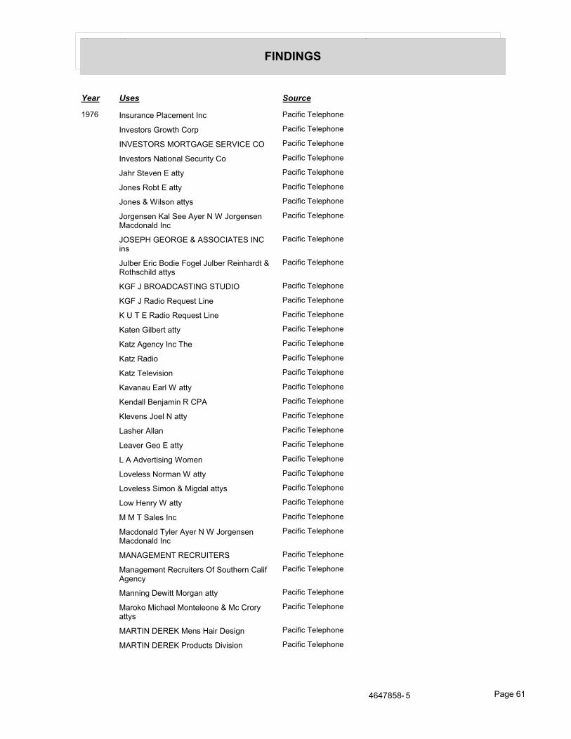
���� ���� ����
��������
���� ���� ����
��-, �%945�%� ��!�� 8 %6��%� �������� ! "#$%
�%3 96$59��5$=6#� $5" �������� ! "#$%
��)��������������)� � � �������� ! "#$%
�%3 96$59���6�$%�!�� �45�67� $ �������� ! "#$%
��#5��6 3 %���667 �������� ! "#$%
�$% 9��$<6���667 �������� ! "#$%
�$% 9�����!9$%��6679 �������� ! "#$%
�$5/ %9 %���!�� ��7 5������$5/ %9 %����;$%�!;��%�
�������� ! "#$%
����������������� ������ ��%9
�������� ! "#$%
�4!< 5�5����$;� ��$/ !��4!< 5�� �%#�5;6����$6#9�#�!;��6679
�������� ! "#$%
����������� ����������� �������� ! "#$%
��������;�$�� @4 96���% �������� ! "#$%
��������;�$�� @4 96���% �������� ! "#$%
��6 %���!< 56��667 �������� ! "#$%
��6?��/ %�7��%��# �������� ! "#$%
��6?���;�$ �������� ! "#$%
��6?� ! 3�9�$% �������� ! "#$%
��3�%�4��5!����667 �������� ! "#$%
� %;�!!�� %A�8�%��� �� �������� ! "#$%
�! 3 %9��$ !����667 �������� ! "#$%
��9# 5��!!�% �������� ! "#$%
� �3 5�� $���667 �������� ! "#$%
�����;3 56�9�%/��$8 % �������� ! "#$%
�$3 ! 99��$58�%����667 �������� ! "#$%
�$3 ! 99���8$%�����/;�!��6679 �������� ! "#$%
�$=�� %57����667 �������� ! "#$%
�������! 9��%� �������� ! "#$%
���;$%�!;�7! 5��7 5������$5/ %9 %����;$%�!;��%�
�������� ! "#$%
��������� ����� �������� ! "#$%
��%�/ 8 %6�� �54�6 59�����$46# 5%� �!����/ %�7
�������� ! "#$%
��%%�%/�� =�66��$5/�%��667 �������� ! "#$%
��5$>$����#� !��$%6 ! $% ������ 5$57��6679
�������� ! "#$%
����������� %9����5�� 9�/% �������� ! "#$%
�����������5$;4�69���3�9�$% �������� ! "#$%
+,+-�.�( . ��/ �,�

���� ���� ����
��������
���� ���� ����
��-, ��� 5$57���55 !!����$%6 ! $% ������ 5$57��6679
�������� ! "#$%
����4�5 �#$8�9����$%6 ! $% ������ 5$57��6679
�������� ! "#$%
� ;�����78 %6� $5" �������� ! "#$%
� #�%�#$9��%9 �������� ! "#$%
� � 59� ��� $ �������� ! "#$%
�� ��&� �����&� � �������� ! "#$%
� 5�457�� % 5�!� $5"$5�6�$% �������� ! "#$%
�� ��&������� & �������� ! "#$%
� 5�457��%945�%� ��/ %�7 �������� ! "#$%
�&���������� ��! �9%/ �������� ! "#$%
��/;�!���4!����667 �������� ! "#$%
��%�# !!�����#� !����$%6 ! $% ������ 5$57��6679
�������� ! "#$%
�$%6 ! $% ������ 5$57��6679 �������� ! "#$%
�$56/�/ ���%�%� � $5" �������� ! "#$%
�464�!�� % ��6���� ��%945�%� � $����� =�5>����
�������� ! "#$%
��%9�#��5$9��/ %�7 �������� ! "#$%
�464�!�� % ��6���� ��%945�%� � $����� =�5>����
�������� ! "#$%
�$9��%/ ! 9���� �������� ! "#$%
��6!���%�/ 8 %6� $ �������� ! "#$%
�������������������� �������� ! "#$%
��6!���%�/�%/��/ %69��%� �������� ! "#$%
���#$!�9� $8"$9�6�$% �������� ! "#$%
�/�!37��%;���6# 5��;3 56�9�%/ �������� ! "#$%
����)&���������� �������� ! "#$%
�5 �>��99%���%�/ 8 %6 �������� ! "#$%
�5 �>��99%���%�/ 8 %6 �������� ! "#$%
�965$3�� 96 5����667 �������� ! "#$%
��������/�?�% �������� ! "#$%
���������5$�;��96���! 9 �������� ! "#$%
��%��8� !�"" 5���/�?�% �������� ! "#$%
��557���3�;�"4<�5 !�6%9 �������� ! "#$%
� �59$%�# $;$5 ���� 6 59� ��� $ �������� ! "#$%
� 6 59$%���� 65 !!$��6679 �������� ! "#$%
� 6 59$%��$%�!;���667 �������� ! "#$%
� 65 !!$�� %% 6#����667 �������� ! "#$%
+,+-�.�( . ��/ �,1

���� ���� ����
��������
���� ���� ����
��-, ��� 5%$��$4��667 �������� ! "#$%
�$9% 5��$9��667 �������� ! "#$%
�$9% 5��$9 "#��667 �������� ! "#$%
�$66�%/��# ;�# �������� ! "#$%
�$3 5%7���53�%����667 �������� ! "#$%
�5�/ 5���3�;����667 �������� ! "#$%
����� ������&������ �������� ! "#$%
������� 96��%� �������� ! "#$%
��<�>$����!�%����$%6 ! $% ������ 5$57��6679
�������� ! "#$%
���#�5;9$%��5�%>�� �������� ! "#$%
���#8$%;��$9 "#��5� �� �������� ! "#$%
�$<<�%9���%;5���667 �������� ! "#$%
�$9 ��$58�%����667 �������� ! "#$%
�$6# %< 5/��9��5����5$� 99�$%�!� $5"$5�6�$%���=������ 9
�������� ! "#$%
�$6#8�%�� 5< 56�� � 59� ��� $ �������� ! "#$%
�$6#9�#�!;��5�%� 9��667 �������� ! "#$%
�$6#9�5�!;����$6#9�#�!;��6679 �������� ! "#$%
�466 5��8����667 �������� ! "#$%
���5�%��54� ����667 �������� ! "#$%
��!>$=��!�%����667 �������� ! "#$%
��7 5��$%�!;��� �� �������� ! "#$%
��#! 9�%/ 5��5%$!;��667 �������� ! "#$%
��#! 9�%/ 5����!�998�%��6679 �������� ! "#$%
��#% �; 5��5$4"�# �� 3 5!7���!!9� ! �������� ! "#$%
��� �������� ! "#$%
��� �������� ! "#$%
��#% �; 5�� 557�96>�8>6��%9!6%6�� 3 5!7���!!9� !
�������� ! "#$%
��#=�56?���3�;����667 �������� ! "#$%
��#=�56?�� 557��667 �������� ! "#$%
��#=�56?���65��������667 �������� ! "#$%
� 3 %6 %���/�?�% �������� ! "#$%
�#�"�5$� # 96 5����667 �������� ! "#$%
��!3���$#%����667 �������� ! "#$%
��8$%���$66��667 �������� ! "#$%
�!$�% � # 96 5����667 �������� ! "#$%
�!$�% � # 96 5����667 �������� ! "#$%
�8�5;�%�����99$���6 9 �������� ! "#$%
+,+-�.�( . ��/ �,2

���� ���� ����
��������
���� ���� ����
��-, �8�6#���!<45����99$���6 9� %/%59 �������� ! "#$%
�$�� 67�����!!4965�6$59�����$9��%/ ! 9 �������� ! "#$%
�$46# 5%� �!��$5%�����%�/ 8 %6�� �54�6 59
�������� ! "#$%
�6 �� %�� �57� $ �������� ! "#$%
)����������'�� �������� ! "#$%
������&������ �������� ! "#$%
! 5 "��%��6 !39%�96%�5 "9 �������� ! "#$%
#$8�9��6 "# %����667 �������� ! "#$%
� ����������������� � � �������� ! "#$%
�9;�! ���"#� !���667 �������� ! "#$%
$$>9��!$7;�;=�5;��667 �������� ! "#$%
$5< 6��!�%��99$���6 9��%� �������� ! "#$%
5��%/! � $884%���6�$%9��%� �������� ! "#$%
)��4�; ���/�?�% �������� ! "#$%
45% 5�����55 !!���%9�#��5$9��464�!�� % ��6���� ��%9� $����� =�5>���
�������� ! "#$%
45% 5��$< 56����667 �������� ! "#$%
�%�6 ;����%!�% 5���/�?�% �������� ! "#$%
)�������������������� �������� ! "#$%
��59�=�� ����667 �������� ! "#$%
� �98�%���5>����667 �������� ! "#$%
� %/ 5����#� !��%� �������� ! "#$%
��� �������� ! "#$%
� 96 5%���%�%���!��%3 968 %6� $5"�� 3 5!7���!!9� !
�������� ! "#$%
� 96 5%��6�6 9��;3 56�9�%/��/ %�� 9��99%
�������� ! "#$%
���> 59#�8� #�9 ��5 �������� ! "#$%
���> 59#�8��� $��%9�<5>59 �������� ! "#$%
��!!��8��$$!�9$%� $�5 � 96 �������� ! "#$%
��!!��89���3�;����667 �������� ! "#$%
��!9$%��$<6����667 �������� ! "#$%
��%;#�8���!8 5���$%6 ! $% ������ 5$57��6679
�������� ! "#$%
��66 �� 96 5��� $� ��9 �������� ! "#$%
�$8 %��%� $884%���6�$%9��%� �������� ! "#$%
�$5!;�� 9$56�5�3 ! �������� ! "#$%
&��� ���3�;����$%6 ! $% ������ 5$57��6679
�������� ! "#$%
& $8�%9�����667; �������� ! "#$%
+,+-�.�( . ��/ �,+

���� ���� ����
��������
���� ���� ����
��-, &$9#�;��� 5�!;���$%6 ! $% ������ 5$57��6679
�������� ! "#$%
&$4%/���9���66 59$% �������� ! "#$%
��-. ������������������������������ ������&�
�������� ! "#$%
����������������������������&�
�������� ! "#$%
���� ������������ ������)����&� ����
�������� ! "#$%
���� �������������������������� ��������������
�������� ! "#$%
������������������� �������������
�������� ! "#$%
�� ����������& �������� ! "#$%
���������� ��������������������� ���������
�������� ! "#$%
����������& �������� ! "#$%
����������������������� �����&�
�������� ! "#$%
��������� �������� ! "#$%
���� �������������������������� �������������
�������� ! "#$%
������� ��������& �������� ! "#$%
���������� �������� ! "#$%
�����������& �������� ! "#$%
������������& �������� ! "#$%
� ���&�����������& �������� ! "#$%
���������� ���&��&� �������� ! "#$%
���������������������� � ����������������������������������
�������� ! "#$%
������������������� ������������������ �������� &
�������� ! "#$%
�������������& �������� ! "#$%
�$9% 5��$9 "#��667 �������� ! "#$%
�)����������'�� �������� ! "#$%
��-� �� �� ����������� �������� ! "#$%
��> 5����#�5;�����%9�#��5$9��464�!�� % ��6���� ��%9� $����� =�5>���
�������� ! "#$%
�! �#��56#45� �� �������� ! "#$%
�! �#��96 5��� $8"�%7� ��9 �������� ! "#$%
�$5; 59����>9$%��%� �������� ! "#$%
�5�9�� !;��$#%� ��4<!�9#�%/� $5" �������� ! "#$%
+,+-�.�( . ��/ �,.

���� ���� ����
��������
���� ���� ����
��-� �5�?�!��%� $%94!�6 �������� ! "#$%
�5$=%�� $����99$���6 9�5!� 96 �������� ! "#$%
�59$%��$< 569��%���;3/ �������� ! "#$%
�������������������'���������
�������� ! "#$%
��������������� ���������5/ %6�%�
�������� ! "#$%
�5�?�! �������� ! "#$%
�$7! ���% �� 5%<��#��%� �������� ! "#$%
�7 ��#�!�"��%9��$4%9!5 �������� ! "#$%
���6$5� ;����$7! ���% �� 5%<��#��%� �������� ! "#$%
������ �� % 5�!��$6$59���� "6�%� � $5"
�������� ! "#$%
���5��8���� 5 59� ��� $ �������� ! "#$%
�����5�%�# �������� ! "#$%
� % 5�!��$6$59���� "6�%� � $5" �������� ! "#$%
��<<9� #�9�����%9�#��5$9��464�!�� % ��6���� ��%9� $����� =�5>���
�������� ! "#$%
�$594�#��54� �����%9�#��5$9��464�!�� % ��6���� ��%9� $����� =�5>����
�������� ! "#$%
�5�"#��9���!! 57�# �������� ! "#$%
�5�6?���6�# !!����667 �������� ! "#$%
��%>���48���!! 57 �������� ! "#$%
��%9�#��5$9���%�%���!��;3�9$57� !�%�� �������� ! "#$%
��%9�#��5$9��464�!�� % ��6���� ��%9� $����� =�5>���
�������� ! "#$%
��%9�#��49���%9�#��5$9��464�!�� % ��6���� ��%9� $����� =�5>���
�������� ! "#$%
��%9�#���!6 5���%9�#��5$9��464�!�� % ��6���� ��%9� $����� =�5>���
�������� ! "#$%
�%;49657� $%94!6�%69 �������� ! "#$%
���������� ����������� �������� ! "#$%
��6?��/ %�7��%��# �������� ! "#$%
��6?���;�$ �������� ! "#$%
��6?� ! 3�9�$% �������� ! "#$%
��596 ��$< 56���%;$%��667 �������� ! "#$%
��596 ����4�#��6679 �������� ! "#$%
�$3 ! 99��$58�%����667 �������� ! "#$%
�$3 ! 99���8$%�����/;�!��6679 �������� ! "#$%
� #�%�#$9��%9 �������� ! "#$%
� � 59� ��� $ �������� ! "#$%
+,+-�.�( . ��/ �,,
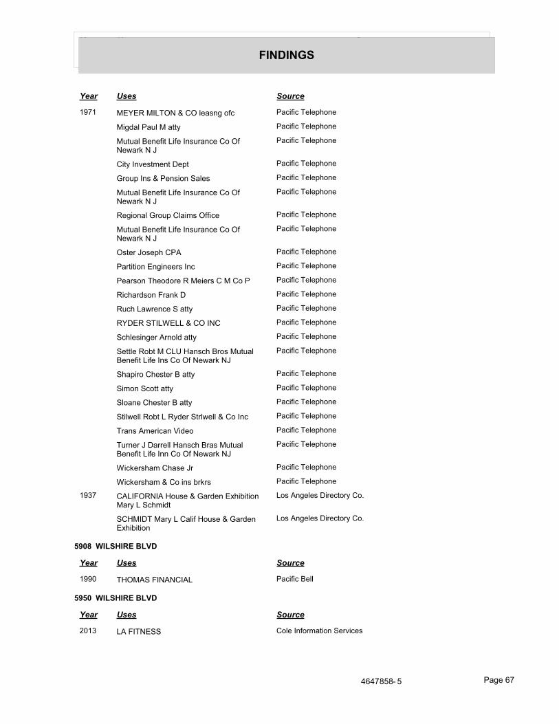
���� ���� ����
��������
���� ���� ����
��-� �&���������� ��! �9%/�$�� �������� ! "#$%
��/;�!���4!����667 �������� ! "#$%
�464�!�� % ��6���� ��%945�%� � $����� =�5>����
�������� ! "#$%
�67��%3 968 %6�� "6 �������� ! "#$%
�5$4"��%9���� %9�$%���! 9 �������� ! "#$%
�464�!�� % ��6���� ��%945�%� � $����� =�5>����
�������� ! "#$%
� /�$%�!��5$4"� !��89������ �������� ! "#$%
�464�!�� % ��6���� ��%945�%� � $����� =�5>����
�������� ! "#$%
�96 5��$9 "#� �� �������� ! "#$%
��56�6�$%�%/�% 59��%� �������� ! "#$%
� �59$%�# $;$5 ���� � 59� ��� $�� �������� ! "#$%
���#�5;9$%��5�%>�� �������� ! "#$%
�4�#���=5 %� ����667 �������� ! "#$%
�&������������ ���� �������� ! "#$%
��#! 9�%/ 5��5%$!;��667 �������� ! "#$%
� 66! ��$<6��� �����%9�#��5$9��464�!�� % ��6���� ��%9� $����� =�5>���
�������� ! "#$%
�#�"�5$� # 96 5����667 �������� ! "#$%
��8$%���$66��667 �������� ! "#$%
�!$�% � # 96 5����667 �������� ! "#$%
�6�!= !!��$<6����7; 5��65!= !!��� $��%� �������� ! "#$%
5�%9��8 5���%�)�; $ �������� ! "#$%
45% 5�����55 !!���%9�#��5�9��464�!�� % ��6���� ��%%� $����� =�5>���
�������� ! "#$%
���> 59#�8� #�9 ��5 �������� ! "#$%
���> 59#�8��� $��%9�<5>59 �������� ! "#$%
��2- �����������$49 �����5; %�:#�<�6�$%���57�����#8�;6
�$9��%/ ! 9���5 �6$57� $B
� �������57��� �!����$49 �����5; %�:#�<�6�$%
�$9��%/ ! 9���5 �6$57� $B
���� ������������
���� ���� ����
���0 ����������� ��� ��������� !!
���� ������������
���� ���� ����
10�2 �������� $! ��%�$58�6�$%�� 53�� 9
+,+-�.�( . ��/ �,-

���� ���� ����
��������
���� ���� ����
1000 ���������������212��2,�+,+��
���% 9��� $8"�%7
��������������� ���� ���% 9��� $8"�%7
���� ������������������ ���������� !!
��!9#�5 � %6 5 ���������� !!
496$8 5�� 53�� �1+��$459 ���������� !!
� =����$4%69����$�%9 ���������� !!
���0 ����������� ����� ��������� ��������� !!
�� ������� ��������� ��������� !!
���� ����� ��������� !!
���� �� ���)������ ��������� !!
�� ����&������������� ��������� !!
����������������������� ������ �������������������� ��������
��������� !!
���������� ��������� !!
���, ���� ��������� ��������� !!
���� ��������� ��������� !!
��������������������������� �������
��������� !!
���� ������ ��� ��������� !!
�������� ���������� ��������� !!
���. �������������������( ��������� !!
���� �������� ������������'����
�������� ! "#$%
����������������������� ������ ������ ����������
�������� ! "#$%
���0 ��������������������5�%�# 9���5��! ���! ������
�������� ! "#$%
# �>�%/�����3�%/9 �������� ! "#$%
�$�%�� @4 969 �������� ! "#$%
��%�/ 5 �������� ! "#$%
�$6 �� "6 �������� ! "#$%
��-, �5��;�� �������� ! "#$%
��!9#�5 �������� ! "#$%
�8 5���%��$%/�� 96�3�! �������� ! "#$%
�6 5!�%/�� �5 �6�$%��5/�%�?�6�$% �������� ! "#$%
��������������������� ������� �����5��! ���! ������
�������� ! "#$%
��-� �$%$8���$56/�/ � $���3�9�$%����� !!9���5/$���%>�����$9��%/ ! 9������
�������� ! "#$%
+,+-�.�( . ��/ �,�
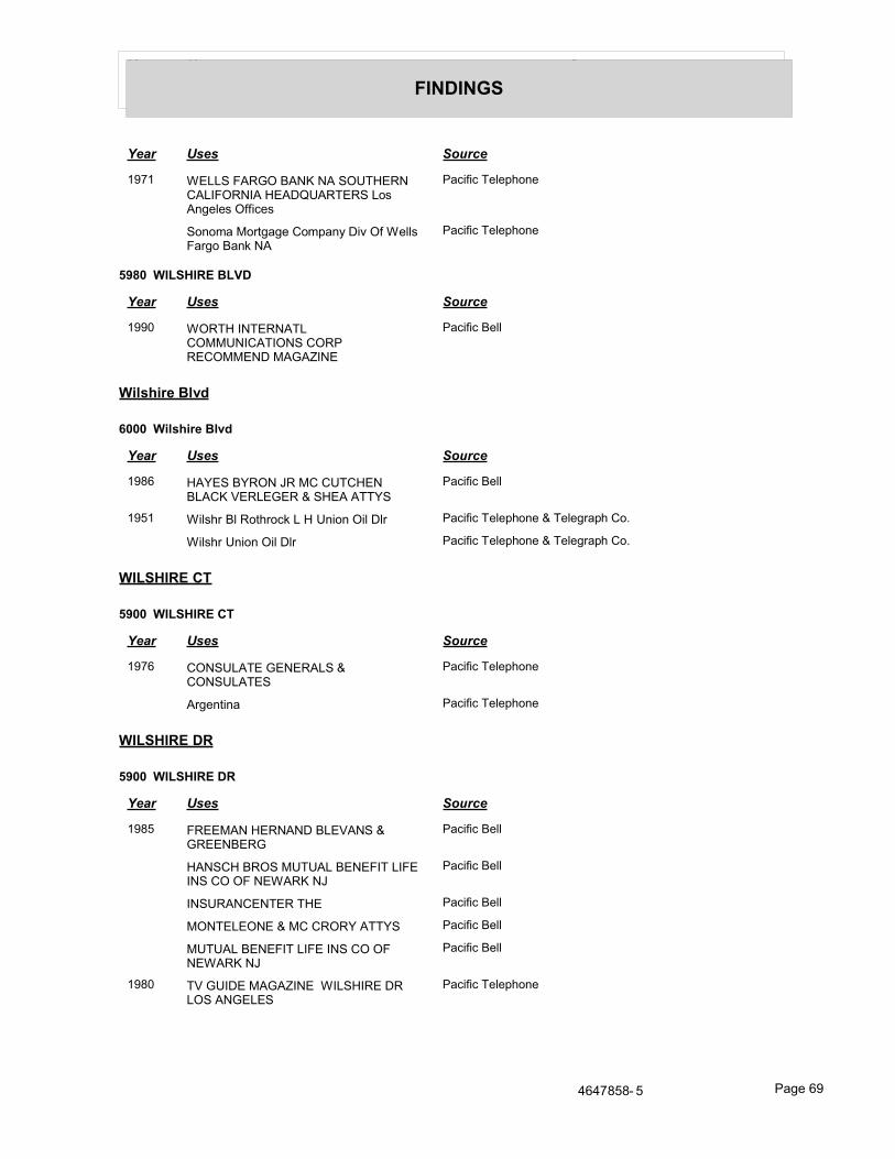
���� ���� ����
��������
���� ���� ����
��-� �������������������������� �������������C�������$9��%/ ! 9������ 9
�������� ! "#$%
�$%$8���$56/�/ � $8"�%7���3����� !!9���5/$���%>���
�������� ! "#$%
���� ������������
���� ���� ����
���0 ������������ ������ ������ ����� ����������'��
��������� !!
������������
��� ������������
���� ���� ����
���, ��&���&�������� � � ������ ��)������������&�
��������� !!
��.� ��!9#5��!��$6#5$�>������%�$%���!��!5 �������� ! "#$% ��� ! /5�"#� $B
��!9#5��%�$%���!��!5 �������� ! "#$% ��� ! /5�"#� $B
����������
��� ����������
���� ���� ����
��-, ���������������� �������
�������� ! "#$%
�5/ %6�%� �������� ! "#$%
����������
��� ����������
���� ���� ����
���. ���������������)������������
��������� !!
���� �������������������������� �������������
��������� !!
������� ���� ��������� !!
���������� � ���&��&� ��������� !!
������������������� �������������
��������� !!
���0 )����������'������������������������
�������� ! "#$%
+,+-�.�( . ��/ �,�

���� ���� ����
��������
���� ���� ����
���0 ������������������� �����������������������������������
�������� ! "#$%
���������� ���&��&�����������������������
�������� ! "#$%
��-. ��������� ������� �������������������������� �������������
�������� ! "#$%
)����������'�� �������� ! "#$%
������������������� �������������
�������� ! "#$%
���� �������������������������� �������������
�������� ! "#$%
���������� � ���&��&�������������
�������� ! "#$%
����������
��� ����������
���� ���� ����
���� ��� $%% !!�� <5��� ���������� !!
��� $%% !!���3�;�� ���������� !!
��� $%% !!� 5�8$!�% ���%;7��6679 ���������� !!
�����������
���� �����������
���� ���� ����
���� �����������& �������� ! "#$%
+,+-�.�( . ��/ �-0

��������
� �������!����"#� ��������!�������������������� �����!$���
# ��$!!$=�%/��5/ 6��5$" 567��;;5 99 9�= 5 �5 9 �5�# ;��$5�6#�9�5 "$56D��%;�6# ��;;5 99 9�= 5 �%$6��; %6��� ;��%�6# �5 9 �5�#�9$45� B
�����������%�&��� ��������'(����)(�*�����)�����%�&���'+�&�.�0.���!9#�5 ��$4! 3�5; 100+D�1002D�100�D�����D����,D����1D�����D����.D���-1D���-0D���,�D���,,D���,.D �
��,+D���,2D���,1D���,�D���,0D���.-D���.,D���..D���.+D���.1D���.0D���+�D���+�D ���+-D���+,D���+.D���++D���+0D���2�D���2�D���2,D���2.D���2+D���21D���2�D���20D ���1�D���1-D���1,D���1.D���1+D���12D���1�D���10
�,!��������!����"#� ����������!�������������������� �����!$���
# ��$!!$=�%/��;A$�%�%/��5$" 567��;;5 99 9�= 5 �5 9 �5�# ;��$5�6#�9�5 "$56D��%;�6# ��;;5 99 9�= 5 �%$6��; %6��� ;��%�5 9 �5�#�9$45� B
�����������%�&��� ��������'(����)(�*�����)�����%�&���'+�&�.�0����!9#�5 ��!3; 10�2D�100�D�100+D�1002D�100�D�����D����,D����1D�����D����.D���-1D���-0D���,�D �
��,,D���,.D���,+D���,2D���,1D���,�D���,0D���.-D���.,D���..D���.+D���.1D���.�D ���.0D���+�D���+�D���+-D���+,D���+.D���++D���+1D���+0D���2�D���2�D���2-D���2,D ���2.D���2+D���22D���21D���2�D���20D���1�D���1-D���1,D���1.D���1+D���12D���1�D ���10
.�0������������)� 100,D�100+D�1002D�100�D�1000D�����D����,D����.D����1D�����D����0D����,D����.D �����D����0D���-,D���-.D���-1D���-�D���-0D���,�D���,-D���,,D���,.D���,+D���,2D ���,1D���,�D���,0D���.�D���.-D���.,D���..D���.+D���.1D���.�D���.0D���+�D���+�D ���+-D���+,D���+.D���++D���+1D���+0D���2�D���2�D���2-D���2,D���2.D���2+D���22D ���21D���2�D���20D���1�D���1�D���1-D���1,D���1.D���1+D���12D���1�D���10
.��������������)� 10�2D�100�D�100,D�100+D�1002D�100�D�1000D�����D����,D����.D����1D�����D����,D ����.D�����D����0D���-,D���-.D���-1D���-�D���-0D���,�D���,-D���,,D���,.D���,+D ���,2D���,1D���,�D���,0D���.�D���.-D���.,D���..D���.+D���.1D���.�D���.0D���+�D ���+�D���+-D���+,D���+.D���++D���+1D���+0D���2�D���2�D���2-D���2,D���2.D���2+D ���22D���21D���2�D���20D���1�D���1�D���1-D���1,D���1.D���1+D���12D���1�D���10
.�00�������������)� 10�2D�100�D�100,D�100+D�1002D�100�D�1000D�����D����,D����.D����1D�����D����0D ����,D����.D�����D����0D���-.D���-1D���-�D���-0D���,�D���,-D���,,D���,.D���,+D ���,2D���,1D���,�D���,0D���.�D���.-D���.,D���..D���.+D���.1D���.�D���.0D���+�D ���+�D���+-D���+,D���+.D���++D���+1D���+0D���2�D���2�D���2-D���2,D���2.D���2+D ���22D���21D���2�D���20D���1�D���1�D���1-D���1,D���1.D���1+D���12D���1�D���10
.�00�������� 10�2D�100�D�100,D�100+D�1002D�100�D�1000D�����D����,D����.D����1D�����D����,D ����.D�����D����0D���-,D���-.D���-1D���-�D���-0D���,�D���,-D���,,D���,.D���,+D ���,2D���,1D���,�D���,0D���.�D���.-D���.,D���..D���.+D���.1D���.�D���.0D���+�D ���+�D���+-D���+,D���+.D���++D���+1D���+0D���2�D���2�D���2-D���2,D���2.D���2+D ���22D���21D���2�D���20D���1�D���1�D���1-D���1,D���1.D���1+D���12D���1�D���10
.�00�����������)� 10�2D�100�D�100+D�1002D�100�D�����D����,D����1D���-1D���-0D���,�D���,-D���,,D ���,.D���,+D���,2D���,1D���,�D���,0D���.�D���.-D���.,D���..D���.+D���.1D���.�D ���.0D���+�D���+�D���+-D���+,D���+.D���++D���+1D���+0D���2�D���2�D���2,D���2.D ���2+D���22D���21D���2�D���20D���1�D���1�D���1-D���1,D���1.D���1+D���12D���1�D ���10
.�00�����������)� 100,D�100+D�1002D�100�D�1000D�����D����,D����.D����1D�����D����0D����,D����.D �����D����0D���-,D���-.D���-1D���-�D���-0D���,�D���,-D���,,D���,.D���,+D���,2D ���,1D���,�D���,0D���.�D���.-D���.,D���..D���.+D���.1D���.�D���.0D���+�D���+�D ���+-D���+,D���+.D���++D���+1D���+0D���2�D���2�D���2-D���2,D���2.D���2+D���22D ���21D���2�D���20D���1�D���1�D���1-D���1,D���1.D���1+D���12D���1�D���10

��������
�����������%�&��� ��������'(����)(�*�����)�����%�&���'+�&�.�00��������� 10�2D�100�D�100,D�100+D�1002D�100�D�1000D�����D����,D����.D����1D�����D����0D �
���,D����.D�����D����0D���-.D���-1D���-�D���-0D���,�D���,-D���,,D���,.D���,+D ���,2D���,1D���,�D���,0D���.�D���.-D���.,D���..D���.+D���.1D���.�D���.0D���+�D ���+�D���+-D���+,D���+.D���++D���+1D���+0D���2�D���2�D���2-D���2,D���2.D���2+D ���22D���21D���2�D���20D���1�D���1�D���1-D���1,D���1.D���1+D���12D���1�D���10
.�00����������� 10�2D�100�D�100,D�100+D�1002D�100�D�1000D�����D����,D����.D����1D�����D����0D ����,D�����D���-,D���-1D���-�D���-0D���,�D���,-D���,,D���,.D���,+D���,2D���,1D ���,�D���,0D���.�D���.-D���.,D���..D���.+D���.1D���.�D���.0D���+�D���+�D���+-D ���+,D���+.D���++D���+1D���+0D���2�D���2�D���2-D���2,D���2.D���2+D���22D���21D ���2�D���20D���1�D���1�D���1-D���1,D���1.D���1+D���12D���1�D���10
.�00����������� 10�2D�100�D�100,D�100+D�1002D�100�D�1000D�����D����,D����.D����1D����0D����,D ����.D�����D����0D���-,D���-.D���-1D���-�D���-0D���,�D���,-D���,,D���,.D���,+D ���,2D���,1D���,�D���,0D���.�D���.-D���.,D���..D���.+D���.1D���.�D���.0D���+�D ���+�D���+-D���+,D���+.D���++D���+1D���+0D���2�D���2�D���2-D���2,D���2.D���2+D ���22D���21D���2�D���20D���1�D���1�D���1-D���1,D���1.D���1+D���12D���1�D���10
.�0.�������������)� 10�2D�100�D�100,D�100+D�1002D�100�D�1000D�����D����,D����.D����1D�����D����0D ����,D����.D�����D����0D���-.D���-1D���-�D���-0D���,�D���,-D���,,D���,.D���,+D ���,2D���,1D���,�D���,0D���.�D���.-D���.,D���..D���.+D���.1D���.�D���.0D���+�D ���+�D���+-D���+,D���+.D���++D���+1D���+0D���2�D���2�D���2-D���2,D���2.D���2+D ���22D���21D���2�D���20D���1�D���1�D���1-D���1,D���1.D���1+D���12D���1�D���10
.�0������������)� 10�2D�100�D�100,D�100+D�1002D�100�D�1000D�����D����,D����.D����1D�����D����,D ����.D�����D����0D���-,D���-.D���-1D���-�D���-0D���,�D���,-D���,,D���,.D���,+D ���,2D���,1D���,�D���,0D���.�D���.-D���.,D���..D���.+D���.1D���.�D���.0D���+�D ���+�D���+-D���+,D���+.D���++D���+1D���+0D���2�D���2�D���2-D���2,D���2.D���2+D ���22D���21D���2�D���20D���1�D���1�D���1-D���1,D���1.D���1+D���12D���1�D���10
.�.0�����������)� 10�2D�100�D�100,D�100+D�1002D�100�D�����D����,D����.D����1D���-.D���-1D���-0D ���,�D���,-D���,,D���,.D���,+D���,2D���,1D���,�D���,0D���.�D���.-D���.,D���..D ���.+D���.1D���.�D���.0D���+�D���+�D���+-D���+,D���+.D���++D���+1D���+0D���2�D ���2�D���2-D���2,D���2.D���2+D���22D���21D���2�D���20D���1�D���1�D���1-D���1,D ���1.D���1+D���12D���1�D���10
.�.0�����������)� 100�D�100,D�100+D�1002D�100�D�1000D�����D����,D����.D����1D�����D����0D����,D ����.D�����D����0D���-,D���-.D���-1D���-�D���-0D���,�D���,-D���,,D���,.D���,+D ���,2D���,1D���,�D���,0D���.�D���.-D���.,D���..D���.+D���.1D���.�D���.0D���+�D ���+�D���+-D���+,D���+.D���++D���+1D���+0D���2�D���2�D���2-D���2,D���2.D���2+D ���22D���21D���2�D���20D���1�D���1�D���1-D���1,D���1.D���1+D���12D���1�D���10
.�,0����������)� 10�2D�100�D�100,D�100+D�1002D�100�D�1000D�����D����,D����.D����1D�����D����0D ����,D����.D����0D���-,D���-.D���-1D���-�D���-0D���,�D���,-D���,,D���,.D���,+D ���,2D���,1D���,�D���,0D���.�D���.-D���.,D���..D���.+D���.1D���.�D���.0D���+�D ���+�D���+-D���+,D���+.D���++D���+1D���+0D���2�D���2�D���2-D���2,D���2.D���2+D ���22D���21D���2�D���20D���1�D���1�D���1-D���1,D���1.D���1+D���12D���1�D���10
.��0�����������)� 10�2D�100�D�100,D�100+D�1002D�100�D�1000D�����D����,D����.D����1D�����D����,D ����.D�����D����0D���-,D���-.D���-1D���-�D���-0D���,�D���,-D���,,D���,.D���,+D ���,2D���,1D���,�D���,0D���.�D���.-D���.,D���..D���.+D���.1D���.�D���.0D���+�D ���+�D���+-D���+,D���+.D���++D���+1D���+0D���2�D���2�D���2-D���2,D���2.D���2+D ���22D���21D���2�D���20D���1�D���1�D���1-D���1,D���1.D���1+D���12D���1�D���10
,000���!9#�5 ��!3; 10�2D�100�D�100,D�100+D�1002D�100�D�1000D�����D����,D����.D����1D�����D����0D ����.D�����D����0D���-,D���-.D���-1D���-�D���-0D���,�D���,-D���,,D���,.D���,+D ���,2D���,1D���,�D���,0D���.�D���.-D���.,D���..D���.+D���.1D���.0D���+�D���+�D ���+-D���+,D���+.D���++D���+1D���+0D���2�D���2�D���2-D���2,D���2.D���2+D���22D ���21D���2�D���20D���1�D���1�D���1-D���1,D���1.D���1+D���12D���1�D���10
-0+��������������) 10�2D�100�D�100,D�100+D�1002D�100�D�1000D�����D����,D����.D����1D�����D����0D ����,D����.D�����D����0D���-,D���-.D���-1D���-�D���-0D���,�D���,-D���,,D���,.D ���,+D���,2D���,�D���,0D���.-D���.,D���..D���.+D���.1D���.�D���.0D���+�D���+�D ���+-D���+,D���+.D���++D���+1D���+0D���2�D���2�D���2-D���2,D���2.D���2+D���22D ���21D���2�D���20D���1�D���1�D���1-D���1,D���1.D���1+D���12D���1�D���10

��������
�����������%�&��� ��������'(����)(�*�����)�����%�&���'+�&�-�+��������������) 10�2D�100�D�100,D�100+D�1002D�100�D�1000D�����D����,D����.D����1D�����D����0D �
���,D����.D�����D����0D���-,D���-.D���-1D���-�D���-0D���,�D���,-D���,,D���,+D ���,2D���,�D���,0D���.�D���.-D���.,D���..D���.+D���.1D���.�D���.0D���+�D���+�D ���+-D���+,D���+.D���++D���+1D���+0D���2�D���2�D���2-D���2,D���2.D���2+D���22D ���21D���2�D���20D���1�D���1�D���1-D���1,D���1.D���1+D���12D���1�D���10
-11������������ 10�2D�100�D�100,D�100+D�1002D�100�D�1000D�����D����,D����.D����1D�����D����0D ����,D����.D�����D����0D���-,D���-.D���-1D���-0D���,�D���,,D���,.D���,+D���,2D ���,�D���,0D���.�D���.-D���.,D���..D���.+D���.1D���.�D���.0D���+�D���+�D���+-D ���+,D���+.D���++D���+1D���+0D���2�D���2�D���2-D���2,D���2.D���2+D���22D���21D ���2�D���20D���1�D���1�D���1-D���1,D���1.D���1+D���12D���1�D���10
-11��������������) 10�2D�100�D�100,D�100+D�1002D�100�D�1000D�����D����,D����.D����1D�����D����0D ����,D����.D�����D����0D���-,D���-.D���-1D���-�D���-0D���,�D���,-D���,,D���,.D ���,+D���,2D���,1D���,�D���,0D���.-D���.,D���..D���.+D���.1D���.�D���.0D���+�D ���+�D���+-D���+,D���+.D���++D���+0D���2�D���2�D���2-D���2,D���2.D���2+D���22D ���21D���2�D���20D���1�D���1�D���1-D���1,D���1.D���1+D���12D���1�D���10
-11������������)�� 10�2D�100�D�100,D�100+D�1002D�100�D�1000D�����D����,D����.D����1D�����D����0D ����,D����.D�����D����0D���-,D���-.D���-1D���-�D���-0D���,�D���,-D���,,D���,.D ���,+D���,2D���,1D���,�D���,0D���.�D���.-D���.,D���..D���.+D���.1D���.0D���+�D ���+�D���+-D���+,D���+.D���++D���+1D���+0D���2�D���2�D���2-D���2,D���2.D���2+D ���22D���21D���2�D���20D���1�D���1�D���1-D���1,D���1.D���1+D���12D���1�D���10
-1+��������������) 10�2D�100�D�100,D�100+D�1002D�100�D�1000D�����D����,D����.D����1D�����D����0D ����,D����.D�����D����0D���-,D���-.D���-1D���-�D���-0D���,�D���,-D���,,D���,+D ���,2D���,�D���,0D���.-D���.,D���..D���.+D���.1D���.�D���.0D���+�D���+�D���+-D ���+,D���+.D���++D���+0D���2�D���2�D���2-D���2,D���2.D���2+D���22D���21D���2�D ���20D���1�D���1�D���1-D���1,D���1.D���1+D���12D���1�D���10
-1,��������������) 10�2D�100�D�100,D�100+D�1002D�100�D�1000D�����D����,D����.D����1D�����D����0D ����,D����.D�����D����0D���-,D���-.D���-1D���-�D���-0D���,�D���,-D���,,D���,.D ���,+D���,2D���,�D���,0D���.-D���.,D���..D���.+D���.1D���.�D���.0D���+�D���+�D ���+-D���+,D���+.D���++D���+0D���2�D���2�D���2-D���2,D���2.D���2+D���22D���21D ���2�D���20D���1�D���1�D���1-D���1,D���1.D���1+D���12D���1�D���10
-1-��������������) 10�2D�100�D�100+D�1002D�100�D�1000D�����D����,D����.D����1D�����D����0D����,D ����.D�����D����0D���-.D���-1D���-�D���-0D���,�D���,-D���,,D���,.D���,+D���,2D ���,1D���,�D���,0D���.-D���.,D���..D���.+D���.1D���.�D���.0D���+�D���+�D���+-D ���+,D���+.D���++D���+0D���2�D���2�D���2,D���2.D���2+D���22D���21D���2�D���20D ���1�D���1�D���1-D���1,D���1.D���1+D���12D���1�D���10
-1���������������) 10�2D�100�D�100,D�100+D�1002D�100�D�1000D�����D����,D����.D����1D�����D����0D ����,D����.D�����D����0D���-,D���-.D���-1D���-�D���,�D���,-D���,,D���,.D���,+D ���,2D���,1D���,�D���,0D���.-D���.,D���..D���.+D���.1D���.�D���.0D���+�D���+�D ���+-D���+,D���+.D���++D���+0D���2�D���2�D���2,D���2.D���2+D���22D���21D���2�D ���20D���1�D���1�D���1-D���1,D���1.D���1+D���12D���1�D���10
-1���������������) 10�2D�100�D�100+D�1002D�100�D�1000D�����D����,D����.D����1D�����D����0D����,D ����.D����0D���-.D���-1D���-�D���-0D���,�D���,-D���,,D���,.D���,+D���,2D���,1D ���,�D���,0D���.-D���.,D���..D���.+D���.1D���.�D���.0D���+�D���+�D���+-D���+,D ���+.D���++D���+0D���2�D���2�D���2,D���2.D���2+D���22D���21D���2�D���20D���1�D ���1�D���1-D���1,D���1.D���1+D���12D���1�D���10
-20��������������) 10�2D�100�D�100,D�100+D�1002D�100�D�1000D�����D����,D����.D����1D�����D����0D ����,D����.D�����D����0D���-,D���-.D���-1D���-�D���-0D���,�D���,-D���,,D���,.D ���,+D���,2D���,1D���,�D���,0D���.�D���.-D���.,D���..D���.+D���.1D���.�D���.0D ���+�D���+�D���+-D���+,D���+.D���++D���+0D���2�D���2�D���2,D���2.D���2+D���22D ���21D���2�D���20D���1�D���1�D���1-D���1,D���1.D���1+D���12D���1�D���10
-2���������������) 10�2D�100�D�100+D�1002D�100�D�1000D�����D����,D����.D����1D�����D����,D����.D ����0D���-,D���-.D���-1D���-�D���-0D���,�D���,-D���,,D���,.D���,+D���,2D���,1D ���,�D���,0D���.-D���.,D���..D���.+D���.1D���.�D���.0D���+�D���+�D���+-D���+,D ���+.D���++D���+1D���+0D���2�D���2�D���2-D���2,D���2.D���2+D���22D���21D���2�D ���20D���1�D���1�D���1-D���1,D���1.D���1+D���12D���1�D���10

��������
�����������%�&��� ��������'(����)(�*�����)�����%�&���'+�&�-21��������������) 10�2D�100�D�100,D�100+D�1002D�100�D�1000D�����D����,D����.D����1D�����D����0D �
���,D����.D�����D����0D���-,D���-.D���-1D���-�D���-0D���,�D���,-D���,,D���,.D ���,+D���,2D���,�D���,0D���.-D���.,D���..D���.+D���.1D���.�D���.0D���+�D���+�D ���+-D���+,D���+.D���++D���+0D���2�D���2�D���2,D���2.D���2+D���21D���2�D���20D ���1�D���1-D���1,D���1.D���1+D���12D���1�D���10
-22��������������) 10�2D�100�D�100+D�1002D�100�D�1000D�����D����,D����.D����1D�����D����.D�����D ����0D���-.D���-1D���-�D���-0D���,�D���,-D���,,D���,.D���,+D���,2D���,1D���,�D ���,0D���.-D���.,D���..D���.+D���.1D���.�D���.0D���+�D���+�D���+-D���+,D���+.D ���++D���+1D���+0D���2�D���2�D���2-D���2,D���2.D���2+D���22D���21D���2�D���20D ���1�D���1�D���1-D���1,D���1.D���1+D���12D���1�D���10
-2+��������������) 10�2D�100�D�100,D�100+D�1002D�100�D�1000D�����D����,D����.D����1D�����D����0D ����,D����.D�����D����0D���-,D���-.D���-1D���-�D���-0D���,�D���,-D���,,D���,.D ���,+D���,2D���,�D���,0D���.-D���.,D���..D���.+D���.1D���.�D���.0D���+�D���+�D ���+-D���+,D���+.D���++D���+0D���2�D���2�D���2,D���2.D���2+D���22D���21D���2�D ���20D���1�D���1-D���1,D���1.D���1+D���12D���1�D���10
-2.��������������) 10�2D�100�D�100+D�1002D�100�D�1000D�����D����,D����.D����1D�����D����.D����0D ���-.D���-1D���-�D���-0D���,�D���,-D���,,D���,.D���,+D���,2D���,1D���,�D���,0D ���.-D���.,D���..D���.+D���.1D���.�D���.0D���+�D���+�D���+-D���+,D���+.D���++D ���+1D���+0D���2�D���2�D���2-D���2,D���2.D���2+D���22D���21D���2�D���20D���1�D ���1�D���1-D���1,D���1.D���1+D���12D���1�D���10
-2-��������������) 10�2D�100�D�100,D�100+D�1002D�100�D�1000D�����D����,D����.D����1D�����D����0D ����.D�����D����0D���-.D���-1D���-�D���-0D���,�D���,-D���,,D���,+D���,2D���,�D ���,0D���.-D���.,D���..D���.+D���.1D���.�D���.0D���+�D���+�D���+-D���+,D���+.D ���++D���+1D���+0D���2�D���2�D���2-D���2,D���2.D���2+D���22D���21D���2�D���20D ���1�D���1�D���1-D���1,D���1.D���1+D���12D���1�D���10
-2���������������) 10�2D�100�D�100,D�100+D�1002D�100�D�1000D�����D����,D����.D����1D�����D����0D ����,D����.D�����D����0D���-,D���-.D���-1D���-�D���-0D���,�D���,-D���,,D���,.D ���,+D���,2D���,�D���,0D���.-D���.,D���..D���.+D���.1D���.�D���.0D���+�D���+�D ���+-D���+,D���+.D���++D���+0D���2�D���2�D���2,D���2.D���2+D���21D���2�D���20D ���1�D���1-D���1,D���1.D���1+D���12D���1�D���10
-2���������������) 10�2D�100�D�100+D�1002D�100�D�1000D�����D����,D����.D����1D�����D����.D����0D ���-.D���-1D���-�D���-0D���,�D���,-D���,,D���,.D���,+D���,2D���,1D���,�D���,0D ���.-D���.,D���..D���.+D���.1D���.�D���.0D���+�D���+�D���+-D���+,D���+.D���++D ���+0D���2�D���2�D���2,D���2.D���2+D���21D���2�D���20D���1�D���1�D���1-D���1,D ���1.D���1+D���12D���1�D���10
-+0��������������) 10�2D�100�D�100,D�100+D�1002D�100�D�1000D�����D����,D����.D����1D�����D����0D ����,D����.D�����D����0D���-,D���-.D���-1D���-�D���-0D���,�D���,-D���,,D���,.D ���,+D���,2D���,1D���,�D���,0D���.�D���.-D���.,D���..D���.+D���.1D���.�D���.0D ���+�D���+�D���+-D���+,D���+.D���++D���+1D���+0D���2�D���2�D���2,D���2.D���2+D ���22D���21D���2�D���20D���1�D���1�D���1-D���1,D���1.D���1+D���12D���1�D���10
-+1��������������) 10�2D�100�D�100,D�100+D�1002D�100�D�1000D�����D����,D����.D����1D�����D����0D ����,D����.D�����D����0D���-,D���-.D���-1D���-�D���-0D���,�D���,-D���,,D���,.D ���,+D���,2D���,1D���,�D���,0D���.-D���.,D���..D���.+D���.1D���.�D���.0D���+�D ���+�D���+-D���+,D���+.D���++D���+0D���2�D���2�D���2,D���2.D���2+D���21D���2�D ���20D���1�D���1-D���1,D���1.D���1+D���12D���1�D���10
-+2��������������) 10�2D�100�D�100+D�1002D�100�D�1000D�����D����,D����.D����1D�����D����0D����,D ����.D����0D���-.D���-1D���-�D���-0D���,�D���,-D���,,D���,.D���,+D���,2D���,1D ���,�D���,0D���.-D���.,D���..D���.+D���.1D���.�D���.0D���+�D���+�D���+-D���+,D ���+.D���++D���+0D���2�D���2�D���2-D���2,D���2.D���2+D���21D���2�D���20D���1�D ���1�D���1-D���1,D���1.D���1+D���12D���1�D���10
AECOM Environment
July 2016 60506707.1
Appendix D
Prior Environmental Reports
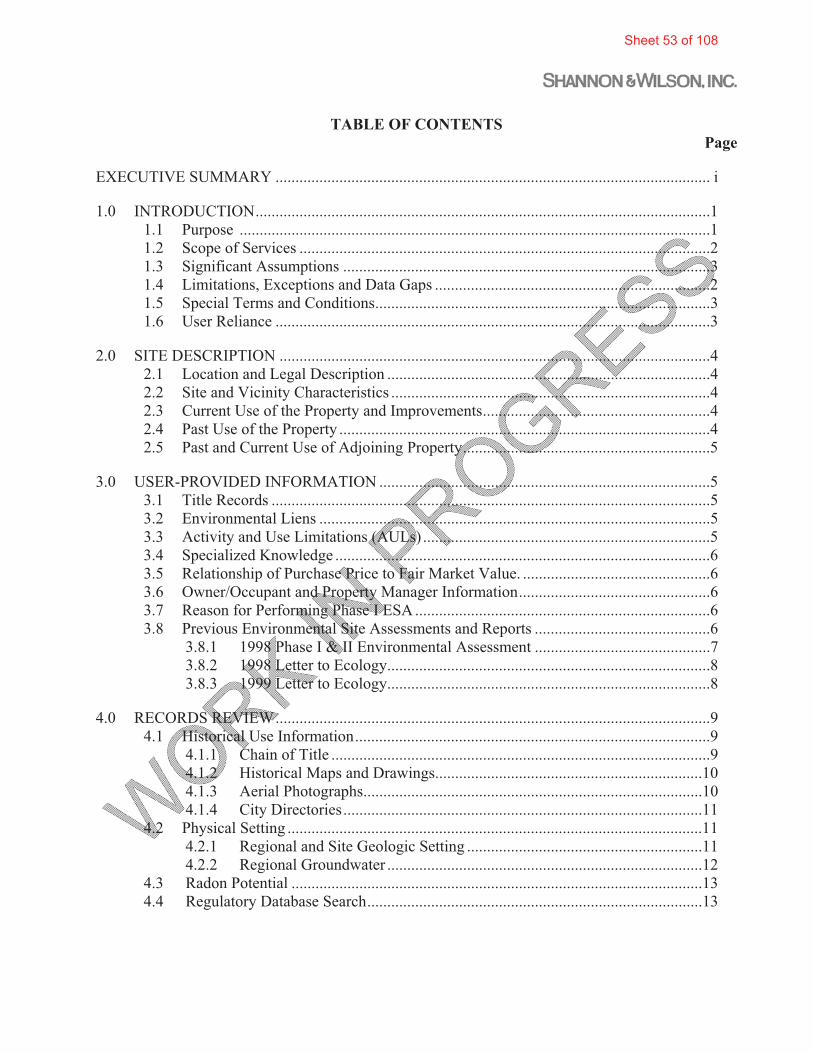
TABLE OF CONTENTS Page
EXECUTIVE SUMMARY ............................................................................................................. i
1.0 INTRODUCTION ..................................................................................................................1 1.1 Purpose ......................................................................................................................1 1.2 Scope of Services .......................................................................................................2 1.3 Significant Assumptions ............................................................................................3 1.4 Limitations, Exceptions and Data Gaps .....................................................................2 1.5 Special Terms and Conditions ....................................................................................3 1.6 User Reliance .............................................................................................................3
2.0 SITE DESCRIPTION ............................................................................................................4 2.1 Location and Legal Description .................................................................................4 2.2 Site and Vicinity Characteristics ................................................................................4 2.3 Current Use of the Property and Improvements .........................................................4 2.4 Past Use of the Property .............................................................................................4 2.5 Past and Current Use of Adjoining Property ..............................................................5
3.0 USER-PROVIDED INFORMATION ...................................................................................5 3.1 Title Records ..............................................................................................................5 3.2 Environmental Liens ..................................................................................................5 3.3 Activity and Use Limitations (AULs) ........................................................................5 3.4 Specialized Knowledge ..............................................................................................6 3.5 Relationship of Purchase Price to Fair Market Value. ...............................................6 3.6 Owner/Occupant and Property Manager Information ................................................6 3.7 Reason for Performing Phase I ESA ..........................................................................6 3.8 Previous Environmental Site Assessments and Reports ............................................6
3.8.1 1998 Phase I & II Environmental Assessment ............................................7 3.8.2 1998 Letter to Ecology .................................................................................8
3.8.3 1999 Letter to Ecology .................................................................................8
4.0 RECORDS REVIEW .............................................................................................................9 4.1 Historical Use Information .........................................................................................9
4.1.1 Chain of Title ...............................................................................................9 4.1.2 Historical Maps and Drawings ...................................................................10
4.1.3 Aerial Photographs .....................................................................................10 4.1.4 City Directories ..........................................................................................11
4.2 Physical Setting ........................................................................................................11 4.2.1 Regional and Site Geologic Setting ...........................................................11 4.2.2 Regional Groundwater ...............................................................................12 4.3 Radon Potential .......................................................................................................13
4.4 Regulatory Database Search ....................................................................................13
Sheet 53 of 108

TABLE OF CONTENTS (cont.) Page
4.4.1 Standard Federal Records Sources .................................................................14 4.4.1.1 Superfund Sites (including National Priority List (NPL) Sites,
Delisted NPL Sites, CERCLIS sites, CERCLIS No-Further-Remedial-Action-Plan Sites. ....................................................14
4.4.1.2 RCRA Facilities (including CORRACTS, non-CORRACTS TSD Facilities, and RCRA Generators ....................................15
4.4.1.3 Institutional Control / Engineering Control Registries. ...........15 4.4.1.4 Emergency Response Notification System (ERNS). ...............15 4.4.1.5 Summary of Federal Records ...................................................15
4.4.2 Standard State Records ...................................................................................15 4.4.2.1 Hazardous Waste Site Lists for Investigation/Remediation,
NPL-Equivalent Lists, CERCLIS-Equivalent Lists, and Landfill and/or Solid Waste Disposal Sites Lists ......................15
4.4.2.2 Registered Underground Storage Tank (UST) Sites .................17 4.4.2.3 Leaking Underground Storage Tank (LUST) Sites ..................17 4.4.2.4 Institutional Control / Environmental Control Registries .........18 4.4.2.5 Voluntary and Independent Cleanup Sites ................................18 4.4.2.6 Brownfield Sites ........................................................................18 4.4.2.7 Summary of State Records ........................................................18
4.5 Additional Sources and Agency File Reviews .........................................................19 4.5.1 Benton Franklin Health District .................................................................19 4.5.2 Washington Department of Ecology ..........................................................19
4.5.3 Summary of Additional Sources ................................................................19 4.6 Potential for Vapor Intrusion ....................................................................................19
5.0 SITE RECONNAISSANCE ................................................................................................20 5.1 Methodology and Limiting Conditions. ...................................................................20 5.2 General Site Setting ..................................................................................................21
5.2.1 Current Use of the Property. ......................................................................21 5.2.2 Past Uses of the Property ...........................................................................21 5.2.3 Potable Water Supply and Sewage Disposal System ................................21 5.3 Site Observations. .....................................................................................................21
5.3.1 Pits, Ponds, Lagoons ..................................................................................21 5.3.2 Septic Systems ...........................................................................................21 5.3.3 Stained Soil or Pavement ...........................................................................21 5.3.4 Stressed Vegetation ....................................................................................21 5.3.5 Aboveground and underground storage tanks ...........................................22 5.3.6 Odors ..........................................................................................................22 5.3.7 Pools of Liquid ...........................................................................................22 5.3.8 Drums or Hazardous Substances / Petroleum Products Containers ...........22 5.3.9 Unidentified Substance Containers ............................................................22
Sheet 54 of 108

TABLE OF CONTENTS (cont.) Page
5.3.10 Electrical or Hydraulic Equipment with PCBs ..........................................22 5.3.11 Wastewater or Stormwater Discharges ......................................................22 5.3.12 Unidentified Fill Material and Debris ........................................................22 5.3.13 Evidence of Solid Waste Disposal or Other Dumping On-Site .................22 5.4 Adjacent and Surrounding Properties Evaluation ....................................................23
5.4.1 Properties to the North. ..............................................................................23 5.4.2 Properties to the West. ...............................................................................23 5.4.3 Properties to the South. ..............................................................................23 5.4.4 Properties to the East. ................................................................................23
6.0 INTERVIEWS .....................................................................................................................23 6.1 Current Owner ..........................................................................................................24 6.2 City of Pasco ............................................................................................................24
7.0 FINDINGS AND OPINIONS ..............................................................................................25 7.1 Recognized Environmental Conditions (RECs) and Controlled RECs ...................25 7.2 Other Environmental Issues .....................................................................................25
8.0 CONCLUSIONS .................................................................................................................26
9.0 QUALIFICATIONS OF ENVIRONMENTAL PROFESSIONALS ..................................26
10.0 SIGNATURES OF ENVIRONMENTAL PROFESSIONALS ...........................................26
11.0 REFERENCES .....................................................................................................................27
FIGURES 1 Vicinity Map 2 Site and Surrounding Areas 3 Subject Property and Tract D Locations
APPENDICES
A Scope of Services B EDR Lien Search Report C Department of Ecology Records D City of Pasco Resolution and Restrictive Covenant E EDR Aerial Photo Report F EDR Radius Map Report Summary G Pasco Sanitary Landfill Fact Sheets (Ecology) H Columbia East Commercial Park Fact Sheet (Ecology) I Photographs J Important Information About Your Environmental Site Assessment/Evaluation
Report
Sheet 55 of 108

51-1-10113-011_LACMA Phase I (WIP) 22-1-11302-001
1
DRAFT PHASE I ENVIRONMENTAL SITE ASSESSMENTLOS ANGELES COUNTY MUSEUM OF ARTPHASE III TRANSFORMATION PROJECT
5905 WEST WILSHIRE BOULEVARDLOS ANGELES, CALIFORNIA
INTRODUCTIONShannon & Wilson, Inc. has completed a Phase I Environmental Site Assessment (ESA) for two Sites located in Los Angeles, California. Site #1, the Los Angeles County Museum of Art (LACMA) (East Campus) located at 5905 Wilshire Boulevard and Site # 2, the Spaulding Parking lot, located at the south east corner of South Spaulding Avenue and Wilshire Boulevard. The two properties are further describes in Section 2.0. The services were conducted for LACMA in accordance with our proposal dated October XX, 2014.
of a parcel (subject property) in the Columbia East Commercial Park in Pasco, Washington (City). The 3.74-acre property is located on the south side of Commercial Avenue, and is identified as Lot 2 of Binding Site Plan 2003-01. The property is further described in Section 2.0. The services were conducted for Columbia Basin LLC in accordance with our proposal dated October 30, 2014.
This report presents the results of our subsurface gas evaluation performed for the Phase III Transformation Project (the Project) for the Los Angeles County Museum of Art (LACMA). The Project is located within the LACMA Campus on an approximately 20-acre site located 5905 West Wilshire Boulevard in Los Angeles, California (Figure 1). The Project is located within the City of Los Angeles Methane Zone and will require mitigation of the building in accordance with Los Angeles Municipal Code, Division 71. This subsurface gas evaluation was performed on behalf of LACMA and the KPFF Consulting Engineers (KPFF) design team to address the potential impacts and mitigation of subsurface gas hazards during construction and operation of the Project.
1.1 Purpose
The purpose of the Phase I ESA was to review past and present land use praticves and to evaluate the presence, or likely presence, or any hazardous substances or petroleum products that have been discharged into the property’s structure, groundwater groundwater, and/or surface water. This qualitative assessment was accomplished by review of current and readily available information regarding past and current land use for inedication of the manufacture, generation, use, storage and /or disposal of hazardous substances at either of the Sites. A site visit was also conducted to observe existing Site conditions. This report provides the results of the Phase I ESA preformed.
Sheet 56 of 108

51-1-10113-011_LACMA Phase I (WIP) 51-1-10113-001
2
The purpose of this Phase I ESA was to identify, to the extent feasible pursuant to the process described in the ASTM Practice E 1527-05 and E 1527-13 (Phase I ASTM Standard) recognizedenvironmental conditions (RECs) or controlled RECs (CRECs) associated with the subject property. The term RECs means:
The presence or likely presence of hazardous substances or petroleum products in, on or at a property: (1) due to a release to the environment; (2) under conditions indicative of a release to the environment; or (3) under conditions that pose a material threat of a future release to the environment.
The term CREC means:
A REC resulting from a past release of hazardous substances or petroleum products that has been addressed to the satisfaction of the applicable regulatory authority (for example, as evidenced by the issuance of a no further action letter or equivalent, or meeting risk-based criteria established by regulatory authority), with hazardous substances or petroleum products allowed to remain in place subject to the implementation of required controls (for example, property use restrictions, activity and use limitations, institutional controls, or engineering controls).
The terms REC and CREC are not intended to include de minimis conditions that generally do not present a threat to human health or the environment and that generally would not be the subject of an enforcement action if brought to the attention of appropriate governmental agencies. Conditions determined to be de minimis are not RECs or CRECs.
The U. S. Environmental Protection Agency (EPA) has determined that the Phase I ASTM Standard is consistent with and meets the requirements for performing All Appropriate Inquiry (AAI) and may be used to comply with federal AAI regulations at 40 CFR Part 312. Washington State Model Toxics Control Act (MTCA) and Dangerous Waste Regulations define hazardous or dangerous wastes and/or substances, and contain information regarding discovery and reporting.
1.2 Scope of Services
The Phase I ESA was prepared for LACMA the property owner, also referenced in this report as Client. The services were performed in accordance with our proposal dated October 30, 2014. The scope of services for this assessment consisted of the following:
Sheet 57 of 108

51-1-10113-011_LACMA Phase I (WIP) 51-1-10113-001
3
� Performed a Site inspection of both properties to verify current Site conditions, and check for the visible evidence of preciously disposed and/or currently present hazardous waste, surface contamination, underground and above ground storage tanks (USTs/ASTs), suspect polychlorinated biphenyl’s (PCBs), and other potential environmental hazards.
� Conducted a visual survey of the adjacent properties and the immediate vicinity to determine if any nearby sites posed s significant environmental threat to the site Sites.
� Reviewed currently and readily available document, include ng maps, aerials photographs, governmental databases of known hazardous waste sites and underground tanks, other consultant reports, fire insurances maps and other accessible records.
� Prepared a Phase I Report, inclusive of our findings and recommendations, with applicable illustrations and documentation.
� Conducted the Phase I ESA in compliance with the All Appropriate Inquires (AAI) Final Rule published in 40 CFT Part 312 (December 30, 2013).
�
The Scope of the services outlined above is generally considered sufficient to properly assess the Site based on the data search, reasonablely ascertainable documents and Site inspection.
Authorization to proceed was received on November 7, 2014 in the form of a signed proposal.
The scope of a Phase I ESA under the Phase I ASTM Standard does not include an evaluation of all environmental considerations that may be relevant to a particular transaction, such as testing for radon, lead-based paint, mold and asbestos or evaluation of indoor air quality, potential wetlands, regulatory compliance and health/safety matters.
1.3 Significant Assumptions
Information for the Phase I ESA was collected from numerous sources, including interviews with government agencies and others. The sources are identified in the body of this report and/or listed in the references section. The information obtained from these sources, to the extent relied upon in forming our opinions, is assumed to be accurate and complete. Persons who were interviewed are assumed to have answered all questions in good faith, accurately and to the extent of their knowledge.
Sheet 58 of 108

51-1-10113-011_LACMA Phase I (WIP) 51-1-10113-001
4
1.4 Limitations, Exceptions and Data Gaps
As discussed in the Phase I ASTM Standard, performance of a Phase I ESA cannot eliminate uncertainty regarding the potential for hazardous substances or petroleum to exist at a property.
The use of this Phase I ESA is strictly limited to the scope set forth in the proposal. Certain environmental conditions may exist on a property that are beyond the scope of the Phase I ESA, but may still warrant consideration. For example, a site with contamination remaining may have been approved by regulatory authorities for closure and is not a REC presently. However, if the remaining contamination is disturbed during future site development work, environmental regulations may require testing and off-site disposal of contaminated materials.
The findings, opinions and recommendations contained in this report are based on information provided from the observed site conditions, personal interviews, and other sources identified herein. The data presented in this report should be considered representative of the time of our site assess-ment. Changes due to natural processes or human activity could have occurred after the date of our site reconnaissance and interviews but before the issuance of this report. In addition, changes in government codes, regulations, or laws may occur in the future that could alter the opinions formed at the time of this assessment. We have included as an appendix “Important Information About Your Environmental Site Assessment Report” to help you and others understand the use and limitations of our reports.
The following list identifies the deviations and exceptions from the standard requirements of the Phase I ASTM Standard and any data gaps encountered in performing the Phase I ESA despite our good faith efforts to gather such information. In our opinion, none of these impacted our ability to identify RECs associated with the subject site.
The following list contains the exceptions/deviations and data gaps encountered during this ESA:
� The following Standard Historical Sources listed in Phase I ASTM Section 8.3.4 were not reviewed for this Phase I ESA because they do not exist for sites in this area of Pasco:
� Sanborn fire insurance maps
1.5 Special Terms and Conditions
None were applicable to this ESA.
Sheet 59 of 108

51-1-10113-011_LACMA Phase I (WIP) 51-1-10113-001
5
1.6 User Reliance
The Phase I ASTM Standard defines “User” as the party seeking to use the standard to complete an environmental site assessment of the property and may include a potential property purchaser, a potential tenant, a property owner, a lender or a property manager. The information and opinions in this report are exclusively for the use of and reliance by the Client and their respective affiliates, representatives and agents. Reliance on this Phase I ESA by all authorized persons or entities is subject to the terms and conditions set forth in the proposal. No other persons or entities are entitled to rely on this report without prior written approval from Shannon & Wilson, Inc., which consent may be conditioned upon, among other things, payment of a fee. In any event, such third party’s reliance would be limited to the same extent of Client's reliance and subject to the same contractual, technological and other limitations to which the Client has agreed.
2.0 SITE DESCRIPTION
2.1 Location and Legal Description
Site #1 is located on the existing LACMA East Campus parcel, Assessor Parcel Number (APN) 5508-016-901 and is bordered by Wilshire Boulevard to the south, West 6th Street to the north, the LACMA West Campus parcel and Fairfax Avenue to the west and South Curson Avenue to the east. The LACMA East Campus parcel encompasses approximately 23 acres and contains LACMA Campus buildings, including the Hammer, Ahmanson, Anderson, and Bing buildings, the George C. Page Museum, the La Brea Tar Pits and Tar Lake. A separate asphalt paved public parking lot is located to the north of the Page Museum building.
Site #2 is an existing asphalt paved parking lot, APN 5089-011-0154, located directly across Wilshire Boulevard to the south of Site #1. Site #2 is bordered by South Spaulding Avenue to the west, Wilshire Boulevard to the north, residential housing to the south and a commercial building with an associated parking lot to the east.
The Sites are located in the Northwest Quarter of Section 21, Township 1 South, Range 14 West of the San Bernardino Meridian. The location is shown in Figure 1; the two sites and nearby properties are shown in Figure 2.
It is bordered by Wilshire Boulevard to the south, Sixth Street to the north, Fairfax Avenue to the west and South Curson Street tot eh east. The site encompasses approximately 24 acres and contain two major building groups, the George C. Page Museum and LACMA, There is a separate pave
Sheet 60 of 108

51-1-10113-011_LACMA Phase I (WIP) 51-1-10113-001
6
public parking are north of the page Museum building. On the same parcel exists the Page Museum, Tar Lake, Pit 91 excavation. Three major land features within the site are Oil Creek, Pit 91 and the Lake Pit.
2.2 Site and Vicinity Characteristics
The two Sites are located in a central urban area of Los Angeles, California containing mainly commercial and residential properties approximately 20 miles north of the Interstate 10 Freeway. The area is relatively flat with a slight southeast slope. Contours on the USGS topographic map (Hollywood Quadrangle) indicate that the ground surface elevation is approximately 175 feet above mean sea level (AMSL).
2.3 Current Use of the Property and Proposed Improvements
Site #1 is currently being used as a museum by Los Angeles County. The museum property is currently comprised of 4 buildings, the Hammer, Ahmanson, Anderson, and Bing. Equipment associated with the buildings include HVAC systems, boilers, elevators, humidifiers, transformers, and water softeners. Site #2 is currently being used as a parking lot.
The proposed project will includes construction of a new museum building and parking upgrade. The new museum building will span over Wilshire Boulevard and occupy the existing Spaulding parking lot on the northwestern corner of Wilshire Boulevard and Spaulding Avenue. Construction will require the demolition of the existing Hammer, Ahmanson, Anderson, and Bing Center buildings and the removal of the Spaulding Parking Lot. The museum building will include a basement on the north side of Wilshire Boulevard and one level of underground parking on the south side of Wilshire Boulevard. Other existing LACMA improvements, including ancillary structures, and hardscape, and the Spaulding Parking Lot, will also be removed to accommodate construction of the Project
2.4 Past Use of the Property
Based on available historical information, prior to 1924, the Site #1 property was undeveloped. In 1924, the property was donated by George Hancock to the County of Los Angeles under the stipulation that the property was to be used as park (Hancock Park) to preserve and exhibit the fossils associated with the naturally occurring tar pits located on the property. In 1964 the Ahmanson Building, the Bing Center and Hammer Building were constructed on the property in the location of LACMA Campus. By 1986 the Anderson Building was added to the LACMA Campus and by 1989 the Japanese Pavilion was constructed and became part of the LACMA Campus.
Sheet 61 of 108

51-1-10113-011_LACMA Phase I (WIP) 51-1-10113-001
7
Up through the mid 1930’s the Site #2 property was undeveloped. It remained mostly undeveloped and vacant, with the exception of what appear to be billboards located adjacent to Wilshire Boulevard up through the mid 1960’s. Based on historical ariral photos it appears that starting in the mid 1960’s the property was used as parking lot. By the early 1970’s and through the present the parking lot appears to be asphalt paved.
2.5 Past and Current Use of Adjoining Property
Research conducted for this assessment indicates that Parr Lumber across Commercial Avenue to the north was constructed in 2005; Townsend Controls adjacent to the east was constructed prior to 2003, but after 1996. Reportedly, the adjacent property to the west was formerly part of a municipal dump, but is currently undeveloped. A municipal stormwater basin is located further northwest, and is also located on the former dump site. Additional information regarding the former dump is included in Sections 3.8 and 4.4.2.1.
3.0 USER-PROVIDED INFORMATION
The following information was requested of and/or provided by the Client.
3.1 Title Records
The Client furnished copies of a chain of title guarantee from Chicago Title Insurance Company dated October 29, 2014. Chain of ownership information is also included in a previous Phase I & II ESA report furnished by the Client (Technico Environmental Services [Technico], 1998). Information from these sources regarding ownership is summarized in Section 4.1.1 of this report.
3.2 Environmental Liens
An environmental lien is a charge, security or encumbrance upon title to a property to secure the payment of a cost, damage, debt, obligation or duty arising out of response actions, cleanups, or other remediation of hazardous substances or petroleum products upon a property, including but not limited to, liens imposed pursuant to the Comprehensive Environmental Response, Compensation and Liability Act (CERCLA) and similar state law.
The Client requested that Shannon & Wilson include a lien search in the project scope. We authorized Environmental Data Resources, Inc. (EDR) to perform this service. The search included Franklin County Tax Parcel No. 113520359. No environmental liens were identified in connection with the property. The EDR report is included in Appendix B.
Sheet 62 of 108

51-1-10113-011_LACMA Phase I (WIP) 51-1-10113-001
8
3.3 Activity and Use Limitations (AULs)
AULs are one indication of a past or present release of a hazardous substance or petroleum products. AULs may consist of institutional controls (IC), such as a prohibition on certain use of the property or engineered controls (EC), such as an engineered barrier or cap over contamination. AULs are explicit recognition by a federal, tribal, state or local regulatory agency that residual levels of hazardous substances or petroleum may be present on the property. If AULs are in place, the User must comply with them in order to maintain landowner liability protections under CERCLA.
An AUL report is included in the EDR lien search report referenced in Section 3.2. No AULs were identified in connection with the property (Appendix B).
3.4 Specialized Knowledge
The Client indicated that he does not have specialized knowledge regarding the subject site or nearby properties related to environmental matters, other than what is indicated in two environmental reports furnished by the seller (Section 3.8).
3.5 Relationship of Purchase Price to Fair Market Value
The questionnaire completed by the Client indicates that, to his knowledge, the purchase price has not been discounted from fair market value due to real or perceived contamination at the property.
3.6 Owner/Occupant and Property Manager Information
The current property owner is Tippett Land & Mortgage Company, and the owner contact is Mr. Bob Tippett.
3.7 Reason for Performing Phase I ESA
Shannon & Wilson assumed for purposes of this Phase I ESA that the purpose for performing this Phase I ESA is to potentially be eligible for the landowner liability protections under CERCLA.
3.8
Sheet 63 of 108

51-1-10113-011_LACMA Phase I (WIP) 51-1-10113-001
9
3.8.1 RECORDS REVIEW
4.1 Historical Use Information
The objective of consulting historical sources is to develop a history of the previous uses of the site and surrounding area in order to help identify the likelihood of past uses having led to RECs in connection with the site. We reviewed standard historical sources that were both reasonably ascertainable and likely to be useful.
4.1.2 Historical Maps and Drawings
4.1.3 Aerial Photographs
4.1.4 City Directories
4.2 Physical Setting
4.2.1 Regional and Site Geologic Setting
4.2.2 Regional and Site Groundwater
4.3 Radon Potential
.
4.4 Regulatory Database Search
Standard federal and state environmental records were researched consistent with the approximate minimum search distance set forth in Section 8.2.1 of the Phase I ASTM Standard for pertinent information regarding the environmental condition of the site, adjacent parcels and properties in the vicinity. The records were searched electronically through EDR. The EDR summary report is in Appendix F, and a CD with the full report is included with the printed report.
Sheet 64 of 108

51-1-10113-011_LACMA Phase I (WIP) 51-1-10113-001
10
4.4.1 Standard Federal Records Sources
4.4.1.1 Superfund Sites (including National Priority List (NPL)) sites, Delisted NPL Sites, CERCLIS sites, CERCLIS No-Further-Remedial-Action-Plan Sites.
4.4.1.2 RCRA Facilities (including CORRACTS, non-CORRACTS TSD Facilities, and RCRA Generators)
4.4.1.3 Institutional Control / Engineering Control Registries
4.4.1.4 Emergency Response Notification System (ERNS)
4.4.1.5 Summary of Federal Records
4.4.2 Standard State Records
4.4.2.1 Hazardous waste site lists for investigation/remediation, NPL-equivalent lists, CERCLIS-equivalent lists, and Landfill and/or solid
Sheet 65 of 108

51-1-10113-011_LACMA Phase I (WIP) 51-1-10113-001
11
CSCSL Confirmed and suspected contaminated sites list (Ecology) HSL A subset of CSCSL list; site assessed for risk with 1 being the highest and 5 the lowest assessed risk to
human health and environment; 0 denotes a federally-listed NPL site. ICR Independent Cleanup Reports (Ecology) INST CONTROL Institutional Control Sites List (Ecology) LUST Leaking underground storage tank list (Ecology) NFA No further action required RCRA - CESQG Resource Conservation and Recovery Act conditionally exempt small quantity generator (EPA) UST Registered underground storage tank list (Ecology) VCP Voluntary Cleanup Program (Ecology)
4.4.2.2 Registered underground storage tank (UST) sites
4.4.2.3 Leaking underground storage tank (LUST) sites
Sheet 66 of 108

51-1-10113-011_LACMA Phase I (WIP) 51-1-10113-001
12
4.4.2.4 Institutional Control / Environmental Control Registries
T
4.4.2.5 Voluntary Cleanup Sites
4.4.2.6 Brownfield Sites
4.4.2.7 Summary of State Records
4.5 Additional Sources
4.5.1
4.6 Potential for Vapor Intrusion
4.0 SITE RECONNAISSANCE
4.1 General Site Setting
5.2.1 Current Use of the Property
5.2.2 Past Uses of the Property
5.3 Site Observations
5.3.1 Pits, Ponds, Lagoons
Naturally occurring tar pits are present on Site #1 property along with Tar Lake which is located in the south eastern portion of the property. No tar pits, ponds or lagoons were observed on the Site #2 property.
Sheet 67 of 108
51-1-10113-011_LACMA Phase I (WIP) 51-1-10113-001
13
5.3.2 Septic Systems
No septic systems were observed on the site.
5.3.3 Stained Soil or Pavement
Naturally occurring tar seeps are present at the ground surface in areas across the Site #1 property. It was not observed on the Site #2 property.
5.3.4 Stressed Vegetation
Other than vegetation conditions typical of arid, non-irrigated locations, no stressed vegetation was observed on site.
5.3.5 Aboveground and underground storage tanks
No aboveground or underground storage tanks were observed on site.
5.3.6 Odors
No odors other than the presence of Methane and hydrogen sulfide were noted on the Site #1 property at the time of our site visit. No odors were noted on the Site #2 property at the time of our visit.
5.3.7 Pools of Liquid
No pools of liquid were observed on the site.
5.3.8 Drums or Hazardous Substances / Petroleum Products Containers
No drums, hazardous substance or petroleum product containers were observed on the site.
5.3.9 Unidentified Substance Containers
No unidentified substance containers were observed on the site.
5.3.10 Electrical or hydraulic equipment with PCBs
No electrical or hydraulic equipment was observed on the site.
Sheet 68 of 108

51-1-10113-011_LACMA Phase I (WIP) 51-1-10113-001
14
5.3.11 Wastewater or stormwater discharges
No wastewater or stormwater discharges were observed at the time of our site visit.
5.3.12 Unidentified Fill Material and Debris
No unidentified fill material or debris was observed on the site.
5.3.13 Evidence of solid waste disposal or other dumping on-site
5.4 Adjacent and Surrounding Properties Evaluation
5.4.1 Properties to the North
5.4.2 Properties to the West
5.4.3 Properties to the South
5.4.4 Properties to the East
5.0 INTERVIEWS
6.1 Current Owner
7.0 FINDINGS AND OPINIONS
7.1 Recognized Environmental Conditions (RECs) and Controlled RECs (CRECs)
7.2 Other Environmental Issues
8.0 CONCLUSIONS
9.0 QUALIFICATIONS OF ENVIRONMENTAL PROFESSIONALS
10.0 SIGNATURES OF ENVIRONMENTAL PROFESSIONALS
We declare that, to the best of our professional knowledge and belief, we meet the definition of environmental professional as defined in Section 312.10 of 40 CFR 312. We have the specific qualifications based on education, training and experience to assess a property of the nature, history and setting of the subject property. We have developed and performed the all-appropriate inquiries in conformance with the standards and practices set forth in 40 CFR Part 312.
Sheet 69 of 108

51-1-10113-011_LACMA Phase I (WIP) 51-1-10113-001
15
SHANNON & WILSON, INC.
__________________________ David J. Randall Report Completion Date Principal Environmental Scientist __________________________ Scott W. Gaulke, PE, LHG Report Review Date Vice President
Sheet 70 of 108

51-1-10113-011_LACMA Phase I (WIP) 51-1-10113-001
16
11.0 REFERENCES
Drost, B.W, S.E. Cox, and K.M. Schurr, U.S. Geological Survey (USGS), “Changes in Ground-Water Levels and Ground-Water Budgets, from Predevelopment to 1986, in Parts of the Pasco Basin, Washington,” USGS Water-Resources Investigations Report 96-4086, 1997.
Reidel, Stephen P., and Fecht, Karl R., 1994,Geologic Map of the Richland 1:100,000 Quadrangle,
Washington, Washington State Department of Natural Resources, Open File Report 94-8. SCM Consultants, Inc., 1998, correspondence to Washington Department of Ecology RE:
Determination of soil cleanup level for a parcel of property located in the Columbia East Commercial Park, Pasco, Washington, October 28.
SCM Consultants, Inc., 1999, correspondence to Washington Department of Ecology RE: City of
Pasco property in the Columbia East Commercial Park, Pasco, Washington, June 16. Technico Environmental Services, Inc., 1998, Phase I & II Environmental Assessment, Tracts D &
E of the Columbia East Commercial Park, Pasco, Washington, April 20. U.S. Department of Agriculture, Soil Conservation Service, “Soil Survey Franklin County Area,
Washington,” 2006. U.S. Geological Survey, “Ground-Water Levels in the Columbia River Basalt and Overlying
Materials, Spring 1983, Southeastern Washington State,” Water Resources Investigations Report 84-4360, 1985.
U.S. Department of Health and Human Services, Public Health Service Agency for Toxic
Substances and Disease Registry, 1995, Toxicological Profile for Polycyclic Aromatic Hydrocarbons, August.
Washington State Department of Ecology, Model Toxics Control Act Cleanup Regulation Chapter
173-340 WAC, Publication No. 94-06, Amended October 12, 2007.
Sheet 71 of 108
AECOM Environment
July 2016 60506707.1
Appendix E
NETR Environmental Lien Search Report

The NETR Environmental LienSearch Report
Thursday, June 16, 2016
Project Number: L16-01615
LACMA5905 WILSHIRE BOULEVARDLOS ANGELES, CALIFORNIA
2055 East Rio Salado ParkwayTempe, Arizona 85281
Telephone: 480-967-6752Fax: 480-966-9422

ENVIRONMENTAL LIEN REPORT
The NETR Environmental LienSearch Report provides results from a search of available current land title records for environmental cleanup liens and other activity and use limitations, such as engineering controls and institutional controls.
A network of professional, trained researchers, following established procedures, uses client supplied property information to:search for parcel information and/or legal description;search for ownership information;research official land title documents recorded at jurisdictional agencies such as recorders' office, registries of deed,county clerks' offices, etc.;access a copy of the deed;search for environmental encumbering instrument(s) associated with the deed;provide a copy of any environmental encumbrance(s) based upon a review of key words in the instrument(s) (title, partiesinvolved and description); andprovide a copy of the deed or cite documents reviewed;
Thank you for your businessPlease contact NETR at 480-967-6752
with any questions or comments
Disclaimer - Copyright and Trademark NoticeThis report was prepared for the use of Nationwide Environmental Title Research, and AECOM, exclusively. This report is neither a guarantee of title, a commitment to insure, nor a policy of title insurance. NO WARRANTY, EXPRESSED OR IMPLIED, IS MADE WHATSOEVER IN CONNECTION WITH THIS REPORT. NationwideEnvironmental Title Research (NETR) specifically disclaims the making of any such warranties, including without limitation, merchantability or fitness for a particular use or purpose. The information contained in this report is retrieved as it is recorded from the various agencies that make it available. The total liability is limited to the fee paid for this report.
Copyright 2006 by Nationwide Environmental Title Research. All rights reserved. Reproduction in any media or format,in whole or in part, of any report or map of Nationwide Environmental Title Research, or its affiliates, is prohibited without prior written permission
NETR and its logos are trademarks of Nationwide Environmental Title Research or its affiliates. All other trademarks used herein are the property of their respective owners.
Page 2 of 6

ENVIRONMENTAL LIEN REPORT
The NETR Environmental Lien Search Report is intended to assist in the search for environmental liens filedin land title records.
TARGET PROPERTY INFORMATION
ADDRESS
LACMA5905 Wilshire BoulevardLos Angeles, California
RESEARCH SOURCE
Source: Los Angeles County Assessor Los Angeles County Recorder
DEED INFORMATION
Type of Instrument: Deed
Grantor: G. Allan Hancock
Grantee: County of Los Angeles, State of California, a body politic and corporate
Deed Dated: 12/06/1916Deed Recorded: 08/06/1917Book: 6510Page: 151
Type of Instrument: Deed
Grantor: G. Allan Hancock
Grantee: County of Los Angeles, State of California, a body politic and corporate
Deed Dated: 02/18/1924Deed Recorded: 03/26/1924Book: 3065Page: 170
LEGAL DESCRIPTION
That part of Lot 12, in Tract 215, situated and lying in the City of Los Angeles, Los Angeles County, State of California
Assessor's Parcel Number(s): 5508-016-901
ENVIRONMENTAL LIEN
Environmental Lien: Found Not Found
Page 3 of 6

ENVIRONMENTAL LIEN REPORT
OTHER ACTIVITY AND USE LIMITATIONS (AULs)
Other AULs: Found Not Found
Page 4 of 6
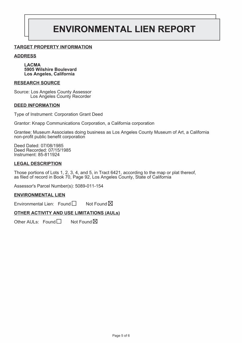
ENVIRONMENTAL LIEN REPORT
TARGET PROPERTY INFORMATION
ADDRESS
LACMA5905 Wilshire BoulevardLos Angeles, California
RESEARCH SOURCE
Source: Los Angeles County Assessor Los Angeles County Recorder
DEED INFORMATION
Type of Instrument: Corporation Grant Deed
Grantor: Knapp Communications Corporation, a California corporation
Grantee: Museum Associates doing business as Los Angeles County Museum of Art, a California non-profit public benefit corporation
Deed Dated: 07/08/1985Deed Recorded: 07/15/1985Instrument: 85-811924
LEGAL DESCRIPTION
Those portions of Lots 1, 2, 3, 4, and 5, in Tract 6421, according to the map or plat thereof, as filed of record in Book 70, Page 92, Los Angeles County, State of California
Assessor's Parcel Number(s): 5089-011-154
ENVIRONMENTAL LIEN
Environmental Lien: Found Not Found
OTHER ACTIVITY AND USE LIMITATIONS (AULs)
Other AULs: Found Not Found
Page 5 of 6
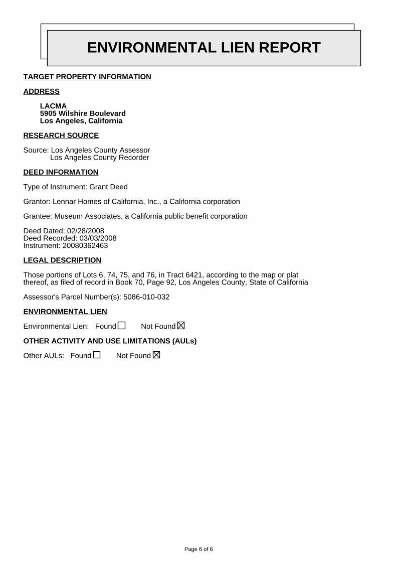
ENVIRONMENTAL LIEN REPORT
TARGET PROPERTY INFORMATION
ADDRESS
LACMA5905 Wilshire BoulevardLos Angeles, California
RESEARCH SOURCE
Source: Los Angeles County Assessor Los Angeles County Recorder
DEED INFORMATION
Type of Instrument: Grant Deed
Grantor: Lennar Homes of California, Inc., a California corporation
Grantee: Museum Associates, a California public benefit corporation
Deed Dated: 02/28/2008Deed Recorded: 03/03/2008Instrument: 20080362463
LEGAL DESCRIPTION
Those portions of Lots 6, 74, 75, and 76, in Tract 6421, according to the map or plat thereof, as filed of record in Book 70, Page 92, Los Angeles County, State of California
Assessor's Parcel Number(s): 5086-010-032
ENVIRONMENTAL LIEN
Environmental Lien: Found Not Found
OTHER ACTIVITY AND USE LIMITATIONS (AULs)
Other AULs: Found Not Found
Page 6 of 6


AECOM Environment
July 2016 60506707.1
Appendix F
Agency Documentation


Department of ToxicSubstances Control
Barbara A. Lee , Director1001 I StreetP.O. Box 806
Sacramento , CA 958120806
CAL000026751
LOS ANGELES COUNTY MUSEUM OF ARTSLOS ANGELES
71212
ID Number:Name:
County:NAICS:
ACTIVE
5/9/1990 12:00:00 AM7/30/2015 11:07:25 AM
Status:Inactive Date:Record Entered:Last Updated:
CAL000026751
EPA ID PROFILEMap
Name Address City State ZipCode Phone
LocationLOS ANGELES
COUNTYMUSEUM OF
ARTS
5905 WILSHIREBLVD LOS ANGELES CA 900364523
Mailing 5905 WILSHIREBLVD LOS ANGELES CA 900364523
Owner MUSEUMASSOCIATES
5905 WILSHIREBLVD LOS ANGELES CA 900364523 3238576000
Operator/Contact ALLISONAKBAROFF
5905 WILSHIREBLVD LOS ANGELES CA 90036 3239325899
Based Only Upon ID Number:
Calif. Manifests? Non Calif. Manifests? Transporter Registration?
Yes Yes ACTIVE
California and Non California Manifest Tonnage Total and Waste Code by YearMatrix by Entity Type (if available) are on the next page
Calif. Manifest Counts and Total Tonnage
Top line represents Manifest Count and Bottom line represents Total Tonnage
Page 1 of 3EPA ID Profile
6/21/2016http://hwts.dtsc.ca.gov/hwts_Reports/ReportPages/Report03.aspx?epaid=CAL000026751

Year Generator Trans. 1 Trans. 2 TSDF ALT. TSDF1993 16
1.680000
0.000000
0.000000
0.000000
0.00000
1994 211.81130
00.00000
00.00000
00.00000
00.00000
1995 1713.98440
00.00000
00.00000
00.00000
00.00000
1996 1334.17820
00.00000
00.00000
00.00000
00.00000
1997 101.04220
00.00000
00.00000
00.00000
00.00000
1998 1528.85090
00.00000
00.00000
00.00000
00.00000
1999 21.69810
00.00000
00.00000
00.00000
00.00000
2000 1066.42110
00.00000
00.00000
00.00000
00.00000
2001 30.05300
00.00000
00.00000
00.00000
00.00000
2002 20.04222
00.00000
00.00000
00.00000
00.00000
2003 61.22102
00.00000
00.00000
00.00000
00.00000
2004 41.23042
00.00000
00.00000
00.00000
00.00000
2005 53.39620
00.00000
00.00000
00.00000
00.00000
2006 474.26660
00.00000
00.00000
00.00000
00.00000
2007 111.20089
00.00000
00.00000
00.00000
00.00000
2008 101.31318
00.00000
00.00000
00.00000
00.00000
2009 40.78650
00.00000
00.00000
00.00000
00.00000
2010 90.13100
00.00000
00.00000
00.00000
00.00000
2011 40.27335
00.00000
00.00000
00.00000
00.00000
2012 50.06170
00.00000
00.00000
00.00000
00.00000
2013 624.47750
00.00000
00.00000
00.00000
00.00000
2014 40.12350
00.00000
00.00000
00.00000
00.00000
2015 100.12049
00.00000
00.00000
00.00000
00.00000
Non California Manifest Total Tonnage
YEAR GENERATOR TRANS. 1 TRANS. 2 TSDF2001 0.01600 0.00000 0.00000 0.00000
Waste Code MatrixCalifornia Generator Trans. 1 Trans. 2 TSDF Alt. TSDF
RCRA Generator Trans. 1 Trans. 2 TSDF Alt. TSDFWaste Code Matrix as a spreadsheet
Page 2 of 3EPA ID Profile
6/21/2016http://hwts.dtsc.ca.gov/hwts_Reports/ReportPages/Report03.aspx?epaid=CAL000026751
The Department of Toxics Substances Control (DTSC) takes every precaution to ensure the accuracy of data in theHazardous Waste Tracking System (HWTS). However, because of the large number of manifests handled, inaccuracies inthe submitted data, limitations of the manifest system and the technical limitations of the database, DTSC cannot guaranteethat the data accurately reflect what was actually transported or produced.
Report Generation Date: 06/21/2016
Page 3 of 3EPA ID Profile
6/21/2016http://hwts.dtsc.ca.gov/hwts_Reports/ReportPages/Report03.aspx?epaid=CAL000026751


Search Again | Search Results | Facility Details | Equipment List | Compliance ��� Emissions | Hearing Board | Transportation
Facility Details
Facility ID 87683
Company Name LA CO., MUSEUM OF ART
Address 5905 WILSHIRE BLVD
LOS ANGELES, CA 90036
Status ACTIVE
Are there any back fees due?
No.
SIC Code Description3533 OIL FIELD MACHINERY
Facility INformation Detail (FIND)
Page 1 of 1Facility INformation Detail
6/17/2016http://www3.aqmd.gov/webappl/fim/prog/facility_details.aspx?fac_id=87683

Search Again | Search Results | Facility Details | Equipment List | Compliance ��� Emissions | Hearing Board | Transportation
Equipment List
Facility ID 121458
Company Name THE PATINA GROUP, LLC
Address 5905 WILSHIRE BLVD
LOS ANGELES, CA 90036
Appl_Nbr Permit_Nbr Issued_Date Permit_Status Eq_Type Equip_Description Appl_Date Appl_Status
517279 G11265 1/6/2011 ACTIVE Basic CHARBROILER - WOOD 12/17/2010 PERMIT TO OPERATE GRANTED
485223 F98580 8/19/2008 ACTIVE Basic CHARBROILER - NATURAL GAS 6/30/2008 PERMIT TO OPERATE GRANTED
363634 F29530 5/10/2000 INACT_NR Basic CHARBROILER - NATURAL GAS 12/22/1999 PERMIT TO OPERATE GRANTED
First Prev Page 1 of 1 (3 records) Next Last Page 1 � Export To Excel
Facility INformation Detail (FIND)
Page 1 of 1Facility INformation Detail
6/17/2016http://www3.aqmd.gov/webappl/fim/prog/eqlist.aspx?fac_id=121458

Search Again | Search Results | Facility Details | Equipment List | Compliance ��� Emissions | Hearing Board | Transportation
Equipment List
Facility ID 21717
Company Name LA CO., MUSEUM OF ART
Address 5905 WILSHIRE BLVD
LOS ANGELES, CA 90036
Appl_Nbr Permit_Nbr Issued_Date Permit_Status Eq_Type Equip_Description Appl_Date Appl_Status
576848 Basic MULTI-- ICE RULE 1472 7/14/2015BANKING/ PLAN GRANTED,NON BILLABLE
576081 Basic RULE 1415 PLAN NOTIFICATIONS 6/16/2015BANKING/ PLAN GRANTED,NON BILLABLE
540934 Basic BOILER-(<2MMBTU/HR) R-222 7/24/2012BANKING/ PLAN GRANTED,NON BILLABLE
540935 Basic BOILER-(<2MMBTU/HR) R-222 7/24/2012BANKING/ PLAN GRANTED,NON BILLABLE
540933 Basic RULE 1415 PLAN NOTIFICATIONS 7/24/2012BANKING/ PLAN GRANTED,NON BILLABLE
485545 BasicPLAN RULE 1166(CONTAMINATED SOIL HAND.)
7/18/2008BANKING/ PLAN GRANTED,NON BILLABLE
471067 BasicPLAN RULE 1166(CONTAMINATED SOIL HAND.)
6/27/2007BANKING/ PLAN GRANTED,NON BILLABLE
469463 F90315 6/1/2007 ACTIVE BasicI C E (>500 HP) EM ELEC GENDIESEL
6/1/2007PERMIT TO OPERATEGRANTED
457814 BasicPLAN RULE 1166(CONTAMINATED SOIL HAND.)
6/9/2006BANKING/ PLAN GRANTED,NON BILLABLE
444506 BasicPLAN RULE 1166(CONTAMINATED SOIL HAND.)
6/7/2005BANKING/ PLAN GRANTED,NON BILLABLE
421379 F66086 2/6/2004 ACTIVE BasicBOILER (5-20 MMBTU/HR) NATGAS ONLY
10/23/2003PERMIT TO OPERATEGRANTED
421380 F66087 2/6/2004 ACTIVE BasicBOILER (5-20 MMBTU/HR) NATGAS ONLY
10/23/2003PERMIT TO OPERATEGRANTED
309558 D95993 1/29/1996 ACTIVE BasicI C E (50-500 HP) EM ELEC GEN-DIESEL
11/22/1995PERMIT TO OPERATEGRANTED
309559 D95994 1/29/1996 ACTIVE BasicI C E (50-500 HP) EM ELEC GEN-DIESEL
11/22/1995PERMIT TO OPERATEGRANTED
309560 D95995 1/29/1996 ACTIVE BasicI C E (50-500 HP) EM ELEC GEN-DIESEL
11/22/1995PERMIT TO OPERATEGRANTED
309561 D95997 1/29/1996 ACTIVE BasicI C E (50-500 HP) EM ELEC GEN-DIESEL
11/22/1995PERMIT TO OPERATEGRANTED
309562 D98544 4/30/1996 ACTIVE ControlSPRAY BOOTH PAINT ANDSOLVENT
11/22/1995PERMIT TO OPERATEGRANTED
309563 D98545 4/30/1996 ACTIVE ControlSPRAY BOOTH PAINT ANDSOLVENT
11/22/1995PERMIT TO OPERATEGRANTED
250268 D68541 1/22/1993 INACTIVE BasicBOILER (5-20 MMBTU/HR) NATGAS ONLY
6/7/1991PERMIT TO OPERATEGRANTED
250268 D68541 1/22/1993 INACTIVE Control LOW NOX BURNER 6/7/1991PERMIT TO OPERATEGRANTED
246851 D61302 8/28/1992 INACTIVE Basic 2/25/1991
Facility INformation Detail (FIND)
Page 1 of 2Facility INformation Detail
6/17/2016http://www3.aqmd.gov/webappl/fim/prog/eqlist.aspx?fac_id=21717

BOILER (5-20 MMBTU/HR) NATGAS ONLY
PERMIT TO OPERATEGRANTED
214598 BasicCOOLING TOWERS-HEX CHROMECOMPLIANCE
10/13/1989 APPLICATION CANCELLED
198780 Basic DIESEL ENGINE 5/25/1989 APPLICATION CANCELLED
198781 Basic DIESEL ENGINE 5/25/1989 APPLICATION CANCELLED
198782 Basic DIESEL ENGINE 5/25/1989 APPLICATION CANCELLED
First Prev Page 1 of 2 (30 records) Next Last Page 1 � Export To Excel
Page 2 of 2Facility INformation Detail
6/17/2016http://www3.aqmd.gov/webappl/fim/prog/eqlist.aspx?fac_id=21717

Search Again | Search Results | Facility Details | Equipment List | Compliance ��� Emissions | Hearing Board | Transportation
Compliance
Facility ID 21717
Company Name LA CO., MUSEUM OF ART
Address 5905 WILSHIRE BLVD
LOS ANGELES, CA 90036
Notices Of ViolationNotice Number Notice Issue Date Violation Date Disposition Date Disposition
P45133 1/12/2005 12/30/2004 5/26/2005 Closed Case
P41691 1/21/2004 1/21/2004 1/21/2004 Void
First Prev Page 1 of 1 (2 records) Next Last Page 1 � Export To Excel
Notices To ComplyNotice Number Violation Date Re-Inspection Date Status
C92226 1/21/2004 1/28/2004 In Compliance
D 13533 2/7/2008 3/6/2008 In Compliance
D 16426 5/15/2008 11/13/2008 In Compliance
D 22320 1/23/2009 2/24/2009 In Compliance
E10350 6/27/2012 8/10/2012 In Compliance
E30969 6/4/2015 8/6/2015 In Compliance
First Prev Page 1 of 1 (6 records) Next Last Page 1 � Export To Excel
Facility INformation Detail (FIND)
Page 1 of 1Facility INformation Detail
6/17/2016http://www3.aqmd.gov/webappl/fim/prog/novnc.aspx?fac_id=21717


716 S Spaulding Ave, Los AngLIMIT TO SITES WITHIN 1500 FEE
REMOVE SEARCH R
Map data ©2016 GoogleReport a map error100 m�
716 S Spaulding Ave, Los Angeles, CA, United States
Map Address
SITES FOUND IN SEARCH RADIUS 6 SITES LISTED EXPORT THIS LIST TO EXCELSITE NAME GLOBAL ID FAC ID STATUS ADDRESS CITY6100 HOLDINGS PARTNERS 25298 6100 WILSHIRE BLVD LOS ANGELES
AL-SAL OIL (OLD UNOCAL) T0603700893 COMPLETED -CASE CLOSED 6050 006TH ST W LOS ANGELES
KWIK #32 23603 6050 W 6TH ST # 32 LOS ANGELESLA SALLE PARTNERS ASSETMGMT. 25273 5750 WILSHIRE BLVD LOS ANGELES
MIDWAY HOSPITAL MEDICALCENTER 25288 5925 SAN VICENTE BLVD LOS ANGELES
MUSEUM SQUARE T0603700895 COMPLETED -CASE CLOSED 5757 WILSHIRE BLVD PARK LA BREA
Page 1 of 1GeoTracker
6/15/2016http://geotracker.waterboards.ca.gov/map/?CMD=runreport&myaddress=5905+wilshire+b...


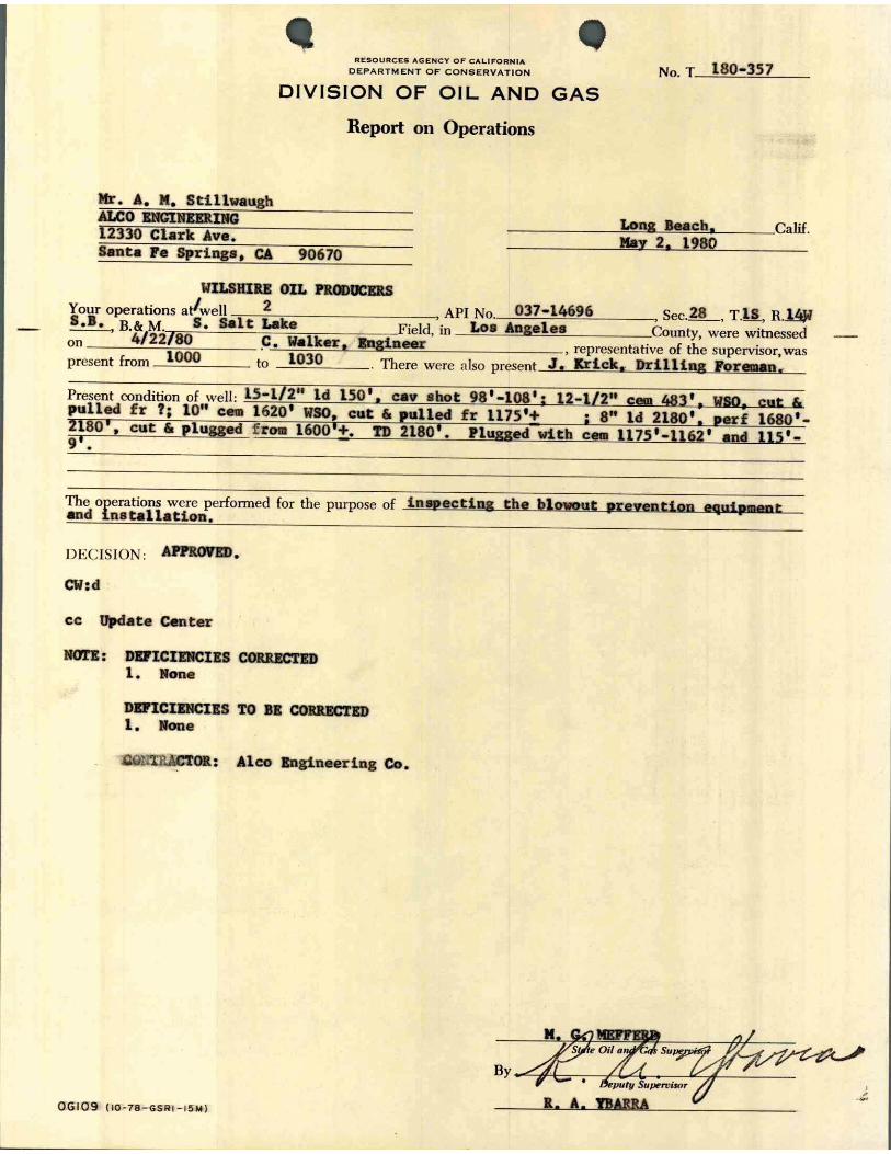

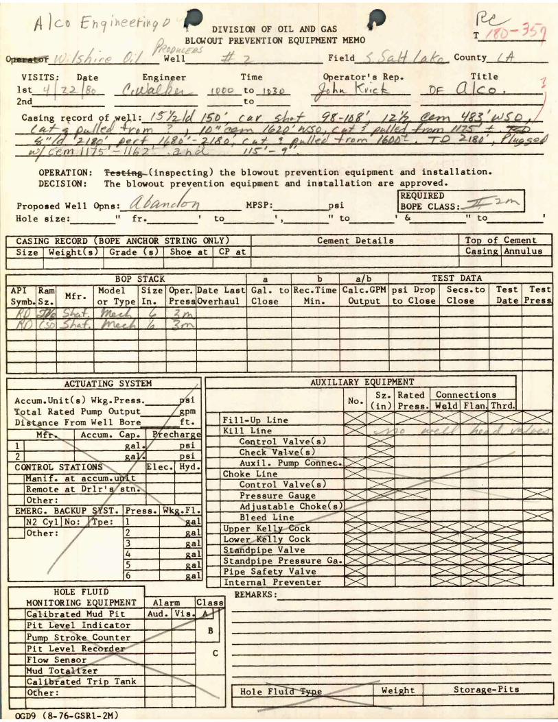


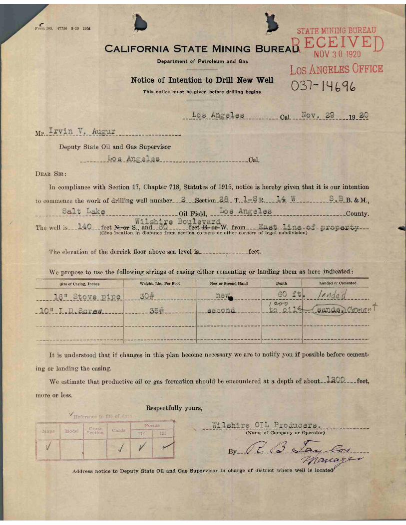


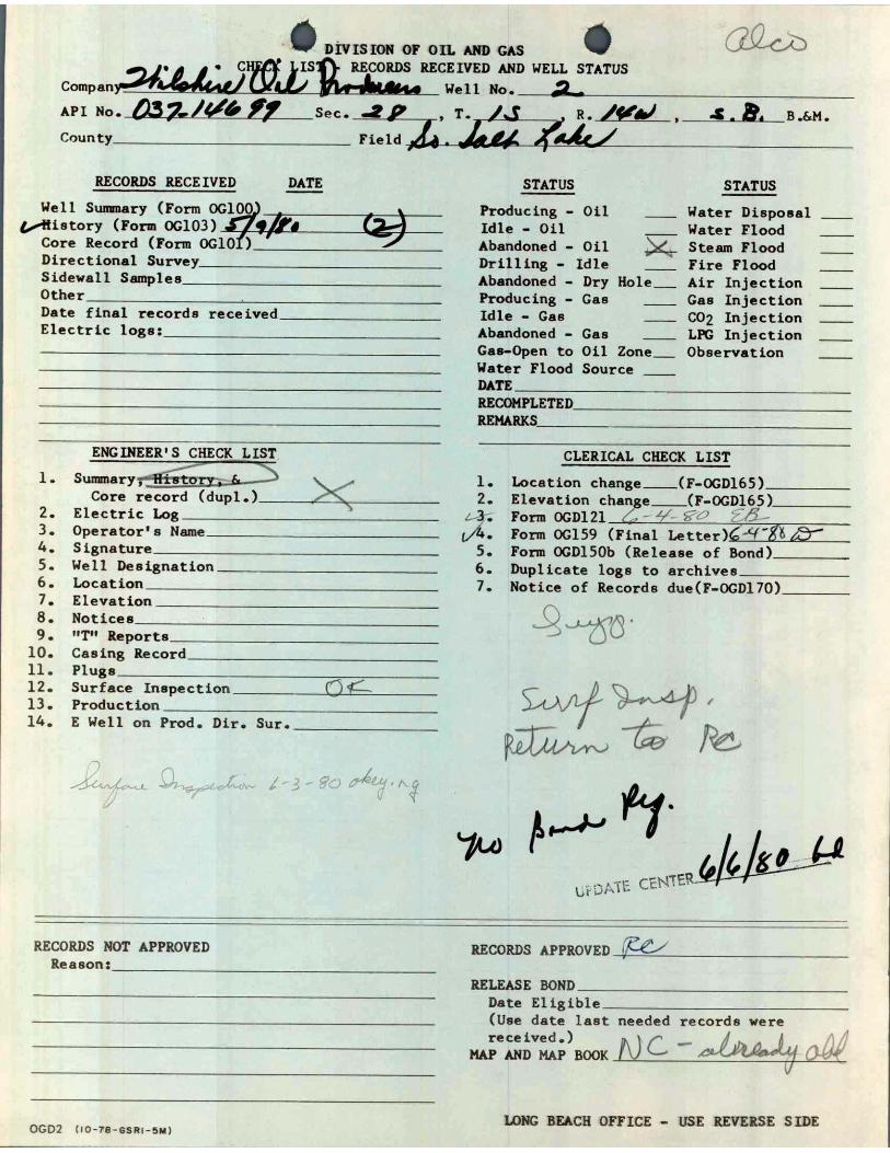
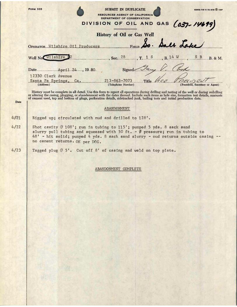


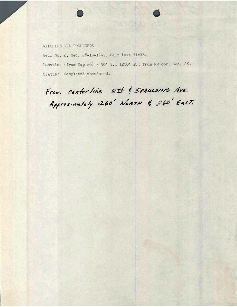


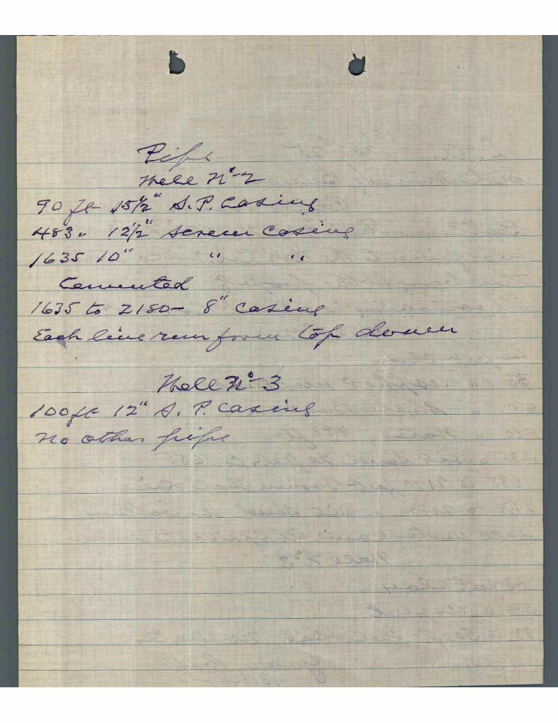


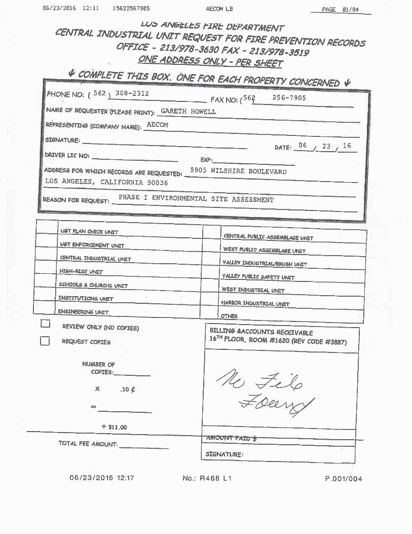


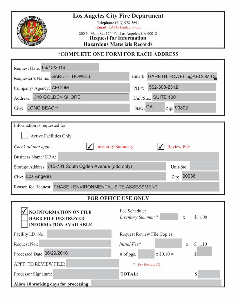
Los Angeles City Fire Department Telephone (213) 978-3691Email� ����[email protected]
200 N. Main St., 17th Fl., Los Angeles, CA 90012Request for Information
Hazardous Materials Records
*COMPLETE ONE FORM FOR EACH ADDRESS
Request Date:
Email: Requester’s Name:
Company/ Agency: PH.#:
Address: Unit/Ste.:
City: State: Zip:
Information is requested for
Active Facilities Only
Check all that apply: Inventory Summary Review File
Business Name/ DBA:
Storage Address: Unit/Ste.:
City: Zip:
Reason for Request:
FOR OFFICE USE ONLY
Fee Schedule:Inventory Summary* x $11.00
NO INFORMATION ON FILE�HARD FILE DESTROYED�INFORMATION AVAILABLE
Facility I.D. No.: Request Review File Copies:
Request No.: Initial Fee* x $ 1.10
Processed Date: # of pgs. x $0.10 = $
APPT. TO REVIEW FILE: �
Processor Signature: TOTAL: $
Allow 10 working days for processing:
06/15/2016
GARETH HOWELL [email protected]
AECOM 562-308-2312
310 GOLDEN SHORE SUITE 100
LONG BEACH CA 90802
✔ ✔
715-731 South Ogden Avenue (odd only)
Los Angeles 90036
PHASE I ENVIRONMENTAL SITE ASSESSMENT
✔
06/29/2016

[ ] VERIFIED FACILITY PHONE NUMBERPHONE NO: (213) 857-6152
[ ] VERIFIED MAILING ADDRESSMAILING ADDRESS: 5905 WILSHIRE BL
(INVOICES/PERMITS) LOS ANGELES, CA 90036
[ ] VERIFIED OWNER INFOOWNER NAME: L.A. COUNTY MUSEUM OF ART
OWNER MAILING 5905 WILSHIRE BLVD
ADDRESS: LOS ANGELES, CA 90036
PHONE: (323) 857-6568
ACTIVE PROGRAMS:
PE PE DESCRIPTION UNITS
MAIN_SITE1003 PR0111629 | HW GEN, 20-100 EMPLOYEES
4505 PR0014012 | HAZ MAT INVENTORY 16 TO 25 CHEMICALS
Date: 6/22/2015 New Business: [ ]Default Inspector: Pilato, Brandi Fire Station/Census: 061Facility ID; FA0019127 Insp District: 417Facility Name: LA COUNTY - MUSEUM OF ART CERS ID: 10247083Site Address: 5905 W WILSHIRE BLVD
LOS ANGELES, CA 90036
FIRE PREVENTION BUREAU TECHNICAL SECTION200 NORTH MAIN STREET, RM 1780LOS ANGELES, CA 90012
LOS ANGELES FIRE DEPARTMENTLos Angeles Certified Unified Program Agency
(213) 978-3680
Los Angeles Fire DepartmentData Entry Instruction Form (DEIF)
FOR INTERNAL USE ONLY
DATA ENTRY INSTRUCTION(S): Check Appropriate Boxes
[ ] Changes On BP 01 [ ] Changes On BP 08
[ ] UST Abandon Sheets [ ] UST Installation Sheets
[ ] Changes On Attached CUPA Form(s) [ ] Enter Inventory on Attached CUPA Forms
[ ] Inactive Business Journal Entry should Be Included
Reason:
[ ] Other Instruction: For Examples: Combine Business Under One BP Number
Data Entry Name: Date:
Account InfoAccount Outstanding Balance:Number of Outstanding Invoices: 0

Business Site Address: 5905 W WILSHIRE BLVD LOS ANGELES, CA 90036
Mailing Address 5905 WILSHIRE BLLOS ANGELES, CA 90036
Other On-Site Addresses:
Briefly describe the nature of the hazardous materials operations:
CONTACT WORK # 24 HOUR # PAGER #Owner Name:
L.A. COUNTY MUSEUM OF ART (323) 857-6568 - -
On-Site Manager:
- -
Emergency Contact:
ERROLL SOUTHERS(323) 857-6568
2nd Emergency Contact:
BENJAMIN LOPEZ(323) 857-6186
Signature of Legal Business Owner/Authorized Representative Title Date
Business Plan has been reviewed and approved: ________
OFFICE USE ONLY Insp. ID: __________________ Date: ____________ D/E ID: ____________________ Date: _____________ TS: ____________________
LOS ANGELES FIRE DEPARTMENT200 NORTH MAIN STREETLOS ANGELES, CA 90012
(213) 978-3880
CITY OF LOS ANGELESCALIFORNIA
BUSINESS INFORMATIONPrinted on: 6/22/2015
INSTRUCTIONS: Please complete and sign this form; your signature indicates that the information, as supplied, is accurate.Business Number: FA0019127 This is your current business plan number. This number must appear on all business plan forms!
Business Name : LA COUNTY - MUSEUM OF ART
# OF EMPLOYEES:
6/26/15
Dirk Sanders 323 857-4709
David Cervantes(323)857-6586
Building engineer

CITY OF LOS ANGELESCALIFORNIA
Printed on: 6/22/2015
Business No : FA0019127First In : 061District # : 417
Hazardous Materials SystemBP-8: Computer Listing of Inventory
SubmittedInspection Responsibility: VIU
LOS ANGELES FIRE DEPARTMENT200 NORTH MAIN STREETLOS ANGELES, CA 90012
(213) 978-3880
Business Name : LA COUNTY - MUSEUM OF ART Business Address : 5905 W WILSHIRE BLVD Business Owner : L.A. COUNTY MUSEUM OF ART LOS ANGELES, CA 90036On-Site Manager : Phone # :Emergency Contact : ERROLL SOUTHERS Phone # : (323) 857-6568Alt Emergency Contact : BENJAMIN LOPEZ Phone # : (323) 857-6186Next Inspection Date: : 3/8/2013 SIC Code : 8412# of Employees : Permit Date : 1/6/2015
Total Chemicals: 22
LOCATION: Chemicals at Location: 5
Chemical Name HM Type Max Quantity on Hand State Fed Haz Catg.CONFIDENCE 10C PURE 55.00 GALLONS LIQUID
Container:|
Ingredients CAS #
POTASSIUM HYDROXIDE 1310732
Chemical Name HM Type Max Quantity on Hand State Fed Haz Catg.REFRIGERANT 11 PURE 4,400.00 CUBIC FEET GAS
Container:| |
Ingredients CAS #
TRICHLOROFLUOROMETHANE 75694
Chemical Name HM Type Max Quantity on Hand State Fed Haz Catg.REFRIGERANT 12 PURE 392.00 CUBIC FEET GAS
Container:|
Ingredients CAS #
DICHLORODIFLUOROMETHANE 75718
Chemical Name HM Type Max Quantity on Hand State Fed Haz Catg.REFRIGERANT 22 PURE 550.00 CUBIC FEET GAS
Container:|
Ingredients CAS #
CHLORODIFLUOROMETHANE 75456
Chemical Name HM Type Max Quantity on Hand State Fed Haz Catg.YORK OIL PURE 60.00 GALLONS LIQUID
Container:|
Ingredients CAS #
YORK OIL
refrigerant 501
refrigerant 134A
lubrication oil

LOCATION: Chemicals at Location: 4
Chemical Name HM Type Max Quantity on Hand State Fed Haz Catg.ACETYLENE PURE 500.00 CUBIC FEET GAS
Container:|
Chemical Name HM Type Max Quantity on Hand State Fed Haz Catg.CARBON DIOXIDE PURE 900.00 CUBIC FEET GAS
Container:| |
Chemical Name HM Type Max Quantity on Hand State Fed Haz Catg.NITROGEN PURE 1,250.00 CUBIC FEET GAS
|
Chemical Name HM Type Max Quantity on Hand State Fed Haz Catg.OXYGEN PURE 750.00 CUBIC FEET GAS
Container:| CYLI |
LOCATION: Chemicals at Location: 12
Chemical Name HM Type Max Quantity on Hand State Fed Haz Catg.ARSENOUS TRICHLORIDEARSENOUS TRICHLORIDE
PURE 1.00 POUNDS SOLID
Container:|
Ingredients CAS #
ARSENOUS TRICHLORIDE 7784341
Chemical Name HM Type Max Quantity on Hand State Fed Haz Catg.BROMINEBROMINE PURE 100.00 GALLONS LIQUID
Container:| |
Ingredients CAS #
BROMINE 7726956
Chemical Name HM Type Max Quantity on Hand State Fed Haz Catg.CARBON DISULFIDECARBON DISULFIDE PURE 3.00 POUNDS LIQUID
Ingredients CAS #
CARBON DISULFIDE 75150

Chemical Name HM Type Max Quantity on Hand State Fed Haz Catg.COMPRESSED GAS N.O.S PURE 500.00 CUBIC FEET GAS
Container:| |
Ingredients CAS #
ARGON
METHAN
Chemical Name HM Type Max Quantity on Hand State Fed Haz Catg.FORMALDEHYDEFORMALDEHYDE PURE 1.00 POUNDS LIQUID
Container:|
Ingredients CAS #
FORMALDEHYDE 50000
Chemical Name HM Type Max Quantity on Hand State Fed Haz Catg.LIQUID NITROGEN PURE 3,930.00 CUBIC FEET LIQUID
Container:|
Chemical Name HM Type Max Quantity on Hand State Fed Haz Catg.NITRIC ACIDNITRIC ACID PURE 3.00 GALLONS LIQUID
Container:|
Ingredients CAS #
NITRIC ACID 7697372
Chemical Name HM Type Max Quantity on Hand State Fed Haz Catg.PHENOLPHENOL PURE 2.00 POUNDS SOLID
|
Ingredients CAS #
PHENOL 108952
Chemical Name HM Type Max Quantity on Hand State Fed Haz Catg.PHOSPHOROUS PENTOXIDE PURE 2.00 POUNDS SOLID
Container:|
Ingredients CAS #
PHOSPHORUS PENTOXIDE 1314563
Chemical Name HM Type Max Quantity on Hand State Fed Haz Catg.SELENOUS ACID PURE 100.00 POUNDS SOLID
Container:|
Ingredients CAS #
SELENOUS ACID 7783008
Chemical Name HM Type Max Quantity on Hand State Fed Haz Catg.SODIUM AZIDE PURE 1.00 POUNDS SOLID
Container:| |
Ingredients CAS #
SODIUM AZIDE 26628228

Chemical Name HM Type Max Quantity on Hand State Fed Haz Catg.SULFURIC ACID PURE 3.00 GALLONS LIQUID
Container:| |
Ingredients CAS #
SULFURIC ACID 7664939
LOCATION: Chemicals at Location: 1
Chemical Name HM Type Max Quantity on Hand State Fed Haz Catg.DIESEL FUEL #2 PURE 55.00 GALLONS LIQUID
Container:|
My signature indicates that I have verified and agreed with the types and quantities of hazadous materials at this address.[FA0019127] CHEMICAL COUNT: 22
INSP SIG: INSP. DATE:
BUS. REP. SIG: DATE:Data Date: 6/22/2015
6/26/156/26/15
Propane pure 1,400 lbs
Latex Paint pure 55gallons plastic container

����������� ���� ���������������������������� ��������������������� ���!����"��!�#�� "$
������������ �����������������������
�������������� ���!"�� �
�!�"�%����!���&�#$%$��&��'�#(�
������%�&)��
�"!&**��������
!���%�'&+��(,���(
�!�"�%���!�����&��-��-���*
%������&
��%����(���&
.��������
����)����
#)*+$�,-.�/*-)�����!0����1�%��233+/-23-�4�4�������� �5�
���%��!�(����������������
��5���%��5�!���
�����������!&���
����%(�/����%������(0�� 1�"���(2#�/�(3���!���45��6�������/������55�6�0�����2+�/�2"��� 4�"����(��/��� �6��"�(�������,7#�/����%+8�/�
" �����6��7�������8��9����7�������6�8� �:�9������7�" �� ���������8�" ���
�������%(������(2#��������������2+�������(�������,7#
�*
�����7�" �� ���������8�" ��������7�������������6�6����������;�� ����
�������%(������(2#��������������2+�������(�������,7#
�)
�� "�� "�����9��;7�<��69����7
����9��;7���7��7=6��8�������7���96���������
�������%(������(2#��������������2+�������(�������,7#
�+
�7=6��������������7��� ������69�������������96���������
�������%(������(2#��������������2+�������(�������,7#
������''
�(�7�9�:9;��-��-���*
�>
����������� ��������.���"����6�45������"-� ����6� �6���<��304����6�45�����&�=� "�3������ ����:3�����7����&�:7�� >����� ���"-� �>�"���>�=� "�3��4��� ����� ���4?�3 ��6�������>�=� "�3��4��� ������� ��0�1���>���> ��>��"�@3�����;�����@3������� �� ���� ��>��*���5�3"��!� ������"��**��������!� ����@3"��� �����6306�!����!� ���6�45 ����"������� ������@3������� �� ���� ��>���>���55�6�0���!�"� ����> ��>��"�5����@3���<��#7A��!� ����?� �4��<�>�=� "�3���30���6���$&�������"���55�"?����7� ���**��#����)����!��>����"���!�.�"� ���,��3����������� �"��6�1��4��� �����>���� ��>�"��"��@3������!� � >6>����4� ��6<�5����� �@3 �"����0���"�5��"�53 �3������7� ������6�44�6�� �>���6����������7� ��)���6�44�6�� �>���6���)������� �7� ������6�44�6�� �>���6�����������!��>�5�� �����!�#��������!��>����"���!�.�"� ���,��3�������*)�.�"� ���,����� ��)�*����� �53 �3�������<� ��3�������"�5��"�0<��>����������66� "�6�� �>��>���� ��3�������&������*��**�*���**�����������**���"�������������������(:�$,%�#'(�;���03�����5���>������0��� �6�1�"�0<��>���27���#>��!�6��<� ���5 �1�3��<���������6�- �@3����! �4��>���27��!� ��>���304������!���03�����5���0<�B+2$�+�#$C���(,,$�#'%$���#'(�;��304���>��03�����5������6� �6���<���>�����!� ��$1 �4�����,�5� ����<���4���$,����"�45��4���44�"����<�
DDDDDDDDDDDDDD7������6�45�<� �>������>���$,��,�5� ��DDDDDDDDDDDDDDDDDDDDDDDDDDDDD������8����� ������
�7=6��������������7��� ������69������������:� ?�� ��� ���7� 6����������@������� ��
�������%(������(2#��������������2+�������(�������,7#
�'�(,
�(�7�9�:9;��-��-���*
�/
����������� ��������.��3 �����6�45������"����6� �6���<��304���>��:3������6�1����7�����"-� �:3�����( � �(5� ��� �'"��!6����7�����&����**���������������,�)�������������������������������(:�$,%�#'(�;�#>��:3������6�1����5����>������0����304���"�����>��"�5� �4�����(,,$�#'%$���#'(�;���45������>��:3������6�1����5�����"��304�����6� �6���<���>�����!� ��$1 �4�����,�5� ����<���4���$,���
*������%� 7�������!�)
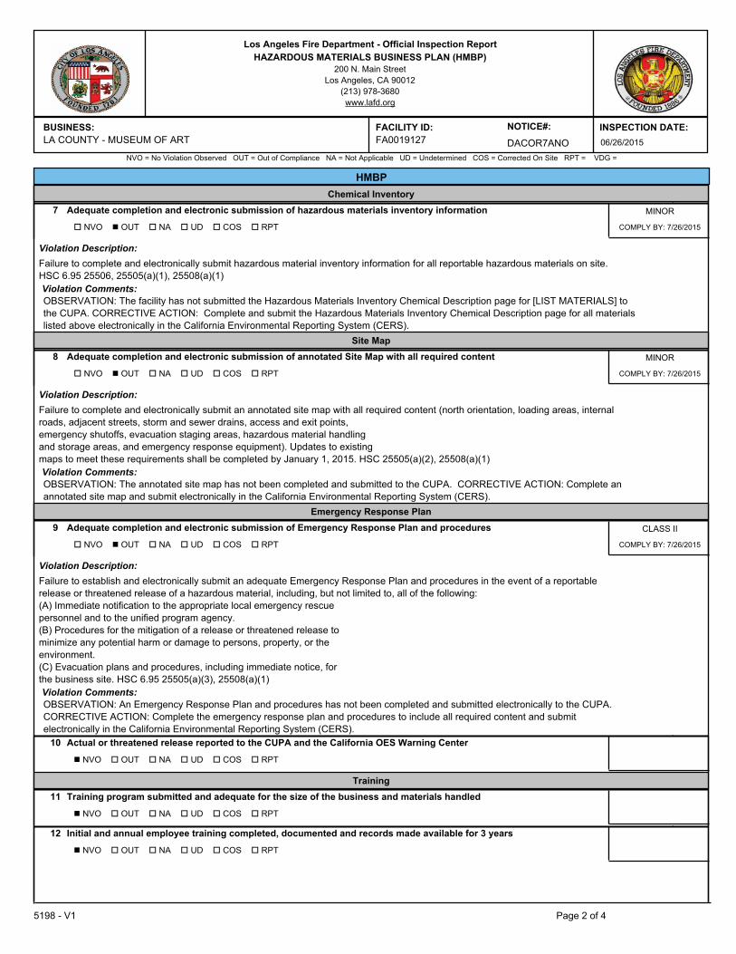
����������� ���� ���������������������������� ��������������������� ���!����"��!�#�� "$
������������ �����������������������
�������������� ���!"�� �
���!���&����(2�#9����2�$2��(.��,#
��%����(���&.��������
�!�"�%���!�����&��-��-���*+��(,���(
!���%�'&
����%(�/����%������(0�� 1�"���(2#�/�(3���!���45��6�������/������55�6�0�����2+�/�2"��� 4�"����(��/��� �6��"�(�������,7#�/����%+8�/�
�� "%;�������@��� 8
�7=6��������������7��� ������69�����������;�A� 7�6����� ������@��� 8����� ������
�������%(������(2#��������������2+�������(�������,7#
�'�(,
�(�7�9�:9;��-��-���*
�.
����������� ��������.��3 �����6�45������"����6� �6���<��304��>�=� "�3��4��� ���1��� <�!� 4����!� ����� �5� ��0���>�=� "�3��4��� �����������&������*��**�����**�*���������**��������������������������(:�$,%�#'(�;�#>��!�6��<�>�������304���"��>��&�=� "�3������ ����'1��� <��>�46���+��6 5���5����!� �B�'�#���#$,'���C�����>���27����(,,$�#'%$���#'(�;����45������"��304���>��&�=� "�3������ ����'1��� <��>�46���+��6 5���5����!� �����4��� ��������"��0�1�����6� �6���<���>�����!� ��$1 �4�����,�5� ����<���4���$,���
��������7=6��������������7��� ������69������������������7���������:��;��� =6� 7�������
�������%(������(2#��������������2+�������(�������,7#
�'�(,
�(�7�9�:9;��-��-���*
�,
����������� ��������.��3 �����6�45������"����6� �6���<��304����������"�����4�5� �>����� �@3 �"�6������� �>�� ����������"��� ������� ��� ��"����"E�6����� ��������� 4��"��� � �" �����66�����"��?��5�����4� ��6<��>3��!!����1�63����������� �����>�=� "�3��4��� ���>�"���"���� ����� ������"��4� ��6<� ��5�����@354�����25"���������?���4�5�����4�����>���� �@3 �4�����>����0��6�45����"�0<�F�3� <�������*��&����**�*���������**��������������������������(:�$,%�#'(�;�#>��������"�����4�5�>������0���6�45����"��"��304���"�����>���27�����(,,$�#'%$���#'(�;���45�������������"�����4�5��"��304�����6� �6���<���>�����!� ��$1 �4�����,�5� ����<���4���$,���
�� ���8��������"���7=6��������������7��� ������69������������� ���8��������"�����7�� ��76 �
�������%(������(2#��������������2+�������(�������,7#
������''
�(�7�9�:9;��-��-���*
�2
����������� ��������.��3 ���������0��>��"����6� �6���<��304�����"�@3����$4� ��6<�,��5����7����"�5 �6�"3 �����>���1����!��� �5� ��0��� �������� ��> �����"� ��������!���>�=� "�3��4��� ����6�3"���03������4��"����������!��>��!���� �;����'44�"������!6��������>���55 �5 ������6����4� ��6<� ��63�5� ������"�����>��3!�"�5 �� �4����6<��:��7 �6�"3 ���!� ��>��4�������!��� �������� ��> �����"� ���������44=���<�5�������>� 4�� �"�4�������5� �����5 �5� �<��� ��>��1 �4�������$1�63����5�����"�5 �6�"3 ����6�3"��44�"������6���!� �>��03����������&������*��**�*���������**��������������������������(:�$,%�#'(�;���$4� ��6<�,��5����7����"�5 �6�"3 ���>������0���6�45����"��"��304���"����6� �6���<�����>���27����(,,$�#'%$���#'(�;���45������>���4� ��6<� ��5����5����"�5 �6�"3 ������6�3"������ �@3 �"�6������"��304�����6� �6���<���>�����!� ��$1 �4�����,�5� ����<���4���$,���
���6��� ��; ���7� ��� �� �7�����;�%�"����7��;�%���� ��������4� �����%��
�������%(������(2#��������������2+�������(�������,7#
�*3
� ������� �������� �� ����69����7���7��7=6����� ��;���A�����;�96��������7���� ����;��77
�������%(������(2#��������������2+�������(�������,7#
�**
���������7����6�����8�� ������������71�7��6���7���7� �� 7����7��@���9��� �+�8� �
�������%(������(2#��������������2+�������(�������,7#
�*)
*������%� 7�������!�)

����������� ���� ���������������������������� ��������������������� ���!����"��!�#�� "$
������������ �����������������������
�������������� ���!"�� �
���!���&����(2�#9����2�$2��(.��,#
��%����(���&.��������
�!�"�%���!�����&��-��-���*+��(,���(
!���%�'&
����%(�/����%������(0�� 1�"���(2#�/�(3���!���45��6�������/������55�6�0�����2+�/�2"��� 4�"����(��/��� �6��"�(�������,7#�/����%+8�/�
�� "���6��% ���������������7���
���6�8� @�:7���7��� �����8�� ����7��;����� "���������1����6 �����7�6�����7��
�������%(������(2#��������������2+�������(�������,7#
�'�(,
�(�7�9�:9;��-��-���*
�*+
����������� ��������.��3 ������3���<� �1� ��"����6� �6���<�6� �!<��>����>��&�=� "�3������ ����:3�����7����&�:7����6�45�������663 ������"�35����"�����&������*��**���6����**����������������������(:�$,%�#'(�;�#>��!�6��<�>�������3���<� �1� �"��"�6� �!�"��>����>��03�����5�����6�45�������663 ������"�35����"������(,,$�#'%$���#'(�;��,�1� �� �1�����"�6� �!<��>��03�����5������6� �6���<���>�����!� ��$1 �4�����,�5� ����<���4���$,���
�� "�6�7��7�:��;���+3�7�8�&��;�������@��� 81��;��������77 ��1��:� �;��1�� �96���������
�������%(������(2#��������������2+�������(�������,7#
�'�(,
�(�7�9�:9;��-��-���*
�*>
����������� ��������.��3 ��������6� �6���<�35"�����>��&�=� "�3������ ����:3�����7����&�:7��!� 4���� �>����"�<���!;����������5� 6���� �4� ��6 �������>��@3���<��!���5 �1�3��<�"�6����"�4��� ����0���<�>�"����!���5 �1�3��<�3"�6����"�>�=� "�3��4��� ���6���>�����!�03������"" �����"���>�����!�03������ � �>5������>�����!�03������4���&������*��**�����������������������������(:�$,%�#'(�;�#>��03�����5���>������0���35"���"��"��304���"�����>��"�5� �4��� �>����"�<���!�B�'�#C����(,,$�#'%$���#'(�;��,�1� �� �1�����"�6� �!<��>��03�����5������6� �6���<���>�����!� ��$1 �4�����,�5� ����<���4���$,���
6������������ �����8�6�7��7�:��;���+3�7�8������69���������;���������� ������
�������%(������(2#��������������2+�������(�������,7#
�'�(,
�(�7�9�:9;��-��-���*
�*-
����������� ��������.��3 ��������6� �6���<�35"�����>��&�=� "�3������ ����:3�����7����&�:7��!� 4���� �>����"�<���!����30�������6>������>��>�"�� G���5� ������>��� �@3 ���4�"!6��������<�5� ����!��>��&�:7��&������*��**�����!�������������������(:�$,%�#'(�;��#>��03�����5���>������0���35"���"��"��304���"�����>���27�� �>����"�<���!�B�'�#C��(,,$�#'%$���#'(�;��,�1� �� �1�����"�6� �!<��>��03�����5������6� �6���<���>�����!� ��$1 �4�����,�5� ����<���4���$,���
" �� �8��:� �!�����������!�����7�� �� �8��:� ����: �������;���9�6���������69B�������� "�� �� �����7�;��������7
�������%(������(2#��������������2+�������(�������,7#
�*/
������8������7�����������7�� �� �8��:� ������ "���7���� =6��7�� �@�77����8�:��;���-�7�8�
�������%(������(2#��������������2+�������(�������,7#
�*.
CC���������9CC�� ��6�6 �����7 �
�� ��6�6 ��;��7 �D������� =6� ������ �����:;�������69������������ ���8� ���������
�������%(������(2#��������������2+�������(�������,7#
�*,
�� ��6�6 ��;��7 �D������� =6� ������ ����:;�������69����������� �������� �� ��
�������%(������(2#��������������2+�������(�������,7#
�*2
������������7�������8�����6������7�������8�D������� =6� ������ ����:;�������69����������96���������
�������%(������(2#��������������2+�������(�������,7#
�)3
�@ ������������%������
*������%� 7�������!�)

����������� ���� ���������������������������� ��������������������� ���!����"��!�#�� "$
������������ �����������������������
�������������� ���!"�� �
���!���&����(2�#9����2�$2��(.��,#
��%����(���&.��������
�!�"�%���!�����&��-��-���*+��(,���(
!���%�'&
6�����! �4�+ H���"� ��03�"������
#>�� �5� ���>������ 1�������I�(#'�$�#(��(�7�9J�!� ��� �%���������"���I�(#'�$�(.�%'(��#'(�J�!� ���E� �1��������.� 4����!� 6�4����"-� �5����<�������4���4�<�0������"�!� ��<�1����������"���"�!� ��>�������6� �6��"�����4��<�4�� ���9�3�� ���>� �0<��� "� �"�0<��>��. ���>�!����6� �6���>���0�1�����"�1�������4����!�+3���(�1���������4��������!��%������!�����%����%���!�����������"��5����E�
������6 �
:3�"��$���
+�1"��� 1���� ���1��&�4���
. ��'�5�6�� �'
*������%� 7����)��!�)
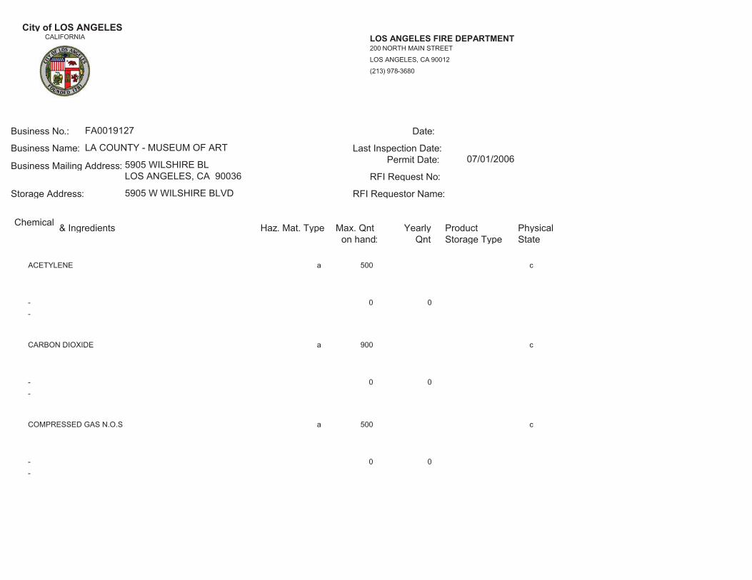
City of LOS ANGELESCALIFORNIA LOS ANGELES FIRE DEPARTMENT
(213) 978-3680
LOS ANGELES, CA 90012
200 NORTH MAIN STREET
__________________________________________________________________________________________________________________________________________Business No.:
Storage Address:
Business Mailing Address:
Business Name:
FA0019127
RFI Requestor Name:
RFI Request No:
Permit Date:Last Inspection Date:
Date:
LA COUNTY - MUSEUM OF ART
5905 WILSHIRE BLLOS ANGELES, CA 90036
5905 W WILSHIRE BLVD
07/01/2006
__________________________________________________________________________________________________________________________________________Chemical & Ingredients Haz. Mat. Type Max. Qnt
on hand:Yearly
Qnt Storage TypeProduct Physical
State
ACETYLENE a c500
0 0--
CARBON DIOXIDE a c900
0 0--
COMPRESSED GAS N.O.S a c500
0 0--

City of LOS ANGELESCALIFORNIA LOS ANGELES FIRE DEPARTMENT
(213) 978-3680
LOS ANGELES, CA 90012
200 NORTH MAIN STREET
__________________________________________________________________________________________________________________________________________Business No.:
Storage Address:
Business Mailing Address:
Business Name:
FA0019127
RFI Requestor Name:
RFI Request No:
Permit Date:Last Inspection Date:
Date:
LA COUNTY - MUSEUM OF ART
5905 WILSHIRE BLLOS ANGELES, CA 90036
5905 W WILSHIRE BLVD
07/01/2006
__________________________________________________________________________________________________________________________________________Chemical & Ingredients Haz. Mat. Type Max. Qnt
on hand:Yearly
Qnt Storage TypeProduct Physical
State
DIESEL FUEL #2 a 55 b1200
0 0--
LIQUID NITROGEN a b3930
0 0--
LUBRICATION OIL a b60
0 0--

City of LOS ANGELESCALIFORNIA LOS ANGELES FIRE DEPARTMENT
(213) 978-3680
LOS ANGELES, CA 90012
200 NORTH MAIN STREET
__________________________________________________________________________________________________________________________________________Business No.:
Storage Address:
Business Mailing Address:
Business Name:
FA0019127
RFI Requestor Name:
RFI Request No:
Permit Date:Last Inspection Date:
Date:
LA COUNTY - MUSEUM OF ART
5905 WILSHIRE BLLOS ANGELES, CA 90036
5905 W WILSHIRE BLVD
07/01/2006
__________________________________________________________________________________________________________________________________________Chemical & Ingredients Haz. Mat. Type Max. Qnt
on hand:Yearly
Qnt Storage TypeProduct Physical
State
NITROGEN a c1250
0 0--
OXYGEN a c750
0 0--
PHOSPHOROUS PENTOXIDE a 2 a2
0 0--

City of LOS ANGELESCALIFORNIA LOS ANGELES FIRE DEPARTMENT
(213) 978-3680
LOS ANGELES, CA 90012
200 NORTH MAIN STREET
__________________________________________________________________________________________________________________________________________Business No.:
Storage Address:
Business Mailing Address:
Business Name:
FA0019127
RFI Requestor Name:
RFI Request No:
Permit Date:Last Inspection Date:
Date:
LA COUNTY - MUSEUM OF ART
5905 WILSHIRE BLLOS ANGELES, CA 90036
5905 W WILSHIRE BLVD
07/01/2006
__________________________________________________________________________________________________________________________________________Chemical & Ingredients Haz. Mat. Type Max. Qnt
on hand:Yearly
Qnt Storage TypeProduct Physical
State
REFRIGERANT 134A a 4400 c4400
0 0--
REFRIGERANT 501 a 392 c392
0 0--
SELENOUS ACID a 100 a100
0 0--
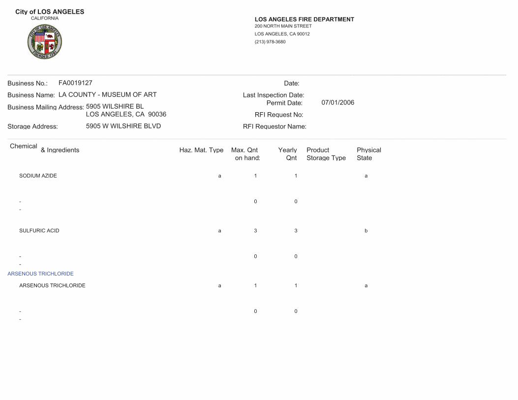
City of LOS ANGELESCALIFORNIA LOS ANGELES FIRE DEPARTMENT
(213) 978-3680
LOS ANGELES, CA 90012
200 NORTH MAIN STREET
__________________________________________________________________________________________________________________________________________Business No.:
Storage Address:
Business Mailing Address:
Business Name:
FA0019127
RFI Requestor Name:
RFI Request No:
Permit Date:Last Inspection Date:
Date:
LA COUNTY - MUSEUM OF ART
5905 WILSHIRE BLLOS ANGELES, CA 90036
5905 W WILSHIRE BLVD
07/01/2006
__________________________________________________________________________________________________________________________________________Chemical & Ingredients Haz. Mat. Type Max. Qnt
on hand:Yearly
Qnt Storage TypeProduct Physical
State
SODIUM AZIDE a 1 a1
0 0--
SULFURIC ACID a 3 b3
0 0--
ARSENOUS TRICHLORIDE
ARSENOUS TRICHLORIDE a 1 a1
0 0--

City of LOS ANGELESCALIFORNIA LOS ANGELES FIRE DEPARTMENT
(213) 978-3680
LOS ANGELES, CA 90012
200 NORTH MAIN STREET
__________________________________________________________________________________________________________________________________________Business No.:
Storage Address:
Business Mailing Address:
Business Name:
FA0019127
RFI Requestor Name:
RFI Request No:
Permit Date:Last Inspection Date:
Date:
LA COUNTY - MUSEUM OF ART
5905 WILSHIRE BLLOS ANGELES, CA 90036
5905 W WILSHIRE BLVD
07/01/2006
__________________________________________________________________________________________________________________________________________Chemical & Ingredients Haz. Mat. Type Max. Qnt
on hand:Yearly
Qnt Storage TypeProduct Physical
StateBROMINE
BROMINE a 100 b100
0 0--
CARBON DISULFIDE
CARBON DISULFIDE a 3 b3
0 0--
FORMALDEHYDE
FORMALDEHYDE a 1 b1
0 0--

City of LOS ANGELESCALIFORNIA LOS ANGELES FIRE DEPARTMENT
(213) 978-3680
LOS ANGELES, CA 90012
200 NORTH MAIN STREET
__________________________________________________________________________________________________________________________________________Business No.:
Storage Address:
Business Mailing Address:
Business Name:
FA0019127
RFI Requestor Name:
RFI Request No:
Permit Date:Last Inspection Date:
Date:
LA COUNTY - MUSEUM OF ART
5905 WILSHIRE BLLOS ANGELES, CA 90036
5905 W WILSHIRE BLVD
07/01/2006
__________________________________________________________________________________________________________________________________________Chemical & Ingredients Haz. Mat. Type Max. Qnt
on hand:Yearly
Qnt Storage TypeProduct Physical
StateNITRIC ACID
NITRIC ACID a 3 b3
0 0--
PHENOL
PHENOL a 2 a2
0 0--
- 00
a 2 6b
4236 VINYL WASH PRETREATMENT(In-active)02/11/1994Inactivated on:

City of LOS ANGELESCALIFORNIA LOS ANGELES FIRE DEPARTMENT
(213) 978-3680
LOS ANGELES, CA 90012
200 NORTH MAIN STREET
__________________________________________________________________________________________________________________________________________Business No.:
Storage Address:
Business Mailing Address:
Business Name:
FA0019127
RFI Requestor Name:
RFI Request No:
Permit Date:Last Inspection Date:
Date:
LA COUNTY - MUSEUM OF ART
5905 WILSHIRE BLLOS ANGELES, CA 90036
5905 W WILSHIRE BLVD
07/01/2006
__________________________________________________________________________________________________________________________________________Chemical & Ingredients Haz. Mat. Type Max. Qnt
on hand:Yearly
Qnt Storage TypeProduct Physical
State
- 00
c 8 36b
ACETIC ACID (KODAK) ECTAFLO STOP BATH(In-active)02/11/1994Inactivated on:
- 00
a 2 10b
ACETONE(In-active)02/11/1994Inactivated on:
- 00
a 20 100b
ALKYD RESIN BASED PAINTS(In-active)02/11/1994Inactivated on:

City of LOS ANGELESCALIFORNIA LOS ANGELES FIRE DEPARTMENT
(213) 978-3680
LOS ANGELES, CA 90012
200 NORTH MAIN STREET
__________________________________________________________________________________________________________________________________________Business No.:
Storage Address:
Business Mailing Address:
Business Name:
FA0019127
RFI Requestor Name:
RFI Request No:
Permit Date:Last Inspection Date:
Date:
LA COUNTY - MUSEUM OF ART
5905 WILSHIRE BLLOS ANGELES, CA 90036
5905 W WILSHIRE BLVD
07/01/2006
__________________________________________________________________________________________________________________________________________Chemical & Ingredients Haz. Mat. Type Max. Qnt
on hand:Yearly
Qnt Storage TypeProduct Physical
State
- 00
a 400 400b
BETZ ENTEC 703(In-active)02/11/1994Inactivated on:
- 00
a 10 30b
BOILED LINSEED OIL(In-active)02/11/1994Inactivated on:
- 00
a 55b
CONFIDENCE 10C(In-active)Inactivated on:

City of LOS ANGELESCALIFORNIA LOS ANGELES FIRE DEPARTMENT
(213) 978-3680
LOS ANGELES, CA 90012
200 NORTH MAIN STREET
__________________________________________________________________________________________________________________________________________Business No.:
Storage Address:
Business Mailing Address:
Business Name:
FA0019127
RFI Requestor Name:
RFI Request No:
Permit Date:Last Inspection Date:
Date:
LA COUNTY - MUSEUM OF ART
5905 WILSHIRE BLLOS ANGELES, CA 90036
5905 W WILSHIRE BLVD
07/01/2006
__________________________________________________________________________________________________________________________________________Chemical & Ingredients Haz. Mat. Type Max. Qnt
on hand:Yearly
Qnt Storage TypeProduct Physical
State
- 00
a 20 100b
DECOLAC LACQUERS(In-active)02/11/1994Inactivated on:
- 00
a 6000b
DIESEL FUEL #2(In-active)08/14/2002Inactivated on:
- 00
a 5 10b
IP 980 X SYNTHETIC REDUCER(In-active)02/11/1994Inactivated on:

City of LOS ANGELESCALIFORNIA LOS ANGELES FIRE DEPARTMENT
(213) 978-3680
LOS ANGELES, CA 90012
200 NORTH MAIN STREET
__________________________________________________________________________________________________________________________________________Business No.:
Storage Address:
Business Mailing Address:
Business Name:
FA0019127
RFI Requestor Name:
RFI Request No:
Permit Date:Last Inspection Date:
Date:
LA COUNTY - MUSEUM OF ART
5905 WILSHIRE BLLOS ANGELES, CA 90036
5905 W WILSHIRE BLVD
07/01/2006
__________________________________________________________________________________________________________________________________________Chemical & Ingredients Haz. Mat. Type Max. Qnt
on hand:Yearly
Qnt Storage TypeProduct Physical
State
- 00
c 20 260b
KODAK ROYAL PRINT FIXER(In-active)02/11/1994Inactivated on:
- 00
c 15 390b
KODAK ROYALPRINT ACTIVATOR/STOP(In-active)02/11/1994Inactivated on:
- 00
a 5 20b
LATEX PAINT ADDITIVES(In-active)02/11/1994Inactivated on:

City of LOS ANGELESCALIFORNIA LOS ANGELES FIRE DEPARTMENT
(213) 978-3680
LOS ANGELES, CA 90012
200 NORTH MAIN STREET
__________________________________________________________________________________________________________________________________________Business No.:
Storage Address:
Business Mailing Address:
Business Name:
FA0019127
RFI Requestor Name:
RFI Request No:
Permit Date:Last Inspection Date:
Date:
LA COUNTY - MUSEUM OF ART
5905 WILSHIRE BLLOS ANGELES, CA 90036
5905 W WILSHIRE BLVD
07/01/2006
__________________________________________________________________________________________________________________________________________Chemical & Ingredients Haz. Mat. Type Max. Qnt
on hand:Yearly
Qnt Storage TypeProduct Physical
State
- 00
a 25 100b
LATEX PAINTS WITH ETHYLENE GLYCOL(In-active)02/11/1994Inactivated on:
- 00
a 5 10b
LQ 120 DECOLAC LACQUER STAIN(In-active)02/11/1994Inactivated on:
- 00
c 12 8b
MIXED ORGANIC SOLVENT(In-active)02/11/1994Inactivated on:

City of LOS ANGELESCALIFORNIA LOS ANGELES FIRE DEPARTMENT
(213) 978-3680
LOS ANGELES, CA 90012
200 NORTH MAIN STREET
__________________________________________________________________________________________________________________________________________Business No.:
Storage Address:
Business Mailing Address:
Business Name:
FA0019127
RFI Requestor Name:
RFI Request No:
Permit Date:Last Inspection Date:
Date:
LA COUNTY - MUSEUM OF ART
5905 WILSHIRE BLLOS ANGELES, CA 90036
5905 W WILSHIRE BLVD
07/01/2006
__________________________________________________________________________________________________________________________________________Chemical & Ingredients Haz. Mat. Type Max. Qnt
on hand:Yearly
Qnt Storage TypeProduct Physical
State
- 00
a 5 25b
PAINTS CONTAINING ALUMINUM(In-active)02/11/1994Inactivated on:
- 00
a 10 25b
PAINTS CONTAINING ZINC DUST(In-active)02/11/1994Inactivated on:
- 00
a 5 10b
PAINTS WITH LEAD CHROMATES(In-active)02/11/1994Inactivated on:

City of LOS ANGELESCALIFORNIA LOS ANGELES FIRE DEPARTMENT
(213) 978-3680
LOS ANGELES, CA 90012
200 NORTH MAIN STREET
__________________________________________________________________________________________________________________________________________Business No.:
Storage Address:
Business Mailing Address:
Business Name:
FA0019127
RFI Requestor Name:
RFI Request No:
Permit Date:Last Inspection Date:
Date:
LA COUNTY - MUSEUM OF ART
5905 WILSHIRE BLLOS ANGELES, CA 90036
5905 W WILSHIRE BLVD
07/01/2006
__________________________________________________________________________________________________________________________________________Chemical & Ingredients Haz. Mat. Type Max. Qnt
on hand:Yearly
Qnt Storage TypeProduct Physical
State
- 00
a 10 25b
PAINTS WITH ZINC CHROMATE(In-active)02/11/1994Inactivated on:
- 00
a 15 50b
PETROLEUM DISTILLATE THINNERS(In-active)02/11/1994Inactivated on:
- 00
a 550 550c
REFRIGERANT 22(In-active)Inactivated on:

City of LOS ANGELESCALIFORNIA LOS ANGELES FIRE DEPARTMENT
(213) 978-3680
LOS ANGELES, CA 90012
200 NORTH MAIN STREET
__________________________________________________________________________________________________________________________________________Business No.:
Storage Address:
Business Mailing Address:
Business Name:
FA0019127
RFI Requestor Name:
RFI Request No:
Permit Date:Last Inspection Date:
Date:
LA COUNTY - MUSEUM OF ART
5905 WILSHIRE BLLOS ANGELES, CA 90036
5905 W WILSHIRE BLVD
07/01/2006
__________________________________________________________________________________________________________________________________________Chemical & Ingredients Haz. Mat. Type Max. Qnt
on hand:Yearly
Qnt Storage TypeProduct Physical
State
- 00
a 50 50b
REFRIGERATION OIL(In-active)02/11/1994Inactivated on:
- 00
c 50 50b
REFRIGERATION OIL(In-active)02/11/1994Inactivated on:
- 00
a 2 15b
SHELLAC, SEALFAST SOLVENT(In-active)02/11/1994Inactivated on:

City of LOS ANGELESCALIFORNIA LOS ANGELES FIRE DEPARTMENT
(213) 978-3680
LOS ANGELES, CA 90012
200 NORTH MAIN STREET
__________________________________________________________________________________________________________________________________________Business No.:
Storage Address:
Business Mailing Address:
Business Name:
FA0019127
RFI Requestor Name:
RFI Request No:
Permit Date:Last Inspection Date:
Date:
LA COUNTY - MUSEUM OF ART
5905 WILSHIRE BLLOS ANGELES, CA 90036
5905 W WILSHIRE BLVD
07/01/2006
__________________________________________________________________________________________________________________________________________Chemical & Ingredients Haz. Mat. Type Max. Qnt
on hand:Yearly
Qnt Storage TypeProduct Physical
State
- 00
a 5 25b
SYNTHETIC RESIN BASED PAINTS(In-active)02/11/1994Inactivated on:
- 00
a 5 20b
V-108 STAINSEAL(In-active)02/11/1994Inactivated on:
- 00
a 10 25b
VARNISH PRODUCTS(In-active)02/11/1994Inactivated on:

City of LOS ANGELESCALIFORNIA LOS ANGELES FIRE DEPARTMENT
(213) 978-3680
LOS ANGELES, CA 90012
200 NORTH MAIN STREET
__________________________________________________________________________________________________________________________________________Business No.:
Storage Address:
Business Mailing Address:
Business Name:
FA0019127
RFI Requestor Name:
RFI Request No:
Permit Date:Last Inspection Date:
Date:
LA COUNTY - MUSEUM OF ART
5905 WILSHIRE BLLOS ANGELES, CA 90036
5905 W WILSHIRE BLVD
07/01/2006
__________________________________________________________________________________________________________________________________________Chemical & Ingredients Haz. Mat. Type Max. Qnt
on hand:Yearly
Qnt Storage TypeProduct Physical
State
- 00
a 5 20b
W 801-2 VIN-L-STRIPE YELLOW(In-active)02/11/1994Inactivated on:
- 00
a 50 500b
WATERBASE LATEX PAINTS(In-active)02/11/1994Inactivated on:
ACETYLENE a c500
0 0--

City of LOS ANGELESCALIFORNIA LOS ANGELES FIRE DEPARTMENT
(213) 978-3680
LOS ANGELES, CA 90012
200 NORTH MAIN STREET
__________________________________________________________________________________________________________________________________________Business No.:
Storage Address:
Business Mailing Address:
Business Name:
FA0019127
RFI Requestor Name:
RFI Request No:
Permit Date:Last Inspection Date:
Date:
LA COUNTY - MUSEUM OF ART
5905 WILSHIRE BLLOS ANGELES, CA 90036
5905 W WILSHIRE BLVD
07/01/2014
__________________________________________________________________________________________________________________________________________Chemical & Ingredients Haz. Mat. Type Max. Qnt
on hand:Yearly
Qnt Storage TypeProduct Physical
State
CARBON DIOXIDE a c900
0 0--
COMPRESSED GAS N.O.S a c500
0 0--
DIESEL FUEL #2 a 55 b1200
0 0--

City of LOS ANGELESCALIFORNIA LOS ANGELES FIRE DEPARTMENT
(213) 978-3680
LOS ANGELES, CA 90012
200 NORTH MAIN STREET
__________________________________________________________________________________________________________________________________________Business No.:
Storage Address:
Business Mailing Address:
Business Name:
FA0019127
RFI Requestor Name:
RFI Request No:
Permit Date:Last Inspection Date:
Date:
LA COUNTY - MUSEUM OF ART
5905 WILSHIRE BLLOS ANGELES, CA 90036
5905 W WILSHIRE BLVD
07/01/2014
__________________________________________________________________________________________________________________________________________Chemical & Ingredients Haz. Mat. Type Max. Qnt
on hand:Yearly
Qnt Storage TypeProduct Physical
State
LIQUID NITROGEN a b3930
0 0--
LUBRICATION OIL a b60
0 0--
NITROGEN a c1250
0 0--

City of LOS ANGELESCALIFORNIA LOS ANGELES FIRE DEPARTMENT
(213) 978-3680
LOS ANGELES, CA 90012
200 NORTH MAIN STREET
__________________________________________________________________________________________________________________________________________Business No.:
Storage Address:
Business Mailing Address:
Business Name:
FA0019127
RFI Requestor Name:
RFI Request No:
Permit Date:Last Inspection Date:
Date:
LA COUNTY - MUSEUM OF ART
5905 WILSHIRE BLLOS ANGELES, CA 90036
5905 W WILSHIRE BLVD
07/01/2014
__________________________________________________________________________________________________________________________________________Chemical & Ingredients Haz. Mat. Type Max. Qnt
on hand:Yearly
Qnt Storage TypeProduct Physical
State
OXYGEN a c750
0 0--
PHOSPHOROUS PENTOXIDE a 2 a2
0 0--
REFRIGERANT 134A a 4400 c4400
0 0--

City of LOS ANGELESCALIFORNIA LOS ANGELES FIRE DEPARTMENT
(213) 978-3680
LOS ANGELES, CA 90012
200 NORTH MAIN STREET
__________________________________________________________________________________________________________________________________________Business No.:
Storage Address:
Business Mailing Address:
Business Name:
FA0019127
RFI Requestor Name:
RFI Request No:
Permit Date:Last Inspection Date:
Date:
LA COUNTY - MUSEUM OF ART
5905 WILSHIRE BLLOS ANGELES, CA 90036
5905 W WILSHIRE BLVD
07/01/2014
__________________________________________________________________________________________________________________________________________Chemical & Ingredients Haz. Mat. Type Max. Qnt
on hand:Yearly
Qnt Storage TypeProduct Physical
State
REFRIGERANT 501 a 392 c392
0 0--
SELENOUS ACID a 100 a100
0 0--
SODIUM AZIDE a 1 a1
0 0--

City of LOS ANGELESCALIFORNIA LOS ANGELES FIRE DEPARTMENT
(213) 978-3680
LOS ANGELES, CA 90012
200 NORTH MAIN STREET
__________________________________________________________________________________________________________________________________________Business No.:
Storage Address:
Business Mailing Address:
Business Name:
FA0019127
RFI Requestor Name:
RFI Request No:
Permit Date:Last Inspection Date:
Date:
LA COUNTY - MUSEUM OF ART
5905 WILSHIRE BLLOS ANGELES, CA 90036
5905 W WILSHIRE BLVD
07/01/2014
__________________________________________________________________________________________________________________________________________Chemical & Ingredients Haz. Mat. Type Max. Qnt
on hand:Yearly
Qnt Storage TypeProduct Physical
State
SULFURIC ACID a 3 b3
0 0--
ARSENOUS TRICHLORIDE
ARSENOUS TRICHLORIDE a 1 a1
0 0--
BROMINE
BROMINE a 100 b100
0 0--
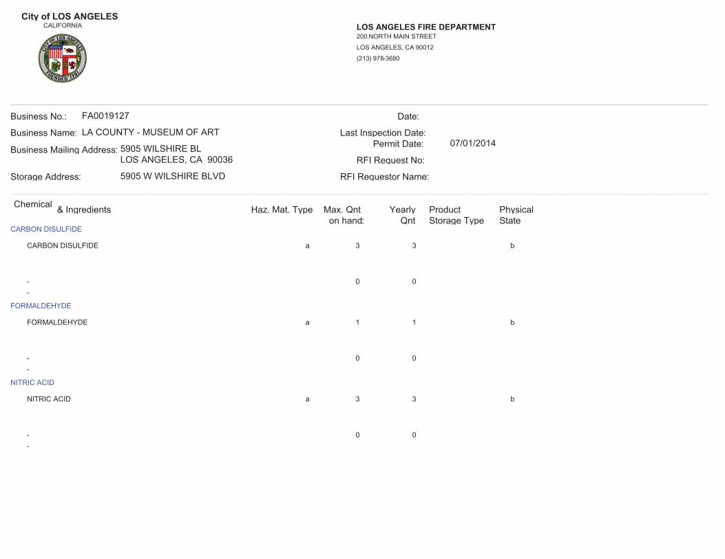
City of LOS ANGELESCALIFORNIA LOS ANGELES FIRE DEPARTMENT
(213) 978-3680
LOS ANGELES, CA 90012
200 NORTH MAIN STREET
__________________________________________________________________________________________________________________________________________Business No.:
Storage Address:
Business Mailing Address:
Business Name:
FA0019127
RFI Requestor Name:
RFI Request No:
Permit Date:Last Inspection Date:
Date:
LA COUNTY - MUSEUM OF ART
5905 WILSHIRE BLLOS ANGELES, CA 90036
5905 W WILSHIRE BLVD
07/01/2014
__________________________________________________________________________________________________________________________________________Chemical & Ingredients Haz. Mat. Type Max. Qnt
on hand:Yearly
Qnt Storage TypeProduct Physical
StateCARBON DISULFIDE
CARBON DISULFIDE a 3 b3
0 0--
FORMALDEHYDE
FORMALDEHYDE a 1 b1
0 0--
NITRIC ACID
NITRIC ACID a 3 b3
0 0--
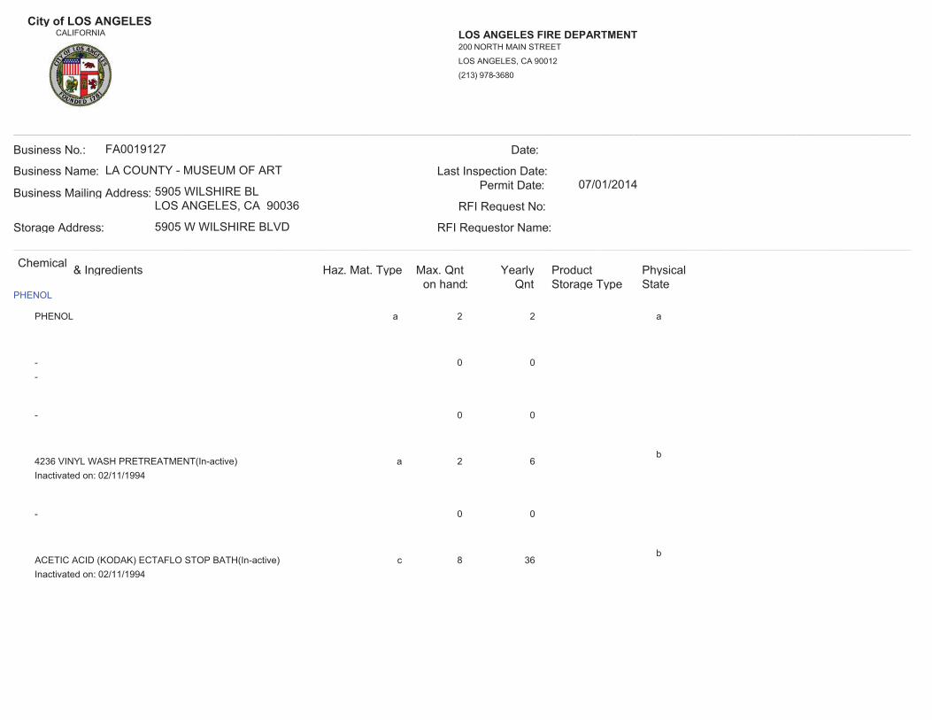
City of LOS ANGELESCALIFORNIA LOS ANGELES FIRE DEPARTMENT
(213) 978-3680
LOS ANGELES, CA 90012
200 NORTH MAIN STREET
__________________________________________________________________________________________________________________________________________Business No.:
Storage Address:
Business Mailing Address:
Business Name:
FA0019127
RFI Requestor Name:
RFI Request No:
Permit Date:Last Inspection Date:
Date:
LA COUNTY - MUSEUM OF ART
5905 WILSHIRE BLLOS ANGELES, CA 90036
5905 W WILSHIRE BLVD
07/01/2014
__________________________________________________________________________________________________________________________________________Chemical & Ingredients Haz. Mat. Type Max. Qnt
on hand:Yearly
Qnt Storage TypeProduct Physical
StatePHENOL
PHENOL a 2 a2
0 0--
- 00
a 2 6b
4236 VINYL WASH PRETREATMENT(In-active)02/11/1994Inactivated on:
- 00
c 8 36b
ACETIC ACID (KODAK) ECTAFLO STOP BATH(In-active)02/11/1994Inactivated on:

City of LOS ANGELESCALIFORNIA LOS ANGELES FIRE DEPARTMENT
(213) 978-3680
LOS ANGELES, CA 90012
200 NORTH MAIN STREET
__________________________________________________________________________________________________________________________________________Business No.:
Storage Address:
Business Mailing Address:
Business Name:
FA0019127
RFI Requestor Name:
RFI Request No:
Permit Date:Last Inspection Date:
Date:
LA COUNTY - MUSEUM OF ART
5905 WILSHIRE BLLOS ANGELES, CA 90036
5905 W WILSHIRE BLVD
07/01/2014
__________________________________________________________________________________________________________________________________________Chemical & Ingredients Haz. Mat. Type Max. Qnt
on hand:Yearly
Qnt Storage TypeProduct Physical
State
- 00
a 2 10b
ACETONE(In-active)02/11/1994Inactivated on:
- 00
a 20 100b
ALKYD RESIN BASED PAINTS(In-active)02/11/1994Inactivated on:
- 00
a 400 400b
BETZ ENTEC 703(In-active)02/11/1994Inactivated on:

City of LOS ANGELESCALIFORNIA LOS ANGELES FIRE DEPARTMENT
(213) 978-3680
LOS ANGELES, CA 90012
200 NORTH MAIN STREET
__________________________________________________________________________________________________________________________________________Business No.:
Storage Address:
Business Mailing Address:
Business Name:
FA0019127
RFI Requestor Name:
RFI Request No:
Permit Date:Last Inspection Date:
Date:
LA COUNTY - MUSEUM OF ART
5905 WILSHIRE BLLOS ANGELES, CA 90036
5905 W WILSHIRE BLVD
07/01/2014
__________________________________________________________________________________________________________________________________________Chemical & Ingredients Haz. Mat. Type Max. Qnt
on hand:Yearly
Qnt Storage TypeProduct Physical
State
- 00
a 10 30b
BOILED LINSEED OIL(In-active)02/11/1994Inactivated on:
- 00
a 55b
CONFIDENCE 10C(In-active)Inactivated on:
- 00
a 20 100b
DECOLAC LACQUERS(In-active)02/11/1994Inactivated on:

City of LOS ANGELESCALIFORNIA LOS ANGELES FIRE DEPARTMENT
(213) 978-3680
LOS ANGELES, CA 90012
200 NORTH MAIN STREET
__________________________________________________________________________________________________________________________________________Business No.:
Storage Address:
Business Mailing Address:
Business Name:
FA0019127
RFI Requestor Name:
RFI Request No:
Permit Date:Last Inspection Date:
Date:
LA COUNTY - MUSEUM OF ART
5905 WILSHIRE BLLOS ANGELES, CA 90036
5905 W WILSHIRE BLVD
07/01/2014
__________________________________________________________________________________________________________________________________________Chemical & Ingredients Haz. Mat. Type Max. Qnt
on hand:Yearly
Qnt Storage TypeProduct Physical
State
- 00
a 6000b
DIESEL FUEL #2(In-active)08/14/2002Inactivated on:
- 00
a 5 10b
IP 980 X SYNTHETIC REDUCER(In-active)02/11/1994Inactivated on:
- 00
c 20 260b
KODAK ROYAL PRINT FIXER(In-active)02/11/1994Inactivated on:

City of LOS ANGELESCALIFORNIA LOS ANGELES FIRE DEPARTMENT
(213) 978-3680
LOS ANGELES, CA 90012
200 NORTH MAIN STREET
__________________________________________________________________________________________________________________________________________Business No.:
Storage Address:
Business Mailing Address:
Business Name:
FA0019127
RFI Requestor Name:
RFI Request No:
Permit Date:Last Inspection Date:
Date:
LA COUNTY - MUSEUM OF ART
5905 WILSHIRE BLLOS ANGELES, CA 90036
5905 W WILSHIRE BLVD
07/01/2014
__________________________________________________________________________________________________________________________________________Chemical & Ingredients Haz. Mat. Type Max. Qnt
on hand:Yearly
Qnt Storage TypeProduct Physical
State
- 00
c 15 390b
KODAK ROYALPRINT ACTIVATOR/STOP(In-active)02/11/1994Inactivated on:
- 00
a 5 20b
LATEX PAINT ADDITIVES(In-active)02/11/1994Inactivated on:
- 00
a 25 100b
LATEX PAINTS WITH ETHYLENE GLYCOL(In-active)02/11/1994Inactivated on:

City of LOS ANGELESCALIFORNIA LOS ANGELES FIRE DEPARTMENT
(213) 978-3680
LOS ANGELES, CA 90012
200 NORTH MAIN STREET
__________________________________________________________________________________________________________________________________________Business No.:
Storage Address:
Business Mailing Address:
Business Name:
FA0019127
RFI Requestor Name:
RFI Request No:
Permit Date:Last Inspection Date:
Date:
LA COUNTY - MUSEUM OF ART
5905 WILSHIRE BLLOS ANGELES, CA 90036
5905 W WILSHIRE BLVD
07/01/2014
__________________________________________________________________________________________________________________________________________Chemical & Ingredients Haz. Mat. Type Max. Qnt
on hand:Yearly
Qnt Storage TypeProduct Physical
State
- 00
a 5 10b
LQ 120 DECOLAC LACQUER STAIN(In-active)02/11/1994Inactivated on:
- 00
c 12 8b
MIXED ORGANIC SOLVENT(In-active)02/11/1994Inactivated on:
- 00
a 5 25b
PAINTS CONTAINING ALUMINUM(In-active)02/11/1994Inactivated on:

City of LOS ANGELESCALIFORNIA LOS ANGELES FIRE DEPARTMENT
(213) 978-3680
LOS ANGELES, CA 90012
200 NORTH MAIN STREET
__________________________________________________________________________________________________________________________________________Business No.:
Storage Address:
Business Mailing Address:
Business Name:
FA0019127
RFI Requestor Name:
RFI Request No:
Permit Date:Last Inspection Date:
Date:
LA COUNTY - MUSEUM OF ART
5905 WILSHIRE BLLOS ANGELES, CA 90036
5905 W WILSHIRE BLVD
07/01/2014
__________________________________________________________________________________________________________________________________________Chemical & Ingredients Haz. Mat. Type Max. Qnt
on hand:Yearly
Qnt Storage TypeProduct Physical
State
- 00
a 10 25b
PAINTS CONTAINING ZINC DUST(In-active)02/11/1994Inactivated on:
- 00
a 5 10b
PAINTS WITH LEAD CHROMATES(In-active)02/11/1994Inactivated on:
- 00
a 10 25b
PAINTS WITH ZINC CHROMATE(In-active)02/11/1994Inactivated on:

City of LOS ANGELESCALIFORNIA LOS ANGELES FIRE DEPARTMENT
(213) 978-3680
LOS ANGELES, CA 90012
200 NORTH MAIN STREET
__________________________________________________________________________________________________________________________________________Business No.:
Storage Address:
Business Mailing Address:
Business Name:
FA0019127
RFI Requestor Name:
RFI Request No:
Permit Date:Last Inspection Date:
Date:
LA COUNTY - MUSEUM OF ART
5905 WILSHIRE BLLOS ANGELES, CA 90036
5905 W WILSHIRE BLVD
07/01/2014
__________________________________________________________________________________________________________________________________________Chemical & Ingredients Haz. Mat. Type Max. Qnt
on hand:Yearly
Qnt Storage TypeProduct Physical
State
- 00
a 15 50b
PETROLEUM DISTILLATE THINNERS(In-active)02/11/1994Inactivated on:
- 00
a 550 550c
REFRIGERANT 22(In-active)Inactivated on:
- 00
a 50 50b
REFRIGERATION OIL(In-active)02/11/1994Inactivated on:

City of LOS ANGELESCALIFORNIA LOS ANGELES FIRE DEPARTMENT
(213) 978-3680
LOS ANGELES, CA 90012
200 NORTH MAIN STREET
__________________________________________________________________________________________________________________________________________Business No.:
Storage Address:
Business Mailing Address:
Business Name:
FA0019127
RFI Requestor Name:
RFI Request No:
Permit Date:Last Inspection Date:
Date:
LA COUNTY - MUSEUM OF ART
5905 WILSHIRE BLLOS ANGELES, CA 90036
5905 W WILSHIRE BLVD
07/01/2014
__________________________________________________________________________________________________________________________________________Chemical & Ingredients Haz. Mat. Type Max. Qnt
on hand:Yearly
Qnt Storage TypeProduct Physical
State
- 00
c 50 50b
REFRIGERATION OIL(In-active)02/11/1994Inactivated on:
- 00
a 2 15b
SHELLAC, SEALFAST SOLVENT(In-active)02/11/1994Inactivated on:
- 00
a 5 25b
SYNTHETIC RESIN BASED PAINTS(In-active)02/11/1994Inactivated on:

City of LOS ANGELESCALIFORNIA LOS ANGELES FIRE DEPARTMENT
(213) 978-3680
LOS ANGELES, CA 90012
200 NORTH MAIN STREET
__________________________________________________________________________________________________________________________________________Business No.:
Storage Address:
Business Mailing Address:
Business Name:
FA0019127
RFI Requestor Name:
RFI Request No:
Permit Date:Last Inspection Date:
Date:
LA COUNTY - MUSEUM OF ART
5905 WILSHIRE BLLOS ANGELES, CA 90036
5905 W WILSHIRE BLVD
07/01/2014
__________________________________________________________________________________________________________________________________________Chemical & Ingredients Haz. Mat. Type Max. Qnt
on hand:Yearly
Qnt Storage TypeProduct Physical
State
- 00
a 5 20b
V-108 STAINSEAL(In-active)02/11/1994Inactivated on:
- 00
a 10 25b
VARNISH PRODUCTS(In-active)02/11/1994Inactivated on:
- 00
a 5 20b
W 801-2 VIN-L-STRIPE YELLOW(In-active)02/11/1994Inactivated on:

City of LOS ANGELESCALIFORNIA LOS ANGELES FIRE DEPARTMENT
(213) 978-3680
LOS ANGELES, CA 90012
200 NORTH MAIN STREET
__________________________________________________________________________________________________________________________________________Business No.:
Storage Address:
Business Mailing Address:
Business Name:
FA0019127
RFI Requestor Name:
RFI Request No:
Permit Date:Last Inspection Date:
Date:
LA COUNTY - MUSEUM OF ART
5905 WILSHIRE BLLOS ANGELES, CA 90036
5905 W WILSHIRE BLVD
07/01/2014
__________________________________________________________________________________________________________________________________________Chemical & Ingredients Haz. Mat. Type Max. Qnt
on hand:Yearly
Qnt Storage TypeProduct Physical
State
- 00
a 50 500b
WATERBASE LATEX PAINTS(In-active)02/11/1994Inactivated on:
ACETYLENE a c500
0 0--
CARBON DIOXIDE a c900
0 0--

City of LOS ANGELESCALIFORNIA LOS ANGELES FIRE DEPARTMENT
(213) 978-3680
LOS ANGELES, CA 90012
200 NORTH MAIN STREET
__________________________________________________________________________________________________________________________________________Business No.:
Storage Address:
Business Mailing Address:
Business Name:
FA0019127
RFI Requestor Name:
RFI Request No:
Permit Date:Last Inspection Date:
Date:
LA COUNTY - MUSEUM OF ART
5905 WILSHIRE BLLOS ANGELES, CA 90036
5905 W WILSHIRE BLVD
06/26/201807/01/2006
__________________________________________________________________________________________________________________________________________Chemical & Ingredients Haz. Mat. Type Max. Qnt
on hand:Yearly
Qnt Storage TypeProduct Physical
State
COMPRESSED GAS N.O.S a c500
0 0--
DIESEL FUEL #2 a 55 b1200
0 0--
LIQUID NITROGEN a b3930
0 0--
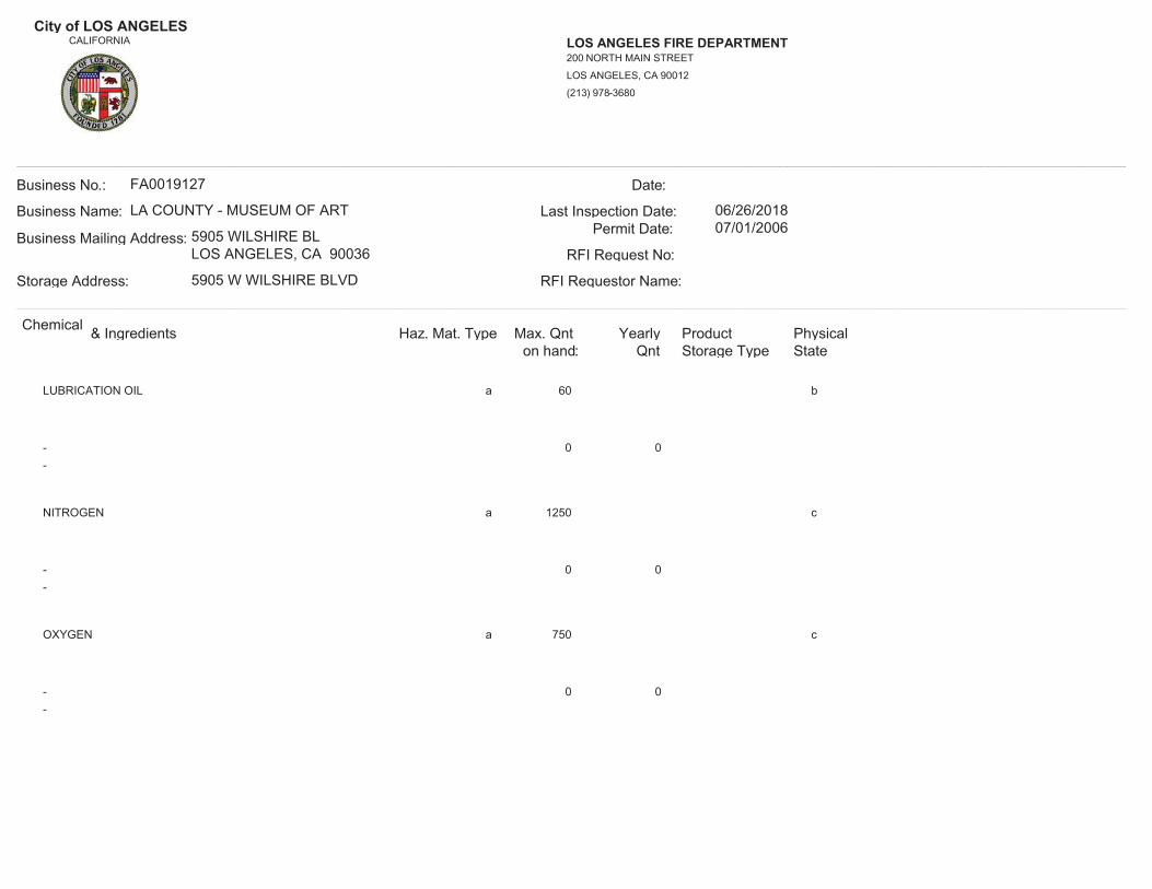
City of LOS ANGELESCALIFORNIA LOS ANGELES FIRE DEPARTMENT
(213) 978-3680
LOS ANGELES, CA 90012
200 NORTH MAIN STREET
__________________________________________________________________________________________________________________________________________Business No.:
Storage Address:
Business Mailing Address:
Business Name:
FA0019127
RFI Requestor Name:
RFI Request No:
Permit Date:Last Inspection Date:
Date:
LA COUNTY - MUSEUM OF ART
5905 WILSHIRE BLLOS ANGELES, CA 90036
5905 W WILSHIRE BLVD
06/26/201807/01/2006
__________________________________________________________________________________________________________________________________________Chemical & Ingredients Haz. Mat. Type Max. Qnt
on hand:Yearly
Qnt Storage TypeProduct Physical
State
LUBRICATION OIL a b60
0 0--
NITROGEN a c1250
0 0--
OXYGEN a c750
0 0--

City of LOS ANGELESCALIFORNIA LOS ANGELES FIRE DEPARTMENT
(213) 978-3680
LOS ANGELES, CA 90012
200 NORTH MAIN STREET
__________________________________________________________________________________________________________________________________________Business No.:
Storage Address:
Business Mailing Address:
Business Name:
FA0019127
RFI Requestor Name:
RFI Request No:
Permit Date:Last Inspection Date:
Date:
LA COUNTY - MUSEUM OF ART
5905 WILSHIRE BLLOS ANGELES, CA 90036
5905 W WILSHIRE BLVD
06/26/201807/01/2006
__________________________________________________________________________________________________________________________________________Chemical & Ingredients Haz. Mat. Type Max. Qnt
on hand:Yearly
Qnt Storage TypeProduct Physical
State
PHOSPHOROUS PENTOXIDE a 2 a2
0 0--
REFRIGERANT 134A a 4400 c4400
0 0--
REFRIGERANT 501 a 392 c392
0 0--
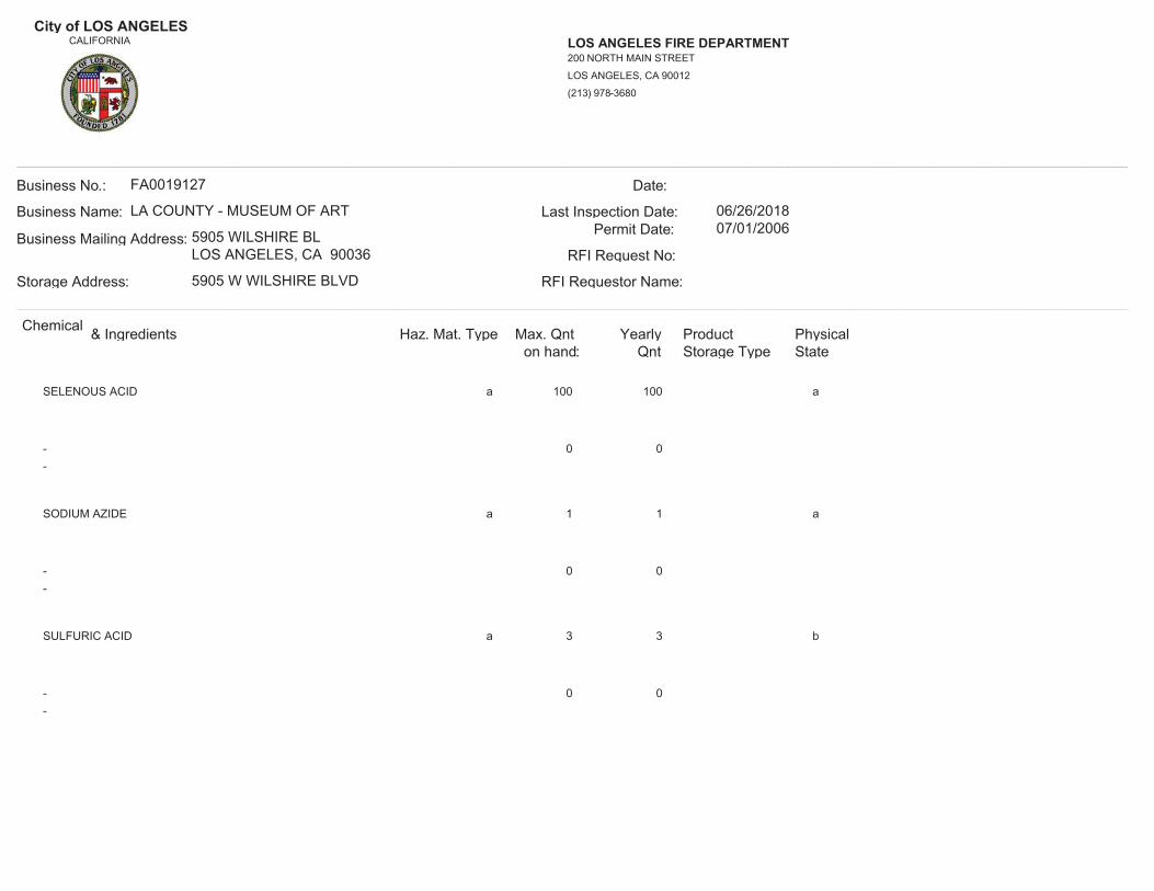
City of LOS ANGELESCALIFORNIA LOS ANGELES FIRE DEPARTMENT
(213) 978-3680
LOS ANGELES, CA 90012
200 NORTH MAIN STREET
__________________________________________________________________________________________________________________________________________Business No.:
Storage Address:
Business Mailing Address:
Business Name:
FA0019127
RFI Requestor Name:
RFI Request No:
Permit Date:Last Inspection Date:
Date:
LA COUNTY - MUSEUM OF ART
5905 WILSHIRE BLLOS ANGELES, CA 90036
5905 W WILSHIRE BLVD
06/26/201807/01/2006
__________________________________________________________________________________________________________________________________________Chemical & Ingredients Haz. Mat. Type Max. Qnt
on hand:Yearly
Qnt Storage TypeProduct Physical
State
SELENOUS ACID a 100 a100
0 0--
SODIUM AZIDE a 1 a1
0 0--
SULFURIC ACID a 3 b3
0 0--

City of LOS ANGELESCALIFORNIA LOS ANGELES FIRE DEPARTMENT
(213) 978-3680
LOS ANGELES, CA 90012
200 NORTH MAIN STREET
__________________________________________________________________________________________________________________________________________Business No.:
Storage Address:
Business Mailing Address:
Business Name:
FA0019127
RFI Requestor Name:
RFI Request No:
Permit Date:Last Inspection Date:
Date:
LA COUNTY - MUSEUM OF ART
5905 WILSHIRE BLLOS ANGELES, CA 90036
5905 W WILSHIRE BLVD
06/26/201807/01/2006
__________________________________________________________________________________________________________________________________________Chemical & Ingredients Haz. Mat. Type Max. Qnt
on hand:Yearly
Qnt Storage TypeProduct Physical
StateARSENOUS TRICHLORIDE
ARSENOUS TRICHLORIDE a 1 a1
0 0--
BROMINE
BROMINE a 100 b100
0 0--
CARBON DISULFIDE
CARBON DISULFIDE a 3 b3
0 0--

City of LOS ANGELESCALIFORNIA LOS ANGELES FIRE DEPARTMENT
(213) 978-3680
LOS ANGELES, CA 90012
200 NORTH MAIN STREET
__________________________________________________________________________________________________________________________________________Business No.:
Storage Address:
Business Mailing Address:
Business Name:
FA0019127
RFI Requestor Name:
RFI Request No:
Permit Date:Last Inspection Date:
Date:
LA COUNTY - MUSEUM OF ART
5905 WILSHIRE BLLOS ANGELES, CA 90036
5905 W WILSHIRE BLVD
06/26/201807/01/2006
__________________________________________________________________________________________________________________________________________Chemical & Ingredients Haz. Mat. Type Max. Qnt
on hand:Yearly
Qnt Storage TypeProduct Physical
StateFORMALDEHYDE
FORMALDEHYDE a 1 b1
0 0--
NITRIC ACID
NITRIC ACID a 3 b3
0 0--
PHENOL
PHENOL a 2 a2
0 0--

City of LOS ANGELESCALIFORNIA LOS ANGELES FIRE DEPARTMENT
(213) 978-3680
LOS ANGELES, CA 90012
200 NORTH MAIN STREET
__________________________________________________________________________________________________________________________________________Business No.:
Storage Address:
Business Mailing Address:
Business Name:
FA0019127
RFI Requestor Name:
RFI Request No:
Permit Date:Last Inspection Date:
Date:
LA COUNTY - MUSEUM OF ART
5905 WILSHIRE BLLOS ANGELES, CA 90036
5905 W WILSHIRE BLVD
06/26/201807/01/2006
__________________________________________________________________________________________________________________________________________Chemical & Ingredients Haz. Mat. Type Max. Qnt
on hand:Yearly
Qnt Storage TypeProduct Physical
State
- 00
a 2 6b
4236 VINYL WASH PRETREATMENT(In-active)02/11/1994Inactivated on:
- 00
c 8 36b
ACETIC ACID (KODAK) ECTAFLO STOP BATH(In-active)02/11/1994Inactivated on:
- 00
a 2 10b
ACETONE(In-active)02/11/1994Inactivated on:

City of LOS ANGELESCALIFORNIA LOS ANGELES FIRE DEPARTMENT
(213) 978-3680
LOS ANGELES, CA 90012
200 NORTH MAIN STREET
__________________________________________________________________________________________________________________________________________Business No.:
Storage Address:
Business Mailing Address:
Business Name:
FA0019127
RFI Requestor Name:
RFI Request No:
Permit Date:Last Inspection Date:
Date:
LA COUNTY - MUSEUM OF ART
5905 WILSHIRE BLLOS ANGELES, CA 90036
5905 W WILSHIRE BLVD
06/26/201807/01/2006
__________________________________________________________________________________________________________________________________________Chemical & Ingredients Haz. Mat. Type Max. Qnt
on hand:Yearly
Qnt Storage TypeProduct Physical
State
- 00
a 20 100b
ALKYD RESIN BASED PAINTS(In-active)02/11/1994Inactivated on:
- 00
a 400 400b
BETZ ENTEC 703(In-active)02/11/1994Inactivated on:
- 00
a 10 30b
BOILED LINSEED OIL(In-active)02/11/1994Inactivated on:

City of LOS ANGELESCALIFORNIA LOS ANGELES FIRE DEPARTMENT
(213) 978-3680
LOS ANGELES, CA 90012
200 NORTH MAIN STREET
__________________________________________________________________________________________________________________________________________Business No.:
Storage Address:
Business Mailing Address:
Business Name:
FA0019127
RFI Requestor Name:
RFI Request No:
Permit Date:Last Inspection Date:
Date:
LA COUNTY - MUSEUM OF ART
5905 WILSHIRE BLLOS ANGELES, CA 90036
5905 W WILSHIRE BLVD
06/26/201807/01/2006
__________________________________________________________________________________________________________________________________________Chemical & Ingredients Haz. Mat. Type Max. Qnt
on hand:Yearly
Qnt Storage TypeProduct Physical
State
- 00
a 55b
CONFIDENCE 10C(In-active)Inactivated on:
- 00
a 20 100b
DECOLAC LACQUERS(In-active)02/11/1994Inactivated on:
- 00
a 6000b
DIESEL FUEL #2(In-active)08/14/2002Inactivated on:

City of LOS ANGELESCALIFORNIA LOS ANGELES FIRE DEPARTMENT
(213) 978-3680
LOS ANGELES, CA 90012
200 NORTH MAIN STREET
__________________________________________________________________________________________________________________________________________Business No.:
Storage Address:
Business Mailing Address:
Business Name:
FA0019127
RFI Requestor Name:
RFI Request No:
Permit Date:Last Inspection Date:
Date:
LA COUNTY - MUSEUM OF ART
5905 WILSHIRE BLLOS ANGELES, CA 90036
5905 W WILSHIRE BLVD
06/26/201807/01/2006
__________________________________________________________________________________________________________________________________________Chemical & Ingredients Haz. Mat. Type Max. Qnt
on hand:Yearly
Qnt Storage TypeProduct Physical
State
- 00
a 5 10b
IP 980 X SYNTHETIC REDUCER(In-active)02/11/1994Inactivated on:
- 00
c 20 260b
KODAK ROYAL PRINT FIXER(In-active)02/11/1994Inactivated on:
- 00
c 15 390b
KODAK ROYALPRINT ACTIVATOR/STOP(In-active)02/11/1994Inactivated on:

City of LOS ANGELESCALIFORNIA LOS ANGELES FIRE DEPARTMENT
(213) 978-3680
LOS ANGELES, CA 90012
200 NORTH MAIN STREET
__________________________________________________________________________________________________________________________________________Business No.:
Storage Address:
Business Mailing Address:
Business Name:
FA0019127
RFI Requestor Name:
RFI Request No:
Permit Date:Last Inspection Date:
Date:
LA COUNTY - MUSEUM OF ART
5905 WILSHIRE BLLOS ANGELES, CA 90036
5905 W WILSHIRE BLVD
06/26/201807/01/2006
__________________________________________________________________________________________________________________________________________Chemical & Ingredients Haz. Mat. Type Max. Qnt
on hand:Yearly
Qnt Storage TypeProduct Physical
State
- 00
a 5 20b
LATEX PAINT ADDITIVES(In-active)02/11/1994Inactivated on:
- 00
a 25 100b
LATEX PAINTS WITH ETHYLENE GLYCOL(In-active)02/11/1994Inactivated on:
- 00
a 5 10b
LQ 120 DECOLAC LACQUER STAIN(In-active)02/11/1994Inactivated on:

City of LOS ANGELESCALIFORNIA LOS ANGELES FIRE DEPARTMENT
(213) 978-3680
LOS ANGELES, CA 90012
200 NORTH MAIN STREET
__________________________________________________________________________________________________________________________________________Business No.:
Storage Address:
Business Mailing Address:
Business Name:
FA0019127
RFI Requestor Name:
RFI Request No:
Permit Date:Last Inspection Date:
Date:
LA COUNTY - MUSEUM OF ART
5905 WILSHIRE BLLOS ANGELES, CA 90036
5905 W WILSHIRE BLVD
06/26/201807/01/2006
__________________________________________________________________________________________________________________________________________Chemical & Ingredients Haz. Mat. Type Max. Qnt
on hand:Yearly
Qnt Storage TypeProduct Physical
State
- 00
c 12 8b
MIXED ORGANIC SOLVENT(In-active)02/11/1994Inactivated on:
- 00
a 5 25b
PAINTS CONTAINING ALUMINUM(In-active)02/11/1994Inactivated on:
- 00
a 10 25b
PAINTS CONTAINING ZINC DUST(In-active)02/11/1994Inactivated on:

City of LOS ANGELESCALIFORNIA LOS ANGELES FIRE DEPARTMENT
(213) 978-3680
LOS ANGELES, CA 90012
200 NORTH MAIN STREET
__________________________________________________________________________________________________________________________________________Business No.:
Storage Address:
Business Mailing Address:
Business Name:
FA0019127
RFI Requestor Name:
RFI Request No:
Permit Date:Last Inspection Date:
Date:
LA COUNTY - MUSEUM OF ART
5905 WILSHIRE BLLOS ANGELES, CA 90036
5905 W WILSHIRE BLVD
06/26/201807/01/2006
__________________________________________________________________________________________________________________________________________Chemical & Ingredients Haz. Mat. Type Max. Qnt
on hand:Yearly
Qnt Storage TypeProduct Physical
State
- 00
a 5 10b
PAINTS WITH LEAD CHROMATES(In-active)02/11/1994Inactivated on:
- 00
a 10 25b
PAINTS WITH ZINC CHROMATE(In-active)02/11/1994Inactivated on:
- 00
a 15 50b
PETROLEUM DISTILLATE THINNERS(In-active)02/11/1994Inactivated on:

City of LOS ANGELESCALIFORNIA LOS ANGELES FIRE DEPARTMENT
(213) 978-3680
LOS ANGELES, CA 90012
200 NORTH MAIN STREET
__________________________________________________________________________________________________________________________________________Business No.:
Storage Address:
Business Mailing Address:
Business Name:
FA0019127
RFI Requestor Name:
RFI Request No:
Permit Date:Last Inspection Date:
Date:
LA COUNTY - MUSEUM OF ART
5905 WILSHIRE BLLOS ANGELES, CA 90036
5905 W WILSHIRE BLVD
06/26/201807/01/2006
__________________________________________________________________________________________________________________________________________Chemical & Ingredients Haz. Mat. Type Max. Qnt
on hand:Yearly
Qnt Storage TypeProduct Physical
State
- 00
a 550 550c
REFRIGERANT 22(In-active)Inactivated on:
- 00
a 50 50b
REFRIGERATION OIL(In-active)02/11/1994Inactivated on:
- 00
c 50 50b
REFRIGERATION OIL(In-active)02/11/1994Inactivated on:

City of LOS ANGELESCALIFORNIA LOS ANGELES FIRE DEPARTMENT
(213) 978-3680
LOS ANGELES, CA 90012
200 NORTH MAIN STREET
__________________________________________________________________________________________________________________________________________Business No.:
Storage Address:
Business Mailing Address:
Business Name:
FA0019127
RFI Requestor Name:
RFI Request No:
Permit Date:Last Inspection Date:
Date:
LA COUNTY - MUSEUM OF ART
5905 WILSHIRE BLLOS ANGELES, CA 90036
5905 W WILSHIRE BLVD
06/26/201807/01/2006
__________________________________________________________________________________________________________________________________________Chemical & Ingredients Haz. Mat. Type Max. Qnt
on hand:Yearly
Qnt Storage TypeProduct Physical
State
- 00
a 2 15b
SHELLAC, SEALFAST SOLVENT(In-active)02/11/1994Inactivated on:
- 00
a 5 25b
SYNTHETIC RESIN BASED PAINTS(In-active)02/11/1994Inactivated on:
- 00
a 5 20b
V-108 STAINSEAL(In-active)02/11/1994Inactivated on:

City of LOS ANGELESCALIFORNIA LOS ANGELES FIRE DEPARTMENT
(213) 978-3680
LOS ANGELES, CA 90012
200 NORTH MAIN STREET
__________________________________________________________________________________________________________________________________________Business No.:
Storage Address:
Business Mailing Address:
Business Name:
FA0019127
RFI Requestor Name:
RFI Request No:
Permit Date:Last Inspection Date:
Date:
LA COUNTY - MUSEUM OF ART
5905 WILSHIRE BLLOS ANGELES, CA 90036
5905 W WILSHIRE BLVD
06/26/201807/01/2006
__________________________________________________________________________________________________________________________________________Chemical & Ingredients Haz. Mat. Type Max. Qnt
on hand:Yearly
Qnt Storage TypeProduct Physical
State
- 00
a 10 25b
VARNISH PRODUCTS(In-active)02/11/1994Inactivated on:
- 00
a 5 20b
W 801-2 VIN-L-STRIPE YELLOW(In-active)02/11/1994Inactivated on:
- 00
a 50 500b
WATERBASE LATEX PAINTS(In-active)02/11/1994Inactivated on:

City of LOS ANGELESCALIFORNIA LOS ANGELES FIRE DEPARTMENT
(213) 978-3680
LOS ANGELES, CA 90012
200 NORTH MAIN STREET
__________________________________________________________________________________________________________________________________________Business No.:
Storage Address:
Business Mailing Address:
Business Name:
FA0019127
RFI Requestor Name:
RFI Request No:
Permit Date:Last Inspection Date:
Date:
LA COUNTY - MUSEUM OF ART
5905 WILSHIRE BLLOS ANGELES, CA 90036
5905 W WILSHIRE BLVD
06/26/201807/01/2014
__________________________________________________________________________________________________________________________________________Chemical & Ingredients Haz. Mat. Type Max. Qnt
on hand:Yearly
Qnt Storage TypeProduct Physical
State
ACETYLENE a c500
0 0--
CARBON DIOXIDE a c900
0 0--
COMPRESSED GAS N.O.S a c500
0 0--

City of LOS ANGELESCALIFORNIA LOS ANGELES FIRE DEPARTMENT
(213) 978-3680
LOS ANGELES, CA 90012
200 NORTH MAIN STREET
__________________________________________________________________________________________________________________________________________Business No.:
Storage Address:
Business Mailing Address:
Business Name:
FA0019127
RFI Requestor Name:
RFI Request No:
Permit Date:Last Inspection Date:
Date:
LA COUNTY - MUSEUM OF ART
5905 WILSHIRE BLLOS ANGELES, CA 90036
5905 W WILSHIRE BLVD
06/26/201807/01/2014
__________________________________________________________________________________________________________________________________________Chemical & Ingredients Haz. Mat. Type Max. Qnt
on hand:Yearly
Qnt Storage TypeProduct Physical
State
DIESEL FUEL #2 a 55 b1200
0 0--
LIQUID NITROGEN a b3930
0 0--
LUBRICATION OIL a b60
0 0--

City of LOS ANGELESCALIFORNIA LOS ANGELES FIRE DEPARTMENT
(213) 978-3680
LOS ANGELES, CA 90012
200 NORTH MAIN STREET
__________________________________________________________________________________________________________________________________________Business No.:
Storage Address:
Business Mailing Address:
Business Name:
FA0019127
RFI Requestor Name:
RFI Request No:
Permit Date:Last Inspection Date:
Date:
LA COUNTY - MUSEUM OF ART
5905 WILSHIRE BLLOS ANGELES, CA 90036
5905 W WILSHIRE BLVD
06/26/201807/01/2014
__________________________________________________________________________________________________________________________________________Chemical & Ingredients Haz. Mat. Type Max. Qnt
on hand:Yearly
Qnt Storage TypeProduct Physical
State
NITROGEN a c1250
0 0--
OXYGEN a c750
0 0--
PHOSPHOROUS PENTOXIDE a 2 a2
0 0--

City of LOS ANGELESCALIFORNIA LOS ANGELES FIRE DEPARTMENT
(213) 978-3680
LOS ANGELES, CA 90012
200 NORTH MAIN STREET
__________________________________________________________________________________________________________________________________________Business No.:
Storage Address:
Business Mailing Address:
Business Name:
FA0019127
RFI Requestor Name:
RFI Request No:
Permit Date:Last Inspection Date:
Date:
LA COUNTY - MUSEUM OF ART
5905 WILSHIRE BLLOS ANGELES, CA 90036
5905 W WILSHIRE BLVD
06/26/201807/01/2014
__________________________________________________________________________________________________________________________________________Chemical & Ingredients Haz. Mat. Type Max. Qnt
on hand:Yearly
Qnt Storage TypeProduct Physical
State
REFRIGERANT 134A a 4400 c4400
0 0--
REFRIGERANT 501 a 392 c392
0 0--
SELENOUS ACID a 100 a100
0 0--

City of LOS ANGELESCALIFORNIA LOS ANGELES FIRE DEPARTMENT
(213) 978-3680
LOS ANGELES, CA 90012
200 NORTH MAIN STREET
__________________________________________________________________________________________________________________________________________Business No.:
Storage Address:
Business Mailing Address:
Business Name:
FA0019127
RFI Requestor Name:
RFI Request No:
Permit Date:Last Inspection Date:
Date:
LA COUNTY - MUSEUM OF ART
5905 WILSHIRE BLLOS ANGELES, CA 90036
5905 W WILSHIRE BLVD
06/26/201807/01/2014
__________________________________________________________________________________________________________________________________________Chemical & Ingredients Haz. Mat. Type Max. Qnt
on hand:Yearly
Qnt Storage TypeProduct Physical
State
SODIUM AZIDE a 1 a1
0 0--
SULFURIC ACID a 3 b3
0 0--
ARSENOUS TRICHLORIDE
ARSENOUS TRICHLORIDE a 1 a1
0 0--

City of LOS ANGELESCALIFORNIA LOS ANGELES FIRE DEPARTMENT
(213) 978-3680
LOS ANGELES, CA 90012
200 NORTH MAIN STREET
__________________________________________________________________________________________________________________________________________Business No.:
Storage Address:
Business Mailing Address:
Business Name:
FA0019127
RFI Requestor Name:
RFI Request No:
Permit Date:Last Inspection Date:
Date:
LA COUNTY - MUSEUM OF ART
5905 WILSHIRE BLLOS ANGELES, CA 90036
5905 W WILSHIRE BLVD
06/26/201807/01/2014
__________________________________________________________________________________________________________________________________________Chemical & Ingredients Haz. Mat. Type Max. Qnt
on hand:Yearly
Qnt Storage TypeProduct Physical
StateBROMINE
BROMINE a 100 b100
0 0--
CARBON DISULFIDE
CARBON DISULFIDE a 3 b3
0 0--
FORMALDEHYDE
FORMALDEHYDE a 1 b1
0 0--

City of LOS ANGELESCALIFORNIA LOS ANGELES FIRE DEPARTMENT
(213) 978-3680
LOS ANGELES, CA 90012
200 NORTH MAIN STREET
__________________________________________________________________________________________________________________________________________Business No.:
Storage Address:
Business Mailing Address:
Business Name:
FA0019127
RFI Requestor Name:
RFI Request No:
Permit Date:Last Inspection Date:
Date:
LA COUNTY - MUSEUM OF ART
5905 WILSHIRE BLLOS ANGELES, CA 90036
5905 W WILSHIRE BLVD
06/26/201807/01/2014
__________________________________________________________________________________________________________________________________________Chemical & Ingredients Haz. Mat. Type Max. Qnt
on hand:Yearly
Qnt Storage TypeProduct Physical
StateNITRIC ACID
NITRIC ACID a 3 b3
0 0--
PHENOL
PHENOL a 2 a2
0 0--
- 00
a 2 6b
4236 VINYL WASH PRETREATMENT(In-active)02/11/1994Inactivated on:

City of LOS ANGELESCALIFORNIA LOS ANGELES FIRE DEPARTMENT
(213) 978-3680
LOS ANGELES, CA 90012
200 NORTH MAIN STREET
__________________________________________________________________________________________________________________________________________Business No.:
Storage Address:
Business Mailing Address:
Business Name:
FA0019127
RFI Requestor Name:
RFI Request No:
Permit Date:Last Inspection Date:
Date:
LA COUNTY - MUSEUM OF ART
5905 WILSHIRE BLLOS ANGELES, CA 90036
5905 W WILSHIRE BLVD
06/26/201807/01/2014
__________________________________________________________________________________________________________________________________________Chemical & Ingredients Haz. Mat. Type Max. Qnt
on hand:Yearly
Qnt Storage TypeProduct Physical
State
- 00
c 8 36b
ACETIC ACID (KODAK) ECTAFLO STOP BATH(In-active)02/11/1994Inactivated on:
- 00
a 2 10b
ACETONE(In-active)02/11/1994Inactivated on:
- 00
a 20 100b
ALKYD RESIN BASED PAINTS(In-active)02/11/1994Inactivated on:
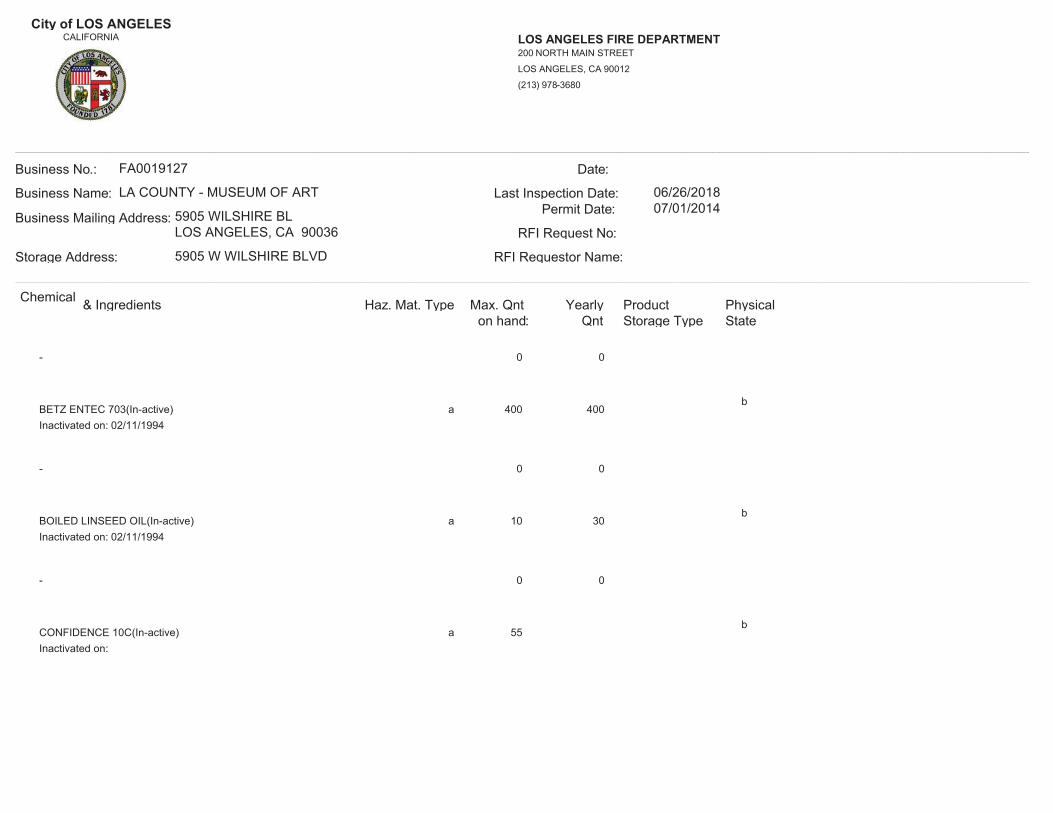
City of LOS ANGELESCALIFORNIA LOS ANGELES FIRE DEPARTMENT
(213) 978-3680
LOS ANGELES, CA 90012
200 NORTH MAIN STREET
__________________________________________________________________________________________________________________________________________Business No.:
Storage Address:
Business Mailing Address:
Business Name:
FA0019127
RFI Requestor Name:
RFI Request No:
Permit Date:Last Inspection Date:
Date:
LA COUNTY - MUSEUM OF ART
5905 WILSHIRE BLLOS ANGELES, CA 90036
5905 W WILSHIRE BLVD
06/26/201807/01/2014
__________________________________________________________________________________________________________________________________________Chemical & Ingredients Haz. Mat. Type Max. Qnt
on hand:Yearly
Qnt Storage TypeProduct Physical
State
- 00
a 400 400b
BETZ ENTEC 703(In-active)02/11/1994Inactivated on:
- 00
a 10 30b
BOILED LINSEED OIL(In-active)02/11/1994Inactivated on:
- 00
a 55b
CONFIDENCE 10C(In-active)Inactivated on:
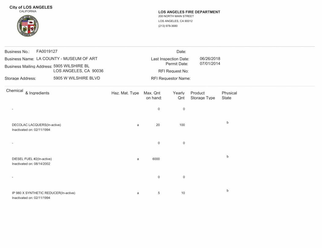
City of LOS ANGELESCALIFORNIA LOS ANGELES FIRE DEPARTMENT
(213) 978-3680
LOS ANGELES, CA 90012
200 NORTH MAIN STREET
__________________________________________________________________________________________________________________________________________Business No.:
Storage Address:
Business Mailing Address:
Business Name:
FA0019127
RFI Requestor Name:
RFI Request No:
Permit Date:Last Inspection Date:
Date:
LA COUNTY - MUSEUM OF ART
5905 WILSHIRE BLLOS ANGELES, CA 90036
5905 W WILSHIRE BLVD
06/26/201807/01/2014
__________________________________________________________________________________________________________________________________________Chemical & Ingredients Haz. Mat. Type Max. Qnt
on hand:Yearly
Qnt Storage TypeProduct Physical
State
- 00
a 20 100b
DECOLAC LACQUERS(In-active)02/11/1994Inactivated on:
- 00
a 6000b
DIESEL FUEL #2(In-active)08/14/2002Inactivated on:
- 00
a 5 10b
IP 980 X SYNTHETIC REDUCER(In-active)02/11/1994Inactivated on:

City of LOS ANGELESCALIFORNIA LOS ANGELES FIRE DEPARTMENT
(213) 978-3680
LOS ANGELES, CA 90012
200 NORTH MAIN STREET
__________________________________________________________________________________________________________________________________________Business No.:
Storage Address:
Business Mailing Address:
Business Name:
FA0019127
RFI Requestor Name:
RFI Request No:
Permit Date:Last Inspection Date:
Date:
LA COUNTY - MUSEUM OF ART
5905 WILSHIRE BLLOS ANGELES, CA 90036
5905 W WILSHIRE BLVD
06/26/201807/01/2014
__________________________________________________________________________________________________________________________________________Chemical & Ingredients Haz. Mat. Type Max. Qnt
on hand:Yearly
Qnt Storage TypeProduct Physical
State
- 00
c 20 260b
KODAK ROYAL PRINT FIXER(In-active)02/11/1994Inactivated on:
- 00
c 15 390b
KODAK ROYALPRINT ACTIVATOR/STOP(In-active)02/11/1994Inactivated on:
- 00
a 5 20b
LATEX PAINT ADDITIVES(In-active)02/11/1994Inactivated on:

City of LOS ANGELESCALIFORNIA LOS ANGELES FIRE DEPARTMENT
(213) 978-3680
LOS ANGELES, CA 90012
200 NORTH MAIN STREET
__________________________________________________________________________________________________________________________________________Business No.:
Storage Address:
Business Mailing Address:
Business Name:
FA0019127
RFI Requestor Name:
RFI Request No:
Permit Date:Last Inspection Date:
Date:
LA COUNTY - MUSEUM OF ART
5905 WILSHIRE BLLOS ANGELES, CA 90036
5905 W WILSHIRE BLVD
06/26/201807/01/2014
__________________________________________________________________________________________________________________________________________Chemical & Ingredients Haz. Mat. Type Max. Qnt
on hand:Yearly
Qnt Storage TypeProduct Physical
State
- 00
a 25 100b
LATEX PAINTS WITH ETHYLENE GLYCOL(In-active)02/11/1994Inactivated on:
- 00
a 5 10b
LQ 120 DECOLAC LACQUER STAIN(In-active)02/11/1994Inactivated on:
- 00
c 12 8b
MIXED ORGANIC SOLVENT(In-active)02/11/1994Inactivated on:

City of LOS ANGELESCALIFORNIA LOS ANGELES FIRE DEPARTMENT
(213) 978-3680
LOS ANGELES, CA 90012
200 NORTH MAIN STREET
__________________________________________________________________________________________________________________________________________Business No.:
Storage Address:
Business Mailing Address:
Business Name:
FA0019127
RFI Requestor Name:
RFI Request No:
Permit Date:Last Inspection Date:
Date:
LA COUNTY - MUSEUM OF ART
5905 WILSHIRE BLLOS ANGELES, CA 90036
5905 W WILSHIRE BLVD
06/26/201807/01/2014
__________________________________________________________________________________________________________________________________________Chemical & Ingredients Haz. Mat. Type Max. Qnt
on hand:Yearly
Qnt Storage TypeProduct Physical
State
- 00
a 5 25b
PAINTS CONTAINING ALUMINUM(In-active)02/11/1994Inactivated on:
- 00
a 10 25b
PAINTS CONTAINING ZINC DUST(In-active)02/11/1994Inactivated on:
- 00
a 5 10b
PAINTS WITH LEAD CHROMATES(In-active)02/11/1994Inactivated on:

City of LOS ANGELESCALIFORNIA LOS ANGELES FIRE DEPARTMENT
(213) 978-3680
LOS ANGELES, CA 90012
200 NORTH MAIN STREET
__________________________________________________________________________________________________________________________________________Business No.:
Storage Address:
Business Mailing Address:
Business Name:
FA0019127
RFI Requestor Name:
RFI Request No:
Permit Date:Last Inspection Date:
Date:
LA COUNTY - MUSEUM OF ART
5905 WILSHIRE BLLOS ANGELES, CA 90036
5905 W WILSHIRE BLVD
06/26/201807/01/2014
__________________________________________________________________________________________________________________________________________Chemical & Ingredients Haz. Mat. Type Max. Qnt
on hand:Yearly
Qnt Storage TypeProduct Physical
State
- 00
a 10 25b
PAINTS WITH ZINC CHROMATE(In-active)02/11/1994Inactivated on:
- 00
a 15 50b
PETROLEUM DISTILLATE THINNERS(In-active)02/11/1994Inactivated on:
- 00
a 550 550c
REFRIGERANT 22(In-active)Inactivated on:

City of LOS ANGELESCALIFORNIA LOS ANGELES FIRE DEPARTMENT
(213) 978-3680
LOS ANGELES, CA 90012
200 NORTH MAIN STREET
__________________________________________________________________________________________________________________________________________Business No.:
Storage Address:
Business Mailing Address:
Business Name:
FA0019127
RFI Requestor Name:
RFI Request No:
Permit Date:Last Inspection Date:
Date:
LA COUNTY - MUSEUM OF ART
5905 WILSHIRE BLLOS ANGELES, CA 90036
5905 W WILSHIRE BLVD
06/26/201807/01/2014
__________________________________________________________________________________________________________________________________________Chemical & Ingredients Haz. Mat. Type Max. Qnt
on hand:Yearly
Qnt Storage TypeProduct Physical
State
- 00
a 50 50b
REFRIGERATION OIL(In-active)02/11/1994Inactivated on:
- 00
c 50 50b
REFRIGERATION OIL(In-active)02/11/1994Inactivated on:
- 00
a 2 15b
SHELLAC, SEALFAST SOLVENT(In-active)02/11/1994Inactivated on:

City of LOS ANGELESCALIFORNIA LOS ANGELES FIRE DEPARTMENT
(213) 978-3680
LOS ANGELES, CA 90012
200 NORTH MAIN STREET
__________________________________________________________________________________________________________________________________________Business No.:
Storage Address:
Business Mailing Address:
Business Name:
FA0019127
RFI Requestor Name:
RFI Request No:
Permit Date:Last Inspection Date:
Date:
LA COUNTY - MUSEUM OF ART
5905 WILSHIRE BLLOS ANGELES, CA 90036
5905 W WILSHIRE BLVD
06/26/201807/01/2014
__________________________________________________________________________________________________________________________________________Chemical & Ingredients Haz. Mat. Type Max. Qnt
on hand:Yearly
Qnt Storage TypeProduct Physical
State
- 00
a 5 25b
SYNTHETIC RESIN BASED PAINTS(In-active)02/11/1994Inactivated on:
- 00
a 5 20b
V-108 STAINSEAL(In-active)02/11/1994Inactivated on:
- 00
a 10 25b
VARNISH PRODUCTS(In-active)02/11/1994Inactivated on:

City of LOS ANGELESCALIFORNIA LOS ANGELES FIRE DEPARTMENT
(213) 978-3680
LOS ANGELES, CA 90012
200 NORTH MAIN STREET
__________________________________________________________________________________________________________________________________________Business No.:
Storage Address:
Business Mailing Address:
Business Name:
FA0019127
RFI Requestor Name:
RFI Request No:
Permit Date:Last Inspection Date:
Date:
LA COUNTY - MUSEUM OF ART
5905 WILSHIRE BLLOS ANGELES, CA 90036
5905 W WILSHIRE BLVD
06/26/201807/01/2014
__________________________________________________________________________________________________________________________________________Chemical & Ingredients Haz. Mat. Type Max. Qnt
on hand:Yearly
Qnt Storage TypeProduct Physical
State
- 00
a 5 20b
W 801-2 VIN-L-STRIPE YELLOW(In-active)02/11/1994Inactivated on:
- 00
a 50 500b
WATERBASE LATEX PAINTS(In-active)02/11/1994Inactivated on:

AECOM Environment
July 2016 60506707.1
Appendix G
Qualifications of Environmental Professional

Statement of Qualifications Page 1
CHRISTIANE MARIE TAMAYODUE DILIGENCE TEAM LEADER-SENIOR GEOLOGISTDESIGN AND CONSULTING SERVICES, L.A. METRO REGION
AREAS OF EXPERTISE SUMMARY
Christiane graduated from Occidental College in May 2005 with her B.S. in Geology, and in 2010 from California State University, Los Angeles with her M.S. in Geology. Additionally, as of June 2011, Ms. Tamayo has fulfilled the requirements to attain her R.E.A. Certification. With 11 years of experience in the field of environmental consulting, Christiane has worked on large retail projects from ExxonMobil's Global Remediation sector as well as several clients in the private sector.Ms. Tamayo has experience conducting environmental investigations with URS/AECOM. She has worked on numerous projects performing Phase IEnvironmental Site Assessments and Phase II investigations (Hollow-stem and direct push drilling, soil vapor surveys, and stockpile/trench sampling).Ms. Tamayo also has a great deal of experience installing, sampling, and destroying groundwater monitoring wells. She has worked on a variety of properties including industrial, commercial, and retail. In her capacity, she manages projects, prepares reports, and works with various regulatory agencies including the Regional Water Quality Control Board, local fire departments, and the Department of Toxic Substances Control. Asummary of past selected work experience is provided below. Ms. Tamayo also serves as the Due Diligence Group Leader, selling ESA services, communicating with clients, and serving as the face of the Practice.
EXPERIENCE
ExxonMobil Global Remediation Retail Projects, Los Angeles & Orange County, CA. Staff Geologist executing groundwater sampling, well installation (subsurface clearance, hole-clearing, soil sampling, logging, and drilling), well abandonment, corresponding reports, and associated permitting and agency correspondence.Shell Project-Retail, Los Angeles County. Staff Geologist assisting with boring hole clearance, drilling & logging, and report writing.Due Diligence, Northern & Southern California, Multiple Projects, City and County of Los Angeles, Cornerstone Real Estate Advisers LLC, Lincoln Property Company, Regency Centers, MetLife Real Estate Investments, Bixby Land Company, Pacific Harbor Line, and other private real estate investment/management firms. Team Lead and Senior Geologist selling ESA services, reviewing and assisting with Phase I site reconnaissance and report writing for projects and occasional Phase II soil investigations.Caltrans Initial Site Assessment; Long Beach Freeway (I-710) Corridor, Los Angeles County, CA; Los Angeles County Metropolitan Transportation Authority (Metro) and Partner Agencies. Managed and conducted a California Department of Transportation (Caltrans) Initial Site
Phase I and II Environmental Site Assessment/InvestigationsPermittingField Work Oversight (ex. Drilling and Soil Vapor Investigations)Monitoring Well Installation, Groundwater Sampling, and AbandonmentAgency CorrespondenceCounty, City File ReviewsSoil Sample Preparation & Logging
EDUCATION
BS, Geology, Occidental CollegeMS, Geology, California State University
LICENSES/REGISTRATIONS
AHERA Building Inspector, #CA01806-140202-10Registered Environmental Assessor, CA, #30313
YEARS OF EXPERIENCE
With Firm 9.5
With Other Firms 2
PROFESSIONAL ASSOCIATIONS
N/A
TRAINING AND CERTIFICATIONS
40 hr HAZWOPER/8 hour refresher; CPR/Basic First Aid; AHERA Building InspectorCal-OSHA 40-hour Hazardous Waste Operations/Emergency ResponseCal-OSHA 8 Hour Health and Safety Officer

AECOM Christiane Marie Tamayo, M.S.
Statement of Qualifications Page 2
Assessment (ISA) for the properties associated with the proposed Long Beach Freeway (I-710) Corridor Project. The project involved 18 miles of I-710 between the Ports of Long Beach and Los Angeles and State Route 60 (SR-60). Objective of the ISA was to evaluate the potential forthe presence of hazardous materials prior to design and construction within the proposed project right-of-way so that liability issues can be identified relating to site clean-up and construction impacts.Playa Vista, CA, Lincoln Property Company, Various Projects. Field Geologist conducting subslab VOC monitoring, stockpile sampling, trench sampling, report preparation with submittal to the RWQCB-LAR, and Phase I reconnaissance for completed structures onsite.Good Year Tire Corporation, Various locations throughout southern California, Phase II & Phase III investigations. Senior Geologist and task manager conducting direct-push drilling and soil sampling in areas of leaking hydraulic lifts, subsequent oversight of lift removal activities, and associated report writing.Other Projects include:Groundwater investigation for proposed commercial property transfer.Included installation of several monitoring wells for sampling to determine extent and source of chlorinated solvent contamination prior to the development of remedial alternatives.Conducted field investigation of shallow soil conditions to evaluate possible historical presence of oil field or agricultural waste dump.Investigative activities involved sampling soil at discrete depths for laboratory analyses.Soil Vapor Investigations related to vapor intrusion and vapor encroachment concerns as specified in ASTM-13 Standard; subsequent indoor air sampling and monitoring leading to the Health-Risk Assessments (HRAs).
Environmental Compliance
Mrs. Wadsworth-Brice has traveled throughout the southwest completing onsite compliance, reporting and system management for ExxonMobil Torrance Refinery, Conway Freight, Parsec Intermodal Railroad, Eagle Intermodal Railroad, LEGOLAND, aerospace manufacturing companies, medical manufacturing companies and private investment enterprises. The compliance reporting includes: Hazardous Materials Business Plans (HMBP), Storm Water Pollution Prevention Plans (SWPPP), and Spill Prevention, Control and Countermeasure (SPCC) plans. Ms. Brice completed monthly storm water compliance audits for the ExxonMobil Torrance Refinery, Parsec, Eagle and LEGOLAND facilities, which ensured that the Best Management Practices (BMPs) as listed in the compliance reporting were being utilized. She has also performed biannual storm water sampling, prepared and submitted annual storm water compliance reports.
In addition, Mrs. Wadsworth- Brice has conducted compliance document control and air sampling for remediation systems in accordance with the South Coast Air Quality Management District (SCAQMD) permit. She was a part of the team that completed the 2014 Chevron Air Emissions Reporting (AER). She has completed permitting, compliance evaluations and sampling for National Pollutants Discharge Elimination System (NPDES) for a large groundwater/SVE remediation system. In addition she has completed permitting and reporting for Industrial Wastewater DischargeReports (WDR) industrial clients.
Mrs. Wadsworth-Brice has coordinated the removal and classification of soil waste from investigation and excavation events for ExxonMobil, The DOW Chemical Company, Sunbelt Investment Holdings LLC, Propel, Ashland Chemical, and various other clients. In addition, Ms. Brice has coordinated and classified water waste from large scale groundwater monitoring events, for Sunbelt Investment Holding LLC, The Dow Chemical Company, ExxonMobil, and Ashland Chemical. She is RCRA trained, DOT certified, and IATA certified for waste handling and classification procedures. She also has completed necessary regulatory reporting related to hazardous waste management, as required by the EPA and DTSC for the State of California including biannual reporting and the lead on four, SB-14 in the 2014 reporting years.
Alexandria Wadsworth-BriceProject Manager/ Environmental Scientist
Education
B.S. Environmental Science2008/San Diego State University
Years of Experience
With AECOM 3
With Other Firms 5
Training and Certifications
OSHA HAZWOPER 40-hour trainingOSHA HAZWOPER SupervisorOSHA HAZWOPER 8-hour annual refresher trainingOSHA 10 Hour Outreach TrainingDOT Transportation of Hazardous Materials Certified RCRA Hazardous Waste and Non-Hazardous Certification Loss Prevention System Smith Driver TrainingIATA Dangerous Goods Transportation Certified Hazardous Waste Classification by DTCS Blood Borne Pathogen Training

AECOM Alexandria Wadsworth-Brice Page 2 of 3
Experience
Due Diligence, California, Arizona Massachusetts and Oregon, Multiple Projects: Commonwealth Partners, MET Life, Nextel, Good Year, Sunbelt Investment Holding Company, Circle K and other various industrial, commercial and retail companies. (Task Lead) Completed onsite environmental inspections, record review with corresponding Phase I reporting requirements.
Multi-Client throughout Southern California, (Project Manager/ Task Lead December 2009 - Current) Provide comprehensive SWPPP compliance support compliant per the 2015 General Permit including storm water training, ascertaining current BMPs effectiveness, and SMARTS registration.Interpret and evaluate laboratory analysis for permitted threshold parameters including Harbor Toxics, TMDL limitations, 303D listed water bodies and bacterial contamination.Completed SWPPs and conducted monthly storm water compliance audits for various industrial facilities including railroads, theme parks, pharmaceutical, and aerospace companies to ensure that the Best Management Practices (BMPs) as listed in the compliance reporting were being utilized. Lead storm water sampling teams and preformed storm water sampling, prepared and submitted annual storm water compliance reports.
Hazardous Waste and Water Compliance Exxon Mobil Refinery, Torrance, CA. (Project Manager, December 2013 - Current) Implemented site wide storm water program for a site specific industrial storm water permit, developed procedures, implemented BMPs, trained sampling contractors, and planned for logistics of sampling logistics refinery wide including extensive safety program. Created compliance inspections, verified and followed up on field reports. Weekly onsite management and classification of hazardous, non-hazardous and recyclable waste, Quarterly and Annual reporting to City of Torrance, DTSC and the Regional Water Quality Control Board. Completed the SB-14, biannual report, and created databases for SPCC compliance activities.
Enterprise Rent-a-Car, Southern California 22 Active Sites (Project Manager, August 2015 - Current) Program manager for twenty-two active sites with a field staff of seven employees throughout Southern California. Provide on-going monthly auditing and compliance assistance for all environmental programs including waste handling, waste water, UST compliance, hazardous materials, underground storage tanks, air permits and other local and state permits. In addition, prepare and present environmental training programs on an annual basis.
SB-14 Source Reduction (Project Manager, Task Lead, January 2015 – July 2015)

AECOM Alexandria Wadsworth-Brice Page 3 of 3
Regional lead for the 2015 SB-14 reporting efforts, this included site visits reporting and oversight for 29 Palms Air Force Base, Exxon Mobil Torrance Refinery, Sony Pictures Studios, TA Aerospace, Kirkhill and L3 Communications.
Sagem Avionics Onsite Compliance Support (Task Lead, May 2014 -December 2014)Assisted with development and ongoing improvement of the environmental management system (EMS) and headed programs supporting the EMS. Improved the existing EMS manual and associated procedures, training on these procedures and programs, and maintained and implemented regulatory programs to support ongoing compliance. Regulatory programs included storm water programs; air programs; new chemical reviews; hazardous, non-hazardous, and waste characterization, disposal, and transportation; regulatory plans and reporting (hazardous materials business plan (HMBP); storm water pollution prevention and monitoring plans, TRI reporting; and biennial reporting)
TA Aerospace Onsite Compliance Support (Project Manager, January 2014- Current)Sampled and completed biannual wastewater discharge reports, updated the facility SWPPP for the new industrial permit, additionally provided compliance updates for the Spill Prevention, Control and Countermeasure (SPCC) plan, and the Hazardous Material Business Plans (HMBP).
Baxter Healthcare Onsite Compliance Support (Task Lead, August 2014 - February 2015) Providing on-going environmental support, implementation of programs, and regulatory assistance. Projects consisted of improving and updating portions of the Environmental Management System including clean room procedures, hazardous waste handling and LQG compliance, waste profiling, new chemical reviews, air permitting and reporting, implementing training programs, and assisting with regulatory updates of existing environmental programs.
Contact Information
AECOM310 Golden Shore, Suite 100Long Beach, CA 90802Tel: 562.308.2300Direct: [email protected]

Statement of Qualifications Page 1
GARETH HOWELLSTAFF ENVIRONMENTAL SCIENTISTDESIGN AND CONSULTING SERVICES, L.A. METRO REGION
AREAS OF EXPERTISE SUMMARY
Gareth graduated from Swansea University in May 2007 with his B.S. in Geography and in 2010 from California State University, Los Angeles with his M.A. in Geography.Gareth has experience conducting environmental assessments of properties including Phase I and II Environmental Assessments, Transaction Screen Assessments, Desktop Reviews and Database Reviews. He has worked on a range of properties including industrial, commercial, and retail for a range of clients including financial institutions, public agencies and private companies. In his current role, he performs site visits, manages projects, prepares reports, and liaises with various regulatory agencies at the local, county, and state level including the Regional Water Quality Control Board and Department of Toxic Substances Control.Mr. Howell also has experience performing energy benchmarking services for property owners using the United States Environmental Protection Agency online Energy Star Portfolio Manager.
EXPERIENCE
Due Diligence, Multiple Projects, for Financial Institutions, Public Agencies, and Private Companies in Southern California Project management of Phase I ESAs, TSAs and other environmental assessments at residential, commercial, and industrial properties located across Southern CaliforniaIndustrial, Dry Cleaner and Gas Station Projects, Southern California.Phase I and II ESAs including soil and soil vapor studies at sites across Southern California. Sites include active and historical gas station and dry cleaner facilities, manufacturing and plating facilities, and Leaking Underground Storage Tank (LUST), Spills, Leaks, Investigation and Cleanup (SLIC), and National Priorities List (NPL) sitesOther projects include:Preparing reports for property owners for compliance with California’s Nonresidential Building Energy Use Disclosure program (AB1103)
Phase I and II Environmental Site Assessment/InvestigationsTransaction Screen AssessmentsDocument and Database ReviewsAgency CorrespondenceState, County, City File ReviewsSoil Sample Preparation & LoggingEnergy Benchmarking
EDUCATION
BS, Geography, Swansea UniversityMA, Geography, California State University
LICENSES/REGISTRATIONS
LEED Accredited Professional –Building Design & Construction
YEARS OF EXPERIENCE
With Firm 0.1
With Other Firms 4
PROFESSIONAL ASSOCIATIONS
USGBC
TRAINING AND CERTIFICATIONS
40 hr HAZWOPER/8 hour refresher; CPR/Basic First Aid