A digital plantation forest for research and the demonstration of spatial modelling
11
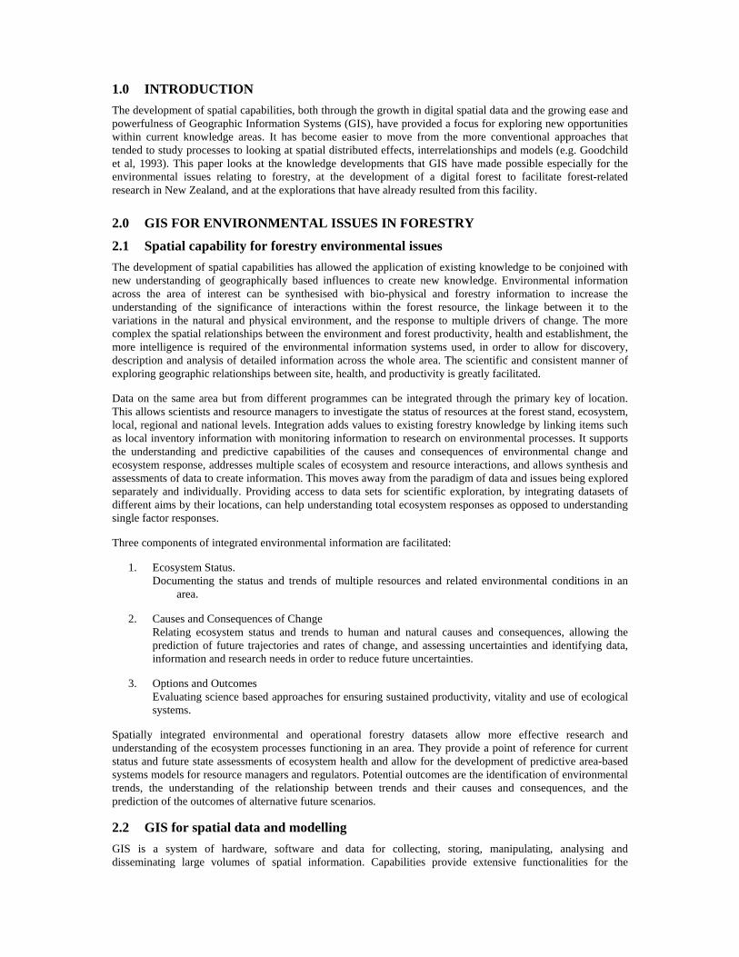
A digital plantation forest for research and the demonstration of spatial modelling Barbara Hock 1 , Tim Payn 1 , Paul Stevens 2 & Andrew Dunningham 1 1 Forest Research Rotorua, New Zealand Phone: +64 7 343-5899 Fax: +64 7 348-0952 Email: [email protected] 2 Carter Holt Harvey Forests Auckland. New Zealand Phone: 4140470 Fax: 4159985 Email: [email protected] Presented at SIRC 2003 – The 15 th Annual Colloquium of the Spatial Information Research Centre University of Otago, Dunedin, New Zealand December 1 st -3 rd 2003 ABSTRACT A strong understanding of the environment is crucial for all aspects of forest research and management. Forests are managed spatially and temporally, and there is an increasing interest in addressing multiple issues in an integrated way. Site is a fundamental driver of productivity and key to understanding likely issues of sustainability of the resource. A better understanding of soil and climatic variation is necessary for modelling a variety of forest characteristics - productivity, nutrient supply, susceptibility of sites to nutrient decline, erosion and compaction risk, carbon sequestration patterns. Integrated and spatially represented databases are critical for such modelling. A ‘digital forest’ has been developed by the Sustainable Forest Management project at Forest Research for research purposes, in collaboration with Carter Holt Harvey Forests. A GIS database of environmental and management data for a 40,000 hectare segment of Kinleith Forest, New Zealand, has been built. Base data from a number of sources including Forest Research, Landcare, and Terralink are included. To this, data generated by a number of research projects have been added, including FRST funded research, university research ranging from under-graduate to Ph.D., and commercially funded research. There are three main objectives to the database: • to provide a library of spatial data in an easily accessible form for research use • to facilitate the development of new spatially-based methods for all aspects of forestry • to demonstrate the range of value adding that can be achieved from base forest information by the use of information technologies, analysis and modelling The ‘digital forest’ provides a stable database to develop and test models, and is accessible for planning new experiments and future research. The database will improve research efficiency and capability. The wealth of digital data has permitted the development of new approaches to using spatial information for forest management. Keywords and phrases: GIS, digital forest, spatial data, environmental modelling.
-
Upload
scionresearch -
Category
Documents
-
view
1 -
download
0
Transcript of A digital plantation forest for research and the demonstration of spatial modelling
A digital plantation forest for research and the demonstration of spatial modelling
Barbara Hock1, Tim Payn1, Paul Stevens2 & Andrew Dunningham1
1Forest Research
Rotorua, New Zealand Phone: +64 7 343-5899 Fax: +64 7 348-0952 Email: [email protected]
2Carter Holt Harvey Forests
Auckland. New Zealand Phone: 4140470 Fax: 4159985 Email: [email protected]
Presented at SIRC 2003 – The 15th Annual Colloquium of the Spatial Information Research Centre
University of Otago, Dunedin, New Zealand December 1st-3rd 2003
ABSTRACT A strong understanding of the environment is crucial for all aspects of forest research and management. Forests are managed spatially and temporally, and there is an increasing interest in addressing multiple issues in an integrated way. Site is a fundamental driver of productivity and key to understanding likely issues of sustainability of the resource. A better understanding of soil and climatic variation is necessary for modelling a variety of forest characteristics - productivity, nutrient supply, susceptibility of sites to nutrient decline, erosion and compaction risk, carbon sequestration patterns. Integrated and spatially represented databases are critical for such modelling.
A ‘digital forest’ has been developed by the Sustainable Forest Management project at Forest Research for research purposes, in collaboration with Carter Holt Harvey Forests. A GIS database of environmental and management data for a 40,000 hectare segment of Kinleith Forest, New Zealand, has been built. Base data from a number of sources including Forest Research, Landcare, and Terralink are included. To this, data generated by a number of research projects have been added, including FRST funded research, university research ranging from under-graduate to Ph.D., and commercially funded research.
There are three main objectives to the database: • to provide a library of spatial data in an easily accessible form for research use • to facilitate the development of new spatially-based methods for all aspects of
forestry • to demonstrate the range of value adding that can be achieved from base forest
information by the use of information technologies, analysis and modelling
The ‘digital forest’ provides a stable database to develop and test models, and is accessible for planning new experiments and future research. The database will improve research efficiency and capability. The wealth of digital data has permitted the development of new approaches to using spatial information for forest management.
Keywords and phrases: GIS, digital forest, spatial data, environmental modelling.
1.0 INTRODUCTION The development of spatial capabilities, both through the growth in digital spatial data and the growing ease and powerfulness of Geographic Information Systems (GIS), have provided a focus for exploring new opportunities within current knowledge areas. It has become easier to move from the more conventional approaches that tended to study processes to looking at spatial distributed effects, interrelationships and models (e.g. Goodchild et al, 1993). This paper looks at the knowledge developments that GIS have made possible especially for the environmental issues relating to forestry, at the development of a digital forest to facilitate forest-related research in New Zealand, and at the explorations that have already resulted from this facility.
2.0 GIS FOR ENVIRONMENTAL ISSUES IN FORESTRY
2.1 Spatial capability for forestry environmental issues The development of spatial capabilities has allowed the application of existing knowledge to be conjoined with new understanding of geographically based influences to create new knowledge. Environmental information across the area of interest can be synthesised with bio-physical and forestry information to increase the understanding of the significance of interactions within the forest resource, the linkage between it to the variations in the natural and physical environment, and the response to multiple drivers of change. The more complex the spatial relationships between the environment and forest productivity, health and establishment, the more intelligence is required of the environmental information systems used, in order to allow for discovery, description and analysis of detailed information across the whole area. The scientific and consistent manner of exploring geographic relationships between site, health, and productivity is greatly facilitated.
Data on the same area but from different programmes can be integrated through the primary key of location. This allows scientists and resource managers to investigate the status of resources at the forest stand, ecosystem, local, regional and national levels. Integration adds values to existing forestry knowledge by linking items such as local inventory information with monitoring information to research on environmental processes. It supports the understanding and predictive capabilities of the causes and consequences of environmental change and ecosystem response, addresses multiple scales of ecosystem and resource interactions, and allows synthesis and assessments of data to create information. This moves away from the paradigm of data and issues being explored separately and individually. Providing access to data sets for scientific exploration, by integrating datasets of different aims by their locations, can help understanding total ecosystem responses as opposed to understanding single factor responses.
Three components of integrated environmental information are facilitated:
1. Ecosystem Status. Documenting the status and trends of multiple resources and related environmental conditions in an
area.
2. Causes and Consequences of Change Relating ecosystem status and trends to human and natural causes and consequences, allowing the
prediction of future trajectories and rates of change, and assessing uncertainties and identifying data, information and research needs in order to reduce future uncertainties.
3. Options and Outcomes Evaluating science based approaches for ensuring sustained productivity, vitality and use of ecological
systems.
Spatially integrated environmental and operational forestry datasets allow more effective research and understanding of the ecosystem processes functioning in an area. They provide a point of reference for current status and future state assessments of ecosystem health and allow for the development of predictive area-based systems models for resource managers and regulators. Potential outcomes are the identification of environmental trends, the understanding of the relationship between trends and their causes and consequences, and the prediction of the outcomes of alternative future scenarios.
2.2 GIS for spatial data and modelling GIS is a system of hardware, software and data for collecting, storing, manipulating, analysing and disseminating large volumes of spatial information. Capabilities provide extensive functionalities for the

comprehensive management of large, complex datasets and suited to environmental analysis and modelling (e.g. Longley et al, 1999). Some of the themes that can be addressed using GIS are given in Table 1.
GIS Vision Themes Examples GIS for the enhancement of conventional capability
• Life-cycle analysis of insects damaging forests complemented with spatial analysis of location of damage
• Precision forestry – operations targeted to not only ‘when’ but also to ‘where’ within the forests
GIS for the integration of existing databases
• Understanding environmental and anthropogenic influences or impacts on a forest requires the spatial integration of data that isn’t otherwise related. E.g. soil physical data with climate with harvesting disturbance
GIS as the information foundation
• Geographic information constitutes the foundation for capability to understand, and thus manage for whatever purpose, natural resources
GIS for improved modelling processes
• Using geography to optimise resource allocation, optimise cost-benefits, manage spatially distributed operations
• Predictions based on the interactions of the spatial, temporal and process-based facets of a concern, including environmental, bio-physical, ecological, economic, social, cultural
GIS as the basis for new investigations
• Scale of decision making: interrelationship between local through various levels to global
• Investigation of the impacts of accuracy: exploration of the extent of reliance of the predictions on underlying data, given the inherent inaccuracies
• Variability across space: uniform practice across a perceived logical area still resulting in high local variability
Table 1. Examples of the utility of GIS
Location-based data can be collected at different scales and for different purposes, and integrated with data collected on changing conditions (monitoring) within GIS. The transfer of knowledge can be by reports derived from the data or by the development of decision support models.
A common aim of modelling is to integrate current scientific understanding to predict the consequences of alternative decisions. The essential interaction between data capture, modelling, process research and assessment within the environmental domain is given in Figure 1.
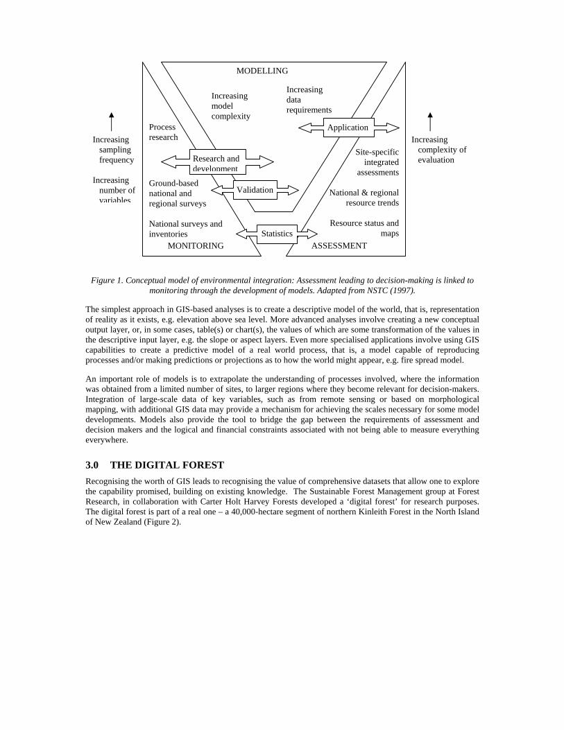
Figure 1. Conceptual model of environmental integration: Assessment leading to decision-making is linked to monitoring through the development of models. Adapted from NSTC (1997).
The simplest approach in GIS-based analyses is to create a descriptive model of the world, that is, representation of reality as it exists, e.g. elevation above sea level. More advanced analyses involve creating a new conceptual output layer, or, in some cases, table(s) or chart(s), the values of which are some transformation of the values in the descriptive input layer, e.g. the slope or aspect layers. Even more specialised applications involve using GIS capabilities to create a predictive model of a real world process, that is, a model capable of reproducing processes and/or making predictions or projections as to how the world might appear, e.g. fire spread model.
An important role of models is to extrapolate the understanding of processes involved, where the information was obtained from a limited number of sites, to larger regions where they become relevant for decision-makers. Integration of large-scale data of key variables, such as from remote sensing or based on morphological mapping, with additional GIS data may provide a mechanism for achieving the scales necessary for some model developments. Models also provide the tool to bridge the gap between the requirements of assessment and decision makers and the logical and financial constraints associated with not being able to measure everything everywhere.
3.0 THE DIGITAL FOREST Recognising the worth of GIS leads to recognising the value of comprehensive datasets that allow one to explore the capability promised, building on existing knowledge. The Sustainable Forest Management group at Forest Research, in collaboration with Carter Holt Harvey Forests developed a ‘digital forest’ for research purposes. The digital forest is part of a real one – a 40,000-hectare segment of northern Kinleith Forest in the North Island of New Zealand (Figure 2).
Increasing sampling frequency Increasing number of
variables
MONITORING ASSESSMENT
MODELLING
Increasing complexity of evaluation
Statistics
Research and development
Application
Increasing model complexity
Increasing data requirements
Site-specific integrated
assessments National & regional
resource trends
Resource status and maps
Process research
Ground-based national and regional surveys National surveys and inventories
Validation
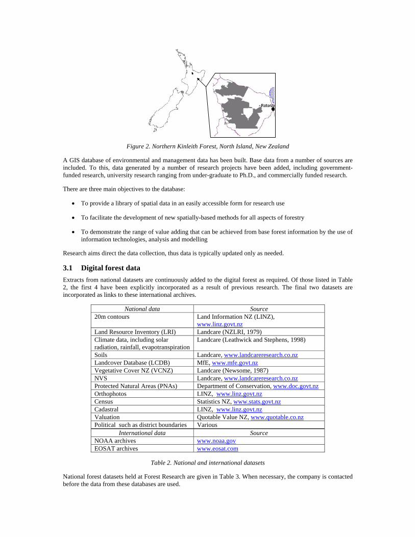
Figure 2. Northern Kinleith Forest, North Island, New Zealand
A GIS database of environmental and management data has been built. Base data from a number of sources are included. To this, data generated by a number of research projects have been added, including government-funded research, university research ranging from under-graduate to Ph.D., and commercially funded research.
There are three main objectives to the database:
• To provide a library of spatial data in an easily accessible form for research use
• To facilitate the development of new spatially-based methods for all aspects of forestry
• To demonstrate the range of value adding that can be achieved from base forest information by the use of information technologies, analysis and modelling
Research aims direct the data collection, thus data is typically updated only as needed.
3.1 Digital forest data Extracts from national datasets are continuously added to the digital forest as required. Of those listed in Table 2, the first 4 have been explicitly incorporated as a result of previous research. The final two datasets are incorporated as links to these international archives.
National data Source 20m contours Land Information NZ (LINZ),
www.linz.govt.nz Land Resource Inventory (LRI) Landcare (NZLRI, 1979) Climate data, including solar radiation, rainfall, evapotranspiration
Landcare (Leathwick and Stephens, 1998)
Soils Landcare, www.landcareresearch.co.nz Landcover Database (LCDB) MfE, www.mfe.govt.nz Vegetative Cover NZ (VCNZ) Landcare (Newsome, 1987) NVS Landcare, www.landcareresearch.co.nz Protected Natural Areas (PNAs) Department of Conservation, www.doc.govt.nz Orthophotos LINZ, www.linz.govt.nz Census Statistics NZ, www.stats.govt.nz Cadastral LINZ, www.linz.govt.nz Valuation Quotable Value NZ, www.quotable.co.nz Political such as district boundaries Various
International data Source NOAA archives www.noaa.gov EOSAT archives www.eosat.com
Table 2. National and international datasets
National forest datasets held at Forest Research are given in Table 3. When necessary, the company is contacted before the data from these databases are used.
Dataset Purpose PSP Database Field measurements of productivity Forest Health Database Forest health samples GTI trial Database Field genetics measurements Foliar Database, and Nutrition Atlas Field & laboratory foliar analysis –
collated within the Atlas Wood Quality Database Wood quality Herbarium Database Samples by species/genetics Soil sample map Soil lab analyses Research reports Field measurements Register of experiments Location and intent of experiments
Table 3. National forestry-based datasets at Forest Research
Forest management information for the digital forest includes examples of management units (PODS) with associated basic mensurational data (year planted, species, stocking, thinning, pruning, projected growth, and rotation number, etc) and inventory plot data. In addition, the forest company made detailed forest data available, specifically roads, rivers, spot heights and 5m contours, and within-forest soil maps1, all of which are mapped in greater detail than from other sources. The actual area of each PSP was made available, again providing more detail than the centre-point locations of the national PSP database.
Data that have arisen through a number of projects have been added to the digital forest, as described in Section 4 below.
3.2 Digital forest access Currently all the data is in Arc shapefiles or coverages (www.esri.com). Data that have arisen through a number of projects have been added to the digital forest, as described in the next section.
4.0 EXPLORATIONS WITH THE DIGITAL FOREST Several studies have used the digital forest data to build on existing knowledge and develop new concepts, methodologies, processes and data. They are presented in no particular order.
4.1 Forest soils Hill (1999) investigated the spatial structure of soil variability, integrated with an analysis of the growth, productivity and nutrient variables for P. radiata to determine the detail of soil information appropriate for plantation forestry. A land-systems approach was developed using generic and specific soil-landscape models and hierarchical landscape analysis, providing a framework for forest soil mapping. The framework is scale-flexible and can be used for site-specific forest soil, nutrient and health management practices. The study site was northern Kinleith forest, both as an area as a whole and at specific locations within the forest. Figure 3 shows the GIS steps used to develop concepts within the land systems approach.
1 Rijkse W. (1994) Soils of the Kinleith Forests, Central North Island, New Zealand. Landcare Research Contract Report LC9495/31, 121 pages. Confidential.

Figure 3. Example of GIS steps for a land systems approach to describe and partition soil and forest variability
In another study designed to address national and international drivers for monitoring the long-term effects and sustainability of plantation forestry in New Zealand, Palmer (2002) investigated changes in a number of soil indicators over successive rotation sites within northern Kinleith, including an unmodified (native forest) site. Figure 4 shows examples of data sampled from different rotations interpolated across each site.
P deficiency per map units
Map units
Land units
PSPs
Map units and land units
Map units and land units with growth data
union
union
P deficiency
Foliar data Land unit associated with foliar sample point
Crop data Fertility
union
union
Growth potential reclassify
reclassify union
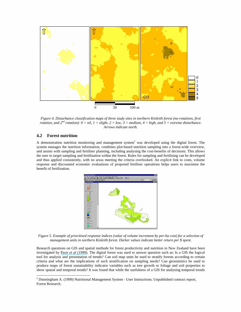
Figure 4. Disturbance classification maps of three study sites in northern Kinleith forest (no-rotations, first rotation, and 2nd rotation): 0 = nil, 1 = slight, 2 = low, 3 = medium, 4 = high, and 5 = extreme disturbance.
Arrows indicate north.
4.2 Forest nutrition A demonstration nutrition monitoring and management system2 was developed using the digital forest. The system manages the nutrition information, combines plot-based nutrition sampling into a forest-wide overview, and assists with sampling and fertiliser planning, including analysing the cost-benefits of decisions. This allows the user to target sampling and fertilisation within the forest. Rules for sampling and fertilising can be developed and thus applied consistently, with no areas meeting the criteria overlooked. An explicit link to costs, volume response and discounted economic evaluations of proposed fertiliser operations helps users to maximise the benefit of fertilisation.
Figure 5. Example of prioritised response indices (value of volume increment by per-ha cost) for a selection of management units in northern Kinleith forest. Darker values indicate better return per $ spent.
Research questions on GIS and spatial methods for forest productivity and nutrition in New Zealand have been investigated by Payn et al (1999). The digital forest was used to answer question such as: Is a GIS the logical tool for analysis and presentation of trends? Can soil map units be used to stratify forests according to certain criteria and what are the implications of such stratification on sampling needs? Can geostatistics be used to produce maps of forest sustainability indicator variables such as tree growth or foliage and soil properties to show spatial and temporal trends? It was found that while the usefulness of a GIS for analysing temporal trends 2 Dunningham A. (1999) Nutritional Management System - User Instructions. Unpublished contract report, Forest Research.
0 50 100 m
was clear, the role of geostatistics and soil map units required further research before their full usefulness could be demonstrated. This was because existing New Zealand forest data tended to be insufficient for the latter two methods with the consequence of suboptimal results.
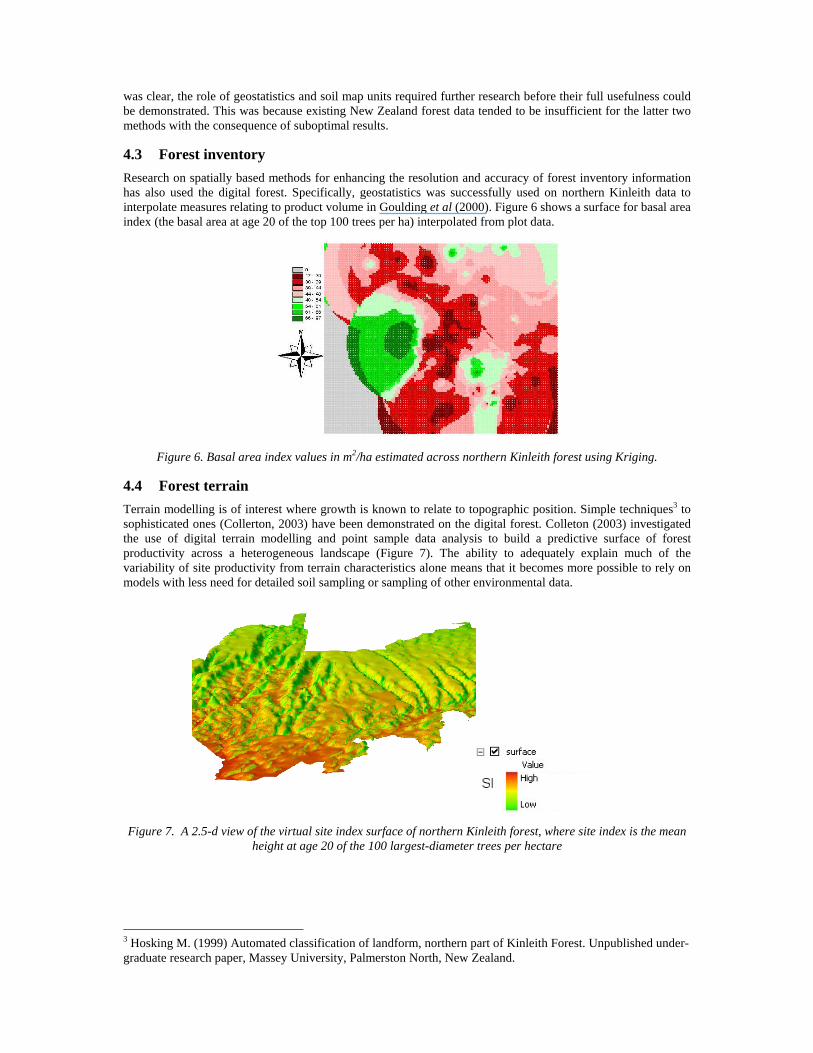
4.3 Forest inventory Research on spatially based methods for enhancing the resolution and accuracy of forest inventory information has also used the digital forest. Specifically, geostatistics was successfully used on northern Kinleith data to interpolate measures relating to product volume in Goulding et al (2000). Figure 6 shows a surface for basal area index (the basal area at age 20 of the top 100 trees per ha) interpolated from plot data.
Figure 6. Basal area index values in m2/ha estimated across northern Kinleith forest using Kriging.
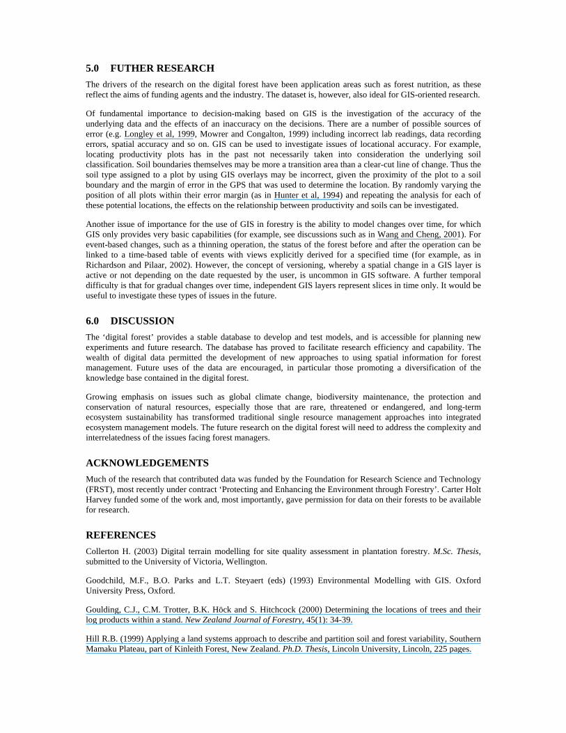
4.4 Forest terrain Terrain modelling is of interest where growth is known to relate to topographic position. Simple techniques3 to sophisticated ones (Collerton, 2003) have been demonstrated on the digital forest. Colleton (2003) investigated the use of digital terrain modelling and point sample data analysis to build a predictive surface of forest productivity across a heterogeneous landscape (Figure 7). The ability to adequately explain much of the variability of site productivity from terrain characteristics alone means that it becomes more possible to rely on models with less need for detailed soil sampling or sampling of other environmental data.
Figure 7. A 2.5-d view of the virtual site index surface of northern Kinleith forest, where site index is the mean height at age 20 of the 100 largest-diameter trees per hectare
3 Hosking M. (1999) Automated classification of landform, northern part of Kinleith Forest. Unpublished under-graduate research paper, Massey University, Palmerston North, New Zealand.
5.0 FUTHER RESEARCH The drivers of the research on the digital forest have been application areas such as forest nutrition, as these reflect the aims of funding agents and the industry. The dataset is, however, also ideal for GIS-oriented research.
Of fundamental importance to decision-making based on GIS is the investigation of the accuracy of the underlying data and the effects of an inaccuracy on the decisions. There are a number of possible sources of error (e.g. Longley et al, 1999, Mowrer and Congalton, 1999) including incorrect lab readings, data recording errors, spatial accuracy and so on. GIS can be used to investigate issues of locational accuracy. For example, locating productivity plots has in the past not necessarily taken into consideration the underlying soil classification. Soil boundaries themselves may be more a transition area than a clear-cut line of change. Thus the soil type assigned to a plot by using GIS overlays may be incorrect, given the proximity of the plot to a soil boundary and the margin of error in the GPS that was used to determine the location. By randomly varying the position of all plots within their error margin (as in Hunter et al, 1994) and repeating the analysis for each of these potential locations, the effects on the relationship between productivity and soils can be investigated.
Another issue of importance for the use of GIS in forestry is the ability to model changes over time, for which GIS only provides very basic capabilities (for example, see discussions such as in Wang and Cheng, 2001). For event-based changes, such as a thinning operation, the status of the forest before and after the operation can be linked to a time-based table of events with views explicitly derived for a specified time (for example, as in Richardson and Pilaar, 2002). However, the concept of versioning, whereby a spatial change in a GIS layer is active or not depending on the date requested by the user, is uncommon in GIS software. A further temporal difficulty is that for gradual changes over time, independent GIS layers represent slices in time only. It would be useful to investigate these types of issues in the future.
6.0 DISCUSSION The ‘digital forest’ provides a stable database to develop and test models, and is accessible for planning new experiments and future research. The database has proved to facilitate research efficiency and capability. The wealth of digital data permitted the development of new approaches to using spatial information for forest management. Future uses of the data are encouraged, in particular those promoting a diversification of the knowledge base contained in the digital forest.
Growing emphasis on issues such as global climate change, biodiversity maintenance, the protection and conservation of natural resources, especially those that are rare, threatened or endangered, and long-term ecosystem sustainability has transformed traditional single resource management approaches into integrated ecosystem management models. The future research on the digital forest will need to address the complexity and interrelatedness of the issues facing forest managers.
ACKNOWLEDGEMENTS Much of the research that contributed data was funded by the Foundation for Research Science and Technology (FRST), most recently under contract ‘Protecting and Enhancing the Environment through Forestry’. Carter Holt Harvey funded some of the work and, most importantly, gave permission for data on their forests to be available for research.
REFERENCES Collerton H. (2003) Digital terrain modelling for site quality assessment in plantation forestry. M.Sc. Thesis, submitted to the University of Victoria, Wellington.
Goodchild, M.F., B.O. Parks and L.T. Steyaert (eds) (1993) Environmental Modelling with GIS. Oxford University Press, Oxford.
Goulding, C.J., C.M. Trotter, B.K. Höck and S. Hitchcock (2000) Determining the locations of trees and their log products within a stand. New Zealand Journal of Forestry, 45(1): 34-39.
Hill R.B. (1999) Applying a land systems approach to describe and partition soil and forest variability, Southern Mamaku Plateau, part of Kinleith Forest, New Zealand. Ph.D. Thesis, Lincoln University, Lincoln, 225 pages.
Hunter, G.J., M.F. Goodchild and M. Robey (1994) A toolbox for assessing uncertainty in spatial databases. Proceedings of the Annual Conference of the Australasian Urban and Regional Information Systems Association, Sydney, 367-379.
Leathwick, J.R., and T.T. Stephens (1998) Climate surfaces for New Zealand. Landcare Research Contract Report LC9798/126, 19 pages.
Longley, P.A., M.F. Goodchild, D. Maguire and D.W. Rhind (1999) Geographical Information Systems. John Wiley & Sons, Chichester, England. 2 Volume Set, 1296 pages.
Mowrer, H.T., and R.G. Congalton (1999) Quantifying Spatial Uncertainty in Natural Resources: Theory and Applications for GIS and Remote Sensing. (Eds.) Ann Arbor Press, Chelsea, Michigan, USA.
Newsome, P.F.J. (1987) The vegetative cover of New Zealand. Water & Soil Miscellaneous Publication No. 112, Water and Soil Directorate, Wellington North, 153 pages.
NSTC (1997). Integrating the nation’s environmental monitoring and research networks and programs: A proposed framework. The Environmental Monitoring Team, Committee on Environmental and Natural Resources, National Science and Technology Council. Accessed 9 October 2003. <http://www.ostp.gov>
NZLRI (1979) Our Land Resources. Bulletin to accompany New Zealand Land Resource Inventory Worksheets, Water and Soil Division, Ministry of Works and Development, Government Printer.
Richardson, M. and C. Pilaar (2002) ATLAS GeoMaster User’s Guide. Software Users’ Manual, Forest Research, Rotorua, New Zealand.
Palmer D.J. (2002) Testing a soil-phosphate-driven model of forest sustainability developed for Kinleith Forest, southern Mamaku plateau, New Zealand. M.Sc. Thesis, University of Waikato, Hamilton, 172 pages.
Payn, T.W., R.B. Hill, B.K. Höck, M.F. Skinner, A.J. Thorn and W.C. Rijkse (1999) Potential for the use of GIS and spatial analysis techniques as tools for monitoring changes in forest productivity and nutrition, a New Zealand example. Forest Ecology and Management, 122:187-196.
Wang, D. and T. Cheng (2001) A spatio-temporal model for activity-based transport demand modelling. International Journal of Geographical Information Science, 15(6): 561-585.