Ultraviolet, Infrared & Fluorescence Photography - CiteSeerX
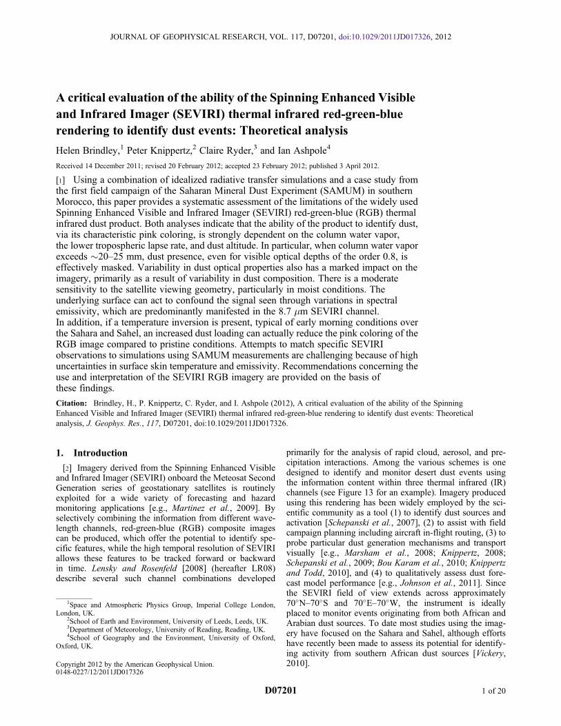
A critical evaluation of the ability of the Spinning Enhanced Visibleand Infrared Imager (SEVIRI) thermal infrared red-green-bluerendering to identify dust events: Theoretical analysis
Helen Brindley,1 Peter Knippertz,2 Claire Ryder,3 and Ian Ashpole4
Received 14 December 2011; revised 20 February 2012; accepted 23 February 2012; published 3 April 2012.
[1] Using a combination of idealized radiative transfer simulations and a case study fromthe first field campaign of the Saharan Mineral Dust Experiment (SAMUM) in southernMorocco, this paper provides a systematic assessment of the limitations of the widely usedSpinning Enhanced Visible and Infrared Imager (SEVIRI) red-green-blue (RGB) thermalinfrared dust product. Both analyses indicate that the ability of the product to identify dust,via its characteristic pink coloring, is strongly dependent on the column water vapor,the lower tropospheric lapse rate, and dust altitude. In particular, when column water vaporexceeds �20–25 mm, dust presence, even for visible optical depths of the order 0.8, iseffectively masked. Variability in dust optical properties also has a marked impact on theimagery, primarily as a result of variability in dust composition. There is a moderatesensitivity to the satellite viewing geometry, particularly in moist conditions. Theunderlying surface can act to confound the signal seen through variations in spectralemissivity, which are predominantly manifested in the 8.7 mm SEVIRI channel.In addition, if a temperature inversion is present, typical of early morning conditions overthe Sahara and Sahel, an increased dust loading can actually reduce the pink coloring of theRGB image compared to pristine conditions. Attempts to match specific SEVIRIobservations to simulations using SAMUM measurements are challenging because of highuncertainties in surface skin temperature and emissivity. Recommendations concerning theuse and interpretation of the SEVIRI RGB imagery are provided on the basis ofthese findings.
Citation: Brindley, H., P. Knippertz, C. Ryder, and I. Ashpole (2012), A critical evaluation of the ability of the SpinningEnhanced Visible and Infrared Imager (SEVIRI) thermal infrared red-green-blue rendering to identify dust events: Theoreticalanalysis, J. Geophys. Res., 117, D07201, doi:10.1029/2011JD017326.
1. Introduction
[2] Imagery derived from the Spinning Enhanced Visibleand Infrared Imager (SEVIRI) onboard the Meteosat SecondGeneration series of geostationary satellites is routinelyexploited for a wide variety of forecasting and hazardmonitoring applications [e.g., Martinez et al., 2009]. Byselectively combining the information from different wave-length channels, red-green-blue (RGB) composite imagescan be produced, which offer the potential to identify spe-cific features, while the high temporal resolution of SEVIRIallows these features to be tracked forward or backwardin time. Lensky and Rosenfeld [2008] (hereafter LR08)describe several such channel combinations developed
primarily for the analysis of rapid cloud, aerosol, and pre-cipitation interactions. Among the various schemes is onedesigned to identify and monitor desert dust events usingthe information content within three thermal infrared (IR)channels (see Figure 13 for an example). Imagery producedusing this rendering has been widely employed by the sci-entific community as a tool (1) to identify dust sources andactivation [Schepanski et al., 2007], (2) to assist with fieldcampaign planning including aircraft in-flight routing, (3) toprobe particular dust generation mechanisms and transportvisually [e.g., Marsham et al., 2008; Knippertz, 2008;Schepanski et al., 2009; Bou Karam et al., 2010; Knippertzand Todd, 2010], and (4) to qualitatively assess dust fore-cast model performance [e.g., Johnson et al., 2011]. Sincethe SEVIRI field of view extends across approximately70�N–70�S and 70�E–70�W, the instrument is ideallyplaced to monitor events originating from both African andArabian dust sources. To date most studies using the imag-ery have focused on the Sahara and Sahel, although effortshave recently been made to assess its potential for identify-ing activity from southern African dust sources [Vickery,2010].
1Space and Atmospheric Physics Group, Imperial College London,London, UK.
2School of Earth and Environment, University of Leeds, Leeds, UK.3Department of Meteorology, University of Reading, Reading, UK.4School of Geography and the Environment, University of Oxford,
Oxford, UK.
Copyright 2012 by the American Geophysical Union.0148-0227/12/2011JD017326
JOURNAL OF GEOPHYSICAL RESEARCH, VOL. 117, D07201, doi:10.1029/2011JD017326, 2012
D07201 1 of 20

[3] Nevertheless, as recognized by many of the aboveauthors, interpretation of the imagery is subjective, and therendering may fail to produce an unambiguous dust signalunder certain conditions. Particular candidates that mayconfound the identification of a dust signature include highlevels of atmospheric water vapor, a strong near-surfacetemperature inversion, the height of the dust layer, thecharacteristics of the underlying surface, the dust mineral-ogical composition, and the size of the dust particles. Forexample, Knippertz and Todd [2010] show that large dis-crepancies can exist between regions visually identified asdusty using the LR08 rendering and elevated values of theaerosol index (AI) derived from the Ozone MonitoringInstrument (OMI), typically interpreted as indicative of dustpresence [Torres et al., 2007]. They suggest that this dis-crepancy is most likely due to high humidity in the specificregions analyzed. However, it should be noted that the OMIAI is also sensitive to other absorbing aerosols such as sootoriginating from biomass burning, which can strongly con-tribute to, or dominate the total aerosol loading in sub-Saharan Africa dependent on season. OMI AI also has areduced sensitivity to low-altitude aerosol. Both of thesefactors may also contribute to the discrepancies seen.[4] In this paper we seek to perform a more quantitative
analysis of the ability of the SEVIRI dust RGB imagery toidentify dust presence. This work is partly motivated by thefindings of the previous studies discussed above, but alsoby ongoing projects such as the UK-led Fennec observa-tional and modeling campaign, designed to better understandthe complex dust-radiation-dynamical interactions withinthe Saharan Heat Low. As part of this project SEVIRI dustimagery is produced in near real time at Imperial College(see http://www.fennec.imperial.ac.uk) to aid campaignplanning and for subsequent postcampaign analysis. Henceit is important to ascertain under what conditions the
imagery is likely to be unable to identify dust presence.The organization of the paper is as follows: in section 2we briefly recap the characteristics of SEVIRI and themethodology used to generate the dust images. Section 3describes theoretical calculations performed in order toprovide an insight into the sensitivity of the imagery to thevarious candidates identified above. In section 4 we focuson examples of specific dust events seen during the firstfield campaign of the Saharan Mineral Dust Experiment(SAMUM) during May–June 2006 [Heintzenberg, 2009] toassess whether the inferences gained from the theoreticalanalysis are consistent with observation. Finally, conclu-sions to be drawn from this work are presented in section 5.
2. SEVIRI Characteristics and Dust ImageryProduction
[5] The spectral response functions of the seven mid-IR(4.5–14.5 mm) narrow-band channels of SEVIRI onMeteosat-9, the current operational satellite platform, areshown in Figure 1. Meteosat-9 is located at 0�E, 0�N, andeach SEVIRI narrow-band channel has a spatial samplingrate of 3.0 km at the subsatellite point, with a temporalresolution of 15 min. Also shown in Figure 1 are simulatedbrightness temperature (TB) spectra representative of pristineand dusty conditions over a barren desert surface for aspecific atmospheric profile. More details concerning thesimulations are provided in section 3, but comparing thespectral signature seen in the pristine-sky case to that seenwhen the dust layer is present illustrates the sensitivity of theSEVIRI channels to dust presence. The strongest signals areseen in the atmospheric window channels centered at 8.7,10.8, and 12.0 mm. Atmospheric absorption due to watervapor, carbon dioxide, and ozone above the dust layer masksthe dust signal in the remaining channels highlighted here.
Figure 1. Characteristics of the seven mid-IR (4.5–14.5 mm) narrow-band channels of the SpinningEnhanced Visible and Infrared Imager (SEVIRI) on Meteosat-9 (dashed lines). Also shown are simulatedTB spectra representative of pristine (black) and dusty conditions (gray) over a barren desert surface usingthe mean June 10:30 UTC atmospheric profile observed at Niamey (Niger) during 2006 (see Table 2 forfull details).
BRINDLEY ET AL.: SEVIRI RGB DUST PRODUCT EVALUATION D07201D07201
2 of 20

Given this sensitivity, the three window channels are com-bined to produce the standard dust imagery RGB rendering(LR08). One obtains the required intensity range in eachchannel, Intch using
IntR ¼ 255� ðTB120 � TB108Þ �MinRMaxR �MinR
� � 1GR ð1aÞ
IntG ¼ 255� ðTB108 � TB087Þ �MinGMaxG �MinG
� � 1GG ð1bÞ
IntB ¼ 255� TB108 �MinBMaxB �MinB
� � 1GB ð1cÞ
where TBl is the brightness temperature in the relevantwavelength channel and Minch, Maxch, and Gch take thevalues given in Table 1. Values above 255 (below 0) are setto 255 (0). The channel brightness temperatures themselvesare obtained from the measured counts in a two-step proce-dure. First the counts, C, are converted to channel radiance,Lch (mW m�2 sr�1 (cm�1)�1), using
Lch ¼ Cg þ osð Þ ð2aÞ
where g and os are the appropriate channel gain and offset,respectively; then
TBl ¼ c2nlnð1þ c1n3=LchÞ ð2bÞ
where n is the channel wave number and c1 and c2 are theappropriate Planck radiation constants. This conversion isemployed to ensure consistency with the manner in whichthe observations used here were originally calibrated.[6] As noted by LR08 and apparent from Table 1 and
Figure 1, the blue channel (equation (1c)) will tend to satu-rate (reach or exceed 255) over hot desert sands with mini-mal dust presence. The red and green channels will alsohave high intensities because TB108-TB087 and TB120-TB108
will tend to be near MaxR and MaxG, respectively, resultingin a whitish/pale blue signal. With an increasing airbornedust presence, the 10.8 mm channel tends to be suppressedfaster than the 8.7 mm channel, reducing the green signal.Although the intensities in the blue and red channels arealso affected, these changes happen at a slower rate such thatthe combined RGB signal turns pink.
3. Sensitivity Analysis of RGB Dust Signal
[7] Because of the number of parameters that couldpotentially influence the RGB dust signal it is difficult togenerate an all-encompassing sensitivity analysis. The aimof this section is thus to generate a suitable subset of com-bined atmospheric, surface, and dust scenarios that can beconsidered broadly representative of generic conditionsexpected over the North African region. These will thenbe used to simulate the relevant SEVIRI channel TBs usingspectrally resolved top of the atmosphere radiances com-puted with the MODTRAN4 radiative transfer code[Anderson et al., 2000] with the relevant SEVIRI channelfilter functions. The derived pseudo RGB dust imagery canthen be visually and objectively assessed in terms of itsability to distinguish the presence of dust. Table 2 providesan overview of the full set of simulations performed and willbe discussed parameter by parameter in section 3.1, whilesection 3.2 contains the actual simulation results. The mainconclusions and the relevance for applications are summa-rized in section 3.3.
3.1. Radiative Transfer Input Fields
[8] The atmospheric temperature and water vapor profilesused here are derived from rawinsonde observations rou-tinely collected by the Atmospheric Radiation MeasurementMobile Facility during its deployment at Niamey, Niger,through 2006 [Miller and Slingo, 2007]. Although it mayseem counterintuitive to use data from only one location in asensitivity analysis, Niamey is profoundly influenced by theWest African monsoon and hence exhibits a strong seasonalvariability in atmospheric conditions. Before monsoon onsetthe low-level atmospheric circulation is dominated by dry,northeasterly Harmattan flow resulting in high near-surfacedustiness. The advance of the intertropical front from thesouthwest, typically reaching Niamey during early April,heralds monsoon onset, with enhanced cloud cover andwater vapor burden, and reduced aerosol loading. InNovember the circulation tends to revert back to the pre-monsoon situation. Through 2006 atmospheric columnwater vapor (CWV) burdens varied from 3 mm prior to thewet season to greater than 60 mm during the late monsoon
Table 1. Gamma Correction and Scaling Range for Each ChannelAppropriate for RGB Dust Imagery Renderinga
RGB Channel Minch (K) Maxch (K) Gch
Red �4.0 2.0 1.0Green 0.0 15.0 2.5Blue 261.0 289.0 1.0
aAfter Lensky and Rosenfeld [2008].
Table 2. Summary of the Simulations Performed in Section 3a
Temperature andDew Point Profile
SurfaceEmissivity
Viewing ZenithAngle
Dust OpticalProperties
Dust TopAltitude
Dust OpticalDepth
Niamey June andDecember means
Barren, 50%, and 100%fractional vegetationcover [after Peres andDaCamara, 2005]
0�, 30�, and 60� Volz, Fouquart, WMO(Haywood et al. [2003,2005] size distribution);WMO (largest moderemoved); OPAC
1, 2, 3, and 4 km(base fixed atthe surface)
0.0–1.0 in stepsof 0.1, definedat 10 mm
aThe control conditions for both June and December comprise the respective mean 10:30 UTC rawinsonde profile (Figure 2), dust optical properties afterWorld Meteorological Organization (WMO) with the full Haywood size distribution, a barren surface, a dust top height of 3 km, and a viewing zenith angleof 30�. Each simulation covers the full optical depth range.
BRINDLEY ET AL.: SEVIRI RGB DUST PRODUCT EVALUATION D07201D07201
3 of 20

Figure
2
BRINDLEY ET AL.: SEVIRI RGB DUST PRODUCT EVALUATION D07201D07201
4 of 20

[see Slingo et al., 2008, Figure 8]. Figure 2 shows monthlymean dry-bulb and dew point temperature profiles con-structed from the rawinsonde observations at 05:30, 10:30,17:30, and 22:30 UTC. For each time slot the profiles havebeen crudely grouped into “nonmonsoon” (November–April) and “monsoon” (May–October) conditions. The ten-dency of those months falling in the latter category to bemoister is clearly manifested in the reduced dew pointdepartures seen at all times of day throughout the atmo-spheric column. In terms of atmospheric stability, asexpected, the late morning and early afternoon observationsin both categories demonstrate an enhanced near-surfacetemperature lapse rate compared with the early morning andlate evening profiles. However, there is clearly greaterdiurnal variation in the nonmonsoon data, with the 05:30and 22:30 UTC monthly mean profiles all showing near-surface temperature inversions (Figures 2a and 2d). This is areflection of the effect of both reduced humidity and cloudcover, and associated enhanced nighttime surface radiativecooling to space over this period relative to the monsoonmonths. Given the obvious separation between the thermo-dynamic structure seen during the premonsoon and post-monsoon months and during the wet season, here we takethe monthly mean December and June profiles as our base-line atmospheric states (first column in Table 2). Differencesin the results obtained using each of these profiles will pro-vide an insight into the effect of large perturbations to watervapor amount, while the diurnal information will help elu-cidate the role of the changes seen in near-surface tempera-ture lapse rate.
[9] The impact of surface type is considered byperforming simulations with varying surface emissivitycharacteristics. We use the approach described by Peres andDaCamara [2005] to generate the spectral surface emissivityfor a standard barren surface, which is then systematicallycovered with vegetation. To reduce dimensionality in thefinal data set simulations are performed with 0%, 50%, and100% fractional cover (second column in Table 2). Figure 3indicates the spectral surface emissivity appropriate to eachof these cases with the 8.7, 10.8, and 12.0 mm SEVIRI filterfunctions [European Organisation for the Exploitation ofMeteorological Satellites, 2006] superposed. The strongdip between �8 and 9.5 mm for the barren case is due tosilicate reststrahlen bands. Increasing the fractional vegeta-tion cover masks this feature and reduces the spectral vari-ability in the surface emissivity. The viewing zenith anglecan influence the radiative signal through varying the pathlength through the atmosphere, which is simulated herefor 0�, 30�, and 60� (third column in Table 2).[10] Variability in the vertical location and the optical
properties of any dust present has the potential to alter theradiative signal seen at the top of the atmosphere. Sokolikand Toon [1999] perform an extensive set of radiativetransfer simulations to illustrate how changes to dust mineralcomposition and size distribution can have a profound effecton its spectral signature. Turner [2008] shows how ground-based measurements of spectrally resolved downwelling IRradiances can be used to discriminate between differentmineral components, while several authors have investigatedthe potential of using IR satellite radiances from a variety ofplatforms to make inferences concerning dust optical depthand particle size or mineralogy [e.g., DeSouza-Machadoet al., 2006; Li et al., 2007; Klüser et al., 2011]. Highwoodet al. [2003] use aircraft observations made during theSHADE campaign to help to constrain a set of radiativetransfer simulations investigating the sensitivity of themeasured upwelling IR radiances to dust properties andheight. They found that the dust composition (expressed viadust refractive indices) and altitude had a more significantimpact than realistic variations in the size distributionderived from AERONET measurements. However, morerecent work [McConnell et al., 2008,Müller et al., 2010] hasshown that differences between AERONET retrievals andaircraft size distributions derived from newer instrumenta-tion can be significant for particle sizes >1 mm. These dif-ferences have a marked impact on dust optical propertiesat visible wavelengths, and would be expected to exert aneven larger impact within the IR.[11] Previous work by Brindley and Russell [2006] has
shown that the different dust refractive indices considered byHighwood et al. [2003], from Volz [1973], Fouquart et al.[1987], and the World Meteorological Organization [WorldClimate Program, 1986], can produce markedly differentsignals in the red and green channels of the RGB dustproduct. Hence we make use of these data here (fourth
Figure 3. Spectral surface emissivities used for the simula-tions in section 3. The different lines show 0% (solid), 50%(dotted), and 100% (dashed) fractional vegetation cover.The 8.7, 10.8, and 12.0 mm SEVIRI filter functions aresuperposed.
Figure 2. Vertical profiles of temperature and moisture used for the simulations in section 3. Monthly mean dry-bulb anddew point temperature profiles are constructed from rawinsonde observations at Niamey during 2006: (a, e) 05:30 UTC,(b, f) 10:30 UTC, (c, g) 17:30 UTC, and (d, h) 22:30 UTC. The profiles were resampled to a standard 50-level altitude gridrunning from the surface to 25 km and were grouped into nonmonsoon (November–April, Figures 2a–2d) and monsoon(May–October, Figures 2e–2h) conditions.
BRINDLEY ET AL.: SEVIRI RGB DUST PRODUCT EVALUATION D07201D07201
5 of 20

column of Table 2). The optical properties are calculatedusing Mie theory and a five-mode lognormal size distribu-tion [Haywood et al., 2003, 2005]. Since it is commonlyused by the remote sensing community, we also presentresults obtained using the standard dry desert dust modelprovided by the Optical Properties of Aerosol and Cloud(OPAC) database [Hess et al., 1998]. As an extra sensitivitytest, optical properties are recalculated for the WMO indicesremoving the contribution from the largest mode (geometricmean radius of 1.8 mm). Figure 4 shows the extinctioncoefficient normalized to 10 mm for each dust representa-tion, again with the relevant SEVIRI filter functions super-posed. For a given change in dust loading, the representationfrom the full mode WMO will produce the largest absoluteTB signal in the 10.8 mm channel and hence the greatestperturbation to the RGB blue signal. Removing the largestmode of this representation tends to reduce the normalizedextinction coefficient in the 10.8 and 12.0 mm channels buthas relatively little impact at 8.7 mm. The distinct spectralflattening of the extinction coefficient between the 10.8and 12.0 mm channels in the OPAC representation relative tothe other models tested here is particularly worthy of note.[12] The spectral differences seen between the three sets of
optical properties generated using the same size distributioncan provide some indication of differences in dust compo-sition. The Fouquart refractive indices were derived fromsand samples taken from Niger, while the correspondingVolz data were obtained from samples of wind-blownSaharan dust deposited in Barbados. In both cases, the peakin the extinction coefficient at �9.5 mm is a reflection of the
presence of silicates although a preponderance of illite andkaolinite is also noted in the Barbados samples, both ofwhich would also exhibit features within the 9–10 mm range[Sokolik and Toon, 1999]. The presence of these mineralswould also be consistent with features seen in the singlescattering albedo for the Volz, and, to a lesser extent, theWMO representation (not shown), although numerous otherminerals (e.g., calcite, feldspar, and gypsum) reported inAfrican dust samples [Kandler et al., 2009] also absorb inthis region. The OPAC desert dust model consists of awater-soluble mode [Shettle and Fenn, 1979] in combinationwith three larger size modes designed to capture mineralnucleation, accumulation, and coarse modes. These mineralcomponents each have the same refractive indices, takenfrom a number of sources as described by Koepke et al.[1997] and intended to be broadly representative of a mix-ture of clay and quartz materials. The flattening of theextinction coefficient seen in the OPAC model between10.8 and 12.0 mm is driven primarily by the refractive indi-ces assumed in the model.[13] To simulate the sensitivity to the vertical distribution
of dust, loadings within an atmospheric profile are assumedto be constant with height, but the top of the dust layer isvaried to be 1, 2, 3, and 4 km (fifth column in Table 2).While isolated events can certainly reach higher altitudes,this is a realistic range over which to test sensitivity based onCALIPSO observations [Liu et al., 2008].[14] In this section (given our focus on the IR and the
variation in the relationship between visible and IR opticaldepths for each dust representation), the dust optical depthis defined at 10 mm (t10 hereafter) and allowed to varybetween 0.0 and 1.0 in steps of 0.1 (sixth column ofTable 2). This corresponds to a maximum value at 0.55 mmwhich varies between �2 and 8 dependent on the dust rep-resentation employed. Note that in all cases the use of Mietheory implicitly assumes that the particles are spherical,which is unlikely to be the case in reality. A recent theoret-ical analysis by Hansell et al. [2011] suggests that particlemorphology can impact the mass extinction coefficientwithin the mid-IR, at least when considering single minerals.Whether such marked differences would be seen whenconsidering mineral mixtures is less clear, but neverthelessthe assumption of particle sphericity is a limitation of ourstudy.
3.2. Simulation Results
[15] Table 3 indicates the mean, standard deviation, andrange of TB087, TB108, and TB120, and the relevant channelcombinations obtained for the cases simulated here. Note
Figure 4. Dust optical properties used for the simulations insection 3. The extinction coefficient is normalized to 10 mmfor five different dust representations (see section 3.1 formore details). The 8.7, 10.8, and 12.0 mm SEVIRI filterfunctions are superposed, as in Figure 3.
Table 3. Range, Mean, and Standard Deviation of SimulatedSEVIRI Window Channel TBs and TB Differences for SensitivityAnalysisa
ChannelMean(K)
Minimum(K)
Maximum(K)
Standard Deviation(K)
TB087 289.43 277.50 299.48 4.33TB108 293.24 284.98 299.94 3.66TB120 293.05 285.55 298.68 3.42TB120–TB108 �0.19 �2.35 2.79 0.87TB108–TB087 3.81 �0.41 11.18 2.66
aSee Table 2 for the range of parameters used.
BRINDLEY ET AL.: SEVIRI RGB DUST PRODUCT EVALUATION D07201D07201
6 of 20

that TB108 exceeds 289 K in over 92% of the simulations,hence saturating the blue channel in the vast majority ofcases. This saturation does typically occur for observedclear-sky conditions over the North African region (seesection 4). The range of the TB differences that constitute thered and green signals is broadly consistent with the maxi-mum and minimum settings used to render the dust RGBimages (Table 1).[16] Given the tendency for the blue channel to saturate, it
is possible to construct a two-dimensional plot showing howthe dust RGB color will vary with TB120–TB108 (hereafterDTBR), and TB108–TB087 (hereafter DTBG), assuming thatIntB (equation (1c)) is equal to 255 (Figure 5a). One of thedifficulties in assessing whether dust can be seen in the RGBimagery is because of the subjective interpretation. Auto-mating the imagery, combined with a knowledge of thegeographical region certainly helps in this regard, butdetection will still vary from observer to observer. To try tocircumvent this problem, I. Ashpole and R. Washington (Anautomated dust detection using SEVIRI: a multi-year cli-matology of summertime dustiness in the central and west-ern Sahara, submitted to Journal of Geophysical Research,2012) have developed an objective automatic algorithm,focusing on summertime conditions over northwest Africa.The black dashed lines in Figure 5a indicate DTBR andDTBG threshold values that they have derived on the basis ofmanual inspection of a large number of images. Their initialinvestigations suggested that the imagery could be consid-ered dust contaminated when DTBR ≥ 0 K, DTBG ≤ 10 K,and TB108 ≥ 285 K. This last threshold reduces the signalin the blue channel to below saturation; hence Figure 5b showsthe color scheme that is obtained with TB108 set to 285 K.The reduction of the blue component means that the RGBimage no longer turns white (top right-hand corner) but thereis no obvious discernable visual change from the saturated
case. Although there are clearly pink regions outside of thebox, and a small turquoise area toward the top left-handcorner, to provide a consistent basis for our analysis here,we choose to use these thresholds as indicative of whether anobserver would consider the RGB image “dusty” or notsince, in general, pixels with values satisfying these thresh-olds will appear pink.3.2.1. Sensitivity to Atmospheric Profileand Surface Type[17] In Figure 6 results of selected simulations are super-
posed onto the color diagram shown in Figure 5a. InFigure 6a the black (white) triangles represent June 10:30(05:30) UTC control conditions for barren soil (Table 2). Inboth cases, the most left-hand symbol corresponds to pris-tine conditions. DTBG then reduces, while DTBR increasesas t10 is increased. The stars and crosses are color coded in asimilar way and show the effect of introducing 50% and100% fractional vegetation cover, respectively. As the veg-etation cover increases, the surface emissivity becomes lessspectrally dependent (Figure 3) and the pristine-sky DTBR
and particularly DTBG reduce. For each surface type, theatmospheric profile is the only difference between the blackand white cases with the 05:30 UTC profile being slightlymoister by 3.3 mm and cooler (surface temperature reducedby 5.2 K) than the 10:30 UTC case. Both of these differ-ences act to reduce window TBs but have different spectraldependencies. For a spectrally flat surface emissivity, var-iations in surface temperature will tend to have the largesteffect at 8.7 mm, reducing with increasing wavelength, whilefor a given change in total CWV the opposite is true with thelargest impact at 12.0 mm [e.g., Brindley and Allan, 2003].For the changes seen here, under pristine conditions with100% vegetation cover the surface temperature effect dom-inates, and both DTBR and DTBG increase. With reducedvegetation cover the strong reststrahlen effects manifested in
Figure 5. Two-dimensional graphical depiction of RGB rendering showing colors as functions ofTB120–TB108 (DTBR) and TB108–TB087 (DTBG). (a) Blue channel set to saturation and (b) blue channelset to TB = 285 K. Dashed lines show the criteria for dust detection suggested by Ashpole andWashington (submitted manuscript).
BRINDLEY ET AL.: SEVIRI RGB DUST PRODUCT EVALUATION D07201D07201
7 of 20

the surface emissivity play an increasingly important rolesuch that DTBG reduces in the 05:30 UTC relative to10:30 UTC case. This, in conjunction with the fact that thedust representation used in these scenarios has slightlyenhanced extinction at 10.8 mm relative to 8.7 mm (Figure 4),is the reason why the reduction in DTBG with increasing t10also reduces with fractional vegetation cover, until, for 100%cover the behavior is reversed. Finally, the increased rate ofchange of DTBG and DTBR with t10 in the 10:30 UTC rela-tive to 05:30 UTC cases is a result of the enhanced lowertropospheric lapse rate in the former profile.[18] Figure 6b is the corollary of Figure 6a for the
December profiles. For 10:30 UTC essentially the samepatterns of behavior are apparent, but there is an overall shiftto higher values of DTBR and a subsequent increase of“pinkness” in the RGB signal. This shift is a consequenceof a fourfold reduction in the total atmospheric moisturecontent, from �40 mm in June to �10 mm in December,enhancing TB120 relative to TB108. The moisture effectdominates over a small opposing effect resulting from thereduced surface and near-surface temperatures seen in thelatter month. While the 05:30 UTC DTBG and DTBR valuesare also shifted, their behavior with increasing t10 is strik-ingly different to the 10:30 UTC simulations. Here, the near-surface temperature inversion (Figure 2a), coupled with theenhanced dust extinction at 10.8 mm relative to 12.0 mm,results in a reduction of the DTBR signal with increased t10,effectively reducing the pinkness of the signal.[19] Looking at the positioning of the simulations in
Figures 6a and 6b, it is clear that for conditions typicalof Niamey in June, and with the control dust settings, highatmospheric moisture contents mask the dust signal andwould preclude the detection of dust from the standard RGBimagery using the thresholds suggested above. For
conditions similar to those seen during sunlit hours at Nia-mey in December, the automated approach would have anincreased success rate, but could also potentially result infalse detections. The presence of a surface inversion appearsto confound the approach further, since it could lead to bothfalse detections and miss higher dust loadings, particularlyover partially vegetated surfaces. To try to ameliorate theinfluence of surface type, Ashpole and Washington (sub-mitted manuscript) introduce a further test, which looks atthe deviation in the DTBG signal from the mean clear-skyDTBG signal calculated over a rolling 15 day period prior tothe given observation for each pixel. While this type ofapproach has, to the best of our knowledge, not beenimplemented thus far in other papers, which have usedthe dust RGB to develop climatologies, it is instructive tosee whether it can help to remove instances of false detec-tions. Here we use the true pristine-sky DTBG as a proxy forthe 15 day mean value. Points that pass both the thresholdand anomaly tests (DTBG–DTBGpris ≤ �2 K) are marked inred in Figure 6b. The extra test tends to highlight cases withenhanced t10, but at least for these idealized simulationslooks a little restrictive.3.2.2. Sensitivity to Dust Optical Properties and Height[20] Figure 7a provides an illustration of the sensitivity of
the dust RGB color scale to dust top altitude for conditionscorresponding to a barren surface type and WMO dust rep-resentation. As t10 is increased, the dust layer becomesincreasingly opaque, such that the influence of changes indust top altitude is more apparent: effectively most of the IRsignal within the relevant channels is coming from the dustlayer itself. Because of the enhanced extinction seen withinthe 10.8 mm relative to the 8.7 and 12.0 mm channels for thisdust model, DTBR (DTBG) shifts toward more positive(negative) values as dust top height increases, turning the
Figure 6. Sensitivity of RGB rendering to atmospheric profile and surface type. (a) June conditions and(b) December conditions at Niamey. Here t10 is varied from 0.0 to 1.0 in steps of 0.1. Different symbolsstand for different surface emissivities (see Table 2 for more details). Red symbols in Figure 6b markwhere the method proposed by Ashpole and Washington (submitted manuscript) to ameliorate the effectof surface type flags dust (see section 3.2.1).
BRINDLEY ET AL.: SEVIRI RGB DUST PRODUCT EVALUATION D07201D07201
8 of 20

RGB signal steadily more pink. As noted previously, anincreasing vegetation fraction eventually leads to an inver-sion in the behavior of the green component with t10,however, given this baseline, systematically increasing dusttop altitude take DTBR and DTBG in the same directionas for the barren case (not shown).[21] The role of dust properties in influencing the RGB
signal is shown in Figure 7b. Again, as the dust layerbecomes more opaque the impact of varying the dust prop-erties becomes more marked. Over a barren surface the rel-atively enhanced extinction at 10.8 mm relative to 12.0 mmseen in the dust representation due to Fouquart (Figure 4)means that for a given t10 these simulations will be morereadily identified as dusty according to the criteria usedhere. Conversely, the flattening of the extinction coefficientbetween the 10.8 and 12.0 mm channels for the OPAC casemeans that the opposite is true for these simulations. Forthis surface type the TB differences generated using the othertwo dust representations tend to cluster relatively closelytogether. There is also little sensitivity to the change in sizedistribution. With increasing vegetation cover, spectral dif-ferences in the dust properties over the 8.7 and 10.8 mmchannels become more evident because of the flattening ofthe surface emissivity (Figure 3). This results in an enhancedresponse to the size distribution perturbation.3.2.3. Sensitivity to Viewing Geometry[22] Over the North African and Arabian regions the
SEVIRI viewing zenith angle, qv, ranges from �10 to 60�(Figure 8a). Because of the spectral dependency of atmo-spheric and dust extinction, the increase in atmospheric pathlength with increasing qv will influence the dust RGB signal.Figure 8b shows the impact of altering qv for December andJune 10:30 UTC control conditions. Taking the latter casefirst, the differences due to increasing qv are as might beexpected. For pristine conditions (top left points) the
increase in path length manifests itself predominantly as anenhancement in water vapor absorption, hence reducing bothDTBR and DTBG. While the trajectory with increasing t10 isbroadly similar for each qv, for a given step in t10 at low dustloadings, the increments in DTBR and DTBG tend to belarger as qv increases because of the spectral extinctionproperties of the dust layer. With increasing dust loading thesensitivity of the increments in DTBR and DTBG to qv isreduced as the channels begin to saturate. For the Decemberconditions the results are perhaps less easy to interpret. Here,while an increasing path length takes the pristine DTBR inthe expected direction, DTBG actually increases. The reasonis that in this case the water vapor content of the atmosphereis sufficiently low that the contribution of other atmosphericabsorbers is more critical in driving the qv response. Becausethe 8.7 mm channel is more strongly affected by these minorgases than the longer wavelength channels TB087 shows amore rapid decrease with qv. As dust is introduced into theatmosphere the relative response mimics that seen for theJune case for the same reasons discussed above. The resultsindicate that the water vapor content of the atmosphere is themain factor in determining whether an increase in qv willstrongly affect the ability to identify dust in the RGBimagery.
3.3. Synthesis
[23] The sensitivity tests described in section 3.2 implythat, for a given t10 and surface type the largest influence onthe RGB signal is CWV. Dust mineralogy can have a sizableeffect via its impact on the composite refractive index, butchanges to the size distribution, at least for the cases con-sidered here, appear to have a lesser effect. Dust altitude,whose impact is implicitly linked to the lower troposphericlapse rate, has an effect of a similar magnitude to that of dustcomposition. Altering the surface type has a sizable impact
Figure 7. Sensitivity of RGB rendering to height of dust layer top and dust optical properties. (a) Varia-tions of dust layer top from 2 to 4 km (symbols) for barren soils and different December and June condi-tions (colors). (b) Variations of dust optical properties (symbols) for differing meteorological and surfaceconditions (colors). See Table 2 for more details.
BRINDLEY ET AL.: SEVIRI RGB DUST PRODUCT EVALUATION D07201D07201
9 of 20

on the actual TB differences comprising the red and greenchannels, but, from these simulations, appears to onlymarkedly alter the t10 at which the RGB signal turns pinkwhen total column water vapor amounts are low. CWV alsoplays a key role in determining the impact of variations inviewing zenith angle on the RGB signal.
4. Application to Observations: The Case Studyof 3 June 2006
[24] Having obtained a theoretical understanding ofhow key factors influence the dust RGB rendering scheme,in this section we highlight a specific case study to assesswhether our inferences are correct. We focus on 3 June2006, an example from the first SAMUM field campaign[Heintzenberg, 2009] in southern Morocco, for whichdetailed lidar, Sun photometer, and radiosonde measure-ments are available. Meteorological conditions on 3 June2006 and the previous days are described in detail byKnippertz et al. [2009] (hereinafter K09; their case I). Thisperiod was characterized by the widespread mobilization ofdust across northeastern Algeria, which was subsequentlymixed vertically and transported into southern Morocco.More dust was emitted locally in connection with cold poolsfrom deep moist convection over the Atlas Mountains[Knippertz et al., 2007]. The analysis is divided into twosteps. In section 4.1 geographical distributions of tempera-ture and moisture taken from operational analyses by theEuropean Centre for Medium-Range Weather Forecasts(ECMWF) are used to generally assess the probability ofdust detection for the synoptic conditions on 3 June. Insection 4.2 detailed point measurements from the twoSAMUM sites at Ouarzazate and Tinfou are used to providea more constrained assessment of our ability to capture thebehavior of observed SEVIRI 8.7, 10.8, and 12.0 mmbrightness temperatures.
4.1. Geographical Distributions
[25] For the region 14�W–34�E, 8–36�N, Figure 9 showsgeographical distributions of CWV and lapse rate, expressedhere as the temperature difference between the surface andthe top of the dust layer, which for the sake of simplicity wasassumed to lie at 2 km above ground level (agl), on 3 June2006 at 06:00 and 12:00 UTC on the basis of 1� resolutionoperational ECMWF analyses. Because of the strong radia-tive cooling of the surface during the night, temperaturedifferences range between �10 and +10 K over most of thedomain at 06:00 UTC with very stable conditions over theSAMUM region (Figure 9a). Higher values are observedover parts of the relatively warm Mediterranean Sea and inthe east of the domain, where the sun rises earlier. At mid-day, temperature differences exceed 35 K over the desert andrange around 20 K in the Sahel (Figure 9b). Changes frommorning to midday are generally small over water. Asexpected, the corresponding CWV distributions show muchless temporal variation (Figures 9c and 9d), with a markedincrease as one moves south toward the Sahel. Over theSahara values vary from below 10 mm over Algeria, Egypt,and Sudan to more than 25 mm over Libya. SouthernMorocco is relatively moist with a CWV around 20 mm.[26] Subsampling these profiles at 2� � 2� resolution,
assuming a qv of 20�, and varying the 0.55 mm optical depth(t055 hereafter) from 0.0 to 1.0 in steps of 0.2, simulationswere performed using the surface emissivities for barren soiland 50% vegetation cover (Figure 3), dust properties derivedfrom the Volz refractive indices (Figure 4), and theHaywood et al. [2003, 2005] size distribution. For the sakeof brevity, only results for t055 = 0.0, 0.4, and 1.0 are dis-played in Figure 10. Crosses show 1200 UTC simulations,and triangles show 06:00 UTC. Figure 10 provides anillustration of the success of the pink imagery as a functionof lapse rate and CWV as judged using the DTB and TB
Figure 8. Sensitivity of RGB rendering to viewing zenith angle. (a) Horizontal map showing viewinggeometry for Meteosat-9. (b) Effects of variations of the zenith angle on dust detection (symbols) forbarren soils and December and June conditions (colors). See Table 2 for more details.
BRINDLEY ET AL.: SEVIRI RGB DUST PRODUCT EVALUATION D07201D07201
10 of 20

thresholds described in section 3.2. If the symbols are black,then the RGB product would not have identified dust. Redsymbols indicate that a detection has been made.[27] Looking at the pristine case, it is clear that the
detection gives false results for a number of 06:00 UTCprofiles (Figures 10a and 10b) with more false detectionsover partly vegetated areas, even at very low CWV. Thesetend to occur preferentially when there is a marked temper-ature inversion, similar to the results seen in section 3.2.1,
although there is no obvious set of temperature and CWVvalues that could be used to isolate these cases.[28] Turning to the panels where dust is present in the
simulations (Figures 10c–10f), at first sight the results arerather curious. Excluding those 06:00 UTC cases whichwere falsely flagged as dusty when pristine, there appears tobe a cutoff value of total CWV of �25 mm for barren soils,above which the pink imagery does not identify dust nomatter what the temperature profile (Figures 10c and 10e).Below this value, for a given total CWV, dusty points are
Figure 9. Case study for 3 June 2006: Synoptic conditions over northern Africa. Temperature differencesbetween the surface and the top of the dust layer (assumed to be at 2 km above ground level (agl)) for(a) 06:00 UTC and (b) 12:00 UTC. (c and d) The same for column water vapor (CWV). Data are takenfrom European Centre for Medium-Range Weather Forecasts operational analyses at 1� � 1� horizontalresolution.
BRINDLEY ET AL.: SEVIRI RGB DUST PRODUCT EVALUATION D07201D07201
11 of 20

preferentially identified in profiles with a lower temperaturelapse rate, contrary to what might have been expected fromsection 3.2.2. The reason for this becomes apparent whenconsidering the analogous results for a partially vegetatedsurface (Figures 10d and 10f). These results are much closerto what we might have anticipated from the Niamey-basedsimulations (see section 3.2), with a tendency for dust to besuccessfully flagged at lower values of t055 in profiles withhigher lapse rates at a given CWV. The cutoff value in CWVis also shifted a little lower to �20 mm at t055 ≤ 1. Figure 11shows which tests result in the failure of the dust flag at
t055 = 1.0 for the barren and partially vegetated surface,respectively. Essentially, for the barren surface, at hightemperature lapse rates and low total CWV the low surfaceemissivity in the 8.7 mm channel causes the DTBG signal toexceed 10 K (Figure 11a). When the feature is partiallyobscured by vegetation values are suppressed below the10 K threshold (Figure 11b). The reduction in the cutoffcolumn moisture value in the partially vegetated case isbecause of the flattening of the emissivity spectrum between10 and 12 mm compared to barren conditions (Figure 3).
Figure 10. Case study for 3 June 2006: Capability of the RGB product to detect dust under realisticatmospheric conditions. All plots show temperature differences between the surface and the top of the dustlayer (assumed to be at 2 km agl) versus CWV for 06:00 (triangles) and 12:00 UTC (crosses). Data pointsthat would fall into the thresholds indicated by the dashed lines in Figure 5 are marked in red. The 0.55 mmoptical depth t055 = 0.0 for (a) barren and (b) 50% vegetated surface. (c and d) Same as Figures 10aand 10b, but for t055 = 0.4. (e and f ) Same as Figures 10a and 10b, but for t055 = 1.0.
BRINDLEY ET AL.: SEVIRI RGB DUST PRODUCT EVALUATION D07201D07201
12 of 20

[29] How might these findings affect our ability to diag-nose dust on the basis of the RGB imagery? Figure 12 showsthe June 2006 monthly surface emissivity at 8.3 mm derivedfrom a combination of MODIS observations and measuredemissivity spectra [Seemann et al., 2008]. Highest emissiv-ities with values above 0.9 are found over the vegetatedareas of southern West Africa and along the Mediterraneancoast, while large parts of the Sahara show emissivitieswell below 0.8. Mountainous areas such as the Hoggar,Tibesti, or Aïr stand out as having higher values. The patternfor 8.7 mm can be expected to be very similar (see Figure 3).Stars (squares) in Figure 12 indicate where a false detectionwould have been made at 06:00 UTC assuming a barren(partly vegetated) surface type. When both symbols arepresent, a false detection would have made irrespectiveof surface type. Ideally, we would like to see an absence ofstars over regions of low emissivity and an absence ofsquares over regions of higher emissivity. The former isgenerally the case, apart from an area over central westernAlgeria and central Mauritania. The latter condition is gen-erally not met, with large parts of the central and easternSahara covered with squares. In addition, there is an exten-sive region over the northwestern Sahara and the Sahel inNiger and Chad, where a false detection would have beenmade irrespective of the chosen surface type. These areastend to exhibit negative lapse rates as shown in Figure 9a.Under pristine conditions this results in an enhanced signalfrom the more opaque 12.0 mm relative to the 10.8 mmchannel, resulting in a false detection. This analysis suggeststhat the imagery would turn pink over a large portion ofnorthern Africa, even when no dust is present.[30] Figure 13a shows the SEVIRI RGB image for
05:00 UTC 3 June 2006. Large areas of the Sahara and alsoits surroundings appear pink and it is not possible to clearly
distinguish whether this indicates a true or false dust detec-tion. In contrast, because of the enhanced surface tempera-ture and lapse rate around midday (see Figure 9b), theimagery turns more bluish at 11:15 UTC (Figure 13b), and adust event over Mali occurring at this time can be clearlydetected. Retrievals from the Moderate Resolution ImagingSpectroradiometer (MODIS) at 13:35 UTC on the same day,obtained using the Deep Blue algorithm [Hsu et al., 2004],indicate t055 values in excess of 1.0 in this region (notshown).[31] While our inferences concerning the potential for
false detections appear to be corroborated by these obser-vations, it is useful to consider a larger number of images toassess the overall representativeness of the simulations per-formed here. Accordingly, Table 4 provides informationconcerning the number of SEVIRI observations made at06:00 UTC and 12:00 UTC through June and December2006 that fall within the simulated range of values over theregion 25�W to 65�E, 0 to 40�N, considering land pointsonly. Despite the fact that the simulations performed here arelimited to using analyses from one day of June 2006, onedust representation, and two surface emissivities, theyencompass a large percentage (in excess of �70%) of theobservations made during June at 06:00 and 12:00 UTC, andDecember at 12:00 UTC. Outliers at these times are mainlyrelated to the presence of optically thick clouds, whichreduce the brightness temperatures in all three windowchannels, coupled with a simulated green signal which isslightly too high compared to the observations. This latterissue is likely related to the assumed surface spectral emis-sivity, which, for the barren and 50% vegetated cases con-sidered here, shows enhanced 10.8 relative to 8.7 mm values(Figure 4). This may not be true for certain geographicalareas within the region of interest such as Yemen and Oman.
Figure 11. Case study for 3 June 2006: Same as Figures 10e and 10f, but all symbols were replaced bycrosses with colors indicating which parameter prevented the flagging of a given profile, as detailed in thelegend.
BRINDLEY ET AL.: SEVIRI RGB DUST PRODUCT EVALUATION D07201D07201
13 of 20

[32] The ability of our simulations to capture the observedbehavior is clearly reduced at 06:00 UTC through December2006. Here the main issue appears to be markedly lowerobserved brightness temperatures in the 10.8 and 12.0 mmchannels, a consequence of the skin and near-surface tem-peratures at this time being significantly colder than thoseused in the simulations (not shown). Colder values in boththe 10.8 and 12.0 mm channels would actually tend to turnthe dust RGB composites more pink/red in general (compareFigures 13a and 13b which essentially illustrate this effect)and make dust events more difficult to discriminate visually,in agreement with our findings concerning the increasedlikelihood of false detections in the early morning hours.However, it should be reiterated that the automated detectionthresholds we have employed here were developed specifi-cally for summertime over northwest Africa. These resultssuggest that they would likely need adjusting at least as
a function of time of day to perform reliably throughoutthe year.
4.2. Detailed Point Measurements
[33] On 3 June 2006 Sun photometer, horizontal visibility,and lidar observations at the two SAMUM sites Ouarzazateairport (30.93�N, 6.90�W, 1133 m) and Tinfou (30.25�N,5.62�W, 680 m); marked by white dots in Figure 13)indicate elevated levels of dust (Figures 2 and 6 in K09).Radiosondes were launched from Ouarzazate around05:05 UTC and 11:15 UTC that day, and the temperatureand dew point temperature profiles obtained are displayedin Figure 14. These combined sources of information can beused as input for radiative transfer simulations to assesswhether we are able to match colocated SEVIRI observa-tions given realistic uncertainties in each parameter, and toprovide additional confirmation concerning our understanding
Figure 12. Case study for 3 June 2006: Geographical map of surface emissivity at 8.3 mm. Symbolsevery 2� longitude and latitude show where false detections of dust would have been made using the atmo-spheric profiles at 06:00 UTC. Stars (squares) indicate false detection assuming barren (50% vegetated)soil, i.e., low (medium) emissivity. Both symbols indicate false detection for both soil types.
BRINDLEY ET AL.: SEVIRI RGB DUST PRODUCT EVALUATION D07201D07201
14 of 20

of the key variables influencing the ability of the RGBimagery to highlight dust.[34] Dust layer top altitude can be derived from lidar
observations at Ouarzazate. Before sunrise, two distinct dustlayers exist that result from differential advection during thenight (K09). The two layers can also be distinguished in thetemperature profile with the upper one capped by a weak
inversion around 616 hPa separating it from the dry mid-troposphere (Figure 14). For the sake of simplicity, in thesimulations this profile will be treated as one homogeneouslayer with a top at 4.3 km above sea level (asl). The tem-perature at this level according to the radiosonde from05:05 UTC is 272.9 K (Figure 14). The low solar altitudeat this time precludes Sun photometer measurements of
Figure 13. Case study for 3 June 2006: SEVIRI dust RGB images for (a) 05:00 UTC and (b) 11:15 UTC.The locations of the Saharan Mineral Dust Experiment (SAMUM) measuring sites in southern Morocco,Ouarzazate and Tinfou (close to Algerian border), are marked by white dots.
Table 4. Percentage of Observed SEVIRI Window Channel TBS and TB Differences Falling Within Simulated Value Ranges ThroughJune and December 2006 at 06:00 and 12:00 UTCa
Month and Time TB087 TB108 TB120 TB120 – TB108 TB108 – TB087 All Channels
June, 06:00 UTC 88.3 84.5 82.7 86.8 69.6 64.0June, 12:00 UTC 90.9 88.6 86.7 86.6 79.6 71.0December, 06:00 UTC 69.5 54.3 55.7 95.3 60.0 29.7December, 12:00 UTC 84.7 82.5 81.0 96.7 87.7 76.6
aA simultaneous set of observations across all channels and differences must fall within the simulated ranges to be included in the “all channels”percentage.
BRINDLEY ET AL.: SEVIRI RGB DUST PRODUCT EVALUATION D07201D07201
15 of 20

optical depth. However, although it has known limitations[Horvath, 1971] we can use the Koschmieder equation toobtain a rough estimate of t055 from the horizontal visibilitymeasurements at Tinfou. Here
visibility ¼ lnð50ÞKext055
ð3aÞ
where Kext055 is the extinction coefficient at 0.55 mm in m�1.For a vertically homogeneous layer of thickness, dz, thistranslates to
t055 ¼ lnð50Þdzvisibility
ð3bÞ
At 05:05 UTC visibility at Tinfou is �20 km. Since theheight of the dust top above the ground is 3.62 km thissuggests a value for t055 in the region of �0.7.
[35] As the morning progresses, the dust layer becomesincreasingly mixed in the vertical in response to the desta-bilizing effect of solar heating, reaching a height of �4.4 kmasl (590 hPa) by 11:15 UTC with the lidar and radiosondeindicating mixing of dry, clean and moister, dusty air at thetop (Figure 14). The temperature at this level is 269.4 K.t055 observed by Sun photometer at Tinfou reaches a valueof�0.8 in the late morning. Optical depths at Ouarzazate aregenerally lower with a maximum value of �0.5. Supple-menting the radiosonde profiles with ECMWF analysesabove 250 hPa and integrating over the vertical gives CWVamounts of 20.4 and 18.5 mm at 05:05 and 11:15 UTC,respectively (Table 5), which is consistent with Figures 9cand 9d.[36] A parameter more difficult to determine is the skin
temperature. Here we compare estimates from operationalECMWF analyses (marked in Figure 14) for the grid pointnearest to Tinfou (30�N, 6�W) with those computed from
Figure 14. Case study for 3 June 2006: Vertical profiles of temperature and moisture used for simulationin section 4.2. The profiles are taken from rawinsonde launches from Ouarzazate airport at 05:05 and11:15 UTC.
BRINDLEY ET AL.: SEVIRI RGB DUST PRODUCT EVALUATION D07201D07201
16 of 20

ground-based broadband thermal IR measurements made atOuarzazate airport as part of SAMUM [Bierwirth et al.,2009] and from soil temperature observations made at sur-face stations from the Integratives Management-Projekt füreinen Effizienten und Tragfähigen Umgang mit Süßwasserin Westafrika (IMPETUS) network [Schulz et al., 2010].Here we concentrate on the three stations Trab Labied (TRB,31.17�N, 6.58�W, 1383 m asl), Argioun (ARG, 30.65�N,6.32�W, 1020 m asl), and El Miyit (EMY, 30.36�N,5.63�W, 792 m asl) in the surroundings of Ouarzazate andTinfou. These stations have temperature measurements at5, 15, and 30 cm depth every 15 min. A damping depth forthe diurnal temperature wave was estimated for each stationby regressing the logarithm of the diurnal amplitude of3 June 2006 against depth. The skin temperature was thenestimated via the dependence of the amplitude and phase onthe damping depth.[37] For 06:00 UTC the skin temperature from ECMWF
analyses and SAMUM IR measurements are 293.7 and299.2 K, respectively. Taking the typical diurnal cycleinto account, we reduced these by 1�C to get estimates for05:05 UTC. Estimates from the IMPETUS stations rangefrom �294 K in TRB and ARG to 302.2 K in EMY andwere averaged to give 296.2 K. A corresponding analysis for11:15 UTC gives 321.4 K (ECMWF), 323.2 K (SAMUM),and 316.2 K (IMPETUS). Despite the substantial differ-ences, all three 11:15 UTC estimates show an extremelysuperadiabatic near surface layer. The marked range in skintemperature, coupled with the assumptions regarding dustaltitude and profile shape, lead to relatively large uncer-tainties in skin minus dust top temperature.[38] Despite the substantial dust loadings indicated by the
horizontal visibility and Sun photometer measurements dis-cussed above, the SEVIRI RGB images for the respectivetimes do not show any indication of pinkness over southernMorocco (Figure 13). We can use our simulations fromsection 4.1 to understand this result better. The surfaceemissivity at 8.3 mm over southern Morocco shown inFigure 12 is more akin to values seen in the 50% vegetatedemissivity spectrum than the barren case, so that we willconcentrate on Figures 10d and 10f for the rest of this dis-cussion (recall that those results are for a dust layer top of2 km). For 05:05 UTC, lapse rates of ≥20 K and a CWV of≥20 mm are clearly not detectable for t055 = 0.4 and verymarginal for t055 = 1. The results indicate that the relativelyhigh CWV is an important factor in concealing the dustsignal. For 11:15 UTC, the CWV is slightly reduced and thelapse rate is at the upper end of the range plotted inFigure 11, both of which should assist in detecting dust. To
answer why it is not apparent in the imagery further simu-lations are required.[39] Figure 15 shows simulated 8.7, 10.8, and 12.0 mm
TBs as a function of t055 using the information summarizedin Table 5. In both cases dust optical properties are calcu-lated using Mie theory assuming refractive indices after Volz[1973] and the modified OPAC [Hess et al., 1998] sizedistribution described by Kandler et al. [2009], appropriateto the SAMUM conditions. Horizontal dashed lines showthe SEVIRI observations nearest to Tinfou. For 05:05 UTCthe skin temperature from ECMWF is clearly too cold(Figure 15a), while the IMPETUS value also appears to becolder than would be inferred from SEVIRI assuming ourestimate of t055 is reasonable. Using the IR retrieved skintemperature value (Figure 15c), in combination with thepartially vegetated surface appears to give more realisticresults, with best agreement between the simulations andobservations reached at t055 �0.6, close to our inferredvalue of 0.7.[40] At 11:15 UTC, all three sets of simulations fail to
match the observations (Figures 15d–15f), strongly sug-gesting an underestimation of the skin temperature, even bythe ground-based IR measurements. Indeed, even assuminga perfect blackbody emitter and pristine conditions, thesimulated TBs using the ECMWF and IMPETUS skin tem-peratures are lower than those measured from space. Thedifference in scales between the point measurements, satel-lite observations, and model reanalysis fields coupled withthe larger spatial variability seen at this time compared toearlier in the day (Table 5) may go some way towardexplaining this discrepancy. For the purposes of detection,what should be noted is that a change in skin temperaturemerely tends to shift all channel values up or down by acertain amount and does not substantially alter the point atwhich the imagery would turn pink. At 11:15 UTC thesimulations suggest a dust optical depth of >0.8 would berequired for Tinfou to be classified as dusty according to thecriteria employed here, a loading just in excess of the mea-sured value. In all six simulations, while DTBG is below10 K for the partially vegetated surfaces, negative 12.0minus 10.8 mm values explain why the observations fail theautomated pink detection criteria (see Figure 5).
5. Conclusions
[41] In this study we have performed, to the best of ourknowledge, the first rigorous assessment of the strengths andlimitations of SEVIRI RGB dust imagery, a tool commonlyused to provide a proxy measure of dust presence for a widevariety of applications. We have performed a number of
Table 5. Parameter Settings for the Radiative Transfer Simulations Over Tinfou on 3 June 2006a
Time(UTC)
Dust Top Altitude(km Above Sea Level)
Dust TopTemperature (K)
Column Water Vapor(mm)
TSKIN
(K)TSKIN – TDUSTTOP
(K)
05:05 4.3 272.9 20.4 293.4 (E) 19.54.3 272.9 20.4 298.2 (G) 25.34.3 272.9 20.4 296.2 (S) 23.3
11:15 4.4 269.4 18.5 321.4 (E) 52.04.4 269.4 18.5 323.2 (G) 53.84.4 269.4 18.5 316.2 (S) 46.8
aIn each case, t055 was varied from 0.0 to 1.0 in steps of 0.2, using the dust properties derived as described in the text. TSKIN estimatesare from ECMWF operational analyses (E), ground-based IR retrievals (G), and soil temperature measurements (S).
BRINDLEY ET AL.: SEVIRI RGB DUST PRODUCT EVALUATION D07201D07201
17 of 20

dedicated idealized simulations using a range of realisticscenarios derived by combining observations of the atmo-spheric state in the target region, typical dust properties andsurface conditions, and the characteristics of the SEVIRIinstrument and satellite platform. We have also assessedwhether similar modeling efforts are able to match thebrightness temperatures observed within the SEVIRI mid-IRwindow channels used to generate the imagery given colo-cated measurements of the atmospheric profile, dust loading,
and vertical distribution for a specific case study from theSAMUM campaign.[42] We find that during daytime and early morning, over
the North African region the thresholds used in creating theRGB imagery typically result in the blue channel (10.8 mm)saturating. This means that the degree of pinkness seen inthe imagery is effectively controlled by the signals withinthe red (12.0 minus 10.8 mm) and green (10.8 minus 8.7 mm)channels, and enables the visualization of the response seen
Figure 15. Case study for 3 June 2006: Matching of SEVIRI observations with available ground-basedmeasurements (see Table 5). All plots show simulated TBs for the three SEVIRI channels used in thisstudy plotted against t055 with the observed values as horizontal dashed lines. Triangles and crosses indi-cate barren and 50% vegetated soil, respectively. Data for 05:05 UTC (a) using skin temperatures fromECMWF analyses and estimated from (b) IMPETUS soil temperatures and (c) SAMUM ground-basedbroadband thermal IR measurements, respectively. (d–f) Same as Figures 15a–15c but for 11:15 UTC.
BRINDLEY ET AL.: SEVIRI RGB DUST PRODUCT EVALUATION D07201D07201
18 of 20

to specific perturbations on 2-D color maps. It also suggeststhat it may be possible to use thresholds to objectivelydiagnose pinkness as suggested by Ashpole and Washington(submitted manuscript). However, changes in the underlyingsurface can strongly affect the signal in the green channel inparticular. Over quartz-rich surfaces typical of sand seas thesignal in the green channel will be large if the atmosphere isrelatively pristine, but will reduce with enhanced dustiness,increasing the pinkness of the overall RGB image. Overrockier or partially vegetated terrain the signal in the greenchannel will be reduced even when little dust is present inthe atmosphere, resulting in these regions having a pinkerbaseline appearance, particularly if the overlying atmospherehas low CWV. This can lead to pristine scenes beingincorrectly identified as dusty using an objective approach.[43] Systematic experiments show that, for a given dust
amount and spectral surface emissivity, the largest influenceon the RGB signal is CWV. Dust mineralogy can have asizable effect via its impact on the composite refractiveindex, but changes to the size distributions considered hereappear to have a lesser effect. Dust altitude, whose impact isimplicitly linked to the lower tropospheric lapse rate, has aneffect of a similar magnitude to that of dust composition,while the sensitivity to satellite viewing angle becomesmore significant with enhanced atmospheric opacity. Boththe idealized simulations and the case study results suggestthat if CWV exceeds �20–25 mm the pink signal will bemasked even in the presence of substantial dust loading (t055up to �0.8). For typical daytime lapse rates, increasing thedust top altitude enhances the pinkness of the signal becauseof the contrast between the surface emission and that fromthe dust top. However, if a surface/lower tropospheric tem-perature inversion is present, the progression of the RGBsignal can actually be reversed, such that it appears less pinkwith increasing dust. Such atmospheric profiles are oftenencountered over the North African region through thenight and into early morning.[44] Attempting to match specific SEVIRI window chan-
nel observations to simulations using colocated point mea-surements is challenging because of the discrepancy in scalebetween the data sets and the large variability seen overrelatively short distances, particularly in surface skin tem-perature and surface emissivity. Nevertheless, we are able toachieve reasonable consistency between simulations andSEVIRI observations during the early morning over theSAMUM ground station at Tinfou. Later in the day the pointobservations of skin temperature seem inconsistent withthe satellite observations, being biased low by �5–10 K.Nevertheless, the fact that the RGB imagery fails to turnpink over Tinfou at both times, despite significant dustoptical depth estimates from ground-based Sun photometerand visibility measurements, is well captured by thesimulations.[45] One aspect that we have not attempted to investigate
in this study is the potential impact of cloud on the RGBimagery. If a dust layer is overlain by optically thick cloudthen it will be masked in the dust RGB imagery. Conversely,if the overlying cloud is semitransparent, for example, cirrusanvil outflow, then it may confound the signal seen becauseof its conflicting spectral signature in the window region[e.g., Ackerman et al., 1990]. With this in mind it is usefulto also be aware of the other RGB composites that can be
derived from alternative SEVIRI channel combinations(LR08), which are designed to highlight specific cloudmicrophysical properties.[46] In spite of the limitations we have identified, the
SEVIRI RGB dust imagery product has already proved tobe an extremely useful monitoring tool for the climateand weather forecasting community. We hope that the workoutlined here provides helpful guidelines of when theimagery can be confidently employed, and when it shouldbe used with more caution. One particular step that could berelatively easily implemented is to superpose contours ofCWV on the imagery to assist with its interpretation. Infuture work we will assess how dust climatologies producedby objective approaches such as that suggested by Ashpoleand Washington (submitted manuscript) are affected by thepoints we raise here, and investigate whether additionalrendering tools can be developed to circumvent some ofthese issues.
[47] Acknowledgments. H.B. was funded by NERC grant NE/D009197/1. P.K. acknowledges funding from ERC grant 257543, “DesertStorms.” We would like to thank Albert Ansmann for providing theground-based broadband IR measurements made at Ouarzazate and OliverSchulz for providing IMPETUS station data.
ReferencesAckerman, S., W. Smith, J. Spinhirne, and H. Revercomb (1990), The27–28 October 1986 FIRE IFO cirrus case study: Spectral properties ofcirrus clouds in the 8–12 mm window, Mon. Weather Rev., 118,2377–2388, doi:10.1175/1520-0493(1990)118<2377:TOFICC>2.0.CO;2.
Anderson, G., et al. (2000), MODTRAN4: Radiative transfer modeling forremote sensing, in Algorithms for Multispectral, Hyperspectral, andUltraspectral Imagery VI, edited by S. S. Chen and M. R. Descour, Proc.SPIE Int. Soc. Opt. Eng., 4049, 176–183, doi:10.1117/12.410338.
Bierwirth, E., et al. (2009), Spectral surface albedo over Morocco and itsimpact on radiative forcing of Saharan dust, Tellus, Ser. B, 61, 252–269.
Bou Karam, D., C. Flamant, J. Cuesta, J. Pelon, and E. Williams (2010),Dust emission and transport associated with a Saharan depression:February 2007 case, J. Geophys. Res., 115, D00H27, doi:10.1029/2009JD012390.
Brindley, H., and R. Allan (2003), Simulations of the effects of interannualand decadal variability on the clear-sky outgoing long-wave radiationspectrum, Q. J. R. Meteorol. Soc., 129, 426–446, doi:10.1256/qj.02.216.
Brindley, H., and J. Russell (2006), Improving GERB scene identificationusing SEVIRI: Infrared dust detection strategy, Remote Sens. Environ.,104, 426–446, doi:10.1016/j.rse.2006.05.019.
DeSouza-Machado, S., L. Strow, S. Hannon, and H. Motteler (2006), Infra-red dust spectral signatures from AIRS, Geophys. Res. Lett., 33, L03801,doi:10.1029/2005GL024364.
European Organisation for the Exploitation of Meteorological Satellites(2006), MSG SEVIRI spectral response characterization, Rep. EUM/MSG/TEN/06/0010, Darmstadt, Germany. [Available at http://www.eumetsat.int/Home/Main/Satellites/MeteosatSecondGeneration/Instruments/index.htm.]
Fouquart, Y., B. Bonnel, G. Brogniez, J. Buriez, L. Smith, and J.-J. Morcrette(1987), Observations of Saharan aerosols: Results of ECLATS field exper-iment, part II, Broadband radiative characteristics of aerosols and verticalflux divergence, J. Clim. Appl. Meteorol., 26, 38–52, doi:10.1175/1520-0450(1987)026<0038:OOSARO>2.0.CO;2.
Hansell, R., Jr., J. Reid, S. Tsay, T. Roush, and O. Kalashnikov (2011),A sensitivity study on the effects of particle chemistry, asphericity andsize on the mass extinction efficiency of mineral dust in the Earth’s atmo-sphere: From the near to thermal IR, Atmos. Chem. Phys., 11, 1527–1547,doi:10.5194/acp-11-1527-2011.
Haywood, J., P. Francis, S. Osborne, M. Glew, N. Loeb, E. Highwood,D. Tanré, G. Myhre, P. Formenti, and E. Hirst (2003), Radiative proper-ties and direct radiative effect of Saharan dust measured by the C-130aircraft during SHADE: 1. Solar spectrum, J. Geophys. Res., 108(D18),8577, doi:10.1029/2002JD002687.
Haywood, J., R. Allan, I. Culverwell, A. Slingo, S. Milton, J. Edwards,and N. Clerbaux (2005), Can desert dust explain the outgoing longwaveradiation anomaly over the Sahara during July 2003?, J. Geophys. Res.,110, D05105, doi:10.1029/2004JD005232.
BRINDLEY ET AL.: SEVIRI RGB DUST PRODUCT EVALUATION D07201D07201
19 of 20

Heintzenberg, J. (2009), The SAMUM-1 experiment over southernMorocco: Overview and introduction, Tellus, Ser. B, 61, 2–11.
Hess, M., P. Koepke, and I. Schult (1998), Optical properties of aerosolsand clouds: The software package OPAC, Bull. Am. Meteorol. Soc., 79,831–844, doi:10.1175/1520-0477(1998)079<0831:OPOAAC>2.0.CO;2.
Highwood, E., J. Haywood, M. Silverstone, S. Newman, and J. Taylor(2003), Radiative properties and direct effect of Saharan dust measuredby the C-130 aircraft during Saharan Dust Experiment (SHADE): 2.Terrestrial spectrum, J. Geophys. Res., 108(D18), 8578, doi:10.1029/2002JD002552.
Horvath, H. (1971), On the applicability of the Koschmieder visibilityformula, Atmos. Environ., 5, 177–184, doi:10.1016/0004-6981(71)90081-3.
Hsu, N., S. Tsay, M. King, and J. Herman (2004), Aerosol propertiesover bright-reflecting source regions, IEEE Trans. Geosci. Remote Sens.,42, 557–569, doi:10.1109/TGRS.2004.824067.
Johnson, B., M. Brooks, D. Walters, S. Woodward, S. Christopher, andK. Schepanski (2011), Assessment of the Met Office dust forecast modelusing observations from the GERBILS campaign, Q. J. R. Meteorol. Soc.,137, 1131–1148, doi:10.1002/qj.736.
Kandler, K., et al. (2009), Size distribution, mass concentration, chemicaland mineralogical composition and derived optical parameters of theboundary layer aerosol at Tinfou, Morocco, during SAMUM 2006,Tellus, Ser. B, 61, 32–50.
Klüser, L., D. Martynenko, and T. Holzer-Popp (2011), Thermal infraredremote sensing of mineral dust over land and ocean: A spectral SVDbased retrieval approach for IASI, Atmos. Meas. Tech., 4, 757–773,doi:10.5194/amt-4-757-2011.
Knippertz, P. (2008), Dust emissions in the West African heat trough—Therole of the diurnal cycle and of extratropical disturbances, Meteorol. Z.,17, 553–563, doi:10.1127/0941-2948/2008/0315.
Knippertz, P., and M. C. Todd (2010), The central west Saharan dust hotspot and its relation to African easterly waves and extratropical distur-bances, J. Geophys. Res., 115, D12117, doi:10.1029/2009JD012819.
Knippertz, P., C. Deutscher, K. Kandler, T. Müller, O. Schulz, andL. Schütz (2007), Dust mobilization due to density currents in theAtlas region: Observations from the SAMUM 2006 field campaign,J. Geophys. Res., 112, D21109, doi:10.1029/2007JD008774.
Knippertz, P., et al. (2009), Dust mobilisation and transport in the northernSahara during SAMUM 2006—A meteorological overview, Tellus, Ser. B,61, 12–31.
Koepke, P., M. Hess, I. Schult, and E. Shettle (1997), Global Aerosol DataSet, MPI Rep. 243, 44 pp., Max-Planck-Inst. für Meteorol., Hamburg,Germany.
Lensky, I., and D. Rosenfeld (2008), Clouds-aerosols-precipitationsatellite analysis tool (CAPSAT), Atmos. Chem. Phys., 8, 6739–6753,doi:10.5194/acp-8-6739-2008.
Li, J., P. Zhang, T. Schmit, J. Schmetz, and W. Menzel (2007), Technicalnote: Quantitative monitoring of a Saharan dust event with SEVIRIon Meteosat-8, Int. J. Remote Sens., 28, 2181–2186, doi:10.1080/014311606:00975337.
Liu, D., A. Wang, Z. Liu, D. Winker, and C. Trepte (2008), A heightresolved global view of dust aerosols from the first year of CALIPSOlidar measurements, J. Geophys. Res., 113, D16214, doi:10.1029/2007JD009776.
Marsham, J., D. Parker, C. Grams, C. Taylor, and J. Haywood (2008),Uplift of Saharan dust south of the intertropical discontinuity, J. Geophys.Res., 113, D21102, doi:10.1029/2008JD009844.
Martinez, M., J. Ruiz, and E. Cuevas (2009), Use of SEVIRI images andderived products in a WMO sand and dust storm warning system, IOPConf. Ser. Earth Environ. Sci., 7, 012004, doi:10.1088/1755-1307/7/1/012004.
McConnell, C., E. Highwood, H. Coe, P. Formenti, B. Anderson,S. Osborne, S. Nava, K. Desboeufs, G. Chen, and M. Harrison (2008),Seasonal variations of the physical and optical characteristics of Saharandust: Results from the Dust Outflow and Deposition to the Ocean(DODO) experiment, J. Geophys. Res., 113, D14S05, doi:10.1029/2007JD009606.
Miller, M., and A. Slingo (2007), The ARM Mobile Facility and its firstinternational deployment: Measuring radiative flux divergence in WestAfrica, Bull. Am. Meteorol. Soc., 88, 1229–1244, doi:10.1175/BAMS-88-8-1229.
Müller, D., et al. (2010), Mineral dust observed with AERONET Sunphotometer, Raman lidar, and in situ instruments during SAMUM2006: Shape-independent particle properties, J. Geophys. Res., 115,D07202, doi:10.1029/2009JD012520.
Peres, L., and C. DaCamara (2005), Emissivity maps to retrieve land-surface temperature from MSG/SEVIRI, IEEE Trans. Geosci. RemoteSens., 43, 1834–1844, doi:10.1109/TGRS.2005.851172.
Schepanski, K., I. Tegen, B. Laurent, B. Heinold, and A. Macke (2007),A new Saharan dust source activation frequency map derived fromMSG-SEVIRI IR-channels, Geophys. Res. Lett., 34, L18803,doi:10.1029/2007GL030168.
Schepanski, K., I. Tegen, M. Todd, B. Heinold, G. Boenisch, B. Laurent,and A. Macke (2009), Meteorological processes forcing Saharan dustemission inferred from MSG-SEVIRI observations of subdaily dustsource activation and numerical models, J. Geophys. Res., 114,D10201, doi:10.1029/2008JD010325.
Schulz, O., M. Finck, and H. Goldbach (2010), Hydro-meteorologicalmeasurements in the Drâa catchment, in Impacts of Global Change onthe Hydrological Cycle in West and Northwest Africa, edited by P. Speth,M. Christoph, and B. Diekrüger, pp. 122–131, Springer, Heidelberg,Germany.
Seemann, S., E. Borbas, R. Knuteson, G. Stephenson, and H.-L. Huang(2008), Development of a global land surface emissivity database forapplication to clear sky sounding retrievals from multi-spectral satelliteradiance measurements, J. Appl. Meteorol. Climatol., 47, 108–123,doi:10.1175/2007JAMC1590.1.
Shettle, E., and R. Fenn (1979), Models for the aerosols of the lower atmo-sphere and the effects of humidity variations on their optical properties,Rep. AFGL-TR-79–0214, Air Force Geophys. Lab., Hanscom AFB,Mass.
Slingo, A., et al. (2008), Overview of observations from the RADAGASTexperiment in Niamey, Niger: Meteorology and thermodynamic vari-ables, J. Geophys. Res., 113, D00E01, doi:10.1029/2008JD009909.
Sokolik, I., and O. Toon (1999), Incorporation of mineralogical composi-tion into models of the radiative properties of mineral aerosol from UVto IR wavelengths, J. Geophys. Res., 104, 9423–9444, doi:10.1029/1998JD200048.
Torres, O., A. Tanskanen, B. Veihelmann, C. Ahn, R. Braak, P. Bhartia,P. Veefkind, and P. Levelt (2007), Aerosols and surface UV productsfrom ozone monitoring instrument observations: An overview, J. Geophys.Res., 112, D24S47, doi:10.1029/2007JD008809.
Turner, D. (2008), Ground-based infrared retrievals of optical depth,effective radius, and composition of airborne mineral dust above theSahel, J. Geophys. Res., 113, D00E03, doi:10.1029/2008JD010054.
Vickery, K. (2010), Southern African dust sources as identified by multiplespace borne sensors, MSc thesis, Dep. of Environ. and Geogr. Sci., Univ.of Cape Town, Cape Town, South Africa.
Volz, F. (1973), Infrared optical constants of ammonium sulphate,Sahara dust, volcanic pumice, and flyash, Appl. Opt., 12, 564–568,doi:10.1364/AO.12.000564.
World Climate Program (1986), A preliminary cloudless standard atmo-sphere for radiation computation, Rep. WMO/TD 24, World Meteorol.Org., Geneva, Switzerland.
I. Ashpole, School of Geography and the Environment, University ofOxford, Oxford OX1 3QY, UK. ([email protected])H. Brindley, Space and Atmospheric Physics Group, Imperial College
London, London SW7 2AZ, UK. ([email protected])P. Knippertz, School of Earth and Environment, University of Leeds,
Leeds LS2 9JT, UK. ([email protected])C. Ryder, Department of Meteorology, University of Reading, Reading
RG6 6BB, UK. ([email protected])
BRINDLEY ET AL.: SEVIRI RGB DUST PRODUCT EVALUATION D07201D07201
20 of 20
Copyright © 2022 FDOKUMEN