Volume 1 - Overall System Master Plan - Erie County
120
OVERALL SYSTEM MASTER PLAN VOLUME 1 Bennett Beach V1-1
-
Upload
khangminh22 -
Category
Documents
-
view
2 -
download
0
Transcript of Volume 1 - Overall System Master Plan - Erie County

OVERALL SYSTEM MASTER PLANVOLUME 1
Bennett Beach
V1-1

VOLUME 11.0 INTRODUCTION
1.1 BACKGROUND……………………………………………………………………………………………………………………
1.1.1 SIGNIFICANT NEW PARK FEATURES AND DEVELOPMENT……………………………….
1.1.2 PARK ACQUISITION……………………………………………………………………………………….
1.1.3 SELECT ACCOMPLISHMENTS FROM 2003 MASTER PLAN……………………………….
1.1.4 SIGNIFICANT PARKS CAPITAL IMPROVEMENTS………………………………………………
1.1.5 GRANTS OBTAINED FOR PARKS AND TRAILS IMPROVEMENTS……………………….
1.2 PROJECT TEAM………………………………………………………………………………………………………………….
1.3 STUDY PROCESS……………………………………………………………………………………………………………….
1.3.1 PUBLIC CONSULTATION…………………………………………………………………………………
1.3.2 STAKEHOLDER MEETINGS…………………………………………………………………………….
1.3.3 PARKS USER SURVEY……………………………………………………………………………………
1.3.4 MEETINGS AND WORK SESSIONS………………………………………………………………….
1.3.5 FINAL PUBLIC OUTREACH………………………………… …………
1.4 MASTER PLAN COMPONENTS……………………………………………………………………………………………..
1.4.1 INVENTORY AND ASSESSMENT OF EXISTING FACILITIES AND CONDITIONS……..
1.4.2 ASSESSMENT ANALYSIS OF OPERATIONS AND MARKETING STRATEGIES…..
1.4.3 REVIEW AND UPDATE OF EXISTING PARK PLANS……………………………………………
1.4.4 WATERFRONT ACCESS AND TRAILWAYS………………………………………………………
1.5 MASTER PLAN DOCUMENTS……………………………………………………………………………………………….
2.0 PLANNING CONTEXT
2.1 COUNTY OVERVIEW…………………………………………………………………………………………………………….
2.1.1 REGIONAL SETTING………………………………………………………………………………………
2.1.2 TRANSPORTATION NETWORK………………………………………………………………………..
2.1.3 LAND USE……………………………………………………………………………………………………..
2.1.4 ERIE COUNTY HISTORY – ABBREVIATED VERSION…………………………………………..
2.2 NATURAL AND CULTURAL HERITAGE SETTING……………………………………………………………………..
2.2.1 LANDFORM…………………………………………………………………………………………………..
2.2.2 RIVERS AND STREAMS………………………………………………………………………………….
2.2.3 CLIMATE……………………………………………………………………………………………………….
2.2.4 SIGNIFICANT HABITAT……………………………………………………………………………………
2.2.5 CULTURAL HERITAGE…………………………………………………………………………………….
3.0 OVERALL SYSTEM FRAMEWORK
3.1 ROLE AND SIGNIFICANCE OF THE COUNTY PARK SYSTEM……………………………………………………
3.2 MISSION AND GOALS………………………………………………………………………………………………………….
3.2.1 MISSION STATEMENT……………………………………………………………………………………
3.2.2 GOALS AND OBJECTIVES……………………………………………………………………………….
3.3 PARK CLASSIFICATIONS……………………………………………………………………………………………………..
3.3.1 HERITAGE PARKS………………………………………………………………………………………….
3.3.2 WATERFRONT PARKS……………………………………………………………………………………
3.3.3 SPECIAL PURPOSE PARKS…………………………………………………………………………….
3.3.4 CONSERVATIONS PARKS……………………………………………………………………………….
3.3.5 FOREST MANAGEMENT AREAS………………………………………………………………………
TABLE OF CONTENTS: VOLUME 1
V1-7V1-8V1-8V1-9V1-10V1-11V1-13V1-14V1-14V1-14V1-16V1-20V1-20V1-22V1-22V1-22V1-23V1-23V1-23
V1-25V1-25V1-25V1-26V1-26V1-28V1-28V1-28V1-28V1-28V1-29
V1-31V1-34V1-35V1-35V1-36V1-36V1-37V1-38V1-39V1-39
V1-1
V1-3
3.4 PARK SYSTEM ASSESSMENT………………………………………………………………………………………………
3.4.1 OVERVIEW OF INVENTORY……………………………………………………………………………..
3.4.2 CONCLUSION………………………………………………………………………………………………..
4.0 OVERALL SYSTEM RECOMMENDATIONS
4.1 COUNTY ROLE IN RECREATION SERVICES DELIVERY…………………………………………………………..
4.2 OPEN SPACE SYSTEM PLANNING……………………………………………………………………………………….
4.3 PARKS MANAGEMENT STRATEGY………………………………………………………………………………………
4.3.1 PRESERVATION AND RESTORATION OF CULTURAL HERITAGE FEATURES…………
4.3.2 PRESERVATION AND RESTORATION OF NATURAL SYSTEMS……………………………
4.3.3 ENVIRONMENTALLY RESPONSIBLE PARKS MANAGEMENT……………………………..
4.3.4 GENERAL PARK IMPROVEMENTS………………………………………………………………….
4.3.5 PLAYGROUND SYSTEMS………………………………………………………………………………..
4.4 MARKETING STRATEGY………………………………………………………………………………………………………
4.4.1 INTRODUCTION……………………………………………………………………………………………..
4.4.2 CROSS-MARKETING OPPORTUNITIES……………………………………………………………..
4.4.3 MARKETING AND COMMUNICATION STRATEGY………………………………………………
4.4.4 PARTNERSHIP OPPORTUNITIES……………………………………………………………………..
4.5 RECREATION AND PROGRAMMING ANALYSIS……………………………………………………………………..
4.6 OPERATIONS AND MAINTENANCE ANALYSIS……………………………………………………………………….
4.7 FINANCIAL ANALYSIS………………………………………………………………………………………………………….
4.7.1 CURRENT CONDITIONS………………………………………………………………………….........
4.7.2 CURRENT COST RECOVERY ………………………………………........................................
4.7.3 PROPOSED COST RECOVERY IMPROVEMENTS ………………………………………………
4.7.4 ADDITIONAL REVENUE POTENTIAL .........................................................................
4.7.5 FINANICIAL SUSTAINABILITY FOR SERVICE DELIVERY ..........................................
5.0 PARK MANAGEMENT STRATEGIES
5.1 PARK MANAGEMENT ZONES………………………………………………………………………………………………
5.2 ENVIRONMENTAL MANAGEMENT………………………………………………………………………………………..
5.2.1 MANAGEMENT AND RESTORATION STRATEGIES…………………………………………….
5.2.2 NATURAL RESOURCES INVENTORY………………………………………………………………..
5.2.3 FORESTRY AND VEGETATION MANAGEMENT IN PARKS………………………………….
5.2.4 WILDLIFE HABITAT ENHANCEMENT AND PROTECTION……………………………………
5.2.5 WATER QUALITY PROTECTION………………………………………………………………………..
5.2.6 EROSION CONTROL……………………………………………………………………………………….
5.2.7 ENVIRONMENTAL EDUCATION……………………………………………………………………….
5.2.8 ALTERNATIVE MOWING TECHNIQUES…………………………………………………………….
5.2.9 TECHNICAL RESOURCES……………………………………………………………………………….
5.3 PUBLIC AWARENESS EDUCATION………………………………………………………………………………………..
5.4 VOLUNTEER/PROGRAM POLICY………………………………………………………………………………………….
5.5 SIGNAGE SYSTEM………………………………………………………………………………………………………………
5.5.1 PARK IDENTIFICATION AND INFORMATION SIGNS…………………………………………..
5.5.2 DIRECTIONAL SIGNAGE…………………………………………………………………………………
5.5.3 REGULATORY SIGNS……………………………………………………………………………………..
5.5.4 PARK RULES…………………………………………………………………………………………………
5.5.5 INTERPRETATION AND EDUCATION SIGNS……………………………………………………..
6.0 IMPLEMENTATION STRATEGIES
6.1 PARKS STRATEGIES……………………………………………………………………………………………………………
6.1.1 CAPITAL IMPROVEMENT PRIORITIES………………………………………………………………
TABLE OF CONTENTS: VOLUME 1V1-40V1-42V1-43
V1-45V1-46V1-48V1-48V1-50V1-50V1-50V1-52V1-54V1-54V1-55V1-56V1-57V1-58V1-58V1-60V1-60V1-60V1-61V1-64V1-64
V1-69V1-74V1-74V1-75V1-75V1-82V1-83V1-86V1-88V1-89V1-91V1-91V1-92V1-92V1-94V1-94V1-95V1-96V1-97
V1-101V1-101

6.1.2 REPAIR AND REMOVAL OF FACILITIES THAT COMPROMISE PUBLIC SAFETY…….
6.1.3 RESTORATION OF SIGNIFICANT HERITAGE STRUCTURES………………………………..
6.1.4 IMPROVEMENT OF FACILITIES THAT EXTEND CORE RECREATION …………………..
OPPORTUNITIES
6.1.5 PARK NATURALIZATION…………………………………………………………………………………
6.1.6 TRAILWAYS…………………………………………………………………………………………………..
6.1.7 ENVIRONMENTAL SENSITIVITY AND IMPROVEMENTS……………………………………..
6.1.8 ACQUISITION AND CONSOLIDATION STRATEGY……………………………………………….
6.2 PARKS OPERATIONS DISCUSSION AND STRATEGIES…………………………………………………………...
6.2.1 NRPA PARK METRICS BENCHMARKING…………………………………………………………
6.2.2 OPERATIONAL EFFICIENCIES………………………………………………………………………….
6.2.3 PERSONNEL………………………………………………………………………………………………….
6.2.4 WORKLOAD…………………………………………………………………………………………………..
6.2.5 CONCLUSIONS………………………………………………………………………………………………
6.2.6 ORGANIZATIONAL ANALYSIS………………………………………………………………………….
6.2.7 STAFFING ANALYSIS……………………………………………………………………………………….
6.2.8 STAFFING CONSIDERATIONS…………………………………………………………………………
6.3 MARKETING RECOMMENDATIONS………………………………………………………………………………………
V1-101V1-101V1-102
V1-102V1-103V1-103V1-104V1-105V1-105V1-106V1-107V1-107V1-109V1-109V1-110V1-110V1-112
6.2.1.1
6.2.1.2
6.2.1.3
6.2.1.4
6.2.2
6.2.3
6.2.3.1
V1-5

THIS PAGE INTENTIONALLY LEFT BLANK

VOLUME 1: OVERALL SYSTEM MASTER PLAN - 1.0 INTRODUCTION
1.0 INTRODUCTION
INTRODUCTION1.1 BACKGROUND
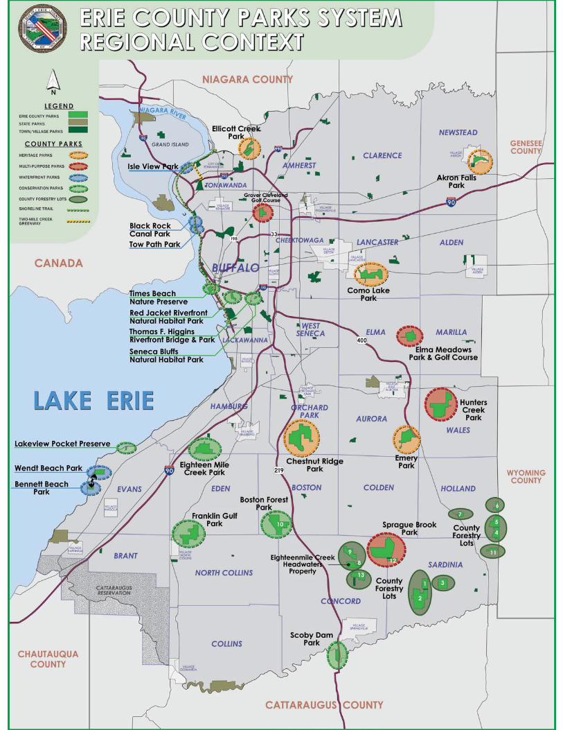
Erie County owns and operates a parks system containing nearly 10,000 acres of land on 40 sites throughout the County. These sites include eleven large multi-purpose parks, eight undeveloped parks, thirteen forestry lots, seven small special-purpose parks and two multi-use recreational trails. The County Park System was originally established in 1925, and initially was comprised of four sites (Chestnut Ridge, Ellicott, Como Lake, and Emery Parks) and 2,280 acres of land. Periodic land acquisition over the years has expanded the original holdings to the Park System’s current size.
Previous County Park System Master Plan Updates were prepared in 1961, 1976, 1988, and 2003 (Approximately 15 year intervals). Since the last plan was completed, much has changed within the Park System and throughout the County. The County has invested significant funding towards recommended improvements and has tackled many maintenance concerns. Also, development has occurred around certain parks, Downtown Buffalo and the waterfront over the past few years. Public attitudes and appreciation towards the natural environment have also changed and greatly improved.
People tend to be more sensitive to the natural beauty and
sentiment is also evident in recreational trends, which have also evolved, with the County System being less in demand for “active” recreational uses and very much in demand for “passive” recreational uses and more nature-related focuses.
The County initiated this update of its current Park System Master Plan in late 2016, with an expected completion date of late 2018/early 2019. This current update is focused primarily on the preservation, enhancement and improvement of the existing system assets and landscape setting, rather than an unrealistic and expensive “wish-list” of things to be added or changed. The plan is intended to establish a framework for preservation, restoration, and enhancement of the parks over the next 15-20 years. It is recommended that the Master Plan Update be updated on a regular
Chestnut Ridge Park
FINAL PLAN
V1-7
ERIE COUNTY PARKS MASTER PLAN UPDATE
1.0 INTRODUCTION FINAL PLAN
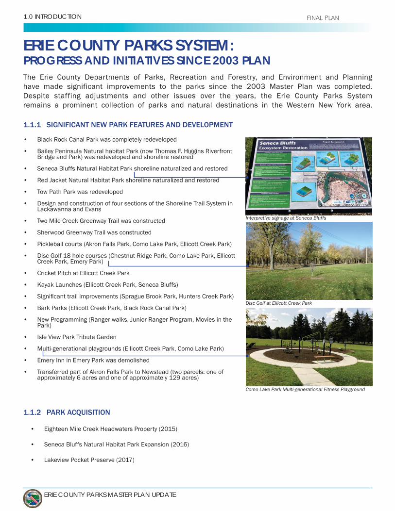
ERIE COUNTY PARKS SYSTEM: PROGRESS AND INITIATIVES SINCE 2003 PLAN
1.1.1 SIGNIFICANT NEW PARK FEATURES AND DEVELOPMENT
1.1.2 PARK ACQUISITION
The Erie County Departments of Parks, Recreation and Forestry, and Environment and Planning have made significant improvements to the parks since the 2003 Master Plan was completed. Despite staffing adjustments and other issues over the years, the Erie County Parks System remains a prominent collection of parks and natural destinations in the Western New York area.
• Black Rock Canal Park was completely redeveloped
• Bailey Peninsula Natural habitat Park (now Thomas F. Higgins Riverfront Bridge and Park) was redeveloped and shoreline restored
• Seneca Bluffs Natural Habitat Park shoreline naturalized and restored
• Red Jacket Natural Habitat Park shoreline naturalized and restored
• Tow Path Park was redeveloped
• Design and construction of four sections of the Shoreline Trail System in Lackawanna and Evans
• Two Mile Creek Greenway Trail was constructed
• Sherwood Greenway Trail was constructed
• Pickleball courts (Akron Falls Park, Como Lake Park, Ellicott Creek Park)
• Disc Golf 18 hole courses (Chestnut Ridge Park, Como Lake Park, Ellicott Creek Park, Emery Park)
• Cricket Pitch at Ellicott Creek Park
• Kayak Launches (Ellicott Creek Park, Seneca Bluffs)
•
• Bark Parks (Ellicott Creek Park, Black Rock Canal Park)
• New Programming (Ranger walks, Junior Ranger Program, Movies in the Park)
• Isle View Park Tribute Garden
• Multi-generational playgrounds (Ellicott Creek Park, Como Lake Park)
• Emery Inn in Emery Park was demolished
• Transferred part of Akron Falls Park to Newstead (two parcels: one of approximately 6 acres and one of approximately 129 acres)
• Eighteen Mile Creek Headwaters Property (2015)
• Seneca Bluffs Natural Habitat Park Expansion (2016)
• Lakeview Pocket Preserve (2017)
Interpretive signage at Seneca Bluffs
Disc Golf at Ellicott Creek Park
Como Lake Park Multi-generational Fitness Playground

VOLUME 1: OVERALL SYSTEM MASTER PLAN - 1.0 INTRODUCTION
VOLUME1 FINAL PLAN
1.2.3 SELECT ACCOMPLISHMENTS FROM 2003 MASTER PLAN RECOMMENDATIONS
• Chestnut Ridge Park - Relocate trailhead parking location from alongside Seufert Road to a new location on Route 277 at the former horse paddocks. Establish and/or improve trail access into the existing park trail network- DONE
Established new trailhead, trails, and parking area for Eternal Flame Trail
• Chestnut Ridge Parkto the edge of the Commissioner’s pond - work closely with local sportsman’s/
DONE Worked with Boy Scout group to establish wood deck on edge of pond for
• All Parks - Promote four-seasons recreational opportunities in the parks,
including the sledding hills, skating rinks and cross-country ski trails- DONE Parks Department continues to promote and improve winter activities
throughout the Park System. Sledding, cross-country skiing, skating, guided Ranger walks, Chestnut Ridge Santaland/Winterfest, are a few of the many recreational opportunities that take place during the winter months.
• - Improve conditions of parking lot at northern end of park; establish a better connection and visibility from Niagara Falls Boulevard. This is
asphalt-surfaced parking lot would likely be appropriate- - DONE Provided asphalt lot, and sign visible from Niagara Falls Blvd. Parking lot
• Emery Park - Reduce lawn mowing to provide more natural setting in non-use,
would be west of the Maintenance facilities behind the tennis courts- - DONE/ON-GOING
Many areas of Emery Park have transitioned to a more natural setting
• - Establish a stronger linkage between Bennett Beach and the local community through new sidewalks and/or trails,
linkages from Bennett Beach to area bicycle routes and trails. This is a strong, tight-knit lakefront community that comes alive in the summer months- -
Designed and constructed Evans Shoreline Trail Phases 1 and3 creating a direct trail connection from Bennett Beach to Wendt Beach. Phase 2 will connect the County Parks to Evans Town Park
• out current practices of regularly mowing large expanses of lawn. Transition the little-used lawn expanses to natural meadows; some areas mowed down once at the end of each season, and others never mowed again- -
north of Sprague Brook. Established meadows feature mowed paths for nature walks and views of the scenic countryside.
New trailhead off of Route 277 at Chestnut Ridge
Deck over the pond at Chestnut Ridge
Reduced mowing area at Emery Park
V1-9

ERIE COUNTY PARKS MASTER PLAN UPDATE
1.0 INTRODUCTION FINAL PLAN
1.2.4 SIGNIFICANT PARKS CAPITAL IMPROVEMENTS
• Akron Falls Park - Valley Bridge and Brooklyn Street Bridge Replacement .................................
• Bennett Beach Park - Comfort Station Remodel ...........................................................................
• Black Rock Canal Park - Phases 1, 2, 3 Improvements ................................................................
• Chestnut Ridge Park - Parking Lot/Lighting and Accessibility Improvements ............................
• Chestnut Ridge Park - Tennis Court Resurfacing ..........................................................................
• Como Lake Park - Shelter Improvements .......................................................................................
• Ellicott Creek Park - Tennis Court Improvements ..........................................................................
• Elma Meadows Golf Course - New Irrigation System Installed .....................................................
• Emery Park - Culvert Replacement .................................................................................................
• Isle View Park - Maintenance Shop Roof Improvements ..............................................................
• Sprague Brook Park - Electrical Camp Site Conversion ................................................................
Valley bridge replacement at Akron Falls Park
Tennis courts at Chestnut Ridge Park Black Rock Canal Park: Promenade Improvements
Roof improvements to Boy Scout Shelter at Como Lake Park
$ 1,430,000
$78,000
$300,000
$587,000
$260,000
$200,000
$62,000
$1,500,000
$350,000
$124,000
$224,000
VOLUME 1: OVERALL SYSTEM MASTER PLAN - 1.0 INTRODUCTION
VOLUME1 FINAL PLAN
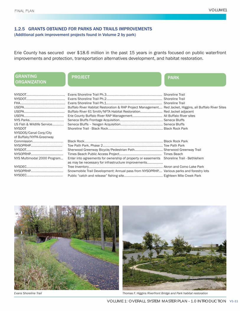
1.2.5 GRANTS OBTAINED FOR PARKS AND TRAILS IMPROVEMENTS(Additional park improvement projects found in Volume 2 by park)
GRANTING ORGANIZATION
PROJECT PARK
Shoreline TrailShoreline Trail Shoreline TrailRed Jacket, Higgins, all Buffalo River SitesRed Jacket adjacentAll Buffalo River sitesSeneca BluffsSeneca BluffsBlack Rock Park
Black Rock ParkTow Path ParkSherwood Greenway TrailTimes BeachShoreline Trail - Bethlehem
Akron and Como Lake ParkVarious parks and forestry lotsEighteen Mile Creek Park
Evans Shoreline Trail Ph.3...............................................................Evans Shoreline Trail Ph.2...............................................................Evans Shoreline Trail Ph.1...............................................................Buffalo River Habitat Restoration & RAP Project Management....Buffalo River 61 Smith/NFTA Habitat Restoration.........................Erie County Buffalo River RAP Management..................................Seneca Bluffs Frontage Acquisition.................................................Seneca Bluffs – Nexgen Acquisition................................................Shoreline Trail - Black Rock..............................................................
Black Rock.........................................................................................Tow Path Park, Phase 2....................................................................Sherwood Greenway Bicycle/Pedestrian Path................................Times Beach Public Access Project................................................Enter into agreements for ownership of property or easements as may be necessary for infrastructure improvements..................Tree Inventory....................................................................................Snowmobile Trail Development: Annual pass from NYSOPRHP....
Erie County has secured over $18.6 million in the past 15 years in grants focused on public waterfront improvements and protection, transportation alternatives development, and habitat restoration.
Evans Shoreline Trail Thomas F. Higgins Riverfront Bridge and Park habitat restoration
NYSDOT............................................NYSDOT............................................FHA...................................................USEPA..............................................USEPA..............................................USEPA.............................................NYS Parks.......................................US Fish & Wildlife Service.............NYSDOTNYSDOS/Canal Corp/City of Buffalo/NYPA-Greenway Commission...................................NYSOPRHP....................................NYSDOT.........................................NYSOPRHP.....................................NYS Multimodal 2000 Program...
NYSDEC.........................................NYSOPRHP.....................................NYSDEC.........................................
V1-11
ERIE COUNTY PARKS MASTER PLAN UPDATE
1.0 INTRODUCTION FINAL PLAN
VOLUME 1: OVERALL SYSTEM MASTER PLAN - 1.0 INTRODUCTION
VOLUME1 FINAL PLAN
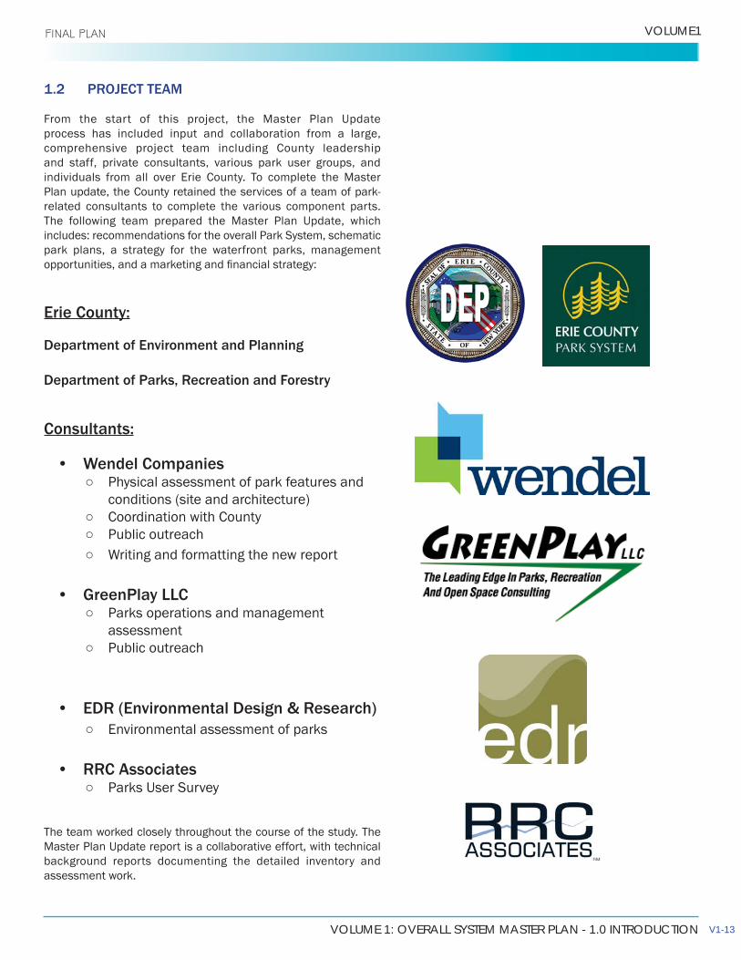
1.2 PROJECT TEAM
From the start of this project, the Master Plan Update process has included input and collaboration from a large, comprehensive project team including County leadership and staff, private consultants, various park user groups, and individuals from all over Erie County. To complete the Master Plan update, the County retained the services of a team of park-related consultants to complete the various component parts.The following team prepared the Master Plan Update, which includes: recommendations for the overall Park System, schematic park plans, a strategy for the waterfront parks, management
Erie County:
Department of Environment and Planning
Department of Parks, Recreation and Forestry
Consultants:
• Wendel Companies Physical assessment of park features and
conditions (site and architecture) Coordination with County Public outreach Writing and formatting the new report
• GreenPlay LLC Parks operations and management
assessment Public outreach
• EDR (Environmental Design & Research) Environmental assessment of parks
• RRC Associates Parks User Survey
The team worked closely throughout the course of the study. The Master Plan Update report is a collaborative effort, with technical background reports documenting the detailed inventory and assessment work.
V1-13
ERIE COUNTY PARKS MASTER PLAN UPDATE
1.0 INTRODUCTION FINAL PLAN
1.3 STUDY PROCESS
1.3.1 PUBLIC CONSULTATION
Unique to this public outreach process was that the County wanted to get a better handle on all of it’s existing resources and amenities within the parks before allowing the public to request new features or other improvements that were not necessarily
could be made.
Public input was solicited during the master plan update process, and guided by the framework of preserving and enhancing what the Park System already offers, versus a typical parks master planning process which may ask “what do you want?” Discussion
“what improvements and repairs are needed to keep the park system at its best?”
Given the extent of the Erie County Park System, it was not
collective meetings were held at strategic locations throughout the County. This public consultation approach included outreach to as many stakeholder groups and individuals as possible throughout the course of the project. Outreach was achieved through the following methods:
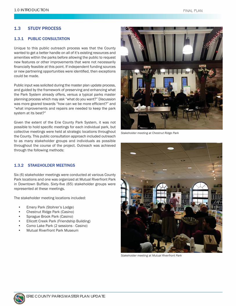
1.3.2 STAKEHOLDER MEETINGS
Six (6) stakeholder meetings were conducted at various County Park locations and one was organized at Mutual Riverfront Park
represented at these meetings.
The stakeholder meeting locations included:
• Emery Park (Stohrer’s Lodge)• Chestnut Ridge Park (Casino)• Sprague Brook Park (Casino)• Ellicott Creek Park (Friendship Building)• Como Lake Park (2 sessions - Casino)• Mutual Riverfront Park Museum
Stakeholder meeting at Chestnut Ridge Park
Stakeholder meeting at Mutual Riverfront Park
VOLUME 1: OVERALL SYSTEM MASTER PLAN - 1.0 INTRODUCTION
VOLUME1 FINAL PLAN
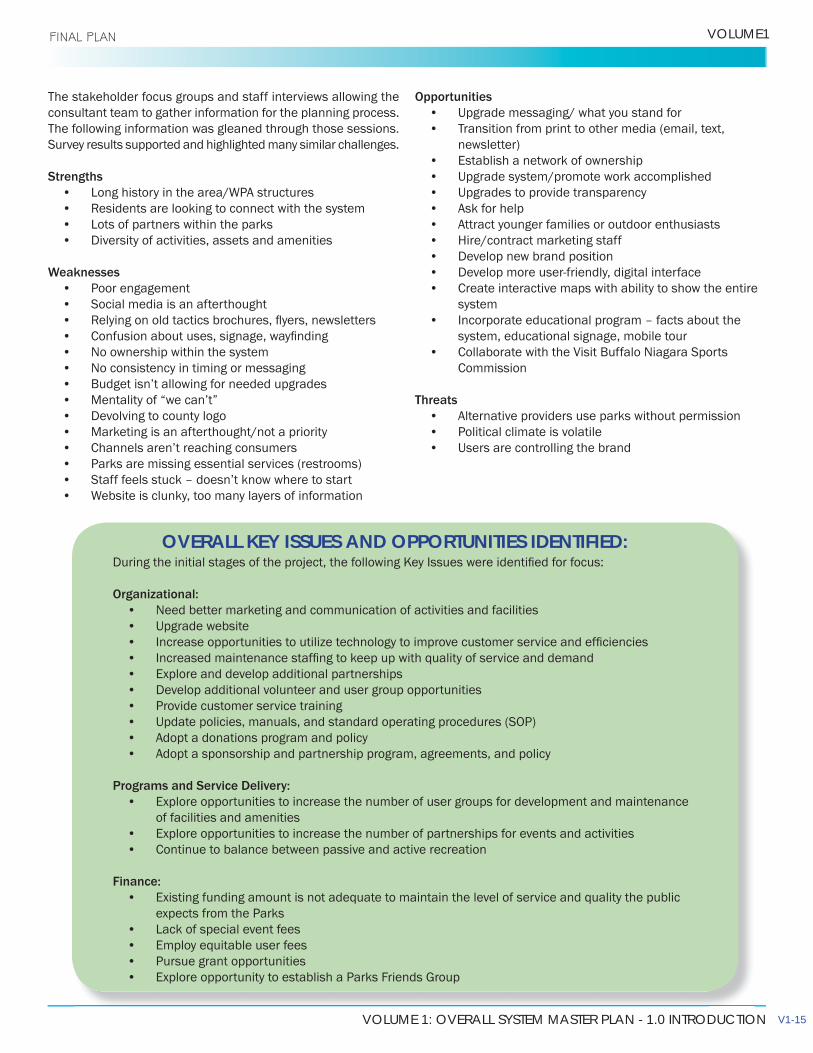
The stakeholder focus groups and staff interviews allowing the consultant team to gather information for the planning process. The following information was gleaned through those sessions. Survey results supported and highlighted many similar challenges.
Strengths• Long history in the area/WPA structures• Residents are looking to connect with the system• Lots of partners within the parks• Diversity of activities, assets and amenities
Weaknesses• Poor engagement• Social media is an afterthought• • • No ownership within the system• No consistency in timing or messaging• Budget isn’t allowing for needed upgrades• Mentality of “we can’t”• Devolving to county logo• Marketing is an afterthought/not a priority• Channels aren’t reaching consumers• Parks are missing essential services (restrooms)• Staff feels stuck – doesn’t know where to start• Website is clunky, too many layers of information
Opportunities• Upgrade messaging/ what you stand for• Transition from print to other media (email, text,
newsletter)• Establish a network of ownership• Upgrade system/promote work accomplished• Upgrades to provide transparency • Ask for help• Attract younger families or outdoor enthusiasts• Hire/contract marketing staff• Develop new brand position• Develop more user-friendly, digital interface• Create interactive maps with ability to show the entire
system• Incorporate educational program – facts about the
system, educational signage, mobile tour• Collaborate with the Visit Buffalo Niagara Sports
Commission
Threats• Alternative providers use parks without permission• Political climate is volatile• Users are controlling the brand
• Need better marketing and communication of activities and facilities• Upgrade website• • • Explore and develop additional partnerships• Develop additional volunteer and user group opportunities• Provide customer service training• Update policies, manuals, and standard operating procedures (SOP)• Adopt a donations program and policy • Adopt a sponsorship and partnership program, agreements, and policy
Programs and Service Delivery:• Explore opportunities to increase the number of user groups for development and maintenance
of facilities and amenities• Explore opportunities to increase the number of partnerships for events and activities• Continue to balance between passive and active recreation
Finance:• Existing funding amount is not adequate to maintain the level of service and quality the public
expects from the Parks• Lack of special event fees• Employ equitable user fees• Pursue grant opportunities• Explore opportunity to establish a Parks Friends Group
OVERALL KEY ISSUES AND OPPORTUNITIES IDENTIFIED:
V1-15
ERIE COUNTY PARKS MASTER PLAN UPDATE
1.0 INTRODUCTION FINAL PLAN
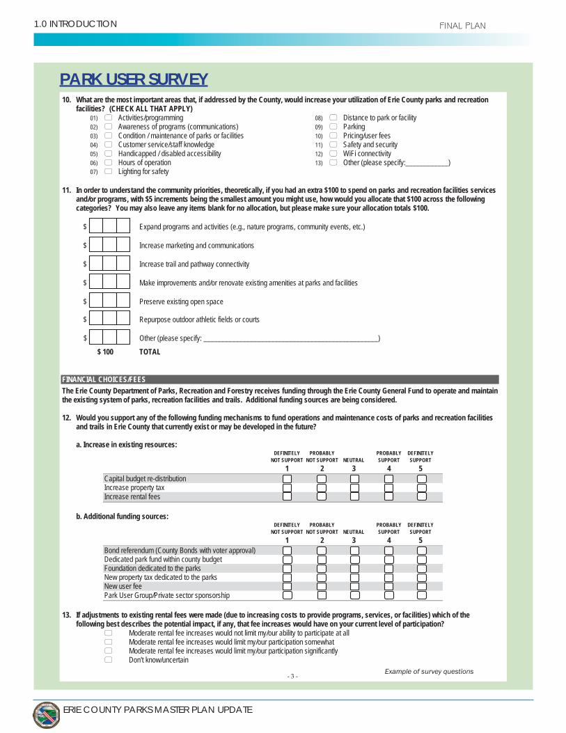
PARK USER SURVEY
- 3 -
10. What are the most important areas that, if addressed by the County, would increase your utilization of Erie County parks and recreation facilities? (CHECK ALL THAT APPLY)
01) Activities/programming02) Awareness of programs (communications) 03) Condition / maintenance of parks or facilities04) Customer service/staff knowledge05) Handicapped / disabled accessibility06) Hours of operation07) Lighting for safety
08) Distance to park or facility09) Parking10) Pricing/user fees11) Safety and security12) WiFi connectivity13) Other (please specify:____________)
11. In order to understand the community priorities, theoretically, if you had an extra $100 to spend on parks and recreation facilities services and/or programs, with $5 increments being the smallest amount you might use, how would you allocate that $100 across the following categories? You may also leave any items blank for no allocation, but please make sure your allocation totals $100.
$ Expand programs and activities (e.g., nature programs, community events, etc.)
$ Increase marketing and communications
$ Increase trail and pathway connectivity
$ Make improvements and/or renovate existing amenities at parks and facilities
$ Preserve existing open space
$ Repurpose outdoor athletic fields or courts
$ Other (please specify: _________________________________________________)
$ 100 TOTAL
FINANCIAL CHOICES/FEESThe Erie County Department of Parks, Recreation and Forestry receives funding through the Erie County General Fund to operate and maintain the existing system of parks, recreation facilities and trails. Additional funding sources are being considered.
12. Would you support any of the following funding mechanisms to fund operations and maintenance costs of parks and recreation facilitiesand trails in Erie County that currently exist or may be developed in the future?
a. Increase in existing resources:DEFINITELY PROBABLY PROBABLY DEFINITELY
NOT SUPPORT NOT SUPPORT NEUTRAL SUPPORT SUPPORT1 2 3 4 5
Capital budget re-distributionIncrease property taxIncrease rental fees
b. Additional funding sources:DEFINITELY PROBABLY PROBABLY DEFINITELY
NOT SUPPORT NOT SUPPORT NEUTRAL SUPPORT SUPPORT1 2 3 4 5
Bond referendum (County Bonds with voter approval)Dedicated park fund within county budgetFoundation dedicated to the parksNew property tax dedicated to the parksNew user feePark User Group/Private sector sponsorship
13. If adjustments to existing rental fees were made (due to increasing costs to provide programs, services, or facilities) which of the following best describes the potential impact, if any, that fee increases would have on your current level of participation?
Moderate rental fee increases would not limit my/our ability to participate at allModerate rental fee increases would limit my/our participation somewhatModerate rental fee increases would limit my/our participation significantlyDon't know/uncertain
Example of survey questions

VOLUME 1: OVERALL SYSTEM MASTER PLAN - 1.0 INTRODUCTION
VOLUME1
1.3.3 PARKS USER SURVEY
The purpose of this survey was to gather public feedback on Erie County Parks and recreation facilities, services, and programs. This survey research effort and subsequent analysis were designed to assist Erie County in developing a master plan regarding existing and potential future facilities and services.
The Parks User Survey was conducted using t primary methods:
1) A mail-back survey
2) An open-link web survey to further
A total of 5,000 surveys were mailed to a random sample of Erie County residents in March 2017; recipients also received a reminder postcard about 9 days after the initial mailing. After accounting for undeliverable addresses (81 total), 4,919 surveys were delivered and 585 completed responses were received, resulting in a statistically valid response rate of 11.9 percent. The full survey results can be found in Appendix B .
Summary of Selected FindingsThis section provides a brief overview of key findings of the statistically-valid invitation sample.
• Usage of Existing Facilities is Low; Trails/Pathwaysare Most-Used Amenity. Only Chestnut Ridge andRiverwalk have been used by over half of invitationrespondents in the past year (69 percent and 51percent, respectively). The remaining facilities areused much less frequently by invitation respondents,
reason for not using existing facilities (47 percent). Ingeneral, invitation respondents indicated that they aremost likely to use trails/pathways (74 percent), picnicshelters (56 percent), and playgrounds (48 percent) ona regular basis.
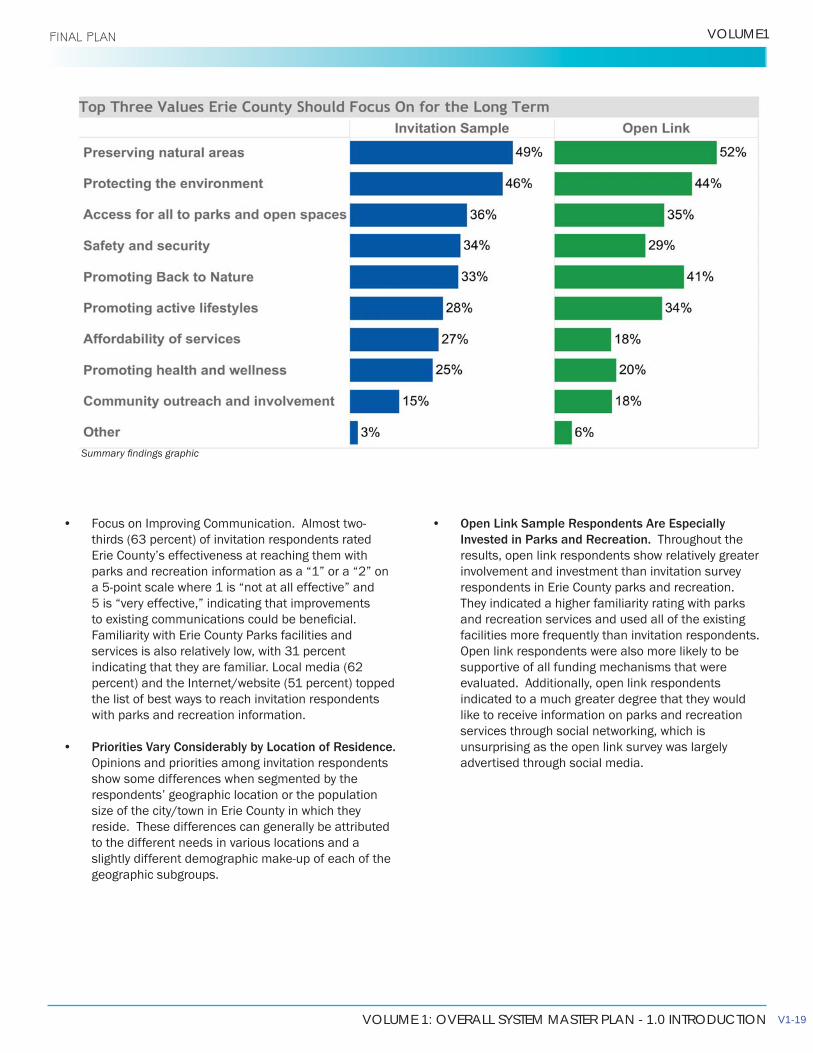
• Long-Term Areas of Focus Should IncludePreservation of Natural Areas and Protecting theEnvironment. When asked to select the top threeareas that Erie County Parks & Recreation shouldfocus on for the long term, invitation respondents mostcommonly chose preserving natural areas (49 percent)and protecting the environment (46 percent). Thesepriorities are further corroborated by other surveyresults, both quantitative and qualitative.
Stakeholder Meeting: Parks which people use
Notes from stakeholder meeting
V1-17
ERIE COUNTY PARKS MASTER PLAN UPDATE
1.0 INTRODUCTION FINAL PLAN
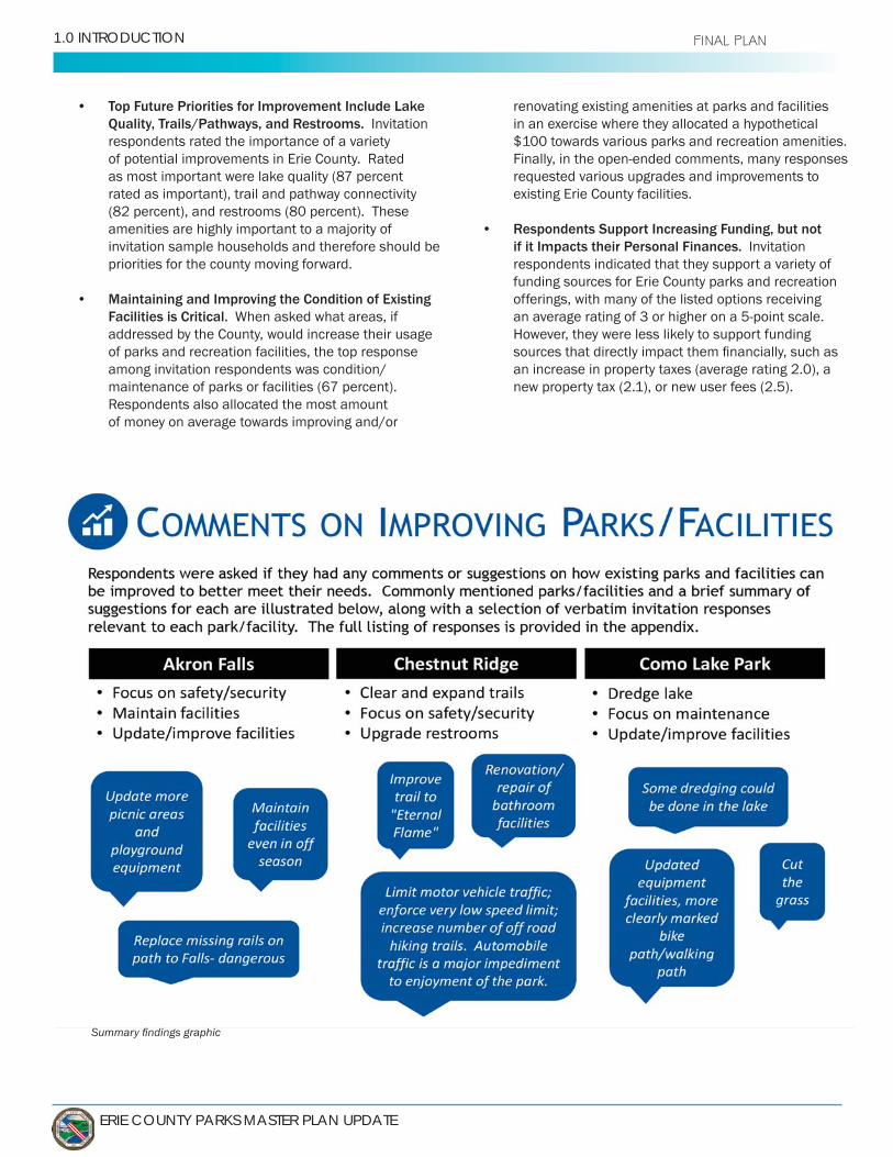
• Top Future Priorities for Improvement Include Lake Quality, Trails/Pathways, and Restrooms. Invitation respondents rated the importance of a variety of potential improvements in Erie County. Rated as most important were lake quality (87 percent rated as important), trail and pathway connectivity (82 percent), and restrooms (80 percent). These amenities are highly important to a majority of invitation sample households and therefore should be priorities for the county moving forward.
• Maintaining and Improving the Condition of Existing Facilities is Critical. When asked what areas, if addressed by the County, would increase their usage of parks and recreation facilities, the top response among invitation respondents was condition/maintenance of parks or facilities (67 percent). Respondents also allocated the most amount of money on average towards improving and/or
renovating existing amenities at parks and facilities in an exercise where they allocated a hypothetical $100 towards various parks and recreation amenities. Finally, in the open-ended comments, many responses requested various upgrades and improvements to existing Erie County facilities.
• Respondents Support Increasing Funding, but not if it Impacts their Personal Finances. Invitation respondents indicated that they support a variety of funding sources for Erie County parks and recreation offerings, with many of the listed options receiving an average rating of 3 or higher on a 5-point scale. However, they were less likely to support funding
an increase in property taxes (average rating 2.0), a new property tax (2.1), or new user fees (2.5).
VOLUME 1: OVERALL SYSTEM MASTER PLAN - 1.0 INTRODUCTION
VOLUME1 FINAL PLAN
• Focus on Improving Communication. Almost two-thirds (63 percent) of invitation respondents rated Erie County’s effectiveness at reaching them with parks and recreation information as a “1” or a “2” on a 5-point scale where 1 is “not at all effective” and 5 is “very effective,” indicating that improvements
Familiarity with Erie County Parks facilities and services is also relatively low, with 31 percent indicating that they are familiar. Local media (62 percent) and the Internet/website (51 percent) topped the list of best ways to reach invitation respondents with parks and recreation information.
• Priorities Vary Considerably by Location of Residence. Opinions and priorities among invitation respondents show some differences when segmented by the respondents’ geographic location or the population size of the city/town in Erie County in which they reside. These differences can generally be attributed to the different needs in various locations and a slightly different demographic make-up of each of the geographic subgroups.
• Open Link Sample Respondents Are Especially Invested in Parks and Recreation. Throughout the results, open link respondents show relatively greater involvement and investment than invitation survey respondents in Erie County parks and recreation. They indicated a higher familiarity rating with parks and recreation services and used all of the existing facilities more frequently than invitation respondents. Open link respondents were also more likely to be supportive of all funding mechanisms that were evaluated. Additionally, open link respondents indicated to a much greater degree that they would like to receive information on parks and recreation services through social networking, which is unsurprising as the open link survey was largely advertised through social media.
V1-19
ERIE COUNTY PARKS MASTER PLAN UPDATE
1.0 INTRODUCTION
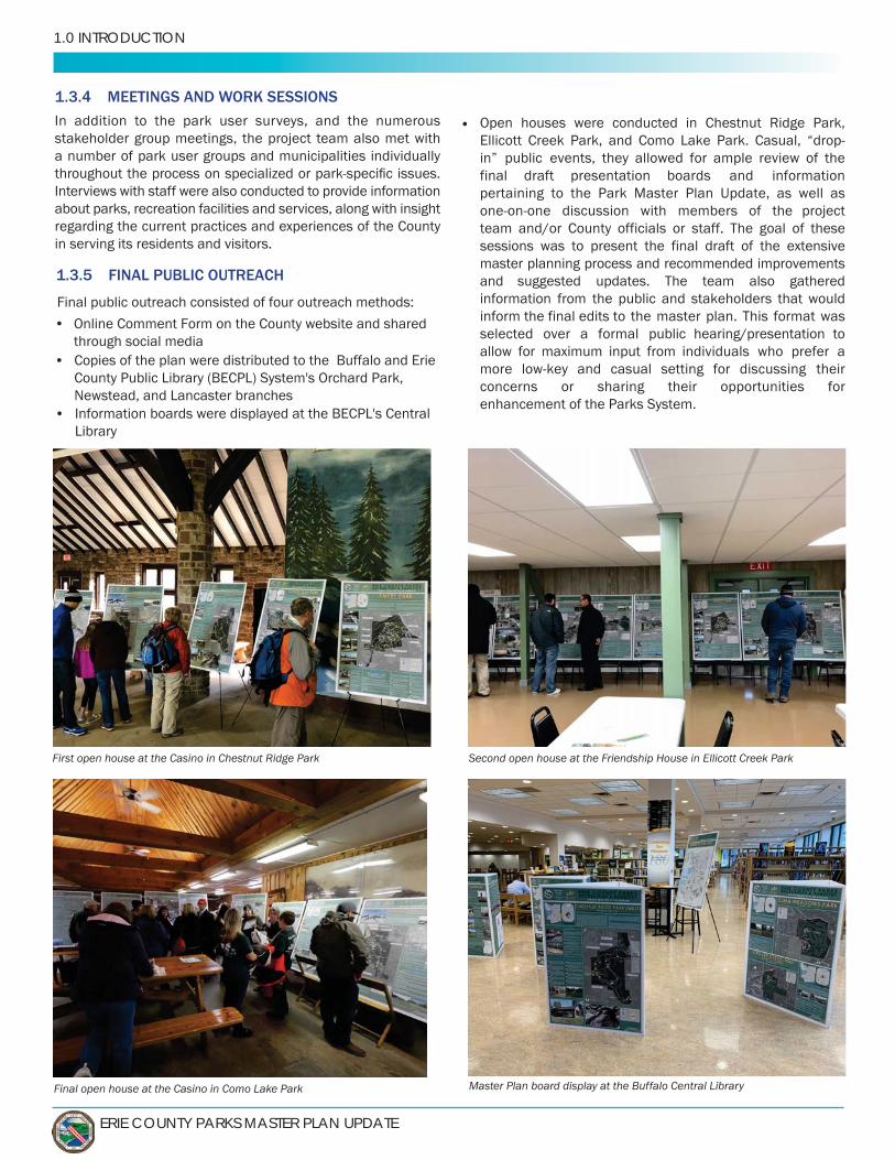
1.3.4 MEETINGS AND WORK SESSIONS
In addition to the park user surveys, and the numerous stakeholder group meetings, the project team also met with a number of park user groups and municipalities individually
Interviews with staff were also conducted to provide information about parks, recreation facilities and services, along with insight regarding the current practices and experiences of the County in serving its residents and visitors.
1.3.5 F
pen houses were conducted asual, “drop-
in” public boards and information
pertaining to the Park Master Plan Update, as well as one-on-one discussion with members of
master planning process and recommended improvements and suggested updates. The team also gathered information from
to the master plan. This format was selected over a formal public hearing/presentation
for maximum input from individuals who prefer a more low-key and casual setting for discussing their concerns or sharing their opportunities for enhancement of the Parks System.
First open house at the Casino in Chestnut Ridge Park
Final open house at the Casino in Como Lake Park Master Plan board display at the Buffalo Central Library
Second open house at the Friendship House in Ellicott Creek Park
•
•
•
•
VOLUME 1: OVERALL SYSTEM MASTER PLAN - 1.0 INTRODUCTION
VOLUME1 FINAL PLAN
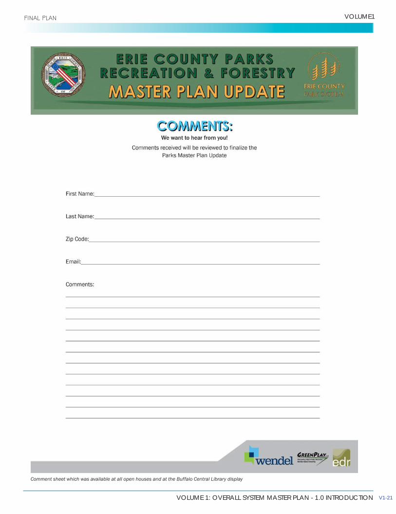
Comment sheet which was available at all open houses and at the Buffalo Central Library display
V1-21

ERIE COUNTY PARKS MASTER PLAN UPDATE
1.0 INTRODUCTION FINAL PLAN
1.4 MASTER PLAN COMPONENTS
The resulting Master Plan Update is comprised of the following four elements:
1.4.1 INVENTORY AND ASSESSMENT OF EXISTING FACILITIES AND CONDITIONS
This includes a detailed inventory of infrastructure, shelters, furnishings, athletic facilities, play equipment and other appurtenances within the County’s heritage parks. A database of inventory information was created to give the County a management tool for future maintenance and funding decisions.
A detailed analysis was also conducted among the oldest parks in the System, mapping and detailing the existing natural/ecological character.
1.4.2 ASSESSMENT AND ANALYSIS OF OPERATIONS AND MARKETING STRATEGIES
GreenPlay broadly assessed the organizational and management
future responsibilities as related to the community’s needs:
Level of Service Analysis•
services to provide insight regarding the market opportunities in the area for potential new partnerships, facilities and services.
• Analysis addressing recreation, parks, natural resources, and related services.
Assessment and Analysis• Review of previous planning efforts, County historical
information. • Measurement of the current delivery of service for
parks, recreation facilities and natural areas using existing County data allowing for a target level of service to be determined that is both feasible and aligned with the desires of citizens as expressed through the citizen survey and public engagement meetings.
• support development and sustainability within the system.
Needs Assessment•
demographics, including population growth.• Research of trends related to Erie County and
American lifestyles to help guide the efforts of the Parks Department over the next several years.
Operational and Marketing Analysis• Review and analysis of current marketing practices
and current donation practices.• Review and analysis of the existing outside
organization agreements, existing partnerships and sponsorship agreements.
Wendt Beach Schematic Plan: Overall schematic graphic is located in Volume 2, Section 3.4

VOLUME 1: OVERALL SYSTEM MASTER PLAN - 1.0 INTRODUCTION
VOLUME1
• Analyze parks, recreation programming, and servicedelivery.
• Conduct an organizational Strengths, Weaknesses,Opportunities, and Threats (SWOT) Analysis.
• Develop a broad assessment of the overall parksoperations.
Recommendations and Policy Documents: • Development of standard practice documents
for donations, sponsorships, and partnerships management.
• Development of an action plan for marketing and atime-frame to support the implementation of the plan.
• Development of a donations program and policydocument.
After considering the organizational observations, staffing assessment, and budgetary limitations, the opinion of the consultant team is that Department staff have done a remarkable job of delivering quality service in the operation of its current system.
Opportunities exist for the County to explore partnerships with local municipalities, agencies, businesses, non-profit, and community-based groups.
1.4.3 REVIEW AND UPDATE OF EXISTING PARK PLANS
All parks in the system were evaluated for maintenance issues
Shoreline Trail
prepared for each park in the County System. Recommendations take into account long-term environmental sustainability, current and future recreational opportunities, maintenance
placed on preservation and restoration of original park features. For all parks, the focus is on preserving natural resources and key scenic features, while developing a better system of interpretation and awareness within these beautiful properties.
In addition, several key schematic plans were created for designated areas within the overall system;
• Improvement to the Wendt Beach Heritage Areaincluding the re-use of the Horse Stable building,pedestrian connectivity, and reorganization of theparking area.
• Conceptual design of Seneca Bluffs including aformalized parking area, trails, overlooks, and otheramenities.
• Improvements to vehicular circulation and parkingareas, including overall impervious pavementreduction and the addition of rain gardens at ChestnutRidge, Como Lake, and Ellicott Creek Parks.
1.4.4 WATERFRONT ACCESS AND TRAILWAYS
River waterfront park system. Highlights include assessing and providing recommendations for the Riverwalk section of the Shoreline Trail and analyzing possible new access points to the River. Three schematic plans were produced including:
• An overall Erie County Strategy context planhighlighting proposed projects and initiatives.
•adjacent properties near Isle View Park showingpossible trail expansion and connections to the River.
• Two Mile Creek Trailway Extension
1.5 MASTER PLAN DOCUMENTS
The completed Erie County Parks System Master Plan is comprised of six documents, as follows:
EXECUTIVE SUMMARYVOL. 1 – OVERALL SYSTEM MASTER PLANVOL. 2 – PARK SPECIFIC RECOMMENDATIONSVOL. 3 – WATERFRONT ACCESS AND TRAILWAYSVOL. 4 – PARKS INVENTORY AND ASSESSMENTAPPENDIX
V1-23

THIS PAGE INTENTIONALLY LEFT BLANK
VOLUME 1: OVERALL SYSTEM MASTER PLAN - 2.0 PLANNING CONTEXT
2.0 PLANNING CONTEXT FINAL PLAN
PLANNING CONTEXT2.1 COUNTY OVERVIEW
2.1.1 REGIONAL SETTING
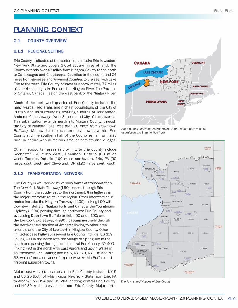
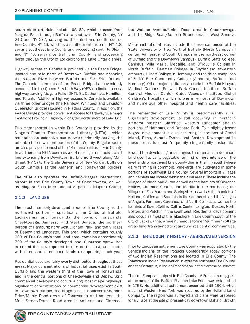
Erie County is situated at the eastern end of Lake Erie in western New York State and covers 1,054 square miles of land. The County extends over 43 miles from Niagara County to the north to Cattaraugus and Chautauqua Counties to the south, and 24 miles from Genesee and Wyoming Counties to the east with Lake Erie to the west. Erie County possesses approximately 77 miles of shoreline along Lake Erie and the Niagara River. The Province of Ontario, Canada, lies on the west bank of the Niagara River.
Much of the northwest quarter of Erie County includes the heavily-urbanized areas and highest populations of the City of
Amherst, Cheektowaga, West Seneca, and City of Lackawanna. This urbanization extends north into Niagara County, through the City of Niagara Falls (less than 20 miles from Downtown Buffalo). Meanwhile the easternmost towns within Erie County and the southern half of the County remain primarily rural in nature with numerous smaller hamlets and villages.
Other metropolitan areas in proximity to Erie County include Rochester (60 miles east), Hamilton, Ontario (60 miles west), Toronto, Ontario (100 miles northwest), Erie, PA (90 miles southwest) and Cleveland, OH (180 miles southwest).
2.1.2 TRANSPORTATION NETWORK
Erie County is well served by various forms of transportation. The New York State Thruway (I-90) passes through Erie County from the southwest to the northeast; this highway is the major interstate route in the region. Other interstate spur routes include: the Niagara Thruway (I-190), linking I-90 with Downtown Buffalo, Niagara Falls and Canada; the Youngmann Highway (I-290) passing through northwest Erie County and bypassing Downtown Buffalo to link I- 90 and I-190; and the Lockport Expressway (I-990), passing northerly through the north-central section of Amherst linking to other area arterials and the City of Lockport in Niagara County. Other limited-access highways serving Erie County include: US 219, linking I-90 in the north with the Village of Springville to the south and passing through south-central Erie County; NY 400, linking I-90 in the north with East Aurora and South Wales in southeastern Erie County; and NY 5, NY 179, NY 198 and NY 33, which form a network of expressways within Buffalo and
Major east-west state arterials in Erie County include: NY 5 and US 20 (both of which cross New York State from Erie, PA to Albany); NY 354 and US 20A, serving central Erie County; and NY 39, which crosses southern Erie County. Major north-
Erie County is depicted in orange and is one of the most western counties in the State of New York
The Towns and Villages of Erie County
V1-25
ERIE COUNTY PARKS MASTER PLAN UPDATE
2.0 PLANNING CONTEXT FINAL PLAN
south state arterials include: US 62, which passes from Niagara Falls through Buffalo to southwest Erie County; NY 240 and NY 277, serving north-central and south- central Erie County; NY 16, which is a southern extension of NY 400 serving southeast Erie County and proceeding south to Olean; and NY 78, serving central Erie County and proceeding north through the City of Lockport to the Lake Ontario shore.
Highway access to Canada is provided via the Peace Bridge, located one mile north of Downtown Buffalo and spanning the Niagara River between Buffalo and Fort Erie, Ontario. The Canadian terminus of the Peace Bridge is conveniently connected to the Queen Elizabeth Way (QEW), a limited-access highway serving Niagara Falls (ONT), St. Catherines, Hamilton, and Toronto. Additional highway access to Canada is available via three other bridges (the Rainbow, Whirlpool and Lewiston-Queenston Bridges) located in Niagara County. In addition, the Peace Bridge provides convenient access to Highway 3, a major east-west Provincial Highway along the north shore of Lake Erie.
Public transportation within Erie County is provided by the Niagara Frontier Transportation Authority (NFTA) , which maintains an extensive bus network primarily serving the urbanized northwestern portion of the County. Regular routes are also provided to most of the 44 municipalities in Erie County. In addition, the NFTA operates a 6.4-mile light rail rapid transit line extending from Downtown Buffalo northwest along Main Street (NY 5) to the State University of New York at Buffalo’s South Campus at the Amherst and Tonawanda borders.
The NFTA also operates the Buffalo-Niagara International Airport in the Erie County Town of Cheektowaga, as well as Niagara Falls International Airport in Niagara County.
2.1.2 LAND USE
The most intensely-developed area of Erie County is the northwest portion – specifically the Cities of Buffalo, Lackawanna, and Tonawanda; the Towns of Tonawanda, Cheektowaga, Amherst, and West Seneca; the northern portion of Hamburg; northwest Orchard Park; and the Villages of Depew and Lancaster. This area, which contains roughly 20% of Erie County’s total land area, contains approximately 70% of the County’s developed land. Suburban sprawl has extended this development further north, east, and south, with more and more open lands disappearing each year.
Residential uses are fairly evenly distributed throughout these areas. Major concentrations of industrial uses exist in South Buffalo and the western third of the Town of Tonawanda, and in the central portions of Cheektowaga and Depew. Strip commercial development occurs along most major highways;
in Downtown Buffalo, the Niagara Falls Boulevard/Sheridan Drive/Maple Road areas of Tonawanda and Amherst, the Main Street/Transit Road area in Amherst and Clarence,
the Walden Avenue/Union Road area in Cheektowaga, and the Ridge Road/Seneca Street area in West Seneca.
Major institutional uses include the three campuses of the State University of New York at Buffalo (North Campus in central Amherst and South Campus in the northeast corner of Buffalo and the Downtown Campus), Buffalo State College, Canisius, Villa Maria, Medaille, and D’Youville College in North Buffalo, Daeman College in Snyder (southwestern Amherst), Hilbert College in Hamburg and the three campuses of SUNY Erie Community College (Amherst, Buffalo, and Hamburg). Other major institutions include the Buffalo Niagara Medical Campus (Roswell Park Cancer Institute, Buffalo General Medical Center, Gates Vascular Institute, Oishei Children’s Hospital) which is one mile north of Downtown and numerous other hospital and health care facilities.
The remainder of Erie County is predominantly rural. Significant development is still occurring in northern Amherst, western Clarence, western Lancaster and in portions of Hamburg and Orchard Park. To a slightly lesser degree development is also occurring in portions of Grand Island, Elma, Aurora, Evans, and Boston. Development in these areas is most frequently single-family residential.
Beyond the developing areas, agriculture remains a dominant land use. Typically, vegetable farming is more intense on the level lands of northeast Erie County than in the hilly south (where dairy farming is common). Vineyards are cultivated in some portions of southwest Erie County. Several important villages and hamlets are located within the rural areas: These include the Villages of Alden and Akron as well as the hamlets of Clarence Hollow, Clarence Center, and Marilla in the northeast; the Villages of East Aurora and Springville, as well as the hamlets of Holland, Colden and Sardinia in the southeast; and the Villages of Angola, Farnham, Gowanda, and North Collins, as well as the hamlets of Eden, Collins, Collins Center, Langford, Boston, North Boston, and Patchin in the southwest. Residential development also occupies most of the lakeshore in Erie County south of the City of Lackawanna, where numerous former “summer” cottage areas have transitioned to year-round residential communities.
2.1.3 ERIE COUNTY HISTORY - ABBREVIATED VERSION
Prior to European settlement Erie County was populated by the Seneca Indians of the Iroquois Confederacy. Today, portions of two Indian Reservations are located in Erie County: The Tonawanda Indian Reservation in extreme northeast Erie County, and the Cattaraugus Indian Reservation in the extreme southwest.
at the mouth of the Buffalo River on Lake Erie – was established in 1758. No additional settlement occurred until 1804, when much of Western New York was acquired by the Holland Land Company. The region was surveyed and plans were prepared for a village at the site of present-day downtown Buffalo. Growth
VOLUME 1: OVERALL SYSTEM MASTER PLAN - 2.0 PLANNING CONTEXT
VOLUME1 FINAL PLAN
was slow until 1825 due to the area’s remoteness and the War of 1812 (the village of Buffalo was burned during the war).
The completion of the Erie Canal in 1825 changed everything and transformed Buffalo into a major transshipment point between east coast ports and the midwest. Buffalo’s population increased from 2,000 in 1820 to 42,000 by 1850. By 1900 the city’s population exceeded 352,000 and was ranked eighth in the country. During this time Buffalo became established as the world’s leading grain-milling center. Industrialization, especially steel manufacturing, became dominant in the local economy. In the outskirts the Cities of Tonawanda and North Tonawanda became major centers of a lumber industry, which utilized large stands of forests on Grand Island. At the turn of the century, inexpensive hydroelectricity from Niagara Falls was available to sustain Buffalo’s industrial facilities. By 1920 automobile manufacturing was well established. In that year Buffalo’s population exceeded 506,000, while the population of Erie County was over 634,000.
This stability has continued and certain population trends have now reversed. Fortunately starting in the mid to late 1800’s with the establishment of the Olmsted Park System and Niagara Reservation, the County of Erie had the foresight in the
areas and establish the start of the County Park System. This created a unique amenity for the fast growing population.
Until the 1940s most of Erie County’s population was
concentrated in the City of Buffalo (in 1940, out of a total County population of 798,000, roughly 78% (576,000) resided in the City). Post-war suburbanization had changed this population distribution so that by 1960 nearly half of the County’s population now resided outside the City limits. Much of the suburban expansion occurred north and east of the City into the Towns of Tonawanda, Amherst, and Cheektowaga (Tonawanda grew from a population of 32,000 in 1940 to 105,000 by 1960).
settlement and land use patterns in the region, post-war economic changes were also occurring. The opening of the St. Lawrence Seaway and Welland Canal in the late 1950s permitted ocean vessels to navigate the Upper Great Lakes and bypass the ports and transshipment points in Buffalo. Coupled with the declining importance of railroads, the earlier transportation advantages once enjoyed by Buffalo began to diminish. Heavy industry, which had traditionally dominated the regional economy, also began to decline.
The 1970s and 1980s were decades of major economic transition. Steel manufacturing ceased and grain milling
decreased from 532,000 in 1960, to 357,000 in 1980, and under the 2000 census data, dipped to 292,000 people for
has been accompanied by substantial urban deterioration.
During the same time period (1960s - 1980s), however, the population of Erie County remained relatively stable – increasing from 1,064,000 in 1960 to 1,113,000 in 1970, and then decreasing to 1,015,000 in 1980.
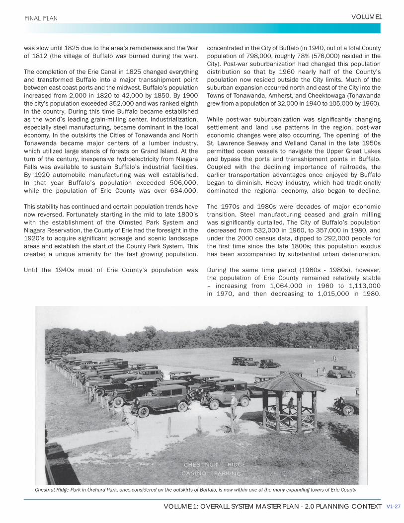
Chestnut Ridge Park in Orchard Park, once considered on the outskirts of Buffalo, is now within one of the many expanding towns of Erie County
V1-27

ERIE COUNTY PARKS MASTER PLAN UPDATE
2.0 PLANNING CONTEXT FINAL PLAN
2.2 NATURAL AND CULTURAL HERITAGE SETTING
2.2.1 LANDFORM
The landscapes of the Buffalo-Niagara region were largely shaped some 17,000 years ago, following the latest of the glacial periods that covered much of the continent. As the glaciers receded across the region, they created two vast inland lakes, glacial Lake Iroquois and glacial Lake Tonawanda. The glacial meltwaters receded, leaving Lake Ontario and
escarpments cutting across these plains. Erie County lies within two distinct topographic areas: the Great Lakes Plain along the lakeshore, and throughout the northern half of the County, and the higher Allegheny Plateau in the south-central and southeastern areas. The Great Lakes Plain is divided by several widely spaced escarpments, including the Onondaga Escarpment, a 50’- to 80’- high ridge which can be seen in Erie County generally following Route 5 from the Buffalo City line through Amherst and Clarence. The escarpment separates the Huron Plain to the north from the Erie Plain to the south.
The Erie Plain extends to the Portage Escarpment in the south, a 150’ to 250’ beach ridge that delineates the northern limit of the Allegheny Plateau. The Allegheny Plateau itself provides a definitive terrain characterized by steep hills and wide valleys, some of which achieve a vertical elevation change of 300’ to 400’. Many of the parks in the County System takes advantage of these unique natural features.
2.2.2 RIVERS AND STREAMS
Erie County lies within the Lake Erie/Niagara River drainage basin, and includes a number of major streams:
• Northern Erie County- Tonawanda Creek, and its major tributaries of Ellicott- Ransom, Black, Beeman, Gott and Murder Creeks;
• Central Erie County – Buffalo River, Cayuga Creek, Cazenovia Creek;
• Southern Erie County – Eighteen Mile Creek, Big Sister Creek, Cattaraugus Creek (which forms the southern County boundary) and its major tributary of Clear Creek
The headwaters of several of the major creek systems originate on the Allegheny Plateau and the Onondaga Escarpment, giving rise to dramatic gorges and waterfalls as the creeks
natural heritage features are protected within the County park system. The valley systems are primarily forested in their upper reaches. Through the Huron Plain, which is
2.2.3 CLIMATE
presence of Lake Erie. The climate is moist-continental, having cold temperatures with infrequent, intense precipitation in summer. In Buffalo summer temperature averages 69 degrees, with an average maximum of 78 degrees and a record high of 98 degrees; during winter, temperatures average 26 degrees, with an average minimum of 20 degrees and a record low of –20 degrees. Lake Erie provides a moderating effect on temperatures throughout the year. In the Allegheny Plateau area of Erie County, annual snowfalls vary from 120” to over 140”. In contrast, snowfall in northern Erie County averages 70” to 80”. About 60% of the snowfall occurs during November, December and January – a fact directlyattributable to a relatively warm, open lake combined with cold southwesterly winds, which produce “lake effect” snowfalls.
2.2.4 SIGNIFICANT HABITAT
Although a detailed natural resource inventory has not been
were historically acquired to protect tracts of lands with significant or scenic natural features, particularly those associated with the creek valley systems, and their associated forested areas. Other sources provide some insight into the terrestrial and aquatic habitat make-up of these systems,
areas that are included within the Erie County parks.
County, include the Lake Erie shoreline and Niagara River,
to the Great Lakes system, Eighteen Mile Creek is an important migratory corridor for songbirds, and contains a diversity of plants and wildlife, including rare and uncommon species. The Cattaraugus Creek and tributaries is the most
New York State, supporting both spawning and habitat.
A number of wetlands associated with the river systems, and having significant resident and migrant wildlife habitat have been identified in Tonawanda, Lackawanna,
in the region being the Tifft Nature Preserve, on the Buffalo River, and the Klydel Wetlands, in North Tonawanda.
VOLUME 1: OVERALL SYSTEM MASTER PLAN - 2.0 PLANNING CONTEXT
VOLUME1 FINAL PLAN
2.2.5 CULTURAL HERITAGE
County Park system, there is also a wealth of other cultural and heritage attractions throughout Erie County, from the urban core to the rural villages and remote countryside. The City of Buffalo has long been the cultural “heart” of the region and
renowned arts, and a lively theater district, to mention just a few of the attractions. The area is also home to a strong network of colleges and universities, including the State University of New York at Buffalo. The region is well-known for its professional sports teams including the Buffalo Bills and the Buffalo Sabres.
A partial listing of major regional cultural and heritage attractions is listed in the sidebar at the right.
• Historical Olmsted System of Parks and Parkways• Buffalo and Erie County Botanical Gardens• Key Underground Railroad sites, including the
Michigan Street Baptist Church and the Freedom memorial at Broderick Park
• Notable buildings by HH Richardson, Frank Lloyd Wright and Louis Sullivan
• Historic Grain Elevators • Albright Knox Art Gallery• Theodore Roosevelt Inaugural National Historic site • Buffalo Zoo• Canalside • Historic Allentown Neighborhood• Buffalo and Erie County Naval and Military Park • Darwin Martin House and Complex • Kleinhans Music Hall• Sheas Buffalo Theater • Forest Lawn Cemetery
• Historic Erie Canal tours• Our Lady of Victory Basilica, Lackawanna • Graycliff (Frank Lloyd Wright), Evans • Roycroft Campus, East Aurora
• Old Fort Niagara, Niagara County • Artpark, Niagara County• Niagara Reservation State Park (Olmsted Park),
Niagara County• Chautauqua Institution, Chautauqua County • Olde Fort Erie, Ontario
CULTURAL AND HERITAGE ATTRACTIONS
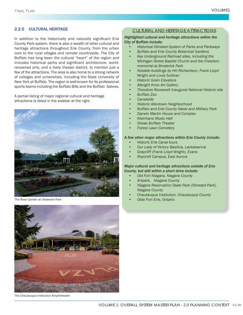
The Rose Garden at Delaware Park
The Chautauqua Institution Amphitheater
V1-29

THIS PAGE INTENTIONALLY LEFT BLANK
VOLUME 1: OVERALL SYSTEM MASTER PLAN - 3.0 OVERALL SYSTEM FRAMEWORK
3.0 OVERALL SYSTEM FRAMEWORK FINAL PLAN
OVERALL SYSTEM FRAMEWORK3.1 ROLE AND SIGNIFICANCE OF THE COUNTY PARK SYSTEM
Since the establishment in 1925 of the County Parks Commission, and the subsequent acquisition and development of the four original County parks, the underlying purpose of the parks system has been consistent – providing recreation opportunities in naturalistic settings on a county-wide basis, and preserving open space and unique natural features that are beyond the means of local governments to provide or maintain.
For the most part, the evolution of the County Park System demonstrates these objectives, and the parks highlight the
of Chestnut Ridge, Emery, Ellicott Creek, and Como Lake were strategically located to take advantage of the area’s unique forests and waterways. The acquisition of Akron Falls Park, with its dramatic waterfalls, and the later addition of Eighteen Mile Creek Park, Hunters Creek and Franklin Gulf lands, preserved
Onondaga and Portage Escarpments. The acquisition of Wendt Beach in the 1960s and Bennett Beach Park in the 1980s provided for waterfront recreation and ensured the retention of
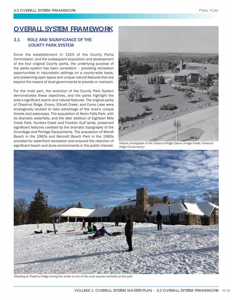
Historic photograph of the Chestnut Ridge Casino (Image Credit: Chestnut Ridge Conservancy)
Sledding at Chestnut Ridge during the winter is one of the most popular activities at the park
V1-31
ERIE COUNTY PARKS MASTER PLAN UPDATE
3.0 OVERALL SYSTEM FRAMEWORK FINAL PLAN
At the same time as the park system was developing, the County Parks System was acquiring land and reforesting substantial areas of abandoned farmland, for timber harvesting and conservation purposes. The forest lots represent almost one third of the County’s land holdings today which are primarily located in the southeastern portion of the County.
Over the years, as urbanization of the outlying County areas has taken place, increasing demands for recreation activities has led to the addition of a variety of facilities within the County Park System. In parks such as Como Lake and Ellicott Creek, passive recreation areas and open space have been replaced
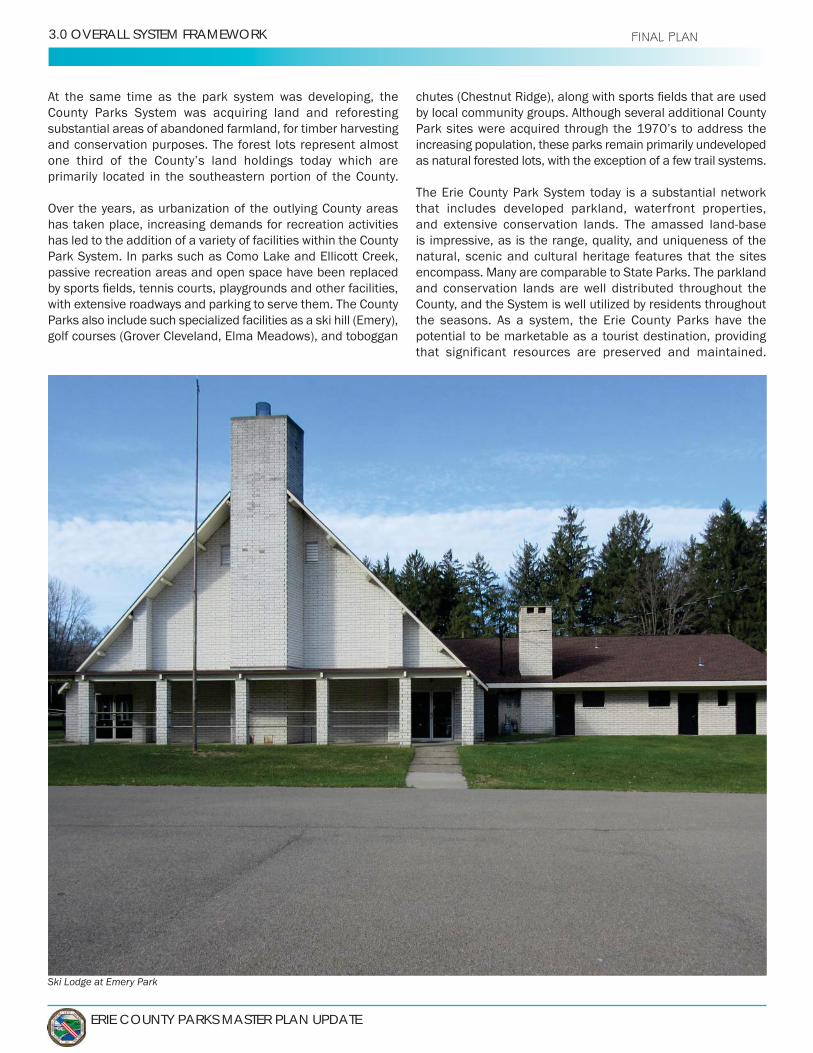
with extensive roadways and parking to serve them. The County Parks also include such specialized facilities as a ski hill (Emery), golf courses (Grover Cleveland, Elma Meadows), and toboggan
by local community groups. Although several additional County Park sites were acquired through the 1970’s to address the increasing population, these parks remain primarily undeveloped as natural forested lots, with the exception of a few trail systems.
The Erie County Park System today is a substantial network that includes developed parkland, waterfront properties, and extensive conservation lands. The amassed land-base is impressive, as is the range, quality, and uniqueness of the natural, scenic and cultural heritage features that the sites encompass. Many are comparable to State Parks. The parkland and conservation lands are well distributed throughout the County, and the System is well utilized by residents throughout the seasons. As a system, the Erie County Parks have the potential to be marketable as a tourist destination, providing that significant resources are preserved and maintained.
Ski Lodge at Emery Park

VOLUME 1: OVERALL SYSTEM MASTER PLAN - 3.0 OVERALL SYSTEM FRAMEWORK
VOLUME1
PARK NAME LOCATION TOTAL PARK ACRES
Akron Falls Town of Newstead/Village of Akron 154
Bailey Peninsula City of Buffalo 5
Bennett Beach Town of Evans 52
Black Rock Canal City of Buffalo 8
Boston Forest Town of Boston 480
Botanical Gardens City of Buffalo 12
Chestnut Ridge Town of Orchard Park 1,151
Como Lake Town/Village of Lancaster 524
Eighteen Mile Creek Town of Hamburg 466
Ellicott Creek Town of Tonawanda 165
Elma Meadows Town of Elma 214
Emery Town of Aurora 457
Franklin GulfTown of Eden/Town of North Collins 631
Grover Cleveland City of Buffalo 111
Headwaters Town of Concord 223
Hunters Creek Town of Wales 756
Isle View Town of Tonawanda 39
Lakeview Pocket Preserve Town of Evans 9
Red Jacket City of Buffalo 12
Riverwalk section of the Shoreline Trail Town City of Tonawanda 10
Scoby Dam Town of Concord 27
Seneca Bluffs City of Buffalo 20
Sprague Brook Town of Concord/Town of Sardinia 967
Times Beach City of Buffalo 56
Tow Path City of Buffalo 5
Wendt Beach Town of Evans 164
Forest Lot #1 Town of Sardinia 200
Forest Lot #2 Town of Sardinia 837
Forest Lot #3 Town of Sardinia 323
Forest Lot #4 Town of Holland 216
Forest Lot #5 Town of Holland 263
Forest Lot #6 Town of Holland 99
Forest Lot #7 Town of Holland 92
Forest Lot #8 Town of Concord 64
Forest Lot #9 Town of Concord 274
Forest Lot #11 Town of Sardinia 93
Forest Lot #12 Town of Sardinia 98
Forest Lot #13 Town of Concord 378
9,875
Shoreline Trail at Isle View Park
Shoreline conditions at Seneca Bluffs
Ruins at Ellicott Island, Ellicott Creek Park
V1-33
City of Buffalo

ERIE COUNTY PARKS MASTER PLAN UPDATE
3.0 OVERALL SYSTEM FRAMEWORK FINAL PLAN
The County has continued to acquire parkland, including several smaller properties along the Buffalo River, an 8-acre parcel on Lake Erie called the Lakeview Pocket Preserve, and the 223-acre “Headwaters” conservation property in the Town of Concord.
Past Master Plans have recommended substantial parkland improvements, additional recreation facilities, and new parks development. The current conditions do not warrant substantial new development. Over the past ten to twenty years town parks and school complexes have been developed to meet the demands of active recreation. Fiscal resources, however, have not kept pace with the operational and capital
investments are now needed to maintain and protect the park infrastructure, particularly the heritage structures. The forests and natural environment areas in the developed parks are in need of appropriate management to ensure their sustainability.
At the same time, recreation opportunities have increased at the local level, as suburban areas have developed. In keeping with contemporary design standards, new community areas include neighborhood walk-to parks, with facilities for young families.While larger town / village parks are being developed extensively
leagues, national and regional trends show a growing interest in nature-based and non-structured recreation activities that
support both the Baby Boomer and Millennial populations. Cycling and walking rank within the top recreation activities. Mountain biking, snowmobiling, and other linear trails-based activities have become increasingly more popular and are supported by active national and regional organizations. As recreational trends evolve the County Park System will need to periodically re-evaluate certain uses and functions.
3.2 MISSION AND GOALS
It is appropriate and necessary that the County revisit the mandate of the County Park System to ensure that it continues
sustainable entity for future generations. Based on the County Park System’s historic role in recreation service delivery, a
Objectives of the 2003 Master Plan were reviewed for their
Objective of this Master Plan were to review and update existing park concept plans, and determine recommendations and upgrades for all parks. In determining an appropriate level of development the parks classification system developed in 2003 was referred to as it defined the role and function of existing parkland.
The backshore sandy environment at Bennett Beach Park

VOLUME 1: OVERALL SYSTEM MASTER PLAN - 3.0 OVERALL SYSTEM FRAMEWORK
VOLUME1 FINAL PLAN
3.2.1 MISSION STATEMENT
Through the study process conducted in 2003, the following
today:The Erie County Park System has traditionally been positioned
provision of recreation activities and facilities in natural
The role of the County Park System shall be:
• To provide residents opportunities to enjoy recreational pursuits in natural settings on a year-round basis;
• To protect regionally important areas of scenic,
• To contribute to the economic vitality of the County, and;
• To promote public awareness of the resources available within the park system.
3.2.2 GOALS AND OBJECTIVES
County Park System that represent general principles, along with (thirty-one) supporting objectives, that provide detailed guidelines on park standards, physical improvements, operations and maintenance, and administrative functions. The Parks System may now be better served by a new policy framework that reflects contemporary recreation trends, the significant natural and cultural resources that are contained within the park system, and the values that will ensure their protection, enhancement and sustainability.
V1-35

ERIE COUNTY PARKS MASTER PLAN UPDATE
3.0 OVERALL SYSTEM FRAMEWORK FINAL PLAN
3.3 PARK CLASSIFICATIONS
Recognizing the diversity and variety of uses within the
served as a guide to the ongoing management and use of the existing parks and open space lands. It is recognized that within the existing park system, parks may share some of the characteristics of other park categories.
developed:• HERITAGE PARKS• WATERFRONT PARKS (Destination Parks, “Windows
on the Water” and Linkages)• SPECIAL PURPOSE PARKS (golf, camping)• CONSERVATION PARKS• FOREST MANAGEMENT AREAS
3.3.1 HERITAGE PARKS
Heritage parks are represented by the four original ‘County Parks’ and Akron Falls Park:
Chestnut Ridge, Emery Park, Como Lake, Ellicott Creek (c. 1925) and Akron Falls (constructed as a Village Park in late 1920s - acquired by County c. 1947), are examples of
significance. Each of the parks has unique, man-made structures of unmatched historical character and beauty, constructed between 1935 and 1943 as part of the WPA (Work Progress Administration) projects. These oldest parks deserve consideration on the “National Register of Historic Places.”
ROLE AND FUNCTION
• Primarily natural environment and picnic parks with a focus on environmental systems and cultural heritage preservation and passive recreation.
FACILITIES
• Conservation lands and natural areas;• Emphasis on passive recreational activities, such
as hiking/walking trails, strolling paths, open space, picnic shelters, and limited ancillary facilities such as
Historic 1940s master plan of Chestnut Ridge Park
VOLUME 1: OVERALL SYSTEM MASTER PLAN - 3.0 OVERALL SYSTEM FRAMEWORK
VOLUME1 FINAL PLAN
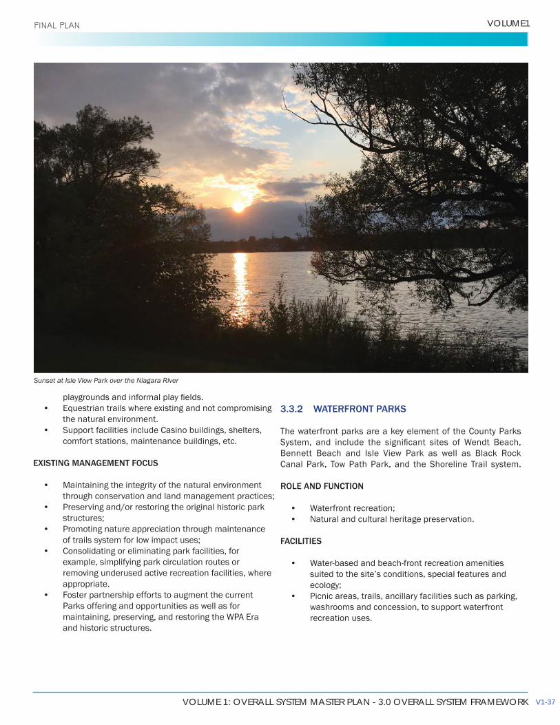
Sunset at Isle View Park over the Niagara River
• Equestrian trails where existing and not compromising the natural environment.
• Support facilities include Casino buildings, shelters, comfort stations, maintenance buildings, etc.
EXISTING MANAGEMENT FOCUS
• Maintaining the integrity of the natural environment through conservation and land management practices;
• Preserving and/or restoring the original historic park structures;
• Promoting nature appreciation through maintenance of trails system for low impact uses;
• Consolidating or eliminating park facilities, for example, simplifying park circulation routes or removing underused active recreation facilities, where appropriate.
• Foster partnership efforts to augment the current Parks offering and opportunities as well as for maintaining, preserving, and restoring the WPA Era and historic structures.
3.3.2 WATERFRONT PARKS
The waterfront parks are a key element of the County Parks
Bennett Beach and Isle View Park as well as Black Rock Canal Park, Tow Path Park, and the Shoreline Trail system.
ROLE AND FUNCTION
• Waterfront recreation;• Natural and cultural heritage preservation.
FACILITIES
• Water-based and beach-front recreation amenities suited to the site’s conditions, special features and ecology;
• Picnic areas, trails, ancillary facilities such as parking, washrooms and concession, to support waterfront recreation uses.
V1-37
ERIE COUNTY PARKS MASTER PLAN UPDATE
3.0 OVERALL SYSTEM FRAMEWORK FINAL PLAN
EXISTING MANAGEMENT FOCUS
• Maintaining the integrity of the natural environment through conservation and land management practices
• Restoring historic buildings.• Consolidating park facilities, e.g. simplifying park
circulation routes, removing/relocating active recreation facilities.
• Foster partnership efforts to augment the current Parks offering and opportunities.
• Facilitate public access and views to the lake and riverfront –understanding that a direct shoreline trail may not be feasible throughout, however a roadside trail with occasional “windows” punched through to the lake and river is very possible;
• Provide relief in the urban fabric.
LINKAGES
• Contribute to a continuous connected public waterfront; Isle View Park, Tow Path, Riverwalk, etc. with connections to other regional systems such as Ellicott Creek Trail, Scajaquada Trail, etc.
• Trail viewing areas and other waterfront related amenities, subject to environmental considerations,
3.3.3 SPECIAL PURPOSE PARKS
Parks with a special purpose, based on unique characteristics,
system, Elma Meadows Golf Course, Grover Cleveland Golf Course, Sprague Brook Park Camping Sites, etc.
ROLE AND FUNCTION
• Should meet the mandate of the County Parks system for the protection of natural and cultural heritage resources, and provision of recreation activities in natural settings;
• Should provide alternative to local recreation resources.
FACILITIES
• Varies according to purpose; camping, golf, etc.
EXISTING MANAGEMENT FOCUS
• Varies according to purpose; camping, golf, etc.• Foster partnership efforts to augment the current
Parks offering and opportunities.
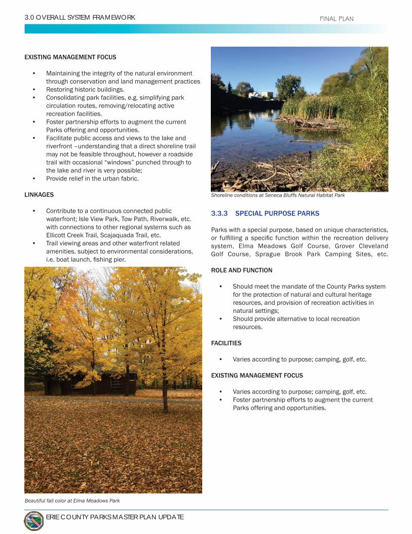
Shoreline conditions at Seneca Bluffs Natural Habitat Park
Beautiful fall color at Elma Meadows Park
VOLUME 1: OVERALL SYSTEM MASTER PLAN - 3.0 OVERALL SYSTEM FRAMEWORK
VOLUME1
3.3.5 FOREST MANAGEMENT AREAS
Forest lots comprised primarily of plantation forests.
ROLE AND FUNCTION
• Management and enhancement of resources through Forest Stand Improvements andpromotion of wildlife habitat;
• Resource management for educational opportunities
FACILITIES
• Modest facilities for resource management and/or education programming, Sugar Shanty, Sawmill,warming shelters, informal parking lots or bus drop-offs, open-air shelters;
• Access roads for resource management purposes.
EXISTING MANAGEMENT FOCUS
• Maximizing resource management opportunities whilepreserving habitat and environment, and long termsustainability;
• Identifying opportunities for education andinterpretation programs that focus on resourcemanagement;
• Foster partnership efforts to augment the currentParks offering and opportunities. This includes a focuson Environmental-based and Conservation-basedorganizations that will preserve and enhance thesenatural settings.
3.3.4 CONSERVATION PARKS
Formally undeveloped parks, these lands are to generally remain in a natural state. The primary purpose of these sites is for conservation of the natural environment, and nature-based education and recreation activities; Hunter’s Creek, Eighteen Mile Creek, Franklin Gulf, Scoby Dam, Boston Forest and the Buffalo River Natural Habitat Parks. These parks were originally purchased by Erie County to provide future recreational areas as population grew and demand warranted.
ROLE AND FUNCTION
• Management and enhancement of environmental
wildlife enhancement;• Self-directed, resource-oriented outdoor recreation
that complements the unique and natural features ofeach site, without compromising environmental
uses.
FACILITIES
• Conservation lands and natural areas;• Trails of a type suited to park environment, with
hierarchy based on types of use and skill level;• Low-impact supporting facilities such as trailheads,
modest comfort facilities, informal parking areas,
signage;• Modest facilities for outdoor education programming,
such as an open-air shelter.
EXISTING MANAGEMENT FOCUS
• Protection of important natural and cultural heritagefeatures;
• Identifying appropriate use areas and trail routes;• Encourage multi-use trails wherever possible and
appropriate to serve the greatest number of users;
unavoidable;• Perimeter landscape buffers in appropriate locations;• Trails management and safety measures;• Foster partnership efforts to augment the current
Parks offering and opportunities, including trailbuilding, maintenance and patrolling;
• Maintain the “Carry-in / Carry-out” trash policy withinthese scenic and natural park settings.
V1-39
ERIE COUNTY PARKS MASTER PLAN UPDATE
3.0 OVERALL SYSTEM FRAMEWORK FINAL PLAN
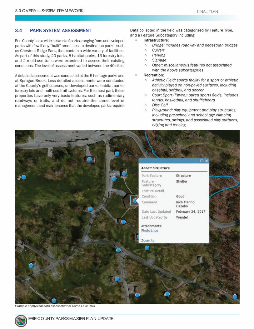
3.4 PARK SYSTEM ASSESSMENT
Erie County has a wide network of parks, ranging from undeveloped parks with few if any “built” amenities, to destination parks, such as Chestnut Ridge Park, that contain a wide variety of facilities. As part of this study, 20 parks, 5 habitat parks, 13 forestry lots, and 2 multi-use trails were examined to assess their existing conditions. The level of assessment varied between the 40 sites.
A detailed assessment was conducted at the 5 heritage parks and at Sprague Brook. Less detailed assessments were conducted at the County’s golf courses, undeveloped parks, habitat parks, forestry lots and multi-use trail systems. For the most part, these properties have only very basic features, such as rudimentary roadways or trails, and do not require the same level of management and maintenance that the developed parks require.
and a Feature Subcategory including:• Infrastructure:
Bridge: includes roadway and pedestrian bridges Culvert Parking Signage Other: miscellaneous features not associated
with the above subcategories• Recreation:
Athletic Field: sports facility for a sport or athletic activity played on non-paved surfaces, including baseball, softball, and soccer
Disc Golf Playground: play equipment and play structures,
including pre-school and school age climbing structures, swings, and associated play surfaces, edging and fencing
Example of physical data assessment at Como Lake Park

VOLUME 1: OVERALL SYSTEM MASTER PLAN - 3.0 OVERALL SYSTEM FRAMEWORK
VOLUME1 FINAL PLAN
Other: miscellaneous features not associated with the above subcategories
• Structure: Building: enclosed buildings open to the public,
such as concession stands, lodges and club houses as well as structures used for support services not open to the public
Comfort Station Historic Structure Shelter: buildings used as picnic shelters,
roof and roof supports Other: miscellaneous features not associated
with the above subcategories• Trail
Sign Trailhead Other: miscellaneous features not associated
with the above subcategories.
In many cases, the database contains additional information
Items in the database were given a general ranking as to their
elements were associated with that feature, those items were also rated. Items in generally good shape, showing no major
good do not require major investment other than routine maintenance, although some small or isolated repairs may be needed. Items that were rated as fair have evidence of damage
items rated poor, required repairs or improvements are more extensive, and may warrant replacement rather than repair.
V1-41

ERIE COUNTY PARKS MASTER PLAN UPDATE
3.0 OVERALL SYSTEM FRAMEWORK FINAL PLAN
The database provides Erie County with a valuable tool for parks planning. It provides a centralized, complete picture of the County Parks, and their condition. As repairs or changes to facilities are made, new features added or certain features removed, the database can be updated, and the date of the changes noted.Over time, therefore, the County will be able to monitor and reflect changes to the entire Park System.
3.4.1 OVERVIEW OF INVENTORY
Each of the parks was categorized according to its primary
detail in Section 3.4, but to summarize here, the inventory
• Heritage parks: Chestnut Ridge, Como Lake, Ellicott Creek, and Emery Parks are the four original County Parks, established in 1926. Akron Falls was added
contain many historic features, such as unique historic buildings, WPA-era stone walls or other structures. They tend to be larger parks, and have a variety of amenities and features.
• Waterfront parks: their location and function relates to waterfront recreational activities, although this category encompasses a variety of different parks, ranging from the Black Rock Canal Park, a small, limited- purpose park, to the larger beach parks in Evans.
• Special Purpose parks: these parks are noted for a particular strength. Grover Cleveland and Elma Meadows Parks are primarily golf courses, while Sprague Brook is associated with its camping facilities. The Botanical Gardens, although not included in this inventory; its primary function as a conservatory for rare and unique plant species, would be categorized as a Special Purpose park.
• Conservation parks and Forest Management Areas: these parks have not been included in the inventory, due to their undeveloped natural character.
The parks range in size from Black Rock Canal Park, which is just over 1 acre, to Chestnut Ridge, which is the largest park in the Erie County system at 1,151 acres. The average size of the parks included in the inventory is approximately 270 acres.
tend to be on the smaller side. The County maintains a total inventory of nearly 10,000 acres, but most of this inventory is concentrated in forest management areas or undeveloped parks.
Sprague Brook is a multi-purpose park located in the Towns of Concord and Sardinia
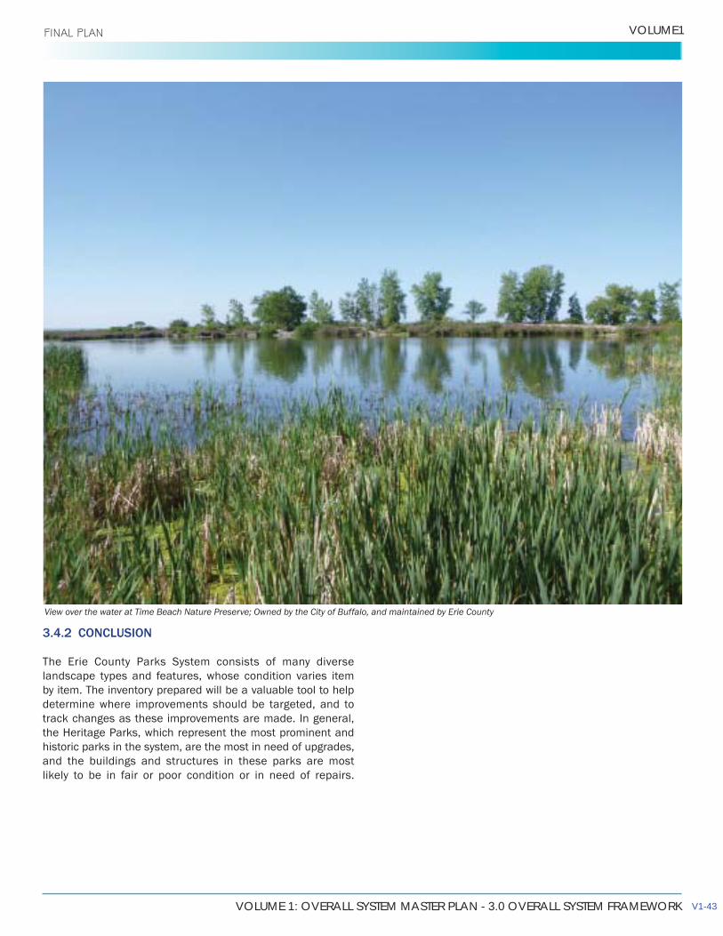
VOLUME 1: OVERALL SYSTEM MASTER PLAN - 3.0 OVERALL SYSTEM FRAMEWORK
VOLUME1 FINAL PLAN
3.4.2 CONCLUSION
The Erie County Parks System consists of many diverse landscape types and features, whose condition varies item by item. The inventory prepared will be a valuable tool to help determine where improvements should be targeted, and to track changes as these improvements are made. In general, the Heritage Parks, which represent the most prominent and historic parks in the system, are the most in need of upgrades, and the buildings and structures in these parks are most likely to be in fair or poor condition or in need of repairs.
View over the water at Time Beach Nature Preserve; Owned by the City of Buffalo, and maintained by Erie County
V1-43

THIS PAGE INTENTIONALLY LEFT BLANK
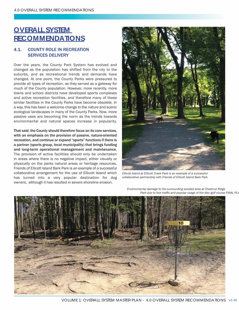
VOLUME 1: OVERALL SYSTEM MASTER PLAN - 4.0 OVERALL SYSTEM RECOMMENDATIONS
4.0 OVERALL SYSTEM RECOMMENDATIONS
OVERALL SYSTEM RECOMMENDATIONS4.1. COUNTY ROLE IN RECREATION SERVICES DELIVERY
Over the years, the County Park System has evolved and changed as the population has shifted from the city to the suburbs, and as recreational trends and demands have changed. At one point, the County Parks were pressured to provide all types of recreation, as they served as a gateway for much of the County population. However, more recently, more towns and school districts have developed sports complexes and active recreation facilities, and therefore many of these similar facilities in the County Parks have become obsolete. In a way, this has been a welcome change to the nature and scenic ecological landscapes in many of the County Parks. Now, more passive uses are becoming the norm as the trends towards environmental and natural spaces increase in popularity.
That said, the County should therefore focus on its core services, with an emphasis on the provision of passive, nature-oriented recreation, and continue or expand “sports” functions if there is a partner (sports group, local municipality) that brings funding and long-term operational management and maintenance. The provision of active facilities should only be undertaken in areas where there is no negative impact, either visually or physically on the parks natural areas or heritage resources. Friends of Ellicott Island Bark Park is an example of a successful collaborative arrangement for the use of Ellicott Island which has turned into a very popular destination for dog owners, although has resulted in severe shoreline erosion.
Ellicott Island at Ellicott Creek Park is an example of a successful collaborative partnership with Friends of Ellicott Island Bark Park
Environmental damage to the surrounding wooded area at Chestnut Ridge FINAL PLA
V1-45
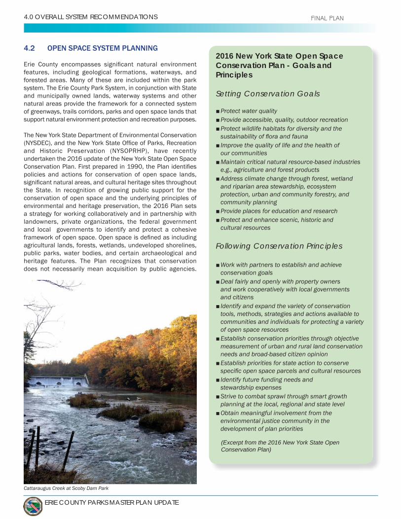
ERIE COUNTY PARKS MASTER PLAN UPDATE
4.0 OVERALL SYSTEM RECOMMENDATIONS FINAL PLAN
4.2 OPEN SPACE SYSTEM PLANNING
features, including geological formations, waterways, and forested areas. Many of these are included within the park system. The Erie County Park System, in conjunction with State and municipally owned lands, waterway systems and other natural areas provide the framework for a connected system of greenways, trails corridors, parks and open space lands that support natural environment protection and recreation purposes.
The New York State Department of Environmental Conservation
undertaken the 2016 update of the New York State Open Space
policies and actions for conservation of open space lands,
the State. In recognition of growing public support for the conservation of open space and the underlying principles of environmental and heritage preservation, the 2016 Plan sets a strategy for working collaboratively and in partnership with landowners, private organizations, the federal government and local governments to identify and protect a cohesive
agricultural lands, forests, wetlands, undeveloped shorelines, public parks, water bodies, and certain archaeological and heritage features. The Plan recognizes that conservation does not necessarily mean acquisition by public agencies.
2016 New York State Open Space Conservation Plan - Goals and Principles
Setting Conservation Goals
Protect water quality Provide accessible, quality, outdoor recreationProtect wildlife habitats for diversity and the
Improve the quality of life and the health of our communitiesMaintain critical natural resource-based industries e.g., agriculture and forest productsAddress climate change through forest, wetland and riparian area stewardship, ecosystem protection, urban and community forestry, and community planningProvide places for education and research Protect and enhance scenic, historic and cultural resources
Following Conservation Principles
Work with partners to establish and achieve conservation goalsDeal fairly and openly with property owners and work cooperatively with local governments and citizensIdentify and expand the variety of conservation tools, methods, strategies and actions available to communities and individuals for protecting a variety of open space resourcesEstablish conservation priorities through objective measurement of urban and rural land conservation needs and broad-based citizen opinionEstablish priorities for state action to conserve
Identify future funding needs and stewardship expensesStrive to combat sprawl through smart growth planning at the local, regional and state levelObtain meaningful involvement from the environmental justice community in the development of plan priorities
(Excerpt from the 2016 New York State Open Conservation Plan)
Cattaraugus Creek at Scoby Dam Park

VOLUME 1: OVERALL SYSTEM MASTER PLAN - 4.0 OVERALL SYSTEM RECOMMENDATIONS
VOLUME1 FINAL PLAN
The Open Space Conservation Plan identifies regional priority projects, which are deemed deserving of immediate
based on environmental significance, land use patterns, and recreational and cultural resource preservation
and their attributes in Erie County. Several of the County Parks are located in proximity to these features.
• Tonawanda Creek Watershed – This project wouldserve to protect one of the major tributaries of the
Ellicott Creek Park and Akron Falls Park are locatedwithin the watershed.
• Buffalo River Watershed – This project will serve to
primary tributaries: Cayuga Creek, Cazenovia Creekand Buffalo Creek.
• Lake Erie Tributary Gorges – This project seeks toacquire public access to these unique ecologicaland geological areas. Areas of interest in Erie County
• Niagara River Watershed – Several priority areas
Cayuga Creek and Upper Tonawanda Creek.
• Trails and Trailways – Protect existing linear corridorsand provide for acquisition or easement of existingtrails and trailways for additional undeveloped linkageto connect existing trails. These trails should promotecompatible, multiple uses to meet public demand forrecreational trail use.
• Urban Wetlands – Urban wetlands, because of theirsize, habitat type and quality, provide resident andmigration habitat for wildlife, which would otherwisebe absent from urban landscapes. Valuable wildlifeviewing and outdoor teaching opportunities areobtained from these natural communities, includingthe Klydel and Tifft wetlands.
to a regional open space system, and to work collaboratively with the State and local municipalities on a comprehensive policy framework that supports open space conservation. The County should take a leadership role in coordinating the services provided when jurisdictions overlap. This is particularly
and other major river or creek corridors such as Eighteen
should be exercised where there is a recreation resource of
systems (the Erie Canalway Trail, the Seaway Trail, waterfront
V1-47

ERIE COUNTY PARKS MASTER PLAN UPDATE
4.0 OVERALL SYSTEM RECOMMENDATIONS
4.3 PARKS MANAGEMENT STRATEGY
park operations and management should be on:
• Preservation and restoration of cultural heritagefeatures (4.3.1);
• Preservation and restoration of the natural systems(4.3.2);
• Parks improvements to address safety and liabilityissues, upgrade park appearances, and enhance thepark user experience (4.3.3);
• Environmentally responsible parks management(4.3.4);
• Improving and maintaining safety with all playgroundsystems (4.3.5);
Each park needs a management strategy that is
and restoration of the natural and cultural heritage features contained within park, the management of park should be based on a “zoning” system that recognizes the carrying capacity of the park and
(both cultural and natural), areas for enhancement of ecological functions, and existing or potential facilities development areas.
management system, and to ensure the preservation
a need to adopt more contemporary maintenance
additional training for staff to develop skills to restore and rebuild declining facilities.
Ecological management practices would include
naturalization strategies and improving aquatic habitats (e.g. rehabilitating open water ponds, establishing natural riparian corridors), and limiting use of herbicides and pesticides.
4.3.1 PRESERVATION AND RESTORATION OF CULTURAL HERITAGE FEATURES
The Erie County heritage parks include a large number of
casinos, pump shelters, and picnic shelters. Constructed with thoughtful design, local materials, and precise craftsmanship,
for their association with the history of the County and State Park Systems throughout the nation, and the contributions
structures of lasting quality, in tune with their natural setting
Key Recommendations -
The historic Boathouse Ruins at Ellicott Island
Key - (Project Type: Project Number)A - Action Item: Completed at low to no cost by Parks StaffP - Assistance or completion of project by potential partner/user groupC - Capital project
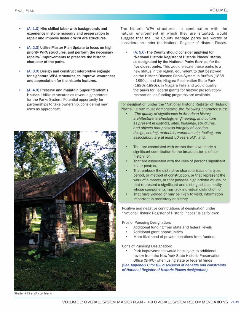
VOLUME 1: OVERALL SYSTEM MASTER PLAN - 4.0 OVERALL SYSTEM RECOMMENDATIONS
VOLUME1 FINAL PLAN
• (A: 1.0) Hire skilled labor with backgrounds and experience in stone masonry and preservation to repair and improve historic WPA era structures.
• (A: 2.0) Utilize Master Plan Update to focus on high priority WPA structures, and perform the necessary repairs/ improvements to preserve the historic character of the parks.
• (A: 3.0) Design and construct interpretive signage for signature WPA structures, to improve awareness and appreciation for the historic features.
• (A: 4.0) Preserve and maintain Superintendent’s Houses; Utilize structures as revenue generators for the Parks System; Potential opportunity for partnerships to take ownership, considering new uses as appropriate.
natural environment in which they are situated, would suggest that the Erie County heritage parks are worthy of
• (A: 5.0) The County should consider applying for “National Historic Register of Historic Places” status, as designated by the National Parks Service, for the
This would elevate these parks to a new status in the region, equivalent to that bestowed on the Historic Olmsted Parks System in Buffalo (1868
the parks for Federal grants for historic preservation/restoration as funding programs are available.
Places,” a site must demonstrate the following characteristics: •
architecture, archeology, engineering, and culture as present in districts, sites, buildings, structures, and objects that possess integrity of location, design, setting, materials, workmanship, feeling, and association, are at least 50 years old”, and:
• That are associated with events that have made a
history; or,•
in our past; or,• That embody the distinctive characteristics of a type,
period, or method of construction, or that represent the work of a master, or that possess high artistic values, or
whose components may lack individual distinction; or,• That have yielded or may be likely to yield, information
important in prehistory or history.
Positive and negative connotations of designation under
Pros of Pursuing Designation:• Additional funding from state and federal levels• Additional grant opportunities• More likelihood of private donations from funders
Cons of Pursuing Designation:• Park improvements would be subject to additional
review from the New York State Historic Preservation
of National Register of Historic Places designation)
Shelter #33 at Ellicott Island
V1-49

ERIE COUNTY PARKS MASTER PLAN UPDATE
4.0 OVERALL SYSTEM RECOMMENDATIONS
4.3.2 PRESERVATION AND RESTORATION OF NATURAL SYSTEMS
Currently the Departments of Environment and Planning, and
preservation and restoration of their existing park lands. The
remedial action.
Recommendations:
• (A: 7.0) To continue to properly manage and maintainForestry Lots, it is recommended to performa comprehensive update to the 2003 ForestryManagement Plan.
• (A: 8.0) Conduct and complete a natural resourcesinventory plan; identify and inventory rare plants,
well as other natural resource features. Many species have already been documented
in park properties, and it is recommended that the County reach out to The New York Heritage Program and the NYSDEC to accumulate and share knowledge.
4.3.3 ENVIRONMENTALLY RESPONSIBLE PARKS MANAGEMENT
Considered ecological jewels, the Erie County Parks System should be treated with respect and appreciated for the diverse landscapes and wildlife settings. The use of natural landscaping and naturalization of public open space lands is a practice that is well supported through a number of Federal acts and regulations, and implemented at state and local municipal levels.
Agency (EPA) and the Federal Highway Authority (FHA). The EPA provides assistance to municipalities seeking to meet US Clean
planting programs. At the state levels the most concerted effort toward naturalization has taken place along highway and road rights of ways, stimulated by the FHA which stipulates that 25% of all highway landscaping funds must be spent on the creation and implementation of roadside naturalization programs. Consequently, roadside natural vegetation programs have been undertaken in a number of states.
• (A: 12.0) Promote and practice naturalizedlandscapes as a landscape management tool whoseprincipal goal is the restoration of ecological systems,rather than simply a reduced mowing regime. Althoughreduced maintenance costs are a potential outcome,the adoption of a natural landscaping for purely
objectives.
4.3.4 GENERAL PARKS IMPROVEMENTS
The Master Plan Update assessment revealed a Park System that offers tremendous recreation potential, as well as a series of unique and memorable scenic, heritage and natural environment resources. However, time and
facilities, heritage structures, and natural environment areas are protected and preserved for future generations. An
“Living Shoreline” construction at Ellicott Creek Park
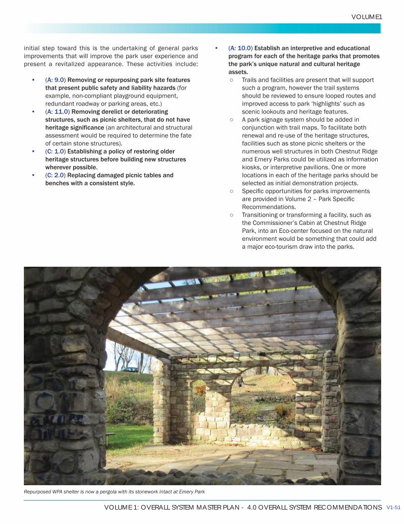
VOLUME 1: OVERALL SYSTEM MASTER PLAN - 4.0 OVERALL SYSTEM RECOMMENDATIONS
VOLUME1
initial step toward this is the undertaking of general parks improvements that will improve the park user experience and present a revitalized appearance. These activities include:
• (A: 9.0) Removing or repurposing park site featuresthat present public safety and liability hazards
• (A: 11.0) Removing derelict or deterioratingstructures, such as picnic shelters, that do not have
.• (C: 1.0) Establishing a policy of restoring older
heritage structures before building new structureswherever possible.
• (C: 2.0) Replacing damaged picnic tables andbenches with a consistent style.
• (A: 10.0) Establish an interpretive and educationalprogram for each of the heritage parks that promotesthe park’s unique natural and cultural heritageassets.
Trails and facilities are present that will supportsuch a program, however the trail systems should be reviewed to ensure looped routes and
scenic lookouts and heritage features. A park signage system should be added in
conjunction with trail maps. To facilitate both
facilities such as stone picnic shelters or the
and Emery Parks could be utilized as information kiosks, or interpretive pavilions. One or more locations in each of the heritage parks should be selected as initial demonstration projects.
Transitioning or transforming a facility, such as
environment would be something that could add
Repurposed WPA shelter is now a pergola with its stonework intact at Emery Park
V1-51
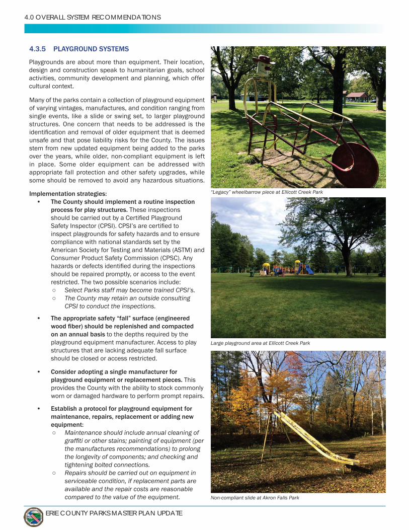
ERIE COUNTY PARKS MASTER PLAN UPDATE
4.0 OVERALL SYSTEM RECOMMENDATIONS
4.3.5 PLAYGROUND SYSTEMS
Many of the parks contain a collection of playground equipment of varying vintages, manufactures, and condition ranging from single events, like a slide or swing set, to larger playground structures. One concern that needs to be addressed is the
unsafe and that pose liability risks for the County. The issues stem from new updated equipment being added to the parks
in place. Some older equipment can be addressed with appropriate fall protection and other safety upgrades, while some should be removed to avoid any hazardous situations.
Implementation strategies:• The County should implement a routine inspection
process for play structures. These inspections
inspect playgrounds for safety hazards and to ensure compliance with national standards set by the American Society for Testing and Materials (ASTM) and Consumer Product Safety Commission (CPSC). Any
should be repaired promptly, or access to the event restricted. The two possible scenarios include:
Select Parks staff may become trained CPSI’s. The County may retain an outside consulting
CPSI to conduct the inspections.
• The appropriate safety “fall” surface (engineered
on an annual basis to the depths required by theplayground equipment manufacturer. Access to playstructures that are lacking adequate fall surfaceshould be closed or access restricted.
• Consider adopting a single manufacturer forplayground equipment or replacement pieces. Thisprovides the County with the ability to stock commonlyworn or damaged hardware to perform prompt repairs.
• Establish a protocol for playground equipment formaintenance, repairs, replacement or adding newequipment:
Maintenance should include annual cleaning of
the manufactures recommendations) to prolong
tightening bolted connections. Repairs should be carried out on equipment in
serviceable condition, replacement parts are available and the repair costs are reasonable compared to the value of the equipment.
“Legacy” wheelbarrow piece at Ellicott Creek Park
Large playground area at Ellicott Creek Park
Non-compliant slide at Akron Falls Park
Playgrounds are about more than equipment. Their location, design and construction speak to humanitarian goals, school activities, community development and planning, which offer cultural context.

VOLUME 1: OVERALL SYSTEM MASTER PLAN - 4.0 OVERALL SYSTEM RECOMMENDATIONS
VOLUME1
Equipment with irreplaceable parts, or where therepair costs are nearing or exceeding the cost to provide replacement equipment should be removed.
Equipment that is unused should be removed. Several considerations should be given prior to
adding new playground equipment: Does the park utilization warrant the
addition/replacement of equipment? Age and ability appropriateness. Context or setting. For Heritage parks
preference would be to install equipment with earth tone colors and to limit plastic to an extent.
•
maintenance, such as painting or spreading out
would not turn over the responsibility of maintainingor repairing a playground in a safe condition, thisremains the obligation of the County. The purpose ofthe program is to expand partnership opportunitiesand bring awareness and recognition within the parksystem.
Consideration should be provided for select pieces of “legacy”
these pieces of equipment, while not compliant with current standards, are great opportunities to reminiscence in a park.
For these select pieces of equipment that are in serviceable condition and do not present an immediate hazard should remain as artwork, and not play equipment.
One suggestion is to relocate all of the “legacy” playground equipment pieces to one location and create, in a sense,
determine the origins of the pieces and develop interpretive signage that explains the history about the playground equipment. Most of the “legacy” pieces are from the Novelty
digging into as most of the metal playground pieces built by
Non-compliant slide at Chestnut Ridge Park
V1-53
•
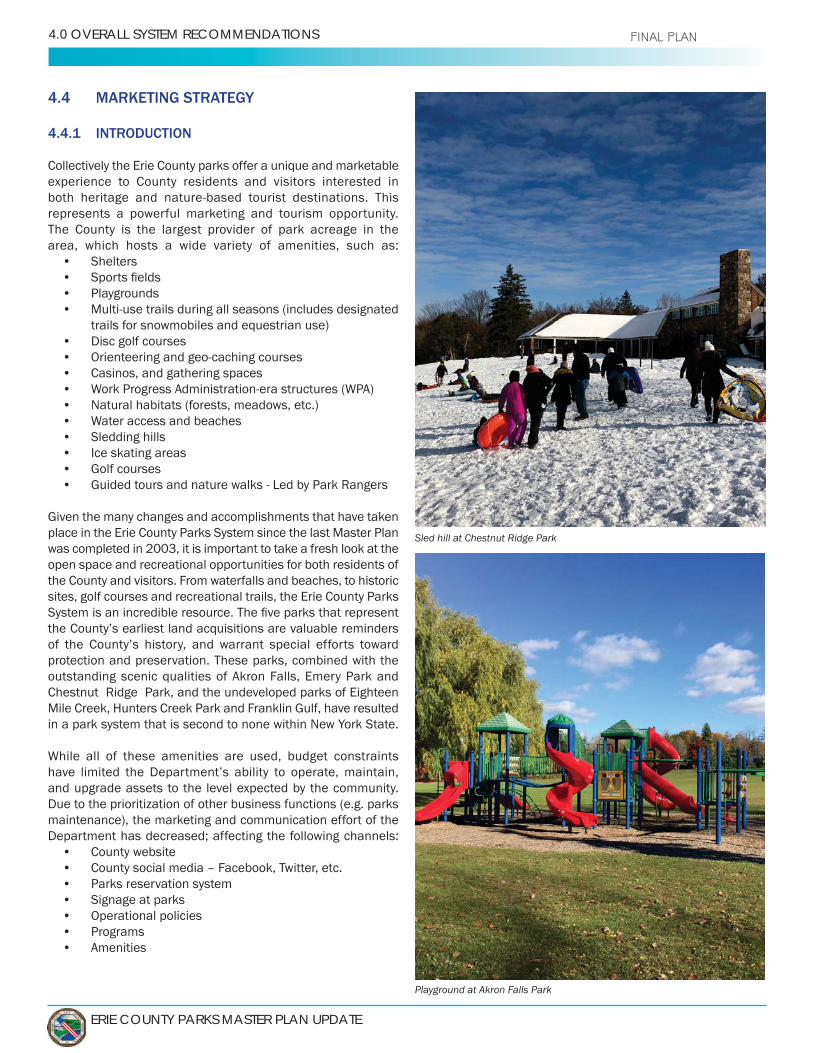
ERIE COUNTY PARKS MASTER PLAN UPDATE
4.0 OVERALL SYSTEM RECOMMENDATIONS FINAL PLAN
4.4 MARKETING STRATEGY
4.4.1 INTRODUCTION
Collectively the Erie County parks offer a unique and marketable experience to County residents and visitors interested in
represents a powerful marketing and tourism opportunity.The County is the largest provider of park acreage in the area, which hosts a wide variety of amenities, such as:
• Shelters• • Playgrounds•
trails for snowmobiles and equestrian use)• Disc golf courses• • Casinos, and gathering spaces• • Natural habitats (forests, meadows, etc.)• • Sledding hills• Ice skating areas• •
place in the Erie County Parks System since the last Master Plan was completed in 2003, it is important to take a fresh look at the open space and recreational opportunities for both residents of the County and visitors. From waterfalls and beaches, to historic sites, golf courses and recreational trails, the Erie County Parks
protection and preservation. These parks, combined with the outstanding scenic qualities of Akron Falls, Emery Park and
in a park system that is second to none within New York State.
and upgrade assets to the level expected by the community. Due to the prioritization of other business functions (e.g. parks maintenance), the marketing and communication effort of the Department has decreased; affecting the following channels:
• County website• County social media – Facebook, Twitter, etc.• Parks reservation system• Signage at parks• Operational policies• Programs• Amenities
Sled hill at Chestnut Ridge Park
Playground at Akron Falls Park

VOLUME 1: OVERALL SYSTEM MASTER PLAN - 6.0 IMPLEMENTATION STRATEGIES
VOLUME1
Department does not have a guiding message or brand,
The Parks System is currently not well understood and has
with parks that are nearby, but do not recognize the rich and complex natural and cultural resources of the broader
Parks System are often overshadowed by the Buffalo Olmsted Parks System or some regional State Parks. Unfortunately, visitors are not introduced to the County Parks system or its attractions through general tourism information. However, this is getting better through various social media outlets.
been undertaken to ensure a quality visitor experience (with initial efforts focused on the heritage parks), the County
awareness of the park system and its cultural and natural history. This will require a focused marketing strategy that
4.4.2 CROSS-MARKETING OPPORTUNITIES
• (P: 1.0)
o ensure maximum exposure for the County Park System, and to further promote the heritage and
County Park system,
This would involve links to local and regionaltourist destinations, as well as in neighboring counties.
• (P: 2.0) rioritize in the Erie
The County should continue to work with existingnetworks and publications as well as explore other avenues that focus on regional tourism.
Akron Falls lower waterfall
V1-55
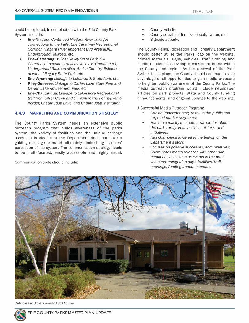
ERIE COUNTY PARKS MASTER PLAN UPDATE
4.0 OVERALL SYSTEM RECOMMENDATIONS FINAL PLAN
could be explored, in combination with the Erie County Park System, include:
• Erie-Niagara: Continued Niagara River linkages, connections to the Falls, Erie Canalway Recreational Corridor, Niagara River Important Bird Area (IBA), Underground Railroad, etc.
• Erie–Cattaraugus: Zoar Valley State Park, Ski Country connections (Holiday Valley, Holimont, etc.), Underground Railroad sites, Amish Country, linkages down to Allegany State Park, etc.
• Erie-Wyoming: Linkage to Letchworth State Park, etc.• Riley-Genesee: Linkage to Darien Lake State Park and
Darien Lake Amusement Park, etc.• Erie-Chautauqua: Linkage to Lakeshore Recreational
trail from Silver Creek and Dunkirk to the Pennsylvania border, Chautauqua Lake, and Chautauqua Institution.
4.4.3 MARKETING AND COMMUNICATION STRATEGY
The County Parks System needs an extensive public outreach program that builds awareness of the parks system, the variety of facilities and the unique heritage assets. It is clear that the Department does not have a
perception of the system. The communication strategy needs
Communication tools should include:
• County website• County social media – Facebook, Twitter, etc.• Signage at parks
should better utilize the Parks logo on the website, printed materials, signs, vehicles, staff clothing and media relations to develop a consistent brand within the County and region. As the renewal of the Park System takes place, the County should continue to take advantage of all opportunities to gain media exposure to heighten public awareness of the County Parks. The media outreach program would include newspaper articles on park projects, State and County funding announcements, and ongoing updates to the web site.
A Successful Media Outreach Program:• Has an important story to tell to the public and
• Has the capacity to create news stories about the parks programs, facilities, history, and
• Has champions involved in the telling of the
• • Coordinates media releases with other non-
media activities such as events in the park, volunteer recognition days, facilities/trails openings, funding announcements.
Clubhouse at Grover Cleveland Golf Course
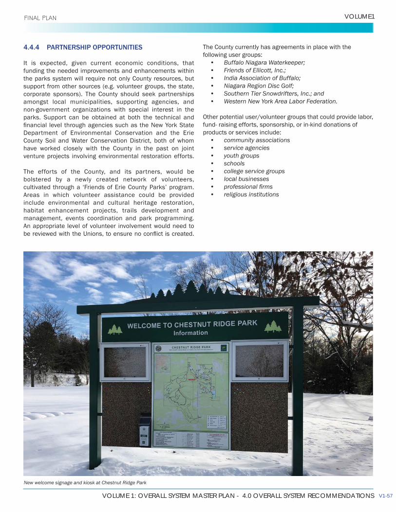
VOLUME 1: OVERALL SYSTEM MASTER PLAN - 4.0 OVERALL SYSTEM RECOMMENDATIONS
VOLUME1 FINAL PLAN
4.4.4 PARTNERSHIP OPPORTUNITIES
It is expected, given current economic conditions, that funding the needed improvements and enhancements within the parks system will require not only County resources, but support from other sources (e.g. volunteer groups, the state, corporate sponsors). The County should seek partnerships amongst local municipalities, supporting agencies, and
parks. Support can be obtained at both the technical and
Department of Environmental Conservation and the Erie
have worked closely with the County in the past on joint venture projects involving environmental restoration efforts.
The efforts of the County, and its partners, would be bolstered by a newly created network of volunteers,
Areas in which volunteer assistance could be provided include environmental and cultural heritage restoration, habitat enhancement projects, trails development and management, events coordination and park programming. An appropriate level of volunteer involvement would need to
The County currently has agreements in place with the following user groups:
• • • • • • Western New York Area Labor Federation.
Other potential user/volunteer groups that could provide labor,
products or services include:• community associations• service agencies• youth groups• schools• college service groups• local businesses• • religious institutions
New welcome signage and kiosk at Chestnut Ridge Park
V1-57

ERIE COUNTY PARKS MASTER PLAN UPDATE
4.0 OVERALL SYSTEM RECOMMENDATIONS FINAL PLAN
4.5 RECREATION PROGRAMMING ANALYSIS
(Full marketing plan can be found in Volume 1, Section 6.3)
Program DevelopmentUnderstanding core services in the delivery of parks and recreation services will allow the Erie County Department of
while developing strategies to assist in the delivery of other services. The basis of determining core services should come from the vision and mission developed by the County and what
resources of the Department, current trends, and the market.
The Department offers programs in the following areas:• Events • Park Rentals• Golf Courses
Elma Meadows Golf Course Grover Cleveland Golf Course
• Park Rangers • Athletic Fields and Facilities
seems limited, multiple organizations and partners/user groups utilize the park system to offer programming within the community. The Department does not need to
be involved in the operations of these organizations, but should manage these partnerships consistently to ensure they are able to properly maintain their park system.
4.6 OPERATIONS AND MAINTENANCE ANALYSIS
Operations
public open spaces and for providing a quality system of parks, recreation facilities, open spaces and positive leisure opportunities available to all persons in the community. The Department operates a park system made up of nearly
the County. These sites are made up of the following: • • • 13 forestry lots• •
Maintenance
Forestry are committed to the highest levels of maintenance. Maintenance throughout the year takes many forms and task including (but not limited to) mowing, snow removal at multiple sites, event support, urban forestry, playgrounds, and historic structure maintenance and repair.
Comfort Station at Chestnut Ridge Park

VOLUME 1: OVERALL SYSTEM MASTER PLAN - 4.0 OVERALL SYSTEM RECOMMENDATIONS
VOLUME1 FINAL PLAN
Facilities and Amenities:• (A: 13.0) Maintain and improve existing facilities• (A: 14.0) Develop connections with greenways, bike
paths, and trails• (A: 15.0) Address Deferred Maintenance backlog• (A: 16.0) Address low scoring (poorly rated)
amenities in parks• (A: 17.0) Address restroom issues• (A: 18.0) Access ADA accessibilities to parks and
facilities• (A: 19.0) Develop individual Park Master Plans
to address historic facilities preservation and continued demand for use
• (P: 3.0) Explore opportunities to non-traditional recreation offerings through user group agreements
• (P: 4.0) Explore opportunities for dog parks ConclusionAs the parks and forestry system continues to expand deferred maintenance of structures and open space, and maintenance
parks. In addition to historic amenities and facilities, an
current parks and open space that continue to provide a safe, functional, and aesthetically pleasing park system.
• (A: 20.0) Develop and review written maintenance standards
• (A: 21.0) Continue to maintain quality standard park area maintenance
• (A: 22.0) Continue providing staff training that is appropriate for the assigned areas of expertise
• (A: 23.0) Evaluate the distribution of maintenance staff and areas of responsibilities to ensure the
• (A: 24.0) , equipment, and resources as the Department continues to grow in response to new user groups, partnerships and community expectations
• (A: 25.0) Continuously evaluate existing facilities,
upgrades that maintain user expectations and quality standards
Lancaster Place, facility at Como Lake Park
Two Mile Creek Greenway
WPA era historic stone comfort station at Emery Park
V1-59

ERIE COUNTY PARKS MASTER PLAN UPDATE
4.0 OVERALL SYSTEM RECOMMENDATIONS
4.7 FINANCIAL ANALYSIS
4.7.1 CURRENT CONDITIONS
Parks and recreation facilities and services are essential to
Parks and recreation services promote and support a
community health. However, not all facilities and services are used equally, nor are their maintenance needs constant from year to year. This Volume and Volume 2 discuss and detail park maintenance and improvement needs.
currently funded by two main sources, the largest being the general fund, and grants (many through the Department of Environment & Planning, focused on waterfront projects and transportation alternatives, i.e., trails). The Department generates revenues for some services
According to the 2018 NRPA – Agency Performance Report
•
tax support, although the percentage of funding fromgeneral fund tax support tends to be lower at agencies
operating expenditures from general fund tax support.
• The second biggest source of revenue for mostagencies is earned/generated revenues, responsiblefor an average of 28 percent of operatingexpenditures. Erie County recovered 21 percent in
• Many agencies depend on special dedicated taxes forpart of their budget.
• The typical park and recreation agency dedicates
management and maintenance of parks and open
201 .
4.7.2 CURRENT COST RECOVERY
The results of the 2018 NRPA – Agency Performance Report show that the typical parks and recreation agency recovers
A review of the Erie County budget documents for the Fiscal
Figure 1 provides a historical review of revenue to operating
the Department. As illustrated, revenues have declined while operating expenses have increased over time.
Another way to look at revenues and expenses is on a Esri Business Analyst
0%
5%
10%
15%
20%
25%
30%
35%
$-
$1,000,000
$2,000,000
$3,000,000
$4,000,000
$5,000,000
$6,000,000
$7,000,000
$8,000,000
2005 2010 2015 201
Revenue to Operating Expense
Total Appropiation Gross Revenue Revenue to Operating Expense
Figure 1: Erie County Revenue to Operating Expense Trend
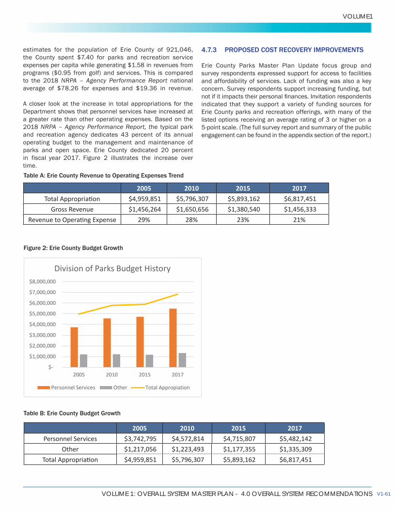
VOLUME 1: OVERALL SYSTEM MASTER PLAN - 4.0 OVERALL SYSTEM RECOMMENDATIONS
VOLUME1
expenses per capita while generating $1.58 in revenues from programs ($0.95 from golf) and services. This is compared to the 2018 NRPA – Agency Performance Report national
A closer look at the increase in total appropriations for the Department shows that personnel services have increased at a greater rate than other operating expenses. Based on the 2018 NRPA – Agency Performance Report, the typical park
operating budget to the management and maintenance of parks and open space. Erie County dedicated 20 percent in Figure 2 illustrates the increase over time.
4.7.3 PROPOSED COST RECOVERY IMPROVEMENTS
Erie County Parks Master Plan Update focus group and survey respondents expressed support for access to facilities
concern. Survey respondents support increasing funding, but
indicated that they support a variety of funding sources for Erie County parks and recreation offerings, with many of the listed options receiving an average rating of 3 or higher on a
engagement can be found in the appendix section of the report.)
2005 2010 2015 201 $4,959,851 $5,796,307 $5,893,162 $6,817,451
Gross Revenue $1,456,264 $1,650,656 $1,380,540 $1,456,333 29% 28% 23% 21%
$-
$1,000,000
$2,000,000
$3,000,000
$4,000,000
$5,000,000
$6,000,000
$7,000,000
$8,000,000
2005 2010 2 5 201
Division of Parks Budget History
Personnel Services Other Total Appropiation
2005 2010 2015 201Personnel Services $3,742,795 $4,572,814 $4,715,807 $5,482,142
Other $1,217,056 $1,223,493 $1,177,355 $1,335,309 $4,959,851 $5,796,307 $5,893,162 $6,817,451
Table A: Erie County Revenue to Operating Expenses Trend
Table B: Erie County Budget Growth
Figure 2: Erie County Budget Growth
V1-61
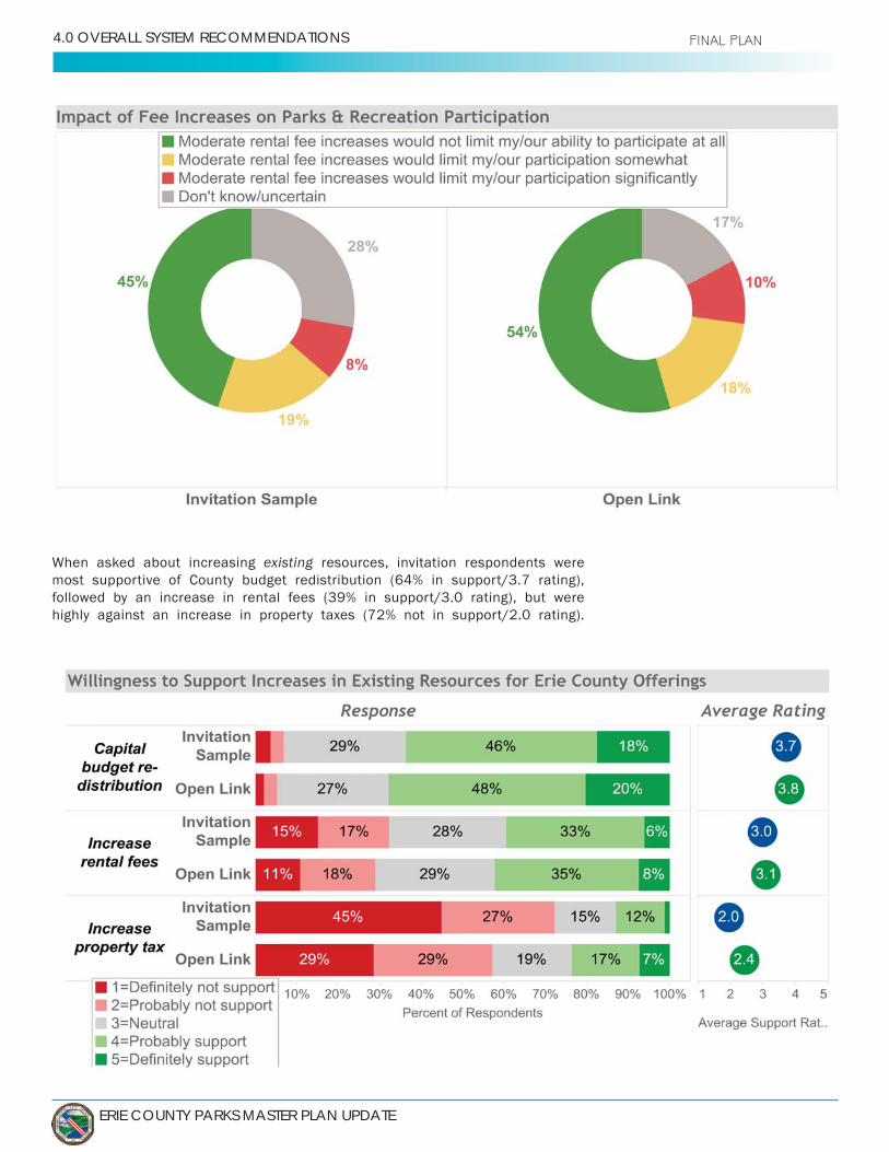
ERIE COUNTY PARKS MASTER PLAN UPDATE
4.0 OVERALL SYSTEM RECOMMENDATIONS FINAL PLAN
existing resources, invitation respondents were
followed by an increase in rental fees (39% in support/3.0 rating), but were
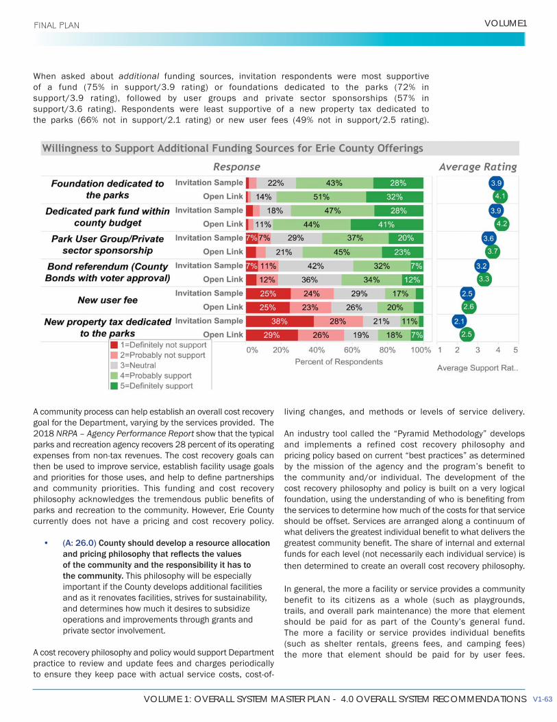
VOLUME 1: OVERALL SYSTEM MASTER PLAN - 4.0 OVERALL SYSTEM RECOMMENDATIONS
VOLUME1 FINAL PLAN
living changes, and methods or levels of service delivery.
An industry tool called the “Pyramid Methodology” develops and implements a refined cost recovery philosophy and pricing policy based on current “best practices” as determined
the community and/or individual. The development of the cost recovery philosophy and policy is built on a very logical
the services to determine how much of the costs for that service should be offset. Services are arranged along a continuum of
funds for each level (not necessarily each individual service) is then determined to create an overall cost recovery philosophy.
In general, the more a facility or service provides a community benefit to its citizens as a whole (such as playgrounds, trails, and overall park maintenance) the more that element
(such as shelter rentals, greens fees, and camping fees) the more that element should be paid for by user fees.
additional funding sources, invitation respondents were most supportive
A community process can help establish an overall cost recovery goal for the Department, varying by the services provided. The 2018 NRPA – Agency Performance Report show that the typical parks and recreation agency recovers 28 percent of its operating
then be used to improve service, establish facility usage goals
and community priorities. This funding and cost recovery
parks and recreation to the community. However, Erie County currently does not have a pricing and cost recovery policy.
• (A: 26.0) County should develop a resource allocation
of the community and the responsibility it has to the community. This philosophy will be especially important if the County develops additional facilities and as it renovates facilities, strives for sustainability, and determines how much it desires to subsidize operations and improvements through grants and private sector involvement.
A cost recovery philosophy and policy would support Department practice to review and update fees and charges periodically
V1-63

ERIE COUNTY PARKS MASTER PLAN UPDATE
4.0 OVERALL SYSTEM RECOMMENDATIONS FINAL PLAN
Developing effective ongoing systems that help measure success in reaching cost recovery goals and anticipate potential pitfalls are dependent on the following:
• Understanding of current revenue streams and their sustainability.
• Tracking all expenses and revenues for facilities and services to understand their contributions to overall department cost recovery.
• and to what degree they should be subsidized.
• purely because of the service and the change with the service.
•
administration, debt service, etc.).• Acknowledging the full cost of each service (those
direct and indirect costs associated with service
appropriate cost recovery targets.
4.7.4 ADDITIONAL REVENUE POTENTIAL
The Department generates revenue from several sources
in revenue. The largest portion of that is generated through golf fees (60%). The other major sources come from shelter fees, camping fees, and concession fees.
A potential source of revenue is through the introduction of special event fees. Currently the Department only collects shelter rental fees, at the same rate for small private gatherings, as they do for runs, walks, races, and other large organized private events. These events place an impact on the operations of park staff and maintenance of the facilities used.
Across New York and across the country, parks and recreation departments attempt to recover direct expenses related to outside events hosted in public parks. As a comparison, the consultant team reviewed other localities in the county and how they handle special events. Using the City of Buffalo 2018 Special Event Fee Schedule and the number of
4.7.5 FINANCIAL SUSTAINABILITY FOR SERVICE DELIVERY
The Department should continue to pursue and expand efforts to secure alternative funding that strategically align with the
• Expand alternative funding through grants • Explore new community partnerships• Developing and implementing a special event fee
schedule should be prioritized to help recover expenses incurred from events held in parks and help to manage irregular expenditures and maintenance for the Department.
• Consider implementation of a cost recovery and equitable pricing philosophy and policy where revenue
and Forestry where they are created sustainably
Based on the capital and operations and maintenance budget
the County maximize the funding and revenue opportunities listed above while balancing affordability within the community.
Critical to this cost recovery undertaking is the support and
Fee Revenue $200 $20,000
Seasonal event fee $500 $12,500 $40 $4,000 only when selling food
Merchandise vendor $35 $3,500 Garbage totes $10 $2,000 per tote, including delivery and pick-up
$25 $625 per tent $250 $2,500
$45,125 based on 100 events per year
Figure 3: Potential Revenue from Special Event Fees

V1-65
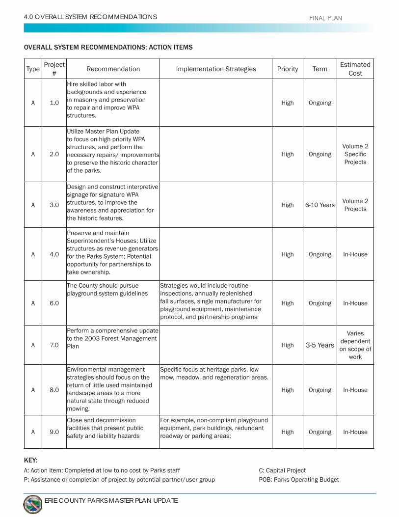
ERIE COUNTY PARKS MASTER PLAN UPDATE
4.0 OVERALL SYSTEM RECOMMENDATIONS FINAL PLAN
OVERALL SYSTEM RECOMMENDATIONS: ACTION ITEMS
TypeProject
#Implementation Strategies Priority Term
Estimated Cost
A 1.0
Hire skilled labor with backgrounds and experience in masonry and preservation
structures.
High Ongoing
A 2.0
Utilize Master Plan Update
structures, and perform the necessary repairs/ improvements to preserve the historic character of the parks.
High OngoingVolume 2
Projects
A 3.0
Design and construct interpretive
structures, to improve the awareness and appreciation for the historic features.
HighVolume 2 Projects
A
Preserve and maintain
structures as revenue generators for the Parks System; Potential opportunity for partnerships to take ownership.
High Ongoing
A 6.0
The County should pursue playground system guidelines
Strategies would include routine inspections, annually replenished fall surfaces, single manufacturer for playground equipment, maintenance protocol, and partnership programs
High Ongoing
A
Perform a comprehensive update to the 2003 Forest Management Plan High
Varies dependent on scope of
work
A 8.0
Environmental management strategies should focus on the return of little used maintained landscape areas to a more natural state through reduced mowing.
mow, meadow, and regeneration areas.
High Ongoing
A 9.0
Close and decommission facilities that present public safety and liability hazards
equipment, park buildings, redundant roadway or parking areas;
High Ongoing
KEY:A: Action Item: Completed at low to no cost by Parks staff C: Capital ProjectP: Assistance or completion of project by potential partner/user group POB: Parks Operating Budget
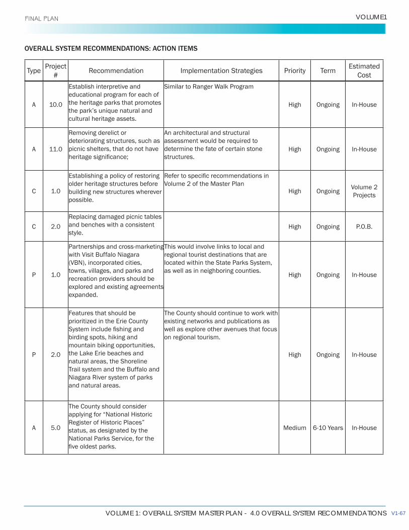
VOLUME 1: OVERALL SYSTEM MASTER PLAN - 4.0 OVERALL SYSTEM RECOMMENDATIONS
VOLUME1 FINAL PLAN
OVERALL SYSTEM RECOMMENDATIONS: ACTION ITEMS
TypeProject
#Implementation Strategies Priority Term
Estimated Cost
A 10.0
Establish interpretive and educational program for each of the heritage parks that promotes
cultural heritage assets.
High Ongoing
A 11.0deteriorating structures, such as picnic shelters, that do not have
An architectural and structural assessment would be required to determine the fate of certain stone structures.
High Ongoing
C 1.0
Establishing a policy of restoring older heritage structures before building new structures wherever possible.
Volume 2 of the Master PlanHigh Ongoing
Volume 2 Projects
C 2.0 and benches with a consistent style.
High Ongoing P.O.B.
P 1.0
with Visit Buffalo Niagara (VBN), incorporated cities, towns, villages, and parks and recreation providers should be explored and existing agreements expanded.
This would involve links to local and regional tourist destinations that are located within the State Parks System, as well as in neighboring counties.
High Ongoing
P 2.0
Features that should be prioritized in the Erie County
birding spots, hiking and mountain biking opportunities,
natural areas, the Shoreline Trail system and the Buffalo and
and natural areas.
The County should continue to work with existing networks and publications as well as explore other avenues that focus on regional tourism.
High Ongoing
A 5.0
The County should consider applying for “National Historic
status, as designated by the National Parks Service, for the
Medium
V1-67

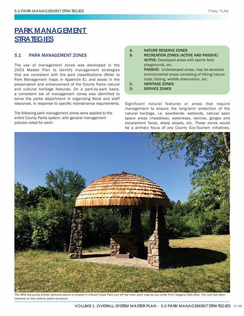
VOLUME 1: OVERALL SYSTEM MASTER PLAN - 5.0 PARK MANAGEMENT STRATEGIES
5.0 PARK MANAGEMENT STRATEGIES FINAL PLAN
PARK MANAGEMENT STRATEGIES
5.1 PARK MANAGEMENT ZONES
The use of management zones was developed in the 2003 Master Plan to identify management strategies
Park Management maps in Appendix E), and assist in the preservation and enhancement of the County Parks natural
a consistent set of management zones was identified to
The following park management zones were applied to the entire County Parks system, with general management policies noted for each:
Significant natural features or areas that require
natural heritage, i.e. woodlands, wetlands, natural open space areas (meadows), waterways, ravines, gorges and escarpment faces, steep slopes, etc. These zones would
The WPA era pump shelter pictured above is located in Ellicott Creek Park just off the main park road as you enter from Niagara Falls Blvd. The roof has been restored on this historic parks structure.
A. NATURE RESERVE ZONESB. RECREATION ZONES (ACTIVE AND PASSIVE) ACTIVE: playgrounds, etc. PASSIVE: Undeveloped areas, may be sensitive environmental areas consisting of hiking/nature
C. HERITAGE ZONES D. SERVICE ZONES
V1-69
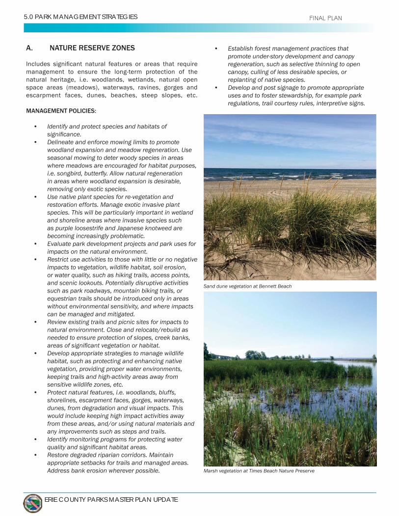
ERIE COUNTY PARKS MASTER PLAN UPDATE
5.0 PARK MANAGEMENT STRATEGIES FINAL PLAN
A. NATURE RESERVE ZONES
natural heritage, i.e. woodlands, wetlands, natural open space areas (meadows), waterways, ravines, gorges and escarpment faces, dunes, beaches, steep slopes, etc.
MANAGEMENT POLICIES:
• Identify and protect species and habitats of
• Delineate and enforce mowing limits to promote woodland expansion and meadow regeneration. Use seasonal mowing to deter woody species in areas where meadows are encouraged for habitat purposes,
in areas where woodland expansion is desirable, removing only exotic species.
• Use native plant species for re-vegetation and restoration efforts. Manage exotic invasive plant species. This will be particularly important in wetland and shoreline areas where invasive species such as purple loosestrife and Japanese knotweed are becoming increasingly problematic.
• Evaluate park development projects and park uses for impacts on the natural environment.
• Restrict use activities to those with little or no negative impacts to vegetation, wildlife habitat, soil erosion, or water quality, such as hiking trails, access points, and scenic lookouts. Potentially disruptive activities such as park roadways, mountain biking trails, or equestrian trails should be introduced only in areas without environmental sensitivity, and where impacts can be managed and mitigated.
• Review existing trails and picnic sites for impacts to natural environment. Close and relocate/rebuild as needed to ensure protection of slopes, creek banks,
• Develop appropriate strategies to manage wildlife habitat, such as protecting and enhancing native vegetation, providing proper water environments, keeping trails and high-activity areas away from sensitive wildlife zones, etc.
• Protect natural features, i.e. woodlands, bluffs, shorelines, escarpment faces, gorges, waterways, dunes, from degradation and visual impacts. This would include keeping high impact activities away from these areas, and/or using natural materials and any improvements such as steps and trails.
• Identify monitoring programs for protecting water
• Restore degraded riparian corridors. Maintain appropriate setbacks for trails and managed areas. Address bank erosion wherever possible.
Sand dune vegetation at Bennett Beach
Marsh vegetation at Times Beach Nature Preserve
• Establish forest management practices that promote under-story development and canopy regeneration, such as selective thinning to open canopy, culling of less desirable species, or replanting of native species.
• Develop and post signage to promote appropriate uses and to foster stewardship, for example park regulations, trail courtesy rules, interpretive signs.

VOLUME 1: OVERALL SYSTEM MASTER PLAN - 5.0 PARK MANAGEMENT STRATEGIES
VOLUME1 FINAL PLAN
B. RECREATION ZONES (ACTIVE AND PASSIVE)
Includes the landscape maintained areas of the parks, in which facilities development is permitted to support low to moderate
activities, picnic areas, campgrounds, and parking lots.
MANAGEMENT POLICIES:
• Site, design, and use materials on park structures that are unobtrusive and compatible with the surrounding natural environment or heritage character.
• Consolidate activity areas to promote informal, passive recreational use and to minimize incursions into natural and open space zones.
• Consolidate parking and roadways where possible to simplify circulation systems and reduce space requirements, while ensuring that access is maintained.
• Monitor park uses and impacts on natural environment (i.e. large group picnics, events staging). Consider rotation of areas to allow restoration of lawn and understory areas.
• Provide screening and buffering of development areas such as parking, maintenance, or storage areas, through planting and vegetation.
• Manage vegetation areas to maintain scenic vistas and views.
• necessary for park user safety and security. Use Dark-
and reduce light pollution. Sports lighting should include shielding and orientation to direct lighting away from natural areas.
WPA bridge at Chestnut Ridge
V1-71
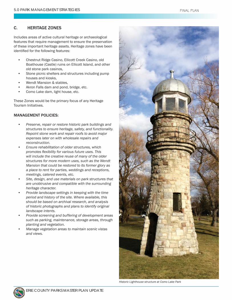
ERIE COUNTY PARKS MASTER PLAN UPDATE
5.0 PARK MANAGEMENT STRATEGIES FINAL PLAN
C. HERITAGE ZONES
Includes areas of active cultural heritage or archaeological features that require management to ensure the preservation of these important heritage assets. Heritage zones have been
• Boathouse (Castle) ruins on Ellicott Island, and other old stone park casinos,
• Stone picnic shelters and structures including pump houses and kiosks,
• • Akron Falls dam and pond, bridge, etc.•
These Zones would be the primary focus of any Heritage Tourism Initiatives.
MANAGEMENT POLICIES:
• Preserve, repair or restore historic park buildings and structures to ensure heritage, safety, and functionality. Repoint stone work and repair roofs to avoid major expenses later on with wholesale repairs and reconstruction.
• Ensure rehabilitation of older structures, which
will include the creative reuse of many of the older structures for more modern uses, such as the Wendt Mansion that could be restored to its former glory as a place to rent for parties, weddings and receptions, meetings, catered events, etc.
• Site, design, and use materials on park structures that are unobtrusive and compatible with the surrounding heritage character.
• Provide landscape settings in keeping with the time period and history of the site. Where available, this should be based on archival research, and analysis of historic photographs and plans to identify original landscape intents.
• Provide screening and buffering of development areas such as parking, maintenance, storage areas, through planting and vegetation.
• Manage vegetation areas to maintain scenic vistas and views.
Historic Lighthouse structure at Como Lake Park
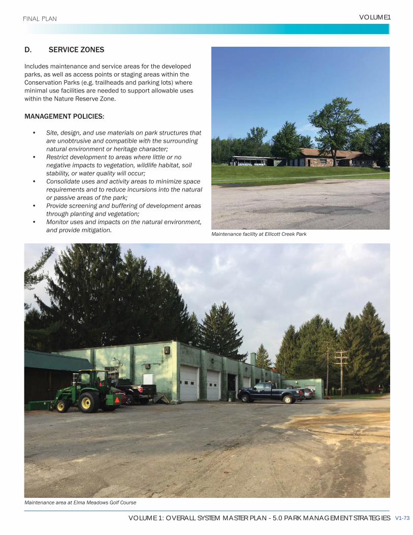
VOLUME 1: OVERALL SYSTEM MASTER PLAN - 5.0 PARK MANAGEMENT STRATEGIES
VOLUME1 FINAL PLAN
D. SERVICE ZONES
Includes maintenance and service areas for the developed parks, as well as access points or staging areas within the Conservation Parks (e.g. trailheads and parking lots) where minimal use facilities are needed to support allowable uses
MANAGEMENT POLICIES:
• Site, design, and use materials on park structures that are unobtrusive and compatible with the surrounding
• Restrict development to areas where little or no negative impacts to vegetation, wildlife habitat, soil
• Consolidate uses and activity areas to minimize space requirements and to reduce incursions into the natural
• Provide screening and buffering of development areas
• Monitor uses and impacts on the natural environment, and provide mitigation.
Maintenance area at Elma Meadows Golf Course
Maintenance facility at Ellicott Creek Park
V1-73

ERIE COUNTY PARKS MASTER PLAN UPDATE
5.0 PARK MANAGEMENT STRATEGIES FINAL PLAN
5.2 ENVIRONMENTAL MANAGEMENT
5.2.1 MANAGEMENT AND RESTORATION STRATEGIES
The Erie County Parks include extensive natural environment areas with a diverse range of ecosystems and landscape features. The unique geology of Erie County allows a single park system to protect and steward landscapes ranging from bedrock streams and waterfalls, gorges, and wooded
beauty, but also important wildlife habitat, sanctuary for native plants, and many less visible but equally important ecosystem services, such as carbon sequestration, air and water quality protection, and soil nutrient cycling. Although they are preserved from development, these natural areas will require active management to ensure long term protection, and in some cases to restore ecosystems in locations that
use. Such locations can be viewed as opportunities within the management of the parks to enhance and restore wildlife habitat and other ecosystem services, including park visitor experience.
The Parks Department is currently faced with reduced
or maintain the ecological value of its properties while at the same time reducing operations and maintenance costs.
improving ecology and environmental sustainability, each of which is discussed in more detail in following sections:
• Reduced mowing and naturalization of unused lawn areas and road infrastructure
• Planting of young native trees to replace aging overstory species and create an understory layer in naturalized areas
• Addressing soil and stream bank erosion, which is in some cases caused by impacts within the park in question, and in others by factors outside the boundaries of Parks property
• Addressing non-native species invasion, both nascent and well established
• Creating species inventories and related spatial data to aid in current and future management decisions
• Creating a Native Plant Policy to ensure new plantings contribute positively to the ecology of Erie County
identifying priority conservation or restoration projects, and identifying and implementing remedial actions. Examples include creek bank rehabilitation, slope stabilization, or stormwater management measures.
Nature trail at Red Jacket Riverfront Park
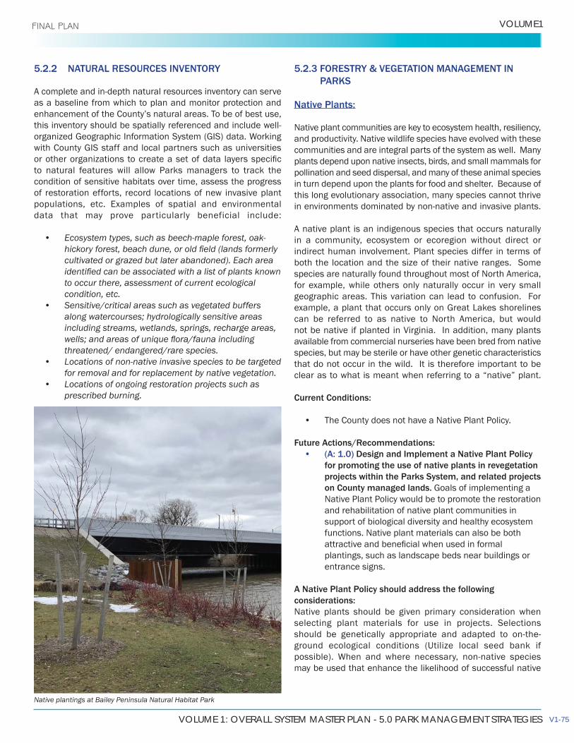
VOLUME 1: OVERALL SYSTEM MASTER PLAN - 5.0 PARK MANAGEMENT STRATEGIES
VOLUME1 FINAL PLAN
5.2.2 NATURAL RESOURCES INVENTORY
as a baseline from which to plan and monitor protection and
to natural features will allow Parks managers to track the condition of sensitive habitats over time, assess the progress of restoration efforts, record locations of new invasive plant populations, etc. Examples of spatial and environmental data that may prove particularly beneficial include:
• Ecosystem types, such as beech-maple forest, oak-
cultivated or grazed but later abandoned). Each area
to occur there, assessment of current ecologicalcondition, etc.
• Sensitive/critical areas such as vegetated buffers
including streams, wetlands, springs, recharge areas,
threatened/ endangered/rare species.• Locations of non-native invasive species to be targeted
for removal and for replacement by native vegetation.• Locations of ongoing restoration projects such as
prescribed burning.
5.2.3 FORESTRY & VEGETATION MANAGEMENT IN PARKS
Native Plants:
Native plant communities are key to ecosystem health, resiliency, and productivity. Native wildlife species have evolved with these communities and are integral parts of the system as well. Many plants depend upon native insects, birds, and small mammals for pollination and seed dispersal, and many of these animal species in turn depend upon the plants for food and shelter. Because of this long evolutionary association, many species cannot thrive
A native plant is an indigenous species that occurs naturally in a community, ecosystem or ecoregion without direct or indirect human involvement. Plant species differ in terms of both the location and the size of their native ranges. Some species are naturally found throughout most of North America, for example, while others only naturally occur in very small geographic areas. This variation can lead to confusion. For
can be referred to as native to North America, but would not be native if planted in Virginia. In addition, many plants available from commercial nurseries have been bred from native species, but may be sterile or have other genetic characteristics that do not occur in the wild. It is therefore important to be clear as to what is meant when referring to a “native” plant.
Current Conditions:
• The County does not have a Native Plant Policy.
Future Actions/Recommendations:• (A: 1.0) Design and Implement a Native Plant Policy
for promoting the use of native plants in revegetationprojects within the Parks System, and related projectson County managed lands.Native Plant Policy would be to promote the restorationand rehabilitation of native plant communities insupport of biological diversity and healthy ecosystemfunctions. Native plant materials can also be both
plantings, such as landscape beds near buildings orentrance signs.
A Native Plant Policy should address the following considerations:Native plants should be given primary consideration when selecting plant materials for use in projects. Selections
ground ecological conditions (Utilize local seed bank if
may be used that enhance the likelihood of successful native
Native plantings at Bailey Peninsula Natural Habitat Park
V1-75
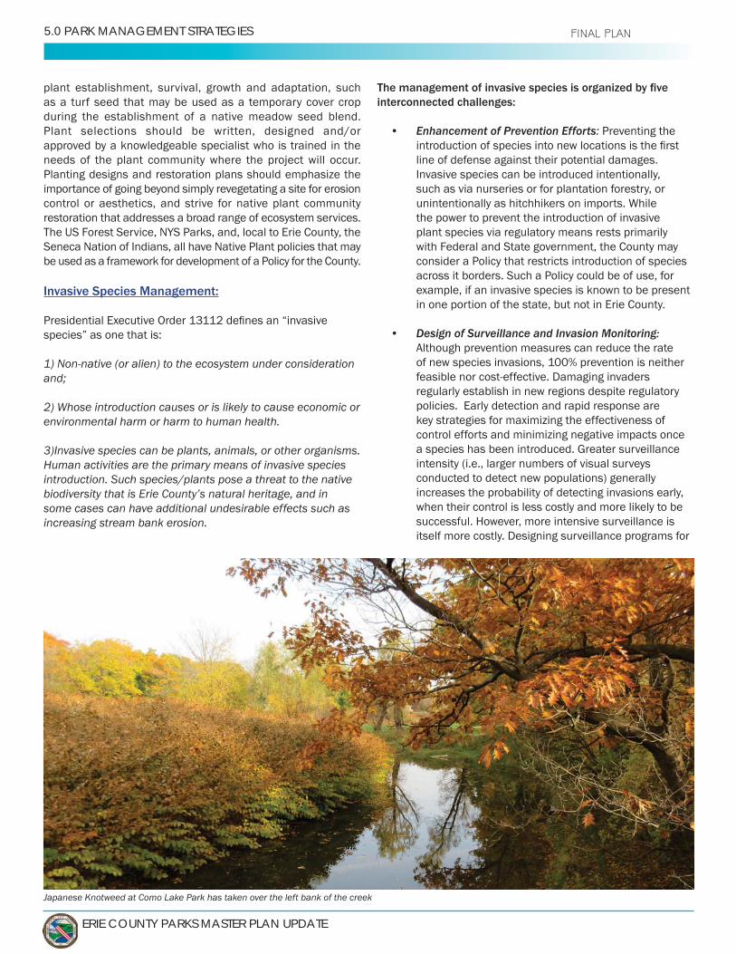
ERIE COUNTY PARKS MASTER PLAN UPDATE
5.0 PARK MANAGEMENT STRATEGIES FINAL PLAN
plant establishment, survival, growth and adaptation, such as a turf seed that may be used as a temporary cover crop during the establishment of a native meadow seed blend. Plant selections should be written, designed and/or approved by a knowledgeable specialist who is trained in the needs of the plant community where the project will occur.Planting designs and restoration plans should emphasize the importance of going beyond simply revegetating a site for erosion control or aesthetics, and strive for native plant community restoration that addresses a broad range of ecosystem services.The US Forest Service, NYS Parks, and, local to Erie County, the Seneca Nation of Indians, all have Native Plant policies that may be used as a framework for development of a Policy for the County.
Invasive Species Management:
species” as one that is:
1) Non-native (or alien) to the ecosystem under consideration
2) Whose introduction causes or is likely to cause economic or environmental harm or harm to human health.
3)Invasive species can be plants, animals, or other organisms. Human activities are the primary means of invasive species introduction. Such species/plants pose a threat to the native biodiversity that is Erie County’s natural heritage, and in some cases can have additional undesirable effects such as increasing stream bank erosion.
interconnected challenges:
• Enhancement of Prevention Efforts: Preventing the
line of defense against their potential damages. Invasive species can be introduced intentionally, such as via nurseries or for plantation forestry, or
the power to prevent the introduction of invasive plant species via regulatory means rests primarily with Federal and State government, the County may consider a Policy that restricts introduction of species across it borders. Such a Policy could be of use, for example, if an invasive species is known to be present in one portion of the state, but not in Erie County.
• Design of Surveillance and Invasion Monitoring: Although prevention measures can reduce the rate of new species invasions, 100% prevention is neither
regularly establish in new regions despite regulatory policies. Early detection and rapid response are key strategies for maximizing the effectiveness of control efforts and minimizing negative impacts once
intensity (i.e., larger numbers of visual surveys conducted to detect new populations) generally increases the probability of detecting invasions early, when their control is less costly and more likely to be successful. However, more intensive surveillance is itself more costly. Designing surveillance programs for
Japanese Knotweed at Como Lake Park has taken over the left bank of the creek

VOLUME 1: OVERALL SYSTEM MASTER PLAN - 5.0 PARK MANAGEMENT STRATEGIES
VOLUME1 FINAL PLAN
early detection of species invasions requires balancing
limited, programs must decide how best to allocate surveys across the landscape, accounting for variation in risks and costs across locations.
• Optimal Management of Established Invasions:Following detection and delineation of an invasiveplant population, managers are faced with evaluatingcontrol options, including assessment of costs andeffectiveness, and deciding whether and/or howaggressively to control the species based on availableresources. An Invasive Plant Species Policy should
methods should be used, and whether the mostappropriate goal is to immediately eradicate thepopulation, aim to contain the invasion and/or slowits spread, or simply to mitigate damages, will varyby site and species of concern. In some cases doingnothing may be an appropriate option to consider. Akey feature of invasions is that they spread, generallycausing increasing damages over time as the extentof the invasion grows. Eradication is most likely tobe successful if the invasion is small when detectedand if reintroduction is improbable or infrequent.Therefore, eradication may be an optimal goal early inan invasion, but optimal policies might shift to slowingthe spread and eventually abandonment as the sizeof the invasion increases. Therefore, managers mustcarefully consider strategies that account for howcontrol efforts will affect invasion spread over timeand space. Slowing the spread of an invasion can
It may also allow time for new control technologies tobe developed, or for affected managers to adapt.
• Private Control of Invasion Spread:work by Federal and State agencies has focused
effectively controlling invasions, the managementand spread of invasive species often depend largely
individual decisions about whether to suppressinvasions on their property. Similarly, individualsmake decisions that affect the transport of invaders tonew locations (such as through movement of infested
and encouragement of behavior that facilitatesmanagement of invasive species are key to success.
• Accounting for Uncertainty: The most challengingpart of designing invasive plant species managementpolicies is allowing for uncertainty. An Invasive Plant
pest without unnecessary delay that may reduce the available options a manager has to effectively manage an invasion.
Current conditions:
Street and Bailey Peninsula. Many parts of the remaining
forested, and not highly impacted by invasive plants. These high quality areas will require consistent surveillance to ensure that nascent invasions do not go undetected. As management strategies for these areas are developed in the future, they can be added to further Invasive Species Management Plans.
the Heritage Parks, extensive infestations are most notable at
areas of these parks, especially stream banks, have large populations of invasive plants, particularly (but not limited to)
Knotweed has been shown to increase stream bank erosion because of its fragile root system and its ability to suppress growth of other plants. Unfortunately, removal and control of the
project that addresses related and contributing issues.
Similar concerns exist at Ellicott Island within Ellicott Creek Park. There are some areas along Tonawanda Creek where
Honeysuckle, may risk destabilizing the stream bank where erosion is already a major concern. In critical areas, protecting and restoring the stream bank without causing water quality impacts in the process would be a complex project, rather than consisting simply of removing the invasive plants.
Conservation parks also are experiencing issues with invasive species. Hunters Creek Park has emerging
Invasive insect species are also a concern for the Parks
trees along Cayuga Creek, for example, due to the Emerald Ash Borer. The Parks Department expects to lose hundreds
present an opportunity for the invasive population to spread.
V1-77

ERIE COUNTY PARKS MASTER PLAN UPDATE
5.0 PARK MANAGEMENT STRATEGIES FINAL PLAN
Future Actions/Recommendations:
• (A: 2.0) Design and implement an Invasive Plant Species Policy that would provide the framework and authority to address Invasive Species in accordance with industry standards/BMPs as described above.
Enhancement of Prevention Efforts: Consider a policy that prohibits invasive species introduction to support and strengthen existing Federal and State regulations.
Design of Surveillance and Invasion Monitoring: Develop a surveillance program for early detection of invasive species that leverages
species, but cannot practically conduct physical surveys across the approximately 10,000 acres of park lands. Determine how to allocate available resources to accomplish surveys across the park
properties, accounting for how risks and potential costs may vary across locations.
Optimal Management of Established Invasions: Delineate and document known existing invasive species populations in order to assess whether the population is rapidly expanding, stable or reducing in size. Allow for variables to be considered. Identify methods that immediately eradicate the population or aim to contain the invasion, slow its spread, or mitigate damages. Shift from pursuing eradication to slowing the spread of the population as the size of the invasion increases.
Private Control of Invasion Spread: Educate the public through use of appropriate signage at key points within the Parks, and potentially install boot scrapers to reduce the number of hitchhiker seeds entering or exiting a Park.
Accounting for Uncertainty: Allow for easily
unknown future pest without unnecessary delay.
Park (Landscape) Trees:
Of the nearly 10,000 acre Park system, approximately 1,000 acres are developed. This section focuses on trees in the developed areas of the parks.
Trees do much more than simply beautify our parks. They provide a wide range of important social, economic, and environmental
enhanced public health, biodiversity & habitat creation, carbon sequestration, and support of the local economy. Trees that are nurtured within the park environment are part of a
Urban conditions, and even developed park conditions, can
of stressors urban trees often endure. In these stressful
fertilization, insect and disease treatment, watering and mulching, which are not needed by plants in a natural forest.
A community forest cannot be effectively managed unless its condition is known, which is accomplished through an inventory. Tree inventories focus on the attributes of individual trees, as compared to a Forest inventory which seeks to assess timber attributes on forest stands. A tree inventory may be conducted for many reasons, such as to determine if a community needs to implement an urban
Many dead trees were observed at Ellicott Creek Park
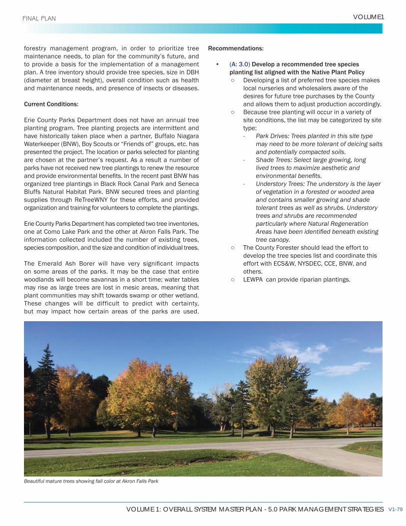
VOLUME 1: OVERALL SYSTEM MASTER PLAN - 5.0 PARK MANAGEMENT STRATEGIES
VOLUME1 FINAL PLAN
forestry management program, in order to prioritize tree
to provide a basis for the implementation of a management plan. A tree inventory should provide tree species, size in DBH (diameter at breast height), overall condition such as health and maintenance needs, and presence of insects or diseases.
Current Conditions:
Erie County Parks Department does not have an annual tree planting program. Tree planting projects are intermittent and have historically taken place when a partner, Buffalo Niagara
presented the project. The location or parks selected for planting
parks have not received new tree plantings to renew the resource
organization and training for volunteers to complete the plantings.
Erie County Parks Department has completed two tree inventories,
information collected included the number of existing trees, species composition, and the size and condition of individual trees.
on some areas of the parks. It may be the case that entire woodlands will become savannas in a short time; water tables may rise as large trees are lost in mesic areas, meaning that plant communities may shift towards swamp or other wetland. These changes will be difficult to predict with certainty, but may impact how certain areas of the parks are used.
Recommendations:
• (A: 3.0) Develop a recommended tree speciesplanting list aligned with the Native Plant Policy
Developing a list of preferred tree species makeslocal nurseries and wholesalers aware of the desires for future tree purchases by the County and allows them to adjust production accordingly.
Because tree planting will occur in a variety ofsite conditions, the list may be categorized by site type: Park Drives: Trees planted in this site type
may need to be more tolerant of deicing salts and potentially compacted soils.
Shade Trees: Select large growing, long lived trees to maximize aesthetic and
Understory Trees: The understory is the layer of vegetation in a forested or wooded area and contains smaller growing and shade tolerant trees as well as shrubs. Understory trees and shrubs are recommended particularly where Natural Regeneration
tree canopy. The County Forester should lead the effort to
develop the tree species list and coordinate this
others.
Beautiful mature trees showing fall color at Akron Falls Park
V1-79
ERIE COUNTY PARKS MASTER PLAN UPDATE
5.0 PARK MANAGEMENT STRATEGIES FINAL PLAN
• (A: 4.0) Develop a tree establishment plan that would include the schedule for irrigation, mulching, removal of tree support systems, and training pruning.
• (A: 5.0) Establish an annual budget allocation for tree planting.
• (A: 6.0) Pursue grant funding for tree plantings. NYSDEC provides a Cost Share Grant program
funded through the Environmental Protection Fund (EPF), which includes a category for tree planting that can supplement a County planting budget.
Actively seek out funding from non-governmental sources such as local, regional and national foundations, industries and corporations.
• (A: 7.0) Develop annual tree planting plans that are focused and achievable.
Determine a general quantity of trees to be planted at each park
Identify potential planting locations. Geographically concentrate plantings to
care during the establishment period. Provide additional tree plantings along the park
drives where the trees can provide maximum
rainfall, preventing or delaying the water from reaching impermeable surfaces where it will increase in velocity and contribute to erosion and sedimentation of waterways.
Provide additional plantings in parks where Emerald Ash Borer has caused or will cause tree loss.
Provide plantings in parks where mature trees reaching the end of their natural lifespan will require removal.
for Natural Regeneration.
• (P: 1.0) Pursue partnerships with Buffalo Niagara Waterkeeper, “Friends of” groups and others to develop achievable planting projects. can be replicated across the park system through partnerships with “Friends of” groups and others.
• (C: 1.0) Conduct tree inventories in the remaining parks in the system. The data collected should be on trees located within the developed or landscaped (mowed) areas of the park, particularly trees that are in close proximity to shelters, playground equipment, comfort stations and other features that patrons and employees frequent.
Pursue grant funding for tree inventories. NYSDEC
through the EPF, which includes a category for tree inventories that can supplement a County inventory budget. In the last several grant rounds, there was no match required for tree inventories.
• (A: 8.0) Pursue grant funding for community forest management planning. NYSDEC provides a Cost
includes a category for management plans which can supplement a County budget. In the most recent grant rounds, there was no match required for management plans.
• (C: 2.0) Develop a community forest management plan. The purpose of a forest management plan is
of trees through proper arboricultural techniques and management practices. A community forest management plan based on recent tree inventory data and analysis of available staff, equipment and budget resources is an essential tool for protecting this valuable resource. The management plan should provide detailed information, recommendations, and resources needed to effectively and
recommendations for how to manage the impacts of
within the Parks.
• (A: 9.0) Address over-browsing by deer. In some areas of the parks, plant diversity is
suffering from over-browsing by deer. As an educational tool, a series of fenced deer
enclosures could demonstrate the impact deer have on plant communities by showing what grows when they cannot reach it. This could be implemented as an exploration of whether introducing deer harvesting makes sense for the County, or simply as a part of providing nature education to visitors. A well-considered and well-managed harvesting program could reduce pressure on deer habitat, improving the health of the deer population and allowing improved habitat for other wildlife.
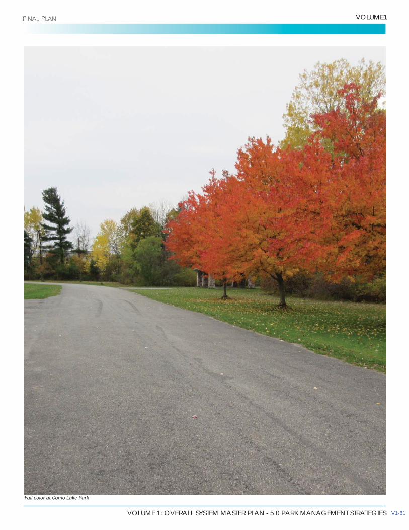
VOLUME 1: OVERALL SYSTEM MASTER PLAN - 5.0 PARK MANAGEMENT STRATEGIES
VOLUME1 FINAL PLAN
Fall color at Como Lake Park
V1-81
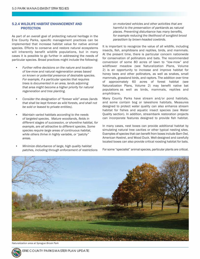
ERIE COUNTY PARKS MASTER PLAN UPDATE
5.0 PARK MANAGEMENT STRATEGIES
5.2.4 WILDLIFE HABITAT ENHANCEMENT AND PROTECTION
As part of an overall goal of protecting natural heritage in the
implemented that increase habitat value for native animal species. Efforts to conserve and restore natural ecosystems will inherently benefit wildlife populations, but in many cases it is possible to go further in addressing the needs of particular species. Broad practices might include the following:
•of low-mow and natural regeneration areas basedon known or potential presence of desirable species.For example, if a particular species that requirestrees is documented in an area, lands adjoiningthat area might become a higher priority for naturalregeneration and tree planting.
• Consider the designation of “forever wild” areas (landsthat shall be kept forever as wild forests, and shall notbe sold or leased to private entities).
• Maintain varied habitats according to the needs
different stages of succession, or shoreline habitat, forexample, are all attractive to different species. Somespecies require large areas of continuous habitat,while others thrive in highly variable, or “patchy”areas.
• Minimize disturbance of large, high quality habitatpatches, including through enforcement of restrictions
on motorized vehicles and other activities that are harmful to the preservation of parklands as natural
for example reducing the likelihood of songbird brood parasitism by brown-headed cowbirds.
It is important to recognize the value of all wildlife, including
At the present time, there is particular concern nationwide for conservation of pollinators and bats. The recommended
wildflower meadow (see Naturalization Plans, Volume 2) is an opportunity to increase and improve habitat forhoney bees and other pollinators, as well as snakes, smallmammals, grassland birds, and raptors. The addition over timeof approximately 60 acres of forest habitat (seeNaturalization
as well as birds, mammals, reptiles andamphibians.
Many County Parks have stream and/or pond habitats, and some contain bog or lakeshore habitats. Measures designed to protect water quality can also enhance stream
Quality section). In addition, streambank restoration projects
In many cases, nest boxes can provide additional habitat by simulating natural tree cavities or other typical nesting sites.
located boxes can also provide critical roosting habitat for bats.
For some “specialist” animal species, particular plants are critical.
Naturalization area at Sprague Brook Park
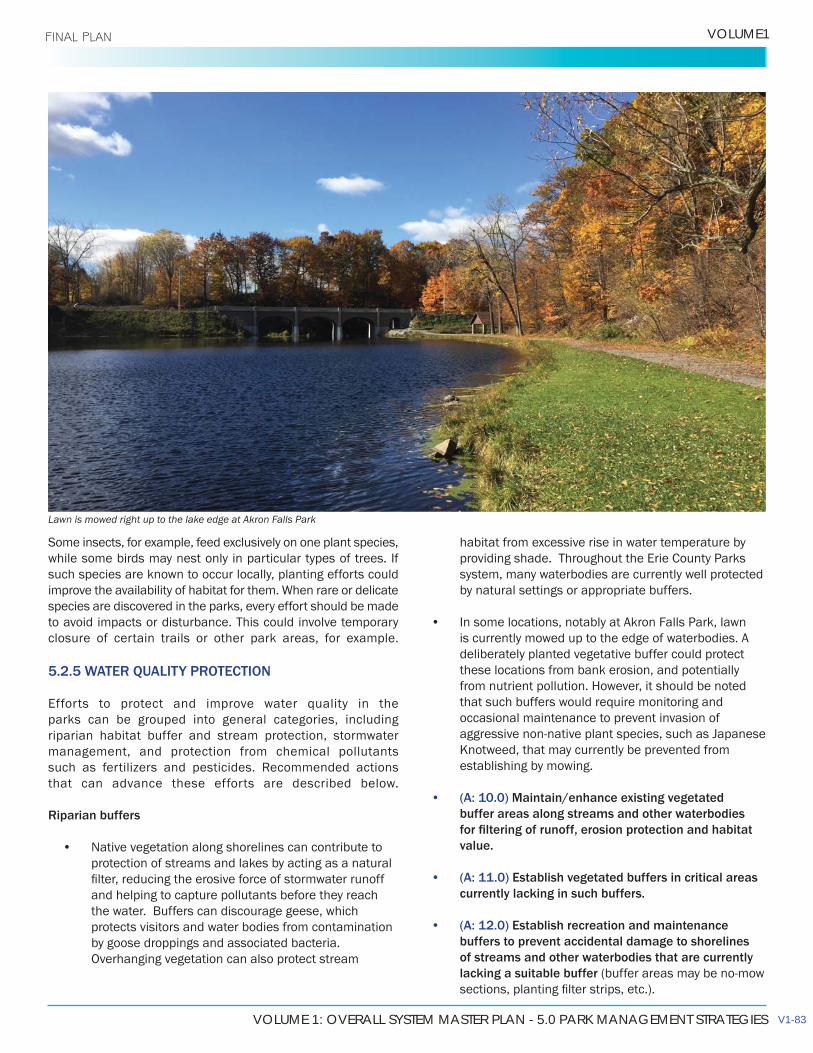
VOLUME 1: OVERALL SYSTEM MASTER PLAN - 5.0 PARK MANAGEMENT STRATEGIES
VOLUME1 FINAL PLAN
Some insects, for example, feed exclusively on one plant species, while some birds may nest only in particular types of trees. If such species are known to occur locally, planting efforts could
species are discovered in the parks, every effort should be made to avoid impacts or disturbance. This could involve temporary closure of certain trails or other park areas, for example.
5.2.5 WATER QUALITY PROTECTION
Efforts to protect and improve water quality in the parks can be grouped into general categories, including riparian habitat buffer and stream protection, stormwater management, and protection from chemical pollutants
that can advance these efforts are described below.
Riparian buffers
• Native vegetation along shorelines can contribute toprotection of streams and lakes by acting as a natural
and helping to capture pollutants before they reachthe water. Buffers can discourage geese, whichprotects visitors and water bodies from contaminationby goose droppings and associated bacteria.Overhanging vegetation can also protect stream
habitat from excessive rise in water temperature by providing shade. Throughout the Erie County Parks system, many waterbodies are currently well protected by natural settings or appropriate buffers.
• In some locations, notably at Akron Falls Park, lawnis currently mowed up to the edge of waterbodies. Adeliberately planted vegetative buffer could protectthese locations from bank erosion, and potentiallyfrom nutrient pollution. However, it should be notedthat such buffers would require monitoring andoccasional maintenance to prevent invasion of
Knotweed, that may currently be prevented fromestablishing by mowing.
• (A: 10.0) Maintain/enhance existing vegetatedbuffer areas along streams and other waterbodies
value.
• (A: 11.0) Establish vegetated buffers in critical areascurrently lacking in such buffers.
• (A: 12.0) Establish recreation and maintenancebuffers to prevent accidental damage to shorelinesof streams and other waterbodies that are currentlylacking a suitable buffer
Lawn is mowed right up to the lake edge at Akron Falls Park
V1-83

ERIE COUNTY PARKS MASTER PLAN UPDATE
5.0 PARK MANAGEMENT STRATEGIES FINAL PLAN
Stream protection
The Erie County Parks contain a variety of stream habitats, including bedrock waterfalls, small woodland creeks, and large
in good condition, but some are suffering from the effects of urban and suburban development surrounding the parks. These include, but are not limited to, increased variability of
reduced water clarity and increased deposition of sediment,
• (C: 3.0)restoration projects when and where possible. Examples of such projects include the recent “living shoreline” demonstration project at Ellicott Creek
• (C: 4.0) Relocate or remove adjacent pavements to protect waterbodies. For example, at Akron Falls Park there is a parking area very close to the stream/impoundment. This may lead to contaminated runoff entering the stream.
Constructed rain garden - Fletcher Hall (Chautauqua Institution, NY)
Chautauqua Stormwater Management Park - Daylighted stream and rain gardens (Chautauqua Institution, NY)
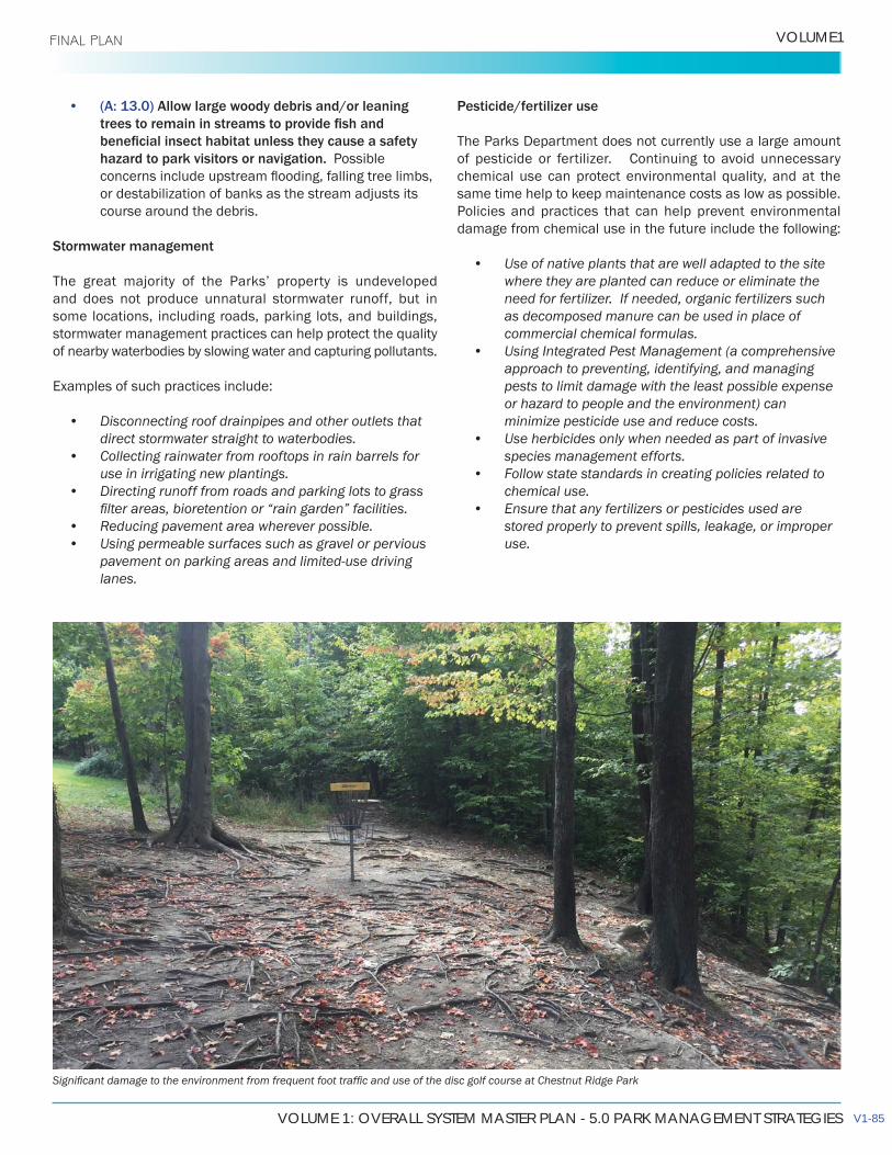
VOLUME 1: OVERALL SYSTEM MASTER PLAN - 5.0 PARK MANAGEMENT STRATEGIES
VOLUME1 FINAL PLAN
• (A: 13.0) Allow large woody debris and/or leaning
hazard to park visitors or navigation. Possible
or destabilization of banks as the stream adjusts itscourse around the debris.
Stormwater management
and does not produce unnatural stormwater runoff, but in some locations, including roads, parking lots, and buildings, stormwater management practices can help protect the quality of nearby waterbodies by slowing water and capturing pollutants.
Examples of such practices include:
• Disconnecting roof drainpipes and other outlets thatdirect stormwater straight to waterbodies.
• Collecting rainwater from rooftops in rain barrels foruse in irrigating new plantings.
• Directing runoff from roads and parking lots to grass
• Reducing pavement area wherever possible.• Using permeable surfaces such as gravel or pervious
pavement on parking areas and limited-use drivinglanes.
Pesticide/fertilizer use
The Parks Department does not currently use a large amount of pesticide or fertilizer. Continuing to avoid unnecessary chemical use can protect environmental quality, and at the same time help to keep maintenance costs as low as possible. Policies and practices that can help prevent environmental damage from chemical use in the future include the following:
• Use of native plants that are well adapted to the sitewhere they are planted can reduce or eliminate theneed for fertilizer. If needed, organic fertilizers suchas decomposed manure can be used in place ofcommercial chemical formulas.
• Using Integrated Pest Management (a comprehensiveapproach to preventing, identifying, and managingpests to limit damage with the least possible expenseor hazard to people and the environment) canminimize pesticide use and reduce costs.
• Use herbicides only when needed as part of invasivespecies management efforts.
• Follow state standards in creating policies related tochemical use.
• Ensure that any fertilizers or pesticides used arestored properly to prevent spills, leakage, or improperuse.
V1-85

ERIE COUNTY PARKS MASTER PLAN UPDATE
5.0 PARK MANAGEMENT STRATEGIES FINAL PLAN
5.2.6 EROSION CONTROL
Erosion is a consistent issue across the County parks, and has multiple causes, depending upon the setting. These causes include excessive foot traffic in erodible areas, stream channel erosion near road crossings, watershed condition outside the park boundaries, and streambank conditions within the park, including lack of vegetated
Current Conditions
dam, where the banks of Cayuga Creek are very steep and highly
to surrounding development and therefore cannot be resolved solely from within the park, shoreline stabilization projects can prevent further deterioration or movement of the stream channel, and increase both visitor safety and natural habitat quality.
At Ellicott Creek Park, bank erosion is present in several areas, but is particularly severe in the Ellicott Island bark park, where some
These areas are currently losing soil rapidly, and contributing excessive sediment to Tonawanda Creek. The downstream tip
to very steep slopes, hard ground, and severe gully formation.
Parks, erosion due to stormwater runoff is apparent. This is particularly evident at Emery Park where a combination of remaining impermeable surfaces and excessive foot
issues are more apparent along paved roads and at locations where roads cross small streams. In some locations, upstream erosion has led to noticeable sediment deposition.
All of the Heritage Parks have a large number of roads throughout them, some of which are confusing and
contribute to reducing runoff. However, abandoning roads in place, as has been done in parts of Emery Park, will not change runoff patterns. At Emery Park, abandoned roadways are still contributing to environmental impacts.
and degradation of forest understory conditions at both
disc golf holes have been sited on or near steep slopes and in otherwise sensitive areas such that players are obliged
understory by trampling vegetation and compacting soils, making it impossible for new vegetation to establish. Once soil is bare, it is also more susceptible to scouring by rainwater.
A small road spur at Chestnut Ridge Park, is no longer needed
Bank erosion at Ellicott Island bark park
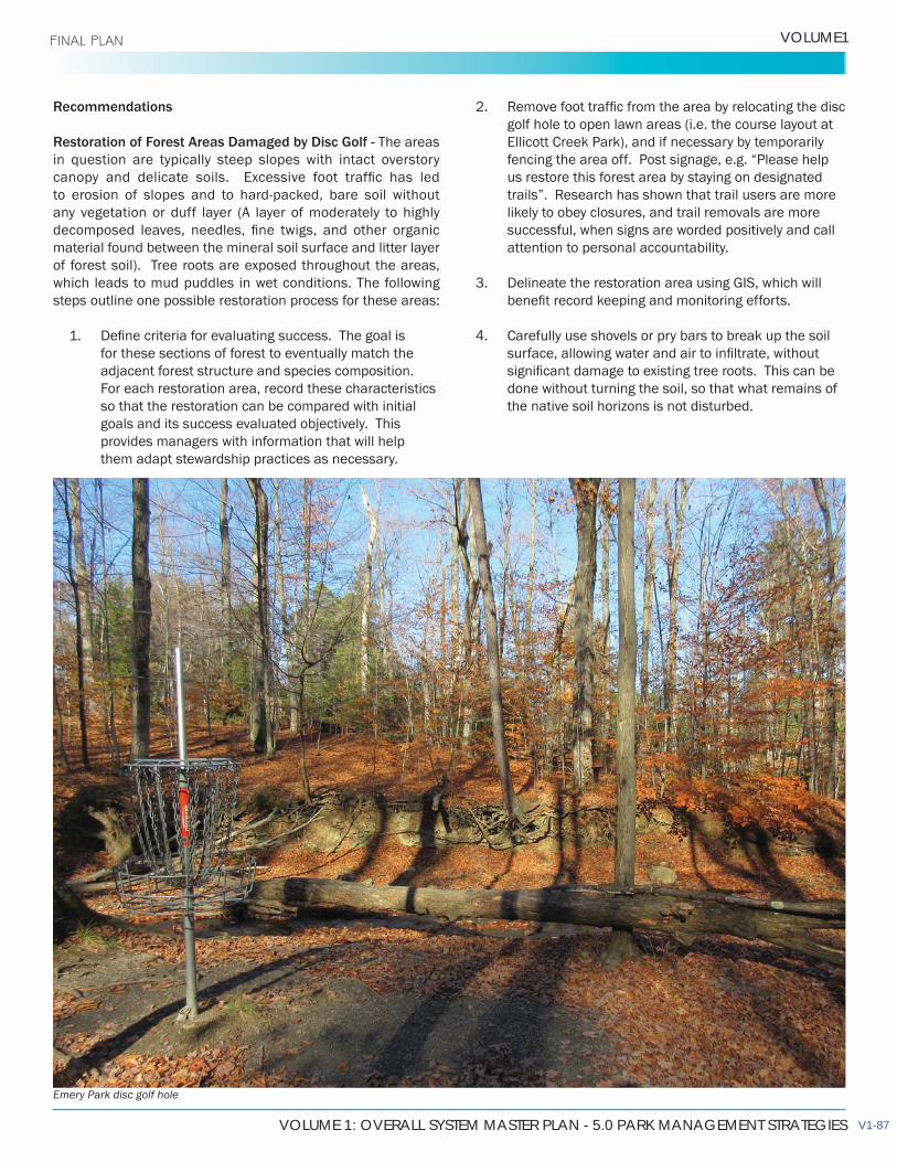
VOLUME 1: OVERALL SYSTEM MASTER PLAN - 5.0 PARK MANAGEMENT STRATEGIES
VOLUME1 FINAL PLAN
Recommendations
Restoration of Forest Areas Damaged by Disc Golf - The areas in question are typically steep slopes with intact overstory
any vegetation or duff layer (A layer of moderately to highly
material found between the mineral soil surface and litter layer of forest soil). Tree roots are exposed throughout the areas, which leads to mud puddles in wet conditions. The following steps outline one possible restoration process for these areas:
1.for these sections of forest to eventually match theadjacent forest structure and species composition.For each restoration area, record these characteristicsso that the restoration can be compared with initialgoals and its success evaluated objectively. Thisprovides managers with information that will helpthem adapt stewardship practices as necessary.
2.golf hole to open lawn areas (i.e. the course layout atEllicott Creek Park), and if necessary by temporarilyfencing the area off. Post signage, e.g. “Please helpus restore this forest area by staying on designated
likely to obey closures, and trail removals are moresuccessful, when signs are worded positively and callattention to personal accountability.
3.
Carefully use shovels or pry bars to break up the soil
done without turning the soil, so that what remains ofthe native soil horizons is not disturbed.
Emery Park disc golf hole
V1-87
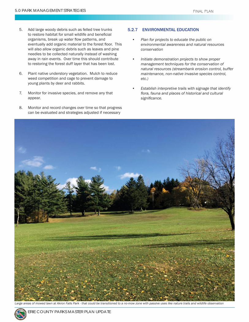
ERIE COUNTY PARKS MASTER PLAN UPDATE
5.0 PARK MANAGEMENT STRATEGIES FINAL PLAN
5. Add large woody debris such as felled tree trunks
will also allow organic debris such as leaves and pine needles to be collected naturally instead of washing away in rain events. Over time this should contribute to restoring the forest duff layer that has been lost.
6. Plant native understory vegetation. Mulch to reduce weed competition and cage to prevent damage to young plants by deer and rabbits.
Monitor for invasive species, and remove any that appear.
8. Monitor and record changes over time so that progress can be evaluated and strategies adjusted if necessary
5.2.7 ENVIRONMENTAL EDUCATION
• Plan for projects to educate the public on environmental awareness and natural resources conservation
• Initiate demonstration projects to show proper management techniques for the conservation of natural resources (streambank erosion control, buffer maintenance, non-native invasive species control, etc.)
• Establish interpretive trails with signage that identify
Large areas of mowed lawn at Akron Falls Park - that could be transitioned to a no-mow zone with passive uses like nature trails and wildlife observation

VOLUME 1: OVERALL SYSTEM MASTER PLAN - 5.0 PARK MANAGEMENT STRATEGIES
VOLUME1
Low mow area at Isle View Park
5.2.8 ALTERNATIVE MOWING TECHNIQUES
Many areas of the parks are underused for recreation, but managed as manicured landscapes. The return of these areas to a
and would allow resources to be redirected to park rehabilitation efforts. This plan recommends locations for reduced mowing,
Several methods can achieve naturalization within a park setting. These include simple alternative vegetation management
to watercourses and woodlots, more proactive approaches
native species, and detailed restoration or rehabilitation
This plan recommends three main general categories of mowing
treatments can be used are presented in Naturalization Maps
• Natural Regeneration – (Approximately 60 acresrecommended). The goal of this treatment is to allownatural forests to develop. In most cases, suggestednatural regeneration areas are adjacent to existingforest, and serve to expand continuous forest habitatwithin the parks. Mowing will cease altogether, and
species. Young native trees of species found inneighboring forest can be planted to speed natural
seeds may be planted to replace lawn until the treecanopy matures.
• Low-Mow Meadow recommended) This treatment is recommended inareas that may potentially see different use in thefuture, and are not intended to be reforested. They
to remain wet, and therefore may support different
Meadow is not intended to retain standing water as apond would.
• – (Approximately 33 acresrecommended) In locations with low use but high
different methods can be used to establish a native
scale disturbances to simulate natural prairie processes. In this method, 15 x 15 foot nodes are rototilled and seeded without the use of herbicide. The combined area of the nodes should be approximately 25% of the total meadow area. The seeded nodes develop native “microcommunities”, which can then spread throughout the meadow over time. In an initial study, this method was found to be as effective as the more traditional methods of tilling and seeding 100% of the site, or using herbicide to kill turf and then drill seeding the entire site, at a lower cost.
V1-89
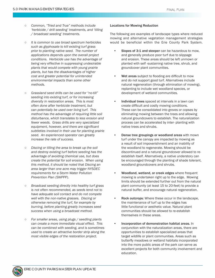
ERIE COUNTY PARKS MASTER PLAN UPDATE
5.0 PARK MANAGEMENT STRATEGIES FINAL PLAN
Common, “Tried and True” methods include ‘herbicide / drill seeding’ treatments, and ‘tilling / broadcast seeding’ treatments.
It is common to use broad spectrum herbicides such as glyphosate to kill existing turf grass prior to planting native seed. The number of applications depends upon the overall project conditions. Herbicide use has the advantage of being very effective in suppressing undesirable plants that would compete with young prairie plants, but has the disadvantages of higher cost and greater potential for unintended environmental impacts than some other methods.
Grassland seed drills can be used for “no-till” seeding into existing turf, or for increasing diversity in restoration areas. This is most often done after herbicide treatment, but can potentially be used over living turf. This method has the advantage of requiring little soil disturbance, which translates to less erosion and fewer weeds. Grass drills are very specialized
subtleties involved in their use for planting prairie seed. An experienced operator can greatly increase the rate of success.
Discing or tilling the area to break up the soil and destroy existing turf before seeding has the advantage of avoiding chemical use, but does create the potential for soil erosion. When using this method, it should be noted that Discing an area larger than one acre may trigger NYSDEC requirements for a Storm Water Pollution Prevention Plan (SWPPP).
Broadcast seeding directly into healthy turf grass is not often recommended, as seeds tend not to have adequate soil contact and do not compete well with the non-native grasses. Discing or otherwise removing the turf, for example by burning, before planting greatly increases seed success when using a broadcast method.
For smaller areas, using plugs / seedling plants can create a more immediate visual effect. This can be combined with seeding, and is sometimes used to create an attractive border strip along the most visible edges of the restoration project.
Locations for Mowing Reduction
The following are examples of landscape types where reduced mowing and alternative vegetation management strategies would be beneficial within the Erie County Park System.
• Slopes of 3:1 and steeper can be hazardous to mow, and generally produce poor turf due to slippage and erosion. These areas should be left unmown or
groundcover plant communities.
• Wet areas and do not support good turf. Alternatives include natural regeneration (through elimination of mowing), replanting to include wet woodland species, or development of wetland communities.
• Individual trees spaced at intervals in a lawn can
These can be consolidated into groves or copses by eliminating mowing between the trees and allowing natural groundcovers to establish. The naturalization
native trees and shrubs.
• Dense tree groupings or woodland areas with mown turf under the canopy are impacted by mowing as a result of soil impoverishment and an inability of the woodland to regenerate. Mowing should be
establish itself. Alternatively, a native understory can be encouraged through the planting of shade tolerant, woodland groundcovers and shrubs.
• Woodland, wetland, or creek edges where frequent mowing is undertaken right up to the edge. Mowing limits should be extended further out from the natural
natural buffer, and encourage natural regeneration.
• Rock outcrops: the maintenance of turf up to the edges has little functional or aesthetic value. Natural plant
themselves in these areas.
• Incorporation of demonstration habitat areas. In conjunction with the naturalization areas, there are opportunities to establish specialized areas that target wildlife or plant communities. Areas such as
into the more public areas of the park can serve as excellent projects for both community involvement and education.
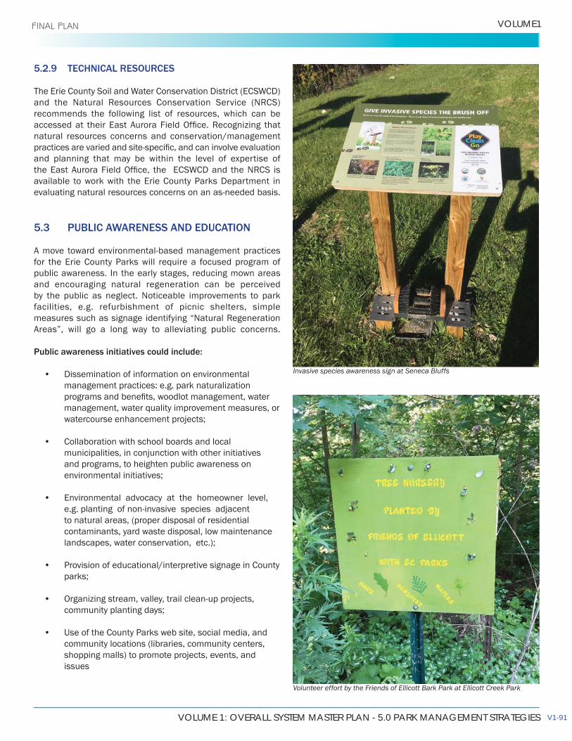
VOLUME 1: OVERALL SYSTEM MASTER PLAN - 5.0 PARK MANAGEMENT STRATEGIES
VOLUME1 FINAL PLAN
5.2.9 TECHNICAL RESOURCES
recommends the following list of resources, which can be
natural resources concerns and conservation/management
and planning that may be within the level of expertise of
available to work with the Erie County Parks Department in
5.3 PUBLIC AWARENESS AND EDUCATION
for the Erie County Parks will require a focused program of public awareness. In the early stages, reducing mown areas and encouraging natural regeneration can be perceived by the public as neglect. Noticeable improvements to park facilities, e.g. refurbishment of picnic shelters, simple
Areas”, will go a long way to alleviating public concerns.
Public awareness initiatives could include:
• Dissemination of information on environmentalmanagement practices: e.g. park naturalization
management, water quality improvement measures, orwatercourse enhancement projects;
• Collaboration with school boards and localmunicipalities, in conjunction with other initiativesand programs, to heighten public awareness onenvironmental initiatives;
• Environmental advocacy at the homeowner level,
to natural areas, (proper disposal of residentialcontaminants, yard waste disposal, low maintenancelandscapes, water conservation, etc.);
• Provision of educational/interpretive signage in Countyparks;
•community planting days;
• Use of the County Parks web site, social media, andcommunity locations (libraries, community centers,shopping malls) to promote projects, events, andissues
Invasive species awareness sign at Seneca Bluffs
Volunteer effort by the Friends of Ellicott Bark Park at Ellicott Creek Park
V1-91
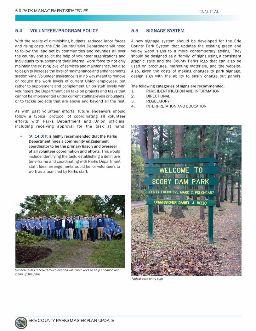
ERIE COUNTY PARKS MASTER PLAN UPDATE
5.0 PARK MANAGEMENT STRATEGIES FINAL PLAN
5.4 VOLUNTEER/PROGRAM POLICY
and rising costs, the Erie County Parks Department will need to follow the lead set by communities and counties all over the country and solicit the help of volunteer organizations and individuals to supplement their internal work force to not only maintain the existing level of services and maintenance, but also to begin to increase the level of maintenance and enhancements system wide. Volunteer assistance is in no way meant to remove or reduce the work levels of current Union employees, but rather to supplement and complement Union staff levels with volunteers the Department can take on projects and tasks that
or to tackle projects that are above and beyond all the rest.
As with past volunteer efforts, future endeavors should follow a typical protocol of coordinating all volunteer efforts with Parks Department and Union officials, including receiving approval for the task at hand.
• (A: 14.0) It is highly recommended that the Parks Department hires a community engagement coordinator to be the primary liason and overseer of all volunteer coordination and efforts. This would
staff. Ideal arrangements would be for volunteers to work as a team led by Parks staff.
5.5 SIGNAGE SYSTEM
A new signage system should be developed for the Erie County Park System that updates the existing green and yellow wood signs to a more contemporary styling. They
graphic style and the County Parks logo that can also be used on brochures, marketing materials, and the website. Also, given the costs of making changes to park signage, design sign with the ability to easily change out panels.
The following categories of signs are recommended:
Typical park entry sign
Seneca Bluffs received much needed volunteer work to help enhance and clean up the park

VOLUME 1: OVERALL SYSTEM MASTER PLAN - 5.0 PARK MANAGEMENT STRATEGIES
VOLUME1 FINAL PLAN
New 2018 sign at Thomas F. Higgins Riverfront Bridge and Park: Potential template for Park sign system
Sign at Black Rock Canal Park off of Niagara Street Sign at Elma Meadows Park
V1-93

ERIE COUNTY PARKS MASTER PLAN UPDATE
5.0 PARK MANAGEMENT STRATEGIES FINAL PLAN
The following general guidelines should be applied to all signage types:
• • Clarity in conveying the desired message to a range of
• Vandal and weather resistant materials and
• Of a size and design that is appropriate, visible and understandable to all park users, i.e. cyclists,
• Compatibility with surroundings, in use of color, materials, size, and placement
5.5.1 PARK IDENTIFICATION AND INFORMATION SIGNS
These signs would be provided at park entrances and/or important trailheads, and key park facilities such as the casinos and could include the following information:
Types: Entrance and Information•
park system logo and County information (emergency number, park management contact information), operating hours, website address, etc.
• Park map, showing trails, key facilities, picnic areas and shelter numbers and environmental management areas. For parks with complex trail systems, loops
hazards such as steep slopes should also be marked.• Optional notice board for promotion of park related
events or activities, might be included at parks without indoor facilities. To encourage visitation of other
community events.
5.5.2 DIRECTIONAL SIGNAGE
Directional signs should be located at road junctions and access points throughout the park, directing users to nearby facilities, or within trail systems and may include:
park”)• Park name and logo• Directional arrows• Distance markers should be included at main junction
of trails or roadways in large parks or extensive trail
Simple post markers with graphic or color coding that identify trail loops and correspond with an overall route map at the trailheads or on brochures, can be used for complex trail systems.
Directional signs may also include route markers on roads, to
trailhead
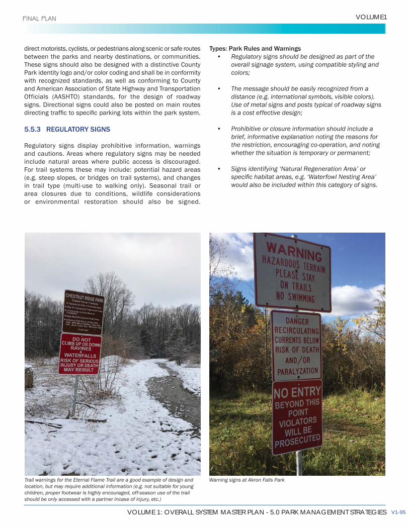
VOLUME 1: OVERALL SYSTEM MASTER PLAN - 5.0 PARK MANAGEMENT STRATEGIES
VOLUME1 FINAL PLAN
direct motorists, cyclists, or pedestrians along scenic or safe routes between the parks and nearby destinations, or communities. These signs should also be designed with a distinctive County Park identity logo and/or color coding and shall be in conformity with recognized standards, as well as conforming to County and American Association of State Highway and Transportation Officials (AASHTO) standards, for the design of roadway signs. Directional signs could also be posted on main routes
5.5.3 REGULATORY SIGNS
and cautions. Areas where regulatory signs may be needed include natural areas where public access is discouraged. For trail systems these may include: potential hazard areas (e.g. steep slopes, or bridges on trail systems), and changes
area closures due to conditions, wildlife considerations or environmental restoration should also be signed.
Types: Park Rules and Warnings• Regulatory signs should be designed as part of the
overall signage system, using compatible styling and
• The message should be easily recognized from adistance (e.g. international symbols, visible colors).Use of metal signs and posts typical of roadway signs
• Prohibitive or closure information should include abrief, informative explanation noting the reasons forthe restriction, encouraging co-operation, and noting
• Signs identifying ‘Natural Regeneration Area’ or
would also be included within this category of signs.
Warning signs at Akron Falls ParkTrail warnings for the Eternal Flame Trail are a good example of design and location, but may require additional information (e.g. not suitable for young children, proper footwear is highly encouraged, off-season use of the trail should be only accessed with a partner incase of injury, etc.)
V1-95

ERIE COUNTY PARKS MASTER PLAN UPDATE
5.0 PARK MANAGEMENT STRATEGIES FINAL PLAN
5.5.4 PARK RULES
in some way and the general rules may not apply equally in all instances.
The current Park Rules are as follows:
1. Memorial Day) or 9pm (Summer Hours: Memorial Day through
2. Shelters are by reservations only. The quantity of people at shelter must not exceed the shelter limits.
3.
5. Preservation of Property: Destruction or defacing of park property is prohibited. Please remove signs at the end of your event. Use of spray paint (including water soluble), staples, nails and tacks is prohibited.
6. Speed limit is 15 mph. NO parking more than 5 feet off roads or where
prohibited by sign. Driving off roadways is prohibited.
circles provided for that purpose, or grill furnished by Park patrons. All embers shall be extinguished before leaving the site.
8.
refuse containers.
9.
County beaches.
10. Alcoholic Beverages: Beer and wine are by permit only. Shelter
No other alcoholic beverages allowed. No kegs.
11. All glass containers are prohibited.
12. Unreasonably loud noise or music and disorderly conduct is prohibited.
13. Bounce houses, tents and other outdoor recreational equipment (dunk tanks, miniature golf, etc.) are prohibited. Tents larger than
a permit issued by the Parks Commissioner or his duly appointed agent.
15. Bicyclists: Must wear helmet at all times.
16. Hunting and Trapping: is prohibited in all County Park land. Fishing
shall be allowed only in season and where posted.
18. remain on designated trails only.
19. outlying trails and by permit only.
20. erie.gov/parks
21.
Park, and Boston Forest.
22. Mountain Biking: Prohibited except on designated trails at Sprague
23. Do not cut or destroy any trees, plant life or disturb wildlife.
tape, tacks, staples or nails can be used at any time. Nothing can
by using unauthorized items will be charged back to the permit holder.
25. Any damage caused to rented facilities will be charged back to the permit holder.
26. Smoke free parks. Please no smoking or vaping.
In addition to the above Park Rules the following trail conduct rules are recommended:
1. Trails are remote, and use is at your own risk. Cell phones and a
2. limits in terms of endurance and ability.
3. marked trail system. Trail breaking can cause environmental damage.
Do not alter or remove signs and trail markings. Others depend on them.
5.
6. the rights of other trail users.
Allow faster riders or walkers to pass you on the left.
Indicate your intent to pass.
private property.
8. Avoid frightening or disturbing wildlife or livestock that may be in close proximity to you.
9. Emergency contact and/or guidelines
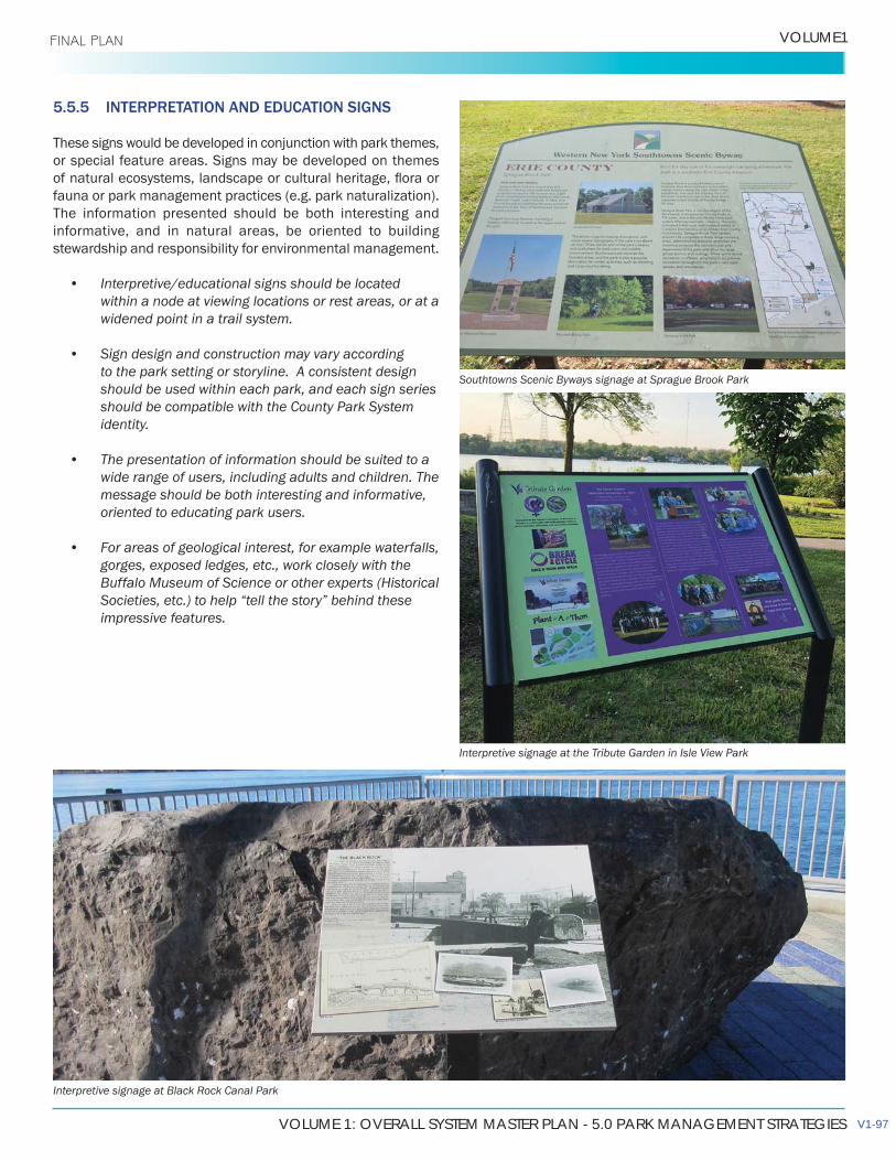
VOLUME 1: OVERALL SYSTEM MASTER PLAN - 5.0 PARK MANAGEMENT STRATEGIES
VOLUME1 FINAL PLAN
5.5.5 INTERPRETATION AND EDUCATION SIGNS
These signs would be developed in conjunction with park themes, or special feature areas. Signs may be developed on themes
fauna or park management practices (e.g. park naturalization). The information presented should be both interesting and informative, and in natural areas, be oriented to building stewardship and responsibility for environmental management.
• Interpretive/educational signs should be located within a node at viewing locations or rest areas, or at a widened point in a trail system.
• Sign design and construction may vary according to the park setting or storyline. A consistent design should be used within each park, and each sign series should be compatible with the County Park System identity.
• The presentation of information should be suited to a wide range of users, including adults and children. The message should be both interesting and informative, oriented to educating park users.
• For areas of geological interest, for example waterfalls, gorges, exposed ledges, etc., work closely with the Buffalo Museum of Science or other experts (Historical Societies, etc.) to help “tell the story” behind these impressive features.
Interpretive signage at Black Rock Canal Park
Southtowns Scenic Byways signage at Sprague Brook Park
Interpretive signage at the Tribute Garden in Isle View Park
V1-97
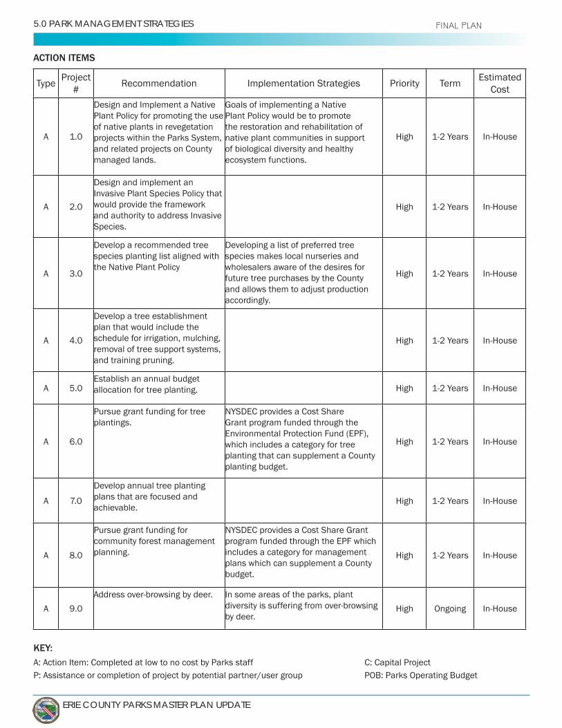
ERIE COUNTY PARKS MASTER PLAN UPDATE
5.0 PARK MANAGEMENT STRATEGIES FINAL PLAN
KEY:A: Action Item: Completed at low to no cost by Parks staff C: Capital ProjectP: Assistance or completion of project by potential partner/user group POB: Parks Operating Budget
ACTION ITEMS
TypeProject
#Implementation Strategies Priority Term
Estimated Cost
A 1.0
Design and Implement a Native Plant Policy for promoting the use of native plants in revegetation projects within the Parks System, and related projects on County managed lands.
Plant Policy would be to promote the restoration and rehabilitation of native plant communities in support of biological diversity and healthy ecosystem functions.
High
A 2.0
Design and implement an Invasive Plant Species Policy that would provide the framework and authority to address Invasive Species.
High
A 3.0
Develop a recommended tree species planting list aligned with the Native Plant Policy
Developing a list of preferred tree species makes local nurseries and wholesalers aware of the desires for future tree purchases by the County and allows them to adjust production accordingly.
High
A
Develop a tree establishment plan that would include the schedule for irrigation, mulching, removal of tree support systems, and training pruning.
High
A 5.0Establish an annual budget allocation for tree planting. High
A 6.0
Pursue grant funding for tree plantings.
NYSDEC provides a Cost Share
Environmental Protection Fund (EPF), which includes a category for tree planting that can supplement a County planting budget.
High
A
Develop annual tree planting plans that are focused and achievable.
High
A 8.0
Pursue grant funding for community forest management planning.
program funded through the EPF which includes a category for management plans which can supplement a County budget.
High
A 9.0
In some areas of the parks, plant
by deer.High Ongoing
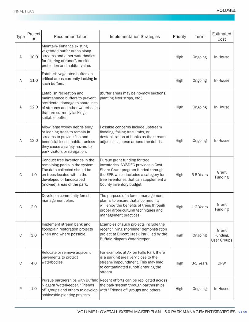
VOLUME 1: OVERALL SYSTEM MASTER PLAN - 5.0 PARK MANAGEMENT STRATEGIES
VOLUME1 FINAL PLAN
TypeProject
#Implementation Strategies Priority Term
Estimated Cost
A 10.0
Maintain/enhance existing vegetated buffer areas along streams and other waterbodies
protection and habitat value.
High Ongoing
A 11.0
Establish vegetated buffers in critical areas currently lacking in such buffers.
High Ongoing
A 12.0
Establish recreation and maintenance buffers to prevent accidental damage to shorelines of streams and other waterbodies that are currently lacking a suitable buffer.
High Ongoing
A 13.0
Allow large woody debris and/or leaning trees to remain in
they cause a safety hazard to park visitors or navigation.
Possible concerns include upstream
destabilization of banks as the stream adjusts its course around the debris. High Ongoing
C 1.0
Conduct tree inventories in the remaining parks in the system. The data collected should be on trees located within the developed or landscaped (mowed) areas of the park.
Pursue grant funding for tree inventories. NYSDEC provides a Cost
the EPF, which includes a category for tree inventories that can supplement a County inventory budget.
HighFunding
C 2.0
Develop a community forest management plan.
The purpose of a forest management plan is to ensure that a community
proper arboricultural techniques and management practices.
HighFunding
C 3.0
Implement stream bank and
when and where possible.
Examples of such projects include the recent “living shoreline” demonstration project at Ellicott Creek Park, led by the High Ongoing Funding,
C
pavements to protect waterbodies.
For example, at Akron Falls Park there is a parking area very close to the stream/impoundment. This may lead to contaminated runoff entering the stream.
High
P 1.0
Pursue partnerships with Buffalo
of” groups and others to develop achievable planting projects.
the park system through partnerships with “Friends of” groups and others. High Ongoing
V1-99

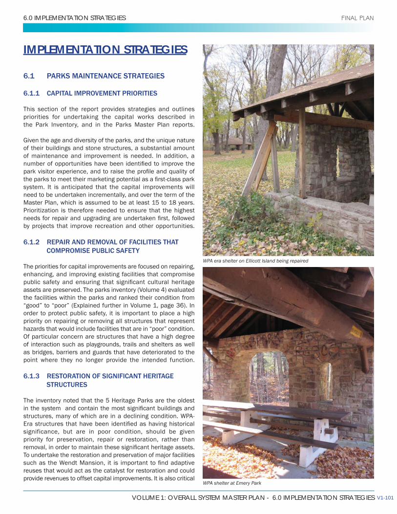
VOLUME 1: OVERALL SYSTEM MASTER PLAN - 6.0 IMPLEMENTATION STRATEGIES
6.0 IMPLEMENTATION STRATEGIES FINAL PLAN
IMPLEMENTATION STRATEGIES
6.1 PARKS MAINTENANCE STRATEGIES
6.1.1 CAPITAL IMPROVEMENT PRIORITIES
This section of the report provides strategies and outlines priorities for undertaking the capital works described in the Park Inventory, and in the Parks Master Plan reports.
of their buildings and stone structures, a substantial amount of maintenance and improvement is needed. In addition, a
system. It is anticipated that the capital improvements will need to be undertaken incrementally, and over the term of the Master Plan, which is assumed to be at least 15 to 18 years. Prioritization is therefore needed to ensure that the highest
by projects that improve recreation and other opportunities.
6.1.2 REPAIR AND REMOVAL OF FACILITIES THAT COMPROMISE PUBLIC SAFETY
The priorities for capital improvements are focused on repairing, enhancing, and improving existing facilities that compromise
the facilities within the parks and ranked their condition from “good” to “poor” (Explained further in Volume 1, page 36). In order to protect public safety, it is important to place a high priority on repairing or removing all structures that represent hazards that would include facilities that are in “poor” condition. Of particular concern are structures that have a high degree of interaction such as playgrounds, trails and shelters as well as bridges, barriers and guards that have deteriorated to the point where they no longer provide the intended function.
6.1.3 RESTORATION OF SIGNIFICANT HERITAGE STRUCTURES
The inventory noted that the 5 Heritage Parks are the oldest
significance, but are in poor condition, should be given priority for preservation, repair or restoration, rather than
To undertake the restoration and preservation of major facilities
reuses that would act as the catalyst for restoration and could provide revenues to offset capital improvements. It is also critical
WPA era shelter on Ellicott Island being repaired
WPA shelter at Emery Park
V1-101
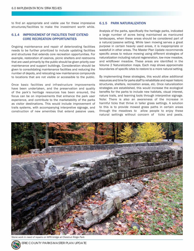
ERIE COUNTY PARKS MASTER PLAN UPDATE
6.0 IMPLEMENTATION STRATEGIES
structures/facilities to make the investment worth while.
6.1.4 IMPROVEMENT OF FACILITIES THAT EXTEND CORE RECREATION OPPORTUNITIES
Ongoing maintenance and repair of deteriorating facilities needs to be further prioritized to include updating facilities and structures that extends core recreation opportunities. For example, restoration of casinos, picnic shelters and restrooms that are used primarily by the public should be given priority over maintenance and support buildings. Consideration should be given to consolidating maintenance facilities and reducing the number of depots, and relocating new maintenance compounds to locations that are not visible or accessible to the public.
Once basic facilities and infrastructure improvements have been undertaken, and the preservation and quality
focus can be on improvements that enhance the park user experience, and contribute to the marketability of the parks as visitor destinations. This would include improvement of trails systems, with accompanying interpretive signage, and construction of new amenities that extend passive uses.
Stone work in need of repairs on WPA bridge at Chestnut Ridge Park
6.1.5 PARK NATURALIZATION
a large number of acres being maintained as manicured landscapes, when these areas should be considered part of
purpose in certain heavily used areas, it is inappropriate or wastefull in other areas. The Master Plan Update recommends
Volume 2 Naturalization maps. Each map shows approximate
By implementing these strategies, this would allow additional resources and time for parks staff to rehabilitate and repair historic structures, shelters, recreation areas, etc. Once naturalization strategies are established, this would increase the ecological
nature trails, and learning tools through interpretive signage. Note: There is also an awareness of the increase in harmful ticks that thrive in taller grass settings. A solution to this is to provide mowed grass paths in certain areas through the meadows to allow people to enjoy these natural settings without concern of ticks and pests.

VOLUME 1: OVERALL SYSTEM MASTER PLAN - 6.0 IMPLEMENTATION STRATEGIES
VOLUME1 FINAL PLAN
Historic Wendt Mansion in need of extensive rehabilitation
6.1.6 TRAILWAYS
The County Parks System maintains and provides unique trail systems throughout the region from the Shoreline Trail to passive wildlife trails. The County should prioritize the upkeep and expansion of these trails to connect to its many parks and unique attractions. Proper trail design, upkeep, signage, safety measures, and trail amenities should be planned and provided at all Parks System trails. Many County Parks have a series of different types of trails and pathways which need to be expanded upon and featured as unique assets to the regional parks system. Hunters Creek Park is an example of a park with a series of trails catering to many different user types from hikers to mountain bikers and horseback riders.
The County should continue coordination and collaboration with municipalities and local agencies to strategize any nearby trail construction to have connections with County Parks. Improving connectivity and elements of Complete Streets may provide more people access to the unique assets and amenities in the parks.
6.1.7 ENVIRONMENTAL SENSITIVITY AND IMPROVEMENTS
Ongoing efforts in the County Parks System has heavily focused on improving sensitive ecological communities, habitats, and plant/tree species. Coordination with various agencies like
preserve the environmental character and health of the parks.
example of how the County is strategizing the importance of preserving and enhancing its unique environmental features.
streams, creeks, waterfalls, mature forests, dune environments, and much more. Focusing on these unique assets will provide the County with a vast array of destinations and marketing
and other areas to access these natural features. And when appropriate provide interpretive signage which can educate park patrons to the wildlife and natural features which exist.
In other cases, as indicated in the Master Plan recommendations,
V1-103
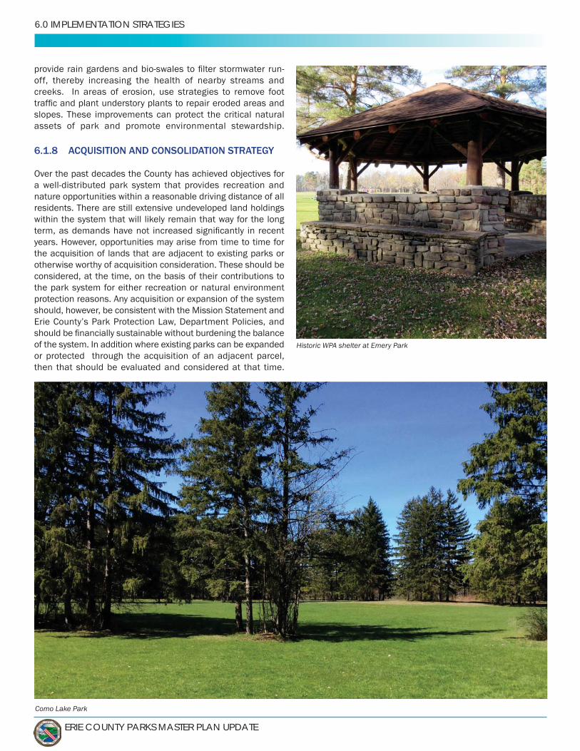
ERIE COUNTY PARKS MASTER PLAN UPDATE
6.0 IMPLEMENTATION STRATEGIES
Como Lake Park
off, thereby increasing the health of nearby streams and creeks. In areas of erosion, use strategies to remove foot
slopes. These improvements can protect the critical natural assets of park and promote environmental stewardship.
6.1.8 ACQUISITION AND CONSOLIDATION STRATEGY
Over the past decades the County has achieved objectives for
nature opportunities within a reasonable driving distance of all residents. There are still extensive undeveloped land holdings within the system that will likely remain that way for the long
years. However, opportunities may arise from time to time for the acquisition of lands that are adjacent to existing parks or otherwise worthy of acquisition consideration. These should be considered, at the time, on the basis of their contributions to the park system for either recreation or natural environment protection reasons. Any acquisition or expansion of the system should, however, be consistent with the Mission Statement and
of the system. In addition where existing parks can be expanded or protected through the acquisition of an adjacent parcel, then that should be evaluated and considered at that time.
Historic WPA shelter at Emery Park

VOLUME 1: OVERALL SYSTEM MASTER PLAN - 6.0 IMPLEMENTATION STRATEGIES
VOLUME1 FINAL PLAN
6.2 PARKS OPERATIONS DISCUSSION AND STRATEGIES
Every community and every parks department vary in scope, and no two are operated equally. The size, operations, and structure of each department vary throughout North America. Comparing Erie
State of New York or nationally provides, at best, only a partial correlation. To provide some norm or guide, we have used several sources and metrics, but the best benchmark is to look historically at the county to see how it has changed over time. 6.2.1 NRPA PARK METRICS BENCHMARKING
produced the 2018 NRPA Agency Performance Review. This annual report summarizes the key
NRPA Park Metrics—a benchmarking
so they can more effectively manage and plan operating resources and capital facilities. Each agency can use these tools to easily build customized reports and compare their agency to others to gain more funding support, improve operations, and better serve their community.The 2018 NRPA Agency Performance Review and NRPA Park Metrics together represent the most comprehensive collection of park and recreation benchmarks and insights which inform professionals, key stakeholders, and the public on the state of the park and recreation industry.Most of the data in the 2018 NRPA Agency Performance Review are presented with the
percent). The data allows for insights into where an agency stands compared to typical agencies (i.e., those at the median values) and the full spectrum of agencies at both the high and low quartiles. The hundreds of agencies reporting include jurisdictions such as villages, towns, cities, counties, states, special and independent districts, and even some
as small as 1,600 people to as large as 3.8 million.
It should be noted that the 2018 NRPA Agency Performance Review does not include “national standards”. The reason is simple: no two park and recreation agencies are the same. Different agencies serve different residents with unique needs, desires and challenges. Agencies also have dissimilar funding mechanisms, just as jurisdictions
(Above) NRPA Key Findings Figures
(Right) 2018 NRPA Agency Performance Review Report
cover
V1-105
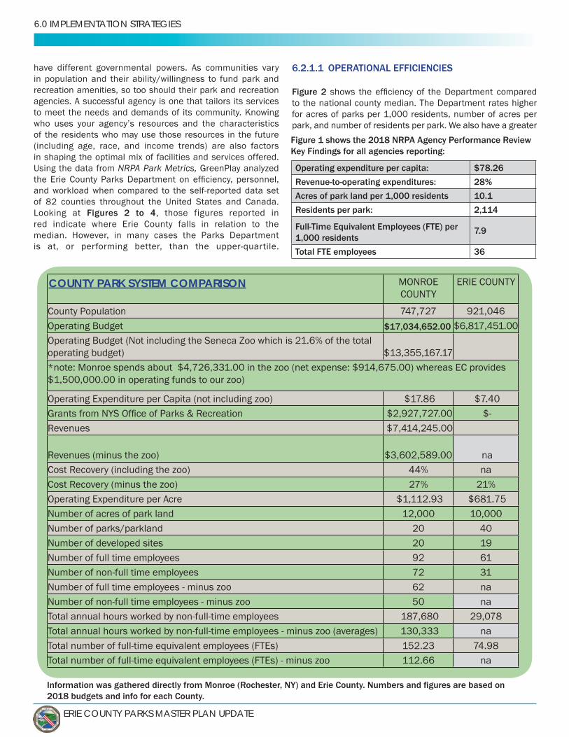
ERIE COUNTY PARKS MASTER PLAN UPDATE
6.0 IMPLEMENTATION STRATEGIES
have different governmental powers. As communities vary in population and their ability/willingness to fund park and recreation amenities, so too should their park and recreation agencies. A successful agency is one that tailors its services to meet the needs and demands of its community. Knowing
of the residents who may use those resources in the future (including age, race, and income trends) are also factors in shaping the optimal mix of facilities and services offered.Using the data from NRPA Park Metrics,
of 82 counties throughout the United States and Canada. Figures 2 to 4, those figures reported in
red indicate where Erie County falls in relation to the median. However, in many cases the Parks Department
Operating expenditure per capita: $78.26
Revenue-to-operating expenditures: 28%
Acres of park land per 1,000 residents 10.1
Residents per park: 2,114
Full-Time Equivalent Employees (FTE) per 1,000 residents
7.9
Total FTE employees 36
Figure 1 shows the 2018 NRPA Agency Performance Review Key Findings for all agencies reporting:
2018 budgets and info for each County.
COUNTY
County PopulationOperating BudgetOperating Budget (Not including the Seneca Zoo which is 21.6% of the total operating budget)
$1,500,000.00 in operating funds to our zoo)
Operating Expenditure per Capita (not including zoo)
$3,602,589.00 na na
21%Operating Expenditure per Acre $1,112.93 Number of acres of park land 12,000 10,000Number of parks/parkland 20Number of developed sites 20 19Number of full time employees 92 61
3162 na50 na
130,333 na152.23112.66 na
6.2.1.1 OPERATIONAL EFFICIENCIES
Figure 2to the national county median. The Department rates higher for acres of parks per 1,000 residents, number of acres per
COUNTY PARK SYSTEM COMPARISON

VOLUME 1: OVERALL SYSTEM MASTER PLAN - 6.0 IMPLEMENTATION STRATEGIES
VOLUME1 FINAL PLAN
annual operating expenditure by 3.5 percent or $213,253. The Department rates fall below the median with respect to
median in operating expenditures per capita, revenue per capita, total tax expenditure per capita, and operating expenditure per acre of parkland. For full time equivalents (FTEs) per 10,000 people, the Department currently has 0.81 FTEs compared
The Department has a greater inventory of parks and acres of parks than the median of counties in the sample and the County allocates less money and personnel to operate and maintain those parks. This imbalance creates issues of extended mowing cycles, focus on maintenance only, and deferred maintenance backlogs.
6.2.1.2 PERSONNEL
The comparison of personnel indicates that the Department rates at or above the median in most categories. However,
reporting criteria. This may be due in part to Department employees being governed by a collective bargaining agreement (i.e. are union members) as Erie County supports fair wages and contracts to benefit both the employees and the taxpayers. Based on the NRPA Park Metrics, 33.3
The Department uses 31 compared to 55 for the median and 165
as well as interviews with staff, support the conclusion of the need for additional personnel for operations and maintenance.
and as needed to cover vacancies and leave. Another need is for skilled trade positions within the Department, such as mechanics, plumbers, electricians, and equipment operators. Chestnut Ridge Park, pictured above, is the largest park in the system with
over 1,100 acres
By filling these positions, the Department can function
6.2.1.3 WORKLOAD
The inventory of Erie County Parks, including total number of parks, total park acreage, miles of trails, and number of buildings operated, was in the higher percentile of counties. The Department rated higher in all categories when compared to the median except for developed park acres and
System was compared to other communities that manage
counties comparisons that included 82 counties, there were
and 1 independent district, from the states of Arizona, Florida,
Figure 5
Erie County NY Median
Upper
$6 68 $25 $54 Revenue per capita $2 65 $6 $19
27.90% 65 29.20% 51.10%Total tax expenditures per capita $5 65 $16 $32
$603 64 $2,463 $6,475 $79,257 65 $83,068 $115,000
0.81 66 2.8 6.8Acres of parks per 1,000 residents 10.7 65 10.7 18.4
24,893 66 8,926 20,422266.32 65 76.9 92
$5,942,697 68 $5,729,444 $12,393,913
V1-107

ERIE COUNTY PARKS MASTER PLAN UPDATE
6.0 IMPLEMENTATION STRATEGIES
Erie County NY Median
Upper
40 66 21.5 50Total park acres 9,854 65 2,438 5,752.20
Developed 1,060 49 984 2,591Undeveloped 8,794 56 985.5 5,365.80
by the agency 67 57 39.6 6746 55 15 39
Square footage of operated buildings 193,000 46 112,500 277,571.50
Figure 4: Workload Comparison Erie County to NRPA Park Metrics
Figure 5: Erie County Comparison to Communities with 8,000 to 12,000 Acres of Parkland
Erie County
NY
# Lower
MedianUpper
$6 10 $35 $58 $160Revenue per capita $2 11 $7 $9 $47
expenditures $5,942,697 10 $10,798,941 $29,298,305 $59,848,950Total tax expenditures per capita $5 10 $26 $46 $111
parkland $603 6 $296 $683 $814$79,257 9 $72,088 $88,712 $143,104
0.81 10 3.6 7.2 14.6Acres of parks per 1,000 residents 10.70 11 7.6 19.5 48
24,893.1 11 4,774.6 6,179.1 20,175.2266.32 11 91.5 174.6 378.5
Figure 3: Personnel Comparison Erie County to NRPA Park Metrics
Erie County NY Median
Upper
61 69 47 10631 65 55 165
29,078 59 31,929 84,745
74.98 67 75 135.2
11% 50 15% 20%8% 50 61.60% 94.80%
c. Maintenance 81% 50 31.10% 44.80%
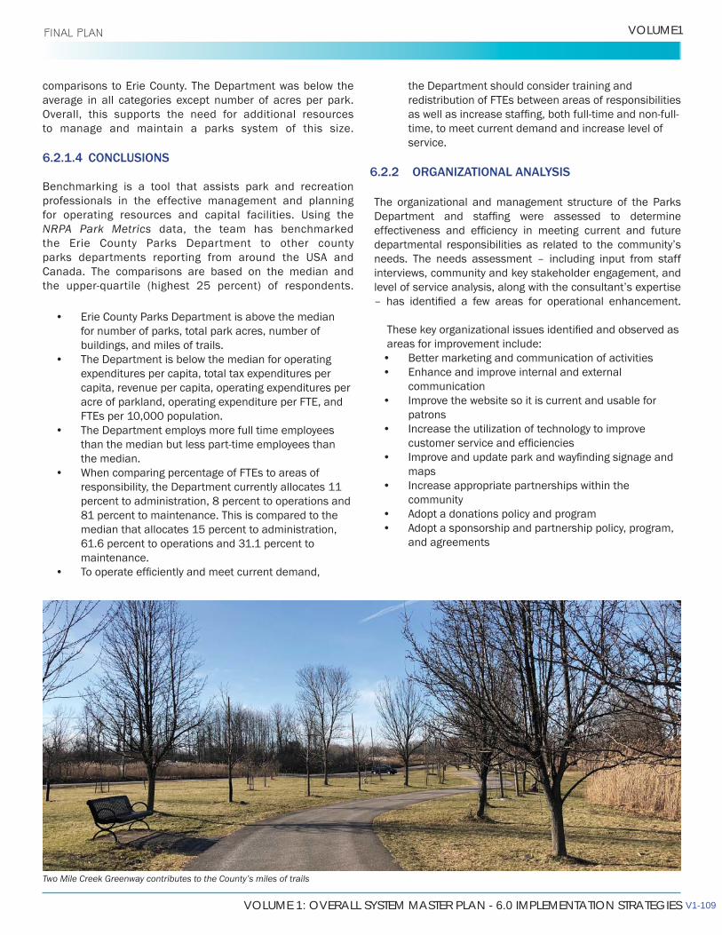
VOLUME 1: OVERALL SYSTEM MASTER PLAN - 6.0 IMPLEMENTATION STRATEGIES
VOLUME1 FINAL PLAN
comparisons to Erie County. The Department was below the average in all categories except number of acres per park. Overall, this supports the need for additional resources to manage and maintain a parks system of this size.
6.2.1.4 CONCLUSIONS
Benchmarking is a tool that assists park and recreation professionals in the effective management and planning for operating resources and capital facilities. Using the NRPA Park Metrics data, the team has benchmarked the Erie County Parks Department to other county parks departments reporting from around the USA and Canada. The comparisons are based on the median and
• Erie County Parks Department is above the median for number of parks, total park acres, number of buildings, and miles of trails.
• The Department is below the median for operating expenditures per capita, total tax expenditures per capita, revenue per capita, operating expenditures per acre of parkland, operating expenditure per FTE, and FTEs per 10,000 population.
• The Department employs more full time employees
the median. •
responsibility, the Department currently allocates 11 percent to administration, 8 percent to operations and 81 percent to maintenance. This is compared to the median that allocates 15 percent to administration, 61.6 percent to operations and 31.1 percent to maintenance.
•
the Department should consider training and redistribution of FTEs between areas of responsibilities
time, to meet current demand and increase level of service.
6.2.2 ORGANIZATIONAL ANALYSIS
The organizational and management structure of the Parks
needs. The needs assessment – including input from staff interviews, community and key stakeholder engagement, and
areas for improvement include:• Better marketing and communication of activities• Enhance and improve internal and external
communication • Improve the website so it is current and usable for
patrons• Increase the utilization of technology to improve
• maps
• Increase appropriate partnerships within the community
• Adopt a donations policy and program• Adopt a sponsorship and partnership policy, program,
and agreements
Two Mile Creek Greenway contributes to the County’s miles of trails
V1-109
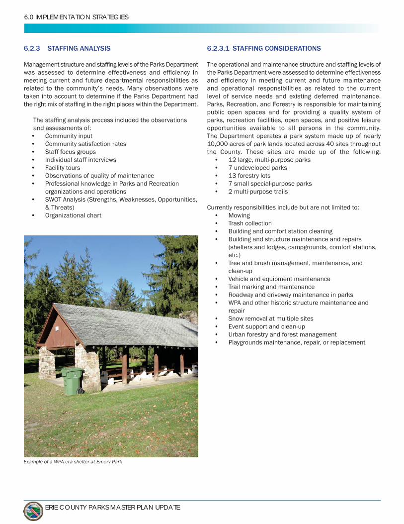
ERIE COUNTY PARKS MASTER PLAN UPDATE
6.0 IMPLEMENTATION STRATEGIES
6.2.3 STAFFING ANALYSIS
meeting current and future departmental responsibilities as
taken into account to determine if the Parks Department had
and assessments of:• Community input• Community satisfaction rates• Staff focus groups• Individual staff interviews• Facility tours• Observations of quality of maintenance•
organizations and operations•
& Threats)• Organizational chart
6.2.3.1 STAFFING CONSIDERATIONS
the Parks Department were assessed to determine effectiveness
and operational responsibilities as related to the current level of service needs and existing deferred maintenance.
public open spaces and for providing a quality system of parks, recreation facilities, open spaces, and positive leisure opportunities available to all persons in the community. The Department operates a park system made up of nearly
the County. These sites are made up of the following: • • • 13 forestry lots• •
Currently responsibilities include but are not limited to:• Mowing• Trash collection• Building and comfort station cleaning• Building and structure maintenance and repairs
(shelters and lodges, campgrounds, comfort stations, etc.)
• Tree and brush management, maintenance, and
• Vehicle and equipment maintenance• Trail marking and maintenance• •
repair• Snow removal at multiple sites• • Urban forestry and forest management• Playgrounds maintenance, repair, or replacement
Example of a WPA-era shelter at Emery Park
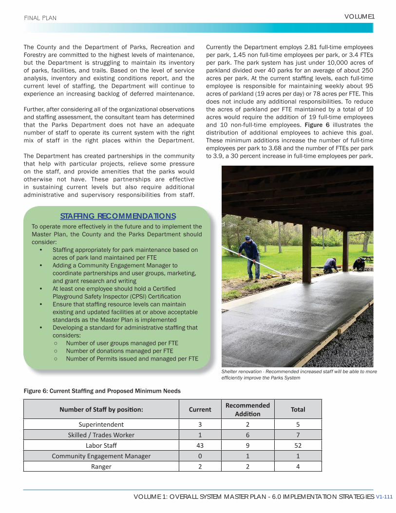
VOLUME 1: OVERALL SYSTEM MASTER PLAN - 6.0 IMPLEMENTATION STRATEGIES
VOLUME1 FINAL PLAN
Forestry are committed to the highest levels of maintenance, but the Department is struggling to maintain its inventory of parks, facilities, and trails. Based on the level of service analysis, inventory and existing conditions report, and the current level of staffing, the Department will continue to experience an increasing backlog of deferred maintenance.
Further, after considering all of the organizational observations
that the Parks Department does not have an adequate number of staff to operate its current system with the right mix of staff in the right places within the Department.
The Department has created partnerships in the community that help with particular projects, relieve some pressure on the staff, and provide amenities that the parks would otherwise not have. These partnerships are effective in sustaining current levels but also require additional administrative and supervisory responsibilities from staff.
To operate more effectively in the future and to implement the Master Plan, the County and the Parks Department should consider:
• acres of park land maintained per FTE
• Adding a Community Engagement Manager to coordinate partnerships and user groups, marketing, and grant research and writing
•
• existing and updated facilities at or above acceptable standards as the Master Plan is implemented
• considers:
Number of user groups managed per FTE Number of donations managed per FTE Number of Permits issued and managed per FTE
STAFFING RECOMMENDATIONS
Superintendent 3 2 5Skilled / Trades Worker 1 6 7
43 9 520 1 1
Ranger 2 2 4
per park. The park system has just under 10,000 acres of
employee is responsible for maintaining weekly about 95
does not include any additional responsibilities. To reduce the acres of parkland per FTE maintained by a total of 10
Figure 6 illustrates the distribution of additional employees to achieve this goal.
employees per park to 3.68 and the number of FTEs per park
Shelter renovation - Recommended increased staff will be able to more
V1-111
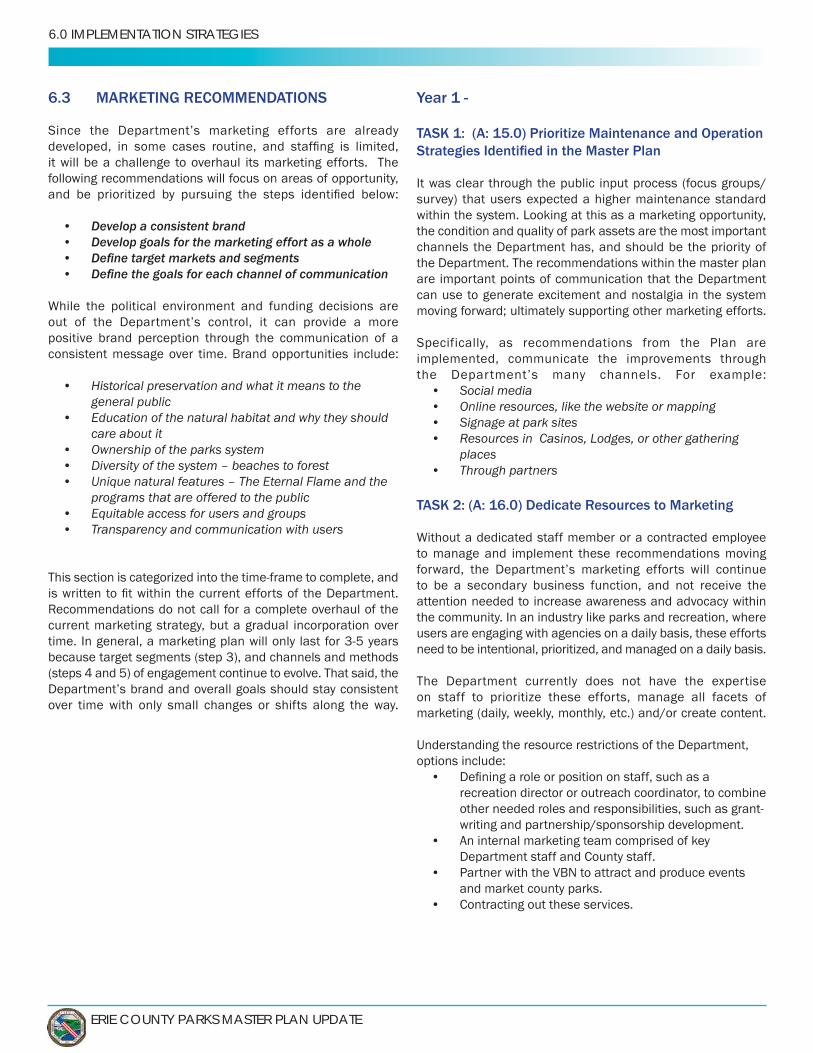
ERIE COUNTY PARKS MASTER PLAN UPDATE
6.0 IMPLEMENTATION STRATEGIES
6.3 MARKETING RECOMMENDATIONS
it will be a challenge to overhaul its marketing efforts. The following recommendations will focus on areas of opportunity,
• Develop a consistent brand• Develop goals for the marketing effort as a whole• •
positive brand perception through the communication of a consistent message over time. Brand opportunities include:
• Historical preservation and what it means to the general public
• Education of the natural habitat and why they should care about it
• Ownership of the parks system• Diversity of the system – beaches to forest• Unique natural features – The Eternal Flame and the
programs that are offered to the public• Equitable access for users and groups• Transparency and communication with users
current marketing strategy, but a gradual incorporation over
because target segments (step 3), and channels and methods
over time with only small changes or shifts along the way.
Year 1 -
TASK 1: (A: 15.0) Prioritize Maintenance and Operation
It was clear through the public input process (focus groups/survey) that users expected a higher maintenance standard
the condition and quality of park assets are the most important channels the Department has, and should be the priority of the Department. The recommendations within the master plan are important points of communication that the Department can use to generate excitement and nostalgia in the system moving forward; ultimately supporting other marketing efforts.
Specifically, as recommendations from the Plan are implemented, communicate the improvements through
• Social media• Online resources, like the website or mapping• Signage at park sites• Resources in Casinos, Lodges, or other gathering
places• Through partners
TASK 2: (A: 16.0) Dedicate Resources to Marketing
to manage and implement these recommendations moving
to be a secondary business function, and not receive the attention needed to increase awareness and advocacy within the community. In an industry like parks and recreation, where users are engaging with agencies on a daily basis, these efforts need to be intentional, prioritized, and managed on a daily basis.
The Department currently does not have the expertise on staff to prioritize these efforts, manage all facets of marketing (daily, weekly, monthly, etc.) and/or create content.
Understanding the resource restrictions of the Department, options include:
• recreation director or outreach coordinator, to combine
writing and partnership/sponsorship development. • An internal marketing team comprised of key
Department staff and County staff.• Partner with the VBN to attract and produce events
and market county parks.• Contracting out these services.
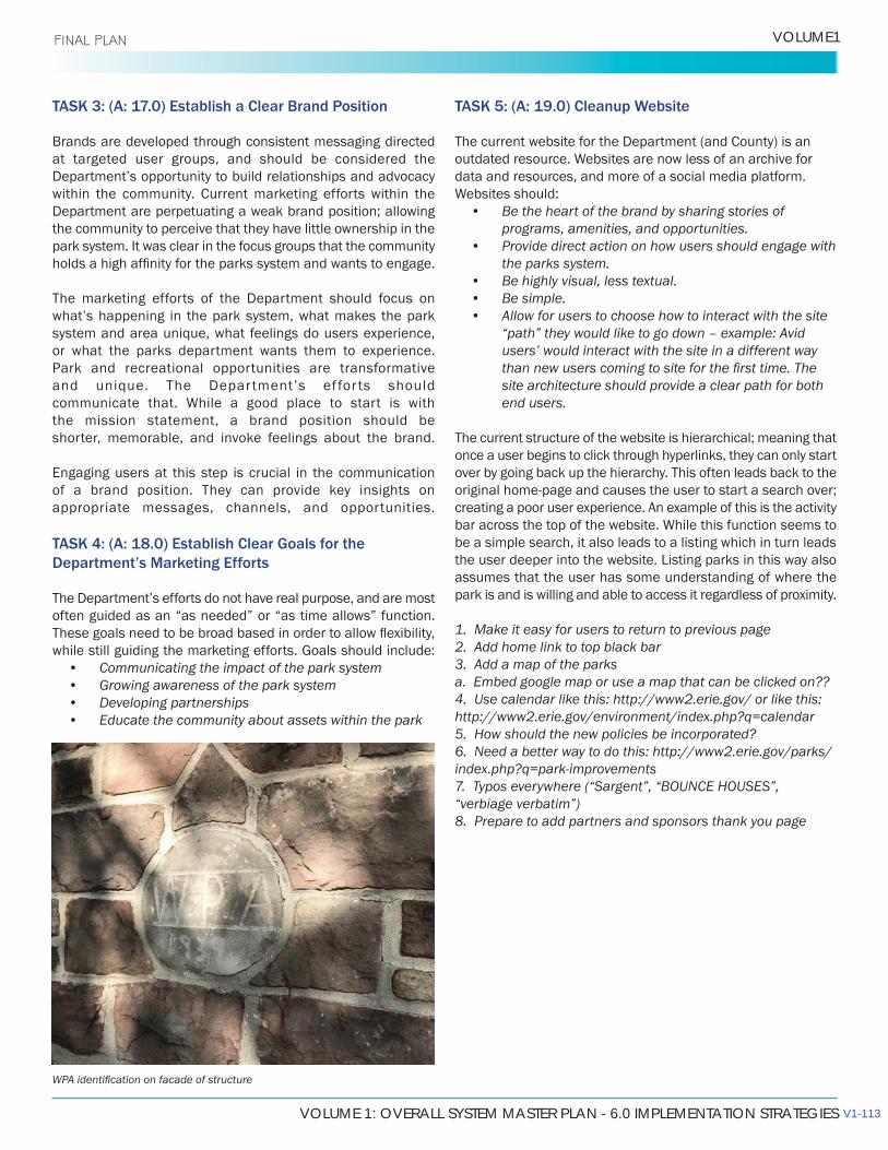
VOLUME 1: OVERALL SYSTEM MASTER PLAN - 6.0 IMPLEMENTATION STRATEGIES
VOLUME1 FINAL PLAN
TASK 3: (A: 17.0) Establish a Clear Brand Position
Brands are developed through consistent messaging directed at targeted user groups, and should be considered the
within the community. Current marketing efforts within the Department are perpetuating a weak brand position; allowing the community to perceive that they have little ownership in the park system. It was clear in the focus groups that the community
The marketing efforts of the Department should focus on
system and area unique, what feelings do users experience, or what the parks department wants them to experience.Park and recreational opportunities are transformative
the mission statement, a brand position should be shorter, memorable, and invoke feelings about the brand.
Engaging users at this step is crucial in the communication of a brand position. They can provide key insights on appropriate messages, channels, and opportunities.
TASK 4: (A: 18.0) Establish Clear Goals for the Department’s Marketing Efforts
often guided as an “as needed” or “as time allows” function.
• Communicating the impact of the park system• Growing awareness of the park system• Developing partnerships• Educate the community about assets within the park
TASK 5: (A: 19.0) Cleanup Website
The current website for the Department (and County) is an
data and resources, and more of a social media platform.
• Be the heart of the brand by sharing stories of programs, amenities, and opportunities.
• Provide direct action on how users should engage with the parks system.
• Be highly visual, less textual.• Be simple.• Allow for users to choose how to interact with the site
“path” they would like to go down – example: Avid users’ would interact with the site in a different way
site architecture should provide a clear path for both end users.
The current structure of the website is hierarchical; meaning that once a user begins to click through hyperlinks, they can only start over by going back up the hierarchy. This often leads back to the
creating a poor user experience. An example of this is the activity
be a simple search, it also leads to a listing which in turn leads
assumes that the user has some understanding of where the park is and is willing and able to access it regardless of proximity.
1. Make it easy for users to return to previous page2. Add home link to top black bar3. Add a map of the parksa. Embed google map or use a map that can be clicked on??4. Use calendar like this: http://www2.erie.gov/ or like this: http://www2.erie.gov/environment/index.php?q=calendar5. How should the new policies be incorporated?6. Need a better way to do this: http://www2.erie.gov/parks/index.php?q=park-improvements 7. Typos everywhere (“Sargent”, “BOUNCE HOUSES”, “verbiage verbatim”)8. Prepare to add partners and sponsors thank you page
V1-113
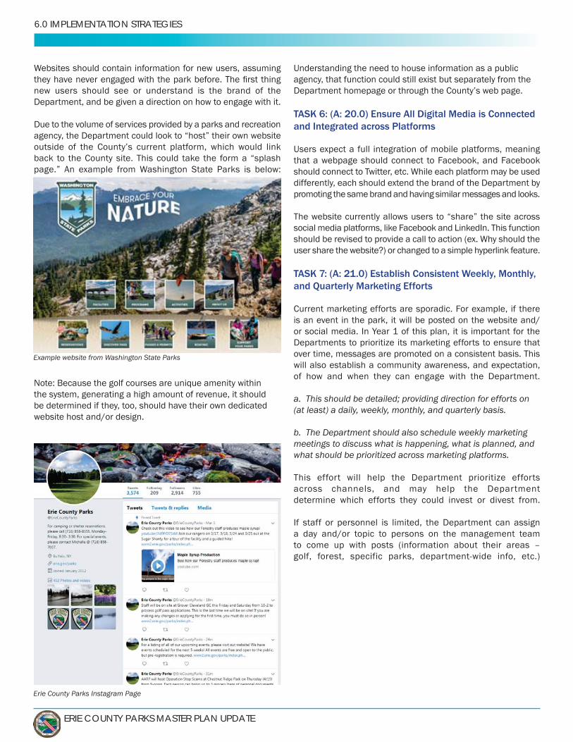
ERIE COUNTY PARKS MASTER PLAN UPDATE
6.0 IMPLEMENTATION STRATEGIES
new users should see or understand is the brand of the Department, and be given a direction on how to engage with it.
Due to the volume of services provided by a parks and recreation agency, the Department could look to “host” their own website
back to the County site. This could take the form a “splash
Note: Because the golf courses are unique amenity within the system, generating a high amount of revenue, it should be determined if they, too, should have their own dedicated website host and/or design.
Understanding the need to house information as a public agency, that function could still exist but separately from the
TASK 6: (A: 20.0) Ensure All Digital Media is Connected and Integrated across Platforms
Users expect a full integration of mobile platforms, meaning that a webpage should connect to Facebook, and Facebook
differently, each should extend the brand of the Department by promoting the same brand and having similar messages and looks.
The website currently allows users to “share” the site across
user share the website?) or changed to a simple hyperlink feature.
TASK 7: (A: 21.0) Establish Consistent Weekly, Monthly, and Quarterly Marketing Efforts
Current marketing efforts are sporadic. For example, if there is an event in the park, it will be posted on the website and/or social media. In Year 1 of this plan, it is important for the Departments to prioritize its marketing efforts to ensure that over time, messages are promoted on a consistent basis. This will also establish a community awareness, and expectation, of how and when they can engage with the Department.
(at least) a daily, weekly, monthly, and quarterly basis.
b. The Department should also schedule weekly marketing meetings to discuss what is happening, what is planned, and what should be prioritized across marketing platforms.
This effort will help the Department prioritize efforts across channels, and may help the Department determine which efforts they could invest or divest from.
If staff or personnel is limited, the Department can assign a day and/or topic to persons on the management team to come up with posts (information about their areas –
Example website from Washington State Parks
Erie County Parks Instagram Page

VOLUME 1: OVERALL SYSTEM MASTER PLAN - 6.0 IMPLEMENTATION STRATEGIES
VOLUME1 FINAL PLAN
TASK 8: (A: 22.0) Establish a Plan to Transition Away from or Redevelop Print Media
A transition plan should be in place, so that the Department can continue to be relevant to its user base. (Example: The Department should give users the option to obtain print
Understanding that print is already an established channel, the Department should look at ways to cut out or consolidate the information being shared via print media; looking at the audiences that gravitate to this type of media (generally younger
Alternatives to print media include:• E-newsletters – Per County policy, this function would
approval for release to the public.• Direct emails – Per County policy, this function would
approval for release to the public.• Text messages• Online brochures (often consolidating to only a once or
twice a year publication)• Calendars – This function is currently available.
Staff should continue to evaluate it to ensure it is
• Mobile application similar to the Ready Erie app for the county
TASK 9: (A: 23.0) Simplify Mapping Features
The maps available through the Department are highly detailed and technical. From a user experience, it is too much information. Maps need to be interactive, show the relationship of amenities within the space, and show the relationship of the park within the system. Users expect maps to look and function
interact with (zoom in/out, search for features, follow trails, etc.). The current maps do not allow for these types of features. An example of this structure would be the “Explore Our Parks” function. This link goes to a listing of links to parks, which leads
user wants to “explore” a new park, they have to go back to the listing and start over. The Department should look for an easier, simpler, and more visual way to translate its resources.
Other departments in Erie County already use simple mapping features to communicate their messages.
function for the drug drop: http://www2.erie.gov/sheriff/
The Department should also consider looking at alternatives to traditional mapping functions, such as virtual park tours.
Current park map for Emery Park
V1-115
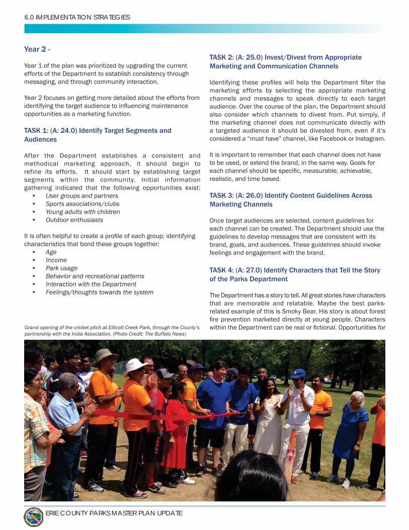
ERIE COUNTY PARKS MASTER PLAN UPDATE
6.0 IMPLEMENTATION STRATEGIES
Year 2 -
Year 1 of the plan was prioritized by upgrading the current efforts of the Department to establish consistency through messaging, and through community interaction.
Year 2 focuses on getting more detailed about the efforts from
opportunities as a marketing function.
TASK 1: (A: 24.0) Identify Target Segments and Audiences
After the Department establishes a consistent and methodical marketing approach, it should begin to refine its efforts. It should start by establishing target segments within the community. Initial information gathering indicated that the following opportunities exist:
• User groups and partners• Sports associations/clubs• Young adults with children• Outdoor enthusiasts
characteristics that bond these groups together:• Age• Income• Park usage• Behavior and recreational patterns• Interaction with the Department• Feelings/thoughts towards the system
TASK 2: (A: 25.0) Invest/Divest from Appropriate Marketing and Communication Channels
marketing efforts by selecting the appropriate marketing channels and messages to speak directly to each target audience. Over the course of the plan, the Department should also consider which channels to divest from. Put simply, if the marketing channel does not communicate directly with
considered a “must have” channel, like Facebook or Instagram.
It is important to remember that each channel does not have
realistic, and time based.
TASK 3: (A: 26.0) Identify Content Guidelines Across Marketing Channels
Once target audiences are selected, content guidelines for each channel can be created. The Department should use the guidelines to develop messages that are consistent with its brand, goals, and audiences. These guidelines should invoke feelings and engagement with the brand.
TASK 4: (A: 27.0) Identify Characters that Tell the Story of the Parks Department
The Department has a story to tell. All great stories have characters
related example of this is Smoky Bear. His story is about forest
Grand opening of the cricket pitch at Ellicott Creek Park, through the County’s partnership with the India Association. (Photo Credit: The Buffalo News)
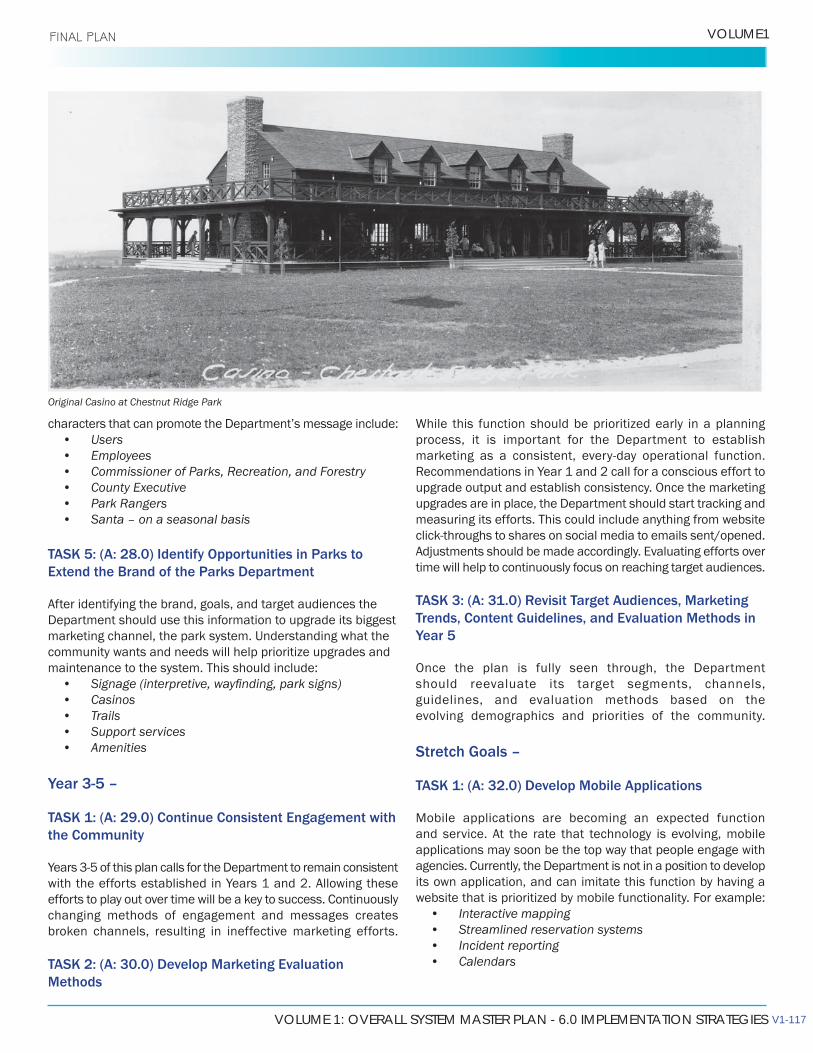
VOLUME 1: OVERALL SYSTEM MASTER PLAN - 6.0 IMPLEMENTATION STRATEGIES
VOLUME1 FINAL PLAN
• Users• Employees• Commissioner of Parks, Recreation, and Forestry• County Executive• Park Rangers• Santa – on a seasonal basis
TASK 5: (A: 28.0) Identify Opportunities in Parks to Extend the Brand of the Parks Department
After identifying the brand, goals, and target audiences the Department should use this information to upgrade its biggest marketing channel, the park system. Understanding what the community wants and needs will help prioritize upgrades and maintenance to the system. This should include:
• • Casinos• Trails• Support services• Amenities
Year 3-5 –
TASK 1: (A: 29.0) Continue Consistent Engagement with the Community
with the efforts established in Years 1 and 2. Allowing these efforts to play out over time will be a key to success. Continuously changing methods of engagement and messages creates broken channels, resulting in ineffective marketing efforts.
TASK 2: (A: 30.0) Develop Marketing Evaluation Methods
process, it is important for the Department to establish
upgrade output and establish consistency. Once the marketing upgrades are in place, the Department should start tracking and measuring its efforts. This could include anything from website
Adjustments should be made accordingly. Evaluating efforts over time will help to continuously focus on reaching target audiences.
TASK 3: (A: 31.0) Revisit Target Audiences, Marketing Trends, Content Guidelines, and Evaluation Methods in Year 5
Once the plan is fully seen through, the Department should reevaluate its target segments, channels, guidelines, and evaluation methods based on the evolving demographics and priorities of the community.
Stretch Goals –
TASK 1: (A: 32.0) Develop Mobile Applications
Mobile applications are becoming an expected function and service. At the rate that technology is evolving, mobile applications may soon be the top way that people engage with agencies. Currently, the Department is not in a position to develop its own application, and can imitate this function by having a website that is prioritized by mobile functionality. For example:
• Interactive mapping• Streamlined reservation systems• Incident reporting• Calendars
Original Casino at Chestnut Ridge Park
V1-117
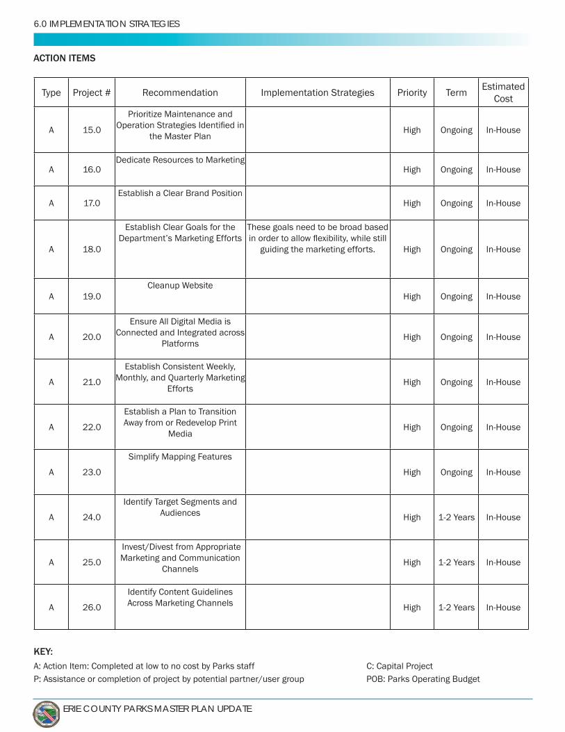
ERIE COUNTY PARKS MASTER PLAN UPDATE
6.0 IMPLEMENTATION STRATEGIES
KEY:A: Action Item: Completed at low to no cost by Parks staff C: Capital ProjectP: Assistance or completion of project by potential partner/user group POB: Parks Operating Budget
ACTION ITEMS
Type Project # Implementation Strategies Priority TermEstimated
Cost
A 15.0
Prioritize Maintenance and
the Master PlanHigh Ongoing
A 16.0 High Ongoing
AEstablish a Clear Brand Position
High Ongoing
A 18.0
These goals need to be broad based
guiding the marketing efforts. High Ongoing
A 19.0 High Ongoing
A 20.0
Ensure All Digital Media is Connected and Integrated across
PlatformsHigh Ongoing
A 21.0 Monthly, and Quarterly Marketing Efforts
High Ongoing
A 22.0
Establish a Plan to Transition
MediaHigh Ongoing
A 23.0
Simplify Mapping Features
High Ongoing
A
Identify Target Segments and Audiences High
A 25.0
Invest/Divest from Appropriate Marketing and Communication
ChannelsHigh
A 26.0 Across Marketing Channels High
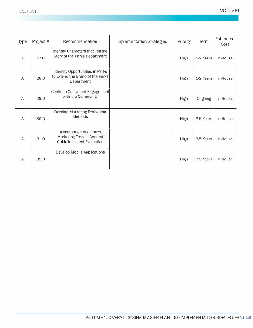
VOLUME 1: OVERALL SYSTEM MASTER PLAN - 6.0 IMPLEMENTATION STRATEGIES
VOLUME1 FINAL PLAN
Type Project # Implementation Strategies Priority TermEstimated
Cost
A
Identify Characters that Tell the Story of the Parks Department High
A 28.0
Identify Opportunities in Parks to Extend the Brand of the Parks
DepartmentHigh
A 29.0
Continue Consistent Engagement with the Community High Ongoing
A 30.0
Develop Marketing Evaluation Methods High
A 31.0 Marketing Trends, Content High
A 32.0
Develop Mobile Applications
High
V1-119