Utilization of Rural Resource information for maintains ... - Esri
16
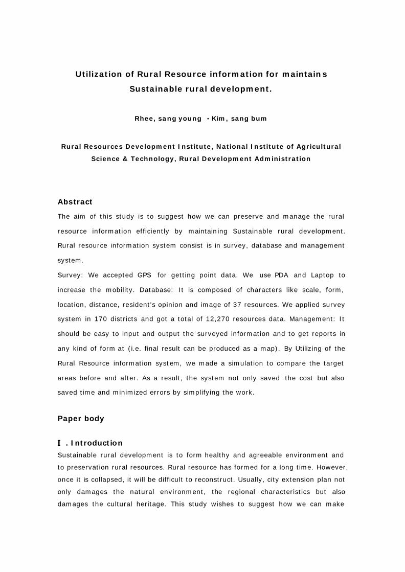
Utilization of Rural Resource information for maintains Sustainable rural development. Rhee, sang young Kim, sang bum Rural Resources Development Institute, National Institute of Agricultural Science & Technology, Rural Development Administration Abstract The aim of this study is to suggest how we can preserve and manage the rural resource information efficiently by maintaining Sustainable rural development. Rural resource information system consist is in survey, database and management system. Survey: We accepted GPS for getting point data. We use PDA and Laptop to increase the mobility. Database: It is composed of characters like scale, form, location, distance, resident's opinion and image of 37 resources. We applied survey system in 170 districts and got a total of 12,270 resources data. Management: It should be easy to input and output the surveyed information and to get reports in any kind of form at (i.e. final result can be produced as a map). By Utilizing of the Rural Resource information system, we made a simulation to compare the target areas before and after. As a result, the system not only saved the cost but also saved time and minimized errors by simplifying the work. Paper body . Introduction Sustainable rural development is to form healthy and agreeable environment and to preservation rural resources. Rural resource has formed for a long time. However, once it is collapsed, it will be difficult to reconstruct. Usually, city extension plan not only damages the natural environment, the regional characteristics but also damages the cultural heritage. This study wishes to suggest how we can make
-
Upload
khangminh22 -
Category
Documents
-
view
2 -
download
0
Transcript of Utilization of Rural Resource information for maintains ... - Esri
Utilization of Rural Resource information for maintains
Sustainable rural development.
Rhee, sang young � Kim, sang bum
Rural Resources Development Institute, National Institute of Agricultural
Science & Technology, Rural Development Administration
Abstract
The aim of this study is to suggest how we can preserve and manage the rural
resource information efficiently by maintaining Sustainable rural development.
Rural resource information system consist is in survey, database and management
system.
Survey: We accepted GPS for getting point data. We use PDA and Laptop to
increase the mobility. Database: It is composed of characters like scale, form,
location, distance, resident's opinion and image of 37 resources. We applied survey
system in 170 districts and got a total of 12,270 resources data. Management: It
should be easy to input and output the surveyed information and to get reports in
any kind of form at (i.e. final result can be produced as a map). By Utilizing of the
Rural Resource information system, we made a simulation to compare the target
areas before and after. As a result, the system not only saved the cost but also
saved time and minimized errors by simplifying the work.
Paper body
. Introduction�
Sustainable rural development is to form healthy and agreeable environment and
to preservation rural resources. Rural resource has formed for a long time. However,
once it is collapsed, it will be difficult to reconstruct. Usually, city extension plan not
only damages the natural environment, the regional characteristics but also
damages the cultural heritage. This study wishes to suggest how we can make

healthy and agreeable environment in rural area by preserv ing and managing rural
resources.
The main objective of this paper is to propose a pre liminary computerized
Procedure of visual 3D GIS analysis and application of rural planning in the Phases
of elaborating and evaluation. The study has been developed by on an existing
project of rural multi-function information system in Rural Development
Administration. The sustainable rural development has been introduced to describe
the influence of 3D rural development on the site fromthe Korea rural area.
This paper will make it possible for rural landscape modelers in Korea to
demonstrate the achievements they have made and the challenges they are facing.
The paper also will allow world experts to understand the rural development
questions unique to Korea and to share their expertise.
. Rural resource information system�
1. Meaning of rural resource
Rural resource tells us all themes that give affection and agreeable feelings that
exist in rural area whether are natural or artificial. In this study, we extract list of
rural resource through literature investigation and two times inquiring by experts
established 37 rural resources. After that, we classified 37 rural resources into
'Natural resource', 'Cultural resource', and ‘ Social resource', again.
Natural resource divided into 'Environment resource' and 'Natural, cultural resource
divided into 'History resource' and 'Spectacle resource'. Social resource is also
divided into 'Facilities resource', 'Community activity resource' and 'Economic
activity resource'. Totally, 37 rural resources are divided into 10 natural resources,
12 cultural resources and 15 social resources. (Supplement Appendixes)
2. Investigation system
In this study, we introduced GIS's concept that is preferred by the latest urban
planning and as an information administration tool to investigate in front referring
'Natural resource', 'Cultural resource' and 'Social resource' of 37 rural resources. In
addition, as we are considering strengthening the mobility and accuracy, we chose
PDA and Laptop as an investigation tool. To extend the function of PDA, We also
added to recording voice, digital camera and GPS on PDA & Laptop. Moreover, we
standardized the contents of questionnaire and method. We applied the system in
170 districts and got a total of 12,270 resources data.
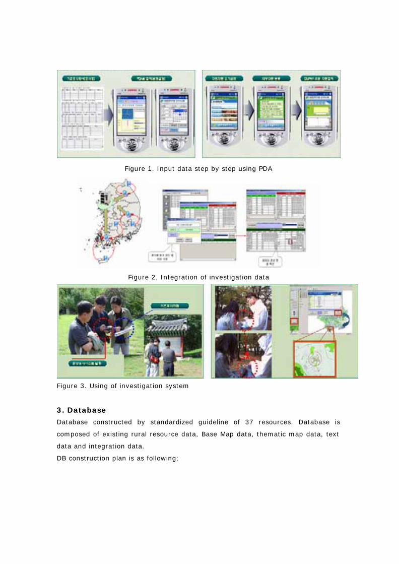
Figure 1. Input data step by step using PDA
Figure 2. Integration of investigation data
Figure 3. Using of investigation system
3. Database
Database constructed by standardized guideline of 37 resources. Database is
composed of existing rural resource data, Base Map data, thematic map data, text
data and integration data.
DB construction plan is as following;
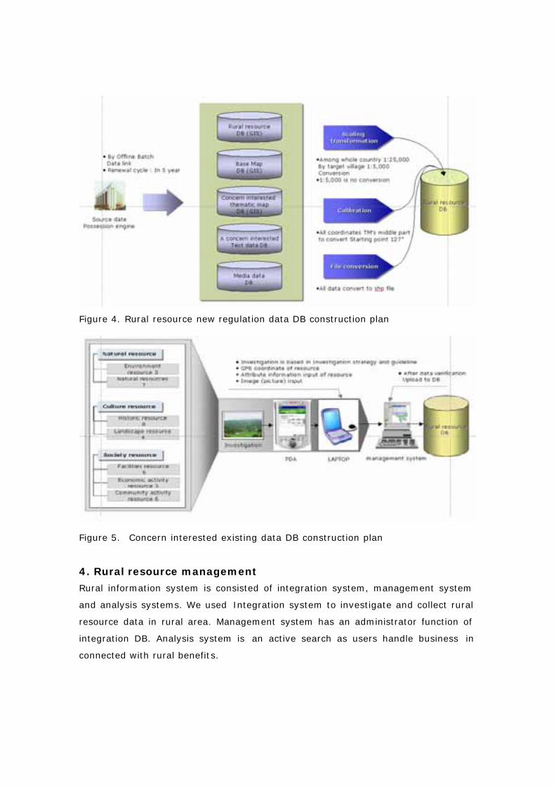
Figure 4. Rural resource new regulation data DB construction plan
Figure 5. Concern interested existing data DB construction plan
4. Rural resource management
Rural information system is consisted of integration system, management system
and analysis systems. We used Integration system to investigate and collect rural
resource data in rural area. Management system has an administrator function of
integration DB. Analysis system is an active search as users handle business in
connected with rural benefits.
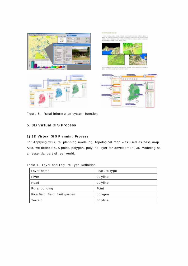
Figure 6. Rural information system function
5. 3D Virtual GIS Process
1) 3D Virtual GIS Planning Process
For Applying 3D rural planning modeling, topological map was used as base map.
Also, we defined GIS point, polygon, polyline layer for development 3D Modeling as
an essential part of real world.
Table 1. Layer and Feature Type Definition
Layer name Feature type
River polyline
Road polyline
Rural building Point
Rice field, field, fruit garden polygon
Terrain polyline
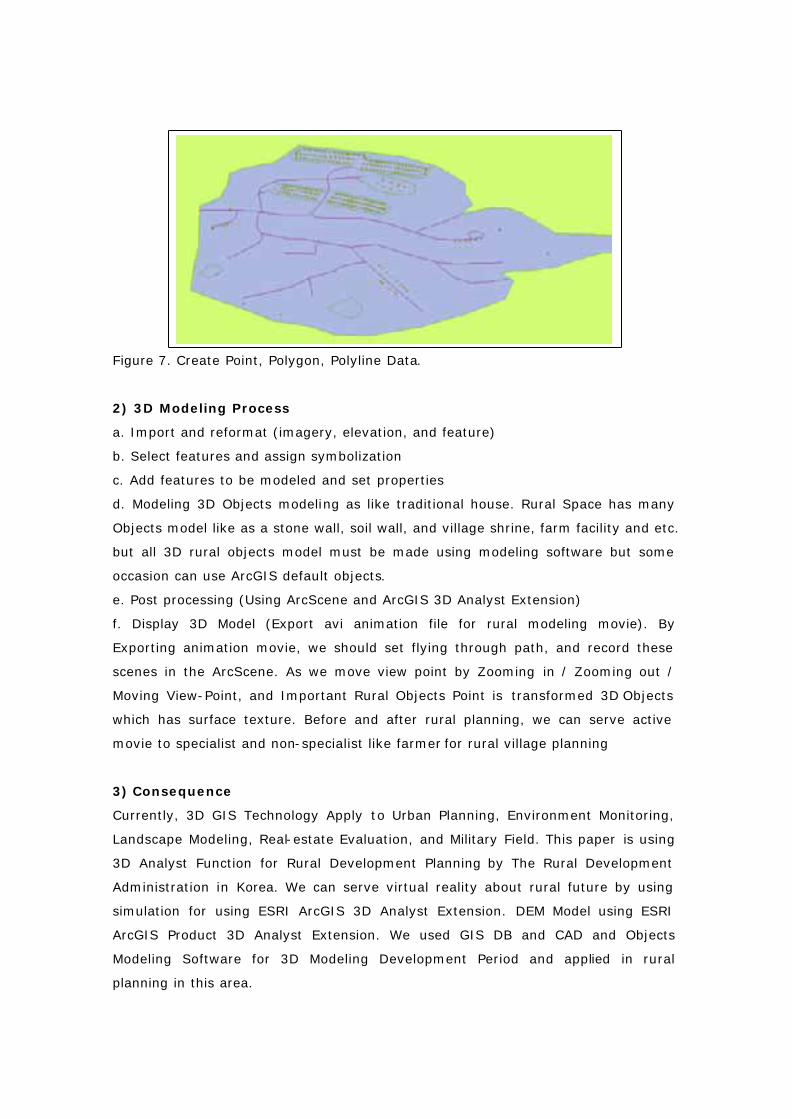
Figure 7. Create Point, Polygon, Polyline Data.
2) 3D Modeling Process
a. Import and reformat (imagery, elevation, and feature)
b. Select features and assign symbolization
c. Add features to be modeled and set properties
d. Modeling 3D Objects modeling as like traditional house. Rural Space has many
Objects model like as a stone wall, soil wall, and village shrine, farm facility and etc.
but all 3D rural objects model must be made using modeling software but some
occasion can use ArcGIS default objects.
e. Post processing (Using ArcScene and ArcGIS 3D Analyst Extension)
f. Display 3D Model (Export avi animation file for rural modeling movie). By
Exporting animation movie, we should set flying through path, and record these
scenes in the ArcScene. As we move view point by Zooming in / Zooming out /
Moving View-Point, and Important Rural Objects Point is transformed 3D Objects
which has surface texture. Before and after rural planning, we can serve active
movie to specialist and non-specialist like farmer for rural village planning
3) Consequence
Currently, 3D GIS Technology Apply to Urban Planning, Environment Monitoring,
Landscape Modeling, Real-estate Evaluation, and Military Field. This paper is using
3D Analyst Function for Rural Development Planning by The Rural Development
Administration in Korea. We can serve virtual reality about rural future by using
simulation for using ESRI ArcGIS 3D Analyst Extension. DEM Model using ESRI
ArcGIS Product 3D Analyst Extension. We used GIS DB and CAD and Objects
Modeling Software for 3D Modeling Development Period and applied in rural
planning in this area.
4) 3D Modeling Effect
This 3D modeling process is different from general landscape modeling process.
For example, we can shorten period of landscape modeling. We can advertise our
planning policy to farmer who lives in the rural area or general people who lives in
the urban space by utilizing 3D GIS Analyst Technology.
To consult a reprehensive selection of stakeholders and generate three additional
scenarios of future whole landscape that world benefit biodiversity conservation
and /or amenity to map the rural landscape under the four scenarios and construct
3D Virtual reality models that would attract viewers to ‘ flying through’. The
potential future of landscape which gains a deeper scene of the alterations involved.
To ask all farmers and Related Local Planning Managers to respond to each of the
scenarios in terms of circumstances in which they would agree to participate in an
agro-environmental plan for the whole landscape management.
6. 3D Virtual GIS for Sustainable Rural Development
1) Purpose
The purpose of this paper serves technology by applying rural planning analyze
and using visual rural area in the landscape.
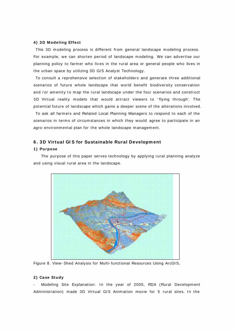
Figure 8. View-Shed Analysis for Multi-functional Resources Using ArcGIS.
2) Case Study
- Modeling Site Explanation: In the year of 2005, RDA (Rural Development
Administration) made 3D Virtual GIS Animation movie for 5 rural sites. In the
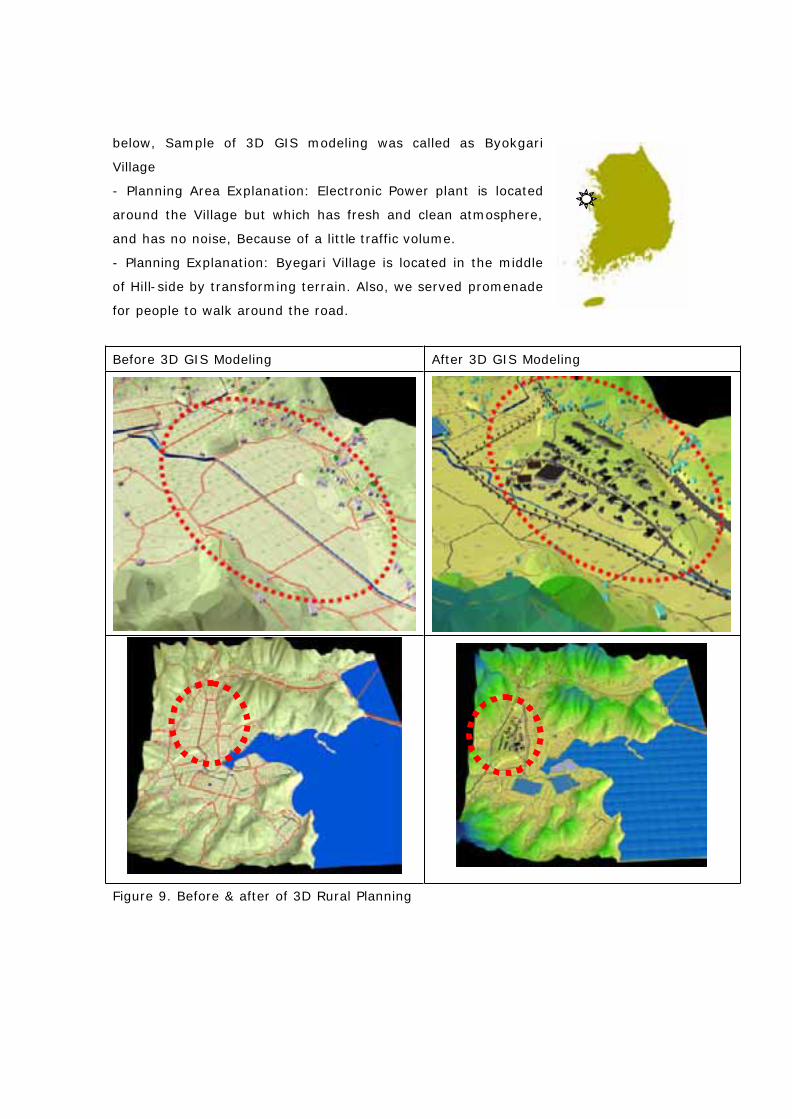
below, Sample of 3D GIS modeling was called as Byokgari
Village
- Planning Area Explanation: Electronic Power plant is located
around the Village but which has fresh and clean atmosphere,
and has no noise, Because of a little traffic volume.
- Planning Explanation: Byegari Village is located in the middle
of Hill-side by transforming terrain. Also, we served promenade
for people to walk around the road.
Before 3D GIS Modeling After 3D GIS Modeling
Figure 9. Before & after of 3D Rural Planning
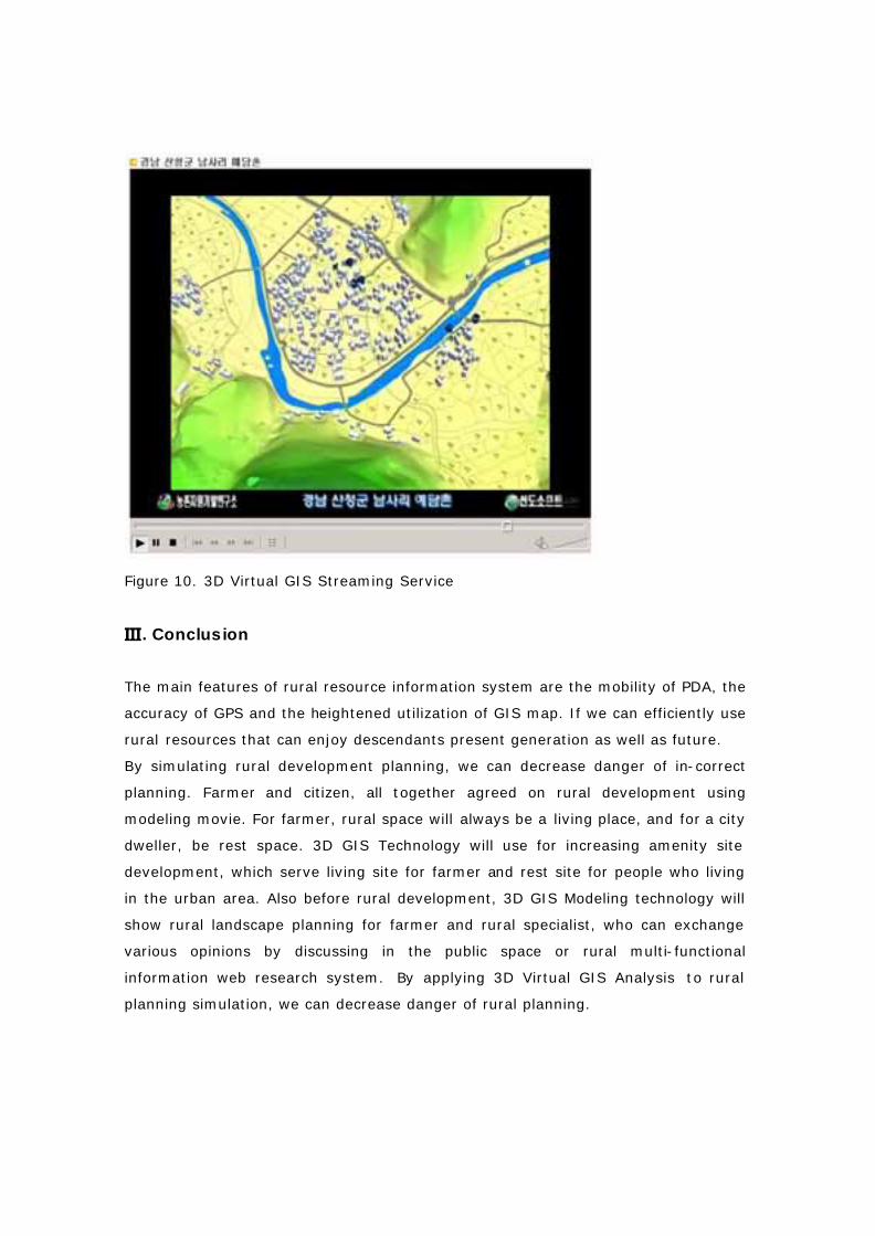
Figure 10. 3D Virtual GIS Streaming Service
. Conclusion�
The main features of rural resource information system are the mobility of PDA, the
accuracy of GPS and the heightened utilization of GIS map. If we can efficiently use
rural resources that can enjoy descendants present generation as well as future.
By simulating rural development planning, we can decrease danger of in-correct
planning. Farmer and citizen, all together agreed on rural development using
modeling movie. For farmer, rural space will always be a living place, and for a city
dweller, be rest space. 3D GIS Technology will use for increasing amenity site
development, which serve living site for farmer and rest site for people who living
in the urban area. Also before rural development, 3D GIS Modeling technology will
show rural landscape planning for farmer and rural specialist, who can exchange
various opinions by discussing in the public space or rural multi-functional
information web research system. By applying 3D Virtual GIS Analysis to rural
planning simulation, we can decrease danger of rural planning.
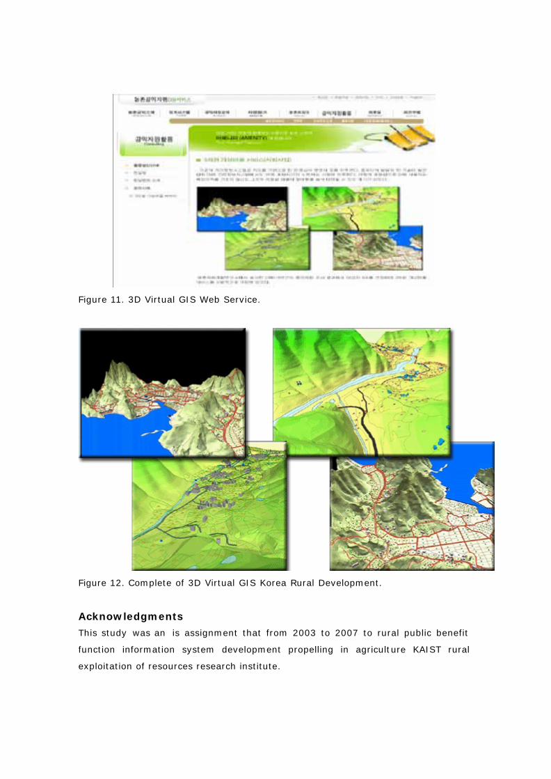
Figure 11. 3D Virtual GIS Web Service.
Figure 12. Complete of 3D Virtual GIS Korea Rural Development.
Acknowledgments
This study was an is assignment that from 2003 to 2007 to rural public benefit
function information system development propelling in agriculture KAIST rural
exploitation of resources research institute.
Appendixes
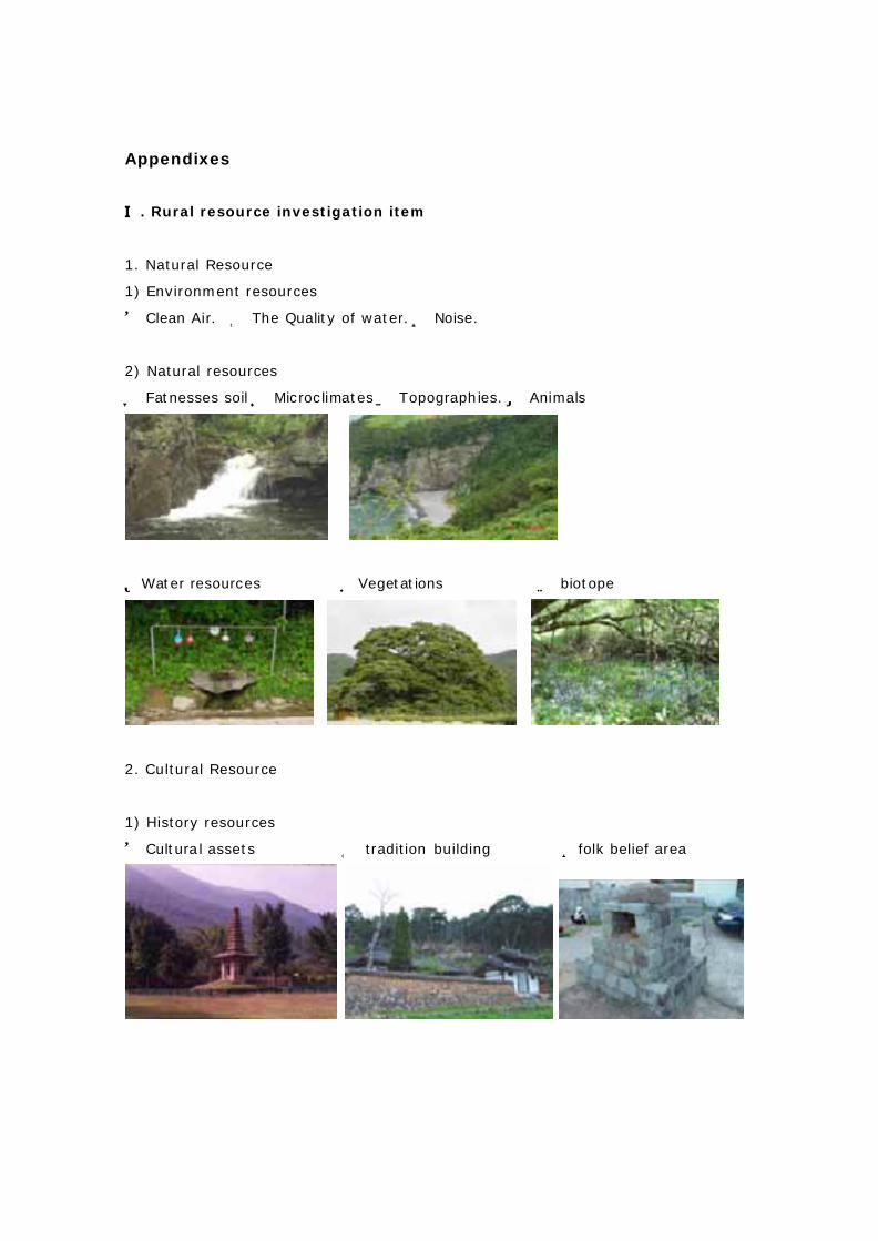
�. Rural resource investigation item
1. Natural Resource
1) Environment resources
① Clean Air. ② The Quality of water. Noise.③
2) Natural resources
Fatnesses soil Microclimates Topographies. Animals④ ⑤ ⑥ ⑦
Water resources Vegetati⑧ ⑨ ons biotope⑩
2. Cultural Resource
1) History resources
Cultural assets① ② tradition building ③folk belief area
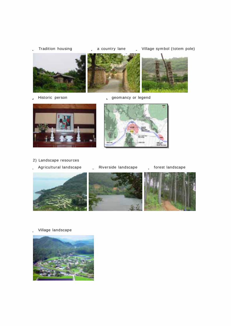
④ Tradition housing ⑤ a country lane ⑥ Village symbol (totem pole)
⑦ Historic person ⑧ geomancy or legend
2) Landscape resources
⑨ Agricultural landscape ⑩ Riverside landscape ⑪ forest landscape
⑫ Village landscape
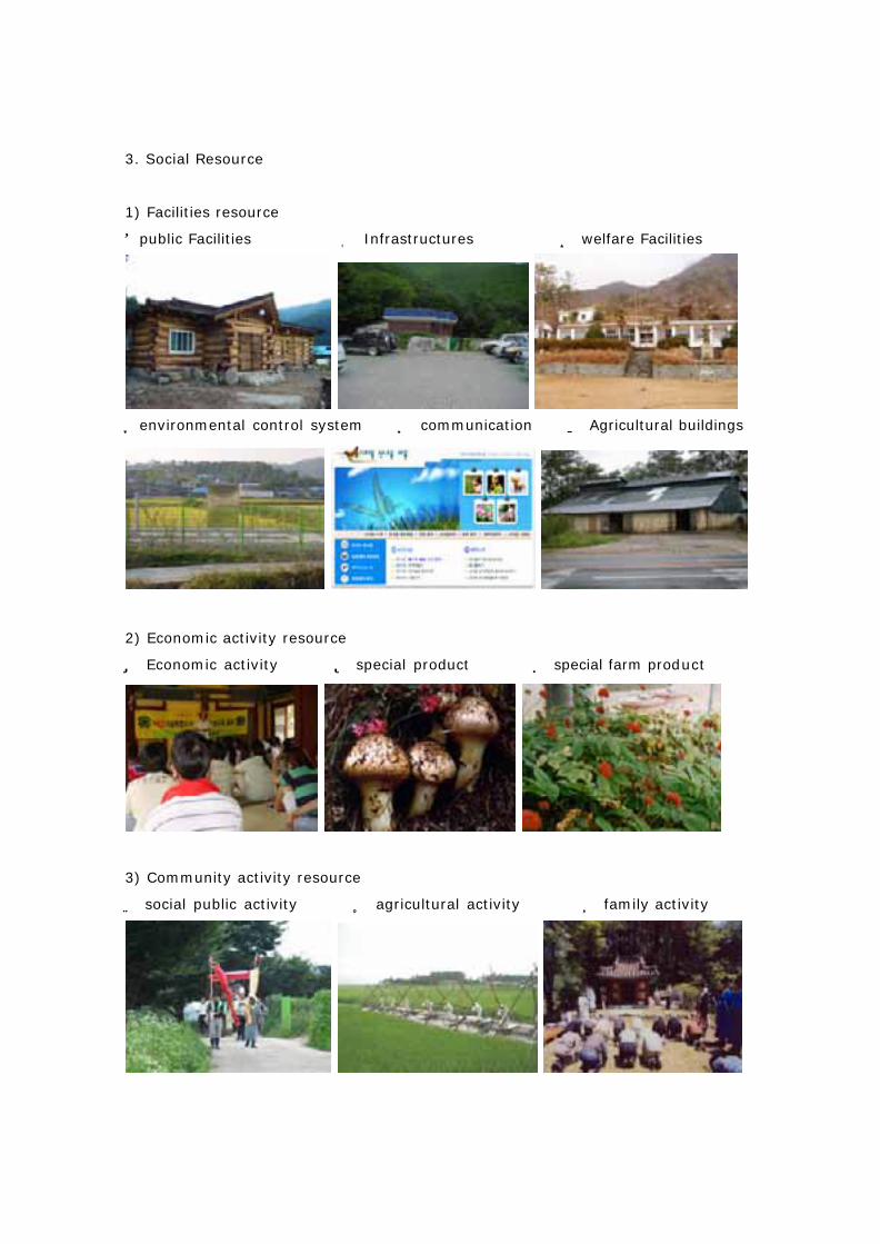
3. Social Resource
1) Facilities resource
①public Facilities ② Infrastructures ③ welfare Facilities
④environmental control system ⑤ communication ⑥ Agricultural buildings
2) Economic activity resource
⑦ Economic activity ⑧ special product ⑨ special farm product
3) Community activity resource
⑩ social public activity ⑪ agricultural activity ⑫ family activity
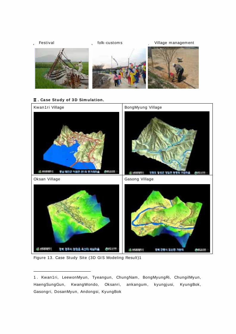
⑬ Festival ⑭ folk-customs ⑮ Village management
�. Case Study of 3D Simulation.
Kwan1ri Village BongMyung Village
Oksan Village Gasong Village
Figure 13. Case Study Site (3D GIS Modeling Result)1
1 . Kwan1ri, LeewonMyun, Tyeangun, ChungNam, BongMyungRi, ChungilMyun,
HaengSungGun, KwangWondo, Oksanri, ankangum, kyungjusi, KyungBok,
Gasongri, DosanMyun, Andongsi, KyungBok
End Notes
I want to offer and progress study through International Cooperation if there is
good suggestion or information regarding this study.
References
1. Construction and Transportation Ministry, 2001, GIS high technology trend
induction plan and International Cooperation base construction, Construction and
Transportation Ministry.
2. Sumi Kim a translation, 2001, GIS and cultural asset management (Written by
Paul Box), Cultural Properties administration
3. Ministry of Agriculture & Forestry, 2002, a study of rural village planning for
efficiently preservation and using of ecological and cultural resource, Ministry of
Agriculture & Forestry
4. Ministry of Health-Welfare, 2003, Move mode medical examination and
treatment information system development by using PDA: Mobile Med, Ministry of
Health-Welfare.
5. Huiyeon lee, 2003, geography informatics, Beopmunsa.
6. Electronics and telecommunication research institute, 2001, GPS Electronics and
telecommunication research institute, Electronics and telecommunication research
institute.
7. Ministry of Environment, 1997, the second natural environment whole country
basis investigation guideline, Ministry of Environment
8. Tsutomu Dakayama, koukan kimura, 2001, introduction GIS mining, Japan,
toyokeizaishinmonsa
9. Japan nature environmental assessment study group, 1998, nature
environmental assessment technology manual, Japan natural environment effect
center
10. Bitters, Barry. 2004, Real-Time Simulation Database Generation: A Conceptual
Model for the Future, Proceedings of the IMAGE 2004 Conference. Scottsdale,
Arizona
11. Abdul-Rahman, A., 2000. The design and implementation of two and three-
dimensional triangular irregular network (TIN) based GIS. PhD thesis, University of
Glasgow, UK. 250pp.
12. Zlatanova, S., 2000. 3D GIS for urban development. PhD thesis, ITC, The
Netherlands, 222pp.
13. Tempfli, K., 1998. 3D topographic mapping for urban GIS. ITC Journal 3/4, pp.
181-190
14. Batty, M. (1997a) Digital Planning: Preparing for a Fully Wired World, in
Computers in Urban Planning and Urban Management: Keynote Papers, edited by P.
K. Sikdar, S. L.Dhingra, and K. V. Krishna Rao, Narosa Publishing House, Delhi,
India, pp. 13-30
15. Cambray, de B., 1993. Three-dimensional modeling in a geographical database,
Proceedings of Auto Carto 11, Bethesda, Maryland, pp.338-347.
Author Information
Primary Author: PhD. Sang-Young Rhee
Rural Development Administration 88-2 SeoDun-Dong, KwonSun-ku Suwon,
Kyunggido 441-853 KR 82-31-299-0530 [email protected]
Co-Author: PhD. Sang-bum Kim
Rural Development Administration 88-2 SeoDun-Dong, KwonSun-ku Suwon,
Kyunggido 441-853 KR 82-31-299-0511 [email protected]


![Transmission Distribution and Utilization [15EE52T]](https://static.fdokumen.com/doc/165x107/6328d58109048e4b7c061729/transmission-distribution-and-utilization-15ee52t.jpg)