UNIVERSITY OF CALIFORNIA, IRVINE Great American Desert
285
UNIVERSITY OF CALIFORNIA, IRVINE Great American Desert: Arid Lands, Federal Exploration, and the Construction of a Continental United States DISSERTATION submitted in partial satisfaction of the requirements for the degree of DOCTOR OF PHILOSOPHY in History by Erik Lee Altenbernd Dissertation Committee: Professor David Igler, Chair Professor William Deverell Associate Professor Laura Mitchell
-
Upload
khangminh22 -
Category
Documents
-
view
2 -
download
0
Transcript of UNIVERSITY OF CALIFORNIA, IRVINE Great American Desert

UNIVERSITY OF CALIFORNIA,
IRVINE
Great American Desert:
Arid Lands, Federal Exploration, and the Construction of a Continental United States
DISSERTATION
submitted in partial satisfaction of the requirements
for the degree of
DOCTOR OF PHILOSOPHY
in History
by
Erik Lee Altenbernd
Dissertation Committee:
Professor David Igler, Chair
Professor William Deverell
Associate Professor Laura Mitchell

© 2016 Erik Lee Altenbernd

ii
DEDICATION
To
Julie, Alex, Henry and Dolores
For
My father

iii
TABLE OF CONTENTS
Page
ACKNOWLEDGEMENTS iv
CIRRICULUM VITAE v
ABSTRACT OF THE DISSERTATION vi
INTRODUCTION 1
CHAPTER 1: First Desert: Exploration of the Great Plains after the 27
Louisiana Purchase
CHAPTER 2: Second Desert: Exploration of the Transrockies 68
West during the Era of Manifest Destiny
CHAPTER 3: Mapping the Desert: Appraising Topography and Climate 110
after the Transcontinental Railroad
CHAPTER 4: Mapping the Desert Sublime: The Colorado Plateau and 152
the Geological Aesthetics of the Modern American
Desert
CONCLUSION 210
BIBLIOGRAPHY 217
APPENDIX: Figures 245

iv
ACKNOWLEDGEMENTS
I would like to begin by thanking my advisor, David Igler. David’s unerring advice and
unflagging support for a project as nebulous as “the desert” has been a stroke a great fortune.
David’s caring and conscientious commitment to his students is second to none. I cannot thank
him enough for his patience with short deadlines and half-baked prose. More than that, I also
thank him and Cindy for providing me and my family with warm memories eating half-baked
pies and finely smoked ribs under a gloaming Pasadena sky.
Special thanks also go to Bill Deverell and Laura Mitchell. Bill, along with David, has served as
a great mentor and inspiration. Bill’s western history seminar at the Huntington in 2010 proved
foundational for me just as it did for everyone else in the class. That seminar, along with our
walks and talks, provided an important baseline for everything that I have done since. I would
also be remiss if I did not thank Bill one last time for giving me and Alex Young “the keys to the
[high performance] car” that is the ICW back in 2012. Special thanks also to Laura for being a
fine editor and teacher. Laura’s world history seminars, insightful commentary, incessant good
cheer, and good choice in beer have shaped this project in a number of important and subtle
ways.
This dissertation would not have been possible without the generous financial support offered by
a number of different institutions. A year-long Graduate Dean’s Dissertation Fellowship from the
Graduate Division at UC Irvine provided crucial support during the drafting phase of the project.
Additional writing support came from a Summer Dissertation Fellowship from the UCI School
of Humanities. Valuable research and travel support was provided by a Wilbur R. Jacobs and
Andrew R. Mellon Fellowship from the Huntington Library, two summer research awards from
the Charles Redd Center for Western Studies, a Graduate Individual Grant from the UCI
Humanities Collective. Additional summer research and writing support was also provided by
way of a Bea Baker Fellowship from the School of Humanities, a Charles and Anne Quilter
Award from the UCI History Department, and the UCI Environment Institute’s Sustainability
Science Team.
I also want to extend special thanks to fellow doctoral students Aubrey Adams, Seth Archer,
Dave Fouser, Jenn Staver, Eric Steiger, and Alex Young. Given the personal origins of this
project, I also want thank my old friends from the Coachella Valley: Nick Bielik, Diana and
Mike Clausen, Patrick Flores, Jamie Kimball, Rick Levy, and Mike Torres.
Lastly, I cannot express enough my eternal thanks to those who helped and suffered the most
during the doctoral process. My deepest love and gratitude is reserved for my wife, Julianne
Altenbernd; my children, Alexandra and Henry Altenbernd; and my mother-in-law, Dolores
McGuire.
The product of childhood drives across Pearblossom Highway and the greater California desert, I
dedicate this dissertation to the memory of my xerophilic father, Donald Altenbernd.

v
CURRICULUM VITAE
Erik Lee Altenbernd
1999 B.A. in History, California State University, Northridge
2006 M.A. in History, California State University, Long Beach
2012 M.A. in History, University of California, Irvine
2016 Ph.D. in History, University of California, Irvine
FIELDS OF STUDY
U.S. History, World History, Environmental History
PUBLICATIONS
“Roundtable: The Significance of the Frontier in an Age of Transnational History.” Editor and
author (with Alex Trimble Young). Settler Colonial Studies 4, no. 2 (2014).
“Sisters in Sustainability: Municipal Partnerships for Social, Environmental and Economic
Growth” (with Dustin McLarty, et al.) Sustainability Science (March 2014).
“A Terrible Beauty: Settler Sovereignty and the State of Exception in HBO’s Deadwood” (with
Alex Trimble Young). Settler Colonial Studies 3, no. 1 (2013).
“A Terrible Beauty: Deadwood, Settler Colonial Violence, and the Post-9/11 State of Exception”
(with Alex Young). In The Last Western: Deadwood and the End of American Empire, ed. Paul
Stasi and Jennifer Greiman (New York and London: Bloomsbury Academic, 2012).
vi
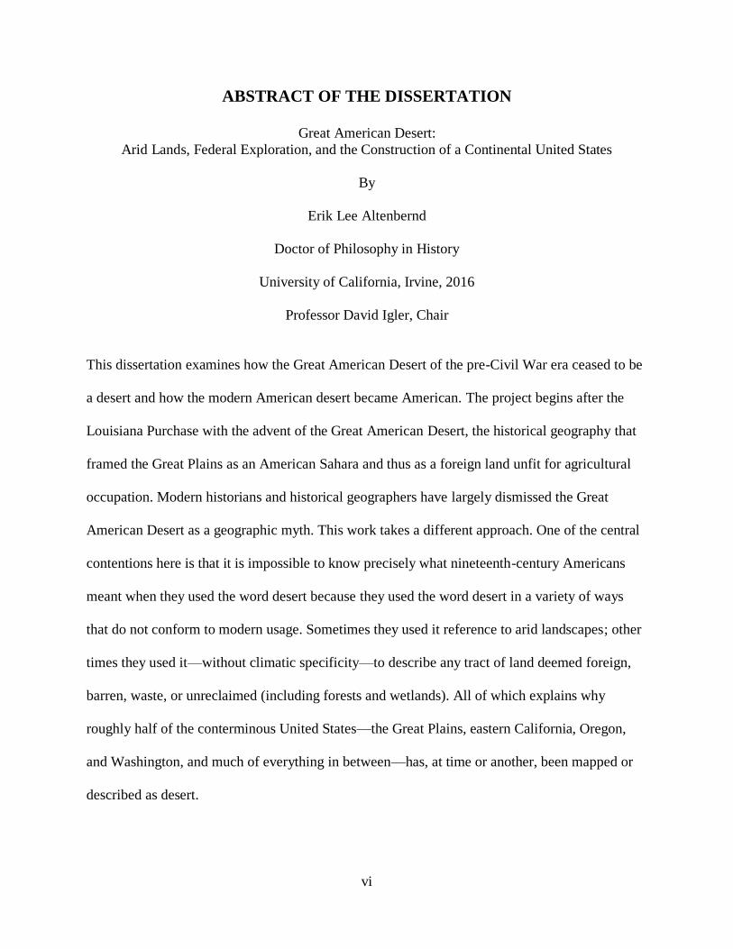
ABSTRACT OF THE DISSERTATION
Great American Desert:
Arid Lands, Federal Exploration, and the Construction of a Continental United States
By
Erik Lee Altenbernd
Doctor of Philosophy in History
University of California, Irvine, 2016
Professor David Igler, Chair
This dissertation examines how the Great American Desert of the pre-Civil War era ceased to be
a desert and how the modern American desert became American. The project begins after the
Louisiana Purchase with the advent of the Great American Desert, the historical geography that
framed the Great Plains as an American Sahara and thus as a foreign land unfit for agricultural
occupation. Modern historians and historical geographers have largely dismissed the Great
American Desert as a geographic myth. This work takes a different approach. One of the central
contentions here is that it is impossible to know precisely what nineteenth-century Americans
meant when they used the word desert because they used the word desert in a variety of ways
that do not conform to modern usage. Sometimes they used it reference to arid landscapes; other
times they used it—without climatic specificity—to describe any tract of land deemed foreign,
barren, waste, or unreclaimed (including forests and wetlands). All of which explains why
roughly half of the conterminous United States—the Great Plains, eastern California, Oregon,
and Washington, and much of everything in between—has, at time or another, been mapped or
described as desert.

vii
An environmental and cultural history of US territorial exploration and expansion from Lewis
and Clark to the operations of the U.S. Geological Survey at the end of the nineteenth century,
the larger arc of the study plots how the old territorial regime of desert as foreign wasteland
eventually gave way, or at least came to coincide, with a new territorial regime—a territorial
regime that not only framed deserts as arid lands, but converted deserts from foreign into
domestic territory through expressions of affection for the desert West. The principal aim here is
not develop an operative definition of the word desert, or determine whether or not nineteenth-
century Americans actually believed the Great Plains were comparable to the Great Desert of
North Africa, but rather to track changes in the socio-cultural meaning of deserts in American
territorial discourse and how those changes in meaning informed the larger project of American
continentalism.

1
INTRODUCTION
Not long before his death, John Charles Frémont (1813-1890) weaved a collection of old and
twice-told tales into a large 655-page memoir detailing the events of the first half of his life. The
second half was to come later in a second volume. As one might expect, the tone of the tome is
mostly triumphal and reads like a highly padded (and long-winded) resume of Frémont’s exploits
as an army explorer during the heady days of Manifest Destiny and US territorial expansion
before the Civil War. In many ways, Frémont’s career as an explorer was defined by the stark
contrasts between the landscapes he explored—the well-watered and often forested ranges of the
Sierra Nevada and Rocky Mountains, and the depressed saline desert sinks of the Great Basin.
The faulted and heaved geology of the West frames Frémont’s career not simply because it
provided the setting of his rise to national prominence, but also because it provides a particularly
apt metaphor for his entire professional life. Hampered by a “career-crippling disdain for
authority” and an uncanny expertise at “transmuting opportunity into spectacular disaster,”
Frémont’s public life was defined by a long, alternating chain of highs and lows, successes and
failures, peaks and valleys. Unfortunately for Frémont, the trend line was not upward.1 All of
Frémont’s rather impressive list of accomplishments—successful army officer, explorer, and
writer; filibuster and Bear Flag Revolutionary; wartime governor and then US Senator from
California; private railroad surveyor, company officer, and investor; 1856 Republican candidate
for President; Civil War general; governor of the territory of Arizona—ended either in court-
marital, resignation, ruin, or disgrace. Poor and nearly destitute after squandering a fortune
wrought in California gold, and then being forced to resign from his unpopular and self-serving
1 Tom Chaffin, The Pathfinder: John Charles Frémont and the Course of American Empire (New York: Hill and
Wang, 2002), 7-8; Richard White, Railroaded: The Transcontinentals and the Making of Modern America (New
York and London: W.W. Norton and Company, 2011), 137.

2
governorship of Arizona, Frémont assembled his memoir hoping it would emulate the
commercial success of that of his onetime Civil War subordinate, Ulysses S. Grant. Sadly, it was
not to be. Unlike Grant’s memoirs, which were a literary as well as commercial success,
Frémont’s Memoirs of My Life, Volume I (1887) sank like a stone. Forced to repair once again to
arid environment, this time not for personal and national glory but due to the onset of acute
bronchitis, Frémont took his unfulfilled plans for a second volume of memoirs to Culver City, a
booming suburban subdivision right on the verge of going bust ten miles west of Los Angeles.2
One of the more interesting yarns found in Frémont’s memoirs is his account of the day
he visited President James K. Polk at the White House shortly after Polk’s inauguration in March
1845. The two did not meet on equal terms—a recently breveted captain of the army, Frémont
was meeting his new commander-in-chief—but each man mas was still riding a wave of recent
professional success. Polk, of course, had just recently won a national election and was in the
early stages of acting on his electoral mandate for territorial expansion. Frémont, meanwhile,
was still enjoying widespread praise not only for his recent exploratory expedition to California
and Oregon but for the official report he submitted to Congress just three days before Polk’s
inauguration on March 4. After pleasantries and small talk, conversation between the captain and
the president quickly turned to the subject of Frémont’s recent expedition and, more generally,
“the geography of the West.” One of the key findings of Frémont’s recent report concerned the
physical geography of the Great Basin, the region Frémont not only named but described as an
“intermediate region . . . containing many lakes, with their own system of rivers and creeks, (of
which the Great Salt Lake is the principal,) and which have no connexion with the ocean, or the
2 Chaffin, 487.
3
greatest rivers, which flow into it.”3 A handful of geographers and fur trappers had suspected as
much, but Frémont’s report, and its landmark companion map drafted by Charles Preuss, were
the first printed works to offer clear evidence in support of the idea that the Great Basin
constituted an endoheric system. Frémont’s revisionary finding also offered the best disproof yet
against the existence of the San Buenaventura River, the seventy-year old river eighteenth- and
nineteenth-century geographers speculated, or, better yet, hoped, flowed westward out of the
Rockies all the way to the Pacific somewhere between the Columbia and Colorado Rivers.4 With
great pride, Frémont apprised Polk not just that the Great Basin precluded the existence of the
Buenaventura, but that his fieldwork and recent report invalidated more than one map found at
the Library of Congress. Andrew Jackson’s protégé, or Young Hickory as he was sometimes
called, was not impressed. “The President,” Frémont later wrote, “seemed for the moment
sceptical [sic] about the exactness of my information and disposed to be conservative.” “He
evidently ‘respected the ancient chaos’ of the western geography as it existed on the old maps. . .
[and] found me ‘young,’ and said something of the ‘impulsiveness of young men,’ and was not at
all satisfied in his own mind that those three rivers were not running there as laid down.”5
An environmental and cultural history of US territorial expansion from Lewis and Clark
to the operations of the US Geological Survey at the end of the nineteenth century, this
dissertation examines how explorers like Frémont replaced the “ancient chaos” of North
American geography with that of the modern American nation-state. As its title implies, the
3 J. C. Frémont, Report of the Exploring Expedition to the Rocky Mountains in the Year 1842 and to Oregon and
North California in the Years 1843-1844 (Washington, D.C.: Gales and Seaton, 1845), 175. 4 See C. Gregory Crampton and Gloria G. Griffin, “The San Buenaventura, Mythical River of the West,” Pacific
Historical Review 25, no.2 (May 1956): 163-171. 5 John Charles Frémont, Memoirs of My Life, vol. 1 (Chicago: Belford, Clarke & Company, 1887), 418-419.

4
geography at the center of this study is the one nineteenth-century Americans loathed most and
understood least—the desert.
Nineteenth-century US statesmen like James Polk were highly adept at the art of
acquisition. Before the Civil War, the United States absorbed more than 2.14 million square
miles of new territory into the national domain.6 The opposite of a panacea for social and
political strife, territorial expansion uncorked a wide variety of new problems for nineteenth-
century Americans, the expansion of slavery being the most significant.7 But if slavery was the
great political problem of US territorial expansion, then western aridity was its greatest
environmental problem. As with so many other things in American national life, the general
parameters of this problem can be understood through Thomas Jefferson. In addition to
conceptualizing the basic pattern of American settlement and land tenure west of the
Appalachian Mountains—the famous Cartesian grid of range, township, and section—it was
Jefferson who presided over the acquisition of Louisiana and thus the critical first precedent for
territorial aggrandizement.8 Jefferson supported expansion for many reasons, one of which was
that he was a “sentimental nationalist who believed in the natural harmony and affectionate
union of all freedom-loving people.”9 Unlike many of his contemporaries who opposed the
6 Franklin K. Van Zandt, Boundaries of the United States and the Several States, US Geological Professional Paper
909 (Washington, D.C.: Government Printing Office, 1976), 168. 7 See Michael A. Morrison, Slavery and the American West: The Eclipse of Manifest Destiny and the Coming of the
Civil War (Chapel Hill: University of North Carolina Press, 1997). 8 For Jefferson’s role in shaping the Northwest Ordinances and settlement of the Great Lakes region more generally,
see Peter S. Onuf, Statehood and Union: A History of the Northwest Ordinance (Bloomington: Indiana University
Press, 1987). For detailed discussions of the Louisiana Purchase and Territory, see Alexander DeConde, This Affair
of Louisiana (New York: Charles Scribner’s Sons, 1976); Drew McCoy, Elusive Republic: Political Economy in
Jeffersonian America (Chapel Hill, NC: University of North Carolina Press, 1980), 185-208; and Peter J. Kastor,
The Nation’s Crucible: The Louisiana Purchase and the Creation of America (New Haven and London: Yale
University Press, 2004). For the continued influence of Jefferson’s policies and political ideology regarding
expansion before the Civil War, see Thomas R. Heitala, Manifest Design: American Exceptionalism and Empire,
rev. ed. (Ithaca, NY: Cornell University Press, 2003), 95-131. 9 Peter S. Onuf, Jefferson’s Empire: The Language of American Nationhood (Charlottesville, VA: University Press
of Virginia, 2000), 142.

5
Louisiana Purchase because they feared western settlers would seek political independence or
align with a foreign power, Jefferson welcomed expansion because, in his words, “the future
inhabitants” of the “Mississippi States” could never be foreigners because they were tied to the
United States by “relations of blood or affection.”10 Relations of blood and affection did not
avert the Civil War. Blood and affection also did not militate against American explorers and
travelers from discovering that they did not much care for Upper Louisiana. What was to become
of American nationalism if Americans found they had little or no affection for the lands they
were to literally or imaginatively inhabit? Such was the problem of expansion into the West. By
century’s end, more than half of Jefferson’s affective empire—the Great Plains, eastern
California, Oregon, and Washington, and much of everything in between—had been described,
mapped, or denigrated as desert.
This project begins after the Louisiana Purchase with the advent of the Great American
Desert, the historical geography devised by the Jeffersonian-era explorers Zebulon M. Pike and
Stephen H. Long who compared some parts of the Great Plains to the Sahara Desert and declared
most parts of the region unfit for agricultural occupation. Modern historical geographers and
historians have mostly dismissed the Great American Desert as humbug, one of the many other
geographic errors that constituted the ancient chaos of western geography: San Buenaventura
River, La Grande Rivière et Fleuve de L’Ouest (River of the West), the Northwest Passage, and
the island of California.11 This work takes a different approach to the problem of the Great
10 Thomas Jefferson to John Breckinridge, August 12, 1803 in The Writings of Thomas Jefferson, eds. Andrew
Lipscomb and Albert Ellery Bergh (Washington, D.C.: Thomas Jefferson Memorial Association, 1905), 10: 409. 11 For studies of each of these defunct historical geographies, see Crampton and Griffin; G. Malcolm Lewis, “La
Grande Rivière et Fleuve de L’Ouest/The Realities and Reasons Behind a Major Mistake in the 18th-Century
Geography of North America,” Cartographica 28, no. 1 (1991): 54-87; Dora Beale Polk, The Island of California: A
History of the Myth (Spokane, WA: Arthur H. Clark Company, 1991; Lincoln: University of Nebraska Press, 1995);
Glyndwr Williams, The British Search for the Northwest Passage in the Eighteenth Century (London: Longman,
Green and Co. Ltd., 1962). For analyses of the emergence and persistence of speculative and fictive geographies
such as the above, see John K. Wright, “Terrae Incognitae: The Place of Imagination in Geography,” Annals of the

6
American Desert and, more broadly, that of arid America. One of the central contentions of this
study is that it is impossible to know precisely what nineteenth-century Americans meant when
they used the word desert because the word desert has been, and in many respects remains, an
imprecise and unstable geographic descriptor. Nineteenth-century Americans used the word
desert in a variety of ways that do not conform to modern usage. Nineteenth-century Americans
like Pike and Long used desert not only in reference to arid landscapes like the Sahara, but
also—and without climatic specificity—to describe any tract of land deemed to be waste,
wilderness, nonarable, or unredeemable. Desert, in other words, was used not an environmental
descriptor but a general term to classify any landscape perceived as being deficient in
agricultural productivity and potential. In addition to being elastic enough to cast pall across both
the Kansas-Nebraska prairie and salty sinks of Nevada, desert was also the go-to word American
explorers and travelers used to shroud the continental interior in a hazy fog of foreignness.
The principal aim here therefore is not develop an operative definition of the word desert,
or try to determine whether or not nineteenth-century Americans actually believed the great
steppes of North America were comparable to the Great Desert of North Africa. The study will
instead track changes in the socio-cultural meaning of deserts in American territorial discourse
and how changes in those meanings informed the process of territorial incorporation. The larger
arc of the study therefore plots how the old territorial regime of desert as foreign wasteland gave
way, or at least came to coincide, with a new territorial regime—a territorial regime that not only
framed deserts as arid lands, but that used expressions of topophilia, or affection, for arid lands
Association of American Geographers 37, no. 1 (March 1947): 1-15; Preston E. James, “On the Origin and
Persistence of Error in Geography,” Annals of the Association of American Geographers 57, no. 1 (March 1967): 1-
24; and J. Wreford Watson, “The Role of Illusion in North American Geography: A Note on the Geography of
North American Settlement,” Canadian Geographer 13, no. 1 (March 1969): 10-27.

7
as a strategy of converting them into domestic territory.12 Put another way, this study not only
shows how the Great American Desert of the antebellum era ceased to be a desert but how the
modern American desert became American.
Like their predecessors and contemporaries around the globe, American scientific
explorers performed two interrelated functions for their state sponsors: they reconnoitered and
surveyed the physical geography of North America, but also produced various representational
instruments—narrative reports, maps, landscape paintings, scientific illustrations, photographs—
to assemble and reassemble a central archive of the continental interior. An activity, to use the
words of political historian Brian Balogh, that blurred “the boundaries that otherwise separated
domestic and foreign affairs,” territorial exploration functioned as a critical program of both
domestic and foreign statecraft, one that produced a cultural infrastructure that not only allowed
Americans to imagine the American nation-state as being conterminous with the manifold
environments of North America, but that also laid the intellectual, and in some cases
institutional, foundations for hard infrastructure projects in the twentieth century.13
Twentieth- and twenty-first century attempts to dodge western aridity can be traced back
to the interactions of nineteenth-century federal explorers with the semideserts and deserts of the
Great Plains and Transrockies West. Understanding domestication of the American interior
requires understanding not only how Americans sought to engineer mechanisms of control over
the drylands of North America, but how a wider shift in the basic denotative and connotative
meanings of the word desert underpinned a larger transvaluation of arid lands not only as fruitful
12 For the idea of topophilia, see Yi-Fu Tuan, Topophilia: A Study of Environmental Perception, Attitudes, and
Values (Englewood Cliffs, NJ: Prentice-Hall, 1974; New York: Columbia University Press, 1990), 92-112. 13 Brian Balogh, A Government Out of Sight: The Mystery of National Authority in Nineteenth-Century America
(New York: Cambridge University Press, 2009), 158-159. For the nation-state as a product of collective
imagination, see Benedict Anderson, Imagined Communities: Reflections on the Origins and Spread of Nationalism,
rev. ed. (New York: Verso, 2006); Thongchai Winichakul, Siam Mapped (Honolulu: University of Hawai’i Press,
1994).

8
sites of agricultural settlement but as sites of profound scientific and aesthetic interest as well.14
Understanding that process, however, requires problematizing the desert as a state of nature. As
Patricia Nelson Limerick has remarked, “If you have seen one desert, you have not seen them
all.”15 Limerick’s words ring when looking at deserts across space, but they ring especially true
when looking at deserts over time. For this reason it is important to consider not just what
nineteenth-century Americans saw when they looked at western deserts, but when they saw it.
The Problem of the Desert
Deserts—hyperarid and arid lands—comprise roughly one-third of the surface of the earth.
Drylands—hyperarid and arid lands along with semiarid and dry subhumid lands, sometimes
also referred to as semideserts, fringe deserts, or steppes—comprise between forty and fifty
percent of the surface of the earth. A sobering thought: By contemporary standards of scientific
land classification, humid lands actually comprise a smaller portion of the globe (about forty
percent) than drylands. A fact that makes drylands the most extensive biome on Earth.16 Slightly
less sobering is the fact that the percentage of drylands in North America is lower than the global
14 For arid lands reclamation, see Donald Worster, Rivers of Empire: Water, Aridity, and the Growth of the
American West (New York: Oxford University Press, 1985); Marc Reisner, Cadillac Desert: The American West
and Its Disappearing Water (New York: Viking Penguin Inc., 1986). For the culture of modern engineering in arid
lands reclamation, see Eric Steiger, “Engineering the Desert: American Expansion and Global Expertise in the
Colorado Desert, 1847-1920” (PhD diss., University of California, Irvine, 2013). 15 Patricia Nelson Limerick, Desert Passages: Encounters with the American Deserts (Albuquerque: University of
New Mexico Press, 1985), 4. 16 Uriel Safriel, et al. “Dryland Systems,” in Ecosystems and Human Well-Being: Current State and Trends, vol. 1,
ed. Rashid Hassan, Robert Scholes, and Neville Ash (Washington, D.C.: Island Press, 2005), 627; Thomas T.
Warner, Desert Meteorology (New York: Cambridge University Press, 2004), 5. For detailed studies of the global
distribution of the global distribution of hot and temperate deserts, see also Neil E. West, ed., Temperate Deserts
and Semideserts, Natural Ecosystems of the World Series, vol. 5 (New York: Elsevier Science Publishing Company,
Inc., 1983); and Michael Evenari, Imanuel Noy-Meir, and David W. Goodall, eds., Hot Deserts and Arid
Shrublands, 12A, Natural Ecosystems of the World Series, vol. 12A (New York: Elsevier Science Publishing
Company, Inc., 1985) and Evanari, Noy-Meir, Goodall, eds., Hot Deserts and Arid Shrublands, B, Natural
Ecosystems of the World Series, vol. 12B (New York: Elsevier Science Publishing Company, Inc., 1986).

9
figure, but not by much. In all, drylands comprise about thirty percent of continent—about half
of the conterminous United States and more than half of Mexico.17
Deserts are the rule not the exception. But what is a desert? There is not simple answer to
this question for the simple reason that there “is no universally accepted common technical
definition of ‘desert.’”18 The concept underpinning modern understandings of the global
distribution of deserts and drylands is the idea of aridity. But what is aridity? Meteorologists,
climatologists, geologists, geographers, and biologist use overlapping but also divergent
indexes—annual rainfall, relative levels of precipitation and evaporation, soil types, vegetation,
and geomorphic processes—to analyze, map, and, ultimately, define aridity. Still, all scientific
indexes of aridity have one major thing in common besides their empirical orientation: all of
them define deserts as deficit environments, or nature running in the red. Climate-based
definitions, which tend to focus on moisture inputs and outputs, are the most common and
describe deserts as “areas where potential evaporative water loss balances or exceeds the meager
annual rainfall,” or where “surface water loss (the sum of the total potential evaporation (PE) and
the transpiration, called evapotranspiration) exceeds the surface water gain (precipitation).”19
The numbers derived from measuring the excess loss of moisture is usually referred to as the
aridity index. Thus one sliding scale of desert conditions defines hyperarid lands as any area with
17 P. Koohafkan and B.A. Steward, Water and Cereals in Drylands (Sterling, VA: United Nations Food and
Agriculture Organization and Earthscan, 2008), 6. For general studies of the global distribution of semiarid and
subhumid grasslands, see also Robert T. Coupland, ed., Natural Grasslands: Introduction and Western Hemisphere,
Natural Ecosystems of the World Series, vol. 8A (New York: Elsevier Science Publishing Company, Inc., 1992) and
Coupland, ed., Natural Grasslands: Grasslands of Europe and Asia, Grasslands of Africa, Grasslands of Oceania,
Resumé, Natural Ecosystems of the World Series, vol. 8B (New York: Elsevier Science Publishing Company, Inc.,
1993). 18 Warner, 21. The lack of a precise definition regarding desert lands is almost the foundational truism of scientific
literature on the global drylands. For similar statements, see Forrest Shreve, “The Problems of the Desert,” Scientific
Monthly 38, no. 3 (March 1934): 200; Nick Middleton, Deserts: A Very Short Introduction (Oxford: Oxford
University Press, 2009), 2-3; Julie Laity, Deserts and Desert Environments (West Sussex, UK: Wiley-Blackwell,
2008), 1-2; and Sharon E. Nicholson, Dryland Climatology (New York: Cambridge University Press, 2011), 151. 19 Nicholson, 3; Warner, 21.

10
an index of 0.05, arid lands as those with an index of 0.05-0.20, semiarid as those with an index
of 0.20-0.50, and dry subhumid as those with an index of 0.50-0.65.20 The oldest and most
familiar (but not necessarily the most explanatory) index of desert conditions is mean annual
rainfall, a practice started in the United States by the scientific surveyor John Wesley Powell in
the 1870s (see chapter three). Using this method, one modern system defines hyperarid
conditions could be described as those that average less than one inch of rain per year, arid
conditions as those averaging one to eight inches of rain per year, and semiarid conditions eight
to twenty inches of rain per year.21 All of which is to say that scientific definitions of aridity and
deserts depend in large part on which type of scientist you ask.
The problem of what constitutes a desert, and how to define it, becomes even more
pronounced the deeper back in time we go. Desert science, and the attendant association of
deserts with aridity, is actually a fairly recent development. Some of the earliest practitioners of
what might be called desert science—the geomorphic studies of American explorer-geologists
like Powell, Grove Karl Gilbert, and Clarence E. Dutton (chapters three and four)—date back
only to the latter decades of the nineteenth century. In addition to the United States, the science
of geomorphology (the study of the evolution of landforms) developed around the world and in a
wide variety of other colonial settings: Australia, British and French North Africa, and various
parts of central Asia.22 Again, all the early practitioners of the field had two things in common:
they worked predominantly in arid lands and had to contend with imprecise languages to
describe those lands. As the early twentieth-century German eremologist Johannes Walther noted
20 Safriel, et al., 627. 21 Laity, 7. 22 Andrew S. Goudie, Arid and Semi-Arid Geomorphology (New York: Cambridge University Press, 2013), 1-9. For
a highly detailed history of the development of geomorphology in Europe and the United States during the
nineteenth century, see R.J. Chorley, A.J. Dunn, and R,P. Beckinsale, The History of the Study of Landforms, or the
Development of Geomorphology: Volume 1: Geomorphology before Davis (London: Methuen, 1964).

11
in his landmark study The Law of Desert Formation (1924), early twentieth-century desert
scientists fell victim time and again to “the wrong ideas which the term ‘desert’ evokes.” “They
have in mind an ideal ‘true desert’ and imagine it to be without any trace of organic life, without
rain, without rivers and lakes.”23 For Anglophone geologists like Powell, Gilbert, and Dutton, the
problem of the desert was not the over-specificity of an “ideal desert” as much as a common
heritage and language that conceptualized deserts with too little specificity and too much
subjectivity.
Walther’s problem cuts directly to one of the larger problems of this project: the fact that
modern and historical understandings of desert lands share only small areas of conceptual
agreement. Simply put, the word desert is an unstable cultural construct, one that highlights
rather well critic Raymond Williams’s observation that ideas of nature contain “an extraordinary
amount of human history.”24 Most previous studies of the American desert, those of the Great
American Desert in particular, largely fail to appreciate Williams’s insight. This project therefore
takes a different tack. The desert, to borrow the words of environmental historian William
Cronon, is not a “naive reality.”25 It is not a fundamental state of nature or place that can be
studied beyond or outside of time. The questions that needs asking, then, are these: what did the
word desert actually mean to nineteenth-century Americans when they set out to conquer it?
And, secondly, why did its meaning change over the course of the nineteenth century? By
situating the desert as the subject rather than just the setting of American nation-building this
project allows for wider understanding of the desert as a cultural geography—one that can track
23 Johannes Walther, The Law of Desert Formation – Present and Past, ed. Eberhard Gischler and Kenneth W.
Glennie and trans. Gabriela Meyer (Miami, FL: University of Miami, Rosenthal School of Marine and Atmospheric
Sciences, 1997), 5. 24 Raymond Williams, “The Idea of Nature” in Problems in Materialism and Culture (London: Verso Books, 1980),
67. 25 William Cronon, “Introduction: In Search of Nature” in Uncommon Ground: Rethinking the Human Place in
Nature, ed. William Cronon (New York: W.W. Norton & Company, 1996), 34.

12
changes in the perception of deserts across time as well as space, from the early to latter decades
of the century, and inter-regionally across the Great Plains and Transrockies West.
A quick sense of the larger problem can be gleaned by consulting modern and historical
English-language dictionary definitions of the word desert. The Oxford English Dictionary, for
instance, defines desert as “An uninhabited and uncultivated tract of country; a wilderness: now
conceived as a desolate, barren region, waterless and treeless, and with but scanty growth of
herbage.”26 Clearly, organic and inorganic features of arid and hyperarid landscapes play a key
role in the denotative meaning of the word; so much so that they, ironically enough, evince much
of the same impulse to idealization criticized by Walther almost a century ago.27 However, the
rest of the definition—most of it in fact—is given to highly subjective assumptions regarding
land use and population densities. These biases bear the marks of those eighteenth- and
nineteenth-century dictionaries that defined desert largely in relation to its connotative aspects
and thus in relation to allied words like wilderness or ideas regarding agricultural inhabitance.28
The sixth edition of Samuel Johnson’s dictionary is quite succinct: (as a noun) “A wilderness;
solitude; waste country; uninhabited place”; (as an adjective) “Wild; waste; solitary; uninhabited;
uncultivated; untilled.”29 Noah Webster’s 1828 dictionary of American English is more
expansive (and actually illustrates an emergent sensibility of associating deserts with arid
landscapes), but nonetheless remains heavily invested in agricultural concerns. As an adjective,
26 “Desert,” Oxford English Dictionary, http://www.oed.com/view/Entry/50774?isAdvanced=false&result=
2&rskey=fNEGDS&&print (accessed February 15, 2016). 27 These tendencies are even more pronounced in other popular definitions of the word: “dry, barren area of land,
especially one covered with sand, that is characteristically desolate, waterless, and without vegetation”
(OxfordDictionaires.com); and “a dry, hot, sandy, usually barren and uninhabited area” (and YourDictionary.com).
“Desert,” OxfordDictionaries.com, http://www.oxforddictionaries.com/us/definition/american_english/desert#
desert-2 (accessed 8 August 2014); “desert,” YourDictionary.com, http://www.yourdictionary.com/desert (accessed
8 August 2014). 28 For a discussion of the English terms “waste,” “wasteland,” and desert as instruments of Anglophone law and
conquest, see Patricia Seed, American Pentimento (Minneapolis: University of Minnesota Press, 2001), 29-44. 29 “Desert,” A Dictionary of the English Language by Samuel Johnson, 6 ed., vol. 1 (London: 1785).

13
Webster defined desert as “1. Literally forsaken; hence uninhabited; as a desert isle. Hence, wild;
untilled; waste; uncultivated; a desert land or country. 2. Void; empty; unoccupied.” Similarly,
Webster’s definition of desert as a noun reads: “An uninhabited tract of land; a region in its
natural state; a wilderness; a solitude; particularly, a vast sandy plain, as the deserts of Arabia
and Africa.” Again, Webster does register here a modicum of geographical specificity, but he
also goes on to note that “the word may [also] be applied to an uninhabited country covered with
wood”—a qualification that explains the OED’s subtle reference (“now conceived as a desolate,
barren region, waterless and treeless”) to the historical evolution of the word.30
This general lack of clarity regarding the meaning of desert in the eighteenth and
nineteenth centuries makes it very difficult to know precisely what nineteenth-century explorers
like Long and Pike meant when they used the word desert to describe lands classified today as
grassland prairie or steppe.31 Acculturated within the “American land classification system”—a
system of folk practices and beliefs developed not only in the temperate and humid climates of
Northern Europe and the Eastern Seaboard but that fixated on trees as the primary indicator of
arable soil—desert was one of the key words explorers, surveyors, travelers, and settlers of all
stripes used to refer to the different “barrens” encountered west of the eastern broad-leaf forest
zone.32
This problem hounds the robust and fairly extensive body of scholarship devoted to the
predecessor geography of the Great Plains. Historians and historical geographers have gone
about explaining the Great American Desert in a number of different ways. Mid-twentieth-
30 “Desert,” An American Dictionary of the English Language by Noah Webster, vol. 1 (New York: S. Converse,
1828). 31 See Coupland, ed., Natural Grasslands, 8A: 147-268. 32 John R. Stilgoe, Common Landscape of America, 1580-1845 (New Haven: Yale University Press, 1982), 147-148;
and Stilgoe, “Fair Fields and Blasted Rock: American Land Classification Systems and Landscape Aesthetics,”
American Studies 22, no. 1 (Spring 1981): 21-33.

14
century historians like Walter Prescott Webb, Henry Nash Smith, Ray Allen Billington, W.
Eugene Hollon and others all addressed the Great American Desert in some detail, but they were
more interested in drylands as a setting for migration, agriculture, ranching, and other modes of
settlement rather than the Great American Desert as a historical or cultural geography.33 In this
body of literature, the Great American Desert is presented in one of two main ways: as an odd
and dubious historical geography of only temporary significance, or as a significant intellectual
barrier—the geographic myth that the American pastoral “myth of the garden had to confront
and overcome.”34 Webb may have been the one most nonplussed by the problem of popular
belief in a great desert strewn across a great grassland. Arguing that it was important to
“establish the fact that the Great American Desert really existed in the public mind,” Webb
turned to maps and school textbooks to explain how the Great American Desert concept emerged
in American territorial discourse before the U.S.-Mexico War, but he generally struggled to
explain why nineteenth-century Americans might have believed in the Great American Desert.35
Webb’s work proved foundational but eventually came in for significant criticism from a
group late-century historical geographers associated with Clark University. Led by Martyn J.
Bowden, the Clark School criticized Webb and the historians for the shallowness of their archive
(Webb, for instance, based his analysis on just a handful of maps and not many more textbooks).
33 Walter Prescott Webb, The Great Plains (Boston: Ginn and Company, 1931; New York: Grosset & Dunlap,
1971); Henry Nash Smith, Virgin Land: The American West as Symbol and Myth (Cambridge, MA: Harvard
University Press, 1950); Ray Allen Billington, Westward Expansion: A History of the Frontier, 3d ed. (New York:
Macmillan, 1967); Eugene Hollon, The Great American Desert, Then and Now (New York: Oxford University
Press, 1966; Lincoln: University of Nebraska Press, 1975). 34 Smith, Virgin Land, 175. “Myth of the garden” is Smith’s phrase for the ideology of pastoralism that dominated
nineteenth-century discussions regarding agricultural settlement of the Transmississippi West. See Smith, 123-249.
For the ideology of American pastoralism more broadly, see Leo Marx, The Machine in the Garden: Technology
and the Pastoral Ideal in America (New York: Oxford University Press, 1964); David Emmons, Garden in the
Grasslands: Boomer Literature of the Great Plains (Lincoln: University of Nebraska Press, 1971); Thomas Hallock,
From the Fallen Tree: Frontier Narratives, Environmental Politics, and the Roots of the National Pastoral, 1749-
1826 (Chapel Hill, NC: University of North Carolina Press, 2003). 35 Webb, Great Plains, 152.

15
Studying the Great American Desert phenomenon through more than 500 textbooks and maps,
modern climatological science, detailed studies of non-English sources produced before and after
Lewis and Clark, as well as Mormon overland migration narratives, the geographers managed to
assemble a far more complete and thorough picture of Great American Desert than mid-century
historians like Webb.36 The work of the Clark School, as well as the independently researched
work of the British geographer G. Malcolm Lewis, reached two important conclusions: first, that
the Great American Desert was one of several environmental paradigms deployed by Americans
to describe Upper Louisiana before the US-Mexico War; and, second, the discourse of the Great
American Desert was promulgated not so much by workaday westerners but rather by educated
elites in New England or large Mid-Atlantic states like New York, Pennsylvania, and
Maryland.37 Not content with the argument that most nineteenth-century Americans fell victim to
the mass delusion that equated the grassland steppes of North America to the hot sandy deserts of
Africa and Asia, Bowden and the Clark School, like Webb and the historians, mostly focused
36 Martyn J. Bowden, “The Perception of the Western Interior of the United States, 1800-1870: A Problem in
Historical Geosophy,” Proceedings of the Association of American Geographers 1 (1969): 16-21; Bowden, “The
Great American Desert and the American Frontier, 1800-1882: Popular Images of the Plains,” in Anonymous
Americans: Explorations in Nineteenth-Century Social History, ed. Tamara K. Hareven (Englewood Cliffs, NJ:
Prentice-Hall, 1971, 48-79; Bowden, “The Great American Desert in the American Mind: The Historiography of a
Geographical Notion” in Geographies of the Mind: Essays in Historical Geosophy in Honor of John Kirkland
Wright, ed. David Lowenthal and Martyn J. Bowden (New York: Oxford University Press, 1976), 119-147;
Bowden, “The Invention of American Tradition,” Journal of Historical Geography 18, no. 1 (1992): 3-26; Merlin P.
Lawson, The Climate of the Great American Desert: Reconstruction of the Climate of Western Interior United
States, 1800-1850 (Lincoln: University of Nebraska Press, 1974; Merlin P. Lawson and Charles W. Stockton,
“Desert Myth and Climatic Reality,” Annals of the Association of American Geographers 71, no. 4 (Dec., 1981):
527-535; John L. Allen, “The Garden-Desert Continuum: Competing Views of the Great Plains in the Nineteenth
Century,” Great Plains Quarterly 5, no. 4 (Fall 1985): 207-220; B.H. Baltensperger, “Plains Boomers and the
Creation of the Great American Desert Myth,” Journal of Historical Geography 18, no. 1 (1992): 59-73. Also
important and useful is Images of the Plains: The Role of Human Nature in Settlement, ed. Brian W. Blouet and
Merlin P. Lawson (Lincoln: University of Nebraska Press, 1975). 37 G. Malcolm Lewis, “Changing Emphases in the Description of the Natural Environment of the American Great
Plains Area,” Transactions and Papers (Institute of British Geographers) 30 (1962): 75-90; Lewis, “Three Centuries
of Desert Concepts in the Cis-Rocky Mountain West,” Journal of the West 4, no. 3 (July 1965): 457-468; Lewis,
“Regional Ideas and Reality in the Cis-Rocky Mountain West,” Transactions of the Institute of British Geographers
38 (June 1966): 135-150; Lewis, “William Gilpin and the Concept of the Great Plains Region,” Annals of the
Association of American Geographers 56, no. 1 (March 1966): 33-51;

16
their efforts on containing the problem and characterizing it as little more than a noisome fly on
the screen of the nation’s historical radar. In the words of Bowden, the “myth of the Great
American Desert as the popular American image of the Western Interior before the Civil War is
itself a myth.”38
For all the painstaking content analysis of aggregated data, the geographical turn initiated
by the Clark School constituted in many ways a turn away from history. Focused only on the
Great Plains region rather than the larger Transmississippi West, the Clark School analyzed the
Great American Desert solely as an intra-regional rather than inter-regional phenomenon. US
territorial expansion did not stop at Louisiana. The annexation of Texas in 1845, US-Mexico
War of 1846-48, and the Gadsden Purchase of 1853 resulted not just in the acquisition of
hundreds of thousands of square miles of new territory (nearly 950,000 additional square miles
to be exact), but hundreds of thousands of square miles of new desert land—land more arid (and,
in some cases, far more arid) than the Great Plains.39 As detailed in chapter three, incorporation
of these territories before and after the Civil War contributed mightily to the rise of the Great
Plains and the decline of the Great American Desert as leading geographic paradigms for the
semiarid swaths of Upper Louisiana. Still, incorporation of the arid lands of the Transrockies
West breathed new life into the Great American Desert concept. After the advent of the
transcontinental railroad in 1869, explorers, cartographers, writers, and railroad tourists
continued to refer to the Great American Desert, only now in relation to both the shortgrass
38 Bowden, “Perception of the Western Interior,” 21. Bowden’s analysis here and elsewhere reveals two key
problems, however. While Bowden is quite convincing that western folk and overland migrants did not partake in
discussions of the plains as desert, his own data indicate that the Great American Desert predominated during the
antebellum period; and, second, he generally fails to account for the fact that region where the Great American
Desert was most commonly published in textbooks and readers, and where the idea circulated by newspaper and
magazine—the greater Northeast—were the most populous of the nation. 39 See West, ed., Temperate Deserts, 5: 321-422.

17
prairie of Kansas and Nebraska and the alkali flats of Frémont’s Great Basin.40 The Great
American Desert, in other words, did not (slowly) die out on the Plains; it migrated across the
Rockies like those refugees fleeing desertification of the Plains during of the 1930s—the decade
when the plains explored by Pike and Long more than a century prior transformed into nothing if
not a Great American Desert.41 For the story of colonization of the second Great American
Desert, we much turn to the heirs of Webb.
Examination of the second Great American Desert, the desert west rather than east of the
Rockies, has been a topic of special consideration among historians of the American West for a
number of years now. Aridity performed as one of the main understudies of the frontier during
the debates over that particular word in the 1980s and 1990s. Patricia Nelson Limerick and
Donald Worster, in particular, identified aridity as one of the cornerstones of modern regionalist
historiography. Building on her first book Desert Passages: Encounters with the American
Deserts (1985), a study of eight American desert writers (including John C. Frémont), Limerick
argued that the Transmississippi West represented a cohesive national region not only because
the region was conquered “at a time when the American nation was both fully formed and fully
self-conscious nation” but also because the region was “prone to aridity and thereby more
difficult to conquer.”42 A disciple of Walter Prescott Webb and Webb’s subsequent contention
that “The heart of the West is a desert, unqualified and absolute,” Worster later observed that “I
40 See, for instance, 41 For the Dust Bowl, see Donald Worster, The Dust Bowl: The Southern Plains in the 1930s, 25th anniv. ed. (New
York: Oxford University Press, 2004). For desertification more broadly, see David S.G. Thomas and Nicholas
Middleton, Desertification: Exploding the Myth (West Sussex, UK: John Wiley & Sons, 1994). 42 See Patricia Nelson Limerick, The Legacy of Conquest: The Unbroken Past of the American West (New York:
W.W. Norton & Company, 1987), 30 and Limerick, “The Trail to Santa Fe: The Unleashing of the Western Public
Intellectual,” in Trails: Toward a New Western History, ed. Patricia Nelson Limerick, Clyde A. Milner II, and
Charles E. Rankin (Lawrence: University Press of Kansas, 1991), 70.

18
know in my bones, if not always through my education, that Webb was right.”43 Two years prior
to writing those words, Worster fleshed out that intuition in Rivers of Empire: Water, Aridity,
and the Growth of the American West (1985), his landmark study of how irrigation and drylands
reclamation spawned not just the “intensive, large-sale manipulation of water and its products in
an arid setting” but a dystopic “hydraulic society” where “big money” rules, government
technocrats “get a piece of the action,” and the people simply get to “go along for the ride.”44
Other scholars of water law and infrastructure have challenged Worster’s hydraulic society
thesis. One of the other dons of the field of water and western deserts, Donald J. Pisani, has
argued that before the establishment of the Reclamation Service in the 1902—the institutional
precursor of the Bureau of Reclamation, itself the institutional successor of the USGS’s
Irrigation Survey of 1888-1893—was defined less, as Worster argues, by a nascent alliance
between capital and federal bureaucratic expertise and more by local and regional variation, so
much so, that local westerners actually welcomed the technocratic intervention of the
Reclamation Service as a potential remedy to the fractured state of water law and policy
throughout the West.45
43 Walter Prescott Webb, “The American West: Perpetual Mirage,” Harper’s Magazine, May 1957; Donald Worster,
“New West, True West: Interpreting the Region’s History,” Western Historical Quarterly 18, no. 2 (April 1987):
146. 44 Worster, Rivers of Empire, 5, 143. Equally critical, even more outraged, and much more sardonic is Reisner’s
Cadillac Desert. 45 Donald J. Pisani, To Reclaim a Divided West: Water, Law, and Public Policy, 1848-1902 (Albuquerque:
University of New Mexico Press, 1992). In Water and American Government: The Reclamation Bureau, National
Water Policy, and the West, 1902-1935, Pisani extends this argument further by arguing that the Reclamation
Service was relatively weak vis-à-vis state and local institutions for much of the first half of the twentieth century
and that federal reclamation was far more “consistent with the nineteenth-century vision of an America built on the
striving of autonomous individuals” and “the laissez-faire natural resource policies of the nineteenth century” than it
was to “the ethic of a rationalized, planned economy.” Pisani, Water and American Government: The Reclamation
Bureau, National Water Policy, and the West, 1902-1935 (Berkeley: University of California Press, 2002), xi, 284.
For an earlier treatment of the Reclamation Service as an institution of progress and social order, one that
emphasizes the importance of previous institutions like the USGS Irrigation Survey, see Samuel P. Hays,
Conservation and the Gospel of Efficiency: The Progressive Conservation Movement, 1890–1920 (Cambridge:
Harvard University Press, 1959). See also Mark Fiege, Irrigated Eden: The Making of an Agricultural Landscape in
the American West (Seattle: University of Washington Press, 1999); David Igler, Industrial Cowboys: Miller and
Lux and the Transformation of the Far West (Berkeley: University of California Press, 2001); and Igler, “When Is a

19
Unfortunately, satisfying conclusions are not the stock-in-trade of this body of literature.
Exploration, settlement, and the development of modern systems to convey water and electricity
banished the ancient riverine chaos favored by James K. Polk, but seem only to have replaced it
with a new networked chaos of engineered rivers and competing legal and economic claims that,
like the landscapes of the region itself, withdraw more water than that which is deposited by the
region’s erratic climate. A climate, by all accounts, that only figures to get more reliably
parsimonious in an era of global climate change.46
The historiography on reclamation and reclamation infrastructure provides a number of
important points of reference for this study. For one, the literature provides a critical look the at
the role the federal government in arid lands settlement and the wide array of federal, state, and
municipal institutions that were created to manage agricultural and urban development in regions
where nature tends to resist agricultural and urban development.47 This study ties the work and
institutions of nineteenth-century explorers and surveyors to some of those institutions. Chapters
two, three, and four, for instance, delineate some of the connections between exploratory
institutions like the US Army Corps of Topographic Engineers (chapter two) with those of the
US Geological Survey (chapters three and four) and those of the US Geological Survey with
those of the Reclamation Bureau at the turn of the century. Framed in this light, late century
River Not a River? Reclaiming Nature’s Disorder in Lux v. Haggin,” Environmental History 1, no. 2 (Apr. 1996):
52-69. 46 For the tangled history of western water law, see Pisani, To Reclaim a Divided West and Norris Hundley, Jr.,
Water and the West: The Colorado River Compact and the Politics of Water in the American West (Berkeley:
University of California Press, 2009). For climate change and the happy prospects of water depletion, see John Opie,
Ogallala: Water for a Dry Land, 2nd ed. (Lincoln: University of Nebraska Press, 2000); James Lawrence Powell,
Dead Pool: Lake Powell Global Warming, and the Future of Water in the West (Berkeley: University of California
Press, 2008); William DeBuys, A Great Aridness: Climate Change and the Future of the American Southwest (New
York: Oxford University Press, 2011); B. Lynn Ingram and Frances Malamud-Roam, The West without Water: What
Past Floods, Droughts, and Other Climatic Clues Tell Us About Tomorrow (Berkeley: University of California
Press, 2013). 47 Norris Hundley, Jr., The Great Thirst: Californians and Water – A History, rev. ed. (Berkeley: University of
California, Press, 2001) and William L. Kahrl, Water and Power: The Conflict over Los Angeles’ Water Supply in
the Owens Valley (Berkeley: University of California Press, 1982).

20
attempts to regulate western aridity and simplify the “complexity and disorder” of western water
systems represent a continuation of the efforts of explorers like Frémont to reorder the ancient
chaos of western geography.48
However, this project diverges from the literature on drylands reclamation in that its
primary focus is on the territorial discourses that framed arid lands as cultural rather than simply
material resources. This is most evident in chapter four, where the focus is not so much on the
intellectual threads that bound early reclamation efforts to the wider conservation movement, but
on the intellectual threads that bound the American desert to European landscape aesthetics and
the nascent landscape preservation movement. The field of environmental history is almost
wholly silent on the matter of arid lands and American wilderness preservation. This is highly
curious given the fact that the roots of Euro-American notions of wilderness are in the hot deserts
of North Africa and West Asia rather than the forests and mountains of Europe and the Eastern
Seaboard.49 Thus chapter four addresses not only how American notions of wilderness recovered
its “biblical harmony” and iconographic roots, but how scientific surveyors like Clarence E.
Dutton and William Henry Holmes converted the arid regions of the Colorado Plateau into
domestic territory by incorporating them into Euro-American discourses of the natural sublime.50
Exploration and the Infrastructures of American Continentalism
48 Igler, Industrial Cowboys, 93. 49 See Roderick Frazier Nash, Wilderness and the American Mind, 4th ed. (New Haven: Yale University Press,
2001); William Cronon, “The Trouble with Wilderness; or Getting Back to the Wrong Nature,” in Uncommon
Ground: Rethinking the Human Place in Nature, ed. William Cronon (New York: W.W. Norton & Co., 1996), 69-
90; Stilgoe, Common Landscape of America, 3-29. See also Simon Schama, Landscape and Memory (New York:
Alfred A. Knopf, 1995), 385-513. 50 Limerick, Desert Passages, 5. For intriguing studies of Orientalist imagery in representations of the deserts of
North America, see Richard V. Francaviglia, Go East, Young Man: Imagining the American West As the Orient
(Logan: Utah State University Press, 2011) and Catrin Gersdorf, The Politics and Poetics of the Desert: Landscape
and the Construction of America (New York: Rodopi, 2009).
21
Domestication of the desert, like the larger project of American continentalism, proceeded in two
main ways. The first mode of domestication unfolded across three dimensional space through the
material modalities of “mass transfer,” historian James Belich’s term for the various material
forces—mass migration, railroad construction, mining bonanzas, irrigated agriculture, ranching,
industrialization, and urbanization—that attended the rise of large settler-majority societies like
the United States during the nineteenth century.51 Catalyzing the “consolidation of the North
American heartland as the site of territorial occupation,” these economies of relocation and
transposition provided the socio-economic foundations of continentalism after multiple phases of
expansion before the Civil War.52 As a number of scholars of the North American borderlands
have noted, this process unfolded in fits and starts as Native American power and influence
remained strong throughout western North America well in the middle and latter decades of the
51 James Belich, Replenishing the Earth: The Settler Revolution and the Rise of the Anglo World, 1783-1939
(Oxford: Oxford University Press, 2009), 106-144. For allied works on settler colonialism and frontier processes in
the United States and larger Anglophone world, see Lisa Ford, Settler Sovereignty: Jurisdiction and Indigenous
People in American and Australia (Cambridge, MA: Harvard University Press, 2011); Lorenzo Veracini, Settler
Colonialism: A Theoretical Overview (New York: Palgrave Macmillan, 2010); Margaret Jacobs, White Mother to a
Dark Race: Settler Colonialism, Maternalism, and the Removal of Indigenous Children in the American West and
Australia, 1880-1940 (Lincoln and London: University of Nebraska Press, 2009); Stuart Banner, Possessing the
Pacific: Land, Settlers, and Indigenous People from Australia to Alaska (Cambridge; Harvard University Press,
2007); John C. Weaver, The Great Land Rush and the Making of the Modern World, 1650-1900 (Montreal and
Kingston: McGill-Queen’s University Press, 2003); Michael Adas, “From Settler Colony to Global Hegemon:
Integrating the Exceptionalist Narrative of the American Experience into World History,” American Historical
Review 106, no. 5 (Dec. 2001): 1692-1720; Patrick Wolfe, Settler Colonialism and the Transformation of
Anthropology: The Politics and Poetics of an Ethnographic Event (London: Cassell, 1999); Ian Tyrrell, In the True
Garden of the Gods: Californian-Australian Environmental Reform, 1860-1930 (Berkeley and Los Angeles:
University of California Press, 1999); Thomas R. Dunlap, Nature and the English Diaspora: Environment and
History in the United States, Canada, Australia, and New Zealand (Cambridge: Cambridge University Press, 1999);
Ecology and Empire, ed. Tom Griffiths and Libby Robin (Edinburgh: Keele University Press, 1997); Walter L.
Hixson, American Settler Colonialism: A History (New York: Palgrave Macmillan, 2013); and Frederick E. Hoxie,
“Retrieving the Red Continent: Settler Colonialism and the History of American Indians in the US,” Ethnic and
Racial Studies 31, no. 6 (September 2008): 1153-1167. 52 Jeremy Adelman and Stephen Aron, “From Borderlands to Borders: Empires, Nation-States, and the Peoples in
Between in North American History,” American Historical Review 104, no. 3 (June 1999): 836. For synthetic
narratives detailing the full panoply of different forms of settlement, see Limerick, Legacy of Conquest; and Richard
White, “It’s Your Misfortune and None of My Own”: A New History of the American West (Norman: University of
Oklahoma Press, 1991).

22
nineteenth century.53 To borrow the words of Jeremy Adelman and Stephen Aron,
territorialization of the American “borderlands into [the] bordered lands” of the American West
was a relatively slow (and chaotic) process, one highly contingent on the industrialization of
mass transfer after the Civil War (original italics).54
Less kinetic than mass transfer but every bit as dynamic, the second mode of territorial
incorporation was intellectual and unfolded within the various representational frameworks
produced by government agents like Frémont. Explorers and surveyors not only traversed the
spaces of the Transmississippi West, they sought to territorialize those places as American using
a variety of media, including narrative reports, paintings, topographic illustrations, photographs,
as well as topographic and thematic maps. As historian Charles S. Maier and others have
observed, modern territorialized nations like the United States emerged in the nineteenth century
not simply as “containers” for the powers and prerogatives of the sovereign state, but as
containers to be filled through investment in a wide variety of socio-political infrastructures. In
Maier’s words, tremendous amounts of “administrative energy” and national resources were
spent attempting to “pervade and ‘fill’” the domestic spaces of the nation with “prefectures and
53 Anne F. Hyde, Empires Nations, and Families: A New History of the North American West, 1800-1860 (Lincoln:
University of Nebraska Press, 2011; New York: Ecco Press, 2012); See Jay Gitlin, The Bourgeois Frontier: French
Towns, French Traders, and American Expansion (New Haven: Yale University Press, 2010); Brian DeLay, War of
a Thousand Deserts: Indian Raids and the U.S.-Mexican War (New Haven and London: Yale University Press,
2008); Pekka Hämäläinen, The Comanche Empire (New Haven and London: Yale University Press, 2008); Karl
Jacoby, Shadows at Dawn: A Borderlands History and the Violence of History (New York: The Penguin Press,
2008); Ned Blackhawk, Violence Over the Land: Indians and Empires in the Early American West (Cambridge:
Harvard University Press, 2006); Kathleen Duvall, The Native Ground: Indians and Colonists in the Heart of the
Continent (Philadelphia: University of Pennsylvania Press, 2006); Stephen Aron, American Confluence: The
Missouri Frontier from Borderland to Border State (Bloomington, IN: Indiana University Press, 2006); and
Conevery Bolton Valenčius, The Health of the Country: How American Settlers Understood Themselves and Their
Land (New York: Basic Books, 2002). 54 Jeremy Adelman and Stephen Aron, “From Borderlands to Borders: Empires, Nation-States, and the Peoples in
Between in North American History,” American Historical Review 104, no. 3 (June 1999): 816.

23
subprefectures, post offices, railroads and infrastructure, mass-circulation newspapers,
telegraphic communication, and [later] the possibilities of electrical power.”55
As Maier implies, filling the container of the territorialized state occurred not only
through the construction of hard infrastructure like administrative centers, water works, and
transportation and communications networks, but through the various levers of cartographic
statecraft.56 In the words of historian Thomas Bender, “Continentalism itself stimulated a
national ‘imaginary,’ to which remarkable transformations in communication and transportation
technologies gave plausibility and even material reality.”57 That “national imaginary,” which
explorers like Frémont, Long, and Pike hoped would repair the ancient chaos of North American
geography, was brought forth by the various geographics explorers and surveyors published after
they returned from the field. The project of American continentalism—the reduction of the
manifold peoples and environments of North America into a single coordinating geographic
form—was manifested on paper before that of iron, steel, concrete, and electricity. As the
political geographer Stuart Elden has recently noted, territory is a “political technology”
maintained by technical expertise in soft infrastructural projects like scientific surveying and
mapping.58
55 See Peter J. Taylor, “The State as Container: Territoriality in the Modern World-System,” Progress in Human
Geography 18, no. 2 (1994): 151-162 and Charles S. Maier, “Consigning the Twentieth Century to History:
Alternative Narratives for the Modern Era,” American Historical Review 105, no. 3 (June 2000): 807-831.
Quotations from Maier, 820. 56 The idea of cartographic statecraft mentioned here is adapted from Jordan Branch, The Cartographic State: Maps,
Territory, and the Origins of Sovereignty (New York: Cambridge University Press, 2014); see also, James C. Scott,
Seeing Like a State: How Certain Schemes to Improve the Human Condition Have Failed (New Haven: Yale
University Press, 1998), 1-52. 57 Thomas Bender, Nation Among Nations: America’s Place in the World History (New York: Hill and Wang,
2006), 152. 58 Stuart Elden, “Land, Terrain, Territory,” Progress in Human Geography 34, no. 6 (2010): 810, 809. See also
Matthew H. Edney, Mapping and Empire: The Geographical Construction of British India, 1765-1843 (Chicago:
University of Chicago Press, 1997).

24
The focus of this project is on the cultural infrastructures—narrative reports, maps,
scientific illustrations, photographs—produced by federal explorers and surveyors. As illustrated
in Fremont’s anecdote about Polk, scientific exploration and surveying were matters of great
interest and urgency for federal officials due to large gaps in American and European
geographies of the continental interior. As Paul W. Mapp demonstrates in his expansive history
The Elusive West and the Contest for Empire, 1713-1763—the “elusive west” being Mapp’s term
for Polk’s “ancient chaos”—geographic knowledge, or in this case ignorance, could have
profound geopolitical consequences. France’s willingness to liquidate its interests in Louisiana
after the Seven Years’ War, Mapp shows, was shaped not only by decades of imperial rivalry
and war, but by the failure of French explorers and policymakers to acquire detailed geographic
information about the Transmississippi West. By 1763, poor intelligence and data begat a certain
cynicism that “allowed French diplomats to assume the expendability of the Great West and
consequently of the French colony pointing to it.”59
As detailed in chapter one, American explorers and statesmen would develop their own
deep concerns and skepticism regarding Louisiana after American acquisition of the territory in
1803. Nevertheless, after 1803, the federal government slowly developed a series of permanent
executive agencies tasked with the job of capturing the elusive West.60 After a series of ad hoc
expeditions organized by Thomas Jefferson during his two terms in office, Congress in 1838
59 Paul W. Mapp, The Elusive West and the Contest for Empire, 1713-1763 (Chapel Hill: University of North
Carolina Press, 2011), 385. 60 For the full sweep of nineteenth-century American exploratory efforts, see William H. Goetzmann, Army
Exploration in the American West, 1803-1863 (New Haven: Yale University Press, 1959); Goetzmann, Exploration
and Empire: The Explorer and the Scientist in the Winning of the American West (New York: A. Knopf, 1966;
Austin: Texas State Historical Association, 2000); and Goetzmann, New Lands, New Men: America and the Second
Great Age of Discovery (New York: Viking Penguin, 1986). See also, John Logan Allen, ed., North American
Exploration, Vol. 3: A Continent Comprehended (Lincoln: University of Nebraska Press, 1997); Aaron Sachs, The
Humboldt Current: Nineteenth-Century Exploration and the Roots of American Environmentalism (New York:
Viking, 2006).

25
reorganized the US Army Corps of Engineers and Topographic Bureau into the Corps of
Topographic Engineers for the purpose of administering a wide assortment of soft and hard
infrastructure projects, including exploration and mapping projects all across the
Transmississippi West, wagon road construction, river, lake, and coastal surveys, and river
navigation and land reclamation projects.61 In all, the federal government would eventually
finance nearly 100 separate scientific expeditions and land surveys under the aegis of the War
Department Lewis and Clark and the establishment of the US Geological Survey in 1879. After a
cessation of operations during the Civil War, the federal government once again appropriated
large sums of money (more than $2 million) supporting the four large surveys (three civilian, one
military) headed by Clarence King, John Wesley Powell, Ferdinand Vandeveer Hayden, and
Lieutenant George M. Wheeler.62 Multiyear field operations that produced voluminous reports
and large stacks of maps, photographs, and illustrations, the four great surveys all ceased
operations by the time Congress established the US Geological Survey, the first permanent
civilian scientific bureau charged with mapping and surveying the geologic features and wealth
of the nation’s public lands.63
As Limerick and the New Western Historians pointed out, incorporation of the Transmississippi
West unfolded through expanding state capacity every bit as much as expanding economic
capacity. Chapter one examines how Zebulon M. Pike and Stephen H. Long repurposed
61 For Jefferson’s role as a program coordinator, see James P. Ronda, “Exploring the American West in the Age of
Jefferson” in North American Exploration, Volume 3: A Continent Comprehended, ed. John Logan Allen (Lincoln:
University of Nebraska Press, 1997), 19-47; and Donald Jackson, Thomas Jefferson and the Stony Mountains:
Exploring the West from Monticello (Urbana: University of Illinois Press, 1981; Norman: University of Oklahoma
Press, 1993), 98-116, 223-241. For the political history and administrative evolution of the Topographic Engineers,
see Goetzmann, Army Exploration in the American West. 62 Richard A. Bartlett, Great Surveys of the American West (Norman: University of Oklahoma Press, 1962) 63 Patrick G. Manning, Government in Science: The U.S. Geological Survey, 1867-1894 (Lexington: University of
Kentucky Press, 1967).

26
Federalist Party rhetoric against the Louisiana Purchase to frame the semiarid grasslands of
Upper Louisiana as hostile to agriculture and thus as a Great American Desert. Chapter two
focuses on the activities of the US Army Topographic Corps and the US Commission of the US-
Mexico Boundary Survey before and after the US-Mexico War of 1846-48. More specifically, it
analyzes the interplay between mountain and desert in the Great Basin and Southwestern
borderlands regions, and how antebellum explorers like Frémont sought (unsuccessfully) to
interpret the deserts of the Basin and Range Province through the prism of alpine landscape
aesthetics. Chapters three and four track two main changes after the Civil War: the attenuation of
the meaning of the word desert to denote a specifically arid environment—a development that
resulted in the relocation of the Great American Desert from the Great Plains of Kansas and
Nebraska to the Great Basin of Utah and Nevada—and the conversion of deserts from foreign
wastelands into legible, useful, and even beautiful domestic environments. Chapter three looks at
John Wesley Powell’s work as a geographer and his advocacy of arid lands reclamation and
settlement through the early 1890s. And the final chapter assess the cultural reclamation of
western deserts by examining the ways the surveyors Clarence E. Dutton and William Henry
Holmes blended geological science with the natural sublime to fashion the first desert aesthetic
and valorize the modern desert as a landscape of profound scientific and aesthetic value. The
cultural infrastructures produced by this century-long scientific regime refashioned the ancient
chaos of pre-national North America into a new simplified cultural geography, one that provided
multiple new ways of envisioning territorial integrity across the breadth of arid America.

27
CHAPTER ONE
FIRST DESERT:
EXPLORATION OF THE GREAT PLAINS AFTER THE LOUISIANA PURCAHSE
The story of the American desert does not begin in the desert—among the rubicund country rock
of the Colorado Plateau, the bleached salted sinks of the Great Basin, or the verdant stands of
saguaro cactus (Carnegiea gigantea) that shadow the Sonoran Desert—but rather atop the
shortgrass prairies of the Great Plains. Used to territorialize the distribution of a number of
natural phenomena within the boundaries of the conterminous United States, regional descriptors
like Great Plains, Great Basin, Colorado Plateau, and Sonoran Desert—no less than Kansas,
Utah, Nevada, or California—are some of the more common denominations that comprise the
geographic currency of modern North America. Each of these geographies is of relatively recent
vintage, however. While the largely physiographic descriptors Great Basin, Great Plains, and
Colorado Plateau date back to 1845, 1857, and 1875, the largely vegetative descriptor Sonoran
Desert dates only as far back as 1911.1 Some of these regional frameworks have, no doubt,
become naturalized but none of them are, strictly speaking, natural. All of them have histories.
And some of them, like the Great Plains, have defunct predecessors that reveal how political,
cultural, and economic concerns shape the perceptions of nature; and conversely, how
perceptions of nature can be used to shape political, cultural, and economic progress and
1 Early attempts to define and codify these terms, and in some cases provide a genealogy of these and other terms for
the physiopolitical regions of the United States, include John Wesley Powell, et al., The Physiography of the United
States (New York: American Book Company, 1897); Nevin M. Fenneman, “The Physiographic Boundaries within
the United States,” Annals of the Association of American Geographers 4 (1914): 84-134; Wolfgang L.G. Joerg,
“The Subdivision of North America into Natural Regions: A Preliminary Enquiry,” Annals of the Association of
American Geographers 4 (1914): 55-83; Fenneman, “Physiographic Divisions of the United States,” Annals of the
Association of American Geographers 6 (1916): 19-98; Fenneman, “Physiographic Subdivision of the United
States,” Proceedings of the National Academy of Sciences of the United States of America 3, no. 1 (January 1917):
17–22; Forrest Shreve, “A Map of the Vegetation of the United States,” Geographical Review 3, no. 2 (Feb. 1917):
199-125; Shreve, “The Desert Vegetation of North America,” Botanical Review 8, no 4 (April 1942): 195-246.

28
development. The Great American Desert, the nineteenth-century predecessor of the modern
Great Plain, is one such example.
The simplest place to begin that story is with a map: Stephen H. Long’s Country Drained
by the Mississippi Western Section. As its title implies, the map is one half of a two-sheet chart
of the Mississippi River Basin (fig. 1). Like its sister map, Country Drained by the Mississippi
Eastern Section, Country Drained by the Mississippi Western Section measures a scant 11 x 16.5
inches but manages nonetheless to plot in impressive detail the Mississippi River and most of its
major tributaries, including the Missouri, the Platte, Kansas, Arkansas, Canadian, Red, and Ohio.
Both maps were published in 1822 as the centerpieces of the atlas that accompanied Account of
An Expedition from Pittsburgh to the Rocky Mountains (1823), the narrative report of the
exploring expedition Long led through Upper Louisiana between 1819 and 1820. Like William
Clark’s Map of Part of the Continent of North America (1810, fig. 3), the large manuscript map
Clark began delineating after his return to St. Louis from the Pacific Coast in 1806, Long’s
Country Drained by the Mississippi maps a wide variety of geopolitical information beyond just
river courses. Just one-eighth the size of Clark’s map, Country Drained by the Mississippi
manages to condense more than 700,000 square miles of U.S., Spanish, Osage, Ozark Cherokee,
Choctaw, Pawnee, Iowa, and Sioux territory into 181.5 square inches. Between the meandering
lines of its rivers and crude attempts at relief shading, the map also plots multiple overland trails
and roads, geologic, topographic, and geodetic information, and more than a few expeditionary,
ethnographic, and environmental annotations. Not that any of this has really mattered. For almost
two centuries Long’s Country Drained by the Mississippi has been known for the three words—
“GREAT AMERICAN DESERT” (fig. 2)—Long splayed across the territory between 36° and
43° latitude and 98° and 105° longitude.

29
Long coined the phrase “Great American Desert.” But he did not author the geographic
premise the appellation was meant to convey: that an extensive desert dominated that part of the
continent situated west of the Missouri River and east of the Rocky Mountains. That idea was
authored almost a decade and a half before Long: during the time of the Lewis and Clark
Expedition by Lieutenant Zebulon M. Pike’s after his famous expedition across the Southern
Plains to the Rockies in 1806.Initiated by Pike, codified by Long, and popularized by numerous
geographers, cartographers, writers, and travelers throughout the antebellum period, the Great
American Desert quickly gained popular currency in American territorial discourse and served as
the was the first major geographic framework to for the Transmississippi West following the
Louisiana Purchase in 1803.
The work of territorial explorers like Pike and Long figured prominently in the early
phases of U.S. territorial exploration in large part because the U.S. state purchased Louisiana
mostly sight unseen.2 The most knowledgeable geographer in the young republic at the time of
the Louisiana Purchase was probably the one that resided in the White House, but even he knew
next to nothing about territory. Thomas Jefferson’s 6000-volume library—the one he
subsequently donated to the federal government in 1815 to seed the Library of Congress—
provided few clues much less facts on Louisiana beyond the island of New Orleans. Before
composing his famous “Account of Louisiana” for Congress, Jefferson had to send out a forty-
five item questionnaire to parties he hoped were better informed him.3 The answers he received
2 For the details regarding the diplomatic history of the Louisiana Purchase, see (among many others) Alexander
DeConde, This Affair of Louisiana (New York: Charles Scribner’s Sons, 1976); Peter J. Kastor, The Nation’s
Crucible: The Louisiana Purchase and the Creation of America (New Haven and London: Yale University Press,
2004), 35-41; George C. Herring, From Colony to Superpower: U.S. Foreign Relations Since 1776 (New York and
Oxford: Oxford University Press, 2008), 101-109; Walter Nugent, Habits of Empire: A History of American
Expansionism (New York: Alfred A. Knopf, 2008), 41-68. 3 See Donald Jackson, Thomas Jefferson and the Stony Mountains: Exploring the West from Monticello (Urbana, IL:
University of Illinois Press, 1981; Norman, OK: University of Oklahoma Press, 1993), 86, 98-113.

30
from the likes of the esteemed Prussian polymath Alexander von Humboldt, and Zebulon Pike’s
perfidious commanding officer General James Wilkinson, were sufficient enough to convince
Congress to support the purchase treaty, but still woefully insufficient in their portrait of the
physical and human geographies of Upper Louisiana, the vast territory located west of the
Mississippi River and north of the state of Louisiana. Jefferson sought to redress this problem by
assembling what amounted to an ad hoc federal exploration program. This program, which began
with Lewis and Clark in 1804, included Pike and in many ways extended to include the activities
of Long in 1820.
Jefferson’s plan of nation-building through scientific exploration did not proceed
according to plan. Influenced by the rhetoric marshalled by Alexander Hamilton and other
members of the Federalist Party against Jefferson’s great diplomatic triumph, Pike produced a
body of geographic knowledge incompatible and in many ways hostile to Jefferson’s vision of an
extended “empire of liberty” beyond the Appalachians and Mississippi River.4
Long and Pike’s descriptions of the desert-like nature of the Plains are well-known but
not well-understood. The explorers’ styling of the Southern Plains as the Great American Desert,
or worse, as a Sahara-esque wasteland, have mostly consternated and confused modern scholars
for more than a century. Charged (among other things) with locating the headwaters of the Red
and Arkansas Rivers, Pike made his way in 1806 across modern Kansas and Colorado into the
Rockies and eventually into Mexico, where he was taken after being arrested by Spanish
authorities for violating Spanish territory. Pike eventually returned to Louisiana not only with
useful intelligence regarding Spanish territory, but with descriptions of the Arkansas River
4 For a detailed examination of Jefferson’s complex ides regarding territorial expansion, see Peter S. Onuf,
Jefferson’s Empire: The Language of American Nationhood (Charlottesville, VA: University Press of Virginia,
2000).

31
Valley as an American Sahara. As Pike would later put in in his narrative report, these “vast
plains of the western hemisphere may become in time as celebrated as the sandy deserts of
Africa; for I saw in my route, in various places, tracts of many leagues where the wind had
thrown up sand in all the fanciful form of the ocean’s rolling wave, and on which no speck of
vegetable matter existed.”5 After traveling through much of the same territory almost decade and
a half later, Long and the other members of his expedition deliberately sought to refine and
elaborate upon Pike’s initial findings. Edwin James, the New York physician who served as
Long’s geologist and doctor and later authored both volumes of Account of An Expedition from
Pittsburgh to the Rocky Mountains, depicted the Plains as a great and expansive waste: a “great
sandy desert” of fine-grained fluvial detritus. Slowly deposited by the rivers Long took such
great care to map, James reasoned that the granite effluent had collected into “extensive tracts of
loose sand, so destitute of plants and so fine as to be driven by the winds.”6 Hot, sundrenched,
and in large places water-starved despite the presence of multiple rivers—the problem Long and
his men found was that many of the river channels dried up the dead of summer—Long
pronounced the region “almost wholly unfit for cultivation, and of course uninhabitable by a
people depending on agriculture for their subsistence.” “Although tracts of fertile land,
considerably extensive, are occasionally to be met with, yet the scarcity of wood and water,
almost uniformly prevalent, will prove an insuperable obstacle in the way of settling the
country.”7
5 Zebulon M. Pike, The Expeditions of Zebulon Montgomery Pike, To the Headwaters of the Mississippi River,
Through Louisiana Territory, and in New Spain, During the Years 1805-6-7, ed. Elliot Coues, v. 2 (New York:
Francis P. Harper, 1895), 525. 6 Edwin James, Account of an Expedition from Pittsburgh to the Rocky Mountains, Performed in the Years 1819 and
’20 . . . Under the Command of Stephen H. Long, vol. 2 (Philadelphia: 1823), 120, 388. 7 Stephen H. Long, “General Description of the Country Traversed by the Exploring Expedition,” in James, Account
of an Expedition, vol. 2, 361.

32
It almost goes without saying that comments like these offered direct challenges to ideas
regarding permanent inhabitance of Upper Louisiana as well as larger project of U.S. territorial
expansion. Yet, it is important to realize that they were not particularly unusual for the era. Other
explorers and travelers through the region—travel writers like John Bradbury, Henry M.
Breckenridge, and Thomas Nuttall, and even Meriwether Lewis and William Clark themselves—
also described desert or desert-like conditions throughout Upper Louisiana during the early years
of the nineteenth century.8 In 1805, Sergeant Patrick Gass, one of the members of the
“permanent party” of Lewis and Clark’s Corps of Discovery, described the Missouri River
Valley between the mouth of the Platte River and the Rocky Mountains as “land of an inferior
quality” and “second rate land.”9 Noting that the uplands of the valley were “almost entirely
without timber,” Gass described the land on either side of the river as shortgrass “prairies or
plains the boundary of which the eye cannot reach.” Gass and the other members of the
expedition commented on, what to them, was the particularly desolate character of the Upper
Missouri River Breaks region of central Montana. Gass called it a “Sterile desert.”10 Lewis, for
his part, called it “a desert barren country.” After taking the time to note with foreboding
anticipation that the expedition had finally managed to spy the Rocky Mountains, Clark
commented that the Breaks region “with propriety . . . [may] be termed the Deserts of America,
8 H.M. Brackenridge, Journal of A Voyage Up the River Missouri . . . (Baltimore: Coale and Maxwell, 1816); John
Bradbury, Travels in the Interior of America In the Years 1809, 1810, and 1811 . . ., 2nd ed. (London: Sherwood,
Neely, and Jones, 1819); Thomas Nuttall, Journal of Travels Into the Arkansa Territory During the Year 1819 . . .
(Philadelphia: Thomas H. Palmer, 1821). 9 Designations like “second rate,” “first rate,” and “third rate” were common descriptors used by eighteenth and
nineteenth-century Americans when assessing the agricultural potential of land. See John R. Stilgoe, Common
Landscape of America, 1580-1845 (New Haven: Yale University Press, 1982), 144, 147. 10 Meriwether Lewis and William Clark, et al, May 27, 1805 entry in The Journals of the Lewis and Clark
Expedition, ed. Gary Moulton (Lincoln, NE: University of Nebraska Press/University of Nebraska-Lincoln
Libraries-Electronic Text Center, 2005), http://lewisandclarkjournals.unl.edu/read/?_xmlsrc=1805-05-27&_xslsrc=L
Cstyles.xsl.

33
as I do not Conceive any part can ever be Settled, as it is deficent in water, Timber & too Steep
to be tilled.”11
Despite all this, Pike and Long have nonetheless been roundly criticized for mapping the
Plains as desert.12 One of the most strident critics of the nineteenth-century plain-as-desert
discourse has been the innovative Kansas historian, James C. Malin. Emphatic that the Plains
were not, and hand never been, a desert, Malin took great pains to define the region as a great
continental “Grassland,” a biome or “region occupied by a wide variety of grasses with their
associated plants . . . animals . . . [and] forms of life mostly characteristic of, and peculiar to, the
[grassland] environment.”13 Still, many other historical geographers and historians have also felt
compelled to address and explain the seeming problem of the problem of how and why
nineteenth-century Americans believed in a false equivalency between the semiarid steppe lands
of North America and the arid hot deserts of North Africa. Writing, ironically enough, on the eve
of the Dust Bowl, Walter Prescott Webb stressed “that the Great American Desert really existed
in the public mind” during the nineteenth century.14 Malin mostly agreed but also argued that the
works of other antebellum commentators like Josiah Gregg and William Gilpin also illustrate
that at “no time were either the literature or the maps in general agreement on the existence of a
great desert or its extent.”15 Building on Malin, a number of historical geographers including
11 Meriwether Lewis and William Clark, et al, May 26, 1805 entry in The Journals of the Lewis and Clark
Expedition, http://lewisandclarkjournals.unl.edu/read/?_xmlsrc=1805-05-26&_xslsrc=LCstyles.xsl#n14052601. 12 Early studies and critiques include Frank W. Blackmar, “The Mastery of the Desert,” Transactions of the Kansas
Historical Society 9 (1906): 101-114; Blackmar, “The Mastery of the Desert,” North American Review (May 1906),
676-688; and Ralph C. Morris, “The Notion of the Great American Desert East of the Rockies,” Mississippi Valley
Historical Review 13, no. 2 (Sept. 1926): 190-200. 13 James C. Malin, The Grassland of North America, Prolegomena to Its History (Lawrence, KS: privately printed,
1947), 1. 14 Walter Prescott Webb, The Great Plains (Boston: Ginn and Company, 1931; New York: Grosset & Dunlap,
1971), 152. For a critical analysis of Webb and those influenced by Webb’s work, see Martyn J. Bowden, “The
Great American Desert in the American Mind: The Historiography of a Geographical Notion,” in Geographies of
the Mind: Essays in Historical Geosophy in Honor of John Kirkland Wright, ed. David Lowenthal and Martyn J.
Bowden (New York: Oxford University Press, 1976), 119-147.1 15 Malin, Grassland of North America, 442.

34
Martyn J. Bowden and G. Malcolm Lewis have convincingly demonstrated that for all its
popularity before after the Civil War, the Great American Desert never rose to the level of
geographic consensus and was instead one of a handful of different paradigms—some
pessimistic, others optimistic—for interpreting the nature of Upper Louisiana.16 In the words of
geographer John L. Allen, “there was no single, universally accepted view of the plains” but
rather “a number of images, arranged on a continuum of opinion with the Great American Desert
and the Garden of the World occupying the polar positions.”17
This body of scholarship has two major problems or lacunae. The first is its a priori
presumption that nineteenth-century usage of the word desert conforms to modern usage of the
word. Meaning and usage of desert changed over the course of U.S. territorial expansion. Over
the course of the nineteenth century, the word evolved from a non-descript descriptor for either
an arid landscape like the Sahara or for any tract of uninhabited, desolate, barren, or
agriculturally unproductive land into its modern form as a near exclusive descriptor for the
indicators and effects of aridity. Plain, prairie, steppe, savannah, meadow, desert, and waste were
all used before the Civil War to describe the modern Great Plains region, but that these words
16 G. Malcolm Lewis, “Changing Emphases in the Description of the Natural Environment of the American Great
Plains Area,” Transactions and Papers (Institute of British Geographers) 30 (1962): 75-90; Lewis, “Three Centuries
of Desert Concepts in the Cis-Rocky Mountain West,” Journal of the West 4, no. 3 (July 1965): 457-468; Lewis,
“Regional Ideas and Reality in the Cis-Rocky Mountain West,” Transactions of the Institute of British Geographers
38 (June 1966): 135-150; Lewis, “William Gilpin and the Concept of the Great Plains Region,” Annals of the
Association of American Geographers 56, no. 1 (March 1966): 33-51; Martyn J. Bowden, “The Perception of the
Western Interior of the United States, 1800-1870: A Problem in Historical Geosophy,” Proceedings of the
Association of American Geographers 1 (1969): 16-21; Bowden, “The Great American Desert and the American
Frontier, 1800-1882: Popular Images of the Plains,” in Anonymous Americans: Explorations in Nineteenth-Century
Social History, ed. Tamara K. Hareven (Englewood Cliffs, NJ: Prentice-Hall, 1971; Bowden, “The Invention of
American Tradition,” Journal of Historical Geography 18, no. 1 (1992): 3-26; John L. Allen, “The Garden-Desert
Continuum: Competing Views of the Great Plains in the Nineteenth Century,” Great Plains Quarterly 5, no. 4 (Fall
1985): 207-220. 17 Allen, “Garden-Desert Continuum,” 209. “Garden of the World” is Henry Nash Smith’s term for the ideological
framework that informed agricultural settlement of the Trans-Mississippi West. See Henry Nash Smith, Virgin
Land: The American West as Symbol and Myth (Cambridge, MA: Harvard University Press, 1950), 123-132.

35
were often used interchangeably to describe the same tracts of land.18 The open-ended meaning
of historical usage of the word desert makes it difficult to draw hard and fast conclusions
regarding nineteenth-century environmental conditions of the continental interior. Jefferson’s
“Account of Louisiana” illustrates this problem rather handily. Noting at one point that most of
the European settlements of Upper Louisiana were “separated from each other by immense and
trackless deserts,” Jefferson goes on to describe the Llano Estacado or Staked Plains of Texas—
“that part of Upper Louisiana which borders on New Mexico”—as “one immense prairie.”19
Writing three decades later, Washington Irving illustrates the same problem when he notes in the
confines of a single sentence not just that Upper Louisiana resembled “one of the immeasurable
steppes of Asia” but that it had “not inaptly been termed ‘the great American desert.’”20
The larger problem with the debate over the differences between steppe lands and deserts,
semi-deserts and deserts, and what nineteenth-century Americans like Long and Pike actually
meant when they used the words desert and Great American Desert to describe the Great Plains,
is that these lines of inquiry mostly tend to overlook what Pike and Long contended was the
basic significance of the Great American Desert. Building once again on Pike, who argued that
desert conditions offered the social benefit of restricting “our population to some certain limits,”
Long argued that the Great American Desert, “viewed as a frontier, may prove of infinite
importance to the United States, inasmuch, as it is calculated to serve as a barrier to prevent too
great an extension of our population westward, and secure us against the machinations or
18 The most detailed and thorough documentary history of the word desert and its various cognates is Terry L.
Alford, “Western Desert Images in American Thought, 1800-1860” (PhD diss., Mississippi State University, 1970),
1-31. See also G.M. Lewis, “Changing Emphases in the Description of the Natural Environment of the American
Great Plains Area,” Transactions and Papers of the Institute of British Geographers 30 (1962): 76-77. 19 American State Papers 37, Miscellaneous Vol. 1, 8th Congress, 1st Session, Publication No. 164, 345, 346. 20 Washington Irving, Astoria; or, Enterprise Beyond the Rocky Mountains, vol. 2 (London: Richard Bentley, 1836),
56.

36
incursions of an enemy, that might otherwise be disposed to annoy us in that quarter.”21 For Pike
and Long, the utility of the Great American Desert Pike, then, was the fact its foreignness. Less a
Turnerian settlement frontier and more une frontière or una frontera—an internal frontier or
boundary, in this case natural boundary, that divided Americans from potentially hostile
foreigners but also divided Americans from what ostensibly was American territory—Long and
Pike framed the Great American Desert as foreign-domestic territory: land within the boundaries
of the American nation-state but also nonarable and thus blessedly beyond the grasp of American
settlers.22
Understanding how and why this came to be requires moving backward from Long’s
Country Drained by the Mississippi to the Pike Expedition of 1806, the acrimoniously partisan
political debates over the Louisiana Purchase in 1803, and even Revolutionary-era concerns with
what the Antifederalists and Charles-Louis de Secondat, or Baron de La Brède et de
Montesquieu, termed the extended republic. Charged with orders to explore and domesticate
Louisiana, Pike and Long did more than just discover an historical desert at the center of the
continent. Wittingly or unwittingly, they also challenged the basic terms of Jeffersonian
expansion by planting the theories of Montesquieu in the parched and sandy summer grasslands
of Upper Louisiana.
Extended Republic
21 Pike, Expeditions, v. 2, 524.; Long, v.2, 361. 22 One of the more significant innovations, and perhaps crimes, of Frederick Jackson Turner was his repurposing and
attenuation of the meaning of frontier away from its traditional meaning as a political boundary towards its modern
American usage to refer to a border that divides spaces of active settler colonization from those of Native
geographies; or, as Turner would have it, the border “or edge of the wave . . . between savagery and civilization.”
Frederick Jackson Turner, “The Significance of the Frontier in American History,” Annual Report of the American
Historical Association for the Year 1893, S. Doc. No. 104-53, at 200.

37
Long’s map Country Drained by the Mississippi Western Section was the product of the star-
crossed exploratory expedition that Long led across the Southern Plains between the spring of
1819 and fall of 1820. Ironically enough, the initial plans for the expedition had little to do with
the plains. Organized as the scientific contingent of the Yellowstone Expedition, a six-boat,
1000-man flotilla ordered up the Missouri River by Secretary of War John C. Calhoun to
establish a fort in Mandan territory near the mouth of the Yellowstone River, Long and his squad
of natural scientists, cartographers, and artists initially set out to retrace part of the route taken by
Lewis and Clark a decade and a half before. But the Yellowstone Expedition’s steamboats (the
first ever to ply the Upper Missouri River) were no match for the Missouri and failed to make it
much past Council Bluff, the site where Lewis and Clark conducted the first of many
negotiations with the Native peoples of the Missouri River Basin in early August 1804. After
setting up his “engineer cantonment” near Council Bluff, Long spent the winter of 1819-1820
traveling from the Missouri River frontier to Washington and back again. When he returned to
the “engineer cantonment” in the summer of 1820, he did so with new orders from Calhoun to
explore “the country between the Mississippi and the Rocky Mountains” and “acquire as
thorough and accurate knowledge . . . of a portion of our country, which is daily becoming more
interesting, but is as yet imperfectly known.”23 From Council Bluff, Long and his party of twenty
set out on what became a punishing circuit through the Platte River Valley, the future site of the
Oregon Trail and Union Pacific Railroad, and then down the Front Range of the Rockies. After
spotting Longs Peak (to the commander go spoils like toponymic fame) and successfully
ascending Pikes Peak, the Front Range summit Long’s men actually referred to as James Peak,
23 John C. Calhoun, “Orders to Stephen H. Long” in Edwin James, Account of an Expedition from Pittsburgh to the
Rocky Mountains, Performed in the Years 1819 and ’20 . . . Under the Command of Stephen H. Long, vol. 1
(Philadelphia: 1823), 3-4.

38
Long opted to divide the party before turning east. After ordering one half of the party to descend
the Arkansas River, Long then led the other half down what he presumed was the Red River but
later determined was in fact the Canadian. The two parties followed separate rivers east but
traveled similar pathways to thirst, starvation, desertion, and dangerous encounters with powerful
Plains Indians.24 Long had his orders, but those familiar with the cruel nature of the plains
warned Long and his men they, like the abortive conquistador Francisco Vázquez de Coronado
almost three centuries before, were chasing a fool’s errand. Some Indian scouts back at Council
Bluff warned Long that taking to plains in the dead of summer was foolhardy in the extreme.
Others took pleasure in advance schadenfreude. As Edwin James, the expedition’s medic-
geologist later recounted, “Several of the Indians about Council Bluff affected to laugh at our
temerity, in attempting what they said we should never be able to accomplish.”25 Long and his
men survived the ordeal. What they accomplished is open for debate. Perhaps their finest
accomplishment, other than survival, was their willingness to embrace of the wisdom of the
Indians who refused to guide them into what they would later term the Great American Desert.
Needless to say, the conclusions of federal explorers like Long, Lewis and Clark, and
Pike did not align with settlement promoters and supporters of the purchase treaty, but rather
with the larger ambivalence expressed by political elites like Alexander Hamilton during the
debates over purchase of Louisiana. The reports and literature produced by federal explorers like
Long represented the new American West not a land of milk and honey but a “dangerous place,”
a place of “ambiguous benefit” defined by an “unpleasant climate, questionable agricultural
potential, uncertain mineral resources, and widespread Indian power.”26 A complex and opaque
24 See James, Account of an Expedition, Vol. 2, 61-330. 25 James, Account of an Expedition, vol. 1, 426. 26 Peter J. Kastor, William Clark’s World: Describing America in an Age of Unknowns (New Haven: Yale
University Press, 2011), 7, 194.
39
borderland of overlapping and interconnected families, cultures, allegiances of Native Americans
and Euro-American colonials rather than citizens, Louisiana was territory neither foreign nor
domestic; territory American in name only; territory Calhoun described more than a decade and a
half after acquisition as that “portion of our country which is daily becoming more interesting,
but is as yet imperfectly known.”27 From this vantage the idea of the Great American Desert
takes on resonances beyond narrow matters of definition. For at this moment in the history of
U.S. territorial expansion no word in the English language captured the dismay and unease some
Americans felt not just about the natural conditions of Upper Louisiana but the liminal status of
their new Transmississippi West quite like the word desert.
News of the transfer of Louisiana to the United States came as a shock to just about
everyone: Louisianans, Americans, and Thomas Jefferson alike. The instructions James Monroe
took with him to Paris authorized Monroe and Robert R. Livingston, the U.S. minister to France,
only to negotiate purchase of New Orleans and West Florida for no more than $10 million.
Incorporation of the new territory got off to a particularly rocky and sensational start due to the
debate over the Governance Act of 1804 and the suspected treason of Aaron Burr and the sitting
General of the Army, James Wilkinson. The administrative framework that put white
Louisianans on a probationary and incremental path to citizenship and self-government, known
as the Governance Act, reflected the prejudices and concerns of a large number of senators and
congressmen who doubted the interest and capacity of white Louisianans to embrace democratic
self-rule and American nationalism.28 The unraveling of Aaron Burr’s alleged separatist plot the
following year proved such prejudiced skepticism to be unfounded. Rather than confirming the
27 For a detailed study of early nineteenth-century Louisiana and greater Trans-Mississippi West as a pre-national
and non-national space, see Anne F. Hyde, Empires Nations, and Families: A New History of the North American
West, 1800-1860 (Lincoln: University of Nebraska Press, 2011; New York: Ecco Press, 2012). 28 Kastor, Louisiana Purchase, 41-52

40
worst suspicions of those on Capitol Hill, the Burr Conspiracy actually accelerated the process of
incorporation by providing a majority of Louisianans with the opportunity to denounce Burr and
demonstrate “to Americans that the union was more than a geographic space.”29 Statehood came
less than a decade later in 1812, but the debate over incorporation of Louisiana—which cut
across Federalist-Republican lines—presaged the more partisan and sectional fissures that would
emerge in the decades ahead regarding territorial incorporation policy and statehood. Where
settlers, merchants, and pamphleteers boisterously supported statehood for Louisiana,
government officials and other social and cultural elites remained uncertain and ambivalent
about the territory and how the project of territorial incorporation might affect the young
republic. In the words of historian Peter J. Kastor, “That Americans could accommodate the
Louisiana Purchase does not mean they sought it. The tremendous benefits that Americans
eventually reaped from the Great Plains, the Rockies, and the Pacific Northwest were
unimaginable in 1803.”30
Statehood was just the beginning of the story, however. At 52,000 square miles, the
modern state of Louisiana comprises just five percent of the total territory purchased from
France. Upper Louisiana, the lands first organized as Louisiana Territory but later renamed
Missouri Territory, differed in a number of ways from the state of Louisiana. Distant from New
Orleans and thinly populated by Europeans outside of the Francophone fur trade towns and cities
like St. Louis, most of Upper Louisiana constituted a complex borderland dominated by various
Native tribes and communities.31 The Americans, like the French and Spanish before them,
called it the Louisiana, but it was never really French, Spanish, or American ground so much as
29 Kastor, 138. See also, DeConde, 236-240.. 30 Kastor, 52. 31 See Jay Gitlin, The Bourgeois Frontier: French Towns, French Traders, and American Expansion (New Haven:
Yale University Press, 2010); Hyde, Empires Nations, and Families.

41
“native ground.” The outsized nut in the fanciful shell game of European sovereignty, Louisiana,
as Federalists would complain during the debates over ratification of the purchase treaty, was a
place still dominated by Native Americans, a place not only where “Indians were more often able
to determine the form and content of their inter-cultural relations than were their . . . would-be
colonizers,” but where Indians delimited the designs of European empires and their postcolonial
successor nation-states and even constructed extensive empires of their own.32 For these reasons
settlement, and the probationary political status granted to territories under the nineteenth-
century American territorial system, lasted far longer throughout Upper Louisiana. Missouri, the
next state cut from the cloth of greater Louisiana, did not achieve statehood until 1821.
Federalists like Alexander Hamilton happily acknowledged Louisiana as native ground,
based their concerns and opposition to the purchase on precisely that fact. For Federalists, and
even a few Democratic Republicans, Upper Louisiana was poor nation-building material. In
many ways Federalist responses to the Mississippi Crisis and Louisiana Purchase reek of partisan
spite, but their response to both matters reveal larger tensions regarding territorial expansion and
the West. Still, the two parties did share some common ground on the issue of Louisiana. Both
parties, for instance, viewed New Orleans as the centerpiece of American interests in the region
and understood the geopolitics of the larger Mississippi Basin as a “problem of neighborhood”:
the problem of a potentially meddlesome or hostile neighbor that posed a threat not only to
American commercial interests but to the union of the nation’s Eastern Seaboard and western
32 See Kathleen Duvall, The Native Ground: Indians and Colonists in the Heart of the Continent (Philadelphia:
University of Pennsylvania Press, 2006), 4; Pekka Hämäläinen, The Comanche Empire (New Haven and London:
Yale University Press, 2008); Brian DeLay, War of a Thousand Deserts: Indian Raids and the U.S.-Mexican War
(New Haven and London: Yale University Press, 2008). The geopolitical power and influence of Native peoples
extended well into the American period. After transfer of Louisiana from France to the United States, the region
known today as Texarkana emerged as a hotly territory claimed not just by the United States and Spain but by the
Caddo Indians. After much negotiations between the three parties—negotiations dominated by the Caddo chief
Dehahuit—it was agreed that Spanish and American troops would not be allowed to enter the region and that region
would serve as Neutral Ground between the three powers. See Kastor, 66-70.
42
territories.33 Even the Francophile Jefferson found Napoleon’s attempts to reconstitute the
French Empire in Louisiana unsettling in the extreme. In a famous letter to Livingston, Jefferson
stressed the urgency of the matter by noting “the day that France takes possession of New
Orleans . . . seals the union of two nations . . . From that moment, we must marry ourselves to the
British fleet and nation.”34 Alexander Hamilton could not have agreed more. For Hamilton,
French control of Louisiana threatened “the early dismemberment of a large portion of the
country . . . the safety of all Southern States . . . and the independence of the whole Union.”35
What is fascinating—and important for the purposes of understanding the geopolitical context of
the Great American Desert—is the extent to which Hamilton maintains these same opinions
about greater Louisiana even after US acquisition.
Acquisition of New Orleans and all of Louisiana under Jefferson’s watch put Federalists
like Hamilton in an awkward position. On the one hand, they had to celebrate the purchase for
what it was: a diplomatic triumph that not only secured permanent access to the port of New
Orleans and nearly all the Mississippi River Basin. Finding space to criticize Jefferson’s
purchase therefore was no easy task. In addition to questioning the constitutionality of the
purchase—a highly ironic political strategy that had them embracing Jefferson’s philosophy of
strict constructionism—the Federalists developed two other avenues of criticism.36 The first
focused on Jefferson’s policies, especially his refusal to authorize “immediate hostilities” against
33 James E. Lewis, Jr., The American Union and the Problem of Neighborhood: The United States and the Collapse
of the Spanish Empire, 1783-1829 (Chapel Hill, NC: University of North Carolina Press, 1998), 24-32. 34 Thomas Jefferson to Robert R. Livingston, April 18, 1802, Merrill D. Peterson, ed., Thomas Jefferson: Writings
(New York: Literary Classics of the United States, 1984), 1104-1107; quoted in Gordon S. Wood, Empire of
Liberty: A History of the Early Republic, 1789-1815 (New York: Oxford University Press, 2009). 35 See Douglass Adair, “Hamilton on the Louisiana Purchase: A Newly Identified Editorial from the New-York
Evening Post,” William and Mary Quarterly 12, no. 2, Alexander Hamilton: 1755-1804 (April 1955): 271. 36 My commentary here builds on Drew McCoy, Elusive Republic: Political Economy in Jeffersonian America
(Chapel Hill, NC: University of North Carolina Press, 1980), 199. For the debates over the constitutionality of the
Louisiana Purchase treaty, see Gary Lawson and Guy Seidman, The Constitution of Empire: Territorial Expansion
and American Legal History (New Haven, CN: Yale University Press, 2004), 21-32.

43
France. Not going to war, Hamilton reasoned, simply put France in a position to demand a
greater haul from the American treasury.37 This line of attack was particularly useful in that it
allowed the Federalists to assign agency for the purchase to anyone and everyone—including the
revolutionaries of Haiti—except Jefferson. As Hamilton put it, “The deadly climate of St.
Domingo, and to the courage and obstinate resistance made by its black inhabitants we are
indebted for the obstacles which delayed the colonization of Louisiana, till the auspicious
moment, when a rupture between England and France gave new turn to the projects of the latter,
and destroyed at once all her schemes as to this favorite object of her ambition.”38 Their second
avenue of criticism was to acknowledge the value of New Orleans to the nation while
simultaneously depreciating greater Louisiana as “a vast wilderness world which will . . . prove
worse than useless to us.”39 Representing Upper Louisiana as a land of untold dangers, Hamilton
argued once again, that the Trans-Mississippi West possessed the power to dissolve the federal
union:
As to the unbounded region west of the Mississippi, it is, with the exception of a
very few settlements of Spaniards and Frenchmen bordering on the banks of the
river, a wilderness through which wander numerous tribes of Indians. And when
we consider the present extent of the United States, and that not one sixteenth part
of its territory is yet under occupation, the advantage of the acquisition, as it
relates to actual settlement, appears too distant and remote to strike the mind of a
sober politician with much force. This, therefore, can only rest in speculation for
many years, if not centuries to come . . . But it may be added, that should our own
citizens, more enterprizing [sic] than wise, become desirous of settling this
country . . . it must not be attended with all the injuries of a too widely dispersed
population, but by adding to the great weight of the western part of our territory,
must hasten the dismemberment of a large portion of our country, or a dissolution
37 Adair, “Hamilton on the Louisiana Purchase,” 274. 38 Adair, “Hamilton on the Louisiana Purchase,” 274. Hamilton elsewhere made his feelings even more abundantly
clear: “This purchase has been made during the period of Mr. Jefferson’s presidency, and will, doubtless, give eclat
to his administration. Every man, however, possessed of the least candour and reflection will readily acknowledge
that the acquisition had been solely owing to a fortuitous concurrence of unforseen [sic] and unexpected
circumstances, and not to any wise or vigorous measures on the part of the American government.” Adair,
“Hamilton on the Louisiana Purchase,” 274. 39 Everett Sommerville Brown, ed., William Plumer’s Memorandum of Proceedings in the United States Senate,
1803-1807 (New York: The Macmillan Company, 1923), 13.

44
of the Government. On the whole, we think it may with candor be said, that
whether the possession at this time of any territory west of the river Mississippi
will be advantageous, is at best extremely problematical [emphasis added].40
Hamilton’s assessments of Upper Louisiana post-purchase remained precisely the same
as those of the pre-purchase. He used the word “dismember” to describe the threat posed by
Napoleon after the Treaty of San Ildefonso (the secret treaty between Spain and Napoleon
detailing the retrocession of Louisiana back to France), and he used it again to refer to the future
that awaited the nation due to the acquisition of a tract of land as extensive as Upper Louisiana.
The contexts are different, but the political scenario—the separation of western settlers and
territories from the nation—is the same. On the surface, Hamilton’s argument appears more than
a little inconsistent and circular, especially given the fact that he strongly advocated expansion
by force prior to the treaty of purchase. Prior to 1803, Hamilton argued not just that the
Mississippi Crisis presented the United States with a “justifiable cause of war” but that military
action “probably [would] have obtained the same object on better terms.” Hamilton maintained a
margin of consistency, however, when he contented that the only territory of immediate interest
and use to the United States is New Orleans and West Florida. Responding to arguments that the
Trans-Mississippi West would provide a good boundary or buffer between the United States and
Spain, Hamilton argued that while Upper Louisiana was “not valuable to the United States for
settlement” it was highly valuable as a buffer to Spain and thus might prove useful “at some
distant period” as “an object which we may barter with her for the Floridas, obviously of greater
value to us than all the immense, undefined region west of the river.”41
Hamilton’s analysis is highly inconsistent and opportunistic, and condenses with multiple
beads of irony. As Drew R. McCoy has noted, Federalist criticism and rejection of the Louisiana
40 Adair, “Hamilton on the Louisiana Purchase,” 276. 41 Adair, “Hamilton on the Louisiana Purchase,” 276.

45
Purchase required not only embracing strict constructionism but embracing what just a decade
and half prior was a decidedly non-Federalist argument—namely, the argument against extended
republics championed by the Antifederalists during the debates over ratification of the federal
constitution.42 Following Montesquieu, who maintained that “No government formed on the
principles of freedom can pervade all of North America,” the Antifederalists argued against the
new constitution on the grounds that “so extensive a territory as that of the United States” would
fail to maintain a republican form of government due to its “variety of climates, productions,
interests; and so great differences in manners, habits and customs.”43 In 1787, Hamilton himself
argued that Montesquieu’s observation did not hold in the case of the federal government
because it actually applied with greater measure to the individual states rather than the
confederative state they held in common. On these grounds Hamilton disputed the Antifederalist
position in favor of the new constitution on the grounds that “it would only dictate a reduction of
the SIZE of the more considerable MEMBERS of the Union; but it would not militate against
their being all comprehended in one Confederate Government.”44
The most incisive critique of Montesquieu’s argument against extended republics like the
United States came from Hamilton’s erstwhile ally (and Jefferson’s secretary of state and
successor), James Madison. Arguing against prevailing eighteenth-century assumptions that
public disinterestedness was only possible in small societies practicing direct democracy,
Madison contended that political factions were inevitable because absolute political
disinterestedness was a social and political impossibility. From this point of view, Madison
42 McCoy, Elusive Republic, 200. 43 Quoted in Gordon S. Wood, The Creation of the American Republic, 1776-1787, 1998 ed. (Chapel Hill, NC:
University of North Carolina Press, 1998), 499-500. 44 Alexander Hamilton [pseud. Publius], Independent Journal (New York), November 21, 1787 [The Federalist IX]
in ed. Bernard Bailyn, ed. The Debate on the Constitution, vol. 1 (New York: Literary Classics of the United States,
1993), 341-342.
46
reasoned, it is small democratic societies and not large republican societies that are most
susceptible to “the mischiefs of faction,” a political dilemma Madison defined as the unity of
either a minority or majority number of citizens against “the rights of other citizens” or the
“permanent and aggregate interests of the community.”45 Diversity of population and territory
therefore offered the best and most effective means of managing the ill effects of the
interestedness of political factions. The “smaller the number of individuals composing a
majority, and the smaller the compass within which they are placed, the more easily will they
concert and execute their plans of oppression.” “Extend the sphere,” Madison argued, “and you
take in a greater variety of parties and interests” and “make it less probable that a majority of the
whole will have a common motive to invade the rights of the other citizens.”46
The fractious politics of the early republic and then fratricidal politics of the antebellum
and Civil War eras do not recommend Madison’s theory. In the end, Hamilton came to support
the Louisiana Purchase, a stance that failed to blunt “one whit his partisanship” but nonetheless
put him at odds “with the Federalist party line on Louisiana.”47 As Hamilton acknowledged,
acquisition of Louisiana was a triumph not only for Jefferson but for American settlers across the
Transappalachian frontier. Louisiana, Hamilton knew, put Federalists, others critical of
expansion, and western settlers on the opposite side of what was a highly popular piece of
foreign policy. It forced Federalists like Hamilton to either support Jefferson’s greatest political
success or embrace Jefferson’s political philosophy. Hamilton and others chose the latter, but it
was a course of action that required putting the Federalist cause of 1803 in conflict with that of
1788.
45 James Madison [pseud. Publius], Daily Advertiser (New York), November 22, 1787 [The Federalist X] in Bernard
Bailyn, ed. The Debate on the Constitution, vol. 1 (New York: Literary Classics of the United States, 1993), 405. 46 Madison, The Federalist X, 410. 47 Douglass Adair, “Hamilton on the Louisiana Purchase,” 268-269.

47
At the end of the day, Republicans and Federalists agreed that the only solution to the
Mississippi Crisis was expansion.48 The main source of disagreement lay over the extent of that
expansion. The large-scale expansion made possible by Napoleon’s largesse presented an
unparalleled windfall for Jefferson and the Jeffersonian Republicans. Not only did it establish the
precedent of territorial expansion early in the nation’s history, it advanced what in the process of
debating the purchase became the Jeffersonian ideology of the extended republic.49 After
ratification of the treaty, Jefferson used the occasion of his second inaugural address to once
again rebuff the Federalists and commend the newly expanded federal body. Happy to
contemplate “the union of sentiment now manifested so generally as auguring harmony and
happiness,” Jefferson acknowledged Federalist objections only to repudiate them by way of
Madison’s critique of Montesquieu in Federalist No. 10: “I know that the acquisition of
Louisiana had been disapproved by some from a candid apprehension that enlargement of our
territory would endanger its union. But who can limit the extent to which the federative principle
may operate effectively? The larger our association the less will it be shaken by local passions;
and in any view is it not better that the opposite bank of the Mississippi should be settled by our
own brethren and children than by strangers of another family?”50 For Jefferson, acquisition of
Louisiana never posed a problem to the national union because his vison of the federal body was
always “one of principles, not of like boundaries.”51 For Jefferson, the operative “federative
principle” of American nationhood was its promise of self-determination and self-government. A
freehold “empire of liberty” rather than a European empire of centralized authority and coercive
48 Lewis, American Union and the Problem of Neighborhood, 25. 49 See McCoy, Elusive Republic, 185-208. 50 Thomas Jefferson, “Inaugural Address,” March 4, 1805, The American Presidency Project, University of
California, Santa Barbara, http://www.presidency.ucsb.edu/ws/?pid=25804 (accessed July 29, 2015). 51 Wood, Empire of Liberty, 370.

48
exploitation, Jefferson idealized the American nation-state as both an “empire without a
metropolis . . . sustained by patriotism of a free and united people” and an “expanding union of
republics held together by ties of interest and affection.”52 As Jefferson put it in an 1805 letter to
the territorial government of Indiana, “by enlarging the empire of liberty, we multiply it’s [sic]
auxiliaries, & provide new sources of renovation, should it’s principles at any time, degenerate;
in those portions of our country which gave them birth.”53
In the short term, Jefferson’s vision unfolded more or less according to plan. Federalists
(and not a few Republicans) argued that the multicultural population of Louisiana could never be
fully incorporated into the American system of self-government, but such fears proved largely
unfounded. Post-1803 Louisiana blended its borderlands past and national future. Trading
“regionalism for sectionalism,” Louisiana embraced its place in the emergent slavocracy of the
Cotton Belt when a majority of the state’s white population stood in solidarity with the greater
South in support of Missouri statehood and the legality of slavery elsewhere throughout Upper
Louisiana. With a “social system of white supremacy, and an economic system connecting East
and West, and a political system guaranteeing white elite rule,” Louisiana had become American
by becoming southern.54 In the immediate context of ratification of the purchase treaty, the
argument against an extended republic proved, once again, a loser. It failed in the debates over
ratification of the federal constitution; and it failed a decade a half later during the debates over
Louisiana. Final votes in the Senate and House of Representatives in late October 1803
52 Onuf, Jefferson’s Empire, 55, 2. 53 Thomas Jefferson to Benjamin Chambers, December 28, 1805, Founders Online Project, National Archives and
Record Administration, http://founders.archives.gov/?q=%22empire%20of%20liberty%22&s=1511311112&sa=&r
=7&sr= (accessed 8-8-2015). 54 Kastor, Nation’s Crucible, 226, 228.

49
supported the purchase of Louisiana by wide margins: twenty-six to five in Senate; ninety to
twenty-five in the House.
After Louisiana, the extended republic became an expansionist republic. Still, Federalist
criticisms of the extended republic did find a modicum of traction, not to mention longevity,
outside of Washington. Arguments against the extended republic failed to find a home in
American political discourse, but they did manage to find a haven in American territorial
discourse. Not long after purchase of Louisiana, they found a home beyond the Missouri and out-
of-doors in greater Louisiana itself. With acquisition a fait accompli, those who continued to
harbor antagonism and ambivalence towards the extended republic repurposed their efforts in the
discussions and debates that occurred after acquisition. Once Louisiana had been appended to the
nation, critics of the territory ceased questioning the idea of the Louisiana Territory and started
questioning the nature of the territory instead.
Deserts of Upper Louisiana
Incorporation of Upper Louisiana advanced much more slowly than that of Lower Louisiana.
Political organization of the region proceeded mostly in fits and starts. After Missouri, the next
territory to be carved from the great corpus of Upper Louisiana was Arkansas, or Arkansaw as it
was originally spelled.55 But while it was first organized as a territory in 1819, statehood for
Arkansas did not come until 1836. Iowa and Minnesota were not organized as territories until
1838 and 1849. And the lands of Pike and Long’s Great American Desert were not organized
55 For the settlement of Missouri and Arkansas, see Stephen Aron, American Confluence: The Missouri Frontier
from Borderland to Border State (Bloomington, IN: Indiana University Press, 2006); and Conevery Bolton
Valenčius, The Health of the Country: How American Settlers Understood Themselves and Their Land (New York:
Basic Books, 2002).

50
into the territories of Kansas, Nebraska, and Dakota until 1854 and 1861.56 In the years
immediately following the Louisiana Purchase settlement of the Arkansas River Valley, the main
theater of Pike and Long’s march across the Southern Plains in 1806 and 1820, was carried out
not by white Americans but Cherokee Indians from the Old Southwest. Thirty years before the
Trail of Tears, almost 1000 Cherokee migrated to the home of the Osage Indians, the future lands
of Kansas and Indian Territory (later Oklahoma) as part of the philanthropic relocation policies
of Thomas Jefferson.57
One reason for the slow rate of settlement and political construction of Upper Louisiana
had to do with the fact that most Americans and Europeans knew precious little about greater
Louisiana before and after U.S. acquisition. Part of the “elusive West” that had bedeviled the
imperial aims and policies of Britain, France, and Spain throughout the eighteenth century, most
of Louisiana remained the great and nebulous appendage of the Transmississippi East.58 For a
number of years after formal acquisition Americans continued to deploy the conventions that
obscured more than they revealed about the topographic and geologic features of the continental
interior. Numerous late eighteenth- and early nineteenth-century narratives and maps like Aaron
Arrowsmith’s famous Map Exhibiting All the New Discoveries in the Interior Parts of America
(1802, fig. 4) depicted the Rockies (or Stony or Shiny Mountains) as a single narrow ridge of
small eroded round-top highlands similar to the Appalachians. Depictions or accounts of the
continent’s surface water bodies were equally if not more simplified and idealistic. For instance,
56 See Franklin K. Van Zandt, Boundaries of the United States and the Several States, U.S. Geological Survey
Professional Paper 909 (Washington, D.C.: Government Printing Office, 1976). 57 Duvall, Native Ground, 199-200. For Jefferson’s philanthropic policies as a precursor to antebellum Indian
Removal, see Christian B. Keller, “Philanthropy Betrayed: Thomas Jefferson, the Louisiana Purchase, and the
Origins of Federal Indian Removal Policy,” Proceedings of the American Philosophical Society 144, no. 1 (March
2000): 39-66. 58 Paul W. Mapp, The Elusive West and the Contest for Empire, 1713-1763 (Chapel Hill, NC: University of North
Carolina Press, 2011).

51
it was not uncommon for readers at the time to learn about symmetrical drainage systems, which
posited not only that all the major rivers of Trans-Mississippi West originated from a single
source or locale somewhere in the Rocky Mountains but that this great system of drainage could
be used as a Northwest Passage across the continent.59 In the words of Zadock Cramer, author of
the early nineteenth-century settlement guidebook The Navigator, the “ancient maps represented
the Missouri as an inconsiderable river, rising at no great distance from the Mississippi, and
running nearly parallel with that river until it discharges itself: and a country extending to the
west for a distance unknown.” More than that, imaginative “fancy” filled in the terra incognita of
maps like those of Arrowsmith with “a thousand miraculous tales” like the “mammoth [i.e.
mastodon] . . . Welsh Indians . . . [and] remnants of the Jewish tribes.”60
The Great American Desert was one the major territorial discourses to appear not only in
response to the Louisiana Purchase but in response to the prevailing geographic ignorance of
greater Louisiana itself. Imagined and framed as a bulwark of sorts against settlement of the
Transississippi West, the prairie-as-desert idea emerged as the next iteration of Federalist
objections to expansion after conclusion of the debates over the Louisiana Purchase treaty. In
many ways, the Great American Desert was a compromise of sorts. An anti-expansion discourse
rooted this time in nature rather than culture, the Great American Desert sought to posit natural
limits on expansion by substituting the politico-philosophical opinions of Montesquieu and
Hamilton for appeals from the rock, sand, grass, and soil of Louisiana itself. An accommodation
to the realities of acquisition, the Great American Desert was an attempt by Long and Pike to
59 John L. Allen, “Geographical Knowledge and American Images of the Louisiana Territory,” Western Historical
Quarterly 2, no. 2 (April 1971): 151-170; James P. Ronda, “Dreams and Discoveries: Exploring the American West,
1760-1815,” William and Mary Quarterly, 3rd ser., 46, no. 1 (January 1989): 150-153. 60 Zadock Cramer, The Navigator, Containing Directions for Navigating the Monongahela, Allegheny, Ohio and
Mississippi Rivers . . ., 9th ed. (Pittsburgh: Cramer, Spear and Eichbaum, 1817), 293-294.

52
curtail the extended republic by declaring large parts of its newly acquired territory as waste.
Seeking to undercut and forestall agricultural settlement in Upper Louisiana, Long and Pike
framed large portions of the region not as domestic territory but rather as foreign-domestic
territory, land within the United States but not of the United States. In this respect the Great
American Desert functioned primarily as a geopolitical discourse and thus needs to be
understood in both its geographic as well as political contexts.
The larger geopolitical context extends beyond just geographic ignorance to the practice
of scientific exploration itself. Scientific exploration underwent a number of technical and
conceptual changes over the course of the eighteenth century. The resounding success and public
acclamation of maritime explorers like Louis-Antoine de Bougainville, Allesandro Malaspina,
and James Cook in the Pacific Ocean led not only to a greater urgency for continental
exploration but to the adaptation of the scientifically rigorous protocols of maritime exploration
to continental settings. The keeping of daily journals, the recording of scientific data through the
repeated use of compasses, sextants, chronometers, barometers, theodolites, and a variety of
additional scientific instruments, and the enlistment of multiple naturalists and specialists all
became de rigueur by the turn of the nineteenth century.61 The most important and influential
figure in the business of translating the practices of ocean-going exploration into the practices of
overland exploration was the great Prussian explorer-geographer Alexander von Humboldt.
Humboldt, for instance, carried more than forty different scientific implements and instruments
into the field during his travels throughout the Americas from 1797-1804.62 Humboldt’s
61 For a far-ranging analysis of the influence of eighteenth-century maritime exploration on nineteenth-century
continental exploration, see Dan Kennedy, The Last Blank Spaces: Exploring Africa and Australia (Cambridge,
MA: Harvard University Press, 2013), 1-23. 62 For the complete list of Humboldt’s instruments, see Susan Faye Cannon, Science in Culture: The Early Victorian
Period (New York: Dawson and Science History Publications, 1978), 75-76.
53
fieldcraft and publications had a tremendous influence on scientists all around the globe—
Charles Darwin would have gladly served as president of the Alexander von Humboldt fan club
had someone taken the time to organize it—but it was in the United States where he probably
made the greatest impact. As historian Aaron Sachs has noted, “Almost all American scientists in
the mid-to-late nineteenth century . . . considered themselves disciples of Humboldt.”63 But
Humboldt’s influence, especially with respect to fieldwork, were in place well before the middle
of the century. While nowhere near as sophisticated as the operations of Humboldt himself, Long
took fifteen different scientific instruments with him into the field in 1819 and later charged one
of his assistants, Lieutenant J.D. Graham, to compile the field data into tables and charts and
write a report detailing the methodologies Long and his men used to collect their data.64 This
data, coupled with direct first-hand experience, provided the foundation of new geographic
knowledge of the interior.
Well-trained scientist-explorers were few and far between in early nineteenth-century
America. And the attempt to locate and train qualified field personnel and establish more
systematic modes of scientific exploration and travel in Jeffersonian America was headed by
none other than Jefferson himself. Like Calhoun in 1819, Jefferson felt keenly the prevailing lack
of knowledge most Americans and Europeans had of the Transmississippi West. Some of the
most representative expressions of early nineteenth-century ignorance of Louisiana come straight
from the pen of Jefferson. Jefferson’s “Account of Louisiana,” the report the president submitted
to Congress less than a month after ratification of the treaty, provides a wealth of economic and
63 Aaron Sachs, The Humboldt Current: Nineteenth-Century Exploration and the Roots of American
Environmentalism (New York: Viking, 2006), 25-26. See also William Goetzmann, New Lands, New Men: America
and the Second Great Age of Discovery (New York: Penguin Books, 1987), 150-193 for another narrative account of
the Humboldt’s influence of nineteenth-century American exploration. 64 James, J.S. Graham, “Astronomical and Meteorological Records . . .” in James, Account of an Expedition from
Pittsburgh to the Rocky Mountains, vol. 2, iii-viii.

54
demographic information on New Orleans and the larger territory—including tables and statistics
detailing imports and exports, treasury information, and even relative trade balances with the
outside world—but little (just four paragraphs) on the environmental conditions of the territory.
In this respect “Account of Louisiana” marks a sharp contrast to the opening queries in Notes on
the State of Virginia where Jefferson delineates and indexes the boundaries, rivers, geology,
climate, seaports, and agricultural products of Virginia.65 The reason, Jefferson explained, was
because the “geography of the Mississippi and Missouri [Rivers], and their contiguity for a great
length of way, are but little known.” To fill some blank spaces of his report, Jefferson did take
the time to relay unsubstantiated reports of silver and copper deposits, caves of saltpeter, and
abundant amounts of salt (including the infamous “salt mountain”), but remained unsure about
the region’s agricultural potential (no small issue for a man who previously argued “Those who
labor in the earth are the chosen people of God”).66 Jefferson instead hints at a significant degree
of diversity across the Mississippi Valley: Whereas “It may be said, with truth, that for fertility
of soil no part of the world exceeds the borders of the Mississippi . . . That part of Upper
Louisiana which borders on North Mexico is one immense prairie. . . . [and] produces nothing
but grass . . . [and] is filled with buffalo, deer, and other kinds of game.” “The land,” Jefferson
tries to conclude on a positive note, “is represented as too rich for the growth of trees.”67
Jefferson’s famous instructions to Meriwether Lewis, interestingly enough, provide more
detail regarding the state of knowledge regarding Louisiana than his report to Congress. More
speculative than his “Account of Louisiana,” Jefferson’s instructions to Lewis also provide some
indication of what Jefferson anticipated Lewis would encounter during his trek from St. Louis to
65 See Thomas Jefferson, Notes on the State of Virginia, 3d. ed. (New York: M.L. and W.A. Davis, 1801). 66 Jefferson, Notes, 244. 67 American State Papers 37, Miscellaneous Vol. 1, 8th Congress, 1st Session, Publication No. 164, 346, 347.

55
the Pacific. Like most all of his contemporaries, Jefferson hoped Lewis would locate a Northwest
Passage and find evidence of symmetrical drainage and universal headwaters of the greater
Transmississippi West. “The object of your mission,” Jefferson directs Lewis, “is to explore the
Missouri river, & such principal stream of it as by it’s [sic] course and communication with the
waters of the Pacific ocean whether the Columbia, Oregon, Colorado or any other river may
offer the most direct & practicable water communication across this continent for the purposes of
commerce.” Elsewhere, Jefferson makes an illusion to the common headwaters theory of North
American hydrology: “you will endeavor to inform yourself, by enquiry, of the character &
extent of the country watered by it’s branches & especially on it’s Southern side, the North river
or Rio Bravo . . . or Rio Colorado . . . [which] are understood to be the principal streams heading
opposite to the waters of the Missouri, and running Southwardly. Whether the dividing grounds
between the Missouri & them are mountains or flat lands, what are their distance from the
Missouri, the character of the intermediate country, & the people inhabiting it, are worthy of
particular enquiry.”68 Jefferson wrote up a similar set of instructions a decade prior for an
aborted American Philosophical Society-sponsored expedition under the charge of the French
naturalist André Michaux. Very much the conceptual forerunner of his instructions to Lewis,
Jefferson’s instructions to Michaux order him “to pursue such of the largest streams [of the
Missouri] river, as shall lead by the shortest way, and the lowest altitudes to the Pacific ocean.”
Less concerned with Native Americans and ethnographic issues than he was ten years later as
president, Jefferson directs Michaux to also pay close attention to the natural history of the
region, especially “the Mammoth” (naturalists like Jefferson had not yet determined the animal
68 Thomas Jefferson to Meriwether Lewis, June 20, 1803 (transcript), Library of Congress, http://www.loc.gov/
exhibits/lewisandclark/transcript57.html (accessed 7-17-2015).

56
was in fact extinct), and “whether the Lama, or Paca of Peru is found in [the northern] parts of
this continent.”69
To overcome the geographic limitations of the era, Jefferson conceived and organized
(with only mixed success) a program of scientific exploration during the early decades of the
nineteenth century. In all, Jefferson intended to send no less than four major expeditions into the
Louisiana to collect geographic and ethnological data for subsequent maps and publications. As
always, Jefferson’s focus was the territory’s major watercourses: the Missouri-Columbia Basins;
Red-Arkansas Basins; Platte-Kansas Basins; and Des Moines-Minnesota Basins.70 As it turned
out, Jefferson only managed to field expeditions in two of these four expeditionary theaters and
only one of them had any modicum of success. Lewis and Clark, of course, were the first to
make it into the field—Jefferson actually requested $2,500 for what became the Corps of
Discovery over three months before the Louisiana Purchase was first agreed to in Paris—and
thus remain the best known of Jefferson’s explorers. By mid-October 1804, Jefferson had also
ordered two Scottish-American naturalists, William Dunbar and Dr. George Hunter, into the
field for a four-month trail exploration of the Red River Basin. Titled the “Grand Expedition,”
Dunbar-Hunter Expedition was conceived as the southern counterpart to Lewis and Clark’s
northern trek, but potential hostilities with the Osage Indians forced Jefferson and Dunbar to
69 “American Philosophical Society’s Instructions to André Michaux, [ca. 30 April 1793],” Founders Online,
National Archives (http://founders.archives.gov/documents/Jefferson/0125020569 [last update: 20150629]); The
Papers of Thomas Jefferson, vol. 25, 1 January–10 May 1793, ed. John Catanzariti. Princeton: Princeton University
Press, 1992, pp. 624–626. 70 James P. Ronda, “Exploring the American West in the Age of Jefferson” in North American Exploration, Volume
3: A Continent Comprehended, ed. John Logan Allen (Lincoln: University of Nebraska Press, 1997), 19-47; Dan
Flores, “The Ecology of the Red River in 1806: Peter Custis and Early Southwestern Natural History,” Southwestern
Historical Quarterly 88, no. 1 (July 1984): 3; Jay H. Buckley, “Jeffersonian Explorers in the Trans-Mississippi
West,” in Zebulon Pike, Thomas Jefferson, and the Opening of the American West, ed. Matthew L. Harris and Jay
H. Buckley (Norman, OK: University of Oklahoma Press, 2012), 101-138; William Goetzmann, Exploration and
Empire: The Explorer and the Scientist in the Winning of the American West (New York: Alfred A. Knopf, 1966;
Austin, TX: Texas State Historical Association, 2000), 41-43. The phrase “patron and planner” is taken from James
P. Ronda, “‘To Acquire What Knolege You Can’: Thomas Jefferson as Exploration Patron and Planner,”
Proceedings of the American Philosophical Society 150, no. 3 (September 2006): 409-413.

57
simplify and focus the expedition’s efforts on the Ouachita River, the large tributary of the Red
that flows southward from Arkansas through Louisiana. Jefferson took another crack at the
Grand Expedition when in the spring of 1806 he dispatched two men from Philadelphia, a land
surveyor by the name of Thomas Freeman, and an academically trained naturalist and medical
student named Peter Custis, to the Southwest to meet with Dunbar for the purpose of seeing out
Jefferson’s plan to explore the Red and Arkansas Basins. Like the Dunbar-Hunter expedition,
however, borderlands geopolitics conspired against Freeman and Custis. Their progress came to
halt after a large contingent of Spanish troops interdicted the Americans before they made it
more than half way up the course of the Red River.
The fourth Jeffersonian expedition, that of Zebulon M. Pike, was not actually organized
by Jefferson but rather the governor Louisiana Territory, General James Wilkinson. In August
1805, Wilkinson ordered Pike north to present-day Minnesota to locate the headwaters of the
Mississippi River. After making it to the vicinity of the river’s source—Pike actually mistook the
source of the Father of Waters to be Lake Cass instead of Lake Itasca—Pike turned south to
return to St. Louis. He eventually arrived in April 1806, but not before being ordered back into
the field by Wilkinson. Within three months of returning to St. Louis, Pike was on the trail of
Jefferson’s Grand Expedition. The third federal explorer in three years charged with locating the
Red and Arkansas Rivers, Pike left St. Louis on July 15, 1806, just two months before the return
of Lewis and Clark. He managed to make it deeper into Upper Louisiana than Freeman and
Custis, but we would ultimately fail to reach the headwaters of the Red and Arkansas. After
suffering mightily in the mountains and failing to ascend the highest summit (later named Pikes
Peak) in the Front Range in November, Pike continued to head south until he and his men were

58
arrested by Spanish military personnel and escorted to Santa Fe and Chihuahua before being
released to return to Louisiana.71
More than a decade later, Long performed a similar transit through this same part of the
“immense prairie” described by Jefferson in his report on Louisiana. Long has received the lion’s
share of notoriety for the credit, blame, and scorn for the Great American Desert, but the plains-
as-desert idea originates with An Account of Expeditions to the Sources of the Mississippi and
Through the Western Parts of Louisiana (1810), the narrative report Pike published not long
after returning from New Spain. Pike has by no means flown under the radar. Scholars have
identified Pike as the originator of the plains-as-desert discourse for well over a century.72 Again,
the key aspect of Pike and Long’s designation of Upper Louisiana as desert is not that they called
it a desert, but the larger geopolitical significance they ascribed to the desert.
But what did Pike and Long actually write? And what precisely did they mean by desert?
When one considers all of the materials Pike published after his expeditions through Louisiana—
his An Account of Expeditions to the Sources of the Mississippi and Through the Western Parts
of Louisiana and the handful of mostly small-scale maps included therein—an analytical
problem arises straightaway. While famous for being the primary initiator of the plains-as-desert
idea, desert was not Pike’s preferred geographic descriptor for the Plains. Pike actually preferred
the more neutral prairie and plain to desert. Pike uses prairie as a geographic descriptor far more
often—four times more often—than desert. In this volume, Pike uses prairie no less than fifty-
two times, plains no less than fourteen times, and desert no less than a dozen times throughout
71 For an account of Pike’s trek and arrest, see Jared Orsi, Citizen Explorer: The Life of Zebulon Pike (New York:
Oxford University Press, 2014), 127-204. 72 See Frank W. Blackmar, “The Mastery of the Desert,” Transactions of the Kansas Historical Society, 1905-1906
9 (1906): 102-103; Blackmar, “The Mastery of the Desert,” North American Review 182, no. 594 (May 1906): 676-
677; Ralph C. Morris, “The Notion of a Great American Desert East of the Rockies,” Mississippi Valley Historical
Review 13, no. 2 (Sept. 1926): 191-192.

59
the text.73 This fact is borne out and reinforced by the maps Pike included in Account. Pike’s
Map of the Internal Provinces of New Spain (1810, fig. 5) does not ascribe a name to the Llano
Estacado or High Plains—regions dominated in Pike’s day by the Comanche Indians—but does
possess notations over both regions that read “immense herds of wild horses” and “immense
plains used as pasturage by the Cibolas.” And while Pike’s Chart of the Internal Part of
Louisiana does not contain any similar regional-scale notations like the map of New Spain, it
does possess local-scale notations indicting that the Kansas River “takes its source in [the]
Plains” south of the Platte River as well as references to “wild horses,” “Innumerable Herds of
Buffaloes,” “extensive prairies, not a stick of timber except a few clumps of Cotton Wood,” and
an extensive tract of salted plains to the north and south of the Arkansas River.
Pike, then, did not map the desert so much as write the desert into American territorial
discourse. Beyond that, the oft-quoted passage from Pike’s Account, the one where Pike
compares the Arkansas Valley to the Sahara, is not found in the main body of Pike’s
reconstructed expedition journal—Pike lost possession of most of his field notes after he was
arrested by Spanish authorities in the Rockies—but rather in Pike’s “dissertation” on western
Louisiana. Unlike the journal, which focuses on the simple facts of the expedition’s movements
and experiences, the dissertation presents (as it should) a general analysis of the condition of the
Louisiana Territory west of the Missouri River and east of the Rocky Mountains. The region
Pike describes as Sahara-like is the semiarid shortgrass prairie of eastern Colorado and western
Kansas; more specifically, the region where the Arkansas River emerges from the Rockies and
begins to expand its channel and deposit a significant amount of effluent along its banks. Pike
73 Content analysis conducted by way of textual searches for “prairie,” “plains,” and “desert” in the digitized
versions of Zebulon Pike, The Expeditions of Zebulon Montgomery Pike . . ., ed. Elliott Coues, vol. 2 (New York:
Francis P. Harper, 1895) made accessible by Google Books© and Archive.org (accessed August 12, 2015).

60
makes his observations about desert conditions in the context of a speculative disquisition into
why the western half of North America is not heavily timbered: “In that vast country of which I
speak, we find the soil is generally dry and sandy, with gravel, and discover that the moment we
approach a stream the land becomes more humid, with small timber; as from the earliest age, the
aridity of the soil, having so few water-courses running through it, and they being principally dry
in summer, has never afforded moisture sufficient to support the growth of timber.” “In all
timbered land,” Pike continues, “the annual discharge of the leaves, with the continual decay of
old trees and branches, creates a manure and moisture . . . But here a barren soil, parched and
dried up for eight months in a year, presents neither moisture nor nutrition sufficient to nourish
the timber.” Having explained the lack of trees, Pike pivots to a geographic comparison that
appraises the plains of western Louisiana in relation to the Sahara. Anticipating Long a decade
and a half later, Pike not only comments that the “vast plains of the western hemisphere may
become in time as celebrated as the sandy deserts of Africa,” but pivots to make a geopolitical
argument torn straight from the Federalist debate book:
But from these immense prairies may arise one great advantage to the United
States, viz: The restriction of our population to some certain limits, and thereby a
continuation of the Union. Our citizens being so prone to rambling and extending
themselves on the frontiers will, through necessity, be constrained to limit their
extent to the west to the borders of the Missouri and Mississippi, while they leave
the prairies incapable of cultivation to the wandering and uncivilized aborigines
of the country.74
The structure of Pikes argument here follows almost point-for-point many of the
objections raised by Hamilton and other Federalists during the debates over the Louisiana
Purchase in 1803. Pike’s reference to the citizenry being “prone to rambling and extending
themselves” parallels Hamilton’s comments about citizens “more enterprizing than wise”; and
74 Pike, Expeditions, v.2, 524-525.

61
his argument about the “continuation of the Union” directly parallels Hamilton’s comments
regarding the “dismemberment” of the nation through the “dissolution of the Government.” In
the arid shortgrass prairies of western Louisiana, Pike also found a solution to Hamilton’s
argument that “whether the possession at this time of any territory west of the river Mississippi
will be advantageous, is at best extremely problematical.”75 The Louisiana Purchase obliterated
the nation’s first natural boundary, the Mississippi River. In the shortgrass prairies, though, Pike
found a new natural boundary—a natural as well as geopolitical barrier capable (or so he
thought) of restraining American migration into the Transmississippi West.
Pike’s description of the environmental limitations of Upper Louisiana echo the
criticisms and complaints of other Federalist critics of Louisiana. In addition to questioning the
constitutionality of the purchase and financial costs, many Federalists took a modicum of glee in
disparaging the environmental and geopolitical realities of the trackless wastes of Jefferson’s
folly. Hamilton’s descriptions of greater Louisiana as “a wilderness through which wander
numerous tribes of Indians”—another point Pike his happy to confirm—were tame by most other
party standards. As one commentator in the Hartford Courant pointedly queried, “Fifteen million
dollars for bogs, mountains, and Indians! Fifteen million dollars for uninhabited wasteland and
refuge for criminals! And for what purposes? To enhance the power of Virginia’s politicians. To
pour millions into the coffers of Napoleon on the eve of war with England.”76 Some of the finest
invective came from the pen of the former Massachusetts congressman and Federalist stalwart,
Fisher Ames. Writing with characteristic prejudice and disdain, Ames capably summarized
Federalist disdain for the geopolitical implications of the Louisiana Purchase:
75 Adair, “Hamilton on the Louisiana Purchase,” 276. 76 James Eugene Smith. One Hundred Years of Hartford’s Courant (New Haven: Yale University Press, 1949), 82,
quoted in Michael Allen, “The Federalists and the West, 1783-1803,” Western Pennsylvania History 61, no. 4
(1978): 328.

62
Having bought an empire, who is to be emperor? The sovereign people? and what
people? all, or only the people of the dominant States, and the dominant
demagogues in those States, who call themselves the people? . . . I have as loyal
and respectful an opinion as possible of the sincerity in the folly of our rulers. But
surely it exceeds all my credulity and candor on that head, to suppose even they
can contemplate a republican form as practicable, honest, or free, if applied when
it is so manifestly inapplicable to the government of one third of God’s earth. It
could not, I think, even maintain forms, the otters would as soon obey and give
them effect, as the Gallo-Hispano-Indian omnium gatherum of savages and
adventurers whose pure morals are expected to sustain and glorify our republic.
Never before was it attempted to play the fool on so great a scale.77
If that was not enough, Ames also put the matter into useful but telling spatial terms:
I also say that the acquiring of territory with money is mean and despicable. . . .
As to the territory, the less of it the better. . . . The western settlers also like the
thing, and care not what mean compliances, nor how many millions it costs. The
Mississippi was a boundary . . . we were confined within some limits. Now, by
adding an unmeasured world beyond that river, we rush like a comet into infinite
space. In our wild career, we may jostle some other world out of its orbit, but we
shall, in every event, quench the light of our own.78
From Hamilton and Ames to Pike and Long, the transition of anti-Louisiana sentiment
from political discourse to territorial discourse is not terribly difficult to plot. Pike’s comments
regarding the utility of the desert prairies of Upper Louisiana as a natural barrier that can restrict
American settlers “prone to rambling and extending themselves on the frontiers” and thereby
secure “a continuation of the Union” map almost precisely onto Hamilton’s concern regarding
the “dismemberment” of the nation due to the more “enterprizing than wise” migration patterns
of land hungry Americans. Pike’s intimation that the desert will restore the original boundaries
of the nation—the Missouri and Mississippi Rivers—meanwhile speaks to Ames’s complaint
that Jefferson’s diplomatic and constitutional nimbleness effectively destroyed the nation’s
previous natural limits and set the nation’s citizens on course to “rush like a comet into [the]
infinite space” and “unmeasured world” of Upper Louisiana. And from Pike, it is but a short hop
77 The Works of Fisher Ames, ed. Seth Ames (Boston: Little, Brown and Company, 1854), 329. 78 Works of Fisher Ames, 323-324.

63
to Long’s characterization of the Great American Desert “as a frontier . . . calculated to serve as
a barrier to prevent too great an extension of our population westward, and secure us against the
machinations or incursions of an enemy, that might otherwise be disposed to annoy us in that
quarter.”
Pike’s invocation of Federalist rhetoric makes sense given his background and the timing
of his expedition. Son of a career army officer who served under George Washington during the
Revolutionary War, Pike’s early career as an arm officer stationed in Pennsylvania during rural
unrest associated with the Fries Rebellion of 1799-1800 would indicate a deep and abiding
interest not only to his father’s profession but in his father’s politics as well.79 Beyond that,
however, Pike’s subsequent expedition to the Rockies departed not only three years after the
debates over Louisiana, but also while Lewis and Clark remained in the field. Political sentiment
and historical proximity therefore seem to serve as the primary agents bonding Pike to Hamilton,
Ames, and the other Federalist opponents of the Louisiana Purchase.
The nature of the bond between Pike and Long, however, is less clear. Almost fifteen
years separate the two expeditions. For instance, Missouri, the second territory to be for instance,
had already achieved statehood by the time the maps and reports of the Long Expedition went to
press. Clearly, Long and James decision to use Pike’s expedition report as a frame of reference
stemmed from the fact that it provided an important geographic precedent for their own scientific
reconnaissance. But why restate and endorse the entirely Pike’s two-fold argument regarding
desert conditions and their utility as a natural barrier to settlement? The immediate political
79 While stationed in Reading, Pennsylvania during the spring of 1799, Pike found himself intimately- involved in a
series of incidents related to the public whipping of a Jeffersonian Democratic newspaper printer sympathetic to the
rural tax rebels of the region. For an account of the incident in Reading, see Historical Review of Berks County
[Reading, PA] 3, no. 3 (April 1938): 93-94. For the Fries Rebellion more generally, see Paul Douglas Newman,
“Fries’s Rebellion and American Political Culture, 1798-1800,” Pennsylvania Magazine of History and Biography
119, no. 1-2 (1995): 37-73.

64
context had certainly changed. Purchase of Louisiana had long since been decided. And while
incorporation of the vast new realm was hardly unfolding at a rapid pace, one state (Missouri)
and one territory (Arkansas) had indeed been organized from the Upper Louisiana two decades
after acquisition. And yet, while the immediate political context had changed the larger political
context had not. Controversy over Missouri’s bid to enter the union as a slave state brought fresh
attention to the affairs of Upper Louisiana and perhaps a new moment of significance for Pike’s
old notion of a great interior desert east of the Rockies.80 In this context, references to desert
conditions east of the Rockies could be made to serve a new political calculus—one aimed not at
dissuading all forms of settlement beyond the Mississippi River but strictly those favored by
slave regime of King Cotton.
Whether Long intended to rebranded Pike’s Sahara-esque as the Great American Desert as part
of the acrimonious debates over the migration of African American slavery into Upper Louisiana
is not at all clear. What is clear, however, is the popularity of Long’s formulation of the plains-
as-desert idea into a handy almost syllogistic three-word title. Country Drained by the
Mississippi made the Great American Desert, but it was not the only map Long produced shortly
after concluding the 1820 expedition. In addition to Country Drained by the Mississippi, Long
also produced a large manuscript map of the United States. Produced no later than 1823, the
manuscript map, titled This Map of the Country situated between the Meridian of Washington
City and the Rocky Mountains, appears, at least initially, to have been the more influential than
Long’s published maps or James’s narrative.81 The Philadelphia printer Henry S. Tanner
80 See Michael A. Morrison, Slavery and the American West: The Eclipse of Manifest Destiny and the Coming of the
Civil War (Chapel Hill: University of North Carolina Press, 1997), 39-66. 81 For a brief history of the production of both halves of Country Drained by the Mississippi and the corresponding
manuscript map, This Map of the Country situated between the Meridian of Washington City and the Rocky

65
incorporated much of Long’s work and findings into the map of North American included in his
landmark A New American Atlas (1823), and even credited Long’s manuscript map with
correcting “many erroneous positions on the Upper Mississippi, which have been copied into our
most approved maps, and indeed still continue to disfigure some of them.”82 Tanner’s map did
not make mention of deserts or desert conditions, but the American Atlas published the year
before by the Philadelphia firm Carey and Lea—the same printers who published James’s
narrative, Long’s maps, and other atlas materials—did. Using Country Drained by the
Mississippi Western Section as a base map, Carey and Lea’s atlas sheet “Geographical,
Statistical, and Historical Map of Arkansas Territory” (fig. 6) was one of the first popular
geographies to popularize Long’s “GREAT DESERT,” the shortened appellation Long used in
both his manuscript map and the summary report he wrote to Secretary of War John C. Calhoun
in 1821.83 The desert idea picked up even greater steam the following year when the textbook
authors William Channing Woodbridge and Emma Willard referenced the Long Expedition and
Great American Desert in their influential geographic textbook, Universal Geography (1824).
Describing the western reaches of the nation, Woodbridge and Willard noted that from
“longitude 96, or the meridian of Council Bluffs, to the Chippewan Mountains, is a desert region
of 400 miles in length and breadth.” “On approaching within 100 miles of the Rocky Mountains .
. . the hills become more frequent; elevated rocks more abundant; and the soil more sterile . . .
The surface . . . generally naked, and not a thousandth part is covered with trees.”84 From
Mountains, see Herman R. Friis, “Stephen H. Long’s Unpublished Manuscript Map of the United States Compiled
in 1820-1822(?),” California Geographer 8 (1967): 75-87. 82 Henry S. Tanner, A New American Atlas Containing Maps of the Several States of the North American Union . . .
(Philadelphia: Henry S. Tanner, 1823), 7. 83 H.C. Carey and I. Lea, A Complete Historical, Chronological, and Geographical American Atlas, Being a Guide
to the History of North and South America, and the West Indies . . . (Philadelphia: H.C. Carey and I Lea, 1822), map
35. 84 William Channing Woodbridge and Emma Willard, A System of Universal Geography . . ., 4th ed. (Hartford, CNL
Oliver D. Cooke & Co., 1831), 83-84. For a detailed comments on the influence of Woodbridge and Willard, see

66
traditional geographics like maps, atlases, travel narratives, and geography textbooks, Long’s
Great American Desert concept and allied imagery quickly moved into to magazines,
newspapers, and novels. Invoked throughout the 1820s and 1830s by high-profile writers like
Washington Irving, Francis Parkman, Alexis de Tocqueville, and James Fennimore Cooper, the
Great American Desert and allied desert imagery became common if not ubiquitous in American
territorial discourse during the era of Manifest Destiny.
A fair amount of ink has been spilt on the topic of whether or not nineteenth-century
Americans actually believed a North African-style desert existed east of the Rocky Mountains.
Whether nineteenth-century Americans actually believed the steppes of the Great Plains were
lands akin to the Sahara, or whether they just used the word desert to describe the land’s
marginal qualifies, is beside the point. More revealing is the politico-cultural function deserts
and the Great American Desert discourse served during the early and middle decades of the
century, and, just as important, how that discourse evolved as the nation expanded past the
semiarid steppes of Colorado, Kansas, and Nebraska into the arid basins and plateaus of Arizona,
Nevada, and Utah. Before the period of Manifest Destiny the Great American Desert functioned
chiefly as an expression as well as appendage of anti-expansion and perhaps even antislavery
sentiment. Pike and Long envisioned the Great American Desert as a natural boundary of sorts,
as a bulwark against the continued migration of American settlers into Upper Louisiana. The
contexts were slightly different, but the end result was the same. In both cases, the images of the
desert were used to represent Upper Louisiana as foreign-domestic land. Ironically, as the
century unfolded, Americans would increasingly come to embrace the idea of a Great American
Desert located somewhere in the continental interior while simultaneously rejecting the
Susan Schulten, Mapping the Nation: History and Cartography in Nineteenth-Century America (Chicago:
University of Chicago Press, 2012), 23-40.

67
geopolitical injunction of distance and foreignness. In the 1830s and 1840s, during the era of
Manifest Destiny and mass migration across the Plains, the Great American Desert became an
arena of increased fascination and interest. Less foreign but not quite domestic, deserts would
take on new meaning and urgency during the era of John Charles Frémont, the U.S.-Mexican
War, and the Pacific Railroad Surveys.

68
CHAPTER TWO
SECOND DESERT:
EXPLORATION OF THE TRANSROCKIES WEST DURING THE ERA OF
MANIFEST DESTINY
Mid-August 1842. Upper Louisiana. After roughly nine weeks in the field, Lieutenant John
Charles Frémont found himself on the western frontier of the United States, amidst unorganized
territory that would not cohere into the rectangular order known as Wyoming for another two
and half decades.1 Under the guidance of Kit Carson and other veterans of the continental fur
trade, Frémont and the other twenty members of Frémont’s expedition had followed the Kansas,
Platte, and Sweetwater Rivers to South Pass, the key point of egress through the Central Rockies
for emigrants traveling to Oregon, California, and (later) Utah.2 After two months of tracking the
waterways of the Great American Desert, the twenty-nine year old Frémont hankered to trade the
great interior steppes for the snowcapped crests of the Wind River Mountains. However,
Frémont’s orders from Colonel John J. Abert, his commanding officer in the U.S. Army Corps of
Topographic Engineers, said nothing about exploring the Rockies. In fact, Abert’s orders—
“make a Survey of the Platte or Nebraska river, up to the head of the Sweetwater. . . . [and] a
1 The organization of Wyoming Territory in 1868 was actually one of several separate actions by Congress
concerning the internal political boundaries of the Rocky Mountain region. East of the crest of the Rockies, the
region explored by Frémont in 1842 included those portions of Upper Louisiana first organized as Nebraska
Territory in 1854 and then Dakota Territory in 1854; west of the crest of the Rockies, it included those regions
organized as part of Oregon Territory in 1848 and Idaho Territory in 1863. For historical descriptions of each of
these territories, see Franklin K. Van Zandt, Boundaries of the United States and the Several States, US Geological
Professional Paper 909 (Washington, D.C.: Government Printing Office, 1976). 2 For Kit Carson and his role in Frémont’s various western expeditions, see David Roberts, A Newer World: Kit
Carson, John C. Frémont, and the Claiming of the American West (New York: Touchstone, 2000) and Hampton
Sides, Blood and Thunder: The Epic Story of Kit Carson and the Conquest of the American West (New York:
Anchor Books, 2007). For the importance of fur traders like Carson to the production of geographical knowledge of
the Transmississippi West, see William H. Goetzmann, Goetzmann, Exploration and Empire: The Explorer and the
Scientist in the Winning of the American West (New York: A. Knopf, 1966; Austin: Texas State Historical
Association, 2000), 79-180; John L. Allen, “The Invention of the American West: Fur Trade Exploration, 1821-
1839,” in North American Exploration, Vol. 3: A Continent Comprehended, ed. John Logan Allen (Lincoln:
University of Nebraska Press, 1997), 1821-18; Allen, “Maps and Mountain Men: The Cartography of the Rocky
Mountain Fur Trade,” in The Mountain West: Explorations in Historical Geography, ed. William Wyckoff and
Larry M. Dilsaver (Lincoln: University of Nebraska Press, 1995), 63-91.

69
similar survey of the Kansas”—made no mention of any topographical features other than
rivers:3 Such ambiguities did not deter Abert’s enterprising junior officer. Frémont’s reasoning
was simple: While Abert had not expressly ordered him to explorer the region beyond the
headwaters of the Sweetwater, it was equally true that Abert had not expressly ordered him not
to explorer the region either. An explorer with a keen eye for self-promotion and the gray areas
of politics and science, Frémont chose the latter course and oriented his expedition towards
South Pass and then northwest to the Wind Rivers.
Frémont’s romp in the Rockies served as the final segment of the outbound leg of his
1842 expedition. Besides his abiding interest in the aesthetic appeal of montane environments,
his final decision to enter the Wind Rivers was largely motivated by the disappointment he
experienced after arriving at South Pass. For all its increasing importance to US expansion into
Oregon and California, Frémont could not help but note how it failed to conform to his
preconceived notions of what a mountain pass ought to look like: namely, “the gorge-like . . .
and winding ascents of the Allegany passes in America . . . [and] the Great St. Bernard and
Simplon passes in Europe.”4 An elevated “champaign country, broken, at a distance of nineteen
miles,” South Pass was a wide land bridge that lacked aesthetic interest and was in many ways an
extension of the prairie he and his men had suffered since leaving Cyprian Chouteau’s trading
house near the mouth of the Kansas River in mid-June. Even the approach to the pass lacked
drama. The change in elevation, Frémont noted in his report, was mostly imperceptible.
Searching for an analogy his family and patrons in Congress could appreciate, the ascent to
3 John Charles Frémont, The Expeditions of John Charles Frémont, Volume 1: Travels from 1838-1844, ed. Donald
Jackson and Mary Lee Spence (Urbana, IL: University of Illinois Press, 1970), 121-122. 4 J.C. Fremont, “A Report on An Exploration of the Country Lying Between the Missouri River and the Rocky
Mountains . . .,” S. Doc. No. 243, at 57 (1843).

70
South Pass, Frémont later wrote, was no different than “the ascent of the Capitol Hill from the
avenue, at Washington.”5
After briefly reconnoitering the region around South Pass, Frémont continued west and
northwest across the Continental Divide until he reached the Little Sandy and Big Sandy Rivers,
two tributaries of the Green River, the largest river to flow out of the Wind River Range and one
of the two main watercourses of the greater Colorado River Basin. By that time, the Wind Rivers
had been calling to Frémont for more than a week and he finally resolved to climb the highest
summit visible from the valley of the Green—a summit he would come to call Frémont’s Peak
and incorrectly advertise as the highest in the Rocky Mountains.6 It took Frémont and his
mountain crew three days to reach the peak. However, before turning his back on the Rockies to
return to Washington, Frémont elected to make a grand nationalistic gesture. After fashioning a
pole by burrowing his “barometer in the snow of the summit, and fixing a ramrod in a crevice,”
he “unfurled the national flag to wave in the breeze where never flag waved before.”7
Frémont’s flag ceremony in the Wind Rivers was well-received in the halls of Congress.
It made for good copy and theater, and established Frémont’s bona fides as a practitioner of
patriotic geography.8 After his return to Washington, Frémont leveraged his rising popularity,
along with his family connections and in Congress—Frémont was the son-in-law of the powerful
pro-expansionist senator Thomas Hart Benton (he and the Missouri senator’s daughter, Jessie
Ann Benton, eloped against the Benton family’s wishes in the fall of 1841)—to secure
5 Fremont, “Between the Missouri River and the Rocky Mountains,” 57. 6 Fremont, “Between the Missouri River and the Rocky Mountains,” 67. 7 Fremont, “Between the Missouri River and the Rocky Mountains,” 66. 8 “Patriotic geography” is a variation on David Igler’s discussion of the “patriotic geology” of explorer-geologist
James Dwight Dana. See Igler, The Great Ocean: Pacific Worlds from Captain Cook to the Gold Rush (New York:
Oxford University Press, 2013), 175-178. For a detailed discussion of geographic science as an instrument of
imperial expansion during the nineteenth century, see Felix Driver, Geography Militant: Cultures of Exploration
and Empire (Cambridge, MA: Blackwell Publishers, 2001).

71
congressional support for two more expeditions: a highly successful second expedition in 1843-
44 and a disastrous third expedition that began in 1845 and ended in 1846 not only in the midst
of hostilities with Mexico but with Frémont’s arrest and court-martial for mutiny and
insubordination (fig. 7 and fig. 8).9
Both of these subsequent expeditions took Frémont across the Rockies to Oregon and
California, and thus right into the teeth of arid America. During his second expedition of 1843-
44 Frémont spent upwards of two months in the Great Basin, the mountainous desert region
centered in modern Nevada and Utah which at that time constituted the heart of northern Mexico.
Frémont did not look all that kindly on the region. As Patricia Nelson Limerick has noted,
“Frémont never showed the slightest fondness for deserts.”10 Unlike the Wind Rivers, Frémont
never went so far as to festoon the parched playas of the Great Basin in red, white, and blue. Like
Stephen H. Long, Zebulon M. Pike, and most of his contemporaries, Frémont viewed deserts as
fundamentally foreign landscapes. “The whole idea of such a desert,” Frémont commented in
reference to the Great Basin, “is a novelty in our country, and excites Asiatic, not American
ideas.” Lest Benton or anyone else worry about the state of the Transrockies West, Frémont
reassured his readers that “the Great Basin . . . belongs to the Alta California, and has no
application to Oregon.”11 The region, in other words, was foreign two times over—not just an
exotic Asiatic environment but Mexican territory to boot. But for how long?
The year 1845 would be the last year Frémont or anyone else could frame the drylands of
the Transmississippi West as both foreign territory and a foreign environment. Hardly a year
9 Tom Chaffin, The Pathfinder: John Charles Frémont and the Course of American Empire (New York: Hill and
Wang, 2002), 257-381. 10 Patricia Nelson Limerick, Desert Passages: Encounters with the American Desert (Albuquerque: University of
New Mexico Press, 1985), 29. 11 J. C. Frémont, Report of the Exploring Expedition to the Rocky Mountains in the Year 1842 and to Oregon and
North California in the Years 1843-1844 (Washington, D.C.: Gales and Seaton, 1845), 277.

72
after the Frémont published his Report on the Exploring Expedition to the Rocky Mountains in
the Year, 1842, and to Oregon and North California in the Years 1843-’44 the US would be at
war with Mexico for more western territory. After brusquely brushing aside Frémont’s report as
the product of youthful exuberance rather than scientific travel, President James K. Polk would
likewise brush aside sectional discord, first over the annexation of Texas, and then over the
territorial extent of Texas.12 The war famously began due to disputes over the western boundary
of the twenty-eighth state. Mexico City contended the boundary was the Nueces River;
Washington argued it was the Rio Grande. This, along with Polk’s belligerent order to move US
troops into the contested territory between the Rio Grande and Nueces, resulted in skirmishing
and, eventually, a declaration of war by the United States in early spring 1846. Hostilities lasted
a year and half and ended in late May 1848 with the Treaty of Guadalupe Hidalgo and Mexico’s
cession of Nuevo México and Alta California (including the Great Basin) to the US. Ulysses S.
Grant would later called the US-Mexico War the most “wicked” and “unjust ever waged by a
stronger nation against a weaker nation” and even identified it as the karmic cause of the Civil
War, but Polk’s expansive foreign policy was continental in scope and extended beyond the
Southwest.13 During the early weeks of the war, Polk also managed to bring an end to the near
thirty-year policy of joint US-British occupation of the Oregon Country. In the space of a single
term in office, Polk managed to oversee the final phases of the annexation of Texas, a major war
with Mexico, and the establishment of undivided US sovereignty over all of Oregon south of the
49th Parallel. After the subsequent Gadsden Purchase of 1853, an acquisition precipitated by
12 Amy S. Greenberg, A Wicked War: Polk, Clay, Lincoln, and the 1846 U.S. Invasion of Mexico (New York: Alfred
A. Knopf, 2012); Brian DeLay, War of a Thousand Deserts: Indian Raids and the U.S.-Mexican War (New Haven
and London: Yale University Press, 2008); Walter Nugent, Habits of Empire: A History of American Expansionism
(New York: Alfred A. Knopf, 2008), 190-225; and Gary Lawson and Guy Seidman, The Constitution of Empire:
Territorial Expansion and American Legal History (New Haven, CN: Yale University Press, 2004), 91-94. 13 Ulysses S. Grant, Memoirs and Selected Letters: Personal Memoirs of U.S. Grant; Selected Letters, 1839-1865
(New York: Literary Classics of the United States, 1990), 42, quoted in Greenberg, Wicked War, 274.

73
technical problems related to the surveying of the new international boundary between the two
nations, the United States acquired under Polk, or the larger framework of Polk’s policies, some
1,234,087 square miles of additional territory and nearly 1300 miles of new coastline along the
Pacific.14
Partisan disagreements over annexation, the war, and Oregon introduced a variety of new
points of debate and problems into American political discourse, not the least of which was the
tidy slogan “manifest destiny.” While authorship of the phrase “manifest destiny” is typically
assigned to John L. O’Sullivan, the editor and publisher of the United States Magazine and
Democratic Review, the basic sentiments of the ideology were expressed in public and in print by
any number of semi- and sub-eloquent expansionists.15 On the eve of war with Mexico, the Great
Plains booster and Frémont protégé William Gilpin, exhorted the Senate that it was “The
untransacted destiny of the American people to subdue the continent . . . to rush over this vast
field to the Pacific Ocean . . . carry the career of mankind to its culminating point . . . [and]
confide with religious faith in the sublime and prodigious destiny of this well-loved country.”16
14 For data regarding US territorial Franklin K. Van Zandt, Boundaries of the United States and the Several States,
US Geological Professional Paper 909 (Washington, D.C.: Government Printing Office, 1976), 168; and Janice
Cheryl Beaver, “US International Borders: Brief Facts,” Congressional Research Service (2006),
https://fas.org/sgp/crs/misc/RS21729.pdf (accessed December 1, 2015). Histories of Manifest Destiny and US
territorial expansion include, Amy S. Greenberg, Manifest Manhood and the Antebellum American Empire (New
York: Cambridge University Press, 2005); Thomas R. Heitala, Manifest Design: American Exceptionalism and
Empire, rev. ed. (Ithaca, NY: Cornell University Press, 2003); William Earl Weeks, Building a Continental Empire:
American Expansion from the Revolution to the Civil War (Chicago: Ivan R. Dee, 1996); Anders Stephenson,
Manifest Destiny and the Empire of Right (New York: Hill and Wang: 1995); Reginald Horseman, Race and
Manifest Destiny: The Origins of American Racial Anglo-Saxonism (Cambridge: Harvard University Press, 1981);
Frederick Merk, Manifest Destiny and Mission in American History (New York: Alfred A. Knopf, 1953); Albert K.
Weinberg, Manifest Destiny: A Study in Nationalist Expansionist in American History (Baltimore, MD: The Johns
Hopkins Press, 1935; Chicago, IL: Quadrangle Books, 1963). 15 For the traditional story of O’Sullivan as the author of the phrase “manifest destiny,” see Julius W. Pratt, “The
Origin of ‘Manifest Destiny,’” American Historical Review 32, no. 4 (July 1927): 795-798; Pratt, “John L.
O’Sullivan and Manifest Destiny,” New York History 14, no. 3 (1933): 213-234. For an alternate theory of
authorship, one focused on Jane Macmanus Storm Cazneau as opposed to O’Sullivan, see Linda S. Hudson,
Mistress of Manifest Destiny (Austiin: Texas State Historical Association, 2001). 16 William Gilpin, Mission of the North American People, Geographical, Social, and Political, 2nd ed.
(Philadelphia, PN: J.B. Lippencott & Co., 1874), 130.
74
But the rhetorical excesses of expansionists could not paper over the serious and deepening
fissures caused by annexation and the war. In addition to reintroducing the intractable issue of
slavery into matters of federal policy—a problem had remained largely dormant since Missouri
statehood in 1821—annexation introduced the politics sectionalism that would sunder both the
Whig and Democratic Parties and, ultimately, the nation itself.17 Contrary to the appeals and
exhortations of James Madison during the debates over ratification of the constitution, extension
of the republic did not avert factional politics but exacerbated them.18
Acquisition of land is one thing; organization and control of that land, as historians of
American foreign policy like to point out, is something else.19 While certainly interrelated,
procurement and incorporation of territory are separate modes and phases of statecraft. The
agency tasked with initiating territorialization of the second Great American Desert was the US
Army Corps of Topographic Engineers, the department of the army that ostensibly oversaw
Frémont’s three major expeditions of the 1840s. An elite all-officer cadre of civil engineers—
Frémont was one of the few “topos” not to have trained at West Point—Congress first organized
the topographic engineers as a bureau of the older Corps of Engineers during the War of 1812
but later reorganized it into an independent department of the army a decade before the Treaty of
Guadalupe Hidalgo. After its reorganization, the Topographic Corps quickly emerged—along
with the Coast Survey and Naval Observatory in Washington (the Smithsonian Institution would
not be formally organized until the fall of 1846)—as one of the leading agencies of federal
science during the era of Manifest Destiny.20 By 1848, the operations of the Topographic Corps
17 Michael A. Morrison, Slavery and the American West: The Eclipse of Manifest Destiny and the Coming of the
Civil War (Chapel Hill, NC: University of North Carolina Press, 1997). 18 See chapter one for a discussion of the debates over the republican theory regarding extended republics and their
influence on American territorial discourse during the early republic. 19 See Nugent, 221; and Heitala, 173. 20 For the political history and administrative evolution of the Topographic Engineers, see William H. Goetzmann,
Army Exploration in the American West, 1803-1863 (New Haven: Yale University Press, 1959; Lincoln, NE:

75
comprehended an wide range of infrastructure projects: construction of lighthouses, marine
hospitals, roads, waterworks, bridges, and public buildings in Washington, D.C.; harbor
construction around the Great Lakes; river, lake, and coastal surveys; navigation and land
reclamation projects on the Potomac, Red, Ohio, and Mississippi Rivers; and scientific
exploration, topographic mapping, and wagon road construction all across the Transmississippi
West.21
Before the US-Mexico War the main duties of the topographic engineers focused on hard
infrastructure, internal improvements aimed at fostering economic growth.22 After the US-
Mexico War, the duties of the corps focused increasingly on territorial exploration and
production of the soft infrastructure of national development—narrative reports, maps, landscape
illustrations, geological profiles and cross sections that could be used not only in the engineering
of internal improvements but to imagine political and territorial uniformity across the manifold
environments of the Transmississippi West. In most cases, as with the expeditions of Frémont,
this meant translating the topography of the earth into words or lines on a map. In other cases, it
was just the opposite. In the case of the operations of the US-Mexico Boundary Survey, the
primary aim of field operations focused on translocating lines from a map—John Disturnell’s
notoriously inaccurate Mapa de los Estados Unidos de Méjico (1847)—onto the arid and
University of Nebraska Press, 1979), 3-21. For accounts of the early Coast Survey, see Gustavus A. Weber, The
Coast and Geodetic Survey: Its History, Activities, and Organization, Service Monographs of the United States
Government, no. 16 (Baltimore, MD: The Johns Hopkins Press, 1923); and Thomas G. Manning, US Coast Survey
vs. Naval Hydrological Office: A 19th-Century Rivalry in Science and Politics (Tuscaloosa, AL: University of
Alabama Press, 1988), 1-39. For an account of government science as a whole during the antebellum period,
including the formation of the Smithsonian, see A. Hunter Dupree, Science in the Federal Government: A History of
Policies and Activities to 1940 (Cambridge, MA: Belknap Press of Harvard University Press, 1957), 66-119. 21 Frank N. Shubert, ed., The Nation Builders: A Sesquicentennial History of the Corps of Topographic Engineers,
1838-1863 (Fort Belvoir, VA: Office of History, US Army Corps of Engineers, 1988), 3-26; W. Turrentine Jackson,
Wagon Roads West: A Study of Federal Road Surveys and Construction in the Trans-Mississippi West (New Haven:
Yale University Press, 1952). 22 On internal improvements more generally, see John Lauritz Larson, Internal Improvement: National Public Works
and the Promise of Popular Government in the Early United States (Chapel Hill: University of North Carolina
Press, 2001).

76
mountainous topography of the borderlands. A major advancement over the ad hoc territorial
exploration system set up during the early decades by Thomas Jefferson, the midcentury
exploratory regime headed by the Topographic Corps, which one scholar has dubbed “the great
reconnaissance,” produced a wealth of materials that territorialized not only the nation’s new
southwestern frontier but much of the continental interior as well.23 An advanced phase in the
nationalization of North America, or what historians Jeremy Adelman and Stephen Aron have
termed the “shift from inter-imperial struggle to international coexistence,” the engineers of the
Topographic Corps produced many of the basic representational instruments that reconfigured
fluid regions like the Great Basin from “borderlands into bordered lands.”24
The great reconnaissance of the Transrockies West began with Frémont’s three army
expeditions before the US-Mexico War and reached its zenith with the US Commission of the
US-Mexico Boundary Survey of 1849-1856 and the Pacific Railroad Surveys of 1853-1855.25
All the major surveys and expeditions were administered by the Topographic Corps and
organized in true Humboldtian fashion. In addition to employing both military and civilian
personnel—army topographical engineers, artists, as well as naturalists and scientists of every
stripe—the surveys headed by the Topographic Corps produced mountains of field data and
prodigious (and often multivolume) reports sumptuously illustrated with multiple engravings and
lithographs.26
23 Edward S. Wallace, The Great Reconnaissance: Soldiers, Artists, and Scientists on the Frontier, 1848-1861
(Boston, MA: Little, Brown and Company, 1955). 24 Jeremy Adelman and Stephen Aron, “From Borderlands to Borders: Empires, Nation-States, and the Peoples in
Between in North American History,” American Historical Review 104, no. 3 (June 1999): 816. For an examination
of the geopolitics of US expansion into the Great Basin, see Ned Blackhawk, Violence Over the Land: Indians and
Empires in the Early American West (Cambridge: Harvard University Press, 2006). 25 See William H. Goetzmann, Army Exploration in the American West, 1803-1863 (New Haven: Yale University
Press, 1959; Lincoln, NE: University of Nebraska Press, 1979), 153-208, 262-337. 26 For an assessment of the impressive publication record of the Topographic Corps, see Ron Tyler, “Illustrated
Government Reports Related to the American West, 1843-1863,” in Surveying the Record: North American

77
Assessing the second Great American Desert, Polk’s great empire of shrubs and sand,
proved challenging for agents of the great reconnaissance like Frémont and John Russell Bartlett,
third commissioner of the US Commission of the US-Mexico Boundary Survey. Unlike
mountain landscapes, which held a well-defined and even venerable place in nineteenth-century
American culture, arid and hyperarid landscapes possessed little to no cultural purchase.
Culturally and geographically distant from the temperate and humid “default country” of Europe
and the Transmississippi East, western deserts offered none of the uplifting aesthetic experiences
associated with mountains.27 Hostile, foreign, non-arable, and unsuited to permanent inhabitance,
deserts were the worst sort of wilderness—wilderness beyond aestheticization. Still, the use of
landscape formats and aesthetics like the panorama and natural sublime—the same aesthetic
systems nineteenth-century Americans like Frémont used to valorize mountains—did provide an
intellectual strategy for contemplating deserts as a cultural landscape. Frémont’s appraisals of the
desert took a predictably optimistic turn after US-Mexico War, but his assessments of the cold
deserts of the Great Basin, like Bartlett’s assessments of the hot deserts of the borderlands,
remained dubious regarding the incorporation of deserts as domestic environments. To
understand these strains of continuity and change in American territorial discourse requires
examining the dialogic nature of desert and mountain in the lands of Manifest Destiny.
Basin and Range
The most arid region of North America is the belt of desert that stretches south and southeast
from the western edge of the Great Basin Desert (the area in and around Death Valley National
Scientific Exploration to 1930, ed. Edward C. Carter II (Philadelphia, PA: American Philosophical Society, 1999),
170-171. 27 For the idea of the “default country,” see J.M. Arthur, The Default Country: A Lexical Cartography of Twentieth-
Century Australia (Sydney: University of New South Wales Press, 2003).

78
Park) through the Mojave to the Sonoran and Chihuahuan Deserts of Baja California and the US-
Mexico borderlands. Described by John Wesley Powell as a region where “the true deserts” of
America are found, where “the grasses are so scant as to be of no value” and “broad reaches of
land are naked of vegetation,” it is puny and pales in comparison to the great desert belt that
stretches across North Africa and southwestern Asia.28 Nonetheless, the region is the
“unqualified and absolute” heart of the North American Desert.29 The main cause of arid and
even hyperarid conditions in this borderland region is high ridges of subtropical atmospheric
pressure, but geology—in the form of the extensive rain shadow cast by the Sierra Nevada and
Cascade Mountains across the Great Basin—plays a considerable role as well. High in elevation
and geographically coextensive with most of the coast of California, Oregon, and Washington,
the Sierras and Cascades hoard atmospheric moisture to the detriment of the leeward interior. In
the words of Walter Prescott Webb, “there is not drought” on the lee side of the mountains “only
the occasional mitigation of dryness.”30 This, however, has not always been the case. During the
retreat of the Laurentide and Cordilleran ice sheets some 15,000 years ago, the Great Basin was
subjected to a cooler climate, one where moisture inputs far exceeded moisture outputs. One
byproduct of this pluvial climate was the formation of a massive system of lakes all across the
28 J.W. Powell, Report on the Lands of the Arid Region of the United States, 2nd ed. (Washington, D.C.:
Government Printing Office, 1879), 20. 29 Walter Prescott Webb, “The American West: Perpetual Mirage,” Harper’s Magazine, May 1957: 26. 30 Webb, “Perpetual Mirage,” 26. For detailed descriptions of the Great Basin, see James A. MacMahon and
Frederic H. Wagner, “The Mojave, Sonoran, and Chihuahuan Deserts of North America,” in Hot Deserts and Arid
Shrublands, eds. Michael Evenari, Imanuel Noy-Meir, and David W. Goodall, Natural Ecosystems of the World
Series, vol. 12A (New York: Elsevier Science Publishing Company, Inc., 1985), 105-108; Neil E. West, “Overview
of the North American Temperate Deserts and Semi-Deserts,” in Temperate Deserts and Semideserts, Natural
Ecosystems of the World Series, vol. 5, ed. Neil E. West (New York: Elsevier Science Publishing Company, Inc.,
1983);Forrest Shreve, “Desert Vegetation of North America,” Botanical Review 8, no. 4 (April 1942): 201-202; Julie
Laity, Deserts and Desert Environments (West Sussex, UK: Wiley-Blackwell, 2008), 37-39; Thomas T. Warner,
Desert Meteorology (New York: Cambridge University Press, 2004), 104-111. 30 For a general account of the natural and human history of the late Pleistocene and early Holocene Great Basin, see
B. Lynn Ingram and Frances Malamud-Roam, The West without Water: What Past Floods, Droughts, and Other
Climatic Clues Tell Us About Tomorrow (Berkeley: University of California Press, 2013). 81-96. See also West,
“Overview of the North American Temperate Deserts and Semi-Deserts,” 323-325.

79
Great Basin. The two biggest lakes in the region, Lakes Bonneville and Lahontan, the pluvial
ancestors of the Great Salt Lake and Pyramid Lake in northwestern western Nevada, contained
volumes of freshwater equal to or in excess of most of the modern Great Lakes deposited by the
Laurentide ice sheet.31
The geological forces responsible for the creation of these lake beds, and, later, the desert
troughs of the Gadsden Purchase and Mexican Cession, stretch back deeper into geological
time—to the Laramide Orogeny, the geological event responsible for the formation of the Rocky
Mountains and uplift of the Colorado Plateau caused in part by the subduction of the Farallon
Plate beneath that of North America.32 The geologic history of this region, which American
scientific surveyors and geographers after Frémont would later map as the Basin and Range
Physiographic Province, began some twenty-five million years ago during the Miocene, when
still active block faulting began to pull, stretch, and thin the Great Basin into its current
topographic profile: dozens of low-lying sinks enclosed by more than a hundred north-south
trending mountain ranges. Enclosure of the region into an endoheric drainage system began at
roughly the same time as the eastern edge of the Sierra Nevada Mountains underwent a new
round of uplift due to the westward extension of the Basin and Range Province. The heightening
of the Sierras, coupled with the rising of the major peaks of the Cascades roughly 1.5 million
years ago, were responsible not just for cutting off the Great Basin’s drainage systems from the
ocean but for the rain shadow that stretched eastward to join hands with that cast by the uplift of
31 For a general account of the natural and human history of the late Pleistocene and early Holocene Great Basin, see
B. Lynn Ingram and Frances Malamud-Roam, The West without Water: What Past Floods, Droughts, and Other
Climatic Clues Tell Us About Tomorrow (Berkeley: University of California Press, 2013). 81-96. See also West,
“Overview of the North American Temperate Deserts and Semi-Deserts,” 323-325. 32 See Grove Karl Gilbert, Studies of Basin-Range Structure, US Geological Survey Professional Paper 153
(Washington, DC: Government Printing Office, 1928); Nevin N. Fenneman, Physiography of Western United States
(New York and London: McGraw-Hill Book Company, 1931); and Charles B. Hunt, Natural Regions of the United
States and Canada (San Francisco, CA: W.H. Freeman and Company, 1974).

80
the Rockies a few epochs prior.33 Desert conditions among sinks and other the low-lying lands of
the Basin (low-lying only in relation to the mountains; the average elevation of the region as a
whole is 5000 feet) emerged 11,500 years ago. The stage not only when the Pleistocene glaciers
began to thaw, but when Lakes Bonneville and Lahontan began to recede due to the forces of
autogenic climate change and the desert shrubs—greasewood (Adenostoma fasciculatum),
shadscale (Atriplex confertifolia), and sagebrush (Artemisia tridentata)—initiated their
colonization of what Johnny-come-lately Americans like Frémont took to calling the Far West.34
Deserts and mountains therefore go hand-in-hand in the American West. The relation of
climate to geology and geology to climate was one of hardest won insights Frémont took with
him from the Great Basin in 1844. In many ways, it was the larger insight that motivated
Frémont to share his disproof of the San Buenaventura River with an obstinate Polk in early
1845. Frémont’s negative discovery of the Buenaventura is often remembered as one of his
signal contributions to North American geography, but Frémont assayed the Great Basin as more
than just a physical geography. His assessments of the Great Basin cut to the heart of the dialogic
relationship between mountains and deserts. Not only did Frémont came to understand the broad
outlines of the structural relationship between basin and range in the Great Basin, mountains
played an important role in how Frémont came to understand the region’s various pockets of
desert. Frémont’s montane topophilia, or attachment to alpine environments, opened a window
33 For the geological history of the Great Basin, see Bill Fiero, Geology of the Great Basin (Reno: University of
Nevada Press, 2009); William R. Dickinson, “The Basin and Range Province as a Composite Extensional Domain,”
International Geology Review 44 (2002), 1-38; and Hunt, 481-499. 34 For the natural and Pre-Columbian history of the Great Basin, see Gwendolyn Waring, A Natural History of the
Intermountain West: Its Ecological and Evolutionary Story (Salt Lake City: University of Utah Press, 2011); Donald
K. Grayson, The Great Basin: A Natural Prehistory, rev. ed. (Berkeley: University of California Press, 2011);
Stephen Trimble, The Sagebrush Ocean: A Natural History of the Great Basin (Reno: University of Nevada Press,
1989). For the history of the basin’s pluvial lakes and watercourses, see Marith C. Reheis, et al., “Pluvial Lakes in
the Great Basin of the Western United States—A View from the Outcrop,” Quaternary Science Reviews 97 (2014),
33-57 and Samuel G. Houghton, A Trace of Desert Waters: The Great Basin Story (Glendale, CA: Arthur H. Clark
Company, 1976).

81
onto the Great Basin that allowed him to express something other than simply disdain for the
region’s arid landscapes. In this way, mountains played a key role in Frémont’s assessment of
the Great Basin as a physical as well as cultural geography.
Like deserts, mountains could be toilsome for travelers before the age of travel by fossil
fuels. Frémont was reminded of this fact in 1848 when he lost his way in the San Juan Mountains
of Colorado and (according to some grisly accounts) the men of his privately-funded railroad
survey, like the famous Donner Party a year prior, resorted to cannibalism to stave off
starvation.35 But mountains were more than just hazardous. Their arduousness was familiar and
in some cases welcomed and esteemed. From midcentury artists and writers like Thomas Cole
and Henry David Thoreau, to the post-Civil War travelers and railroad passenger agents that
promoted the Rocky Mountains as the Switzerland of America, nineteenth-century American
culture was awash in images and narratives extolling the aesthetic pleasures and healthful effects
of mountains.36 Frémont’s exploratory reports were no exception. His first report to Congress
contains more than one paean to what Katherine Lee Bates would later enshrine as “purple
mountains majesty.” On the whole, Frémont’s prose tends toward restraint, but he adopted a far
more soaring style to describe his approach and ascent of Fremont Peak. After espying the Wind
Rivers from South Pass, he notes that a “lofty snow peak of the mountain is glittering in the first
35 Chaffin, 393-411. 36 One of the first writers to promote the Rockies as the “Switzerland of America” was Samuel Bowles, the editor of
the Springfield (Massachusetts) Republican. Bowles made multiple overland trips to the Far West before and after
the completion of the first transcontinental railroad in 1869 and expounded that the Rockies were “the center and
central life of America,—fountain of its wealth and health and beauty.” Shilling for the railroad, Bowles continued
that “Switzerland is pleasure and health; Colorado is these and use besides—the use of beauty, and the use of
profitable work united. I beg every traveler by the Pacific Railroad not ‘to pass it by on the other side;’ for in so
doing, he world offend the best that is in him.” Samuel Bowles, The Switzerland of America: A Summer Vacation in
the Parks and Mountains of Colorado (Springfield, MA: Samuel Bowles and Company, 1869), iv. For the use of
European imagery and analogs (including the construction of Swiss-style chateaus) to promote tourism in the
mountain West, and of railroad tourism in general, see Anne Farrar Hyde, An American Vision: Far Western
Landscape and National Culture, 1820-1920 (New York: New York University Press, 1990) and Marguerite
Shaffer, See America First: Tourism and National Identity, 1880-1940 (Washington, DC: Smithsonian Institution
Press, 2001).

82
rays of the sun, which has not yet reached us. The long mountain wall . . . rising two thousand
feet abruptly from the plain . . . becomes hourly more interesting and grand, and the view here is
truly magnificent; but, indeed, it needs something to repay the long prairie journey of a thousand
miles.”37 It was in this auroran light that Frémont finally resolved to enter the Wind Rivers and
conquer the range in the name of the republic. The ascent took a total of three days. Before
arriving at the summit, the mountain party had to scale, in Frémont’s words, “a defile of the most
rugged mountains known.” The reward was entry to a place where “the sun rarely shone” and
where “the rocks and ground were moist with the trickling waters . . . of mighty rivers.” At last,
Frémont located the montane scenery he had hoped to find at South Pass. The summit itself he
described as a “narrow crest, about three feet in width” perched above “an immense snow field
five hundred feet below” and with “an inclination of about 20° N. 51° E.” To capture the
emotional content (and probably exhaustion— Frémont suffered from altitude sickness during
much of the ascent) he and his men felt after cresting the peak, Frémont invoked the aesthetic of
the natural sublime to describe the scene above the timberline. “Here on the summit, where the
stillness was absolute, unbroken by any sound, and the solitude complete, we thought ourselves
beyond the region of animated life.”38
Along with his rifle and the natural sublime, Frémont took one other additional cultural
tool with him into the field: Humboldtian science. Alexander von Humboldt had been held as a
paragon of scientific inquiry in the United States long before Frémont entered the Wind Rivers—
since he spent six weeks visiting with Thomas Jefferson and other intellectuals in the United
States in 1804, and ever since Jefferson attempted to organize Lewis and Clark’s Corps of
Discovery along Humboldtian lines despite the fact that American explorers were too poorly
37 Fremont, “Between the Missouri River and the Rocky Mountains, 58. 38 Fremont, “Between the Missouri River and the Rocky Mountains, 66.

83
trained and equipped to follow Humboldt’s intricate and rigorous methodologies.39 A broad-
based empirical program that sought to move natural philosophy into a more analytical and less
descriptive realm of inquiry, Humboldtian science focused, in the words of historian of science
Susan Faye Cannon, on “the measured study of widespread but interconnected real phenomena
in order to find a definite law and a dynamical cause.”40 To reveal the dynamic laws and
symbiotic interdependencies of nature, Humboldt prescribed an demanding measurement regime
that gathered various forms of data for the purposes not only of documenting local conditions but
for analyzing the interplay between different natural phenomena across a variety of temporal and
spatial scales. Termed “terrestrial physics,” Humboldt called or an holistic approach that
addressed—among other things—“the intensity of magnetism . . . [as] measured by the
oscillations of a magnetized needle . . . hourly changes of the magnetic meridian; general
meteorological phenomena; yearly, monthly, and hourly mean decrease in temperature in the
upper layers of the atmosphere . . . regular ebb and flood of the aerial ocean, indicated by hourly
variations of the barometers . . . the chemical and hygroscopic composition of the atmosphere . . .
[and] the effect of the elevation of the sun and mountainous regions on the electrical charge of
the air.”41 Such exacting methods proved difficult to replicate. Most American acolytes of
Humboldt failed to implement most aspects of Humboldt’s multifarious regime. Which is why,
39 For Humboldt’s influence on American culture, and American science and exploration in particular, see Aaron
Sachs, The Humboldt Current: Nineteenth-Century Exploration and the Roots of American Environmentalism (New
York: Viking, 2006) and Goetzmann, New Lands, New Men, 150-193. For additional literary and cultural analysis,
see Laura Dassow Walls, The Passage to Cosmos: Alexander von Humboldt and the Shaping of America (Chicago:
University of Chicago Press, 2009). 40 Susan Faye Cannon, Science in Culture: The Early Victorian Period (New York: Dawson and Science History
Publications, 1978), 105. 41 Quoted in Michael Dettelbach, “Humboldtian Science” in Cultures of Natural History, ed. N. Jardine, J.A.
Secord, and E.C. Spary (Cambridge: Cambridge University Press, 1996), 289.

84
to paraphrase Michael Dettelbach, it often helps to differentiate Humboldt from Humboldtian
scientists.42
Vanity and scenic tedium drove Frémont out of South Pass into the Wind River Range in
the late summer of 1842. But the barometer he used to plant the national standard where “never
flag waved before” illustrates not only midcentury patriotic geography but a Humboldt-inspired
commitment to the study of elevation and representation of topography. One set of his holistic
approach to botany, Humboldt used barometric data not only to chart gradations in elevation but
to correlate topographical data with mean annual temperatures, a series of datasets he used to
then chart the spatial distribution of plant species along the lines of temperature and elevation
rather than simply latitude.43 Humboldt’s methods were known to Jefferson and a number of
other explorers and naturalists in the early decades of the century (the Long expedition of 1819-
20 had three barometers on hand but failed to get much use out of them after they broke down in
the field) but Humboldtian fieldcraft and science did not become standard procedure in western
exploration until the 1830s. Frémont, for instance, was the first surveyor to systematically
measure the elevation of a mountain in the United States (a technical skill he learned while
working on Joseph N. Nicollet’s survey of the headwaters of the `Mississippi in the late 1830s).
Thus in addition to being a self-serving display of US sovereignty, Frémont’s use of a barometer
to measure air pressure for the purposes of mapping the hypsometry of the Transmississippi
West illustrates not only Frémont’s support for territorial expansion but increasing proficiency in
Humboldtian fieldcraft within the ranks of the Topographic Corps.44
42 Dettelbach, 288. 43 Dettelbach, 295-299; Susan Schulten, Mapping the Nation: History and Cartography in Nineteenth-Century
America (Chicago: University of Chicago Press, 2012), 80-81. 44 Goetzmann, Army Exploration, 56-61.

85
While Humboldt’s scientific holism was amenable to subjective assessments regarding
the sublimity of wild nature, Frémont’s topophilia for mountains actually had far less to do with
Humboldtian science than with the larger objectification of sublime nature in nineteenth-century
American culture. The natural sublime was born in alpine environments like the Wind River
Range. Devised largely by English Grand Tourists during the seventeenth and eighteenth
centuries in response to the paradoxical pleasure they experienced while passing through the
dangerously vertiginous alpine passes of Switzerland and France, the sublime was the category
of aesthetic philosophy meant to circumscribe the sensations caused by the terrible beauty one
confronted in raw nature. As Edmund Burke defined it in his classic treatise, A Philosophical
Enquiry into the Origins of our Ideas of the Sublime and Beautiful (1757), the sublime was an
involuntary experience of “astonishment” in which all the “motions” of the soul “are suspended,
with some degree of horror” due to sensations such as loud sounds, animal noises, suddenness,
obscurity and darkness, magnitude, and intimations of infinity.45 One of the heretical seeds of
romanticism to emerge during the Age of Enlightenment, the sublime of Burke, Immanuel Kant,
and others was popularized (and then trivialized) into common convention throughout the early
decades of the nineteenth century.46
By the late eighteenth and early nineteenth centuries, increasing numbers of European
scientists, travelers, and tourists began seeking out monumental and untamed forms of romantic
scenery like mountain peaks and passes, glaciers, waterfalls, caverns, volcanoes, and other
45 Edmund Burke, A Philosophical Enquiry into the Origin of Our Ideas of the Sublime and Beautiful (London: R.
and J. Dodsley, 1757), 41. For the rise of the natural sublime in seventeenth- and eighteenth-century English
literature and culture, see Marjorie Hope Nicolson, Mountain Gloom and Mountain Glory: The Development of the
Aesthetics of the Infinite (Ithaca, NY: Cornell University Press, 1959; Seattle, WA: University of Washington Press,
1997). 46 Philip Shaw, The Sublime (New York: Routledge, 2006).

86
geological phenomena.47 Such notions of the sublime moved and motivated Humboldt as well.
Driven to apprehend the interconnectedness of all the forces of the natural world, Humboldt
viewed his science as being motivated in part by “the sublime consciousness of striving toward
the infinite, and of grasping all that is revealed to us amid the boundless and inexhaustible
fullness of creation, development, and being.”48 In Great Britain, the increasing interest and
sensitivity to picturesque scenery—romantic scenery not quite sublime but still worthy of being
memorialized within the four-points of a painted picture—provided the impetus for a resurgence
in domestic (as opposed to continental) landscape travel that increasingly came to functioned as
self-conscious form of “cultural self-definition.”49 A similar process unfolded in the northeastern
US during the 1820s and 1830s and buttressed the work of the British-American landscapist
Thomas Cole. Founder of the Hudson River School, and famous in the 1820s and 1830s for
painting scenes of Niagara Falls, the Connecticut River Valley, as well as the Catskill and White
Mountains (fig. 9), Cole promoted landscape travel through his writings as well as paintings.
Detailing his experience of viewing the lakes at Franconia Notch in the White Mountains of New
Hampshire, Cole described the lakes as being “Shut in by stupendous mountains that rest on
crags that tower more than a thousand feet above the water, whose rugged brows and shadowy
breaks are clothed by dark tangled woods.” Feeling a sense of “deep seclusion, of utter and
unbroken solitude” while “standing on their brink a lonely traveler,” Cole noted that he felt
47 Barbara Maria Stafford, “Rude Sublime: The Taste for Nature’s Colossi During the Late Eighteenth and Early
Nineteenth Centuries,” Gazette des Beaux-Arts 87 (April 1976): 113-124; and Stafford, “Toward Romantic
Landscape Perception: Illustrated Travels and the Rise of ‘Singularity’ as an Aesthetic Category,” Art Quarterly, n.s.
1, no. 1 (1977): 89-124. 48 Alexander von Humboldt, Cosmos: A Sketch of the Physical Description of the Universe, vol. 3, trans. Elise C.
Otté (New York: Harper and Brothers, 1858), 3:10-11; quoted in Walls, 222. For a detailed examination of the union
of science, art, and aesthetics as the foundation of the holism at the heart of Humboldt’s work, see Sachs, 43-44, 47-
49. 49 Malcolm Andrews, The Search for the Picturesque: Landscape Aesthetics and Tourism in Britain, 1760-1800
(Aldershot, England: Scolar Press, 1989), 4.

87
“overwhelmed with an emotion of the sublime such as I have rarely felt.”50 Attempts to
commercialize such sentiments reached their zenith late in the century with the See America
First campaign, the marketing campaign financed by the transcontinental railroads that drew on
the strengthening ideology of American continentalism to redirect Europe-bound travelers for the
American rather than Swiss Alps and even desert locales like the Grand Canyon.51 In the 1830s
and 1840s, when John and Jessie Frémont sat down to write John’s narrative reports for
Congress—Jessie played a major hand in the composition of John’s first two expedition
reports—such rituals of national self-definition remained focused on the eastern landforms
favored by Cole: Niagara, the Catskills and White Mountains, Mammoth Cave in Kentucky, and
the Natural Bridge in Virginia.52
The subsequent objectification of mountains as sites of personal, collective, and then
national renewal can be traced back to the more abstract features of the sublime identified by
Burke: “magnitude,” “vastness,” and “intimations of infinity.” Part of the wider shift in the
secularization of public life in the eighteenth and nineteenth centuries—a shift coincident with
the rise of the modern nation-state itself—the empiricist notion of the natural sublime advanced
by the likes of Burke signaled “the transfer of Infinity and Eternity away from a God of Power
and a God of Benignity to Space . . . [and] the grandeur and majesty of earth.”53 Mountains
50 Thomas Cole, “Essay on American Scenery,” American Monthly Magazine 7 (January 1836): 7. 51 Shaffer, See America First. 52 John F. Sears, American Tourist Attractions in the Nineteenth Century (New York: Oxford University Press,
1989) and Elizabeth R. McKinsey, Niagara Falls: Icon of the American Sublime (New York: Cambridge University
Press, 1985). For the rise of wilderness aesthetics and wilderness tourism in the nineteenth-century US, see Roderick
Nash, Wilderness and the American Mind, 3d ed. (New Haven: Yale University Press, 1982), 1-107; Barbara Novak,
Nature and Culture: American Landscape and Painting, 1825-1875, 3d ed. (New York: Oxford University Press,
2007); and William Cronon, “The Trouble with Wilderness; or Getting Back to the Wrong Nature,” in Uncommon
Ground: Rethinking the Human Place in Nature, ed. William Cronon (New York: W.W. Norton & Co., 1996), 69-
90. 53 Nicolson, 393. Benedict Anderson, Imagined Communities: Reflections on the Origins and Spread of
Nationalism, rev. ed. (New York: Verso, 2006)

88
played a key role in one other respect as well. Due to their height, mountains provided the ideal
conditions for experiencing intimations of infinity, or failing that, viewing the grandeur of the
natural world. As Burke pointed out, one of the leading causes of the sensation of pleasurable
dread is “extension,” or “greatness of dimension.” Burke, however, was also quick to point out
that not all perceptions of dimension and space invoked feelings of the sublime. “Extension,”
Burke noted, is either in length, height, or depth.” “Of these the length strikes least; a hundred
yards of even ground will never work such an effect as a tower an hundred yards high, or a rock
of mountain of that altitude.” Parsing the matter just a little bit more, Burke speculated further
that “height is less grand than depth.” Just as a “perpendicular has more force in forming the
sublime, than an inclined plane . . . [and] the effects of a rugged and broken surface seem
stronger than where it is smooth and polished,” “we are more struck at looking down from a
precipice than looking up at an object of equal height.”54
This preference for the prospect view—the panoramic view garnered from a commanding
height at the top of a mountain or even from a map—emerged as a central feature of eighteenth-
and nineteenth-century visual culture and became a staple feature of US representations of the
Transmississippi West.55 In the words of art historian Albert Boime, the “nineteenth-century
American’s experience of the sublime in the landscape occurred on the heights.”56 The proclivity
for panoramic vision, which Boime terms the “magisterial gaze,” extended across multiple visual
and verbal media, including maps, topographic illustrations, birds-eye views, photographs, but
54 Burke, 51-52. 55 For the advent of panoramic art in Britain, see Ralph Hyde, Ralph, Panoramania! The Art and Entertainment of
the "All-Embracing" View (London: Trefoil/Barbican Art Gallery, 1988). For the panoramic art and exhibitions in
the U.S., see Lee Parry, “Landscape Theater in America,” Art in America 59, no. 6 (1971): 52-6. For the ongoing
influence of panoramic vision in American literature and art in the nineteenth century, see Henry M. Sayre,
“Surveying the Vast Profound: The Panoramic Landscape in American Consciousness,” The Massachusetts Review
24 (Winter 1983): 723-742. 56 Albert Boime, The Magisterial Gaze (Washington, D.C.: Smithsonian Institution Press, 1991), 1.

89
most of all through the traditional vehicle for nineteenth-century images of sublime and wild
natural scenery: the academic landscapes produced by painters like Thomas Cole. As the late
geographer Denis Cosgrove has noted, the links between modern perspectival and cartographic
representation are formal as well as historical. Not only were linear perspective and modern
mapping both developed at about the same time in Renaissance Italy, “the geometry which
[underlies] perspective, the constructional principle of landscapes, and which [gives] rise to their
realism, is the same geometry which determines the graticule of . . . maps and delimits the
boundaries . . . of . . . geographical landscapes.”57
A particularly illustrative example of the close ties between panoramic, cartographic, and
aesthetic vision in nineteenth-century America comes from Henry David Thoreau’s description
of his ascent of Mount Katahdin in his travel book, The Maine Woods (1864). Thoreau climbed
the mountain seeking not just solitude but a good view and was disappointed when he found too
much of the former and all too little of the latter. Not only was his prospect from atop the
mountain obscured by persistent clouds, he left the mountain discomfited that he ever sought it in
the first place. Describing the peak as a little too sublime—“Vast, Titanic, inhuman Nature”—
Thoreau also famously anthropomorphized the mountain, having it query, “This ground is not
prepared for you . . . . Why seek me where I have not called thee, and then complain because you
fine me but a stepmother?”58 It was only during the descent that he finally located the prospect
for which he came. After meeting up with his traveling companions further down the mountain
and picking wild cranberries and blueberries, Thoreau managed to locate a sightline through the
clouds, one he likened to a map: “From this elevation, just on the skirts of the clouds, we could
57 Denis Cosgrove, “Prospect, Perspective and the Evolution of the Landscape Idea,” Transactions of the Institute of
British Geographers N.S. 10, no. 1 (1985): 57. 58 Henry David Thoreau, The Maine Woods (Boston: Ticknor and Fields, 1864), 64.
90
overlook the country, west and south for a hundred miles. There it was, the State of Maine,
which we had seen on the map, but not much like that,—immeasurable forest for the sun to shine
on . . . No clearing, no house. It did not look as if a solitary traveller had cut so much as a
walking-stick there. Countless lakes . . . and mountains also, whose names, for the most part, are
known only to the Indians.”59 The view of the physical landscape ultimately exceeded and
surpassed that of the map. Nonetheless, the map provided the basic framework of the view as
well as reference point for assembling a synoptic birds-eye view of the still sparsely settled
countryside.
A similar prospect view from the Wasatch Mountains not only structured Frémont’s entre
into the Great Basin and remediated, if only partially, his distaste for the region’s extensive tracts
of desert. Armed with the implements of a proper Humboldtian expedition (one refracting
telescope, one reflecting circle, two sextants, two pocket chronometers, one syphon barometer,
one cistern barometer, six thermometers, and multiple compasses) Frémont set out on his second
expedition on May 29, 1843. By late August, he broke away from the Oregon Trail and followed
the Bear River through the Wasatch Mountains until he reached the river’s delta near Great Salt
Lake on September 3. After doubling back upriver from the delta, he eventually made his way
along “one of those isolated mountains . . . appearing to be a kind of peninsula” until he reached
a small butte at the end of the rocky spur. After making an easy ascent of what is today known as
Little Mountain, Frémont and the team walked into a grand prospect of the shrunken remnant of
Lake Bonneville:
. . . immediately at our feet beheld the object of our anxious search—the waters of
the inland Sea, stretching in still and solitary grandeur far beyond the limit of our
vision. It was one of the great points of the exploration; and as we looked eagerly
over the lake in the first emotions of excited pleasure, I am doubtful if the
followers of Balboa felt more enthusiasm when, from the heights of the Andes,
59 Thoreau, 66.

91
they saw for the first time the great Western ocean. It was certainly a magnificent
object, and a noble terminus to this part of our expedition; and to travelers so long
shut up among mountain ranges, a sudden view over the expanse of silent waters
had in it somethings sublime.60
The mountains provided the perspective, and the lake provided relief from the mountains. But
appreciating the panorama of a sunken desert lowland filled for miles with water while standing
atop a mountain was one thing. Having to negotiate the desert by foot rather than eye while in
search of grass and potable water—much of the water that collects in the sinks of the Great Basin
has a high alkaline content—while also looking for passes through or between dozens of ranges
of snow-covered mountains posed a different prospect altogether.
Frémont’s first inkling regarding the endoheric nature of the Great Basin emerged early
on during his second expedition—as early as December 26, or about six months after leaving
Kansas City and nine weeks after entering the Basin from the region around Klamath Lake,
Oregon. As Frémont later put it after making it back to Washington: the Great Basin “consists of
larger or smaller basins, into which the mountain waters run down, forming small lakes; they
present a perfect level, from which the mountains rise immediately and abruptly. Between the
successive basins, the dividing grounds are usually very slight; and it is probable that, in the
seasons of high water, many of these basins are in communication. At such times there is
evidently an abundance of water, though now we find scarcely more than dry beds. On either
side, the mountains, though not very high, appear to be rocky and sterile.”61 Trace outlines of
water made good geological and hydrographic evidence but did little to slake a parched throat or
regenerate the weary legs of horses and mules. That day, the party managed to camp next to a
small stream bordered by grass and willows. A week later, though, matters had worsened.
60 Frémont, Report of the Exploring Expedition, 151. 61 Frémont, Report of the Exploring Expedition, 211.

92
Trapped in a dense fog on the edge of the Black Rock Desert without any surface water in sight,
the situation had, in Frémont’s understated words, “become a serious one.” Here, in the Black
Rock’s parched alkali playa, the ancient chaos of western geography was all too exigent and real.
“We had reached and run over the position where, according to the best maps in my possession,
we should have found Mary’s lake, or river. We were evidently on the verge of the [Black Rock]
desert which had been reported to us; and the appearance of the country was forbidding, that I
was afraid to enter it, and determined to bear away to the southward, keeping close along the
mountains, in the full expectation of reaching the Buenaventura river.”62 Frémont, of course,
never found the Buenaventura or Mary’s Lake. Mary’s Lake and River was still many miles to
the southeast; he eventually reached it during his 1845-46 expedition, and when he did, he
promptly renamed the lake and its river after Alexander von Humboldt.63
By this time, Frémont had already come to suspect that liquid water escaped only escaped
the Great Basin by way of evaporation or percolation. Still, while direct observation and logic
had made him skeptical regarding the famed Buenaventura, the back of his tongue kept him
hopeful. The only intelligence Frémont possessed regarding the location of adequate supplies of
surface water focused on Mary’s Lake and the Buenaventura. As Frémont later put after entering
the Basin from the region of Klamath Lake,
the further continuation of our voyage assumed a character of discovery and
exploration . . . where our imaginary maps of the country, instead of assisting,
exposed us to suffering and defeat. In our journey across the desert, Mary’s lake,
and the famous Buenaventura river, were two points on which I relied to recruit
the animals, and repose the party. Forming, agreeably to the best maps in my
possession, a connected water line from the Rocky mountains to the Pacific
ocean, I felt no other anxiety than to pass safely across the intervening desert to
the banks of the Buenaventura, where in the softer climate of a more southern
62 Frémont, Report of the Exploring Expedition, 214. 63 John Charles Frémont, Geographical Memoir upon California (Philadelphia: William McCarty, 1849), 8.

93
latitude, our horses might find grass to sustain them, and ourselves be sheltered
from the rigors of winter and from the inhospitable desert.64
Frémont eventually found his way out of the Great Basin without the aid of the
Buenaventura. By early March 1844, the expedition managed to locate the American River and
Sutter’s Fort, but Frémont opted to make a 500-mile detour south through the Central Valley and
across the Tehachapi Mountains to determine one last time if there were additional mountain
passes through the Sierras or a westward trending river (he found neither). After determining that
the Buenaventura was bunk, he commenced the inbound leg of the expedition by setting out
across the Mojave Desert, first along the Mojave River and then more or less along the route of
Interstate 15 between Las Vegas and the Sevier Valley of Utah. He kept to that route until the
party reached Utah Lake (which he incorrectly assumed to be part of the Great Salt Lake) and
from there entered the Wasatch Mountains safe in the knowledge that they “were entirely clear
of the desert” and finally within “the regions which appertained to the system of the Rocky
Mountains.”65
When he first laid eyes on the Great Salt Lake the panorama of the desert provided relief
from the privations of the mountain. Months later, after two miserable slogs though the Great
Basin and Mojave, the mountains provided promise of water and relief from the privations of the
desert. By that time, the party had spent almost two months traversing both the northern Great
Basin and Mojave. The difficulties encountered in these regions usually brought forth
unequivocal statements of scorn for the desert conditions the expedition witnessed and endured.
Frémont, not surprisingly, found little to recommend in the region of the Black Rock Desert: “the
soil is in many places consists of a fine powdery sand, covered with a saline effloresce; and the
64 Frémont, Report of the Exploring Expedition, 205. 65 Frémont, Report of the Exploring Expedition, 271.

94
general character of the country is desert.”66 Perhaps it was a matter of fatigue, but Frémont
actually reserved many of his harshest comments for the Mojave, particularly that part of the
high desert situated due north from Los Angeles. He moaned, for instance, about the Joshua tree
(Yucca brevifolia ), noting that the tree was “suited well with the dry and desert region” but
associated “with the idea of barren sands” and with a “stiff and ungraceful form” made it “the
most repulsive tree in the vegetable kingdom.”67 After leaving an encampment deeper into the
Mojave near Death Valley and the Amargosa Mountains, Frémont noted that the party “traversed
a part of the desert, the most sterile and repulsive that we had yet seen. Its prominent features
were dark sierras, naked and dry; on the plains a few straggling shrubs—among them cactus, of
several varieties.”68 Still, in certain instances, and with the benefit of proper panoramic
perspective, Frémont did manage to express trace elements of a begrudging fascination with his
arid purgatory. Before entering the Mojave, Frémont penned a panoramic if disconsolate
assessment of the arid gauntlet he and the other members of the expedition had to endure before
reaching the Rockies:
Crossing a low spur, which bordered the creek, we descended to a kind of plain
among the lower spurs; the desert being in full view on our left, apparently
illimitable. A hot mist lay over it to-day, through which it had a white and
glistening appearance; here and there a few dry-looking buttes and isolated black
ridges rose suddenly upon it. . . . It was indeed dismal to look upon, and hard to
conceive so great a change in so short a distance. One might travel the world over,
without finding a valley more fresh and verdant—more floral and sylvan—more
alive with birds and animals—more bounteously watered—than we had left in the
San Joaquin: here, within a few miles ride, a vast desert plain spread before us,
from which the boldest traveller turned away in despair.”69
66 Frémont, Report of the Exploring Expedition, 213. 67 Frémont, Report of the Exploring Expedition, 256. 68 Frémont, Report of the Exploring Expedition, 264. 69 Frémont, Report of the Exploring Expedition, 256.

95
Frémont’s final conclusions regarding this mountainous desert region are, on the whole,
overwhelmingly negative. Frémont ultimately viewed the endoheric features of the Great Basin
as decidedly foreign. “Interior basins, with their own systems of lakes and rivers, and often
sterile, are common enough in Asia . . . but in America such things are new and strange,
unknown and unsuspected, and discredited when related.”70 Before the US-Mexico War,
Frémont doubled down on the exoticism of place by assuring Congress and the American
public—the most famous and well-liked explorer of the antebellum era, Frémont’s reports were
widely read and distributed—that the Great Basin was outside the boundaries of Oregon and
therefore Mexican territory.71 To be sure, he held out a branch of optimism before the war by
pointing out that logic dictated that “there must be some oasis” in the region given the fact that
the Basin’s mountains captured significant amounts of snow in the winter and that “where there
is so much snow, there must be streams . . . and where there is no outlet, there must be lakes to
hold accumulated waters, or sands to swallow them up.”72
The cleanest and most synoptic statement of this pessimism and most direct expression of
the idea of the Great Basin as a foreign landscape, can be found on the map Frémont’s
topographer, Charles Preuss, produced as an accompaniment to Frémont’s second report (the
report Frémont submitted to Congress three days before the inauguration of James K. Polk).
Following the convention of the day, most of Map of an Exploring Expedition to the Rocky
Mountains in the Year 1842 and to Oregon and North California in the Years 1843-44 (1845,
fig. 7) is made up of white paper—blank space denoting terra incognita or land not directly
70 Frémont, Report of the Exploring Expedition, 277. 71 Large portions of the report’s field narratives, particularly the report of the 1843-44 expedition, found their way
not just into newspapers and magazines. Numerous trade press editions of the reports were published not just in the
US but in Great Britain, Ireland, and Germany as well. See Allan Nevins, Frémont: Pathmarker of the West (New
York: D. Appleton-Century Company, 1939; Lincoln, NE: University of Nebraska Press, 1992), 632. 72 Frémont, Report of the Exploring Expedition, 276.

96
explored by the members of the expedition. Sweeping across some of that blank space on the
western side of the map like the edge of a scythe is a long arcing band of letters that reads the
following:
THE GREAT BASIN: diameter 11° of latitude, 10° of longitude: elevation above
the sea between 4 and 5000 feet: surrounded by lofty mountains: contents almost
unknown, but believed to be filled with rivers and lakes which have no
communication with the sea, deserts and oases which have never been explored,
and savage tribes, which no traveller has seen or described. See Frémont’s Report,
pages 275-6.
Frémont expands on this for the reader in the pages of the report, noting at one point that the
Great Basin is both “four or five hundred miles each way” but wholly separate from the waters
of the Columbia and Colorado Rivers, thereby making it useless to US foreign policy focused in
large part on securing direct access to export markets in the Pacific Basin and beyond.73 More
than that, he also took care to describe the region as both an arid and endoheric basin. “Of its
interior, but little is known. It is called a desert, and, from what I saw of it, sterility may be its
prominent characteristic.”74 In his subsequent Geographical Memoir Upon Upper California
(1849), the short explanatory work he completed during his court-martial proceedings to
accompany the map Preuss produced after the third expedition, Map of Oregon and Upper
California (1848, fig. 8). In Geographical Memoir, Frémont pays closer attention to relationship
of desert and mountain, noting not only that “the interior the Great Basin . . . is found to be a
succession of sharp mountain ranges and naked plains” which “receive and deserve the name
desert.”75 He also goes on to note that while the mountains are wooded and display some
evidence of fertility, the desert sinks exhibit little to no such potential. “Sterility, on the contrary,
is the absolute characteristic of the valleys between the mountains—no wood, no water, no grass;
73 For overseas commerce as a key component of antebellum foreign policy, see Heitala, 55-94. 74 Frémont, Report of the Exploring Expedition, 276. 75 Frémont, Geographical Memoir, 9, 7.

97
the gloomy artemisia . . . no animals, except hares, which shelter in these shrubs, and fleet and
timid antelope, always on the watch for danger, and finding no place too dry and barren which
gives it a wide horizon for its view and clear for its flight. No birds are seen in the plans and few
on the mountains.”76
Sensing, no doubt, that such despair was out of step with the militaristically optimistic
mood of much of the nation after the defeat of Mexico, Frémont opted to temper some of his
most frank assessments of the arid West. By the end of the 1840s, Frémont had become far more
buoyant about the prospects of the region. After 1848, Frémont attempted to reclaim the
geography of the Great Basin by taking some care to describe the region less as a desert and
more as a region with a surprising degree of environmental diversity. No longer a homogenous
desert wasteland analogous to the “elevated region between the Caspian Sea and northern
Persia,” Frémont rebranded the Great Basin after the war as a partial desert, with not just
identifiable sources of surface water, but tracts of rich soil and thus pockets of space “fit for the
residence of a civilized people.”77 Frémont’s thoughts of long-term occupancy here make
reference not just to the US-Mexico War but to the other significant development to have
occurred between the beginning of his second expedition and publication of Geographical
Memoir. Settlement of the basin was not yet underway when Frémont looked out from Little
Mountain onto the Great Salt Lake. That all changed, of course, in 1847. “There is nothing in the
climate of this great interior region,” Frémont reports, “to prevent civilized man from making it
his home, and finding in its arable parts the means of a comfortable subsistence. . . .this the
Mormons will probably soon prove in the parts about the Great Salt Lake.”78
76 Frémont, Geographical Memoir, 9. 77 Frémont, Geographical Memoir, 7. 78 Frémont, Geographical Memoir, 10.

98
Lines across the Desert
Territorial expansion was good for the US Army Corps of Topographic Engineers. Annexation
of Texas, formal acquisition of the Oregon Country south of the 49th Parallel, and war with
Mexico made exploration a national priority and reshaped the Topographic Corps in the process.
Between the launching of Lewis and Clark’s Corps of Discovery in 1804 and the election of
Abraham Lincoln in 1860, the War Department organized ninety-seven separate exploratory
expeditions and scientific surveys west of Mississippi River. More than two-thirds of those were
organized after 1848, the vast majority under the auspices of the Topographic Corps.79 The
logistical and administrative challenges of managing seventy-three separate field operations over
a wide expanse of new territory—in 1885 alone, the corps administered nine separate exploring
expeditions and boundary surveys along both international borders—necessitated the creation of
a new administrative bureau, the Bureau of Western Exploration and Surveys, to oversee the
corps’ expanding budget and operations.80
The scope and high-profile nature of the Topographic Corps’ postwar operations put it
front and center not only in the federal government’s incorporationist policies, but front and
center in the increasingly acrimonious debates that arose over those policies. And while it might
be tempting to view it as “the agent of a democratic collective will,” its operations generally fell
well short of that ideal.81 The institutional mandate of the Topographic Corps ensured that
politics would comingle with its science—there simply was no way to take the government out
of an institution of government science. In the end, the corps proved adept at producing data—
mounds of data—regarding the continental interior, but far less adept at analyzing that data or
79 Geographical and Geological Surveys West of the Mississippi, 43rd Cong., H Report 612, 5-6. 80 Goetzmann, Army Exploration, 307. 81 Goetzmann, Army Exploration, 17.

99
using it to help answer the leading policy questions of the day. Rather than clarifying
government policy, the high-profile activities of the corps fell victim to the whims of election
cycles and partisan politics. The Pacific Railroad Surveys of 1853-55—a half-dozen separate
surveys charged with locating the “most practicable and economical route for a railroad from the
Mississippi River to the Pacific Ocean”—produced twelve volumes worth of narrative reports,
illustrations, and field data but little in the way of consensus. Sectional discord over which
region would, or should, benefit from the construction of the first transcontinental revealed not
one but several practicable and economical routes.82 The US Boundary Survey experienced
similar problems. Wracked by partisan struggles between Whigs and Democrats over
appointments on the commission and even technical matters related to the field operations of the
survey, the Boundary Survey was eventually brought to a successful conclusion but only after
five different commissioners for seven seasons of fieldwork.
No figure on the Boundary Survey better illustrates the politics of government science
and the desert quite like John R. Bartlett, the third commissioner of the Survey. An amiable and
intelligent bookseller, lexicographer, and ethnologist from Providence, Rhode Island, Bartlett
lasted two tempestuous years as commissioner of the US Boundary Survey. His Democratic
critics in Washington criticized him ceaselessly for any number of reasons, including his
penchant for using his powers as commissioner to travel extensively to study the landscapes and
Native peoples of the borderlands region. After his dismissal as commissioner, Bartlett used
these peregrinations as the basis for his two-volume Personal Narrative of Explorations and
Incidents in Texas, New Mexico, California, Sonora, and Chihuahua (1854). Bartlett initially
planned to write an official report of his time as commissioner of the survey, but when the Senate
82 See Goetzmann, Army Exploration, 262-304.

100
rebuffed his request he secured a contract for a two-volume trade publication with D. Appleton
and Company.83 The official report of the survey, Report on the United States and Mexican
Boundary Survey, came three years later under one of Bartlett’s successors, Major William H.
Emory of the US Army. Emory’s official report is functional (when not ponderous) and fully
becoming of the kind of dispassionate professional reports published by the Topographic Corps
during the decades before the Civil War. Bartlett’s Personal Narrative, on the other hand, offers
not only lively and evocative prose but insightful and well-crafted passages of what could almost
pass for nature writing. Bartlett never developed a strong topophilia for the desert. Even in the
age of Manifest Destiny, Americans like Bartlett had a difficult time perceiving arid lands as
domestic environments much less as environments with aesthetic dimensions. Nonetheless,
Bartlett as much as anyone before the Civil War—certainly more than Frémont—experiments
with the idea of assigning a touch of the sublime to the drylands along the border.
Bartlett’s tangled path to the borderlands highlights in numerous ways the challenges he
and the other American commissioners encountered in prosecuting their duties. Article V of the
Treaty of Guadalupe Hidalgo stipulated that both nations should appoint an official
commissioner and surveyor and that each set of commissioner and surveyor should meet in San
Diego to determine the geodetic location of the boundary one year after ratification of the treaty.
Politics and biology conspired to undermine progress of the US commission right from the start.
After ratification, Polk appointed former Arkansas Senator Ambrose H. Sevier as commissioner,
but Sevier died in mid-January 1849 before he could be confirmed by the Senate. Polk then
appointed lawyer and former Democratic congressman, John B. Weller, in Sevier’s place the
same day Sevier died. Weller lasted all of six months as a change in the party occupying White
83 See Robert V. Hine, Bartlett’s West: Drawing the Mexican Boundary (New Haven: Yale University Press, 1968),
82-84.

101
House quickly came to reflect a change in leadership of the Boundary Survey. War hero and
Whig Zachary Taylor succeeded Polk that March and Weller’s enemies in Congress likely
conspired to have him ousted in favor of Frémont, who, in callous disregard for Weller and all
parties involved, sat on the appointment for weeks before eventually declining after his election
as the first US Senator from California. With Frémont out of the picture, Taylor eventually opted
in the spring of 1850 to hand the post to Bartlett.84
Bartlett’s eventual demise as commissioner came amidst yet more partisan
vituperativeness over a compromise Bartlett struck with his esteemed Mexican counterpart,
General Pedro García Conde. The compromise lead not just to Bartlett being relieved of his post
as commissioner but to the Gadsden Purchase itself. Bartlett’s problems started long before he
ever entered the field—with John Disturnell’s Mapa de los Estados Unidos de Méjico (1847, fig.
10). Drawn from multiple sources, many of them thirty or forty years old, Disturnell’s map was a
slapdash cartographic Frankenstein that he hastily assembled to meet high wartime demand in
the United States for geographic information about Mexico.85 Yet, it was Disturnell’s map that
Polk’s special envoy, Nicholas P. Trist, used as his main cartographic reference during the
negotiations over the Treaty of Guadalupe Hidalgo. When the US and Mexican commissions
later entered the Rio Grande Valley to survey the eastern boundary between the two nations, the
surveyors quickly realized that several locations on Disturnell’s map had been incorrectly
plotted. The problem arose over where to site the eastern land boundary (the southern boundary
of New Mexico) was to commence from the Rio Grande River. The compromise Bartlett struck
with García Conde basically exchanged longitude for latitude. García Conde agreed that the land
84 Hine, 1-11; Goetzmann, Army Exploration, 153-165; 85 Paula Rebert, La Gran Línea: Mapping the United States-Mexico Boundary, 1849-1857 (Austin: University of
Austin Press, 2001), 6-7

102
boundary should extend a total of three degrees west; Bartlett agreed, in accordance with the
treaty, that the point of convergence of that line with the river should be 32° 22′, almost one
degree of latitude north of the town of El Paso (modern Ciudad Juárez). Anger over the loss of
territory on the US side arose in Congress forthwith. Almost immediately, Democrats attacked
Bartlett and the Whigs for giving away hard won American territory, but the real opposition to
the Bartlett-Conde Compromise had less to do with nationalistic concerns and more to do with
the fact that that region of Texas was perceived as the only suitable route for a southwestern
railroad, and the preferred route for several members in Congress and even a number of officers
in the Topographic Corps, including Colonel Abert and William H. Emory. For ardent
expansionists in Washington and beyond, “loss of the southwestern trail endangered the whole
grand design of continental destiny.”86 By December 1852, Bartlett was relieved of his command
and the US Boundary Commission was disbanded. Negotiations over purchase of the land
between 32° 22′ and El Paso would take another year when fieldwork for the boundary would
recommence under Emory, thereby setting up the struggle over the Pacific Railroad Surveys and
what constituted the “most practicable and economical route” between the Pacific Coast and
Mississippi.
Bartlett’s peripatetic movements and general interest in the physical and human
geographies of the borderlands provided ample opportunities to assess the face of the land and
reflect on the intersection of western aridity and US foreign policy. Raised in New England like
Stephen H. Long, the early chapters of Bartlett’s Personal Narrative exhibit an intimate
understanding of Long’s Great American Desert and even attempts to frame the desert Southwest
86 Goetzmann, Army Exploration, 177. For the Gadsden Purchase and Bartlett-Conde controversy, Paul Neff Garber,
The Gadsden Treaty (Philadelphia: University of Pennsylvania Press, 1923) and Rachel St. John, Line in the Sand: A
History of the US-Mexico Border (Princeton: Princeton University Press, 2011), 34-36.

103
in the context of Long’s steppe land geography. After first arriving at the port town of Indianola
in coastal Texas, Bartlett notes that his itinerary included traveling to San Antonia for supplies
and then heading southwest “for the longer march across the prairies and deserts of El Paso del
Norte.”87 Bartlett’s conflation and inconsistent use of desert and prairie is typical of early
nineteenth-century landscape description found in the exploratory reports of Long and
antebellum travel literature that invoked the Great American Desert.88 Bartlett sometimes uses
prairie to describe the grasslands he crossed while on his way to San Antonio, noting, for
instance, that the party encountered “a fine level prairie, unlimited by hill or any elevation, and
covered with the richest grass” after setting out form Indianola.89 Elsewhere, he reverts to a
desert framework to describe the Southern Plains outside of Fredericksburg as well as the Llano
Estacado, which he first visited in late October: “The camp was aroused early, and after taking a
cup of coffee, we resumed our journey, about an hour and a half before sunrise. . . . The desert
was not, as I supposed, a level surface, but a succession of slight elevations. Everything bore the
appearance of extreme barrenness; not a tree could be seen. Mezquit chapporal, or bushes from
three to five feet in height, were thinly scattered over the plain. The wild sage and Larrea
Mexicana, the prickly pear and other kinds of cacti, constituted the vegetation of this desert
region.”90
The break in Bartlett’s alternating use of prairie and desert, as well as Bartlett’s
appreciation for arid landscapes, emerges after he leaves the Llano Estacado and arrives in the
Rio Grande Valley and El Paso. The beginnings of his appreciation for the arid borderlands
87 John Russell Bartlett, Personal Narrative of Explorations and Incidents in Texas, New Mexico, California,
Sonora, and Chihuahua, vol. 1 (New York: D. Appleton and Company, 1854), 11. 88 See chapter one. 89 Bartlett, Personal Narrative, vol. 1, 15. 90 Bartlett, Personal Narrative, vol. 1, 87.

104
begins with simple comments about desert botany, noting for instance that “Although the plants
found here are adapted by their nature to these parched and desert conditions, they nevertheless
appear to seek the more secluded spots, which afford them a little protection from the scorching
sun.”91 One of the high points of his early experiences in desert borderlands came when Bartlett
encountered a particularly beautiful mirage while on the road from El Paso to the Mesilla Valley,
the arid but fertile valley along the Rio Grande that was at the center of the controversy over the
Bartlett-Conde Compromise (the Mesilla Valley is located today on the border between Texas
and New Mexico):
Our course on leaving camp was south of west. After following the valley a
couple of miles, we began to ascend a range of high hills, over and through which
the road wound for about twelve miles, before we reached the highest level. In
descending, the road was hard and smooth as a turnpike, and so continued until
we reached out camping ground, at the foot of the hills. To the south at some fifty
or sixty miles distant, rose a high mountain, the intervening plain presenting the
most beautiful mirage I ever witnessed. It seemed like the surface of a broad lake,
the mountain peaks standing detached, like so many islands rising from the bed of
its placid waters. If I had not known that the region before me was a barren desert,
I would certainly have been deceived.92
Bartlett’s experience is precisely the inverse of that of Frémont gazing at the Great Salt Lake
from elevation in the Wasatch, or even of Frémont looking out over the Mojave from the
Tehachapi Mountains. Frémont’s lake, of course, was real while Bartlett’s illusory. Similarly,
Bartlett was down in the valley looking across the plain at the mountains whereas Frémont was
in the mountains looking down at the plain. In both cases, mountains and water (or the illusion of
water) mediate the scene and provide a modicum of aesthetic appreciation for the arid
environment.
91 Bartlett, Personal Narrative, vol. 1, 87. 92 Bartlett, Personal Narrative, vol. 1, 218.

105
Traveling through the low-lying lands of the Sonora Desert, Bartlett, unlike Frémont, had
few opportunities to climb mountains to gain an upper hand on the landscape. This seldom, if
ever, led Bartlett to paint scenes of wild grandeur, but one panorama of the Lower Colorado
River from Fort Yuma did move him to draw analogies between distant mountain peaks and
architectural forms. As Bartlett describes it, “Fort Yuma stands upon a rocky hill at the junction
of the Gila and Colorado Rivers . . . The rocky hills extend four or five hundred yards north of
the junction, and between two and three miles to the south of it. Beyond the latter termination
rises the great plateau, or desert. . . . A fine panoramic view is presented of the whole country
from the hills on which the fort stands. Looking northward, the course of the Colorado can be
traced for about fifteen miles . . . [and] Ridge after ridge of mountains is seen, one rising above
and beyond the other, for a distance of about eighty miles. The higher chains assume the most
varied and fantastic shapes, resembling cupolas, minarets, pyramids, domes, chimneys, etc.”93
Hardly sublime, but Bartlett took the time to appreciate aesthetic scenery wherever he found it.
Similarly, while traveling east of Yuma near the course of the Gila, Bartlett comments on a
particularly impressive stand of cactus that falls into the lower registers of the Burkean sublime.
“The great cereus here raises its lofty head above all other plants, attaining its greatest perfection
in this barren and desolate region. We passed several gigantic dimensions . . . If one unused to
these remarkable plants should suddenly be brought to this place, where he would see before him
a vast plain studded with thousands of cacti, many of which rise to the height of twenty or thirty
feet in a single stem without a branch, he would be very likely, particularly if he saw them as we
93 John Russell Bartlett, Personal Narrative of Explorations and Incidents in Texas, New Mexico, California,
Sonora, and Chihuahua, vol. 2 (New York: D. Appleton and Company, 1854), 160.

106
did by moonlight, to imagine himself in the midst of the ruins of a magnificent palace, the
columns of which were along left standing.”94
Not all of Bartlett’s experiences, and those of his men, were pleasurable. Lack of water,
of course, and travel in the extreme heat of summer provided numerous challenges, especially
with pack and train mules. Much like Frémont, it was the various difficulties and privations of
desert travel as much as anything inhibited Bartlett from developing a drylands topophilia or
desert aesthetic.
While traveling in the Colorado Desert east of San Diego, Bartlett’s party was reminded
of the constant difficulty of watering animals in the desert. Encountering the remains of
California emigrant trains along the southern route, Bartlett noted that each mile from San Diego
“grew more barren.” “The road continued through deep sand or loose gravel, reminding us that
we had fairly entered upon the desert of which we had heard so much. On leaving this valley, all
traces of grass disappear. . . . The bleached bones and dried carcasses of oxen, mules, and sheep,
began to mark our road, mementos of the sufferings of former parties.”95 Bartlett made that
particular crossing at night. Daytime crossings in the summer were not just physically punishing
but also, like Frémont peering at the illimitable Mojave, soul crushing. At one point early in his
term as commissioner, Bartlett bitterly complained at one point that landscape his party
encountered while traveling from New Mexico into Sonora was not only “barren and
uninteresting in the extreme” but oppressive in the extreme as well:
As we toiled across these sterile plains, where no tree offered its friendly shade,
the sun glowing fiercely, and the wind hot from the parched earth, cracking the
lips and burning the eyes, the thought would keep suggesting itself, Is this the
land which we have purchased, and are to survey and keep at such cost? As far as
the eye can reach stretches one unbroken waste, barren, wild, and worthless. For
fifty-two long miles we have traversed it without finding a drop of water that our
94 Bartlett, Personal Narrative, vol. 2, 209. 95 Bartlett, Personal Narrative, vol. 2, 126.

107
suffering beasts would drink; nor has there been grass enough since we left the
copper mine region for more than a small number of animals, such as our own.96
The following winter, in February 1852, Bartlett’s friend and the commission secretary, Dr.
Thomas H. Webb, made a grueling daytime trek from the Gila River across the Colorado Desert
to San Diego—the reverse of the nighttime trek described by Bartlett above. In his letter to
Bartlett, who he left behind in the Sonoran town of Ures due to Bartlett’s contraction of typhoid
fever, Webb recorded not only similar set of feelings as those experienced by Bartlett in New
Mexico, but composed one of the classic expressions of disdain for the desert in midcentury
exploratory literature:.
The animals which were mostly feeble at the outset, and consequently not suited
for such a journey, soon gave convincing proof that they could not hold out . . .
sinking under the combined influence of excessive heat, deficiency of grazing,
and destitution of water. . . . The loss of pack-mules of course occasioned a
sacrifice of much other property, as we had no relief mules with us. Most of our
cooking utensils were dropped from time to time, at various places on the route.
We had also to cache all of our camp stools and other furniture, some of our
bedding, much clothing, books, papers, etc. Eventually, we were compelled to
abandon our tents: so that rain or shine, wet or dry, we had to stop at the end of
our day's journey in the open air, without any means of protection by day from the
scorching heat of the sun; and at night we stretched out upon the ground,
unsheltered from the inclemency of the weather, and the cold searching blasts and
chilly atmosphere, though at mid-day the dry, brain-burning heat, was almost too
much to bear. Soon after sunset, an icy feeling, nearly as intolerable, would
pervade us; the variations between night and day often amounting to sixty and
seventy degrees of temperature. . . . Much is said by travellers respecting the
desert of Sahara; but, in barrenness of verdure, destitution of water, tremendous
storms of sand, etc., etc., it is doubtful if any tract of land can surpass the jornada
which we crossed. Indeed much of this country, that by those residing at a
distance is imagined to be a perfect paradise, is a sterile waste, utterly worthless
for any purpose than to constitute a barrier or natural line of demarcation between
two neighboring nations.97
96 Bartlett, Personal Narrative, vol. 1, 248. 97 Bartlett, Personal Narrative, vol. 2, 3-4.
108
Manifest Destiny failed to provide a tonic for the problem of western aridity just as it failed to
provide a remedy for sectionalism and the problem of slavery. An ideology of territorial
expansion rather than territorial incorporation, Manifest Destiny had little to say about the actual
work of settlement and even less about the environmental conditions of the continental interior.
A firm believer not only in the ancient chaos of western geography but in the Jeffersonian
agrarianism that linked republican government to an expanding yeoman class and an expanding
yeoman class to an expanding nation, Polk seems not to have fretted much about the actual
conditions of the lands he wrested by treaty, purchase, or war.98 As Polk put it in his inaugural
address, “As our boundaries have been enlarged and our agricultural production has been spread
over a large surface, our federative system has acquired additional strength and security. . . . It is
confidently believed that our system may be safely extended to the utmost bounds of our
territorial limits, and that as it shall be extended the bonds of our Union, so far from being
weakened, will become stronger.”99 In addition to weakening rather than strengthening the
nation, the Polk administration’s skills in the dark arts of foreign policy also brought thousands
of square miles of new arid lands, a second American desert, into the federative system. Deserts,
in many cases, more arid (and in some cases far more arid) than the semiarid steppes of the Great
Plains: Eastern Oregon, southern Idaho, western Wyoming, southeastern California, parts of
New Mexico, most of Utah, and nearly all of Nevada—land geographers and eremologists,
following the work of the noted desert botanist Forrest Shreve, map today as the “North
American Desert.”100
98 Peter S. Onuf, Jefferson’s Empire: The Language of American Nationhood (Charlottesville, VA: University Press
of Virginia, 2000), 15; Heitala, 95-131; Morrison, 16-17. 99 James K. Polk, “Inaugural Address,” March 4, 1845, online by Gerhard Peters and John T. Woolley, The
American Presidency Project, http://www.presidency.ucsb.edu/ws/?pid=25814. 100 Forrest Shreve, “The Desert Vegetation of North America,” Botanical Review 8, no. 4 (April 1942): 210- 216.

109
Explorers and surveyors like Frémont and Bartlett initiated this process of mapping the
second Great American Desert as both a physical as well as cultural geography. Frémont, for
one, had far greater success measuring the Great Basin’s physical profile as an endoheric
drainage basin than he did its cultural profile as a site of active settlement or scientific interest.
Vaguely aware that the outlines of rings on the walls of the region’s various sunken troughs
indicated the one-time presence of standing water, Frémont had little clue that the evidence of
vacated water was both modern as well as ancient (the earliest studies of Lakes Bonneville and
Lahontan would not be initiated until the formation of the US Geological Survey later in the
century). Of immediate and even exigent interest to Frémont was the fact that the water left
behind pockets of isolated and interconnected deserts hostile to foreigners like himself. The
problem Frémont and Bartlett both faced in the lands of the Mexican Cession and Gadsden
Purchase was not just that the desert sometimes posed severe challenges to travel and human
health, but that it also posed a challenge to cultural logics like the natural sublime. Unlike
mountains which also posed severe challenges to travel and human health but could also be
objectified as sites of intellectual or spiritual uplift, deserts remained deficit landscapes of
privation, toil, and want. In the words of historian Ann Farrar Hyde, midcentury explorers and
surveyors like Frémont and Bartlett understood they were “seeing a new world”; their dilemma
was just that they “did not have the cultural preparation to express it.”101 They initiated many of
the formal processes of territorial incorporation but not the process of cultural transvaluation that
would transform arid lands into environments. For Frémont and Bartlett, the problem of the
desert remained twofold: they land remained foreign to them and they remained foreign to the
land.
101 Hyde, 2.

110
CHAPTER THREE
MAPPING THE DESERT:
APPRAISING CLIMATE AND TOPOGRAPHY AFTER THE TRANSCONTINENTAL
RAILROAD
John Wesley Powell is best known in the annals of scientific exploration and US history for two
main reasons: the Colorado River Exploring Expedition, the epic voyage Powell led through the
Colorado River Basin and Grand Canyon during the spring and summer of 1869; and publication
of Report on the Lands of the Arid Region of the United States (1878), the federal report Powell
assembled to bring American patterns of settlement and land tenure into greater conformity with
the conditions of western aridity. There is a certain irony to all this. Neither of these chapters in
Powell’s career as a government explorer and geographer read as episodes of unqualified
success. Few of Powell’s ambitions for the Colorado River Exploring Expedition actually came
to fruition. Organized first and foremost to map the course of the river through the Grand
Canyon, the expedition produced an epic narrative and a smattering of field notes and sketches
but no maps.1 Wracked with one technical challenge after another, Powell and his men did not
explore the Colorado River so much as survive the Colorado River (and three members of the
expedition did not even manage that). Powell’s Report on the Lands of the Arid Region,
meanwhile, fell mostly on deaf ears after it was first presented to Congress in 1878. And when
Powell later tried to use the report as the foundation for his famous Irrigation Survey of 1888-
1893, select members of Congress conspired to cut off the funding for the Irrigation Survey and
force Powell to resign from his post as director of the larger US Geological Survey.2 Powell
1 Powell’s major narratives of the Colorado River Exploring Expedition are J.W. Powell, Exploration of the
Colorado River of the West and Its Tributaries . . . (Washington, D.C.: Government Printing Office, 1875); Powell,
“The Cañons of the Colorado,” Scribner’s Monthly 9 (1875): 293-310, 394-409, 523-53; and Powell, Canyons of the
Colorado (Meadville, PN: Flood and Vincent, 1895). 2 J.W. Powell, Report on the Lands of the Arid Region of the United States, 2nd ed. (Washington, D.C.: Government
Printing Office, 1879). For details regarding historical context and genesis of the report, see Wallace Stegner,

111
remains a compelling figure despite his shortcomings and failures. In fact, he remains a
compelling figure precisely because of his shortcomings and failures, but also because the
Colorado River Exploring Expedition and Arid Lands Report provide useful windows onto the
profound changes that unfolded across the interior of North America during the latter decades of
the nineteenth century.
Altogether, the Louisiana Purchase of 1803, annexation of Texas in 1845, Oregon Treaty
of 1846, Mexican Cession of 1848, and Gadsden Purchase of 1853 brought more than 2.14
million square miles of new territory into the national domain of the United States.3 Formal
acquisition of each block of territory happened fairly quickly (usually within a matter of weeks
or months); or, in the case of the Mexican Cession, two short years.4 But the larger project of
American continentalism—the conversion of these 2.14 million square miles from foreign into
domestic territory—proceeded much more slowly but nonetheless gathered pace after the Civil
War through the forces of “mass transfer,” historian James Belich’s term for the cultural and
material forces behind the project of territorial incorporation: mass migration, railroad
“Editor’s Introduction” in John Wesley Powell, Report on the Lands of the Arid Region of the United States, ed.
Wallace Stegner (Cambridge, MA: Belknap Press of Harvard University Press, 1962), vii-xxv. For the report and
Powell’s subsequent Irrigation Survey, see Everett Sterling, “The Powell Irrigation Survey, 1888-1893,” Mississippi
Valley Historical Review 27, no. 3 (December 1940): 421-434; William Culp Darrah, Powell of the Colorado
(Princeton, NJ: Princeton University Press, 1951), 221-236, 299-314; Stegner, Beyond the Hundredth Meridian:
John Wesley Powell and the Second Opening of the West (1953; New York: Penguin Books, 1992), 209-242, 294-
345; Patrick G. Manning, Government in Science: The US Geological Survey, 1867-1894 (Lexington: University of
Kentucky Press, 1967), 27-29; 168-203; Donald J. Pisani, To Reclaim a Divided West: Water, Law, and Public
Policy, 1848-1902 (Albuquerque: University of New Mexico Press, 1992), 143-168; Donald Worster, A River
Running West: The Life of John Wesley Powell (New York: Oxford University Press, 2001), 346-360; 472-522. 3 For precise statistics and other basic facts related to territorialization of the US state, see Franklin K. Van Zandt,
Boundaries of the United States and the Several States, US Geological Professional Paper 909 (Washington, D.C.:
Government Printing Office, 1976), 168. 4 For concise accounts of each of these major acquisitions, see George C. Herring, From Colony to Superpower: US
Foreign Relations Since 1776 (New York and Oxford: Oxford University Press, 2008). For a detailed study of the
purchase and domestication of Louisiana and the Louisiana Territory, see Peter J. Kastor, Louisiana Purchase and
the Creation of America (New Haven and London: Yale University Press, 2004). For the US-Mexico War of 1846-
1848 see Amy S. Greenberg, A Wicked War: Polk, Clay, Lincoln, and the 1846 US Invasion of Mexico (New York:
Alfred A. Knopf, 2012).

112
construction, national and global capital flows, mining bonanzas, irrigated agriculture, ranching,
industrialization, and urbanization.5
Mass transfer infiltrated the Transmississippi West at different times and different rates
of intensity, but its far reaching effects were well underway by the time of Powell’s Colorado
River Exploring Expedition in 1869. Population statistics bear out this fact in the starkest of
terms. Take the case of California. While migration to California gathered significant pace after
news of the “wondrous money-dust” better known as gold circulated across the nation and
Pacific Basin after 1849, mass migration to California reached a new levels of intensity after the
Civil War.6 After more than a decade of gold rush-fueled growth, the overall population of
California hovered below 400,000 people. After the construction of the Central and Union
Pacific Railroads, however, the population of the state climbed to 560,247 in 1860, 1,213,398 in
1890, and 3,426,861 by 1920.7 Mass transfer first arrived in the Great American Desert, the
semiarid steppes of the Great Plains and the arid basins and plateaus of the Transrockies West, in
the form of the mass migration along the Oregon and Mormon Trails during the 1840s and 1850s
(about 315,000 migrants in all), Mormon settlement of the future territory of Utah in 1847, the
Kansas-Nebraska Act of 1854, and the Pike’s Peak (or Colorado) Gold Rush of 1858.8 Like the
gold rush in California, each of these events proved mere preludes to the “demographic
takeover” that transpired after the Civil War.9 Between 1860 and 1920, the population of Kansas,
5 James Belich, Replenishing the Earth: The Settler Revolution and the Rise of the Anglo World, 1783-1939 (Oxford:
Oxford University Press, 2009), 106-144. 6 The phrase “wondrous money-dust” is nicely turned by Elliot West in The Contested Plains: Indians, Goldseekers,
and the Rush to Colorado (Lawrence, KS: University Press of Kansas, 1998), xv. 7 Historical Statistics of the United States Millennial ed., 1-192. 8 John D. Unruh, The Plains Across: The Overland Emigrants and the Trans-Mississippi West, 1840-60 (Urbana and
Chicago: University of Illinois Press, 1979), 118-120. 9 “Demographic takeover” is Alfred Crosby’s term for the broad-based outcome of the European colonialisms he
analyzes in “Ecological Imperialism: The Overseas Migration of Western Europeans as a Biological Phenomenon,”
Texas Quarterly 21 (Spring 1978): 12 and Ecological Imperialism: The Biological Expansion of Europe, 900-1900,
new ed. (Cambridge: Cambridge University Press, 2004), 196. The temporal sweep of Crosby’s classic goes well

113
increased ten-fold, from 107,203 to 1,769,257 people; Nebraska almost forty-five fold, from
28,841 to 1,296,372; Colorado almost sixteen-fold, from 34,277 to 539,700; and Utah twenty-
four fold, from 11,380 to 276,749.10 As indicated, one the key forces behind all of these
celeritous translocations was the rapid development of railroads. Between 1850 and 1900 enough
track was laid down in California, Kansas, Nebraska, Colorado, and Utah alone to span five
times the distance between Washington, D.C. and the future “white spot” of Los Angeles.11
Railroads facilitated the postbellum phase of territorial incorporation by intensifying the forces
of mass transfer and dispersing the spatial dynamics of urbanization and nation-building through
“intense unregulated and economic capitalistic competition not only for the control of territory
and traffic but in the speculative pursuit of profit by other means.”12
Imbricated in the extensive and profound socio-economic transformations wrought by the
material forces of mass transfer were a series of sometimes subtle but fundamental changes in
how scientific explorers and surveyors like Powell conceptualized the geography of North
America, the drylands of the continental interior in particular. Powell’s Report on the Lands of
the Arid Region of the United States, and its accompanying “Map of Utah Territory,” were some
beyond the nineteenth century and, of course, focuses on how Afro-Eurasian biological agents and technologies
contributed to the creation of Neo-European colonies in temperate regions across the globe. I borrow the term here
not only because it accurately reflects the outcome and scope of the settler colonization and territorial consolidation
of the Transmississippi West. Crosby does not use the term settler colonialism. For an analysis that convincingly
frames Ecological Imperialism as a work principally concerned with settler colonial processes and outcomes, see
Tom Griffiths, “Ecology and Empire: Toward and Australian History of the World,” in Ecology and Empire, ed.
Tom Griffiths and Libby Robin (Edinburgh: Keele University Press, 1997), 1-16. 10 Historical Statistics of the United States Millennial ed., 1-242, 1-287 1-195, 1-351. 11 In all, 5589 miles were laid in California, 8714 in Kansas, 5695 in Nebraska, 4650 in Colorado, and 1582 in Utah.
Henry V. Poor, Manual of the Railroads of the United States for 1880 (New York: H.V. and H.W. Poor, 1880), vi.
For the notion of Los Angeles as the “white spot” of America, and the racial and ethnic tensions caused by the
demographic takeover of Los Angeles by white Americans more broadly, see William Deverell, Whitewashed
Adobe: The Rise of Los Angeles and the Remaking of Its Mexican Past (Berkeley and Los Angeles: University of
California Press, 2004), 4. 12 D.W. Meinig, The Shaping of America, Vol. 3: Transcontinental America, 1850-1915 (New Haven: Yale
University Press, 1998), 260. See also Richard White, Railroaded: The Transcontinentals and the Making of
Modern America (New York and London: W.W. Norton and Company, 2011), William Cronon, Nature’s
Metropolis: Chicago and the Great West (New York: W.W. Norton & Company, 1991) and Oscar Winther, The
Transportation Frontier: Trans-Mississippi West, 1865-1890 (New York: Holt, Rinehart and Winston, 1964).

114
of the earliest and most influential works to classify and map the desert West in relation to
climatic conditions rather than just cultural preconceptions. Powell’s aridity index focused
largely on mean annual rainfall and was therefore relatively simplistic by modern standards, but
his reliance on early meteorological science represents a pivotal moment not only in the shift
from traditional to modern definition of desert in the United States, but also lent considerable
support to the rising tide of opinion after the Civil War that the “true deserts” of the United
States were located in California and Arizona not Kansas and Nebraska.13 The recalibration of
the scale and scope of the American desert along the lines of measured rainfall therefore
provided the context and foundation for a second quantitative adjustment—the reconfiguration of
the latitudinal and longitudinal profile of the American desert best illustrated by the relocation of
the Great American Desert from the semiarid Great Plains to the arid pockets of the Great
Basin..14
The attenuation of desert to denote aridity rather than simply nonarable land coincided
with the emergence of two other important intellectual frameworks regarding western deserts.
Both were transformative in that they framed deserts as surplus rather than deficit environments
through analysis of the unique qualitative features of arid lands. The first, which emerged during
the 1870s and early 1880s and is the subject of the following chapter, was a new topophilia that
extolled deserts (and especially desert landforms) as objects of scientific and aesthetic value. The
other qualitative shift occurred at roughly the same time but emerged from the national irrigation
movement and its campaign to promote arid lands as agricultural godsends rather than
13 Powell, Arid Region, 20. See the introduction for discussion of modern definitions of desert lands. 14 For turn-of-the-century assessments of the demise of the old Great American Desert, see Frank W. Blackmar,
“The Mastery of the Desert,” Transactions of the Kansas Historical Society 9 (1906): 101-114 and Blackmar, “The
Mastery of the Desert,” North American Review (May 1906), 676-688.

115
agricultural wastelands.15 Powell played a key role in the cultivation of both precepts, but was
particularly influential in the irrigation movement.16 As Powell put it during the debates over the
conduct of the Irrigation Survey, “arid lands are not lands of famine, and the sunny sky is not a
firmament of devastation. Conquered riers are better servants than wild clouds. . . .Abundant
water and abundant sunshine are the chief conditions for vigorous plant growth, and that
agriculture is the most successful which best secures these twin primal conditions.” In a
complete reversal from prevailing attitudes, Powell, like other promoters of irrigation during the
Gilded Age, inverted the traditional perceptions of what constituted first rate agricultural land.
No longer designated as lands wholly unfit for cultivation, deserts were now framed as “the best
agricultural lands of the continent.”17 By the end of the century irrigation booster-impresarios
like William Ellsworth Smythe would take this a step further and boast that the western half of
the United States—the United States west of the 97th Meridian, the part “so little known, so
lightly esteemed, so sparsely populated”—was not only the arid half of the United States but the
“better half of the United States.”18 Curse into blessing; deficit into surplus. For all its reflexive
defensiveness and bloated superlatives, the rhetoric of the irrigation movement played a pivotal
role in the transvaluation of western aridity in American culture. This transvaluation of arid lands
served as the basis not only for federal intervention in the form of sustained scientific inquiry and
15 Intellectual histories of the irrigation movement include, Donald J. Pisani, To Reclaim a Divided West: Water,
Law, and Public Policy, 1848-1902 (Albuquerque: University of New Mexico Press, 1992) and Donald Worster,
Rivers of Empire: Water, Aridity, and the Growth of the American West (New York: Oxford University Press, 1985),
61-188. 16 For Powell’s involvement in the irrigation movement, see Worster, A River Running West; Pisani, Divided West,
143-168; Everett W. Sterling, “The Powell Irrigation Survey, 1888-1893,” The Mississippi Valley Historical Review
27, np. 3 (Dec. 1940): 421-434. 17 Edwin James, Account of an Expedition from Pittsburgh to the Rocky Mountains, Performed in the Years 1819
and ’20 . . . Under the Command of Stephen H. Long, Vol. 2 (Philadelphia: H.C. Carey and I. Lea, 1823), 361; J.W.
Powell, “The Irrigable Lands of the Arid Region,” Century Illustrated Magazine 39, no. 5 (March 1890), 768. 18 William Ellsworth Smythe, The Conquest of Arid America, rev. ed. (Norwood, MA: Norwood Press, 1905), 19.

116
engineered water works like hydroelectric dams, aqueducts, and canals, but also individual
expressions of rootedness that constructed the desert West as a distinct region of the nation.19
Incorporation of the Transmississippi West after the Civil War unfolded through the
development and interchange of soft as well as hard infrastructures—hard infrastructures like the
Union and Central Pacific Railroads; soft infrastructures of knowledge and expertise developed
by the likes of Powell. Railroads precipitated a number important changes to the organization
and conduct of territorial exploration after the Civil War. Relative ease and speed of travel, of
course, proved to be major boons. In 1842, it took John Charles Frémont roughly nine weeks to
reach South Pass and the Wind River Mountains from the junction of the Kansas and Missouri
Rivers. By 1870, surveyors like Powell could cross the Rockies through South Pass and reach
Salt Lake City (still little more than a vision in the mind’s eye of Brigham Young in 1842) from
Omaha, Nebraska in as little as forty-eight hours. In some cases, railroads afforded not just quick
access to far-flung fields of operations, but sites for scientific investigation all to themselves. The
renowned Yale paleontologist Othniel Charles Marsh conducted some of his early work by
literally reading a New England newspaper report about the discovery of bones by a Union
Pacific well-digger, boarding a train (or series of trains) bound for Omaha, taking the Union
Pacific to Antelope Station in western Nebraska, stepping off the train and inspecting the cache
of specimens, and then returning to New Haven with the fossilized remains of Protohippus, the
19 For the development of western, and especially desert regionalist culture, see Robert L. Dorman, Hell of a Vision:
Regionalism and the Modern American West (Tucson: University of Arizona Press, 2012), 1-43; Patricia Nelson
Limerick, Desert Passages: Encounters with the American Deserts (Albuquerque: University of New Mexico Press,
1985); David W. Teague’s The Southwest in American Literature and Art: The Rise of a Desert Aesthetic (Tucson:
University of Arizona Press, 1997). For the history of water infrastructure and irrigation in the western US, see
Pisani, Water and American Government: The Reclamation Bureau, National Water Policy, and the West, 1902-
1935 (Berkeley and Los Angeles: University of California Press, 2002); Donald J. Pisani, To Reclaim a Divided
West: Water, Law, and Public Policy, 1848-1902 (Albuquerque: University of New Mexico Press, 1992); Norris
Hundley, The Great Thirst: Californians and Water: A History (Berkeley and Los Angeles: University of California
Press, 2001); and; Samuel P. Hays, Conservation and the Gospel of Efficiency (1959; Pittsburgh, PA: University of
Pittsburgh Press, 1999), 5-26, 100-105, 109-121.

117
species of native North American horse that died out during the Early Pliocene Epoch.20 Its
official title notwithstanding, Clarence King’s Geological Exploration of the Fortieth Parallel
was not an exploration of the 40th Parallel as much as it was the Pacific Railroad. Organized to
conduct a hundred-mile wide scientific survey of the route of the railroad, King’s men spent
most of their time in the field well north of 40° latitude. As King later explained, “the departure
from the parallel was necessary in order to embrace the most northerly curves of the Union
Pacific Railroad without increasing the hundredth-mile width.”21 Finally, the railroads provided
one other benefit to postbellum surveyors like Powell and King: cost. Like all major railroads in
the United States at the time, the Union Pacific issued free and half-fare passes to a select variety
of passengers that included government scientists.22 Unlike King, Powell had no intention of
exploring the course of the Union Pacific, but the transcontinental provided highly valuable
logistical support for his Colorado River Exploring Expedition all the same. In addition to
launching the expedition from within eyesight of the Union Pacific’s span across the Green
River, Powell benefitted from passes granting free passage and transport to nearly all the
expedition’s personnel and supplies, which included, among many other things, four wooden
boats ranging sixteen to twenty-one feet in length.
The utility of postbellum scientific exploration as a form of modern domestic statecraft
stemmed in large part from the fact that it fused, or sought to fuse, the intellectual and material
projects of territorial consolidation. As King put it a number of years before while trying to
rummage up federal funds for his Fortieth Parallel Survey: “The mountains of our great vacant
20 William Goetzman, Exploration and Empire: The Explorer and the Scientist in the Winning of the America West
(1966; Austin, TX: Texas State Historical Society, 2000), x. 21 Clarence King, Report of the Geological Exploration of the Fortieth Parallel, Volume 1: Systematic Geology
(Washington, D.C.: Government Printing Office, 1878), 1-2. 22 See John H. White, “The Railroad Pass: Perk or Plunder?” Railroad History no. 182 (Spring 2000): 59-71.

118
interior are not barren, but full of wealth; the deserts are not all desert; the vast plains will
produce something better than buffalo, namely, beef; there is water for irrigation, and land fit to
receive it. All that is needed is to explore and declare the nature of the national domain.”23
Congress agreed. Between 1867 and 1879 Congress appropriated $2.19 million—almost fifteen
times what it spent twenty years prior on the Pacific Railroad Surveys—to fund the operations
and publications of the so-called four Great Surveys of the Mexican Cession and Upper
Louisiana: Clarence King’s Geological Exploration the Fortieth Parallel (1867-1879); Powell’s
Geographical and Geological Surveys of the Rocky Mountain Region (1870-1879); the
Geological and Geographical Survey of the Territories headed by Ferdinand Vandeveer Hayden
(1867-1879); and Lieutenant George M. Wheeler’s Geographical Surveys West of the Hundredth
Meridian (1871-1879).24 After more than a decade’s worth of fieldwork Congress doubled down
on its investments in territorial exploration by establishing the US Geological Survey (USGS)
with King as its director and an initial annual operating budget of $106,000, an amount roughly
equal to its annual expenditures on the Wheeler Survey (by 1886 its annual appropriation would
swell to $523,240).25 Organized as a permanent civilian bureau of the Department of the Interior,
Congress organized the USGS almost precisely along the lines of the agenda for scientific
exploration laid out by King twelve years earlier. In the words of the bureau’s 1879 enabling act,
23 Clarence King quoted in R.W. Raymond, “Biographical Notice of Clarence King,” Transaction of the American
Institute of Mining and Metallurgical Engineers (1902), 13. 24 At an estimated cost of $803,340.30, the Wheeler Survey was by far the most expensive of the four surveys.
Hayden’s survey, which cost roughly $725,000, was the second most costly. Estimates for the King Survey run to
$383,711.85. Those for the Powell Survey, by contrast, come in at just $279,000. See Joint Commission to Consider
the Present Organizations of the Signal Service, Geological Survey, Coast and Geodetic Survey, and the
Hydrographic Office of the Navy Department, 49th Cong., S Rep. No. 1285, pt. 1-2 (1886), 29-33. For detailed
accounts of all four surveys, see Richard A. Bartlett, Great Surveys of the American West (Norman: University of
Oklahoma Press, 1962); and William Goetzmann, Exploration and Empire: The Explorer and the Scientist in the
Winning of the American West (New York: A. Knopf, 1966; Austin: Texas State Historical Association, 2000), 430-
576. 25 Report of the Joint Commission to Consider the Present Organizations of the Signal Service, Geological Survey,
Coast and Geodetic Survey, and the Hydrographic Office of the Navy Department, 49th Congress, 1st Session, S,
Report no. 1285, Part 1 and Part 2, 44.

119
the primary operations of the USGS were “classification of the public lands and examination of
the Geological Structure, mineral resources and products of the national domain.”26
Soft infrastructure in the form of maps, photographs, landscape illustrations, block
diagrams, cross sections, and narrative and analytical reports had long been the stock-in-trade of
scientific explorers. Unlike scientific explorers before the Civil War, postbellum surveyors
conceived science—geography and geology in particular—not just as the means to “explore and
declare the nature of the national domain” but as the means to rehabilitate the desert West’s
image as an exotic and foreign wasteland. For Powell, in particular, scientific exploration and
surveying was desert lands reclamation by another means. But which desert? The semiarid Plains
or the arid basins and plateaus west of the Rockies? After the US-Mexico War, the Great
American Desert expanded to include large parts of the territories cut from the Mexican Cession.
A reflection in many ways of the “distended society” that emerged in the wake of expansion and
the various waves of mass transfer, the Great American Desert by the 1870s had become a
bloated, overextended concept with little to no explanatory power.27 During the 1870s, declaring
the nature of the Trans-Mississippi West required more than just economic geology and
geography, or remapping the cultural significance of deserts. It also required determining the
actual geographic location of deserts, particularly the Great American Desert.
Powell’s Report on the Lands of the Arid Region of the United States was at the center of
each of these projects. Powell’s Arid Lands Report is best known for its proposed amendments to
federal laws like the Homestead, Desert, and Timber Culture Acts. Built around the contention
26 An Act Making Appropriations for Sundry Civil Expenses of the Government for the Fiscal Year Ending June
Thirtieth Eighteen Hundred and Eighty, and For Other Purposes: Geological Survey, Statues at Large 20 (1879):
394. The creation of the USGS was a complicated, and at times sordid, affair. For detailed studies of the process, see
Henry Nash Smith, “Clarence King, John Wesley Powell, and the Establishment of the United States Geological
Survey,” The Mississippi Valley Historical Review 34, no. 1 (1947): 37-58; and Manning, 30-59. 27 “Distended society” is borrowed from Robert Wiebe, The Search for Order, 1877-1920 (New York: Hill and
Wang, 1967), 11-43.

120
that federal land laws should encourage cooperation among settlers practicing irrigated
agriculture and ranching—the two forms of agricultural settlement best suited to dryland
environments—Powell recommended laws that would encourage small-scale settlers to pool
their labor and capital into local irrigation and pasturage districts.28 The report’s reform agenda
found little success, but its larger environmental insights regarding western aridity have provided
it life beyond its original Gilded Age context. Wallace Stegner, for instance, described the report
not only as a “blueprint for a dryland democracy” but as “one of the most important books ever
written about the West.”29 One scholar more recently has termed it “the urtext of modern western
regionalism.”30
One fact regarding the Arid Lands Report that often gets overlooked is the high degree to
which the report was a work of scientific synthesis. The report, for instance, relied heavily on the
climate data provided by other federal agencies—the meteorological data collected by the
Smithsonian Institution and the isohyetal rain charts Charles A Schott contributed to the Census
Bureau’s Statistical Atlas of the United States Based on the Results of the Ninth Census 1870.
The Arid Lands Report was rooted in Powell’s first-hand experience with western climes, but he
fused his experiences as a scientific surveyor with new data from allied government agencies to
remap the desert West as a domestic geography conducive to mass transfer. Powell’s Arid Lands
Report was innovative not only in its relation to federal land law but in the manner it presented a
new master geographic framework for the continental interior. Understanding this process
requires understanding the chaos that was western geography during Gilded Age, and thus not
only Powell’s career an explorer but the convoluted and contradictory images of the interior that
28 Powell, Arid Lands, 25-45. 29 Stegner, Hundredth Meridian, 202-242; Stegner, “Editor’s Introduction,” vii. 30 Dorman, 4.

121
circulated throughout American culture after the advent of the Pacific Railroad. No image
brought out more confusion than Stephen H. Long’s old bugbear, the Great American Desert.
Approaching Arid America
The best known, or at least most republished and anthologized, image of US territorial expansion
and the ideology of Manifest Destiny is probably John Gast’s American Progress (1874). Like
other nationalistic paintings of the era, the message of American Progress (fig. 11) is simple and
unambiguous. At root, it is a triumphalist and pitiless depiction of mass transfer and Native
dispossession. Like so many other images of American settlement dating at least as far as
Thomas Cole’s The Oxbow, or View from Mount Holyoke, Northampton, Massachusetts (1836),
American Progress is bifurcated into opposing halves, or camps: emblems of nature and
wilderness on one side; emblems of civilization, settlement, and progress on the other. Brightly
colored like a Technicolored Hollywood Western, the left-hand side of the painting depicts a
bear, bison, wild horses, and Native Americans fleeing a phalanx of rampant American miners,
farmers, migrants, and their various technologies of communication and transport—the
stagecoach, Pony Express, Conestoga wagon, and railroad—that emerge from the right-hand side
of the picture. The dominant feature of the painting, however, is not the settlers but the painting’s
namesake: the personification of Progress in the form of the large American woman levitating
above the onrushing settlers. Dressed in a loosely-fitting alabaster gown with a golden star
affixed to the thick blond locks that rise from her forehead, Progress supplements the material
endeavors of the miners, farmers, and migrants by effortlessly carrying a large book of
“Common Schools” in her right arm while simultaneously spooling telegraph wire from her left
hand.

122
The vast majority of nineteenth-century Americans that encountered American Progress
did not view Gast’s original oil on canvas, but rather the lithographed or woodcut print
facsimiles produced by George A. Crofutt, the New York publisher of one of the major railroad
travel guides of the Gilded Age. Crofutt seems to have conceived of the basic content of
American Progress before he commissioned the Gast to paint the original image would serve as
the model for the woodcut that supplied the frontispiece to the 1874 edition of Crofutt’s Trans-
Continental Tourist. Knowing his intentions full-well, Crofutt offered a brief explication of the
image’s symbolism at the very end the guidebook. He begins by describing the image no so
much as a history or landscape painting but rather as a map or birds-eye view—continental in
scope, the image is indeed a hybrid of a history painting and map. Being “purely national in
design,” the action of the picture unfolds latitudinally over a mostly flat, verdant field that
Crofutt describes as “the United States’ portion of the American Continent in its beauty and
variety, from the Atlantic to the Pacific Ocean.” Looking beyond the center of the image
dominated by his “beautiful and charming female,” Crofutt’s calls attention to the fact that the
image’s continental view is bracketed on the right (or east) by New York Harbor, the island of
Manhattan, and the recently completed Brooklyn Bridge, on the left (or west) by the Sierra
Nevada Mountains and the California coast. From there Crofutt explains that the golden star on
the forehead of Progress is the “Star of Empire” and that the telegraph wire and book of
“common schools” represent “education,” “national enlightenment,” and the “flash of
intelligence throughout the land.” As if it were not obvious enough, Crofutt also makes it clear
that the narrative thrust of the picture is meant to be that which twentieth-century historians
would later term as Turnerian—civilization, symbolized in the form of Progress and the “beams
of light . . . streaming and filling the air,” flow from the eastern side of the continent over the

123
“darkness, waste and confusion” that occupies the western side of the continent. Not to leave out
the other figures in the image, Crofutt explains that the Native Americans are depicted as
“Fleeing from ‘Progress’ . . . towards the blue waters of the Pacific . . . westward—ever
westward.” But their flight, Crofutt explains, is not from the settlers but rather from the
feminized form of Progress: they “turn their despairing faces towards, as they flee from, the
presence of the wondrous vision. The ‘Star’ is too much for them” (original italics).31
Simplistic and sentimental, and more than a little malicious, it is easy to dismiss
American Progress as nationalistic tripe, just so much railroad propaganda, or a ghastly history
painting of little aesthetic interest beyond the ideological confines of manifest destiny and its
kissing cousin, the vanishing Indian.32 Of course, it is the thickness of this ideological fog that
usually makes the painting interesting to contemporary commentators. Scholars have analyzed
Gast’s celebration of mass transfer from the vantage of historical change and gender, but have
mostly failed to address the larger environmental issue at play (or, better yet, not in play) in
Gast’s panorama.33 In his truculent rendering of lady Progress’s transit across the continent, Gast
provides an intriguing look into the indeterminate and tenuous hold Americans like Crofutt and
Gast had on the continental interior in the years after the Civil War.
31 George A. Crofutt, Crofutt’s Trans-Continental Tourist, 6th ed. (New York and San Francisco, George A. Crofutt,
1874), 157. 32 General intellectual histories of Manifest Destiny include, Anders Stephenson, Manifest Destiny and the Empire
of Right (New York: Hill and Wang: 1995); Frederick Merk, Manifest Destiny and Mission in American History
(New York: Alfred A. Knopf, 1953); and Albert K. Weinberg, Manifest Destiny: A Study in Nationalist
Expansionist in American History (Baltimore, MD: The Johns Hopkins Press, 1935; Chicago, IL: Quadrangle
Books, 1963). For the trope of the “vanishing Indian” in nineteenth-century politics and culture, see Brian W.
Dippie, The Vanishing American: White Attitudes and US Indian Policy (Middletown, CN: Wesleyan University
Press, 1982). 33 See, for instance, Brian Dippie, “The Moving Finger Writes: Western Art and the Dynamics of Change,” in Jules
David Prown, et al., Discovered Lands, Invented Pasts: Transforming Visions of the American West (New Haven
and London: Yale University Press, 1992 96-101 and Amy S. Greenberg, Manifest Manhood and the Antebellum
America Empire (New York: Cambridge University Press, 2005), 1-3, 275.

124
When examined closely the environmental setting of American Progress turns out to be
just as simplistic as its narrative components. While impressive at first glance, the continental
breadth of American Progress actually elides most of the geographic diversity of North America.
The image, for instance, fails not only to depict a single river—no Mississippi, Missouri, Ohio,
Columbia, or Colorado Rivers—but also synopsizes out of view the Rocky, Appalachian, and
Cascade Mountains. In lieu of all of this, Gast places the dramatis personae of Crofutt’s whiggish
morality play on the prairies of the Great Plains, or even the semiarid expanses of the Great
American Desert.
American Progress would have puzzled early nineteenth-century explorers like Zebulon
Pike, Stephen H. Long, and Edwin James. Deemed useless to agriculture, the steppe lands at the
heart of the continent were, to them, foreign-domestic territory—a Great American Desert,
territory useless to American settlers and thus the stage of Indian rather than US history. By the
1870s, the semiarid heart of the continent had indeed become something other than Native
ground and altogether more than just a thoroughfare for migrants headed to Colorado or the
Pacific Slope. On the eve of the Civil War and throughout the decades following the conflict, the
region became a mass settlement and rapid rail travel.34 American Progress and Crofutt’s
commentary register these changes as well as some of the convoluted cultural geographies that
emerged during the postbellum reconfiguration of the interior drylands. The result was a morass
of confusion and differences of opinion regarding the desert’s location, extent, and actual
existence. Initiated by federal explorers like Long early in the century to lend geographic
legibility to the continental interior, by midcentury the Great American Desert had become the
antithesis of its original intent. Something of a geographic farrago, the discourse had expanded to
34 See Elliott West, The Contested Plains: Indians, Goldseekers, and the Rush to Colorado (Lawrence: University
Press of Kansas, 1998).

125
embrace both the semiarid grasslands east of the Rockies and the arid and hyperarid playas and
mesas west of the Rockies—the Great American Desert East and Great American Desert West.
A victim of its own success, the Great American Desert had reached the point where it was
routinely invoked but without any consensus regarding its meaning.35 In a certain sense, the
ancient chaos of western geography had returned only now it was not old but quite modern—the
product of early federal nation-building efforts exacerbated by the very symbol of midcentury
modernity: the Pacific Railroad.
One devotee of the old discourse was J.E. Colburn, the New York Times reporter that
traveled west aboard the Union Pacific in the summer of 1873 alongside the landscape painter
Thomas Moran. Like all east-to-west transcontinental travelers, J.E. Colburn’s journey west
began near the banks of the Missouri River in Omaha, Nebraska. Traveling as a special
correspondent for the Times while also under contract with the New York publisher D. Appleton
Company, Colburn left his home on First Street in Washington, D.C. to report on the state of the
nation west of the Missouri River. The beginning of his journey began pleasantly enough.
Invoking hackneyed maritime metaphors for the western prairies, Colburn reported in the first of
his three dispatches to the New York Times that the Union Pacific train left Omaha under the
midafternoon sun and carried on “directly toward the setting sun” over a “dead level” and
verdant prairie whose “vast expanse” stretched “out like an ocean—the horizon a straight,
unbroken line . . . hardly to be distinguished from the horizon at sea.”36 Colburn devoted most of
35 For studies of the rise in popularity of the Great American Desert during the middle decades of the nineteenth
century, see Martyn J. Bowden, “The Great American Desert and the American Frontier, 1800-1882: Popular
Images of the Plains,” in Anonymous Americans: Explorations in Nineteenth-Century Social History, ed. Tamara K.
Hareven (Englewood Cliffs, NJ: Prentice-Hall, 1971, 48-79 and John L. Allen, “The Garden-Desert Continuum:
Competing Views of the Great Plains in the Nineteenth Century,” Great Plains Quarterly 5, no. 4 (Fall 1985): 207-
220. 36 Unless otherwise cited, this and the following quotations are from [J.E. Colburn,] “The Great American Desert,”
New York Times, July 15, 1873.

126
his first report, however, to discussing the transformation of the landscape as the train steamed
towards Utah. After dining and bedding down at the end of the first days’ journey, early risers,
awakened to a shocking sight—dawn’s rosy-red fingers unfurling a panorama not of productive
towns boxed by neatly arrayed homesteads, but rather a sparsely populated territory gripped by
deprivation and want (like Kansas, Nebraska’s population boom was confined largely to the
eastern part of the state). “On looking out the next morning,” the view, Colburn reported, was of
“the Valley of the North Platte, with the river to the south, a shallow, dazy, undetermined
looking stream” surrounded by “low ranges of grassy hills hardly high enough to be called hills.”
Clinging to these diminutive rumps was a “scant . . . short kind of grass” that seemed “just ready
to die.” Matters worsened in Wyoming Territory, where, the Laramie Plain aside, the train
entered “a more desolate country than any yet seen.” “Nothing,” Colburn reported with yet more
exasperation, “grows but sage brush, and even it looks disgusted with its habitation.” Day three,
which likely opened in the Red Desert of Wyoming, brought yet more of the same: “sage-brush
desert and curious low hills.” Things improved somewhat as the train approached the famous
buttes near Green River City and the “striking, weird, and oft-times beautiful scenery” of the
final seventy miles between Echo Canyon and Ogden. The immense stone monoliths of Echo
Park and the Green River impressed Colburn, but the “indelible impression, overlying all
others,” Colburn reported, was “the utter desolation, the barrenness, the worthlessness of all the
country passed through west of a point—say 150 miles from Omaha.”
About 250 miles out of Omaha Colburn crossed the 100th Meridian, the degree of
longitude Powell in his Arid Lands Report would later identify as the boundary line between the
arid and humid regions of the nation. A native of Vermont, Colburn was shocked by the effectsof
western aridity. In his first report to the New York Times Colburn confessed that he “did not

127
intend to write one word” about the “route of the Union Pacific from Omaha to Ogden” but that
he changed his mind after he realized that his “impressions and expectations, formed from
reading” were utterly “at variance with the truth” and that something new could be written about
the railroad because its lands were “so different from the notions that extensively prevail.” For
Colburn, the “truth” of the railroad was a simple one: a majority of the land the Union Pacific
traversed—and thus a majority of the land granted to the railroad via the federal government’s
controversial land grand subsidies—was an unqualified desert, “‘The Great American Desert’ of
the maps of fifteen to twenty years ago.”
“No one can be more conscious than the writer that . . . [these letters] present the slightest
possible claims to literary merit or enduring interest. Their place is among the thousand
ephemeral productions of the press on which the reading public, if good-natured, bestows a
kindly glance, then charitably forgets them.”37 The words are Horace Greeley’s. He wrote them
with trace amounts of humility to describe a series of letters collected and published under the
title An Overland Journey, From New York to San Francisco, but they might be used to describe
Colburn’s dispatches to the New York Times.
Colburn could turn a phrase or two but he was hardly the first journalist to travel the
railroad, not its keenest commentator or observer. Both of those distinctions might go to Samuel
Bowles who, in equal part gloating and apprehension, remarked that he often thought, “with a
private chuckle, of the may delightful surprises in store for those of us who go out over it now
into our new and unknown West, before the tribe of guide-book makers, newspaper letter-
writers, journal-keepers, and photographers have ‘done it do death’ with pen and collodion.”38
37 Horace Greeley, An Overland Journey, From New York to San Francisco in the Summer of 1859 (New York:
C.M. Saxton, Barker and Company, 1860), 3. 38 Samuel Bowles, “The Pacific Railroad—Open. How to Go: What to See,” Atlantic Monthly 23, no. 138 (April
1869): 493.

128
Bowles apparently did not count himself a member of the throng letter writers and journal
keepers, but he was correct all the same. The documentarians came. And in a rush. The New
York Times ran multiple stories in 1869 on the railroad. Writers and friends Helen Hunt Jackson
and Sarah Chauncey Woolsey both wrote up the trip they made together to California in 1872.
Charles Nordhoff published the first edition of his promotional tract, California: For Health,
Pleasure, and Residence, five years after the railroad opened. More than that, the proliferation of
railroad travel guides like Crofutt’s Trans-Continental Tourist Guide and Appletons’ Hand-Book
of American Travel did in fact bring the geography of the railroad into the hands of their
readers.39
Of all the people to write about the railroad, Bowles might have made the greatest effort
to assess the lands of the railroad in a new geographical context. Bowles published multiple
accounts detailing the lands of the transcontinental railroad after traveling across the Far West in
1865 and 1868 alongside Speaker of the House (and soon-to-be Vice President) Schuyler Colfax
and Illinois Lieutenant Governor William J. Bross. The writings that come out of Bowles’s
travels in 1865 lack clarity and hew closer to the older orthodoxy of the Great American Desert,
while those composed during and after the second excursion establish a latitudinal geographic
framework that rejects the plains as desert discourse. For instance, in Across the Continent: A
Stage Ride Over the Plains, to the Rocky Mountains, the Mormons, and the Pacific States (1865),
Bowles invokes the Great American Desert tradition by referring to the territory west of Omaha
as “the great Central Desert of the Continent, stretching from the far distant north to the Gulf of
Mexico, and separating by four hundred miles of almost uninhabitable space the agriculturally
rich prairies of the Mississippi valley, from the minerally rich slopes and valleys of the Rocky
39 For a detailed examination of Pacific Railroad travel literature, see Ann Farrar Hyde, An American Vision: Far
Western Landscape and National Culture, 1820-1920 (New York: New York University Press, 1990), 53-106.
129
Mountains.” Bowles tries to qualify his observations by referring to the lands between the
straight lines of western Nebraska, western Kansas, and eastern Colorado “not a desert, as such is
commonly interpreted—not worthless. . . . [but with] course, thin grass that, green or dry, makes
the best food for cattle that the Continent offers.” 40 But elsewhere in Across the Continent he
strikes a particularly strong Longian chord when he mentions that “the Desert of the Mountains
[the Laramie Plains] is far drearier and more barren than the Desert of the Plains . . . [and] very
little to redeem the middle two hundred miles of our ride form utter worthlessness for human
service. The soil is sand, so saturated with alkali as to poison its water . . . Grass is only a
spasmodic tuft. The sage brush is the chief, almost only vegetation.”41 Complicating matters
further, Bowles, somewhat contradictorily, classifies the arid basins of Utah and Nevada in
almost precisely the same terms he uses for the semiarid prairies of Nebraska and Kansas: as “the
great Central American Desert, that forms part of the great internal basin of this section of the
Continent and leas the traveler on to the Sierra Nevada mountains of the Pacific States.”42
Bowles sought to address this perceptual problem, as well as reclaim both these desert
regions, in his later work The Pacific Railroad—Open: How to Go, What to See (1869). The
cause of Bowles’s evolution on these matters would seem to be the railroad. Setting aside his
previous unease with the transformations the railroad would bring, Bowles championed
completion of the railroad as “the unrolling of a new map, the revelation of a new empire, the
creation of a new civilization, the revolution of the world’s haunts of pleasure and the world’s
homes of wealth.”43 With new sentiment came a new (or at least modified) geographic model.
40 Samuel Bowles, Across the Continent: A Stage Ride Over the Plains, to the Rocky Mountains, the Mormons, and
the Pacific States, New Edition (1865; Springfield, MA: Samuel Bowles & Company, etc., 1869), 18-19. Yet 41 Bowles, Across the Continent, 72. 42 Bowles, Across the Continent, 92. 43 Samuel Bowles, The Pacific Railroad—Open. How to Go; What to See (Boston: Fields, Osgood, & Co., 1869), 5.

130
Following the latitudinal course of the railroad, Bowles arranged the geography of the continent
west of the Missouri River into “four great natural divisions”:
First the “the Plains . . . five hundred miles wide and one thousand miles long,
stretching from river to mountains, from Britain to Mexico”; “Next the
Mountains,— five hundred miles width of mountains, staying the continent at its
center and feeding the great waters that fertilize two thirds of its area”; the “third
stretch of five hundred miles through Utah and Nevada, whose united territory
takes in little more than the vast interior basin, which more properly than any
other region in our territory, merits the name the American Desert. . . . [and] The
final division of the journey . . . the eastern foot-hills of the Sierra Nevada
mountains . . . to the sand-hills that the Pacific has thrown up as a barrier to her
own restless ambition, and over which San Francisco roughly but rapidly creeps
into her position as the second great city of America.”44
This quadripartite model provided Bowles with two things not found in his earlier
writings. First, it provided order and clarity for his sense of American continentalism. Much like
Powell, Bowles imagined the nation-state through maps and was perplexed that Americans
remained ignorant of large parts of the nation. During his trip to Colorado in 1868, Bowles
encountered Powell in the Rockies and was heartened to hear that he was organizing an
expedition to explore the terrae incognitae of the Colorado River. As Bowles put it, “The maps
from Washington that put down only what is absolutely, scientifically known, leave a great blank
space there of three hundred to five hundred miles long and one to two hundred miles broad. Is
any other nation so ignorant of itself?”45 Buttressed by the latitudinally arrayed infrastructure of
the railroad, Bowles by 1869 was able to fill in the blank and malformed spaces of his previous
writings. His four-point model of geographic succession allowed him to imagine the American
nation-state not just as a conterminous body running the entire breadth of North America, but as
a conterminous body comprehending a wide variety of environmental conditions. Sequencing the
44 Bowles, Pacific Railroad, 8-13. 45 The Switzerland of America: A Summer Vacation in the Parks and Mountains of Colorado (Springfield, MA:
Samuel Bowles & Company, etc., 1869), 84.

131
physical geography of the railroad brought clarity not only to Bowles’s travel guide but to the
nation itself. While highly schematic, Bowles’s model nonetheless provided a geographical
framework that merged the abstract and arbitrary political architecture of Congress with the
physical geographies contained within the territorial system’s lines of latitude and longitude.
The second important development in Bowles’s territorial imagination concerns the fate
of the Great American Desert. His division of the lands of the Pacific Railroad into bands of
mountains bordered by plains and basins of dominated by subhumid climates effectively
demarcates the eastern Great American Desert from the western Great American Desert. Like
Crofutt and Gast and Plains boosters, Bowles sought to draw this distinction between semiarid or
subhumid plains and the arid and hyperarid pockets of the Great Basin. In Bowles’s case, this
required reclassifying Nebraska and Kansas. No longer “the great Central Desert of the
Continent,” Bowles refashioned Nebraska and Kansas in The Pacific Railroad simply as the
Plains, “a magnificent earth ocean, rolling up in beautiful green billows along the shores of the
continental streams and continental mountains that border.” Anticipating the industrially
subsidized ecological imperialism visualized by Gast, Bowles notes that “We used to call it The
Great American Desert; it is really the great natural pasture-ground of the nation; and the Platte
will yet prove the northern Nile. The antelope, the buffalo, and the wolf are already disappearing
before the horse, the ox, the sheep, and these, for so far as the waters of the Platte may be spread
. . . will give way in time to the fields of corn and wheat.”46
The relocation of the Great American Desert from the Great Plains was well and truly
underway. But, as Colburn’s dispatches illustrate, old habits die hard. Plenty of commentators
joined Colburn in sticking with the orthodoxy. The New York Times reporter that preceded
46 Bowles, The Pacific Railroad, 8-9.

132
Colburn in 1869 described the Union Pacific line near Rawlins, Wyoming in the old fashioned
way as well: “But what a scene of desolation met our view and surrounded us, that whole day’s
journey! Here is, indeed, the Great American Desert—a vast barren basin, utterly destitute of
life, devoid of living streams, a Sahara without a single relieving oasis, truly the Valley of the
Shadow of Death!”47 Likewise, the 1873 edition of Appletons’ Hand-Book of American Travel of
1873 likewise describes the route of the Denver Pacific Railway line between Greeley, Colorado
and Cheyenne, Wyoming as passing through “a part of the tract known as the Great American
Desert, and, until reaching Cheyenne, passes through a country entirely destitute of timber and
water.”48 William A. Bell, the physician and photographer attached to the Kansas Pacific
Railway survey, likewise had no compunction against calling the land of the Arkansas River
Valley—the same territory explored by Long almost fifty years prior—a desert. Bell described
“the endless undulations” of the land between Fort Wallace in western Kansas and the banks of
the Arkansas in eastern Colorado, as a “dreary, arid plain” and expressed great relief at finally
reaching the banks of the Arkansas: “It was delightful to see the broad stately river again, with its
family of trees and waving rushes; and to hear the birds, the insects, and all the little sounds of
life that you miss so much in the desert.”49
Clearly, the old notion of the Plains as desert did not go out of fashion all at once, but it
was on the wane. Bowles, of course, was not alone in his enthusiasm for the forces of mass
transfer at work in Kansas and Nebraska and no longer saw fit to classify the plains as desert.
The fifth edition of Crofutt’s Trans-Continental Tourist Guide (1873) made similar promotional-
like claims regarding eastern and central Nebraska: “For five hundred miles after leaving Omaha,
47 New York Times, June 28, 1869. 48 Appletons’ Hand-Book of American Travel, Western Tour, Embracing Eighteen Through Routes to the West and
the Far West (New York: D. Appleton and Company, etc., 1873), 94. 49 William A. Bell, New Tracks in North America, 2nd ed. (London: Chapman and Hall, 1870), 71, 74.

133
that vague ‘Great American Desert’ proves to be as beautiful and fertile a succession of valleys
as can be found elsewhere, under like geographical positions.”50 Boosters and other promoters of
settlement under the sway of the ideology of “rain follows the plow” (the short-lived as well as
short-sighted doctrine that argued that agriculture, railroads, telegraphs stimulated a permanent
change in the region’s climate) were perhaps the most assertive.51 Under the title of “The
Migration of the Great American Desert,” Scientific American published a series of remarks by
C.D. Wilber (one of the dons of rain follows the plow sophistry) wherein Wilber argued that
humidity, like Crofutt and Gast’s Progress, migrated westward across the high plains on the
backs of settlers: “the first settlers, twenty-five years ago, placed the desert limits just west of the
Missouri River counties. These being occupied, the desert line was established on the Big Blue,
70 miles beyond. But the farmer invaded the Big Blue Valley, and the desert line was established
at Kearney, 190 miles west of Omaha.” Wilber’s final resounding estimation: “The desert was a
reality, but agriculture has practically abolished it.”52
Ultimately, the Great American Desert came to reside west of the Rockies, but not
because of the dubious claims of those like Wilber. Rather it migrated west of the Rockies due to
the basic logic behind Bowles’s four-fold geography: namely, that the deserts west of the
Rockies were qualitatively different from those east of the Rockies. This supposition, along with
climatological studies that could be used to establish quantitative differences between the Great
50 Crofutt’s Trans-Continental Tourist Guide, vol. 5 (New York and Chicago: George A. Crofutt, etc., 1873), 17. 51 See David Emmons, Garden in the Grasslands: Boomer Literature of the Great Plains (Lincoln: University of
Nebraska Press, 1971), 128-161; Henry Nash Smith, “Rain Follows the Plow: The Notion of Increased Rainfall for
the Great Plains, 1844-1880,” The Huntington Quarterly 10, no. 2 (Feb. 1947): 169-193; Lawrence Culver, “The
Desert and the Garden: Climate as Attractor and Obstacle in the Settlement History of the Western United States,”
Global Environment: A Journal of History and Natural and Social Sciences 9 (2012): 130-160. 52 Scientific American, April 24, 1880. For Wilber’s fullest expression of the idea of agriculturally-induced climate
change is C.D. Wilber, The Great Valleys and Prairies of Nebraska and the Northwest (Omaha, NE: Daily
Republican Print, 1881), 49-92.

134
American Desert East and Great American Desert West, served as the cornerstones of John
Wesley Powell’s Arid Lands Report.
Mapping Arid America
In many ways, the story of Powell’s Report on the Lands of the Region of the United States does
not begin in the pages of the report but rather the spot where, in the original editions published
by the Government Printing Office, three folded maps were housed in a single sleeve affixed to
the inside of the back cover. The first map included with the report was Charles A. Schott’s
“Rain Chart of the United States,” a thematic map reprinted from the Census Bureau’s Statistical
Atlas of the United States Based on the Results of the Ninth Census 1870 (1874). The second
map, also a reprint from the Statistical Atlas, displayed the land grants issued to the
transcontinental railroads. The third, “Map of Utah Territory” (fig. 12), was produced solely for
the purposes of the report by the personnel of the Powell Survey and represents the culmination
of nearly ten years of fieldwork and related mapping efforts.
Once removed from its sleeve, “Map of Utah Territory” unfolds into a fairly colorful
sheet 28.7 inches wide by 36.6 inches long. At the center of the map, different patterns of khaki
and steel blue merge to form a shape approximating something like a malformed letter F.
Splashed here and there, mostly on either side of the F, isolated pockets of lime green also stand
out. Lime green, the map’s legend indicates, represents “Irrigable Lands”; steel blue “Standing
Timber”; and khaki “Area destitute of Timber on account of Fires.” The map represents a wide
variety of additional data. Beneath the khaki and steel blue shading, and elsewhere across the
otherwise tan base color of the map, are black hachures representing the uplifted, cracked, and
serrated topographical features of Utah, including the Wasatch Mountains of the Mid-Rockies,
the High Plateaus of the Colorado Plateau, and a number of isolated mountain ranges of the

135
eastern Great Basin, are a variety of lines representing railroads, wagon roads, trails, telegraph
lines. Dozens of settlements, of course, are also represented. No mean feat is the fact that the
map also traces the tortuous routes of the three major rivers of nineteenth-century Utah: the
Grand, Green, and Colorado (the course of the Colorado below the confluence of the Grand and
Green remained largely uncharted before Powell’s Colorado River Exploring Expedition of
1869). The southeastern corner of the map, a patch of territory similar to the boundaries of
modern San Juan County, is left blank. Elsewhere, however, the map also plots the location of
three separate deserts: (from north to south) Great Salt Lake, Sevier, and Escalante Deserts; and
a number of desertesque locales: Sage Brush Valley (just north of the Escalante Desert), Skull
Valley (just southwest of Great Salt Lake), and Desert Hills (just west of the Great Salt Lake
Desert).
It is easy to overlook “Map of Utah Territory” as an adjunct to the narrative component
of the Arid Lands Report. Powell did not think it, or any map, as an afterthought, however. In his
rise to prominence and influence in federal scientific circles after the Civil War, Powell would
come to wear a number of different public and intellectual hats: explorer, surveyor, geologist,
ethnologist, Indian commissioner, federal bureaucrat.53 One aspect of Powell’s diverse career
that often gets overlooked, or treated as an afterthought, is his career as a geographer. No
surveyor or explorer (perhaps no other American) during the Gilded Age loved maps more than
Powell. Throughout his days as a surveyor and as an administrator in Washington, Powell had
the occasion to oversee the production of numerous maps both in the field as well as office. He
repeatedly used maps as tools for geological and anthropological investigation and analysis, and
eventually came to see the production of a national topographical map—a comprehensive
53 See Worster, River Running West; Stegner, Beyond the Hundredth Meridian.

136
representation of the entire surface of the conterminous United States—as the chief duty of the
US Geological Survey. As Powell remarked in 1886 during testimony before Congress as
director of the USGS, “a Government cannot do any scientific work of more value to the people
at large than by causing the construction of proper topographic maps of the country.”54 Not
surprisingly, he never missed an opportunity to take maps with him when he visited Capitol Hill.
For instance, during previous testimony before the House Committee on Public Lands—the
testimony where Powell verbally presented the evidence and argument laid out in the Arid Lands
Report—Powell more than once presented his argument for federal land law reform by appealing
to the copy of “Map of Utah Territory” he put on display in the House chamber.55 “Map of Utah
Territory” would prove highly useful outside the chambers of Congress in driving home the
spatial aspects of Powell’s land law reforms and his larger reconfiguration of the desert West.
“Map of Utah Territory” was part of a long, almost decade-long project of geographic and
geologic exploration that began with the Colorado River Exploring Expedition, a project itself
that was inspired in large part by a famous mid-nineteenth-century map.
Powell’s famous river cruise of 1869 began on Monday, May 24, two weeks to the day
after completion of the Pacific Railroad in northern Utah. Its physical point of departure was an
arid stretch of river bank near Green River City, a small forlorn settlement located on the Union
Pacific line in the southwestern portion of Dakota Territory that in two months’ time would be
reorganized southern Wyoming. One of the conceptual points of departure for the expedition,
however, was Territory of the United States from the Mississippi River to the Pacific Ocean
54 Testimony Before the Joint Commission to Consider the Present Organization of the Signal Service, Geological
Survey, Coast and Geodetic Survey, and the Hydrographic Office of the Navy Department . . . 49th Cong. 40 (1885)
(statement of J.W. Powell, director of the United States Geological Survey). 55 Testimony Before the Committee on Public Lands: Hearing on H.R. 2742, May 11, 1878, 45th Cong. 2 (1878)
(statement of J.W. Powell, director of the United States Geological Survey).

137
(1868), the landmark map Lieutenant G.K. Warren assembled largely from data collected by US
Army topographic engineers before the Civil War (fig. 13). As he commented a handful of years
later, Powell could not help but notice that Warren’s map, then the most up-to-date map of the
Transmississippi West, had left a large portion of the Mexican Cession—the Colorado River and
Grand Canyon—“an entire blank” (fig. 14).56 Inspired by Warren’s map, Powell organized the
Colorado River Exploring Expedition to conquer the last remaining slice of terra incognita in the
conterminous United States.
Named for the glacier- and snow-fed waters that coalesce in the Wind River Range about
130 miles to the north, Green River City hosted the Colorado River Exploring Expedition for
almost a month before Powell finally gave the order to begin wading out into the river’s swift
vernal current. The expedition effectively ended a little more than three months later, on
Monday, August 30 in southeastern Nevada near the mouth of the Virgin River, a site located
today beneath the shrinking waters of Lake Mead.57 Monday to Monday, the expedition lasted a
total of ninety-eight days, descended almost 5000 feet in elevation, and navigated 907 miles of
the Green and Colorado Rivers—a distance equal to 90% of the Union Pacific Railroad between
its termini in Omaha, Nebraska and Ogden, Utah.58
56 56 Professor Powell’s Report on the Survey of the Colorado of the West, 43rd Cong., H Misc., Doc 265 Serial
1621, 6. 57 The Colorado River Basin is under severe stress today due to (among other things) overallocation of its waters, a
problem that is only expected to worsen and intensify due to global climate change. This has been a topic of great
interest for a number of writers and scholars including, Mark Reisner, Cadillac Desert: The American West and Its
Disappearing Water, rev. ed. (New York: Penguin Books, 1992); James Lawrence Powell, Dead Pool: Lake Powell,
Global Warming, and the Future of Water in the American West (Berkeley and Los Angeles: University of
California Press, 2009); William deBuys, The Great Aridness: Climate Change and the Future of the American
Southwest (Oxford and New York: Oxford University Press, 2011); and B. Lynn Ingram and Frances Malamud-
Roam, The West Without Water: What Past Floods, Droughts, and Other Climatic Issues Can Tell Us About
Tomorrow (Berkeley and Los Angeles: University of California Press, 2013). 58 Calculations of elevation and river mileage are taken from J.W. Powell, “Major J.W. Powell’s Report on his
Explorations of the Rio Colorado in 1869” in William A. Bell, New Tracks in North America, 2nd ed. (London:
Chapman and Hall, 1870), 564.

138
Powell organized, and then endured, this 900-mile odyssey for a number reasons. In
addition to filing the blank spot in Warren’s map, Powell also hoped to advance regional and
national science by collecting data in “geology, natural history, antiquities and ethnology” for the
Illinois Museum of Natural History, one of the expedition’s institutional sponsors.59 Following
the lead of Clarence King and Ferdinand Hayden, geography and geology were given priority,
however. Geology was of major importance to the expedition and Powell’s early scientific
career—his first scientific publication concerned the geologic structure of the North Rim of the
Grand Canyon—but in many ways the principal aims of the expedition always came back to
geography.60 Much of the field during the expedition focused on collecting accurate latitude,
longitude, elevation, and climate data for the purposes of producing topographic and geologic
maps not only of the Colorado River and Grand Canyon but also the elusive junction of the
Green and Grand Rivers (a locale subsequent surveyors under Powell would calculate as 38° 11’
21” latitude and 110° 7’ 48” longitude). The production of maps were crucial because maps,
especially topographic maps, constituted the baseline of scientific exploration as a professional
activity. A man of the map, Powell took to heart historian of science D. Graham Burnett’s
observation that “getting someplace suitably incognita did not complete the task” because the
primary “obligation of a geographical explorer” was not simply to explore blank space “to return
from [the] cartographic blank with a map.”61 Powell would eventually map what he would later
59 J.W. Powell to Chicago Tribune, May 24, 1569, Utah Historical Quarterly 15 (1947): 74. For an examination of
the proliferation and distribution of regional voluntary science societies like the Illinois State Natural History after
the Civil War, see Daniel Goldstein, “Outposts of Science: The Knowledge Trade and Expansion of Scientific
Community in Post-Civil War America,” Isis 99, no. 3 (Sept. 2008): 519-546. . 60 See J.W. Powell, “Some Remarks on the Geological Structure of a District of Country Lying to the North of the
Grand Cañon of the Colorado,” American Journal of Science and Arts 5, no. 30 (June 1873): 456-465. Powell’s
signature geological treatise, which advanced his theories of antecedent river drainage and base-level fluvial erosion,
is Report on the Geology of the Eastern Portion of the Uinta Mountains. . . (Washington, D.C.: Government Printing
Office, 1876). 61 D. Graham Burnett, Masters of All They Surveyed: Exploration, Geography, and a British El Dorado (Chicago
and London: University of Chicago Press, 2000), 84.

139
term “the Great Unknown.”62 Only not in 1869. Or even 1870. It would take five long years, a
tremendous amount of toil, and three deaths.
Powell learned the hard way that exploring terra incognita and mapping terra incognita
were not the same thing. Faced straightway with the natural law of the river—the one that
establishes water as a dynamic and entropic force—the expedition faced numerous complications
and devolved fairly quickly from a scientific expedition into a harrowing, white-knuckled
struggle for survival. To be sure, the expedition managed to achieve some of Powell’s goals,
such as running the length of the Colorado through the Grand Canyon, but not before losing two
of the expedition’s four boats, all manner of basic supplies and articles of clothing, all of the
expedition’s barometers, and a majority of the expedition’s victuals (nine months of flour and
other supplies lasted barely ninety days).63 All this came to a head in the Grand Canyon at a site
called Separation Rapid during the final week of the expedition. Overwhelmed by the prospect of
negotiating another set of homicidal rapids on half-rations of unleavened biscuits and coffee (the
river had long since turned the expedition’s bacon rancid), three members of the crew, William
Dunn and brothers Oramel and Seneca Howland, decided—with Powell’s blessing—to desert the
expedition in favor of the nearest Mormon settlement (whether they knew where the nearest
settlements were is not clear). This required scaling the wall of the Grand Canyon first, which
62 Powell, “Major J.W. Powell’s Report on his Explorations of the Rio Colorado in 1869,” 559. 63 The most dangerous and terrifying stretch of the expedition came near the end in the form of the Precambrian
granite that lines the bowls of the Grand Canyon. After more than two months on the river, the men were woefully
undersupplied and underfed by the time they reached portion of the river channel. By the men reached the mouth of
the Virgin River on August 30, the crew was dangerously close to starvation and down to just “ten pounds of flour,
fifteen pounds of dried apples, but seventy or eighty pounds of coffee.” The intrusion of water into the boats’
“watertight” bulkheads ruined scores of pounds of flour (coffee was the only provision that tolerated the constant
intrusion of river water into what were supposed to be water-sealed cabins in the fore and aft bulkheads). Hundreds
of pounds of flour were lost due to water intrusions. As Powell later remarked, the crew spent most of the day of
July 18 attempting to reclaim the flour from the river: “The flour has been wet and dried so many times that it is all
musty and full of lumps. We make a sieve of mosquito netting and run our flour through it, losing more than two
hundred pounds by the process.” Powell, Exploration of the Colorado River of the West, 104, 57.

140
they succeeded in doing. Only they never made it to Pipe Spring or Gafton or anywhere else. All
three were killed by a group of Shivwits Indians not long after stepping onto the desert platform
that rises toward Utah from the North Rim. Unfortunately, the expedition’s scientific labors only
added insult to injury. All of the expedition’s barometers ceased functioning not long after the
team entered the canyon, a negative and frustrating development that effectively extinguished
Powell’s plans to map the topography of the “great unknown.”64 The expedition also lost a large
share of its field data when Powell, hedging against the expedition’s potential demise, accidently
entrusted Dunn and the Howlands with portions of both sets of the expedition’s field notes and
journals.65 More than that, the expedition returned without a single field specimen. With his
focus by that time solely on survival rather than science, Powell made the decision to jettison as
jetsam the expedition’s entire collection of minerals and fossils before parting with Dunn and the
Howlands at Separation Rapid.
Powell managed to ride the Colorado (and his luck) through the Grand Canyon, but the
river did him no favors. Instead of providing him with abundant data, it seized the fairly meager
body of data he managed to gather, wrecked his most important stable of instruments, and
ushered him into the most awkward of interstitial spaces—the twilight zone between physical
space and cartographic space where the scientific explorer possesses detailed knowledge of a
64 Loss of the barometers posed any number of problems, one of which was existential. Powell possessed a variety
of fairly detailed and reliable latitude, longitude, and elevation data for the point where the Union Pacific crossed the
Green, the mouth of the Virgin, and some of the places in between. Because large parts of the Colorado River
remained unmapped in 1869—and because rivers generally fail to flow along the straightest much less shortest path
between two points—elevation data often proved for a more useful than latitude and longitude. The barometers
therefore provided Powell with the means to measure the expedition’s progress through the basin in that local
readings of elevation could be immediately compared to the elevation to Green River City and the mouth of the
Virgin. Loss of the barometers left the expedition geographically adrift, off the map. 65 Concerned about his own potential death, Powell instructed Dunn and the Howlands to take what he thought was
one set of the expedition’s field journals along with a hastily scribbled (and potentially final) letter to his wife,
Emma. For discussion of loss of scientific data due to the mishap at Separation Rapid, See “Geographical and
Geological Surveys West of the Mississippi,” 43rd Congress, 1st Sess., 1874, Report no. 612, 3. For discussion of
the loss of portions of the narrative field journals, see William Culp Darrah, “John C. Sumner,” Utah Historical
Quarterly 15 (1947): 112.

141
geography but cannot objectively represent that knowledge on a map. Powell managed to escape
his geographical purgatory when five years later he reported to Congress that his survey had at
last “filled [Warren’s] blank and completed the survey of the last great unexplored region,
mapping minutely the unknown portions of the Green and Colorado Rivers.”66 But even that
boast turned out to be somewhat hollow. The manuscript map that was produced between 1869
and 1875 was never published. More than that, the major map included the following year in
Powell’s first major report, Exploration of the Colorado River of the West and Its Tributaries,
charted the waters of the Upper Green River not the portion of the river near its junction with the
Grand (the region left blank in Warren’s Territory of the United States). Between 1869 and 1875,
Powell’s scientific achievements were fairly modest. He had completed an epic geographical
reconnaissance but came well up short of many of his larger objectives. The circumstances of his
failure in 1869, it turned out, provided the foundation for his eventual success. Powell may have
exited the Grand Canyon without a single geologic specimen, or without the requisite latitudinal,
longitudinal, or altitudinal data needed for a topographic map, but he did not exit the canyon
empty-handed. He exited the canyon with a story, a thrilling story in fact. A story of survival
against long odds that turned him into a national celebrity and that he deftly converted into a
small appropriation of $12,000 and then into a decade’s worth of federal appropriations
($279,000 in all) for the US Geographical and Geological Survey of the Rocky Mountain
Region, put him in position to comment on land law reform in the late 1870s.67
66 Professor Powell’s Report on the Survey of the Colorado of the West, 43rd Cong., H Misc., Doc 265 Serial 1621,
6. 67 He managed to secure a small $12,000 in the spring of 1870 after thrilling large crowds from Salt Lake City to
Washington, D.C. with the hardscrabble details of his crew’s odyssey down the “great unknown.” For details of
Powell sudden celebrity and rise to national prominence after the Colorado River Exploring Expedition, see
Worster, River Running West, 196-197.
142
“Map of Utah Territory” turned out to be the first large-scale map published by the
Powell Survey. While not technically a topographic map (the use of hachures without elevation
data represents topographic detail but not topographic relief), “Map of Utah Territory” represents
the culmination of the Powell Survey’s mapping efforts throughout the 1870s, and thus
completion of the map Powell left behind at Separation Rapids back in 1869. But how did it fuse
Powell’s topographic mapping agenda with that of his public policy agenda?
Powell’s bedrock conception regarding the climate of the West was precisely that which
William Ellsworth Smythe promoted in the early decades of the twentieth century—that nature
had divided the nation at 100th Meridian into a Humid Region and an Arid Region. From there,
Powell, whose mind was nothing if not taxonomic, separated the lands of the Arid Region into
two sub-categories: Sub-humid Regions that receive twenty to twenty-eight inches of rain per
year, and Arid Regions that receive less than twenty inches of rain per year. The larger socio-
economic significance of Powell’s geography is taken for granted today but still not well
understood during Powell’s own day: “The limit of successful agriculture without irrigation has
been set at 20 inches, the extent of the Arid Region should by no means be exaggerated; but at 20
inches agriculture will not be uniformly successful from season to season. Many droughts will
occur . . . and it may be doubted whether, on the whole, agriculture will prove to be
remunerative.”68 Taking the incontrovertible fact of aridity as his foundation, Powell then
divided the Arid Region into three categories of landscape, each corresponding to a different
form of land use: irrigable lands, lands that could sustain agricultural settlement through
irrigation (the only form of agricultural lands in the arid region); pasturage lands, lands best
suited to ranching and similar rural economies; and timber lands, humid lands located in the
68 J.W. Powell, Report on the Lands of the Arid Region of the United States, 2nd ed. (Washington, D.C.:
Government Printing Office, 1879), 3.
143
plateaus and mountains above both the pasturage and irrigable lands but without agricultural
value. In response to this tripartite classificatory scheme, Powell proffered two drafts of
legislation, both of which were aimed at curbing the monopolistic practices that federal land laws
like the Homestead Act, Timber and Culture Act (1873), and Desert Land Act (1877) generally
encouraged. The point of the proposals was to allow for “with certain restrictions…the right to
the water necessary to irrigate any tract of land [to] inhere in the land itself…and give settlers on
pasturage or irrigation farms the assurance that their lands shall not be made worthless.” As
Powell elsewhere put it, “All the present and future agriculture of more than four-tenths of the
area of the United States is dependent upon irrigation…Monopoly of land need not be feared.
The question for legislators to solve is to devise some practical means by which water rights may
be distributed among individual farmers and water monopolies prevented.”69
The quantitative basis for Powell’s generalizations regarding western aridity came not so
much from his own interests in geological and topographic mapping, but from other federal
scientific bureaus engaged in the collection of meteorological data and thematic mapping
techniques innovated by Alexander von Humboldt.70 As noted, one of the three foldout maps
included with the government-printed editions of the Arid Lands Report was Charles A. Schott’s
“Rain Chart of the United States” (1874, fig. 15), a beautifully rendered isohyetal map detailing
69 Powell, Lands of the Arid Region, 40, 40-41. The Desert Land Act stipulated only how claimants could purchase
land within the public domain. Like Homestead and Timer and Culture Acts, the Desert Land Act regulated (very
loosely) the market for federal land but not the market for the water that would be used to irrigate those lands
transferred from the public domain to private parties. While the Desert Land Act, for instance, stipulated that an
eligible claimant had “to file a declaration under oath…[and] that he intends to reclaim a tract of desert land not
exceeding one section [640 acres], by conducting water upon the same, within the period of three years thereafter,”
the law made no provisions whatsoever regarding where the water being used to claim the land might come from.
US Statutes at Large, Vol. 19, Chap. 107, p. 377. For this and other problems of the Desert Land Act, see John T.
Ganoe, “The Desert Land Act in Operation, 1877-1891,” Agricultural History 11, no. 2 (1937): 142-157. 70 For Humboldt’s influence on thematic mapping in the US during the mid-nineteenth century, see Susan Schulten,
Mapping the Nation: History and Cartography in Nineteenth-Century America (Chicago: University of Chicago
Press, 2012), 79-117. For Humboldt’s use of contour lines as a mapping technique, see Michael Dettelbach,
“Humboldtian Science” in Cultures of Natural History, ed. N. Jardine, J.A. Secord, and E.C. Spary (Cambridge:
Cambridge University Press, 1996), 295-99.

144
the distribution of annual mean precipitation of rain and snow across the conterminous United
States. The contour lines are rendered in different shades of blue over a tan colored base. While
the eastern end of the continent is ensnared in a blue thicket of tightly wrought isohyets, the
western end is largely free of contours and thus dominated by the arid base color of the map. The
point of separation between the two regimes is roughly the 100th Meridian, thereby providing
dramatic graphic evidence of one of Powell’s central claims in the Arid Lands Report. An
assistant at the US Coast Survey, Schott was well versed in both statistical data analysis and
thematic mapping, Schott’s work caught the eye of Francis Amasa Walker at the Census Bureau
after he wrote two detailed studies of the meteorological data collection program initiated by
Joseph Henry at the Smithsonian in 1848.71 Powell formulated his Arid Region paradigm directly
off the work of Schott and Henry. His identification of the 100th Meridian as the natural
boundary between eastern and western America, for instance, is drawn directly from Schott’s
map.72 Similarly, his analysis and categorization of arid and subhumid climes or “districts” on
factors such as latitude, longitude, average annual rainfall, season distribution of rainfall, and
average air temperature are original to his report but draw exclusively from Schott’s previous
analysis of the Smithsonian’s data sets.73
Powell’s assemblage of an aridity index based on quantified and quantifiable proved to
be a highly valuable analytical too. In addition to laying the foundation for a new, more refined
regional framework predicated on the more precise descriptor of aridity, it also opened the door
to a rhetorical strategy to put that framework into action. One of the more interesting aspects of
the Arid Lands Report is the degree to which Powell generally avoids the word desert to describe
71 James Rodger Fleming, Meteorology in America, 1800-1870 (Baltimore: The Johns Hopkins University Press,
1990), 128-129. 72 Powell, Lands of the Arid Region, 2-3. 73 Powell, Lands of the Arid Region, 46-56.

145
the lands of the arid region. Powell, for instance, never refers directly to the Great American and
typically uses the words “arid” when discussing the challenges of transplanting traditional
patterns of America settlement to the Transrockies West. Just as important, his usage of the word
desert, aside from being rare, is almost always used in relation to arid climes found west rather
than east of the Rockies. Powell, for instance, describes the Sub-humid region—the marginal
lands Pike, Long, and others designated as desert—as “a beautiful prairie country throughout,
lacking somewhat in rainfall,” and as “a region of great agricultural wealth.”74 At various points
Powell also goes to some pains to label as the Great Plains the natural region many of his
contemporaries still referred to as the Great American Desert. At the outset of the report, Powell
explains that he will define the “Humid Region of the lower Columbia and the Sub-humid
Region of the Great Plains . . . in order that the great Arid Region, which is the subject of this
paper, may be more clearly defined.”75
If not a Great American Desert, what, then, of the greater Arid Region? To understand
Powell’s larger conceptualization of the Arid Region requires moving away from climate science
and paying closer attention to Powell’s sensitivity to the spatial hierarchy of Powell’s system and
its foundation in basic understanding of how topographic conditions shape aridity on a
microclimatic scale. In Powell’s scheme, the irrigable lands are those lands that are the driest,
most arid, but also most fertile, usually river valley lowlands. Pasture lands, by contrast, are
those lands less useful for agriculture: the large parcels of shrub and grassland found at mid-
elevation. Lastly, the timber lands are the high-elevation lands with little agricultural value but
also serve as the point of origin for the surface water systems that drain the pasturage and
irrigable lands. In this context, it is worth noting that Powell’s most direct reference to desert
74 Powell, Lands of the Arid Region, 4. 75 Powell, Lands of the Arid Region, 4.

146
lands, and the legacy of the Great American Desert tradition in particular, comes in one passage
where he contrasts pasture lands from the barren desert lowlands:
the higher the latitude the better are the grasses, and they improve as the altitude
increases. In the very low altitudes and latitudes the grasses are so scant as to be
of no value; here the true deserts are found [italics added]. These conditions
obtain in Southern California, southern Nevada, southern Arizona, and southern
New Mexico, where broad reaches of land are naked of vegetation, but in
ascending to the higher lands the grass steadily grows.76
In an age when the Great Plains were still described by travelers like Colburn as the Great
American Desert, and the desert remained a fairly imprecise geographical descriptor—one that
could be applied to either arid or semiarid lands—Powell here makes a specific case for defining
desert in more precise terms, terms related not just to specific forms of land use but specific
climatic conditions as well. If a true desert is a land “naked of vegetation,” then clearly the
shortgrass prairie of the Great Plains/Sub-humid Region is not a desert.
In this respect, Powell regional settlement geography resonates with Plains apologists like
William Gilpin. The first territorial governor of Colorado and veteran of the John C. Frémont’s
second expedition as well as General Stephen W. Kearney’s Army of the West during the US-
Mexico War, Gilpin was perhaps the sternest critic of the Great American Desert idea throughout
the middle decades of the nineteenth century. Gilpin’s campaign against Long’s Great American
Desert gathered stem when, in his eccentric homespun study, The Central Gold Region: The
Grain, Pastoral, and Gold Regions of North America (1860), he groused that “The scientific
writers of our country adhere with unanimity to the dogmatic location somewhere of ‘a great
North American Desert.’ Travelers under their promptings, especially search for it. . . . No
explorer or witness who has failed to find a desert, is allowed credence or fame. . . . Yet here is
no desert, and none anywhere else exists. This dogmatic mirage has lately receded from the
76 Powell, Lands of the Arid Region, 20.

147
basin of the Salt Lake; it is about to be expelled from its last resting-place, the basin of the
Colorado.”77
Gilpin’s desire to promote settlement on the Great Plains—and his belief that the Great
American Desert discourse acted as an impediment thereto—led him, along the lines of
advocates of “rain follows the plow”—to deny not only the existence of deserts anywhere in
North or South America, but the very possibility of a North African- or Asian-style desert ever
existing in North America. Gilpin’s signal contribution to American territorial discourse,
however, is not that he denied the possibility of a Great American Desert but that he promoted a
new regional descriptor in its place. Building on Josiah Gregg’s reference to the Southern Plains
as the “Great Western Prairies,” and Charles Preuss’s re-designation of the Great American
Desert as the “GREAT PLAINS” in his Map of Oregon and Upper California (1848, fig. 8),
Gilpin argued as early as 1857 in the pages of the New York Times that there “is a radical
misapprehension in the popular mind as to the true character of the ‘Great Plains of America’ . . .
These Plains are not deserts, but one opposite, and are the cardinal basis of the future empire of
commerce and industry now erecting itself on the North American continent.”78
If Powell advocated for Gilpin’s campaign of desert denial regarding the Great American
Desert East, then the same cannot be said regarding the Great American Desert West. By
referring to the Plains as “a region of great agricultural wealth” and “beautiful prairie country,”
77 William Gilpin, The Central Gold Region: The Grain, Pastoral, and Gold Regions of North America
(Philadelphia: Sower, Barnes & Co., etc., 1860), 92. 78 “Map of the Indian Territory, Northern Texas, and New Mexico Showing the Great Western Prairies” in Josiah
Gregg, Commerce of the Prairies; or, the Journal of a Santa Fé Trader . . ., vol. 1 (New York: J & H.G. Langley,
1845). William Gilpin, “The Great West,” New York Daily Times, May 25, 1857. Gilpin reprinted much of this
article in his subsequent inquiry into the geography of American continental destiny, The Central Gold Region: The
Grain, Pastoral, and Gold Regions of North America (Philadelphia: Sower, Barnes & Co., etc., 1860), 120-127. For
a detailed discussion of Gilpin’s promotion of the “Great Plains” concept in contradistinction to that of the “Great
American Desert,” see G. Malcolm Lewis, “William Gilpin and the Concept of the Great Plains Region,” Annals of
the Association of American Geographers 56, no. 1 (March 1966): 33-51.

148
Powell withdrew what meaning was left in the Great American Desert tradition only to deposit it
in the great Arid Region which he (and others) and populate that region not with one great desert
but multiple new deserts. It was not so much a geographic sleight of hand as much as addition by
way of subtraction. Powell’s description of the “Great Salt Lake District,” the center of Mormon
irrigation efforts in the Salt Lake as well as Utah Lake Valleys, expressly frames Mormon
reclamation efforts in reference to particular tracts of land that could never be redeemed through
irrigation. “Utah Lake constitutes a fine natural reservoir and discharges its waters into Salt Lake
by the Jordan…The waters of the Weber and Bear Rivers…will soon spread over extensive
valleys…Westward the influence of the mountains…is soon lost, and beyond the lake an
irreclaimable desert is found.”79 The irreclaimable desert Powell refers to here is the Great Salt
Lake Desert, the salty pluvial bed of Lake Bonneville that private cartographers and others had
taken to referring to as the Great American Desert (fig. 16 and 17).
Further evidence of this trend can be found in the Pacific Railroad literature of the 1870s.
Samuel Bowles’s description of Nebraska and eastern Wyoming as “a magnificent earth ocean,
rolling up in beautiful green billows along the shores of the continental streams and continental
mountains,” was part of a larger geographic reconditioning that not only organized the
westbound traveler’s passage through the continent as a drama to be played out in four acts, but
that situated the Great Basin as the proper “American Desert.” As Bowles put it: “As a whole,
this is a barren and uninteresting country for the general traveler. . . . the rare grass is not green,
but a sickly yellow or faint gray; trees and shrubs huddle like starved and frightened sheep . . .
fields of alkali [that] look in the distance like fresh and refreshing banks of snow…[and] the
valleys seem indeed to realize the character of the fabled Death’s Valley of southern Nevada.”80
79 Powell, Lands of the Arid Region, 107. 80 Bowles, The Pacific Railroad, 12-13.

149
(Bowles’s imagination and lack of knowledge of the Great Basin get the better of him here;
Death Valley is located in California not Nevada, and the Central Pacific line passed many miles
north of the Valley.)
Subsequent railroad passenger tracts synopsized the Great Basin in much the same way.
The Pacific Tourist: Williams’ Illustrated Trans-Continental Guide of Travel (1877), for
instance, quotes freely from topographic engineer Harold Stansbury’s 1852 report on the Salt
Lake Valley under the heading “The Great Desert West of Salt Lake City.” Similarly, the 1873
Crofutt’s Trans-Continental Tourist Guide describes the Central Pacific station of Matlin (the
ninth stop west of Ogden) as an “unimportant station” situated “midway from east to west of the
GREAT AMERICAN DESERT.” “Desolate in the extreme” and extending “over an area of
about 60 miles square” north of Great Salt Lake, Crofutt gripes that the “eye wanders in vain for
some green object, some evidence that in times gone by, this waste supported animal life or will,
or eventually, in years to come.”81 Further west, after Lovelock’s Station in northern Nevada,
Crofutt’s uses similar language in reference to the “GREAT NEVADA DESERT.”82 Appletons’
Hand-Book of American Travel also mentions the “Great Nevada Desert” but locates it at the
beginning of Granite Point Station, the first stop west of Lovelock. Appletons’ likewise contains
a similar description of a sixty-square mile desert west of Great Salt Lake that notes that this
“Great American Desert” is “never known to grown any thing green that could be used to sustain
animal life” and “probably has no agricultural future.”83
Powell’s Report on the Lands of the Arid Region of the United States is often interpreted as
missed opportunity, a moment where American political-environmental history reached a turning
81 Crofutt’s Trans-Continental Tourist Guide (1873), 123-124. 82 Crofutt’s Trans-Continental Tourist Guide (1873), 154. 83 Appletons’ Hand-Book of American Travel, Western Tour, 115, 113; quote, 113.

150
point but failed to turn.84 From a cultural-environmental point of view, Powell’s Arid Lands
Report does reveal some movement among the mechanisms of historical change. No less than
being a blueprint for a series of sweeping changes to American law, traditions, and land tenure,
the Arid Lands Report still effected two fundamental changes. For one, it provided a clear and
influential framework for reimagining desert lands, one that not only redefined deserts through a
quantitative aridity index based on latitude, longitude, average annual rainfall, season
distribution of rainfall, and average air temperature but that redefined deserts as arid lands rather
than deserts. The ideological dimensions of this fundamental shift in perception and orientation
should not be overlooked. As Susan Schulten has observed, the shift to the interpretive regime
based on the concept of aridity opened desert lands to levels of cultural ambiguity they simply
did not enjoy before. In Schulten’s words, “As maps of rainfall became more detailed, they
challenged [the] stereotype [of the desert], for these enabled one to identify not just patterns but
also variation.”85 Variation was one of the main messages of Powell’s report and the “Map of
Utah Territory.” in contradistinction to earlier explorers like Pike and Long, who tried to answer
microscale questions with mesoscale answers, Powell, with the aid of Schott, was able to identify
and assess local variations with the arid region of the nation.
Sensitivity to local variation led to a number of important changes. For one, it allowed for
a broadening of the spectrum of desert conditions, one that provided for reappraisals of the Great
Plains as subhumid and thus the relocation of the Great American Desert to the arid lands located
west of the Rockies. More importantly, it instituted new attitudes that provided for a sea change
in how deserts, or arid lands, in American territorial discourse. No longer barren wastes, arid
lands now are highly productive, more productive in some cases than humid lands. “It may be
84 Worster, River Running West, 337-380; Stegner, 243-293. 85 Schulten, 114.

151
anticipated,” Powell argued, “that all the lands redeemed by irrigation in the Arid Region will be
highly cultivated and abundantly productive, and agriculture will be but slightly subject to the
vicissitudes of scant and excessive rainfall.”86 When examined over the long run of then
nineteenth century, transvaluations such as this loom equally as large as the development of new
instruments of documentation and analysis. But the transvaluation of deserts in irrigation and
reclamation discourse is not the most surprising cultural transformation. Irrigation, after all,
valorized deserts because they could be made to pay through their wholesale transmogrification.
The other school of cultural transvaluation prized deserts equally as much but made no promises
of remunerative returns.
86 Powell, Report on Lands of the Arid Region, 10.

152
CHAPTER FOUR
MAPPING THE DESERT SUBLIME:
THE COLORADO PLATEAU AND THE GEOLOGIC AESTHETICS OF THE
MODERN AMERICAN DESERT
The border between the states of Arizona and Utah is a place of rock and sand. On the map, the
boundary is usually rendered in one of two ways: either as a straight, unerring line, or, allowing
for the curvature of the Earth, as a gently concaved arc. In all, the boundary is about 240 miles
long and hugs that portion of the 37th Parallel located between the eastern boundary of Nevada
(roughly speaking the 114th Meridian) and the quadripoint where Arizona and Utah converge
with Colorado and New Mexico at the intersection of the 37th Parallel and the 109th Meridian.
From an aesthetic perspective, it matters very little how the border is drawn. Curved or straight,
Arizona and Utah are always separated, one might even say butchered, by a single degree of
latitude.
It is easy to write off boundaries such as the Arizona-Utah state line. After all, just where
is the 37th parallel? An artefact of cartographic rather than physical space, the line is largely
undetectable on the land it purportedly divides. In most instances it is easy to dismiss the line as
a figment of political imagination, a “social fiction” that fails to convince us that “that lines on a
map . . . legitimately divide the earth.”1 But even the most spectral of political boundaries have a
tendency of making their presence known. In the words of one geographer, “Each boundary,
whether naturally marked or not, tends to create in its very existence certain conditions which are
ponderable factors in further boundary-making . . . the transportation net gets adjusted to the
boundary . . . habits of the local population are shaped by it . . . and ideas are moulded under the
1 Patricia Nelson Limerick, The Legacy of Conquest: The Unbroken Past of the American West (New York: W.W.
Norton & Co., Inc., 1987), 56.

153
impact of different education systems.”2 Such is the case with the intersection of the 37th Parallel
and 109th Meridian. Written into law by Congress more than 150 years ago, the Four Corners is
the most rectilinear set of boundaries in a nation famed for rectilinear boundaries.3 The unique
geometric precision of the Four Corners has made it enough of a cultural icon and byword for the
greater Southwest that the Four Corners Monument, the granite and brass podium that embodies
this Cartesian plane on the ground of the Navajo Nation, operates today as a modern tourist site.
In addition to providing visitors with the unique opportunity to play cartographic Twister across
sections of four separate states, the essential appeal of the Four Corners Monument, as one
commentator recently put it, is that it provides the unique “sensation of being both on and in a
map, where you have the awareness of your body in relation to the vastness of America.” 4
Beneath the Four Corners Monument and larger political geography of the Four Corners
sits another geography—the physical geography of the Colorado Plateau, the broadly uplifted,
130,000 square-mile physiographic province ensconced between the Southern Rocky Mountains
to the east and the Great Basin to the west. Drained almost entirely by the Colorado and Green
Rivers, and divided into almost equal halves by the Arizona-Utah state line, the Colorado Plateau
entered the American territorial discourse through the work of geologists attached to the of the
Powell Survey and early US Geological Survey (USGS). During the 1870s and 1880s, surveyors
such as John Wesley Powell, Clarence E. Dutton, and Grove Karl Gilbert analyzed the geology
2 Eric Fischer, “On Boundaries,” World Politics 1, no. 2 (Jan., 1949):197-198. 3 For political histories of the Four Corners, see Bill Hubbard, Jr., American Boundaries: The Nation, The States,
and the Rectangular Survey (Chicago and London: University of Chicago Press, 2009), 164. Franklin K. Van Zandt,
Boundaries of the United States and the Several States, US Geological Professional Paper 909 (Washington, DC:
Government Printing Office, 1976), 141-144, 159-165. 4 Center for Land Use Interpretation, “Four Corners Monument: A Locational Awareness Area,” The Lay of the
Land (Winter 2013), http://www.clui.org/ newsletter/winter-2013/four-corners-monument. For a discussion of the
Four Corners Monument in context of global political border tourism, see Dallen J. Timothy, “Borderlands: An
Unlikely Tourist Destination?” International Boundaries Research Unit, Boundary and Security Bulletin 8, Part 1
(2000): 57-65. See also Hal Rothman, Devil’s Bargains: Tourism in the Twentieth-Century American West
(Lawrence: University Press of Kansas, 1998) for a detailed study of tourism in the modern US West.

154
of the Colorado Plateau from a variety of vantage points: mountain building and other matters
related to structural geology, volcanism, and the complex dynamics of fluvial erosion. Extended
travel to and from the plateau’s often spectacular landforms led to a series of innovations not
only in the emergent geological field of geomorphology, but in nineteenth-century modes of
landscape representation as well. This experimentation was most evident in the writings of the
geologist Clarence Dutton and landscape illustrations of the scientific illustrator William Henry
Holmes. This chapter focuses on Dutton and Holmes and examines how their look into the desert
sublime used old ideas about nature to innovate a new approach to the domestication of the
deserts of the Mexican Cession.
A topography wrought on an unhuman scale amidst arid as well as humid climates, the
Colorado Plateau is famous today as a place where ecology generally gives way to geology.
Littered with exposed layers of folded sedimentary rock, dramatic escarpments, colossal flattop
mesas and buttes, and an abundant amount of incised riverbeds, the country rock of the plateau
emerged after the Civil War as the ideal environment for studying the geomorphic evolution of
the Earth. John Strong Newberry, the pioneering geologist who visited the region while attached
to two separate expeditions commanded by the US Army Corps of Topographic Engineers,
christened the region a geological “paradise.”5 A career Army Ordnance Officer recruited by
John Wesley Powell to study the Grand Canyon and the high tablelands of southern Utah, Dutton
likewise extolled the region as a “geological wonderland.”6 Powell himself advertised the plateau
as a “region of naked rocks, towering cliffs, and cañon walls [where] the geologist may read the
5 John Strong Newberry, “Geological Report” in J.N. Macomb, Report on the Exploring Expedition From Santa Fé,
New Mexico, to the Junction of the Grand and Green Rivers of the Great Colorado of the West, in 1859 . . .
(Washington, DC: Government Printing Office, 1876), 54. 6 Clarence E. Dutton, “Mount Taylor and the Zuñi Plateau,” in J.W. Powell, Sixth Annual Report of the United
States Geological Survey (Washington, DC: Government Printing Office, 1885), 113.

155
rock-leafed record as he runs.”7 The finest geologist of the post-Civil War era, Grove Karl
Gilbert, was even more expansive: “The air [of the Colorado Plateau] is so dry that . . . there is
no turf . . . often no soil, and so little vegetation that the view is not obstructed. From a
commanding eminence one may see spread before him, like a chart, to be read almost without
effort, the structure of many miles of country and in a brief space of time may reach conclusions,
which in a humid region, would reward only protracted and laborious observation and patient
generalization.”8
Historians of science and the postbellum survey regime have detailed the importance of
the Colorado Plateau to the development of modern studies of fluvial erosion, volcanism,
orogeny, and crustal isostasy.9 But the Colorado Plateau proved to be fertile ground for more
than just geology. The surveys headed by the likes of Powell after the Civil War were
geographical as well as geological operations. The personnel of Powell’s United States
Geographical and Geological Survey of the Rocky Mountain Region produced more than just
important new evidence and theories in support of uniformitarian understandings of the
lithosphere. Dutton, Powell, Gilbert, Holmes, and the landscape painter Thomas Moran also
sculpted a new territorial sensibility from the deformed and weather-beaten rocks of the
7 J.W. Powell, “Survey of the Colorado River of the West,” H.R. Misc. Doc. No. 42-173, at 4 (1872). 8 Grove Karl Gilbert, “The Colorado Plateau Province as a Field for Geological Study,” American Journal of
Science and Arts 12, no. 67 (July-Dec. 1876): 18-19. 9 For the development of the field of geomorphology and the importance of the Powell Survey, Grand Canyon, and
Colorado Plateau to the field, see Richard J. Chorley, History of the Study of Landforms; Or, the Development of
Geomorphology, Volume One: Geomorphology Before Davis (London: R.J. Chorley and R.P. Beckinsale, 1964).
For close studies of the Powell Survey and its contributions to geological science, see Stephen J. Pyne, Grove Karl
Gilbert: A Great Engine of Research (Austin: University of Texas Press, 1980); Pyne, How the Canyon Became
Grand: A Short History (New York: Penguin Books, 1999); James Lawrence Powell, Grand Canyon: Solving the
Earth’s Grandest Puzzle (New York: Plume, 2005); Antony R. Orme, “Clarence Edward Dutton (1841-1912):
Soldier, Polymath and Aesthete” in Four Centuries of Geological Travel: The Search for Knowledge on Foot,
Bicycle, Sledge and Camel, ed. Patrick N. Wyse Jackson (London: Geological Society, 2007), 271-286.

156
Colorado Plateau—a territorial sensibility that prized deserts as sites of aesthetic as well as
scientific interest.
American territorial discourses regarding western deserts changed considerably between
Powell’s Colorado River Exploring Expedition of 1869 and publication of the Powell Survey’s
major monographs and reports in the late 1870s and early 1880s. As the previous chapter details,
the Great American Desert underwent two important quantitative-based reconfigurations during
the postbellum era: a latitudinal and longitudinal relocation of the Great American Desert from
the semiarid Great Plains to the arid recesses of the Transrockies West. Underpinning this
development was the second quantitative recalibration of the continent’s interior: the rise of a
climate-based model for defining drylands according to objective measures such as mean annual
precipitation rather than subjective standards such as arability. These revisions contributed
mightily to the larger qualitative reconfiguration whereby the American desert transitioned from
foreign land to homeland, wasteland to arid region of the United States, lands “unfit for
cultivation” and “uninhabitable for a people depending upon agriculture” to “the best agricultural
lands of the continent.”10
In Report on the Lands of the Arid Region of the United States (1878), Powell declared
the nature of the American desert arid and irrigable and thereby codified its parameters as a
domestic environment and redeemed its status as domestic territory. But the scientists of the
Powell Survey refracted the lands of the arid region through a variety of intellectual and
ideological lenses, some of which framed the nature of the arid West in a manner contrary and
10 Edwin James, Account of an Expedition from Pittsburgh to the Rocky Mountains, Performed in the Years 1819
and ’20 . . . Under the Command of Stephen H. Long, Vol. 2 (Philadelphia: H.C. Carey and I. Lea, 1823), 361; J.W.
Powell, “The Irrigable Lands of the Arid Region,” Century Illustrated Magazine 39, no. 5 (March 1890), 768.

157
even inimical to those associated with land reclamation.11 The science of geology, for instance,
provided a basis not only for understanding and appreciating arid landscapes as something other
than barren waste, but for understanding and validating isolated arid locales with little to no
commercial worth. For instance, in his landmark Report on the Geology of the Henry Mountains
(1877), Grove Karl Gilbert described the country around the intrusive laccoliths of southern Utah
as “a desert, almost without economic value.” Bereft of precious minerals, too far from the
railroad and market to monetize their timber, grass, and coal, and plagued with “physical
conditions of elevation and aridity” that restricted agricultural settlement, the Henry Mountains
and surrounding plateaus were worthless to all but the explorer and “student of structural
geology”12
Over the course of months or even years of field and office work, Dutton, Powell,
Gilbert, Moran, and Holmes each developed a well-defined sense of topophilia, or affective
attachment, for the landforms of the Colorado Plateau.13 This appreciation for the lands of arid
America catalyzed another qualitative reconfiguration of the American desert, one in many ways
more surprising and radical than that peddled by railroad immigration agents or irrigation
boosters such as William Ellsworth Smythe. Two decades before the earliest forms of
transcontinental railroad tourism at the Grand Canyon, and three decades before turn-of-the-
century writers and artists such as Mary Austin, John C. Van Dyke, George Wharton James,
11 For discussions of the ideology of land reclamation see Donald Worster, Rivers of Empire: Water, Aridity, and the
Growth of the American West (New York: Oxford University Press, 1985) and David Igler, Industrial Cowboys:
Miller & Lux and the Transformation of the Far West, 1850-1920 (Berkeley and Los Angeles: University of
California Press, 2001), 92-121. 12 Grove Karl Gilbert, Report on the Geology of the Henry Mountains (Washington, DC: Government Printing
Office, 1877), 1-2. 13 For the concept of topophilia, see Yi-Fu Tuan, Topophilia: A Study of Environmental Perception, Attitudes, and
Values (Englewood Cliffs, NJ: Prentice-Hall, 1974; New York: Columbia University Press, 1990), 92-112. See Tom
Lynch, Xerophilia: Ecocritical Explorations in the Southwestern Literature (Lubbock: Texas Tech University Press,
2008) for a study that builds on Tuan’s idea of topophilia by probing affective ties to desert biology.

158
Frederick Remington, and Maynard Dixon fashioned the rough outlines of a modern desert
aesthetic, Dutton and Holmes adapted landscape aesthetics such as the natural sublime to
represent the often arid landforms of the Colorado Plateau as tracts of wilderness every bit as
beautiful and awe-inspiring sublime, if not more, than the alpine and forest environments
typically extolled in Euro-American literature and art.14
Geology, both in the sense of the science as well as the object of scientific study,
fascinated artists and other Americans during the nineteenth century.15 Yellowstone and the
Grand Canyon, for instance, both served as the leitmotifs of Moran’s work for most of his life.
But it was Dutton and Holmes’s collaboration on Dutton’s geological monograph, Tertiary
History of the Grand Cañon District (1882), that produced the first comprehensive aesthetic
framework for the deserts of the Transrockies West. A hybrid aesthetic that utilized geology to
discipline landscape art and landscape art to amplify a still inchoate science, Dutton and Holmes
braided geological description and scientific realism with the operatic bravado of Hudson River
14 For the development of a distinctive desert aesthetic and territorial discourse for the modern American desert, see
Patricia Nelson Limerick, Desert Passages: Encounters with the American Deserts (Albuquerque: University of
New Mexico Press, 1985); David W. Teague’s The Southwest in American Literature and Art: The Rise of a Desert
Aesthetic (Tucson: University of Arizona Press, 1997); and Peter Wild, The Opal Desert: Explorations of Fantasy
and Reality in the American Southwest (Austin: University of Texas, 1999). For the growth of transcontinental
tourism, see Earl Pomeroy, In Search of the Golden West: The Tourist in Western America (1957; University of
Nebraska Press, 1990); Anne Farrar Hyde, An American Vision: Far Western Landscape and National Culture,
1820-1920 (New York: New York University Press, 1990); Rothman, Devil's Bargains; Marguerite S. Shaffer, See
America First: Tourism and National Identity, 1880-1940 (Washington: Smithsonian Institution Press, 2001); David
M. Wrobel and Patrick T. Long, Seeing and Being Seen: Tourism in the American West (Lawrence, KS: University
Press of Kansas, 2001); Mark Daniel Barringer, Selling Yellowstone: Capitalism and the Consumption of Nature
(Lawrence, KS: University Press of Kansas, 2002); and Thomas G. Andrews, “‘Made by Toile’? Tourism, Labor,
and the Construction of the Colorado Landscape, 1858-1917,” The Journal of American History 92, no. 3
(December 2005): 837-863. For the natural sublime in nineteenth-century American culture and politics, see
Roderick Nash, Wilderness and the American Mind, 3d ed. (New Haven: Yale University Press, 1982), 1-107;
Barbara Novak, Nature and Culture: American Landscape and Painting, 1825-1875, 3d ed. (New York: Oxford
University Press, 2007); David E. Nye, American Technological Sublime (Cambridge and London: MIT Press,
1994), 1-43; William Cronon, “The Trouble with Wilderness; or Getting Back to the Wrong Nature,” in Uncommon
Ground: Rethinking the Human Place in Nature, ed. William Cronon (New York: W.W. Norton & Co., 1996), 69-
90; Angela Miller, “The Fate of the Wilderness in American Landscape Art,” in American Wilderness: A New
History, ed. Michael Lewis (Oxford and New York: Oxford University Press, 2007), 91-112. 15 See Novak, 41-70 and Rebecca Bedell, The Anatomy of Nature: Geology and American Landscape Painting,
1825-1875 (Princeton, NJ: Princeton University Press, 2001).

159
School landscapists such as Moran.16 In doing so, they did more than just valorize arid
landscapes in their natural state. They also established a territorial framework—a cultural cord of
correspondence not unlike the 37th Parallel—that joined the humid and arid regions of the
United States through the nationalized (and highly nationalistic) grammar of the natural sublime.
Dutton and Holmes’s desert aesthetic expanded the language of American continentalism
by innovating a new wilderness aesthetic, one that not only opened a new channel in the
transvaluation of the American desert after the Civil War, but also deviated, at a conceptual level
anyway, from the program of irrigated settlement outlined by Powell in his Arid Lands Report.
Where Powell’s Arid Lands Report situated the desert West within the emergent discourses of
conservationism by providing a spatial framework for the material transformation of the desert,
Dutton’s Tertiary History of the Grand Cañon District operated within the emergent framework
of wilderness preservation by valorizing unreclaimed deserts in their natural state.17 While
conservationism and preservationism were (and remain) deeply intertwined, and few nineteenth-
century Americans, John Muir included, advocated one to the exclusion of the other, both
ideologies did develop into separate and sometimes antagonistic land use frameworks beginning
with the sacrifice of Hetch Hetchy Valley to the O’Shaughnessy Dam in the early twentieth
century.18 For evidence of the adjoined nature of the two ideologies one need look no further
16 My language here regarding the synthetic nature of Dutton and Holmes’s aesthetic paraphrases Pyne, How the
Canyon Became Grand, 93. 17 For the importance of irrigation and land reclamation to the conservation movement, see Samuel P. Hays,
Conservation and the Gospel of Efficiency (1959; Pittsburgh, PA: University of Pittsburgh Press, 1999) and Richard
White, “It’s Your Misfortune and None of My Own”: A New History of the American West (Norman and London:
University of Oklahoma Press, 1991), 401-415. 18 For the rise of preservationism, see Nash, 96-140 and Alfred Runte, National Parks: The American Experience,
3d ed. (Lincoln: University of Nebraska Press, 1997), 1-64. For a detailed account of the entangled histories of
landscape preservation, land reclamation, conservation, and industrialization, see Richard J. Orsi, Sunset Limited:
The Southern Pacific Railroad and the Development of the American West, 1850-1930 (Berkeley and Los Angeles:
University of California Press, 2005), 169-275, 349-405. For the place of conservationism and preservationism in
Muir’s life and work, see Donald Worster, A Pasion for Nature: The Life of John Muir (Oxford and New York:
Oxford University Press, 2008), 276-304, 305-309, 425-431; Orsi, “‘Wilderness Saint’ and ‘Robber Baron’: The
Anomalous Partnership of John Muir and the Southern Pacific Company for the Preservation of Yosemite National

160
than Dutton’s own career as a scientific surveyor. Dutton may have developed a well-defined
appreciation for deserts in their natural state, but he was also heavily involved in Powell’s most
famous land reclamation efforts. Dutton not only contributed a chapter to Powell’s Arid Lands
Report, but also oversaw early stream-gauging efforts while serving as chief engineer of
Powell’s Irrigation Survey of 1888-1893, a short-lived predecessor of the US Reclamation
Service (now Bureau of Reclamation).19 But his other work—the work that incorporated his
interest in landscape aesthetics—proved important not only to the eventual application of
preservationist policies to the drylands of the West but to the larger ideological project of
American continentalism as well. The synthesis landscape aesthetics such as the sublime with
modern geologic science provided a particularly persuasive vision of drylands beauty. Buttressed
with the social authority of modern scientific objectivity, the Grand Canyon entered American
territorial discourse not simply as sublime but objectively sublime, a development that not only
helped nineteenth-century Americans recognize the canyon but that ensured that it entered
American territorial discourse as a domestic rather than foreign landscape. To understand how
this process unfolded, it pays to begin with the basic geography of the Colorado Plateau and how
Dutton, Powell, and Gilbert constructed it as a distinct natural region of the United States.
Assembling the Colorado Plateau
The 1880 field season opened for Captain Clarence E. Dutton (1841-1912) much like the
previous five—in Washington, DC on temporary assignment with a civilian scientific bureau (in
this case, the US Geological Survey) and with orders to conduct geological fieldwork while also
Park,” Pacific Historian 29, no. 2-3 (1985): 136-156; Char Miller, “A Sylvan Prospect: John Muir, Gifford Pinchot,
and Early Twentieth-Century Conservation,” in American Wilderness: A New History, ed. Michael Lewis (New
York: Oxford University Press, 2007), 131-147. 19 See Hays, 5-26.

161
overseeing the operations of a topographic survey team. Unlike previous seasons, which usually
commenced in May or early June, Dutton this year did not leave Washington until early July.
Due to delays on Capitol Hill regarding funding for the 1880-1881 fiscal year, Dutton did not
receive his orders from Clarence King, the first director of the USGS, until June 21. Additional
complications may have arisen from the fact that King, by that time, had already tendered a letter
of resignation from his position as director. Powell was appointed King’s successor within a
matter of days, but King remained with the survey through the early summer to help Powell
coordinate that summer’s field season. Whatever the source of the delay, Dutton had his orders
by late June and they directed him to travel to Salt Lake City, procure supplies in the Mormon
capital, and proceed from there to the survey’s base camp in Kanab, Utah, and from Kanab to the
North Rim of the Grand Canyon.20
After departing Washington on July 2, Dutton and his team traveled to Chicago where
they enjoyed a week-long layover before leaving for the Union Pacific Transfer Depot in Council
Bluffs, Iowa, where they arrived on July10. They stepped foot in Salt Lake City (by way of
Ogden and the Utah & Northern Railway) two days later on July 12. That night they dined at the
Walker House, the prominent Gentile hotel located on Main Street, as a local band marched
down Main Street serenading the newly appointed commissioner of the local General Land
Office.21 After spending the better part of a week in Salt Lake securing the team’s supplies and
calibrating its thermometers and barometers—a monotonously dreary process that required
taking multiple readings every hour alongside the more accurate barometer housed at the local
20 See Clarence E. Dutton, “Report of Capt. C.E. Dutton,” in J.W. Powell, Second Annual Report of the United
States Geological Survey to the Secretary of the Interior, 1880-’81 (Washington, DC: Government Printing Office,
1882), 5. 21 See Leonard H. Swett to Laura A. (Quiqq) Swett, 12 July 1880, HM 50371, Swett Family Correspondence, 1864-
1897, Huntington Library, San Marino, CA.

162
office of the US Signal Service—Dutton and the rest of his team headed south on the Utah
Southern Railroad until they reached Juab Station (one of the final stops before the fledgling
railroad’s terminus) on July 17. At Juab Station, the team linked up with its Mormon wagon team
and waited for the arrival of their supplies from Salt Lake. After supping on ham instead of the
surveyor’s usual course of bacon, the team’s topographers whittled away part of the time taking
target practice (Leonard H. Swett, one of the team’s returning topographers, noted in a letter to
his parents that he and the rest of the team were “much better armed than last year”).22 The party
eventually left Juab Station for Kanab three days later on July 20.
Before setting out for Kanab, Dutton might very well have received a telegram from
Powell informing him that William Henry Holmes would be joining him in the field.23 A veteran
of Ferdinand Vandeveer Hayden’s survey of the Rocky Mountains, Holmes by 1880 had
established himself not only as a talented geologist and cartographer, but as the preeminent
scientific illustrator of the post-Civil War era. The hand that guided Holmes’s “magical pencil”
was talented and in demand.24 At work further north in the Great Salt Lake Desert, Grove Karl
Gilbert had already sent a letter to King requesting Holmes’s assistance in tracing the ancient
shorelines of Lake Bonneville, the Pleistocene ancestor of the Great Salt Lake.25 Holmes
eventually met up with Gilbert but not before spending almost two months in the field with
Dutton and producing several landmark landscapes of the Grand Canyon and lands of the
Arizona-Utah state line.
22 See Leonard H. Swett to Leonard Swett, 13 July 1880, HM 50396, Swett Family Correspondence, 1864-1897,
Huntington Library, San Marino, CA. 23 The telegram simply read, “Holmes is here awaiting McChesney’s return” (McChesney is John D. McChesney,
the chief disbursing clerk of the USGS). J.W. Powell to Clarence E. Dutton, July 19, 1880, US Geological Survey,
Letters Sent, roll 1, 179, National Archives and Records Administration. 24 Dutton, “Report of Capt. C.E. Dutton,” 9. 25 Holmes’s field diary mentions spending three days with Gilbert before leaving Salt Lake City for Washington.
See William Henry Holmes, “Random Records of a Lifetime, Volume V, 1879-1894,” National Museum of
American Art Library, Washington, DC.

163
Getting to Kanab was not terribly difficult; but it was not particularly easy either.
Situated well off the rail grid almost due south from Juab Station, getting to Kanab required
traveling at the much slower pace of foot, mule and wagon. The team spent a total of nine days
traveling the 240 miles between Juab Station and Kanab—more time than they spent traveling by
rail from Washington to Council Bluffs to Salt Lake to Juab Station.
In this case, it pays to take a moment to assess the manner in which Dutton described his
party’s slow progress to Kanab. The reason being that Dutton’s subsequent reports to King and
Powell detailing the party’s progress towards Kanab highlight two import intellectual strands in
the history of the incorporation of the modern Southwest. First, they illustrate many of the
interesting, if idiosyncratic, way Dutton read the landscapes of the Colorado Plateau; and,
second, they provide a window onto the similar but also divergent ways Dutton, Gilbert, and
Powell assembled the Colorado Plateau as a discrete physiographic province during the 1870s
and 1880s.
From Juab Station it took a day to reach the north end of the Sevier River Valley and the
small settlement of Gunnison. As Dutton tells it, “The next day we reached the Mormon village
of Gunnison, which presents a distant and widely-extended view of the high plateaus of Utah,
their battlements still flecked with patches of snow. East of Gunnison and 12 to 18 miles away,
rises the Wasatch Plateau, composed of heavy masses of lower-Tertiary strata, which bend
upwards from the valley below, and near the summit flex back to horizontality. Southward is a
long stretch of level valley-plain, beyond which rise the dark, volcanic masses of the Sevier
Plateau and Fish Lake Plateau, which attain altitudes of more than 11,000 feet above the sea.” A
day out of Gunnison the team continued to make its way over the “easy road” that brought them
“opposite the north end of the Sevier Plateau and the foot of the grand escarpment which forms

164
its western flank.” For five days, Dutton writes, “this wall rose up the left, while the still loftier
heights of the Tushar [Mountains] towered above us on the right.” Further south, the team passed
between the Markagunt and Paunsaugunt Plateaus and then, about 180 miles south of Juab
Station, crossed the divide between the Colorado River and Sevier River Basins. From there the
team proceeded through the remainder of “the great southern terraces of the High Plateaus” until
they finally descended the Vermillion Cliffs that cradle Kanab.26
Dutton traveled through the High Plateaus of Utah as a geologist with a refined sense of
structural and aesthetic form. It was a perspective and sensibility that he had refined during the
middle years of the 1870s. Prior to 1880, Dutton had spent four separate field seasons (1875-
1878) surveying the high country of central and southern Utah as a geologist for the Powell
Survey. In that time he had grown quite fond of the territory’s topography. In his Report on the
Geology of the High Plateaus of Utah (1880), the monograph he completed not long before
setting out in 1880 to survey the lands of the Arizona-Utah state line, Dutton famously described
the Aquarius Plateau (one of the high plateaus east of the Wasatch and Sevier Plateaus) in terms
than can only be described as admiring:
The Aquarius [Plateau] should be described in blank verse and illustrated upon
canvas. The explorer who sits upon the brink of its parapet looking off into the
southern and eastern haze, who skirts its lava-cap or clambers up and down its
vast ravines, who builds his camp-fire by the borders of its snow-fed lakes or
stretches himself beneath its giant pines and spruces forgets that he is a geologist
and feels himself a poet. From numberless lofty standpoints we have seen it afar
off, its long, straight crest-line stretched across the sky like the threshold of
another world. We have drawn nearer and nearer to it, and seen its mellow blue
change day by day to dark somber gray, and its dull expressionless ramparts grow
upward into walls of majestic proportions and sublime import. . . . The ascent
leads us among rugged hills, almost mountainous in size strewn with black
bowlders, along precipitous ledges, and by the sides of cañons. . . . When the
broad platform is gained the story of “Jack and the beanstalk,” the finding of
strange and beautiful country somewhere up in the region of the clouds, no longer
seems incongruous. Yesterday we were toiling over a burning soil, where nothing
26 Dutton, “Report of Capt. C.E. Dutton,” 5-6.

165
grows save the ashy-colored sage, the prickly pear, and a few cedars that writhe
and contort their stunted limbs under a scorching sun. To-day we are among
forests of rare beauty and luxuriance; the air is moist and cool, the grasses are
green and rant, and hosts of flowers deck the turf like the hues of a Persian
carpet.27
Dutton could be quite effusive regarding the landforms of the Colorado Plateau. But as
his references to “burning soil,” “ashy-colored sage,” prickly pear cactus, and tortured cedars
indicate, his topophilia was by no means absolute. Dutton was ambivalent about arid lands.
Some he loathed; others he grew to love. In one passage from Tertiary History of the Grand
Cañon District, Dutton notes that “Every traveler in the far west has noted the desolate character
of the country through which the Central Pacific Railway in Nevada is laid; and every feature of
that desolation is intensified in degree, though identical in kind, in the nameless and formidable
desert which lies west of the Grand Cañon District.”28 Dutton’s disapproval here serves a larger
purpose—to cordon off the lands of the Colorado Plateau’s signature landform from the arid
playa and plains of the Great Basin.
To refer to the Colorado Plateau in the context of Tertiary History and Dutton’s 1880
field season is somewhat anachronistic, however. Neither Dutton nor Powell ever really used the
term. The first person to refer to the entire uplifted region drained by the Colorado and Green
Rivers as the Colorado Plateau was Grove Karl Gilbert. Before that, “Colorado Plateau” was
used only in reference to one of the main geologic platforms that comprise the South Rim of the
Grand Canyon. The origins of this use of the term date back to the Ives Expedition, the US Army
Corps of Topographic Engineers expedition headed by Lieutenant Joseph C. Ives and charged
with the task of assessing the navigability of the Lower Colorado River. Unlike Powell’s more
27 C.E. Dutton, Report on the Geology of the High Plateaus of Utah (Washington, DC: Government Printing Office,
1880), 284-285. 28 C.E. Dutton, Tertiary History of the Grand Cañon District (Washington, DC: General Printing Office, 1882), 10.

166
famous expedition a decade later, Ives’s organized his expedition in 1857 as an up- rather than
downriver mission and, consequently, very little of his actual time on the river (the party’s
steamboat, USS Explorer, went aground in Black Canyon not far from the present site of Hoover
Dam). Ives and his party spent most of the fall of 1857 and spring of 1858 hoofing it east over
terra firma until they reached Fort Defiance. A good portion of their peregrination was spent atop
the broad platform that abuts the South Rim of the Grand Canyon near the present day towns of
Grand Canyon Village and Tusayan, region they named the Colorado Plateau. The name stuck
for more than forty years, but eventually gave way in 1906 when the Board of Geographic
Names officially dropped it in favor of Coconino Plateau so as to conform “to local usage.”29
Ives never indicated why he and his crew named the region the Colorado Plateau. Perhaps he felt
it was self-evident as it was in the vicinity of Big Cañon—Ives’s rather pedestrian and
obsolescent-upon-arrival name for the Grand Canyon—and bounded by the Colorado River and
its diminutive tributary, the Little Colorado.30
More memorable and probably more influential than Ives’s’ prose—Ives is best
remembered today for pronouncing the region of the South Rim (the main hub of modern tourist
activity at the Grand Canyon) as “altogether valueless” and predicting that the region “shall be
forever be unvisited and undisturbed”—were the maps produced for Ives’s report by the
expedition’s talented Prussian cartographer, Friedrich Wilhelm von Egloffstein.31 One of the
29 US Board of Geographical Names, Decision Card 694.3, March 7, 1906. A number of federal agencies have been
the beneficiaries of ongoing interest and study on the part of historians and social scientists due to the growth of the
federal bureaucracy during the Progressive Era. Unfortunately, the US Board of Geographical Names is not one of
those agencies. For a general discussion of the board’s founding by executive order in 1890 and its early policies
regarding the standardization of place names at the turn of the century, see George R. Stewart, Names on the Land:
A Historical Account of Place-Naming in the United States (New York: Random House, 1945; New York: New
York Review of Books, 2008), 340-346. 30 Joseph C. Ives, Report Upon the Colorado River of the West . . . (Washington, DC: General Printing Office,
1861), 104-110. 31 Ives, 110.

167
finest topographic maps produced in the United States before the Civil War, Egloffstein’s “No.
2. Rio Colorado of the West” (1858, fig. 18) proved influential not so much because it
regularized Colorado Plateau in the American geographical lexicon, but because it provided the
first schematic of the length of the Grand Canyon and introduced the technique of shaded relief
to American mapmaking.32
The dislodgement of Colorado Plateau as a descriptor for the South Rim and subsequent
use as the name for the larger geological province of the Four Corners region began shortly after
the Civil War with the work of Gilbert, Powell, and Dutton. By the middle of the 1870s, the three
had formed, under Powell’s administrative leadership, a highly productive intellectual
partnership. As Dutton later put it, it was a partnership predicated first and foremost on a mutual
topophilia for the landforms of the Colorado Plateau: “In daily intercourse with Powell and
Gilbert, and with a bond of affection and mutual confidence which made the study in a peculiar
sense a labor of love, this geological wonderland was the never-ending theme of discussion; all
observations and experiences were common stock, and ideas were interchanged, amplified, and
developed by mutual criticism and suggestion. The extent of my indebtedness to them I do not
know. Neither do they. I only know that it is enormous, and if a full liquidation were demanded
it would being me to bankruptcy.”33
32 Egloffstein actually produced two maps by the title of “Rio Colorado of the West”: a standard topographic map
titled “Map no. 1, Rio Colorado of the West,” and a color washed geological map titled “Map no. 2, Rio Colorado of
the West.” For a detailed analysis of the importance of Egloffstein’s “Rio Colorado of the West” and Egloffstein’s
introduction of shaded relief to American mapmaking see J.B. Krygier, “Envisioning the American West: Maps, the
Representational Barrage of 19th Century Expedition Reports, and the Production of Scientific Knowledge,”
Cartography and Geographic Information Science 24, no. 1 (1997): 27-50; and Imre Josef Demhardt, “Friedrich
Wilhelm Egloffstein, the Exploration of the American West, and Its First Relief Shaded Maps,” in History of
Cartography: International Symposium of the ICA Commission, 2010, ed. Elri Liebenberg and Imre Josef Demhardt
(New York: Springer, 2012), 57-74. 33 Clarence E. Dutton, “Mount Taylor and the Zuñi Plateau,” in J.W. Powell, Sixth Annual Report of the
USGeological Survey to the Secretary of the Interior (Washington, DC: Government Printing Office, 1885), 113.

168
Like any partnership, Dutton, Powell, and Gilbert’s partnership encompassed divergent
intellectual interests and temperaments. As Stephen J. Pyne has noted, “all three men found the
structural geology of the plateau an inexhaustible topic of conversation,” but “Powell approached
it by analogy to paleontology, Dutton by analogy to chemistry and architecture, and Gilbert by
analogy to mechanics and civil engineering.”34 Similarly, where Dutton and Powell prized the
written word and Dutton possessed the keenest interest in the region’s unique aesthetic
dimensions—Powell was far less aesthetically inclined than Dutton but more than happy to spin
a good yarn when necessity demanded it—Gilbert’s prose typically reads like a sparing exercise
in a never ending quest for precision. Another substantive difference between the three men was
their scientific reasoning. Powell and Dutton’s methodologies focused on the evolution of
landforms—rivers, canyons, plateaus, and deformations of strata such as monoclines, synclines,
and anticlines—and were therefore innately historical. Less interested in change over time,
Gilbert’s emphasis was on the underlying continuities that explained geomorphological
evolution—the laws of landscape evolution and the dynamic equilibrium landforms achieved
through countervailing forces such as erosion and geological uplift. Gilbert sought to explicate
complex geological processes in a manner that did not require appeals to “historicism or its
literary counterpart, the narrative.” In place of the geological timescale or “historical stages,”
Gilbert “substituted states of equilibrium and, in place of narrative prose, he constructed a neo-
classical style that expressed the condition of equilibrium he perceived in the landscape.”35
Gilbert’s originality in this regard extended to matters both simple and complex: on matters
related to the intersection of orogenic forces and those of fluvial erosion (the interaction between
the forces that build mountains or plateaus and those that bring them down), but also to the
34 Pyne, Grove Karl Gilbert, 73. 35 Pyne, Grove Karl Gilbert, 102.

169
matters as simple as what to name the region that defined their careers and spent so much time
debating and assembling.
Of the three, Powell and Dutton’s shared the most similar set of terminologies regarding
the physiographic regions of the Transrockies West. Powell laid down the basic framework used
by Dutton in his final geological monograph, Report on the Geology of the Eastern Portion of
the Uinta Mountains (1876). Here, Powell divides the whole of the region east of the Sierra
Nevada Mountains into three major physiographic provinces: the Park Province (i.e. the Rocky
Mountains), the Plateau Province (the Colorado Plateau), and the Basin Province (the Great
Basin). This tripartite system was necessary, Powell argued, because the term Rocky Mountains
was often applied too liberally and simplified as well as homogenized the geologic diversity of
the nation east of the Sierra Nevada Mountains and west of the Great Plains:
Owing to a great and widely spread aridity . . . the rocks, as they are popularly
called, are everywhere exposed; hence all these mountains are popularly known as
the Rocky Mountains. But there is more than one system of mountains, and later
writers wishing to be more definite speak of the Cascade Mountains, the Coast
ranges, the Sierra Nevada, the Wasatch Mountains, &c.” But in an important
sense the region is a unit; it is the generally elevated region of the United States . .
. it is the principal region of the precious metals . . . the arid land of the country
where irrigation is necessary . . . But above all . . . It is the Rocky Mountain
region. . . . but as our geographic and geological knowledge increases so that we
are able to reasonably and appropriately define distinct ranges and systems of
mountains within this great group, other distinctive names should be given to such
ranges and groups.36
Powell addressed this problem, in part, by inserting his areas of expertise, the Plateau and Basin
Provinces, into the older popular geography that posited an undifferentiated Greater Rocky
Mountain region. He set about doing this by classifying each region according to what
physiographers such as Nevin M. Fenneman would later refer to as genetic or morphologic
36 J.W. Powell, Report on the Geology of the Eastern Portion of the Uinta Mountains . . . (Washington, DC:
Government Printing Office, 1876), 5.

170
features.37 The Park Province (or today’s Rocky Mountains proper) Powell characterized as
having “broad, massive ranges, sometimes distinct, sometimes coalescing so as to include the
great parks” made up of “chiefly Eozoic” rocks that evince the “dominion of the waters” or
“Paleozoic, Mesozoic, and Cenozoic rocks . . . found at horizons interrupted by gaps in the
general series that are represented by dry land periods.” The Basin Range System meanwhile—
which extended south from “the Oregon line, through Western Utah, Nevada, Southeastern
California, and perhaps across the Colorado River in Western Arizona”—was defined by “short,
more or less distinct north and south ridges separated by desert valleys which reveal broad
stretches of subaërial gravels.” Lastly, he defined the Plateau Province as being composed of
many tables bounded by cañon and cliff escarpments . . . lone mountains, irregular groups of
mountains, and short ranges” with a prevalence of “Cenozoic and Mesozoic rocks . . . some
important plateaus . . . of Carboniferous beds . . . [and] in a few deep places . . . still older
Paleozoic and even Eozoic formations.”38
In his three major works on the Colorado Plateau—Report on the Geology of the High
Plateaus of Utah, Tertiary History of the Grand Cañon District (1882), and “Mount Taylor and
the Zuñi Plateau” (1885)—Dutton refined the system of regional differentiation laid out by
Powell. In High Plateaus, Dutton utilizes Powell’s trilateral geography to construct central and
southern Utah as one of the quintessential districts of the Plateau Province. Like Powell, Dutton
makes no effort to identify the point of demarcation between the Plateau and Park Province, but,
after three years of field work, is confident enough to delineate the main points where it rubs up
against Basin Province to the west. The western boundary of Plateau Province begins, Dutton
37 See Nevin M. Fenneman, “Physiographic Subdivision of the United States,” Proceedings of the National
Academy of Sciences of the United States of America 3, no. 1 (January 1917): 17. 38 Powell, Uinta Mountains, 6-8.

171
writes, “along the eastern flank of the Wasatch [Mountains], south of the Uintas, as far as Nebo;
thence along the Juab Valley, in the Pavant Range, as far as the Tushar Mountains . . . [and]
reappears near the southern end of that range, continuing south-southwest along the western base
of the Markagunt Plateau, near a string of Mormon settlements scattered along the route from
Beaver to Saint George.”39 In “Mount Taylor and the Zuñi Plateau,” Dutton continues to refer to
the region as the Plateau Province (a designation Powell would later jettison) but elaborates in
greater detail that the province’s western boundary extends more than 400 miles from central
Utah well south of the Grand Canyon and Grand Wash Cliffs before “suddenly ending in a great
cliff overlooking southwestwardly the prolongation of the Basin type of topography.”40 The
eastern boundaries of the province remain obscure—a problem “Mount Taylor and the Zuñi
Plateau” was meant in part to redress—but the geological and geographical conceptions of the
region had advanced far enough for Dutton to include a map (“Map of the Western Part of the
United States, Showing the Situation and Extent of the Plateau Country”) outlining the
geographical dimensions of the Plateau Province. Dutton still mostly refers to it by its old name,
but his map was the first to plot an outline of the modern boundaries of the region.
Powell’s designation of the Colorado Plateau as the Plateau Province was slouching
towards obsolescence by the time Dutton published “Mount Taylor and the Zuñi Plateau,”
however. And the person most responsible for its decline was Gilbert. Like Powell, Gilbert had
also identified the need to differentiate the Colorado Plateau from the Great Basin, or Basin and
Range as he would come to call it, while still working as a member of the Wheeler Survey
(Powell poached Gilbert, the best civilian scientist on Lieutenant George M. Wheeler’s army
survey, in 1874). In a preliminary report he filed with Wheeler in 1873, Gilbert called attention
39 Dutton, Geology of the High Plateaus, 7. 40 Dutton, “Mount Taylor and the Zuñi Plateau,” 115.

172
to structural differences between the “Cordillera system” of northern Nevada and Utah surveyed
by the King, and the “plateau region of the Upper Colorado” and region of “parallel faults”
drained by the Sevier and Colorado Rivers surveyed by Powell and Wheeler.41 Two years later,
in his final geological report for Wheeler, Gilbert differentiated the same two regions once again
only this time with new terminology. Distinguishing the “Colorado Plateau System” from the
“Basin and Range System,” Gilbert, like Dutton five years later, identified the Mormon
settlement region between Beaver to Saint George as the “border-land between the Ranges and
Plateaus.” At Provo, Gilbert writes, “we find in the Wahsatch Mountains [sic] a perfect
boundary. The country at the east is tabular, and composed of little disturbed strata of Cretaceous
and Tertiary deposition . . . and at the west are narrow mountain ridges of greatly disturbed Pre-
cretaceous strata, alternating with desert valleys.”42 South of Provo, the division between the two
is less pronounced. “Throughout this region, from Mt. Nebo [the highest and southernmost peak
in the Wasatch Range] to the Arizona line, there is a graduated mingling of characters,
completely bridging over the interval from the plateaus on one side to the ranges on the other.”43
Such lack of definition lead Gilbert to hold back from attempting to define the boundary line in
detail, but not from referring to the province as the Colorado Plateau. He would pick up the task
of geographical definition once again two years later, though. In an 1876 essay published in the
American Journal of Science and Arts titled “Colorado Plateau Province as a Field for
Geological Study,” Gilbert refined his description of the province’s territorial extent and
41 Grove Karl Gilbert, “Appendix D: Preliminary Geological Report,” in George M. Wheeler, Progress Report upon
Geographical and Geological Explorations and Surveys West of the Hundredth Meridian, in 1872 . . . (Washington,
DC: Government Printing Office, 1874), 48. 42 Grove Karl Gilbert, “Report on the Geology of Portions of Nevada, Utah, California, and Arizona, Examined in
the Years 1871 and 1872” in George M. Wheeler, Report upon Geographical and Geological Explorations and
Surveys West of the One Hundredth Meridian, Vol. 3 – Geology (Washington, DC: Government Printing Office,
1875), 57. 43 Gilbert, “Report on the Geology,” 59.

173
geographic characteristics. While its northern boundary ran abreast of “mountains for which
there is no comprehensive title,” the Colorado Plateau, as he was now calling it, terminated to the
east along (borrowing from Powell) the “Park Mountain System” and in the west and south (to
use his own term) along by the “Basin and Range Province.” Anticipating Dutton ten years later,
Gilbert described the plateau as being 170,000 square miles—700 miles from north to south, 425
miles from east-to-west—drained primarily by the Colorado River, anywhere from 5000 to
11,000 feet above sea level, and with a prevailing topography of “Plateaus, cañons, and cliffs”
and mountains of primarily of “volcanic origin,” and a climate that can only be described as
“extremely dry—so dry that agriculture is impossible without irrigation.”44
Twenty years after Ives, Powell, Dutton, and Gilbert agreed on just about every aspect of
the region’s basic physiographic characteristics. Their only source of disagreement regarded
what to call it. But assembly of the Colorado Plateau as a distinct province of the nation extended
beyond assessments of its geologic structure and geographical extent, however. Powell, Dutton,
and Gilbert examined and analyzed the geology as well as topography of the plateau, and thus at
different scales of analysis—the regional (structural) level as well as topographic (local) level.
While geological description and analysis could span both spatial scales, the trend in Gilded Age
geology was specialization and thus the publication of increasingly recondite monographs and
reports. For federal exploration efforts to be useful to the larger project of the domestication of
44 Gilbert, “Colorado Plateau Province as a Field for Geological Study,” 17-18. Wheeler subsequently threw his
weight (sort of) behind his old geological assistant. In his much delayed final geographical report—the final report
that was not issued until 1889, a full ten years after the survey was officially disbanded by Congress—Wheeler
consciously avoided using Powell’s physiographic framework in favor of that developed by Gilbert. Wheeler, for
instance, never refers to the Four Corners region as the Plateau Province but instead calls it the Colorado Plateau or
Great Colorado Plateau. See George M. Wheeler, Report upon the United States Geographical and Geological
Surveys West of the Hundredth Meridian, Vol. 1 – Geographical Report (Washington, DC: Government Printing
Office, 1889), 13, 15. However, in a sadly characteristic and petty display of self-aggrandizement, Wheeler also
attempted to take priority away from Gilbert by claiming that it was in fact he who first bestowed the title Colorado
Plateau, an act he claims (without evidence or references) to have made as early as 1868. See Wheeler, 13.

174
the lands of the Mexican Cession, federal geologists had to step outside the increasingly
technical argot of their profession and locate the landscapes they studied in other lexicons and
grammatical systems, and thus, ultimately, assembling the Colorado Plateau as a cultural as well
as physical geography. For Dutton and (to a lesser extent) Powell, that meant embracing those
methods of topographic analysis Gilbert largely eschewed—narrative, analogy, aesthetics.
Surveyor’s Delight; or Desert Landforms as Aesthetic Spectacle
The foreground of the picture is full of strength and animation. At our feet is the
brink of a precipice where the profiles descend 800 feet upon rugged slopes which
shelve away downwards and mingle with the inequalities of a broad platform
deeply indented with picturesque valleys. The cliff on which we stand is of
marvelous sculpture and color. The rains have carved out of it rows of square
obelisks and pilasters of uniform pattern and dimensions, which decorate the front
for many miles, giving the effect of a gigantic colonnade from which the
entablature has been removed or has fallen in ruins. The Plateau Country abounds
in these close resemblances of natural carving to human architecture, and nowhere
are these more conspicuous or more perfect than in the scarps which terminate the
summits of the Markágunt and Paunságunt Plateaus. Their color varies with the
light and atmosphere. It is a pale red under ordinary lights, but as the sun sinks
towards the horizon it deepens into a rich rose-color, which is seen in no other
rocks and is beautiful beyond description. These cliffs are of lower Eocene age,
consisting of lake marls very uniformly bedded. At the base of this series the beds
are coarser, and contain well-marked, brackish-water fossils; but as we ascend to
the higher beds we find the great mass of the Eocene to consist of fresh-water
deposits.45
Clarence E. Dutton
Clarence Dutton liked a good panorama. His geological works detailing the natural history of the
Colorado Plateau abound with landscapes millennia deep and miles wide. On their day, Powell
and Gilbert enjoyed a good panorama as well. It was Gilbert, after all, who noted that the
Colorado Plateau could be read “like a chart” from “a commanding eminence.” Powell expressed
similar sentiments on more than occasion and often used panoramic vision to expound on matters
45 Dutton, Tertiary History, 27.

175
beyond geological structure. Exploration of the Colorado River of the West (1875), the report
where Powell recounts his famous descent of the Green and Colorado Rivers, is replete with
descriptions of the Colorado Plateau from places on high, including one from the High Plateaus
looking southward across the convulsed and corroded tablelands that straddle the Arizona-Utah
territorial line: “We make a fair start this morning, from the beautiful meadow at the head of the
Kanab [River] . . . and at ten o’clock come to the brink of a great geographic bench—a line of
cliffs. Behind us are cool springs, green meadows, and forest clad slopes; below us, stretching to
the south, until the world is lost in blue haze, is a painted desert; not a desert plain, but a desert of
rocks, cut by deep gorges, and relieved by towering cliffs and pinnacled rocks—naked rocks,
brilliant in the sunlight.”46
Powell could certainly revel in a scene when he wanted. But for Powell and Gilbert
(especially Gilbert) landscape was a means to scientific ends. Dutton certainly shared Powell and
Gilbert’s sentiments regarding the primacy of scientific analysis and representation, but Dutton
also saw science as a means to a more expansive and perhaps deeper understanding of landscape.
Dutton’s Colorado Plateau monographs examine matters related not only to fluvial erosion,
stratigraphy, and igneous intrusion, but also how stratigraphy, fluvial erosion, and igneous
intrusion (among other natural agents) produced complex aesthetic forms. All three of Dutton’s
studies of the region go beyond mere description and instead form a tripartite experiment in the
development of a hybrid aesthetic meant to convey the sublimity of desert rock. William Henry
Holmes’s large-scale illustrations Tertiary History of the Grand Cañon District proved to be of
central importance to the great success of Dutton’s project, but before turning to Holmes’s
illustrations it is important to explicate the basic parameters of Dutton’s aesthetic sensibilities not
46 J.W. Powell, Exploration of the Colorado River of the West and Its Tributaries . . . (Washington, DC:
Government Printing Office, 1875), 108-109.

176
simply because they contextualize Holmes’s work but also because they open an unresolved
tension in Dutton’s territorial imagination—one where Dutton’s impulse to valorize desert
landforms run afoul of his general distaste for arid environments.
Dutton’s geologic aesthetic is composed of three interrelated elements. The first concerns
the fundamentally visual nature of Dutton’s scientific publications and prose. While of central
importance, this feature of Dutton’s work is by no means exceptional to Dutton. As historian of
science Martin J.S. Rudwick has noted, the development of geology as a modern scientific
discipline coincided with the “comparable emergence of…a visual language for science, which
is reflected not only in a broadening range of kinds of illustration but also in a great increase in
their sheer quantity” (original italics). As Rudwick points out, new instruments of
representation—geologic maps and cross sections as well as landscape sketches, etchings, and
lithographs—were rapidly normalized so that and by 1840 they “no longer functioned as
supplements to verbal descriptions and verbal concepts” but functioned instead as one half of “an
integrated visual-and-verbal mode of communication.”47 Dutton’s work, like all mid- to late
nineteenth-century scientific exploration and survey reports, illustrates the rise of a visually-
oriented language for sciences such as geology and geography. What made Dutton’s work
unusual, however, was Dutton’s interest in blending that visual language with other visual
vernaculars and the adoption of strategies that allowed scientific visualizations to serve aesthetic
ends and vice versa.
The second element of Dutton’s geologic aesthetic builds on the first: panoramic vision.
All three of Dutton’s studies of the Colorado Plateau use panoramic set pieces to describe and
47 Martin J.S. Rudwick, “The Emergence of a Visual Language for Geological Science, 1760-1840,” History of
Science 14, vol. 3 (1976): 150. For an expansive and detailed history of the importance of scientific visualization to
scientific philosophy and practices, see Lorraine Daston and Peter Galison, Objectivity (New York: Zone Books,
2010).

177
analyze the region’s geography and geology. Panoramic vision, as a number of scholars have
discussed, was one of the leading cultural preoccupations of nineteenth-century Americans.
Termed the “magisterial gaze” by art historian Albert Boime, panoramic vision could be found in
a variety of forums and forms, from scientific publications and illustrations, to large-scale
panorama exhibitions, Hudson River School paintings by Thomas Cole, Frederick Edwin Church
and Tomas Moran, popular birds-eye views of cities, and maps (what are maps if not the purest
instruments of panoramic vision?).48 The preferred technique, or vantage, in just about all these
different media and genres was the prospect view—the view from on high; the view, as Gilbert
puts it, from a “commanding eminence” that allows one to read and assemble the landscape “like
a chart” or map.
The third element of Dutton’s geologic aesthetic likewise flows from his commitment to
panoramic vision. Developed largely in response to montane environments (see chapter two),
Dutton repeatedly invoked the vernacular of the natural sublime to describe the geology of the
Colorado Plateau. Besides being highly useful as a descriptive and rhetorical strategy, Dutton
used the natural sublime to render the unfamiliar familiar by establishing cultural concordance
between mountain and plateau, forest and desert, humid clime and arid clime, East and West.
One of Dutton’s most enduring arguments regarding the aesthetics of the Grand Canyon—and
arid lands in general—was that it was “a great innovation” in Euro-American “ideas of scenery
. . . conceptions of the grandeur, beauty, and the power of nature.” A wholly Eurocentric outlook,
to be sure, but one that cuts to the heart of how Dutton utilized landscape aesthetics such as the
48 See Albert Boime, The Magisterial Gaze (Washington, DC: Smithsonian Institution Press, 1991); Lee Parry,
“Landscape Theater in America,” Art in America 59, no. 6 (1971): 52-6; Henry M. Sayre, “Surveying the Vast
Profound: The Panoramic Landscape in American Consciousness,” The Massachusetts Review 24 (Winter 1983):
723-742; Alan Wallach, “Making a Picture of the View of Mount Holyoke,” in David C. Miller, ed. American
Iconology (New Haven and London: Yale University Press, 1993), 80-91; Martha Sandweiss, Print the Legend:
Photography and the American West (New Haven and London: Yale University Press, 2002).

178
natural sublime to incorporate arid locales, including the Grand Canyon, as domestic territory.
As Dutton put it, “The lover of nature, whose perceptions have been trained in the Alps, in Italy,
Germany, or New England, in the Appalachians or Cordilleras, in Scotland or Colorado, would
enter this strange region with a shock, and dwell there for a time with a sense of oppression, and
perhaps with horror.” “As with all great innovations,” Dutton concluded, cultural incorporation
of the region could not be concluded “in a day or a week, nor even a month” but required instead
a “slow acquisition of the meaning and spirit of that marvelous scenery which characterizes the
Plateau Country.”49
Landscape aesthetics such as the natural sublime and picturesque first emerged as
territorial discourses in the United States during the early decades of the nineteenth century. A
product of multiple cultural currents—British imperial topographic illustration, Humboldtian
geography and science, and the wide-ranging currents of British and European romanticism—the
natural sublime functioned as one of the main planks not only of the “pervasive nature worship”
of transcendentalists such as Henry David Thoreau, Ralph Waldo Emerson, and Margaret Fuller
and as the basis for the idealization of uninhabited tracts of wilderness before and after the Civil
War.50 Described by Barbara Novak as “Christianized pantheism,” this strand of romanticism—
which includes the “transparent eye-ball” of Emerson’s Nature (1836) and Thoreau’s wartime
assertion that “Wildness is the preservation of the world”—was equally (if not more) acute
among landscapists such as Thomas Cole and Frederick Edwin Church.51 Three decades before
49 Dutton, Tertiary History, 141. 50 Novak, 3; see also Nash, 44-66. 51 Henry David Thoreau, “Walking,” Atlantic Monthly 9, no. 56 (June 1862): 665. Emerson’s famous “transparent
eye-ball” passage reads, “Standing on the bare ground,—my head bathed by the blithe air, and uplifted into infinite
space,—all mean egotism vanishes. I become a transparent eye-ball. I am nothing. I see all. The currents of
Universal Being circulate through me; I am part or particle of God. . . .I am the lover of uncontained and immortal
beauty. In the wilderness, I find something more dear and connate than in streets or villages.” Ralph Waldo
Emerson, Nature (Boston, MA: James Monroe and Company, 1836), 13.

179
Thoreau, and in the same year that Emerson published Nature, Cole published an article where
he argued that “the most distinctive, and perhaps most impressive, characteristic of American
scenery is its wildness. . . . for [among] those scenes of solitude from which the hand of nature
has never been lifted . . . the consequent associations are of God the creator . . . and the mind is
cast into the contemplation of eternal things.”52 The piousness of early American romanticism
would continue into the next century—“Wildness so goodful, cosmic, primeval . . . Not even
from high mountains does the world seem so wide, so like a star in glory of light on its way
through the heavens” are the words John Muir chose to describe the Grand Canyon in 1902—but
by century’s end new secular expressions of geopiety would enter the marketplace of ideas.53
One of those at “the forefront of a new materialism” in American life, John Wesley Powell
(despite his strong Methodist upbringing) did not turn to landscapes for “God or moral
instruction” like Cole, Church, or Emerson. Powell certainly “felt elevated by the landscape, but
his emotions were completely secular and always checked by scientific reason.”54 There is more
than enough evidence for this in Powell’s works, but science was just one of many forces of
secularization. The emergence of support for federal and state programs of wilderness
preservation—the programs for which Muir so famously advocated—rested in large part on the
installation of the sublime as an “iconography of nationalism” due to the ongoing popularization
of landscape imagery and the intensification of commercial tourism.55 Amidst easy rail travel and
52 Thomas Cole, “Essay on American Scenery,” American Monthly Magazine 7 (January 1836): 5. 53 John Muir, “Grand Cañon of the Colorado,” Century Magazine 65, no. 1 (November 1902): 110. For geopiety, see
Yi-Fu Tuan, “Geopiety: A Theme in Man’s Attachment to Nature and to Place,” in Geographies of the Mind: Essays
in Honor of John Kirkland Wright, ed. David Lowenthal and Martyn Bowden (New York: Oxford University Press,
1976), 11-13. 54 Worster, River Running West, 309. 55 On the sublime as the basis of a national wilderness aesthetic, see Nash, 44-87; Novak, 12; Cronon, 69-75; and
Angela Miller, The Empire of the Eye: Landscape Representation and American Cultural Politics, 1825-1875
(Ithaca and London: Cornell University Press, 1993), 243-288. For landscape tourism via the railroad, see Pomeroy,
3-30; Hyde, 53-190; and Shaffer, 7-92.

180
the proliferation of landscape imagery and prose, by century’s end the pantheistic notion of an
immanent wilderness gave way to a “domesticated” wilderness that retained some of its sacred
potency but functioned, in the words of William Cronon, primarily “as a spectacle to be looked
at and enjoyed for its great beauty.”56
Domestication and secularization of the sublime was well underway by the time Dutton
sat down to write Tertiary History of the Grand Cañon District in 1881. For his part, Dutton did
nothing to arrest either process. Like Powell, Dutton was empirically-minded and jettisoned his
religious upbringing not long after entering Yale College in 1856. Describing himself later in life
as “omnibiblical,” Dutton traded theology and his family’s plans for service in the ministry in
favor of literature—he won the Yale Lit medal during his junior year—two years’ graduate study
in mathematics and chemistry, and a commission in 1862 with the Twenty-First Connecticut
Infantry (it is unclear whether or not Dutton studied geology under James Dwight Dana, Yale’s
most eminent geologist, before his enlistment).57 Scientifically-minded and -trained—Dutton
later joined the Ordnance Corps with the rank of captain in 1863—Dutton’s major contribution
to the domestication of the sublime was his realization that it could be expanded beyond the
topocentric focus on mountains and forests to include the desert canyons, mesas, and buttes of
the Colorado Plateau.
As the above epigraph illustrates, Dutton’s main technique in this regard was to interlace
descriptions of geologic features and structure—the “cliffs are of lower Eocene age, consisting of
56 Cronon, 75. 57 The records of Dutton’s personal and professional life are sparse, scattered, and incomplete. Therefore no book-
length biographies have been published. Biographical information for Dutton can be found primarily in the memoirs
and obituaries written after his death in 1912. For the description of Dutton as “Omnibiblical,” see C.E. Dutton, Jr.
to Wallace Stegner, June 18, 1935 in Wallace Stegner, “Clarence Edward Dutton, Geologist and Man of Letters”
(PhD diss., University of Iowa, 1935), 87. General biographies include Chester R. Longwell, “Clarence Edward
Dutton, 1841-1912,” in Biographical Memoirs, vol. 29 (Washington, DC: National Academy of Sciences, 1958):
131-145; Yale College-University, Biographical Record Class of Sixty, 1860-1906 (Boston: Fort Hill Press, 1906),
95.

181
lake marls very uniformly bedded”—with descriptions of their aesthetic features—their “color
varies with the light and atmosphere. . . . which is seen in no other rocks and is beautiful beyond
description.” Dutton was also highly fond of analogies, architectural analogies in particular: “The
rains have carved out of it rows of square obelisks and pilasters . . . giving the effect of a gigantic
colonnade from which the entablature has been removed or has fallen in ruins.” Dutton
referenced architectural terminology time and again to describe the rocks of the Grand Canyon
and Arizona-Utah state line. Before leaving the desert at the end of the 1880 field season Dutton
and Holmes even named a two-mile long, 1,000 feet high pedestal of the Vermillion Cliffs after
the Smithsonian Castle in Washington for the way in which its sandstone, “richly decorated with
horizontal moldings,” “rose four towers highly suggestive of cathedral architecture.”58 Dutton
later used the lithographed version of Holmes painting of Smithsonian Butte as the frontispiece
to Tertiary History of the Grand Cañon District (fig. 19).
Dutton defended his literary cum scientific style in the preface to Tertiary History of the
Grand Cañon District as not only necessary to the task of geological analysis but an almost
unavoidable consequence of the stupendous scenery of the lands of the Arizona-Utah state line.
“I have in many places departed from the severe ascetic style which has become conventional in
scientific monographs,” wrote Dutton. “Under ordinary circumstances the ascetic discipline is
necessary. . . . But in the Grand Cañon district there is no danger. The stimulants which are
demoralizing [to accurate scientific description] are necessary here to exalt the mind sufficiently
to comprehend the sublimity of the subjects.”59 Such may have been the case, but Dutton salted
all of his works on the Colorado Plateau, and sites other than the Grand Canyon, with more than
a pinch of aesthetic description and analysis. Much of this would seem to stem from a strong
58 Dutton, Tertiary History, 57. 59 Dutton, Tertiary History, viii.

182
personal predilection closely tied to his interest in literary style and prose. Leonard H. Swett, one
the assistant topographers that worked under Dutton during the summer of 1880, remarked in
one letter to his parents how Dutton once ordered a carriage driver to halt so that he and Swett
could enjoy the brilliance of the setting sun over Great Salt Lake. Recounting the view along the
road between Salt Lake City and Camp Douglas, Swett writes “The clouds were illuminated by
the bright tints of sunset and the mountains alternations of violet-blue, and stell [sic] gray, in the
fading light, while the waters of the distant lake glittered like burnished gold in the sun and lay
like a plate of silver under the moon. The view was so fine that Capt D asked the driver to stop
that we might enjoy it the more.”60
Dutton’s commitment to visual description and analysis was highly regular by the
standards of late nineteenth-century geological science. What is unique about Dutton’s works,
however, is not just that he attempts to synthesize aesthetic and scientific modes of description
and analysis but that he also aims, through his prose, to synthesize multiple modes of landscape
representation to visualize the geology of the Colorado Plateau in an integrated, composite
manner. In other words, to tie a double bond—one between science and art, another between
image and word. In chapter two of Tertiary History opens with a description of the panorama
ranging from the High Plateaus across the Arizona-Utah line to the North Rim of the Grand
Canyon:
Before the observer who stands upon a southern salient of the Markágunt Plateau
is spread out a magnificent spectacle. The altitude is nearly 11,000 feet above the
sea, and the radius of vision reaches to the southward nearly a hundred miles. In
the extreme distance is the calm of the desert platform, its surface mottled with
indistinct lines and shades, too remote to disclose their meaning. Against the
southeastern horizon is projected the pale blue escarpment of the Kaibab, which
stretches away to the south until the curvature of the earth carries it out of sight.
To the southward rise in merest outline, and devoid of all visible details, the dark
60 Leonard H. Swett to Leonard and Laura A. (Quigg) Swett, July 18, 1880, HM 50443, Swett Family
Correspondence, 1864-1897, Huntington Library, San Marino, CA.

183
mass of Mount Trumbull and the waving cones of the Uinkaret. Between these
and the Kaibab the limit of the prospect is a horizontal line, like that which
separates the sea from the sky. To the southward are the sierras of the Basin
Province, and quite near to us there rises a short but quite lofty range of veritable
mountains, contrasting powerfully with the flat crestlines and mesas which lie to
the south and the east.61
Following this set piece Dutton then to proceeds to describe the succession of uplifted and
eroded strata (Eocene, Cretaceous, Jurassic, Triassic, Permian) that descend, in reverse order of
age, from the Markagunt in the High Plateaus into the deserts of northern Arizona. Drawing on
two controlling metaphors derived once again from architecture, Dutton elevates Powell’s
previous description of the region as a “great geographic bench” by describing instead it as a
“series of terraces” or “great stairway” (it is Dutton’s metaphor that has stuck—today it is known
as the Grand Staircase).62 Intermingled throughout the chapter are upwards of ten different
visualizations of the staircase and its features, including multiple landscape illustrations
(woodcuts, line drawings, heliotyped photographs) and “Map of the Grand Cañon Platform and
the Surrounding Mesozoic Formations,” a geologic map of the lands of the Arizona-Utah
territorial line. Supplementing all of this in the accompanying large-format atlas is “Geological
Map of the Western Part of the Plateau Province,” the 31.5 x 18.1 inch map (fig. 20), a small-
scale map ranging over much of the territory between Utah Lake and Camp Verde, Arizona. The
oversized map is doubly useful: first, it provides a thematic overview of the areal distribution of
rock north and south of the Arizona-Utah line by linking up with the geologic map (fig. 21)
included in the atlas for Dutton’s previous monograph, Report on the Geology of the High
Plateaus; and second, it visualizes the entire distribution of the strata (and more) that Dutton
61 Dutton, Tertiary History, 26-27. 62 Dutton, Tertiary History, 2. See Donald L. Baars, Colorado Plateau: A Geological History, rev. ed.
(Albuquerque: University of New Mexico Press, 2000); W. Kenneth Hamblin, Anatomy of the Grand Canyon:
Panoramas of the Canyon’s Geology (Grand Canyon, AZ: Grand Canyon Association, 2008), 32-37.

184
narrates after situating himself at “southern salient of the Markágunt Plateau.” Dutton, in other
words, makes a deliberate and conscientious effort to establish close correspondence between
word and map.
The problem for Dutton at the outset of Tertiary History, and before that during the 1880
field season, was that his days in the High Plateaus were very much behind him. The task before
him in 1880 was to research and then write the first monograph-length history of the Grand
Canyon. To do that, he had to leave the High Plateaus and drop to the level of the lands of the
Arizona-Utah line—to the various “lines and shades” of the desert.
The desert Dutton envisioned from the heights of the Markagunt occupied not only the
lands of the Arizona-Utah line, but also the borderland between the southern edge of the High
Plateaus and the northern edge of the Grand Cañon district. By Dutton’s reckoning, the “broad
expanse of the desert” included a number of different geologic structures. The first division
included the four separate plateaus that rise northward into Utah from the chapped lip of the
North Rim: from east to west, the Shivwits, Uinkaret, Kanab, and the Kaibab Plateaus; the
second division; the second the southern front of the Vermilion Cliffs; the third the major
landforms of the west end of the Painted Desert: the Paria Plateau, the Marble Platform, and the
Echo Cliffs (fig. 22-23). Geologically, the region was significant because no knowledge of the
Grand Canyon’s geology is possible without examining the rocks of the Grand Staircase—
everything south of the Staircase was eroded during the pluvial era Dutton called the Great
Denudation—and thus because “the terraces [or staircase] may be regarded as the appanage of
either district—as the common ground where the threads of their respective histories are
interwoven.”63
63 Dutton, Tertiary History, 11.

185
Dutton’s love-hate relationship with the deserts of the Arizona-Utah line and arid
plateaus of the North Rim is best encapsulated in the care he takes to contrast the Kaibab Plateau
from the other three desert plateaus of the North Rim. A convex, uplifted immanence of multiple
layers of warped sedimentary rock, the Kaibab looms over the North Rim and eastern edge of the
Grand Canyon but gradually descends northward toward the Arizona-Utah state line. A plunging
anticline formed approximately 35 million years ago towards the tail end of the Laramide
Orogeny, the massive mountain building episode of the Cretaceous and Tertiary Periods
responsible for (among many other things) the formation of the larger Colorado Plateau and
Rocky Mountains, the Kaibab Uplift is the highest, and therefore most verdant, of the four
plateaus that comprise the North Rim of the Grand Canyon.
Dutton loved the Kaibab much like he loved the Aquarius Plateau. It was his favorite site
along the North Rim, and not just because it provided him with his favorite views of the
Colorado River’s magnum opus. “Magnificently forest-clad,” the Kaibab was an oasis of pine,
spruce, and cedar rather than olive and palms, Dutton loved the Kaibab first and foremost
because it provided a welcome relief from the desert splayed across the lands below.64
Dutton penned a long paean to the Kaibab in Tertiary History of the Grand Cañon
District after making multiple trips across the deserts of the Utah-Arizona territorial line during
the summer of 1880. He marveled, like John Charles Frémont at South Pass, how traveling up
the Kaibab from the north often left even the most experienced traveler baffled: “In some way,
without knowing exactly when and where, we seem to [arrive] into the Kaibab; for around us is
the sylvan scenery and a rolling country traversed by many valleys and ravines.” Such
bemusement, Dutton noted, was caused by the gentle grade of the plateau which made traveling
64 Dutton, Tertiary History, 122-123.

186
to its summit as easy as “an old-fashioned turnpike.”65 Cut with charming ravines “as smooth as
a lawn and carpeted with a turn of mountain grass richly decked with flowers of rare beauty and
luxuriance,” passage across the plateau itself, Dutton notes, was as pleasurable as “riding through
a well-kept park or avenue shaded by ancient trees.”66 Even Powell, whose writings often
possess a far more restrained style—the landscape painter Thomas Moran at one point critiqued
Powell for not providing enough of a “hint of the terrible and sublime feelings” that were stirred
in Powell as he passed though the “stony jaws” of the Grand Canyon in 1869—could not help
but gush about the Kaibab. In Powell’s words, it was a place “where the clouds yield their snows
even in July . . . the moisture . . . has disintegrated the rocks, and formed a soil which gives
footing to vast pine forests . . . and meadows clothed with verdure, give pasturage to herds of
deer.”67
For all his superlatives, Dutton was quick to emphasize that the Kaibab’s beauty was
comparative rather than intrinsic in nature. The plateau’s “sylvan scenery,” Dutton admitted, was
not of “the finest types” but rather scored into the mind of the traveler due to the arid conditions
that prevailed over the Marble Platform and Kanab and Uinkaret Plateaus.68 Hemmed in all sides
by “formidable deserts”—the same language Dutton used to describe the relationship of the
Great Basin to the Colorado Plateau—the “paradise” of the Kaibab stemmed from the contrast
and relief it provided from “the desert, with its fatigue, its numberless discomforts and
privations.”69
65 Dutton, Tertiary History, 130. 66 Dutton, Tertiary History, 131. 67 Powell, Exploration of the Colorado River of the West. Thomas Moran to J.W. Powell, December 19, 1874,
Powell Survey Letters Received, Roll 2, no. 174. 68 Dutton, Tertiary History, 130. 69 Dutton, Tertiary History, 123, 133.

187
The desert Dutton specifically refers to here is the arid plain that spans the central portion
of the Arizona-Utah state line and grips parts of the Kaibab and most of the Kanab and Uinkaret
Plateaus—the arid plain Dutton called the Kanab Desert and begrudging came to admire despite
its indifference to the basic needs of biotic life. It was a topophilia that developed slowly (and
perhaps only months later during composition of his report). The main reason for this had to do
with the fact that summer-time journeys across the Kaibab, Dutton not so fondly noted, could be
tediously difficult. To conserve water and avoid the punishing “heat upon the open desert,” most
journeys across the Kanab commenced in the late afternoon and required considerable amounts
of travel after dark.70 Watering places, or water pockets (naturally formed cavities in the rock
that collect rain water and runoff), were not just few in number but forty miles or more apart.
Day or night, travel distances were determined by water supply and largely followed the Paiute
Indian trails that linked the desert’s small archipelago of water pockets to one another. (Much of
Dutton’s knowledge of the region’s hydrography was indirectly derived from local Paiutes.
Powell spent the better part of the summer of 1870 with local Paiutes learning the secrets of the
desert’s hydrography and employed at any given time as many as twenty Paiute guides, hunters,
and messengers during the early 1870s.71) The best watering spot, “famous throughout southern
Utah” for its prodigious flow as well as the “purest and best throughout [the] desolate region,”
was Pipe Spring, the smaller and even more remote Mormon outpost located just inside Arizona
about twenty miles southeast of Kanab. To reach the Grand Canyon the trail led south from Pipe
Spring across “stretches of blank desert, lifeless, and expressionless as the sea.” “The first few
miles, Dutton complained, “lie across drifting sands bare of all vegetation” except for “several
70 Dutton, Tertiary History, 124. 71 J.W. Powell, “Survey of the Colorado River of the West,” H.R. Misc. Doc. No. 42-173, at 3 (1872). For Powell’s
employment of large numbers of Paiute Indians during the early 1870s, see “Geographical and Geological Surveys
West of the Mississippi,” H.R. Rep. 43-612, at 46-47 (1874).

188
forms of cactus . . . and remnants of low desert shrubs browsed to death by cattle.”72 From there
the water pockets come, slowly, one after another: Wild Band Pocket (named for the band of
wild horses known to water there), Mount Trumbull, and Witches’ Water Pocket. The quality of
the water varied from pocket to pocket. J.E. Colburn, the New York Times reporter that traveled
through the region in 1873 alongside Thomas Moran and Powell Survey photographer J.K.
Hillers, described the water from Wild Band as “sweet” but “so muddy that one could not see the
bottom in a teaspoonful of it.” Even worse, Colburn reported, was Unupits Pacavi (the Paiute
name for Witches’ Water Pocket which appears to have been fully anglicized by the time of
Dutton’s writings a decade later). Colburn described its water as being clear but “colored by
organic matter,” Colburn’s sarcastic euphemism for “wigglers”—tadpoles and mosquito larvae.
Not only did “Men and animals drank from the same pool” at Unupits Pacavi, its water was,
Colburn complained, “bitter” and “left a prickling sensation in the throat.”73
Such was the other source of Dutton’s love affair with the Kaibab—its water pockets and
springs ran not just cool but pure as well. Appealing to matters existential rather than simply
aesthetic, Dutton later wrote, “If any one [sic] would know how great a luxury pure cold water is,
let him drink of [the Kaibab spring] Parusiwompats and afterwards pitch his tent by the water-
pockets of the Kanab and Uinkaret deserts.”74 In a letter he wrote to William Henry Holmes just
days before they rendezvoused in the in the Kanab Desert at Pipe Spring, Dutton warned Holmes
that the ride across the Kanab Desert to Mt. Trumbull, the large basalt outcropping at the heart of
the Uinkaret Plateau, would likely be a punishing one: “You will have a rather hard and dry as
well as hot ride.” “Take with you for your ride of two days as many ‘goodies’ as you like and
72 Dutton, Tertiary History, 78-80. 73 [J.E. Colburn,] “The Colorado Canon,” New York Times, September 4, 1873. 74 Dutton, Tertiary History, 158.

189
make whatever arrangements you think fit for fighting the misery of the desert you will have to
cross. Put in as much fruit as you can conveniently carry and remember that what you cannot eat
on the way will find plenty of eager mouths yawning for it at the journey’s end.”75
For all his willingness to bemoan the Kanab Desert, which he claims to have found
“repulsive in most respects,” Dutton nonetheless found much to of praise beyond the simple
blessings of Mormon grapes.76 After leaving base camp in Kanab, Dutton noted that the passage
southward to the North Rim typically moved though “the Permian gap,” the site where “the
boundless desert” (fig. 24) opened up like the “rolling prairie of Iowa” but with a “range of
vision . . . vastly greater.” “As the sun nears the horizon,” Dutton continues,
the desert scenery becomes exquisitely beautiful. The deep rich hues of the
Permian, the intense red of the Vermilion Cliffs [sic], the lustrous white of the
distant Jurassic headlands are greatly heightened in tone and seem self-luminous.
But more than all, the flood of purple and blue which is the very air, bathing not
only the naked rock faces, but obscurely tinted fonts of the Kaibab and the pale
brown of the desert surface, clothes the landscape with its greatest charm. It is
seen in its climax only in the dying hour of daylight. At length the sun disappears
and the glory is extinguished.77
Two decades before art historian John C. Van Dyke popularized western deserts by extolling the
unique qualities of light, air, and color of arid lands, Dutton commented extensively on how
changes in the daylight and atmospheric conditions altered and enhanced the beauty of those
portions of the Vermilion Cliffs in the Kanab Desert:
During the midday hours the cliffs seem to wilt and droop as if retracting their
grandeur to hide it from the merciless radiance of the sun. . . . But when the sun
declines there comes a revival. The half-tones at length appear, bringing into
relief the component masses . . . the angles grow clean and sharp . . . Back also
come the colors, and as the sun is about to sink they glow with an intense orange
vermilion that seems to be an intrinsic luster emanating from the rocks
themselves. But the gala-days of the cliffs are when sunshine and storm are
waging an even battle; when the banks of clouds send their white diffuse light into
75 Clarence E. Dutton to William Henry Holmes, August 16, 1880, Holmes, “Random Records, Volume V.” 76 Dutton, Tertiary History, 81. 77 Dutton, Tertiary History, 124-125.

190
the dark places . . . Then the truth appears and all deceptions are exposed. Their
real grandeur, their true forms, and a just sense of their relations are at last fairly
presented, so that the mind can grasp them. And they are very grand—even
sublime. There is no need, as we look upon them, of fancy to heighten the picture,
nor of metaphor to present it. The simple truth is quite enough. I never before had
a realizing sense of a cliff 1,800 to 2,000 feet high. I think I have a definite and
abiding one at present.78
Dutton came to another definite and abiding realization further south, at the point where
the Kanab Desert (and Kanab and Uinkaret Plateaus) border the sky and precipitously drop
thousands of feet to the floor of the Grand Canyon. Getting to the rim of the canyon from Kanab
could be difficult but was largely routine by 1880 (by that time, Dutton and the other men of the
Powell Survey carried maps highlighting the region’s various springs and water pockets). The
lands of the line remained problematic, however. The logistical problems associated with
traveling across the region had largely been addressed, but a number of conceptual problems
remained. As Dutton put it, “The magnitude of the chasm is by no means the most impressive
element of its character. . . . The thoughtful mind is far more deeply moved by the splendor and
grace of Nature’s architecture. . . . The first conception of them may not be a pleasing one. They
may seem merely abnormal, curious, and even grotesque. But he who fancies that Nature has
exhausted her wealth of beauty in other lands strangely underestimates her versatility and power.
In this far-off desert are forms which surprise us by their unaccustomed character. We find at
first no place for them in the range of our conventional notions. But as they become familiar we
find them appealing to the aesthetic sense as powerfully as any scenery that every invited the
pencil of Claude or Turner.”79 To understanding how Dutton came by this conclusion—that the
signature landform of the “far-off desert” of the Colorado Plateau could be incorporated into and
78 Dutton, Tertiary History, 55-56. See John C. Van Dyke’s similar comments in The Desert (New York: Charles
Scribner’s Sons, 1901), 77-94. 79 Dutton, Tertiary History, 90-91.

191
then exemplify Euro-American geographic traditions of landscape art and the natural sublime—it
helps to examine the landscapes that, as he claimed, outstripped even his most carefully crafted
prose.
Landform into Landscape
Dutton had few qualms about pronouncing the Grand Canyon sublime. To be sure, he argued
more than once that it was an acquired taste and that it took time to come to terms with its
various forms and desert setting. Beyond these qualifications, though, he was decidedly emphatic
and liberal in his use of superlatives. For Dutton, the canyon was not just an innovation in
landscape aesthetics but the “most sublime of all earthly spectacles,” the “sublimest thing on
earth.”80 The Grand Canyon solved the dilemma of the desert for Dutton. Its manifold
complexities redeemed the “far-off desert” that girds the canyon and much of the Colorado
River. But Dutton’s cultural reclamation of the desert was abetted by the pen of William Henry
Holmes. In all, Holmes produced thirty separate images—including eight landmark atlas-sized
panoramas—for Dutton’s Tertiary History. Holmes’s lustrous images complimented and
magnified the panoramic sublime Dutton carefully cultivated after the 1880 field season.
Describing his own prose as “weak and vapid,” Dutton held little faith that the written word
could adequately capture and convey the profound natural beauty he espied throughout the
region.81 To compensate, he appealed to Holmes’s landscapes as objective representations and
thus as definitive proof for his subjective aesthetic arguments. Dutton’s appeals to Holmes’s
illustrations are instructive, for they reveal not only the critical importance of visual “proxies” to
late nineteenth-century geological practice, but the importance of visual evidence to the tangled
80 Dutton, Tertiary History, 142, 143. 81 Dutton, Tertiary History, 51.

192
set of assumptions that underpin the ideology of scientific objectivity.82 Ultimately, the appeal to
Holmes’s landscapes as scientific illustrations rather than as works of art—despite the fact that
they contain, by design, considerable amounts of subjective aesthetic content—provided more
than just evidence for Dutton’s verbal ruminations. Flanked by luminous illustrations, on the one
hand, and precisely crafted prose on the other hand, Dutton’s prose and Holmes’s images worked
in tandem to delineate the canyon not just as sublime but as objectively sublime.
Clarence King’s orders to Dutton for the 1880 field season were simple: “investigate the
geology of the Uinkaret Plateau in the vicinity of Mt. Trumbull giving especial attention to the
volcanic rocks and phenomena of that district.”83 King’s directives, of course, say nothing about
aesthetic matters. But, again, Dutton was something of a broad constructionist and had made it
his habit “to wander far outside of the limits of [his] prescribed field.”84
Dutton set out for the Uinkaret not long after he and his team arrived in Kanab on July
29. Dutton’s first order of business was to travel to the Kaibab with his topographers to manage
their resumption of the previous summer’s triangulation efforts. After seeing to topographical
matters on the Kaibab, Dutton returned to Kanab and promptly left again on August 19 for the
Uinkaret and Toroweap Valley, a region of burnt rock and (geologically speaking) recent
volcanic activity west of the Kaibab and Kanab Plateaus. Dutton managed to rendezvous with
Holmes not long after leaving Kanab. After heading south from St. George, Holmes met up with
Dutton at Pipe Spring, site not only of the finest water source in the Kanab Desert but a fortified
ranch owned and operated by Brigham Young (the settlement was fortified after a series of
82 My use of the phrase “visual proxies” is adapted from Mark Lawrence Hineline’s analysis of how visual
representations of rocks, fossils, and landscapes function as objective forms of evidence in geologic studies and
discourse. See Mark Lawrence Hineline, “The Visual Culture of the Earth Sciences, 1863-1970” (PhD diss.,
University of California, San Diego, 1993), 9-10. 83 Clarence King to C.E. Dutton, June 21, 1880, US Geological Survey Letters Sent, roll 1, 163. 84 Dutton, Tertiary History, vii.

193
Paiute, Ute, and Apache attacks during the Black Hawk War of 1865-1872). After discussion of
the next eight weeks’ field work over dinner, Dutton, Holmes, and the rest of the party set out the
next day along the reverse archipelago of water pockets that led to Mount Trumbull and the
Toroweap. When not geologizing with Dutton, Holmes spent most of his time drafting large-
format (12-3/4 x 19-1/4 inch) topographical sketches, including an eight-sheet, 360 degree
panorama of the view from one of the volcanic cones near the site where the Toroweap Valley
meets the channel of the Colorado River (fig. 25-27). After spending nearly four weeks studying
the Uinkaret, the team returned briefly to Kanab before setting out again for the Kaibab. Once
there, Dutton and Holmes spent two weeks geologizing and, in Holmes case, sketching prospects
of the canyon from the topographic stations the topographers referred to as R and Z but that
Dutton had taken to calling Cape Royal and Point Sublime.
Having just returned to the United States from a year-long tour of Europe, it must have
been something of a whirlwind experience for Holmes. King appointed Holmes assistant
geologist and ordered him to report to Dutton in the field within days of returning to
Washington. Whirlwind or not, Holmes was anything but a tenderfoot in the business of
territorial survey work. Like Dutton, he had spent most of the previous decade surveying the
high country of the Trans-Mississippi West. Only where Dutton spent his time on Powell’s
survey of Utah and Arizona, Holmes had worked the Rocky Mountains for Powell’s scientific
and bureaucratic rival, Ferdinand Hayden. During that time, Holmes managed to distinguish
himself as a talented topographer, landscapist, and geologist.
Holmes was not a landscapist in the traditional sense of the word, however. An illustrator
of immense caliber and an artist of some talent, Holmes career eventually branched out beyond
scientific illustration to geology, cartography, ethnology, archaeology, and museum

194
administration. In addition to art and illustration, Holmes was intimately involved in the early
studies of the Anasazi the early studies of Mesa Verde, oversaw installation of the Bureau of
American Ethnology’s diorama exhibit at the World’s Columbian Exhibition in 1893, succeed
John Wesley Powell as director of the bureau in 1902, and later directed, though not at the same
time, both National Gallery of Art and National Portrait Gallery.85
The foundation for all of this was Holmes’s talents at art and illustration. As a young boy
growing up in rural Ohio, he received only limited training in the graphic arts. He did not receive
any formal training before moving to Washington, DC at the age of twenty-four. What formal
training he did receive was not so much in the art studio, although he did train for a time with the
German artist Theodore Kaufmann, but rather in the halls of the Smithsonian, where he quickly
found work drawing illustrations of birds, fossils, and marine life for the institution’s various
scientific publications.86 After the spring of 1872, he would gain yet more experience as a
member of Hayden’s survey of the Rocky Mountains. The reputation he developed while
working at the Smithsonian and on Hayden’s extensive catalog of publications was that of a
direct, efficient, and precise technician. And not without good reason. Holmes’s extensive oeuvre
is defined by crisp compositions, clean lines, and close attention to detail. Holmes’s topographic
illustrations typically delineate not only the landscape’s profile but its geological structure as
well. The key moment in the development of Holmes’s naturalistic style came from a comment
made to Holmes by the vertebrate zoologist Spencer Fullerton Baird during the early phases of
Holmes’s tenure at the Smithsonian. After producing a fanciful drawing of a bird in flight for the
85 For detailed biographical information on Holmes, see Kevin Fernlund, William Henry Holmes and the
Rediscovery of the American West (Albuquerque: University of New Mexico Press, 2000). Other selected
biographies include John R. Swanton, “Biographical Memoir of William Henry Holmes, 1846-1933” in
Biographical Memoirs vol. 17 (Washington, DC: National Academy of Sciences, 1935): 222-252. 86 Fernlund, 1-12.

195
frontispiece of one of Baird’s forthcoming publications, Baird pointedly reproved the young
artist’s technique and penchant for artistic embellishment by simply asking, “Well, what species
of bird is this?” Baird’s comment, and learning to draw in a more austere objective style, was,
Holmes later remarked, his “first lesson in Science.”87 It was a lesson he put to good use and
drew on later as head of the USGS’s Division of Illustrations, a post he held for a number of
years and where he demanded illustrations with “a high degree of accuracy” and that could
express “facts with a clearness and accuracy not surpassed by the language of the letter press.”88
The centerpieces of Holmes’s career as a topographic illustrator are the lithographed
panoramas he produced for Hayden’s Geological and Geographical Atlas of Colorado (1881)
and Dutton’s Atlas to Accompany the Monograph on the Tertiary History of the Grand Cañon
District (1882), particularly “The Grand Cañon at the Foot of the Toroweap – Looking East”
(fig. 28) and the three-part “Panorama from Point Sublime” (fig. 29-31). Both atlases exemplify
the maturation of the scientific style of illustration Holmes first learned at the Smithsonian.
Holmes’s panoramas of the Rockies, for instance, are, at first glance, simple topographic
profiles, albeit on an immense scale. Views of the Rockies above the timber line, the panoramas
largely lack the organic ornamentation. Other than the odd juniper or pine, Holmes’s panoramas
focus squarely on geology. A blend of landscape illustration and topographic map, each
panorama is labeled with a legend detailing not only the type of rock illustrated (“Carboniferous
Sandstone,” “Eruptive Granite,” etc.) but corresponding letters and names for each peak
represented. Published a year later than those in Hayden’s atlas, the panoramas included in
87 William Henry Holmes, “Random Records of a Lifetime, Volume XVII, Section III,” 7, National Museum of
American Art Library, Washington, DC; quoted in Clifford M. Nelson, “William Henry Holmes: Beginning a
Career in Art and Science,” Records of the Columbia Historical Society, Washington, D.C. 50 (1980): 262; see also
Fernlund, 10. 88 William Henry Holmes, “Report of W.H. Holmes,” in J.W. Powell, Sixth Annual Report of the United States
Geological Survey (Washington, DC: Government Printing Office, 1885), 96.

196
Dutton’s atlas differ from those in the Colorado Atlas in a number of ways. For one, the Grand
Canyon atlas sheets do not label the view’s topographic features. A sign of Dutton’s influence no
doubt, the Grand Canyon panoramas convey geological and geographic information through
narrative captions rather than a cartographic keys. The Grand Canyon panoramas also possess
various elements of aesthetic refinement largely missing from Colorado panoramas. Where
“Looking Up the Toroweap from Vulcan’s Throne” (Atlas sheet five) delineates the remnants of
the river of basalt that once flowed over the Uinkaret and into the path of the Colorado River
with a scientific severity akin to the Colorado Atlas works, “The Temples and Towers of the
Virgen” (Atlas sheet four) uses a trio of junipers—and an expansive amount of sky—to frame the
view of lands near what is today the south entrance of Zion National Park. Unlike the panoramas
of the Colorado Rockies, which possess only slivers of sky and tremendous breadth but little in
the way of depth (“View of the Sawatch Range,” for instance, possess only foreground and
middle ground), “Temples and Towers of the Virgen” delineates the topographic structure of the
landscape through a much greater depth of field due to its well-defined foreground, middle
ground, background and ample use of sky (half of the total space in the image). Holmes’s
masterworks from Dutton’s Grand Canyon Atlas contain even more aesthetic content, however.
Shorn of narrative captioning—explication of the images is reserved for the test of the
monographic itself—and devoid of almost any geographic information other than the cardinal
included in their titles, “Grand Cañon at the Foot of the Toroweap – Looking East” and the three-
panel “Panorama from Point Sublime” are works of art every bit as much as scientific
illustrations.
For all their aesthetic content, Holmes dedication to topographic accuracy still functions
as the controlling element of all his Grand Canyon panoramas. Great care has been taken to

197
convey the geological formations and structure of the canyon. Each horizontal strata has been
closely delineated under steady light (more will be said of the panorama’s light source below).
Pegged with a foreground of juniper, the middle- and backgrounds of “Panorama from Point
Sublime” bury the river beneath a lightly-clouded sky and a receding field of eroded sedimentary
rock. For all their technical brilliance delineating the structural features of the canyon’s different
strata, what really separates the Grand Canyon Atlas sheet from those of the Colorado Atlas are
the former’s rufescent shades of color—the reds, oranges, and browns that saturate the canyon’s
walls and the gloaming sky that merges seamlessly with the flattop earth below. In this respect,
the panoramas illustrate Dutton’s prose with particular force: “The color effects [of the canyon’s
walls] are rich and wonderful. They are due to the inherent colors of the rocks, modified by
atmosphere.”89 And while authorship of the panoramas (at least as it relates to the coloring)
cannot be wholly attributed to Holmes due to the fact that each of the panoramas were touched
by the hand of the master New York lithographer Julius Bien, each panel in the Point Sublime
triptych conforms to Holmes’s description of the scene in his field notes: “The sun had set
behind the walls of the Grand Canyon, leaving the sky a wall of murky crimson. The winds arose
and swept along the ledge behind the great pines. Before a group of cyclopean buttes seamed and
pinnacled lifted their heads from the somber depths into the light. Beyond the space lay in
gloom, whose depth and width no man would dare to guess, rises a giant wall of dense red.
Beyond this the shadows crept across the broad cliff broken plains; and the shadows of the
world, dark and blue, crept up the orange.”90
Like Dutton’s prose, Holmes’s panoramas occupy the middle ground between
topographic illustration and landscape art. More than mere topographic illustrations but not
89 Dutton, Tertiary History, 151. 90 Holmes, “Random Records, Volume V.”

198
works of fine art either, and thus differ in key ways from the works of the two artists who visited
the canyon before Holmes: Frederick W. von Egloffstein and Thomas Moran. The chief
difference stems from the relative fidelity of Holmes’s works to the actual rock. While Holmes’s
images do in fact contain fictive elements and distortions, they do, generally speaking, reproduce
the basic topographic features and profile of the Grand Canyon with a relatively “high degree of
accuracy.” Viewers familiar with the canyon recognize its topographic profile in Holmes’s
illustrations. The same cannot be said for the illustrations Egloffstein produced for the official
report of the Ives Expedition of 1857-1858. Shrouded in romantic haze and “phenomenological
fantasy,” Egloffstein’s “Big Cañon” depicts the canyon not so much as a canyon but as a
Bavarian sugarloaf (fig. 31).91
Moran’s The Chasm of the Colorado (1873-1874, fig. 32), meanwhile, which Moran
painted not long after his wildly successful The Grand Cañon of the Yellowstone (1872), comes
closer to the mark of topographic accuracy than Egloffsein’s “Big Cañon”—it approximates
canyon landforms—but nonetheless sags under the weight of cultural tradition and Moran’s own
compositional predilections. Moran visited the Grand Canyon with Powell and J.E. Colburn in
1873. Like Dutton and Holmes seven years later, the focal points of Moran and Colburn’s visit
were the Toroweap Valley and the Kaibab Plateau. Moran was clearly inspired by the canyon.
All his early watercolors and sketches of the canyon, for instance, are replete with vibrant colors.
Compositionally, however, they tend to be overburdened with additional content and thus largely
fail to capture an accurate profile of the canyon’s landforms for the simple fact that Moran, like
Egloffstein, attempted to paint the canyon as if it were a mountain. As art historian Joni Kinsey
has noted, Moran recycled a stable of iconographic motifs throughout many of his works. In the
91 Pyne, How the Canyon Became Grand, 45.

199
case of Chasm of the Colorado, Moran inserted any number of fictive elements that can be found
in his previous landscapes: a storm, a twisted tree, a tilted boulder, an arch (in this case a
rainbow), and a rock tower—a rock tower that looks much less like an arid lands butte and more
like a mountain peak.92 The center foreground, which is occupied by another arch, the rim of a
semi-circular amphitheater, seems (intentionally or not) to gesture towards another
iconographical reference: Niagara Falls. The perspectival structure of Moran’s foreground
echoes Frederick Edwin Church’s famous 1857 rendering of the Horseshoe Falls. The central
difference between the two paintings, of course, are the environmental conditions. The main
subject of Church’s image is water, a vast torrent of water in fact—Niagara River just before it
plunges over the Canadian Falls. Moran’s image, by contrast, represents a desert landscape
largely devoid of water. With the exception of the receding storm in the background and the
small pools of water that have collected in the immediate foreground, there is very little water to
be found on Moran’s canvas. Moran does depict the Colorado River, but he relegates it to tertiary
status (looking less like a river and more like an inchworm slithering over concrete, the river is
just visible amidst the rocks of the center-background). The main sources of water in the picture
are the puddles that remain on the rocks and signify not just the passing of the storm but the now
ghost-like torrent previously released by the clouds—the torrent that has disappeared from view
but contributed to the erosion of the foreground rock by flowing, like Church’s Niagara, over the
edge of the amphitheater of rock into the shaded chasm below.93 For all its technical virtuosity,
and allusion to processes of fluvial erosion, Moran’s Chasm still possesses one major flaw.
92 Joni Kinsey, Thomas Moran and the Surveying of the American West (Washington, DC and London: Smithsonian
Institution Press, 1992), 97-98. 93 For a similar reading of the place of water and erosion in Chasm of the Colorado, see Elizabeth C. Childs,
“Time’s Profile: John Wesley Powell, Art, and the Geology at the Grand Canyon,” American Art 10, no. 1 (Spring
1996): 25-26.
200
Assembled from a variety of different cultural and environmental sources, Moran’s iconographic
Frankenstein bears little resemblance to the Grand Canyon or any other landform on the
Colorado Plateau.
Holmes’s geological realism—his almost unrivaled ability to capture the aesthetic drama
of the Grand Canyon while simultaneously conveying its basic geological and topographical
structure—has, for some time now, served as the principal basis of his fame in the annals of
scientific exploration. Holmes’s Grand Canyon panoramas are so singularly impressive in their
synthesis of artistic and scientific representation that it is difficult to find a single critical
evaluation that is not anything other than acclamatory. Wallace Stegner, who came to the career
of John Wesley Powell by way of Dutton (Stegner’s doctoral dissertation examines Dutton’s
geological monographs as works of nature writing), lauded Holmes’s illustrations as having
“more-than-photographic accuracy,” lying “somewhere close to both photograph and diagram,”
as “art without metaphor” or “falsification,” and “literal transcriptions from nature.”94 Historian
William Goetzmann hailed Holmes’s works as “masterpieces of realism and draftsmanship as
well as feats of imaginative observation,” “visually exciting and also scientifically valuable,” and
“better than maps and better than photographs because he could get details of stratigraphy that
light and shadow obscured from the camera.”95 Historian Stephen J. Pyne likewise written that
Holmes provided, through his fusion of “enthusiasm with exactitude,” the perfect visual
compliment to Dutton’s analytical prose poems, giving “texture where the maps, lacking a
suitable topographic contour base, show only symbolic color of geologic eras and the gross
structure of faults and uplift.96 All of these comments were anticipated by Holmes and Dutton’s
94 Wallace Stegner, Beyond the Hundredth Meridian: John Wesley Powell and the Second Opening of the West
(1954; New York: Penguin Books, 1992), “The Canyon Country: The Artists’ View” (unpaginated), 187, 191, 185. 95 Goetzmann, Exploration and Empire, 513, 335. 96 Pyne, How the Canyon Became Grand, 95, 96.

201
contemporaries. In his glowing review of Tertiary History, James Dwight Dana commented that
the “illustrations of the report . . . are admirable, and more than sustain [Dutton’s] descriptions.”
“Those from the drawings of Mr. Holmes,” Dana continued, “are like photographs in accuracy of
detail and aerial effect.”97 The prominent Scottish geologist Archibald Geikie heaped even
greater praise on Holmes and the monograph. In his review published in Nature, Geikie not only
called the atlas’s illustrations “truly magnificent” for their ability to “give the reader a clear
mental picture of the general topography and geological structure of the region,” but called
attention to Holmes’s “reputation for the accurate and artistic rendering of geological details is so
well established.” Not content to leave matters there, Geikie concluded with the assertion that
Holmes exceeded “all his previous efforts” by producing “the most impressive and instructive
geological pictures that have ever been made.”98
The origins of these various comments regarding the objective, or near-objective, nature
of Holmes’s work do not originate with Dana and Geikie but with Dutton himself. Dutton held
serious doubts about the ability of words to describe the sublimity of the Grand Canyon. For
Dutton, it was a two-fold dilemma because the canyon is sublime “not alone by virtue of its
magnitudes, but by virtue of the whole—its ensemble” (original italics).99 Sensing that words
would fail to convey the full complexity of the aesthetic spectacle, Dutton attempts to defray the
problem by referring the reader to Holmes’s panorama before hazarding his verbal description of
the aesthetic overload on view from/in Point Sublime:
A far better conception of their forms and features can be gained by an
examination of Mr. Holmes’s panoramic picture than by reading a whole volume
of verbal description. The whole prospect, indeed, is filled with a great throng of
97 James Dwight Dana, review of Tertiary History of the Grand Cañon District by C.E. Dutton, American Journal of
Science, 3rd ser., 24, no. 139-144 (July-December 1882): 86. 98 Archibald Geikie, review of Tertiary History of the Grand Cañon District by C.E. Dutton, Nature 27, no. 694
(February 1883): 359. 99 Dutton, 142-143.

202
similar objects, which, as much by their multitude as by their colossal size,
confuse the senses; but these, on account of their proximity, may be most
satisfactorily studied. The infinity of sharply defined detail is amazing. The eye is
instantly caught and the attention firmly held by its systematic character. The
parallelism of the lines of bedding is most forcibly displayed in all the windings
of the façades, and these lines are crossed by the vertical scorings of numberless
waterways. Here, too, are distinctly seen those details which constitute the
peculiar style of decoration prevailing throughout the buttes and amphitheaters of
the Kaibab. . . . As we contemplate these objects we find it quite impossible to
realize their magnitude. . . . The depth of the gulf which separates us from the
Cloisters cannot be realized. . . . Dimensions mean nothing to the senses, and all
that we are conscious of in this respect is a troubled sense of immensity. . . . There
is no central point or object around which the other elements are grouped and to
which they are tributary. The grandest objects are merged into a congregation of
others equally grand. . . . If any one of these stupendous creations had been
planted on the plains of central Europe it would have influenced modern art as
profoundly as Fusiyama has influenced the decorative art of Japan.100
Dutton’s reference to Holmes’s panorama at the outset of this passage is fascinating. For
one, Dutton seems to hold Holmes’s scientific, photo-like naturalism in even higher regard than
Geikie, Dana, and company.101 His mention of Holmes at the outset of his impassioned ekphrasis
muddies the water by making difficult at times to discern which “prospect” Dutton is
describing—Holmes’s landscape or the actual view witnessed from Point Sublime. The slippage
between the two, which very well may have been intentional, is largely the function of how
visual evidence is marshalled in modern geologic science. In this particular case, Dutton’s appeal
to Holmes’s panorama is what historian of science Mark Lawrence Hineline terms the “appeal to
the rock through its proxy.”102 Finding his prose inadequate, or at least incomplete, to the task at
hand, Dutton appeals to a proxy, a secondary form of visual evidence he, his colleagues,
100 Dutton, Tertiary History, 148-150. 101 For all his literary talents and sensibilities, Dutton seems to have long privileged the visual over the verbal. Five
years prior, Dutton, while still conducting field work for his Report on the Geology of the High Plateaus, Dutton
expressed disappointment to Powell that he would not have the services of J.K. Hillers (the Powell Survey’s
photographer) for the 1877 field season. “I have felt a great desire, Dutton wrote, “to have my report illustrated by
some good views of the typical localities discussed which would tell more than many pages of text.” “I consider no
argument I could make would be stronger than a few good photo-pictures.” C.E. Dutton to J.W. Powell, May 25,
Powell Survey Letters Received, Roll 5, no. 166. 102 Hineline, 6, 9.

203
reviewers, and subsequent commentators, accept as an unmediated “object imported from
‘nature’ into the forum of scientific discussion and debate.”103 Leveraging Holmes’s reputation
as an observant and accurate transcriber of geologic structure and form, Dutton situates Holmes
panorama not as a mannered truth-to-nature illustration but as an objective representation of the
canyon—an objective representation that provides persuasive evidence for his subjective
aesthetic analyses.
There is a certain seductiveness to this logic and that which frames Holmes’s topographic
art as a faithful transcription of nature. Holmes’s panoramas do display remarkable level of
fidelity vis-à-vis the canyon’s stratigraphic entablatures—Holmes, unlike Egloffstein and
Moran’s early efforts understood that mesas, buttes, and plateaus could not and should not be
shoehorned into conventions devised for alpine landscapes—but they are not exemplars of an
untangled brand of scientific realism or reportage. Holmes did in fact incorporate a number of
fictive and conventional elements into his landscapes. The panels of “Panorama from Point
Sublime” being cases in point. Holmes’s field notes make it clear that the field experience that
inspired the panorama was a sunset that not only bathed “a group of cyclopean buttes” in light
but also left a space beyond “in gloom” and created shadows that “crept across the broad cliff
broken plains.” The finished panorama displays no such shadows, however. Hardly a literal
transcription of nature, the rocks of the panorama are bathed instead in an otherworldly,
“omnipotent lighting.”104 This lighting is highly useful in that it reveals every complex recess
and layer of strata but otherwise difficult to envision at high noon much less dusk. Lit in the most
103 Hineline, 6 104 The phrase “omnipotent light” is taken from the landscape photographer Mark Klett. Mark Klett, email to the
author, 12 March 2011. See also, Rebecca A. Snef, “Reconstructing the View” in Mark Klett et al., Reconstructing
the View: The Grand Canyon Photographs of Mark Klett and Byron Wolfe (Berkeley: University of California Press,
2012), 25.

204
unrealistic of manners, “Panorama from Point Sublime” gives new meaning to the term “golden
hour.”105 Holmes took artistic liberties beyond just that of light, however. “Panorama from Point
Sublime” also displays a significant amount of perspectival distortion along its vertical axis. As
the photographers Mark Klett and Byron Wolfe recently discovered while trying to stitch
portions of recently-taken photographs into a scanned image of Holmes’s masterwork, Holmes
stretched the image along its vertical axis so as to convey a greater sense of the canyon’s depth.
In contradistinction to those who would situate Holmes as an early practitioner of photorealism,
Holmes exercised just enough artistic license to severely complicate and limit the recent work of
two experienced and distinguished re-photographers.106
Like Moran, Holmes was also not above introducing topographic features not found in
the original artistic object. The small platform upon which the two human figures sit and stand in
the foreground of “Panorama from Point Sublime [Part I. Looking East]” is a narrative invention
(no such platform exists at Point Sublime) and a motif recycled from Holmes’s previous field
sketches and published works. Most of the panoramas in Hayden’s Colorado Atlas feature
figures of surveyors and many of Holmes surviving field sketches show topographers at work in
the landscape with theodolite and sketchbook. While not as intrusive perhaps as Moran’s
transposition of alien topographic elements, the inclusion of figures in the landscape is no less
ideological than Moran’s methods, or the genre of landscape itself.107 On the contrary, the
105 For praise and comparison of Holmes’s “sometimes illogical” use of omnipotent light to that of the New England
Luminist painter Martin J. Heade, see William Goetzmann, “William Henry Holmes: Panoramic Art” (Fort Worth,
TX: Amon Carter Museum of Western Art, 1977). 106 The vertical distortions of Holmes’s rendering of Point Sublime was significant enough that Klett and Wolfe
“could not embed large portions of photographs into his existing drawing, and in many cases . . . had to distort
[their] pictures slightly to fit the original.” Mark Klett, email to the author, 12 March 2011. See also, Snef, 25. For
Klett and Wolfe’s finished work see Klett et al., Reconstructing the View, Plate 43; see also Plate 55 for Klett and
Wolfe’s treatment of Holmes’s Toroweap panoramas. 107 For a critique of landscape not “as a genre of art but as a medium” of social power that naturalizes and elides the
social and cultural contexts of its construction, see W.J.T. Mitchell, “Imperial Landscape,” in W.J.T. Mitchell, ed.,
Landscape and Power, 2nd ed. (Chicago: University of Chicago Press, 2002), 5.

205
inclusion of human figures in scenes of sublime nature, or, conversely, the exclusion of human
figures altogether, was a foundational convention of nineteenth-century landscape art (Moran,
for instance, included two figures in Grand Cañon of the Yellowstone but none in Chasm of the
Colorado). Like Moran, Holmes executes both conventions in his Grand Canyon panoramas—
the panorama of the canyon from the Toroweap, with its elevated, birds-eye view perspective
engulfs its party of surveyors assembled around the water pocket in the foreground. While the
canyon is clearly delineated and the river can just be detected at the center-bottom of the image,
the bulk of Holmes’s Toroweap panorama is filled by Dutton’s Kanab Desert. Like Church’s
Niagara, which fills the horizon with a seemingly oceanic volume of water, Holmes’s
“Toroweap,” engulfs its puny figures in an ocean of rock and sand. In both cases, Holmes’s
surveyors are the typical figures of modern landscape art—“tiny . . . dwarfed by nature,
respectfully inhabiting the engines of the . . . sublime and picturesque.”108
What, then, are we to make of Holmes’s masterworks? Mannered and highly informed by
broad-based ideologies such as the natural sublime, Holmes’s Grand Canyon panoramas are not
faithful renditions or scientific transcriptions of nature. Highly informed and structured by
geological observation and scientific theories of mechanical objectivity, they are not works of
formal high art either. At the very least, they fall into that broad category of representation that
houses science as well as art—landscape.109 The intellectual provenance of Holmes’s desert
landscapes as works points back more to science than it does art. Regardless, the question
regarding Holmes’s work is not so much how it should be classified but what was gained by
categorizing his work as science rather than art.
108 Novak, 161. 109 See Denis Cosgrove, Social Formation and Symbolic Landscape, with a new introduction (Madison, WI:
University of Wisconsin Press, 1998) for a deeply nuanced examination of the intersections of landscape, art, and
science.

206
The terms used by Dutton and others to describe Holmes’s synthetic visualizations as true
and accurate transcriptions of the American desert conform closely to the discourses of scientific
objectivity analyzed by historians of science Lorraine Daston and Peter Galison. Termed
“mechanical objectivity,” Daston and Galison argue that this new doctrine of scientific
observation and illustration emerged in the late to mid-nineteenth century to challenge the “truth-
to-nature” schema that had prevailed as far back as the seventeenth century. An ascetic mode of
scientific inquiry based on an “insistent drive to repress the willful intervention of the artist-
author,” the aim of mechanical objectivity (which did not always require mechanically-produced
visualizations) was to produce images of “individual items . . . rather than types or ideals.”110 In
contradistinction to the “truth-to-nature” regime that prized “reasoned images,” and in fact
demanded, intervention on the part of the scientist and illustrator to achieve abstracted,
archetypal images rather than individualized specimens, mechanical objectivity sought to restrain
and then remove the scientist and illustrator from the evidentiary process to produce a direct,
unmediated image of the natural world.111 As Daston and Galison put it, mechanical objectivity
coalesced as a complex stew of “epistemological convictions, image-making practices, and
moral comportment that aimed to quiet the observer so that nature could be heard.”112
Despite their status as late nineteenth-century masterworks, Holmes’s Grand Canyon
landscapes adhere more to the truth-to-nature tradition than to mechanical objectivity. The riddle
of Holmes’s landscapes is that they have been read as just the opposite. Holmes may have
championed mechanical objectivity when he demanded illustrations that rendered “facts with a
clearness and accuracy not surpassed by the language of the letter press,” and Dutton, Dana,
110 Daston and Galison, 121. 111 Daston and Galison, 60. 112 Daston and Galison, 120.

207
Geikie and others may have championed Holmes illustrations as exemplars of the clearness and
accuracy associated with mechanical objectivity, but Holmes’s illustrations—“Panorama from
Point Sublime” and “Grand Cañon at the Foot of the Toroweap” most of all—generally fall short
of that standard. Holmes’s landscapes did not avoid the “truth-to-nature tradition and its “the
temptations of aesthetics, the lure of seductive theories, the desire to schematize, beautify,
simplify,” they embraced and perfected it.113
Whether Dutton and Holmes recognized or acknowledged this contradiction is unclear. In many
ways it really does not matter. The larger issue concerns the cultural work the contradiction
provided. For Dutton, the advantages were clear. Holmes’s landscapes were the pièce de
résistance to his geologic aesthetic. Incorporating Holmes’s landscapes as literal translations
superior to “a whole volume of verbal description” allowed him to incorporate them as objective
visual evidence—visual proxies of nature that could be marshalled for aesthetic as well as
scientific aims. In this case, proxies that, under the banner of mechanical objectivity, could be
used to render the Grand Canyon and surrounding deserts not just as sublime but objectively
sublime.
Science and aesthetics, however, are not the only concern here. Dutton and Holmes’s
studies were not self-financed and they certainly did not take place in a cultural vacuum. Both
men visited the Grand Canyon and lands of the Arizona-Utah state line as federal scientists. Even
if there is such a thing as pure science, theirs was not it. Their science was not even wholly
geological. In their effort to assess the aesthetic significance of the canyon and lands of the line,
Dutton and Holmes dispensed not only with the “severe ascetic style” of modern geology but
with geology itself. Holmes panoramas and Dutton’s qualitative analyses of the aesthetics of
113 Daston and Galison, 120.

208
oxidized and eroded stone took them into the realm of cultural geography. But there is nothing
shocking in that. The great surveys of the Gilded Age, like their successor, the USGS, were
geographical as well as geological surveys. Their duty, as Clarence King defined it, was “to
explore and declare the nature of the national domain.”114 King conceived this in almost wholly
economic terms, but Dutton, like Powell, was agnostic when not unorthodox in science just as he
was in religion. Powell declared the national domain arid and sought to leverage his influence as
a government scientist for a greater social good. As geographers and geologists, Dutton, Holmes,
and Powell always operated in a wider social context. In the words of geographer Felix Driver,
the social utility of geography during the nineteenth century was the fact that it did not serve as
“the sole property of a single scientific community” but rather as “an adjunct to many different
forms of practice—scientific, scholarly, technical, commercial and military.”115
Dutton explored the public domain and declared it both a desert and sublime. The social
utility of his desert aesthetic is the surprising degree to which is serviced the project of American
continentalism. By Dutton’s day, the sublime was a well-worn aesthetic convention, a somewhat
hackneyed notion that in less than a century had been “domesticated” and confined to a series of
well-defined platitudes and geographic parameters. Dutton’s innovation was not that he
redefined the notion of the sublime, but rather that he found a new environmental context in
which to apply it. Applying the domesticated rhetoric of the natural sublime to the deserts of the
Colorado Plateau revivified the concept just enough so as to make the Grand Canyon
recognizable to those whose perceptions had been “trained in the Alps, in Italy, Germany, or
New England, in the Appalachians or Cordilleras, in Scotland or Colorado.” A new land, of
114 Clarence King quoted in R.W. Raymond, “Biographical Notice of Clarence King,” Transactions of the American
Institute of Mining and Metallurgical Engineers (1902), 13. 115 Felix Driver, Geography Militant: Cultures of Exploration and Empire (Cambridge, MA: Blackwell Publishers,
2001), 2-3.

209
sorts, had been fashioned out of an old idea. The desert had been incorporated by way of its
incorporation into the sublime.

210
CONCLUSION
The Nation reaches its hand into the Desert. / The barred doors of the sleeping
empire are flung wide / open to the eager and the willing, that they may / enter in
and claim their heritage!
William E. Smythe (1905)1
On January 18, 1803, Thomas Jefferson submitted a secret, as well as sly, message to Congress
regarding US foreign policy and the continental interior. Most of the missive detailed trade
relations with Native Americans, especially the Native peoples of the Missouri River Basin.
Jefferson’s interest in the Missouri country was real, but his larger disquisition on trade was a
dodge, a “masterpiece of slippery language and sleight of hand.”2 Trade, in this case, was a
pretext for exploration—for securing financing for Jefferson’s unfulfilled decade-old plans for
sending a scientific expedition across the continent. Toward the end of his message, Jefferson
suggested that an “intelligent officer, with ten or twelve chosen men” could be sent into the
Missouri Basin to establish trade relations with the Native Americans there and then reconnoiter
the western half of the continent. Invoking a dying hope of finding a Northwest Passage,
Jefferson speculated that this prospective expedition could follow the Missouri “from its source,
and possibly, with a single portage from the Western ocean, and finding, to the Atlantic, a choice
of channels through the Illinois or Wabash, the lakes and Hudson, through the Ohio and
Susquehanna or Potomac, or James rivers, and through the Tennessee and Savanna rivers.”3
Jefferson’s stratagem worked. Within six weeks Congress provided him with an
appropriations bill for what would become the Lewis and Clark Expedition. In the immediate
1 William Ellsworth Smythe, “Emancipation” in The Conquest of Arid America, rev. ed. (Norwood, MA: Norwood
Press, 1905), iii. 2 James P. Ronda, “Exploring the American West in the Age of Jefferson” in North American Exploration, Volume
3: A Continent Comprehended, ed. John Logan Allen (Lincoln: University of Nebraska Press, 1997), 20. 3 January 18, 1803, American State Papers 4, Indian Affairs 1: 685.

211
context of pre-Louisiana Purchase politics—acquisition of Louisiana would change everything
but finalization of the treaty was still two months away when Congress authorized the
expedition—it is difficult to see Jefferson’s exploration bill as anything more than a minor
political victory for Jefferson. Taking a wider view, however, the exploration bill is far more
significant. From the perspective of the next seventy-five years of territorial exploration—from
Jeffersonian-era explorers like Lewis and Clark, Zebulon M. Pike, and Stephen H. Long, to the
US Army Corps of Topographic Engineers of the Jacksonian era and Gilded Age surveyors like
John Wesley Powell—it is difficult to see the $2000 of the Lewis and Clark bill as anything
other than paltry seed money for a century’s worth of territorial exploration.
In advocating for the Corps of Discovery as an exercise that would better the material
progress of the nation, Jefferson established an important precedent, one that framed scientific
exploration not only as an extension of congressional power but as a useful instrument of foreign
and domestic statecraft. As Jefferson put it in his private entreaty, “While other civilized nations
have encountered great expense to enlarge the boundaries of knowledge, by undertaking voyages
of discovery, and for other literary purposes . . . our nation seems to owe to the same object, as
well as its own interest, to explore this, the only line of easy communication across the continent,
and so directly traversing out own part of it. The interests of commerce place the principal object
within the constitutional powers and care of Congress; and that it should, incidentally, advance,
the geographical knowledge of our own continent, cannot but be an additional gratification.”4
The precedent held true six decades later when Powell’s contemporary, Clarence King,
utilized a similar line of reasoning to secure funding from Congress for what would become the
preeminent postbellum territorial survey. Looking for congressional support in 1867, King took
4 Trade, Communicated to the Senate and House of Representatives, January 18, 1803, American State Papers 4,
Indian Affairs 1: 684-685.

212
care to pitch scientific exploration in the broadest and most pragmatic terms possible. Framing
scientific exploration as an agent of mass transfer, King noted that the “mountains of our great
vacant interior are not barren, but full of wealth; the deserts are not all desert; the vast plains will
produce something better than buffalo, namely, beef; there is water for irrigation, and land fit to
receive it. All that is needed is to explore and declare the nature of the national domain.”5 King
proved persuasive, just like Jefferson sixty years prior. Only King managed to secure far more
than $2000. Over the next twelve years, Congress appropriated more than $383,000—almost 200
times the amount it spent on the Lewis and Clark Expedition—to fund the field operations and
publication record of the King Survey. King, of course, was not the only one. The outlay on
King’s activities comprised just one-fifth of the $2.19 million Congress appropriated for King’s
colleagues and competitors, John Wesley Powell, Ferdinand Vandeveer Hayden, and Lieutenant
George M. Wheeler. However, consolidation of all four surveys into a single bureau, the US
Geological Survey, once again accelerated federal spending on scientific surveying. Between
1879, the year the USGS was founded, and 1890, the high water mark of Powell’s Irrigation
Survey, Congress would appropriate anywhere from $106,000 to $879,000 to fund the annually
expanding operations of the USGS.6
Taking the long view, Jefferson’s measly one-time appropriation for an ad hoc expedition
to the Missouri Country and Oregon eventually evolved not only into more than 100 separate
exploratory expeditions, but permanent or semi-permanent bureaucracies such as the Army
Topographic Corps, the Great Surveys of the postbellum era, and the USGS. This
institutionalization of territorial exploration over the course of the century would seem to lend
5 Clarence King quoted in R.W. Raymond, “Biographical Notice of Clarence King,” Transaction of the American
Institute of Mining and Metallurgical Engineers (1902), 13. 6 Institute for Government Research, The U.S. Geological Survey: Its History, Activities, and t5.

213
credence to the programmatic theory of exploration posited by historian William H. Goetzmann.
Contrasting exploration with mere discovery, which he describes as a stale chain of discrete, self-
contained events, Goetzmann defines exploration in a two-fold manner: first, as a “continuous
form of activity or mode of behavior”—a process of “repeated discovery” and “rediscovery”;
and, second, as a process “programmed by some older center of culture” where the “purposes,
goals, and evaluation of new data are to a great extent set by the previous experiences, the
values, the kinds and categories of existing knowledge, and the current objectives of the
civilized centers from which the explorer sets out on his quest.”7 There are problems with this
paradigm. As historian Aaron Sachs has observed, it flattens the history of exploration and
nineteenth-century America not only in that it fails to “account for the extent to which the
‘current objectives’ of nineteenth-century American society might have been many-sided and
intensely contested,” but also because it fails to “suggest the possible ways in which experiences
on the periphery of American society might have undermined some of the goals that were
hatched at its core.”8
Sachs points are well taken. The encounter of American explores and surveyors with the
drylands of North America illustrate each of Sachs’s points. Charged with advancing the
geographic knowledge not only of the continental interior but newly acquired territory, Zebulon
M. Pike and Stephen H. Long drew on Federalist oppositional rhetoric to frame Upper Louisiana
not simply as an Old World desert but as Native ground ill-suited to agricultural settlement.
More than twenty years later, John C. Frémont likewise described the Great Basin as an
endoheric desert region more akin to Central Asia than the United States. In both cases, the great
7 William H. Goetzmann, Exploration and Empire: The Explorer and the Scientist in the Winning of the American
West (New York: A. Knopf, 1966; Austin: Texas State Historical Association, 2000), xi. 8 Aaron Sachs, The Humboldt Current: Nineteenth-Century Exploration and the Roots of American
Environmentalism (New York: Viking, 2006), 18.

214
interior deserts of the continent were cast as foreign landscapes hostile to the project of
incorporation. And whereas John Russell Bartlett did not cast the veil of foreignness over the
US-Mexico borderlands in a manner like Pike, Long, or Frémont, the arid conditions of the lands
he encountered traveling between New Mexico and Sonora made him question—much like the
Federalists earlier in the century—the wisdom of acquiring so much arid land. Bartlett’s friend
and associate, Thomas H. Webb, was even less circumspect. After suffering through more than
one jornada (or day-long journey) while traveling between the Gila River and San Diego, Webb
expressed serious doubts that the worst tracts of the Sahara could surpass the hyperarid Colorado
Desert.
Clarence King’s comments regarding exploring and declaring nature mostly run afoul of
the historical record. The simple fact of the matter is that King’s predecessors in the federal
exploration regime had been exploring and declaring the nature of the Transmississippi West for
over sixty years. Many of them declared the nature of the region to be desert and the nature of
the territory foreign. King, of course, was well aware of this. His comment that “the deserts are
not all desert” is an attempt to issue a blanket denial of previous declarations issued by the likes
of Pike, Long, Frémont. Plains boosters such as William Gilpin also issued blanket denials,
especially against the Great American Desert idea of Pike and Long. Gilpin argued that
“Travelers under their promptings, especially search for it. . . . No explorer or witness who has
failed to find a desert, is allowed credence or fame. . . . Yet here is no desert, and none anywhere
else exists. This dogmatic mirage has lately receded from the basin of the Salt Lake; it is about to
be expelled from its last resting-place, the basin of the Colorado.”9 Gilpin was sorely mistaken
on the latter point. After the advent of the Pacific Railroad in 1869, plenty of travelers shuttled
9 William Gilpin, The Central Gold Region: The Grain, Pastoral, and Gold Regions of North America (Philadelphia:
Sower, Barnes & Co., etc., 1860), 92.

215
out across the continent on the lookout for the Great American Desert. Many of them looked and
found it the arid sinks and playa of the Great Basin. On top of that, surveyors like Powell and
Clarence E. Dutton were devising new methods of assessment—a rudimentary aridity index in
the case of Powell and an arid lands landscape aesthetic in the case of Dutton—that sought not to
banish desert conditions but to rehabilitate them in the culture at large.
Modern notions of the American desert as a distinctive climatic condition—namely,
aridity—emerged with the work of Powell in the latter decades of the nineteenth century, but,
beyond that, a lack of general consensus regarding the nature of deserts can be found in late
nineteenth century territorial discourse for the simple reason that there was no single “current
objective” for the American desert. Explorers and surveyors contributed mightily to the
proliferation of socio-cultural objectives for the desert. After seventy-five years of federal
exploration efforts across the Transmississippi West the nineteenth-century federal survey
regime succeeded in banishing the “ancient chaos of North American geography” only to replace
it with a newer and more modern chaos.
The general geographic chaos of the American desert remained unresolved by the end of
the nineteenth century. Yet one common theme does begin to emerge from the disarray. By the
end of the nineteenth century many Americans were coming to recognize the desert—be it
semiarid, arid, or hyperarid lands—as domestic rather than foreign territory. For many, including
Powell and the irrigation promoter William Ellsworth Smythe, aridity was an anomalous
“blessing.” In Smythe’s words, “The anomaly that its foremost blessing should consist in the fact
which gave it a wide-spread reputation for worthlessness is interesting, but unimportant. Nature
frequently conceals her raw materials of greatness.”10 Here, much like Dutton who argued that
10 Smythe, 30.

216
coming to appreciate the aesthetic dimensions of desert landforms like the Grand Canyon was a
slow process that required acclimation to the new environment, Smythe argues for much the
same thing. The true value of aridity, Smythe argues, takes time to uncover and reveal itself. No
longer a foreign land, the desert is a “sleeping empire” waiting for the “the eager and the willing”
to come and “claim their heritage!”

217
BIBLIOGRAPHY
Selected Archives and Manuscript Collections
The Huntington Library, San Marino, CA
Cartographic Manuscripts Collection
Drawings by Henry B. Brown, 1851-1852
Papers of James D. Hague, 1824-1936
John K. Hillers, Diary [microform]: 1872-1875?
Papers of George Wharton James, 1871-1921
Papers of Clarence King, 1859-1902
Papers of Otis R. Marston, 1870-1878
Henry G. Peabody Collection of Photographs and Negatives, 1859-1993
Correspondence of John Wesley Powell, 1876-1902
Papers of William G. Ritch, 1539-1901
Swett Family Correspondence, 1864-1897
Frederick Jackson Turner Collection, 1862-1963
National Archives and Records Administration, Rocky Mountain Region, Denver, CO
Henry Wood Elliott, Sketches by Artist of the US Geological Survey of Colorado and New
Mexico
Grove Karl Gilbert Notes, Correspondence, Papers 1896-1920
John K. Hillers Photographs
William Henry Holmes, Sketches in Colorado
William Henry Holmes, Plates Used in Illustrating Publications Relating to Colorado, Idaho, and
Wyoming, and Others, 1877-1889
William Henry Holmes, Sketches, Colorado, 1873, 1876, 1885
William Henry Holmes, Sketches of Grand Cañon and Vicinity Arizona and Utah, 1880
William Henry Holmes, Field Sketches of Vermillion Cliffs and the Valley of the Rio Virgin,
Utah
Beinecke Rare Book and Manuscript Library, New Haven, Connecticut, CT
William Clark Field Notes
William Hemsley Emory Papers
Geographical Surveys West of the 100th Meridian Papers
J. D. Graham Papers, 1804-1896
Edwin James Letterbook, 1819-1906
Edward Meyer Kern and Richard H. Kern papers
Lewis and Clark Expedition Maps and Receipt, ca. 1803-1810
Leonard H. Swett Papers, 1867-1934
National Archives and Records Administration, Archives II, College Park, MD
Record Group 57.3.1 (Administrative Records of the U.S. Geological Survey–correspondence)

218
Record Group 57.4.1 (General Records of the U.S. Geological Survey–maps)
Record Group 57.2.1 (Records of the King Survey)
Record Group 57.2.2 (Records of the Powell Survey)
National Museum of American Art Library, Washington, DC
William Henry Holmes, Random Records of a Lifetime
Printed Historical Sources
American State Papers 37, Miscellaneous Vol. 1, 8th Congress, 1st Session, Publication No. 164.
Adair, Douglass. “Hamilton on the Louisiana Purchase: A Newly Identified Editorial from the
New-York Evening Post.” William and Mary Quarterly 12, no. 2 (April 1955): 268-281.
Ames, Fisher and Seth Ames. The Works of Fisher Ames. Boston: Little, Brown and Company,
1854.
Appletons’ Hand-Book of American Travel, Western Tour, Embracing Eighteen through Routes
to the West and the Far West. New York: D. Appleton and Company, 1873.
Austin, Mary. The Land of Little Rain. Boston: Houghton, Mifflin and Company, 1903.
Bailyn, Bernard, ed. The Debate on the Constitution, vol. 1. New York: Literary Classics of the
United States, 1993.
Bartlett, John Russell. Personal Narrative of Explorations and Incidents in Texas, New Mexico,
California, Sonora, and Chihuahua, vol. 1. New York: D. Appleton and Company, 1854.
______. Personal Narrative of Explorations and Incidents in Texas, New Mexico,
California, Sonora, and Chihuahua, vol. 2. New York: D. Appleton and Company, 1854.
Bell, William A. New Tracks in North America, 2nd ed. London: Chapman and Hall, 1870.
Bowles, Samuel. Across the Continent: A Stage Ride Over the Plains, to the Rocky Mountains,
the Mormons, and the Pacific States, new ed. (Springfield, MA: Samuel Bowles & Company,
etc., 1869.
______. “The Pacific Railroad—Open. How to Go: What to See.” Atlantic Monthly 23, no. 138
(April 1869): 493.
______. The Pacific Railroad—Open. How to Go; What to See. Boston: Fields, Osgood, & Co.,
1869.
______. The Switzerland of America: A Summer Vacation in the Parks and Mountains
of Colorado. Springfield, MA: Samuel Bowles and Company, 1869.

219
Brackenridge, H.M. Journal of A Voyage Up the River Missouri . . . . Baltimore: Coale and
Maxwell, 1816.
Bradbury, John. Travels in the Interior of America In the Years 1809, 1810, and 1811 . . ., 2nd
ed. London: Sherwood, Neely, and Jones, 1819.
Brown, Everett Sommerville, ed. William Plumer’s Memorandum of Proceedings in the United
States Senate, 1803-1807. New York: The Macmillan Company, 1923.
Burke, Edmund. A Philosophical Enquiry into the Origin of Our Ideas of the Sublime and
Beautiful. London: R. and J. Dodsley, 1757.
Calhoun, John C. “Orders to Stephen H. Long.” In Edwin James, Account of an Expedition from
Pittsburgh to the Rocky Mountains, Performed in the Years 1819 and ’20 . . . Under the
Command of Stephen H. Long, vol. 1 (Philadelphia: 1823).
Carey, H.C. and I. Lea. A Complete Historical, Chronological, and Geographical American
Atlas, Being a Guide to the History of North and South America, and the West Indies . . . .
Philadelphia: H.C. Carey and I Lea, 1822.
Cole, Thomas Cole. “Essay on American Scenery.” American Monthly Magazine 7 (January
1836): 1-12.
Cramer, Zadock. The Navigator, Containing Directions for Navigating the Monongahela,
Allegheny, Ohio and Mississippi Rivers . . ., 9th ed. Pittsburgh: Cramer, Spear and Eichbaum,
1817.
Crofutt’s Trans-Continental Tourist Guide, vol. 5. New York and Chicago: George A. Crofutt,
1873.
Crofutt’s Trans-Continental Tourist, 6th ed. New York and San Francisco, George A. Crofutt,
1874.
Dana, James Dwight. Review of Tertiary History of the Grand Cañon District by C.E. Dutton.
American Journal of Science, 3rd ser., 24, no. 139-144 (July-December 1882): 81-89.
Dutton, Clarence E. Report on the Geology of the High Plateaus of Utah. Washington, D.C.:
Government Printing Office, 1880.
______. “Report of Capt. C.E. Dutton.” In J.W. Powell, Second Annual Report of the United
States Geological Survey to the Secretary of the Interior, 1880-’81. Washington, DC:
Government Printing Office, 1882.
______. Tertiary History of the Grand Canon District, with Atlas. Washington, DC:

220
Government Printing Office, 1882.
———. “Mount Taylor and the Zuñi Plateau.” In J.W. Powell, Sixth Annual Report of the United
States Geological Survey, 113-198. Washington, DC: Government Printing Office, 1885.
Emerson, Ralph Waldo. Nature. Boston, MA: James Monroe and Company, 1836.
Frémont, J. C. “A Report on an Exploration of the Country Lying Between the Missouri River
and the Rocky Mountains . . . .” S. Doc. No. 243 (1843).
———. Report of the Exploring Expedition to the Rocky Mountains in the Year 1842 and to
Oregon and North California in the Years 1843-1844. Washington, D.C.: Gales and Seaton,
1845.
———. Geographical Memoir upon California. Philadelphia: William McCarty, 1849
———. Memoirs of My Life, vol. 1. Chicago: Belford, Clarke & Company, 1887.
Frémont, John Charles. The Expeditions of John Charles Frémont, Volume 1: Travels from 1838-
1844, ed. Donald Jackson and Mary Lee Spence. Urbana, IL: University of Illinois Press,
1970.
Geikie, Archibald. Review of Tertiary History of the Grand Cañon District by C.E. Dutton.
Nature 27, no. 694 (February 1883): 357-359.
Gilbert, Grove Karl. “Appendix D: Preliminary Geological Report.” In George M. Wheeler,
Progress Report upon Geographical and Geological Explorations and Surveys West of the
Hundredth Meridian, in 1872 . . . , 48-52. Washington, DC: Government Printing Office,
1874.
———. “The Colorado Plateau Province as a Field for Geological Study.” American Journal of
Science and Arts 12, no. 67 (July-Dec. 1876): 16-25.
———. “The Colorado Plateau Province as a Field for Geological Study.” American Journal of
Science and Arts 12, no. 68 (Aug. 1876): 85-103.
———. Report on the Geology of the Henry Mountains. Washington, DC: Government Printing
Office, 1877.
———. Lake Bonneville. Washington, DC: Government Printing Office, 1890.
———. Studies of Basin-Range Structure, US Geological Survey Professional Paper 153.
Washington, DC: Government Printing Office, 1928.
Gilpin, William. William Gilpin, “The Great West.” New York Daily Times, May 25, 1857.

221
———. The Central Gold Region: The Grain, Pastoral, and Gold Regions of North America.
Philadelphia: Sower, Barnes & Co., 1860.
———. Mission of the North American People, Geographical, Social, and Political, 2nd ed.
Philadelphia, PN: J.B. Lippencott & Co., 1874.
Greeley, Horace. An Overland Journey, From New York to San Francisco in the Summer of
1859. New York: C.M. Saxton, Barker and Company, 1860.
Gregg, Josiah. Commerce of the Prairies; or, the Journal of a Santa Fé Trader . . ., vol. 1. New
York: J & H.G. Langley, 1845.
Gregory, Herbert E. The Navajo Country: A Geographic and Hydrographic Reconnaissance of
Parts of Arizona, New Mexico, and Utah, US Geological Survey Water Supply Paper 380.
Washington, DC: Government Printing Office, 1916.
———. Geology of the Navajo Country: A Reconnaissance of Parts of Arizona, New Mexico,
and Utah, US Geological Survey Professional Paper 93. Washington DC: Government
Printing Office, 1917.
Hague, Arnold and S.F. Emmons. Report of the Geological Exploration of the Fortieth Parallel,
Volume 2: Descriptive Geology. Washington, D.C.: Government Printing Office, 1877.
Holmes, William Henry. “Report of W.H. Holmes.” In J.W. Powell, Sixth Annual Report of the
United States Geological Survey, 94-97. Washington, DC: Government Printing Office,
1885).
Irving, Washington. Astoria; or, Enterprise beyond the Rocky Mountains, vol. 2. London:
Richard Bentley, 1836.
Ives, Joseph C. Report Upon the Colorado River of the West . . . . Washington, DC: General
Printing Office, 1861.
James, Edwin. Account of an Expedition from Pittsburgh to the Rocky Mountains, Performed in
the Years 1819 and ’20 . . . Under the Command of Stephen H. Long, vol. 1. Philadelphia:
H.C. Carey and I. Lea, 1823.
———. Account of an Expedition from Pittsburgh to the Rocky Mountains, Performed in the
Years 1819 and ’20 . . . Under the Command of Stephen H. Long, vol. 2. Philadelphia: H.C.
Carey and I. Lea, 1823.
Jefferson, Thomas. Notes on the State of Virginia, 3d. ed. (New York: M.L. and W.A. Davis,
1801.
———. “Inaugural Address,” March 4, 1805. The American Presidency Project, University of
California, Santa Barbara. http://www.presidency.ucsb.edu/ws/?pid=25804.

222
King, Clarence. Report of the Geological Exploration of the Fortieth Parallel, Volume 1:
Systematic Geology. Washington, D.C.: Government Printing Office, 1878.
Lewis, Meriwether, et al. Jefferson's Western Explorations: Discoveries Made in Exploring the
Missouri, Red River and Washita by Captains Lewis and Clark, Doctor Sibley, and William
Dunbar, and Compiled by Thomas Jefferson. 1806. Facsimile of Natchez Edition, edited with
an introduction by Doug Erickson, Jeremy Skinner, and Paul Merchant. Spokane, WA: Arthur
H. Clark Co., 2004.
Lipscomb, Andrew and Albert Ellery Bergh, ed. The Writings of Thomas Jefferson, vol. 10.
Washington, DC: Thomas Jefferson Memorial Association, 1905.
Long, Stephen H. “General Description of the Country Traversed by the Exploring Expedition.”
In Edwin James, Account of an Expedition from Pittsburgh to the Rocky Mountains,
Performed in the Years 1819 and ’20 . . . Under the Command of Stephen H. Long, vol. 1.
Philadelphia: H.C. Carey and I. Lea, 1823.
Longwell, Chester R. “Clarence Edward Dutton, 1841-1912.” Biographical Memoirs, vol. 29.
Washington, DC: National Academy of Sciences (1958): 131-145.
Moulton, Gary, ed. The Journals of the Lewis and Clark Expedition. Lincoln: University of
Nebraska Press/University of Nebraska-Lincoln Libraries-Electronic Text Center, 2005.
Muir, John. “Grand Cañon of the Colorado.” Century Magazine 65, no. 1 (November 1902):
107-106.
Newberry, John Strong. “Geological Report.” In J.N. Macomb, Report on the Exploring
Expedition From Santa Fé, New Mexico, to the Junction of the Grand and Green Rivers of the
Great Colorado of the West, in 1859 . . . . Washington, DC: Government Printing Office,
1876.
Nuttall, Thomas. Journal of Travels Into the Arkansa Territory During the Year 1819 . . . .
Philadelphia: Thomas H. Palmer, 1821.
Pike, Zebulon M. The Expeditions of Zebulon Montgomery Pike, To the Headwaters of the
Mississippi River, Through Louisiana Territory, and in New Spain, During the Years 1805-6-
7, ed. Elliot Coues, vol. 1. New York: Francis P. Harper, 1895.
———. The Expeditions of Zebulon Montgomery Pike, To the Headwaters of the Mississippi
River, Through Louisiana Territory, and in New Spain, During the Years 1805-6-7, ed. Elliot
Coues, vol. 2. New York: Francis P. Harper, 1895.
Polk, James K. “Inaugural Address,” March 4, 1845. Online by Gerhard Peters and John T.
Woolley, The American Presidency Project. http://www.presidency.ucsb.edu/ws/?pid=25814.
Poor, Henry V. Manual of the Railroads of the United States for 1880. New York: H.V. and

223
H.W. Poor, 1880.
Powell, John Wesley. “Major J.W. Powell’s Report on his Explorations of the Rio Colorado in
1869.” In William A. Bell, New Tracks in North America, 2nd ed., 559-564. London:
Chapman and Hall, 1870.
———. “Survey of the Colorado River of the West.” 42nd Cong., 1872, H. Misc. Doc. 173, 1-
12.
———. “Professor Powell’s Report on the Survey of the Colorado of the West,” 43rd Cong., 1st
sess., 1874, H. Misc. Doc 265 Serial 1621, 1-29.
———. Exploration of the Colorado River of the West and Its Tributaries . . . . Washington, DC:
Government Printing Office, 1875.
———. “Some Remarks on the Geological Structure of a District of Country Lying to the North
of the Grand Cañon of the Colorado.” American Journal of Science and Arts 5, no. 30 (June
1873): 456-465.
———. “The Cañons of the Colorado,” Scribner’s Monthly 9 (1875): 293-310, 394-409, 523-53.
———. Report on the Geology of the Eastern Portion of the Uinta Mountains . . . . Washington,
DC: Government Printing Office, 1876.
———. Report on the Lands of the Arid Region of the United States, 2nd ed. Washington, D.C.:
Government Printing Office, 1879.
———. “The Irrigable Lands of the Arid Region,” Century Illustrated Magazine 39, no. 5
(March 1890): 768.
———. Canyons of the Colorado. Meadville, PN: Flood and Vincent, 1895.
Raymond, R.W. “Biographical Notice of Clarence King.” Transactions of the American Institute
of Mining and Metallurgical Engineers (1902).
Smythe, William Ellsworth. The Conquest of Arid America, rev. ed. Norwood, MA: Norwood
Press, 1905.
Russell, Israel Cook. Lake Lahontan: A Quaternary Lake of Northwestern Nevada. Washington,
DC: Government Printing Office, 1885.
Swanton, John R. “Biographical Memoir of William Henry Holmes, 1846-1933.” Biographical
Memoirs vol. 17. Washington, DC: National Academy of Sciences, 1935: 222-252.
Tanner, Henry S. A New American Atlas Containing Maps of the Several States of the North
American Union . . . . Philadelphia: Henry S. Tanner, 1823.

224
Thoreau, Henry David. “Walking.” Atlantic Monthly 9, no. 56 (June 1862): 657-674.
———. The Maine Woods. Boston: Ticknor and Fields, 1864.
US Congress. House of Representatives. Committee on Public Lands. Testimony before the
Committee on Public Lands. 45th Cong., 2nd sess., 1878, H. Misc. Doc 55.
US Congress. House of Representatives. Committee on Public Lands. Geographical and
Geological Surveys West of the Mississippi. 43rd Cong., 1st sess., 1874, H. Report 612.
US Congress. Senate. Joint Commission to Consider the Present Organizations of the Signal
Service, Geological Survey, Coast and Geodetic Survey, and the Hydrographic Office of the
Navy Department. 49th Cong., 1st sess., 1886, S Rep. No. 1285, pt. 1-2.
US Congress. Testimony before the Joint Commission to Consider the Present Organization of
the Signal Service, Geological Survey, Coast and Geodetic Survey, and the Hydrographic
Office of the Navy Department . . . . 49th Cong., 1st sess., 1886, S Misc. Rep. 82.
Van Dyke, John C. The Desert. New York: Charles Scribner’s Sons, 1901.
Wheeler, George M. Report upon the United States Geographical and Geological Surveys West
of the Hundredth Meridian, Vol. 1 – Geographical Report. Washington, DC: Government
Printing Office, 1889.
Wilber, C.D. The Great Valleys and Prairies of Nebraska and the Northwest. Omaha, NE: Daily
Republican Print, 1881.
Woodbridge, William Channing and Emma Willard. A System of Universal Geography . . ., 4th
ed. Hartford, CNL Oliver D. Cooke & Co., 1831.
Yale College-University. Biographical Record Class of Sixty, 1860-1906. Boston: Fort Hill
Press, 1906.
Secondary Sources
Adas, Michael. “From Settler Colony to Global Hegemon: Integrating the Exceptionalist
Narrative of the American Experience into World History.” American Historical Review 106,
no. 5 (Dec. 2001): 1692-1720.
Adelman, Jeremy and Stephen Aron. “From Borderlands to Borders: Empires, Nation-States, and
the Peoples in Between in North American History.” American Historical Review 104, no. 3
(June 1999): 814-841.
Alford, Terry L. “Western Desert Images in American Thought, 1800-1860.” PhD diss.,
Mississippi State University, 1970.
Allen, John L. Allen, John L. “Geographical Knowledge and American Images of the Louisiana

225
Territory.” Western Historical Quarterly 2, no. 2 (April 1971): 151-170.
———. “The Garden-Desert Continuum: Competing Views of the Great Plains in the
Nineteenth Century.” Great Plains Quarterly 5, no. 4 (Fall 1985): 207-220.
———. “Maps and Mountain Men: The Cartography of the Rocky Mountain Fur Trade.” In The
Mountain West: Explorations in Historical Geography, ed. William Wyckoff and Larry M.
Dilsaver, 63-91. Lincoln: University of Nebraska Press, 1995.
———, ed. Allen, John Logan, ed. North American Exploration. Vol. 1: A New World Disclosed.
Lincoln: University of Nebraska Press, 1997.
———, ed. North American Exploration. Vol. 2: A Continent Defined. Lincoln: University of
Nebraska Press, 1997.
———, ed. North American Exploration. Vol. 3: A Continent Comprehended. Lincoln:
University of Nebraska Press, 1997.
———. “The Invention of the American West: Fur Trade Exploration, 1821-1839.” In North
American Exploration, Vol. 3: A Continent Comprehended, ed. John Logan Allen. Lincoln:
University of Nebraska Press, 1997.
Allen, Michael. “The Federalists and the West, 1783-1803.” Western Pennsylvania History 61,
no. 4 (1978): 328.
Anderson, Benedict. Imagined Communities: Reflections on the Origins and Spread of
Nationalism, rev. ed. New York: Verso, 2006.
Andrews, Thomas G. “‘Made by Toile’? Tourism, Labor, and the Construction of the Colorado
Landscape, 1858-1917.” Journal of American History 92, no. 3 (December 2005): 837-863.
Aron, Stephen. American Confluence: The Missouri Frontier from Borderland to Border State.
Bloomington, IN: Indiana University Press, 2006.
Arthur, J.M. The Default Country: A Lexical Cartography of Twentieth-Century Australia. S
Sydney: University of New South Wales Press, 2003.
Baars, Donald L. Colorado Plateau: A Geological History, rev. ed. Albuquerque: University of
New Mexico Press, 2000.
Balogh, Brian. A Government Out of Sight: The Mystery of National Authority in Nineteenth-
Century America. New York: Cambridge University Press, 2009).
Baltensperger, B.H. “Plains Boomers and the Creation of the Great American Desert Myth,”
Journal of Historical Geography 18, no. 1 (1992): 59-73.
Banner, Stuart. Possessing the Pacific: Land, Settlers, and Indigenous People from Australia to

226
Alaska. Cambridge; Harvard University Press, 2007.
Barringer, Mark Daniel. Selling Yellowstone: Capitalism and the Consumption of Nature.
Lawrence: University Press of Kansas, 2002.
Bartlett, Richard A. Great Surveys of the American West. Norman: University of Oklahoma
Press, 1962.
Bedell, Rebecca. The Anatomy of Nature: Geology and American Landscape Painting, 1825-
1875. Princeton, NJ: Princeton University Press, 2001.
James Belich, Replenishing the Earth: The Settler Revolution and the Rise of the Anglo World,
1783-1939 (Oxford: Oxford University Press, 2009)
Bender, Thomas. Nation Among Nations: America’s Place in the World History. New York: Hill
and Wang, 2006.
Billington, Ray Allen. Westward Expansion: A History of the Frontier, 3d ed. New York:
Macmillan, 1967.
Blackmar, Frank W. “The Mastery of the Desert.” Transactions of the Kansas Historical Society
9 (1906): 101-114.
______. “The Mastery of the Desert.” North American Review (May 1906), 676-688.
Blackhawk, Ned. Violence Over the Land: Indians and Empires in the Early American West.
Cambridge: Harvard University Press, 2006.
Blouet, Brian W. and Merlin P. Lawson, ed. Images of the Plains: The Role of Human Nature in
Settlement, Lincoln: University of Nebraska Press, 1975.
Boime, Albert. The Magisterial Gaze. Washington, DC: Smithsonian Institution Press, 1991.
Bowden, Martyn J. “The Perception of the Western Interior of the United States, 1800-1870: A
Problem in Historical Geosophy.” Proceedings of the Association of American Geographers 1
(1969): 16-21.
———. “The Great American Desert and the American Frontier, 1800-1882: Popular Images of
the Plains.” In Anonymous Americans: Explorations in Nineteenth-Century Social History, ed.
Tamara K. Hareven (Englewood Cliffs, NJ: Prentice-Hall, 1971, 48-79.
———. “The Great American Desert in the American Mind: The Historiography of a
Geographical Notion.” In Geographies of the Mind: Essays in Historical Geosophy in
Honor of John Kirkland Wright, ed. David Lowenthal and Martyn J. Bowden (New York:
Oxford University Press, 1976), 119-147.

227
———. “The Invention of American Tradition,” Journal of Historical Geography 18,
no. 1 (1992): 3-26
Branch, Jordan. The Cartographic State: Maps, Territory, and the Origins of Sovereignty. New
York: Cambridge University Press, 2014.
Buckley, Jay H. “Jeffersonian Explorers in the Trans-Mississippi West,” in Zebulon Pike,
Thomas Jefferson, and the Opening of the American West, ed. Matthew L. Harris and Jay H.
Buckley, 101-138. Norman, OK: University of Oklahoma Press, 2012.
Burnett, D. Graham. Masters of All They Surveyed: Exploration, Geography, and a British El
Dorado. Chicago and London: University of Chicago Press, 2000.
Callicott, J. Baird and Michael P. Nelson, ed. The Great New Wilderness Debate. Athens:
University of Georgia Press, 1998.
Cannon, Susan Faye. Science in Culture: The Early Victorian Period. New York: Dawson and
Science History Publications, 1978.
Childs, Elizabeth C. “Time’s Profile: John Wesley Powell, Art, and the Geology at the Grand
Canyon.” American Art 10, no. 1 (Spring 1996): 25-26.
Cosgrove, Denis. “Prospect, Perspective and the Evolution of the Landscape Idea.” Transactions
of the Institute of British Geographers N.S. 10, no. 1 (1985): 45-62.
________. Social Formation and Symbolic Landscape. Madison, WI: University of
Wisconsin Press, 1998.
Cronon, William. Nature's Metropolis: Chicago and the Great West. New York: W.W. Norton,
1991.
________. “The Trouble with Wilderness; or, Getting Back to the Wrong Nature.” In Uncommon
Ground: Rethinking the Human Place in Nature, ed. William Cronon, 69-90. New York:
W.W. Norton & Co., 1996.
Center for Land Use Interpretation. “Four Corners Monument: A Locational Awareness Area.”
The Lay of the Land, Winter 2013. http://www.clui.org/newsletter/winter-2013/four-corners-
monument.
Chaffin, Tom. The Pathfinder: John Charles Frémont and the Course of American Empire. New
York: Hill and Wang, 2002.
Chorley, Richard J. History of the Study of Landforms; or, the Development of Geomorphology,
Volume One: Geomorphology before Davis. London: R.J. Chorley and R.P. Beckinsale, 1964.
Coupland, Robert T., ed. Natural Grasslands: Introduction and Western Hemisphere, Natural

228
Ecosystems of the World Series, vol. 8A. New York: Elsevier Science Publishing Company,
Inc., 1992.
________, ed. Natural Grasslands: Grasslands of Europe and Asia, Grasslands of Africa,
Grasslands of Oceania, Resumé, Natural Ecosystems of the World Series, vol. 8B. New York:
Elsevier Science Publishing Company, Inc., 1993.
Crampton, C. Gregory and Gloria G. Griffin. “The San Buenaventura, Mythical River of the
West.” Pacific Historical Review 25, no.2 (May 1956): 163-171.
Crosby, Alfred W. “Ecological Imperialism: The Overseas Migration of Western Europeans as a
Biological Phenomenon.” Texas Quarterly 21 (Spring 1978): 10-22.
________. Ecological Imperialism: The Biological Expansion of Europe, 900-1900, new ed.
Cambridge: Cambridge University Press, 2004.
Darrah, William Culp. “John C. Sumner.” Utah Historical Quarterly 15 (1947): 112.
________. Powell of the Colorado. Princeton, NJ: Princeton University Press, 1951.
Daston, Lorraine and Peter Galison. Objectivity. New York: Zone Books, 2010.
Dallen, Timothy J. “Borderlands: An Unlikely Tourist Destination?” International Boundaries
Research Unit, Boundary and Security Bulletin 8, Part 1 (2000): 57-65.
Dassow Walls, Laura. The Passage to Cosmos: Alexander von Humboldt and the Shaping of
America (Chicago: University of Chicago Press, 2009.
DeBuys, William. A Great Aridness: Climate Change and the Future of the American Southwest.
New York: Oxford University Press, 2011.
DeConde, Alexander. This Affair of Louisiana. New York: Charles Scribner’s Sons, 1976.
DeLay, Brian. War of a Thousand Deserts: Indian Raids and the U.S.-Mexican War. New
Haven: Yale University Press, 2008.
Demhardt, Imre Josef. “Friedrich Wilhelm Egloffstein, the Exploration of the American West,
and Its First Relief Shaded Maps.” In History of Cartography: International Symposium of the
ICA Commission, 2010, ed. Elri Liebenberg and Imre Josef Demhardt, 57-74. New York:
Springer, 2012.
Deverell, William. Whitewashed Adobe: The Rise of Los Angeles and the Remaking of Its
Mexican Past. Berkeley and Los Angeles: University of California Press, 2004.
Dettelbach, Michael. “Humboldtian Science” in Cultures of Natural History, ed. N. Jardine, J.A.
Secord, and E.C. Spary, 287-304. Cambridge: Cambridge University Press, 1996.

229
Dickinson, William R. “The Basin and Range Province as a Composite Extensional Domain.”
International Geology Review 44 (2002): 1-38
Dippie, Brian W. The Vanishing American: White Attitudes and US Indian Policy. Middletown,
CN: Wesleyan University Press, 1982.
________. “The Moving Finger Writes: Western Art and the Dynamics of Change.” In Jules
David Prown, et al., Discovered Lands, Invented Pasts: Transforming Visions of the American
West, 96-101. New Haven and London: Yale University Press, 1992.
Driver, Felix. Geography Militant: Cultures of Exploration and Empire. Cambridge, MA:
Blackwell Publishers, 2001.
Dunlap, Thomas R. Nature and the English Diaspora: Environment and History in the United
States, Canada, Australia, and New Zealand (Cambridge: Cambridge University Press, 1999.
Dupree, A. Hunter. Science in the Federal Government: A History of Policies and Activities to
1940. Cambridge, MA: Belknap Press of Harvard University Press, 1957.
Duvall, Kathleen. The Native Ground: Indians and Colonists in the Heart of the Continent.
Philadelphia: University of Pennsylvania Press, 2006.
Edney, Matthew H. Mapping and Empire: The Geographical Construction of British India,
1765-1843. Chicago: University of Chicago Press, 1997.
Elden, Stuart. “Land, Terrain, Territory.” Progress in Human Geography 34, no. 6 (2010): 799-
817.
Emmons, David. Garden in the Grasslands: Boomer Literature of the Great Plains. Lincoln:
University of Nebraska Press, 1971.
Evenari, Michael, Imanuel Noy-Meir, and David W. Goodall, ed. Hot Deserts and Arid
Shrublands, Natural Ecosystems of the World Series, vol. 12A. New York: Elsevier Science
Publishing Company, Inc., 1985.
Fenneman, Nevin M. “Physiographic Boundaries within the United States.” Annals of the
Association of American Geographers 4 (1914): 84-134.
________. “Physiographic Divisions of the United States.” Annals of the Association of
American Geographers 6 (1916): 19-98.
________. “Physiographic Subdivision of the United States.” Proceedings of the National
Academy of Sciences of the United States of America 3, no. 1 (January 1917): 17-22.
________. “Physiographic Divisions of the United States.” Annals of the Association of
American Geographers 18, no. 4 (1928): 261-353.

230
________. Physiography of Western United States. New York and London: McGraw-Hill Book
Company, 1931.
Fernlund, Kevin. William Henry Holmes and the Rediscovery of the American West.
Albuquerque: University of New Mexico Press, 2000.
Fiege, Mark. Irrigated Eden: The Making of an Agricultural Landscape in the American West.
Seattle: University of Washington Press, 1999.
Fiero, Bill. Geology of the Great Basin. Reno: University of Nevada Press, 2009.
Fischer, Eric. “On Boundaries.” World Politics 1, no. 2 (January 1949):196-222.
Fleming, James Rodger. Meteorology in America, 1800-1870 Baltimore: The Johns Hopkins
University Press, 1990.
Flores, Dan. “The Ecology of the Red River in 1806: Peter Custis and Early Southwestern
Natural History.” Southwestern Historical Quarterly 88, no. 1 (July 1984): 1-42.
Ford, Lisa. Settler Sovereignty: Jurisdiction and Indigenous People in American and Australia.
Cambridge, MA: Harvard University Press, 2011.
Francaviglia, Richard V. Mapping and Imagination in the Great Basin. Reno: University of
Nevada Press, 2005.
________. Go East, Young Man: Imagining the American West as the Orient Logan: Utah State
University Press, 2011.
Friis, Herman R. “Stephen H. Long’s Unpublished Manuscript Map of the United States
Compiled in 1820-1822(?).” California Geographer 8 (1967): 75-87.
Ganoe, John T. “The Desert Land Act in Operation, 1877-1891.” Agricultural History 11, no. 2
(1937): 142-157.
Garber, Paul Neff. The Gadsden Treaty. Philadelphia: University of Pennsylvania Press, 1923.
Gersdorf, Catrin. The Politics and Poetics of the Desert: Landscape and the Construction of
America. New York: Rodopi, 2009.
Goetzmann, William H. Army Exploration in the American West, 1803-1863 (New Haven: Yale
University Press, 1959.
———. Goetzmann, Exploration and Empire: The Explorer and the Scientist in the Winning of
the American West. New York: A. Knopf, 1966; Austin: Texas State Historical Association,
2000.

231
———. “William Henry Holmes: Panoramic Art.” Fort Worth, TX: Amon Carter Museum of
Western Art, 1977.
———. New Lands, New Men: America and the Second Great Age of Discovery. New York:
Viking Penguin, 1986.
Gitlin, Jay. The Bourgeois Frontier: French Towns, French Traders, and American Expansion.
New Haven: Yale University Press, 2010.
Goldstein, Daniel. “Outposts of Science: The Knowledge Trade and Expansion of Scientific
Community in Post-Civil War America.” Isis 99, no. 3 (Sept. 2008): 519-546.
Goudie, Andrew S. Arid and Semi-Arid Geomorphology. New York: Cambridge University
Press, 2013.
Grayson, Donald K. The Great Basin: A Natural Prehistory, rev. ed. Berkeley: University of
California Press, 2011.
Greenberg, Amy S. Manifest Manhood and the Antebellum American Empire. New York:
Cambridge University Press, 2005.
________. A Wicked War: Polk, Clay, Lincoln, and the 1846 U.S. Invasion of Mexico. New
York: Alfred A. Knopf, 2012.
Griffiths, Tom and Libby Robin, ed. Ecology and Empire: Environmental History of Settler
Societies. Edinburgh: Keele University Press, 1997.
Gunn, Angus M. The Impact of Geology on the United States. Westport, CN: Greenwood Press,
2001.
Hallock, Thomas. From the Fallen Tree: Frontier Narratives, Environmental Politics, and the
Roots of the National Pastoral, 1749-1826. Chapel Hill: University of North Carolina Press,
2003.
Hämäläinen, Pekka. The Comanche Empire. New Haven: Yale University Press, 2008.
Hamblin, W. Kenneth. Anatomy of the Grand Canyon: Panoramas of the Canyon’s Geology.
Grand Canyon, AZ: Grand Canyon Association, 2008.
Hays, Samuel P. Conservation and the Gospel of Efficiency: The Progressive Movement, 1890-
1920. Cambridge, MA: Harvard University Press, 1959.
Heitala, Thomas R. Manifest Design: American Exceptionalism and Empire, rev. ed. Ithaca, NY:
Cornell University Press, 2003.
Herring, George C. From Colony to Superpower: U.S. Foreign Relations since 1776. New York:
Oxford University Press, 2008.

232
Hine, Robert V. Bartlett’s West: Drawing the Mexican Boundary. New Haven: Yale University
Press, 1968.
Hineline, Mark Lawrence. “The Visual Culture of the Earth Sciences, 1863-1970.” PhD diss.,
University of California, San Diego, 1993.
Historical Review of Berks County [Reading, PA] 3, no. 3 (April 1938): 93-94.
Hixson, Walter L. American Settler Colonialism: A History. New York: Palgrave Macmillan,
2013.
Hollon, Eugene. The Great American Desert, Then and Now. New York: Oxford University
Press, 1966; Lincoln: University of Nebraska Press, 1975.
Horseman, Reginald. Race and Manifest Destiny: The Origins of American Racial Anglo-
Saxonism. Cambridge: Harvard University Press, 1981.
Houghton, Samuel G. A Trace of Desert Waters: The Great Basin Story (Glendale, CA: Arthur
H. Clark Company, 1976).
Hoxie, Frederick E. “Retrieving the Red Continent: Settler Colonialism and the History of
American Indians in the US.” Ethnic and Racial Studies 31, no. 6 (September 2008): 1153-
1167.
Hudson, Linda S. Mistress of Manifest Destiny. Austin: Texas State Historical Association, 2001.
Hundley, Norris. Water and the West: The Colorado River Compact and the Politics of Water in
the American West. Berkeley: University of California Press, 1975.
________. The Great Thirst: Californians and Water – A History, rev. ed. Berkeley:
University of California, Press, 2001.
________. Water and the West: The Colorado River Compact and the Politics of
Water in the American West, 2nd ed. Berkeley: University of California Press, 2009.
Hunt, Charles B. Natural Regions of the United States and Canada. San Francisco, CA: W.H.
Freeman and Company, 1974.
Hyde, Anne Farrar. An American Vision: Far Western Landscape and National Culture, 1820-
1920. New York: New York University Press, 1990.
________. Anne F. Empires Nations, and Families: A New History of the North American West,
1800-1860. Lincoln: University of Nebraska Press, 2011; New York: Ecco Press, 2012.
Hyde, Ralph. Panoramania! The Art and Entertainment of the "All-Embracing” View. London:

233
Trefoil/Barbican Art Gallery, 1988.
Igler, David. “When Is a River Not a River? Reclaiming Nature’s Disorder in Lux v. Haggin,”
Environmental History 1, no. 2 (Apr. 1996): 52-69.
________. Industrial Cowboys: Miller & Lux and the Transformation of the Far West, 1850-
1920. Berkeley: University of California Press, 2001.
________. The Great Ocean: Pacific Worlds from Captain Cook to the Gold Rush. New York:
Oxford University Press, 2013.
Ingram, B. Lynn and Frances Malamud-Roam. The West without Water: What Past Floods,
Droughts, and Other Climatic Clues Tell Us about Tomorrow. Berkeley: University of
California Press, 2013.
Jackson, Donald. Thomas Jefferson and the Stony Mountains: Exploring the West from
Monticello. Urbana: University of Illinois Press, 1981; Norman: University of Oklahoma
Press, 1993.
Jackson, W. Turrentine. Wagon Roads West: A Study of Federal Road Surveys and Construction
in the Trans-Mississippi West. New Haven: Yale University Press, 1952.
Jacoby, Karl. Shadows at Dawn: A Borderlands History and the Violence of History. New York:
The Penguin Press, 2008.
Jacobs, Margaret. White Mother to a Dark Race: Settler Colonialism, Maternalism, and the
Removal of Indigenous Children in the American West and Australia, 1880-1940. Lincoln
and London: University of Nebraska Press, 2009.
James, Preston E. “On the Origin and Persistence of Error in Geography.” Annals of the
Association of American Geographers 57, no. 1 (March 1967): 1-24.
Jehlen, Myra. American Incarnation: The Individual, the Nation, and the Continent. Cambridge,
MA: Harvard University Press, 1986.
Joerg, Wolfgang L.G. “The Subdivision of North America into Natural Regions: A Preliminary
Enquiry.” Annals of the Association of American Geographers 4 (1914): 55-83.
Kahrl, William L. Water and Power: The Conflict over Los Angeles’ Water Supply in the Owens
Valley. Berkeley: University of California Press, 1982.
Kaplan, Amy. The Anarchy of Empire in the Making of U.S. Culture. Cambridge: Harvard
University Press, 2002.
Kastor, Peter J. The Nation’s Crucible: The Louisiana Purchase and the Creation of America.
New Haven: Yale University Press, 2004.

234
________. William Clark’s World: Describing America in an Age of Unknowns. New Haven:
Yale University Press, 2011.
Keller, Christian B. “Philanthropy Betrayed: Thomas Jefferson, the Louisiana Purchase, and the
Origins of Federal Indian Removal Policy.” Proceedings of the American Philosophical
Society 144, no. 1 (March 2000): 39-66.
Kennedy, Dan. The Last Blank Spaces: Exploring Africa and Australia. Cambridge, MA:
Harvard University Press, 2013.
Kinsey, Joni. Thomas Moran and the Surveying of the American West. Washington, DC:
Smithsonian Institution Press, 1992.
Koohafkan, P. and B.A. Steward. Water and Cereals in Drylands. Sterling, VA: United Nations
Food and Agriculture Organization and Earthscan, 2008.
Krygier, J.B. “Envisioning the American West: Maps, the Representational Barrage of 19th
Century Expedition Reports, and the Production of Scientific Knowldege.” Cartography and
Geographic Information Science 24, no. 1 (1997): 27-50.
Laity, Julie. Deserts and Desert Environments. West Sussex, UK: Wiley-Blackwell, 2008.
Larson, John Lauritz. Internal Improvement: National Public Works and the Promise of Popular
Government in the Early United States. Chapel Hill: University of North Carolina Press,
2001.
Lawson, Gary and Guy Seidman. The Constitution of Empire: Territorial Expansion and
American Legal History. New Haven, CN: Yale University Press, 2004.
Lawson, Merlin P. The Climate of the Great American Desert: Reconstruction of the Climate of
Western Interior United States, 1800-1850 (Lincoln: University of Nebraska Press, 1974
Lawson, Merlin P. and Charles W. Stockton, “Desert Myth and Climatic Reality,” Annals of the
Association of American Geographers 71, no. 4 (Dec., 1981): 527-535.
Lewis, G. Malcolm. “Changing Emphases in the Description of the Natural Environment of the
American Great Plains Area.” Transactions and Papers (Institute of British Geographers) 30
(1962): 75-90.
———. “Three Centuries of Desert Concepts in the Cis-Rocky Mountain West.” Journal of the
West 4, no. 3 (July 1965): 457-468
———. Lewis, “Regional Ideas and Reality in the Cis-Rocky Mountain West.” Transactions of
the Institute of British Geographers 38 (June 1966): 135-150.
———. Lewis, “William Gilpin and the Concept of the Great Plains Region.” Annals of the
Association of American Geographers 56, no. 1 (March 1966): 33-51.

235
———. Lewis, G. Malcolm. “La Grande Rivière et Fleuve de L’Ouest/The Realities and Reasons
Behind a Major Mistake in the 18th-Century Geography of North America.” Cartographica
28, no. 1 (1991): 54-87.
Lewis, James E. The American Union and the Problem of Neighborhood: The United States and
the Collapse of the Spanish Empire, 1783-1829. Chapel Hill, NC: University of North
Carolina Press, 1998).
Limerick, Patricia Nelson. Desert Passages: Encounters with the American Deserts.
Albuquerque: University of New Mexico, 1985.
———. “The Trail to Santa Fe: The Unleashing of the Western Public Intellectual.” In Trails:
Toward a New Western History, ed. Patricia Nelson Limerick, Clyde A. Milner II, and
Charles E. Rankin. Lawrence: University Press of Kansas, 1991.
Lynch, Tom. Xerophilia: Ecocritical Explorations in the Southwestern Literature. Lubbock:
Texas Tech University Press, 2008.
Maier, Charles S. “Consigning the Twentieth Century to History: Alternative Narratives for the
Modern Era.” American Historical Review 105, no. 3 (June 2000): 807-831.
Malin, James C. The Grassland of North America, Prolegomena to Its History. Lawrence, KS:
privately printed, 1947.
Manning, Patrick G. Government in Science: The U.S. Geological Survey, 1867-1894.
Lexington: University of Kentucky Press, 1967.
———. US Coast Survey vs. Naval Hydrological Office: A 19th-Century Rivalry in Science and
Politics. Tuscaloosa, AL: University of Alabama Press, 1988.
Mapp, Paul W. The Elusive West and the Contest for Empire, 1713-1763. Chapel Hill:
University of North Carolina Press, 2011.
Marx, Leo. The Machine in the Garden: Technology and the Pastoral Ideal in America. New
York: Oxford University Press, 1964.
McCoy, Drew. Elusive Republic: Political Economy in Jeffersonian America. Chapel Hill, NC:
University of North Carolina Press, 1980.
McKinsey, Elizabeth R. Niagara Falls: Icon of the American Sublime. New York: Cambridge
University Press, 1985.
Meinig, D.W. The Shaping of America, Vol. 1: Atlantic America, 1492-1800. New Haven: Yale
University Press, 1986.
236
———. The Shaping of America, Vol. 2: Transcontinental America, 1800-1867. New Haven:
Yale University Press, 1998.
———. The Shaping of America, Vol. 3: Transcontinental America, 1850-1915. New Haven:
Yale University Press, 1998.
———. The Shaping of America, Vol. 4: Global America, 1915-2000. New Haven:
Yale University Press, 1998.
Merk, Frederick. Manifest Destiny and Mission in American History. New York: Alfred A.
Knopf, 1953.
Middleton, Nick. Deserts: A Very Short Introduction. Oxford: Oxford University Press, 2009.
Miller, Angela. The Empire of the Eye: Landscape Representation and American Cultural
Politics, 1825-1875. Ithaca and London: Cornell University Press, 1993.
———. “The Fate of the Wilderness in American Landscape Art.” In American
Wilderness: A New History, ed. Michael Lewis, 91-112. New York: Oxford University Press,
2007.
Miller, Char. “A Sylvan Prospect: John Muir, Gifford Pinchot, and Early Twentieth-Century
Conservation.” In American Wilderness: A New History, ed. Michael Lewis, 131-147. New
York: Oxford University Press, 2007.
Mitchell, W.J.T. “Imperial Landscape.” In Landscape and Power, 2nd ed., ed. W.J.T. Mitchell.
Chicago: University of Chicago Press, 2002)
Monk, Samuel Holt. The Sublime: A Study of Critical Theories in XVIII-Century England. Ann
Arbor: University of Michigan Press, 1960.
Morris, Ralph C. “The Notion of the Great American Desert East of the Rockies.” Mississippi
Valley Historical Review 13, no. 2 (Sept. 1926): 190-200.
Morrison, Michael A. Slavery and the American West: The Eclipse of Manifest Destiny and the
Coming of the Civil War. Chapel Hill: University of North Carolina Press, 1997.
Nash, Roderick. Wilderness and the American Mind, 4th ed. New Haven: Yale University
Press, 2001.
Nevins, Allan. Frémont: Pathmarker of the West. New York: D. Appleton-Century Company,
1939; Lincoln, NE: University of Nebraska Press, 1992.
Newman, Paul Douglas. “Fries’s Rebellion and American Political Culture, 1798-1800.”
Pennsylvania Magazine of History and Biography 119, no. 1-2 (1995): 37-73.
Nicholson, Marjorie Hope. Mountain Gloom and Mountain Glory: The Development of the

237
Aesthetics of the Infinite. Ithaca: Cornell University Press, 1959; Seattle: University
of Washington Press, Weyerhaeuser Environmental Classic, 1997.
Nicholson, Sharon E. Dryland Climatology. New York: Cambridge University Press, 2011.
Novak, Barbara. Nature and Culture: American Landscape and Painting, 1825-1875. New
York: Oxford University Press, 1980.
Noy-Meir, Evanari, Goodall, ed. Hot Deserts and Arid Shrublands, Natural Ecosystems of the
World Series, vol. 12B. New York: Elsevier Science Publishing Company, Inc., 1986.
Nugent, Walter. Habits of Empire: A History of American Expansionism New York: Alfred A.
Knopf, 2008.
Nye, David E. American Technological Sublime. Cambridge, MA: MIT Press, 1994.
Onuf, Peter S. Statehood and Union: A History of the Northwest Ordinance. Bloomington:
Indiana University Press, 1987.
———. Onuf, Peter S. Jefferson’s Empire: The Language of American Nationhood.
Charlottesville, VA: University Press of Virginia, 2000.
Opie, John. Ogallala: Water for a Dry Land, 2nd ed. Lincoln: University of Nebraska Press,
2000.
Orme, Antony R. “Clarence Edward Dutton (1841-1912): Soldier, Polymath and Aesthete.” In
Four Centuries of Geological Travel: The Search for Knowledge on Foot, Bicycle, Sledge and
Camel, ed. Patrick N. Wyse Jackson, 271-286. London: Geological Society, 2007.
Orsi, Jared. Citizen Explorer: The Life of Zebulon Pike. New York: Oxford University Press,
2014.
Orsi, Richard J. “‘Wilderness Saint’ and ‘Robber Baron’: The Anomalous Partnership of John
Muir and the Southern Pacific Company for the Preservation of Yosemite National Park.”
Pacific Historian 29, no. 2-3 (1985): 136-156.
———. Sunset Limited: The Southern Pacific Railroad and the Development of the American
West, 1850-1930. Berkeley: University of California Press, 2005.
Parry, Lee. “Landscape Theater in America.” Art in America 59, no. 6 (1971): 52-6.
Pisani, Donald J. To Reclaim a Divided West: Water, Law, and Public Policy, 1848-1902.
Albuquerque: University of New Mexico Press, 1992.
———. Water and American Government: The Reclamation Bureau, National Water Policy,
and the West, 1902-1935. Berkeley: University of California Press, 2002.

238
Polk, Dora Beale. The Island of California: A History of the Myth. Spokane, WA: Arthur H.
Clark Company, 1991; Lincoln: University of Nebraska Press, 1995.
Pomeroy, Earl. In Search of the Golden West: The Tourist in Western America. New York:
Alfred A. Knopf, 1957; University of Nebraska Press, 1990.
Powell, James Lawrence. Dead Pool: Lake Powell Global Warming, and the Future of Water in
the West. Berkeley: University of California Press, 2008.
———. Grand Canyon: Solving the Earth’s Grandest Puzzle. New York: Plume, 2005.
Pratt, Julius W. “The Origin of ‘Manifest Destiny.’” American Historical Review 32, no. 4 (July
1927): 795-79.
———. “John L. O’Sullivan and Manifest Destiny.” New York History 14, no. 3 (1933): 213-
234.
Pyne, Stephen J. Grove Karl Gilbert: A Great Engine of Research. Austin: University of Texas
Press, 1980.
———. How the Canyon Became Grand: A Short History. New York: Penguin Books, 1999.
Rebert, Paula. La Gran Línea: Mapping the United States-Mexico Boundary, 1849-1857. Austin:
University of Austin Press, 2001.
Reheis, Marith C., et al., “Pluvial Lakes in the Great Basin of the Western United States—A
View from the Outcrop.” Quaternary Science Reviews 97 (2014): 33-57.
Reisner, Marc. Cadillac Desert: The American West and Its Disappearing Water. New York:
Viking Penguin Inc., 1986.
Roberts, David. A Newer World: Kit Carson, John C. Frémont, and the Claiming of the
American West. New York: Touchstone, 2000.
Ronda, James P. “Dreams and Discoveries: Exploring the American West, 1760-1815.” William
and Mary Quarterly, 3rd ser., 46, no. 1 (January 1989): 150-153.
———. “Exploring the American West in the Age of Jefferson” in North American
Exploration, Volume 3: A Continent Comprehended, ed. John Logan Allen, 19-47. Lincoln:
University of Nebraska Press, 1997.
———. “‘To Acquire What Knolege You Can’: Thomas Jefferson as Exploration Patron and
Planner.” Proceedings of the American Philosophical Society 150, no. 3 (September 2006):
409-413.
Rothman, Hal. Devil’s Bargains: Tourism in the Twentieth-Century American West. Lawrence:
University Press of Kansas, 1998.

239
Rudwick, Martin J.S. “The Emergence of a Visual Language for Geological Science, 1760-
1840.” History of Science 14, vol. 3 (1976): 149-195.
Runte, Alfred. National Parks: The American Experience, 3rd ed. Lincoln: University of
Nebraska Press, 1997.
Safriel, Uriel et al. “Dryland Systems.” In Ecosystems and Human Well-Being: Current State
and Trends, vol. 1, ed. Rashid Hassan, Robert Scholes, and Neville Ash. Washington, D.C.:
Island Press, 2005.
Sandweiss, Martha. Print the Legend: Photography and the American West. New Haven: Yale
University Press, 2002.
Sayre, Henry M. “Surveying the Vast Profound: The Panoramic Landscape in American
Consciousness.” The Massachusetts Review 24 (Winter 1983): 723-742.
Schama, Simon. Landscape and Memory. New York: Alfred A. Knopf, 1995.
Schulten, Susan. Mapping the Nation: History and Cartography in Nineteenth-Century America.
Chicago: University of Chicago Press, 2012.
Scott, James C. Seeing Like a State: How Certain Schemes to Improve the Human Condition
Have Failed. New Haven: Yale University Press, 1998.
Seed, Patricia. American Pentimento. Minneapolis: University of Minnesota Press, 2001.
Sears, John F. American Tourist Attractions in the Nineteenth Century. New York: Oxford
University Press, 1989.
Shaffer, Marguerite S. See America First: Tourism and National Identity, 1880-1940.
Washington: Smithsonian Institution Press, 2001.
Shaw, Philip. The Sublime New York: Routledge, 2006.
Shubert, Frank N., ed. The Nation Builders: A Sesquicentennial History of the Corps of
Topographic Engineers, 1838-1863. Fort Belvoir, VA: Office of History, US Army Corps of
Engineers, 1988.
Shreve, Forrest. “A Map of the Vegetation of the United States.” Geographical Review 3, no. 2
(Feb. 1917): 199-125.
———. “The Problems of the Desert.” Scientific Monthly 38, no. 3 (March 1934): 199-
209.
———. “The Desert Vegetation of North America.” Botanical Review 8, no. 4 (April 1942):
195-246.

240
Sides, Hampton. Blood and Thunder: The Epic Story of Kit Carson and the Conquest of the
American West. New York: Anchor Books, 2007.
Smith, Henry Nash. “Clarence King, John Wesley Powell, and the Establishment of the United
States Geological Survey.” The Mississippi Valley Historical Review 34, no. 1 (1947): 37-58;
and Manning, 30-59.
———. “Rain Follows the Plow: The Notion of Increased Rainfall for the Great Plains, 1844-
1880.” The Huntington Quarterly 10, no. 2 (Feb. 1947): 169-193.
———. Virgin Land: The American West as Symbol and Myth. Cambridge:
Harvard University Press, 1950.
Snef, Rebecca A. “Reconstructing the View.” In Mark Klett et al., Reconstructing the View: The
Grand Canyon Photographs of Mark Klett and Byron Wolfe. Berkeley: University of
California Press, 2012.
St. John, Rachel. Line in the Sand: A History of the Western U.S.-Mexico Border. Princeton:
Princeton University Press, 2011.
Stafford, Barbara Maria. “Rude Sublime: The Taste for Nature’s Colossi During the Late
Eighteenth and Early Nineteenth Centuries.” Gazette des Beaux-Arts 87 (April 1976): 113-
124.
———. “Toward Romantic Landscape Perception: Illustrated Travels and the Rise of
‘Singularity’ as an Aesthetic Category.” Art Quarterly, n.s. 1, no. 1 (1977): 89-124.
———. Voyage into Substance: Art, Science, Nature and the Illustrated Travel
Account, 1760-1840. Cambridge, MA: Massachusetts Institute of Technology Press,
1984.
Stein, Roger B. John Ruskin and Aesthetic Thought in America, 1840-1900. Cambridge:
Harvard University Press, 1967.
Stegner, Wallace. Beyond the Hundredth Meridian: John Wesley Powell and the Second
Opening of the West. Boston: Houghton, Mifflin, 1954.
———. “Editor’s Introduction.” In John Wesley Powell, Report on the Lands of the Arid Region
of the United States, ed. Wallace Stegner, vii-xxv. Cambridge, MA: Belknap Press of Harvard
University Press, 1962.
Steiger, Eric. “Engineering the Desert: American Expansion and Global Expertise in the
Colorado Desert, 1847-1920.” PhD diss., University of California, Irvine, 2013.
Stephenson, Anders. Manifest Destiny and the Empire of Right. New York: Hill and Wang:
1995.
241
Sterling, Everett W. “The Powell Irrigation Survey, 1888-1893.” The Mississippi Valley
Historical Review 27, no. 3 (Dec. 1940): 421-434.
Stewart, George R. Names on the Land: A Historical Account of Place-Naming in the United
States. New York: Random House, 1945; New York: New York Review of Books, 2008.
Stilgoe, John R. “Fair Fields and Blasted Rock: American Land Classification Systems and
Landscape Aesthetics.” American Studies 22, no. 1 (Spring 1981): 21-33.
———. Common Landscape of America, 1580-1845. New Haven: Yale University Press, 1982.
Taylor, Peter J. “The State as Container: Territoriality in the Modern World-System.” Progress
in Human Geography 18, no. 2 (1994): 151-162.
Teague, David W. The Southwest in American Literature and Art: The Rise of a Desert
Aesthetic. Tucson: University of Arizona Press, 1997.
Thomas, David S.G. and Nicholas Middleton. Desertification: Exploding the Myth. West Sussex,
UK: John Wiley & Sons, 1994.
Trachtenberg, Alan. The Incorporation of America: Culture and Society in the Gilded Age. New
York: Hill and Wang, 1982.
Trimble, Stephen. The Sagebrush Ocean: A Natural History of the Great Basin. Reno:
University of Nevada Press, 1989.
Tuan, Yi-Fu. Topophilia: A Study of Environmental Perception, Attitudes, and Values.
Englewood Cliffs, NJ: Prentice-Hall, 1974.
———. “Geopiety: A Theme in Man’s Attachment to Nature and to Place.” In Geographies of
the Mind: Essays in Honor of John Kirkland Wright, ed. David Lowenthal and Martyn
Bowden, 11-39. New York: Oxford University Press, 1976.
Turner, Frederick Jackson. “The Significance of the Frontier in American History.” Annual
Report of the American Historical Association for the Year 1893, S. Doc. No. 104-53, at 200.
Tyler, Ron. “Illustrated Government Reports Related to the American West, 1843-1863.” In
Surveying the Record: North American Scientific Exploration to 1930, ed. Edward C. Carter
II. Philadelphia, PA: American Philosophical Society, 1999.
Tyrrell, Ian. In the True Garden of the Gods: Californian-Australian Environmental Reform,
1860-1930. Berkeley and Los Angeles: University of California Press, 1999.
Unruh, John D. The Plains Across: The Overland Emigrants and the Trans-Mississippi West,
1840-60. Urbana and Chicago: University of Illinois Press, 1979.

242
Valenčius, Conevery Bolton. The Health of the Country: How American Settlers Understood
Themselves and Their Land. New York: Basic Books, 2002.
Van Zandt, Franklin K. Boundaries of the United States and the Several States, US Geological
Professional Paper 909. Washington, D.C.: Government Printing Office, 1976.
Veracini, Lorenzo. Settler Colonialism: A Theoretical Overview. New York: Palgrave
Macmillan, 2010.
Wallach, Alan. “Making a Picture of the View of Mount Holyoke.” In American Iconology, ed.
David C. Miller, 80-91. New Haven: Yale University Press, 1993.
Wallace, Edward S. The Great Reconnaissance: Soldiers, Artists, and Scientists on the Frontier,
1848-1861. Boston, MA: Little, Brown and Company, 1955.
Walther, Johannes. The Law of Desert Formation – Present and Past, ed. Eberhard Gischler and
Kenneth W. Glennie and trans. Gabriela Meyer. Miami, FL: University of Miami, Rosenthal
School of Marine and Atmospheric Sciences, 1997.
Waring, Gwendolyn. A Natural History of the Intermountain West: Its Ecological and
Evolutionary Story. Salt Lake City: University of Utah Press, 2011
Warner, Thomas T. Desert Meteorology. New York: Cambridge University Press, 2004.
Watson, J. Wreford. “The Role of Illusion in North American Geography: A Note on the
Geography of North American Settlement,” Canadian Geographer 13, no. 1 (March 1969):
10-27.
Weaver, John C. The Great Land Rush and the Making of the Modern World, 1650-1900.
Montreal and Kingston: McGill-Queen’s University Press, 2003.
Webb, Walter Prescott. The Great Plains. Boston: Ginn and Company, 1931; New York: Grosset
& Dunlap, 1971.
———. American West: Perpetual Mirage.” Harper’s Magazine, May 1957.
Weber, Gustavus A. The Coast and Geodetic Survey: Its History, Activities, and Organization,
Service Monographs of the United States Government, no. 16. Baltimore, MD: The Johns
Hopkins Press, 1923.
Weeks, William Earl. Building a Continental Empire: American Expansion from the Revolution
to the Civil War. Chicago: Ivan. R. Dee, 1996
Weinberg, Albert K. Manifest Destiny: A Study in Nationalist Expansionist in American History.
Baltimore, MD: The Johns Hopkins Press, 1935; Chicago, IL: Quadrangle Books, 1963.
West, Elliott. The Contested Plains: Indians, Goldseekers, and the Rush to Colorado. Lawrence:

243
University Press of Kansas, 1998.
West, Neil E., ed. Temperate Deserts and Semideserts, Natural Ecosystems of the World Series,
vol. 5. New York: Elsevier Science Publishing Company, Inc., 1983.
White, John H. “The Railroad Pass: Perk or Plunder?” Railroad History no. 182 (Spring 2000):
59-71.
White, Richard. “It’s Your Misfortune and None of My Own”: A New History of the American
West. Norman: University of Oklahoma Press, 1991.
———. The Organic Machine: The Remaking of the Columbia River. New York: Hill and
Wang, 1995.
———. Railroaded: The Transcontinentals and the Making of Modern America. New York:
W.W. Norton and Company, 2011.
Wiebe, Robert. The Search for Order, 1877-1920. New York: Hill and Wang, 1967.
Wild, Peter. The Opal Desert: Explorations of Fantasy and Reality in the American Southwest.
Austin: University of Texas, 1999.
Wild, Peter, ed. The Desert Reader: Descriptions of America’s Arid Regions. Salt Lake City:
University of Utah Press, 1991.
Wilkins, Thurman. Thomas Moran: Artist of the Mountains, 2nd ed. Norman: University of
Oklahoma Press, 1998.
Williams, Glyndwr. The British Search for the Northwest Passage in the Eighteenth Century.
London: Longman, Green and Co. Ltd., 1962.
Williams, Raymond. Problems in Materialism and Culture. London: Verso Books, 1980.
Winichakul, Thongchai. Siam Mapped. Honolulu: University of Hawai’i Press, 1994.
Winther, Oscar. The Transportation Frontier: Trans-Mississippi West, 1865-1890. New York:
Holt, Rinehart and Winston, 1964.
Wolfe, Patrick. Settler Colonialism and the Transformation of Anthropology: The Politics and
Poetics of an Ethnographic Event. London: Cassell, 1999.
Wood, Gordon S. The Creation of the American Republic, 1776-1787, 1998 ed. Chapel Hill, NC:
University of North Carolina Press, 1998.
———. Empire of Liberty: A History of the Early Republic, 1789-1815. New York: Oxford
University Press, 2009.
Wood, Richard G. Stephen Harriman Long, 1784-1864: Army Engineer, Explorer, Inventor.

244
Glendale, CA: Arthur H. Clark Company, 1966.
Worster, Donald. The Dust Bowl: The Southern Plains in the 1930s, 25th anniv. ed. New York:
Oxford University Press, 2004.
———. “New West, True West: Interpreting the Region’s History.” Western Historical
Quarterly 18, no. 2 (April 1987): 146.
———. Rivers of Empire: Water, Aridity, and the Growth of the American West. New
York: Oxford University Press, 1985.
———. An Unsettled Country: Changing Landscapes of the American West. Albuquerque:
University of New Mexico Press, 1994.
———. A River Running West: The Life of John Wesley Powell. New York: Oxford University
Press, 2001.
———. A Pasion for Nature: The Life of John Muir. New York: Oxford University Press, 2008.
Wright, John K. “Terrae Incognitae: The Place of Imagination in Geography.” Annals of the
Association of American Geographers 37, no. 1 (March 1947): 1-15.
Wrobel, David. The End of American Exceptionalism: Frontier Anxiety from the Old West to the
New Deal. Lawrence: University Press of Kansas, 1993.
Wrobel,David M and Patrick T. Long, ed. Seeing and Being Seen: Tourism in the American
West. Lawrence, KS: University Press of Kansas, 2001.

245
APPENDIX: FIGURES AND ILLUSTRATIONS

246
FIGURE 1. Stephen H. Long, Country Drained by the Mississippi, Eastern Section and Country Drained by the
Mississippi, Western Section, 1823 (composite). From Edwin James, Account of an Expedition from Pittsburgh to
the Rocky Mountains, Performed in the Years 1819-20, Maps and Plates. Courtesy of the Cartography
Associates/David Rumsey Map Collection.

247
FIGURE 2. Stephen H. Long, Country Drained by the Mississippi, Eastern Section and Country Drained by the
Mississippi, Western Section, 1823 (detail). From Edwin James, Account of an Expedition from Pittsburgh to the
Rocky Mountains, Performed in the Years 1819-20, Maps and Plates. Courtesy of the Cartography Associates/David
Rumsey Map Collection.

248
FIGURE 3. William M. Clark, Map of Part of the Continent of North America, 1806-1811 (“Clark’s Map of 1810”).
Courtesy of the Beinecke Rare Book and Manuscript Library, Yale University.

249
.
FIGURE 4. Aaron Arrowsmith and J. Puke, A Map Exhibiting All the New Discoveries in the Interior Parts of North
America, 1802. Courtesy of the Library of Congress, Geography and Map Division.

250
FIGURE 5. Zebulon M. Pike, A Map of the Internal Provinces of New Spain, 1810. Courtesy of the Cartography
Associates/David Rumsey Map Collection.

251
FIGURE 6. H.C. Carey and I. Lea, Map of Arkansa and Other Territories of the United States, 1822. Courtesy of the
Cartography Associates/David Rumsey Map Collection.

252
FIGURE 7. J.C. Frémont, Map of the Exploring Expedition to the Rocky Mountains in the Year 1842 and to Oregon
and North California in the Years 1843-1844, 1845. Courtesy of the Cartography Associates/David Rumsey Map
Collection.

253
FIGURE 8. Charles Preuss, Map of Oregon and Upper California from the Surveys of John Charles Frémont and
Other Authorities, 1845. Courtesy of the Cartography Associates/David Rumsey Map Collection.

254
FIGURE 9. Thomas Cole, A View of the Mountain Pass Called the Notch of the White Mountains (Franklin Notch),
oil on canvas, 102 x 155.8 cm (40 3/16 x 61 5/16 in,), 1839. Courtesy of National Gallery of Art, Washington, D.C.

255
FIGURE 10. John Disturnell, Mapa de los Estados Unidos de Méjico, 1847. Courtesy of the Library of Congress Geography and Map
Division, Washington, D.C.

256
FIGURE 11. After John Gast, American Progress, chromolithograph, 37.6 x 49 cm (14 7/8 x 19 1/3 in.), 1873. Courtesy of Library of
Congress Prints and Photographs Division, Washington, D.C.

257
FIGURE 12. J.W. Powell, Map of Utah Territory Representing the Extent of the Irrigable, Timber, and Pasture Lands, 1878. Courtesy
of the Library of Congress Geography and Map Division, Washington, D.C.
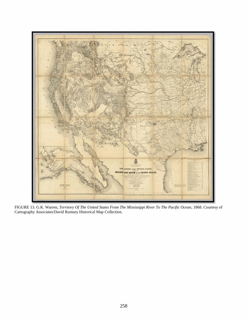
258
FIGURE 13. G.K. Warren, Territory Of The United States From The Mississippi River To The Pacific Ocean, 1868. Courtesy of
Cartography Associates/David Rumsey Historical Map Collection.

259
FIGURE 14. G.K. Warren, Territory Of The United States From The Mississippi River To The Pacific Ocean
(detail), 1868. Courtesy of Cartography Associates/David Rumsey Historical Map Collection.

260
FIGURE 15. Charles A. Schott, “Rain Chart of the United States,” 1874. From Francis A. Walker, Statistical Atlas of the United
States Based on the Results of the Ninth Census 1870 (1874). Courtesy of Cartography Associates/David Rumsey Historical Map
Collection.

261
FIGURE 16. Rand McNally, Indexed Map of Utah (detail), 1876. Courtesy of the Library of Congress, Geography
and Map Division.

262
FIGURE 17. Joseph A. West, West’s New Sectional and Topographical Map of Utah Containing all Government
Land and Topographical Surveys to Date (detail), 1885. Courtesy of the Cartography Associates/David Rumsey
Map Collection.

263
FIGURE 18. Friedrich Wilhelm von Egloffstein. “Map No. 2. Rio Colorado of the West.” From Joseph C. Ives,
Report upon the Colorado River of the West (1861).

264
FIGURE 19. After William Henry Holmes, “Smithsonian Butte – Valley of the Virgen,” from Clarence E. Dutton,
Tertiary History of the Grand Cañon District (1882). Courtesy Huntington Library, San Marino, California.

265
FIGURE 20. “Geological Map of the District of the High Plateaus of Utah” from Clarence E. Dutton, Topographical
and Geological Atlas of the District of the High Plateaus of Utah (1880). Courtesy of the Cartography
Associates/David Rumsey Map Collection.

266
FIGURE 21. “Geological Map of the Western Part of the Plateau Province.” From Atlas to Accompany the
Monograph on the Tertiary History of the Grand Canyon District (1882). By Clarence E. Dutton. Courtesy of the
Cartography Associates/David Rumsey Map Collection.

267
Original caption reads: “Section from west to east, across the plateaus north of the Grand Cañon, with bird’s-eye
view of terraces and plateaus above. Horizontal scale, 16 miles to the inch; vertical scale, 4 miles to the inch.”
FIGURE 22. “Figure 73,” from John Wesley Powell, Exploration of the Colorado River of the West and Its
Tributaries (1875).

268
A view of the lands of the line from a commanding eminence. The large greenbelt north of the Grand Canyon is the
Kaibab National Forest (center to top-right); the raised portion along the North Rim beginning along the southern
extremity of the forest is the Kaibab Plateau (center). The reddish mountain-like ridge at the top of the image is the
Vermilion Cliffs (top-center to top-right). The bird-footed canyon west of the Kaibab and north of the Colorado
River is Kanab Canyon (top-left). The warped, oblong riser east and northeast of the Kaibab is the Paria Plateau
(top-right). The escarpment running north-to-south east of the Paria Plateau is the Echo Cliffs (far-right). The
Marble Platform is the dry section situated on either side of the Colorado River south of the Paria Plateau, west of
the Echo Cliffs, and east of the Kaibab. The Arizona-Utah state line crosses this landscape just south of the
Vermilion Cliffs and just north of the Paria Plateau. The region Clarence Dutton called the Kanab Desert is the dry
region south of the Vermilion Cliffs, west of the Kaibab Forest, and northwest of the Kaibab Plateau.
FIGURE 23. “Grand Canyon, Arizona,” International Space Station Astronaut Photograph ISS039-E-005258, March
25, 2014.

269
FIGURE 24. After William Henry Holmes, “Sunset on the Kanab Desert,” from Clarence E. Dutton, Tertiary
History of the Grand Cañon District, Washington, D.C.: Government Printing Office, 1882. Courtesy of The
Huntington Library, San Marino, California.

270
FIGURE 25. William Henry Holmes, “The Grand Cañon from Toroweap Cone, Looking East” (sketch), National
Archives and Records Administration, Rocky Mountain Region, William Henry Holmes, “Sketches of the Grand
Cañon and Vicinity, Arizona and Utah, 1880,” NO-8202, Accession NRG-057-05-008.

271
FIGURE 26. William Henry Holmes, “The Grand Cañon from Toroweap Cone, Looking East” (sketch), National
Archives and Records Administration, RockyMountain Region, William Henry Holmes, “Sketches of the Grand
Cañon and Vicinity, Arizona and Utah, 1880,” NO-8202, Accession NRG-057-05-008.

272
FIGURE 27. After William Henry Holmes, “The Grand Cañon at the Foot of the Toroweap – Looking East,” from
Clarence E. Dutton, Atlas to Accompany the Monograph on the Tertiary History of the Grand Canyon District
(1882). Courtesy of the Cartography Associates/David Rumsey Map Collection.

273
FIGURE 28. After William H. Holmes, “Panorama from Point Sublime (Part I. Looking East),” from Clarence E.
Dutton, Atlas to Accompany the Monograph on the Tertiary History of the Grand Canyon District (1882). Courtesy
of the Cartography Associates/David Rumsey Map Collection.

274
FIGURE 29. After William H. Holmes, “Panorama from Point Sublime (Part II. Looking South),” from Clarence E.
Dutton, Atlas to Accompany the Monograph on the Tertiary History of the Grand Canyon District (1882). Courtesy
of the Cartography Associates/David Rumsey Map Collection.

275
FIGURE 30. After William H. Holmes, “Panorama from Point Sublime (Part III. Looking West),” from Clarence E.
Dutton, Atlas to Accompany the Monograph on the Tertiary History of the Grand Canyon District (1882). Courtesy
of the Cartography Associates/David Rumsey Map Collection.

276
FIGURE 31. After F.W. von Egloffstein, “Big Cañon,” from J.C. Ives, Report Upon the Colorado River of the West
(1861).

277
FIGURE 32. Thomas Moran, The Chasm of the Colorado, 1873-1874, oil on canvas mounted on aluminum, 84 3/8
x 144 3/4 in. (214.3 x 367.6 cm.), Smithsonian American Art Museum, on loan from the Department of the Interior
Museum, L.1968.84.2.