Trip Planner Fall 2020 - Sequoia & Kings Canyon National ...
12
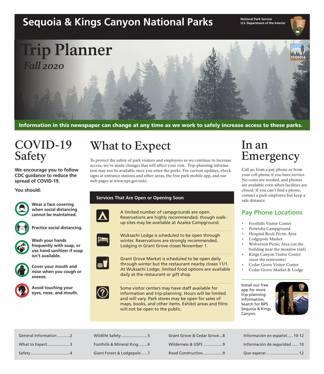
National Park Service U.S. Department of the Interior Trip Planner Fall 2020 Information in this newspaper can change at any time as we work to safely increase access to these parks. Sequoia & Kings Canyon National Parks COVID-19 Safety We encourage you to follow CDC guidance to reduce the spread of COVID-19. You should: Wear a face covering when social distancing cannot be maintained. Practice social distancing. Wash your hands frequently with soap, or use hand sanitizer if soap isn't available. Cover your mouth and nose when you cough or sneeze. What to Expect To protect the safety of park visitors and employees as we continue to increase access, we've made changes that will affect your visit. Trip-planning informa- tion may not be available once you enter the parks. For current updates, check signs at entrance stations and other areas, the free park mobile app, and our web pages at www.nps.gov/seki. Services That Are Open or Opening Soon A limited number of campgrounds are open. Reservations are highly recommended, though walk- up sites may be available at Azalea Campground. Wuksachi Lodge is scheduled to be open through winter. Reservations are strongly recommended. Lodging in Grant Grove closes November 1. Grant Grove Market is scheduled to be open daily through winter but the restaurant nearby closes 11/1. At Wuksachi Lodge, limited food options are available daily at the restaurant or gift shop. In an Emergency Call 911 from a pay phone or from your cell phone if you have service. No coins are needed, and phones are available even when facilities are closed. If you can't find a phone, contact a park employee but keep a safe distance. Pay Phone Locations • Foothills Visitor Center • Potwisha Campground • Hospital Rock Picnic Area • Lodgepole Market • Wolverton Picnic Area (on the building near the meadow trail) • Kings Canyon Visitor Center (near the restrooms) • Cedar Grove Visitor Center • Cedar Grove Market & Lodge Install our free Avoid touching your Some visitor centers may have staff available for app for more eyes, nose, and mouth. information and trip-planning. Hours will be limited trip-planning and will vary. Park stores may be open for sales of information. maps, books, and other items. Exhibit areas and flms Search for NPS will not be open to the public. Sequoia & Kings Canyon. General Information ........... 2 Wildlife Safety ........................5 Grant Grove & Cedar Grove...8 Información en español ..... 10-12 What to Expect .................... 3 Foothills & Mineral King ........6 Wilderness & USFS .................9 Información de seguridad ...... 10 Safety ................................... 4 Giant Forest & Lodgepole ......7 Road Construction..................9 Que esperar ............................. 12
-
Upload
khangminh22 -
Category
Documents
-
view
2 -
download
0
Transcript of Trip Planner Fall 2020 - Sequoia & Kings Canyon National ...
National Park Service U.S. Department of the Interior
Trip Planner Fall 2020
Information in this newspaper can change at any time as we work to safely increase access to these parks.
Sequoia & Kings Canyon National Parks
COVID-19 Safety We encourage you to follow CDC guidance to reduce the spread of COVID-19.
You should:
Wear a face covering when social distancing cannot be maintained.
Practice social distancing.
Wash your hands frequently with soap, or use hand sanitizer if soap isn't available.
Cover your mouth and nose when you cough or sneeze.
What to Expect To protect the safety of park visitors and employees as we continue to increase access, we've made changes that will affect your visit. Trip-planning informa-tion may not be available once you enter the parks. For current updates, check signs at entrance stations and other areas, the free park mobile app, and our web pages at www.nps.gov/seki.
Services That Are Open or Opening Soon
A limited number of campgrounds are open. Reservations are highly recommended, though walk-up sites may be available at Azalea Campground.
Wuksachi Lodge is scheduled to be open through winter. Reservations are strongly recommended. Lodging in Grant Grove closes November 1.
Grant Grove Market is scheduled to be open daily through winter but the restaurant nearby closes 11/1. At Wuksachi Lodge, limited food options are available daily at the restaurant or gift shop.
In an Emergency Call 911 from a pay phone or from your cell phone if you have service. No coins are needed, and phones are available even when facilities are closed. If you can't find a phone, contact a park employee but keep a safe distance.
Pay Phone Locations
• Foothills Visitor Center • Potwisha Campground • Hospital Rock Picnic Area • Lodgepole Market • Wolverton Picnic Area (on the
building near the meadow trail) • Kings Canyon Visitor Center
(near the restrooms) • Cedar Grove Visitor Center • Cedar Grove Market & Lodge
Install our freeAvoid touching your Some visitor centers may have staff available for app for moreeyes, nose, and mouth. information and trip-planning. Hours will be limited trip-planning
and will vary. Park stores may be open for sales of information. maps, books, and other items. Exhibit areas and flms Search for NPS will not be open to the public. Sequoia & Kings
Canyon.
General Information ...........2 Wildlife Safety ........................5 Grant Grove & Cedar Grove...8 Información en español ..... 10-12
What to Expect....................3 Foothills & Mineral King ........6 Wilderness & USFS .................9 Información de seguridad ...... 10
Safety ...................................4 Giant Forest & Lodgepole......7 Road Construction..................9 Que esperar ............................. 12

General Information2
Contacts
Cell Service Cell service is extremely limited here. Near the Ash Mountain entrance to Sequoia, AT&T provides limited service. Verizon provides limited service near the Kings Canyon entrance to Grant Grove.
EMERGENCY — DIAL 911 No coins are needed in payphones for 911 calls.
Sequoia & Kings Canyon (NPS) 559-565-3341 (24 hour): Recorded information is available for road conditions, weather, current fires, and more.
GPS GPS programs often misdirect travelers who are driving to the parks. Use maps and signs.
Web & Social Media The only ofcial park information sources online are:
The Offcial Park Website www.nps.gov/seki
Facebook Sequoia and Kings Canyon National Parks
Instagram sequoiakingsnps
Twitter @sequoiakingsnps
Campground Reservations Visit Recreation.gov or call 877-444-6777 (TDD: 877-833-6777)
Delaware North (Authorized Concessioner) www.visitsequoia.com
Cedar Grove Pack Station (Authorized Concessioner) Grant Grove: 559-335-9292 Cedar Grove: 559-565-3464 cedargrovepackstation.com
Sequoia National Forest/Monument (USFS) 559-338-2251, fs.usda.gov/sequoia
Yosemite National Park (NPS) 209-372-0200, nps.gov/yose
Free Public WiFi Locations Foothills Visitor Center (Sequoia National Park), Kings Canyon Visitor Center (Grant Grove). No password is needed.
Frequently Asked Questions
Pets Pets are not permitted on any trails in Sequoia and Kings Canyon. They are allowed in campsites and in parking areas. Pets must be kept on a leash at all times, or appropriately crated or caged. Pets cannot be left tied and unattended or in vehicles at any time. The leash must be less than 6 feet (1.8 meters) long.
Drones Unmanned aircraft are not allowed in these parks. This includes drones and other remotely piloted ve-hicles.
Marijuana Possession or use of marijuana and other controlled substances inside the national parks is prohibited. While California law provides for limited possession and use of marijuana, it remains an illegal drug under federal law, which is enforced within the park.
Fire Restrictions Because of dry conditions and extreme fre danger, fre restrictions are in place to reduce the possibility of accidental human-caused fre. Prohibited locations for wood or charcoal fres will be posted, especially in park campgrounds. Wood and charcoal fres may be prohibited at all elevations, depending on the current level of fre restrictions.
Restrictions may change as weather and fuel conditions change. Check for updates on park bulletin boards, at visitor centers, or by visiting go.nps.gov/sekifirerestrictions.
Firearms in these National Parks People who can legally possess firearms under federal, California, and local laws may possess firearms here. You are responsible for understanding and complying with all applicable California, local, and federal firearms laws. Discharge of firearms in the parks is prohibited.
Passport Stamps Stamps for passport books may not be available in the parks until visitor centers open, but you can visit our web pages for a printable version of the stamp, or email [email protected] to request a printed stamp with the date of your visit.
Junior Ranger Books
Because of visitor center closures, we now offer the option of an online junior ranger booklet. Download a web version from www.nps.gov/seki to complete in the parks or at home. Send photos of at least seven completed pages to SEKI_Information@ nps.gov to receive a badge. No printer? Send an email to the same address to request a free booklet.
Accessibility
We are committed to a continuing effort to improve the accessibility of our trails and facilities so they can be enjoyed by all. If you have questions or suggestions about accessibility, please email us at [email protected] or call us at 559-565-3341.
Wheelchair loans are temporarily suspended. In the future, we hope to resume free wheelchair loans at Lodgepole Visitor Center and Giant Forest Museum. They can be used anywhere in the parks but must be returned by the end of the day, before each visitor center closes. Be prepared to provide your address and phone number.
Assistive listening devices and open captioning are available for ranger programs and park films. When films become available at park visitor centers, borrow a device at information desks.
Visitor Centers Most visitor centers are closed due to the COVID-19 pandemic. All visitor centers and museums have paved, flat paths leading from parking areas to outdoor information, restrooms, and water bottle filling stations. When visitor centers are open, they provide access to trip planning information, exhibits, and bookstores. Cedar Grove Visitor Center is small, and may be difficult for people in wheelchairs to navigate. Mineral King Ranger Station has steps leading to the entrance and may not be accessible to people with mobility impairments.
Wheelchair-Accessible Trails
General Sherman Tree Trail (Giant Forest) This short trail leads a few hundred feet from an accessible parking area to the General Sherman Tree, the largest tree on earth.
Big Trees Trail (Giant Forest) This level trail is a 0.75-mile (1.2 km) loop. It circles a meadow surrounded by giant sequoias.
Panoramic Point Trail (Grant Grove) This paved trail leads to views that reach deep into park wilderness.
Roaring River Falls (Cedar Grove) A 528-foot (160 m), shady walk features a powerful waterfall rushing through a granite chute. Park 3 miles (4.8 km) east of the Village road. Paved, relatively accessible.
Muir Rock Trail (Cedar Grove) This short trail leads to the Kings River and Muir Rock, a large granite boulder at the river's edge named in honor of famed naturalist John Muir.
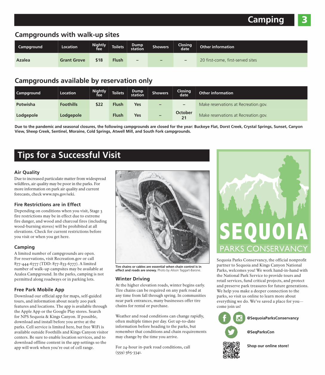
Camping 3 Campgrounds with walk-up sites
Campground Location Nightly fee Toilets Dump
station Showers Closing date Other information
Azalea Grant Grove $18 Flush – – – 20 frst-come, frst-served sites
Campgrounds available by reservation only
Campground Location Nightly fee Toilets Dump
station Showers Closing date Other information
Potwisha Foothills $22 Flush Yes – – Make reservations at Recreation.gov.
Lodgepole Lodgepole Flush Yes – October
21 Make reservations at Recreation.gov.
Due to the pandemic and seasonal closures, the following campgrounds are closed for the year: Buckeye Flat, Dorst Creek, Crystal Springs, Sunset, Canyon View, Sheep Creek, Sentinel, Moraine, Cold Springs, Atwell Mill, and South Fork campgrounds.
Tips for a Successful Visit
Air Quality Due to increased particulate matter from widespread wildfres, air quality may be poor in the parks. For more information on park air quality and current forecasts, check www.nps.gov/seki.
Fire Restrictions are in Effect Depending on conditions when you visit, Stage 3 fire restrictions may be in effect due to extreme fire danger, and wood and charcoal fires (including wood-burning stoves) will be prohibited at all elevations. Check for current restrictions before you visit or when you get here.
Camping A limited number of campgrounds are open. For reservations, visit Recreation.gov or call 877-444-6777 (TDD: 877-833-6777). A limited number of walk-up campsites may be available at Azalea Campground. In the parks, camping is not permitted along roadways or in parking lots.
Free Park Mobile App Download our official app for maps, self-guided tours, and information about nearly 200 park features and locations. The app is available through the Apple App or the Google Play stores. Search for NPS Sequoia & Kings Canyon. If possible, download and install before you arrive at the parks. Cell service is limited here, but free WiFi is available outside Foothills and Kings Canyon visitor centers. Be sure to enable location services, and to download offline content in the app settings so the app will work when you're out of cell range.
Tire chains or cables are essential when chain control is in effect and roads are snowy. Photo by Alison Taggart-Barone.
Winter Driving At the higher elevation roads, winter begins early. Tire chains can be required on any park road at any time from fall through spring. In communities near park entrances, many businesses offer tire chains for rental or purchase.
Weather and road conditions can change rapidly, often multiple times per day. Get up-to-date information before heading to the parks, but remember that conditions and chain requirements may change by the time you arrive.
For 24-hour in-park road conditions, call (559) 565-3341.
Sequoia Parks Conservancy, the official nonprofit partner to Sequoia and Kings Canyon National Parks, welcomes you! We work hand-in-hand with the National Park Service to provide tours and retail services, fund critical projects, and protect and preserve park treasures for future generations. We help you make a deeper connection to the parks, so visit us online to learn more about everything we do. We’ve saved a place for you— come join us!
@SequoiaParksConservancy
@SeqParksCon
Shop our online store!
4 Be Safe
You are Responsible for Your Safety Beautiful, yet remote and rugged, these parks present hazards. Mountain weather changes quickly, trees fall without warning, and wild animals pose dangers. People cause other hazards by driving poorly, leaving campfires burning, and making bad decisions. Cell phones can’t be relied on and GPS directions may send you in the wrong direction. Every day, we help visitors who have emergencies.
Please help us by being prepared—review these safety warnings. Your safety is in your own hands!
Explore Safely
• Avoid traveling alone. Tell someone your plans and expected return time.
• Take a map, water, fashlight, and extra layers of clothes. Do not rely on your phone's map or fashlight.
• Be alert for potential hazards above, around, and on the ground.
River Safety
While swimming in
á the parks' lakes and rivers can be tempting, drowning is the primary cause of death here!
Rivers present great danger due to their swift currents and slippery rocks. In river-related deaths, many people did not intend to swim, but fell in. Currents are strong even during low water. Drop-offs and undertows are ever-present. Be vigilant.
Once in a river, getting out can be nearly impossible. Cold water rapidly saps your strength and hypothermia can set in quickly even if it is warm outside.
• Do not swim in areas with strong currents, or steep drop-offs.
• DO NOT leave children unattended.
• Swimming and alcohol or drugs do not mix. Swim sober.
• Wear sturdy shoes. Sharp objects in the water can cut bare feet.
• During storms, get out of the water and exit beach areas.
• NEVER SWIM ALONE.
Tree Hazards Branches and trees may fall, whether dead or alive, and when there is no wind. Keep eyes and ears open. Run if you hear
cracks or snapping from roots, trunks, or branches (sometimes there is no sound). Don't linger under dead, cracked, broken, or hanging branches. Avoid spending any time under trees that are rotten at the base or have cracked bark that is peeling of the trunk.
West Nile Virus & Tick Bites West Nile virus is passed by bites from infected mosquitos. Human illness is not common but take steps to avoid mosquito bites. Ticks are common in grassy, brushy low-elevation areas. They can carry
diseases that harm humans. Check yourself for these insects after walks; their bite is painless. Remove them carefully with tweezers and seek a doctor’s advice.
Rattlesnakes
jRattlesnakes are common in the Sequoia foothills and in the Kings Canyon at low elevations. Watch where you put your hands and feet! Do not harass or kill them; this is when most bites occur.
Bites are rarely lethal, but tissue damage can be severe. If bitten, don’t panic and call 911.
Poison Oak This common shrub grows up to 5,000 feet (1,524 m) in elevation. Poison oak has leaves in groups of three. Leaves are red and berries whitish in fall. The plant is bare in
winter, and has shiny green leaves in spring. If you touch any part of it, wash skin and clothes with soap and warm water right away.
Air Quality Poor air quality often afects the parks, especially during the summer. In summer months, ozone concentrations often exceed federal health standards. Ozone can
have negative health efects, particularly for sensitive groups such as children, older people, and those with heart or lung disease. For air quality forecasts, visit the park website or follow @SequoiaKingsAir on Twitter.
Plague & Hantavirus Plague and hantavirus are associated with wildlife here, but cases of human infection are rare. Rodents and their feas may carry plague, which may infect humans when bitten. Hantavirus is an
airborne virus that comes from infected deer mice. Typically people contract hantavirus after they clean areas or are in enclosed spaces with deer mice feces.
Keep Pets Safe
` To keep pets and wildlife safe, animals must be on a leash at all times. Pets are vulnerable to tick and snake bites. Bears and deer have also been known to charge or attack dogs. Pick up all pet waste
and dispose of properly. Pets are not allowed on any park trails. Do not leave pets unattended or in vehicles where they can easily overheat.
Don't Lose Your Brakes
D If you keep a foot on the brake for too long, brakes may fail. Instead, always downshift when going downhill. In automatic vehicles, put the gearshift on 1, 2, or L. The
engine gets louder, but your brakes won't overheat.
COVID-19 Safety Keep Bears Wild and Safe 5
Recreate Responsibly
When you're looking for places to visit in the parks, check parking lots. If they're full, it may be difficult to practice distancing at that location. Consider finding another spot to visit where it's less crowded.
Distance yourself from other hikers. If you encounter someone on a narrow trail, try to step aside in a place where you can give them at least six feet (2 m) of distance to pass. Avoid crowded viewpoints and pullouts. Give hikers travelling uphill the right of way.
Hike with family members or people you've already had contact with. Limit your group size to six or fewer people. If your family is larger, split into smaller groups.
Try not to touch outdoor exhibits, railings, or other surfaces, especially in high-traffc areas. Wash or sanitize your hands frequently and before you get back in your car.
Bring hand sanitizer. Though we plan to supply it at park restrooms, it may not always be available.
Play It Safe Choose an easier activity that reduces the chance that you might need to be rescued and add to the strain on our health care and emergency resources. Be thoughtful about your impact on local communities.
© Kiel Maddox.
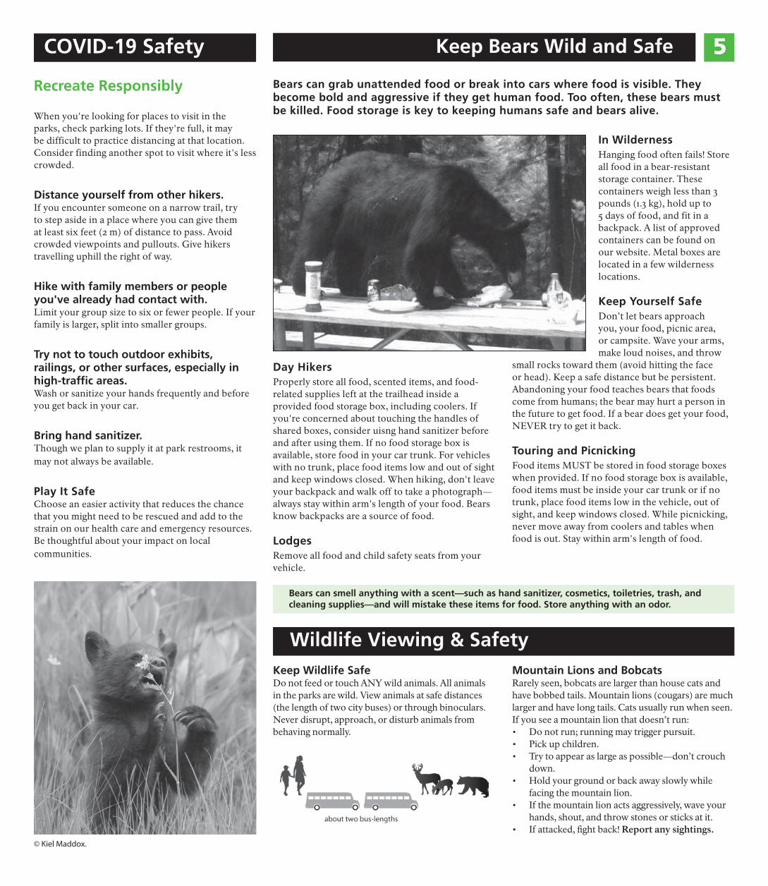
Bears can grab unattended food or break into cars where food is visible. They become bold and aggressive if they get human food. Too often, these bears must be killed. Food storage is key to keeping humans safe and bears alive.
Day Hikers Properly store all food, scented items, and food-related supplies left at the trailhead inside a provided food storage box, including coolers. If you're concerned about touching the handles of shared boxes, consider uisng hand sanitizer before and after using them. If no food storage box is available, store food in your car trunk. For vehicles with no trunk, place food items low and out of sight and keep windows closed. When hiking, don't leave your backpack and walk off to take a photograph— always stay within arm's length of your food. Bears know backpacks are a source of food.
Lodges Remove all food and child safety seats from your vehicle.
In Wilderness Hanging food often fails! Store all food in a bear-resistant storage container. These containers weigh less than 3 pounds (1.3 kg), hold up to 5 days of food, and fit in a backpack. A list of approved containers can be found on our website. Metal boxes are located in a few wilderness locations.
Keep Yourself Safe Don’t let bears approach you, your food, picnic area, or campsite. Wave your arms, make loud noises, and throw
small rocks toward them (avoid hitting the face or head). Keep a safe distance but be persistent. Abandoning your food teaches bears that foods come from humans; the bear may hurt a person in the future to get food. If a bear does get your food, NEVER try to get it back.
Touring and Picnicking Food items MUST be stored in food storage boxes when provided. If no food storage box is available, food items must be inside your car trunk or if no trunk, place food items low in the vehicle, out of sight, and keep windows closed. While picnicking, never move away from coolers and tables when food is out. Stay within arm's length of food.
Bears can smell anything with a scent—such as hand sanitizer, cosmetics, toiletries, trash, and cleaning supplies—and will mistake these items for food. Store anything with an odor.
Wildlife Viewing & Safety Keep Wildlife Safe Do not feed or touch ANY wild animals. All animals in the parks are wild. View animals at safe distances (the length of two city buses) or through binoculars. Never disrupt, approach, or disturb animals from behaving normally.
Mountain Lions and Bobcats Rarely seen, bobcats are larger than house cats and have bobbed tails. Mountain lions (cougars) are much larger and have long tails. Cats usually run when seen. If you see a mountain lion that doesn’t run: • Do not run; running may trigger pursuit. • Pick up children. • Try to appear as large as possible—don’t crouch
down. • Hold your ground or back away slowly while
facing the mountain lion. • If the mountain lion acts aggressively, wave your
hands, shout, and throw stones or sticks at it. • If attacked, fght back! Report any sightings.
6 Foothills
Explore the golden foothills, home to more species of plants and animals than the rest of these parks combined. Chaparral, oak woodlands, and river canyons offer spring wildfowers, hot summers, and mild winters.
Currently Open & Available
Trails and most park restrooms
Potwisha Campground (only with reservations made in advance)
Self-registration wilderness permits (at the drop box outside the visitor center)
May Be Available
Foothills Visitor Center staff may be available to help with trip-planning.
Sequoia Parks Conservancy's park store at Foothills Visitor Center may be open for sales of maps, books, and other items.
Mineral King This road to this area is closed for the season. Because of the Castle Fire, wilderness lands in this area may be closed to the public.
In winter, trails often require snowshoes or skis and skill with a map and compass. If this area reopens and you're interested in a wilderness trip, ask for a gate code at the Foothills Visitor Center. The clos-est parking is 2 miles (3.2 km) before Atwell Mill Campground, 7 miles (11.3 km) before most trail-heads.
Services and Facilities Mineral King Ranger Station Closed until late May.
Wilderness Permits Local wilderness permits are issued at the Foothills Visitor Center.
Silver City Mountain Resort (private) Closed until late May.
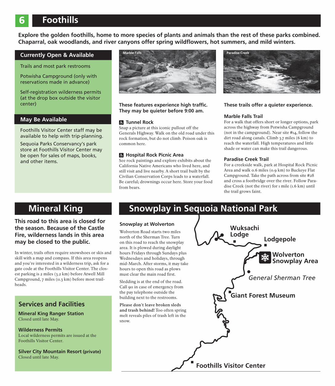
Marble Falls
These features experience high traffc. They may be quieter before 9:00 am.
ô Tunnel Rock Snap a picture at this iconic pullout off the Generals Highway. Walk on the old road under this rock formation, but do not climb. Poison oak is common here.
ô Hospital Rock Picnic Area See rock paintings and explore exhibits about the California Native Americans who lived here, and still visit and live nearby. A short trail built by the Civilian Conservation Corps leads to a waterfall. Be careful; drownings occur here. Store your food from bears.
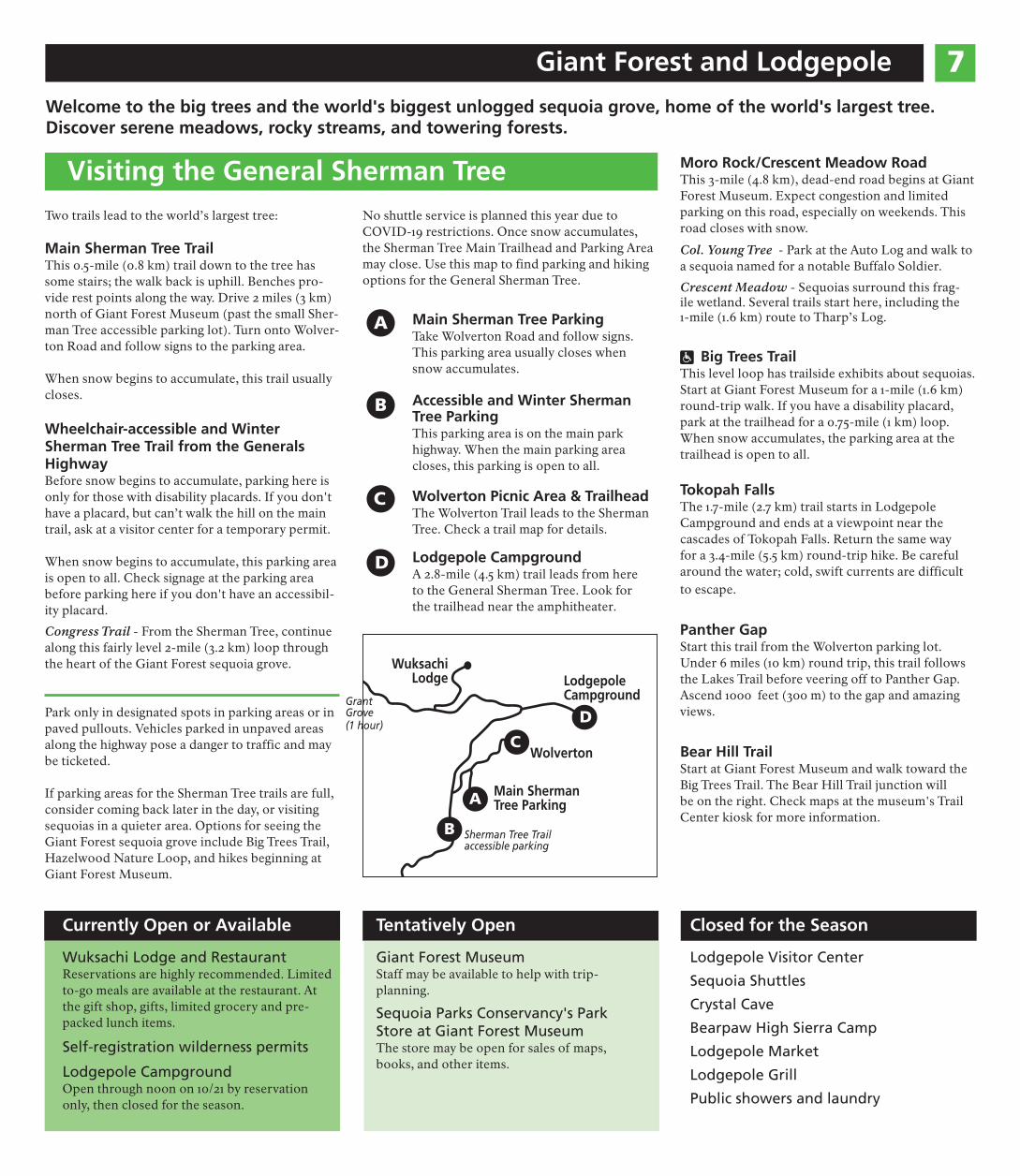
Paradise Creek
These trails offer a quieter experience.
Marble Falls Trail For a walk that offers short or longer options, park across the highway from Potwisha Campground (not in the campground). Near site #14, follow the dirt road along canals. Climb 3.7 miles (6 km) to reach the waterfall. High temperatures and little shade or water can make this trail dangerous.
Paradise Creek Trail For a creekside walk, park at Hospital Rock Picnic Area and walk 0.6 miles (0.9 km) to Buckeye Flat Campground. Take the path across from site #28 and cross a footbridge over the river. Follow Para-dise Creek (not the river) for 1 mile (1.6 km) until the trail grows faint.
Snowplay in Sequoia National Park
Wuksachi Lodge
Wolverton Snowplay Area
Lodgepole
Giant Forest Museum
Foothills Visitor Center
General Sherman Tree
Snowplay at Wolverton
Wolverton Road starts two miles north of the Sherman Tree. Turn on this road to reach the snowplay area. It is plowed during daylight hours Fridays through Sundays plus Wednesdays and holidays, through mid-March. After storms, it may take hours to open this road as plows must clear the main road first.
Sledding is at the end of the road. Call 911 in case of emergency from the pay telephone outside the building next to the restrooms.
Please don't leave broken sleds and trash behind! Too often spring melt reveals piles of trash left in the snow.
7Giant Forest and Lodgepole
Welcome to the big trees and the world's biggest unlogged sequoia grove, home of the world's largest tree. Discover serene meadows, rocky streams, and towering forests.
Visiting the General Sherman Tree Two trails lead to the world’s largest tree:
Main Sherman Tree Trail This 0.5-mile (0.8 km) trail down to the tree has some stairs; the walk back is uphill. Benches pro-vide rest points along the way. Drive 2 miles (3 km) north of Giant Forest Museum (past the small Sher-man Tree accessible parking lot). Turn onto Wolver-ton Road and follow signs to the parking area.
When snow begins to accumulate, this trail usually closes.
Wheelchair-accessible and Winter Sherman Tree Trail from the Generals Highway Before snow begins to accumulate, parking here is only for those with disability placards. If you don't have a placard, but can’t walk the hill on the main trail, ask at a visitor center for a temporary permit.
When snow begins to accumulate, this parking area is open to all. Check signage at the parking area before parking here if you don't have an accessibil-ity placard.
Congress Trail - From the Sherman Tree, continue along this fairly level 2-mile (3.2 km) loop through the heart of the Giant Forest sequoia grove.
Park only in designated spots in parking areas or in paved pullouts. Vehicles parked in unpaved areas along the highway pose a danger to traffic and may be ticketed.
If parking areas for the Sherman Tree trails are full, consider coming back later in the day, or visiting sequoias in a quieter area. Options for seeing the Giant Forest sequoia grove include Big Trees Trail, Hazelwood Nature Loop, and hikes beginning at Giant Forest Museum.
Currently Open or Available
Wuksachi Lodge and Restaurant Reservations are highly recommended. Limited to-go meals are available at the restaurant. At the gift shop, gifts, limited grocery and pre-packed lunch items.
Self-registration wilderness permits
Lodgepole Campground Open through noon on 10/21 by reservation only, then closed for the season.
No shuttle service is planned this year due to COVID-19 restrictions. Once snow accumulates, the Sherman Tree Main Trailhead and Parking Area may close. Use this map to find parking and hiking options for the General Sherman Tree.
A Main Sherman Tree Parking Take Wolverton Road and follow signs. This parking area usually closes when snow accumulates.
B Accessible and Winter Sherman Tree Parking This parking area is on the main park highway. When the main parking area closes, this parking is open to all.
C
D
Wolverton Picnic Area & Trailhead The Wolverton Trail leads to the Sherman Tree. Check a trail map for details.
Lodgepole Campground A 2.8-mile (4.5 km) trail leads from here to the General Sherman Tree. Look for the trailhead near the amphitheater.
Lodgepole Campground
(1 hour)
Wolverton
Main Sherman Tree Parking
Grant Grove
Sherman Tree Trail accessible parking
Wuksachi Lodge
A
B
C
D
Tentatively Open
Giant Forest Museum Staff may be available to help with trip-planning.
Sequoia Parks Conservancy's Park Store at Giant Forest Museum The store may be open for sales of maps, books, and other items.
Moro Rock/Crescent Meadow Road This 3-mile (4.8 km), dead-end road begins at Giant Forest Museum. Expect congestion and limited parking on this road, especially on weekends. This road closes with snow.
Col. Young Tree - Park at the Auto Log and walk to a sequoia named for a notable Buffalo Soldier.
Crescent Meadow - Sequoias surround this frag-ile wetland. Several trails start here, including the 1-mile (1.6 km) route to Tharp’s Log.
ô Big Trees Trail This level loop has trailside exhibits about sequoias. Start at Giant Forest Museum for a 1-mile (1.6 km) round-trip walk. If you have a disability placard, park at the trailhead for a 0.75-mile (1 km) loop. When snow accumulates, the parking area at the trailhead is open to all.
Tokopah Falls The 1.7-mile (2.7 km) trail starts in Lodgepole Campground and ends at a viewpoint near the cascades of Tokopah Falls. Return the same way for a 3.4-mile (5.5 km) round-trip hike. Be careful around the water; cold, swift currents are difficult to escape.
Panther Gap Start this trail from the Wolverton parking lot. Under 6 miles (10 km) round trip, this trail follows the Lakes Trail before veering off to Panther Gap. Ascend 1000 feet (300 m) to the gap and amazing views.
Bear Hill Trail Start at Giant Forest Museum and walk toward the Big Trees Trail. The Bear Hill Trail junction will be on the right. Check maps at the museum's Trail Center kiosk for more information.
Closed for the Season
Lodgepole Visitor Center
Sequoia Shuttles
Crystal Cave
Bearpaw High Sierra Camp
Lodgepole Market
Lodgepole Grill
Public showers and laundry
8 Grant Grove
Wander through shady sequoia groves and hike to bird's-eye views of distant wilderness. From busy Grant Grove Village to lofty Big Baldy Ridge, Grant Grove offers a chance to explore with amenities nearby.
Grant Tree Trail This 0.3-mile (0.5 km) paved trail leads to the world’s second-largest living tree. To minimize risk, avoid touching tactile exhibits about sequoias along the trail. Look for the road 0.1 mile (0.1 km) north of Grant Grove Village.
ô Panoramic Point A narrow road leads to a short, paved trail to a viewpoint with beautiful Sierra vistas. RVs and trailers are not permitted on the road, which begins behind John Muir Lodge. Park Ridge Trail (2.4 miles/3.8 km) also begins here. The road to Pan-oramic Point closes with snow.
North Grove Loop This lightly traveled, 1.5-mile (2.4 km) loop offers a close look at sequoias and a quiet forest walk. Look for the trailhead and an orientation map in the overflow parking area near the Grant Tree Trail.
Visitor Center to Grant Tree Trailhead This 2-mile (3.2 km) round-trip forested trail passes through Azalea Campground and Columbine Pic-nic Area and has a 400’ (120 m) elevation change. Start from the Grant Tree parking area or across the highway from the visitor center.
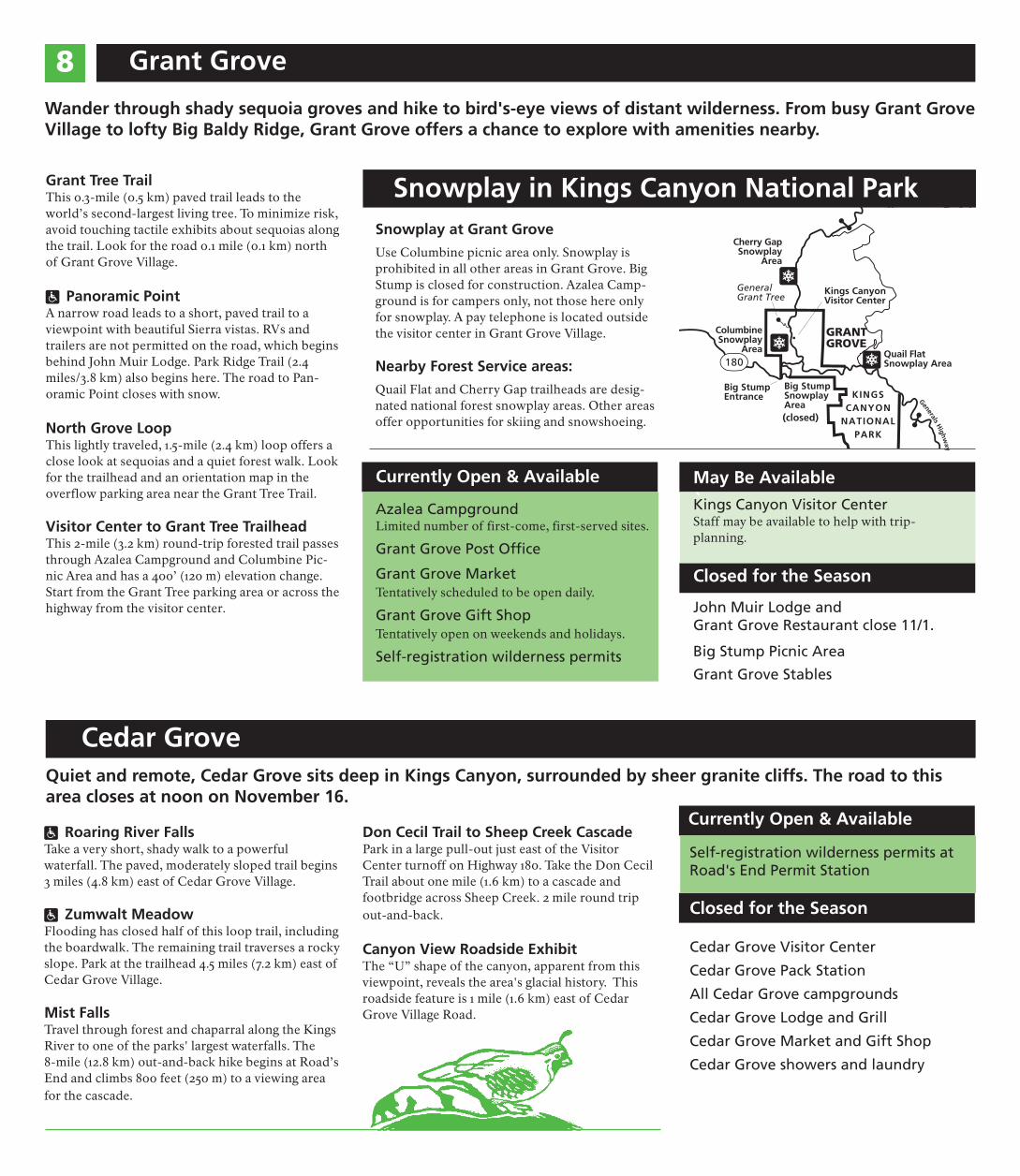
180
GeneralsH
ighway
Big Stump Snowplay Area
Big Stump Entrance
Quail Flat Snowplay Area
Columbine Snowplay
Area
Cherry Gap Snowplay
Area
Kings Canyon Visitor Center
General Grant Tree
KINGS CANYON
NATIONAL PARK
GRANT GROVE
180
Snowplay in Kings Canyon National Park
(closed)
`May Be Available
Kings Canyon Visitor Center Staff may be available to help with trip-planning.
Closed for the Season
Snowplay at Grant Grove
Use Columbine picnic area only. Snowplay is prohibited in all other areas in Grant Grove. Big Stump is closed for construction. Azalea Camp-ground is for campers only, not those here only for snowplay. A pay telephone is located outside the visitor center in Grant Grove Village.
Nearby Forest Service areas:
Quail Flat and Cherry Gap trailheads are desig-nated national forest snowplay areas. Other areas offer opportunities for skiing and snowshoeing.
Currently Open & Available
Azalea Campground Limited number of first-come, first-served sites.
Grant Grove Post Offce
Grant Grove Market Tentatively scheduled to be open daily.
Grant Grove Gift Shop Tentatively open on weekends and holidays.
Self-registration wilderness permits
John Muir Lodge and Grant Grove Restaurant close 11/1.
Big Stump Picnic Area
Grant Grove Stables
Cedar Grove Quiet and remote, Cedar Grove sits deep in Kings Canyon, surrounded by sheer granite cliffs. The road to this area closes at noon on November 16.
ô Roaring River Falls Take a very short, shady walk to a powerful waterfall. The paved, moderately sloped trail begins 3 miles (4.8 km) east of Cedar Grove Village.
ô Zumwalt Meadow Flooding has closed half of this loop trail, including the boardwalk. The remaining trail traverses a rocky slope. Park at the trailhead 4.5 miles (7.2 km) east of Cedar Grove Village.
Mist Falls Travel through forest and chaparral along the Kings River to one of the parks' largest waterfalls. The 8-mile (12.8 km) out-and-back hike begins at Road’s End and climbs 800 feet (250 m) to a viewing area for the cascade.
Don Cecil Trail to Sheep Creek Cascade Park in a large pull-out just east of the Visitor Center turnoff on Highway 180. Take the Don Cecil Trail about one mile (1.6 km) to a cascade and footbridge across Sheep Creek. 2 mile round trip out-and-back.
Canyon View Roadside Exhibit The “U” shape of the canyon, apparent from this viewpoint, reveals the area's glacial history. This roadside feature is 1 mile (1.6 km) east of Cedar Grove Village Road.
Currently Open & Available
Self-registration wilderness permits at Road's End Permit Station
Closed for the Season
Cedar Grove Visitor Center
Cedar Grove Pack Station
All Cedar Grove campgrounds
Cedar Grove Lodge and Grill
Cedar Grove Market and Gift Shop
Cedar Grove showers and laundry
US Forest Service Wilderness Trips 9 Thank you for following minimum-impact, no-trace guidelines to protect the wilderness!
Camping in the park “frontcountry” is permitted only in campgrounds. Dispersed camping is only allowed in the National Forest. Camping or sleeping in vehicles is not allowed in parking lots, pullouts, picnic areas, or trailheads in the parks.
Wild places include hazards, and help may not be available. Be prepared to be fully self-reliant and to self-rescue in case of an emergency.
Park waterways may contain bacteria,
7 including Giardia. Properly filter or treat water before drinking.
Hypothermia can occur year-round. Stay
= dry and snack often. If symptoms appear, drink warm sugary drinks and get into dry clothes, sleeping bags, and shelter.
Wilderness Permits Within Sequoia and Kings Canyon National Parks, permits are required for all overnight trips. Day hikers do not need permits.
Beginning September 21, the summer quota period for wilderness permits has ended. Outside the quota period, permits are free and you can self-register at the permit station that's closest to your trailhead. Before you get to the park to start your trip, learn about minimum impact guidelines for traveling in park wilderness, and be prepared to be self-reliant. For more information, visit: www.nps.gov/seki/planyourvisit/wilderness
Permits are limited during the summer quota period, from Memorial Day Weekend to late September. Look for trailhead availability and other details at: go.nps.gov/SEKI-WildernessPermits
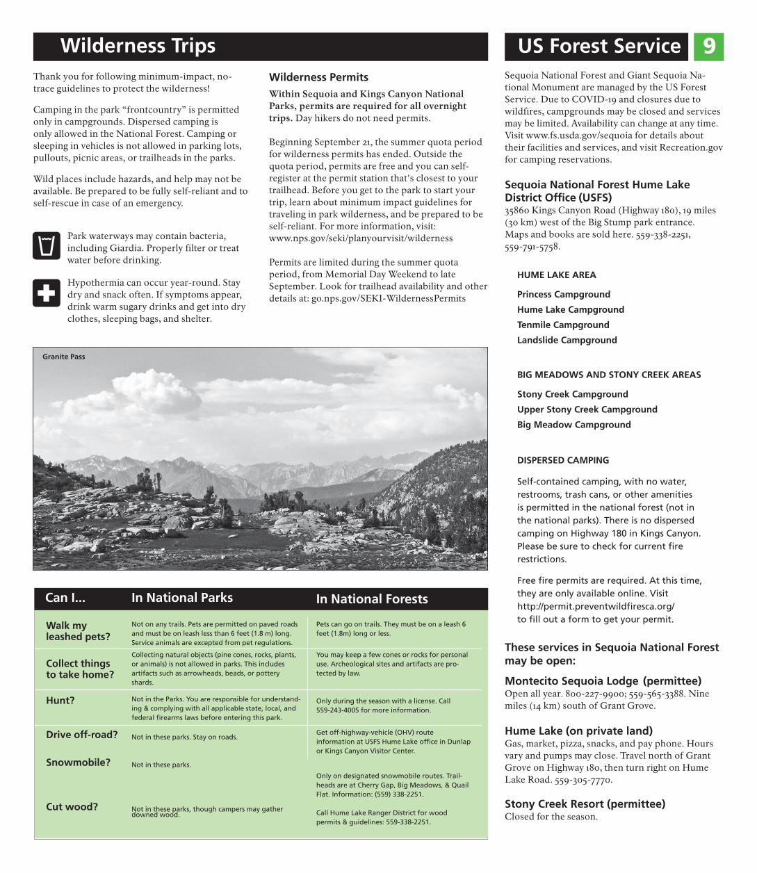
Granite Pass
5Sequoia National Forest and Giant Sequoia Na-tional Monument are managed by the US Forest Service. Due to COVID-19 and closures due to wildfires, campgrounds may be closed and services may be limited. Availability can change at any time. Visit www.fs.usda.gov/sequoia for details about their facilities and services, and visit Recreation.gov for camping reservations.
Sequoia National Forest Hume Lake District Offce (USFS) 35860 Kings Canyon Road (Highway 180), 19 miles (30 km) west of the Big Stump park entrance. Maps and books are sold here. 559-338-2251, 559-791-5758.
HUME LAKE AREA
Princess Campground
Hume Lake Campground
Tenmile Campground
Landslide Campground
BIG MEADOWS AND STONY CREEK AREAS
Stony Creek Campground
Upper Stony Creek Campground
Big Meadow Campground
DISPERSED CAMPING
Self-contained camping, with no water, restrooms, trash cans, or other amenities is permitted in the national forest (not in the national parks). There is no dispersed camping on Highway 180 in Kings Canyon. Please be sure to check for current fre restrictions.
Free fre permits are required. At this time,
Can I... In National Parks In National Forests
Walk my leashed pets?
Not on any trails. Pets are permitted on paved roads and must be on leash less than 6 feet (1.8 m) long. Service animals are excepted from pet regulations.
Pets can go on trails. They must be on a leash 6 feet (1.8m) long or less.
Collect things to take home?
Collecting natural objects (pine cones, rocks, plants, or animals) is not allowed in parks. This includes artifacts such as arrowheads, beads, or pottery shards.
You may keep a few cones or rocks for personal use. Archeological sites and artifacts are pro-tected by law.
Hunt? Not in the Parks. You are responsible for understand-ing & complying with all applicable state, local, and federal frearms laws before entering this park.
Only during the season with a license. Call 559-243-4005 for more information.
Drive off-road?
Snowmobile?
Cut wood?
Not in these parks. Stay on roads.
Not in these parks.
Not in these parks, though campers may gatherdowned wood.
Get off-highway-vehicle (OHV) route information at USFS Hume Lake offce in Dunlap or Kings Canyon Visitor Center.
Only on designated snowmobile routes. Trail-heads are at Cherry Gap, Big Meadows, & Quail Flat. Information: (559) 338-2251.
Call Hume Lake Ranger District for wood permits & guidelines: 559-338-2251.
they are only available online. Visit http://permit.preventwildfresca.org/ to fll out a form to get your permit.
These services in Sequoia National Forest may be open:
Montecito Sequoia Lodge (permittee) Open all year. 800-227-9900; 559-565-3388. Nine miles (14 km) south of Grant Grove.
Hume Lake (on private land) Gas, market, pizza, snacks, and pay phone. Hours vary and pumps may close. Travel north of Grant Grove on Highway 180, then turn right on Hume Lake Road. 559-305-7770.
Stony Creek Resort (permittee) Closed for the season.
Ten cuidado 10
Usted es responsable de su seguridad Estos parques hermosos, aunque remotos y accidentados, presentan ciertos pelig-ros. Por ejemplo, el cambio de temperaturas, los árboles que caen sin previo aviso y los animales salvajes presentan peligros. Otros peligros son de origen humano: manejo imprudente, abandono de fogatas y otras malas decisiones. No se puede confiar en los teléfonos celulares y el GPS, podrían dar indicaciones erróneas. To-dos los días ayudamos a visitantes que tienen emergencias.
Le rogamos que nos ayude preparándose para su visita: familiarícese con estos avisos de seguridad y pídale consejo a los guardaparques. ¡Su seguridad está en sus manos!
Seguridad en el río
áLos lagos y rios de estos parques pueden dar tentacion, y mas durante dias calurosos, pero debe saber que ahogos son la principal causa de muertes.
Los ríos son muy peligrosos debido a sus rápidas corrientes y rocas resbaladizas. Muchas de las muertes relacionadas con los ríos ocurrieron, no porque las personas tenían la intención de nadar, sino que se cayeron. Las corrientes son fuertes incluso cuando los niveles de agua son bajos. Las pendientes abruptas y las corrientes de retorno son un peligro constante. Manténgase alerta.
Una vez que se ingresa en un río, puede resultar casi imposible salir de él. El agua fría puede debilitarle rápidamente y es posible que le dé hipotermia incluso si afuera hace calor.
• No nade en zonas con corrientes
fuertes o pendientes inclinadas.
• NO deje a los niños sin supervisión.
• No nade si ha consumido alcohol o
drogas. Nade siempre en estado de
sobriedad.
• Use zapatos fuertes. Los objetos
aflados que hay en el agua podrían
provocar cortes.
• Durante una tormenta, salga del
agua y aléjese de las zonas de playa.
• NUNCA NADE SOLO.
Peligros relacionados con los árboles Es posible que caigan ramas y árboles
cuando no hay viento, ya sea que estén vivos o secos. Mantenga los ojos y oídos bien abiertos. Corra si oye chasquidos o crujidos provenientes de raíces, troncos o ramas (aunque a veces no emiten sonido alguno). No se detenga bajo ramas secas, agrietadas, rotas o colgantes. Evite detenerse bajo árboles que estén podridos en la base o que presenten una corteza agrietada que se desprende del tronco.
Virus del Nilo Occidental y pica-duras de garrapatas El virus del Nilo Occidental se contagia a través de la picadura de mosquitos
infectados. Si bien esta enfermedad no es común en humanos, tome precauciones para evitar las picaduras de mosquitos. La garrapatas abundan en zonas de pas-tos tupidos y de baja elevación. Pueden portar enfer-medades que son dañinas para los humanos. Tras sus caminatas, fíjese de no tener garrapatas; su picadura es indolora. Si tiene alguna, retírela cuidadosamente con unas pinzas y consulte con su médico.
jSerpientes de cascabel Las serpientes de cascabel son comunes en las faldas de Sequoia and Kings Canyon National Parks a poca elevación. ¡Tenga cuidado en dónde pone los pies
y las manos! No las fastidie ni las mate; es entonces cuando se dan la mayoría de las mordeduras. Las mordeduras pocas veces son letales, pero el daño que ocasionan en los tejidos puede ser grave. Si recibe una mordedura, no entre en pánico y llame al 911.
Roble venenoso Se trata de un arbusto común en eleva-ciones de hasta 5,000 pies (1,500 m). El roble venenoso tiene hojas en grupos de
tres. En otoño, sus hojas son rojas y sus bayas blan-cuzcas; en invierno, la planta pierde sus hojas; y, en primavera, tiene hojas de un color verde brillante. Si toca alguna parte de la planta, lave de inmediato la piel y la ropa que hayan estado en contacto ella con jabón y agua tibia.
Explore de forma segura
• Evite viajar solo. Cuéntele a alguien cuáles son sus planes y a qué hora espera re-gresar.
• Lleve un mapa, agua, una linterna y pren-das de abrigo adicionales.
• Preste atención a los posibles peligros que provengan de arriba, de su alrededor o del suelo.
Calidad del aire Los parques pueden verse afectados por una calidad del aire pobre, especialmente en verano. En los meses de verano, las
concentraciones de ozono suelen exceder aquellas establecidas por los estándares federales de salud. El ozono puede tener impactos negativos en la salud, en particular en grupos más sensibles como los niños, las personas mayores y aquellas con enfermedades cardíacas o de pulmón. Para conocer las predicciones de la calidad del aire, visite el sitio web del parque o visite @SequoiaKingsAir en Twitter.
La peste y el hantavirus La peste y el hantavirus están relacionados con los animales salvajes que habitan estos parques, pero los casos
de infecciones en humanos son excepcionales. Los roedores y sus pulgas pueden ser portadores de la peste, y los humanos pueden contagiarse si reciben la picadura de una pulga infectada. El hantavirus se transmite por aire y proviene de los ratones venado infectados. Los humanos suelen contraer un síndrome pulmonar por hantavirus tras limpiar o encontrarse en espacios cerrados en los que hay heces de ratón venado.
Vele por la seguridad de sus mascotas Para asegurarse de que sus mascotas, así ` como los animales salvajes, estén a salvo, deben llevar correa en todo momento.
Las mascotas son propensas a las garrapatas o a ser mordidas por serpientes. También ha habido casos de ataques a perros por parte de osos y siervos. Recoja las heces de su mascota y deshágase de ellas adecuadamente. No deje mascotas en su vehículo, ya que este podría sobrecalentarse con facilidad.
DNo pierda los frenos Si mantiene el pie en el freno durante demasiado tiempo, es posible que fallen. En su lugar, siempre baje la
marcha cuando avanza colina abajo. Si tiene un vehículo automático, ponga la palanca de cambios en 1, 2 o L. El motor hará más ruido, pero evitará el sobrecalentamiento de los frenos.
Ocupaciones 11
Consejos para un viaje exitoso Aunque muchos servicios e instalaciones no están disponibles, todavía hay mucho para disfrutar durante un viaje a los Sequoia and Kings Canyon National Parks.
Recrea responsablemente Cuando esté buscando lugares para visitar en los parques, revise los estacionamientos. Si están llenos, puede ser difícil practicar el distanciamiento en ese lugar. Considere encontrar otro lugar para visitar donde haya menos gente.
Distanciarse de otros excursionistas. Si se encuentra con alguien en un camino estrecho, intente apartarse en un lugar donde pueda darles al menos seis pies (2 m) de distancia para que pasen. Evite los puntos de vista y las retiradas que están llenas. Dé a los excursionistas que viajan cuesta arriba el derecho de paso.
Camina con familiares o personas con las que ya has tenido contacto. Limite el tamaño de su grupo a seis o menos personas. Si su familia es más grande, divídala en grupos más pequeños.
Trate de no tocar exhibiciones, barandas u otras superficies, especialmente en áreas de alto tráfico. Lávese o desinféctese las manos con frecuencia y antes de regresar a su automóvil.
Trae desinfectante para manos. Aunque planeamos suministrarlo en los baños del parque, puede que no siempre esté disponible.
Llegar temprano Si desea visitar el árbol General Sherman, el árbol General Grant, Moro Rock u otras características populares, planee llegar temprano para evitar las multitudes. Más tarde en el día, dirígete a lugares que están fuera del circuito turístico. Consulte las siguientes páginas de este periódico para ideas.
Libros de guardaparques junior Ahora ofrecemos la opción de un folleto de guarda-bosques junior en línea. Descargue una versión web del folleto de nuestras páginas web del parque para completar en los parques o en casa. Envíe fotos de al menos siete páginas completas a [email protected] para recibir una insignia. ¿Sin impresora? Envíe un correo electrónico a la misma dirección para solicitar un folleto gratuito.
Incendios forestales regionales y calidad del aire Debido al aumento de la materia particulada de los incendios forestales generalizados, la calidad del aire es deficiente en los parques. Para obtener más información sobre la calidad del aire del parque, visite nuestra Página Web de Información sobre la calidad del aire o vaya a @SequoiaKingsAir en Twitter.
Restricciones de Fuego están en Efecto Dependiendo de las condiciones cuando visite, restricciones de fuego podrian ser Stage 3 debido a peligro de incendio extremo, y fuegos de leña y carbón (incluido estufas de leña) seran prohibidas en todas areas. Verifique las restricciones actuales antes de su visita o cuando llegue.
Camping Hay un número limitado de campamentos abiertos. Para hacer reservaciones, visite Recreation.gov o llame al 877-444-6777 (TDD: 877-833-6777). En Azalea Campground puede haber un número limitado de campamentos sin cita previa. En los parques no se permite acampar en las carreteras ni en los estacionamientos.
Tours de manejo ¿No planeas hacer senderismo? Un paseo por los parques puede ofrecer la opción más segura para ver los parques. Si completa el viaje a lo largo de toda la autopista Generals Highway desde una entrada a la otra, planifique al menos dos horas más tiempo para detenerse en los miradores.
Sequoia Parks Conservancy Programas Sequoia Parks Conservancy ofrece experiencias guiadas de parques nacionales para usted y su grupo solo con reservaciones previas. Con los tours para grupos pequeños, que siguen las reglas de seguridad del CDC, los naturalistas capacitados del SPC lo guiarán a través de las increíbles vistas y sonidos de los parques.
Sequoia Parks Conservancy, el socio oficial sin fines de lucro de Sequoia and Kings Canyon National Parks, te da la bienvenida! Trabajamos de la mano con el Servicio de Parques Nacionales para proporcionar recorridos y servicios minoristas, financiar proyectos críticos y proteger y preservar los tesoros del parque para las generaciones futuras. Le ayudamos a establecer una conexión más profunda con los parques, así que visítenos en línea para obtener más información sobre todo lo que hacemos. Te hemos guardado un lugar, ¡únete a nosotros!
@SequoiaParksConservancy
@SeqParksCon
Compre en nuestra tienda en línea!
No Crystal Cave Tours en 2020 Debido al ecosistema sensible de Crystal Cave, los procedimientos de saneamiento requeridos no son posibles. Además, los caminos estrechos y los espacios reducidos en toda la cueva no permiten medidas de distanciamiento físico adecuadas. The Conservancy espera abrir Crystal Cave para la tem-porada 2021. Cuando vuelva a abrir la cueva, reserve los boletos en línea en www.recreation.gov.
Festival "Dark Sky" Cancelado Sequoia Parks Conservancy se decepciona al an-unciar la cancelación del Festival Dark Sky 2020 debido a las preocupaciones sobre el coronavirus. El festival de este año habría sido el séptimo anual desde la primera vez que se celebró en 2014. The Conservancy espera un festival 2021 si las condicio-nes lo permiten.
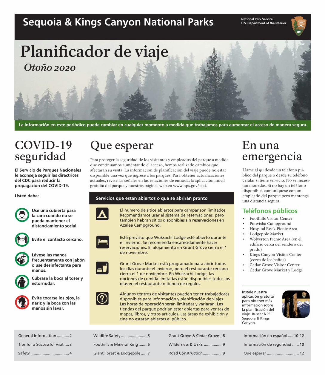
National Park Service U.S. Department of the Interior
Planifcador de viaje Otoño 2020
Sequoia & Kings Canyon National Parks
La información en este periódico puede cambiar en cualquier momento a medida que trabajamos para aumentar el acceso de manera segura.
COVID-19 seguridad El Servicio de Parques Nacionales le aconseja seguir las directrices del CDC para reducir la propagación del COVID-19.
Usted debe:
Use una cubierta para la cara cuando no se pueda mantener el distanciamiento social.
Evite el contacto cercano.
Lávese las manos frecuentemente con jabón o use desinfectante para manos.
Cúbrase la boca al toser y estornudar.
Que esperar Para proteger la seguridad de los visitantes y empleados del parque a medida que continuamos aumentando el acceso, hemos realizado cambios que afectarán su visita. La información de planificación del viaje puede no estar disponible una vez que ingrese a los parques. Para obtener actualizaciones actuales, revise las señales en las estaciones de entrada, la aplicación móvil gratuita del parque y nuestras páginas web en www.nps.gov/seki.
Servicios que están abiertos o que se abrirán pronto
El numero de sitios abiertos para campar son limitados. Recomendamos usar el sistema de reservaciones, pero tambien habran sitios disponibles sin reservaciones en Azalea Campground.
Está previsto que Wuksachi Lodge esté abierto durante el invierno. Se recomienda encarecidamente hacer reservaciones. El alojamiento en Grant Grove cierra el 1 de noviembre.
Grant Grove Market está programado para abrir todos los días durante el invierno, pero el restaurante cercano cierra el 1 de noviembre. En Wuksachi Lodge, las opciones de comida limitadas están disponibles todos los días en el restaurante o tienda de regalos.
En una emergencia Llame al 911 desde un teléfono pú-blico del parque o desde su teléfono celular si tiene servicio. No se necesi-tan monedas. Si no hay un teléfono disponible, comuníquese con un empleado del parque pero mantenga una distancia segura.
Teléfonos públicos • Foothills Visitor Center • Potwisha Campground • Hospital Rock Picnic Area • Lodgepole Market • Wolverton Picnic Area (en el
edificio cerca del sendero del prado)
• Kings Canyon Visitor Center (cerca de los baños)
• Cedar Grove Visitor Center • Cedar Grove Market y Lodge
Evite tocarse los ojos, la nariz y la boca con las manos sin lavar.
Algunos centros de visitantes pueden tener trabajadores disponibles para información y planifcación de viajes. Las horas de operación serán limitadas y variarán. Las tiendas del parque podrian estar abiertas para ventas de mapas, libros, y otros artículos. Las áreas de exhibición y cine no estarán abiertas al público.
Instale nuestra aplicación gratuita para obtener más información sobre la planifcación del viaje. Buscar NPS Sequoia & Kings Canyon.
General Information ...........2 Wildlife Safety ........................5 Grant Grove & Cedar Grove...8 Información en español ..... 10-12
Tips for a Successful Visit ....3 Foothills & Mineral King ........6 Wilderness & USFS .................9 Información de seguridad ...... 10
Safety ...................................4 Giant Forest & Lodgepole......7 Road Construction..................9 Que esperar ............................. 12