The Berlin Wall: Life, Death and the Spatial Heritage of Berlin
11
HAL Id: halshs-01446296 https://halshs.archives-ouvertes.fr/halshs-01446296 Submitted on 25 Jan 2017 HAL is a multi-disciplinary open access archive for the deposit and dissemination of sci- entific research documents, whether they are pub- lished or not. The documents may come from teaching and research institutions in France or abroad, or from public or private research centers. L’archive ouverte pluridisciplinaire HAL, est destinée au dépôt et à la diffusion de documents scientifiques de niveau recherche, publiés ou non, émanant des établissements d’enseignement et de recherche français ou étrangers, des laboratoires publics ou privés. The Berlin Wall: Life, Death and the Spatial Heritage of Berlin Gérard-François Dumont To cite this version: Gérard-François Dumont. The Berlin Wall: Life, Death and the Spatial Heritage of Berlin. History Matters, 2009, pp.1-10. halshs-01446296
-
Upload
khangminh22 -
Category
Documents
-
view
1 -
download
0
Transcript of The Berlin Wall: Life, Death and the Spatial Heritage of Berlin

HAL Id: halshs-01446296https://halshs.archives-ouvertes.fr/halshs-01446296
Submitted on 25 Jan 2017
HAL is a multi-disciplinary open accessarchive for the deposit and dissemination of sci-entific research documents, whether they are pub-lished or not. The documents may come fromteaching and research institutions in France orabroad, or from public or private research centers.
L’archive ouverte pluridisciplinaire HAL, estdestinée au dépôt et à la diffusion de documentsscientifiques de niveau recherche, publiés ou non,émanant des établissements d’enseignement et derecherche français ou étrangers, des laboratoirespublics ou privés.
The Berlin Wall: Life, Death and the Spatial Heritage ofBerlin
Gérard-François Dumont
To cite this version:Gérard-François Dumont. The Berlin Wall: Life, Death and the Spatial Heritage of Berlin. HistoryMatters, 2009, pp.1-10. �halshs-01446296�
HOME ABOUT FEATURES BOOK REVIEWS PODCASTS EXHIBITS CONTACT
The Berlin Wall: Life, Death and the Spatial Heritage ofBerlin
By Rector Gérard-François Dumont
Professor at the University of Paris-Sorbonne
Chairman of the Journal Population & Avenir
Translated by Thomas Peace, York University
Abstract
Introduction
Before the wall: Demographic haemorrhage
Much more than a wall
Crossing the Great Wall
Death of the wall
Is the wall still present?
Berlin’s spatial paradox
Further Reading
Abstract
Walls that divide are meant to be broken down. Twenty years after the fall of the Berlin Wall, the
legacy of the East-West division can still be seen in the city’s architecture, economy and overall
culture. This paper examines Berlin’s spatial and political history from the wall’s beginnings to the
long-term repercussions still being felt today.
Introduction
Of all the walls people have built, the Berlin Wall had a unique impact on the city’s urban landscape.
It is the only wall where the conditions for reunification were set in place twelve years before its
divisions were conceived. In the aftermath of the Second World War and the east-west division of
Germany, the Basic Law, enacted in the Federal Republic of Germany (FRG) on 23 May 1949, defined
the German nation and the territory of the Reich as it had existed on 31 December 1937. According
to its 116th article: “Unless otherwise provided by a law, a German within the meaning of this Basic
Law is a person who possesses German citizenship or who has been admitted to the territory of the
German Reich within the boundaries of December 31st, 1937 as a refugee or expellee of German
ethnic origin or as the spouse or descendant of such person.” The law implicitly refused to accept a
definitive understanding of the German people; rather it provided German nationality to those
former citizens living outside the country’s borders and/or excluded from citizenship during the
1930s and 1940s because of their political, racial or religious identities. The creation of this law
meant that in the FRG, better known as West Germany, the Iron Curtain – which had already been
hung by the USSR before this law was enacted – would not deprive East Germans of their nationality.
It also meant that upon the reunification of Germany, on 3 October 1990, the provisions in the Basic
Law could be used to easily incorporate Germans living in the former USSR without the need for new
legislation. Despite the potential for pan-German unity that lay at the heart of the Basic Law, the wall
was still built. Focusing on its political and spatial impact, this paper discusses the factors that led to
the wall’s creation, how the wall transformed West and East Berlin, and how – despite the risks –
Germans overcame this division. It concludes with a discussion of how, even twenty years after it
was dismantled, the wall continues to the influence the spatial politics of the city.
Before the wall: Demographic haemorrhage
For forty years, the German Democratic Republic (GDR) – founded under Soviet influence on 7
October 1949 – prevented German unity. A 1970s East German tourist brochure emphasized their
position as one in which the GDR sought to maintain its borders and hold close diplomatic relations
with the USSR and other socialist states. This long-lasting position, which followed the policies of the
USSR and shared similarities with the ideology that created the Iron Curtain, was created in Soviet-
occupied Berlin in the aftermath of the Second World War. The West refused to accept this division.
In 1948 – following the Second World War – Berlin was divided into four zones (American, French,
English and Soviet), while all of the land around the city was under Soviet occupation. On 24 June
1948 the Soviets, who occupied East Berlin (about 45.6% of the city), decided to blockade the three
zones under Western military occupation. This was an effort to extend Soviet influence in Germany
and reflected Lenin’s belief that whoever took Berlin would also take Germany. Using technical
problems as a pretext, the Soviets cut off communication and transportation between the three
Western zones and the rest of West Germany. If successful, this show of force would have resulted in
the Western abandonment and the subsequent Soviet occupation of West Berlin.
The Berlin Wall would never have been built if the Americans and English had not reacted to the
Berlin blockade with consistency, efficiency and remarkable courage. For eleven months the United
States and England relieved West Berlin by air. 277,728 flights from the West brought supplies into
Berlin over the 322 day blockade. Contrary to Soviet hopes, the Western air bridge withstood the
German winter and Soviet bullying. Neither shining lights into pilots’ eyes, radio interference,
ground-to-ground resistance nor anti-aircraft defences were enough to destroy the bridge and allow
West Berlin to fall into Soviet hands. On 25 April 1949 the Telegraph Agency of the Soviet Union
(TASS) announced the decision to lift the blockade. Despite 76 deaths and considerable cost, the
Western allies had kept hold of West Berlin. Their persistence in not abandoning the city to Soviet
totalitarianism laid the framework for the wall’s construction.
The key factor in the wall’s construction, however, was the impact on East Germans of the
connection between West Berlin and the increasing freedom in West Germany and Western Europe.
In 1950, with certain exemptions related to military service, West Berlin became a part of the FRG. In
1957 West Berlin’s geopolitical status vis-a-vis the rest of Western Europe was strengthened through
the integration of the FRG into the Treaty of Rome. West Germany’s involvement in the Western
European Economic Community confirmed West Berlin’s place both relative to Western Europe and
as a Western European enclave in the heart of the territory controlled by the communist GDR.
This was an intolerable situation for the Soviets. Half-a-million people crossed the border between
East and West Berlin as they went to work, to shop or to visit family. Daily, East Germans voted with
their feet and fled the Soviet regime through West Berlin. By 1958 over three million East Germans
had left the GDR through Berlin. This demographic haemorrhaging was a critical problem. Not only
did it demonstrate to the world that few Germans supported the Soviet regime, but it also deprived
the government of their work force. If it continued it would leave the country with few people to
actually govern. Perhaps more concerning for the GDR leadership, some Germans even imagined a
reunification of Germany, as East Berliners continued to migrate to the western side of the city.
On 27 November 1958 the USSR took a new tactic. They demanded that Western troops leave Berlin
within six months. They sought to make the city a demilitarized zone. The Western allies refused
their ultimatum and East Germans continued to flee. In 1960 the GDR had a negative net migration
of 216,642; by August 1961over 3.6 million people had emigrated to the West. This massive
migration, which had already cost East Germany a fifth of its population, had a significant
geopolitical impact: it threatened the legitimacy of the GDR. With this erosion in confidence, the
Soviets decided to prevent further migration by replacing the Berlin demarcation line with a wall; for
many it quickly became known as the ‘wall of shame’.
The West did not fully comprehend the significance of the wall when the initial fences and barbed
wire went up around West Berlin on 12 and 13 June 1961. The Soviets chose the ideal date to fully
implement their plan. The border closed on 13 August 1961 during the middle of the summer when
many embassies and Western heads of state were on vacation. The GDR announced its approval of
the Warsaw Pact and presented the construction, using contemporary communist rhetoric, as an
‘Anti-Fascist Protective Wall’. Armed GDR forces completely encircled West Berlin and, after long and
detailed planning, the wall was erected in record time. The West had little recourse, other than war,
to oppose its construction.
Much more than a wall
The wall was not merely a wall. First, it incorporated other elements to ensure that it was
impassable. The cement wall, which people in West Berlin saw, had eight parallel features on its
other side. First there were road blocks, then a patrol route, followed by lamps to light up the wall
and watch towers. Further east and closer to East Berlin there were land mines, tank traps, alarm
systems and finally the eastern wall. After 1965, the wall was made even more effective by replacing
it with 3.5 meter concrete blocks topped with pipe to prevent climbing.
Second, after the 155km of wall surrounding West Berlin was built, there were also other walls
created by the closure of inner-city communication and transportation networks that connected East
and West Berlin.
Technical Characteristics of the Berlin Wall
Total length of the belt around West Berlin: 155 kilometres, in which:
. The length between West Berlin and East-Berlin: 43.1 km
. The length between West Berlin and the GDR: 111.9 km
Measurements of each segment of the wall:
. Height: 3.6 m (at least)
. Width: 1.2 m
. Depth in the ground: 2.1 m
Control Towers: 302
Watch dog units: 259
Watchtowers: 93
Bunkers: 20
Third, the wall was quickly made more effective by closing many of the original crossing points.
There were 81 before August 1961, 69 of which were closed-in with brick and barbed wire on the
thirteenth of that month. The Brandenburg Gate was closed on the 14th and four other passage
ways were closed on the twenty third. By the end of August only seven crossings remained.
Economic exchange between the two Berlins ground to a halt. 63,000 East Berliners lost their jobs in
the West and 10,000 West Berliners lost their jobs in the East. After a Quadripartite Agreement in
1971, three more crossing points were opened.
Fourth, along with the building of the wall, the windows of homes and buildings within viewing
distance of the wall’s infrastructure were closed-in.
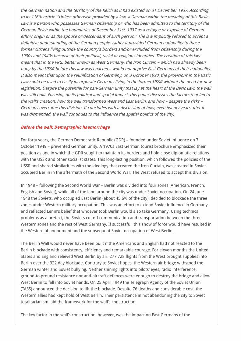
Another consequence of the wall was the loss of the vibrant urban life in Berlin’s historical centre
(Mitte), which was now in East Berlin. The area found itself in a sort of hibernation, where
maintenance of the city was poor, when it had not been abandoned altogether. The magnificent
buildings on the Museum Island, including the important Pergamon Museum, particularly suffered
from neglect and the wear of time and weather.
Photo 1. A mosaic of the Pergamon Museum in Berlin: a lion of Babylon. Photo © Gérard-François

Dumont – 2007.
Despite this decline in the city’s maintenance and upkeep, over the years the GDR felt the need to
attract foreign tourists. The government decided that for a fee it would provide supervised day-
passes to foreign visitors and West Germans. Checkpoint Charlie was selected as the crossing point
for these visitors. The GDR also established a mandatory currency exchange upon each tourist
excursion. A tour book issued in December 1980 by the Berlin tourism office noted that
Deutschmarks and all other western currencies could be carried home without limitations, but all
currency from the GDR and other countries in the socialist bloc were to remain in the East. In 1965,
to demonstrate its superiority and increase tourism, East Berlin built the Fernsehturm, a 361.5 meter
high tower on the Alexanderplatz. The top of the tower featured a revolving restaurant. The tower
was also used for telecommunications and military observation.
The wall also created a number of non-physical barriers and challenges for both sides of the city. In
effect, the wall created two different cities resulting in the loss of a civic identity, the construction of
separate suburbs, the loss of a downtown, the loss of economic innovation and other links between
the two areas of the city. Two cities also meant that many aspects of urban life were doubled; for
example, Berlin had two main operas, two universities and two zoos.
A Geopolitical Calendar of the Berlin Wall
May 8 1945: Unconditional capitulation of the German army
July 17 – August 2 1945: Potsdam Conference cutting Berlin into four zones
June 24 1948: Beginning of the Berlin Blockade
May 23 1949: Creation of the FRG and the Basic Law
October 7 1949: Creation of the GDR
1953: Berlin under siege following workers’ protests against the socialist regime
August 13 1961: Erection of the Berlin Wall
August 24 1961: First victim of the wall
September 3 1971: The Quadripartite Agreement
December 21 1972: Under the guidance of Willy Brandt and his ‘Eastern Policy’ the FRG
considers the GDR a de facto sovereign nation
September 10 1989: Complete opening of the Iron Curtain along the Austro-Hungarian
border
October 7 1989: Gorbachev attends 40th anniversary celebrations of the GDR
November 4 1989: One million East Germans assemble on the Alexanderplatz
November 9 1989: The wall is opened and then destroyed.
July 1 1990: Monetary union between the FRG and GDR
September 23 1990: The GDR parliament votes for reunification
October 3 1990: Reunification is made official
June 2 1991: The Bundestag meets in Bonn and decides, by a vote of 338 to 320, that the
German parliament and government should return to Berlin
April 19 1999: The Bundestag takes sole possession in Berlin of the newly remodelled
Reichstag
Crossing the Great Wall
Karl-Heinz Hoffman, a GDR army general, thought the Berlin Wall was the most secure and
sophisticated border in the world. Throughout the 28 years that the wall divided Berlin, though, the
call for liberty remained constant. Throughout these years thousands of East Germans risked their
lives in attempts at crossing over. In total, between August 1961 and March 1989, 5,075 people
successfully escaped to West Berlin. They used every means possible. Most went over the wall,
though some went under, invented specialized vehicles, or swam across the Spree River. Escape was
facilitated by anonymous border guards, who would fail to take proper aim when firing upon people
attempting escape. Over the years, some of them, who hated firing on their compatriots, deserted
and helped to support others in their attempt to crossover to West Berlin. In particular, the museum
‘Haus am Checkpoint Charlie’, which opened on 14 June 1963, was located in West Berlin and was
close enough to the wall to serve as a welcome point for just-escaped East Germans.
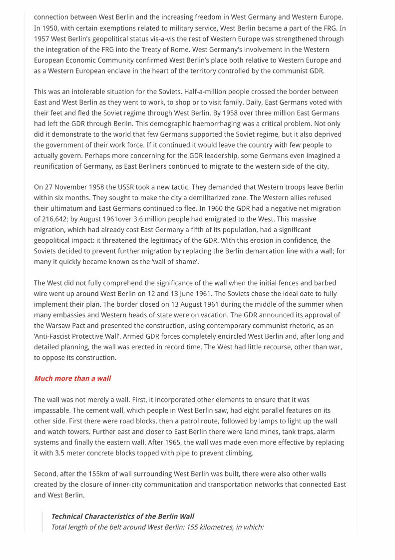
Not everyone was lucky in their attempt to escape. 588 people died while trying to cross over into
West Berlin. Some of their modest tombs can be found near the Brandenburg Gate on the western
side. Among the last of these victims was Winfried Freudenberg (13 February 1989) who died after
trying to escape in a homemade plastic balloon.
Photo 2: Near the Brandenburg Gate, the tomb of one of the last people killed while trying to cross
the Berlin Wall: Chris Geoffroy, February 5, 1989 © Photo: Gérard-François Dumont – 2007.
Death of the wall
By 1989, the GDR could no longer stop emigration to the West. Rather than escaping through Berlin,
it became possible to escape to Hungary through Czechoslovakia. From Hungary, the thousands of
cars fleeing the East were able to cross the recently opened border with Austria and travel onwards
to West Germany. The opening of this border was confirmed on 10 September 1989 when the Iron
Curtain between the two countries was lifted by the Soviet Union. It was now possible for East
Germans to bypass the Berlin Wall in their attempt to reach the West.
Two months later, the wall’s central purpose came to an end. On 9 November 1989, Günter
Schabowski, a member of the Politburo, announced the GDR’s decision to remove travel restrictions
for East Germans wanting to travel west. Hours later, in the face of overwhelming demand to
crossover to West Berlin, border guards were forced to let the border open. The wall was conquered.
During the winter of 1989 the wall began to be dismantled. It was taken apart at a rate of 100 meters
per night. By 1991 its demolition was complete. The city of Berlin was reunited and thus began a new
page in the city’s history. Traffic moved between the two sides without much hindrance and over the
1990s public transit has reintegrated and modernized. More recently, in the 2000s, the city built a
new central train station symbolizing the end of reunification by creating a central hub for all the
city’s transportation networks.
Is the wall still present?
With the exception of six conserved sections and brass plaques marking the wall’s location, the
physical wall – and the formal division between East and West Berlin – has disappeared. Replacing
this division was a new political space.
It is not difficult, however, for the attentive observer to notice that a geopolitical wall continues to
divide the city. In the West, the scars of the Second World War, symbolized by the bombed-out Kaiser
Wilhelm Memorial Church and the more recently reconstructed Reichstag – with its glass dome
symbolizing transparent democracy, serve as a continual reminder of the stain of Nazism on German
history. In the East, little trace remains of the Nazi influence, even though the past is now somewhat
recalled in the recently rebuilt Rykestrasse synagogue in the city’s Jewish quarter.
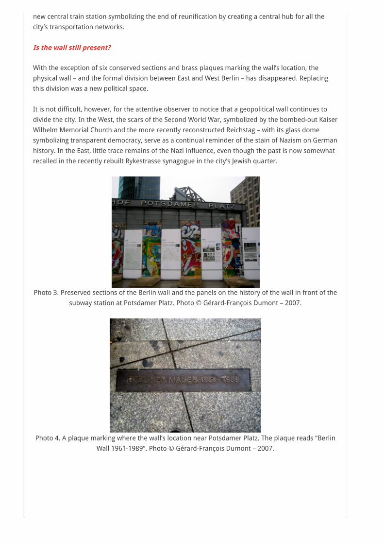
Photo 3. Preserved sections of the Berlin wall and the panels on the history of the wall in front of the
subway station at Potsdamer Platz. Photo © Gérard-François Dumont – 2007.
Photo 4. A plaque marking where the wall’s location near Potsdamer Platz. The plaque reads “Berlin
Wall 1961-1989”. Photo © Gérard-François Dumont – 2007.

Photo 5. The Bundestag, Germany’s lower house of assembly, is located in the refurbished and
redesigned Reichstag building. Photo © Gérard-François Dumont — 2007.
The two sides of the city also have different architecture. The West, which was about five times the
size of Paris, had less population pressure than East Berlin. This large amount of space meant that
high rises were practically nonexistent across its 484 km2 territory. The East, on-the-other-hand,
sought to demonstrate its ‘modernity’ by transforming the Alexanderplatz with structures like the
Fernsehturm and building layers of similar looking suburbs in the city’s outlaying areas.
The socialist influence also continues to divide the East from West. Statues of Marx and Lenin and
images of the hammer and sickle can still be found in old East Berlin. Traces of the GDR also remain
in the debate over the rebuilding of the imperial palace, which was destroyed in 1950 to create the
soulless Palace of the Republic and Marx-Engels Square. Whether this plan will move forward is still
a question remaining for a city with limited financial resources.
The Wall itself remains a scar on the city’s human and economic landscape. Before the Second World
War, Berlin was the largest, most innovative and industrialized city in Germany. After 1945, West
Berlin’s unique situation (it was inaccessible, in a poor position relative to suppliers and markets,
and deeply affected by the departure of workers) reined its economy in. It was a gloomy situation:
for the most part West Berlin relied on the aid and protection of its Western occupiers. In East Berlin,
the socialist planned economy, with its emphasis on large state-run businesses, created deficiencies
in the organization and profitability of the economy. Since 1990 Berlin has benefited from the return
of the national government, many renowned institutions and important head offices, and an
increase in tourism.
Berlin’s economy, however, remains modest and somewhat less than what was expected at
reunification. The intellectual and economic frameworks created over forty years of the communist
regime combined with the economic constraints imposed on West Berlin by the wall were deeply
ingrained. They will not disappear easily. Around the Museum Island, for example, a tourist haven
has developed, while nearby markets continue to sell remnants from the socialist period (military
insignias, miniature sculptures of Lenin, etc…). Behaviours are difficult to change and people who
once lived under the communist regime remain cautious.
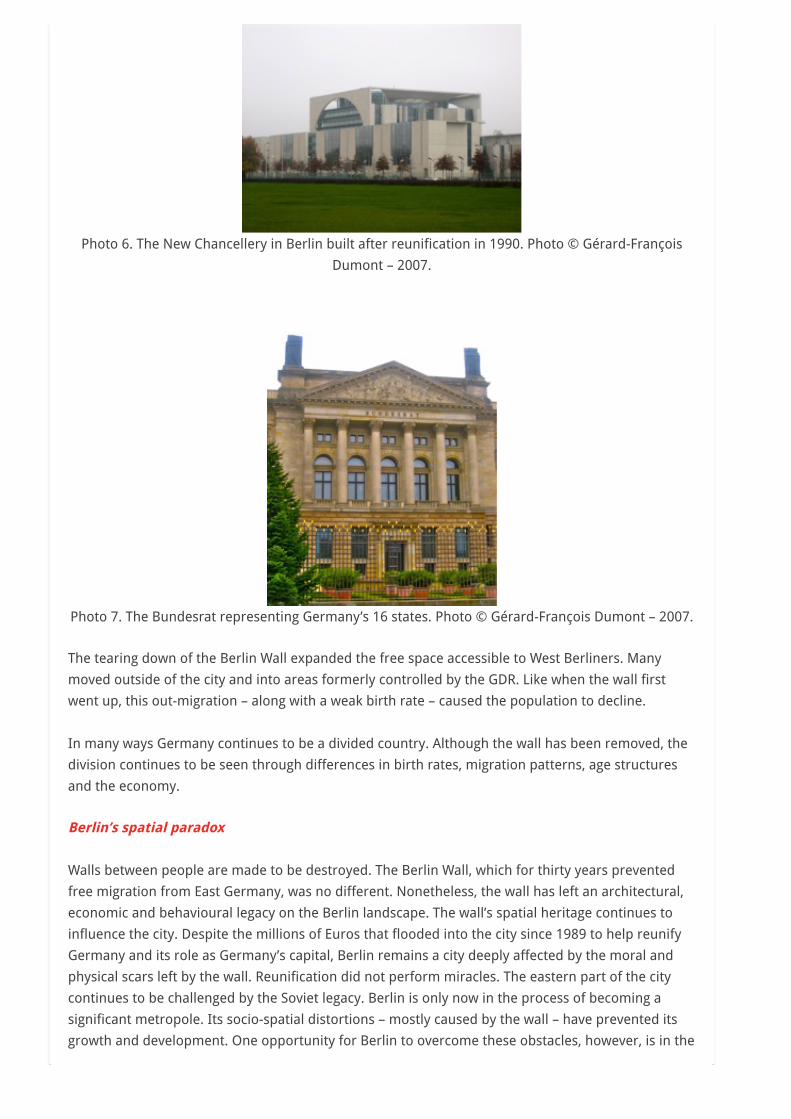
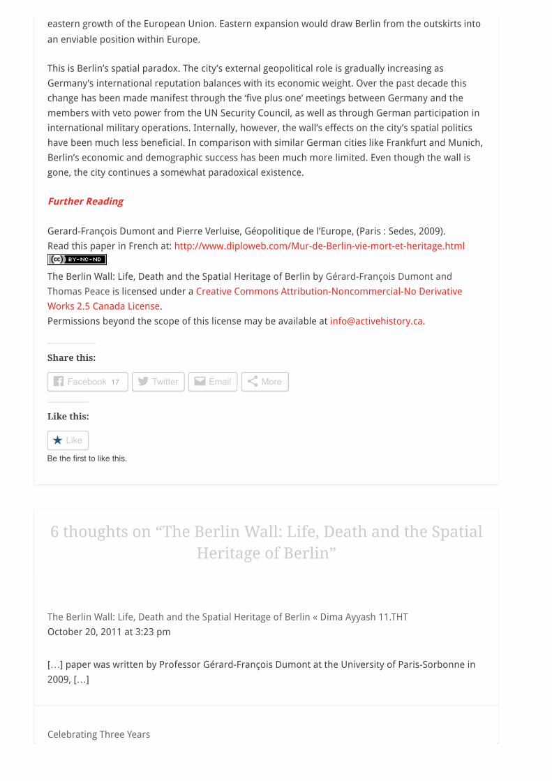
Photo 6. The New Chancellery in Berlin built after reunification in 1990. Photo © Gérard-François
Dumont – 2007.
Photo 7. The Bundesrat representing Germany’s 16 states. Photo © Gérard-François Dumont – 2007.
The tearing down of the Berlin Wall expanded the free space accessible to West Berliners. Many
moved outside of the city and into areas formerly controlled by the GDR. Like when the wall first
went up, this out-migration – along with a weak birth rate – caused the population to decline.
In many ways Germany continues to be a divided country. Although the wall has been removed, the
division continues to be seen through differences in birth rates, migration patterns, age structures
and the economy.
Berlin’s spatial paradox
Walls between people are made to be destroyed. The Berlin Wall, which for thirty years prevented
free migration from East Germany, was no different. Nonetheless, the wall has left an architectural,
economic and behavioural legacy on the Berlin landscape. The wall’s spatial heritage continues to
influence the city. Despite the millions of Euros that flooded into the city since 1989 to help reunify
Germany and its role as Germany’s capital, Berlin remains a city deeply affected by the moral and
physical scars left by the wall. Reunification did not perform miracles. The eastern part of the city
continues to be challenged by the Soviet legacy. Berlin is only now in the process of becoming a
significant metropole. Its socio-spatial distortions – mostly caused by the wall – have prevented its
growth and development. One opportunity for Berlin to overcome these obstacles, however, is in the
6 thoughts on “The Berlin Wall: Life, Death and the SpatialHeritage of Berlin”
The Berlin Wall: Life, Death and the Spatial Heritage of Berlin « Dima Ayyash 11.THT
October 20, 2011 at 3:23 pm
[…] paper was written by Professor Gérard-François Dumont at the University of Paris-Sorbonne in
2009, […]
Celebrating Three Years
eastern growth of the European Union. Eastern expansion would draw Berlin from the outskirts into
an enviable position within Europe.
This is Berlin’s spatial paradox. The city’s external geopolitical role is gradually increasing as
Germany’s international reputation balances with its economic weight. Over the past decade this
change has been made manifest through the ‘five plus one’ meetings between Germany and the
members with veto power from the UN Security Council, as well as through German participation in
international military operations. Internally, however, the wall’s effects on the city’s spatial politics
have been much less beneficial. In comparison with similar German cities like Frankfurt and Munich,
Berlin’s economic and demographic success has been much more limited. Even though the wall is
gone, the city continues a somewhat paradoxical existence.
Further Reading
Gerard-François Dumont and Pierre Verluise, Géopolitique de l’Europe, (Paris : Sedes, 2009).
Read this paper in French at: http://www.diploweb.com/Mur-de-Berlin-vie-mort-et-heritage.html
The Berlin Wall: Life, Death and the Spatial Heritage of Berlin by Gérard-François Dumont and
Thomas Peace is licensed under a Creative Commons Attribution-Noncommercial-No Derivative
Works 2.5 Canada License.
Permissions beyond the scope of this license may be available at [email protected].
Share this:
Facebook 17 Twitter Email More
Like this:
Like
Be the first to like this.