Strait of Malacca (East) - Sea-Seek
123
Strait of Malacca (East) Sea - Seek Ebook Sailing guide / Guide nautique Strait of Malacca (East) Indian Ocean - Sumatra (Indonesia) - Sumatra W coast (Indonesia) July 2022 http://www.sea-seek.com July 2022
-
Upload
khangminh22 -
Category
Documents
-
view
2 -
download
0
Transcript of Strait of Malacca (East) - Sea-Seek

Strait of Malacca (East)
Sea - Seek
Ebook Sailing guide / Guide nautique
Strait of Malacca (East)
Indian Ocean - Sumatra (Indonesia) - Sumatra W coast (Indonesia)
July 2022
http://www.sea-seek.com July 2022
Strait of Malacca (East)
Strait of Malacca (East)
http://www.sea-seek.com July 2022

Strait of Malacca (East)
Table of contents
Strait of Malacca (East)....................................................................................... 1
1 - Pulau Pinang (Malaysia)................................................................................ 6
1.1 - Tanjong city marina (Pinang)............................................................... 8
1.2 - Junk anchorage (Pinang) ...................................................................... 9
1.3 - E-Gate anchorage (Pinang) .................................................................. 9
2 - Sungai Muda (Malaysia).............................................................................. 10
3 - Sungai Merbok river (Sungai Petani) (Malaysia) ..................................... 11
4 - Pinang harbor (Penang) (Malaysia) ........................................................... 12
5 - Tanjung Piandang to Port Kelang (Malaysia)........................................... 17
5.1 - Sungai Kurau (Bagan Serai) (Malaysia) ............................................ 18
5.2 - Kampung Kuala Sepetang.................................................................. 19
5.3 - Tanjong Batu (Perak) (Malaysia) ....................................................... 20
5.4 - Pulau Talang (Perak) (Malaysia)........................................................ 21
5.5 - Tanjong Hantu (Perak) (Malaysia)..................................................... 22
5.6 - Lumut Malaysian navy (Perak) (Malaysia)........................................ 23
5.7 - Lumut jetty (Perak - Malaysia) .......................................................... 26
5.8 - Marina Wing (Lumut Perak) (Malaysia)............................................ 26
5.9 - Pulau Pangkor (Malaysia) .................................................................. 28
5.9.1 - Teluk Belanga (Pangkor) (Malaysia) ..................................... 29
5.9.2 - Nipah Bay (Pangkor) (Malaysia) ........................................... 30
5.9.3 - Pulau Giam (Pangkor) (Malaysia).......................................... 32
5.9.4 - Pulau Mentangor (Pangkor) (Malaysia)................................. 33
5.9.5 - Sungai Pinang Kecil jetty (Pangkor) (Malaysia).................... 34
5.9.6 - Pangkor jetty (Malaysia) ........................................................ 34
5.10 - Pangkor (Pangkur) Marina ............................................................... 36
http://www.sea-seek.com July 2022

Strait of Malacca (East)
5.11 - Tanjong Katak (Perak Malaysia)...................................................... 36
5.12 - Pulau Tukun Perak (Faiway Rock) (Malaysia) ................................ 37
5.13 - Kepulauan Sembilan islands (Malaysia) .......................................... 39
5.13.1 - White Rock (K Sembilan) (Malaysia).................................. 39
5.13.2 - Pulau Agas (K Sembilan) (Malaysia)................................... 41
5.14 - Tanjong Beras Basah (Perak Malaysia) ........................................... 42
5.15 - Sungai Perak (Malaysia) .................................................................. 42
5.16 - Bagan Datoh (Datok) (Perak Malaysia) ........................................... 43
5.17 - Pulau Jarak (K Sembilan) (Malaysia) .............................................. 45
5.18 - Sungai Bernam (Perak Malaysia)..................................................... 46
5.19 - Kuala Selangor to Port Kelang (Selangor Malaysia) ....................... 48
5.19.1 - Selangor lighthouse (Selangor Malaysia) ............................ 49
5.19.2 - Kuala Selangor (Selangor Malaysia).................................... 50
5.19.3 - Selat Kelang Utara - North Approach (Selangor Malaysia) 52
5.19.3.1 - Angsa Bank (Selangor - Malaysia) .......................... 53
5.19.4 - Port Klang (Kelang) (Selangor - Malaysia) ......................... 54
5.19.5 - Selat Kelang Utara - South approach ................................... 58
5.20 - North Sands (Selangor Malaysia) .................................................... 60
6 - Tanjong Ru to Tanjong Piai (Malaysia)..................................................... 62
6.1 - One Fathom Bank (Selangor Malaysia) ............................................. 63
6.2 - Amazon Maru Shoal (Selangor Malaysia) ......................................... 64
6.3 - Carey island (Selangor - Malaysia) .................................................... 65
6.3.1 - Tanjong Selat Lumut (Perak - Malaysia) ............................... 66
6.3.2 - Tanjong Ru (Pulau Carey - Malaysia).................................... 66
6.3.3 - Kuala Langat (Selangor - Malaysia) ...................................... 67
6.4 - Tanjong Gabang (Selangor - Malaysia) ............................................. 68
6.5 - Pyramid shoal (Malaysia)................................................................... 70
6.6 - Bambek shoal (Selangor - Malaysia) ................................................ 72
http://www.sea-seek.com July 2022

Strait of Malacca (East)
6.7 - Sungai Sepang Besar (Selangor - Malaysia) ...................................... 73
6.8 - Pulau Burong (Selangor - Malaysia) .................................................. 75
6.9 - Port Dickson Harbour (Selangor - Malaysia)..................................... 75
6.10 - Avillion Admiral marina (Port Dikson - Malaysia) ......................... 79
6.11 - Tg Tuan or Rachado cape (Malacca - Malaysia) ............................. 80
6.12 - Sungai Linggi (Malacca - Malaysia) ................................................ 83
6.13 - Batu Mandi rock (Malacca - Malaysia)............................................ 84
6.14 - Batu Tengah roks (Malacca - Malaysia) .......................................... 85
6.15 - Pulau Batu Besar (Malacca - Malaysia) ........................................... 85
6.16 - Tg Panchor (Malacca - Malaysia) .................................................... 86
6.17 - Sungai Udang Port (Malacca - Malaysia) ........................................ 87
6.18 - Tanjong Keling (Malacca - Malaysia) ............................................. 91
6.19 - Pulau Upeh (Malacca - Malaysia) .................................................... 92
6.20 - Batu gelama rock (Malacca - Malaysia) .......................................... 93
6.21 - Pulau Jawa (Malacca - Malaysia)..................................................... 95
6.22 - Sungai Melaka (Malaysia) ............................................................... 95
6.23 - Pulau Melaka (Malacca - Malaysia)................................................. 99
6.24 - Foulerton shoal (Malacca - Malaysia)............................................ 100
6.25 - Pulau Panjang (Malacca - Malaysia).............................................. 101
6.26 - Water islands (Malacca - Malaysia)............................................... 102
6.27 - Tanjong Tohor (Johor - Malaysia) ................................................. 104
6.28 - Baker Patch (Johor - Malaysia) ...................................................... 105
6.29 - Formosa Bank - Nares Bank (Johor - Malaysia)............................ 106
6.30 - Tanjong Seginting (Johor - Malaysia)............................................ 107
6.31 - Sungai Batu Pahat (Johor - Malaysia)............................................ 107
6.32 - Fair channel Bank (Johor - Malaysia) ............................................ 109
6.33 - Pulau Pisang (Johor - Malaysia)..................................................... 111
6.34 - Sungai Benut (Johor - Malaysia).................................................... 112
http://www.sea-seek.com July 2022

Strait of Malacca (East)
6.35 - Pulau Kukup (Johor - Malaysia) .................................................... 114
7 - Sungai Muar (Johor - Malaysia) ............................................................... 115

Strait of Malacca (East)
Strait of Malacca (East) 4°32.59 N94°44.56 E
Indian Ocean - Sumatra (Indonesia) - Sumatra W coast (Indonesia) - Strait of Malacca (East)
http://www.sea-seek.com July 2022 Page:1

Strait of Malacca (East)
Strait of Malacca
The Strait of Malacca is a narrow,805 km stretch of water between theMalay Peninsula (Peninsular Malaysia)and the Indonesian island of Sumatra.Singapore Strait is the area lyingbetween the S coasts of Malaysia andSingapore Island on the N side and thecoast of Sumatera on the S side.The Strait of Malacca and SingaporeStrait
together form the main seaway connecting the Indian Ocean with the SouthChina Sea. The straits offer the shortest route for tankers between the PersianGulf and Japan.The strait is the main shipping channel between the Indian Ocean and the PacificOcean, linking major Asian economies such as India, China, Japan and SouthKorea. Over 50,000 vessels pass through the strait per year carrying aboutone-quarter of the world's traded goods including oil, Chinese manufactures, andIndonesian coffee.Malaccamax is a naval architecture term for the largest size of ship capable offitting through the 25 metres (82 ft)-deep Strait of Malacca.Shipping hazards:Piracy in the strait has risen in recent years. There were about 25 attacks on vessels in 1994, 220 in 2000, and just over 150 in 2003 (one-third of the global total). After attacks rose again in the first half of 2004, the Malaysian,Indonesian and Singaporean navies stepped up their patrols of the area in July 2004. Subsequently, attacks on ships in the Strait of Malacca dropped, to 79 in 2005 and 50 in 2006.There are 34 shipwrecks, some dating to the 1880s, in the Traffic Separation Scheme (TSS), the channel for commercial ships. These pose a collision hazard in the narrow and shallow Strait.Another risk is the yearly haze caused by raging bush fires in Sumatra. It canreduce visibility to 200 metres (660 ft), forcing ships to slow down in the busystrait. Ships longer than 350 metres (1,150 ft) routinely use the strait.Winds _ Weather:
http://www.sea-seek.com July 2022 Page:2

Strait of Malacca (East)
Along the N coast of Sumatera, the Southwest Monsoon prevails from about Aprilto November and the Northeast Monsoon from about November to April.During the Southwest Monsoon the wind frequently holds both day and night nearUjung Raya, while farther E it is not so permanent.In the strength of the Northeast Monsoon, the wind blows from E to NE fromabout 1000 to 1600, strengthening near the close. It then begins to drop and isusually calm about sundown; there is a land breeze during the night. In April, SWand W winds begin; the Southwest Monsoon is established in May.Waterspouts are seen off the coast at times.At the N and NE portion of Sumatra, during the Northeast Monsoon, there isgenerally a swell on the coast, which gives rise to a considerable sea in theafternoon, if accompanied by a stiff sea breeze. Both subside quickly, so that thewater is generally smooth at night and in the forenoon.At times, the monsoon blows strongly for some days, at which timescommunication with the shore is reported impracticable.December and January, are usually the worst months.The Southwest Monsoon is the best for landing on this portion of Sumatera.Although the Strait of Malacca is within the limits of the NE and SouthwestMonsoon of the Indian Ocean, on account of the high land on either of the strait,the winds are variable.However, land and sea breezes are regular on both coasts.
Currents:In the Strait of Malacca to the W of the islands N of the N Sumatera coast, thereis a current setting in a W direction, often attaining a rate of 1.5 to 2 knots, andinclining N or SW by the action of the prevailing monsoon.Between these islands and the Nicobars, during the strength even of theSouthwest Monsoon, there is frequently a current that sets directly into themonsoon at a rate of 2 knots.At the same period there is said to be a strong current between Pulau Weh and6°30'N, setting E as far as the meridian of Tanjung Jambuair. This current is saidto continue all the year around, but with less strength during the NortheastMonsoon.It is to be regarded as a countercurrent with reference to the W current along thecoast from the Strait of Malacca.Through the Strait of Malacca there is a constant NW set, but near the S, wherethe strait is considerably narrower, it is only felt by its action on the tidal current,decreasing the velocity of the flood current and almost overcoming it during
http://www.sea-seek.com July 2022 Page:3

Strait of Malacca (East)
neaps, and increasing that of the ebb to the same extent.In the NW portion the same effect is produced near the shore on the tidalcurrents, but out in the middle of the strait it is fairly constant and strongest duringthe Northeast Monsoon; it finally makes its way seaward along the coast andaffects the tidal current there, as above mentioned.The tidal action is not appreciable beyond the distance of about 8 miles off thePedir coast and about 40 miles off the E coast of Sumatera.The flood sets E on the N coast of Sumatera and the ebb W, rarely exceeding 2knots at spring; at neaps they are sometimes imperceptible, except at the pointsor over banks and narrow channels.The currents are also affected by the constant current out of the Strait ofMalacca, which takes a W direction along the N coast, through the passages Sof Pulau Weh, so that for the greater part of the year the ebb current is longer andstronger than the flood current.The prevailing winds as a result of which, when the water is rising or falling duringthe Northeast Monsoon, there may be no E set for a day or more; conversely, theflood or E current runs long and stronger during the Southwest Monsoon.The overall set in the strait is to the NW, but from May to September there is atendency for SE sets to prevail in some N and central parts but the predominanceis very slight. On the average, between 50 and 60 per cent of all currentobservations in the strait are 0.5 knot or less. A small portion of theseobservations exceed 2 knots.In the N part of the strait, the general directions of the tidal currents are SE andNW. The SE stream reaches maximum rate about 1 hour prior to HW and the NWcurrent reaches maximum rate about 1 hour before LW.In the main fairway, the spring rates are about 1.5 knots, but may reach 2.5 to 3knots in the more restricted channels and inshore waters.The tidal currents in the S end of the Strait of Malacca set SE and NW to andfrom Selat Durian (1°00'N., 103°35'E.); they are not necessarily associated withany particular currents and may meet or separate from the latter S of TanjungPiai (1°16'N., 103°31'E.), the S extremity of the Malay Peninsula.
Depths/Limitations:The depths in the Strait of Malacca are generally irregular and a considerableportion of the bottom is of sand wave formation. Depths in the main shippingchannels vary from 14.9 to over 100m.Dangerous sand banks which can restrict navigation are located in both trafficseparation scheme lanes of One Fathom Bank (2°53'N., 100°59'E.) and Fair
http://www.sea-seek.com July 2022 Page:4

Strait of Malacca (East)
Channel Bank (1°28'N., 103°08'E.).Areas NW of One Fathom Bank and SW of Tanjung Tuan (Cape Rachado)(2°24'N., 101°51'E.) are subject to sand wave formation. Deep-draft vesselsshould, therefore, take particular note of the latest depths over shoals lying in ornear the fairway.Caution.?Navigational aids are often unreliable, especially in Indonesian waters.Risk of collision is appreciable due to heavy traffic using the through routes,frequent crossing traffic, and local fishing craft with nets.
http://www.sea-seek.com July 2022 Page:5

Strait of Malacca (East)
1 - Pulau Pinang (Malaysia) 5°21.17 N100°15.37 E
Indian Ocean - Sumatra (Indonesia) - Sumatra W coast (Indonesia) - Strait of Malacca (East) - Pulau Pinang(Malaysia)
A E-Gate anchorage (Pinang) B Junk anchorage (Pinang)
C Tanjong city marina (Pinang)
Penang is a state in Malaysia and the name of its constituent island, locatedon the northwest coast of peninsular Malaysia by the strait of Malacca.It is bordered by Kedah in the north and east, and Perak in the south.Penang is the second smallest Malaysian state in area after Perlis, and the eighthmost populous. It is composed of two parts - Penang Island, where the seat ofgovernment is, and Seberang Perai (formerly, and occasionally Province
http://www.sea-seek.com July 2022 Page:6
Strait of Malacca (East)
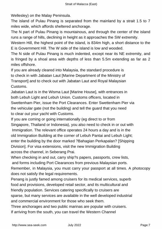
Wellesley) on the Malay Peninsula.The island of Pulau Pinang is separated from the mainland by a strait 1.5 to 7miles wide, which affords sheltered anchorage.The N part of Pulau Pinang is mountainous, and through the center of the islandruns a range of hills, declining in height as it approaches the SW extremity.Western Hill, the highest point of the island, is 834m high, a short distance to theE is Government Hill. The W side of the island is low and wooded.The N side of Pulau Pinang is much indented, except near its NE extremity, andis fringed by a shoal area with depths of less than 5.5m extending as far as 2miles offshore.If you are already cleared into Malaysia, the standard procedure is to check in with Jabatan Laut [Marine Department of the Ministry of Transport] and to check out with Jabatan Laut and Royal Malaysian Customs.Jabatan Laut is in the Wisma Laut [Marine House], with entrances in both Lebuh Light and Lebuh Union. Customs officers, located in Swettenham Pier, issue the Port Clearances. Enter Swettenham Pier via the vehicular gate (not the building) and tell the guard that you need to clear out your yacht with Customs.If you are coming or going internationally (eg direct to or from Singapore, Thailand or Indonesia), you also need to check in or out with Immigration. The relevant office operates 24 hours a day and is in the old Immigration Building at the corner of Lebuh Pantai and Lebuh Light; enter the building by the door marked ?Bahagian Perkapalan? [Shipping Division]. For visa extensions, visit the new Immigration Building across the channel, in Seberang Prai.When checking in and out, carry ship?s papers, passports, crew lists, and forms including Port Clearances from previous Malaysian ports.Remember, in Malaysia, you must carry your passport at all times. A photocopydoes not satisfy the legal requirements.Penang is justly famed among cruisers for its medical services, superbfood and provisions, developed retail sector, and its multicultural andfriendly population. Services catering specifically to cruisers aresparse, but many services are available in the well developed industrialand commercial environment for those who seek them.Three anchorages and two public marinas are popular with cruisers.If arriving from the south, you can travel the Western Channel
http://www.sea-seek.com July 2022 Page:7

Strait of Malacca (East)
(between Pulau Pinang and Pulau Jerjak) to the Seagate Anchorage or the Marina Batu Uban. Or use the Main Channel (under the Penang Bridge), to reach the Tanjong City Marina or the Junk Anchorage.Arriving from the north, the Tanjong City Marina, Junk Anchorage, and E-Gate Anchorage are handy. Or you could continue along the Main Channel, under the bridge, and round Pulau Jerjak to the Western Channel and Seagate Anchorage or Marina Batu Uban.
1.1 - Tanjong city marina (Pinang) 5°24.91 N100°20.69 E
Indian Ocean - Sumatra (Indonesia) - Sumatra W coast (Indonesia) - Strait of Malacca (East) - Pulau Pinang(Malaysia)
channel 69
Tanjong City Marina based aroundthe century-old Church Street Pier.Tanjung City Marina is an abandonedmarina off Weld Quay within GeorgeTown's UNESCO World Heritage Site.Built in the early 2000s by theMalaysian federal government torejuvenate the former Church StreetPier, could accommodate up to 140small
vessels.The marina's floating infrastructure began to sink by 2009, and by 2011, theberths were completely lost to the waves.
http://www.sea-seek.com July 2022 Page:8

Strait of Malacca (East)
1.2 - Junk anchorage (Pinang) 5°24.65 N100°20.39 E
Indian Ocean - Sumatra (Indonesia) - Sumatra W coast (Indonesia) - Strait of Malacca (East) - Pulau Pinang(Malaysia)
The Junk Anchorage, just south of the Tanjong City Marina, lies off the clan jetties (the New, Yeoh, Lee, Tan, Chew and Lim jetties).Diesel fuel is usually available from a fuel barge nearby. The Junk Anchorage is exposed to weather from the north and east.
1.3 - E-Gate anchorage (Pinang) 5°22.40 N100°18.95 E
Indian Ocean - Sumatra (Indonesia) - Sumatra W coast (Indonesia) - Strait of Malacca (East) - Pulau Pinang(Malaysia)
http://www.sea-seek.com July 2022 Page:9

Strait of Malacca (East)
E-Gate anchorage lies , after proceeding south down the Western Channelfrom the Junk Anchorage.Anchor offshore from either the E-Gate building (prominent cupola) or the blue-roofed building housing the Jabatan Laut headquarters for the northern region of peninsula Malaysia.Be alert to submarine cables and the associated no-anchoring area. The anchorage is handy to the old marine police jetty, where diesel fuel can be bought. The old marine police jetty is no longer being maintained.The bay is slated for land reclamation. A Tesco hypermarket and associated shops and food court are handy to this anchorage.
E-Gate commercial complex
2 - Sungai Muda (Malaysia) 5°34.61 N100°20.64 E
http://www.sea-seek.com July 2022 Page:10

Strait of Malacca (East)
Indian Ocean - Sumatra (Indonesia) - Sumatra W coast (Indonesia) - Strait of Malacca (East)
The Sungai Muda is located about 6 miles S of the Sungai Merbok entrance. Itis obstructed by a sandy bar which dries from 0.6 to 1.2m at LW.Small craft, drawing 1m, can enter at half tide and proceed about 4 milesupstream.
3 - Sungai Merbok river (Sungai Petani) (Malaysia) 5°40.65 N100°21.25 E
Indian Ocean - Sumatra (Indonesia) - Sumatra W coast (Indonesia) - Strait of Malacca (East)
http://www.sea-seek.com July 2022 Page:11

Strait of Malacca (East)
The Sungai Merbok (Merbau River), the entrance to which is formed betweenthe low coast on the N and the hills to the S, is fronted by the coast mud flat,which has depths under 5.5m, and extends nearly 3 miles to seaward.There is a depth of 2m on the bar, with depths of 5m within. Small craft drawing2m can proceed about 3 miles upstream at HW.
4 - Pinang harbor (Penang) (Malaysia) 5°25.22 N100°21.80 E
Indian Ocean - Sumatra (Indonesia) - Sumatra W coast (Indonesia) - Strait of Malacca (East)
http://www.sea-seek.com July 2022 Page:12
Strait of Malacca (East)
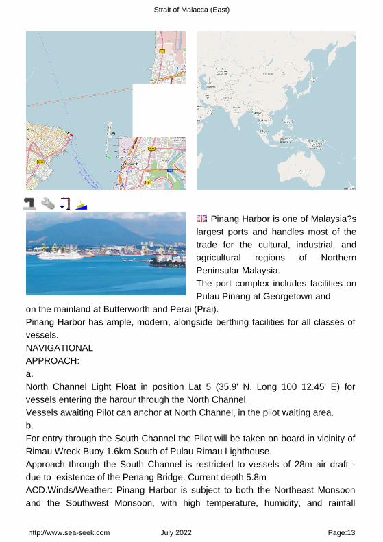
Pinang Harbor is one of Malaysia?slargest ports and handles most of thetrade for the cultural, industrial, andagricultural regions of NorthernPeninsular Malaysia.The port complex includes facilities onPulau Pinang at Georgetown and
on the mainland at Butterworth and Perai (Prai).Pinang Harbor has ample, modern, alongside berthing facilities for all classes ofvessels.NAVIGATIONALAPPROACH:a.North Channel Light Float in position Lat 5 (35.9' N. Long 100 12.45' E) forvessels entering the harour through the North Channel.Vessels awaiting Pilot can anchor at North Channel, in the pilot waiting area.b.For entry through the South Channel the Pilot will be taken on board in vicinity ofRimau Wreck Buoy 1.6km South of Pulau Rimau Lighthouse.Approach through the South Channel is restricted to vessels of 28m air draft -due to existence of the Penang Bridge. Current depth 5.8mACD.Winds/Weather: Pinang Harbor is subject to both the Northeast Monsoonand the Southwest Monsoon, with high temperature, humidity, and rainfall
http://www.sea-seek.com July 2022 Page:13

Strait of Malacca (East)
throughout the year.Winds are generally light or moderate in both seasons. The usual weather patternis for partly cloudy mornings inland with showers and thunderstorms by themiddle of the afternoon and dispersing at night.Sumatras, which are nighttime squalls with violent thunder, lightning, and rain,can be expected from April to November with an average occurrence of about 3to 4 per month.Tides/Currents: At springs, the tidal currents run at a rate of from 2to 3 knots through the harbor anchorages (although rates of up to 5 knots havebeen observed), but less in the approaches, and continue to flow N or S for about1 hour to 1 hour 30 minutes after LW or HW.During the Northeast Monsoon, the tidal currents are regular; the S current runsfrom about 4 hours before to about 2 hours after HW by the shore, with the Ncurrent running during the remaining period. Off the entrance to North Channel aS current of 0.5 knot has been experienced. In November, the current sets roundMuka Head (5°29'N., 100°11'E.) and overcomes the outgoing current, sometimesfor 2 or 3 days.The main ship channel into Pinang Harbor is via North Channel, which is 10 milesin length, has a width of 183m, and a least depth of 10.2m. Approaches to theharbor are well marked by navigational aids. Approach depths gradually increasefrom 11 to 22m in the area S of Buoy Tokong.Depths?Limitations.?Shoaling to a least depth of 9.7m has been reported in someareas of North Channel. The approach to Pinang Harbor via South Channel isrestricted to vessels with a 6m draft and a height of 28m due to the verticalclearance of the Pinang Bridge. A least depth over the bar of South Channel is5.8m.Pinang is equipped with modern wharves, piers, and basins to handle practicallyany cargo that can be transported on water.These include facilities for container, ro-ro, dry and liquid bulk carriers, generalcargo, and passenger vessels.Swettenham Pier is situated on Pinang Island. The T-berth has a total length of366m, with a depth alongside of 10m. A berth of 46m, depth 3m alongside, issituated on the W side of the S end of Swettenham Pier and is use by lightersand fishing vessels. This area is referred to as the Lighter Basin. SwettenhamPier handles break-bulk cargo, as well as passenger and naval vessels. Just S of Swettenham Pier is the Church Street Pier; further S is the ferry terminal.Less than 1 mile E of Swettenham Pier, across the Selat Utara, is the NorthButterworth Container Terminal. The Tshaped pier is 600m in length, with a depth
http://www.sea-seek.com July 2022 Page:14

Strait of Malacca (East)
of 12m alongside.Less than 1 mile S of the North Butterworth Container Terminal are the Luar ShellPier, the Bagan Luar Esso Pier, and the Butterworth Deep Water Wharves. Aferry terminal is situated between the Esso Pier and the Butterworth Deep WaterWharves.The Butterworth Deep Water Wharves are made up of six numberedberths. Berth 1 through Berth 3, used for conventional cargo, have a length of549m and depths of 9m alongside.Container facilities are situated at Berth 4 through Berth 6, with a total length of497m. Berth 6 is also equipped with a ro-ro ramp of 8m wide and 28m long.The Palm Oil Tanker Berth (Berth 9) with a depth of 8.9m is situated just S ofButterworth Pier No. 1; vessels up to 167m in length can be accommodated.The entrance to the Sungai Perai is located S of Berth 9. On the S bank of theriver entrance is the Perai Wharf. This wharf is 840m in length and suitable forcoasters and lighters carrying bulk cargo. The wharf is connected to railways.The Caltex Pier (Berth 10) consists of a mooring pontoon and berthing dolphins0.5 mile offshore. The berth has a depth of 10m and is connected to theprominent oil tanks to the NE by an underwater pipeline.A Bulk Cargo Terminal, for both liquid and solid cargoes, is situated at Perai. Theterminal consists of two main berths 338m long with a depth of 10m alongsideand one inner berth with 154m long with a depth of 7m.Vessels of more than 5m in height or 30m in length must obtain writtenpermission from the Port Officer, Pinang, before entering the restrictedarea.Aspect.?The coast of the mainland being low does not show up well fromNorth Channel as that from Pinang Island, consequently the latter will usuallyappear nearer when in the fairway between them. Within the harbor limits ofPulau Pinang, Fort Cornwallis, with a conspicuous flagstaff, 5.7m high lies on theNW entrance to the harbor. On the mainland, two conspicuous radio masts lie onthe E entrance of the harbor.Numerous other prominent buildings and masts stand on the island andmainland.Pilotage.?Pilotage is compulsory for vessels 200 grt and over when berthing andunberthing in the harbor, except fishing vessels. Vessels should send their ETA 3hours in advance to Pilots Pinang, stating their ETA at North Channel Light Floator, in the case of South Channel, their ETA at Pulau Rimau.The maximum draft of the vessel should also be included. Pilot should becontacted on VHF channel 12.For vessels entering the harbor through North Channel, the pilot boarding area is
http://www.sea-seek.com July 2022 Page:15

Strait of Malacca (East)
NW of the North Channel Light Float. For entry through South Channel, the pilotwill be embarked in the vicinity of Rimau Buoy.Anchorage.?Anchoring isprohibited within the indicated cable area on the NE side of North Channel.Numerous anchorages including Naval Anchorage, Petroleum Anchorage,Quarantine Anchorage, Local Anchorage, Small Craft Anchorage, andExplosives Anchorage exist within harbor limits.An outer anchorage is charted about 2 miles SSW of North Channel LightFloat.Caution.?Fishing stakes extend all around Pulau Pinang and the mainlandcoast within the 10m contour line. Bamboo poles, singly or in groups, markingfishing nets or pots may be encountered in this area. Large numbers of fishingboats may be encountered in the vicinity of, and NW of Muka Head.Mail: [email protected]: 04-2102211Fax: 04-2634792
http://www.sea-seek.com July 2022 Page:16

Strait of Malacca (East)
5 - Tanjung Piandang to Port Kelang (Malaysia) 4°00.56 N100°38.73 E
Indian Ocean - Sumatra (Indonesia) - Sumatra W coast (Indonesia) - Strait of Malacca (East) - Tanjung Piandangto Port Kelang (Malaysia)
There is a practically continuous strip of mangrove forest, which varies inwidth from 0.5 mile to 8 miles between Tanjung Piandang and Tanjung Batu,about 41 miles S.These mangroves are generally creeping seaward as the deposits from themuddy creeks increase.Extensive mud banks fringe the coast between Tanjung Piandang and TanjungBatu.Ships on passage from Tanjung Piandang to Tanjung Hantu normally keep
http://www.sea-seek.com July 2022 Page:17

Strait of Malacca (East)
outside the 20m contourline. Along this track the hills some 10 to 15 miles inshoreof the seaward edge of the mangroves are frequently visible and are the onlyreliable navigational aids between the two points.From Tanjong Piandang the coast takes a SSE direction to Selinsing Bay,forming several bights fronted by flats with depths of less than 5.5m in places.On the flats between Pulau Pinang and Kuala Larut there are numerous fishingstakes.The coast S of Tanjong Pasir to Tanjong Kerang (Tanjong Krang is a mangrovejungle, covered for some distance inland at HWS tide.Tanjong Kerang is the N entrance point of Kuala Larut, a wide estuary leading E,used only by small craft.From Kuala Larut to Kuala Jarum Mas, the coast is fronted by a mud bankextending from 5 to 9 miles offshore.A group of powerful white lights, visible for about 50 miles, is occasionally shownfrom Gunong Kledang, a summit located about 23 miles E of Kuala Jarum Mas.Caution.?Numerous fish traps and stakes are situated within the 10m contour linefrom W of Pulau Terung to Tanjung Hantu.
5.1 - Sungai Kurau (Bagan Serai) (Malaysia) 5°00.04 N100°25.09 E
Indian Ocean - Sumatra (Indonesia) - Sumatra W coast (Indonesia) - Strait of Malacca (East) - Tanjung Piandangto Port Kelang (Malaysia)
The Sungai Kurau enters the sea about 5 miles SSE of Tanjong Piandang.The Sungai Kurau is navigable at HW by craft drawing 1.8m, about 15 milesupstream.
http://www.sea-seek.com July 2022 Page:18

Strait of Malacca (East)
Selinsing Bay is shallow and forms the entrance to the Sungai Sangga Besar, themain approach to Port Weld, and the SungaiSelinsing. The bay is bounded byTanjong Pasir to the N, and a point about 3 miles SW.Tanjong Pasir may be recognized by the sandy beaches on the N and S sides ofit. The shores of the bay are fringed with wide, drying mud banks which reducethe width of the channels into the two rivers to 0.75 mile and the two separateriver channels to 0.25 mile.The extent and shape of these banks are subject to frequent change.The main bar at the entrance to Selinsing Bay lies close S of Tanjong Pasir withdepths of from 0.3 to 0.6m.
5.2 - Kampung Kuala Sepetang 4°50.14 N100°37.53 E
Indian Ocean - Sumatra (Indonesia) - Sumatra W coast (Indonesia) - Strait of Malacca (East) - Tanjung Piandangto Port Kelang (Malaysia)
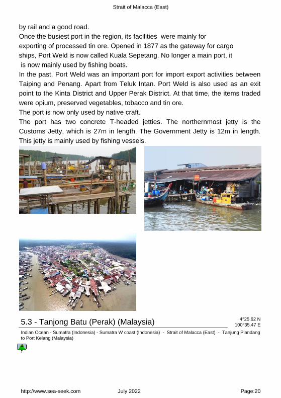
Port Weld is the port for Taiping the former capital city of Perak. It is situatedabout 5 NM above the entrance of the Sungai Sangga Besar, and is connected
http://www.sea-seek.com July 2022 Page:19
Strait of Malacca (East)
by rail and a good road.Once the busiest port in the region, its facilities were mainly for exporting of processed tin ore. Opened in 1877 as the gateway for cargo ships, Port Weld is now called Kuala Sepetang. No longer a main port, it is now mainly used by fishing boats.In the past, Port Weld was an important port for import export activities betweenTaiping and Penang. Apart from Teluk Intan. Port Weld is also used as an exitpoint to the Kinta District and Upper Perak District. At that time, the items tradedwere opium, preserved vegetables, tobacco and tin ore.The port is now only used by native craft.The port has two concrete T-headed jetties. The northernmost jetty is theCustoms Jetty, which is 27m in length. The Government Jetty is 12m in length.This jetty is mainly used by fishing vessels.
5.3 - Tanjong Batu (Perak) (Malaysia) 4°25.62 N100°35.47 E
Indian Ocean - Sumatra (Indonesia) - Sumatra W coast (Indonesia) - Strait of Malacca (East) - Tanjung Piandangto Port Kelang (Malaysia)
http://www.sea-seek.com July 2022 Page:20

Strait of Malacca (East)
Tanjong Batu is a cape located in the Perak area of the country of Malaysia.
5.4 - Pulau Talang (Perak) (Malaysia) 4°25.30 N100°34.51 E
Indian Ocean - Sumatra (Indonesia) - Sumatra W coast (Indonesia) - Strait of Malacca (East) - Tanjung Piandangto Port Kelang (Malaysia)
http://www.sea-seek.com July 2022 Page:21
Strait of Malacca (East)
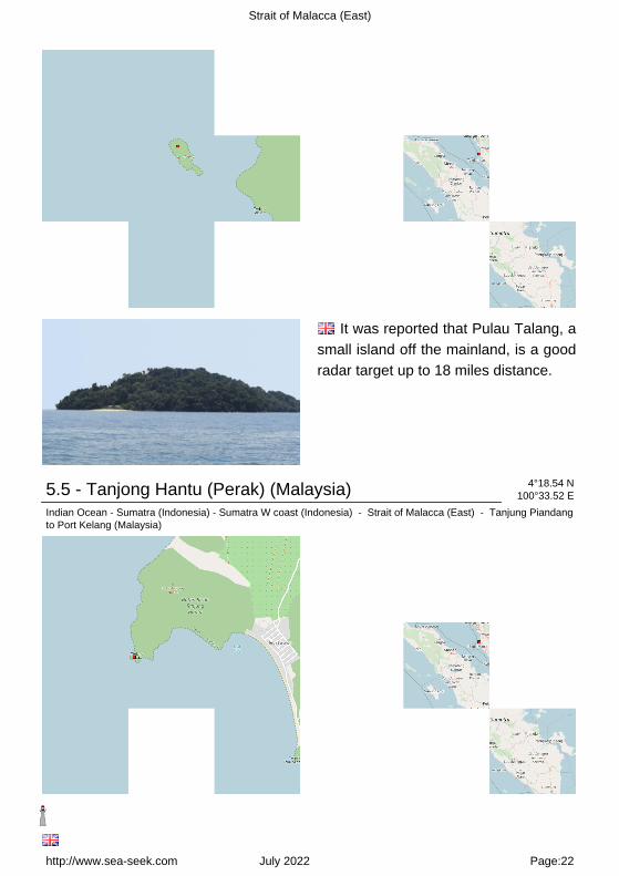
It was reported that Pulau Talang, asmall island off the mainland, is a goodradar target up to 18 miles distance.
5.5 - Tanjong Hantu (Perak) (Malaysia) 4°18.54 N100°33.52 E
Indian Ocean - Sumatra (Indonesia) - Sumatra W coast (Indonesia) - Strait of Malacca (East) - Tanjung Piandangto Port Kelang (Malaysia)
http://www.sea-seek.com July 2022 Page:22

Strait of Malacca (East)
Tanjong Hantu, about 8 miles SSW of Tanjong Batu is a sloping point, thesummit of which is 203m in height.The coast from Tanjong Hantu to Motts Point, the N entrance point of DindingRiver, is skirted by a shallow bank having depths of less than 5.5m.The bank extends a distance from about 0.6 to 0.8 mile, gradually diminishing itsdistance from the shore as Motts Point, on the N shore of the entrance of DindingRiver, is approached.Bukit Sigari, 493m high, is the S peak of the Saddle which is sometimes knownas False Dining. This is good landmark from the SW and W.
5.6 - Lumut Malaysian navy (Perak) (Malaysia) 4°14.25 N100°36.67 E
Indian Ocean - Sumatra (Indonesia) - Sumatra W coast (Indonesia) - Strait of Malacca (East) - Tanjung Piandangto Port Kelang (Malaysia)
Dinding river
Lumut is a coastal town in the stateof Perak in Malaysia and is thegateway to Pangkor island.It is a quaint little town famous for itsbeautiful seashell and coral handicrafts.This once little-known fishing town hassince
become the Lumut home biggest base of the Royal Malaysian Navy on the Wcoast of Malaysia.Lumut in Malay means moss, lichen, or seaweed.
http://www.sea-seek.com July 2022 Page:23

Strait of Malacca (East)
In its early days, the beach is said to be rich in moss, so the local people called it Lumut.Lumut jetty now is the staging-off point to various beautiful offshore islands, including Pangkor Island.Lumut is approached through River Passage and the Sungai Dinding.The principal functions of the port are the Lumut Naval Base, the Malayan FlourMill, and the small pier at the town of Lumut used by coasters at high tide. Fishingboats and ferries dominate the area?s traffic.There are three approaches to the river: one from the southwest and two from the north. All are well marked with buoys and beacons along the passageways.Once inside the main river, the water is deep. Smaller local vessels often cross over shallow banks and should not be followed in a keel boat.Tides_Currents:The current through Selat Dinding sets S at a rate of 2 to 3 knots during springtides. In the Sungai Dinding, both the incoming and outgoing currents have a rateof 2 knots during neap tides and 3.5 knots during spring tides.Depths_Limitations:The three channels leading to the main fairway of the Sungai Dinding and then toLumut are, North Channel, North West Entrance, and Selat Dinding.North Channel leads from Tanjong Hantu to Motts Point.North West Entrance leads S of Beting Batu Malang and the N coast of PulauPangkor.Selat Dinding leads from South Entrance close to the E coast of Pulau Pangkor.Selat Dinding is the channel most used by deep draft vessels calling at Lumut. Aleast depth of 11m is charted 0.5 mile NNE from South East Point Light.All three channels meet at River Passage, 0.75 mile W of Motts Point.Lumut Naval Base is surroundedby a hilly region and is protected from high windsand seas. The base is contained within two breakwaters, with lighted beacons oneach end and a dredged basin with numbered berths inside.Flour Mill Wharf has 167m of berthing space, with a depth alongside of 9.3m atMLWS. On the S side of the dock is a berth, 97m long, with a depth alongside of6m, used by coastal tankers.Lumut Maritime Terminal, situated on the Dinding River, is a common-userterminal. Dry bulk, bulk liquids, containers, and general cargo are handled here.The South Berths are 200m in length, with a depth of 10m alongside. The North
http://www.sea-seek.com July 2022 Page:24

Strait of Malacca (East)
Berths are 280m in length, with a depth of 12m alongside. A barge berth canaccommodate two barges up to 8,000 dwt each.Lekir Bulk Terminal is L-shaped and handles bulk liquids and dry bulk cargo forthe adjacent power station. The S berth is 530m long, with 20m alongside, andcan accommodate vessels up to 180,000 dwt. The N berth is 250m long, with18m alongside, and can also accommodate vessels up to 180,000 dwt.Pilotage.?Pilotage is compulsory and is available 24 hours.The pilot boards S of Pulau Pangkor in position 4°10.5'N, 100°35.0'E. For vesselsberthing at Lekir Bulk Terminal, the pilot boards in position 4°09'N, 100°33'E. Anotice of arrival should be sent through the agent 72 hours in advance.Regulations.?Entry is prohibited in the area centered on position 4°13.8'N,100°35.3'E, as shown on the chart, where there is a degaussing range.Entry is prohibited in the charted area E of Dinding Light, on the S side of theriver to the N of the Lumut Naval Base to a position close W of Lumut.Anchorage.?Anchorage may be obtained approximately 0.7 mile S of South EastPoint Light, in about 22m.There are several submarine cable areas in the passage through Selat Dindingand the Sungai Dinding which can be best seen on the chart. Anchoring isprohibited.Directions.?A vessel bound for Lumut using Selat Dinding should steer to pass0.2 mile E of South East Point of Pulau Pangkor, with Tanjong Hantu open E ofBatu Jambol. The fairway channel (Selat Dinding) is indicated by a lighted range,which may best be seen on the chart.Continue N, maintaining the same distance off Tomb Point, Hospital Rock, andBatu Jambol. Then alter course to cross the bar of River Passage, keeping RiverPassage Buoy close to port on the inbound leg and close to starboard on theoutbound leg.Caution.?Vessels are advised not to use Northwest Entrance without localknowledge due to the numerous dangers.
http://www.sea-seek.com July 2022 Page:25

Strait of Malacca (East)
Razak submarine (Scorpene class)2011:12:10 11:43:09
5.7 - Lumut jetty (Perak - Malaysia) 4°14.22 N100°37.95 E
Indian Ocean - Sumatra (Indonesia) - Sumatra W coast (Indonesia) - Strait of Malacca (East) - Tanjung Piandangto Port Kelang (Malaysia)
It is a daily ferry services, every half hour a time, about 30 minutes trip toPangkok island.
5.8 - Marina Wing (Lumut Perak) (Malaysia) 4°14.17 N100°38.41 E
Indian Ocean - Sumatra (Indonesia) - Sumatra W coast (Indonesia) - Strait of Malacca (East) - Tanjung Piandangto Port Kelang (Malaysia)
http://www.sea-seek.com July 2022 Page:26

Strait of Malacca (East)
The Lumut Waterfront is a recentlynew build park on the north side of the little town of Lumut, next tothe Lumut is the International Yacht Club or marina Wing.Yachts can berth at the InternationalYacht Club Marina or anchor off and,for a charge, use their facilities.There are limited number of mooringsto the
northeast The club is just east of the main town and convenient for shopping and port clearances. The club no longer supplies fuel in any quantity but can be brought in from outside in cans. Further up the river on the right tributary before the bridge is a local fuel boat tied alongside about 500 metres before the private commercial shipyard. Larger quantities of fuel are sold here for powerboats.Tel: +60(5) 683 7800Fax: +60(5) 683 770040 berth
http://www.sea-seek.com July 2022 Page:27

Strait of Malacca (East)
5.9 - Pulau Pangkor (Malaysia) 4°13.74 N100°33.36 E
Indian Ocean - Sumatra (Indonesia) - Sumatra W coast (Indonesia) - Strait of Malacca (East) - Tanjung Piandangto Port Kelang (Malaysia)
Off the coast of perak State, north of Selangor , lies a cluster of fabulousislands with unquestionably some of the best coves and beaches on the westerncoast of peninsular Malaysia.Among them, two islands predominate in terms of accessibility, infrastructure anddevelopment - the largest island, Pangkor and her sister Pangkor Laut.Those who are not familiar with the geographical locations generally confuse thetwo.Pulau Pangkor is separated from the mainland by Selat Dinding (DindingChannel), about 1 mile wide but navigable only over a reported width of about 0.2mile.The island is very hilly and densely wooded.The W coast of Pulau Pangkor is deeply indented, forming several bights, with
http://www.sea-seek.com July 2022 Page:28

Strait of Malacca (East)
the largest being on the SW side.Pulau Pangkor (Malaysia)
5.9.1 - Teluk Belanga (Pangkor) (Malaysia) 4°15.11 N100°32.61 E
Indian Ocean - Sumatra (Indonesia) - Sumatra W coast (Indonesia) - Strait of Malacca (East) - Tanjung Piandangto Port Kelang (Malaysia)
Teluk Belanga, the NNW bight, afford an anchorage in the center, in a depthof 8m, shoaling gradually to the shore.
http://www.sea-seek.com July 2022 Page:29

Strait of Malacca (East)
5.9.2 - Nipah Bay (Pangkor) (Malaysia) 4°14.32 N100°32.18 E
Indian Ocean - Sumatra (Indonesia) - Sumatra W coast (Indonesia) - Strait of Malacca (East) - Tanjung Piandangto Port Kelang (Malaysia)
Western Anchorage is entered between Tanjong Nipah and the W extremity ofPulau Mentangor, about 1 mile SSW.A good anchorage may be obtained in Western anchorage, in a depth of about10m, 0.25 mile WNW of Pulau Giam.
http://www.sea-seek.com July 2022 Page:30

Strait of Malacca (East)
http://www.sea-seek.com July 2022 Page:31

Strait of Malacca (East)
5.9.3 - Pulau Giam (Pangkor) (Malaysia) 4°14.16 N100°32.40 E
Indian Ocean - Sumatra (Indonesia) - Sumatra W coast (Indonesia) - Strait of Malacca (East) - Tanjung Piandangto Port Kelang (Malaysia) - Pulau Giam (Pangkor) (Malaysia)
163
Pulau Giam is located in the middle of Nipah bay. It's a steep wooded islet.Pulau Giam (Pangkor) (Malaysia)
http://www.sea-seek.com July 2022 Page:32

Strait of Malacca (East)
5.9.4 - Pulau Mentangor (Pangkor) (Malaysia) 4°13.72 N100°32.01 E
Indian Ocean - Sumatra (Indonesia) - Sumatra W coast (Indonesia) - Strait of Malacca (East) - Tanjung Piandangto Port Kelang (Malaysia) - Pulau Mentangor (Pangkor) (Malaysia)
163
Mentangor is a large uninhabited island along S of Teluk Nipah.There were nothing worth highlighting on the island except the scenes of rocky coast and some tiny beaches.Next to it is the smaller, tiny Coral island with shallow water.
http://www.sea-seek.com July 2022 Page:33

Strait of Malacca (East)
Pulau Mentangor (Pangkor) (Malaysia)Pulau Mentangor (Pangkor) (Malaysia)
5.9.5 - Sungai Pinang Kecil jetty (Pangkor) (Malaysia) 4°13.58 N100°34.55 E
Indian Ocean - Sumatra (Indonesia) - Sumatra W coast (Indonesia) - Strait of Malacca (East) - Tanjung Piandangto Port Kelang (Malaysia)
The jetty is in front of the fishing village where is a mosque.
5.9.6 - Pangkor jetty (Malaysia) 4°12.79 N100°34.65 E
Indian Ocean - Sumatra (Indonesia) - Sumatra W coast (Indonesia) - Strait of Malacca (East) - Tanjung Piandangto Port Kelang (Malaysia)
http://www.sea-seek.com July 2022 Page:34

Strait of Malacca (East)
Located E coast of Pulau Pangkor in a shallow bay Port Pangkor, in front ofPangkor village, has a small jetty, with a depth of 6,1 m alongside.Tides_Currents:The flood runs S, and the ebb N along the W coast of Pulau Pangkor. taking thedirection between Pulau Pangkor and Pulau Pangkor Laut.In the narrow passage between the two, the current has a rate of 2 to 3.5 knots atsprings.Anchorage:Abreast of Port Pangkor village, there is secure anchorage for vessels of deepdraft, and sufficient space for several vessels to moor.A good anchorage may be obtained, in depths over 16m, mud, with the W edgeof East Bank about 0.2 mile E.East Bank trends parallel to, and fronts the coast of the mainland.Caution.?Lesser depths than charted have been reported in the dredged part ofNorth West Entrance.Pangkor Village is a busy little place with lots happening, particularly in the early hours of the morning when fresh produce from fishermen and from mainland are brought in for the local community's daily needs.Toward the end of the village, on the left from the jetty, a few 'kedai kopi' (coffee shops) cater to the local malaysian folk who frequent the place for their breakfast and a little bit of the local gossip. The 'Kuih Badak' is a nice snack to go with a cup of steaming
http://www.sea-seek.com July 2022 Page:35

Strait of Malacca (East)
local kopi (coffee).
5.10 - Pangkor (Pangkur) Marina 4°12.67 N100°36.07 E
Indian Ocean - Sumatra (Indonesia) - Sumatra W coast (Indonesia) - Strait of Malacca (East) - Tanjung Piandangto Port Kelang (Malaysia)
channel 69
Berths* 40 - 65 units Werberths. Minimum 30' to 100' vessels* 60 - 80 units Hardstands. Minimum 30' to 100' vessels
5.11 - Tanjong Katak (Perak Malaysia) 4°09.58 N100°37.64 E
Indian Ocean - Sumatra (Indonesia) - Sumatra W coast (Indonesia) - Strait of Malacca (East) - Tanjung Piandang
http://www.sea-seek.com July 2022 Page:36

Strait of Malacca (East)
to Port Kelang (Malaysia)
Tanjong Katak is low and continues to the entrance of the Sungai Perak(Perak River), located about 14 miles SSE of Pulau Pangkor.
5.12 - Pulau Tukun Perak (Faiway Rock) (Malaysia) 4°07.88 N100°33.50 E
Indian Ocean - Sumatra (Indonesia) - Sumatra W coast (Indonesia) - Strait of Malacca (East) - Tanjung Piandangto Port Kelang (Malaysia)
Pulau Tukun Perak (Fairway Rock) 5.5m high lies about 4 miles SSW ofSoutheast Point on Pulau Pangkor.A wreck, with a depth of 9.5m, lies 1.75 miles ENE of Pulau Tukum Perak.
http://www.sea-seek.com July 2022 Page:37
Strait of Malacca (East)
http://www.sea-seek.com July 2022 Page:38

Strait of Malacca (East)
5.13 - Kepulauan Sembilan islands (Malaysia) 4°01.93 N100°32.01 E
Indian Ocean - Sumatra (Indonesia) - Sumatra W coast (Indonesia) - Strait of Malacca (East) - Tanjung Piandangto Port Kelang (Malaysia) - Kepulauan Sembilan islands (Malaysia)
A White Rock (K Sembilan) (Malaysia) B Pulau Agas (K Sembilan) (Malaysia)
Kepulauan Sembilan is a group of islands in the region of Perak, the countryof Malaysia with an average elevation of 1 meter above sea level.
5.13.1 - White Rock (K Sembilan) (Malaysia) 4°00.37 N100°30.28 E
Indian Ocean - Sumatra (Indonesia) - Sumatra W coast (Indonesia) - Strait of Malacca (East) - Tanjung Piandangto Port Kelang (Malaysia) - Kepulauan Sembilan islands (Malaysia)
http://www.sea-seek.com July 2022 Page:39

Strait of Malacca (East)
White Rock was reported to be a good radar target up to 13 miles. A light isshown from White Rock.A dangerous wreck lies about 9 miles, bearing 260° from White Rock; a racon issituated at the light.
http://www.sea-seek.com July 2022 Page:40

Strait of Malacca (East)
5.13.2 - Pulau Agas (K Sembilan) (Malaysia) 4°03.97 N100°34.70 E
Indian Ocean - Sumatra (Indonesia) - Sumatra W coast (Indonesia) - Strait of Malacca (East) - Tanjung Piandangto Port Kelang (Malaysia) - Kepulauan Sembilan islands (Malaysia) - Pulau Agas (K Sembilan) (Malaysia)
163
Pulau Agas, the N of Kepulauan Sembilan, lies about 7 miles S of SoutheastPoint.The N group consists of four islets and a rock; the S group consists of six islandsand two off-lying rocks, all within a 6 mile radius.Caution.?If approaching from S at night between the mainland and KepulauanSembilan, it is advisable to give Pulau Agas a wide berth. This is due to the tidal
http://www.sea-seek.com July 2022 Page:41

Strait of Malacca (East)
currents around the islands being strong and irregular.
5.14 - Tanjong Beras Basah (Perak Malaysia) 4°00.18 N100°43.75 E
Indian Ocean - Sumatra (Indonesia) - Sumatra W coast (Indonesia) - Strait of Malacca (East) - Tanjung Piandangto Port Kelang (Malaysia)
Tanjong Beras Basah, the S point of the approach to the Sungai Perak, isfronted by sand banks, partly dry at LW, to a distance of 3.5 miles in a NWdirection.
5.15 - Sungai Perak (Malaysia) 4°00.13 N100°45.25 E
Indian Ocean - Sumatra (Indonesia) - Sumatra W coast (Indonesia) - Strait of Malacca (East) - Tanjung Piandangto Port Kelang (Malaysia)
http://www.sea-seek.com July 2022 Page:42

Strait of Malacca (East)
The Sungai Perak is approached through Kuala Perak, a wide shallow estuaryand a buoyed channel leading E from the fairway lighted buoy.The Sungai Perak is navigable to Tuluk Intan, 30 miles inland for those vesselsable to clear the shallow depth in the approach.Tides?Currents.?At the mouth of the Sungai Perak, the currents attain a rate of 3to 4 knots at springs, and 1.5 knots at neaps.The current changes about 1 hour before HW and LW at Bagan Datoh. In thechannel E of the sea buoy, the currents set across the channel NW with a fallingtide at Bagan Datoh, and SE with a rising tide.Depths?Limitations.?River and local fishing vessels use a T-shaped concretepier, witha depth of 3m alongside.Pilotage.?There are no regular pilots; however the marine department of TelukIntan will arrange a pilot with a 24-hour notice. The pilot boards at the fairwaylighted buoy.
5.16 - Bagan Datoh (Datok) (Perak Malaysia) 3°59.58 N100°47.11 E
Indian Ocean - Sumatra (Indonesia) - Sumatra W coast (Indonesia) - Strait of Malacca (East) - Tanjung Piandangto Port Kelang (Malaysia)
Bagan Datoh (Datok) is situated on the S bank of the Sungai Perak, about 4miles E of Tanjong Beras Basah.Bagan Datoh and Teluk Intan are no longer ports of any significance. Most of thetraffic is confined to a few coastal tankers transporting oil supplies from PortDickson, which will cease when the planned bridge is constructed across the
http://www.sea-seek.com July 2022 Page:43

Strait of Malacca (East)
Sungai Perak.Anchorage may be taken about 0.3 mile from the shore off the pier at BaganDatoh, in about 6.4m, mud.
http://www.sea-seek.com July 2022 Page:44

Strait of Malacca (East)
5.17 - Pulau Jarak (K Sembilan) (Malaysia) 3°59.34 N100°05.82 E
Indian Ocean - Sumatra (Indonesia) - Sumatra W coast (Indonesia) - Strait of Malacca (East) - Tanjung Piandangto Port Kelang (Malaysia) - Pulau Jarak (K Sembilan) (Malaysia)
163
Pulau Jarak, lying near the middle of strait of Malacca about 25 miles W ofKepulauan Sembilan, is a precipitous thickly-wooded island. Pulau Jarak wasreported to be a good radar target.The flood current sets SE and the ebb NW, at a rate of about 1,5 knots, in thevicinity of the island. Tidal rips have been observed E of the island.
http://www.sea-seek.com July 2022 Page:45

Strait of Malacca (East)
Pulau Jarak (K Sembilan) (Malaysia)
5.18 - Sungai Bernam (Perak Malaysia) 3°51.02 N100°50.15 E
Indian Ocean - Sumatra (Indonesia) - Sumatra W coast (Indonesia) - Strait of Malacca (East) - Tanjung Piandangto Port Kelang (Malaysia)
The Sungai Bernam (Bernam River) is located about 12 miles SSE of TanjongBeras Basah. It is located between the Malaysian states of Perak and Selangor,demarcating the border of the two states.Tidal currents are strong in the river and only small craft with local knowledgeshould attempt to enter.Between Kuala Bernam and Kuala Selangor, about 39 miles SE, the coast is lowand fringed with mangroves. The mud banks fronting the coast extend for lessthan 0.5 mile until within 5 miles of Kuala Selangor where they extend for adistance of 2 miles.A chain of shoals with depths of less than 5.5m lies 5 to 7 miles offshore aboutmidway between Tanjong Sauh and Kuala Selangor. A spit with depths of lessthan 5.5m, bank off Kuala Selangor, extending towards the chain of shoalsdescribed above.Enclosures for catching fish are situated off and along the coast a few milesapart. They are generally found in depths up to 11m and are therefore useful in
http://www.sea-seek.com July 2022 Page:46

Strait of Malacca (East)
defining the shallow water.
http://www.sea-seek.com July 2022 Page:47
Strait of Malacca (East)
5.19 - Kuala Selangor to Port Kelang (Selangor Malaysia) 3°07.21 N101°17.35 E
Indian Ocean - Sumatra (Indonesia) - Sumatra W coast (Indonesia) - Strait of Malacca (East) - Tanjung Piandangto Port Kelang (Malaysia) - Kuala Selangor to Port Kelang (Selangor Malaysia)
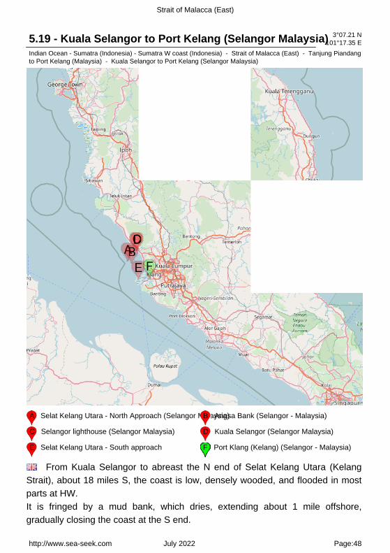
A Selat Kelang Utara - North Approach (Selangor Malaysia)B Angsa Bank (Selangor - Malaysia)
C Selangor lighthouse (Selangor Malaysia) D Kuala Selangor (Selangor Malaysia)
E Selat Kelang Utara - South approach F Port Klang (Kelang) (Selangor - Malaysia)
From Kuala Selangor to abreast the N end of Selat Kelang Utara (KelangStrait), about 18 miles S, the coast is low, densely wooded, and flooded in mostparts at HW.It is fringed by a mud bank, which dries, extending about 1 mile offshore,gradually closing the coast at the S end.
http://www.sea-seek.com July 2022 Page:48

Strait of Malacca (East)
5.19.1 - Selangor lighthouse (Selangor Malaysia) 3°20.38 N101°13.25 E
Indian Ocean - Sumatra (Indonesia) - Sumatra W coast (Indonesia) - Strait of Malacca (East) - Tanjung Piandangto Port Kelang (Malaysia) - Kuala Selangor to Port Kelang (Selangor Malaysia)
Kuala Selangor is conspicuous by the light structure and various smallbuildings at the foot of a hill.Caution.?The banks off the mouth of the Sungai Selangor are reported to beextending seaward.
http://www.sea-seek.com July 2022 Page:49

Strait of Malacca (East)
5.19.2 - Kuala Selangor (Selangor Malaysia) 3°20.22 N101°13.91 E
Indian Ocean - Sumatra (Indonesia) - Sumatra W coast (Indonesia) - Strait of Malacca (East) - Tanjung Piandangto Port Kelang (Malaysia) - Kuala Selangor to Port Kelang (Selangor Malaysia)
Kuala Selangor is a town located in Selangor, Malaysia, and is capital of an
http://www.sea-seek.com July 2022 Page:50

Strait of Malacca (East)
administrative district of the same name.Selangor is one of the 13 states of Malaysia. It is on the west coast of PeninsularMalaysia and is bordered by Perak to the north, Pahang to the east, NegeriSembilan to the south and the Strait of Malacca to the west.Kuala Selangor has an entrance depth of 1.2m. A light is shown from the S sideof the entrance. The depths within the entrance are from 2.1 to 5.8m but theanchorage is indifferent, the holding ground being of soft mud and the tidalcurrents strong.The Sungai Selangor is usually navigable for small craft up to 1.8m draft for about5 miles.
http://www.sea-seek.com July 2022 Page:51

Strait of Malacca (East)
5.19.3 - Selat Kelang Utara - North Approach (Selangor Malaysia)3°12.48 N101°07.00 E
Indian Ocean - Sumatra (Indonesia) - Sumatra W coast (Indonesia) - Strait of Malacca (East) - Tanjung Piandangto Port Kelang (Malaysia) - Kuala Selangor to Port Kelang (Selangor Malaysia) - Selat Kelang Utara - NorthApproach (Selangor Malaysia)
A Angsa Bank (Selangor - Malaysia)
The N approach is bounded on the W side by Angsa Bank, which extends 25miles in a NW direction from Pulau Kelang, and on the E by the extensive mudbank with rocks above water in places, fronting the coast S of the SungaiSelangor. Discolored water marks the edges of these banks.Approaching Selat Kelang Utara for Port Kelang from the N, a vessel should keepwell clear of the N extremity of Angsa Bank.
http://www.sea-seek.com July 2022 Page:52

Strait of Malacca (East)
5.19.3.1 - Angsa Bank (Selangor - Malaysia) 3°10.78 N101°09.79 E
Indian Ocean - Sumatra (Indonesia) - Sumatra W coast (Indonesia) - Strait of Malacca (East) - Tanjung Piandangto Port Kelang (Malaysia) - Kuala Selangor to Port Kelang (Selangor Malaysia) - Selat Kelang Utara - NorthApproach (Selangor Malaysia)
Angsa Bank North Cardinal Light Float is moored off the NW end of AngsaBank, about 15miles W of Kuala Selangor Light.The bottom is soft and not likely to damage a vessel touching, and the water isinvariably smooth. From a position about 12 miles W of Kuala Selangor light, avessel should steer SE into the strait.Upon sighting Pulau Angsa, the vessel should steer for it, bearing 154° untilabout 4 miles from it.Bukit Jugra, a hill, just open E of Pulau Angsa, bearing 150°, will lead betweenthe W mud bank and Batu Penyu. A light is shown fromBukit Jugra, Pulau Angsa, and Batu Penyu.When abreast of Pulau Angsa, the course should be altered to about 130° topass through the dredged channel of which ahs a depth of 11.1m.The lighthouse at Pulau Angsa is linked by VHF with the Harbormaster?s office atPort Kelang.Fishing stakes extend into deep water on either side of the strait but are generallywithin the 10m curve. They are continually being shifted, but do not extend intothe main channel.Fishing boats at times frequent the approach to Selat Kelang Utara (North KelangStrait) in great numbers and lay their drift nets across the channel. These netsare marked by wooden floats and have a boat at each end of the net.
http://www.sea-seek.com July 2022 Page:53
Strait of Malacca (East)
Caution.?Uncharted drying banks lie from 2.75 miles SW to 4.5 miles W of the Eentrance point to Kuala Selangor.
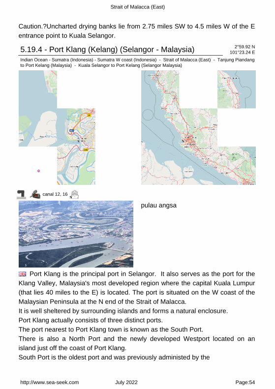
5.19.4 - Port Klang (Kelang) (Selangor - Malaysia) 2°59.92 N101°23.24 E
Indian Ocean - Sumatra (Indonesia) - Sumatra W coast (Indonesia) - Strait of Malacca (East) - Tanjung Piandangto Port Kelang (Malaysia) - Kuala Selangor to Port Kelang (Selangor Malaysia)
canal 12, 16
pulau angsa
Port Klang is the principal port in Selangor. It also serves as the port for theKlang Valley, Malaysia's most developed region where the capital Kuala Lumpur(that lies 40 miles to the E) is located. The port is situated on the W coast of theMalaysian Peninsula at the N end of the Strait of Malacca.It is well sheltered by surrounding islands and forms a natural enclosure.Port Klang actually consists of three distinct ports.The port nearest to Port Klang town is known as the South Port.There is also a North Port and the newly developed Westport located on anisland just off the coast of Port Klang.South Port is the oldest port and was previously administed by the
http://www.sea-seek.com July 2022 Page:54

Strait of Malacca (East)
Malayan Railway Administration. The reason it was administered by the MRA is that the railway line from Kuala Lumpur literally terminated at the South Port. Today, South Port is more quiet than the other two ports. Some bulk cargo, ferries and small boats depart from South Port but activity has shifted, to a large extent, elsewhere.North Port can be considered the largest port in Port Klang. It is managed byNorthport Corporation Berhad and is the largest container port serving Malaysia. Most of Malaysia's imports and exports are handled through Northport. North Port is located about 40 km from Kuala Lumpur and costs incurred by importers and exporters are usually lower than that of West Port.West Port is managed by Westports Malaysia Sdn Bhd. West Port is located aconsiderable distance from even North Port - it's another 40 km from South Portto West Port. West Port is located on an island - Pulau Indah (or "BeautifulIsland") and there is only one bridge linking the island to the "mainland".West Port grew on the basis of being expert in handling transshipment cargo. Today however, there are many specialised industries using West Port and the port has also grown as an entry point into Malaysia. West Port isgrowing fast and winning a lot of awards. The area around West Port is also growing as a logistics hub with specialised industries and logistics centers being built.Port Klang has a long way to go before becoming a port city as it requires extensive development of facilities and attractions which involve huge costs.Winds?Weather.?Fog is rare although haze is present in the Strait of Malaccafrom March through August.Visibility is reduced in dense rains, the heaviest of which occur in October andNovember. Severe weather at Port Kelang is rare and both the south and N portsare protected by the natural configuration of land.The tidal currents run with considerable strength, but were found not to exceed,as a general rule, 3 knots, the maximum velocity being attained about 2 hoursbefore HW and LW. They generally set parallel to the shore in both straits.Care must be taken when passing the various creeks and channels. This isespecially important when off Pulau Che Mat Zin.Off the S extremity of Pulau Pintu Gedong, at springs and neaps, the N currentsbegin 2 hours 30 minutes after HW at Port Kelang (South Port); at springs this S
http://www.sea-seek.com July 2022 Page:55

Strait of Malacca (East)
current starts 3 hours before, and at neaps 3 hours 30 minutes before HW at PortKelang (South Port). There is a period of slack water for 45 minutes at springsand 1 hour at neaps.Off Pulau Angsa at springs the N current commences 1 hour 45 minutes after andat neaps 1 hour 15 minutes after HW at Pulau Angsa; at springs the S currentstarts 5 hours 15 minutes before and at neaps 4 hours 45 minutes before HW atPulau Angsa. There is a period of slack water for about 1 hour at springs andabout 1 hour 30 minutes at neaps.At Port Kelang (South Port) the tidal currents attain a velocity of from 2.5 to 3knots at springs, the E and S current being stronger than the W and N current.They attain their maximum velocity about 2 hours before HW and LW by theshore.Tides?Currents.?The direction of the tidal current at the wharves at Port Kelang(South Port) is denoted by a white ball at the signal station, at the S yardarm forthe flood current, at the N yardarm for the ebb current, and in the center for slackwater. The current at the buoys where the ocean-going vessels lie, changes alittle later, and captains of vessels when going alongside the wharves should beguided by the signals.There are entry restrictions for vessels calling on South Port.Dry cargo vessels cannot exceed 183m in length and tank vessels 170m inlength. The maximum draft allowable for these vessels is 9.8m.Tidal conditions govern movements of all vessels that are over 91m long. At theN extension wharves, container ships up to 289m long can berth.Depths?Limitations.?Entry into Port Kelang is via a N approach channel and a Sapproach channel. The N channel is dredged to 11.1m over a maximum width of152m. The S channel is dredged to a depth of 15m over a maximum width of366m. Both channels and the fairways leading to North Port and South Port arewell marked by navigational aids.Pilotage.?Pilotage is compulsory for all vessels 28m long and over, exceptgovernment and fishing vessels, vessels offered an exemption by the PortAuthority, or those vessels conducting harbor services. Service is available 24hours. The vessel?s ETA should be sent 7 days in advance.Regulations.?The following regulations are in effect within the limits of PortKelang:1. No vessel or small craft shall anchor in the fairway of the mouth of the SungaiKelang.2. All vessels equipped with VHF radio are required to maintain a continuous
http://www.sea-seek.com July 2022 Page:56
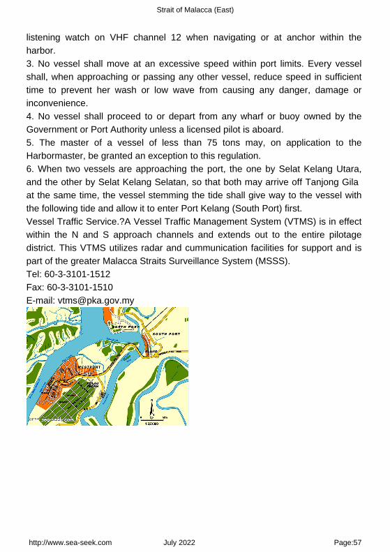
Strait of Malacca (East)
listening watch on VHF channel 12 when navigating or at anchor within theharbor.3. No vessel shall move at an excessive speed within port limits. Every vesselshall, when approaching or passing any other vessel, reduce speed in sufficienttime to prevent her wash or low wave from causing any danger, damage orinconvenience.4. No vessel shall proceed to or depart from any wharf or buoy owned by theGovernment or Port Authority unless a licensed pilot is aboard.5. The master of a vessel of less than 75 tons may, on application to theHarbormaster, be granted an exception to this regulation.6. When two vessels are approaching the port, the one by Selat Kelang Utara,and the other by Selat Kelang Selatan, so that both may arrive off Tanjong Gila at the same time, the vessel stemming the tide shall give way to the vessel withthe following tide and allow it to enter Port Kelang (South Port) first.Vessel Traffic Service.?A Vessel Traffic Management System (VTMS) is in effectwithin the N and S approach channels and extends out to the entire pilotagedistrict. This VTMS utilizes radar and cummunication facilities for support and ispart of the greater Malacca Straits Surveillance System (MSSS).Tel: 60-3-3101-1512Fax: 60-3-3101-1510E-mail: [email protected]
http://www.sea-seek.com July 2022 Page:57

Strait of Malacca (East)
5.19.5 - Selat Kelang Utara - South approach 2°58.95 N101°14.85 E
Indian Ocean - Sumatra (Indonesia) - Sumatra W coast (Indonesia) - Strait of Malacca (East) - Tanjung Piandangto Port Kelang (Malaysia) - Kuala Selangor to Port Kelang (Selangor Malaysia) - Selat Kelang Utara - Southapproach
166
Selat Kelang Selatan, the S entrance to Selat Kelang Utara, lies betweenPulau Lumut on the E side and Pulau Pintu Gedung, Pulau Che Mat Zin, andPulau Kelang on the W. Its narrowest part is under 0.5 mile wide abreast of PulauChe Mat Zin.The S approach has a dredged to a depth of 15m.
http://www.sea-seek.com July 2022 Page:58
Strait of Malacca (East)
The channel is 366m wide and can accommodate two-way traffic. Range lightshave been established at Tanjong Mahang (2°55'N., 101°16'E.).The lights in line bear 011°.Caution.?A dangerous wreck is reported to lie inapproximate position 2°51'00"N, 101°11'23"E.
http://www.sea-seek.com July 2022 Page:59

Strait of Malacca (East)
5.20 - North Sands (Selangor Malaysia) 3°04.72 N100°54.06 E
Indian Ocean - Sumatra (Indonesia) - Sumatra W coast (Indonesia) - Strait of Malacca (East) - Tanjung Piandangto Port Kelang (Malaysia) - North Sands (Selangor Malaysia)
163
North Sands (3°05'N., 101°01'E.) comprises various sand banks and spitslying in a general NW and SE direction between Angsa Bank and One FathomBank.The ports within these sand banks are Batu Kineing, Blenhiem Shoal, andGoldfish Bank.These three areas can be best seen on the chart; a 1.8m wreck lies about 6 miles
http://www.sea-seek.com July 2022 Page:60

Strait of Malacca (East)
NW of Blenheim Shoal.
http://www.sea-seek.com July 2022 Page:61

Strait of Malacca (East)
6 - Tanjong Ru to Tanjong Piai (Malaysia) 2°04.83 N102°11.61 E
Indian Ocean - Sumatra (Indonesia) - Sumatra W coast (Indonesia) - Strait of Malacca (East) - Tanjong Ru toTanjong Piai (Malaysia)
The N coast of the Strait of Malacca between Tanjung Ru and Tanjung Piai,about 166 miles SE, is only slightly indented.Most of the shoal areas which lie off this section of coast are contained withinthese bights N of a line drawn between the salient points.Port Dickson and Melaka Road are the only two ports of any commercialimportance to shipping.Many of the salient points and off-lying dangers found along this section of coastare usually well marked by navigational aids. Some of these points have been
http://www.sea-seek.com July 2022 Page:62

Strait of Malacca (East)
reported to be radar conspicuous.When visible, the high peaks of the mountain ridges inland serve as goodnavigational aids for position fixing.Regulations.?STRAITREP, a joint Indonesia-Malaysia-Singapore mandatory shipreporting system, operates in the Strait of Malacca and Singapore Strait.Caution.?It has been reported that certain vessels carrying hazardous cargo havebeen exhibiting an all round red light.Additionally, vessels with low freeboard use security lights underway which maskrunning lights by their brilliance. The security lights are used due to the increasedpotential of pirate activity in the straits.Although such lighting schemes are a violation of the regulations, vesselstransiting the straits should be aware of the practice and take the necessaryprecautions and plan accordingly.
6.1 - One Fathom Bank (Selangor Malaysia) 2°54.80 N100°58.95 E
Indian Ocean - Sumatra (Indonesia) - Sumatra W coast (Indonesia) - Strait of Malacca (East) - Tanjong Ru toTanjong Piai (Malaysia)
One Fathom Bank (2°53'N., 100°59'E.) is a detached patch, with depths from3 to 10m, which extends 5 miles in a NW direction reaching 1 mile in width. OneFathom Bank Light is situated 0.6 mile from the SE extremity of the bank.A stranded wreck is situated about 0.7 mile NW of the light.Caution.?Vessels are advised not to navigate within 0.5 mile of One FathomBank Light due to unlit obstructions.An IMO-adopted Traffic Separation Scheme (TSS) has been established in the
http://www.sea-seek.com July 2022 Page:63

Strait of Malacca (East)
vicinity of the One Fathom Bank in conjunction with the adoption of the Strait ofMalacca and Singapore Routing System.
6.2 - Amazon Maru Shoal (Selangor Malaysia) 2°51.55 N100°59.24 E
Indian Ocean - Sumatra (Indonesia) - Sumatra W coast (Indonesia) - Strait of Malacca (East) - Tanjong Ru toTanjong Piai (Malaysia)
Amazon Mara Shoal, with a least depth of 8.4m, lies about 2.2 miles S of OneFathom Bank Light.A dangerous wreck, marked by a lighted buoy, lies in the southeastbound lane ofthe Traffic Separation Scheme. Another dangerous wreck, with a depth of 16mover it, lies 10 miles WNW of One Fathom Bank and is situated near the N edgeof the southeastbound traffic lane.
http://www.sea-seek.com July 2022 Page:64

Strait of Malacca (East)
6.3 - Carey island (Selangor - Malaysia) 2°53.46 N101°21.69 E
Indian Ocean - Sumatra (Indonesia) - Sumatra W coast (Indonesia) - Strait of Malacca (East) - Tanjong Ru toTanjong Piai (Malaysia) - Carey island (Selangor - Malaysia)
A Tanjong Selat Lumut (Perak - Malaysia) B Tanjong Ru (Pulau Carey - Malaysia)
C Kuala Langat (Selangor - Malaysia)
Carey Island or Pulau Carey is an island in Selangor, Malaysia.Carey Island is located to the south of Port Klang and north of Banting town.It is a huge island separated from the Selangor coast by the Langat River,connected by a bridge from Chondoi and Teluk Panglima Garang near Banting.It was named after Valentine Carey, a former British civil service officer inMalaya. Despite its name, many locals from Klang do not consider it a real island
http://www.sea-seek.com July 2022 Page:65

Strait of Malacca (East)
compared to Pulau Ketam due to its proximity to the mainland and the river thatseparates it from the mainland is practically a stream.It is famous for its seafood such as crabs, prawns, and various fishes. The islandhas palm oil plantations.
6.3.1 - Tanjong Selat Lumut (Perak - Malaysia) 2°52.66 N101°17.43 E
Indian Ocean - Sumatra (Indonesia) - Sumatra W coast (Indonesia) - Strait of Malacca (East) - Tanjong Ru toTanjong Piai (Malaysia) - Carey island (Selangor - Malaysia)
PLS TAKE NOTE THAT PULAU LIMUT NOW IS RENAMED AS PULAU INDAH..THANK YOU.LIM Selat Lumut separates the E side of Pulau Lumut from the mainland. It has aleast width of about 0.1 mile, with both sides of the S entrance fringed by mudbanks. Selat Lumut has not been surveyed in detail, but appears to be navigableby vessels of not more than 3m draft.From Tanjong Selat Lumut, the S entrance point for Selat Lumut, the coast trendsS and SE.
6.3.2 - Tanjong Ru (Pulau Carey - Malaysia) 2°50.42 N101°17.80 E
Indian Ocean - Sumatra (Indonesia) - Sumatra W coast (Indonesia) - Strait of Malacca (East) - Tanjong Ru toTanjong Piai (Malaysia) - Carey island (Selangor - Malaysia)
http://www.sea-seek.com July 2022 Page:66
Strait of Malacca (East)
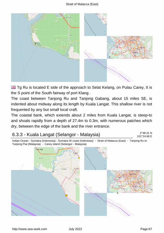
Tg Ru is located E side of the approach to Selat Kelang, on Pulau Carey, It isthe S point of the South fairway of port Klang .The coast between Tanjong Ru and Tanjong Gabang, about 15 miles SE, isindented about midway along its length by Kuala Langat. This shallow river is notfrequented by any but small local craft.The coastal bank, which extends about 2 miles from Kuala Langat, is steep-toand shoals rapidly from a depth of 27.4m to 0.3m, with numerous patches whichdry, between the edge of the bank and the river entrance.
6.3.3 - Kuala Langat (Selangor - Malaysia) 2°48.31 N101°24.68 E
Indian Ocean - Sumatra (Indonesia) - Sumatra W coast (Indonesia) - Strait of Malacca (East) - Tanjong Ru toTanjong Piai (Malaysia) - Carey island (Selangor - Malaysia)
http://www.sea-seek.com July 2022 Page:67
Strait of Malacca (East)
Kampong Morib, which is conspicuous, stands 3.75 miles SSE of the entranceof Kuala Langat.Kuala Langat is famous for its agricultural produce, industries that recycle scrap metal, home stay programmes for tourists and for its National Space Centre in Kanchong Darat.Fishermen's jetties along the Langat River in Kuala Langat are where people from Kuala Lumpur and Petaling Jaya go to for a quick weekend getaway to enjoy fresh seafood and a breeze blowing in their faces.Tides?Currents.?Off the coastal bank SW of Kuala Langat the SE current beginsfrom 4 hours 30 minutes to 4 hours before HW at the shore. At springs the rate is1.75 knots and 0.5 knot at neaps. The NNW current begins from 1 hour 30minutes to 2 hours after HW by the shore. At springs the rate is 2 knots and 1knot at neaps.
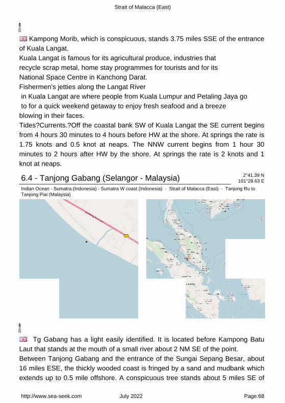
6.4 - Tanjong Gabang (Selangor - Malaysia) 2°41.39 N101°28.63 E
Indian Ocean - Sumatra (Indonesia) - Sumatra W coast (Indonesia) - Strait of Malacca (East) - Tanjong Ru toTanjong Piai (Malaysia)
Tg Gabang has a light easily identified. It is located before Kampong BatuLaut that stands at the mouth of a small river about 2 NM SE of the point.Between Tanjong Gabang and the entrance of the Sungai Sepang Besar, about16 miles ESE, the thickly wooded coast is fringed by a sand and mudbank whichextends up to 0.5 mile offshore. A conspicuous tree stands about 5 miles SE of
http://www.sea-seek.com July 2022 Page:68

Strait of Malacca (East)
Tanjong Gabang.Between Tanjong Gabang and the entrance of the Sungai Sepang Besar, about16 miles ESE, the thickly wooded coast is fringed by a sand and mudbank whichextends up to 0.5 mile offshore. A conspicuous tree stands about 5 miles SE ofTanjong Gabang.
http://www.sea-seek.com July 2022 Page:69

Strait of Malacca (East)
6.5 - Pyramid shoal (Malaysia) 2°25.79 N101°34.64 E
Indian Ocean - Sumatra (Indonesia) - Sumatra W coast (Indonesia) - Strait of Malacca (East) - Tanjong Ru toTanjong Piai (Malaysia) - Pyramid shoal (Malaysia)
163
Pyramid Shoal, which lies on the N side of the SE end of South Sands, has aleast depth of 3.4m, hard sand, and is the most dangerous shoal in the areabecause of its depth and protrusion into the fairway.A lighted buoy is moored about 7 miles SE of Pyramid Shoal. A depth of about10m is charted between this buoy and the shoal. A depth of 13.6m was reportedin position 2°23'N, 101°41'E.
http://www.sea-seek.com July 2022 Page:70

Strait of Malacca (East)
Shoal patches of sandwave formation extend into the fairway NE of PyramidShoal, the most important being depths of 12.4 and 13.1m lying about 8 milesNW of Pyramid Shoal.These shoals reduce the width of the fairway at this point to about 7 miles andshould be avoided by deep-draft vessels.A depth of 17.6m was reported in the fairway 9 miles NNW of Pyramid Shoal andthere is a depth of 19.8m 5 miles NNE of the shoal.
http://www.sea-seek.com July 2022 Page:71

Strait of Malacca (East)
6.6 - Bambek shoal (Selangor - Malaysia) 2°32.92 N101°40.12 E
Indian Ocean - Sumatra (Indonesia) - Sumatra W coast (Indonesia) - Strait of Malacca (East) - Tanjong Ru toTanjong Piai (Malaysia) - Bambek shoal (Selangor - Malaysia)
163
Bambeck Shoal, the nearest shoal on the NE side lies on the NE side of thefairway.Bambek shoal, about 4 NM offshore, lies SW of the mouth of Sungai SepangBesar.It has a depth of 0,3 m near its center and is composed of hard sand.Its NW and SE sides are steep-to with depths increasing to over 15 m.
http://www.sea-seek.com July 2022 Page:72
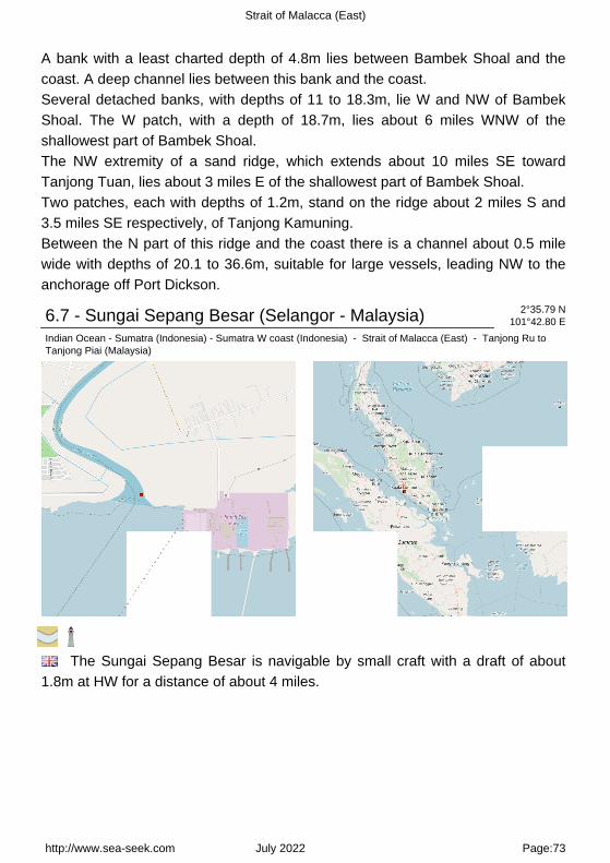
Strait of Malacca (East)
A bank with a least charted depth of 4.8m lies between Bambek Shoal and thecoast. A deep channel lies between this bank and the coast.Several detached banks, with depths of 11 to 18.3m, lie W and NW of BambekShoal. The W patch, with a depth of 18.7m, lies about 6 miles WNW of theshallowest part of Bambek Shoal.The NW extremity of a sand ridge, which extends about 10 miles SE towardTanjong Tuan, lies about 3 miles E of the shallowest part of Bambek Shoal.Two patches, each with depths of 1.2m, stand on the ridge about 2 miles S and3.5 miles SE respectively, of Tanjong Kamuning.Between the N part of this ridge and the coast there is a channel about 0.5 milewide with depths of 20.1 to 36.6m, suitable for large vessels, leading NW to theanchorage off Port Dickson.
6.7 - Sungai Sepang Besar (Selangor - Malaysia) 2°35.79 N101°42.80 E
Indian Ocean - Sumatra (Indonesia) - Sumatra W coast (Indonesia) - Strait of Malacca (East) - Tanjong Ru toTanjong Piai (Malaysia)
The Sungai Sepang Besar is navigable by small craft with a draft of about1.8m at HW for a distance of about 4 miles.
http://www.sea-seek.com July 2022 Page:73

Strait of Malacca (East)
http://www.sea-seek.com July 2022 Page:74

Strait of Malacca (East)
6.8 - Pulau Burong (Selangor - Malaysia) 2°33.52 N101°46.67 E
Indian Ocean - Sumatra (Indonesia) - Sumatra W coast (Indonesia) - Strait of Malacca (East) - Tanjong Ru toTanjong Piai (Malaysia) - Pulau Burong (Selangor - Malaysia)
163
Pulau Borong, a low densely-wooded rock-fringed islet surrounded by ashallow bank, stands 1.5 miles N of Tanjong Kamuning (that is steep-to withdepth of 11 m).
6.9 - Port Dickson Harbour (Selangor - Malaysia) 2°31.98 N101°47.28 E
Indian Ocean - Sumatra (Indonesia) - Sumatra W coast (Indonesia) - Strait of Malacca (East) - Tanjong Ru toTanjong Piai (Malaysia)
http://www.sea-seek.com July 2022 Page:75

Strait of Malacca (East)
channel 19
Port Dickson is situated on the W coast of the Malaysian Peninsula facing theStrait of Malacca. The town stretches along the coast in the direction of TanjungTuan, located 8 miles SE.Port Dickson is an important oil terminal operated by Shell and Esso, and is aminor port for general cargo.Winds?Weather.?During the period from May through October, vessels mayexperience Sumatras, which usually blow from a SW to a NW direction. Theaverage duration is between1 hour and 4 hours, with wind velocities between 40 and 50 knots, followedshortly thereafter by heavy rain.During the Southwest Monsoon, there is a continual swell and rough sea at theanchorage. At other times, an appreciable swell may also be experienced.Tides?Currents.?Port Dickson tides are semi-diurnal. At the outer anchorage, thetidal current sets SE from 3 hours 30 minutes before until 2 hours 45 minutesafter HW, and NW from 3 hours 25 minutes after until 4 hours 45 minutes before HW at Port Dickson.In the inner anchorage, the tidal current sets SE from 3 hours 45 minutes beforeuntil 3 hours 45 minutes after HW, and NW during the remaining period.The tidal current close inshore on the W side of Tanjong Kamuning at times setsin an opposite direction to that of the outer anchorage, resulting in a confusedtidal condition and eddies in the fairway S of Tanjong Kamuning.Depths?Limitations.?There is a deep water approach channel from NW, markedby lighted buoys, which presents no difficulties and is clear of dangers.
http://www.sea-seek.com July 2022 Page:76

Strait of Malacca (East)
Port installations comprise the following:1. Esso-Shell Single Buoy Mooring, a yellow steel buoy, 10.7m in diameter, in aleast depth of 27.4m, with a sand, mud, rock, and stone bottom.This facility will accommodate tankers up to 274m in length with a 14.3m draft or90,000 dwt capacity.2. The Railway Jetty, 182.9m long with a 46m face, is used by dry cargo vesselsand LPG carriers drawing up to 7.9m. A small boat harbor that is contained in thecurve of the stone approach to the Railway Jetty affords little shelter against Swinds and dries out at LW.3. Shell Jetty is situated about 0.1 mile W of the Railway Jetty. It is a 213m longreinforced concrete jetty with a 51.8m long and 10.9m wide T-head and fourdolphins. The maximum distance between the outer dolphins is 304.8m.Alongside depths of 7.9m allow vessels up to 18,000 dwt with a length of 152.4mand a draft of 6.4m to berth. Berthing maneuvers usually take place in daylight;vessels over 121.9m in length requiring to swing are taken in on the flood only.4. New Shell Jetty is a 430m long T-head jetty with three berths. Berth 1 andBerth 3, on its seaward face, can accommodate a vessel with a maximum draft of10.5m. Berth 2, on the SE landward face, can accommodate a vessel with amaximum draft of 7.5m.5. Esso Jetty is situated about 0.5 mile NW of Shell Jetty.It consists of a reinforced concrete island, 64m x 7.3m, with a distance betweenthe outer buoys of 219.5m. The approach depth is 12.2m. There is an alongsidedepth of 10.3m, which allows vessels up to 19,500 dwt, with a maximum length of170.7m, to berth day or night.Berthing is during daylight only but can be carried out on any state of tide forvessels up to 45,000 dwt. Vessels above this limit are berthed on the ebb only. Asubmarine oil pipeline is laid to the buoy from the shore, about 0.1 mile N ofTanjong Kamuning. Two floating hoses marked by lights may extend up to 230mfrom the mooring buoy.6. The head of a T-headed jetty extending about 1 mile WSW from the shore issituated about 1 mile N of the Esso-Shell SBM; a submarine pipeline connectsthe SBM and the pier.Aspect.?A large power station, with three conspicuous chimneys, one 118m highand the other two 94m high, stands on reclaimed land 0.7 mile N of TanjongKamuning. A conspicuous chimney, 94m high, with a flare, about 0.1 mile ENEand another flare 1 mile further E, stands 1.25 miles NE of Tanjong Kamuning.Pilotage.?Compulsory for vessels berthing/unberthing at Railway Jetty and for
http://www.sea-seek.com July 2022 Page:77

Strait of Malacca (East)
berthing/unberthing at the SBM. Private services are operated by Shell and Essofor vessels making use of their respective facilities.The mooring master boards 1 mile N of Fairway Lighted Buoy; vessels less than30,000 dwt may be boarded at No. 1 Buoy.The vessel?s ETA should be sent, via Penang or Singapore Radio, 96 hours and24 hours in advance. Vessels should keep a listening watch on Shell Port DixonRadio on VHF channel 16 beginning 2 hours before arrival.Anchorage.?Temporary anchorage for large vessels may be obtained 1 mile N ofFairway Lighted Buoy, in a depth of 24m, or 1.25 miles WNW of No. 1 LightedBuoy.Small vessels may anchor NE of Palau Arang, in depths of 7 to 9m, but holdingground is poor. A prohibited anchorage area is shown on the chart extending 1mile W from Tanjung Kamuning and S around Palau Arang to the Railway Jetty. SHELL REFINING CO Batu 1 , Jalan Pantai, 7100 Port Dickson, Negeri Sembilan Tel : 06-6471311 Fax :
http://www.sea-seek.com July 2022 Page:78

Strait of Malacca (East)
06-6474622 ESSO STANDARD MALAYSIA Batu 1 1/2, Jalan Pantai, 71000 Port Dickson, Negeri Sembilan Tel : 06-6471666 Fax : 06-6474717
6.10 - Avillion Admiral marina (Port Dikson - Malaysia) 2°28.70 N101°50.68 E
http://www.sea-seek.com July 2022 Page:79

Strait of Malacca (East)
Indian Ocean - Sumatra (Indonesia) - Sumatra W coast (Indonesia) - Strait of Malacca (East) - Tanjong Ru toTanjong Piai (Malaysia)
channel 14 in town
Admiral Marina & Leisure Club is within Admiral Cove.Admiral Cove is a concept realised from a desire to create a world class premier integrated marina resort. Located along the unsploit plains of Port Dickson, it is today a major international tourist destination.Tel: (06) 647 0888Fax: (06) 647 0880mega yacht berthing pontoon of 120 metres in length126 b. (<18 m)Office staff here will do your clearance paperwork.
6.11 - Tg Tuan or Rachado cape (Malacca - Malaysia) 2°24.42 N101°51.13 E
Indian Ocean - Sumatra (Indonesia) - Sumatra W coast (Indonesia) - Strait of Malacca (East) - Tanjong Ru toTanjong Piai (Malaysia)
http://www.sea-seek.com July 2022 Page:80

Strait of Malacca (East)
http://www.sea-seek.com July 2022 Page:81
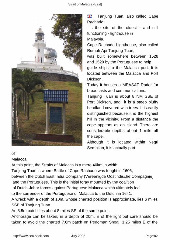
Strait of Malacca (East)
Tanjung Tuan, also called CapeRachado, is the site of the oldest - and stillfunctioning - lighthouse in Malaysia.Cape Rachado Lighthouse, also calledRumah Api Tanjung Tuan, was built somewhere between 1528and 1529 by the Portuguese to help guide ships to the Malacca port. It islocated between the Malacca and PortDickson.Today it houses a MEASAT Rader forbroadcasts and communications.Tanjung Tuan is about 8 NM SSE ofPort Dickson, and it is a steep bluffyheadland covered with trees. It is easilydistinguished because it is the highesthill in the vicinity. From a distance thecape appears as an island. There areconsiderable depths about 1 mile offthe cape.Although it is located within NegriSembilan, it is actually part
of Malacca.At this point, the Straits of Malacca is a mere 40km in width.Tanjung Tuan is where Battle of Cape Rachado was fought in 1606, between the Dutch East India Company (Vereenigde Oostindische Compagnie) and the Portuguese. This is the initial foray mounted by the coalition of Dutch-Johor forces against Portuguese Malacca which ultimately led to the surrender of the Portuguese of Malacca to the Dutch in 1641.A wreck with a depth of 10m, whose charted position is approximate, lies 6 milesSSE of Tanjung Tuan.An 8.5m patch lies about 8 miles SE of the same point.Anchorage can be taken, in a depth of 20m, E of the light but care should betaken to avoid the charted 7.6m patch on Pedoman Shoal, 1.25 miles E of the
http://www.sea-seek.com July 2022 Page:82

Strait of Malacca (East)
light.From Tanjong Tuan, the low wooded coast of Sumatera, about 20 miles distant,can be seen.The Strait of Malacca is narrower here than at any other part NW of Melaka.The bottom area between 1 and 12 miles SW of Tanjong Tuan and extending 10miles in either direction along the axis of the fairway consists almost entirely ofsand waves, some more than 9.1m from trough to crest, which gives rise to veryirregular depths, many of which are a danger to vessels drawing more than13.5m. The positions of these shoals can best be seen on the chart.The main depths consist of a depth of 15.8m about 6 miles W of Tanjong Tuan; aline of shoals lying roughly along the axis of the fairway, with depths of between14 and 18m from a position about 8 miles S of Tanjong Tuan; a 14m patch 10.5miles SSW of Tanjong Tuan; and a ridge with depths of between 14.3 and 17.1mbetween 6 and 7.75 miles SSE of Tanjong Tuan.A rock, with a least depth of 8.5m, lies 7.5 miles SE of Tanjong Tuan.Off Tanjong Tuan, the tidal currents set SE and NW at a rate of from 2 to 2.5knots; the SE current begins from 3 to 4 hours after HW at Penang and runs for 6hours.The coast between Tanjong Tuan and the entrance of the Sungai Linggi, about 7miles ESE, is indented by a shallow bay. The Sungai Linggi is navigable at HWby craft drawing 1.8m as far as Pengkalan Kempas.A rock located between the entrance points of the river covers when there is adepth of 3m on the bar; this danger is marked by a beacon.
6.12 - Sungai Linggi (Malacca - Malaysia) 2°23.33 N101°55.94 E
Indian Ocean - Sumatra (Indonesia) - Sumatra W coast (Indonesia) - Strait of Malacca (East) - Tanjong Ru toTanjong Piai (Malaysia)
http://www.sea-seek.com July 2022 Page:83

Strait of Malacca (East)
Sungai Linggi is indented by a shallow bay.Good anchorage can be taken off the river entrance, in a depth of 16.5m, mud,with Tanjong Tuan Light bearing 292° and the beacon in the entrance of the riverbearing 075°.
6.13 - Batu Mandi rock (Malacca - Malaysia) 2°21.99 N101°57.92 E
Indian Ocean - Sumatra (Indonesia) - Sumatra W coast (Indonesia) - Strait of Malacca (East) - Tanjong Ru toTanjong Piai (Malaysia)
http://www.sea-seek.com July 2022 Page:84

Strait of Malacca (East)
Batu Mandi, a rock, awash, marked by a beacon, lies about 2 miles SW of theS entrance point of the Sungai Linggi.
6.14 - Batu Tengah roks (Malacca - Malaysia) 2°21.02 N101°58.98 E
Indian Ocean - Sumatra (Indonesia) - Sumatra W coast (Indonesia) - Strait of Malacca (East) - Tanjong Ru toTanjong Piai (Malaysia)
Batu Tengah, marked by a light, consist of three rocks just above-water, lyingabout 2 miles SE of Batu Mandi and about 1 mile offshore.A shoal, with a depth of 14.3m lies about 6 miles SSW of Batu Mandi.
6.15 - Pulau Batu Besar (Malacca - Malaysia) 2°16.98 N102°04.03 E
Indian Ocean - Sumatra (Indonesia) - Sumatra W coast (Indonesia) - Strait of Malacca (East) - Tanjong Ru to
http://www.sea-seek.com July 2022 Page:85

Strait of Malacca (East)
Tanjong Piai (Malaysia)
Pulau Batu Besar, 4.6m high, stands 1.25 miles offshore, 7 miles SE of BatuTengah. A sandy ridge, with depths of 6.1 to 9.7m, lies from 0.5 to 2 miles NW ofthe rock.A shoal with a depth of 16.3m, lies 3.5 miles WSW of Pulau Batu Besar.Two white towers, each about 34m high, stand about 2 miles ENE of Pulau BatuBesar.There is no safe passage for vessels without local knowledge between PulauBatu Besar and the mainland as the area is fouled by rocks, some above-water.The sea is discolored by rips, which do not necessarily coincide with the shoals.A rocky shoal, with a depth of 3.4m, lies almost 1 mile E of Pulau Batu Besar.
6.16 - Tg Panchor (Malacca - Malaysia) 2°16.34 N102°06.12 E
Indian Ocean - Sumatra (Indonesia) - Sumatra W coast (Indonesia) - Strait of Malacca (East) - Tanjong Ru toTanjong Piai (Malaysia)
http://www.sea-seek.com July 2022 Page:86
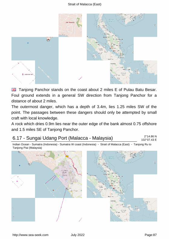
Strait of Malacca (East)
Tanjong Panchor stands on the coast about 2 miles E of Pulau Batu Besar.Foul ground extends in a general SW direction from Tanjong Panchor for adistance of about 2 miles.The outermost danger, which has a depth of 3.4m, lies 1.25 miles SW of thepoint. The passages between these dangers should only be attempted by smallcraft with local knowledge.A rock which dries 0.9m lies near the outer edge of the bank almost 0.75 offshoreand 1.5 miles SE of Tanjong Panchor.
6.17 - Sungai Udang Port (Malacca - Malaysia) 2°14.86 N102°07.43 E
Indian Ocean - Sumatra (Indonesia) - Sumatra W coast (Indonesia) - Strait of Malacca (East) - Tanjong Ru toTanjong Piai (Malaysia)
http://www.sea-seek.com July 2022 Page:87

Strait of Malacca (East)
Sungai Udang Port, a T - shaped jetty, is situated about 3 miles NW ofTanjung Keling.There are seven berths, with alongside depths of 7.2 to 20m, on the seaward sideof the jetty; a buoyed channel, dredged to 20m, leads to the four center berths.Pilotage.?Pilotage is compulsory. Pilots board at Fairway Lighted Buoy or at theanchorage and should be requested, via the agent, 48 hours in advance. Thevessel?s ETA should be confirmed 72 hours, 48 hours, 24 hours, and 12 hoursbefore arrival.Approach.?Vessels approaching Sg. Udang Port should proceed to fairway buoy at position 2( 12'.3 N, 102( 04'.5 E (Long Fs1.W.10s). When proceeding towards fairway buoy: a) Vessels coming from
http://www.sea-seek.com July 2022 Page:88

Strait of Malacca (East)
the north must not enter into Sg. Udang Port limit. b) Vessel coming from the south must not enter Melaka Port limit.Caution: Deep draft vessel approaching from the north should avoid a shallow patch of 15.8m at
http://www.sea-seek.com July 2022 Page:89

Strait of Malacca (East)
position, Lat 02 14, 2N Long 102 04.0 E approximately 4.5n.m. North West of the pilot boarding ground.Regulations.?The maximum drafts allowed at each berth are, as follows:1. Ocean Berth 1?14.9m.2. Ocean Berth 2?14.9m.3. LPG berth?6.0m.4. Bulk Cargo Jetty?5.5m.5. Coast Berth 1?7.3m.6. Coast Berth 2?8.1m.7. Coast Berth 3?8.1m.8. Coast Berth 4?6.3m.Tel: 06 3512282Fax: 06 3517185Anchorage.?A General Purpose Anchorage has been established 5 miles NW ofTanjung Keling. The depth was reported (2001) to be 19.1m. Other designatedanchorage areas include the Ocean Anchorage, Coastal Anchorage, and theeight LPG Anchorages.
http://www.sea-seek.com July 2022 Page:90

Strait of Malacca (East)
6.18 - Tanjong Keling (Malacca - Malaysia) 2°12.99 N102°09.54 E
Indian Ocean - Sumatra (Indonesia) - Sumatra W coast (Indonesia) - Strait of Malacca (East) - Tanjong Ru toTanjong Piai (Malaysia)
Between the S entrance point of the Sungai Linggi and Tanjong Keling, about15 miles SE, the coast consists of irregular rocky points interspersed with smallsandy beaches.The coast between Tanjong Panchor and Tanjong Keling, about 5 miles SSE, isfringed by a bank of sand with depths of less than 5.5m which extends about 1mile offshore.Tg Keling (or Tg Kling), the NW limit of Melaka road, is a low projecting pointlocated near the site of the Melaka power station, a brick building flanked by palmtrees which stands almost 1 mile NW of the point. Two tall black chimneys standclose NE of the power station. The chimneys can always be located by the smokewhich constantly rises from them.
http://www.sea-seek.com July 2022 Page:91

Strait of Malacca (East)
6.19 - Pulau Upeh (Malacca - Malaysia) 2°10.56 N102°12.27 E
Indian Ocean - Sumatra (Indonesia) - Sumatra W coast (Indonesia) - Strait of Malacca (East) - Tanjong Ru toTanjong Piai (Malaysia) - Pulau Upeh (Malacca - Malaysia)
163
Pulau Upeh (Malacca - Malaysia)
Pulau Upeh (formely known as "LihaDas Pedras", meaning place ofstones), a conspicuous,densely-wooded islet, about 34m highto the tops of the trees, stands offshore
http://www.sea-seek.com July 2022 Page:92

Strait of Malacca (East)
about 3 miles W of St. Paul?s Hill.Pulau Upeh is a greatweekend retreat in Melaka with its first class chaletsat the Upeh Island Resort.This popular island is also asanctuary for the Hawksbill Turtle. The Hawksbill turtle, one ofthe earth's rare species, is a medium-sized marineturtle with a hawk-like beak and a thorny shell and canbe found only at Pulau Upeh in Melaka.A ridge, over which there are depths of less than 5.5m, extends about 1 mile fromthe E and W sides of the island parallel with the coast.A shoal, with a depth of 6.4m, lies almost 0.5 mile SW of Pulau Upeh. LittleShoal, with a depth of 3.3m, lies about 0.5 mile SSE of Pulau Upeh; about 0.2mile SSE is a 5.2m patch.An 8.2m patch is reported to lie about 2 miles SSE of the same islet.Between Pulau Upeh and the mainland a bank runs parallel with the coast.Owens Rocks, which dry 1.5m, lie near its NW end and about 0.3 mile N of PulauUpeh.Two patches which dry from about 0.3m to 0.6m lie near its SE end.
6.20 - Batu gelama rock (Malacca - Malaysia) 2°10.32 N102°14.44 E
Indian Ocean - Sumatra (Indonesia) - Sumatra W coast (Indonesia) - Strait of Malacca (East) - Tanjong Ru toTanjong Piai (Malaysia)
Batu Gelama, a rock which covers at HW, is marked by a lighted beacon.
http://www.sea-seek.com July 2022 Page:93

Strait of Malacca (East)
A narrow ridge with depths of less than 5.5m extends about 1 mile WNW and 0.3mile ESE of the beacon.Two 4.9m patches lie between the NW end of this ridge and the ridge extendingSE from Pulau Upeh.
http://www.sea-seek.com July 2022 Page:94
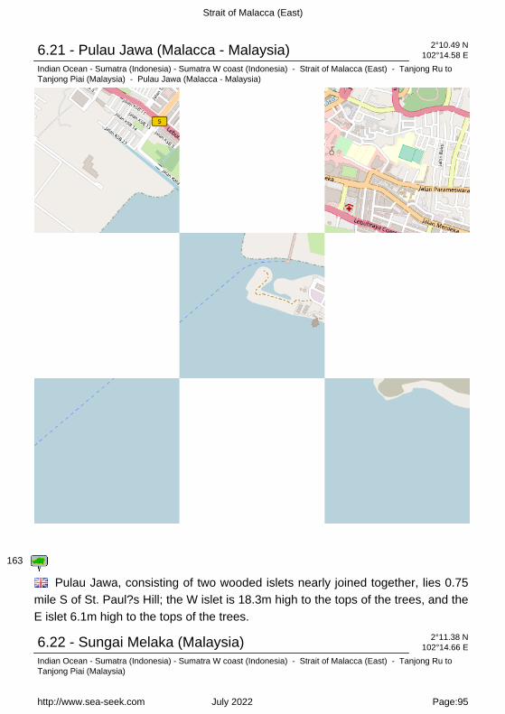
Strait of Malacca (East)
6.21 - Pulau Jawa (Malacca - Malaysia) 2°10.49 N102°14.58 E
Indian Ocean - Sumatra (Indonesia) - Sumatra W coast (Indonesia) - Strait of Malacca (East) - Tanjong Ru toTanjong Piai (Malaysia) - Pulau Jawa (Malacca - Malaysia)
163
Pulau Jawa, consisting of two wooded islets nearly joined together, lies 0.75mile S of St. Paul?s Hill; the W islet is 18.3m high to the tops of the trees, and theE islet 6.1m high to the tops of the trees.
6.22 - Sungai Melaka (Malaysia) 2°11.38 N102°14.66 E
Indian Ocean - Sumatra (Indonesia) - Sumatra W coast (Indonesia) - Strait of Malacca (East) - Tanjong Ru toTanjong Piai (Malaysia)
http://www.sea-seek.com July 2022 Page:95

Strait of Malacca (East)
The town of Melaka (Malacca),capital city of the Malaysian state ofMelaka, stands on both banks of theMelaka River which discharges about 6miles E of Tanjong Keling, the twoparts being connected by severalbridges.St Paul's Hill, wich is conspicuous,stands on the left bank of
the river and is marked by the ruins of an ancient church and a disusedlighthouse. A slender pointed roof stands near the coast about 0.5 mile NW of St.Paul?s Hill disused lighthouse.It is conspicuous from the offing being the only structure which rises above thebuildings in the town. A white cylindrical minaret with a pointed dome stands in agap between the trees on the coast about 1.2 miles NW of the lighthouse.Aspect.?Two tall buildings about 34.7m high stand about 1 mile ESE of St.Paul?s Hill.Bukti China, an almost bare conspicuous hill, stands almost 0.75 mile NE of St.Paul?s Hill. Bukti Bruang, an isolated hill 156m high, and Bukti Sebukor, about64m high to the tops of the trees, stand about 3.7 and 2.5 miles, respectively,NNE of St. Paul?s Hill. The country a few miles inland consists of undulating hills.Gunong Ledang, which has a triple peak 1,275m high, stands about 24 miles NEof St. Paul?s Hill.
http://www.sea-seek.com July 2022 Page:96

Strait of Malacca (East)
A conspicuous radio mast stands about 137m NNE of St.Paul?s Hill disused lighthouse. St. John?s Hill, with the ruins of an old battery onit, stands 1 mile E of St. Paul?s Hill.The coast near the town is low and wooded.A stranded wreck is reported to lie about 0.1 mile off the breakwaters.Beware: A vessel approaching Melaka Road from the W should pass not lessthan 2 miles S of Tanjong Keling and 1 mile S of Pulau Upeh to clear the off-lyingdangers, and course should not be altered until St. Paul?s Hill bears less than055°.Approaching from the E, after passing Pulau Undan and Pulau Hanyut, thecourse should be altered to clear Foulerton Shoal and then altered for theanchorage. Small vessels frequently pass N of Pulau Besar and Pulau Panjang,but this route should not be used without local knowledge.A depth of 19m was reported about 0.5 mile SW of Pulau Undan. There arenumerous fishing stakes off the coast.A vessel approaching from the SE at night should make Pulau Undan Light andafter passing SW of it, and of Pulau Hanyut, should steer with the light bearing135° astern, until the light on St. Paul?s Hill conspicuous radio mast bears 038°,when it should be steered for on that bearing which will lead to the anchorage.Alternatively, the breakwater head lights may be used as leading lights.Pulau Undan Light will also be sighted when approaching the road from theNW,and may be steered for from abreast Tanjong Keling.Melaka is a lighterage port where there is activity employing a total of 44 woodenlighters for the loading and discharging of ocean-going vessels. Theharbormaster offices are situated in a building along the quay.Tides?Currents.?The spring range of the tide is 1.8m; the mean tidal range is1.3m.Depths?Limitations.?The Tanjung Bruas jetty will accommodate vessels of up to125m in length on the seaward side and vessels of 65m in length on the innerside. The depth alongside is 9m at LW.An oil mooring, consisting of two head and two stern buoys, provides discharge toa local power station via a submarine pipeline.Quays that line both sides of the Melaka River just within the entrance areprincipally used by lighters loading or discharging cargo for vessels in MelakaRoads. The landing place is the Government Jetty, a concrete public quay, on theE side of the river. The channel leading into the port area between twobreakwaters has a least depth of 0.6m. Small vessels drawing up to 1.5m can
http://www.sea-seek.com July 2022 Page:97
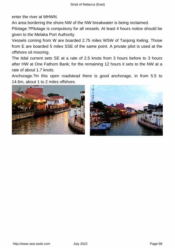
Strait of Malacca (East)
enter the river at MHWN.An area bordering the shore NW of the NW breakwater is being reclaimed.Pilotage.?Pilotage is compulsory for all vessels. At least 4 hours notice should begiven to the Melaka Port Authority.Vessels coming from W are boarded 2.75 miles WSW of Tanjong Keling. Thosefrom E are boarded 5 miles SSE of the same point. A private pilot is used at theoffshore oil mooring.The tidal current sets SE at a rate of 2.5 knots from 3 hours before to 3 hoursafter HW at One Fathom Bank; for the remaining 12 hours it sets to the NW at arate of about 1.7 knots.Anchorage.?In this open roadstead there is good anchorage, in from 5.5 to14.6m, about 1 to 2 miles offshore.
http://www.sea-seek.com July 2022 Page:98

Strait of Malacca (East)
6.23 - Pulau Melaka (Malacca - Malaysia) 2°12.55 N102°14.97 E
Indian Ocean - Sumatra (Indonesia) - Sumatra W coast (Indonesia) - Strait of Malacca (East) - Tanjong Ru toTanjong Piai (Malaysia) - Pulau Melaka (Malacca - Malaysia)
163
Malacca island or Pulau Melaka is a man-made island in Malacca town. it'slinking to the mainland by a 30 m bridge on a side and has a jetty on the otherside.
http://www.sea-seek.com July 2022 Page:99

Strait of Malacca (East)
Pulau Melaka (Malacca - Malaysia)Pulau Melaka jetty
Pulau Melaka (Malacca - Malaysia)Pulau Melaka bridge
Pulau Melaka (Malacca - Malaysia)
6.24 - Foulerton shoal (Malacca - Malaysia) 2°09.08 N102°15.59 E
Indian Ocean - Sumatra (Indonesia) - Sumatra W coast (Indonesia) - Strait of Malacca (East) - Tanjong Ru toTanjong Piai (Malaysia)
Foulerton Shoal, with a depth of 10.4m, lies about 0.7 mile SSE of the lightedbeacon on Pulau Panjang. A small sandy shoal, with a depth of 4.6m, lies about0.2 mile NNW of the beacon on the E end.
http://www.sea-seek.com July 2022 Page:100

Strait of Malacca (East)
6.25 - Pulau Panjang (Malacca - Malaysia) 2°09.94 N102°15.65 E
Indian Ocean - Sumatra (Indonesia) - Sumatra W coast (Indonesia) - Strait of Malacca (East) - Tanjong Ru toTanjong Piai (Malaysia) - Pulau Panjang (Malacca - Malaysia)
163
Pulau Panjang, a narrow, rocky flat almost covered at HW, lies 2 miles SSE ofSt. Paul?s Hill, and is steep-to on its S side.A stone beacon stands on its E end and a lighted beacon on its W end.
http://www.sea-seek.com July 2022 Page:101

Strait of Malacca (East)
6.26 - Water islands (Malacca - Malaysia) 2°05.08 N102°19.13 E
Indian Ocean - Sumatra (Indonesia) - Sumatra W coast (Indonesia) - Strait of Malacca (East) - Tanjong Ru toTanjong Piai (Malaysia) - Water islands (Malacca - Malaysia)
163
http://www.sea-seek.com July 2022 Page:102

Strait of Malacca (East)
Pulau Besar (Johor - Malaysia)
Between Melaka and TanjongSeginting, about 46 miles SE, the low,thickly wooded coast is bordered by amud bank which extends up to 2.5miles offshore in places.The Water Islands, centered about 8miles SE of Melaka, consists of a groupof six tree-covered
islands of moderate height.Pulau Besar, the largest island, is 40m high and is separated from the coast tothe N by a foul, rocky channel.Pulau Besar (4,6 m high) is located off the E coast of Johor and it is surroundedby many islets.A sandy ridge, with depths of 6.1 to 9.7m, lies from 0.5 to 2 milesNW of the rock.A shoal with a depth of 16.3m, lies 3.5 miles WSW of Pulau Batu Besar.To preserve the unspoiled marine life, the Government has gazetted it as a marine park to protect around 60 species of marine life from any activity that can harm their natural habitats within 2 nautical miles around the island.There are about 7 - 8 small villages that are still populated by around 100 friendly dwellers who are mostly fishermen.There is no safe passage for vessels without local knowledge between PulauBatu Besar and the mainland as the area is fouled by rocks, some above-water.The sea is discolored by rips, which do not necessarily coincide with the shoals.A rocky shoal, with a depth of 3.4m, lies almost 1 mile E of Pulau Batu Besar.The channel between Pulau Besar and Pulau Dodol, the next island to the S, isfouled by a rock with a depth of 0.9m, which lies 0.3 NM N of the latter island.The other channels between the islands are deep, but they should be avoided.
Pulau Besar (Johor - Malaysia)
http://www.sea-seek.com July 2022 Page:103
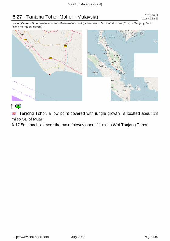
Strait of Malacca (East)
6.27 - Tanjong Tohor (Johor - Malaysia) 1°51.36 N102°42.62 E
Indian Ocean - Sumatra (Indonesia) - Sumatra W coast (Indonesia) - Strait of Malacca (East) - Tanjong Ru toTanjong Piai (Malaysia)
Tanjong Tohor, a low point covered with jungle growth, is located about 13miles SE of Muar.A 17.5m shoal lies near the main fairway about 11 miles Wof Tanjong Tohor.
http://www.sea-seek.com July 2022 Page:104

Strait of Malacca (East)
6.28 - Baker Patch (Johor - Malaysia) 1°47.41 N102°44.13 E
Indian Ocean - Sumatra (Indonesia) - Sumatra W coast (Indonesia) - Strait of Malacca (East) - Tanjong Ru toTanjong Piai (Malaysia) - Baker Patch (Johor - Malaysia)
163
Baker Patch, with a depth of 8.8m, lies on the NW extension of FormosaBank. Between these banks and the coastal bank there is a deep clear channel.
http://www.sea-seek.com July 2022 Page:105

Strait of Malacca (East)
6.29 - Formosa Bank - Nares Bank (Johor - Malaysia) 1°45.41 N102°51.49 E
Indian Ocean - Sumatra (Indonesia) - Sumatra W coast (Indonesia) - Strait of Malacca (East) - Tanjong Ru toTanjong Piai (Malaysia) - Formosa Bank - Nares Bank (Johor - Malaysia)
163
Formosa Bank and its NW extension fronts the coast from Tanjong Tohor toTanjong Seginting; off the latter point it merges into the 11m bank fronting thecoast. The bank has a least depth of 3.3m and is steep-to on its NW and SWsides.The bank which lies between the SE end of Formosa Bank and the coastal bankis marked by numerous fishing stakes and vessels are advised to navigate in this
http://www.sea-seek.com July 2022 Page:106

Strait of Malacca (East)
vicinity during daylight only.
6.30 - Tanjong Seginting (Johor - Malaysia) 1°47.32 N102°53.16 E
Indian Ocean - Sumatra (Indonesia) - Sumatra W coast (Indonesia) - Strait of Malacca (East) - Tanjong Ru toTanjong Piai (Malaysia)
Bukit Banang, 470m high, is the summit of a range of rolling hills whichterminates at Tanjong Seginting.Four radio masts stand on its summit. Several bright white lights, visible for aconsiderable distance, are sometimes shown near the radio masts.A light is reported to be shown from Tanjung Seginting and Pulau Sialu.The coast between Tanjong Seginting and Tanjong Piai, about 50 miles SE, islow and thickly wooded; abreast Pulau Pisang the coast recedes about 5 miles.The coastal bank, as defined by the 10m curve, extends about 6 miles offshore inthis bight and up to within 1 mile of Pulau Pisang.Within a line joining Tanjong Seginting and Pulau Pisang the bottom is veryuneven, being marked by isolated depths of 5.5 to 14.6m.
6.31 - Sungai Batu Pahat (Johor - Malaysia) 1°49.02 N102°53.50 E
Indian Ocean - Sumatra (Indonesia) - Sumatra W coast (Indonesia) - Strait of Malacca (East) - Tanjong Ru toTanjong Piai (Malaysia)
http://www.sea-seek.com July 2022 Page:107

Strait of Malacca (East)
The Sungai Batu Pahat, SE of Muar, is fronted by a shallow flat which,extends up to 3 miles offshore. A depth of 0.3m exists on this flat near the riverentrance at LW.Within the entrance there are depths of 2.5 to 5m as far as the town of BatuPahat (Bandar Penggaram), about 4 miles upstream.The river is navigable by light-draft vessels for many miles but should only beentered by vessels that have local knowledge.Pilotage is not compulsory. A local qualified pilot is not available, but anexperienced guide can be obtained from the District Marine Office, Batu Pahat.
http://www.sea-seek.com July 2022 Page:108

Strait of Malacca (East)
6.32 - Fair channel Bank (Johor - Malaysia) 1°30.74 N103°01.63 E
Indian Ocean - Sumatra (Indonesia) - Sumatra W coast (Indonesia) - Strait of Malacca (East) - Tanjong Ru toTanjong Piai (Malaysia) - Fair channel Bank (Johor - Malaysia)
163
Fair Channel Bank (1°33'N., 103°03'E.) consists of two narrow ridges, withdepths of less than 18.3m and about 3 miles apart, lying almost parallel with thecoast. The bank extends about 22 miles NW from a position about 14 miles WNWof Pulau Kukup (1°19'N., 103°25'E.).A wreck, with a swept depth of 25.5m, lies about 20 miles WNW of Pulau Kukupand a wreck, with a depth of 23m, lies about 10 miles WNW of the same islet.
http://www.sea-seek.com July 2022 Page:109

Strait of Malacca (East)
A long narrow shoal, about 8 miles long in a NW-SE direction, with a least depthof 9.1m, lies with its SE end about 12 miles W of Pulau Kukup. Southwest ofLong Bank are numerous similar banks lying parallel with it, extending to within ashort distance of the banks fringing the Sumatera side of the strait. An obstructionat the NW extremity of Long Bank is marked by an lighted buoy.
http://www.sea-seek.com July 2022 Page:110

Strait of Malacca (East)
6.33 - Pulau Pisang (Johor - Malaysia) 1°28.20 N103°15.13 E
Indian Ocean - Sumatra (Indonesia) - Sumatra W coast (Indonesia) - Strait of Malacca (East) - Tanjong Ru toTanjong Piai (Malaysia) - Pulau Pisang (Johor - Malaysia)
163
http://www.sea-seek.com July 2022 Page:111

Strait of Malacca (East)
Pulau Pisang (Johor - Malaysia)
Pulau Pisang (English: Bananaisland) is a small island located off theWestern coast of the Malaysian state ofJohor. It is about 12 km from the townof Pontian Kecil and 5 km from Benuttown. It is the siteof Pisang Lighthouseguiding ships into the western entranceof the Singapore strait.
Pulau Pisang, tree covered and 134m high, stands about 19 miles NW of TanjongPiai and can be seen for a considerable distance.A bank, with depths of less than 10m, and a least depth of 4.8m about 4 mileswithin its outer end, extends about 7 miles NW from Pulau Pisang. A narrowsteep-to spit, with a depth of 3m over its extremity, extends about 6 miles SEfrom Pulau Pisang.A channel about 0.7 mile wide with a least depth of 11m, lies between this spitand the coastal bank. This channel should not be used without local knowledge.
Pulau Pisang (Johor - Malaysia)Pisang lighthouse (16 m high) is located on thehighest point of the island. iti is operated by theMaritime Port Authority of Singapore.
Pulau Pisang (Johor - Malaysia)
6.34 - Sungai Benut (Johor - Malaysia) 1°35.47 N103°16.33 E
Indian Ocean - Sumatra (Indonesia) - Sumatra W coast (Indonesia) - Strait of Malacca (East) - Tanjong Ru toTanjong Piai (Malaysia)
http://www.sea-seek.com July 2022 Page:112

Strait of Malacca (East)
The Sungai Benut, entered about 8 miles N of Pulau Pisang, is the largestriver along this part of the coast. Only small vessels with local knowledge can beaccommodated.
http://www.sea-seek.com July 2022 Page:113
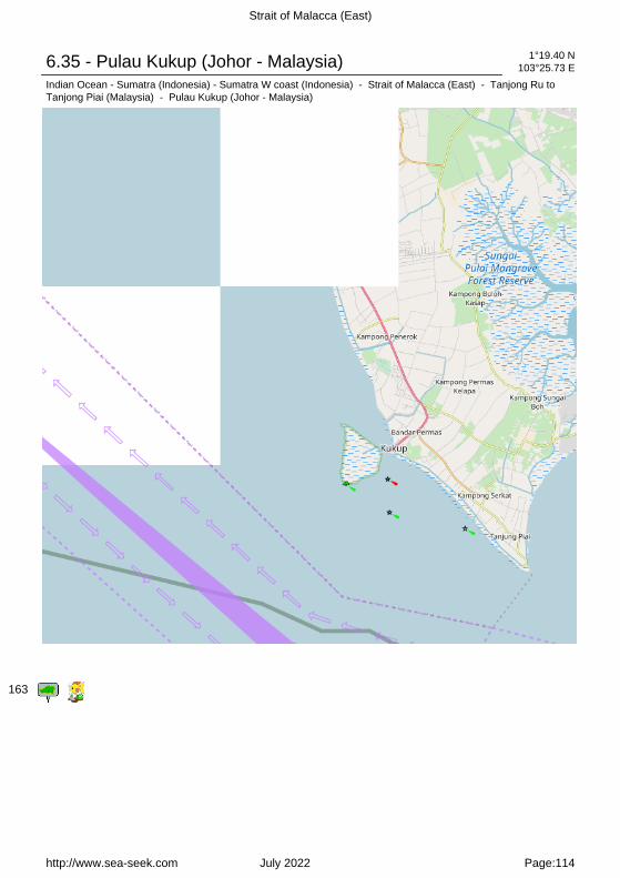
Strait of Malacca (East)
6.35 - Pulau Kukup (Johor - Malaysia) 1°19.40 N103°25.73 E
Indian Ocean - Sumatra (Indonesia) - Sumatra W coast (Indonesia) - Strait of Malacca (East) - Tanjong Ru toTanjong Piai (Malaysia) - Pulau Kukup (Johor - Malaysia)
163
http://www.sea-seek.com July 2022 Page:114

Strait of Malacca (East)
Pulau Kukup (Johor - Malaysia)
Located South-west of Johor, about5,5 NM NW of Tg Piai, 1 km offshorefrom the quaint little fishing village of Kampung Air Masin in KukupLaut (Pontian District), Pulau Kukup is an low, flat island entirelycovered by mangrove forest andsurrounded by mudflats - the mudflats extend up
to a few kilometres on the West and Northwest of the island.There is currently no human habitation or man made structures on the island.In order to promote preservation of this unique mangrove habitat, Pulau Kukup is designated as a Ramsar site (or otherwise known as a Wetlands of International Importance) on 31 January 2003, it is also protected as a national park under the Johor State Park Corporation Enactment 1989 since 27 March 1997. Pulau Kukup is dissected by a few tidal creeks and channels.In passing PulauKukup, caution must be exercised because the E current sets strongly toward theshore and the W current toward Long Bank on the opposite side of the fairway.
7 - Sungai Muar (Johor - Malaysia) 2°20.70 N102°49.47 E
Indian Ocean - Sumatra (Indonesia) - Sumatra W coast (Indonesia) - Strait of Malacca (East)
http://www.sea-seek.com July 2022 Page:115

Strait of Malacca (East)
channel 16
The Sungai Muar, a shallow river available only to small craft, discharges intothe strait about 14 miles ESE of Pulau Besar.The river is tortuous but small craft with drafts of 1.8m can ascend to Kepong Hillabout 60 NM above the entrance. A radio mast stands on the E bank of the riverclose within the entrance.Muar is also a town and port, also known as Bandar Maharani for most of thelocal people staying there.Muar, the headquarters of the state commissioner, is the second port inimportance in Johore Province and has a considerable trade. Ocean-goingvessels work cargo at the anchorage. Small vessels and barges can beaccommodated at the river wharves abreast the town.Depths alongside these wharves are about 2m. The entrance bar has a leastdepth of 1.2m.Anchorage can be taken by small vessels, in a depth of 4m, off the mouth of theSungai Muar. Larger vessels can anchor about 4 miles WSW of the lighthouse atthe entrance, in a depth of 7m, thick mud, good holding ground.Bukit Mor (1°59'N., 102°41'E.), an isolated densely-wooded hill, 235m high,stands about 8 miles SE of the town of Muar.
http://www.sea-seek.com July 2022 Page:116

Strait of Malacca (East)
www.sea-seek.com
Responsability Responsabilité
Sea-Seek is a collection of sailinglogbooks covering harbours,anchorages, diving spots... anysubject regarding sport or pleasure atsea.
Sea-Seek is an online open-contentcollaborative pilot guide, that is, avoluntary association of individualsand groups working to develop acommon resource of humanknowledge. The structure of theproject allows anyone with an Internetconnection to alter its content. Pleasebe advised that nothing found herehas necessarily been reviewed bypeople with the expertise required toprovide you with complete, accurateor reliable information.
In particular, don't use any mappresented in Sea-Seek for thenavigation.
Note that informations in sea-seek arecompiled from a variety of freelyavailable and non controlable sourcesand therefore Sea-Seek webmastercannot be held responsible forincorrect or outdated data.
Sea-Seek est un guide du nautismeou pilote côtier en ligne. Fruit de lacontribution de chacun, il décrit lessites de mouillage, les ports, les spotsde plongée, les plages par et pour lesamoureux de la mer.
Sea-Seek est un guide nautique libre,c'est-à-dire une association volontaired'individus et de groupes quidéveloppent ensemble une source dela connaissance humaine. Sastructure permet à tout individu avecun accès Internet et un navigateurWeb de modifier le contenu disponibleici. En conséquence, sachez que riende ce que vous pouvez trouver ici n'aété nécessairement vérifié par unprofessionnel compétent dans ledomaine en question et ceci sur tousles sujets de Sea-Seek.
En particulier, n'utiliser aucune cartede Sea-Seek pour la navigation.
L'ensemble des données présentéessur Sea-Seek sont d'origines diverseset non contrôlées et ne sauraientengager la responsabilité duresponsable du sitewww.sea-seek.com.
http://www.sea-seek.com July 2022 Page:117http://www.sea-seek.com July 2022