
Sjöledningar för spillvatten i Göteborgs södra skärgård. Marinarkeologisk utredning, etapp 2
33
Sjöledningar för spillvatten i Göteborgs södra skärgård Marinarkeologisk utredning, etapp 2 Styrsö och Västra Frölunda socknar Göteborgs stad, Göteborgs kommun Delia Ní Chíobháin Enqvist & Staffan von Arbin Bohusläns museum Rapport 2013: 28
Transcript of Sjöledningar för spillvatten i Göteborgs södra skärgård. Marinarkeologisk utredning, etapp 2

Sjöledningar för spillvatten i Göteborgs södra skärgård
Marinarkeologisk utredning, etapp 2Styrsö och Västra Frölunda socknar Göteborgs stad, Göteborgs kommunDelia Ní Chíobháin Enqvist & Staffan von ArbinBohusläns museumRapport 2013: 28


Sjöledningar för spillvatten i Göteborgs södra skärgårdMarinarkeologisk utredning, etapp 2
Styrsö och Västra Frölunda socknar, Göteborgs stad, Göteborgs kommun
Bohusläns museum Rapport 2013:28

ISSN 1650-3368
Författare Delia Ní Chíobháin Enqvist & Staffan von Arbin
Grafisk form Gabriella Kalmar
Layout och teknisk redigering Lisa K Larsson
Omslagsbild Foto visar dykare utanför Brännö. Foto: Staffan von Arbin
Tryck Bording AB, Borås 2013
Kartor ur allmänt kartmaterial, © Lantmäteriverket medgivande 90.8012
Bohusläns museum
Museigatan 1
Box 403
451 19 Uddevalla
tel 0522-65 65 00, fax 0522-126 73
www.vastarvet.se, www.bohuslansmuseum.se

InnehållSvensk sammanfattning ..........................................................................................................................................6Background ...............................................................................................................................................................................................6Purpose ...............................................................................................................................................................................................................6Cultural environment and previous investigations ...................................6Method .................................................................................................................................................................................................................8Results ...................................................................................................................................................................................................................8
Göteborg 444 ......................................................................................................................................................................................8Ny 1 ......................................................................................................................................................................................................................10
Conclusion and recommendations .............................................................................................10References ............................................................................................................................................................................................. 12Tekniska och administrativa uppgifter ..............................................................................13Appendices ...........................................................................................................................................................................................14

4 Bohusläns museum Rapport 2013:28
Figur 1. Utsnitt ur Sverigekartan med platsen för utredningen markerad.
Figure 1. Section of Sverigekartan with the surveyed area marked.

Sjöledningar för spillvatten i Göteborgs södra skärgård 5
Figur 2. Karta över utredningsområdet. Skala 1 :50 000.
Figure 2. Map showing the surveyed area. Scale 1 :50 000.

6 Bohusläns museum Rapport 2013:28
Svensk sammanfattningMed anledning av Göteborgs kommuns planer på sjöförläggning av spillvattenledningar i Göteborgs södra skärgård har Bohusläns museum utfört en marinarkeologisk utredning i två etapper. Den första etappen innefattade en översiktlig arkivstudie samt en granskning av tidigare insamlat side scan sonardata. Utredningen identifierade sammanlagt 53 objekt/områden av potentiellt arkeologiskt intresse inom den föreslagna ledningskorridoren. 50 av dessa utgjordes av sonarindikationer medan de övriga tre huvudsakligen pekades ut på basis av den genomförda arkivstudien ( von Arbin 2012 ). I utredningens andra etapp, vars resultat redovisas i föreliggande rapport, besiktigades samtliga 53 objekt/områden av dykande arkeologer. Flertalet av sonarindikationerna visade sig vara naturliga formationer eller modernt skräp. Anomali 21 är lämningen efter en pråm ( Ny 1 ). Eftersom den bedöms vara yngre än 100 år är den inte att betrakta som fornlämning. Farledsspärren Göteborg 444 visade sig ha en fortsättning mot skäret Lerholmen i sydost. Under förutsättning att Göteborg 444 kan undvikas vid ledningsförläggningen har Bohusläns museum ingen antikvarisk erinran mot det planerade arbetsföretaget.
BackgroundBohusläns museum conducted a marine archaeological survey on behalf of Göteborgs kommun who plan to lay a wastewater pipeline between Tångudden in Göteborg and the larger islands of the southern archipelago ( figure 2 ). The survey was carried out following a decision by Länsstyrelsen ( dnr 431108272012 ). It was carried out in two phases with the first involving a brief archival study and a review of previously collected side scan sonar data. The mapped area totaled 19 kilometers with a 200 meter wide corridor. The study identified a total of 53 objects/areas of potential archaeological interest within the proposed pipeline corridor. 50 of these were sonar anomalies while a further three areas were primarily identified on the basis of the archival study ( von Arbin 2012 ).
Phase 2 of the survey, of which the results are presented here, involved visual inspection by archaeologists of a number of sites and areas; each of the 50 sonar anomalies, the proposed landing point for the pipeline at Tångudden, the ancient site Göteborg 444 between Lerholmen and Gula Skäret, and the proposed
pipeline corridor between Asperö and Brännö that borders the supposed early medieval staefnaesundae, today’s Stämmösund ( appendices 2, 3 & 4 ).
PurposeThe purpose of the archaeological survey was to determine whether previously unknown archaeological and cultural remains existed within the area of the proposed pipeline route. The results of the investigation are intended to serve as a basis for the Länsstyrelsen’s evaluation of the need for further archaeological work.
Cultural environment and previous investigationsThis particular section of the archipelago has a long tradition of exploiting maritime resources. Already by the early medieval period, the Norwegian and Icelandic sagas spoke of an annual market of Brenneyja. The importance of this market is evident by the fact that it is mentioned at least as frequently as the Kaupang, Birka and Hedeby markets ( Westerdahl 1983 :16 ). It is unclear upon which of the islands in the archipelago the market was held. One possible location, from a place name standpoint, is Köpstadsö. The name has a direct counterpart with Gamla Köpstad, south of Varberg, where studies in recent years have revealed an extensive early medieval port and trading centre. Another proposal which might be more likely is that the market was held on Brännö ( Alin 1920a & b ). Additionally, Brännholmsviken on Styrsö has been highlighted as a potential candidate in this context ( ArwillNordbladh, Sandin & Thal 1995 :24 ).
It is likely that Styrsö archipelago belonged to Denmark during the early medieval period. The area probably became Swedish by the 1200’s, as a result of a Swedish ‘corridor’ being established on both sides of the Göta älv ( Sawyer 1994 :57 ). In King Valdemar’s jorde bok from the 1230’s a territorial border ( landamäre ) is referred to at staenfnaesundae, which likely relates to today’s Stämmösund, between Brännö and Rivö ( Alin 1920b :37 ). According to Westerdahl ( 1983 :17 ), the place name is assumed to refer to a stämme ( meeting ) place for ledung ships. There are also other numerous ancient place names in the area that have a clear maritime character. Examples of such names are Knarrholmen ( after the Viking ship type

Sjöledningar för spillvatten i Göteborgs södra skärgård 7
Figur 3. Arkeolog i färd med att inspektera den planerade ledningskorridoren vid Tångudden. Foto Staffan von Arbin, Bohusläns museum.
Figure 3. Archaeologist surveying the proposed pipeline corridor at Tångudden. Photo Staffan von Arbin, Bohusläns museum.
8 Bohusläns museum Rapport 2013:28
knarr ) and Styrsö ( probably after styrirmadr, commander of ledung fleet ). Ancient monu ments in the area are dominated by settle ment sites and tombs in the form of cairns and stone settings from prehistoric times, together with socalled tomtningar – stone huts for seasonal occupation, primarily related to fishing and seal hunting – from the medieval and postmedieval period.
Registered underwater ancient monuments are limited in the area, which is due in part to the lack of systematic inventories. There are two records, in the national antiquities register FMIS, of shipwreck sites along the pipeline route : OKÄND : 46 and Göteborg 442. Information on both ships indicates that they were wrecked over 100 years ago. Unfortunately their positions are quite uncertain. The route also borders the ancient site Göteborg 444, which consists of a ships’ barrier constructed of stones. The barrier extends between Stockholmen and Svinholmen and from Kopparholmarna south to Gula skäret, and from there about 250 meters to the south–southeast towards Lerholmen, where it is broken by a deep channel. Aerial and satellite imagery reveal a possible continuation to the south of the said channel, which would connect the site to Lerholmen. Corresponding ships’ barriers between Stora and Lilla Aspholmen and Nya Älvsborg are located on the north side of the river estuary ( Göteborg 438, 439 and 445 ). It is likely that this complex of barriers were part of the 1890’s major defence plan for Gothenburg ( Lagerberg 1902 :237 ).
Bohusläns museum has conducted two archaeological investigations related to this section of the archipelago. In 2000 an archaeological survey was conducted prior to a water pipeline project between the mainland and the southern islands, which resulted in the discovery of a harbour cultural layer in Djupvik, to the east of Vrångö. The ancient monument later became the subject of a preliminary investigation ( Bergstrand 2001 ). In 2008, the museum conducted a phase 1 survey prior to the laying of a fibre optic cable between Fiskebäck, Brännö and Styrsö. During the investigation six sonar anomalies were identified as being of potential archaeological significance. Since the anomalies were peripheral in relation to the planned cable route route no further archaeological actions were required ( Gainsford 2008 ).
MethodInspections of the 50 sonar anomalies and selected areas were conducted by archaeologists from Bohusläns museum between August 20th and September 11th 2012. Diving operations were undertaken from either Räddningstjänsten Storgöteborg’s diving vessel Anna or Bohus läns museum’s small outboard boat, with tethered surface supplied diving and diver–surface communications. All diving was undertaken in accordance with AFS 2010 :16 regulations and the diving standards of Bohusläns museum. The inspection of each anomaly included circle search around the point. Typically a circle 20–30 meters in diameter was inspected, but in places where the positioning was ambiguous the search areas were enlarged. The pipeline landing point at Tångudden and the pipeline corridor between Asperö and Brännö were visually inspected extending circa 25 meters on either side of the proposed pipeline route ( figure 3, appendices 2 & 3 ).
ResultsThe majority of the anomalies were natural features such as boulders and outcrops of rocks, modern scrap from machinery such as tires or fixed features such as jetties or bouys. A small amount of flint was located between anomalies 19 and 31 ( figure 4, appendix 3 ). As flint does not occur naturally in this part of Sweden it is possible that it may have been deposited as a ballast dump. No archaeological features or finds were located in the areas of the pipeline landing point at Tångudden and the pipeline corridor between Asperö and Brännö. Anomaly 21 is the remains of a modern barge, described below. The ship’s barrier Göteborg 444 was found to extend further to the south east.
Göteborg 444Göteborg 444 is a previously known ancient site, namely that of a ships’ barrier constructed of stone. The previously known elements extend between Stockholmen and Svinholmen and from Kopparholmarna south to Gula skäret, and from there about 250 meters to the south–southeast towards Lerholmen, where it is broken by a deep channel. The south eastern area of the site was investigated and was found to extend circa 40 meters from the extent of the proposed pipeline route to Lerholmen in a north east–south west orientation

Sjöledningar för spillvatten i Göteborgs södra skärgård 9
Figur 4. Flinta påträffad i närheten av indikation 19 och 31, norr om Asperö. Foto Delia Ní Chíobháin Enqvist, Bohusläns museum.
Figure 4. Flint located in the vicinity of anomalies 19 and 31, north of Asperö. Photo Delia Ní Chíobháin Enqvist, Bohusläns museum.
Figur 5. Fynd påträffade i anslutning till Göteborg 444. Foto Delia Ní Chíobháin Enqvist, Bohusläns museum.
Figure 5. Finds located in the vicinity of Göteborg 444. Photo Delia Ní Chíobháin Enqvist, Bohusläns museum.

10 Bohusläns museum Rapport 2013:28
( figure 6 ). In the channel between the two barrier segments a few ceramic sherds and clay pipe fragments were found, as well as rounded flint and other pebbles which may have constituted ships’ ballast. The ceramics and clay pipe fragments roughly date to the period 1600–1800 ( figure 5 ).
Ny 1The anomaly numbered 21 ( figure 5 ) is a recent wreck of a barge measuring 5,5×2 meters, and raised 0,9 meters from the seabed. The frame of the barge is all that remains and is of iron. As it was determined that it is less than 100 years old it is not yet considered a protected monument.
Conclusion and recommendationsBohusläns museum deems, based on the results of phase 1 and 2, that no further archaeological investigations are required within the planned development area. This is under the premise that the ancient monument site Göteborg 444 is avoided during development.

Sjöledningar för spillvatten i Göteborgs södra skärgård 11
Figur 6. Karta över Göteborg 444. Blå markering visar den nyregistrerade sträckningen. Skala 1 :10 00.
Figure 6. Map showing Göteborg 444. The blue line marks the newly discovered barrier segment. Scale 1 :10 000.

12 Bohusläns museum Rapport 2013:28
ReferencesAlin, J. 1920a. Köpstadsö och vikingatidens handelsplats vid Brännöarna. I : Skrifter utgivna av institutionen för ortnamns och dialektforskning vid Göteborgs högskola II.
Alin, J. 1920b. En forntida marknadsplats vid Göta älvs mynning. I : Göteborgs och Bohusläns Fornminnesförenings Tidskrift 1919.
von Arbin, S. 2012. Sjöledningar för spillvatten i Göteborgs södra skärgård. Marinarkeologisk utredning, etapp 1. Styrsö och Västra Frölunda socknar samt Göteborgs stad, Göteborgs kommun. Rapport 2012 :44. Bohusläns museum. Uddevalla.
ArwillNordbladh, E., Sandin, M. & Thal, A. 1995. Ett stenhägnadskomplex i Göteborgs skärgård. Undersökning av ett fornlämningsområde på södra Styrsö. GOTARC Serie D. Arkeologiska rapporter No 29. Institutionen för arkeologi, Göteborgs universitet.
Bergstrand, T. 2001. Marinarkeologisk förundersökning : Djupvik. Styrsö socken, Göteborgs kommun. Rapport 2001 :9. Bohusläns museum. Uddevalla.
Gainsford, M. 2008. Kabelsträckning Fiskebäck–Brännö–Styrsö. Frivillig arkeologisk utredning, etapp 1. Styrsö och Fiskebäcks socknar, Göteborgs kommun. Rapport 2008 :36. Bohusläns museum. Uddevalla.
Lagerberg, C. 1902. Göteborg i äldre och nyare tid. Göteborg.
Sawyer, B. 1993. Västvserige och älvdalen under vikingatid och äldre medeltid. I : Kring Göta älv – studier i en dalgång. Göteborg.
Westerdahl, C. 1983. Brännö – ett västsvenskt Birka ? Några randanmärkningar. I : Meddelanden från Marinarkeologiska sällskapet nr 4.
Sjöledningar för spillvatten i Göteborgs södra skärgård 13
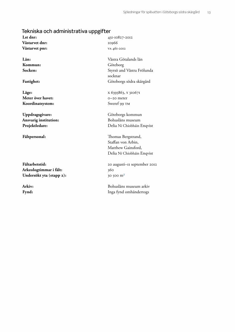
Tekniska och administrativa uppgifterLst dnr : 431108272012Västarvet dnr : 10966Västarvet pnr : VA 4612012
Län : Västra Götalands länKommun : GöteborgSocken : Styrsö and Västra Frölunda socknarFastighet : Göteborgs södra skärgård
Läge : X 6393863, Y 310671Meter över havet : 0–20 meterKoordinatsystem : Sweref 99 TM
Uppdragsgivare : Göteborgs kommunAnsvarig institution : Bohusläns museumProjektledare : Delia Ní Chíobháin Enqvist
Fältpersonal : Thomas Bergstrand, Staffan von Arbin, Matthew Gainsford, Delia Ní Chíobháin Enqvist
Fältarbetstid : 20 augusti–11 september 2012Arkeologtimmar i fält : 360Undersökt yta ( etapp 2 ) : 30 500 m²
Arkiv : Bohusläns museum arkiv Fynd : Inga fynd omhändertogs

14 Bohusläns museum Rapport 2013:28
AppendicesBilaga 1. Lista över alla sonarindikationer, deras positioner samt resultat av besiktning
Appendix 1. List of sonar anomalies, their positions and the result of the inspections
Bilaga 2. Karta över utredningsområdet med uttagna sonarindikationer. Skala 1 :20 000
Appendix 2. Map showing area mapped by sonar and indications. Scale 1 :20 000
Bilaga 3. Karta över utredningsområdet med uttagna sonarindikationer. Skala 1 :20 000
Appendix 3. Map showing area mapped by sonar and indications. Scale 1 :20 000
Bilaga 4. Karta över utredningsområdet med uttagna sonarindikationer. Skala 1 :20 000
Appendix 4. Map showing area mapped by sonar and indications. Scale 1 :20 000

Bilaga 1. Lista över alla sonarindikationer, deras positioner samt resultat av besiktning
Appendix 1. List of sonar anomalies, their positions and the result of the inspections
Bila
ga 1
. Lis
ta ö
ver
all
a s
ona
rin
dik
ati
on
er,
dera
s p
osi
tio
ner
sa
mt
resu
lta
t a
v b
esi
ktn
ing
.
App
endi
x 1.
Lis
t o
f so
na
r a
no
ma
lies,
th
eir
po
siti
on
s a
nd
th
e r
esu
lt o
f th
e i
nsp
ecti
on
s.
ID
Easti
ng
(S
WE
RE
F
99T
M)
No
rth
ing
(S
WE
RE
F
99T
M)
Besk
riv
nin
g
Sto
rle
k
So
narb
ild
Kla
ss
ific
eri
ng
R
esu
ltat
av
bes
iktn
ing
1
3066
68,1
0 63
9101
9,2
9 T
vå o
bjek
t ca
10 m
från
var
andr
a.
1x0,
8 re
spek
tive
1x0
,5
m
1
1 In
gen
obse
rvat
ion
2
3066
47,2
1 63
9105
2,7
0 B
ågfo
rmat
obj
ekt m
ed u
ppst
ick.
2,5x
1,5
m
2
2 M
eta
lobj
ekt
3
3067
03,6
3 63
9107
6,8
1 O
mrå
de m
ed g
rövr
e se
dim
ent
sam
t obj
ekt.
Vra
k el
ler
barl
ast?
5x2,
5 m
3
3 2
st. o
ljefa
t

Tite
l
20xx
2
4
3065
78,9
7 63
9093
3,1
8 P
ålra
d sa
mt a
vlån
gt o
bjek
t. B
ryg
ga e
ller
dyk
dalb
er?
30 m
lång
4
2 B
ryg
ga o
ch r
ör
5
3083
30,5
2 63
9101
2,4
2 O
mrå
de m
ed g
rövr
e se
dim
ent
sam
t upp
stic
k. F
arty
gslä
mni
ng?
3,8x
1,8
m
5
3 S
ten
bloc
k oc
h be
rggr
und
6
3087
34,1
0 63
9038
2,5
8 F
arty
gslä
mni
ng?
16,5
x7 m
6
3 B
ergg
rund
7
3091
73,9
6 63
9018
7,4
3 O
mrå
de m
ed f
lera
obj
ekt.
Bild
äck?
19x1
0 m
7
2 S
jöm
ärke

Tite
l
20xx
3
9
3086
07,4
2 63
8949
2,1
6 O
mrå
de m
ed f
lera
avl
ång
a ob
jekt
. N
edbr
uten
far
tygs
läm
ning
?
15x1
5 m
9
3 T
räst
ock
och
met
allfö
rem
ål
10
3082
17,0
5 63
8879
3,6
6 O
mrå
de m
ed g
rövr
e se
dim
ent o
ch
obje
kt.
8,5x
2,5
m
10
2 Jä
rnba
lk, s
tenb
lock
, ka
bel
12
3082
13,2
5 63
8852
1,4
2 T
vå a
vlån
ga o
bjek
t sam
t min
dre
obje
kt.
3,8
resp
ektiv
e 4,
5 m
lå
nga
12
2 K
ättin
g
13
3086
25,9
6 63
8947
9,6
3 P
ara
llella
linj
er m
ed u
ppst
ick.
F
arty
gslä
mni
ng?
7,5x
3,2
m
13
3 S
ten
bloc
k

Tite
l
20xx
4
14
3085
93,8
0 63
8948
5,1
2 O
mrå
de m
ed f
lera
avl
ång
a ob
jekt
. N
edbr
uten
far
tygs
läm
ning
?
15x1
5 m
14
3 R
ecen
t skr
äp
16
3085
53,4
1 63
9075
1,5
6 V
inke
lform
ad k
onst
rukt
ion.
10
x5 m
16
2 Jä
rnba
lk o
ch k
abel
17
3069
87,1
3 63
9132
5,7
2 O
mrå
de m
ed g
rövr
e se
dim
ent.
Vra
k el
ler
barla
st?
4 m
i di
amet
er
17
3 In
gen
obse
rvat
ion
19
3091
47,2
5 63
9463
0,2
8 O
mrå
de m
ed o
bjek
t elle
r st
enbl
ock.
Far
tygs
läm
ning
?
10x4
m
19
2 B
lock
, rör
, skr
äp

Tite
l
20xx
5
20
3096
87,1
1 63
9337
5,4
6 O
mrå
de m
ed g
rövr
e se
dim
ent
sam
t avl
ång
a o
bjek
t. V
rak
elle
r ba
rlast
?
1,5
resp
ektiv
e 2
m lå
nga
20
2 R
ör o
ch b
alk
21
3095
26,0
4 63
9328
4,4
1 M
indr
e fa
rtyg
släm
ning
. 5,
5x1,
8 m
3 Jä
rnpr
åm
22
3087
93,7
6 63
9277
8,5
4 F
lera
par
alle
lla, a
vlån
ga
obj
ekt.
4,5
m lå
nga
22
2 2
st b
alk
ar
23
3087
88,3
0 63
9283
2,9
9 B
ergg
rund
elle
r fa
rtyg
släm
nin
g.
12x6
m
23
2 B
ergg
rund
och
däc
k

Tite
l
20xx
6
24
3088
07,1
7 63
9278
6,6
2 O
mrå
de m
ed o
bjek
t. I a
nslu
tnin
g til
l nr
25.
20
x15
m
24
2 B
lock
sten
och
met
alls
krot
25
3087
81,8
2 63
9275
5,0
3 O
mrå
de m
ed f
lera
obj
ekt.
I an
slut
ning
till
nr
24.
25x2
0 m
25
2 H
jula
xel t
ill la
stb
il
26
3074
54,7
5 63
9197
9,8
1 F
arty
gslä
mni
ng e
ller
barl
ast?
12
x6,5
m
26
3 In
gen
obse
rvat
ion
27
3070
17,7
4 63
9192
0,6
6 K
an v
ara
fart
ygsl
ämni
ng m
en ä
r tr
olig
en b
erg
grun
d.
9x4
m
27
2 B
ergg
rund

Tite
l
20xx
7
28
3068
91,3
6 63
9131
4,6
9 B
ågfo
rmat
obj
ekt m
ed u
ppst
ick.
2,
5x2
m
28
2 D
äck,
rör
, fis
kenä
t, st
enbl
ock
30
3094
99,1
4 63
9427
8,6
9 T
vå c
irkul
ära
områ
den
med
gr
övre
se
dim
ent.
Bar
last
? 7
m i
diam
eter
30
2 B
ergg
rund
31
3091
64,4
6 63
9462
7,5
2 F
lera
obj
ekt.
15x1
5 m
31
2 S
ten
bloc
k oc
h sk
rot
34
3105
31,2
8 63
9497
9,9
1 M
indr
e fa
rtyg
släm
ning
. 3,
3x1,
8 m
34
3 P
last
eka

Tite
l
20xx
8
36
3098
96,2
5 63
9470
0,5
0 T
vå p
aral
lella
linj
er m
ed s
kugg
a
på b
ergb
otte
n. F
arty
gslä
mni
ng?
5,5x
1,7
m
36
3 B
ergg
rund
37
3095
19,3
1 63
9414
4,2
6 O
mrå
de m
ed f
lera
obj
ekt.
Bild
äck?
25
x15
m
37
1 D
äck
39
3104
76,3
5 63
9473
3,1
5 A
vlån
gt o
bjek
t. 10
m lå
ngt
39
2 Le
dnin
g
41
3083
64,1
7 63
9095
9,9
2 F
arty
gslä
mni
ng e
ller
berg
grun
d.
12x4
m
3
Ber
ggru
nd

Tite
l
20xx
9
42
3079
97,5
4 63
9101
5,1
9 O
bjek
t. 1,
3x1,
6 m
42
1 S
optu
nna
av
plas
t
43
3072
50,0
0 63
9117
2,3
1 M
indr
e fa
rtyg
släm
ning
sam
t ann
at
obje
kt.
Far
tygs
läm
ning
en ä
r 3,
5x2,
7 m
43
3 P
last
eka
ca 4
x1.5
m
44
3073
91,2
1 63
9116
9,3
3 M
indr
e fa
rtyg
släm
ning
? 4,
3x2
m
44
3 P
last
eka
ca 4
x1 m
45
3074
48,4
5 63
9115
2,3
2 M
indr
e a
vlån
gt o
bjek
t. C
a 10
m lå
ngt
45
1 M
eta
lltan
k

Tite
l
20xx
10
46
3070
97,8
1 63
9117
0,4
0 Le
dnin
g e
ller
fart
ygsl
ämni
ng?
23
x7,5
m
46
2 B
lock
sten
och
met
alls
krot
50
3099
14,6
0 63
9470
0,1
6 F
arty
gslä
mni
ng e
ller
berg
grun
d.
9x3,
5 m
50
3 B
ergg
rund
52
3083
60,4
8 63
8880
6,9
8 O
mrå
de m
ed g
rövr
e se
dim
ent.
Bar
last
? 3,
6x3,
3 m
52
1 O
mrå
de m
ed å
lgrä
s
53
3083
26,2
6 63
8857
2,6
2 Ä
r tr
olig
en
bryg
gför
ankr
ing
men
ka
n va
ra f
arty
gslä
mni
ng.
6,3x
3 m
53
1 B
ryg
gför
ankr
ing

Tite
l
20xx
11
54
3094
31,3
2 63
9322
8,1
1 P
ara
llella
linj
er. F
arty
gslä
mni
ng?
7x
3,7
m
2 B
ergg
rund
56
3096
92,5
2 63
9336
7,3
8 "V
inke
lform
at"
obje
kt e
ller
berg
gru
nd.
6,7x
6,7
m
56
1 In
gen
obse
rvat
ion
58
3095
05,9
4 63
9416
7,4
5 F
unda
men
t elle
r fa
rtyg
släm
nin
g?
6,5
m lå
ngt
58
2 2
st la
ndg
ång
ar
59
3095
06,3
4 63
9415
1,6
9 O
mrå
de m
ed f
lera
obj
ekt.
Bild
äck?
25
x20
m
59
1 F
lotte
/land
gån
g

Tite
l
20xx
12
60
3121
58,5
8 63
9748
5,2
0 O
mrå
de m
ed g
rövr
e se
dim
ent.
Kan
var
a vr
ak e
ller
bar
last
. 4,
5x2,
7 m
60
1 In
gen
obse
rvat
ion
61
3120
76,8
7 63
9739
1,5
0 A
vlån
gt o
bjek
t. 3,
8 m
lång
t
61
2 B
ergg
rund
62
3131
08,7
3 63
9764
5,4
4 A
vlån
gt o
bjek
t med
upp
stic
k. K
an
vara
min
dre
fart
ygsl
ämni
ng.
4,5
m lå
ngt
62
2 S
ten
bloc
k
63
3128
80,8
9 63
9760
7,1
7 A
vlån
gt o
bjek
t med
upp
stic
k. K
an
vara
min
dre
fart
ygsl
ämni
ng.
3,5
m lå
ngt
63
2 S
ten
bloc
k

Tite
l
20xx
13
64
3121
38,3
6 63
9736
0,2
8 A
vlån
gt o
bjek
t. 5,
5 m
lång
t
64
1 B
ergg
rund
65
3121
30,6
0 63
9732
1,0
8 A
vlån
gt o
bjek
t. 8
m lå
ngt
1 In
gen
obse
rvat
ion
66
3120
80,8
4 63
9728
0,9
3 O
bjek
t elle
r be
rggr
und.
5,
5x1,
5 m
66
1 R
ecen
t skr
äp

Bilaga 2. Karta över utredningsområdet med uttagna sonarindikationer. Skala 1 :20 000
Appendix 2. Map showing area mapped by sonar and indications. Scale 1 :20 000

Bilaga 3. Karta över utredningsområdet med uttagna sonarindikationer. Skala 1 :20 000
Appendix 3. Map showing area mapped by sonar and indications. Scale 1 :20 000

Bilaga 4. Karta över utredningsområdet med uttagna sonarindikationer. Skala 1 :20 000
Appendix 4. Map showing area mapped by sonar and indications. Scale 1 :20 000

Sjöledningar för spillvatten i Göteborgs södra skärgård
Marinarkeologisk utredning, etapp 2Styrsö och Västra Frölunda socknar Göteborgs stad, Göteborgs kommunDelia Ní Chíobháin Enqvist & Staffan von ArbinBohusläns museumRapport 2013: 28