TRAIL receptor signalling and modulation: Are we on the right TRAIL?
Upload
khangminh22Category
view
1download
0
SANTA FE NATIONAL HISTORIC TRAILcomprehensive management and use plan

comprehensive management and use plan
may 1990
SANTA FE NATIONAL HISTORIC TRAIL
MISSOURI, KANSAS, OKLAHOMA, COLORADO, NEW MEXICO
UNITED STATES DEPARTMENT OF THE INTERIOR / NATIONAL PARK SERVICE
SUMMARY
The Santa Fe Trail was the first of America's great trans-Mississippi routes. The trail, including the Mountain and Cimarron routes, crossed over 1,200 miles of the central and southwestern United States, from Franklin, Missouri, to Santa Fe, New Mexico. The trail played a critical role in the westward expansion of the United States, and for more than half a century (1821-1880) it was an important two- way avenue for commerce and cultural exchanges.
The Santa Fe Trail was designated as a national historic trail by Congress in 1987, in accordance with the National Trails System Act The trail is to he administered by the National Park Service (NPS), in cooperation with state and local jurisdictions, interested groups, and private landowners. The designated route extends from a point near Franklin, Missouri, to Santa Fe, New Mexico, and includes the Mountain and Cimarron routes. This Comprehensive Management and Use Plan for the Santa Fe National Historic Trail presents a plan for the protection, historical interpretation, recreational use, and management of the trail corridor.
The purpose of the National Trails System Act is "to provide for the outdoor recreation needs of an expanding population" and "to promote the preservation of, public access to, travel within, and enjoyment and appreciation of the open-air, outdoor areas and historic resources of the nation."
The comprehensive plan will seek to balance resource preservation and visitor use along the trail. The trail is 90 percent privately owned, and the National Park Service must rely on the cooperative management efforts and support of state, local, and private interests, including landowners, to ensure the protection of trail- related resources, to provide outdoor recreational opportunities, and to accomplish the objectives of the interpretive programs.
Within this partnership the Park Service will work to ensure that the trail is managed as a
single, integrated resource, with the plan providing overall guidance for trail management. The Park Service will encourage the implementation of a coordinated trailwide marketing and promotion plan in cooperation with the five trail states.
Cooperative trail protection and development efforts will be stimulated and encouraged by the National Park Service through a combination of incentives, including an official certification and marking process for nonfederal sites, segments, or interpretive programs. Technical assistance will be offered in the areas of resource protection, interpretation, or design, along with limited financial assistance to encourage land acquisition, resource protection, recreational and interpretive media development, maintenance, or management of the trail. Trail managers, cooperating landowners, and others may have status as Volunteers-in-the- Parks (VIPs), as well as recreational liability protection under state laws. Preservation efforts will be encouraged through tax incentives for commercial operations.
Trail segments, historic sites, or interpretive programs on nonfederal land will be officially recognized and included as part of the Santa Fe National Historic Trail only if they are certified. Resources will have to be documented by the owner or other appropriate sponsor in a brief, but comprehensive application; management objectives for the site or segment will be established; and management responsibilities for each nonfederal site or segment will be defined. Segments or sites will not be officially certified unless the necessary environmental compliance procedures have been undertaken, with qualified technical assistance provided as needed. Decertification may occur when a site, segment, or program is not being managed according to the certification agreement. National recognition can also be obtained by nominating and having a site or segment listed on the National Register of Historic Places.
iii

Summary
The primary route of the Santa Fe Trail, the Cimarron and the Mountain routes, as well as the major branches, have been mapped. A total of 194 historic sites and landmarks, plus 30 route segments where wagon ruts are still evident, have been initially identified as significant and having "high potential" for quality interpretation or recreation. Official markers will be placed along certified or protected segments of the historic route to permanently establish the location of the trail in many places where no visible ruts or other traces remain, as well as along the visible parts of the route. No markers will be erected on nonfederally owned land without the owner’s consent.
To ensure the protection of resources along the trail, all cultural, natural, and scenic resources will be inventoried and analyzed to determine appropriate and required protection and preservation techniques, especially stabilization measures, and the potential for recreation or interpretation. For significant resources on nonfederal land, the National Park Service will offer technical assistance, as requested, to help protect these resources. This will include technical assistance under the national historic landmark program and the NPS rivers and trails conservation assistance program, as well as grants through the NPS Historic Preservation Fund. Preservation efforts by commercial operations will be encouraged through tax incentives. Further research will also be fostered to improve knowledge, understanding, and appreciation of trail resources and the overall historical significance of the trail.
Visitor services and developments arising from the plan will be certified (if provided by nonfederal entities) where they are in harmony
with the protection of the resources, they fulfill desired recreational or interpretive needs, and they meet other objectives. An integrated interpretive system will be developed to promote a full range of opportunities for public enjoyment, appreciation, and understanding of the trail. Elements of the basic or core interpretive program will include a unified wayside exhibit system; NPS-produced or -approved publications, films, and audiocassettes; NPS educational activities; and interpretive programs at NFS units along the trail. To enhance the core interpretive program, the National Park Service will seek to provide various levels of interpretive program or media assistance to qualifying federal, state, or local agencies and groups that provide or plan to provide appropriate trail programs at facilities they operate.
lb provide for recreational opportunities to retrace the trail, short- and long-distance trails for hiking, horseback riding, and occasionally driving wagons will be encouraged along appropriate trail route segments. Where trail ruts are still visible (approximately 15 percent of the route), no hiking or horseback riding on the ruts will be condoned unless environmental conditions or use levels indicate that the historic resources will not be adversely affected. An automobile tour route paralleling the trail on modern highways will also be designated. The National Park Service will encourage state and local governments, private groups, land- owners, and federal land-managing agencies along the route to help establish and maintain the trails.
Guidelines will be prepared to help control or prevent uses that might impair resource integrity, public appreciation, and landowner cooperation.
iv

CONTENTS
INTRODUCTION 1
PURPOSE OF AND NEED FOR THE PLAN 3BACKGROUND 3LEGAL AND ADMINISTRATIVE DIRECTIONS 3 PLANNING 5MANAGEMENT OBJECTIVES 6
Resource Protection 6 Visitor Use 6 Development 7Management and Cooperation 7
HISTORY AND SIGNIFICANCE OF THE SANTA FE TRAIL 8
THE COMPREHENSIVE MANAGEMENT AND USE PLAN 11
OVERVIEW 13
THE HISTORIC ROUTE AND SIGNIFICANT RESOURCES 14 HISTORIC ROUTE 14 MAJOR HISTORIC BRANCHES 15 HISTORIC SITES AND ROUTE SEGMENTS 16 NATIONAL PARK SYSTEM AREAS 19
Fort Lamed National Historic Site, Kansas 19 Bent’s Old Fort National Historic Site, Colorado 20 Fort Union National Monument, New Mexico 20 Pecos National Monument, New Mexico 20
NATIONAL FOREST SYSTEM AREAS 20Cimarron National Grassland, Kansas, and Kiowa National
Grassland, New Mexico 20 Comanche National Grassland, Colorado 20 Santa Fe National Forest, New Mexico 20
MARKING THE TRAIL 20
RESOURCE PROTECTION AND MANAGEMENT 22 RESOURCE PROTECTION 22
Cooperative Agreement 24 Easement 24 Fee-Simple Ownership 24 Regulatory Processes 25
RESEARCH 26
VISITOR USE 28INTERPRETATION 28
Interpretive Theme and Subthemes 28 NPS Core Interpretive Programs 29 Complementary Interpretive Programs 35
v

Contents
VISITOR USE (cont.)VISITOR USES ALONG THE TRAIL 37
Hiking and Horseback-Riding Trails 37 Auto Tour Route 38 Compatibility Guidelines 41
SITE DEVELOPMENT 41 LIABILITY 41TRAIL CARRYING CAPACITY 42
MANAGEMENT AND COOPERATION 43COOPERATIVE MANAGEMENT SYSTEM 43 SITE/SEGMENT CERTIFICATION PROCEDURES 44 TRAIL MARKING PROCEDURES 45
MARKETING 47
COMPLIANCE 49
FUNDING 50ADMINISTRATION 50 TECHNICAL ASSISTANCE 50 DEVELOPMENT/PRESERVATION 50 LIMITED FINANCIAL ASSISTANCE 50
THE SANTA FE TRAIL ENVIRONMENT 51
NATURAL ENVIRONMENT 53 PHYSIOGRAPHY 53 CLIMATE 53 VEGETATION 54 WILDLIFE 54THREATENED OR ENDANGERED SPECIES 54 FLOODPLAINS/WETLANDS 56 PRIME AND UNIQUE FARMLANDS 56
CULTURAL RESOURCES 57
SOCIOECONOMIC ENVIRONMENT 58 LANDOWNERSHIP AND USE 58 ACCESS AND TRANSPORTATION 58 POPULATION 58REGIONAL ECONOMY 60 RECREATION 60
VISITOR USE AND EXISTING INTERPRETATION 61
CONSULTATION AND COORDINATION 62
vi

Conteras
APPENDIXES, BIBLIOGRAPHY, PLANNING TEAM / CONSULTANTS 63
APPENDIX A: LEGISLATION 65APPENDIX B: STATE RECREATIONAL LIABILITY LAWS 82APPENDIX C: HIGH-POTENTIAL HISTORIC SITES AND ROUTE SEGMENTS
ALONG THE SANTA PE TRAIL 90APPENDIX D: MEMORANDUM OF UNDERSTANDING BETWEEN THE
NATIONAL PARK SERVICE AND THE SOIL CONSERVATION SERVICE FOR MUTUAL DEVELOPMENT OF PLANT MATERIALS FOR REVEGETATION 111
APPENDIX E: TRAIL USE GUIDELINES 114APPENDIX F: RECOMMENDED SIGNS 117APPENDIX G: PROVISIONS FOR COOPERATIVE MANAGEMENT 123 APPENDIX H: REQUEST FORM FOR SITE/SEGMENT CERTIFICATION 130 APPENDIX I: THREATENED OR ENDANGERED ANIMAL AND PLANT
SPECIES 132
GLOSSARY 137
SELECTED BIBLIOGRAPHY 139
PLANNING TEAM AND CONSULTANTS 141
MAPS
National Trails System 4 Historic Route 17 Interpretive Regions 32 Auto Tour Route 39
TABLES
1: Mileage of the Santa Fe National Historic lYail by State 152: Federally Protected Components and Potentially Qualified Components of the Santa
Fe National Historic Trail 163: Trailwide Interpretive topics, Subthemes, and Key Points 304: Interpretive Regions, Subthemes, and Key Points 335: Selected Wildlife Species along the Santa Fe National Historic Trail Route 55 6: Prime Farmlands 567: Location and Ownership of Historic Sites 578: Location and Ownership of Route Segments 579: Population of Cities along the Santa Fe National Historic Trail 5910: Counties Crossed by the Santa Fe National Historic Trail 5911: Recreation Facilities along the Santa Fe National Historic Trail 6012: Annual Visitation to National Park System Areas 61
vii

ACKNOWLEDGEMENTS
The National Park Service thanks the many individuals who, in the interest of historical accuracy, generously shared their knowledge of trail history and resources during the course of planning for the Santa Fe National Historic Trail. The participation of these people has improved the plan and will serve the Santa Fe Trail and future generations well.

INTRODUCTION

Independence was full of Sana Fe men. Mules, horses, oxen and wagons at every comer. Groups of hardy looking men about the stores.
Francis Parkman

PURPOSE OF AND NEED FOR THE PLAN
BACKGROUND
The importance of the Santa Fe Trail has long been recognized, and the 1968 National Trails System Act (Public Law 90-543) listed it as one of 14 trails to be studied for possible designation as either a national scenic or recreation trail. In 1976 the former Bureau of Outdoor Recreation determined that the Santa Fe Trail was nationally significant and merited recognition for the role it played in the westward expansion of the United States. However, the trail did not meet the legislative criteria for designation as a national scenic trail.
In 1978 a new category for national historic trails was created. To qualify as a national historic trail, a trail must meet the following criteria:
• It must have been established by historic use, and it must be historically significant as a result of that use.
• It must be of national significance with respect to American history.
• It must have significant potential for public recreational use or historical interest, based on historic interpretation and appreciation.
The Santa Fe Trail clearly met these criteria, as supported by National Park Service (NFS) testimony in 1986 and 1987 before House and Senate subcommittees. Various organizations, such as the Santa Fe Trail Association, and individuals worked diligently to ensure passage of the national historic trail legislation for the Santa Fe Trail. On May 8, 1987, President Ronald Reagan signed Public Law 100-35 (an amendment to the National Trails System Act) to establish the Santa Fe National Historic Trail (see appendix A).
The designated trail, including the Mountain and Cimarron routes, extends approximately 1,200 miles from Old Franklin, Missouri, through Kansas, Oklahoma, and Colorado to
Santa Fe, New Mexico. The Cimarron route is 865 miles; the Mountain route, 909 miles.
LEGAL AND ADMINISTRATIVE DIRECTIONS
The purpose of the National Trails System Act is "to provide for the outdoor recreation needs of an expanding population" and "to promote the preservation of, public access to, travel within, and enjoyment and appreciation of the open-air, outdoor areas and historic resources of the nation."
Generally, national trails are established and managed through the cooperative efforts of federal, state, and local governments, private landowners, and cooperating groups. The National Park Service, as the designated administering agency for the Santa Fe National Historic Trail, will help ensure that the trail is appropriately marked, protected, interpreted, and developed by coordinating and monitoring the efforts of many governmental agencies and various private sector interests. A certification process, limited financial assistance, and other incentives will be used by the Park Service to help achieve the trail’s purposes. The responsibilities for managing the trail will be in the hands of state and local governments, private landowners, and organizations, except for those pans of the trail that are federally owned and managed.
The National Trails System Act includes the following provisions, among others (see appendix A):
• the role of federal agencies in trail management
• the role of a trail advisory council
■ the official process for mapping the trail route
• permitted trail uses
3

NATIONAL TRAILS SYSTEMUNITED STATES DEPARTMENT OF THE INTERIOR f/ NATIONAL PARK SERVICE

Purpose cf and Need for the Plan
• the role of interpretive sites
• the role of federal technical and financial assistance
• the role of the federal government and others in land acquisition or cooperative agreements
• the role of volunteers in trail management
To provide an overall management framework for the Santa Fe National Historic Trail, a comprehensive management and use plan must be prepared, as required by the National Trails System Act, as amended. Among other items, the plan is to include the following:
• specific objectives and practices to be observed in managing the trail, including the identification of all significant natural, historical, and cultural resources to be preserved, and details of any anticipated cooperative agreements to be consummated with state and local governmental agencies or private interests
■ the process to be followed in marking the trail
• protection measures for any "high potential historic sites" or "high potential route segments" (lor definitions refer to National Trails System Act [NTSA], sec. 12, in appendix A).
• general and site-specific development plans
PL 100-35 further specifies that land or interests in land outside existing boundaries of federally administered areas can be acquired for the national historic trail only with the owner's consent:
No lands or interests therein outside the exterior boundaries of any federally administered area may be acquired by the Federal Government for the Santa Fe Trail except with the consent of the owner thereof. Before acquiring any easement or entering into any cooperative
agreement with a private landowner with respect to the trail, the Secretary [of the Interior] shall notify the landowner of the potential liability, if any, for injury to the public resulting from physical conditions which may be on the landowner's land.
This requirement is a one-time notice to the landowner of a potential problem with public access and does not imply any federal indemnification (House Report 100-16). In any event, each of the five trail states has statutes that may protect landowners from recreational use liability (see appendix B). This and other appropriate information will be provided to land- owners by the National Park Service. Also, the Volunteers in the Parks Act of 1969 provides a way for the federal government to protect cooperating landowners from such liability claims.
In addition to the legislative requirements discussed above, the comprehensive plan is also to describe and analyze the following:
• management strategies for resource preservation
■ interpretation and visitor use development
• marketing and tourism opportunities
• appropriate levels and types of visitor use
• responsibilities for resource preservation, interpretation, visitor use, development, operations, and maintenance of trail sites and markers
• certification procedures for nonfederal trail sites, segments, or interpretive programs
PLANNING
In developing this Comprehensive Management and Use Plan, the National Park Service sought the views of American Indian groups, various organizations, landowners, and individuals, as well as federal, state, and local agencies. In October 1987 a planning newsletter was distributed to interested parties requesting input on
5

INTRODUCTION
ways to help manage, protect, and develop the trail. Nine public meetings were held along the trail in November 1987 to elicit preliminary concerns and ideas. Based on the initial public input, draft management objectives were prepared and presented to the public in an April 1988 planning newsletter.
During the spring of 1988, NPS personnel and contract consultants undertook the mapping of the trail route and the identification of significant trail sites and segments. In October 1988 the secretary of the interior appointed members of the Santa Fe National Historic Trail Advisory Council.
The Draft Comprehensive Management and Use Plan and Environmental Assessment was distributed to the public, governmental agencies, organizations, and individuals in May 1989. A draft Map Supplement was also made available for review and comment.
Ten public meetings were held along the trail in May and June, and written comments were received during the public review period (May 12 to June 16, 1989). The Santa Fe National Historic Trail Advisory Council met on June 21-22, 1989, and on November 6-7, 1989, to provide additional input and recommendations for NPS consideration before this final plan was prepared and approved.
MANAGEMENT OBJECTIVES
Management objectives have been developed for the Santa Fe National Historic Trail to provide a framework that enables the Park Service, trail managers, cooperating landowners, organizations, and individual trail supporters to mutually work toward fulfilling the trail’s legislative purposes, while applying NPS policies and procedures. Management objectives identify desired ends, while the plan itself addresses the means by which the ends will be achieved.
The objectives center on four general subject areas. However, the plan elements must clearly address more specific and complex issues and their resolution, and as a result, subject
headings do not always correlate. Each plan element meets one or more management objectives, and sometimes objectives listed under different subject areas.
The following objectives have guided the development of the plan and will be used by the National Park Service and others to guide plan implementation and to measure progress.
Resource Protection
Implement measures as necessary to protect significant route segments and historic sites.
Encourage research to improve knowledge, understanding, and appreciation of trail resources and their overall significance.
Promote the protection of significant cultural and natural resources along the route of the Santa Fe National Historic Trail; help protect resources from overuse, vandalism, and inappropriate use; and promote compatible adjacent uses.
Visitor Use
Promote appropriate outdoor recreation, public enjoyment, appreciation, and understanding of the Santa Fe Trail and related sites, as well as branch trails.
Emphasize the interpretation of the human side of the trail's history, including the multicultural influences and affiliations that were a part of the trail's rich legacy.
Encourage interpretive activities and programs, including media, that are based on historical or archeological examination and documentation.
Develop a thematic framework to allow for consistent and coordinated interpretation by various managing entities along the trail, and promote coordinated interpretive efforts among national park system sites along the trail.
6

Purpose <?/ and Need for the Plan
Provide visitors with opportunities to see and appreciate actual remnants of the trail and related sites, and to retrace the trail route; facilitate access to trail sites where appropriate.
Provide each visitor with the opportunity for a safe and enjoyable experience.
Ensure public understanding of the roles of the various entities that may administer and manage the trail and related sites, and foster visitor respect for the rights of landowners.
Provide access to programs and facilities for special populations (e.g„ disabled or non- English speaking visitors).
Control or prevent uses of the trail and related sites that impair resource integrity and public appreciation.
Development
Mark the historic and auto tour trail routes with standardized and recognizable markers.
Provide the minimum facilities necessary and environmentally compatible to allow for the enjoyment and protection of resources.
Encourage the adoption of a unified design theme for signs, exhibits, and public use facilities when appropriate.
Restore the setting of trail segments or sites where economically feasible.
Encourage and stimulate appropriate development by state and local governments, or others.
Management and Cooperation
Define proper roles and responsibilities for the National Park Service and other managing entities.
Coordinate efforts at all levels to fulfill the purposes of the Santa Fe National Historic
Trail, as stated in the National Trails System Act, as amended.
Coordinate and stimulate efforts to manage the trail, consistent with the Comprehensive Management and Use Plan.
Promote state, county, local, and individual participation in interpretation, preservation, and development along the trail, consistent with the objectives of the National Trails System Act, as amended.
Develop effective partnerships with and between managing entities, the Santa Fe Trail Association, private landowners, trail supporters, and private organizations, as well as federal, state, and local agencies.
Promote the management or development of the whole trail in ways that enhance its integrity as a single, integrated system and that transcend the overlying political boundaries and geographic divisions.
Consult with the Santa Fe National Historic Trail Advisory Council on matters related to trail administration.
Certify official trail segments and sites when such recognition is justified and consistent with the purposes of the National Trails System Act, as amended.
Authorize use of the official national historic trail symbol in conjunction with appropriate interpretive activities, programs, information materials, and appropriate fund-raising activities.
Use existing NPS staff resources along the trail to assist in furthering the purposes of the trail. Provide technical assistance, support, or limited financial assistance for efforts to further the purposes of the national historic trail.
Encourage coordinated efforts to promote appropriate trail-related tourism along the entire trail route.
Provide for appropriate fund-raising and donation programs to help further trail purposes.
7

HISTORY AND SIGNIFICANCE OF THE SANTA FE TRAIL
The Santa Fe Trail linked various routes that were first followed by American Indians, then by Spanish, Mexican, and American frontiersmen. It eventually developed into the first major trans-Mississippi route between the eastern United States and the American Southwest The trail played a critical role in the westward expansion of the United States, as well as trade relations with Mexico. For a quarter century, from 1821 to 1846, it was an international trade route, carrying needed materia] goods from Missouri to northern Mexico and bringing silver, furs, mules, and wool to Missouri. It also fostered an exchange among the Spanish, Indian, and American cultures. After the United States acquired Mexico's northern provinces in 1848, the trail continued as a major link between regions, and American social institutions were extended into the Southwest.
Indian trade fairs at Pecos and Taos among Pueblo and Plains Indians introduced Spanish residents to native products, and the Spanish began to participate in the fairs. While New Mexicans remained active in trade along the southern routes from Santa Fe to Chihuahua, they also became increasingly familiar with the numerous trails on the eastern slopes of the Rockies and the western Great Plains. However, merchants in Chihuahua dominated the larger trade fairs along the Camino Real in Mexico and controlled much of the commerce in New Mexico. In due course French and American traders defied Spain’s closed door policy in her northern Mexico provinces and searched for ways to trade with Santa Fe and beyond. This resulted in patrols by Spanish and Pueblo soldiers in the late 1700s and early 1800s to search for contraband. Traders that were caught had their trade goods confiscated, and some were imprisoned.
After independence from Spain in 1821, Mexican administrators removed legal barriers to commercial exchange on the New Mexican frontier. In that same year William Becknell and a small party from Missouri arrived in
New Mexico to trade, and his party was followed almost immediately by two other trading parties to New Mexico. In 1822 Becknell opened a wagon route from Franklin, Missouri, to Santa Fe, following what later became known as the Cimarron route; this was the only wagon trail to New Mexico until the 1840s, when the Mountain route was opened to traffic.
The decade of the 1820s saw New Mexican officials encourage American merchants to take part in trade with Mexico. Beginning in 1824 Chihuahuan and New Mexican merchants became involved along the trail from Santa Fe to Missouri, and from 1823 to 1823 a delegation of Mexican merchants was in Washington, D.C., sent by New Mexican Governor Bartolomé Baca, to negotiate commercial agreements for New Mexico. Simultaneously Missouri traders headed toward Santa Fe with trade goods. Encouraged by Mexican officials, this legal commerce began the decades-long exchange across the plains. The U.S. government conducted a survey of the route in 1825, starting from Fort Osage. The government also made treaties with Indian tribes near the eastern end of the trail, and beginning in 1829 military protection was occasionally offered to trading parties. New Mexican troops and Pueblo soldiers also helped protect the traders in 1829 and again in 1843.
The major eastern commercial terminus of the Santa Fe Trail was St. Louis, but commodities were shipped up the Missouri River before being transferred to wagons for the trip to Santa Fe. The earliest wagon trains left from Franklin, Missouri; other river towns, such as Arrow Rock and Lexington, were also points of departure. By the early 1830s, however, most traffic on the trail began at Independence, Missouri, which remained the major outfitting point until the 1840s, when Westport and Fort Leavenworth became the primary points of departure. The vicinity of present-day Council Grove, Kansas, was the major point of rendezvous for caravans organizing for the trip westward.
8

History and Significance of the Santa Fe Trail
During the trail’s early years the First settlement in New Mexico for westbound traders was San Miguel del Vado, which served for a time as a port of entry. In 1835 Las Vegas, New Mexico, was founded and replaced San Migeul as the first New Mexican settlement.
For those traveling eastward from New Mexico, the area near La Junta (later Watrous), where the Cimarron and Mountain routes separated, was the major point of rendezvous to organize for the trip to Missouri.
The Santa Fe Trail quickly became a lucrative trade route far into Mexico, aiding both Mexico’s northern provinces and the depressed economy of Missouri. This route tied the Chihuahua Trail to the Boonslick Road via the Santa Fe Trail (which included the older Osage Trace in Missouri), thus adding to a network of international roads and trails. By the early 1840s, Mexican merchants dominated the trade moving in both directions along the route of commerce. Merchants such as Don Antonio Jose Chavez, his brother Don Jose Chavez y Castillo, and the Chavez in-laws, Juan Perea and Juan Otero, provided keen competition for American traders like William and James Glasgow, James and Robert Aull, and J. J. Webb, who were trying to establish a greater commercial trade role.
New Mexican families, such as the Ortiz, Delgado, Armijo, and Chavez, sent their children over the trail to be educated in the United States, and many of these families maintained their economic and political leadership during New Mexico's territorial period. The families joined other Mexican merchants in fostering the international trading system. Likewise, American families used the trail. Mary Dodson Donoho, with her husband and infant daughter, was the first Anglo-American woman in Santa Fe, arriving in 1833. Other American women who traveled the route and recorded their journeys include Susan Shelby Magoffin (1846) and Marian Sloan Russell (1850s and 1860s).
Gradually multinational partnerships emerged, which benefited many. Yet despite cultural exchanges, economic competition developed
between Mexican and American merchants and between Mexico and the United States. In 1845 American interests persuaded the U.S. Congress to help offset inherent Mexican advantages by passing the Drawback Act to allow Americans to compete more equally with their Mexican counterparts. Pueblo Indians during this time tended to affiliate with Mexican rather than American traders because of language barriers.
During the war between Mexico and the United States (1846-48), Brig. Gen. Stephen W. Kearny led the Army of the West from Fort Leavenworth via the Santa Fe Trail to Bent’s Fort and over Raton Pass to the town of Las Vegas, New Mexico, where he expected to face a New Mexican army. (The Mormon Battalion and other elements of the army later used the Cimarron route.) Kearny proclaimed annexation of New Mexico by the United States on the Las Vegas plaza and continued cautiously on to Santa Fe. Governor Manuel Armijo had organized a resistance force at Canoncito, but he withdrew in advance of the approaching U.S forces. Kearny entered Santa Fe and raised the U.S. flag over the Palace of the Governors. After his departure, Lt. Col. Sterling Price remained to provide military support to the Kearny-appointed governor, Charles Bent.
Resistance to the U.S. occupation assumed the nature of guerilla warfare, including the January 1847 insurrection at Taos, Mora, and other New Mexican communities. Charles Bent was killed during the uprising at Taos and was succeeded by Donaciano Vigil. The war ended with Treaty of Guadalupe Hidalgo of 1848, and the United States gained almost half of Mexico, including present New Mexico, Arizona, California, Nevada, Utah, and parts of Colorado, Wyoming, Oklahoma, Kansas, and Texas.
Following the war, the volume of traffic on the Santa Fe Trail rose considerably, and some aspects changed. Emigrants began to follow the trail to the Southwest, although it was primarily a route of commerce. The interior of Mexico remained the ultimate goal for many traders, as it had since Santa Fe was saturated with goods in 1824, but teamsters also began to convey more and more military supplies. These sup
9

INTRODUCTION
plies made up most of the freight, since the U.S. Army had responsibility for protecting the American Southwest. Military posts established along the route included Fort Mann (1847), Fort Atkinson (1850), Fort Union (1851), Fort Lamed (1859), and Fort Lyon (1860). EaGh post required supplies and provided protection for caravans on the trail, with over 1,800 wagons crossing the plains in 1858 alone.
Indian traders also used the commercial route, and Bent’s Fort (1833-49) on the Arkansas River in southeast Colorado symbolized that trade. In 1853 William Bent opened Bent’s New Fort, some 40 miles downriver near a favorite Indian camping area, Big limbers.
Following the Mexican War, the Jicarillas, Comanches, Kiowas, and other tribes became increasingly threatened by traffic on the trad. While threats from Indians were common during the Mexican period (1821-48), the danger intensified as traffic increased, especially during the Civil War. The beginning of stagecoach and mail service over the trail in 1850 increased demands for military protection.
Troubles along the trail resulted in expanding American pressure on the Indian population in the Southwest, leading to disruption of tribal life and the loss of traditional tribal lands. Negotiated treaties between Americans and Indians were violated or not fulfilled. One reason the Mountain route was developed for wagon traffic in the 1840s was to avoid troubles with Indians along the Cimarron route. Because of the difficulty in taking wagons over Raton Pass, however, the Mountain route was not heavily used until improvements were made during and after the Civil War.
The Civil War began in 1861 and soon reached New Mexico. In early 1862 a Confederate force marched up the Rio Grande, intent on capturing Fort Union and ultimately the Colorado goldfields. Meanwhile to the southwest, the Confederates captured Tucson and established the Confederate Territory of Arizona. By acquiring this valuable territory, the South hoped to stretch Lincoln’s naval blockade to two oceans and to finance the Confederate war effort.
After the fall of Albuquerque and Santa Fe, only Fort Union blocked a Southern invasion of Colorado Territory, and a combined Union force of regular troops and volunteers from New Mexico and Colorado met the Confederates at Glorieta Pass. Even though Union troops were initially losing ground, a separate unit of volunteers slipped behind the Confederate soldiers and destroyed their supply train at Johnson’s ranch. This forced the Confederates to retreat, and they were soon driven from New Mexico. The Union victory was decisive in protecting the West and the main military supply route - the Santa Fe Trail - from the invading Confederates.
During the Civil War Indian resistance grew along the trail, causing the army to establish additional forts in 1865: Fort Dodge, Camp Nichols, and Fort Aubry. This situation led to increased traffic on the Mountain route, and this route became more popular when Richens Lacy "Uncle Dick” Wootton opened a toll road over Raton Pass near the end of the Civil War. In 1878 he sold out to the Atchison, Topeka, and Santa Fe Railway, which won the right- of-way through the pass and built along the route of the Santa Fe Trail.
Railroad construction started southwest from the Missouri River near the close of the Civil War. As the Union Pacific, Eastern Division (known after 1869 as the Kansas Pacific), worked with the Atchison, Topeka, and Santa Fe to build the track westward, the trail diminished in length but not in importance. Trade items and military freight were carried as far as possible by rail, then transferred to wagons for the remainder of the trip by way of the major trail branches. Thus, within a few years a progression of towns - Junction City, Hays, and Sheridan in Kansas; Kit Carson, Granada, Las Animas, and Trinidad in Colorado; and finally Las Vegas, New Mexico - served as the eastern termini for wagon traffic. On February 9, 1880, the first steam engine passed near Santa Fe, ending nearly 60 years of overland use on the Santa Fe Trail The era of freight wagons, oxen, and mules crossing vast distances over the rutted plains ceased, and most of the trail passed out of active use.
10
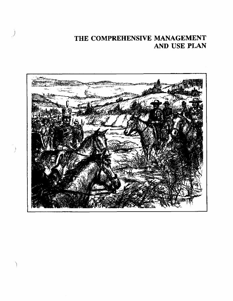
THE COMPREHENSIVE MANAGEMENT AND USE PLAN

In descending to the Rio Colorado, we encountered a party ofcustom-house agents, who, accompanied by a military escort, had come out to guard the caravan to the Capital.
Josiah Gregg

OVERVIEW
The Comprehensive Management and Use Plan for the Santa Fe National Historic Trail seeks to balance resource preservation and visitor use along the trail. The goal of the National Park Service is to administer the Santa Fe Trail with the same care and effort afforded to units of the national park system, while recognizing the intents and authorities of the National Trails System Act, as amended.
The National Park Service must rely on the cooperative efforts and support of state, local, and private interests, including landowners and other federal land-managing agencies, to ensure the protection of trail-related resources, to provide outdoor recreational opportunities, and to accomplish the objectives of the interpretive program. Within this partnership of federal, state, local, and private interests, the Park
Service will work to ensure that the trail is managed as a single, integrated resource - a trail system. It will also work to stimulate and facilitate actions and programs by government and private interests, and it will offer technical advice and assistance to public as well as private owners of trail resources.
The main elements of the plan are presented in this section. They include the identification of the historic route and significant resources, resource protection and management, visitor use (including proposed interpretive themes, development, and use guidelines), management and cooperation (inchiding trail-marking techniques, certification procedures for trail sites and segments, and cooperative management agreements), and marketing opportunities to promote tourism.
13

THE HISTORIC ROUTE AND SIGNIFICANT RESOURCES
HISTORIC ROUTE
The Santa Fe Trail, including its two main routes - the Mountain and the Cimarron - crossed over 1,200 miles of the central and southwestern United States. (The legislative description of an approximately 950-mile trail represents the estimated length of the trail via the longer Mountain route.) Each group of travelers followed slightly different routes, depending on the season and whether the year had been wet or dry. These variations resulted in routes that were several yards to several miles apart from one year to the next. In addition, adventurers willingly tried alternative routes and cutoffs to find water, avoid possibly hostile Indians, or shorten the trip. The roules became braided as mud holes, dust, excessive ruts, insufficient forage for draft animals, or difficult stream crossings forced travelers to move farther away from the main trail. As a result, various branches and trailheads on the plains developed and then declined over time.
For American travelers the trail originated at various locations in Missouri, moving upriver from Franklin (now known as Old Franklin) to the Independence area by the late 1820s (a distance of 112 miles); Westport, near present-day Kansas Qty, became the last staging area. During the early years of the trail, traders organized and made final equipment adjustments at what became Council Grove, Kansas. When the wagon trains readied the Arkansas River in central Kansas, the trail followed the river's north bank to the Middle Crossings near the present town of Cimarron, Kansas.
Here, and at the Upper Crossing near present Lakin, Kansas, the trail eventually split, with the Cimarron route heading southwest across a 60-mile stretch of waterless plains known as La Jornada - die journey - to the Cimarron River. The wagons then followed the river and prairie springs across what is now the Oklahoma Panhandle and entered New Mexico, just before coming to McNees Crossing. Using Such landmarks as Rabbit Ears Peaks, Round Mound,
and Point of Rocks, travelers found the Rock Crossing of the Canadian River, where they turned southwest to Wagon Mound and Watrous (then known as La Junta).
The later Mountain route followed the north bank of the Arkansas River to Bent's Old Fort in Colorado. Here the wagon tratas forded the river and headed toward Raton Pass and down to the small village of Cimarron, New Mexico, and on to Ocate arta Fort Union. After the two routes rejoined at Watrous (La Junta), the trail passed through Las Vegas, San Miguel del Vado, and over Glorieta Pass to Santa Fe, with many travelers continuing on to Chihuahua, Mexico, and points south. The Mountain route was favored during the Civil War because there was less chance that the trains would be attacked by unfriendly Indians. Once railroads were constructed, wagons went from the end of the tracks over the Mountain route to Santa Fe and beyond.
The Mexican travelers began their journey on the trail in Sana Fe, many times continuing from Chihuahua, Mexico, swinging around the Sangre de Cristo Mountains by way of Glorieta Pass, and entering the Great Plains. They halted at Watrous (La Junta) to organize and to waft until enough wagons were present to continue a safe journey over the plains. Theta choice at Watrous was to take either the Mountain or the Cimarron route since they were camped at that intersection. The destination was the eastern terminus of the trail and then the lower middle Missouri and Mississippi valleys, where they sold theta goods and continued east as far as New York City to buy goods for their return to the Southwest
For travelers who used the Cimarron route, the approximate distance from Old Franklin was 865 miles (753 miles from Independence), with the Cimarron route itself measuring 294 miles from the Middle Crossings of the Arkansas River to Watrous (La Junta). For travelers on the Mountain route, the total distance from Old Franklin was 909 miles (797 miles from
14

The Historic Soute and Significant Resources
Independence); the Mountain route itself, from the Upper Crossing near Lakin, Kansas, to Watrous, measures 338 miles.
Miles of trail in each of the five states through which the main corridor passes are shown in table 1 (for the mileage from Independence, subtract 112 miles):
Table 1: mileage of the Santa fe National Historic Trail by State
Mii.eageSharedMileage*
Missouri(from Old Franklin) 130
Kansas*Cimarron route 446
401 358Mountain routeOklahoma
Cimarron route 46Colorado
Cimarron route 14Mountain route 181
New Mexico*Cimarron route 228
197 83Mountain route
Total DistanceCimarron route 865Mountain route 909
*In Kansas and New Mexico both routes overlap the same corridor. The shared mileage is measured to the junction of the two routes.
So that significant trail sites and segments will be recognized as components of the Santa Fe National Historic Trail, suitable markers will be placed along the designated historic trail route. The Mountain and Cimarron routes are considered of equal importance in terms of official designation and marking.
The general trail route is shown on the Historic Route map and in much greater detail on maps in the separate Map Supplement volume. The maps in the Map Supplement constitute the official route map required by section 7(a)(2) of the National Trails System Act, and its description will be published in the Federal Register.
The supplement includes route maps for the designated main trail plus the major branches. A total of about 76 miles of the route could not be precisely located (these segments are denoted in the Map Supplement by a dashed line). If subsequent research shows that the primary route should be changed, then an official notice of correction will be published in the Federal Register.
MAJOR HISTORIC BRANCHES
Major branches that saw significant use for commercial or military freight have been identified. These include the Aubry cutoff (122 miles), which passed through Kansas, Colorado, and Oklahoma, and the military roads from Granada, Colorado, to Fort Union. New Mexico (237 miles), from Fort Hays to Fort Dodge, Kansas (90 miles), and the Fort Leavenworth branches in Kansas (188 miles). The total for these branches is 637 miles.
The National Park Service will recognize and discuss these branches, as well as other interrelated trails, in its interpretive programs along the main trail. Also, states or other nonfederal entities will be encouraged to develop comprehensive programs to mark the major branches, and possibly to interpret, protect, and provide recreational opportunities along them. The Park Service will permit such entities to post Santa Fe National Historic Trail markers on these routes if the branch names are also posted with the markers. Key sites along the branches have been identified as high-potential historic sites (see appendix C). The Park Service will coordinate with the major administrators of these branch trails in matters relating to interpretation and public information, and some technical planning assistance may be provided.
A study will be conducted to address the national historic trail designation criteria listed in section 5(b) of the National Trails System Act, thus helping to provide for the addition of qualifying trails to the Santa Fe National Historic Trail. The study will determine the historical importance of each route, distinguish between major and minor routes, identify other
15

THE COMPREHENSIVE MANAGEMENT AND USE PLAN
significant branches, and define terms such as route, branch, spur, and cutoff as they apply to the Santa Fe National Historic Trail. Appropriate ways for these resources to be managed will also be addressed.
HISTORIC SITES ANDROUTE SEGMENTS
High-potential sites and segments along the Santa Fe Trail are to be identified in accordance with section 5(e) of the National Trails System Act Each site or segment must have the potential, as determined through the official certification process (NTSA, sec. 3 [a] [3]), to interpret the trail’s historical significance and to provide high-quality recreational activities. Each should also have greater than average scenic values, and each should also give visitors the chance to vicariously share the experience of long-ago trail users. The criteria for high- potential sites and segments, therefore, include historical significance, the presence of visible historic remains, scenic quality, and relative freedom from intrusion.
Certification is the administrative process by which the National Park Service evaluates sites and segments managed by nonfederal cooperators and designates such areas as official components of the national historic trail. To retain certification, managers must show that the interpretation, preservation, and recreation objectives , of the National Trails System Act and the plan are being met (see "Site/Segment Certification Procedures," page 44).
For the purposes of this planning effort, a trail reconnaissance was conducted in spring 1988 from Old Franklin, Missouri, to Santa Fe, New Mexico. Both the Cimarron and the Mountain routes were followed, plus major branches. This afforded an opportunity for the mapping team to see firsthand the sites, to determine their status and condition, and to obtain information for the mapping and site inventory.
High-potential sites and route segments were selected in several steps. The National Park Service first requested four consultant historians
to identify the historic sites they believed to be the most significant, and the route segments that offered the most potential for interpretive or recreational enjoyment. To qualify, a site had to be historically significant in terms of commerce or other associated activities occurring along the Santa Fe Trail The historians drew on their own personal knowledge of the Santa Fe Trail by studying it on the ground and from reading numerous references. The types of sites selected include geographic landmarks, water crossings, campsites, graves, trail junctions, stage stations, and other structures.
In selecting route segments, the criteria used were a high degree of integrity and well- defined trail ruts extending 0.5 mile to over 50 miles. These segments also had to offer outstanding historic or scenic values, and consideration was given to the integrity of the historical scene and its ability to convey authenticity and a historical ambiance.
After certification, the resulting high-potential sites and route segments will be designated as official components of the Santa Fe National Historic Trail. A total of 194 historic sites and 30 route segments (totaling 183.6 mi) were identified (see table 2); additional sites and segments may be included in the future. Several high-potential sites along major trail branches have been included because of their possible interpretive value. The historic sites are briefly described in appendix C, and the route segments are listed in table C-1.
Table 2: Federally Protected Components and Potentially Qualified Components of
the Santa Fe National Historic Trail
Sites Segments
Missouri 48 0Kansas 76 7Oklahoma 7 4Colorado 14 1New Mexico 49 18
Total 194 30
16

1. Franklin Site'2. Boone's Lick3. Arrow Rock4. Arrow Rock Landing5. Santa Fe Spring6. ' Huston Tavern7. Neff Tavern Site8. Harvey Spring/Weinrich Ruts9. Grand Pass10. Ta bo Creek Crossing11. Lexington 12 Fort Osage13. Little Blue River Crossing14. Blue Mills15. Lower Independence (Blue Mills) Landing16. Upper Independence (Wayne City) Landing17. Jackson County Courthouse18. Jackson County Log Courthouse19. Kritser House20. Jackson County Jail21. Lewis-Webb House22. Ferril-Henley House23. Noland House24. 205 North Main25. 207-209 North Main
624 i 20,001 B
26. 206-208 North Main27. Woodlawn Cemetery28. Jabez Smith Overseer's House29. Lewis Jones House30. Trail Park Huts31. Trail Ruts32. Lewis-Bingham-Waggoner House33. Public Spring Site34. Overfelt-Johnston House35. Gilpintown36. William McCoy House37. Big Blue River Crossing38. Archibald Rice Farmhouse39. Red Bridge Crossing40. Minor Park Ruts41. Harris House42. Ewing-Boone Store43. Jim Bridger's Store44. William Bent House45. Westport Landing46. New Santa Fe47. Watts' Mill Site48. Alexander Majors House49. Shawnee Mission50. Grinler House and Ferry
51. Mahaffie Farmstead52. Lone Elm Campground53. Fort Leavenworth54. Fort Leavenworth River Landing55. Fort Leavenworth Ruts56. Fort Leavenworth Parade Ground57. Fort Leavenworth Officers' Row59, Santa Fe Trail / Oregon Trail Junction59. Black Jack Park Ruts60. The Narrows61. Palmyra Well62. Blue Mound63. Simmons Point Stage Station64. McGee-Harris Stage Station65. Switzler Creek Crossing66. Dragoon Creek Crossing67. Havana Stage Station 6B. Samuel Hunt Grave69. Soldien Creek Crossing70. Wilmington71. Counci! Oak72. Post Office Oak73. Neosho River Crossing74. Hays House Restaurant (Frame Store)75. Conn/Stone/Pioneer Store
76. Seth Hays House77, Kaw Mission76. Hermit's Cave79. Last Chance Store80. Diamond Spring 81. Six Mile Creek Crossing and Stage Station Site82. Lost Spring 83. Cottonwood Creek Crossing 84. Durham Ruts 85. Miller Grave86. 1825 Kaw Treaty Site87. Little Arkansas River Crossings88. Military Camp (Camp Grierson)89. Stone Corral Site90. Jarvis, (Chavez) Creek Crossing91. Cow Creek Crossing92. Beach Ranch (Buffalo Sill's) Well93. Ralph's Ruts94. Plum Buttes95. Walnut Creek Crossing - Barton County, KS96. Allison and Booth's Fort or Ranch and
Peacock Ranch Trading Post Site97. First Fort Zarah Site98. Second Fort Zarah Site99. Pawnee Rock
100. Ash Creek Crossing101. Pawnee Fork Crossings102. Fort Larned National Historic Site103. Coon Creek Crossing104. Black Pool
106. Fort Dodge107. Walnut Creek Crossing - Rush County, KS108. Pawnee Fork (Duncan's Crossing)109. Sawlog Creek Crossing110. The Caches Site111. Point of Rocks - Ford County, KS112. Fort Mann Site113. Fori Atkinson Site114. Santa Fe Trail Ruts
125. Cedar Spring and Carrizozo Cree ;126. McNees Crossing127. Rabbit Ears128. Turkey Creek Camp129. Rabbit Ears Creek Camp130. Mount Dora131. Round Mound132. Sierra Grande133. Point of Rocks - Colfax County, IJM134. Rock Crossing of the Canadian Rver135. Wagon Mound136. Santa Clara Spring137. Pitot Knobs138. Watrous Store139. Barclay s Fort Site140. Sapello Stage Station141. Sapello River Crossing 142 Fort Union Corral143, Mora144. La Cueva
145. Hermit's Peak146. Las Vegas Plaza147. Kearny Gap148. Puertocito Pedregosa149. Tecolote150. Starvation Peak (Bernal Hill)151. San Miguel del Vado152. Glorieta Mesa153. San Jose del Vado154. Kozlowski's Stage Station155. Kozlowski's Spring156. Pecos National Monument157. Apache Canyon158. Glorieta Pass159. Pigeon's Ranch and Glorieta Battlefield160. Johnson's Ranch Site161. Santa Fe Plaza162. Palace of the Governors163. Fort Marcy164. Tiptonville
115. Middle (Cimarron) Crossings116. Lower Cimarron Spring117. Middle (Cimarron) Spring118. Point of Rocks - Morton County, l$S119. Willow Bar ;
121. Upper (Flag) Spring122. Cold Spring and Inscription Rock123. Cold Spring and Autograph Rock124. Camp Nichols
165. Fort Union National Monument166. Ocate Crossing167. Lucien Maxwell House168. Cimarron Plaza and Welt169. St. James Hotel170. Aztec Mill171. Swink's Gambling Hall172. Clifton House173. Willow Springs174. Raton Pass175. Wootton Ranch176. Cruz Torres Grave177. Fisher's Peak (Raton Mountain)178. Hough-Baca House179. Spanish Peaks180. Hole-in-the-Rock Site181. Iron Spring182. Arkansas River Crossing183. Bent's Old Fort National Historic Site184. Boggsville
185. New Fort Lyon186. Old Fort Lyon187. Bent's New Fort188. Old Granada Site189. Fort Aubry and Aubry Crossing190. Indian Mound191. Chouteau's Island192. Upper Crossing193. Kearny County Historical Society (Bentrup) Ruts194. Point of Rocks/Pawnee Fort - Finney County, KS
HISTORIC ROUTESANTA FE NATIONAL HISTORIC TRAIL
UNITED STATES DEPARTMENT OF THE INTERIOR NATIONAL PARK SERVICE
DSC I MAR 90


The Historic Route and Significant Resources
Among the historic sites and route segments selected are trail-associated resources that either are in present national park system units, that are designated as national historic landmarks, or that are listed on the National Register of Historic Places. Those resources that are within national park system units are fully protected and interpreted according to NPS management policies and guidelines. In accordance with the National Trails System Act, section 3(a)(3), resources on federal lands are designated as federal protection components.
National historic landmarks are, by definition, of national significance, and they must be officially designated by the secretary of interior, by such designation they are eligible for NPS technical assistance programs. Historic landmarks are also subject to yearly reviews of threats to their integrity. Trail resources listed on the National Register of Historic Places are designated as being of local, state, or national significance. They are afforded recognition and some protection when directly or indirectly impacted by federal projects, through compliance with provisions of the National Historic Preservation Act, as amended.
The historic sites and route segments listed in this plan do not represent a comprehensive listing of all trail-related resources. This plan proposes a historic resource study to inventory and develop a comprehensive listing and to evaluate significant resources, as required by the NPS Cultured Resources Management Guideline (NPS-28). That study will identify additional historic sites and cross-country segments eligible for national historic landmark status or for listing on the national register. That study will also identify archeological and ethnographic sites, along with summarizing the number of archeological or historic sites listed on the national register or determined eligible or potentially eligible for listing. Certified sites and segments will be recognized as official components of the Santa Fe National Historic Trail, and appropriate means of protection and opportunities for public appreciation will be provided.
As stated above, this plan defines a significant trail segment as a segment with ruts extending for 0.5 mile or farther. This figure was selected as the minimum length necessary for visitors to retrace the historic route and achieve a quality experience. These route segments less than 0.5 mile in length are recognized as significant sites and have been located on the official trail maps found in the Map Supplement for this plan. (Well-known ruts are shown on the Historic Route map in this document.)
Trail segments that are federally owned are automatically protected as significant resources, with the various federal agencies following their own management policies for resource protection. The segments with ruts on private lands can be recognized through the certification process described later in this plan (see page 44). Those smaller sites may be significant interpretive sites.
The designated trail route may not qualify for preservation where there is no existing trail evidence, but there may still be some interpretive value. The trail route may be used for interpretation or recreational activities (for example, hiking) or to connect visible trail resources. These segments may also be certified as components of the Santa Fe National Historic Trail.
NATIONAL PARK SYSTEM AREAS
Four sites of exceptional significance to the Santa Fe Trail are administered by the National Park Service. The interpretive programs explain their respective roles in trail history.
Fort Larned National Historic Site, Kansas. Fort Larned protected traffic along the Santa Fe Trail from 1859 to 1878, it was a key military post in the Indian War of 1868-69, and it served as an Indian agency during the 1860s. It is one of the best preserved frontier military posts in the American West, as well as on the Santa Fe Trail. Nine of the ten original stone buildings remain today, with the tenth reconstructed in 1988. A 44-acre tract near the fort preserves ruts of the Santa Fe Trail.
19

THE COMPREHENSIVE MANAGEMENT AND USE FLAN
Bent's Old Fort National Historic Site, Colorado. Bent's Old Fort was constructed in 1833-34 by Charles and William Bent and Ceran St Vrain. ft quickly became a center of trade on the plains with the Indians and travelers. The firm, St Vrain and Company, also operated mercantile establishments in Taos and Santa Fe, which provided trade goods for the fort Their influence on the plains with the Indian tribes was unsurpassed. Bent's Old Fort is reconstructed and furnished as it might have been in 1846.
Fort Union National Monument, New Mexico. Fort Union was established along the Santa Fe Trail in 1851. Soldiers, including volunteers from Colorado and New Mexico, led many campaigns against the southern Hains Indians, defeated Confederate forces at the Battle of Glorieta Pass, and protected travelers on the trail. After 1862 the fort became the principal quartermaster depot in the Southwest, receiving supplies over the trail for distribution to other posts. Today, only ruins remain, and no buildings have beat reconstructed.
Pecos National Monument, New Mexico. Pecos is significant as the site of one of the largest prehistoric pueblos and a 17th and 18th century colonial mission. The pueblo served as a trade center for the Pueblos and the nomadic Plains Indians. The pueblo and mission declined by the end of the 1700s, and by 1821 only a few families inhabited the area. In 1838 the last 17 survivors moved to the Jemez Pueblo, where their descendants remain today.
The pueblo and mission ruins served as a landmark, campsite, and curiosity for Santa Fe Trail travelers. The visitor center provides some interpretation of Pecos and the trail. Remnants of trail ruts occur within the monument, hit they are difficult to reach and not open to visitation. If adjacent lands and sites become available for interpretation, visitor use may be expanded.
NATIONAL FOREST SYSTEM AREAS
Various portions of the Santa Fe Trail route are also administered by the U.S. Forest Service.
Cimarron National Grassland, Kansas, and Kiowa National Grassland, New Mexico. About 23 miles of the Cimarron route are preserved in Cimarron National Grassland, plus two historic sites, Middle Spring and Point of Rocks. Another small portion is preserved in Kiowa National Grassland near Clayton, New Mexico.
Comanche National Grassland, Colorado. Approximately 10 miles of the Mountain route from Bent’s Old Fort to Trinidad are preserved in Comanche National Grassland, about 20 miles south of La Junta, Colorado. This publicly owned segment contains areas where ruts are visible.
The Aubry cutoff and Granada-Fort Union military road were important Santa Fe Trail branches. The Aubry cutoff was pioneered by Francis X. Aubry in 1850 as an alternative to the Cimarron route; it had more dependable water sources than did La Jornada on the Cimarron route. About a 4-mile segment is preserved in Comanche National Grassland.
The Granada-Fort Union military road was used in the 1870s to ferry freight from the railhead at Granada, Colorado, to Fort Union, New Mexico. A 6-mile segment is preserved in Comanche National Grassland.
Santa Fe National Forest, New Mexico. A 3- mile portion of the Mountain route between Glorieta Pass and Santa Fe is preserved in the Santa Fe National Forest, New Mexico.
MARKING THE TRAIL
Various attempts over the years have helped commemorate the Santa Fe Trail. State chapters of the Daughters of the American Revolution placed granite markers intermittently along the trail, as well as three "Madonna of the Trail" statues in die early 1900s to help mark historic trails. From 1928 to 1948 the states and early highway associations installed markers.
Starting in 1948, the Kansas City chapter of the American Pioneer Trail Association posted oval
20

The Historic Route and Significant Resources
shaped metal signs - with a distinctive symbol of a wagon, mules, and a driver - on school- houses along the route of the Santa Fe Trail. Many of these signs have been vandalized or removed, although a few can still be found in scattered locations along the trail.
In the 1960s the Santa Fe Trail Highway Association put up rectangular green-and-white signs with a wagon on them, some of which may still be seen In addition to these efforts, individuals all along the trail route have initiated projects - for example, locating and cleaning up old markers and placing new ones - to call attention to the trail.
The U.S. Forest Service also marked the portion of trail within the Cimarron National Grassland in Morton County, Kansas. Signs posted at regular intervals featured the back of a wagon and the legend "Cimarron National Grassland." This sign system was maintained until recently, and the Forest Service is planning to replace these signs with the new NPS national historic trail signs.
Tb help commemorate the trail’s national significance, official markers will be placed along the historic route to permanently establish the location of the trail in places where no ruts or other traces exist, as well as along the visible parts of the route. Markers will also help indi
viduals who want to follow the trail by showing them the actual route. Furthermore, markers will help protect the trail remnants from inadvertent destruction or development.
The recommended marker, with colors as shown on the title page, is triangular with a symbol of an oxen-drawn wagon in the center to symbolize the commercial significance of the trail. The design concept was developed by a graphic designer in consultation with the Santa Fe Trail Association and the National Park Service. The marker conforms to the shape established for components of the national trails system.
Procedures for marking the trail, as well as an auto tour route, and the types of signs that will be available, are discussed in the "Management and Cooperation” section (see page 43). The marker is a trademark of the National Park Service. Its use is restricted to the National Park Service and others to whom the Park Service grants permission for specific applications that help further the purposes of the trail. The marker symbol must be approved by the Federal Highway Administration before it can be used on federal or interstate highways. Sign specifications will be provided by the Park Service. In areas of cattle ranching, Carsonite or similar flexible posts will be provided to reduce post and marker damage.
Santa Fe Trail Ruts, Grand Pass Cemetery, Missouri
21

RESOURCE PROTECTION AND MANAGEMENT
The primary management objective for the Santa Fe National Historic Trail is to promote the protection of significant trail-related cultural and natural resources along the trail route to maintain and perpetuate their inherent integrity. Many private landowners along the Santa Fe Trail have done a very good job conserving trail resources. In this section of the plan, protection measures that may be used to protect a national historic trail are described.
RESOURCE PROTECTION
The resource protection concept is to protect visible and subsurface rut segments and sites in an unimpaired condition. Stabilization of visible ruts to control erosion, as well as other appropriate vegetation management techniques, will be employed to conserve ruts. Where natural forces such as soil deposition or erosion cannot he effectively managed to prevent the loss or filling of ruts, the original rut location will be recorded and marked. Subsurface ruts will be documented when discovered or revealed through testing, but they will not usually be excavated. Where no discernible trail ruts exist at the surface level, and where subsurface trail remnants will not be affected, visitor use can occur directly on the original trail alignments, if known.
The physical use of existing trail remnants for recreation or other purposes will normally be discouraged. However, where the resources are durable, limited nonmotorized visitor use of appropriate trail ruts will be permitted. Where the expected visitor use (e.g., hiking) on a particular segment may he sufficient to cause erosion, denudation of vegetation, or actual damage to ruts, contemporary parallel traits may be developed so as to maintain existing ruts in their historical context and to help control visitor use. New recreation trails will be aligned and designed to minimize visual or physical encroachment on historic ruts.
In general, grazing is a compatible use in areas where trail segments are visible. Where oil, gas, or other mining activities occur, such uses may be compatible with trail preservation efforts, provided mitigating measures are employed (e.g., pipeline tunneling under surface ruts and the use of planks to provide vehicle access across ruts).
The designated historic route will be maintained to preserve scenic values and qualities, thereby ensuring high-quality recreational or interpretive experiences. In national park system units the quality of the historical scene and visitor experience will be protected to the highest degree possible because of the overall combination of resource values, interpretive values, and on-site resource management Other federal land-managing agencies will he encouraged to protect, interpret and provide recreational uses along federal protection components.
All cultural and natural resources along the trail route will be inventoried by the National Park Service and analyzed to determine appropriate preservation techniques and resource potential to accommodate visitor use or interpretation. Priorities will be established to preserve sites and segments according to their significance, their ability to accommodate visitor use, and their interpretive value.
The National Park Service will encourage local, state, and federal agencies, and others (including landowners) to enter into cooperative agreements to protect significant sites. If this means of protection is inadequate, then local, state, or federal agencies and others, including conservation organizations, will be encouraged to protect the sites by using fee or less-than- fee techniques. If landowners desire, the Park Service may consider acquiring interests in property through easement or fee, using donation, exchange, or purchase, depending on the significance and other values of the site. The Park Service will try to find local managers for these acquired sites and segments
22

to help protect the resources and to provide for appropriate visitor use.
Other programs undertaken by the National Park Service will include expanding trail-related preservation efforts at existing national park system units along the trail; establishing a technical assistance program (planning and design only) to stabilize and, where appropriate, restore significant resources for protection and interpretive purposes (reconstruction will not be supported); and encouraging a research program in cooperation with local, state, and federal agencies, colleges and universities, and private interests.
Under the technical assistance program, private landowners may request information and help with their preservation efforts. Information will be provided to landowners and managers regarding sound stewardship practices and new resource protection concepts. The National Park Service will work with die Soil Conservation Service to determine the most effective ways to stabilize trail ruts and reduce erosion (see cooperative agreement between the National Park Service and the Soil Conservation Service in appendix D). Baseline aerial photographs of the trail will be taken for resource protection and monitoring purposes.
Through its national historic landmark program, the National Park Service will provide technical assistance by assessing structural conditions, by documenting historic structures through the Historic American Buildings Survey and the Historic American Engineering Record, and by annually reporting to Congress about endangered landmarks along the trail. Grants through the NPS Historic Preservation Fund will be used to die fullest extent possible, with the cooperation of the states, to help protect qualifying historic sites along the trail. Where applicable, the Park Service will encourage the preservation of historic properties by private and commercial entities through tax incentives.
To provide funding for the preservation of historic resources, the National Park Service will give highest priority toward directing cooperative preservation efforts for certified
Santa Fe National Historic Trail sites and segments. Funds will be used for two purposes: (1) to stabilize or otherwise conduct physical activities to conserve resources, or (2) to acquire interests in properties to ensure longterm protective management. Those historic resources not included in this listing will have to be evaluated according to the criteria of significance found in the nomination form for the National Register of Historic Races. If the resources meet the criteria and are critically important to the Santa Fe National Historic Trail, then the Park Service will encourage protection efforts and may also provide the owners or managers with information about obtaining funding for specific preservation work.
The National Park Service may consider providing direct financial assistance if all other private, local, and state funding sources are exhausted. Projects that combine funding from several sources will be encouraged because of the intent of the National Trails System Act to limit federal financial assistance while providing incentives for cooperative partnerships.
Remaining sites or segments that do not possess the qualities necessary for national register listing; may still be eligible for trail certification and commemorative marking, even if they are not eligible for protection measures.
Because the Santa Fe Tail follows a long, narrow route across the country and crosses numerous political jurisdictions with both rural and urban characteristics, techniques that could be used to protect trail-related resources could vary significantly from area to area and from state to state. Among the specific resource protection issues for the Santa Fe Trail are the following;
• the provision of public access to historic sites and segments
• the protection of ruts and sites from changes that will diminish the historic integrity of the trail
• the protection of scenic resources along the route of the trail from development and
Jteiawrce Protection and Management
23

TME COMPREHENSIVE MANAGEMENT AND USE FLAN
uses that will detract from the experiences of visitors
Tools available to protect resources along the Santa Fe Trail are briefly described below. Several techniques can be effective in preserving trail resources, including cooperative agreements, easements, regulations, and fee- simple purchase (which will only be used as a last resort to protect significant resources). Condemnation by the federal government will not be considered as an option because the enabling legislation For the Santa Fe National Historic Trail stipulates that a landowner must consent to any transfer of property rights.
Cooperative Agreement
The cooperative agreement will be the most basic and essential tool necessary to help implement the directives for the Santa Fe Trail, it will help foster landowner trust and support for trail programs, protect their basic property rights, provide them with pride and satisfaction in sharing their resources for public benefit, and help the public to recognize and appreciate their contribution to the management of the Santa Fe National Historic Trail.
A cooperative agreement is a clearly defined written arrangement between two or more parties that allows some specific action to be taken (for example, to allow access for resource management, interpretation, or recreation; to permit erosion control; to allow the posting of markers or signs; or to allow others to manage activities or developments and to protect landowner interests). Cooperative agreements allow lands to be kept on local tax rolls, and the land title and rights are retained by the owner. A cooperative agreement is not binding and can be terminated by either party at any time with proper notification.
Used in concert with state recreational liability statutes and/or the provisions of the Volunteers in the Parks Act of 1969, cooperating land- owners will be protected from liability claims arising from trail-related uses of their lands (see appendix B). Property damage arising from
sudi use cannot be compensated by the National Park Service.
Cooperative agreements, depending on land- owner desires, may be superseded with more permanent interests, such as easements or foe acquisition of property. The acquisition of permanent interests will be considered by the National Park Service after evaluating the benefits for the trail as well as the objective of encouraging and maintaining local, voluntary support for trail management.
Easement
An easement conveys a specific right in a property (for example, the right to limit access, or to construct or not construct buildings) from one party to another, but the owner retains underlying title to the property (as opposed to foe-simple purchase, when the owner transfers all property rights). An easement can either be purchased or donated. Generally, easements along the Santa Fe Trail can be used to ensure that private landowners do not take actions that will result in damage to or destruction of a site's cultural or natural assets. An easement can also be used to guarantee public and agency access to the sites, as well as to allow exploration of historic and archeological resources under NPS or other agency supervision.
Fee-Simple Ownership
When all interests in a given tract of land are acquired, the property is said to be owned in foe simple. Although this type of ownership is the most expensive, it does provide the greatest guarantee that resources will be continuously preserved and that there will be opportunities for visitor use.
Fee-simple purchase will be limited to those sites or segments of the Santa Fe Trail that are determined to be especially important for public appreciation, interpretation, or quality outdoor recreation, that must be carefully managed to preserve resource integrity, and that are
24

Resource Protection and Management
expected to receive a high volume of public use. Fee-simple purchase, as with easements, will be especially important for historically significant sites or segments where the land- owner does not want to maintain a cooperative agreement and resources are deteriorating. Other state and local agencies will be encouraged to acquire an appropriate interest. Any acquisition by the National Park Service will have to be based on the willing consent of the landowner. NPS acquisition will not necessarily mean that the Park Service directly manages the property. Where beneficial to the cooperative spirit of the National Trails System Act, the Park Service will seek local sponsors, including government agencies or private groups, to manage the resources.
The major socioeconomic impact of fee-simple purchase by a federal, state, or local governmental agency will be the removal of lands from local tax rolls. This effect will be partially mitigated through payments in lieu of taxes if the land is purchased by a federal agency. The displacement of landowners is not anticipated to be an issue for the Santa Fe National Historic Trail because much of the adjacent land is used for agricultural rather than residential purposes.
In addition to acquisition from a willing seller by purchase, the National Park Service will have two other methods to acquire interests in land from consenting owners: a donation or bargain sale of land, or an exchange.
Donation / Bargain Sale ~ With a donation or bargain sale, a full or partial interest (that is, an easement) in a tract of land is transferred at less than full-market value. Such a transfer can result in beneficial publicity for a project, as well as some tax benefits for the donor or seller (owners should consult a qualified tax advisor for details). Because donations cost the recipient little or nothing, this technique is an economical means to acquire appropriate interests in trail resources.
Exchange - A mutually beneficial land exchange between two or more parties can be used to protect trail resources. The
National Park Service has the authority to acquire not only a trail corridor, but the rest of the tract outside the area of proposed acquisition. The interests in the corridor, as well as the rest of the tract, can be acquired by exchanging suitable and available property that the Park Service administers within the same state. Excess lands acquired by the Park Service can be banked for future exchange purposes or disposed of through sale. Other federal agencies (such as the U.S. Forest Service) can also employ such a technique for lands they administer.
Regulatory Processes
Federal, state, and local governments may have a variety of legal or statutory provisions that can be used to regulate or guide development. These processes can include zoning regulations and subdivision ordinances in cities, utility licensing, surface and subsurface mineral extraction permits in rural areas, cultural resource preservation laws and ordinances, and natural resource protection laws. All these processes can be used as tools to protect trail resources.
In the case of mineral activity, the states can help protect trail resources through the regulation of subsurface activities or other compliance procedures. Fee-simple ownership does not necessarily include subsurface interests (such as mineral rights), which can be retained by the previous owner. How the nonownership of these interests may affect the character of trail resources will be carefully considered.
Directional drilling and other techniques can be used to access subsurface resources from outside the trail boundaries, but some resources could still be affected by extraction activities. Possible impacts of mining or drilling operations indude an intrusion on scenic and historic vistas, access road or pipeline construction across trail segments, an increase in ambient noise levels, and the degradation of air quality. Vibrations from extractive processes might also affect the physical integrity of historic
25

TRE COMPREHENSIVE MANAGEMENT AND USE PLAN
structures. Mitigation measures like placing planks across trail ruts where vehicles must cross or tunneling under the ruts for pipelines will be encouraged.
RESEARCH
A primary resource management objective for the Santa Fe National Historic Trail is to encourage further research to improve the knowledge, understanding, and appreciation of trail remnants and related resources, as well as the overall commemoration of its national significance. A comprehensive data base needs to be developed. One important means to accomplish this is the completion by the National Park Service of a historic resource study, including nominations for those sites that qualify for the National Register of Historic Places. The Park Service will develop an agreement with an institution or a nonprofit organization to serve as a research clearinghouse and coordinator, as well as to help stimulate research toward national historic trail interpretive and preservation needs. The Park Service will also consider providing limited funds on a cost-sharing basis or helping to solicit funds from outside sources. Areas potentially requiring additional research include the fallowing:
Spanish/Mexican role ~ A concerted effort must be made to collect basic data about the role of Spain and Mexico in trade with the United States. A detailed description of this pattern of international trade, along with a consideration of its economic, political, and social aspects, should be a high priority. Because of the importance of such a study, it will be undertaken by the National Park Service.
Commerce - The reason for the development of the Santa Fe Trail was commerce. Information needs to be gathered about trade items, prices, quantity of commerce, merchandising, marketing, Mexican and Anglo freighters and freighting firms, and commission merchants. An examination of the evolution from small to large merchant,
and subsequent specialization, is necessary. An overall synthesis of commerce and an assessment of its importance not only to regional economics, but also to national and international economics, is needed.
Social/Cultural Aspects - Several important needs can be identified. The role of women associated with the trail must be examined, along with the ethnic, racial, religious, and cultural backgrounds of those involved in trail activity. Examples of the cross-pollination and exchange of cultures along the trail also need to be documented. Art, architecture, literature, clothing, customs, mores, attitudes, patterns of landownership, water rights, wealth, and politics were all affected. A computerized data base can be developed that will include the location of items and collections illustrating the trail’s cultural impact. Another computerized data base can be established to profile merchants, traders, teamsters, and caravans by year. Additionally, biographical literature about significant figures involved with the trail - both men and women - needs to be expanded.
American Indians - Studies of the impact the trail bad on native people are required. These studies would encompass lifeways, cultural exchanges, trade, migration patterns, and other appropriate topics. Early trails that Indians used, and the ways that these trails affected the development of the Santa Fe Trail, should also be researched.
Other influences - The impact the trail had on stock raising, wagon manufacturing, blacksmithing, postal contracts, saddlery, hostelry, saloons, and brothels should be assessed. The trail influenced steamboat traffic and banking on both regional and national levels, and these effects should be examined. The trail’s role in the depletion of natural resources and other ecological changes caused by hunters and trappers should also be examined.
U.S. Army - A much needed area of research is the role of the military on the
26

Resource Protection and Management
Santa Fe Trail and its effects on the Southwest
Railroads ~ The railroads had a significant impact an the trail, and this effect warrants further study. As the eastern terminus of the trail moved west with the development of railheads, branches of the trail were spawned. An examination of this process and of associated feeder freight lines is warranted. A description of how early tourism along the trail was encouraged by the railroads will be useful. Automobile touring was also an early popular activity that can be researched.
Anthropology/archeoiogy - A considerable amount of basic knowledge can be developed through historic site archeology bearing on material culture, rock art along the trail, routes and branches of the trail, fords, crossings, and the like. In addition, an examination of the network of trails as*
sociated with the Santa Fe Trail can help in the development of interregional information (for example, the Chihuahua and Taos trails and the Boonslick Road). The consequences of the trail on cattle drives, textiles, alcohol, illicit trade, the depletion of wildlife, and the influence on sociopolitical patterns for Hispanics, American Indians, and Anglos will also be useful. A closer examination of the exploration and trading patterns before 1821 is another important research topic. Verification of the trail route and related resources through nondestructive archeology, such as remote sensing, will be beneficial.
The National Park Service does not anticipate creating archival storage facilities beyond those already existing at national park system units along the trail, if archival material became known and available, the Park Service may on request offer advice about appropriate archival care in non-NPS repositories that meet NPS archival storage requirements.
Fort Lamed National Historic Site, Kansas
27

VISITOR USE
The principal management objectives for visitor use are (1) to promote outdoor recreation, public enjoyment, appreciation, and understanding of the Santa Fe Trail and related sites, as well as side trails, and (2) to control or prevent uses of the trail and related sites that impair resource integrity or public appreciation.
Visitor programs and facilities will be provided to the extent that they are in harmony with the protection and preservation of significant cultural and natural resources. Also, they will be provided to support a broad range of recreational opportunities, including hiking, horseback riding, and wagon riding (as close to the historic alignment as protection of historic and scenic resources win allow), visiting trail sites and related features, driving along an auto tour route, reading interpretive brochures and publications, and visiting associated museums and educational facilities along the route.
Where consistent with the protection of significant resource values, programs, facilities, and recreational opportunities will be provided for visitors with disabilities, including those with mobility, hearing, visual, or learning impairments. Such developments will meet or exceed federal accessibility standards and NPS compliance requirements.
Interpretation will ¡day a key role in fostering an understanding of the need for resource protection and preservation. The National Park Service will use cooperative agreements, limited financial assistance or seed money, donations, and other methods to help others develop and manage visitor use programs along the trail. Key cooperators will include other federal agencies, as well as state, local, and nonprofit entities. Appropriate interpretive programs will be certified by the National Park Service.
INTERPRETATION
The objective of interpretation for the Santa Fe National Historic Trail is to instill an under
standing and appreciation of the trail’s history and its resources, to develop public support for preserving resources, and to provide the information necessary for appropriate, safe, and minimum-impact use of trail resources. The National Park Service will cooperate with federal, state, and local entities in interpreting the trail and its resources. The extent to which the Park Service provides assistance to others will be based, in part, on interpretive planning.
Interpretive Theme and Subthemes
The Santa Fe Trail is a part of the larger story of the settlement and development of North America. The trail story consists of different parts, which must be individually comprehended at first They must then be related as a whole to understand bow the trail fits into this important chapter in the history of the United States and Mexico. Equally important is the understanding that the Santa Fe Trail was a two-way road, with traders and travelers of each nation participating.
The interpretive themes and subthemes identified below provide the framework and guidance for interpreting the Santa Fe Trail in an integrated and systematic way for public benefit This framework will be applicable regardless of the organization, agency, group, or individual responsible for the management of a particular site or segment. A separate interpretive prospectus will be prepared to prescribe appropriate techniques to effectively communicate specific interpretive themes and to ensure that programs at related sites complement rather than repeat one another. The interpretive prospectus will also provide the framework for producing coordinated museum exhibits, audiovisuals, wayside exhibits, and publications, along with detailed cost estimates for planning and production.
Trailwide Theme. The interpretive theme for the Santa Fe Trail - which defines the general concepts for presenting the trail story to visitors
28

Visitor Use
- will be commerce, culture, and conquest. Bach of these is a key element in the story of the Santa Fe Trail. People then, as now, were motivated by the need for survival and by the desire for material or spiritual enrichment The only difference is the means by which survival and enrichment are achieved. Reaching these goals depends on how successfully people interact with each other and with the forces of nature. Trade yielded riches, and with material wealth often came a desire for power and conquest Commerce brought peoples of different cultures together.
The main theme is complemented by subthemes that relate to the entire trail. The subthemes, plus the key points that must be developed to illustrate the theme statement, are listed in table 3. These subthemes may be part of an interpretive program anywhere along the trait
Regional Subthemes. Five interpretive regions have been identified along the Santa Fe Trail. Region 1 extends from Old Franklin to Council Grove, region 2 from Council Grove to the Middle Crossings, region 3 includes the Cimarron route, region 4 the Mountain route, and region 5 extends from Fort Union/Watrous (La Junta) to Santa Fe (see the Interpretive Regions map). In addition to the trailwide subthemes, additional subthemes have also been identified for each of these regions, and these themes will best be interpreted at sites within that region. The regional subthemes, along with the key points that will need to be covered to illustrate each subtheme, are listed in table 4.
Interpretation of Related Trails. Where other trails intersect or branch off from the Santa Fe Trail, interpretive programs will focus on the significance and mutual influence the trails may have had. These include the major Santa Fe Trail branches, the Lewis and Clark Trail, the Oregon Trail, the California Trail, the Mormon Pioneer Trail, the Chihuahua Trail, the trail to Taos, the Camino-Real spur to Taos, and the Boonslick Road. Intersecting trails may also offer the potential for additional recreational uses that are not directly tied to the Santa Fe Trail (for example, the proposed KATY- Missouri River Trail in Missouri).
The Chihuahua Trail is significant to the Santa Fe Trail as the link with central Mexico, and a feasibility study is warranted to determine the eligibility of that trail for national trail status.
NPS Core Interpretive Programs
The following elements will comprise the core or essential ingredients for interpretation along the Santa Fe National Historic Trail. Federally protected and certified components of the trail, as well as available resources, will give visitors an opportunity to understand and appreciate the meanings and relationships fostered by the trail on a firsthand basis.
Wayside Exhibits. The National Park Service will help develop an interpretive wayside exhibit system at appropriate points along the trail. A standardized exhibit design will be used to reflect the flavor of the Santa Fe Trail and to help reinforce the public's perception of an integrated trail system.
Publications. A vital part of the interpretive program will be useful and accurate publications about the Santa Fe Trail. Fine publications already exist on the trail; however, two important publications that should be developed are a trail brochure and a handbook. The brochure should include a map of the entire trail route and show significant sites along the trait It should also give an overview of the trail story and visitor information. The trail handbook should describe in depth the historical development and use of the Santa Fe Trail, along with detailed site information.
These publications can be developed by the National Park Service or cooperating associations (nonprofit organizations that publish books and sell them in NPS outlets and use the proceeds to help NPS interpretive and research efforts). They will he available at museums and interpretive facilities along the trail, as well as directly from the managing agencies.
Other supplementary publications, as well as audiocassette tapes, may be developed as the need arises.
29

THE COMPREHENSIVE MANAGEMENT AND USE PLAN
Table 3: Trailwide Interpretive Topics, Subthemes, and Key Points
Topic
Pre-1821 - Informa] Establishment of the Trail
The Santa Fe Trail became a bridge for international trade and commerce between the United States and Spanish territory. Despite many earlier attempts to establish the bridge, the Spanish government effectively blocked trade.
Key Points
1. Spanisha. Explorationb. Colonial trade policyc. Trade with die Indiansd. Missionary effortse. American fur trade f. Trade fairsg. Mexican independence and removal of die
trade barrier2. French
a. Exploration - attraction to Santa Feb. Smuggling
3. Americana. Identification of the potential for overland
trade by Pike and othersb. Attempts by Americans to settle and
establish trade in Mew Mexico4. Native American
a. Trade centers and trail routesb. River valley rendezvous sites
Purpose of the Trail and How It Differs from Other Trails
The Santa Fe Dut was a significant link for trade and commerce in the trail network across the North American continent in the 1800».
1. Commerce - buying, selling, and exchanging of manufactured, native, and other goods
2. The trail was but one segment of a larger system of commerce between North America and Europe
3. Expansion of trade along the trail from 1821 until the coming of the railroad in 1880
4. Evolution of trade
Effect of the Trail Opening the trail had far-reaching effects on the United States, die provinces of northern Mexico, and American Indians.
1, United Statesa. Economyb. Politicsc. Expansiond. Agriculturee. Manufacturingf. Knowledge of the west and techniques of
overland travel; application of knowledge to other trails
g. Knowledge of Mexican control2. Mexico's northern provinces
a. Economyb. Politicsc. Expansiond. Agriculturee. Manufacturingf. Chihuahua Trailg. Effect of colonial trade policy

Visitor Use
Topic SUBTHEME key Points
Effect of the Trail (corn.)
3. American Indiansa. Economyb. Diseasesc. Demise of the buffalod. Low of lande. Conflicts
4. Cultural, ethnic, and gender composition of participants, including interaction of cultures (Hispanic, American Indian, American, and others)
Natural Elements ... Survival depends on successful interaction with natural forces,
1. Biogeographic zones - the transition through the Central Lowland, Great Plains, Southern Rocky Mountain, and Basin and Range provincesa. Weather and climateb. Vegetationc. Waterd. Physiographic features ~ the importance of
landmarks2. Sustenance - food and water for both humans
and livestock3. Environmental change
Military Presence Conflict occurs when different peoples do not understand each other at have different goals.
1. Mexican and American military escorts of the caravans - protection and self-sufficiencya. Military postsb. Military freighting
2. Transition zones between cultures - cultural interaction at military posts
3. Warsa. Texas Revolutionb. Mexican Warc. Civil Ward. Indian wars
)
31

INTERPRETIVE REGIONSSANTA FE NATIONAL HISTORIC TRAIL UNITED STATES DEPARTMENT OF THE INTERIOR NATIONAL PARK SERVICE

Visitor Use
Table 4: Interpretive Regions, Subthemes, and Key Points
Region Subtheme Key Points
1: Old Franklin to Individual caravans formed 1. Becknell and Old FranklinCouncil Grove, throughout the region and traveled 2. Arrow Rodeincluding Fort independently to Council Grove, 3. LexingtonLeavenworth where they organized into military-
like formations that helped ensure the greatest chance of success and survival
4. Fort Osage5. Independence6. Fort Leavenworth7. Council Grove8. Cooperation and self-reliance9. Central lowlands - woods, plentiful water,
forage, climate10. Missouri River
2: Council Grove to The transition from central lowlands 1. WaterCimarron Route to the plains required adaptation. 2. Scarcity of wood
3. Buffalo and other wild game4. Transition from long-gross to short-gross
prairie5. Semiarid climate, buffalo grass and cactus6. Increased danger from Indians7. Arkansas River and trading ranches
3: The Cimarron Despite the hazards of this route, it 1. International territoryRoute was favored from the early 1820s to
the mid 1840s because it was 100 miles shorter to Santa Fe or Missouri and it was suitable for wagon traffic.
2. Semiarid climate, sand and dry rivers3. Precious springs4. Severe storms (winter and summer)5. American Indians6. Escorts
a. Mexicanb. U.S. Army
7. Various cutoffs
4: The Mountain The Mountain route, opened to 1. Change from plains to mountains, climateRoute wagon traffic in the mid 1840s,
afforded greater safety and water, but it was longer and traversed difficult mountain terrain.
2. More secure, but more difficult for travelers3. Bent’s Old Fort
a. Fur tradeb. Interaction of cultures
4. Warsa. Mexican Warb. Civil War
5. Advent of the railroad6. American Indians
5: Fort Union/Watrous (La Junta) to Santa Fe
Merchants from Missouri entering this region got their first glimpse of non-Indian settlement since leaving; traders from Mexico left the mountains and entered the GreatMains.
1. First and last settlementsa. Watrous (La Junta) - Mexican caravans
gather for strength; junction of Mountain and Cimarron routes
b. Las Vegas - declaration of U.S. occupation of New Mexico
c. San Miguel del Vado — crossing of the Pecos River
d. Santa Fe - destination/starting point; major trade center; stop from and to Chihuahua(1) Center of international trade(2) Center of domestic trade (after the
Mexican War)2. Wars
a. Texas Revolutionb. Mexican Warc. Civil Ward. Indian wars
33

THE COMPREHENSIVE MANAGEMENT AND USE PLAN
Audiovisual Media. A major audiovisual production will be developed as an overall orientation to the significance of the trail. It will be shown at museums and interpretive facilities. Radio broadcast information using repeat messages may be used to provide local trail information. The National Park Service will also explore the feasibility of interactive computer systems for interpretive applications.
Traveling Exhibits. The National Park Service will develop small, portable exhibits telling the story of the Santa Fe Trail. These will be loaned for display at appropriate places or for special events along the trail.
Outreach Activities. Outreach activities in focal schools and publications will supplement the programs conducted at interpretive centers and sites along the trail. Public education is implied in the National Trails System Act, and the act establishes historic trails to promote their preservation, enjoyment, and appreciation. In the case of the Santa Fe Trail, the goal of offsite educational programs will be to reach the people who live along the trail corridor, especially those whose heritage was directly influenced by the trail, and those who can help to further the purposes of the Santa Fe National Historic Trail.
Schools and civic organizations will be excellent places to initiate educational programs. With consistent efforts to include material about the Santa Fe Trail in the local history, geography, and social science curricula, a self- sustaining interest and understanding of the trail may he fostered in students. States and focal school districts will be encouraged to develop appropriate courses.
The National Park Service will also encourage trail-affiliated groups to initiate and provide outreach opportunities to schools and organizations. Tb help implement these programs, the Park Service will offer a training program for volunteers wishing to address schools and groups.
Other outreach concepts to be addressed in a media plan will include railroads, airlines, and
buses, as well as highway rest areas and information centers.
Special Interpretive/Educatlonal Programs. The National Park Service will encourage others to develop and sponsor special interpretive and educational programs, such as walking tours and educational symposia.
Interpretive Programs at National Park System Units. Fort Larned National Historic Site, Bent's Old Fort National Historic Site, Fort Union National Monument, and Pecos National Monument are subject to the laws, policies, and regulations governing the national park system. Because they are not units of the national trails system, their management and development will be technically independent of the management of the Santa Fe National Historic Trail, However, because of their integral relationship to the trail, a closely coordinated and mutually beneficial management relationship will be fostered between the units and the trail.
All four sites now offer some interpretation of the Santa Fe Trail, but Fort Larned, Bent’s Old Fort, and Fort Union, in particular, offer the opportunity to provide expanded interpretation of the trail. This can be achieved through orientation programs that will be similar at each site (exhibits, film, etc.), as well as through programs that place each particular region, locality, and site in a more precise context The programs will be designed to promote firsthand experiences by motivating visitors to see important trail rites. Because they are units of the national park system, each area will undergo its own development and funding process, and ongoing operational costs will be funded through the normal appropriation process for each area.
Fort Larned National Historic Site - Fort Larned was developed to protect trail commerce when the Plains Indians perceived that their very existence was being threatened by the trail. Subthemes relating to region 2 (Council Grove to the Cimarron route; see table 4) will be appropriate for interpretation at Fort
34

Visitar Use
Larned. Because of limited space within the adaptively used historic structures, the construction of a new visitor center facility to house existing and trail-related interpretive programs is proposed.
Bent's Old Fort National Historic Site - Bent's Old Fort was a principal trade center on the Mountain route, and interpretive subthemes relating to the route can be presented here. Media and facility needs will be determined through the NFS planning process.
Fort Union National Monument - Fort Union was established to guard the Santa Fe Trail and to serve as a military supply depot for other forts in the Southwest. Fort Union can be further interpreted and more closely integrated with the nearby Watrous (La Junta) area, which was the junction of the Mountain and Cimarron routes.
Fort Union is closely tied with the Watrous National Historic Landmark District. Within the boundaries of the monument and the landmark district are the most extensive remnants of visible Santa Fe Trail ruts, The settlements in the La Junta Valley supplied the fort with provisions, and the fort paid rare cash to the settlers. The Fort Union/Watrous complex is reminiscent of the scene familiar to travelers 125 years ago.
The NPS objectives in this area will be (1) to acquire a conservation easement to preserve the viewshed of Fort Union and to protect fort-related historic resources, including the Santa Fe Trail; (2) to provide off-site space for Fort Union's administrative offices to allow the development of a broader orientation program at the fort relating specifically to the trail; (3) to acquire or lease the Watrous House as the location for Fort Union’s administrative functions and as a visitor contact point for I-25 travelers, which could be operated or staffed in cooperation with other agencies or organizations; and (4) to work cooperatively with others to preserve significant
resources in the Watrous National Historic Landmark District.
The National Park Service will advocate a cooperative effort between federal, state, and local governments, as well as the private sector, to closely integrate the historic resources associated with the intersection of the Cimarron and Mountain routes. An interagency plan will be prepared to assess potential preservation, interpretation, and support development opportunities, as well as potential roles and responsibilities. The cooperative effort can address historic property leasing or acquisition, the conservation of natural and cultural landscape values, hiking and other recreational activities, and private sector support potential.
Pecos National Monument - Pecos is primarily significant for its Pueblo Indian and Spanish colonial resources. The Pecos ruins served as a landmark on the trail and a place for travelers to explore. Prior to this it served as a trade center for Pueblo tribes and the nomadic Plains Indians. By 1820 only a few families inhabited the pueblo, and by 1838 the pueblo had been abandoned.
The visitor center provides some interpretation of Pecos and its relationship to the trail. Existing exhibits will be improved, based on future NPS interpretive planning. There are some remnants of ruts within the monument, but they are not available for visitor use. Trail interpretation could contribute to the loss of archeological artifacts because it would be difficult to monitor more dispersed visitor use in sensitive archeological areas. If additional lands with trail remnants become available for interpretation, visitor use opportunities may be expanded.
Complementary Interpretive Programs
Various agencies and groups provide or may plan to provide appropriate trail interpretive
35

THE COMPREHENSIVE MANAGEMENT AND USE PLAN
programs at facilities they operate. The National Park Service has an opportunity to help coordinate the overall interpretation of the trail and to enhance the core interpretive program so as to encourage more firsthand resource experiences.
Based on the following certification criteria for these programs, the National Park Service may provide various levels of interpretive assistance for complementary interpretive programs, including technical assistance or interpretive media, but it will not construct or operate such facilities (see “Site Development," page 41), Programs that meet the criteria will be certified as official interpretive components of the trail, and the use of the trail logo will be permitted on their signs and approved materials (see "Site/Segment Certification Procedures,” page 44). The Park Service will be able to advise applicants on how to meet the criteria.
The trail states and others can play an appropriate role in identifying and providing facilities for such programs. The National Park Service will work with the states through memoranda of understanding (cooperative agreements) to help identify such sites (see appendix G).
Certification Criteria for Complementary Interpretive Programs. The National Park Service will pursue early coordination with potential applicants to ensure that they understand the interpretive certification criteria. Applicants for NPS assistance and certification must show that they can provide
accurate interpretive information to visitors
appropriate curation of artifacts
programs and facilities that are fully accessible to and usable by disabled people and that meet or exceed federal standards and NPS compliance requirements
programs that are open daily according to a regular schedule for at least a season
clean, well-maintained, and orderly facilities
facilities that do not impair the integrity of the resources
new facilities (if proposed) that will have a harmonious design theme
programs and facilities that meet applicable local, state, and federal regulations for health and safety, equal employment opportunity, and environmental compliance
a defined system of financial accountability if special publications or other materials that are sponsored or provided by the Park Service are sold
operating staff that are familiar with trail history and, as appropriate, personal interpretation techniques
Once the certification criteria for complementary interpretive programs have been met, the National Park Service can provide a range of interpretive assistance, according to the categories described below.
Official certification will result in that particular interpretive program being made known to the public through appropriate trail information programs. Certification is not permanent, but it can be renewed on a three- to five-year basis, subject to satisfactory performance on the terms of the agreement. Decertification will result in the removal of the program from trail information programs and the removal of trail logo markers for the area. (Other actions might be taken as well, depending on the terms of certification.)
Category One. This category will include state and other federally (non-NPS) constructed, operated, or substantially supported interpretive and educational facilities with cultural resources or programs that are tied to trail interpretation or recreational opportunities. The Park Service can provide technical assistance for interpretive planning, design, or curation; allow its publi
36

Visitor Use
cations to be sold; or provide exhibits or other media appropriate for the site.
The extent to which media may be provided will depend on future NPS interpretive planning and consideration of the following factors; the site's historical significance to the trail; its outdoor interpretive/recreational values; its resource integrity; its location relative to similar state or federal facilities/programs; its ability to convey trail themes and to educate and reach the public; its proximity to actual trail resources; and its ability to contribute to interpretive program balance between different sites.
Category Two. This category will include city, county, regional, nonprofit interpretive and educational facilities that provide trail Interpretation. The Park Service can provide technical assistance or, on a cost-share basis, a modular exhibit with a trail overview and local site information. If the site qualifies, NPS- sponsored publications or materials may be sold.
Category Three. This category will include off-trail corridor interpretive and educational facilities that recognize and interpret the trail. The Park Service can provide technical assistance and, if the site qualifies, allow its publications or materials to be sold there. .
VISITOR USES ALONG THE TRAIL
The Santa Fe National Historic Trail was established not only to commemorate the historical significance of the first major trans- Mississippi trail, but also to provide for outdoor recreational opportunities. One way for people to obtain a fuller appreciation of historic places and events is to actually visit those places and to see the historic resources firsthand. Along the Santa Fe National Historic Trail there will be opportunities for visitors to retrace the route through hiking and horseback riding, occasionally by driving animal-drawn wagons, and by following an automobile tour route. The guidelines described below will be used to determine the types of uses and experiences that will he offered.
The National Park Service will encourage state and local governments, private groups, and landowners to help establish, maintain, and manage the various types of trails. Even though it will not be passible to establish a single, continuous trail all along the original route of the Santa Fe Trail, it will be possible to establish shorter trails at various locations. Some trails may be traversable in a few minutes, a few hours, or in a day, while others may require several days. Allowable uses will vary with time and place. Some trails may be open year-round, others only during limited periods. In some areas perhaps only one use (for example, hiking) will be suitable, while in other areas multiple uses (hiking, horseback riding, or wagons) may be accommodated.
In all cases the rights of the landowner or managing agency will be respected during negotiations for cooperative agreements or right-of-way acquisitions. Furthermore, trails will not be established unless landowners are satisfied (1) with the arrangements for maintaining and operating the recreation trail, (2) with liability protection, and (3) with the nohbinding cooperative or the binding legal interests that they grant, sell, or exchange.
Hiking and Horseback-Riding Trails
The level of trail development will depend on site conditions, the amount of anticipated use, and other aspects. A basic foot trail may be nothing more than a foot-worn, single-file path, while a format hiking trail or one that is accessible to disabled visitors may be 3 to 6 feet wide, constructed with a base, and hardsurfaced or paved. Separate trails for horseback riding or wagons could parallel the historic trail route in some areas, depending on demand.
Except for random walking or horseback riding in the historic ruts for close-up viewing purposes, actual recreational travel along existing trail remnants (which constitute approximately 15 percent of the trail route) will normally he discouraged. Where the resources are capable of withstanding the use, limited visitor activities - including hiking and
37

THE COMPREHENSIVE MANAGEMENT AND USE FLAN
horseback riding along appropriate trail routes ~ will be permitted.
Where the expected visitor use on a particular segment could threaten or cause erosion, loss of vegetation, or alteration of ruts, the development of contemporary parallel recreation trails will be encouraged. New parallel recreation trails will be designed and aligned to minimize visual or physical encroachment on historic ruts, as well as other possible effects.
Where no discernible trail ruts exist at the surface level (approximately 85 percent of the trad route), and where subsurface trail remnants will not be affected, visitor use can occur directly on the original trail alignment, if it is known. This should include the development of accessible trails for visitors with disabilities where feasible and consistent with the protection of significant resource values.
Appropriate visitor use rules and interpretive information will be provided through posted signs, wayside exhibits, or handouts. Where appropriate, cooperating landowners will be given public recognition for their contributions.
At least three trail segments offer opportunities to develop long-distance, high-quality hiking trails. These include Cimarron National Grassland in Kansas (23 miles; the only potential long distance trail on public lands); the area from Trinidad, Colorado, over Raton Pass to Raton, New Mexico (25 miles); and the area from Cimarron to Fort Union in New Mexico (48 miles). These trail segments offer both outstanding scenic and interpretive values.
Additional areas that might be suitable for hiking trail development include McNees Crossing to Round Mound, Round Mound to Point of Rocks, the Canadian River crossing to Wagon Mound, and Hoehne to Model, Colorado. The most ideal areas for longdistance hiking are generally those away from modern intrusions, so that visitors will have an opportunity to experience what it might have been like for traders long ago. Care will be taken in the development of hiking trails to
ensure that no remnants of the actual trail are destroyed.
Auto Tour Route
An auto or vehicular tour route, and possibly a bicycle route, will be designated and marked along the existing highway system, consistent with the National Trails System Act The tour route will be designed to allow reasonably simple and direct travel paralleling the approximate route of the main Santa Fe Trail between Missouri and New Mexico, keeping in mind travelers’ convenience and year-round safety (see appendix E). The purpose of the tour route will be to heighten public awareness of the trail and to stimulate interest in visiting actual trail sites and segments off the auto tour route, as well as interpretive facilities.
Occasionally the auto tour route will cross the historic route, but generally users will rely on a more detailed handbook or locally provided directional signs to important trail sites or segments that can be reached by way of intersecting local roads that will not be marked. In some cases the tour route will closely follow the historic route, while in other cases it may be up to 15 miles away. (Appendix F includes recommended sign designs.)
The auto tour route will be promoted through the coordinated marketing efforts of the five trail states’ tourism departments (see "Marketing," page 47), and the route will be identified on highway maps. All roads will have paved surfaces, accommodate two-wheel- drive vehicles, and be open year-round (see Auto Tour Route map).
The designated auto tour route will be marked with an identifying symbol using the official trail marker, with the approval and cooperation of state and local road-managing agencies (see “Marking the Trail," page 20; see also "Trail Marking Procedures," page 45).
38

AUTO TOUR ROUTESANTA FE NATIONAL HISTORIC TRAIL
UNITED STATES DEPARTMENT OF THE INTERIOR NATIONAL PARK SERVICE


Visitor Use
Compatibility Guidelines
For the purposes of this plan, it is not possible to specifically identify where certain uses will be allowed. Such a determination will require further site-specific planning, as well as contacts with interested landowners or other managing entities. However, the following general guidelines will be used to help determine where recreational uses may be appropriate.
These guidelines will apply to trails on public as well as private lands, although some form of cooperative agreement or memorandum of understanding will be needed between the National Park Service and the responsible land manager or owner. The National Park Service will prepare information that will alert visitors about their responsibilities for properly using public and private lands.
• Hiking, horseback riding, and wagons may usually be allowed within sight of one another.
• Automobile tour routes should usually not be allowed within sight of visitors on hiking, horseback riding, or wagon trails (an exception will be at trailheads).
• Horseback riding and wagon use may be allowed on the same trail; however, steep terrain could be a reason for separating such uses.
• Horseback riding and hiking may share the same trail in low use areas.
• Automobiles and bicycles may sometimes share the same route, depending on safety. (Bicycles are prohibited from interstate highways.)
SITE DEVELOPMENT
Any development outside federally administered areas will need to be funded by state or local governments or private groups. However, the National Park Service may provide, at its
discretion, seed money, cost-sharing incentives, or technical assistance for planning, design, and legal and policy compliance (see page 49). Interpretive media programs may also be provided where appropriate. The Park Service may also provide support and assistance in helping to obtain funding for development, including the solicitation of donations and grants.
Appropriate visitor use facilities - including visitor/interpretive centers, wayside exhibits, signs or markers, highway pulloffs, comfort stations, parking areas, and recreation trails - will be encouraged.
Support development for trail users may include campsites with pit toilets and fire grates, and stiles or gates so that hikers, horseback riders, or wagons can cross fence lines without letting out livestock. At trailheads and parking areas, orientation signs will be needed, and other amenities may be required to meet additional demand.
The National Park Service will monitor designs and environmental or other necessary compliance actions (for example, access for visitors or employees with disabilities) to ensure that they are compatible with the objectives of the Santa Fe National Historic Trail. Such proposed development will also be reviewed by the National Park Service to ensure the protection of cultural and natural resources. Trail-related developments that do not meet NPS standards or requirements may result in noncertification or loss of certification for the site or segment (see "Site/Segment Certification Procedures," page 44).
LIABILITY
The Volunteers in the Parks Act of 1969 provides a means for the federal government to protect cooperating landowners and others who volunteer to help with trail management, use, and resource protection from liability claims. The states through which the Santa Fe Trail passes all have legislation to protect landowners from liability due to the use of their holdings by the public for camping, hiking, sightseeing,
41

THE COMPREHENSIVE MANAGEMENT AND USB PLAN
or other approved recreational activity (see appendix B). This provision only applies when the public uses private lands without charge or other consideration. Any private property damage that is caused by trail users cannot be compensated by the federal government.
TRAIL CARRYING CAPACITY
A carrying capacity for the trail cannot be determined at this time. Future trail development and resultant use will be monitored. The possible effects of any significant changes in
visitation patterns will be assessed, and measures will be taken as needed to prevent any adverse impacts on cultural or natural resources, or the quality of the visitor experience.
Because the trail is so long and because a variety of places and activities will be involved, any carrying capacity limits that may be needed will vary from site to site. Visitor use trends at national park system units and other federally managed areas will be monitored for any signs of overuse that result in resource degradation or an unpleasant visitor experience.
42

MANAGEMENT AND COOPERATION
The primary management objectives for administration are (1) to define proper roles and responsibilities for the National Park Service and other managing entities, (2) to coordinate and stimulate efforts to manage the trail, (3) to officially certify trail segments, and (4) to mark the trail route with standardized and recognizable markers. Procedures for certifying historic segments of the trail and for marking the trail are discussed below.
An administrative position for the trail has been established in the NPS Southwest Regional Office in Santa Fe, New Mexico. NPS superintendents and staff at Fort Larned, Bern’s Old Fort, and Fort Union will be funded as field liaisons to assist the Southwest Regional Office in administering the trail. They will also assist with local outreach programs, and they will monitor trail segment status (for example, ownership changes, intrusions, site access changes).
The Santa Fe National Historic Trail Advisory Council, whose members are appointed by the secretary of the interior, will be consulted by the National Park Service on various administrative matters, including trail marking, protection actions, interpretive programs, and guidelines for management and use of the trail.
The Santa Fe Trail Association will play a significant role in assisting with plan implementation and trail management The purpose of this nonprofit association is to promote public awareness, preservation of, and appreciation for this historic route through commemorative and educational activities.
COOPERATIVE MANAGEMENT SYSTEM
The National Trails System Act encourages federal, state, and local involvement in development and management activities for the Santa Fe National Historic Trail that occur outside established federal areas. Direct federal funding will be limited to those portions of the
national historic trail that lie within existing federal area boundaries. The NPS role will be to coordinate, facilitate, and monitor management and use of flic trail. Therefore, other public agencies and private interests will have to help mark the trail route, secure necessary lands and interests, provide for the preservation of the trail’s resources, and ensure the upkeep and accessibility of sites and segments for public educational and recreational benefits.
Several management objectives have been defined to guide the establishment of a cooperative management system for the Santa Fe Trail. Among these objectives are (1) coordinating efforts at all levels to fulfill the trail's purposes through plan implementation, (2) developing effective working relationships between all managing entities, and (3) promoting the management or development of the whole trail as an integrated system.
To help achieve these objectives, the National Park Service will develop memorandums of understanding, cooperative agreements, or interagency agreements, as needed, with other public agencies and private entities. These tools are governed by the provisions of the Federal Assistance and Interagency Agreements Guideline (NPS-20).
A memorandum of understanding is defined as a mutual understanding between foe National Park Service and a state or local government or other party that is set forth in a written document to which both parties are participants. A memorandum of understanding does not obligate fonds. It is comparable to nonfederal cooperative agreements that may be negotiated between other parties.
A cooperative agreement, when it involves a federal agency, is defined as a legal instrument reflecting a relationship between the federal government and a state or local government or other recipient when the purpose is the transfor of funds, property, services, etc., to accomplish a public purpose of support or stimulation
43

THE COMPREHENSIVE MANAGEMENT AND USE PLAN
authorized by federal statute. Limited financial assistance as provided by the National Trails System Act will be provided by the Park Service through its cooperative agreement process.
An interagency agreement is an agreement between the National Park Service and another federal agency to provide supplies or services or to provide for cooperative relationships between the parties. The U.S. Forest Service, U.S. Army Corps of Engineers, and Soil Conservation Service, among others, will be appropriate parties for interagency agreements.
Generally, the various agreements will be established with agencies or entities that are responsible for major sites or that help to achieve management objectives for the trail. Any appropriate and legal provision can be included in an agreement Possible provisions will include trail marking, development and management activities, support facilities, access and interpretation, right-of-way agreements with private landowners, technical assistance, and fund-raising activities. The agreements will last for five years for public agencies and private interests, and they will be reviewed as appropriate. (Appendix G includes types of provisions that might be included in an agreement and a sample cooperative agreement)
For those managing entities responsible for relatively small sites or short segments, the working relationships will be adequately established through the certification process for protected status (see appendix H).
SITE/SEGMENT CERTIFICATION PROCEDURES
Trail segments and historic sites on nonfederal land (that is, land under the ownership or management of state agencies, local governments, or private interests) will be officially included as part of the Santa Fe National Historic Trail if they are certified as protected segments by the secretary of the interior. Trail components that are on federally owned lands and that meet the historic trail criteria of the National Trails
System Act are called federal protection components and do not require certification (NTSA, sec. 3[a][3]; see appendix A).
The purpose of certification is to help ensure that sites or segments that are not federally controlled are managed to meet the basic preservation, interpretation, or recreation criteria of the National 'Frails System Act (sec. 5[b][11]) and any other criteria that are prescribed (sec. 3[a][3]).
The proposed certification process for the Santa Fe National Historic Trail is described below. The National Park Service will pursue early coordination with potential applicants to ensure that they fully understand the site/segment certification procedures and to aid in their application efforts. Resources or interpretive programs will have to be documented in a brief, but comprehensive, application. Evidence that environmental or other necessary compliance procedures have been satisfactorily completed will be required (the Park Service or other agencies will provide technical assistance). Management objectives for the site or segment will be established, and management responsibilities will be defined. In the case of smaller additions to the trail system, the application will normally replace the need for detailed management planning and formal cooperative agreements.
Official certification will result in that particular site or segment being made known to the public through appropriate trail information programs. Certification is not permanent, but it can be renewed on a three- to five-year basis, subject to satisfactory performance of the terms of the agreement.
Decertification will result in the removal of the site or segment from trail information programs and the removal of trail logo markers for the area (other actions might be taken as well, depending on the terms of certification).
The following criteria for protected trail sites and segments will supplement the criteria in section 5(b)(11) of the National Trails System Act, as amended.
44

Management and Cooperation
Qualifications - To be certified, sites and segments should have at least one significant and direct tie to the Santa Fe Trail. The segment may also illustrate one or more facets relating to secondary themes or to recreational use. Part of the recreational experience must be based an historical interpretation and appreciation. The content of interpretive programs should be substantively related to the trail’s history (see "Interpretation," page 28).
Legal and policy compliance - To be certified, sites and segments that are proposed for development or modification should comply with applicable state, local, and federal laws, environmental laws, public health and safety requirements, equal employment laws, and federal accessibility laws and NPS policy requirements for people with disabilities. The National Park Service or other qualified entities will help provide the technical assistance necessary for achieving compliance.
Readiness - A site or segment should be ready for public use before it can be certified as a protected site or segment.
Public access - Where necessary for public appreciation and understanding, a site or segment should be reasonably accessible for public use. Reasonably accessible means areas that are free and open to the public, as well as areas that are restricted to day use or are accessible only through guided tours, subject to payment of a fee, or subject to other similar restrictions.
Size - The size of a site or segment could vary, depending on use and purpose, but it should be large enough to protect significant resources, to offer opportunities for interpreting some aspect of the trail, or to accommodate recreational use based on historical interpretation and appreciation, such as retracing the trail route,
Location ~ A certified protected segment should fall within the route identified for the Santa Fe National Historic Trail.
Administration and management - The managing public agency or private entity should ensure that the segment will be available for public use upon certification. Failure to live up to the agreement will result in decertification. The managing entity must also identify how the segment’s resources will be preserved, protected, and made available for public use. This may be done in a management plan or statement specifying such items as zoning or classification of use, the preservation of historic features, maintenance, rules and regulations, interpretive programs, existing and proposed facilities, user fees, and similar matters. Other permitted uses should be addressed in terms of how they might affect the protection of resources and visitor safety.
A sample request form for site/segment certification is included in appendix H. Information about how to request, complete, and submit applications will be provided to the public by the National Park Service.
Landowners who want sites or segments on their properties to be- recognized for their historical significance or made eligible for preservation assistance, but who do not want to foster or allow public interpretive or recreational use, will be encouraged to apply for listing on the National Register of Historic Places. This process allows for national recognition of the site or segment, but not for the general public knowledge and use expectations that would be afforded if it was a certified component of the Santa Fe National Historic Trail.
TRAIL MARKING PROCEDURES
Markers will be appropriately placed on posts along the actual trail route. Where the trail crosses lands administered by federal agencies, markers will be erected and maintained by the managing agency, in accordance with standards established by the secretary of the interior. Where the trail crosses nonfederal lands, uniform markers will be provided to coopera
45

THE COMPREHENSIVE MANAGEMENT AND USE HAN
ting agencies or private interests, in accordance with cooperative agreements, and they will be erected and maintained by those entities.
Where the trail extends across cultivated lands or other developed areas, the posts should be located at the edges of these areas or in a way that will not interfere with the established land uses. No markers will he erected on privately owned land without die owner’s consent Additional temporary markers may be used to help establish a designated footpath along a preferred alignment
With the cooperation and assistance of roadmanaging agencies, auto tour signs will be placed along federal, state, and county roads at appropriate road junctions (consistent with the sign regulations of the state highway department or the Federal Highway Administration). Markers may be placed on existing road posts where appropriate. At locations where the trail crosses the auto tour route (except for interstate highways), signs with arrows pointing out the historic alignment may be posted, if conditions are deemed safe. A suggested information sign
to direct auto tour users to local sites or segments is provided in appendix F. The National Park Service is not authorized to provide these directional signs, but it can authorize the use of the Santa Fe Trail marker on them.
The National Park Service, through the secretary of the interior, is authorized to accept the donation of trail markers manufactured to its standards and to accept funds for the manufacture of such signs. The five trail states will be asked to manufacture, install, maintain, and replace the auto tour route markers according to the specifications of their respective highway departments.
Signs along federally funded roads and highways must conform to the Federal Highway Administration's Manual on Uniform Traffic Control Devices. The recommended trail marker symbol or logo must be approved by the Federal Highway Administration. Highway department use of the logo will be consistent with the uses authorized by the National Park Service.
Autograph Rock, Oklahoma
46

MARKETING
Consistent with the intent of Congress to have the trail provide an economic stimulus through tourism, and consistent with the purpose of the National Trails System Act to provide for public enjoyment, appreciation, and commemoration of the Santa Fe Trail, a coordinated marketing plan is proposed. By providing this plan, the National Park Service will help define an effective relationship between its interpretation and public information responsibilities and the promotional activities that are beyond its authorities, but that are within the purview of state and local governments, and business interests. A coordinated trailwide marketing or promotional strategy will provide the Park Service with an opportunity to further trail purposes through a mutually beneficial cooperative relationship.
The National Park Service will facilitate bringing together the five state tourism departments for the purpose of their forming an interstate trail promotion task force. The task force will work to promote attractions, activities, and events along the Santa Fe National Historic Trail to domestic and foreign travelers. The auto tour route will he a significant component of trail marketing efforts. The state tourism offices will help local chambers of commerce, convention and visitor bureaus, and similar groups to coordinate their trail promotion activities.
Residents of the five trail states, educators, historians, history buffs, free-lance writers, tour operators, transportation companies, and travel agents will he especially important target groups. The use of media that encourage travel or focus on history will be important.
The National Park Service will negotiate an agreement with the task force to address bow the Park Service can assist the task force and vice versa. Actions that may he undertaken by the Park Service include the following:
• Coordinate NPS interpretive efforts with the promotional activities of the task force.
• Provide NPS assistance so that the task force will have accurate information for promotional efforts.
• Provide the task force with NPS trail brochures or other materials.
• Provide for task force advertising literature (e.g., service directory) to be distributed at appropriate trail sites or other suitable locations.
■ Inform task force members how to obtain NPS permission to use the official trail marker symbol for appropriate purposes.
Actions that may be undertaken by the task force to assist the National Park Service include the following:
• Help the National Park Service and, through it, other site-managing entities to encourage visitor respect for the appropriate use of trail resources, especially those on private property.
• Help control trail and site promotion so as to protect less developed or fragile resources from overuse and adverse impacts.
• Help protect and enhance visual quality along the trail.
The task force will work to promote the Santa Fe National Historic Trail as a single, integrated trail system. Within that overall system, the task force may also provide for a coordinated series of regionally oriented auto four route brochures that provide visitors with more detailed information about activities and support services. A videotape or slide show could be produced to interpret the Santa Fe Trail and related sites for use at travel shows, group meetings, schools, and other occasions.
The National Park Service may authorize the limited use of the Santa Fe National Historic Trail marker for select special events, if the
47

THE COMPREHENSIVE MANAGEMENT AND USE PLAN
event will help to advance the objectives of the trail in a substantial way and if there are no liability consequences.
The National Park Service will encourage all trail advocates to stress protection and conservation in their promotions. Local promotion efforts may involve state historic register plaques, plaques for local historic sites, walking or driving tours of state and local areas of interest, and special events fashioned around themes re
lating to the trail. In addition, if no other organization does so, the Southwest Regional Office will prepare an annual special events calendar.
The "Passport to Your National Parks" stamp book program will be expanded to include the Santa Fe National Historic Trail. A separate montage stamp series will be created to provide a complete illustration and to document that the user has visited key sites along the entire trail.
Bent’s Old Fort National Historic Site, Colorado
48

J COMPLIANCE
The Draft Comprehensive Management and Use Plan and Environmental Assessment for the Santa Fe National Historic Trail was distributed to the public for review and comment in May 1989. The assessment analyzed the potential impacts of implementing the proposed action or its alternatives. Based on public comments and an evaluation of the impacts of the proposed action, a finding of no significant impact was issued on May 23, 1990,
To comply with the purpose and intent of the National Environmental Policy Act (NEPA) and other related laws, the impacts of site-specific actions called for in this plan will still have to be evaluated. This may require additional compliance with NEPA and other federal acts and regulations, including the National Historic Preservation Act of 1966, as amended; the Endangered Species Act; laws relating to access for disabled persons; and executive orders relating to floodplains and wetlands.
The National Park Service is responsible for coordinating compliance with federal laws and regulations for this plan. Compliance requirements and the NFS role in meeting them will depend on the type of action being taken, its relationship to the trail, and the project sponsor.
For plan actions being carried out by other federal, state, or local organizations, the Park Service will provide technical assistance in meeting the requirements of NEPA or other federal regulations.
Some actions taken by private owners or others at trail sites or routes would not be directly related to this plan and would have no federal involvement through funding, licensing, permitting, endorsement, or other support. Such actions are not subject to compliance with NEPA or other federal regulations. However, state or local requirements may apply.
Some projects proposed by state or local governments do involve federal financial
support or permits. Projects that are not implementing recommendations in this plan may still have an impact on trail resources. For example, a federally assisted highway project proposed by a state government could adversely affect historic resources. In this situation, the project sponsor or lead federal agency would be responsible for meeting NEPA and other compliance requirements. The Park Service would provide comments or other assistance in addressing impacts on trail resources.
Failure to meet applicable compliance requirements for actions to implement this plan may result in the withholding or toss of NPS certification or other official recognition. However, a cooperative agreement, easement, certified trail status, or listing of a site on the National Register of Historic Places does not necessarily ensure that it will be protected from private, state, local, or other federal agency actions.
To comply with the provisions of section 504 of the Rehabilitation Act, as amended, and the Civil Rights Restoration Act, access to programs and activities for persons with mobility, hearing, visual, or learning impairments must be provided according to federal standards (for example, the Uniform Accessibility Standards) when federal financial assistance is used for such programs. Where other agencies or organizations agree to display federally owned exhibits or to distribute information materials without receiving federal financial assistance, information will need to be physically or programmatically accessible to disabled persons. Where the Park Service provides financial assistance to an agency or organization to develop interpretive media, those programs as well as all other programs conducted by the benefiting agency or organization, must be physically or programmatically accessible. The Park Service will use discretion, consistent with federal law and NPS accessibility policies, when negotiating agreements with entities who conduct programs or activities that fail to provide for the needs of disabled persons.
49

FUNDING
Funding to administer, protect, and develop the Santa Fe National Historic Trail will come from a variety of sources. State and local govern* meats can provide significant contributions toward trail management and development through general tax binds, conservation or development bonds, tax incentives, the Land and Water Conservation Fund or the Historic Preservation Fund, and other funding methods. Private oiganizations and individuals can also contribute by donating labor and materials, conducting fund-raising efforts, and soliciting monetary contributions.
The National Park Service win obtain trail funds through the following methods.
ADMINISTRATION
The estimated annual operating cost for administering the trail is $225,000, based on 1990 costs. This amount will provide for Southwest Regional Office staff salaries, travel, supplies, and routine technical assistance projects; the partial support of NPS field staff at Fort Larned, Bent's Old Fort, and Fort Union who may assist the Southwest Regional Office with routine administrative matters; and recurring operational costs such as trail markers and brochure production and distribution. Funding will be requested through the park management binding of the NPS operations budget.
TECHNICAL ASSISTANCE
Funds to cover major technical assistance projects (for example, large-scale planning, design, or preservation efforts) beyond administrative staff capabilities will be requested from the NPS rivers and trails conservation assistance program, planning funds, the cultural resource preservation program, or other appropriate sources.
DEVELOPMENT/PRESERVATION
Funds to develop recreational facilities or to preserve and stabilize cultural resources on national park system lands will be derived from the NPS annual construction fund, the cultural resource preservation program, donations, or other appropriate binding sources. NPS-provided interpretive programs and media will be funded through construction funding or other available sources. Funds may be used for contracted services. ♦
LIMITED FINANCIAL ASSISTANCE
Discretionary funds to stimulate trail preservatimi, management, and development efforts at the local level or to respond to cost-sharing opportunities will be requested from the rivers and trails conservation assistance program or other appropriate sources.
50

THE SANTA FE TRAIL ENVIRONMENT

The view from our camp (near summit of Raton Pass) is inexpressibly beautiful, and reminds persons of the landscapes of Palestine.
Lt. Wm H. Emory
NATURAL ENVIRONMENT
PHYSIOGRAPHY
In central Missouri, where the eastern end of the Santa Fe Trail is located, the terrain is characterized by broad, flat, low elevations along river corridors, and the elevation varies front 500 to 1,000 feet above sea level. The trail passes through the Central Lowland physiographic province, and up to 80 percent of the terrain can he described as gently rolling lands. In western Missouri the trail crosses the Ozark Plateaus and Osage Plains.
In Kansas the topography along the trail consists of rolling hills with rock outcrops and valleys in the eastern third as it crosses the Dissected Till Plains and Osage Plains of the Central Lowland physiographic province to the western edge of the Flint Hills. The trail then enters the Dissected High Plains and High Hains, where the terrain changes to rolling plains, broken occasionally by steep hills, rock outcrops, canyons, and valleys. The eastern third of the state lies mostly within the Central Lowland province, while the rest is within the Great Plains province. The trail enters Kansas at an elevation of about 760 feet above sea level at the Missouri border, with the Cimarron route leaving the state at about 3,610 feet on the Oklahoma border, and the Mountain route at about 3,650 feet on the Colorado border.
The Oklahoma Panhandle is within the Great Hains physiographic province. The landscape is characterized by gentle upland slopes broken by bluffs, hills, mesas, and canyons - all characteristic of the high plains. Total relief varies from 100 to 300 feet; elevations from 2,000 to 5,000 feet.
In southeastern Colorado the Mountain route crosses the High Plains section of the Great Hains and skirts the Southern Rocky Mountain physiographic province. Southeastern Colorado displays moderate relief (300 to 500 feet) and gentle upland slopes. South-central Colorado exhibits considerable relief (over 3,000 feet) and gentle slopes. Topography varies in the
southeast from 3,000 to 5,000 feet, while elevations in south-central Colorado rise from 5,000 to 9,000 feet
Northeastern New Mexico lies in the Great Hains and the Southern Rocky Mountain physiographic provinces. Northeastern New Mexico consists of tablelands displaying considerable relief (500 to 1,000 feet), with most of the land classified as gently rolling; topography varies from 5,000 to 7,000 feet before the mountains rise to 13,000 feet nearer Santa Fe. The terrain around Santa Fe consists of mesas and gentle slopes and is part of the Basin and Range physiographic province.
CLIMATE
From the eastern end of the trail in Missouri through the Flint Hills of eastern Kansas the climate is classified as subhumid, with an annual east to west rainfall of 48 to 32 inches. Rainfall drops off rapidly farther west along the trail Through this region precipitation may occur an average 95 to 100 days per year, although the Osage Hains in the eastern third of Kansas receive erratic precipitation, with the likelihood of fewer days receiving moisture. Thunderstorms occur 50 to 55 days per year in Missouri, and less from the Missouri border to Council Grove. Tornadoes occur during the spring and summer, particularly an the plains. Mean annual snowfall is 16 to 20 inches. Mean monthly temperatures range from 30° F. to 80° F„ with greater extremes in Kansas.
The climate on the High Hains - western Kansas, the Oklahoma Panhandle, eastern Colorado, and northeastern New Mexico - is similar, with 8 to 16 inches of moisture annually and precipitation on an average 70 to 85 days, Thunderstorms occur 45 to 70 days per year, with the most being recorded in New Mexico. The least annual snowfall is in Oklahoma (8 to 16 inches per year), with increasing amounts in southeastern Colorado (24 to 32 inches) and northeastern New Mexico
53
TOE SANTA RE TRAE- ENVIRONMENT
(16 to 36 indies). Mean monthly temperatures range from lows of 30° F. to highs of 85° F. Tornadoes may occur all along that portion of the trail on the Great Plains.
VEGETATION
Vegetation dong the Santa Fe Trail in Missouri and eastern Kansas is characterized by tail- grass prairie and oak/hickory forests. Through the Till Plains and Osage Plains of eastern Kansas grasslands predominate, particularly big bluestem, switchgrass, and Indian grass. Trees, including cottonwood, elm, and ash, grow naturally only in stream valleys.
The central Kansas grasslands are made up of predominantly mixed-grass prairie species, including short-grass species such as blue grama and buffalo grass on uplands, and little bluestem and sideoats grama in valleys and depressions. Western Kansas is primarily short- grass prairie, with gramas, buffalo grass, and sandsage predominating. Plains cottonwoods and scrub trees and shrubs grow along watercourses with surface flow.
Vegetation in the Oklahoma panhandle is essentially the same as in western Kansas and is characterized by short-grass prairie.
In southeastern Colorado and northeastern New Mexico vegetarian is typified by grama and buffalo grasslands. Some juniper/pinyon woodlands and pine/Douglas-fir forest are scattered along the trail route in New Mexico.
WILDLIFE
Wildlife species common to areas along the Santa Fe Trail are listed in table 5.
THREATENED OR ENDANGERED SPECIES
Threatened or endangered animal and plant species that may exist along the Santa Fe Trail, plus species that are of concern to the various
states, are listed in appendix I. Site-specific surveys will be conducted before any trail- related actions are taken to ensure that such species will be protected.
One federal threatened plant species may occur along the Santa Fe Trail within Missouri, and four candidate species that are being considered for listing could occur along the trail In addition, Missouri has identified a number of rare or threatened species. Endangered habitats that have been identified by the state and that may occur along the trail include saline springs, saline marshes, and saline seeps; rare habitats include limestone glades and fens.
Kansas has seven federal endangered or threatened animal species that could occur along the Santa Fe Trail and two threatened plant species. Nineteen candidate animal and {¿ant species are being considered for federal listing (categories 1 and 2), and three species are proposed for listing.
Five federal endangered species and one threatened species may occur in Oklahoma along the Santa Fe Trail. Additionally, nine candidate species (category 2) are being considered for federal listing. Oklahoma has identified several wildlife species as being endangered or of special concern. The state is currently developing an official list of threatened and endangered plant species.
Three federal endangered and one threatened animal species could occur along rite Santa Fe Trail as it crosses southeastern Colorado. A total of 18 animal species have been identified by the state as rare, threatened, or unique. Two plants are considered as federal category 2 species, and three species have been identified as rare by the state.
Three federal endangered and one threatened species have been recorded in areas along the Santa Fe Trail in northeastern New Mexico. In addition, one category 2 species is being considered for federal listing. New Mexico has identified 23 state endangered animal species and three sensitive plant species.
54

Natural Environment
Table 5: Selected Wildijfe Species along the Santa Fe National Historic Trail Route
Missouri
Mammals Mink Buds Mourning dove ThrushBeaver Muskrat Black duck Pheasant TurkeyCottontail rabbit Opossum Bobwhite quail Prairie chicken VireoCoyote Raccoon Field sparrow Rail Wood duckGray fox Red Fox Heron Red-winged black- WoodpeckersGray squirrel Skunk
White-tailed deerKilldeerMeadowlark
birdRuffed grouse
Woodcock
Kansas
Mammals Prairie dog Dickcissel Robin Coachwhip snakeAntelope Raccoon Field sparrow Scaled (blue) quail Common hognoseBadger Red fox Hawks Thrushes snakeBeaver Rodents Killdeer Turkey MassasaugaCottontail rabbit Skunk Lark hutting Vireo Prairie rattlesnakeCoyote Tree squirrel Meadowlark Waterfowl (ducks. Western hognoseFox White-tailed deer Mourning dove geese) snakeGopher Woodchuck Owls WoodpeckersGray squirrel Prairie chicken Wren AmphibiansJackrabbit Birds Red-winged black- Cricket frogMule deer Bobwhite quail bird Reptiles Leopard frogMuskrat Brown thrasher Ring-necked Blue racer Garden toadQpassum Cardinal pheasant Bull snake Plains toad
OKLAHOMA
Mammals Kit fox Birds Hawks Ring-neckedAntelope Mule deer Bobwhite quail House finch pheasantBadger Porcupine Brown towhee Long-billed curlew Scaled (blue) quailBobcat Prairie dog Curved-billed Magines TurkeyCottontaB rabbit Raccoon thrasher Owls WaterfowlGray fox Jackrabbit
Spatted simpleStriped skunk
Golden eagle Green-tailed towhee
Pinyon jay Woodhouse jay
Colorado
Mammals Fox Raccoon Birds Scaled (blue) quailAntelope Jackrabbit Skunk Bobwhite quail TurkeyBeaver Mule deer White-tailed deer Hawk* Waterfowl (thicks.Cottontail rabbit Coyote
MuskratPrairie dog
Mourning dove Ring-necked
pheasant
geese)
New Mexico
Mammals Mink Burrowing owl Nuthatch WoodpeckerAntelope Mule deer Curlew PheasantBadger Muskrat Reid sparrow Raven ReptilesBeaver Pocket gopher Golden eagle Red-tailed hawk SnakesBlack bear Prairie dog Goldfinch Red-winged black- lizardsBobcat Raccoon Homed lark birdCottontail rabbit Striped skunk Jay Roadrunner AmphibiansCoyote Weasel Killdeer Scaled (blue) quail ToadsDeer moose Lark bunting Thrush TortoisesElk Birds Magpie TurkeyGray fox Bald eagle Marsh hawk VultureGround squirrel Band-tailed pigeon Meadowlark Waterfowl (ducks.Jackrabbit Blue grouse Mourning dove geese)
55

THE SANTA FE TRAS. ENVIRONMENT
FLOODPLAINS/WETLANDS
Executive Order 11988, "Floodplain Management," requires federal agencies to avoid to the extent possible the long- and short-term adverse impacts associated with the occupancy and modification of floodplains wherever there is a practicable alternative. Also, federal policy virtually prohibits federal agencies from taking certain actions in a 500-year floodplain, including the storage of irreplaceable cultural artifacts. The National Park Service will take appropriate action to ensure that trail developments comply with this policy.
Table 6: Prime Farmlands (BY COUNTY)
Missouri Kansas (cent) OklahomaHoward Rice CimarronSaline BartonLafayette Pawnee ColoradoJackson Ford Prowers
Gray BentKansas OteroDrained Irrigated Las AnimasJohnson FinneyDouglas Haskell New MexicoOsage Grant UnionLyon Stevens MoraMorris KearnyMarion
PRIME AND UNIQUE FARMLANDS
The Soil Conservation Service has designated prime farmlands in several counties along the Santa Fe Trail, but no unique farmlands have been designated. Counties with prime farmlands are listed in table 6.
Wagon Mound, New Mexico
56

CULTURAL RESOURCES
Altogether 194 high-potential historic sites and 30 trail segments with evidence of wagon ruts (totaling 183.6 miles) have been identified as significant along the primary Santa Pe National Historic Trail route. Although not included as part of the designated trail route,- major brandies of the trail have also been Identified, and several sites along them have been included in the historic site listing. The branches include the Aubry cutoff, the military road from Granada, Colorado, to Fort Union, the military road from Fort Hays to Fort Dodge, and the Fort Leavenworth military roads.
As shown in table 7, of the 194 sites determined to be significant, 12 are on federal lands, 29 on state or local lands, and 153 on privately owned lands. Of the 30 high-potential segments identified along the main route, 3.5 miles are on federal lands and 180.1 miles on private lands (see table 8). The high-potential historic sites are listed on the Historic Route map and are briefly described in appendix C. The location of individual route segments is shown in table C-1 in appendix C.
Table 7: Location and Ownership of Historic Sites
Ownership Missouri Kansas Oklahoma Colorado NEW MEXICO total
FederalForest Service 2 2National Park Service 1 l 2 4Veterans Administration l 1U.S. Army 5 5
Subtotal 8 2 2 12
State/LocalState 5 5 1 1 12Local 5 4 7 17
Subtotal 10 9 2 8 29
Private 38 59 7 10 39 153
Total 48 76 7 14 49 194
Note: Even though most sites are on lands owned by a single entity, 11 involve mixed public/private ownerships. For this table, each of these sites is assigned to the jurisdiction having predominant ownership. The listed sites include high-potential sites and federally protected components.
Table 8: Location and Ownership of Route Segments (IN MILES)
Ownership Missouri Kansas Oklahoma COLORADO New Mexico Total
FederalForest Service 2.5 2.5Park Service 1.0 1.0
Subtotal 2.3 1.0 33
Private 8.7 12.0 7.9 151.5 180.1
Total 0 11.2 12.0 7.9 1523 183.6
Note: The listed segments include high-potential sites and federally protected components. Routes with visible ruts, as well as areas with recreation potential, are included.
57

SOCIOECONOMIC ENVIRONMENT
LANDOWNERSHIP AND USE
Patterns of landownership and use for the Santa Fe Trail were calculated in linear miles because of the trail’s long, narrow nature. Approximately 90 percent of the land along the trail corridor is privately owned. State and local governments own about 6 percent of the land, while the federal government owns the other 4 percent. No areas of tribal ownership or trust land were identified along the trail corridor.
About 64 percent of the land along the trail is used for rangeland and pasture, and another 17 percent is dedicated to crop production. Rural residential and urban development accounts for only 7 percent of total land use. The remainder of land along the corridor is divided between highway rights-of-way (10 percent) and recreation (2 percent).
ACCESS AND TRANSPORTATION
The Santa Fe Trail corridor is served by an extensive network of federal, state, and locally maintained highways and secondary roads. Even though the trail route is seldom immediately adjacent to a major roadway, several primary highways follow routes that somewhat parallel the trail. Some historic sites and points of interest are easily accessible from these main thoroughfares by way of secondary highways and focal streets.
In Missouri the trail runs along the Missouri River, north of I-70. After crossing info Kansas the trail parallels US 56 from near the Missouri line to Cimarron, then southwest through Oklahoma and info New Mexico, where US 56 ends at the town of Springer. The route then follows I-25 to Watrous, where it rejoins the Mountain route and parallels I-25 to Santa Fe.
The Mountain route parallels US 50 from Cimarron, Kansas, to La Junta, Colorado. At La Junta the trail turns to the south and roughly
follows US 350 to Trinidad. From Trinidad to Watrous the trail meanders west of 1-25.
Air service to the region is provided by several major carriers through both direct and connecting flights. There are major commercial airports at Kansas City, Topeka, Wichita, and Albuquerque. Regional carriers provide service to several smaller cities. Many small towns have municipal airports or landing strips.
AMTRAK provides passenger service to several cities along the trail corridor. The route of AMTRAK’s Southwest Chief closely approximates the Mountain route. Originating in Chicago and ending in Los Angeles, the Southwest Chief stops in Kansas City, McPherson, Great Bend, Dodge City, Garden City, La Junta, Trinidad, Raton, Las Vegas, and Santa Fe, as well as passing through several other cities along the historic route of the trail.
POPULATION
The Santa Fe National Historic Trail traverses an almost entirely rural section of the country that is characterized by very low population densities. The only area of significant urban development along the corridor is Kansas City, where the population density exceeds 1,000 people per square mile. By contrast, the population density near the trail’s western terminus in Union County, New Mexico, is only 1.2 people per square mile. The median population density along the trail corridor is 13.8 people per square mile.
Besides Kansas City, other metropolitan areas within 50 miles of the trail include Columbia, Missouri; Topeka and Wichita, Kansas; and Albuquerque, New Mexico. The total population of the metropolitan areas is more than 2.5 million people (1980 data). Other cities and small towns along the trail route are listed in table 9, which also shows their population and growth from 1970 to 1980.
58

Socioeconomic Environment
Table 9: Population of Cities along the Santa Fe National Historic Trail
Cities1980
Population
PercentageChange197840 CITIES
1980Population
PercentageChange1970-80
Kansas MissouriKansas City 161,087 -4.2 Boonville 6,962 -7.3Olathe 37,258 93.0 Franklin 196 -22.2Gardner 2,392 39.5 Lexington 5,075 -5.7Baldwin City 2,829 26.2 Independence 111,806 0.2Overbrook 930 25.3 Kansas City 448,159 -11.6Scranton 664 225 Baytown 31,759 -5.6Burlingame 1,239 19.2Council Grove 2,381 -7.4 ColoradoMcPherson 11,753 11.1 Holly 969 -24Lyons 4,152 -8.5 Chanada 557 1.1Ellinwood 2408 -115 Lamar 7,713 -1.1Great Bend 16408 -104 Las Animas 2.818 -105Lamed 4411 -04 La Junta 8,338 5.0Kinsley 2,074 -7.5 Trinidad 9,663 -24Dodge City 18,001 74Ingalls 274 64 New MexicoCimarron 1,491 6.3 Wagon Mound 416 -34.0Ulysses 4,653 84 Raton 8,225 18.1Garden City 18,256 12.0 Cimarrón 888 -4,2Deerfield 538 7.6 Las Vegas 14322 34Latin 1,823 1.9 Santa Fe 48,953 1&9Syracuse 1,654 -134
OklahomaBoise City 1,761 -11.6
The Santa Fe Trail crosses 36 counties in the states of Kansas, Missouri, Oklahoma, Colorado, and New Mexico (see table 10). These counties have been defined as the study area in order to develop a socioeconomic profile.
Table 10: Counties Crossed by the Santa fe National Historic Trail
Kansas Kansas (cont) OklahomaWyandotte Kearny CimarronJohnson GrayDouglas Haskell ColoradoOsage Grant BacaLyon Stevens ProwersMorris Morton BentMarion Hamilton OteroMcPherson Las AnimasRice MissouriBarton Howard New MexicoPawnee Saline UnionEdwards Lafayette ColfaxFord Jackson MoraFinney San Miguel
Santa Fe
The total population of the study area in 1986 was estimated to be 1,613,000 people. The region has experienced a 5.4 percent growth since the 1980 census and a 10.4 percent increase since the 1970 census. Growth rates in individual counties are quite divergent. For example, the population of Santa Fe County, New Mexico, increased by over 47 percent from 1970 to 1986, and Kearny County, Kansas, grew by almost 39 percent during that period. Finney and Johnson counties, Kansas, grew by approximately 25 percent over the same period. Cimarron County, Oklahoma, experienced a 12 percent decline during the 1970s, but it rebounded with a 6.9 percent increase from 1980 to 1986. The five Colorado counties in the study area have lost nearly 7 percent of their population between 1970 and 1986. Only Prowers County has experienced a rebound (6.1 percent from 1980 to 1986). The study area population will probably grow approximately 6 percent between 1986 and 2000, for a total population of approximately 1.7 million.
59

THE SANTA FE TRAIL ENVIRONMENT
The racial composition of the study area’s papulation is predominantly white. Hispanics are a major ethnic population in the Kansas City area and in four (Colfax, Mora, San Miguel, and Santa Fe) of die five New Mexico counties. There are no large American Indian populations in counties along the trail corridor (the populations of Douglas County in Kansas and Santa Fe County in New Mexico are each just less than 3 percent American Indian).
counties was 4.3 percent (ranging from a low of 2.6 percent in Pawnee County, Kansas, to 38.2 percent in Mora County, New Mexico).
Hie 1980 median household income ranged from $7,600 in Mora County, New Mexico, to over $25,000 in Johnson County, Kansas. Median household incomes in 31 counties were lower than the national average.
REGIONAL ECONOMY
Commercial agriculture and ranching are the primary economic activities in the study area. Tourism, light manufacturing, forestry, oil exploration, and institutions of higher learning are also important in limited areas.
Of the counties in the study area, 28 had unemployment rates below the national average (5.3 percent, April 1988), and 24 had rates of 4.5 percent or less. The nine counties with rates above the national average were in Colorado and New Mexico, and four had rates above 10 percent. The median unemployment rate for all
RECREATION
Numerous recreation facilities and lands exist along or near the Santa Fe Trail. Public areas within 20 miles of the trail corridor that pro* vide outdoor recreational opportunities (hiking, camping, fishing, hunting, and boating) are listed in table 11. These areas also provide for the preservation and study of both the natural and historical environment.
In addition, several state wildlife refuges and fishing lakes, county and municipal parks, and private and commercial recreation facilities are within 20 miles of the corridor.
Tabu; 11: Recreation Faculties along the Santa Fe National Historic trail
NationalParkService
U.S.ForestService
Corps of Engineers
Fish and Wildlife SERVICE
StateParks
StateHistoricSites
Missouri 1 0 0 0 6 3Kansas l 1 5 1 10 3Colorado l 1 1 0 0 0Oklahoma 0 0 0 0 1 0New Mexico 3. 2 0 1 9 2
Total 6 4 6 2 26 8
60

VISITOR USE AND EXISTING INTERPRETATION
The state of Missouri has appropriated funds to construct a visitor center at Arrow Rock State Historic Site, which will include interpretation of the Santa Fe Trail. Missouri has also funded the construction of a national frontier trails center in Independence. The center, which is scheduled to open in 1990, will interpret the Santa Fe, California, and Oregon trails and will be operated by the city of Independence. The center will be built in Independence Old Town, a historic district that includes the Harry S Truman National Historic Site. Because of the variety of historic features in the district and its metropolitan center, the trails center will probably attract a broad spectrum of visitors.
Near Larned, Kansas, the Santa Fe Trail Center has exhibits on the trail and an archival collection for trail researchers (it also maintains the records of the Santa Fe Trail Association).
As previously described, four national park system areas along the Santa Fe Trail are directly related to the trail story - Fort Lamed National Historic Site in Kansas, Bent’s Old Fort National Historic Site in Colorado, and Fort Union and Pecos national monuments in New Mexico.
Visitation at these national park system areas in 1988 varied from just over 18,000 at Fort Union to about 49,000 at, Pecos National Monument. Fort Union and Pecos have realized fairly steady growth in visitation over the past four years. Fort Larned's counting procedures have been revised, resulting in an anomaly between past and present figures. Table 12 shows visitation at the four sites from 1985 through 1988,
The Forest Service provides Santa Fe Trail interpretive facilities on the Cimarron National Grassland, Morton County, Kansas. Interpretive signs describing the trail are provided at the Cimarron River and Point of Rocks overlooks, which offer panoramas of the Cimarron route. An interpretive sign is also provided at the
Table 12: Annual Visitation to National Pake System Areas
along the Santa Fe National Historic Trail
1985 1986 JS§2- 1988
Fort Lamed 58,600 55,100 43,600 48,000Bent's Old Fort 42,900 44300 41,200 413OOFort Union 13,400 13/400 14/400 18,100Pecos 44,600 44,800 453OO 48,600
Middle Spring site, an important overnight camp and watering hole on the Cimarron route. The Forest Service is planning to expand its interpretation of the trail, and it is designing a comprehensive program, including additional interpretive opportunities for Cimarron National Grassland and a new interpretive effort for the Comanche National Grassland portion of the Mountain route.
Numerous museums, historical societies, and other facilities in the five trail states include items in their collections or program themes that relate to the Santa Fe Trail or generally to the way of life on the 19th century American frontier. A total of 49 such facilities are along the trail or within 20 miles. These facilities range from state historical museums (which include a broad range of interpretive themes and significance) to small homesteads of famous individuals (which are often focused on one specific topic that may only be of local significance). Nearly half of these facilities are in Kansas (23), nine each in Missouri and Colorado, and eight in New Mexico. There are no such museums or other facilities that relate to the Santa Fe Trail in the section of Oklahoma that is traversed by the trail
There is no accurate estimate of present trail use. Certainly there are interested people who attempt to retrace the trail to the extent possible. Some groups have been known to traverse portions of the trail or the entire trail, but these attempts are infrequent.
61

CONSULTATION AND COORDINATION
FEDERAL AGENCIES
Department of Agriculture Forest Service
Cimarron National Grassland Comanche National Grassland Kiowa National Grassland Santa Fe National Forest
Soil Conservation ServiceDepartment of Defense
Department of the ArmyCorps of Engineers
Department of the Interior Fish and Wildlife Service National Park Service
National Register of Historic Places Santa Fe National Historic Trail Advisory
CouncilDepartment of Transportation
Federal Highway Administration
STATE AGENCIES
ColoradoClimate CenterColorado State University
Department of Atmospheric ScienceDepartment of Local AffairsDepartment of Natural Resources
Division of Parks and Outdoor Recreation Division of WildlifeNatural Areas Program
Department of TransportationHistorical SocietyTourism Board
KansasDepartment of CommerceDepartment of TransportationDepartment of Wildlife and Parks
Kansas (cont.)Geological SurveyKansas State University
Cooperative Extension ServiceKansas State Historical SocietyNatural Heritage ProgramUniversity of Kansas
Biological Survey
MissouriDepartment of Natural ResourcesDepartment of Economic Development
Division of TburianHighway and Transportation DepartmentState Historic Preservation OfficeState Historical Society of MissouriUniversity of Missouri at Columbia
Department of Atmospheric Science
New MexicoDepartment of AgricultureDepartment of Energy, Minerals, and
Natural Resources Department of Game and FishEconomic Development and Tourism
DepartmentHighway and Transportation DepartmentOffice of Cultural Affairs
OklahomaArts CouncilBiological SurveyDepartment of CommerceDepartment of TransportationDepartment of Wildlife ConservationLand OfficeNatural Heritage ProgramOklahoma State University
Department of AgronomyState Historical Society
62

APPENDIXES, BIBLIOGRAPHY, PLANNING TEAM / CONSULTANTS

To die anywhere seems hard, bat to heave the last breath on the burning, desolate prairie seems hard indeed.
Lewis Garrard

APPENDIX A: LEGISLATION
NATIONAL TRAILS SYSTEM ACT Public Law 90-543
(16 U.S.C. 1241 et seq.) as amended
through P.L. 100-559, October 29, 1988
AN ACT
To establish a national trails system, and for other purposes.
Be it enacted by the Senate and House of Representatives of the UnitedStates of America In Congress assembled,
SHORT TITLE
SECTION 1. This Act may be cited as the "National Trails System Act".
STATEMENT OF POLICY
SEC. 2. (a) In order to provide for the ever-increasing outdoor recreation needs of an expanding population and in order to promote the preservation of, public access to, travel within, and enjoyment and appreciation of the open-air, outdoor areas and historic resources of the Nation, trails should be established(i) primarily, near the urban areas of the Nation, and (ii) secondarily, within scenic areas and along historic travel routes of the Nation which are often more remotely located.
(b) The purpose of this Act is to provide the means for attaining these objectives by instituting a national system of recreation, scenic and historic trails, by designating the Appalachian Trail and the Pacific Crest Trail as the initial components of that system, and by prescribing the methods by which, and standards according to which, additional components may be added to the system.
(c) The Congress recognizes the valuable contributions that volunteers and private, nonprofit trail groups have made to the development and maintenance of the Nation's trails. In recognition of these contributions, It Is further the purpose of this Act to encourage and assist volunteer citizen involvement in the planning, development, maintenance, and management, where appropriate, of trails.
NATIONAL TRAILS SYSTEM
SEC. 3. (a) The national system of trails shall be composed of the following:
(1) National recreation trails, established as provided in section 4 of this Act, which will provide a variety of outdoor recreation uses in or reasonably accessible to urban areas.
Note: Refer to section 5.(a)(15) for specific language designating the Santa Fe National Historic Trail.
65
APPENDIXES
(2) National scenic trails, established as provided In section 5 of this Act, which will be extended trails so located as to provide for maximum outdoor recreation potential and for the conservation and enjoyment of the nationally significant scenic, historic, natural, or cultural qualities of the areas through which such trails may pass. National scenic trails may he located so as to represent desert, marsh, grassland, mountain, canyon, river, forest, and other areas, as well as landforms which exhibit significant characteristics of the physiographic regions of the Nation.
(3) National historic trails, established as provided In section 5 of this Act, which will be extended trails which follow as closely as possible and practicable the original trails or routes of travel of national historic significance. Designation of such trails or routes shall be continuous, but the established or developed trail, and the acquisition thereof, need not be continuous onsite. National historic trails shall have as their purpose the identification and protection of the historic route and its historic remnants and artifacts for public use and enjoyment. Only those selected land and water based components of a historic trail which are on federally owned lands and which meet the national historic trail criteria established in this Act are included as Federal protection components of a national historic trail. The appropriate Secretary may certify other lands as protected segments of an historic trail upon application from State or local governmental agencies or private interests involved if such segments meet the national historic trail criteria established in this Act and such criteria supplementary thereto as the appropriate Secretary may prescribe, and are administered by such agencies or interests without expense to the United States.
(4) Connecting or side trails, established as provided in section 6 of this Act, which will provide additional points of public access to national recreation, national scenic or national historic trails or which will provide connections between such trails.
The Secretary of the Interior and the Secretary of Agriculture, in consultation with appropriate governmental agencies and public and private organizations, shall establish a uniform marker for the national trails system.
(b) For purposes of this section, the term 'extended trails’ means trails or trail segments which total at least one hundred miles in length, except that historic trails of less than one hundred miles may be designated as extended trails. While It is desirable that extended trails be continuous, studies of such trails may conclude that it is feasible to propose one or more trail segments which, in the aggregate, constitute at least one hundred miles in length.
(c) On October 1, 1982, and at the beginning of each odd numbered fiscal year thereafter, the Secretary of the Interior shall submit to the Speaker of the United States House of Representatives and to the President of the United States Senate, an initial and revised (respectively) National Trails System plan. Such comprehensive plan shall indicate the scope and extent of a completed nationwide system of trails, to include (1) desirable nationally significant scenic and historic components which are considered necessary to complete a comprehensive national system, and (2) other trails which would balance out a complete and comprehensive nationwide system of trails. Such plan, and the periodic revisions thereto, shall be prepared in full consultation with the Secretary of Agriculture, the Governors of the various States, and the trails community.
66

Appendix A; Legislation
NATIONAL RECREATION TRAILS
SEC. 4. (a) The Secretary of the Interior, or the Secretary of Agriculture where lands administered by him are involved, may establish and designate national recreation trails, with the consent of the Federal agency, State, or political subdivision having jurisdiction over the lands involved, upon finding that—
(i) such trails are reasonably accessible to urban areas, and, or
(ii) such trails meet the criteria established in this Act and such supplementary criteria as he may prescribe*
(b) As provided in this section, trails within park, forest, and other recreation areas administered by the Secretary of the Interior or the Secretary of Agriculture or in other federally administered areas may be established and designated as "National Recreation Trails" by the appropriate Secretary and, when no Federal land acquisition is involved—
(i) trails in or reasonably accessible to urban areas may be designated as "National Recreation Trails'* by the appropriate Secretary with the consent of the States, their political subdivisions, or other appropriate administering agencies;
(ii) trails within park, forest, and other recreation areas owned or administered by States may be designated as "National Recreation Trails" by the appropriate Secretary with the consent of the State; and
(iii) trails on privately owned lands may be designated 'National Recreation Trails’ by the appropriate Secretary with the written consent of the owner of the property involved.
NATIONAL SCENIC AND NATIONAL HISTORIC TRAILS
SEC. 5. (a) National scenic and national historic trails shall be authorized and designated only by Act of Congress. There are hereby established the following National Scenic and National Historic Trails:
* * *(15) The Santa Fe National Historic Trail, a trail of approximately 950
miles from a point near Old Franklin, Missouri, through Kansas, Oklahoma, and Colorado to Santa Fe, New Mexico, as generally depicted on a map entitled "The Santa Fe Trail" contained in the Final Report of the Secretary of the Interior pursuant to subsection (b) of this section, dated July 1976. The map shall be on file and available for public inspection in the office of the Director of the National Park Service, Washington, District of Columbia. The trail shall be administered by the Secretary of the Interior. No lands or interests therein outside the exterior boundaries of any federally administered area may be acquired by the Federal Government for the Santa Fe Trail except with the consent of the owner thereof. Before acquiring any easement or entering into any cooperative agreement with a private landowner with respect to the trail, the Secretary shall notify the landowner of the potential liability, if any, for injury to the public resulting from physical conditions which may be on the landowner's land. The United States shall not be held liable by reason of such notice or failure to provide such notice to the landowner. So that significant route segments and sites recognized as associated with the Santa Fe Trail may be distinguished by suitable markers, the Secretary of the Interior is authorized to accept the donation of suitable markers for placement at appropriate locations.
67

appendixes
* * *
(b) The Secretary of the Interior, through the agency most likely to administer such trail, and the Secretary of Agriculture where lands administered by him are involved, shall make such additional studies as are herein or may hereafter be authorized by the Congress for the purpose of determining the feasibility and desirability of designating other trails as national scenic or national historic trails. Such studies shall be made in consultation with the heads of other Federal agencies administering lands through which suchadditional proposed trails would pass and in cooperation with Interested interstate, State, and local governmental agencies, public and private organizations, and landowners and land users concerned. The feasibility of designating a trail shall be determined on the basis of an evaluation of whether or not it is physically possible to develop a trail along a route being studied, and whether the development of a trail would be financially feasible. The studies listed in subsection (c) of this section shall be completed and submitted to the Congress, with recommendations as to the suitability of trail designation, not later than three complete fiscal years from the date of enactment of their addition to this subsection, or from the date of enactment of this sentence, whichever is later. Such studies, when submitted, shall be printed as a House or Senate document, and shall include, but not be limited to:
(1) the proposed route of such trail (including maps and illustrations);
(2) the areas adjacent to such trails, to be utilized for scenic, historic, natural, cultural, or developmental, purposes;
(3) the characteristics which, in the Judgment of the appropriate Secretary, make the proposed trail worthy of designation as a national scenic or national historic trail; and in the case of national historic trails the report shall include the recommendation of the Secretary of the Interior's National Park System Advisory Board as to the national historic significance based on the criteria developed under the Historic Sites Act of 1935 (40 Stat. 666; 16 U.S.C. 461);
(4) the current status of land ownership and current and potential use along the designated route;
(5) the estimated cost of acquisition of lands or interest in lands, ifany;
(6) the plans for developing and maintaining the trail and the cost thereof;
(7) the proposed Federal administering agency (which, in the case of a national scenic trail wholly or substantially within a national forest, shall be the Department of Agriculture);
(8) the extent to which a State or its political subdivisions and public and private organizations might reasonably be expected to participate in acquiring the necessary lands and in the administration thereof;
(9) the relative uses of the lands involved, including: the number of anticipated visitor-days for the entire length of, as well as for segments of, such trail; the number of months which such trail, or segments thereof, will be open for recreation purposes; the economic and social benefits which might accrue from alternate land uses; and the estimated man-years of civilian employment and expenditures expected for the purposes of maintenance, supervision, and regulation of such trail;
68

Appendix A: Legislation
(10) Che anticipated impact of public outdoor recreation use on the preservation of a proposed national historic trail and its related historic and archeological features and settings, Including the measures proposed to ensure evaluation and preservation of the values that contribute to their national historic significance; and
(11) To qualify for designation as a national historic trail, a trail must meet all three of the following criteria:
(A) It must be a trail or route established by historic use and must be historically significant as a result of that use. The route need not currently exist as a discernible trail to qualify, but its location must be sufficiently known to permit evaluation of public recreation and historical interest potential. A designated trail should generally accurately follow the historic route, but may deviate somewhat on occasion of necessity to avoid difficult routing through subsequent development, or to provide some route variations offering a more pleasurable recreational experience. Such deviations shall be so noted on site. Trail segments no longer possible to travel by trail due to subsequent development as motorized transportation routes may be designated and marked onsite as segments which link to the historic trail.
(B) It must be of national significance with respect to any of several broad facets of. American history, such as trade and commerce, exploration, migration and settlement, or military campaigns. To qualify as nationally significant, historic use of the trail must have had a far reaching effect on broad patterns of American culture. Trails significant in the history of native Americans may be included.
(C) It must have significant potential for public recreational use or historical interest based on historic interpretation and appreciation. The potential for such use is generally greater along roadless segments developed as historic trails and at historic sites associated with the trail. The presence of recreation potential not related to historic appreciation is not sufficient justification for designation under this category.
(c) The following routes shall be studied in accordance with the objectives outlined in subsection (b) of this section.
* * *(d) The Secretary charged with the administration of each respective trail
shall, within one year of the date of the addition of any national scenic or national historic trail to the system, and within sixty days of the enactment of this sentence for the Appalachian and Pacific Crest National Scenic Trails, establish an advisory council for each such trail, each of which councils shall expire ten years from the date of its establishment, except that the Advisory Council established for the Iditarod Historic Trail shall expire twenty years from the date of its establishment. If the appropriate Secretary is unable to establish such an advisory council because of the lack of adequate public Interest, the Secretary shall so advise the appropriate committees of the Congress. The appropriate Secretary shall consult with such council from time to time with respect to matters relating to the trail, including the selection of rights-of-way, standards for the erection and maintenance of markers along the trail, and the administration of the trail. The members of each advisory council, which shall not exceed thirty-five in number, shall serve for a term of two years and without compensation as such, but the Secretary may pay, upon vouchers signed by the chairman of the council, the expenses reasonably Incurred
69

APPENDIXES
by the council and Its members In carrying out their responsibilities tinder this section. Members of each council shall be appointed by the appropriate Secretary as follows:
(1) the head of each Federal department or Independent agency administering lands through which the trail route passes, or his designee;
(2) a member appointed to represent each State through which the trail passes, and such appointments shall be made from recommendations of the Governors of such States;
(3) one or more members appointed to represent private organizations, including corporate and Individual landowners and land users, which in the opinion of the Secretary, have an established and recognized interest in the trail, and such appointments shall be made from recommendations of the heads of such organizations: Provided, That the Appalachian Trail Conference shall be represented by a sufficient number of persons to represent the various sections of the country through which the Appalachian Trail passes; and
(4) the Secretary shall designate one member to be chairman and shall fill vacancies in the same manner as the original appointment.
(e) Within two complete fiscal years of the date of enactment of legislation designating a national scenic trail, except for the Continental Divide National Scenic Trail and the North Country National Scenic Trail as part of the system, and within two complete fiscal years of the date of enactment of this subsection for the Pacific Crest and Appalachian Trails, the responsible Secretary shall, after full consultation with affected Federal land managing agencies, the Governors of the affected States, the relevant advisory council established pursuant to section 5(d), and the Appalachian Trail Conference in the case of the Appalachian Trail, submit to the Committee on Interior and Insular Affairs of the House of Representatives and the Committee on Energy and Natural Resources of the Senate, a comprehensive plan for the acquisition, management, development, and use of the trail, including but not limited to, the following items:
(1) specific objectives and practices to be observed in the management of the trail, including the identification of all significant natural, historical, and cultural resources to be preserved (along with high potential historic sites and high potential route segments in the case of national historic trails), details of anticipated cooperative agreements to be consummated with other entities, and an identified carrying capacity of the trail and a plan for its implementation;
(2) an acquisition or protection plan, by fiscal year, for all lands to be acquired by fee title or lesser Interest, along with detailed explanation of anticipated necessary cooperative agreements for any lands not to be acquired; and
(3) general and site-specific development plans including anticipated costs.
(f) Within two complete fiscal years of the date of enactment of legislation designating a national historic trail or the Continental Divide National Scenic Trail or the North Country National Scenic Trail as part of the system, the responsible Secretary shall, after full consultation with affected Federal land managing agencies, the Governors of the affected States, and the relevant Advisory Council established pursuant to section 5(d) of this Act, submit to the Committee on Interior and Insular Affairs of the House of Representatives and
70

Appendix A; Legislation
the Committee on Energy and Natural Resources of the Senate, a comprehensive plan for the management, and use of the trail, including but not limited to, the following items:
(1) specific objectives and practices to be observed in the management of the trail, Including the identification of all significant natural, historical, and cultural resources to be preserved, details of any anticipated cooperative agreements to be consummated with State and local government agencies or private interests, and for national scenic or national historic trails an identified carrying capacity of the trail and a plan for its implementation;
(2) the process to be followed by the appropriate Secretary to implement the marking requirements established in section 7(c) of this Act;
(3) a protection plan for any high potential historic sites or high potential route segments; and
(4) general and site-specific development plans, including anticipated costs*
CONNECTING AND SIDE TRAILS
SEC, 6. Connecting or side trails within park, forest, and other recreation areas administered by the Secretary of the Interior or Secretary of Agriculture may be established, designated, and marked by the appropriate Secretary as components of a national recreation, national scenic or national historic trail. When no Federal land acquisition is involved, connecting or side trails may be located across lands administered by interstate, State, or local governmental agencies with their consent, or, where the appropriate Secretary deems necessary or desirable, on privately owned lands with the consent of the landowners. Applications for approval and designation of connecting and side trails on non-Federal lands shall be submitted to the appropriate Secretary.
ADMINISTRATION AND DEVELOPMENT
SEC. 7. (a)(1)(A) The Secretary charged with the overall administration of a trail pursuant to section 5(a) shall, In administering and managing the trail, consult with the heads of all other affected State and Federal agencies.Nothing contained in this Act shall be deemed to transfer among Federal agencies any management responsibilities established under any other law for federally administered lands which are components of the National Trails System. Any transfer of management responsibilities may be carried out between the Secretary of the Interior and the Secretary of Agriculture only as provided under subparagraph (B).
(B) The Secretary charged with the overall administration of any trail pursuant to section 5(a) may transfer management of any specified trail segment of such trail to the other appropriate Secretary pursuant to a joint memorandum of agreement containing such terms and conditions as the Secretaries consider most appropriate to accomplish the purposes of this Act. During any period in which management responsibilities for any trail segment are transferred under such an agreement, the management of any such segment shall be subject to the laws, rules, and regulations of the Secretary provided with the management authority under the agreement except to such extent as the agreement may otherwise expressly provide.
71

APPENDIXES
(2) Pursuant to section 5(a), the appropriate Secretary shall select the rights-of-way for national scenic and national historic trails and shall publish notice thereof of the availability of appropriate maps or descriptions in the Federal Register; Provided, That in selecting the rights-of-way full consideration shall be given to minimizing the adverse effects upon the adjacent land- owner or user and his operation. Development and management of each segment of the National Trails System shall be designed to harmonize with and complement any established multiple-use plans for the specific area in order to Insure continued maximum benefits from the land. The location and width of such rights- of-way across Federal lands under the jurisdiction of another Federal agency shall be by agreement between the head of that agency and the appropriate Secretary. In selecting rights-of-way for trail purposes, the Secretary shall obtain the advice and assistance of the States, local governments, private organizations, and landowners and land users concerned.
(b) After publication of notice of the availability of appropriate maps or descriptions in the Federal Register, the Secretary charged with the administration of a national scenic or national historic trail may relocate segments of a national scenic or national historic trail right-of-way, with the concurrence of the head of the Federal agency having jurisdiction over the lands involved, upon a determination Chat: (i) Such a relocation is necessary to preserve the purposes for which the trail was established, or (ii) the relocation is necessary to promote a sound land management program in accordance with established multiple-use principles: Provided, That a substantial relocation of the rights- of-way for such trail shall be by Act of Congress.
(c) National scenic or national historic trails may contain campsites, shelters, and related-public-use facilities. Other uses along the trail, which will not substantially Interfere with the nature and purposes of the trail, may be permitted by the Secretary charged with the administration of the trail. Reasonable efforts shall be made to provide sufficient access opportunities to such trails and, to the extent practicable, efforts be made to avoid activities incompatible with the purposes for which such trails were established. The use of motorized vehicles by the general public along any national scenic trail shall be prohibited and nothing In this Act shall be construed as authorizing the use of motorized vehicles within the natural and historical areas of the national park system, the national wildlife refuge system, the national wilderness preservation system where they are presently prohibited or on other Federal lands where trails are designated as being closed to such use by the appropriate Secretary: Provided, That the Secretary charged with theadministration of such trail shall establish regulations which shall authorize the use of motorized vehicles when, in his judgment, such vehicles are necessary to meet emergencies or to enable adjacent landowners or land users to have reasonable access to their lands or timber rights: Provided further, That private lands included in the national recreation, national scenic, or national historic trails by cooperative agreement of a landowner shall not preclude such owner from using motorized vehicles on or across such trails or adjacent lands from time to time in accordance with regulations to be established by the appropriate Secretary. Where a national historic trail follows existing public roads, developed rights-of-way or waterways, and similar features of man's nonhistorically related development, approximating the original location of a historic route, such segments may be marked to facilitate retracement of the historic route, and where a national historic trail parallels an existing public road, such road may be marked to commemorate the historic route. Other uses along the historic trails and the Continental Divide National Scenic Trail, which will not substantially interfere with the nature and purposes of the trail, and which, at the time of designation, are allowed by administrative regulations, including the use of motorized vehicles, shall be permitted by the
72
Appendix A: Legislation
Secretary charged with administration of the trail. The Secretary of the Interior and the Secretary of Agriculture, in consultation with appropriate governmental agencies and public and private organizations, shall establish a uniform marker, including thereon an appropriate and distinctive symbol for each national recreation, national scenic, and national historic trail. Where the trails cross lands administered by Federal agencies such markers shall be erected at appropriate points along the trails and maintained by the Federal agency administering the trail In accordance with standards established by the appropriate Secretary and where the trails cross non-Federal lands, in accordance with written cooperative agreements, the appropriate Secretary shall provide such uniform markers to cooperating agencies and shall require such agencies to erect and maintain them in accordance with the standards established. The appropriate Secretary may also provide for trail interpretation sites, which shall be located at historic sices along the route of any national scenic or national historic trail, in order co present Information to the public about the trail, at Che lowest possible cost, with emphasis on the portion of the trail passing through the State in which the site is located. Wherever possible, the sites shall be maintained by a State agency under a cooperative agreement between the appropriate Secretary and the State agency.
(d) Within the exterior boundaries of areas under their administration chat are included in the right-of-way selected for a national recreation, national scenic, or national historic trail, the heads of Federal agencies may use lands for trail purposes and may acquire lands or interests in lands by written cooperative agreement, donation, purchase with donated or appropriated funds or exchange.
(e) Where the lands included in a national scenic or national historic trail right-of-way are outside of the exterior boundaries of federally administered areas, the Secretary charged with the administration of such trail shall encourage the States or local governments Involved (1) to enter into written cooperative agreements with landowners, private organizations, and individuals to provide the necessary trail right-of-way, or (2) to acquire such lands or interests therein to be utilized as segments of the national scenic or national historic trail: Provided, That if the State or local governments fall to enter into such written cooperative agreements or to acquire such lands or Interests therein after notice of the selection of the right-of-way is published, the appropriate Secretary, may (i) enter into such agreements with landowners, States, local governments, private organizations, and individuals for the use of lands for trail purposes, or (ii) acquire private lands or interests therein by donation, purchase with donated or appropriated funds or exchange in accordance with the provisions of subsection (f) of this section: Provided further, That the appropriate Secretary may acquire lands or interests therein from local governments or governmental corporations with the consent of such entities. The lands involved in such rights-of-way should be acquired in fee, if other methods of public control are not sufficient to assure their use for the purpose for which they are acquired: Provided, That if the Secretary charged with the administration of such trail permanently relocates the right-of-way and disposes of all title or interest in the land, the original owner, or his heirs or assigns, shall be offered, by notice given at the former owner's last known address, the right of first refusal at the fair market price.
(f) (1) The Secretary of the Interior, in the exercise of his exchange authority, may accept title to any non-Federal property within the right-of-way and in exchange therefor he may convey to the grantor of such property any federally owned property under his Jurisdiction which is located In the State wherein such property is located and which he classifies as suitable for exchange or other disposal. The values of the properties so exchanged either
73
APPENDIXES
shall be approximately equal, or If they are not approximately equal the values shall be equalized by the payment of cash to the grantor or to the Secretary as the circumstances require. The Secretary of Agriculture, In the exercise of his exchange authority, may utilize authorities and procedures available to him In connection with exchangee of national forest lands.
(2) In acquiring lands or Interests therein for a National Scenic or Historic Trail, the appropriate Secretary may, with consent of a landowner, acquire whole tracts notwithstanding that parts of such tracts may lie outside the area of trail acquisition. In furtherance of the purposes of this act, lands so acquired outside the area of trail acquisition may be exchanged for any non-Federal lands or interests therein within the trail right-of-way, or disposed of in accordance with such procedures or regulations as the appropriate Secretary shall prescribe, including: (i) provisions for conveyance of such acquired lands or interests therein at not less than fair market value to the highest bidder, and (ii) provisions for allowing the last owners of record a right to purchase said acquired lands or interests therein upon payment or agreement to pay an amount equal to the highest bid price. For lands designated for exchange or disposal, the appropriate Secretary may convey these lands with any reservations or covenants deemed desirable to further the purposes of this Act. The proceeds from any disposal shall be credited to the appropriation bearing the costs of land acquisition for the affected trail.
(g) The appropriate Secretary may utilize condemnation proceedings without the consent of the owner to acquire private lands or interests, therein pursuant to this section only in cases where, in his judgment, all reasonable efforts to acquire such lands or interest therein by negotiation have failed, and in such cases he shall acquire only such title as, in his judgment, is reasonably necessary to provide passage across such lands: Provided, That condemnation proceedings may not be utilized to acquire fee title or lesser interests to more than an average of one hundred and twenty-five acres per mile. Money appropriated for Federal purposes from the land and water conservation fund shall, without prejudice to appropriations from other sources, be available to Federal departments for the acquisition of lands or interests in lands for the purposes of this Act. For national historic trails, direct Federal acquisition for trail purposes shall be limited to those areas indicated by the study report or by the comprehensive plan as high potential route segments or high potential historic sites. Except for designated protected components of the trail, no land or site located along a designated national historic trail or along the Continental Divide National Scenic Trail shall be subject to the provisions of section 4(f) of the Department of Transportation Act (49 U.S.C. 1653(f)) unless such land or site Is deemed to be of historical significance under appropriate historical site criteria such as those for the National Register of Historic Places.
* (h)(1) The Secretary charged with the administration of a nationalrecreation, national scenic, or national historic trail shall provide for the development and maintenance of such trails within federally administered areas and shall cooperate with and encourage the States to operate, develop, and maintain portions of such trails which are located outside the boundaries of federally administered areas. When deemed to be in the public interest, such Secretary may enter written cooperative agreements with the States or their political subdivisions, landowners, private organizations, or individuals to operate, develop, and maintain any portion of such a trail either within or outside a federally administered area. Such agreements may include provisions for limited financial assistance to encourage participation in the acquisition, protection, operation, development, or maintenance of such trails, provisions
* The provisions of section 7(h) have been superseded by those of section 5(a)(15) of this act.
74

Appendix A: Legislation
providing volunteer in the park or volunteer In the forest status (In accordance with the Volunteers in the Parks Act of 1969 and the Volunteers in the Forests Act of 1972) to individuals, private organizations, or landowners participating in such activities, or provisions of both types. The appropriate Secretary shall also initiate consultations with affected States and their political subdivisions to encourage—
(A) the development and Implementation by such entitles of appropriate measures to protect private landowners from trespass resulting from trail use and from unreasonable personal liability and property damage caused by trail use, and
(B) the development and implementation by such entitles of provisions for land practices, compatible with the purposes of this Act,
for property within or adjacent to trail rights-of-way. After consulting with States and their political subdivisions under the preceding sentence, the Secretary may provide assistance to such entities under appropriate cooperative agreements in the manner provided by this subsection.
(2) Whenever the Secretary of the Interior makes any conveyance of land under any of the public land laws, he may reserve a right-of-way for trails to the extent he deems necessary to carry out the purposes of this Act.
(i) The appropriate Secretary, with the concurrence of the heads of any other Federal agencies administering lands through which a national recreation, national scenic, or national historic trail passes, and after consultation with the States, local governments, and organizations concerned, may issue regulations, which may be revised from time to time, governing the use, protection, management, development, and administration of trails of the national trails system. In order to maintain good conduct on and along the trails located within federally administered areas and to provide for the proper government and protection of such trails, the Secretary of the Interior and the Secretary of Agriculture shall prescribe and publish such uniform regulations as they deem necessary and any person who violates such regulations shall be guilty of a misdemeanor, and may be punished by a fine of not more $500, or by imprisonment not exceeding six months, or by both such fine and imprisonment. The Secretary responsible for the administration of any segment of any component of the National Trails System (as determined in a manner consistent with subsection(a)(1) of this section) may also utilize authorities related to units of the national park system or the national forest system, as the case may be, in carrying out his administrative responsibilities for such component.
(j) Potential trail uses allowed on designated components of the national trails system may include, but are not limited to, the following: bicycling,cross-country skiing, day hiking, equestrian activities, jogging or similar fitness activities, trail biking, overnight and long-distance backpacking, snow- mobiling, and surface water and underwater activities. Vehicles which may be permitted on certain trails may include, but need not be limited to, motorcycles, bicycles, four-wheel drive or all-terrain off-road vehicles. In addition, trail access for handicapped individuals may be provided. The provisions of this subsection shall not supersede any other provisions of this Act or other Federal laws, or any State or local laws.
75
APPENDIXES
(k) For the conservation purpose of preserving or enhancing the recreational, scenic, natural, or historical values of components of the national trails system, and environs thereof as determined by the appropriate Secretary, land- owners are authorized to donate or otherwise convey qualified real property Interests to qualified organizations consistent with section 170(h)(3) of the Internal Revenue Code of 1954, including, but not limited to, right-of-way, open space, scenic, or conservation easements, without regard to any limitation on the nature of the estate or interest otherwise transferable within the jurisdiction where the land is located. The conveyance of any such interest in land in accordance with this subsection shall be deemed to further a Federal conservation policy and yield a significant public benefit for purposes of section 6 of Public Law 96-541.
STATE AND METROPOLITAN AREA TRAILS
SEC. 8. (a) The Secretary of the Interior is directed to encourage States to consider, in their comprehensive statewide outdoor recreation plans and proposals for financial assistance for State and local projects submitted pursuant to the Land and Water Conservation Fund Act, needs and opportunities for establishing park, forest, and other recreation and historic trails on lands owned or administered by States, and recreation and historic trails on lands in or near urban areas. The Secretary is also directed to encourage States to consider, in their comprehensive statewlde historic preservation plans and proposals for financial assistance for State, local, and private projects submitted pursuant to the Act of October 15, 1966 (80 Stat. 915), as amended, needs and opportunities for establishing historic trails. He is further directed in accordance with the authority contained in the Act of May 28, 1963 (77 Stat. 49), to encourage States, political subdivisions, and private Interests, including nonprofit organizations, to establish such trails.
(b) The Secretary of Housing and Urban Development is directed, in administering the program of comprehensive urban planning and assistance under section 701 of the Housing Act of 1954, to encourage the planning of recreation trails in connection with the recreation and transportation planning for metropolitan and other urban areas. He is further directed, in administering the urban open space program under title VII of the Housing Act of 1961, to encourage such recreation trails.
(c) The Secretary of Agriculture is directed, in accordance with authority vested in him, to encourage States and local agencies and private Interests to establish such trails.
(d) The Secretary of Transportation, the Chairman of the Interstate Commerce Commission, and the Secretary of the Interior, in administering the Railroad Revitalization and Regulatory, Reform Act of 1976, shall encourage State and local agencies and private interests to establish appropriate trails using the provisions of such programs. Consistent with the purposes of that Act, and in furtherance of the national policy to preserve established railroad rights-of-way for future reactivation of rail service, to protect rail transportation corridors, and to encourage energy efficient transportation use, in the case of Interim use of any established railroad rights-of-way pursuant to donation, transfer, lease, sale, or otherwise in a manner consistent with the National Trails System Act, if such interim use is subject to restoration or reconstruction for railroad purposes, such Interim use shall not be treated, for purposes of. any law or rule of law, as an abandonment of the use of such rights-of-way for railroad purposes. If a State, political subdivision, or
76

Appendix A: Legislation
qualified private organization is prepared to assume full responsibility for management of such rights-of-way and for any legal liability arising out of such transfer or use, and for the payment of any and all taxes that may be levied or assessed against such rights-of-way, then the Commission shall impose such terms and conditions as a requirement of any transfer or conveyance for interim use In a manner consistent with this Act, and shall not permit abandonment ordiscontinuance Inconsistent or disruptive of such use,
(e) Such trails may be designated and suitably marked as parts of the nationwide system of trails by the States, their political subdivisions, or other appropriate administering agencies with the approval of the Secretary of the Interior.
RIGHTS-OF-WAY AND OTHER PROPERTIES
SEC. 9. (a) The Secretary of the Interior or the Secretary of Agriculture aB the case may be, may grant easements and rights-of-way upon, over, under, across, or along any component of the national trails system in accordance with the laws applicable to the national park system and the national forest system, respectively: Provided, That any conditions contain in such easements and rights-of-way shall be related to the policy and purposes of this Act.
(b) The Department of Defense, the Department of Transportation, the Interstate Commerce Commission, the Federal Communications Commission, the Federal Power Commission, and other Federal agencies having jurisdiction or control over or information concerning the use, abandonment, or disposition of roadways, utility rights-of-way, or other properties which may be suitable for the purpose of improving or expanding the national trails system shall cooperate with the Secretary of the Interior and the Secretary of Agriculture in order to assure, to the extent practicable, that any such properties having values suitable for trail purposes may be made available for such use.
(c) Commencing upon the date of enactment of this subsection, any and all right, title, interest, and estate of the United States in all rights-of-way of the type described in the Act of March 8, 1922 (43 U.S.C. 912), shall remain in the United States upon the abandonment or forfeiture of such rights-of-way, or portions thereof, except to the extent that any such right-of-way, or portion thereof, is embraced within a public highway no later than one year after a determination of abandonment or forfeiture, as provided under such Act.
(d) (1) All rights-of-way, or portions thereof, retained by the United States pursuant to subsection (c) which are located within the boundaries of a conservation system unit or a National Forest shall be added to and incorporated within such unit or National Forest and managed in accordance with applicable provisions of law, including this Act.
(2) All such retained rights-of-way, or portions thereof, which are located outside the boundaries of a conservation system unit or a National Forest but adjacent to or contiguous with any portion of the public lands shall be managed pursuant to the Federal Land Policy and Management Act of 1976 and other applicable law, including this section.
(3) All such retained rights-of-way, or portions thereof, which are located outside the boundaries of a conservation system unit or National Forest which the Secretary of the Interior determines suitable for use as a public recreational trail or other recreational purposes shall be managed by the Secretary for such uses, as well as for such other uses as the Secretary determines to be appropriate pursuant to applicable laws, as long as such uses do not preclude trail use.
77

APPENDIXES
(e)(l) The Secretary of the Interior is authorized where appropriate to release and quitclaim to a unit of government or to another entity meeting the requirements of this subsection any and all right, title, and interest In the surface estate of any portion of any right-of-way to the extent any such right, title, and Interest was retained by the United States pursuant to subsection (c), if such portion is not located within the boundaries of any conservation system unit or National Forest. Such release and quitclaim shall be made only In response to an application therefor by a unit of State or local government or another entity which the Secretary of the Interior determines to be legally and financially qualified to manage the relevant portion for public recreational purposes. Upon receipt of such an application, the Secretary shall publish a notice concerning such application In a newspaper of general circulation in the area where the relevant portion is located. Such release and quitclaim shall be on the following conditions:
(A) If such unit or entity attempts to sell, convey, or otherwise transfer such right, title, or interest or attempts to permit the use of any part of such portion for any purpose Incompatible with its use for public recreation, then any and all right, title, and interest released and quitclaimed by the Secretary pursuant to this subsection shall revert to the United States.
(B) Such unit or entity shall assume full responsibility and hold the United States harmless for any legal liability which might arise with respect to the transfer, possession, use, release, or quitclaim of such right-of-way.
(C) Notwithstanding any other provision of law, the United States shall be under no duty to inspect such portion prior to such release and quitclaim, and shall incur no legal liability with respect to any hazard or any unsafe condition existing on such portion at the time of such release and quitclaim.
(2) The Secretary is authorized to sell any portion of a right-of-way retained by the United States pursuant to subsection (c) located outside the boundaries of a conservation system unit or National Forest if any such portion is—
(A) not adjacent to or contiguous with any portion of the publiclands; or
(B) determined by the Secretary, pursuant to the disposal criteria established by section 203 of the Federal Land Policy and Management Act of 1976, to be suitable for sale.
Prior to conducting any such sale, the Secretary shall take appropriate steps to afford a unit of State or local government or any other entity an opportunity to seek to obtain such portion pursuant to paragraph (1) of this subsection.
(3) All proceeds from sales of such retained rights of way shall be deposited into the Treasury of the United States and credited to the Land and Hater Conservation Fund as provided in section 2 of the Land and Water Conservation Fund Act of 1965.
(4) The Secretary of the Interior shall annually report to the Congress the total proceeds from sales under paragraph (2) during the preceding fiscal year. Such report shall he included in the President's annual budget submitted to the Congress.
78
Appendix A: Legislation
(f) As used in this section—
(1) The term "conservation system unit" has the same meaning given such term in the Alaska National Interest Lands Conservation Act (Public Law 96-487; 94 Seat. 2371 et seq.), except that such term shall also include units outside Alaska*
(2) The term "public lands" has the same meaning given such term in the Federal Land Policy and Management Act of 1976.
AUTHORIZATION OF APPROPRIATIONS
SEC. 10. (a)(1) There are hereby authorized to be appropriated for the acquisition of lands or interests in lands not more than $5,000,000 for the Appalachian National Scenic Trail and not more than $500,000 for the Pacific Crest National Scenic Trail. From the appropriations authorized for fiscal year 1979 and succeeding fiscal years pursuant to the Land and Water Conservation Fund Act (78 Stat. 897), as amended, not more than the following amounts may be expended for the acquisition of lands and interests in lands authorized to be acquired pursuant to the provisions of this Act: for the Appalachian National Scenic Trail, not to exceed $30,000,000 for fiscal year 1979; $30,000,000 for fiscal year 1980, and $30,000,000 for fiscal year 1981, except that the difference between the foregoing amounts and the actual appropriations in any one fiscal year shall be available for appropriation in subsequent fiscal years.
(2) It Is the express intent of the Congress that the Secretary should substantially complete the land acquisition program necessary to insure the protection of the Appalachian Trail within three complete fiscal years following the date of enactment of this sentence. Until the entire acquisition program is completed, he shall transmit in writing at the close of each fiscal year the following information to the Committee on Energy and Natural Resources of the Senate and the Committee on Interior and Insular Affairs of the House of Representatives:
(A) the amount of land acquired during the fiscal year and the amount expended therefor:
(B) the estimated amount of land remaining to be acquired; and
(C) the amount of land planned for acquisition in the ensuring fiscal year and the estimated cost thereof.
(b) For the purposes of Public Law 95-42 (91 Stat. 211), the lands and Interests therein acquired pursuant to this section shall be deemed to qualify for funding under the provisions of section 1, clause 2, of said Act.
79

appendixes
(c)(1) There la hereby authorized to be appropriated such sums as may be necessary to Implement the provisions of this Act relating to the trails designated by paragraphs 5(a)(3), (4), (5), (6), (7), (8), (9) and (10): Provided, That no such funds are authorized to be appropriated prior to October 1, 1978: And provided further, That notwithstanding any other provisions of this Act or any other provisions of law, no funds may be expended by Federal agencies for the acquisition of lands or Interests In lands outside the exterior boundaries of existing Federal areas for the Continental Divide National Scenic Trail, the North Country National Scenic Trail, The Ice Age National Scenic Trail, the Oregon National Historic Trail, the Mormon Pioneer National Historic Trail, the Lewis and Clark National Historic Trail, and the Iditarod National Historic Trail, except that funds may be expended for the acquisition of lands or interests therein for the purpose of providing for one trail Interpretation site, as described in section 7(c), along with such trail in each State crossed by the trail*
(2) There is hereby authorized to be appropriated for fiscal year 1983 and subsequent fiscal years such sums as may be necessary to implement the provisions of this Act relating to the trails designated by paragraphs (9),(10), (11), (12), (13), (15), and (16) of section 5(a) of this Act. Not more than $500,000 may be appropriated for the purposes of acquisition of land and Interests therein for the trail designated by section 5(a)(12) of this Act, and not more than $2,000,000 may be appropriated for the purposes of the development of such trail. The administrating agency for the trail shall encourage volunteer trail groups to participate in the development of the trail.
VOLUNTEER TRAILS ASSISTANCE
SEC. 11. (a)(1) In addition to the cooperative agreement and other authorities contained in this Act, the Secretary of the Interior, the Secretary of Agriculture, and the head of any Federal agency administering Federal lands, are authorized to encourage volunteers and volunteer organizations to plan, develop, maintain, and manage, where appropriate, trails throughout the Nation.
(2) Wherever appropriate in furtherance of the purposes of this Act, the Secretaries are authorized and encouraged to utilize the Volunteers in the Parks Act of 1969, the Volunteers in the Forests Act of 1972, and section 6 of the Land and Water Conservation Fund Act of 1965 (relating to the development of Statewide Comprehensive Outdoor Recreation Plans).
(b) Each Secretary or the head of any Federal land managing agency, may assist volunteers and volunteers organizations in planning, developing, maintaining, and managing trails. Volunteer work may Include, but need not be limited to—
(1) planning, developing, maintaining, or managing (A) trails which are components of the national trails system, or (B) trails which, if so developed and maintained, could qualify for designation as components of the national trails system; or
(2) operating programs to organize and supervise volunteer trail building efforts with respect to the trails referred to in paragraph (1), conducting trail-related research projects, or providing education and training to volunteers on methods of trails planning, construction, and maintenance.
80

Appendix A: Legislation
(c) The appropriate Secretary or the head of any Federal land managing agency may utilize and make available Federal facilities, equipment, tools, and technical assistance to volunteers and volunteer organizations, subject to such limitations and restrictions as the appropriate Secretary or the head of any Federal land managing agency deems necessary or desirable.
SEC. 12. As used in this Act:
(1) The term 'high potential historic sites' means those historic sites related to the route, or sites in close proximity thereto, which provide opportunity to interpret the historic significance of the trail during the period of its major use. Criteria for consideration as high potential sites include historic significance, presence of visible historic remnants, scenic quality, and relative freedom from Intrusion.
(2) The term 'high potential route segments' means those segments of a trail which would afford high quality recreation experience in a portion of the route having greater than average scenic values or affording an opportunity to vicariously share the experience of the original users of a historic route.
(3) The term 'State* means each of the several States of the United States, the District of Columbia, the Commonwealth of Puerto Rico, the Virgin Islands, Guam, American Samoa, the Trust Territory of the Pacific Islands, the Northern Mariana Islands, and any other territory or possession of the United States.
(4) The term 'without expense to the United States’ means that no funds may be expended by Federal agencies for the development of trail related facilities or for the acquisition of lands or interest in lands outside the exterior boundaries of Federal areas. For the purposes of the preceding sentence, amounts made available to any State or political subdivision under the Land and Hater Conservation Fund Act of 1965 or any other provision of law shall not be treated as an expense to the United States.
81

APPENDIX B: STATE RECREATIONAL LIABILITY LAWS
Missouri Statutes, Sections 537.345 to 537.348
537.345. Definitions for sections 537.345 to 537.347.—As used in sections 537.345 to 537.347 the Following terms mean:
(1) “Charge", the admission price or fee asked by an owner of land or an invitation or permission without price or fee to use land for recreational purposes when such invitation or permission is given for the purpose of sales promotion, advertising or public goodwill in fostering business purposes;
(2) “Land”, all real property, land and water, and all structures, fixtures, equipment and machinery thereon;
(3) “Owner", any individual, legal entity or governmental agency that has any ownership or security interest whatever or lease or right of possession in land;
(4) “Recreational use", hunting, fishing, camping, picnicking, biking, nature study, winter sports, viewing or enjoying archaeological or scenic sites, or. other similar activities undertaken for recreation, exercise, education, relaxation, or pleasure on land owned by another.
537.346. Landowner owes no duty of care to persons entering without fee to keep land safe for recreational use.—Except as provided in sections 537.345 to 537.348, an owner of land owes no duly of care to any person who enters on the land without charge to keep his land safe for recreational use or to give any general or specific warning with respect to any natural or artificial condition, structure, or personal property thereon,(L. 1983 S B 162 5 2)
537.347. Landowner directly or indirectly in- vites or permits persons on land for recreation, ineci.—Except as provided in sections 537.347 to 537.348 an owner of land who directly or indirectly inches or permits any person to enter his land for recreational use. without charge, whether or not the land is posted, does not thereby:
(1) Extend any assurance that the premises are safe for any purpose;
(2) Confer upon such person the status of an invitee, or any other status requiring of the owner a duty of special or reasonable care;
(3) Assume responsibility for or incur liability for any injury to such person or property caused by any natural or artificial condition, structure cr personal property on the premises; or
(4) Assume responsibility for any damage or injury io any other person or property caused by an act or omission of such person.(L. 1983 S B. 162 6 3}
537.34S. Landowner liable, when—definitions.—Nothing in this act * shall be construed : create liability, but it does not limit liability that otherwise would be incurred by those who use the land of others, or by owners of land for;
(1) Malicious or grossly negligent failure to guard or warn against a dangerous condition, structure, personal property which the owner knew or should have known to be dangerous, or negligent failure to guard or warn against an ul- trahazardous condition which the owner knew or should have known to be dangerous;
(2) Injury suffered by a person who has paid a charge for entry to the land; or
(3) Injuries occurring on or in:(a) Any land within the corporate boundaries
of any city, municipality, town, or village in this state;
(b) Any swimming pool, “Swimming pool” means a pool or tank, especially an artificial pool or tank, intended and adapted for swimming and held out as a swimming pool;
(c) Any residential area. “Residential area” as used herein means a tract of land of one acre or less predominantly used for residential purposes. or a tract of land of any size used for multifamily residential services; or
(d) Any noncovered land. “Noncovered land" as used herein means any portion of any land, the surface of which portion is actually used primarily for commercial, industrial, mining or manufacturing purposes; provided, however, that use of any portion of any land primarily for agricultural, grazing, forestry, conservation, natural area, owner’s recreation or similar or related uses or purposes shall not under any circumstances be deemed to be use of such portion for commercial, industrial, mining or manufacturing purposes.(L. I9S3 SB :£•: ; 4. A.L, I9S4 S B. 580)
’ Words “this act” appear in original rolls. SB. S80 con- lained only section 537.348. The reference probably should be to “sections 537.345 to 537.348”, the section numbers assigned to S B. 162 of 1983. S.B. 580 at 1984 sought only to correct a typographical error in section 537.348.
82

Appendix B: State Recreational Liability Laws
Kansas Statutes Annotated, Sections 58-3202, 58-3204, and 58-3206
CHAPTER 198 Senate Sill No. 929
AM Act concerning land recreational areas; relating to invitees or permittees; liabilities; amending K.S.A. 58-3202, 58-3204 ana 38-3206 and repealing the existing sections.
Be it enacted by the Legislature of the State of Kansas: Section 1. K.S.A. 58-3202 is hereby amended to read as fol
lows: 58-3202. As used in this act: (a) "Land” means land, roads, water, watercourses, private ways and buildings, structures, and machinery or equipment when attached to the realty and includes agricultural and nonagricultural land.
(b) "Owner” means the possessor of a fee interest, a tenant lessee, occupant or person in control of the premises.
(c) "Recreational purpose” includes, but is not limited to, any of the following, or any combination thereof: Hunting, fishing, swimming, boating, camping, picnicking, hiking, pleasure driving, nature study, water skiing, winter sports, and viewing or enjoying historical, archaeological, scenic, or scientific sites.
(d) "Charge” means the admission price or fee asked in return for invitation or permission to enter or go upon the land.
(e) “Agricultural land" means land suitable for use in farming and includes roads, water, watercourses and private ways located upon or within the boundaries of such agricultural land and buildings, structures and machinery or equipment when attached to such agricultural land.
(fj “Farming" means the cultivation of land for the production of agricultural crops, the raising of poultry, the production of eggs, the production of milk, the production of fruit or other horticultural crops, grazing or the production of livestock.
(g) “Nonagricultural land" means all land other than agricultural land.
Sec. 2. K.S.A. 58-3204 is hereby amended to read as follows: 58-3204. Except as specifically recognized by or provided in K.S.A. 58-3206, and amendments thereto, an owner of land who either directly or indirectly invites or permits without charge any person to use such property for recreational purposes or an owner of nonagricultural land who either directly or indirectly invites or permits without charge any person to use such property for recreational purposes does not thereby: (a) Extend any assurance that the premises are safe for any purpose.
(b) Confer upon such person the legal status of an invitee or licensee to whom a duty of care is owed.
83

APPENDIXES
(c) Assume responsibility for or incur liability for any injury to person or property caused by an act of omission of such persons.
Sec. 3. K.S.A. 58-3206 is hereby amended to read as follows: 58-3206. Nothing in this act limits in any way any liability' which otherwise exists: (a) For willful or malicious failure to guard or warn against a dangerous condition, use, structure, or activity.
(b) For injury suffered in any case where the owner of nona- gricultural land charges the person or persons who enter or go on the nonagricultural land for the recreational use thereof, except that in the case of nonagricultural land leased to the state or a subdivision thereof, any consideration received by the owner for such lease shall not be deemed a charge within the meaning of this section.
Sec. 4. K.S.A. 58-3202, 58-3204 and 58-3206 are hereby repealed.
Sec, 5. This act shall take effect and be in force from and after its publication in the statute book.
Approved April 9, 1688.
Oklahoma Statutes, Sections 76-10 to 76-15
§ 10. Definitions
As used in this act:(a) "Land" means land which is used primarily for farming or
ranching activities, roads, water, watercourses, private ways and buildings, structures, and machinery or equipment when attached to realty which is used primarily for farming or ranching activities.
(b) "Owner" means the possessor of a fee interest, a tenant, lessee, occupant or person in control of the premises.
(c) "Recreational purpose" includes, but is not limited to, any of the following, or any combination thereof: hunting, fishing, swimming, boating, camping, picnicking, hiking, pleasure driving, nature study, water skiing, winter sports, and viewing or enjoying historical, archaeological, scenic, or scientific sites.
(d) "Charge" means the admission price or foe asked in return for invitation or permission to enter or go upon the land.Laws 1965, c. 384, § 1, eff. June 30, 1965,
Historical Note
Title of Act:
An Act relating to torts; exempting owners and lessees of real property from liability from injuries sustained by persons entering upon
property for recreational purposes ; defining terms: providing for exceptions; and declaring an emergency. Laws 1965, c. 3S4.
Library References
Negligence 32(2.1) et seq. C.J.S. Negligence 163(2").
84

Appendix B: State Recreational Liability Laws
§ 11. Entry upon fam or ranch lands for recreational purposes—Duty of owner
Except as specifically recognized by or provided in Section 5 of this act,1 an owner of land which is used primarily for farming or ranching activities owes no duty of care to keep the premises safe for entry or use by others for recreational purposes, or to give any warning of a dangerous condition, use, structure, or activity on such premises to persons entering for such purposes.Laws 1965, c. 384, § 2, eff. June 30, 1965.
1 Section 14 of this tide.
§ 12. Use of property without charge—Liability of owner
Except as specifically recognized by or provided in Section 5 of this act, an owner of land which is used primarily for forming or ranching activities, who either directly or indirectly invites or permits without charge any person to use such property for recreational purposes, does not thereby:
(a) Extend any assurance that the premises are safe for any purpose.
0)) Confer upon such person the legal status of an invitee or licensee.
(c) Assume responsibility for or incur liability for any injury to person or property caused by an act or omission of such persons. Laws 1965, c. 384, § 3, eff. June 30, 1965. Laws 1967, c. 368, § 1, eff. May 22, 1967.
Historical Note
Laws 1967, c.368, g 1, changed title of section "Entry upon farm or ranch lands for recreational purposes
—Duly of owner" to "Use of property without charge—Liability of owner.
§ 13. Lands (eased to state
Unless otherwise agreed in writing, the provisions of Sections 2 and 3 of this act1 shall be deemed applicable to the duties and liability of an owner of land leased to the state or any subdivision thereof for recreational purposes.Laws 1965, c. 384, § 4, eff. June 30, 1965.
1 Sections 11 and 12 of this tide.
§ 14. Willful or malicious failure to warn—Charges to enter land
Nothing in this act limits in any way any liability which otherwise exists:
(a) For willful or malicious failure to guard or warn against a dangerous condition, use, structure or activity.
85

APPENDKES
(b) For injury suffered in any case where the owner of land charges the person or persons who enter or go on the land for the recreational use thereof, except that in the case of land leased to the state or a subdivision thereof, any consideration received by the owner for such lease shall not be deemed a charge within the meaning of this section.Laws 1965, c. 384, § 5, eff. June 30, 1965.
§ 15. Duty of care or ground of liability not created—Persons using lands not relieved
Nothing in this act shall be constructed to:(a) Create a duty of care or ground of liability for injury to
persons or property.(b) Relieve any person using the land of another for recreational
purposes from any obligation which he may have in the absence of this act to exercise care in bis use of such land and in his activities thereon, or from the legal consequences of failure to employ such care.Laws 1965, c. 384, § 6, eff. June 30, 1965.
Colorado Revised Statutes (1984), Sections 33-41-101 through 33-41-105
ARTICLE 41
Owners of Recreational Areas - LiabilityCross reference: For when the liability and limitations on liability provided for in die "Park
and Open Space Act of 1984" supersede die provisions of this article. See § 29-75-106. 33-41-101. Legislative declaration. 33-41-105. Article not to create liability3341-102. Definitions. or relieve obligation.3341-103. Limitation of landowner’s
liability.33-41-104. When liability is not limited.
33-41-101. Legislative declaration. The purpose of this article is to encourage owners of land within rural areas to make land and water areas available for recreational purposes by limiting their liability toward persons entering thereon for such purposes.
Source: R & RE. L. 69, p. 411, § 1; C.R.S. 1963, § 624-1.
Landowner’s tight to dose streams to public. Implicit in this section is the legislative recognition of the tight of a landowner to dose to public access the streams overlying his lands.
People v. Emmett, 198 Cola 137, 597 P.2d 1025(1979)
Applied in Otteson v. United States. 622 F.2d 516 (10th Or. 1980)
86

Appenda B: Siate Recreational Liability Laws
33-41-102. Definitions. As used in this article, unless the context otherwise requires:
(1) "Charge" means a consideration paid for entry upon or use of the land or any facilities thereon or adjacent thereto.
(2) "Land" also means roads, water, watercourses, private ways, and buildings, structures, and machinery or equipment thereon, when attached to real property.
(3) "Owner'1 includes, but is not limited to, the possessor of a fee interest, a tenant, lessee, occupant, the possessor of any other interest in land, or any person having a right to grant permission to use the land, or any public entity as defined in the "Colorado Governmental Immunity Act", article 10 of title 24 C.R.S., which has an interest in land.
(4) "Person" includes any individual, regardless of age, maturity, or experience, or any corporation, government or governmental subdivision or agency, business trust, estate, trust, partnership, or association, or any other legal entity.
(5) "Recreational purpose" includes, but is not limited to, any sports or other recreational activity of whatever nature undertaken by a person while using the land, including ponds, lakes, reservoirs, streams, paths, and trails appurtenant thereto, of another and includes, but is not limited to, any hobby, diversion, or other sports or other recreational activity such as: Hunting, fishing camping, picnicking, hiking, horseback riding, snowshoeing, cross country siding, bicycling, riding or driving motorized recreational vehicles, swimming, tubing, diving, spelunking, sight-seeing, exploring, hang gliding, rock climbing, kite flying, roller skating, bird watching, gold panning, target shooting, ice skating, ice fishing, photography, or engaging in any other form of sports or other recreational activity.
Source: R & RE, L. 69, p. 411, § 1; C.R.S. 1963, § 624-2; L. 73, p. 661, § 1; L. 83, p. 1302, §§1,2.
Applied in People v. Enunert, 198 Colo. 137.397 P.2d 1023(1979); Otteson v. United States.622 E2d 516(1 Oth Cir. 1980).
33-41-103. Limitation on landowner’s liability. (1) Subject to the provision of section 33-41-103, an owner of land who either directly or indirectly invites or permits, without charge, any person to use such property for recreational purposes does not thereby:
(a) Extend any assurance that the premises are safe for any purpose;(b) Confer upon such person the legal status of an invitee or licensee to
whom a duty of care is owed;(c) Assume responsibility or incur liability for any injury to person or
property or. for the death of any person caused by an act or omission of such person.
Source: R & RE. L. 69, p. 412, § 1; C.R.S. 1963, § 62-4-3.
Federal government protected on national forest service land. Otteson v. United Stales,forest service land. The federal government is 622 E2d 516 (10th Cir. 1980).entitled to the protection of this article asconcerns accidents occurring on national
87
APPENDIXES
33-41-104. When liability is not limited. (1) Nothing in this article limits in any way any liability which would otherwise exist:
(a) For willful or malicious failure to guard or warn against a known dangerous condition, use, structure, or activity likely to cause harm;
(b) For injury suffered by any person in any case where the owner of land charges the person who enters or goes on the land for the recreational use thereof: except that, in case of land leased to the state or a political subdivision thereof, any consideration received by the owner for such lease shall not be deemed a charge within the meaning of this article nor shall any consideration received by an owner from any federal governmental agency for the purpose of admitting any person constitute such a charge;
(c) For maintaining an attractive nuisance;(d) For injury received on land incidental to the use of land on which a
commercial or business enterprise of any description is being carried on.
Source: R & RE. L. 69, p. 412, § 1; CJR.S. 1963, § 62-4-1.
Applied in Ottesan v. United States. 622 R2d 516 (10ih Cir. 1980).
33-41-105. Article not to create liability or relieve obligation. (1) Nothing in this article shall be construed to:
(a) Create, enlarge, or affect in any manner any liability for willful or malicious failure to guard or warn against a known dangerous condition, use, structure, or activity likely to cause harm, or for injury suffered by any person in any case where the owner of land charges for that person to enter or go on the land for the recreational use thereof;
(b) Relieve any person using the land of another for recreational purposes from any obligation which he may have in the absence of this article to exercise cate in his use of such land and in his activities thereon or from the legal consequences of failure to employ such care;
(c) Limit any liability of any owner to any person for damages resulting from any occurrence which took place prior to January 1, 1970.
Source: R & RE. L. 69, p. 412, § 1; C.R.S. 1963, § 62-4-5.
88

Appendix B: State Recreational Liability Laws
New Mexico Statutes Annotated, Section 17-4-7
17-4-7« Liability of landowner permitting persons to hunt, fish or use lands for recreation; duty of care; exceptions.
A. Any owner, lessee or person in control of lands who, without charge or other consideration, other than a consideration paid to said landowner by the state, the federal government or any other governmental agency, grants permission to any person or group to use his lands for the purpose of hunting, fishing, trapping, camping, hiking, sightseeing or any other recreational use does not thereby:
(1) extend any assurance that the premises are safe for each purpose; or (2) assume any duty of care to keep such lands safe for entry or use: or(3) assume responsibility or liability for any injury or damage to, or caused by, such
person or group;(4) assume any greater responsibility, duty of care or liability to such person or
group, than if such permission had not been granted and such person or group were trespassers.
B. This section shall not limit the liability of any landowner, lessee or person in control of lands which may otherwise exist by law for injuries to any person granted permission to hunt, fish, trap, camp, hike, sightsee or use the land for recreation in exchange for a consideration, other than a consideration paid to said landowner by the state, the federal government or any other governmental agency.
89

APPENDIX C: HIGH-POTENTIAL HISTORIC SITES AND ROUTE SEGMENTS ALONG THE SANTA FE TRAIL
The following list briefly describes the 194 high- potential sites along the Santa Fe National Historic Trail (see "Historic Sites and Route Segments" section in the text), and it identifies which sites are listed on the National Register of Historic Places (NR) or have been designated as national historic landmarks (NHL). The sites are numbered from Franklin to Santa Fe by way of the Cimarron route and then returning by way of the Mountain route. The approximate locations of sites are shown on the Historic Route map. Cross-country segments are listed in table C-l. Future research may reveal other sites with high potential for official trail certification (see "Historic Sites and Route Segments").
MAIN TRAIL SITES
Missouri Sites
1. Franklin Site. The site of Franklin is north of the Missouri River and about 0.5 mile west of the Boonville bridge on Missouri Highway 87. Franklin was the town where William Becknell and his party started out far Santa Fe in 1821 and followed parts of the Osage Trace. They returned with substantial profits, signaling the opening of the Santa Fe Trail. Franklin was washed away by the Missouri River in 1826-27. The historic site is north of the present river channel.
2. Boone’s Lick. Boone’s Lick is a Missouri state historic site north of Petersburg. The salt lick or natural saltwater spring was the primary salt producer for settlements along the Missouri River from 1805 until the 1830s. Nathan and Daniel Morgan Boone, sons of Daniel Boone, developed this economic resource. William Becknell was associated with salt production and owned some of the area. It was at Franklin that the Santa Fe Trail began as an extension of the Boonslick Road, although the route had been used before 1821 as the Osage Trace, a route from Franklin to Fort Osage. (NR)
3. Arrow Rock, Arrow Rock is the name of a bluff on the west side of the Missouri River that was used as a landmark. The Lewis and Clark expedition passed by here in 1804. About 1811 a ferry across the river was established, leading from the Boonslick Road to what was originally the Osage Trace to Fart Osage (the route later followed
by the Santa Fe Trail). The town of Arrow Rock, formed in 1829, was a significant site on the Santa Fe Trail. (NHL) (NR)
4. Arrow Rock Landing. The Arrow Rock landing, located near the town of Arrow Rock, was in use from around 1811 until 1927. Ruts of the road from the landing to the community of Arrow Rock may still be identified. (NHL) (NR)
5. Santa Fe Spring, Santa Fe Spring is at Arrow Rock, Missouri. It is also known as Big Spring, a place that early traders - including William Becknell - used as a point of departure on the trail. (NHL) (NR)
6. Huston Tavern. Huston Tavern is in Arrow Rock. The tavern, which is on the south side of Main Street in the center of town, was built about 1834 by Joseph Huston. It is known to have been visited by many who traveled the Santa Fe Trail. (NHL)
7. Neff Tavern Site. Located northwest of Arrow Rock, the Neff Tavern site is where Isaac Neff built a log tavern on the Santa Fe Trail in 1837. The trail went between the tavern and the barn (a later stage station), skirted the family cemetery, and continued to the northwest. The tavern was torn down in 1890. The only remaining original structure is the stone smokehouse at the left rear of the brick residence. (NR)
8. Harvey Spring/Weinrich Ruts. A fine set of five deep ruts are south of Saline County Road 416. The location is 5 miles northwest of Marshall.
9. Grand Pass. A landmark on the Osage Trace, the Grand Pass begins about 3 miles west of Malta Bend. It is a terrace between the Salt Fork and the Missouri River bottoms followed by present US Highway 65. At the east edge of the village of Grand Pass is the community cemetery, which contains excellent ruts of the Santa Fe Trail.
10. Tab« Creek Crossing. The Tabo Creek crossing is south of the Missouri River, 8 miles east of Lexington, Missouri, and within sight of US Highway 24. As a major tributary on the south hank of the Missouri River, Tabo Creek presented an obstacle to travelers on both the Osage Trace and Santa Fe Trail routes. In 1821 a license was issued
90

Appendix C: High-Potential Historic Sites and Segments
to operate a ferry across the creek. A DAR marker (now in Lexington) formerly stood on the creek bank here.
11. Lexington. Hie Santa Fe Trail entered Lexington on what is now US Highway 24, then followed Missouri Highway 224 west along South Street It passed the site of "Old Town" where the first courthouse stood and continued to Twentieth Street, turning left and on past the Machpelah Cemetery toward the present US 24 junction. It followed the Osage Trace into Jackson County. Later a branch of the trail went west toward the Missouri River in the vicinity of Jack’s Ferry south of the present highway bridge over the river. On Water Street stood a variety of warehouses and other establishments that served the trait. James and Robert Aull outfitted trading caravans from Lexington, and Robert is buried in the Machpelah Cemetery.
12, Fort Osage. Fart Osage was at the north city limits of Sibley, Missouri, 14 miles northeast of Independence. It was built in 1808 to fulfill one of the provisions of a treaty between the Osage Indians and the United States. It was sited on a high bluff on the right bank of a big bend of the Missouri River so that the river could be used both for transit and protection. The fort was the westernmost furtrading factory of the U.S. factory system and, due to the efforts of factor George Champlin Sibley, the only profitable one. Fort Osage was also for a time the westernmost U.S. military post. According to the terms of the treaty, the fort was a trade center for the Osage, Kansas, and other regional tribes, and it was also a convenient rendezvous for trappers, mountainmen, and explorers. It became a transition point between overland routes to the west and southwest and waterborne routes on the Missouri River to the east. The U.S. government officially closed the fort in 1822, and Sibley attempted to operate it as a private trading enterprise from 1822 to 1824 but failed. The official U.S. government survey of the Santa Fe Trail in 1825-27, which was headed by Sibley, began 1.75 miles south of Fort Osage, where the Osage Trace crossed the eastern boundary of Indian lands as defined by the 1808 treaty. The survey starting point is commemorated in place names that endure today, such as 110 Mile Creek and 142 Mile Creek. (Sibley completed the 165 miles from eastern Jackson County to west of Council Grove in 1827.) Fort Osage lasted for a few years as the embarkation point for westward travel on the Santa Fe Trail, but it was soon succeeded by Independence. Today the fort has been partially restored as a Jackson County park. (NHL)
13. Little Blue River Crossing. This crossing of the Little Blue River, near the north end of Lentz Road, is at the site where the Blue Mills were located. Until bridged in 1837, it was a difficult river crossing far Santa Fe Trail travelers.
14. Blue Mills. The site of two Blue Mills is at the north end of Lentz Road in Jackson County. Remnants of the 1834 steam-powered gristmill remain, but there is nothing of the 1835 steam- powered sawmill. The Santa Fe Trail ran between the two mills. The Little Blue River was crossed by a bridge in 1834. The mills were owned by Michael Rice, Samuel C. Owens, and James and Robert Aull, all merchants and traders on the Santa Fe Trait
15. Lower Independence (Blue Mills) Landing. The Lower independence Landing is on the right bank of the Missouri River, about 1 mile north of the current intersection of Whitney and Courtney roads and 5.5 miles northeast of Independence. This steamboat landing (and an earlier ferry operation) was used from about 1832 into the 1860s, and countless tons of trade goods bound for Santa Fe went up to Independence from this landing. Today the Santa Fe Roailroad tracks cover the site, and no traces remain of the original landing or ferry.
16. Upper Independence (Wayne City) Landing. The Upper Independence Landing is on the right bank of the Missouri River, north of the Cement City* Road and the Missouri Portland Cement Company and about 3.25 miles north of Independence. This steamboat landing (and an earlier ferry operation) was never as successful or used as long at the Lower Independence Landing. Some of the merchandise unloaded here was carried to Santa Fe. No trace of the landing remains.
17. Jackson County Courthouse. The square in Independence has had a brick courthouse since 1829. The present courthouse dates from a 1933 remodeling and expansion overseen by Administrative Judge Harry S Truman. It countains elements of the red brick 1836 courthouse and parts of six later remodelings and expansions. Some of the deeds recorded here mention trails, and some of the magistrate and circuit court cases beard here involved traders’ and merchants’ delinquent debts and broken contracts. Trading caravans forming to leave Independence for Santa Fe would sometimes nearly encircle the courthouse on the square’s four streets before heading south on Liberty Street. (NR)
18. Jackson County Log Courthouse. Located at 107 West Kansas in Independence, this structure was
91

APPENDIXES
built in 1827 as temporary quarters for the Jackson County government Deeds to commercial property on the square were issued and filed here, and merchants’ and ferry operators’ licenses for the early traders and businessmen in Independence and Jackson County were issued here. Independence merchant and Santa Fe trader Samuel C. Owens was a county clerk who handled some of these deeds and licenses; Samuel D. Lucas, another merchant and Santa Fe trader, was his deputy. The log courthouse was moved from its original site to its current location in 1916. The building was altered during the 1920s to its present appearance.
19. Kritser House. The Martin O. Kritser house at 115 West Walnut in Independence was built in 1847. Kritser made at least one trip to Santa Fe three years before he built this residence. It is typical of the average middle class home in Independence during its heyday as the eastern terminus of the Santa Fe Trail. (NR)
20. Jackson County Jail. Located at 217 North Main in Independence, the jail was built in 1859 and served as the center for county law enforcement in the waning days of the Santa Fe trade in Independence. (NR)
21. Lewis-Webb House. The Lewis-Webb home, at 302 North Mill in Independence, was built in 1834, with an addition in 1853. John Lewis, the builder, was a saddler and Santa Fe freighter. (NR)
22. Ferril-Henky House. The William Ferril- Alanzo F. Henley house is at 3940 South Crysler in Independence and was built about 1830 by Ferril (who may be related to the Henry Ferril who traveled to Santa Fe on Becknell’s second trip). After a series of owners, Henly bought the house in 1856. Henley and his wife’s family (the Gentrys) were active in the Santa Fe trade.
23. Noland House. Located at 1024 South Forest in Independence, the small, two-room back section was built in 1831 and the large two-story brick front section was built about 1850 for Smallwood Noland. Noland was the proprietor of the Washington House, a well-known hostelry on the square and one frequented by Santa Fe traders and travelers.
24. 205 North Main. This commercial structure is possibly one of the oldest intact commercial buildings in the Independence Square area. There is a corbeled gable at the rear of the building, and there was also one at the front until the building was remodeled. Corbeled, or stepped, gables were
typical of early construction; examples on similar structures can be seen on die 1866 Bird’s-Eye View of Independence, owned by the Jackson County Historical Society.
25. 207-209 North Main. This commercial building was built about 1850 and was remodeled about 1920. Most of the building is probably the same structure housing the 1850 Kenton House Hotel The first story has been extensively remodeled; the second story, however, remains intact
26. 206-208 North Main. Like the Independence courthouse, this building is a good example of the evolutionary nature of buildings on Independence Square. Portions of Smallwood Noland’s 1846 hotel can be seen from the back courtyard. The building has suffered numerous fires and has been rebuilt, but it was never completely torn down. Although various lacunae make interpretation difficult, the structure remains important to the history of the square.
27. Woodlawn Cemetery. The cemetery is on Noland Road in Independence. It was first patented by Robert Rickman in 1837, and the site was being used as a county and city burial ground before 1845. The present cemetery complex consists of the original city cemetery, the Stayton family cemetery, St. Mary’s cemetery, die segregated black cemetery, and a potter’s field. Dozens of people who were important to the Santa Fe Trail story are buried here, including Hiram Young, Samuel and Robert Weston, freighter John Lewis, hotel proprietor Smallwood Noland, Mexican War veteran John T. Hughes, merchants William and Jahn McCoy, and attorneys William Chrisman and Samuel Woodson.
28. Jabez Smith Overseer’s House. Located in Independence on North Broadway, this house was attached to the farm operation of Jabez Smith, a slave speculator and farmer in the 1850s who also had connections to the Santa Fe trade.
29. Lewis Jones House. This house is at the northwest corner of Main and Elizabeth streets in Independence. The land was purchased by Jones in 1836. Jones was a wagonmaker and owner of the 1849 Nebraska House hotel in Independence. As a Santa Fe trader, merchant, and financial backer for other Santa Fe merchants and traders, Jones was an unusually successful businessman.
30. Santa Fe Tritìi Park Ruts. The trail is visible as a swale at the creek crossing in this Independence city park near Santa Fe Road and 29th Street.
92

Appendix C: High-Potential Historic Sites and Segments
31. Santa Fe Trail Ruts - 31st Street and Santa Fe Road. Ruts of the Santa Fe Trail in Independence are visible about 450 feet south of 31st Street and about 500 feet east of Santa Fe Road (on the west side of Santa Fe Terrace). Near 3126 Santa Fe Road, on the east side of the road, is a clearly visible Santa Fe Trail ramp down part of a high creek bank.
32. Lewis-Bingham-Waggoner House. Located at 313 West Pacific in Independence, this 19-acre tract is along the route of the Santa Fe Trail as it left the square area. Osage Street, which borders the tract on the east, was part of the trail alignment before 1835. The width of the trail has not changed since that time; a road-cut on the southeast corner of the property where Osage turns into Linden Street also dates from that period. Lewis built part of the house. The property was owned for six years after the Civil War by George Caleb Bingham, Missouri’s genre artist, and his wife. In 1879 the Waggoner family, who owned the mill across Pacific Avenue, purchased the acreage with the house; The main house was built in the 1850s and was extensively remodeled in the 1890s; it is now a house museum.
33. Public Spring Site. This spring is on a plot of land north of the National Frontier Trails Center and a railroad spur, and it may be the first dedicated park land (1827) in the state. It was from this spring that traders bound for Santa Fe could fill their wagon barrels before heading out to the trail on Osage Street (just east of the Lewis-Bingham- Waggoner house). This property remained in municipal hands until the 1920s, when it was sold to private interests. The spring was buried in the 1970s.
34. Overfelt-Johnston House. This house, at 305 South Pleasant in Independence, was built about 1850 by John Overfelt, who owned and operated the city mills at the public spring on the Santa Fe Trail. This structure remains in nearly original condition.
35. Gilpintown, River Boulevard and Kentucky Road. This was the site of a real estate scheme conceived by geopolitician William Gilpin about 1855. It is adjacent to the Upper Independence (Wayne City) Landing. The failure of the development caused Gilpin to enter into a legal battle with Santa Fe trader and Gilpintown investor David Waldo; both men, who were from Independence, had served together in the Mexican War. Gilpin was an Independence resident until 1860, and he served on both the city council and the public school board. It was due to Gilpin’s influence that
a port of customs for the Santa Fe trade was established in Independence in 1845.
36. William McCoy House, William McCoy was the first mayor of Independence (1849). He was a Santa Fe trader and a backer of other Santa Fe traders, as well as a banker, a merchant, a contract freighter for the army, and a partner in early stagecoach operations on the trail. His home, at 410 West Farmer, may have been built by another Santa Fe trader, Samuel C. Owens.
37. Big Blue River Crossing. The actual crossing site of the Big Blue River near old US Highway 40 is no longer visible. Traders who went from Independence to Westport to outfit used this less popular crossing of the Big Blue. The ruts going northwest up the steep hill west of the river are still visible at 27th and Topping Avenue.
38. Archibald Rice Farmhouse. At 8801 Bast 66th Street in Raytown, Missouri, is the farmhouse of Archibald Rice. The house was reportedly built in the 1830s, although it has been somewhat changed. The Santa Fe Trail passed northeast of the house, and travelers wrote about stopping for produce.
39. Red Bridge Crossing. The Red Bridge crossing in Kansas City, Missouri, was initially a ford, one of many difficult river crossings on the way to Santa Fe. The Red Bridge was constructed at this site in 1859. This important river crossing is about 300 yards north of the present Red Bridge.
40. Minor Park Ruts. An excellent set of ruts crosses Minor Park, which is administered by the Kansas City Parks and Recreation Department. Easily accessible, these ruts are among the best on the entire trail.
41. Harris House. The Harris house was built by Santa Fe trader John Harris in 1855 at the corner of Westport Road and Main Street and was moved to its present location at 4000 Baltimore in 1922. Still located within the confines of the Historic Old Westport District, the home now serves as a museum and headquarters for the Westport Historical Society.
42. Ewing-Boone Store, The Ewing-Boone store, at the comer of Westport Road and Pennsylvania, was constructed in 1850-51 by William and George Ewing, who were licensed traders with the Shawnee Indians across the border in Kansas. The store was sold to Albert Gallatin Boone in 1854, the same year Kansas became a territory and the Shawnee
93

APPENDIXES
Reservation was terminated. This building remains today at its original location; however, it was drastically remodeled in the 1890s.
43. Jim Bridger’s Store. Jim Bridger’s store was built just west of the Ewing-Boone store, an Westport Road. It was built in 1850 by Cyprien Chouteau, who sold it to Jim Bridger in 1866. Bridger’s son-in-law, Albert Wachsmann, operated a store in the building. The building remains today, but it has been altered considerably to serve its current use as a restaurant
44. William Bent House. The William Bent house is at 1032 West 55th Street, in Kansas City, Missouri. William Bent, who built Bent's Fort in partnership with his brother Charles and Ceran St Vrain, stayed here on occasion, and his second wife, Yellow Woman, and children may have spent time here. The land was bought in 1858 by Bent, but the small house was already standing, having been built and occupied for 18 years by the Matney family. Adeline Harvey Bent married William in 1867, and she owned the land after his death in 1869 and sold it in 1871. When her husband died, she came into a great deal of money, and she built the north end of the north/south configuration of the big house.
45. Westport Landing. The Westport landing is where Grand Avenue meets the southern hank of the Missouri River just below the mouth of the Kansas River. The historic landing itself has been obliterated by modern developments, but its overall use remains that of a river port The town of Westport, 4 miles south of the Westport landing, has long since been incorporated by Kansas City, but it remains defined by the Old Westport Historic District and includes the historic buildings that are associated with the Santa Fe Trail. Westport was the major point of embarkation on the Santa Fe Trail after it superseded Independence in the late 1840s to the early 1850s. Only Fort Leavenworth rivaled Westport as the point of organization of wagon trains for travel to Santa Fe after 1850.
46. New Santa Fe. New Santa Fe is now at the southern edge of the Kansas City metropolitan area, west of the intersection of Holmes and Santa Fe Trail Street and behind the present Santa Fe Bible Church. New Santa Fe grew up at the western edge of Missouri, where the Big Blue campground developed west of the Red Bridge crossing (approximately 3 miles southwest of the Blue River). Trading stores were established here, especially to sell liquor, which was prohibited in the Indian lands west of Missouri. There also was a Santa Fe Trail
stage station at this site in the 1850s. A cemetery and historical marker (located behind the church) are all that remain of this site today. It was never a large settlement
47. Watts’ Mill Site. The site of Watts’ Mill is on Indian Creek one block east of State Line Road on 103rd Street in southern Kansas City, Missouri, and behind the present-day Watts’ Mill shopping center. The Fitzhugh Mill was erected at this site in 1832, and Santa Fe Trail wagon trains sometimes rendezvoused at this site, where there was plenty of water and grazing for livestock. Anthony Watts purchased the mill in 1850 and operated it in later Santa Fe Trail days. Some of the grain ground at this mill was undoubtedly used to supply traders on the trail. Some foundations and the millstones remain today, and plans are underway to reconstruct the mill.
48. Alexander Majors House. The Alexander Majors house was built in 1855 on the east side of State Line Road near 85th Street in Kansas City, Missouri. Majors was the leading freighter on the Santa Fe Trail from 1848 to the Civil War, being the primary contractor far military freight an the route. In partnership with William Russell and William Waddell, Majors sent thousands of wagons over the trail. The house has been restored as a museum. (NR)
Kansas Sites
49. Shawnee Mission. The Shawnee Methodist Indian Mission is at Mission Road and 53rd Street in Fairway, Kansas, just a few blocks west of State Line Road. Begun in 1830 in present Wyandotte County, it was relocated in 1839 to its present site in Johnson County near a branch of the Santa Fe Trail originating in Westport. The remains of three original brick mission buildings are now owned by the state of Kansas, administered by the Kansas State Historical Society, and operated as a museum. Trail ruts are still visible to the north of these buildings. The blacksmith shop of the mission was reportedly used by trail travelers, many of whom mentioned the mission and the Shawnee Indians on whose reservation it stood. (NHL)
50, Grinter House and Ferry. The Grinter house and ferry sites are east of the city of Bonner Springs on Kansas Highway 32. The first ferry across the Kansas River was started in this vicinity in 1830 or 1831 by Moses Grinter, and it was used by Fort Leavenworth troops to reach the Santa Fe
94

Appendix C; High-Potential Historic Sites and Segments
Trail. The ferry was important to the Fort Gibson-Fort Leavenworth military road, opened in the 1830s. This became a major branch of the Santa Fe Trail until the Mexican War and was also used after that time, although other branches from Fort Leavenworth were opened. The two-story brick house was built by Moses Grinter on the northern bluff above the Kansas River in the late 1850s. Tbday this house is fully restored, owned by the state of Kansas, and administered by the Kansas State Historical Society as a museum. In the 1850s the stagecoach line from Independence to Fort Leavenworth and beyond also crossed the river on the Grinter ferry. The site of the ferry can still be viewed from the Grinter house, although its precise location is not known. (NR)
51. Mahaffie Farmstead. The Mahaffie farmstead is on the north edge of the city of Olathe at 1100 Kansas City Road. The farmstead was a stage station on the road from Westport, and dinners were served in the basement of the house. The two-story native limestone house was constructed in 1865 and is the only known Santa Fe Tail stage station that is open to the public. It is owned and operated by the city of Olathe. (NR)
52. Lone Elm Campground. The Lone Elm campground is 3 miles south of Olathe on Lone Elm Road, on the main branch of the Santa Fe Tail from Independence. There was a spring here (now enclosed in a small well) and excellent grazing for livestock. Originally known as Round Grove or Elm Grave because of a grove of trees, the campground was a major campsite for travelers, who eventually cut down all the trees except one for firewood, resulting in its name "Lone Elm." The last tree was also Finally cut down, but the name endured.
53. Fort Leavenworth. Fort Leavenworth is northwest of Kansas City at the northern edge of the city of Leavenworth and adjacent to the Missouri River. Established in 1827, Fort Leavenworth housed the military troops that were sent to protect the Santa Fe Trail until other forts were built along the route. The fort served as the command headquarters for all the troops serving along the trail from the Mexican War until the trail closed in 1880. From this post marched the Army of the West, which conquered the Southwest during the Mexican War, and the Mormon Battalion, which followed it to California. Fort Leavenworth was a key military installation during the Civil War and the Indian wars, both of which affected the Santa Fe Trail. The fort served as the shipping point for military freight over the trail. From Fort Leavenworth several trails connected
to the main Santa Fe Tail. After 1846 more freight was shipped from Fort Leavenworth to the southwest than from any other point Fort Leavenworth is still an active U.S. Army post. (NHL)
54. Fort Leavenworth River Landing. The river landing at Fort Leavenworth was the point at which military supplies were unloaded from steamboats and onto wagons for transit to large warehouses near the river. Huge quantities of those military supplies were freighted over the Santa Fe Tail to military posts along the route and throughout the Southwest. The landing has changed dramatically due to changes in the channel and flow of the Missouri River, but the remains of one warehouse can still be seen today. (NHL)
55. Fort Leavenworth Ruts. Dramatic ruts extend westward from the river landing upward toward the parade ground. (NHL)
56. Fort Leavenworth Parade Ground. The Fort Leavenworth parade ground is within the fort proper. Here expeditions and wagon trains were formed for the trip to Santa Fe. Several old buildings remain near the parade ground. (NHL)
57. Fort Leavenworth Officers’ Row. The Fort Leavenworth officers’ row is near the parade ground. Several old buildings remain, including the Rookery, which was built in 1832 and served as officers' quarters during the Santa Fe Tail era. The Rookery is the oldest building now in use in Kansas. (NHL)
58. Santa Fe Trail / Oregon Tail Junction. The junction of the Santa Fe Tail and the Oregon Tail is approximately 2 miles west of the town of Gardner on US Highway 56, and 0.25 mile to the north. At this point the Santa Fe and Oregon trails separated after following the same route from Independence, Missouri In the 1840s a sign, which said "Road to Oregon," was erected at this site.
59. Black Jack Park Ruts. A dramatic set of parallel ruts are located in Douglas County Prairie Park, adjacent to Black Jack State Park east of Baldwin City. These are among the finest along the entire length of the trail.
60. The Narrows. The Narrows ran from just west of present Black Jack State Park east of Baldwin City to the site of Willow Spring some 9 miles west. Wagon trains had to stay on this ridge to avoid rough terrain and muddy draws.
95
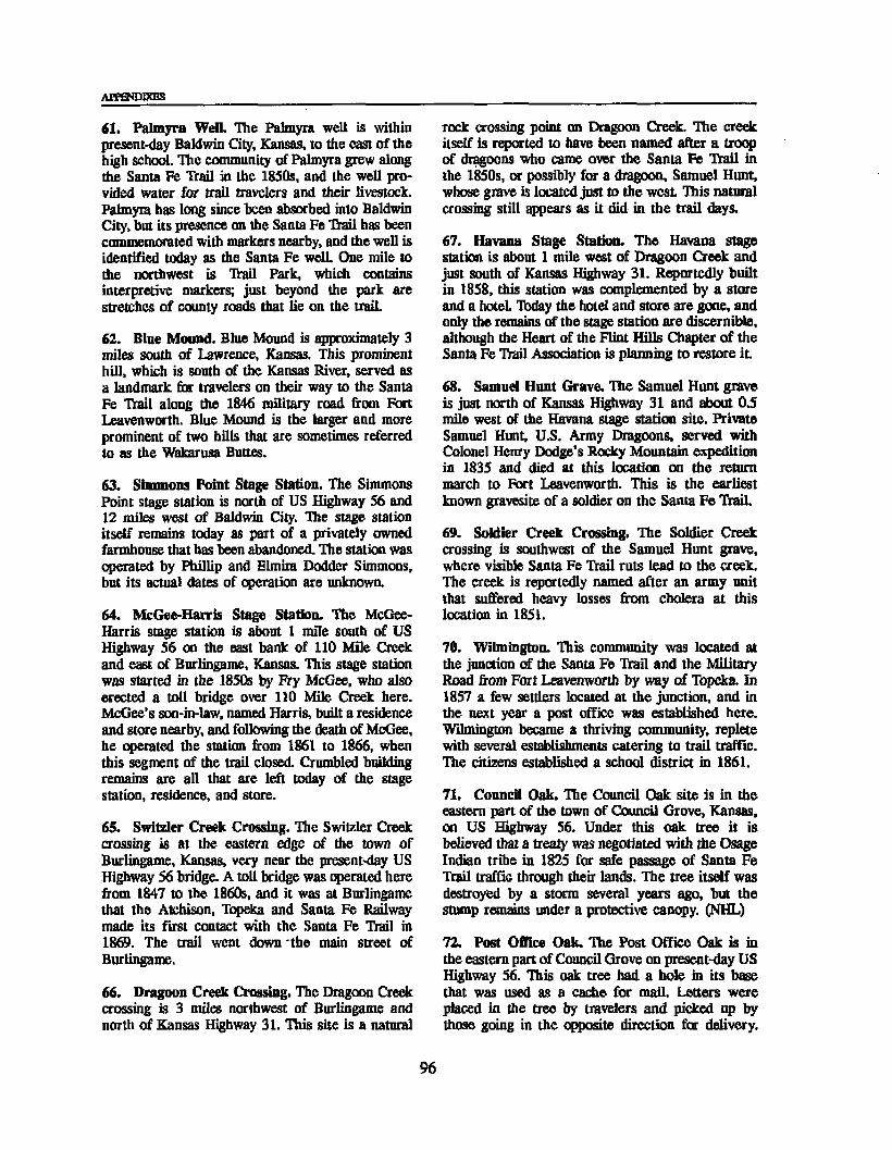
AFPHTOIXES
61. Palmyra Well. Hie Palmyra well is within present-day Baldwin City, Kansas, to the east of the hjgh school. The community of Palmyra grew along the Santa Fe Trail in the 1850s, and the well provided water for trail travelers and their livestock. Palmyra has long since been absorbed into Baldwin City, but its presence on the Santa Fe Trail has been commemorated with markers nearby, and the well is identified today as the Santa Fe well. One mile to the northwest is Hail Park, which contains interpretive markers; just beyond the park are stretches of county roads that lie on the traiL
62. Bine Mound. Blue Mound is approximately 3 miles south of Lawrence, Kansas. This prominent hill, which is south of the Kansas River, served as a landmark for travelers on their way to the Santa Fe Hail along the 1846 military road from Fart Leavenworth. Blue Mound is the larger and more prominent of two hills that are sometimes referred to as the Wakarusa Buttes.
63. Simmons Point Stage Station. The Simmons Point stage station is north of US Highway 56 and 12 miles west of Baldwin City. The stage station itself remains today as part of a privately owned farmhouse that has been abandoned. The station was operated by Phillip and Elmira Dodder Simmons, but its actual dates of operation are unknown.
64. McGee-Harris Stage Station. The McGee- Harris stage station is about 1 mile south of US Highway 56 on the east hank of 110 Mile Creek and east of Burlingame, Kansas. This stage station was started in the 1850s by Fry McGee, who also erected a toll bridge over 110 Mile Creek here. McGee’s son-in-law, named Harris, built a residence and store nearby, and following the death of McGee, he operated the station from 1861 to 1866, when this segment of the trail closed. Crumbled building remains are all that are left today of the stage station, residence, and store.
65. Switzler Creek Crossing. Hie Switzler Creek crossing is at the eastern edge of the town of Burlingame, Kansas, very near the present-day US Highway 56 bridge. A toll bridge was operated here from 1847 to the 1860s, and it was at Burlingame that the Atchison, Topeka and Santa Fe Railway made its first contact with the Santa Fe Trail in 1869. The trail went down the main street of Burlingame.
66. Dragoon Creek Crossing. The Dragoon Creek crossing is 3 miles northwest of Burlingame and north of Kansas Highway 31. This site is a natural
rock crossing point on Dragoon Creek. Hie creek itself is reported to have been named after a troop of dragoons who came over the Santa Fe Hail in the 1850s, or possibly for a dragoon, Samuel Hunt, whose grave is located just to the west This natural crossing still appears as it did in the trail days.
67. Havana Stage Station. The Havana stage station is about 1 mile west of Dragoon Creek and just south of Kansas Highway 31. Reportedly built in 1858, this station was complemented by a store and a hotel. Today the hotel and store are gone, and only the remains of the stage station are discernible, although the Heart of the Flint Hills Chapter of the Santa Fe Trail Association is planning to restore it
68. Samuel Hunt Grave. The Samuel Hunt grave is just north of Kansas Highway 31 and about 0.5 mile west of the Havana stage station site. Private Samuel Hunt, U.S. Army Dragoons, served with Colonel Henry Dodge’s Rocky Mountain expedition in 1835 and died at this location on the return march to Fort Leavenworth. This is the earliest known gravesite of a soldier on the Santa Fe TraiL
69. Soldier Creek Crossing. The Soldier Creek crossing is southwest of the Samuel Hunt grave, where visible Santa Fe Hail ruts lead to the creek. The creek is reportedly named after an army unit that suffered heavy losses from cholera at this location in 1851.
70. Wilmington. This community was located at the junction of the Santa Fe Hail and the Military Road from Fort Leavenworth by way of Topeka. In 1857 a few settlers located at the junction, and in the next year a post office was established here. Wilmington became a thriving community, replete with several establishments catering to trail traffic. Hie citizens established a school district in 1861.
71. Council Oak. The Council Oak site is in the eastern part of the town of Council Grove, Kansas, on US Highway 56. Under this oak tree it is believed that a treaty was negotiated with the Osage Indian tribe in 1825 for safe passage of Santa Fe Hail traffic through their lands. The tree itself was destroyed by a storm several years ago, but the stump remains under a protective canopy. (NHL)
72. Post Office Oak. The Post Office Oak is in the eastern part of Council Grove on present-day US Highway 56. This oak tree had a bole in its base that was used as a cache for mail Letters were placed in the tree by travelers and picked up by those going in the opposite direction for delivery.
96

Appendix C: High-Potential Historic Sites and Segments
This “post office" was used by trail travelers from the 1820s to about 1847, when Seth Hays established a trading store at Council Grove. Today only a portion of this tree still stands. (NHL)
73. Neosho River Crossing. The Neosho River crossing is about where US Highway 56 bridges the Neosho River at Council Grove. This was an important river crossing on the Santa Fe Trail. The steep banks and high water sometimes made crossings difficult and prompted other crossings close to the highway bridge.
74. Hays House Restaurant (Frame Store). The Hays House Restaurant is on Main Street in Council Grove. Seth Hays came to Council Grave in 1847 to trade with the Kaw Indians, whose reservation was nearby. He originally built a log house, out of which he traded, and then in about 1859 he put up the large building originally called the Frame Store. It is that replacement store that has been remodeled as the Hays House Restaurant. Some of the original timbers may be seen in the basement The building has seen many uses, including a general store, hotel, saloon, and courthouse. The restaurant claims to be the oldest restaurant west of the Missouri River. (NHL)
75. Conn/Stone/Pioneer Store. The Conn Store is in Council Grove on the south side of US Highway 56 (Main Street) at Neosho Street, in the town’s business district This store was considered to be one of the most important trading stores in Council Grove during the Santa Fe Trail era. The building was erected in 1858, and although much altered from its original state, it is still in use by a local business.
76. Seth Hays House. The Seth Hays house is in Council Grove about two blocks south of Main Street (US Highway 56). Built in 1866, this house was lived in by Seth Hays, bis black maid, and his adopted daughter. The house is important because of Hays’s prominence in Council Grove and his connection with the Santa Fe traders. It is one of the few trail homes in the area that has been preserved in nearly original condition, and it is currently operated as a museum. (NHL)
77. Kaw Mission. The Kaw Mission is on the northern edge of the town of Council Grove. Built about 1850 as a school for Kaw Indian children, it became a school for white children when the Indians refused to send their children to classes there. It was the first all-white school in Kansas. Today the building is one of the oldest buildings still standing
in this part of Kansas and is operated by the Kansas State Historical Society as a museum. (NR)
78. Hermit’s Cave. Hermit’s Cave is two blocks north of US Highway 56 (Main Street) on Belfry Street in Council Grove. On this site is a small cave that was reportedly the home of an Italian religious mystic, Giovanni Augustini, for a few months before he traveled to New Mexico on the Santa Fe Trail.
79. Last Chance Store. Last Chance Store is west of the Council Grove business district on the north side of US Highway 56. This store has become known as the most famous, but not the largest nor the most important, trading store in Council Grave during the trail era. Built in 1857, the privately owned building remains today in a nearly original state. (NHL)
80. Diamond Spring. Diamond Spring is near the headquarters of the Diamond Spring Ranch southwest of Council Grove. This site was a campsite favored by Santa Fe Trail travelers because of the high-quality springwater. It was known during the trail era as the "Diamond of the Plains." A stage station and small settlement grew up here prior to the Civil War, but these were destroyed in a raid by Missouri bushwhackers, led by Dick Yeager, in 1863. The station was never rebuilt, but Diamond Spring continued to be a valuable water source and popular campsite as long as the trail was active in this vicinity. (NR)
81. Six Mile Creek Crossing and Stage Station Site. The Six Mile Creek crossing and stage station site are on the road that runs south from US Highway 56 toward the town of Burdick, Kansas, and just south of the bridge over Six Mile Creek. Six Mile Creek was named because it is 6 miles from Diamond Spring. There arc good trail ruts coming into the crossing site from the east, but the actual crossing is no longer visible. The stage station opened about 1863 after the Diamond Spring station was destroyed. The station was in use until 1866 or 1867, when the stage line moved to Junction City, Kansas, because of railroad construction. A ranching operation was headquartered at this site after the station was abandoned, and the station building served as the ranch house until after the turn of the century. Today only the basement walls and some debris from the upper stories can be seen, with some trail ruts nearby.
82. Lost Spring. Lost Spring is 2.3 miles west of the town of Lost Springs on the north side of a paved road. Lost Spring was a valuable source of
97

appendices
water for trail travelers and was also used for a trading ranch, stage station, and campground. The spring still flows today, and wagon ruts are visible near the crossing of the small creek on the south side of the paved road. (NR)
83. Cottonwood Creek Crossing. The Cottonwood Creek crossing is about 1 mile west of the town of Durham, Kansas. This site was a major campsite on the Santa Fe Trail, but was widely known as a difficult crossing because of the steep banks and occasional high water. There were several instances when wagon trains were caught here by blizzards and suffered losses of both livestock and human lives. This was also the site of a stage station and the largest trading ranch west of Council Grove on the trail. George Smith started the stage station and trading ranch about 1856, and this site became the first post office in Marion County. A. A. and fra Moore bought the property in 1859 and operated it until the railroad came to the area in 1870-71. Today nothing remains of the crossing or the ranch, but a few wagon ruts may still be seen northeast of Cottonwood Creek, and there is an outstanding segment of ruts southwest of this stream.
84. Durham Ruts. An outstanding set of ruts extends southwest to northeast across unbroken prairie land on the Scully property southwest of Durham, Kansas.
85. Miller Grave. The Ed Miller grave is in Jones Cemetery, which is 2.25 miles east and 0.5 mile north of Canton, Kansas. In 1864, 18-year-old Ed Miller was killed by the Cheyenne Indians as he rode to warn residents at a trading ranch that Indians were raiding in the area. He was buried near the site of his death, and the site became a cemetery after the area was settled.
86. 1825 Kaw Treaty Site. The site of the 1825 treaty with the Kansa Indians is 1 mile south of Elyria, Kansas, just north of a gravel road (FAS 445) and east of Dry Turkey Creek. In 1825 the Santa Fe Trail survey commissioners met at this site with members of the Kansa or Kaw Indian tribe to negotiate permission for the trail to pass through the their lands. The Kansa then lived north of the Kansas River and east of present Manhattan, and the trail crossed only a small segment of their lands. The Kansa Indians were to have gone to Council Grove to meet with the commissioners immediately following the Osage Treaty, but they failed to arrive in time and had to follow them down the trait The Indians caught up with the commissioners at Dry Turkey, where the treaty was signed.
87. Little Arkansas River Crossings. The two crossings of the Little Arkansas River are 5 miles south of US Highway 56 on county road 443 an the McPherson-Rice county line, and then 0.5 mile west The upper crossing is marked by a cottonwood (the "Marker Cottonwood"), which still stands and is surrounded by wagon ruts from the Santa Fe Trail caravans. The lower crossing is no longer visible. Stones were placed in the river bottom of the upper crossing to provide a firm surface for the wagons, and these stones are reportedly visible when the stream is dry. A toll bridge was built at the lower crossing in the late 1850s or early 1860s, and the areas on both sides of the river were popular campsites for trail travelers.
88. Military Camp (Camp Grierson). Camp Grierson is south of the lower crossing of the Little Arkansas River and south of the present-day county road. The camp was established in the summer of 1865 to protect the crossings and the trading ranch there during a period of Indian unrest The camp was manned once more in 1867 by one company from the black regiment of the 10th Cavalry. It was at this time that the troops established a more permanent position and named it Camp Grierson. After several months the troops were withdrawn. Some of the earthworks of the camp are stilt visible south of the county road on the east side of the river. Several soldiers were killed by Indians in the vicinity (some of these were deserters from units farther west) and buried near the camp, but the larger number of dead buried there were black soldiers who died of cholera while stationed at Camp Grierson. The bodies were later removed to the Fort Leavenworth National Cemetery, but the burial pits may still be seen south of the military campsite.
89. Stone Corral Site. The stone corral site is on the south side of the lower crossing of the Little Arkansas River, just north of the existing county road. This corral was probably the most famous structure at the crossings and was built in connection with the trading ranch and stage station there. Stone for the corral was quarried 2 miles away. The corral was used from the early 1860s until after the Santa Fe Trail was abandoned. At some later time the stone walls were dismantled, and the stone was used for construction at other locations. Today no trace remains of the corral.
90. Jarvis (Chavez) Creek Crossing. The location of the Jarvis (Chavez) Creek crossing is reportedly near the center of section 17 in Wilson Township, west of the Little Arkansas River and along Jarvis
98

Appendix C: High-Potential Historic Sites and Segments
Creek in Rice County. This site is important because Antonio Jose Chavez, a Hispanic trader, was murdered here in 1843. This murder became an international incident, with ramifications in Washington, D.C., and Mexico City.
91. Cow Creek Crossing, The Cow Creek crossing is 4 miles west of Lyons on US Highway 56, 1 mile south, and then west to a bridge over Cow Creek. The actual crossing was just south of the present bridge. Cow Creek was an important campground and crossing where a trading ranch and stage station developed in 1858. The ranch and stage station were built east of the crossing by Asahel and Abijah Beach in 1858. A well was dug at approximately the same time to provide water for livestock and for travelers on the Santa Fe Trail. A toll bridge was built over Cow Creek in 1859. The present bridge is believed to be below the site of the original, which was reportedly just north of the old crossing of Cow Creek. Looking south from the west end of the present bridge, stones for crossing the streambed were identified during the drought of 1988.
92. Beach Ranch (Buffalo Bill’s) Well Buffalo Bill’s well is 4 miles west of Lyons, on US Highway 56 and then 1 mile south on a gravel road. At this point two gravel roads intersect, and the well is in the northwest quadrant of that intersection, very near the road. The well was originally dug to serve the Beach ranch at Cow Creek crossing, providing water for livestock as well as for travelers on the Santa Fe frail. Sometime after 1860 William Mathewson, who was known as Buffalo Bill, purchased the Beach ranch (also called the Cow Creek ranch) and operated it until 1866. (Mathewson was known as Buffalo Bill because he helped supply buffalo meat to starving settlers in Kansas Territory during the severe drought of 1859-60).
93. Ralph’s Ruts. These ruts are 4 miles west of Chase, Kansas, on US Highway 56, then 0.75 mile north an the Ralph Hathaway farm. The seven parallel trail ruts are some of the finest examples of pristine trail remains any place along the entire route. Visitors to the site have easy access, a turnout for parking, and a DAR marker to point out the location. In addition, evidence indicates that the so- called Plum Buttes Massacre of 1867 occurred near the eastern boundary of the Hathaway quartersection. Extending westerly from here, the ruts continue on intermittently for another 2 miles, where they form the spectacular Gunsight Notch, a ridge worn away by 60 years of commercial and military traffic.
94. Plum Buttes. The Plum Buttes were 4 miles west of Chase, Kansas, an US Highway 56, 1 mile north on a gravel road, and then 1 mile west Plum Buttes referred to several very large sand dunes that were covered by plum bushes. These highly visible dunes became landmarks for travelers on the Santa Fe Trail, who sought to avoid the soft, sandy, and nearly impassable soils along the Arkansas River. Plum Buttes was a favorite nooning spot on the trail, and because it was the only landmark in the vicinity, it was often used as a reference point to delineate the location of significant events. Thus, the 1867 massacre near Ralph’s Ruts, 1 mile east, is known as the Plum Buttes Massacre. The last dune, still visible in the 1870s and 1880s, had disappeared because of wind erosion by 1900.
95. Walnut Creek Crossing - Barton County, Kansas. The Walnut Creek crossing is about 2 miles east of Great Bend and south of US Highway 56. The crossing included a trading ranch, toll bridge, and military post. When the creek flooded, wagon trains would camp on its banks for days waiting to cross. It was one of the first streams in the region to have a toll bridge. (NR)
96. Allison and Booth’s Fort or Ranch and Peacock Ranch Trading Post Site. The sites of these small trading posts are 2 miles east of Great Bend, Kansas, and south of US Highway 56, near the Walnut Creek crossing. William Allison and Francis Booth(e), formerly conductors for Waldo, Hall and Company on the Santa Fe mail run, opened a post on the north side of the trail and east of the Walnut crossing in 1855, in the heart of Plains Indian lands. They established trade with the Plains tribes and also sold supplies to trail travelers. Booth was killed by a disgruntled employee in 1857, and Allison died in 1859 at Independence, Missouri, while on a trip to purchase supplies. George Peacock apparently acquired the trading rights from Allison’s estate, and thereafter evidently constructed a new stone building as a trading post. Peacock was killed by the Kiowa war chief Satank in I860, and the trading rights then went to Charles Rath. Rath operated the ranch until 1867, when the army ordered him out for selling arms, ammunition, and whiskey to the Indians. The Indians burned the post a few months later, and today only the foundations, remain.
97. First Fort Zarah Site. The first Fort Zarah was established in 1864 to help protea mail service on the Santa Fe frail. The fort was about 200 yards west of the trading ranch on the east side of Walnut Creek and north of the crossing toll bridge. This
99

APPENDIXES
was also at or near the point where the Fart Harker-Fort Riley military road met the Santa Fe Trail. The mail station and canals were on the south side of Walnut Creek, across the creek from the fort. The foundations of this structure have been partially excavated.
98. Second Fort Zarah Site. The second Fart Zarah site is on the north side of US Highway 56, about 2 miles east of Great Bend, Kansas, and about 0.5 mile east of the roadside park. This second fort was built in 1867, about 0.5 mile north of the first one. This was a more permanent post, comprised of a large stone building with quarters for officers and troops, kitchens and mess halls, storerooms, and other functions. This post was abandoned in 1869, when it was felt that the Indian threat was not sufficient to warrant a second post so close to Fort Larned.
99. Pawnee Rock, Pawnee Rock is 0.5 mile north of US Highway 56 on the north edge of the town of Pawnee Rock, Kansas. Pawnee Rock was one of the best known natural features along the Santa Fe Trail in Kansas. Although some of the rock was removed by settlers and the railroads for construction materials, one can still enjoy panoramic views across the prairie from this relatively high landmark. It is administered by the Kansas State Historical Society. (NR)
100. Ash Creek Crossing. The Ash Creek crossing is 5 miles southwest of Pawnee Rock. This was not a difficult crossing, but nonetheless it developed into a campsite for Santa Fe Trail travelers. This site is historically significant because Susan Shelby Magoffin’s carriage upset here and she later miscarried as a result of the accident
101. Pawnee Fork Crossings. There were three crossings of the Pawnee Fork. One, the wet route or river road crossing, was on the south edge of the present town of Larned, Kansas; the second, the dry route crossing, was on the west edge of the present Larned State Hospital grounds; and the third, apparently established as a stage line crossing, was approximately 0.5 mile east of the present site of Fort Larned National Historic Site. The wet route crossing is no longer visible. The dry route crossing site may still be seen and crossed by means of a small bridge. It was a difficult crossing at times, and a campsite was developed there. A mail and stage station was located at this crossing in 1859, and this led to the establishment of Fart Larned, first located nearer this crossing than the present military post. Just west of this crossing was a trading ranch.
Boyd's Ranch, which was just off the Fort Lamed Military Reservation and thus could provide off-post entertainment in the farm of liquor, gambling, and prostitutes. It has not been determined when the third crossing was established or how long it was used, but it was apparently used by a stage line. The hulk of trail traffic likely used the dry route crossing where Boyd’s Ranch was located.
102. Fort Larned National Historic Site. Fort Larned National Historic Site is on Kansas Highway 107, 6 miles west of Larned. Active from 1859 to 1878, Fort Larned was one of the major military installations on the Santa Fe Trail (only Fort Union in New Mexico was larger). Nine of the ten original stone buildings remain today, and the tenth was reconstructed in 1988. This is one of the best preserved frontier military posts in the American West, as well as on the entire Santa Fe Trail. Restoration and refurnishing of the fort are nearly completed. One building has been adapted to serve as museum, interpretive center, and administrative office. A set of Santa Fe Trail wagon ruts is located in a detached area 5 miles south of the fort. (NHL)
103. Coon Creek Crossing. The Coon Creek crossing is just north of US Highway 56, about 1-5 miles west of the town of Garfield, Kansas. Wagon ruts are still visible on the north bank of the creek.
104. Black Pool. The Black Pool is about 4 miles east of Ford, Kansas (1 mile north on Kansas 154, across the Arkansas River, 3.5 miles east on the first gravel road and then 0.5 mile south to a pasture). The well-preserved pool is about 0.25 mile into the pasture and is beside the Santa Fe Trail wet route and near the Arkansas River. Well-defined trail ruts are nearby. The Black Pool is a spring, and the water appears to be black when viewed from above because of an underlying shelf of shale. Many inscriptions have been left in the rock ledge above the pool, including one that states "BLACK POOL US POST 1843," although its authenticity has not been established. This pool is not identified in any Santa Fe Trail literature nor is it identified in military records, but the location matches that of an incident in 1843 when U.S. troops commanded by Capt. Philip St. George Cooke captured the Texan Snively expedition nearby.
105. Lower Crossing. The Lower Crossing of the Arkansas River is near where Kansas Highway 154 crosses the river about 1 mile north of Ford. This stream crossing was used by some early wagon trains on the Santa Fe Trail, and it was one of several crossings of the Arkansas. The area from
100

Appendix C: High-Potential Historic Sites and Segments
here to the Cimarron River was known as the Cimarron Desert or La Jornada. There is evidence that this was an ancient river crossing used by Indians in prehistoric times. The Lower Crossing was not used much after the early 1830s because the distance from the Arkansas to the Cimarron River was shorter from the Middle and Upper crossings. In addition the dry route, from near Pawnee Rock to the site where Fart Dodge was later established, rejoined the Arkansas River west of this- crossing.
106. Fort Dodge. Fort Dodge is about 2.5 miles east of Dodge City on Kansas Highway 154, The post was founded in 1865 to help protect a long section of the Santa Fe Trail. The fart site had been previously used as a campsite by trail travelers because the wet and dry routes rejoined at this point. A stage station preceded the fort, but it was burned by Indians. From this fort Gen. Phil Sheridan launched his winter campaign of 1868-69, and Fort Dodge was the point from which supplies were sent by wagon train into the field for that campaign. Those supplies came to Fort Dodge via the Fort Hays-Fort Dodge road. Fort Dodge troops were also charged with the protection of stagecoaches, mail, and railroad construction crews. The fort was removed from service in 1882. Today the former fort serves as the Kansas State Soldiers Home. Several original buildings remain, including the commanding officer’s quarters, several officers' quarters, enlisted men’s barracks, and the post hospital. Although they have been remodeled, they illustrate army life along the Santa Fe Trail.
107. Walnut Creek Crossing - Rush County, Kansas. The Walnut Creek crossing at this site (section 20, T18S, R20W) was a difficult one. A bridge and trading ranch were established here by a Mr. Fink, according to local tradition. Alexander Harvey, a former soldier, was the recorded owner and operator beginning in 1872. He also had a "fort" or stockade for protection, and he operated a toll bridge. The town of Alexander developed around his trading ranch. A state marker is at the site. The Fort Hays-Fort Dodge road was an important branch of the Santa Fe Trail from 1867 to 1872. When the Union Pacific Railroad, Eastern Division, reached Hays in 1867, all military freight and most commercial freight destined for Santa Fc and beyond was shipped by rail to Hays and then hauled by wagon to the main Santa Fe Trail near Fort Dodge. Hie volume of military freight was immense during 1867-69, a period of warfare with Plains Indians. This branch came to an end in 1872, when the Santa Fe Railroad reached Dodge City.
108. Pawnee Fork (Duncan’s Crossing). The Pawnee Fork crossing is 5.4 miles north of US Highway 156 in Hodgeman County, Kansas (section 8, T21S, R21W), on the Fart Hays-Fart Dodge road. This site was also a trading ranch and toll bridge site. The crossing was built and developed by John O’Laughlin in 1869 and later sold to George Duncan. Ruts made by Santa Fe Trail wagon traffic, and the creek bank cutdowns, can still be seen.
109. Sawlog Creek Crossing. The Sawlog Creek crossing was on the Fort Hays-Fort Dodge road. It is on the Warner ranch, about 15 miles northeast of Dodge City (sec. 6, T25S, R23W). There are well-defined wagon ruts and cutdowns on both sides of the crossing.
110. The Caches Site. The Caches, located in section 29 or 30, T26S, R25W, was an oft-noted landmark on the trail. These famous pits, commented on by numerous trail travelers, were dug out in 1822-23. A trading party led by James Baird and Samuel Chambers set out from Missouri late in 1822. Their pack train was caught by a blizzard near this site. They lost their pack animals to the harsh weather. Later, in 1823, they dug pits to cache their goods, went to New Mexico to purchase mules, and came back and dug up their goods and took them to Santa Fe. The pits were left open. Numerous travelers thereafter commented about the pits, which became a landmark on the trail, although no evidence of them remains today.
111. Point of Rocks - Ford County, Kansas. About 2.3 miles beyond Dodge City and on the north side of US Highway 50 is a low rounded hill that until recently had a large rocky face protruding on the south end. Called Point of Rocks - the first of several along the trail - it was a major landmark for trail travelers. Two of the earliest trading expeditions to New Mexico, the Cooper party outbound and the Fowler party returning to Missouri, met here on June 12, 1822. The famous rock protrusion was destroyed in 1981 when the Kansas Highway Department widened the road.
112. Fort Mann Site. The Fort Mann site is about 1 mile west of Dodge City on US Highway 50. Fort Mann was established in April 1847 because the Army needed a post midway between Fort Leavenworth and Santa Fe to repair wagons and replace animals. It was a quartermaster repair station with a log stockade for protection, and it was erected under the direction of Daniel P. Mann. Although not a regular military post, Fort Mann was defensible and occasionally occupied by regular troops, such as the
101

APPENDIXES
Indian Battalion of Missouri Volunteers in 1847-48. It was abandoned in 1848.
113. Fort Atkinson Site. The Fort Atkinson site is about 2 miles west of Dodge City on US Highway 50 and was originally established as Camp Mackay on August 8, 1850, to control Indians and to protect the Santa Fe Trail. On June 25,1851, a newly built fort was officially designated as Fort Atkinson. Being constructed of sod, it was popularly known as "Fort Sod" or "Fort Sodom," and it was the first fully garrisoned fort to be erected along the Santa Fe Trail. Its mission was to protect the trail from Indian raids. It was not successful. Atkinson was abandoned permanently on October 2,1854, because of its inadequate buildings and the difficulty and expense of supplying it. Attempts were made to protect this section of the Santa Fe Trail with summer patrols of troops from 1855 to 1859.
114. Santa Fe Trail Ruts. This excellent set of ruts is 9 miles west of Dodge City on the north side of US Highway 50. It is owned and managed by the Boot Hill Museum, which permits visitors to walk to the site of the parallel ruts. The Kansas Highway Department has provided a turnout and parking area for easy access. (NHL)
Arkansas River, and finding this spring meant the travelers had survived La Jornada. Campgrounds were developed at this site. After use along the Santa Fe Trail and during the era of cattle drives from Texas, this site became known as Wagon Bed Springs, the result of cowboys sinking an old wagon bed in the spring. (NHL)
117. Middle (Cimarron) Spring. Middle Spring is 8 miles north of Elkhart on Kansas Highway 27, and about 1 mile west on a dirt road through Cimarron National Grassland to a small enclosed park on the north side of the road. After Lower Spring, Middle Spring was the next reliable water source for travelers in the Cimarron Valley. This made it a major stopping point and campsite on the Santa Fe Trail.
118. Point of Rocks - Morton County, Kansas. This Point of Rocks is 8 miles north of Elkhart on Kansas 27 and 1.5 miles west on a dirt road through Cimarron National Grassland. It was a lookout along the Cimarron Valley for both Indians and traders, with one branch of the trail running between the rock and the river. This landmark remains as it was during the trail era, and it is still surrounded by grasslands, where wagon ruts can be seen.
CIMARRON ROUTE
Kansas Sites
115. Middle (Cimarron) Crossings. The Middle Crossings of the Arkansas River to the Cimarron River extended from the Caches site, about 2 miles west of Dodge City, to as far as Charleston, 26 miles farther west No crossings are visible today because of sandy soils and frequent floods. US Highway 50 along the Arkansas River closely follows the trail route and passes by the crossing sites. Almost all trail traffic followed the Cimarron route until the Civil War and shortly thereafter. Wagons were able to cross the Arkansas River virtually anywhere in this region due to its shallow flows. The Middle Crossings were the scenes of numerous Indian attacks during the trail era.
116. Lower Cimarron Spring. Lower Cimarron Spring is on the north bank of the Cimarron River, approximately 11 miles south and 1.5 miles west of Ulysses (about 2 miles west of the markers on Kansas 25 south of the river bridge). Lower Spring was well known to all travelers who took the Cimarron route because it was the first reliable water supply they encountered since leaving the
Oklahoma Sites
119. Willow Bar, Willow Bar is approximately 11 miles north and 11 miles east of Boise City, Oklahoma. Here the Santa Fe Trail crossed the Cimarron River, leaving the valley for higher ground and passing on both sides of Wolf Mountain. Willow Bar usually had water and was frequently used as a campsite. It was also the scene of Indian attacks and other problems.
120. Wolf Mountain. Wolf Mountain is between Willow Bar and Upper Spring on the Santa Fe Trail, about 9 miles north of Boise City on US Highway 286/385, and then to the northeast. Branches of the trail passed on both sides of this mountain on the way to Upper Spring.
121. Upper (Flag) Spring. Upper or Flag Spring is 9 miles north and 1.5 miles west of Boise City. Upper Spring is a beautiful setting, with a high rocky hill, the spring, a pond formed by an earthen dam, and views to the Cimarron Valley. It was a campsite on the Santa Fe Trail and also the scene of Indian troubles.
102

Appendix C: High-Potential Historic Sites and Segments
122. Cold Spring and Inscription Rock. Cold Spring 1 is 6 miles west and 8 miles north of Boise City. Inscription Rock contains the names of many Santa Fe Trail travelers from the 1840s and later. This site is believed to be the location of the stage station at Cold Spring.
123. Cold Spring and Autograph Rock. Cold Spring 2 is approximately 7 miles west and 7 miles north of Boise City. A branch of the Santa Fe "frail ran south of this spring site. Autograph Rock, which contains the names of many trail travelers from the 1850s and later, is nearby.
124. Camp Nichols. Camp Nichols is about 3.5 miles northwest of Wheeless, Oklahoma. Founded by Colonel Kit Carson, it was occupied for only a few months in 1865. The troops stationed here were charged with protecting travelers on the Cimarron and Aubry cutoffs. The soldiers built a stone wall around the parade ground and erected some officer’s quarters and other structures. This is the only military site on the trail in Oklahoma. Wagon ruts can still be seen about 0.5 mile south of the fort The site was also home to an army officer’s wife, Marian Sloan Russell, who wrote much about Camp Nichols in her book Land of Enchantment. (NHL)
125. Cedar Spring and Carrizozo Creek. Cedar Spring is near the Camp Nichols site, 3.5 miles northwest of Wheeless. This spring was the source of water for Camp Nichols as well as for Santa Fe Trail travelers. Names are carved in the nearby canyon walls of Carrizozo Creek, including members of the Penrose expedition, who were caught there in a blizzard in 1868, and T. O. Boggs, an expedition scout who later founded Boggsville in Colorado.
New Mexico Sites
126. McNees Crossing. McNees Crossing of Corrumpa Creek is 3.5 miles west of the Oklahoma state line, then 1.5 miles south on New Mexico Highway 406. This rock crossing (which is still visible) was named for a young trader, McNees, who was killed here by Indians in 1828. The crossing was also used as a campground, and a group of traders celebrated the Fourth of July in 1831. This site retains much of its original appearance. A division of the trail east of Camp Nichols rejoined the trail just east of McNees Crossing. Good wagon ruts may be seen in the area. (NHL)
127. Rabbit Ears. The Rabbit Ears (actually two peaks) are about 7 miles northwest of the town of Clayton, New Mexico (ranch/sec. 370) and about 1 mile north of the road. This landmark was named for a Cheyenne Indian called Rabbit Ears who was killed nearby. The trail ran several miles to the north, but it was a guiding landmark for the approach to McNees Crossing. (NHL)
128. Turkey Creek Camp. Turkey Creek camp is about 7 miles north of Rabbit Ears Mountain (ranch/sec, 370). The crossing of Turkey Creek was a difficult one. This site had water and a nearby supply of wood and good grazing land, making it a better campsite for Santa Fe Trail travelers than McNees Crossing. (NHL)
129. Rabbit Ears Creek Camp. The Rabbit Ears Creek camp is on private land about 6 miles north of the town of Mount Dora, New Mexico. This was considered an excellent campground, with spring- water, grass, wood, and game for food. Many wagon trains reportedly rested at this site for a couple of days. Wagon ruts are still visible. (NHL)
130. Mount Dora. Mount Dora is south of the Rabbit Ears Creek camp and north of US Highway 64/87, between Clayton and Mount Dora, New Mexico. Mount Dora was a landmark for travelers on the Santa Fe Trail, although it was not as significant as Round Mound. (NHL)
131. Round Mound. Round Mound is about 4 miles south of the intersection of US Highway 64/87 and New Mexico Highway 120 at Grenville, New Mexico. Round Mound was the major objective or steering point after Santa Fe "frail travelers left the Turkey Creek camp. The trail passed to the north of Round Mound, and travelers often commented on it. An illustration in Josiah Gregg’s Commerce of the Prairies (1844) shows a wagon train as seen from the mound. Today this site is known as Mount Clayton.
132. Sierra Grande. Sierra Grande, like Mount Dora, was a lesser landmark along this portion of the Santa Fe Trail.
133. Point of Rocks - Colfax County, New Mexico. The Point of Rocks in Colfax County is on private land about 8 miles north and 2 miles east of a roadside park on US Highway 56. This landmark was a popular campsite with a nearby spring. There was considerable violence at this site, including the killing of the White family in 1849,
103

appendixes
and there are 11 known gravesites, only one of which has been identified.
134. Rock Crossing of the Canadian River. The Rock Crossing of the Canadian River is on private land 2 miles south of US Highway 56 in Colfax County, New Mexico. This famous crossing was used by Indians from early times as well as later travelers on the Cimarron route. The crossing has a natural stone floor for a short distance only. Upstream it is sandy and hard to cross, while downstream a deep, rocky canyon makes it impossible to cross. This spot was considered to be the real entry into Mexico, and Mexican troops were sometimes sent this far to escort traders back to Santa Fe. It was also the site of several Indian raids on the caravans. Wagon ruts are still visible leading to and from this crossing.
135. Wagon Mound. The Wagon Mound is beside the town of Wagon Mound, New Mexico. This landmark was so named because it looks like a covered wagon being pulled by oxen, and it was one of the best-known landmarks on the Santa Fe Trail. Wagon Mound was the last major landmark on the Cimarron route and trail ruts lead both directions from there. In 1S50 a party of 10 men accompanying the express mail wagon on the Cimarron route were killed by Jicarilla Apaches near Wagon Mound. (NHL)
136. Santa Clara Spring. Santa Clara Spring is on private land about 2 miles northwest of the town of Wagon Mound. At the head of a small canyon, this spring was used by Santa Fe Trail travelers and still serves as the water source for the town of Wagon Mound. A trail campsite developed here, and the site was also the focus of several Indian attacks.
137. Pilot Knobs. The Pilot Knobs are 2 miles west of Wagon Mound in Mora County, New Mexico. They were used as a landmark far wagon trains, but they were not as important a landmark as the more visible Wagon Mound immediately to the east.
138. Watrous Store. The Watrous store (Doolittle Ranch house) is just north of the Mora River on US Highway 161 at Watrous. Samuel Watrous opened a trading store and made his home in this structure in 1349. This store catered to Santa Fe Trail travelers until the very end of the trail era. The town was originally known as La Junta and was renamed Watrous when the railroad reached the town. (NHL)
139. Barclay’s Fort Site. The Barclay’s Fort site is on the south bank of the Mara River, west of 1-25 at Watrous. Alexander Barclay opened his trading fort here in 1849; it also served as a stage station for a time. (NHL)
140. Sapello Stage Station. The Sapello stage station is just southwest of Watrous on the west bank of the Sapello River. Originally used by the Barlow & Sanderson Stage Company, this building has been somewhat remodeled to serve as a private residence. Wagon ruts are still visible nearby. Just north of the stage station is the probable junction of the Mountain and Cimarron routes. (NHL)
141. Sapello River Crossing. The Sapello River crossing is on the present road south of the Sapello stage station. (NHL)
142. Fort Union Corral. The Fort Union canal stands just south of the Sapello stage station at Watrous. This well-preserved stone corral was reportedly used by Fort Union troops as a livestock corral. (NHL)
143. Mora. Mora is about 30 miles north of Las Vegas on New Mexico Highway 518. Mora is a predominantly Hispanic town that was indirectly connected to the Santa Fe Trail by a trail segment that linked Watrous west to Mora and then south to Las Vegas. Ceran St. Vrain, a former partner of the Bent brothers, built a mill at Mora. The mill, St. Vrain’s former house, and his gravesite may still be seen. The mill was a major attraction for many traders who otherwise would have bypassed the town since the main trail was about 6 miles from Mora and went directly to Las Vegas. The hauling of milled flour from Mora to Fort Union accounted for a large part of the local trail traffic.
144. La Cueva. La Cueva is 25 miles north of Las Vegas on New Mexico Highway 518. A mill was established here in the 1850s and used until 1949. The adobe structure and the milling equipment still stand, badly in need of preservation. There was much traffic to this mill from Fort Union for flour, which was distributed to military posts throughout the region as well as along the trait
145. Hermit's Peak. Hermit’s Peak is between La Cueva and Las Vegas and can be seen from either New Mexico 518 or 1-25. The peak was named in honor of Giovanni Maria Augustini (or Augusti), after whom Hermit’s Cave in Council Grove, Kansas, is also named. Augustini traveled to New Mexico with a trading caravan and spent three years
104

Appendix C: High-Potential Historic Sites and Segments
in isolation on this peak. The peak was a landmark for trail travelers.
146. Las Vegas Plaza. The town of Las Vegas began as a Santa Fe Trail town in 1835. The trail passed through the plaza, and presumably many traders stayed here. It was from the top of the flat- roofed adobe structure, between numbers 210-218 on the north side of the plaza, that Brig, Gen. Stephen W. Kearny claimed the New Mexico territory for the United States in 1846.
147. Kearny Gap. Kearny Gap is 2 miles south of Las Vegas and west of 1-25. Also called Puerto del Norte, this pass was little used by Santa Fe Trail traffic prior to the Mexican War. Wagon ruts west of Kearny Gap indicate that it must have been used extensively by freight wagons after the Mexican War.
148. Puertocito Pedregosa. After leaving Las Vegas, travelers had to find an easy pass through the high ridge of hills. Two passes within a few miles were probably used, and the Puertocito Pedregosa was probably the most used. It is north of the railroad tracks and 1-25.
149. Tecolote. The town of Tecolote was founded at the Tecolote River crossing during the Santa Fe Trail era. The Tecolote Creek crossing is 12 miles south of Las Vegas on 1-25. This crossing was used well into the 20th century, and it is still visible. Wagon ruts in the hill to the south attest to the intensity of traffic.
150. Starvation Peak (Bernal Hill). Starvation Peak is about 5 miles southwest of Tecolote. Also known as Bernal Hill, this peak was a landmark for Santa Fe Trail travelers. Near this hill the trail swung to the west, and at this point were Bernal Spring and for a time a stage station.
151. San Miguel del Vado. San Miguel del Vado is south of 1-25 and about 26 miles southwest of Las Vegas. San Miguel was one of the first places where caravans crossed the Pecos River, and it was the first Hispanic settlement on the trail in New Mexico. For a time San Miguel was a port of entry, and traders often camped here. After Las Vegas was settled, San Miguel ceased to be important as a trail town and was bypassed. The old church at San Miguel was present throughout the trail period, and it still stands, although it has been remodeled. The plaza at San Miguel was formed by adjoining adobe houses and could be closed for defense against
Indian raids. Some of the houses are now gone, but the outline of the plaza can still be seen. (NR)
152. Glorieta Mesa. Glorieta Mesa runs west from the Pecos River far 25 miles along the south side of 1-25. Hie mesa served as a landmark on the Santa Fe Trail. The trail followed the valley along the north side of the mesa for 25 miles and then crossed Glorieta Pass to reach Santa Fe.
153. San Jose del Vado. San Jose del Vado is about 28 miles southwest of Las Vegas, in San Miguel County and south of I-25. This was a Mexican community on the west hank of the Pecos River. The adobe houses were built around the square, which could be closed for defease in times of Indian raids. The route of the Santa Fe Trail through San Jose was shorter than through San Miguel, and after Las Vegas was settled, this route came into greater use, and San Miguel subsequently declined as a trail town. The Pecos River crossing site cannot be seen today, but it is believed to be near the old bridge. Many of the old houses around the square remain.
154. Kozlowski’s Stage Station. Kozlowski's stage station is about 3.4 miles north of 1-25 on New Mexico Highway 63, on the former Kozlowski ranch (today known as the Forked Lightning Ranch). This was a trading ranch and stage station on the Santa Fe Trail, and it was known for its excellent food. Part of the ranch house and stage station make up the present-day ranch headquarters. The Kozlowski ranch also figured in the Civil War battles at Glorieta Pass, serving as Union headquarters before that engagement on March 28, 1862. (NHL)
155. Kozlowski’s Spring. Kozlowski's Spring is north of the stage station on the north side of a creek. Travelers developed a campsite here, and this site was later selected as the location for Kozlowski’s trading ranch. (NHL)
156. Pecos National Monument. Pecos National Monument is on New Mexico Highway 63, north of 1-25. This is the site of the Pecos Pueblo, which was the easternmost pueblo visited by Francisco Coronado in 1541. The pueblo was still inhabited when the Santa Fe Trail opened in 1821, but it was abandoned about 1838. The abandoned pueblo was used as a campsite by trail travelers. The pueblo was well known and often mentioned in the journals of trail travelers. Ruts of the trail are present. (NHL)
157. Apache Canyon, Apache Canyon is at the western end of Glorieta Pass and near Johnson’s
105

appendixes
ranch site on 1-25. Once a narrow wagon gap on the Santa Fe Trail, the canyon was enlarged during construction of the Santa Fe Railway and I-2S. Governor Manuel Armijo fortified this gap in 1846 to prevent U.S. forces from reaching Santa Fe. He withdrew without fighting. The Battle of Apache Canyon, which was the first Civil War engagement in the area, occurred on March 26, 1862. Union forces included Colorado and New Mexico volunteers. The Confederates were driven from the battlefield and many were captured. A small bridge in Apache Canyon (the remains of which may be seen today) was constructed by soldiers in the 1850s, and it figured in the Battle of Apache Canyon. When retreating Confederates crossed this bridge, they cut it and dropped the decking into the narrow ravine below, believing that would stop the pursuing Union soldiers. Mounted Union troops were ordered to jump their horses across the gap, and all hut one made it. Both sides were reinforced the next day, preparatory to the major engagement near Pigeon's ranch on March 28. (NHL)
158. Glorieta Pass. Glorieta Pass is on 1-25 between the Glorieta Mesa and the Sangre de Cristo Mountains, just west of Glorieta. In use by Indians since ancient times, this was not an easy pass to traverse; but because of the intensity of use, it was constantly unproved by both Santa Fe Trail travelers and the U.S. Army. Kearny’s Army of the West marched unopposed through this pass in 1846 on its way to Santa Fe. Later, the railroad built through this pass to reach Lamy. (NHL)
159. Pigeon’s Ranch and Glorieta Battlefield. Pigeon’s ranch is on New Mexico 50, about 3.4 mile southeast of the 1-25 exit at Glorieta in Santa Fe County. This ranch was founded by Alexander Valle and was a stage station on the Santa Fe Trail on the eastern side of Glorieta Pass. A section of the original ranch house remains today. The Civil War Battle of Glorieta Pass was fought on March 28, 1862, about 0.5 mile west of the ranch. The Confederate farces initially drove the Union troops from the battlefield, which extended across the Santa Fe Trail. As the Confederates were apparently winning this battle, other Union forces raced across the top of Glorieta Mesa to capture and destroy the Confederate supply train at Johnson’s ranch. This proved to be the decisive blow, and the Confederate forces were soon driven from New Mexico. (NHL)
160. Johnson's Ranch Site. The Johnson’s ranch site is on the western side of Glorieta Pass at the town of Canoncito, north of I-25. Founded by A. P. Johnson in 1858, this ranch was a trading ranch and
stage station on the Santa Fe Trail. In March 1862, while Johnson was absent, Confederate forces used the ranch as their headquarters during the Battle of Glorieta Pass. Nothing remains of this ranch today, but the town of Canoncito is located on the site. (NHL)
161. Santa Fe Plaza. The plaza is in the middle of Santa Fe and was the traditional end of the Santa Fe Trail for westbound travelers. (NHL)
162. Palace of the Governors. The Palace of the Governors is on the north side of the Santa Fe Plaza. Built in 1610, it served as the seat of government in New Mexico for 300 years. After occupying New Mexico for the United States in 1846, Kearny raised the U.S. flag over the palace and took up residence inside. It is now houses the Museum of New Mexico. (NHL)
163. Fort Marcy. Fort Marcy was built on the hill overlooking the city of Santa Fe in 1846, and some features are still visible. This was the headquarters for troops in New Mexico until Fort Union was built in 1851 to get the troops out of the Santa Fe environment
MOUNTAIN ROUTE
New Mexico Sites
164. Tiptonville. Tiptonville is northwest of Watrous, near New Mexico Highway 161. The small community grew up around the home of William Tipton. The Tipton home is gone, but the few' remaining buildings here are believed to date from the Santa Fe Trail era. (NHL)
165. Fort Union National Monument Fort Union National Monument is 8 miles northwest of die town of Watrous on New Mexico Highway 161, near the junction of the Cimarron and Mountain routes. Fort Union was the foremost military post on the Santa Fe Trail during the period 1851-91, and for a time it was the largest American military post in the Southwest. Founded primarily to protect the trail, the original structures had already deteriorated by the Civil War, and a star-shaped fortification was built After the Civil War, a third Fort Union was completed, which included a garrison and traditional post regional quartermaster depot and an arsenal on the site of the first fort The adobe ruins of the third fort and extensive Santa Fe Trail ruts comprise the bulk of the national monument
106

Appendix C: High-Potential Historic Sites and Segments
166. Ocate Crossing. The Ocate crossing is north of New Mexico Highway 120, 14.5 miles west of Wagon Mound and 1 mile north on a ranch road. This was a watering point and campsite, and wagon ruts are still visible on both sides of the crossing. This route was heavily used during and after the Civil War, and it was often mentioned by trail travelers. Kearny’s Army of the West crossed here in 1846 and camped nearby.
167. Lucien Maxwell House. The Lucien Maxwell house in Rayado is on New Mexico 21, 12 miles south of Cimarron. Rayado was started from a Santa Fe Trail campsite by Lucien Maxwell in 1848. Rayado was the point where the Mountain route and two of its side trails rejoined. There was a military camp at Rayado in the early 1850s to help protect this part of the Mountain route.
168. Cimarron Plaza and Well. The Cimarron Plaza and well are one block east of New Mexico Highway 21. Santa Fe Trail wagon trains entered the plaza from the east after crossing the Cimarron River. On the opposite side of the plaza was Maxwell’s mansion, built in 1864; it burned in 1885, (NR)
169. St. James Hotel. The St James Hotel is on the east side of New Mexico Highway 21 in Cimarron: This hotel was built next to the Santa Fe Trail in its later days and was reportedly a hangout for outlaws. The building has been restored and operates today as a hotel and restaurant
170. Aztec Mill. Aztec Mill is in the southwest corner of Cimarron. It was built in the 1860s to provide flour to the Maxwell ranch and the Jicarilla Apache Indian Reservation, as well as Santa Fe Trail travelers. Today it is operated as a museum.
171. Swink’s Gambling Halt Swink’s Gambling Hall is at the south edge of Cimarron. Built in the 1870s, it was a saloon and dancing hall during the later trail days. The building has been remodeled. (NR)
172. Clifton House. The Clifton house site is south of Raton on 1-25 and west of the junction with US 64. This house was a trading post and stage station, as well as a popular stop on the Mountain route. The Canadian River crossing is nearby. Only the remains of one wall are still standing at this site.
173. Willow Springs. Willow Springs is at 545 Railroad Avenue in Raton, New Mexico. This spring was at the south end of Raton Pass and was the site
of a campsite and stage station. The spring is now capped and used as a well by the current property owner. It was the landmark around which the town of Raton developed.
174. Raton Pass. Raton Pass sits astride the Colorado-New Mexico border. This pass was difficult to crass until the Army made improvements during the Mexican War, but it was not widely used until 'Uncle Dick" Wootton started improving it in 1864 as part of his toll road. The improvements prompted many travelers, including the stagecoach line, to switch to the Mountain route instead of following the Cimarron route. The pass today is the route of the railroad and 1-25. (NHL)
Colorado Sites
175. Wootton Ranch, The Wootton ranch is near 1-25 at the north entrance to Raton Pass, on the Colorado-New Mexico state line. This ranch is famous as the home of Richens Lacy "Uncle Dick" Wootton, who owned and operated the Raton Pass toll road. The ranch house was a copy of the Hough-Baca house in Trinidad, which was destroyed and then rebuilt by James Ownby in 1905 from plans available. The toll gate was near the ranch house.
176. Cruz Torres Grave. The Cruz Torres grave is on the Wootton ranch at Raton Pass. Cruz Torres was murdered near the ranch and was buried south of the ranch house.
177. Fisher’s Peak (Raton Mountain). Fisher’s Peak overlooks the entrance to Raton Pass between Trinidad, Colorado, and Raton, New Mexico. It was a landmark for Santa Fe Trail travelers, jutting out from the surrounding mesa.
178. Hough-Baca House. The Hough-Baca house is on US Highway 350 in Trinidad. It was built by a Santa Fe Trail merchant, John Hough, and later sold to the Baca family. The Santa Fe Trail passed near the house, and several of its present furnishings were brought west on the trail. The structure is now a state-operated museum. (NR)
179. Spanish Peaks. The Spanish Peaks are west- northwest of Trinidad. They can be seen from great distances along the Mountain route, and they served as landmarks for trail travelers.
180. Hole-ln-the-Rock Site. Hole-in-the-Rock is north of Thatcher. The name for this once
107

APPENDIXES
well-known landmark comes from a hole in the bed of Timpas Creek that was deep enough to retain water when the rest of the creek was dry. The railroad built a stone dam below the hole to get water for locomotive boilers. Over time, the entire impoundment silted in to the height of the spillway. A stage station was located near this site.
181. Iran Spring. Iron Spring is 11 miles west of Timpas, Colorado, on US Highway 350, and then 1 mile south on a gravel road. It was an important water supply on the trail and a stage station; it was also the scene of several Indian attacks. Trail ruts are still visible near the spring; a few building remains are nearby.
182. Arkansas River Crossing. The Arkansas River crossing was at the present-day site of La Junta, Colorado, and may have been one of several crossings in this area. Susan Magoffin, among others, used this crossing.
183. Bent’s Old Fort National Historic Site. Bent’s Old Fort National Historic Site is north of the Arkansas River, 8 miles east of La Junta on Colorado 194. The fort was an active trading post from 1833 to 1849, and it was of national importance to the opening of the American West. This fort has been faithfully reconstructed and is open to the public. (NHL)
184. Boggsville. Boggsville is about 2 miles south of Las Animas on Colorado 101. This small complex of two trading stares, owned separately by John W. Prowers and Thomas O. Boggs, was a stage stop on the Santa Fe Trail. Both buildings remain today in a deteriorated but stabilized state. (NR)
185. New Fort Lyon. New Fort Lyon is 1 mile south of US Highway 50 on Colorado 183, east of Las Animas. Active from 1867 to 1889, this post replaced the Old Fort Lyon and helped to guard the Santa Fe Trail and later the railroad line. The fort is now a veterans hospital, and some of the original buildings have been remodeled for use as part of the hospital complex.
186. Old Fart Lyon. Old Fort Lyon is less than 1 mile west of Bent’s New Fort. Originally called Fort Wise, this fort was built by the Army in 1860. A treaty with the Cheyenne and Arapaho Indians was signed here in 1861, but it was not honored by either side. Fort Lyon was deeply involved in the Indian troubles of this region during and after the Civil War. This fort was relocated in 1867, and today only a few foundations of the officers*
quarters remain. Santa Fe Trail wagon ruts are still visible north of this site.
187. Brat's New Fort. Bent’s New Fort is 1 mile west of the Prowers-Bent county line on US 50, then 1 mile south on Prowers County Road 35, 0.2 mile east, and 0.5 mile south. This fort was operated by William Bent from 1853 to 1860, when he leased the site to the U.S. Army. Only foundation ruins outline the post.
188. Old Granada Site, The Old Granada site is about 3 miles east of the town of Granada, south of the Arkansas River and on the route of the Santa Fe Railway. This was an end-of-track town on the railroad from 1873 to 1875. The railroad carried most of the freight of the Santa Fe Trail to this point, where it was loaded onto wagons for the trip through Emery Gap to New Mexico. After the railroad was extended farther west, the site was abandoned, and the new town of Granada was laid out a few miles to the west.
Kansas Sites
189. Fort Aubry and Aubry Crossing. The site of Fort Aubry is 3 miles east of Syracuse on US Highway 50, then 0.5 mile south on a rural road, 0.5 mile east on a rural road, and very near a farmstead on the south side of the road. The Aubry cutoff, opened by Francis X. Aubry in 1850, became an important route from the Arkansas River to the Oklahoma Panhandle because water supplies were more reliable along this route than along La Jornada. The Aubry crossing of the Arkansas River, approximately 3 miles downstream from the site of Fort Aubry, was used more than the Upper Crossing near Lakin, Kansas, and it rivaled the traffic at the Middle Crossings for about 10 years. The importance of this route led to the establishment of two military posts in 1865, Fort Aubry and Camp Nichols (in the Oklahoma Panhandle). First established as Camp Wynkoop in 1864, the name Fort Aubry was assigned in 1865. The fort was abandoned in 1866 and the site used for a stage station. The Aubry crossing has disappeared, but wagon ruts still delineate the trail here, and the spring still exists near the fort site. Remains of the fort consist mainly of three clusters of dugout depressions.
190. Indian Mound. Indian Mound is approximately 5 miles southwest of Lakin, Kansas. This is a natural landmark that was most likely used as a
108

Appendix C: High-Potential Historic Sites and Segments
lookout point by Indians and traders. The view front this mound is still impressive today.
191. Chouteau’s Island. Chouteau’s Island has disappeared because of erosion by the Arkansas River, but it was located due south of Indian Mound during the Santa Fe Trail era. The name Chouteau’s Island predated the trail, and the area became known as the Upper Crossing of the Arkansas River. The official survey of the trail went to this point before crossing the Arkansas River, and it was here in 1829 that the first military escort on the trail, comprised of troops of the Sixth Infantry led by Bennet Riley, camped while the trader caravan proceeded to Santa Fe. At that time the Arkansas River was the international boundary.
192. Upper Crossing. The Upper Crossing of the Arkansas River stretched from about a mile east of present-day Lakin, Kansas, to Chouteau's Island. This crossing was on the shortest route between the Arkansas and Cimarron rivers. Even though there were sand hills to negotiate, there was also a natural valley to follow for part of the distance. This crossing was used less than the Middle Crossings but much more than the Lower Crossing.
193. Kearny County Historical Society (Bentrup) Ruts. Located 3 miles west of Deerfield on US Highway 50 is a fine set of parallel ruts ascending a hill to the east. These are on the north side of the highway and marked with a Kansas Slate Historical Society marker. Paul Bentrup donated the site to the county historical society.
194. Point of Rocks/Pawnee Fort - Finney County, Kansas. This Point of Rocks is about 2.5 miles west of Pierceville and is on the north side of a road that parallels the Arkansas River and the Santa Fe Railway tracks. This is a minor landmark on the Santa Fe Trail, hut it is a reference point in several travel accounts.
109

Table C-l: High-Potential Route Segments
County/State
Main CorridorLyon County, Kansas
Marion County, Kansas Rice County, Kansas
Length (in miles! and Location
1.62 - north of Allen 1.38 - north of Admire 2.50 - southwest of Durham 0.70 - west of Chase 6.20
Cimarron RouteMorton County, Kansas Gray County, Kansas Cimarron County, Oklahoma
Union County, New Mexico
Colfax County, New Mexico
Mora County, New Mexico
2.50 - Cimarron National Grassland 0.88 - southwest of Ingalls138 - east of Wolf Mountain2.75 - west of Autograph Rock 1.25 - south of Camp Nichols6.62 - McNees Crossing
20.88 - Turkey Creek camp4.88 - south branch of trail6.50 ~ Rabbit Ears Creek camp
14.00 - Round Mound2138 - Point of Rocks
5.62 - south branch of trail 9.00 - northeast of US 56 1.25 - Rock Crossing6.88 - southwest of Rock Crossing
11.62 - northeast of Wagon Mound7.75 ~ southwest of Wagon Mound 4,00 - Watrous
129.14
Mountain RouteKearny County, KansasLas Animas County, ColoradoColfax County, New MexicoColfax and Mora Counties, New MexicoMora County, New Mexico
San Miguel County, New Mexico
1.62 - west of Lakin 7.88 - Hoehne to Model 3.00 - Clifton house6.75 - south of Rayado6.75 - north of Ocate
11.50 - Ocate to Fort Union8.00 - Fort Union to Watrous (La Junta)2.75 - San Miguel del Vado
48.25
Note: Segments that no longer retain remnants of the historic route or scene but that offer potential for recreational use or commemorative marking are not included in this list
110

APPENDIX D: MEMORANDUM OF UNDERSTANDING BETWEEN
THE NATIONAL PARK SERVICE AND
THE SOIL CONSERVATION SERVICE FOR
MUTUAL DEVELOPMENT OF PLANT MATERIALS FOR REVEGETATION
The National Park Service (NPS) administers the National Park System and manages the units of the system to conserve their scenic, natural, cultural, and wildlife resources in such a manner as to leave them unimpaired for the enjoyment of future generations. The NPS also provides technical assistance to Federal, State and local resource managers.
The Soil Conservation Service (SCS) provides national leadership in the conservation and wise use of soil, water, and related resources through a balanced cooperative program that protects, restores, and improves these resources.
As the NPS carries out its responsibilities, improvements are needed which require revegetation of disturbed areas with indigenous vegetation. Because many of the plants needed for revegetation exist only in their native stand and propagation techniques for their reproduction is lacking, returning disturbed sites to their pre-disturbed condition is extremely difficult
The SCS operates plant materials centers for the purpose of developing needed plant materials and methods for their propagation and use to help meet the mission of the agency. Similar revegetation needs to those of the NPS are part of continuing program activities at several plant materials centers.
There are opportunities for the NPS and the SCS to cooperate in the development of procedures for using plant materials that will assist in the revegetation of disturbed sites in NPS sites with indigenous species. Cooperative efforts can: (1) promote better resource management and protection; (2) improve public service; (3) provide better understanding of both agencies’ goals, objectives, and programs; (4) accelerate the development of needed plant materials for appropriate use on both public and private land; (5) provide a cost- effective means for coping with resource management decisions; and (6) advance the state of the reclamation and revegetation art.
I. PURPOSE
The purpose of this Memorandum of Understanding (MOU) is to:
A. Improve public service and management of natural and cultural resources through cooperative agency efforts.
B. Promote the early identification of opportunities for the NPS and SCS to cooperate in the development of needed plant materials and methods of propagating and reestablishment.
C. Establish guidelines that will foster this cooperation at every level of both agencies.
D. Cooperate in such a manner as to raise the public understanding of the mission of both agencies.
E. Establish a coordinating philosophy and policy under which more specific working agreements may be developed to foster plant propagation for use by specific parks.
F. Promote exchange of information on plants and propagation innovations relative to new technology and plant management
111

APPENDIXES
G. Study and develop reproductive techniques of endangered species where populations may be indigenous to specific parks.
II. AUTHORITY
This MOU is made under the authority of the Economy Act of 1932 (31 U.S.C. 1535).
III. scope
The provisions of this MOU extend to those activities of the NPS and SCS that impact the need far and the development of revegetation technology that might have application to NPS sites. These activities include but are not limited to:
A. Short-range and long-range selection and development of needed plant materials for revegetation by SCS plant materials centers nationally.
B. Short-range and long-range NPS development plans or past NPS use practices that might trigger the need far revegetation technology.
C. Development of needed methods and practices to enhance maintenance of endangered species.
IV. IT IS MUTUALLY AGREED TO:
A. Designate a senior level point of contact (POC) within the national headquarters to assist in identifying, coordinating and expediting the exchange of information regarding the need for plant materials technology by both agencies, and assist in arranging interagency agreements between individual NPS sites and SCS plant materials centers to address these needs where there is a mutual interest
B. Designate a National Technical Advisor (NTA) that assists the POC in developing and expediting specific interagency agreements between individual NPS sites and SCS plant materials centers, as appropriate, to address specific revegetation needs. The NTAs from both agencies will develop a guideline document to be used far development of individual park plant materials agreements and will coordinate all activities under the guidance of the POCs.
C. Designate members of joint technical working groups in broad geographic areas to identify mutual interests, assist in structuring Interagency Guidelines (IAGs) to meet multiple National Park System unit and plant materials centers objectives, review project accomplishments, assist in distribution of technical information, and define areas of future cooperation.
D. Provide technical reports from any joint studies as well as proposed press releases or other public affairs information related to joint efforts or projects for review by the other prior to release.
E. POCs will meet on a regular basis to identify problems of common interest, advance and promote joint programs, and provide coordination in planning. NTAs and additional staff may be invited to these meetings to provide appropriate technical expertise for review and comment. The POCs may convene ad hoc committees, as appropriate, to address specific issues.
F. Reference this MOU in IAGs and other supplementary and/or implementing documents so that details of cooperative efforts carried out between the two agencies are adequately documented.
112
Appendix D: Memorandum of Understanding
V. THE NPS AGREES TO:
A. Advise Regional, Denver Service Center and part employees of the existence of this MOU, and of the opportunity for cooperation with SCS for the development of needed plant materials technology.
B. Identify from their resource management and long-range development plans work that may create the need for plant materials.
C. Cooperate where applicable in coordinating with the SCS to develop park specific plant materials for reclamation revegetation efforts.
VI. SCS AGREES TO:
A. Advise plant materials centers of the existence of this MOU, and of the opportunity for cooperation with NPS for the development of plant materials and plant materials technology specifically designed to meet NPS needs.
B. Support IAGs, by providing resources and/or carrying out the provisions of IAGs, and provide technical expertise far performance, review or consultation in areas of mutual interest, subject to program priorities and budget constraints.
C. Provide NPS with financial and program information consistent with NPS management and financial accounting systems; and
D. Maintain consistency with NPS program and administrative management requirements, such as the non-use of exotic species on NPS land.
VII. AGREEMENT TERMS AND REVIEW
This agreement shall remain in force for a term of S years from the date of the last signature and is renewable after appropriate review and determination of effectiveness. This agreement can be terminated by either agency upon 90 days written notice. The NPS Director and the SCS Chief will periodically review the agreement and recommend any modifications or adjustments that would be desirable.
Nothing in this agreement will be construed as limiting or affecting the legal authorities of the NPS Director or the SCS Chief, or as binding upon NPS or SCS to perform beyond their respective authorities, or to require any of the parties to assume or expend funds in excess of available appropriations.
DIRECTOR CHIEFNATIONAL PARK SERVICE SOIL CONSERVATION SERVICE
DATE DATE
(Note: This understanding was signed on March 1, 1989. Currently, individual agreements are being developed by the National Park Service for specific actions.)
113

APPENDIX E: TRAIL USE GUIDELINES
COMPATIBILITY OF RECREATIONAL USES ALONG ADJACENT TRAILS
1) Hiking, horseback riding, and wagon use are highly compatible
2) Hiking, horseback riding, and wagon use are not compatible with auto tours; however, occasional glimpses of automobiles would probably not detract from visitor experiences (for example, at trailheads).
COMPATIBILITY
Sense of solitude, sharing amenities, safety, noise, dust, visual intrusion, historical authenticity of experience, potential to enhance experience
114

Appendix E: 7>ag Use Guidelines
COMPATIBILITY OF USES ALONG THE SAME TRAIL OR ROUTE
1) Horseback riding and wagon use could occur on the same trail.
2) Hiking and horseback riding could be combined where horseback use is slight.
Safety, trail surface
115

APPENDIXES
Trail Maintenance Guidelines:Trail Surfaces for Various Recreational Uses
Parallel Recreation Trails*Horse and Historic Ruts or
Hiking Trails______ wagon Trails Remnants__________
High-Intensity Use
Long Trails Soil cement, asphalt, Crushed gravel with Not applicablepea gravel road base
Short Trails Soil cement, asphalt, Crushed gravel with Not applicablepea gravel, boardwalks road base
Low-Intensity use
Long Trails Pea gravel, existing Crushed gravel with Revegetate surface assurface if well drained road base, existing needed; possibly allowand durable surface if well drained occasional walking in
and durable ruts if vegetation wouldprevent erosion
Short Trails Same as above Same as above Same as above
* Accessibility for mobility unpaired persons wilt require at least a 3-foot-wide maintained surface that is hard, level, and well-drained. The grade cannot exceed 1:12 (8.33 percent) for more than a 40-foot run before a 5- foot long/wide level rest area is provided. If the trail is not paved, side slope drainage will need to be provided under the trail, not across it, to prevent erosion. Waterbars cannot be used on an accessible trail.
116

APPENDIX F: RECOMMENDED SIGNS
Uniform marker

Recommended auto tour route sign incorporating uniform marker

Recommended auto tour/original trail route sign incorporating uniform marker

Recommended auto tour/trail crossing sign incorporating uniform marker; to be used only where deemed appropriate and safe (no use on interstates allowed)

Suggested site directional sign on auto tour route (to be provided by state/local highway department)
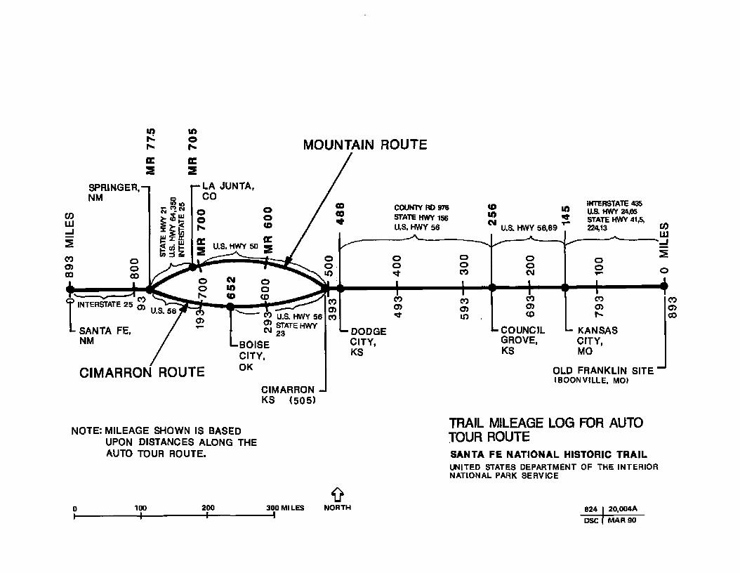
TRAIL MILEAGE LOG FOR AUTO TOUR ROUTESANTA FE NATIONAL HISTORIC TRAILUNITED STATES DEPARTMENT OF THE INTERIOR NATIONAL PARK SERVICE

APPENDIX G: PROVISIONS FOR COOPERATIVE MANAGEMENT
Table G-l: possible Provisions of Memoranda of Understanding and Cooperative Agreements
Parties to Agreements Trail Marking
Federal AgenciesNational Park Service
Other Federal Agencies (Forest Service, Fish and Wildlife Service, Corps of Engineers)
State Agencies and Local Governments
Landowners, Private Organizations, Corporations, and Individuals
Provide each nonfederal managing authority with a set of official markers for its sites or segments of the trail, to be erected in accordance with the marking program presented in the comprehensive plan.
Erect and maintain markers on sites or segments within federal areas in accordance with the marking program in the comprehensive plan.
Erect and maintain markers on certified sites or segments in accordance with the marking program in the comprehensive plan. Mark auto tour route. Mark historic side trails with the trail symbol.
Same as above.
What the Parties CouldManagement
Establish a management entity in the NPS Southwest Regional Office for overall trail administration and coordination activities. Manage portions of the trail passing through NPS areas.
Manage, protect, and maintain federal sites or segments in accordance with the comprehensive plan and any subsequent agreements.
Manage, protect, and maintain state or locally owned certified sites or segments in accordance with the comprehensive plan or certification. Develop management program for historic branches.
Same as above for privately managed certified sites or segments.
Agree to PoDevelopment
Develop, operate, and maintain trails and support facilities at NPS areas as prescribed by the comprehensive plan at NPS expense. Any fatalities developed would be in keeping with a site's general management plan.
Develop, operate, and maintain trails and support facilities as prescribed by the comprehensive plan (at each agency’s expense).
Develop, operate, and maintain trails and support facilities as prescribed by the comprehensive plan (at each agency's expense) or certification (on a cost- share basis).
Develop, operate, and maintain trails and support facilities as prescribed by the comprehensive plan (at each agency's expense) or certification (on a cost- share basis).
Interpretation
Provide appropriate public access and interpretation for segments passing through NPS areas, in accordance with a site’s general management plan. Recognize side trails.
Provide appropriate public access and interpretive opportunities for federal sites or segments (at each agency’s expense).
Same as above for state and locally managed certified sites or segments (on a cost-share basis).
Same as above for privately managed certified sites or segments (on a cost-share basis).

What the Parties Could agree to Do
Parties to AgreementsConsultation withAdvisory Council
Right-of-way Agreementswith Private Landowners
Land Exchangeok Acquisition
RULES ANDRegulations
Federal AgenciesNational Park Service Consult with council about
trail matters, including transmittal of concerns from managing authorities and returning council's advice to managing authorities.
Outside federal areas consider initiating agreements with owners of critical trail links where state and local governments fail to do so (NTSA, sec. 7[e]).
Consider acquisition of any needed private lands within the exterior boundaries ofNPS areas where agreements cannot be consummated (NTSA, sec. 7[d] and 10[c]).
After consulting with affected interests, promulgate regulations as necessary for proper administration and protection of the trail. Promulgate rules and regulations as may be necessary for NP5- managed segmenta.
Other FederalAgencies (ForestService, Fish andWildlife Service, Corps of Engineers)
Convey trail management concerns to NPS far transmittal to advisory council
Seek agreements with owners of high potential nonfederal lands within federal areas needed for the trail (NTSA, sec. 7[d]).
Consider acquisition of any needed private lands within the exterior boundaries of federal areas where agreements cannot be consummated (NTSA, sec. 7[d] and 10[c]).
Promulgate rules and regulations as may be necessary for managed segments, consistent with overall trail regulations and the comprehensive plan.
State Agencies and Local Governments
Same as above. Seek agreements with owners of private lands needed far state and locally managed segments that may become certified (NTSA, sec. 7[e]).
Consider acquisition of private lands where agreements cannot be consummated. State funds, including Land and Water Conservation Fund monies, may be used for acquisition (NTSA, sec. 7[e]) provided that state comprehensive outdoor recreation plans reflect trail needs.
Same as above.
Private Organizations, Corporations, and Individuals
Same as above. Seek agreements with landowners to establish segments that may subsequently be certified.
Consider acquiring lands for segments that may subsequently be certified.
Same as above.
NTSA - National Trails System Act.

What the Parties Could Agree to Do
Parties to Agreements Technical Assistance FundingCertification asOfficial segments
AdditionalLegislative Althority
Federal AgenciesNational Park Service Upon request and as funds
permit, provide technical assistance (e.g., national historic landmark program) to managing authorities for planning access, protection, facilities, interpretation, and establishment of rights-of- way for trail segments and historic side trails.
Fund initial set of markers for entire trail. Seek adequate appropriations to carry out overall administrative and technical assistance responsibilities and to develop and manage segments within NPS areas.
Process and take action on requests from federal, state, local, or private interests for certification of segments and sites.
N/A
Other Federal Agencies (Forest Service, Fish and Wildlife Service,Corps of Engineers)
Request technical assistance as outlined above from NPS and other sources, as needed.
Seek adequate appropriations to carry out responsibility for developing and managing federal segments (NTSA, sec. 10[c]).
N/A N/A
State Agencies and Local Governments
Same as above; may provide technical assistance to federal and private entities upon request
Same as above, including both state, private, and appropriate federal sources, for developing and managing certified segments.
Same as above. Seek such additional state authority as may be required to obtain end obligate state funds for developing and managing state-owned certified segments.
Private Organizations, Corporations, and Individuals
Same as above for state assistance.
Seek funds from appropriate private, state, or federal sources for developing and managing certified segments that are privately owned.
Same as above. N/A

What the Parto Could agree to Do
Parties to Agreements
Federal AgenciesNational Park Service
Federal Register Notification
Other Federal Agencies (Forest Service, Fish and Wildlife Service, Corps of Engineers)
State Agencies and Local Governments
Private Organizations, Corporations, and Individuals
Arrange for publication of the official trail route in the Federal Register (NTSA, sec. 7 [a]); periodically publish notice of additional certified segments and any relocations.
Immediately notify NPS of any changes in the status of federal protection components.
Same as above.
Periodic Consultation
Periodically consult with managing authorities about trail management, including coordination with planning of other conservation programs.
Periodically consult with the NPS as outlined above; establish a primary coordinator for the trail.
Same as above.
Same as above. Same as above.

Appendix G: Provisions for Cooperative Management
SAMPLE MEMORANDUM OF UNDERSTANDING BETWEEN THE U.S. DEPARTMENT OF THE INTERIOR, NATIONAL PARK SERVICE
AND THE STATE OF_________________CONCERNING THE SANTA FE NATIONAL HISTORIC TRAIL
This Memorandum of Understanding is entered into by and between the U.S. Department of the Interior, National Park Service ("Service"), and the State of__________________ ("State").
I. Authorities
This Memorandum of Understanding is developed under the following authorities:
A. The National Trails System Act (16 USC 1241, et seq,), as amended by Public Law 100-35 (101 Stat 302, 16 USC 1244 [a][15]).
B. Intergovernmental Cooperation Act of 1968 (42 USC 4201 et seq.).
II. Purpose
The purpose of this Memorandum of Understanding is to provide the basis for cooperation between the Service and the State to implement the Comprehensive Management and Use Plan for the Santa Fe National Historic fraiL
III. Background
Public Law 100-35 (101 Stat 320, 16 USC 1244 [a][15]), amended the National Trails System Act ("the Act") to establish the Santa Fe National Historic trail ("the Trail"). The Act places responsibility for administering the frail with the Secretary of the Interior ("Secretary"). Only federal lands are to be administered as initial protection components of the frail; but the Act authorizes the Secretary to encourage and to assist State, local, or private entities in establishing, administering, and protecting those segments of the frail which cross nonfederally owned lands. In furtherance of that objective, the Act allows Memoranda of Understanding between the Service and cooperating nonfederal agencies to be written for marking the Trail, establishing rights-of-way, and developing and maintaining facilities. Pursuant to the Act, the Comprehensive Management and Use Plan far the frail outlines objectives and practices to be observed in the management of the frail and identifies significant potential frail components, procedures for nonfederal certification, andthe process to mark the frail. The Governor of the State of________________ and appropriate State agencieswere consulted in the preparation and approval of the Comprehensive Management and Use Plan.
IV. Responsibilities
The State and the Service mutually desire that the Santa Fe National Historic frail across the State of____________be appropriately marked, administered, and managed so as to accomplish the purposes of theNational frails System Act Accordingly, the State and the Service agree to carry out the following responsibilities for this purpose:
A. The U.S. Department of the Interior, National Park Service, and the State of____________ mutuallyagree to:
1. Establish individual coordinators within each administering agency for Trail administration activities.
2. Adopt the Santa Fe National Historic frail Comprehensive Management and Use Plan, dated May 1990, and manage the trail’s resources as appropriate and feasible.
127

APPENDIXES
3. Keep each other informed and consult periodically on management problems pertaining to the Trail, including consultation with the Santa Fe National Historic Trail Advisory Council.
4. Subject to the availability of funds and personnel, provide assistance at the request of either party far the planning and development of facilities, completion of environmental or other compliance requirements, acquisition of land, and the administration of the Trail.
B. The Service agrees to:
1. Provide the State with an initial set of Trail markers in accordance with the marking program established in the Comprehensive Management and Use Plan and authorize highway department use of the logo for appropriate directional signs.
2. Publish a notice of the Trail route in the Federal Register.
3. Upon request and as funds permit, provide technical assistance for planning access, protection, facilities, interpretation, and other aspects of management of the Trail.
4. Support efforts that promote the whole trail as a single, integrated system.
C. The State agrees to:
1. Mark the Santa Fe National Historic Trail with an initial set of markers furnished by the National Park Service according to the marking process identified in the Comprehensive Management and Use Plan for the Trail.
2. Maintain the trail markers erected under item C.l.
3. Administer, manage, protect, and maintain State-owned Trail sites and segments in accordance with the purpose of the Trail and the Comprehensive Management and Use Plan.
4. Develop, operate, and maintain public access, interpretive and recreational opportunities, and visitor use facilities in accordance with the Comprehensive Management and Use Plan and relevant federal laws and Service policies, and recommend appropriate State facilities to house NPS interpretive media or to receive NPS technical assistance.
5. Provide private landowners and nonfederal managing entities with cultural resource compliance assistance (i.e.. National Historic Preservation Act of 1966, as amended, sections 106 and 110) and natural resource compliance assistance, including on-site technical evaluations and review of plans, designs, and mitigation measures.
6. Identify trail projects on appropriate programming documents (e.g., SCORP) and seek funding from State appropriations and federal sources such as the Land and Water Conservation Fund or historic preservation grants (e.g., National Historic Landmark Program, Historic Preservation Fund) for acquiring, administering, managing, developing, operating, and maintaining State-owned Trail sites and segments or preserving privately owned sites on the National Register of Historic Places or designated as National Historic Landmark sites.
7. Seek such additional State legislative authority as may he required for public use of, and to obligate State funds for management of, State-owned rights-of-way, sites, or other lands in the trail corridor.
8. Promulgate such rules and regulations as may be necessary for proper administration and protection of State-owned or privately owned sites and segments.
9. Seek cooperative agreements with owners of those private lands within the Trail corridor adjoining high potential State-owned sites and segments where necessary to ensure adequate protection or public access.
128

Appendix G: Provisions for Cooperative Management
10. Consider acquiring necessary interests in those lands identified in item C.9. above where cooperative agreements with private landowners cannot he consummated.
11. Work cooperatively to develop an interstate trail promotion task force to promote the whole Santa Fe National Historic Trail on a national and international basis.
12. Help plan and establish historic branch trails.
V. Nondiscrimination
During the performance of this Memorandum of Understanding, the cooperators agree to abide by the terms of Executive Order 11246 on nondiscrimination and will not discriminate against any person because of race, color, religion, age, sex, or national origin. The cooperators will take affirmative action to ensure that applicants are employed without regard to their race, color, religion, age, sex, or national origin. No otherwise qualified individual will be denied access to a program or activity solely on the basis of a handicap.
VI. Officials Not to Benefit
No member of or delegate to Congress or resident Commissioner shall be admitted to any share or part of this Memorandum of Understanding or to any benefit that may arise therefrom, but this provision shall not be construed to extend to this Memorandum of Understanding if made with a corporation for its general benefit.
VII. Limitation
Nothing in this Memorandum of Understanding will be construed as limiting or affecting in any way the authority or legal responsibilities of the Service or the State to perform beyond the respective authority of each or to require either party to expend funds in any context or other obligation for future payment of funds or services in excess of those available or authorized for expenditure.
VIII. Amendment and Termination
Amendments to this Memorandum of Understanding may be proposed by either party and shall become effective upon written approval by both parties.
This Memorandum of Understanding will exist for a period of no longer than five years, at which time all parties to the Memorandum of Understanding will evaluate its benefits and determine if the Memorandum should be reaffirmed. It may he terminated or revised upon 60 days advance written notice given by one of the parties to the other, or it may be terminated earlier by mutual consent of both parties.
IX. Execution
In witness whereof, the parties hereto have executed this Memorandum of Understanding as of the last date written below:
Regional Director Southwest Region National Park Service
Date Governor,State of________________________
Date
129

APPENDIX H: REQUEST FORM FOR SITE/SEGMENT CERTIFICATION (Sample)
I. Name or Description of Site or Segment:_______________________________________________________
II. Owner or Managing Authority Responsible for the Site/Segment
Name_______________________________________________ Telephone________________________;_________
Address ___________________________________________________________________________________
Principal Contact_______________________________________________________________________________
III. Location and Description
Please enclose a general location map (such as a state or county highway map) and a detailed map (such as a topographical map or site brochure with map) showing the site/segment. Indicate the size of the site or length of the segment and the type of legal interest (ownership, lease agreement, etc.) that the owner or managing authority has over the lands involved. If the land is not owned in fee simple, enclose a copy of the lease, agreement, or other document that conveys the legal interest Describe the general environment of the site/segment including present land use and any potential conflicts with its official inclusion as part of the Santa Fe National Historic Trail.
IV. Facilities and Uses
Describe the historical relationship of the site/segment to the Santa Fe Trail. Describe existing and proposed facilities and programs (if any) for interpreting this story (signs, museums, displays, brochures, audiovisual programs, etc.). Enclose copies of brochures, the text of interpretive signs (or readable photo(s)), and other appropriate materials illustrating trail interpretation (if any). Describe other historical themes interpreted at the site. Describe existing and proposed recreation facilities at the site or along the segment and permitted recreational use of the site/segment (if any). Describe feasible methods for making the site or segment accessible to people with disabilities or explain why accessibility is not practicable. Enclose a few photographs clearly showing the site/segment.
V. Compliance
In cooperation with the National Park Service, develop necessary environmental compliance documentation (which will he prepared by the National Park Service or others) for the purpose of ensuring that management and development will not have an adverse impact on the site/segment. All such documentation, and the responsibilities to be imposed on the site/segment and its owner or managing authority, must be accepted by the owner or managing authority prior to this certification becoming effective.
130

Appendix H: Request for Site/Segment Certification Form
VI. Management Policies and Practices
Describe or enclose the management policies or regulations that apply to public use of the site/segment. Specify any fees or permits required for site/segment use. Describe how maintenance is performed and by whom. Specify placement of the official historic trail markers. Enclose copies of any applicable management plans (optional).
VII. Affirmation
I hereby affirm that: (1) I am duly authorized to represent the managing authority named above; (2) the site/segment is in existence and available for public use regardless of race, color, or creed; (3) the site/segment is administered without expense to the United States; (4) I or another representative of the managing authority will notify the National Park Service if there is a change in the status of the site/segment; and (5) the official Santa Fe National Historic Trail markers to be supplied by the National Park Service will be conspicuously posted and maintained at the site or along the segment.
Signed____________________________________________ Date_____________________
Title______________________________________________
VIII. Certification
On behalf of the Secretary of the Interior, I hereby certify the site/segment described in this application as a component of the Santa Fe National Historic Trail. The National Park Service will provide the official historic trail markers for the site.
Signed____________________________________________ Date_____________________
Title______________________________________________
131

APPENDIX I: THREATENED OR ENDANGERED ANIMAL AND PLANT SPECIES POSSIBLY OCCURRING ALONG THE SANTA FE TRAIL
Common Name
Missouri
MammalsJackrabbit, black-tailed
Scientific Name
Lepus califomicus
Federai.Status
StateStatus
rare
BirdsOwl, common bam Tyto alba endangered
ReptilesMassasauga Sistrurus catenatus
tergeminus endangeredSkink, Great Plains Eumeces obsoletus rareSnake, western smooth Opheodrys vertutile
green blanchardi endangered
FishesChub, sicklefin Hybopsis meeki category 2 rareChub, sturgeon Hybopsis gelida category 2 rareKillifish, plains Fundulus zebrinus rareSturgeon, pallid Scaphirhynchus aibus proposed endangered
PlantsBugle weed Lycopus asper endangeredClover, prairie Petalostemon multiflorum endangeredConeflower, rough Rudbeckia grandiflora var. grandiflora watch-listedCom-salad, beaked Valerianella stenocarpa var.
parviflora rareDales, nine-anther Dalea enneandra endangeredDuckweed, star Lenina trisulca rareElm, rock Ulmus thomasi watch-listedFigwort, hare Scrophularia lanceolata endangeredFoxglove, auriculate false Gerardia auriculata category 2 watch-listedGrass, buffalo Buchloe dactyloides watch-listedGrass, bayonet Scirpus paludosas var. paludosas endangeredGrass, long-leaved reed Calamovilfa longifolia van tongifolia watch-listedGrass, love Eragrostis reptans endangeredLadies' tresses Splranthes ovalis rareLooking glass, Venus' Specularia holzingeri endangeredLoosestrife, tufted Lysimachia thyrsiflora endangeredMonarda, dotted Monarda punctata var.
occidentalis endangeredOrchid, prairie white-fringed Platanthera leucophaea threatened endangeredRaspberry, red Rubus idaeus var. strigosus endangeredRush, Baltic Juncus bálticos var.
liltcralis endangeredRush, small spike Eleocharis parvida var.
anachaeta endangeredRye, wild Elymus interruptus endangeredSalt grass, seashore Distchlis spicata endangeredSedge, awned Carex atherodes endangeredSedge, hairy-fruited Carex trichocarpa rareSedge, straw Carex straminea endangeredSedge, triangular Carex triangularis endangeredSpurge Euphorbia geyeri endangeredVetch Vicia minutiflora watch-listedWater wort Elatine triandra vai. americana endangeredWormwood Artemesia glauca watch-listed
132

Appenidx I: Threatened or Endangered Species
Federal StateCommon name Scientific name Status Status
Kansas
MammalsFerret, black-footed Musteia nigripes endangered endangeredFox, swift Volpes vetox category 2Skunk, eastern spotted Spilogale putorius interrupta threatened
BirdsCrane, whooping Gras americana endangered* endangered**Curlew, Eskimo Numenius borealis endangeredCurlew, long-billed Numenius americanas category 2Eagle, bald Haiiaeetus leucocephalus endangered endangered**Falcon, peregrine Falco peregrinus endangered endangeredHawk, ferruginous Bateo regalis category 2Hawk, Swainson’s Bateo swainsoni category 2Ibis, white-faced Plegadis chihi threatened**Plover, piping Charadrios melodus threatened threatenedPlover, mountain Charadrios montanos category 2Plover, snowy Charadrios alacandrinus threatened**Plover, western snowy Charadrios alexandrinus
nivosas category 2Shrike, migrant loggerhead Lardas ludovicianus migrans category 2Tern, least Sterna antitíarum endangered endangered**
RcrtilesSnake, checkered garter Thamnophus marcianos marcianas threatenedSnake, eastern hognose Heterodon platyrhinos latreille threatenedSnake, Kansas glossy Arizona eiegans eiegans threatenedSnake, northern redbelly Storeria occipitomoculata threatenedSnake, Texas longnose Rhinocheilas lecontei tesseliatus threatenedSnake, western earth Virginia valeriae eiegans threatenedTurtle, alligator snapping Macroclemys temmincü category 2
AmphibiansFrog, northern crawfish Rana areolata circulosa threatened**Toad, western green Bufo debilis insidior threatenedPeeper, northern spring Hyla crucifer threatened
FishesChub, fiathead Hybopsis gracilis threatenedChub, homybead Nocomis biguttatas threatenedChub, redspot Nocomis asper threatenedChub, sicklefin Hybopsis meeü category 2 endangered**Chub, speckled Hybopsis aestivalis tetranemus endangered**Chub, sturgeon Hybopsis gélida category 2Darter, Arkansas Etheostoma cragini threatened**Lamprey, chestnut Ichthyomyzon castaneous threatened**Madtom, Neosho Noturus placidos category 1 threatened**Shiner, Arkansas River Notropis girardi category 2 endangeredShiner, silverband Notropis shumardi threatened**Sturgeon, lake Acipenser fidvescens category 2Sturgeon, pallid Scaphtrhyncus albas proposed endangeredSucker, blue Cydeptas elongatos category 2
ClamsMussel, Neosho pearly Lampsilis rafinesqueana category 2Mussel, western fan-shell pearlyCyprogenia aberti category 2
* Federally designated critical species habitat** State designated critical species habitat
133

APPENDIXES
Common Name Scientific NameFederalStatus
StateStatus
CrustaceansAmphipod, Clanton's cove Stygobromus clantoni category 2
InsectsBeetle, American burying Ntcrophorus americanus proposedButterfly, regal fritillary Speyeria idalia category 2
PlantsCactus, lace Echinocereus reichenbachiiCholia tree Opuntia imbruataDalea, James* Dalea jamesiiFoxglove, false anriculate Tomanthera auriculata category 2Grama, black Bouteloua eriopodaLyre-leaf, green-eyes Berlandiera lyrataMallow, narrowleaf globe Sphaeralcea angustifolia
cuspidataMilkweed, Mead’s Asclepias meadii threatenedMuhly, sand Muhlenbergia arenicolaOrchid, western prairie
fringed Platanthera praedara threatenedPrimrose, Hartweg evening PubescensRaven Calyiophus serrulatusWild-buckwheat, longroot Erigonum lachnogynum
***Kansas has no state laws protecting its native plant species; however, the listed plants are state-rare species along the Santa Fe Trail and are being tracked by the Kansas Natural Heritage Program.
Oklahoma
MammalsFerret, black-footedFox, swift
Mustela nigripesVulpes vetox category 2
endangered special concern
Birds________ -Crane, whooping Grus americana endangered endangeredCurlew, Eskimo Numenius borealis endangered endangeredCurlew, long-billed Numenius americanus cateogry 2 special concernEagle, bald Haliaeetus ¡eucocephaius endangered endangeredFalcon, American peregrine Falco peregrinas anatum endangered endangeredHawk, ferruginous Bitíeo regalis category 2 special concernIbis, white-faced Plegadis chihi category 2Plover, mountain Charadrius montanas category 2 special concernPlover, piping Charadrios meiodus threatened threatenedPlover, western snowy Charadrius alexandrinus nivosus category 2 special concernTern, Interior least Stema antillarum endangered endangered
ReotilesLizard, Texas horned Phrynosoma conaaum category 2 special concernSnake, Texas garter Thamnophis sirtalis category 2 special concern
FishesShiner, Arkansas River Notropis girardi category 2 special concern
PlantsUnknown
134

Appenldx 1: Threatened or Endangered Species
Common Name Scientific NameFederalStatus
StateStatus
Colorado
MammalsFerret, black-footed Mostela nigripes endangeredBeaver, American Castor canadensis sensitive
Birds_____Duck, wood Aix sponsa uniqueEagle, bald Haliaeetus leucocephaius endangered uniqueGoose, Ross’s Chen mssii uniqueLongspur, McCown’s Caicarius mccownii uniqueMoorhen, common Gailinuia chloropus rareOwl, common bam Tyto alba uniquePelican, American white Pelecanus erythrorhynchos threatenedPlover, piping Charadrios melodus threatened threatenedPrairie-chicken, lesser Tympanuchus pailidlcinctus threatenedSandpiper, upland Bartrama longicauda rareTanager, hepatic Piranga flava rareTern, interior least Sterna antillarum endangered endangeredVireo, Bell's Vino bdlii uniqueWoodpeckeT, ladder-backed Dendrocopos scalaris uniqueWoodpecker, red-bellied Centurus carolinus zebra unique
FishesDarter, Arkansas Etheostona cragini threatenedSunfish, orange-spotted Lepomis humilis rare
PlantsAster, Canadian River spiny Herrícka hórrida rareGentian, Colorado green Frasera coloraderuis category 2 rareGoldenweed, single-head Haplopappus fremontii category 2 rare
New Mexico
MammalsMarten, pine Martes americana endangeredMouse, meadow jumping Zapus hudsonius endangered
Birds________Crane, whooping Gros americana endangered endangeredEagle, bald Haliaeetus leucocephaius endangered endangeredFalcon, peregrine Falco peregrinos endangered endangeredHawk, common black Buteogallus anthracinus endangeredHummingbird, broad-billed Cynarahus latirostris endangeredKite, Mississippi Ictinia mîssissippiensis endangeredPlover, piping Charadrios melodus threatenedPtarmigan, white-tailed Lagopos leucurus endangeredSparrow, Baird’s Ammodramus bairdü endangeredVireo, Bell’s Vino bettii category 2 endangeredVireo, gray Vireo vicinior endangered
ReutileSnake, western ribbon Thamnophis próximos endangered
FishesChub, speckled Hybopsts aestôndis tetranemos endangeredDace, southern redbelly Phaxiruta erythrogaster endangeredMinnow, Mississippi silvery Hybognathus rutchalis endangeredMinnow, suckermoutb Phenocobios mirabilis endangeredShiner, Arkansas River Notropis giranti endangeredStickleback, brook Cuiaea inconstans endangered
135

APPENDIXES
Common Name Scientific nameFederalStatus
StateStatus
SnailSnail, Linnaeus's ramshorn Gyraulus crista endangered
MollusksMussel, paper-shellPea-clam, circularPea-dam, Lilljeborg's Pea-clam, Raymond's Pea-clam, wide
AnodorOa imbecUiisMusculium partumeiumPistdium lilljeborgiMusculium raymondiMusculium transversum
endangeredendangeredendangeredendangeredendangered
PlantsAster, spinyHorsebrush, threadleaf Milkvetch, Matthew's woolly
Milkvetch, one-flowered
Herreckia torridaTctradymia filifoBaAstragalus mollisimus vat.
matthewsdA&ragalus wittmanii
sensitivesensitive
sensitivesensitive
136

GLOSSARY
Auto Tour Route: An auto tour route is designated along the existing highway system. The purpose of the route is to allow reasonably direct travel parallelling the approximate route of the national historic trail, keeping in mind traveler convenience and year-round safety. All roads would have paved surfaces, accommodate two-wheel-drive vehicles, and be open year-round. The auto tour route would be marked with an identifying symbol using the official trail marker.
Certification for Complementary Interpretive Programs: This is a procedure through which a cooperative relationship would be developed between the National Park Service and appropriate interpretive centers or museums, as long as these facilities were open to the public and managed by governmental agencies (federal, state, or local) or private nonprofit organizations. The entity could develop an association with the National Park Service if the requirements were met as discussed in the plan under the heading "Complementary Interpretive Programs." Program certification could apply to activities such as guided tours or publications that are offered by groups.
Certification for Historic Sites or Route Segments: This is a procedure by which trail sites or segments on nonfederal land (that is, land owned or managed by state agencies, local governments, or private interests) would be officially included as components of the Santa Fe National Historic Trail by the secretary of the interior. The certification process can be found in this plan under "Site/Segment Certification Procedures,” page 44. Certification means that such sites or segments meet the preservation, interpretation, and recreational purposes of the National Trails System Act
Cooperative Agreement: A cooperative agreement, when it involves a federal agency, is defined as a legal instrument reflecting a relationship between the federal government and a state or local government or other recipient when the purpose is the transfer of funds, property, services, etc., to accomplish a public purpose of support or stimulation authorized by federal statute. Limited financial assistance as provided by the National Trails System Act will be provided by the National Park Service through its cooperative agreement process.
Designated National Historic Trail: This is a trail designated by an act of Congress. Among others, it must meet all three of the following criteria:
(1) It must be a trail or route established by historic use and must be historically significant as a result of that use. The route need not currently exist as a discernible trail to qualify, but its location must be sufficiently known to permit evaluation of public recreation and historical interest potential.
(2) It must be of national significance with respect to any of several broad facets of American history, such as trade and commerce, exploration, migration and settlement, or military campaigns. To qualify as nationally significant, historic use of the trail must have had a far- reaching effect on broad patterns of American culture.
(3) It must have significant potential for public recreational use or historical interest based on historic interpretation and appreciation.
High-Potential Route Segments and High-Potential Historic Sites: High-potential route segments and historic sites are identified according to the following procedures, which are outlined in section 5(e) of die National Trails System Act. Each of these sites or segments should have the potential to provide opportunities to interpret the trail's historical significance and to provide high-quality recreation along a portion of the route having greater than average scenic values and also offering visitors the chance to vicariously share the experience of trail users. Criteria include historical significance, the presence of visible historic remains, scenic quality, and relative freedom from intrusion. The certification process will determine if these resources are to be included as official components of the national historic trail.
Interagency Agreement: An interagency agreement is an agreement between the National Park Service and another federal agency to provide supplies or services or to provide for cooperative relationships between the parties. The U.S. Forest Service, U.S. Army Corps of Engineers, and Soil Conservation Service, among others, will be appropriate parties for interagency agreements.
137

Glossary
Memorandum of Understanding: A memorandum of understanding is defined as a mutual understanding between the National Park Service and a state or local government or another party that is set forth in a written document to which both parties are participants. A memorandum of understanding does not obligate funds. It is comparable to nonfederal "cooperative agreements" that may be negotiated between other parties.
National Trails System: This is the trail system established by the National Trails System Act and consisting of national recreation trails, national scenic trails, and national historic trails (see page 3).
National Historic Trail: This is a trail established in accordance with the provisions of the National TVails System Act It follows as closely as possibly and practicable the original trails or routes of travel of national historical significance. Designation of such trails, or routes shall be continuous, but the established or developed trail, and the acquisition thereof, need not be continuous on site. National historic trails shall have as their purpose the identification and protection of the historic routes and associated remnants and artifacts for public use and enjoyment Only those selected land- and water-based components of a historic trail that are on federally owned lands and that meet the national historic trail criteria are included as federal protection components of a national historic trail. The appropriate secretary may certify other lands as protected segments of a historic trail upon application from state or local governmental agencies or private interests. Such segments must meet the criteria for national historic trails established in the National Trails System Act, as well as supplementary criteria as prescribed by the appropriate secretary. Protected segments are to he administered by such agencies or interests without expense to the United States.
138

SELECTED BIBLIOGRAPHY
BARRY, LOUISE1972 The Beginning of the West. Topeka: Kansas State Historical Society.
BEACHUM, LARRY M.1982 WilUam Becknell. Father of the Santa Fe Traii. El Paso: Tfexas Western Press.
BROWN, WILLIAM E.1988 The National Park Service 1963 Historic Sites Survey, Santa Fe Trait. SL Louis: The Patrice
Press.
BUREAU OF THE CENSUS, U.S. DEPARTMENT OF COMMERCE1983 County and City Data Book. Washington, DC.
GREGG, JOSIAH1967 The Commerce of the Prairies. Lincoln: University of Nebraska Press.
GREGG, KATE L., ed.1952 The Road to Santa Fe. Albuquerque: University of New Mexico Press.
MOORHEAD, MAX L.1958 New Mexico's Royal Road: Trade and Travel on the Chihuahua Trail. Norman: University
of Oklahoma Press.
NATIONAL PARK SERVICE, U.S. DEPARTMENT OF THE INTERIOR1975 Final Environmental Assessment and Final Master Plan, Bent's Old Fort National Historic
Site. Denver Service Center.
1975 Environmental Assessment, Fort Larned National Historic Site, Larned, Kansas. Midwest Regional Office, Omaha.
1975 Master Plan, Pecos National Monument, New Mexico, Southwest Regional Office, Santa Fe.
1984 Draft General Management Plan ! Environmental Assessment, Fort Union National Monument, New Mexico. Southwest Regional Office, Santa Fe.
1985 Cultural Resources Management Guideline (NPS-28). Washington, DC.
1986 Federal Assistance and Interagency Agreements Guideline (NPS-20). Washington, DC.
NEW MEXICO ECONOMIC DEVELOPMENT AND TOURISM DEPARTMENT1988 New Mexico Fact Book. Economic Development Division, Santa Fe.
RITTENHOUSE, JACK D.1978 The Santa Fe Trail: A Historical Bibliography. Albuquerque: University of New Mexico
Press.
SIMMONS, MARC1986 Following the Santa Fe trail: A Guide for Modern Travelers. Santa Fe: Ancient City Press.
STOCKING, HOBART E.1971 The Road to Santa Fe. New York: Hastings House.
139

Selected Bibliography
U.S. GEOLOGICAL SURVEY, U.S DEPARTMENT OF THE INTERIOR1970 The National Atlas if the United States of America. Washington, DC.
UNIVERSITY OF KANSAS1987 Kansas Statistic Abstract. Lawrence, KS: Institute for Public Policy and Business Research.
WEBER, DAVID J.1982 The Mexican Frontier 1821-1846: The American Southwest under Mexico. Albuquerque:
University of New Mexico Press,
140

PLANNING TEAM AND CONSULTANTS
PLANNING TEAM
Denver Service CenterJohn C. Paige, Team CaptainMichael Spratt, Former Tfeam CaptainJere Krakow, HistorianBrace A. McCraney, Landscape ArchitectLynn Peterson, Natural Resource SpecialistRoberta McDougall, Interpretive SpecialistR, Michael Madell, Sociologist
Southwest Regional OfficeDavid M. Gaines, Chief, Branch of Long Distance Trails
Midwest Regional OfficeThomas Gilbert, Regional Trails Coordinator
Rocky Mountain Regional OfficeJames Riddle, Former Regional Trails Coordinator Mike Snyder, Chief of Planning
CONSULTANTS
Denver Service CenterRonald W. Johnson, Supervisor, Branch of Planning, Central Team Keith Payne, Landscape Architect
Southwest Regional OfficeDouglas D. Faris, Assistant Regional Director for PlanningNeil Mangum, Chief, Division of HistoryMelody Webb, Fortner Chief, Division of HistoryDaniel Murphy, Writer/Editor, Division of Interpretation and Visitor Services Joseph Sanchez, Chief, Spanish Colonial Research Center
SuperintendentsJohn B. Arnold, Former Superintendent, Fort Larned National Historic Site Donald C. Hill, Superintendent, Bent’s Old Fart National Historic Site Douglas McChristian, Former Superintendent, Fort Union National Monument Harry C. Myers, Superintendent, Fort Union National Monument Linda Stoll, Superintendent, Pecos National Monument
Santa Fe National Historic Trail Advisory Council
Santa Fe frail AssociationMarc Simmons
Mapping and Historic Site ConsultantsGregory FranzwaBonita Oliva
New Mexico Economic Development and Tourism Department Mike Pitel
141

As the nation’s principal conservation agency, the Department of the Interior has responsibility for most of our nationally owned public lands and natural and cultural resources. This includes fostering wise use of our land and water resources, protecting our fish and wildlife, preserving the environmental and cultural values of our national parks and historical places, and providing for the enjoyment of life through outdoor recreation. The department assesses our energy and mineral resources and works to ensure that their development is in the best interests of all our people. The department also promotes the goals of the Take Pride in America campaign by encouraging stewardship and citizen responsibility for the public lands and promoting citizen participation in their care. The department also has a major responsibility for American Indian reservation communities and for people who live in island territories under U.S. administration.
Publication services were provided by the graphics and editorial staffs of the Denver Service Center.NPS D- 3A May 1990
*U-S. GOVERNMENT PRINTING OFFICE: 19900-773-038/00033
Copyright © 2022 FDOKUMEN