Rice-acreage estimation for Orrisa using remotely sensed data
10
@ Photonirvachak Journal of the Indian Society of Remote Sensing, Vol. 19, No. 1, 1991 Rice-Acreage Estimation for Orrisa Using Remotely Sensed Data S. PANIGRAHY*, J.S. PARIHAR*, N.K. PATEL*, V.K. DADHWAL*, T.T. MEDHAVY*, B.K. GHOSE § N. RAVI*, K.C. PANI +, B.K. PANIGRAHY § V.N. SRIDHAR*, R.R. MOHANTY +, S.K. NANDA +, D.P. TRIPATHY~ P.K. MISHRA~ H.P. BHATT*, S.R. OZA*, S. SUDHAKAR#, K.S. SUDHA*, P. KUMAR + AND N.K. DAS § *Space Applications Centre, Ahmedabad - 380 053 +Orissa Remote Sensing Applications Centre, Bhubaneswar - 751 001 *Department of Agriculture, Orissa, Bhubaneswar- 751 001 #Regional Remote Sensing Service Centre, Kharagpur - 721 302 ABSTRACT Rice is one of the most important foodgrains grown in India. Attempts have been made to estimate kharif rice acreage of Orissa state since 1986 using digital remote sensing data from Land- sat MSS/TM and/or IRS-1A. Accuracies of the estimates obtained have been evaluated against BES (Bureau of Economics and Statistics) estimate. This paper descrl"oesthe methodology adopted for rice acreage estimation of Orissa state, the results obtained for three years, i.e. 1986-87, 1988-89 and 198%90, and their accuracy. Introduction Use of orbital remote sensing data for crop census at regional level is being investigated in India since 1986. Rice- acreage estimation using remote sensing digital data was planned and executed from 1986-87 kharif season till date for the state of Orissa. Acreage estimates were made by analysing 10 percent of data covering the state through a strati- fied random sampling approach. The estimates were assessed against the state BES (Bureau of Economics and Statis- tics) estimates. The aim has been to meet a 90/90 criterion accounting for both coefficient of variation and bias. Study Area The state of Orissa comprises thir- teen districts and covers an area of 15.54 Mha. The state has 43.54 percent of its geographical area under agriculture, of which about 60 percent area gets occu- pied by rice during kharif season. The
-
Upload
independent -
Category
Documents
-
view
2 -
download
0
Transcript of Rice-acreage estimation for Orrisa using remotely sensed data

@ Photonirvachak
Journal of the Indian Society of Remote Sensing, Vol. 19, No. 1, 1991
Rice-Acreage Estimation for Orrisa Using Remotely Sensed Data
S. PANIGRAHY*, J.S. PARIHAR*, N.K. PATEL*, V.K. DADHWAL*, T.T. MEDHAVY*, B.K. GHOSE § N. RAVI*, K.C. PANI +, B.K. PANIGRAHY § V.N. SRIDHAR*, R.R. MOHANTY +,
S.K. NANDA +, D.P. TRIPATHY ~ P.K. MISHRA ~ H.P. BHATT*, S.R. OZA*, S. SUDHAKAR #, K.S. SUDHA*, P. KUMAR + AND N.K. DAS §
*Space Applications Centre, Ahmedabad - 380 053 + Orissa Remote Sensing Applications Centre, Bhubaneswar - 751 001
*Department of Agriculture, Orissa, Bhubaneswar- 751 001
#Regional Remote Sensing Service Centre, Kharagpur - 721 302
ABSTRACT
Rice is one of the most important foodgrains grown in India. Attempts have been made to estimate kharif rice acreage of Orissa state since 1986 using digital remote sensing data from Land- sat MSS/TM and/or IRS-1A. Accuracies of the estimates obtained have been evaluated against
BES (Bureau of Economics and Statistics) estimate. This paper descrl"oes the methodology adopted for rice acreage estimation of Orissa state, the results obtained for three years, i.e. 1986-87, 1988-89 and 198%90, and their accuracy.
Introduction
Use of orbital r emo te sensing data for crop census at regional level is being invest igated in India since 1986. Rice- acreage estimation using remote sensing digital data was p lanned and executed from 1986-87 kharif season till date for the s ta te of Orissa. Acreage est imates were made by analysing 10 percent of data covering the state through a strati- fied r a n d o m sampling approach. The estimates were assessed against the state
BES (Bureau of Economics and Statis- tics) estimates. The aim has been to meet a 90/90 cri terion account ing for both coefficient of variation and bias.
Study Area
The state of Orissa comprises thir- teen districts and covers an area of 15.54 Mha. The state has 43.54 percent of its geographical area under agriculture, of which about 60 percent area gets occu- pied by rice during khar i f season. The
18 S. Partigrahy et al.
state accounts for 10 percent of rice- acreage of the country. Rice is grown under varied cultural practices in this state due to differences in physiographic condition, soil type, water availability, etc. (Sahu, 1979).
Materials and Methods
Digital data have been analysed using maximum likelihood supervised classifi- cation (MXL) to 10 percent of data se- lected by random sampling.
Sampling Plan
Sampling approach for classification of remote sensing data reduces the cost and time required for analysis. A strati- f ied r andom sampl ing plan involving c l a s s i f i ca t ion of 10 x 10 km sample segments and a sampling fraction o f 10 percent has been suggested for large area crop inventory (Dadhwal and Sridhar, 1986). The fo l lowing app roach was adopted for this purpose:
Stratification A two-step stratification was devised
for acreage estimation for the year 1986- 87. The state was divided into five agro- physical strata in the first step. This was done using Landsat MSS data of 1984 in the form of FCC. The images on a scale of 1 : 1 Million were visually interpreted to delineate these strata. This stratifica- tion was further improved in subsequent years by combining agrophysical informa- tion with agroclimatic zones. To facilitate comparison between RS and BES esti- mate, the strata boundaries were made to match the district boundaries. The inter-
pretation accuracy was improved by using 1 : 250,000 scale FCC. Thus, a s ingle stratum or two strata comprised one or more districts. A total of eight strata were delineated which were used for the year 1988-89 and 1989-90 kharif seasons (Fig 1).
In the second step a 10 x 10 km grid was overlaid and each grid was visually interpreted to evaluate agricultural area in them. The non-agricultural segments (viz. forest, water bodies) were rejected. The agricultural segments were further categorised as (A) having > 50 percent agricultural area, and (B) having < 50 percent area. The total population of A and B segments in each stratum were enumerated. Stratum and district-wise distribution of different types of segments is shown in Table 1. Ten percent of each A and B segments were selected random- ly for each s t ra tum. The nor th -wes t corner coordinates (lat.-long.) of these segments were de t e rmined using the CALCOMP digitizer on VAX 11/780 computer system. The distr ibution of sample segments over the state is shown in Fig. 1.
Ground Truth Data Collection
Information on all the spectral classes present in an area is needed to achieve proper classification. The 1 : 1 M scale transparencies of 1984 Landsat MSS were enlarged to a scale of 1 : 250,000 to study the spectral variability of different land covers. The se lec ted sites were demarcated on maps at the scale of 1 : 25,000 showing roads, settlements, water bodies, drainage, etc, for ground truth

Rice-Acreage Estimation for Orissa 19
40" -'I ~
, _ ~ , . . ~ , ~ . . . . . . .., i~ ~ �9
Ay ~ SAMBA(
w ~ .-.,- / ' - ' ~ ',- " l~l 't"T<~ ~ r3 71 rl 1 1 ( ~ x.,~-~l'" O'/ I~ ~ L,'~'J. ,'-T" i L
i /_20~--~ ~ ' :~ , , ~ h ~ , - > L I , ,'<-'- a-
It OR,'~ P U I ' l %,i"~t ~ ' STATE BOUNDARY . . . . . ,.,(~.j / ~ ( r .,,.,i~ x..~ _~ DISTRICT BOUNDARY . . . . .
, f / / % ) SAMPLE SEGMENTS: 3 :.~ ~ ~ .k -~ (,) A TYPE o
/ l f . f
No- .s-I~
(u) B TYPE II AGROPBYSICAi. STRATUM --i~--
~,n 20 0 20 40 601~m
,6. L ." 0L.____
Fig, l . Agrophysical stratification and sample segments in Orissa
data collection. Ground truth was collect- ed by field visits during mid-September of each year . In format ion on crop type, growth stage, percent ground cover, data of sowing, etc. we re r e c o r d e d on the maps. Besides, information on other land covers like forest, wasteland, fallow land, etc. w e r e also co l lec ted . LISS-I FCC images of the sampie segrnent~ on 1 : 50,000 scale were used as base map for ground truth collection during the year 1989-90.
Digital Data Analysis
Landsat MSS data were used for the
year 1986-87. The state gets covered by 13 Landsat images. The dates of acquisi- tion for these data were during October 24-26, 1986. For the two scenes covering Cuttack, Purl and Balasore district, the date was November 17, 1986 because of cloud cover on earlier dates. For the year 1988-89, IRS LISS-I data were used. The state gets covered by 16 scenes of tRS LISS-I. The data were acquired during October 12-16, 1988. For the 1989-90 kharif season LISS-I data of September 30 - October 24, 1989 was used. Cloud- free data of IRS was not available for a part of Orissa and hence Landsat MSS and TM data were used for such areas.

C)
~6 C)
=1
:>
: >
;>
|
I
I ~ , ,
~ , ,
i
i
eel ~ ,,~
f ~
i i
i
v ' )
i
i
i
|
i
i I
I
~ l r j
I
I i
I

Rice-Acreage Estimation for Orissa 21
The steps in the digital data analysis include the extraction of sample seg- ments, generation of training signature and classification of segments. The analy- sis was carried out on VAX 11/780 computer system at SAC, Ahmedabad for the year 1986-87. For the year 1988-89, analysis was done on Micro VAX com- puter system using DIPIX image process- ing software at SAC and for the year 1989-90 the analysis was done on the VIPS32 computer system at Regional Remote Sensing Service Centre, Kharag- pur. The procedure adopted on RRSSC system is shown schematically in Fig. 2.
Sample Segment Extraction The extraction of sample segments
was done after transforming the map coordinates of segments to the image coordinates by affine transformation using ground control points (GCPs). The root mean square error (RMSE) of each map to image transformation was kept below two pixels and two scans.
Training Signature Multi-band images were transferred
to the video colour monitor terminal and FCCs were generated. The test sites were identified with the help of topographic
J IRS-CCT (BIL) ] I
I1flPS COMPATIBLE REFORMATTING (( LOAIRS | J I
I DISPLAY ON PERICOLOR | (LOADIM)) J I I - -
IDENTIFICATION, I F I - - N T IF IC ATION & MARKIN G~ ' - - L N e. I /oF GT SITES |( OTRUTH ))
I ] TRANSFORM. ICLASS STATISTICS
I [CALCULATION (( CL STAT)) BE COORDINATES OF I I I ] PLE SEGMENTS SEPARABIL ITY AMONGST
ICLASSES I( SEPAR )) 1
CHOOSE SUBSET OF CLASSES FOR EACH STRATA OR SEGMENT ~ YES
I CLASSIFY EACH SAMPLE i SEGMENT (| CLASSE0 ))
~ YE S
I c'~ *'~ */, CROP ACREAGE �9 DATA PIXEL
I OCP MAP DIGITIZATION ik MAP TO IMAGE
I( GLOCPIX ))
IMAGE SAM
(( GEOCAR ))
Fig. 2. Steps used in digital image analysis

22 S. Panigrahy et al.
map and ground truth information, The test sites were demarcated and training signatures were generated for each class. Confusion matrix of training site pixels was generated for checking class separa- bility.
Supervised Classification The selected sample segments were
classified using maximum likel ihood classifier. Sample segments in a given scene were classified using signature of classes identified in or near the sample segments. The classified segments were displayed and different colours were assigned to different classes. The same were compared with FCC of the corre- sponding segment displayed on the monitor. The histogram of the classified image was taken. Any segments having more than 5 percent unclassified pixels falling in agricultural area were reclassi- fied using additional training classes.
Aggregation of Results
Using the standard method for the stratified random sampling (Cochran, 1963), the estimation of total acreage was done.
Evaluation of Results
The RS acreage for state was com- pared with BES acreage by comparing relative deviation (RD) in percent as:
RS - BES RD . . . . . . . . . . . . . . . x 100
RS
The 90/90 criteria as given by Hous- ton et al. (1979) was used to evaluate the results.
Use of NOAA-A VHRR Digital Data for Rice Acreage Estimation
One of the major constraints in the use of remote sensing data in the optical region for kharif rice acreage estimation has been the non-availability of cloud- free data from current satellites with repeat cycle of 15-22 days. For example, attempts to estimate rice crop of Orissa for the year 1987-88 and 1990-91 failed due to non-availability of cloud-flee data. In such a situation use of data with low spatial resolut ion but more frequent coverage needs to be examined. Rice acreage estimation of Orissa state using single-date NOAA-AVHRR digital data was made. The first two bands of NOAA data were used in this study. Comparative performance of MXL classification using two NOAA bands (Band-1 : 0.58 - 0.68 ~m and Band-2 : 0.73 - 1.10 /zm) and Normalized Difference Vegetation Index (NDVI) was examined. Data of six acqui- sition dates of the year 1989 (Oct. 3, 12, 21, 28, Nov. 7, 26) and one of 1990 (Oct 17) were used in the study.
Results and Discussion
Comparison of RS and BES Estimates
The rice-acreage of the state for the year 1986-87 was estimated as 5.22 + 0.22 Mha at 90 percent confidence limit. The BES estimate of the same year was 4.22 Mha (Anon. 1987). RS estimate thus showed a relative deviation (RD) Of 26 percent. The acreage est imate for a group of 8 districts (Cuttack, Purl, Bala- sore, Ganjam, Dhenkanal, Kalahandi, Koraput, Phulbani) for which detailed ground truth was available was 2.399 +

Rice-Acreage Estimation for Orissa 23
0.178 Mha (Parihar et al., 1987). The overestimation was found to be due to use of data of late acquisition date and inadequate ground truth. Due to cloud cover p r o b l e m d u r i n g S e p t e m b e r - October, the data of 17 November was used in this study, by which time the rice crop was at matur i ty s tage. The rice- acreage for the year 1988-89 and 1989-90 was es t imated as 3919.4 + 217.1 and 3926.6 + 224.4 thousand hectares, re- spectively at 90 percent confidence level (Parihar et al., 1990). In comparison with BES estimate, the 1988-89 and 1989-90 estimates showed a RD of-4.31 and -6.64 percent, respectively (Table 2).
was within this region. The estimate of 1988-89 met this goal. However, for the s u b s e q u e n t year 1989-90 a~gain, t he estimate could nm ""~'~t ,I, . . . . ' (Fig. 3).
Strata and Group-of-Districts-Level Esti- mates
The RS and BES estimates of acreage at strata level are given in Table 3. For the year 1988-89 the RD at strata level ranged from - 20.7 to 27.9 percent. In the year 1989-90 the RD ranged from - 25.5 to 18.8 percent.
Efficiency of Stratification
Test o f 90/90 Criterion
The performance of RS-based acre- age estimate were evaluated against the curve given by Houston et al. (1979). The test showed that the 1986-87 state-level estimate failed to meet this goal whereas the estimate for group of eight districts
The stratification procedure adopted was evaluated for its efficiency by com- puting the ratio of variance of the esti- m a t e d ac reage using s imple r andom sampling and strat if ied sampling. The efficiency (i.e. reduction in variance in compar ison with simple random sam- piing) of two-step stratification procedure
Table 2. Comparison of RS and BES estimates of rice-acreage for three years (in '000 ha)
1986-87 1988-89 I989-90
State 8-districts
RS acreage estimates with 5290 2399 3919 3926.2
90% confidence interval +220.0 +178.0 +217.1 +244.4
BES estimate 4200 2451 4088 4187
Coefficient of 4.380 5.160 3.319 3.501
variation (%)
Relative difference (%) 26.6 -2.12 -4,31 -6.64

24 S. Panigrahy et aL
Table 3. RS estimated rice-acreage and BES estimated acreage for group of districts (in '000 ha)
Stra-
tum District(s) 1988-89 1989-90
RS BES RD(%) RS BES RD(%)
I
II
III &
IV
V
VI
VII &
VIII
Keonjhar 738.5 754.0 -2.1 604.9 759.0 -25.5 Mayurbhanj Sundargarh
Dhenkanal 668.3 713.0 -6.7 735.2 698.0 5.0 Sambalpur
Baleshwar 1041.7 1258.0 -20.7 1045.8 1292.0 -23.5 Cuttack Puri
Balangir 390.0 281.0 27.9 358.3 291.0 18.8
Ganjam 292.9 310.0 -5.8 846.4 812.0 4.1
Kalahandi 787.9 772.0 2.0 846.4 81Z0 4.1 Koraput
Phulbani
I . , . ~ , . _ ~ U / X 1989 -90
90190 ~ ' ~ - I " ' o . PERFORMANCE J "t-
^ C V ( A ) �9 1 9 8 8 - 8 9
-.12 - .09 - .06 - .03 -00 .03 06 .09 .12 -15 -18
^ RB(A )
Fig. 3. Performance evaluation of RS-estimated rice acreage for 90/90 accuracy criterion

Rice-Acreage Estimation for Ofissa 25
was 4.25, while the first and second strati- fication step individually had efficiencies of 1.72 and 2.92, respectively.
NOAA-14 VHRR Data-Based Acreage
Use of two band NOAA-AVHRR data for rice acreage estimation gave encouraging results. Out of the six acqui- sition dates used, estimates from late October date are closer to BES estimate. The acreage estimation using two-band data of October 21 and 28 was 4.21 and 4.18 Mha, respectively. The estimates for October 3 and 12 were 4.28 and 4.30 Mha. For November 7 and 26, the esti- mate reduced to 3.38 and 2.21 Mha respectively. The BES estimate for 1989- 90 was 4.108 Mha. Thus, the relative deviation for late October data was within four percent. MXL classification of two band AVHRR data gave better class separability than that of NDVI. Large overlap between various forest and rice classes was observed in NDVI data.
This study showed that state-level acreage estimate with less than 5 percent RD can be obta ined using NOAA- AVHRR two-band digital data. The frequent coverage of an area by this sensor provides an opportunity to give an early estimate of acreage. In addition, the complete enumeration of the data pro- vides an overall distribution of the crop, which can be used for crop distribution trend analysis over the years.
Conclusions
Some of the important conclusions of this study are:
i) The s t rat i f ied r andom sampl ing approach comprising 10 percent sampling fraction can be used for RS-based crop inventory.
fi) Use of historical RS data to carry out stratification, especially identification of substrata was found to significantly in- crease the efficiency of stratification.
iii) Acreage est imate meet ing 90/90 accuracy goal can be obtained at state- level. Since at stratum and/or district- level acreage estimation RD and CV was large, improvement in sampling as well as classification procedure are required for meeting 90/90 goal at district-level.
iv) Higher resolution data like Landsat TM or LISS-II may be used to improve accuracy for districts where rice is grown in a fragmented pattern, and in narrow channels like in Keonjhar, Phulbani and Koraput districts.
v) Low-resolution high-repetivity data like NOAA-AVHRR can be used to obtain a quick estimate of acreage at state-level in case of non-availability of high resolution data due to cloud cover. This may permit a quick assessment of year-to-year large scale change in crop distribution.
Acknowledgements
Authors are grateful to Dr. George Joseph, Associate Director, SAC, and Dr. N. Mohanty, Director of Agriculture, Orissa, for keen interest in the project. The encouragemant and guidance re- ceived from Dr. Baldev Sahai, Mission
26 S. Panigrahy eta/.
Director, RSAM, Shri A.R. Dasgupta, Ex. Mission Director , Dr. R.R. Navalgund, H e a d , L R D , a r e t h a n k f u l l y acknowl - edged . T h e s e c r e t a r i a l ass i s tance ren- d e r e d by Shri Nitin B. Bhat t in bringing out this paper is duly acknowledged.
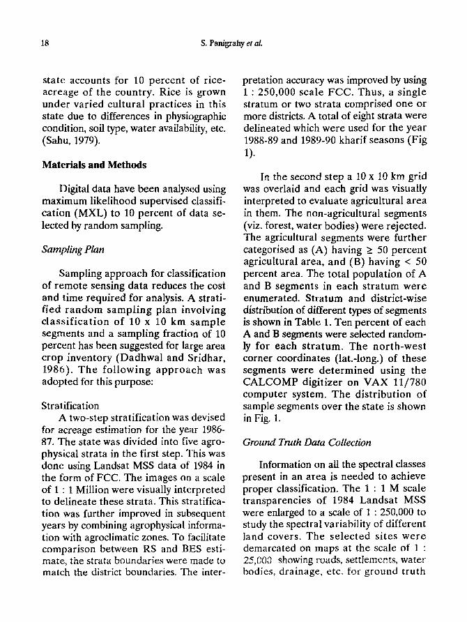
R e f e r e n c e s
Anon. (1987). Estimation of 1986-87 kharif rice- acreage of Orissa using Landsat MSS digital data. Scientific Note, RSAM/SAC/CAPE/SN/04/87.
Cochran G W (1963). Sampling techniques. J. Wiley, New York.
Dadhwal V K and Sridhar V N (1986). Sampling approach for remote sensing based crop inventory. Scientific Note, RSAM/SAC/CAPE/SN/01/86.
Houston A G, Feiveson A H, Chikara R S and Hsu E M (1979). Accuracy assessment : The stratified
approach to performance evaluation in LACIE. In Ptvceedings of the LACIE sympositml, October 23- 26, Houston, Texas, Vol. I, 115-130.
Parihar J S, Panigrahy S, Dadhwal V K, Bhatt H P, Das N K, Ghose P K and Behra D (1987). Rice- acreage estimation in south Orissa using stratified random sampling approach. Scientific Note, IRS- UP/SAC/CPF/SN/09/87.
Parihar JS, Patel N K, Medhavy T T, Panigrahy S, Ravi N, Oza S R, Sridhar V N, Das N K, Ghose, B K, Pani K C, Mohanty R R, Nanda S K, Panigrahy B K, Tripathy D P, Mishra P K and Sudhakar S (1990). Rice-acreage estimation in Orissa for 1988- 89 and 1989-90 kharif seasons. Scientific Note, RSAM/SAC/CAPE/SN/23/90.
Sahu B N (1979). Crop substitution in Orissa. ICAR, New Delhi, p.127.