Probabilistic seismic hazard map of NW Himalaya and its adjoining area, India
15
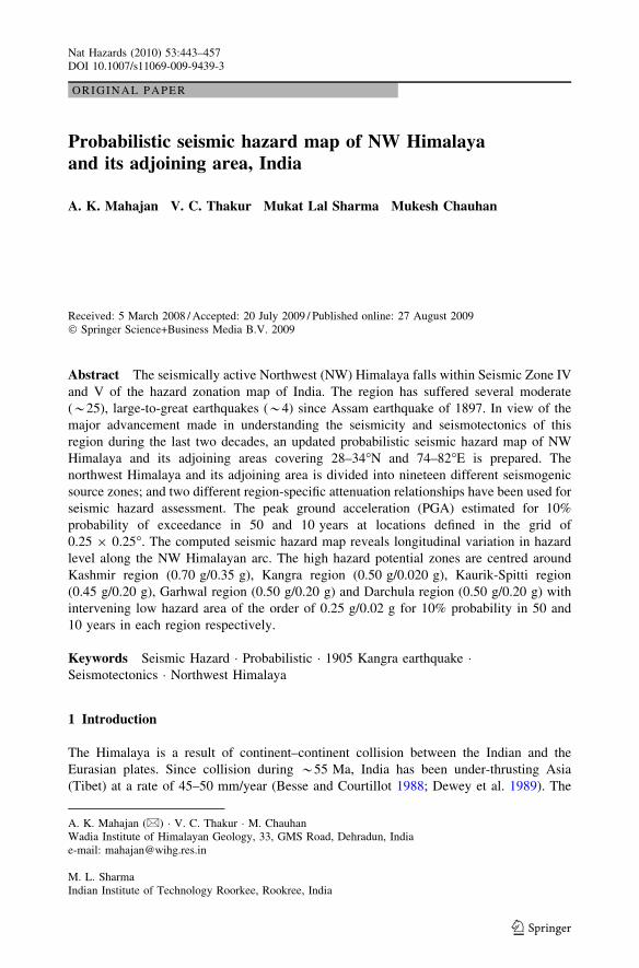
ORIGINAL PAPER Probabilistic seismic hazard map of NW Himalaya and its adjoining area, India A. K. Mahajan V. C. Thakur Mukat Lal Sharma Mukesh Chauhan Received: 5 March 2008 / Accepted: 20 July 2009 / Published online: 27 August 2009 Ó Springer Science+Business Media B.V. 2009 Abstract The seismically active Northwest (NW) Himalaya falls within Seismic Zone IV and V of the hazard zonation map of India. The region has suffered several moderate (*25), large-to-great earthquakes (*4) since Assam earthquake of 1897. In view of the major advancement made in understanding the seismicity and seismotectonics of this region during the last two decades, an updated probabilistic seismic hazard map of NW Himalaya and its adjoining areas covering 28–34°N and 74–82°E is prepared. The northwest Himalaya and its adjoining area is divided into nineteen different seismogenic source zones; and two different region-specific attenuation relationships have been used for seismic hazard assessment. The peak ground acceleration (PGA) estimated for 10% probability of exceedance in 50 and 10 years at locations defined in the grid of 0.25 9 0.25°. The computed seismic hazard map reveals longitudinal variation in hazard level along the NW Himalayan arc. The high hazard potential zones are centred around Kashmir region (0.70 g/0.35 g), Kangra region (0.50 g/0.020 g), Kaurik-Spitti region (0.45 g/0.20 g), Garhwal region (0.50 g/0.20 g) and Darchula region (0.50 g/0.20 g) with intervening low hazard area of the order of 0.25 g/0.02 g for 10% probability in 50 and 10 years in each region respectively. Keywords Seismic Hazard Probabilistic 1905 Kangra earthquake Seismotectonics Northwest Himalaya 1 Introduction The Himalaya is a result of continent–continent collision between the Indian and the Eurasian plates. Since collision during *55 Ma, India has been under-thrusting Asia (Tibet) at a rate of 45–50 mm/year (Besse and Courtillot 1988; Dewey et al. 1989). The A. K. Mahajan (&) V. C. Thakur M. Chauhan Wadia Institute of Himalayan Geology, 33, GMS Road, Dehradun, India e-mail: [email protected] M. L. Sharma Indian Institute of Technology Roorkee, Rookree, India 123 Nat Hazards (2010) 53:443–457 DOI 10.1007/s11069-009-9439-3
-
Upload
independent -
Category
Documents
-
view
1 -
download
0
Transcript of Probabilistic seismic hazard map of NW Himalaya and its adjoining area, India
ORI GIN AL PA PER
Probabilistic seismic hazard map of NW Himalayaand its adjoining area, India
A. K. Mahajan Æ V. C. Thakur Æ Mukat Lal Sharma Æ Mukesh Chauhan
Received: 5 March 2008 / Accepted: 20 July 2009 / Published online: 27 August 2009� Springer Science+Business Media B.V. 2009
Abstract The seismically active Northwest (NW) Himalaya falls within Seismic Zone IV
and V of the hazard zonation map of India. The region has suffered several moderate
(*25), large-to-great earthquakes (*4) since Assam earthquake of 1897. In view of the
major advancement made in understanding the seismicity and seismotectonics of this
region during the last two decades, an updated probabilistic seismic hazard map of NW
Himalaya and its adjoining areas covering 28–34�N and 74–82�E is prepared. The
northwest Himalaya and its adjoining area is divided into nineteen different seismogenic
source zones; and two different region-specific attenuation relationships have been used for
seismic hazard assessment. The peak ground acceleration (PGA) estimated for 10%
probability of exceedance in 50 and 10 years at locations defined in the grid of
0.25 9 0.25�. The computed seismic hazard map reveals longitudinal variation in hazard
level along the NW Himalayan arc. The high hazard potential zones are centred around
Kashmir region (0.70 g/0.35 g), Kangra region (0.50 g/0.020 g), Kaurik-Spitti region
(0.45 g/0.20 g), Garhwal region (0.50 g/0.20 g) and Darchula region (0.50 g/0.20 g) with
intervening low hazard area of the order of 0.25 g/0.02 g for 10% probability in 50 and
10 years in each region respectively.
Keywords Seismic Hazard � Probabilistic � 1905 Kangra earthquake �Seismotectonics � Northwest Himalaya
1 Introduction
The Himalaya is a result of continent–continent collision between the Indian and the
Eurasian plates. Since collision during *55 Ma, India has been under-thrusting Asia
(Tibet) at a rate of 45–50 mm/year (Besse and Courtillot 1988; Dewey et al. 1989). The
A. K. Mahajan (&) � V. C. Thakur � M. ChauhanWadia Institute of Himalayan Geology, 33, GMS Road, Dehradun, Indiae-mail: [email protected]
M. L. SharmaIndian Institute of Technology Roorkee, Rookree, India
123
Nat Hazards (2010) 53:443–457DOI 10.1007/s11069-009-9439-3

GPS measurements indicates that India is moving northeast at a convergence rate of
55 mm/year, of which 18–22 mm/year is accommodated within the Himalaya (Bilham
et al. 1997), and the remaining convergence is taken up farther north in Tibet and Asia
(Avouac and Tapponier 1993; Peltzer and Saucier 1996). The ongoing northward con-
vergence of India produces active deformation in the Himalaya, Tibet and adjoining areas,
keeping the entire region seismically active.
The Himalayan mountain arc and the adjoining Shillong plateau and western Assam
experienced four great earthquakes of magnitude Mw C 8.0 within the last 110 years. The
four great earthquakes are 1897 Western Assam, 1905 Kangra, 1934 Bihar–Nepal and
1950 Eastern Assam (Arunachal) (Fig. 1). Of these, the 1897 earthquake is reported to
have suffered peak ground acceleration exceeding 1 g, because the pebbles embedded in
the matrix were plucked up from the ground, and the 1905 earthquake caused the maxi-
mum loss of lives of *18,000 people. Arya (1990) forecasted if the 1905 Kangra earth-
quake reoccurs with same magnitude and in the same region during present time, there
would be a loss of 80,000 lives even if the earthquake strikes during daytime. This forecast
has been to an extent verified by causality figure (86,000) of the 2005 Muzaffarabad
earthquake of magnitude Mw = 7.6. The four times increase in number of fatalities of the
2005 event when compared to the 1905 earthquake is mainly due to several times increase
in population and ‘‘haphazard’’ construction of the dwellings and infrastructures without
any consideration to seismic hazard. In addition to the great earthquakes, Himalaya has
suffered several large earthquakes with magnitude 7.0 \ M \ 8.0. These earthquakes are
Fig. 1 Location map of Himalayan arc and the study area (after Thakur 2008)
444 Nat Hazards (2010) 53:443–457
123
1505 Central Himalaya, 1555 Kashmir, 1720 Kumaon, 1751 Satluj, 1803 Garhwal–
Mathura, 1833 Nepal and the 2005 Kashmir (Thakur 2006). Recently, the 1905 Kangra
earthquake magnitude has been revised to Mw = 7.8 (Ambraseys and Bilham 2000;
Ambraseys and Douglas 2004). Among several moderate earthquakes of magnitude
6.0 \ M \ 7.0, the documented events are 1555 Kashmir, 1974 Pattan, 1988 Bihar–Nepal,
1991 Uttarkashi and 1999 Chamoli earthquakes. These earthquakes also inflicted moderate
damage to life and property (Pennington 1979; Kumar and Mahajan 1993; Iyengar and
Sharma 1999; Mahajan and Virdi 2001).
The issue of seismic hazard was addressed in India as early as 1956 when a seismic
zoning map of India showing three zones were produced by India Meteorology
Department (Tandon 1956). These frameworks were based on the maximum expected
intensity shaking in terms of MM intensity. Since then, many versions of the seismic
zoning map of India has been published by the Bureau of Indian Standard (BIS), the
official agency for publishing such maps from time to time, the latest being the seismic
zoning map of India showing four zones (I–IV)(BIS code 1893 2002). Following the
probabilistic hazard computation approach, Khattri et al. (1984) probabilistic seismic
hazard (PSH) model calculated PGA for the Himalayan region of the order of 0.7 g for
10% probability of exceedance in 50 years. Under the GSHAP (Global Seismic Hazard
Assessment Programme), Bhatia et al. (1999) calculated the PSH using the Joyner and
Boore’s (1981) attenuation relation for Indian region and produced PGA of the order
0.35–0.4 g for 10% probability of exceedance in 50 years. Kumar (2006) has estimated
the conditional probabilities for the whole Indian region by dividing it into 24 seismo-
genic source regions and found that the conditional probabilities of occurrence of
magnitude more than 6.0 were relatively more than the estimates using classical methods
of probabilistic seismic hazard. The distribution used in this study were Weibul, normal,
Gaussian and Poissonian. The conditional probabilities were estimated for last occur-
rence of magnitude 6.0 in the region.
Since the publication of GSHAP map about a decade ago, our understanding has
considerably enhanced in seismicity, regional tectonics and neo-active tectonics of the
Himalayan region. The seismicity monitoring networks have increased their coverage with
improved resolution in epicentral locations and focal depths. The GPS measurements
across the Himalaya have shown varying rates of convergence and slip, indicating locked
segments of the Indian plate in Himalaya. The palaeo-seismic investigations in Northwest
Himalaya and Nepal have shown surface ruptures indicative of very large palaeo-earth-
quakes on the Himalayan Frontal Thrust (Lave et al. 2005; Kumar et al. 2006). Neotec-
tonics and active fault studies have added another dimension in understanding the active
tectonics vis-a-vis seismicity. Many lessons have been learnt from the 2005 Kashmir
earthquake with new information, which were not reported in earlier Himalayan earth-
quakes. Keeping all these new developments in the subject as background, we attempt to
construct the probabilistic seismic hazard map of NW Himalaya, India, focusing the region
extending 74.5–82�E, i.e., between Kishtwar (Chenab river) in the west to Kali river
(India–Nepal border) in the east. The present map has been prepared based on seismic
hazard calculation method followed under the GSHAP programme. The ground shaking
probabilities at various levels in the regions have been calculated using an integration of
the potential earthquake shaking from all the possible seismogenic source locations and
magnitudes.
Nat Hazards (2010) 53:443–457 445
123

2 Seismotectonic aspect
Following the collision, northward converging India against Asia deformed the northern
part of the Indian continent. The shortening of the Indian crust was accommodated through
imbrications along the principal thrusts in Himalaya, namely the Main Central Thrust
(MCT), the Main Boundary Thrust (MBT) and the Himalayan Frontal Thrust (HFT). These
thrusts propagated southward from the collision zone, showing progressive younger ages
and shallower depths. During collision, the Indus Tsangpo Suture Zone (ITSZ) acts as the
plate boundary between the Indian and Asian plates. Subsequently the boundary between
the Indian plate and the growing Himalaya shifted southward along the sole thrust
(decollement), referred to Main Himalayan Thrust (MHT) (Zhao et al. 1993; Nelson et al.
1996). The MHT, evolved in a thrust system on crustal scale as the MHT–MCT, the MHT–
MBT and the MHT–HFT (Bollinger et al. 2004). The MHT is imaged as decollement
underneath the Tethys Himalaya, Indus Tsanpgo Suture Zone and southern Tibet in seismic
reflection profiles of the INDEPTH project (Zhao et al. 1993; Nelson et al. 1996). The
existence of decollement underneath the entire breadth of Himalaya has been further
confirmed through receiver function analysis in Nepal Himalaya and southern Tibet
(Schulte-Palkum et al. 2005).
The instrumental seismicity is mainly distributed underneath the topographical front of
Higher Himalaya at a depth of 10–20 km, covering the northern part of Lesser Himalaya
and the MCT Zone. This *900 km long seismicity zone extends from Nepal (Pandey et al.
1995), through Kumaon-Garhwal (Khattri et al. 1989), Kangra (Chaterjee and Bhattach-
arya 1992; Kumar and Mahajan 2001) to Indus Kohistan seismic zone in Pakistan (Seeber
and Armbruster 1981). The 1905 Kangra and 2005 Kashmir earthquakes with magnitudes
Mw = 7.8 and 7.6, respectively, and the moderate earthquakes like 1945 Chamba
Earthquake (mb = 6.5), 1986 Dharamsala earthquake (mb = 5.7), Kinnaur Earthquake
(mb = 6.5), 1991 Uttarkashi (mb = 6.4) and 1999 Chamoli (mb = 6.8) occur in this zone.
The instrumental seismicity zone is also interpreted as the region where the elastic strain is
accumulating to generate an earthquake. The GPS measurements in Nepal and 1905
Kangra earthquake meizoseismal region indicate 100 km wide segment from the southern
extent of the seismicity zone to the Himalayan front is locked, showing negligible amount
of convergence/slip (Bilham et al. 1997; Banerjee and Burgman 2002; Bettinelli et al.
2006). The large and great earthquakes are generated as a result of rupturing of this locked
segment along the decollement (Bilham et al. 2001).
The 1905 Kangra earthquake (Mw = 7.8) was interpreted to have occurred as a result of
slip over the detachment (decollement) propagating southward towards the foreland
(Seeber and Armbruster 1981). No surface rupture was reported during 1905 Kangra
earthquake, implying that the fault was blind. The epicentre of 1934 Bihar–Nepal earth-
quake was located east of Kathmandu, but the damage and maximum intensity extended
from Kathmandu valley to the Himalayan front including the liquefaction zone of Bihar
Ganga Plain (Dunn et al. 1939; Bilham et al. 1997). Two surface rupture earthquakes have
been documented along the HFT in Nepal Sub-Himalaya and NW Sub-Himalaya based on
palaeo-seismological studies. The earthquakes have been dated as 1100 AD in Nepal and
1450 AD in Indian part, having lateral extent of the rupture [240 km with 17–26 m co-
seismic slip and 9–13 m vertical separation (Lave et al. 2005; Kumar et al. 2006). These
earthquakes may be mega-thrust type events with their epicentres lying in the locked
segment of the lesser Himalaya, but their rupture extending south right up to the Hima-
layan front. Two types of scenario emerge from the review of seismotectonic history of the
Himalaya. The probability exists in the first scenario for the occurrence of large distributed
446 Nat Hazards (2010) 53:443–457
123

earthquake similar to that of 2005 Kashmir or 1905 Kangra earthquake. The second sce-
nario, a mega-thrust type earthquake as documented in the palaeo-seismological trenches;
the former having a recurrence interval B500 years and the latter with recurrence interval
C1,000 years (Feldl and Bilham 2006; Kumar et al. 2006). Although we are not able to
tightly constraint the timing and magnitude of great/major earthquakes in the Himalayan
region, these data are nevertheless useful in evaluating the probabilistic estimates of
seismic hazard.
3 PSH methodology
The earthquake catalogue and database makes the first essential input for the delineation of
seismic source zones and their characterisation. Preparation of homogeneous catalogue for
NW Himalaya is an important task. As recognised under GSHAP programme, we have
compiled a uniform earthquake catalogue data from historical to recent times using three
temporal categories (1) Since 1964, the modern instrumentation-based data are available,
(2) 1900–1963, encompasses the era of early instrumental data and (3) pre-1900 include
pre-instrumental data based primarily on historical and macroseismic information.
Several catalogues of historical and instrumental seismicity of the studied region have
been analysed and collated to delineate and characterise the seismogenic source zones. The
earthquake catalogue for our study has been prepared by extracting data from different
sources, such as International Seismological Centre (ISC), United States Geological Sur-
vey (USGS), India Meteorological Department (IMD) and several individual workers
(Bapat et al. 1983; Chandra 1992; Iyenger and Sharma 1999).
The seismic hazard assessment reported earlier was based on seismic catalogues, which
were highly uncertain and incomplete. It is pre-requisite for complete earthquake catalogue
to have a uniform magnitude scale for denoting the size of past earthquakes, so that a
reliable parameterisation of the magnitude distributions homogeneous and complete with
respect to time and size is used in hazard analysis. The homogeneous surface wave
magnitude, Ms, based on working file from ISC catalogue for the whole study area was
developed. The mb and Ms empirical relation for magnitude \5.0 was derived using
different magnitude scale for the same earthquake. The exponential curve obtained (Fig. 2)
shows considerably good correlation up to magnitude \5.5 mb. The earthquakes with
magnitude\5.5 have been converted to Ms, and the rest of the earthquakes with magnitude
[5.5 given in the catalogue have been used for analysis.
Ms ¼ 3:196485þ exp �3:674908ð Þ þ 0:7880748ð Þ �mb ð1Þ
The aftershocks and foreshocks data were not considered (deleted) while preparation of
earthquake catalogue. The filtering of data was done by analysing the spatial and temporal
distribution of the events based on modified Omori’s relationship (Utsu 2002). Analysis for
completeness, i.e., determining the period over which the data of a given magnitude
interval are complete (Mahajan and Ghosh 2007), is generally done by using the procedure
described and applied by Stepp (1972). However, the historical data were taken into
consideration while assigning maximum magnitude for each source zone. The cut-off
magnitude has been found using the Goodness-of-fit test (GFT) method given by Wiemer
and Wyss (2000). The goodness-of-fit for the Gutenberg Richter relationship has been
estimated, and the lowest error level has been found to be at magnitude 3.5, which is
treated as cut-off magnitude for the present study.
Nat Hazards (2010) 53:443–457 447
123

A seismicity map thus plotted on the tectonic map of NW Himalaya (Fig. 3) shows
maximum concentration of seismic activity in a narrow zone of *50 km width between
the MBT and the MCT. The isolated concentration of seismic activity has been noticed
around Kashmir Basin (KB), Chamba-Kangra, Garhwal and Dharchula regions with
intervening zones of low seismic activity (Fig. 3). The longitudinal variation in seismic
activity along the Himalayan region may be due to different rates of convergence and
segmental behaviour of the Himalayan arc or existence of different tectonic blocks in NW
Fig. 2 Relation between Ms and mb for Northwest Himalayan arc and its adjoining areas
Fig. 3 Seismotectonic map of Northwest Himalayan arc and its adjoining area
448 Nat Hazards (2010) 53:443–457
123

Himalaya. It has also been noticed that at places the activity has been concentrated along
the NE-SW trending tectonic features.
3.1 Delineation of source zones
The Himalayan orogenic belt is essentially a compressional tectonic arc as indicated by the
MCT, MBT and HFT thrust systems. The current ongoing northeast convergence also
produces compressional regime in Himalaya. The strike-slip motion observed in some
major faults like MBT and MCT represent reactivation of existing faults. The transverse
and tear faults are actually transfer faults, which may represent oblique ramps expressing
transfer of motions on the thrust faults (Valdiya 1973; Thakur 1992; Narula et al. 2000).
The fault plane solutions of the Himalayan earthquakes predominantly indicate thrust
mechanism (Ni and Barazangi 1984; Chandra 1992). However, some normal faults (Singh
et al. 1977; Khattri et al. 1978) and strike-slip mechanism (Das Gupta et al. 1982; Gaur
et al. 1985; Khattri et al. 1989; Kumar and Mahajan 1991, 2001; Srivastava and Mitra
1994; Power et al. 1998; Kayal 2007) have also been reported for the same region. The
normal fault and strike-slip mechanism are not typical of the Himalayan earthquakes. They
represent accommodation and distribution of strain in a heterogeneous and complex
geotectonic framework of the Himalaya undergoing regional northeast compression.
The source zone delineation is based on seismicity record, knowledge gained through
past earthquakes, GPS measurements, palaeo-seismic evidence and structural tectonic
framework in the Himalaya. The instrumental seismicity belt, *50 km wide, extending
from Nepal to Kashmir and IKSZ represent a zone of strain accumulation. The moderate
earthquakes like 1991 Uttarkashi and 1999 Chamoli and the large earthquakes like 1905
Kangra and 2005 Kashmir have occurred within this seismicity zone.
The 2005 Kashmir earthquake has provided important information on the Himalayan
earthquakes. It was for the first time the surface rupture was recorded in any Himalayan
earthquake. The 70 km long surface rupture showing 3–7 m vertical offsets has been
mapped (Kaneeda et al. 2008). The surface rupture corresponds to already mapped active
Balakote Bagh Fault (BBF) (Hussain and Yeats 2006). The causative fault determined on
the basis of seismic data, strikes 3318 and dip N308E with focal depth at 20 km. The
earthquake originated over the wedge decollement reactivating the BBF (Bendick et al.
2007). The BBF cuts across the Hazara syntaxis structure and the MBT suggesting its
origin independent of the MBT. Similarly, the 1905 Kangra earthquake rupture,
100 km 9 50 km dimension, was generated as a result of reactivation of the Jawalamukhi
Thrust (Wallace et al. 2005). The 1934 Bihar–Nepal earthquake rupture propagated
southward from the Lesser Himalaya to the Himalayan range front and the Bihar plain
along the decollement (MHT). The large surface ruptured earthquakes documented along
the HFT on the Himalayan front in Nepal and Northwest Himalaya (Lave et al. 2005;
Kumar et al. 2006) were not generated in situ on the Himalayan front, as we do not find
historical records of such large earthquakes during *1100 AD and 1450 AD affecting the
Ganga plain adjoining the Himalayan front. The large and great earthquakes are originated
as a result of rupture of the locked segment between the southern extents of instrumental
seismicity zone and the Himalayan range front. The rupture propagates southward as
observed in 2005 Kashmir and 1934 Bihar–Nepal earthquakes. It may remain blind, but in
certain situation where the earthquake is large and the overburden over the decollement is
less as observed in the Himalayan front zone, the rupture may appear on the surface as
documented along the HFT (Thakur 2008).
Nat Hazards (2010) 53:443–457 449
123

The delineation of seismic source zones are primarily guided by the occurrence of large
earthquakes, planar distribution of all earthquakes above certain level of magnitude, shape
of isoseismals, intensity distribution, neotectonic activity and regional tectonic frame work.
Based on these factors, sixteen rectangular source zones and three line source zones have
been delineated in the map (Fig. 4). The recurrence relation is computed for each source
model based on parameters that characterise the seismicity of the region. This information
is used as input to the algorithm for computation of seismic hazard viz. minimum and
maximum magnitude for the specified time period and parameters ‘a’ and ‘b’ in the
earthquake frequency magnitude relationship using maximum likelihood method Log
N = a - bM for the same time period (Table 1). The third element used for seismic
hazard assessment involves designation of the strong ground motion (ground acceleration
estimation). The equation specifies ground acceleration as a function of earthquake mag-
nitude and hypocentral/epicentral distance.
3.2 Attenuation relation
The strong ground motion parameters of 1986 Dharamsala (5.7 mb), 1991 Uttarkashi
(6.4 mb) are used to test different equations for having realistic estimates of representative
strong motion in northwest Himalaya by Kumar et al. (1997). Using the worldwide dataset,
the attenuation relations of Abrahamson and Litcheister (1989) and Hasegawa et al. (1981)
are found to be capable of predicting the Uttarkashi acceleration data and that of Peng et al.
(1985) for predicting the Dharamsala earthquake dataset (Fig. 5). The Kangra (Himachal)
and Uttarkashi (Garhwal) regions of Himalaya are characterised by different attenuation
properties, which may be a reflection of ground geology (lithology) present in the
Fig. 4 Seismogenic source zones in Northwest Himalayan arc and its adjoining area
450 Nat Hazards (2010) 53:443–457
123

respective regions (Kumar et al. 1997). The Kangra region shows a higher attenuation rate
because thick Neogene Siwalik sediments cover the upper few kilometre of the crust. The
Siwaliks also contain gravel and boulder beds, which promote scattering and attenuation of
waves. The Uttarkashi region comprising Proterozoic meta-sedimentary rocks in the Lesser
Himalaya shows lower scattering and attenuation of waves when compared to the Kangra
region. The present investigation has taken into account such geological factors in
assigning the region-specific attenuation relations for each source zone.
3.3 Seismic hazard computation
We apply standard method of PSHA in this study (Cornell 1968; Mc Guire 1993) for
computing the peak ground acceleration (PGA) for 10% probability of exceedance in 50
and 10 years at locations defined in the grid of 0.25 9 0.25�. Nineteen source zones
(sixteen rectangular and three line sources) identified in study area have different geo-
tectonic environments and lithological variations. So, two different attenuation relation-
ships have been used for computing the seismic hazard of the region. To compute the
seismic hazard of NW Himalayan arc and its adjoining areas, seismic parameters for each
source like a-value, b-value, attenuation relation, depth, minimum and maximum
Table 1 Showing seismic parameters (‘a’ and ‘b’) of each source zone
S. No Name and no. ofthe source zone
Magnitude Depth Area of rectangularsource zonein sq km
a b Log N =a - bM
Min Max ‘a’ ‘b’
1 NW J & K Zone-1 3.5 7.6 30 17039.97 1.3575 0.7679 0.58 0.33
2 West Jammu Zone-2 3.5 7.3 25 19127.87 6.2190 1.6262 2.70 0.70
3 Kangra-Chamba Zone-3 3.5 7.8 20 12875.16 3.4472 1.1063 1.49 0.48
4 West Panjab Zone-4 3.5 6.5 20 20608.97 7.8708 2.5376 3.41 1.10
5 Panjab re-entrant Zone-5 3.5 7.5 20 35231.79 2.896 1.1485 1.25 0.49
6 Garhwal Zone-8 3.5 7.5 20 25992.34 6.1523 1.5833 2.67 0.68
7 Kumaon (Almora)Zone-9
3.5 7.5 20 23462.09 5.0313 1.4230 2.18 0.61
8 East Kumaon Zone-10 3.5 7.5 33 12248.42 6.6395 1.6484 2.88 0.71
9 West Nepal Zone-11 3.5 7.5 36 32954.38 6.1428 1.8652 2.66 0.80
10 East Nepal Zone-12 3.5 5.5 30 25828.84 8.5470 2.4244 3.71 1.05
11 West STFS Zone-13 3.5 7.5 37 46020.19 4.2992 1.2727 1.86 0.55
12 Tibet Zone-14 3.5 6.3 64 52579.80 2.8124 1.1440 1.22 0.49
13 ITSZ Zone-15 3.5 6.0 31 48357.19 6.5398 1.8300 2.83 0.79
14 Ladhakh Zone-16 3.5 6.3 83 31693.01 2.8124 1.1440 1.22 0.49
15 Nawalkot Zone-18 3.5 5.5 32 12359.68 4.9188 1.7658 2.13 0.76
16 China Zone-19 3.5 7.0 34 108049.67 5.0187 1.4483 2.17 0.62
Line source
1 Kinnaur Zone-6 3.5 7.5 30 5.4135 1.4521 2.35 0.63
2 DHR Zone-7 3.5 5.5 20 6.1888 1.9366 2.68 0.84
3 Takholang Fault Zone-17 3.5 5.5 40 3.4132 1.4749 1.48 0.64
ITSZ Indo Tsangpo suture zone, STFS South Tibetan fault system, DHR Delhi Haridwar ridge
Nat Hazards (2010) 53:443–457 451
123

magnitude, boundary and area of source zone and type of fault have been written in ASCII
format to be used by Haz. 81 (Dojcinvoski and Mihailov 2001) and SEISRISK-III (Bender
and Perkins 1987) softwares. PGA value over the grid is contoured to obtain a seismic
Hazard Map (Fig. 6). A contour interval of 0.1 g is chosen, presuming that the paucity of
historical earthquake data would not permit resolution better than 0.1 g.
4 Results
The prepared map is an improved and updated version of the Global Seismic Hazard Map
(GSHAP) for the Himalayan arc. According to the GSHAP hazard map, the hazard level
depicted is of the order of 0.25 g for majority of the plate boundary and Tibetan plateau
region (Bhatia et al. 1999). The GSHAP map shows nearly uniform hazard all along the
Himalayan arc in longitudinal direction with maximum PGA value of the order 0.35–0.4 g.
The present analysis indicates isolated zones of high hazard of the order of 0.7–0.5 g for
10% probability in 50 years and 0.35–0.2 g for 10% probability in 10 years with
Fig. 5 Attenuation curves formagnitude 5 and 6 according tothe empirical relation given byKumar et al. (1997) aftercorrelation of strong motion dataof 1991 Uttarkashi earthquake(mb = 6.4) and 1986Dharamsala earthquake(mb = 5.7) with the attenuationcurves given by Hasegawa et al.(1981) (a) and Peng et al. (1985)(b), respectively
452 Nat Hazards (2010) 53:443–457
123

Fig. 6 Seismic Hazard map of Northwest Himalayan arc and its adjoining areas showing peak groundaccelerations with 10% probability in 50 years (Fig. 6a) and 10 years (Fig. 6b)
Nat Hazards (2010) 53:443–457 453
123

intervening low hazard zones as depicted by the epicentral map (Fig. 2) of the region.
Earlier the low level hazard zones were referred as the seismic gap regions (Khattri et al.
1989). The Himalayan foothill zone shows a hazard level of the order of 0.15–0.25 g and
0.02 for 10% probability in 50 and 10 years respectively (Fig. 6a, b).
5 Discussion and conclusion
Our seismic hazard map shows longitudinal variations in hazard level. This variation is
very well correlated with the seismicity map, theory of segmental behaviour of Himalayan
arc (Validya 1973; Kaila and Narian 1979), existence of different tectonic blocks in
Northwest Himalaya by Narula et al. (2000) and GPS data showing variation in rate of
northward movements of different blocks i.e., Kangra, Garhwal and Dharchula region
along with locking of strains. This variation in hazard level in the present map is due to the
considerations of several factors such as use of region-specific attenuation relationship,
depth of source and division of Himalayan arc in to different source zones (rectangular and
line sources) or tectonic blocks depending upon local tectonics and seismicity pattern. Five
major zones of high seismic hazard with intervening low order hazard have been recog-
nised; they are Kashmir, Chamba-Kangra, Garhwal, Kumaon and Upper Sutlej valley
having higher PGA values with intervening areas showing lower PGA values. The
recurrence period for large Himalayan earthquake Mw [ 7.0 with total slip 5–7 m and slip
rate 15 mm/year in NW Himalaya provides a value of 350–450 years. The Kashmir region
had an earthquake magnitude Mw = 7.4 (Ambraseys and Jackson 2003) in 1555. The PGA
value of 0.75 g assigned for the Kashmir region (Fig. 6a) appears to be justified, since the
region has approached the threshold recurrence period, and the segment between the
rupture zones of 1555 Kashmir and 1905 Kangra has not been ruptured for more than
500 years. The Chamba–Kangra segment, ruptured during 1905 earthquake Mw = 7.8,
shows PGA value of 0.50 g, as all the accumulated elastic strain has not been released by
the magnitude Mw = 7.8 earthquake (Bilham and Wallace 2005). The Garhwal and Ku-
maon segment with maximum PGA value 0.4–0.5 lies in the central seismic gap (Khatri
and Tyagi 1983). The region has also been identified where the threshold elastic strain has
been accumulated to trigger a very large earthquake (Bilham and Wallace 2005). Northeast
of Shimla in Upper Sutlej valley, which was struck by 1975 Kinnaur earthquake (6.5 mb)
shows PGA value of the order of 0.60 g. The causative normal fault for this earthquake
corresponds with the NE trending normal faults in northern Tethys Himalaya–southern
Tibet. The low PGA value 0.10 g along the Himalayan frontal range contradicts the
recently reported surface rupture earthquake, dated 1450 AD, on the HFT in Garhwal–
Kumaon. According to our interpretation, this earthquake did not originate on the Hima-
layan front as there is no historical record for such an event. It appears the earthquake
rupture propagated southward from its epicentre in the Lesser Himalaya along the
detachment and was registered as surface rupture on the range front. A similar phenom-
enon is observed in 1934 Bihar–Nepal and 2005 Kashmir earthquakes, where the observed
surface rupture appeared to have migrated several tens of kilometre from the epicentre. A
large number of dams for hydroelectric power are being constructed in the Himalaya, and it
is presumed that the updated earthquake hazard map of NW Himalaya with PGA values
will be useful to civil engineers for constructing safer infrastructures and to policy planners
for hazard prevention and mitigation.
454 Nat Hazards (2010) 53:443–457
123

Acknowledgments The present work has been carried out under the DST sponsored project no. DST/23(322)/SU/2001, and authors duly acknowledge the grant received under this project to complete the task.The authors are also thankful to Dr H. K. Gupta, Dr H. N. Srivastava and other committee members whohave provided guidance while carrying out this work. The authors are also thankful to Prof. B. R. AroraDirector, Wadia Institute of Himalayan Geology, Dehradun for fruitful discussion and suggestions inimproving this manuscript. The Director, WIHG, is thanked for according permission to publish thismanuscript.
References
Abrahamson NA, Litcheister JJ (1989) Attenuation of vertical peak acceleration. Bull Seismol Soc Am79:549–580
Ambraseys N, Bilham R (2000) A note on the Kangra Ms = 7.8 earthquake of 4 April, 1905. Curr Sci79(1):45–50
Ambraseys N, Douglas J (2004) Magnitude calibration of north Indian earthquakes. Geoph J Intern159(1):165–206
Ambraseys N, Jackson D (2003) A note on early earthquakes in northern India and southern Tibet. Curr Sci84:570–582
Arya AS (1990) Damage scenario of a hypothetical 8.0 magnitude earthquake in Kangra region of HimachalPradesh. Bull Ind Soc, Earthquake Tech Paper 297 27(3):121–132
Avouac J, Tapponnier P (1993) Kinematic model of active deformation in central Asia. Geophys Res Lett20:895–898
Banerjee P, Burgmann R (2002) Convergence across the northwest Himalaya from GPS measurements.Goephy Res Lett 29(13):1–4
Bapat A, Kulakarni RC, Guha SK (1983) Catalogue of earthquakes of India and neighborhood fromhistorical period to 1979. Indian Society of Earthquake Technology. pp 211
Bender B, Perkins DM (1987) SEISRISK-III—A computer program for seismic hazard estimation. U.S.Geological Survey, Bulletin 1972
Bendick R, Bilham R, Khan MA, Khas SF (2007) Slip on an active wedge thrust from geodetic observationsof 8 October 2005 Kashmir earthquake. Geology 35:267–270
Besse J, Courtillot V (1988) Palaeogeographic maps of the continents bordering the Indian Ocean since theearly Jurassic. J Geophys Res B 93:1791–1808
Bettinelli P, Avouac JP, Flouzat M, Jouanne F, Bollinger L, Willis P, Chitrakar GR (2006) Plate motion ofIndia and interseismic strain in the Nepal Himalaya from GPS and Doris measurements. J Geod80:567–589
Bhatia SC, Kumar RM, Gupta HK (1999) A probabilistic seismic hazard map of India and adjoining regions.Ann Geofis 42(6):1153–1164
Bilham R, Wallace K (2005) Future Mw [ 8 earthquakes in the Himalaya: implications from the 26 Dec.2004 Mw = 9.0 earthquake on India’s eastern plate margin. Geol Surv India Spec Publ 85:1–14
Bilham R, Larson L, Jeffrey F (1997) GPS measurements of present day convergence across the NepalHimalaya. Nature 386:61–64
Bilham R, Gaur VK, Molnar P (2001) Himalayan seismic hazard. Science 293:1442–1444BIS Code 1893. (2002) Earthquake hazard zoning map of India. www.bis.org.inBollinger L, Avouac JP, Cartin R, Pandey MR (2004). Stress building in the Himalaya. J Geophys Res 109
BIP 405:1–8Chandra U (1992) Seismotectonics of Himalaya, in seismology in India. Curr Sci Ind Acad Sci Banglore
62:40–71Chaterjee SN, Bhattacharya SN (1992) In: Gupta GD (ed), Microearthquake survey and seismicity of NW
Himalaya. Himalayan seismicity. Geol Soc Ind 23:23–44Cornell CA (1968) Engineering seismic risk analysis. Bull Seismol Soc Am 58:1583–1606Das Gupta A, Srivastava HN, Basu Malik S (1982) Source mechanism of earthquakes in Kanga-Chamba
regions of Himachal Pradesh, India. Bull Ind Soc Earthquake Tech 19:102–116Dewey JF, Cande S, Pitman WC (1989) Tectonic evolution of the India/Eurasia collision zone. Eclogae
Geol Helv 82:717–734Dojcinvoski D, Mihailov V (2001) Seismic hazard assessment, A computer program. Course material of
twentieth international twelve week course of a seismic design and construction, IZIIOZ, Skopje,pp 1–15
Nat Hazards (2010) 53:443–457 455
123

Dunn JA, Auden JB, Ghosh AMN, Roy SC (1939) The Bihar-Nepal earthquake of 1934. Mem Geol SurvInd 73:391 Reprinted (1981)
Feldl N, Bilham R (2006) Great Himalayan earthquakes and the Tibetan plateau. Nature 444(7116):165–170Gaur VK, Chander R, Sarkar I, Khattri KN, Sinhwal H (1985) Seismicity and state of stress from inves-
tigations of local earthquakes in the Kumaon Himalaya. Tectonophysics 118:243–251Hasegawa HS, Basham PW, Berry MJ (1981) Attenuation relations for strong seismic ground motion in
Canada. Bull Seismol Soc Am 71:1943–1962Hussain A, Yeats RS (2006) The Balakot Bagh Fault that triggered the Ocotber 8, 2005 earthquake and other
active faults in the Himalayan foreland region, Pakistan. Extended abstract, International Conferenceon 8 October 2005 earthquake in Pakistan: its implications and hazard mitigation. Geol Surv Paki-stan:125–126. www.gol.gov.pk/internationalconference.pdf
Iyenger RN, Sharma D (1999) Some earthquake of Himalayan region from historical sources. J Him Geol2(1):81–86
Joyner WB, Boore DM (1981) Peal ground and velocity from strong–motion records including records fromthe 1979 Imperial Valley, California earthquake. Bull Seismol Soc Am 71:2011–2038
Kaila KL, Narian H (1979) Evolution of the Himalaya based on seismotectonics and deep seismicsoundings. Proceedings of Himalayan Geol. Sem., New Delhi, Sect. IIB. Geol Surv Ind Misc Pub 41:1–41
Kaneeda H, Nakata T, Tsutsumi H, Kondo H, Sugito N, Awata Y, Akhtar S, Majid A, Khata W, Awan A,Yeats RS, Hussain A, Ashraf M, Wesnousky SG, Keusar B (2008) Surface rupture of the 2005Kashmir-Pakistan earthquake and its active tectonic implications. Bull Seism Soc Am 98:521–557
Kayal JR (2007) Recent large earthquakes in India: seismotectonic perspectives. IAGR Memoir no 10:189–199
Khattri KN, Tyagi AK (1983) Seismicity pattern in the Himalayan plate boundary and identification of areasof high seismic potential. Tectonophysics 96:281–297
Khattri KN, Rai K, Jain AK, Sinvhal H, Gaur VK, Mithal RS (1978) The Kinnaur earthquake, HimachalPradesh, India of 19 January, 1975. Tectonophysics 49:1–21
Khattri KN, Rogers AM, Perkins DM, Algermissen ST (1984) A seismic hazard map of India and adjacentareas. Tectonophysics 108:93–134
Khattri KN, Chander R, Gaur VK, Sarkar I, Kumar S (1989) New seismological results on the tectonics ofthe Garhwal Himalaya. Proc India Acad Sci (Earth Planet Sci) 98(1):91–109
Kumar R (2006) Earthquake occurrence in India and its use in seismic hazard estimation using probabilisticmethods. PhD Thesis, Garhwal University, India, pp 406
Kumar S, Mahajan AK (1991) Dharamsala Seismotectonic zone-Neotectonic and state of stress in the area. JHim Geol 2(1):53–57
Kumar S, Mahajan AK (1993) The Uttarkashi earthquake of 20th Ocotber, 1991: field observations. TerraNova 6(2):95–99
Kumar S, Mahajan AK (2001) Seismotectonics of the Kangra region, Northwest Himalaya. Tectonophysics331:359–371
Kumar D, Teotia SS, Khattri KN (1997) The representability of attenuation characteristics of strong groundmotion observed in 1986 Dharamsala and 1991 Uttarkashi earthquake by available empirical relation.Curr Sci 73(6):543–547
Kumar S, Wesnousky SG, Rockwell TK, Briggs RW, Thakur VC, Jayangondaperumal R (2006) Palae-oseismic evidence of great surface-rupture earthquakes along the Indian Himalaya. J Geophys Res III:330:4–3309
Lave J, Yule D, Sapkota S, Basant K, Madden C, Attal M, Pandey R (2005) Evidence for a great medievalearthquake (1100 A.D.) in the Central Himalayas, Nepal. Science 307:1302–1305
Mahajan AK, Ghosh GK (2007) Statistical analysis of completeness of earthquake data of NorthwestHimalayan region and its implication for seismicity evaluation. (Varma OP, Mahajan AK, Gupta V(eds) Natural hazard: proceeding of the National Conference on ‘‘Natural hazards (earthquakes andlandslides): challenges, perspectives and societal dimensions with focus on the state of Uttaranchal’’,Dehradun, December 26-28, 2003:45–56
Mahajan AK, Virdi NS (2001) Macroseismic field generated by the 29th March Chamoli earthquake, 1999and its seismotectonics. J Asian Earth Sci 19(4):507–512
Mc Guire RK (1993) In: Giardini D, Basham P (eds), Computation of seismic hazard, global seismic hazardassessment program. Ann Geofis 34(3–4):181–200
Narula PL, Shankar R, Chopra S (2000) Rupture mechanism of Chamoli earthquake on 29th March 1999and its implications for seismotectonics of Garhwal Himalaya. J Geol Soc Ind 55:493–503
Nelson KD, Zhao W, Brown LD, Kuo J, Che J, Liu X, Klemperer SL, Makovsky Y, Meissner R, Mechie J,Kind R, Wenzel F, Ni J, Nabelek J, Leshou C, Tan H, Wei W, Jones AG, Booker J, Unsworth M, Kidd
456 Nat Hazards (2010) 53:443–457
123
WSF, Hauck M, Alsdorf D, Ross A, Cogan M, Wu C, Sandvol E, Edward M (1996) Partially moltenmiddle crust beneath southern Tibet: synthesis of project-INDEPTH results. Science 276:1684–1686
Ni J, Barazangi M (1984) Seismotectonics of the Himalayan collision zone: geometry of the under thrustingIndian plate beneath the Himalaya. J Geophy Res 89:1147–1163
Pandey MR, Tandulkar RP, Avouac JP (1995) Interseismic strain accumulation on the Himalyan crustalramp (Nepal). Geophys Res Lett 22:751–754
Peltzer G, Saucier F (1996) Present day kinematics of Asia derived from geological fault rates. J Geopy Res101:27943–27956
Peng KZ, Wu FT, Song L (1985) Attenuation characteristics of peak horizontal acceleration in northeast andsouthwest china. Earthquake Eng Struct Dynam 13:337–350
Pennington WD (1979) A summary of field and seismic observations of the Pattan earthquake: 28December, 1974. In: Farah A, Delong KA (eds) Geodynmics of Pakistan, Geological Survey ofPakistan, Quetta, pp 143–147
Power PM, Lillie RJ, Yeats RS (1998) Structure and shortening of the Knagra and Dehradun re-entrants,sub-Himalaya, India. GSA Bulletin 110(8):1010–1027
Schulte-Pelkum V, Monslave G, Sheehan A, Pandey MR, Bilham R, Wu F (2005) Imaging the Indiansubcontinent beneath the Himalaya. Nature 435:1222–1225
Seeber L, Armbruster J (1981). Great detachment earthquakes along the Himalayan Arc and long termforecasting In: Simpson DW, Richards PG (eds), Earthquake prediction-an international review.Maurice-Ewing Series 4, American Geophysical Union, Washington DC, pp 259–277
Singh S, Jain AK, Singh VN, Srivastavam LS (1977) Damage during Kinnaur earthquake of January 19,1975 in Himachal Pradesh, India, Pre-Print of sixth world conference on Earthquake Engineering 1:1–6
Srivastava P, Mitra G (1994) Thrust geometries and deep structures of the outer and lesser Himalaya.Kumaon and Garhwal (India): implications for evolution of the Himalayan fold-and-thrust belt.Tectonics 13:89–109
Stepp JC (1972) Analysis of the completeness of the earthquake sample with Puget Sound area. In: HardingST (ed) Contribution to seismic hazard zoning. NOAA Tech. Report ERL 267-ESL 30, BoulderColorado
Tandon AN (1956) Zones of India liable to earthquake damage. Ind J Meteorol Geophys 10:137–146Thakur VC (1992) Geology of the Western Himalaya. Pergamanon press, London, p 362Thakur VC (2006) Reassessment of earthquake hazard in the Himalaya and implications from the 2004
Sumatra-Andaman earthquake. Curr Sci 90(8):1070–1072Thakur VC (2008) Active tectonics of the Himalaya. Mem Geol Soc India 66:227–258Utsu T (2002) Statistical features of seismicity, international handbook of earthquake engineering and
engineering seismology. 81A:719–732Valdiya KS (1973) Tectonic framework of India: a review and interpretation of recent structural and tectonic
studies. Geophys Res Bull 11:79–114Wallace K, Bilham R, Blum F, Gaur VK, Gahlaut V (2005) Surface deformation in the region of the 1905
Kangra Mw = 7.8 earthquake in the period 1846–2001. Geophys Res Lett 32(15):L15307. doi:10.1029/2005GL022906
Wiemer S, Wyss M (2000) Minimum magnitude of complete reporting in earthquake catalogs: examplesfrom Alaska, the Western United States, and Japan. Bull Seism Soc Am 90:859–869
Zhao WJ, Nelson KD, Che J, Quo J, Lu D, Wu C, Liu X, Brown LD, Hauck ML, Kuo JT, Klemperer S,Makovsky Y (1993) Deep seismic reflection evidence for continental underthrusting beneath southernTibet. Nature 366:557–559
Nat Hazards (2010) 53:443–457 457
123