Preliminary data about the territory of Castronovo di Sicilia (Palermo, Sicily): survey 2013
21
Preliminary data about the territory of Castronovo di Sicilia (Palermo, Sicily): survey 2013 Angelo Castrorao Barba (Collaborator of the Archaeological Service of the Superintendency of Palermo) 28th International Mediterranean Survey workshop Groningen, 21th– 22th of November 2014
Transcript of Preliminary data about the territory of Castronovo di Sicilia (Palermo, Sicily): survey 2013
Preliminary data about the territory of Castronovo di Sicilia (Palermo, Sicily): survey
2013 Angelo Castrorao Barba (Collaborator of the Archaeological Service of the Superintendency of Palermo)
28th International Mediterranean Survey workshop
Groningen, 21th– 22th of November 2014

Case study area
Preliminary data about the territory of Castronovo di Sicilia (Palermo, Sicily): survey 2013
The territory of Castronuovo di Sicilia (Palermo) is located in western Sicily's inland, in the Upper Platani Valley.
The area corresponds to the central part of the road that links Palermo to Agrigento.

The landscape
Preliminary data about the territory of Castronovo di Sicilia (Palermo, Sicily): survey 2013
A) western part: the Sicani Mountains B) Central part: the Platani river valley
C) eastern part: hilly area suitable for agro-pastoral exploitation.

This variety of landscapes, in addition to the river network and the position between The Tyrrhenian
and Mediterranean seas, have turned this area into a strategic centre for the communication between
the north and the south of Sicily. �
The long-term anthropization of this area (dating back to prehistory) is marked by the persisting
importance of the link between the inland and the coasts. �
Moreover, it confirms the high agricultural potentiality of the hills and valleys of this area. The aim
of this contribution is the presentation of the main Roman and Byzantine rural settlements identified
through archaeological surveys and excavations. �
In fact, the consistent number of recognized contexts can lead the studies to a new understanding of
the longue-durée in the Sicilian countryside.
Preliminary data about the territory of Castronovo di Sicilia (Palermo, Sicily): survey 2013
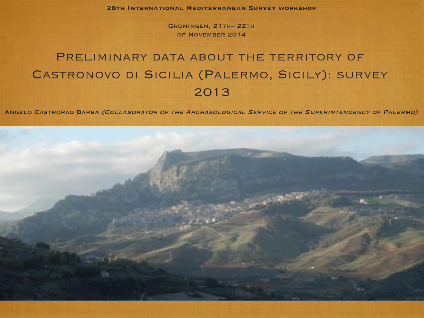
��Direction: Archaeological Service of the Superintendency of Palermo (Dr. Stefano Vassallo) �Collaboration: CNRS/Centre Camille Jullian of Aix-en-Provence (Dr. Tomoo Mukai)��1) "Update" of sites already known from the archaeological literature ��2) Starting to contextualize the excavation data in the framework of the settlements' dynamics ��3) Interest focused mainly to the changes in the of settlements' dynamics between the Roman time and Early Middle Ages��4) Main interest for sites with presences of African Red Slip Ware as part of a largest research focused in the Mediterranean scale (conducted by dr. Tomoo Mukai)��5) Creation of a GIS platform ��6) Plan a more extensive research project on the entire municipality of Castronovo di Sicilia
Preliminary data about the territory of Castronovo di Sicilia (Palermo, Sicily): survey 2013
Reasons for research
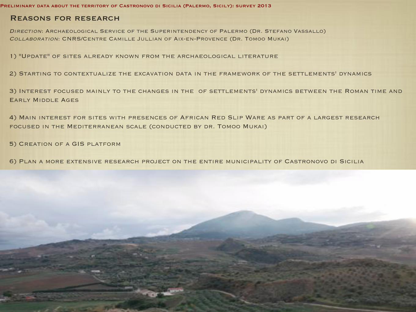
1) Period of work: 11 days from the end of November to the beginning of December two thousand and thirteen (2013). ���2) Human resources: the team was formed of only two people, me and Tomoo Mukai.���3) Surveyed area: the prospection was focused mainly on the sites already known, but we have also expanded the investigations over new areas surrounding these sites. ���4) Strategy for the collection of finds: In the surveyed fields it was performed a random sampling without the use of grids and it has been chosen a selective collection of diagnostic fragments (not all pieces but all periods) ���5) Documentation: For the georeferencing it has been used a mobile GPS and the data collected in the field were stored in a simple database, essentially a compact version of the traditional recording sheets for the topographic units.
Preliminary data about the territory of Castronovo di Sicilia (Palermo, Sicily): survey 2013
Survey methodology

1) The villas and farms system of Roman period�
�
�
2) The central place of Casale San Pietro along the ancient roads: best long-term occupation �
�
�
3) Mapping caves and roky-cut tombs (Late Antiquity and Byzantine period) �
�
�
4) Late Antique evidences inside the Byzantine castrum of Monte Kassar�
�
�
5) The hilltop settlement of Ministalla (6th - 7th c. AD)
Preliminary data about the territory of Castronovo di Sicilia (Palermo, Sicily): survey 2013
Preliminary rusults
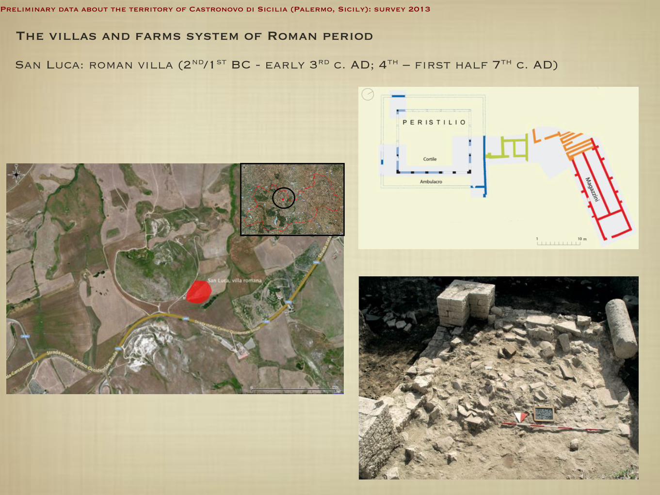
San Luca: roman villa (2nd/1st BC - early 3rd c. AD; 4th – first half 7th c. AD)
Preliminary data about the territory of Castronovo di Sicilia (Palermo, Sicily): survey 2013
The villas and farms system of Roman period
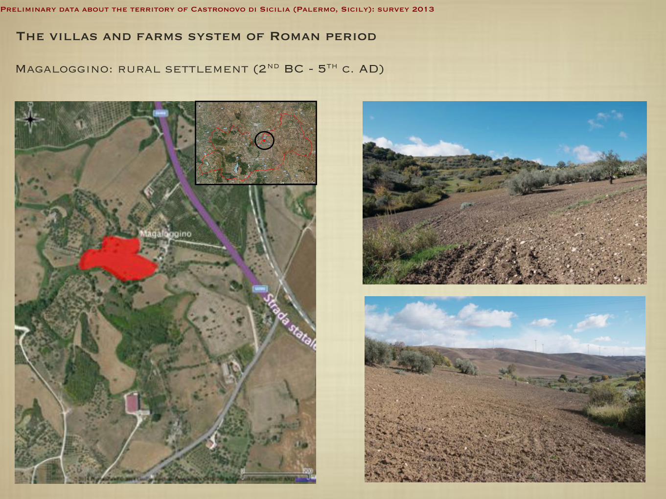
Magaloggino: rural settlement (2nd BC - 5th c. AD)
Preliminary data about the territory of Castronovo di Sicilia (Palermo, Sicily): survey 2013
The villas and farms system of Roman period

Regalsciacca - North Pellitteri’s House: Roman farm (1st – 5th c. AD)
Preliminary data about the territory of Castronovo di Sicilia (Palermo, Sicily): survey 2013
The villas and farms system of Roman period

Le Querce - Celauro’s House: Late Roman farm (2nd - 5th c. AD) �
Preliminary data about the territory of Castronovo di Sicilia (Palermo, Sicily): survey 2013
The villas and farms system of Roman period

Preliminary data about the territory of Castronovo di Sicilia (Palermo, Sicily): survey 2013
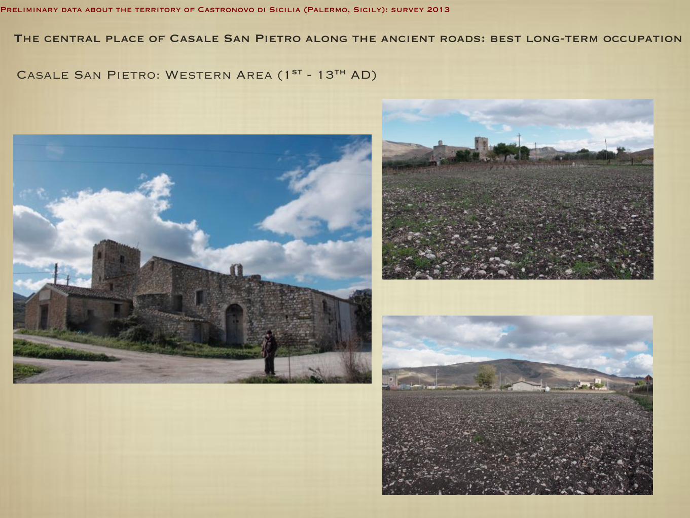
The central place of Casale San Pietro along the ancient roads: best long-term occupation
Area Ovest Area Nord-Est Area Sud-Ovest
Chiesa di San Pietro
Casale San Pietro (1st - 13th c. AD)
Preliminary data about the territory of Castronovo di Sicilia (Palermo, Sicily): survey 2013
Casale San Pietro: Western Area (1st - 13th AD)
The central place of Casale San Pietro along the ancient roads: best long-term occupation

Preliminary data about the territory of Castronovo di Sicilia (Palermo, Sicily): survey 2013
Casale San Pietro: NORTHEN-EASTER AREA (1st - 4th AD)
The central place of Casale San Pietro along the ancient roads: best long-term occupation
Preliminary data about the territory of Castronovo di Sicilia (Palermo, Sicily): survey 2013
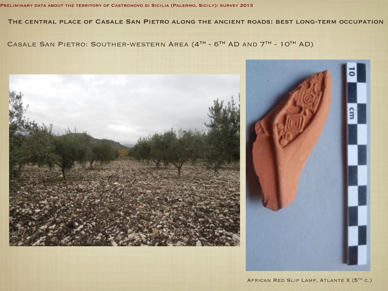
Casale San Pietro: Souther-western Area (4th - 6th AD and 7th - 10th AD)
African Red Slip Lamp, Atlante X (5th c.)
The central place of Casale San Pietro along the ancient roads: best long-term occupation

Preliminary data about the territory of Castronovo di Sicilia (Palermo, Sicily): survey 2013
MAPPING CAVES AND ROKY-CUT TOMBS (LATE ANTIQUITY AND BYZANTINE PERIOD)
Regalsciacca
Le Grotte - Capelvenere

Preliminary data about the territory of Castronovo di Sicilia (Palermo, Sicily): survey 2013
Le Grotte - Capelvenere
MAPPING CAVES AND ROKY-CUT TOMBS (LATE ANTIQUITY AND BYZANTINE PERIOD)
Regalsciacca
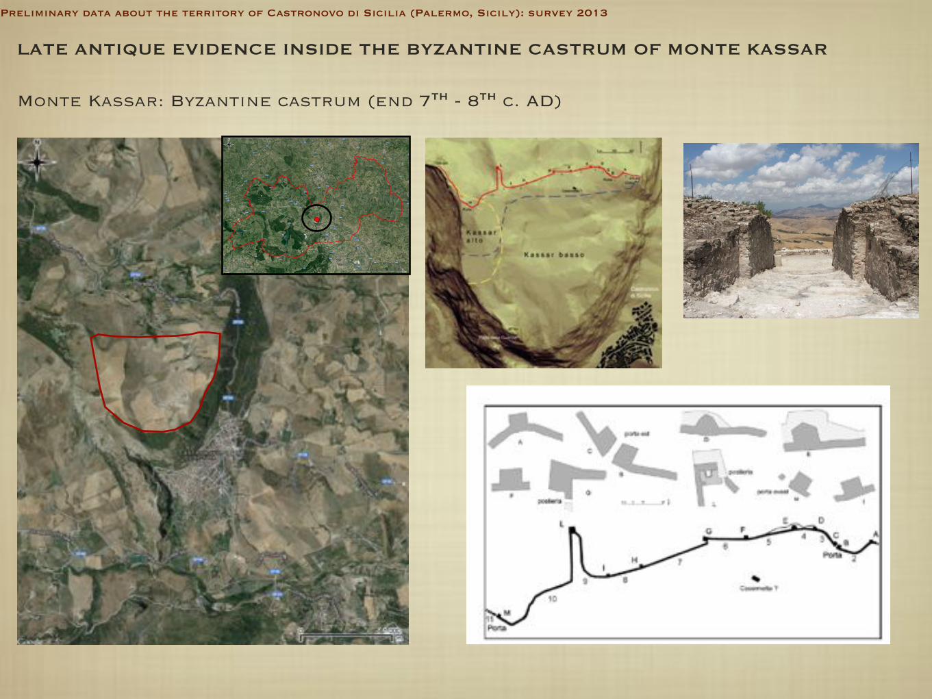
LATE ANTIQUE EVIDENCE INSIDE THE BYZANTINE CASTRUM OF MONTE KASSAR
Monte Kassar: Byzantine castrum (end 7th - 8th c. AD)
Preliminary data about the territory of Castronovo di Sicilia (Palermo, Sicily): survey 2013
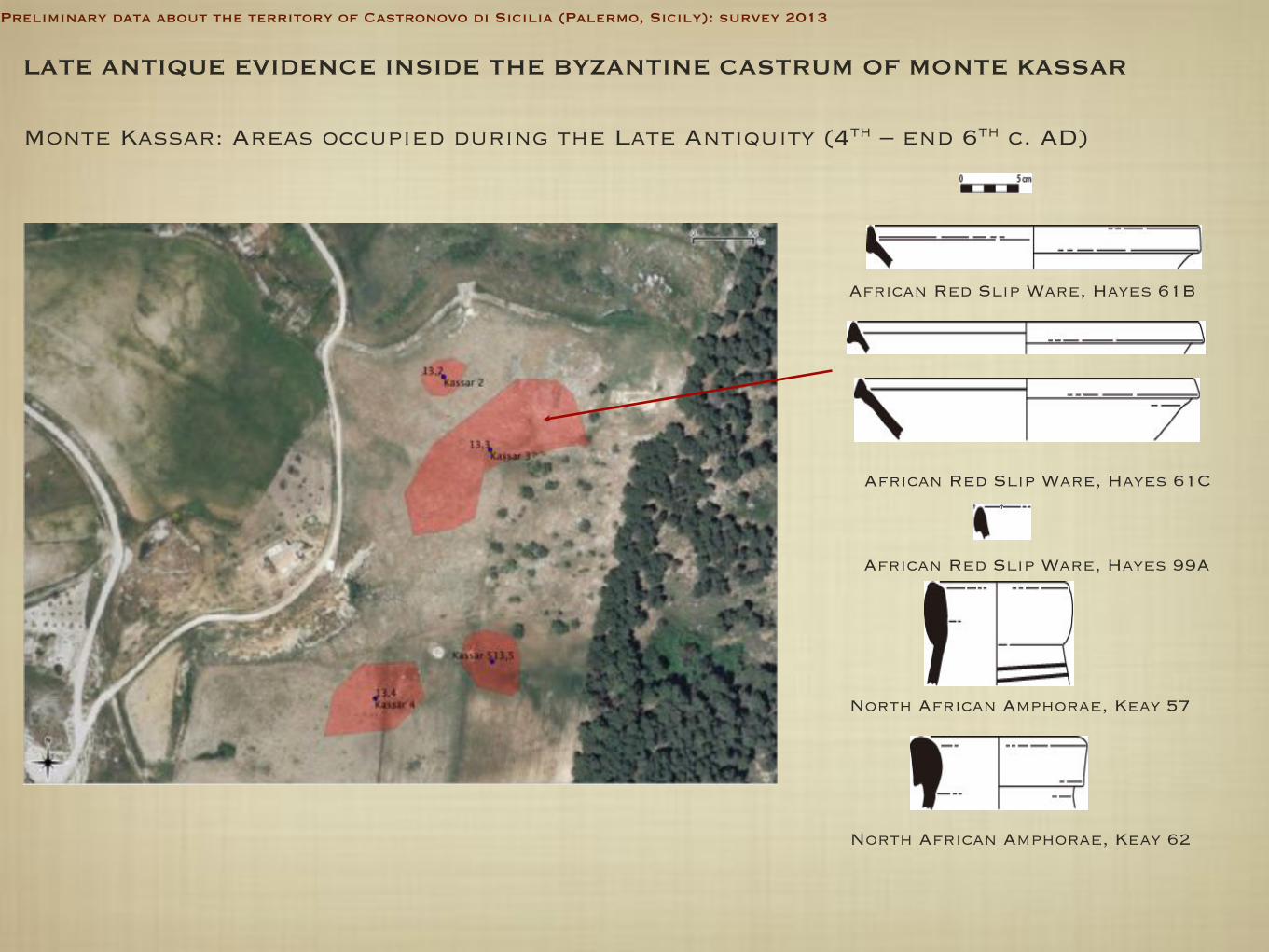
LATE ANTIQUE EVIDENCE INSIDE THE BYZANTINE CASTRUM OF MONTE KASSAR
Monte Kassar: Areas occupied during the Late Antiquity (4th – end 6th c. AD)
North African Amphorae, Keay 57
North African Amphorae, Keay 62
African Red Slip Ware, Hayes 61B
African Red Slip Ware, Hayes 61C
African Red Slip Ware, Hayes 99A
Preliminary data about the territory of Castronovo di Sicilia (Palermo, Sicily): survey 2013
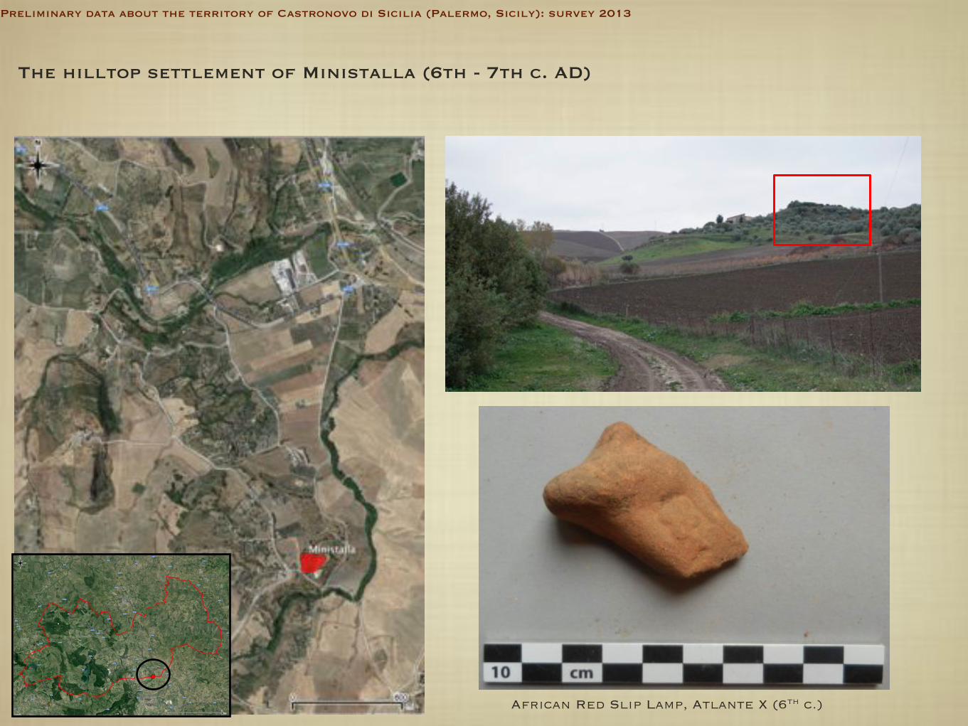
The hilltop settlement of Ministalla (6th - 7th c. AD)
African Red Slip Lamp, Atlante X (6th c.)
Preliminary data about the territory of Castronovo di Sicilia (Palermo, Sicily): survey 2013

Conlusions ... research agenda
- Extensive archaeological survey for a reconstraction of the rural settlement patterns in the long-term - Excavations in San Luca villa�s pars
rustica and Magaloggino - Study of the commercial trajectories
(distribution of imported pottery and petrographic analysis) - Systematic mapping of the rocky-cut contexts and typological-comparative
studies - Intensive prospections inside the Kassar
fortification - Analysis of road networks in relation to settlement patterns - Excavation of the site occupied for longer time: the �central place� of
Casale San Pietro
Preliminary data about the territory of Castronovo di Sicilia (Palermo, Sicily): survey 2013


![Strumenti musicali nelle collezioni siciliane [Musical instrumentas in Sicilian collections], in Strumenti musicali in Sicilia, ed. by G. P. Di Stefano, S. G. Giuliano, S. Proto, Palermo,](https://static.fdokumen.com/doc/165x107/63377df2d102fae1b607646b/strumenti-musicali-nelle-collezioni-siciliane-musical-instrumentas-in-sicilian.jpg)