Predicting changes in alluvial channel patterns in North-European Russia under conditions of global...
13
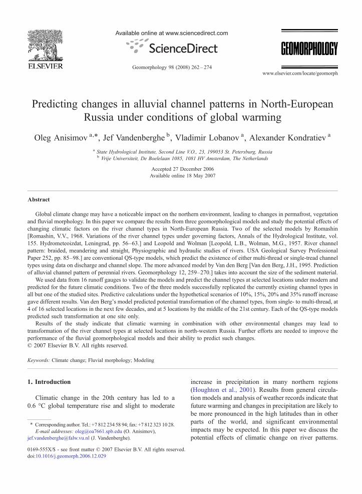
Predicting changes in alluvial channel patterns in North-European Russia under conditions of global warming Oleg Anisimov a, ⁎ , Jef Vandenberghe b , Vladimir Lobanov a , Alexander Kondratiev a a State Hydrological Institute, Second Line V.O., 23, 199053 St. Petersburg, Russia b Vrije Universiteit, De Boelelaan 1085, 1081 HV Amsterdam, The Netherlands Accepted 27 December 2006 Available online 18 May 2007 Abstract Global climate change may have a noticeable impact on the northern environment, leading to changes in permafrost, vegetation and fluvial morphology. In this paper we compare the results from three geomorphological models and study the potential effects of changing climatic factors on the river channel types in North-European Russia. Two of the selected models by Romashin [Romashin, V.V., 1968. Variations of the river channel types under governing factors, Annals of the Hydrological Institute, vol. 155. Hydrometeoizdat, Leningrad, pp. 56–63.] and Leopold and Wolman [Leopold, L.B., Wolman, M.G., 1957. River channel pattern: braided, meandering and straight, Physiographic and hydraulic studies of rivers. USA Geological Survey Professional Paper 252, pp. 85–98.] are conventional QS-type models, which predict the existence of either multi-thread or single-tread channel types using data on discharge and channel slope. The more advanced model by Van den Berg [Van den Berg, J.H., 1995. Prediction of alluvial channel pattern of perennial rivers. Geomorphology 12, 259–270.] takes into account the size of the sediment material. We used data from 16 runoff gauges to validate the models and predict the channel types at selected locations under modern and predicted for the future climatic conditions. Two of the three models successfully replicated the currently existing channel types in all but one of the studied sites. Predictive calculations under the hypothetical scenarios of 10%, 15%, 20% and 35% runoff increase gave different results. Van den Berg's model predicted potential transformation of the channel types, from single- to multi-thread, at 4 of 16 selected locations in the next few decades, and at 5 locations by the middle of the 21st century. Each of the QS-type models predicted such transformation at one site only. Results of the study indicate that climatic warming in combination with other environmental changes may lead to transformation of the river channel types at selected locations in north-western Russia. Further efforts are needed to improve the performance of the fluvial geomorphological models and their ability to predict such changes. © 2007 Elsevier B.V. All rights reserved. Keywords: Climate change; Fluvial morphology; Modeling 1. Introduction Climatic change in the 20th century has led to a 0.6 °C global temperature rise and slight to moderate increase in precipitation in many northern regions (Houghton et al., 2001). Results from general circula- tion models and analysis of weather records indicate that future warming and changes in precipitation are likely to be more pronounced in the high latitudes than in other parts of the world, and significant environmental impacts may be expected. In this paper we discuss the potential effects of climatic change on river patterns. Available online at www.sciencedirect.com Geomorphology 98 (2008) 262 – 274 www.elsevier.com/locate/geomorph ⁎ Corresponding author. Tel.: +7 812 234 58 94; fax: +7 812 323 10 28. E-mail addresses: [email protected] (O. Anisimov), [email protected] (J. Vandenberghe). 0169-555X/$ - see front matter © 2007 Elsevier B.V. All rights reserved. doi:10.1016/j.geomorph.2006.12.029
-
Upload
independent -
Category
Documents
-
view
0 -
download
0
Transcript of Predicting changes in alluvial channel patterns in North-European Russia under conditions of global...
Available online at www.sciencedirect.com
2008) 262–274www.elsevier.com/locate/geomorph
Geomorphology 98 (
Predicting changes in alluvial channel patterns in North-EuropeanRussia under conditions of global warming
Oleg Anisimov a,⁎, Jef Vandenberghe b, Vladimir Lobanov a, Alexander Kondratiev a
a State Hydrological Institute, Second Line V.O., 23, 199053 St. Petersburg, Russiab Vrije Universiteit, De Boelelaan 1085, 1081 HV Amsterdam, The Netherlands
Accepted 27 December 2006Available online 18 May 2007
Abstract
Global climate change may have a noticeable impact on the northern environment, leading to changes in permafrost, vegetationand fluvial morphology. In this paper we compare the results from three geomorphological models and study the potential effects ofchanging climatic factors on the river channel types in North-European Russia. Two of the selected models by Romashin[Romashin, V.V., 1968. Variations of the river channel types under governing factors, Annals of the Hydrological Institute, vol.155. Hydrometeoizdat, Leningrad, pp. 56–63.] and Leopold and Wolman [Leopold, L.B., Wolman, M.G., 1957. River channelpattern: braided, meandering and straight, Physiographic and hydraulic studies of rivers. USA Geological Survey ProfessionalPaper 252, pp. 85–98.] are conventional QS-type models, which predict the existence of either multi-thread or single-tread channeltypes using data on discharge and channel slope. The more advanced model by Van den Berg [Van den Berg, J.H., 1995. Predictionof alluvial channel pattern of perennial rivers. Geomorphology 12, 259–270.] takes into account the size of the sediment material.
We used data from 16 runoff gauges to validate the models and predict the channel types at selected locations under modern andpredicted for the future climatic conditions. Two of the three models successfully replicated the currently existing channel types inall but one of the studied sites. Predictive calculations under the hypothetical scenarios of 10%, 15%, 20% and 35% runoff increasegave different results. Van den Berg's model predicted potential transformation of the channel types, from single- to multi-thread, at4 of 16 selected locations in the next few decades, and at 5 locations by the middle of the 21st century. Each of the QS-type modelspredicted such transformation at one site only.
Results of the study indicate that climatic warming in combination with other environmental changes may lead totransformation of the river channel types at selected locations in north-western Russia. Further efforts are needed to improve theperformance of the fluvial geomorphological models and their ability to predict such changes.© 2007 Elsevier B.V. All rights reserved.
Keywords: Climate change; Fluvial morphology; Modeling
1. Introduction
Climatic change in the 20th century has led to a0.6 °C global temperature rise and slight to moderate
⁎ Corresponding author. Tel.: +7 812 234 58 94; fax: +7 812 323 10 28.E-mail addresses: [email protected] (O. Anisimov),
[email protected] (J. Vandenberghe).
0169-555X/$ - see front matter © 2007 Elsevier B.V. All rights reserved.doi:10.1016/j.geomorph.2006.12.029
increase in precipitation in many northern regions(Houghton et al., 2001). Results from general circula-tion models and analysis of weather records indicate thatfuture warming and changes in precipitation are likely tobe more pronounced in the high latitudes than in otherparts of the world, and significant environmentalimpacts may be expected. In this paper we discuss thepotential effects of climatic change on river patterns.
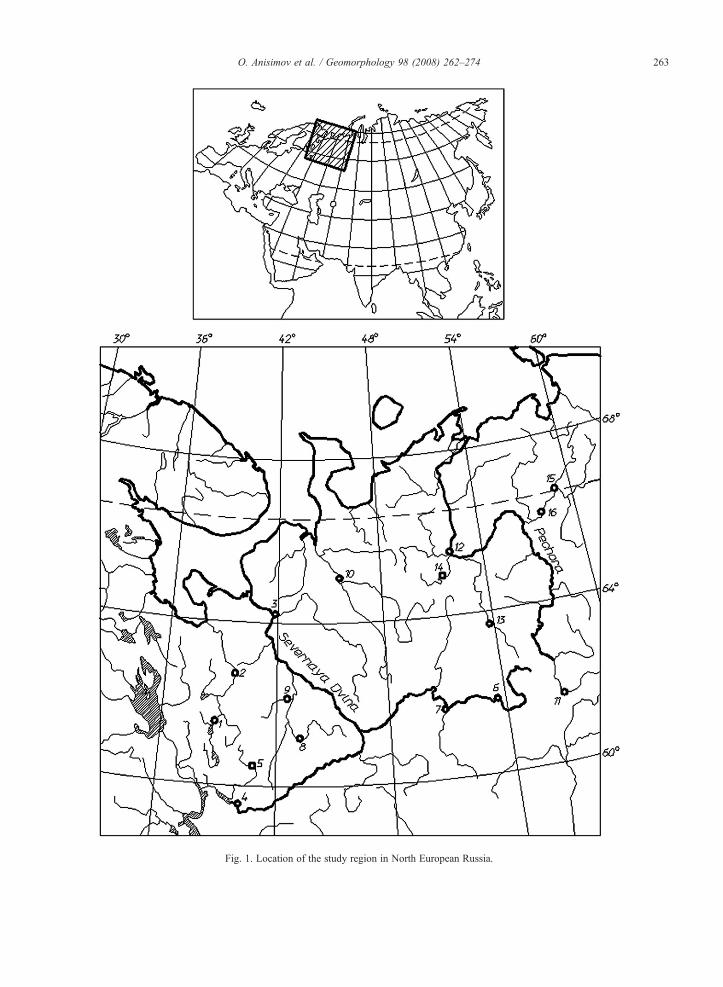
Fig. 1. Location of the study region in North European Russia.
263O. Anisimov et al. / Geomorphology 98 (2008) 262–274

Fig. 2. Regionalization of the study area with respect to changes in the air temperature (A), precipitation (B), and runoff (C) in the 20th century.Circles indicate locations of weather stations and runoff gauges used in this study. See text for further explanation.
264 O. Anisimov et al. / Geomorphology 98 (2008) 262–274
265O. Anisimov et al. / Geomorphology 98 (2008) 262–274
Therefore, we use quantitative basin and channel char-acteristics to evaluate the effectiveness of categorizingriver channel types into a prescribed number of classes.Finally, we want to compare the potential future changesof the river channel patterns in northern Russia aspredicted by different geomorphological approaches.
The European Russian North is crossed by severallarge rivers that show a wide variety of channel patternsranging from meandering and anabranching to braidedrivers, and rivers that are annually shifting betweenmeandering and braided styles. The study region (Fig. 1)falls into several bio-physiographic zones, from borealforest in the south to tundra underlain by permafrost inthe north, and is characterized by a distinct gradient ofclimatic and environmental conditions.
Fig. 2 illustrates the regionalisation of North-EuropeanRussia with respect to temperature (Fig. 2a), precipitation(Fig. 2b), and runoff (Fig. 2c) changes that took place inthe 20th century and are likely to continue into the future.The method that we used to develop this regionalisation is
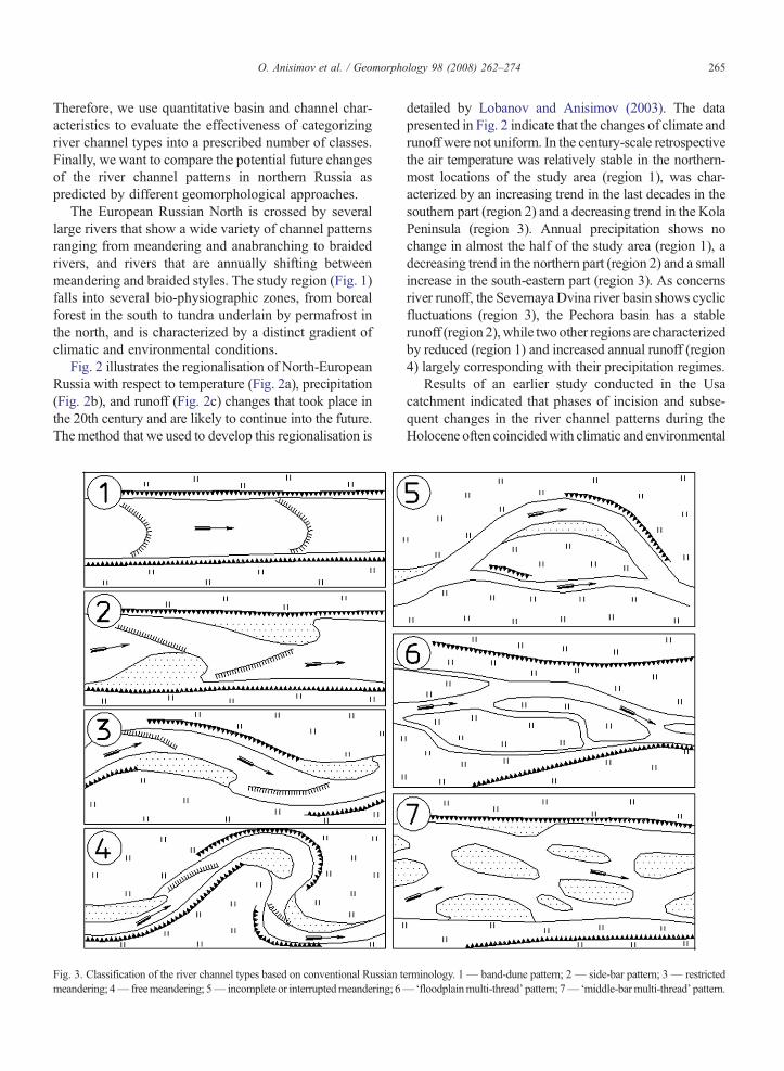
Fig. 3. Classification of the river channel types based on conventional Russian tmeandering; 4— freemeandering; 5— incomplete or interruptedmeandering; 6—
detailed by Lobanov and Anisimov (2003). The datapresented in Fig. 2 indicate that the changes of climate andrunoff were not uniform. In the century-scale retrospectivethe air temperature was relatively stable in the northern-most locations of the study area (region 1), was char-acterized by an increasing trend in the last decades in thesouthern part (region 2) and a decreasing trend in the KolaPeninsula (region 3). Annual precipitation shows nochange in almost the half of the study area (region 1), adecreasing trend in the northern part (region 2) and a smallincrease in the south-eastern part (region 3). As concernsriver runoff, the Severnaya Dvina river basin shows cyclicfluctuations (region 3), the Pechora basin has a stablerunoff (region 2), while two other regions are characterizedby reduced (region 1) and increased annual runoff (region4) largely corresponding with their precipitation regimes.
Results of an earlier study conducted in the Usacatchment indicated that phases of incision and subse-quent changes in the river channel patterns during theHolocene often coincidedwith climatic and environmental
erminology. 1— band-dune pattern; 2— side-bar pattern; 3— restricted‘floodplainmulti-thread’ pattern; 7—‘middle-barmulti-thread’ pattern.

266 O. Anisimov et al. / Geomorphology 98 (2008) 262–274
(i.e. vegetation, permafrost) changes (Vandenberghe andHuisink, 2003). These data provide empirical evidence ofthe impacts that climatic warming and associatedenvironmental changes may have on the fluvial morphol-ogy ultimately leading to transitions between differentriver channel types. To get insight into such potentialprocesses under projected climatic conditions and runoff,we applied several scenarios to hydro-geomorphologicalapproaches that may predict river pattern evolution.
2. Fluvial geomorphological models and channelclassifications
There are several computational methods that areused to predict alluvial channel patterns under prescribedenvironmental conditions. They are typically based onthe assumption that the transitions between the differentchannel types are threshold-governed processes. Allu-
Fig. 4. Empirical approximation of bankfull discharge (Qbf) through mean anfrom data from Russian rivers.
vial channel patterns form a continuum rather thandiscrete types (Bledsoe and Watson, 2001), but thresh-old-based approaches imply the distinction between afinite number of morphologic classes with somewhatfuzzy boundaries. Classifications that have been devel-oped so far delineate different numbers of river channeltypes, which complicates the comparison of results fromdifferent models.
Russian fluvial geomorphology traditionally employsclassifications that operate with relatively large numbersof channel types. A typical example is given by theclassification developed at the Russian State Hydrolog-ical Institute that has 7 classes. For modelling purposes,however, it is more appropriate to use a reduced numberof river types. The hierarchy of such classifications isillustrated in Fig. 3.
Theoretically, the complexity of classification dependson the availability of information about the features that
nual discharge (Qm) (A) and maximum annual flood (Qaf) (B), derived

Fig. 5. Transition zone between the single-and multi-thread channels in as a function of ώ and D50. The solid line designates the hard divideintroduced by Van den Berg (1995), dashed lines designate the boundaries of a ±35% transition zone. The plot is based on the data by Van den Berg(1995).
267O. Anisimov et al. / Geomorphology 98 (2008) 262–274
essentially distinguish one class from the other. Ideally,a classification might be developed that would reflect thedifferences in morphological features, alluvium, channelgeometry, intensity of sediment transport, etc. In reality,however, such a detailed information is rarely available,which is especially true in the case of predictivemodelling.
The majority of classification models in fluvialgeomorphology use either the relation between dischargeand slope of the river (QS-type models; e.g. Leopold andWolman, 1957; Schumm, 1977), or the combination ofboth these values and the average grain size (Van denBerg, 1995). Ratios between these variables are comparedwith the different channel types. It implies that in the
Table 1Baseline characteristics of 16 Russian rivers under contemporary climate
No. River/site Qm, (m3/s) Q
1 Onega — Nadporogsky Pogost 1172 Onega — Zmiyevo 3863 Severnaya Dvina — Ust-Pinega 3330 24 Sukhona — Raban'ga 1355 Kubena — Troitsko-Enal'skoe 11.26 Vichegda — Malaya Kuz'ba 2507 Vichegda — Syktuvkar 6228 Ustja — Shangali 87.69 Ledj – Zeleninskaya 17.110 Mezenj — Malonisogorskaja 64411 Pechora — Yaksha 15412 Pechora — Ust-Tzilma 3440 213 Ukhta — Ukhta 46.814 Pizdma — Borovaja 48.715 Usa (site Adzva) 93116 Usa (site Makarikha) 1100 1
modelling studies the number of channel types to beconsidered is limited by the ability of the specificmodel toresolve the differences between them. The better themodel resolves the features that are essentially differentbetween classes, the more classes may be distinguished ina model-based predictive assessment.
While most of the QS-type models distinguishbetween the two major channel classes, meandering(single-thread) and braided (multi-thread), Russianfluvial geomorphology often employs the model thatconsiders three channel types. QS-thresholds for thatmodel have been derived on the basis of the analysis ofdata from 250 observational points on the rivers of the
af, (m3/s) Sr, (‰) D50, (mm) Channel type
366 0.32 0.70 S2220 0.36 0.60 S1700 0.30 0.69 M489 0.27 0.20 S160 0.65 0.69 S1880 0.31 0.66 S4180 0.30 0.66 SM1040 0.49 0.90 S177 1.34 0.70 S5760 0.48 0.61 M1450 1.75 0.70 S3700 1.00 0.62 M501 0.83 1.18 S565 0.62 0.69 S9380 0.06 0.40 S1300 0.15 0.30 M
268 O. Anisimov et al. / Geomorphology 98 (2008) 262–274
former USSR (Romashin, 1968). According to theconventional Russian approach, free meandering rivershave a QSb350 m3/s; the so-called non-complete mean-dering (type 5 of the Russian classification in Fig. 3) ischaracterized by 350 m3/sbQSb1400 m3/s, whereas thebraided rivers have QSN1400 m3/s (Romashin, 1968).
Many authors recognized the limitations of the simpleQS models in neglecting the bed material. Various QS-thresholds suggested by different researchers are basedon the analysis of data coming from the rivers withdifferent bed materials, and as such represent hypothet-ical “average” conditions with respect to sediment size.The “average” values of the critical stream power appearto be too high for sand bed rivers and too low for gravelbed rivers (Carson, 1984). More advanced models definethe slope of the transition lines between braided andmeandering also as a function of the bedload grain-size(Henderson, 1966; Carson, 1984; Ferguson, 1987; Vanden Berg, 1995).
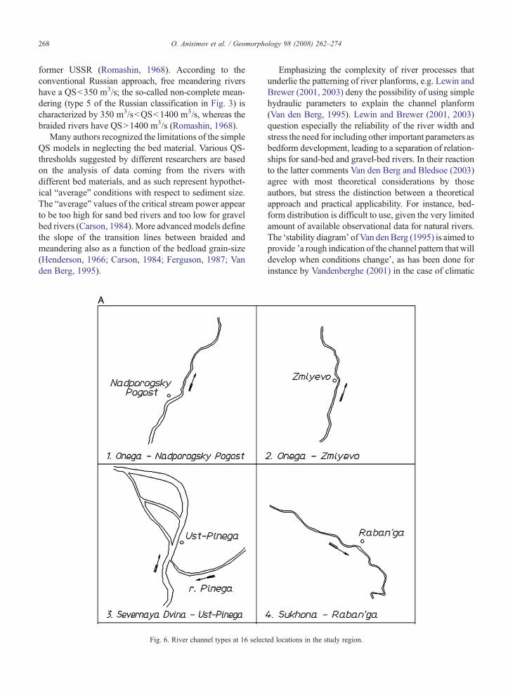
Fig. 6. River channel types at 16 selec
Emphasizing the complexity of river processes thatunderlie the patterning of river planforms, e.g. Lewin andBrewer (2001, 2003) deny the possibility of using simplehydraulic parameters to explain the channel planform(Van den Berg, 1995). Lewin and Brewer (2001, 2003)question especially the reliability of the river width andstress the need for including other important parameters asbedform development, leading to a separation of relation-ships for sand-bed and gravel-bed rivers. In their reactionto the latter comments Van den Berg and Bledsoe (2003)agree with most theoretical considerations by thoseauthors, but stress the distinction between a theoreticalapproach and practical applicability. For instance, bed-form distribution is difficult to use, given the very limitedamount of available observational data for natural rivers.The ‘stability diagram’ ofVan denBerg (1995) is aimed toprovide ’a rough indication of the channel pattern that willdevelop when conditions change’, as has been done forinstance by Vandenberghe (2001) in the case of climatic
ted locations in the study region.

Fig. 6 (continued ).
269O. Anisimov et al. / Geomorphology 98 (2008) 262–274
change (Van den Berg and Bledsoe, 2003). Patterndependant geometric or hydraulic parameters are notuseful to be incorporated in such diagrams.
3. Modeling potential channel transformationsunder predicted future climate conditions
We focus our further analysis on the potential impactthat changes of climate and runoff may have on the fluvialchannel patterns in North-European Russia. In this studywe use three different fluvial geomorphological modelsillustrative for Russian and western studies. Two of themare the QS-type models by Leopold and Wolman (1957)and Romashin (1968). Although Romashin's modelconsiders three different river channel types, we use theaggregated 2-grade classification that distinguishes be-tween meandering (single thread) and braided (multi-thread) rivers. The third model is more advanced,explicitly takes into account the size of the sediments,and is detailed in the publication by Van den Berg (1995).
We reassessed the data from 228 rivers presented by Vanden Berg (1995) and made two modifications to hismodel, which are the following:
Firstly, because the data on the bankfull discharge(Qbf) for the study region is not available, we derivedempirical equations that express Qbf through themaximum annual flood (Qaf) and mean annual discharge(Qm). Observational data for those empirical equationsare obtained from Russian rivers (Fig. 4):
Qbf ¼ 0:594Qaf þ 126:9; ð1Þ
Qbf ¼ 31:26Q0:67m ; ð2Þ
Correlation coefficients between the discharge char-acteristics in Eqs. (1) and (2) are 0.86 and 0.81respectively, indicating similar coherence in bothequations. The reason for this modification is a practicalone: it is more convenient to measure the maximumannual flood than the bankfull discharge, and thus a
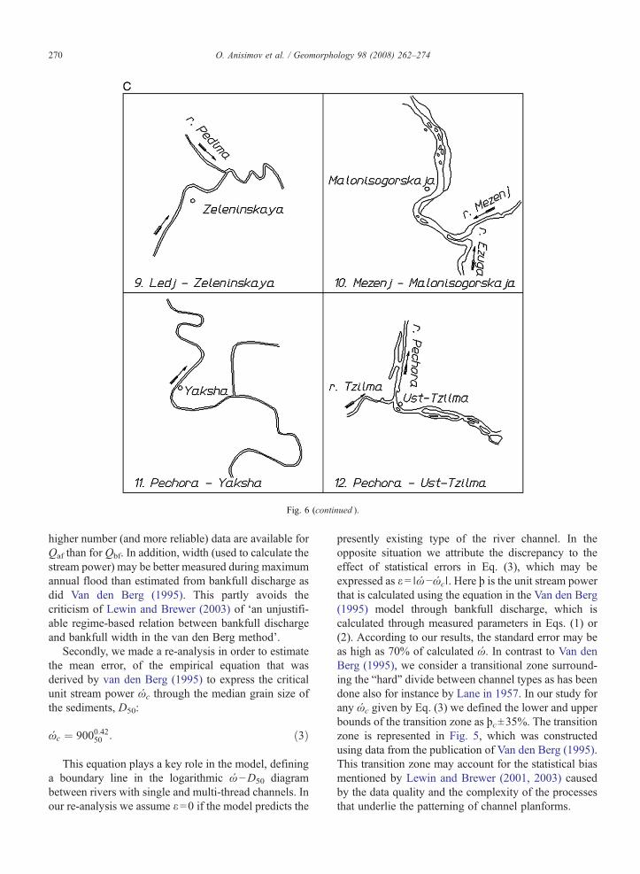
Fig. 6 (continued ).
270 O. Anisimov et al. / Geomorphology 98 (2008) 262–274
higher number (and more reliable) data are available forQaf than for Qbf. In addition, width (used to calculate thestream power) may be better measured during maximumannual flood than estimated from bankfull discharge asdid Van den Berg (1995). This partly avoids thecriticism of Lewin and Brewer (2003) of ‘an unjustifi-able regime-based relation between bankfull dischargeand bankfull width in the van den Berg method’.
Secondly, we made a re-analysis in order to estimatethe mean error, of the empirical equation that wasderived by van den Berg (1995) to express the criticalunit stream power ώc through the median grain size ofthe sediments, D50:
ώc ¼ 9000:4250 : ð3Þ
This equation plays a key role in the model, defininga boundary line in the logarithmic ώ−D50 diagrambetween rivers with single and multi-thread channels. Inour re-analysis we assume ε=0 if the model predicts the
presently existing type of the river channel. In theopposite situation we attribute the discrepancy to theeffect of statistical errors in Eq. (3), which may beexpressed as ε= ∣ώ−ώc∣. Here þ is the unit stream powerthat is calculated using the equation in the Van den Berg(1995) model through bankfull discharge, which iscalculated through measured parameters in Eqs. (1) or(2). According to our results, the standard error may beas high as 70% of calculated ώ. In contrast to Van denBerg (1995), we consider a transitional zone surround-ing the “hard” divide between channel types as has beendone also for instance by Lane in 1957. In our study forany ώc given by Eq. (3) we defined the lower and upperbounds of the transition zone as þc±35%. The transitionzone is represented in Fig. 5, which was constructedusing data from the publication of Van den Berg (1995).This transition zone may account for the statistical biasmentioned by Lewin and Brewer (2001, 2003) causedby the data quality and the complexity of the processesthat underlie the patterning of channel planforms.
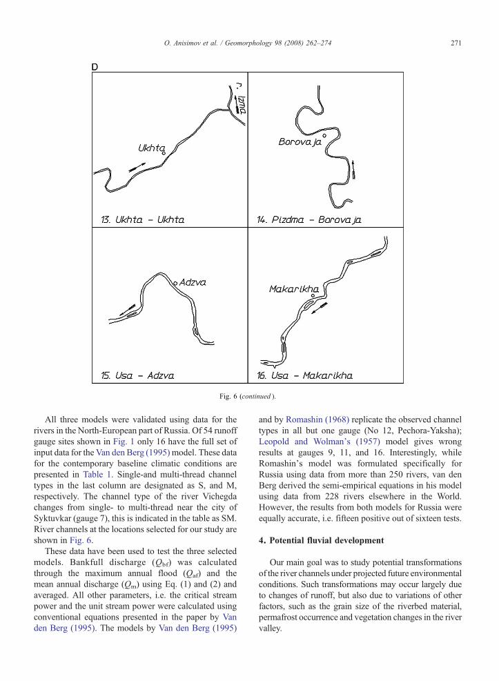
Fig. 6 (continued ).
271O. Anisimov et al. / Geomorphology 98 (2008) 262–274
All three models were validated using data for therivers in the North-European part of Russia. Of 54 runoffgauge sites shown in Fig. 1 only 16 have the full set ofinput data for the Van den Berg (1995) model. These datafor the contemporary baseline climatic conditions arepresented in Table 1. Single-and multi-thread channeltypes in the last column are designated as S, and M,respectively. The channel type of the river Vichegdachanges from single- to multi-thread near the city ofSyktuvkar (gauge 7), this is indicated in the table as SM.River channels at the locations selected for our study areshown in Fig. 6.
These data have been used to test the three selectedmodels. Bankfull discharge (Qbf) was calculatedthrough the maximum annual flood (Qaf) and themean annual discharge (Qm) using Eq. (1) and (2) andaveraged. All other parameters, i.e. the critical streampower and the unit stream power were calculated usingconventional equations presented in the paper by Vanden Berg (1995). The models by Van den Berg (1995)
and by Romashin (1968) replicate the observed channeltypes in all but one gauge (No 12, Pechora-Yaksha);Leopold and Wolman's (1957) model gives wrongresults at gauges 9, 11, and 16. Interestingly, whileRomashin's model was formulated specifically forRussia using data from more than 250 rivers, van denBerg derived the semi-empirical equations in his modelusing data from 228 rivers elsewhere in the World.However, the results from both models for Russia wereequally accurate, i.e. fifteen positive out of sixteen tests.
4. Potential fluvial development
Our main goal was to study potential transformationsof the river channels under projected future environmentalconditions. Such transformations may occur largely dueto changes of runoff, but also due to variations of otherfactors, such as the grain size of the riverbed material,permafrost occurrence and vegetation changes in the rivervalley.

Table 2Projections of future changes in annual runoff
Author, year Climatescenario
River basin Discharge change (%)
Annualdischarge
Winterdischarge
Miller andRussell(1992)
Canadian, GISS2xCO2
Yenisey,Lena, Ob,Kolyma
from +10to +45
Georgievskyet al.(1996)
GFDL 2xCO2
UKMO 2xCO2
Inflow intothe BarentsSea
+14–35 +25–46
Arnell(1999)
HadCM2HadCM3 6scenariosby 2050.
Yenisey +6–14Lena +12–25Ob +3–10Kolyma +30–40Mackenzie +12–20Yukon +20–30
Miller andRussell(2000)
GISS CO2:+0.5%/yrto 2100
Arctic total +12Eurasianrivers
+9
N. Americanrivers
+23
Mokhovet al.(2003)
HadCM3 Yenisey +8Lena +24Ob +4
Mokhovet al.(2003)
ECHAM4 Yenisey +8Lena +22Ob +3
272 O. Anisimov et al. / Geomorphology 98 (2008) 262–274
A survey of the scientific literature indicates thatconstructing a scenario of future changes in river runoffis a difficult task. Available estimates have beenobtained using specially developed hydrological modelsthat were forced with scenarios of climate change. Thesescenarios were based on various general circulationmodels (GCMs)-run with doubled CO2 concentrationsand transient increases of CO2, and on paleoclimaticreconstructions. Selected projections in Table 2 (Hassol,2005) fall into a wide range indicating that robustscenarios for changes in runoff are not available. Futurechanges of other factors that may lead to transformation
Table 3Potential changes of river channel types predicted by three geomorphologica
No ofsite
Channel type atpresent
Potential changes of channel type u
10% 15%
VB LW RM VB LW RM VB
2 S S S M M7 S S S M M9 S M S M M13 S S S M M14 S S S
Designations in the table: VB—model by Van den berg; LW—model by Leomulti-channel. For the other sites no pattern change is predicted.
of the channel types may also be predicted only on aqualitative basis.
Under these circumstances we limit our furtheranalysis to sensitivity tests targeting them to theresponse of the fluvial regime to gradual increases inannual runoff by 10%, 15%, 20%, and 35% compared tothe modern norms. This range corresponds with thechanges projected for the mid-21st century by differentauthors (Hassol, 2005).
Results from three geomorphological models forcedwith the described runoff data and with the other data asfor the modern conditions unchanged are presented inTable 3. Data in this table are presented only for thosesites, where the changes of the annual runoff accordingto the model's results should lead to transformation ofthe channel type.
5. Discussion and conclusions
The results of this study indicate that two of the threeselected geomorphological models, while being equallyaccurate in predicting the modern fluvial regime, givesignificantly different projections under the potentialchanges of river runoff. According to the van den Bergmodel, river channels at sites 2, 7, 9, and 13 arepotentially unstable even under the current conditions,although the critical stream power is not yet reached.They are situated in the transition zone defined by þc±35%. In the conventional model, even a slight increaseof the annual runoff by 10% leads to the situation thatthe critical stream power should be exceeded totransform the channel from the single-to the multi-thread type. The more advanced probabilistic approach,however, indicates that the unit stream power in thiscase will still be in the transition zone around the criticalthreshold where both single-and multi-thread typechannels may be expected.
A further open question is what will be the changesof other environmental factors, such as vegetation in the
l models under gradual increase of annual runoff
nder projected increase of annual runoff (%from modern)
20% 35%
LW RM VB LW RM VB LW RM
M MM M M M M
M MM M M
M
pold and Wolman; RM—model by Romashin; S = single channel, M =

273O. Anisimov et al. / Geomorphology 98 (2008) 262–274
river valley and permafrost that largely control the inputof sediments to the river and the stability of the banks. Ithas to be kept in mind that in these scenario experimentsall other factors than runoff remain constant. Butwarmer climatic conditions will favor vegetation growthand permafrost retreat. An earlier and longer transitionfrom winter to spring will lead to more protractedsnowmelt, with less intense peak runoff. Deeperseasonal thawing and loss of permafrost will increasethe water storage capacity of the ground, leading to anincrease in summer base flow. Ultimately, under warmerclimatic conditions there will be less seasonal fluctua-tion in runoff throughout the year (Anisimov andFitzharris, 2001). Given that the transformations of theriver channels under appropriate conditions like thoseprojected for our selected sites should normally beinitiated by the significant disturbances of the fluvialregime, seasonal redistribution of runoff may somewhatoffset the effect of increased annual discharge.
In a hydrological model study of the Usa basin Vander Linden (2002) found that GCM-simulation scenariosfor the near future lead to increases in annual discharge atthe end of the twenty-first century by 25%–38% andevapotranspiration up to 44%. However, dischargesdepend on the balance between both temperature andprecipitation: changes in evapotranspiration (as a resultof temperature changes) may be counterbalanced bychanges in precipitation. In addition, model results maydiffer largely as a function of the hydrological modelused and the climate scenario. Also the possiblefeedback effects related to, for instance, snow andvegetation should be taken into account (Koster et al.,2005). In contrast to the considerable effects of climatechange on discharges, indirect effects –for instance onvegetation–are minor according to Van der Linden et al.(2003).
On a Holocene time scale Vandenberghe and Huisink(2003) show obvious effects of vegetation densitychanges on sediment supply in the same Usa basin.Thus it seems that the combination of changes in bothdischarge regime (possibly induced by permafrostdegradation) and vegetation density (of climatic oranthropogenic origin) may have the largest effects onriver activity and morphology, as they define bothtransport capacity and sediment supply. It confirmsthat the functionality between fluvial morphology andhydrology, and climate change, water balance and vege-tation is—in the long term—a complex one, as describedby Woo (1990), Woo et al. (1992) and Vandenberghe andWoo (2002).
According to Lewin and Brewer (2003) the chosenapproach, more particularly the simplicity of the para-
meters used, is only useful when the channels are farfrom the designated threshold line. However, we feelthat the bias that is induced by this ‘simplicity’ is largelyovercome by the introduction of a ‘diffuse transitionalzone’ rather than a sharp line in the original van denBerg model. In fact, the ‘stability diagram’ in Fig. 5appears to be a very useful and well performing assess-ment tool in scenario studies, more particularly in thediscrimination of the classic channel patterns.
Acknowledgements
Support for this research comes from the NationalScience Foundation of the Netherlands, NWO grant047.011.2001.003, and the Russian Foundation for BasicResearch, grant 04-05-64488. The paper benefits from theuseful comments made by T. Coulthard and L. Starkel.
References
Anisimov, O.A., Fitzharris, B., 2001. Polar regions (Arctic andAntarctic). In: McCarthy, O.F.C.J., Leary, N.A., Dokken, D.J.,White, F.S. (Eds.), Climate Change: 2001 Impacts, Adaptation,and Vulnerability Contribution of Working group II to the ThirdAssessment Report of the Intergovernmental Panel on ClimateChange. Cambridge University Press, Cambridge, pp. 801–841.
Arnell, N.W., 1999. Climate change and global water resources.Global Environmental Change 9, 31–49.
Bledsoe, B.P., Watson, C.C., 2001. Logistic analysis of channel patternthresholds: meandering, braiding, and incising. Geomorphology38, 281–300.
Carson, M.A., 1984. The meandering-braided river threshold:reappraisal. Journal of hydrological research 73, 315–334.
Ferguson, R.I., 1987. Hydraulic and sedimentary controls on channelpattern. In: Richards, K.S. (Ed.), River Channels: Environment andProcess. Blackwell, Oxford, pp. 129–158.
Georgievsky, V.Y., Ezhov, A.V., Shalygin, A.L., Shiklomanov, I.A.,Shiklomanov, A.I., 1996. Evaluation of possible climate changeimpact on hydrological regime and water resources of the formerUSSR rivers. Meteorology and Hydrology 11, 89–99.
Hassol, S.J., 2005. Impacts of a Warming Arctic: Arctic ClimateImpacts Assessment. Cambridge University Press, Cambridge.139 pp.
Henderson, F.M., 1966. Open Channel Flow. Macmillan, New York.522 pp.
Houghton, J.T., Ding, Y., Griggs, D.J., Noguer, M., Van der Linden, P.J.,Dai, X., Maskell, K., Johnson, C.A., 2001. Climate change 2001: thescientific basis, Contribution of working group I to the Thirdassessment report of the intergovernmental panel on climate change.Cambridge University Press, Cambridge. 881 pp.
Koster, E., Dankers, R., Van der Linden, S., 2005. Water balancemodelling of (Sub)Arctic rivers and freshwater supply to theBarents Sea Basin. Permafrost and Periglacial Processes 16,249–259.
Lane, E.W., 1957. A study of the shape of channels formed by naturalstreams flowing in erodiblematerial. M.R.D. Sediment Series 9, U.S.Army Engineer Division, Missouri River, Corps Engineers, Omaha,Nebraska.
274 O. Anisimov et al. / Geomorphology 98 (2008) 262–274
Leopold, L.B., Wolman, M.G., 1957. River channel pattern: braided,meandering and straight, physiographic and hydraulic studies ofrivers. USA Geological Survey Professional Paper 252, 85–98.
Lewin, J., Brewer, P., 2001. Predicting channel patterns. Geomor-phology 40, 329–339.
Lewin, J., Brewer, P., 2003. Reply to Van den Berg and Bledsoe'scomment on Lewin and Brewer (2001) predicting channel patterns.Geomorphology 53, 339–342.
Lobanov, V.A., Anisimov, O.A., 2003. Spatial structure of thecontemporary changes of the air temperature over Europe.Meteorology and Hydrology 2, 5–14.
Miller, J.R., Russell, G.L., 1992. The impact of global warming onriver runoff. Journal of Geophysical Research 97, 2757–2764.
Miller, J.R., Russell, G.L., 2000. Projected impact of climate changeon the freshwater and salt budgets of the Arctic Ocean by a globalclimate model. Geophysical Research Letters 27, 1183–1186.
Mokhov, I.I., Semenov, V.A., Khone, V.C., 2003. Estimates of possibleregional hydrologic regime changes in the 21st century based onglobal climate models. Izvestiya, Atmospheric and OceanicPhysics 39, 130–144.
Romashin, V.V., 1968. Variations of the river channel types undergoverning factors. Annals of the Hydrological Institute Hydro-meteoizdat, Leningrad 155, 56–63.
Schumm, S.A., 1977. The Fluvial System. Wiley-Interscience, NewYork. 338 pp.
Van den Berg, J.H., 1995. Prediction of alluvial channel pattern ofperennial rivers. Geomorphology 12, 259–270.
Van den Berg, J.H., Bledsoe, B.P., 2003. Comment on Lewin andBrewer (2001): predicting channel patterns. Geomorphology 53,333–337.
Van der Linden, S., 2002. Icy rivers heating up—modelling hydrologicalimpacts of climate change in the (sub) Arctic. NetherlandsGeographical Studies 308 174 pp.
Van der Linden, S., Virtanen, T., Oberman, N., Kuhry, P., 2003.Sensitivity analysis of discharge in the Arctic Usa Basin, East-European Russia. Climatic Change 57, 139–161.
Vandenberghe, J., 2001. A typology of Pleistocene cold-based rivers.Quaternary International 79, 111–121.
Vandenberghe, J., Woo, M.K., 2002. Modern and ancient periglacialriver types. Progress in Physical Geography 26, 479–506.
Vandenberghe, J., Huisink, M., 2003. High-latitude fluvial morphol-ogy: the example of the USA river, northern Russia. In: Benito, G.,Gregory, K.J. (Eds.), Paleohydrology: Understanding GlobalChange. Wiley, Chichester, pp. 49–58.
Woo, M., 1990. Consequences of climatic change for hydrology inpermafrost zones. Journal of Cold Regions Engineering 4, 15–20.
Woo, M.k., Lewkowicz, A.G., Rouse, W.R., 1992. Response of theCanadian permafrost environment to climatic change. PhysicalGeography 13, 287–317.