PERSATUAN GEOLOGI MALAYSIA
124
GEOLOGICAL SOCIETYOF MALAYSIA PERSATUAN GEOLOGI MALAYSIA Jil. 22, No.3 (Vol. 22, No.3) May-J un 1996 KANDUNGAN (Contents) CATATAN GEOLOGI (Geological Notes) Vmar Hamzah, Abd. Rahim Samsudin, Abd. Ghani Rafek and Haryono: Application 167 of shallow seismic reflection in delineating Bacok groundwater aquifers PERTEMUAN PERSATUAN (Meetings of the Society) - -"-' --- T.Y. Irfan: Engineering geology of aggregates and stone in Hong Kong 173 R.N. Yong: Fate of toxic pollutants in contaminated soils and sediments: Threat 175 assessment and abatement Lee Chai Peng: Fosil dan rekod sejarah silam Malaysia 176 Clive Foss: Regional gravity and magnetic investigation of the Eromanga Basin, 177 NSW, Australia for hydrocarbon exploration Robert H. Lander: Quantitative prediction of sandstone reservoir quality via 179 simulation of compaction and quartz cementation Workshop and Fieldtrip on Murau Conglomerate - Laporan (Report) 180 Aturcara Majlis (Programme) 181 Abstracts of Papers 184 Seminar and Fieldtrip on Industrial Minerals and Rocks - Laporan (Report) 187 Programme 188 Abstracts of Papers 192 Annual Geological Conference '96 - Report 197 Programme 199 Abstracts of Papers and Posters 206 BERITA-BERITA PERSATUAN (News of the Society) Keahlian (Membership) Pertukaran Alamat (Change of Address) Pertambahan Baru Perpustakaan (New Library Additions) 247 247 248 BERITA-BERITA LAIN (Other News) Local News 3YGEC Singapore - Geotechnical Engineering in Asia: 2000 and Beyond Petroleum Systems of S.E. Asia & Australasia Rock Support - Applied solutions for underground structures GeoSciEd II - Learning about the Earth as a system Kalendar (Calendar) - 249 262 264 265 267 269
-
Upload
khangminh22 -
Category
Documents
-
view
3 -
download
0
Transcript of PERSATUAN GEOLOGI MALAYSIA
GEOLOGICAL SOCIETYOF MALAYSIA
PERSATUAN GEOLOGI MALAYSIA
Jil. 22, No.3 (Vol. 22, No.3) May-J un 1996
KANDUNGAN (Contents) CATATAN GEOLOGI (Geological Notes)
Vmar Hamzah, Abd. Rahim Samsudin, Abd. Ghani Rafek and Haryono: Application 167 of shallow seismic reflection in delineating Bacok groundwater aquifers
PERTEMUAN PERSATUAN (Meetings of the Society) - -"-'---T.Y. Irfan: Engineering geology of aggregates and stone in Hong Kong 173 R.N. Yong: Fate of toxic pollutants in contaminated soils and sediments: Threat 175
assessment and abatement Lee Chai Peng: Fosil dan rekod sejarah silam Malaysia 176 Clive Foss: Regional gravity and magnetic investigation of the Eromanga Basin, 177
NSW, Australia for hydrocarbon exploration Robert H. Lander: Quantitative prediction of sandstone reservoir quality via 179
simulation of compaction and quartz cementation Workshop and Fieldtrip on Murau Conglomerate - Laporan (Report) 180
Aturcara Majlis (Programme) 181 Abstracts of Papers 184
Seminar and Fieldtrip on Industrial Minerals and Rocks - Laporan (Report) 187 Programme 188 Abstracts of Papers 192
Annual Geological Conference '96 - Report 197 Programme 199 Abstracts of Papers and Posters 206
BERITA-BERITA PERSATUAN (News of the Society) --~-------------------
Keahlian (Membership) Pertukaran Alamat (Change of Address) Pertambahan Baru Perpustakaan (New Library Additions)
247 247 248
BERITA-BERITA LAIN (Other News) ----------------------------~--------
Local News 3YGEC Singapore - Geotechnical Engineering in Asia: 2000 and Beyond Petroleum Systems of S.E. Asia & Australasia Rock Support - Applied solutions for underground structures GeoSciEd II - Learning about the Earth as a system Kalendar (Calendar) -
249 262 264 265 267 269
Majlis (Council) 1996/97
Presiden (President) N aib Presiden (Vice-President) Setiausaha (Secretary) Penolong Setiausaha (Asst. Secretary) Bendahari (Treasurer) Pengarang (Editor)
Khalid Ngah Ibrahim Komoo Ahmad Tajuddin Ibrahim S. Paramananthan Lee Chai Peng Teh Guan Hoe
Presiden Yang Dahulu (Immediate Past President) : Fateh Chand
1996-98 Abd. Ghani Mohd Rafek Abdul Rahim Samsudin Abdul Hadi Abd. Rahman Tan Boon Kong
1996-97 Khoo Kay Khean Hoh Swee Chee Ibrahim Abdullah Mohd Shafeea Leman
Jawatankuasa Kecil Pengarang (Editorial Subcommittee)
Teh Guan Hoe (PengerusilChairman)
Fan Ah Kwai Ng Tham Fatt J.J. Pereira
Lembaga Penasihat Pengarang (Editorial Advisory Board)
Aw Peck Chin Foo Wah Yang Mazlan Madon P.H. Stauffer Azhar Hj. Hussin C.A. Foss Ian Metcalfe Tan Boon Kong K.R. Chakraborty N.S. Haile S. Paramananthan Tan Teong Hing Choo Mun Keong C.S. Hutchison John Kuna Raj Teoh Lay Hock Chu Leng Heng Lee Chai Peng Senathi Rajah H .D. Tjia Denis N.K. Tan Leong Lap Sau Shu Yeoh Khoon Yea p Cheng Hock
The Society was founded in 1967 with the aim of promoting the advancement of earth sciences particularly in Malaysia and the Southeast Asian region.
The Society has a membership of about 600 earth scientists interested in Malaysia and other Southeast Asian regions . The membership is worldwide in distribution.
Published by the Geologic al Society of Malaysia. Department of Geology, University of Malaya, 50603 Kuala Lumpur. Tel : 603-757 7036 Fax: 603-756 3900
Prin ted b y Art Printing Works Soh Bhd., 29 Jolon Riong. 59100 Kuala Lumpur.
Application of shallow seismic reflection in delineating Bacok groundwater aquifers
UMAR HAMZAH, AIm. RAHIM SAMSUDIN, AIm. GHANI RAFEK AND HARYONO
J abatan Geologi Universiti Kebangsaan Malaysia
Bangi, Selangor D.E.
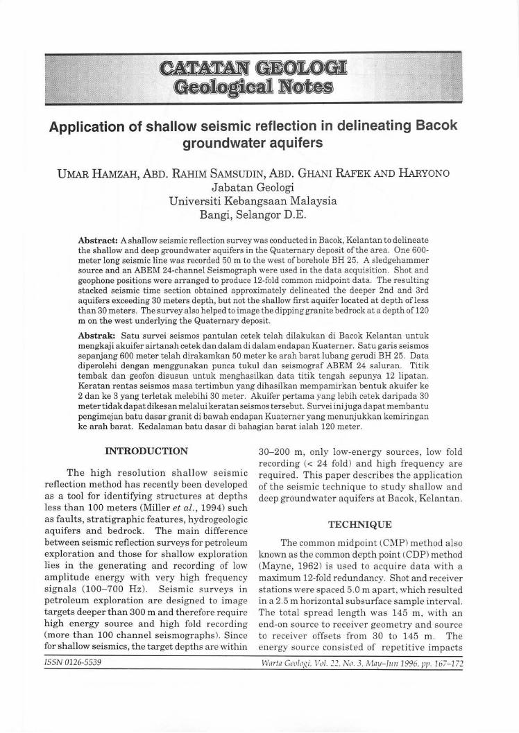
Abstract: A shallow seismic reflection survey was conducted in Bacok, Kelantan to delineate the shallow and deep groundwater aquifers in the Quaternary deposit ofthe area. One 600-meter long seismic line was recorded 50 m to the west of borehole BH 25. A sledgehammer source and an ABEM 24-channel Seismograph were used in the data acquisition. Shot and geophone positions were arranged to produce 12-fold common midpoint data. The resulting stacked seismic time section obtained approximately delineated the deeper 2nd and 3rd aquifers exceeding 30 meters depth, but not the shallow first aquifer located at depth ofless than 30 meters. The survey also helped to image the dipping granite bedrock at a depth of 120 m on the west underlying the Quaternary deposit.
Abstrak: Satu survei seismos pantulan cetek telah dilakukan di Bacok Kelantan untuk mengkaji akuifer airtanah cetek dan dalam di dalam endapan Kuaterner. Satu garis seismos sepanjang 600 meter telah dirakamkan 50 meter ke arah barat lubang gerudi BH 25. Data diperolehi dengan menggunakan punca tukul dan seismograf ABEM 24 saluran. Titik tembak dan geofon disusun untuk menghasilkan data titik tengah sepunya 12 lipatan. Keratan rentas seismos mas a tertimbun yang dihasilkan mempamirkan bentuk akuifer ke 2 dan ke 3 yang terletak melebihi 30 meter. Akuifer pertama yang lebih cetek daripada 30 metertidak dapatdikesan melalui keratan seismos tersebut. Survei inijuga dapat membantu pengimejan batu dasar granit di bawah endapan Kuaterner yang menunjukkan kemiringan ke arah barat. Kedalaman batu dasar di bahagian barat ialah 120 meter.
INTRODUCTION
The high resolution shallow seismic reflection method has recently been developed as a tool for identifying structures at depths less than 100 meters (Miller et al ., 1994) such as faults, stratigraphic features, hydrogeologic aquifers and bedrock. The main difference between seismic reflection surveys for petroleum exploration and those for shallow exploration lies in the generating and recording of low amplitude energy with very high frequ ency signals (100-700 Hz). Seismic surveys in petroleum exploration are designed to image targets deeper than 300 m and therefore require high energy source and high fold recording (more than 100 channel seismographs). Since for shallow seismics, the target depths are within
ISSN 0126-5539
30-200 m , only low-energy sources , low fold r ecording « 24 fold ) and high frequency are required. This paper describes the application of the seismic technique to study shallow and deep groundwater aquifers at Bacok, Kelantan .
TECHNIQUE
The common midpoint (CMP) method also known as the common depth point (CDP) method (Mayne, 1962) is used to acquire data with a maximum 12-fold redundancy. Shot and receiver stations were spaced 5.0 m apart, which r esulted in a 2.5 m horizontal subsurface sample interval. The total spread length was 145 m , with an end-on source to receiver geometry and source to receiver offsets from 30 to 145 m. The ener gy source consisted of repetitive impacts
Warla GC(l/tlSi. Vol. 22. No. 3. Mat/-filII 1996, PI'- 167-172
102° 25' T 102°'30'
N c.f'o '" IOlol!5'T
N 0
r ~60 c:. 05'
-\ "3:-
6° I 105, Study area ("\
:. "Z. ~
6°00 ""OUI
U 6°00
c: / 0
u -SC"Ole
c.f'o \\ m ~
~ 60 : .... 10 20 40 ¢
[kmJ ,I <I) "'\: /
\V'...?J 5°30'
\ A u ) \ ( 5°30
:TERENGGANU PERAK ........ ")
--....i
L ___ ./ r - ~.Beklam ......... .' L/ ~ , 1\ II.I~ 1\ 11.1 \
'"\ 5°00
U -
~o 01'
6° SC4le \ 01' 0 I (" '.
'-. ,. L....-..I '- ,'-' (km] REPEK
102° 125' T 102° 1 20' T PAHANG 102°30T 100ro 15' T
Figure 1. Maps showing the locality of survey area.
APPLICATION OF SHALLOW SEISMIC REFLECTION IN DELINEATING BACOK GROUNDWATER AQUIFERS 169
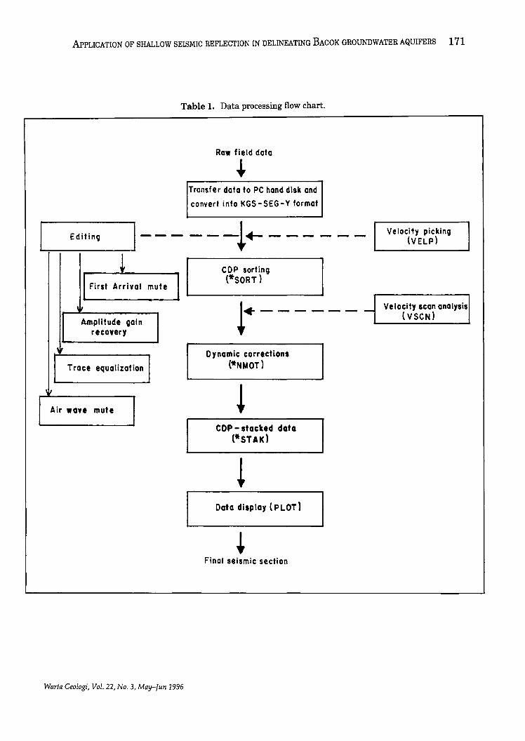
(5-10 vertical stacking) ofa 5 kg sledgehammer on a square steel plate. A total of24 geophones or receivers (15 Hz) were oriented in a 5-m inline array and the 15-bit data were recorded on a 24 channel ABEM Terraloc MK 3 Seismograph with 100-Hz pre analogue to digital low cut filters. Conventional processing was carried out on the data as given in the flow chart (shown in Table 1) to produce an unmigrated seismic profile.
GEOLOGY
Bacok is covered by alluvial deposits of Quaternary age. Information of the subsurface geology is obtained from the nearest borehole number BH 25 drilled at Bachok waterworks about 50 meters to the west of the seismic line (Fig. 1). From 0 to 6 m depths, the borehole logs show the presence of fine sand, light brownish in colour with grey clay and shells. This layer represents the first aquifer in the groundwater basin. Layer between 6 m to 30 m consists of soft clay, light grey to grey in
colour. The second aquifer, at depth of 30 m to 39 m, consists of medium to coarse sand mixed with stiff light grey clay. Beneath this layer is the light grey clay with a thickness of about 15 m. Below this aquiclude is a 40 m thick coarse sand with some fine gravel third aquifer. Granite bedrock is at a depth of approximately 120 meter.
INTERPRETATION
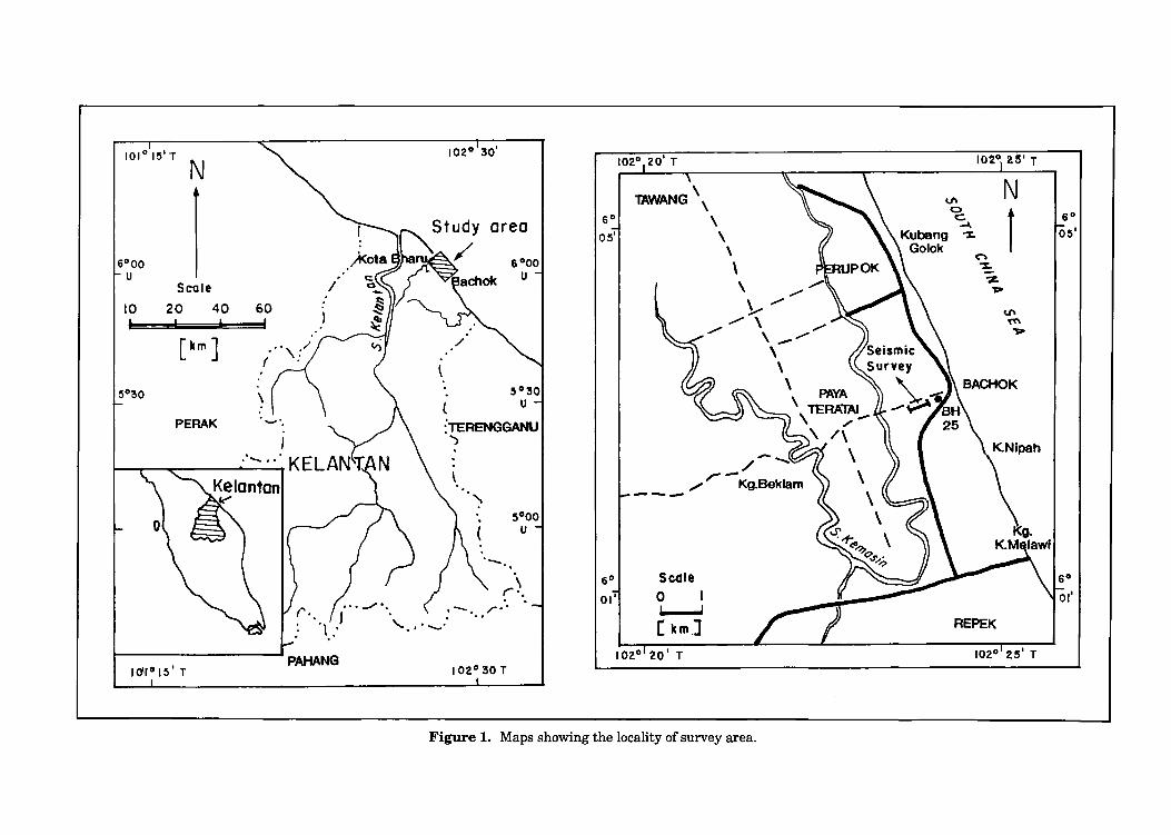
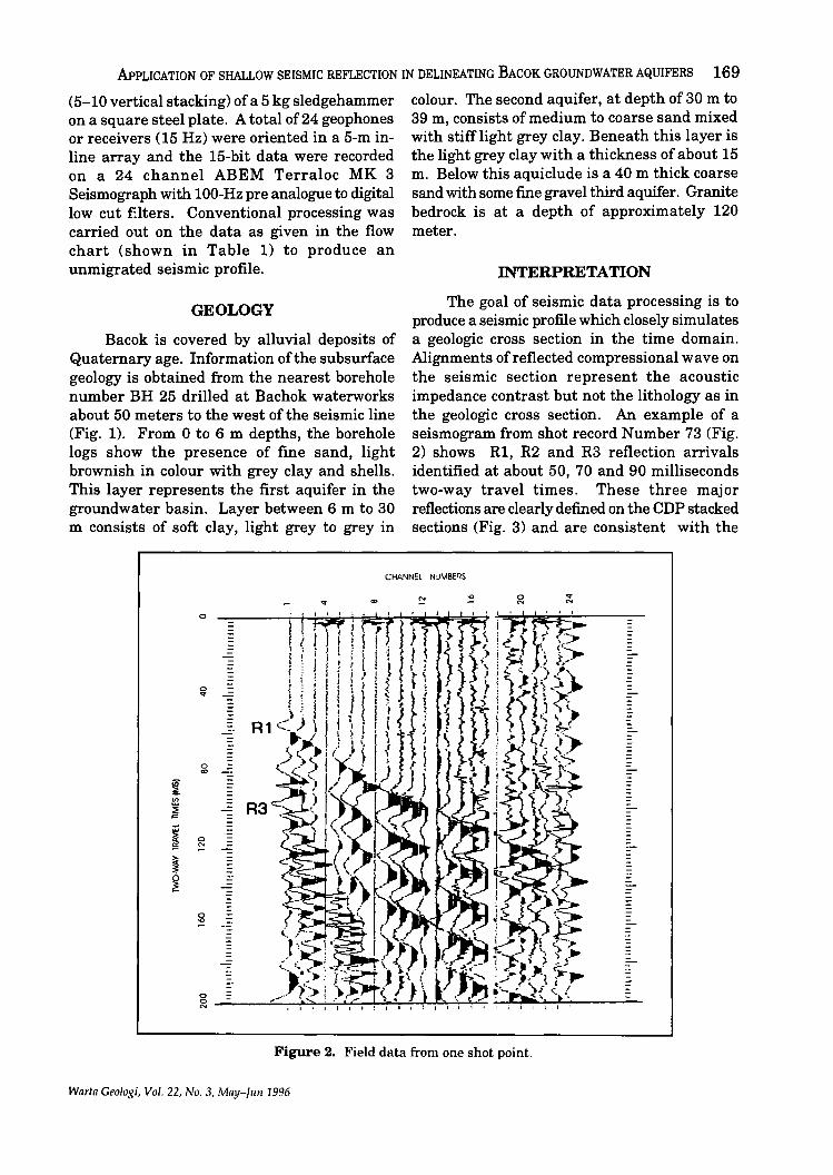
The goal of seismic data processing is to produce a seismic profile which closely simulates a geologic cross section in the time domain. Alignments of reflected compressional wave on the seismic section represent the acoustic impedance contrast but not the lithology as in the geologic cross section. An example of a seismogram from shot record Number 73 (Fig. 2) shows R1, R2 and R3 reflection arrivals identified at about 50, 70 and 90 milliseconds two-way travel times. These three major reflections are clearly defined on the CDP stacked sections (Fig. 3) and are consistent with the
CHANN:L NJMBE~S
o
-
0 -'"
-
0
'" -in ~ <J>
~ -~
~ 0 -~
~ IF ~ -
0 .., ---
-
~ "'-;; __ ~-J'::"'''''''''::''''''''';:':'''''''!--,-'':'''''''~~~~ ,;,....J~IIio..:.-.L.:...-__ .,;;;-_
Figure 2. Field data from one shot point.
Warta Geologi, Vol. 22, No.3, MaY-IIIII 1996
170 UMAR liAMzAH, ABn. RAHIM SAMSUDIN, ABn. GHANI RAFEK AND HARYONO
o 50 m COP Number
.. (j)
6 en lJ.J
-30 E -~ i= ....J lJ.J
~ e:
40 J: ~
" 5(j a.. w Q
~ ~
i
. 60
~ 70 a:
a.. 80
a.. <
90
100
Figure 3. Stacked seismic section.
COP NUMREI~
50 metres
East I' "'l West
. 3D
~ ~ l:l ;; ::;: Co.
<= 2 u: ~ ~
i ,.. ;:
70 ~
90
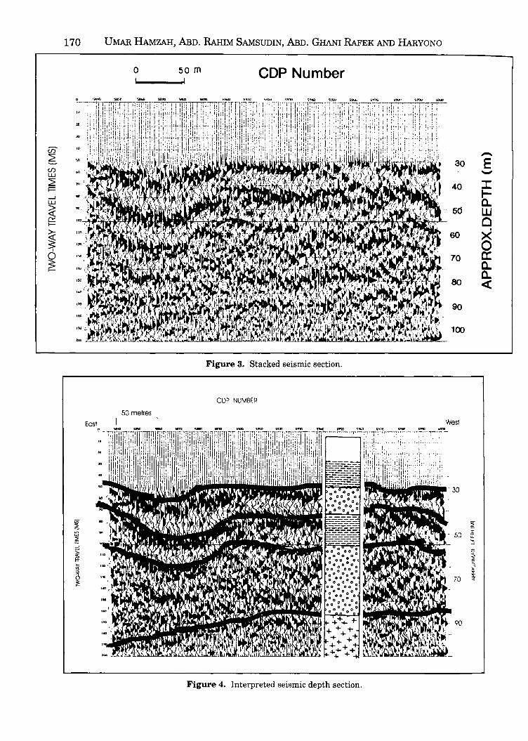
Figure 4. Interpreted seismic depth section.
\11
APPLICATION OF SHALLOW SEISMIC REFLECTION IN DELINEATING BACOK GROUNDWATER AQUIFERS 171
Table 1. Data processing flow chart.
Raw field data .. Tran$fer data to PC hand disk and
convert into KGS-SEG-Y format
Editino 1--- ---!+- --- --- Velocity picking (VELP)
! First Arrival
,It
Amplitude oain recoyery
Trace equalization
mute
COP sorting (*SORT)
I .. - - - - - - ____ v_e_l_o_ci_tY_IC_a_n_a_n_al_Y_Si....lS t - (VSCN)
Dynamic corrections ("NMOT)
Air wave mute
Warta Geologi, Vol. 22, No.3, May-fun 1996
COP - stacked data (*STAK)
Data display (PLOT)
Final seismic section
172 UMAR HAMzAH, MD. RAHIM SAMSUDIN, MD. GHANI RAFEK AND HARYONO
borehole geology. The first reflector at 50 millisecond on the seismic section at depth of approximately 29 meter correlate well with the top of second aquifer. The second reflector at two-way time of 70 millisecond and at a depth of approximately 41 meter represents the bottom of the aquifer. The third reflector at about 100 millisecond which corresponds to 55 meters depth represents the top of third aquifer. The interpreted stacked section (Fig. 4) clearly shows the configuration of second and third aquifers. Overlying the third aquifer is the aquiclude layer of 15 to 20 m thickness. A striking feature on the seismic profile is the occurrence of channel fill centred on CDP Number 5860. The deepest event interpreted on the section is probably the dipping bedrock shown by the weak alignment of reflections at 190 ms (110 m depth) on the west to 150 ms
towards the east of the profile.
CONCLUSION
In conjunction with borehole data the shallow seismic reflection methods are very effective in mapping shallow geologic features of hydrogeologic significance. The shallow seismic reflection technique using a hammer source can locate features and map bedrock at a depth of between 30 to 200 m quite effectively.
REFERENCES
MAYNE, W.H., 1962. Horizontal data stacking techniques: Geophysics, 27, 927-938.
MILLER, M.D., DOLL, W.E., MEREY, C. AND BLACK, W.E., 1994. Applications of Shallow High-Resolution seismic Reflection to Environmental Problems. Environmental Geosciences, 1(1), 32-39 . .. ., ..
Manuscript received 30 December 1995
Warta Ceologi, Vol. 22, No.3, May-Jun 1996
173
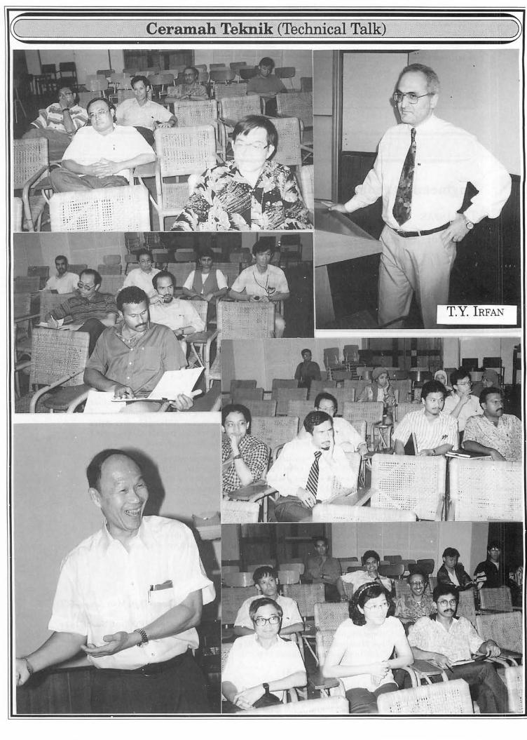
Engineering geology of aggregates and stone in Hong Kong
T.Y. IRFAN
Laporan (Report)
Dr. T .Y. Irfan gave the above talk on 7th May 1996 at the Geology Department, University of Malaya. He joined the Geotechnical Control office in 1982 and since 1992 has been heading the Geotechnical Investigation Section, being responsible for the government's laboratory and ground investigations and upgrading of standards of site investigations in Hong Kong. He has carried out research and development work on characterization and engineering properties of weathered rocks and residual soils, aggregate properties, mechanism of some important landslides in Hong Kong and the shear strength ofbouldery deposits including colluvium. Dr. Irfan is the author of over 50 technical papers in engineering geology, rock mechanics and geotechnical engineering. A listing of GCO/GEO Reports and Dr. Irfan's recent publications are appended for the benefit of members.
Sinopsis (Synopsis)
Stone products used mainly as crushed rock aggregates but also as riprap stone, armour rock or bulk fill constitute a multi-billion dollar industry in Hong Kong. The primary use of crushed rock in Hong Kong is as fine fo nd coarse aggregate in concrete. Although local granites are used for aggregate production, other rock types including volcanic rocks, either imported or locally present, have been used or are being considered for use in concrete.
The suitability of stone for various uses is mainly determined by means of various specially designed laboratory tests, as well as its in situ properties. Published test data is limited on the properties of local stone products, in particular the volcanic rocks, which are known to cause significant problems elsewhere in the world when used in concrete (re: alkaliaggregate reaction).
In this presentation, Dr. Irfan will review the use of local stone products and their properties based on his long-involvement at GEO with quarry resource assessments and laboratory testing of some major rock types. He will discuss the suitability of Hong Kong rocks for various general and special uses . He will also touch upon the subject of alkali-aggregate reactivity potential of the volcanic rocks.
A. GCO/GEO Report GEO, 1987/93. Guide to Site Investigation. GEOGUIDE 2, 368 p. GCO, 1990. Foundation Properties of Marble and Other Rocks In the Yuen Long-Then Mun Area. GCO
Publication No. 2/90, 117 p. GEO. 1992. Mineralogical Assessment of Creep-type Instability at Two Landslip sites. GEO Rept. No. 13, 143 p. GEO, 1992. Guide to Cavern Engineering. GEOGUIDE 4, 156 p. GEO, 1995. Guid'e to Slope Maintenance. GEOGUIDES, 92 p. GEO, 1995. La~'man's Guide to Slope Maintenance, 24 p.
G.H . Teh
------------__ ... ~.~~~.~.4.-------------
Warta Geologi , Vol. 22, No . 3, May- lUll 1996
176
Fosil dan rekod sejarah silam Malaysia
LEE CHAI PENG
Laporan (Report)
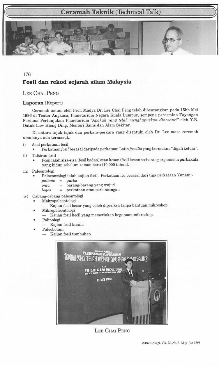
Ceramah umum oleh Prof. Madya Dr. Lee Chai Peng telah dibentangkan pada 15hb Mei 1996 di Teater Angkasa, Planetarium Negara Kuala Lumpur, sempena perasmian Tayangan Perdana Pertunjukan Planetarium "Apakah yang telah menghapuskan dinosaur?' oleh Y.B . Datuk Law Hieng Ding, Menteri Sains dan Alam Sekitar.
Di antara tajuk-tajuk dan perkara-perkara yang disentuhi oleh Dr . Lee mas a ceremah umumnya ada termasuk:
i) Asal perkataan fosil • Perkataan fosil berasal daripada perkataan Latin fossilis yang bermakna "digali keluar".
ii) Tafsiran fosil • Fosil ialah sisa-sisa (fosil badan) atau kesan (fosil kesan) sebarang organism a purbakala
yang hidup sebelum zaman baru (10,000 tahun).
iii) Paleontologi • Palaeontologi ialah kajian fosil. Perkataan itu berasal dari tiga perkataan Yunani:-
palaois = purba onta = barang-barang yang wujud logos = perkataan atau perbincangan
iv) Cabang-cabang paleontologi • Makropaleontologi
- Kajian fosil besar yang boleh diperiksa tanpa bantuan mikroskop . • Mikropaleontologi
- Kajian fosil kecil yang memerlukan kegunaan mikroskop . • Palinologi
- Kajian fosil kesan. • Paleobotani
- Kajian fosil tumbuhan
LEE CHAI PENG
Wn rta GCll/(lgi, 1"'/.22, No . 3, May-lll ll 1996
173
Engineering geology of aggregates and stone in Hong Kong
T.Y.IRFAN
Laporan (Report)
Dr. T.Y. Irfan gave the above talk on 7th May 1996 at the Geology Department, University of Malaya. He joined the Geotechnical Control office in 1982 and since 1992 has been heading the Geotechnical Investigation Section, being responsible for the government's laboratory and ground investigations and upgrading of standards of site investigations in Hong Kong. He has carried out research and development work on characterization and engineering properties of weathered rocks and residual soils, aggregate properties, mechanism of some important landslides in Hong Kong and the shear strength of bouldery deposits including colluvium. Dr. Irfan is the author of over 50 technical papers in engineering geology, rock mechanics and geotechnical engineering. A listing of GCO/GEO Reports and Dr. Irfan's recent publications are appended for the benefit of members.
Sinopsis (Synopsis)
Stone products used mainly as crushed rock aggregates but also as riprap stone, armour rock or bulk fill constitute a multi-billion dollar industry in Hong Kong. The primary use of crushed rock in Hong Kong is as fine fond coarse aggregate in concrete. Although local granites are used for aggregate production, other rock types including volcanic rocks, either imported or locally present, have been used or are being considered for use in concrete.
The suitability of stone for various uses is mainly determined by means of various specially designed laboratory tests, as well as its in situ properties. Published test data is limited on the properties of local stone products, in particular the volcanic rocks, which are known to cause significant problems elsewhere in the world when used in concrete (re: alkaliaggregate reaction).
In this presentation, Dr. Irfan will review the use of local stone products and their properties based on his long-involvement at GEO with quarry resource assessments and laboratory testing of some major rock types. He will discuss the suitability of Hong Kong rocks for various general and special uses . He will also touch upon the subject of alkali-aggregate reactivity potential of the volcanic rocks.
A. GCO/GEO Report GEO, 1987/93. Guide to Site Investigation. GEOGUIDE 2, 368 p. GCO, 1990. Foundation Properties of Marble and Other Rocks In the Yuen Long-Then Mun Area . GCO
Publication No. 2/90, 117 p. GEO, 1992. Mineralogical Assessment of Creep-type Instability at Two Landslip sites. GEO Rept. No. 13,143 p. GEO, 1992. Guide to Cavern Engineering. GEOGUIDE 4, 156 p. GEO, 1995. Guid'e to Slope Maintenance. GEOGUIDES, 92 p. GEO, 1995. Layman's Guide to Slope Maintenance, 24 p.
175
Bo ArticlesIReporls by T.Y. Irfan Powell, G.E. and Irfan, T.Y., 1987. Geotechnical design for a controlled tip in Hong Kong. In: Culshaw, M.G.,
Bell, F.G., Cripps, J.C. and O'Hara, M. (Eds), Planning and Engineering Geology, Geol. Soc. Eng. Geol. Special Publ. No.4, 517-523.
Choy, H.H., Earle, Q.G., Irfan, T.Y. and Burnett, A.D., 1987. Studies for the extension of a major urban quarry in Hongkong. In: Culshaw, M.G., Bell, F.G., Cripps, J.C. and O'Hara, M. (Eds.), Planning and Engineering Geology, Geol. Soc. Eng. Geol. Special Pub!. No.4, 369-377.
Irfan, T.Y. and Cipullo, A., 1990. Application of engineering geological investigation and mapping techniques for stability assessment of an urban slope in weathered rocks in Hongkong. Proc. 6th IAEG Congress, Amsterdam, 6--10 Aug '90,141-150.
Gillbert, S. T. and Irfan, T. Y., 1990. Suitability of Hongkong volcanic rocks for concrete aggregates. Proceedings of the Conference on Hong Kong Concrete Technology and Construction, Hong Kong. Hong Kong Institution of Engineers, 299-317.
Irfan, T.Y., 1994. Mechanism of creep in a volcanic saprolite. Quarterly J. of Eng. Geol., 27, 211-230. Irfan, T.Y., 1994. Aggregate properties and resources of granitic rocks for use in concrete in Hongkong.
Quarterly J. of Eng. Geol., 27, 25-38. Irfan, T.Y., 1995. Potential construction problems for bridge foundations in areas underlain by a complex
marble formation in Hongkong. In: Eddleston, M., Walthall, S., Cripps, J.C. and Culshaw, M.G. (Eds, X1995), Engineering Geology of Construction. Geol. Soc. Eng. Geol. Special Publ. No. 10, 127-134.
Irfan, T.Y., 1996. Mineralogy, fabric properties and classification of weathered granites in Hongkong. Quarterly J. of Eng. Geol., 29, 5-35
Irfan, T.Y., 1996. Suitability of standard classification and index tests for saprolitic and residual soils in Hongkong. Proc. 12th S.E. Asian Geotech Conf. & 4th Int. Conf. on Tropical Soils, 6--10 May '96, Kuala Lumpur.
Tan Boon Kong & G.H. Teh
- •• CiIIlt ••
Fate of toxic pollutants in contaminated soils and sediments: Threat assessment and abatement
R.N. YONG
Laporan (Report)
The Society is fortunate to have Prof. R.N. Yong again to present another of his stimulating geoenvironmental talks on the 8th May 1996 at Geology Department, University of Malaya. Prof. Yong is presently the Distinguished Research Professor and Seminar Scientific Director. Geoenvironmental Engineering Research Centre, University of Wales , Cardiff, United Kingdom.
Synopsis
The assessment of capability of abatement procedures and technology to contain and manage toxic pollutants in contaminated sites, and to function in a manner designed to ensure protection of public health requires proper appreciation of what constitutes a health threat. The controls needed to establish safe protection of public health are not often well founded, or sufficiently diligent. A good working knowledge of the various interactions occurring in the polluted soil material during contaminant transport is required if one seeks to assess the transport, persistence and fate of toxic pollutants. Structuring of efficient and capable treatment programs for abatement of the threats need proper basis information on distribution of pollutants and how they are held with the system.
G.H. Teh
••• CiBIIt ....
Warta Geologi, Vol. 22, No.3, May-lUll 1996
176
Fosil dan rekod sejarah silam Malaysia
LEE ClIAl PENG
Laporan (Report)
Ceramah umum oleh Prof. Madya Dr. Lee Chai Peng telah dibentangkan pada 15hb Mei 1996 di Teater Angkasa, Planetarium Negara Kuala Lumpur, sempena perasmian Tayangan Perdana Pertunjukan Planetarium "Apakah yang telah menghapuskan dinosaur?' oleh Y.B . Datuk Law Hieng Ding, Menteri Sains dan Alam Sekitar.
Di antara tajuk-tajuk dan perkara-perkara yang disentuhi oleh Dr. Lee masa ceremah umumnya ada termasuk:
i) Asal perkataan fosil • Perkataan fosil berasal daripada perkataan Latin fossilis yang bermakna "digali keluar".
ii) Tafsiran fosil • Fosil ialah sisa-sisa (fosil badan) at au kesan (fosil kesan) sebarang organism a purbakala
yang hidup sebelum zaman baru (10,000 tahun) .
iii) Paleontologi • Palaeontologi ialah kajian fosil. Perkataan itu berasal dari tiga perkataan Yunani:-
palaois purba onta :=: barang-barang yang wujud logos :=: perkataan at au perbincangan
iv) Cabang-cabang paleontologi • Makropaleontologi
- Kajian fosil besar yang boleh diperiksa tanpa bantuan mikroskop. • Mikropaleontologi
- Kajian fosil kecil yang memerlukan kegunaan mikroskop . • Palinologi
- Kajian fosil kesan. • Paleobotani
- Kajian fosil tumbuhan
LEE CHAI PENG
War/a Gl'olo~i , Vol. 22, No .3, Ma!I-/1II1 1996
177
v) Kedapatan fosil • Fosil biasanya terdapat dalam batu enapan seperti syal, batu lodak, batu pasir dan batu
kapur sebagai sisa organisma yang dilogamkan setelah mereka tertimbus dalam enapan enapan itu.
• Proses pengfosilan dipengaruhi oleh dua faktor utama:-a) kepunyaan bahagian keras b) kadar timbusan
vi) Pengawetan fosil • Sisa-sisa tidak diubah • Sisa-sisa terlogam atau pengajuran (proses gantian) • Sisa-sisa dilogamkan (proses tambahan) • Acuan dan tuangan • Penekanan atau pemampatan • Fosil kesan dari aktiviti binatang dahulukala
vii) Fosil palsu • Struktur dalam batuan yang menyerupai fosil tetapi bukan, misalnya dendrit mangganum,
konkreasi, lapisan oksid ferrum.
viii) Dua faktor utama untuk proses pengfosilan • Faktor I: Kepunyaan bahagian keras • Faktor II: Kadar timbusan
ix) Kegunaan fosil • Menentukan umur geologi • Menentukan lingkungan paleo • Buat penyekaitan (korelasi) di antara kawasan-kawasan yang berasingan untuk kajian
paleogeografi dan membantu us aha carigali hidrokarbon dan logam-Iogam lain. • Kajian evolusi organisma
x) Pengkelasan fosil
G.H. Teh
----------__ H.~ • .-~~.~.~-----------
Regional gravity and magnetic investigation of the Eromanga Basin, NSW, Australia for hydrocarbon exploration
CLIVE Foss
Laporan (Report)
Dr. c. Foss of Encom Technology Pty. Limited, NSW, 2061, Australia, gave the above talk on Friday, 17th May 1996 at the Geology Department, University of Malaya.
We greatly appreciate his constant contributions to the Society's activities despite being in Australia now.
Abstrak (Abstract) The Eromanga Basin of eastern Australia is an extensive intra-continental sag of
Jurassic to Cretaceous age. The Eromanga overlies the older Permian Cooper Basin which has its depocentre to the north and west in South Australia and Queensland. The Cooper Basin is a prolific producer of oil and gas.
The NSW Department of Mineral Resources has instigated an initiative 'Discover 2000' to promote exploration in the state for minerals and petroleum. As an early step in this programme the Department contracted ENCOM TECHNOLOGY to compile existing geo-
178 physical data over the Eromanga Basin and to interpret that data. The objective was to establish a structural framework that would be of value to companies wishing to explore the basin.
The main gravity and aeromagnetic data sets available for this project were regional coverage acquired by the Australian Geological Survey Organisation as part of nationwide geophysical data sets . Gravity data consist of measurements made at a nominal 11 km spaced grid. These data are supplemented by more detailed surveys undertaken in previous exploration of the area. Aeromagnetic data is from a mosaic of 1:250,000 scale map sheets flown at different times and with different survey parameters. The most detailed information about the thickness of Eromanga section itself has come from water bore data . The gravity and magnetic interpretation has focussed on investigation of the basement and older sediments beneath the Eromanga.
Gravity data reveals a northwest trending linear negative anomaly over the Bancannia Trough. This trough is known from the Darling Basin in the south where it is believed to have a thickness of over 8 kilometres of Devonian sediments. A similar northeast trending anomaly within the current study area termed the Paka Tank Trough is interpreted to also have considerable thickness of Devonian sediments . Both of these features have associated positive magnetic anomalies from underlying intrusives which suggest that they are failed rifts. Other Devonian basins which lack prominent gravity expressions are interpreted from discordance between magnetic depth estimates and the known base of Eromanga. These may be relicts of an originally more pervasive' Devonian cover sequence. From integrated gravity and magnetic interpretation basement itself can be split into structural provinces, and major basement faults can be mapped. Adjacent to one of these basement faults the Caryapundy Trough is perhaps one ofthe most prospective structures recognised. This basin ~s open to the north where the nearest proven source rocks occur. Gravity modelling suggests that the infill of this basin is less dense and therefore possibly younger - or Permian(?) age .
G.H. Teh
------------___ .~.~.~~~.~.H.---------------
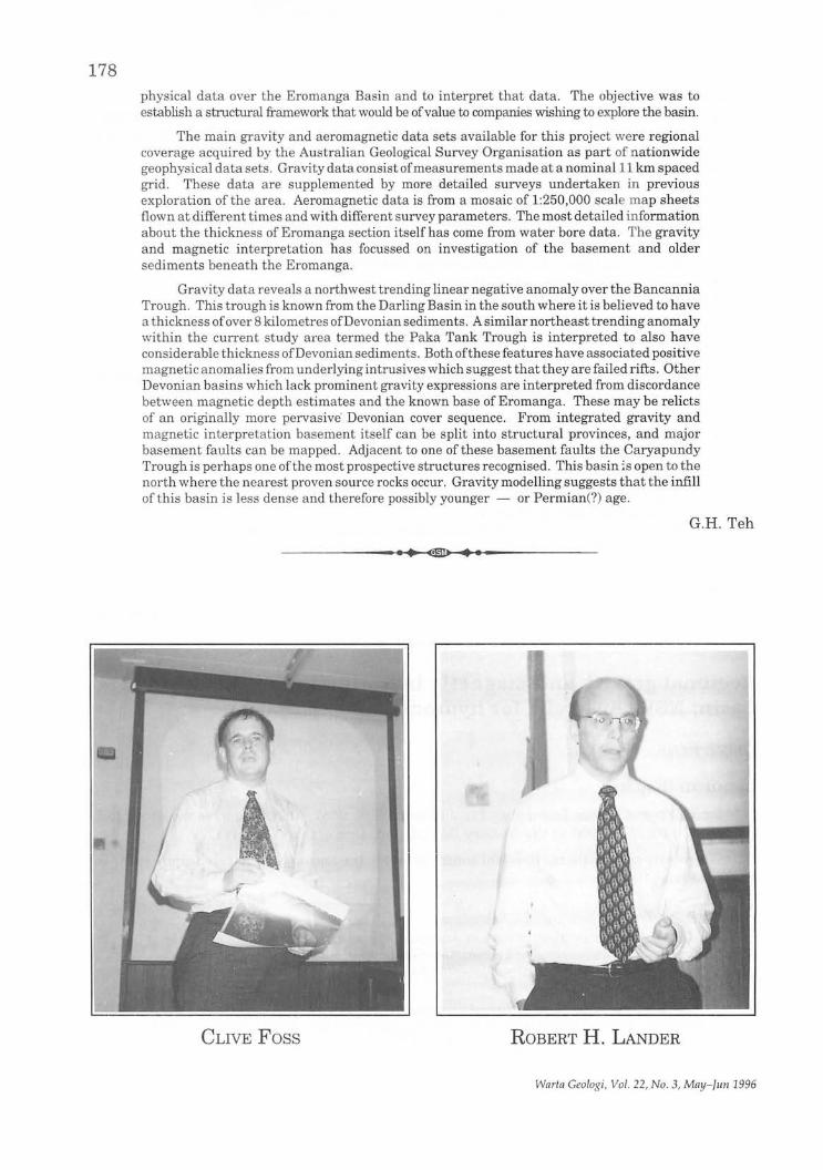
CLIVE Foss ROBERT H. LANDER
Warta Geologi, Vol. 22, No.3, May-fun 1996
Quantitative prediction of sandstone reservoir quality via simulation of compaction and quartz cementation
ROBERT H. LANDER
Laporan (Report)
179
Dr. R.H. Lander joined Exxon Production Research after finishing his Ph.D. in 1991, where he worked with the reservoirs quality assessment and hydrocarbon migration groups. In 1993 he joined ProCom based in Stravanger, Norway, as a research scientist. Presently he is with PCSB conducting basin modelling studies in the Malay Basin. Dr. Lander presented the excellent talk on 28th June 1996 at the Geology Department, University of Malaya, Kuala Lumpur.
Abstrak (Abstract) Techniques presently available for quantitative reservoir quality prediction typically
are limited in applicability to specific depth intervals, geographic areas, and lithostratigraphic units; require input data that is difficult or impossible to obtain; or demand specialized highend computer hardware. We have developed a forward numerical model (referred to as Exemplar) to provide a method better suited for sandstone porosity prediction in both mature and frontier basin settings. Exemplar takes commonly available geologic data as input and produces predictions that can be directly compared to petrographic thin sections.
The diagenetic history is modeled from the time of deposition to the present. Input data required for a simulation includes burial depth, fluid pressure, and temperature histories together with the porosity, composition, and grain size of the modeled sandstone upon deposition. Burial history data can be obtained from basin models while sandstone texture and compositional data can be derived from thin section point count analyses and Recent depositional analogs.
Compaction is modeled by an exponential decrease in intergranular volume as a function of vertical effective stress. This approach is consistent with compaction arising from grain rearrangement, ductile grain deformation, and brittle failure of grains and accounts for the effects offluid overpressures and stable grain packing arrangements. Quartz cementation is modeled as a precipitation rate controlled process according to the method ofWalderhaug (1994, 1996). Quartz surface area available for precipitation of quartz cement is a function of the proportion and size of detrital quartz grains, the coated fraction of quartz grains, and the available pore space.
The computational execution speeds of the model are fast (e.g., seconds) on desktop computers, making model integration with parameter optimization and Monte Carlo simulation techniques practical. Parameter optimization routines are used to obtain distributions of 'best fit' parameter values when petrographic and basin modeling data from well control or outcrops are available for calibration. These 'best fit' distributions provide the basis for rigorous evaluation ofinherent model uncertainties in pre-drill reservoir quality predictions when they are incorporated into Monte Carlo simulations. Monte Carlo-based predictions also can include uncertainties associated with the input parameters describing burial history and initial sandstone composition and texture making it possible to apply the model to frontier basin settings.
Ali Mohd. Shariff
•• CIID ••
Warta Geologi, Vol. 22, No.3, May-Jun 1996
180
.e~ (Repivd)
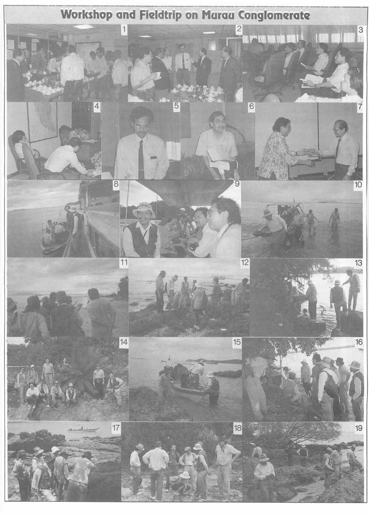
This Workshop and Fieldtrip, jointly organised by the Society's Working Group on Tectonics & Structural Geology and Jabatan Geologi, Universiti Kebangsaan Malaysia, comprised a 112_ day Workshop on the 3rd May 1996 at Jabatan Geologi UKM and a Ph-day Fieldtrip to the Mersing area.
The Workshop was declared open by the Dekan Fakulti Sains Fizis dan Gunaan UKM. After light refreshments, 3 papers on the "Conglomerates of the Eastern Belt", "Stratigraphy and environment of deposition of the Murau rocks" and "Structural Geology of the Murau Conglomerates" were presented by Kamal Roslan, Ahmad J antan and Ibrahim Abdullah respectively. The papers which were well illustrated, attracted much discussions and served well as valuable information for participants going on the fieldtrip. Lunch was served at the UKM Canteen and at 2 pm, the participants headed for Mersing.
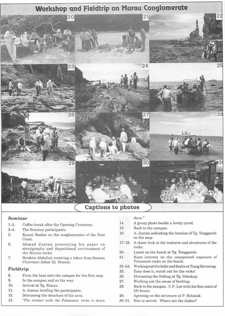
The next morning, except for a short shower while waiting for the boat, the weather turned out to be excellent for the fieldtrip for the 11 participants. Among the localities visited were Tg. Murau, Tg. Rimau, Tg. Tenggaroh, Tiang Berusong, Tg. Sekakap and P. Belanak. The sea was calm and on arrival at the vicinity of the localities, the participants were ferried to shore by sampan.
Besides studying the characteristics of the conglomerates, the participants were shown and discussed, among other things, the nature ofthe folds and faults, the unconformity between the Murau rocks and the lower Upper Palaeozoic rocks, the various lithofacies and sedimentary features exposed and the environment of deposition. Lunch in the form of packed 'nasi lemak' was served on the beach at Tg. Tenggaroh. C.P. Lee was ever-ready with his collapsible rod to test the potential fishing grounds in the area.
Leaders of the fieldtrip, Ahmad J antan and Ibrahim Abdullah, who have done substantial mapping of the localities, proved to be very capable fieldguides and were highly responsible for the successful fieldtrip. Organising Chairman, Ibrahim Abdullah, and his organising committee should be commended on putting together a highly successful and informative Seminar and Fieldtrip. To quote a participant, "I am so well informed about the Murau Conglomerate and seen so much of it in the field, it should last r,-:,e a lifetime ."
The group enjoyed a sumptuous dinner of seafood and other local delicacies at Mersing before heading back, arriving back in KL past midnight!
G.H. Teh
Warta Ceologi, Vol. 22, No.3, May-JIm 1996
181
Juma'at 3hb Mei 1996
Pendaftaran
Peserta dan jemputan mengambil tempat
08:00 - 08:30
08:30 - 08:45
08:45 Ketibaan Dekan Fakulti Sains Fizis dan Gunaan dan acara perasmian dimulakan
08:50
08:55
09:00 - 09: 10
09: 10 - 09:20
09:20 - 09:45
09:50 - 10:30
10:30 -11:10
11:10-11:50
11 :50 - 12:00
12:00 - 13:00
14:45
Acara Perasmian
Aluan daripada Pengerusi Majila
Baca Doa
Aluan daripada Presiden GSM atau Wakil
Aluan daripada Dekan FSFG dan seterusnya merasmikan Bengkel
Jamuan Ringan
SesiPembentangan
Konglomerat di Jalur Timur Kamal Roslan Mohamed dan ehe Aziz Ali (UKM)
Stratigrafi dan sekitaran pengendapan batuan Murau, Johor Ahmad Jantan (UKM)
Struktur geologi Konglomerat Murau Ibrahim Abdullah (UKM)
Upacara penutup
Jamuan tengah hari untuk peserta
Kerjalapangan
Bas Bertolak ke Mersing
Sabtu 4hb Mei 1996
08:30 - Bot bertolak dari Mersing.
Warta Ceologi, Vol. 22, No.3, May-Jun 1996
Workshop and Fieldtrip on Maraa Conglomerate 4~;
Seminar 1-2. 3--4.
5.
6.
Coffee-break after the Opening Ceremony. The Seminar participants. Kamal Roslan on the conglomerates of the East Coast. Ahmad Jantan presenting hi s paper on stratigraphy and depositional environment of the Murau rocks .
7. Ibrahim Abdullah receiving a token from Session Chairman Azhar Hj . Hussin.
Fieldtrip 8. From the boat onto the sampan for the first stop. 9. In the sampan and on the way. 10. Arrival at Tg. Rimau. 11. A. Jantan briefing the participants . 12. 13.
Discussing the structure of the area. "The contact with the Palaeozoic rocks is down
there." 14. A group photo beside a lovely cycad. 15. Back to the sampan. 16. A. Jantan indicating the location ofTg. Tenggaroh
on the map. 17-19. A closer look at the textures and structures of the
rocks . 20. Lunch on the beach at Tg. Tenggaroh. 21. Keen interest on the unexpected exposure of
Palaeozoic rocks on the beach. 22-24. Working out the folds and faults at Tiang Berusong. 25. Easy does it, watch out for the rocks! 26. Discussing the folding at Tg. Sekakap. 27. Working out the sense of faulting . 28. Back to the sampan. C.P. Lee with his fine catch of
life bouys. 29. Agreeing on the structure at P. Belanak. 30-31. Rice is served. Where are the dishes?
184
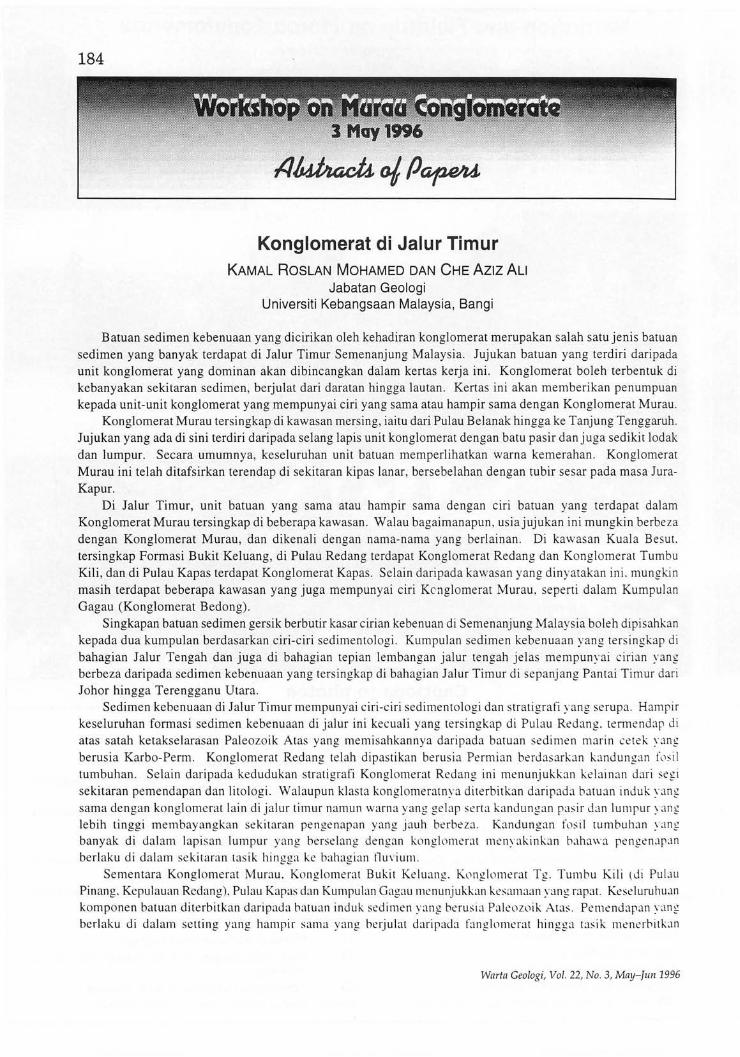
Konglomerat di Jalur Timur KAMAL ROSLAN MOHAMED DAN CHE AZlz ALI
Jabatan Geologi Universiti Kebangsaan Malaysia, Bangi
Batuan sedimen kebenuaan yang dicirikan oleh kehadiran konglomerat merupakan salah satu jenis batuan sedimen yang banyak terdapat di Jalur Timur Semenanjung Malaysia. Jujukan batuan yang terdiri daripada unit konglomerat yang dominan akan dibincangkan dalam kertas kerja ini . Konglomerat boleh terbentuk di kebanyakan sekitaran sedimen, berjulat dari daratan hingga lautan. Kertas ini akan memberikan penumpuan kepada unit-unit konglomerat yang mempunyai ciri yang sarna at au hampir sarna dengan Konglomerat Murau.
Konglomerat Murau tersingkap di kawasan mers ing, iaitu dari Pulau Belanak hingga ke Tanjung Tenggaruh. Jujukan yang ada di sini terdiri daripada selang lapis unit konglomerat dengan batu pas ir dan juga sedikit lodak dan lumpur. Secara umumnya, keseluruhan unit batuan memperlihatkan warna kemerahan. Konglomerat Murau ini telah ditafsirkan terendap di sekitaran kipas lanar, bersebelahan dengan tubir sesar pada mas a JuraKapur.
Di Jalur Timur, unit batuan yang sarna atau hampir sarna dengan ciri batuan yang terdapat dalam Konglomerat Murau tersingkap di beberapa kawasan . Walau bagaimanapun , usi a jujukan ini mungkin berbeza dengan Konglomerat Murau , dan dikenali dengan nama-nama yang berlainan. Di kawasan Kual a Besut. tersingkap Formasi Bukit Keluang, di Pulau Redang terdapat Konglomerat Redang dan Konglomerat Tumbu Kili , dan di Pulau Kapas terdapat Konglomerat Kapas. Selain daripada kawasan yang dinyatakan ini . mungkin masih terdapat beberapa kawasan yang juga mempunyai ciri KC' nglomerat Murau, sepert i dalam Kumpulan Gagau (Konglomerat Bedong).
Singkapan batuan sedimen gersik berbutir kasar cirian kebenuan di Semenanjung Malays ia boleh dip isahkan kepada dua kumpulan berdasarkan ciri-ciri sedimentolog i. Kumpulan sed imen kebenuaan yang tersingkap di bahagian Jalur Tengah dan juga di bahagian tepian lembangan jalur tengah jelas mempunyai cirian yang berbeza daripada sedimen kebenuaan yang tersingkap di bahagian Jalur Timur di sepanjang Pantai Timur dari Johor hingga Terengganu Utara .
Sedimen kebenuaan di Jalur Timur mempun ya i ciri-ciri sedimentologi dan strati grafi yang se rupa. Hampir keseluruhan formasi sedimen kebenuaan di jalur ini kecuali yang tersingkap di Pulau Redang. temlendap di atas satah ketakselarasan Paleozoik Atas yang memisahkannya daripada batuan sedimen marin cetek yan g berusia Karbo-Perm. Kongl omerat Redang telah dipas tikan berusia Permian berdasarkan bndungan fl1SiI tumbuhan. Selain daripada kedudukan stratigrafi Konglomerat Redang ini menunjukkan kebinan dari segi sekitaran pemendapan dan li to log i. Walaupun klasta konglomeratnya diterbitkan daripada batuan induk yang sama dengan konglomerat lai n di jalur timur namun warna yang ge lap serta kandungan pasir dan lumpur yan g lebih tinggi membayangkan sek itaran pengenapan yang jauh berbe za. Kandungan fos il lUmbuhan yang ban yak di dal am lapi san lumpur yang berselang dengan konglomerat menyakinbn baha\\'a pengenapan berlaku di da lam se kitaran tas ik hingga ke bahagian tlmiulll.
Sementara Konglomerat Murau. Konglomerat Bukit Keluang. Kl)ngll1merat Tg. Tumbu Kili ld i Pulau Pinang. Kepulauan Redang). Pulau Kapas dan Kumpulan Gagau menunjukkan kes~unaan yang rapat. Kest'luruhuan komponen batuan diterbitkan daripada batuan induk sedi men yang berusia Pakl1wik Atas . Pemendapan yang berl aku di dalam setting yang hampir sama yang berjulat daripada fanglomerat hingga tasik menerbit b n
Warta Geologi, Vol. 22, No . 3, May-fun 1996
185 litologi dan jujukan fasies yang serupa dengan pewarnaan coklat hingga merah disebabkan oleh kehadiran oksida besi yang tinggi. Namun demikian Konglomerat Pulau Kapas menunjukkan sedikit kelainan dari segi kandungan matriks walaupun komponen kasarnya tidak berbeza daripada konglomerat lain. Matriks Konglomerat Pulau Kapas mempunyai kandungan piroklastik yang tinggi. Fenomena ini mungkin berkait rapat dengan aktiviti volkanisme yang aktif semasa Trias. Jika pernyataan ini benar maka ini bermakna konglomerat ini telah dimendapkan seawal Trias lagi dan berterusan mungkin hingga Jura.
Kesamaan litologi, sedimentologi dan kedudukan stratigrafi konglomerat ini mencadangkan bahawa mereka boleh dikumpulkan di dalam satu kumpulan yang sarna kecuali Konglomerat Pulau Redang. Masa pemendapan masih menjadi isu perbincangan. Namum begitu jika dilihat dari sudut sejarah tektonik di Jalur Timur Semenanjung, semasa Paleozoik akhir (Karbon-Perm) Jalur Timur berada di dalarn sekitaran marin cetek hingga tasik (Pulau Redang). Rejahan granit di Jalur Timur yang berlaku semasa Perm Akhir (di bahagian daratan Jalur Timur, Terengganu) telah merubah keadaan kepada sekitaran kebenuaan di masa Trias. Ini diikuti oleh hakisan dan pemendapan sedimen kebenuaan di atas satah ketakselarasan paleozoik Akhir terse but. Pemendapan sedimen kebenuaan berterusan mungkin hingga ke masa Jura.
Sebagai kesimpulan kesemua unit konglomerat yang terletak di atas ketakselarasan Paleozoik boleh digabungkan di dalam satu kumpulan atau formasi. Kesemua menunjukkan ciri-ciri litologi, sedimentologi dan stratigrafi yang sarna. Kedudukannya lansung di atas satah ketakselarasan Paleozoik Atas mencadang unit-unit konglomerat ini merupakan bahagian dasar kepada sedimen kebenuaan yang terdapat di Jalur Timur dan mungkin juga di J alur Tengah. Sedimen ini terendap seawal perm Akhir-Trias berdasarkan ketakselarasan yang terdapat di Jalur Timur dan juga usia sedimen di bawah satah ketakselarasan yang terdapat di Pulau Redang. Pengakatan yang berkaitan mungkin terhasil daripada perejahan granit di Jalur Timur semasa Perm Akhir-Trias Awal. Pengenapan seterusnya diikuti oleh sedimen berbutir lebih halus yang menindihnya terdiri daripada Batu Pasir Panti, Batu Pasir Lotong dan yang lain-lain yang setara dengannya yang mungkin berusia Jura-Kapur.
III E lEE
Stratigrafi dan sekitaran pengendapan batuan Murau, Johor AHMAD JANTAN Jabatan Geologi
Universiti Kebangsaan Malaysia, Bangi
The Murau rocks consist predominantly of conglomerates with minor amounts of coarse-grained sandstones and red and grey mudstones. The conglomerates are polymicts, with clasts ranging from 5 cm to over 1 m, and are variously sorted, from very poorly sorted to poorly and moderately sorted. They are crudely bedded with beds ranging from tabular to wedging channel-fill. No traction-transport-formed sedimentary structures like cross-bedding, cross-lamination and current lamination were found in the Murau rocks. Structures like crude pebble lineation and imbrication are the types observed.
No body fossils were found in the Murau rocks, except for trace fossils in one of the red mudstone beds at Tanjung Sekakap.
The combination of bedding shapes and types, textures, sedimentary structures, facies association and the absence of fossils, suggest that the Murau rocks are continental sediments, i.e. alluvial fan sediments deposited at the foot of 'recently' uplifted steep hills of Upper Paleozoic rocks during the Jurassic-Cretaceous times. A similar situation might have been prevalent during the Jurassic-Cretaceous times in the eastern part of Terengganu, i.e. at Bukit Keluang, Pulau Aur and Pulau Kapas.
Batu Murau terdiri kebanyakannya daripada konglomerat berserta dengan sedikit batu pasir kasar dan batu lumpur merah dan kelabu. Konglomeratnya berkomposisi polimik, dengan butiran berbagai saiz dari 5 cm hingga lebih 1 m dan berasingan berbagai dari amat buruk hingga buruk dan sederhana. Perlapisan batuan samar, bentuk lapisannya berbagai, dari pepat ke rencong dan isian palung. Tidak ada struktur sedimen bentukan angkutan seretan seperti perlapisan silang, laminasi silang dan laminasi arus didapati dalam batuan Murau. Hanya susunan samar dan sendengan samar butiran grabel yang kelihatan.
Warta Geologi, Vol. 22, No.3, May-fun 1996
186 Tiada fosil jasad yang didapati di dalam batuan Murau, kecuali fosil surihan di dalam satu lapisan batu
lumpur merah di Tanjung Sekakap. Gabungan fitur litologi, bentuk perlapisan, tekstur, struktur sedimen, hubungan fasies dan ketiadaan fosil
mencadangkan batuan Murau adalah jenis enapan daratan, iaitu kipas lanar di kaki perbukitan curam yang 'baru' dibentuk oleh batuan Paleozoik Atas semasa Jura-Kapur. Keadaan yang serupa mungkin juga berlaku pada masa Jura-Kapur di Timur Terengganu, iaitu di Bukit Keluang, Pulau Aur dan Pulau Kapas.
Struktur geologi Konglomerat Murau IBRAHIM ABDULLAH
Jabatan Geologi Universiti Kebangsaan Malaysia, Bangi
Batuan Konglomerat Murau yang terdapat di bahagian selatan Mersing Johor, membentuk topografi yang agak berbeza daripada kawasan sekeliling yang terdiri daripada batuan granit atau metasedimen dan volkanik. Kawasan yang diliputi oleh unit batuan ini membentuk perbuktian yang sederhana tinggi dan berpematang yang jelas. Lipatan berskala besar yang membentuk struktur utama unit ini ditunjukkan oleh permatang yang melengkung dan berbentuk tidak simetri. Berdasarkan kepada maklumat arah jurus dan nilai kemiringan lapisan ditafsirkan lipatan besar merupakan lipatan terbuka dan tidak simetri yang menunjam ke arah samaada utara-baratlaut atau selatan-tenggara. Berhampiran Tanjung Sekakap dan Teluk Murau terdapat sebuah sinklin dan sebuah antiklin yang mempunyai panjang gelombang sekitar 4 km dan menunjam ke arah utara-baratlaut. Di sekitar Tanjung dan Teluk Tenggaruh pula terdapat satu sinklin yang lebih besar, panjang gelombang sekitar 6 km yang menunjam ke arah selatan-tenggara. Dua arah tunjaman yang ditunjukkan pada batuan ini ditafsirkan dikawal oleh geometri lembangan pengendapan. Di atas satah lapisan terdapat tanda-tanda yang menunjukkan telah berlaku pergerakan. Di samping itu, kerikil konglomerat yang berhampiran dengan satah ketakselarasan bahagian bawah unit batuan ini dengan unit yang lebih tuajuga mengalami peleperan. Keadaan begini ditafsirkan terjadi akibat daripada pergerakan fleksur yang selari dengan satah perlapisan semasa berlaku perlipatan. Perlipatan yang berlaku turut melipatkan satah ketakselarasan antara unit Konglomerat Murau dengan batuan yang lebih tua. Selain daripada lipatan berskala besar, berhampiran dengan Pulau Belanak, lipatan berskala sederhanajuga dicerap, merupakan lipatan tak simetri yang menunjam ke arah yang hampir sarna dengan lipatan besar. Di kawasan ini juga terdapat sil dan daik granitoid yang telah terluluhawa hebat. Berdasarkan perkaitannya dengan lipatan, ditafsirkan rejahan granitoid berlaku selepas perlipatan. Daripada fotograf udara dan juga peta topografi, beberapa lineamen utama dapat dipetakan. Kebanyakan linearnen ditafsirkan sebagai sesar mendatar yang dihasilkan oleh himpitan daripada arah sekitar timurtimurlaut, bersesuaian dengan himpitan yang menyebabkan pembentukan lipatan. Di lapangan, sesar mendatar dicerap sebagai zon-zon yang mempunyai kelebaran mencapai I meter lebar. berkedudukan menegak atau hampir menegak, di dalamnya terjadi ricihan menyebabkan kerikil konglomerat mengalami pemipihan dan pemanjangan. Akibatnya, kerikil tersebut tersusun hampir selari dengan satah yang membatasi zon-zon berkenaan. Sesar mendatar juga didapati memotong dan menganjakkan sil granitoid di kawasan ini. Sesarsesar normal yang berkedudukan hampir utara hingga utara-baratlaut ditafsirkan terjadi di akhir episod canggaan batuan yang terjadi di kawasan ini, semasa fasa pereganggan selepas berlaku fasa himpitan. Mungkin juga sesar normal ini merupakan sebahagian daripada sesar normal yang sudah wujud sebelum pengendapan unit batuan ini. Akibat daripada canggan juga menyebabkan batuan telah mengalami retakan yang agak hebat terutama pada batuan yang berbutir kasar dan berJapisan teba\. Analisis struktur kawasan ini menunjukkan semua struktur dihasilkan oleh sistem mampatan berarah daripada antara timur hingga timurtimurlaut.
Warta Geologi, Vol. 22, No.3, May-Jun 1996
187
••... ~l1liil(lrandfieldtripohJri(jIJ$IriQtMi~r(llsahd R~CkS·.· . •...•.• .•• ....... •.. < ·· •. ··.····•· .... r:p~~m~;,~rtJ ·.··...i) •.•.• ..
The above seminar organised by the Society's Economic Geology Working Group in collaboration with the Department of Geology, University of Malaya, was held on the 9th May 1996 at the Department of geology, University of Malaya, Kuala Lumpur.
The Seminar was declared open by Prof. J.K. Raj, Head, Geology Department, University of Malaya. In all 9 papers were presented and they included presentations from the local institutions of higher learning, the Geological Survey and the Mines Department.
The papers presented covered a broad spectrum of the country's industrial minerals and rocks industry, from dimension stones and feldspar to manufacturing of concrete, aggregates, non-firing bricks, ball clay, kaolin, and silica sand.
The Seminar attracted over 30 participants. The organising committee under the chairmanship of Dr. E.B. Yeap should be commended on organising such a Seminar which is in line with the Government's emphasis on the identification, processing, beneficiation, use and research on the country's industrial minerals and rocks.
The Fieldtrip on Industrial Minerals and Rocks on the 10th and 11th May 1996 attracted a good turnout of 15 who managed to be nicely seated in 2 FWDs and a Proton Saga. On the first, wet morning, the participants were briefed and then taken on a tour of the factory of Malaysian Sheet Glass Berhad in Sungai Buloh. Lunch was at Bidor.
It continued to be essentially a cloudy, rainy day, however, the spirit of the participants was not dampened at all by the light drizzle as they visited the clay extraction site and then the factory of Associated Kaolin Industries Berhad at Tapah.
The group was greeted with fine, sunny weather the next day as they made their way in the 2 FWDs up the steep precipituous slopes of the Rock Chemical Industries Limestone Quarry near Kramat Pulai. The participants were briefed on the extraction of dimension stone blocks using diamond wires and closely-spaced drilling methods. The site also offered a spectacular view of the N -S Highway below.
Next there was a visit to the Cheng San calcium carbonate powder plant where limestone or calcium carbonate powder of various grades and sizes for various applications are crushed, pulverised, sieved and packed.
Just before lunch, the group visited Alpha Marble Dimension Stone Processing Plant to see the processing of marble tiles. As time was short, the group had a quick lunch at Kramat Pulai to meet the appointment at Rock Chemical Industries (M) Berhad Factory.
Besides producing Portland white cement the participants were also shown the manufacture ofterrazo tiles and the vertical lime kilns. A slight drizzle during the visit failed to dampen the fired-up interest of the very enthusiastic participants.
The last visit of the day trip was to Batamas Sdn. Bhd. where calcium silicate bricks are manufactured from mixing sand from nearby tailing dumps and lime after curing in steam autoclaves. Coloured bricks can also be produced by adding the necessary pigments.
It was five in the evening when the vehicles headed back for KL after a most enjoyable, exciting and informative 2-day fieldtrip on Industrial Minerals and Rocks.
G.H. Teh Warta Geologi, Vol. 22, No.3, May-/un 1996
188
.:.:: ' .. : :.: .. Sem.i.na(on .lndu~dai. M.inerQ·I$·and. RO'cks:, .. "
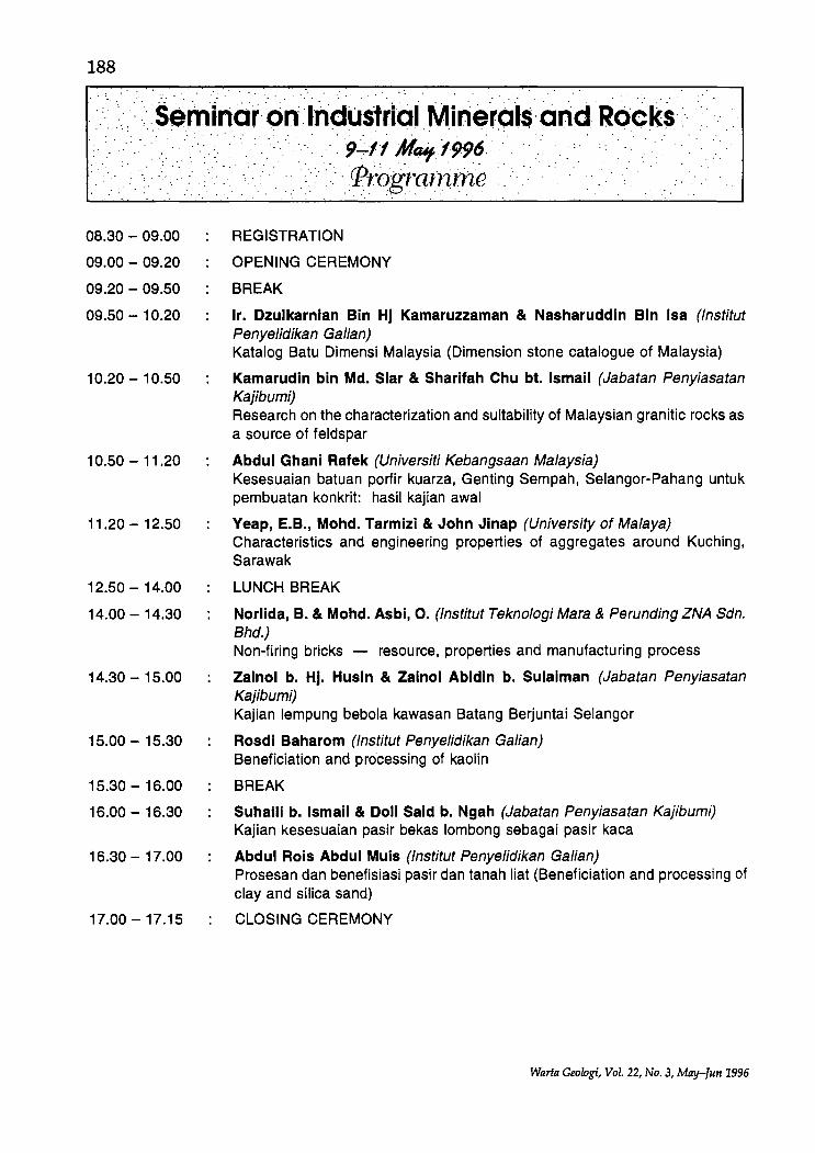
08.30 - 09.00
09.00 - 09.20
09.20 - 09.50
09.50 - 1 0.20
1 0.20 - 1 0.50
10.50 - 11.20
11.20 - 12.50
12.50 - 14.00
14.00 - 14.30
14.30 - 15.00
15.00 - 15.30
15.30 - 16.00
16.00 - 16.30
16.30 - 17.00
17.00 - 17.15
, .. :9~fl M~/996.· :' .. ,::':- '(frografnrn,e . . ',' ." .. . ,
REGISTRATION
OPENING CEREMONY
BREAK
Ir. Dzulkarnian Bin Hj Kamaruzzaman & Nasharuddin Bin Isa (lnstitut Penyelidikan Galian) Katalog Batu Dimensi Malaysia (Dimension stone catalogue of Malaysia)
Kamarudin bin Md. Slar & Sharifah Chu bt. Ismail (Jabatan Penyiasatan Kajibumi) Research on the characterization and suitability of Malaysian granitic rocks as a source of feldspar
Abdul Ghani Rafek (Universiti Kebangsaan Malaysia) Kesesuaian batuan portir kuarza, Genting Sempah, Selangor-Pahang untuk pembuatan konkrit: hasil kajian awal
Yeap, E.B., Mohd. Tarmizi & John Jinap (University of Malaya) Characteristics and engineering properties of aggregates around Kuching, Sarawak
LUNCH BREAK
Norlida, B. & Mohd. Asbi, O. (lnstitut Teknologi Mara & Perunding ZNA Sdn. Bhd.) Non-firing bricks - resource, properties and manufacturing process
Zainol b. Hj. Husin & Zainol Abidin b. Sulaiman (Jabatan Penyiasatan Kajibumi) Kajian lempung bebola kawasan Batang Berjuntai Selangor
Rosdi Baharom (lnstitut Penyelidikan Galian) Beneficiation and processing of kaolin
BREAK
Suhaili b. Ismail & Doll Said b. Ngah (Jabatan Penyiasatan Kajibumi) Kajian kesesuaian pasir bekas lombong sebagai pasir kaca
Abdul Rois Abdul Muis (lnstitut Penyelidikan Galian) Prosesan dan benefisiasi pasir dan tanah liat (Beneficiation and processing of clay and silica sand)
CLOSING CEREMONY
Warta Geologi, Vol. 22, No.3, May-Jun 1996
Seminar: and Fieldtrip on 1f:l:dustriaIMin~ralsandRocks :
SEMINAR AND FIELDTRIP ON
NDUSTRIAL Ml"ERAL
mJ:"~.': AftD .. g ,. ~ ",,.1 '
Captions to Photos :=::>
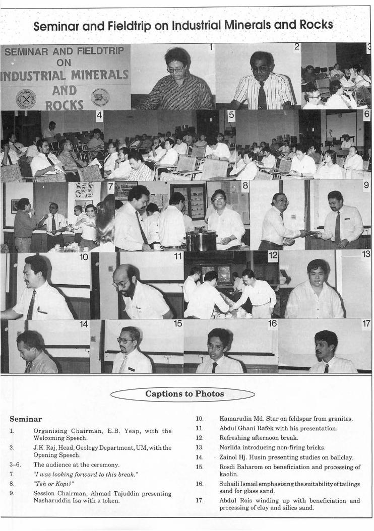
Seminar
1.
2.
3-6.
7.
8.
9.
Organising Chairman, E.B. Yeap, with the Welcoming Speech.
J .K. Raj , Head, Geology Department, UM, with the Opening Speech.
The a udience at the ceremony.
"/ was looking forward to this break."
"Teh or Kop i?"
Session Chairman, Ahmad Tajuddin presenting Nasharuddin Isa with a token.
10.
11.
12.
13.
14.
15.
16.
17.
Kamarudin Md. Star on feldspar from granites.
Abdul Ghani Rafek with his presentation.
Refreshing afternoon break.
Norlida introducing non-firing bricks.
Zainol Hj . Husin presenting studies on ballclay.
Rosdi Baharom on beneficiation and processing of kaolin.
Suhaili Ismail emphasising the suitability oftailings sand for glass sand.
Abdul Rois winding up with beneficiation and processing of clay and silica sand.
17
.· Semincr: and· FiE:)ldtrip :on l. ndustri·a~Minerals .cndRock·s :' .
Seminar and Fieldtr-ip _on :Indusfrial :Mlnerals9ndRock$ -~ . . . . . " . ' . . .. . " ' . . .
c:: Captions to Photos
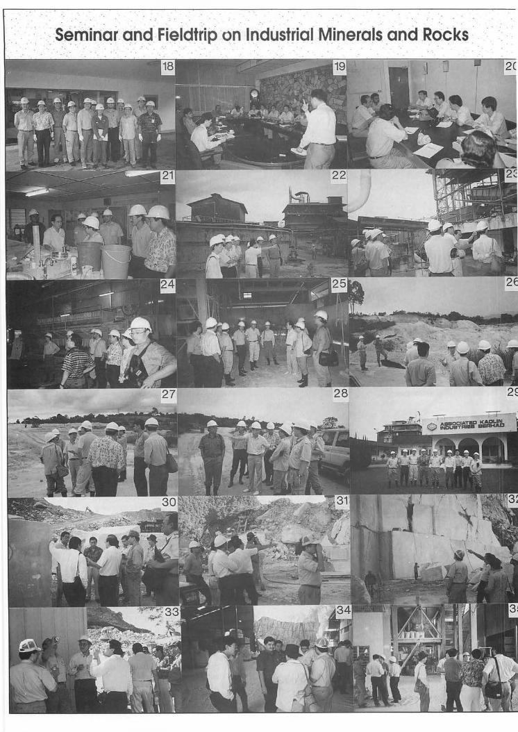
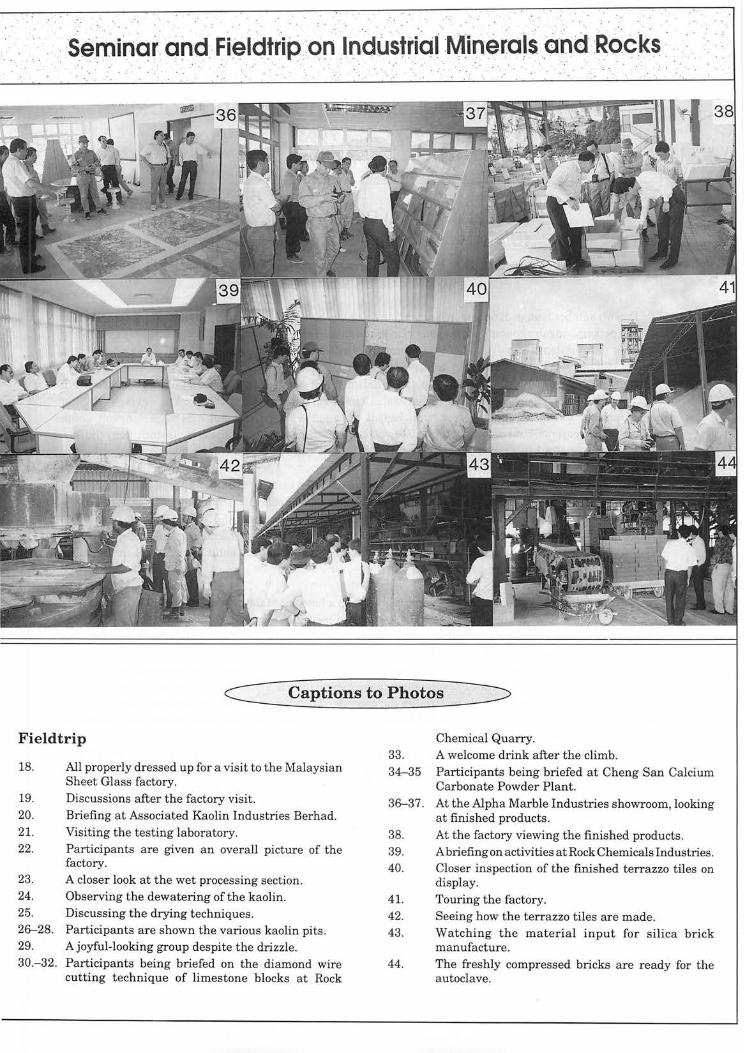
Fieldtrip
18.
19. 20.
21. 22.
23.
24.
All properly dressed up for a visit to the Malaysian Sheet Glass factory. Discussions after the factory visit. Briefing at Associated Kaolin Industries Berhad. Visiting the testing laboratory. Participants are given an overall picture of the factory. A closer look at the wet processing section. Observing the dewatering of the kaolin.
25. Discussing the drying techniques. 26-28. Participants are shown the various kaolin pits . 29. A joyful-looking group despite the drizzle. 30.- 32. Participants being briefed on the diamond wire
cutting t echnique of limestone blocks at Rock
Chemical Quarry. 33. A welcome drink after the climb. 34-35 Participants being briefed at Cheng San Calcium
Carbonate Powder Plant. 36-37. At the Alpha Marble Industries showroom, looking
at finished products. 38. 39. 40.
41. 42. 43 .
44.
At the factory viewing the finished products. A briefing on activities at Rock Chemicals Industries. Closer inspection of the finished terrazzo tiles on display. Touring the factory . Seeing how the terrazzo tiles are made. Watching the material input for silica brick manufacture. The freshly compressed bricks are ready for the autoclave.
192
... ::.\'.:':. seminar·:on: .·I·nduSfriaiMine·ro·is . arid· ROcks .: .. ' .
... , ......... : ....... : ...... :::"':: '.":: .. ·.·:.·:·::.:······::9::tiM;:1·996: .. · .. ·.·: .. : ... : .......... ':. '.' :. :-:' .... ,:,. " :-".,';':.:' .:.'. ·:;ytb.strac;ts<oJ'CRap,e.rs"·' : ..
" ':"",:"'.", .",'.',. ',' ". , '.
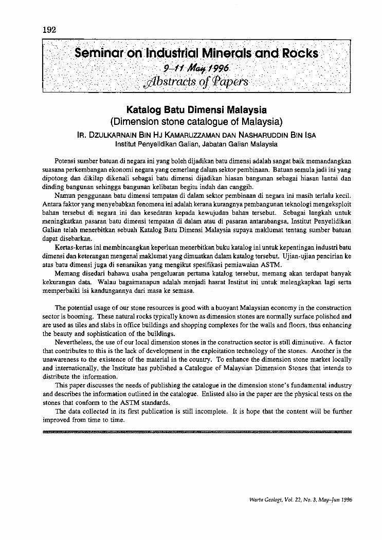
Katalog Batu Dimensi Malaysia (Dimension stone catalogue of Malaysia)
IR. DZULKARNAIN BIN HJ KAMARUZZAMAN DAN NASHARUDDIN BIN ISA Institut Penyelidikan Galian, Jabatan Galian Malaysia
Potensi sumber batuan di negara ini yang boleh dijadikan batu dimensi adalah sangat baik memandangkan suasana perkembangan ekonomi negara yang cemerlang dalam sektor pembinaan. Batuan semulajadi ini yang dipotong dan dikilap dikenali sebagai batu dimensi dijadikan hiasan bangunan sebagai hiasan lantai dan dinding bangunan sehingga bangunan kelibatan begitu indah dan canggih.
Namun penggunaan batu dimensi tempatan di dalam sektor pembinaan di negara ini masih terlalu kecil. Antara faktor yang menyebabkan fen omena ini adalah kerana kurangnya pembangunan teknologi mengeksploit bahan tersebut di negara ini dan kesedaran kepada kewujudan bahan tersebut. Sebagai langkah untuk meningkatkan pasaran batu dimensi tempatan di dalam atau di pasaran antarabangsa, Institut Penyelidikan Galian telah menerbitkan sebuah Katalog Batu Dimensi Malaysia supaya maklumat tentang sumber batuan dapat disebarkan.
Kertas-kertas ini membincangkan keperluan menerbitkan buku katalog ini untuk kepentingan industri batu dimensi dan keterangan mengenai maklumat yang dimuatkan dalam katalog tersebut. Ujian-ujian pencirian ke atas batu dimensi juga di senaraikan yang mengikut spesifikasi pemiawaian ASTM.
Memang disedari bahawa usaha pengeluaran pertama katalog tersebut, memang akan terdapat banyak kekurangan data. Walau bagaimanapun adalah menjadi hasrat Institut ini untuk melengkapkan lagi serta memperbaiki isi kandungannya dari mas a ke semasa.
The potential usage of our stone resources is good with a buoyant Malaysian economy in the construction sector is booming. These natural rocks typically known as dimension stones are normally surface polished and are used as tiles and slabs in office buildings and shopping complexes for the walls and floors, thus enhancing the beauty and sophistication of the buildings.
Nevertheless, the use of our local dimension stones in the construction sector is still diminutive. A factor that contributes to this is the lack of development in the exploitation technology of the stones. Another is the unawareness to the existence of the material in the country. To enhance the dimension stone market locally and internationally, the Institute has published a Catalogue of Malaysian Dimension Stones that intends to distribute the information.
This paper discusses the needs of publishing the catalogue in the dimension stone's fundamental industry and describes the information outlined in the catalogue. Enlisted also in the paper are the physical tests on the stones that conform to the ASTM standards.
The data collected in its first publication is still incomplete. It is hope that the content will be further improved from time to time.
Warta Geologi, Vol. 22, No.3, May-Jun 1996
Research on the characterization and suitability of Malaysian granitic rocks as a source of feldspar
KAMuRADIN BIN MD. SLAR AND SVARIFAH BTE CHU ISMAIL Jabatan Penyasiatan Kajibumi
193
The commercial source of feldspar is generally from pegmatites and aplites. Although both are commonly associated with granitoids in Peninsular Malaysia, most of the occurrences are of limited size to be of any commercial significance. Presently, Malaysia's feldspar requirements, mainly for the ceramic and glass making industries are wholly met by imports which amount to about RM20 millions annually.
However, granitic rocks are appropriate source materials, particularly those medium- to coarse-grained, leucocratic varieties containing more than 60% feldspar and less than 10% iron-bearing minerals, as shown by the results of this research exercise whereby a feldspar recovery efficiency exceeding 60% has been achieved.
31 quarries/outcrops (out of the 72 studied) have been characterised as "ideal" source of feldspar conforming to the "preferred" feldspar specification of> 18% Alz0 3, > 11 % (NazO + KzO) and < 0.3% FeZ0 3• Characterization was based on feldspar extracted from rocks, quarry dust samples being non-optimal for this purpose. Nonetheless, several quarry dust stockpile fall within the "ideal" category.
Despite the positive and encouraging indication that the extracted feldspar samples of different chemical compositions are found to be suitable for making ceramic bodies and glaze, the chemical content of feldspar, nevertheless, could be critical for the manufacture of specific end products. At 1,170DC feldspar samples extracted from some "Central Belt granites" remained unfused, but at 1,250DC all feldspar samples tested were fused.
Feldspar extracted from the Eastern Province granites generally show good fusion characteristics - their fused feldspar buttons, from quarry dust and rock samples, are unblemished, signifying their good glazing property. By contrast, the fused buttons from even some "ideal" quarries within the Main Range Province contain black spots. It is to be noted also that silica sand is a valuable by-product of the feldspar extraction process.
Kesesuaian batuan porfir kuarza, Genting Sempah, SelangorPahang untuk pembuatan konkrit: hasil kajian awal
ABDUL GHANI RAFEK Jabatan Geologi, Universiti Kebangsaan Malaysia
Kaedah kimia piawai ASTM C289-87 untuk penentuan keupayaan tindakbalas alkali silika bagi aggregat digabungkan dengan kajian petrografi bagi penentuan kesesuaian batuan porfir kuarza, Genting Sempah, Selangor-Pahang untuk penggunaan sebagai aggregat dalam pembuatan konkrit. Hasil awal kajian ini menunjukkan batuan ini mempunyai kelakuan tidak merbahayakan konkrit.
The ASTM standard chemical method C289-87 for the determination of potential reactivity of aggregates was combined with petrographic studies to determine the suitability of the quart porphyry from Genting Sempah, Selangor-Pahang for use as an aggregate in concrete. Initial results show that this rock's behaviour is innocuous.
• La
Warta Geologi, Vol. 22, No.3, May-Tun 1996
194
Petrographic characteristics and aggregate properties of the dacite porphyry intrusives of Kuching area, Sarawak
YEAP, E.B., MOHD. TARMIZI, M.Z. AND JOHN, J. Department of Geology, University of Malaya
Field mapping and petrogenetic evidence indicate that in the Kuching area, the older Late Triassic to Late Cretaceous sedimentary rocks and volcanics were intruded by dacite porphyry which took the form of small stocks, dikes and sills. Petrographically, the dacite porphyry contains phenocrysts of plagioclase, hornblende and quartz set in an aphanitic groundmass of quartz and feldspars. Locally, glassy groundrnass has been observed and zeolites have been identified.
The intrusives are observed to be affected by late phase magrnaticlhydrothermal activities which had caused alterations to the dacite porphyry which can be visually observed on the quarry faces. The alterations identified, often occurring in different degrees of intensities at specific parts of the quarry faces include: 1) chloritization, 2) pyritization, 3) calcitization, 4) hematization and 5) kaolinization. Based on the present petrographic study, identification and recognition of various types of alteration in the field is possible.
Fresh dacitic porphyry rocks and their altered phases in all the quarries around Kuching were sampled from the quarry faces and tested for their physical and aggregate properties in the Geological Survey of Malaysia Laboratories in Ipoh. Physical and aggregate properties determined include S.G., Water Absorption, Aggregate Crushing Value, Aggregate Impact Value, 10% Fine (all according to B.S. 812) and Los Angeles Abrasion Value (ASTM 131).
Fresh dacite porphyry rocks show excellent physical and aggregate properties. On the other hand altered phases invariably show poorer physical and aggregate properties with some dipping below the requirements or specifications of aggregate properties set by the Jabatan Kerja Raya, Malaysia for various construction purposes. In the day to day operation of the quarries usually, the unaltered dacite porphyries are mixed with the altered phases, thus the properties for the commercially available aggregates are somewhere between the two values. The unaltered and altered dacite can be recognised based on field criteria and this can be used for selection at the quarry face to produce high quality aggregate for certain specific purposes.
Petrographic evidence indicates the presence of micro-crystalline and crypto-crystalline quartz (which are potentially alkali-silica reactive) in all the thin sections of the dacite porphyries. Zeolites and glassy matrix are present locally. It is recommended that if the dacite porphyry aggregates are to be used in concrete in which the alkali content in the cement portion is high (> 0.6% NaOH equiv.) the mortar bar tests (ASTM 227) be carried out to assess the alkali-silica and alkali-zeolite reactivities.
Kajian lempung bebola kawasan Batang Berjuntai, Selangor ZAINOL HJ. HUSIN DAN ZAINOL ABIDIN SULAIMAN
Jabatan Penyiasatan Kajibumi Malaysia
Kajian lempung bebola ini adalah bertujuan bagi menggariskan, mencirikan dan menentukan kuantiti longgokan yang dijalankan ke atas kawasan seluas 800 hektar di kawasan Batang Berjuntai, Kuala Selangor, Selangor.
Kajian ini merupakan Fasa Kedua dalam rancangan penjelajahan lempung bebola di Negeri Selangor di mana merupakan sebahagian Projek Mineral Perindustrian di bawah Rancangan Malaysia Keenam. Dua kawasan di Batang Berjuntai telah dikenalpasti mempunyai potensi yang baik bagi lempung bebola. Kawasan tersebut adalah seperti berikut:-1. Ladang Sg. Rambai, St. Andrew dan Holmwood 2. Ladang Tennamaram
Kajian ini juga telah menunjukkan bahawa terdapat lempung bebola dan lempung berbelak yang wujud di kawasan tersebut.
Lempung bebola adalah sesuai untuk pembuatan ubin, peralatan tandas, porsilin, tembikar meja dan
Warta Geologi, Vol. 22, No.3, May-]un 1996
195 barangan perhiasan manakala lempung berbelak adalah sesuai untuk pembuatan paip pembentung, batu bata dan ubin bumbung.
Ketebalan lempung bebola di kawasan Ladang Sg. Rambai, St. Andrew dan Holmwood adalah dari 0.2 m hingga 8.5 m manakala di kawasan Ladang Tennamaram berjulat dari 0.4 m hingga 6.4 m. Lempung tersebut mempunyai keplastikan sederhana hingga baik. Warna pembakaran pada suhu 1,lOO°C ialah "off white" hingga "light yellow".
Sejumlah 43 juta tan metrik simpanan terukur lempung telah ditemui melalui kajian ini.
Beneficiation and processing of kaolin ROSDIBAHAROM
Institut Penyelidikan Galian, Jabatan Galian Malaysia
Kaolin is one of the most versatile industrial minerals, but kaolin in its natural crude form has very limited applications or uses. This is because other than kaolin there are other ancillary minerals which are considered as contaminants. Some of the more common minerals are titaniferous minerals, haematite, goethite, mica and quartz. These minerals need to be removed or the percentage greatly reduced before the properties of the kaolin more suited for the various applications. Kaolin is mainly used in the paper industry which is the largest user. Kaolin is also used in the ceramics and refractories, in the paints, rubber, plastics and chemical industries.
In order to achieve the specified properties kaolin needs to undergo several stages of processing to remove the above mentioned ancillary minerals. Kaolin can be processed through the dry method as well as the wet method. The dry method is normally effectuated for the low grade kaolin which does not require secondary down-stream processing. The wet method is more complex and the crude has to undergo many processes. The cost of processing by the wet method is higher than the dry method but the products are of better properties and qualities. Among the processes involved in refining the kaolin are: fractionation, delamination, flotation, flocculation, magnetic separation and oxidation bleaching.
The processing technology had been developed and is continually developed to improve the quality of kaolin and also to satisfy the specifications of the market. The problem of kaolin processing is not on the technology but rather the economics of the processes that is related to the grade of the crude kaolin and the end product specifications.
Kajian kesesuaian pasir bekas lombong sebagai pasir kaca MOHD. SUHAILI BIN ISMAIL DAN DOLL SAID BIN NGAH
Jabatan Penyiasatan Kajibumi Malaysia
Satu kajian kesesuaian pasir bekas lombong sebagai pasir kaca telah dilakukan. Untuk tujuan ini, longgokan pasir bekas lombong di Bikam, Perak D.R. telah dipilih. Komposisi pasir mentah ini mengandungi 95.3 hingga 97.6% Si02, 0.34 hingga 0.91 % Fe20 3, 0.06 hingga 2.25% Ti02 dan 0.60 hingga 0.67% AIP3' Kontaminan utama terdiri daripada mineral berat ilmenit dan tourmalin. besi oksida. feldspar dan mika. Proses penceriaan telah dilakukan yang meliputi pengecilan saiz butiran kepada -500 Ilm dengan menggunakan pulveriser, pembasuhan dan pemisahan magnetik kering. Selepas proses penceriaan. kualiti pasir telah meningkat iaitu mengandungi 99.2 hingga 99.4% Si02, 0.02 hingga 0.03% Fep3' 0.03 hingga 0.05% Ti02 dan 0.26 hingga 0.37% A120 3. Berdasarkan kepada spesifikasi SIRIM untuk kaca. pasir bekas lombong yang dikaji mempunyai kualiti pasir kaca gred C selepas proses penceriaan iaitu yang sesuai digunakan untuk pembuatan barangan kaca celah (colourless glassware). Kualiti pasir mungkin boleh ditingkatkan lagi jika proses penceriaan melibatkan kaedah pengapungan di mana feldspar dan mika dapat diasingkan dengan lebih berkesan.
Warta Geologi, Vol. 22, No.3, May-Tun 1996
196
Prosesan dan benefisiasi pasir dan tanah liat (Beneficiation and processing of clay and silica sand)
ABDUL ROIS ABDUL MUIS Institut Penyelidikan Galian, Jabatan Galian Malaysia
Walaupun Malaysia tidak mempunyai banyakjenis mineral perindustrian yang diperlukan tetapi sumbersumber pasir silika dan tanah liat yang ada mencukupi untuk kegunaan tempatan. Sungguhpun begitu, masih banyak bahan-bahan tersebut yang lebih berkualiti diimpot untuk industri tempatan. Dianggarkan lebih 130 ribu metrik tan bahan-bahan tersebut bernilai RM80 juta akan diimpot menjelang tahun 2000. Adalah jelas terdapat hubungkait antarajumlah bahan yang perlu diimpot dengan tahap pemprosesan yang diamalkan. Pada masa ini, tahap pemprosesan tanah liat amatlah rendah (primer) dan kebanyakannya digunakan untuk pembuatan pelbagai barangan bernilai rendah. Bagi mengurangkan jumlah impot tanah liat yang lebih bernilai, kerjakerja benefisiasi atau menambah nilai ke atas bahan tempatan perlu dijalankan. Mengenai pasir silika pula, ramai pengeluar utama tempatan menjalankan pemprosesan sekunder tetapi keperluan berterusan untuk bahan mentah lebih baik oleh pengguna-pengguna akan memerlukan peningkatan kualiti pada tahap tertiar.
Malaysia is not well endowed with a wide variety of industrial minerals but the available clay and silica sand resources are sufficient to cater for domestic consumption. Unfortunately, the value of import of higher quality materials for local usage keeps on increasing. It is anticipated that by the year 2000, more than 130,000 metric tonnes of the materials valued at RM80 million, need to be imported. Obviously, there seems to be a direct correlation between the existing levels of processing and the volume of the materials imported. Currently, the level of processing for clay in this country is very low (primary) and most of the material produced is consumed locally for making lower value products. In order to reduce importation of better quality clays, beneficiation or value adding of the local clay needs to be carried out. As for silica sand, most local major producers attempt secondary processing but the continuing demands for better raw material set by customers will eventually warrant tertiary upgrading.
Warta Geolog;, Vol. 22, No.3, May-Tun 1996
197
June 1996 marks a significant episode in the history ofthe Geological Society of Malaysia. After 29 years since its beginnings, the GSM held for the first time its annual geological conference in the "Land Below The Wind" - SABAH. The conference theme "Economic Geology and Tectonics of Malaysia and the Southeast Asian Region" was aptly chosen to reflect the geological complexity and the economic potential of Sabah but general enough to attract other papers relevant to the theme. The conference attracted geoscientists from Brunei, Canada, Indonesia, Japan, the Philippines, the United Kingdom, the United States of America and west Malaysians who came, many for the first time, to Sabah. In all, there were 110 registered participants to the event.
Two pre-conference field trips were organised. On the 6th of June, a party of 20 persons left Kota Kinabalu by bus for the Structural Geology field trip with stops to observe outcrops of the Crocker Formation, Trusmadi Formation and the basement ophiolitic rocks. Of course there was a chance also to savour the delights of a hot geothermal bath (at least for two persons) at the Poring hot springs. Who said it wasn't a geological stop? The participants overnighted at Hotel Ranau. Some participants left to return to Kota Kinabalu, the rest was joined by another party of 6 geologists who arrived on the 7th to continue on the economic part of the field trip. This second party arrived late in the morning because their bus had to stop to change tyres due to a puncture.
The mine visit to Mamut Copper Mining Ltd. started with a short briefing by the mine manager and geologist and the participants were taken around to see the various aspects of the mining and of course collected bags and bags of samples! They were then taken to the mine club house for lunch before heading back to Kota Kinabalu and a 3-hour traffic jam. Yes, traffic jam in Kota Kinabalu due to floods! So for most participants, the cocktail ice breaker party held at the Tanjung Aru Resort that night turned out to be their dinner-cum-supper as well.
The opening ceremony on the morning of 8th June started with the welcoming speech by the President ofGSM Dr. Khalid Ngah. This was followed by the opening speech by the Deputy Chief Minister of Sabah (also the Minister of Resource Development and Enterprise) the Honourable Datuk Seri Panglima Joseph Kurup. The event was widely covered by the local media and national television.
Session I chaired by Mr. Lim Peng Siong (of L&L Environmental and Geological Seryices Sdn. Bhd.), started with a keynote paper on gold mineralization in Southeast Asia by Dr. Steye Garwin of N ewmont Southeast Asia. This was followed by six other papers before the session broke for a sumptuous lunch. The afternoon Session II was chaired by Mr. Denis Tan lof Sarawak Shell Berhad) who introduced the second keynote paper of the conference by Dr. John Milsom on gravity geophysics of the region. Four other papers followed before the session broke for a short tea break and a further four papers after tea. During the tea break, participants were drawn to four poster presentations put up in the lobby.
The evening event was a 7 -course Chinese dinner hosted by Malaysian Mining Corporation Berhad for all the registered participants of the conference and their families. During dinner.
Warta Geologi, Vol. 22, No.3, May-fun 1996
198 there was an official cheque presentation by Mr. Yip Foo Weng (Exploration Manager, MMC) to the Vice-President of GSM Dr. Ibrahim Komoo. The next highlight of the evening was the announcement of the winner ofthe 1994 Young Geoscientist Award - Mr. Ng Tham Fatt (who is also a member of the Organising Committee of this conference). He received a cash prize of RM1,OOO and a certificate from the GSM.
Sunday 9th June saw the start of Session III, chaired by Mr. S.K. Chung (ex DirectorGeneral, Geological Survey Department Malaysia). Dr. W.K. Fletcher was unfortunately not able to deliver his keynote address on geochemistry due to an emergency medical evacuation which require him to rush back to Vancouver for treatment to his right eye. His full paper as printed was considered presented and the Society wished him a speedy recovery. There were eight papers during this session with a short coffee break in between.
After lunch, Session IV in the afternoon started with Mr. Alexander Yan as session chairman (representing the Director, Geological Survey Department Malaysia, Sabah). Six papers wp.re presented before the session broke for tea break and a chance for the participants to view the five poster presentations put up by conference participants. Following tea, the closing ceremony and address was presented by Mr. Jimmy Khoo as Conference Organising Chairman and a group photograph was taken to commemorate the event.
In the evening, a delicious buffet dinner sponsored by Mamut Copper Mining Sdn. Bhd. was well attended by the participants, some of whom unfortunately had to leave halfway to rush to the airport for their return flights.
About twenty of the remaining participants took part in the post-conference fieldtrip from 10th to 12th June to climb Gunung Kinabalu and of course study the geology as well. But the actual number who consulted their geological field notes during the climb was nil for obvious reasons. Too tired out to lift out the notes! It was a cold and very wet early morning climb for the adventurous few who successfully reached the peak on the morning of 12th June.
In all, the feedback received from the participants was truly encouraging and set a high standard for the next organising committee to match. Most presenters realised that a lot of participants have spent a lot of their own money to be present at the conference and did try their best to give a good presentation oftheir papers. Thank you and well done fellow organisers and for the participants, see you next year then.
Jimmy Khoo
Warta Geologi, Vol. 22, No.3, May-fun 1996
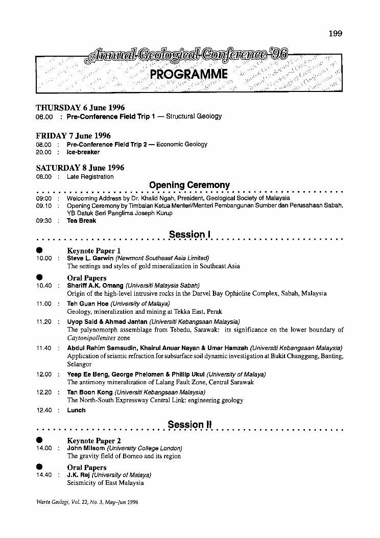
THURSDAY 6 June 1996 08.00 : Pre-Conference Field Trip 1 - Structural Geology
FRIDAY 7 June 1996 OB.OO Pre-Conference Field Trip 2 - Economic Geology 20.00 : Ice-breaker
SATURDAY 8 June 1996 OB.OO : Late Registration
Opening Ceremony
199
,'::" ~. ". ,'~.
. .:..
• • • • • • • • • • • • • • • • • • • • • • • • • • • • • • • • • 0 • • • • • • • • • • • • • • • • • • • • • • •
09:00 Welcoming Address by Dr. Khalid Ngah, President, Geological Society of Malaysia 09.10 Opening Ceremony by limbalan Ketua MenteriIMenteri Pembangunan Sumber dan Perusahaan Sabah,
YB Datuk Seri Pang lima Joseph Kurup 09:30 Tea Break
Session I · . . . . . . . . . . . . . . . . . . . . . . . . . . . . . . . . . . . . . . . . . . . . . . . . . . . . . . . . • Keynote Paper 1 10.00 Steve L. Garwin (Newmont Southeast Asia Limited)
The settings and styles of gold mineralization in Southeast Asia
• Oral Papers 10.40 Shariff A.K. Omang (Universiti Malaysia Sabah)
Origin of the high-level intrusive rocks in the Darvel Bay Ophiolite Complex, Sabah, Malaysia
11.00 Teh Guan Hoe (University of Malaya) Geology, mineralization and mining at Tekka East, Perak
11.20 Uyop Said & Ahmad Jantan (Universiti Kebangsaan Malaysia) The palynomorph assemblage from Tebedu, Sarawak: its significance on the lower boundary of Caytonipollenites zone
11.40 Abdul Rahim Samsudln, Khalrul Anuar Nayan & Umar Hamzah (Universiti Kebangsaan Malaysia) Application of seismic refraction for subsurface soil dynamic investigation at Bukit Changgang, Banting, Selangor
12.00 Yeap Ee Beng, George Phelomen & Phillip Ukul (University of Malaya) The antimony mineralization of Lalang Fault Zone, Central Sarawak
12.20 Tan Boon Kong (Universiti Kebangsaan Malaysia) The North-South Expressway Central Link: engineering geology
12.40 Lunch
Session II · . . . . . . . . . . . . . . . . . . . . . . . . . . . . . . . . . . . . . . . . . . . . . . . . . . . . . . . . • Keynote Paper 2 14.00 John Milsom (University Col/ege London)
The gravity field of Borneo and its region
• Oral Papers 14.40 J.K. Raj (University of Malaya)
Seismicity of East Malaysia
Warta Geologi, Vol. 22, No.3, May-Jun 1996
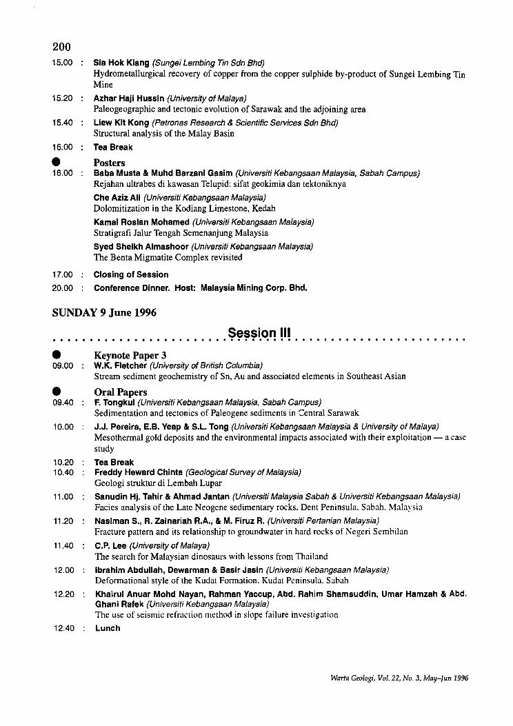
200 15.00 Sia Hok Kiang (Sungei Lembing Tin Sdn Bhd)
Hydrometallurgical recovery of copper from the copper sulphide by-product of Sungei Lembing Tin Mine
15.20 Azhar Haji Hussin (University of Malaya) Paleogeographic and tectonic evolution of Sarawak and the adjoining area
15.40 Liew Kit Kong (Petronas Research & Scientific Services Sdn Bhd) Structural analysis of the Malay Basin
16.00 Tea Break
• Posters 16.00 Baba Musta & Muhd Barzani Gasim (Universiti Kebangsaan Malaysia, Sabah Campus)
Rejahan ultrabes di kawasan Telupid: sifat geokimia dan tektoniknya
Che Aziz Ali (Universiti Kebangsaan Malaysia) Dolomitization in the Kodiang Limestone, Kedah
Kamal Roslan Mohamed (Universiti Kebangsaan Malaysia) Stratigrafi Jalur Tengah Semenanjung Malaysia
Syed Sheikh Almashoor (Universiti Kebangsaan Malaysia) The Benta Migmatite Complex revisited
17.00 Closing of Session
20.00 Conference Dinner. Host: Malaysia Mining Corp. Bhd.
SUNDAY 9 June 1996
Session III · . . . . . . . . . . . . . . . . . . . . . . . . . . . . . . . . . . . . . . . . . . . . . . . . . . . . . ... • 09.00
• 09.40
10.00
10.20 10.40
11.00
11.20
11.40
12.00
12.20
12.40
Keynote Paper 3 W.K. Fletcher (University of British Columbia) Stream sediment geochemistry of Sn, Au and associated elements in Southeast Asian
Oral Papers F. Tongkul (Universiti Kebangsaan Malaysia, Sabah Campus) Sedimentation and tectonics of Paleogene sediments in Central Sarawak
J.J. Pereira, E.B. Veap & S.L. Tong (Universiti Kebangsaan Malaysia & University of Malaya) Mesothermal gold deposits and the environmental impacts associated with their exploitation - a case study
Tea Break Freddy Heward Chinta (Geological Survey of Malaysia) Geologi struktur di Lembah Lupar
Sanudin Hj. Tahir & Ahmad Jantan (Universiti Malaysia Sabah & Universiti Kebangsaan Malaysia) Facies analysis of the Late Neogene sedimentary rocks. Dent Peninsula. Sabah. Malaysia
Nasiman S., R. Zainariah R.A., & M. Firuz R. (Universiti Pertanian Malaysia) Fracture pattern and its relationship to groundwater in hard rocks of Negeri Sembilan
C.P. Lee (University of Malaya) The search for Malaysian dinosaurs with lessons from Thailand
Ibrahim Abdullah, Dewarman & Basir Jasin (Universiti Kebangsaan Malaysia) Deformational style of the Kudat Formation. Kudat Peninsula. Sabah
Khairul Anuar Mohd Nayan, Rahman Vaccup, Abd. Rahim Shamsuddin, Umar Hamzah & Abd. Ghani Rafek (Universiti Kebangsaan Malaysia) The use of seismic refraction method in slope failure investigation
Lunch
Warta Geologi, Vol. 22, No.3, May-Tun 1996
201
. . . . . . . . . . . . . . . .. Session IV ••••••••••••••••••••••••• 0 ••• 0 ••••••••••
• Oral Papers 14.00 J. Noad & N. Harbury (Birk College & University College London)
The sedimentology of Miocene shallow marine clastics of the Sandakan Formation of Eastern Sabah
14.20 Baba Musta, Wan Fuad Wan Hassan & Mohamad Md Tan (Universiti Kebangsaan Malaysia) Kajian geokimia konkresi dan hubungannya dengan pembentukan bauksit di kawasan Kuantan
14.40 Wan Ismail Wan Yusoff & Llew Kit Kong (Petronas Research & Scientific Services Sdn Bhd) The relationship between heat flow provinces and structural patterns within the Malay Basin
15.00 Majeed M. Faisal, Shariff A.K. Omang & Sanudin Hj. Tahir (Universiti Kebangsaan Malaysia, Sabah Campus & Universiti Malaysia Sabah) Geology and hydrology of Tuaran
15.20 Allagu Balaguru (Geological Survey of Malaysia) Sedimentologi dan stratigrafi batuan sedimen Miosen di lembangan Malibau, Sabah
15.40 Marcus Jopony & F. Tongkul (Universiti Malaysia Sabah & Universiti Kebangsaan Malaysia, Sabah Campus) Some biogeochemical aspects of ultrabasic areas in Sabah
16.00 Tea Break
• Posters 16.00 Lim See Peng & Kadderi Md. Desa (Universiti Kebangsaan Malaysia)
Zon lemah sepanjang lebuhraya Tamparuli-G. Kinabalu, Sabah: satu tafsiran gambarudara
Richard Mani Banda & E. Honza (Geological Survey of Malaysia) Miocene stratigraphy of Northwest Borneo Basin
Umar Hamzah, Abdul Rahim Samsudin & Abdul Ghani Rafek (Universiti Kebangsaan Malaysia) Hasil awal kajian seismos pantulan cetek di beberapa enapan Kuaterner pantai timur Semenanjung Malaysia
Uyop Said, Mohd. Rozi Umor & Ahmad Jantan (Universiti Kebangsaan Malaysia) On the lowermost palynomorph assemblage in the Kayan Sandstone from Gunung Senggi, Bau, Sarawak
Zaiton Harun (Universiti Kebangsaan Malaysia) Struktur dalarn zon sesar Kisap di Teluk Sudu
17.00 Closing Address by Mr. Jimmy K.K. Khoo, Organising Chairman of GSM Annual Geological Conference 1996
20.00 Conference Dinner. Host: Mamut Copper Mining Sdn. Bhd.
MONDAY 10 June 1996 to WEDNESDAY 12 June 1996 (Post-Conference Fieldtrip)
10 June 1996 08.00 09.00
11 June 1996 07.30 15.00
12 June 1996 05.00 07.00 07.30 16.00 18.00
Depart from Kota Kinabalu to Sabah Park Headquarter, Kundasang Arrive at Sabah Park, Kundasang (overnight at Park Hostel) Start climbing Arrive at Laban Rata Hostel Start climbing to Mt. Kinabalu peak Reach Low's Peak Start descending back to Sabah Park Hq Arrive at Sabah Park Hq. then proceed to Kota Kinabalu Arrive at Kota Kinabalu
Warta Geologi, Vol. 22, No.3, May-fun 1996
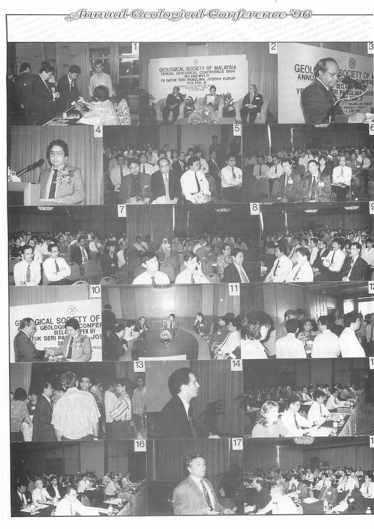
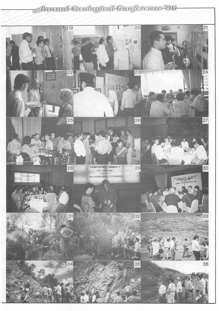
.,'
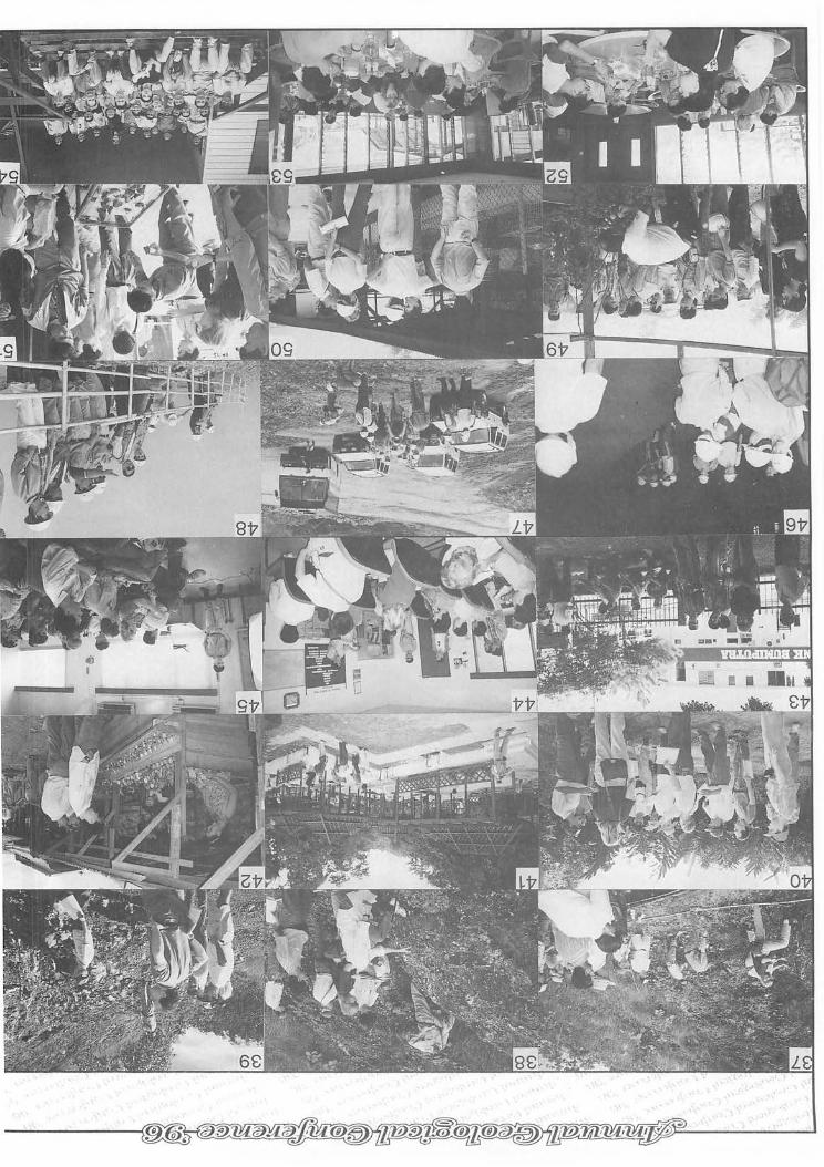
'. ,'"
Conference
1.
2.
3.
4.
5-9.
10.
11.
Bright and early at the registration desk.
The stage is set for the Opening Ceremony.
GSM President, Khalid Ngah with his Welcoming Speech.
YB Datuk Seri Panglima Joseph Kurup with the Opening. Speech.
The large turnout at the Opening Ceremony.
A token of appreciation for the guest-of-honour.
Datuk Seri having discussions with Society representatives.
12-13. At last, the coffee-break.
14. Steve Garwin with his keynote paper on gold.
15-16. Participants paying keen attention.
17. John Milson elaborating on the gravity field of Borneo.
18. All eyes and ears on the presentation.
19-23. Very keen interest at the poster sessions.
24. Lunch break.
25-26. Plenty of goodies at the Ice-Breaker Party.
27-28. Conference Dinner 1 sponsored by Malaysian Mining Corporation.
29. A token of appreciation from Vice President Ibrahim Komoo to MMC representative Yip Fook Weng.
30. Conference Dinner 2 sponsored by Mamut Copper Mine Sdn. Bhd.
Structural Geology Fieldtrip
31. A helping hand to get to Menggatal Quarry.
32. "There's the sandstone duplexes up there."
33. Observing the excellent recumbent fold of the
......
Crocker Formation at Tamparuli Road section.
34-35. A close study of the zone of intense shearing and deformation after Kg. Kiporingan Road section.
36. Fieldguide Felix indicating the brecciated zone after the Kinabalu Park Road section.
37. "Yes, come and see the rocks here are really fragmented"
38. Felix showing the intensely deformed thin sandstone and shale interbeds at road section before Ranau town.
39.
40.
41.
Studying the basement rocks of sheared serpentinite and basalt at Kg. Kirokot, Parancangan Road Section.
Felix elaborating on the structure of the area.
Time to relax at Poring Hot Springs.
42. Interesting souvenirs from Mam utfor sale at roadside stalls.
Economic Geology Fieldtrip
43 .
44.
45.
46.
47.
48.
49.
50.
51.
52.
53.
An anxious bunch waiting in the shade for the bus.
Participants are given a briefing on the Mamut Copper Mine.
The geologist gives his account ofthe mineralisation.
A visit to the ore dump.
Collecting samples near the mine face .
An view of the mine and blasting from a vintage point.
Examining tomatoes grown in the area.
Briefing on healthy livestock feeding on grass grown in the mine area.
Samples of Mamut ores for the participants.
A good lunch at the Mine's Clubhouse.
A satisfied looking bunch - after lunch.
206
r.~P~1
The settings and styles of gold mineralization in Southeast Asia S.L. GARWIN
Newmont Southeast Asia Limited, Wisma Standard Chartered Bank, 14th Floor, JI. Sudirman Kav. 33A, Jakarta 10220, Indonesia
Gold mineralization in Southeast Asia is associated with a wide range of deposit styles. This study incorporates 90 gold and copper-gold deposits, including porphyry, metasomatic skarn, carbonate-base metal-gold, volcanichosted high-sulfidation and low-sulfidation epithermal, quartz lode, volcanogenic massive sulfide and disseminated sediment-hosted. The combined past production and current resources of these deposits exceeds 6,800 tonnes of gold and 50 million tonnes of copper. The majority of the gold is contained in porphyry (64%), low-sulfidation epithermal (17%), carbonate-base metal-gold (7%) and skarn (4%) deposits. Approximately 90% of these deposits (> 95% of the gold) are associated with middle to late Cenozoic magmatic arcs.
Fourteen major magmatic arcs and several secondary arcs of Cenozoic age form a complex border to the Sundaland craton and the northern margin of the Australian platform. This volcano-plutonic chain extends more than 12,000 km from Taiwan in the northeast, through the Philippines and Indonesia, to Myanmar in the northwest. The' arcs are constructed on basement which comprises oceanic and continental crust. The Philippines and Indonesia hold more than 90% of the known gold in the region, contained in deposits which cluster along short sectors of middle Tertiary to Pleistocene arcs. In eastern Malaysia, gold mineralization is related to Neogene intrusions. In northern Taiwan, gold deposits are hosted by Pleistocene intrusions and in northcentral Myanmar. mineralization is associated with a middle to late Tertiary arc sector. Porphyry and epithermal mineralization styles predominate, while skarn, carbonate-base metal-gold, sediment-hosted and volcanogenic massive sulfide/ exhalative deposits are less abundant.
Mainland Southeast Asia comprises four major crustal plates, each defined by a series of tectonostratigraphic belts fonned upon preCenozoic continental basement. These include cratonic platfonns, fold belts, magmatic arcs, volcano-sedimentary rift basins, and metamorphic terrains. Late Paleozoic to Mesozoic volcano-plutonic arcs characterize the fold belts developed along continental margins adjacent to intra-plate collision zones. indicated by ophiolitic sutures. Mineralization within these fold belts is commonly localized within anticlines and structurally complex regions. Other prospective geological settings are suture zones, major strike-slip faults, structural domes and the margins of rift basins. Gold mineralization comprises quartz lode (common), skarn and porphyry (subordinate), and disseminated sediment-hosted, massive sulfide and volcanic-hosted epithermal (minor) systems.
Gold mineralization in Southeast Asia is spatially and temporally related to intrusions and volcanic centers. Porphyry, skarn and high-sulfidation epithermal deposits are closely related to intrusions emplaced at shallow depths. Low-sulfidation epithermal systems include vein, stockwork and minor disseminated styles. which typically are located within or adjacent to volcanic centers. Carbonate-base metal-gold deposits occupy diatreme settings in the deeper portions of low-sulfidation epithermal systems. Disseminated sediment-hosted deposits occur in calcareous rock sequences in both proximal and distal settings to intrusions. Volcanogenic massive sulfide and exhalative deposits are developed in sea floor extensional settings. Quartz lodes are typically structurally-controlled and hosted by preCenozoic metasedimentary and sedimentary rocks.
Warta Geologi, Vol. 22, No.3, May-Jun 1996
t~P~2
The gravity field of Borneo and its region JOHN MILSOM
Department of Geological Sciences, University College London
207
Gravity mapping of Borneo is still incomplete The largest single onshore data set was obtained in western and central Kalimantan by the Indonesian Geological Research and Development Centre in conjunction with the Australian Bureau of Mineral Resources. Much additional work has been done in eastern Kalimantan by various oil companies but the results are either unpublished or available only in the form of very small scale maps. A rather similar situation exists in Sarawak, but Sabah has now been covered at a regional reconnaissance level. Shipborne surveys provide considerable detail in some offshore areas but are lacking or confidential in many others.
Free-air gravity maps derived from measurements by radar satellites of sea surface elevations represent a major new resource. Although such maps have existed for more than a decade, it is only in the last 12months, during which geodetic missions by the European ERS-l satellite were completed and the results of earlier geodetic missions by the American Geosat were released, that cross-track separations have become commensurate with along-track resolutions. Satellite-derived maps now provide resolution of anomalies with wavelengths of as little as 10 km, and good agreement with data from shipborne surveys. By placing Borneo in its regional context, they provide important new constraints on the evolution of the island.
The Java Sea forms part of the continental Sunda Shelf. Subdued patterns of bathymetry and gravity anomaly link Java to Borneo along slightly arcuate NE-SW trends which may mark belts of strain and accretion along the Sundaland margin. Levels of free-air and Bouguer anomaly are generally positive, averaging about +35 mGal in very shallow water. Sedimentary basins do not give rise to obvious gravitational lows but basement ridges are marked by narrow elongated highs.
The South China Sea is recognised as a major area of crustal extension which can be divided into three distinct provinces. In the south and close to the shorelines of Southeast Asia, the underlying crust has been moderately and variably extended with the development of deep rift basins. In the north and west, extension has continued to the point at which actual oceanic crust has been generated, isolating fragments of the former margin of southern China at the eastern margin of the sea. Between these two provinces lies a region, bounded by a distinctive arcuate belt of strong free-air anomaly, in which continental crust has been very drastically stretched and attenuated. Patterns of gravity anomaly suggest that isostatic equilibrium has been maintained, so that very thick accumulations of sediment produce only very subdued free-air lows.
The gravitational patterns around Palawan and the Sulu and Celebes Seas are complex, reflecting the rapid changes in water depth and crustal composition and a history of volcanism, extension, collision and accretion. A particularly interesting feature is the gravity high which is more or less co-extensive with Darvel Bay, in eastern Sabah. The bay is noted as the site of an ophiolitic mass which is principally exposed on small islands within it. The precise correlation between the gravity high and the morphological depression points to subsidence directly due to loading by the dense oceanic rocks.
Free-air gravity anomalies in the central Makassar Strait are generally close to zero but increase towards both coasts. The increase is particularly notable towards the west, where absolute values rise to almost +100 mGal in the Mahakan Delta region, despite the presence of very thick sediments in the Tertiary Kutai Basin. These high values indicate that the sediments were deposited on crust which is thinning appreciably towards the east, and point to an extensional origin for both the basin and the Makassar Strait.
Isostatic effects thus dominate the gravity field in the Borneo region, with the crust showing ability to support loads for short periods only and even then only in relatively small areas such as Darvel Bay. Attempts to estimate total sediment thicknesses from gravity measurements are thus doomed to failure. The uses of gravity data in this area lie principally in defining small features within basins and in indicating variations in crustal thickness and tectonic setting which have implications for basin development and thermal history.
Iii 2IL 11 !Mal!! __ 111111 t
Warta Geologi, Vol. 22, No.3, May-fun 1996
208
K~Pape4J
Stream sediment geochemistry of Sn, Au and associated elements in Southeast Asia
W.K. FLETCHER Department of Earth and Ocean Sciences, University of British Columbia, Vancouver
This paper summarises and reviews some detailed orientation surveys, case histories and experimental studies of the behaviour of cassiterite and gold in streams in SE Asia as a basis for recommendations on the design and interpretation of exploration geochemical surveys for these elements.
In the tropical rain forests of SE Asia the frequent rain storms mobilize stream sediments and rapidly flush very fine sand, silt and clay from the stream bed in suspension. This flushing process causes fine heavy minerals such as cassiterite and gold to preferentially accumulate on the bed of the stream. The most consistent and longest geochemical dispersion trains for elements transported as heavy minerals are thus found in the very fine sand fractions « 100 !lm). Use of coarser fractions, collected at heavy mineral trap sites, gives more erratic geochemical anomalies that are often displaced downstream away from their source. During interpretation these displaced anomalies can be recognised by: (i) ratioing Au or Sn values to either abundance of a ubiquitous heavy mineral (e.g., magnetite) or the transport equivalent size of the stream sediment; (ii) by absence of mobile pathfinder elements (e.g., As and base metals); or (iii) from field observations of stream width, velocity, bed roughness and gradient that permit favourable sites for heavy mineral accumulation to be identified.
Where removal of the rain forest and conversion ofland to agricultural production greatly increases rates of soil erosion, the accumulations of heavy minerals can be diluted to the extent that Au anomalies may go undetected. Possible answers to this problem are: (i) use of more sensitive analytical procedures; (ii) elimination ofthe siltclay fraction and analysis of fine sand (53-100 !lm) fraction; or (iii) use of heavy mineral concentrates. Once soil erosion is minimized by re-establishing a cover of ground vegetation, as in mature rubber plantations. fine sediments are again flushed from the stream bed and geochemical anomalies return to more natural conditions with accumulations of heavy minerals on the stream bed.
Origin of the high-level intrusive rocks in the Darvel Bay Ophiolite Complex, Sabah, Malaysia
SHARIFF A.K. OMANG Program of Geology, School of Science and Technology, Universiti Malaysia Sabah,
Locked Bag No. 2073, 88999 Kota Kinabalu, Sabah, Malaysia
Introduction At the top of the cumulate sequence and below the sheeted dyke complex of most ophiolite complexes are
units of gabbroic and granitic rocks of irregular thickness, distinguished by their isotropic textures and lack of igneous lamination. In the Oman Ophiolite, for example, these rocks are termed the "high-Ievel intrusi\'es" (Lippard etal., 1986), as adopted in this paper. The high-level intrusives associated with the Darvel Bay Ophiolite Complex comprises gabbro (amphibole-rich gabbro), diorite. plagiogranites (tonalite and trondhjemite) and felsic plutonic rocks. These rocks are mainly found in the northern part ofthe complex. The outcrops of the high level intrusive rocks represent approximately 10% of the total rock exposures in the Darvel Bay Complex. The complex itself has been studied by Omang (1993) and well described by Dhonau and Hutchison (1966) and Hutchison and Dhonau (1971). The complex has also been interpreted as a segment of ocean floor. either of a Proto-South China Sea (Holloway. 1981; Rangin et al .• 1990) or of the Celebes Sea (Hutchison. 1988).
Field and petrographic descriptions Massive Gabbro
Massive gabbros are found in the Kampong Singah Mata and in the southern part ofPulau Silumpat (Locality
Wart" Ge%gi, Vol. 22, No.3, May-l"" 1990
209
SI4). The rocks are medium- to coarse-grained and show a greenish colour. Tonalite bodies (10-40 cm thick) and calcite veins of a few cm wide cut the massive gabbro. The rocks are also intruded by a doleritic dyke (1-5 m wide). Massive gabbros are characterised by allotriomorphic and/or hypidiomorphic granular textures. Sometimes, poikilitic textures can be seen. The massive gabbros are composed of plagioclase (An40-S1)'
clinopyroxene, primary and secondary amphibole, secondary chlorite and Fe-Ti oxides. Accessory minerals are epidote, zircon and zoisite. Diorite
Hornblende-rich diorites are found in the northern part of the study area, along lalan Telewas. Diorite is homogeneous and shows an isotropic fabric. It is fine- to medium-grained and light in colour. The relationship of this rock with the surrounding rocks is difficult to determine in the field. This is due to the lack of an exposed contact of the rock with the surrounding rocks. The diorite shows a hypidiomorphic granular texture, with occasional subophitic textures. This rock consists mainly of plagioclase (An32_3S) (- 45%), amphibole (- 40%) and Fe-Ti (35%). Accessory minerals are apatite, chlorite, epidote and zircon. Plagiogranite
Plagiogranites in the Darvel Bay area are represented by tonalite and trondhjemite. Most of these rocks have been effected by deformation and metamorphism. Thus, some of the rocks can be called metaplagiogranite. Tonalite
These rocks are found in Kampong Sirigah Mata, near Lahad Datu town and in the southern part of Pulau Sakar. In Kampong Singah Mata these rocks occur as sill-like body cutting the massive gabbro. At the southern part of Pulau Sakar the rocks appear to be a xenolith (1.2 m long and 1 m wide), occurring within an amphibolitic rock. The rocks are light, pale pink and greenish in colour, with medium grain size. In thin section, the rock shows intergranular texture and consists mainly of plagioclase (30-40%), hornblende (10-15%), quartz (- 5%), biotite (2-3%) and Fe-Ti oxides (- 5%). Trondhjemite
Trondhjemite rock is limited to only one occurrence in the Darvel Bay area and occurs as a small intrusive body with irregular boundaries intruded into massive dolerite.
Trondhjemite is fine- to medium-grained and white to pinkish in colour. In this section, the rock strongly shows recrystallised texture, nematoblastic and granophyric textures. It consists mainly of deformed feldspar and quartz. Acicular amphibole, epidote, apatite, chlorite, sphene, zircon and Fe-Ti oxide are very minor constituents in the rock. Felsic plutonic rocks
Felsic plutonic rocks (FPR) are mainly exposed in the north of the study area. These rocks are intruded into gabbroic rocks, amphibolites and serpentinized peridotite. Felsic plutonic rocks include granodiorites and granitic rocks. Granodiorites
Granodiorites are found in the Sungai Mawan, Sungai Sapa Labang and in the Sungai X, north of the Bukit Silam. These rocks are greenish to pinkish in colour and have a medium to coarse grain size. The relationship of these rocks to the country rocks is not exposed. Xenoliths of mafic rocks (? amphibolitic rocks), with size from 18 cm across occur in this rock, suggesting these rocks are late intrusive bodies. In thin section, the rocks show hypidiomorphic granular texture and consist mainly of oligoclase plagioclase (An20) to albite plagioclase (An2_S)
(30-40%), green hornblende (15-20%) and quartz (5-10%). Epidote, chlorite, biotite and Fe-Ti oxides occur as accessory minerals. Granitic Rocks
Granitic rocks are observed in the Sungai Mawan and in the southern part of Pulau Saddle. These rocks are light and pale pink in colour, with medium to coarse grain size. Some ofthe rocks have been epidotized, causing the rocks to appear yellowish in colour. These granites consist of quartz (10-15%), K-feldspar (3-5%), plagioclase (50-60%), biotite « 5%), amphibole (- 5%), chlorite (3-5%) and Fe-Ti oxides (5-7%).
Geochemistry Whole rock major element and trace element analyses of two samples of massive gabbro, one sample of
diorite, three samples of plagiogranite and five samples offelsic plutonic rocks were determined using the Philips PW 1480 X-ray fluorescence spectrometer. On an AFM plot samples of massive gabbro, diorite and plagiogranites (GDP) lie in the tholeiite field. Whereas the felsic plutonic rocks (FPR) fall within the calc-alkaline field. The Si02 vs Kp plot indicates the GDP rocks fall within the oceanic tholeiite field and oceanic plagiogranite field
Warta Geologi, Vol. 22, No.3, May-fun 1996
210 respectively, suggesting a MORB-like character. But, the FPR fall within the continental trondhjemite and continental granophyre field. Compatible elements in FPR are higher compared to the GDP, suggesting that they are derived from a different parental magmatic source. On the Y vs Nb plot and Y + Nb vs Rb plot the FPR fall within the volcanic arc granite (VAG) and syn-collision granites (syn-COLG). On the basis of spider diagrams pattern of the FPR clearly indicate that these group of rocks are derived from the magmatic island-arc.
Concluding remarks The high-level intrusive rocks can be divided into two groups of rock type on the basis of their petrographic
and geochemical characters. They are as gabbro-diorite-plagiogranite (GDP) group and as felsic plutonic rocks (FPR) group. The first group of rocks (gabbro, diorite and plagiogranites) (GDP) are considered to be related to the igneous activity of the formation of the Darvel Bay Ophiolite Complex. Whereas the second group of rocks (felsic plutonic rocks) (FPR) are probably related to the Neogene Volcanic arc of Sabah. Both of these group of rocks are not co-genetic and considered to be the late products of differentiation by fractionation in the high level magma chamber.
PI M iii ill !Lilli nU11ii l!I!£ lUI I II Ii
Geology, mineralization and mining at Tekka East, Perak TEH GUAN HOE
Geology Department, University of Malaya, 50603 Kuala Lumpur
The present tin mining activities in the Tekka area, NE of Gopeng. is in the valleys and hill slopes east and SE of Tekka Hill. At a time when the tin price is still very low. it is heartening to see Merapoh Mines Sdn. Bhd. actively operating in the area.
The dry method of mining is carried out in the mineralized zone which is in weathered. hydrothermally altered granite.
The mineralized veins. on the average. strike in the 270°-320° direction and dip 60°-80° to the NE in the host rock which is a coarse-grained porphyritic biotite granite of the Main Range.
The mineralogy of the main veins encountered in the present mining area include: 1. Quartz-wolframite-tourmaline-cassiterite vein 2. Quartz-muscovite-fluorite 3. Quartz-tourmaline-cassiterite-sulphide 4. Quartz-tourmaline-cassiterite 5. quartz-tourmaline veins 6. Quartz vein Mineralization in the Tekka area is xenothermal. The minerals encountered in the veins at Tekka East
include cassiterite. wolframite, arsenopyrite. pyrite, stannite. fluorite. tourmaline. muscovite. lepidolite. other minor sulphides. and quartz.
Some of the more prominent veins are about 5 mm to 70 cm wide and can be traced to be about 100-200 meters in length. The alteration zones range from 20-30 cm. It is the overlapping of these alteration zones that have made the host granite weak and easily susceptible to weathering. It is these weathered soft. in-situ granite which is easily scrapped by excavators that are loaded on to dumpers to be further broken up by monitors.
The mine has fully exploited the soft nature of the weathered mineralised zones and the slopes available in the method and design of the mining techniques. After being broken up by powerful jets of monitors. the ore material is sucked up and sized and enters a palong. The tin-containing material is then passed through primary and secondary jigs before further beneficiation by the willoughby box and lanchute box. Unwanted sulphides are removed by floatation. A high-tension separator is also used to separate out the ilmenite. struverite. monazite. xenotime and other magnetic minerals.
.&_Ii ..."
Warta Gcolllgi. Vol. :!:!. Nll. 3. May-Jull 1996
The palynomorph assemblage from Tebedu, Sarawak: its significance on the lower boundary of Caytonipollenites zone
Uvop SAID AND AHMAD JANTAN Department of Geology, Universiti Kebangsaan Malaysia
43600 Sangi, Selangor
211
A Cretaceous palynomorph assemblage has been recovered from some outcrop samples from Tebedu area, Sarawalc. This area was mapped as Pedawan Formation which consists mainly of a thick sequence of shale, mudstone and sandstone. This rock sequence was interpreted to be deposited in a shallow marine environment. The rock sequences from three localities were logged and twenty-three high-potential palynomorph-containing samples of carbonaceous shale, siltstone and fine-grained sandstone have been collected.
Samples for palynological analyses were processed following normal procedure of palynological preparation techniques using hydrofluoric acid to remove the silicate materials, nitric acid or Schulze solution as oxidising agents and Canada balsam as mounting medium. Out of the twenty-three samples processed, five yield identifiable palynomorphs, namely sample 499,500,501,503 and 504. The remaining samples contain plant remains and poorly-preserved palynomorphs. Some identified spore and pollen from the assemblage are Araucariacites australis Cookson, Matonisporites crassiangulatus (Balme) Dettmann, Cicatricosisporites ludbrookii Dettmann, C. cf. dorogensis (Potonie and Gelletich) Couper, Balmeisporites holodictyus Cookson and Dettmann, Triletes cf. T. tuberculiformis Cookson, Spinizonocolpites echinatus Muller, lnaperturopollenites limbatus Balme and Rugubivesiculites reductus Pierce. Dinoflagellate cysts are also commonly found in the present samples such as Systematophora penicillata (Ehrenberg) Sarjeant, Litosphaeridium siphoniphorum (Cookson and Eisenack) Davey and Williams, Spiniferites ramosus (Ehrenberg) Loeblich and Loeblich, Cribroperidinium cf. edwardsii (Cookson and Eisenack) Davey, Hystrichosphaerina schindewolfii Alberti and Florentinia radiculata (Davey and Williams) Davey and Verdier.
Most of the spore and pollen identified lack significant species, therefore the palynomorph assemblage cannot be assigned to any palynological zonation reported from Sarawak. However, the dinoflagellate cysts and some selected spore and pollen in the assemblage show some similarities with the oldest provisional palynological zonation of Caytonipollenites zone (Cenomanian) from Lundu-Kayan area (Muller, 1968). Dinoflagellate cysts, identified as L. siphoniphorum, H. schindewolfii, F. radiculata and C. cf. edwadsii, are confined to AptianCenomanian age as recorded from outside Sarawak. Although some poorly-preserved specimens of R. reductus are found, the present assemblage is not assignable to younger zonations such as Rugubivesiculites zone because of the absence of Polypodiaceoisporites retirugatus which only appears for the first time in this particular zone. The presence of Cicatricosisporites spp. and a rather common species of Classipollis sp. make a closer resemblance to the Caytonipollenites zone. S. echinatus, which is reported as of Senonian or younger (Muller, 1968), identified with certainty in the present samples, which contain in assemblage of Caytonipollenites zone of Cenomanian age. This finding suggests that S. echinatus could have appeared at an earlier time, possibly during the Cenomanian, at least in Tebedu area. The remaining long-ranged spore, pollen and dinoflagellate cysts are considered as supplementary characterising species of this zone. Based on the presence of typical Aptian-Albian dinoflagellate cysts together with some selected spore and pollen, it is suggested that the examined rock sequence from Tebedu area is of Aptian-Cenomanian age. This age limit partly spans up into the Caytollipollellites zone as characterised by the presence of some characterising spore and pollen species. Therefore, it is more appropriate to bring down the lower limit of this palynological zone.
XL §i!I 'OS WhiW%'
Warta Geologi, Vol. 22, No.3, May-Illn 1996
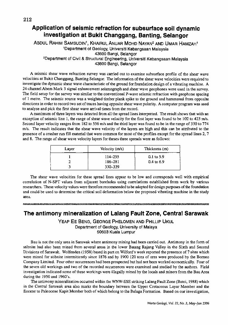
212
Application of seismic refraction for subsurface soil dynamic investigation at Bukit Changgang, Banting, Selangor
ABDUL RAHIM SAMSUDIN1 I KHAIRUL ANUAR MOHO NAYAN2 AND UMAR HAMZAH1 1 Department of Geology, Universiti Kebangsaan Malaysia
43600 Bangi, Selangor 2Department of Civil & Structural Engineering, Universiti Kebangsaan Malaysia
43600 Bangi, Selangor
A seismic shear wave refraction survey was carried out to examine subsurface profile of the shear wave velocities at Bukit Changgang, Banting Selangor. The information of the shear wave velocities were required to investigate the dynamic shear wave characteristic of the ground for foundation design of a vibrating machine. A 24-channel Abem Mark 3 signal enhancement seismograph and shear wave geophones were used in the survey. The field setup for the survey was similar to the conventional P-wave seismic refraction with geophone spacing of 1 metre. The seismic source was a weighted timber plank spike to the ground and hammered from opposite directions in order to record two set of traces having opposite shear wave polarity. A computer program was used to analyse and pick the first shear wave arrival times from the record.
A maximum of three layers was detected from all the spread lines interpreted. The result shows that with an exception of seismic line 1, the range of shear wave velocity for the first layer was found to be 102 to 423 mls. Second layer velocity ranges from 182 to 556 mls and the third layer was found to be in the range of 330 to 774 mls. The result indicates that the shear wave velocity of the layers are high and this can be attributed to the presence of a crusher run fill material that were common for most of the profiles except for the spread lines 2, 7 and 8. The range of shear wave velocity layers for theses three spreads were as follows:
Layer Velocity (mls) Thickness (m)
I 114-255 0.1 to 5.9 2 186-281 0.4 to 6.9 3 330-339
The shear wave' velocities for these spread lines appear to be low and corresponds well with empirical correlation of N-SPT values from adjacent boreholes using correlations established from work by various researchers. These velocity values were therefore recommended to be adopted for design purposes of the foundation and could be used to determine the critical soil deformation below the proposed vibrating machine in the study area.
The antimony mineralization of Lalang Fault Zone, Central Sarawak YEAP EE BENG, GEORGE PHELOMEN AND PHILLIP UKUL
Department of Geology, University of Malaya 50603 Kuala Lumpur
Bau is not the only area in Sarawak where antimony mining had been carried out. Antimony in the form of stibnite had also been mined from several areas in the lower Batang Rajang Valley in the Sixth and Second Divisions of Sarawak. Wolfenden (1958) based in part on Wilford's work reported the presence of 7 sites which were mined for stibnite intermittently since 1876 and by 1900 120 tons of ores were produced by the Borneo Company Limited. Four other occurrences had been prospected but had not been worked economically. Four of the seven old workings and two of the recorded occurrences were examined and studied by the authors. Field investigation indicated some of these workings were illegally mined by the locals and miners from the Bau Area during the 1950 and 1960's.
The antimony mineralization occurred within the WNW-ESE striking Lalang Fault Zone (Batoi, 1988) which in the Central Sarawak area also marks the boundary between the Upper Cretaceous Layar Member and the Eocene to Paleocene Kapit Member both of which belong to the Belaga Formation. Based on our investigation,
Warta Geologi, Vol. 22, No.3, May-Tun 1996
213 the Lalang Fault Zone is at least 2.5 krn wide. Several high~angled reversed faults were mapped to occur in the Lalang area. These faults are believed to have initiated as thrust faults where the older Layar Member was thrusted towards the NNE over the younger Kapit Member and could had been initiated since Late Eocene time. This NNE Late Eocene thrusting could possibly be related to the subduction along the Bukit Mersing Line.
The Sb mineralization takes the form of veins, stockwork, parallel vein zone and dissemination and replacement of mainly the meta~sandstone of the Kapit Member. The veins are mineralogically simple with the white coarse~ grained dark-grey to milky quartz constituting about 95% while the rest are stibnite with traces of pyrite and sphalerite. The stibnite are found as coarse laths and lumps which infilled late fractures in early deformed quartz veins or as replacement and infilling of sheared fractures of the metasandstone. Under the ore microscope the coarse~grained stibnite is seen to show translational twins and crumpled lamellae indicating that active deformation which occurred after the deposition of the stibnite. A second generation of stibnite (minor quantity only) was observed to be undeformed and these were deposited in fractures cutting deformed stibnite and quartz. Oxidation of the stibnite gave rise to the antimony ochre which under X-ray was identified to be mainly cerventite and kermesite
Limited soil geochemical soil survey was also carried out in the Gerugu and Nansan old workings to locate potential mineralization zone and possible extension of the of the mineralized lodes and veins. The - 80 # fraction of the B-horizon (at 20 cm to 30 cm below the surface) residual soil collected over these two sites were analysed for antimony (Sb) and arsenic (As) using the rapid method of Stanton (1966). At the Nansan old workings, the geochemical results indicate that a rich pod of stibnite worked illegally during the 1960's has a continuation up 100 m towards the WNW of the last dug pit. In the Gerugu area, the geochemical characteristics indicate the presence of several parallel veins or zones which are parallel to the strike of the Lalang Fault zone. This mineralized zone may be up to 200 m wide. The geochemical anomalies detected in this study had not been tested by trenching or drilling.
Study of the fluid inclusions for the quartz in the mineralized veins indicate that the fluids are of the low salinity type with a high fluid to low gas ratio. Primary inclusions in the deformed quartz are very rare as most had been affected by deformation. Homogenization temperature determination of a limited samples of the undeformed second generation quartz gave temperature of homogenization from 170°C to 175°C:
The stibnite mineralization in the Lalang Fault Zone appeared to show a remarkable similarity in tectonic setting compared to the Sb-As-Au mineralization ofthe Bau~Krokong-Kuching area. The stibnite mineralization in the Lalang Fault zone is located in the Sibu Zone and is about 100 krn south of the Bukit Mersing Line which had been interpreted to mark a Late Eocene to Oligocene subduction zone which dips towards the south. Similarly, the Bau-Krokong-Kuching stibnite-gold mineralization is located in the Kuching Zone and is about 80 km south of the Lupar Line which is believed to mark an earlier subduction of probable Upper Cretaceous to Eocene age. The Sb-As-Au mineralization in the Bau-Krokong-Kuching area is related to the Miocene dacitic intrusives.
So far the production of stibnite by manual selective mining of several deposits in the Lalang fault zone is very discouraging. There is report of some show of gold in some of these stibnite veins though the potential for the occurrence of the noble metal in the mineralization of the Lalang Fault Zone is still untested. In terms of geologic setting, and other evidences (fluid inclusion and tectonic setting), the stibnite mineralization in the Lalang Fault Zone in the Second and Six Divisions of Sarawak could represent the top of a much larger epithermal (in part convective) mineralization system such as those observed in the Bau-Krokong-Kuching area.
The North-South Expressway Central Link: engineering geology TAN BOON KONG
Department of Geology, Universiti Kebangsaan Malaysia 43600 Bangi, Selangor
The North-South Expressway Central Link (NSECL) connects the North-South Expressway (NSE) north of Kuala Lumpur to the NSE south of Kuala Lumpur, so that motorists travelling northbound or southbound in the vicinity of Kuala Lumpur can bypass Kuala Lumpur for a smoother ride. The NSECL commences at a proposed new interchange on the existing New Klang Valley Expressway (NKVE) near Shah Alam, traverses southwards through Batu Tiga, Puchong, Kuala Langat, before turning eastward at around Dengkil to join the NSE at approximately 6 krn north of the existing Nilai Interchange. The NSECL also connects the NKVE to the new
Wart:> Geologi, Vol. 22, No.3, May-fun 1996
214 Kuala Lumpur International Airport (KLIA) at Sepang. The total length of the NSECL is about 48 km.
The proposed NSECL highway alignment falls within Topography Map Sheet 94 (Kuala Lumpur) and Sheet 102 (Sepang). The rock formations traversed by the highway alignment consist of the Kenny Hill formation, granite and limestone. Superficial or surface deposits include alluvium, mine tailings, swamp/peat deposits and residual soils of the Kenny Hill formation and granite. For example, recent alluvium is abundant along the major rivers crossed by the highway alignment (eg. Sg. Damansara, Sg. Kelang and Sg. Langat). Mine tailings and exmining ponds are abundant in the Ayer Hitam Tin (Puchong) and Selangor Dredging (Dengkil) areas. Swamp/ peat deposits are encountered in the low-lying areas from Kg. Tanah Liat to Bt. Baja-Bt. Badak and further southeast in the Sg. Langat area.
The topography is closely related to or dictated by the underlying geology, with three general topographic expressions as follows: i) granitic terrain comprising high hill with steep slopes (e.g. Bt. Lanchong at 149 m is the highest peak along the entire alignment), ii) Kenny Hill formation forms low, undulating hills generally cultivated with oil palm or rubber, and iii) limestone flats underlain by limestone bedrock with superficial deposits of alluvium, mine tailings, etc.
Borehole data (some 50 boreholes) along the alignment by-and-Iarge confIrmed the geology as encountered on the surface. The borehole data also shows the occurrence of limestone bedrock near the NKVE (Shah Alam) area, at shallow depths ranging from 13-19 m. The limestone bedrock here (Shah Alam) is overlain by residual soils of the Kenny Hill formation andlor alluvium.
Some possible construction problems and potential geo-hazards include: soft grounds/lowlands underlain by soft Quaternary deposits (alluvium, peaty soils, organic clays, etc.); ex-mining lands at Ayer Hitam Tin and Selangor Dredging areas which are littered with numerous mining ponds, slime ponds and sand tailings, all of which are problematic materials to work with; karstic terrain in the Ayer Hitam Tin area with its karstic or solution features in the underlying limestone bedrock and associated problems such as subsidence and sinkholes; landslides or slope failures especially in the more hilly granitic terrain around Bt. Lanchong. Cut-slope failures in the Kenny Hill formation, in particular involving the "black" graphitic schist/phyllite materials, can be expected; excavation may require blasting of hard materials such as granitic rocks, and quartzite of the Kenny Hill formation.
Construction materials such as earthfIll (borrow materials), sands and rock aggregates appear to be available in the immediate vicinities of the proposed highway alignment and should not be a problem. Suitable fIll materials can be sourced from the residual soils of granite or the Kenny Hill formation.
Sands are available from mine tailings or along major river banks or river beds. Existing rock quarries (granite) in the Puchong and Nilai areas can be sourced for rock aggregates.
'M&U@
Seismicity of East Malaysia J.K. RAJ
Department of Geology, University of Malaya 50603 Kuala Lumpur
A detailed study of the historical and instrumental seismicity record (up to 1994) of the general area located between latitudes O.ooN and 8,SON, and longitudes 109.5°E and 120.0oE, shows that the distribution of most earthquake epicenters is consistent with the present-day plate tectonic setting. In Sabah, the majority of epicentres are located in, or off-shore, the Dent and Semporna Peninsulas, where they demarcate a broad zone between the Sulu Trench and the Sulu Volcanic Arc. Earthquake foci in this area are mostly of shallow depths « 33 km) and appear to be closely related to major northeast and northwest trending faults (Lim, 1986). Seismicity in this area is thus considered to result from reactivated fault movements associated with a present-day tensional crustal setting. Epicentres in central and north Sabah demarcate an approximately north-northeast trending belt and are centered around Ranau where they appear to be related to northeast trending fractures (Lim, 1985, Lim and Godwin, 1992). Earthquake foci here are mainly of shallow depths « 33 km) and are considered to result from reactivated fault movements associated with continued uplift of the area in a tensional crustal setting. Epicentres in the Labuk Bay area appear to be related to major north to northeast trending faults (Lim, 1985) and are considered to result from reactivated fault movements associated with a tensional crustal setting. Epicentres to the southeast of Sabah and off-shore East Kalimantan mostly show foci of shallow to moderate depths (15 to 69
Warta Geologi, Vol. 22, No.3, May-Tun 1996
215
km) and are considered to result from fault movements associated with spreading centres and strike-slip faults in an essentially compressional tectonic setting. Epicentres in the South China Sea, to the west of Sabah and Sarawak, appear to parallel the trend of the Northwest Borneo Trench and may represent renewed faul~ mov~me~ts in this area. Other epicentres in the general area, particularly those in Sarawak, show no clear relatIonship wIth the present-day tectonic setting, though a reevaluation of available instrumental records shows that they mark real events and can therefore be considered to represent renewed fault movements in probably a tensional crustal setting. It is concluded that the design oflarge engineering structures iIi East Malaysia should take into consideration the likelihood of earthquake induced processes in view of the seismicity of both the general area, and of Sabah and Sarawak themselves.
References LIM, P.S., 1985. Seismic activities in Sabah and their relationship to regional tectonics. Ann. Rept. 1985, Geol. Survey
Malavsia, 465-480. LIM, P.S. ;ND GODWIN, P., 1992. The Ranau earthquake swarm, May July, 1991, Sabah. Proc. 23rd Geol. Conf, Geol. Survey
Malaysia, 4, 168-193.
Ii! i1 rm
Hydrometallurgical recovery of copper from the copper sulphide by-product of Sungei Lembing Tin Mine
SIA HOK KIANG Sungei Lembing Tin Sdn Bhd
This paper is written to study the amenability of hydrometallurgical recovery of copper from the copper sulphide concentrate, recovered as a flotation by-product from the milling of the Sungei Lembing tin lodes.
The hydrothermal tin lodes of Sungei Lembing are sulphide rich. The sulphide minerals are mainly pyrite, chalcopyrite, some pyrrhotite, sphalerite and arsenopyrite. The sulphide minerals are removed from the tin concentrates by flotation.
The presence of arsenopyrite resulted in a relatively high arsenic content in the copper sulphide concentrate, which rendered it unmarketable. The sulphide by-products were stockpiled.
Prolonged exposure to the atmosphere resulted in the partial oxidation of the copper sulphide concentrates. Hydrometallurgical testwork conducted show that approximately 30% of the copper in the concentrate is readily acid soluble.
Traditionally, the leached copper is recovered by cementation, a method which is relatively cheap and simple. However, the cement copper produced would need further smelting to produce copper plates. By itself, the cement copper powder is not readily marketable.
With the recent advancement of the technology in treating the copper leach solution by SX-EW (solvent extraction - electrowinning), readily salable copper cathode plates can be produced at the mine-site.
The SX-EW method thus represents an attractive, albeit expensive, alternative copper recovery method for small mines far removed from the traditional smelters.
I JIJ I iii !Ii t
Paleogeographic and tectonic evolution of Sarawak and the adjoining area
AZHAR HAJI HUSSIN Department of Geology, University of Malaya
50603 Kuala Lumpur
Sarawak and its adjoining area consists of at least three tectonic blocks which were separated from one another during several phases of its geological evolution. The West Sarawak block (Wesara block) had a span of history from pre-Late Carboniferous while the recorded history of the North Sarawak block (Norsara block) started in Late Cretaceous. Another block consisting of the basement of West Kalimantan which was probably separated from the Sarawak blocks in parts of the Mesozoic.
Warta Geologi, Vol. 22, No.3, May-Iun 1996
216 Wesara block
Pre-Late Carboniferous tectonic and metamorphic events affected the sediments and volcanics of West Sarawak before the deposition of Upper Carboniferous and Lower Permian Terbat Limestone. A subsequent folding and inversion phase post-date the deposition of the Terbat Limestone prior to the deposition of the Late Triassic Sadong Formation and the Serian Volcanics. The late Triassic basin was probably marine towards the north with terrigeneous and volcanic clasts derived from a southerly source, where fluvial and deltaic deposition preserving several thin coal beds occurred. Granitoid clasts in the conglomerate of the Sadong Formation suggest that the exposure of pre-Late Triassic granitoid in the source area. A basin inversion and folding phase in the early to middle Jurassic terminated its deposition.
During late Jurassic-early Cretaceous the shallow water Bau Limestone accumulated in several paleohighs in the Bau-Krokong, the fringes of Jagoi and Kisam "islands" and the NNW-SSE chain Penrissen-Batang Kayan area. Relative rise in sea level terminated the shallow water limestone det>osition in early Cretaceous. In the deeper marine environment, the thin and thick graded beds of feldspathic sandstone, coarse-tail graded, polymictic extraformational conglomerate sheets and channels and several horizons of mass-flow deposits were sedimented intermittently within black carbonaceous shale. Several lenses oflimestone with predominantly packstone texture are found towards the base of the Pedawan Formation.
In the Siniawan area, mass flow deposits are well developed with stratigraphic thicknesses ranging from a meter to very thick, in excess of 80 meters. They occur within a variety of facies association; thinner ones within sequences of thin-bedded turbidite sandstone and shale, and the thicker ones within coarse, thick-bedded sandstone. channel and sheet conglomerate and minor shale sequence.
Blocks of various sizes in the thicker deposits consists of contorted beds of thick turbidite sandstone which exhibits a spectrum of soft sediment deformational features resulting in the beds being in coherent. semi-coherent to incoherent state. Closely associated with these contorted beds are shale diapirs. supporting the interpretation that beds were deformed under high pore pressure condition through elastic and plastic behavior. Minor cobblesized volcanic and chert fragments are present. The matrix of these deposits consists of mainly of mud. but in some of the thicker beds the matrix are muddy sand.
The sedimentological features suggest that the thicker mass flow deposits originated in the slope and base of slope environments where thick-bedded turbidite and conglomerate were initially deposited. Thinner bedded mass flow deposits could either represent the collapse of the basinal sediments or that they are the distal portion of a much larger mass flow deposits.
The closure and inversion of the Jurassic-Cretaceous basin may vary in space and time. To the north of Bungo basin, the sedimentation of the Pedawan formation continued into Late Cretaceous. A similar scenario probably existed in the Pedawan Formation in the Sungai China area in west Kuching. In the southern part of the Santubong Peninsula, a recent exposure shows a spectacular angular unconformity surface separating the deformed Pedawan Formation from the overlying gently dipping Kayan Sandstone. No age is yet determined for the Kayan Sandstone exposed at this locality.
A large part of the Serabang formation shows similar resedimented facies as the Pedawan formation and is interpreted to represent an extension of the northwestern open marine Jurassic-Cretaceous basin. Jurassic and Cretaceous(?) cherts blocks with basic igneous rocks possibly suggests a more oceanic crustal nature of this part ofthe basin. Ifthe Late Cretaceous age of the intrusive Pueh Adamellite is true. then it would imply that closure of this part basin must not be later than Late Cretaceous.
Regional consideration suggests that the late Jurassic-late Cretaceous of west Sarawak could have been deposited in several small basins separated by uplifted landmass in the present south and an open marine condition to the present north. The scenario probably ended in the Tertiary with the uplift and erosion of the Mesozoic rocks, resulting in unconformable relationship with the overlying Tertiary sequence. as seen in the south of the Santubong peninsula.
To the south. in Kalimantan. cherts. turbidites and basic igneous rocks and serpentinites of the Boyan Melange and the Selangkai Formation suggest that a deep marine basin separated Wesara from the West Borneo Basement at least in Cretaceous. The closure of this basin probably occurred in Late Cretaceous.
To the northeast. deep marine condition between separating Wesara from Norsara persisted from Jurassic to Eocene (?). Closure of this basin occurred led to the formation of the arcuate Rajang mountain range.
However. if the paleobiogeographical constraints based on work done by previous workers the Permian fusulinids and algae of the Terbat Formation. the Triassic Krusin Flora. the Late Jurassic and early Cretaceous
217 corals and rudists are taken into consideration, a relatively northerly paleoposition may be interpreted for west Sarawak during the Late Paleozoic and Mesozoic. If the post-late Cretaceous counterclockwise rotation of West Borneo based on paleomagnetism work is correct, then its Mesozoic paleogeography would be a land mass to the west or north and the marine basin to the east and south.
Norsara block The onshore North Sarawak Basin (NSB) comprises of three thick unconformity-bounded lithostratigraphic
units, each with its own sedimentological characteristics and structural style and history. The depocenters of these units successively shifted northwards. A trend towards a simpler structural style is also observed in the same direction.
The oldest unit is the intensely folded late Cretaceous-middle Eocene shale-turbidite sandstone sequences forming the Rajang Group, now exposed as the arcuate Rajang Mountain range. Inliers of this group outcrop to the north of the Rajang range in the Mulu-TemalaAnticlinorium. Paleontological and sedimentological evidences suggest deposition occurred in a relatively deep marine setting. Basin inversion with concomitant folding and thrusting affected this unit in the late(?) Eocene. Subsequent erosion and subsidence of the northern margin of this unit led to its formation as the basement for the younger sequence.
The second unit is the middle Tertiary succession which represents the infill of an alluvial valley and shelf initiated in late Eocene times. Along the southern margin of this basin, massive shedding off the Rajang hinterland resulted in a relatively short phase of alluvial deposition followed by an extensive deltaic sedimentation and progradation. Thick proximal deltaic facies showing repetitive coarsening upwards, coal bearing sequence were formed, while the finer fractions were redistributed as muddy components on the shelf and near-shore sediments.
A deeper marine basin (the proto-South China Sea) existed in the northeast of Nosara in the Oligocene. The earliest marine incursion occurred along this northern margin of Norsara and subsequently spread southwards by late Oligocene times. This middle Tertiary basin is characterised by the development of broad shelf with tracts of shelf sands, carbonate shoals and reefs. The earliest carbonate bodies were developed unconformably on areas of uplifted basement while the younger Miocene carbonates were formed on topographic highs composed of sand shoals and islands.
Sedimentation of the middle Tertiary succession were terminated in middle Miocene by the onset of regional tectonic events that caused the inversion of the eastern and southern margins of the basin. However, in the offshore area, subsidence continued in the Middle Miocene as witnessed by the prolific growth of carbonate in the Luconia Province.
A new depocenter created in the north saw the influx of coarser clastics of the Lambir, Beliat and Miri Formations. These thick sand-prone formations were deposited in coastal environments. The Lambir Formation represent the initiation of the Baram delta deposition. Northwards migration of the Baram delta led to the deposition of the Miri formation which were then unlifted in the Pliocene(?).
Further convergence of the Norsara and Wesara occurred in the Late Miocene resulted in the folding of the pre-Late Miocene of Norsara especially in the southern portion and led to its inversion.
[ II II AliA I Eli! iZI I _II W
Structural analysis of the Malay Basin lIEW KIT KONG
Petronas Research & Scientific Services Sdn. Bhd. Lot 1026, PKNS Industrial Estate, Ulu Kelang, 54200 Kuala Lumpur
The structural configuration of the Malay Basin is analysed in terms of fold and fault patterns and supplemented by gravity and magnetic interpretation. Three main fold domains are demarcated based on fold geometry and characteristics of associated faults. These fold domains are elongated parallel to the basin axis; that is, NW-SE. From southwest to northeast, the fold domains are Basin Hinge, Basin Axis, and Basin Ramp. The basin hinge domain is bounded by the Hinge fault zone in the southwest and toward northwest grades into the basin axis domain. The basin axis domain is separated from the basin ramp domain by the Selambau fault zone and the Belumut Arch. The eastern boundary of the basin ramp domain is unknown.
Based on the abundance of major faults within an areas, two types of fault domain can be recognised in the Malay Basin: high density fault domain and low density fault domain. The determination of fault intensity is a
Warta Geologi, Vol. 22, No.3, May-Jun 1996
218 qualitative assessment. The high density fault domains are the sites of major fault systems in the Malay Basin. Northerly crestal faults populate the low density fault domains. The fault domains are orientated north-south and are arranged alternately eastwest. The southward extension of these fault domains are limited by the NW trending Hinge fault system. The most visible faults in the Tertiary sequences of the Malay Basin belongs to the curvilinear Hinge fault system that straddles the western margin of the Malay Basin (Liew, 1995) and northerly striking faults that exist within the basin (Tjia and Liew, 1996). The major northerly faults, from west to east, are UlarKuda segment of the Hinge fault system, Kapal Bergading, Dulang, Bundi, and Mesah fault zones. There are three prominent NW-SE trending fault zones in the Malay Basin: Kuda Beranang fault zone, Tenggol fault zone (or Sotong fault segment) and Selarnbau fault zone. The first two fault zones are associated with the Hinge fault system whilst the last fault zone is within the Central Malay fault system.
The Bouguer gravity anomaly, residual Bouguer gravity anomaly, aeromagnetic anomaly and residual aeromagnetic anomaly reduced-to-equator maps are superimposed onto the structural map of the Malay Basin. Gravity and magnetic anomalies tend to have better correlation with faults than with folds. The gravity and magnetic anomaly patterns in the Malay Basin show greater correlation with the fault patterns than with the fold patterns. North-south structural trends tend to correlate with gravity anomalies whereas the NW-SE structural trends with magnetic anomalies.
Based on fold and fault domains, two structural domains are demarcated: Eastern and Western structural domains. The Western domain comprises northerly trending structures. This domain is situated west of the Kapal-Bergading tectonic line. The prominent structural feature is that the northerly faults are aligned with their drag folds. This domain can extend eastward into the northerly Pattani basin. The major feature in this domain is a basement high that plunges northward. Northerly faults are the dominant faults.
The Eastern domain comprises east-west trending structures. This domain can be further divided based on fold openness and presence of northerly faults. The northern sub-domain has northerly faults and more open folds whereas the southern sub-domain has less-open folds with different fold styles. The most prominent structural feature in the northern sub-domain is that north-south faults are the major faults within this northern sub-domain. They also form the west and east boundaries of the sub-domain. These faults can be traced to the Tertiary basement and controlled the differential subsidence within the sub-domain. The fold styles are characterised by fault-induced folds (box-like) which are associated with flower structures. Open gentle folds are found within the faults. Within the southern subdomain, the prominent structural features are the occurrence of an unconformity, eroded anticline crests, and two different fold styles.
References LIEW K.K., 1995. Structural history of the Hinge fault system of the Malay Basin. [abstract] Geological Society Malaysia,
AnnLUlI Geological Conference 1995, Malacca, Programme and Abstracts of Papers. TJIA, H.D. AND LIEW, K.K., 1996. Changes in tectonic stress field in northern Sunda Shelf basins. In: Hall, R. and Blunder,
D. (Eds.), Tectonic Evolution of Southeast Asia. Geological Society Special Publication, 106,291-306.
mm F ifiW f 5f#M#@ riM iWUWi*¥A
Rejahan ultrabes di kawasan Telupid: sifat geokimia dan tektoniknya
BABA MUSTA DAN MUHD. BARZANI GASIM Jabatan Sains Bumi, UKM Kampus Sabah, Beg Berkunci No 62
88996 Kota KinabaJu, Sabah
Pergolakan tektonik yang bermula pada Lewat Kapur, telah menyebabkan batuan ultrabes yang berusia Jura atau lebih awal (Leong, 1974) dan kumpulan batuan yang lebih muda telah mengalarni ricihan dan gores an yang jelas dapat diperhatikan di bahagian permukaan singkapan.
Empat arah daya marnpatan dan tegangan yang telah bertindak keatas batuan'di kawasan kajian telah dikenalpasti berdasarkan taburan kedudukan satah-satah sesar dan kekar, yang dianalisis dengan menggunakan kaedah roset dan unjuran sarna luas. Daya-daya tersebut adalah seperti berikut:
daya PI dan P2 pada arah Baratlaut-Tenggara daya P3 pada arah Utara-Selatan
• daya P4 pada arah Timurlaut-Baratdaya
Warta Ge%gi, Vol. 22, No.3, May-Jun 1996
219
Akibat daripada keempat-empat daya yang bertindak, maka telah terbentuk ketiga-tigajenis sesar dan taburan pelbagai jenis kekar yang seterusnya dapat dihuraikan seperti berikut: • 2 satah sesar mendatar masing-masing pada kedudukan U116°-296°T dan UI5°-195°T, keduanya
menunjukkan anjakan ke kanan. Sesar mendatar yang pertama disebabkan oleh daya mampatan P2, manakala satah yang kedua disebabkan oleh daya mampatan P4•
• 6 satah sesar naik dikesan pada kedudukan: a) U212°TI24° dan U212°T/38° akibat daya mampatan PI; dan b) U108°T/40° dan U285°T/42° akibat daya mampatan P3; U 146°T/68° dan U 324°T/60o yang wujud akibat
daya mampatan P 4'
Corak tektonik yang berlaku dalam batuan ultrabes dan batuan yang lebih muda di sini tidak jauh berbeza dengan sifat tektonik Sabah secara rantau, yang pada umumnya dipengaruhi oleh tiga arah daya mampatan yang utama. Sejarah geologi batuan ultrabes ini kemungkinannya mempunyai perkaitan yang rapat dengan pembukaan Lautan China Selatan yang bermula pada Kapur Atas.
Ketiga episod tektonik yang telah bertindak di kawasan Telupid dipercayai telah menyebabkan batuan di sini terdedah ke permukaan. Batuan yang mengandungi satah-satah ricih yang mempunyai taburan dalam pelbagai arah kemudian terdedah terhadap proses luluhawa yang akhirnya membentuk profilluluhawa tebal yang dicirikan oleh tanah berwama coklat gelap hingga kuning cerah. Wama tersebut adalah disebabkan oleh kehadiran mineral Fe-oksida yang melimpah dalam tanah (Myers, 1977). Mineral pembentuk batuan yang terdapat dalam batuan ultrabes seperti olivin, piroksen, serpentin dan klorit dengen relatifnya mudah mengalami perubahan kimia dan membentuk mineral sekunder (Nahon et at., 1982). Profilluluhawa yang tersingkap di lapangan menunjukkan ketebalan tanah mencapai 15 m. Batuan segar dan tanih telah dianalisis kandungan major dan surih.
Keputusan analisis menunjukkan unsur major yang melimpah dalam tanah ialah Fep3 (59.76%-70.18%), manakala kepekatan AIP3' dan L.O.l masing-masing ialah 7.79%-11.8%, 1.77%-7.70% dan 16.88%-18.7%. Secara perbandingan antara kepekatan dalam batuan segar dan tanah, didapati Fep3 bertambah 60 kali dalam tanah, manakala pertambahan kepekatan AIP3 dan L.O.l masing-masing ialah 10 kali dan 14 kali sebaliknya Si02 berkurang 30 kali.
Kepekatan Cr dalam tanah ialah 16,460 ppm-18,279 ppm, Co pula ialah 608 ppm-665 ppm dan Nd ialah 68 ppm-69 ppm. Perbandingan dengan kandungan kepekatan unsur surih dalam batuan segar pula menunjukkan Cr dalam tanah bertambah sebanyak 8 kali, Co 6 kali dan Nd juga 6 kali. Korelasi (Fep, + AIP3) lawan L.O.l dan Fep3 lawan AIP3 adalah linear positif.
Kedua-dua korelasi terse but mencadangkan penguraian mineral pembentuk batuan dan diikuti dengan pembentukan mineral sekunder terutama Fe-oksida dan Al-oksida. Korelasi linear negatif yang ditunjukkan antara Si02 lawan Al20 3 mencadangkan minerallempung tidak cenderung terbentuk dalam tanah. Fe20 3lawan Cr dan Fep3 lawan Nd menunjukkan korelasi linear positif. Begitu juga dengan AIP3 lawan Co. Korelasi tersebut boleh dijelaskan melaluijerapan Cr dan Nd oleh mineral Fe-oksida manakalajerapan Co olehAI-oksida.
Rujukan LEO!'lG, K.M., 1974. The Geology and mineraI resources of the Upper Segama Valley and Darvel Bay Area, Sabah, Malaysia.
Geol. Surv. Malaysia. Mem. 4 (Revised). MYERS, L.e., 1977. A weathering profil developed on ultrabasic rocks of Telupid, Sabah. Geo!. Surv. Rept. 2, 66-71. NAHON, D., PAQUET, H. AND DELVIGNE, 1., 1982. Lateric weathering of ultramafic rocks and the concentration of nickel in the
Western Ivory Coast. Economic Geology 177, 1159-1175.
w
Dolomitization in the Kodiang Limestone, Kedah CHEAZlzAu
Department of Geology, Universiti Kebangsaan Malaysia 43600 Bangi, Selangor
The Kodiang Limestone formation which outcrops in the Kodiang and Alor Star areas has been well studied and documented. Various geological aspects of the limestone formation have been reported in great detail including its stratigraphy, sequence stratigraphy, sedimentology, and paleontology. Diagenetic aspect of this rock, however, has not been specifically discussed.
Generally, the Kodiang limestone consists of alternations between thinly bedded fine-grained carbonate (e.g., mudstone-algal packstone) and thickly bedded units which are represented by bioclastic packstone-rudstone.
Warta Geologi, Vol. 22, No.3, May-fun 1996
220 The fine-grained intervals have been interpreted to represent depositions in deeper and restricted environments, whilst the coarser-grained interval represent depositions in shallow and agitated waters.
Close examinations at outcrops show that dolomite present at several places in the sequence. Their systematic occurrence can be correlated across the area.
Petrographic studies show that dolomite occurs in modes. Basically, two groups of dolomite can be recognized based on their mode of occurrences: 1. Stratified dolomite. This dolomite is represented by dolomicrites and microdolomites which are replacing
micrites and grains in the algal laminated facies. The dolomite crystal are euhedral to subhedral with an overall sugary texture. Dolomitizations in the algal laminated limestone facies have produced black and brown laminae.
2. Nonstratitied dolomite. The nonstratified dolomites are represented by: a. Dolomite cement b. Planar dolomite c. Nonstratified dolomicrite. In general, their crystals are bigger and well-formed as compared to the stratified one. These dolomites do
not form layering in the limestone. Their occurrences have no systematic trend and randomly disseminated in the dolomitized intervals of the Kodiang Limestone. In some places they occur in stylolites, dissolution seams and fractures which cross-cut earlier formed fabrics.
The two groups of dolomites are attributed to two phases of dolomitizations. The stratified dolomites are interpreted to have been formed early in the limestone diagenetic history as evident by their mode of occurrence. The nonstratified type is, however, attributed to dolomitization during deep burial under the control of deeper subsurface physico-chemical conditions.
Stratigrafi Jalur Tengah Semenanjung Malaysia (Stratigraphy of the Central Belt of Peninsular Malaysia)
Pendahuluan
KAMAL ROSLAN MOHAMED Jabatan Geologi, Universiti Kebangsaan Malaysia
43600 Bangi, Selangor
Jalur tengah merangkumi sebahagian besar negeri Kelantan, bahagian barat dan tengah Pahang, timur Negeri Sembilan, dan bahaguan Johor barat. Batuan Perm dan Trias merupakan unit batuan yang paling banyak tersebar, dan selebihnya ialah batuan Jura/Kapur. Berbeza denganjalur barat, dijalur tengah ini sedimennya kaya dengan batuan volkanoklastik, selain daripada sedimen klastik dan juga batuan karbonat. Sedimen Permo-Trias terendap di sekitaran laut, manakala sedimen Jura/Kapur pula di sekitaran daratan. Batuan igneus cuma tersingkap di beberapa tompok kecil, dan tersusun hampir mengarah utara-selatan, berhampiran sempadan dengan jalur barat. Secara umumnya, kumpulan batuan boleh dibahagikan kepada empat, iaitu batuan PaleozoikAtas, batuan PennoTrias,jujukan Trias Tengah-Akhir dan batuan Jura-Kapur.
Batuan Palaezoik Atas Batuan Paleozoik Atas terdapat di bahagian selatan dan tengah jalur tengah Semenanjung Malaysia. Di
kawasan Bahau tersingkap Formasi Kepis yang terdiri daripadajujukan silisiklastik dan juga karbonat. Di kawasan Felda Bera, Pahang ada dilaporkan penemuan fosil PaleozoikAtas dalam singkapan yang terdiri daripada sedimen silisiklastik yang berselang lapis dengan batuan bertuf. Berhampiran bandar Keluang. Johor terdapat singkapan' Fonnasi Lop.
Batuan Permo-Trias Jujukan Penno-Trias kebanyakannya tertabur di bahagian utara, dan dikenali sebagai Fonnasi Gua Musang.
Formasi ini terdiri daripada batuan syal yang dominan, dan juga batu kapur serta batuan volkaniklastik. Di kawasan Felda Aring, terdapat Fonnasi Aring dan Marmar Nilam. Makin ke selatan. singkapan batuan PermoTrias makin berkurangan. Di kawasan Padang Tengku, batuan Permo-Trias dikenali sebagai Fonnasi Padang Tengku, Formasi Sungai Sergis, dan Formasi Sungai Kenong (Procter. 1972) serta Kumpulan Raub. Di Jerantut.
Wartll Ge%gi. Vol. 22. No.3, May-Tun 1996
221 terdapat Batu Kapur Kota Gelangi dan Batu Kapur Gunung Senyum di Felda Jengka. Selain itu, terdapat banyak lagi menamaan yang digunakan untuk jujukan Permo-Trias ini.
Hasil kajian yang dilakukan, beberapa penamaan yang dicadangkan di atas mungkin merupakan perulangan unit batuan yang sama, dan sebahagiannya dapat dikumpulkan atau disatukan dalam satu kumpulan batuan. Penggunaan nama Kumpulan Raub boleh mendatangkan kekeliruan. Ini kerana semasa nama ini diperkenalkan, kekurangan maklumat paleontologi menyebabkan usia Karbon-Perm kumpulan ini ditentukan dengan beberapa fosil yang boleh disangsikan. Setelah Jaafar Ahmad (1976) menemui beberapa maklumat yang penting tentang usia batuan, beliau telah menukar usia Kumpulan Raub ini kepada Trias Tengah-Akhir, dan di dalam kumpulan ini terdapat dua formasi, iaitu Formasi Semantan dan juga Formasi Kaling. Formasi Semantan diperkenalkan berasaskan kepada jujukan yang terdapat di kawasan Karak-Temerloh, manakala Kumpulan Raub yang asal diasaskan kepadajujukan batuan yang terdapat di sekitar Raub. Jika diperhatikan kedua-dua kawasan, mungkin ada perbezaan dari segi jujukan yang ada, tetapi sekarang ini, di kawasan Raub telah banyak ditemui kawasan yang mempunyai fosil Trias, seperti yang terdapat di Temerloh. Kawasan Raub-Kuala Lipis merupakan peralihan daripadajujukan Formasi Gua Musang kepada Formasi Semantan. Jujukan batuan syal, dan juga batu kapur di kawasan Raub-Kuala Lipis yang tidak dapat dipadankan dengan Formasi Semantan mungkin terdiri daripada sebahagian Formasi Gua Musang. Batu Kapur Gua Sai, dan juga Batu Kapur Merapohjuga mencirikan jujukan Formasi Gua Musang, begitu juga dengan Formasi Batu Kapur Gunung Senyum, dan Batu Kapur Jerus. Formasi Aring yang terse bar di kawasan Aring dan Chiku mempunyai jujukan batu kapur, batuan volkanoklas dan juga syal serta batu pasir. Jujukan ini tidakjauh bezanya dengan batuan yang terdapat di kawasan Gua Musang, dan dicadangkan digabungkan dengan Formasi Gua Musang. Memandangkan Formasi Gua Musang dan formasiformasi yang serupa dengannya ini tertabur dengan meluas, dan ada cadangan menamakan unit-unit di dalamnya sebagai formasi yang tersendiri, maka adalah lebih sesuai jika taraf formasi dinaikkan kepada Kumpulan Gua Musang. Dalam kumpulan ini boleh terdapa~ beberapa penamaan yang dicadangkan oleh Metcalfe dan Azhar Hussin (1994), iaitu Batu Kapur Gunung Senyum, Batu Kapur Gua Sai, Batu Kapur Jerus, dan mungkin juga Formasi Aring. Status Formasi Kepis tidak dapat ditentukan dengan tepat, samada ia boleh dimasukkan ke dalam Kumpulan Gua Musang atau sebagai formasi yang tersendiri. Ini kerana kedudukannya yang sangatjauh daripada lembangan Kumpulan Gua Musang. Kumpulan Gua Musang ini berusia Permo-Trias, dan unit-unit di dalamnya ada yang berusia Perm, Trias atau Permo-Trias. Kajian lanjut masih diperlukan untuk menentukan usia yang sebenarnya.
Batuan Trias Tengah-Akhir Batuan Trias Tengah-Akhir terdiri daripada sedimen silisiklastik (syal, batu pasir dan konglomerat) dan juga
volkanoklastik (batuan bertuf), serta sedikit batu kapur dan rijang. Antara nama unit batuan yang digunakan untuk batuan Trias Tengah-Akhir ialah Formasi Kerdau, Formasi Jelai, Formasi Jurung, Formasi Gunung Rabung, Formasi Gemas, Lapisan Tenang, Formasi Semantan, Formasi Kaling, dan beberapa nama lain lagi. Walau bagaimanapun, sebahagian besar daripada nama-nama ini sudah tidak dipakai. Antara nama yang masih digunakan dan dicadangkan penggunaannya ialah Formasi Semantan untuk sedimen yang terdiri daripada jujukan volkanoklastik yang dominan dan terendap di sekitaran laut dalam, dan Formasi Kaling yang terdiri daripada jujukan laut cetek selang lapis batu pasir, batu lodak, syal dan konglomerat. Formasi Semantan terletak selaras atau menjejari dengan Kumpulan Gua Musang dan seusia dengan Formasi Kaling.
Jika kita perhatikan kajian-kajian terdahulu, kita akan dapati penggunaan nama Formasi Jelai, Formasi Semantan, Formasi Gemas dan juga Formasi Gunung Rabong bercampur aduk untuk kawasan yang berhampiran. Ini kerana dari segi litologi, paleontologi dan dan juga sedimentologi, kesemua formasi-formasi ini memperlihatkan kesamaan. Memandangkan penggunaan nama Formasi Semantan lebih man tap, dan mempunyai lokaliti tip yang sesuai, maka dicadangkan kesemua formasi-formasi ini digabungkan kedalam Formasi Semantan. Formasi Semantan terdiri daripada jujukan batu pasir dan juga syal, yang mana kedua-dua litologi ini kebanyakkannya bertufberlapis antara satu sarna lain. Batu pasirnya memperlihatkan struktur endapan turbidit. Selain itu, terdapat juga konglomerat (kebanyakkannya intrakonglomerat) dan jugajujukan batu kapur yang keci!. Fosil yang selalu ditemui dalam jujukan formasi ini ialah Daonella dan juga Posidonia serta ammonoid. Usia Formasi Semantan ialah Trias Tengah hingga Akhir. Formasi Kaling berusia Trias Tengah-Akhir, dan terdiri daripada batu pasir yang dominan, disamping syal dan konglomerat. Dalam batu pasir, boleh terdapat fosil bercangkang keras seperti Myphoria yang hidup di kawasan air cetek.
Batuan Jura-Kapur Taburan batuan Jura/Kapur di Semenanjung Malaysia tidaklah sebanyak batuan Perm dan Trias. Kebanyakkan
Warta Geologi, Vol. 22, No.3, May-fun 1996
222 sedimen ini terletak di jalur tengah, dan juga jalur timur. Di jalur tengah, batuan ini dikenali sebagai Formasi Koh, Formasi Tembeling, Batu Pasir Bukit Bertangga, Formasi Paloh, Formasi Mak'Okil. Formasi-formasi ini tertabur bersempadan atau berhampiran sempadan timur jalur tengah.
Kesimpulan dan cadangan Secara umumnya, batuan yang terdapat di jalur tengah Semenanjung Malaysia boleh dibahagikan kepada
batuan Paleozoik Atas, batuan Permo-Trias, batuan Trias Tengah-Akhir dan batuan Jura-Kapur. Unit batuan Permo-Trias terdiri daripada Formasi Aring, Formasi Gua Musang, Batu Kapur Gunung Senyum, Batu Kapur Merapoh, Batu Kapur Gua Sai dan Kumpulan Raub. Kesemua formasi-formasi ini mungkin boleh dikumpulkan ke dalam satu kumpulan yang dikenali sebagai Kumpulan Gua Musang. Formasi Kepis, Formasi Lop dan beberapa unit batuan Paleozoik lain yang tersingkap di bahagian selatanjalur tengah. Batuan sedimen Trias Tengah-Akhir pula terdiri daripada Formasi Semantan dan Formasi Kaling. Jujukan batuan Jura-Kapur agak sukar dikorelasikan antara satu sama lain sebab kekurangan data paleontologi dan juga kedudukan singkapan yang tertabur berjauhan. Kajian secara mendalam masih diperlukan untuk memahami stratigrafi dan sedimentologi jujukan di jalur tengah Semenanjung Malaysia.
English summary In the central belt, sedimentary rocks of the late Paleozoic and Mesozoic age are widely distributed. This
rock unit consists of a variety of lithology, among others are limestone, shale, sandstone, conglomerate and volcaniclastics. This rock unit is known by various names that sometimes lead to confusion. In general, this rock unit can be subdivided into four group; • late Paleozoic rock • Permo-Triassic rock . • middle-late Triassic rock • Jurassic-Cretaceous rock
The late Paleozoic sedimentary rocks which are found in Bahau area, consist of silisiclastic and carbonate sediments, which are included in the Kepis Formation. In Keluang area, the late Paleozoic rocks is called Lop Formation. Sequence of the same characteristic is also found in Bera area, Pahang.
After several studies and comparative studies being done, it is suggested that the Permian-Triassic sedimentary rocks in the central belt may be grouped together as Gua Musang Group. This group may includes many formations that have been defined by earlier workers such as the Padang Tengku Formation, the Sungai Sergis Formation. etc. Nevertheless further detailed works need to be done to formalize every stratigraphic unit that has been proposed here.
The middle-late Triassic sedimentary sequence in the central belt is represented by the Semantan and Kaling Formations. The Semantan Formation which is overlying the Gua Musang Group consists of shale. which is interbedding with siltstone and also tuffaceous sandstone. Lenses of chert. conglomerate and limestone (recrystallised) were also found in the sequence. The tuffaceous sandstone unit normally graded upward into siltstone and shale. The Kaling Formation is interfinggering with the Semantan Formation. The Kaling Formation consist predominantly of interbedded arenaceous sequence of sandstone, with subordinate amount of conglomerate. shale and minor rhyolite tuff. Thick-shelled bivalves are very common throughout the formation.
The distributions of the Jurassic-Cretaceous sedimentary rocks are limited to the central and eastern belts. In central belt, the term ofTembeling Group, Bertangga Sandstone, Paloh Formation and Mak·okil Formation were used to discribed the Jurassic-Cretaceous sequences. It's limited distribution that forms discrete bodies that are separated far apart from each other makes it difficult to be correlated.
M 7
Warta Geologi, Vol. 22, No.3, May-fun 1996
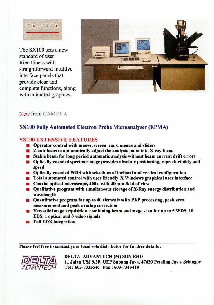
The SX 1 00 sets a new standard of user friendliness with straightforward intuitive interface panels that provide clear and complete functions, along with animated graphics.
New from CAMECA
SXIOO Fully Automated Electron Probe Microanalyser (EPMA)
SXIOO EXTENSIVE FEATURES • Operator control with mouse, screen icons, menus and sliders • Z autofocus to automatically adjust the analysis point into X-ray focus • Stable beam for long period automatic analysis without beam current drift errors • Optically encoded specimen stage provides absolute positioning, reproducibility and
speed • Optically encoded WDS with selections of inclined and vertical configuration • Total automated control with user friendly X Windows graphical user interface • Coaxial optical microscope, 400x, with 400Jlm field of view • Qualitative program with simultaneous storage of X-Ray energy distribution and
wavelength • Quantitative program for up to 40 elements with PAP processing, peak area
measurement and peak overlap correction • Versatile image acquisition, combining beam and stage scan for up to 5 WDS, 10
EDS, 1 optical and 3 video signals • Full EDX integration
Please feel free to contact your local sole distributor for further details:
fP)&l1il~ ADVANTECH
DELTA ADVANTECH (M) SDN BHD 11 Jalan USJ 9/3F, UEP Subang Jaya, 47620 Petaling Jaya, Selangor Tel: 603-7335546 Fax: 603-7343418
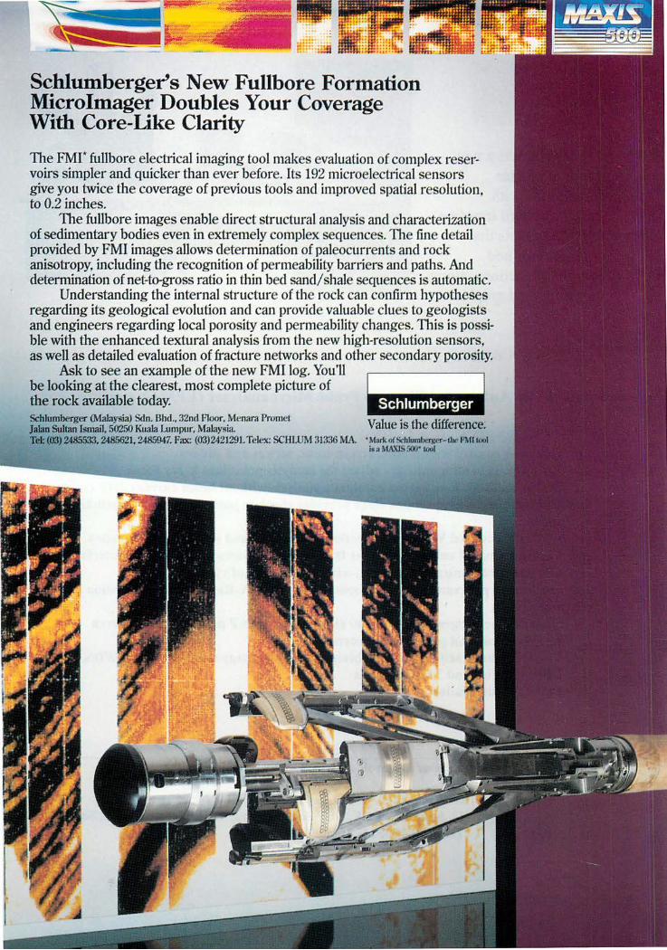
Schlumbergers New Fullbore Formation Microlmager Doubles Your Coverage With Core-Like Clarity
The FMI" fullbore electrical imaging tool makes evaluation of complex reservoirs simpler and quicker than ever before. Us 192 micro electrical sensors give you twice the coverage of previous tools and improved spatial resolution, to 0.2 inches.
The fullbore images enable direct structural analysis and characterization of sedimentary bodies even in extremely complex sequences. The fine detail provided by FMI images allows determination of paleocurrents and rock anisotropy, including the recognition of permeability barriers and paths. And determination of net-to-gross ratio in thin bed sandi shale sequences is automatic.
Understanding the internal structure of the rock can confirm hypotheses regarding its geological evolution and can provide valuable clues to geologists and engineers regarding local porosity and permeability changes. This is possible with the enhanced textural analysis from the new high-resolution sensors, as well as detailed evaluation of fracture networks and other secondary porosity.
Ask to see an example of the new FMI log. You11 be looking at the clearest, most complete picture of the rock available today. Schlumberger (Malaysia) Sdn. Bhd .. 32nd Floor. Menara Promet JaJan Sultan Ismail, 50250 Kuala Lumpur, Malaysia. Value is the difference; Tel: (03) 2485533, Z4856Z1. 2485947. Pax: (03)2421291. Telex: SCHWM :m:i6 MA. • MIll'll Q(Srhlumbelller- tIK:' I'MI rrJUi
l!o a MA.XJS 5<Wr 1001
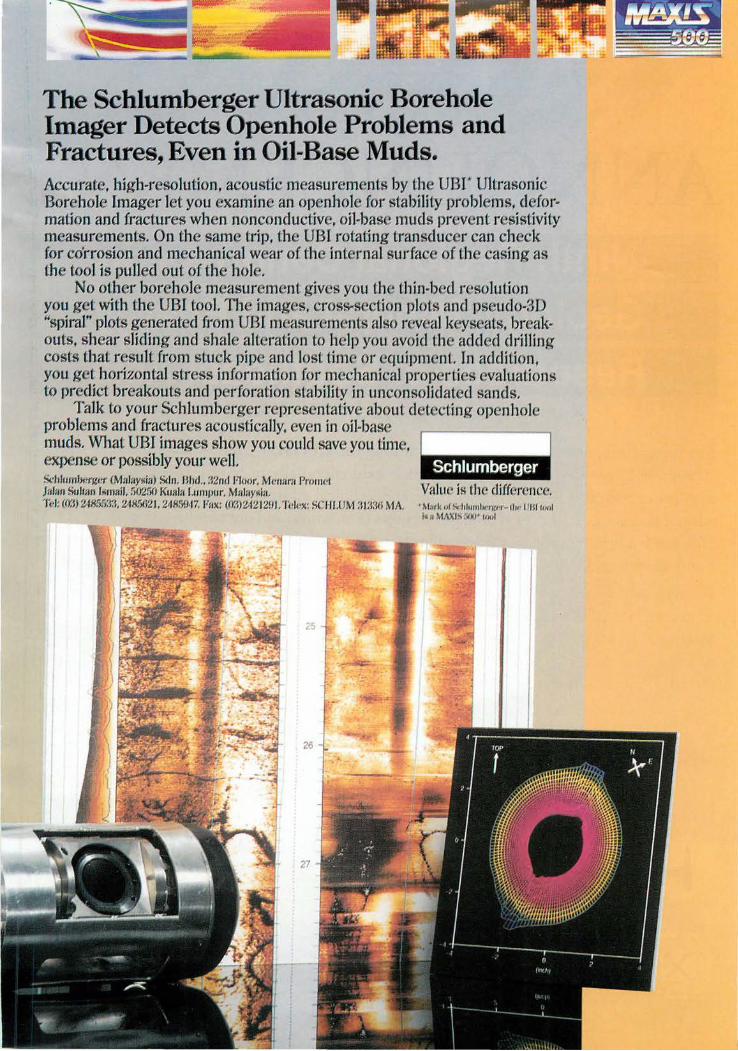
The Schlumberger Ultrasonic Borehole Imager Detects Openhole Problems and Fractures, Even in Oil-Base Muds. Accurate, high-resolution, acoustic measurements by the UBI" Ultrasonic Borehole Imager let you examine an open hole for stability problems, deformation and fractures when noncondu(..1;ive, oil-base muds prevent resistivity measurements. On the same trip, the UBI rotating transducer can check for corrosion and mechanical wear of the internal surfac of the casing as the tool is pulled out of the hole.
No other borehole measurem nt gives you th thin-bed r ~ solution you get with the UBI tool. The images, cross.section plots and pseudo-3D "spiral" plots generated from UBI m asurem nts also reveal k ys ats, br akouts, shear sliding and shale alteration to h -II' you avoid the added drilling costs that r suIt from stuck pip and lost time or equipm nL In addition, you get horizontal str ss information for m chanical prop ' rti s valuations to predict breakouts and p rforation stability in unconsolidated sands.
Talk to your Schlumberger repr sentative about d t cling openhol problems and fractures acoustically, ven in oil-bas muds. What UBI images show you could sav you tim f
expense or possibly your well. SchlllmltcrJ.wr (Mal:W!'ill) &1". I3hd .. :i:lnd fliO/II'. MCfllll'n Pmnwi JaIl/I. Sultlln [limnil. 50200 Kunlll L~lInflur. MaIIlY!'ill. I f.!l: (£Y.J) 24855:1:1. 2485621. 2485947. [7m.: (o:.l)242 I :W t. Tek'X: SCI [!.OM :11:\:\0 MA. • M'lI'k IIr lk<hl,,"tI"''fj(' 'r- llw 111 11 1 .. ,,1
I~St M/I"'l> :II~J' IIIIIJ
ANNOUNCEMENT Ninth Regional Congress on Geology, Mineral and Energy Resources of Southeast Asia
ur, Malaysia. 17-19 ~ug st 1998
The Geological u~,.-< ..........
19 August 1998. excellent n.nlnn.y..-.
mineral and Congress is a t-' 'i'"''t ...... 'o.-..
commUlllty geoscientific
The technical ftrn : .... r ....
related aspects V.f.:.:~~;""''-' Malaysia,
geology and Kong, Laos,
v.,v"!\""''''·, u.'P J'f'.Cl.lcJf5"re~rr~~~:l1{n~~~a ......... y..< .... u. ..... A scientific and technical n\hrfift~l:n~im latest state-of-
the-art products afj~:s~:m~
Other related
Make a note in your diary .... ·f'W1liiMn.
For further information, please contact:
~GEOSEA'98 ~~~
GEOLOGICAL SOCIETY OF
MALAYS[A
The Organising Secretary, GEOSEA '98 Geological Society of Malaysia c/o Department of Geology, University of Malaya, 50603 Kuala Lumpur Malaysia Tel: +(603) 757 7036 Fax: +(603) 756 3900 Email : [email protected]
r~fl~~e;,~@i~;.tXO,pp,,..sl:)~.tt:....eourses and geological
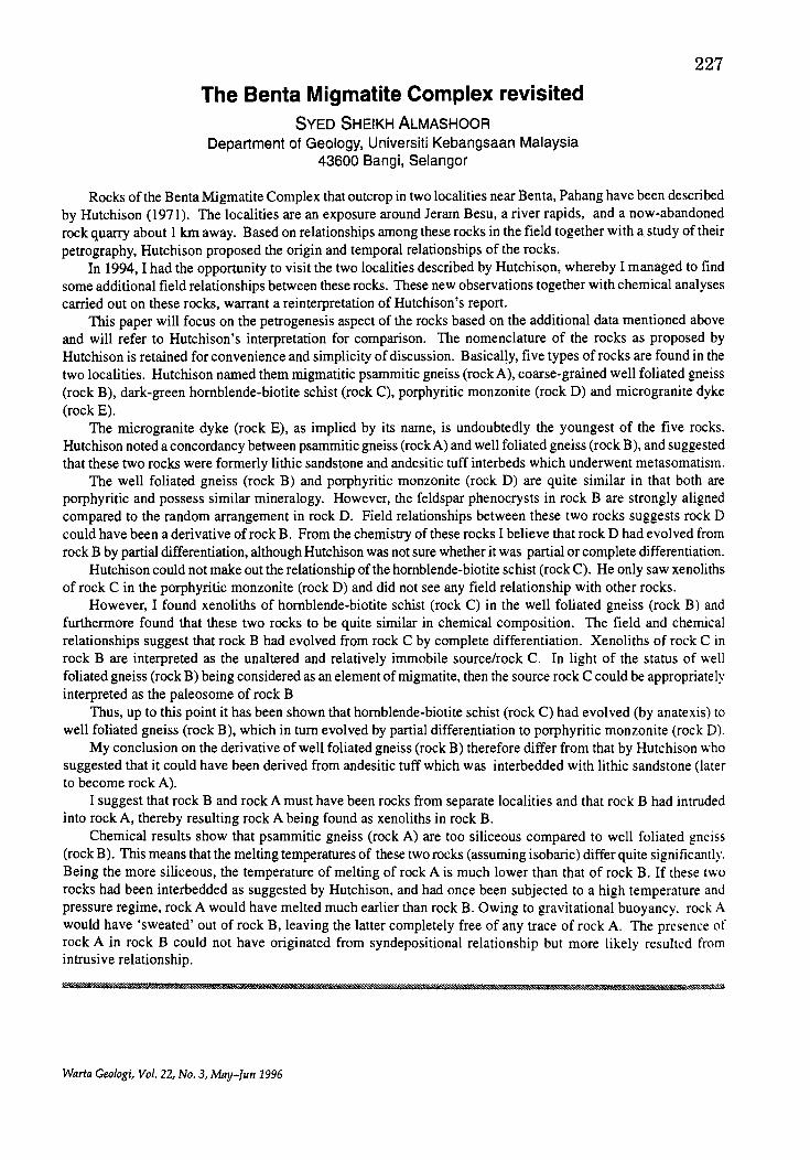
The Benta Migmatite Complex revisited SVED SHEIKH ALMASHOOR
Department of Geology, Universiti Kebangsaan Malaysia 43600 Bangi, Selangor
227
Rocks of the Benta Migmatite Complex that outcrop in two localities near Benta, Pahang have been described by Hutchison (1971). The localities are an exposure around Jeram Besu, a river rapids, and a now-abandoned rock quarry about 1 Ian away. Based on relationships among these rocks in the field together with a study of their petrography, Hutchison proposed the origin and temporal relationships of the rocks.
In 1994, I had the opportunity to visit the two localities described by Hutchison, whereby I managed to find some additional field relationships between these rocks. These new observations together with chemical analyses carried out on these rocks, warrant a reinterpretation of Hutchison's report.
This paper will focus on the petrogenesis aspect of the rocks based on the additional data mentioned above and will refer to Hutchison's interpretation for comparison. The nomenclature of the rocks as proposed by Hutchison is retained for convenience and simplicity of discussion. Basically, five types of rocks are found in the two localities. Hutchison named them migmatitic psammitic gneiss (rock A), coarse-grained well foliated gneiss (rock B), dark-green hornblende-biotite schist (rock C), porphyritic monzonite (rock D) and microgranite dyke (rock E).
The microgranite dyke (rock E), as implied by its name, is undoubtedly the youngest of the five rocks. Hutchison noted a concordancy between psammitic gneiss (rockA) and well foliated gneiss (rock B), and suggested that these two rocks were formerly lithic sandstone and andesitic tuff interbeds which underwent metasomatism.
The well foliated gneiss (rock B) and porphyritic monzonite (rock D) are quite similar in that both are porphyritic and possess similar mineralogy. However, the feldspar phenocrysts in rock B are strongly aligned compared to the random arrangement in rock D. Field relationships between these two rocks suggests rock D could have been a derivative ofrockB. From the chemistry of these rocks I believe that rock D had evolved from rock B by partial differentiation, although Hutchison was not sure whether it was partial or complete differentiation.
Hutchison could not make out the relationship of the hornblende-biotite schist (rock C). He only saw xenoliths of rock C in the porphyritic monzonite (rock D) and did not see any field relationship with other rocks.
However, I found xenoliths of hornblende-biotite schist (rock C) in the well foliated gneiss (rock B) and furthermore found that these two rocks to be quite similar in chemical composition. The field and chemical relationships suggest that rock B had evolved from rock C by complete differentiation. Xenoliths of rock C in rock B are interpreted as the unaltered and relatively immobile source/rock C. In light of the status of well foliated gneiss (rock B) being considered as an element of migmatite, then the source rock C could be appropriately interpreted as the paleosome of rock B
Thus, up to this point it has been shown that hornblende-biotite schist (rock C) had evolved (by anatexis) to well foliated gneiss (rock B), which in turn evolved by partial differentiation to porphyritic monzonite (rock D).
My conclusion on the derivative of well foliated gneiss (rock B) therefore differ from that by Hutchison who suggested that it could have been derived from andesitic tuff which was interbedded with lithic sandstone (later to become rock A).
I suggest that rock B and rock A must have been rocks from separate localities and that rock B had intruded into rock A, thereby resulting rock A being found as xenoliths in rock B.
Chemical results show that psammitic gneiss (rock A) are too siliceous compared to well foliated gneiss (rock B). This means that the melting temperatures of these two rocks (assuming isobaric) differ quite significantly. Being the more siliceous, the temperature of melting of rock A is much lower than that of rock B. If these two rocks had been interbedded as suggested by Hutchison, and had once been subjected to a high temperature and pressure regime, rock A would have melted much earlier than rock B. Owing to gravitational buoyancy. rock A would have 'sweated' out of rock B, leaving the latter completely free of any trace of rock A. The presence of rock A in rock B could not have originated from syndepositional relationship but more likely resulted from intrusive relationship.
L
Warta Geologi, Vol. 22, No.3, May-fun 1996
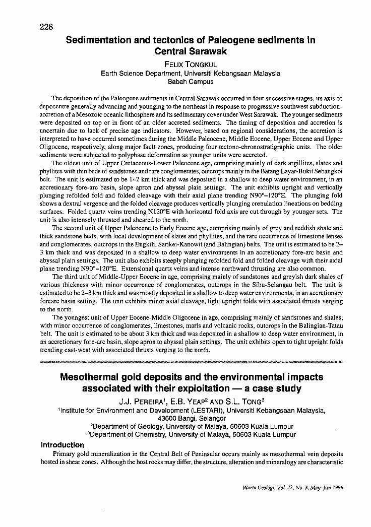
228
Sedimentation and tectonics of Paleogene sediments in Central Sarawak
FELIX TONGKUL Earth Science Department, Universiti Kebangsaan Malaysia
Sabah Campus
The deposition ofthe Paleogene sediments in Central Sarawak occurred in four successive stages, its axis of depocentre generally advancing and younging to the northeast in response to progressive southwest subductionaccretion of a Mesozoic oceanic lithosphere and its sedimentary cover under West Sarawak. The younger sediments were deposited on top or in front of an older accreted sediments. The timing of deposition and accretion is uncertain due to lack of precise age indicators. However, based on regional considerations, the accretion is interpreted to have occurred sometimes during the Middle Paleocene, Middle Eocene, Upper Eocene and Upper Oligocene, respectively, along major fault zones, producing four tectono-chronostratigraphic units. The older sediments were subjected to polyphase deformation as younger units were accreted.
The oldest unit of Upper Cretaceous-Lower Paleocene age, comprising mainly of dark argillites, slates and phyllites with thin beds of sandstones and rare conglomerates, outcrops mainly in the Batang Layar-Bukit Sebangkoi belt. The unit is estimated to be 1-2 km thick and was deposited in a shallow to deep water environment, in an accretionary fore-arc basin, slope apron and abyssal plain settings. The unit exhibits upright and vertically plunging refolded fold and folded cleavage with their axial plane trending N90o-120oE. The plunging fold shows a dextral vergence and the folded cleavage produces vertically plunging crenulation lineations on bedding surfaces. Folded quartz veins trending N1200E with horizontal fold axis are cut through by younger sets. The unit is also intensely thrusted and sheared to the north.
The second unit of Upper Paleocene to Early Eocene age, comprising mainly of grey and reddish shale and thick sandstone beds, with local development of slates and phyllites, and the rare occurrence of limestone lenses and conglomerates, outcrops in the Engkili, Sarikei-Kanowit (and Balingian) belts. The unit is estimated to be 2-3 km thick and was deposited in a shallow to deep water environments in an accretionary fore-arc basin and abyssal plain settings. The unit also exhibits steeply plunging refolded fold and folded cleavage with their axial plane trending N90o-120oE. Extensional quartz veins and intense northward thrusting are also common.
The third unit of Middle-Upper Eocene in age, comprising mainly of sandstones and greyish dark shales of various thickness with minor occurrence of conglomerates, outcrops in the Sibu-Selangau belt. The unit is estimated to be 2-3 km thick and was mostly deposited in a shallow to deep water environments, in an accretionary forearc basin setting. The unit exhibits minor axial cleavage, tight upright folds with associated thrusts verging to the north.
The youngest unit of Upper Eocene-Middle Oligocene in age, comprising mainly of sandstones and shales; with minor occurrence of conglomerates, limestones, marls and volcanic rocks, outcrops in the Balingian-Tatau belt. The unit is estimated to be about 3 km thick and was deposited in a shallow to deep water environment, in an accretionary fore-arc basin, slope apron to abyssal plain settings. The unit exhibits open to tight upright folds trending east-west with associated thrusts verging to the north.
! I i I
Mesothermal gold deposits and the environmental impacts associated with their exploitation - a case study
J.J. PEREIRA1, E.B. YEAp2 AND S.L. TONG3
, Institute for Environment and Development (LESTARI), Universiti Kebangsaan Malaysia, 43600 Bangi, Selangor
Introduction
2Department of Geology, University of Malaya, 50603 Kuala Lumpur 3Department of Chemistry, University of Malaya, 50603 Kuala Lumpur
Primary gold mineralization in the Central Belt of Peninsular occurs mainly as mesothermal vein deposits hosted in shear zones. Although the host rocks may differ, the structure, alteration and mineralogy are characteristic
Warta Geologi, Vol. 22, No.3, May-fun 1996
229 for this type of gold deposit (Pereira, 1996). The exploitation of these deposits would tend to result in the production of tailings that are broadly similar in terms of its chemical and mineralogical properties and hen~e give rise to comparable impacts, although some impacts arising from mining activities are to a great extent SIte
specific. The Selin sing gold mine is one of the few mesothermal vein deposits worked in Pahang. An account of the
geology of this gold mine and the environmental impacts arising from its exploitation is presented below.
Geology of the Selinsing mesothermal gold deposit The Selinsing gold mine was first exploited in 1888 under European management (Richardson, 1949). A
series of openings and closures followed, resulting in the production of slightly in excess of 1 tonne of gold. It reopened again in 1991 after 40 years of being inactive.
Mine geology and structure The central and western parts of the Selinsing mine are composed of tuffaceous metasediments comprising
intercalations of calcareous phyllite and quartz mica schist. Bands of conglomerate and limestone lenses are also observed in this metasedimentary sequence. The eastern part of the mine is underlain by dark grey limestone.
A large proportion of the rocks in this mine have been deformed in shear zones. The shear zones generally trend 350°. In plan, two relatively undeformed lens-shaped zones, with a length of almost 80 m and a width of 40 m separates two apparently discrete shear zones which merge in the northern and southern parts of the mine.
Within the shear zone, a composite foliation set dipping eastward is observed, especially where the conglomerate bands are located. These foliations comprise the s-c pair (first described by Berthe et al., 1979), where the s-surface dips 60-70° to the east and the c-surface dips at a steeper angle of 80°, also towards the east. The s-c fabric as well as the geometry of the porphyroblasts observed both at outcrop scale and microscopic study of oriented samples indicate a normal sense of movement in this high angle shear zone.
Numerous post-mineralization faults are observed here displacing mineralised veins generally by less than a metre. These faults trend mainly to the NE although NW trending faults are also common.
Vein characteristics and nature of deformation Veining is directly related to gold mineralisation and hence no mineralisation exists in vein free rocks,
although mineralisation is locally disseminated adjacent to quartz veins. The veins, composed mainly of quartz are generally steeply dipping, between a few cm thick, with poor longitudinal continuity, typically in the 5-40 m range. However, some veins may have strike lengths up to 70 m. These are normally laminated.
The vein system at Selinsing is rather complicated and detailed study has shown more than one episode of veining. The sequence involves the initial development of barren shear and tensional veins. Subsequent shearing and dilation results in the emplacement of the next generation of quartz veins normally associated with sulphides. This shearing event also resulted in folding, buckling and boudinage of the earlier barren shear veins, and mild folding of earlier tensional veins. The second generation of veins is at places cut by yet a third generation of veinlets, normally composed of the least deformed quartz.
The structural history of the rocks in this mine indicate that deformation was progressive in nature. Shear planes acted as a conduit for fluids. Veining occurred in continuous episodes that alternated with shearing as evidenced by the presence of morphologically deformed early veins and less deformed later veins. The deposition of gold and sulphides occurred during this continues deformation.
Microscopic studies has revealed the widespread occurrences of microfractures in feldspars and plastic behavior of quartz, calcite and mica. Based on the behavior of feldspars and quartz it is deduced that deformation occurred in the brittle-ductile regime as proposed in the shear zone model of Scholz (1988).
Ore petrography and alteration Sulphides form less than 5% of the total vein composition and are normally associated with narrow non
penetrative fractures that mainly follow quartz grain boundaries. The quartz associated with these zones of 10-100 Jlm width show intense ductile deformation. The constant orientation of these zones across the whole thin section and small displacements on them suggest that they are microshear zones.
The ore minerals observed here are pyrite, tetrahedrite, scheelite, chalcopyrite, stibnite, sphalerite, galena and gold. Chalcocite, covellite and scorodite are also observed. The main gangue mineral is quartz; subordinate amounts of calcite and traces of albite and muscovite also occur.
The hydrothermal alteration associated with the wallrock at Selinsing is pronounced although occasionally cryptic. Six types of alterations are observed; most of which are overprinting. These are widespread chloritization,
Warta Geoiogi, Vol. 22, No.3, May-Jun 1996
230
sericitization and pyritization, as well as local silicification, albitization and tourmalinization of the wallrock.
Exploitation of the mesothermal gold deposit at Selinsing
Ore extraction and processing In the past, the Selinsing deposit was mined using underground methods. The local expertise and available
machinery now favours the mining of this deposit using the opencut method. The gold ore is extracted using hydraulic excavators and sent to the stock pile near the processing plant using dump trucks. Explosives are used when fresh rocks are encountered.
The ore is pushed into the hopper by a tractor and fed to the ball mill using jets of water. Boulder sized ore material are manually broken and then fed into the ball mill. Material from the ball mill passes through the trommel, where the oversized material is redirected to the trommel while the undersized material flows on to the palong in the form of a slurry. The gold and other heavy minerals are trapped at the wooden riffles in the palong while the lighter minerals flow down the inclined palong, which are elevated on trestles.
Upon retrieval from the palong the concentrates are separated again where the coarser fraction is sent for further grinding while the fine fraction is directed on to shaking tables. Further dressing involves panning and treatment with concentrated nitric acid to dissolve the sulphide minerals and other impurities. The gold residue is then filtered out and dissolved in aqua regia. The gold is precipitated out using ferrous sulphate, dried, torched using acetylene flame after the addition of boric acid and cast into bars running 99.9% in purity.
Tailings disposal method There are four main tailings ponds in the Selinsing mine which are separated by bunds about 3-4 m wide and
less than 1 m high, from the top of the bund to the water level in the pond. These bunds also double up as roads maintained to a reasonably high standard, suitable for use by mine vehicles. The presence of spillways connecting the ponds prevents the process water in the ponds from rising and flowing over the bund and damaging the road.
The ponds extend away from the main tailings discharge point, with the coarser tailings material forming a delta in the first of a series of tailings ponds while the suspended material and process water are decanted into the last pond where the pump house is located. From the pump house, the water is recycled to the processing plant through pipelines. A detailed account of the tailings disposal method is presented in Pereira et al. (1995).
Impact of gold mining at Selinsing
Impact of tailings Characterization studies have revealed that the elements As, Cd, Cu, Fe, Mn, Pb and Zn are concentrated in
the tailings after the ore material is processed. The average total concentration of these elements in the tailings are 0.2% As, 1.5 )lg/g Cd, 26 )lg/g Cu, 2.9% Fe, 198 )lglg Mn, 64 )lglg Pb and 42 )lglg Zn. Ofthese elements As, Pb and Cd are found in anomalously high amounts relative to the average shale content. The coarse fraction of the tailings also contain about 0.4% of sulphide minerals, mainly arsenopyrite and pyrite. These tailings have the potential to cause serious environmental problems unless they are impounded and separated from the flow of surface and ground water as done in the Selinsing gold mine.
Soil contamination Soil contamination by the elements As, Cd, Co, Cu, Fe, Mn, Pb and Zn were detected in this mine, concentrated
mainly around the tailings area, in tracks adjacent to tailings ponds and the northeastern sector of this mine, previously contaminated by tailings. This contamination is particulate in nature and is a result ofthe tailings and process water coming into direct contact with soil material. Soil contamination was also detected in other parts of the mine due to different causes.
Acid mine drainage The work area in this mine is rich in sulphide minerals at places and characterisation studies have revealed
the coarse fraction of the tailings contain about 0.4% of sulphide minerals, mainly arsenopyrite and pyrite. However, acid mine drainage is not detected here because the calcareous host rocks are not conducive to the formation of acid.
Erosion and siltation The deposit here is set on rugged topography and has steep to vertical exposed slopes as excavation proceeds.
These zones are highly susceptible to erosion during rainstorms and would result in excessive siltation of the rivers downstream of the mine ifmitigating measures were not taken. The presence of wide benches cut following
Warta Geologi, Vol. 22, No.3, May-fun 1996
231
the contour, ditches and tracks doubling up as embankments to break the surface runoff and promote ponding up of water has minimised siltation related problems here.
Production of derelict land About 40% of the area in this mine is excavated while 50% and more is reserved for the impoundment of
tailings. Since excavation of the gold deposit here proceeds downwards, there has been permanent alteration of the landscape and the hill is being denuded. The surface area that may be derelict as a result of the excavation is somewhat definite and constant after a relatively long period of mining. The layout of the potential derelict areas in this mine are systematic e.g. tailings site separated from excavation site. This would make future rehabilitation programmes relatively easier to implement after the mine closure.
Visual intrusion Mining operations set on a hill tend to be visually intrusive. However, the Selinsing mine is located at a
remote locality and part of it is naturally screened by the surrounding topography, minimising problems associated with visual intrusion.
Other minor impacts As this mine is located in a remote locality, problems associated with generation of dust (for which mitigating
measures are taken in the Selinsing gold mine), noise, vibration and air blast from blasting are minimal.
Conclusions The main impact arising from the exp10itation of mesothermal gold deposits is the production of tailings that
have high contents of heavy elements and sulphide minerals especially pyrite and arsenopyrite. These tailings have the potential to cause acid mine dr-ainage and particulate soil contamination problems unless their disposal is properly controlled. Other impacts associated with the exploitation of these deposits include permanent alteration of the landscape, production of potential derelict land and excessive siltation problems when large areas are exposed and become susceptible to surface erosion.
References BERTHE, D., CHOUKROUNE, P. AND JEGOUZO, P., 1979. Orthogneiss, mylonite and non-coaxial deformation of granites: the
example of the South Armorican shear zone. J. Structural Geology, 1,31-42. PEREIRA, 1.1., YEAP, E.B. AND TONG, S.L., 1995. Gold mining and tailings disposal systems impact on the physical environment.
Proceedings o/the Forum on Environmental Geology and Geotechnics, Organised by the Geological Society of Malaysia, 24 October 1995.
PEREIRA, J.J., 1996. The geology and mining 0/ gold deposits. their tailings disposal and subsequent impact on the physical environment in selected areas o/Peninsular Malaysia. Ph.D. thesis submitted to University of Malaya, 379 p.
RICHARDSON, J.A., 1949. The geology and mineral resources of the neighbourhood of Chegar Perah and Merapoh, Pahang. Geol. Surv. Malaysia Memoir 4.
SCHOLZ, c., 1988. The brittle-plastic transition and the depth of seismic faulting. Geol. Rundsch., 77, 319-328.
~W;i:id k Wh'ii Bd £:1 m!1l ttL IT d lMM ill
Geologi struktur di Lembah Lupar FREDDY AK HEWARD CHINTA
Jabatan Penyasiatan Kajibumi Malaysia Kuching, Sarawak
Eft
Beberapa aspek struktur yang penting di Lembah Lupar adalah menarik dan mempunyai pertentangan pendapat dengan kajian terkini. Keasalan dan jenis struktur yang ketara di Lembah Lupar seperti Garis Lupar adalah masih dipertikaikan oleh banyak pengkaji. Kertas ini akan menerangkan beberapa tafsiran di mana faktor-faktor tektonik dan graviti boleh digunakan bagi menerangkan struktur yang unik di kawasan ini. Hasil daripada kajian geologi struktur secara rantau dan tempatan di Lembah Lupar, terdapat sekurng-kurangnya 3 episod defromasi yang utama bertindak di sini. Deformasi terawal menyebabkan batuan sedimen di dalam Ahli Layar mengalami metamorfisma rantau dan terangkat. Daya mampatan utama ini berarah Utara-Timurlaut hingga Selatan-Baratdaya yang ditafsirkan berlaku semasa Paleosen hingga Eosen bawah. Sejarah deformasi kedua adalah bertanggungjawab ke atas pembentukkan lipatan yang terunjam di mana arah daya bertindak sekitarTimurlaut-Baratdaya. Deformasi terakhir yang mana menyebabkan Ahli Basal Sandstone tersungkup ke arah timurlaut dan yang menyebabkan
Warta Geologi, Vol. 22, No.3, May-fun 1996
232
lapisan sedimen di kawasan kajian terbalik. Ianya ditafsirkan berlaku semasa Miosen Awal. Secara am, struktur yang komplek bertambah semakin ke utara kawasan kajian. Sungguhpun terdapat interpretasi yang telah digunakan bagi menerangkan struktur di kawasan ini, sekurang-kurangnya kertas ini memberikan suatu idea mengenai struktur yang unik di sini.
I IRltilIlII 1IIi16Jt III
Facies analysis of the Late Neogene sedimentary rocks, Dent Peninsula, Sabah Malaysia
SANUDIN HJ. TAHIR1 AND AHMAD JANTAN2
lSchool of Science and Technology, Universiti Malaysia Sabah
2Department of Geology, Universiti Kebangsaan Malaysia 43600 Bangi, Selangor
The study area possesses a good sequence to represent the Late Neogene stratigraphy of the eastern part of Sabah. the Dent Group. It comprises of thick clastic sequence ranging from Late Miocene to Pleistocene and consists, in ascending order. of Sebahat Formation. Ganduman Formation and Togopi Formation. Stratigraphically, the Dent Group unconformably overlies the Middle Miocene volcanic facies, the Segama Group, and underlies the raised Recent alluvial deposits.
The Sebahat Formation, Late Miocene in age, is characterized by dark gray, thickly bedded to massive mudstone intercalated with thin beds of siltstone and claystone, with ferruginous partings and slabby concretions of calcareous argillite, and marl. Sections measured along the lower course of the Sebahat River is about 2,500 m thick and the section is thinning to the south where it ends in the Merabong River. The upper part of the formation is more sandy and grades into sandy facies of the Ganduman Formation. The basal boundary of the Ganduman Formation that separates it from the Sebahat Formation is not easily defined in the field. However, the lower part of the Ganduman Formation can be recognized by its abundance of molluscs and is highly calcareous, while the upper part of the Sebahat Formation is rich in benthonic and planktonic foraminifera. coral, algae and some molluscs.
The Ganduman Formation. Pliocene in age, is characterized by mainly succession of thick light gray sandstone with minor interbeds of carbonaceous claystone. Throughout the sequence, the lithology is rather uniform with common large trough with S0me planar crossbedding. It occupies the eastern tip of the Dent Peninsula, bounded by the Sebahat and the Togopi Formations. The lithologic change is from well-bedded interbeds, fossiliferous claystone and siltstone to more sandy, lignitic and unfossiliferous beds. The upper boundary could hardly be observed in the field. However, it grades from loose-grained, faintly traced sandstone beds with calcareous claystone to unbedded sandy rubble coral of the Togopi Formation.
II II
Fracture pattern and its relationship to groundwater in hard rocks of Negeri Sembilan
NASI MAN S., A.ZAINARIAH A.A., AND M. FIRUZ A. Department of Environmental Sciences
Universiti Pertanian Malaysia
Granite and metamorphic rocks in Negeri Sembilan and in other parts of Peninsular Malaysia have been considered to be of poor aquifer. The hydrogeologic map of the Peninsular, 1975, shows the area underlain by the hard rocks as having poor to moderate potential for groundwater production « 230 m3/welllday).
This paper presents a new finding about productive hard rock aquifers in Negeri Sembilan. Data from tubewell drillings in the past four years were analyzed. The drillings for groundwater were c~ied out mostly to meet the growing industrial water demand in the state. It was found that the hard rocks could yield fresh water more than 300 m3/well/day. Discharge rates up to 890 m3/well/day, 408 m3/well/day, 590 m3/well/day, 545 m31
Warta Geologi, Vol. 22, No.3, May-Tun 1996
233 welllday and 960 m3/welllday were found in Seremban, Kuala Pilah, Lenggeng, Tampin and Rembau respectively. The wells were between 50 m and 200 m deep.
High discharge rates of groundwater above 300 m3/well/day were encountered from wells that penetrate major fracture zones. Both the granite and metamorphic rocks are generally fractured at various depths. Groundwater in interconnected fractures has a steady flow that sustained production during pumping tests and actual usage of the wells. This phenomenon indicates that the groundwater is being recharged by infiltration of rainwater through the overlying weathered rocks and soils. Tubewells in granite of Sungai Gadut, Kuala Pilah and Tampin areas were found to have average discharge rates of 650 m~/welllday, 408 m3/welllday and 500 m31 welllday respectively. Shallow tubewells in Tampin, of less than 50 m deep, penetrated only weathered granite, are generally non productive « 70 m3/welllday). Limited fracture openings at shallow depth and restricted recharge areas are likely to be the reason for the low discharge.
The fracture patterns inside the wells could not be ascertained although it was assumed that the patterns follow the major regional N-S and NW-SE structural trend of the Main Range granite. Topographic features and lineaments of the valleys and ridges were used for locating productive sites. About 90% deep tubewell drilling (100 to 200 m) in granitic areas of Sungai Gadut, Tampin and Kuala Pilah was successful in obtaining discharge rate more than 100 m3/welllday. In contrast, only 30% success rate was obtained from drilling in metamorphic rocks of Linggi area. Clay particles in fractures was observed to be the factor for the low success rate and poor quality of the water.
The search for Malaysian dinosaurs with lessons from Thailand C.P. LEE
Department of Geology, University of Malaya 50603 Kuala Lumpur
Dinosaur remains were first discovered in the course of uranium prospecting at Phu Wiang, Khon Kaen Province, Thailand in the 1970s. Since then, a large amount of bones, teeth and footprints have been found by Thai-French expeditions in several non-marine sedimentary formations belonging to the thick Late Triassic to Late Cretaceous Khorat Group in the Khorat Plateau of northeastern Thailand.
The ages of most of the dinosaur-bearing formations have been revised based on palynological and fission track studies by Racey et al. (1994) and Bristow et al. (1994). These studies suggest that the Phra Wihan Formation and the overlying Sao Khua Formation, long thought to be Middle and Late Jurassic respectively, should in fact be Early Cretaceous together with the overlying Phu Phan and Khok Kruat Formation. The age of the underlying Phu Kradung Formation remains uncertain but appears to be younger than Early Jurassic although a Jurassic age is still likely. The Nam Phong Formation, formerly placed at the base of the Khorat Group is dated as probable Late Triassic on the basis of palynomorphs suggesting a considerable hiatus between it and the overlying formation to exclude it from the Khorat Group (Suteeathorn et al., 1995).
Below are the dinosaur finds within the various formations:-i) Nam Phong Formation
The oldest Thai dinosaur found is a prosauropod from this Formation which has been dated as probably Late Norian to Rhaetian by Racey et al. (1994) using palynomorphs. Only incomplete bone-fragments were found precluding more precise identification. ii) Phu Kradung Formation
This Formation is probably Jurassic in age. No dinosaur remains has been found so far although it has yielded those of fishes, temnospondyl amphibians, turtles and crocodilians. iii) Phra Wihan Formation
This Formation has been dated as Berriasian-Barremian (Lower Cretaceous) by Racey et al. (1994) using, palynomorphs. It contains a ripple-marked sandstone surface with ten district trackways of small dinosaurs believed to be ornistichians or theropods. No fossil remains has been found yet. iv) Sao Khua Formation
The first dinosaur remains found in Thailand came from his Formation which is the most productive with many localities in several provinces, notably Khon Kaen and Kalasin, in the Khorat Plateau. This Formation was
Warta Geologi, Vol. 22, No.3, May-fun 1996
234
long considered as Late Jurassic in age until an Early Cretaceous age was established by Racey et al. (1994) for the underlying Phra Wihan Formation.
The most abundant dinosaurs in the Sao Khua Formation are sauropods including the new taxon Phuwiangosaurus sirindhornae of Martin, Buffetaut and Suteethorn (1994) which is about 15 to 20 m long and quite different from the Jurassic sauropods of China.
The richest locality is at a Buddhist temple named Wat Sak Kawan at the foot of a hill called Phu Pha Ngo, located 30 km, north of Kalsin near Sahas Khan. It has yielded more than one hundred sauropod bones and teeth belonging to more than one individual.
The remains of many small sauropods believed to be juveniles have been found at several localities in the Phu Wiang NationtiiJ>ark, located about 100 km west of Khon Kaen where a Visitors' Centre has been set up to exhibit the dinosaur finds.
Theropod dinosaurs are represented in the Sao Khua Formation by the peculiar teeth of a possible spinosaurid, Siamosaurus suteethorni of Buffetaut and Ingavat (1986) as well as other teeth and bones belonging to a large incomplete theropod and a small Compsognathus -like theropod and a small ornithomimosaur.
Ornithiscian remains are uncommon and only represented by a few caudal vertebrae from an iguanodontid form.
The dinosaurs from the Sao Khua Formation constitute the most diverse assemblage hitherto found in Southeast Asia. The dominance of sauropods contradicts die widely held idea that sauropods suffered a drastic decline after the end of the Jurassic. v) Phu Phan Formation
This Formation has yielded only unidentifiable fragments or large bones. More importantly, are the threetoed footprints made by large theropods found at Phu Luang Wildlife Sanctuary near Loei (Buffetaut et al., 1985). These are reminiscent of Early Cretaceous theropod footprints from North America referred to as the ichnogenus I renesauripus. vi) Khok Kruat Formation
The Khok Kruat Formation forms the top of the revised Khorat Group. The occurrence of a peculiar freshwater shark, Thaiodus ruchae suggests an Early Cretaceous age for the formation (Capetta et al., 1990). Palynological data by Mouret (1993) suggests an Aptian age.
The dinosaur remains found include a theropod tooth and jaws of a primitive ceratopsian Psittacosaurus sattayaraki by Buffetaut and Suteethorn (1992), extending its known range from Mongolia, Siberia and northern China to Southeast Asia.
It can be concluded from the above that the richest concentration of dinosaur fossils is from the Late Cretaceous Sao Khua Formation although dinosaur footprints and remains can also be found in the other Mesozoic formations in the Khorat Plateau. The search for Malaysian dinosaurs must take the above into account. The JurassicCretaceous Tembeling and Gagau groups and their correlatives need to be more precisely dated using palynomorphs and the search for dinosaurs should be concentrated on the Early Cretaceous sediments.
In his visit to two of the localities at Wat Sak Kawan and Phu Wiang, the author discovered that the drier climate with sparser vegetative cover and greater accessibility do play an important role in the preservation and discovery of dinosaur remains. The public is generally also made more aware of such remains through the wide publicity given to such finds and they help through reporting new finds which they encounter later.
References BRISTOW, C., HOWLETT, P., AND CARTER A., 1994. Stratigraphy and sedimentology of the Khorat Group of the Vientiane Basin
area of Laos and the western age of the Khorat Plateau, NE Thailand. In: Angsuwathana, P., Wongwanich, T., Tansothien, w., Wongsomsak, S. and Tulyatid, J. (Eds.), Proceedings of the International Symposium on Stratigraphic Correlation of Southeast Asia. Department of Mineral Resources, Bangkok, 159.
BUFFETAlIT, E. AND INGAVAT, R.,1986. Unusual theropod teeth from the Upper Jurassic of Phu Wiang, northeastern Thailand. Rev. Paliobiol., 5, 217-220.
BUFFETAlIT, E., INGAUAT, R., SATTAYARAK, N. AND SUTEETHRON, v., 1985. First dinosaur footprints from South-East Asia: carnosaur tracks from the Lower Cretaceous of Thailand. C.R. Acad. Sci. Paris. 301, II, 643-648.
B UFFETAUT, E. AND S lITEETHORN, V., 1992. A new species of the ornithiscian dinosaur Psittacosaurus from the Earl y Cretaceous of Thailand. Palaeontology, 35(4), 801-812.
CAPETTA, H., BUFFETAlIT, E., AND SUTEETHORN, v., 1990. A new hybodont shark from the Lower Cretaceous of Thailand. Neues lahrb. Geol. Palaont., Monatsh., 11, 659-666.
MARTIN, V., BUFFETAlIT, E., AND SlITEETHORN, V., 1994. Anew genus of sauropod dinosaur from the Sao Khua Formation (Late Jurassic or Early Cretaceous) of northeastern Thailand. C.R. Acad. Sci. Paris, 319, II, 1085-1092.
/
Warta Geologi, Vol. 22, No.3, May-Jun 1996
235 MOURET, c., 1994. Geological history of northeastern Thailand since the Carbonifer?us. Relation~ with Indochina and
Carboniferous to Early Cenozoic evolution model. In: Angsuwathana, P., Wongwaruch, T., Tansathlen, w., Wongsoms~, S. and Tulyatid, J. (Eds.), Proceedings of the International Symposium on Stratigraphic Correlation of Southeast ASia. Department of Mineral Resources, Bangkok, 132-158.
SUTEETHORN, V., BUFFETAUT, E., MARTIN, V., CHAlMANEE, Y., TONG, H., AND TRIAMWICHANON, S., 1995. Thai dinosaurs an updated review. Sixth Symposium on Mesozoic Terrestrial Ecosystems and Biota, Short Papers, 133-136.
RACEY, A., GOODALL, J.G.S., LOVE, M.A., POLACHAN, S., AND JONES, P.D.,1994. New age data for the Mesozoic Khorat Group of Northeast Thailand. In: Angsuwathana, P., Wongwanich,T., Tansathien, w., Wongsomsak, S. and Tulyatid, J. (Eds.), Proceedings of the International Symposium on Stratigraphic Correlation of Southeast Asia. Department of Mineral Resources, Bangkok, 245-252. _m
Sf : nUll! 1
Deformational style of the Kudat Formation, Kudat Peninsula, Sabah (Gaya Canggaan Formasi Kudat, Semenanjung Kudat, Sabah)
IBRAHIM ABDULLAH, DEWARMAN AND BASIR JASIN Department of Geology, Universiti Kebangsaan Malaysia
43600 Bangi, Selangor
Landsat image of Kudat Peninsula clearly shows several major lineaments which run in the WNW and NNE directions. Apparently, these major lineaments also divide this area into three zones or domains, each one having a different structural style and regional trend. The domains are Tajau Domain in the north, Sikuati Domain in the centre and Mampilis Domain in the southeastern part of the area. The boundary between the Tajau and the Sikuati Domains is marked by the existence of several outcrops of the Chert-Spilite Formation which run moreor-less in the WNW direction, while the boundary between the Sikuati and Mampilis Domains is less clear, but is interpreted as representing a wrench fault.
Tajau Domain is characterised by the existence of refolded asymmetrical folds and imbricated thrust faults. The imbricated thrust faults and asymmetrical folds were probably formed by 'break-back' mechanism. The general trend of the early folds and thrusts are about NNE while the later are about ESE direction. Sikuati Domain is characterised by the thrust faults and folds which were trending about WNW direction. The wrench faults which are present in certain parts of this domain, complicate the overall structure of the domain. Mampilis Domain show the most simple structure among the three domains. The rocks in this domain are folded and thrusted, trending about NNE direction but are not refolded as in Tajau Domain. As a whole, the structure of the Kudat Formation is simpler as compared to the Crocker Formation, since in this formation. no inclined and overturned folds are present.
Imej Landsat kawasan Semenanjung Kudatjelas menunjukkan beberapa lineamen utama yang berarah BBL dan TTL. Kelihatannya, lineament utama tersebut juga membahagikan kawasan yang terdiri daripada batuan Formasi Kudat kepada tiga zon atau mandala, setiap satu mempunyai gaya struktur dan tren rantau yang berbeza. Mandala-mandala tersebut dikenali sebagai Mandala Tajau di bahagian utara, Mandala Sikuati di b<h~agian tengah dan Mandala Mampilis di bahagian tenggara Semenanjung Kudat. Sempadan antara Mandala Tajau dan Mandala Sikuati ditandakan oleh kehadiran beberapa singkapan Formasi Rijang-Spilit yang berjajar pada arah hampir BBL, manakala sempadan antara Mandala Sikuati dan Mampilis agak kurang jelas tetapi ditafsirkan mewakili satu sesar rengkuh.
Mandala Tajau dicirikan oleh kehadiran lipatan tidak simetri dan sesar sungkup imbrikasi yang terlipat semula .. Sesar sungkup imbrikasi dan lipatan tak simetri mungkin telah terbentuk secara mekanisme ·break-back·. Sesar dan lipatan awal mempunyai tren am sekitar UTL manakala yang kemudian mempunyai tren sekitar TTG. Mandala Sikuati pula dicirikan oleh sesar sungkup dan lipatan yang mempunyai tren sekitar BBL. Sesar-sesar mendatar yang terdapat dibeberapa tempat, merencamkan struktur keseluruhan mandala ini. Mandala Mampilis mempamerkan struktur yang paling mudah di antara ketiga-tiga mandala. Batauan dalam mandala ini terlipat dan tersungkup ke arah UTL tctapi tidak terlipat semula seperti Mandala Tajau. Secara keseluruhan. struktur dalam Formasi Kudat adalah lebih mudah jika dibandingkan dengan struktur Formasi Crocker. memandangkan dalam formasi ini tidak terdapat lipatan terbalik dan lipatan rebah.
Warta Geologi, Vol. 22, No.3, May-IulI 1996
236
The use of seismic refraction method in slope failure investigation KHAIRULANUAR MOHO. NAYAN1, RAHMAN YACCUP2, ABO. RAHIM SHAMSUOOIN2,
UMAR HAMZAH2, ABO. GHANI RAFEK2 'Department of Civil and Structural Engineering, Universiti Kebangsaan Malaysia
43600 Bangi, Selangor 2Department of Geology, Universiti Kebangsaan Malaysia, 43600 Bangi, Selangor
The seismic refraction method has been widely applied in civil engineering projects as a preliminary site investigation tool in order to provide general subsurface information before detailed investigations and other in situ tests are employed. This study is focused on a complex slope failure investigation at a site of Semantan Formation, at Ian 7 of Jalan Termeloh-Mentakab, Pahang. A 12 channel Bison seismograph with a 14 pound hammer energy source were employed. Geophone spacing of 3 m were used in order to obtain an accurate velocity profile from the seismic sections. A total of 12 spread lines were employed in order to provide maximum coverage of the site. The seismic data were latter processed using Firstpix (Interprex Ltd.) for an accurate picking of the first arrival times and Refract (R~A, Australia) for the seismic velocity profiles.
Preliminary site investigation work using the JKR probe and drilling with standard penetration test (SPT) were initially undertaken. Geotechnical laboratory tests of the classification, laboratory drained shear box and the consolidated undrained triaxial tests with pore pressure measurements were also conducted from the samples taken at the failure site.
Results from the velocity profile of several spread lines have indicated a possible shallow failure from a weak soil material that overlies a deeper sliding failure mass. The two possible sliding surfaces interpreted from seismic velocity profiles were found to correlate well with the profile from the standard penetration test (SPT) conducted at an adjacent borehole. A lateral variation of the velocity profiles from several spread lines have also shown that the dominantly argillaceous material could be delineated from the dominantly arenaceous material that has been little affected by the failure slide and conforms well with the geological facies of the site. The topography of the post failure ground level and the probable failure surface, interpreted from the seismic refraction profiles were then compared using a 3-D graphic software (Surfer-Golden Software) in order to evaluate the nature of the sliding surface.
Ma! 1 M g 7
The sedimentology of Miocene shallow marine clastics of the Sandakan Formation of Eastern Sabah
JON NOAO AND NEIL HARBURY Research School of Geological and Geophysical Sciences,
Birkbeck College and University College London United Kingdom
Oceanic spreading of the South China Sea began in the Paleogene and ceased around 17 Ma, when the Dangerous Grounds block collided with Northern Borneo. In Western Sabah this led to the uplift ofthe Crocker Formation, comprising turbidites floored by ophiolitic basement. To the east the collision is thought to have initiated the development of the extensive melanges found there. Extension of the Southeast Sulu Sea in the very early Miocene, by rifting of the pre-existing ophiolitic terrane, led to limited oceanic spreading. Eastern Sabah was at the hinge of this spreading zone, and a combination of these extensional forces, together with compression caused by the collision of the Dangerous Grounds block, was accommodated by wrench faulting, opening a series of tertiary sedimentary basins. These overlie the melange of distal Crocker turbidites, and are filled with a mixture of siliciclastics and volcaniclastics.
The Sandakan Basin lies on the east coast of Sabah and contains some excellent exposures, resulting in part from the steep topography of the region and from the recent development of housing estates and road construction. These often spectacular outcrops allow examination of the Miocene succession, which has not previously been feasible. A total of 4 months has been spent collecting sedimentological data throughout the c. 25 Ian by 15 km basin. Over 70 measured sections have been measured across the basin and this, in conjunction with numerous macrofossil, microfossil and ichnofacies studies, has allowed the differentiation of the interbedded sands and
Warta Geologi, Vol. 22, No.3, May-Jun 1996
237 clays, previously described as shallow marine succession into facies associations ranging from continental to shallow shelfal in origin. Three main facies groups are identified which can be grouped together into a large barrier island and estuarine system: 1) Tidal Flat and Tidal Channels - consist of thick, sticky mudrocks with abundant mangrove detritus resulting from deposition on a tidal flat. These mud-rich sediments pass vertically into erosive tidal channel deposits; 2) Barrier Island Systems consisting of trough cross bedded channels, low angle planar cross bedded shoreface deposits, both containing common Ophiomorpha and Skolithos trace fossils. This facies forms many of the imposing scarps in the region; 3) Fluvial Channels and EstuarinelLagoonal Deposits are identified in some sections though these deposits are volumemetrically insignificant in the basin. Paleoseismicity is suggested by synsedimentary deformation, often confined in discrete horizons which can be traced over several kilometres. Detailed paleontological studies of these rocks will allow development of this facies scheme and further division of these systems into sub-environments.
These well exposed marginal marine facies present an exceptional opportunity to develop a sequence stratigraphic framework of the Sandakan Basin through the Miocene. Examination of the eustatic/tectonic control of the system will then be applied to hydrocarbon-bearing strata in adjacent basins. Futhermore this study will constrain paleogeographic reconstructions of the region
!!
Kajian geokimia konkresi dan hubungannya dengan pembentukkan bauksit di kawasan Kuantan
BABA MUSTA1, WAN FUAD WAN HASSAN 2 AND MOHAMAD MD TAN1 1Jabatan Sains Bumi, UKM Kampus Sabah, Beg Berkunci No 62
88996 Kota Kinabalu, Sabah 2Jabatan Geologi, Universiti Kebangsaan Malaysia
43600 Bangi, Selangor
Proses luluhawa kimia pada kebanyakan batuan igneus menghasilkan konkresi yang dicirikan oleh bentuk granul dengan pelbagai bentuk, kekerasan relatif tinggi, berwarna coklat cerah dan terdiri daripada matrik tanah. Bardossy and Aleva (1990) melapurkan bahawa pembentukkan bauksit dalam konkresi berlaku di kebanyakan kawasan tropika. Fenomena tersebutjuga berlaku di kawasan Kuantan, Pahang. Sebanyak 21 sampel konkresi di kawasan kajian telah diambil daripada 5 profit luluhawa dan dianalisis kandungan unsur major dan un sur surih. Data kepekatan unsur-unsur major dan surih ditunjukkan.
Keputusan menunjukkan AIP3 dan Fep3 merupakan unsur yang melimpah dengan julat kepekatan masingmasing 32.35%-52.23% dan 14.96%-33.99%. Kepekatan Ti02 pula berjulat 3.03%-6.62% manakala Si02 berjulat bdl-8.07%. Unsur-unsur MgO, CaO, Nap dan ~O kebanyakkannya dibawah had pengesanan (bdl). Si02,
FeO, MnO dan pps masih boleh dikesan dalam sampel tetapi kebanyakannya kurang daripada 1 %. Kesimpulan yang boleh dibuat berdasarkan data geokimia unsur major ialah kebanyakan konkresi terse but adalah berkomposisi bauksit, dengan AIP3' Fep3' Si02 dan Ti02 sebagai unsur pembentuk mineral yang utama. Pengkelasan konkresi ialah gred logam berdasarkan piawaian oleh Patterson et al. (1986). Mineral yang melimpah dan dikesan mengikut pertambahan kelimpahannya ialah gibsit, hematit, goetit, kaolinit dan kuarza. Grubb (1970) pula pernah melapurkan kehadiran mineral sekunder yang melimpah dalam konkresi terdiri daripada gibsit, boehmit, goetit, hematit dan kaolinit. Korelasi negatif yang kuat an tara Fep3lawan AIP3 dan AIP3 lawan Ti02 mencadangkan pertambahan AIP3 membentuk gibsit akan diikuti dengan pengurangan goetit dan anatas.
Purata kepekatan masing-masing bagi Cr, Zn, Ni dan Cu dalam konkresi ialah 611 ppm, 35 ppm, 35 ppm dan 28 ppm. Kepekatan Sn, Ni dan Cu yang lebih rendah berbanding Cr berhubung rapat dengan mobiliti Zn, Ni dan Cu semasa proses luluhawa, iaitu bersesuaian dengan kajian yang dibuat oleh Mordberg (1993). Wolfenden (1965) pernah melapurkan Cr boleh di jerap dalam Fe-oksida dan minerallempung. Ini juga mungkin berlaku di kawasan kajian. Korelasi positif yang ditunjukkan oleh plot graf Ni lawan Zn, Ni lawan Cu dan Zn lawan Cu dalam konkresi mencadangkan asosiasi unsur-unsur tersebut dalam bauksit, terutamanya dalam mineral gibsit dan goetit.
Rujukan BARDOSSY, G. AND ALEVA, GJ.J., 1990. Lateritic Bauxites. Developments in Economic Geology, 27, Elsivier. GRUBB, P.L.C., 1970. Minerology, Geochemistry and genesis of the bauxite deposits on the Gove and Mitchell Plateaux,
Northern Australia CSIRO. Melbourne Australia: University of Melbourne.
Warta Geologi, Vol. 22, No.3, May-Tun 1996
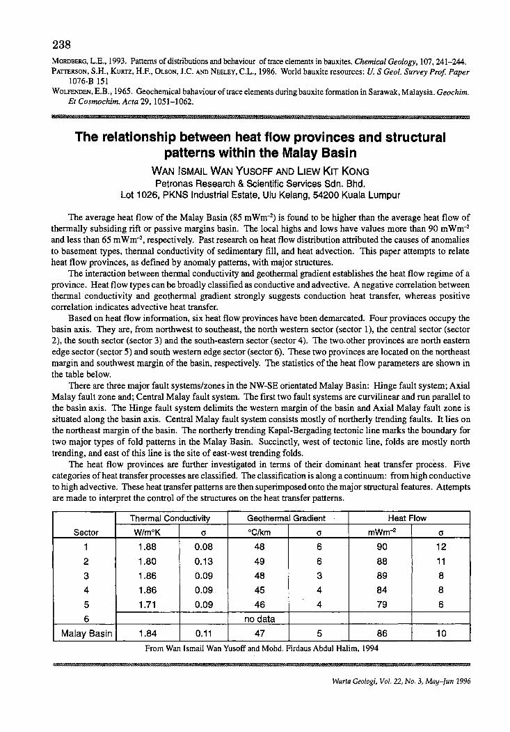
238 MORDBERG, L.E., 1993. Patterns of distributions and behaviour of trace elements in bauxites. Chemical Geology, 107,241-244. PAITERSON, S.H., KURTZ, H.E, OLSON, J.C. AND NEELEY, C.L., 1986. World bauxite resources: U. S Geol. Survey Prof Paper
1076-B 151 WOLFENDEN, E.B., 1965. Geochemical bahaviour of trace elements during bauxite formation in Sarawak, Malaysia. Geochim.
sa
Et Cosmochim. Acta 29, 1051-1062.
ww
The relationship between heat flow provinces and structural patterns within the Malay Basin
WAN ISMAIL WAN YUSOFF AND lIEW KIT KONG Petronas Research & Scientific Services Sdn. Bhd.
Lot 1026, PKNS Industrial Estate, Ulu Kelang, 54200 Kuala Lumpur
The average heat flow of the Malay Basin (85 m Wm-2) is found to be higher than the average heat flow of thermally subsiding rift or passive margins basin. The local highs and lows have values more than 90 mWm-2
and less than 65 mWm-2, respectively. Past research on heat flow distribution attributed the causes of anomalies to basement types, thermal conductivity of sedimentary fill, and heat advection. This paper attempts to relate heat flow provinces, as defined by anomaly patterns, with major structures.
The interaction between thermal conductivity and geothermal gradient establishes the heat flow regime of a province. Heat flow types can be broadly classified as conductive and advective. A negative correlation between thermal conductivity and geothermal gradient strongly suggests conduction heat transfer, whereas positive correlation indicates advective heat transfer.
Based on heat flow information, six heat flow provinces have been demarcated. Four provinces occupy the basin axis. They are, from northwest to southeast, the north western sector (sector 1), the central sector (sector 2), the south sector (sector 3) and the south-eastern sector (sector 4). The two. other provinces are north eastern edge sector (sector 5) and south western edge sector (sector 6). These two provinces are located on the northeast margin and southwest margin of the basin, respectively. The statistics of the heat flow parameters are shown in the table below.
There are three major fault systems/zones in the NW-SE orientated Malay Basin: Hinge fault system; Axial Malay fault zone and; Central Malay fault system. The first two fault systems are curvilinear and run parallel to the basin axis. The Hinge fault system delimits the western margin of the basin and Axial Malay fault zone is situated along the basin axis. Central Malay fault system consists mostly of northerly trending faults. It lies on the northeast margin of the basin. The northerly trending Kapal-Bergading tectonic line marks the boundary for two major types of fold patterns in the Malay Basin. Succinctly, west of tectonic line, folds are mostly north trending, and east of this line is the site of east-west trending folds.
The heat flow provinces are further investigated in terms of their dominant heat transfer process. Five categories of heat transfer processes are classified. The classification is along a continuum: from high conductive to high advective. These heat transfer patterns are then superimposed onto the major structural features. Attempts are made to interpret the control of the structures on the heat transfer patterns.
Thermal Conductivity Geothermal Gradient Heat Flow
Sector W/moK 0- °Clkm 0- mWm-2 0-
1 1.88 0.08 48 6 90 12
2 1.80 0.13 49 6 88 11
3 1.86 0.09 48 3 89 8
4 1.86 0.09 45 4 84 8
5 1.71 0.09 46 4 79 6
6 no data
Malay Basin 1.84 0.11 47 5 86 10
From Wan Ismail Wan Yusoff and Mohd. Firdaus Abdul Halim, 1994
Warta Geologi, Vol. 22, No.3, May-fun 1996
Geology and hydrology of Tuaran MAJEED M. FAISAL\ SHARIFF A.K. OMANG2 AND SANUDIN HJ. TAHIR2
'Department of Earth Sciences University Kebangsaan Malaysia Sabah Campus
2Geology Program, School of Science and Technology University Malaysia Sabah
Introduction
239
The study area located in the west coast of Sabah between Telipok and Tuaran. It is bounded by latitudes II °6-6 to II °6-16. The hydrology of the study area depends primarily on its climate and secondly on its topography and its geology. Climate is largely depend on the geographical position on the earth surface_ Climate factors of importance are precipitation and its mode of occurrence, humidity, temperature and wind, all of which directly affect evaporation and precipitation. Geology is important because it influences the topography and because the underlying rock of the area is the ground water zone, where the infiltrated water move slowly through aquifers to rivers and sea. The study area is receiving about 100-120 in of rain per year_ The main objectives of this paper are: I) to study the geological setting of the study area, 2) to study the climatological conditions within the study area, 3) to compute the water balance and 4) to determine the amount of water available for evapotranspiration and for run off and deep percolation_
Topography and Drainage The topography of the study area is more or less controlled by the underlying rock formation_ The portions
underlain by alluvium are generally flat; those underlain by Crocker Formation are characterized by rolling topography_ The watershed lies within the Crocker Range and rivers flow westward draining to the South China Sea.
Rainfall and temperature The recorded rainfall in study area and its surrounding for the period 1983-1994 indicate that the average
annual rainfall is 2060 mm while the mean annual temperature is 22.7-32°C.
Geology of the study area The stratigraphic rock units exposed in the study area include two lithologic units: the Late Eocene-Lower
Miocene Crocker Formation which composed of sedimentary rock deposited in deep marine environment, and Quaternary alluvium which is still being deposited. The Crocker Formation is composed of sandstone, interbeds of sandstone, siltstone and shale, and shale units_ The Quaternary alluvium is restricted to the lowlands of the study area_ It is mainly represent by unconsolidated sediments of loose gravel, sand, silt and clay. The present structural geology study based on photogeological interpretation and field observation reveal that the study area is controlled by prominent structural lineaments mainly represented by major thrust fold, normal and wrench faults and sheared zones. Movement along these structures strongly influence the geomorphology of the study area_ Petrologic analysis show that the sandstone composition is dominated by quartz with subordinate amount of feldspars and chloritized, illitized or silicified lithic fragments. Calcareous fractions are rare_
Water Balance Hydrological studies include collection of precipitation and temperature data from the major stations in
study area and its surrounding. These data were used to compute the water balance to show the amount of rainfall available for evapotran-spiration and surface runoff and deep percolation.
The value for potential evapotranspiration were computed using Thornwaites method. This method mainly requires temperature and precipitation data_ The relation between average monthly rainfall and average monthly potential evapotranspiration are as follows_ Rainfall (mm) = 2059.76 Evapotranspiration (mm) = 156119 Run-off and deep percolation (mm) = 2059.76 - 156119 = 496.57
Water run-off estimated to be 10% of annual rainfall over Quaternary alluvium and 20% over Crocker Formation. Recharge over Crocker Formation is 496_57 - 411.97 = 84_60 mm. Recharge over Quaternary alluvium area is 496.57 - 205_96 = 290_61 mm_ Analysis of Table 2 and Figure 2 shows that during the months January, February, March and April, the potential evapotranspiration is higher than rainfall. Theoretically, therefore,
Warta Ge%gi, Vol. 22, No_ 3, May-fun 1996
240
all the precipitation that fall over the area during these month will be lost through evapotranspiration leaving no excess water available for surface run-off and deep percolation. It is not until later part of many that excess rainfall become available for run off and deep percolation. Since the 100 mm of soil moisture consumed by the plants during the dry month have to replenished first.
Conclusions Based on the present investigation the following hydrological evaluation can be made in relation to geological
setting of Kota Kinabalu. 1. Two Geologic formation present in local mapping area. 2. Most of the precipitation that fall over the study area will be consumed by evapotranspiration leaving little
excess of water available for surface run-off and deep percolation. 3. The aquifers within the Quaternary alluvium received higher recharge than the aquifers within Crocker
Formation.
Sedimentologi dan stratigrafi batuan sedimen Miosen di Lembangan Malibau, Sabah
ALLAGU BALAGURU Jabatan Penyiasatan Kajibumi Malaysia
Pusat Operasi Sabah
Kawasan kajian yang terletak di bahagian selatan pendalaman Sabah meliputi kawasan seluas 770 kIn persegi iaitu merupakan topo syit Sungai Kalabakan (4/117/5) yang mewakili sebahagian besar daripada kawasan Lembangan Malibau dan sedikit bahagian utara Sinklin Luis. Pemetaan geologi terperinci telah dijalankan dari 1993 hingga 1995 di bawah Jabatan Penyiasatan Kajibumi Malaysia, Pusat Operasi Sabah. Daripada kajian terdahulu, Collenette (1965) telah melaporkan bahawa Formasi Tanjong meliputi sebahagian besar dari lembanganlembangan berbentuk sub-bulat di bahagian pedalarnan Sabah iaitu di Lembangan-Iembangan Malibau. Maliau dan Bangan. Manakala Formasi Kapilit meliputi bahagian selatan kawasan kajian dan kawasan-kawasan Sinklin Luis dan Sesui; dan Formasi Kalabakan pula hanya wujud sedikit sahaja di tenggara kawasan kajian. Formasiformasi ini mempunyaijulat usia yang lebih kurang sarna iaitu Miosen Atas (Tes-T f). Tidak ada hubungan geologi atau stratigrafi yangjelas dapat membezakan di antara ketiga-tiga formasi terse but. Diskripsi batuan yang diberikan bagi formasi-formasi tersebut adalah lebih kurang sarna dan hanya dibezakan dari segi kedominan fasies batuan.
Hasil dari kajian terperinci sekarang, iaitu berdasarkan kepada data lapangan, jujukan stratigrafi dan kajian imej radar, penulis telah memetakan semula taburan unit-unit batuan, dan telah mengubahsuai jujukan stratigrafi kawasan tersebut. Bahagian selatan dan timur kawasan kajian diliputi oleh Formasi Tanjong yang lebih tercangga dengan lipatan menjunam berarah baratlaut-tenggara. Formasi Kapilit duduk di atas Formasi Tanjong dengan hubungan ketakselarasan bersudut rendah mempunyai corak lipatan terbuka.
Formasi Tanjong terdiri daripada tiga unit stratigrafi iaitu Unit I, II dan III. Unit I didominasikan oleh litofasies berargilit yang agak tericih. Ia dicirikan oleh kehadiran batu lumpur tebal yang diselanglapis oleh batu lodak atau batu pasir halus yang nipis. Batu pasir juga hadir tetapi jarang. Ketebalan unit ini dianggarkan sekitar 2,500 m. Ianya meliputi bahagian tenggara-timur kawasan kajian dan merupakan unit tertua sekali dalam Formasi Tanjong, dan mempunyai hubungan secara lateral dengan Formasi Kalabakan. Sekitaran pengendapannya ditafsirkan dari sekitaran neritik ke bati!. Unit II meliputi bahagian selatan dan timur kawasan kajian yang mana secara amnya di dominasikan oleh litofasies berarenit hingga rudit dan mengandungi batu arang. Jujukan litostratigrafi Unit II ini menunjukkan kehadiran megajujukan yang mengkasar ke alas. yang mana semakin ke atas jujukan yang mengandungi selanglapis batu lumpur dan batu pasir adalah semakin didominasikan oleh lapisan batu pasir tebal hingga masif, manakala semakin ke atas lagi ianya dicirikan oleh kehadiran lapisan batuan yang lebih berarenit dan konglomerat. Secara arnnya unit ini adalah dicirikan oleh jujukan selanglapis batu pasir dan batu lumpur yang tebal serta mengandungi fasies batu arang dan fasies balu lumpur berkarbon. Sekitaran pengendapannya ditafsirkan dari sekitaran fluvial hingga deltaik. Ketebalan unit ini dianggarkan sekitar 2,200 m. Unit III meliputi sebahagian besar daripada kawasan-kawasan di bahagian tepian Lembangan Malibau. Ianya didominasikan oleh jujukan litofasies berargilit yang dicirikan oleh kehadiran batu lumpur tebal yang diselanglapis oleh batu lodak atau batu pasir halus yang nipis. Batu lumpur adalah agak tericih sedikit. Sekitaran
Warta Gl'ologi, Vol. 22, No.3, NU1!I-lllII 19!:1t>
241 pengendapannya ditafsirkan dari sekitaran neritik ke batil. Ketebalan unit ini dianggarkan sekitar 1,500 mm.
Ketiga-tiga unit ini mempunyai hubungan stratigrafi secara menegak dimana Unit I dan II merupakan satu megajujkan yang mengkasar ke atas dan diikuti oleh jujukan berargilit Unit III. Sempadan antara unit-unit ini tidak begitu ketara di lapangan,akan tetapi ianya adalah diperhatikan dan ditafsirkan sebagai menunjukkan perubahan secara gradual dari jujukan dominasi lumpur ke jujukan dominasi pasir dan sebaliknya. Secara lateral Unit I dan II mungkin mempunyai hubungan saling menjari (interfingering). Litologi kedua-dua Unit I dan III adalah agak sukar dibezakan pada singkapan tetapi ianya dapat dibezakan dari segi kedudukan unit-unit tersebut pada jujukan stratigrafi yang dipisahkan oleh Unit II yang berarenit, dan ini disokong oleh tafsiran imej SAR yang jelas menunjukkan kedudukan superposisi mereka. Perbezaan morforloginya jelas dapat dilihat pada imej radar yang ditunjukkan oleh perubahanjujukan Unit II yang meliputi kawasan-kawasan permatang tinggi kepada kawasan rendah yang diliputi oleh batu lumpur Unit III yang kurang tahan terhadap hakisan.
Formasi Kapilit terdiri daripada dua unit stratigrafi iaitu Unit I dan Unit II. Unit I dicirikan oleh jujukan selanglapis batu lumpur berkarbon dan batu pasir tebal yang didominasikan oleh batu lumpur, dan mengandungi batu arang. lanya meliputi sebahagian besar daripada bahagian utara kawasan kajian. Bahagian bawah unit ini adalah lebih berarenit dan semakin ke atas ianya didominasikan oleh jujukan berargilit. Asosiasi fasies menunjukkan peringkat bawah Unit I telah diendapkan di sekitaran delta berprogradasi manakala peringkat atas Unit I pula telah diendapkan di sekitaran transisi neritik dalam hingga dataran pantai. Ketebalan unit ini dianggarkan sekitar 3,300 m. Unit II dicirikan oleh jujukan sedimen didominasikan oleh litofasies berargilit dan batu pasir tebal yang jarang, dan mengandungi sedikit batu kapur. lanya meliputi sebahagian besar daripada bahagian tengah kawasan kajian. Asosiasi fasies menunjukkan Unit II telah diendapkan di sekitaran neritik tengah hingga ke batil. lni disokong oleh kehadiran foraminifera pelagik yang telah dikenalpasti. Ketebalan unit ini dianggarkan sekitar 1,200 m. Secara menegak kedua-dua unit ini menunjukan hubungan jujukan yang semakin menghalus ke atas. Sempadan antara kedua-dua unit ini tidak begitu ketara di lapangan dan telah ditafsir.
Sempadan di antara unit-unit batuan tersebut adalah sempadan stratifrafi dan struktur. Batuan Formasi Tanjong kebanyakannya menunjukan julat usia yang pangjang. Batu lumpur Unit III Formasi Tanjong telah memberikan usia yang tepat iaitu akhir Miosen Awal (NN4), berdasarkan kepada nanofosil Helicosphaera ampliapeta dan Sphenolithus heteromorphus (NN4), dan foraminifera pelagik Globigerinoides subquadratus dan Globigerinoides sicanus (N8). Oleh itu Formasi Tanjong ditafsirkan mungkin telah diendapkan dari Miosen Awal hingga awal Miosen Tengah. Formasi Kapilit mungkin te1ah diendapkan dari akhir Miosen tengah hingga Miosen Akhir.
Some biogeochemical aspects of ultrabasic areas in Sabah MARCUS JOPONy1 AND FELIX TONGKUL2
1School of Science and Technology, Universiti Malaysia Sabah, Locked Bag No. 2073, 88999 Kota Kinabalu
2Faculty of Science and Natural Resources, UKM Sabah Campus, Locked Bag No. 62, 88996 Kota Kinabalu
The trace elements content and distribution in soils, river sediments and vegetation of ultra basic (ultramafic) areas at several localities in Sabah have been determined. Particular attention was given to nickel. chromium and cobalt in soils and sediments, and nickel in Rinorea bellgaiellsis, a plant species known to be hyperaccumulator of nickel. Analyses have been carried out using AAS technique following sample digestion in hot concentrated nitric acid. The data show geochemical anomalies of Ni, Cr and Co in the soil and sediment samples. The t~tal concentration is, however, variable within the range 100-1,000 Ilg/g depending on the locality. metal type. sample type and to some extent soil depth. Values for sediments are generally lower compared with soils while Ni:Co and Cr:Co ratios are less than unity in all samples. The Ni content of leaves and barks of R. bellgalellsis is unusually high with levels up to 12,000 Ilg/g or 1.2 percent (dry weight basis). confirming the hyperaccumulator status of this plant species. Interestingly, the plant Ni is up to at least five times higher than soil Ni. and the extremely high accumulation ofNi is not phytotoxic to the plant. The Cr and Co content of the plant is. however. extremely low compared with that of Ni.
Warta Geologi, Vol. 22, No.3, May-fun 1996
242
Zon lemah sepanjang Lebuhraya Tamparuli-G. Kinabalu, Sabah: satu tafsiran gambarudara
LIM SEE PENG DAN KADDERI MD. DESA Jabatan Geologi, Universiti Kebangsaan Malaysia, 43600 Bangi, Selangor
Lebuhraya Tamparuli-Ranau sepanjang 71 Ian merintasi banjaran Crocker dari Tamparuli di Barat hingga ke Ranau di Timur. Ia dibina oleh Maeda Construction, Japan pada Ihb September, 1977 (Sabah Times, 1977), disiapkan lima tahun kemudian. Sejak penyiapannya lebuhraya ini, niasalah tanah runtuh, batu runtuh dan sudsiden jalan menjadi satu masalah besar untuk Jabatan Kerja Raya. Keselamatan pengguna lebuhraya ini kadangkala terancam akibat daripada gejala-gejala ini. Satu kajian kes menggunakan gambarudara dijalankan untuk mencari perkaitan antara fotolineasi dan kejadian tanah runtuh, batu runtuh dan susiden jalan dari Tamparuli ke Tenompok di sepanjang lebuhraya Tamparuli-Ranau telah dijalankan. Lokaliti kawasan runtuhan ini dicerap berdasarkan kejadian yang berlaku sebelum Disember 1984, justeru itu memberi gambaran kejadian yang seumpama yang berlaku 10 tahun yang lalu, iaitu sebagai rekod bencana geologi. Banjaran Crocker adalah berbukit dan rencam. Terdapat permatang yang agak selari dengan trend Timur-Laut-Barat Daya dan Barat Laut-Tenggara. Permatang panjang dengan cabang permatang kecil membentuk corak tulang ikan. Hujung permatang kecil biasanya mempunyai permukaan segi tiga yang menunjukkan miringan lapisan atau anjakan pematang hasilan yang berpunca dari sesar. Sehubungan dengan itu, geomorfologi pematang sepanjang lebuhraya ini nampaknya dikawal oleh struktur geologi. Permatang utama biasanya berjurus antara 25-205 darjah iaitu hampir tegak dengan arah tegasan utama kawasan kajian. Sehingga Disember 1984, lebih kurang 13 tanah runtuh, batu runtuh dan subsidenjalan berlaku sepanjang lebuhraya hingga ke Tenompok dengan kelebaran keruntuhan berjulat antara 15 hingga 100 meter. Kebanyakan kejadian tanah runtuh, batu runtuh dan subsiden jalan adalah berkaitan dengan retakan batuan di kawasan kajian yang dapat dikenalpasti sebagai lineamen melebihi 3 Ian dari gambar udara. Secara umumnya ditafsirkan bahawa kejadian tanah runtuh, batu runtuh, subsiden jalan adalah berpunca daripada kegagalan pada kawasan yang asalnya dilemahkan oleh aktiviti tektonik. Bencana tanah runtuh dan sebagainya di sepanjang lebuhraya Tamparuli-Tenompok adalah pemulihan mencapai keseimbangan yang drastik apabila cerun asal diganggu untuk tujuan pembinaan jalanraya berkenaan.
Miocene stratigraphy of northwest Borneo Basin RICHARD MANI BANDA 1 AND EIICHI HONZA2
'Geological Survey of Malaysia, P.O. Box 560 Kuching, Sarawak
2Geological Survey of Malaysia, P.O. Box 1015 Ipoh, Perak
The Regional Mapping Programme of Geological Survey of Malaysia, Kuching Sarawak undertook the detailed mapping at scale 1 :50,000 of Miocene sediment in northwest Sarawak. The results presented here are based on the sedimentological, structural and biostratigraphic analyses. We could define four formations in this area. They are the Miri Formation in the Mid to Late Miocene, the Lambir Formation in the early Mid Miocene, the Sibuti Formation in the mid Early Miocene and the Suai Formation from early Early Miocene. Additional member is the Subis Limestone Member in the lower part of the Sibuti Formation which is located along the central anticlinorium of the Sibuti Formation. The former Belait Formation in the south wing of the Subis Anticlinorium is correlated to the same horizon as the Lambir Formation. The Suai Formation is newly proposed
Warta Geologi, Vol. 22, No.3, May-fun 1996
243
here instead of the former Setap Formation. Setap Village locates within the Sibuti Formation in our compiled geological map. Therefore, we cannot use that name for the older formation than the Sibuti Formation. The major trend of the Miocene formations is the NNE-SSW anticlinorium associated with minor foldings within them. They are blocked by the faults trending NNW-SSE. We could define several faults blocking approximately perpendicular to the trend of the formations. Displacement of most faulted blocks is not so prominent that we can correlate sedimentary units to the next block. However, there are two faults which have vertical and horizontal displacement components of more than several kilometers. The southern Suai Fault trending approximately NS associated with the secondary fault has great displacement to form the formation boundary between the Suai and the Sibuti Formations. Some sediments supply directions are also discussed on the basis of paleocurrent analysis of turbidites within these formations.
I :! II I I I !
Hasil awal kajian seismos pantulan cetek di beberapa enapan Kuaterner pantai timur Semenanjung Malaysia
UMAR HAMZAH, ABDUL RAHIM SAMSUDIN DAN ABDUL GHANI RAFEK Jabatan Geologi, Universiti Kebangsaan Malaysia
43600 Bangi, Selangor
Seismologi pantulan merupakan salah satu kaedah geofizik yang terkemuka dan mashur khususnya apabila dikaitkan dengan penjelajahan petroleum dan gas asli. Keratan seismos pantulan hampir menyamai keratan geologi jika strukturnya berlapis, bersempadan jelas, perbezaan ketumpatannya besar dan mempunyai halaju seismos yang berbeza. Kaedah ini telah terbukti menunjukkan kejayaan dalam mengesan perangkap minyak yang berada ribuan meter dalarn bumi. Teknik yang sarna dengan sedikit pengubahsuaian mula digunakan sejak 10-15 tahun kebelakangan ini untuk menyiasat kerak bumi di sekitar kedalarnan 200 meter iaitu had sasaran dalarn kerja-kerja penyiasatan tapak kejuruteraan, penyelidikan air tanah dan penilaian perlombongan. Kertas kerja ini membentangkan beberapa hasil kajian seismos pantulan cetek yang dilakukan di beberapa enapan Kuaterner khususnya untuk mengimej struktur perlapisan sedimen tidak terpadat, batuan dasar, struktur palung dan juga sesar. Enapan Kuaterner dipilih sebagai tapak kajian kerana lapisan lodak lempung, pasir dan kelikir di dalarnnya tepu dengan air dan merupakan situasi yang sesuai untuk pemancaran tenaga seismos berfrekuensi tinggi tanpa banyak attenuasi. Perubahan ketumpatan dalam perlapisan tersebut akan menghasilkan pekali pantulan dalarnan yang boleh dieksploitasikan dengan penggunaan teknik seismos pantulan cetek beresolusi tinggi.
Pengprofilan pantulan titik tengah sepunya (common mid point) menggunakan tukul sebagai punca seismos berupaya mengimej jujukan dalaman enapan sedimen Kuaterner, struktur palung dan juga batu dasar granit. Pantulan seismos dengan frekuensi gelombang berjulat di antara 100-200 Hz dicatat dari kedalaman 20 meter ke bawah. Satu garis seismos di kawasan delta Pahang berhampiran bandar Pekan sepanjang hampir 300 meter liputan dalaman jelas menunjukkan jujukan enapan lempung berlodak di at as pasir berkelikir yang terenap di atas batu dasar granit. Permukaan granit tidak jelas kelihatan kerana bahagian atas gran it sering terluluhawa secara berperingkat. Sempadan granit adalah di antara pantulan sedimen yang terputus atau terganggu. Kedalaman maksimum yang dapat dikaji adalah 100 meter. Lapisan ternipis pada keratan seismos ialah 5 meter. Garisan seismos kedua di kawasan Bacok sepanjang 450 meter menunjukkan lapisan pasir berlodak setebal 10 meter iaitu akuifer kedua lembangan Bacok menindih lempung setebal 15 meter. Pasir kasar bertebalan 40 meter di bawahnyajuga kelihatan dalam keratan seismos.
Batu dasar granit terletak pada kedalaman 90-100 meter. Teknik seismos pantulan ini walau bagaimanapun gagal untuk mengimej lapisan yang lebih cetek dari 30 meter. Pad a kedalaman tersebut ketibaan gelombang pantulan terganggu oleh gelombang terus yang lebih besar amplitudnya.
Kaedah seismos pantulan pada amnya dapat mengimej jujukan enapan Kuaterner yang berada lebih dalam daripada 30 meter dan perlapisan yang lebih tebal dari 5 meter. Dengan penggunaan punca dan pengesan yang lebih tinggi frekuensinya ada kemungkinan masalah-masalah tersebut boleh diatasi.
Warta Geologi, Vol. 22, No.3, May-Jun 1996
244
On the lowermost palynomorphs assemblage in the Kayan Sandstone from Gunung Senggi, Bau, Sarawak
UVOP SAID, MOHO. ROZI UMOR AND AHMAD JANTAN Department of Geology, Universiti Kebangsaan Malaysia
43600 Bangi, Selangor
The Kayan Sandstone consists predominantly of thick-bedded to massive cross-bedded sandstone, conglomerate and siltstone, which is characteristic of deltaic environment of deposition. It overlies with slight angular unconformity on the Pedawan Formation (Upper Jurassic-Upper Cretaceous). In the study area of north of Bau, the Pedawan Formation is predominantly argillaceous, consisting of carbonaceous shale and mudstone whilst the Kayan Sandstone is characterised by arenaceous materials of fine to medium-grained cross-bedded sandstone and conglomerate.
The Pedawan and the Kayan Sandstone can be distinguished from their differences in direction of strike and dips or by their lithologies and sedimentary structures. At the base of Gunung Senggi, the rocks are mainly of shale and sandstone, and are clearly dipping towards the north and northwest direction, and therefore closely resemble the Pedawan Formation. In comparison, towards the top of Gunung Senggi, the arenaceous rocks of the Kayan Sandstone dip in the opposite direction. Muller (1968) has made an extensive palynological study and proposed several palynological zonations based on the occurrence of palynomorphs recovered from CretaceousEocene sediments of west Sarawak.
During a recent visit, the rocks sequence was logged and some palynological samples were collected from outcrops along a small stream to the top of Gunung Senggi. The palynological samples were processed using hydrofluoric acid and nitric acid. The former is used to dissolve the silicate materials in the process of liberating the palynomorphs, and the latter chemical was sometimes substituted by a stronger oxidising agent of Schulze solution. Well-oxidised samples were then mixed with cellosize as a dispersal agent and dried on cover slips before mounting onto glass slides by using Canada balsam. They were studied under a transmitted light microscope and some selected palynomorphs were illustrated.
A substantial number and variety of fairly well-preserved palynomorphs were extracted from several samples. The occurrence of palynomorphs in sample GS 2/3 is relatively distinct compared to those in other samples which are very scarce and poorly-preserved. This particular palynomorphs assemblage is characterised by the main constituents of Balmeisporites holodictyus, Dictyophyllidites equiexinus and Alisporites similis. Some of commonly found species are Araucariacites australis, Polypodiaceoisporites retirugatus and Reticolpites sarawakensis together with less common species of Ephedripites ovalis, Exesipollenites tumulus and Matonisporites sp. This assemblage is assignable to the Rugubivesiculites zone (Muller, 1968) of Senonian age which is typically characterised by the presence of Polypodiaceoisporites retirugatus and Retitricolpites sarawakensis. However, a fairly high percentage of characterising species of Distaverrusporites simplex and Rugubivesiculites reductus as one of the main constituents in Rugubivesiculites zone, as reported by Muller (1968) are rarely found in the present samples but the species of Polypodiaceoisporites retirugatus, which makes the first appearance, characterises this zone.
To date, there is no Rugubivesiculites zone recorded in Bau area which is well-established in other areas such as Bungo-Penrissen and Lundu-Kayan. The palynomorphs assemblage from Gunung Senggi is considered to be the lowermost palynological zonation in the Kayan Sandstone and it is distinguishable from those in the Pedawan Formation which are commonly associated with the presence of dinoflagellate cysts.
., Ii Ii ii i
Warta Geologi, Vol. 22, No.3, May-]un 1996
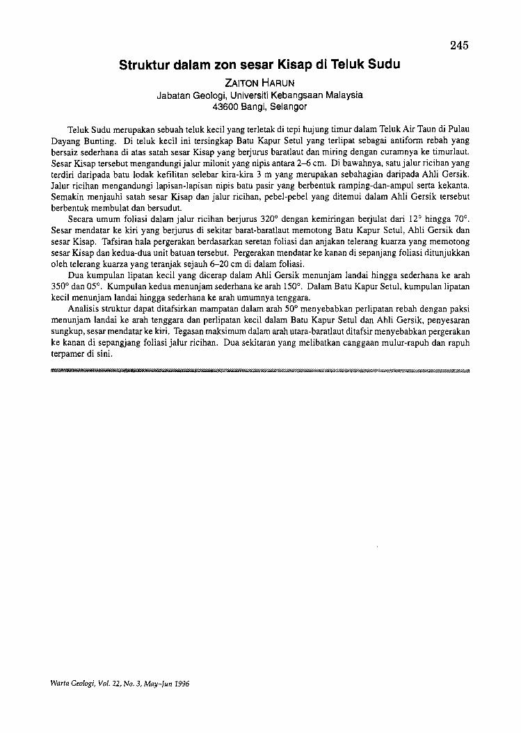
Struktur dalam zon sesar Kisap di Teluk Sudu ZAITON HARUN
Jabatan Geologi, Universiti Kebangsaan Malaysia 43600 Bangi, Selangor
245
Teluk Sudu merupakan sebuab teluk keeil yang terletak di tepi hujung timur dalam Teluk Air Taun di Pulau Dayang Bunting. Di teluk keeil ini tersingkap Batu Kapur Setul yang terlipat sebagai antiform rebah yang bersaiz sederhana di atas satab sesar Kisap yang berjurus baratlaut dan miring dengan euramnya ke tim uri aut. Sesar Kisap tersebut mengandungi jalur milonit yang nipis antara 2-6 em. Di bawahnya, satu jalur ricihan yang terdiri daripada batu lodak kefilitan selebar kira-kira 3 m yang merupakan sebahagian daripada Ahli Gersik. Ialur rieihan mengandungi lapisan-Iapisan nipis batu pasir yang berbentuk ramping-dan-ampul serta kekanta. Semakin menjauhi satah sesar Kisap dan jalur rieihan, pebel-pebel yang ditemui dalam Ahli Gersik terse but berbentuk membulat dan bersudut.
Seeara umum foliasi dalam jalur rieihan berjurus 320° dengan kemiringan berjulat dari 12° hingga 70°. Sesar mendatar ke kiri yang berjurus di sekitar barat-baratlaut memotong Batu Kapur Setul, Ahli Gersik dan sesar Kisap. Tafsiran hala pergerakan berdasarkan seretan foliasi dan anjakan telerang kuarza yang memotong sesar Kisap dan kedua-dua unit batuan tersebut. Pergerakan mendatar ke kanan di sepanjang foliasi ditunjukkan oleh telerang kuarza yang teranjak sejauh 6-20 em di dalam foliasi.
Dua kumpulan lipatan keeil yang dieerap dalam Ahli Gersik menunjam landai hingga sederhana ke arah 350° dan 05°. Kumpulan kedua menunjam sederhana ke arab 150°. Dalam Batu Kapur Setul, kumpulan lipatan keeil menunjam landai hingga sederhana ke arab umumnya tenggara.
Analisis struktur dapat ditafsirkan mampatan dalam arah 50° menyebabkan perlipatan rebab dengan paksi menunjam landai ke arab tenggara dan perlipatan keeil dalam Batu Kapur Setul dan Ahli Gersik, penyesaran sungkup, sesar mendatar ke kiri. Tegasan maksimum dalam arab utara-baratlaut ditafsir menyebabkan pergerakan ke kanan di sepangjang foliasi jalur rieihan. Dua sekitaran yang me1ibatkan eanggaan mulur-rapuh dan rapuh terpamer di sini.
fII W! Hi i
Warta Geologi, Vol. 22, No.3, May-Jun 1996
SOCIETY'S ·BATIKSHIRT . ... ..... ... .~
Computer-designed and handprinted with the latest technology of hand printing from the East Coast, the Society's batik shirt is of soft, rayon material and comes in a cool, soothing, grey colour.
The Society's logo is craftily concealed in the background so that besides the Society's functions you can even wear your batik shirt anywhere, anytime!
Priced reasonably at MR60, the batik shirt is a real bargain and worth adding to your wardrobe. So place your orders now before stocks run out!
For further inquiries:
GSM Batik Shirt, Geological Society of Malaysia, Geology Department, University of Malaya, 50603 Kuala Lumpur.
Tel.: (603) 7577036 Fax.: (603) 7563900
......................................................... Order Form .................................................. .
GSM Batik Shirt, Geological Society of Malaysia, Geology Department, University of Malaya, 50603 Kuala Lumpur.
GSM Batik Shirt
I would like to purchase ................................................ GSM batik shirt(s).
The size or sizes are as follows:
S D No. ofshirt(s) ................. .
M D No. ofshirt(s) ................. .
L D No. ofshirt(s) ................. .
XL D No. ofshirt(s) ................. .
Enclosed please find a cash/check/money orderlbank draft* for RM ....................... . made to "Geological Society of Malaysia" for the purchase [* Please delete where applicable].
For overseas orders please write in to indicate ordinary mail or air mail and you will be charged accordingly.
Please mail to:
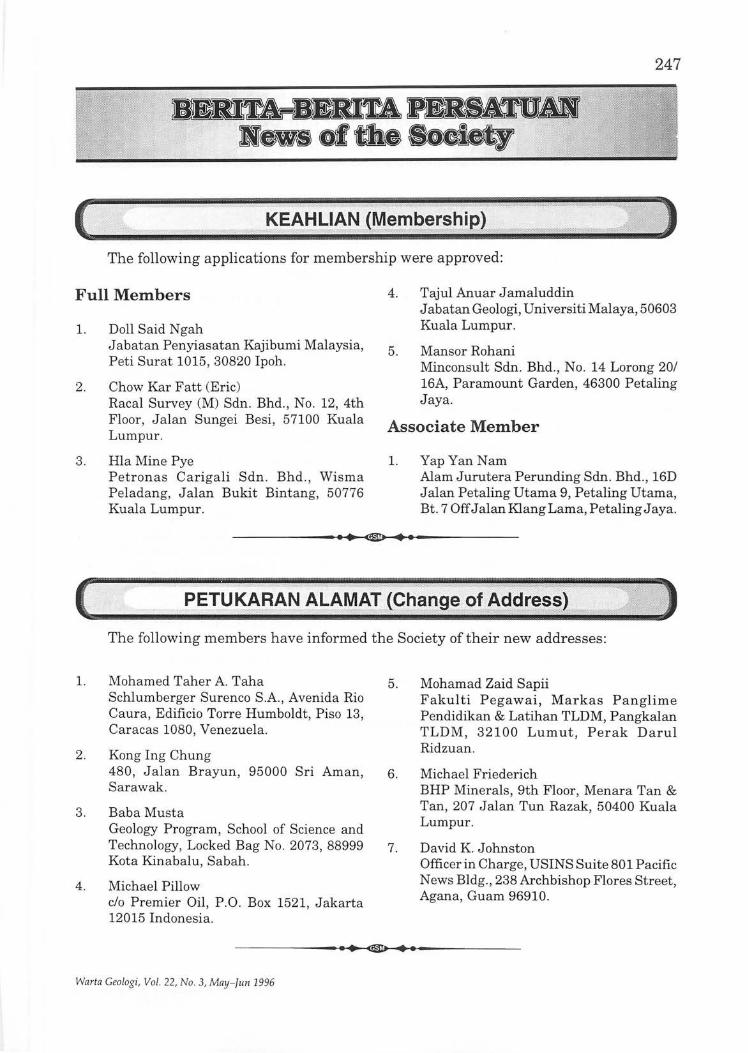
247
KEAHLIAN
The following applications for membership were approved:
Full Members
l. Doll Said N gah J abatan Penyiasatan Kajibumi Malaysia, Peti Surat 1015, 30820 Ipoh.
2. Chow Kar Fatt (Eric) Racal Survey (M) Sdn. Bhd., No. 12, 4th Floor, Jalan Sungei Besi, 57100 Kuala Lumpur.
3. Hla Mine Pye Petronas Carigali Sdn. Bhd ., Wisma Peladang, J alan Bukit Bintang, 50776 Kuala Lumpur.
4. Tajul Anuar Jamaluddin J abatan Geologi, Universiti Malaya, 50603 Kuala Lumpur.
5. Mansor Rohani Minconsult Sdn. Bhd., No. 14 Lorong 20/ 16A, Paramount Garden, 46300 Petaling Jaya.
Associate Member
l. Yap Yan Nam Alam Jurutera Perunding Sdn. Bhd., 16D Jalan Petaling Utama 9, Petaling Utama, Bt. 7 Off J alan Klang Lama, Petaling J aya.
------------.~.~ . .-~~.~.------------
PETU~8.AN ALAM~IJ~hange of Add
The following members have informed the Society of their new addresses:
l. Mohamed Taher A. Taha Schlumberger Surenco S.A., Avenida Rio Caura, Edificio Torre Humboldt, Pi so 13, Caracas 1080, Venezuela.
2. Kong Ing Chung 480, Jalan Brayun, 95000 Sri Aman, Sarawak.
3. Baba Musta Geology Program, School of Science and Technology, Locked Bag No. 2073, 88999 Kota Kinabalu, Sabah.
4. Michael Pillow c/o Premier Oil, P .O. Box 1521, Jakarta 12015 Indonesia.
5. Mohamad Zaid Sapii Fakulti Pegawai, Markas Panglime Pendidikan & Latihan TLDM, Pangkalan TLDM , 32100 Lumut, Perak Darul Ridzuan.
6. Michael Friederich BHP Minerals, 9th Floor, Menara Tan & Tan, 207 J alan Tun Razak, 50400 Kuala Lumpur.
7. David K. Johnston Officer in Charge, USINS Suite 801 Pacific News Bldg., 238 Archbishop Flores Street, Agana, Guam 96910.
------------~.~ . .-~~.~.~.-----------
Warta Geologi, Vol. 22, No.3, May-fun 1996
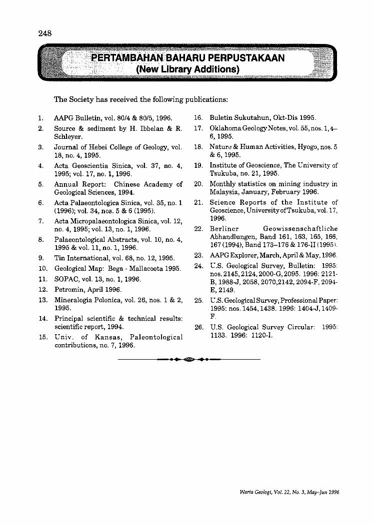
248
.BAHARU PERPUSTAKAAN Library Additions}
The Society has received the following publications:
1. AAPG Bulletin, vol. 80/4 & 80/5, 1996.
2. Source & sediment by H. Ibbelan & R. Schleyer.
3. Journal of Hebei College of Geology, vol. 18, no. 4, 1995.
4. Acta Geoscientia Sinica, vol. 37, no. 4, 1995; vol. 17,no. 1, 1996.
5. Annual Report: Chinese Academy of Geological Sciences, 1994.
6. Acta Palaeontologica Sinica, vol. 35, no. 1 (1996); vol. 34, nos. 5 & 6 (1995).
7. Acta Micropalaeontologica Sinica, vol. 12, no. 4, 1995; vol. 13,no. 1, 1996.
8. Palaeontological Abstracts, vol. 10, no. 4, 1995 & vol. 11, no. 1, 1996.
9. Tin International, vol. 68, no. 12, 1995.
10. Geological Map: Bega - Mallacoota 1995.
11. SOPAC, vol. 13, no. 1, 1996.
12. Petromin, April 1996.
13. Mineralogia Polonica, vol. 26, nos. 1 & 2, 1995.
14. Principal scientific & technical results: scientific report, 1994.
15. Univ. of Kansas, Paleontological contributions, no. 7, 1996.
16. Buletin Sukutahun, Okt-Dis 1995.
17. Oklahoma Geology Notes, vol. 55, nos. 1, 4-6,1995.
18. Nature & Human Activities, Hyogo, nos. 5 & 6,1995.
19. Institute of Geoscience, The University of Tsukuba, no. 21, 1995.
20. Monthly statistics on mining industry in Malaysia, January, February 1996.
21. Science Reports of the Institute of Geoscience, UniversityofTsukuba, vol. 17, 1996.
22. Berliner Geowissenschaftliche Abhandlungen, Band 161, 163, 165, 166, 167 (1994), Band 173-176 & 176-11 (1995).
23. AAPG Explorer, March, April & May, 1996.
24. U.s. Geological Survey, Bulletin: 1995: nos. 2145, 2124, 2000-G, 2095. 1996: 2121-B, 1988-J, 2058, 2070,2142, 2094-F, 2094-E,2149.
25. U.S. Geological Survey, Professional Paper: 1995: nos. 1454, 1438. 1996: 1404-J,1409-F.
26. U.S. Geological Survey Circular: 1995: 1133. 1996: 1120-1.
------------.. ~.--~~.~.~.-----------
Warta Geologi, Vol. 22, No.3, May-Jun 1996
249
Loc:al Nevvs
Second Genting tunnel almost ready
Second tunnel... . .. The new Genting Sempah tunnel located at Km 17 of the KarakKuala Lumpur highway looks well on its way to completion with the area outside levelled for road building works.
Measuring 800 m in length, 10 m in width and 8 m in height, the second tunnel will ease the traffic flow through the first tunnel on the left.
Excavation at both ends of the tunnel is expected to end in June , after which the contractor will have one year to clean and install
the fixtures in the tunnel. It will also be fully automated according to
international standards and will be fitted with sufficient lighting, ventilation system and a carbon monoxide monitor.
Being a one-way tunnel , it is also environment-friendly as oxygen and carbon monoxide is able to circulate freely as compared with a two-way tunnel where the opposing traffic keeps the carbon monoxide and oxygen stagnant.
NST, 1.5.1996
Tioxide group to increase production The Tioxide group, the world's second largest
producer of titanium dioxide, of which Tioxide (M) Sdn. Bhd. is a member, is to increase its capacity to 670,000 tonnes a year by 1997.
Its Teluk Kalong's operations general manager Mike Cottingham said the plan was part of its worldwide expansion programme involving 13 manufacturing plants in nine countries. The group is also pursuing a joint venture for a new plant in China.
However, Cottingham said its Telok Kalongbased company had already reached its target of producing 50,000 tonnes of white pigments last year.
"We hope to produce more than 100,000 tonnes in the next five to 10 years, "he told Star Business recently.
The white pigment is mainly used in paints , coating and ink industries.
He added the company's worldwide target was 670,000 tonnes annually, to be produced in Tioxide's plants in Britain , France, Spain, Australia, Canada and South Africa .
He also said the company's products were
Warta Ce%gi, Vol. 22, No.3, May-filII 1996
safe and non-toxic. "Tioxide feels strongly in safeguarding the
environment and is aware of the importan ce to treat water disposal carefully as it is th e main concern to the community at large.
"The company applies and monitors a stringent safety, health and environmental policy as it is our responsibility," he said.
He said the company gave extra attention to discharges in Chukai where turtle hatcheries and coral reefs needed protection.
He said waste disposals , which consisted of impurities from the raw materials and u sed wash water, would be fully neutralised.
The plant, located on a 160 ha site , exported 80 per cent of its white pign1ents production while the rest is for local consumption.
The company had another 40 h a of land which would be used for future expansions including a proposed green area , he said.
The firm recently recorded an impressive safety milestone when it clocked up three million manhours without a reportable accident .
Star, 6.5.1996
250
Geo-technic audits for high impact projects High impact development projects near
human settlements will have to undergo independent geo-technic audits under the amended Environmental Quality Act.
The audits will detail any usage of technology and equipment in addition to the long-term effects on soil to avoid potential catastrophes.
The actual.Jmplementation of the audit is being studied by the Environmental Quality Council pending the act's passage through parliament.
Under the amendments, selected projects perceived as having a high impact on the soil structure and geological stability will be subject to the audit, said Science, Technology and Environment Minister Datuk Law Hieng Ding after opening the 12th Southeast-Asian geotechnical conference today.
The audit is being considered for soilintensive projects and toxic and hazardous waste generating projects.
Unlike environmental impact assessments which are restricted to prescribed activities like development on ex-mining land, ex-landfills, coastal areas and hillsides, geo-technic audits will be imposed according to project type.
Law, who has just returned from the convention on sustainable development in New York, said he had approached the G-7 and other developed nations to honour their pledges for financial and technological support in developing sustainable programmes.
"We do not want outdated technology in our battle to attain sustainable development because this will merely be a shift of the problem from the developed to the developing countries, » he said.
Sun, 7.5.1996
Tin producers' body scraps quota system The Association of Tin Producing Countries'
executive committee, at the end of its three-day meeting in Kuala Lumpur yesterday, decided that the 10th supply ration-alisation scheme or quota system would cease to exist after June 30 this year.
However, the tin market situation would continue to be monitored by the secretariat and . reports would be submitted to the exco to enable it to "consider all options including the scheme in ATPC's efforts to stabilise the market", the ATPC said in a statement.
The meeting was attended by member countries Bolivia, China, Indonesia, Malaysia, Nigeria and Thailand, except for Australia and Zaire. Brazil and Peru attended as observers.
Primary Industries Minister Datuk Seri Dr. Lim Keng Yaik said he told the previous meeting in Bolivia last October there was no need for the supply rationalisation scheme or SRS because the situation in the tin market had returned to normal.
The stock level is currently about 20,000 tonnes compared to the 120 million tonnes in the 1980's which necessitated the setting up of the scheme to reduce oversupply.
"We have successfully reduced it to 20,000
tonnes and so there is no need to have the scheme anymore. We should now let market forces dictate the exports of ATPC and non-ATPC countries. »
Meanwhile, the fate of the SRS will be decided at the forthcoming conference of ministers meeting to be held in Singapore on September 23-24.
ATPC executive secretary Jumrus Atikul told the agency yesterday that based on feedback from the ATPC secretariat on developments then, the ministers could decide to abolish the scheme and replace it with other mechanisms.
He said: f~ such, the current SRS scheme would cease to operate after June 30, and until the September meeting of the ministers, it would exist in a vacuum.
"However, during the period, the Kuala Lumpur-based secretariat would continue to monitor the market situation and report to the ATPC executive committee to enable it to consider all options, including the SRS, in the association's efforts to stabilise the market. »
The statement said the exco noted that during the first three months (January to March) of the scheme, the estimated total exports of ATPC members at 23,844 tonnes was six per cent below the total permissible export tonnage
Warta Geologi, Vol. 22, No.3, May-Jun 1996
for the period. It estimated that for the whole of this year,
the total exports by ATPC members and Brazil will be within their apportionments.
251
The exco's next meeting will be in Singapore from September 18, followed by the conference· of ministers.
NST,11.5.1996
RM3 toll charge on new highway A toll charge ofRM3 will be imposed on the
35 km Shah Alam Expressway (SAE) from Sri Petaling to Westport in Port Klang when the road is completed in early 1998.
The expressway, being built by Kesas, will have 11 interchanges and three toll plazas charging RM1 for each entry under the open toll system.
Kesas deputy general manager Othman Omar said the company was given a 28-year concession to design, build, operate, maintain and collect toll for the RM1.15 billion project.
"The expressway will reduce congestion on the Federal Highway Route II.
"The interchanges will connect to three other major expressways and further ease traffic congestion.
"The expressway will also serve as a major
inter-urban transportation artery connecting concentrated population centres in the Klang Valley, namely, Kuala Lumpur, Petaling Jaya, Subang Jaya, Shah Alam and Klang, JJ he said.
The expressway will run parallel to the Federal Highway Route II and Jalan Klang Lama.
Kesas will also build rest and service areas along the expressway, which will connect to the North-South Expressway.
"The stretch between Sri Petaling and the Sun way interchange will form part of the Middle Ring Road II thereby dispersing traffic from Kuala Lumpur, JJ Othman said.
He said soil treatment alone would cost about RM500 million because several areas were on mining land.
Star, 13.5.1996
Ceramics industry seeks incentives FMM Malaysia Ceramic Industry Group
(MGIC) hopes that the Government will continue with its pro-active approach to promote growth in the export of ceramic products.
MGIC noted that the Government could provide the necessary catalyst for the growth of the industry by providing more export incentives such as reimplementing the five per cent export incentive.
In the face of increased competition, it also urged the ministry to give the industry "time" to
• III 1l11li lmIJIIU.U
consolidate its position in the global market, suggesting that the Government "not hasten the implementation of the Asean Free Trade Area until the year 2003".
The Federation of Malaysian Foundry and Engineering Industries Associations, meanwhile, said most of the goods produced by federation members were exported via multinational companies which also manufacture those products.
Star, 15.5.1996
Cement demand seen rising to 13.2 m tonnes The cement and Concrete Association of
Malaysia (C & CA) has estimated a 13 per cent growth for cement demand this year to 13.2 million tonnes from 11.7 million tonnes in 1995.
Warta Geologi, Vol. 22, No.3, MLly-Jun 1996
It said in its memorandum to the Ministry of International Trade and Industry (MITD that "some form of control" be put in place to regulate cement import.
252
"This will ensure there is no gross oversupply of cement in the domestic market during the low demand period."
C & CA said the import of cement is expected to continue in 1996 as long as demand is higher than the local supply, anticipating a total of2.5 million tonnes of clinker would be imported into Malaysia.
However, local cement supply is expected to increase after the full commissioning of Kedah Cement Holdings Bhd.'s new line of 1.8 million tonnes in Langkawi from March.
The association also called on the Government to enhance the facilities at the ports in Malaysia as the imported clinker is highly dependent on such facilities.
Furthermore, C & CA proposed the establishment of a common database between the Customs Department, Statistics Department and other agencies to obtain a realistic estimate on cement demand for development projects in Malaysia.
..
Meanwhile, the association "regretted" the new electricity rates implemented by Tenaga N asional which could increase to operating cost of an integrated cement plant to as much as RM2 million yearly.
It requested MITI to "use its influence on Tenaga" to offer off peak rates for weekends as practised in some countries.
Concrete Products Industry Group (CPIG) has proposed that the Government insist that only concrete products conforming to the Malaysian or ISO standards are used to ensure safety and growth of the local industry.
It also suggested that Malaysian standards be drawn up for all pre-cast concrete products currently being manufactured locally.
"This will enable manufacturers to produce according to the safety and quality guidelines stated and to standardise dimensions and specifications so as to minimise waste and maximise productivity."
Star, 15.5.1996
Longest elevated highway in city Projek Lintasan Kota Sdn. Bhd. today signed
a 33-year concession with the Federal Government to construct and operate the country's longest elevated highway in the city.
Under the terms of the concession, Projek Lintasan Kota, or Prolintas, a subsidiary of Percon Construction Sdn. Bhd., will design, construct, operate and maintain the highway until the year 2029. Percon is wholly owned by Permodalan N asional Berhad.
The 7 km highway, to be built along Jalan Sultan Ismail and Jalan Ampang - two of the city's busiest streets - would provide a much needed alternative access into the city.
Travelling time from Ampang into the city will be cut from the one hour to 23 minutes via the highway.
Estimated to cost RM700 million, the highway will be built about seven metres above the ground level using state-of-the-art construction technology. It will be built in two phases along both sides of the banks of Sungai Klang and Sungai Ampang.
The first phase will comprise a double-deck three-lane carriageway from J alan Sultan Ismail to Jalan Jelatek and then continue to Jalan
Ampang. The second phase will consist of a single deck three-lane carriageway from Jalan Jelatek to Jalan Ampang.
Prolintas chairman Tan Sri AinuddinAbdul Wahid said work on the first phase would begin now and was expected to be completed in three years. For the second phase, work will start when the traffic volume on the first phase reaches 93,600 vehicles per day or before the year 2013, whichever is earlier.
Ainuddin said rapid development had resulted in massive traffic congestion especially along the east-west corridor from Ampang/Ulu Klang to the city centre where traffic movement was confined to the Golden Triangle (Jalan Sultan Ismail, J alan Tun Razak and J alan Ampang area).
Studies carried out by Prolintas showed that close to 40,000 vehicles use the Ampang route to the city centre daily and the number is expected to reach 55,000 by the year 2005.
"Prolintas has found that an elevated highway is the best solution to deal with the congestion before it deteriorates further.
"Not only will it provide an alternative access, it will ensure minimal disturbance in an area
Warta GeoloJ{i, Vol. 22, No.3, May-Tun 1996
where space is limited and congested," he said after the agreement signing ceremony at the Regent Hotel.
Ainuddin said the highway would also help reduce traffic congestion in the Golden Triangle which was still developing rapidly.
Seven interchanges will be built along the highway to facilitate efficient traffic flow. They will be atJ alan Sultan Ismail, the Kuala Lumpur City Centre, Jalan Tun Razak, Jalan Ampang, J alan J elatek, J alan Ulu Klang and J alan Kerja Air Lama.
When operational, the highway will adopt an open toll system in which motorists pay a fixed toll for each vehicle category. Motorists can choose to leave the highway at any interchange ..
The toll plaza will be located between the J alan Tun Razak andJ alanJ elatek interchanges.
Prolintas has been given the exclusive right to collect toll from motorists using the highway during the concession period. The company is
Rockfall at N-S highway Heavy vehicles have been diverted from a
stretch of the North-South Expressway following a rockfall yesterday that has been described as "not serious".
The diversion is a precaution as it is feared that vibrations from heavy vehicles could cause further rockfalls.
Light vehicles can still use the stretch. No one was injured in the incident which
occurred at Km 263.7 of the highway and 2 km from the Changkat J ering tunnel and one kilometre from the Jelapang toll plaza about 3 am.
Granite boulders weighing between three and five tonnes fell about five metres off the slopes along the highway.
North-bound heavy vehicles have been directed to exit at Jelapang while those heading south should get out at the Kuala Kangsar toll plaza.
Policemen and PLUS officials are directing traffic.
Works Minister Datuk Seri S. Samy Vellu,
Warta Geologi, Vol. 22, No.3, MaY-IIIII 1996
253
allowed to raise the toll rate five times during the concession period.
Ainuddin who gave an assurance that the toll rate would be reasonable said Prolintas was still negotiating the matter with the Government.
Works Minister Datuk Seri S. Samy Vellu, whose speech was read by Parliamentary Secretary to the Ministry Yong Khoon Seng at the signing ceremony said the Government had agreed to give a loan of RM180 million for the project.
'With the loan, it is hoped the company will be able to complete the project according to schedule," he said.
Samy Vellu also said that the highway was the most expensive to be built in the country to date.
The concession agreement was signed by Ainuddin and Works Ministry's secretarygeneral Datuk Yahya Yaacob.
Percon is the main contractor for the project.
NST, 17.5.1996
who visited the area yesterday, said preventive measures taken in anticipation of such an occurrence at the time of construction had prevented a possible disaster.
He said "rock slope stabilisation" measures that were aimed at strengthening and stabilising the slope, particularly this stretch of exposed granite outcrop, had largely helped avert a greater danger to motorists.
He said the measures undertaken after consultation with experts were rock downel's (bolts driven through loose rock to secure and stabilise them), wire-netting to prevent rocks from falling onto the road, rock traps to prevent falling boulders from reaching the road and horizontal drains to release water pressure from within.
He said an investigation would be carried out to determine if there is a possibility of more rockfall.
He said if necessary, loose rocks would be brought down.
S. Mail, 26.5.1996
256
Indonesia and the Philippines who had already implemented new proactive mineral codes that had attracted much foreign investment in the exploitation of their mineral resources.
u
"It is still not too late to implement the policy or else all foreign investors would venture into mineral extraction activities in other countries," he said.
NST, 31.5.1996
Study on second Kenyir dam to be ready by year-end Ajoint viability study for the construction of
a second hydroelectric dam at Kenyir river, between the State Government and Tenaga Nasional Bhd., will be completed at the end of this year.
Menteri BesarTan Sri Wan Mokhtar Ahmad said the area identified for the dam was at Besul, located at the upper reaches of Kenyir River.
"The Economic Planning Unit in the Prime Minister's Department had asked the State Government and Tenaga Nasional to conduct a study in the area.
"This follows the agreement by the State Government to a fresh proposal by Tenaga Nasional, "he told reporters after opening a new RM2.6 million Tenaga N asionalmain sub-station at Kampung Raja today.
Wan Mokhtar said under the proposal, Tenaga N asional had stated that the dam construction would affect between 4,800 and 6,000 hectares of primary forest compared to 16,000 hectares under the first proposal.
On the cost of the dam and the amount of electricity to be produced, he said it was too early to say anything at the moment.
WJlIIIli I ~ 1111 IIlfIIi IiUE
However, he said with the second hydroelectric dam, Terengganu would be the biggest power supplier in Peninsular Malaysia.
Earlier, Tenaga Nasional executive chairman Tan Sri Dr. Ani Arope, in his speech read by senior general manager (power supply) Mohd Yusof Ibrahim, said the company would spend RM240 million to build 16 main stations up to the year 2000.
He said on completion, Tenaga N asional would be able to supply 1,140 megawatts of electricity, which was three times more than the amount available now.
In addition, he said, the company would spend RM16 million between this year and next year to set up high and low voltage distribution networks throughout Terengganu.
Ani said Tenaga N asional had succeeded in reducing power supply disruption in Terengganu by 81 per cent.
On the company's support for the State's industrialisation programme, he said Tenaga Nasional had given five per cent discount for a period of two years to any new industries set up in the State.
NST, 3.6.1996
Minerals Development Board to be set up A National Minerals Development Board
will be set up to oversee the development of the mineral industry in the country.
Primary Industries Minister Datuk Seri Dr. Lim Keng Yaik said this was part of the efforts to make the industry export-orientated by identifying more down-stream activities.
"We hope to build a new mineral sector. We will identify valuable materials available in the country so that we can develop them into an export-orientated sector. "
Lim was speaking to reporters after officiating at a seminar on Latest Thinking on Positioning: The World's #1 Business Strategy by positioning and marketing strategists Jack Trout and Steve Rivkin.
He said as part of the industry's restructuring, the Mines; Geology; and the Mines Research Departments would be amalgamated.
A paper on the amalgamation would be submitted to Parliament possibly by the end of this year. There was also a need to revamp the
Warta Geologi, Vol. 22, No.3, May-Jun 1996
where space is limited and congested," he said after the agreement signing ceremony at the Regent Hotel.
Ainuddin said the highway would also help reduce traffic congestion in the Golden Triangle which was still developing rapidly.
Seven interchanges will be built along the highway to facilitate efficient traffic flow. They will be atJ alan Sultan Ismail, the Kuala Lumpur City Centre, Jalan Tun Razak, Jalan Ampang, J alan J elatek, J alan Ulu Klang and J alan Kerja Air Lama.
When operational, the highway will adopt an open toll system in which motorists pay a fixed toll for each vehicle category. Motorists can choose to leave the highway at any interchange ..
The toll plaza will be located between the J alan Tun Razakand J alanJ elatekinterchanges.
Prolintas has been given the exclusive right to collect toll from motorists using the highway during the concession period. The company is
Rockfall at N-S highway Heavy vehicles have been diverted from a
stretch of the North-South Expressway following a rockfall yesterday that has been described as "not serious".
The diversion is a precaution as it is feared that vibrations from heavy vehicles could cause further rockfalls.
Light vehicles can still use the stretch. No one was injured in the incident which
occurred at Km 263.7 of the highway and 2 km from the Changkat Jering tunnel and one kilometre from the Jelapang toll plaza about 3 am.
Granite boulders weighing between three and five tonnes fell about five metres off the slopes along the highway.
North-bound heavy vehicles have been directed to exit at J elapang while those heading south should get out at the Kuala Kangsar toll plaza.
Policemen and PLUS officials are directing traffic.
Works Minister Datuk Seri S. Samy Vellu,
Warta Geologi, Vol. 22, No.3, May-JIIII 1996
253
allowed to raise the toll rate five times during the concession period.
Ainuddin who gave an assurance that the toll rate would be reasonable said Prolintas was still negotiating the matter with the Government.
Works Minister Datuk Seri S. Samy Vellu, whose speech was read by Parliamentary Secretary to the Ministry Y ong Khoon Seng at the signing ceremony said the Government had agreed to give a loan of RM180 million for the project.
'With the loan, it is hoped the company will be able to complete the project according to schedule," he said.
Samy Vellu also said that the highway was the most expensive to be built in the country to date.
The concession agreement was signed by Ainuddin and Works Ministry's secretarygeneral Datuk Yahya Yaacob.
Percon is the main contractor for the project.
NST,17.5.1996
who visited the area yesterday, said preventive measures taken in anticipation of such an occurrence at the time of construction had prevented a possible disaster.
He said "rock slope stabilisation" measures that were aimed at strengthening and stabilising the slope, particUlarly this stretch of exposed granite outcrop, had largely helped avert a greater danger to motorists.
He said the measures undertaken after consultation with experts were rock downel's (bolts driven through loose rock to secure and stabilise them), wire-netting to prevent rocks from falling onto the road, rock traps to prevent falling boulders from reaching the road and horizontal drains to release water pressure from within.
He said an investigation would be carried out to determine ifthere is a possibility of more rockfall.
He said if necessary, loose rocks would be brought down.
S. Mail, 26.5.1996
254
MCM expects tin price to improve further this year The Malaysian Chamber of Mines (MCM)
expects the price of tin to improve further this year making the industry more attractive for investments.
MCM secretary-cum-executive director Muhamad Nor Muhamad said in its annual report that the expected price hike would bring about a reversal in tin production levels in the country which had declined in recent years.
He said last year's tin price saw a six-year high at RM17.60 per kg. This was posted in August when the KL Tin Market (KLTM) peaked following a strong market rally.
Towards the end of 1995, the KLTM price retreated to around RM15.82, having opened the year at around RM15.22. The KLTM price averaged RM15.54 per kg for 1995 compared with RM14.12 in 1994.
Muhamad said domestic production of tinin-concentrates in 1995 showed a marginal decline to 6,402 tonnes from 6,458 tonnes in 1994, primarily due to the depletion of economic deposits and unrenumerative tin prices.
He said, however, consumption by the local tin-based manufacturing industry rose by 13 per cent to reach 6,350 tonnes compared to 5,614 tonnes in 1994.
On the minerals industry, the chamber plans to submit with its tax memorandum a proposal on fiscal measures to help revitalise the much maligned Malaysian minerals industry.
Last year's memorandum highlighted the status and performance of the minerals industry and emphasised the important supportive role it plays in the country's booming manufacturing sector.
Muhamad said with the growing demand for minerals as raw materials to fuel the robust
manufacturing sector, it was imperative for the country to adopt long-range mineral policies to ensure adequate and uninterrupted supply.
Policies should include investment incentives to promote industries, tax incentives for environmental protection measures, the lifting of import duty on specialised exploration and mining equipment and tax incentives for overseas mining investment.
The chamber is also proposing that investment incentives, granted to promoted industries, be extended to the minerals industry as such incentives attract investments.
The country's foreign exchange revenue from exports of tin metal in 1995 totalled RM545 million.
However, imports of tin-in-concentrates were valued atRM515 million, comparedwithRM470 million in 1994, resulting in a lower RM29 million in the net export revenue against RM36 million the previous year.
Malaysia exported 35,216 tonnes of refined tin in 1995, down by 101 tonnes compared with 35,317 tonnes exported the previous year. Exports included tin-in-concentrates imported for smelting and re-exported by two Penang smelters.
During the year, 34,871 tonnes of tin-inconcentrates were imported mainly from Peru (14,299), Australia (5,552), Portugal (3,822), China (2,379), Vietnam (1,996) and Bolivia (1,020).
The bulk of Malaysia's exports of tin metal in 1995 were shipped to Japan (7,920), the Netherlands (5,734), South Korea (3,865), Taiwan (1,651), Australia (1,996) and the United States (1,492).
Star, 27.5.1996
Ell IiimIilWL
Geologists get data on rockfall area The Geological Survey Department has
collected data to identify weak rock foundation between the Ipoh-ChangkatJering of the N orthSouth Expressway.
Its assistant director-general, T. Suntharalingam, said a group of geological officers were sent to the site to carry out a study after a rockfall, consisting of granites stones
weighing between three and five tonnes. The rocks fell off the slopes about a kilometre
from the Jelapang toll plaza last Saturday. No one was injured in the incident which occurred about 3 am.
''We have collected the necessary data for our laboratory analysis," he said when contacted at his office today.
Warta Geolo!!.";, Vol. 22, No.3, May-Tlln 1996
Suntharalingam said the outcome of their findings would be submitted to the relevant parties.
He said this in response to a statement by State Infrastructure and Public Utilities Committee Chairman Datuk Ong Ka Chuan who called on the department to work closely with ProjekLebuhraya Utara-Selatanindrawing up a comprehensive rock structure plan between the Ipoh and Changkat Jering stretch.
Ong said the plan would enable PLUS to take early preventive measures that could avert a possible disaster.
This section stretches about 10 km through complex terrain that is mostly hilly in nature, unlike most parts of the expressway which is
II
255
located on flat land. Meanwhile PLUS in a statement said that
the "fast lane" between Km 262.7 and Km 265.1 along the Kuala Kangsar-Ipoh stretch has been reopened.
The stretch of the expressway was temporarily closed since last Saturday after the rockfall incident.
However, the "slow and emergency" lanes along the stretch remain closed until further notice.
PLUS advised all users travelling along the affected stretch to drive slowly and exercise extra care and abide by all traffic directional signages.
NST, 31.5.1996
Miners want power discount restored The Malaysian Chamber of Mines wants the
Government to restore the 25 per cent discount granted to miners for their electricity consumption.
Chamber president Ab Sukor Shahar said today it sent a memorandum on the request last week to Energy, Telecommunications and Posts Minister Datuk Leo Moggie.
"The Government should support us by continuing to give the discount because the price of tin has gone down and costs have continued to escalate,» he told reporters after chairing the chamber's 85th annual general meeting at the Casuarina Hotel.
Sukor, who was returned unopposed for the fifth term, said Tenaga N asional Bhd. withdrew the discount effective last March.
The Malaysian mining industry, being a major electricity user , was accorded the discount due to hardship it was facing as a result of the collapse of the in market in late 1985.
Despite a move in 1992 to withdraw the discount due to higher fuel prices resulting from the Gulf War, it was maintained for the mining industry as a special consideration because of the continuing difficulties faced by the tin mining industry due to low tin prices.
Sukor said the cost of electrical power was a major component of total mining costs.
"Electricity consumption constitutes some 25 per cent of overall production costs, he said.
He said the 25 per cent electricity tariff
Warta Geologi, Vol. 22, No.3, May-fun 1996
discount granted by the then public sector-owned National Electricity Board had been crucial in sustaining the tin mining industry in previous years.
"With the increase in labour, diesel and equipment costs, the discount had indeed been a major incentive in helping maintain overall production costs at a level that has enabled miners to survive the difficult conditions,» he said.
In another development, Sukor said Malaysia seemed to be overlooking the indispensability of minerals to the nation's industrialisation.
"If there is no mining, we will have to import the minerals from elsewhere,» he said, adding that this could increase Malaysia's trade deficit.
He said mining was part and parcel of industrialisation and the notion that it was a sunset industry was wrong.
In this regard, he said the Government should expedite implementing the National Minerals Development Policy which was formulated in 1992.
"Diversification process in the minerals industry has progressed steadily but the policy and legislative framework to provide for effective, efficient and competitive regulatory environment is not in place, " he said.
Sukor said until such time the policy was finalised, Malaysia's minerals industry would continue to lag behind her neighbours like
256
Indonesia and the Philippines who had already implemented new proactive mineral codes that had attracted much foreign investment in the exploitation of their mineral resources.
I III III m
<tIt is still not too late to implement the policy or else all foreign investors would venture into mineral extraction activities in other countries, " he said.
NST, 31.5.1996
Study on second Kenyir dam to be ready by year-end Ajoint viability study for the construction of
a second hydroelectric dam at Kenyir river, between the State Government and Tenaga N asional Bhd., will be completed at the end of this year.
Menteri BesarTan Sri W an Mokhtar Ahmad said the area identified for the dam was at Besul, located at the upper reaches of Kenyir River.
<tThe Economic Planning Unit in the Prime Minister's Department had asked the State Government and Tenaga Nasional to conduct a study in the area.
"This follows the agreement by the State Government to a fresh proposal by Tenaga Nasional, "he told reporters after opening a new RM2.6 million Tenaga Nasionalmain sub-station at Kampung Raja today.
Wan Mokhtar said under the proposal, Tenaga N asional had stated that the dam construction would affect between 4,800 and 6,000 hectares of primary forest compared to 16,aOO hectares under the first proposal.
On the cost of the dam and the amount of electricity to be produced, he said it was too early to say anything at the moment.
I 1111
However, he said with the second hydroelectric dam, Terengganu would be the biggest power supplier in Peninsular Malaysia.
Earlier, Tenaga Nasional executive chairman Tan Sri Dr. Ani Arope, in his speech read by senior general manager (power supply) Mohd Yusof Ibrahim, said the company would spend RM240 million to build 16 main stations up to the year 2000.
He said on completion, Tenaga N asional would be able to supply 1,140 megawatts of electricity, which was three times more than the amount available now.
In addition, he said, the company would spend RM16 million between this year and next year to set up high and low voltage distribution networks throughout Terengganu.
Ani said Tenaga N asional had succeeded in reducing power supply disruption in Terengganu by 81 per cent.
On the company's support for the State's industrialisation programme, he said Tenaga N asional had given five per cent discount for a period of two years to any new industries set up in the State.
NST, 3.6.1996
Minerals Development Board to be set up A National Minerals Development Board
will be set up to oversee the development of the mineral industry in the country.
Primary Industries Minister Datuk Seri Dr. Lim Keng Yaik said this was part of the efforts to make the industry export-orientated by identifying more down-stream activities.
<tWe hope to build a new mineral sector. We will identify valuable materials available in the country so that we can develop them into an export-orientated sector. "
Lim was speaking to reporters after officiating at a seminar on Latest Thinking on Positioning: The World's #1 Business Strategy by positioning and marketing strategists Jack Trout and Steve Rivkin.
He said as part of the industry's restructuring, the Mines; Geology; and the Mines Research Departments would be amalgamated.
A paper on the amalgamation would be submitted to Parliament possibly by the end of this year. There was also a need to revamp the
Warta Geologi, Vol. 22, No.3, May-]un 1996
laws which currently regulated the sector, he added.
Lim said while Malaysia, once the world's biggest tin produce, now produces just enough tin for its own use, there was great potential for the minerals industry.
Even without the stress on exports, the mineral-derived industry, such as cement and concrete products, structural clay products, and glass products, was worth RM8.94 billion last year.
The output of raw material wasworthRM2. 7 billion in 1995. Of this, only RM381.19 million'
257
worth was exported. Lim said the export potential for products
derived from minerals was g!'eat and cited the making of marble from limestone as an example.
He also stressed that the Government would place more emphasis on the development of nonmetallic minerals such as granite, limestone, kaolin and silica which were now mined on a small scale for domestic use.
He said the country was rich in minerals and that it was the responsibility of the Geology department to locate them.
NST, 14.6.1996
Bakun project's cost slashed to RM 13.6b The Bakun hydroelectric dam project's
development cost has been slashed from the proposed RM15 billion to RM13.6 billion as two packages of the power transmission lines have been omitted.
Ekran Bhd. chairman Tan Sri Ting Pek Khiing said yesterday that the proposed RM800 million transmission line from J ohor to Kuala Lumpur would be absorbed by Tenaga Nasional Bhd.whiletheRM600millionprojectfromBakun power house to Bintulu would be taken over by Sarawak Electricity Supply Corp.
He said Ekran had initially proposed to sell the power to Tenaga at 19.8 sen per kilowatt hour based on the RM15 billion dam development cost.
He said the purchase price of water was initially set at one sen per kilowatt hour but it
had been reduced to a nominal 0.2 sen. "With about a 10 per cent cut in total
development cost and a 10 per cent reduction in the proposed power rate to 16.5 sen per kilowatt hour in the first five years and 17 sen per kilowatt hour for the next 25 years, Ekran is getting what we originally have wanted for the tariff rate, II said Ting.
He said the earlier proposed rate of 18 sen per kilowatt hour included the cost for water purchase.
Ting considered the cost of producing hydro power, inclusive of the investment cost in dam construction, was five sen per kilowatt hour.
He said this was much cheaper compared to electricity produced by petroleum, gas or coal.
Star, 15.6.1996
Four firms to lead group in Ekran's Bakun dam construction
Four main companies will lead the group to build Ekran Bhd.'s Bakun dam, and work could begin in three to four months after an agreement is signed, sources close to the project said yesterday.
On Thursday, the Malaysian government announced that a consortium led by SwedishSwiss engineering giantABB Asea Brown Boveri and Brazil's CBPO had won the bidding to build the world's second largest hydroelectric dam to be located in Sarawak.
Warta Geologi, Vol. 22, No.3, May-fun 1996
No Memorandum of Understanding has yet been signed, but sources close to the talks say the RM13.6 billion pact could be formalised by the middle of next week.
After that, "it will take three to four months to organise logistics, .. a source said.
Officials at Ekran, ABB and CBPO were not available for comment yesterday.
A total of nine groups submitted tenders for the Bakun dam project.
The ABB-CBPO group was one of only three
258
groups that was tendering for the entire package of building and designing the dam and transmitting the power.
The other major participants in ABB's consortium are Korea's Hyundai Engineering and Construction and Mexico's Ingenieros Civiles Asociados A.A. de C.V. All four would be involved in the dam building project itself, while ABB also has expertise in building transmission lines.
Bakun's three transmission cables present a particular challenge - they will carry power from Sarawak to Peninsula Malaysia via a recordsetting 650 km undersea line.
Juat a handful of companies including ABB, Pirelli Group and Siemens AG are known to have the expertise to build such lines.
Other smaller companies, including some
II 11M AM
from Malaysia, are expected to receive subcontracts for the mammoth project. Sources close to the talks said the consortium would consist of "at maximum, 10 main companies," with an unknown number of smaller firms doing various parts of the work.
At its peak, some 5,000 workers may be involved in the project, sources said.
The dam, schedules for completion by the year 2002, will be builtin the jungles ofSarawak on the upper reaches of the Rejang River. The project will clear 69,000 ha ofland and flood an area equivalent to the size of Singapore.
Second only to China's Three Gorges Dam, it is expected to generate 1,500-1,800 megawatts of electricity from a total capacity of 2,400 MW.
NST, 15.6.1996
Petronas Carigali Overseas signs exploration pact Petronas Carigali Overseas Sdn. Bhd.
yesterday signed an agreement with British Gas Exploration and Production Ltd. and the Pakistani government to undertakejoint oil and gas exploration in Pakistan's Sindh province.
It signed a deed of assignment with the British firm and the Pakistani government for exploration of the onshore Gambat Block, which cover 6,600 sq km.
It is the second contract signed by Petronas Carigali Overseas in the last three months to undertake oil and gas exploration in Pakistan.
Under the deal, the Malaysian firm holds a 40 per cent working interest and the Pakistani government, a five per cent stake, while the British company holds the remaining 55 per
cent as operator. New seismic data was obtained early this
month and a well is planned to be drilled in the first quarter of next year.
At the signing ceremony in Kuala Lumpur, Petronas Carigali Overseas was represented by Petronas Carigali chief executive officer Datuk Mohammad Idris Mansor while British Gas Exploration's managing director Dr. Pierre Jungels signed for his company.
Director-general of the Petroleum Concessions in the Petroleum and Natural Resources Ministry, Shahid Ahmad, signed for the Pakistani government.
Star, 19.6.1996
I kram engineer: Geotechnical assessments vital for projects
Geotechnical assessments are vital in any development, and failure to do so could result in soil erosion.
An engineer with the Public Works Training Institute, or Ikram, Azman Abdul Samad said today that efforts were being made to draw up guidelines and bylaws on geotechnical aspects for hillside development projects.
He said they were being prepared by the
Housing and Local Government Ministry. He said the ministry was also amending the
Street, Drainage and Building Act 1974 to provide more guidelines for development projects.
"Presently, there are no specific guidelines and bylaws on the need for a geotechnical report for hillside development projects.
"But recent disasters like the collapse of the Highland Towers at Hulu Kelang, Selangor, the
Warta Geologi, Vol. 22, No.3, May-fun 1996
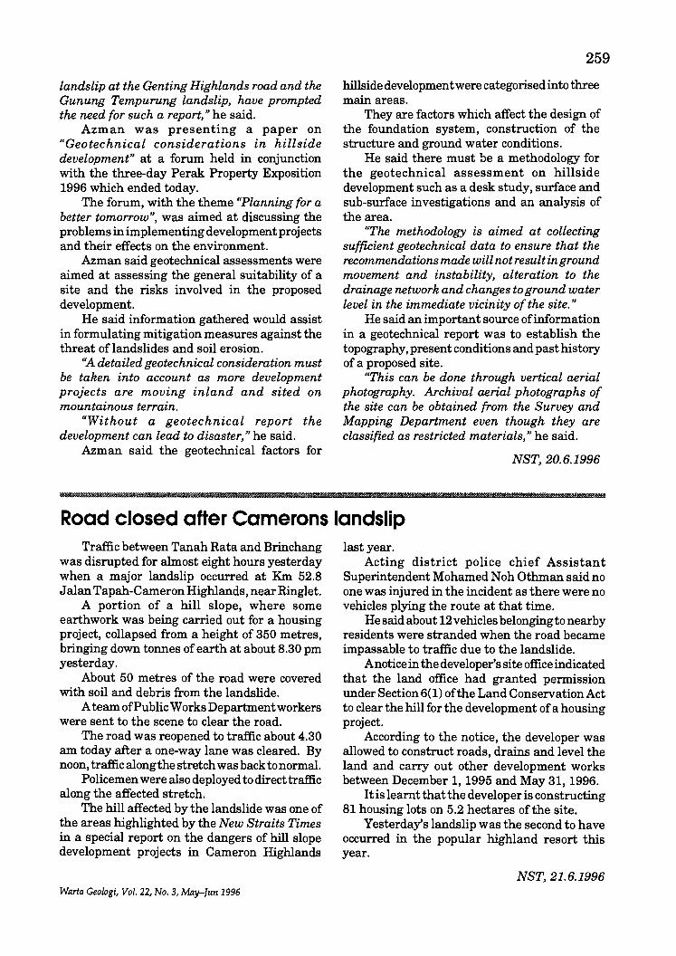
landslip at the Genting Highlands road and the Gunung Tempurung landslip, have prompted the need for such a report," he said.
Azman was presenting a paper on "Geotechnical considerations in hillside development" at a forum held in conjunction with the three-day Perak Property Exposition 1996 which ended today.
The forum, with the theme "Planning for a better tomorrow", was aimed at discussing the problems in implementing development projects and their effects on the environment.
Azman said geotechnical assessments were aimed at assessing the general suitability of a site and the risks involved in the proposed development.
He said information gathered would assist in formulating mitigation measures against the threat of landslides and soil erosion.
"A detailed geotechnical consideration must be taken into account as more development projects are moving inland and sited on mountainous terrain.
"Without a geotechnical report the development can lead to disaster, "he said.
Azman said the geotechnical factors for
IllIIIIIiI
259
hillside development were categorised into three main areas.
They are factors which affect the design of the foundation system, construction of the structure and ground water conditions.
He said there must be a methodology for the geotechnical assessment on hillside development such as a desk study, surface and sub-surface investigations and an analysis of the area.
"The methodology is aimed at collecting sufficient geotechnical data to ensure that the recommendations made will not result inground movement and instability, alteration to the drainage network and changes to ground water level in the immediate vicinity of the site. "
He said an important source ofinformation in a geotechnical report was to establish the topography, present conditions and past history of a proposed site.
"This can be done through vertical aerial photography. Archival aerial photographs of the site can be obtained from the Survey and Mapping Department even though they are classified as restricted materials, "he said.
NST,20.6.1996
Road closed after Camerons landslip Traffic between Tanah Rata and Brinchang
was disrupted for almost eight hours yesterday when a major landslip occurred at Km 52.8 J alan Tapah-Cameron Highlands, near Ringlet.
A portion of a hill slope, where some earthwork was being carried out for a housing project, collapsed from a height of 350 metres, bringing down tonnes of earth at about 8.30 pm yesterday.
About 50 metres of the road were covered with soil and debris from the landslide.
A team of Public Works Departmentworkers were sent to the scene to clear the road.
The road was reopened to traffic about 4.30 am today after a one-way lane was cleared. By noon, traffic along the stretch was back to normal.
Policemen were also deployed to direct traffic along the affected stretch.
The hill affected by the landslide was one of the areas highlighted by the New Straits Times in a special report on the dangers of hill slope development projects in Cameron Highlands
Warta Geologi, Vol. 22, No.3, May-Jun 1996
last year. Acting district police chief Assistant
Superintendent Mohamed Noh Othman said no one was injured in the incident as there were no vehicles plying the route at that time.
He said about 12 vehicles belonging to nearby residents were stranded when the road became impassable to traffic due to the landslide.
Anoticein the developer's site office indicated that the land office had granted permission under Section 6(1) of the Land Conservation Act to clear the hill for the development of a housing project.
According to the notice, the developer was allowed to construct roads, drains and level the land and carry out other development works between December 1, 1995 and May 31, 1996.
It is learnt that the developer is constructing 81 housing lots on 5.2 hectares of the site.
Yesterday's landslip was the second to have occurred in the popular highland resort this year.
NST, 21.6.1996
260
Pahang to preserve its water resources The State Government will no longer open
additional land for agriculture and carry out logging in forest reserves as it wants to preserve the water catchment areas.
Menteri Besar Tan Sri Mohd Khalil Yaakob said today such activities, if allowed to continue, would only reduce the volume of water in the State.
He said water had been earmarked as a commodity that could bring major income for the State.
Speaking to reporters after opening the Koperasi Serbausaha Makmur Berhad annual meeting, Khalil added the State Government had decided that forest reserves be preserved to ensure that the environment was prote.cted.
Khalil said forests could become a resource to attract tourists to Pahang.
«Undoubtedly, if it is preserved, it can bolster
the State's economy and benefit the people. " Khalil also said Pahang could become the
country's largest water supplier as it has vast water catchment areas in forest reserves.
It also has six major rivers, including Sungai Pahang and Sungai Kuantan.
He added the State Government would invest between RM4 billion and RM5 billion on projects to supply water to other States.
"We will ensure that the project will benefit all parties, including the public-listed companies," he said, adding that for a start, Pahang would supply water to Negri Sembilan.
Khalil said Singapore, Perak, Selangor and Johor had indicated interest in buying water.
"We hope Pahang will become the country's largest water supplier in the next 15 to 20 years, " he added.
NST, 24.6.1996
.§
Oil firm set target to cut production costs Oil companies in Malaysia have set a target
of reducing production and development costs by 30 per cent by the year 2000.
Petronas chief executive and president Datuk. Mohd Hassan Marican said the companies, which formed a high-level steering committee in 1994, had identified and undertaken steps such as the reduction of process time and new methods of conducting business.
«The steps have shown some early results, " he told reporters yesterday after launching the first Coral Malaysia Seminar in Kuala Lumpur.
Mohd Hassan said while the price ofUS$25 per barrel by the year 2000 forecast by analysts was fair, production costs are escalating.
In his speech, he said RM26 billion was spent by Petronas and oil companies in Malaysia over the last five years to explore, develop and produce oil and gas.
In the next five years, about RM6 billion will be spent annually to develop one billion barrels of oil reserves and 11 trillion cubic feet of natural gas.
«The traditional way is not going to give us a quantum leap in cost reduction. It calls for extraordinary or even revolutionary approaches to the way we do business."
He stressed that there must be a shift in mindset and general re-orientation of working methods. Focus must be placed on a closer working relationship between oil companies and the support industry.
Mohd Hassan added that the supporting industry must also pursue cost reduction initiatives.
Work processes must be reviewed. For instance, local fabrication yards should adopt technology that can reduce wastage, improve productivity and speed up the fabrication process.
«This is the first time that a discussion on this new approach to business is being held with the supporting industry. I think everyone believes this is a good way forward. "
Members of the supporting industry, Petronas and production sharing contractors such as Esso Production Malaysia Inc., Shell, Petronas Carigali Sdn. Bhd., Occidental Petroleum and Nippon Oil are participating in the three-day Cost Reduction Alliance (Coral).
Mohd Hassan added that the new initiatives can only succeed in an atmosphere of trust and openness, as opposed to one that is now adversarial and lacking in trust.
"Previously, a lot of time and effort was spent
Warta Geologi, Vol. 22, No.3, May-Jun 1996
monitoring and checking each other's movements. We want to work in an atmosphere where monitoring is the exception. II
He elaborated that strategic partnerships with suppliers who are more cost effective should be encouraged.
Furthermore, services should be integrated to reduce duplication and supervision time. The concept of an integrated approach for drilling
H
261
services would allow service providers to form strategic alliances to bid for jobs.
Mohd Hassan said the challenge to reduce costs without compromising on quality, health, safety and environment was not impossible. He cited the example of the development cost of a field in the North Sea, which has been reduced by about 20 per cent to 30 per cent.
NST,25.6.1996
Mulu caves set another world record in number of bats The Mulucaves system in the MuluNational
Park here has set another world record. It has the world's largest number of bats in one place.
The head of the Karst Management Unit in the Wildlife and National Parks Division of the Sarawak Forest Department, David William Gill, said the Deer Cave, itself the world's largest cave passage, was also home to about two million bats.
The unit has identified 12 species of bats in the cave, which is 120 m high and 100 m wide. Gill was addressing a regional symposium on nature tourism organised by the Sarawak Development Institute (SDI) last night. The four-day symposium ends today.
The cave also has the world's largest number of different species of bats in one place, he said, adding that there might be more species of bats not yet identified in the cave.
The bats consume about 10 tonnes of insects every night, after leaving the cave in colonies around 4.30 pm and 6.30 pm.
Gill said the number was arrived at by studying pictures taken of the bats in their colonies and their number calculated and
Warta Geologi, Vol. 22, No.3, May-Jun 1996
multiplied with the estimated number of colonies. "It would be better if we video-tape them and
calculate their number." The Clearwater Cave, the world's longest
cave, is estimated to be 200 km long but only 107 kIn, or 50 per cent, of its entire length has been explored.
Gill also said the world's largest underground chamber, the Sarawak Chamber contrary to popular belief, is open to visitors.
Seven caves in the Mulu National Park are also open for exploration, Gill said.
Only four caves - D~r Cave, Lang Cave, Wind Cave and Clearwater Cave - are open to the public.
Mulu contains over 200 km of mapped and explored caves but much more is left to be discovered.
Last year, about 300 tourists visited the caves which are safe for exploration.
Those interested in exploring the caves must get prior permission from the Sarawak Forestry Department's director and the Sarawak State Secretary.
NST,28.6.1996
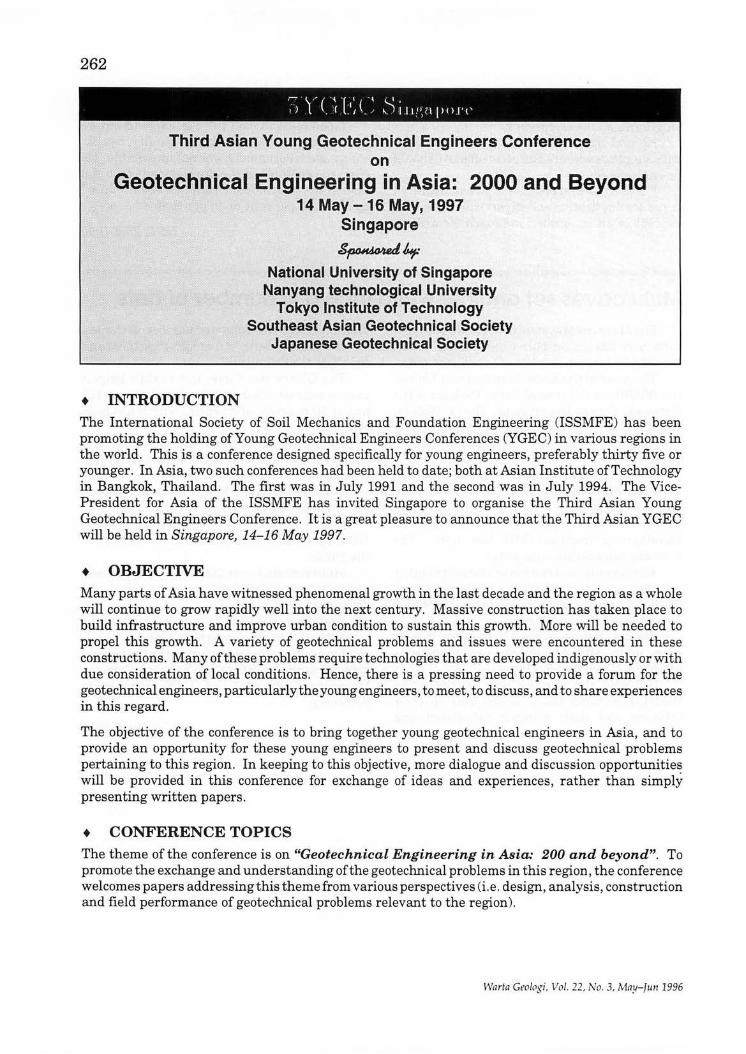
262
Th!,rd Asian Young Geotechnical Engineers Conference :::,.::~;;:
on
Geotechnical Engineering in Asia: 2000 and Beyond 14 May -16 May, 1997
Singapore
~kp National University of Singapore
Nanyang technological University Tokyo Institute of Technology
Southeast Asian Geotechnical Society Japanese Geotechnical Society
• INTRODUCTION The International Society of Soil Mechanics and Foundation Engineering (ISSMFE) has been promoting the holding of Young Geotechnical Engineers Conferences (YGEC) in various regions in the world. This is a conference designed specifically for young engineers, preferably thirty five or younger. In Asia, two such conferences had been held to date; both at Asian Institute of Technology in Bangkok, Thailand. The first was in July 1991 and the second was in July 1994. The VicePresident for Asia of the ISSMFE has invited Singapore to organise the Third Asian Young Geotechnical EnginE;lers Conference. It is a great pleasure to announce that the Third Asian YGEC will be held in Singapore, 14-16 May 1997.
• OBJECTIVE Many parts of Asia have witnessed phenomenal growth in the last decade and the region as a whole will continue to grow rapidly well into the next century. Massive construction has taken place to build infrastructure and improve urban condition to sustain this growth. More will be needed to propel this growth. A variety of geotechnical problems and issues were encountered in these constructions . Many ofthese problems require technologies that are developed indigenously or with due consideration of local conditions . Hence, there is a pressing need to provide a forum for the geotechnical engineers, particularly the young engineers, to meet, to discuss, and to share experiences in this regard.
The objective of the conference is to bring together young geotechnical engineers in Asia, and to provide an opportunity for these young engineers to present and discuss geotechnical problems pertaining to this region. In keeping to this objective, more dialogue and discussion opportunities will be provided in this conference for exchange of ideas and experiences, rather than simply presenting written papers .
• CONFERENCE TOPICS The theme of the conference is on "Geotechnical Engineering in Asia: 200 and beyond". To promote the exchange and understanding of the geotechnical problems in this region , the conference welcomes papers addressing this theme from various perspectives (i.e. design, analysis, construction and field performance of geotechnical problems relevant to the region).
War fn Geologi, Vol. 22, No.3, May- fun 1996
263
Besides the usual geotechnical problems, we also encourage papers that will look at geotechnical problems in the building of infrastructures such as roads, airports, power stations and dams, and also geotechnical projects in ground conditions peculiar to this region.
In particular, we encourage papers that will look at geotechnical engineering problems pertinent to each country. This is to allow fellow young engineers to better understand the problems and conditions in each country. Through this, a rapport can be built between them for the betterment of the people in Asia.
• KEYNOTE LECTURES The conference will have three keynote speakers, one from academia, one from a public engineering organization and one from the private sector, to address the conference theme from their respective perspectives. Three eminent geotechnical professionals in Asia will be invited to deliver these three lectures, and to meet and discuss with the delegates.
• LANGUAGE English will be the official language of the Conference.
• CALL FOR PARTICIPATION Young geotechnical engineers and researchers from Asia countries, preferably thirty five or younger, are invited to participate in this conference.
If you would like to participate in this conference and submit a paper, please submit an abstract of not more than 300 words by 31st July 1996.
The organizer also strongly encourages participation from individuals who do not intend to submit a written contribution but nonetheless would like to meet, discuss and share their experiences with other young geotechnical engineers in this region.
• IMPORTANT DATES Submission of manuscript: Final :.cceptance:
• CONFERENCE FEE
31st January 1996 28th February 1997
Registration fee for all participants is about S$500 per person.
All participants are encouraged to stay in the conference venue for better interaction. The organizer is working out a special package with the conference hotel to ensure an attractive deal.
• CORRESPONDENCE All correspondence regarding the conference should be directed to:
Warta Geologi, Vol. 22, No.3, May-Jun 1996
Dr. T.S. Tan Department of Civil Engineering National University of Singapore
10 Kent Ridge Crescent Singapore 119260 Tel: (65) 772-2160 Fax: (65) 779-1635
E-Mail: [email protected]
264
First . Circular and
· Call For papers
PETROLEUM SYSTEMS OF
S.E. ASIA & AUSTRALASIA tIilkartaIndonesia .. '., .'. . . ,
May 21-23, 1997
An international conference to document and promote the use of petroleum systems concepts in exploration in S.E. Asia and Australasia. Three days of oral and poster sessions, together with pre-conference short courses and post-conference field trips will be offered. A conference proceedings will be published to coincide with the meeting, containing full papers, extended abstracts, and summaries of poster papers, short courses and field trips.
GENERAL TOPICS INCLUDE:
• Integrated Descriptions of Petroleum Systems
• Regional Tectonics and Hydrocarbon Habitats
• Essential elements of Petroleum Systems SourcelMigration Reservoir Traps and Seals Basin Evolution and Timing
• Hydrocarbon Typing and Fluid Correlations
• Modeling and Risk Analysis of Petroleum Systems
Deadline for Short Abstract (200-300 words) : October 1, 1996 Deadline for Full Article or Extended Abstract : February 1, 1997
For details and submission of abstracts contact:
Technical Program Chairman Dr. Ron Noble ARCO Indonesia Inc. PO Box 260888, Plano TX 75026 Tel: 62-21-521-9028 Fax: 62-21-521-9063 E-mail: [email protected]
General Chairman Mr. Jim Howes ARCO Indonesia Inc. PO Box 260888, Plano TX 75026 Tel: 62-21-521-8108 Fax: 62-21-521-9063 E-mail: [email protected]
Warta Geologi, Vol. 22, No.3, May-Tull 1996
INTRODUCTION
Utilization of the underground for various purposes is increasing, particularly in densely populated areas where lack of space forces projects in the fields of transportation, storage, energy production, sports and leisure, military activities etc. to utilize the subsurface space.
Various practices are established concerning rock reinforcement and support in different countries and under different geological conditions. Legal and other formal aspects, as well as tradition, costs and local experience are all factors of importance for decision making and choice of methods.
To enhance the "cross cultural" understanding of the mechanical behaviour of rock reinforcement's dependency on rock mass quality and stiffness, topics connected to both hard rock and soft rock, as well as spalling and rock burst phenomena are welcome. For practical reasons the symposium will not include support of open cuts or slopes. We hereby cordially invite tunnelling and mining professionals to an international symposium on these subjects for the exchange of knowledge and experience. Emphasis will be put on application and practical procedures.
Warta Geologi, Vol. 22, No.3, May-fun 1996
265
We would like to see participants connected to mining and tunnelling, rock mechanics, geomechanics and engineering geology, engineers, scientists, contractors, consultants, equipment suppliers, owners and others interested in the field are welcome.
TECHNICAL VISITS AND POSTSYMPOSIUM TOURS
As a continuation of the symposium a technical visit and post symposium tour through parts of the most beautiful fjords of Western Norway, scenery and the site ofthe world's longest road tunnel, the Lrerdal Tunnel, (24.5 km), presently under construction, will be organized.
CONFERENCE THEMES
• Theory, general • Projects for public use • Sewage and water • Nuclear waste • Mining and temporary excavations
Paper should emphasize combined solutions and concepts of rock support, and shall be within the following subjects:
• DESIGN CRITERIA related to geomechanical conditions, safety aspects, official requirements, users requirements, in service specifications and long term performance.
•
•
•
DECISION PROCESS. Who are the participants in the decision process, and at what time are decisions on rock support to be taken? Predictions versus "design as you go". What are the requirements for documentation on design and dimensioning?
METHODS AND EQUIPMENT. Recent developments in methods and equipment. Productivity and optimization of rock support related to the excavation methods.
PRODUCTION. Methods and strategies to achieve safe conditions during the construction period and for the total service life.
266
• MAINTENANCE. Demands and strategies for maintenance in order to maintain safe conditions and to meet user's requirements for optimal solutions regarding economy and operational convenience.
SYMPOSIUM PROCEEDINGS
Individual papers presented at the Symposium will be published in a volume of Proceedings.
LANGUAGE
The official language of the Symposium will be English. Written contributions will be accepted in English only. Oral presentation will be in English.
TIME SCHEDULE
For Authors:
Abstract submission Paper acceptance Full paper submission
For Participants:
November 1,1996 January 1, 1997 April 1, 1997
Tentative registration: Return the enclosed form as soon as possible.
Full registration deadline: May 1, 1997
The 2nd and final announcement for the Symposium will be issued in February 1997.
EXHIBITION
As a part of the Symposium an exhibition will be arranged with focus on rock support equipment.
o
CALL FOR PAPERS
Authors are invited to submit original papers giving high quality contributions to the scientific and technical aspects of the Symposium. Proceedings will be available at the opening of the Symposium.
Prospective authors are requested to announce their intention and to submit a 200 word abstract, which will constitute the basis for preliminary acceptance by the Scientific Committee.
As many papers as possible will be given time for oral presentation at the Symposium. In the event of a large response, poster session presentations will also be considered.
Notification of acceptance and instructions to authors will be issued in due course.
INFORMATION
Mrs. Siri Engen Norwegian Society of Chartered Engineers P.O. Box 2312, Solli N-0201 OSLO, NORWAY Fax: +4722947502
Warta Geologi, Vol. 22, No.3, May-fun 1996
LEARNING ABOUT THE EARTH AS A SYSTEM
Second International Conference on Geoscience Education University of Hawai'i at Hilo
July 28 - August 1, 1997
267
This conference follows on the success ofthe first international conference held in Southampton, England in 1993. The enthusiasm of the participants at that conference encouraged a group of Earth science educators, under the Coalition for Earth Science Education ofthe United States, to organize and present this second conference. The conference will be held on the beautiful and geologically active island of Hawaii.
Earth system Science, a theme ofthis conference, is an approach to research that regards the sub-systems ofthe Earth, the atmosphere, solid Earth, hydrosphere, and biosphere, as interacting systems. Rather than learning about the Earth through the traditionally separate disciplines of oceanography, hydrology, geology, and biology, instruction proceeds thematically - considering processes within each sub-system and how they are influenced by the other systems and the solar system itself. This then becomes a way to integrate the Earth science program around the concept of the Earth as a system. The influence of r esearch on how students learn provides another aspect of the major conference theme. This includes the implications of non-competitive modes oflearning such as cooperative and constructivist learning about the nature of science.
Interactive Poster Sessions
You are invited to submit a proposal for an interactive poster session focusing on one of the following themes:
A. Earth Science Education for all Students in Schools and Higher Education. Topics under this general theme include Examples of Earth Systems Curricula; Examples ofInnovative and Integrated Curricula; Integrated Instructional Materials; Avenues for Faculty Enhancement; Alternative Learning Environments; Evaluation of Innovative Curriculum, Materials and Learning; the use of Technology in Earth Systems Courses; Natural Disaster Mitigation; Alternative Assessment; Educating Future Policy Makers; Examples of Undergraduate through Graduate Programs in Earth Systems.
B. Role of Business, Industry, and Government Agencies in supporting Informal and Formal Educational Efforts. Topic under this general theme include Partnerships with Educators; Skills Required by Industry and Business; Needs ofIndustry in Systems Science Thinking; Cooperation vs. Competition in the Workplace; Employment Opportunities for Earth Science Graduates; Role of the Science Researcher in Providing Educational Information, Materials and Opportunities; Internships for Teachers and Students.
C. Need for Public Literacy in the Earth Sciences. Topics include Examples of Earth Systems Science Programs in Museums and Natural Science Information Centers; Evaluation ofInformal Education Programs in Earth Science; Outreach Programs in Earth Science; Role of Informal Earth Systems Science Programs with Formal Educational Programs; Educating Elected Officials and Business Leaders.
ABSTRACT DEADLINE: DECEMBER 6, 1996
Warta Geologi, Vo l. 22, No . 3, May- fun 1996
268
Participants are asked to submit proposals for interactive poster sessions under one of more of three conference subthemes (A poster session is a short paper or abstract on a topic accompanied by an exhibit consisting of photographs and/or diagrams and printed information to fit on a 4 x 8 feet board). Accepted poster sessions will be organized into sets of about 24. Each set will be preceded by a general session on the topic. The poster sessions will start with short, three-minute introductory oral presentations to the assembled group, followed by an opportunity for conference participants to view the posters and discuss them individually with the poster presenter. Next will be a series of small group discussions on the theme of the poster sessions by the poster presenters. It is believed that this format will provide for much more interaction by conference participants than is possible under more traditional formats. The official conference language will be English.
For further information and to receive the second circular with final details contact Dr. M. Frank Watt Ireton, GeoSciEd II Local Arrangements Coordinator, American Geophysical Union, 2000 Florida Avenue, NW, Washington, DC 20009. E-mail: [email protected].
Warta Geologi, Vol. 22, No.3, May-Jun 1996
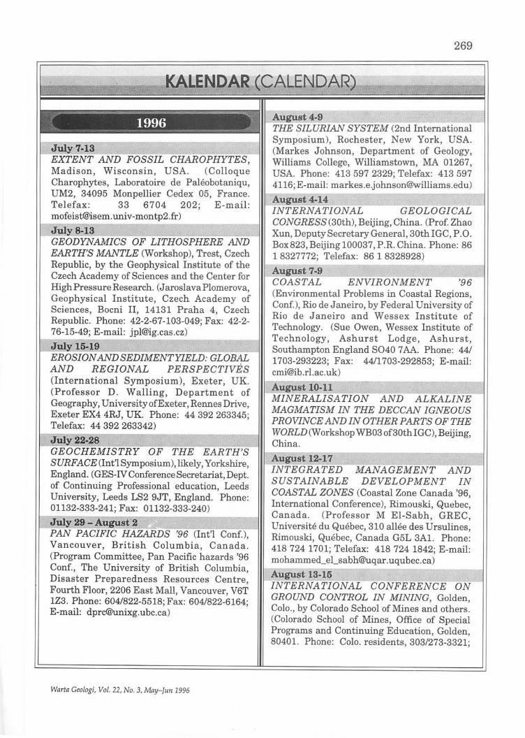
'ES, Madison, Wisconsin, USA. (Colloque Charophytes, Laboratoire de Paleobotaniqu, UM2 34095 Monpellier Cedex 05, France. Telefax: 33 6704 202; E-mail: [email protected])
~~~~~:~.; .~ . .0 ·:?:,"lllf .... ·••• •.. • ••• ·.·.<H· .••...................... GEODYNAMICS OF LITHOSPHERE AND EARTH'S MANTLE (Workshop), Trest, Czech Republic, by the Geophysical Institute of the Czech Academy of Sciences and the Center for High Pressure Research. (J aroslava Plomerova, Geophysical Institute , Czech Academy of Sciences, Bocni II, 14131 Praha 4, Czech Republic. Phone: 42-2-67-103-049; Fax: 42-2-76-15-49; E-mail: [email protected])
EROSION AND SEDIMENT YIELD: GLOB~ AND REGIONAL PERSPECTIVES (International Symposium), Exeter, UK. (Professor D . Walling , Department of Geography, University of Exeter , Rennes Drive, Exeter EX4 4RJ, UK. Phone: 44392263345; Telefax: 44 392 263342)
~a GEO TRY OF THE EARTH'S SURFACE(lnt'lSymposium),likely, Yorkshire, England. (GES-IV Conference Secretariat, Dept. of Continuing Professional education, Leeds University, Leeds LS2 9JT, England. Phone: 01132-333-241; Fax: 01132-333-240) --"",.....--",.,-
HAZARDS '96 (Int'l Vancouver, British Columbia, Canada. (Program Committee, Pan Pacific hazards '96 Conf., The University of British Columbia, Disaster Preparedness Resources Centre, Fourth Floor, 2206 East Mall, Vancouver, V6T lZ3 . Phone: 604/822-5518; Fax: 604/822-6164; E-mail: [email protected])
Warla Geologi, Vol. 22, No.3, May-fun 1996
269
THE SILURIAN SYSTEM (2nd Int;~ational Symposium), Rochester, New York, USA. (Markes Johnson, Department of Geology, Williams College, Williamstown, MA 01267, USA. Phone: 413 597 2329; Telefax: 413 597 4116; E-mail: [email protected])
INTERNATIONAL GEcri'o7jICAL CONGRESS (30th), Beijing, China. (Prof. Zhao Xun, Deputy Secretary General, 30th IGC, P.O. Box823, Beijing 100037, P.R. China. Phone: 86 1 8327772; Telefax: 86 1 8328928)
COASTAL ENVIRONMENT (Environmental Problems in Coastal Regions, Conf.), Rio de Janeiro, by Federal University of Rio de Janeiro and Wessex Institute of Technology. (Sue Owen, Wessex Institute of Technology, Ashurst Lodge, Ashurst, Southampton England S040 7 AA. Phone: 44/ 1703-293223; Fax: 4411703-292853; E-mail: [email protected])
MINERALISATION AND J.I:~;~E MAGMATISM IN THE DECCAN IGNEOUS PROVINCE AND IN OTHER PARTS OF THE WORLD (Workshop WE03 of 30th IGC), Beijing, China.
INTEGRATED SUSTAINABLE DEVELOPMENT COASTAL ZONES (Coastal Zone Canada '96, International Conference), Rimouski, Quebec, Canada. (Professor M El-Sabh, GREC, Universite du Quebec, 310 allee des Ursulines, Rimouski, Quebec, Canada G5L 3Al. Phone: 418 724 1701; Telefax: 418 724 1842; E-mail: [email protected])
INTERNAT GROUND CONTROL IN MINING, Golden, Colo., by Colorado School of Mines and others. (Colorado School of Mines, Office of Special Programs and Continuing Education, Golden, 80401. Phone: Colo. residents , 303/273-3321;
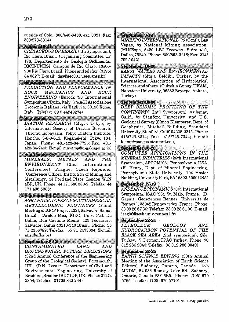
270
outside of Colo., 800/446-9488, ext. 3321; Fax: 303/273-3314)
CRETACE~;S·~;B~;L(4thS~~~~iu:),··· . Rio Claro, Brazil. (Organizing Committee, CP 178, Departemento de Geologia Sedimentar IGCE-UNESP Campus de Rio Claro, 13506-900 Rio Claro, Brazil. Phone and telefax: (0195) 34 0327; E-mail: [email protected])
PREDICTION AND PERFORMANCE IN ROCK MECHANICS AND ROCK ENGINEERING (Eurock '96 International Symposium), Tyrin,ltaly. (c/oAGIAssociazione Geotecnia Italiana, via Baglivi 5, 00198 Rome, Italy. Telefax: 39644249274)
.. , " DI:TOM·· RES1~1cH·(Mt~·.), ·i~·k~~:·i~; International Society of Diatom Research. (Hiromu Kobayashi, Tokyo Diatom Institute, Honcho, 3-8-9-813, Koganei-shi, Tokyo 184, Japan. Phone: +81-423-84-7795; Fax: +81-423-84-7495; E-mail: [email protected])
, ENVIRONMENT (2nd International Conference), Prague, Czech Republic. (Conference Officer, Institution of Mining and Metallurgy, 44 Portland Place, London WIN 4BR, UK. Phone: 44171580380-2; Telefax: 44 171 436 5388)
METALLOGENIC PROVINCES (Final Meeting ofIGCP Project 432), Salvador, Bahia, Brazil. (Aroldo Misi, IGEO, Univ. Fed. Da Bahia, Rua Caetano Moura, 123 Federacao, Salvador, Bahia 40210-340 Brazil. Phone: 55 71 2356789; Telefax: 55 71 2473004; E-mail: [email protected])
CONTAMINATED LAND AND GROUNDWATER, FUTURE DIRECTIONS (32nd Annual Conference of the Engineering Group of the Geological Society), Portsmouth, UK. (D.N. Lerner, Department of Civil and Environmental Engineering, University of Bradford, Bradford BD71DP, UK. Phone: 01274 3854; Telefax: 01705842244)
····~~j~l;k~§iNb~~~dlv~i~fJi······ IMPACTS (Mtg.), Beldibi, Turkey, by the International Association of Hydrological Sciences, and others. (Gultekin Gunay, UKAM, Hacettepe University, 06532 Beytepe, Ankara, Turkey)
··\i .·>d~1tj~'G6F TE~ CONTINENTS (lnt'l Symposium), Asilomar, Calif., by Stanford University, and U.S . Geological Survey (Simon Klemperer, Dept. of Geophysics, Mitchell Building, Standard University, Stanford, Calif. 94305-2215. Phone: 4151723-8214; Fax: 4151725-7344; E-mail: [email protected])
C6~;uT~Rxfi~£;2~~ioNS IN THE MINERAL INDUSTRIES (26th International Symposium, APCOM '96), Pennsylvania, USA. (K. Henry, Dept. of Mineral Engineering, Pennsylvania State University, 104 Hosler Building, University Park, PA 16802-5000 USA)
ANDEAN GEODYNAMICS (3rd International Symposium, ISAG '96), St. Malo, France. (D. Gapais, Geosciences Rennes, Universite de Rennes 1,35042 Rennes cedex, France. Phone: 3399286736; Telefax: 3399286100; E-mail: [email protected])
PETROLEUM GEOLOGY AND HYDROCARBON POTENTIAL OF THE BLACK SEA AREA (2nd symposium), Sile, Turkey. (S. Derman, TPAO Turkey. Phone: 90 3122869040; Telefax: 903122869049)
!5eDtem~ber. 22.25 EARTH SCIENCE EDITING (30th Annual Meeting of the Association of Earth Science Editors), Sudbury, Ontario, Canada. (c/o MNDM, B4-933 Ramsey Lake Rd., Sudbury, Ontario, Canada P3F 6B5. Phone: (705) 670 5765; Telefax: (705) 6705770)
Warta Geologi, Vol. 22, No.3, May-fun 1996
Septembe~,~5-21 w,M
CALIBRATION AND RELIABILITY IN GROUNDWATER MODELLING (International Conference, CARE '96), Golden, Colorado, USA. (International Groundwater Modelling Center, Colorado School of Mines, Golden, Colorado 80401, USA. Phone: 303273 3103; Telefax: 303 273 3278; E-mail: [email protected])
September:25-29;~\i/w '''' CHARNOKITE AND GRANULITE FACIES ROCKS (International Symposium), Madras, India. (Dr. V. Ram Mohan, Dept. of Geology, University of Madras, AC College Campus, Madras , India PIN 600025. Phone: 09144235 1137; Telefax: 091442352870)
SepteDlber'29 "'::Qcti)ber3:'~'"""" .....,::~~::~:'. SCIENTIFIC DATA IN THE AGE OF NETWORKING (15th International CODATA Conference), Tsukuba, Japan. (Codata '96, Express Co., Ltd ., Daiichi Shibuya Shimizu Building, 1-11-8 Shibuya, Tokyo 150, Japan. Phone: 81354851200; Telefax: 81354851266; E-mail: [email protected])
September' 30 ~ig~ob~r ~ (;, GROUND PENETRATING RADAR (6th International Conference), Sendai, Japan. (Dr. M. Sato, Dept. of Resources Engineering, Tohoku University, Sendai 980-77, Japan)
October 7.11 w ENVIRONMEN TAL ISSUES AND WASTE MANAGEMENT IN ENERGY AND MINERAL PROD UCTION (4th International Symposium), Cagliari, Italy. (R. Ciccu, Dipartimento di Geoingen eria et Tecnologie Ambientali, Universita degli Studi di Cagliari, Piazza d' Armi, 09 123 Cagliari, Italy. Phone: 39 7022 2317; Telefax: 3970272031) October 9-12 ··n-·
NATURAL HAZARDS AND DISASTERS (2nd Caribbean Conference), Kingston, J amaica. (Dr. B. Carby, Dept. of Geology, UWI, Mona, Kingston, Jamaica)
October 16-19 <
MINERAL DEVELOPMENT IN ASIA PACIFIC - CHALLENGES IN THE 21ST CENTURY, Jakarta, Indonesia. (Indonesian Mining Association (IMA), Jl. Prof. Dr. Supomo SH. No. 10, Jakarta 12870, Indonesia. Phone: (62-21)
Wa rla Ceologi, Vo l. 22, No.3, May- fun 1996
271
8303632,8280763; Fax: (62-21) 830 3632, 828 0763).
'~" q({~h~r .. GEOLOGICAL (Annual Meeting), Denver, Colorado, USA. (Jean Kinney, GSA Headquarters, Box 9140, 3300 Penrose Place, Boulder. CO 80301, USA. Phone: 303/447-2020; Fax: 303/447-1133)
._"""=,....--" N';;vem})er 6.8 , .-. THE 18TH NEW ZEALAND GEOTEHRMAL
WORKSHOP, Auckland , New Zeal and. (Professional Courses, Centre for Continuing Education, The University of Auckland, Private Bag 92019, Auckland, N.Z. Phone: 64-9-373 7599 ext. 7050; Fax: 64-9-373 7419; E-mail: professional. [email protected])
:G ~Tfvember ..Lv·· ..... ' ••• ".
A "'WORKSHOP ON TUFFS THEIR PROPERTIES, USES, HYDROLOGY, AND RESOURCES, Santa Fe, New Mexico. (Grant Heiken, Earth and Environmental Sciences Divis ion, EES-1 , Los Alamos National Laboratory, Los Alamos, New Mexico, 87545 USA. Phone: 505-667-8447; Fax: 505-665-3285; E-mail: [email protected])
" N6vember " HYDROLOGY IN THE HUMID TROPICAL ENVIRONMENT (International Symposium), Kingston, Jamaica. (A.I. Johnson, Water and Soils Consulting. 7474 Upham Court, Arvada, CO 80003, USA. Phone and telefax: 303 425 5610)
ASSOCIATION OF EUROPEAN GEOLOGICAL S OCIETIES (10th Meeting), Karlovv Vary, Czechoslovakia. (Geological Society, Burlington House, Piccadilly, London W1V OJU, UK. Phone: +44 (0) 71 -434 9944)
CANADIAN INSTITUTE OF MINING, METALLURGY AND PETROLEUM (99th annual general meeting), Vancouver, British Columbia, Canada. (John Gaydos, Meetings Manager, Canadian Institute of Mining and Metallurgy, 1 Place Alexis Nihon, 1210-3400 de Maisonneuve Boulevard West, Montreal, Quebec H3Z 3B8, Canada. Phone: (514) 939-2710; Telefax: (514) 939-2714)
272
.' . . . - . .. . .' : .
.. ' . DROUGHT, GROUNDWATER POLLUTION AND MANAGEMENT (International Workshop), Dindigul, India. (Managing Director, Tamilnadu Water Supply and Drainage Board, TW AD House, Chepauk, Madras 600 005, India)
January 6-8 INTERNATIONALCONFERENCEONLAND
S.E. ASIA) (International Symposium), Penang, Malaysia. (Dr. Peter Wilson, GeoForschungZentrum Potsdam, Telegrafenberg A17, 0-14473 Potsdam, Germany. Fax: (49)-331-288 1111; E-mail: [email protected]) Mfi,.;l4-Ur;';;~;!.l)j: .• ·.(.· ••• ···· •... · .. / '.' ....•••.••.••...••. '. ..•..... . .•... GEOTECHNICAL ENGINEERING IN ASIA: 2000 AND BEYOND (Third Asian Young Geotechnical Engineers Conference), Singapore. (Dr. T.S. Tan, Department of Civil Engineering, National University of Singapore, 10 Kent Ridge Crescent, Singapore 119260. Phone: (65) 772-2160; Fax: (65) 779-1635; E-mail: [email protected])
.;~Y21"2~\i··· •. I·:>·>··· •• ·•· •• ···.H.········· . PETROLEUM SYSTEMS AUSTRALASIA (International Conference), Jakarta, Indonesia. (Dr. Ron Noble, ARCO Indonesia Inc., PO Box 260888, Plano TX 75026. Phone: 62-21-521-9028; Fax: 62-21-521-9063; E-mail: [email protected])
.. ···G~66~E;JI6~ik;;i6kXTi8~···(lith . International Symposium of AEG), Jerusalem, Israel. (lGES Secretariat, P.O. Box 50006, Tel
Aviv, 61500 Israel. Telefax: 97235140000; Email: [email protected])
CLAY CONFERENCE, Ottawa, Canada. (J.B. Percival, Geological Survey of Canada, 601 Booth St., Ottawa, Ontario, KIA OE8. Phone: 613/992-4496; Fax: 613/943-1286; E-mail: [email protected])
ROCK SUPPORT - APPLIED SOLUTIONS FOR UNDERGROUND STRUCTURES (International Symposium), Lillehammer, Norway. (Mrs. Sirl Engen, Norwegian Society of Chartered Engineers, P.O. Box2312, Solli, N-0201 Oslo, Norway. Fax: +4722947502)
AND THE ENVIRONMENT (International Symposium of IAEG), Athens, Greece. (Symposium Secretariat, P.O. Box 19140, GR-11710Athens, Greece. Telefax: 301 381 3900; 301 924 2570)
LEARNING ABO THE SYSTEM (Second International Conference on Geoscience Education), University of Hawai'i, Hilo. (Dr. M. Frank Watt Ireton, GeoSciEd II Local Arrangements Coordinator, American Geophysical Union, 2000 Florida Avenue, NW, Washington, DC 20009. E-mail: [email protected])
GEOLOGY AND ENVIRONMENT (50th Geological Congress of Turkey), Istanbul, Turkey. (Secretary GEOENV '97, PK 464, Kizilay, 06424 Ankara, Turkey. Phone: 90312 4343691; Telefax: 90 312 4342388; E-mail: [email protected])
GEOLOGY AND ENVIRONMENT (lnt'!. Symposium), Istanbul, Turkey, by the Chamber of Geological Engineers. (I. Yilmazer, GEOENV '97, P.K. 464 Kizilay, 06424 Ankara, Turkey. Phone: 9-0-312-4343601;Fax: 9-0-312-4342388; E-mail: [email protected])
Warta Ge%gi, Vol. 22, No.3, May-Jun 1996
GROUNDWATER IN THE URBAN ENVIRONMENT (27th IAH Congress) (Professor J.D. Mather, Geology Dept., Royal Holloway and Bedford New College, Egham, Surrey TW20 OEX, UK. Telefax: 784 471780)
CONCEPTS AND MODELS FOR SUSTAINABLE WATER RESOURCES MANAGEMENT (FRIEND '97 Conference on Regional Hydrology), Postojna, Slovenia. (Dr . M. Brilly, FGG Hydraulics Division, Hajdrihova 28,6100 Ljubljana, Slovenia. Phone: (386) 61 1254 333; Telefax: (385) 61 219 987; E-mail: [email protected])
PERMIAN OF EASTERN TETHYS: BIOSTRATIGRAPHY, PALAEOGEOGRAPHY & RESOURCES (International Conference), Melbourne, Australia . (The Secretariat, Permian of Eastern Tethys Conference, School of Aquatic Science & Natural Resources Management, Deakin University, Rusden Campus, 662 Blackburn Road, Clayton, Victoria 3168, Australia. Phone: 61-3-92447429; Fax: 62-3-92447480; E-mail: [email protected])
- , '
Ii' 1998 w ,->,« t<:::""<h"'<'X.~~~~=<::''$!':::'''<: < ,~.«'p-,"'-'N~iX~~,W''"W.4.~~ii.x~<': ~''" , ~v,,<w~~~'"X~~~~~~~x.<w~
CANADIAN INSTITUTE OF MINING, METALLURGY AND PETROLEUM (lOOth annual general meeting), Quebec, Canada, (John Gaydos, Meetings Manager, Canadian Institute of Mining and Metallurgy, 1 Place Alexis Nihon, 1210-3400 de Maisonneuve Boulevard West, Montreal, Quebec H3Z 3B8, Canada, Phone: (514) 939-2710; Telefax: (514) 939-2714)
Warlll Geolo;.:i, Vol. 22, No, 3, Malf-JIIII 1996
273
10TH IAGOD SYMPOSIUM, Australia . (Professor LR. Plimer University of Melbourne, Parkville, VIC 3052, Australia, Phone: 613 3446520; Telefax: 6133447761)
8TH INTERNATIONAL PLATINUM SYMPOSIUM (IAGOD/CODMUR), Johannesburg, South Africa. (Dr. C,A Lee, P , O. Box 68108, Bryanston, South Africa, Phone: 2711 411 2253; Telefax: 2711 692 3693 )
',.', ",',' .... .:':'."'=
INT ATIONAL MINERALOGICAL ASSOCIATION: IMA '98 (l7th General Meeting), Toronto, Canada, (Professor AJ, Naldrett, Department of Geology, University of Toronto, Canada M5S 3BL Phone: (461 ) 978 3030; Telefax: (416) 978 3938; E-mail: ima98@quartz,geology,utoronto,ca)
j!1August i 7·19 GEOSEA '98 (Ninth Regional Congress on Geology, Mineral and Energy Resources of Southeast Asia), Kuala Lumpur, Malaysia, (The Organising Secretary, GEOSEA '98, Geological Society of Malaysia, c/o Department of Geology, University of Malaya, 50603 Kuala Lumpur, Malaysia, Phone: +(603 ) 7577036; Fax: +(603) 7593900; E-mail: [email protected])
OctoberlNovember PHYSICAL, CHEMICAL AND BIOLOGICAL ASPECTS OF AQUIFER-STREAM SEDIMENT INTERRELATIONS (28th IAR Congress) (Dr. J, Rosenschein , USGS MS 414, National Center, Reston Va 22092 , USA; Telefax: 703 648 5722)
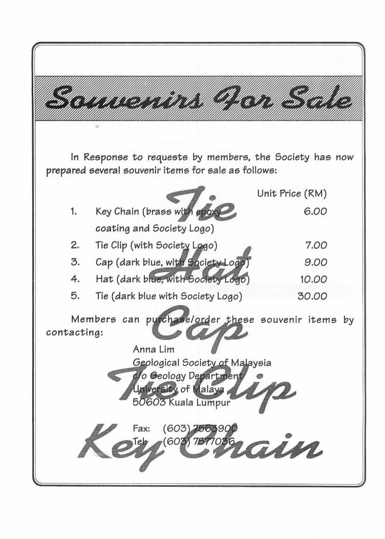
In Response to requests by members, the Society has now prepared several souvenir items for sale as follows:
1.
2.
3.
4.
5. Tie (dark blue with Society Logo)
Members can p contacting:
Unit Price (RM)
6.00
7.00
9.00
10.00
30.00
souvenir items by
SPECIAL LOW-PRICED SOFT-COVER EDITION LIMITED STOCK! GET YOUR COPY NOW!
Member RM50.00 PRICE: Non-Member RMIOO.OO
Student Member RM30.00 Cheques, Money Orders or Bank Drafts must accompany all orders. Orders will be invoiced for postage and bank charges. Orders should be addressed to:
The Han. Assistant Secretary GEOLOGICAL SOCIETY OF MALAYSIA c/o Dept. of Geology, University of Malaya 50603 Kuala Lumpur, MALAYSIA
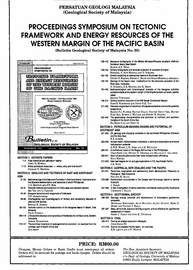
PERSATUAN GEOLOGI MALAYSIA (Geological Society of Malaysia)
PROCEEDINGS SYMPOSIUM .ON TECTONIC FRAMEWORK AND ENERGY RESOURCES OF THE
WESTERN MARGIN OF THE PACIFIC BASIN (Bulletin Geological Society of Malaysia No. 33)
29th Ncvember - 2nd December 1992 Kuala Lumpur, Malaysia
"",,~p@fik{6y
9tD!iJaimfSo:rf9oWa!JSitJ
Cirruno-'Pruijic Coundf for'EN'l/Y aM MwrrJff%JourrtS
Editor: G.R. Teh
SECTION 1: KEYNOTE PAPERS 1-3 Plate tectonics and petroleum basins
DAVID G. HOWELL
7-19 World petroleum resources - where, why, and how much? CHARLES D. MAsTERS
SECTION 2: GEOLOGY AND TECTONICS OF EAST AND SOUTHEAST ASIA
21-32 Sedimentology of the SemlraraFormation In Semlrara Island: implications for the Mlocane sedimentation and tectonics of south Philippines C.S. BRISTOW AND P.R. BIRD
33-41 Tectonic features and evolution of China seas and adjacent regions QlUYAN AND LI TANGGEN
4314 Neogene tectonics and orogenesis of Indonesia T.O. SIMANIJJlJNTAK
65-93 Dinoflagellate cyst biostratigraphy of Tertiary and Quaternary deposits of offshore NW Borneo RoNALD E. BEsEMs
95-103 Tectonic control on the development of the Neogene basins In Sabah. East Malaysia FELIX TONGKUL
105-118 Lithosphere structure and dynamics olthe Banda Arc collision zone. Eastern Indonesia ADRIAN RICHARDSON
11&-127 The nonlinear Inversion of paleogeothermal evolution: an example from the northern part of South China Sea XUEruMIN
12&-142 Sequence stratigraphy of the Middle Miocene-Pliocene southern offshore Sandakan Basin, East Sabah ROBERT H.F. WONG
143-152 Tertiary stratigraphy and tectonic evolution of southern Sumatra KUSNAMA, S. ANDl MANGGA AND D. SVKARNA
153-162 Gravity modelling of extensional basins in Southeast Asia STEVEN H. HARDER, STEVEN J. MAVRI A. ... -O SVSA.'1 MARsHALL-ARIIAzoLA
163-180 Geology of the Bayah area: implications for the Cenozoic evolution of the West Java, Indonasla D. SUKARNA, S.A MANGGA AND K BRATA
181-194 Sedimentological and mineralogical analysis of the Neogene turbidite sandstone beds at the eaatern margin of the Nligata backarc oil basin, central Japan SHUICHI TOKUHASHI
195-210 Tertiary tectonic evolution of the NW Sabah Continental Margin HANs P. liAzEBROEK AND DENIS N.K TA."
211-222 Canozolc magmatism In Indochina: lithosphere extension and manUe potential temperature MARTIN F.J. FLOWER, NGUYEN HOA.'iG, NGL"YEN TRONG YEM, NGL"YEN
XUAN BAO, ROBERT J. MCCABE A.'iD STEVEN H. HARDER
223-240 The geophysical characteristics and evolution of northern and eouthern margins of the South China Sea X1A KANG-YVA.'1 A. ... -O ZHOU DI
SECTION 3: PETROLEUM·BEARING BASINS AND POTENTIAL OF SOUTHEAST ASIA 241-262 Oil, geology and changing conceplt In the southwest Philippines (Palawan
and the Sulu Sea) E.F. DURKEE
263-288 Tarakan Basin, NE Kalimantan,lndonesla: a century of exploration and future hydrocarbon potential A.W.R. WIGHT, L.H. HARE A.'iD J.R. REYNOLDS
28&-301 A preliminary result of the Ragay Gulf survey In the Philippines CHAO-SHlNG LEE, NELSON D. TRI~1DAD A. ... -O MALcoul C. GALLOWAY
303-311 Giant oil accumulations and their areal concentration efficiency KINJI MAGARA
313-330 New reef targets for oil and gas exploration in FIJI, Southwest Pacific J.ARoDD
SECTION 4: AUSTRALIA, NEW ZEALAND AND THE PACIFIC 331-341 Tectonism, magmatism and sedimentary basin development, Paleozoic to
Paleogene, New Caledonia PHIUPPA M. BLACK
343-356 Hydrocarbon occurrences In the Cooper and Eromanga basins in central Australia J. PARA.'1
357-368 A new Investigation of some Australian continental scale gravity lineaments CATHERll'o"E I. EWOT
SECTION 5: GEOTHERMAL ENERGY 36&-385 Geology, energy potential and development of Indonesia's geothermal
prospects MOCHA.\IAD BOEDlHARDl. AGl'S Ml'LYONo. Au~[[N GI~'TlNG. MARK D.
MOSBY A. ... -O VINCE~'T T. RADJA
387-397 Deep, slime hole, diamond drilling program proves effective for geothermal assessment in HawaII HARRY J. OLSOS A."D JOHS E. DE\'!I!O:O;AZ
SECTION 6: COAL 39&-410 Coal as an energy resource In Malaysia
CHEN SHICK PEl 411-419 Coal In the western Pacific basin: an overview
E.R. LA.'iDlS A.'iD J.N. WEA\"ER
PRICE: RM60.00 Cheques, Money Orders or Bank Drafts must accompany all orders. Orders will be invoiced for postage and bank charges. Orders should be addressed to:
The Hon. Assistant Secretary GEOLOGICAL SOCIETY OF MALAYSIA c/o Dept. of Geology, University of Malaya 50603 Kuala Lumpur, MALAYSIA
ISSN 0126-6187
LW[0~1fJJ~ IP~~~'1rlDJ~ @~~@IT
BIBLIOGRAPHY AND INDEX PUBLICATIONS OF THE
GEOLOGICAL SOCIETY OF MALAYSIA 1967 - 1993
1993199~9I9t~
Compiled by
NG THAM FAIT
jj~~L .~ \~~lX'W:1~
, ~ JP.~ < 11 """1111 ~n < '"II.. ~ I 'fl5J71!» l!ZJU ~ 1967 1INS11 ~ , Edited by G. H. TEH
.r_,,' W'~""\ I
ulletin of /k OLOGICAL SOCIETY OF MALAYSIA
PRICE: RM30.00 Cheques, Money Orders or Bank Drafts must accompany all orders. The Hon. Assistant Secretary Orders will be invoiced for postage and bank charges. Orders should be GEOLOGICAL SOCIETY OF MALAYSIA addressed to: c/o Dept. of Geology, University of Malaya
50603 Kuala Lumpur, MALAYSIA
ISSN 0126-6187
IP~~~'1rlDJ~ @illXQ)ILtQ)@TI
KANDUNGAN (CONTENTS)
1-5 Kewujudan Formasi Lamb ir di Sinklin Ulu Bok, Sarawak Utara Li m Chun Hui and Mahd . Shafeea Leman
7-13 Potential Alkali-Silica reaction in some Malaysian rock aggregate and their test results Sazali Yaacob. Yeap Ee Beng and Hashim Abdul Razak
15-23 Gcolog)' and related activities in the construction of Batu Dam, Kuala Lumpur Saim Suratman
25-35 J(jnematic analysis of striated fractures in Titiwangsa granitoid, Karak Highway - Sela ngor side H.D. Tjia
37-l6 A stratigraphic log of Semantan Formation along part of the Mentakab-Temerloh Bypass, Pahang l. ~ I etcalfe and K.R . Chakraborty
-17-59 l\licrostructuresofthedeformed granites of eastern Kuala Lumpur - Implicationsformechanisms and temperatures of deformation Ng n lam Fall
61-68 Seismic and borehole anah'sis of Pantai Kundor, Melaka Abd. Rahim Samsudin and 'Umar HanlZah
fo9-77 Engi neering properties of gra nitic soils and rocks of Penang Island, Malaysia Tan Boon Kong
79- 96 Com parat"'e geochemistry of the sedimentary and metasedimentary clastic rocks of the Kuantan area, Pahang. ~Ialaysia Sldibe Y~\'a Tiemoko. Tan Teong Hing and Ahmad l antan
97- 112 The sedimentolog)' and tectonics of the Tem~urong Formation - deformation of early Cenozoic deltaic eq uences in NW Borneo
Robert B. Tal e 113-121 The signifi ca nce of Upper Permian brachiopods from Merapuh area, northwest Pahang
!\lohu Shafeea Leman 123-133 .-\pplication of soil geochemistry to the detection ofSb-Au mineralization in the Buffalo Reefarea, Kuala
~I eda n g. Pahang J.J . Pereira. E.B. Yeap and T.F. Ng
135-1-1-1 Cha racterisation of th e weathering profile developed over an amphibole schist bedrock in Peninsular .\lal avsia 1.K. Raj
I ~5-1 55 Geology of the Gunung Danum conservatio n a rea : Geochemistry and soil aspects \Iuhamad Barzani Gasim. Dale Brunolle. Sahibin Abdul Rahim, Sahat Sadikun and Sanudin Tahir
157-loR Joint spacing of granit ic rocks in the eastern Kuala Lumpur area, Peninsular Malaysia :\g Tham Fall
169-17-1 Kajia n geofizik d i Kuala Belis, Kelantan Abdu l Rahim Samsudin. Kamal Roslan Mohamad. Ibrahim Abdullah dan Ab. Ghani Rafek
Editor: C.H. Teh
u//etin 0/ ~e EOLOGICAL SOCIETY OF MALAYSIA
PRICE: RM35.00 Cheques, :Yloney Orders or Bank Drafts must accompany a ll orders. Orders wi ll be invoiced for postage an d bank charges. Orders should be addressed to :
The fion. A ssistant Secretary GEOLOGICAL SOCIETY OF MALAYSIA c 10 Dept. 0/ Geology, University of'Malaya 50603 Kuala Lumpur, MALA YSIA
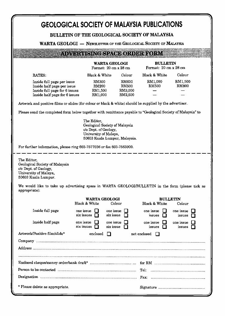
GEOLOGICAL SOCIETY OF MALAYSIA PUBLICATIONS BULLETIN OF THE GEOLOGICAL SOCIETY OF MALAYSIA
W ARTA GEOLOGI - NEWSLETTER OF THE GEOLOGICAL SOCIETY OF MALAYSIA
RATES:
Inside full page per issue Inside half page per issue Inside full page for 6 issues Inside half page for 6 issues
WARTA GEOLOGI Format: 20 em x 28 cm
Black & White
RM300 RM200
RMl,500 RMl,OOO
Colour
RM600 RM500
RM3,000 RM2,500
BULLETIN Format: 20 cm x 28 cm
Black & White
RMl,OOO RM500
Colour
RMl,500 RM800
Artwork and positive films or slides (for colour or black & white) should be supplied by the advertiser.
Please send the completed form below together with remittance payable to "Geological Society of Malaysia" to
The Editor, Geological Society of Malaysia rio Dept. of Geology, University of Malaya, 50603 Kuala Lumpur, Malaysia.
For further information, please ring 603-7577036 or fax 603-7563900.
The Editor, Geologi~al Society of Malaysia rio Dept. of Geology, University of Malaya, 50603 Kuala Lumpur.
We would like to take up advertising space in WARTA GEOLOGIIBULLETIN in the form (please tick as appropriate):
WARTA GEOLOGI BULLETIN Black & White Colour Black & White Colour
Inside full page one issue D one issue D one issue D one issue D six issues D six issue D issues D issues D
Inside half page one issue D one issue D one issue D one issue D six issues D six issue D issues D issues D
ArtworkIPositive filmlslide* enclosed D not enclosed D Company ............................................................................................................................................ .
Address ............................................................................................................................................... .
............................................................................................................................................................
Enclosed cheque/money orderlbank draft* ................................... ... for RM ......................................... .
Person to be contacted .................................................................. Tel:
Designation ................................................................................. Fax:
* Please delete as appropriate. Signature ...................................... .
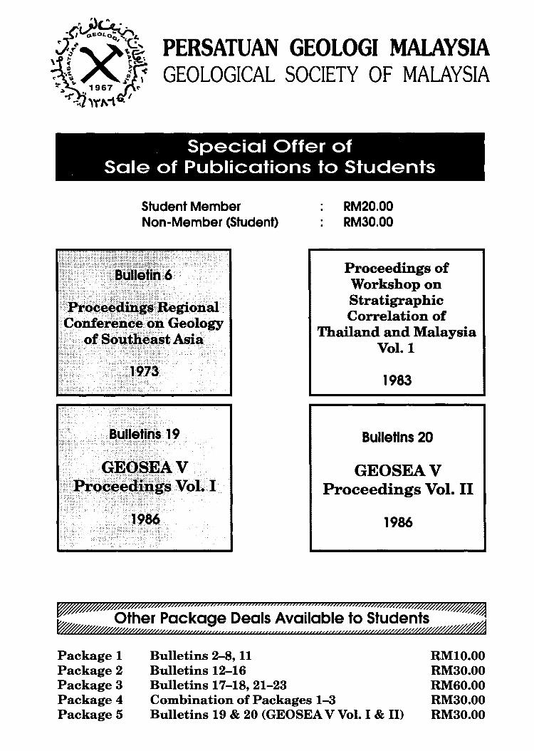
PERSATUAN GEOLOGI MALAYSIA GEOLOGICAL SOCIETY OF MALAYSIA
Special Offer of , Sale of Publications to Students
Student Member Non-Member (Student)
RM20.00 RM30.00
Proceedings of Workshop on Stratigraphic Correlation of
Thailand and Malaysia Vol. 1
1983
Bulletins 20
GEOSEAV Proceedings Vol. II
1986
~////#Q///7//Zi.»7»)));;;;;;;;;;;;;;;;;;;;;;;;;;;;;;;;;;;;;;;;;;;;m;;;;;;;r//hV//m$#~
~ Other Package Deals Available to Students W/////////////ft/VV«<<<<<uu<<<<<<<<<<< ««« «««««««<u««(U///V//W/h'ff4o// ;~
Package 1 Package 2 Package 3 Package 4 Package 5
Bulletins 2-8, 11 Bulletins 12-16 Bulletins 17-18, 21-23 Combination of Packages 1-3 Bulletins 19 & 20 (GEOSEA V Vol. I & II)
RMI0.00 RM30.00 RM60.00 RM30.00 RM30.00
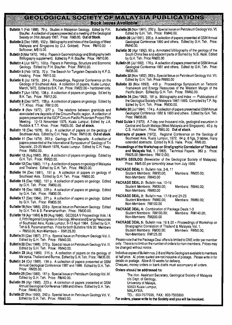
Bulletin 1 (Feb 1968). 79 p. Studies in Malaysian Geology. Edited by P.H. Stauffer. A collection of papers presented at a meeting of the Geological Society on 31 st January 1967. Price: RM3.00. Out of Stock.
Bulletin 2 (Dec 1968). 152 p. Bibliography and Index olthe Geology of West Malaysia and Singapore by D.J. Gobbett. Price: RM10.00 -Softcover, M$15.00.
Bulletin 3 (Mar 1970). 146 p. Papers in Geomorphology and Stratigraphy (with Bibliography supplement). Edited by P.H. Stauffer. Price: RM10.00.
Bulletin 4 (Jun 1971). 100 p. Papers in Petrology, Structure and Economic Geology. Edited by P.H. Stauffer. Price: RM10.00.
Bulletin 5 (Feb 1973). 70 p. The Search for Tungsten Deposits by K.F.G. Hosking. Price: RM10.00.
Bulletin 6 (JuI1973). 334 p. Proceedings, Regional Conference on the Geology of Southeast Asia. A collection of papers, Kuala Lumpur, March, 1972. Edited by B.K. Tan. Price: RM22.00- hardcover only.
Bulletin 7 (Jun 1974). 138 p. A collection of papers on geology. Edited by B.K. Tan. Price: RM12.00.
Bulletin 8 (Dec 1977). 158 p. A collection of papers on geology. Edited by T.T. Khoo. Price: RM12.00.
Bulletin 9 (Nov 1977). 277 p. The relations between granitoids and associated ore deposits of the Circum-Pacific region. A collection of papers presented at the IGCP Circum-Pacific Plutonism Project Fifth Meeting. 12-13 November 1975, Kuala Lumpur, Edited by J.A. Roddick & T.T. Khoo. Price: RM25.00. Out of stock.
Bulletin 10 (Dec 1978). 95 p. A collection of papers on the geology of Southeast Asia. Edned by C.H. Yeap. Price: RM10.00. Out of stock.
Bulletin 11 (Dec 1979). 393 p. Geology of Tin Deposits. A collection of papers presented at the International Symposium of 'Geology of Tin Deposits', 23-25 March 1978, Kuala Lumpur. Edited by C.H. Yeap. Price: RM50.00.
Bulletin 12 (Aug 1980). 86 p. A collection of papers on geology. Edited by G.H. Teh. Price: RM20.00.
Bulletin 13 (Dec 1980). 111 p. A collection of papers on geology of Malaysia and Thailand. Edited by G.H. Teh. Price: RM20.00.
Bulletin 14 (Dec 1981). 151 p. A collection of papers on geology of Southeast Asia. Edited by G.H. Teh. Price: RM30.00.
Bulletin 15 (Dec 1982). 151 p. A collection of papers on geology. Edited by G.H. Teh. Price: RM30.00.
Bulletin 16 (Dec 1983). 239 p. A collection of papers on geology. Edited by G.H. Teh. Price: RM30.00.
Bulletin 17 (Dec 1984). 371 p. A collection of papers on geology. Edited by G.H. Teh. Price: RM35.00.
Bulletin 18 (Nov 1985). 209 p. Special Issue on Petroleum Geology. Edited by G.H. Teh & S. Paramananthan. Price: RM30.00.
Bulletin 19 (Apr 1986) & 20 (Aug 1986). GEOSEA V Proceedings Vols.1 & II, Fifth Regional Congress on Geology, Mineral and Energy Resources of Southeast Asia, Kuala Lumpur, 9-13 April 1984. Edited by G.H. Teh & S. Paramananthan. Price for both Bulletins 19 & 20: Members - RM50.00, Non-Members - RM125.00.
Bulletin 21 (Dec 1987). 271 p. Special Issue on Petroleum Geology Vol. II. Edited by G.H. Teh. Price: RM40.00.
Bulletin 22 (Dec 1988). 272 p. Special Issue on Petroleum Geology V::>I.III. Edited by G.H. Teh. Price: RM40.00.
Bulletin 23 (Aug 1989). 215 p. A collection of papers on the geology of Malaysia, Thailand and Burma. Edited by G.H. Teh. Price: RM35.00.
Bulletin 24 (Oct 1989). 199 p. A collection of papers presented at GSM Annual Geological Conference 1987 and 1988. Edited by G.H. Teh. Price: RM35.00.
Bulletin 25 (Dec 1989). 161 p. Special Issue on Petroleum Geology Vol. IV. Edited by G.H. Teh. Price: RM40.00.
Bulletin 26 (Apr 1990). 223 p. A collection of papers presented at GSM Annual Geological Conference 1989 and others. Edited byG.H. Teh. Price: RM40.00.
Bulletin 27 (Nov 1990). 292 p. Special Issue on Petroleum Geology Vol. V. Edited by G.H. Teh. Price: RM40.00.
Bulletin 28 (Nov 1991). 292 p. Special Issue on Petroleum Geology Vol. VI. Edited by G.H. Teh. Price: RM40.00.
Bulletin 29 (JuI1991). 255 p. A collection of papers presented at GSM Annual Geological Conference 1990 and others. Edned by G.H. Teh. Price: RM40.00.
Bulletin 30 (Apr 1992). 90 p. Annotated bibliography of the geology of the South China Sea and adjacent parts of Borneo by N.S. Haile. Edited by G.H. Teh. Price RM20.00
Bulletin 31 (JuI1992). 176 p. A collection of papers presented at GSM Annual Geological Conference 1991 and others. Edited by G.H. Teh. Price: RM35.00.
Bulletin 32 (Nov 1992). 283 p. Special Issue on Petroleum Geology Vol. VII. Edited by G.H. Teh. Price RM50.00
Bulletin 33 (Nov 1993). 419 p. Proceedings Symposium on Tectonic Framework and Energy Resources of the Western Margin of the Pacific Basin. Edited by G.H. Teh. Price: RM60.00.
Bulletin 34 (Dec 1993). 181 p. Bibliography and Index - Publications of the Geological Society of Malaysia 1967-1993. Compiled by T.F. Ng. Edited by G,H. Teh, Price: RM30.00.
Bulletin 35 (JuI1994), 174 p. A collection of papers presented at GSM Annual Geological Conference 1992 & 1993 and others, Edited by G.H. Teh, Price: RM35.00.
Field Guide 1 (1973), A 7-day one thousand mile, geological excursion in Central and South Malaya (West Malaysia and Singapore). 40 p. by C.S. Hutchison. Price: RM5.00. Out of stock.
Abstracts of papers (1972). Regional Conference on the Geology of Southeast Asia, Kuala Lumpur, 1972. 64 p. 8 figs, 3 tables, many extended abstracts. Edited by N,S, Haile, Price: RM6.00,
Proceedings of the Workshop on Stratigraphic Correlation of Thailand and Malaysia Vol. 1, (1983), Technical Papers, 383 p. Price: RM25,00 (Members: RM12.00).
WARTA GEOLOGI (Newsletter of the Geological Society of Malaysia), Price: RM5,00 per bimonthly issue from July 1966,
PACKAGE DEAL 1: Bulletin nos. 2-8, 11 Student Members: RM10.00; Members: RM20,00; Non-Members: RM40.00
PACKAGE DEAL 2: Bulletin nos. 12-16 Student Members: RM30.00; Members: RM40.00; Non-Members: RM60.00
PACKAGE DEAL 3: Bulletin nos. 17-18 and 21-23 Student Members: RM60.00; Members: RM80.00; Non-Members: RM100,00
PACKAGE DEAL 4: Combination of Package Deals 1-3 Student Members: RM100.00; Members: RM140,00; Non-Members: RM200,00
PACKAGE DEAL 5: Bulletin nos, 19 & 20 + Proceedings of Workshop on Stratigraphic Correlation of Thailand & Malaysia Vol. 1. Student Members: RM30.00; Members: RM50,00; Non-Members: RM125,00
Please note that the Package Deal offers is limited to ONE order per member only, There is no limit on the number of orders for non-members, Prices may be changed without notice.
Individual copies of Bulletin nos. 2-8 and Warta Geologi are available to members at half price, All prices quoted arA not inclusive of postage. Please write in for details on postage. Allow 8-10 weeks for delivery. Cheques, money orders or bank drafts must accompany all orders, Orders should be addressed to:
The Hon, Assistant Secretary, Geological Society of Malaysia clo Dept. of Geology, University of Malaya, 50603 Kuala Lumpur, MALAYSIA, TEL: 603-7577036, FAX: 603-7563900
For orders, please write to the Society and you will be invoiced.
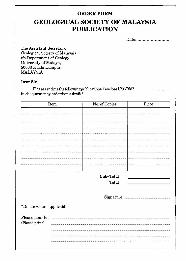
ORDER FORM
GEOLOGICAL SOCIETY OF MALAYSIA PUBLICATION
The Assistant Secretary, Geological Society of Malaysia, c/o Department of Geology, University of Malaya, 50603 Kuala Lumpur, MALAYSIA
Dear Sir,
Date: ....................... .
Please send me the following publications. I enclose US$IRM* .......................... . in cheque/money orderlbank draft. *
Item
*Delete where applicable
No. of Copies
Sub-Total
Total
Price
Signature: .......................................................... _ ............................. __ ......... _. __ .
Please mail to: ............................................................................................................................................................ _ ........ _ ................................................................... _ ... _ ............................ _ ............. _._. (Please print)
GEOLOGICAL SOCIETY OF MALAYSIA PUBLICATIONS o
General Information Papers should be as concise as possible . However, there is no fixed limit as to the length and number of illustrations. Normally, the whole paper should not exceed 30 printed pages. The page size will be 204 x 280 mm (8 x 11 inches).
The final decision regarding the size of the illustrations, sections of the text to be in small type and other matters relating to printing rests with the Editor.
The final decision of any paper submitted for publication rests with the Editor who is aided by a Special Editorial Advisory Board. The Editor may send any paper submitted for review by one or more reviewers. Authors can also include other reviewers' comments oftheir papers. Scripts of papers found to be unsuitable for publication may not be returned to the authors but reasons for the rejection will be given. The authors of papers found to be unsuitable for publication may appeal only to be Edi tor for reconsideration if they do not agree with the reasons for rejection. The Editor will consider the appeal together with the Special Editorial Advisory Board.
Unless with the consent ofthe Editor, papers which have been published before should not be submitted for consideration.
Authors must agree not to publish elsewhere a paper submitted and accepted.
Authors alone are responsible for the facts and opinions given in their papers and for the correctness of references etc.
One set of proofs will be sent to the author(iftime permits), to be checked for printer's errors. In the case oftwo or more authors, please indicate to whom the proofs should be sent.
Twenty-five reprints of each article published are supplied free-of-charge . Additional reprints can be ordered on a reprint order form, which is included with the proofs.
Correspondence: All papers should be submitted to
The Editor (Dr. Teh Guan Hoe) Geological Society of Malaysia
do Geology Department University of Malaya 50603 Kuala Lumpur
MALAYSIA Tel: (603) 7577036 Fax: (603) 7563900
Scrip! Req¥irements Scripts must be written in Bahasa Malaysia (Malay) or English.
Two copies ofthe text and illustrations must be submitted. The scripts must be typewritten double-spaced on paper not exceeding 210 x 297 mm (or 8.27 x 11.69 inches, A4 size). One side ofthe page must only be typed on.
Figure captions must be typed on a separate sheet of paper. The captions must not be drafted on the figures . The figure number should be marked in pencil on the margin or reverse side.
Original maps and illustrations or as glossy prints should ideally be submitted with sufficiently bold and large lettering to permit reduction to 18 x 25 cm: fold-outs and large maps will be considered only under special circumstances.
Photographs should be of good quality, sharp and with contrast. For each photograph, submit two glossy prints, at least 8 x 12.5 cm and preferably larger. Use of metric system of measurements (SI) is strongly urged wherever possible.
An abstract in English which is concise and.informative is required for each paper.
References cited in the text should be listed at the end of the paper and arranged in alphabetical order and typed double-spaced. The name ofthe book or journal must be in italics. The references should be quoted in the following manner:
HAMILTON, W., 1979. Tectonics of the Indonesian region. U.S. Geological Survey Professional Paper 1078, 345p.
HOSKING, K.F.G., 1973. Primary mineral deposits. In Gobbett, D.J. and Hutchison, C.S. (Eds.), Geology of the Malay Peninsula (West Malaysia and Singapore). Wiley-Interscience. New York, 335-390.
HUTCHISON, C.s., 1989. Geological Evolution of South-east Asia . Clarendon Press, Oxford. 368p.
SUNTHARALINGAM, T. , 1968. Upper Paleozoic stratigraphy of the area west of Kampar, Perak. Geo!. Soc. Malaysia Bull. 1, 1-15.
TAYLOR, B. , AND HAYES, D.E., 1980. The tectonic evolution ofthe South China Sea basin. In: D.E. Hayes (Ed.), The Tectonic and Geologic Evolution of Southeast Asian Sea and Islands, Part 2. Am. Geophy. Union Monograph 23,89-104.
Submission of electronic text. In order to publish the paper as quickly as possible after acceptance, authors are requested to submit the final text also on a 3.5" diskette . Both Macintosh and PC (DOSlWindows) platforms are supported. Main text, tables and illustrations should be stored in separate files with clearly identifiable names. Text made with most word processors can be readily processed but authors are advised to provide an additional copy of the text file in ASCII format. Preferred format for illustration is Encapsulated PostScript (EPS) but authors may submit graphic files in their native form. It is essential that the name and version of softwares used is clearly indicated. The final manuscript may contain parts (e.g. formulae, complex tables) or last-minute corrections which are not included in the electronic text on the diskette; however, this should be clearly marked in an additional hardcopy of the manuscript. Authors are encouraged to ensure that apart from any such small last-minute corrections, the disk version and the hardcopy must be identical. Discrepancies can lead to proofs of the wrong version being made.
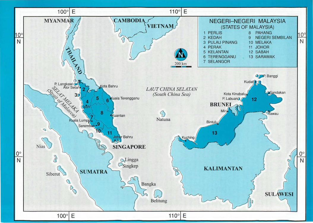
Ni~ ~
siberu~
1000 E
SUMATRA
ala Terengganu
~ingga
OSingkep
200km
LAUT CHINA SELATAN (South China Sea)
o Natuna
Belitung
1100 E
NEGERI-NEGERI MALAYSIA (STATES OF MALAYSIA)
1 PERLIS 8 PAHANG 2 KEDAH 9 NEGERI SEMBILAN 3 PULAU PINANG 10 MELAKA 4 PERAK 11 JOHOR 5 KELANTAN 12 SABAH 6 TERENGGANU 13 SARAWAK 7 SELANGOR
~fIi'P. Banggi
KALIMANTAN