Monument No. 2 AUM Site Screening Report - US ...
25
U.S. Environmental Protection Agency Region IX, San Francisco Navajo AUM Project Monument No. 2; Mine ID#s 241, 521 April 2012 1 Navajo Abandoned Uranium Mine Site Screen Report This form is for use at the site of abandoned uranium mines (AUM) located on Navajo Nation lands. Applicable sites include all mine and mine features that have or have not undergone reclamation by the Navajo Abandoned Mine Lands Reclamation Program, including features, adits, pits and waste piles. Applicable sites also include all AUM sites listed in the USEPA CERCLIS database, all sites listed in the 2008 AUM GIS Report issued by USACOE and USEPA, all AUM sites on allotment lands associated with the Navajo Nation, and any and all AUM sites not listed in any database located on Navajo lands. Reconnaissance of any sites located on lands adjacent to Navajo lands that may be impacting Navajo lands will need to be coordinated with the authorities appropriate to those lands. The purpose of the form is to ascertain the status and location of the identified AUM site, and record all immediate site information associated with the mine site. Decisions and recommendations on what additional steps are needed will be provided on a separate document. Mine Name: Monument No. 2 Mine IDs: 241, 521 Navajo AUM North Central Region Prepared by: Weston Solutions, Inc. Contract: W91238-06-F-0083 20074.063.039.0020 April 2012
-
Upload
khangminh22 -
Category
Documents
-
view
0 -
download
0
Transcript of Monument No. 2 AUM Site Screening Report - US ...

U.S. Environmental Protection Agency Region IX, San Francisco Navajo AUM Project
Monument No. 2; Mine ID#s 241, 521 April 2012 1
Navajo Abandoned Uranium Mine
Site Screen Report
This form is for use at the site of abandoned uranium mines (AUM) located on Navajo Nation
lands. Applicable sites include all mine and mine features that have or have not undergone
reclamation by the Navajo Abandoned Mine Lands Reclamation Program, including features,
adits, pits and waste piles. Applicable sites also include all AUM sites listed in the USEPA
CERCLIS database, all sites listed in the 2008 AUM GIS Report issued by USACOE and
USEPA, all AUM sites on allotment lands associated with the Navajo Nation, and any and all
AUM sites not listed in any database located on Navajo lands. Reconnaissance of any sites
located on lands adjacent to Navajo lands that may be impacting Navajo lands will need to be
coordinated with the authorities appropriate to those lands.
The purpose of the form is to ascertain the status and location of the identified AUM site, and
record all immediate site information associated with the mine site. Decisions and
recommendations on what additional steps are needed will be provided on a separate document.
Mine Name: Monument No. 2
Mine IDs: 241, 521
Navajo AUM North Central Region
Prepared by:
Weston Solutions, Inc.
Contract: W91238-06-F-0083
20074.063.039.0020
April 2012
U.S. Environmental Protection Agency Region IX, San Francisco Navajo AUM Project
Monument No. 2; Mine ID#s 241, 521 April 2012 2
Part I Site Identification, Location and Status
Site Names and ID numbers as applicable
Mine ID: 241
Map ID: NC65
CERCLIS: NNN000909262
Navajo Abandoned Mine Land Reclamation Program: NA-0224
Local name / Aliases: Monument No. 2 Lease; Monument No. 2 Lease Amended; VCA's
Mining Unit No. 66; Chee Nez No. 1; Monument #2; Monument #2 Supplement; Chee Nez No.
1
Chapter and local area: Kayenta
County: Apache State: AZ
Lat/Long: 36.9412038568 N / -109.888670996 W
Nearby road and highway: Indian Route 6440 Local Post Office: Dennehotso, AZ
Surface Land Status: check one or more and provide ownership and contact information
below
Tribal Trust Land Public lands
Private Tribal Fee Land
Bureau of Land Mgmt Allotment
State Fee land
Subsurface Mineral Rights:
No information on subsurface mineral rights ownership was found in the EPA/AUM Database.
Claim and operator information:
Historical documents identified the operator of the mine from 1943 to 1946 as Vanadium
Corporation of America, and in 1947 as Atomic Energy Commission. No additional historical
ownership / lease information was identified in the EPA / AUM database.
Number of residential structures within 200 feet of mine: None
U.S. Environmental Protection Agency Region IX, San Francisco Navajo AUM Project
Monument No. 2; Mine ID#s 241, 521 April 2012 3
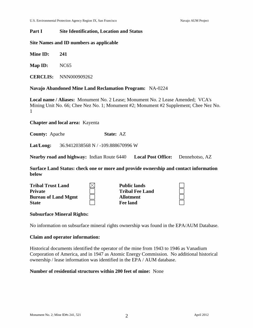
Mine ID: 521
Map ID: NC66
CERCLIS: NNN000909262
Navajo Abandoned Mine Land Reclamation Program: NA-0204; NA-0225
Local name / Aliases: Monument No. 2 Lease; Monument No. 2 Lease Amended; VCA's
Mining Unit No. 66; Monument #2; Monument #2 Supplement
Chapter and local area: Kayenta
County: Apache State: AZ
Lat/Long: 36.9320710334 N / -109.884879908 W
Nearby road and highway: Indian Route 6440 Local Post Office: Dennehotso, AZ
Surface Land Status: check one or more and provide ownership and contact information
below
Tribal Trust Land Public lands
Private Tribal Fee Land
Bureau of Land Mgmt Allotment
State Fee land
Subsurface Mineral Rights:
No information on subsurface mineral rights ownership was found in the EPA/AUM Database.
Claim and operator information:
Historical documents identified the operator of the mine from 1943 to 1967 as Vanadium
Corporation of America, and from 1967 to 1968 as Foote Mineral Company. No additional
historical ownership / lease information was identified in the EPA / AUM database.
Number of residential structures within 200 feet of mine: None
U.S. Environmental Protection Agency Region IX, San Francisco Navajo AUM Project
Monument No. 2; Mine ID#s 241, 521 April 2012 4
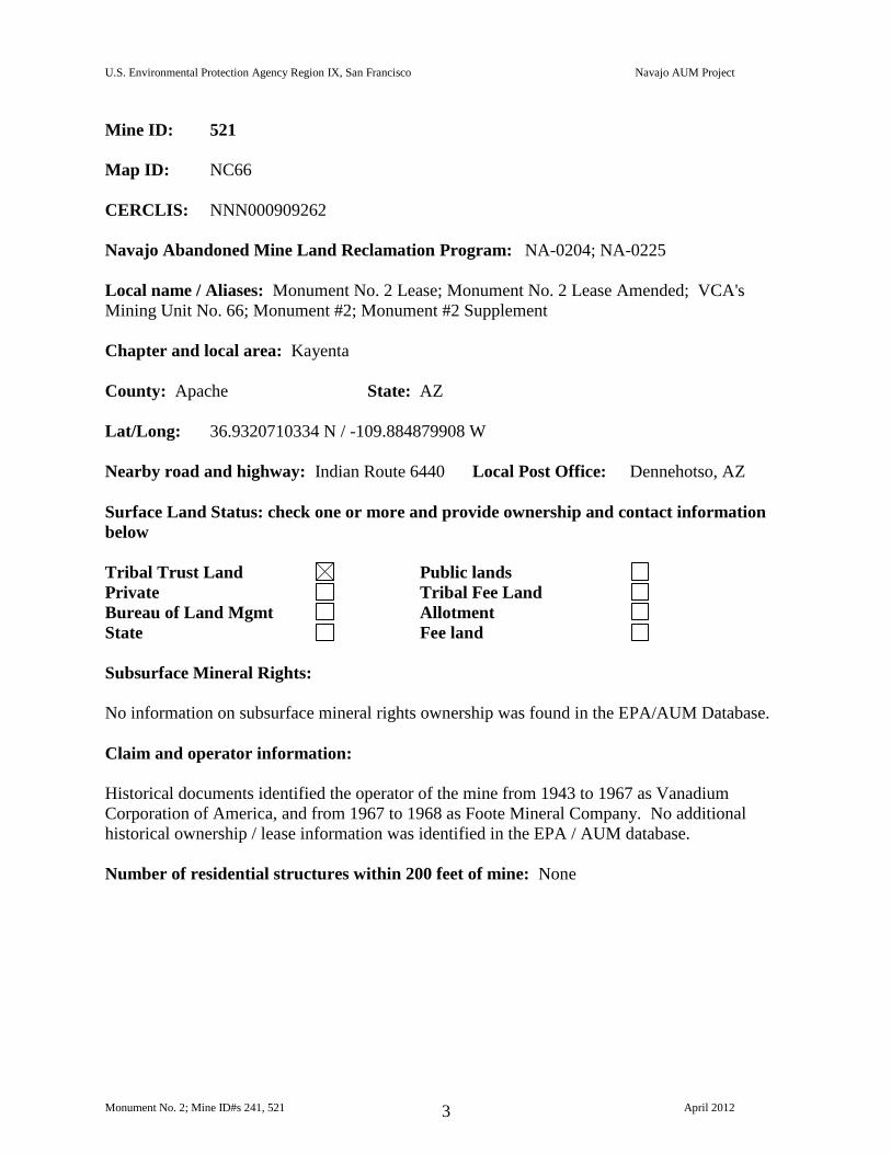
Part II Summary of Radiological Readings
Mine ID: 241
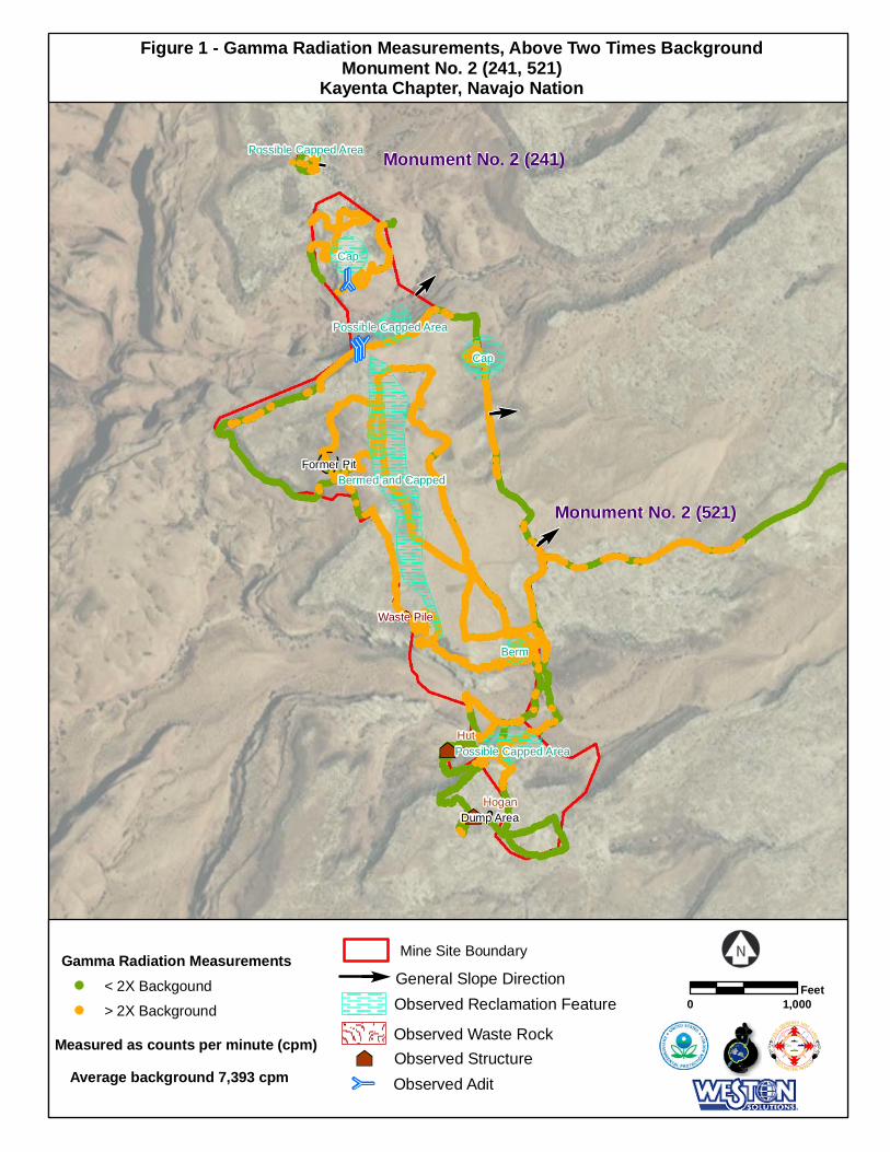
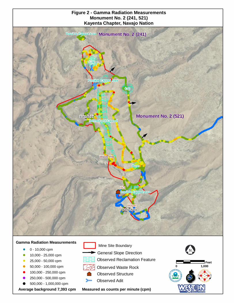
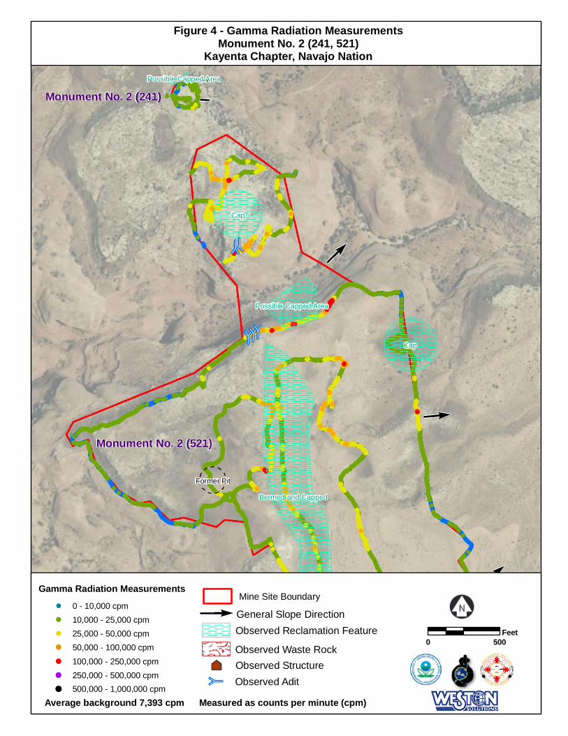
Highest gamma radiation measurement: 28,307 counts per minute (cpm)
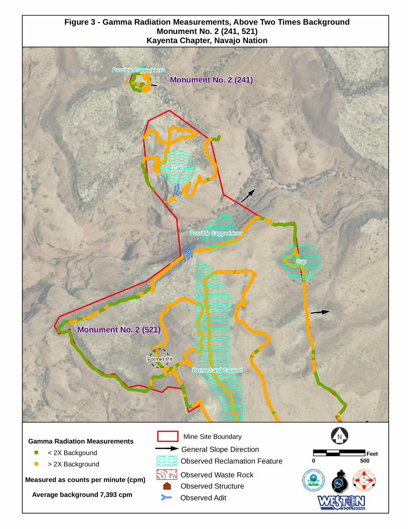
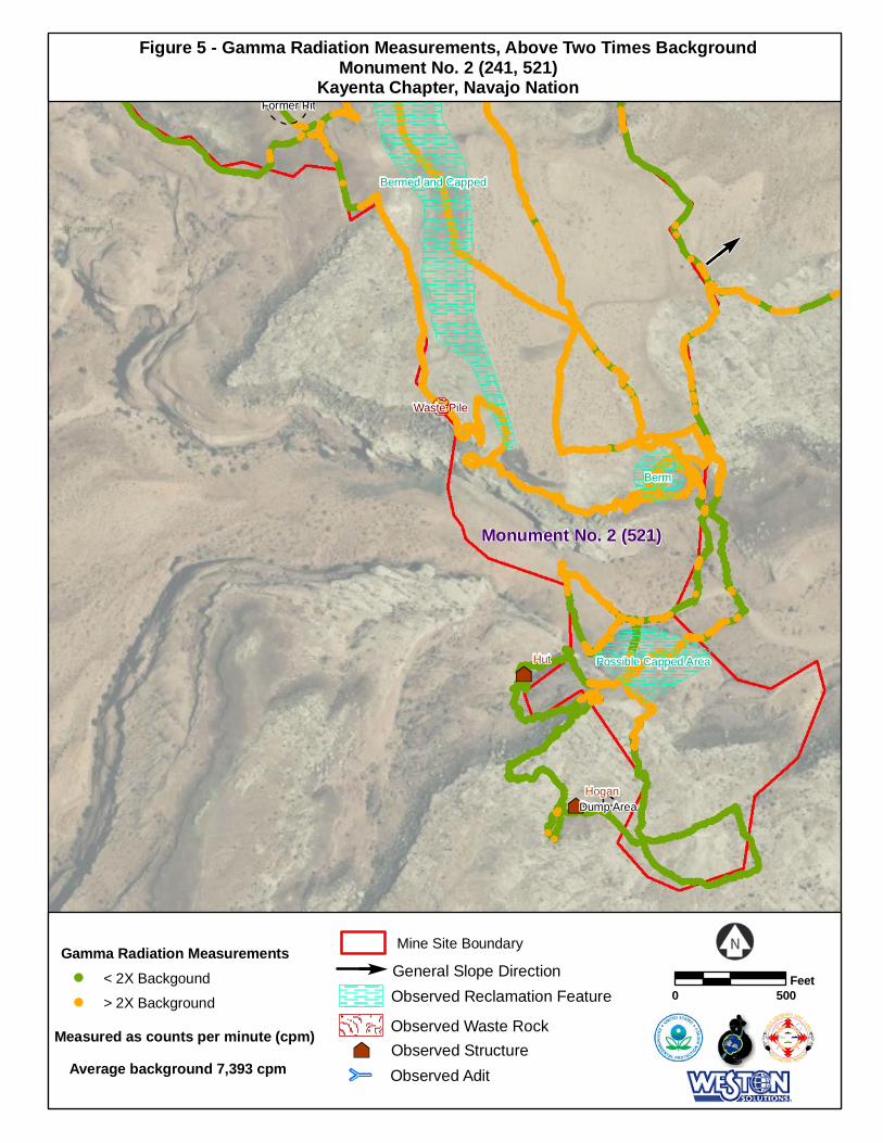
Background Average: 7,393 cpm Two Times Background: 14,786 cpm
Describe any other radiological measurements:
A total of 357 gamma radiation measurements were collected from the mine site, ranging from
8,055 cpm to 28,307 cpm. The measurements are represented in Figures 1, 2, 3 and 4.
Distribution Chart and Statistics:
Site Gamma Radiation Statistics
Number of Readings 357
Minimum (cpm) 8,055
Maximum (cpm) 28,307
Mean (cpm) 14,251
Median (cpm) 13,611
Standard Deviation 4,092
U.S. Environmental Protection Agency Region IX, San Francisco Navajo AUM Project
Monument No. 2; Mine ID#s 241, 521 April 2012 5
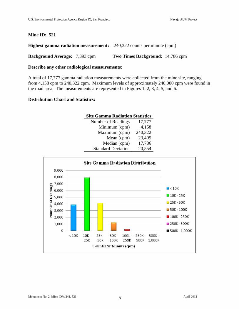
Mine ID: 521
Highest gamma radiation measurement: 240,322 counts per minute (cpm)
Background Average: 7,393 cpm Two Times Background: 14,786 cpm
Describe any other radiological measurements:
A total of 17,777 gamma radiation measurements were collected from the mine site, ranging
from 4,158 cpm to 240,322 cpm. Maximum levels of approximately 240,000 cpm were found in
the road area. The measurements are represented in Figures 1, 2, 3, 4, 5, and 6.
Distribution Chart and Statistics:
Site Gamma Radiation Statistics
Number of Readings 17,777
Minimum (cpm) 4,158
Maximum (cpm) 240,322
Mean (cpm) 23,405
Median (cpm) 17,786
Standard Deviation 20,554
U.S. Environmental Protection Agency Region IX, San Francisco Navajo AUM Project
Monument No. 2; Mine ID#s 241, 521 April 2012 6
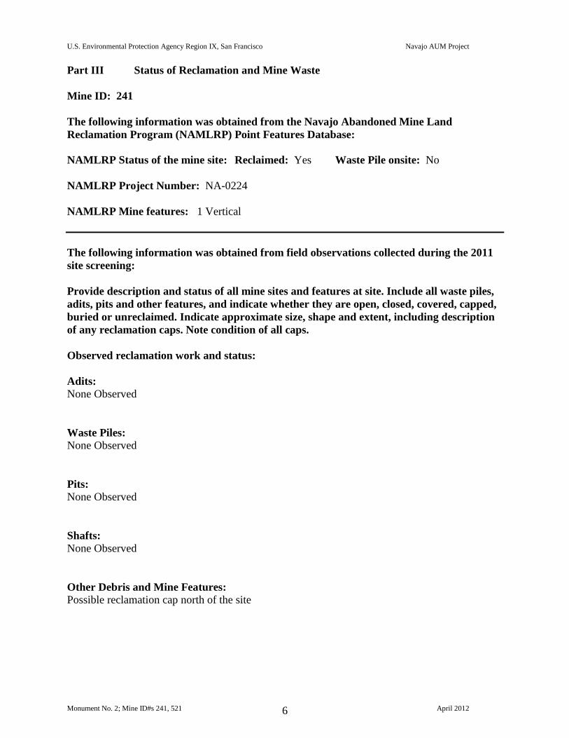
Part III Status of Reclamation and Mine Waste
Mine ID: 241
The following information was obtained from the Navajo Abandoned Mine Land
Reclamation Program (NAMLRP) Point Features Database:
NAMLRP Status of the mine site: Reclaimed: Yes Waste Pile onsite: No
NAMLRP Project Number: NA-0224
NAMLRP Mine features: 1 Vertical
The following information was obtained from field observations collected during the 2011
site screening:
Provide description and status of all mine sites and features at site. Include all waste piles,
adits, pits and other features, and indicate whether they are open, closed, covered, capped,
buried or unreclaimed. Indicate approximate size, shape and extent, including description
of any reclamation caps. Note condition of all caps.
Observed reclamation work and status:
Adits:
None Observed
Waste Piles:
None Observed
Pits:
None Observed
Shafts:
None Observed
Other Debris and Mine Features:
Possible reclamation cap north of the site
U.S. Environmental Protection Agency Region IX, San Francisco Navajo AUM Project
Monument No. 2; Mine ID#s 241, 521 April 2012 7
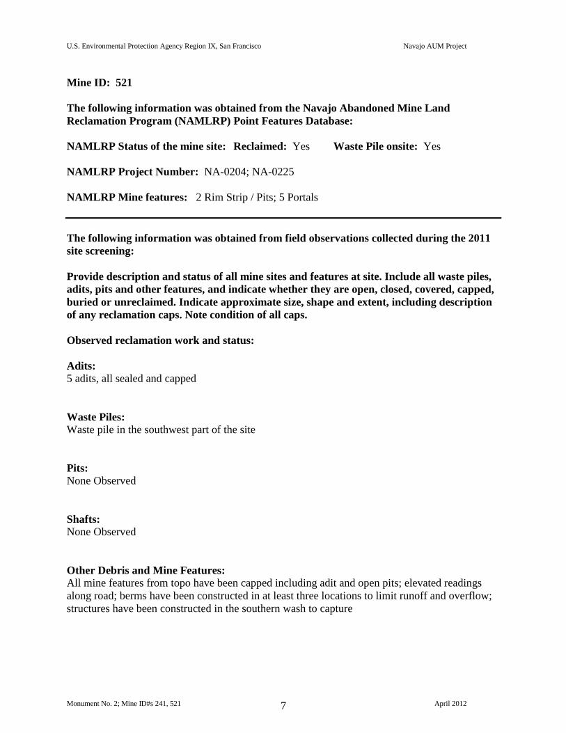
Mine ID: 521
The following information was obtained from the Navajo Abandoned Mine Land
Reclamation Program (NAMLRP) Point Features Database:
NAMLRP Status of the mine site: Reclaimed: Yes Waste Pile onsite: Yes
NAMLRP Project Number: NA-0204; NA-0225
NAMLRP Mine features: 2 Rim Strip / Pits; 5 Portals
The following information was obtained from field observations collected during the 2011
site screening:
Provide description and status of all mine sites and features at site. Include all waste piles,
adits, pits and other features, and indicate whether they are open, closed, covered, capped,
buried or unreclaimed. Indicate approximate size, shape and extent, including description
of any reclamation caps. Note condition of all caps.
Observed reclamation work and status:
Adits:
5 adits, all sealed and capped
Waste Piles:
Waste pile in the southwest part of the site
Pits:
None Observed
Shafts:
None Observed
Other Debris and Mine Features:
All mine features from topo have been capped including adit and open pits; elevated readings
along road; berms have been constructed in at least three locations to limit runoff and overflow;
structures have been constructed in the southern wash to capture
U.S. Environmental Protection Agency Region IX, San Francisco Navajo AUM Project
Monument No. 2; Mine ID#s 241, 521 April 2012 8
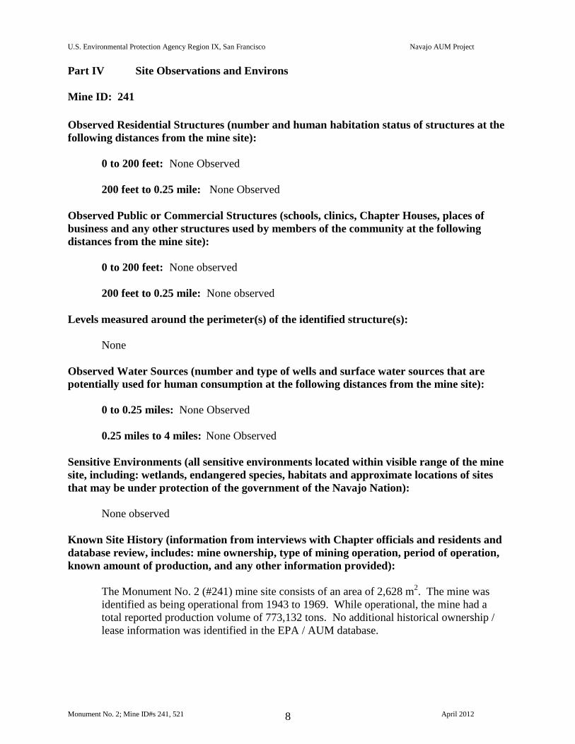
Part IV Site Observations and Environs
Mine ID: 241
Observed Residential Structures (number and human habitation status of structures at the
following distances from the mine site):
0 to 200 feet: None Observed
200 feet to 0.25 mile: None Observed
Observed Public or Commercial Structures (schools, clinics, Chapter Houses, places of
business and any other structures used by members of the community at the following
distances from the mine site):
0 to 200 feet: None observed
200 feet to 0.25 mile: None observed
Levels measured around the perimeter(s) of the identified structure(s):
None
Observed Water Sources (number and type of wells and surface water sources that are
potentially used for human consumption at the following distances from the mine site):
0 to 0.25 miles: None Observed
0.25 miles to 4 miles: None Observed
Sensitive Environments (all sensitive environments located within visible range of the mine
site, including: wetlands, endangered species, habitats and approximate locations of sites
that may be under protection of the government of the Navajo Nation):
None observed
Known Site History (information from interviews with Chapter officials and residents and
database review, includes: mine ownership, type of mining operation, period of operation,
known amount of production, and any other information provided):
The Monument No. 2 (#241) mine site consists of an area of 2,628 m2. The mine was
identified as being operational from 1943 to 1969. While operational, the mine had a
total reported production volume of 773,132 tons. No additional historical ownership /
lease information was identified in the EPA / AUM database.
U.S. Environmental Protection Agency Region IX, San Francisco Navajo AUM Project
Monument No. 2; Mine ID#s 241, 521 April 2012 9
Mine ID: 521
Observed Residential Structures (number and human habitation status of structures at the
following distances from the mine site):
0 to 200 feet: 50 ft W - Small wood structure / hut
200 feet to 0.25 mile: 250 ft W - Stone hogan
Observed Public or Commercial Structures (schools, clinics, Chapter Houses, places of
business and any other structures used by members of the community at the following
distances from the mine site):
0 to 200 feet: None observed
200 feet to 0.25 mile: None observed
Levels measured around the perimeter(s) of the identified structure(s):
Background Levels
Observed Water Sources (number and type of wells and surface water sources that are
potentially used for human consumption at the following distances from the mine site):
0 to 0.25 miles: None Observed
0.25 miles to 4 miles: None Observed
Sensitive Environments (all sensitive environments located within visible range of the mine
site, including: wetlands, endangered species, habitats and approximate locations of sites
that may be under protection of the government of the Navajo Nation):
None observed
Known Site History (information from interviews with Chapter officials and residents and
database review, includes: mine ownership, type of mining operation, period of operation,
known amount of production, and any other information provided):
The Monument No. 2 (#521) mine site consists of an area of 717,285 m2. The mine was
identified as being operational from 1943 to 1969. While operational, the mine had a
total reported production volume of 773,132 tons. No additional historical ownership /
lease information was identified in the EPA / AUM database.
U.S. Environmental Protection Agency Region IX, San Francisco Navajo AUM Project
Monument No. 2; Mine ID#s 241, 521 April 2012 10
Part V Response Action Summary
Summary of Evaluation Factors:
Mine ID: 241
Accessibility:
Was the mine easily accessible to potential human activity?
Yes
Radiological Measurements:
Were any gamma radiation measurements collected at the mine greater than two
times the site-specific background levels?
Yes
Waste Piles:
Were any unreclaimed waste piles observed at the mine with gamma radiation
measurements greater than two times the site-specific background levels?
No
Structures:
Were any structures observed within 200 feet of the mine?
No
Potential Drinking Water Sources:
Were any potential drinking water sources observed within 4 miles of the mine?
No
Reclamation:
Was the mine reported to be previously reclaimed, or did the mine appear to be
reclaimed?
Yes
U.S. Environmental Protection Agency Region IX, San Francisco Navajo AUM Project
Monument No. 2; Mine ID#s 241, 521 April 2012 11
Mine ID: 521
Accessibility:
Was the mine easily accessible to potential human activity?
Yes
Radiological Measurements:
Were any gamma radiation measurements collected at the mine greater than two
times the site-specific background levels?
Yes
Waste Piles:
Were any unreclaimed waste piles observed at the mine with gamma radiation
measurements greater than two times the site-specific background levels?
Yes
Structures:
Were any structures observed within 200 feet of the mine?
Yes
Potential Drinking Water Sources:
Were any potential drinking water sources observed within 4 miles of the mine?
No
Reclamation:
Was the mine reported to be previously reclaimed, or did the mine appear to be
reclaimed?
Yes
U.S. Environmental Protection Agency Region IX, San Francisco Navajo AUM Project
Monument No. 2; Mine ID#s 241, 521 April 2012 12
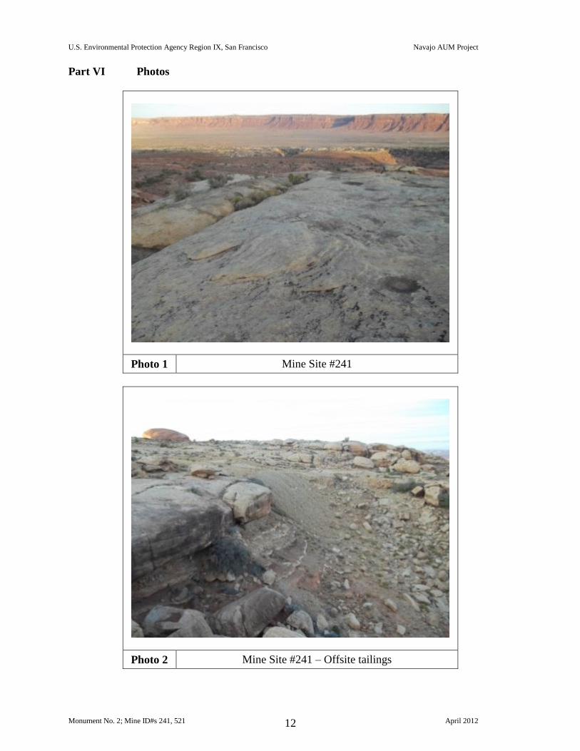
Part VI Photos
Photo 1 Mine Site #241
Photo 2 Mine Site #241 – Offsite tailings
U.S. Environmental Protection Agency Region IX, San Francisco Navajo AUM Project
Monument No. 2; Mine ID#s 241, 521 April 2012 13
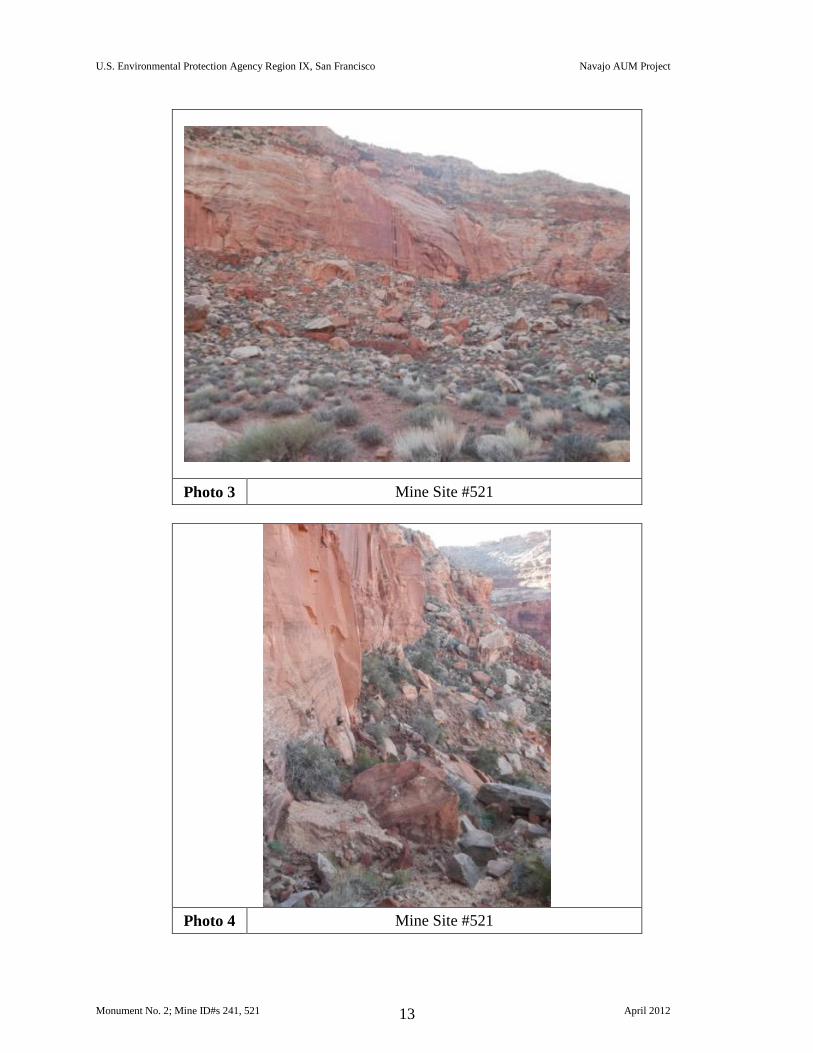
Photo 3 Mine Site #521
Photo 4 Mine Site #521
U.S. Environmental Protection Agency Region IX, San Francisco Navajo AUM Project
Monument No. 2; Mine ID#s 241, 521 April 2012 14
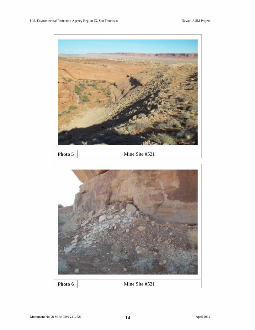
Photo 5 Mine Site #521
Photo 6 Mine Site #521
U.S. Environmental Protection Agency Region IX, San Francisco Navajo AUM Project
Monument No. 2; Mine ID#s 241, 521 April 2012 15
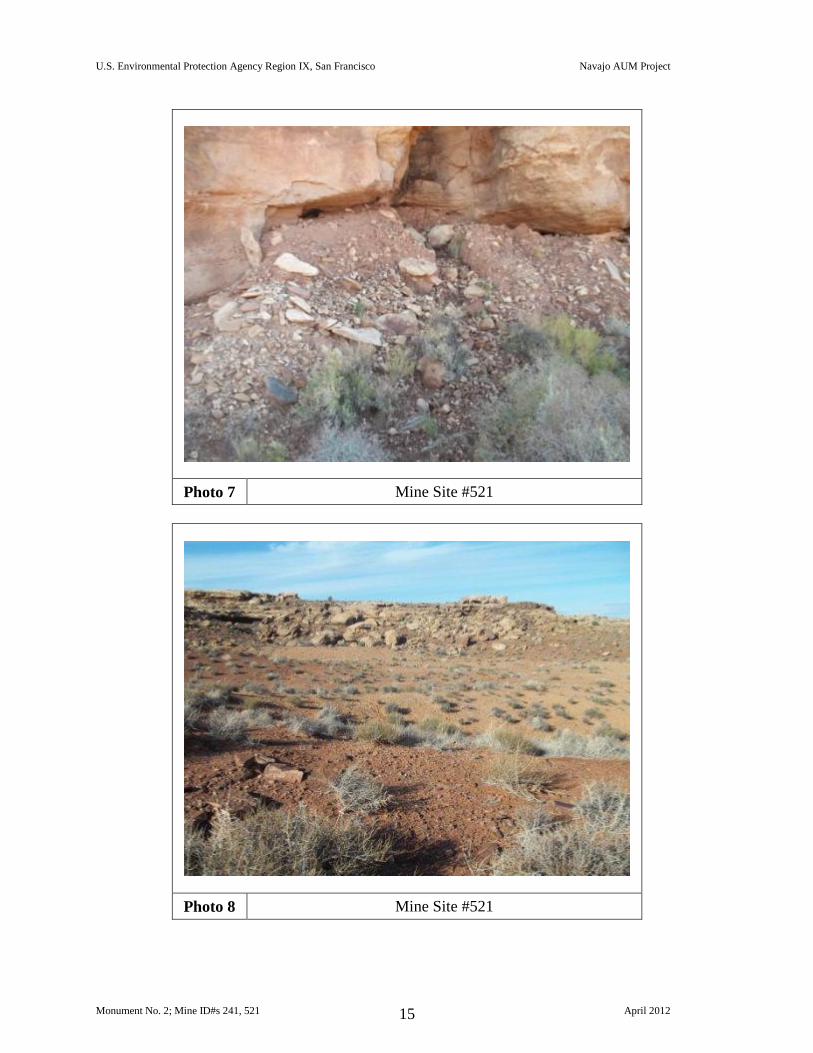
Photo 7 Mine Site #521
Photo 8 Mine Site #521
U.S. Environmental Protection Agency Region IX, San Francisco Navajo AUM Project
Monument No. 2; Mine ID#s 241, 521 April 2012 16
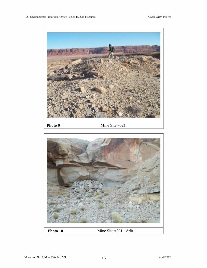
Photo 9 Mine Site #521
Photo 10 Mine Site #521 - Adit
U.S. Environmental Protection Agency Region IX, San Francisco Navajo AUM Project
Monument No. 2; Mine ID#s 241, 521 April 2012 17
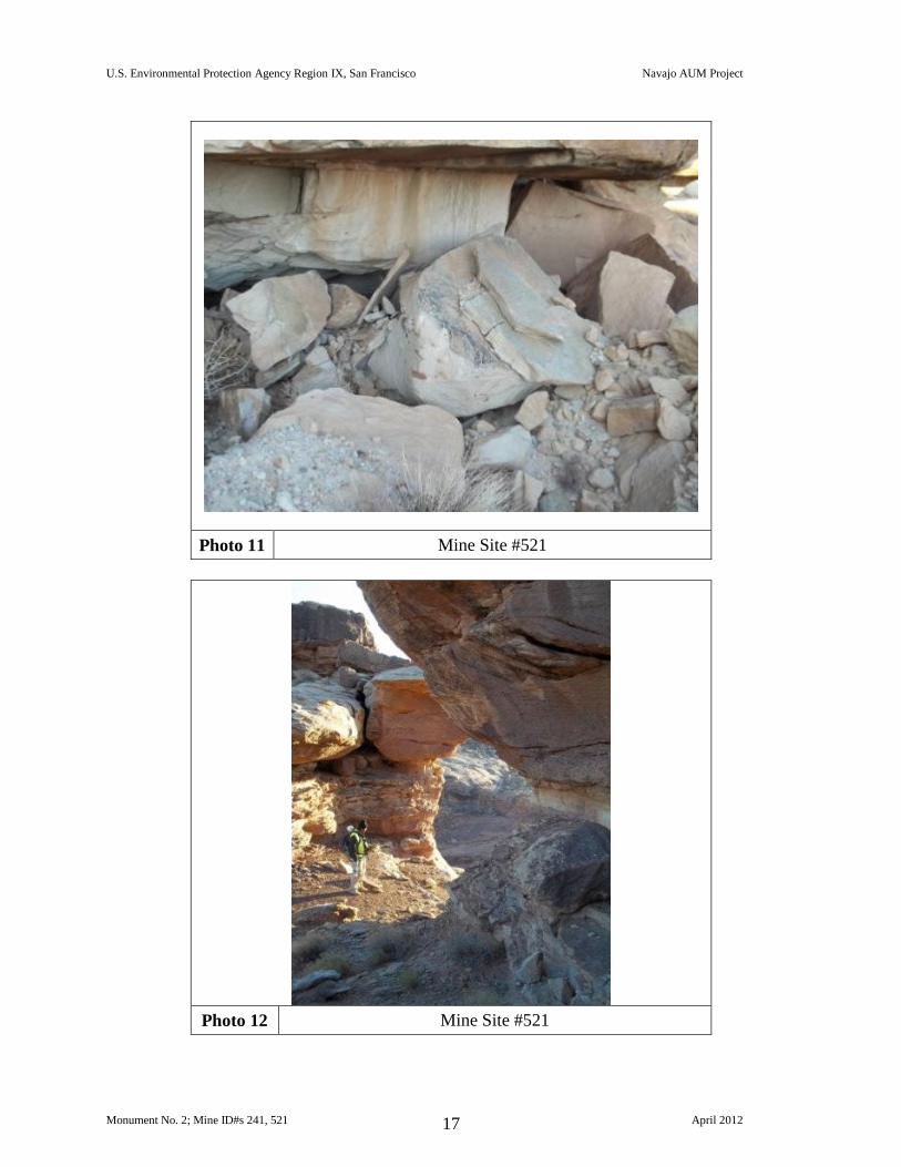
Photo 11 Mine Site #521
Photo 12 Mine Site #521
U.S. Environmental Protection Agency Region IX, San Francisco Navajo AUM Project
Monument No. 2; Mine ID#s 241, 521 April 2012 18
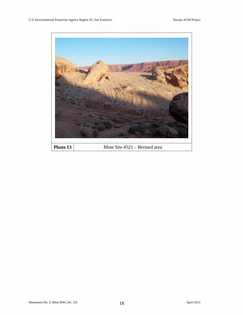
Photo 13 Mine Site #521 – Bermed area
U.S. Environmental Protection Agency Region IX, San Francisco Navajo AUM Project
Monument No. 2; Mine ID#s 241, 521 April 2012 19
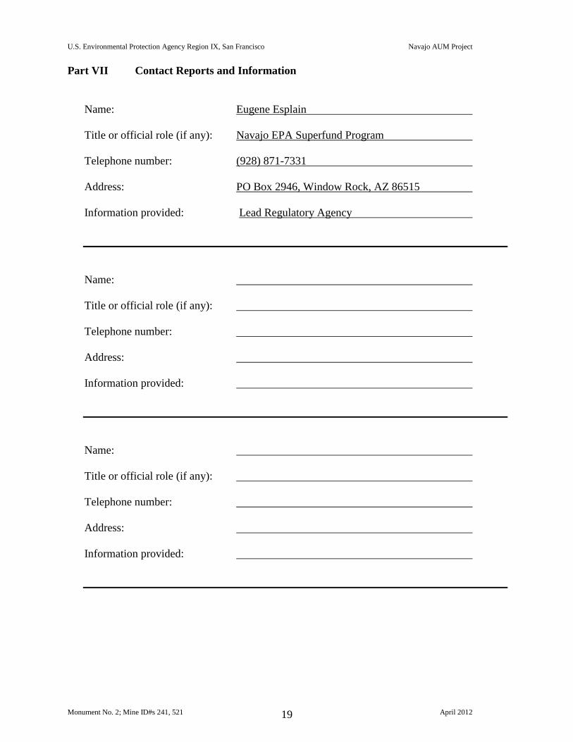
Part VII Contact Reports and Information
Name: Eugene Esplain
Title or official role (if any): Navajo EPA Superfund Program
Telephone number: (928) 871-7331
Address: PO Box 2946, Window Rock, AZ 86515
Information provided: Lead Regulatory Agency
Name:
Title or official role (if any):
Telephone number:
Address:
Information provided:
Name:
Title or official role (if any):
Telephone number:
Address:
Information provided:
E
EE
²³
²³
Q Q
Q Q Q
Hut
Hogan
Former Pit
Dump Area
Cap
Cap
Bermed and Capped
Berm
Possible Capped Area
Possible Capped Area
Possible Capped Area
Waste Pile
Figure 1 - Gamma Radiation Measurements, Above Two Times BackgroundMonument No. 2 (241, 521)
Kayenta Chapter, Navajo Nation
Gamma Radiation Measurements< 2X Backgound
> 2X Background
Measured as counts per minute (cpm)
0 1,000Feet
Average background 7,393 cpm Q Observed Adit
E General Slope Direction
Mine Site Boundary
Observed Reclamation Feature
²³ Observed StructureObserved Waste Rock
Monument No. 2 (241)
Monument No. 2 (521)
E
EE
²³
²³
Q Q
Q Q Q
Hut
Hogan
Former Pit
Dump Area
Cap
Cap
Bermed and Capped
Berm
Possible Capped Area
Possible Capped Area
Possible Capped Area
Waste Pile
Figure 2 - Gamma Radiation MeasurementsMonument No. 2 (241, 521)
Kayenta Chapter, Navajo Nation
Measured as counts per minute (cpm)
Monument No. 2 (241)
Q Observed Adit
Average background 7,393 cpm
Gamma Radiation Measurements
! 0 - 10,000 cpm! 10,000 - 25,000 cpm! 25,000 - 50,000 cpm! 50,000 - 100,000 cpm! 100,000 - 250,000 cpm! 250,000 - 500,000 cpm! 500,000 - 1,000,000 cpm
E General Slope Direction
Mine Site Boundary
Observed Reclamation Feature
²³ Observed StructureObserved Waste Rock
Monument No. 2 (521)
0 1,000Feet
E
E
E
Q Q
Q Q Q
Former Pit
Cap
Cap
Bermed and Capped
Possible Capped Area
Possible Capped Area
Waste Pile
Figure 3 - Gamma Radiation Measurements, Above Two Times BackgroundMonument No. 2 (241, 521)
Kayenta Chapter, Navajo Nation
Gamma Radiation Measurements< 2X Backgound
> 2X Background
Measured as counts per minute (cpm)
Average background 7,393 cpm Q Observed Adit
E General Slope Direction
Mine Site Boundary
Observed Reclamation Feature
²³ Observed StructureObserved Waste Rock
Monument No. 2 (241)
Monument No. 2 (521)
0 500Feet
E
E
E
Q Q
Q Q Q
Former Pit
Cap
Cap
Bermed and Capped
Possible Capped Area
Berm
Possible Capped Area
Waste Pile
Figure 4 - Gamma Radiation MeasurementsMonument No. 2 (241, 521)
Kayenta Chapter, Navajo Nation
Measured as counts per minute (cpm)
Monument No. 2 (241)
Q Observed Adit
Average background 7,393 cpm
Gamma Radiation Measurements
! 0 - 10,000 cpm! 10,000 - 25,000 cpm! 25,000 - 50,000 cpm! 50,000 - 100,000 cpm! 100,000 - 250,000 cpm! 250,000 - 500,000 cpm! 500,000 - 1,000,000 cpm
E General Slope Direction
Mine Site Boundary
Observed Reclamation Feature
²³ Observed StructureObserved Waste Rock
Monument No. 2 (521)
0 500Feet
E
²³
²³
Hut
Hogan
Former Pit
Dump Area
Berm
Bermed and Capped
Possible Capped Area
Waste Pile
Figure 5 - Gamma Radiation Measurements, Above Two Times BackgroundMonument No. 2 (241, 521)
Kayenta Chapter, Navajo Nation
Gamma Radiation Measurements< 2X Backgound
> 2X Background
Measured as counts per minute (cpm)
Average background 7,393 cpm Q Observed Adit
E General Slope Direction
Mine Site Boundary
Observed Reclamation Feature
²³ Observed StructureObserved Waste Rock
Monument No. 2 (521)
0 500Feet
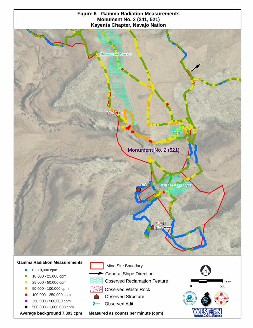
E²³
²³
Hut
Hogan
Former Pit
Dump Area
Berm
Bermed and Capped
Possible Capped Area
Waste Pile
Figure 6 - Gamma Radiation MeasurementsMonument No. 2 (241, 521)
Kayenta Chapter, Navajo Nation
Measured as counts per minute (cpm)
0 500Feet
Q Observed Adit
Average background 7,393 cpm
Gamma Radiation Measurements
! 0 - 10,000 cpm! 10,000 - 25,000 cpm! 25,000 - 50,000 cpm! 50,000 - 100,000 cpm! 100,000 - 250,000 cpm! 250,000 - 500,000 cpm! 500,000 - 1,000,000 cpm
E General Slope Direction
Mine Site Boundary
Observed Reclamation Feature
²³ Observed StructureObserved Waste Rock
Monument No. 2 (521)