ministry of environment & forests - Environmental Clearance
61
Page 1 of 61 MINISTRY OF ENVIRONMENT & FORESTS (IA DIVISION) ****** SUMMARY RECORD OF 7 th MEETING OF THE RECONSTITUTED COMMITTEE OF THE EXPERT APPRAISAL COMMITTEE FOR ENVIRONMENTAL APPRAISAL OF MINING PROJECTS CONSTITUTED UNDER EIA NOTIFICATION, 2006. The 7 th Meeting of the Reconstituted Expert Appraisal Committee for Environmental Appraisal of Mining Projects (Non-Coal) of the Ministry of Environment and Forests was held during May 15 th -17 th , 2013. The list of participants is annexed. After welcoming the Committee Members, discussion on each of the Agenda Items was taken up ad-seriatim. Item No. 1: 1.1 Confirmation of the minutes of the 30th Meeting. The Minutes of the 6 th Meeting of EAC held during May 15 th -17 th , 2013 were confirmed as circulated and corrected. Agenda Item No. 2: 2.1 Expansion of Lime Stone Mines of M/s Ambuja Cements Ltd. from 5.5 MTPA to 7.6 MTPA at village Kashlog, Mangu and Pati, Tehsil Arki, Distt. Solan, Himachal Pradesh-EC The proposal is for expansion of Kashlog Limestone Mine of M/s Ambuja Cements Limited from 5.5 MTPA to 7.6 MTPA falling in villages Kashlog, Chakru, Serwala, Banjan, Pati, Banli, Badog, Banog, Rathoh, Mangu, Chola, Ghamaru, Serjeri, Gyana, Rauri and Sangoi of Arki Tehsil, Solan District, State Himachal Pradesh. The Latitude and Longitude of the site fall between 31 o 13‟50.5” to 31 o 15‟28” N and 76 o 55‟38.5” to 77 o 0‟9.5” E respectively. The proposal was considered by the Expert Appraisal Committee (Industry) during 91 st meeting held on 9 th to 11 th February, 2009. The Expert Appraisal Committee (Industry) and the two co-opted members from the EAC (Mining), after detailed deliberations, finalized the TOR. The TORs were issued by MoEF vide letter no. J-11011/986/208-IA-II (I) dated 12 th March, 2009. The limestone expansion project is a part of integrated project of expansion of Rauri Clinkerisation Unit from 1.8 to 2.6 MTPA capacity. The original mine lease area is 488.06 ha which is under renewal. It comprises 138.70 ha government forest land and 349.36 ha private waste, ghasni and agricultural land. Forest Advisory Committee has principally cleared the renewal of 122.18 ha forest land for which earlier clearances were available over 102.8 ha and 19.38 ha separately. As per the new guidelines of forest diversion, ACL has plans to surrender 16.52 ha forest land which falls on ML periphery and for
-
Upload
khangminh22 -
Category
Documents
-
view
0 -
download
0
Transcript of ministry of environment & forests - Environmental Clearance

Page 1 of 61
MINISTRY OF ENVIRONMENT & FORESTS (IA DIVISION)
******
SUMMARY RECORD OF 7th MEETING OF THE RECONSTITUTED COMMITTEE OF THE EXPERT APPRAISAL COMMITTEE FOR ENVIRONMENTAL APPRAISAL OF MINING PROJECTS CONSTITUTED UNDER EIA NOTIFICATION, 2006.
The 7th Meeting of the Reconstituted Expert Appraisal Committee for
Environmental Appraisal of Mining Projects (Non-Coal) of the Ministry of Environment and Forests was held during May 15th-17th, 2013. The list of participants is annexed.
After welcoming the Committee Members, discussion on each of the Agenda
Items was taken up ad-seriatim. Item No. 1:
1.1 Confirmation of the minutes of the 30th Meeting.
The Minutes of the 6th Meeting of EAC held during May 15th-17th, 2013 were
confirmed as circulated and corrected. Agenda Item No. 2:
2.1 Expansion of Lime Stone Mines of M/s Ambuja Cements Ltd. from 5.5
MTPA to 7.6 MTPA at village Kashlog, Mangu and Pati, Tehsil Arki, Distt. Solan, Himachal Pradesh-EC
The proposal is for expansion of Kashlog Limestone Mine of M/s Ambuja Cements Limited from 5.5 MTPA to 7.6 MTPA falling in villages Kashlog, Chakru,
Serwala, Banjan, Pati, Banli, Badog, Banog, Rathoh, Mangu, Chola, Ghamaru, Serjeri, Gyana, Rauri and Sangoi of Arki Tehsil, Solan District, State Himachal Pradesh. The Latitude and Longitude of the site fall between 31o13‟50.5” to
31o15‟28” N and 76o55‟38.5” to 77o0‟9.5” E respectively. The proposal was considered by the Expert Appraisal Committee (Industry) during 91st meeting held
on 9th to 11th February, 2009. The Expert Appraisal Committee (Industry) and the two co-opted members from the EAC (Mining), after detailed deliberations, finalized the TOR. The TORs were issued by MoEF vide letter no. J-11011/986/208-IA-II (I)
dated 12th March, 2009. The limestone expansion project is a part of integrated project of expansion of Rauri Clinkerisation Unit from 1.8 to 2.6 MTPA capacity.
The original mine lease area is 488.06 ha which is under renewal. It
comprises 138.70 ha government forest land and 349.36 ha private waste, ghasni
and agricultural land. Forest Advisory Committee has principally cleared the renewal of 122.18 ha forest land for which earlier clearances were available over
102.8 ha and 19.38 ha separately. As per the new guidelines of forest diversion, ACL has plans to surrender 16.52 ha forest land which falls on ML periphery and for

Page 2 of 61
which, diversion was not sought. The Mining plan was approved by IBM vide Letter No. 614(2)/MP-A-324/11-DDN dated 20.03.2012. Darlaghat (Piplughat) Sanctuary
and Majathal Sanctuary are located within 10 kms distance from core zone. No endangered flora is reported. Five Schedule – I species have been reported in the
buffer zone. The mine is being operated by opencast method and excavations are being
carried out by gradual slicing off from the top of the limestone hill. The mining operations comprise pre production development stage and the production stage.
During the pre production stage haul roads are laid and the faces are developed and made ready for raising limestone. Haul roads have been designed based on geo-technical parameters, shape of the ore body and size of the equipment plying
in the mines. Adequate drainage has been provided along the roads to prevent erosion from runoff water. The average height of the benches is 10 m and face
slope is 80-900 during excavation. The slope stability investigations for the mine were carried out by Indian Bureau of Mines, Nagpur and CMRI, Dhanbad and as per their suggestions, ultimate bench slope of 450 shall be maintained. State of the art
controlled blasting technique are adopted.
The grade of the mined out limestone that is supplied to the crusher/cement plant is of the order of 43 to 44.5 % CaO. The requirement of the cement plant for
kiln feed is about 43.5 % CaO. Presently, all the mined material is supplied to plant.
In the mining area, there is no generation of significant waste material which
needs dumping or segregation. All sub-grade material like shale, shaly limestone is blended in ROM and supplied to crusher for use in raw mix design. The water
requirement of 150 to 170 m3/day for mining usage shall be met from Pazeena (Pagoda) Khud & Mine Sump. Pazeena Khud is a tributary of Sutlej River. Permission to draw 1200 KLD of water from Pazeena Khud for project is available.
Mining operations in the mining lease area will not intersect water table. However, the hydro-geological studies were conducted by Shri R P Agarwal, Retired Regional
Director, Central Groundwater Board for plant and mines area and the report is included in EIA report.
Public Hearing was organized by the Himachal Pradesh State Pollution Control Board on 30.08.2012 at Government Primary School, Rauri - Darlaghat
Tehsil Arki, Distt. Solan. The PH was chaired by ADM and RO-SPCB Himachal Pradesh. The major issues raised were inflow of water into fields due to which their paddy crops are affected. Mining is being carried out at a distance of 50 m to 100 m
from the village. They face problems due to dust generation from vehicle movement. In response, the proponent committed for proper drainage of the
surrounding in the mining areas so that all the runoff water from the mines is collected in the bottom pit of the mines. This water is re-used by Ambuja in the mining area for sprinkling on haul roads and machine washing purpose. It was
mentioned that PP uses eco-friendly methods such as ripper dozers, hydraulic rock breakers and the hydraulic cutting drums so as to cause minimum inconvenience to
the villagers. Haul roads inside the mining area are temporary. Provision of water sprinkling through tankers will be made to suppress dust. Sufficient water

Page 3 of 61
sprinkling system has been provided in the mining and crusher area to control fugitive dust. All efforts are made to maintain the noise and dust generated within
permissible limits in the mining area.
There are five court cases pending before the Hon‟ble High Court of Himachal Pradesh at Shimla regarding cement plant & limestone mining project:
1. Civil Writ Petition No. 2293 of 2010 "Ram Singh & others versus State of Himachal Pradesh & others” -- MoEF is respondent No. 4
2. Civil Writ Petition No. 7915 of 2010 "Jagarnath & others versus State of Himachal Pradesh & others” -- MoEF is respondent No. 4
3. Civil Writ Petition No. 10581of 2011 "Narpat & others versus State of
Himachal Pradesh & others" -- MoEF is respondent No. 4 4. Civil Writ Petition No. 9442 of 2011 "Prem Lal & others versus State of
Himachal Pradesh & others" -- MoEF is respondent No. 4 5. Civil Writ Petition No. 10142 of 2012 "Pawan Kumar & others versus State
of Himachal Pradesh & others" -- MoEF is respondent No. 7
The total project cost is about Rs 8950 Lakhs. The proposed cost of
environmental protection measures is about Rs 990.6 lakhs per annum for plant and mines. Provision of about Rs 400 lakhs per annum has been earmarked for
socio economic development of surrounding region.
The project proponent made a presentation with regard to compliance of TOR
and earlier EC conditions of letter no. J-11015/200/2005-IA-II on 03.11.2006. The committee members infomred that mine plan of the project was not circulated to all
the members. Further, it was also noted that Questionnaire was not included in the EIA report. However, it was submitted during the meeting. The baseline data was more than 3 years old and the season taken i.e. April-June was not as per the IMD
norms. The committee was of the view that the proponent, therefore needs to resubmit revised EIA/EMP report including the following information:
i. Detailed list of lower plant species, such as bryophytes, pteridophytes etc. ii. Validated List of endangered species.
iii. The wildlife conservation plan to be duly approved by concerned State Government.
iv. Measures for prevention of fly rocks through muffled blasting. v. Large no. of issues raised during the public hearing were not addressed,
namely comprehensive health aspects, mineralogical composition of RSPM
etc. This is to be done and time bound Action Plan with budgetary provisions, submitted.
vi. Details of CSR activities. vii. Latest status of the Court cases, which may have a bearing on the EC
process under consideration.
It was also noted that Darlaghat (Piplughat) Sanctuary and Majathal
Sanctuary are located within 10 kms distance from core zone and NBWL clearance was not obtained and the mine is working. Therefore, it is a violation case. The

Page 4 of 61
Committee decided to defer the proposal and be brought back to the Committee after the above information, is submitted.
2.2 Black Granite Quarry (4305.36 m3/Annum) of M/s Shiva Granites
located at Compartment No. 213, Kammapalle Beat, Paradarami Reserve Forest, Chittoor West Range, Chittoor District, Andhra Pradesh (QL Area: 5.0 Ha – Andhra Pradesh & Tamilnadu State
Boundary at 0.3km) (Consultant: Team Labs and consultants, Hyderabad) –EC regarding.
The proposal is for Black granite quarrying with proposed production of
4305.36 m3/Annum by M/s Shiva Granites located at Compartment No. 213,
Kammapalle Beat, Paradarami Reserve Forest, Chittoor West Range, Chittoor District, Andhra Pradesh. The Latitude and Longitude of the site is 13˚05‟18.2” N
and 78˚56‟55” E. The proposal was considered by the Expert Appraisal Committee during its meeting held during 25-26th March, 2010 for determination of the Terms of Reference (TORs) for undertaking detailed EIA study. The TORs were issued by
MoEF vide letter no. J-11015/691/2010-IA.II(M) dated April 7, 2010. The proponent submitted their application for seeking environmental clearance on January 27,
2012. The project being category „A‟ project (due to its location within 10km from interstate boundary with Tamil Nadu), the project proponent was requested to
conduct public hearing for the project. Accordingly, the public hearing was conducted on 03.01.2013. The proponent again submitted its application for seeking environmental clearance after conducting public hearing to the Ministry on
4th April, 2013.
The quarry lease area is 5.00 ha, which is a forest land. The total land used for quarrying is 4.79 ha; mainly for working, waste dumping and green belt development. The mining plan is approved by Joint Director of Mines & Geology,
Kadapa vide Letter No. 5939/MP-CTR/2009, Dated 30.01.2010. It is reported that permission accorded under Forest (Conservation) Act, 1980 has been issued by
Government of Andhra Pradesh vide G.O.Ms. No. 120 dated 03.10.2008. It is reported by the Project Proponent that the quarry operations will be
semi mechanized, open cast type. No over burden removal is anticipated during the next 5 years. The fresh sheet, that is exposed will be subjected to splitting into
required sizes of blocks by using Jack Hammers by drilling series of deep holes and hammering with sledge hammer. Blocks will be separated by drilling and wedging, the separated blocks are dressed, dressed blocks are sent to domestic processing
plant for export. Life of the quarry is 64 years. The water requirement is estimated as 1.5 KLD, which will be obtained from nearby villages through tankers.
Total Geological Reserves are about 23,00,728 m3 in seven sections. The
sectional influence will be 100m in all the sections except 7th i.e. 60m. The exposed
deposit is found to be irregular in shape as it is exposed on the hill. Hence, the volume is computed by cross sectional area method by taking 7 cross sections (with
an equal interval of 100 m ) A-A1, B-B1, C-C1, D-D1, E-E1, F-F1, G-G1 and 2 cross sections were drawn for the purpose of the projecting the profile. The geological

Page 5 of 61
reserves have been estimated using Cross Sectional method. The recovery of rock in each category varies from 15 to 25 % depending upon the category. For Proved
and Probable Categories, the recovery of useful mineral is 20 % on an average. Total Geological reserves are estimated is 23,00,728 m3, at the rate of 12%
recovery the market grade rough blocks are 2,76,087 m3. Life of the quarry is 276087 m3/4300 m3 = 64 years.
The solid waste generation will be 1,57,863.2 m3 during scheme period, at an average of 31,572.64 m3 per annum. At the rate of 31,573 m3 average generation
of waste per year for 10 years lease period, the total waste generation is 3,15,730 m3. The waste generated will be dumped within the lease area boundary temporarily utilising an area of 12000 m2 with the dump height of 12m. The mining
activity is conducted on a hillock at 175 m above ground level. The ground water level in the area is 30 m bgl. The depth of mine at the end of the scheme is 26 m
from top of the hill. Therefore there will not be any ground water intersection. Project site is located within Paradarami reserve forest, Ragimanipenta RF in
North at a distance of 2.3 Km, Virisettipalle RF in East at a distance of 5 Km, Kallapadi RF in SW at a distance of 6.8 Km, Pedda Konda RF in NW at a distance of
8.0 Km, Bodabanda RF in North at a distance of 8.5 Km are all located in the 10 km radius study area from the quarry. Reportedly, there are no national parks, wild life
sanctuaries tiger reserves and schedule I species within the 10 km radius of the quarry. All the parameters of ambient air, noise level have been found to be within the prescribed limits.
The Public Hearing for the Proposed Project was conducted at the proposed
quarry lease area on 03.01.2013. The PH was chaired by Sri Ongolu Seshaiah, District Revenue Officer & Addl. District Magistrate, Chittoor. The issues raised during public hearing were also considered and discussed during the meeting,
which inter-alia, included location of worship place in the ML area, it was assured by PP that the worship place is outside the mine lease area and the same was
authenticated by both gram panchayath and the forest department. As per the villager‟s requirements, it was informed by the PP that they would take care of local employment; noise pollution control, fugitive dust control, soil erosion, water
scarcity, avenue plantation and CSR activities etc. These have been incorporated in the Project Plan with budgetary provisions.
The cost of the project is Rs. 25 Lakhs. Capital cost and recurring cost
estimated for environmental protection measures is 9.45 Lakhs and 3.3 Lakhs
respectively. About 5% of the project cost shall be spent for CSR activities to develop infrastructure facilities in nearby villages.
It was reported by the PP that there is no court case/litigation pending
against the project and there has been no violation in the past. However,
committee observed that two court cases W.P. no. 2254 of 2006 and 2806 of 2007 were filed against the project. The proponent informed that both the cases have
been disposed off and now no court case is pending against the project. The copy of order was submitted by the proponent. It was informed by the Member Secretary

Page 6 of 61
that the Ministry has received a complaint that there are two Writ Petitions no. 26459/2008 and 6805/2009 which are pending before the Hon‟ble High Court of
Andhra Pradesh. However, it was informed by the PP that there are no court cases pending. Based on the information submitted and discussion by the Committee,
especially with reference to the litigation matters, the committee was of the view that the PP should submit an affidavit giving the status of the court cases disposed and pending. The committee therefore deferred the project and could be placed
before the EAC after the information is submitted by PP.
2.3 Karampada Iron Ore Mining Project with production capacity of 0.67 MTPA of M/s The General Produce Co. Ltd., at Village Karampada Reserve Forest, Tehsil Noamundi District West Singhbhum,
Jharkhand (70.68 ha) (Consultant: Bhagavathi Ana Labs Ltd., Hyderabad) – EC
The Proposal was considered by the Expert Appraisal Committee in its
meeting held during 17-18th February, 2010 for renewal of mine lease, which fell
due from 12.10.2006 for production of 0.6 million TPA of iron ore. In view of the location of the said mine in District West Singhbhum, the Proposal was considered
in terms of the Office Memorandum dated 13.01.2010 issued by MoEF relating to Projects to be located in Critically/Severely Polluted areas. As per the O.M. it was
falling in the severely polluted area and accordingly, comments of JSPCB were obtained. Jharkhand State Pollution Control Board submitted its comments on 17.02.2010, which were considered by the Committee. In view of the poor quality
of environmental parameters in the area as stated by SPCB, the Committee withheld prescription of TOR till the ambient conditions were brought within the
prescribed parameters. For confirmation of this, the Committee invited representative of SPCB. The meeting was attended by the Member Secretary, JSPCB. The Member Secretary stated that the environmental status of the area has
improved due to stringent conditions imposed on mines, hence Project could be considered on its merits. Accordingly, Project was considered by the EAC in its
meeting held in February 2010 and TORs were issued. In accordance with the TORs, the Proponent submitted final EIA/EMP Report to MoEF vide letter no. GPC/KIOM/EC/27/12-13 dated 02.11.2012. Ambient Air Quality studies were
carried out during winter season 2010-2011. Ambient Air Quality parameters were reported within permissible limits. Public Hearing was conducted on 22.08.2012 in
Baraiburu Village under the Chairmanship of Asst Collector District West Singhbhum. Regional Officer SPCB was also present. Issues raised by public were addressed by the Project proponent with commitment for implementation. In the
committee meeting held during 20-22, February 2013 it was observed that the TOR issued by the MoEF expires in June 2012 and Proponent should seek for extension
of validity of TOR. Furthermore, Proponent did not have forest clearance for the total area. The Proponent was advised to get their Forest Clearance before expiry of even the extended TOR by June, 2013, so that rest of the process of EC could be
completed within time. Based on the information furnished, presentation made and discussions held, the Committee recommended extending the validity of the TOR
for one year i.e. up to June 2013. It was decided in the meeting that the proposal

Page 7 of 61
may be brought back before the Committee for its further consideration after the Forest Clearance, as mentioned above, is submitted.
On request of proponent vide its letter dated 11.03.2013 that the grant of
Environmental clearance may be conditional/pending till submission of stage-I forest clearance in accordance with para 3-(ii) of MoEF O.M. dated 09.09.2011 the proposal was again placed before this EAC meeting.
Based on the discussion held, the Committee was for the view that
considering the Scheduled-I species found in the study area, there is a need of a approved conservation plan from the State Govt. along with the status of Forest Clearance. A copy of approval letter for drawl of water from Koina River from
concerned department shall also be submitted. The Committee decided to defer the proposal and be brought back to the Committee after the required information
is submitted.
2.4 Kukurdih Limestone Mine of M/s Ultra Tech Cement Ltd. at village
Kukurdi, Taluka Baloda Bazar, District Raipur, Chhattisgarh (251.527 ha) (Consultant: J.M. Environ Net Pvt. Ltd) - EC
The proposal is for Kukurdih Limestone Mine (ML Area: 251.527 ha.,
Limestone Production Capacity: 5.0 MTPA) by M/s UltraTech Cement Ltd., located at Village Kukurdih, Taluka– Balodabazar, District- Balodabazar–Bhatapara (Chhattisgarh). The Latitude and Longitude of the site is 210 38‟ 55.57”N to 210 39‟
51.24” N and 820 04‟ 52.14” E to 820 06‟ 17.26”E. The proposal was considered by the Expert Appraisal Committee in its meeting held during 24-26th November, 2010
to determine the Terms of Reference (TOR) for undertaking detailed EIA study. The TORs were issued by MoEF vide letter no. J-11015/274/2010-IA.II(M) dated 28th March, 2011 and 30th August, 2011. The proponent submitted their application to
the Ministry for seeking environmental clearance after conducting public hearing on 25th March, 2013.
The mine lease area is 251.527 ha, which is non forest land. The Mining plan
is approved by IBM vide Letter No. 314(3)/2008-MCCM(CZ)/MP -24 dated 18th
December, 2008. It is reported by the Project Proponent (PP) that the mine working will be by Mechanized Opencast Method, utilizing heavy earth moving machines and
with deep hole drilling and controlled blasting techniques, with proper benching of deposit to exploit the available limestone reserves. Bench Height is 8 m to 10 m, Width – more than 30 m (working bench), Stripping ratio (t:m3) - 1:0.14. It is
reported by the PP that Total Geological Reserves are about 120.23 million tonne. Total reserves under Proved Mineral Reserves are about 96.01 million tonnes. Life
of the mine is 19 years.
The total quantity of soil is 9.22 Mm3. During initial five years it is proposed
to dump all mined soil in the form of embankment along lease boundary Later on, soil will be utilized for plantation purpose. Interburden amounting to 13.09 Mm3 will
be stacked as a dump in the North-Western area of the lease. The dump will be spread over an area of 8.05 ha and will have height of 14 m to 15 m. The

Page 8 of 61
interburden / waste material in stacks will be analyzed to find out, if it can be blended with limestone being dispatched to cement plant. The balance material will
be backfilled. Mineral Rejects are estimated at 9.36 MT.
The water requirement is estimated as 215 KLD, Water will be sourced initially from ground water and later, on development of mine sump, water requirement will be fulfilled from both ground water and water accumulated in mine
sump. Permission for drawl of ground water has been obtained from CGWA (combined for Kukurdih mine and proposed new cement plant near Kukurdih mine)
vide their letter no. 21 – 4(57)/NCCR/CGWA/2009-540 dated 4.09.2009.
Mine Working will intersect the ground water table. Detailed Hydrogeological
study has been carried out for the project. Prior permission for the same will be obtained from the concern Govt Authority.
Limestone will be crushed within mining lease area (crusher will be installed
within mining lease area) and transported to fulfil the limestone requirement for the
new Cement Plant and existing operating plants at Rawan Cement Works and Hirmi Cement Works of M/s UltraTech Cement Ltd.
It was reported by the PP that the no Ecological Sensitive Areas (National
Park, Wild Life Sanctuaries, Tiger Resaves, Elephant Corridors, Biosphere Reserves etc within 10 km radius from mining lease boundary. Dabadih Reserved Forest is at a distance of ~2.5 km South; Mohtara reserved forest at ~8.5 km NE and Sonbarsa
& Latwa Reserved Forest is at ~5.5 km NE.
Baseline studies were carried out during winter season 2011-2012. All the parameters for water and air quality were within permissible limits. The Public Hearing for the Proposed Project was conducted at Piprahi Village on 30.11.2012.
The PH was chaired by Shri M. Kalyani, Addl. District Magistrate, District Balodabazar – Bhatapara. The proponent informed that the chairman of the public
hearing is of the level of ADM as per EIA Notification, 2006. The issues raised during public hearing were also considered and discussed during the meeting, which infrastructure facility i.e. ITI, Medical & Engineering College for education
along with electricity, drinking water, road etc. will be provided by the project proponent, employment will be given to local people as per their qualification and
proper training will also be given. Air pollution control measures will be adopted, raising of plantation, sprinkling of water etc will also be done. As per the villager‟s requirements, it was informed by the PP that they would take care of local
employment; health issues, providing education, and assistance in vocational training etc. These have been incorporated in the Project Plan with budgetary
provisions. It was reported by the PP that there is no court case/litigation pending against the project and no violation.
The cost of the project is Rs 150 crore. Cost for EMP : Capital Cost – 1.5 crore and recurring cost for EMP Rs. 10 Lakh/annum. It was suggested by the
Committee that plantation of green belt should be based on the requirement of
Page 9 of 61
local people and native species should be selected for plantation and a detailed list of endemic species shall be provided in the EIA Report.
The following discrepancies were observed and clarifications were sought
regarding:
i. The Annexures mentioned in the list in EIA report were not enclosed.
ii. Mine plan is in the name of M/s Grasim Industries ltd instead of M/s Ultra Tech Cement Ltd.
iii. Coordinates of mine plan and EIA report are not consistent. iv. Chapter 11 states that no R&R plan is applicable whereas the lease
area involves, around 224 land owners to be affected. Details to be
submitted as per point 9 of TOR along with sample survey. v. The EIA report submitted to Ministry and that circulated to the EAC
members were different. vi. Cumulative impact of water availability in the area shall be obtained
from central ground water authority.
The Committee decided to defer the proposal and be brought back to the
Committee after the clarifications/ information as mentioned above, is submitted.
2.5 Gamarkocha Pyroxenite Mine of M/s Sri Khirod Mudi, located at Village Gamarkocha, Sub-Div-Dhalbhum, Distt-East Singhbhum, Jharkhand (14.07 ha) (Consultant: Grass Roots Research & Creation
India (p) Ltd) - TOR
The proposal is for pyroxenite mining at the capacity of 30,000TPA. The mine is located at village Gamarkocha Sub-Divison- Dhalbhum District East Singhbhum of Jharkhand State. The Mine Lease area is between Latitude 22°33′08″ to
22°33′30″N & Longitude 86°36′ 30″ to 86°36′42″E.
It is „A‟ category project as the site is located within 10 km radius of Interstate Boundary between Jharkhand & West Bengal at about 5 km (Aerial) in NE direction. The mine will be worked by means of opencast manual method of
mining with the conventional system. Mining Scheme of Gamarkocha Pyroxenite Mine has been approved vide letter no.KOL/SBE/PYX/MP-595 dated 28.10.2010.
The lease area comprises of non- forest land categorized as Government land and private land. Lease was granted dated 31.01.2001 for 20 years. Water requirement for the proposed project for domestic use, dust suppression and plantation, will be
9.84 KLD, which will be met from nearby villages. At present 0.398 ha of land has been covered under waste dumping. As the production of ore is lateral development
during this scheme period, there is generation of O.B. waste and intercalated waste from the quarry. The waste to be generated at the ultimate stage is about 71,478 cum (insitu) 89,347 (loose) waste or 75,945 cum (compact) waste shall be
generated at this stage. Total waste material shall be utilized for backfilling of mined out quarries and as such, there will be no surface dump at that stage. The
estimated project cost is Rs 2 Cores.

Page 10 of 61
This is a violation case since mine continued to operate from 2001 till 19.06.2012 without prior environmental clearance. Based on the information
furnished and presentation made by the project proponent and discussions held, the Committee prescribed the TORs for undertaking detailed EIA study as per
Annexure-I.
2.6 Collection of Sand, Bajri and Boulders in River Tons of M/s Garhwal
Mandal Vikas Nigam ltd. Located at Vill-suddhowala and East Hope Town, Distt-Dehradun, Uttarakhand. (23.00 ha) - TOR.
The Mine Lease area is located at Village Suddhowala & East Hope Town,
Tehsil Vikasnagar, District Dehradun, Uttarakhand. The lease area lies on River
Tons. The Mine Lease area is between Latitude 30°20'17.64"N - 30°20'22.58"N to Longitude 77°55'54.59"E - 77°56'46.24"E. The Project is located in seismic zone-
IV. It is „A‟ category project due to the presence of Doon Valley (Project site lies within the extent of Doon valley) & Interstate boundary between Uttrakhand & Uttar Pradesh, which lies within 10 Km radius of the lease area. The proposed
project is an open-cast mining project, confined to extraction of sand, bajri and boulder from the proposed site. The operation will be manual with use of hand tools
like shovel, pan, sieves, etc. Sand will be separated from bajri and boulders by sieving process. Excavation will be carried out up to a maximum depth of 1.5
meters. Total material handling in a year would be 2.2 Lakh TPA and the total reserve is calculated as 6.2 lakh tonnes. Extraction of sand, bajri and boulder material will be done only during the day time and completely stopped during the
monsoon season. The State Government has issued the Letter of Intent No. 589/Bhu. Khani.E./2012-13 dated 23.01.2013. The total water requirement for the
project is 3KLD. This water will be supplied from the bore well from nearby villages through tankers as well as from surface water sources for dust suppression with proper permission. Additional water will also be required for plantation purpose.
Silt/Clay (6-12% of sand excavated) will be generated as waste, to be disposed off as filling in low-lying area, for plantation & as spreading in agricultural fields. It is
reported by the project proponent that there is no court case/litigation is pending against the project. The estimated cost of project is around Rs. 14,90,000, which includes Rs. 3,00,000 for EMP implementation.
Based on the information furnished and presentation made by the project
proponent and discussions held, the Committee prescribed the TORs for undertaking detailed EIA study as per Annexure-I with additional TORs conditions viz: (i) Details of replenishment studies, (ii) Details of Transportation of mined
materials as per the Indian Road Congress for both the ways with loaded as well as unloaded traffic load and its impact on Environment (iii) cumulative impact due to
sand mining (iv) Proper conservation plan for Scheduled –I and II fauna, and (v) Impact of mining on plankton, (vi) Cluster approach for collection of baseline data shall be followed.(vii) Appropriate Disaster Management safeguards in view of the
high seismicity of the area, (viii) Copy of the required NBWL clearance.

Page 11 of 61
2.7 Collection of Sand, Bajri and Boulders in River Ganga of M/s Garhwal Mandal Vikas Nigam Ltd. Located at Vill-Dhobighat, Distt-Haridwar,
Uttarakhand. (143 ha) - TOR.
The Mine Lease area is located at Village Dhobighat, Tehsil Haridwar, District Haridwar, Uttarakhand. The lease area lies on River Ganga. The Mine Lease area is between Latitude 29°56'33.66"N and Longitude 78° 9'48.97"E. The Project is
located in seismic zone-IV. NBWL clearance is required for the project as Rajaji national Park is located within 10 km radius of the project. The proposed project is
an open-cast mining project, confined to extraction of sand, bajri and boulder from the proposed site. The operation will be manual with use of hand tools like shovel, pan, sieves, etc. Sand will be separated from bajri and boulders by sieving process.
Excavation will be carried out up to a maximum depth of 1.5 meters. Total material handling in a year would be 5.5 Lakh TPA and the total reserve is calculated as 15.4
lakh tonnes. Extraction of sand, bajri and boulder material will be done only during the day time and completely stopped during the monsoon season. State Government has issued Letter of Intent No. 589/Bhu. Khani.E./2012-13 dated
23.01.2013. Total water requirement will be 6.3 KLD. This water will be supplied from the bore well from nearby villages through tankers as well as from surface
water sources for dust suppression with proper permission. Additional water will also be required for plantation purpose. Silt/Clay (6-12% of sand excavated) will be
generated as waste, to be disposed off as filling in low-lying area, for plantation & as spreading in agricultural fields. It is reported by the project proponent that there is no court case/litigation pending against the project. The total cost of project
would be around Rs.30,65,000, which includes Rs. 3,00,000 for EMP implementation.
Based on the information furnished and presentation made by the project
proponent and discussions held, the Committee prescribed the TORs for
undertaking detailed EIA study as per Annexure-I with additional TORs condition (i) Details of replenishment studies, (ii) Details of Transportation of mined materials as
per the Indian Road Congress for both the ways with loaded as well as unloaded traffic load and its impact on Environment (iii) cumulative impact due to sand mining (iv) Proper conservation plan for Scheduled –I and II fauna, and (v) Impact
of mining on plankton, (vi) Cluster approach for collection of baseline data shall be followed, (vii) Appropriate Disaster Management safeguards in view of the high
seismicity of the area, (viii) Copy of the required NBWL clearance.
2.8 Collection of Sand, Bajri and Boulders in River Tons of M/s Garhwal
Mandal Vikas Nigam ltd. Located at Vill-Rangadwala, shahpursantaur & Kotda Santaur, Distt-Dehradun, Uttarakhand (15.3630 ha) - TOR.
The Mine Lease area is located at Villages Rangadwala, Shahpur Santaur &
Kotda Santaur, Tehsil Vikasnagar, District Dehradun, Uttarakhand. The lease area
lies on River Tons. The Mine Lease area is between Latitude 30°20'26.01"N to Longitude 77°59'4.57"E. The Project is located in seismic zone-IV. It is „A‟ category
project as because the lease area lies in Doon Valley, an eco-sensitive area. The proposed project is an open-cast mining project, confined to extraction of sand,

Page 12 of 61
bajri and boulder from the proposed site. The operation will be manual with use of hand tools like shovel, pan, sieves, etc. Sand will be separated from bajri and
boulders by sieving process. Excavation will be carried out up to a maximum depth of 1.5 meters. Total material handling in a year would be 1.5 Lakh TPA and the
total reserve is calculated as 4,14,801 tonnes. Extraction of sand, bajri and boulder material will be done only during the day time and completely stopped during the monsoon season. State Government has issued Letter of Intent No. 589/Bhu.
Khani.E./2012-13 dated 23.01.2013. Total water requirement will be 1.8 KLD. This water will be supplied from the bore well from nearby villages through tankers as
well as from surface water sources for dust suppression with proper permission. Additional water will also be required for plantation purpose. Silt/Clay (6-12% of sand excavated) will be generated as waste, to be disposed off as filling in low-lying
area, for plantation & as spreading in agricultural fields. It was reported by the project proponent that there is no court case/litigation is pending against the
project. The total cost of project would be around Rs. 13,50,000 which includes Rs. 3,00,000 for EMP implementation.
Based on the information furnished and presentation made by the project proponent and discussions held, the Committee prescribed the TORs for
undertaking detailed EIA study as per Annexure-I with additional TORs condition (i) Details of replenishment studies, (ii) Details of Transportation of mined materials as
per the Indian Road Congress for both the ways with loaded as well as unloaded traffic load and its impact on Environment (iii) cumulative impact due to sand mining (iv) Proper conservation plan for Scheduled –I and II fauna, and (v) Impact
of mining on plankton, (vi) Cluster approach for collection of baseline data shall be followed, (vii) Appropriate Disaster Management safeguards in view of the high
seismicity of the area, (viii) Copy of the required NBWL clearance.
2.9 Collection of Sand, Bajri and Boulders in River Tons of M/s Garhwal Mandal Vikas Nigam ltd. Located at Vill-Banshiwala, Tehsil-Vikas
Nagar, Distt-Dehradun, Uttarakhand (6.0 ha) - TOR.
The Mine Lease area is located at Village Banshiwala , Tehsil Vikasnagar,
District Dehradun, Uttarakhand. The lease area lies on River Tons. The Mine Lease area is between 30°20'29.19"N to77°53'33.35"E. The Project is located in seismic
zone-IV. It is „A‟ category project as the project site lies within the Doon Valley & Interstate boundary between Uttrakhand & Uttar Pradesh lies within 10 Km radius of the lease area. The proposed project is an open-cast mining project, confined to
extraction of sand, bajri and boulder from the proposed site. The operation will be manual with use of hand tools like shovel, pan, sieves, etc. Sand will be separated
from bajri and boulders by sieving process. Excavation will be carried out up to a maximum depth of 1.5 meters. Total material handling in a year would be 85,000 TPA and the total reserve is calculated as 1.6 lakhs tonnes. Extraction of sand, bajri
and boulder material will be done only during the day time and completely stopped during the monsoon season. State Government has issued Letter of Intent No.
589/Bhu. Khani.E./2012-13 dated 23.01.2013. Total water requirement will be 2.0 KLD. This water will be supplied from the bore well from nearby villages through

Page 13 of 61
tankers as well as from surface water sources for dust suppression with proper permission. Additional water will also be required for plantation purpose. Silt/Clay
(6-12% of sand excavated) will be generated as waste, to be disposed off as filling in low-lying area, for plantation & as spreading in agricultural fields. It is reported
by the project proponent that there is no court case/litigation is pending against the project. The total cost of project would be around Rs. 11,70,000 which includes Rs. 3,00,000 for EMP implementation.
Based on the information furnished and presentation made by the project
proponent and discussions held, the Committee prescribed the TORs for undertaking detailed EIA study as per Annexure-I with additional TORs condition (i) Details of replenishment studies, (ii) Details of Transportation of mined materials as
per the Indian Road Congress for both the ways with loaded as well as unloaded traffic load and its impact on Environment (iii) cumulative impact due to sand
mining (iv) Proper conservation plan for Scheduled –I and II fauna, and (v) Impact of mining on plankton, (vi) Cluster approach for collection of baseline data shall be followed (vii) Appropriate Disaster Management safeguards in view of the high
seismicity of the area, (viii) Copy of the required NBWL clearance.
2.10 Collection of Sand, Bajri and Boulders in River Aasan of M/s Garhwal Mandal Vikas Nigam ltd. Located at Vill-Sahaspur, Tehsil-Vikas
Nagar, Distt-Dehradun, Uttarakhand (32.2180 ha) - TOR.
The Mine Lease area is located at Village Sahaspur, Tehsil Vikasnagar,
District Dehradun, Uttarakhand. The lease area lies on River Asan. The Mine Lease area is between Latitude: 30°22'55.11"N to 30°23'40.97"N, Longitude:
77°47'49.88"E to 77°47'8.66"E. The Project is located in seismic zone-IV. It is „A‟ category project due to the presence of Doon Valley (Project site is in Doon Valley), Inter-state Boundary of Uttarakhand-Uttar Pradesh. (About 8 km in SW direction) &
Asan Wetland Conservation Reserve (About 10 km in NW direction) within 10 Km radius of the lease area. NBWL clearance is mandatory for the project. The
proposed project is an open-cast mining project, confined to extraction of sand, bajri and boulder from the proposed site. The operation will be manual with use of hand tools like shovel, pan, sieves, etc. Sand will be separated from bajri and
boulders by sieving process. Excavation will be carried out up to a maximum depth of 1.5 meter. Total material handling in a year would be 2.5 Lakh TPA and the total
reserve is calculated as 7 lakh tonnes. Extraction of sand, bajri and boulder material will be done only during the day time and completely stopped during the monsoon season. State Government has issued Letter of Intent No. 589/Bhu.
Khani.E./2012-13 dated 23.01.2013. Total water requirement will be 4.5 KLD. This water will be supplied from the bore well from nearby villages through tankers as
well as from surface water sources for dust suppression with proper permission. Additional water will also be required for plantation purpose. Silt/Clay (6-12% of sand excavated) will be generated as waste, to be disposed off as filling in low-lying
area, for plantation & as spreading in agricultural fields. It is reported by the project proponent that there is no court case/litigation is pending against the
project. The total cost of project would be around Rs. 16,30,000 which includes Rs. 3,00,000 for EMP implementation.

Page 14 of 61
Based on the information furnished and presentation made by the project
proponent and discussions held, the Committee prescribed the TORs for undertaking detailed EIA study as per Annexure-I with additional TORs condition (i)
Details of replenishment studies, (ii) Details of Transportation of mined materials as per the Indian Road Congress for both the ways with loaded as well as unloaded traffic load and its impact on Environment (iii) cumulative impact due to sand
mining (iv) Proper conservation plan for Scheduled –I and II fauna, and (v) Impact of mining on plankton, (vi) Cluster approach for collection of baseline data shall be
followed, (vii) Appropriate Disaster Management safeguards in view of the high seismicity of the area, (viii) Copy of the required NBWL clearance.
2.11 Collection of Sand, Bajri and Boulders in River Aasan of M/s Garhwal Mandal Vikas Nigam Ltd. Located at Vill-Sahaspur, Tehsil-Vikas
Nagar, Distt-Dehradun, Uttarakhand (32.7090 ha) - TOR.
The Mine Lease area is located at Village: Sabhawala, Indripur, Lakshmipur,
Sahaspur, Tehsil: Vikas Nagar District: Dehradun,State: Uttarakhand. The lease area lies on River Asan. The Mine Lease area is between: Latitude: 30°22'55.45"N
to 30°22'3.32"N Longitude: 77°47'57.12"E to 77°48'58.89"E. The Project is located in seismic zone-IV. It is „A‟ category project as due to the presence of Inter-state
Boundary of Uttarakhand-Uttar Pradesh. (About 8 km in SW Direction.), Doon Valley. (Project site is in Doon valley) & Asan Wetland Conservation Reserve (About 9 km in NW Direction.) within 10 Km radius of the lease area. NBWL clearance is
mandatory for the project. The proposed project is an open-cast mining project, confined to extraction of sand, bajri and boulder from the proposed site. The
operation will be manual with use of hand tools like shovel, pan, sieves, etc. Sand will be separated from bajri and boulders by sieving process. Excavation will be carried out up to a maximum depth of 1.5 meter. Total material handling in a year
would be 2.5 Lakh TPA and the total reserve is calculated as 7 lakh tonnes. Extraction of sand, bajri and boulder material will be done only during the day time
and completely stopped during the monsoon season. State Government has issued Letter of Intent No. 589/Bhu. Khani.E./2012-13 dated 23.01.2013. Total water requirement will be 4.5 KLD. This water will be supplied from the bore well from
nearby villages through tankers as well as from surface water sources for dust suppression with proper permission. Additional water will also be required for
plantation purpose. Silt/Clay (6-12% of sand excavated) will be generated as waste, to be disposed off as filling in low-lying area, for plantation & as spreading in agricultural fields. It is reported by the project proponent that there is no court
case/litigation is pending against the project. The total cost of project would be around Rs. 16,30,000 which includes Rs. 3,00,000 for EMP implementation.
Based on the information furnished and presentation made by the project
proponent and discussions held, the Committee prescribed the TORs for
undertaking detailed EIA study as per Annexure-I with additional TORs condition (i) Details of replenishment studies, (ii) Details of Transportation of mined materials as
per the Indian Road Congress for both the ways with loaded as well as unloaded traffic load and its impact on Environment (iii) cumulative impact due to sand

Page 15 of 61
mining (iv) Proper conservation plan for Scheduled –I and II fauna, and (v) Impact of mining on plankton, (vi) Cluster approach for collection of baseline data shall be
followed, (vii) Appropriate Disaster Management safeguards in view of the high seismicity of the area(viii) Copy of the required NBWL clearance.
2.12 Collection of Sand, Bajri and Boulders in River Swarna of M/s
Garhwal Mandal Vikas Nigam ltd. Located at Vill-Rampur Khurd,
Bhanwala, Jagatpur, BhagwanpurJulo, Abdullahpur, Karimpur, Tilwadi, Tehsil-Vikasnagar, Distt-Dehradun, Uttarakhand (51.463 ha)
(Consultant: Grass Roots Research & Creation India(p) Ltd) - TOR.
The Mine Lease area is located at Village Rampur Khurd, Bhanwala, Jagatpur,
Bhagwanpur Julo, Abdullahpur, Karimpur, Tilwadi, Baktawarpur, Tehsil Vikasnagar, District Dehradun, Uttarakhand. The lease area lies on River Swarna. The Mine
Lease is in two blocks. Block A is between 30°24'19.11"N to 77°55'4.22"E and Block B is between 30°24'21.61"N to 77°54'45.19"E. The Project is located in seismic zone-IV. Mussoorie Wildlife Sanctuary lies within 10 Km radius of the lease
area. NBWL clearance is mandatory for the project. The proposed project is an open-cast mining project, confined to extraction of sand, bajri and boulder from the
proposed site. The operation will be manual with use of hand tools like shovel, pan, sieves, etc. Sand will be separated from bajri and boulders by sieving process.
Excavation will be carried out up to a maximum depth of 1.5 meter. Total material handling in a year would be 3.5 Lakh TPA and the total reserve is calculated as 9.7 lakh tonnes. Extraction of sand, bajri and boulder material will be done only during
the day time and completely stopped during the monsoon season. State Government has issued Letter of Intent No. 589/Bhu. Khani.E./2012-13 dated
23.01.2013. Total water requirement will be 5.0 KLD. This water will be supplied from the bore well from nearby villages through tankers as well as from surface water sources for dust suppression with proper permission. Additional water will
also be required for plantation purpose. Silt/Clay (6-12% of sand excavated) will be generated as waste, to be disposed off as filling in low-lying area, for plantation &
as spreading in agricultural fields. It is reported by the project proponent that there is no court case/litigation is pending against the project. The total cost of project would be around Rs. 19,10,000 which includes Rs. 3,00,000 for EMP
implementation.
Based on the information furnished and presentation made by the project proponent and discussions held, the Committee prescribed the TORs for undertaking detailed EIA study as per Annexure-I with additional TORs condition (i)
Details of replenishment studies, (ii) Details of Transportation of mined materials as per the Indian Road Congress for both the ways with loaded as well as unloaded
traffic load and its impact on Environment (iii) cumulative impact due to sand mining (iv) Proper conservation plan for Scheduled –I and II fauna, and (v) Impact of mining on plankton, (vi) Cluster approach for collection of baseline data shall be
followed, (vii) Appropriate Disaster Management safeguards in view of the high seismicity of the area, (viii) Copy of the required NBWL clearance.

Page 16 of 61
2.13 Collection of Sand, Bajri and Boulders in River Aasan of M/s Garhwal Mandal Vikas Nigam ltd. Located at Vill-Khushaalpur, Tehsil-
Vikasnagar, Distt-Dehradun, Uttarakhand (32.0 ha) (Consultant: Grass Roots Research & Creation India(P) Ltd) - TOR.
The Mine Lease area is located at Village Khushaalpur, Tehsil Vikasnagar,
District Dehradun, Uttarakhand. The lease area lies on River Asan. The Mine Lease
area is between 30°24'17.92"N to 77°46'10.28"E. The Project is located in seismic zone-IV. It is „A‟ category project as due to the presence of Inter-State boundary of
Uttarakhand and Uttar Pradesh (8 Km in SW direction), Inter-State boundary of Uttarakhand and Himachal Pradesh (8 Km in NNW direction), Asan Conservation Reserve (6 Km in NW direction) & Doon Valley (Project lies within Doon Valley)
within 10 Km radius of the lease area. NBWL clearance is mandatory for the project. The proposed project is an open-cast mining project, confined to extraction
of sand, bajri and boulder from the proposed site. The operation will be manual with use of hand tools like shovel, pan, sieves, etc. Sand will be separated from bajri and boulders by sieving process. Excavation will be carried out up to a
maximum depth of 1.5 meter. Total material handling in a year would be 3.0 Lakh TPA and the total reserve is calculated as 8 lakh tonnes. Extraction of sand, bajri
and boulder material will be done only during the day time and completely stopped during the monsoon season. State Government has issued Letter of Intent No.
589/Bhu. Khani.E./2012-13 dated 23.01.2013. Total water requirement will be 4.8 KLD. This water will be supplied from the bore well from nearby villages through tankers as well as from surface water sources for dust suppression with proper
permission. Additional water will also be required for plantation purpose. Silt/Clay (6-12% of sand excavated) will be generated as waste, to be disposed off as filling
in low-lying area, for plantation & as spreading in agricultural fields. It is reported by the project proponent that there is no court case/litigation is pending against the project. The total cost of project would be around Rs. 17,75,000 which includes Rs.
3,00,000 for EMP implementation.
Based on the information furnished and presentation made by the project proponent and discussions held, the Committee prescribed the TORs for undertaking detailed EIA study as per Annexure-I with additional TORs condition (i)
Details of replenishment studies, (ii) Details of Transportation of mined materials as per the Indian Road Congress for both the ways with loaded as well as unloaded
traffic load and its impact on Environment (iii) cumulative impact due to sand mining (iv) Proper conservation plan for Scheduled –I and II fauna, and (v) Impact of mining on plankton, (vi) Cluster approach for collection of baseline data shall be
followed, (vii) Appropriate Disaster Management safeguards in view of the high seismicity of the area, (viii) Copy of the required NBWL clearance.
2.14 Colour Granite Mine of M/s Madhucon Granite ltd, located at Vill-
Meliputti Mandal, Distt-Srikakulam, Andhra Pradesh (10.00 ha) (Consultant: sri sai Manasa Nature Tech (P) Limited, Hyderabad) -
TOR.

Page 17 of 61
The Proposal was deferred as the Project Proponent did not attend the meeting.
2.15 Vanna Sand Mining project of M/s Patitapaban Patra located at vill-Vanna, Panchayat-Budura, Distt-Gajapa, Odisha (6.60 ha) (Consultant: Ekamra Consultants (p) Ltd) - TOR.
The Proposal was deferred as the Project Proponent did not attend the
meeting. 2.16 Naokari Limestone Mine of M/s Ultratech Cement ltd, located at vill-
Naokari, Taluka-Korpana, Distt-Chandrapur, Maharashtra (1030.58 ha) (Consultant: J.M. EnviroNet Pvt. Ltd) - TOR.
The proposal is for Naokari Limestone Mine Expansion in Limestone and
Shale Production Capacity from 5.0 MTPA to 7.6 MTPA (including 0.3 MTPA of
Shale)at Villages –Awarpur, Bakardi, Naokari, Palgoan & Talodi, Taluka - Korpana , District–Chandrapur (Maharashtra) of M/s UltraTech Cement Ltd. The latitude &
Longitude of the site is 190 47‟ 00” N to 19048‟01” N &790 07‟30” E to 79011‟00”E.The Project is located in Seismic Zone-II. Mining will be carried out by
mechanized opencast method utilizing heavy earth moving machines and with deep hole drilling and controlled blasting techniques, with proper benching of deposit to exploit the available limestone reserves. Mining Lease of 1030.58 ha area was
granted in favour of Larsen & Turbo Ltd. for a period of 20 years =12.02.2000. Lease was transferred from Larsen & Turbo to M/s UltraTech CemCo Ltd. on
31.8.2004. Lease was transferred from to M/s UltraTech CemCo Ltd. to M/s UltraTech Cement Ltd. on 02.02.2006. The mining operation commenced from 21.04.1982. Transfer Lease deed was executed by M/s UltraTech Cement Ltd. for
the balance period of the lease from 21.04.2006.Total water requirement after expansion will be 425 KLD. Waste generated in the form of Limestone with high
magnesia, high silica & high sulphur, top soil & screen rejects. At the conceptual stage, 70.29 million MT of waste will be generated. There is no court case/litigation pending against the project. The total estimated cost of the project is 93 crores
with EMP cost of 1.0 crores and recurring cost of 20 lakhs per annum.
Based on the information furnished and presentation made by the project proponent and discussions held, the Committee prescribed the TORs for undertaking detailed EIA study as per Annexure-I.
2.17 Collection of Sand, Bajri and Boulders in River Ganga of M/s Garhwal
Mandal Vikas Nigam ltd. Located at Vill-Misserpur, Tehsil-Haridwar, Distt-Haridwar, Uttarakhand (74.208 ha) (Consultant: Grass Roots Research & Creation India(p) Ltd) - TOR.
The Mine Lease area is located at Village Misserpur, Tehsil Haridwar, District
Haridwar, Uttarakhand. The lease area lies on River Ganga. The Mine Lease area is between 29°53'47.24"N to 78°8'39.51"E. The Project is located in seismic zone-IV.

Page 18 of 61
Jhilmil Jheel Conservation reserve and Rajaji National Park are located within 10 Km radius of the lease area, therefore, NBWL clearance is mandatory for the
project. The proposed project is an open-cast mining project, confined to extraction of sand, bajri and boulder from the proposed site. The operation will be manual
with use of hand tools like shovel, pan, sieves, etc. Sand will be separated from bajri and boulders by sieving process. Excavation will be carried out up to a maximum depth of 1.5 meter. Total material handling in a year would be 4.0 Lakh
TPA and the total reserve is calculated as 16 lakh tonnes. Extraction of sand, bajri and boulder material will be done only during the day time and completely stopped
during the monsoon season. State Government has issued Letter of Intent No. 589/Bhu. Khani.E./2012-13 dated 23.01.2013. Total water requirement will be 4.2 KLD. This water will be supplied from the bore well from nearby villages through
tankers as well as from surface water sources for dust suppression with proper permission. Additional water will also be required for plantation purpose. Silt/Clay
(6-12% of sand excavated) will be generated as waste, to be disposed off as filling in low-lying area, for plantation & as spreading in agricultural fields. It is reported by the project proponent that there is no court case/litigation is pending against the
project. The total cost of project would be around Rs. 20,50,000 which includes Rs. 3,00,000 for EMP implementation.
Based on the information furnished and presentation made by the project
proponent and discussions held, the Committee prescribed the TORs for undertaking detailed EIA study as per Annexure-I with additional TORs condition (i) Details of replenishment studies, (ii) Details of Transportation of mined materials as
per the Indian Road Congress for both the ways with loaded as well as unloaded traffic load and its impact on Environment (iii) cumulative impact due to sand
mining (iv) Proper conservation plan for Scheduled –I and II fauna, and (v) Impact of mining on plankton, (vi) Cluster approach for collection of baseline data shall be followed (vii) Appropriate Disaster Management safeguards in view of the high
seismicity of the area, (viii) Copy of the required NBWL clearance.
2.18 Collection of Sand, Bajri and Boulders in River Sukhrao of M/s Garhwal Mandal Vikas Nigam ltd. Located at Vill-Balbhadarpur Khonibard & Simbelchora, Tehsil-Kotdwar, Distt-PauriGarhwal,
Uttarakhand (27.853 ha) (Consultant: Grass Roots Research & Creation India(p) Ltd) - TOR.
The Mine Lease area is located at Village Balbhadarpur, Khonibard &
Simbelchora, Tehsil Kotdwar, District Pauri Garhwal, Uttarakhand. The lease area
lies on River Sukhrao. The Mine Lease area is between Latitude 29°45'9.87"N to Longitude 78°28'49.67"E. The Project is located in seismic zone-IV. It is „A‟
category project as due to the presence of the Interstate Boundary between Uttarakhand and Uttar Pradesh lies within 10 Km radius of the lease area. The proposed project is an open-cast mining project, confined to extraction of sand,
bajri and boulder from the proposed site. The operation will be manual with use of hand tools like shovel, pan, sieves, etc. Sand will be separated from bajri and
boulders by sieving process. Excavation will be carried out up to a maximum depth of 1.5 meters. Total material handling in a year would be 2.7 Lakh TPA and the

Page 19 of 61
total reserve is calculated as 6.7 lakh tonnes. Extraction of sand, bajri and boulder material will be done only during the day time and completely stopped during the
monsoon season. State Government has issued Letter of Intent No. 589/Bhu. Khani.E./2012-13 dated 23.01.2013. Total water requirement will be 2.2 KLD. This
water will be supplied from the bore well from nearby villages through tankers as well as from surface water sources for dust suppression with proper permission. Additional water will also be required for plantation purpose. Silt/Clay (6-12% of
sand excavated) will be generated as waste, to be disposed off as filling in low-lying area, for plantation & as spreading in agricultural fields. It is reported by the
project proponent that there is no court case/litigation is pending against the project. The total cost of project would be around Rs. 16,90,000 which includes Rs. 3,00,000 for EMP implementation.
Based on the information furnished and presentation made by the project
proponent and discussions held, the Committee prescribed the TORs for undertaking detailed EIA study as per Annexure-I with additional TORs condition (i) Details of replenishment studies, (ii) Details of Transportation of mined materials as
per the Indian Road Congress for both the ways with loaded as well as unloaded traffic load and its impact on Environment (iii) cumulative impact due to sand
mining (iv) Proper conservation plan for Scheduled –I and II fauna, and (v) Impact of mining on plankton, (vi) Cluster approach for collection of baseline data shall be
followed, (vii) Appropriate Disaster Management safeguards in view of the high seismicity of the area.
2.19 New Hills Soapstone Mine of M/s New Hills Mine & Minerals, Vill-KidaiKhwasi, Taluka-Bageswar, Distt-Bageswar, Uttarakhand
(10.215 ha) - TOR.
The mining lease area is located in Village: Kidai Khwasi, Taluka Bageswar,
District Bageshwar, Uttarakhand. Coordinates are between 290 52‟56.42” to 290 53‟10.92” N and 79056‟ 40.9” to 790 57‟ 5.43” E the area falls in seismic zone V.
The mining lease area falls in Survey of India Toposheet No. 53O/13. It is a category B Project, due to not formation of Uttarakhand SEIAA it is considered in MoEF. Letter of Intent was granted vide letter no. 1397/VII-1-10/52-kha/2005
dated 04.06.2010 and was revised vide letter 207/VII/1-11/52-kha/2005 dated 23.03.2011. The Mining Plan has been approved by IBM vide letter no. 614(2) /
MP-A-320/11-DDN dated 12-09-2011. Mining will be opencast manual cum semi mechanized method. Overburden shall be removed by JCB and soapstone will be exploited manually with conventional hand tools like crow bar, chisel, hammer etc
to avoid unnecessary mixing. Development work will be construction of approach road to different working benches and removal of the top soil. Top soil shall be
scrapped manually & stacked separately. Soapstone with interburden (Low grade Magnesite) shall be exploited manually with conventional hand tools like crow bar, chisel, hammer etc. No drilling & blasting is proposed as mineral is very soft in
nature. Except dressing, sorting & sizing no other means of beneficiation shall be carried out. Water requirement 2.7 KLD will be met from Uttarakhand Jal
Sanasthan. It is reported by the project proponent that there is no court case/litigation is pending against the project and as it is a fresh case and no

Page 20 of 61
production has been started so no violation. The estimated project cost is Rs 40 lacs.
Based on the information furnished and presentation made by the project
proponent and discussions held, the Committee prescribed the TORs for undertaking detailed EIA study as per Annexure-I with addition TOR condition that appropriate Disaster Management safeguards in view of the high seismicity of the
area.
2.20 Pachayra Sand Mining in River Yamuna of M/s Arvind Dhawan Budh Singh located at Vill-Pachayara, Tehsil-Ghaziabad, Distt-Ghaziabad, U.P. (8.91 ha). (Consultant: Grass Roots Research & Creation India
(p) Ltd) – TOR.
The Mine Lease area is located at Village Pachayra, Tehsil Ghaziabad, District Ghaziabad, Uttar Pradesh. The lease area lies on River Yamuna. The Mine Lease area is between latitude 28°47‟34.338” N to Longitude 77°12‟24.421” E. The
Project is located in seismic zone-IV. It is „A‟ category project as due to the presence of Interstate boundary between Uttar Pradesh-Haryana & Uttar Pradesh-
Delhi (7 Km in N direction & 0.5 Km in W direction respectively) within 10 Km radius of the lease area. The proposed project is an open-cast mining project,
confined to extraction of sand from the proposed site. The operation will be semi-mechanized with use of excavators. Permission for this has been granted by Directorate General of Mines Safety, Ghaziabad region, Ghaziabad, vide Letter No.
S29024/GR/UP/GZB/0001/PERM/413 dated 04.02.2013. Excavation will be carried out up to a maximum depth of 1.5 meters. Total material handling in a year would
be 1.6 Lakh TPA. Extraction of sand will be done only during the day time and completely stopped during the monsoon season.
The lease was granted to Mr. Arvind Dhawan & Mr. Budh Singh on 25.07.2005 for a period of three years. However, mining was stopped for a period
of 322 days, for which lessee has appealed to consider the fact and to provide the lapse period for mining. District Magistrate, Ghaziabad vide letter dated 10-10-2012 has granted the lapse period of 322 days to the lessee w.e.f. 10-10-12. Total water
requirement will be 1.66 KLD. This water will be supplied from the bore well from nearby villages through tankers as well as from surface water sources for dust
suppression with proper permission. Additional water will also be required for plantation purpose. As such no waste will be generated from the proposed activity, as the entire material excavated is saleable. It is reported by the project proponent
that there is no court case/litigation is pending against the project. The total cost of project would be around Rs. 25,00,000.
Based on the information furnished and presentation made by the project
proponent and discussions held, the Committee prescribed the TORs for
undertaking detailed EIA study as per Annexure-I with addition TOR condition that appropriate Disaster Management safeguards in view of the high seismicity of the
area.

Page 21 of 61
2.21 Renewal of Aditya Limestone Mine of M/s Ultratech Cement ltd., located at Vill- Sawa, Amarpura, Sindaudi, Tehsil- Chittorgarh &
Nimbahera, Distt- Chittorgarh, Rajasthan (760.692 ha) - TOR.
The proposal was withdrawn by proponent vide there letter no. UTCL/ENV/DEL/2013/55 dated 06.05.2013. It was informed by project proponent that mine lease renewal is due from 24.04.2014. As per the amendment to the EIA
notification S.O. 674(E) dated 13.03.2013 which states that no fresh environment clearance shall be required for a mining project or activity at the time of renewal of
mining lease, which has already obtained environment clearance, under this notification. Since, the project has already obtained environmental clearance on 30.11.2012 under EIA notification 2006 and therefore, no fresh environmental
clearance is required.
2.22 River Bed Mining of Sand, Stone and Bajri of M/s Sanjay Kumar Bhutail, at Village-Garli, PO-Paraghpur, Tehsil Dehra, Distt Kangra, HP – TOR.
The mining lease area is located at village & P.O- Spail, Tahsil -Jawali,
District Kangra (Himachal Pradesh). The Mine lease is between Latitude 32°06′20.3″N to Longitude 76°06′09.5″E, the project is located in seismic zone-V. It
is „A‟ category project as the site is located within 10 km radius i.e. 1.6 km of Pong Dam wildlife Sanctuary. NBWL clearance is mandatory for the project. The proposed project is manual extraction and collection of sand, stone and bajri from khad
(Stream) bed up to one meter. Total material handling in a year would be 53,600 metric tons, including 32,200 metric tons of stone & bajri (cobbles) 12,800 metric
tons of sand and 8,600 metric tons silt and clay. It is reported by the proponent that during the extraction of stone and bajri from the khad (stream) bed for consumption in the crushing unit, around 8,600 metric tons of waste and silt will be
generated which shall be backfilled and left in the working block. There is no requirement of water for mining. The drinking water for 15 workers will be provided
from hand pump. Demand of water to be used for suppression of dust on roads etc. (2.5 KLPD) shall be met from water stream. It is reported by the project proponent that there is no court case/ litigation is pending against the project.
Based on the information furnished and presentation made by the project
proponent and discussions held, the Committee prescribed the TORs for undertaking detailed EIA study as per Annexure-I with addition TOR condition that appropriate Disaster Management safeguards in view of the high seismicity of the
area and copy of the required NBWL clearance.
2.23 Limestone mine of M/s My Home Industries Limited at Village-Gamalapadu, District Guntur, Andhra Pradesh (4.0 MTPA, 374.58 Ha) (Consultant: B.S. Envi-Tech (P) Ltd. – TOR.
The mine lease area is located at Gamalapadu village of Dachepalli mandal,
Guntur District of Andhra Pradesh State . The extent of area is 374.58 Ha. The mine area is a part of the Survey of India Toposheet No. 56/P/10. The site falls

Page 22 of 61
between 16°37′9.17″ - 16° 38′49.85″ N Latitude and 79°42′8.27″- 79° 43′10.90″ E Longitude with an average altitude of 80 m above MSL. The project is in Seismic
Zone-I. It was reported that there are no wildlife sanctuaries/sensitive areas within 10 km of the study area. The mining of the deposit is proposed to be by deep hole
drilling & blasting with fully mechanized open cast method. Total material extracted will be 4.0 million TPA (ROM). The limestone produced from the mine will be transported to the crusher located in mining lease area by dump trucks and after
crushing to the desired size in the crusher will be transported to the plant by a conveyor. The benches shall be of 8 m height with a width of 30 m. The benches
shall be sloped at 80o-75o to the horizontal. There is no Overburden or other reject in the ML area except topsoil. Average soil thickness is 0.5 m and limestone is exposed on surface at most of the places. Top soil of 0.618 million tonnes is
expected to be generated during the life of the mine which will be utilized for plantation and development of greenbelt. The project proponent reported that there
are no court cases /litigation is pending against the project. The total cost of the project is estimated to be 40 crores.
Based on the information furnished and presentation made by the project proponent and discussions held, the Committee prescribed the TORs for
undertaking detailed EIA study as per Annexure-I with additional ToRs of (i) Study of cumulative impact of mining in the area and action plan if impact is extreme (ii)
Providing Time series data for ground water.
2.24 Iron Ore Mining Project of M/s Neelanchal Ispat Nigam Ltd. located
at Districts Keonjhar and Sundergarh, Orissa (874.290 ha) – EC.
The Project Proponent vide letter dated 08.05.2013 has requested the
extension of date of presentation as they are awaiting the site specific wild life conservation plan from the Wild Life Warden. The Proposal was deferred by the
Committee on the request of Project Proponent. 2.25 Sosopi Iron Ore Mine of M/s Khushal Arjun Rathore, Village Sosopi
Hamlet, Singhbhum West, Jharkhand (31.984) – EC.
The Project Proponent vide letter dated 16.05.2013 has requested for deferment. The Proposal was deferred on the request of Project Proponent by the Committee.
2.26 Bhavanapadu Mineral Sand Project (ML Area 1788ha and capacity 10.0 MTPA) of M/s Trimex Heavy Minerals Pvt. Ltd. located at Villages Rajapuram & Bhavanapadu in Santhabommali Mandal, and
Devunalthada, Suryamanipuram, Komarlathada, Sainooru, URK puram, Amalapadu, & Pallivuru villages in Vajrapukothuru Mandal,
in Srikakulam District in Andhra Pradesh (Consultant: Bhagavathi Ana Labs Ltd., Hyderabad) – EC.
The proposal is for Heavy Mineral Beach Sand Mining with proposed production of 10.0 Million TPA and Pre-concentration Plant (1525 TPH) & Mineral

Page 23 of 61
Separation Plant (270 TPH) by M/s Trimex Heavy Minerals Pvt. Ltd. located at Villages Rajapuram & Bhavanapadu in Santhabommali Mandal, and Devunalthada,
Suryamani puram, Komarlathada, Sainooru, URK puram, Amalapadu, & Pallivuru villages in Vajrapukothuru Mandal, in Srikakulam District in Andhra Pradesh. The
Latitude and Longitude of the site is 18° 30‟ 18.50” N to 18° 39‟ 49.05” N and 84° 17‟ 05.84” E to 84° 26‟ 19.35” E.
The proposal was considered by the Expert Appraisal Committee in its meeting held during 5th - 6th May, 2009 to determine the Terms of Reference (TOR)
for undertaking detailed EIA study. The TORs were issued by MoEF vide letter no. J-11015/90/2009-IA.II (M) dated May 25th, 2009. The proponent submitted its application for seeking environmental clearance after conducting public hearing to
the Ministry vide letter dated March 28, 2013. The project proponent made a presentation with regard to compliance of TORs for Heavy Mineral Beach Sand
Mining with a capacity of 10.0 million TPA. The mine lease area is 1788 ha, which is Government, Patta & D Patta Land.
It is reported by the Proponent that there is no forest land within the Mine lease area. The Mining plan is approved by AMD vide Letter No.
AMD/MPA/3M/TRIMEX/1788 Ha/2011, dated May 18th 2011 and by IBM vide Letter No. MP/AP/SRK/GNT& SILLIMANITE-227-SZ/446 dated 21/22.02.2013.
It is reported by the Project Proponent (PP) that No drilling and blasting or sorting of the material at mine site are involved. Run-off mine ore will be mined
and concentrated. In this method, the ore is excavated with the help of Excavators/Dumpers/Front-end loaders and/or dredgers taking care that the water
table of the area is not disturbed and water level is maintained above the MSL with water gradient always towards the sea.
Excavator will be utilized to mine the heavy mineral sand above the water table and conveyed or pumped. The clean sand will be mixed with water and
pumped to the pre-concentration plant to concentrate minerals in the ROM into three to four mineral rich concentrates viz., Concentrate-1 containing very heavy minerals (others), Concentrate-2 containing predominately Sillimanite and
Concentrate-3 and 4 containing mainly Garnet. The concentrates from the re-locatable/floating Pre-concentration plant will be further transported with the help
of tippers or pumped to a Mineral Separation plant from the PCP and the tailings devoid of minerals will be simultaneously pumped back to the mined out areas.
Heavy mineral sand from lower layer having high slime content will be additionally cleaned in a slime cleaning plant before it is pumped to the trommel.
Slime separated in the slime removal plant or PCP plant will be used to cover the back filled tailings to support plantation in the currently barren sandy coastal deposit. The excavated area will be simultaneously refilled with tailings generated
from pre-concentration plant and afforested with local suitable plant species and make the ecological balance of the area.
Life of the mine is 20 years. It is reported by the PP that Total Geological

Page 24 of 61
Reserves are about 177.26 million tonnes with mineable reserves 168.33 million tonnes. The mining will be intersecting the ground water table. However, there is
no mine dewatering involved. A comprehensive hydrogeological study has been carried out by Andhra University. The water requirement is estimated as 1400
m3/hr, out of 900m3/hr will be from sea water and 500 m3/hr from Vamsadhara River. However, it was noted that the permission for drawl of water @ 1400m3/hr obtained from Irrigation Department needs to be submitted to the Ministry.
It was reported by the PP that solid waste generation will be about 22.958
million tonnes of silica sand which form the reject quantity during the first five years when 27.65 million tonnes of ROM will be handled. The plant waste/tailings contain shells, silica & silt/slime and this waste sand will be dewatered by cyclones.
The tailings which form about 83% of ROM will be transported/pumped back for refilling the mined out areas. Thereafter, it will be transported to mined out areas
and back filled prior to afforestation. It was reported by the PP that the Project site is located 7.0 km from the
Telineelapuram Village which is a Nesting Site for Migratory Birds, the feeding site is 3.0 km away from the project site. Naupada Salt Pans are at a distance of 1.5 km
SW of lease area and Nuvvularevu is at a distance of 1.0 km from the lease boundary on the Northern side. It was also reported by the PP that a detailed study
on Status of the Sea Turtle Nesting at Bhavanapadu ML area and Impacts of the Beach Sand Mining on Ecology and Migratory birds of Bhavanapadu coast has been carried out by ENVID Group of Andhra University.
Baseline studies were carried out during summer season 2009. All the
parameters for water and air quality were reported to be within permissible limits. Additional one season data of summer 2012 is also submitted. It was reported that the baseline condition of Ambient Air Quality on comparison with 2009 data and
2012 data are in line and are within the permissible limits.
The Public Hearing (PH) for the Proposed Project was conducted at Government School (opposite Anganvadi Kendram), Komarlathada Village, Vajrapukotturu Mandal, Srikalulam District, Andhra Pradesh on 11/08/2011.The PH
was chaired by Sri E. Sridhar, District Joint Collector & Addl. District Magistrate, Srikakulam. The proponent informed that the chairman of the public hearing is of
the level of ADM as per EIA Notification, 2006. The issues raised during public hearing were also considered and discussed during the meeting, which inter-alia, included that there should not be any environmental pollution due to proposed
activities, air pollution control measures to be adopted, raising of plantation, sprinkling of water etc. As per the villager‟s requirements, it was informed by the
PP that they would take care of local employment; health issues, providing education, and assistance in vocational training etc. These have been incorporated in the Project Plan with budgetary provisions.
The project proponent has informed that the entire stretch of area is
classified as CRZ-III as per the approved Coastal zone Management Plan (CZMP) of the area. It was informed to the Committee that as per paragraph 3 (x) (a) of the

Page 25 of 61
CRZ Notification, 2011, mining of rare minerals is a regulated activity, as per paragraph 4 (ii) (g), prior clearance under CRZ from the MoEF, GoI is required.
Further, the proponent also needs to have approved Mining Plan in respect of minerals like Illmenite, Rutile and Zircon as per the requirement from the Director,
Atomic Minerals of Directorate for Exploration and Research, Department of Atomic Energy, Hyderabad.
The SCZMA, Andhra Pradesh examined the proposal in its meeting held on 26.04.2012 and opined that mining of rare minerals such as Garnet, Illmenite,
Sillimanite Rutile, Leucoxine and Zircon is a permitted activity within CRZ. The Authority recommended to issue No Objection Certificate.
The cost of the project is Rs 790 crore. It was reported by PP that an amount of Rs. 525 lakhs as Capital Budget & Rs 100 Lakhs as Annual Recurring Budget is
allotted for Environmental Protection Measures apart from that an amount of Rs 1000 Lakhs Capital Budget for a period of 10 years and Rs 100 Lakhs as annual recurring budget towards CSR activities. It was reported by the PP that there is no
court case/litigation pending against the project and no violation.
The Committee while deliberation was of the view that there is a need for paying specific attention with regard to (i) Fencing of entire lease area, barrier of 100 meters towards sea to prevent olive turtle nesting ground, (ii) AERB clearance
for obtaining license under the Atomic Energy (Radiation Protection) Rules, 2004 for operation of BSM (Beach Sand Minerals) facility, (iii) Occupational health and safety
measures, especially concerning radiation to be enhanced for workers who are having some ailments like hypertension, diabetes etc. should have health checkup once in six months, and (iv) Identification of sand dunes shall be done prior to
undertaking mining activities and their conservation shall be as per MoEF guidelines from time to time. No flattening of sand dunes shall be carried out.
Based on the information submitted, presentation made by the proponent
and discussions held, the Committee recommended the proposal subject to
submission of Wildlife Conservation plan for Schedule-I species duly approved from the State Govt. Further, the Committee was also of the view that a specific
condition may be imposed for effective implementation of the conditions laid down by the Andhra Pradesh Pollution Control Board vide their letter no. 294/PCB/CFE/RO-VZM/HO/2012/1673, dated 25.07.2012.
2.27 Mining of Flag Stone of M/s Indra Pathar Shramic Shakari Samiti
Mydt. Suwakhedaat Village-Suwakheda, Tehsil Jawad, Distt Neemuch, Madhya Pradesh (117.582 ha) (Consultant: M/s Enviro Techno Consult, Nagpur (Maharashtra) - EC Reconsideration.
This is a proposal for mining of Flag Stone of M/s Indira Patthar Shramik
Sehkari Samiti, located at village Suwakheda, District Neemuch, Madhya Pradesh. The area falls in Survey of India Topo Sheet No. 45L/14. The Latitude and Longitude of village Suwakheda is 24033‟07.2” to 24033‟42” and 74050‟03” to
74050‟33.5”, village Kheda Rathore is 24033‟ 36” to 26034‟22” 74050‟07.5” to 74050‟18.5”, village Kundla 24033‟23.3” to 24023.3” and 74050‟16.2” to 74050‟33.5”.

Page 26 of 61
The proposal was earlier considered by the Committee in its 25th meeting of EAC held during March 19-21, 2012.
The proposal is for renewal of mine lease. The lease validity of quarry which
is up to 11.05.2013 for production of 11,700 TPA of flagstone, limestone (minor mineral). TOR for this project was prescribed on 5.2.2009. Public hearing has been held on 21.7.2011. Mine lease area is 117.532 ha. No forestland is involved. No
National Park / Sanctuary are reported within 10 km of the mine lease. Mine working will be opencast involving drilling and blasting. Water requirement is
estimated as 30 kld, which will be obtained from pit water and groundwater. It was observed that the baseline AAQ data has been collected during November – January, which is neither representative of post monsoon nor winter. As such, one
season baseline AAQ data needs to be collected and presented. The baseline data on noise levels also require to be rechecked and reconfirmed. The issues raised
during public hearing were also considered and discussed during the meeting. It was reported that there is no court case pending against the project. It was observed that the commitments made on the issues raised during public hearing
were seen to be too vague.
Based on the presentation made and discussion held, the Committee desired that the EIA report should be revised and redone by collecting one season baseline
AAQ data afresh following the monitoring the protocol so as to give representative data of the study area. There should be at least one monitoring station within 500 m of the mine lease in the pre-dominant downwind direction. The public hearing
issues also need to be addressed by a definite action plan along with corresponding financial allocation. The proponent shall get a confirmation from the SPCB regarding
the level at which the public hearing proceedings were chaired and it will be certified that the level of the officer chairing the public hearing proceeding was not less than the rank of Additional District Magistrate as prescribed in the EIA
Notification, 2006. It was decided in the meeting held during March 19-21, 2012 that the proposal may be brought back before the Committee for its further
consideration after the revised EIA report as mentioned above has been submitted.
In this context, the Project Proponent vide letter dated 07.01.2013 submitted
the revised EIA report, which includes fresh AAQ data for one season, confirmation letter from SPCB w.r.t. level of Chairperson for the Public Hearing and Action Plan
on the issues raised during the public hearing.
The PP presented the requisite information and submitted the affidavit on the
action plan for the issues raised during the public hearing. The Committee observed that the baseline data was collected from 15th October, instead of 1st November.
However, going through data details, the Committee was of the view that the data can be considered.
Based on the information submitted, presentation made by the proponent and discussions held, the Committee recommended the proposal for
environmental clearance with additional specific conditions (i) Excess use of pesticide should be reduced, (ii) Occupational health and safety measures,

Page 27 of 61
especially frequency to be enhanced for workers who are having some aliments like BP, diabetes, smokers etc. should have health checkup once in six months, and (iii)
Implementation of issues raised during the public hearing as per the budgetary provisions, provided to the Ministry.
2.28 Sand Mining Project with production capacity of 12.5 Lakh m3/year
of M/s The Singareni Collieries Co. Ltd., Village Kudurpalli and Beerasagar, District Karimnagar, Andhra Pradesh (208.80ha)
(Consultant: Department of Environment) - EC Reconsideration.
The sand mining project of M/s The Singareni Collieries Co. Ltd.is located at
Village Kudurpalli and Beerasagar, District Karimnagar, Andhra Pradesh. The area falls in Survey of India Topo Sheet No. 56N/13. The Latitude and Longitude of
project is 18045‟30.28” to 18046‟51.20” (N) and 79056‟42.23” to 79058‟33.06” (E).
The Proposal for TOR was considered by the Expert Appraisal Committee in
its meeting held during 24-26thMay, 2010. TORs were issued by MoEF vide letter no. J-11015/146/2010-IA.II (M) dated 22nd June, 2010. The proposal was earlier considered by the Committee in its 4th meeting of Reconstituted EAC held during
February 20th -22nd, 2013.
The Proposal is for mining of 12.5 Lakh m3/year of sand from bed of river Godavari for stowing in their underground mines. In accordance with the approved TOR, the draft EIA/EMP report was prepared and Public Hearing was conducted on
24.05.2012 and issues raised by public were addressed by the Project proponent with commitment for implementation.
Mining Plan was approved on 22.02.2007. The mine lease area is 208.80 ha. No National Park/Sanctuary is reported within 10 km of the mine lease. Mining will
be done to a depth of 2 m. Life of the mine is 20 years. Ambient Air Quality data was collected during December 2009 to February, 2010. Ambient Air Quality
Parameters were reported within permissible limits.
It was observed by the Committee that the MoEF issued TOR dated
22.06.2010 and validity of TOR has expired on 21.06.2012, but the Proponent has not applied for extension, giving reasons for the delay. They were advised to first
seek extension of TOR. Based on the presentation made and discussion held in 4th Meeting of Reconstituted EAC, the Committee recommended the Project for environmental clearance subject to (i) submission of request letter for TOR
extension (ii) Verification of the co-ordinates of the mine lease area.
In this context, the PP vide letter dated 05.03.2013 has submitted the request of extension of validity of TOR and verification of the co-ordinates of the mine lease area to the MoEF. The Committee discussed the issues with regard to
co-ordinates of the mine lease area and extension of validity of TOR.
Based on the information submitted, presentation made by the proponent
and discussions held, the Committee recommended the proposal for extension of

Page 28 of 61
validity of TOR from 22nd June, 2012 to 21st June, 2013 and also recommended the proposal for environmental clearance.
2.29 Proposed Limestone Mine of M/s Jai Bhole Cement Combine Pvt. Ltd.,
Village Velabai and Keshawanagar, TalukaWani, Distt. Yavatmal, Maharashtra (1007.25 ha) (Production capacity @ 3 MTPA) (Consultant: Pollution & Ecology Control Services, Nagpur) - TOR.
The Proposed Limestone Mine of M/s Jai Bhole Cement Combine Pvt. Ltd. is
located Village Velabai and Keshawanagar, TalukaWani, Distt. Yavatmal, Maharashtra. The area falls in Survey of India Topo Sheet No.56 I/13. The Latitude and Longitude of project is 19052‟12” to 19054‟53” (N) and 78058‟30” to 79000‟25”
(E).
The proposed project of Limestone is mining by opencast fully mechanized method and the mine will be captive source for raw material @ 3 MTPA to the proposed cement plant adjacent to the lime stone mine. The mining lease area is
1007.25 ha which is a single crop agriculture land. The estimated cost of the project is 166.74 Crores. It is reported by the PP that about 100 m3/day water shall
be required for dust suppression, plantation which shall be sourced from nearby River. Drinking water requirement 20 m3/day shall be met from boreholes within lease.
It is reported by the PP that there is no National Park, Wildlife Sanctuary,
defense installation or sensitive area located within 15 km radius of the proposed mine. It is also reported by the PP that no court case/litigation is pending.
Based on the information furnished and presentation made by the project proponent and discussions held, the Committee prescribed the TORs for
undertaking detailed EIA study as per Annexure-I.
2.30 Renewal of Mining of Ball Clay, White, Red & Yellow Ochre of M/s Raw
Products Plasters & Fertilizers (Mines), located at Village Indo ka Bala &Chani, Distt. Bikaner, Rajasthan (123.80 ha) (Consultant: J M
EnviroNet Pvt. Ltd)-Reconsideration of TOR.
The Proposal was earlier placed in 3rd Meeting of Reconstituted EAC held
during January 16-18, 2013, wherein, the Committee deferred the proposal, as the Project Proponent did not attend the meeting.
As the project has been placed twice before the Committee and the Project Proponent did not attend this meeting as well. In view of this, the Committee was
of the view that the proposal be rejected, delisted and the file be closed.
2.31 Felsite Mine of M/s Sri B.C. Muddumadappa located at Village
Sadanahalli, Taluk & Distt. Mysore, Karnataka (M.L. No. 2446)- Reconsideration of TOR.

Page 29 of 61
The Proposal was earlier placed in 3rd Meeting of Reconstituted EAC held during January 16-18, 2013 wherein the Committee deferred the proposal, as the
Project Proponent did not attend the meeting.
As the project has been placed twice before the Committee and the Project Proponent did not attend this meeting as well. In view of this, the Committee was of the view that the proposal be rejected, delisted and the file be closed.
2.32 Proposed 0.50 MTPA Iron Ore Production of M/s Sri Ram Mineral
Company, Village Khasjamda, Barajamda&Parambaljori, Tehsil Barajamda, Distt. Singhbhum West, Jharkhand (265.878 ha) -Reconsideration of TOR.
The Proposal was earlier placed in 3rd Meeting of Reconstituted EAC held during January 16-18, 2013 wherein the Committee deferred the proposal, as the
Project Proponent did not attend the meeting.
The Project was placed again in the aforesaid meeting. It was noted that Proponent vide letter dated 15.05.2013 requested to defer the proposal for the subsequent meeting. The Committee was of the view that one more chance may be
given and in case the PP does not attend the next meeting, the proposal would be considered as rejected.
2.33 Proposed Expansion of Limestone Mine of M/s Emami Cement Ltd., Village Risda and Kukardih, Tehsil Baloda Bazar, Ditt. Raipur, C.G.
(395.05 ha)(Consultant: J M Enviro Net Pvt. Ltd) - Reconsideration of TOR.
The Proposal was earlier placed in 3rd Meeting of Reconstituted EAC held during January 16-18, 2013 wherein the Committee deferred the proposal, as the
Project Proponent did not attend the meeting.
As the project has been placed twice before the Committee and the Project
Proponent did not attend this meeting as well. In view of this, the Committee was of the view that the proposal be rejected, delisted and the file be closed.
2.34 Proposed Mineral beneficiation (Manganese ore) of capacity 12,000 TPA of M/s Paonarkhari Minerals and Chemicals (PMC) Pvt. Ltd.
located at Village Paonarkhari, Distt. Bhandar, Maharashtra -TOR.
The proposed project is categorized under Category „A‟ Project because of interstate boundary of Madhya Pradesh and Maharashtra and site is located at the distance of 5.8 km from the border. The geographical location of the proposed
project is between Latitude 21032‟ 03.64”N and Longitude 79042‟ 33.97”E and located at Village Paonarkhari, Distt. Bhandar, Maharashtra.
M/s. Paonarkhari Minerals and Chemicals Pvt. Ltd. (PMC) propose to expand
its existing unit from capacity 3,500 MTPA (combined capacity of MnO, MnO2 and
ground minerals) to 12,000 MTPA of combined capacity at Paonarkhari, Distt. Bhandara, Maharashtra. It was reported by the PP that the unit was established in

Page 30 of 61
1995 for processing of Manganese ore / other ores and is registered as a small scale industry with The District Industries Centre Bhandara with a licensed capacity of
5,000 MTPA.
The unit is not involved in any primary beneficiation but purchasing raw material (i.e. Manganese ore of required grade) from M/s MOIL Ltd. and Product (i.e. roasted ore) is supplied to manufacturers of Manganese Sulphate, which is used
in fertilizer. The proposed expansion will be within its existing plant premises by installing balancing equipment. It is reported that Water required including human
use is 20 m3/day. No National Park/Sanctuary is located within 10 km radius of the Project site. No court case/litigation is pending against the project.
Based on the information furnished and presentation made by the project proponent and discussions held, the Committee prescribed the TORs for
undertaking detailed EIA study as per Annexure-I with additional condition that submission of a report on Prevention measures for possible impacts of Manganese poisoning.
2.35 Dhangras Quartz, Mica, Kyanite & Vermiculite Mine of M/s Radha
Krishna Sharma located at Village Potlaon, Tehsil Sahara, Distt. Bhilwara, Rajasthan (144.0 ha)-Expansion of production from 17,000
TPA to 50,000 TPA (Consultant: Udaipur Min-Tech. Pvt. Ltd., Udaipur, Rajasthan) - Reconsideration of TOR.
The Proposal was earlier placed in 2nd Meeting of Reconstituted EAC held during December 19-21, 2012 wherein the Committee deferred the proposal, as the Project Proponent could not present the proposal and did not have an accredited
consultant.
The geographical location of the proposed project is between Latitude 25º05΄ 15.00‟‟N to 25º06‟11.26‟‟N and Longitude 74º12‟52.71‟‟ E to 74º13‟36.23‟‟E and located at Village Potlaon, Tehsil Sahara, Distt. Bhilwara, Rajasthan.
The mine lease area is 144ha which is Govt. wasteland and Agriculture land.
The method of mining is open cast manual and proposed production is from 17,000 TPA to 50,000 TPA (ROM). Total water requirement is 7-9 KLD.
It is reported by the PP that Shri Radha Kishan Sharma was granted mining lease for the above mines by Govt. of Rajasthan vide order no F-2 (10)
KHAN/GROUP-2/80 dated 16.12.1992. Mining Lease was executed on 22.03.1993 for 20 years. The Govt. of Rajasthan through the letter no. P-5(3) KHAN/GROUP-2/96 dated 27.05.1999 cancelled the mining lease due to non-submission of
approved mining plan & non-deposition of dead rent. The mining plan was approved by IBM Ajmer vide letter no. 584(4)80/2003RCM-AJM dated 28.01.2004 under rule
11 of MCDR, 1988 for production of 17,400 TPA for period 2004-05 to 08-09.The Mining Scheme was approved vide letter no. 584(6)(3)(318)/2009 dated
14.09.2009 by Controller of Mines, IBM, Ajmer under rule12 of MCDR, 1988 for

Page 31 of 61
production of 50,000 TPA for period 2009-10 to 12-13. The lease renewal application was submitted on 30/03/2012 for a period of 30 years.
The Committee observed that this is a violation case as unit is operating
without obtaining prior environmental Clearance. No National Park/Sanctuary is located within 10 km radius of the Project site.
Based on the information furnished and presentation made by the project proponent and discussions held, the Committee prescribed the TORs for
undertaking detailed EIA study as per Annexure-I.
2.36 Krishnapuram Limestone Mine of M/s The India Cements Ltd., Village
Pondugala&Pulipadu, Distt. Guntur, A.P. (1.4 MTPA) (652.89 ha) - TOR.
The Project Proponent vide letter dated 06.05.2013 requested to withdraw the application of TOR for the proposal of renewal of mining lease of Krishnapuram
Limestone Mine of M/s The India Cements Ltd. located at Village Pondugala & Pulipadu, District Guntur, Andhra Pradesh. The PP has mentioned in the letter that
there is no requirement to obtain fresh environmental clearance at the time of renewal of mine leases as per MoEF notification dated 13.03.2013
Based on the information furnished and discussions held, the Committee recommended for withdrawal of the application for TORs.
2.37 Vishnupuram Limestone Mine of M/s The India Cements Ltd., Village Vishnupuram, Wadapally, Distt. Nalagonda, A.P. (1.4 MTPA) (323.14
ha) – TOR.
The Project Proponent vide letter dated 06.05.2013 requested to withdraw
the application of TOR for the proposal of renewal of mining lease of Vishnupuram Limestone Mine of M/s The India Cements Ltd. located at Village Vishnupuram,
Wadapally, District Nalagonda, Andhra Pradesh. The PP has mentioned in the letter that there is no requirement to obtain fresh environmental clearance at the time of renewal of mine lease as per MoEF notification dated 13.03.2013.
Based on the information furnished and discussions held, the Committee
recommended for withdrawal of the application for TORs.
2.38 Bijouli stone mines of M/s Sri Ravin Mehta, Village Bijauli, Distt.
Jhansi, U.P. (14.0 acres) - Reconsideration of TOR.
The Proposal was earlier placed in 1stMeeting of Reconstituted EAC held
during November 21-23, 2012 wherein the Committee deferred the proposal, as the Project Proponent did not attend the meeting.
As the project has been placed twice before the Committee and the Project Proponent did not attend this meeting as well. In view of this, the Committee was
of the view that the proposal be rejected, delisted and the file be closed.

Page 32 of 61
2.39 Dighara Stone Mines of M/s Sri Vijay Kumar Saraogi, Distt. Jhansi, U.P. (15.00 Acres) - Reconsideration of TOR.
The Proposal was earlier placed in 1stMeeting of Reconstituted EAC held
during November 21-23, 2012 wherein the Committee deferred the proposal, as the Project Proponent did not attend the meeting.
As the project has been placed twice before the Committee and the Project Proponent did not attend this meeting as well. In view of this, the Committee was
of the view that the proposal be rejected, delisted and the file be closed.
2.40 Sitapuram Limestone Mine of M/s Zuari Cement Ltd., Village
Dondapadu and Revooru, MellacheruvuMandal, Distt. Nalgonda, Andhra Pradesh (558.71 ha) -Reconsideration of TOR.
The Proposal was earlier placed in 1stMeeting of Reconstituted EAC held during November 21-23, 2012 wherein the Committee deferred the proposal, as the
Project Proponent did not attend the meeting.
The Project Proponent vide letter dated 08.05.2013 requested to consider the
case in the subsequent meeting. The Project Proponent for the second time did not attend the meeting.
The Committee was of the view that the proposal may be deferred and PP may be given one last chance for the presentation.
2.41 Sand / Moram Mining of M/s IVRCL Ltd. located at Village Bhagawa, Distt. Sonbhadra, Uttar Pradseh (60 Acres) - Reconsideration of TOR.
The Proposal was earlier placed in 1stMeeting of Reconstituted EAC held
during November 21-23, 2012 wherein the Committee deferred the proposal, as the Project Proponent did not attend the meeting.
The Committee observed that the consultant is not accredited and suggested to submit the revised application (Form I and PFR) to MoEF. The Committee
deferred the proposal and suggested to delist the proposal from the pending list and closed the file.
2.42 Venkatapur-V Stone Quarrying of M/s Barri Krishna Murty, Village Vekantapuram, Distt. Gajapati, Orissa (10.394 ha) - Reconsideration of TOR.
The Proposal was earlier placed in 5thMeeting of Reconstituted EAC held
during March 13-15, 2013 wherein the Committee deferred the proposal on request of proponent.
As the project has been placed twice before the Committee and the Project Proponent did not attend this meeting as well. In view of this, the Committee was
of the view that the proposal be rejected, delisted and the file be closed.

Page 33 of 61
2.43 Kashinagar-2 Sand Quarrying of M/s Potnuru Sanjeev Rao, Village Kashinagar Distt. Gajapati, Orissa (12.159 ha) - Reconsideration of
TOR.
The Proposal was earlier placed in 5thMeeting of Reconstituted EAC held during March 13-15, 2013 wherein the Committee deferred the proposal on request of proponent.
As the project has been placed twice before the Committee and the Project
Proponent did not attend this meeting as well. In view of this, the Committee was of the view that the proposal be rejected, delisted and the file be closed.
2.44 Bottava Sand Quarrying of M/s Anni Gopal Rao, Village Bottava, Distt. Gajapati, Orissa (16.75 ha) - Reconsideration of TOR.
The Proposal was earlier placed in 5thMeeting of Reconstituted EAC held during March 13-15, 2013 wherein the Committee deferred the proposal on request
of proponent.
As the project has been placed twice before the Committee and the Project
Proponent did not attend this meeting as well. In view of this, the Committee was of the view that the proposal be rejected, delisted and the file be closed.
2.45 Product Specific (Mineral Based) SEZ Project of M/s V.V. Mineral, located at Village Thiruvambalapuram, Distt. Tirunelveli, Tamil Nadu.
(166.66.5ha) -Reconsideration of TOR.
The Proposal was earlier placed in 5thMeeting of Reconstituted EAC held
during March 13-15, 2013 wherein the Committee deferred the proposal as the revised From-1 and Prefeasibility reports were to be submitted by the PP. In this
context, the PP vide letter dated 14.02.2013 submitted the revised From-1 along with PFR.
The geographical location of the proposed falls in Survey of India Topo Sheet No. 58H/15 and is between Latitude 8024‟26” Nand Longitude 77º78‟97‟‟E and
located at Village Thiruvambalapuram, Distt. Tirunelveli, Tamil Nadu. The mine lease area of the proposed SEZ Project is of 166.66.5ha. It is
reported by the PP that Mineral Beneficiation Feed is of 9.0 million tons ROM/annum and Product is of 1.8 million tons finished product of heavy minerals/annum. The
mine lease period is reported to be 20 years. The method of mining is mechanized open cast mining. The Mining operation will be carried out through dry mining by using front end loader, JCB and other heavy earth movers. The Mined ROM is pre-
concentrated using spiral based pre-concentration plant to minimize the transportation and air emissions. The pre-concentrated mineral will be separated
into individual heavy minerals by dry process with the use of physical, mechanical and electro-magnetic processes. The Rare Earth heavy minerals will be processed with wet and dry process for adding value to the minerals. Total water requirement
is 2040 KLD.

Page 34 of 61
It was brought to the notice of the Committee, that a complaint has been received from the Ministry of Mines against the Project Proponent. However, the PP
informed that the complaint was not for this particular Project. The Committee was of the view that the complaint may be sent to the PP for furnishing the facts. After
the factual status is ascertained the project may be placed before the EAC for reconsideration.
2.46 Lakhmani Stone Mine of M/s Lakhmani Stone Products located at Vill.-Piplajori, Distt.- Pakur, Jharkhand (7.56 ha).(Consultant: Grass
Roots Research & Creation India (P) Ltd. – TOR.
The proposed project is categorized under Category „A‟ Project because of
interstate boundary of Jharkhand and West Bengal. The geographical location of the proposed site falls in Survey of India Topo Sheet No. 72P/14 and is between
Latitude 24035‟19.26”N and Longitude 87º50‟17.14‟‟ E and is located at Vill.-Piplajori, Distt.- Pakur, Jharkhand.
The Proponent has reported that it is an old mine with mine lease area of 7.56 ha which is a non-forest land and proposed production is 1,27,395 TPA of
Stone. The mine lease was renewed by the Govt. of Jharkhand and valid from 20.08.2010 to 19.08.2020. Total water requirement is about 6.75 KLD. Life of mine is 9 years. Method of mining is opencast semi-mechanized. Drilling and blasting will
be carried out for extraction of minerals.
The Committee observed that this is a violation case as unit is operating without obtaining prior environmental Clearance and mining stopped w.e.f. 02.03.2013.
Based on the information furnished and presentation made by the project
proponent and discussions held, the Committee prescribed TOR for undertaking detailed EIA study as per Annexure-I with additional condition in TOR i.e. submission of report for the cumulative impact of cluster mining in the area.
2.47 Laupada Iron Ore Mining Project of M/s Narayani Sons, Village
Laupada, District Keonjhar, Orissa (141.336 ha). – EC reconsideration.
The proposal is for renewal of mine lease and enhancement of production of iron ore from 21,707 TPA to 1,20,000 TPA along with crushing and screening plant.
The mine lease area is 141.336 ha, which includes 35.8648 ha of forestland. TOR for this project were prescribed on 5.2.2009. The total mine lease area of the project is 141.336ha, out of which 47.41ha is an agricultural land, 35.8648ha is
forestland (15.6169ha PR and 20.2479ha Village forests), 49.9972ha is wasteland, 1.64ha is grazing land, 4,33ha is surface water bodies and 2.09ha is others.
Forestry clearance for diversion of forestland has not been obtained as yet. The annexure referred to in the report is not a forestry clearance. Area proposed for
mining is 69.784ha, an area 0.2ha is kept for storage of topsoil, 1.753ha for OB dumps, 2.944ha for mineral storage, 0.08ha for infrastructure, 2ha for roads, 5ha
Page 35 of 61
for green belt and 59.575ha are for others. It has been reported that a prominent dry nallah bisects the mine lease. The main drainage system of the area is the
Kadal River, which flows at a distance of 0.4km from the mine lease. In addition, the Patarpagi Nadi and the Bamni Nadi are located in the buffer zone of the mine at
a distance of 6km from the mine lease boundary. The Chamda nallha is at a distance of 9km from the mine lease boundary. Modification/diversion in the existing natural drainage pattern at any stage has not been envisaged.
No national park/wildlife sanctuary/biosphere reserve/tiger reserve/elephant
reserve etc. are reported to be located in the core and buffer zone of the mine and the area is not reported to form any corridor for Schedule-I fauna. In support of this, the proponent has submitted a letter No. 217/Mining dated 07.01.2011
alongwith an authenticated map from the DFO Cum Wildlife Warden, Keonjhar Division. Five RFs namely the Amuni RF(4.5km), the Amjor RF(5km), the Nayagarh
RF(5.5km) the Suakati RF(6km) and the Khejurmudi RF (9.5km) are reported to be located in the buffer zone of the mine. In addition, five PFs namely, the Gandhamardan PF (0.4km), the jagar PF(4.5km), the Kumundi PF (6.5km), the
Raiguda PF(9km) and the Lungar PF(9.7km) are also reported to be located in the buffer zone of the mine. Authenticated list of flora and fauna has been provided
through the DFO cum Wildlife Warden, Keonjhar Division, reporting presence of Schedule-I fauna namely elephant etc. in the study area. We may stipulate specific
conditions for preparation of conservation of plan in consultation with the State Forest and Wildlife Department for protection of flora and fauna.
The mine working will be opencast by semi-mechanized method without involving drilling and blasting as the ore is in the form of float. Approximately
400TPD of mineral will be transported (240TPD by road and 160TPD by rail) to variable distances.
The topography of the area is undulated and hilly and reported to lies between 21º40′40" to 21 º40′ 40" N Latitude and 85 º30′10" to 85 º 30′50" E
Longitude in Survey of India topo sheets No. 73 G/10, at an elevation above mean sea level ranging from 531m-564m. The present working depth of mine is 534m AMSL and the ultimate working depth of mine will be 530m AMSL. The groundwater
table during post monsoon is reported as 524.3m AMSL. The mine working will not intersect the groundwater table. The peak water requirement of the project is
estimated as 30m3 /day, which will be obtained from the mine sump water and the ground water. It has been reported that there is no population in the core zone, therefore, displacement of population and R&R has not been envisaged.
It is estimated that 0.133 m3 of waste will be generated during the mine life,
which initially will be dumped in the form of external OB dump and subsequently backfilled. Backfilling will commence from the 4th year onwards and at the end of the mine life, there will be no external OB dump. Plantation will be raised in an area
of 5ha at the end of the mine life. The public hearing of the project was held on 22.09.2010 for enhancement of iron ore production from 21,707TPA to
1,20,000TPA over an area of 141.336ha. The issues raised during public hearing inter alia include employment, education, peripheral development, road

Page 36 of 61
development, drinking water supply, medical assistance etc. The issues raised during public hearing were also considered and discussed during the meeting of the
EAC(M).
The Indian Bureau of Mines had approved mining plan along with PMCP of the project on 09.04.2010 over an area of 141.336ha under Rule 24A of MCR, 1960. The capital cost of the project is Rs. 60Lakhs and the capital cost for the
environmental protection measures is proposed as Rs. 11Lakhs. The annual recurring cost towards the environmental protection measures is proposed as
Rs.9.5Lakhs. It has been stated that there is no court case against the Project or related activity.
The proposal was placed before the EAC in January 2011 and it was noticed that it was a violation case as the mine was closed since 1999 and restarted in
2008 without obtaining prior environmental clearance and in the year 2008-09 and 2009-10, the production from the mine has also increased. The Committee recommended the project for environmental clearance.
Subsequent to the recommendation by the Committee, the PP submitted the
board resolution and credible action report for fulfillment of violation and also informed that 60.80 ha of total forest land along with some non-forest area have
been surrendered to Government of Odisha. Accordingly the final mine closure plan for 80.5360 ha area (141.336 ha – 60.80 ha) was submitted by project proponent. The proposal was discussed in the meeting and following information was required
to be submitted:
i. Approved Mine Plan/Scheme for 80.536 ha. ii. One month AAQ data for non-monsoon season. iii. Revised EIA/EMP report and Questionnaires for 80.536 ha.
The Committee was of the view that since the production capacity is not
changed as the area surrendered had no mining activity envisaged. Therefore conducting public hearing for revised area is not required. The Committee decided to defer the proposal and be brought back to the Committee after the submission
of above mentioned information.
2.48 Iron Ore Beneficiation & Pelletization Plant by M/s Archana Hi-Tech Automation Systems Pvt. Ltd. at Village Hargarh, Tehsil sehora, Distt. Jabalpur, M.P. (0.72 MTPA and 0.64 MTPA) - EC reconsideration.
The proposal is for setting up of a iron ore Beneficiation Plant with a capacity
of 0.72 million TPA along with Pelletization Plant with a capacity of 0.64 million TPA. The land requirement for the project is estimated as 1.096 ha, which will be located in Hargarh, notified industrial area in Silhora Tehsil, District Jabalpur, Madhya
Pradesh. The fresh water requirement for the project is estimated as 910 kld, which will be obtained from Hiren River. It was stated that the low grade iron ore will be
beneficiated and the fines will be used in the Pellet Plant.

Page 37 of 61
Bohra Reserved forest is at 2.0 Km and Dhanwahd RF is at 6.5 km. The proposed Plant [located in Notified Industrial Area at Hargarh (Sihora), Dist.
Jabalpur, Madhya Pradesh] is at Latitude: 23° 29‟ 09‟‟ North and Longitude: 80° 06‟54‟‟ East. The Project area is 23,488 sqm and Lora Hill Forest is located 2.0 km
to the North. The Hiren River at 1500m to south and is a source of water for MPAKVN. 2 villages namely Hargarh & Daraula, exist within 2 km radius. Availability of the raw material is within 10 km, and existing roads shall be used for
transportation of ore in dumpers duly covered. About 85% water will be recovered through water reclamation system and recycled. Water used for beneficiation will be
in closed circuit and will not be allowed to go out of the system. Raw ore, concentrates and waste stocks will be protected by coir mats followed by RCC bedded trenches leading to tailing pond. The solid waste will be allowed to settle in
the settling ponds and will be scraped out of the ponds and dumped at designated place, the seepage water coming out from the scraped solids will go to tailing pond
again through the surrounding RCC bedded trench. The Committee in the meeting held during August 2012 desired the PP to get
the Public Hearing conducted by the concerned SPCB, following the due process and submit the Report along with the Video Recording thereof, time bound Action Plan
on the issues raised and agreed upon in the PH and final EIA/EMP to MoEF for further consideration of the EC proposal by the EAC (Mining). The Committee also
desired submission of AAQ data of December /Winter Season. It was informed by the project proponent that public hearing was already
held on 20th March, 2012 and proceedings of public hearing were also submitted as part of EIA/EMP report. The ambient air quality data for December, 2012 was also
submitted by the Project Proponent.
Based on the discussion held in the present meeting, the Committee
suggested to incorporate the condition that health check-up of workers shall be done on annual basis and for workers who are high risk patients (like TB, diabetic
etc.) check-up shall be done every six months. The Committee decided to defer the proposal and be brought back to the Committee after the submission of following information:
i. Action Plan based on Public hearing shall be submitted on affidavit.
ii. AAQ data needs to be resubmitted from accredited lab. 2.49 Thakurani Iron Ore Mine Block B of M/s Sarda Mines Pvt. Ltd.,
Village(s) Soyabali, Balita & Thakurani RF, Distt. Keonjhar, Orissa (947.04) (Re-validation of EC)
Thakurani Iron Ore Mine Block B of M/s Sarda Mines Pvt. Ltd is located at
village Soyabali, Balita & Thakurani RF, District Keonjhar, Odisha. The site is
bounded by Latitude 22˚ 04‟ N to 22˚ 07‟ N and Longitude 85˚ 25‟ E to 85˚ 28‟ E, within the survey of India Topo sheet No. 73F/8. The prior Environmental Clearance
was issued by MoEF vide letter no. J-11015/1176/2007-IA.II(M) dated 29th October, 2008. The proponent submitted its application for extending the validity of

Page 38 of 61
the Environmental Clearance vide letter No. SMPL/TIOM/2012/1012 dated 17.12.2012. The certified compliance report of the conditions of the environmental
clearance were discussed in the meeting.
The Thakurani Iron Ore Mines, Block-B-block falls under village Soyabali, Balita & Thakurani RF in district Keonjhar, Odisha and major part falls under forest. Out of the total land, broken forest under section 2 of the Forest (Conservation)
Act, 1980 was 94.024 ha and an additional forest land of 155.252 ha was allowed for working vide letter No. 8-55/2000-FC dated 21/06/2001. The 616.00 hectares
of forest land is to be properly preserved by the lessee under joint consultation with the Forest Department. Out of 616 ha area to be preserved as forest, an area of 367.832 Ha is under process for obtaining working permission. The modification of
Scheme of Mining for the period 2012-13 to 2015-16 has been approved by Indian Bureau of Mines, Govt. of India vide letter no 314(3)2012-MCCZ(CZ)/MS-04 dated
9th August, 2012. Around 1.857 MCum of OB will be generated during the current plan period and will be stacked in the earmarked area with proper terracing all around the dump. Well connected garland drain & boulder wall, followed by settling
tank will be provided around it. After backfilling of mined out area through disposal of filter cake/OB waste material, the topsoil preserved will be spread over it. If
necessary, the suitable fertiliser may also be spread to improve the nutrient value of the topsoil. This is followed by plantation with suitable local species. The balance
mined out area which remains without backfilling can be converted in to water reservoir with suitable bench forming along the pit slope and plantation to improve the aesthetic beauty.
The water requirement of the project is 20768.7 m3 per day, out of which
20460 m3 per day will be obtained from the Baitarani River and the remaining 308.7 m3 per day from the ground water. Deepest working level during the plan period is 618 MRL and the available water table is at around 542 MRL, hence
ground water table will not be intersected. No national park/wildlife sanctuary/biosphere reserve/tiger reserve/elephant reserve etc., is reported to be
within the core and buffer zone of the mine and that the area does not report to form corridor for Schedule – I fauna. It was reported by the project proponent that no court case is pending and no violation has been made.
Public hearing was conducted on 18.05.2007 for enhancement of production
from 4 MTPA (Lump) to 15 MTPA (RoM). The capital cost of the project was 750 Cr. Capital cost for environmental protection measures was 628.75 Lacs and annual recurring cost for the was 247.36 Lacs. Public hearing was conducted again on
03.09.2010, for installation of 15 MTPA Beneficiation plant. Capital cost of the project was 1162 lakhs and the annual recurring cost for environmental protection
measures was 217 Lakhs.
The proposal was discussed in the meeting and committee suggested
following:
i. Top soil generated should not be stored for longer time as it gradually loses its nutrient value.

Page 39 of 61
ii. At the toe of sloppy dump site appropriate boulder wall with weeping hole to drain the rain water and arrest the material from
flowing down shall be constructed and wall should be dully buttressed on the opposite side and garland drain should be at
least a meter away from boulder/retaining wall. iii. Health checkup shall be done yearly and high risk patients (like TB,
diabetic patients) should have check-ups every six months.
iv. It was suggested by Committee to maintain a suitably designed „bio-fencing‟ instead of solar electric fencing.
The certified compliance report of the regional office of MoEF was discussed
and it was noticed that there is need to have more details on the following:
i. The monitoring data to indicate quantitative and statistical details.
Monitoring data should be collected by NABL/MoEF accredited laboratory.
ii. Status of Environmental cell in case constituted.
iii. Status of Slope stabilization.
The Committee decided to defer the proposal and be brought back to the Committee after the updated compliance status is submitted from Regional Office of
MoEF. 2.50 China Clay Mine of M/s Shri Pentapati Lakshman Swamy located at
village Halasuka & Malikhubhudi, Tahsil Pottangi, District Koraput, Orissa (76.575ha) (Consultant: M/s Vison Labs, Hyderabad) - EC
Reconsideration.
The proposal of China Clay Mine of M/s Shri Pentapati Lakshman Swamy
located at village Halasuka & Malikhubhudi, Tahsil Pottangi, District Koraput, Orissa.The geographical location of the proposed falls in Survey of India Topo Sheet No. 65/J9 and 65/J10 and is between Latitude 18040‟18” N - 18041‟17” N and
Longitude 82039‟06” E - 82039‟56” E. The proposal of opening of new mine for mining of China Clay was earlier considered by the Expert Appraisal Committee
during its meeting held on April 16-18, 2012 wherein the Committee had deferred the consideration of the proposal at the request of the proponent as they were in
the process of getting the mine plan approved for 15,000 TPA capacity in conformity with the EIA and public hearing documents as submitted by the project proponent vide letter dt. 17.4.2012. It was decided by the Committee that the
proposal will be considered after the approved revised mine plan has been received.
The project proponent had submitted modified mining plan, approved by IBM vide letter dt. 5.7.2012 and EIA/EMP report for 2,40,000 TPA. Accordingly, the proposal was placed before the Committee in its 29th Meeting of EAC held during
July 25-27, 2012 for its consideration. The Committee considered the documents. The Committee noted that the EIA report which was submitted to the SPCB to get
the public hearing conducted for the project was of 3,220 TPA capacity and the Mine plan was also of the same capacity. The Questionnaire submitted also mention
Page 40 of 61
3,220 TPA capacity. The TOR were prescribed for 15,000 TPA on 4th October 2010 based on revised documents i.e. Form-I as submitted by proponent vide letter dt.
27.8.2010. The earlier documents submitted for prescribing TOR was for 3,220 TPA only. In view of the above inconsistencies in the documents submitted by the
project proponent, the Committee noted that the documents are not mutually consistent with each other and the public hearing was for 15,000 TPA, therefore, project proponent has to get the public hearing done based on draft EIA/EMP report
for 2,40,000 TPA and then submit the proposal afresh as per procedure prescribed in the EIA Notification,2006.
Based on the recommendation of the Committee in its meeting held on July 25-27, 2012, the Ministry vide letter dated 30thOctober, 2012 had informed to the
Proponent to prepare EIA/EMP report and conduct public hearing for 15,000 TPA, in case PP want to propose for a higher quantity, PP need to obtain TORs again. In
this context PP vide letter dated 22.02.2013 submitted the revised EIA/EMP report and informed that the public hearing was conducted on 23rd November, 2012. Further, the PP vide letter dated 20th March 2013 requested to extend the validity
of TOR for enhanced capacity of 2,40,000 TPA as public hearing was conducted for 2,40,000 TPA and mining plan is also for the 2,40,000 TPA capacity. The PP has
also submitted revised Form-I and PFR for 2,40,000 TPA. The Committee deliberated at length with regard to the capacity prescribed in the earlier TOR for
15,000 TPA and the revised Form-I and PFR submitted by PP for 2,40,000 TPA can be considered as all the documents like EIA/ EMP report, mine plan and public hearing are for 2,40,000 TPA.
The mine lease area is 76.575ha which is Govt. waste lands out of which
48.0ha ultimate pit, 0.205ha infrastructure, 0.36ha roads and other infrastructure, 26.00 ha green belt development including all along the mine lease boundary, 1.57ha over burden dump yard and top soil, 0.44ha mineral storage yard. No forest
land is involved. Mine working will be open cast semi mechanized. The proposed mine area is a hill which shall be chopped from the top in a planned manner. After
mining, the pit area will be reclaimed by OB and developed with grass over it to improve its aesthetics. The top soil generated from the proposed mine will be stacked in a separate place in the ML area as per mining plan. The top soil stacking
recquires an area of 2800m2 with average height of 4 meters. It will be used to spread over the back filled area for rehabilitation. It is reported by the PP that in
the present plan period, a total of 21,370 m3 of waste is expected to be generated with an average 10,695 m3 per annum. It is reported that transportation will be carried out by the road. Total water requirement 10 m3/day which will be sourced
from village well water.
The base line data has been collected in the summer session from March 2012 to May 2012. The PP has presented the base line data are within the prescribed limit. The public hearing was conducted on 23rd November, 2012 and
Chaired by the Additional Land Commissioner, Koraput. The representative of Regional Pollution Control Board, Orissa was also present. The PP has presented the
action plan on the issues raised during the public hearing.
Page 41 of 61
It is reported by the PP that there are no National Parks, Wild Life Sanctuaries, Tiger/Elephant Reserves and Notified Biospheres in the study area. No
Schedule I species were recorded in the core zone. However, the Committee noted that the PP had not surveyed Schedule I species in the buffer zone. It is reported
that no court case is pending for the project or related activities. It is reported by the PP that the project cost is Rs. 70 lakhs and EMP cost is Rs. 6 lakhs towards capital and Rs. 2.2 lakhs per annum as recurring.
The Committee while appraising the Project, was of the view that there is a
need for paying specific attention with regard to (i) occupational health and safety measures for workers who are having some aliments like BP, diabetes, smokers etc. should have health checkup once in six months, (ii) the dump should be
protected by retaining wall and a garland drain, (iii) the drain should be connected to a seasonal water course, with provision of gully plugs to check sediments,(iv) the
seasonal water coarse should be protected by a khathali plantation to reduce soil erosion, (v) construction of check dams and collecting channels should be provided all around at the foot of the hill to prevent soil erosion during the monsoon season,
and (vi) Green belt development should be undertaken along the boundary of the lease area and along the haul roads.
Based on the information submitted, presentation made by the proponent
and discussions held, the Committee was of the view that the proposal can be considered for production of 2,40,000 TPA of China Clay Quarry and recommended amendments in TOR from 15,000 TPA to 2,40,00 TPA. The Committee desire the
additional following information (a) submission of affidavit for the action plan with budgetary allocation on the issues raised during PH (b) surveying of Schedule I
species in the buffer zone and submission of the report (c) incorporation of the specific measures (i) to (vi) as above in their EMP . After the above information is submitted it may be placed before the Committee.
3.51 Manganese ore mining of M/s Shri S. Venkata Narayana Reddy with
production capacity of 5,400 TPA of manganese ore located at Putikavalasa Village Hamlet of Diguvamedangi village, SaluruMandal, Vizianagaram District, Andhra Pradesh - EC Reconsideration.
The proposal of Manganese Ore Mining of M/s Shri S. Venkata Narayana
Reddy located at village Hamlet of Diguvamedangi village, Saluru Mandal, Vizianagaram District, Andhra Pradesh. The geographical location of the proposed falls in Survey of India Topo Sheet No. 65/N2 and located between Latitude 18038‟
51.1” to 18039‟ 30” N and Longitudes 83008‟34.2” to 83008‟48” E. The Project is considered as Category “A” Project because of its location at a distance of 8.5 km
from the inter-state boundary of Orissa and Andhra Pradesh.
The proposal was earlier considered by the Committee in its 2nd Meeting of
Reconstituted EAC held during December 19th-21st, 2012.The Ministry had prescribed the TOR vide letter No. J-11015/258/2010-IA.II)(M) dated 25thOctober,
2010.

Page 42 of 61
The Proposal is for opening of a new mine for production of 5,400 TPA of manganese ore. Mine working will be opencast manual. The mine lease area is
21.77ha which is Government wasteland. No forestland is involved. There are no National Parks, Wild Life Sanctuaries, Tiger/Elephant Reserves and Notified
Biospheres in the study area. No schedule I species were recorded in the core zone. No species of flora were recorded in compliance with TULN Red List Data Book. There are no streams/nallahs flowing in the lease area. There will be no waste
water discharge outside the lease area. Domestic waste water to a tune of 1.5 KLD will be generated which will be sent to septic tank followed by soak pit. Gomukhi
river is flowing a distance of 1.2 km. Water requirement is 6 kld. Required water will be obtained from surface water.
The Baseline data was collected during October-December, 2010. AAQ, Water quality and Noise level parameters were found to be within permissible
limits. Ground Water quality monitoring at appropriate locations is in compliance with SPCB norms. Public hearing was held on 27.06.2012 and issues raised by public were addressed by the project proponent with commitment for
implementation.
It was observed by the Committee with respect to TOR condition no. “26”, Proponent did not provided details on the preventive measures on manganese poisoning. The TOR condition no. 26 mentioned that “Occupational health impact of
project should be anticipated and prevention measures initiated. Details in this regard including manganese poisoning should be provided. Details of pre-placement
medical examination and periodical medical examination schedules should be incorporated in the EMP”.
Based on the presentation made, information furnished and discussions held in the 2nd Meeting of Reconstituted EAC held during December 19th-21st, 2012, the
Committee recommended the proposal for environmental clearance subject to submission of supplementary information on manganese poisoning. In this context, the PP vide letter dated 02.02.2013 submitted the details of preventive measure to
be adopted to arrest the manganese poisoning.
The PP presented the details of preventive measure to be adopted to arrest
the manganese poisoning which are as below:
(i) In addition to the general protective equipment extra personal protection equipment like filter respirators will be provided to all the employees to control the inhalation of air borne particles of manganese and its ore in the
entire mining area; (ii) Adequate water sprinkling will be done in the mining area to suppress the
toxic dust, fumes & manganese aerosols which contain the particles of manganese ore;
(iii) Wet drilling will be done to control the generation of dust and fumes;
(iv) Personal protective equipment like hand gloves, goggles, Helmets, safety shoes and work dress will be provided to all the employees;

Page 43 of 61
(v) Adequate sanitary facilities, personal cleanliness, compulsory bathing after the working hours, change of clothes will be made mandatory among the
mining employees; (vi) Eating of food, drinking of water will be avoided totally at other places in the
mine area except at the specific areas which are designed for the specific purpose so that to avoid the food contamination in the mining area;
(vii) The entire mining area will be kept well below the exposure limit of
manganese dust i.e. 5 mg/m3; (viii) Periodic measurement of exposure levels should be performed and attention
should be given to control the distribution of air borne manganese dust particles, and
(ix) Periodical medical examination of the employees will be conducted regularly
to screen the symptoms of manganese poisoning and its related medical advice will be strictly implemented and strict medical surveillance measures
will be followed.
Based on the information submitted, presentation made by the proponent
and discussions held, the Committee recommended the proposal for environmental clearance for the production of 5,400 TPA of manganese ore in the
mine lease area of 21.77ha with additional specific conditions of preventive measure to be adopted to arrest the manganese poisoning as mentioned above [(i)
to (ix)].
3.52 Pandupani Quartz & Quartzite Mine with production of 36,000 TPA
Quartz and Quartzite of M/s Lalit Kumar Dash located at Village Pandupani, Taluka Bamanghaty, District Mayurbhanj, Odisha (12.95 ha) (Consultant: Centre for Envotech & Management Consultancy
Pvt. Ltd) - EC Reconsideration.
The proposal of Pandupani Quartz & Quartzite Mine with production of 36,000 TPA of M/s Lalit Kumar Dash located at Village Pandupani, Taluka Bamanghaty, District Mayurbhanj, Odisha. The geographical location of the proposed falls in
Survey of India Topo Sheet No. 73J/3 and located between Latitude 22029‟ 31” to 22029‟ 38” N and Longitudes 860 00‟ 17‟‟ to 860 00‟ 33‟E. The Project is considered
as Category “A” Project because of its location at a distance of 8.5 km from the inter-state boundary of Orissa and Jharkhand.
The proposal was earlier considered by the Committee in its 3rd Meeting of
Reconstituted EAC held during January 16th -18th, 2013.The Ministry had prescribed the TOR vide letter No. J-11015/259/2010-IA.II)(M) dated 1st November, 2010.
It is reported by the Project Proponent that this mine was initially granted to Sri Raghumani Tripathy on 27.04.1983 for a period of 20 years over 13.05 hectares
in village Pandupani in Tehsil - Tiring but earlier in Bahalda Tehsil in Mayurbhanj District of Odisha.The lease was transferred in favour of Sri L. K. Dash (present
lessee) on 15.09.1998.The Original lease period expired on 26.04.03 and the Application for renewal was filed in due time i.e. 17.04.2002 to Collector & Dist. Magistrate Mayurbhanj.Conditional 1st RML was granted in favour of Sri L.K. Dash
(vide letter No. 2027/III (C) SM.1/05/SM, Bhubaneswar dated 24/02/2007) after

Page 44 of 61
reduction of the Lease area from 13.05 hectares to 12.95 hectares subject to submission of a fresh approved Mining Plan. Mining plan was prepared and
approved by Director of Mines, Govt. of Orissa vide letter no. 7734 dt. 26.06.2010.
It is reported by the PP that Kharkai River is 7 km towards south, Trolo River
is 9 km towards South-West. No ecologically sensitive area such as National Park, Sanctuaries, Biosphere Reserve and Migratory corridors of wild animals exist within 10km of the project site.
Total water requirement is 103m/day. Ground water table occurs at a depth greater than 10m bgl at Pandupani village where the measured RL is 231m. So the
ground water table lies below the quarry floor level which is at 235m RL. A total 94,461 m3 of waste will be generated during conceptual period of mining. It is reported by the PP that waste materials will be compacted and stabilized by
dumping the various sized materials in a mixture form.
Baseline studies were carried out during December 2010 to February 2011.
AAQ data was recorded within permissible limits. The Public Hearing in respect of the Project was held on 03.05.2012 under the Chairmanship of Shri Muralidhara Mallik, Additional District Magistrate, Mayurbhanj and Sri P.C. Behera, Asst.
Environmental Scientist, Regional Office of State Pollution Control Board, Odisha, were present. The issues raised by public were addressed by the project proponent
with commitment for implementation.
In the aforesaid appraisal Meeting, the PP had informed the Committee that
two villages are located close to the mine. One Village is at a distance of 0.5 km and another 2km. Grazing land is 70% in the lease area. It was suggested by the Committee to fence the grazing land and increase the productivity of this land by
suitable means so that people/dairy animals dependent on this land will get benefitted. It was also suggested that green shield should be developed around the
villages. It was also observed that the budget allocated for occupational health especially Quartzite-Silicosis, was insufficient and needs to be enhanced. No certification was obtained from the wildlife or forest division for flora and fauna.
While appraising the project, the Committee had observed that this is a violation case as mine continued to operate without obtaining prior environmental clearance.
Based on the presentation made and discussion held in its 3rd Meeting of Reconstituted EAC held during January 16th -18th, 2013, the Committee had sought additional information as (i) Certified copy of flora and fauna of study area including
endangered and endemic species from the State Government; (ii) Details on budget allocation for occupational health especially Quartzite-Silicosis; (iii) Measures to
protect grazing land and development of plantation as one of village is only 0.5 km away; (iv) Measures to be taken for improvement of groundwater quality and (v) Measures to minimize waste generation. The Committee had also decided that the
Proposal may be brought back before the Committee for its further consideration after the requisite information as mentioned is furnished.
The PP vide letter dated 02.04.2013 has submitted the information and presented point-wise details during the meeting as below:
(i) The Divisional Forest Officer, Rairangpur Division, has authenticated the
list of flora & fauna enlisting trees, shrubs, herbs, climbers etc. and has

Page 45 of 61
mentioned that neither any endemic species is available nor endemicity is noticed.
(ii) Occupational health costs will be increased from 0.45 lakhs to 2.00 lakhs
with increased Environment capital cost to the tune required. Water sprinkling, wet drilling, proper dust arrester will be adopted and safety appliances will be provided to the workers to avoid silicosis.
(iii) Fertile earth and cow dung at a ratio of 3:1 will be collected, bought and
sprayed over 5 ha land and leveled. Seeds/sleeves of species like Aristida, Arundinella, Cynodon will be planted. During post plantation, care will be taken to convert the waste land to grass field and handed
over to the village committee who will look after rotational grazing of the village cattle for sustainability of the pasture land.
(iv) With regard to measures to improve the ground water quality, following
precautions will be taken:
(a) Garland drains will be constructed around the quarry and O.B dumps
areas. The overall slope will be maintained in the direction of flow of rain water so that the run off obstruction will not be affected.
(b) During rain or during course of mining the accumulated water inside the quarry will be pumped out and discharged to the natural drain.
(c) In the garland drain, siltation ponds will be made intermittently and
such ponds will be desilted periodically. (d) To deal with the precipitated water inside the quarry, parallel
ditches will be constructed. The connecting drains between them will carry water down to the bottom sump.
(e) On all lower sides of the dumps retaining wall having weep holes will
be made which will allow water to trickle down to garland drain. (f) Depending upon the contour, two stage catch pits of adequate size
will be constructed at suitable places. (g) Stone pitching will be made at suitable places to regulate water
flow. Settling pits and drains shall be cleaned periodically.
(v) On OB Dump, sub-grade stack and other blank area liable for erosion will
be dibbled with grass pellets. Pellets will be dibbled at regular intervals of 1.5m on lines and lines being 1 m apart on contour. Grass pellets can be made by mixing clay soil, sand and powered FYM in proportion of 3:1:1
and mixing Grass seeds, making dough, rolling into balls of 2 cm diameter and will be sun dried. The advantage of this method is that
grass seed will not be washed out. There is uniform germination of grass all over the area and the object of soil stabilization is achieved. Seeds of Eulaliopsis binnata, Insaclena laxum, Schima nervosa etc can be used.
The requirement of pellets/ Ha will be 6667 or say 7000 only for which 5 kg seeds will be required.

Page 46 of 61
(vi) The dump yard suggested for the proposed mining period may be utilized for further dumping upto conceptual period after making proper terrace
in the existing dump.
The Committee examined the issues and based on the information submitted, presentation made by the project proponent, the Committee recommended the proposal for environmental clearance for the Quartz &
Quartzite Mining with production of 36,000 TPA with additional specific conditions as mentioned above (i) to (vi).
2.53 Khamdih Graphite Ore Mine M/s Orissa Manganese & Minerals Ltd. Located at Vill-Khamdih, Tehsil, Daltonganj, Distt.-Palamau,
Jharkhand (69.887 ha) (Consultant: sun consultant (p) Ltd) - TOR.
The Mining Lease area is located at Village Khamdih, Murma & Dulsurma, Kathautia, Dhabadihi, Sohgara & Chandgir, Ponchi and Taber under Tehsil Daltonganj, District Palamau, in the State of Jharkhand. The Project is located in
seismic zone-III. The mining lease area features in survey of India Topo sheet No. 73-A/5 & 73 -A/1 and is bounded by latitudes and longitudes as given below:
Blocks Topo
sheet No
Longitude Latitude
Khamdih 73A/1 840 13‟45.8” E – 84014‟27”E 230 57‟ 57.8”N –230 58‟
14.5”N
Dhabadih 73A/5 84016‟13” E – 84016‟26”E 230 56‟11.5”N – 230
56‟21”N
Murma
Dulsurma
73A/5 84016‟52.3”E – 840 17‟ 8.2”E 23054‟48.85”N–230
55‟50.45”N
Sohgara &
Chandegir
73A/5 84015‟51.58”E –
84016‟6.42”E
23059‟50.80”N –
23059‟57.2”N
Ponchi 73A/1 84013‟46.8”E – 84014‟23.8”E 23055‟10.37”N-23055‟33.16”N
Taber 73A/1 84013‟27.8”E – 84013‟ 44.2”E 23056‟04”N – 230 56‟ 21”N
The Khamdih Graphite Ore Mines is a mine for exploitation of graphite ore.
The market for graphite exceeds one million tonnes per annum (MTPA) of which 60% are amorphous and 40% flake. Flake graphite which can be upgraded to 98%
purity is suitable for making Li ion batteries and many other applications. A beneficiation plant having throughput capacity of 83 TPD for the beneficiation of graphite to marketable grade of better economic value is also proposed. It is
proposed to work in proposed quarry in different blocks. The method of mining will be opencast and manual on a single shift basis. The ML area is consisting of Top
soil, Schist, pegmatite, graphite ore & amphibolites. Around 120 numbers of laborers will be employed for different type of work in the mines and manual labour
will also be deployed during excavation to avoid the dilution of Ore with waste. Loading, sorting and stacking will be done manually. A total of 40 KLD of water is required at the mine site daily for domestic as well as non-domestic purposes. Total

Page 47 of 61
waste generation will be about 16,48,674m3. Dumps will be planned in such a way so as to cause no interference to the cultivated land. Garland drains (diversion
ditches) will be built to avoid water from outside entering into or becoming pounded against overburden dump. There will be settling tanks connected to garland drains
so that fine sands & heavy particles coming with water will settle down and clear water will be reused. Contour trenches will be made on overburden dumps to control surface runoff & subsequent erosion. Grasses will be planted over the dump.
It was reported by project proponent that no court case/litigation is pending against the project. The estimated cost of the project is around Rs. 1.0 Crores.
It was noted by the Committee that this is a violation case as mine was
operated without obtaining EC. Based on the information furnished and
presentation made by the project proponent and discussions held, the Committee prescribed the TORs for undertaking detailed EIA study as per Annexure-I with
additional TORs conditions (i) Submission of a report on preventive measures for possible impacts of manganese poisoning, (ii) Precautionary Measures in the Disaster management Plan in view of being in Seismic Zone III.
2.54 Kamoli Sand Mine of M/s Rajesh, located at Vill- KamoliKhand-I,
Tehsil Sadar, Distt-Varanasi, U.P. (12.14 ha) (Consultant: Ltd) - TOR.
The Proposal was deferred as the Project Proponent did not attend the meeting.
2.55 Mining of Soapstone of M/s Bipin Singh at Village Gauna, District Chamoli, Uttarakhand (10.407 ha) - TOR.
The mining lease area is located in Villages Gaund, Tehsil Chamoli, District
Chamoli, Uttarakhand over an area of 10.407 hectares. Toposheet No. is 53N/7
(Restricted). The mine lease is bounded by latitude 30°20'53.18"N to 30°20'57.27"N and longitude 79°28'38.51"E to 79°28'44.97"E. It is „B‟ category
project, however, in the absence of a constituted SEIAA in Uttarakhand the proposal was submitted to MoEF. Mining of Soapstone in the area will be done by conventional open cast, manual method of working. It is planned to achieve a
production of 6,017 TPA. A barrier zone of 7.5 m will be left all along the lease boundary. The LOI was granted in favour of Shri Bipin Singh Rana vide letter no.
25/4/VII-II/108kha/2008 dated 09-08-2010. The Mining Plan has been approved by IBM dated 17.03.2011. Total water requirement of the project is 12.5 KLD (2.5 KLD Drinking & Domestic + 10 KLD for Plantation). The water requirement will be
fulfilled from spring through tap water under the scheme of Swajal Dhara (Govt. of India). At the end of plan period of the mine, about 428 m3 of soil and 15,318 m3 of
interburden will be generated. The same will be back filled and reclaimed. At the end of fifth year, area occupied due to mining is 0.63 ha & by the end of lease period about 5.53 ha shall be covered by mining & all the excavated area shall be
backfilled / reclaimed by the end of the lease period. It is reported by the project proponent that there is no court case/litigation is pending against the project and
no violation has been done. The estimated capital cost of the project is Rs 25 Lakhs.

Page 48 of 61
Based on the information furnished and presentation made by the project
proponent and discussions held, the Committee prescribed the TORs for undertaking detailed EIA study as per Annexure-I with additional TORs condition (i)
deferential co-ordinates of the mine lease shall be provided. 2.56 Vangar & Madhia Limestone mining Project of M/s. Nirma Ltd. village
Vangar&Madhia, District- Bhavangar, Gujarat(1225.8553ha) (Consultant: M/s Min Mec Consultancy (P) Ltd) – Extension of
validity of TOR. The Proponent received TOR from the MoEF vide letter no. J-
11015/28/2009-IA.II (M), dated 24.03.2009 which was valid up to 23.03.2013. The project proponent informed that the Environmental Clearance for the Cement Plant
was granted on 11.12.2008. However, on account of litigation and subsequent developments, the MoEF has revoked the Environmental Clearance granted to the Cement Plant vide its Order dated 01.12.2011. The proponent has filed an Appeal
before the Hon‟ble National Green Tribunal against the revocation of the Environmental Clearance granted to the Nirma Cement Plant. The Appeal is pending
before the National Green Tribunal. As proponent is awaiting for outcome of the National Green Tribunal / subsequent proceedings for the Cement Plant, therefore
proponent was not in a position to submit the EIA report.
Based on the discussions held, the Committee was of the view that validity of
TOR has already expired as the maximum period of 4 years has been completed on 23.03.2013; so no further extension of TOR can be recommended by the EAC and
the file may be closed and delisted from pending list. 2.57 Padhiarka & Doliya Limestone mining Project of M/s Nirma Ltd.
village Padhiarka & Doliya, District Bhavnagar, Gujarat (616.7254 ha) Consultant: M/s Min Mec Consultancy (P) Ltd) - Extension of
validity of TOR. The Proponent received TOR from the MoEF vide letter no. J-
11015/29/2009-IA.II (M), dated 24.03.2009 which was valid up to 23.03.2013. The project proponent informed that the Environmental Clearance for the Cement Plant
was granted on 11.12.2008. However, on account of litigation and subsequent developments, the MoEF has revoked the Environmental Clearance granted to the Cement Plant vide its Order dated 01.12.2011. The proponent has filed an Appeal
before the Hon‟ble National Green Tribunal against the revocation of the Environmental Clearance granted to the Nirma Cement Plant. The Appeal is pending
before the National Green Tribunal. As proponent is awaiting the outcome of the National Green Tribunal / subsequent proceedings for the Cement Plant, therefore proponent was not in a position to submit the EIA report.
Based on the discussions held, the Committee was of the view that validity of
TOR has already expired as the maximum period of 4 years has been completed on
Page 49 of 61
23.03.2013; so no further extension of TOR can be recommended by the EAC and the file may be closed and delisted from pending list.
2.58 Iron Ore Beneficiation Plant (2.5 MTPA Capacity) of M/s Usha martin
at village Bokna, Noamundi Taluka, West Singhbhum District, Jharkhand(54.65ha) Consultant: M/s Bhagavathi Ana Labs Ltd) - Extension of validity of TOR.
The Proponent received TOR from the MoEF vide letter no. J-
11015/464/2009-IA.II (M), dated 06.02.2009 which was valid up to 05.02.2013. The project proponent did not attended the meeting. However project proponent vide letter FNo. 406 dated 04.12.2012 requested for extension of validity of ToR.
The delay was caused in getting the sanction for allotment of 135 acres of GM land from Jharkhand Govt. Further, the project Proponent informed vide letter dated
11.05.2013 that their project report has become out dated and they would submit a fresh application for Environmental Clearance.
Based on the discussions held, the Committee was also of the view that validity of TOR has already expired as the maximum period of 4 years has been
completed on 05.02.2013; so no further extension of TOR can be recommended by the EAC and the file may be closed and delisted from pending list.
2.59 Gujarda, Dudheri & Dudhala Limestone mining Project of M/s Nirma
Ltd. Village Gujarda, Dudheri & Dudhala District Bhavnagar, Gujarat -
Extension of validity of TOR.
The Proponent received TOR from the MoEF vide letter no. J- 11015/27/2009-IA.II (M), dated 24.03.2009 which was valid up to 23.03.2013. The project proponent informed that the Environmental Clearance for the Cement Plant
was granted on 11.12.2008. However, on account of litigation and subsequent developments, the MoEF has revoked the Environmental Clearance granted to the
Cement Plant vide its Order dated 01.12.2011. The proponent has filed an Appeal before the Hon‟ble National Green Tribunal against the revocation of the Environmental Clearance granted to the Nirma Cement Plant. The Appeal is pending
before the National Green Tribunal. As proponent is awaiting the outcome of the National Green Tribunal / subsequent proceedings for the Cement Plant, therefore
proponent was not in a position to submit the EIA report.
Based on the discussions held, the Committee was of the view that validity of
TOR has already expired as the maximum period of 4 years has been completed on 23.03.2013; so no further extension of TOR can be recommended by the EAC and
the file may be closed and delisted from pending list.
2.60 Limestone Mine of M/s Lafarge India Pvt. Ltd. located at Village
Sitaramjikakhera, Tehsil Nimbahera, District Chittorgarh, Rajasthan (602 ha)-Amendments in condition of TOR.
Page 50 of 61
The Proponent received TOR from the MoEF vide letter no. J-11015/268/2012-IA. II (M) dated 11.10.2012, which is valid up to 10.10.2014. The
project proponent vide Letter dated 05.09.2012 requested to amend the condition prescribed in the TOR as they are not related to this project.
The Committee examined the matter and was of the view that the request
made by the Project Proponent for deletion of the conditions in the TOR with regard
to (i) TOR condition no. 1: Year-wise production details since 1994 onwards should be clearly stating the highest production achieved in any one year prior to 1994. It
may also be categorically informed whether there had been any increase in production after the EIA Notification, 1994 coming into force w.r.t. the highest production achieved prior to 1994, TOR 10. Issues relating to mine safety based on
subsidence study should be detailed (ii) TOR condition no. 10: The proposed safeguard measure in this regards should be provided. (iii) TOR condition no. 17:
Status of the forestry clearance for the broken up area and virgin forestland involved in the project including deposition of net present value (NPV) and compensatory afforestation (CA). A copy of forestry clearance should also be
furnished. (iv) TOR condition no. 21: A study shall be got done to ascertain the impact of the mining project on wildlife of the area including on the elephant
population and details furnished.
The PP has made the presentation and based on the discussion and information submitted, The Committee agreed to the request made by the PP as they are not relevant for this mining Project.
2.61 Mining project of M/s Golden Karamjot Stone Crusher at Village Raili,
The. Fatehpur Distt. Kangra (H.P). (Consultant: IDMA Laboratories Ltd.)- Validity of TOR.
The Proponent received TOR from the MoEF vide letter no. J-11015/19/2011-IA. II (M) dated 20.05.2011, which was valid up to 19.05.2013. The project
proponents vide Letter dated 12.04.2013 requested to extend the validity of the TORs; as they anticipated delay in submission of final EIA Report to MoEF.
It is submitted by Project Proponent that the Public Hearing was held on 12th
May, 2013 and as the validity of TOR is going to be over on 19.05.2013, project
proponent will be unable to submit the final EIA report timely.
Based on the information furnished and discussions held, the Committee recommended extension of the validity of TOR as per MoEF circular for additional one year i.e. from 20.05.2013 to 19.05.2014.
2.62 Lumshnong Limestone Mine of M/s Cement Manufacturing Co. Ltd. located at village Lumshnong, District Jaintia Hills, Meghalaya (Consultant: Geomin Consultant (P) Ltd.)- Validity of TOR.

Page 51 of 61
The Proponent received TOR from the MoEF vide letter no. J-11015/04/2011-IA. II (M) dated 28.03.2011, which was valid up to 27.03.2013. The project
proponents vide Letter No. 70haML/MoEF/0404/13-14 dated 04.04.2013 requested to extend the validity of the TORs; as they anticipated delay in submission of final
EIA Report to MoEF. It is submitted by Project Proponent that the Public Hearing was held on
23.03.2012. The Project proponent mentioned that as the land covered with barren rocky area, orange orchards etc. and as per Hon‟ble Supreme Court orders, the
area was to be inspected by Joint Inspection Team (JIT) consisting of officers from MoEF (Regional Office- Shillong) and State Forest Department. The JIT had inspected the mining lease area of 70.0 ha on 22.06.2012 and a certificate
regarding the nature of the land is awaited from the Government of Meghalaya. The Project Proponent further submitted that final EIA/EMP along with compliance
report on the public hearing proceedings prepared and pending for submission for want of Non-Forest Certificate from the Government of Meghalaya and as the validity of TOR is over on 27.03.2013; proponent will be unable to submit the final
EIA/EMP report accordingly.
Based on the information furnished and discussions held, the Committee recommended extension of the validity of TOR as per MoEF circular for additional
one year i.e. from 27.03.2013 to 26.03.2014.
2.63 Collection of Sand, Stone and Baiji of M/s Himachal Stone Crushing Co. at V.P.O Riyali, Tehsil Fatehpur, District Kangra, Himachal Pradesh (Consultant: IDMA Laboratories Ltd., Haryana) - Validity of
TOR.
The Proponent received TOR from the MoEF vide letter no. J-11015/17/2011-IA. II (M) dated 20.05.2011, which was valid up to 19.05.2013. The project proponents vide Letter dated 12.04.2013 requested to extend the validity of the
TORs; as they anticipated delay in submission of final EIA Report to MoEF.
It is submitted by Project Proponent that the Public Hearing was held on 10th May, 2013 and as the validity of TOR is going to be over on 19th May, 2013, proponent will be unable to submit the final EIA report accordingly.
Based on the information furnished and discussions held, the Committee
recommended extension of the validity of TOR as per MoEF circular for additional one year i.e. from 20.05.2013 to 19.05.2014.
3.64 Balagunda Iron and Manganese mines of M/s Arjun Ladha, at Dist. Keonjhar, Odhisha (Consultant: Envomin Consultant Pvt. Ltd., Orissa)
-Validity of TOR.
The Proponent received TOR from the MoEF vide letter no. J-
11015/899/2007-IA. II (M) dated 25.06.2008, which was valid up to 24.06.2012.

Page 52 of 61
The project proponent vide Letter dated 11.01.2013 requested to extend the validity of the TORs.
The project proponent submitted that they have submitted the fees with
requisite documents before Orissa State Pollution Control Board on 05.09.2009. SPCB Orissa requested several time to the Collector Keonjhar to conduct the public hearing in respect of the Environment Assessment since, 2009. Public Hearing date
was finalized on 31.05.2012 but again District Collector cancelled the Public hearing and no further date has been finalized yet.
Based on the discussions held, the Committee was of the view that validity of
TOR as per MoEF circular has already expired as the maximum period of 4 years
has been completed on 24.06.2012; so no further extension of TOR can be granted and accordingly the Committee rejected the proposal for extension of TOR. The
Project file may be closed and delisted from the pending list.
2.65. Limestone (minor mineral) Mine of M/s Sojat Lime Company, near village-Atbara, Tehsil-Sojat&Distt. Pali, Rajasthan (852.69 ha)
(Consultant: RK Consultants, Jodhpur, Rajasthan)-Validity of TOR.
The Proponent received TOR from the MoEF vide letter no. J-
11015/291/2010-IA. II (M) dated 14.02.2011, which was valid up to 13.02.2013. The project proponent requested to extend the validity of the TORs; as they
anticipated delay in submission of final EIA Report to MoEF. It is submitted by Project Proponent that the Public Hearing was held on
13.02.2013 and as the validity of TOR is over on 13.02.2013, proponent will be unable to submit the final EIA report accordingly.
Based on the information furnished and discussions held, the Committee
recommended extension of the validity of TOR as per MoEF circular for additional
one year i.e. from 14.02.2013 to 13.02.2014.
2.66 Arutla Mining Zone of M/s The A.P. Mineral Development Corp. Ltd. located at Village Arutla, Manchal Mandal, Ranga Reddy Distt., Hyderabad (301.98 ha). (Consultant: EPTRI, Hyderabad, A.P.)-
Validity of TOR.
The Proponent received TOR from the MoEF vide letter no. J-11015/41/2011-IA. II (M) dated 20.05.2011, which was valid up to 19.05.2013. The project proponent vide Letter No. APMDC/MZ/EPTRI/2010/6337 dated 04.03.2013
requested to extend the validity of the TORs; as they anticipated delay in submission of final EIA Report to MoEF.
It is submitted by Project Proponent that the Public Hearing is yet to be done
and as the validity of TOR is going to be over on 19th May, 2013, proponent will be
unable to submit the final EIA report accordingly.

Page 53 of 61
Based on the information furnished and discussions held, the Committee recommended extension of the validity of TOR as per MoEF circular for additional
one year i.e. from 20.05.2013 to 19.05.2014.
2.67 Dandumailaram Mining Zone of M/s The A.P. Mineral Development Corp. Ltd. located at Village Dandumailaram, IbrahimpatnamMandal, Ranga Reddy Distt., Hyderabad (192.00 ha) (Consultant: EPTRI,
Hyderabad, A.P.) – Validity of TOR.
The Proponent received TOR from the MoEF vide letter no. J-11015/42/2011-IA. II (M) dated 20.05.2011, which was valid up to 19.05.2013. The project proponents vide Letter No. APMDC/MZ/EPTRI/2010/6336 dated 04.03.2013
requested to extend the validity of the TORs; as they anticipated delay in submission of final EIA Report to MoEF.
It is submitted by Project Proponent that the Public Hearing is yet to be done
and as the validity of TOR is going to be over on 19th May, 2013, proponent will be
unable to submit the final EIA report accordingly.
Based on the information furnished and discussions held, the Committee recommended extension of the validity of TOR as per MoEF circular for additional one year i.e. from 20.05.2013 to 19.05.2014.
Agenda Item No. 3:
3.1 Black Granite mining by M/s Sri Lakshmi Granites and Exports,
village Basavapalli Reserve Forest, Tehsil Gudipala Mandal, Distt.
Chittor, Andhra Pradesh (3.187 ha) (Consultant: TEAM Labs and Consultants, Hyderabad)- Matter relating to the directions of the
Hon’ble High Court, Andhra Pradesh-TOR Consideration.
The proposed site for Black Granite mining by M/s Sri Lakshmi Granites and
Exports is located at village Basavapalli Reserve Forest, Tehsil Gudipala Mandal, Distt. Chittor, Andhra Pradesh. The mine lease area is 3.187 ha. The proposal is for
1500 m3 production of black granite per year. The lease area is between latitude 13°05′9.3″ to 13°05′14.5″ N and longitude 79°08′11.5″ to 79°08′31″ E. It is „A‟ category project as the site is located near interstate boundary of Andhra Pradesh
and Tamil Nadu (4.0 km). Mine lease area is within Basavapalli reserve forest. Chittapara Reserve Forest is 1.0 km West, Magimandalam Reserve Forest is 4.5 Km
– SE, Panamadangi Reserve Forest is 4.9 Km SW, Kanjanur Reserve Forest is 4.9 Km – S. Mining will be Semi Mechanised Open Cast. The forest clearance to the project was granted vide no. G. O. Ms. No. 62 dated 21-06-2005. Mine lease
renewal is due on 06.11.2015. Total Reserves of saleable Black Granite = 35,334 m3, total waste generation would be 3,18,014 m3, life of mine is expected to be
23.5 years. The estimated cost of the project is 25 lakhs. This is a violation case since mine continued to operate till 30.06.2012
without prior environmental clearance. Based on the information furnished and

Page 54 of 61
presentation made by the project proponent and discussions held, the Committee prescribed the TORs for undertaking detailed EIA study as per Annexure-I.
4.0 Additional Item with permission of the Chair. 4.1 Dirsumburu Iron Ore Project of M/s Electro-steel Castings Limited at
Kodolibad Reserve Forest, District Singhbhum West, Jharkhand –EC Reconsideration.
The project was considered by the EAC in its meeting on 24-26th September,
2007. The Committee desired information on 18 points. Based on the information
received, the proposal was further considered by the EAC in its meeting on 23-25th September, 2008. The Committee recommended the project for environmental
clearance subject to obtaining prior clearance from wildlife angle as the project is located in the core zone of Singhbhum Elephant Reserve. The Principal Chief Conservator Forests, Biodiversity Conservation cum Chief Wildlife Warden,
Jharkhand vide letter dated 22.09.2008 stated that the proposed mine lease area falls within the core area of the Singhbhum Elephant Reserve and no national
park/wildlife sanctuary is located within the 10 km of the mine lease. As per the State Forest and Wildlife Department, an amount of Rs. 360.28 lakhs has to be
borne by the Project Authority for implementation of the Elephant Conservation Project. The FAC however, had recommended the rejection of the proposal and the letter of the same was issued on 16th January, 2009. EAC recommended the project
as per 19th meeting dated 23-25 September 2008 subject to Forest Clearance and Site Inspection report from the representative of SPCB. Project Proponent received
Forest Clearance on 13th February, 2012 from MoEF vide letter No. F.NO8-35/2008-FC (Pt). Furthermore MoEF issued letter no. J-11015/448/2007-IA.II(M) dated 26th June 2012 for submission of one month revalidated data of AAQ and clearance from
standing Committee of NBWL. Subsequent to this, proponent requested for grant of EC, since the forest clearance was already granted. Furthermore the Project
Proponent submitted fresh baseline data vide their letter dated 21st August, 2012. The Jharkhand State Pollution Control Board Ranchi have submitted their reply vide letter no. PC/NOC/JSR/244/06/2056 dated 24th August, 2012. As per the JSPCB.s
report all parameters were found within the norms of the Board and proponent shall have to take necessary effective steps for proper handling of ores and processing of
ores, effluents and hazardous wastes.
The project was placed in EAC meeting held during November 2012, it was
observed that the Air Quality Data submitted by the proponent is still above permissible limits. Further control measures are called for to bring down the air
pollution levels within the prescribed limits. With reference to the information furnished and presentation made, the Committee recommended the project for environmental clearance subject to submission of (i) air quality data within three
months of this presentation and also (ii) necessary wildlife clearance from Standing Committee of NBWL as per MoEF letter no. J-11015/448/2007-IA.II(M) dated 26th
June 2012.

Page 55 of 61
On submission of one month air quality data, project was re-considered in present EAC meeting. The project proponent submitted the following clarification:
QUERY 1 - Copy of permission letter from the Central Ground Water Authority for
withdrawal of Ground water. REPLY – it was informed by the PP that permission from Water Resource
Department – Government of Jharkhand has been obtained vide their letter number 2/PMc/WS–169/2012-3320 dated 16th April 2013 to meet our project‟s requirement
of water from nearby Koena River. There would be no withdrawal of ground water. Undertaking Cum Affidavit dated 18th April 2013, has been submitted.
QUERY 2 - Critical Endangered and endemic flora and fauna have been reported in the core zone. However, no detailed study has been submitted. This study should
be undertaken and detailed report along with conservation plan certified by Wildlife Warden should be furnished.
REPLY – It was informed by PP that the Forest and Environment Department, Government of Jharkhand has constituted an expert committee for study of Critical
Endangered and endemic flora and fauna. The PP has committed to bear the proportionate cost toward this as may be demanded by the government.
QUERY 3 - In the Expert Appraisal Committee meeting during November 21st -23rd 2012 it was observed that the Air Quality Data was above permissible limits. Kindly
indicate the steps taken to control air pollution which resulted in lowering down the air pollution within the permissible limits.
REPLY –: The PP informed that CSR activities within 10 Km radius in 11 villages have already been initiated and awareness drive among villagers towards
environmental protection measures like refraining from burning of leaves and wood in open are being implemented. The PP has conducted subsequent ambient air
monitoring in Jan‟2013 (for one month) which shows all data within permissible limits. The variation in Ambient Air Quality AAQ Data could have been because of seasonality. PP assured that on receipt of the Consent to Establish and Consent
Operate from Jharkhand State pollution Control Board (JSPCB), the AAQ parameters will be kept within the prescribed limits, which would be monitored
regularly under the supervision of JSPCB. PP also confirmed to undertake the required mitigation measures as required and as directed by JSPCB, to ensure that Air Quality is maintained within stipulated limits in future.
Based on the information furnished and presentation made by the project
proponent and discussions held, the Committee recommended the proposal subject to submission of approved conservation plan.
4.2 Yadwad Limestone Mine (ML area 1228.63 ha: Production Cap: 4.734 MTPA) of M/s Dalmia Cement (Bharat) Ltd. at villages Yadwad &
Kunnala in Gokak and Ramdurg taluks, in distt. Belgaum, Karnataka – Clarification regarding the validity of TOR.

Page 56 of 61
The Term of Reference to the above mentioned project were prescribed vide
letter dated 30.04.2009 for ML area 1157.26 ha for production capacity of 4.734 MTPA. An amendment to TOR was issued vide letter dated 13.07.2012 for mine
lease area of 1228.63 ha on inclusion of some part of the area which were earlier deleted within the same boundary by the State Government of Karnataka. The project proponent vide its letter dated 15.01.2013 requested to confirm the validity
of TOR stating that since the amendment to TOR was done with change in scope of the proposal by increase in area. The validity may be considered up to 12.07.2014.
The matter was examined and the Committee was of view that the
amendment to the TOR was done with change in scope of the proposal by increase
in area, therefore, the validity for ToR may be considered up to 12.07.2014 i.e. two years from the date of issue of amendment.
4.3 Corrigendum to the Minutes of the 5th Meeting held during April 16th -
18th, 2013 with regard to item no. 2.10- Iron Ore & Laterite Mine with production capacity of 2,74,000 Tons of Iron Ore and 62,000 Tons of
Laterite of M/s E.V. Ranga Reddy at survey no. 172, Pagadalapalli Village, Pendlimarri Mandal, Kadapa District, Andhra Pradesh (201.94
ha) (Consultant: Team Labs & Consultants) – TOR. The proposal is of Iron Ore & Laterite Mine with production capacity of
2,74,000 Tons of Iron Ore and 62,000 Tons of Laterite of M/s E.V. Ranga Reddy at survey no. 172, Pagadalapalli Village, Pendlimarri Mandal, Kadapa District, Andhra
Pradesh. However in the minutes of the 5th Meeting held during April 16th -18th, 2013 it was erroneously mentioned as Iron Ore & Laterite Mine with production capacity of 4,39,320 Tons of Iron Ore and 11,270 Tons of Laterite. The Committee
examined the matter and accordingly recommended the amendments in the minute and may be read as “Iron Ore & Laterite Mine with production capacity of 2,74,000
Tons of Iron Ore and 62,000 Tons of Laterite”.
****

Page 57 of 61
Annexure-I
S. No. Terms of Reference (TORs)
1) Year-wise production details since 1994 should be given, clearly stating the
highest production achieved in any one year prior to 1994. It may also be categorically informed whether there had been any increase in production after the EIA Notification, 1994 came into force w.r.t. the highest production achieved
prior to 1994.
2) A copy of the document in support of the fact that the Proponent is the rightful
lessee of the mine should be given.
3) All documents including approved mine plan, EIA and public hearing should be
compatible with one another in terms of the mine lease area, production levels, waste generation and its management and mining technology and should be in
the name of the lessee.
4) All corner coordinates of the mine lease area, superimposed on a High Resolution
Imagery/toposheet should be provided. Such an Imagery of the proposed area should clearly show the land use and other ecological features of the study area (core and buffer zone).
5) Does the company have a well laid down Environment Policy approved by its Board of Directors? If so, it may be spelt out in the EIA report with description of
the prescribed operating process/procedures to bring into focus any infringement/deviation/violation of the environmental or forest norms/
conditions? The hierarchical system or administrative order of the Company to deal with the environmental issues and for ensuring compliance with the EC conditions may also be given. The system of reporting of non-compliances /
violations of environmental norms to the Board of Directors of the Company and/or shareholders or stakeholders at large may also be detailed in the EIA
report.
6) Issues relating to Mine Safety, including subsidence study in case of underground
mining and slope study in case of open cast mining, blasting study etc. should be detailed. The proposed safeguard measures in each case should also be provided.
7) The study area will comprise of 10 km zone around the mine lease from lease
periphery and the data contained in the EIA such as waste generation etc should be for the life of the mine / lease period.
8) Land use of the study area delineating forest area, agricultural land, grazing land, wildlife sanctuary, national park, migratory routes of fauna, water bodies,
human settlements and other ecological features should be indicated. Land use plan of the mine lease area should be prepared to encompass preoperational,
operational and post operational phases and submitted. Impact, if any, of change of land use should be given.
9) Details of the land for any Over Burden Dumps outside the mine lease, such as
extent of land area, distance from mine lease, its land use, R&R issues, if any, should be given.
10) A Certificate from the Competent Authority in the State Forest Department should be provided, confirming the involvement of forest land, if any, in the
project area. In the event of any contrary claim by the Project Proponent

Page 58 of 61
regarding the status of forests, the site may be inspected by the State Forest
Department along with the Regional Office of the Ministry to ascertain the status of forests, based on which, the Certificate in this regard as mentioned above be issued. In all such cases, it would be desirable for representative of the State
Forest Department to assist the Expert Appraisal Committees.
11) Status of forestry clearance for the broken up area and virgin forestland involved
in the Project including deposition of net present value (NPV) and compensatory afforestation (CA) should be indicated. A copy of the forestry clearance should
also be furnished.
12) Implementation status of recognition of forest rights under the Scheduled Tribes
and other Traditional Forest Dwellers (Recognition of Forest Rights) Act, 2006 should be indicated.
13) The vegetation in the RF / PF areas in the study area, with necessary details, should be given.
14) A study shall be got done to ascertain the impact of the Mining Project on wildlife of the study area and details furnished. Impact of the project on the wildlife in the surrounding and any other protected area and accordingly detailed mitigative
measures required, should be worked out with cost implications and submitted.
15) Location of National Parks, Sanctuaries, Biosphere Reserves, Wildlife Corridors,
Tiger/Elephant Reserves/(existing as well as proposed), if any, within 10 km of the mine lease should be clearly indicated, supported by a location map duly
authenticated by Chief Wildlife Warden. Necessary clearance, as may be applicable to such projects due to proximity of the ecologically sensitive areas as mentioned above, should be obtained from the State Wildlife Department/Chief
Wildlife Warden under the Wildlife (Protection) Act, 1972 and copy furnished.
16) A detailed biological study of the study area [core zone and buffer zone (10 km
radius of the periphery of the mine lease)] shall be carried out. Details of flora and fauna, duly authenticated, separately for core and buffer zone should be
furnished based on such primary field survey, clearly indicating the Schedule of the fauna present. In case of any scheduled-I fauna found in the study area, the necessary plan for their conservation should be prepared in consultation with
State Forest and Wildlife Department and details furnished. Necessary allocation of funds for implementing the same should be made as part of the project cost.
17) Proximity to Areas declared as „Critically Polluted‟ or the Project areas likely to come under the „Aravali Range‟, (attracting court restrictions for mining
operations), should also be indicated and where so required, clearance certifications from the prescribed Authorities, such as the SPCB or State Minning Dept. Should be secured and furnished to the effect that the proposed mining
activities could be considered.
18) Similarly, for coastal Projects, A CRZ map duly authenticated by one of the
authorized agencies demarcating LTL. HTL, CRZ area, location of the mine lease w.r.t CRZ, coastal features such as mangroves, if any, should be furnished.
(Note: The Mining Projects falling under CRZ would also need to obtain approval of the concerned Coastal Zone Management Authority).
19) R&R Plan/compensation details for the Project Affected People (PAP) should be furnished. While preparing the R&R Plan, the relevant State/National
Rehabilitation & Resettlement Policy should be kept in view. In respect of SCs

Page 59 of 61
/STs and other weaker sections of the society in the study area, a need based
sample survey, family-wise, should be undertaken to assess their requirements, and action programmes prepared and submitted accordingly, integrating the sectoral programmes of line departments of the State Government. It may be
clearly brought out whether the village located in the mine lease area will be shifted or not. The issues relating to shifting of Village including their R&R and
socio-economic aspects should be discussed in the report.
20) One season (non-monsoon) primary baseline data on ambient air quality (PM10,
SO2 and NOx), water quality, noise level, soil and flora and fauna shall be collected and the AAQ and other data so compiled presented date-wise in the EIA and EMP Report. Site-specific meteorological data should also be collected. The
location of the monitoring stations should be such as to represent whole of the study area and justified keeping in view the pre-dominant downwind direction
and location of sensitive receptors. There should be at least one monitoring station within 500 m of the mine lease in the pre-dominant downwind direction. The mineralogical composition of PM10, particularly for free silica, should be
given.
21) Air quality modelling should be carried out for prediction of impact of the project
on the air quality of the area. It should also take into account the impact of movement of vehicles for transportation of mineral. The details of the model
used and input parameters used for modelling should be provided. The air quality contours may be shown on a location map clearly indicating the location of the site, location of sensitive receptors, if any, and the habitation. The wind roses
showing pre-dominant wind direction may also be indicated on the map.
22) The water requirement for the Project, its availability and source should be
furnished. A detailed water balance should also be provided. Fresh water requirement for the Project should be indicated.
23) Necessary clearance from the Competent Authority for drawl of requisite quantity of water for the Project should be provided.
24) Description of water conservation measures proposed to be adopted in the Project should be given. Details of rainwater harvesting proposed in the Project,
if any, should be provided.
25) Impact of the project on the water quality, both surface and groundwater should
be assessed and necessary safeguard measures, if any required, should be provided.
26) Based on actual monitored data, it may clearly be shown whether working will intersect groundwater. Necessary data and documentation in this regard may be provided. In case the working will intersect groundwater table, a detailed Hydro
Geological Study should be undertaken and Report furnished. Necessary permission from Central Ground Water Authority for working below ground water
and for pumping of ground water should also be obtained and copy furnished.
27) Details of any stream, seasonal or otherwise, passing through the lease area and
modification / diversion proposed, if any, and the impact of the same on the hydrology should be brought out.
28) Information on site elevation, working depth, groundwater table etc. Should be provided both in AMSL and bgl. A schematic diagram may also be provided for the same.

Page 60 of 61
29) A time bound Progressive Greenbelt Development Plan shall be prepared in a
tabular form (indicating the linear and quantitative coverage, plant species and time frame) and submitted, keeping in mind, the same will have to be executed up front on commencement of the project.
30) Impact on local transport infrastructure due to the Project should be indicated. Projected increase in truck traffic as a result of the Project in the present road network (including those outside the Project area) should be worked out,
indicating whether it is capable of handling the incremental load. Arrangement for improving the infrastructure, if contemplated (including action to be taken by
other agencies such as State Government) should be covered.
31) Details of the onsite shelter and facilities to be provided to the mine workers
should be included in the EIA report.
32) Conceptual post mining land use and Reclamation and Restoration of mined out
areas (with plans and with adequate number of sections) should be given in the EIA report.
33) A time bound Progressive Greenbelt Development Plan shall be prepared in a tabular form (indicating the linear and quantitative coverage, plant species and time frame) and submitted, keeping in mind, the same will have to be executed
up front on commencement of the project. Phase-wise plan of plantation and compensatory afforestation should be charted clearly indicating the area to be
covered under plantation and the species to be planted. The details of plantation already done should be given.
34) Occupational Health impacts of the Project should be anticipated and the proposed preventive measures spelt out in detail. Details of pre-placement medical examination and periodical medical examination schedules should be
incorporated in the EMP.
35) Public health implications of the Project and related activities for the population
in the impact zone should be systematically evaluated and the proposed remedial measures should be detailed along with budgetary allocations.
36) Measures of socio economic significance and influence to the local community proposed to be provided by the Project Proponent should be indicated. As far as
possible, quantitative dimensions may be given with time frames for implementation.
37) Detailed environmental management plan to mitigate the environmental impacts which, should inter-alia include the impacts of change of land use, loss of
agricultural and grazing land, if any, occupational health impacts besides other impacts specific to the proposed Project.
38) Public hearing points raised and commitment of the project proponent on the
same along with time bound action plan to implement the same should be provided and also incorporated in the final EIA/EMP Report of the Project.
39) Details of litigation pending against the project, if any, with direction /order passed by any Court of Law against the project should be given.
40) The cost of the project (capital cost and recurring cost) as well as the cost towards implementation of EMP should clearly be spelt out.
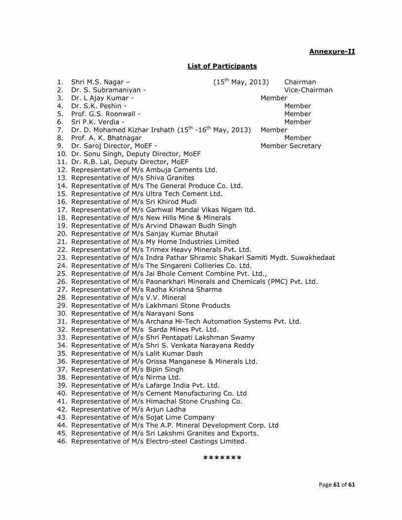
Page 61 of 61
Annexure-II
List of Participants
1. Shri M.S. Nagar – (15th May, 2013) Chairman
2. Dr. S. Subramaniyan - Vice-Chairman
3. Dr. L Ajay Kumar - Member
4. Dr. S.K. Peshin - Member
5. Prof. G.S. Roonwall - Member
6. Sri P.K. Verdia - Member
7. Dr. D. Mohamed Kizhar Irshath (15th -16th May, 2013) Member
8. Prof. A. K. Bhatnagar Member
9. Dr. Saroj Director, MoEF - Member Secretary
10. Dr. Sonu Singh, Deputy Director, MoEF
11. Dr. R.B. Lal, Deputy Director, MoEF
12. Representative of M/s Ambuja Cements Ltd.
13. Representative of M/s Shiva Granites
14. Representative of M/s The General Produce Co. Ltd.
15. Representative of M/s Ultra Tech Cement Ltd.
16. Representative of M/s Sri Khirod Mudi
17. Representative of M/s Garhwal Mandal Vikas Nigam ltd.
18. Representative of M/s New Hills Mine & Minerals
19. Representative of M/s Arvind Dhawan Budh Singh
20. Representative of M/s Sanjay Kumar Bhutail
21. Representative of M/s My Home Industries Limited
22. Representative of M/s Trimex Heavy Minerals Pvt. Ltd.
23. Representative of M/s Indra Pathar Shramic Shakari Samiti Mydt. Suwakhedaat
24. Representative of M/s The Singareni Collieries Co. Ltd.
25. Representative of M/s Jai Bhole Cement Combine Pvt. Ltd.,
26. Representative of M/s Paonarkhari Minerals and Chemicals (PMC) Pvt. Ltd.
27. Representative of M/s Radha Krishna Sharma
28. Representative of M/s V.V. Mineral
29. Representative of M/s Lakhmani Stone Products
30. Representative of M/s Narayani Sons
31. Representative of M/s Archana Hi-Tech Automation Systems Pvt. Ltd.
32. Representative of M/s Sarda Mines Pvt. Ltd.
33. Representative of M/s Shri Pentapati Lakshman Swamy
34. Representative of M/s Shri S. Venkata Narayana Reddy
35. Representative of M/s Lalit Kumar Dash
36. Representative of M/s Orissa Manganese & Minerals Ltd.
37. Representative of M/s Bipin Singh
38. Representative of M/s Nirma Ltd.
39. Representative of M/s Lafarge India Pvt. Ltd.
40. Representative of M/s Cement Manufacturing Co. Ltd
41. Representative of M/s Himachal Stone Crushing Co.
42. Representative of M/s Arjun Ladha
43. Representative of M/s Sojat Lime Company
44. Representative of M/s The A.P. Mineral Development Corp. Ltd
45. Representative of M/s Sri Lakshmi Granites and Exports.
46. Representative of M/s Electro-steel Castings Limited.
*******