Spatial Centering of a Quadcopter in an Underground Coal Mine
Upload
khangminh22Category
view
0download
0
MAULES CREEK
Document Owner: Env. Superintendent
Revision Period: 2 years
Issue: 3.
Last Revision Date: June 2017
WHC_PLN_MCC_TRAFFIC MANAGEMENT PLAN
Page 1 of 22
UNCONTROLLED COPY WHEN PRINTED REFER TO INTRANET FOR LATEST VERSION
MAULES CREEK COAL MINE TRAFFIC MANAGEMENT PLAN
Edition Rev. Comments Author Authorised Date
2 0 Draft for Consultation Maules Creek Coal Pty Ltd Brian Cole May 2014
2 1 Address Stakeholder comments Maules Creek Coal Pty Ltd Brian Cole July 2014
2 2 Address DPE comments Maules Creek Coal Pty Ltd Brian Cole September 2014
2 3 IEA outcomes & Modification
PA10_0138 Approval
Maules Creek Coal Pty Ltd MCCM September 2016
3 2 EA outcomes
Modification 3 Approval
Maules Creek Coal Pty Ltd MCCM June 2017

MAULES CREEK
Document Owner: Env. Superintendent
Revision Period: 2 years
Issue: 3.
Last Revision Date: March 2017
WHC_PLN_MCC_TRAFFIC MANAGEMENT PLAN
Page 2 of 22
UNCONTROLLED COPY WHEN PRINTED REFER TO INTRANET FOR LATEST VERSION
TABLE OF CONTENTS
1 INTRODUCTION ...................................................................................................................................... 4
1.1 Background .................................................................................................................................... 4
1.2 Project Description ......................................................................................................................... 4
1.3 Scope ............................................................................................................................................. 4
1.4 Objectives ....................................................................................................................................... 6
1.5 Historical Development of the Traffic Management Plan ............................................................... 6
2 STATUTORY REQUIREMENTS ............................................................................................................. 6
2.1 Project Approval Conditions ........................................................................................................... 6
2.2 Ongoing Consultation and Approvals ............................................................................................ 7
3 ACCESS ROUTES................................................................................................................................... 7
3.1 External Road Network .................................................................................................................. 7
3.1.1 Kamilaroi Highway ..................................................................................................... 7
3.1.2 Rangari Road ............................................................................................................. 9
3.1.3 Therribri Road ............................................................................................................ 9
3.1.4 Leard Forest Road ..................................................................................................... 9
3.1.5 Goonbri Road ............................................................................................................ 9
3.1.6 Blue Vale Road/Hoads Lane ..................................................................................... 9
3.1.7 Whitehaven - Tarrawonga Mine Access Road and Haul Route .............................. 10
3.1.8 Baseline Survey ....................................................................................................... 10
3.2 Mine Access Road ....................................................................................................................... 10
3.2.1 Temporary and Emergency Access Routes ............................................................ 11
3.3 Heavy Vehicle Access Routes ..................................................................................................... 11
3.4 Access Restrictions ...................................................................................................................... 12
3.5 Access Route Management Measures ........................................................................................ 12
4 ROAD UPGRADES................................................................................................................................ 12
4.1 Program and Schedule of Works Summary ................................................................................. 13
4.2 Mitigation and Management Measures in Response to the Road Safety Review ....................... 14
5 MANAGEMENT MEASURES FOR LIGHT AND HEAVY VEHICLES .................................................. 15
5.1 Code of Conduct for Drivers ......................................................................................................... 15
5.2 Road Safety.................................................................................................................................. 15
5.2.1 Driver Education ...................................................................................................... 15
5.2.2 Vehicle Loads .......................................................................................................... 15

MAULES CREEK
Document Owner: Env. Superintendent
Revision Period: 2 years
Issue: 3.
Last Revision Date: March 2017
WHC_PLN_MCC_TRAFFIC MANAGEMENT PLAN
Page 3 of 22
UNCONTROLLED COPY WHEN PRINTED REFER TO INTRANET FOR LATEST VERSION
5.2.3 Vehicle Dimensions ................................................................................................. 16
5.2.4 Managing Driver Fatigue ......................................................................................... 17
5.3 Amenity ........................................................................................................................................ 17
5.4 Dust Control ................................................................................................................................. 18
5.5 Shuttle Bus System ...................................................................................................................... 18
5.6 Conflicts with Sensitive Road Users ............................................................................................ 18
6 PERFORMANCE CRITERIA ................................................................................................................. 19
7 MONITORING, AUDITING, REPORTING AND REVIEW ..................................................................... 20
8 ROLES AND RESPONSIBILITIES ........................................................................................................ 20
9 REFERENCES ....................................................................................................................................... 22
FIGURES
Figure 1 Regional Location .............................................................................................................. 5
Figure 2 Local Road Network .......................................................................................................... 8
TABLES
Table 1 Scope Items and Reference to Relevant Report Section............................................... 7
Table 2 Status and Works Program for Road Upgrades and Maintenance ............................. 14
Table 3 Performance Criteria ....................................................................................................... 19
Table 4 Roles and Responsibilities ............................................................................................. 21
MAULES CREEK
Document Owner: Env. Superintendent
Revision Period: 2 years
Issue: 3.
Last Revision Date: March 2017
WHC_PLN_MCC_TRAFFIC MANAGEMENT PLAN
Page 4 of 22
UNCONTROLLED COPY WHEN PRINTED REFER TO INTRANET FOR LATEST VERSION
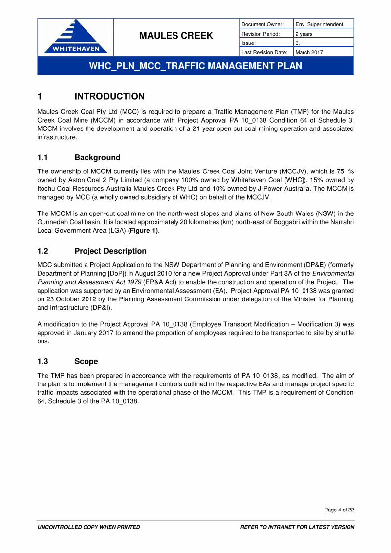
1 INTRODUCTION
Maules Creek Coal Pty Ltd (MCC) is required to prepare a Traffic Management Plan (TMP) for the Maules
Creek Coal Mine (MCCM) in accordance with Project Approval PA 10_0138 Condition 64 of Schedule 3.
MCCM involves the development and operation of a 21 year open cut coal mining operation and associated
infrastructure.
1.1 Background
The ownership of MCCM currently lies with the Maules Creek Coal Joint Venture (MCCJV), which is 75 %
owned by Aston Coal 2 Pty Limited (a company 100% owned by Whitehaven Coal [WHC]), 15% owned by
Itochu Coal Resources Australia Maules Creek Pty Ltd and 10% owned by J-Power Australia. The MCCM is
managed by MCC (a wholly owned subsidiary of WHC) on behalf of the MCCJV.
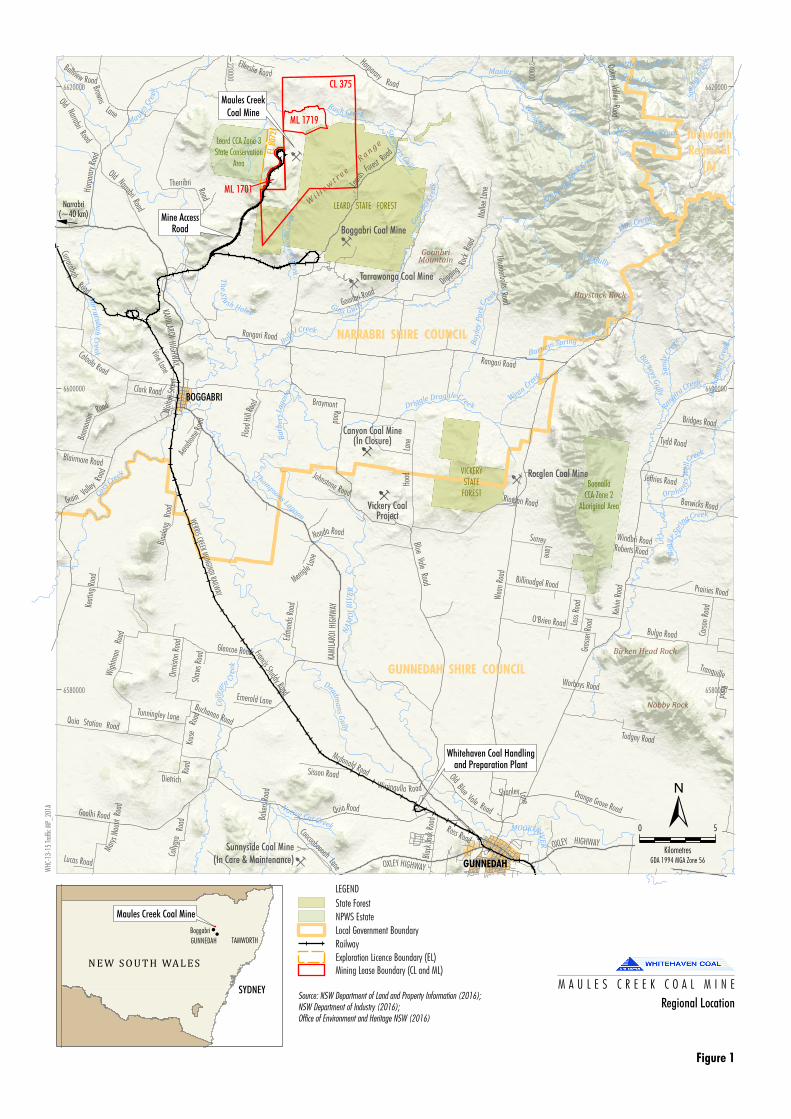
The MCCM is an open-cut coal mine on the north-west slopes and plains of New South Wales (NSW) in the
Gunnedah Coal basin. It is located approximately 20 kilometres (km) north-east of Boggabri within the Narrabri
Local Government Area (LGA) (Figure 1).
1.2 Project Description
MCC submitted a Project Application to the NSW Department of Planning and Environment (DP&E) (formerly
Department of Planning [DoP]) in August 2010 for a new Project Approval under Part 3A of the Environmental
Planning and Assessment Act 1979 (EP&A Act) to enable the construction and operation of the Project. The
application was supported by an Environmental Assessment (EA). Project Approval PA 10_0138 was granted
on 23 October 2012 by the Planning Assessment Commission under delegation of the Minister for Planning
and Infrastructure (DP&I).
A modification to the Project Approval PA 10_0138 (Employee Transport Modification – Modification 3) was
approved in January 2017 to amend the proportion of employees required to be transported to site by shuttle
bus.
1.3 Scope
The TMP has been prepared in accordance with the requirements of PA 10_0138, as modified. The aim of
the plan is to implement the management controls outlined in the respective EAs and manage project specific
traffic impacts associated with the operational phase of the MCCM. This TMP is a requirement of Condition
64, Schedule 3 of the PA 10_0138.
B
B
B
B
B
BVickery Coal
Project
GoonbriMountain
Narrabri(~40 km)!
ML 1719
Mine AccessRoad
B
Canyon Coal Mine(In Closure)
Whitehaven Coal Handlingand Preparation Plant
EL 8
072
Rangari Road
GUNNEDAH SHIRE COUNCIL
NARRABRI SHIRE COUNCIL
TamworthRegional
(A)
Haystack Rock
Wi l l o
wt r e e
R
a n g e
Nobby Rock
Birken Head Rock
VICKERYSTATE
FOREST
LEARD STATE FOREST
BOGGABRI
GUNNEDAH
Boggabri Coal Mine
Rocglen Coal Mine
Tarrawonga Coal Mine
Maules CreekCoal Mine
Sunnyside Coal Mine(In Care & Maintenance)
CL 375
ML 1701
Merry
go
wen
Creek
Orph ants
Wel
lCreek
Bollol Creek
Thompsons Lagoon
MOOKIRIVE
R
Ba
yley
Pa
rkCr
eek
Rangi
raCreek
MaulesCreek
Oaky Cree k
Mihi Creek
Barneys
Gu
lly
Goo
nbri
Cre
ek
Deadma
ns
Gu
lly
Coxs
Creek
Drippin
g
RockCre
ek
Little Oaky Creek
Mrs Connors Creek
Connors Creek
Sa
ndy
Creek
W
oolsh
ed Creek
Barneys Spring Creek
Stewa
rts Gully
Back Creek
Gins Gul ly
Spr
ing
Cre
ekC
urra
cuba
hC
reek
Bu
cha
na
ns
Cre
ek
Co
lly
gr
a
Cre
ek
Wean
Cre
ek
Ma ules
Cre
ek
Driggle Draggle Creek
NA
MO
IR
IVE
R
Well Gully
Bo
gg
y
Spri
ngCreek
Ba
rbe
rsL
ag
oon
Native Cat Creek
Th
eS
lush Holes
WERRIS CREEK MUNGINDI RAILW
AY
QuiaRoad
Blac
k Ja
ck R
oad
Aerod
rome Ro
ad
OXLEYHIGHWAY
BraymontRoad
Glencoe Road
Dripping
Rock
Road
Rangari Road
OXLEY HIGHWAY
Prairies Road
KAM
ILA R
OI H
IGHW
AY
Goolhi Road
Caloola Road
Bridges Road
Colly
gra
Road
Ross Road
OldBlue
Vale Road
Goonbri Road
Quia Station Road
Tunningley Lane
Shanley Lane
Blairmore Road
Buchanan Road
Wal
ton
Stre
et
Orange Grove Road
Clark Road
Barwicks Road
Harp
arar
y Roa
d
Johnstone Road
Billinudgel Road
Bina
long
Road
Francis Studdy Road
Krus
eRo
ad
Marys
Mou
ntRo
ad
Kelvi
n Ro
ad
Emerald Lane
Grain Valley
Road
HarpararyRoad
Ellerslie Road
Keat
ing
Road
Mcdonald Road
Nonda Road
Wirringulla Road
Worboys Road
Surrey Lane
Loss
Roa
d
Tudgey Road
Jeffries Road
Old NarrabriRoad
Bulga Road
Tydd Road
Bellview Road
Shaw
s Roa
d
Riordan Road
Boor
oom
in
Road
Orm
iston
Roa
d
Roberts Road
Dietrich
Road
OakeyValley
Road
Gros
ser R
oad
Windbri Road
Lucas Road
Merrigle
Lane
Bake
rs Ro
ad
Mal
lee La
ne
Carso
n Ro
ad
Sisson Road
Hoad
Lane
KAMILAROI
HIGHWAY
Browns
Lane
Blue Vale Road
Leards
ForestRoa
d
Wig
htm
anRo
ad
Therribri Road
Coocooboonah
Lane
Curracabah
Road
Old Narrabri Road
Vine Lane
Edm
onds
Roa
d
O'Brien Road
Flood
HillR
oad
Wea
n Ro
ad
Tranquille
Road
ThunderboltsRoad
BoonallaCCA Zone 2
Aboriginal Area
Leard CCA Zone 3State Conservation
Area
220000
240000
6580000 6580000
6600000 6600000
6620000 6620000
Source: NSW Department of Land and Property Information (2016);NSW Department of Industry (2016);Office of Environment and Heritage NSW (2016)
Regional Location
Figure 1
0 5
Kilometres
±
WHC
-13-
15 Tr
affic
MP_
201A
GDA 1994 MGA Zone 56
5
!
N E W S O U T H WA L E SMaules Creek Coal Mine
BoggabriTAMWORTHGUNNEDAH
SYDNEY
LEGEND
State Forest
NPWS Estate
Local Government Boundary
Railway
Exploration Licence Boundary (EL)Mining Lease Boundary (CL and ML)
M A U L E S C R E E K C O A L M I N E
MAULES CREEK
Document Owner: Env. Superintendent
Revision Period: 2 years
Issue: 3.
Last Revision Date: March 2017
WHC_PLN_MCC_TRAFFIC MANAGEMENT PLAN
Page 6 of 22
UNCONTROLLED COPY WHEN PRINTED REFER TO INTRANET FOR LATEST VERSION
1.4 Objectives
The objectives of the TMP are to:
ensure that all relevant statutory requirements in relation to traffic are met during the operational phase
of the MCCM;
describe the traffic management requirements associated with the management of:
o Therribri Road;
o Mine Access Road; and
o road safety upgrades to the surrounding road network.
describe the access routes for traffic generated by the MCCM;
detail traffic management measures to be implemented;
provide the status of road upgrade works and a program for remaining works;
outline a program to monitor and audit MCCM-related traffic and associated impacts;
outline the roles and responsibilities for traffic management onsite; and
outline the reporting requirements in relation to traffic.
1.5 Historical Development of the Traffic Management Plan
MCC prepared and submitted the initial TMP (i.e. Edition 1, Revision 2) to the DP&E (formerly DP&I) in March
2013. Edition 2, Revision 1 was prepared to incorporate the use of Goonbri Road as an alternative access
route to the MCCM, once it has been upgraded and re-aligned.
Edition 2, Revision 3 was been prepared to incorporate the recommendations of the DP&E Biodiversity and
Cultural Heritage Audit and the Independent Environmental Audit (SMEC, 2015), both conducted in 2015. The
TMP also provided a description of roadworks that had been completed since the initial TMP was prepared
and changes made to management practices.
This edition (Edition 3, Revision 1) has been prepared following the approval of the Employee Transport
Modification (MCC, 2016) on 13 January 2017.
2 STATUTORY REQUIREMENTS
This revision of the TMP has been prepared to fulfil the requirements of relevant legislation, approval
conditions, EA commitments, and relevant standards and guidelines.
2.1 Project Approval Conditions
This TMP has been prepared in accordance with Condition 64 of Schedule 3 of PA 10_0138. The various sub-
components of the condition are shown in Table 1.
MAULES CREEK
Document Owner: Env. Superintendent
Revision Period: 2 years
Issue: 3.
Last Revision Date: March 2017
WHC_PLN_MCC_TRAFFIC MANAGEMENT PLAN
Page 7 of 22
UNCONTROLLED COPY WHEN PRINTED REFER TO INTRANET FOR LATEST VERSION
Table 1. Scope Items and Reference to Relevant Report Section
PA 10_0138 Conditions
Description Reference to report section
Schedule 3, Condition 64
The Proponent shall prepare and implement a Traffic Management Plan for the project to the satisfaction of the Secretary. This plan must:
(a) Be prepared in consultation with RMS, Council and Gunnedah Council. Section 2.2
(b) Propose an appropriate program and schedule of works required under conditions 59 – 61 above, and:
Section 4
(c) include:
A description of measures for managing workforce fatigue, road safety and school bus interaction.
Section 5
A description of measures to minimise dust from unsealed roads that may be used for access to the mine site.
Section 5
A code of conduct for drivers of heavy and light vehicles. Section 5
Nominated heavy vehicle access routes for construction and operational stages including details on volumes and nature of heavy, over size and/or over mass vehicles.
Section 3
A proposed program for implementing the findings of the road safety audit identified in the EA.
Section 7
Performance criteria, measures and indicators for shuttle bus utilisation and carpooling in accordance with the commitments in the EA.
Section 6
A monitoring program to audit vehicle movements against predictions in the EA. Section 7
2.2 Ongoing Consultation and Approvals
The original TMP was prepared in consultation with the Roads and Maritime Services (RMS), Narrabri Shire
Council (NSC) and the Gunnedah Shire Council (GSC). Consultation with respect to transport and traffic also
occurred during the Employee Transport Modification (MCC, 2016) with the above agencies and councils. This
revision of the TMP has been prepared in consultation with the RMS, NSC and the GSC.
3 ACCESS ROUTES
3.1 External Road Network
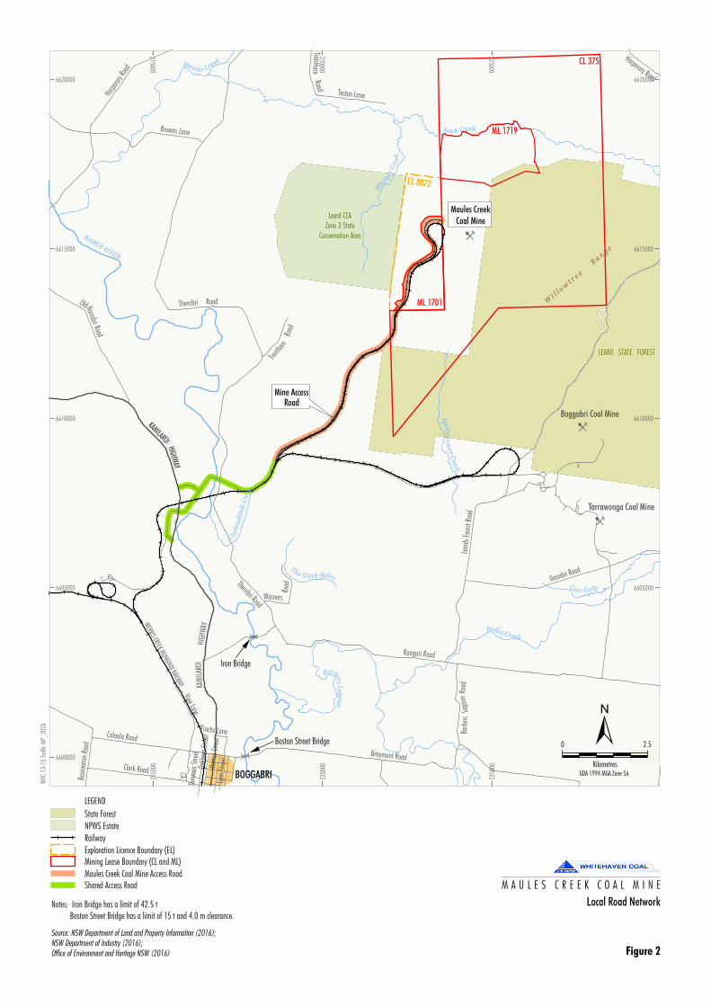
The road network in the vicinity of the MCCM, including access routes to the site, is illustrated in
Figure 2
Figure 2 also shows various roads that are restricted to MCCM-related traffic with the exception of travel
to local destinations. The access routes for various MCCM-related traffic and restricted roads are discussed
in Section 3. A brief description of the key roads in the surrounding network is described in Sections 3.1.1 to
3.1.7.
3.1.1 Kamilaroi Highway
The Kamilaroi Highway (B51) is an undivided rural main road to the west of the MCCM. It provides a regional
link between Quirindi and Willow Tree in the south, and Walgett in north-west NSW. The Kamilaroi Highway
passes through Gunnedah and Boggabri townships before continuing north-west toward Narrabri. The
Kamilaroi Highway is the main arterial road providing access to the MCCM.
B
B
B
ML 1719
Mine AccessRoad
EL 8072
Boston Street Bridge
Iron Bridge
!
!
KAMILAROIHIGHW
AY
Wi l l o
wt r e e
R
a n g e
LEARD STATE FOREST
BOGGABRI
Boggabri Coal Mine
Tarrawonga Coal Mine
Maules Creek
Coal Mine
CL 375
ML 1701
Merryg
ow
enC
reek
Maules Creek
Bollol Creek
Gin s Gully
Back Creek
NAMOI RIVER
Coo
bo
ob
ind
iC
reek
Whi
s key
Cre
ek
BarbersL
ago
on
The Slush Holes
WERRIS CREEK MUNGINDI RAILWAY
Lear
ds F
ores
t Roa
d
Mer
ton
Stre
et
Rangari Road
Caloola Road
Oakh
am S
treet
Browns Lane
Denm
an S
treet
Teston Lane
TranthamRoad
Harpa
rary R
oad
Clark Road
Lynn
Stre
et
Harparary Road
Finchs Lane
Goonbri Road
Boor
oom
in R
oad
Tranth
amRo
ad
Braymont Road
KAM
ILAR
OIHI
GHW
AY
Warners
RoadTherribri Road
Therribri RoadOldNarrabri Road
Vine Lane
Bar b
ers
Lago
onRo
ad
Leard CCAZone 3 State
Conservation Area
215000
2150
00
220000
2200
00
225000
2250
00
6600000 6600000
6605000 6605000
6610000 6610000
6615000 6615000
6620000 6620000
Source: NSW Department of Land and Property Information (2016);NSW Department of Industry (2016);Office of Environment and Heritage NSW (2016)
Local Road Network
Figure 2
WHC
-13-
15 Tr
affic
MP_
202A
LEGEND
State Forest
NPWS Estate
Railway
Exploration Licence Boundary (EL)Mining Lease Boundary (CL and ML)
Maules Creek Coal Mine Access RoadShared Access Road M A U L E S C R E E K C O A L M I N E
0 2.5
Kilometres
±GDA 1994 MGA Zone 56
Notes: Iron Bridge has a limit of 42.5 t Boston Street Bridge has a limit of 15 t and 4.0 m clearance.

MAULES CREEK
Document Owner: Env. Superintendent
Revision Period: 2 years
Issue: 3.
Last Revision Date: March 2017
WHC_PLN_MCC_TRAFFIC MANAGEMENT PLAN
Page 9 of 22
UNCONTROLLED COPY WHEN PRINTED REFER TO INTRANET FOR LATEST VERSION
3.1.2 Rangari Road
Rangari Road (also known as Manilla Road) is an east-west rural undivided two-way road to the south of the
MCCM. It provides access between the Kamilaroi Highway and Therribri Road, Leard Forest Road, Barbers
Lagoon Road and the Whitehaven – Tarrawonga Mine Access Road (Tarrawonga Mine Access Road). The
road generally provides a two-lane, two-way configuration with pavement seal between the Kamilaroi Highway
and Barbers Lagoon Road. In accordance with Condition 61 of Schedule 3 of PA 10_0138, MCC has
completed the upgrade and sealing works on the unsealed section of Rangari Road between its intersections
with the Tarrawonga Mine Access Road and Barbers Lagoon Road. The Iron Bridge is located between
Therribri Road and Kamilaroi Highway which restricts any traffic to a maximum load limit of 42.5 tonnes (t).
This constraint is taken into consideration for any trip planning and site access routes.
3.1.3 Therribri Road
Therribri Road is a rural undivided two-lane, two-way road linking Harparary Road in the north to Rangari Road
in the south. It lies to the west of the MCCM and to the east of the Namoi River. Therribri Road connects to
the MCC Mine Access Road which provides permanent access to the MCCM together with access where
required to surrounding monitoring locations, local properties, travel to local destinations and pump site related
infrastructure.
Therribri Road has been sealed and upgraded between its intersections with Rangari Road and the MCC Mine
Access Road. MCCM provided funds as part of its Voluntary Planning Agreement (VPA) to NSC for the
upgrade of Therribri Road.
3.1.4 Leard Forest Road
Leard Forest Road is a rural undivided two-lane, two-way road located directly to the east of the MCCM and
was used as the primary access route prior to and during construction of the permanent MCC Mine Access
Road.
Boggabri Coal Pty Limited (Boggabri Coal) owns the adjacent Boggabri Coal Mine and has closed the southern
section of this road to enable the progression of mining operations. Condition 61 of Schedule 3 of the Boggabri
Coal Mine Project Approval (PA 09_0182) requires the road to be closed in accordance with a Leard Forest
Road Closure Strategy (LFRCS). Boggabri Coal has prepared a LFRCS and has constructed an alternative
north-south route via an upgrade and realignment of Goonbri Road.
3.1.5 Goonbri Road
Goonbri Road is a rural road that provides a north-south public road around the eastern perimeter the Leard
State Forest. As part of PA 09_0182, Boggabri Coal upgraded and realigned Goonbri Road following the
closure the Leard State Forest Road. The realigned Goonbri Road is shown in Figure 1.
3.1.6 Blue Vale Road/Hoads Lane
Blue Vale Road/Hoads Lane is part of an alternative route to the Kamilaroi Highway, between the MCCM and
Gunnedah. The section of Hoads Lane nominated for MCCM-related traffic commences at the intersection
with the start of the Tarrawonga Haul Road. Hoads Lane continues south for approximately 5 km towards
Gunnedah where it transitions to Blue Vale Road at the cross intersection with Braymont and Shannon Harbour
Roads. Blue Vale Road then continues south to the Kamilaroi Highway around 5.5 km north of Gunnedah.

MAULES CREEK
Document Owner: Env. Superintendent
Revision Period: 2 years
Issue: 3.
Last Revision Date: March 2017
WHC_PLN_MCC_TRAFFIC MANAGEMENT PLAN
Page 10 of 22
UNCONTROLLED COPY WHEN PRINTED REFER TO INTRANET FOR LATEST VERSION
3.1.7 Whitehaven - Tarrawonga Mine Access Road and Haul Route
The Tarrawonga Mine Access Road is an undivided two-lane two-way sealed road which extends northward
from Rangari Road to Tarrawonga Coal Mine. It is a private road with access restricted to mine traffic only.
The Tarrawonga Haul Route extends southward from Rangari Road to the east of Leard Forest Road and
provides a private, dedicated haul route for mine traffic from Rangari Road towards its T-intersection with
Hoads Lane. Coal trucks from Tarrawonga Coal Mine use the Tarrawonga Haul Route as well as Hoads Lane
and Blue Vale Road to access the Kamilaroi Highway to the north of Gunnedah. The Whitehaven Coal
Handling and Preparation Plant (CHPP) is located on the southern side of the Kamilaroi Highway near its
intersection with Blue Vale Road.
Access to the Tarrawonga Haul Route is also restricted to approved vehicles nominated by MCC. It is also
the nominated heavy vehicle access route for the MCCM.
3.1.8 Baseline Survey
Baseline data was included within the Traffic and Transport Impact Assessment by Hyder Consulting Pty Ltd
(2011) for the Maules Creek Coal Project EA. Traffic volume surveys were also undertaken for the Employee
Transport Modification by GTA Consultants during 2015. An overview of vehicle movements included eight
survey points that collected data around the local road network. Average weekday volumes indicated that on
the average weekday, the morning peak hour at most locations occurred between 5.00am and 7.00am, and
the afternoon peak hour between 5.00pm and 6.00pm. The exception to these was Kamilaroi Highway north
of Rangari Road, where the busiest hour in the morning occurred from 9.00am to 10.00am, and the busiest
hour in the afternoon occurred between 2.00pm and 3.00pm. The survey results demonstrate that the number
of vehicle trips generated by the Maules Creek Coal Mine is different on weekdays compared with weekend
days. On the average weekday, it generates 395 vehicle trips per day, while on the average weekend days, it
generates 133 vehicle trips per day, i.e. approximately one third of the average weekday generation. These
volumes include vehicles associated with construction activity which was underway at the time of the surveys,
which is not typical of the expected traffic characteristics of the Maules Creek Coal Mine in the longer term
The EA Traffic Impact Assessment did not predict any significant impacts to the road network associated
with the MCCM.
3.2 Mine Access Road
The MCC Mine Access Road is a private undivided two-lane, two-way sealed road which commences
northward from Therribri Road to MCCM. The access road runs adjacent to the MCC Rail Spur. A small portion
of the MCC Mine Access Road is a shared section which is used as a heavy vehicle haul road for neighbouring
site Boggabri Coal Mine.
Boggabri Coal and MCC have an agreement to utilise the turn-offs directly from the Kamilaroi Highway both north and south bound to access the existing MCC Mine Access Road. In accordance with Boggabri Coal Mine’s Condition 59, Schedule 3 of Project Approval 09_0182, the intersections were constructed to the requirements of RMS.
This intersection will be used as a permanent operational access and will reduce vehicle turning movements
at the intersection of Kamilaroi Highway and Rangari Road. As discussed in the Modification 3 EA (MCC,
MAULES CREEK
Document Owner: Env. Superintendent
Revision Period: 2 years
Issue: 3.
Last Revision Date: March 2017
WHC_PLN_MCC_TRAFFIC MANAGEMENT PLAN
Page 11 of 22
UNCONTROLLED COPY WHEN PRINTED REFER TO INTRANET FOR LATEST VERSION
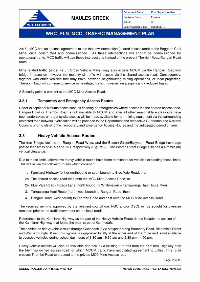
2016), MCC has an optional agreement to use the new intersection (shared access road) to the Boggabri Coal
Mine, once constructed and commissioned. As these intersections will shortly be commissioned for
operational traffic, MCC traffic will use these intersections instead of the present Therribri Road/Rangari Road
route.
Mine related traffic (under 42.5 t Gross Vehicle Mass) may also access MCCM via the Rangari Road/Iron
bridge intersection however the majority of traffic will access via the shared access road. Consequently,
together with other vehicles that may travel between neighbouring mining operations, or local properties,
Therribri Road will continue to service mine related traffic, however, on a significantly reduced basis.
A Security point is present at the MCC Mine Access Road.
3.2.1 Temporary and Emergency Access Routes
Under exceptional circumstances such as flooding or emergencies where access via the shared access road,
Rangari Road or Therribri Road is not available to MCCM and after all other reasonable endeavours have
been undertaken, emergency site access will be made available for non-mining equipment via the surrounding
restricted road network. Notification will be provided to the Department and respective Gunnedah and Narrabri
Councils prior to utilising the Temporary and Emergency Access Routes and the anticipated period of time.
3.3 Heavy Vehicle Access Routes
The Iron Bridge, located on Rangari Road West, and the Boston Street/Braymont Road Bridge have sign
posted load limits of 42.5 t and 15 t, respectively (Figure 2). The Boston Street Bridge also has a 4 metre (m)
vertical clearance.
Due to these limits, alternative heavy vehicle routes have been nominated for vehicles exceeding these limits.
This will be via the following routes which consist of:
1. Kamilaroi Highway (either northbound or southbound) to Blue Vale Road; then
2a. The shared access road then onto the MCC Mine Access Road; or
2b. Blue Vale Road - Hoads Lane (north bound) to Whitehaven – Tarrawonga Haul Route; then
3. Tarrawonga Haul Route (north-west bound) to Rangari Road; then
4. Rangari Road (west bound) to Therribri Road and east onto the MCC Mine Access Road.
The required permits approved by the relevant council (i.e. NSC and/or GSC) will be sought for oversize
transport prior to the traffic movement on the local roads.
References to the Kamilaroi Highway as the part of the Heavy Vehicle Route do not include the section of the Kamilaroi Highway that forms the main street of Gunnedah.
The nominated heavy vehicle route through Gunnedah is via a bypass along Boundary Road, Bloomfield Street
and Warrumbungle Street, this bypass is signposted locally at the either end of the route and is not available
to oversize vehicles during school day hours of 8.30 am - 9.30 am and 2.30 pm - 4.00 pm.
Heavy vehicle access will also be available and occur via existing turn-offs from the Kamilaroi Highway onto
the Idemitsu owned access road for which MCCM traffic have negotiated agreement to utilise. This route
crosses Therribri Road to proceed to the private MCC Mine Access road.

MAULES CREEK
Document Owner: Env. Superintendent
Revision Period: 2 years
Issue: 3.
Last Revision Date: March 2017
WHC_PLN_MCC_TRAFFIC MANAGEMENT PLAN
Page 12 of 22
UNCONTROLLED COPY WHEN PRINTED REFER TO INTRANET FOR LATEST VERSION
3.4 Access Restrictions
In order to control and minimise any impact on the road network surrounding the MCCM, MCC has specific
access routes as described in Section 3.3. As stated in Item 29 of the Statement of Commitments (Appendix 5
of the Project Approval [PA 10_0138]):
Reasonable endeavours will be made to ensure that Project related traffic does not utilise the following public roads
unless they are travelling to a specific destination along that route (such as residence, monitoring location, near
neighbour etc.): Harparary Road from Leard Forest Road to the Kamilaroi Highway; Leard Forest Road between
Northern Loop Road and Harparary Road; Therribri Road between the Mine Access Road and Harparary Road and
the entire length of Browns Lane.
MCC has installed signage on the surrounding road network to enforce the access routes and prohibited roads
identified under this TMP. Access is also required to be maintained to MCCM related infrastructure and
equipment, properties or travel to other required destinations as necessary including security related purposes.
In addition, MCC periodically audits traffic movements on an annual basis of these restricted access routes to
monitor any use by MCC vehicles. Restriction of access to these roads would continue, except under
exceptional circumstances such as flooding, emergencies or equivalent. Notification will be provided to the
Department and respective Gunnedah and Narrabri Councils prior to utilising the temporary and emergency
access route and the anticipated period of time.
3.5 Access Route Management Measures
The following management measures will be used to implement the proposed access routes:
Education/induction: All personnel accessing the site will be advised of the requirement to adhere
to the nominated access routes. Reinforcement will also occur through toolbox talks. All heavy vehicle
operators will be required to follow the Code of Conduct detailed in Section 5;
Signage: Signs posted to reinforce the nominated and restricted access routes. This includes currently installed signage regarding prohibited access for MCCM access.
Audits: MCC conducts audits to check for non-compliance with regard to access prohibitions. These
audits coordinated by the Environmental Officer involve positioning a nominated person on Therribri
Road at the entrance to the MCC Mine Access Road to monitor vehicles entering the MCCM from the
restricted access route. These audits will occur on an annual basis over a two day period. MCC will
review each occurrence identified during monitoring to determine whether the vehicles are associated
with the MCCM. Appropriate disciplinary action will be taken at MCC’s discretion. This action may
involve written warnings through to removal of the driver from the MCCM.
Consultation: MCC will consult with the NSC, GSC, RMS, the National Heavy Vehicle Regulator and
other local authorities to obtain the necessary permits prior to the movement of oversized/over mass
loads on public roads.
4 ROAD UPGRADES
The following road improvements have been carried out as part of the MCCM VPA and also where required in
cooperation with the Boggabri and Tarrawonga Coal Mines:
MAULES CREEK
Document Owner: Env. Superintendent
Revision Period: 2 years
Issue: 3.
Last Revision Date: March 2017
WHC_PLN_MCC_TRAFFIC MANAGEMENT PLAN
Page 13 of 22
UNCONTROLLED COPY WHEN PRINTED REFER TO INTRANET FOR LATEST VERSION
Upgrade to the section of Rangari Road between Tarrawonga Mine Access Road and Barbers Lagoon
Road (other than the section covered in the Tarrawonga VPA) to provide a sealed roadway between
these two points.
Construction of the Kamilaroi Highway Rail overpass as a joint venture involving MCC and Boggabri
Coal.
Upgrade to the section of Therribri Road between Rangari Road and MCC Mine Access Road to
provide a sealed roadway between these two points.
The status of these works is provided in the subsection below.
4.1 Program and Schedule of Works Summary
The status of works required by Conditions 59 – 62 of Schedule 3 of PA 10_0138 is shown in Table 2.

MAULES CREEK
Document Owner: Env. Superintendent
Revision Period: 2 years
Issue: 3.
Last Revision Date: March 2017
WHC_PLN_MCC_TRAFFIC MANAGEMENT PLAN
Page 14 of 22
UNCONTROLLED COPY WHEN PRINTED REFER TO INTRANET FOR LATEST VERSION
Table 2 Status and Works Program for Road Upgrades and Maintenance
PA 10_0138
Conditions
Description Status
Condition 59,
Schedule 3
The Proponent shall construct, operate and
maintain the rail bridge over the Kamilaroi
Highway for the shared section of the Boggabri
rail spur line to the satisfaction of RMS, and shall
make all necessary contributions to the costs
associated with construction, maintenance and
decommissioning of this bridge to the satisfaction
of the Secretary.
Note: all costs should be shared on an equitable
basis with the proponent of the Boggabri Coal
Project.
Construction COMPLETE.
Condition 60,
Schedule 3
The Proponent shall meet RMS’s requirements for road intersection upgrades for all State roads
used by the project, including upgrading the
intersection of Manilla Road and the Kamilaroi
Highway to provide a channelised right turn in
accordance with Austroads guidelines.
Note: Any upgrades should be undertaken on an
equitable basis with the proponent of the
Boggabri Coal Project.
Given the development of the shared access road, MCC
has engaged Constructive Solutions to review the need to
perform this intersection upgrade.
In regard to the adequacy of the existing channelised right
turn, Constructive Solutions (2015) concluded:
The existing CHR(s) is considered to provide adequate
capacity for right turn movements for the existing and
known developments that are likely to affect this
intersection.
The findings of this study are not proposed to be reviewed
given the development of the shared access route.
Condition 61,
Schedule 3
The Proponent shall upgrade and seal the
unsealed section of Manilla Road between its
intersections with the Tarrawonga Coal mine
access road and Barbers Lagoon Road, to the
satisfaction of RMS.
Upgrade COMPLETE.
Condition 62,
Schedule 3
The Proponent shall ensure that there is no
substantial access of heavy vehicles for
construction activity to the site prior to the
upgrade referred to in condition 61 above, to the
satisfaction of the Secretary. However, the
Secretary may approve heavy vehicle access to
the site prior to or during this upgrade, subject to
the Proponent demonstrating that dust impacts
can be minimised in accordance with an
approved Traffic Management Plan.
Upgrade COMPLETE.
4.2 Mitigation and Management Measures in Response to the Road Safety
Review
A road safety review of the relevant roads surrounding the MCCM was carried out within the Traffic and
Transport Impact Assessment prepared during the 2013 EA (Hyder Consulting, 2011). A number of review
findings have previously been addressed including:
Heavy vehicles exceeding 42.5 t are diverted via the MCC/Tarrawonga Haul Route (Section 3.3).
Upgrade of Therribri Road between Rangari Road and the MCC Mine Access Road completed via
provision of funds by MCC to NSC as part of its VPA (Section 3.1.3).

MAULES CREEK
Document Owner: Env. Superintendent
Revision Period: 2 years
Issue: 3.
Last Revision Date: March 2017
WHC_PLN_MCC_TRAFFIC MANAGEMENT PLAN
Page 15 of 22
UNCONTROLLED COPY WHEN PRINTED REFER TO INTRANET FOR LATEST VERSION
Leard Forest Road, East Link Road, Northern Link Road and Goonbri Road were used as interim
access routes prior to the operation use of the MCC Mine Access Road. These roads are now
restricted for MCC related traffic as described in Section 3.4.
5 MANAGEMENT MEASURES FOR LIGHT AND HEAVY VEHICLES
This section outlines the guiding principles that MCC and its contractors will use to control and minimise
impacts.
5.1 Code of Conduct for Drivers
All drivers of light and/or heavy vehicles that have been engaged by MCC must adhere to the following Code
of Conduct for Drivers:
obey all the laws and regulations that apply to vehicles on public and private roads;
operate in full compliance with this TMP;
respect the rights of others, including drivers and pedestrians, to use and share the road space;
maintain a safe following distance between vehicles;
ensure that the vehicle is clean and in good mechanical condition to reduce environmental impacts;
avoid travelling in convoys where possible unless under approved escorts;
follow the designated access routes for the MCCM;
abide by all NSW and interstate road rules and vehicle regulations;
ensure high level of courtesy; and
turn off flashing/rotating beacons when on public roads.
MCC will carry out necessary measures to inform transport contractors including contractual arrangements for
transportation of goods to the MCCM and via various information forums that may include driver inductions,
training and toolbox talks.
5.2 Road Safety
Guiding principles that will be used to manage safety risks are described in the following sub-sections.
5.2.1 Driver Education
Driver education regarding the traffic access arrangements and advising of them of any updates to the TMP
and associated routes will assist to improve both driver and general community safety. Driver education will
be delivered via a number of methods including inductions, toolbox talks, and safety briefings.
5.2.2 Vehicle Loads
Heavy vehicle movements will adhere to the gazetted and signposted load limits for each route used. Where
loads in excess of the known load limits of structures are required to be transported, careful trip planning will
MAULES CREEK
Document Owner: Env. Superintendent
Revision Period: 2 years
Issue: 3.
Last Revision Date: March 2017
WHC_PLN_MCC_TRAFFIC MANAGEMENT PLAN
Page 16 of 22
UNCONTROLLED COPY WHEN PRINTED REFER TO INTRANET FOR LATEST VERSION
be undertaken to ensure that these sensitive structures/constrained routes are avoided. Restricted Access
Vehicle (RAV) maps (RMS, 2012a) will be used by the contractor/driver to inform transport/delivery routes.
Where loads above the load limits are required, the loads will be broken down to bring them within allowable
limits. Alternatively, higher mass limits will be considered where applicable through national heavy vehicle
schemes.
All loads will be secured to vehicles in accordance with NTC’s Load Restraint Guide (NTC, 2004) and RMS’s Heavy Vehicle Driver Handbook (RMS, 2012b).
5.2.3 Vehicle Dimensions
All consigned or dispatched MCCM-related heavy vehicles will fall within the maximum dimensions and axle
spacing as specified in the NTC’s Load Restraints Guide (NTC, 2004) and RMS’s Heavy Vehicle Driver
Handbook (RMS, 2012b).
In the case of B-doubles, which can be up to 25 m in length and 4.6 m in height, RMS’s RAV maps
(RMS, 2012a) outline approved B-double routes for travel across NSW.
Where over-dimensioned loads/vehicles are required, the loads will be broken down to bring them within the
acceptable dimensions. If vehicle dimensions exceed these limits, then an application will be submitted to RMS
in accordance with the Route Assessment Guidelines for Restricted Access Vehicles (RMS, 2002).
Failing the above, if over-dimensioned loads are unavoidable, a risk assessment will be carried out of the
intended haul route. Potential impacts will be identified and either addressed via mitigation measures (e.g.
physical improvements to the road to overcome the issue), or by management measures (e.g. scheduling trips,
route selection). The relevant Council will also be notified regarding the classification type and mass of vehicles
that will be required to access Shire roads to ensure the appropriate approvals are in place.
Permits will be obtained from the National Heavy Vehicle Regulator or RMS for all over dimension and over
mass loads/vehicles prior to any movement.
A risk assessment and Traffic Control Plan (TCP) will be prepared to describe the method(s) of controlling
traffic adjacent to or around the over-dimensioned vehicle. This would include details of pilot and trailing
vehicles or police escort (if required) as well as vehicle mounted traffic control signs.
The TCP will be developed in consultation with RMS in the case of State Roads, and with the relevant local
Councils, in the case of local and regional roads. A road occupancy application will also be submitted to the
applicable authority, RMS or the NSC. The TCP will include details of the haulage route, as well as proposed
rest locations. The TCP will also be developed in consultation with the NSW Police in cases where over-
dimensioned loads require police escort to meet RMS requirements.
MAULES CREEK
Document Owner: Env. Superintendent
Revision Period: 2 years
Issue: 3.
Last Revision Date: March 2017
WHC_PLN_MCC_TRAFFIC MANAGEMENT PLAN
Page 17 of 22
UNCONTROLLED COPY WHEN PRINTED REFER TO INTRANET FOR LATEST VERSION
5.2.4 Managing Driver Fatigue
Fatigue is a potential issue for employees finishing their shift and subsequently driving home via the public
road network. This is in-part managed by the availability of the free bus service, however there are occasions
where self-driving is required. Where driving is required, car-pooling is encouraged by capping the availability
of on-site car parking to approximately 200 designated spaces.
Additional fatigue management aspects on the road network include:
requirement to stop at the MCCM security hut on the access road, which provides an opportunity for
interaction with security staff to assess levels of alertness;
WHC’s Fitness for Work policy, which includes measures to ensure that employees are physically,
mentally and emotionally capable to perform their duties safely; and
WHC’s fatigue management policy, which includes consideration of travel time when calculating “hours worked” for the purposes of the policy.
The transport contractors engaged for delivery of site equipment and materials will be required to have a driver
fatigue management procedure issued as part of the driver induction process for all employees. This
procedure shall be developed in accordance with NTC’s Guidelines for Managing Heavy Vehicle Driver Fatigue
(NTC, 2007) and address requirements in the Chain of Responsibility Legislation and Workplace Health and
Safety Legislation.
Drivers on long haul consignments will be encouraged to plan their trips to make use of safe stopping locations
for resting. Furthermore, the many towns and villages along each route also provide amenities and
accommodation facilities.
Education is also provided to employees via inductions regarding fatigue management. Employee work hours
are also monitored and an MCCM Fatigue Assessment Form and Fatigue Management Policy assists
guidance and management of driver and employee fatigue.
5.3 Amenity
Further to Section 5.1, truck drivers associated with the MCCM are required to act responsibly when travelling
through built up areas such as towns and villages. With respect to the need for drivers to “ensure a high level
of courtesy”, truck drivers travelling through built up areas will:
minimise the use of fog lights and high beam;
minimise the use of compression braking;
use designated truck parking areas and keep the area safe and clean; and
respect the local area amenity function and potential risks to vulnerable road users (pedestrians and
cyclists) where applicable.
MAULES CREEK
Document Owner: Env. Superintendent
Revision Period: 2 years
Issue: 3.
Last Revision Date: March 2017
WHC_PLN_MCC_TRAFFIC MANAGEMENT PLAN
Page 18 of 22
UNCONTROLLED COPY WHEN PRINTED REFER TO INTRANET FOR LATEST VERSION
5.4 Dust Control
Condition 64 c) of Schedule 3 of PA_0138 states that measures must be implemented to minimise dust from
unsealed roads that may be used for access to the site. All unrestricted routes for MCC related traffic have
been sealed or upgraded in accordance with PA 10_0138, as modified (which serves to reduce potential dust
emissions). A number of restricted roads in the MCC road network remain unsealed, however use of these
routes by MCC-related traffic is limited (Section 3.4). MCC-related traffic that travels on unsealed roads will be
in accordance with the code of conduct for drivers (Section 5.1) and speed limits in place. Utilisation of
unsealed roads via temporary access routes that may be enacted under exceptional circumstances, such as
emergencies, will be assessed for dust generation and water cart made available for suppression.
5.5 Shuttle Bus System
A shuttle bus system to transport workers to and from the site will continue to be used.
A bus service is provided from Gunnedah, Narrabri and Boggabri townships. The transport routes will be in
accordance with access routes described in Section 3. The bus service will not incur any direct costs/fares to
the workers.
MCC will conduct monitoring of the workforce and the travel arrangements to ensure that utilisation of the
busses to site is consistent with the EA commitments (Sections 6 and 7).
Various points of collection for shuttle-bus users are allocated which may vary from time to time. The Narrabri
service typically has two dedicated collection points including Baan Baa and Narrabri Civeo camp. The service
to Gunnedah and Boggabri have dedicated collection points including the Kamilaroi Highway, Boggabri Civeo
camp and selected locations in Gunnedah near parks and adjoining the highway. The buses GVM will be less
than 42.5 tonnes, as a result they are able to access the MCCM via the Kamilaroi Highway and Rangari Road.
5.6 Conflicts with Sensitive Road Users
MCC is aware that there are a number of school bus services operating in the vicinity of the MCCM.
MCC will endeavour to minimise interaction with bus routes and times and continue consultation. GTA
Consultants (2016) includes consideration of interactions of MCC traffic with school bus services. GTA noted
that whilst school buses use roads coincident with MCC employees (predominantly the Kamilaroi Highway),
shift changes over times are typically timed to avoid the main operating times for the school buses. Morning
bus services generally operating later than the times at which the majority of MCC employees would be
travelling on the road network via shuttle bus. Afternoon school buses typically operate earlier than the times
at which the majority of MCC workers would be travelling via shuttle bus. Bus use service will be assessed
against performance criteria outlined in Table 3.
School bus services operating in the area surrounding the MCCM are described below.
Hopes Bus Service Pty Ltd (Ph: 02-6742-0457): This company operates the Willala Bus Service
which commences in Gunnedah heads north west along the Kamilaroi Highway to Boggabri, then to
the Willala Hall, and then returns to Gunnedah, via the Boggabri Township. The morning service
commences at 6.30 am and ends at 9.00 am. The afternoon service commences at 3.00 pm and ends
at 5.30 pm. The service starts and ends in Gunnedah.

MAULES CREEK
Document Owner: Env. Superintendent
Revision Period: 2 years
Issue: 3.
Last Revision Date: March 2017
WHC_PLN_MCC_TRAFFIC MANAGEMENT PLAN
Page 19 of 22
UNCONTROLLED COPY WHEN PRINTED REFER TO INTRANET FOR LATEST VERSION
G.J & S.J Haire Warragrah Bus Service (Ph: 02-6743-4495): This company operates three school
bus services, two Boggabri Primary Services dropping off at Sacred Heart Primary School and
Boggabri State Primary School and a Boggabri to Gunnedah High School Service. The Boggabri to
Gunnedah High School Service starts in Boggabri at 7.40 am and ends in Gunnedah at 8.35 am. The
return trip starts in Gunnedah at 3.15 pm and ends at Boggabri at 4.15 pm. One Primary School
service starts in Boggabri at 7.15 am and ends in Boggabri at 9.02 am with the afternoon service
starting in Boggabri at 2.50 pm and ends in Boggabri at 4.48 pm. This service predominately operates
within the township of Boggabri, however does service residences on the Kamilaroi Highway out to
Baan Baa during this time. The second Primary School Service operates in Boggabri starting at
7.17am and ends at 9.03am with the afternoon service starting at 2.30pm and finishing at 3.16pm.
Blue Vale School Bus Service (Ph: 02-6742-7769): This company operates a school bus service
from Gunnedah and travels along Blue Vale Road, onto the unsealed section of Hoads Lands and
return to Gunnedah. The service operates from 7.15 am to 8.30 am and again in the evening from
3.30 pm to 4.30 pm.
K & V Stubbs Bus service (Ph: 02-6792-3146): This company operates two bus services in the
surrounding area describes as follows:
1. The Mountain View to Narrabri School Bus Service (locally known as the Wallah Road Bus
Services) runs from Narrabri down to Harparary Road, Maules Creek Road, Browns Lane, Old
Gunnedah Road and then back to Narrabri. This services operates out of Narrabri from 7.05 am
to 9.10 am and in the afternoon from 3.10 pm to 5.15 pm, the route runs predominantly along
roads that are restricted from use by MCCM-related traffic; and
2. The Davis Nursery to Narrabri School Bus Service runs from Narrabri town to Leard Forest Road,
Black Mountain Creek Road, Old Gunnedah Road and back to Narrabri. This service operates
out of Narrabri from 6.40 am to 9.20 am and in the afternoon from 3.15 pm to 6.00 pm, the route
runs predominantly along the roads that are restricted from use by MCCM-related traffic.
Also, it should be noted that these routes and pick up points are subject to change from year to year due to
the changes in school enrolment and hence places of residence of the students. As such, MCC will continue
to consult with these bus service providers on a regular basis to stay abreast of the service routes and bus
stop locations.
6 PERFORMANCE CRITERIA
Table 3 provides performance criteria which will be used to evaluate ongoing monitoring of shuttle bus use.
Table 3 Performance Criteria
Aspect Performance Criteria & Indicator Monitoring Frequency
Shuttle Bus Use 70% (averaged over a seven day week) of the operations, maintenance and CHPP wages employees will utilise the bussing service. Indicators include the number of shuttle buses in operation remains generally consistent and operations, maintenance and CHPP wages personnel travelling via car is generally consistent with predictions within the Modification EA.
Quarterly
Source: MCC (2016). Note:Wages employees includes all personnel working at the Maules Creek Mine and who are either employed on
the Maules Creek Coal Pty Ltd Greenfields Enterprise Agreement or are employees who are employed through labour hire companies
and working under the direction of a MCCM Pty Ltd supervisor.

MAULES CREEK
Document Owner: Env. Superintendent
Revision Period: 2 years
Issue: 3.
Last Revision Date: March 2017
WHC_PLN_MCC_TRAFFIC MANAGEMENT PLAN
Page 20 of 22
UNCONTROLLED COPY WHEN PRINTED REFER TO INTRANET FOR LATEST VERSION
7 MONITORING, AUDITING, REPORTING AND REVIEW
MCC will carry out a number of practices to monitor traffic movements associated with the MCCM. These
include:
Traffic volume surveys: Traffic surveys will be carried out quarterly to monitor bus use and car-
pooling against the criteria in Section 6. These surveys will allow MCC specific traffic to be recorded
and will differentiate between vehicle types (eg. light and heavy vehicle).
Records are logged of traffic entering and exiting MCCM security point. Details taken include vehicle
type, number of passengers and time of entry and exit. These records are kept for monitoring
purposes.
Monitoring of Coal Transport: In accordance with PA 10_0138 Schedule 3 Condition 65, MCC will
implement a coal transport monitoring program. These results will be made publicly available on the
website on an annual basis. The monitoring program will record the amount of coal transported from
the site (on a monthly basis).
Regular education and auditing: As stated in Section 3.5, MCC will educate and inform transport
contractors and staff regarding the traffic access arrangements.
Community feedback: Various methods are available for community members to contact MCCM
including a free-call community contact line, website request and via email, as well as through
community consultation activities including the Community Consultative Committee for the MCCM.
Monitoring results relevant to this TMP, including the monitoring, auditing and community feedback
will be reported within the Annual Review which will be made publically available on the website.
Monitoring against performance criteria to determine non-compliances and exceedances will be reported within
the Annual Review. Any incident that has caused, or threatens to cause, material harm to the environment will
be reported in accordance with Schedule 5, condition 8 of PA 10_0138. The identification of any unpredicted
impacts or consequences will result in contingency options triggered which will include additional surveys,
consultation with relevant regulatory agencies and re-education and review of management measures outlined
in section 5.
This TMP has been prepared based on the information available at the time. The document is dynamic and
will be reviewed on a regular basis as required under the Project Approval which also will enable
implementation of any potential improvement measures from the previous review period
8 ROLES AND RESPONSIBILITIES
In addition to the specific responsibilities for dust management, general roles and responsibilities for the
implementation of the TMP are presented in Table 4.

MAULES CREEK
Document Owner: Env. Superintendent
Revision Period: 2 years
Issue: 3.
Last Revision Date: March 2017
WHC_PLN_MCC_TRAFFIC MANAGEMENT PLAN
Page 21 of 22
UNCONTROLLED COPY WHEN PRINTED REFER TO INTRANET FOR LATEST VERSION
Table 4 Roles and Responsibilities
Role Responsibilities
General Manager – Maules Creek
Provide resources required and support to implement these procedures.
Environment Superintendent – Maules Creek & External Relations Superintendent
Authorise the TMP and any future amendments.
Ensure training relevant to the TMP is implemented.
Ensure the nominated access routes and restricted routes are enforced.
Act as the MCC representative for required regulatory approval of the plans and discussion of environmental matters between statutory authorities, private industry, contractors, community groups and the wider community.
Act as the MCC representative to establish and engage in consultation with bus service providers to maintain “common courtesies” to minimise potential conflicts with MCCM-related traffic.
Environment Officer Assess the implementation of this TMP.
Maintain a high level of understanding of the TMP.
Ensure induction training relevant to the TMP is implemented for all personnel accessing the site and include advice on the correct access routes and Code of Conduct for all drivers.
Ensure the TMP is implemented in daily operations of the site particularly compliance with the Heavy and Light Vehicle Drivers Code of Conduct.
Ensure appropriate signposted advice is provided to positively and negatively reinforce the nominated access routes.
Audit to check for non-compliance with regard to access prohibitions and drivers code of conduct. Implement any disciplinary action as may be permitted if necessary under the respective labour and contractual agreements.
Review this TMP if any significant changes to mine plans or operations occur.
Arrange quarterly monitoring to determine bus use
Promptly notify the Environment Superintendent of any identified issues.
Manager Mining Maintain accountability for the overall environmental performance, including the procedures and outcomes of this TMP.
Ensure inspections are undertaken in accordance with the TMP.
Ensure vehicle loads and dimensions are within the maximum dimensions and axle spacing.
Implement any disciplinary action as allowed under the respective labour and contractual agreements.
Check that personnel and contractors are appropriately trained and understand their obligations and the specific requirements of this TMP.
All personnel Adhere to the requirements of this TMP.
Comply with the nominated access routes, prohibited routes and drivers Code of Conduct.
Use the shuttle bus services to ensure approximately 70% usage.
MAULES CREEK
Document Owner: Env. Superintendent
Revision Period: 2 years
Issue: 3.
Last Revision Date: March 2017
WHC_PLN_MCC_TRAFFIC MANAGEMENT PLAN
Page 22 of 22
UNCONTROLLED COPY WHEN PRINTED REFER TO INTRANET FOR LATEST VERSION
9 REFERENCES
Constructive Solutions (2015) Intersection Capacity Review Kamilaroi Highway & Rangari Road Intersection.
GTA Consultants (2016) Maules Creek Coal Mine Employee Transport Modification Road Transport
Assessment.
Hyder Consulting (2011) Maules Creek Coal MCCM – Traffic and Transport Impact Assessment.
Maules Creek Coal Pty Ltd (2016) Maules Creek Coal Mine Employee Transport Modification Environmental
Assessment.
National Transport Commission (2004) Load Restraint Guide.
Website: http://www.ntc.gov.au/viewpage.aspx?AreaId=35&DocumentId=862
National Transport Commission (2007) Guidelines for Managing Heavy Vehicle Driver Fatigue. August 2007.
Roads and Maritime Services NSW (2002) Route Assessment Guidelines for Restricted Access Vehicles.
Road and Maritime Services NSW (2012a) Restricted Access Vehicle (RAV) maps.
Website: http://www.rta.nsw.gov.au/heavyvehicles/downloads/rav_maps/rav_maps_dl1.html?hvlid=ravmaps
Roads and Maritime Services NSW (2012b) Heavy Vehicle Driver Handbook.
SMEC (2015) 2015 Independent Environmental Audit Maules Creek Coal Pty Limited.
Copyright © 2022 FDOKUMEN