L. Gan – L. Fonnadhoo, Link Road Development Project
83
ENVIRONMENTAL IMPACT ASSESSMENT L. Gan – L. Fonnadhoo, Link Road Development Project November 2014 Proposed by Ministry of Housing and Infrastructure Prepared by Ahmed Jameel (EIA 07/07) For Water Solutions Pvt. Ltd., Maldives
-
Upload
khangminh22 -
Category
Documents
-
view
0 -
download
0
Transcript of L. Gan – L. Fonnadhoo, Link Road Development Project

ENVIRONMENTAL IMPACT ASSESSMENT
L. Gan – L. Fonnadhoo, Link Road Development Project
November 2014
Proposed by
Ministry of Housing and Infrastructure
Prepared byAhmed Jameel (EIA 07/07)For Water Solutions Pvt. Ltd., Maldives

Laamu Link Road Development Project EIA
Ministry of Housing and Infrastructure 2014 II
Table of Contents
NON TECHNICAL SUMMARY .................................................................................................................... VIIDECLARATION OF THE CONSULTANTS ................................................................................................ VIIICOMMITMENT AND DECLARATION FROM PROPONENT.....................................................................IX1 INTRODUCTION ....................................................................................................................................10
1.1 SCOPE OF THE EIA STUDY ...............................................................................................................101.2 LIMITATIONS ....................................................................................................................................101.3 CONTENTS OF THE EIA REPORT .......................................................................................................111.4 PROJECT CONSULTANTS...................................................................................................................11
2 POLICY, LEGAL AND ADMINISTRATIVE FRAMEWORK..............................................................122.1 LAWS AND REGULATIONS ................................................................................................................12
2.1.1 Environmental Protection and Preservation Act ........................................................................122.1.2 Protected Areas and Sensitive Areas ..........................................................................................122.1.3 Environmental Impact Assessment Regulation 2012 ..................................................................12
2.2 DREDGING AND RECLAMATION REGULATION ...................................................................................122.3 WASTE MANAGEMENT REGULATIONS ..............................................................................................122.4 REGULATION CUTTING DOWN, UPROOTING, DIGGING OUT AND EXPORT OF TREES ...........................13
2.4.1 Post EIA Monitoring, Auditing and Evaluation..........................................................................132.4.2 Regulation on Coral, Sand and Aggregate Mining.....................................................................132.4.3 Ambient Air/ Noise and Water Quality Standards ......................................................................13
2.5 ENVIRONMENTAL PERMITS ..............................................................................................................142.5.1 Dredging and Reclamation Permit .............................................................................................142.5.2 Decision Statement (EDS) ..........................................................................................................14
2.6 RESPONSIBLE INSTITUTIONS ............................................................................................................142.6.1 Environmental Protection Agency ..............................................................................................142.6.2 Ministry of Environment and Energy..........................................................................................142.6.3 Ministry of Housing and Infrastructure......................................................................................14
2.7 RELEVANT POLICIES ........................................................................................................................142.7.1 Third National Environment Action Plan ...................................................................................142.7.2 National Biodiversity Strategy and Action Plan .........................................................................15
2.8 INTERNATIONAL CONVENTIONS .......................................................................................................152.8.1 Climate Change Convention and Kyoto Protocol ......................................................................152.8.2 Convention on Biological Diversity............................................................................................15
3 PROJECT DESCRIPTIONS.....................................................................................................................163.1 PROJECT PROPONENT .......................................................................................................................163.2 PROJECT LOCATION AND STUDY AREA ............................................................................................163.3 PROJECT DURATION .........................................................................................................................173.4 PROJECT FINANCE ............................................................................................................................173.5 THE PROPOSED PROJECT ACTIVITIES ................................................................................................173.6 THE PROPOSED DEVELOPMENT CONCEPT..........................................................................................17
3.6.1 Design principles of the link road from Gan to Fonnadhoo.......................................................173.6.2 Typical road section of the link road ..........................................................................................17
3.7 DRAINAGE AND FLOOD CONTROL....................................................................................................203.7.1 Surface run off ............................................................................................................................203.7.2 Road Protection Work ................................................................................................................213.7.3 Road Surface...............................................................................................................................213.7.4 Materials.....................................................................................................................................223.7.5 Street lights .................................................................................................................................223.7.6 Greening and landscaping..........................................................................................................223.7.7 Back filling and levelling work ...................................................................................................22
3.8 PROVISION FOR SUBSURFACE UTILITIES ...........................................................................................233.8.1 Cabled services...........................................................................................................................233.8.2 Electrical Power cables ..............................................................................................................233.8.3 Cable TV.....................................................................................................................................233.8.4 Sewerage system .........................................................................................................................233.8.5 Lighting.......................................................................................................................................233.8.6 Road Safety .................................................................................................................................23
3.9 CONSTRUCTION METHODOLOGY......................................................................................................233.9.1 Site Preparation stage ................................................................................................................23

Laamu Link Road Development Project EIA
Ministry of Housing and Infrastructure 2014 III
3.9.2 Construction of the Road ............................................................................................................243.9.3 Project Inputs .............................................................................................................................243.9.4 Project outputs............................................................................................................................25
3.10 PROJECT SUMMARY..........................................................................................................................253.11 RISKS ASSOCIATED WITH THE PROJECT ...........................................................................................26
4 METHODOLOGY ...................................................................................................................................274.1 GENERAL METHODOLOGIES OF DATA COLLECTION..........................................................................274.2 MAPPING AND LOCATION IDENTIFICATION ......................................................................................274.3 TERRESTRIAL FLORAL SURVEY ........................................................................................................274.4 AVAILABLE LONG TERM WEATHER DATA .........................................................................................274.5 SOCIO-ECONOMIC CONDITION AND STAKEHOLDER CONSULTATION .................................................27
5 EXISTING ENVIRONMENT..................................................................................................................285.1 GEOGRAPHIC SETTING .....................................................................................................................285.2 TOPOGRAPHY AND ISLAND ELEVATION ............................................................................................285.3 GEOLOGICAL CONDITIONS ...............................................................................................................295.4 ROAD CONDITIONS...........................................................................................................................305.5 CLIMATE AND WEATHER ..................................................................................................................31
5.5.1 Wind conditions ..........................................................................................................................315.5.2 Currents ......................................................................................................................................315.5.3 Tidal currents .............................................................................................................................315.5.4 Offshore wave conditions (in deep water) ..................................................................................315.5.5 Cyclones in the Maldives ............................................................................................................315.5.6 Tide Datum .................................................................................................................................315.5.7 Tide levels ...................................................................................................................................32
5.6 LAND USE PLAN................................................................................................................................325.6.1 Bathymetry around the borrow sites...........................................................................................32
6 ANALYSIS OF ALTERNATIVES..........................................................................................................336.1 NO DEVELOPMENT OPTION..............................................................................................................336.2 ALTERNATIVE METHODS TO PAVE THE ROADS .................................................................................33
6.2.1 Concrete blocks ..........................................................................................................................336.2.2 Cold Mix .....................................................................................................................................33
6.3 ALTERNATIVE FLOOD CONTROL METHOD.........................................................................................347 STAKEHOLDER CONSULTATION AND SOCIO ECONOMIC IMPACT .........................................35
7.1 INTRODUCTION.................................................................................................................................357.2 SOCIO ECONOMIC IMPACT OF ROAD DEVELOPMENT........................................................................35
7.2.1 Positive Impact of Road project..................................................................................................357.2.2 Control of flooding .....................................................................................................................357.2.3 Negative Impact or Concerns regarding the project ..................................................................35
7.3 STAKEHOLDER PERCEPTION.............................................................................................................367.3.1 Ministry of Environment & Energy ............................................................................................367.3.2 Environment Protection Agency .................................................................................................367.3.3 Laamu Atoll Council...................................................................................................................36
8 ENVIRONMENTAL IMPACTS AND MITIGATION ...........................................................................378.1 IMPACT IDENTIFICATION ..................................................................................................................378.2 ASSESSING IMPACTS ........................................................................................................................378.3 UNCERTAINTIES IN IMPACT PREDICTION...........................................................................................378.4 ENVIRONMENTAL IMPACTS AND MITIGATION MEASURES .................................................................37
9 RECOMMENDATION ............................................................................................................................439.1 UNDERTAKING A DETAIL LEVEL SURVEY .........................................................................................439.2 MAKING PROVISION TO INTEGRATE UTILITY SERVICES INTO THE ROAD DESIGN ..............................439.3 CONTROLLING OF FLOODING IN OTHER PARTS OF THE ISLANDS........................................................439.4 COASTAL PROTECTION OF THE ROAD NEAR THE FONNADHOO HARBOUR .........................................449.5 ENVIRONMENTAL MONITORING.......................................................................................................449.6 ENVIRONMENTAL SUPERVISION .......................................................................................................449.7 ESTABLISH A GEODETIC CONTROL NETWORK .................................................................................44
10 ENVIRONMENTAL MANAGEMENT AND MONITORING ..............................................................4510.1 INTRODUCTION.................................................................................................................................4510.2 MONITORING PROGRAMME ..............................................................................................................4510.3 MONITORING TIMETABLE ................................................................................................................4510.4 MONITORING REPORT ......................................................................................................................4710.5 COST OF MONITORING ......................................................................................................................47
11 CONCLUSION.........................................................................................................................................48

Laamu Link Road Development Project EIA
Ministry of Housing and Infrastructure 2014 IV
12 ACKNOWLEDGEMENTS......................................................................................................................4913 REFERENCES .........................................................................................................................................5014 LIST OF ABBREVIATIONS...................................................................................................................5115 APPENDIX A: TERMS OF REFERENCE..............................................................................................5216 APPENDIX B: PROJECT SCHEDULE ..................................................................................................5417 APPENDIX C: PROPOSED ROADS FOR LINK ROAD DEVELOPMENT AT LAAMU ATOLL.....5618 APPENDIX D: PHOTOGRAPHIC SUMMARY OF THE EXISTING ENVIRONMENT ....................5819 APPENDIX F: LAND USE PLANS OF GAN, FONNADHOO, KADHDHOO AND MAANDHOO ..6120 APPENDIX G: LAND USE PLANS OF GAN, FONNADHOO, KADHDHOO AND MAANDHOO..6321 APPENDIX H: CV OF OTHER CONSULTANTS .................................................................................6522 APPENDIX I: LIST OF STAKEHOLDERS CONSULTED ...................................................................7023 APPENDIX J: BATHYMETRY CHARTS..............................................................................................7124 APPENDIX K: LETTER FROM THE ATOLL COUNCIL ....................................................................73
Appendices
Appendix A: Terms of ReferenceAppendix B: Project ScheduleAppendix C: Proposed Roads for DevelopmentAppendix D: Bathymetric ChartsAppendix E: Photographic Summary of the Existing EnvironmentAppendix G: Land Use PlanAppendix H: CV of other consultantsAppendix I: List of Stakeholders ConsultedAppendix J: Letter from Atoll CouncilList of Figures
Figure 1: Proposed Link Road Development Project .........................................................................................16Figure 2: Typical cross section type 1 ................................................................................................................17Figure 3: Typical cross section type 2 ................................................................................................................18Figure 4: Typical cross section type 3 ................................................................................................................18Figure 5: Typical cross section type 4 ................................................................................................................19Figure 6: sites identified to borrow shortfall backfill material ...........................................................................22Figure 6: detail cross section of road sections. ...................................................................................................24Figure 6: section of the link road which would connects Gan to Maamendhoo.................................................26Figure 6: section of the road that would be upgraded at Gan as part of the project............................................26Figure 7: Fonnadhoo – Kadhdhoo causeway......................................................................................................28Figure 7: Profile of Gan through the centre of the island. ..................................................................................29Figure 7: Section of road at Fonnadhoo that would need protection. .................................................................30Figure 7: storm water drainage to divert the storm water under the road at Feydhoo. .......................................43Figure 7: coconut palms on either of the road at Gan that would be removed ...................................................59Figure 7: coconut palms on either of the road at Maamendhoo that would be removed ....................................59Figure 7: Fonadhoo harbour area........................................................................................................................60Figure 7: Maamendhoo and Kadhdhoo ..............................................................................................................60
List of TABLES
Table 1: Matrix of major inputs during construction stage.................................................................................24Table 2: Matrix of major outputs of environmental significance during construction stage ..............................25Table 1: Matrix of major inputs during construction stage.................................................................................25Table 9: Matrix of environmental impacts and mitigation measures..................................................................38Table 10: Summary of the impacts and their characterization ...........................................................................42Table 11: Monitoring framework .......................................................................................................................46

Laamu Link Road Development Project EIA
Ministry of Housing and Infrastructure 2014 V
ސާދާ ޙުލާސާ
ޕްލޭންގެ ދަށުން ލޭންޑް ޔޫސް ރުމަށް އެކުލަވާލައިފައިވާ ތަރައްގީކުހައްދުމަތީ ގަން އަދި ފޮނަދޫ މިރިޕޯޓަކީ
ގެޕްރޮޖެކްޓްމަގުހެދުމުގެކުރިޔަށް ގެންދިއުމަށް ހަމަޖެހިފައިވާ ތަރައްގީ ކުރުމަށްޓަކައިހައްދުމަތީ ގަން ފެށިގެން ފޮނަދޫހަމަޔަށް
މިނިސްޓްރީ އޮފް ހައުސިންގ އެންޑް ތިމާވެއްޓަށް ކިހާ އަސަރެއްކުރާނެކަމެއްތޯ ބެލުމުގެގޮތުން ގެ މިސަރަހައްދުސަބަބުން
ވާ ތިމާވެށްޓަށް އަސަރު ފޯރާ މިންވަރު ބަޔާން ކުރާ ވޯޓަރ ސޮލިއުޝަން ޕްރައިވެޓް ލިމިޓެޑުން ތަައްޔާރުކުރެވިފައިއެންވަޔަރަންމަންޓަށް
ރިޕޯރޓެކެވެ. މިރިޕޯރޓް ތައްޔާރުކުރެވިފައިވާނީ ދިވެހި ރާއްޖޭގެ ތިމާވެށި ރައްކާތެރިކޮށް ހިމާޔަތް ކުރުމާއިބެހޭ ގާނުނު (ގާނޫނު
އިފައިވާ ތިމާވެށްޓަށް އަސަރު ފޯރާ ) ދަށުން މިނިސްޓްރީ އޮފް ހައުސިންގ އެންޑް އެންވަޔަރަންމަންޓުން އެކުލަވާލ4/93ަނަނަބަރ
ގައި ބަޔާންކުރެވިފައިވާ އުސޫލުތަކުގެ އަލީގައި އެންވަޔަރަންމަންޓް 2012މިންވަރު ބަޔާން ކުރާ ރިޕޯރޓް ހެދުމާއި ބެހޭ ގަވާއިދު
ޕްރޮޓެކްޝަން އޮތޯރިޓީން މިމަސައްކަތަށް ދޫކުރެވިފައިވާ ޓާރމްސް އޮފް ރިފަރަންސްސާއި އެއްގޮތަށެވެ.
ލިންކް ކުރުމަށްޓަކައި ކުރިޔަށް ގެންދިއުމަށް ހަމަޖެހިފައިވާ ފެށިގެން ފޮނަދޫހަމަޔަށް ތަރައްގީމުންދުމަތީ ގަހައް
ކީ މިނިސްޓްރީ އޮފް ހައުސިންގ އެންޑް އިންފްރާސްޓަކްޗަރ އިން ރާއްޖޭގެ ބައެއް ރައްތަކުގައި ޕްރޮޖެކްޓަމަގު ހެދުމުގެރޯޑް
މިލިންކް ރޯޑް މަގު ހެދުމުގެ ޕްރޮޖެކްޓަކީ ޗައިނާގެ ހިލޭ ގު ހެދުމުގެ މަސްރޫޢުގެ މަސައްކަތެކެވެ. ވާ މަހިންގުމަށް އެކުލަވާލައިފައި
ހައްދުމަތީ ލިންކް ރޯޑް ޕްރޮޖެކްޓްގައި ހިމެނެނީ ލ. އެހީގައި ސަރުކާރުން ކުރިޔަށް ގެންދިއުމަށް އެކުލަވާލައިފައިވާ ޕްރޮޖެކްޓެކެވެ.
މަގު ހެދުމަށް ހަމަޖެހިފައިވާނީ ކިލޯމީޓަރުގެ މަގު ރަގަޅު ފެންވަރަށް ހެދުމެވ. މަގ14.9ުގަމުން ފެށިގެން ލ. ފޮނަދޫ ހަމަޔަށް
ވައްތަރުގެ ކްރޮސް ސެކްޝަން 5ލިންކް ރޯޑް މަގުގައި ދެފަރާތުގައި ގާއަތުރާގެން ދުވާރެއް ހެދުމާއި މަގުމެދުގައި ތާރުއަޅާގެންނެވެ.
ނާފައެވެ. ހިމެނެއެވެ. މީގެ ތަފްސީލް ރިޕޯރޓްގައިވާނީ ހިމަ
ޕްރޮޖެކެޓްގެ މަގުހެދުމުގެކުރިޔަށް ގެންދިއުމަށް ހަމަޖެހިފައިވާ ދުމަތީ ގަމުން ފެށިގެން ފޮނަދޫހަމަޔަށްހައް
ސަބަބުން ތިމާވެއްޓަށް ކުރާނެ އަސަރު ނު ދިރާސާތަކުން މި މަޝްރޫޢުގެހެދުރިއާޔަތްކޮށް ބެލި ކަންތައްތަކުން އަދިމަސައްކަތްތަކަށް
މަގުހެދުމުގެ މަސައްކަތުން ރަށުގެ ތިމާވެއްޓަށް ހެޔޮބަދަލުތަކެއް އަންނާނެކަމަށް ވަނީ ދެނެގަނެވިފައެވެ. ރަކަށްކޮންމެސްވަވަނީ
ބަދަލުތަކެއް އަންނާނެކަމަށް ވަނީ ބެލިވިފައެވ. މިގޮތުން ރައްތަކުގައި ވާރޭ ރޮޖެކްޓްގެ ސަބަބުން ރަށުގެ ތިމާވެއްޓަށް މިޕްބެލެވިފައެވެ.
ފެންގަޑުތައް ހިންދުމަށާއި، މަގު ހެދުމަށް ގިނަ އަދަދެއްގެ ރުއްގަސް ކަޑަންޖެހުމާއި، މަގުގެ ހޭޅިފަށާކައިރީގައިވާ ވެހެމުން ބޮޑުވާ
ހިސާބުތައް، ހިމާޔަތްނުކޮށްފިނަމަ، ރައްގިރުމުގެ ސަބަބުން ގެއްލުންތައްވުން ހިމެނެއެވެ.
ންތައް ކުނޑަކުރުމަށް އެޅިދާނެ ފިޔަވަޅުތަކެއްވަނީ ހުށަހަޅާފައިވާ ޕްރޮޖެކްޓުން އިޖްތިމާއީ ގޮތުން ލިބިދާނެ ގެއްލު
މަގުހެދުމުގެ މަސައްކަތްކުރަމުން އަންނައިރު ހެދެމުން އަންނަ މަގުތަކުގައި ހުންނަ ގެތަކުގެ ރިޕޯޓްގައި ފާހަގަ ކުރެވިފައެވެ. މިގޮތުން
އްކަތް ބެހެެއްޓުމަކީ މުހިންމު ކަމެކެވެ. މީހުންނަށާއި މަގު ބޭނުން ކުރަމުން އަންނަ ފަރާތްތަކަށް އުދަގޫ ކުޑަވާގޮތައް މަސަ
ވާނީ ވެސް ގެއްލުން ކުޑަވާނެގޮތްތައްކަތް ކުރަމުންދާއިރު ވީހާގެ މައްޗަށް ބެލުމަށްފަހު މަސައްމިކުރެވުނު ދިރާސާ
ޕްރޮޖެކްޓްގެ ސަބަބުން ގަޑުތައް ހިމެނިފައިވާނެވެ. އަދިކަތްކުރުމުގައި ގެންގުޅެން ޖެހޭ މިންއި ހިމެނިފައެވެ. މިގޮތުން މަސައްރިޕޯރޓްގަ
ކަތްކުރުމަށް ލަފާދެވިފައިވާނެއެވެ. ކޮންމެ އްގެއްލުން ކުޑަކުރެވޭނެގޮތަށް މަސަހިމެނޭ މާހަޢުލަށްހައްދުންމަތީގެ ގުޅިފައިވާ ރައްތައް
މިފަދަ ، އިންމިފަދަ މަޝްރޫއަކީވެސް ތިމާވެއްޓަށް އޭގެނޭދެވޭ އަސަރު ކޮންމެވެސް ވަރަކަށް ކުރާނެ ކަމެކެވެ. ހަމަ އެފަދަ

Laamu Link Road Development Project EIA
Ministry of Housing and Infrastructure 2014 VI
މިޕްރޮޖެކްޓް ތަކުގެ ސަބަބުން އިޖްތިމާއީ އެތައް ފައިދާތަކެއްވެސް ކުރާނެކަންވެސް ރިޕޯރޓްގައި ފާހަގަކުރެވިފައިވާނެއެވެ.އުމަޝްރޫ
ކީ މަގުތަކުގައި އުފެދޭ ފެން ހިންދުމަށާއި ވާރޭވެހޭ އިރު މަގުތަކުގައި ފެން ބޮޑުވާ ބޮޑުވުން ވާގޮތް ބެލުމަކުރިޔަށް ގެންދިއުމުން
މަަސައްކަތްތައް ގަވާއިދުން ކުރިޔަށް ގެންދިއުމުންނެވެ.ގެ. މިބަދަލުތައް ދެނެގަނެވޭނީ މޮނިޓަރިންމުހިންމު ކަމެކެވެ
ގެހިމެނޭ ސަރަހައްދުހައްދުންމަތީގެ ގުޅިފައިވާ ރައްތައް ބެލުމުން މިމަޝްރޫއުގެ ސަބަބުން މި ދިރާސާކޮށް ބެލި
ވާނުވާ އިޔާދަނުކުރެވޭފަދަ ބޮޑުގެއްލުން ތަކެއްވާނެކަމަކަށް ނުފެނެއެެވެ. ރާއްޖޭގެ ރައްރަށުގައި ރާއްޖޭގެ ރަށަކަށް ގެނެވިފައިވެއްޓަށް
ކަތްތައް ކުރިއަށް ގެންދިއުމަކީ އެކަމުގެ އްމިމަސަތަރައްގީއަށްޓަކައި ކުރަންޖެހޭ މަސައްކަތަކަށްވާތީމަސައްކަތްތަކަކީިމަގު ހެދުމުގެ
ޕްރޮޖެކްޓް ކުރިޔަށް ގެންދިއުމަކީ މިދެންނެވި މިއްޖޭގެ ރައްޔިތުންނަށް ކުރާނެ ކަމަކަަށްވަތީފާއިދާ ރާއްޖޭ އިކޮނޮމީއަށާއި، ރާ
ސަބަބުތަކަށްޓަކައި މުހިންމު ކަމެކެވެ.

Laamu Link Road Development Project EIA
Ministry of Housing and Infrastructure 2014 VII
Non Technical SummaryThis report discusses the findings of an environmental impact study undertaken by Water SolutionsPvt. Ltd. at the request of Ministry of Housing and Infrastructure. This EIA report covers Link Roaddevelopment project at Laamu Atoll from L. Gan to L. Fonnadhoo. This project would undertake14.9 km road development through Gan, Maandhoo and Fonnadhoo at Laamu Atoll.
Development of the link road at the stretch of islands in Laamu Atoll is one of the islands in a groupof islands that the Government has selected to undertake the road development project implementedby Ministry of Housing and Infrastructure. Road development project is implemented at islandswhere there is a huge demand for residential and commercial land. The proposed project would helpto improve the living condition of the island and facilitate the development at the selected island.
Environmental and socioeconomic impacts of the project were assessed as part of this study. Theroad developed and associated work of the project would have significant visible impacts on theislands of Gan, Fonnadhoo and Maandhoo. The impacts of the project result mainly removal of largenumber of trees to create the new road, levelling of the roads that is planned for development as partof the project. As part of the levelling work, the surface layer of the road would be scraped out. Thesand that is removed from the levelling work would be used as backfilling materials of the roads thatneeds additional sand as backfill. Additional material would be borrowed from borrow sites forbackfilling work. The implementation of the project and paving the road surface would have socio-economic benefits to the south central region of the Maldives. The socio-economic benefitsoutweigh the negative impacts of the project on the physical environment of the stretch of islands inLaamu Atoll.
Mitigation measures for these anticipated impacts have been identified and outlined in detail,including measures for minimizing negative effects of the management of green and constructionwaste. These mitigation measures will have to be followed in order to minimize environmentaldamage. The details of the project have been established based on the landuse plan that had beendeveloped for islands.
Alternative designs and technologies have been investigated for the different components of theproject. However, the present project design seems to be a feasible option in terms of costs,durability and safety.
An environmental management plan with environmental monitoring has been developed includingthe most important elements that require regular checks. This monitoring component need to adhereto and would allow assessing the changes due to the road development project.
Although the project involves inevitable negative environmental impacts, such impacts are predictedto be not severe as not to undertake the project in accordance with the landuse plan developed for theislands. The project is justifiable in light of the socio-economic conditions and anticipated benefitsresulting from the project, which seem to outweigh the negative environmental impacts.

Laamu Link Road Development Project EIA
Ministry of Housing and Infrastructure 2014 VIII
Declaration of the consultantsThis EIA has been prepared according to the EIA Regulations 2012, issued by the Ministry ofHousing and Environment. I certify that the statements in this EIA study are true, complete andcorrect, to my best of knowledge and ability.
Name: Ahmed Jameel ( EIA 07/07 )
Signature:

Laamu Link Road Development Project EIA
Ministry of Housing and Infrastructure 2014 IX
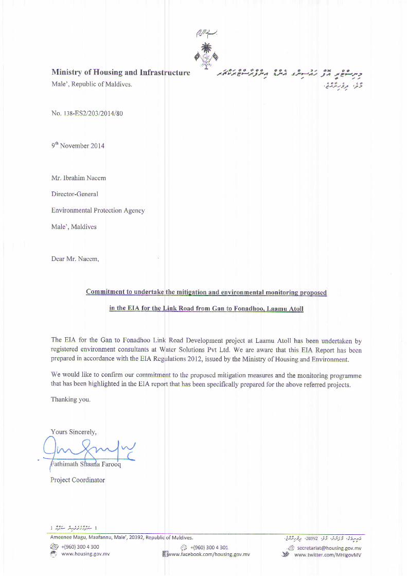
Commitment and Declaration from proponent
ru''/.
Ministry of Housing and InfrasMale', Republic of Maldives.
No. r38-ES2/2BDA14/80
9* November2014
Mr. IbrahimNaeem
Director-General
Environmental Protection Agency
Male', Maldives
Dear Mr. Naeem.
;ttti-"th-Mila Faroo'q
| 4JP '.tat.J* |
Ameenee Magu, Maafannu, Male', 20392,
@ +(960)3004300'$ www.housing.gov.nnv
$$ +(s6o) 3oo 4 3ol.Svww.iacebook.com/housi ng.gov.mv
The EIA for the Gan to Fonadhoo Linl{ Road Development project at Laamu Atoll has been undertaken byregistered environment consultants at rfr,fater Solutions Pw Ltd. We are aware that this ELA Report has beenprepared in accordance with the EIA Regirlations}0l2, issued by the Minisby of Housing and Environment.
We would like to cqnfirm our commitmfnt to the proposed mitigation measures and the monitoring programmethat has been highlighted in the EIA repoft that has been specifically prepared for the above referred projects.
Thanking you.
Yours Sincerely,\
)r^NY
o o t o oCP'J"'
a
o o c c , . o - c ct.-Hrt- ta J.e=t2
/ a t a aa o 4 c a ?
.eat/t",F .-r2/ /
.;:i-;r ,zo39z ,.ii ,.i-,7ii ,.i1-,t
.# [email protected].* www.twitter.com/MHlgovMv
Maldives.
Project Coordinator

Laamu Link Road Development Project EIA
Ministry of Housing and Infrastructure 2014 10
1 IntroductionMinistry of Housing and Infrastructure is undertaking a road development project across the countyand Laamu Link Road is one of the projects in a group of islands to implement road developmentproject. Ministry of Housing and Infrastructure is implementing this project with the assistance fromChinese Government. The design consultant for the project is CCCC Highway Consultants Co. Ltd,China.
Road development projects are classed as projects which require Environmental Impact Assessment(EIA) under the Environmental Protection and Preservation Act (law 4/93). Ministry of Housing andInfrastructure has engaged Water Solutions for EIA for the Project and obtaining the EnvironmentalDecision Statement (EDS) from the Environmental Protection Agency, Government of Maldives.
The aim of this EIA study is to assess the potential environmental and social impacts due to the linkroad development project and identify mitigation measures for minimizing the adverse impacts,while undertaking the project in the an environmentally acceptable manner. The EIA takes intoconsideration, issues and concerns that are considered as critical with respect to environment,sustainable development and social harmony.
For determination of the scope of the EIA study, a detailed scoping meeting was held withEnvironmental Protection Agency (EPA) on 4th November 2014. The meeting was chaired byDirector General, EPA and included representatives of EPA, Ministry of Housing and Infrastructure,Ministry of Environment and Energy, Water Solutions, Laamu Atoll Council. During the scopingmeeting, concerned environmental and social issues and areas relating to the proposed roaddevelopment project were discussed. Based on the meeting a Terms of Reference (ToR) has beenapproved by the EPA for this EIA study.
The EIA of the Laamu Link Road Development Project has focused on areas of concern that areoutlined in approved ToR and considered the applicable national and international environmentaland social aspects which are relevant to road development projects at island environment.
This Environmental Impact Assessment (EIA) report has been prepared in order to meet therequirements of Clause 5 of the Environmental Protection and Preservation Act of the Maldives toassess the impacts of proposed road development project.
1 . 1 S c o p e o f t h e E I A S t u d yThe scope of the study has been guided by the Terms of Reference (ToR) approved by EPA. Thekey tasks provided in the ToR for the EIA include the following:
Task 1: Description of the Proposed ProjectTask 2: Description of the EnvironmentTask 3: Legislative Regulatory ConsiderationsTask 4: Potential Impacts of the Proposed ProjectTask 5: Analysis of Alternative to the Proposed ProjectTask 6: Mitigation and Management of Negative ImpactsTask 7: Development of a Monitoring PlanTask 8: Stakeholders Consultation and Inter-Agency Coordination
Approved Terms of Reference for the Environmental Impact Assessment is enclosed as AnnexureA. This EIA has been prepared based on this term of reference.
1 . 2 L i m i t a t i o n sThis report has been prepared to assist Ministry of Housing and Infrastructure, in obtaining theEnvironmental Decision Statement from EPA on behalf of Government of Maldives. The report hasrelied on available secondary information, primary environmental baseline data generated during thestudy period (October to November 2014), project information provided by Ministry of Housing andInfrastructure, available document reviews and consultation with stakeholders. The Laamu Linkroad development project and the associated impacts have been considered for the study area andaspects which had been discussed with EPA, Ministry of Environment and Energy and the Terms of

Laamu Link Road Development Project EIA
Ministry of Housing and Infrastructure 2014 11
Reference for Environmental Impact Assessment issued by EPA in November 2014. The sitedrawing(s) provided within this report is conceptual and indicative and of smaller scale. These mapshave been used to present the general relative locations of environmental and social features of thestudy area.
The historical information provided is based on the discussions with the Ministry of Housing andInfrastructure, stakeholders and information obtained from Laamu Atoll Council.
The major findings of this report are based on qualitative and quantitative assessments undertakenduring site visit to the islands in October 2014. However, due to unavailability of long term site-specific data, the impact assessment methodology has been restricted to field data collected,secondary data, consultations, experience and professional judgment. Available long term data werecollected from available sources, such as long term data on meteorology and climate data fromglobal databases.
The Water Solutions Project Team accepts no responsibility for application or interpretation of thesurveys, information, data or results provided in the report by any other parties.
1 . 3 C o n t e n t s o f t h e E I A r e p o r tThis EIA report has been organised in the following way:
Non-Technical SummarySection 1: provides Introduction – Project Background, Purpose, Scope and limitationsSection 2: describes applicable Policy, Legal and Administrative FrameworkSection 3: outlines Project DescriptionSection 3: outlines methodology adapted to under the Environmental Impact AssessmentSection 4: details the Existing Baseline Environment of the Project AreaSection 5: provides an Analysis of AlternativesSection 6: analysis of Environmental Impact due to the Project ActivitiesSection 7: gives an account of the outcome of the stakeholder consultation undertakenSection 8: provides Environmental Management Plan for this projectSection 9: gives Conclusion
1 . 4 P r o j e c t C o n s u l t a n t sThis EIA has been prepared by Water Solutions represented by the following registered EIAconsultant working with the Water Solutions. The team visited Laamu Atoll and met stakeholders inOctober 2014. The team that visited Laamu Atoll are as follows;
Ahmed Jameel (Registration number: EIA 07 / 07) (lead consultant)
Ibrahim Faiz, Junior Environment Consultant
Hassan Shah, Environment Consultant

Laamu Link Road Development Project EIA
Ministry of Housing and Infrastructure 2014 12
2 Policy, Legal and Administrative FrameworkThe project conforms to the requirements of the Environmental Protection and Preservation Act ofthe Maldives, Law no. 4/93. The EIA has been undertaken in accordance with the EIA Regulation2012 of the Maldives by a registered consultant. Furthermore, it adheres to the principles underlinedin the regulations, action plans, programmes and policies of Ministry of Housing and Infrastructure,Ministry of Environment and Energy and Environmental Protection Agency. These are discussed indetail in the following sections.
2 . 1 L a w s a n d R e g u l a t i o n s2 . 1 . 1 E n v i r o n m e n t a l P r o t e c t i o n a n d P r e s e r v a t i o n A c tArticle 5 (a) of the Environmental Protection and Preservation Act (Law No. 4/93) addresses thesubmission of an EIA (Majilis, 1993). It states that an EIA shall be submitted to Ministry ofEnvironment before implementing any developing project that may have a potential impact on theenvironment. This project complies with this Act.
2 . 1 . 2 P r o t e c t e d A r e a s a n d S e n s i t i v e A r e a sUnder Article 4 of the Environment Protection and Preservation Act, the Ministry of Environment isvested with the responsibility of identifying and registering protected areas and natural reserves anddrawing up of rules and regulations for their protection and preservation. At present there are norules and regulations made available to the public on designation and protection of habitats andheritage areas. This project does not fall to a boundary of a protected area.
2 . 1 . 3 E n v i r o n m e n t a l I m p a c t A s s e s s m e n t R e g u l a t i o n 2 0 1 2The Ministry of Environment has issued EIA regulation on May 2012, which guides the process ofundertaking the Environmental Impact Assessment in the Maldives – This guideline also provides acomprehensive outline of the EIA process, including the roles and responsibilities of the consultantsand the proponents. This regulation outlines every step of the EIA process beginning fromapplication to undertake an EIA, details on the contents, minimum requirements for consultantsundertaking the EIA, format of the EIA/IEE report and many more.
The guidance provided in this Regulation was followed in the preparation of this EIA report. TheEIA has also been prepared by registered consultants.
2 . 2 D r e d g i n g a n d r e c l a m a t i o n r e g u l a t i o nThe dredging and reclamation regulation issued by Ministry of Environment and Energy does nothave a relevance to this project as this project does not require borrowing sand for beach nourishingwork.
Clause 6 states that the protocols and procedures to apply for dredging and reclamation and thisprocess has been fulfilled.
Clause 11 states that the guidelines and best practice measures to be followed and it will be followedas outlined in the project description.
As per clause 13, borrow areas have been identified and studied for this project. All the buffer zonesindicated in this clause will also be strictly followed including the 100 meter buffer one from thereef crest to the beach.
Clause 14 states the use of borrowed material during construction period and only these uses will bemade from the borrowed material.
2 . 3 W a s t e m a n a g e m e n t R e g u l a t i o n sThe Ministry of Environment has developed national waste management regulations. The keyelements of the regulations include: ensure safe disposal of solid waste and encourage recycling andreduction in waste generated, develop guidelines on waste management and disposal and advocate

Laamu Link Road Development Project EIA
Ministry of Housing and Infrastructure 2014 13
enforcing these guidelines through inter-sectoral collaboration and ensure safe disposal of chemical,industrial and hazardous waste.
Waste management for the proposed project during the construction and operation phase will be inline with this regulation. The waste generated from the project site would be taken to the islandwaste management facility for processing and disposal.
2 . 4 R e g u l a t i o n c u t t i n g d o w n , u p r o o t i n g , d i g g i n g o u t a n d e x p o r t o ft r e e s
The Regulation on cutting down, uprooting, digging out and export of trees and palms from oneisland to another was recently issued by the Ministry of Environment, Energy and Water. Clause 5(a) of the regulations states that Prior to the commencement of any project(s) that would require theindiscriminate removal and export of trees/palms from one island to another for the purpose ofagriculture, development/development, construction or any other purpose, it is mandatory under theRegulation to prepare an Environmental Impact Assessment Report stating clearly the details of theProject(s) with all necessary information and submit the same through the relevant Ministry toMinistry of Environment Energy and Water, and the project(s) can only commence upon the grant ofwritten approval from the Ministry of Environment, Energy and Water.
Article 8 (a) requires permission be obtained from Ministry of Environment, Energy and Water, ifmore than 10 coconut palms that are of a height of 15 ft (from base of the palm to the tip of the palmfrond) are cut, uprooted or relocated to another island. The regulation also ensures the replacementof the vegetation that is lost by imposing the planting of two palms for every palm tree that is cut oruprooted (Article 2 (d)). Logging on inhabited islands must be done under supervision of the islandschief or an official appointed by the island chief (Article 8 (c)).
The proposed project requires removal of large number of mature trees from the island. Hence thisregulation would is applicable to this project.
2 . 4 . 1 P o s t E I A M o n i t o r i n g , A u d i t i n g a n d E v a l u a t i o nThe environmental monitoring programme given in EIA report is an important aspect of the EIAprocess. The monitoring programme outlines the objectives of the monitoring; the specificinformation to be collected; the data collection program, and managing the monitoring programme.Managing the monitoring programme requires assigning institutional responsibility, reportingrequirements, enforcement capability, and ensuring that adequate resources are provided in terms offunds, skilled staff, etc.
The monitoring programme outlined in this report will comply with the EIA Regulations 2012.
2 . 4 . 2 R e g u l a t i o n o n C o r a l , S a n d a n d A g g r e g a t e M i n i n gThis regulation addresses sand mining from uninhabited islands that have been leased; sand miningfrom the coastal zone of other uninhabited islands; and aggregate mining from uninhabited islandsthat have been leased and from the coastal zone of other uninhabited islands for the purpose ofbuilding construction.
Neither sand nor aggregate will be mined for this project for the purpose of building construction.Aggregate used for this project will be imported. Local sand would be used for the levelling of theroads. Sand would be excavated from the island’s lagoon with the required permit fromEnvironmental Protection Agency. This regulation would not have any implication on the proposedproject.
2 . 4 . 3 A m b i e n t A i r / N o i s e a n d W a t e r Q u a l i t y S t a n d a r d sThe Maldives lacks the necessary environmental standards for the measurement of ambient air andnoise quality or water quality. Therefore, for these quality standards, typically WHO standards orinternational standards or standards of developed countries are referred.

Laamu Link Road Development Project EIA
Ministry of Housing and Infrastructure 2014 14
2 . 5 E n v i r o n m e n t a l P e r m i t s2 . 5 . 1 D r e d g i n g a n d R e c l a m a t i o n P e r m i tDredging and reclamation permit is required to undertake the excavation of the shallow lagoon toobtain the necessary fill materials for the road levelling work. EPA has issued a dredging andreclamation to obtain the fill material for the required levelling work at the island.
2 . 5 . 2 D e c i s i o n S t a t e m e n t ( E D S )The EIA Decision Statement is issued on successful evaluation of the EIA report by the EPA,Ministry of Environment and Energy. EIA Decision Statement governs the manner in which the EIAproject activities must be undertaken.
2 . 6 R e s p o n s i b l e I n s t i t u t i o n sThe main government institutions that have roles and responsibilities relevant to this project aresummarised below.
2 . 6 . 1 E n v i r o n m e n t a l P r o t e c t i o n A g e n c yThe Environment Protection Agency (EPA) of the Ministry of Housing and Environment hasresponsibility for efficient operation of the EIA process. This encompasses a number of tasks,including screening of projects and provision of general procedural advice to the project proponentsthroughout the EIA process. The EPA manages the review of the EIA report and is responsible forany approvals or recommendations associated with the EIA. It is also responsible for verifying thatenvironmental protection measures are properly implemented by undertaking environmental auditsin collaboration with other government as well as non government agencies with a role forenvironmental protection and preservation.
2 . 6 . 2 M i n i s t r y o f E n v i r o n m e n t a n d E n e r g yThe Ministry of Housing and Environment is mandated for the effective implementation of theEnvironmental Protection and Preservation Act (law 4/93) of the country and has the statutorypower over issues related to the environment. It has the central control over the environmentprotection, management, conservation and environmental emergencies. The Ministry operatesmainly at a policy level and the more regulatory and technical assessment activities are mandated tothe Environmental Protection Agency (EPA). In this respect EPA has now been mandated tomanage all issues relating to Environmental Impact Assessment of individual projects.
2 . 6 . 3 M i n i s t r y o f H o u s i n g a n d I n f r a s t r u c t u r eMinistry of Housing and Infrastructure is the government ministry responsible for the developmentand regulation of the construction sector of the country. It is also the agency which oversees thedevelopment of public infrastructure of the country. This project is mainly driven to develop theLaamu Atoll as an urban centre. The policy direction for such initiatives are formulated andimplemented by the Ministry of Housing and Infrastructure.
2 . 7 R e l e v a n t P o l i c i e s2 . 7 . 1 T h i r d N a t i o n a l E n v i r o n m e n t A c t i o n P l a nThe Third National Environment Action Plan is divided into principles, results and goals to achievethe results. Some of the fundamental principles prescribed in NEAP 3, which have beenincorporated into this environmental impact assessment exercise include local democracy, informeddecision making, continuous learning and improvement, right to information and participation andmost importantly the complementing role of environmental protection in socio-economicdevelopment. The proposed project is expected to provide a learning experience in terms ofeffectiveness of the use of EIA as a planning instrument and appropriate monitoring for whichspecific focus is laid in Objective 24.1 of NEAP 3 (Ministry of Housing, Transport andEnvironment, 2009).

Laamu Link Road Development Project EIA
Ministry of Housing and Infrastructure 2014 15
2 . 7 . 2 N a t i o n a l B i o d i v e r s i t y S t r a t e g y a n d A c t i o n P l a nThe goals of the National Biodiversity Strategy and Action Plan are conserve biological diversityand sustainably utilize biological resources, build capacity for biodiversity conservation through astrong governance framework, and improved knowledge and understanding, foster communityparticipation, ownership and support for biodiversity conservation (Ministry of Housing andEnvironment, 2003). In implementing the proposed project activities due care would be given toensure that the national biodiversity strategies are adhered to. The proponent has committed onconservation and protection of the environment while undertaking this proposed project.
2 . 8 I n t e r n a t i o n a l C o n v e n t i o n s2 . 8 . 1 C l i m a t e C h a n g e C o n v e n t i o n a n d K y o t o P r o t o c o lThe Maldives is a party to the United Nations Framework Convention on Climate Change(UNFCCC) and the Kyoto Protocol to the UNFCCC. The objective of the Convention is to stabilizegreenhouse gas concentrations in the atmosphere at a level that would prevent dangerousanthropogenic interference with the climate system. The greenhouse gas inventory of the Maldivesforms an integral part of the First National Communication of the Maldives to the UNFCCC.
In March 2009, the government of the Maldives announced the target to make Maldives carbonneutral by 2020. Hence, in the implementation of the project, careful attention needs to be given toensure energy efficiency and reduce transport related fuel consumption. Furthermore, planting oftrees on either side of the paved roads would help in off-set greenhouse gas emissions from theproject.
2 . 8 . 2 C o n v e n t i o n o n B i o l o g i c a l D i v e r s i t yThe Maldives is a party to the United Nations Convention on Biological Diversity. The objective ofthe convention is “the conservation of biological diversity, the sustainable use of its components andthe fair and equitable sharing of the benefits arising out of the utilization of genetic resources,including by appropriate access to genetic resources and by appropriate transfer of relevanttechnologies, taking into account all rights over those resources and to technologies, and byappropriate funding. The proposed development activities outlined in this project does not fall onany area recognised for its ecological value. Therefore it is unlikely there will be a major loss ofbiodiversity. The loss is not going to be significant at atoll or national level. Yet, it is recommendedthat the developer ensures that mitigation measures are taken to reduce the impact of terrestrialbiodiversity.

Laamu Link Road Development Project EIA
Ministry of Housing and Infrastructure 2014 16
3 Project Descriptions3 . 1 P r o j e c t P r o p o n e n tThe project is proposed by Ministry of Housing and Infrastructure on behalf of Government ofMaldives. This project is widely believed to improve and facilitate the infrastructure development atLaamu Atoll.
3 . 2 P r o j e c t L o c a t i o n a n d S t u d y A r e aThe proposed road development project would be implemented at the stretch of islands from Gan toFonnadhoo at Laamu Atoll. The project boundaries are illustrated in on the site map attached in theannexes of this report.
Figure 1: Proposed Link Road Development Project

Laamu Link Road Development Project EIA
Ministry of Housing and Infrastructure 2014 17
3 . 3 P r o j e c t D u r a t i o nThe construction of the road is expected to start in November 2014 as soon as Environment DecisionStatement is issued by EPA. A detail project schedule is attached as annex B to this report
3 . 4 P r o j e c t F i n a n c eThe project has been financed by the Chinese Government as a bilateral grant aid to the people ofMaldives.
3 . 5 T h e p r o p o s e d P r o j e c t a c t i v i t i e sThe proposed Link road development project will be carried out in compliance with laws,regulations, standards and guidelines of the Maldives. The proposed road development projectconsists of development of a total length of 14.9 km at the stretch of islands in Laamu Atoll.
3 . 6 T h e p r o p o s e d d e v e l o p m e n t c o n c e p tThe proposed link road development concept is based on the experience of similar projects that hadbeen carried out in the Maldives. The road has been designed based on the Chinese road designstandards as such is not available in the Maldives.
3 . 6 . 1 D e s i g n p r i n c i p l e s o f t h e l i n k r o a d f r o m G a n t o F o n n a d h o oThe road surface would be designed based on the local traffic volume, road use, natural climate,local hydrology, soil, traffic formation and distribution at the project site. The road design shallguarantee the safety of the pavement structure. The road shall adjust to the local conditions, uselocal material for the construction and reduce investment, economical, technically advanced suitablethe conditions of the Maldives
3 . 6 . 2 T y p i c a l r o a d s e c t i o n o f t h e l i n k r o a dThe link road project has five different type of cross section in the overall route. The cross sectiontype 1 has an overall width of 16.5m. The specific arrangement is with 1.5 m sidewalk, 2.5 m non-motorized lane, 3.25 m carriageway on either side of a 2 m median. The cross section is suitable forsections where urban road width is unlimited.
Figure 2: Typical cross section type 1

Laamu Link Road Development Project EIA
Ministry of Housing and Infrastructure 2014 18
The cross section type 2 has an overall width of 12.0 m. The specific arrangement is with 1.5 msidewalk, 1 m curb strip, 3.25 m carriageway on either side of a 0.5 m median. The cross section issuitable for sections where urban road width is limited.
Figure 3: Typical cross section type 2
The link road project has five different type of cross section in the overall route. The cross sectiontype 3 has an overall width of 16.5m. The specific arrangement is with 1.5 m earth shoulder, 2.5 mnon-motorized lane, 3.25 m carriageway on either side of a 2 m median. The cross section is suitablefor sections where suburban sections where water drainage is unlimited.
Figure 4: Typical cross section type 3

Laamu Link Road Development Project EIA
Ministry of Housing and Infrastructure 2014 19
The cross section type 3 has an overall width of 10.0 m. The specific arrangement is with 1.5 mearth shoulder, 3.25 m carriageway on either side of a 0.5 m median. The cross section is suitable forsections in suburban areas.
Figure 5: Typical cross section type 4
The cross section type 3 has an overall width of 13.0 m. The specific arrangement is with 2.5 m nonmonotorised lang, 3.25 m carriageway on either side of a 1.0 m median. The cross section is suitablefor causeway sections. In this project, the only change to the section pavement is more overlaying.
Figure 5: Typical cross section type 4

Laamu Link Road Development Project EIA
Ministry of Housing and Infrastructure 2014 20
In addition, bay – type bus top (width 3) and parking area (width of 3.0 m) would be set up atappropriate location in the link road overall route catering the needs of residents of local bus servicealong the route. I pair of bay bus stop will be arranged symmetrically on both sides of the road.
Figure 5: proposed bus stop at Link Road at Gan Island
3 . 7 D r a i n a g e a n d F l o o d C o n t r o lOne of the principle considerations during the design process was to minimize the impact on theenvironment. At the EIA scoping meeting, the Ministry of Environment and Energy and EPAinsisted that they would like to have the rain water runoff from the road to be used to recharge thewater aquifer of the island.
3 . 7 . 1 S u r f a c e r u n o f fSurface run off is dissipated into the aquifer through the use of sink pits. The design of the pits ismade to ensure easy maintenance by containing in small units, which can be maintained separately.As a regular maintenance exercise, debris and sand collected in the sink pit need to be removed fromthe sink pit.

Laamu Link Road Development Project EIA
Ministry of Housing and Infrastructure 2014 21
Figure 5: drainage pits proposed on suburb area.
The infiltration system consists of two parts. The upper part is a rectangular seepage ditch assembledout of prefabricated reinforced concrete components, while the lower part is composed of coralgravel wrapped geotextile. The coral gravel filling for the seepage ditch would be sieved fromnatural coral sand. The coarse sand with the size of over 2mm will be used and the content of finesand with size of smaller than 2mm shall not exceed 3%.
Seepage ditch comprises two courses of filling separated by three layers of infiltration geotextile andwrapped by infiltration geotextile at vertical edges. Geotextile will not be used between theassembled reinforced concrete rectangular gutter and the underlying infiltration layer to facilitate thefiltration and cleaning of waste and debris carried in storm water.
3 . 7 . 2 R o a d P r o t e c t i o n W o r kThe section of the link road south of the Fonnadhoo harbour area would be protected as the sectionis very close to the beach. It is proposed concrete blocks with size 0.5X0.5X0.4m would be placedas a revetment to protect the road section. 30cm parapet wall would be placed above the pavement atthe outside of the side walk.
Figure 5: protection of the road section at Fonnadhoo.
3 . 7 . 3 R o a d S u r f a c eDue to the low traffic volume mainly composed of cars and motorcycles, the payment designs ofthis project is not subject to accumulated equivalent axle load. An asphalt pavement is proposed asthe road surface for the link road.
The carriageway pavement structure has 5cm AC-13 asphalt concrete; emulsified asphalt primecoat, 10 cm graded crushed stone base layer, 15 cm coral sand sub-base layer. The total thickness ofroad surface is 30.0 cm.
The pedestrian sidewalk pavement structure has 5cm sidewalk block, 3cm M10 cement mortar,20cm coral sand. The total thickness of road surface is 28.0 cm.
The soil shoulder pavement structure has 30cm coral sand. The total thickness of road surface is30.0 cm.

Laamu Link Road Development Project EIA
Ministry of Housing and Infrastructure 2014 22
The pavement structure of the existing causeway. Tack coat will be first sprayed on the existingcauseway pavement and then 4cm asphalt concrete pavement will be added. The same pavementstructure will be adopted on the mainline, branch line, the intersection and bus stops.
3 . 7 . 4 M a t e r i a l sThe asphalt for the road surface would be #70 petroleum asphalt.
Crushed stone would be imported. Stone required for the asphalt surfacing cannot be replaced bycoral stone. Stone shall be clean, dry, not weathered, with no impurity and rough surfaced.
On the base layer of the carriageway pavement, prime coat will be applied with a minimumpermeation depth of 5 mm, which will integrate into the base layer. High quality emulsified asphaltwill be used for the prime coast and the quantity will be determined by the site test.
3 . 7 . 5 S t r e e t l i g h t sThe proposed link road project is a road reconstruction project. Hence the lights will follow theexisting layout pattern of the existing street lights. Streetlights won the mainline will be installed onside at an interval of 40m. streetlights on other sections will be erected in the central median, wherethe existing streetlight will remain unmoved and the new streetlights will be installed at a spacing of80m. 70W high pressure sodium lamp will be used as streetlight source, which radiates yellow lightwith a service life of 28,000 hrs.
3 . 7 . 6 G r e e n i n g a n d l a n d s c a p i n gGreening and landscaping is not covered as part of the project. Greening and landscaping of the nearthe road would be carried out by the island council when the project is completed. During theimplementation of the project, special attention would be paid to protection the existing vegetationin central median and on road side.
3 . 7 . 7 B a c k f i l l i n g a n d l e v e l l i n g w o r k
For back filling and levelling work at the roads, materials need be borrowed. The sand for the backfilling and levelling would be obtained the islands borrow sites which are located north of Gan,West of Gan and South of Fonnadhoo. It is estimated that a total of 111,000 cubic meters of sandneed to be excavated from the borrow areas to undertake the backfilling, levelling and developmentof roads. The locations where the sand would be borrowed is marked on Figure 6.
Figure 6: sites identified to borrow shortfall backfill material

Laamu Link Road Development Project EIA
Ministry of Housing and Infrastructure 2014 23
3 . 8 P r o v i s i o n f o r s u b s u r f a c e u t i l i t i e s3 . 8 . 1 C a b l e d s e r v i c e sEfforts were made to contain all of the cabled services within the pavement area, and also to providededicated and designated paths to main service providers on both sides of the road. Furthermoreeach service provider can have unhindered access to their cables when required without the risk ofdamaging the other cables. Being on both side of the road, avoids the situation where, cutting acrossthe road to deliver the services to the other side in reduced. A series of cross over pipelines are alsoprovided at regular intervals to accommodate the event, should crossing over of the cables benecessary.
3 . 8 . 2 E l e c t r i c a l P o w e r c a b l e sAccording to all available information the low voltage lines of the electrical grid will be under theasphalted driving surface. Any access to the cable after the completion of the road will requireopening the asphalt surface. Fenaka Cooperation needs to devise avoidance and mitigation methodsprior to the completion of the road.
3 . 8 . 3 C a b l e T VThe Cable TV services provider’s cables will be dug up during the installation of the services ductssystem itself.
3 . 8 . 4 S e w e r a g e s y s t e mThe islands sewerage system which had been laid before the road surface is paved at the island. Thesewerage system would be under the asphalted driving surface when the project is completed.
3 . 8 . 5 L i g h t i n gProvision has been made to place the poles of the streets lights at the sides of the roads. This projecthas the component to place the street lights poles and street lights.
3 . 8 . 6 R o a d S a f e t yStandard road marking, road signs and guide posts will be installed all the length of the road
3 . 9 C o n s t r u c t i o n M e t h o d o l o g yThe proposed project involves two main activities namely site preparation and construction of roads.Details of the activities and construction methodology for each activity are described in thefollowing sections.
3 . 9 . 1 S i t e P r e p a r a t i o n s t a g e
3.9.1.1 Uprooting and removal of trees
Coconut trees are found on both sides of the existing road with spacing of 8 – 15 m. withreconstructing and widening the existing road, coconut trees will be included in the new subgradescope, so it is required to uproot all the coconut trees, fill the caves and compact the ground. As partof the project, 1,622 coconut palms from Gan, 362 from Maamendhoo, 403 coconut palms fromKadhdhoo and 2,391 coconut palms from Fonnadhoo need to uprooted.
3.9.1.2 Levelling work and backfilling
The levelling work to be carried out at the roads designated for development would require scrapingof the top layers of soil. The excess sand removed from the levelling work from road sections whicharea higher than the required level would be reused as backfilling of areas of road section which arelower than the required levels. Additional sand that is required for the backfilling would beborrowed from borrow site.

Laamu Link Road Development Project EIA
Ministry of Housing and Infrastructure 2014 24
3 . 9 . 2 C o n s t r u c t i o n o f t h e R o a d
3.9.2.1 Levelling of road surface
The finished levels of the roads would follow the natural contour of the islands. The final levels ofthe road would be between 1.2 to 1.39 m. Back filling and levelling of the roads will be carried outto maintain the existing level of the island.
3.9.2.2 Construction of the pavements
The design of the pavements is to contain all of the cabled services within the pavement area andalso to provide dedicated and designated paths to the main service providers on both sides of theroad. The pavements will be made from paving blocks.
Figure 7: detail cross section of road sections.
3.9.2.3 Installation of the utility services
The road project will provide provision for the utility services within the payment area. Utilitiesservice provider can provide the utility services through three pipes which will be laid under thepayment area. Each pipe would be 150 mm of diameter. These are dedicated and designated pathsfor the utility service providers. At regular interval, cross over pipes are provided to run the utilitiesfrom one side of the road to other side.
3.9.2.4 Construction of the road surface
The road surface has been designed for asphalt paving over concrete block paving after stakeholderconsultations with the Ministry of Housing and Infrastructure and the community.
3 . 9 . 3 P r o j e c t I n p u t sThe types of resources that will be used during the propose project work and from where and howthese will be obtained are given in the following table.
Table 1: Matrix of major inputs during construction stage
Input resource(s) Source/Type How to obtain resourcesworkers (150) Maldivians and expatriates contractor
Electricity/Energy (if required) Island grid Existing power supply fromFenaka Cooperation
Machinery Asphalt mixing machine, lorries,excavators, loaders, JCBs and others
Already available with thecontractor and hiring from Localsuppliers.
Transport Transfer by domestic plan, dhoniand speed boats. Materials to betransported in carrier vessels.
Already available withcontractor, barges and carriervessels will be hired from localsuppliers

Laamu Link Road Development Project EIA
Ministry of Housing and Infrastructure 2014 25
3 . 9 . 4 P r o j e c t o u t p u t sThe type of outputs (products and waste streams) and what is expected to happen to the outputs aregiven in the table.
Table 2: Matrix of major outputs of environmental significance during construction stage
Products and wastematerials
Anticipated quantities Method of disposal / control
Green waste. 1000 m³ of compacted greenwaste
Green waste will be re-used and balance will bedisposed at the sites allocated by island council.Greenwaste would be burnt at the wastemanagement site.
Hazardous waste Approximately 100,000 litres ofwaste asphalt. Approximately2000 litres of waste oil fromheavy machineries
Barrelled and stored until disposal. Finaldisposal at Thilafushi once the project iscomplete.
Noise Only localised to the islandenvironment, and mainly toproject site.
Limited noise pollution will be occurred. Heavymachineries will be used in day time to minimiseits impact on houses.
Air pollution Limited quantities of dust in onlydesignated areas
Mainly arising as a result of dust emission fromcutting trees and moving machinery andvehicles. Only localised to project boundary.
Construction waste 10,000 to 15,000 cubic meters ofconstruction waste
Construction waste will be sorted and stockpiledat the site and disposed to a waste managementsite once the project is complete.
3 . 1 0 P r o j e c t s u m m a r yFollowing tables provides a summary of the rehabilitation and upgrading project of Laamu LinkRoad project at Laamu Atoll.
Table 3: Matrix of major inputs during construction stage
Laamu Link Road Development Project EIA
Ministry of Housing and Infrastructure 2014 26
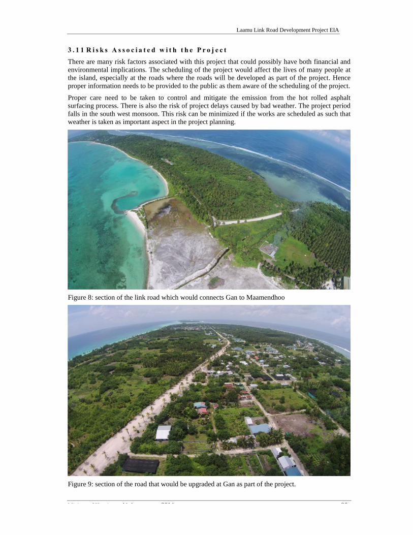
3 . 1 1 R i s k s A s s o c i a t e d w i t h t h e P r o j e c tThere are many risk factors associated with this project that could possibly have both financial andenvironmental implications. The scheduling of the project would affect the lives of many people atthe island, especially at the roads where the roads will be developed as part of the project. Henceproper information needs to be provided to the public as them aware of the scheduling of the project.
Proper care need to be taken to control and mitigate the emission from the hot rolled asphaltsurfacing process. There is also the risk of project delays caused by bad weather. The project periodfalls in the south west monsoon. This risk can be minimized if the works are scheduled as such thatweather is taken as important aspect in the project planning.
Figure 8: section of the link road which would connects Gan to Maamendhoo
Figure 9: section of the road that would be upgraded at Gan as part of the project.
Laamu Link Road Development Project EIA
Ministry of Housing and Infrastructure 2014 27
4 MethodologyThe section covers methodologies used to collect data on the existing environment. The keyenvironmental and socio-economic components of the project that were considered are physicalenvironment and social component.
In order to study the existing environment of the island, the following data collection methodologieswere used during the field visit undertaken in October 2014 to the islands.
4 . 1 G e n e r a l M e t h o d o l o g i e s o f d a t a c o l l e c t i o n
Conditions of the existing environment were analyzed by using appropriate scientific methods. Theenvironmental component of the study area was mainly focused on the terrestrial environment. Theterrestrial environment covered the roads which will be developed as part of the project.
4 . 2 M a p p i n g a n d L o c a t i o n i d e n t i f i c a t i o n
The islands including, shore line, vegetation line and roads were mapped. Mapping was undertakenusing hand held differential GPS. The location of data collection sites were marked using handheldGPS. These data collection points include water sampling locations, marine survey areas andproposed borrow area.
4 . 3 T e r r e s t r i a l f l o r a l s u r v e yThe baseline terrestrial environment of the project location was studied using a rapid assessmentmethod. The terrestrial environmental survey was strictly focused on the trees located on the roadsthat are designed for removal as part of the development.
The survey concentrated on identifying vegetation types, their abundance and occurrence. Themethods used to assess the tree types and abundance were taking a trees census.
4 . 4 A v a i l a b l e l o n g t e r m w e a t h e r d a t aLong term available weather data was obtained from the nearest weather station at Kadhdhoo. Thesedata sets were used to develop a regional model in ArcGIS to assess the vulnerable areas of theisland during both monsoons, thus helping the EIA team to assess the vulnerable areas of the islandfor flooding.
4 . 5 S o c i o - e c o n o m i c c o n d i t i o n a n d s t a k e h o l d e r c o n s u l t a t i o n
An stakeholder consultation, with key stakeholders, was undertaken as part of the EnvironmentImpact Assessment for the link road project at Laamu Atoll. The purpose of the consultation is to getstakeholders view on the project and analyze the potential impact of the project might have on theresidence of the island. The findings were based on a participatory approach and the informationprovided by them. Secondary sources of information were collected by the census 2006, reportspublic by government authorities and information and data available on the internet. The projectdevelopment team and the Ministry of Housing and Infrastructure has undertaken extensiveconsultation with the island communities at various stage of the project formulation. Details of suchinteractions can be obtained from Ministry of Housing and Infrastructure.

Laamu Link Road Development Project EIA
Ministry of Housing and Infrastructure 2014 28
5 Existing EnvironmentThe baseline information of the proposed project and surrounding area were collected throughprimary data collected during the study period and available secondary data. The environmentalbaseline data includes general geography, meteorology, demographic status, geology and terrestrial.A detailed description of baseline data compiled through the surveys and monitoring is provided inthe following subsections:
5 . 1 G e o g r a p h i c S e t t i n g
Maldives has a total of 1,192 islands, distributed over 26 natural atolls that encompass an area ofapproximately 107,500 km2 of which less than 0.3 percent is land area. The country’s total land areais estimated to approximately 300 km2, with islands varying in size from 0.5 km2 to 5.0 km2. Only197 of the islands are inhabited. The islands consist of coral, sea grass, seaweed, mangrove and sanddune ecosystems which are of great ecological and socio-economic significance. Located 250 kmsouth of Malé, Laamu Atoll consists of 50 islands with a total area of 16.08 km2. The islands ofGan, Maandhoo and Fonnadhoo are on eastern side of the atolls which are connected via courseways.
Figure 10: Fonnadhoo – Kadhdhoo causeway
5 . 2 T o p o g r a p h y a n d I s l a n d e l e v a t i o n
At stretch of islands from Gan to Fonnadhoo , the elevation of the islands is between 0.9 to 1.2 m.The elevation of the course ways is around 1.3 m above the mean sea level, which is measured at thecentre of the roads to be developed as part of the link road project.
According UNDP (2007), heavy rainfall is expected to flood parts of the island on western side. Theareas predicted for severe intensity are the topographic lows in the western and southern parts of theisland. These areas act as drainage basins for the surrounding higher areas and due the large size ofthe island the 'catchments area' is considerable for surface runoff during heavy rainfall. These are theareas of the island, where natural wetlands are found.

Laamu Link Road Development Project EIA
Ministry of Housing and Infrastructure 2014 29
Figure 11: Profile of Gan through the centre of the island.
5 . 3 G e o l o g i c a l C o n d i t i o n s
The islands occupy the central portion of the 3,000 km-long Laccadive-Chagos submarine ridge,which is a major feature of the Indian Ocean seafloor. They form a double chain of north-southoriented parallel atolls separated by an inner sea. The atolls rest on a submarine plateau that is 275-700 m deep, 700 km long and up to 130 km wide. Several east-west trending deep channels(~1000m) separate the atoll groups.
The islands are low-lying and began forming between 3,000 and 5,500 years ago. They represent themost recent deposition along a submarine plateau that is underlain by approximately 2,100 m ofmostly shallow-water carbonates resting on a slowly-subsiding volcanic foundation. Islandshorelines consist of sand, gravel, and a variety of engineering structures. The country’s beachsystems are highly dynamic and subject to seasonal conditions, especially from monsoons. AlthoughMaldives is located away from the main pathways of tropical cyclones, the presence of gravel beachridges and cemented conglomerates attest to the fact that storm waves are an important element inthe development of the islands.
Erosion and accretion are, in fact, ongoing processes to which local communities have adapted inthe past. Increases in population and the development of permanent infrastructure in close proximityto shorelines, however, have made erosion a prominent hazard to the country’s social and economicwell-being.
It is estimated that 80% of the islands are one metre or less above mean sea level. Their lowelevation makes them particularly vulnerable to storms and changes in sea level. The prospect ofglobal sea level rise and its potentially catastrophic impact on low-lying islands makes erosionmanagement all the more urgent.
Gan, Maandhoo and Fonnadhoo has undergone many morphological changes over the past 5 years.Gan has constructed harbours on western side of the island, Maandhoo has undertaken hugereclamation project on western side of the island and harbour has been developed on western side ofFonnadhoo.

Laamu Link Road Development Project EIA
Ministry of Housing and Infrastructure 2014 30
5 . 4 R o a d C o n d i t i o n s
The existing roads which is proposed for upgrade as link road project has width between 12 – 15 m.The roads have medians on most sections. Some sections of the roads have street lamps. Gan andMaandhoo have been connected after reclaiming the narraow channel between the two islands.Causeways connects Maandhoo and Kadhdhoo and Kadhdhoo and Fonnadhoo. The causeways havebeen repaired and built in 2006 with the assistance from Japan after the Indian Ocean Tsunami in2004. The causeways has been built with reclaimed materials. The outer sides have rock revetment.The causeway subgrade is in good condition with partical dmaage on road surface.
Main land transportation is using mini bus, pickup and motorcycles. According island councils,there are 827 motocycles on Gan, 450 motocycles on Fonnadhoo. Around 150 mini bus are used onboth islands.
Presently there are no traffic safety signs on the exsiting roads. There are no road markings as theroads does not have any surface. The lamp post on the central line of the road is attached withsimple small reflection film, which is convenient for night driving. The causeways have median withmarkings, speed limit sign and seperation signs between pedestrians and road user.
A section of road, south of the Fonnadhoo harbour, is very narraw. This section of road when it isdeveloped needs to be protected.
Figure 12: Section of road at Fonnadhoo that would need protection.

Laamu Link Road Development Project EIA
Ministry of Housing and Infrastructure 2014 31
5 . 5 C l i m a t e a n d w e a t h e r
The Maldives has a warm and humid tropical climate. The weather is dominated by two monsoonperiods: The South-West (SW) monsoon from May to November (rainy period) and the North-East(NE) monsoon from January to March (dry period), when winds blow predominantly from either ofthese two directions.
The relative humidity ranges from 73% to 85%. Daily temperatures in the country vary very littlethroughout the year with a mean annual temperature of 28°C.
5 . 5 . 1 W i n d c o n d i t i o n sWind directions are connected to the monsoons regime. Winds from the NE and ENE arepredominant during December to February. During March and April, the direction varies with thegeneral direction being westerly. But strong winds are associated with the SW monsoon season.Gales are uncommon and cyclones are very rare in the Maldives. Stormy weather is more frequentfrom May to July. Storm gusts of 50 to 60 knots have been recorded at Malé.
5 . 5 . 2 C u r r e n t sCurrents tend to be monsoonal in origin, generally setting W during the NE Monsoon (January toMarch) and E during the SW monsoon (May to October). During the transition months, the currentsare variable. Ocean currents flowing through channels between the atolls are driven by the monsoonwinds. Current speeds of 1 to 1.5 knots are reported in the Admiralty pilot. However, the current inthe E/W channels of the Maldives may attain 5 knots.
5 . 5 . 3 T i d a l c u r r e n t sGenerally, the tidal currents are Eastward in flood and Westward in ebb.
5 . 5 . 4 O f f s h o r e w a v e c o n d i t i o n s ( i n d e e p w a t e r )The swells and wind waves experienced by the Maldives are conditioned by the prevailing biannualmonsoon and are typically strongest during April and July in the SW monsoon period. During thisseason, swells generated north of the equator with heights of 2-3m and periods of 18-20 secondshave been reported in the region. However swells originating from cyclones and storm eventsoccurring well south of the equator may occur. Local wave periods are generally in the range 2 to 4 sand are easily distinguished from the swell waves.
5 . 5 . 5 C y c l o n e s i n t h e M a l d i v e sThis paragraph presents information extracted from (UNDP- Developing a Disaster Risk profile forMaldives – May 2006) presenting the characteristics of cyclones in the Maldives.
The islands of the Maldives are less prone to tropical cyclones. The northern islands of the countryhave been affected by weak cyclones that formed in the southern part of the Bay of Bengal and theArabian Sea. The number of cyclones directly crossing the Maldives is small. Only 11 cyclonescrossed the islands over the entire span of 128 years between 1877 and 2004.
Most of the cyclones crossed the Maldives north of 6.0°N and none of them crossed south of 2.7°Nduring the period. All the cyclones that affected the Maldives were formed during the months ofOctober to January except one, which formed in April.
The Maldives have not been affected by cyclones since1993.
In the northern islands, the probable maximum storm tide due to cyclones has been estimated to bearound 1.82m (storm surge of 0.84 m) for a return period of 100 years. This storm surge wascomputed taking into account probable maximum winds and probable maximum pressure drops.
5 . 5 . 6 T i d e D a t u mTide data is important information in any costal development project as it determines the elevationof the structures relative to a datum. A permanent tidal record station has been established atIbrahim Nasir International Airport by Maldives Meteorological Services. The maximum tidal range

Laamu Link Road Development Project EIA
Ministry of Housing and Infrastructure 2014 32
recorded at this tide station is 1.20m. The highest astronomical tide level is +0.64m (MSL) and thelowest astronomical tide level is -0.56m (MSL).
5 . 5 . 7 T i d e l e v e l sThe tidal regime is semi-diurnal with diurnal inequalities (twice daily). That means 2 high tides and2 low tides per day, with different heights. Typical spring and neap tidal ranges are approximately1.0 m and 0.3 m, respectively.
5 . 6 L a n d u s e p l a nThe stretch of islands from Gan to Fonnadhoo has a large land mass and is important for thedevelopment of not only the atoll but to the Maldives. The stretch of islands has an airport, fishingport and fish processing factory, large areas designated for industrial development, large area oflands used for agriculture and residential areas. Land use plans has been developed for Gan andFonnadhoo. The island of Kadhdhoo is managed by Regionals Airports and Maandhoo by HorizonFisheries.
Figure 13: agricultural areas at L. Gan
The proposed link road development project would facilitate stronger growth of residential andcommercial and industrial property development at the islands. The project would also improve theconnectivity of the islands to the airport, ports and harbour. Land use plans of Gan and Fonnadhoo isattached as annex to this report.
5 . 6 . 1 B a t h y m e t r y a r o u n d t h e b o r r o w s i t e sAs part of this assessment, a rapid bathymetric survey was undertaken to assess the condition of theborrow areas for the back filling. The bathymetric survey was undertaken using a spot depth meterand a Trimble GPS. The bathymetric survey results provided in this report shall not be used forengineering designs to estimates the fill volume.
The bathymetry survey result is attached as Appendix E of this report.

Laamu Link Road Development Project EIA
Ministry of Housing and Infrastructure 2014 33
6 Analysis of AlternativesThis section looks at alternative ways of undertaking the various alternatives of the proposedproject. There are two basic options: (1) leave the islands as its form without undertaking the roaddevelopment (no project option) or (2) undertake the proposed road as part of the development(undertake the project options). If the project were to continue, it would be necessary to taketechnical and social aspects of the project into consideration and ensure that these concerns areadequately considered before taking decisions. It is therefore important to consider all practicableoptions and ensure that the best available option(s) is/are chosen. The following section details thedevelopment options.
6 . 1 N o D e v e l o p m e n t O p t i o nThe “No Development Option” implies not proceeding with the additional road development projectat the island. This option would likely lead to adverse socio-economic impacts and to allow the roadto be used at its present state without any development. The advantage of this option is thatenvironmental problems related to developing the road will be avoided such as the removal of largenumber of trees, excavation of the shallow lagoon to obtain backfilling and levelling of the road.The disadvantage of this option is that the island infrastructure development will not take place,meaning that development will be affected. The current flooding of the roads continue to be anuisance to the general public.
Hence the socio-economic benefits outweigh the potential negative environmental and social effects.Therefore, the “No Development Option” is not recommended.
6 . 2 A l t e r n a t i v e m e t h o d s t o p a v e t h e r o a d sThere are a few options to pave the road surface as opposed to asphalt. One of the favouritealternatives is to use Concrete blocks.
6 . 2 . 1 C o n c r e t e b l o c k sConcrete blocks have been tried and tested in Male’ and they prove to be somewhat challenging forLaamu Link Road project and technically they are not preferred for many reasons despite theiradvantages. The most important quality of concrete blocks on road surface is the friction and theability to maintain that friction during rain as well as absorb the various surface pollutants fromvehicles while keeping the friction. The result of loosing friction on the surface is a hazard to roadusers as this will lead to disasters, especially during the rain. Concrete blocks can be easilyreinstated after making any changes in underground public utility services as may be required forrepairs, changes or up gradation, and can be opened to heavy traffic directly after construction,without having to wait for curing or setting of pavement materials. Moreover, the maintenance costsof such streets are low. However, experience from Male shows that when these blocks are removedfor road repairs, it is difficult to retain the road surface to the original level as the interlockingsystem of blocks are difficult to arrange to their original formation. The result is a haphazardlyarranged blocks which is not only ugly, but leads to uneven surface as well as is an eye sore. This isa common problem in Male’ today.
6 . 2 . 2 C o l d M i xCold mix asphalt concrete is produced by emulsifying the asphalt in water with soap prior to mixingwith the aggregate. While in its emulsified state the asphalt is less viscous and the mixture is easy towork and compact. The emulsion will break after enough water evaporates and the cold mix will,ideally, take on the properties of cold Hot Mix Asphalt Concrete (HMAC). Cold mix is commonlyused on lesser trafficked service roads. Cold mix asphalt concrete is being used for paving of the fireaccess roads in the domestic airports in the Maldives. But has not yet been used to pave a road in anisland. The main advantage of this method of paving is that there is no kerosene fumes or oily messwhich is produced from HMAC.

Laamu Link Road Development Project EIA
Ministry of Housing and Infrastructure 2014 34
6 . 3 A l t e r n a t i v e f l o o d c o n t r o l m e t h o dThe alternative method of flood mitigation is to divert the excess storm water to the harbour areas onwestern side of the islands by utilizing some roads as flood gates in case of excessive rainfall. Thisoption is a bit complicated as these roads have to be designed and levelled to drain the water to thewestern side of the island. Furthermore, some lifting stations maybe required coupled with pumps inorder to continuously drain the water to the harbour areas without flooding the houses on thesestreets. Although this is possible, more detail level and topographic surveying needs to beundertaken in order to fully design such system.
The biggest disadvantage of this option is that it will bypass the aquifer recharging sink pits anddischarge large volumes of water to the sea. This method needs further analysis.

Laamu Link Road Development Project EIA
Ministry of Housing and Infrastructure 2014 35
7 Stakeholder Consultation and Socio Economic Impact7 . 1 I n t r o d u c t i o nLaamu Gan and Fonnadhoo have been identified as islands which will host communities of othersmaller islands. This aims to improve the livelihood of migrants and host communities and providebetter services, quality of life and contributes towards regional development agenda of thegovernment.
7 . 2 S o c i o E c o n o m i c I m p a c t o f R o a d D e v e l o p m e n t7 . 2 . 1 P o s i t i v e I m p a c t o f R o a d p r o j e c tThe project would help to improve the road conditions of the link road from Gan to Fonnadhoo. Thiswould be a huge benefit for the road users. This project will increase the economic activity at theislands which would create additional employment opportunity to the resident communities of Ganand Fonnadhoo. The project would help to create an incentive for the communities from otherislands to migrate to Gan and Fonnadhoo. Additional housing and social housing schemes could beimplemented in accordance with the existing land use plan. The additional growth of the populationat the island could the island to be developed as a focus centre in the south central region of theMaldives.
7.2.1.1 Opportunities for Tourism Sector- Guest Houses and City Hotels
Demand for Guest house and City Hotels are increasing at a faster speed in Laamu Atoll. Guesthouses are being operated at Gan. It is anticipated, more and more guest houses would be built oninhabited islands. The proposed road project would facilitate the development of the city hotels andguest house development at the islands and improve the connectivity to the airport at Kadhdhoo.
7.2.1.2 Opportunities for Construction Industry
Laamu Link road development project will create additional job opportunities directly and indirectlyat the island. The job opportunities would be created from the planning stage, construction stage,and indirectly or directly to other businesses such as transportation sector, supply of goods &services, retail and whole businesses, café’s and restaurants, and more businesses. This will createan environment for the youth participation in the development of the island.
7 . 2 . 2 C o n t r o l o f f l o o d i n gSome of the roads at the island gets flooded after a storm event. The development of the roadswould help to improve the flooding issue. The roads are built with soak pits which are located atregular intervals on either side of the road. The project need to include a storm water managementcomponent which will address the issue of flooding during a heavy storm event by diverting thefloodwater from eastern side of the islands to the western side allowing excess water to drain intothe sea.
7 . 2 . 3 N e g a t i v e I m p a c t o r C o n c e r n s r e g a r d i n g t h e p r o j e c t
7.2.3.1 Not all roads are developed
The island councils noted that the roads selected for the link road development project are roadswhich have most beneficial to the island community. It was noted that the present road developmentproject is to develop 14.9 km of roads. Hence there are number of roads that will not be developed atthe island. This is a concern that many resident raised at the islands.
7.2.3.2 Safety issue
The road has been designed for speeds up 40 km/h and 60 km/h in some section of the roads. Theisland councils and communities are concern that without strong awareness creation programme, thelink road would increase number of fatal road accidents. This has been the case with the link road atAddu Atoll.

Laamu Link Road Development Project EIA
Ministry of Housing and Infrastructure 2014 36
7 . 3 S t a k e h o l d e r P e r c e p t i o n7 . 3 . 1 M i n i s t r y o f E n v i r o n m e n t & E n e r g yDuring the scoping meeting, the Ministry of Environment and Energy noted that road developmentis an important project for the development of the islands. But noted that road development projectneeds to come after the basic services are provided at the islands. The road development should startwhen the main sewer lines are laid at the roads as such it would be laid under the driving surface ofthe road. Ministry of Environment and Energy also noted that flood management is also animportant aspect that needs to be taken into consideration while designing the road at the island.
The Ministry also noted that Fonnadhoo is an island that has been reported beach erosion. Erosion isfound on southern side of the harbour area. The proposed road near the harbour should be developedby undertaking some coastal protection measures.
7 . 3 . 2 E n v i r o n m e n t P r o t e c t i o n A g e n c yAt the scoping meeting, EPA noted that road development projects need to consider the floodingissue, recharging of the groundwater and provision of the utilities services in a sustainable manner.
The road network which is designed at the island need to address the local flooding after a severestorm event. The road designed for development need to have a balance of controlling the localflooding and recharging of the groundwater. The roads should not be designed as such all therainwater which falls on to the road surfaces is drained into the sea. The road surface shall be used torecharge the groundwater at the island.
7 . 3 . 3 L a a m u A t o l l C o u n c i lLaamu Atoll council noted that they welcome the government initiative to develop link road fromGan to Fonnadhoo via Maamendhoo and Kadhdhoo. The council will provide its fullest cooperationto make the road development project a success at the island.
The council noted that large number of coconut palms would be removed as part of the project. Thecouncil has facilitated to provide the required compensation to the tree owners and there is nopending issue regarding the trees that need to be removed as part of the project. Council will provideits support during the removal and cutting of trees. The green waste generated in the process wouldbe managed at the waste management sites at the islands.
7 . 3 . 4 R e s i d e n t s o f F o n n a d h o o a n d G a nResidents of Fonnadhoo and Gan has been met by the Ministry of Housing and Infrastructure toprovide information of the project. Ministry of Housing and Infrastructure have informed to the EIAconsultant that the communities are very eager to implement the project. The list of residents whoparticipated at the meetings have been attached with this report.

Laamu Link Road Development Project EIA
Ministry of Housing and Infrastructure 2014 37
8 Environmental Impacts and Mitigation8 . 1 I m p a c t I d e n t i f i c a t i o nThe proposed link road development at Laamu Atoll is expected to have impacts on the marine andterrestrial environment of the island. These include a change to the storm water drainage pattern ofthe islands. The project is also expected to impact the livelihood of the beneficiaries and also impactthe existing society in many ways. In preparing this EIA report, various methodologies were used tocollect information on the existing environment and also identify the impacts of the project. Impactidentification has been focused on the terrestrial and marine environment of the island.
8 . 2 A s s e s s i n g I m p a c t sEnvironmental impacts of the proposed project have been examined through a number of processes.These include consultations with the stakeholders, field surveys, observations and assessment, andfield experience gained from similar development projects implemented throughout the country.Potential positive and negative impacts on the environment have been considered. In general, theimpacts of the project have been assessed for terrestrial, marine and social environment.
The impacts of the proposed project on the terrestrial environment of the proposed area have beenlooked into and are considered to be not significant. The most significant impact on the environmentdue to the project would be to the flooding regime of the island.
The impacts have been categorized into short-term and long-term. Most of the short-term impactsare related to levelling of the roads during constructional phase, while the long-term impacts areassociated with risk of flooding. Possible negative impacts on the environment have been consideredin worst-case scenario to recommend mitigation measures in the best possible ways so that theseimpacts would be minimized and perhaps eliminated in both constructional and operational phases.
This EIA identifies and quantifies the significance of adverse impacts on the environment from theproposed project. Impacts on the environment were identified and described according to theirlocation/attribute, extent (magnitude) and characteristics (such as short-term or long term, direct orindirect, reversible or irreversible) and assessed in terms of their significance according to thefollowing categories:
Negligible – the impact is too small to be of any significance; Minor – the impact is very minor and not serious Minor adverse – the impact is undesirable but accepted; Moderate adverse – the impact give rise to some concern but is likely to be tolerable in
short-term (e.g. construction phase) or will require a value judgment as to its acceptability; Major adverse – the impact is large scale giving rise to great concern; it should be
considered unacceptable and requires significant change or halting of the project
8 . 3 U n c e r t a i n t i e s i n i m p a c t p r e d i c t i o nEnvironmental impact prediction involves a certain degree of uncertainty as the natural andanthropogenic impacts can vary from place to place due to even slight differences in ecological, geo-morphological or social conditions in a particular place. There is also limited data and informationregarding the particular site under consideration, which makes it difficult to predict impacts. Thelevel of uncertainty, in the case of this project is expected to be significant due to the unavailabilityof necessary data, lack of clear understanding of the activities that can change the hydrology of thesite. Nevertheless, considering that there will be uncertainties and under taking voluntary monitoringof natural processes as described in the monitoring programme given in this report would reduce theimpact of the uncertainty in the impact identification process.
8 . 4 E n v i r o n m e n t a l i m p a c t s a n d m i t i g a t i o n m e a s u r e sEnvironmental impacts assessed for the project based on the criteria’s described above are discussedin detail in Table 4. The matrix provides the impacts during construction stage for terrestrialenvironment as well as the cost of mitigation for each impact identified.

Laamu Link Road Development Project EIA
Ministry of Housing and Infrastructure 2014 38
Table 4: Matrix of environmental impacts and mitigation measures
Aspect Potential Impacts to the environment Mitigation Measures proposed Cost of Mitigation
Impacts during pre-construction phaseLoss of vegetationdue to removal of theon either side of theexisting roads
4,778 trees would be removed from the roads whichfound on the areas that are designated for the linkroad development.
- Ministry of Housing and Infrastructure has providedcompensation to the tree owners through the island councils.- 9,552 coconut palms would be planted on either side of the roadafter the project is completed as part of the landscaping the roadafter construction of the road
Re-plantation of trees afterthe road is paved. Cost forthe replantation would beprovided by the Ministryafter the project.
Removal of roots andits associated soil.
Removal of trees and the subsequent excavation ofits roots which is required for road construction willimpact the existing topography of the island.
It is expected that roots of the trees would be found top 3 m of theroad. The area which is located in the vicinity of the trees needs tobe removed by excavating. This is to prevent the caving of theroad surface once the road is built on this area of the road. Theexcavated soil will be transported to temporary stockpilinglocation, identified by the island councils, where it would be kepton surface to dry. It could be made available to anyone who wantuse this soil as fertiliser and soil conditioner.
Already included with thecontract.
Accumulation of greenwaste
The removal of large number of trees would generatea large amount of green waste. Accumulation ofgreen waste will have negative impacts if they arenot managed properly. Some of the impacts; nuisanceto the community, unnecessary land use, airbornedispersion of green waste and promoting rodentbreeding.
Tree parts from green waste will be sorted out and allowed to betaken by the locals (to use as timber wood) and contractor underthe guidance of island council. Residual waste will be burnt inareas approved by council.
Cost included in the project.
Borrowing of backfillmaterial
Sand mining for backfill material will remove morethan 110,500 m3 sand and seagrass with all its epi-and mesopsammal fauna, as well as species buriedunder the sand such as clams, from the lagoon atborrow sites. The complete habitat of the designatedsand borrowing site will be lost. It is expected thatmobile animals like fish will try to escape thereclamation area. The study into the identification ofthe impacts of sand mining on the sea grass beds isbeyond the scope of this EIA. Excavating to borrowthe backfill would increase the turbidity. Whenlagoon floor is disturbed by filling, fine sediment and
The mitigation measure to control sedimentation and turbidity asit is the main factor that can cause the greatest impact on themarine environment. Hence, mitigation measures proposed arecentred around reducing sedimentation. These includesundertaking the bulk of excavation work during the low tide hoursand restricting the excavation work to the bund area.
The designated area for the borrow site is it is considerabledistance from the coral reef and also does not contain corals.
Included in the project cost

Laamu Link Road Development Project EIA
Ministry of Housing and Infrastructure 2014 39
Aspect Potential Impacts to the environment Mitigation Measures proposed Cost of Mitigationsilt may be released into the water column. Turbidityincrease due to spreading of silt plumes. Similarly,lagoon sediments consisting of varying sizes ofparticles which may be suspended for hours in thewater column cutting down light to photosyntheticreef benthos when they are disturbed during theexcavation process. Increase in sedimentation andturbidity could have an impact on the marineenvironment if there are sensitive corals habitat.However sea grass beds are located in the borrow sitewhich has been designated for the project.
Cable TV cables andElectric Cables
The utility cables are located at the roads which aremarked for development. Electric cables have beenlaid under the ground and would be buried under theasphalt road, when the road project is completed. TheCable TV cables are laid at very shallow depth.These cables would be damaged during the roaddevelopment work.
Contractor need to work with the Cable TV provider to relocatedthe Cable TV cables to the utility duct which would beconstructed under the pavement of the new road.
Cost included in the project.
Impact of flood fromheavy rainfall
Some parts of Fonnadhoo and Gan gets floodedduring heavy rainfall. The development of the linkroad would have an impact on the flood regime of theislands.
The roads are designed with soak pits which are located on eitherside of the roads at 6m intervals. These soak pits will help toincrease infiltration of the rainwater into the groundwater lens.The link road would divide the island into two section as the levelof the road would be higher than the natural profile of the island.Hence allowance need to provide for the flood water to runthrough the link rom from east to western side of the island as theeastern side of the islands are higher than the western side.
Already included with thecontract.
Environmental impacts during construction phase
Transportation andStorage ofConstruction Materials
Transportation of machinery / vehicles and buildingsupplies/materials implies some movement traffictemporarily for the island leading to possiblenegative impacts to the surrounding area (dust,spillage, emissions and noise). Improper storage ofbuilding materials, especially gravel, sand andcement, asphalt on the construction site could lead toinadvertent dispersal of materials during heavy rains
Arrangements should be made with subcontractors to ensure thatthe vehicles used for transporting building materials to the site areappropriately covered to minimize dust while transporting debrisand materials. Dust producing building materials such as sand orcement should be stored away from the main residential areas andcovered, away from drainage areas where they could easily bewashed away during rainfall.
Cost included in thecontract as contractors willbe required to follow themitigation measuresidentified.

Laamu Link Road Development Project EIA
Ministry of Housing and Infrastructure 2014 40
Aspect Potential Impacts to the environment Mitigation Measures proposed Cost of Mitigationor high winds. This could have a negative impact onthe households living close by close to the projectsite. Improper storage or handling of hazardous orflammable materials, including fuel, paints andsolvents) could result in soil contamination.
Management ofConstruction Debris
Construction phase of the road will produceconstruction waste, the disposal of which, if notmanaged properly could have negative impacts to thesite and the surrounding area. Construction materialsincluding concrete waste, wood, steel, packagingplastics, asphalt could be dispersed and could end upin residential areas creating nuisance and hazard ifnot disposed of at approved disposal sites.
A site waste management plan need to be developed by thecontractor. The site allocated for contractor should be used tocollect and store the construction waste temporarily at the island.The contractor needs to transport the collected waste at thetemporary site to Thilafushi, or any site identified by the EPA, ona regular basis.
Cost included in thecontract as contractors willbe required to follow themitigation measuresidentified. This componentwill not have a costimplication.
Sewage and GarbageDisposal
Inadequate provision of temporary toilets and wastedisposal facilities at the construction site could leadto unsanitary conditions. Resulting impacts couldvary from unsightly littering of the site, fly andvermin infestations. Therefore, temporary solid wastedisposal and temporary toilets should be providedduring the construction stage.
Providing either adequate temporary toilet for the constructionworkforce or by organizing toilet facilities with the island.
Waste bins are essential to keeping the construction site clean andpest free. Arrangements should be made for regular garbagecollection and removal from the construction site.
Cost included in thecontract.
Ground Waterpollution
Use of machinery, equipment and materials such asfuels can contaminate the ground and groundwater ifthey are not stored or handled properly.
Excavation for the construction of the sink pits mayexpose groundwater and require dewatering.
Impact not likely to be significant.
The machineries and equipment need to be maintained properly toavoid any spillage or pollution. The site supervisors will berequired to check the matter on regular basis. All fuels and otherhazardous materials stored will be on hard floor and protectedfrom rain and wind.
All temporary fuel, oil and chemical storage must be sited on animpervious base within a bund and secured. The base and bundwalls must be impermeable to the material stored and of anadequate capacity. Storage at or above roof level should beavoided.
Leaking or empty oil drums must be removed from the siteimmediately and disposed.
The contractor will beresponsible for any such actand shall be compensated inaccordance with the existinglaws and regulations
Injuries and accidentsThere is the potential to cause injuries and accidentsduring the construction stage if this element is not
The workers will be provided with protective gear. Anyemergency will be referred to regional hospital. All workers will
Already included in thecontract.

Laamu Link Road Development Project EIA
Ministry of Housing and Infrastructure 2014 41
Aspect Potential Impacts to the environment Mitigation Measures proposed Cost of Mitigationadequately addressed. be briefed about safety measures during construction and also be
briefed about first aid procedures.
Poor quality work.Negative impacts such as conflicts and delays mayresult as a result of poor quality work, Contractor need to hire supervisors to monitor the work. There
will be regular visits to the site by EPA officials
Cost included in the project
Environmental impacts during Operation phase
Road DrainageThe drain pits which are located on either side of theroad will be get blocked with sand and dirty. Thedrains need to be cleared to prevent flooding.
Ensure proper maintenance and monitoring of drainage system Cost to be included in thecouncils budget
Road SurfaceSince the roads would be paved on 14.9 km of roadsat the islands, there would be large number of roadsurfaces which are not paved. Hence the paved roadswill get a lot of dirt and sand from the unpaved roads.
Ensure proper maintenance and monitoring of drainage system Cost to be included in thecouncils budget

Laamu Link Road Development Project EIA
Ministry of Housing and Infrastructure 2014 42
Table 5: Summary of the impacts and their characterization
Impact indicator Impa
ct t
ype
(NE
G o
rP
OS)
+
Sign
ific
ant
(H/M
/L)*
Dir
ect
Indi
rect
Mag
nitu
de #
(N/M
/MA
/MoA
/MaA
)
Shor
t te
rm
Lon
g te
rm
Una
void
able
Rev
ersi
ble
Irre
vers
ible
Cum
ulat
ive
Mit
igat
ion
Req
uire
d
Impacts during pre-construction phaseRemoval of trees Neg L x N x x x
Accumulation of green waste Neg L x N x x x xNoise pollution due to use of vehicles and equipment leveling andpreparation of the road. Neg M x M x x x x
Removal of trees roots Neg M x MA x x x x x
Environmental impacts during construction phaseTransportation and Storage of Construction Materials Neg M x M x x x x
Management of Construction Debris Neg H x M x x x x
Sewage and Garbage Disposal Neg H x x M x x x x
Ground Water pollution Neg H x M x x x
Risk of flooding (reducing the flooding risk) POS H x N x x x x x
Excavation of backfill material Neg H x M x x x x x
Injuries and accidents Neg L x M x x x x
Poor quality work Neg H x MA x x x x
Environmental impacts during construction phaseRoad Drainage Neg L x M x x x x
Road Surface Neg L x M x x x x+ POS = positive impacts, NEG= negative impacts, * H=high, M=Moderate, L=Low, # N=Negligible, M=Minor, MA=Minor Adverse; MoA= Moderate adverse;MaA=Major Adverse

Laamu Link Road Development Project EIA
Ministry of Housing and Infrastructure 2014 43
9 RecommendationBased on the findings of the EIA, the EIA team makes the following recommendation to the currentproject design that is proposed for the link road from Gan to Fonnadhoo project at Laamu Atoll.
9 . 1 U n d e r t a k i n g a d e t a i l l e v e l s u r v e yThe contractor needs to undertake a detail level survey at Gan, Kadhdhoo, Maandhoo and Fonnadhoisland to determine levels of the entire islands. The contractor shall undertake a detail mapping ofthe islands before and after the project in accordance with the guidelines issued by Maldives LandSurvey Authority. The contractor shall submit the initial survey report before commencing theproject and final survey report after road development project is completed to EPA, MHI andMaldives Land Survey Authority.
9 . 2 M a k i n g p r o v i s i o n t o i n t e g r a t e u t i l i t y s e r v i c e s i n t o t h e r o a dD e s i g n
Presently, some parts of Gan and Fonnadhoo has sewerage systems. Hence the proposed link roaddesign shall have provision to integrate the sewerage networks which would be laid at remainingparts of Gan, Kadhdhoo and Maandhoo. Similarly, the road design should have provision toaccommodate the water distribution network to cover the entire stretch of islands from Gan toFonnadhoo.
9 . 3 C o n t r o l l i n g o f f l o o d i n g i n o t h e r p a r t s o f t h e i s l a n d sSome of the roads at the islands gets flooded after a storm event. The development of the link roadwould divide the islands intwo two halves as the level of link road would be higher than the naturalprofile of the islands. Hence the project need to include a storm water management componentwhich will address the issue of flooding during a heavy storm event by diverting the floodwaterfrom eastern side of the islands to the western side allowing excess water to drain into the sea.Figure 12 shows such system developed at Feydhoo at Addu City to divert the floodwater.
Figure 14: storm water drainage to divert the storm water under the road at Feydhoo.

Laamu Link Road Development Project EIA
Ministry of Housing and Infrastructure 2014 44
9 . 4 C o a s t a l P r o t e c t i o n o f t h e r o a d n e a r t h e F o n n a d h o o h a r b o u rThe island of Fonnadhoo is facing severe erosion on southern side of the harbour. The route of thelink road passes through this section of the islands. Hence link road development project has takenconsideration to protect the section of the road on south of Fonnadhoo harbour using concreteblocks. The project team might consider to protect the section of the road using rock revetment
9 . 5 E n v i r o n m e n t a l M o n i t o r i n gEnvironmental monitoring is essential to ensure that potential impacts are minimized and to mitigateunanticipated impacts. It is recommended that environmental monitoring to be carried by thecontractor during the implementation of the project.
9 . 6 E n v i r o n m e n t a l S u p e r v i s i o nIt is recommended that Ministry of Housing and Infrastructure to undertake the environmentalsupervision during the implementation of the project as to ensure the project is implemented asoutlined in the EIA report. The Ministry of Housing and Infrastructure or its consultant needs toprovide necessary technical advice and guidance to the site engineer and undertake supervision andenvironmental monitoring during the implementation of the project.
9 . 7 E s t a b l i s h a G e o d e t i c C o n t r o l N e t w o r kThe contractor shall establish a geodetic control network at the stretch of islands before any work iscarried out at the island. The primary need to establish a geodetic control network is to provideaccurate and reliable 3D reference coordinates (Easting, Northing and Height) for the project, andalso to determine relationship with the global mathematical reference frame for GPS or WGS84coordinates.
A single coordinate system shall be selected for the project and used for all aspects of the project,including for boundary demarcation, as-built surveys, topographic survey, hydrographic surveys,engineering surveys and etc. The control network shall be with high precision (it is recommended tomaintain a minimum precision 5mm +1 ppm horizontally and 10 mm+1 ppm vertically) andmaintaining high redundancy.
The existing Permanent Survey Markers (PSM) at Gan, Kadhdhoo, Maandhoo and Fonnadhooshould be check for movements, disturbances and reliability of these markers, before these areintegrated into the network that would be established. The PSM’s shall be established in accordancewith the guidelines published by Maldives Land and Survey Authority (MLSA) regardingestablishment of PSMs. Any specification adopted for the project shall meet the specificationpublished by MLSA. A vertical datum for the project shall also be adopted. The detail engineeringdesigns, drawings and maps must have clearly stated the datum that was used and its relationshipwith the land levelling datum and hydrographic survey datum. The establishment of the controlnetwork and undertake any survey work shall be carried by registered surveyors at Maldives Landand Survey Authority.

Laamu Link Road Development Project EIA
Ministry of Housing and Infrastructure 2014 45
10 Environmental Management and Monitoring1 0 . 1 I n t r o d u c t i o nEnvironmental monitoring is essential to ensure that potential impacts are minimized and to mitigateunanticipated impacts. The parameters that are most relevant for monitoring the impacts that mayarise from the proposed link road project at Laamu Atoll are included in the monitoring plan. Theseinclude noise level and groundwater. Monitoring will be carried out as a follow up activity of theenvironmental impact assessment and mitigation of possible negative impacts from the proposedproject.
The purpose of the monitoring is to provide information that will aid impact management, andsecondarily to achieve a better understanding of cause and effect relationship and to improve impactprediction and mitigation methods.
1 0 . 2 M o n i t o r i n g P r o g r a m m eOutlined here are project specific monitoring requirements that the proponent shall include in theirannual monitoring programme. This monitoring programme for the proposed project includes at bi-annual monitoring and covers the three stages of the project implementation.
Stage 1: Immediately before starting road development work
Stage 2: During road development work
Stage 3: 6 months after the completion of the project
The monitoring needs of each stage are discussed in detail below:
Stage 1
Shorelines of the existing islands (specially south of Fonnadhoo harbour and borrowsites)
Recordings of any flooding due to storms and its extend Length of the roads that had been paved Noise level Aerial photos of the proposed link road route.
Stage 2
Shorelines of the existing islands (specially south of Fonnadhoo harbour and borrowsites)
Recordings of any flooding due to storms and its extend Length of roads that had been paved Amount of vegetation cleared Noise level Aerial photos of the proposed link road route.
Stage 3
Shorelines of the existing islands (specially south of Fonnadhoo harbour and borrowsites)
Recordings of any flooding due to storms and its extend Noise level Aerial photos of the proposed link road route
1 0 . 3 M o n i t o r i n g T i m e t a b l eThe following table shows the frequency at which the different parameters may be monitored atdifferent phases of the road development project implementation.

Laamu Link Road Development Project EIA
Ministry of Housing and Infrastructure 2014 46
Table 6: Monitoring framework
MonitoringSchedule
MonitoringAttribute
Indicator Methodology Responsible MonitoringReport
Start of theproject
Shorelines of theislands
Beachdynamics
Low, high andmean tide lineas to monitorthe beach
MHI MonitoringReport 1 – atthe start of theproject
Progress of theroaddevelopmentwork
Length of theroad paved
Fieldmeasurementand aerialphotos
MHI
Noise level Noise level atmonitoringlocations
Measuring noiselevels usingnoise meter
MHI
Flooding No and extent Island Councils MHI
During theimplementationof the project
Shorelines of theislands
Beachdynamics
Low, high andmean tide lineas to monitorthe beach
MHI MonitoringReport 2 –during theprojectimplementationworkProgress of the
roaddevelopmentwork
Length of theroad paved
Fieldmeasurementand aerialphotos
MHI
Noise level Noise level atmonitoringlocations
Measuring noiselevels usingnoise meter
MHI
Vegetationclearance
Vegetation % of areacleared
Contractor onbehalf of MHI
Flooding No and extent Island Councils MHI
Aftercompletion ofthe project
Shorelines of theislands
Beachdynamics
Low, high andmean tide lineas to monitorthe beach
MHI MonitoringReport 3 – 6months aftercompletion ofthe project
Progress of theroaddevelopmentwork
Length of theroad paved
Fieldmeasurementand aerialphotos
MHI
Noise level Noise level atmonitoringlocations
Measuring noiselevels usingnoise meter
MHI
Flooding No and extent Island Councils MHI

Laamu Link Road Development Project EIA
Ministry of Housing and Infrastructure 2014 47
1 0 . 4 M o n i t o r i n g R e p o r tAn environmental monitoring report would be compiled and submitted to the EPA six monthsstarting of the project and after the completion of the project, based on the data collected for themonitoring the parameters included in the monitoring plan given in the EIA.
The environmental monitoring report will include details of the site, strategy of data collection andanalysis, quality control measures, sampling frequency and monitoring analysis and details ofmethodologies and protocols followed.
In addition, more frequent reporting of environmental monitoring will be communicated among theenvironmental consultant, proponent, the contractors and supervisors to ensure possible negativeimpacts are mitigated appropriately during and after the project works.
1 0 . 5 C o s t o f m o n i t o r i n gIt is estimated that during the project implementation phase, the monitoring cost would be US$20,000.
Laamu Link Road Development Project EIA
Ministry of Housing and Infrastructure 2014 48
11 ConclusionThis EIA report covers proposed link road development project from Gan to Fonnadhoo at LaamuAtoll. The road development projects are classed as projects which require Environmental ImpactAssessment (EIA) under the Environmental Protection and Preservation Act (law 4/93). This reportdiscusses the findings of environmental impact study undertaken by Water Solutions Pvt. Ltd. at therequest from Ministry of Housing and Infrastructure (MHI). Ministry of Housing and Infrastructureis undertaking road development projects across the county and Laamu Link Road is one of suchproject. The project is being implemented with a grand aid from China.
The Laamu Link Road development project is widely believed to improve and facilitate theinfrastructure development at Laamu Atoll. The proposed road development project would build14.9 km of road from Gan to Fonnadhoo through Maamendhoo and Kadhdhoo. The roads will bebuilt with pavements on either side of the roads in residential areas. The pavements would have 4service ducts which can be used for provision of the utility services to the island. The surface of thepavements would be of concrete blocks. The surface of the road would be hot rolled asphalt surface.
The assessment reveals that the major impact of the project would be improvement of the roadcondition at the islands. Development of the road would also improve the local flooding situationwhich is faced on some roads at the island. Flooding is a critical environmental problem which theisland faces in some south west monsoon. This project will benefit the community of Laamu Atolland southern regions. The project will help to provide better services, facilities and opportunities forthe population of the region and also stimulate the growth of the local economy of Laamu Atoll.
The project will require levelling of the roads at the islands which are designated for development aspart of the new project. The profiling of the roads requires taking the natural profile of the island.The islands are higher on eastern side than western side. Hence the roads will be developed as suchthe rainwater which falls on the road will be drain from the centre to the periphery of the island. Inprofiling the roads to have the natural level of the island, some section of the roads requiresscrapping the top soil while in other sections; backfilling is required to maintain the required level.For additional sand that is required for backfilling would be borrowed from the sites that areidentified on western side of the islands.
The project will require a large volume of sand for backfilling of the proposed route for the linkroad. The proposed locations for sand mining for backfill material have been approved by EPA.Hence, it is recommended that sand mining be done from the shallow lagoon. It is not expected tohave any major environmental impact to the islands and the coral reefs if sand is mined from theselocations. However, fauna that is too immobile to escape from the sand donor area will bepermanently lost during the excavation or dredging process.
On short term, the removal of the existing trees which are located along the route the link roadwould lose the vegetation from the proposed location. The removed trees would either be relocatedto a new site or be disposed at a designated area. This will have an immediate impact of notproviding shade to the road uses. This can be mitigated with the replanting of trees on either side ofthe road after the completion of the project.
The proposed project work will need to be closely monitored by MHI and EPA in consultation withthe atoll and island councils. It is also advised to hold regular meeting with island council,community members, and relevant government agencies to reduce any environment impacts duringproject implementation. This kind of dialogue will help to bridge the gap between differentstakeholders and will develop a trust among relevant stakeholders. The success of the project canonly be determined with proper monitoring, it is strongly encouraged to undertake the monitoringprogramme outlined in this report. The monitoring programme has been focused for terrestrialenvironment. Monitoring during the construction stage has also been suggested.
Although the project involves inevitable negative environmental impacts, such impacts are predictedto be not severe as not to undertake the project at the islands. The project is justifiable in light of thesocio-economic conditions and anticipated benefits resulting from the project, which seem tooutweigh the negative environmental and economic impacts.

Laamu Link Road Development Project EIA
Ministry of Housing and Infrastructure 2014 49
12 AcknowledgementsWater Solutions acknowledge the support and assistance of the following team members who madethis project a successful project.
Ahmed Jameel, Environmental Engineer (EIA Registration No: EIA 07/07)
Abdul Aleem, Environmental Consultant (EIA Registration No: EIA 09/07)
Hassan Shah, Environment Consultant

Laamu Link Road Development Project EIA
Ministry of Housing and Infrastructure 2014 50
13 ReferencesChoi, B. H., Pelinovsky, E., Kim, K. O., and Lee, J. S., 2003, Simulation of the trans-oceanictsunami propagation due to the 1883 Krakatau volcanic eruption: Natural Hazards and Earth SystemSciences, v. 3, p. 321-332
Ministry of Environment and Construction (2004), State of the Environment 2012,
Ministry of Environment, Energy and Water, (2006), By law about the cutting down, uprooting,digging out and export of trees and palms from one island to another. (Unofficial translation,
Ministry of Housing and Environment, (2012) Environmental Impact Assessment Regulations
Ministry of Planning and National Development (April 2006), Maldives Population and HousingCensus 2006,
Mohammed Ibrahim Luthufee, G.Soasanee, (1995), Dhivehi Rajjege Geographyge Vanavaru, Part 1and 2,
MPND, 2000, First Regional Development Project SDR Atoll Link road EIA,
Miller MW and Sluka RD (1999) Patterns of Seagrass and Sediment Nutrient Distribution SuggestAnthropogenic Enrichment in Laamu Atoll, Republic of Maldives. Marine Pollution Bulletin 38, pp1152-1156
Naseer, A. (2003) The integrated growth response of coral reefs to environmental forcing:morphometric analysis of coral reefs of the Maldives. PhD Thesis,, Dalhousie University, Halifax,Canada
UNDP, 2007, Detail Island Risk Assessment of Maldives

Laamu Link Road Development Project EIA
Ministry of Housing and Infrastructure 2014 51
14 List of AbbreviationsList of Abbreviations and Acronyms
Abbreviation Meaning
EIAEDS
Environmental Impact AssessmentEnvironmental Decision Statement
EPA Environmental Protection AgencyMEEMHIMSL
Ministry of Environment and EnergyMinistry of Housing and InfrastructureMean Sea Level
TORHMAC
Terms of ReferenceHot Mix Asphalt Concrete
UNFCCC United Nations Framework Convention on Climate ChangeUNDP United Nations Development ProgrammeNEAP National Environment Action PlanGOMWS
Government of MaldivesWater Solutions Pvt Ltd

Laamu Link Road Development Project EIA
Ministry of Housing and Infrastructure 2014 52
15 Appendix A: Terms of reference

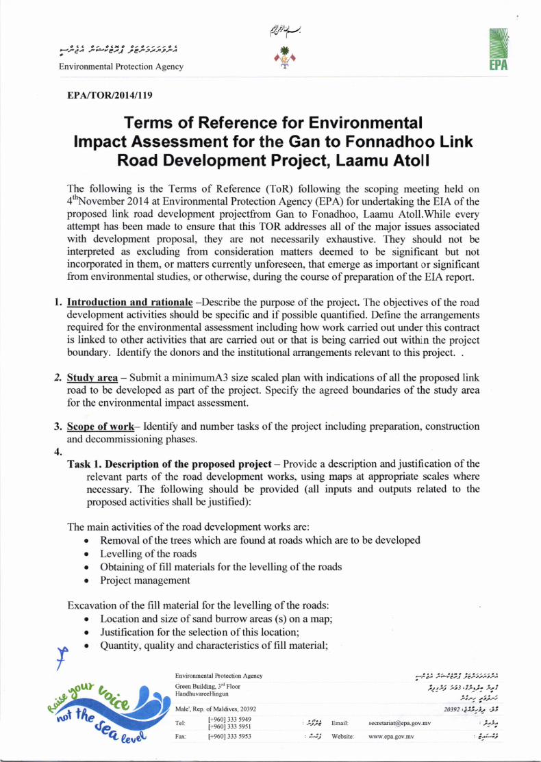


Laamu Link Road Development Project EIA
Ministry of Housing and Infrastructure 2014 54
16 Appendix B: Project Schedule


Laamu Link Road Development Project EIA
Ministry of Housing and Infrastructure 2014 56
17 Appendix C: Proposed Roads for Link Road Development at Laamu Atoll

73°30'0"E
73°30'0"E
2°0'0"
N
2°0'0"
N
73°33'20"E
73°33'20"E
73°30'40"E
73°30'40"E1°5
4'40"N
1°54'4
0"N
1°52'0
"N
1°52'0
"N
1°49'2
0"N
1°49'2
0"N
335645
3356
45
340645
3406
45
206116 206116
211116 211116
Scale:
Client:
Contractor:Water Solutions Pvt Ltd
Geodetic ParametersCoordinate Systems :Universal Transverse Mercator (UTM)Projection :Transverse Mercator (TM)Longitude of Origin :0.000000000Central Meridian:75 W
Semi-Major Axis (a) (Meters) :6378137.000Semi-Minor Axis (b) (Meters): 6356752.3142451793
Scale Factor :0.999600000000000040
False Northing :0.00000000False Easting :500000.000
Datum : WGS 1984
Ma.Shah, Dhihdhee Goalhi, Male', MaldivesTel: +(960)3341643, Fax: +(960)331643www.water-solutions.biz
µ
Project
Zone: 43 North
0 375 750 1,125 1,500187.5Meters
Laamu Link Road
MHI
L e g e n dL e g e n dRoadAll_IslandsAll_Reefs
74°0'0"E
74°0'0"E
72°0'0"E
72°0'0"E
6°0'0"
N
6°0'0"
N
3°0'0"
N
3°0'0"
N
L a a m u L i n k R o a dL a a m u L i n k R o a d
Laamu Link Road Development Project EIA
Ministry of Housing and Infrastructure 2014 58
18 Appendix D: Photographic Summary of the Existing Environment

Laamu Link Road Development Project EIA
Ministry of Housing and Infrastructure 2014 59
Figure 15: coconut palms on either of the road at Gan that would be removed
Figure 16: coconut palms on either of the road at Maamendhoo that would be removed

Laamu Link Road Development Project EIA
Ministry of Housing and Infrastructure 2014 60
Figure 17: Fonadhoo harbour area
Figure 18: Maamendhoo and Kadhdhoo

Laamu Link Road Development Project EIA
Ministry of Housing and Infrastructure 2014 63
20 Appendix G: Land Use Plans of Gan, Fonnadhoo, Kadhdhoo and Maandhoo

Allocated
Plots
Currently O
ccupied Plots
CU
RR
EN
T STA
TUS
OF N
EW
LY ALLO
CA
TED
PLO
TS N
EA
R TH
UN
'DI A
VA
H (4000sq.ft)
Primary 1 R
oad- 17m
Secondary R
oad- 12mAccess Road 1- 9m
Access Road 2- 6m
15- PRIMARY S
CHO
OL
16- SEC
ON
DARY S
CHO
OL
17.1- 17.3 PRE-SCH
OO
L18- H
IGH
ER EDU
CATIO
NAL IN
STITUTE
19- VO
CATIO
NAL TR
AININ
G CEN
TRE19.1 D
HAAN
AL20- C
OM
MU
NITY C
ENTRE
21- "ISLA
ND
AD
MIN
ISTR
ATIVE CO
MPLEX"
- ISLAND
OFFICE
- POLICE
- DIS
ASTER M
AN
AG
EMEN
T OFFICE
- BAN
K22- C
OM
MU
NITY G
UEST H
OU
SE23.1-23.2 G
RAN
D FRID
AY M
OSQ
UE
24.1 - NEIG
HBO
URH
OO
D M
OSQ
UE
26- NSS
/FIRE
INDUSTRIAL ZONE42- LIGHT INDUSTRIAL
40- STORAGE & WARE HOUSING
INSTITUTIONAL & COMMUNITY FACILITIES
PEDESTRIAN ROUTE
RESERVED FOR FUTURE USE
HARBOUR BASIN
COMMERCIAL ACTIVITIES
27- CO
MM
ERCIA
L ZON
E28- N
EIGH
BOU
RH
OO
D SH
OPS/
CAFES
29- FISH
MARKET
30- LOCAL M
ARKET
PARK / RECREATIONAL AREA
EPZ
PROPOSED:
ENVIRONMENTALPROTECTIONZONE (EPZ)
QUAY WALL
SEA WALL
GREEN AREA / BUFFER ZONE
EXISTING:
LEGEND:
RESIDENTIAL AREAB1-B27 : To be constructed by French Red Cross
INSTITUTIONAL & COMMUNITYFACILITIES 1.1 M
ATH
IMAR
ADH
OO
OFFICE
1.2 THU
ND
I AVA
H O
FFICE 1.3 SIN
AAI S
ARAH
ADH
U O
FFICE 2.1 - 2.4 M
OSQ
UES
3.1 - 3.4 SCH
OO
LS 3.2 A SC
HO
OL EXTEN
SION
LAND
4 REGIO
NAL H
OSPITAL
4 A H
OSPITA
L EXTENSIO
N 5 SO
CIAL CEN
TRE 6.1 - 6.2 CO
MM
UN
ITY CENTRE
7.1 - 7.4 GO
VERNM
ENT U
SE (NO
T SPECIFIED)
RESIDENTIAL A TH
UN
DI AV
AH B M
ATHIM
ARA
DH
OO
AVAH
C SIN
AAI SA
RAH
AD
HU
D M
UKU
RIM
AGU
AVAH
UTILITY AND MUNICIPAL
SERVICES 11- CEM
ETARY 12.1 - 12.4 - PO
WER H
OU
SE 13.1 - 13.2 D
ESALIN
ATIO
N PLAN
T 14- TELECO
MM
UN
ICATIO
NS
COMMERCIAL ZONE
10.1 - 10.2 SHOPS / CAFES'
UTILITY AND MUNICIPAL SERVICES
31- CEMETARY
32- WATER U
TILITIES 33- W
ASTE W
ATER PLAN
T 34- W
ASTE M
AN
AG
EMEN
T CEN
TRE 35- PO
WER
HO
USE
36- FUEL S
TORAG
E
SPORTS AND RECREATIONAL AREAS8.1 - 8.2
FOO
TBALL G
RO
UN
DS
9- VOLLEYBA
LL COU
RT
Primary 2 R
oad- 13m
TOURISM RELATED ACTIVITIES
46- RESERVED FOR FUTURE TOURISM DEVELOPEMENT
HARBOUR AREA ACTIVITIES37- BOA
T REPAIR
38 - LOADING UNLOADING39 - ICE PLANT
AGRICULTURAL AREAS
CONSERVATION ZONE43.1 - CEMETERY (HISTORICAL SITE)
44 - WATER BODY W
ITH MATURED TREES
45 - WATER C
ATC
HM
ENT AREA
INDUSTRIAL(Factories-Not used)
MIX
ED U
SE
Plots to b
e relocated
Relocated
Plots
A1- AREA 33 HAA2- AREA 32 HAA3- AREA 22 HAA4 - AREA 20 HAA5 - AREA 13 HA
T1-T30 Plots Allocated for Thundi Avah (325 plots)
43.1 - HISTORICAL SITEM
1-M22 Plots Allocated for M
athimaradhoo (214 plots)
MK1-M
K10 Plots Allocated for Mukurim
agu (97 plots)
47- FUTURE TOURISM USE48- HOTEL / RESORT RELEASED W
ITH TRAINING FACILITY49- TOURISM
RELATED TRAINING FACILITY
REPLA
CEMEN
T PLOTS
DR
AW
N B
Y: YR/NAA
CH
ECKED
BY: ZS
DR
AW
ING
NO
:
SC
ALE:
DATE: 04 A
UG
US
T 2014L.G
AN
LAN
D U
SE PLAN

KADDHDHOO

APRON
2 ROOMS BLOCKS
HRABOUR
& JETTIES
NDB
TRANSIT HOTEL
MNDF AREA
Clearing required due toproposed Runway Extension 7.91 ha
87
.5
m
15
0 m
TERMINAL
CAUSEWAY TO MANDHOO
CAUSEWAY TO FONADHOO
11
1
KADHDHOO AIRPORT
EXISTING PLAN
234
5
6
7
8
9
10
11 12
13
14
15
1617
18
19
20
21
41
23
24
25
27
26
28
29
30
31
32
33
34
35 36
37
38
40
22
AREAAIRPORT AREA = 80.50 haLAGOON AREA = 254 haMNDF AREA = 23.50 ha
PERIMETER OF LAGOON 8087mRERIMETER OF ISLAND 5225m
A
B
C
D
A = 1 51' 17" N 73 30' 36" EB = 1 50' 42" N 73 31' 9" EC = 1 52' 24" N 73 31' 15" ED = 1 51' 51" N 73 31' 53" E
o
o
o
o
o
o
o
o
AREA = 4.13 ha
281m
17
0m
1365m
9
9
m
629m
224m
4
m
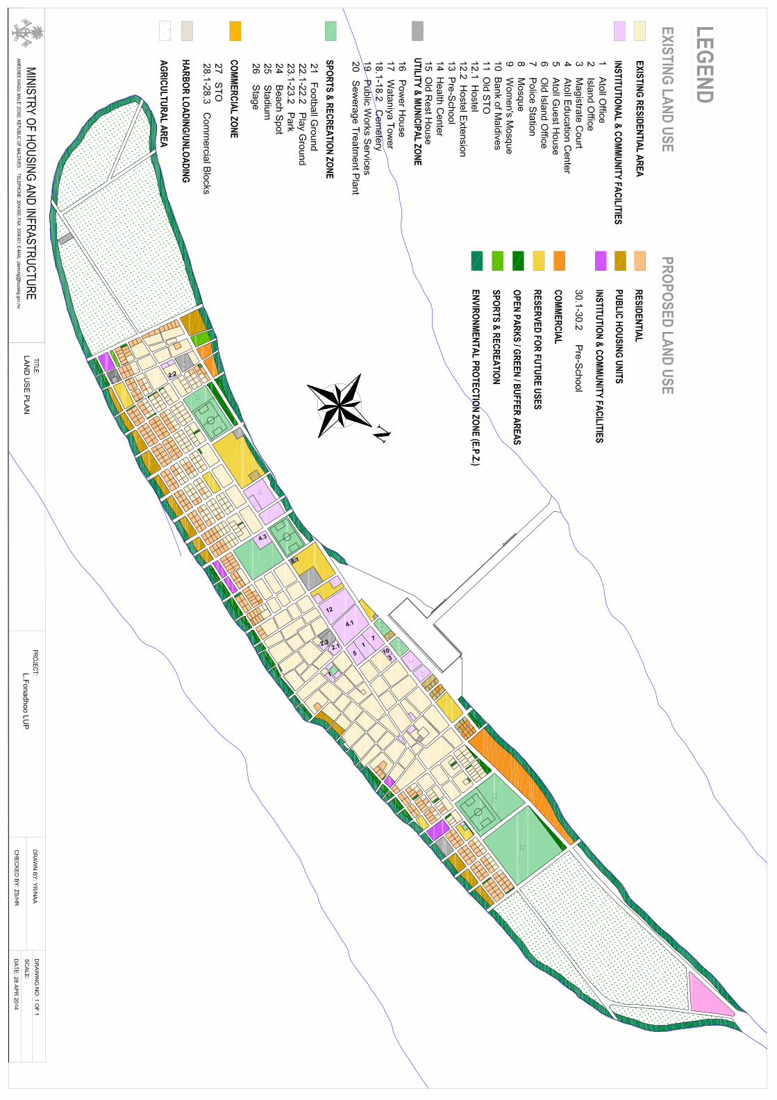

Laamu Link Road Development Project EIA
Ministry of Housing and Infrastructure 2014 65
21 Appendix H: CV of other consultants

Laamu Link Road Development Project EIA
Ministry of Housing and Infrastructure 2014 66
NAME :Abdul Aleem (Amu)
NATIONALITY : MaldivianEDUCATION : Master of Public Health (MPH) - 2003 to 2004
University of Auckland, Auckland, New Zealand.
Bachelor of Environmental Health - Feb 1999 to Nov 1999University of Western Sydney, Hawkesbury, AustraliaDiploma in Environmental Health - Feb 1996 - Nov 1998Fiji School of Medicine, Suva, Fiji
OTHER TRAINING : PADI Certified DiverEMPLOYMENT RECORDFROM: June 2005EMPLOYERPOSITION HELD AND
:
TO: Present
Water Solutions Pvt. Ltd.
DirectorPROFESSIONAL EXPERIENCEProject Name: Environmental Impact Assessment for the Proposed Resort Development at Villingili by Shangrilla
MaldivesYear: May 2006Duration: 3 monthsPosition Held: EIA CONSULTANTTasks: Coordinate the work of the technical team and provide the technical inputs to the project in the area of
water and waste management.Project Name: Environmental Impact Assessment for the Proposed Boduhithi Resort Redevelopment, MaldivesYear: September 2005Duration: 1 monthsPosition Held: EIA CONSULTANTTasks: Overall coordinated the technical work of the EIA and provided the technical input to the assessment in
the area of water, wastewater and wastemanagement.Project Name : Workshop on Water Quality Monitoring and Surveillance, (Khulhudhufushi, HaaDhaal atoll)Client MEEW, Maldives Financing:Period : April - May 2007 Time Spent: 2 MonthsPosition Held : EIA CONSULTANTDuties : Managing and leading the workshop. Presentation on water quality monitoring and surveillance,
including ground water and rainwater. Teaching community members on how to assess water qualityand undertake surveys and do monitoring work.
Project Name : EIA for the establishment of a resort in Vagaru island, Shaviyani Atoll, MaldivesClient : EON ResortsPeriod : Aug 2006Position Held : EIA CONSULTANTDuties : Baseline data collection, assessment and reporting of the groundwater and terrestrial aspects of the
EIA. Mapping the island and setting up baseline GIS maps for monitoring purposes. Broadbathymetric survey of the island’s lagoon.
Project Name : EIA for the establishment of a resort in SeenuVillingilli, MaldivesClient : Alysen ServicesPeriod : March 2006Position Held : EIA CONSULTANTDuties : Baseline data collection, assessment and reporting of the groundwater and terrestrial aspects of the
EIA. Mapping the island and setting up baseline GIS maps for monitoring purposes.
Project Name : Erosion study for Royal Island Resort and Spa, MaldivesClient : Royal Island ResortPeriod : February 2006Position Held : ConsultantDuties : Baseline data collection and assessment of the coastal aspects of the study. Mapping the islands shoreline and setting up baseline GIS maps for monitoring erosion.
Project Name : EIA of Boduhithi Resort redevelopmentClient :Boduhithi ResortPeriod : 2005Position Held : ConsultantDuties : Surveying, assessment and reporting of the terrestrial aspects, including groundwater, flora and

Laamu Link Road Development Project EIA
Ministry of Housing and Infrastructure 2014 67
fauna.
Project Name : EIA of Kudahithi Resort redevelopmentClient :Kudahithi ResortPeriod : 2005Position Held : ConsultantDuties : Surveying, assessment and reporting of the terrestrial aspects, including groundwater, flora and fauna.
Project Name : EIA of Alidhoo Resort DevelopmentClient : John KeelsPeriod : 2005Position Held : ConsultantDuties : Surveying, assessment and reporting of the terrestrial aspects, including groundwater, flora and
fauna.

Laamu Link Road Development Project EIA
Ministry of Housing and Infrastructure 2014 68
1 NAME Hassan Shah2 DATE OF BIRTH 18th September 19723 PLACE OF BIRTH Maldives4 NATIONALITY Maldivian,5 MARITAL STATUS Married6 POSTAL ADDRESS G. Niusha, Male’, Maldives7 PERMANENT
ADDRESSBageechaage. S.Maradhoofeydhoo, Maldives.Tel: (960) 689 1050Fax: (960) 689 1049
8 CONTACTS Cell Phone: (960) 777 8941Email: (personal) [email protected]
9 EDUCATION June 2002 to May 2005, B.Sc in Environmental Science,Yuvaraja’s college, University of Mysore, India
Jan 1998 to May 1999, second year in Civil and Environmental Engineering, A twiningprogramme of the University of Adelaide at Sepang Institute of Technology(SIT),Klang, Malaysia
May 14, 1998 IELTS, Kuala Lampur, Malaysia.Jan 1997 to Nov 1997, Degree Foundation studies in Science and Engineering, A
twining programme of University of Adelaide and Sepang Institute of Technology(SIT), Klang, Malaysia
June 1994, London GCE A’L, Chemistry and Physics. 1992 to 1994, Science EducationCenter, Male’, Maldives
Jan 1992, London GCE O’L, Biology, Chemistry, Economics, English, IntegratedScience, Human Biology, Mathematics, Physics.
1985 to 1992, Male’ English School, Male’, Maldives
10 OTHER TRAINING Feb 24th to Feb 28th 2008, PIANC-COPEDEC VII, 7th International Conference onCoastal and Port engineering in developing countries, Dubai
July 22, 1996 – August 3 1996, Environmental Health, Ngee Ann Polytechnic,Singapore
Feb 24th to Feb 28th 2008, PIANC-COPEDEC VII, 7th International Conference onCoastal and Port engineering in developing countries, Dubai
11 LANGUAGES Reading Writing SpeakingEnglish Fluent Fluent FluentDhivehi Fluent Fluent Fluent
12 PROFESSIONALSOCIETIES
Registered Environmental Consultant at Environmental Research Center/Ministry ofHousing, Transport and Environment.
13 COUNTRIES OFWORK EXPERIENCE
Maldives, New Zealand
14 EMPLOYMENTRECORD
May 2005 to date, Director Water solutions Pvt. Ltd. Male’, Maldives. (A privatecompany formed to provide consultancies for water, waste water, Environmentalmatters and project management.
April 2006 to May 2007, Technician, Waikato Bonding services, Hamilton, NewZealand (A private company specialized in bonding for all the friction materials)
14 June 1999 21st Dec 2005: Director, F & C Private Limited, Male’, Maldives. (APrivate company carrying out general trade, importing, PSA for Airlines andcourier services and others)
1998 to 2002, Director, Innovative Design and Engineering Private Limited. (Acompany formed by a group of friends from science and engineering backgroundto carry out EIA’s, Environmental Auditing and Monitoring for various projectsand resorts in Maldives)
** November 1995 to January 1997: Assistant Project Officer, Maldives Water andSanitation Authority, Ministry of Health, Male’, Maldives
** July 1995 to November 1995 Project Officer Trainee, Maldives Water andSanitation Authority, Ministry of Health, Male’

Laamu Link Road Development Project EIA
Ministry of Housing and Infrastructure 2014 69
** November 1994 to June 1995, Project Officer Trainee, Maldives Water andSanitation Authority, Male, Maldives
15 WORK EXPERIENCE May 2005 to date, Director at Water solutions Pvt. Ltd. Duties involved were obtainprojects for the company, attend field visits, conduct public consultation, collectsurvey field data’s, process them and write reports. Participate in the IEE’s and EIA’Sat professional levels.
- Project management for different projects of the company.- Manage the day to day activities to run the company
April 2006 to May 2007, Technician at Waikato Bonding Services. Duties Involve,customer relations, Workshop management, bonding work and delivery of products.
14 June 1999 to 14 June 2002, Director at F & C Pvt. Ltd. Duties involved in importinggarments, gifts, toys and other items from various countries and selling them in thecompetitive Market of Male, Maldives.
-1998 to 2002, Director, Innovative Design and Engineering Private Limited. Arrangeand participate in carrying out land profile surveys, EIA’s, and resort’senvironmental monitoring in Maldives.
November 1995 to 6 January 1997: Assistant Project Officer, Maldives Water andSanitation Authority, Ministry of Health, Male’ Maldives- Responsibilities were to arrange and attending meetings with relevant
government bodies concerning water supply and sanitation.- Acting as a counterpart to the Sort Term Consultants (STC), working with other
consultants and STCs to set standards and regulations concerning water supplyand sanitation both in the urban and rural areas of Maldives.
July 1995 to November 1995, Project Officer Trainee Maldives Water andSanitation Authority, Ministry of Health, Male’- Duties include working with consultants to set standards and regulations concerning
water supply, sewage collection, disposal and sanitation.
November 1994 to June 1995, Project Officer Trainee, Maldives Water and SanitationAuthority, Male, Maldives
- Assisting Section Head in arranging training on the islands for the constructionof rainwater tanks.
- Listing and purchasing the necessary items for construction of rainwater tanks.- Preparing progress reports for the section head.- Collecting the data with regard to water quality on the islands.- Acting as a counterpart with the civil engineer and visiting islands to carry our
land profile surveys and designing small bore sewerage systems
16 OTHER EXPERIENCE/ RESPONSIBILITIES
17 SIGNIFICANTRESEARCH PAPERS
-
18 ACADAMICREFEREES
Dr. S.Suresh,Msc,Ph.DLecturer, Department of Environmental ScienceYuvaraja’s College, University of Mysore,Mysore 570005Karnataka India.Mobil: (+91) 9448755001Email: [email protected]

Laamu Link Road Development Project EIA
Ministry of Housing and Infrastructure 2014 70
22 Appendix I: List of Stakeholders Consulted
Person Title Organisation
Aishtah Bariya Engineer Ministry of Housing andInfrastructure
Shaana Project Coordinator Ministry of Housing andInfrastructure
Mohamed Jinana Assistant Engineer Ministry of Housing andInfrastructure
Ahmed Anawar Environment Analyst Ministry of Environment andEnergy
Mohamed Jaleel Council Member Laamu Atoll Council
Ibrahim Naeem Director General Environmental Protection Agency
Mohamed Mustafa Director EPA
FidhaadhJaleel EPA
RifathNaeem Senior Environment Analyst EPA
Residents of Fonnadhoo – List Attached
Residents of Gan – list attached.

Laamu Link Road Development Project EIA
Ministry of Housing and Infrastructure 2014 71
23 Appendix J: Bathymetry Charts


73°30'0"E
73°30'0"E
2°0'0"
N
2°0'0"
N
c
c
cLocation 3
Location 2
Location 1
73°33'20"E
73°33'20"E
73°30'40"E
73°30'40"E
73°28'0"E
73°28'0"E1°5
7'20"N
1°57'2
0"N
1°54'4
0"N
1°54'4
0"N
1°52'0
"N
1°52'0
"N
1°49'2
0"N
1°49'2
0"N
333179
3331
79
338179
3381
79
206070 206070
211070 211070
216070 216070
Scale:
Client:
Contractor:Water Solutions Pvt Ltd
Geodetic ParametersCoordinate Systems :Universal Transverse Mercator (UTM)Projection :Transverse Mercator (TM)Longitude of Origin :0.000000000Central Meridian:75 W
Semi-Major Axis (a) (Meters) :6378137.000Semi-Minor Axis (b) (Meters): 6356752.3142451793
Scale Factor :0.999600000000000040
False Northing :0.00000000False Easting :500000.000
Datum : WGS 1984
Ma.Shah, Dhihdhee Goalhi, Male', MaldivesTel: +(960)3341643, Fax: +(960)331643www.water-solutions.biz
µ
Project
Zone: 43 North0 475 950 1,425 1,900237.5
Meters
Laamu Link Road
MHI
L e g e n dL e g e n dc Borrow_Area_location
All_IslandsAll_Reefs
74°0'0"E
74°0'0"E
72°0'0"E
72°0'0"E
6°0'0"
N
6°0'0"
N
3°0'0"
N
3°0'0"
N
L a a m u L i n k R o a dL a a m u L i n k R o a d

Laamu Link Road Development Project EIA
Ministry of Housing and Infrastructure 2014 73
24 Appendix K: Letter from the Atoll Council


a o a2-tu
a , . c t ,ttsJ-F ,/ Jrts2
,r1 c o o 1 2 t * 1 , t a 2 0 tS|HfJrY ttPrr to?rtt.tl- - A
D t t
l2t ',
a o , 3C4"/r€
4 n a . 9 a u o a2 ,t.Y 2:l
'tt
357 D C a
ta,o 4
eJ. $x. .f'e t , C a ?I t o
97,200.00 300.00 J: It z z t Q c >
i2 r,/r, et 1
300.00 300.00 -'stJtt 2
15,000,00 500.00 3, - , r e c t
tt PJrt ar. 3
200.00 200.00. 3 , r A o ttJ ryJ .Lrl 4
s0.00 s0.00t t e ? s . ,ao ,t, .tJ. 5
112,750.00o : a c t o a a e . a t a a a , a a a c a
t1J. #rJ YOHQ. Ptr. t-Jr.r.,t c ,,te
M3 .vtt,tt
o4eJ. cm iz ,
f-o / C
f tc ,.2?
300,00 300.00 I
600.00 300.00 2
54,000.00 500.00 I I, x t t A a , c
t2 ,rtJ .trtl 3
55,400.00 200.00 3 2 a c t e Q c t ar.t -lJ Jrrt:td 4
121,300.00a t . e . c c a c o a . a . a e
,4, P?F'F, -'tFtYa Jlr--1 a t
,2d
1282 ita4e, grn .3.2 ,
/.0 2 e
,fto
60,800.00 200.00 3 t4? 3 & A C ,
,U JF ar. 1
320.00 40.00 t t e A , o ,av tt.r att 2
5,100.00 100.00 I, x B A , c ,eo Jtl, .rJt 3
1J20.00 60.00 z t e a ? t a ,12 rrJ, a, 4
171,000.00 300.00 5 '0 , 3 " d
C ,12 .rJrJ .rt 5
88,000.00 s00.00 I ,6 / t * \ I l Q c t\ t2 ) zJrJ ar. 6
1,142.25 , /J 7
22,t69,32 7, , c .
Jrrrtt H3 8
4,197.00 t o a tsrrl 7,3 9
, o c r t o , D l tF t J? tar . t J
-

,SJ'o4
eJt"m
3a #4o . t
t to
50,089.32 ?8 ,1 -t l0
2,729.25 2 t 1
15,822.47 2(- G z a O a
Jrva- et 12
566.63 I r3
423,256.24t a
,t *) t 2 + l,- 11,
, . c t c . . a . , o r . - t a l a a , - < .i2 +.rt U.Ftl -te'jF Y-rrt|t
a o ,ure
454 irjo4et f l l . . 3 2 .tt a fto
30,600.00 300.00 t0> e t s O o t
Jr2 FjtJ -rr' I
75$00.00 500.00 lsp t x > t O o >te FJrt a, 2
2,800.00 100.00 2tt * a r? , o , 3
27,000.00 200.00 13. a , , C , o ,
J'J ,rpt ,J' 4
600.00 40.00 l$t z z t ? c eLP JalJ t J. 5
360.00 60.00 6t < a O > o ,
tr, /FJ? rU 6
2,2M.35 ( o . t ? ,F tfJ.?1. 7
l,lu.24 a 8
4,495.74 I
340.37 ,-tJrJ./ 10
14d.,544.70 ft.lrrt n,lt .r.
L . c r . . 4 . . . o ) r . . a - - O - a ? a ? 1
f, -ti- vJ.*! F't JFJlJr>r Yt .t.a ,tc
801,850.94
fii
ti r .
A>
t!.t t t
, o C o . a z t c - a t c a a a a c a, F4-ry UPH?4I F'Ja.r 2..rIA
, a c ,'.trc
t a a r r o , D a x.-a t-t4J. ,rJ
-
;\
*t+'U