IRALE News 9 • February 2022 - International Association of ...
11
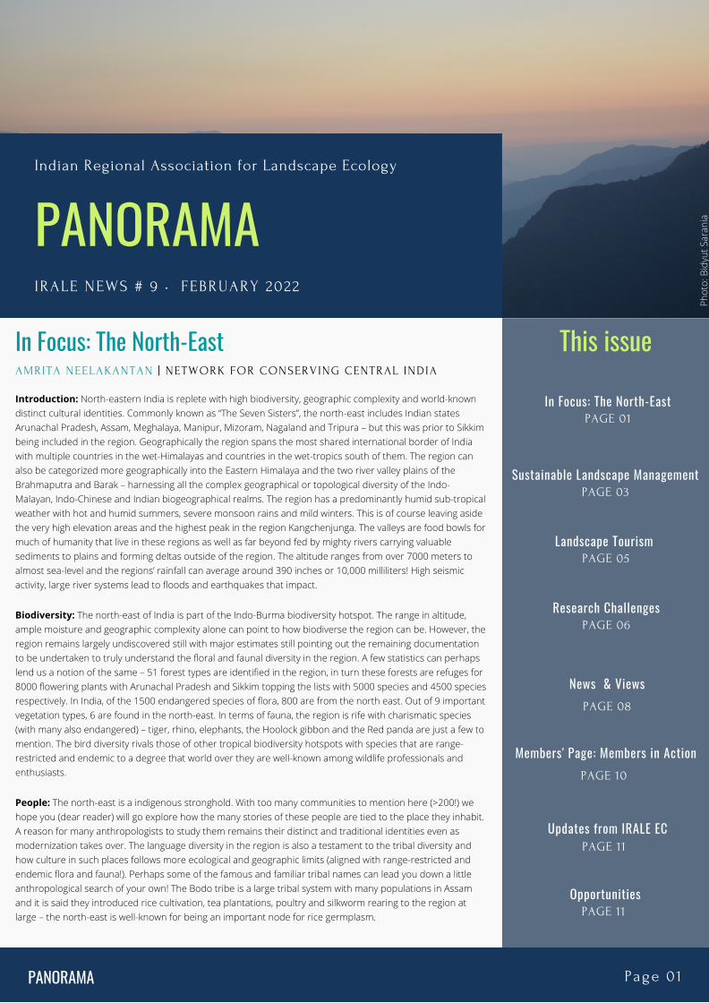
PANORAMA IRALE NEWS # 9 • FEBRUARY 2022 Indian Regional Association for Landscape Ecology This issue In Focus: The North-East PAGE 01 PANORAMA Page 01 Landscape Tourism PAGE 05 Sustainable Landscape Management PAGE 03 Updates from IRALE EC PAGE 11 Members' Page: Members in Action PAGE 10 News & Views PAGE 08 In Focus: The North-East AMRITA NEELAKANTAN | NETWORK FOR CONSERVING CENTRAL INDIA Introduction: North-eastern India is replete with high biodiversity, geographic complexity and world-known distinct cultural identities. Commonly known as “The Seven Sisters”, the north-east includes Indian states Arunachal Pradesh, Assam, Meghalaya, Manipur, Mizoram, Nagaland and Tripura – but this was prior to Sikkim being included in the region. Geographically the region spans the most shared international border of India with multiple countries in the wet-Himalayas and countries in the wet-tropics south of them. The region can also be categorized more geographically into the Eastern Himalaya and the two river valley plains of the Brahmaputra and Barak – harnessing all the complex geographical or topological diversity of the Indo- Malayan, Indo-Chinese and Indian biogeographical realms. The region has a predominantly humid sub-tropical weather with hot and humid summers, severe monsoon rains and mild winters. This is of course leaving aside the very high elevation areas and the highest peak in the region Kangchenjunga. The valleys are food bowls for much of humanity that live in these regions as well as far beyond fed by mighty rivers carrying valuable sediments to plains and forming deltas outside of the region. The altitude ranges from over 7000 meters to almost sea-level and the regions’ rainfall can average around 390 inches or 10,000 milliliters! High seismic activity, large river systems lead to floods and earthquakes that impact. Biodiversity: The north-east of India is part of the Indo-Burma biodiversity hotspot. The range in altitude, ample moisture and geographic complexity alone can point to how biodiverse the region can be. However, the region remains largely undiscovered still with major estimates still pointing out the remaining documentation to be undertaken to truly understand the floral and faunal diversity in the region. A few statistics can perhaps lend us a notion of the same – 51 forest types are identified in the region, in turn these forests are refuges for 8000 flowering plants with Arunachal Pradesh and Sikkim topping the lists with 5000 species and 4500 species respectively. In India, of the 1500 endangered species of flora, 800 are from the north east. Out of 9 important vegetation types, 6 are found in the north-east. In terms of fauna, the region is rife with charismatic species (with many also endangered) – tiger, rhino, elephants, the Hoolock gibbon and the Red panda are just a few to mention. The bird diversity rivals those of other tropical biodiversity hotspots with species that are range- restricted and endemic to a degree that world over they are well-known among wildlife professionals and enthusiasts. People: The north-east is a indigenous stronghold. With too many communities to mention here (>200!) we hope you (dear reader) will go explore how the many stories of these people are tied to the place they inhabit. A reason for many anthropologists to study them remains their distinct and traditional identities even as modernization takes over. The language diversity in the region is also a testament to the tribal diversity and how culture in such places follows more ecological and geographic limits (aligned with range-restricted and endemic flora and fauna!). Perhaps some of the famous and familiar tribal names can lead you down a little anthropological search of your own! The Bodo tribe is a large tribal system with many populations in Assam and it is said they introduced rice cultivation, tea plantations, poultry and silkworm rearing to the region at large – the north-east is well-known for being an important node for rice germplasm. Photo: Bidyut Sarania Research Challenges PAGE 06 Opportunities PAGE 11
-
Upload
khangminh22 -
Category
Documents
-
view
5 -
download
0
Transcript of IRALE News 9 • February 2022 - International Association of ...
PANORAMA IRALE NEWS # 9 • FEBRUARY 2022
Indian Regional Association for Landscape Ecology
This issue
In Focus: The North-EastPAGE 01
PANORAMA Page 01
Landscape Tourism PAGE 05
Sustainable Landscape ManagementPAGE 03
Updates from IRALE ECPAGE 11
Members' Page: Members in ActionPAGE 10
News & ViewsPAGE 08
In Focus: The North-EastAMRITA NEELAKANTAN | NETWORK FOR CONSERVING CENTRAL INDIA
Introduction: North-eastern India is replete with high biodiversity, geographic complexity and world-knowndistinct cultural identities. Commonly known as “The Seven Sisters”, the north-east includes Indian statesArunachal Pradesh, Assam, Meghalaya, Manipur, Mizoram, Nagaland and Tripura – but this was prior to Sikkimbeing included in the region. Geographically the region spans the most shared international border of Indiawith multiple countries in the wet-Himalayas and countries in the wet-tropics south of them. The region canalso be categorized more geographically into the Eastern Himalaya and the two river valley plains of theBrahmaputra and Barak – harnessing all the complex geographical or topological diversity of the Indo-Malayan, Indo-Chinese and Indian biogeographical realms. The region has a predominantly humid sub-tropicalweather with hot and humid summers, severe monsoon rains and mild winters. This is of course leaving asidethe very high elevation areas and the highest peak in the region Kangchenjunga. The valleys are food bowls formuch of humanity that live in these regions as well as far beyond fed by mighty rivers carrying valuablesediments to plains and forming deltas outside of the region. The altitude ranges from over 7000 meters toalmost sea-level and the regions’ rainfall can average around 390 inches or 10,000 milliliters! High seismicactivity, large river systems lead to floods and earthquakes that impact.
Biodiversity: The north-east of India is part of the Indo-Burma biodiversity hotspot. The range in altitude,ample moisture and geographic complexity alone can point to how biodiverse the region can be. However, theregion remains largely undiscovered still with major estimates still pointing out the remaining documentationto be undertaken to truly understand the floral and faunal diversity in the region. A few statistics can perhapslend us a notion of the same – 51 forest types are identified in the region, in turn these forests are refuges for8000 flowering plants with Arunachal Pradesh and Sikkim topping the lists with 5000 species and 4500 speciesrespectively. In India, of the 1500 endangered species of flora, 800 are from the north east. Out of 9 importantvegetation types, 6 are found in the north-east. In terms of fauna, the region is rife with charismatic species(with many also endangered) – tiger, rhino, elephants, the Hoolock gibbon and the Red panda are just a few tomention. The bird diversity rivals those of other tropical biodiversity hotspots with species that are range-restricted and endemic to a degree that world over they are well-known among wildlife professionals andenthusiasts.
People: The north-east is a indigenous stronghold. With too many communities to mention here (>200!) wehope you (dear reader) will go explore how the many stories of these people are tied to the place they inhabit.A reason for many anthropologists to study them remains their distinct and traditional identities even asmodernization takes over. The language diversity in the region is also a testament to the tribal diversity andhow culture in such places follows more ecological and geographic limits (aligned with range-restricted andendemic flora and fauna!). Perhaps some of the famous and familiar tribal names can lead you down a littleanthropological search of your own! The Bodo tribe is a large tribal system with many populations in Assamand it is said they introduced rice cultivation, tea plantations, poultry and silkworm rearing to the region atlarge – the north-east is well-known for being an important node for rice germplasm.
Phot
o: B
idyu
t Sar
ania
Research ChallengesPAGE 06
OpportunitiesPAGE 11
The Kuki tribe is more of a migrant tribe and is largely grouped by those people speaking the Kuki language.They are well known for handicrafts of yarns and costumes. The Adi tribe are from Arunachal and have theirown sub-divisions are the previous two tribes mentioned. The Atapani are well-known for their traditionaltattoos and jewellery. Among notable tribes we cannot omit mentioning – the Nyishi, the Angami, the Sumi,the Bhutia, the Garo and the Khasi tribes. Check each of them out and explore more – the human diversity inthe north-east rivals the biodiversity.
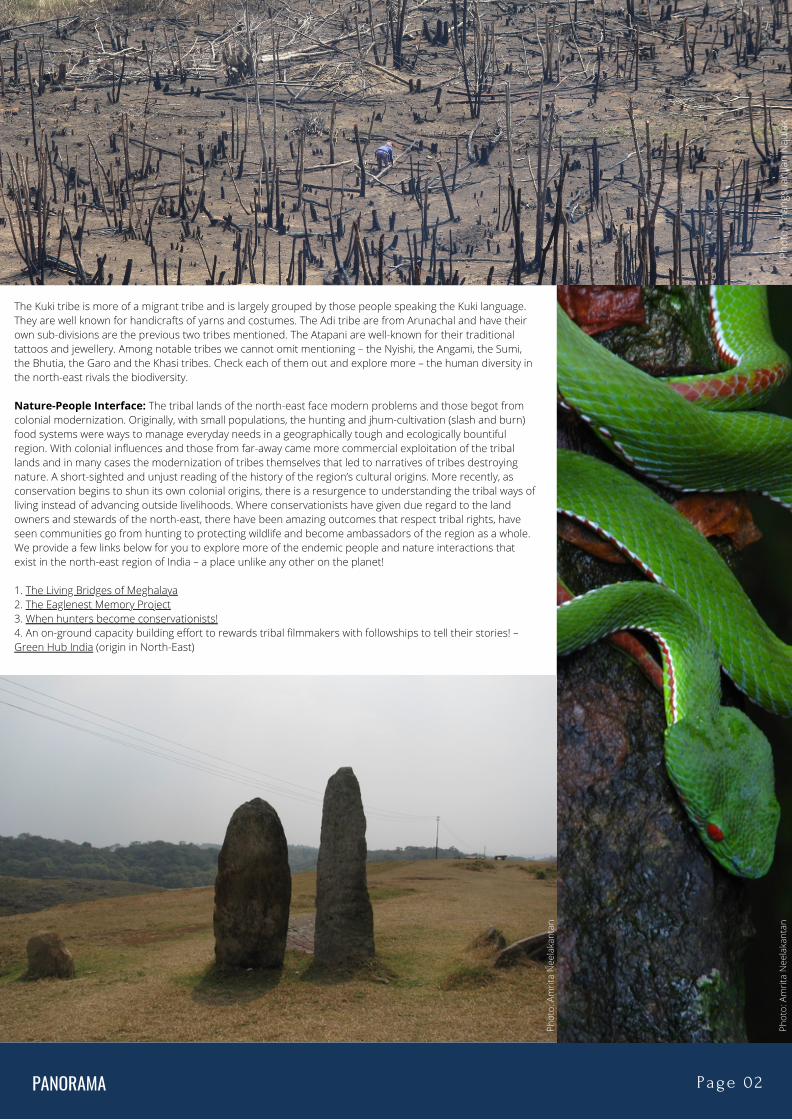
Nature-People Interface: The tribal lands of the north-east face modern problems and those begot fromcolonial modernization. Originally, with small populations, the hunting and jhum-cultivation (slash and burn)food systems were ways to manage everyday needs in a geographically tough and ecologically bountifulregion. With colonial influences and those from far-away came more commercial exploitation of the triballands and in many cases the modernization of tribes themselves that led to narratives of tribes destroyingnature. A short-sighted and unjust reading of the history of the region’s cultural origins. More recently, asconservation begins to shun its own colonial origins, there is a resurgence to understanding the tribal ways ofliving instead of advancing outside livelihoods. Where conservationists have given due regard to the landowners and stewards of the north-east, there have been amazing outcomes that respect tribal rights, haveseen communities go from hunting to protecting wildlife and become ambassadors of the region as a whole.We provide a few links below for you to explore more of the endemic people and nature interactions thatexist in the north-east region of India – a place unlike any other on the planet!
1. The Living Bridges of Meghalaya2. The Eaglenest Memory Project3. When hunters become conservationists!4. An on-ground capacity building effort to rewards tribal filmmakers with followships to tell their stories! –Green Hub India (origin in North-East)
PANORAMA Page 02
Phot
o: T
hang
suan
lian
Nau
lak
Phot
o: A
mrit
a N
eela
kant
an
Phot
o: A
mrit
a N
eela
kant
an
PANORAMA Page 03
Sustainable Landscape Management through TraditionalKnowledge in Ziro Valley of Arunachal PradeshBISHAL KUMAR MAJHI | MRIGANKA SHEKHAR SARKARNORTH EAST REGIONAL CENTREG.B . PANT 'NATIONAL INSTITUTE OF HIMALAYAN ENVIRONMENT' (NIHE)
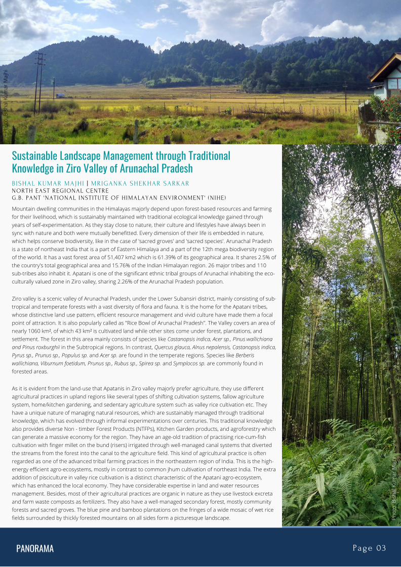
Mountain dwelling communities in the Himalayas majorly depend upon forest-based resources and farmingfor their livelihood, which is sustainably maintained with traditional ecological knowledge gained throughyears of self-experimentation. As they stay close to nature, their culture and lifestyles have always been insync with nature and both were mutually benefitted. Every dimension of their life is embedded in nature,which helps conserve biodiversity, like in the case of 'sacred groves' and 'sacred species'. Arunachal Pradeshis a state of northeast India that is a part of Eastern Himalaya and a part of the 12th mega biodiversity regionof the world. It has a vast forest area of 51,407 km2 which is 61.39% of its geographical area. It shares 2.5% ofthe country's total geographical area and 15.76% of the Indian Himalayan region. 26 major tribes and 110sub-tribes also inhabit it. Apatani is one of the significant ethnic tribal groups of Arunachal inhabiting the eco-culturally valued zone in Ziro valley, sharing 2.26% of the Arunachal Pradesh population.
Ziro valley is a scenic valley of Arunachal Pradesh, under the Lower Subansiri district, mainly consisting of sub-tropical and temperate forests with a vast diversity of flora and fauna. It is the home for the Apatani tribes,whose distinctive land use pattern, efficient resource management and vivid culture have made them a focalpoint of attraction. It is also popularly called as "Rice Bowl of Arunachal Pradesh". The Valley covers an area ofnearly 1060 km², of which 43 km² is cultivated land while other sites come under forest, plantations, andsettlement. The forest in this area mainly consists of species like Castanopsis indica, Acer sp., Pinus wallichianaand Pinus roxburghii in the Subtropical regions. In contrast, Quercus glauca, Alnus nepalensis, Castanopsis indica,Pyrus sp., Prunus sp., Populus sp. and Acer sp. are found in the temperate regions. Species like Berberiswallichiana, Viburnum foetidum, Prunus sp., Rubus sp., Spirea sp. and Symplocos sp. are commonly found inforested areas.
As it is evident from the land-use that Apatanis in Ziro valley majorly prefer agriculture, they use differentagricultural practices in upland regions like several types of shifting cultivation systems, fallow agriculturesystem, home/kitchen gardening, and sedentary agriculture system such as valley rice cultivation etc. Theyhave a unique nature of managing natural resources, which are sustainably managed through traditionalknowledge, which has evolved through informal experimentations over centuries. This traditional knowledgealso provides diverse Non - timber Forest Products (NTFPs), Kitchen Garden products, and agroforestry whichcan generate a massive economy for the region. They have an age-old tradition of practising rice-cum-fishcultivation with finger millet on the bund (risers) irrigated through well-managed canal systems that divertedthe streams from the forest into the canal to the agriculture field. This kind of agricultural practice is oftenregarded as one of the advanced tribal farming practices in the northeastern region of India. This is the high-energy efficient agro-ecosystems, mostly in contrast to common jhum cultivation of northeast India. The extraaddition of pisciculture in valley rice cultivation is a distinct characteristic of the Apatani agro-ecosystem,which has enhanced the local economy. They have considerable expertise in land and water resourcesmanagement. Besides, most of their agricultural practices are organic in nature as they use livestock excretaand farm waste composts as fertilizers. They also have a well-managed secondary forest, mostly communityforests and sacred groves. The blue pine and bamboo plantations on the fringes of a wide mosaic of wet ricefields surrounded by thickly forested mountains on all sides form a picturesque landscape.
Phot
o: B
isha
l Kum
ar M
ajhi
Phot
o: B
isha
l Kum
ar M
ajhi
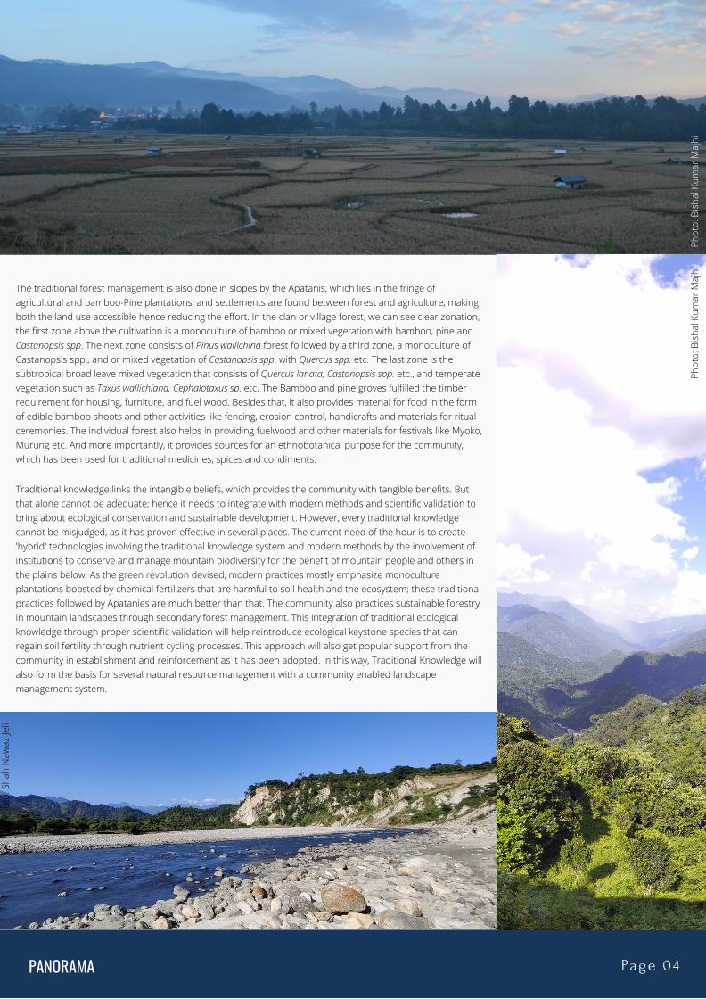
The traditional forest management is also done in slopes by the Apatanis, which lies in the fringe ofagricultural and bamboo-Pine plantations, and settlements are found between forest and agriculture, makingboth the land use accessible hence reducing the effort. In the clan or village forest, we can see clear zonation,the first zone above the cultivation is a monoculture of bamboo or mixed vegetation with bamboo, pine andCastanopsis spp. The next zone consists of Pinus wallichina forest followed by a third zone, a monoculture ofCastanopsis spp., and or mixed vegetation of Castanopsis spp. with Quercus spp. etc. The last zone is thesubtropical broad leave mixed vegetation that consists of Quercus lanata, Castanopsis spp. etc., and temperatevegetation such as Taxus wallichiana, Cephalotaxus sp. etc. The Bamboo and pine groves fulfilled the timberrequirement for housing, furniture, and fuel wood. Besides that, it also provides material for food in the formof edible bamboo shoots and other activities like fencing, erosion control, handicrafts and materials for ritualceremonies. The individual forest also helps in providing fuelwood and other materials for festivals like Myoko,Murung etc. And more importantly, it provides sources for an ethnobotanical purpose for the community,which has been used for traditional medicines, spices and condiments.
Traditional knowledge links the intangible beliefs, which provides the community with tangible benefits. Butthat alone cannot be adequate; hence it needs to integrate with modern methods and scientific validation tobring about ecological conservation and sustainable development. However, every traditional knowledgecannot be misjudged, as it has proven effective in several places. The current need of the hour is to create'hybrid' technologies involving the traditional knowledge system and modern methods by the involvement ofinstitutions to conserve and manage mountain biodiversity for the benefit of mountain people and others inthe plains below. As the green revolution devised, modern practices mostly emphasize monocultureplantations boosted by chemical fertilizers that are harmful to soil health and the ecosystem; these traditionalpractices followed by Apatanies are much better than that. The community also practices sustainable forestryin mountain landscapes through secondary forest management. This integration of traditional ecologicalknowledge through proper scientific validation will help reintroduce ecological keystone species that canregain soil fertility through nutrient cycling processes. This approach will also get popular support from thecommunity in establishment and reinforcement as it has been adopted. In this way, Traditional Knowledge willalso form the basis for several natural resource management with a community enabled landscapemanagement system.
PANORAMA Page 04
Phot
o: B
isha
l Kum
ar M
ajhi
Phot
o: B
isha
l Kum
ar M
ajhi
Phot
o: S
hah
Naw
az Je
lil
PANORAMA Page 05
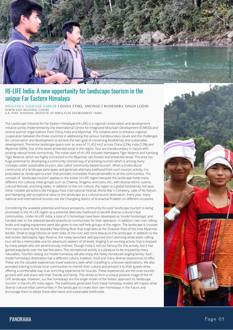
HI-LIFE India: A new opportunity for landscape tourism in theunique Far Eastern HimalayaMRIGANKA SHEKHAR SARKAR | DIANA ETHEL AMONGE | MAHENDRA SINGH LODHI NORTH EAST REGIONAL CENTREG.B . PANT 'NATIONAL INSTITUTE OF HIMALAYAN ENVIRONMENT' (NIHE)
The Landscape Initiative for Far Eastern Himalayas (HI-LIFE) is a regional conservation and developmentinitiative jointly implemented by the International Centre for Integrated Mountain Development (ICIMOD) andseveral partner organizations from China, India and Myanmar. The initiative aims to enhance regionalcooperation between the three countries in addressing the various transboundary issues and the challengesfor conservation and development to achieve the twin goal of conserving biodiversity and sustainabledevelopment. The entire landscape spans over an area of 71,452 km2 across China (22%), India (12%) andMyanmar (66%). Out of the seven protected areas in the region, four are transboundary in nature withexisting natural forest connectivity. The Indian part of HI-LIFE includes Namdapha Tiger Reserve and KamlangTiger Reserve, which are highly connected to the Myanmar rain forests and protected areas. The area hashuge potential for developing a community-centred way of practising tourism which is among manyconcepts under sustainable tourism, also called 'community-based tourism'. When a multiculturalcommunity of a landscape participate and generate alternate livelihood from such tourism activity, it ispostulated as 'landscape tourism' that provides immediate financial benefits to all the communities. Theconcept of 'landscape tourism' applies to the Indian HI-LIFE region because the landscape holds manydifferent rich cultural, tribal groups such as Chakma, Singpho, and Lishu, etc., with diverse ethnic cuisine,cultural festivals, and living styles. In addition to the rich culture, the region is a global biodiversity hot-spot.Other notable attractions like Pangsau Pass International Festival, World War II Cemetery, Lake of No Return,and Nampong add exceptional value to the landscape as a cultural tourist destination. Every year, manynational and international tourists visit the Changlang district of Arunachal Pradesh on different occasions.
Considering the available potential and future prospects, community-focused 'landscape tourism' is beingpromoted in the HI-LIFE region as a potential alternate livelihood to benefit diverse cultural tribalcommunities. Under HI-LIFE India, a total of 5 homestays have been developed as 'model homestays' andhanded over to the selected beneficiaries/local communities for their operation. In addition, two river raftingboats and angling equipment were also given to two self-help groups of the region. The landscape is crossedfrom east to west by the beautiful Noa Dihing River that originates at the Chaukan Pass of the Indo-Myanmarborder. Small to large hillocks on both sides of the river add more beauty to the landscape. In addition to thewell-known Namdapha Tiger Reserve, the newly launched, well-planned short and long white water raftingtour will be a memorable one for adventure seekers of all levels. Angling is an exciting activity that is enjoyedby many people who are adventurously inclined. Though India is not too famous for this activity, but it hasgained popularity over the last few years. This recreational activity is a pleasure to be enjoyed by manynaturalists. Tourists visiting our model homestay will also enjoy the newly introduced angling facility. Eachmodel homestays destination has a different culture, tradition, food and many diverse experiences to offer.These are the valuable experiences travel explorers seek when travelling to unknown destinations. We alsoprovided training to those local communities to cherish their culture and present it to their guests whileoffering a comfortable stay is an enriching experience for tourists. These experiences are the ones touristsgo back with and share with their friends and family. This drives to form a unique positive image of the HI-LIFE landscape. However, our five homestays are the single model of the holistic approach to 'landscapetourism' in the HI-LIFE India region. The livelihoods generated from these homestay models will inspire otherdiverse cultural tribal communities in the landscape to create their own homestays in the future andencourage them to adopt these alternative and sustainable livelihoods.
Phot
o: M
S Sa
rkar
Phot
o: D
E Am
onge
PANORAMA Page 06
CHALLENGES IN SPATIO-TEMPORAL STUDIES OF BIOTA INNORTHEAST INDIABIDYUT SARANIA | THEORETICAL ECOLOGY AND EVOLUTION LAB, CENTRE FOR ECOLOGICAL SCIENCES, IISC BANGALORE
KULADIP SARMA | DEPARTMENT OF ZOOLOGY, COTTON UNIVERSITY, ASSAM
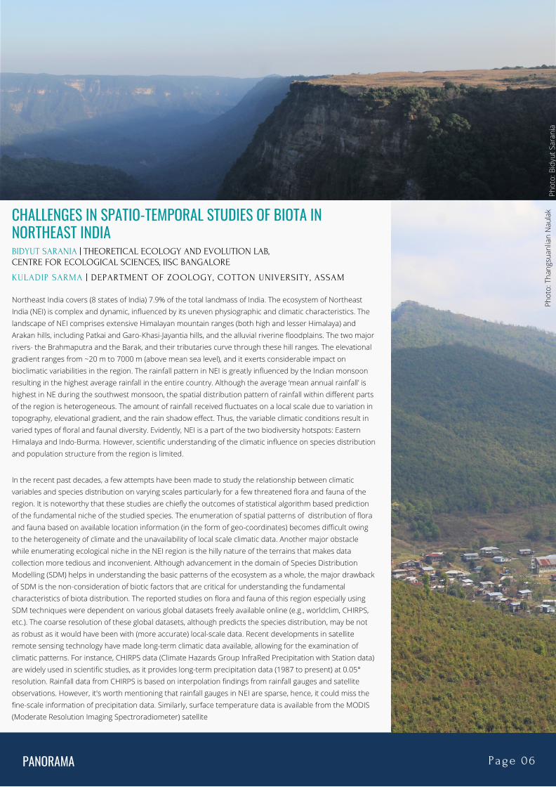
Northeast India covers (8 states of India) 7.9% of the total landmass of India. The ecosystem of NortheastIndia (NEI) is complex and dynamic, influenced by its uneven physiographic and climatic characteristics. Thelandscape of NEI comprises extensive Himalayan mountain ranges (both high and lesser Himalaya) andArakan hills, including Patkai and Garo-Khasi-Jayantia hills, and the alluvial riverine floodplains. The two majorrivers- the Brahmaputra and the Barak, and their tributaries curve through these hill ranges. The elevationalgradient ranges from ~20 m to 7000 m (above mean sea level), and it exerts considerable impact onbioclimatic variabilities in the region. The rainfall pattern in NEI is greatly influenced by the Indian monsoonresulting in the highest average rainfall in the entire country. Although the average ‘mean annual rainfall’ ishighest in NE during the southwest monsoon, the spatial distribution pattern of rainfall within different partsof the region is heterogeneous. The amount of rainfall received fluctuates on a local scale due to variation intopography, elevational gradient, and the rain shadow effect. Thus, the variable climatic conditions result invaried types of floral and faunal diversity. Evidently, NEI is a part of the two biodiversity hotspots: EasternHimalaya and Indo-Burma. However, scientific understanding of the climatic influence on species distributionand population structure from the region is limited.
In the recent past decades, a few attempts have been made to study the relationship between climaticvariables and species distribution on varying scales particularly for a few threatened flora and fauna of theregion. It is noteworthy that these studies are chiefly the outcomes of statistical algorithm based predictionof the fundamental niche of the studied species. The enumeration of spatial patterns of distribution of floraand fauna based on available location information (in the form of geo-coordinates) becomes difficult owingto the heterogeneity of climate and the unavailability of local scale climatic data. Another major obstaclewhile enumerating ecological niche in the NEI region is the hilly nature of the terrains that makes datacollection more tedious and inconvenient. Although advancement in the domain of Species DistributionModelling (SDM) helps in understanding the basic patterns of the ecosystem as a whole, the major drawbackof SDM is the non-consideration of biotic factors that are critical for understanding the fundamentalcharacteristics of biota distribution. The reported studies on flora and fauna of this region especially usingSDM techniques were dependent on various global datasets freely available online (e.g., worldclim, CHIRPS,etc.). The coarse resolution of these global datasets, although predicts the species distribution, may be notas robust as it would have been with (more accurate) local-scale data. Recent developments in satelliteremote sensing technology have made long-term climatic data available, allowing for the examination ofclimatic patterns. For instance, CHIRPS data (Climate Hazards Group InfraRed Precipitation with Station data)are widely used in scientific studies, as it provides long-term precipitation data (1987 to present) at 0.05°resolution. Rainfall data from CHIRPS is based on interpolation findings from rainfall gauges and satelliteobservations. However, it's worth mentioning that rainfall gauges in NEI are sparse, hence, it could miss thefine-scale information of precipitation data. Similarly, surface temperature data is available from the MODIS(Moderate Resolution Imaging Spectroradiometer) satellite
Phot
o: B
idyu
t Sar
ania
Phot
o: T
hang
suan
lian
Nau
lak
PANORAMA Page 07
but there is limited availability of data from the ground station to cross-verify, which impedes the quality of theresults. Moreover, evaluating the climatic trend and creating models from meteorological ground station datais insufficient and tends to be erroneous due to the limited number of meteorological stations in the region,especially in high altitude states such as Arunachal Pradesh. Furthermore, the gaps (missing values) in theavailable station data make time series analysis and climate model construction more difficult or less reliablefor the region. There is also a lack of ground-based soil nutrient (an important parameter for ecosystem study)database from NEI at fine-scale to verify with the available world soil database (e.g., Harmonized world soildatabase). Thus, all these limitations hinder the comprehensive and systematic study of ecological processesin the region. Keeping the above views in mind, the current article is focused on the need of the local scaleclimatic as well as other environmental data for robustness of the spatio-temporal modeling outcomes.
The stability of the ecosystem is driven by different climatic drivers such as rainfall, temperature,evapotranspiration, soil nutrient dynamics and microbiota. All these elements are interconnected and create afeedback loop system that balances a natural ecosystem. Thus, to understand such a system, fine-scale longterm data is a prerequisite, which is not available for India in general and NEI region in particular. Asmentioned earlier, the hilly terrain of the region increases the dependence on availability of environmentaldata in usable formats particularly to be used along with other remotely sensed data sets. Therefore, there isan urgent need for the establishment of an institutional structure (formal/informal) to initiate the process ofcollecting, generating and digitalizing the environmental data for future use. Though it is needless to mentionthat we cannot collect the geographic distribution of each and every species of importance; however, if we caninstitutionalize the generation of local scale environmental data, researchers can make a significant effort tofind the suitable habitat of the target plant or animal species at ease. In this concern, some may also argueabout the accuracy of those statistical models. But, using local-scale data, it would be more accurate than thatof the global datasets available. Furthermore, the authors have the opinion that it is always recommended tomodel the ecosystem as a whole rather than modeling a single species. The justification we argue is that noSDM packages consider biotic components of the ecosystem in single or multi species models.
NEI comprises a mosaic of habitats ranging from the forest (tree-dominated), grassland (grass-dominated), andsavanna (forest-grass complexes). This leads to difficulty in classifying the different forest patches in satellite-based automatic forest classification in the region due to the mixing of spectral values (forest-grasslandcomplex), high cloud-cover throughout the year, shadow effect, and small habitat patch. And, at the same time,ground-truthing for every habitat type in this landscape is a tough challenge due to the hilly terrain. However,all the different habitat types including the smaller habitat patches in the hilly terrains cannot be ignored asthey have a significant influence on habitat-specific fauna. It is essential to consider all the elements of theheterogeneous landscape to study ecosystem functioning. This gives a notion that we need to have analternative method to enumerate the habitat types. We strongly recommend incorporating ecosystem types inland use mapping rather than relying on forest types. However, that again depends on the type ofinvestigation and methodological approach a researcher would undertake.
To summarize, the key idea we want to convey through this article is to have a forum to discuss the issue ofstudying important landscapes of the Indian sub-continent using various advanced spatial tools available forthe purpose of retaining the best quality, reliable and accurate findings. Researcher from different field havebeen generating ecological data for years in NEI, but still, we do not have access to all the information/dataeither in a proper format or in the desired resolution. Compiling all available ecological data, as well as local-scale meteorological, soil and biotic data from different educational, research and governmental institutions,into a single platform could help in the efficient spatio-temporal analysis and improved understanding of NEI'secological processes. ____________________________________________________________________________________________
Dr. Himolin Basumatary's thoughts and suggestions during the composition of this article are gratefullyacknowledged by the authors.
Phot
o: T
hang
suan
lian
Nau
lak
Phot
o: T
hang
suan
lian
Nau
lak
PANORAMA Page 08
Phot
o: T
hang
suan
lian
Nau
lak
Phot
o: T
hang
suan
lian
Nau
lak
Phot
o: T
hang
suan
lian
Nau
lak
N E W SAssam villagers oppose Sanctuary tag for golden langurhabitat"As primary stakeholders, the villagers demanded that the “conventional idea of wildlife sanctuary” bedropped and the reserve forest converted into a community forest resource “using Forest Rights Act, 2006, toensure community co-managed system of participation for sustainable conservation”." Read more here
North Kamrup Forest Division to launch first ever leopardcensus"In an effort to check the population of leopards in forest and non-forest areas the North Kamrup ForestDivision will launch the first and exclusive leopard census in Assam. The population will be checked in thedense areas of Amingaon and its adjoining areas including Changsari, Sila etc. The process will be conductedthrough camera trapping method which will be done for a period of 24 weeks." Read more here
Drying Pobitora wetlands in Guwahati force migratory birdsto change habitat"The water in Tamoli Doba, the main wetland amongst all the wetlands in the Pobitora Wildlife Sanctuary flowsaway from the wetland by the end of December every year." Read more here
Manipur Coming Up As Hotspot of Amur Falcon Conservationin North-East"From hunting hundreds of Amur Falcons to conserving the birds of prey, locals in Nagaland have come a longway. Now, Manipur is also following in their footsteps." Read more here
Mizoram’s balancing act with palm oil’s ecological impactand economic benefits"In Mizoram, palm oil has been considered a crop of immense economic promise. The state has 78 percent ofthe total land under oil palm cultivation in northeast India. However, the threat to biodiversity and soil fertilitydue to palm oil, has environmentalists, economic planners and farmers divided regarding the expansion ofthis crop in the biodiversity-rich state." Read more here
Black-Necked Cranes, Development Clash in Arunachal as a Passive State Looks OnThe people of the Monpa belt of Arunachal Pradesh revere the black-necked crane as a reincarnation of theDalai Lama, and protect it and its habitats with religious fervour. However, the state government’s policies to protect the bird have left many of the region’s people, but especially the youth, in need of better social and economic protection. Read more here
Tripura: Deforestation, rubber plantations rise leads toprimate habitat changes, conflicts with humans, says study " 75 per cent of the respondents involved in the study and living in villages located in the vicinity of reserveforest with dense rubber plantation opined that rapid rise in deforestation in the reserve forest was resulting inshrinkage of habitats of primates who are now forced to stray out." Read more here
PANORAMA Page 09
VIEWS
S H A H N A W A Z J E L I L | W I L D L I F E I N S T I T U T E O F I N D I A
Significance of small efforts and grants in conservation: A case ofWhite Winged Duck in Assam
Phot
o: S
hah
Naw
az Je
lilPh
oto:
Sha
h N
awaz
Jelil
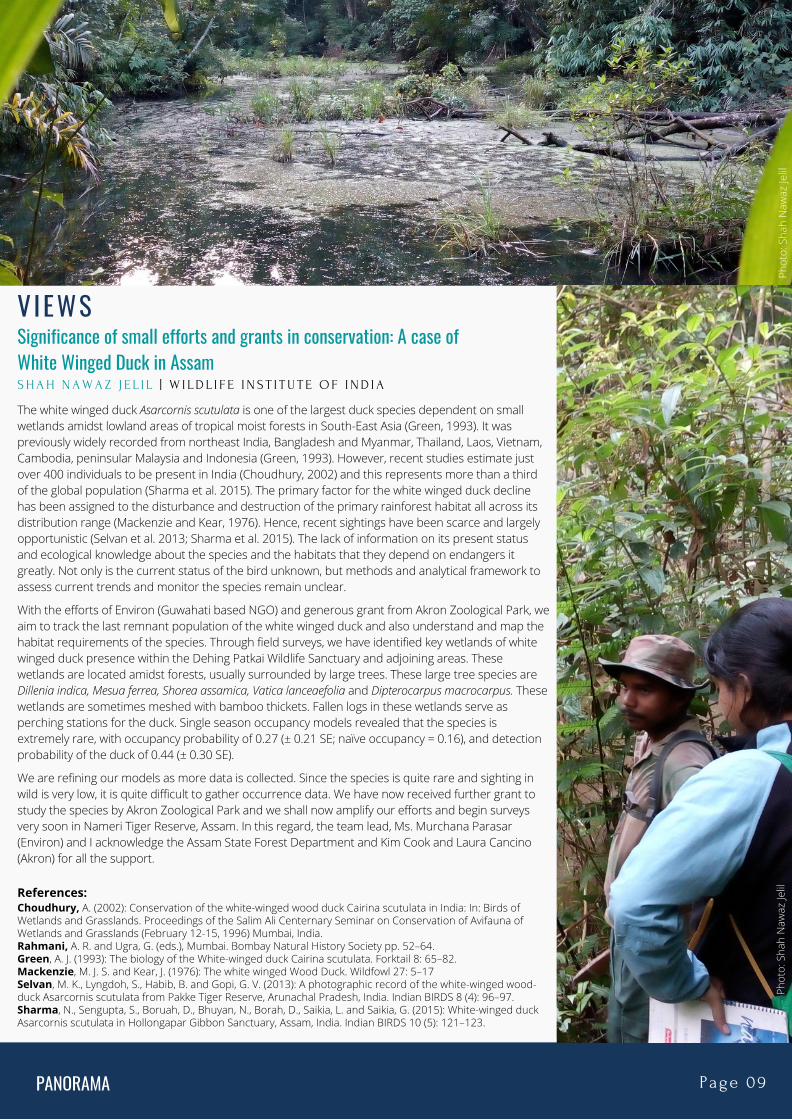
The white winged duck Asarcornis scutulata is one of the largest duck species dependent on smallwetlands amidst lowland areas of tropical moist forests in South-East Asia (Green, 1993). It waspreviously widely recorded from northeast India, Bangladesh and Myanmar, Thailand, Laos, Vietnam,Cambodia, peninsular Malaysia and Indonesia (Green, 1993). However, recent studies estimate justover 400 individuals to be present in India (Choudhury, 2002) and this represents more than a thirdof the global population (Sharma et al. 2015). The primary factor for the white winged duck declinehas been assigned to the disturbance and destruction of the primary rainforest habitat all across itsdistribution range (Mackenzie and Kear, 1976). Hence, recent sightings have been scarce and largelyopportunistic (Selvan et al. 2013; Sharma et al. 2015). The lack of information on its present statusand ecological knowledge about the species and the habitats that they depend on endangers itgreatly. Not only is the current status of the bird unknown, but methods and analytical framework toassess current trends and monitor the species remain unclear.
With the efforts of Environ (Guwahati based NGO) and generous grant from Akron Zoological Park, weaim to track the last remnant population of the white winged duck and also understand and map thehabitat requirements of the species. Through field surveys, we have identified key wetlands of whitewinged duck presence within the Dehing Patkai Wildlife Sanctuary and adjoining areas. Thesewetlands are located amidst forests, usually surrounded by large trees. These large tree species areDillenia indica, Mesua ferrea, Shorea assamica, Vatica lanceaefolia and Dipterocarpus macrocarpus. Thesewetlands are sometimes meshed with bamboo thickets. Fallen logs in these wetlands serve asperching stations for the duck. Single season occupancy models revealed that the species isextremely rare, with occupancy probability of 0.27 (± 0.21 SE; naïve occupancy = 0.16), and detectionprobability of the duck of 0.44 (± 0.30 SE).
We are refining our models as more data is collected. Since the species is quite rare and sighting inwild is very low, it is quite difficult to gather occurrence data. We have now received further grant tostudy the species by Akron Zoological Park and we shall now amplify our efforts and begin surveysvery soon in Nameri Tiger Reserve, Assam. In this regard, the team lead, Ms. Murchana Parasar(Environ) and I acknowledge the Assam State Forest Department and Kim Cook and Laura Cancino(Akron) for all the support.
References:Choudhury, A. (2002): Conservation of the white-winged wood duck Cairina scutulata in India: In: Birds ofWetlands and Grasslands. Proceedings of the Salim Ali Centernary Seminar on Conservation of Avifauna ofWetlands and Grasslands (February 12-15, 1996) Mumbai, India. Rahmani, A. R. and Ugra, G. (eds.), Mumbai. Bombay Natural History Society pp. 52–64.Green, A. J. (1993): The biology of the White-winged duck Cairina scutulata. Forktail 8: 65–82.Mackenzie, M. J. S. and Kear, J. (1976): The white winged Wood Duck. Wildfowl 27: 5–17Selvan, M. K., Lyngdoh, S., Habib, B. and Gopi, G. V. (2013): A photographic record of the white-winged wood-duck Asarcornis scutulata from Pakke Tiger Reserve, Arunachal Pradesh, India. Indian BIRDS 8 (4): 96–97.Sharma, N., Sengupta, S., Boruah, D., Bhuyan, N., Borah, D., Saikia, L. and Saikia, G. (2015): White-winged duckAsarcornis scutulata in Hollongapar Gibbon Sanctuary, Assam, India. Indian BIRDS 10 (5): 121–123.
PANORAMA Page 10
Members' Page: Members in ActionNeed for nuanced approach to conservation: A case from Manipur
Lian holds a Masters’ degree in Forestry from the Forest Research Institute, Dehradun. Heworked briefly in Manipur studying Hornbills with financial support from the RuffordSmall Grants. Subsequently, he joined ATREE Regional Office-Eastern Himalayas todocument mammal diversity in major farming system across Darjeeling-Sikkim Himalaya(DSH). He is currently pursuing his PhD on occupancy and resource use by mammals inthe same landscape.
THANGSUANLIAN NAULAK | WILDLIFE INSTITUTE OF INDIA
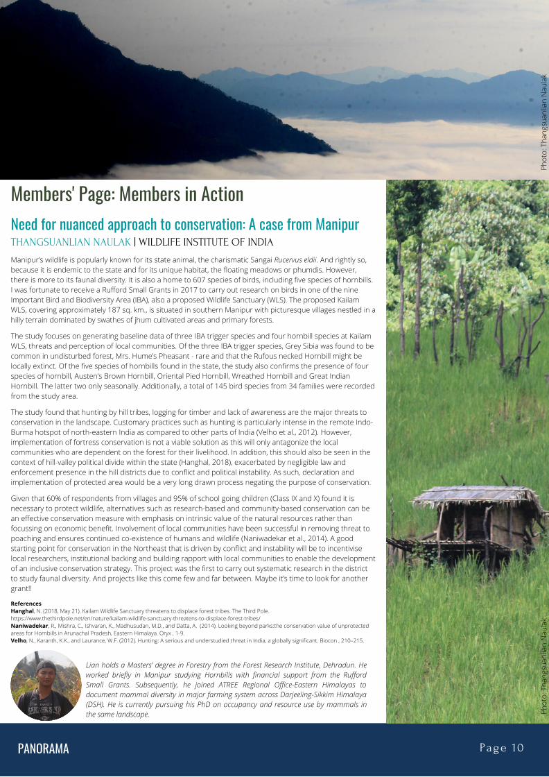
Manipur’s wildlife is popularly known for its state animal, the charismatic Sangai Rucervus eldii. And rightly so,because it is endemic to the state and for its unique habitat, the floating meadows or phumdis. However,there is more to its faunal diversity. It is also a home to 607 species of birds, including five species of hornbills.I was fortunate to receive a Rufford Small Grants in 2017 to carry out research on birds in one of the nineImportant Bird and Biodiversity Area (IBA), also a proposed Wildlife Sanctuary (WLS). The proposed KailamWLS, covering approximately 187 sq. km., is situated in southern Manipur with picturesque villages nestled in ahilly terrain dominated by swathes of jhum cultivated areas and primary forests.
The study focuses on generating baseline data of three IBA trigger species and four hornbill species at KailamWLS, threats and perception of local communities. Of the three IBA trigger species, Grey Sibia was found to becommon in undisturbed forest, Mrs. Hume’s Pheasant - rare and that the Rufous necked Hornbill might belocally extinct. Of the five species of hornbills found in the state, the study also confirms the presence of fourspecies of hornbill, Austen’s Brown Hornbill, Oriental Pied Hornbill, Wreathed Hornbill and Great IndianHornbill. The latter two only seasonally. Additionally, a total of 145 bird species from 34 families were recordedfrom the study area.
The study found that hunting by hill tribes, logging for timber and lack of awareness are the major threats toconservation in the landscape. Customary practices such as hunting is particularly intense in the remote Indo-Burma hotspot of north-eastern India as compared to other parts of India (Velho et al., 2012). However,implementation of fortress conservation is not a viable solution as this will only antagonize the localcommunities who are dependent on the forest for their livelihood. In addition, this should also be seen in thecontext of hill-valley political divide within the state (Hanghal, 2018), exacerbated by negligible law andenforcement presence in the hill districts due to conflict and political instability. As such, declaration andimplementation of protected area would be a very long drawn process negating the purpose of conservation.
Given that 60% of respondents from villages and 95% of school going children (Class IX and X) found it isnecessary to protect wildlife, alternatives such as research-based and community-based conservation can bean effective conservation measure with emphasis on intrinsic value of the natural resources rather thanfocussing on economic benefit. Involvement of local communities have been successful in removing threat topoaching and ensures continued co-existence of humans and wildlife (Naniwadekar et al., 2014). A goodstarting point for conservation in the Northeast that is driven by conflict and instability will be to incentiviselocal researchers, institutional backing and building rapport with local communities to enable the developmentof an inclusive conservation strategy. This project was the first to carry out systematic research in the districtto study faunal diversity. And projects like this come few and far between. Maybe it’s time to look for anothergrant!!
Phot
o: T
hang
suan
lian
Nau
lak
Phot
o: T
hang
suan
lian
Nau
lak
ReferencesHanghal, N. (2018, May 21). Kailam Wildlife Sanctuary threatens to displace forest tribes. The Third Pole.https://www.thethirdpole.net/en/nature/kailam-wildlife-sanctuary-threatens-to-displace-forest-tribes/Naniwadekar, R., Mishra, C., Ishvaran, K., Madhusudan, M.D., and Datta, A. (2014). Looking beyond parks:the conservation value of unprotectedareas for Hornbills in Arunachal Pradesh, Eastern Himalaya. Oryx , 1-9.Velho, N., Karanth, K.K., and Laurance, W.F. (2012). Hunting: A serious and understudied threat in India, a globally significant. Biocon , 210–215.
PANORAMA Page 11 Editors: Vaishali Vasudeva, Amrita Neelakantan, Ramesh Krishnamurthy
Updates from the IRALE Executive Committee
Phot
o: S
hah
Naw
az Je
lil
OpportunitiesDeadline ExtendedThe 1st International Electronic Conference on Land | 17–19 May 2022The deadline for abstract submissions has been extended to 28 February 2022.More information on the website.
New DatesXV World Forestry Congress | 2-6 May 2022 | Coex, Seoul, Republic of KoreaBuilding a Green, Healthy and Resilient Future with Forests
Blog CompetitionShow how your research helps forests and win a trip to attend the World Forestry Congress in May 2022. Deadline: 11 March 2022.More information on the website
Membership RenewalRequesting members whose membership ended lastyear or before but was extended until 2021 to kindlyvisit the page to renew it at the earliest. Those whobecame member last year (2021) will have theirmembership until one year from the date of registration.
Members can now choose between annual and termmembership based on their interest.
Project affiliation with IRALE/Bidding through IRALE
IRALE 2022 Symposium
Members are encouraged to affiliate with IRALE for research projects and use IRALE platform for bidding projects. Preparation of guidelinesand standing operating procedure to guide members for affiliation with IRALE to be in place soon. Additionally, EC will find any fundingopportunities and experts from the members could be identified and a mechanism to engage at least one individual who could work ondeveloping the proposal.
IRALE 2022 Symposium is to be scheduled in October 2022 following the hybrid model, and may be combined with other organizationssuch as ATBC and SCB if a collaboration can be established.IRALE could submit a proposal for hosting a session in the world congress. Communication/discussion in this direction to be initiated soon.
Plan to initiate working groupdiscussions/webinars
It was decided to hold the general members meeting on 11 March 2022 and the same forum to plan the working group meetings,leadership for individual working groups, and decide on the topic and invited expert for the forthcoming webinar. IRALE Secretary willshare the link in due course of time.


![SEM Student News, Vol. 9 (Fall/Winter 2014) [Justin R. Hunter, Editor]](https://static.fdokumen.com/doc/165x107/6322b286078ed8e56c0a86c4/sem-student-news-vol-9-fallwinter-2014-justin-r-hunter-editor.jpg)