Ice Core Chronologies from the Antarctic Peninsula - MDPI
14
Citation: Emanuelsson, B.D.; Thomas, E.R.; Tetzner, D.R.; Humby, J.D.; Vladimirova, D.O. Ice Core Chronologies from the Antarctic Peninsula: The Palmer, Jurassic, and Rendezvous Age-Scales. Geosciences 2022, 12, 87. https://doi.org/ 10.3390/geosciences12020087 Academic Editors: Mirko Severi and Jesus Martinez-Frias Received: 16 October 2021 Accepted: 30 January 2022 Published: 16 February 2022 Publisher’s Note: MDPI stays neutral with regard to jurisdictional claims in published maps and institutional affil- iations. Copyright: © 2022 by the authors. Licensee MDPI, Basel, Switzerland. This article is an open access article distributed under the terms and conditions of the Creative Commons Attribution (CC BY) license (https:// creativecommons.org/licenses/by/ 4.0/). geosciences Article Ice Core Chronologies from the Antarctic Peninsula: The Palmer, Jurassic, and Rendezvous Age-Scales B. Daniel Emanuelsson 1, * , Elizabeth R. Thomas 1 , Dieter R. Tetzner 1,2 , Jack D. Humby 1 and Diana O. Vladimirova 1 1 Ice Dynamics and Paleoclimate Group, British Antarctic Survey, Natural Environment Research Council, High Cross, Madingley Road, Cambridge CB3 0ET, UK; [email protected] (E.R.T.); [email protected] (D.R.T.); [email protected] (J.D.H.); [email protected] (D.O.V.) 2 Department of Earth Sciences, University of Cambridge, Downing Street, Cambridge CB2 3EQ, UK * Correspondence: [email protected] Abstract: In this study, we present the age scales for three Antarctic Peninsula (AP) ice cores: Palmer, Rendezvous, and Jurassic. The three cores are all intermediate-depth cores, in the 133–141 m depth range. Non-sea-salt sulfate ([nssSO 4 2- ]) and hydrogen peroxide (H 2 O 2 ) display marked seasonal variability suitable for annual-layer counting. The Palmer ice core covers 390 years, 1621–2011 C.E., and is one of the oldest AP cores. Rendezvous and Jurassic are lower elevation high-snow accumula- tion sites and therefore cover shorter intervals, 1843–2011 C.E. and 1874–2011 C.E., respectively. The age scales show good agreement with known volcanic age horizons. The three chronologies’ start and end dates of volcanic events are compared to the volcanic events in the published WAIS Divide core. The age difference for the Palmer age scale is ±6 months, Rendezvous ±9 months, and Jurassic ±7 months. Our results demonstrate the advantage of dating several cores from the same region at the same time. Additional confidence can be gained in the age scales by evaluating and finding synchronicity of [nssSO 4 2- ] peaks amongst the sites. Keywords: Antarctic Peninsula chronology; ice cores; volcanism; age-scales; annual-layer counting; water stable isotopes 1. Introduction Ice core records have vastly improved our understanding of the earth’s climate and enabled us to investigate past climates beyond the short observational era. Ice cores from low snow accumulation sites in the central Antarctic plateau have been used to reconstruct climate change over the past eight glacial cycles [1], while ice cores from high accumulation coastal sites can be used for high-resolution reconstructions [2,3]. Ice core proxies can be used to reconstruct past climate and extend limited spatially sparse observational records from Antarctica that only became available over the last half-century. However, the suitability of an ice core to reconstruct past climate or environmental changes is dependent on the accuracy of its age scale. This is especially important when identifying the phasing (lead or lags) of climatic events and when investigating the drivers of variability. Choosing the appropriate dating approach is dependent on the conditions at the ice core site. For high accumulation sites, where it is possible to acquire high-resolution chemical records, annual-layer counting is the preferred method [4]. Annual-layer counting takes advantage of the seasonal deposition of chemical species, such as sea salts, continental ions, and biogenic aerosols, to an ice sheet. The stable water isotopes also provide a valuable seasonal marker in high latitude ice cores. The non-sea-salt part of the sulfate concentration ([nssSO 4 2 - ]) can be estimated by removing the sea salt fraction [5], h nssSO 2- 4 i = h SO 2- 4 i - 0.251 Na + (1) Geosciences 2022, 12, 87. https://doi.org/10.3390/geosciences12020087 https://www.mdpi.com/journal/geosciences
-
Upload
khangminh22 -
Category
Documents
-
view
2 -
download
0
Transcript of Ice Core Chronologies from the Antarctic Peninsula - MDPI

�����������������
Citation: Emanuelsson, B.D.;
Thomas, E.R.; Tetzner, D.R.; Humby,
J.D.; Vladimirova, D.O. Ice Core
Chronologies from the Antarctic
Peninsula: The Palmer, Jurassic, and
Rendezvous Age-Scales. Geosciences
2022, 12, 87. https://doi.org/
10.3390/geosciences12020087
Academic Editors: Mirko Severi and
Jesus Martinez-Frias
Received: 16 October 2021
Accepted: 30 January 2022
Published: 16 February 2022
Publisher’s Note: MDPI stays neutral
with regard to jurisdictional claims in
published maps and institutional affil-
iations.
Copyright: © 2022 by the authors.
Licensee MDPI, Basel, Switzerland.
This article is an open access article
distributed under the terms and
conditions of the Creative Commons
Attribution (CC BY) license (https://
creativecommons.org/licenses/by/
4.0/).
geosciences
Article
Ice Core Chronologies from the AntarcticPeninsula: The Palmer, Jurassic, and Rendezvous Age-ScalesB. Daniel Emanuelsson 1,* , Elizabeth R. Thomas 1 , Dieter R. Tetzner 1,2 , Jack D. Humby 1
and Diana O. Vladimirova 1
1 Ice Dynamics and Paleoclimate Group, British Antarctic Survey, Natural Environment Research Council,High Cross, Madingley Road, Cambridge CB3 0ET, UK; [email protected] (E.R.T.); [email protected] (D.R.T.);[email protected] (J.D.H.); [email protected] (D.O.V.)
2 Department of Earth Sciences, University of Cambridge, Downing Street, Cambridge CB2 3EQ, UK* Correspondence: [email protected]
Abstract: In this study, we present the age scales for three Antarctic Peninsula (AP) ice cores: Palmer,Rendezvous, and Jurassic. The three cores are all intermediate-depth cores, in the 133–141 m depthrange. Non-sea-salt sulfate ([nssSO4
2−]) and hydrogen peroxide (H2O2) display marked seasonalvariability suitable for annual-layer counting. The Palmer ice core covers 390 years, 1621–2011 C.E.,and is one of the oldest AP cores. Rendezvous and Jurassic are lower elevation high-snow accumula-tion sites and therefore cover shorter intervals, 1843–2011 C.E. and 1874–2011 C.E., respectively. Theage scales show good agreement with known volcanic age horizons. The three chronologies’ startand end dates of volcanic events are compared to the volcanic events in the published WAIS Dividecore. The age difference for the Palmer age scale is ±6 months, Rendezvous ±9 months, and Jurassic±7 months. Our results demonstrate the advantage of dating several cores from the same regionat the same time. Additional confidence can be gained in the age scales by evaluating and findingsynchronicity of [nssSO4
2−] peaks amongst the sites.
Keywords: Antarctic Peninsula chronology; ice cores; volcanism; age-scales; annual-layer counting;water stable isotopes
1. Introduction
Ice core records have vastly improved our understanding of the earth’s climate andenabled us to investigate past climates beyond the short observational era. Ice cores fromlow snow accumulation sites in the central Antarctic plateau have been used to reconstructclimate change over the past eight glacial cycles [1], while ice cores from high accumulationcoastal sites can be used for high-resolution reconstructions [2,3]. Ice core proxies canbe used to reconstruct past climate and extend limited spatially sparse observationalrecords from Antarctica that only became available over the last half-century. However, thesuitability of an ice core to reconstruct past climate or environmental changes is dependenton the accuracy of its age scale. This is especially important when identifying the phasing(lead or lags) of climatic events and when investigating the drivers of variability.
Choosing the appropriate dating approach is dependent on the conditions at theice core site. For high accumulation sites, where it is possible to acquire high-resolutionchemical records, annual-layer counting is the preferred method [4]. Annual-layer countingtakes advantage of the seasonal deposition of chemical species, such as sea salts, continentalions, and biogenic aerosols, to an ice sheet. The stable water isotopes also provide a valuableseasonal marker in high latitude ice cores. The non-sea-salt part of the sulfate concentration([nssSO4
2−]) can be estimated by removing the sea salt fraction [5],[nssSO2−
4
]=[SO2−
4
]− 0.251
[Na+
](1)
Geosciences 2022, 12, 87. https://doi.org/10.3390/geosciences12020087 https://www.mdpi.com/journal/geosciences

Geosciences 2022, 12, 87 2 of 14
where 0.251 is the [SO42−/Na+] ratio in seawater. The source of [nssSO4
2−] is primarilyfrom dimethyl sulfide (DMS) produced by phytoplankton blooms following the break-upof sea ice in austral spring (typically with onset in December) [6,7]. The chemical methanesulfonic acid (MSA) that is commonly measured in ice cores is an oxidation product fromDMS [7]. Other [nssSO4
2−] sources arrive in Antarctica via the troposphere and lowerstratosphere; these sources are of volcanic, extrapolar biogenic, and anthropogenic origin.This input will also peak in early austral summer, because of the timing of the break-up ofthe polar vortex [6] (and references therein). However, at coastal sites, the biogenic-source[nssSO4
2−] signal can drown the volcanic signal [6].Another promising seasonal marker is hydrogen peroxide (H2O2), a photochemical
species that peaks during the summer solstice and with a minimum during the polarnight. The clear seasonality of H2O2 has been used as a dating tool for several Antarcticice cores [8–10]. The preservation of H2O2 in ice cores is dependent on the burial rate [9],and thus, high snow accumulation (>0.22 m year−1) sites are most suitable for preservingatmospheric changes in H2O2. At low accumulation sites, the seasonal signal may be lostwithin the first few meters [11], while at warmer sites the signal is sensitive to melt [12].
Annual-layer counting has been used to date Antarctic ice cores back several thousandyears [13]; however, an accumulative error can arise with depth. Thus, the presence ofknown reference horizons can be used to constrain age scales and determine the estimateddating uncertainties. The annual-layer counting can be supported by these independentreference horizons. These include known volcanic eruptions or unique and well-datedatmospheric signatures such as tritium peaks from nuclear bomb tests. The most widelyused dating horizon is volcanic eruptions, detectable in ice cores as elevated levels ofSO4
2−, high conductivity, and/or in some cases the presence of tephra shards. For theformer, a volcanic event is classified as significant if [nssSO4
2−] emerges above the biogenicbackground level by exceeding a threshold [e.g., background plus 2 standard deviations(2σ)] [14–16]. Volcanic sulfate can have a delay of one to two years from the eruption untilit shows a significant concentration in the firn or ice [17]. For example, Cole-Dai et al. [17]showed that most of the sulfate from Pinatubo (eruption date 1991) was deposited between1992 and 1994.
In this study, we present the age scales for three ice cores from the Antarctic Peninsula(AP). These ice cores will ultimately be used to investigate regional climate and surfacemass balance variability, at annual to decadal timescales. However, first, we must establishaccurate age-scales. The aim of this study is to (1) provide a chronology for each site, basedon annual layer counting, (2) explore the seasonal cycle of chemical and isotopic recordsused for annual layer counting, (3) examine the volcanic horizons present in each core andhow they compare between sites.
2. Data and Methods2.1. Drill Sites
The Palmer, Rendezvous, and Jurassic cores were all drilled in November–December2012 using the British Antarctic Survey (BAS) electromechanical dry drill (without drillfluid) (Table 1). Palmer is a high-elevation AP drill site, while the Rendezvous and Jurassiccores were retrieved at lower elevations (Figure 1 and Table 1) [18]. The Palmer andRendezvous sites are located on local ridges and the Jurassic core was retrieved slightlynorthwest of a local summit (Figure 1b). All locations are situated at sufficiently highelevation to not be affected by ice sheet flank flow. The sites are located at adequatelyhigh elevations so that the chemical records are not compromised by melt (see the −10 mtemperatures, Table 1). The precipitation pathways, meteorological setting, estimatedprecipitation rates, and geographical background of these sites are summarized in Thomasand Bracegirdle [18]. Using ERA-Interim reanalysis data [19] (1979–2011) they estimatedthe annual average precipitation minus evaporation to be 49, 99, and 95 cm w.e. (waterequivalent) for Palmer, Rendezvous, and Jurassic, respectively [18].

Geosciences 2022, 12, 87 3 of 14
Table 1. Drill site and core characteristics.
Latitude Longitude Elevation(m a.s.l.) Drill Date
Depth (mbelow the
Snow Surface)
Age Range(C.E.)
−10 mTemperature
(◦C)
Palmer 73.86◦ S 65.46◦ W 1897 24–29 December 2012 0–133 1621–2011 −22.4Rendezvous 74.45◦ S 78.16◦ W 1006 9–16 December 2012 0–141 1843–2011 −23.8
Jurassic 74.33◦ S 73.06◦ W 1139 19–27 November 2012 0–140 1874–2011 −16.7
Geosciences 2022, 12, x FOR PEER REVIEW 3 of 14
Bracegirdle [18]. Using ERA-Interim reanalysis data [19] (1979–2011) they estimated the annual average precipitation minus evaporation to be 49, 99, and 95 cm w.e. (water equiv-alent) for Palmer, Rendezvous, and Jurassic, respectively [18].
The Palmer, Rendezvous, and Jurassic ice cores were drilled as part of a suite of cores [18], with the initial goal of providing an opportunity to compare the seasonal deposition of chemical species across a high snow accumulation region.The Palmer core is one of the paleo archives that will be utilized by the Anthropocene Working Group with the over-arching goal to pinpoint the start of the Anthropocene. Thus, there is a need to establish accurate age-scales as a foundation for future analyses.
Figure 1. Antarctic location maps. Ice-core sites for which chronologies are established in this study are indicated by black dots. (a) The location of a WDC core (WDC06A) is indicated by a black circle. Contours (thin black lines) with 1000 m spacing indicate elevation above sea level [20,21]. (b) shows a blow-up map of the Antarctic Peninsula ice core locations. Contours (thin black lines) with 100 m spacing indicate elevation above sea level [20,21]. WDC—WAIS Divide ice core.
Table 1. Drill site and core characteristics.
Latitude Longitude Elevation (m a.s.l.)
Drill Date Depth (m below the snow surface)
Age Range (C.E.)
−10 m temperature (°C)
Palmer 73.86°S 65.46°W 1897 24–29 Dec 2012 0–133 1621–2011 −22.4 Rendezvous 74.45°S 78.16°W 1006 9–16 Dec 2012 0–141 1843–2011 −23.8
Jurassic 74.33°S 73.06°W 1139 19–27 Nov 2012 0–140 1874–2011 −16.7
Figure 1. Antarctic location maps. Ice-core sites for which chronologies are established in this studyare indicated by black dots. (a) The location of a WDC core (WDC06A) is indicated by a black circle.Contours (thin black lines) with 1000 m spacing indicate elevation above sea level [20,21]. (b) showsa blow-up map of the Antarctic Peninsula ice core locations. Contours (thin black lines) with 100 mspacing indicate elevation above sea level [20,21]. WDC—WAIS Divide ice core.
The Palmer, Rendezvous, and Jurassic ice cores were drilled as part of a suite ofcores [18], with the initial goal of providing an opportunity to compare the seasonaldeposition of chemical species across a high snow accumulation region.The Palmer core isone of the paleo archives that will be utilized by the Anthropocene Working Group withthe overarching goal to pinpoint the start of the Anthropocene. Thus, there is a need toestablish accurate age-scales as a foundation for future analyses.
2.2. Datasets2.2.1. Chemistry Data
A suite of chemical species was measured using Continuous Flow Analysis (CFA)in the ice core labs at BAS (Cambridge, UK). The bespoke CFA system comprises Fast
Geosciences 2022, 12, 87 4 of 14
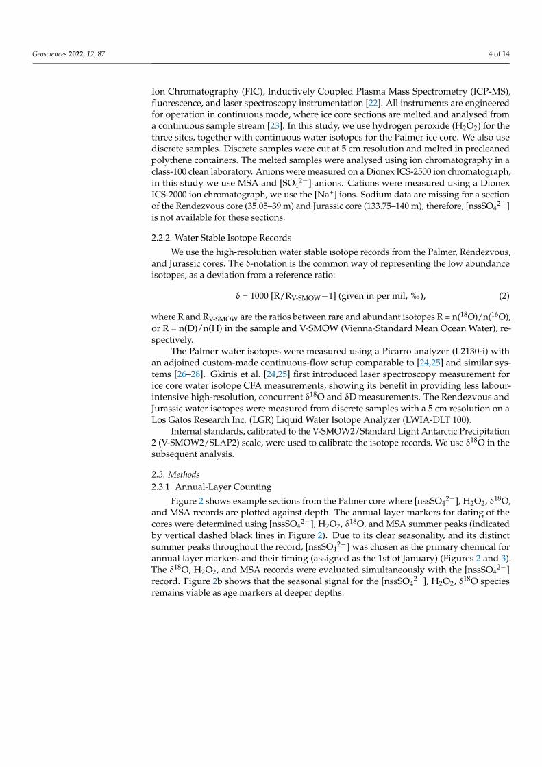
Ion Chromatography (FIC), Inductively Coupled Plasma Mass Spectrometry (ICP-MS),fluorescence, and laser spectroscopy instrumentation [22]. All instruments are engineeredfor operation in continuous mode, where ice core sections are melted and analysed froma continuous sample stream [23]. In this study, we use hydrogen peroxide (H2O2) for thethree sites, together with continuous water isotopes for the Palmer ice core. We also usediscrete samples. Discrete samples were cut at 5 cm resolution and melted in precleanedpolythene containers. The melted samples were analysed using ion chromatography in aclass-100 clean laboratory. Anions were measured on a Dionex ICS-2500 ion chromatograph,in this study we use MSA and [SO4
2−] anions. Cations were measured using a DionexICS-2000 ion chromatograph, we use the [Na+] ions. Sodium data are missing for a sectionof the Rendezvous core (35.05–39 m) and Jurassic core (133.75–140 m), therefore, [nssSO4
2−]is not available for these sections.
2.2.2. Water Stable Isotope Records
We use the high-resolution water stable isotope records from the Palmer, Rendezvous,and Jurassic cores. The δ-notation is the common way of representing the low abundanceisotopes, as a deviation from a reference ratio:
δ = 1000 [R/RV-SMOW−1] (given in per mil, ‰), (2)
where R and RV-SMOW are the ratios between rare and abundant isotopes R = n(18O)/n(16O),or R = n(D)/n(H) in the sample and V-SMOW (Vienna-Standard Mean Ocean Water), re-spectively.
The Palmer water isotopes were measured using a Picarro analyzer (L2130-i) withan adjoined custom-made continuous-flow setup comparable to [24,25] and similar sys-tems [26–28]. Gkinis et al. [24,25] first introduced laser spectroscopy measurement forice core water isotope CFA measurements, showing its benefit in providing less labour-intensive high-resolution, concurrent δ18O and δD measurements. The Rendezvous andJurassic water isotopes were measured from discrete samples with a 5 cm resolution on aLos Gatos Research Inc. (LGR) Liquid Water Isotope Analyzer (LWIA-DLT 100).
Internal standards, calibrated to the V-SMOW2/Standard Light Antarctic Precipitation2 (V-SMOW2/SLAP2) scale, were used to calibrate the isotope records. We use δ18O in thesubsequent analysis.
2.3. Methods2.3.1. Annual-Layer Counting
Figure 2 shows example sections from the Palmer core where [nssSO42−], H2O2, δ18O,
and MSA records are plotted against depth. The annual-layer markers for dating of thecores were determined using [nssSO4
2−], H2O2, δ18O, and MSA summer peaks (indicatedby vertical dashed black lines in Figure 2). Due to its clear seasonality, and its distinctsummer peaks throughout the record, [nssSO4
2−] was chosen as the primary chemical forannual layer markers and their timing (assigned as the 1st of January) (Figures 2 and 3).The δ18O, H2O2, and MSA records were evaluated simultaneously with the [nssSO4
2−]record. Figure 2b shows that the seasonal signal for the [nssSO4
2−], H2O2, δ18O speciesremains viable as age markers at deeper depths.

Geosciences 2022, 12, 87 5 of 14
Geosciences 2022, 12, x FOR PEER REVIEW 5 of 14
throughout the full length of the Rendezvous and Jurassic profiles, but for consistency, we have chosen to use [nssSO4
2−] as our primary indicator for layer counts for all sites. Similarly, the seasonal MSA signal (summer peak) is well preserved in Rendezvous
and Jurassic throughout the core. However, for Palmer, the MSA peak shifts to mid-winter for certain deeper sections (e.g., Figure 2b). This type of shift has also been reported for other Antarctic Peninsula cores [7,29]. The shift can be due to a change of source region [7]. It has also been suggested that the peak shift from summer to winter with depth is caused by the migration of MSA [7]. However, for Palmer, summer peaks still occur at deeper depths, but less frequently.
Sodium data are missing for the deepest part of the Jurassic core (133.75–140 m). Therefore, [nssSO4
2−] cannot be calculated for this section. However, for this interval H2O2 displays clear seasonality and together with the other records, it is still possible to unam-biguously date this section. The age scales for the three cores are provided as down-loadable files from the NERC EDS UK Polar Data Centre [30] (However, the files will at publication date be embargoed and will be made accessible online in July 2022).
Figure 2. Example intervals of chemical signals in the Palmer ice core. Non-sea-salt sulfate [[nssSO4
2−], magenta line (ppb)], hydrogen peroxide [H2O2, black line], δ18O [yellow line, (‰)], and MSA [grey line, (ppb)] plotted against depth (measured from the snow surface) (a) 14–20 m, (b) 124–130 m. Annual-layer markers are indicated by dashed vertical lines.
2.3.2. Defining Volcanic Horizons
We identified volcanic events in the cores by finding [nssSO42−] annual concentrations
that were elevated above the background level. Annual averages of [nssSO42−] were calcu-
lated using winter-to-winter years (e.g., the year 1900 is the average of [nssSO42−] data for
the 1899.5–1900.5 interval). This approach was chosen to avoid splitting the pronounced [nssSO4
2−] summer peaks into different calendar years. The [nssSO42−] concentration records
have non-gaussian distributions. The log-normal of the concentration was therefore cal-culated and the background [nssSO4
2−] level was determined by first excluding the bottom 5th and top 95th percentile of the data. This excludes low values caused by high [Na+]
Figure 2. Example intervals of chemical signals in the Palmer ice core. Non-sea-salt sulfate[[nssSO4
2−], magenta line (ppb)], hydrogen peroxide [H2O2, black line], δ18O [yellow line, (‰)],and MSA [grey line, (ppb)] plotted against depth (measured from the snow surface) (a) 14–20 m,(b) 124–130 m. Annual-layer markers are indicated by dashed vertical lines.
The H2O2 signal is well preserved throughout the Rendezvous and Jurassic records.However, a period of lower snow accumulation at the Palmer site results in a period ofpoor H2O2 signal preservation (~30–55 m, 1962–1895). The H2O2 signal is maintainedthroughout the full length of the Rendezvous and Jurassic profiles, but for consistency, wehave chosen to use [nssSO4
2−] as our primary indicator for layer counts for all sites.Similarly, the seasonal MSA signal (summer peak) is well preserved in Rendezvous
and Jurassic throughout the core. However, for Palmer, the MSA peak shifts to mid-winterfor certain deeper sections (e.g., Figure 2b). This type of shift has also been reported forother Antarctic Peninsula cores [7,29]. The shift can be due to a change of source region [7].It has also been suggested that the peak shift from summer to winter with depth is causedby the migration of MSA [7]. However, for Palmer, summer peaks still occur at deeperdepths, but less frequently.
Sodium data are missing for the deepest part of the Jurassic core (133.75–140 m).Therefore, [nssSO4
2−] cannot be calculated for this section. However, for this intervalH2O2 displays clear seasonality and together with the other records, it is still possibleto unambiguously date this section. The age scales for the three cores are provided asdownloadable files from the NERC EDS UK Polar Data Centre [30] (However, the files willat publication date be embargoed and will be made accessible online in July 2022).

Geosciences 2022, 12, 87 6 of 14Geosciences 2022, 12, x FOR PEER REVIEW 7 of 14
Figure 3. Seasonality of non-sea-salt sulfate [[nssSO42−], (parts per billion, ppb)], hydrogen peroxide
[H2O2, (ppb)], δ18O (‰), and methane sulfonic acid [MSA (ppb)] for the Palmer [top row (a–d), blue asterisks ; 1874–2011 (the maximum overlapping period between the cores)], Rendezvous [middle row (e–h), purple asterisks; 1874–2011] and Jurassic [bottom row (i–l), yellow asterisks; 1874–2011] ice core sites. The monthly averages of chemical concentrations and isotope ratios are plotted against month. In the box plots the black asterisks shows the median values for all monthly values for each month, the box indicates the 25th and 75th percentiles, and the whiskers extend to the most extreme data points that are not classified as outliers. The panels are zoomed in to show the regions of inter-est clearly and do not display all values. Note the difference in scale on the y-axis between the sites for H2O2 and δ18O.
3.1.2. Volcanic Horizons
The volcanic horizons identified in the Palmer, Rendezvous, and Jurassic [nssSO42−]
records are presented in Figure 4. Significant (≥2σ) bipolar (identified both in the Arctic and Antarctic ice cores) volcanic events are indicated by grey shading. The events identi-fied in Figure 4 and Table 2 are not an exhaustive list; for this section we have chosen to focus only on peaks that have been extensively identified in other Antarctic cores, includ-ing in the high-resolution WAIS Divide core [32]. Bipolar events originate from large trop-ical volcanic eruptions, which connects to the polar regions via the stratosphere [32]. There is, therefore, no surprise that these events are present in AP records.
Figure 3. Seasonality of non-sea-salt sulfate [[nssSO42−], (parts per billion, ppb)], hydrogen peroxide
[H2O2, (ppb)], δ18O (‰), and methane sulfonic acid [MSA (ppb)] for the Palmer [top row (a–d), blueasterisks; 1874–2011 (the maximum overlapping period between the cores)], Rendezvous [middlerow (e–h), purple asterisks; 1874–2011] and Jurassic [bottom row (i–l), yellow asterisks; 1874–2011]ice core sites. The monthly averages of chemical concentrations and isotope ratios are plotted againstmonth. In the box plots the black asterisks shows the median values for all monthly values for eachmonth, the box indicates the 25th and 75th percentiles, and the whiskers extend to the most extremedata points that are not classified as outliers. The panels are zoomed in to show the regions of interestclearly and do not display all values. Note the difference in scale on the y-axis between the sites forH2O2 and δ18O.
2.3.2. Defining Volcanic Horizons
We identified volcanic events in the cores by finding [nssSO42−] annual concentrations
that were elevated above the background level. Annual averages of [nssSO42−] were
calculated using winter-to-winter years (e.g., the year 1900 is the average of [nssSO42−] data
for the 1899.5–1900.5 interval). This approach was chosen to avoid splitting the pronounced[nssSO4
2−] summer peaks into different calendar years. The [nssSO42−] concentration
records have non-gaussian distributions. The log-normal of the concentration was thereforecalculated and the background [nssSO4
2−] level was determined by first excluding thebottom 5th and top 95th percentile of the data. This excludes low values caused by high[Na+] concentrations and volcanic peaks. For the remaining data, the background wasdetermined by smoothing the data with a running average of 31-years. A 31-year moving

Geosciences 2022, 12, 87 7 of 14
window is used as it provides a standard period for climatological variability [31]. Theresults are not dependent on this specific window size (e.g., a 21-year or 41-year windowgives the same results). Subsequently, the standard deviation of the background wascalculated and the mean plus the 1σ and 2σ were utilized to find events that stand outabove the background.
We also conducted a similar analysis on the high-resolution [nssSO42−] concentration
records. First, the 95th percentile of the data was removed, then the moving averageand σ were determined. A 201-point moving average was applied for Palmer (453 pointsfor Rendezvous and 563 points for Jurassic), which equals approximately 31 years in themiddle of each core. For the high-resolution concentration records, neighbouring points(up to two measurements away) to an exceedance of 3σ (4σ for Rendezvous and Jurassic)were investigated and if at least one neighbouring point exceeded 2σ, the 3σ exceedancewas classified as a volcanic event. The following restrictive approach was adopted toavoid the classification of potential outliers from contamination as volcanic events. Notethat the main significance test in this study and its reported exceedances come from themore conservative analysis using the log-normal of the annual concentration records [15].The high-resolution concentration records are shown for comparison and to obtain thesub-annual resolved start and end dates of the volcanic events.
3. Results and Discussion3.1. Age Scales3.1.1. Seasonality
A date is calculated for each sample/measurement depth by linear interpolationbetween the age markers. Subsequently, monthly means are calculated. This is donewithout claiming monthly resolution for specific monthly values, however, the median ofall monthly values will give the seasonality of a typical year. The chemical concentrationsand isotope ratios are plotted against month (Figure 3). The seasonality is assessed overthe maximum overlapping period of the cores, 1874–2011. All ages in this study are inC.E. (A.D.).
The seasonality of the [nssSO42−], H2O2, δ18O, and MSA is presented in Figure 3 for
the Palmer, Rendezvous, and Jurassic cores. All species show clear seasonality across allsites, except for MSA and H2O2 at Palmer, which does not show seasonality throughoutthe record (discussed further in Section 2.3.1). This confirms that the chosen sampleresolution at these sites is sufficiently high to preserve seasonal signals. On averagePalmer, Rendezvous and Jurassic have 6.6, 15.6, and 18.7 [nssSO4
2−] measurements peryear, respectively. Other chemical impurity records were evaluated but were not suitablefor layer counting as they did not show a clear seasonal cycle. Several impurity records’concentrations (e.g., [Cl−], [Mg2+], [Na+]) appear to vary with the amount of storminessand sea ice, which show biannual or more cycles per year [18]. The peaks differ in timingdepending on the weather. Therefore, we have not employed them in this study for dating.
At all sites, the H2O2 summer peak precedes the [nssSO42−] and δ18O peaks by about
1 month. This is consistent with H2O2 peaking at the summer equinox and [nssSO42−] at
the beginning of January.
3.1.2. Volcanic Horizons
The volcanic horizons identified in the Palmer, Rendezvous, and Jurassic [nssSO42−]
records are presented in Figure 4. Significant (≥2σ) bipolar (identified both in the Arcticand Antarctic ice cores) volcanic events are indicated by grey shading. The events identifiedin Figure 4 and Table 2 are not an exhaustive list; for this section we have chosen to focusonly on peaks that have been extensively identified in other Antarctic cores, including inthe high-resolution WAIS Divide core [32]. Bipolar events originate from large tropicalvolcanic eruptions, which connects to the polar regions via the stratosphere [32]. There is,therefore, no surprise that these events are present in AP records.

Geosciences 2022, 12, 87 8 of 14Geosciences 2022, 12, x FOR PEER REVIEW 8 of 14
Figure 4. The log-normal of the annually averaged non-sea-salt sulfate records ([nssSO42−], black line) for (a) Palmer, (b) Rendezvous, and (c) Jurassic. Grey shading indicates volcanic events [log([nssSO42−]) ≥ background + 2σ]. The indicated events are bipolar events that have been identi-fied in the WAIS divide and NEEM cores [nssSO42−] records [32]. The dashed red line in c indicates the period (1874–1882) for which the log([SO4
2−] −0.251*average([Na+])) record is displayed for Juras-sic. The Pinatubo and Cerro Hudson (CH) eruptions occurred almost simultaneously in 1991, and they are therefore not separable in ice core SO4
2− records [16].
We compare the dates of the volcanic events (start and end date) with dated historical eruptions and observed volcanic events in the WAIS Divide ice core chronology (core WDC06A) [13,32], a high-accumulation site with a well-constrained age scale. We find eight volcanic horizons in the Palmer [nssSO4
2−] record that matches events identified in the WAIS Divide core [32] (Table 2a), proving the volcanic nature of these events. Since the events line up without any applied corrections (the events are not used as tie points) they provide confidence in our layer-count methodology. The average of the absolute age differences between the cores, which provides a measure of uncertainty error for the age
Figure 4. The log-normal of the annually averaged non-sea-salt sulfate records ([nssSO42−], black
line) for (a) Palmer, (b) Rendezvous, and (c) Jurassic. Grey shading indicates volcanic events[log([nssSO4
2−]) ≥ background + 2σ]. The indicated events are bipolar events that have beenidentified in the WAIS divide and NEEM cores [nssSO4
2−] records [32]. The dashed red line in c indi-cates the period (1874–1882) for which the log([SO4
2−] −0.251*average([Na+])) record is displayedfor Jurassic. The Pinatubo and Cerro Hudson (CH) eruptions occurred almost simultaneously in 1991,and they are therefore not separable in ice core SO4
2− records [16].

Geosciences 2022, 12, 87 9 of 14
Table 2. Start and end dates of volcanic bipolar events identified in the Palmer (a), Rendezvous (b), and Jurassic (c) cores. The volcanic horizons (start and end dates)are compared to the event dates reported in the independently dated high-resolution WAIS Divide core (WDC06A) [32]. Diff.—difference, CH—Cerro Hudson.
a Palmer nssSO42− WDC Diff. w. WDC
Volcano Year ofEruption Start Depth End Depth Start Date End Date log(Conc.) 2σ Conc. 2σ High-res.
Conc. 2σ Start Date End Date Start Date End Date
Pinatubo/CH 1991 14.52 13.52 1991.9 1994.4 x x 1991.5 1993.5 0.4 0.9Agung 1963 29.72 29.07 1963.8 1965.1 x 1963.6 1965.6 0.2 0.5
Krakatoa 1883 59.22 58.67 1883.8 1885.7 x x x 1884 1886.4 0.2 0.7Cosiguina 1835 75.91 74.99 1835.7 1838.2 x x x 1834.7 1838.2 1 0Tambora 1815 81.87 80.84 1815.5 1819.1 x x x 1815.4 1818.4 0.1 0.7
Unknown1809 - 83.67 83.03 1809.5 1811.3 x x x 1809.4 1812.1 0.1 0.8
Unknown1694 - 114.47 113.22 1694.7 1699.5 x x x 1694.6 1697.4 0.1 2.1
Gamkonora 1673 120.05 119.57 1673.7 1675.7 x x x 1673.7 1676 0 0.3Parker Peak 1640 128.27 127.87 1641.7 1643.5 x x x 1641.6 1643.7 0.1 0.2
total number ofexceedances: 14 16 ~28 mean diff.: 0.47
b Rendezvous nssSO42− Diff. w. WDC
Volcano Start Depth End Depth Start Date End Date log(Conc.) 2σ Conc. 2σ High-res.Conc. 2σ Start Date End Date
Pinatubo/CH 1991 28.58 27.3 1991.8 1993.0 x x 1991.5 1993.5 0.3 0.5Agung 1963 56.35 54.7 1963.8 1965.5 x x x 1963.6 1965.6 0.2 0.1
St. Maria 1902 101.4 100.9 1904.8 1905.7 x x 1902.9 1904.3 1.9 1.4total number of
exceedances: 7 10 ~21 mean diff.: 0.73
c Jurassic nssSO42− Diff. w. WDC
Volcano Start Depth End Depth Start Date End Date log(Conc.) 2σ Conc. 2σ High-res.Conc. 2σ Start Date End Date
Pinatubo/CH 1991 38.29 35.65 1990.9 1993.3 x x x 1991.5 1993.5 0.6 0.2St. Maria 1902 119.2 117.88 1902.7 1905.3 x x 1902.9 1904.3 0.2 1Krakatoa 1883 132.05 131.6 1884.6 1885.3 x x x 1884 1886.4 0.6 1.1
total number ofexceedances: 2 4 ~21 mean diff.: 0.62

Geosciences 2022, 12, 87 10 of 14
We compare the dates of the volcanic events (start and end date) with dated historicaleruptions and observed volcanic events in the WAIS Divide ice core chronology (coreWDC06A) [13,32], a high-accumulation site with a well-constrained age scale. We findeight volcanic horizons in the Palmer [nssSO4
2−] record that matches events identified inthe WAIS Divide core [32] (Table 2a), proving the volcanic nature of these events. Sincethe events line up without any applied corrections (the events are not used as tie points)they provide confidence in our layer-count methodology. The average of the absoluteage differences between the cores, which provides a measure of uncertainty error for theage scales, does not exceed ±6 months for Palmer (Table 2a). The analysis shows that theuncertainty error for the Palmer age scale is not cumulative, that is, it does not show asignificant uncertainty increase over the recovered depth interval.
The Rendezvous and Jurassic records comparison with the WAIS Divide core in-clude four significant (≥2σ level) matching events: Rendezvous—Pinatubo/CH, Agung;Jurassic—Pinatubo/CH, and Krakatoa (Table 2b,c). The Rendezvous log([nssSO4
2−]) recorddoes not exceed the 2σ threshold for Pinatubo/CH, but the annual concentration recorddoes exceed the 2σ level and it is therefore included in Table 2. The St. Maria event was notclassified as bipolar by Sigl et al. [32], but is included (Table 2b,c and Figure 4c) as Kohnoand Fujii’s [33] ice core analysis indicates that it was a bipolar event. The estimated ageuncertainty for these cores is 9 and 7 months for Rendezvous and Jurassic, respectively(Table 2b,c).
All cores are similar in length, but the Rendezvous and Jurassic cores are retrievedfrom higher accumulation sites compared to Palmer [18] and therefore cover shorter periods(Table 2). Consequently, Rendezvous and Jurassic do not include the deeper (older) majorvolcanic horizons that the Palmer core contains.
The lower elevation of the Rendezvous and Jurassic sites is also reflected in theirhigher [nssSO4
2−] background level compared to the record from the high-altitude Palmersite. The Rendezvous and Jurassic [nssSO4
2−] signals are, therefore, more likely to becomeoverwhelmed by [nssSO4
2−] biogenic input.The number of detected potential volcanic events depends marginally on the chosen
method; applying the log-normal of annually-averaged [nssSO42−] concentration is a more
conservative approach compared to annual concentration values and the high-resolutionanalysis (Table 2) [15]. Log-normal of [nssSO4
2−] flux is the most conservative approach [15].However, to keep the analysis simple and not introduce any potential errors associatedwith the accumulation record (or its corrections) we stick to log-normal of concentrations.
Figure 5 shows the log-normal of the annually averaged [nssSO42−] concentration
records for Palmer, Rendezvous, Jurassic, and WDC. This figure highlights common peaksamong the records. In addition to the bipolar events identified in Figure 4, we identifyadditional volcanic horizons that previously have been reported in Antarctic ice cores andcommon features between the records that potentially can have a volcanic origin. Thisincludes one unknown event identified in this study. The events that match known bipolarevents are unequivocal volcanic events. Whereas the additional event (Unknown*) are lesscertain and can also have a marine biogenic origin.
Palmer and WDC display in sync significant exceedances for the deeper part of therecord (Unknow 1809, Tambora, Cosiguina). A close match also occurs for the deeperoverlapping part of the records (Unknown 1694, Gamkonora, Parker Peak; Table 2a).
The WDC (>2σ) and Palmer (>1σ) records show significant exceedances in 1864, whichcorresponds to the Makian (Indonesia) eruption [32]. The Jurassic (>2σ), Rendezvous (>1σ)and WDC (>1σ) records display significant exceedances in 1904–1905, which correspondsto St. Maria (Guatemala) eruption [32]. The Rendezvous (>2σ), Palmer (>1σ), and Jurassic(>1σ) records show significant exceedances in 1912. This peak has also been reported inan ice core from Enderby Land, East Antarctica, and was attributed to a Deception Islanderuption [33]. The Palmer core shows significant [nssSO4
2−] exceedances around 1929associated with an unknown potential volcanic event (marked as Unknown* in Figure 5).This event was also present in the Enderby Land core [33].

Geosciences 2022, 12, 87 11 of 14
Geosciences 2022, 12, x FOR PEER REVIEW 11 of 14
when you would expect [nssSO42−] from a biogenic nor distant volcanic source to peak).
However, it could also correspond to a period of increased biogenic background when the volcanic signal is harder to decipher. St. Maria is the only potential match with a volcanic horizon during this period. A similarly elevated [nssSO4
2−] concentration period is not pre-sent in the Jurassic core. Consequently, amongst these two lower-elevation sites the Juras-sic core shows several matches with volcanic events for its deeper/older part (Krakatoa and Tarawera), and its age scale is, therefore, better constrained (Figure 5a).
Figure 5. The log-normal of the annually averaged [nssSO42−] records for Palmer (blue line), Rendez-
vous (purple line), Jurassic (yellow line), and WDC06A (green line). (a) shows the 1800–1910 interval and (b) the 1900–2011 interval. Grey shading shows volcanic intervals with the corresponding event name in red. Unknown events identified in this study are marked as Unknown*. Years when the [log([nssSO4
2−]) ≥ background + 2σ] are encircled and years when [background + 2σ > log([nssSO42−])
≥ background + 1σ] are indicated by exes.
4. Summary In this study, we present the Palmer, Rendezvous, and Jurassic ice-core chronologies.
The age scales are derived using annual-layer counting and the accuracy is evaluated
Figure 5. The log-normal of the annually averaged [nssSO42−] records for Palmer (blue line),
Rendezvous (purple line), Jurassic (yellow line), and WDC06A (green line). (a) shows the1800–1910 interval and (b) the 1900–2011 interval. Grey shading shows volcanic intervals withthe corresponding event name in red. Unknown events identified in this study are marked asUnknown*. Years when the [log([nssSO4
2−]) ≥ background + 2σ] are encircled and years when[background + 2σ > log([nssSO4
2−]) ≥ background + 1σ] are indicated by exes.
All records show exceedances after the Cerro Azul 1932 eruption. This event wasalso reported in the Enderby Land core [33]. All records show a synchronous increaseand are significant at the 1σ level (2σ for Palmer). This common increase amongst therecords, constrains and adds confidence in the Rendezvous and Jurassic age scales, whichare associated with few 2σ exceedances.
Similar near-synchronous changes occur for Krakatoa and Tarawera (not apparentin Rendezvous), St. Maria, Agung [not significant for the Palmer log([nssSO4
2−]) test,but significant for the other significant tests (Table 2a)], Pinatubo/CH, and Sturge Island(Figure 5b). This demonstrates the advantage of dating several regional cores at thesame time.
In particular, confidence in age scales for lower elevation sites can be gained bysimultaneously evaluating and finding synchronic peaks with higher elevation sites (here,Palmer and WDC; associated with additional significant 2σ exceedances). This approach

Geosciences 2022, 12, 87 12 of 14
makes it possible to decipher the volcanic signal from lower elevation sites for which thebiogenic background signal is higher. However, note that none of the examined sites arecoastal sites (Table 1). Moreover, the high-accumulation Rendezvous and Jurassic sitesprovide high-resolution records enabling unambiguous layer-counting.
The Jurassic record shows an exceedance (1σ level) and the Palmer and Rendezvous[nssSO4
2−] records an increase around 2002 (Figure 5b). Sulfate peaks have been iden-tified around this time in other Antarctic cores and a new study suggests that this peakcorresponds to a Sturge Island 2001 eruption [34].
The Rendezvous [nssSO42−] record has a period, 1890–1918, of elevated [nssSO4
2−]concentration values (Figure 5). This period of higher [nssSO4
2−] values can either be dueto a local eruption, from a local decline in sea ice (closer proximity to a biogenic source),or from contamination. Some support for the first notion comes from the high-resolution[nssSO4
2−] record which shows local peaks outside of the summer season (not the seasonwhen you would expect [nssSO4
2−] from a biogenic nor distant volcanic source to peak).However, it could also correspond to a period of increased biogenic background whenthe volcanic signal is harder to decipher. St. Maria is the only potential match with avolcanic horizon during this period. A similarly elevated [nssSO4
2−] concentration periodis not present in the Jurassic core. Consequently, amongst these two lower-elevation sitesthe Jurassic core shows several matches with volcanic events for its deeper/older part(Krakatoa and Tarawera), and its age scale is, therefore, better constrained (Figure 5a).
4. Summary
In this study, we present the Palmer, Rendezvous, and Jurassic ice-core chronologies.The age scales are derived using annual-layer counting and the accuracy is evaluatedagainst known volcanic horizons. The Palmer chronology covers 390 years, 1621–2011 C.E.,and is one of the oldest AP records yet available that also has substantial overlap with obser-vational records [10,18–20]. The Rendezvous and Jurassic ice cores cover the 1843–2011 and1874–2011 C.E. periods, respectively. Non-sea-salt sulfate was used as the main chemicalsignal for picking annual layers, with δ18O, H2O2, and MSA peaks providing additionalsupport. The accuracy of the chronologies was evaluated against known volcanic eventhorizons. The Palmer chronology is compared to the WAIS Divide ice core chronology,the average difference between the cores’ volcanic horizon start and end date is less than6 months. The high accuracy of the age scales, and that the uncertainty does not increasewith depth, indicate that interannual ice core proxy correlations can be performed withobservational and model data throughout the extent of the cores. This study shows the ad-vantage of dating several regional cores at the same time. Increased confidence in age scalescan be gained, by simultaneously evaluating and finding synchronic changes amongstthe sites.
Author Contributions: Conceptualization, B.D.E. and E.R.T.; methodology, B.D.E. and E.R.T.; soft-ware, B.D.E.; validation, B.D.E., E.R.T. and D.R.T.; formal analysis, B.D.E.; investigation, B.D.E.;resources, E.R.T.; data curation, B.D.E., E.R.T., D.R.T., J.D.H., and D.O.V.; writing—original draftpreparation, B.D.E.; writing—review and editing, B.D.E., E.R.T., D.R.T., J.D.H., D.O.V.; visualization,B.D.E.; supervision, E.R.T.; project administration, E.R.T.; funding acquisition, E.R.T. All authors haveread and agreed to the published version of the manuscript.
Funding: The ice core drilling and analysis was funded by the British Antarctic Survey, NaturalEnvironment Research Council (NERC, Cambridge, UK), part of UK research and innovation andNERC grant [NE/J020710/1]. Palmer analysis was funded by Haus der Kulturen der Welt (HKW,Berlin, Germany), in collaboration with the Anthropocene working group (AWG).
Data Availability Statement: The age scale data will be available at the UK Polar Data Centre(https://www.bas.ac.uk/data/uk-pdc/, accessed on 29 January 2022) after acceptance. The Palmerage-scale is part of the Global Boundary Stratotype Section and Point (GSSP) submission for theAnthropocene Working Group (AWG) and is embargoed until Summer 2022.

Geosciences 2022, 12, 87 13 of 14
Acknowledgments: Analysis of the Palmer core was facilitated by the collaborative research projectbetween BAS and the Anthropocene Working Group (AWG) to ratify the stratigraphic Anthropocene.The AWG is coordinating the assessment of candidate GSSP sites in collaboration with the Haus derKulturen der Welt (HKW, Berlin) in the framework of its long-term project Anthropocene Curriculum.The Anthropocene Curriculum is an international project for experimental forms of Anthropoceneresearch and education developed by HKW and the Max Planck Institute for the History of Science(MPIWG, Berlin) since 2013. We acknowledge Julius Rix and Catrin Thomas for drilling and fieldsupport and Shaun Miller and Emily Ludlow for laboratory support.
Conflicts of Interest: The authors have no conflict of interest to declare.
References1. EPICA. Community Members Eight Glacial Cycles from an Antarctic Ice Core. Nature 2004, 429, 623–628. [CrossRef] [PubMed]2. Sinclair, K.E.; Bertler, N.A.N.; Bowen, M.M.; Arrigo, K.R. Twentieth Century Sea-Ice Trends in the Ross Sea from a High-Resolution,
Coastal Ice-Core Record. Geophys. Res. Lett. 2014, 41, 3510–3516. [CrossRef]3. Thomas, E.R.; Abram, N.J. Ice Core Reconstruction of Sea Ice Change in the Amundsen-Ross Seas since 1702 A.D. Geophys. Res.
Lett. 2016, 43, 5309–5317. [CrossRef]4. Winstrup, M.; Vallelonga, P.; Kjær, H.A.; Fudge, T.J.; Lee, J.E.; Riis, M.H.; Edwards, R.; Bertler, N.A.N.; Blunier, T.; Brook, E.J.; et al.
A 2700-Year Annual Timescale and Accumulation History for an Ice Core from Roosevelt Island, West Antarctica. Clim. PastDiscuss. 2017, 2017, 1–46. [CrossRef]
5. Pruett, L.E.; Kreutz, K.J.; Wadleigh, M.; Mayewski, P.A.; Kurbatov, A. Sulfur Isotopic Measurements from a West Antarctic IceCore: Implications for Sulfate Source and Transport. Ann. Glaciol. 2004, 39, 161–168. [CrossRef]
6. Steig, E.J.; Mayewski, P.A.; Dixon, D.A.; Kaspari, S.D.; Frey, M.M.; Schneider, D.P.; Arcone, S.A.; Hamilton, G.S.; Spikes, V.B.;Albert, M.; et al. High-Resolution Ice Cores from USITASE (West Antarctica): Development and Validation of Chronologies andDetermination of Precision and Accuracy. Ann. Glaciol. 2005, 41, 77–84. [CrossRef]
7. Abram, N.J.; Wolff, E.W.; Curran, M.A.J. A Review of Sea Ice Proxy Information from Polar Ice Cores. Quat. Sci. Rev. 2013, 79,168–183. [CrossRef]
8. Sigg, A.; Neftel, A. Seasonal Variations in Hydrogen Peroxide in Polar Ice Cores. Ann. Glaciol. 1988, 10, 157–162. [CrossRef]9. Frey, M.M.; Bales, R.C.; McConnell, J.R. Climate Sensitivity of the Century-Scale Hydrogen Peroxide (H2O2) Record Preserved in
23 Ice Cores from West Antarctica. J. Geophys. Res. Atmos. 2006, 111, D21301. [CrossRef]10. Thomas, E.R.; Marshall, G.J.; McConnell, J.R. A Doubling in Snow Accumulation in the Western Antarctic Peninsula since 1850.
Geophys. Res. Lett. 2008, 35, L01706. [CrossRef]11. Hoffmann, K.; Fernandoy, F.; Meyer, H.; Thomas, E.R.; Aliaga, M.; Tetzner, D.; Freitag, J.; Opel, T.; Arigony-Neto, J.; Göbel, C.F.;
et al. Stable Water Isotopes and Accumulation Rates in the Union Glacier Region, Ellsworth Mountains, West Antarctica, over theLast 35 Years. Cryosphere 2020, 14, 881–904. [CrossRef]
12. Moser, D.E.; Jackson, S.; Kjær, H.A.; Markle, B.; Ngoumtsa, E.; Pedro, J.B.; Segato, D.; Spolaor, A.; Tetzner, D.; Vallelonga, P.; et al.An Age Scale for the First Shallow (Sub-)Antarctic Ice Core from Young Island, Northwest Ross Sea. Geosciences 2021, 11, 368.[CrossRef]
13. Sigl, M.; Fudge, T.J.; Winstrup, M.; Cole-Dai, J.; Ferris, D.; McConnell, J.R.; Taylor, K.C.; Welten, K.C.; Woodruff, T.E.; Adolphi, F.;et al. The WAIS Divide Deep Ice Core WD2014 Chronology—Part 2: Annual-Layer Counting (0–31\,Ka\,BP). Clim. Past 2016, 12,769–786. [CrossRef]
14. Cole-Dai, J.; Mosley-Thompson, E. The Pinatubo Eruption in South Pole Snow and Its Potential Value to Ice-Core PaleovolcanicRecords. Ann. Glaciol. 1999, 29, 99–105. [CrossRef]
15. Castellano, E.; Becagli, S.; Jouzel, J.; Migliori, A.; Severi, M.; Steffensen, J.P.; Traversi, R.; Udisti, R. Volcanic Eruption Frequencyover the Last 45 Ky as Recorded in Epica-Dome C Ice Core (East Antarctica) and Its Relationship with Climatic Changes. Glob.Planet. Change 2004, 42, 195–205. [CrossRef]
16. Nardin, R.; Amore, A.; Becagli, S.; Caiazzo, L.; Frezzotti, M.; Severi, M.; Stenni, B.; Traversi, R. Volcanic Fluxes Over the LastMillennium as Recorded in the Gv7 Ice Core (Northern Victoria Land, Antarctica). Geosciences 2020, 10, 38. [CrossRef]
17. Cole-Dai, J.; Mosley-Thompson, E.; Thompson, L.G. Quantifying the Pinatubo Volcanic Signal in South Polar Snow. Geophys. Res.Lett. 1997, 24, 2679–2682. [CrossRef]
18. Thomas, E.R.; Bracegirdle, T.J. Precipitation Pathways for Five New Ice Core Sites in Ellsworth Land, West Antarctica. Clim. Dyn.2015, 44, 2067–2078. [CrossRef]
19. Dee, D.P.; Uppala, S.M.; Simmons, A.J.; Berrisford, P.; Poli, P.; Kobayashi, S.; Andrae, U.; Balmaseda, M.A.; Balsamo, G.; Bauer, P.;et al. The ERA-Interim Reanalysis: Configuration and Performance of the Data Assimilation System. Q. J. R. Meteorol. Soc. 2011,137, 553–597. [CrossRef]
20. Fretwell, P.; Pritchard, H.D.; Vaughan, D.G.; Bamber, J.L.; Barrand, N.E.; Bell, R.; Bianchi, C.; Bingham, R.G.; Blankenship, D.D.;Casassa, G.; et al. Bedmap2: Improved Ice Bed, Surface and Thickness Datasets for Antarctica. Cryosphere 2013, 7, 375–393.[CrossRef]

Geosciences 2022, 12, 87 14 of 14
21. Greene, C.A.; Gwyther, D.E.; Blankenship, D.D. Antarctic Mapping Tools for Matlab. Comput. Geosci. 2017, 104, 151–157.[CrossRef]
22. Grieman, M.M.; Hoffmann, H.M.; Humby, J.D.; Mulvaney, R.; Nehrbass-Ahles, C.; Rix, J.; Thomas, E.R.; Tuckwell, R.; Wolff, E.W.Continuous Flow Analysis Methods for Sodium, Magnesium and Calcium Detection in the Skytrain Ice Core. J. Glaciol. 2021, 68,90–100. [CrossRef]
23. Bigler, M.; Svensson, A.; Kettner, E.; Vallelonga, P.; Nielsen, M.E.; Steffensen, J.P. Optimization of High-Resolution ContinuousFlow Analysis for Transient Climate Signals in Ice Cores. Environ. Sci. Technol. 2011, 45, 4483–4489. [CrossRef] [PubMed]
24. Gkinis, V.; Popp, T.J.; Johnsen, S.J.; Blunier, T. A Continuous Stream Flash Evaporator for the Calibration of an IR CavityRing-down Spectrometer for the Isotopic Analysis of Water. Isotopes Environ. Health Stud. 2010, 46, 463–475. [CrossRef] [PubMed]
25. Gkinis, V.; Popp, T.J.; Blunier, T.; Bigler, M.; Schüpbach, S.; Kettner, E.; Johnsen, S.J. Water Isotopic Ratios from a ContinuouslyMelted Ice Core Sample. Atmos. Meas. Tech. 2011, 4, 2531–2542. [CrossRef]
26. Jones, T.R.; White, J.W.C.; Steig, E.J.; Vaughn, B.H.; Morris, V.; Gkinis, V.; Markle, B.R.; Schoenemann, S.W. Improved Methodolo-gies for Continuous-Flow Analysis of Stable Water Isotopes in Ice Cores. Atmos. Meas. Tech. 2017, 10, 617–632. [CrossRef]
27. Emanuelsson, B.D.; Baisden, W.T.; Bertler, N.A.N.; Keller, E.D.; Gkinis, V. High-Resolution Continuous-Flow Analysis Setup forWater Isotopic Measurement from Ice Cores Using Laser Spectroscopy. Atmos. Meas. Tech. 2015, 8, 2869–2883. [CrossRef]
28. Maselli, O.J.; Fritzsche, D.; Layman, L.; McConnell, J.R.; Meyer, H. Comparison of Water Isotope-Ratio Determinations Using TwoCavity Ring-down Instruments and Classical Mass Spectrometry in Continuous Ice-Core Analysis. Isot. Environ. Health Stud.2013, 49, 387–398. [CrossRef]
29. Mulvaney, R.; Pasteur, E.C.; Peel, D.A.; Saltzman, E.S.; Whung, P.-Y. The Ratio of MSA to Non-Sea-Salt Sulphate in AntarcticPeninsula Ice Cores. Tellus B 1992, 44, 295–303. [CrossRef]
30. Emanuelsson, B.D.; Humby, J.D.; Tetzner, D.R.; Thomas, E.R.; Vladimirova, D.O. Ages Scales for the Palmer, Jurassic, andRendezvous Antarctic Peninsula Ice Cores (Version 1.0) [Data Set]. NERC EDS UK Polar Data Cent. 2022. [CrossRef]
31. Küttel, M.; Steig, E.J.; Ding, Q.; Monaghan, A.J.; Battisti, D.S. Seasonal Climate Information Preserved in West Antarctic Ice CoreWater Isotopes: Relationships to Temperature, Large-Scale Circulation, and Sea Ice. Clim. Dyn. 2012, 39, 1841–1857. [CrossRef]
32. Sigl, M.; McConnell, J.R.; Layman, L.; Maselli, O.; McGwire, K.; Pasteris, D.; Dahl-Jensen, D.; Steffensen, J.P.; Vinther, B.; Edwards,R.; et al. A New Bipolar Ice Core Record of Volcanism from WAIS Divide and NEEM and Implications for Climate Forcing of theLast 2000 Years. J. Geophys. Res. Atmos. 2013, 118, 1151–1169. [CrossRef]
33. Kohno, M.; Fujii, Y. Past 220 Year Bipolar Volcanic Signals: Remarks on Common Features of Their Source Volcanic Eruptions.Ann. Glaciol. 2002, 35, 217–223. [CrossRef]
34. Tetzner, D.R.; Thomas, E.R.; Allen, C.S.; Piermattei, A. Evidence of Recent Active Volcanism in the Balleny Islands (Antarctica)From Ice Core Records. J. Geophys. Res. Atmos. 2021, 126. [CrossRef]