Pyrmont Peninsula Place Strategy
102
December 2020 Pyrmont Peninsula Place Strategy
-
Upload
khangminh22 -
Category
Documents
-
view
0 -
download
0
Transcript of Pyrmont Peninsula Place Strategy

December 2020
Pyrmont Peninsula Place Strategy
Acknowledgement of CountryThe Department of Planning, Industry and Environment acknowledges the traditional custodians of the land and pays respect to Elders past, present and future.
We recognise Australian Aboriginal and Torres Strait Islander peoples’ unique cultural and spiritual relationships to place and their rich contribution to society.
Aboriginal people take a holistic view of land, water and culture and see them as one, not in isolation to each other. The Pyrmont Peninsula Place Strategy is based on the premise upheld by Aboriginal people that if we care for Country, it will care for us.
Published by NSW Department of Planning, Industry and Environment
dpie.nsw.gov.au
Pyrmont Peninsula Place Strategy
December 2020
ISBN: 978-1-76058-406-1
Cover image sources: Destination NSW and Shutterstock
Artwork (left) by Nikita Ridgeway
© State of New South Wales through Department of Planning, Industry and Environment 2020. You may copy, distribute, display, download and otherwise freely deal with this publication for any purpose, provided that you attribute the Department of Planning, Industry and Environment as the owner. However, you must obtain permission if you wish to charge others for access to the publication (other than at cost); include the publication in advertising or a product for sale; modify the publication; or republish the publication on a website. You may freely link to the publication on a departmental website.
Disclaimer: The information contained in this publication is based on knowledge and understanding at the time of writing (December 2020) and may not be accurate, current or complete. The State of New South Wales (including the NSW Department of Planning, Industry and Environment), the author and the publisher take no responsibility, and will accept no liability, for the accuracy, currency, reliability or correctness of any information included in the document (including material provided by third parties). Readers should make their own inquiries and rely on their own advice when making decisions related to material contained in this publication.

Contents
01 Introduction ................................................................................................................................ page 5
02 Background ................................................................................................................................ page 12
03 Context ......................................................................................................................................... page 16
04 Engagement .............................................................................................................................. page 19
05 Vision ............................................................................................................................................. page 20
06 10 Directions .............................................................................................................................. page 23
Direction 1 Jobs and industries of the future .......................................................................page 24
Direction 2 Development that complements or enhances that area .......................page 25
Direction 3 Centres for residents, workers and visitors ...................................................page 27
Direction 4 A unified planning framework .............................................................................page 28
Direction 5 A tapestry of greener public spaces and experiences ...........................page 29
Direction 6 Creativity, culture and heritage ...........................................................................page 30
Direction 7 Making it easier to move around ........................................................................page 31
Direction 8 Building now for a sustainable future ..............................................................page 32
Direction 9 Great homes that can suit the needs of more people ............................page 33
Direction 10 A collaborative voice ................................................................................................page 34
07 Five Big Moves for Pyrmont .............................................................................................. page 35
Big Move 1 A world-class harbour foreshore walk.............................................................page 36
Big Move 2 A vibrant 24-hour cultural and entertainment destination ...................page 37
Big Move 3 Connect to Metro .......................................................................................................page 38
Big Move 4 Low-carbon, high-performance precinct ......................................................page 39
Big Move 5 More, better and activated public space ........................................................page 40
08 Structure Plan............................................................................................................................ page 42
09 Sub-precincts ............................................................................................................................ page 44
10 Framework for Key Sites ..................................................................................................... page 76
11 Infrastructure ............................................................................................................................. page 84
12 Implementation ........................................................................................................................ page 86
13 Action Plan ................................................................................................................................. page 91
14 Appendix ..................................................................................................................................... page 93
NSW Department of Planning, Industry and Environment 1

Minister’s foreword
The Pyrmont Peninsula is a paradox. It is a site of some of the most intensive land use in all of Australia. A bustling port town at the dawn of the 20th century, a bustling urban village at the dawn of the 21st century. A place that is both a local home for thousands of residents, and a global destination for tourism, entertainment, innovation and technology. Pyrmont contains some of Sydney’s most precious heritage, and some of Sydney’s best urban renewal sites. These paradoxes are challenging, yet such constraints make the peninsula so dynamic, and so unique.
Throughout its history, the peninsula has had layers of complexity and ownership. But one thing is certain – it has always been a place where people live and work, and where they visit for entertainment and recreation. Over the centuries, quarries, railways, wharves, refineries, and power stations shaped Pyrmont’s industrial base, making it a place that helped grow Sydney’s and Australia’s wealth while also being home to the community that worked there. Named after a German spa town, it was once a place where people would travel to for picnics.
Pyrmont has gone through a number of incarnations. In more recent decades it was transformed into commercial and entertainment precinct with pedestrian walkways and the Light Rail. But with its stellar harbour backdrop, accessibility to the city and grand heritage, it has understandably drawn more businesses and visitors alike.
Local residents have spoken to me about their passion for Pyrmont. About their enthusiasm to maximise opportunities to enhance foreshore access, walkability, access to public open space and to protect heritage items from demolition. Small business has also emphasised the need to improve streetscapes, promote pedestrian activity and strengthen access across the heart of Peninsula from Darling Harbour to Blackwattle Bay. The Western Harbour Alliance of major employers and owners of the few remaining consolidated sites have also added the need to promote retail, entertainment, innovation and tourism destinations to welcome people from across Sydney, and all of the world.
Listening to everyone with a passion for Pyrmont there are some strongly consistent messages. Everyone accepts that change is inevitable – Pyrmont always has – but everyone agrees that the time is right to improve access to the harbour and to public spaces, to active and public transport, to education and jobs, and to provide a better built environment that respect the layers of history that have made Pyrmont the jewel that it already is.
Some say that Pyrmont is a village, some say it is an extension to the CBD. I reckon Pyrmont is both of these things, and more. Our plans for Pyrmont protect its past, and direct where change is going to occur, along with the public benefits that are necessary to ensure that as Pyrmont grows, it will become an even better place for more people to work, live and play.
Rob Stokes Minister for Planning and Public Spaces
NSW Department of Planning, Industry and Environment 3

Executive summaryThe Pyrmont Peninsula has always been a place of work and innovation – from the many docks and warehouses with goods for overseas destinations, to its sandstone quarries, sugar refining and freight handling. The next wave of work and innovation has already started on the Peninsula, one of the fastest growing jobs hubs in Greater Sydney, building on maturing arts, media and cultural industry job clusters. The Peninsula is also a place to call home with a mix of privately owned, affordable and social housing that is part of the fabric of the area.
The Pyrmont Peninsula connects the Innovation Corridor, which includes universities, a teaching hospital, international companies and fast-growing start-ups. It is an intrinsic part of NSW’s connection to global markets and new economy opportunities in information technology, high technology research and media.
This Place Strategy is positioning Pyrmont to be an attractor for global investment, driven by the connectivity of the Peninsula to Sydney’s CBD, complementing and strengthening its position as a place at the cutting edge of the future of work, a place enlivened by creativity and design thinking, a globally connected place with jobs in arts, culture, entertainment, and the innovation economy. These industries will continue the tradition of the close connection between work and home that has shaped the history of the Peninsula.
Pyrmont’s future growth builds on the work of those that came before us and the abundance of charm, diversity and the wonderful natural attributes that make it such an attractive place to live, learn, connect, play and work. A place loved by both locals and visitors alike for its world-class cultural and entertainment offerings, the green open spaces that wind along the harbour, its stunning waterfront location and cherished heritage, with sandstone cliffs, tree-filled streets and heritage wharves.
With the Government’s decision to invest in a Sydney Metro Station in Pyrmont, this Place Strategy will ensure new investment is harnessed to deliver jobs, as well as the public benefits needed to support the delivery of great places. A Sydney Metro Station in Pyrmont is considered to be the key catalyst for public transport connectivity and a key enabler for growth and change on the Pyrmont Peninsula.
This Place Strategy is focused on the promise of the Pyrmont Peninsula and its capacity for continued evolution. This unique place, one of Sydney’s jewels, sparkles with potential.
Those key directions for Pyrmont are:
1. Jobs and industries of the future
2. Development that complements or enhances that area
3. Centres for residents, workers and visitors
4. A unified planning framework
5. A tapestry of greener public spaces and experiences
6. Creativity, culture and heritage
7. Making it easier to move around
8. Building now for a sustainable future
9. Great homes that can suit the needs of more people
10. A collaborative voice
However, the Place Strategy aims higher – it sets out the Five Big Moves that articulate the ambition for the Pyrmont Peninsula to fully embrace its potential:
1. Build and link a world class foreshore
2. Enhance the opportunity to provide a vibrant 24-hour cultural and entertainment destination, with small bars, performance spaces, museums and other entertainment
3. Realise the benefits of a new Metro station by making Pyrmont a destination, rather than the point where journeys start
4. Create a low carbon and high-performance precinct, maintaining the shift to a place where people walk and use public transport to connect to other places
5. More, better and activated public spaces across the Peninsula
The Place Strategy also identifies key sites, where development will drive new jobs while providing the impetus for the ‘Big Moves’ necessary to make the Peninsula a more connected and integrated part of the great Sydney Harbour foreshore. The key sites include:
• Blackwattle Bay.
• The Star site at Darling Island.
• Harbourside Shopping Centre.
• UTS in Ultimo.
To support this Place Strategy, new planning controls will be prepared to identify the appropriate height and development potential of key sites, including around the new Pyrmont Metro station while also ensuring precious heritage, parklands and character are protected and public benefit is created.
4 Pyrmont Peninsula Place Strategy

01Introduction
NSW Department of Planning, Industry and Environment 5

The Cadigal call it Pirrama. Our First Australians appreciated Pyrmont’s abundance when the Peninsula’s natural spring provided constant fresh water and food sources from the shoreline and harbour. After European settlement, this water source became known as ‘Tinker’s Well’ and the place was named Pyrmont after the spa town in northern Germany. With the subdivision and clearing of Pyrmont almost 200 years ago, most archaeological sites associated with Aboriginal occupation were damaged or lost.
Modern times have seen Pyrmont navigate the ebb and flow of people living and working in the Peninsula. In the industrial age, it was known for its sandstone, steam power, sugar and ships – all industries associated with Sydney’s growth. It was also known for its slums, housing a population of almost 30,000 in the early 1900s. After World War Two, these industries fell into decline and the residential population sank with them - to almost 900 by the early 1990s – but renewal brought people back to the Peninsula.
Now, Pyrmont Peninsula is one of the fastest growing jobs hubs in Greater Sydney, harnessing the power of innovation in media, arts and culture. It is generating the jobs of the future as part of the emerging Innovation Corridor, which complements the tourism and entertainment attractions and the special character of the area. With anchors including Google, Network Ten, the ABC, Screen Australia, a cluster of media and advertising technology businesses, the education and creative hub of UTS, TAFE and the Powerhouse Museum, start-ups and the technology sector are already locating in the area.
In this information age, led by sectors critical to Sydney’s prosperity - media, entertainment, creative industries and education - Pyrmont’s population has grown to 20,000, with many from multicultural backgrounds. Pyrmont’s future growth builds on its natural appeal, its charm, its proximity to the CBD and to one of the world’s most stunning harbours, its history and creativity, natural attributes that make it such an attractive place to live, learn, connect, play and work.
This Place Strategy is focused on the promise of the Pyrmont Peninsula and its capacity to attract global investment in innovation and creative industries. It has always been a place of change and evolution. This unique place, one of Sydney’s jewels, shimmers. It is full of potential.
The Place Strategy sets out a vision for Pyrmont at the forefront of the future of work, a place enlivened by innovation and creativity and design thinking, a globally connected place. It sits at the doorstep of the busiest central business district in Australia, yet is also a local place people call home in diverse housing types across heritage areas and modern apartment buildings. Much of its appeal to business and locals is its stunning waterfront location and cherished heritage, with winding sandstone staircases, shady streets and green spaces.
We want to plan for Pyrmont’s future in a way that embraces the opportunity presented by the area’s character as a place generating the jobs of the future and a place for people to call home, and as a place that celebrates and enables what people love best about Pyrmont – its vitality, creativity, beauty, character, the blend of small and large scale, old and new.
We can create a future that builds on Pyrmont Peninsula’s Aboriginal history and its history of industry and renewal. Innovative buildings from the Peninsula’s various waves of investment, including the Powerhouse Museum and Frank Gehry’s building at the University of Technology Sydney, demonstrate our aspirations for the future of the Peninsula.
The Pyrmont of the future will grow as a vibrant cultural and entertainment destination and as a well-connected place reinvigorated by a new Sydney Metro station. It will have active transport options and sustainability at its core, graced with a beautiful waterfront promenade and new public and open spaces. Those public spaces will welcome residents, workers and visitors.
The Place Strategy is a suite of proposed directions and priorities informed by broad stakeholder input, the Government’s decision to invest in a new Pyrmont Metro Station and by what we have learned about the place, its community and its connection to the rest of Sydney.
6 Pyrmont Peninsula Place Strategy
Introduction

3020 10 5
20
5
30 20
40
302010
40
10
10
5
2020
20
10
30
30
20
20
20
20
5
5
20
5
5
55
5
5
5
5
Pyrmont Peninsula Topography
In this document we have used the term Pyrmont Peninsula to refer to the study area, which comprises part or all of the suburbs of Pyrmont, Ultimo, Glebe and Sydney.
About Pyrmont PeninsulaThe Pyrmont Peninsula’s long and evolving history of human habitation constitutes a ‘continuity of place’ – both contemporary and ancient, the old and the new.
Pyrmont Peninsula appears to form part of the boundary between the Cadigal and Wangal clans of the coastal Darug. Based on the early recordings of Governor Philip, the Cadigal lands stretch from the entrance of the harbour, along the south shore, to present day Darling Harbour. The Wangal lands extend from Darling Harbour westward along the south side of the harbour, to Rose Hill, which the local inhabitants called Parramatta (Kelleher Nightingale 2020).
The harbour foreshore area was rich in natural resources and a natural focal point for Aboriginal occupation in the landscape. The Peninsula’s topography was characterised by harbour edge, creek lines and swampy bays, flat fields and bushland, which were places of occupation, hunting and fishing for millennia.
In the industrial age, Pyrmont Peninsula was known for its sandstone, steam power, sugar, ships - all essential to Sydney’s growth. Early prosperity arose working close to the harbour with industries benefiting from sea access. As industry declined during the 20th century, so too did the number of people living in the area because the industrial waterfront lands disconnected Pyrmont from surrounding areas, which was further exacerbated when the Western Distributor was built.
Pyrmont Peninsula’s renewal in the late 20th century hinged on new connections. The development of Darling Harbour enabled pedestrian connections to the city and, more recently, the light rail supported a growing residential and business community. Over the past 30 years, the Peninsula transformed from a place characterised by industrial and working harbour activities to a genuine mixed-use precinct of historic buildings and places, social housing, creative industries and destinations attracting international visitors (refer to map on page 9).
Introduction
NSW Department of Planning, Industry and Environment 7
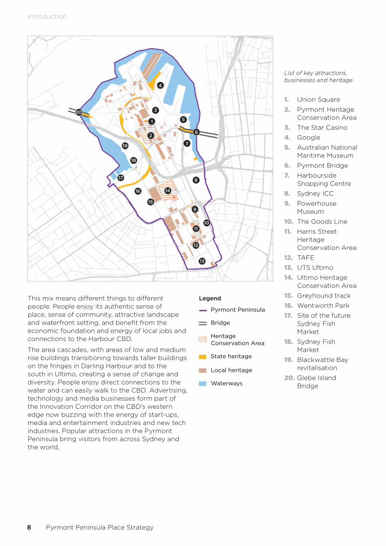
This mix means different things to different people. People enjoy its authentic sense of place, sense of community, attractive landscape and waterfront setting, and benefit from the economic foundation and energy of local jobs and connections to the Harbour CBD.
The area cascades, with areas of low and medium rise buildings transitioning towards taller buildings on the fringes in Darling Harbour and to the south in Ultimo, creating a sense of change and diversity. People enjoy direct connections to the water and can easily walk to the CBD. Advertising, technology and media businesses form part of the Innovation Corridor on the CBD’s western edge now buzzing with the energy of start-ups, media and entertainment industries and new tech industries. Popular attractions in the Pyrmont Peninsula bring visitors from across Sydney and the world.
1
2
3
8
9
1011
12
13
14
15
16
17
18
19
205
6
7
4
Legend
Pyrmont Peninsula
State heritage
Waterways
Local heritage
Heritage Conservation Area
Bridge
List of key attractions, businesses and heritage
1. Union Square
2. Pyrmont Heritage Conservation Area
3. The Star Casino
4. Google
5. Australian National Maritime Museum
6. Pyrmont Bridge
7. Harbourside Shopping Centre
8. Sydney ICC
9. Powerhouse Museum
10. The Goods Line
11. Harris Street Heritage Conservation Area
12. TAFE
13. UTS Ultimo
14. Ultimo Heritage Conservation Area
15. Greyhound track
16. Wentworth Park
17. Site of the future Sydney Fish Market
18. Sydney Fish Market
19. Blackwattle Bay revitalisation
20. Glebe Island Bridge
8 Pyrmont Peninsula Place Strategy
Introduction

The Innovation CorridorThe NSW Government’s promotion of the emerging Innovation Corridor will connect thriving new technology industries in Redfern, Eveleigh and the Australian Technology Park in the south, through to Camperdown–Ultimo and Tech Central across to the future Bays West precinct. The Pyrmont Peninsula sits at the centre of Innovation Corridor, connecting each of these places.
The Peninsula’s evolution will be shaped by the NSW Government building upon organic growth in the area as a key jobs hub and cultural entertainment precinct for Greater Sydney and the decision to invest in a Sydney Metro Station in Pyrmont. It is a place where the private sector wants to invest.
Recent transformations of consequence include the redevelopment of major sites including the ICC, Exhibition Centre and the Sofitel Hotel. Sydney Fish Market and Blackwattle Bay are
also set for revitalisation and the Harbourside Shopping Centre redevelopment is also under consideration. The Government’s decision to retain the Powerhouse Museum at Ultimo promotes the community’s desire for cultural facilities in the Pyrmont Peninsula. The Museum will grow as a key cultural asset and anchor for the education and creative industries in the area.
The Greater Sydney Commission (Commission), as part of its review of the current planning framework in 2019, noted the need for the Peninsula to continue to provide additional capacity for new jobs while improving and enhancing the very character that makes it an attractive and successful place. Above all else, the Commission’s review noted the importance of a cohesive, overarching strategy to guide future activity.
SydneyCBD
BaysWest
TechCentral
(Central Station)
AustralianTechnology
Park
Camperdown–UltimoCollaboration Area
Industrial& Maritime
(in transition)
Tourism & Entertainment
Tourism & Entertainment
Media &Adtech
Financial &Professional
Services
ICT
Education
Creative
Fintech
Digital &Design
Health &Medtech
PyrmontPeninsula
Legend
Pyrmont Peninsula
Railway
Roads
Innovation Corridor
Waterways
Introduction
NSW Department of Planning, Industry and Environment 9

About the Place StrategyThis Place Strategy creates a 20-year vision and planning framework to support the NSW Government’s vision to transform the Pyrmont Peninsula while meeting the aspirations of the business, industry, visitors, local and future residents.
The Place Strategy sets out a planned and logical set of directions, planning responses, infrastructure and governance opportunities to guide the next wave of investment in Pyrmont so it harnesses public benefits while enabling investor certainty.
It takes the findings and recommendations of the Commission’s review, combined with the further investigation and planning strategies undertaken by the Government, to create a place-based approach to the Peninsula’s planning and development. This means rather than taking a site-by-site or ad hoc approach to planning where decisions are not necessarily aligned, we consider the Peninsula’s many places and assess their potential against the broader ambitions for the area.
Built on the aspirations of business, industry, visitors, local and future residents, the Place Strategy is informed by our engagement with the community and stakeholders in early 2020 on the 10 Directions to Guide the Pyrmont Peninsula Place Strategy. A report on this engagement is available at www.planning.nsw.gov.au/Plans-for-your-area/Priority-Growth-Areas-and-Precincts/Pyrmont-Peninsula
The Place Strategy is led by the NSW Government’s Economic Development Strategy. This analysis supports the Government’s decision to invest in a Sydney Metro Station in Pyrmont and recognises the potential for transformation, building on the Peninsula’s existing character, anchors and attractors, proximity to the CBD and connections to the Innovation Corridor. This Place Strategy presents the preferred future vision, based on the Government’s decision to invest in a Pyrmont Metro station to accelerate the public and private benefits of the next wave of investment.
With a planning horizon of 2041, the strategy considers a preferred approach to address planning, design and development issues in Pyrmont Peninsula within the context of State and regional economic planning strategies and policies.
It establishes a platform around which the community, State and local government, business and other stakeholders can collaborate in pursuit of the agreed vision and, in turn, attract investment to take the Peninsula to the next level as an attractive place to live, work, learn, play and linger.
Future land use plans and development proposals, both strategic and statutory, will need to respond to the Vision, 10 Directions, Big Moves, Structure Plan and sub-precinct character statements and place priorities of the Place Strategy.
10 Pyrmont Peninsula Place Strategy
Introduction

PurposeThe Pyrmont Peninsula Place Strategy is designed to:
• identify and address essential matters of strategic economic, social and environmental significance to bring together the economic, environmental, public domain and urban design aspirations for Pyrmont in the one Strategy.
• harness public benefits from the Peninsula’s economic transformation already underway.
• promote the Peninsula as a jobs hub and economic driver for Greater Sydney, based on the future provision of a Sydney Metro station in the Peninsula.
• build on existing cultural and entertainment offerings in the Peninsula.
• identify sub-precincts that, based on their character, are more suitable for growth and change.
• guide the location and type of new development in a way that meets expectations and balances the creation of new workplaces and additional homes so any economic development or change maintains or enhances Pyrmont’s allure and residential qualities.
• guide future development proposals to provide certainty of investment decisions aligned with the final Place Strategy (and identify those that require realignment) setting out public benefits to which investors must contribute.
• establish a contemporary approach to deliver strong sustainability outcomes and design quality, active transport, urban greening, improvements to public and open space for public benefit.
• establish a platform for multiple stakeholders to collaborate to deliver on the shared future vision for the Peninsula.
StructureThe Place Strategy consists of:
• a vision for the area.
• background and context.
• the 10 Directions.
• 5 Big Moves that could bring greater benefits to the Peninsula.
• A Structure Plan and specific, place-based priorities for each sub-precinct.
• a framework for key sites.
• details on infrastructure opportunities and implementation approaches.
• an action plan.
The Place Strategy is implemented in the statutory planning system by a Ministerial Direction that requires all land use and planning proposals to be consistent with the Place Strategy.
Sub-precinct master plans will be prepared to support the Place Strategy and, once finalised, will inform updates to planning controls in the Sydney Local Environmental Plan 2012.
Evidence baseThe Place Strategy is informed by the following supporting technical studies (see Appendix B: Evidence Base on page 97 for a summary of technical studies):
• Economic Development Strategy.
• Urban design analysis comprising Project Analysis Report and Strategic Framework.
• Place-based Transport Strategy.
• Social Infrastructure Assessment and Demographic Profile.
• Phase 1 Engagement Report and Summary Engagement Report.
• Affordable Housing Study.
• Indigenous Cultural Heritage Report.
• Non-Indigenous Cultural Heritage Study.
• Infrastructure Delivery Opportunities Study.
• Utilities Infrastructure Assessment.
• Sustainability Framework Scoping Report.
Introduction
NSW Department of Planning, Industry and Environment 11

02Background
Waves of innovation and evolutionPyrmont’s history is one of abundance and adaptability. The Pyrmont Peninsula sustained First Nations people with a freshwater spring and fish from the harbour. So much abundance, they named the south Tumbalong, or “a place where seafood is found”, and the northern tip, Koodgi.
Pyrmont then served the early European colonists, particularly supplying the characteristic yellow block sandstone that defines many of Sydney’s finest buildings today. As one of the first entry points to Australia from overseas, Pyrmont has always been heavily influenced by global trends across successive waves of investment that reinvented how the place functioned over the past 200 years.
The initial investments took advantage of the unique peninsula landform and waterfront access, becoming Sydney’s working port. Wharves, warehouses and railways created Sydney’s key freight and logistics hub in the early to mid-20th century. CSR established a refinery on what is today known as Jacksons Landing. Sydney’s first coal-fired power station, on the modern-day site of The Star, supplied electricity to the city centre.
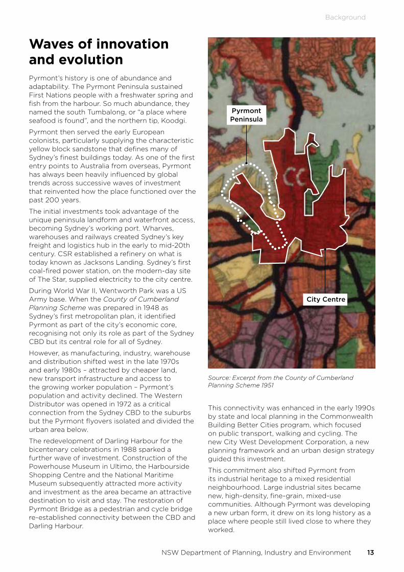
During World War II, Wentworth Park was a US Army base. When the County of Cumberland Planning Scheme was prepared in 1948 as Sydney’s first metropolitan plan, it identified Pyrmont as part of the city’s economic core, recognising not only its role as part of the Sydney CBD but its central role for all of Sydney.
However, as manufacturing, industry, warehouse and distribution shifted west in the late 1970s and early 1980s – attracted by cheaper land, new transport infrastructure and access to the growing worker population – Pyrmont’s population and activity declined. The Western Distributor was opened in 1972 as a critical connection from the Sydney CBD to the suburbs but the Pyrmont flyovers isolated and divided the urban area below.
The redevelopment of Darling Harbour for the bicentenary celebrations in 1988 sparked a further wave of investment. Construction of the Powerhouse Museum in Ultimo, the Harbourside Shopping Centre and the National Maritime Museum subsequently attracted more activity and investment as the area became an attractive destination to visit and stay. The restoration of Pyrmont Bridge as a pedestrian and cycle bridge re-established connectivity between the CBD and Darling Harbour.
Pyrmont Peninsula
City Centre
Source: Excerpt from the County of Cumberland Planning Scheme 1951
This connectivity was enhanced in the early 1990s by state and local planning in the Commonwealth Building Better Cities program, which focused on public transport, walking and cycling. The new City West Development Corporation, a new planning framework and an urban design strategy guided this investment.
This commitment also shifted Pyrmont from its industrial heritage to a mixed residential neighbourhood. Large industrial sites became new, high-density, fine-grain, mixed-use communities. Although Pyrmont was developing a new urban form, it drew on its long history as a place where people still lived close to where they worked.
Background
NSW Department of Planning, Industry and Environment 13

The Inner West Light Rail, opened in 1997 on the alignment of the former Metropolitan Goods Railway Line, helped ensure the new mixed-use community could evolve with public and active transport supporting new development.
The collaboration under the Building Better Cities program is instructive as those efforts finely balanced the local authentic village and historic character that residents love, while also accommodating thousands of businesses, their workers and destinations attracting visitors and students from around the world.
The urban design approach to the Pyrmont Peninsula adopted in that work was equally instructive. The Peninsula was seen as a place of transition between the CBD and the largely residential areas of the Inner West. Building heights and the built form was calibrated with that transition in mind.
A new wave of investment
Waves of investment have driven Pyrmont Peninsula’s remarkable transformation from a productive wharf, freight and logistics hub to one of the most successful examples of mixed-use waterfront urban renewal. It is now characterised by start-up hubs and jobs in media, entertainment, cultural and creative industries, technology and education.
A new wave of investment is now likely to transform the Peninsula, building on its unique character and appeal. This includes NSW Government decisions and private sector investment proposals including the:
• new Sydney ICC and Sofitel Hotel.
• redeveloped Sydney Fish Market at the head of Blackwattle Bay.
• retention of the Powerhouse Museum at Ultimo.
• the Government’s investment in a new Sydney Metro Station in Pyrmont
• the proposed redevelopment of Harbourside Shopping Centre.
• next phase of master planning for UTS in Ultimo.
14 Pyrmont Peninsula Place Strategy
Background

Responding with a strategic, place-based approachWe do not come to the task of preparing the Pyrmont Peninsula Place Strategy with a blank page. Pyrmont Peninsula’s layering of different functions, uses and activities contribute to the authentic, attractive place it is today. A place rich in history, featuring heritage warehouse buildings, residential terraces, unique and quirky public and open spaces, tree-lined streets and a breathtaking waterfront promenade.
Its attractiveness was the catalyst for Pyrmont to change from a largely local place to a globally connected place over the last three decades.
The 2019 Greater Sydney Commission review identified the need to coordinate and align separate investment choices for the area. Rather than consider growth on a site-by-site basis, a place-based strategy will – like the approach taken in the early 1990s – ensure any change maximises public benefits and minimises any negative impacts, enabling good growth to unlock the Pyrmont Peninsula’s potential. We know there is significant demand for growth in Pyrmont so it continues to grow as an industrial, entertainment, and tourist hub. The Place Strategy allows us to ensure we accommodate development in a way that allows to Pyrmont to continue to be an attractive, unique urban place.
The plans for the Pyrmont Peninsula established by the City West Development Corporation and managed by the City of Sydney have done an excellent job directing Pyrmont’s growth during the past 30 years. However, the current planning framework is inadequate to support further major growth on residual key sites.
This Place Strategy is essential in framing future development that responds to economic demand in a way that is sensitive to Pyrmont’s existing dense, urban community. Our vision is for Pyrmont’s growth to be an essential element of a Global Sydney creating jobs for the modern economy while respecting existing character.
This requires us to think about the Pyrmont Peninsula within Sydney’s broader economic and planning story, including how it can support the productivity of the Eastern Harbour City and contribute to the Innovation Corridor. This Place Strategy seeks to understand the unique characteristics and opportunities for each part of the Peninsula so it responds to the fine grain of the place and can accommodate new development on appropriate sites. It also requires
a contemporary approach to securing public benefits that help realise the true potential of the Peninsula as a great place.
Almost 30 years since the City West Development Corporation’s vision for Pyrmont Peninsula, this Place Strategy establishes a new vision to guide the next 20 years.
Background
NSW Department of Planning, Industry and Environment 15

03ContextStrategic Planning contextThe Place Strategy is shaped by the overall strategic vision of the Greater Sydney Region Plan and the Eastern City District Plan. It also draws from strategic policy inputs (see Appendix A: Strategic policy context on page 94) and the findings of the Commission’s review report.
The Place Strategy has also considered the following strategies and reports that relate to areas close to, or overlapping with, the Pyrmont Peninsula or the Innovation Corridor:
• Central Precinct Draft Strategic Vision (Transport for NSW 2020).
• Camperdown–Ultimo Place Strategy (Greater Sydney Commission, 2019).
• Sydney Innovation and Technology Precinct Panel Report (NSW Government, 2018)
• the future potential of Bays West.
Economic contextThe Place Strategy responds to the Commission’s direction to “unlock the economic potential” of the Pyrmont Peninsula and has been led by the Pyrmont Peninsula Economic Development Strategy (economic strategy) prepared by NSW Treasury. The economic strategy describes the area’s current economic character, analyses the drivers of growth and change, and forecasts future demand for new jobs and floor space, assuming a Sydney Metro station is delivered in Pyrmont in the next decade leading to the following forecasts:
• strong growth in jobs: an increase of 20,000 – 23,000 jobs to 2041.
• a local economy that is approximately 60% larger by 2041 with $4.2 - $4.9 billion more economic output per year compared to current levels.
• an increase in productivity by 7 per cent due to the growth in jobs in knowledge intensive industries.
• greater supply of commercial buildings: an additional 600,000 – 800,000 square metres of floor space will be required across the Peninsula by 2041.
• increased retail and residential development density associated with the provision of a Metro station, as well as more commuters coming in and out of the area.
• an industry mix geared towards knowledge industries, with growth in many of the associated industries for which the Peninsula is recognised: tourism and entertainment, media and information technology (IT).
16 Pyrmont Peninsula Place Strategy

Importantly, the economic strategy supports the Government’s decision to invest in a Sydney Metro Station in Pyrmont as it will have a significant impact on the Peninsula’s connectivity and therefore, its economic potential.
The economic strategy envisages the Peninsula will play a strong role in the NSW Government’s Innovation Corridor, driving innovation through digital advertising technology and media to complement the emerging Tech Central and the Central to Eveleigh areas. It will create an environment fostering connections and collaboration between major institutions and industry (including start-ups and small businesses) increasing productivity through research and innovation. This will enhance the Peninsula’s role as an attractive waterfront tourism and entertainment district supporting the global attraction of the Sydney Harbour with a 24-hour economy.
The economic strategy makes 10 recommendations to Government to support the growth of the Peninsula in line with this envisaged future role:
1. Foster a collaborative/networking environment for companies and educational institutions within the Innovation Corridor. Increasing national and international competitiveness through innovation districts is a planning priority in the GSC’s Eastern District Plan. As an example, Government should engage with anchor tenants in adtech (e.g. Google) to establish long term collaboration with businesses and industry across the Innovation Corridor.
2. Support local tertiary and vocational training institutions to offer courses that cater to the skills that the Innovation Corridor is likely to need (e.g. in media).
3. Strengthen and communicate the unique proposition of the Peninsula’s 24-hour economy with globally significant events, arts, entertainment and recreation, pop-ups and cultural events.
4. Support appropriate and sustainable developments that increase and re-purpose the supply of commercial floorspace to accommodate projected employment in the area (for example, via the new development proposals in Blackwattle Bay and Ultimo).
5. Consider actions to enable ongoing availability of affordable space for small business, startups and creative industries.
6. Subject to completion of a final business case, invest in a Sydney Metro West station to realise the full economic potential of the Peninsula, driving economic growth, creating jobs and increasing visitation.
7. Strengthen active transport connections within the Peninsula including between open spaces and the foreshore, and deliver missing regional and local cycle infrastructure.
8. Establish a business improvement district to improve amenities and public domain.
9. Rejuvenate Harris Street and renewal sites including Blackwattle Bay, Darling Island and Tumbalong Park through new hubs of activity and enhanced shopfronts, streetscapes and public spaces.
10. Open up the foreshore and Wentworth Park for additional open space and improved waterfront access for recreational and cultural uses. This is critical to attracting creative and knowledge-based employers and providing quality places for new and existing residents.
These recommendations underpin the Place Strategy, which brings together additional evidence and analysis, including community feedback, to set out a vision and directions, place priorities and actions guiding the future of the Peninsula to support a strong and growing Harbour CBD.
Context
NSW Department of Planning, Industry and Environment 17

Planning for the next phase of growth and changeThe strategic planning framework 30 years ago leveraged:
• Key sites: there were a small number of significant development proposals, often on large sites that were no longer in use, such as the CSR factory in the Peninsula’s north, which became Jackons Landing.
• Lower land values: the area’s derelict character, with disused industrial buildings and former warehouses lying idle, meant lower land values than those in comparable CBD fringe areas.
• Investment in infrastructure: investment in affordable housing, open spaces, amenities and services underpinned new residential, commercial and tourism development.
• Latent potential: disused wool stores, a harbourside setting, tree-lined streets and an abundance of former warehouses spurred redevelopment.
Today, most former warehouses contain residential or commercial/retail uses, often strata subdivided, and land values have risen considerably. Although much land on the Peninsula has significant constraints, a number of large sites remain that could accommodate focused growth and improve connections to surrounding neighbourhoods.
While today’s is a different story to a quarter of a century ago, the need to sensitively integrate increased investment with Pyrmont’s continually developing character remains. The 10 Directions offer a way to consider the aspects requiring attention if we’re to successfully transform Pyrmont Peninsula.
18 Pyrmont Peninsula Place Strategy
Context
04EngagementThe Place Strategy has been developed through the Department of Planning, Industry and Environment’s collaborative approach to precincts, which involves consultation with the community and businesses, the development industry and industry bodies, State agencies including the Greater Sydney Commission, Transport for NSW and the City of Sydney.
In normal circumstances this would have included, for example, face to face workshops. The COVID-19 pandemic has required us to take a different online approach, drawing from our early engagement on the 10 Directions and the formation of a ‘Bounce Group’ – our community and industry reference group.
Government COVID-19 restrictions most affected our ability to engage with Aboriginal knowledge holders. We will look to address this in future work.
Early engagement on 10 DirectionsWe released 10 Directions to Guide the Draft Pyrmont Peninsula Place Strategy in early 2020 and invited feedback from the community, local businesses and other stakeholders. Each direction was ranked either ‘important’ or ‘very important’ by most people who participated in the consultation, so we know they represent the right track for Pyrmont.
Public Exhibition of the draft Place StrategyThe draft Place Strategy and the evidence-base was exhibited for 6 weeks from 31 July to 13 September. The department held four community information webinars and presented (by invitation) to three industry briefings. A total of 136 submissions were received and 255 survey responses on the Big Moves.
The final Place Strategy has been reviewed and refined based upon the feedback received during the public exhibition. This is reported in the Summary Engagement Report available from the website link below.
Bounce GroupWe formed a ‘Bounce Group’, our community and industry reference group, through an open expression of interest process in May. The group represents the wider community, local business and industry representatives interested in developing the draft Place Strategy. It met four times and contributed valuable local knowledge and feedback on ideas being developed as part of the Strategy.
To see a full report on our early engagement, the submissions received and how we have responded, please visit www.planning.nsw.gov.au/Plans-for-your-area/Priority-Growth-Areas-and-Precincts/Pyrmont-Peninsula
NSW Department of Planning, Industry and Environment 19

05VisionIn 2041, the Pyrmont Peninsula will be an innovative, creative and cultural precinct and an engine room of the Eastern Harbour CBD. It will connect to the Innovation Corridor and other innovation and job precincts via Sydney Metro and complement the Sydney CBD.
20 Pyrmont Peninsula Place Strategy

A renowned and treasured cultural and entertainment precinct.
The Peninsula will blossom as a cultural and creative destination with the Powerhouse Museum, the Maritime Museum, the Lyric Theatre, and other cultural and creative uses extending the cultural ribbon along one of the world’s most treasured harbours. Aspirations to link with the new Walsh Bay arts and cultural precinct, the Museum of Contemporary Art and around to the Opera House and Royal Botanic Gardens have been realised.
Pyrmont will consolidate its reputation as cultural and entertainment precinct, with the Sydney ICC, Harbourside Shopping Centre, The Star, the new Fish Market, media and tech businesses, creative industries and start-ups working alongside restaurants, cafes and bars.
This vision for Pyrmont embraces its potential as a key cultural and entertainment precinct within walking distance of the city, leveraging its cultural and creative assets – visitors can see local and global music at the ICC, the latest Broadway theatre or Australian musicals at the Lyric Theatre, take in historical marvels at the Maritime or Powerhouse Museums or delight at Frank Gehry’s building from the Goods Line.
A host of conference, exhibitions, entertainment events at the ICC and surrounding hotels and movie premieres at the new IMAX cinema encourage a bustling 24-hour night-time economy within walking distance of the CBD along connected foreshore areas.
Pyrmont will be at the forefront of the future of work.
New jobs in media and advertising technology businesses, professional and knowledge services, creative and cultural industries and a visitor economy will ensure its future relevance and adaptability.
It will anchor and connect Sydney’s Innovation Corridor, including the start-up and technology hub at the Tech Central, the financial technology cluster at Australian Technology Park, the medical technology specialisation in Camperdown, and the future Bays West precinct.
It will continue its tradition being a place where people live close to their work, as a desirable gateway to the CBD revitalised as a waterfront precinct and as a place connection around the harbour and linking the east to west.
Green and connected.
The Peninsula will work to be a net-zero precinct and a sustainable place of choice for people to live, work and play. Social and other infrastructure, particularly public green and open spaces, a richer, broader tree canopy and integrated and decentralised parking options will make Pyrmont a leader in social and environmental sustainability.
Connections to history and heritage, the character and charm of Harris Street village and Union Square and other tree-lined streets, the much-loved green and open spaces along the waterfront, and the network of smaller parks, pockets and views along the ridge line will be protected and enhanced.
It will remain a place where the city meets the harbour, a waterfront destination showcasing the best of Sydney. At its heart will be an expanded harbourside promenade connected to innovative and inviting public spaces, waterfront vistas, wharves and cycleways, and a sustainable, living environment of urban canopy and welcoming green spaces.
Vision
NSW Department of Planning, Industry and Environment 21

Embracing a sensible approach to growth
will see more change, including taller buildings in Blackwattle Bay, Ultimo and the southern part of Darling Island and parts of Tumbalong Park, where opportunities exist to harness new investment connecting to public benefits such as foreshore walks, innovation or stronger arts and cultural results. Most growth will occur in Ultimo, where the Peninsula connects with current and planned future taller buildings in Haymarket and Central Station, Tech Central and Camperdown–Ultimo innovation precincts and Sydney’s busiest transport interchange, Central Station.
Its unique charm and history will continue to be central to its aesthetic appeal – a place where sheer sandstone walls and squares, quaint, tree-filled streets of terraces and the spectacular waterfront inspire some of the most creative and future-focused business in our city. And a place where ease of mobility drives a more sustainable future.
A variety of building typologies
will deliver high quality design, from a range of taller buildings complementing the character and heritage of the area to smaller-scale urban warehouses and innovatively reused heritage buildings. Businesses will enhance the Peninsula’s character – a competitive advantage – by delivering the highest quality in urban design and new buildings through design excellence, such as the Frank Gehry-designed Dr Chau Chak Wing UTS building on the Goods Line. New employment spaces for making, creating and producing will complement new commercial spaces.
People will use public transport, walk or cycle to get to and from the Peninsula.
A new Sydney Metro station will bring greater connectivity, an expanded labour pool and the impetus for strong economic activity. Better active transport connections, with more cycleways and improved ferry and bus services, will also enhance Pyrmont and its sustainability.
A diversity of housing, including new affordable and social housing.
New housing delivers a diversity of types and tenures to suit different households while meeting increasing sustainability objectives and performance targets. Social and affordable housing remains an important part of the social fabric of the local community and will continue to complement new development in the Pyrmont Peninsula, including through the affordable housing contribution framework.
A tapestry of publicly accessible open spaces
in pockets, rooftops, and neighbourhood and regional parks will weave with links to the foreshore and a stunning waterfront promenade, including seamless connections from the Sydney Fish Market to Walsh Bay and beyond.
22 Pyrmont Peninsula Place Strategy
Vision

0610 DirectionsThe 10 Directions address matters of strategic economic, social and environmental significance in the Pyrmont Peninsula that will guide future growth and change to 2041.
These directions and the accompanying Structure Plan establish how growth and change will occur in Pyrmont supported by the Pyrmont Metro station, which will supercharge demand for employment uses in the area.
NSW Department of Planning, Industry and Environment 23

DIRECTION #1
Jobs and industries of the future
Investment and innovation to boost jobs, creativity, tourism and night life
The Place Strategy creates the conditions to build on Pyrmont’s existing success as a hub for the city’s media, entertainment, creative, educational and start-up jobs. Pyrmont Peninsula’s success as a mixed-use area underlines the importance of getting the mix right for the area’s wider strategic intent as part of the Innovation Corridor.
The area is already home to the national broadcaster, the ABC, Network Ten, Radio 2GB, Screen Australia and one of the country’s best journalism schools at UTS. These anchors have been pivotal in the creation of a cluster of media and advertising technology businesses in Pyrmont.
The start-up and technology sector have already moved to Pyrmont Peninsula, with Google Australia based at Darling Island and start-up builder, Fishburners, on Harris Street. Together with UTS Start-ups, a community of innovative, future-facing technology businesses is growing on the Pyrmont Peninsula.
Cementing the position of the Pyrmont Peninsula as a creative, tourism and entertainment precinct will also drive increased jobs in entertainment, culture and tourism. These jobs are key to the future of Pyrmont Peninsula as an attractor for investment in job-creating industries in a truly global city.
In response, the Place Strategy identifies sub-precincts that will be better suited to commercial, tourism and cultural development; where residential development should be limited; and other areas that will continue to be dominated by residential and supporting uses and will not be suitable for large-scale commercial, retail or sector development.
Consideration should also be given to encourage affordable business accommodation such as voluntary planning agreements attached to planning proposals. Ensuring ongoing affordable business premises as tenants change over time will require targeted intervention or specialised management approaches, such as those which have been developed to deal with the provision and management of affordable housing.
By adopting a place-making approach, we describe the future character of each sub-precinct and potential actions or interventions to achieve this future character. This will include recognising the value public spaces, character and connectivity contribute to economic development.
The Economic Development Strategy identifies the number of future jobs that could be expected in the Peninsula and the amount of additional floor space required (noting the uncertainty due to COVID-19). The Urban Design Analysis considers the types of spaces that could accommodate new, enhanced or expanded space for jobs and industries of the future.
The Structure Plan then brings these findings together to give an idea of where forecast jobs might be located based on our integrated approach.
“Better transport which will bring more facilities to the area like shops, cafes, small and big businesses, jobs and activities to the area.”
Place Strategy response:
• Delivery of new major floor space capacity on larger sites around the harbour and park edge, within the Blackwattle Bay, Tumbalong Park and Darling Island sub-precincts through a range of building typologies including expansion of the lower scale campus style floorplate that supports small to medium size businesses alongside taller office towers, where appropriate.
• Continued growth and diversification of uses around the Ultimo creative precinct to deliver spaces for employment, research and innovation.
• Delivery of community outcomes (new public spaces, pedestrian connections and community facilities, and upgrades of existing streetscapes and historic buildings) within developments.
• Investment in existing clusters of local enterprise and innovation (such as along Wattle and Harris Street) to retain a mix of affordable, flexible and collaborative workplaces.
• Enhanced and activated connectors between ridge and edges providing for supporting retail and services.
24 Pyrmont Peninsula Place Strategy
10 Directions

DIRECTION #2
Development that complements or enhances the area
New or upgraded buildings fit with the Peninsula’s evolving character
Pyrmont Peninsula’s major commercial, entertainment, residential and retail buildings sit comfortably with terrace housing, smaller shops and heritage areas. They benefit from the area’s proximity to the CBD but also the character and charm of surrounding buildings and public domain. Any changes in building forms and public domain must be sympathetic to, or enhance, that character. Quality design will be key to this happening.
Through the Place Strategy, we have identified sites that can catalyse major development and contribute to Peninsula’s continued participation in a global economy. Whether through media, education, or tourism and entertainment, these industries will lead the development of these key sites in a manner that contributes to Pyrmont Peninsula’s character and secures public benefit.
However, the patterns and type of recent development place some limits on the scope for future growth and change. There are fewer key sites available, with many old warehouses formerly in single ownership now converted to strata titled residential or commercial development.
The heritage conservation areas that create so much character and charm are likely to see gradual change only.
The Place Strategy sets a preferred scenario to balance growth and change with character and place, including the Pyrmont Metro Station.
• The Urban Design Analysis assesses how and where growth and change could be accommodated, using established urban development and design principles as thresholds (for example, protecting heritage items and areas, or excluding open space and public areas from the potential list of opportunity sites). It then considers filters such as connectivity and access to sunlight for existing and new open spaces, existing residents and to the harbour foreshore
• These findings are analysed against the demand identified in the Economic Development Strategy under each scenario to assess whether the type and quantum of floorspace identified can be accommodated
• Most demand will be met in the Ultimo, Blackwattle Bay, Darling Island and Tumbalong Park sub-precincts, particularly around larger sites, including the Blackwattle Bay revitalisation area, The Star, Harbourside Shopping Centre, and UTS in Ultimo. Growth and change are still expected in the other sub-precincts but not to the same extent. There will be balance between preservation of desirable qualities and growth
The building of a Sydney Metro station will amplify demand for commercial space, which aids the NSW Government’s vision for Pyrmont as a key anchor to the Innovation Corridor. Land values will also increase.
Drawing on the findings of our evidence base and Economic Development Strategy, the Place Strategy’s overall direction will have implications for four large key sites held in single ownership (i.e. Blackwattle Bay, The Star, Harbourside, and UTS). While certain levels of growth may be possible based on the constraints analysis, any development must complement and enhance the broader Peninsula.
Further, our work on the sub-precincts has identified areas of the Peninsula are suitable to accommodate new jobs and homes and those with less potential to change due to constraints such as strata titles, heritage or amenity limitations including protecting solar access to open space. We’ve also considered the streets, places, services and infrastructure requiring enhancements and improvements to accommodate future growth or changes.
The Place Strategy identifies the preferred land use and development future for the Peninsula, including the areas set to experience more growth and change and the potential building form based on protecting solar access to important public spaces and places, amenity analysis and local character considerations in each sub-precinct.
10 Directions
NSW Department of Planning, Industry and Environment 25

“Some of these places haven’t changed much in a long-time – they need some renovation. The Sydney Fish Market and The Star... and the Harbourside Shopping Centre all need to be bigger and better.”
Place Strategy response:
• Identifies seven sub-precincts across the Peninsula based on existing (as well as potential) uses and character:
› Pyrmont village: a historic ridgeline village of fine grain shopfronts and terrace houses.
› Pirrama: an industrial headland transformed into a mixed residential neighbourhood.
› Darling Island: a harbour home of large commercial, cultural and leisure destinations.
› Blackwattle Bay: a place that will significantly transform to become a new urban quarter and tourism destination.
› Tumbalong Park: a regional destination for community, conventions and entertainment.
› Wentworth Park: a park-side community of historic warehouses and terrace houses
› Ultimo: a centre for creativity and learning at the edge of Central Station.
• Significant growth opportunity is identified for the Ultimo, Blackwattle Bay, Tumbalong Park and Darling Island sub-precincts subject to further studies, master plans and planning processes.
Consider the following height principles in sub-precinct master planning and to guide new development to complement or enhance the area:
• heights located close to ridge lines and stepping down to the harbour edge in the northern part of the Peninsula.
• heights appropriately interface with existing heritage context in Pirrama, Pyrmont Village and Wentworth Park.
• manage wind effects at edges of the Peninsula.
• promote daylight into streets.
• maintain human scale in streets.
• promote public views to and from the water.
• protect the Martin Place view corridor.
• protect areas of significant heritage or urban quality, including heritage conservation areas, Union Square and Harris Street.
• protect sunlight to parks and public open spaces.
• observe limits set by Civil Aviation Authority.
The ability for any single development, including key site development to access the maximum, or close to the maximum potential height on a site will be subject to evaluation of relevant planning and design matters in a subsequent planning process. Relevant considerations, such as solar access, wind impacts, streetscape and public domain experience, integrated with context, alignment with land uses under the Economic Development Strategy, design excellence, sustainability and public benefits/interest may moderate maximum building heights.
The height strategy will be refined and further guidance provided as part of sub-precinct master planning.
26 Pyrmont Peninsula Place Strategy
10 Directions

DIRECTION #3
Centres for residents, workers and visitors
New, lively and attractive centres for everyone to enjoy
Pyrmont Peninsula’s centres, businesses, institutions and public places attract people not only from across the Pyrmont Peninsula but around the world. Better public transport and community facilities could bring greater energy to more areas across the Peninsula, beyond the hubs around UTS, TAFE NSW Ultimo Campus, ABC and the ICC in the Peninsula’s south, and Pyrmont village and the harbourfront in the north.
The Place Strategy considers the Peninsula both as a whole and then in terms of the seven sub-precincts. This recognises the character and potential of each place, and the ability to create the right concentrations of shops, services, cultural areas and work environments – places attracting more people and investment to exciting, busy centres that are safe, day and night.
The entertainment precinct will harness the potential of the Pyrmont Peninsula to deliver a vibrant night-time economy for both the community and visitors, connected to beautiful public and open spaces and cementing the Peninsula’s identity as a cultural destination.
We have drawn from the analyses of social and utilities infrastructure to understand the mix of people and types of households that will be in Pyrmont in the future, and the capacity of existing infrastructure, such as community facilities, libraries, and electricity, to serve people in the future.
“[I love the] vibrant character of the suburb. It feels like a community existing in the midst of the city. The suburb is so quiet, and liveable while still being dynamic and exciting.”
Place Strategy response:
• Harris Street rejuvenation through a new street-based transport route creating new hubs of activity at each stop, improving the safety and enjoyment of this important historic street.
• Existing centres at the northern end of Harris Street (such as John Street and Union Street squares) are reinforced and enhanced through shopfront, streetscape and public space programs.
• New centres of activity created at the southern end of Harris Street, with development of major sites delivering new connections and open spaces, activation of street frontages and its transformation into a high amenity pedestrian environment.
• Renewal sites (within the Blackwattle Bay, Darling Island and Tumbalong Park sub-precincts) deliver new public spaces, shops and services to create smaller nodes of activity.
10 Directions
NSW Department of Planning, Industry and Environment 27

DIRECTION #4
A unified planning framework
Clearer rules delivering greater certainty and investment
Over time, a complex layering of planning authorities and frameworks has come to apply to the Pyrmont Peninsula. Although an important reason for this has been the need for major development to be considered at a state-significant scale, it has created confusion and uncertainty for residents and businesses.
The Place Strategy establishes a way forward while acknowledging existing planning processes. The Place Strategy will be given immediate statutory effect through a Ministerial Direction that requires all planning proposals to be consistent with the Place Strategy, including the Vision, the 10 Directions, the Big Moves, the sub-precinct place priorities and supported by infrastructure. The Place Strategy will guide changes to land use and development controls through planning proposals that can be advanced until sub-precinct master plans are finalised and integrated into the statutory planning system (expected to be the Sydney Local Environmental Plan 2012).
The Place Strategy also:
• establishes a framework for key sites that recognises the important role of several large sites in single ownership that can deliver strategic change in line with the Vision, 10 Directions, Big Moves, sub-precinct place priorities and supported by infrastructure. Key Sites will be able to advance under State-led pathways.
• advances work to rationalise the existing planning framework by investigating the return of planning controls to the City of Sydney and integration into a single instrument (expected to be the Sydney Local Environmental Plan 2012). This action is focussed on the Sydney Regional Environmental Plan No. 26 and Darling Harbour Development Plan No 1.
• identifies the priority to integrate new and updated planning controls in the Sydney Local Environmental Plan 2012, where possible to reduce complexity.
The NSW Government will continue to work with the City of Sydney Council to finalise sub-precinct master plans and update planning controls in the Sydney Local Environmental Plan 2012.
“The NSW Government needs to develop a new, more contemporary Vision for Pyrmont that will identify new development and growth areas, and encourage investment necessary to transform the entire precinct.”
Place Strategy response:
• The Structure Plan offers the opportunity to calibrate the statutory planning system around the delivery of the Place Strategy and in doing so, unifies and simplifies the planning system in the Peninsula.
• Detailed sub-precinct master plans will be prepared outlining the spatial components of the Place Strategy. The implementation of the master plans will require changes to land use zones, building height and density, and the introduction of provisions to ensure community infrastructure is delivered, through an amendment to the relevant planning instrument.
• An action for the NSW Government and the City of Sydney to investigate the rationalisation of Sydney Regional Environmental Plan No 26 – City West and Darling Harbour Development Plan No. 1 with the City of Sydney to lead the incorporation into the Sydney Local Environmental Plan 2012.
28 Pyrmont Peninsula Place Strategy
10 Directions

DIRECTION #5
A tapestry of greener public spaces and experiences
Better spaces, streets and parks; a rich canopy of trees; and access to the foreshore
In cities around the world, public spaces serve as iconic, attractive, lively urban spaces that help make their economies globally attractive. Places like Washington Square Park at the heart of Greenwich Village in New York City or the Copenhagen waterfront contribute immeasurably to the global appeal of places but also their attractiveness as a place to live, work, invest or visit.
Pyrmont Peninsula serves residents, visitors, businesses, tourists and students. Beyond the many open spaces, plazas and forecourts, such as Pirrama Park, Wentworth Park and Union Square, is the allure of the harbour. Our consultation tells us these connections to the water are important to people and should be a foundation for how we think about the interaction of people, buildings and place.
Public space can enhance the attractiveness of Pyrmont as a place to invest, to live, to visit and so underpins the success of other key directions.
How and when people use and experience the Peninsula requires adaptable facilities, services and spaces that serve many purposes. The Place Strategy considers this at a sub-precinct level.
For example, one of our Big Moves is to develop an uninterrupted world-class foreshore walk incorporating the links to and from Walsh Bay and the new Sydney Fish Market. This will create a new destination for Sydney, while also reconnecting people with the harbour in a location previously limited to the public.
It would be an important component of the open space network, linking smaller intimate spaces with larger spaces used for sporting activities. Similarly, our ambition is to return Wentworth Park to the community as a beautiful, connected open space.
Beyond these places, the sub-precincts will be places where development needs to not only add facilities, open space and services to meet demand, they need to connect existing services and facilities to create networks capable of
serving multiple purposes and audiences. In this way, links across the peninsula along shaded, pleasant streets will connect with new or existing parks, squares or facilities. Planning will focus on facilitating better connectivity and wayfinding.
Our Big Move 4 can also be a way to fully embrace the idea of a low-carbon precinct with a thicker urban tree canopy and cooler streets.
“[I love the] connection to the boats and water craft - from the Fish Market to the Dragonboats on the water.”
Place Strategy response:
• A contiguous harbour foreshore parkland that provides for regional recreational and cultural uses, as well as spaces for the local community.
• Test in sub-precinct master planning the delivery of the harbour foreshore walk in redevelopment to provide a 30 metre wide promenade (from water’s edge to buildings) including a 20 metre width for walking, cycling, recreational uses and landscape, if feasible.
• Facilitate the return of Wentworth Park to the community as public open space as part of Big Move 5.
• New public spaces delivered as large sites (such as Blackwattle Bay and Harbourside).
• New publicly accessible spaces created in the Ultimo Creative Industries Precinct.
• Considering the land side interface to support improved access to the water for water users.
Greener Places. Great Public Spaces
The Place Strategy aligns with and supports the delivery of the Premier’s Priorities to increase the proportion of homes in urban areas within 10 minutes’ walk of quality green, open and public spaces by 10 per cent by 2023 and to increase tree canopy and green cover across Greater Sydney by planting one million trees by 2022.
10 Directions
NSW Department of Planning, Industry and Environment 29

DIRECTION #6
Creativity, culture and heritage
Celebrating Pyrmont Peninsula’s culture, heritage and connections to Country
Pyrmont Peninsula’s arts, culture, creativity and heritage brings the area to life. Destinations like the Powerhouse Museum, the Maritime Museum and the Lyric Theatre attract global performances and exhibitions to Sydney. These venues connect around Sydney Harbour to the new Walsh Bay cultural precinct, the Museum of Contemporary Art and the Opera House. People enjoy the area’s libraries and museums, its history, its architecture and the area’s constant evolution.
The Place Strategy recognises the potential of the hub of creative industries in Ultimo, including links to the ABC and UTS.
As the sub-precinct with the scope for the greatest amount of growth and change, new development in Ultimo should explore opportunities to create new cultural experiences and facilities by drawing on this rich foundation for dynamic and engaging new uses.
The Place Strategy explores and celebrates the area’s Aboriginal heritage and industrial past to reinvigorate more areas. Analysis of both Aboriginal and European heritage have been produced and we will continue to engage with knowledge holders within the confines of the COVID-19 environment.
It also promotes using privately owned facilities for public purposes and exploring new models of access and ownership, particularly on larger sites.
“An extremely unique area within Sydney as there are no other areas that combine terrace houses with warehouse conversions. Pyrmont has its own character which has evolved naturally and reflects Sydney’s inner city history.”
Place Strategy response:
• Sydney Harbour foreshore walk as a continuous water-edge experience, connecting people to an understanding of place and of care for Country.
• An interpretive connection between Pyrmont and Glebe Island Bridges, two significant heritage items that celebrate stories of industry and enterprise.
• A ‘market to museum’ link between two water-based tourism destinations along Bridge Road, including improved pedestrian space, new crossings and signage.
• Harris Street enhanced as the historic urban spine of the Peninsula, with heritage building enhancement, streetscape improvements and interpretive elements.
• An integrated plan for the Ultimo creative precinct, including improved presence of, and access to, heritage buildings, enhanced open spaces and new pedestrian connections.
• An action to undertake further Aboriginal cultural assessment to provide a comprehensive understanding of the broader Aboriginal cultural landscape within the Pyrmont Peninsula, including identifying and consulting with local knowledge holders, subject to Government COVID-19 restrictions. This may include preparation of an Aboriginal heritage strategy (or be integrated with other projects, such as the City of Sydney’s Eora Journey Harbour Walk) and the further identification and recognition of values related to Tinker’s Well.
Design with Country
The Government Architect NSW is working with recognised Aboriginal knowledge holders, built environment experts and community to develop a framework for how designers and planners can better connect with and understand Country. This framework will be accompanied by an implementation framework that can be applied to all Government projects to ensure the sustainable management of Aboriginal culture and heritage.
30 Pyrmont Peninsula Place Strategy
10 Directions

DIRECTION #7
Making it easier to move around
Safer, greener streets integrating with new public transport
The nature of the peninsula, at times, makes it difficult to traverse and has been shaped by its isolation. The escarpment created by former industrial activity, the Western Distributor, and large impermeable buildings frustrate people’s ability to move around. Despite this, Pyrmont shows much higher rates of cycling and walking, and lower rates of car use, compared to Greater Sydney as a whole.
The arterial and sub-arterial road network means most traffic is moving people and goods to other locations. Delays and congestion may be exacerbated due to staged motorway construction in nearby areas; remedial works are being considered to ameliorate these impacts.
These constraints also limit the ability to adapt an already busy road network. In response, the Place Strategy, through the place-based transport strategy, considers how we can:
• prioritise walking and cycling as the preferred mode for local trips, including by creating better connectivity, making it easier to cross busy roads, escarpments and cuttings from past industrial uses, and service and transit corridors.
• encourage walking and cycling through site redevelopments, possibly by using planning bonuses to secure these benefits earlier.
• prioritise walking and cycling links that connect people to other parts of the Innovation Corridor and to the foreshore promenade.
• adopt lower maximum parking rates for residential and commercial land uses to reflect improved access to public transport to discourage the use of private vehicles, while also reducing development costs and heavy vehicle movements during construction.
• build on early signs of market acceptance of decoupled parking – models where on-site parking is not available for residential or commercial development, but provided locally in appropriate locations, on a commercial basis – and look to trial these
models at sites affected by elevated arterial road infrastructure on the periphery of the Peninsula, where commercially operated car parks may have low utilisation rates at different times of the day.
These options leverage a new Sydney Metro service, and associated development and increase in public transport capacity.
Our Big Move to rethink parking solutions for the Peninsula could create new, more sustainable ways of moving around, such as walking and cycling, and public transport, as well as leveraging new technology such as autonomous vehicles.
“It is very accessible to the city but feels secluded and welcoming. It reminds me of Soho or Greenwich Village in Manhattan. Truly Sydney’s hidden gem.”
Place Strategy response:
• Sydney Harbour foreshore walk as a continuous walking and cycling route linking the peninsula to the broader Harbour City.
• Active transport corridors running along Jones and Pyrmont Streets, forming a “mid-level” loop around the Peninsula.
• Strengthened east–west connections on Union Street, Bridge Road, Quarry and Maryann Streets, with wider footpaths and cycle lanes.
• New and enhanced “ridge to harbour” walking links, especially through redevelopment sites, and with provision of new crossings, ramps and lifts at existing barriers to movement.
• Investigation of a new street-based public transport link (such as bus or other mode) along Harris Street providing connectivity along the Innovation Corridor from Central to the Bays and increased frequency of the Inner West Light Rail.
• Safe and legible interchange between bus, light rail and ferry as well as the Pyrmont Metro station that considers and respects heritage and the existing built form, amongst other considerations in future planning processes.
10 Directions
NSW Department of Planning, Industry and Environment 31
DIRECTION #8
Building now for a sustainable future
An adaptive, sustainable and resilient built environment
Today’s Pyrmont Peninsula will be very different to the Peninsula of the future. Just as the 19th century wool stores were adapted as offices or homes, the buildings developed as the Place Strategy is implemented must be adaptable as technology and society changes. New buildings like UTS Central and Workplace6 at Darling Island have achieved 6 Star Green Star Building ratings that achieve world-leading excellence in sustainability in construction and operation. This direction applies not only to buildings but also to the infrastructure serving the Peninsula.
Our sustainability strategy has measured the Peninsula’s performance against sustainability criteria relating to emissions, building performance, water, greening, waste and resilience. This analysis finds Pyrmont Peninsula has the foundations to create a genuine shift in terms of sustainability, affordability and inclusiveness.
Four key sustainability interventions are targeted to deliver precinct-based solutions towards a net-zero carbon precinct by 2041:
• Multi-utility hubs as precinct infrastructure (refer Big Move 4).
• Green Streets and Active Streets: involving the reallocation of space on key active streets to facilitate increased green open space and canopy to create cooler urban environments (and enabled by multi-utility hubs).
• High Performance New Buildings: to deliver new development that is high performance and resilient by encouraging use of solar, batteries, recycled water, electric vehicles through BASIX and NABERS targets and no on-site parking for residential development.
• Offsetting to deliver a Net Zero Outcome: Modeling suggests that if the other three interventions are delivered there will be a residual quantity of emissions that would require offsetting to reach net zero emissions across the Peninsula.
Place Strategy response:
• Active transport corridors providing rapid local access to key employment, housing and recreation areas.
• Harbour edge parkland to support social and ecological resilience (including flood and sea level rise mitigation).
• Comprehensive street and park tree planting program to achieve 25% canopy cover, reduce “heat island effect” and create a network of walkable comfortable public spaces.
• Investigation of “multi-utility hubs” to be created on larger development sites, linked to road and light rail, and providing potential for a range of social and ecological outcomes, including precinct parking, energy and water systems, cultural and community spaces.
• New buildings designed to high environmental standards, net-zero water and energy targets and providing for flexibility and future adaptation.
• Consider the planning principles of the Sydney Regional Environmental Plan (Sydney Harbour Catchment) 2005 in sub-precinct master planning.
32 Pyrmont Peninsula Place Strategy
10 Directions
DIRECTION #9
Great homes that can suit the needs of more people
A diversity of housing types, tenure and price points
Pyrmont Peninsula is home to social housing, affordable housing and housing people can privately rent or buy, at a variety of housing types, tenures and price points. This diversity is important and is a focus of the Place Strategy and each sub-precinct.
This focus means long-term residents can stay in places they know, and a greater mix of people with different skills, backgrounds or needs can be part of a socially diverse Pyrmont Peninsula. This is a defining characteristic of Pyrmont, which housed workers in industrial and early social housing, such as Ways Terrace.
However, we recognise growth and change can have unintended consequences for certain groups. As an area’s popularity increases and more people are attracted to it, competition for available space will normally see land values and rents rise. This can adversely impact existing residents and businesses who cannot compete on price.
The Place Strategy recognises the need to retain the affordable housing scheme in place on the Peninsula but considers whether it should be brought into line with similar strategies operating elsewhere in the City of Sydney, as well as the Region Plan. There is also a need to cater for student housing and facilitate housing diversity and affordability through new mechanisms, such as build-to-rent.
While the Urban Design Analysis identifies some social and affordable rental housing sites may be capable of change, it does not necessarily mean these sites will be redeveloped. Any decision by NSW Land and Housing Corporation or City West Housing to renew these sites would be subject to a range of considerations, including feasibility, alignment with the Place Strategy and sub-precinct master plans and aim to boost the amount of social and affordable rental housing in the area. This would be subject to a more detailed planning and consultation process with stakeholders, including existing tenants and community.
“Great community vibe, mix residential and commercial use with focus and emphasis on heritage. Low to medium density living means you get to know your neighbours.”
Place Strategy response:
• Housing growth is focussed primarily in residential areas, across the ridgeline village and along the western side of the Peninsula at Pyrmont Village, Pirrama, Blackwattle Bay, Wentworth Park and Ultimo (northern) sub-precincts.
• Outside of key sites, housing is expected to be incremental under the planning system and in smaller developments of lower-scale, and compatible with the historic nature of these areas.
• There may be opportunity for residential development in other locations where this does not undermine the vision of the area as a jobs hub and economic driver of Sydney (i.e. does not compromise the delivery of new commercial and employment floor space) in line with the Eastern City District Plan priority E7.
• New housing:
› should deliver a diversity of housing types and tenures to suit different household sizes, configurations and needs.
› should be affordable to ensure a mix of people can continue to live in the Peninsula.
› should aim to boost social and affordable rental housing with market housing.
› should meet increasing sustainability objectives and performance targets for reduced environmental impact, better building performance (and cheaper running costs) and for improved health and social outcomes.
• Reconcile the revised City West Affordable Housing Program with the City of Sydney’s affordable housing approach as part of work to unify the planning framework.
• Review and update the existing affordable housing contribution rates.
• Investigate the opportunities for more social and affordable rental housing as part of sub-precinct master planning in line with current Government policy.
10 Directions
NSW Department of Planning, Industry and Environment 33
DIRECTION #10
A collaborative voice
A cohesive, agreed approach to bring the best outcomes for Pyrmont Peninsula
Pyrmont Peninsula will be a part of the Innovation Corridor, a place interweaving entrepreneurship, creativity, start-ups, new jobs and great places. Successful innovation districts are governed collaboratively, with local, state, not-for-profit, community and private sector agreement on priorities, funding and programs.
Securing an enduring model of collaboration is critical to lift Pyrmont to the next level. A number of models are being considered, including an industry-led Business Improvement District, as proposed by the Western Harbour Alliance and the Committee for Sydney.
The potential to adapt international models of place governance in the Pyrmont Peninsula has been recognised with the establishment of the Western Harbour Alliance. The Alliance has made several governance-related suggestions, including establishing a local improvement fund. We have proposed contemporary governance models in our Big Moves and will also use feedback to this Place Strategy to create the shared vision that guide future growth and change in the Peninsula.
Place Strategy response:
• New development considers gender inclusive design and opportunities to increase participation by women and children in the design process and the built form outcomes (refer to the NSW Greater Sydney Commission’s Women’s Safety Charter).
34 Pyrmont Peninsula Place Strategy
10 Directions

07Five Big Moves for Pyrmont
This place strategy proposes Five Big Moves to unlock the potential of Pyrmont. These Big Moves offer exciting opportunities to bring the vision for the Peninsula to life. They are purposefully ambitious and require ongoing commitment and coordination to deliver over the next 20 years.
NSW Department of Planning, Industry and Environment 35
Five Big Moves for Pyrmont
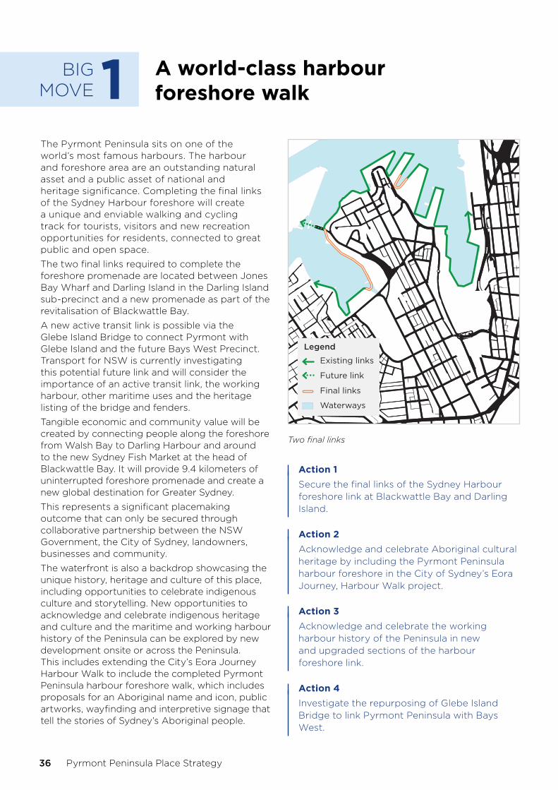
BIG MOVE 1 A world-class harbour
foreshore walk
The Pyrmont Peninsula sits on one of the world’s most famous harbours. The harbour and foreshore area are an outstanding natural asset and a public asset of national and heritage significance. Completing the final links of the Sydney Harbour foreshore will create a unique and enviable walking and cycling track for tourists, visitors and new recreation opportunities for residents, connected to great public and open space.
The two final links required to complete the foreshore promenade are located between Jones Bay Wharf and Darling Island in the Darling Island sub-precinct and a new promenade as part of the revitalisation of Blackwattle Bay.
A new active transit link is possible via the Glebe Island Bridge to connect Pyrmont with Glebe Island and the future Bays West Precinct. Transport for NSW is currently investigating this potential future link and will consider the importance of an active transit link, the working harbour, other maritime uses and the heritage listing of the bridge and fenders.
Tangible economic and community value will be created by connecting people along the foreshore from Walsh Bay to Darling Harbour and around to the new Sydney Fish Market at the head of Blackwattle Bay. It will provide 9.4 kilometers of uninterrupted foreshore promenade and create a new global destination for Greater Sydney.
This represents a significant placemaking outcome that can only be secured through collaborative partnership between the NSW Government, the City of Sydney, landowners, businesses and community.
The waterfront is also a backdrop showcasing the unique history, heritage and culture of this place, including opportunities to celebrate indigenous culture and storytelling. New opportunities to acknowledge and celebrate indigenous heritage and culture and the maritime and working harbour history of the Peninsula can be explored by new development onsite or across the Peninsula. This includes extending the City’s Eora Journey Harbour Walk to include the completed Pyrmont Peninsula harbour foreshore walk, which includes proposals for an Aboriginal name and icon, public artworks, wayfinding and interpretive signage that tell the stories of Sydney’s Aboriginal people.
Legend
Existing links
Waterways
Future link
Final links
Two final links
Action 1Secure the final links of the Sydney Harbour foreshore link at Blackwattle Bay and Darling Island.
Action 2Acknowledge and celebrate Aboriginal cultural heritage by including the Pyrmont Peninsula harbour foreshore in the City of Sydney’s Eora Journey, Harbour Walk project.
Action 3Acknowledge and celebrate the working harbour history of the Peninsula in new and upgraded sections of the harbour foreshore link.
Action 4Investigate the repurposing of Glebe Island Bridge to link Pyrmont Peninsula with Bays West.
36 Pyrmont Peninsula Place Strategy

BIG MOVE2 A vibrant 24-hour cultural
and entertainment destination
The Pyrmont Peninsula has all the right ingredients to cement its position as a world-class cultural and entertainment destination, a globally connected place and a jewel on Sydney Harbour within walking distance of the CBD.
It is part of the cultural ribbon, the uniquely Sydney foreshore link between the Royal Botanic Gardens and Opera House, the Museum of Contemporary Art, the Rocks, Barangaroo Headland and the new Walsh Bay arts and cultural precinct around to Pyrmont and the Powerhouse Museum, Australian National Maritime Museum, the ICC and Lyric Theatre. This cultural arc is home to some of our treasured places, such as the Rocks and Darling Harbour, retail and entertainment hubs at Harbourside Shopping Centre and The Star, and the existing and future Sydney Fish Market.
We want to embrace the placemaking opportunity for the Peninsula and leverage its strong cultural, entertainment and visitor attractions to build its status as a destination of choice. In the future, Pyrmont will be a place buzzing with activity, attractions, restaurants, cafes, bars and retail – all contributing to a vibrant 24-hour economy within walking distance of the CBD that attracts new residents, workers, visitors and investors.
This means investigating opportunities to:
• provide new space for entertainment, events and cultural attractions as part of key site redevelopment, including diversifying night-time experiences.
• enable better connections through key sites to promote wayfinding and activate the public domain.
• deliver streets as shared spaces that encourage outdoor dining.
• enable cultural and creative uses, such as maker spaces, live music and child-friendly experiences supported by better public transport and connectivity.
The interface between a 24-hour economy and local residential amenity will need to be managed, through existing regulation and governance.
The 24-hour Economy Strategy recognises these issues and proposes community and industry-led safety programs to support 24-hour precincts.
Following the 24 Hour Strategy, the Government has recently passed the 24 Hour Economy Bill which reforms liquor licencing and planning laws for bars and live music venues. Changes like aligning licencing and planning processes, simplifying regulatory barriers, and discounting fees for well run venues will help to spur Pyrmont’s night time economy and bring a whole new range of unique, small entertainment and hospitality venues.
Action 5Investigate the opportunity for new entertainment, events and cultural space in the Peninsula on key sites.
Action 6Enable a diversity of night-time experiences in line with the City of Sydney’s ‘An Open and Creative City’ and the NSW Government’s 24- Hour Economy Strategy.
The 24-hour Economy Strategy sets out an ambitious and collaborative vision to activate a vibrant, diverse, inclusive and safe 24-hour economy in Sydney - a global beacon of culture, entertainment and amenity.
Under the strategy, a 24-hour Economy Commissioner will be appointed and responsible for implementation. An acceleration program will help Councils activate 24-hour economy hubs. A Neon Grid will help us map, benchmark and plan the growth of Greater Sydney’s 24-hour economy.
Five Big Moves for Pyrmont
NSW Department of Planning, Industry and Environment 37
BIG MOVE 3 Connect to
Metro
The Government is supporting the potential of the Pyrmont Peninsula and its vision as a jobs hub with an investment in a new Sydney Metro Station in Pyrmont. Connecting the Peninsula to Sydney Metro will take advantage of new public transport option and supercharge the area for new jobs. Pyrmont will enhance its attraction as a complementary economic space to the Sydney CBD, linking opportunities for new economy jobs, as well as arts, entertainment and cultural activities.
The Pyrmont Metro station will make it easier for people to move around, to access jobs and services and to connect with other places across Greater Sydney. Businesses will more easily connect with other businesses and customers in places including Parramatta CBD, Westmead, Sydney Olympic Park and via interchange, North Sydney and Macquarie Park. The whole of Sydney will find it easier to get to Pyrmont, and Pyrmont residents will have more places they can get to within 30 minutes.
Given light rail is congested during peaks and the area’s topography and layout make it difficult to travel into and around, the Pyrmont Metro connection will increase public transport use and overcome difficulty in reaching the Peninsula by car or otherwise. Pyrmont’s growth is contingent on continually improving public transport, walking and cycling levels.
The Government’s investment in a Pyrmont Metro Station will be a key enabler for growth and change on the Pyrmont Peninsula. In addition, a Pyrmont Metro Station will attract new businesses and jobs, unlock the full economic potential of the Peninsula and act as an anchor for the Innovation Corridor.
The Government is continuing to investigate how a Sydney Metro Station will integrate into Pyrmont, including locations for new station entrances. This work will be integrated into sub-precinct master planning to ensure a place-based approach to the planning, design and development of a Sydney Metro Station in Pyrmont.
Action 7Build a Sydney Metro station in the Pyrmont Peninsula as an anchor for new development and connectivity.
Five Big Moves for Pyrmont
38 Pyrmont Peninsula Place Strategy

BIG MOVE 4 Low carbon, high
performance precinct
This Big Move thinks differently about the infrastructure in place, and how future infrastructure can be provided in the Peninsula beyond what may be expected.
We could deliver a low-carbon, high-performance precinct through an integrated model of car parking that enables the reprioritisation of streets for pedestrians, cyclists, businesses and residents, or trees, through multi-utility hubs.
Multi-utility hubs as precinct infrastructure offer the opportunity to reduce the need for on-site parking, and some off-street parking, opening up new opportunities to reuse land otherwise used for on-street parking.
Components of hubs could include:
• integrated precinct parking so new residential development does not require on-site parking (decoupled parking) and on-street parking can be removed to create better and cooler streets and reduce parking overall.
• potential for consolidated freight hub component (similar to the the Goulburn Street hub) to reduce overall freight movements and enable more efficient last kilometre delivery methods, such as cyclists or electric vehicles.
• electric vehicle charging points to avoid clutter on the street.
• grid-scale battery storage to optimise local renewables and electric vehcile charging.
• organic waste systems to manage food waste, creating compost for local gardens and landscaping.
• recycled water factories to create local drought-proof water supply for cooler, greener precinct.
• social infrastructure such as bike and end-of-trip facilities to support residents in smaller houses and workers in older, heritage buildings.
• urban farms and community gardens on rooftops.
The hubs are an integrated component alongside three other interventions that form part of the sustainability framework for the Peninsula that aims to to deliver a net-zero emission precinct by 2041 (refer to Direction 8 and the Sustainability Framework that supports the Place Strategy for more information).
Pyrmont Peninsula is perfectly suited to test and validate decoupled and precinct parking solutions that could shift the dial on what a sustainable precinct really means. This could achieve real progress towards a genuine low-carbon precinct, re-utilise public parking space for activity or open space, communal gardens and parks, or co-locate new parking solutions with other physical infrastructure such as solar, water recycling or waste services. Other benefits include:
• reduced construction costs, truck movements during construction and maintenance costs and better housing affordability.
• carbon and energy reductions and better air quality.
• more feasible development to attract investment and renewal.
• the ability to reserve sites for future use if parking is no longer required (due to high public transport use or new technologies such as autonomous vehicles).
• less local traffic.
• more active streets and places.
The City of Sydney is currently developing performance standard pathways to net zero energy buildings so development can contribute to the NSW Government’s objective of net zero emissions by 2050. The project is being undertaken in collaboration with industry stakeholders. It will establish a framework for step change improvements in energy performance, as well as integrating off-site renewable energy in the planning controls. The sub-precinct master plans are an opportunity to integrate this work.
Action 8Investigate the delivery of multi-utility hubs and integrated models of car parking.
Five Big Moves for Pyrmont
NSW Department of Planning, Industry and Environment 39

BIG MOVE5 More, and better
activated public space
This move calls for more public space, improved quality of public space and better activation of our public spaces. In a dense urban area like Pyrmont, land is in high demand and we need new and innovative approaches in how we create and manage public space. We also need to consider the interface between land and water.
Expanding public access to Wentworth Park
We propose to improve Wentworth Park as newly activated, publicly accessible open space as part of a larger and enhanced parkland. A working group with government agencies and stakeholders will be established to assist in identifying a suitable alternate site for greyhound racing.
Action 9Facilitate the return of Wentworth Park to the community as public open space.
Making better use of public land
We could make better use of the land beneath the Western Distributor overpass for a range of temporary, pop up or permanent uses, such as indoor recreation facilities or space for events and meetings, creative or start-up spaces, or to showcase art, history and heritage.
Action 10Investigate the temporary (pilot) or permanent use of land underneath the Western Distributor for a range of compatible uses.
Creating new space
The interface between Darling Harbour and the Pyrmont Peninsula is hard; a change of level as well as road and rail corridors make moving between these two areas difficult, particularly further away from the Darling Harbour waterfront.
We could look to better utilise back of house areas of the ICC at Darling Drive and the light rail to create new space; this land, in the centre of a mixed-use precinct and global city, is not being used well. We could investigate options to build over the land, or redesign access, or both. New space could be made available for employment, recreation or to make it easier to move around, such as extending the Goods Line north to connect the Innovation Corridor or secure sustainability outcomes, including integrated parking and multi-function utility hubs (Big Move 4).
Action 11Investigate the re-utilisation of land on Darling Drive through redevelopment.
We could also look to secure temporary active transport measures implemented to provide additional capacity under Government COVID-19 restrictions for longer periods, or make them permanent and contribute to growing Greater Sydney’s cycle network.
Action 12Investigate the ongoing trial of temporary COVID-19 active transport measures beyond current Government guidelines.
Across Melbourne, the removal of level rail crossings has done more than improve rail and traffic interfaces; it has already created opportunities for the land under elevated rail lines. For example, the removal of nine level crossings between Caulfield and Dandenong has allowed the creation of more than 22 hectares of open space, parklands and new community areas, as well as 17 kilometres of pedestrian and cyclist paths.
Five Big Moves for Pyrmont
40 Pyrmont Peninsula Place Strategy

The United Nations definition of public space
Places publicly owned or of public use, accessible and enjoyable by all for free and without a profit motive. These include:
• public open spaces: active and passive including parks, gardens, playgrounds, public beaches, riverbanks and waterfronts, outdoor playing fields and courts and publicly accessible bushland.
• public facilities: public libraries, museums, galleries, civic/community centres, showgrounds and indoor public sports facilities.
• streets: streets, avenues and boulevards, squares and plazas, pavements, passages and lanes and bicycle paths.
Managing water use in Blackwattle Bay
Increased activity on the water in Blackwattle Bay for recreation and working harbour uses may create new land-side and water-side conflicts between competing users. We have heard from various interest groups that this conflict is already occuring. To plan for a more integrated on-water and land-side interface, a plan of management is recommended, based on consultation with recreational water users, marina and berth operators, regulators and the community.
Action 13Prepare a plan of management for recreational water use in Blackwattle Bay.
NSW Department of Planning, Industry and Environment 41
Five Big Moves for Pyrmont

08Structure PlanThe Structure Plan sets out the spatial interface of the vision, key Peninsula-wide directions, and identifies the areas of change. It sets a framework for the future of the Peninsula with indicative movement and open space networks linking distinct neighbourhoods and places.
Growth and change have been distributed based on the forecast (ie. the future potential floor space that could be required based on assumptions) in the Economic Development Strategy, an amenity-led urban design analysis to consider potential capacity and a character-led analysis to consider those special and important elements of the Peninsula that should be protected or enhanced.
This Structure Plan sets the foundations to take the Peninsula to the next level as a jobs hub, while ensuring key placemaking and public benefit outcomes are secured with growth and change. This approach balances growth and change with character and place. It is focussed on the delivery of:
1. A diverse, connected, restorative public domain.
2. An integrated movement network.
3. Ridgetop village character and community.
4. Significant renewal sites at parks and harbour edge.
Regional harbour parklandThe harbour edge of the peninsula is a regional parkland that contains a diversity of spaces, activities and characters. This is an accessible, engaging and restorative place for locals, workers and visitors. It repairs the ecological functioning of the water edge and protects against flooding and storm events.
World class harbour foreshore walkA continuous world class harbour foreshore walk links major event, tourism and entertainment destinations. Walking and cycling paths link the peninsula to the rest of the Eastern Harbour CBD. This harbour walk connects people to the water, to the history of this place, to country.
Harris StreetUpgrades to public transport, footpaths and shopfronts link existing clusters of businesses and homes along the peninsula’s historic main street. This is a diverse, affordable, eclectic place of enterprise and economy - linking the peninsula to the broader Innovation Corridor.
Local open spacesA connected network of smaller public spaces sit across the peninsula, providing moments of respite and places for the community to connect and engage.
Green walkable streetsAll streets are green, walkable, comfortable places. New connections overcome barriers between the ridgeline and parks and water at the edges. Active movement corridors run east–west and north-south, linking people to major destinations in the peninsula beyond.
Places for economic innovationLarger sites along the eastern and western edges, as well as Ultimo, provide the opportunity for significant renewal. New workplaces, homes, places for creativity and learning are created, along with new open spaces and pedestrian connections.
Transport integrationNew and existing transport systems are integrated, with easy and legible interchange at key nodes.
Metro Investigation AreaPotential strategic station location currently being investigated.
Source: Hassell
42 Pyrmont Peninsula Place Strategy

Legend
Regional harbour parklandWorld class harbour foreshore walkHigh street/intermediate transport corridorStrategic active transport routeGreen walkable streetsMetro investigation areaTransport interchangeInner west light rail corridorLocal open spacesAreas capable of change

09Sub-precinctsThe places of the peninsula
The Pyrmont Peninsula is a collection of many places. Our analysis suggests the Peninsula is made up of seven sub-precincts that have evolved over time with their own unique character and identities. We have identified these through our understanding of each sub-precinct character, the evidence base prepared to support the development of the Place Strategy and engagement with stakeholders.
For each sub-precinct, we have considered its character today and the area’s potential for the future. We also define priorities for each place that are the foundations for reaching that potential and requirements for future growth and change.
44 Pyrmont Peninsula Place Strategy

Darling IslandA place of entertainment, tourism and innovation
Tumbalong ParkA place of attraction and interaction
UltimoA place of integration, education, creativity and culture
Wentworth ParkA place of home, work and recreation
Blackwattle BayA place of transformation and renewal
PirramaA place of waterfront living and working harbour heritage
Pyrmont VillageA place of history, innovation and culture
Sub-precincts
NSW Department of Planning, Industry and Environment 45

Darling IslandA place of entertainment, tourism and innovation.
46 Pyrmont Peninsula Place Strategy

Darling Island caters to jobs in the entertainment, tourism and innovation industries. It attracts international businesses and tourists with an active waterfront and views to the Harbour Bridge. It offers easy pedestrian and bike access to the CBD over Pyrmont Bridge, both light rail and ferry connections, and good access for private cars and freight trips.
Low and medium-rise buildings nestle into the area’s sloping topography from Harris Street to the waterfront, where finger wharfs have been transformed into offices, restaurants, homes, many of which face onto Metcalfe, Ballaarat and Pyrmont Bay parks.
Darling Island hosts a mix of nationally significant innovation, creativity, ad-tech and media businesses, including Google. The Star, Lyric Theatre, Australian National Maritime Museum, in addition to shops, cafes, bars and restaurants which attract visitors and tourists during day and night.
Links to its history as a working waterfront and can be found in the finger wharfs and along the waterfront where remnants of this heritage are preserved as public art.
Source: Destination NSW
Sub-precincts
NSW Department of Planning, Industry and Environment 47
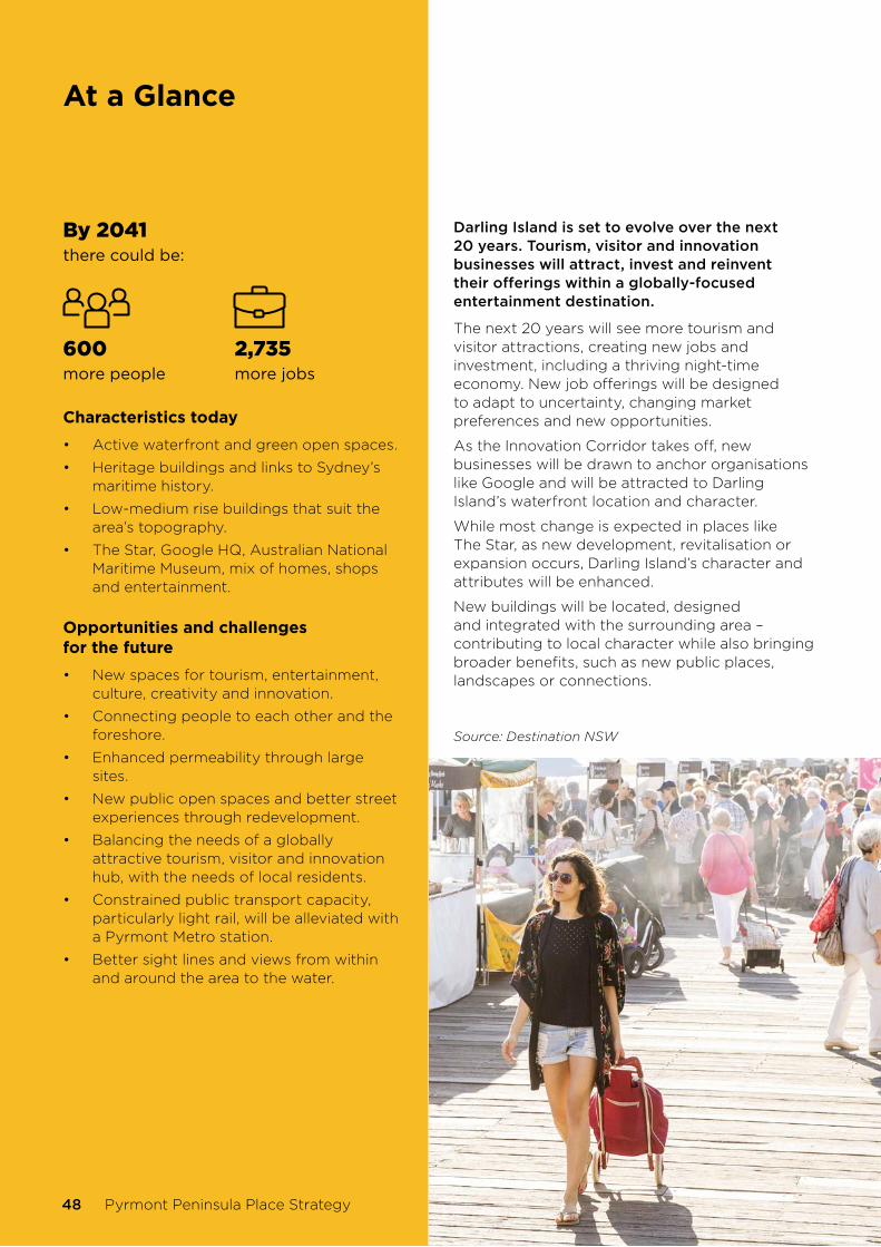
At a Glance
By 2041there could be:
600more people
2,735more jobs
Characteristics today
• Active waterfront and green open spaces.
• Heritage buildings and links to Sydney’s maritime history.
• Low-medium rise buildings that suit the area’s topography.
• The Star, Google HQ, Australian National Maritime Museum, mix of homes, shops and entertainment.
Opportunities and challenges for the future
• New spaces for tourism, entertainment, culture, creativity and innovation.
• Connecting people to each other and the foreshore.
• Enhanced permeability through large sites.
• New public open spaces and better street experiences through redevelopment.
• Balancing the needs of a globally attractive tourism, visitor and innovation hub, with the needs of local residents.
• Constrained public transport capacity, particularly light rail, will be alleviated with a Pyrmont Metro station.
• Better sight lines and views from within and around the area to the water.
Darling Island is set to evolve over the next 20 years. Tourism, visitor and innovation businesses will attract, invest and reinvent their offerings within a globally-focused entertainment destination.
The next 20 years will see more tourism and visitor attractions, creating new jobs and investment, including a thriving night-time economy. New job offerings will be designed to adapt to uncertainty, changing market preferences and new opportunities.
As the Innovation Corridor takes off, new businesses will be drawn to anchor organisations like Google and will be attracted to Darling Island’s waterfront location and character.
While most change is expected in places like The Star, as new development, revitalisation or expansion occurs, Darling Island’s character and attributes will be enhanced.
New buildings will be located, designed and integrated with the surrounding area – contributing to local character while also bringing broader benefits, such as new public places, landscapes or connections.
Source: Destination NSW
48 Pyrmont Peninsula Place Strategy

Darling Island place priorities
1. Plan for new jobs in tourism, entertainment, culture, creativity and innovation within walking distance of the Pyrmont Metro station.
2. Providing residential development, including affordable housing without compromising the attractiveness of Darling Island for tourism, visitor and 24-hour economy uses, cultural, creative, entertainment and commercial uses.
3. Create new or adapt space in older buildings for new workplaces and look to diversify Darling Island’s tourism and visitor offerings.
4. Protect views to and from the harbour and from higher points such as Harris Street and Distillery Hill, including from public areas.
5. Create a continuous harbour foreshore walk, including the section around Jones Bay Wharf, and include clear wayfinding.
6. Investigate an interpretative heritage walk between Pyrmont and Glebe Island bridges (aligned with Union Street) to celebrate heritage and the history of industry and enterprise.
7. Create attractive, safe and connected streets for walking and cycling, particularly in back-of-house areas, with activity spurred on by shops, cafes, outdoor dining, public art, and community spaces.
8. Upgrade open space areas including
a. a new play space with climbing elements, sensory gardens, playful public art and a safe pavement treatment to encourage jumping and play.
b. an outdoor fitness station in Pyrmont Bay Park or Metcalfe Park.
9. Create space for public indoor sports and recreation on rooftops or in space within podiums as sites are redeveloped, similar to the rooftop courts at Ultimo Community Centre.
10. Establish planning controls for renewal sites to encourage design excellence and ‘open up’ connections through large buildings and sites, better walking and cycling connections, reinstated harbour views, protected heritage items, green space, and precinct-wide infrastructure.
11. Transition building heights from Union Street (and higher land around Harris Street) to the harbour so taller buildings are located to respect privacy, open space such as Union Square, views to and from the northern end of the Peninsula from the harbour, heritage items and existing buildings.
12. Address potential impacts of 24-hour economy activities on amenity including noise, safety, traffic and transport, amongst others.
13. Promote activities under the 24 Hour Economy Strategy in a way that recognises and addresses potential impacts to residential amenity, including noise, safety, traffic and transport in planning and other regulatory processes.
14. Upgrade walking and cycling access, particularly to the Pyrmont Metro station, and investigate a multimodal transport hub.
15. Improve walking and cycling connections, permeability, and wayfinding throughout the Peninsula and to public spaces, including between Point and Pyrmont streets and Pirrama Road, and to/from light rail stops.
16. Make it easier for people to traverse steep areas from the harbour to the ridgeline, such as at John Street (for example, add a walkway, stairs or lift) and facilitate an active transit loop around the Peninsula.
17. Prepare a Complete Streets Strategy using the NSW Government’s Movement and Place principles to transition Pirrama Road to a shared access way for pedestrians, cyclists, buses, private and delivery vehicles and to enable weekend or event-based activity program.
18. Provide communal rooms for residents for activities such as music practice and indoor fitness, as well as creative and cultural spaces for participation, production and exhibition.
Sub-precincts
NSW Department of Planning, Industry and Environment 49

Tumbalong ParkA place of attraction and interaction.
50 Pyrmont Peninsula Place Strategy

Tumbalong Park is home to world-class tourism and visitor attractions including the Harbourside Shopping Centre, the ICC, connections to waterfront areas at Darling Harbour, Tumbalong Park itself and the Chinese Gardens of Friendship. The sub-precinct’s eastern boundary at Darling Square and Cockle Bay hosts contemporary workplaces that are just a short walk or ride to the CBD and close to busy night-time options.
Tumbalong Park features a large-scale built form and landscape that attracts and accommodates large gatherings of people for conferences, exhibitions, events and activities.
The sub-precinct is characterised by jobs in population-serving industries, with a mix of restaurants, cafes, bars and other entertainment activities people can access at the end of their working day in the CBD or Ultimo. It also includes student and residential accommodation, shopping and a celebration of maritime history and heritage showcased through public arts and other waterfront activities.
The elevated Western Distributor is a key feature of Tumbalong Park sub-precinct. While it removes traffic to allow a focus on pedestrians, it also creates a strong visual break to the waterfront.
It is not easy to connect to Tumbalong Park from other parts of the Peninsula, due to light rail infrastructure, back-of-house functions on Darling Street and the steep topography up to the ridgeline of Harris Street.
Sub-precincts
NSW Department of Planning, Industry and Environment 51

At a Glance
By 2041there could be:
2,055more people
2,870more jobs
Characteristics today
• Global tourism destination.
• Public spaces from the waterfront to Tumbalong Park.
• ICC and Sofitel Hotel.
• Harbourside Shopping Centre.
Opportunities and challenges for the future
• Revitalising and renewing the global tourism offering to create new jobs in these industries.
• New spaces for tourism, cultural, creative and innovation businesses that integrate with the character of residential areas and needs of local residents.
• Better sight lines and views from within and around the area to the water.
• New opportunities to support the Innovation Corridor, as a meeting place to interact, share ideas and new ways of doing things.
• An activated and interesting street experience along streets characterised by back-of-house areas.
• Better east–west connections into the Peninsula.
• Innovative approaches to new infrastructure.
During the next 20 years, Tumbalong Park will be an integral part of the globally recognised tourism and visitor destination, Darling Harbour, and a meeting place for innovators, entrepreneurs and businesses.
Tumbalong Park will complement and support the Innovation Corridor, with visitor attractions and areas for large events, gatherings and conferences, creating jobs in tourism and supporting the night-time economy.
Tumbalong Park and Darling Harbour more broadly are at the end of a wave of major investment that revitalised the ICC and Exhibition Centre and included, or will include, The Ribbon, the Sofitel Hotel, Darling Square and Quarter, the redevelopment of Cockle Bay and the proposed redevelopment of Harbourside Shopping Centre, as well as the future tower cluster in Haymarket enabled by the draft Central Sydney Planning Strategy.
Businesses and asset owners will continue to invest in new and upgraded tourism, visitor and business offerings to attract the global tourism and visitor markets and respond to changing market preferences.
The pedestrian and cycling connection to the Sydney CBD around the foreshore from Darling Harbour across Pyrmont Bridge will continue to connect people and businesses.
As a place for people across the Innovation Corridor to interact and share new knowledge, ideas and processes, the Tumbalong Park sub-precinct will showcase work in creative industries, start-ups and research. Better physical and cultural links to the authentic character of the Peninsula will enhance these connections, together with excellent public spaces and public art installations showcasing Sydney’s creative talent.
Investment in larger sites can be expected to flow on to smaller sites, particularly around the eastern side of the Peninsula along Darling Street.
52 Pyrmont Peninsula Place Strategy

Tumbalong Park place priorities
1. Create new space for jobs in tourism and entertainment and supporting services, such as shops, restaurants, cafes and bars and transport, to create smaller activity areas.
2. Address potential impacts of 24-hour economy activities on amenity, including noise, safety, traffic and transport, amongst others.
3. Provide new commercial space to cater for jobs in industries aligning with the Innovation Corridor.
4. Providing residential development, including affordable housing, without compromising the attractiveness of Tumbalong Park for tourism, visitor and 24-hour economy uses, cultural, creative, entertainment and some commercial uses.
5. Transition building heights from higher areas to the waterfront and open space so taller buildings are located to respect privacy, public space, such as the waterfront promenade, Pyrmont Bridge and Tumbalong Park, views, heritage items and existing buildings.
6. Encourage green building facades and rooftop gardens in new development.
7. Create publicly accessible, privately-owned space, such as multi-purpose courts on rooftops or in podiums or viewing platforms that showcase Sydney Harbour.
8. Investigate the provision of social infrastructure, such as communal meeting rooms and spaces, work-based child care services, ground level creative and cultural spaces for participation, production and exhibition and improve the experience of public spaces with public art installations.
9. Investigate a multi-utility hub that provides integrated car parking, energy production, water recycling and/or waste collection.
10. Create attractive, safe and easy-to-use streets based on Movement and Place principles, particularly in the area behind the ICC.
11. Showcase the history and heritage of Darling Harbour and foreshore, including Aboriginal, and working and maritime history, in any new development.
12. Improve walking and cycling connections, permeability, and wayfinding throughout the Peninsula and to public spaces.
13. Improve east–west active transport connections from Tumbalong Park into the Peninsula and up to Harris Street by addressing the barriers of light rail and back-of-house areas on Darling Drive.
14. Extend the Goods Line north from Pyrmont Street and Murray Street to connect with the Union Street cycleway and facilitate an active transport loop around the Peninsula.
15. Use space to foster and encourage collaboration between companies, start-ups, researchers, creative and knowledge workers.
16. Create informal outdoor recreational facilities for young people, students, workers and culturally diverse residents, such as skate-friendly public domain treatments and seating and tables with access to power and WiFi for study.
17. Investigate a new urban plaza connecting Allen Street to the Light Rail and Convention Centre.
18. Provide a new inclusive play space for children near the Murray Street active transport route, which may include climbing elements, playful public art and pavement treatments to encourage jumping.
Sub-precincts
NSW Department of Planning, Industry and Environment 53

UltimoA place of integration, education, creativity and culture.
54 Pyrmont Peninsula Place Strategy

Ultimo sits on the southern end of the Peninsula. It is a place where major educational and cultural institutions integrate with homes and business; a place where old meets new and the powerhouse of Sydney’s industrial heritage meets the new economy. Ultimo is already a thriving economic and jobs hub.
The sub-precinct is bound by Broadway in the south, Wattle Street in the west, William Henry Street in the north, and The Goods Line (and Darling Drive) in the east, with Harris Street as its spine. Central Station is the major public transport hub for this part of the Peninsula.
Anchor institutions include University of Technology Sydney (UTS), TAFE NSW Ultimo Campus, Screen Australia, and the Australian Broadcasting Corporation (ABC), as well as the Powerhouse Museum. A number of private educational colleges leverage being close to these institutions.
The sub-precinct is characterised by a mix of large-format education and office workplaces, some within old wool stores, low to mid-rise apartments, and Victorian terrace houses. Open space is concentrated in a small number of public spaces, such as Mary Ann Street Park, as well as semi-public and private open spaces that add intimacy and variety to the area. The Goods Line is both a green space for people to spend time and a connector.
While north-south movement in Ultimo is relatively unconstrained, travelling east–west is challenged by the light rail corridor, heavy vehicle traffic on Harris Street and truncated east–west streets.
Sub-precincts
NSW Department of Planning, Industry and Environment 55
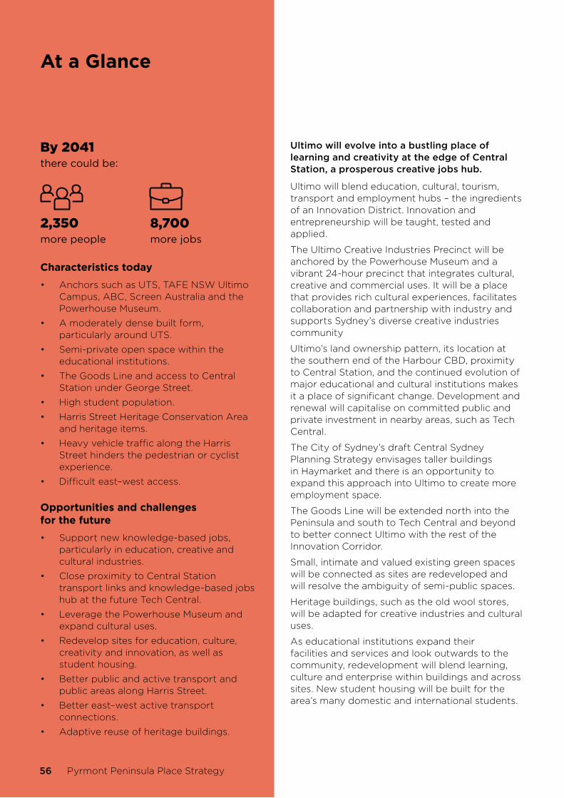
At a Glance
By 2041there could be:
2,350more people
8,700more jobs
Characteristics today
• Anchors such as UTS, TAFE NSW Ultimo Campus, ABC, Screen Australia and the Powerhouse Museum.
• A moderately dense built form, particularly around UTS.
• Semi-private open space within the educational institutions.
• The Goods Line and access to Central Station under George Street.
• High student population.
• Harris Street Heritage Conservation Area and heritage items.
• Heavy vehicle traffic along the Harris Street hinders the pedestrian or cyclist experience.
• Difficult east–west access.
Opportunities and challenges for the future
• Support new knowledge-based jobs, particularly in education, creative and cultural industries.
• Close proximity to Central Station transport links and knowledge-based jobs hub at the future Tech Central.
• Leverage the Powerhouse Museum and expand cultural uses.
• Redevelop sites for education, culture, creativity and innovation, as well as student housing.
• Better public and active transport and public areas along Harris Street.
• Better east–west active transport connections.
• Adaptive reuse of heritage buildings.
Ultimo will evolve into a bustling place of learning and creativity at the edge of Central Station, a prosperous creative jobs hub.
Ultimo will blend education, cultural, tourism, transport and employment hubs – the ingredients of an Innovation District. Innovation and entrepreneurship will be taught, tested and applied.
The Ultimo Creative Industries Precinct will be anchored by the Powerhouse Museum and a vibrant 24-hour precinct that integrates cultural, creative and commercial uses. It will be a place that provides rich cultural experiences, facilitates collaboration and partnership with industry and supports Sydney’s diverse creative industries community
Ultimo’s land ownership pattern, its location at the southern end of the Harbour CBD, proximity to Central Station, and the continued evolution of major educational and cultural institutions makes it a place of significant change. Development and renewal will capitalise on committed public and private investment in nearby areas, such as Tech Central.
The City of Sydney’s draft Central Sydney Planning Strategy envisages taller buildings in Haymarket and there is an opportunity to expand this approach into Ultimo to create more employment space.
The Goods Line will be extended north into the Peninsula and south to Tech Central and beyond to better connect Ultimo with the rest of the Innovation Corridor.
Small, intimate and valued existing green spaces will be connected as sites are redeveloped and will resolve the ambiguity of semi-public spaces.
Heritage buildings, such as the old wool stores, will be adapted for creative industries and cultural uses.
As educational institutions expand their facilities and services and look outwards to the community, redevelopment will blend learning, culture and enterprise within buildings and across sites. New student housing will be built for the area’s many domestic and international students.
56 Pyrmont Peninsula Place Strategy

Ultimo place priorities
1. Support knowledge-based jobs growth in Ultimo anchored by the Powerhouse Museum, TAFE NSW Ultimo Campus, UTS and ABC:
a. grow and diversify spaces to be used for research and innovation.
b. provide affordable workspaces for creative industries.
c. reuse heritage buildings for creative, cultural and community uses.
d. create theatre, performance, production, rehearsal and exhibition space
e. enhance open spaces; for example, through public art, and public access to these spaces.
f. encourage the provision of work-based childcare.
g. build better pedestrian connections, particularly to and from the Goods Line and Darling Harbour.
2. Rejuvenate Harris Street as the historic urban spine of the Peninsula:
a. consider Streets as Shared Spaces.
b. create an intermediate public transport corridor along the Innovation Corridor from the Bays Precinct to Tech Central and Australian Technology Park.
c. investigate the reduction in traffic lanes and conversion to allow for a contra-flow bus lane between Thomas Street and Regent Street.
d. widen footpaths, calming traffic, rationalising bus stops and providing new pedestrian crossings.
e. create active transport connections to Harris Street from surrounding areas.
f. improve the streetscape and activation, enhancing heritage buildings and increasing tree cover.
g. install heritage interpretative elements
h. create new centres of activity as major sites are developed, with new connections and open spaces and busy street frontages to transform Harris Street into a pleasant pedestrian environment.
3. Celebrate Ultimo’s heritage, particularly within or adjacent to heritage items and the Harris Street Heritage Conservation Area, and as heritage buildings are adapted for new uses.
4. Support clusters of enterprise and innovation, such as along Wattle and Harris streets, to retain a mix of affordable, flexible and collaborative workplaces.
5. Investigate the extension of the Goods Line to facilitate an active transport loop around the Peninsula:
a. north: integrated with the Powerhouse Museum site with potential connections underneath Pier Street to Pyrmont Street and north to Murray Street.
b. south: to provide seamless access to and from Tech Central and Central Station.
6. Provide at least four public outdoor courts to support students and young people living in Ultimo in new development.
7. Upgrade public open space along Jones Street, including Mary Ann Street Park, to incorporate:
a. inclusive play space for children, which may include climbing elements, sensory gardens, playful public art and a safe pavement treatment to encourage jumping and play.
b. places for young people, such as skate-friendly public domain treatments and mirrors for dance.
c. equipment for students to facilitate individual/group outdoor study, including tables and seating with access to power and WiFi.
8. Establish planning controls for renewal sites to encourage design excellence, better walking and cycling connections and precinct-wide infrastructure.
9. Locate taller buildings so they respect privacy, public open space, views, heritage items and existing buildings.
10. Create better pedestrian links that overcome the difficult topography.
Sub-precincts
NSW Department of Planning, Industry and Environment 57

11. Consider closing Jones Street between Broadway and Mary Ann Street to create a linear park.
12. Widen footpaths and cycle lanes along Mary Ann Street.
13. Increase green space and tree canopy cover and encourage façade greening on Jones and Harris streets.
14. Provide shared accessways around UTS and TAFE NSW Ultimo Campus for pedestrians, cyclists, vehicles and deliveries, potentially through a pilot program on weekends and during events.
15. Investigate a multi-utility hub for sustainable precinct-scale solutions, such as integrated parking, electric vehicle charging, battery storage, recycled water and organic waste systems, or bike facilities.
16. Investigate opportunities to improve community access to existing auditoriums and theatres in the Powerhouse Museum for local performance and rehearsal.
17. Contribute towards the provision of new library floor space and capacity.
58 Pyrmont Peninsula Place Strategy
Sub-precincts
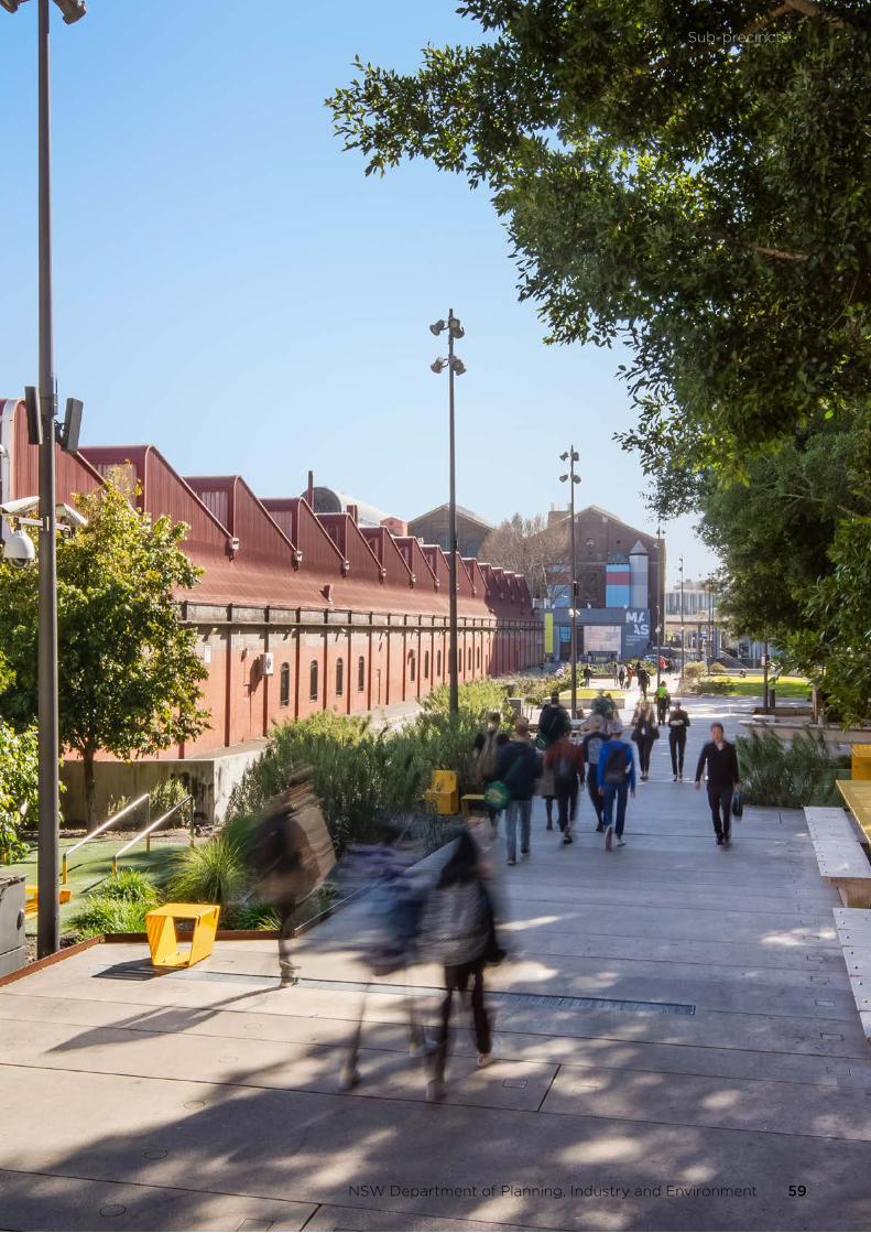
Sub-precincts
NSW Department of Planning, Industry and Environment 59

Wentworth ParkA place of home, work and recreation.
60 Pyrmont Peninsula Place Strategy

The sub-precinct falls steeply to Wattle Street and Wentworth Park, and is bound by Bridge and Pyrmont Bridge roads, the Western Distributor and William Henry Street.
It is a disconnected landscape due to the topography sloping from the ridgeline to Wattle Street, the large historic wool sheds between Jones and Wattle streets, the road network and the light rail corridor, as well as the Wentworth Park greyhound track that bisects a public open space.
It’s mainly a residential area, with restaurants, cafes, retail and commercial businesses on ground floors, in podiums, and in corner buildings. Wattle Street is characterised by the robust and bold masonry construction of the wool store buildings that speak of the industrial past, and today accommodate a mix of commercial, creative and other professional and knowledge services.
Wentworth Park in the west, and smaller open spaces including Fig Lane Park and Quarry Green, frame the built-up areas. East of Jones Street, low to medium rise terraces and apartment buildings interact with street trees creating a green inner-city urban character.
The regular street pattern makes it easy for people to walk around, despite the topography. People can walk to the Pyrmont Village sub-precinct via Bulwarra Road under the Western Distributor to the north.
The Wentworth Light Rail Stop in the sub-precinct’s north provides access around the Peninsula and west to Glebe and the Inner West. Bus services are available from Harris Street to Central Station and the CBD.
Sub-precincts
NSW Department of Planning, Industry and Environment 61

At a Glance
By 2041there could be:
1,115more people
1,200more jobs
Characteristics today
• Mix of terraces and low to medium rise apartments.
• Ultimo Heritage Conservation Area (west of Bulwara Road) interfaces with Fig Lane Park and Quarry Green.
• Old Wool Stores along the Jones-Wattle Street corridor.
• Wentworth Park.
• Close to the new Sydney Fish Market.
• New Ultimo Public School.
• Built form responds to topography.
• Wentworth Park Light Rail.
Opportunities and challenges for the future
• Facilitate the return of the Wentworth park greyhound track land and the temporary pop up school once their terms expire.
• Support a genuine mix of business and residential uses.
• Enhance Wentworth Park for community, recreation and open space activities.
• The sloping land towards Wattle Street allows for stepping of building height.
• The Old Wool Stores can be reused while also telling the story of the area’s heritage.
• Pedestrian access to the light rail stop can be improved.
• New walking and cycling connections need to address the topography, large impermeable buildings and busy roads.
• Busy roads hinder connections between the new Sydney Fish Market and Wentworth Park.
Wentworth Park’s terraces and low to medium rise apartments will sit comfortably alongside creative employment spaces in historic urban warehouses, where workers and residents enjoy an easy walk to an enhanced Wentworth Park and the new Sydney Fish Market.
Wentworth Park will be a vital green space as the area changes in the long term. The lease at Wentworth Park for greyhound racing expires in 2027. This provides an opportunity to reuse this space for other community, recreation and open space activities and to reconnect the north and south of the park and return it to its original design intent as a contiguous green public open space.
Change will be focused along the Wattle-Jones Street corridor where old wool stores will become interesting spaces for creative industries, galleries and events. These urban warehouses will be places for the making, creating and production of new ideas, products or processes. Workers will need well-insulated buildings and businesses will need access to the regional and district road network for freight and logistics functions.
Building design will take advantage of the sloping land between Jones and Wattle streets and will not overshadow or detract from the amenity of Wentworth Park.
The new Ultimo Public School will bring activity to the neighbourhood and support small-scale services and amenities along Jones Street.
Better east–west and north-south walking and cycling paths will be located for people to connect to and between Wentworth Park, the new Sydney Fish Market, UTS, the Powerhouse Museum, The Goods Line and light rail.
Within the Ultimo Heritage Conservation Area, terrace buildings will continue to be used for housing, cafes and small creative enterprises. New commercial space will be opened through clever architectural design.
62 Pyrmont Peninsula Place Strategy

Wentworth Park place priorities
1. Facilitate the return of the Wentworth Park greyhound track land and the temporary pop up school once their terms expire as newly activated, publicly accessible open space as part of a larger and enhanced parkland.
2. Investigate open space and recreation improvements at Wentworth Park to increase capacity and community access for a district park destination for active and passive uses, including a new synthetic sports field (if feasible).
3. Investigate future joint and shared use opportunities for open space and public buildings, including Ultimo Public School and Wentworth Park.
4. Ensure a genuine mix of business and residential uses to enhance the character, liveability and productivity of the sub-precinct.
5. Adaptively re-use Old Wool Stores along Wattle-Jones streets as urban warehouses for commercial and creative industries, including affordable employment and creative live/work space.
6. New development, including adaptive re-use and extension to heritage buildings, respects the transition of height down from Jones Street to Wattle Street and protects sunlight to Wentworth Park in line with sub-precinct master plans.
7. Provide cultural production and rehearsal space as sites are developed, including soundproof music rooms, communal meeting spaces and ground-level exhibition space.
8. Investigate land under the Western Distributor between Pyrmont Bridge and Allen Street for community uses.
9. Provide new play spaces with climbing elements, sensory gardens, playful public art and a safe pavement treatment to encourage jumping and play along the Jones Street walking and cycling route.
10. Consider how development can create pedestrian connections between Jones and Wattle Street.
11. Celebrate the sub-precinct’s heritage, particularly within or adjacent to heritage items and Ultimo Heritage Conservation Area and as heritage buildings are adapted for new uses.
12. Develop green streets by planning for green space, tree canopy cover and façade greening on Jones Street, Bulwara Road and Quarry Street.
13. Extend the Jones Street cycleway north to Pyrmont Bridge Road and provide a crossing of Pyrmont Bridge Road.
14. Facilitate an active transport loop around the Peninsula.
15. Investigate a multi-utility hub close to the light rail stop and major roads for sustainable precinct-scale solutions such as integrated parking, electric vehicle charging, battery storage, recycled water and organic waste systems, or bike facilities.
Sub-precincts
NSW Department of Planning, Industry and Environment 63

Blackwattle Bay A place of transformation and renewal.
64 Pyrmont Peninsula Place Strategy

Blackwattle Bay is defined by a rich and diverse history; it was a place of sustenance for Aboriginal people who fished in the bay, then became the source of the sandstone that characterises many of Sydney’s early buildings. It was used for production and transportation in the 20th century, including offices, warehouses, a concrete batching plant, the Western Distributor, Anzac Bridge, the cycle connection to Rozelle and the base for a range of recreational watercraft.
The steep change in topography from Harris Street and Union Square to the waterfront, the areas under the Western Distributor and the supports for Anzac Bridge, as well as road and light rail infrastructure create barriers within the sub-precinct. Despite these challenges it is home to a significant cluster of media organisations, including Network Ten and NOVA Entertainment, as well as residential and industrial areas and working harbour activities, including the current Sydney Fish Market.
Open space is limited and primarily served by parks in other sub-precincts, including the harbour foreshore walk in Pirrama to the north and Wentworth Park to the south.
Redeveloping public and private land will address the missing link that will connect the harbour foreshore walk from Pirrama to Wentworth Park and the new Sydney Fish Market and beyond. It will reconnect Pyrmont with its western harbour edge. This will be a destination as much as a connection – a new urban quarter and a place of metropolitan significance.
Source: Destination NSW
Sub-precincts
NSW Department of Planning, Industry and Environment 65
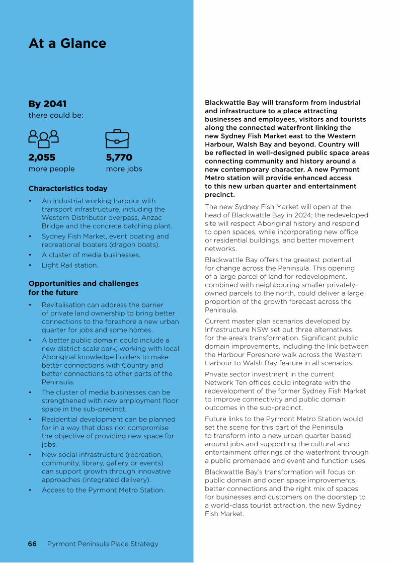
At a Glance
By 2041there could be:
2,055more people
5,770more jobs
Characteristics today
• An industrial working harbour with transport infrastructure, including the Western Distributor overpass, Anzac Bridge and the concrete batching plant.
• Sydney Fish Market, event boating and recreational boaters (dragon boats).
• A cluster of media businesses.
• Light Rail station.
Opportunities and challenges for the future
• Revitalisation can address the barrier of private land ownership to bring better connections to the foreshore a new urban quarter for jobs and some homes.
• A better public domain could include a new district-scale park, working with local Aboriginal knowledge holders to make better connections with Country and better connections to other parts of the Peninsula.
• The cluster of media businesses can be strengthened with new employment floor space in the sub-precinct.
• Residential development can be planned for in a way that does not compromise the objective of providing new space for jobs.
• New social infrastructure (recreation, community, library, gallery or events) can support growth through innovative approaches (integrated delivery).
• Access to the Pyrmont Metro Station.
Blackwattle Bay will transform from industrial and infrastructure to a place attracting businesses and employees, visitors and tourists along the connected waterfront linking the new Sydney Fish Market east to the Western Harbour, Walsh Bay and beyond. Country will be reflected in well-designed public space areas connecting community and history around a new contemporary character. A new Pyrmont Metro station will provide enhanced access to this new urban quarter and entertainment precinct.
The new Sydney Fish Market will open at the head of Blackwattle Bay in 2024; the redeveloped site will respect Aboriginal history and respond to open spaces, while incorporating new office or residential buildings, and better movement networks.
Blackwattle Bay offers the greatest potential for change across the Peninsula. This opening of a large parcel of land for redevelopment, combined with neighbouring smaller privately-owned parcels to the north, could deliver a large proportion of the growth forecast across the Peninsula.
Current master plan scenarios developed by Infrastructure NSW set out three alternatives for the area’s transformation. Significant public domain improvements, including the link between the Harbour Foreshore walk across the Western Harbour to Walsh Bay feature in all scenarios.
Private sector investment in the current Network Ten offices could integrate with the redevelopment of the former Sydney Fish Market to improve connectivity and public domain outcomes in the sub-precinct.
Future links to the Pyrmont Metro Station would set the scene for this part of the Peninsula to transform into a new urban quarter based around jobs and supporting the cultural and entertainment offerings of the waterfront through a public promenade and event and function uses.
Blackwattle Bay’s transformation will focus on public domain and open space improvements, better connections and the right mix of spaces for businesses and customers on the doorstep to a world-class tourist attraction, the new Sydney Fish Market.
66 Pyrmont Peninsula Place Strategy

Blackwattle Bay place priorities
1. Redevelop Blackwattle Bay into a new urban quarter focused on knowledge-based jobs and supplemented with cultural and entertainment, visitor and tourism, retail and residential uses, connected to public transport, including the Pyrmont Metro station and anchored by the new Sydney Fish Market.
2. Prioritise commercial floor space for knowledge-based jobs to support the Innovation Corridor.
3. Investigate the establishment of new entertainment, events and cultural space in the redevelopment of Blackwattle Bay to support a vibrant 24-hour entertainment and cultural precinct.
4. Address potential impacts of 24-hour economy activities on amenity including noise, safety, traffic and transport, amongst others.
5. Providing residential development, including affordable housing without compromising commercial development and the attractiveness of Blackwattle Bay for a range of cultural, entertainment, arts and leisure activities supporting a diverse and vibrant 24-hour economy.
6. Establish controls to ensure development protects sunlight to existing and future open space including the harbour foreshore area consistent with the amenity constrained height strategy to be refined in subsequent sub-precinct master planning.
7. Reprioritise street and traffic flows to promote pedestrian, cycling and public transport and provide improved active transport connections from Blackwattle Bay to other parts of the Peninsula.
8. Investigate a multi-utility hub for sustainable precinct-scale solutions such as integrated parking, electric vehicle charging, battery storage, recycled water and organic waste systems, or bike facilities.
9. Create a continuous harbourside foreshore promenade connecting to Darling Harbour, Barangaroo and Walsh Bay arts and cultural precinct in the east and the new Sydney Fish Market and Glebe to the west, and beyond.
10. Investigate a new ferry wharf in Blackwattle Bay.
11. Formalise public boating facilities, including launch points and storage for kayaks, canoes and dragon boats to enhance public access and use of the water for recreational activities.
12. Facilitate an active transport loop around the Peninsula.
13. Create a new district park near Bank Street of approximately 1 hectare.
14. Showcase the area’s Aboriginal and working harbour heritage in new public domain and upgrades.
15. Use Greener Places to guide the design of activated, safe and inclusive public areas.
16. Encourage green building facades and rooftop gardens in new development.
17. Provide publicly-accessible, privately-owned space, such as multi-purpose courts on rooftops or in podiums, or viewing platforms that showcase Sydney Harbour.
18. Contribute towards the provision of new community and cultural facilities, including community and library floor space, communal rooms, work-based childcare services, production space for creative arts and medical services.
19. Formalise the public boating facilities at Bank Street.
20. Investigate the feasibility of a harbour pool at Blackwattle Bay subject to water quality and working harbour considerations (eg. a temporary pool during summer) or a pool on the waters edge.
Sub-precincts
NSW Department of Planning, Industry and Environment 67
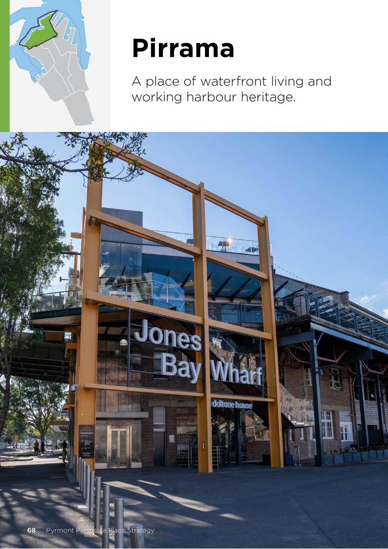
PirramaA place of waterfront living and working harbour heritage.
68 Pyrmont Peninsula Place Strategy

Pirrama is predominantly a residential area, with apartment buildings and terrace housing within a sloping topography. The sub-precinct features public and private open spaces and some retail and commercial activities near Harris Street.
Pirrama forms the headland of the Peninsula and has strong Aboriginal and colonial heritage. Its landscape has been transformed from its natural condition due to an industrial past; it is now a thriving high-rise residential community.
The Jacksons Landing residential community welcomed its first residents in 2000. The area’s public spaces include the waterfront headland, Pirrama Park. Buildings are set against the backdrop of the old sandstone quarry face.
Pirrama sub-precinct has some of the highest residential densities in the Peninsula, spread across private, social and affordable rental housing.
Residents enjoy access to some of Sydney’s best foreshore parklands. A continuous foreshore walk from the east is unbroken between Pirrama Park in the north-east and Waterfront Park in the west. It terminates at Bank Street, where the historic Glebe Island Bridge once allowed a connection to White Bay.
Harris Street terminates at Pirrama Park and the waterfront - a key view - and connects Broadway through to the edge of the harbour. Visual and physical connections to the harbour from roads including Harris Street should be protected. The head of the Peninsula is prominent when viewed from Anzac Bridge and the bridge itself provides a stunning backdrop to the area.
The John Street Square Light Rail stop provides public transport access to Central Station, Glebe and the Inner West. The topography is interrupted by the old quarry face and light rail cutting.
Sub-precincts
NSW Department of Planning, Industry and Environment 69

At a Glance
By 2041there could be:
190more people
350more jobs
Characteristics today
• An established urban community in a parkland setting on the waterfront.
• Good active transport connections and the waterfront promenade.
• Commercial uses and services in low-scale buildings that fit within the existing character.
Opportunities and challenges for the future
• New development will be limited in density and height to fit comfortably with the existing low to medium rise built form of the sub-precinct.
• The Pyrmont Metro station within walking distance.
• Walking and cycling links to Bays West.
• Addressing the steep topography.
• Improve or enhance infrastructure within the context of a place not expected to be subject to significant redevelopment.
Pirrama will be a place with fantastic harbour views, foreshore recreational spaces, a mix of housing types, tenures and price points, new commercial and retail development, prioritised walking and cycling and easier east–west connections.
There is some redevelopment potential in older buildings and sites. This could open the potential for other opportunities, such as walking access to the Pyrmont Metro station, a walking and cycling connection to Bays West via a new link in the vicinity of Glebe Island Bridge, large foreshore public parks and better access to smaller public parks.
Given the scale of existing development, significant renewal is not anticipated, though some older buildings may experience redevelopment. A continued mix of housing, office and retail floorspace is expected.
Opportunities to improve east–west connections could include removing barriers to pedestrians along Bowman Street and John Street.
70 Pyrmont Peninsula Place Strategy

Pirrama place priorities
1. Retain existing development capacity under planning controls and the established low to medium-rise built form in the northern part of the Peninsula.
2. Protect views and access from Distillery Hill and Harris Street ridgeline to the waterfront and respect the fine grain street network.
3. Enhance public areas and active street frontages and bring more activity to Harris Street without compromising residential areas.
4. Sensitively adapt heritage buildings for residential and commercial uses.
5. Create a continuous harbourside foreshore promenade with a new active/public transport link to Bays West.
6. Improve and enhance east–west connections to Blackwattle Bay and Darling Island.
7. Improve access to smaller public parks that are difficult to access due to topography.
8. Recognise the Broadway to Pirrama Walk along Harris Street and celebrate the headland’s Aboriginal and industrial past and the connection to water.
9. Restore/reinstate/interpret the historic Glebe Island Bridge structure to provide active transport access to Bays West.
10. Investigate an active public transport link along Harris Street to connect the Innovation Corridor from Central Station and Camperdown to Bays West via Pyrmont.
11. Improve pedestrian access to Bowman/Bank Street from Distillery Drive and John Street via stairs or a lift.
12. Improve wayfinding along the foreshore walk and within and around the steep topography.
13. Encourage green building facades and rooftop gardens in new development.
14. Facilitate an active transport loop around the Peninsula.
15. Investigate the feasibility of a harbour pool at Pirrama Park subject to water quality and working harbour considerations (eg. a temporary pool during summer) or on the waters edge.
16. Provide inclusive play opportunities for children along the active transport loop near Bowman Street.
Sub-precincts
NSW Department of Planning, Industry and Environment 71

Pyrmont VillageA place of history, innovation and culture.
72 Pyrmont Peninsula Place Strategy
Sub-precincts

Pyrmont Village best exhibits the place, built form, landscape, land use mix and movement networks defining the overall character of the Peninsula. It offers pedestrian and cycling transport networks, street trees, corner pubs, and low to medium-rise terraces and heritage buildings lovingly restored as offices, restaurants, bars and shops.
Pyrmont Village is a ridge-top neighbourhood and a place of local culture and connection. It extends from John Street in the north to the Western Distributor in the south. Pyrmont Street in the east and follows the Western Distributor and the elevated topography in the west.
More recent development has included townhouses, medium rise apartments and commercial buildings between Pyrmont Bridge Road and the Western Distributor. The layering of different buildings, styles and typologies sit comfortably and contribute to the unique built heritage of the area.
The sub-precinct is a diverse, attractive and interesting place to be. It boasts restaurants, cafes, bars and pubs near where people live and work. Street trees make it a pleasant and attractive environment for pedestrians, residents, tourists, visitors and workers.
Union Square is the heart of the village serving multiple functions: a destination; a gateway to the east and west of the Peninsula; a meeting place; and a point of orientation across a landscape that can be difficult to navigate as a pedestrian.
The village has a regular street pattern, which facilitates local movement and connectivity on areas of flatter land. It is interrupted by the Western Distributor, the Allen Street off-ramp and Pyrmont Bridge Road.
Sub-precincts
NSW Department of Planning, Industry and Environment 73

At a Glance
By 2041there could be:
135more people
1,380more jobs
Characteristics today
• Fine grain, detailed historic built form and street trees.
• A mix of homes, retail, restaurants, bars and small businesses in small and older buildings, mixed with new and contemporary designs within a predominant low-medium rise built form.
Opportunities and challenges for the future
• The Pyrmont Metro station will increase access and provide the impetus for some renewal, which must align with the character of Pyrmont Village.
• Union Square to be enhanced and protected from overshadowing or development that reduces the sense of openness.
• Heritage buildings can be sensitively reused to showcase the older built form and the sub-precinct’s layers of history.
• Harris Street could be rejuvenated as the heritage spine and innovation connector from Tech Central via Pyrmont to the future Bays West.
• New east–west connections to the lower waterfront and parkland areas will better connect the Peninsula.
Significant change is not anticipated in Pyrmont Village outside new space for jobs and some limited residential growth.
Space for new jobs will be secured across the Peninsula in different ways. In Pyrmont Village, new space for employment should respect the low tomedium-rise building heights of existing development and the layering of heritage and new contemporary buildings that site comfortably with each other.
New residential growth is expected to be limited to a few sites with identified capacity. Higher densities are not likely to complement the character and sense of place of the Pyrmont Village and should be in other sub-precincts, in line with the Structure Plan.
The Pyrmont Metro station will bring improvements and enhancements in connectivity and wayfinding, particularly in how pedestrians, cyclists and drivers move around, in connections to other parts of Pyrmont and to public spaces and economic connections could be built with the Innovation Corridor.
74 Pyrmont Peninsula Place Strategy

Pyrmont Village place priorities
1. Support the mix of employment, homes, social infrastructure, entertainment and shops along Harris Street.
2. Enable streets as shared spaces with capacity for outdoor dining, walking and cycling and safe and accessible spaces for community to gather.
3. Showcase the area’s character in any enhancements to public areas, infrastructure or new connections, including Aboriginal cultural heritage interpretation opportunities.
4. Protect Union Square as an important public space, including solar access and the sense of openness from views to the sky.
5. Ensure new development complements the low-medium rise-built form, heritage items and conservation areas, and the special qualities of Harris Street.
6. Preserve the heritage character and forms of the area and sensitively adapt heritage buildings to create affordable, flexible and collaborative space for local enterprise and innovation.
7. Protect views to and from the harbour and from Harris Street, including in public areas.
8. Upgrade walking and cycling access, particularly to the Pyrmont Metro station, and investigate a multimodal transport hub.
9. Create better east–west connections from Harris Street to the lower waterfront and parkland areas.
10. Rejuvenate Harris Street as the historic urban spine of the Peninsula by:
a. creating a new street-based public transport link (such as a bus or other mode) along the Innovation Corridor from the Bays Precinct to Tech Central and Australian Technology Park.
b. investigating reduction in traffic lanes and conversion to allow for a contra-flow bus lane between Thomas Street and Regent Street.
c. widening footpaths, rationalising bus stops and providing new pedestrian crossings
d. creating active transport connections to Harris Street.
e. improving the streetscape, enhancing heritage buildings and increasing tree cover.
f. installing heritage interpretative elements
g. creating new centres of activity as major sites are developed, with new connections and open spaces and busy street frontages to transform Harris Street into a pleasant pedestrian environment.
11. Improve the number of street trees and enrich the tree canopy cover particularly in public areas and larger privately-owned properties at ground level, or on podiums and rooftops.
12. Provide new creative and cultural spaces as part of new development, such as a local community gallery or cultural production hub, as well as creative live/work spaces.
13. Investigate the upgrade, improvement and/or expansion of recreation opportunities in consultation with the community. This may include opportunities for indoor courts for ball games, fitness and health and wellbeing programs for the community.
14. Investigate land under the Western Distributor between Pyrmont Bridge Road and Allen Street for community uses.
15. Investigate the reconfiguration of Pyrmont Community Centre to increase capacity.
Feedback from the community called for the redevelopment of the Maybanke Recreation Centre to improve and expand recreation opportunities, such as through the development of a new indoor community and recreation facility. This proposal is not a currently funded social infrastructure upgrade. Any investigation for delivery beyond the short to medium term may be linked to contributions from key site development elsewhere in the Peninsula.
Sub-precincts
NSW Department of Planning, Industry and Environment 75

10Framework for Key Sites
76 Pyrmont Peninsula Place Strategy
Framework for Key Sites

Key sitesThis strategy responds to Finding 9 of the Commission’s review report by establishing a Framework for Key Sites to improve coordination and delivery of place-based outcomes on key sites beyond simply the provision of infrastructure required to support the development of that key site only.
Significant Projects Planned or UnderwayFinding 9 of the Commission’s review report considered “the current [development] activity is substantial but characterised by a small number of large but disconnected projects, many on the edges of the review area”. This limits the realisation of cumulative opportunities and benefits, such as connecting and activating the public domain and providing links between sub-precincts.
In line with the Greater Sydney Region Plan and the Eastern City District Plan, the Place Strategy has adopted a place-based planning approach that integrates the site-specific visions and aspirations of landowners and proponents with the precinct-wide place and public domain outcomes that would deliver high quality outcomes responding to the Peninsula’s potential.
The Place Strategy delivers on the Commission’s finding by improving the coordination of significant projects under a shared vision and strategy that is the product of a place-based approach to the planning, design and development of the Peninsula.
Based on our urban design analysis, we have identified four sub-precincts (Ultimo, Blackwattle Bay, Darling Island and Tumbalong Park) that are capable of accommodating the greatest growth and change over the next 20 years, while still protecting parks, public spaces and the character and qualities of these areas.
With the other sub-precincts less capable of supporting significant growth or change, these four sub-precincts have the greatest capacity to deliver economic growth in the Peninsula.
The key sites are:
• INSW’s master planned precinct to revitalise the current Sydney Fish Market site and neighbouring sites at Blackwattle Bay.
• The Star Entertainment Group’s Sydney site.
• Mirvac’s Harbourside Shopping Centre.
• The University of Technology Sydney’s teaching and complementary space in Ultimo/Haymarket.
Feedback on the key site frameworkThe exhibited draft Place Strategy identified four key sites of significant scale with the potential to contribute to the forecast floor space demand identified in the Economic Development Strategy and to deliver public benefits when development occurs.
Considering key sites through the Place Strategy allows the creation of a more granular planning framework for the sites that will contribute most to achieving the strategic objectives of the Region and District Plans prepared by the Greater Sydney Commission. The framework for the key sites also needs to ensure development is not at odds with the character of Pyrmont. Leveraging the key sites to contribute to and justify significant infrastructure investment is also critical.
The draft Place Strategy foreshadowed that the final Place Strategy would reflect feedback from key site owners during exhibition, recognising that each key site is at a different stage in the planning process. Submissions were received from The Star, Infrastructure NSW and the University of Technology Sydney.
While Infrastructure NSW and the University of Technology Sydney sought clarification on aspects of the draft Place Strategy and made recommendations for its finalisation, the Star’s submission proposed, in part, an alternative development concept for a six-star hotel on the northern end of the site supported by public benefit opportunities as documented in submissions.
The proposal for a six-star hotel outlined in the submission was strongly aligned with the draft Place Strategy’s Vision, Directions and sub-precinct place priorities for the Darling Island Precinct and The Star’s key site but it challenged others. On balance, the alternative concept for The Star’s key site outlined in the submission offered an outcome which is aligned with the Place Strategy’s overall strategic intent but only
Framework for Key Sites
NSW Department of Planning, Industry and Environment 77

if key principles of the Place Strategy remain supported by the development and consistent with the public benefit directions of the Place Strategy.
In the final Place Strategy, the following changes have been made in relation to The Star’s key site framework.
Built form considerations
• sun access plane not breached in order to protect sunlight to public and open spaces.
• adjust the maximum height of development on the “northern’ end of The Star’s key site up to a maximum of RL 110 specifically for the purpose of facilitating a six-star hotel:
› if development other than a six-star hotel is contemplated, a maximum RL 60 would apply to development at this location. Residential accommodation is not supported on this key site. Reflecting the balance between public and economic benefit from the proposal and its location in a highly visible location, a tower of slender proportions exhibiting design excellence is required.
• Reduce the maximum height of development on the “southern” part of the key site to RL 140 to balance development on this part of the site with greater height now contemplated on the “northern” part of the site.
Master planning considerations
Require The Star to submit a master plan for its key site showing how future development aspirations can be accommodated over the medium term (approximately 10 years) and in line with the Place Strategy to meet the following outcomes:
• reduce the size and bulk of the buildings on the site when seen from the street through an improved interface between the built form and the surrounding area at the ground plane.
• improved and widened public domain on surrounding streets through the removal of bus and coach parking from streets and provision of an on-site parking solution.
• building separation to maintain generous view corridors between buildings and minimise visual impacts from the water and surrounding public domain.
• enhancing 24-hour public connections through The Star precinct that are ideally open to the air and accessible to the public to enable a greater level of public permeability through the current site.
• no increase to overshadowing of surrounding public spaces.
• minimise impact on local character through effective control of built form, scale and material use.
• improved public benefits, including a description of the public benefits to be offered for development on The Star’s key site in addition to those specified in the final Place Strategy.
Delivering key sitesEach of these key sites, with the new Pyrmont Metro Station, has the potential to deliver strategic change in the Peninsula and broader public benefits through their development activities, such as connecting and activating the public domain (beyond the discrete area of development, or boundaries of the respective sites), or contributing to the delivery of a Big Move under the Place Strategy.
Some of these sites last underwent significant redevelopment 30-40 years ago, which means they now present a generational opportunity to unlock the next wave of jobs, investment and public benefits in a way that responds to and enhances Pyrmont’s character. This forms an important consideration (amongst others) for any new development in the Peninsula.
Due to the significant potential of each key site to deliver growth and change and the need to ensure this is balanced with character, heritage and infrastructure, amongst other considerations, each site requires more detailed planning to identify how it can deliver development outcomes in line with the strategy.
With the long-term vision and directions for growth and change now set, key site landowners can respond by aligning their site-specific aspirations with the outcomes to be delivered across the Peninsula and in sub-precincts.
The recommended approach is for each key site to be led by a key site master plan that:
• identifies how the aspirations of a key site landowner may deliver strategic change in line with the Place Strategy over the medium to long-term.
• describe the way in which public benefits, commensurate with strategic change, will be secured over that timeframe and over the long-term.
• integrates with sub-precinct master plans subject to timing such as through the production of design or planning guidelines.
78 Pyrmont Peninsula Place Strategy
Framework for Key Sites

This will enable key site landowners to further engage with the Department, City of Sydney and other stakeholder groups, including the community for future growth and change on the key sites, ensuring that detailed plans and designs align with the Place Strategy.
The NSW Government Architect’s Master Plan Advisory Note provides guidance on the purpose, benefits and objectives of a successful master plan. www.governmentarchitect.nsw.gov.au/resources/ga/media/files/ga/other/advisory-notes/advisory-note-master-plans-2018-09-12.pdf
Recognising that each of these schemes are in different stages of planning or design and will have individual project objectives and feasibilities to consider, we acknowledge that some key sites are already progressing through an equivalent master plan process (INSW’s master planned precinct), or are under consideration in the assessment process (Harbourside). These two key sites are recommended to continue along their current pathways and in line with the Place Strategy. The other two key sites (The Star’s Sydney site and UTS’ sites) will require landowners to prepare key site master plans in line with the Place Strategy.
Leveraging additional public benefit in key sitesThis approach sets the foundations to realise additional public benefits by coordinating and aligning site-specific developments under the Place Strategy and may involve mechanisms such as voluntary planning agreements. Although the Place Strategy identifies public benefits that are expected to be delivered, the owners of key sites may suggest different or additional public benefits in subsequent planning processes that represent an equivalent or improved public benefit offer.
In some cases, incentives such as additional gross floor area (up to a maximum of 10%) may be available where the additional public benefits offered are of exceptional value or provide an outstanding outcome.
This approach is based on the following principles:
• Transparency – being clear about the public benefits we are looking for and how key sites can help deliver these.
• Equity – any additional private gain must be appropriately balanced against the public benefit and be secured in the long-term (i.e. in perpetuity).
• Probity – the process is clear, transparent and accountable to the Place Strategy, which identifies the Big Moves and additional public benefit that have been identified from a place-based approach.
Each key site must deliver public benefits that contribute to both Peninsula-wide and sub-precinct outcomes over and above the necessary infrastructure to support growth on the particular key site. Activation of street frontages as part of a development proposal are a standard requirement expected of any development in the Peninsula.
In addition, each key site is expected to participate in a local business improvement district that takes responsibility for contributing to future place management and governance in the Pyrmont Peninsula.
Peninsula-wide additional public benefit opportunities expected for all key sites
• Deliver in whole, or in part, one or more Big Moves.
• Bring forward the delivery of critical unfunded, or precinct scale, infrastructure beyond the growth infrastructure requirements necessary to support the development of the particular key site.
• Connect and activate the public domain through new active transport connections through large sites (ie. site permeability and wayfinding), reinstate views to the harbour and deliver superior street and place activation beyond the standard requirement for all development to activate the street.
• Provide opportunities for affordable workspace for creative industries including performance and rehearsal spaces, cultural uses, start-ups and researchers, maker and producer spaces to support the Innovation Corridor.
Framework for Key Sites
NSW Department of Planning, Industry and Environment 79

Key sites
Pyrmont Peninsula Place Strategy - Key Sites
Pyrmont Peninsula
Waterways
Bridge R
d
Wattle S
t
Harris S
t
Bowman St
The Star
Blackwattle Bay
Harbourside Shopping Centre
UTS Ultimo / Haymarket
Pyrmont Peninsula Place Strategy - Key Sites
Pyrmont Peninsula
Waterways
Bridge Rd
Wattle St
Harris St
Bowman St
The Star
Blackwattle Bay
Harbourside Shopping Centre
UTS Ultimo / Haymarket
Pyrmont Peninsula Place Strategy - Key Sites
Pyrmont Peninsula
Waterways
Bridge Rd
Wattle St
Harris St
Bowman St
The Star
Blackwattle Bay
Harbourside Shopping Centre
UTS Ultimo / Haymarket
Pyrmont Peninsula Place Strategy - Key Sites
Pyrmont Peninsula
Waterways
Bridge Rd
Wattle St
Harris St
Bowman St
The Star
Blackwattle Bay
Harbourside Shopping Centre
UTS Ultimo / Haymarket
Pyrmont Peninsula Place Strategy - Key Sites
Pyrmont Peninsula
Waterways
Bridge Rd
Wattle St
Harris St
Bowman St
The Star
Blackwattle Bay
Harbourside Shopping Centre
UTS Ultimo / Haymarket
The Star
Blackwattle Bay
Harbourside Shopping Centre
UTS Ultimo/Haymarket
Sub-precinct additional public benefit opportunities
Blackwattle BayOpportunities for additional public benefits
• deliver a new active transport link from Blackwattle Bay master plan area to the Fish Market Light Rail Station.
• deliver the ‘low-line’ beneath the Anzac Bridge pylons and Western Distributor overpass, including a ribbon of activated, public open and recreational space, including formalised recreational boat facilities for Dragon Boats.
• provide opportunity for cultural, entertainment, arts and leisure activities supporting a diverse and vibrant 24-hour economy.
Special considerations for master planning
• Sun access plane not breached, diversity of building heights with upper ranges limited to RL120 – RL 156 (Obstacle Limitation Survey).
• Prioritisation of the delivery of employment floorspace.
Delivery pathway
State significant precinct process.
80 Pyrmont Peninsula Place Strategy
Framework for Key Sites

Harbourside Opportunities for additional public benefits
• deliver excellence in public open space outcomes by providing publicly accessible open space on rooftop areas and indoor space in podiums that could include indoor recreation infrastructure, viewing platforms, meeting rooms, or other space to support the Innovation Corridor.
• improve and enhance east–west connections from Harris Street to the waterfront through large sites.
• improve and enhance the events and gathering capacity of the public domain in the Tumbalong Park sub-precinct as a global tourism destination.
• deliver a safe, activated and inviting streetscape interface on all boundaries, including proposed ‘back of house’ or service areas on Darling Drive that promote east–west connectivity from Harris Street to the waterfront.
• deliver an appropriate built form outcome to Pyrmont Bridge.
Special considerations for master planning
• Protect solar access to the harbour foreshore public domain.
• Prioritisation of the delivery of employment, entertainment and tourism floorspace.
• Tower below RL170.
Delivery pathway
State significant assessment process.
UTS Ultimo and HaymarketOpportunities for additional public benefits
• enhance east–west connections across Darling Drive.
• contribution to extending the Goods Line north into the Peninsula and south to connect to Tech Central.
• share social and other infrastructure with the community.
• deliver an Innovation Corridor activation program to bring together knowledge and innovation workers across the Peninsula and neighbouring areas for formal and semi-formal events and activities encouraging collaboration, knowledge sharing and a dynamic community.
Special considerations for master planning
• Heights consistent with City of Sydney’s approach to solar access in the draft Central Sydney Planning Strategy.
Delivery pathway
Key site master plan that considers:
• the strategic overlap of UTS space in Ultimo and Haymarket under the Pyrmont Peninsula Place Strategy and the Central Sydney Place Strategy (eg. the former UTS library in Haymarket also known as “Site 5”).
• the extent to which floor space proposed to be delivered aligns with the Pyrmont Peninsula Place Strategy.
The key site master plan will be delivered under the Pyrmont Peninsula Place Strategy where it aligns with the Strategy. Alternatively, UTS may consider delivery of sites under the Central Sydney Planning Strategy.
Framework for Key Sites
NSW Department of Planning, Industry and Environment 81
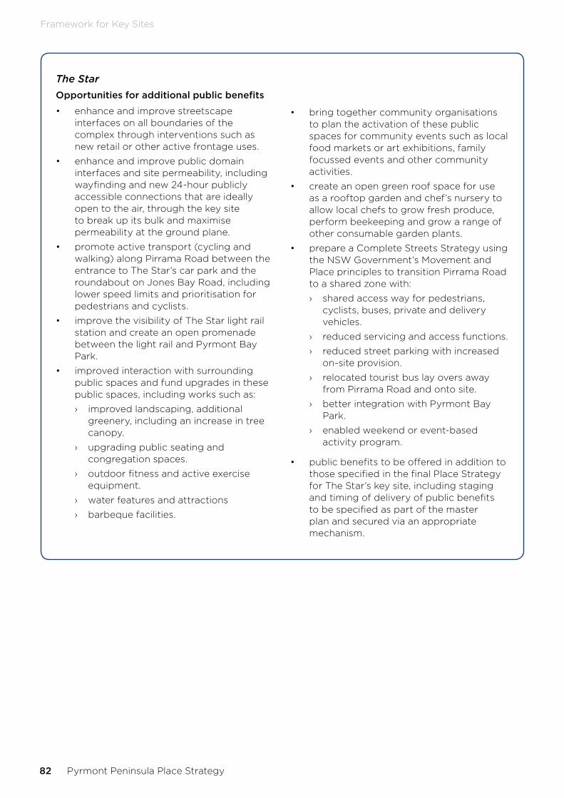
The StarOpportunities for additional public benefits
• enhance and improve streetscape interfaces on all boundaries of the complex through interventions such as new retail or other active frontage uses.
• enhance and improve public domain interfaces and site permeability, including wayfinding and new 24-hour publicly accessible connections that are ideally open to the air, through the key site to break up its bulk and maximise permeability at the ground plane.
• promote active transport (cycling and walking) along Pirrama Road between the entrance to The Star’s car park and the roundabout on Jones Bay Road, including lower speed limits and prioritisation for pedestrians and cyclists.
• improve the visibility of The Star light rail station and create an open promenade between the light rail and Pyrmont Bay Park.
• improved interaction with surrounding public spaces and fund upgrades in these public spaces, including works such as:
› improved landscaping, additional greenery, including an increase in tree canopy.
› upgrading public seating and congregation spaces.
› outdoor fitness and active exercise equipment.
› water features and attractions
› barbeque facilities.
• bring together community organisations to plan the activation of these public spaces for community events such as local food markets or art exhibitions, family focussed events and other community activities.
• create an open green roof space for use as a rooftop garden and chef’s nursery to allow local chefs to grow fresh produce, perform beekeeping and grow a range of other consumable garden plants.
• prepare a Complete Streets Strategy using the NSW Government’s Movement and Place principles to transition Pirrama Road to a shared zone with:
› shared access way for pedestrians, cyclists, buses, private and delivery vehicles.
› reduced servicing and access functions.
› reduced street parking with increased on-site provision.
› relocated tourist bus lay overs away from Pirrama Road and onto site.
› better integration with Pyrmont Bay Park.
› enabled weekend or event-based activity program.
• public benefits to be offered in addition to those specified in the final Place Strategy for The Star’s key site, including staging and timing of delivery of public benefits to be specified as part of the master plan and secured via an appropriate mechanism.
82 Pyrmont Peninsula Place Strategy
Framework for Key Sites
The Star (continued)Special considerations for master planning
• sun access plane not breached so as to ensure solar access to public and open spaces.
• adjust the RL on the “northern” part of the Star’s key site up to a maximum of RL 110 specifically for the purpose of a six-star hotel:
› if development other than a six-star hotel is contemplated, a maximum RL 60 would apply to development at this location. Residential accommodation is not supported on this key site. Reflecting the balance between public and economic benefit from the proposal and its location in a highly visible location, a tower of slender proportions exhibiting design excellence is required.
• reduce the maximum height of development on the “southern” part of the key site to RL 140 to balance development on this part of the site with the greater height now contemplated on the “northern” part of the site.
• any tower must be subject to a design excellence process.
• reduce the size and bulk of the buildings on the site when viewed from the street through an improved interface between the built form and the surrounding area at the ground plane.
• improved and widened public domain on surrounding streets through the removal of bus and coach parking from streets and provision of an on-site parking solution.
• building separation to maintain generous view corridors between buildings and minimise visual impacts from the water and surrounding public domain.
• enhancing 24-hour public connections through The Star precinct that are ideally open to the air and accessible to the public to enable a greater level of public permeability through the current site.
• no increase to overshadowing of surrounding public spaces.
• minimise impact on local character through effective control of built form, scale and material use.
• an improved public benefit offer, including a description of the public benefits to be offered for development on The Star’s key site in addition to those specified in the final Place Strategy.
Delivery pathway
Key site master plan and state-led rezoning.
Framework for Key Sites
NSW Department of Planning, Industry and Environment 83

11Infrastructure

We’re adopting a contemporary approach to secure growth infrastructure that recognises:
• Costs of growth infrastructure are shared across the public and private sector.
• Development contributions alone may not be sufficient to fund the required infrastructure and other funding sources and approaches may be identified.
• Securing unencumbered land at ground level for infrastructure will be increasingly challenging in an urban area like the Pyrmont Peninsula and requires different approaches.
We’ve researched current infrastructure across the Peninsula and in neighbouring areas that service the Peninsula and we have identified gaps in service provision. These include public transport capacity, intersection congestion, lack of sports fields, galleries and cultural facilities. We have considered these gaps against expected future growth and set out key infrastructure opportunities required to make the Place Strategy vision a reality (refer Appendix C: Key infrastructure opportunities on page 98).
We have reviewed these infrastructure opportunities after receiving feedback during the public exhibition of the draft strategy, including feedback from the City of Sydney Council which will have a key role in delivering local infrastructure. The infrastructure opportunities and delivery pathways will require future refinement as we prepare the sub-precinct master plans. Consideration has been given to a Pyrmont
Metro Station, which is considered a major contributing factor for both public transport capacity, connectivity and any associated future land use planning control changes.
The next step is to further refine the infrastructure items into an Infrastructure Delivery Plan that investigates the infrastructure costs, staging, sequencing, delivery partners and mechanisms in collaboration with the City of Sydney, Transport for NSW and other infrastructure agencies.
A range of funding mechanisms will be tested and matched to infrastructure items and categories including investigating a local contribution regime and opportunities for direct negotiations for key sites to contribute to the delivery of public benefits beyond the necessary infrastructure to support increase in density and activity. This may include options for innovative infrastructure funding mechanisms as determined through the Productivity Commissioner’s review of contributions.
A Ministerial Direction under Section 9.1 of the Environmental Planning and Assessment Act 1979 will enable development to progress in line with the Place Strategy and infrastructure opportunities. Planning proposals for the redevelopment of sites that proceed ahead of an endorsed Infrastructure Delivery Plan will need to identify how infrastructure opportunities and place priorities are to be delivered, which may include implementation through Voluntary Planning Agreements.
Infrastructure
NSW Department of Planning, Industry and Environment 85

12Implementation
86 Pyrmont Peninsula Place Strategy

Planning
Precinct-wide, place-based planning
Over time, a complex layering of planning authorities and frameworks has come to apply to the Pyrmont Peninsula. Although an important reason for this has been the need for major development at Pyrmont to be considered at a state significant scale, it has created confusion and uncertainty for residents and businesses.
The Commission’s review identified a need for a place-based approach that considers the cumulative impacts of individual State significant developments. Combined, a collaborative governance and place-based planning framework can bring state and local development approval pathways together, allowing renewal on key sites and other development that supports the Peninsula’s character and potential.
Current planning controls allow for some of the future built form envisaged in the Structure Plan, but in many cases updated planning controls will give greater certainty to all stakeholders.
Planning controls
The existing planning controls for the Peninsula are overlapping and potentially confusing. The following planning instruments apply to the Peninsula:
• Darling Harbour Development Plan No. 1
• Sydney Regional Environmental Plan No. 26 – City West (SREP 26)
• State Environmental Planning Policy (State and Regional Development) 2011 (SRD SEPP)
• State Environmental Planning Policy No 70 – Affordable Housing (Revised Schemes) (SEPP 70)
• State Environmental Planning Policy (State Significant Precincts) 2005 (SSP SEPP)
• Sydney Regional Environmental Plan (Sydney Harbour Catchment) 2005 (SHC SREP)
• Sydney Local Environmental Plan 2012 (Sydney LEP)
Sydney LEP includes planning controls, including land use zoning, maximum building heights and floor space ratios for the entire Peninsula, with the exception of land in the Darling Harbour area and Wentworth Park, as well as certain waterfront sites.
Current land use zoning generally reflects the mix of uses on the ground plane, predominantly R1 General Residential, B2 Local Centre, B3 Commercial Core, and B4 Mixed Use zones.
The approach to height and floor space provisions sees a range of controls applied in specific sites, depending on the individual buildings and streetscapes. This level of detail is supported by Sydney Development Control Plan 2012 (Sydney DCP), with site-by-site controls providing a holistic design for the precinct.
Key development sites are, or have been, subject to State-led planning processes. Given the land ownership structure, nature of the uses and future development aspirations, ongoing collaboration will be critical where State-led processes occur alongside local planning.
The current planning framework allowed for the wave of renewal which has occurred over the past 25 years, and it has allowed the former City West Development Corporation and now the City of Sydney to manage development well. Today, a contemporary planning framework, implemented around the Place Strategy, will coordinate the next wave of renewal to provide benefits in more places for more people.
The Place Strategy will be supported through sub- precinct master plans that will inform updates to planning controls together with a program to rationalise current planning controls across the Peninsula. The sub-precinct master plans will be informed by a range of considerations, including the location and opportunities of the Pyrmont Metro Station.
A unified planning system
Place-based planning coordinates the actions of different stakeholders through an established governance process. Redevelopment of key sites may progress through existing council-led or State-led planning processes, but development outcomes will align with the Place Strategy.
While good governance will establish transparent local and State agency roles, public confidence in the planning system will be further supported by a unified planning framework.
The Place Strategy is the first step in a unified planning system for the Pyrmont Peninsula. Further work is required to calibrate the statutory planning system around the delivery of the Place Strategy including draft sub-precinct master plans that will inform changes to new or updated planning controls and an infrastructure delivery plan.
Implementation
NSW Department of Planning, Industry and Environment 87

Place Strategy implementation in the planning system
Pyrmont Peninsula Place Strategy endorsed
Imp
lem
ente
d b
y
Ministerial Direction
Land use and planning control changes enabled through
landowner prepared planning proposals
consistent with the Place Strategy and subject to suitable infrastructure
arrangements
En
ablin
g
Planning Proposals
State significant precincts or development
for key sites under Key Site master plans
Voluntary Planning Agreements
Tim
ing
Immediate
(upon endorsed strategy and making of Ministerial
Direction)
Sub-precinct master plans finalised
Sydney Local Environmental Plan 2012
Land use and planning controls are updated in the
Sydney LEP 2012 to give effect to the Place Strategy
Supported by an infrastructure delivery
plan and framework and development control plan
Development Applications
Development contributions in line with
infrastructure delivery plan and framework
Short-term
(approx. 6 months)
Review of planning instruments
Sydney Local Environmental Plan 2012
Land use and planning controls are updated in the Sydney LEP 2012 to
rationalise SREP 26 – City West and Darling Harbour
Development Plan No. 1 (subject to further work)
Unified and simplified planning framework for the
Peninsula
Short term
(within 1-2 years)
88 Pyrmont Peninsula Place Strategy
Implementation

GovernanceEnduring collaboration will drive the implementation of the Place Strategy and Action Plan (see next chapter). The Commission’s review report called for “The establishment of collaborative and inclusive governance arrangements that include State Government, industry, Council and community representation…[transitioning] to ongoing collaborative curation-of-place in the medium to longer term”.
The Place Strategy establishes a shared vision and directions, Big Moves and actions around which stakeholders can collaborate to deliver improved place-making, development and community outcomes. A model of place governance and management is required to foster and facilitate this collaboration, focused on:
• Creating great places through the coordinated effort of many.
• Effectively engaging with residents and the broader community.
• Enabling collaboration with State and local government and key anchor institutions and businesses.
• Aligning infrastructure with development, worker and population growth.
• Outlining and delivering a logical road map for converting the Big Moves and actions into reality, as well as the many smaller infrastructure and place projects that require a collaborative approach.
Much of this strategy will require enduring collaboration across many organisations and people, including the State and local government, businesses and landowners and the community over many years.
The draft Place Strategy identified the following four models of collaboration, including:
• An industry-led Business Improvement District, proposed by the Western Harbour Alliance and the Committee for Sydney.
• An innovation district model based on the Camperdown–Ultimo Collaboration Area Place Strategy.
• A local government-led model that recognises the special focus and attention required in the Peninsula.
• A NSW Government-led model that coordinates and aligns across State agencies in consultation with local government, businesses and landowners and community.
The Pyrmont Peninsula is an important part of the much larger Innovation Corridor, stretching from Eveleigh in the south through to The Bays in the north. Future governance of the Pyrmont Peninsula should harmonise with governance arrangements elsewhere in the Innovation Corridor, which are continuing to evolve and are based on “collaboration” models.
For this reason, the Place Strategy does not identify a single governance model for immediate implementation, preferring instead to let current models being trialled in the Innovation Corridor continue to evolve.
Successful models can then be adapted to apply to the Pyrmont Peninsula. Any future governance model for Pyrmont Peninsula would likely be based on a collaborative framework, involving a wide range of stakeholders, in line with Direction 10 of the Place Strategy.
Any model for governance and collaboration will need to address the following issues:
• Introducing place management responsibilities, for example public open spaces owned and managed by different entities.
• Rationalising the Revised City West Affordable Housing Program, with the affordable housing objectives of the Region Plan and City of Sydney’s approach.
• Fostering a collaborative/networking environment with companies in the Innovation Corridor, such as long-term collaboration between academia and business.
• Securing public space and domain improvements through private sector investment that supports their competitive advantages.
• Collaborating between State agencies to maximise public sector benefits and investment.
• Establishing campaigns to communicate ongoing public investment in and around the area (industry attraction).
• Introducing whole-of-precinct sustainability initiatives, including multi-utility hubs, green and active streets, and improved building performance.
• Using innovation and partnership approaches to provide local and regional infrastructure including funding and financial models or new open space and where there is increasingly scarce land at ground level.
Implementation
NSW Department of Planning, Industry and Environment 89

• Investing in community programs to co-create, program and care for open spaces
• Exploring a program of temporary street closures and the implementation of shared zones.
• Investigating transport policy initiatives, including shared parking, parking pricing, transportation management associations, alternative freight arrangements, car-sharing and ride-sharing, and preparing for autonomous vehicles.
90 Pyrmont Peninsula Place Strategy
Action Plan

13Action PlanThe Place Strategy sets out Five Big Moves that represent game-changing economic, transport, entertainment, sustainability and public space outcomes for the Peninsula. They are inherently challenging and require the collaboration and commitment of multiple stakeholders to help unlock these opportunities and deliver significant benefits to the community, local businesses and other stakeholders over the next 20 years. The Place Strategy has also identified several other actions that are required to deliver the vision.
Action Plan
NSW Department of Planning, Industry and Environment 91

Action Lead Support Timing
1 Secure the final links of the Sydney Harbour foreshore walk at Blackwattle Bay and Darling Island
Property owners
DPIE, City of Sydney Medium - Long
2 Acknowledge and celebrate Aboriginal cultural heritage by including the Pyrmont Peninsula harbour foreshore in the City of Sydney’s Eora Journey Harbour Walk project
City of Sydney
DPIE, Property owners Long
3 Acknowledge and celebrate the working harbour history of the Peninsula in new and upgraded sections of the harbour foreshore link
Property owners
DPIE, City of Sydney Long
4 Investigate the repurposing of Glebe Island Bridge as an active and public transport to link Pyrmont Peninsula with The Bays
Transport for NSW
DPIE, City of Sydney Long
5 Investigate the opportunity for new entertainment, events and cultural space in the Peninsula on key sites
Key site owners
DPIE, City of Sydney, NSW Treasury
Ongoing
6 Enable a diversity of night-time experiences in line with the City of Sydney’s ‘An Open and Creative City’ and the NSW Government’s 24- Hour Economy Strategy
City of Sydney, DPIE
NSW Treasury Ongoing
7 Build a Sydney Metro station in the Pyrmont Peninsula as an anchor for new development and connectivity
Sydney Metro
Transport for NSW, DPIE, City of Sydney
Medium
8 Investigate the delivery of multi-utility hubs and integrated models of car parking
Key site owners
City of Sydney, DPIE, Transport for NSW
Medium
9 Facilitate the return of Wentworth Park to community as public open space
NSW Government
City of Sydney Medium
10 Investigate the temporary (pilot) or permanent use of land underneath the Western Distributor for a range of compatible uses
Transport for NSW
DPIE, City of Sydney, Property owners
Ongoing
11 Investigate the re-utilisation of land on Darling Drive through redevelopment
City of Sydney
DPIE, Transport for NSW, Property owners
Ongoing
12 Investigate the ongoing trial of temporary COVID-19 active transport measures beyond current Government guidelines
Transport for NSW
City of Sydney, DPIE Short
13 Prepare a plan of management for recreational water use in Blackwattle Bay.
Transport for NSW
City of Sydney Short – medium
14 Investigate the rationalisation of Sydney Regional Environmental Plan No. 26 – City West and Darling Harbour Development Plan No. 1 into the Sydney Local Environmental Plan 2012
DPIE, City of Sydney
Short – medium
15 Undertake further Aboriginal cultural assessment to provide a comprehensive understanding of the broader Aboriginal cultural landscape in the Pyrmont Peninsula.
DPIE City of Sydney Short
*Actions allocated to property owners indicates the outcome is expected to be delivered through site redevelopment opportunities or requires a landowner (private or government) to facilitate with others.** short: 1-5 years, medium: 5-10 years, long: 10 years plus, ongoing: as site redevelopment/opportunities arise
92 Pyrmont Peninsula Place Strategy
Appendix

14Appendix
Appendix
NSW Department of Planning, Industry and Environment 93

Appendix A: Strategic policy context
State strategic policy context
NSW 2040 Economic Blueprint: Investing in the State’s Future
Sets the direction for NSW’s continued success in a changing world and expanding global economy and for more productive jobs in great places.
Global NSW
• Connected, Smart, Vibrant.
• A roadmap to grow world-leading industries, create great places to live and work and connect NSW to the world by:
› accelerating growth of world-leading industries and businesses.
› building an export culture amongst domestic businesses and support businesses to go global.
› foster an environment conducive to investment that allows innovation to prosper.
› put lighthouse precincts on the map as magnets for international investment in priority sectors.
› develop the workforce of tomorrow
› deliver productive jobs in great places to live.
Summary
The Place Strategy will provide more jobs in great places, to attract investment in priority sectors and support the productivity of Sydney and NSW.
24-hour Economy Strategy
The 24-hour Economy Strategy aims to activate a 24-hour economy across Greater Sydney marking this city as a global beacon of culture, entertainment and amenity for NSW and the world.
The strategy consists of a unified vision and 39 actions to activate a vibrant, diverse, inclusive and safe 24-hour economy for all of Greater Sydney. These actions take place across five strategic pillars that:
• support more integrated planning and place-making.
• encourage the diversification of night-time activities.
• nurture industry and cultural development.
• explore ways to enhance mobility and improve connectivity.
• change the narrative for Sydney to promote Sydney as a world-class night-time destination.
Greater Sydney Region Plan − A metropolis of three cities 2036
The 40 year vision and 20 year plan to manage growth and change across Greater Sydney; a metropolis of three cities comprising the Eastern Harbour City, the Central River City and the Western Parkland City. The plan sets out 10 directions and objectives around the themes of infrastructure, liveability, productivity and sustainability.
Eastern City District Plan
The 20-year plan to manage growth and change in the context of economic, social and environmental matters for the Eastern City to fulfil the vision of the Greater Sydney Region Plan around 21 planning priorities.
Summary
The Place Strategy has been led by an Economic Development Strategy that forecasts future demand for additional employment floor space required to 2041 to deliver the productivity objectives of the Greater Sydney Region Plan and Eastern City District Plan.
The Place Strategy also considers the other directions and objectives across the themes of infrastructure, liveability, productivity and sustainability.
Future Transport 2056
The 40 year vision, directions and outcomes framework for customer mobility in NSW, including customer focussed, successful places, a strong economy, safety and performance, accessible services and sustainability.
94 Pyrmont Peninsula Place Strategy
Appendix

State Infrastructure Strategy 2036
The 20-year strategy sets out Infrastructure NSW’s independent advice on the current state of NSW’s infrastructure and the needs and priorities over the next 20 years.
Summary
The Place Strategy has been supported by a Place-based Transport Strategy developed in collaboration with Transport for NSW.
Net Zero Plan Stage 1: 2020 – 2030
The foundation for NSW’s action on climate change and goal to reach net zero emissions by 2050. It outlines the NSW Government’s plan to grow the economy, create jobs and reduce emissions over the next decade.
Summary
The Place Strategy has considered the matters of strategic significance across social, economic and environmental matters and incorporated these throughout the strategy under a sustainability framework.
Premier’s Priorities
The Premier’s priorities for 2019-2022 focus on improving education standards, improving the health system and creating a better environment.
Summary
Two of the Premier’s Priorities are relevant to the Place Strategy:
Greener public spaces to increase the proportion of homes in urban areas within 10 minutes walk of quality green, open and public space by 10 per cent by 2023
Greening our city to increase the tree canopy and green cover across Greater Sydney by planting one million trees by 2022
Complementary outcomes in greener public spaces and greening our city will be pursued in Direction 5 to create a tapestry of greener public spaces and experiences as the Pyrmont Peninsula experiences growth and change.
Better Placed
Integrated design policy for the built environment of NSW creates a clear approach to ensure we get the good design that will deliver the architecture, public places and environments we want to inhabit now and those we make for the future.
Summary
The Place Strategy is supported by a strategic framework .
Greener Places
Greener Places is a design framework for urban green infrastructure and is supported by the draft Greener Places Design Guide and builds on the Sydney Green Grid strategy
Summary
The Place Strategy has considered Greener Places, the draft Greener Places Design Guide and opportunities to connect the Sydney Green Grid.
Movement and Place
The Government Architect NSW and Transport for NSW are collaboratively developing the Movement and Place Framework to provide a cohesive approach to balancing the movement of people and goods with the amenity and quality of places, contributing to the attractiveness, sustainability and success of our cities and towns.
Summary
The Place Strategy is supported by a Place-based Transport Strategy that applies the Movement and Place Framework to the Pyrmont Peninsula.
Appendix
NSW Department of Planning, Industry and Environment 95

Local Strategic Policy Context
Sustainable Sydney 2030 and Community Strategic Plan 2017-2021
The City of Sydney’s community strategic plan setting out a long-term vision for the City to be green, global and connected by 2030 with strategic directions and actions:
• A globally competitive and innovative city.
• A leading environmental performer.
• Integrated transport for a connected city.
• A city of walking and cycling.
• A lively and engaging city centre.
• Vibrant local communities and economies.
• A cultural and creative city.
• Sustainable development, renewal and design.
• Implementation through effective governance and partnership.
City Plan 2036 (local strategic planning statement)
The 20-year local land use vision, priorities and actions to fulfil the vision and strategic directions of the Greater Sydney Metropolitan Plan and the planning priorities of the Eastern City District Plan.
Draft Central Sydney Planning Strategy
A 20 year growth strategy framed around 10 key moves that aims to revise and update planning controls to increase the capacity of the CBD and some city fringe areas to accommodate additional space for jobs in line with the City’s vision to be green, global and connected.
Summary
City Plan 2036 identifies the review of planning controls in Pyrmont, the City will work with the NSW Government in its place-based review of Pyrmont and it should respect the existing character of the area, prioritise employment growth and economic development to deliver a genuine mixed-use precinct.
The Place Strategy has been developed considering the draft Central Sydney Planning Strategy and in collaboration with the City of Sydney.
96 Pyrmont Peninsula Place Strategy
Appendix
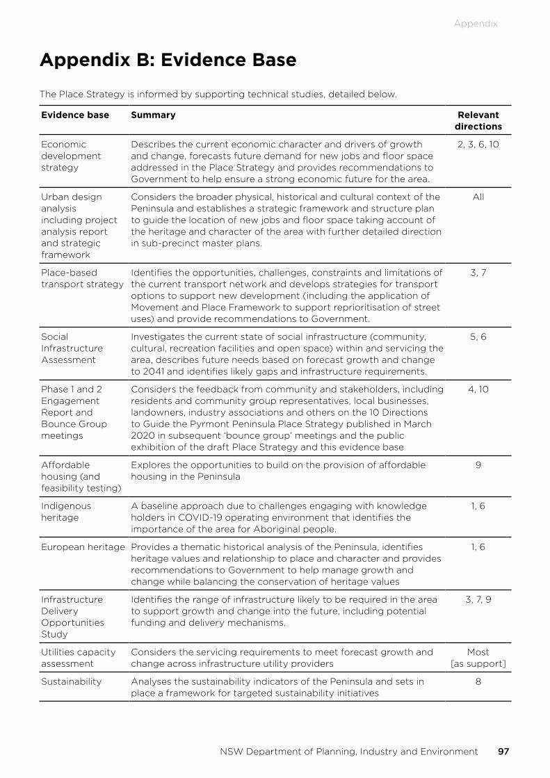
Appendix B: Evidence Base
The Place Strategy is informed by supporting technical studies, detailed below.
Evidence base Summary Relevant directions
Economic development strategy
Describes the current economic character and drivers of growth and change, forecasts future demand for new jobs and floor space addressed in the Place Strategy and provides recommendations to Government to help ensure a strong economic future for the area.
2, 3, 6, 10
Urban design analysis including project analysis report and strategic framework
Considers the broader physical, historical and cultural context of the Peninsula and establishes a strategic framework and structure plan to guide the location of new jobs and floor space taking account of the heritage and character of the area with further detailed direction in sub-precinct master plans.
All
Place-based transport strategy
Identifies the opportunities, challenges, constraints and limitations of the current transport network and develops strategies for transport options to support new development (including the application of Movement and Place Framework to support reprioritisation of street uses) and provide recommendations to Government.
3, 7
Social Infrastructure Assessment
Investigates the current state of social infrastructure (community, cultural, recreation facilities and open space) within and servicing the area, describes future needs based on forecast growth and change to 2041 and identifies likely gaps and infrastructure requirements.
5, 6
Phase 1 and 2 Engagement Report and Bounce Group meetings
Considers the feedback from community and stakeholders, including residents and community group representatives, local businesses, landowners, industry associations and others on the 10 Directions to Guide the Pyrmont Peninsula Place Strategy published in March 2020 in subsequent ‘bounce group’ meetings and the public exhibition of the draft Place Strategy and this evidence base
4, 10
Affordable housing (and feasibility testing)
Explores the opportunities to build on the provision of affordable housing in the Peninsula
9
Indigenous heritage
A baseline approach due to challenges engaging with knowledge holders in COVID-19 operating environment that identifies the importance of the area for Aboriginal people.
1, 6
European heritage Provides a thematic historical analysis of the Peninsula, identifies heritage values and relationship to place and character and provides recommendations to Government to help manage growth and change while balancing the conservation of heritage values
1, 6
Infrastructure Delivery Opportunities Study
Identifies the range of infrastructure likely to be required in the area to support growth and change into the future, including potential funding and delivery mechanisms.
3, 7, 9
Utilities capacity assessment
Considers the servicing requirements to meet forecast growth and change across infrastructure utility providers
Most [as support]
Sustainability Analyses the sustainability indicators of the Peninsula and sets in place a framework for targeted sustainability initiatives
8
Appendix
NSW Department of Planning, Industry and Environment 97

Appendix C: Key infrastructure opportunities
Ultimo
• Contra-flow bus lane northbound on Harris St and Regent St (Thomas St to Lee St)
• New shared zones near UTS and TAFE NSW Ultimo Campus
• New Harris St signalised pedestrian crossing
• Harris St intermediate transport corridor
• Rationalise/relocate Harris St bus stops
• Goods Line - southern extension
• Harris St localised footpath widening
• Jones St part closure - new linear park
• Mary Ann St park upgrade
• 4x public outdoor courts
• Youth spaces - active transport loop
• Theatre and performance space
• Local production, participation and rehearsal space
• Library floorspace
• Work-based childcare
Blackwattle Bay
• Metro station and access
• Pyrmont Bridge Rd - active transport crossing
• Union St cycleway extension to Glebe Island Br - Miller St and Bank St
• Blackwattle Bay commuter cycleway
• Blackwattle Bay foreshore walk
• Underground active transport link from Sydney Fish Market to Light Rail stop
• New district park at Bank St, including inclusive play space
• 4x public multipurpose courts
• 1x outdoor fitness station - active transport loop
• Glebe Island Bridge link
• Expand Carmichael Park
• Public boating facilities near Bank Street, including launch points and storage
• Community floor space
• Library floor space
• Medical centre
• Work-based childcare
• New harbour pool
• Investigate new ferry wharf
Pyrmont Village
• Metro station and access
• Harris St Intermediate transport corridor
• Rationalise/relocate Harris St bus stops
• Goods Line - northern extension
• Union St cycleway extension to Glebe Island Br - Miller St and Bank St
• Harris St and Pyrmont St localised footpath widening
• Reallocate road space on Pyrmont St - Edward Ln to Pyrmont St Ramp
• New urban park/plaza at Allen St
• Recreational opportunities - indoor courts
• Community floorspace
• Community uses under Western Distributor overpass
• Library floorspace
Darling Island
• Metro station and access
• Harbour foreshore walk - Jones Bay Wharf
• Pirrama Road shared zone
• Park upgrades - inclusive play spaces
• 2x public indoor courts
• 1x outdoor fitness station - active transport loop
Tumbalong Park
• Reallocate road space on Pyrmont St - Edward Ln to Pyrmont St Ramp
• Goods Line - northern extension
• New urban park/plaza at Allen St
• Youth spaces - active transport loop
• Tumbalong Park - family focus area
Pirrama
• Harris St Intermediate transport corridor
• Rationalise/relocate Harris St bus stops
• New Cadi Bay Wharf
• Glebe Island Bridge link
• Expand Carmichael Park
• New harbour pool
98 Pyrmont Peninsula Place Strategy
Appendix

Wentworth Park
• Jones St cycleway extension
• Pyrmont Bridge Rd - active transport crossing
• Blackwattle Bay foreshore active transport extension to Wentworth Park
• Extend foreshore active transport link
• Wentworth Park capacity improvements, including new synthetic field
• Community uses under Western Distributor overpass
• Joint and shared use of open space and public buildings
Peninsula-wide
• Light rail - increase frequency
• Active transport loop - Jones, Banks, Bowman, Pirrama, Murray, Pyrmont Sts and Goods Line
• New bus route - Bridge Rd and Pyrmont Bridge Rd
• Playful elements - along active transport loop
• Public recreation on rooftops and podiums in major developments
• New recreational walkable linkage parks
• Communal rooms in residential development
• Production space for creative arts
• Ground-level creative and cultural spaces
• Creative live/work spaces
• Affordable rental housing
• Social housing
• Multi-utility hubs
• Green streets, including tree planting
• Green buildings
Appendix
NSW Department of Planning, Industry and Environment 99

dpie.nsw.gov.au