The Holocene history of George VI Ice Shelf, Antarctic Peninsula from clast-provenance analysis of...
26
The Holocene history of George VI Ice Shelf, Antarctic Peninsula from clast-provenance analysis of epishelf lake sediments S.J. Roberts a, ⁎ , D.A. Hodgson a , M.J. Bentley b,a , J.A. Smith a,b , I.L. Millar c , V. Olive d , D.E. Sugden e a British Antarctic Survey (BAS), Natural Environment Research Council (NERC), High Cross, Madingley Road, Cambridge, CB3 0ET, UK b Department of Geography, University of Durham, South Road, Durham, DH1 3LE, UK c NERC Isotope Geosciences Laboratory, British Geological Survey, Keyworth, Nottingham, NG12 5GG, UK d Scottish Universities Environmental Research Centre, Scottish Enterprise and Technology Park, Rankine Avenue, East Kilbride, G75 0QF, UK e School of GeoSciences, University of Edinburgh, West Mains Road, Edinburgh, EH9 3GW, UK Received 27 September 2005; accepted 28 February 2007 Abstract The Antarctic Peninsula has experienced a dramatic increase in temperature and the loss of ca. 14,000 km 2 of ice-shelf area in recent years. During this time George VI Ice Shelf (GVIIS) has remained relatively intact, but it is now reaching its theoretical limit of viability. Epishelf lakes, formed when ice shelves dam the mouths of marine embayments, accumulate sediments that can be used to constrain past ice-shelf behaviour. They are stratified water bodies with an upper layer of fresh meltwater overlying a marine layer of water. Multi-proxy analysis of a sediment core from Moutonnée Lake, an epishelf lake dammed by GVIIS on the east coast of Alexander Island, has recently shown that it retreated to at least the Ablation Point area in the early Holocene, ca. 9600–7500 years BP, demonstrating its vulnerability to periods of atmospheric and oceanic warmth. This study tests this interpretation of ice-shelf collapse through detailed analyses of granulometric, geochemical and Sr and Nd isotope provenance data for N 8 mm clasts from the same cores. Clast data from Moutonnée Lake were compared with geological reference data from two further lakes on Alexander Island (Ablation Lake and Citadel Bastion Lake) and an extensive archive of rocks and isotope-geochemical provenance data from the Antarctic Peninsula region. Underpinning this provenance analysis is the contrast between the plutonic/igneous outcrops in Palmer Land on the western side and the predominantly sedimentary strata of Alexander Island on the eastern side of George VI Sound, and the different patterns in their deposition that would be expected at Moutonnée Lake during periods of ice-shelf presence and absence. Results show that changes in clast distribution and provenance reflect the early Holocene retreat and reformation of George VI Ice Shelf at Moutonnée Lake. The period of ice-shelf retreat was marked by the onset of marine conditions in the basin followed by a rapidly deposited zone of clasts whose provenance, distribution, varied lithology and larger than average clast size are indicative of a period of lake ice disintegration and ice-rafted debris deposition between ca. 9600–8450 years BP. Igneous clasts in the ice-rafted debris have a close affinity with the plutonic provinces of western Palmer Land suggesting transport to the site by icebergs or recycling through Alexander Island strata/ moraines. When epishelf lake conditions returned after ca. 7500 years BP, the clasts were smaller, the number of lithologies more limited and the assemblage dominated by olive-green vitric tuff and pale-green rhyolitic clasts that isotope data link to Early Cretaceous volcanic activity in Palmer Land. Their dominance in the upper part of the core most likely relates to increased Available online at www.sciencedirect.com Palaeogeography, Palaeoclimatology, Palaeoecology 259 (2008) 258 – 283 www.elsevier.com/locate/palaeo ⁎ Corresponding author. Fax: +44 1223 362616. E-mail address: [email protected] (S.J. Roberts). 0031-0182/$ - see front matter © 2007 Elsevier B.V. All rights reserved. doi:10.1016/j.palaeo.2007.10.010
Transcript of The Holocene history of George VI Ice Shelf, Antarctic Peninsula from clast-provenance analysis of...

Available online at www.sciencedirect.com
alaeoecology 259 (2008) 258–283www.elsevier.com/locate/palaeo
Palaeogeography, Palaeoclimatology, P
The Holocene history of George VI Ice Shelf, Antarctic Peninsulafrom clast-provenance analysis of epishelf lake sediments
S.J. Roberts a,⁎, D.A. Hodgson a, M.J. Bentley b,a, J.A. Smith a,b,I.L. Millar c, V. Olive d, D.E. Sugden e
a British Antarctic Survey (BAS), Natural Environment Research Council (NERC), High Cross, Madingley Road, Cambridge, CB3 0ET, UKb Department of Geography, University of Durham, South Road, Durham, DH1 3LE, UK
c NERC Isotope Geosciences Laboratory, British Geological Survey, Keyworth, Nottingham, NG12 5GG, UKd Scottish Universities Environmental Research Centre, Scottish Enterprise and Technology Park, Rankine Avenue, East Kilbride, G75 0QF, UK
e School of GeoSciences, University of Edinburgh, West Mains Road, Edinburgh, EH9 3GW, UK
Received 27 September 2005; accepted 28 February 2007
Abstract
The Antarctic Peninsula has experienced a dramatic increase in temperature and the loss of ca. 14,000 km2 of ice-shelf area in recentyears. During this time George VI Ice Shelf (GVIIS) has remained relatively intact, but it is now reaching its theoretical limit of viability.Epishelf lakes, formed when ice shelves dam the mouths of marine embayments, accumulate sediments that can be used to constrain pastice-shelf behaviour. They are stratified water bodies with an upper layer of fresh meltwater overlying amarine layer of water. Multi-proxyanalysis of a sediment core fromMoutonnée Lake, an epishelf lake dammed byGVIIS on the east coast of Alexander Island, has recentlyshown that it retreated to at least the Ablation Point area in the earlyHolocene, ca. 9600–7500 years BP, demonstrating its vulnerability toperiods of atmospheric and oceanic warmth. This study tests this interpretation of ice-shelf collapse through detailed analyses ofgranulometric, geochemical and Sr and Nd isotope provenance data for N8 mm clasts from the same cores. Clast data from MoutonnéeLakewere comparedwith geological reference data from two further lakes onAlexander Island (Ablation Lake andCitadel Bastion Lake)and an extensive archive of rocks and isotope-geochemical provenance data from the Antarctic Peninsula region. Underpinning thisprovenance analysis is the contrast between the plutonic/igneous outcrops in Palmer Land on the western side and the predominantlysedimentary strata of Alexander Island on the eastern side of George VI Sound, and the different patterns in their deposition that would beexpected at Moutonnée Lake during periods of ice-shelf presence and absence. Results show that changes in clast distribution andprovenance reflect the early Holocene retreat and reformation of George VI Ice Shelf at Moutonnée Lake. The period of ice-shelf retreatwas marked by the onset of marine conditions in the basin followed by a rapidly deposited zone of clasts whose provenance,distribution, varied lithology and larger than average clast size are indicative of a period of lake ice disintegration and ice-rafteddebris deposition between ca. 9600–8450 years BP. Igneous clasts in the ice-rafted debris have a close affinity with the plutonicprovinces of western Palmer Land suggesting transport to the site by icebergs or recycling through Alexander Island strata/moraines. When epishelf lake conditions returned after ca. 7500 years BP, the clasts were smaller, the number of lithologies morelimited and the assemblage dominated by olive-green vitric tuff and pale-green rhyolitic clasts that isotope data link to EarlyCretaceous volcanic activity in Palmer Land. Their dominance in the upper part of the core most likely relates to increased
⁎ Corresponding author. Fax: +44 1223 362616.E-mail address: [email protected] (S.J. Roberts).
0031-0182/$ - see front matter © 2007 Elsevier B.V. All rights reserved.doi:10.1016/j.palaeo.2007.10.010

259S.J. Roberts et al. / Palaeogeography, Palaeoclimatology, Palaeoecology 259 (2008) 258–283
erosion of Palmer Land ash/tuffs from volcanic outcrops on the floor of Moutonnée Valley and implies a downturn in climateafter ca. 7500 years BP and the reformation of George VI Ice Shelf.© 2007 Elsevier B.V. All rights reserved.
Keywords: Antarctica; Lakes; Isotope geochemistry; Sedimentology; Climate change; Ice-shelf
1. Introduction
Recent atmospheric warming across the AntarcticPeninsula (AP) region has been substantially greater thanboth the current global mean and the natural temperaturevariability of the Holocene (Scambos et al., 2000;
Fig. 1. Location map showing the position of Moutonnée Lake, Ablation LakThe position of some former ice shelves are marked together with dates of t
Vaughan et al., 2003; Domack et al., 2005). As a result,substantial volumes of ice have been lost from unconfinedice shelves (Fig. 1) (King et al., 2004). This process hasled to an accelerated glacier flow into the ocean, whichcontributes to raising global sea-levels (De Angelis andSkvarca, 2003; Scambos et al., 2004). Assessing the past
e and Citadel Bastion Lake on Alexander Island, Antarctic Peninsula.heir most recent collapse events.

260 S.J. Roberts et al. / Palaeogeography, Palaeoclimatology, Palaeoecology 259 (2008) 258–283

261S.J. Roberts et al. / Palaeogeography, Palaeoclimatology, Palaeoecology 259 (2008) 258–283
stability of ice shelves on the AP improves our under-standing of how the remaining ice shelves will respond tocontinued warming of the region predicted by manyclimate models (Houghton et al., 2001; De Angelis andSkvarca, 2003; Shepherd et al., 2003).
George VI Ice Shelf (GVIIS) is the largest remainingice-shelf on the western side of the AP (Fig. 1). It is ca.500 km long, 20–60 km wide and 100–500 m thick andconfined within George VI Sound (70°–73° S, 68°–72°W) by Alexander Island to the west and Palmer Land tothe east. Unlike most AP ice shelves that have recentlydisintegrated, its confinement provides additional stability(Smith et al., 2007a). On the eastern coast of AlexanderIsland, GVIIS impounds two epishelf lakes, MoutonnéeLake and Ablation Lake (Fig. 2). In Antarctica, epishelflakes form when ice shelves dam marine embayments.Moutonnée Lake is a tidal, stratified water body with alower marine layer that extends under the ice-shelf to theocean and an upper fresh meltwater layer whosemaximum thickness is determined by the draught of theice-shelf (Heywood, 1977; Smith et al., 2006). Smithet al. (2006) proposed that when the ice-shelf is absent,Moutonnée Lake would become a marine embayment(Fig. 3). Therefore, epishelf lakes can be used to constrainpast ice-shelf behaviour because when the ice-shelfretreats marine sediments with a distinctive biologicaland isotopic signature are deposited.
The recent loss of the Larsen Ice Shelf B (LIS-B) isunique in the present Holocene interglacial (Domacket al., 2005). However, other ice shelves are behaving,and have behaved differently, with evidence for retreatevents in the middle and early Holocene (Pudsey andEvans, 2001; Brachfeld et al., 2003; Bentley et al., 2005;Cook et al., 2005). For example, Bentley et al. (2005) andSmith et al. (2006) showed that GVIIS retreated to at leastthe Ablation Point area in the early Holocene, ca. 9595–7495 years BP, immediately post-dating the earlyHolocene climatic optimum identified in ice-core records(Masson et al., 2000; Masson-Delmotte et al., 2004), andoccurring at the same time as an influx of warmer oceanwater onto the AP continental shelf (Domack et al., 2001;Bentley et al., 2005; Smith et al., 2006). It is thought thatstructural instability and collapse of unconfined iceshelves such as Larsen Ice Shelf B and C followed abuild up of superficial meltwater ponding, with increased
Fig. 2. Geomorphological maps and aerial photographs of: (a, b) Ablation Laforms a dam across the mouths of Moutonnée and Ablation valleys and illusValley compared to Ablation Valley, and (c, d) Citadel Bastion lake showingnumbers refers to the location of rocks in the BAS geological database. Looutcrops mapped by Elliott (1975).
lateral stress leading to rapid removal of large sections ofthe ice-shelf (Doake et al., 1998). In contrast, superficialponding has been observed for decades on GVIIS, andalthough regional temperatures have risen to its hypothe-sised viability limit, it has remained relatively stable withonly minor retreat recorded at its northern margin since1985 (Fig. 4) (Vaughan and Doake, 1996). Thus, acombination of oceanic melting of the under-side of theice-shelf and increases in atmospheric temperature at thesurface may be necessary for further retreat of GVIISbeyond present-day limits (Shepherd et al., 2003; Bentleyet al., 2005; Smith et al., 2006).
The aim of this study is to examine the geologicalevidence for past retreat of GVIIS through detailedanalyses of granulometric, geochemical and Sr and Ndisotope provenance data for clasts retained on an 8 mmsieve (i.e., the N8 mm fraction) in a sediment core fromMoutonnée Lake. We compare the data from MoutonnéeLake with geological reference data from two other lakeson the eastern side of Alexander Island, Ablation Lakeand Citadel Bastion Lake, and an extensive archive ofrocks and geological provenance reference data from theAP region. Specific objectives are to determine if thegranulometric and geochemical characteristics of theclasts can be used: (1) as an indicator of initial and/orfinal provenance, (2) as a proxy record for GVIIS collapseand/or reformation, and (3) as an indicator of majorchanges in glacial activity in the lake catchment.
Underpinning this provenance analysis is the contrastbetween the plutonic/igneous outcrops in Palmer Land onthe western side of George VI Sound and the predom-inantly sedimentary strata of Alexander Island on theeastern side of George VI Sound, and the differentpatterns in their deposition that would be expected atMoutonnée Lake during periods of ice-shelf presenceversus periods of ice-shelf absence. At present, locally-derived clasts enter Moutonnée Lake mainly by glacialerosion of catchment bedrock or moraines, and possiblyeven aeolian transport (cf. Lewis et al., 2002; Gilbert andDomack, 2003). A smaller number of exotic clasts arealso transported englacially through GVIIS from PalmerLand and become embedded in the lake ice margin ordeposited via a local lake ice conveyor along the lakeshoreline (Clapperton and Sugden, 1982; Potter andParen, 1985; Hendy, 2000; Bentley et al., 2005; Smith
ke and Moutonnée Lake showing where the ice of George VI Ice Shelftrating the relative lack of lake-proximal glacial activity in Moutonnéethe coring site and its separation from George VI Ice Shelf. KG samplecations A–H refer to sites discussed in the text and relate to original

Fig. 3. Cross-sectional conceptual model illustrating the proposed modes of sedimentation in the epishelf Moutonnée Lake during periods of (a) ice-shelfpresence and (b) ice-shelf absence. See text and Smith et al. (2006) for further explanation.
262 S.J. Roberts et al. / Palaeogeography, Palaeoclimatology, Palaeoecology 259 (2008) 258–283
et al., 2007a). When the ice-shelf was absent in the earlyHolocene, the lake would have become a marineembayment. The main conclusion from this study isthat during this period of ice-shelf absence a greaternumber of exotic clasts were deposited in the embaymentby lake ice disintegration and iceberg rafting processes.
2. Site descriptions
2.1. Moutonnée Lake
Moutonnée Lake (70°52.123′ S, 68°19.635′ W) is anepishelf lake impounded by GVIIS and located in a valleyon the east coast of Alexander Island (Fig. 2a). Thegeology and geomorphology of the area are well-mapped,with catchment glaciers currently located ca. 2 km up thevalley (Fig. 2) (e.g., Horne, 1968; Elliott, 1975;Clapperton and Sugden, 1983; Butterworth, 1991;Browne, 1996). At Moutonnée Lake, GVIIS is groundedon a partially submerged bedrock bar damming theembayment (Figs. 2b, 3). However, the lake retains alimited hydraulic connection to the sea water in George
VI Sound as revealed by the offset tidal regime thatoccurs in the lake (Pearson and Rose, 1983). At present,fresh water overlies sea water with a halocline at ca. 30 mdepth (Heywood, 1977; Smith et al., 2006). We examinedthe principal core, ML, extracted from the deepest pointof the main basin with a water depth of 51 m.
A conceptual model has shown that when the ice-shelfis present exotic clasts can be transported across GeorgeVI Sound from the igneous provinces of western PalmerLand by becoming incorporated into the ice-shelf andthen the lake ice (Fig. 3) (Smith et al., 2006). Bishop andWalton (1981) and Pearson and Rose (1983) demonstrat-ed the existence of a strong south-east to north-west flowregime from the region south of the Bertram Glacier inwestern Palmer Land in the direction of Ablation Point(Fig. 4). Clapperton and Sugden (1982) and Smith et al.(2006) also noted the presence of granitic clasts in themoat surrounding Moutonnée Lake, showing thattransport of material across GVIIS had occurred atsome point, likely due to the existence of a lake iceconveyor similar to that described in Hendy (2000). Theice-shelf at both Moutonnée Lake and Ablation Lake

Fig. 4. Summary geological map of Alexander Island and western Palmer Land showing the location of Moutonnée, Ablation, and Citadel BastionLakes, the directional flow regime of ice within George VI Ice Shelf (Potter and Paren, 1985), superficial melt-pond development and ice-flowpatterns of George VI Ice Shelf, and location of R stations in Palmer Land with REE, Sr and Nd isotope data (black numbered circles). Notes: AB =Ablation Lake; ML = Moutonnée Lake; CIB = Citadel Bastion Lake; Geological Terranes: WD = Western Domain; CD = Central Domain.
263S.J. Roberts et al. / Palaeogeography, Palaeoclimatology, Palaeoecology 259 (2008) 258–283
(AB) is not continuously grounded. Processes similar tothose occurring at Moutonnée Lake are likely to haveoccurred at Ablation Lake.
2.2. Reference data sets
2.2.1. Ablation Lake and Citadel Bastion LakeAblation Lake (70°48.974′ S, 68°27.143 W) has a
similar setting to Moutonnée Lake, but differs in thatGVIIS is only partially grounded across the entrance tothe embayment. This results in a continuous hydraulicconnection to the sea water in George VI Sound asrevealed by an in-phase tidal regime occurring in the lake(Smith et al., 2006). Due to the absence of a bedrock
barrier, GVIIS penetrates into the basin forming an ice-shelf tongue (Fig. 2b: H) and can directly deposit coarsesediments into the lake. We examined the principalAblation Lake core, henceforth referred to as AB,extracted from a water depth of 65 m.
Citadel Bastion Lake (72°00.549′ S, 068°27.708′ W)(Fig. 1) is located on the eastern side of Alexander Island,south of and further inland than Moutonnée and AblationLakes. It is enclosed on three sides by Citadel Bastion andCorner Cliffs and dammed along its northern edge by theSaturn Glacier (Fig. 2c, d), which isolates it from GeorgeVI Sound. Therefore, it provides useful reference data formodes and types of local clast deposition that would beexpected on Alexander Island at a site beyond the

264 S.J. Roberts et al. / Palaeogeography, Palaeoclimatology, Palaeoecology 259 (2008) 258–283
influence of the ice-shelf. There is no sub-glacialhydraulic connection to George VI Sound and the SaturnGlacier prevents sea water encroaching into the embay-ment. We examined the principal core (CIB) extractedfrom a water depth of 89 m.
2.2.2. Geological reference dataTo best interpret the provenance signals of clasts
identified in the ML, AB and CIB cores, we examinedpreviously collected rocks and geological data fromacross Alexander Island and western Palmer Land. TheAP is composed of Late Jurassic to Early Cretaceous calc-alkaline igneous rocks and fore-arc and back-arcvolcaniclastic sedimentary sequences. The latter wereformed by subduction of the Pacific and proto-Pacificbeneath the AP along an active continental margin ofGondwana (Suarez, 1976; Saunders et al., 1980;Pankhurst, 1982; 1990; Leat et al., 1995; Howe, 2003).Vaughan and Storey (2000) proposed a terrane model toexplain the formation and geology of the AP and thedistinct geological contrast that exists between thepredominantly volcanic and plutonic bedrock of westernPalmer Land and the sedimentary deposits of easternAlexander Island (Fig. 4). The three principal terranes are:(1) the Western Domain, an accretionary, predominantlysedimentary terrane covering Alexander Island, (2) theCentral Domain, a magmatic subduction-related arcterrane exposed along the west coast of Palmer Landdominated by plutonic and volcanic outcrops, and (3) theEastern Domain, a cratonic margin terrane covering theeast coast of Palmer Land, not relevant to this study. TheWestern Domain of Alexander Island is separated fromthe Central and Eastern Domains by a rift zone that runsthe length of George VI Sound (Pearson and Rose, 1983;Bell and King, 1998).
The plutonic and volcanic provinces of westernPalmer Land and southern Graham Land were formedby magmatic activity during the Mesozoic (Suarez,1976; Leat et al., 1995; Storey et al., 1996; Howe, 2003).The Western Domain of Alexander Island formed in afore-arc basin setting and is either a subduction/accretioncomplex of the Central Domain or a separate crustalfragment (Elliott, 1974; Vaughan and Storey, 2000). Thebedrock in the catchment areas of the three lakesexamined belongs to the Himalia Ridge Formation(Fig. 2b), part of the Fossil Bluff Group (FBG). TheFBG is a fore-arc sedimentary sequence, depositedduring the Late Jurassic–Late Albian (ca. 100 Ma) andoutcropping along the eastern coast of Alexander Island(Macdonald et al., 1993; Moncrieff and Kelly, 1993). Itis predominantly sedimentary, and characterised byinterbedded black mudstone/siltstone, conglomerate,
sedimentary breccia and arkosic sandstone strata (Dou-bleday et al., 1993; Macdonald et al., 1993; Moncrieffand Kelly, 1993; Miller and Macdonald, 2004). TheHimalia Ridge Formation, which outcrops around theAblation Point area, is a 1100-m-thick sequencedominated by mudstone and sporadic conglomeratebeds (Doubleday et al., 1993; Doubleday, 1994). Thickfluvial and deltaic sequences and interspersed volcanicdeposits are exposed in and around the catchments of thethree lakes examined. These were deposited unconform-ably during the Cretaceous on older metasediments ofthe Lemay Group and later uplifted, compressed andinverted during a mid-Cretaceous compression event.The FBG is largely devoid of igneous strata becausevolcanic activity migrated northwards, away from theFossil Bluff area (McCarron and Millar, 1997; Howe,2003).
3. Experimental methods
3.1. Rationale
In marine core studies, granulometric investigationsare commonly undertaken on the N2 and/or b2 mmfractions that define the boundary between sand andgravel (e.g., Pudsey et al., 1994; Pudsey, 2000; Ó Cofaighet al., 2001; Pudsey and Evans, 2001; Anderson et al.,2002). The assumption that the N2 mm fraction isprimarily ice-rafted debris (IRD) is valid in these studiesbecause marine cores are often extracted far enough fromterrestrial inputs to rule out other depositional mechan-isms (Andrews and Principato, 2002).
In this study, the N2 mm fraction was subdivided into2–8 mm and N8 mm fractions because:
(i) Research on modern lacustrine environments inAntarctica suggests that coarse sand, fine gravel andcoarser sediments are commonly found embedded infloating lake ice, while silts and fine sands rain outonto the lake floor after melting through the ice. Forexample, Hendy (2000) noted that clasts b10 mm inthickness will pass through the lake ice and rain outbecause the rate at which they absorb and retainradiation, and, therefore, the rate at which they meltthrough the lake ice, is greater than the ablation rate ofthe lake ice surface. That is, most individual clasts andclast aggregates N8 mm will remain embedded in thelake ice. Since few clasts of this size melt through theice before break-up, increased concentrations of clastsN8 mm in size and/or changes in their lithology in thelake sediment should represent periods when lake icebreak-up and ice-rafting events occur.

265S.J. Roberts et al. / Palaeogeography, Palaeoclimatology, Palaeoecology 259 (2008) 258–283
(ii) Catchment glaciers probably calved periodicallyinto the lakes (Clapperton and Sugden, 1982),allowing numerous 2–8 mm and N8 mm clasts to betransported into the lake by glacial and/or glaciofluvialprocesses. At Ablation Lake and Citadel Bastion Lake,catchment glaciers feed directly into the lake (Fig. 2band c). In contrast, at Moutonnée Lake there are nodirect inputs from the glaciers in Moutonnée Valley(Clapperton and Sugden, 1983) and any increase inN8 mm clast abundance and change in lithology wouldbe most likely due to lake ice break-up and/or ice-rafting.(iii) N8 mm clasts can be readily classified into specificlithological groups whose granulometric and geo-chemical characteristics are more diagnostic of tran-sport mechanisms and provenance than finer fractions.(iv) The N8 mm fraction is sufficiently abundant in allthree cores for statistical analysis and clasts in thisfraction provide sufficient material for standardanalytical procedures (e.g., XRF, ICP-MS).
3.2. Core extraction, clast separation and chronology
Cores were extracted using a UWITEC gravity corer(for surface sediments) and a 2-m UWITEC KOL‘Kolbenlot’ cable-operated percussion piston corer (fordeeper sediments) and transported frozen to the UK.Following a series of routine descriptions and sedimen-tological analyses, sub-samples from each 1 cm of thecores were dried, weighed, re-suspended in water, placedin an ultrasound bath for 45 min and wet-sieved through8 mm, 2 mm and 63 μm meshes. This paper concentrateson the N8 mm fraction. Detailed results of othersedimentological analyses including biological analysesof foraminifera, diatoms, geochemical and isotopic (δ18O,δ13Corg, TOC, NOC, C/N) and physical analyses(magnetic susceptibility) are described in Bentley et al.(2005) and Smith et al. (2007b).
Clasts retained on the 8 mm sieve were grouped intolithological types on the basis of hand specimens and therepresentative geochemical and isotopic analyses. In total,more than 1000 clasts were grouped, weighed, and theirlong, intermediate and short axes measured. The numberof clasts examined from each lake is approximately threetimes greater than the number of gravel clasts examined incomparable studies (e.g., Kuhn et al., 1993). Similarly,many of the lithological-group and core-zone divisionscontain more than the 117 grains recommended forreliable statistical analysis in single-grain geochronology/provenance studies (Vermeesch, 2004).
Following recommendations in similar studies (Joneset al., 2000; Hodgson et al., 2004), mono-specific marine
foraminifera (Globocassidulina sp. and Cibicides sp.) andother macrofossils (e.g., plant remains and organic matter)were handpicked, cleaned and radiocarbon dated (seeTable 1 for full experimental details). When macrofossilswere absent, bulk surface sediments were dated on anexploratory basis to test the suitability of bulk sedimentdating elsewhere in core (Table 1). Radiocarbon agesfrom marine organisms were calibrated to a calendar timescale using CALIB v4.4 (Stuiver and Reimer, 1993) and aΔR value of 900 years (Table 1).
3.3. Geochemical and isotopic analysis
Major, trace and Nd and Sr isotope analyses wereundertaken on 35 representative clast types from theMoutonnée Lake core (ML) and the Ablation Lake core(AB). At the outset, major- and trace-element and isotopedata were thought to be good provenance indicatorsbecause of the macro-scale differences in geologybetween Palmer Land and Alexander Island. Criteria forsampling were: (1) best representation of lithologicaldiversity, (2) lack of significant visible alteration, and(3) suitable size of clast. Most of the clasts analysed comefrom the ML core, reflecting the greater diversity of clasttypes found in this core. Thin sections were made from allclasts prior to chemical analysis. For geochemical andisotope analysis, the outer/weathered surfaces wereremoved by grinding, the remaining sample crushed ina mini-rock splitter and ground by hand to a fine powderin a clean agate pestle and mortar. All crushing/grindingequipments were rigorously cleaned between sampleswith acetone in an ultrasonic bath. Geochemical pro-cedures are summarised in relevant table captions.
It was not possible to date the clasts directly due totheir limited size and/or lack of suitable or sufficientphenocrysts. Clast age estimates used in εNd calculationswere obtained from isochron analysis of bulk 87Sr/86Srversus 87Rb/86Sr data, which was analysed using Isoplot(Ludwig, 2003). εNdi values, representing the differencebetween the initial 143Nd/144Nd ratio of the clasts and thatof the chondritic uniform reservoir (CHUR) at the time ofclast formation, were calculated using age estimates from87Sr/86Sr versus 87Rb/86Sr isochron analysis and com-pared with Palmer Land datasets of known age. Initialhand specimen groupings were improved by agglomer-ative hierarchical cluster analysis of selected REE andisotopic data. Multivariate statistical analyses were usedto compare new data with published Sr and Nd isotopedata from Palmer Land. To aid interpretation of clast data,additional geochemical and isotope analysis was under-taken on the potentially far-travelled clay/silt (b63 μm)sediment fraction from the ML core. Eighteen powdered

Table 1Radiocarbon dates from lake deposits on Alexander Island, Antarctic Peninsula
Laboratory a
codeSample ID(depth) b
Dated foram c species orfraction
Lithology δ13CPDB
(‰±0.1)δ13CAMS
d
(‰±0.1)
14C enrichment(% Modern±1σ)
14C age e
(14C year BP)Calibrated 2σ age range f
(cal year BP)Probability g
(%)Median age(cal year BP)
(i) Foraminifera ages (ML core only)SUERC-575 ML2A (243–246 cm) Globocassidulina sp. Silty clay 0.6 3.3 34.14±0.13 8630±30 7967–8372 100 8188SUERC-576 ML2A (252–255 cm) Globocassidulina sp. Silty clay 1.0 3.7 34.27±0.15 8600±40 7945–8355 100 8155SUERC-577 ML2A (270–272 cm) Globocassidulina sp. Silty clay 0.2 1.7 32.11±0.19 9130±50 8451–8941 100 8712SUERC-578 ML2A (280–281 cm) Globocassidulina sp. Silty clay 0.5 4.8 30.78±0.11 9470±30 8830–9434 98 9055BETA-177300 ML2A (280–281 cm) Cibicides sp. Silty clay −0.7 – 30.90±0.20 9430±40 8801–9425 99 9014SUERC-579 ML2A (291–293 cm) Globocassidulina sp. Silty clay 0.4 4.4 31.02±0.13 9400±30 8742–9136 80 8985
9188–9418 19 –AA-54874 ML4 (494–496 cm) Globocassidulina sp. Silty clay 0.6 n/a 31.58±0.44 9260±110 8445–9084 96 8827BETA-177301 ML4 (494–495 cm) Cibicides sp. Silty clay −0.3 n/a 31.00±0.20 9400±40 8730–9138 79 8983
9186–9419 20 –
(ii) Surface agesCAMS-78992 ML surface sediment BOC Silty clay −25.9 n/a 15.3±0.1 15,100±50 Unreliable age – not calibratedAA-54875 ML1A (3–10 cm) OM n/a −30.3 n/a 8.6±0.2 19,720±160 Unreliable age – not calibratedCAMS-78994 AB Surface BOC Silty clay −24.7 n/a 17.1±0.1 14,180±50 Unreliable age – not calibratedBETA-174765 CIB (0–4 cm) BOC Clay −24.8 n/a 12.0±0.1 17,000±70 Unreliable age – not calibratedBETA-175625 CIB (0–4 cm) Humin⁎ n/a −24.4 n/a 7.6±0.1 20,720±100 Unreliable age – not calibrated
(iii) CIB bulk ‘organic-rich’ sediment peak samplesBETA-194316 CIB-P1 (20–22 cm) BOC Clay −24.4 n/a 17.9±0.1 13,800±60 Unreliable age – not calibratedBETA-194315 CIB-P5 (161–163 cm) BOC Clay −25.0 n/a 6.3±0.1 22,270±100 Unreliable age – not calibratedBETA-194314 CIB-P7 (274–276 cm) BOC Clay −26.4 n/a 3.5±0.1 26,900±160 Unreliable age – not calibrated
Method summary: All cores were transported frozen to the UK. Cores were cut frozen and stored in the dark. Sub-samples for dating were extracted from the central portion of an undisturbed half-section of the core.a Foraminifera radiocarbon ages (ML core only): Two species (Globocassidulina sp. and Cibicides sp.) were analysed at three AMS-dating facilities, Scottish Universities Environmental Research
Centre, University of Glasgow (SUERC), Beta Analytical (BETA), University of Arizona (AA). Forams analysed at Beta Analytical received no pre-treatment. Forams analysed at SUERC andArizona were hydrolysed to CO2 using 85% orthophosphoric acid (AnalaR). Bulk sediment ages from ML, AB and CIB cores: CAMS/AA samples were digested in 2 M HCl (80 °C, 10 h) washedfree of mineral acid with distilled water, dried and homogenised. Total carbon in a known weight of the pre-treated sample was recovered as CO2 by heating with CuO in a sealed quartz tube. Thegas was converted to graphite by Fe/Zn reduction. Samples were analysed at the Center for Accelerator Mass Spectrometry (CAMS), Lawrence Livermore National Laboratory, University ofCalifornia and University of Arizona AMS facility (AA). BETA bulk sample was acid washed in HCl; BETA humin sample was pre-treated with hot HCl acid washes, then NaOH was used toremove secondary organic acids and the soluble fraction isolated/filtered/combined with acid and dried prior to combustion.b AB = Ablation Lake, ML = Moutonnée Lake, CIB = Citadel Bastion Lake.c BOC = Bulk Organic Carbon, OM = Organic Matter; ⁎ = an attempt was made to date the humic fraction of this sample, but there was insufficient carbon.d All ages were corrected for δ13C using δ13C PDB (‰)±0.1 values: additional SUERC δ13C values are measured on OPTIMA dual-inlet mass spectrometer.e Reported radiocarbon ages are 14C year BP±1σ rounded to the nearest 10 years.f Calibrations were performed in Calib version 4.4 (www.calib.org/calib/) (Stuiver and Reimer, 1993) with a marine reservoir correction factor that assumes forams source 100% marine carbon
and ΔR=900 years, i.e., 1300–400 year global marine reservoir offset (Berkman and Forman, 1996; Stuiver et al., 1998).g Percentage probability age distributions for calibrated data excluding results with a b5% probability.
266S.J.
Roberts
etal.
/Palaeogeography,
Palaeoclim
atology,Palaeoecology
259(2008)
258–283

267S.J. Roberts et al. / Palaeogeography, Palaeoclimatology, Palaeoecology 259 (2008) 258–283
samples were subjected to the same geochemical/isotopeprocedures as the clasts.
4. Stratigraphic results
4.1. Core descriptions, stratigraphic units and chronology
The sediment matrix in the ML core is uniformly light-grey (2.5Y 3/2–5/2, 5YR 4/1 and 10YR 3/1) with nomajor visible variations. A similar matrix was found inAB and CIB cores. The principal sedimentary facies inML and AB are unstratified matrix- and clast-supporteddiamictons, fine mud with sporadic clasts, and sandygravels. Clast-supported diamictons are more prevalent inthe AB core than the ML or CIB cores, and are morecommon in the bottom half of the AB and ML cores. Theupper 30 cm of Zone 4 and the near surface 15–20 cm ofall cores are dropstone muds/fine muds. Macrofossilswere only found in the ML cores.
ML core: The ML core is divided into five principalunits defined by the presence/absence of marine organ-isms (Fig. 5). Zone 1 is devoid ofmacro- andmicrofossils.Above this, Zone 2 (522–490 cm) is well-defined by theappearance of marine organisms (forams, diatoms,
Fig. 5. Distribution and masses of individual clasts (line graphs) and clast-shapuncalibrated reported ages fromGlobocassidulina sp. apart from asterisked ag10 years with 1σ errors. See Table 1 for full list of calibrated ages and prob
spicules and brachipod shell fragments). Zone 3 is devoidof biogenic organisms, but characterised by a greater-than-average number of randomly deposited clasts of varioussizes and rock type. Organisms indicative of marineconditions reappear in Zone 4 (302–236 cm). In theuppermost unit of the core, Zone 5 (236–0 cm), marinefossils are replaced by sporadic terrestrial organic matterand sparse moss fragments.
AMS 14C ages from discrete macrofossils (mono-specific forams) in the ML core are in stratigraphic order(within 2σ error). Calibrated AMS 14C foram ages fromtop of Zone 2 (9400±40 and 9260±110 cal years BP) andthe lower half of Zone 4 (9400±30; 9470±30; 9430±40 cal years BP) are essentially coeval (Table 1; Fig. 5).This means that the clast-dominated Zones 2 and 3 andthe lower half of Zone 4 were deposited rapidly, withZones 2 and 3 deposited not long after the onset of marineconditions. Zone 5 remains undated due to insufficientmacrofossils and problems with ‘old’ radiocarbon agesfrom bulk sediments. Exploratory radiocarbon dating ofbulk surface sediments from the ML core produced aclearly erroneous age of 15,100±50 14C years BP(Table 1). This substantial age offset is comparable inmagnitude with surface ages from other cores we have
e summaries (pie charts) for ML, AB, CIB cores. Radiocarbon data arees, which are from Cibicides sp. Ages have been rounded to the nearestability distributions.

268 S.J. Roberts et al. / Palaeogeography, Palaeoclimatology, Palaeoecology 259 (2008) 258–283
examined in this region (Table 1), and is most likely dueto sources of ‘old’ particulate organic carbon (POC) (e.g.,lignite) present in the Fossil Bluff Group and/or oldcarbon from glacial meltwater (cf. Doran et al., 1999;Hendy and Hall, 2006). For these reasons we do not usebulk-sediment 14C ages in constructing chronologies forlake sediments from Alexander Island.
AB core: The reference core, AB was subdivided intofive principal lithofacies units (Fig. 5) using criteria inEvans and Pudsey (2002). The core consists of a matrix-supported diamicton (Unit I), gravelly mud and muddygravels with interbedded diamicton layers (Unit II),dropstone sandy mud and gravel (Unit III) and a matrix-supported diamicton (Unit IV) fining upwards into avirtually dropstone-free sandy mud near the surface(Unit V). An impenetrable deposit at ca. 2.4 m preventeddeeper coring, and, as a (likely) consequence, there is noevidence of the marine zones found in the longer MLcore. The absence of macro- and microfossils or extract-able organic fractions and compounds prevented reliabledating of the AB core. Humin and bulk sediment agesfrom this core are considered unreliable due to thelikelihood of contamination from POC in the Fossil BluffGroup and/or old carbon in glacial meltwater (Table 1).
CIB core: The reference core, CIB consists of a silty–sandy mud with repetitious gravel deposits. It has beendivided into five units (A–E) defined by the principalchanges in physical characteristics (grain size andmagnetic susceptibility) and organic content. Some bulkand humin radiocarbon ages are stratigraphically consis-tent, but the ‘old’ bulk surface ages suggest that contami-nation from old carbon sources also occurs at this site.Studies to refine this chronology using optically-stimu-lated luminescence and palaeomagnetic-intensity datingmethods are ongoing. Until then, we assume that the corepost-dates the Last Glacial Maximum (LGM) because theCitadel Bastion area was most likely inundated by ice atthe LGM.
4.2. Clast distribution, density, shape and weatheringcharacteristics
In the ML core, the mean clast mass of Zone 1 (62.8±57.4 g) is significantly larger than that of the other zones(Fig. 5). There are, however, only four clasts in this zoneand all statistics are heavily skewed by sandstone bedrockembedded in the base of the core. Zone 2 (39 clasts; meanclast mass=18.9±7.6 g, clast density 0.458 g/cm3
sediment) and the first 10 cm of Zone 3 (31; 8.92±5.73 g; 0.229 g/cm3) havemean clast masses and densitiesthat are significantly greater than elsewhere in theML core(and both AB and CIB cores) (Fig. 5). Zone 3 has the
largest number of clasts per cm in the ML core (1.53),consistent with rapid deposition suggested by theradiocarbon results. More significantly, these data showthat the largest clasts were deposited at the start of themarine incursion (Zone 2). Clast density and mean clastmass in Zone 4 are significantly less than in other zones(0.026 g/cm3/3.05±0.88 g respectively, cf. mean of0.110 g/cm3/5.73±0.87 g) suggesting a lower rate ofdeposition throughout Zone 4. A further reduction in clastdensity to 0.0151 g/cm3 of sediment between 268–236 cmsuggests IRD deposition ceased approximately half waythrough this zone. Interestingly, the top 17 cm of Zone 5 issimilarly devoid of clasts. Indeed, the most notablesimilarity across all three cores is the near completeabsence of clasts from the upper 15–20 cm. This couldrelate to a more recent reduction in clasts deposited fromcatchment glaciers that have receded beyond the lakemargins (Figs. 2, 5).
The clast assemblage in ML differs from that in ABand CIB in several ways. First, the AB core has thegreatest mean clast density (0.1921 g/cm3) and mean clastmass (6.12±0.58 g). The overall mean clast mass of theML core is similar to the AB core, but the clast density issignificantly less, due to the lack of larger clasts (definedhere as clasts N10 g) between 236–0 cm depth (Fig. 5). Incontrast, the smaller proportion of glacially remouldedand striated clasts in the ML core of 8%, compared to31% in the AB core, indicates that input of material froma sub-glacial or entrained glacial source (e.g., basal ice-shelf transportation) is more limited in the ML core. Thegreater proportion of striated mudstone and siltstone(Group 14) clasts in the AB core most likely reflects thelarger size and higher number of active glaciers present inAblation Valley compared with the Moutonnée Valley(Fig. 2b). Third, as might be expected, the AB core isdominated by clasts from proximal catchment glaciersand direct inputs from the ice-shelf tongue that protrudesinto the lake. Fourth, due to its isolation from GVIIS, themean clast density of the CIB core (0.0213 g/cm3) is anorder of magnitude smaller than the AB and ML cores.This is primarily because the clasts are smaller (Fig. 5),but there is also a marked reduction in the number ofclasts per cm (ML=0.960, AB=1.580, CIB=0.75 clastsper cm) and clast density (ML=0.110 g/cm3, AB=0.192 g/cm3, CIB=0.0213 g/cm3). The overall mean clastmass in CIB is 1.43±0.34 g (cf. ML=5.73±0.87 g,AB=6.12±0.58 g) and only five clasts have a massgreater than 10 g. Zone D is the only zone with a clastdensity N0.1 g/cm3. This zone is characterised by variableinputs of coarse/fine sediments that are thought to reflectfluctuations in the position of the calving front of thecatchment glaciers.

Table 2Principal clast group statistics for all cores examined (ML, AB and CIB combined data)
Rock type Class a Group summary description Groups Number of clasts(n)
Mean clast mass(g)
Mean b
RoundnessShape class c P–E–O–B(%)
Striated clasts(%)
FeOd
(%)
Primary igneous(i) Granites I-P Fresh granites 22-I/II/33 8 41.2±22.3 1.6±0.5 38–13–50–0 0 38
I-P Weathered granites 34 11 5.08±1.99 2.1±0.3 18–27–45–9 9 27Granodiorite/diorite I-P Foliated and unaltered 27/43 4 7.07±3.21 1.5±0.6 25–25–50–0 0 25
(ii) Rhyolites I-V Green rhyolite 2 11 5.69±2.26 2.9±0.5 27–45–18–9 9 18I-V Light green rhyolite 3 21 3.21±0.81 1.7±0.3 10–35–40–15 0 10
(iii) Crystal/lithic tuffs I-V Olive/dark-green vitric xl tuff 1/7 124 5.69±1.82 1.2±0.1 25–28–36–12 1 8I-V Grey-green/white xl/lithic tuff 4/5 49 3.92±1.30 1.9±0.1 27–33–33–8 0 6
(iv) Other primary igneous I-P Andesitic/felsic dyke 15 8 12.1±7.2 2.1±0.4 0–25–63–13 0 0I-V Basaltic black lava 12 23 10.8±2.6 1.7±0.3 27–14–41–18 36 14
Secondary igneous(v) Grp. 23 lithic tuffs/tuff. sst I-V Grey-white lithic tuff/tuff. sst 23 78 1.76±0.31 2.1±0.1 26–26–30–18 5 5(vi) Other lithic tuffs/tuff. sst I-V Brown tuffs/tuff. sst 8/21/30/32 37 6.16±1.81 1.9±0.2 30–22–38–11 3 11
Non-igneous clasts(vii) Sedimentary/meta-sedimentary S-MS Mudstones/siltstones 10/14 467 3.73±0.39 2.5±0.1 27–20–32–21 33 11
S-MS Greywacke sst (f-mg) 11/13/20 249 4.43±0.93 2.4±0.1 31–21–35–13 7 12S-MS Litharenite/greywacke sst (m-cg) 16/17/26 50 8.23±4.79 2.6±0.1 30–32–26–12 4 14
All clasts (includes data from groups with b4 clasts) All 1166 4.83±0.44 2.22±0.03 27–23–33–16 17 11a I-P = plutonic igneous clasts, I-V = Volcanic igneous clasts, S-MS = sedimentary or meta-sedimentary clasts; xl = crystal, sst = sandstone, tuff. = tuffaceous, f-mg = fine-medium grained, m-cg =
medium-coarse grained.b Roundness scale (0–5) as defined in Pettijohn et al. (1987).c Shape classes, where P = prolate, E = equant, O = oblate, B = bladed (Tucker, 1981). Values are statistically robust where more than 117 clasts exist (cf. Vermeesch, 2004).d FeO is the percentage of clasts with iron staining present on the outside of the clast. All errors are 1σ.
269S.J.
Roberts
etal.
/Palaeogeography,
Palaeoclim
atology,Palaeoecology
259(2008)
258–283
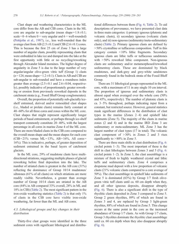
270 S.J. Roberts et al. / Palaeogeography, Palaeoclimatology, Palaeoecology 259 (2008) 258–283
Clast shape and weathering characteristics in the MLcore differ from the AB and CIB cores. Clasts in the MLcore are angular to sub-angular (mean shape=1.8±0.1;scale=0–6 where 0 = very angular and 6 = well-rounded)(Pettijohn et al., 1987), i.e., less well-rounded than theaverage clast fromAB (2.5±0.1) andCIB (2.6±0.1) cores.This is because the first 25 cm of Zone 3 has a largenumber of angular clasts, possibly representing clasts thatwere embedded in lake ice and dumped into the lake at thefirst opportunity with little or no recycling/reworkingthrough Alexander Island moraines. The higher degree ofangularity in Zone 5 is due to the large number of veryangular/angular olive-green vitric tuff (Group 1) clasts(n=124;mean shape=1.2±0.1). Clasts in AB and CIB aresub-angular to sub-rounded and have a roundness indexgreater than average (2.5±0.1 and 2.6±0.04, respective-ly), possibly indicative of proportionately greater rework-ing or erosion from previously reworked deposits in thecatchment strata (e.g., Fossil Bluff Group conglomerates).
Overall, the proportion of potentially sub-glacially/ice-shelf entrained, derived and/or remoulded clast shapes(i.e., bladed or prolate clasts) remains fairly constant at40–60% for all three cores and zones within the ML core.Clast shapes that might represent significantly longerperiods of basal entrainment, or perhaps through ice-shelftransport commonly constitute 20–40%, with the largestpercentage in all cores in marine Zone 4 of the ML core.There are more bladed clasts in the CIB core compared tothe overall mean shape and the mean shapes for each core(CIB=21% versus ML=13%, AB=16%, All cores=16%). This is indicative, perhaps, of greater deposition ofsediment entrained in the basal layers of catchmentglaciers.
In the ML core, 29% of mudstone clasts have multi-directional striations, suggestingmultiple phases of glacialreworking before final deposition into the lake. Thenumber of striated clasts is greatest in the AB core (31%)reflecting the dominance of Group 10/14 mudstones/siltstones (61% of all clasts) on which striations are morereadily visible. Nevertheless, a greater than averagenumber of Group 10/14 clasts are striated in the ABcore (44% in AB compared 33% overall, 28% in ML and18% in CIB) (Table 2). The most significant pattern in theiron-oxide weathering statistics (Table 2) is that only 1%of clasts in the CIB core have visible iron-oxideweathering, far fewer than the ML and AB cores.
4.3. Lithological groups and key changes in theirdistribution
Thirty-five clast groups were identified in the threesediment cores with significant lithological and distribu-
tional differences between them (Fig. 6; Table 2). To aiddescriptions of provenance, we have presented clast datain three main categories: i) primary igneous (plutonic andvolcanic clasts), ii) secondary igneous (volcanic clastsonly), and iii) non-igneous (sedimentry/meta-sedimentaryclasts) (Table 2). Primary igneous clasts are defined byN50% crystralline or tuffaceous composition. Tuff in thiscategory contain b10% lithic fragments. Secondaryigneous clasts are lithic tuffs or tuffaceous sandstoneswith N50% reworked lithic component. Non-igneousclasts are sedimentary and/or metamorphosed/reworkedsedimentray clasts. These are dominated by blackmudstones, and dark-grey and grey-white sandstonescommonly found in the bedrock strata of the Fossil BluffGroup.
There are 31 lithological groups represented in the MLcore, with a maximum of 11 in any single 10 cm interval.The proportion of igneous and sedimentary clasts isalmost equal when averaged over the whole core (50%and 45%, respectively). The number of plutonic clasts isca. 3–5% throughout, perhaps indicating input from aconstant, but restricted source. However, general statisticsmask significant differences in the distribution of clasttypes in the marine (Zones 2–4) and epishelf lakesediments (Zone 5). The majority of the clasts in marinezones (2 and 4) and in the marine IRD Zone 3 aresedimentary or meta-sedimentary. ML Zone 3 has thelargest number of clast types (17 in total). The volcanicclast component of N30% in Zones 2 and 3 risessignificantly to N80% in Zone 5.
There are three main shifts in clast distribution (Fig. 6:circled points 1–3). The most important of these is theshift in clast lithologies between Zones 3 and 5 (Fig. 6:circled points 1–2). In Zone 3, the clast assemblage is amixture of fresh to highly weathered crystal and lithictuffs and sedimentary clasts. Zone 4 comprises adropstone mud deposit with a low proportion of volcanicclasts (21% volcanic clasts compared to a core average of50%). The clast assemblage in epishelf lake sediments ofZone 5 is dominated (63%) by Group 1/7 fresh olive-green vitric tuff clasts until ca. 60 cm depth when they,and all other igneous deposits, disappear abruptly(Fig. 6). There is also a significant shift in the type ofrhyolitic clasts deposited in Zone 3 compared to Zone 5.Group 2 green rhyolites, 89% of which are found inZones 3 and 4, are replaced by Group 3 light-greenrhyolites, 88% of which are found in Zone 5. This changeoccurs at the same point in the core as the increasedabundance of Group 1/7 clasts. As with Group 1/7 clasts,Group 3 rhyolites dominate the rhyolitic clast assemblageuntil ca. 60 cm depth when they also disappear abruptly(Fig. 6).

Fig. 6. Individual clast composition and position of individual N8 mm clasts in the (a) ML, (b) AB and ) CIB lake cores.
271S.J.
Roberts
etal.
/Palaeogeography,
Palaeoclim
atology,Palaeoecology
259(2008)
258–283
(c

Fig. 6 (continued ).
272 S.J. Roberts et al. / Palaeogeography, Palaeoclimatology, Palaeoecology 259 (2008) 258–283
ComparedwithML, the composition of the shorter ABcore is dominated by Group 13/14 sandstones/siltstones/mudstone clasts (87%), with only 13 volcanic clastspresent (out of 366). The high proportion of plutonicclasts (9%) relative toML (3%) andCIB (1%) is due to thepresence of seven highly weathered and three freshgranitic clasts (Fig. 7). The highly weathered clasts arelikely to have been eroded from moraines and/orconglomerate deposits in the catchment (cf. Clappertonand Sugden, 1983). It is likely that weathered plutonicclasts in the core are derived from the moraine depositsalong the lake shore and the margins of the ice-shelf.Possible shifts in rhyolite and tuffaceous clast distributionoccur, but the paucity of clasts makes it difficult to judgewhether these are significant and/or related to erosionfrom catchment deposits or transportation through the ice-shelf. Interestingly, the lack of volcanic deposits on the
floor of Ablation Valley (Elliott, 1975) appears to bereflected in the general lack of volcanic clasts in the ABcore (Figs. 6 and 7).
Due to its isolation from ice-shelf transport processes,the clast diversity in the CIB core is low, with only fourmajor clast types present (Fig. 6). There are no obviousshifts in clast type and the clasts appear to have beendeposited in well-defined pulses (e.g., in Unit D). Themajority of the clasts are sedimentary (Fig. 7), with Group13/14 sandstone/mudstone clasts dominating (Fig. 6). Thenumber of Group 23 light-grey tuff clasts is significant(19%) and proportionately greater than in the ML and ABcores. The lack of variety in the volcanic clasts present inthe CIB core reflects the general lack of volcanic outcropsin the catchment strata. Tuffaceous outcrops of similarcomposition to Group 23 tuffs have been found in the CIBlake catchment (Fig. 2c). The only clast that might not

Fig. 7. Summary of principal lithological composition for N8 mm clasts in the ML, AB and CIB lake cores.
273S.J. Roberts et al. / Palaeogeography, Palaeoclimatology, Palaeoecology 259 (2008) 258–283
come from a CIB catchment source is the single Group 22-I granodiorite clast at 176 cm (Fig. 6: circled point 4).
5. Clast geochemistry, isotopic compositionand provenance
Geochemical and isotopic analyses were used to furthersubdivide the provenance of clasts in the ML core. Thefollowing section details geochemical and isotopiccharacteristics of the key lithological groups that constrainprovenance and depositional processes in MoutonnéeLake. In summary, εNdi values for primary igneous clastsrange from −3.37 to 5.18 (Fig. 8). All the values, exceptfor C142 (εNdi=5.18), lie within the range of previousanalyses from granites and grandiorites from the PalmerLand (Fig. 8) (Millar et al., 2001). Overall, the clasts scatteraround an Rb–Sr reference isochron of ca. 143 Ma,approximately in the middle of the 90–200 Ma age rangeof rocks fromAlexander Island andPalmerLand (Table 3).
5.1. Primary igneous clasts
Primary igneous clasts have similar REE and isotopecompositions to several well-studied rock types fromNWPalmer Land. Combined REE and isotope data from, inparticular, granitic, dioritic and Group 1/7 vitric tuff clastsare compatible with a well-defined source in NW PalmerLand. Although a source in central andwesternAlexanderIsland, active during the Late Cretaceous (ca. 80–60Ma),cannot be completely ruled out, a more extensive source
in Palmer Land or post-subduction Alexander Island isunlikely because the primary igneous clasts analysed haveSr and Nd isotope compositions that are dissimilar to veryyoung (b60 Ma) or very old (N228 Ma) Palmer Landplutonic rocks. It is not possible to distinguish igneousclasts derived fromNWPalmer Land from those recycledthrough the Fossil Bluff Group using geochemical orisotopic data. Nevertheless, some clasts show signs ofsubstantial weathering consistent with recycling throughmoraine deposits of the Fossil Bluff Group.
5.1.1. Plutonic clastsThe number of plutonic clasts in the ML core is
relatively small. Nevertheless, clast compositions provideuseful marker points for comparison with more numerousvolcanic clasts and are the most directly compatible withexisting Sr and Nd isotope reference data. Three plutonicclasts were analysed: two granites (C68B and C18D),which represent all granites found in the core, and onefoliated diorite (A13), a rock type that is known tooutcrop in NW Palmer Land (Vaughan and Millar, 1996;Vaughan et al., 1997). Extensive superficial iron-oxidestaining on C18D suggests it has been recycled throughFossil Bluff Group strata or catchment moraines.Moreover, C18D can be distinguished geochemicallyfrom C68B (i.e., unweathered granites) by its character-istically large negative Europium anomaly (Table 3),indicative of plagioclase fractionation and/or weathering.The granitic and dioritic clasts analysed have contrastingSr and Nd isotope compositions. HREE versus LREE

Fig. 8. εNdi plot comparing new clast data and ML core b63 μm fraction data with published NW Palmer Land data from Millar et al. (2001).
274 S.J. Roberts et al. / Palaeogeography, Palaeoclimatology, Palaeoecology 259 (2008) 258–283
data suggest the heavily weathered granite clast, C18D, isderived from a continental/intraplate magma source(Table 3), whilst its low negative εNdi and high87Sr/86Sri values are compatible with existing LateTriassic or Late Jurassic data (Fig. 8). Clast A13 (foliateddiorite) has low positive εNdi and very low 87Sr/86Srivalues, firmly associated with data from NW PalmerLand Cretaceous plutonic outcrops (Fig. 8).
The granite clast found at 176 cm the CIB core issimilar to sample KG.871.2 (hornblende granite sample)from Alexander Island. Furthermore, some of theweathered granitic clasts in the AB core have a similarcomposition/external appearance (i.e., well-rounded,iron-stained) to weathered granite pebbles from conglom-eratic outcrops in Ablation Valley in the BAS archives.With mean roundness of 2.4±0.4 and 43% equant claststhey are distinct from the more angular weathered granite
clasts (1.5±0.6; 0%; Table 2) found in the ML core, andperhaps indicative of a different mode of transport, forexample, multiple-phase reworking from local morainesrather than first-phase input from local outcrops (Elliott,1975; Bishop and Walton, 1981; Clapperton and Sugden,1983; Smith et al., 2006).
5.1.2. Volcanic clastsThe original source and final depositional provenance
and evaluation of ice-shelf retreat/reformation processesare based primarily on key rhyolitic and tuff clast types.Seventeen volcanic clasts, representing 12 differentlithological types, were analysed. Group 2, 3 rhyolitesand Group 1/7 olive/dark vitric tuff/lava clasts are themost significant clast types. InML, they occur throughoutmarine zones 2–4 in roughly equal proportions tosedimentary clasts and dominate the epishelf Zone 5

Table 3Summary of selected REE and isotopic data
Clast Class Classification Group Core Depth(cm)
Eu/Eu⁎
La/YbN
La/SmN
Gd/YbN
Rb/Sr
87Rb/86Sr
87Sr/86Sr
Age a
(Ma)Sm(ppm)
Nd(ppm)
147Sm/144Nd
143Nd/144Nd
87Sr/86Sr
εNdib TDMc
(Ga)
Primary igneous clasts(i) Granites/dioritesC68B I-P Hornblende granite 22-I ML3B 447–451 0.92 6.15 2.91 1.59 0.215 0.6222 0.706282 140 5.06 24.72 0.123779 0.512663 0.705044 1.79 0.81C18D I-P Granite 22-II ML4 483–491 0.20 5.21 3.58 1.02 0.129 0.3726 0.708066 180 5.38 27.21 0.119569 0.512435 0.707112 −2.19 1.17A13 I-P Sheared/foliated diorite 27 ML1A 74–75.5 0.90 1.88 1.14 1.39 0.018 0.0507 0.704376 140 5.07 18.67 0.164286 0.512745 0.704275 2.66 0.73
(ii) RhyolitesC71 I-V Type I green rhyolite 2 ML3B 443–446 0.72 10.76 4.33 1.50 0.738 2.1367 0.712581 180 4.32 24.35 0.107236 0.512360 0.707113 −3.37 1.26C83 I-V Type III lt green rhyolite 3 ML3B 438–439 0.62 5.35 3.40 1.08 0.398 1.1525 0.707204 140 3.24 16.02 0.122363 0.512699 0.704911 2.52 0.74
(iii) Olive/dark-green vitric xl tuffs/lavasC7 I-V Bas.-trachyandesitic
olive-green xl tuff1 ML4 513–516 0.93 3.29 1.90 1.39 0.403 – – – 4.13 16.72 0.149420 0.512707 0.706785 – –
C13A I-V Bas.-trachyandesiticolive-green xl tuff
1 ML4 442–444 0.93 2.40 1.21 1.58 0.050 0.1439 0.705250 140 4.67 17.26 0.163679 0.512797 0.704964 3.69 0.63
C216 I-V Basalt olive-green/white xl tuff 7 ML2A 233–236 1.10 4.08 2.22 1.52 0.033 0.0948 0.705281 140 3.45 13.69 0.152392 0.512779 0.705092 3.54 0.65C142 I-V Trachyandesitic dk green xl tuff 7a ML3A 386–388 0.90 2.36 1.46 1.33 0.165 0.4775 0.705812 140 5.71 22.33 0.154703 0.512865 0.704862 5.18 0.48C124 I-V Trachyandesitic dk green lava 19 ML3A 400–403 0.93 2.08 1.57 1.18 1.046 3.0264 0.709626 120 4.14 15.13 0.165392 0.512835 0.704465 4.32 0.56C270A I-V Basalt dk green vitric lava 28 ML1B 118–120 1.16 2.57 1.66 1.30 0.06 – – – 2.26 8.464 0.161162 0.512812 0.705401 – –
(iv) Green-grey/white xl tuffsC4 I-V And.-trachandesitic grey–white
xl/lithic tuff5 ML4 516–518 0.78 3.07 1.86 1.27 0.162 0.0452 0.705605 140 3.87 15.80 0.148071 0.512695 0.705515 1.98 0.79
C74 I-V Andesitic grey–whitexl/lithic tuff
5 ML3B 441–443 1.04 5.67 3.68 1.14 0.070 0.2034 0.705541 140 2.59 13.28 0.117763 0.512679 0.705136 2.21 0.77
C141B I-V Andesitic grey–white/greenxl/lithic tuff
5–5a ML3A 390–392 0.90 2.84 1.70 1.31 0.086 0.2495 0.705685 140 – 21.38 – 0.512709 0.705188 – –
C17 I-V Andesitic green–white xl tuff 5a ML4 490–494 1.34 5.76 3.23 1.31 0.031 0.0902 0.705409 140 2.00 10.16 0.119306 0.512686 0.705229 2.32 0.76(v) Other igneous clastsC1b I-V Dacitic lava 31 ML4E 524–527 0.91 3.57 2.51 1.12 3.300 0.6692 0.706269 140 2.72 11.02 0.149236 0.512684 0.704937 1.74 0.81C168 I-V Andesite/tuff–tuff. sst 8a ML2B 344–345 0.89 3.01 1.64 1.46 0.108 0.3125 0.708019 140 4.16 15.98 0.157496 0.512771 0.707397 3.3 0.67C188 I-V Andesitic ashstone 36 ML2B 314–318 0.72 4.92 2.37 1.52 0.220 0.6378 0.707104 140 4.32 24.35 0.107236 0.512360 0.705835 −0.59 1.01C141 I-P Andesitic dyke material 15 ML3B 389–392 0.81 5.51 2.68 1.53 0.032 0.0921 0.705714 140 4.80 21.42 0.135509 0.512595 0.705531 0.25 0.94C57 I-P Andesitic dyke material 15 ML3B 453–455 0.91 4.73 2.17 1.63 0.032 0.0915 0.705765 140 4.18 18.63 0.135566 0.512682 0.705583 1.95 0.79
Secondary igneous clasts(vi) Group 23 lithic tuff/tuffaceous sandstonesC118 I-V Grey–white lithic tuff/tuff. sst 23 ML3A 411–412 0.76 3.17 1.39 1.77 0.033 0.0959 0.705483 140 4.68 18.93 0.149344 0.512655 0.705292 1.17 0.86C120B I-V Grey–white lithic tuff/tuff. sst 23 ML3A 408–410 0.89 6.98 2.95 1.76 0.070 0.2025 0.705727 140 4.76 21.18 0.135900 0.512726 0.705324 2.8 0.71C187 I-V Grey–white lithic tuff/tuff. sst 23 ML2B 319–321 0.97 6.38 4.01 1.19 0.041 0.1176 0.705822 140 2.99 15.01 0.120293 0.512693 0.705588 2.44 0.75C1 I-V Grey–white lithic tuff/tuff. sst 23 ML4 516–518 0.74 2.29 1.38 1.44 0.081 0.2342 0.705671 120 5.16 18.66 0.167115 0.512847 0.705272 4.53 0.53C605 I-V Grey–white lithic tuff/tuff. sst 23a AB2B 145–146 0.74 13.41 4.90 1.65 0.400 1.1575 0.708176 140 3.52 19.64 0.108204 0.512491 0.705873 −1.29 1.07
(vii) Other Tuffs/tuffaceous SandstonesC127 I-V Brown lithic tuff 30 ML3A 398–401 0.93 3.29 1.73 1.44 0.177 0.5112 0.706063 140 4.66 18.64 0.151144 0.512753 0.705046 3.05 0.69C28 I-V Brown lithic tuff 32 ML3A 400–403 0.96 3.18 1.83 1.34 0.034 0.0988 0.705721 140 3.32 13.56 0.148075 0.512668 0.705524 1.5 0.84C54 I-V Brown tuff. sst 8 ML3B 452–454 0.85 2.92 1.87 1.21 0.195 0.5645 0.706187 140 4.06 16.61 0.147721 0.512697 0.705064 2.02 0.79
(continued on next page)(continued on next page) 275
S.J.Roberts
etal.
/Palaeogeography,
Palaeoclim
atology,Palaeoecology
259(2008)
258–283

Table 3 (continued )
Clast Class Classification Group Core Depth(cm)
Eu/Eu⁎
La/YbN
La/SmN
Gd/YbN
Rb/Sr
87Rb/86Sr
87Sr/86Sr
Agea
(Ma)Sm(ppm)
Nd(ppm)
147Sm/144Nd
143Nd/144Nd
87Sr/86Sr
εNdib TDMc
(Ga)
Non-igneous clasts(viii) Sedimentary/meta-sedimentaryC522 S-MS Mudstone/siltstone 14 AB2B 209–212 0.71 7.73 2.80 1.79 0.127 0.3665 0.706950 140 4.12 20.31 0.122718 0.512521 0.706221 −0.96 1.04C66 S-MS Greywacke–shale sst/Agg. 11 ML3B 446–449 0.90 4.16 2.29 1.36 0.216 0.6259 0.706205 140 3.47 14.78 0.142028 0.512721 0.704959 2.59 0.73C148 S-MS Greywacke–shale sst/Agg. 11 ML3A 377–382 0.87 3.48 2.13 1.29 0.083 0.2399 0.705837 140 4.40 18.07 0.147213 0.512750 0.705360 3.07 0.69A8 S-MS Greywacke–shale sst 13 ML3BE 486–495 0.61 3.96 2.66 1.09 0.086 0.2476 0.705983 140 5.58 24.93 0.135412 0.512745 0.705490 3.18 0.68A9 S-MS Greywacke–shale sst 16 ML4E 527–533 0.60 2.71 1.61 1.28 0.040 0.1148 0.705614 140 2.73 10.45 0.157650 0.512682 0.705386 1.55 0.83C11 S-MS Litharenite–wacke sandstone/
quartzite26 ML4 510–512 0.72 5.94 2.77 1.52 0.268 0.7760 0.707584 140 3.51 16.24 0.130804 0.512585 0.706040 0.14 0.95
C512 S-MS Mottled sandstone 16a AB2B 221–222 0.84 8.37 3.47 1.58 0.202 0.5842 0.707531 140 3.95 19.83 0.120367 0.512552 0.706368 −0.32 0.99C2 S-MS Fe–Ca-rich greywacke–shale
sandstone29 ML4 517–520 0.99 4.48 2.45 1.41 0.092 0.2661 0.705756 140 3.75 15.81 0.143334 0.512776 0.705227 3.64 0.64
Main clast groups discussed in text are in bold.Method summary: Samples were sawn in half and thin sections made from one half. The outer/weathered surfaces of the other half were removed by grinding, the remaining core crushed in a mini-rock splitter and ground byhand to a fine powder in a clean agate pestle and mortar. Powders were analysed for ten major elements using fused-disc method in a Philips PW2404 wavelength-dispersive, sequential X-ray fluorescence spectrometer followingmethod of Norrish and Hutton (1969). The spectrometer was calibrated for major-element analysis with international standard samples (PCC1, BEN, BIR1, AGV1, RGM1, ALI, FKN), using concentrations recommended byGovindaraju (1994). Precision and accuracy are typically 5–10% for most major elements. Trace-element and REE analysis was undertaken at Scottish Universities Environmental Research Centre (SUERC) followingprocedures in Olive et al. (2001). In summary, 0.1 g of material was dissolved by a simple tri-acids digestion (4 ml of 48% (29 M) HF, 50% (16 M) HNO3 and 10% (1 M) HCl) in a 15-ml screw-cap Teflon Savillex beaker andsubsequently diluted in 5% HNO3 for analyses. Residual organic compounds present in some clast samples were removed by additional treatment with 30% H2O2. AVG Elemental PQ2 Plus fitted with a Meinhard nebulizer anda water-cooled glass Scott double-pass spray chamber were used. Instrumental sensitivity was set up to 35 million counts per second for 1 ppm 115In. Data acquisition was made in Peak Jumping mode with 3 points per peak and 3replicates of 90 s each. 115In, 102Ru and 185Re were used as internal standards. The quality of the data was controlled by regular analyses of geostandard BCR. Other geostandards (DR-N; MA-N; BEN; BCR; AGV) were alsoanalysed to double-check the quality of the data. All data are expressed in ppm and analysed on a carbonate-free basis to avoid the influence of biogenic Ca. Uncertainties are ± 1–2% (Olive et al., 2001). Rb–Sr and Sm–Ndisotope analysis was undertaken at the NERC Isotope Geosciences Laboratory following the methods of Pankhurst et al. (1993). Sr isotope compositions were determined using static multicollection on a Thermo-FinneganTriton mass-spectrometer to an internal precision of better than 5 ppm (1 s.e.m.). During the period of analysis, 13 analyses of the Sr isotope standard NBS987 gave a value of 0.710249±0.000006 (2σ). Nd isotope compositionswere determined using static multicollection on a Thermo-Finnegan Triton mass spectrometer. Sixteen analyses of the internal J&M Nd isotope standard gave a value of 0.511113±0.000004 (2σ); reported 143Nd/144Nd valueswere normalised to a value of 0.511130 for this standard, equivalent to 0.511864 for La Jolla. Blanks for Sr and Nd were less than 500 pg and 180 pg respectively. The full major, trace and REE dataset is available on request.
a Clast isochron whole-rock Rb–Sr age estimate. Palmer Land outcrop ages are independently determined age of plutonic rocks from Palmer Land (Wareham et al., 1997; Millar et al., 2001).b εNdi data as shown in Fig. 8.c TDM is the two-stage depleted mantle model age in Ga, and represents an estimate of the time of extraction of the parental magma of each sample from a theoretical depleted mantle reservoir (Depaolo et al., 1991).
276S.J.
Roberts
etal.
/Palaeogeography,
Palaeoclim
atology,Palaeoecology
259(2008)
258–283

277S.J. Roberts et al. / Palaeogeography, Palaeoclimatology, Palaeoecology 259 (2008) 258–283
sediments, yet they appear only sporadically in the ABcore and are completely absent from the CIB core.
5.1.2.1. Group 2 and 3 rhyolites. Two clasts, one fromeach group, were analysed. Both are medium-K sub-alkaline tholeiites of the calc-alkaline series. Major/traceand REE compositions and Eu/Eu⁎ values of Groups 2and 3 rhyolites are similar (Table 3). Sr and Nd isotopedata show that they have a different eruption age and/orsource (Fig. 8; Table 3). Group 2 rhyolites (e.g., C71) arecharacterised by low negative εNdi and high 87Sr/86Srivalues, typically associated with Late Triassic or Mid–Late Jurassic igneous rocks from Palmer Land (Fig. 8)(Millar et al., 2001). In contrast, Group 3 rhyolites (e.g.,C83) have low positive εNdi and low 87Sr/86Sri valuesmore typically associated with Late Cretaceous igneouscomplexes of NW Palmer Land (Fig. 8). No Group 3rhyolite specimens from the Ablation Point area werefound in the BAS archives, suggesting a restricted, but asyet undiscovered, outcrop in the Moutonnée Valley areaor transportation through George VI Ice Shelf.
Several factors indicate that Group 3 rhyolites are mostlikely eroded from the ML catchment: (i) the simulta-neous input of Group 3 rhyolites and Group 1/7 clasts inZone 5 of the ML core; (ii) their lack of striations, lesswell-rounded shape, the small proportion of Group 3weathered rhyolites (10% versus 18%) relative to Group 2rhyolites (Table 2); (iii) a possible shift from Group 2 toGroup 3 rhyolites in the AB core; and (iv) an absence ofGroup 2 rhyolites in all but the basal 5 cm of the AB core.Moreover, if both types of rhyolite were eroded directlyfrom Alexander Island outcrops or moraines, it is likelythat both types would be represented in the epishelf lakesediments of Zone 5 of the ML core.
5.1.2.2. Group 1/7 vitric tuffs. Group 1 tuff clasts aredark olive-green volcanic tuffs with 1–3 mm black ash/scoraceous deposits. In thin section, much of the ground-mass is fine-grained/unidentifiable or composed ofplagioclase and/or glassy fragments. The presence of sec-ondary flow patterns and a well-preserved hyaloclastitetexture that has not been recrystallised suggest a sub-glacial eruption or thermal shocking in contact with water,both compatible with a magmatic-arc REE sourceclassification.
Sr and Nd isotope analysis that shows the originalsource of Group 1/7 clasts has a strong affinity withPalmer Land Cretaceous plutonic data (Fig. 8). However,their final source, prior to deposition into the lake, duringthe Holocene was probably local, i.e., Alexander Island.Group 7 tuff clasts are distinguished from Group 1 clastsby higher proportions of plagioclase phenocrysts and their
associated positive Europium anomalies (Table 3).Combined, group 1/7 clasts form an evolutionary trendwithin the transitional alkaline series and exhibit negativerelationship between Eu/Eu⁎ and silica content, reflectingincreasing plagioclase fractionation from the melt(Fig. 8). They are clearly distinct from alkaline (C124:Grp. 19) and sub-alkaline (tholeiitic) (C270A: Grp. 28)dark-green lava clasts, but have εNdi and 87Sr/86Srivalues that are similar those of the foliated diorite clastA13, suggesting a well-defined NW Palmer Land source.Agglomerative hierarchical cluster analysis of all igneousclast εNdi,
87Sr/86Sri and Rb/Sr data produces ninedistinct cluster groups. Overall, no relationship existsbetween the different clast types in each cluster group, butit is interesting to note data fromGroup 1/7 clasts, C124, atrachyandesitic dark-green lava, and A13 are closelyrelated statistically.
The evolutionary relationships between Group 1/7clasts could reflect a single eruption event, or a similareruption source. The low to medium positive εNdi andlow 87Sr/86Sri values indicate that olive/dark-green tuffsand lava clasts are primarily derived from mantle sourceswith relatively little assimilation of older crust comparedto other igneous clasts (Table 3). Their isotopic com-position is compatible with Late Jurassic–Early Creta-ceous plutonic rocks from NW Palmer Land (Fig. 8)(Wareham et al., 1997; Millar et al., 2001) and outcropswith similar petrology in northern Palmer Land (Smith,1987).
Rock specimens of Group 1/7 vitric tuffs and dark-green lavas from Moutonnée and Ablation Valley arewell represented in the BAS archive collection. Forexample, the green vitric lava clast C124 is similar inhand specimen to sample KG802.1, a dark-green fine-grained lava with dark chlorite-filled amygdales, fromthe Himalia Ridge (Fig. 2b). Unlike AB and CIB,unidirectional glacially-striated volcanic rocks (e.g.,KG.853) and till deposits outcrop extensively on thegravel-covered valley floor around Moutonnée Lake andvolcanic deposits are common in adjacent screes andmoraines (Elliott, 1974; Clapperton and Sugden, 1982,1983).
The presence of tuff deposits similar to Groups 1/7 inagglomerate sample KG.804.1 suggests Group 1/7 tuffswere syndepositionally emplaced then reworked into thesedimentary deposits of Alexander Island. Moreover,substantial iron-oxide weathering on specimens equiva-lent to Group 1/7 clasts (e.g., KG.877.1, KG.853.2 andKG.801.1) suggests derivation from conglomerate/ag-glomerate beds of the Fossil Bluff Group and/or morainedepositswithin or at the entrance toMoutonnéeValley (cf.Clapperton and Sugden, 1983).

278 S.J. Roberts et al. / Palaeogeography, Palaeoclimatology, Palaeoecology 259 (2008) 258–283
5.2. Secondary clasts
5.2.1. Secondary volcanic clastsMost significant are the Group 23 grey/white volcanic
tuffs/tuffaceous sandstones, which are present in all threecores. Greater than 70% of clasts of this type are found inthe CIB core. Their presence throughout the core (and inthe ML and AB cores) would suggest derivation fromexposed strata from within the FBG in the CIB catchmentrather than transportation from distal sources. Significant-ly, the arkosic sandstones and pebbly arkosic sandstonesof the FBG contain heavily reworked/well-roundedigneous clasts of pebble grade, similar to the graniticclasts found in the ML and AB cores. In the ML core,N80% of Group 23 clasts were found in the IRD Zone 3,but were notably absent from Zone 5 sediments. Thislikely reflects a significant change in the erosion source of(advancing?) catchment glaciers, sourcing of differentstrata within the Fossil Bluff Group and/or the relativelylimited number of grey/white volcanic tuff outcrops inMoutonnée and Ablation Valley compared to the CitadelBastion catchment.
5.2.2. Sedimentary clastsIt is likely that sedimentary clasts are exclusively
derived from the Fossil Bluff Group (FBG) strata onAlexander Island. In this respect, their provenancerelationships are not diagnostic of changing depositionalprocesses. Sedimentary clasts are predominantly grey-wackes and shales. Exceptions are A8 and C11, which arelitharenites and C187 which is an Fe-sand (cf. Herron,1988). REE data from for Group 14 mudstones show thatthis lithology is characterised by a significant positiveEuropium anomaly (Table 3). The distribution ofsandstones analysed in this study is similar to thosefrom the Pluto and Neptune Glacier Formations (cf.Browne, 1996). The geochemistry of the b63 μm silt andclay fraction in the ML core is most similar to major-element compositions of C522, C512 and C11, i.e.,Group 14 black mudstones and Group 16/26 white/greysandstones. These are from layered outcrops thatconstitute most of the Fossil Bluff Group.
6. Discussion
6.1. Eruption sources, age and tectonic setting
Most rocks eroding from Palmer Land are ca. 100–140 Ma. Two clasts, C71 (Group 2, Type I rhyolite)and C18d (Group 22-III granite) form trend lines thatare significantly older than the average clast age ofca. 140 Ma. An estimated age of ca. 180 Ma links them
with Late Triassic–Upper Jurassic formations in PalmerLand.
6.1.1. Primary clastsThe majority of the igneous clasts plot within
the magmatic-arc domain for AP rocks on HREE versusLREE (Th/Yb versus Ta/Yb, and Th/Ta versus La/Ta)ratio plots McCarron and Smellie (1998) used to definemagmatic sources of Antarctic Peninsula rocks. The twoexceptions are C18D (Group 22 granite) and C13A(Group 1 olive-green crystal tuff). Sr and Nd isotope dataindicate these clasts could be derived from intraplatemagmas or the Jurassic–mid-Cretaceous LemayGroup ofAlexander Island (Doubleday, 1994).
Unaltered, crystal-rich volcanic tuffs and fine-grained rhyolites (e.g., Groups 1/7, 2, 3) reflect theage and location of source volcanism. Late Jurassic–Early Cretaceous (141–127 Ma) granitoid rocks of thewestern Palmer Land Central Domain are derived fromthe mantle, or by melting of underplate, and have lowinitial Sr ratios and high εNdi values, while older rocks,which have assimilated continental crust, have higherinitial Sr ratios and lower/negative εNdi values (Millaret al., 2001). Rb–Sr and Nd isotope data indicate thatthese clast types probably originated from volcanic rocksfrom Palmer Land, most likely during a period ofwidespread and intensive Early Cretaceous arc-relatedvolcanism at around 140 Ma (Millar et al., 2001).
6.1.2. Secondary and sedimentary clastsSecondary and sedimentary clasts (e.g., lithic-rich
tuffs and tuffaceous sandstone clasts) are not diagnos-tic indicators of eruption age or source because theycontain a large component of reworked sedimentarymaterial. The Sr and Nd isotope composition morethan likely reflects the ca. 140 Ma average age ofrocks from NW Palmer Land and Alexander Island.All non-igneous clasts and sand–silt fraction sedi-ments from the ML core plot in either arc-related oractive continental margin fields (Bhatia, 1983; Roserand Korsch, 1986).
6.2. Depositional model and modes
Based on detailed on-site investigation, Smith et al.(2006) have proposed a combined biological, geochem-ical and lithological conceptual model for detectingperiods of ice-shelf loss from the analysis of epishelflake sediments (Fig. 3). In this model, periods of ice-shelfpresence are defined by a restricted range of clast lithol-ogies and clast provenance (mainly catchment-derivedrocks plus some input from specific locations upstream of

279S.J. Roberts et al. / Palaeogeography, Palaeoclimatology, Palaeoecology 259 (2008) 258–283
the main ice-shelf flow lines). In contrast, periods of ice-shelf absence would result in a wider range of clastlithologies sourced from a wider region incorporatingboth rocks from Alexander Island and rock from further afield transported to the site as ice-rafted debris.
Lithological and clast-isotopic provenance analysesallow us to develop this model further. Six modes of clastdeposition inMoutonnée Lake are summarised in Table 4.These reflect: (i) clast source areas; (ii) erosion anddepositional processes; (iii) the relative influence/deposi-tional potential of catchment glaciers versus ice-shelftransport; and (iv) changes in the strength and/or directionof ice-shelf flow pathways into the lakes.
Some caution has to be exercised, however, whenassigning specific provenance locations and modes ofdeposition. Absolute determinations of source remainelusive for many clast types for the following reasons:
(i) The principal difficulty in identifying provenance ofthe sedimentary clasts is the bimodal provenancesignal from the accretionary complex and volcanic arcthat was active in Palmer Land at the time. The petro-graphy of sediments in the Alexander Island mega-basin sequence reflects coeval arc volcanism, and
Table 4Summary of modes of transportation and deposition for different clast groups in
Mode Predominantdepositional mode(original source-locality)
Description of clast erosion/transport/deposition process
Local sourcesI Erosion of Fossil
Bluff Group(Alexander Island)
Clasts eroded directly from sedimentary outcroBluff Group and catchment moraines by local gand/or as dump deposits during lake ice break-
II Volcanic aerialdeposition(Palmer Land–Alexander Island)
Volcanic airfall deposits from Palmer Land incothe Fossil Bluff Group during its formation. Cleroded into the lakes by local glacial activity
III Glacial deposition(Palmer Land–Alexander Island)
Clast types originally from Palmer Land transpIsland by pre-Holocene glacial activity. Subseqlocal glacial activity directly into the lake or inbeing incorporated into catchment moraines
IV Post-formation glacial(Palmer Land–Alexander Island)
Rock types originally from Palmer Land transpIsland by pre-Holocene glacial activity. Deposionto valley floor and subsequently eroded intoglacial activity
Exotic sourcesV Ice-rafting
(Palmer Land–Alexander Island)
Rock types from Palmer Land incorporated intoas IRD from icebergs formed when GVIIS collable to drift into newly formed marine embaym
VI Ice shelf transportation(Palmer Land–Alexander Island)
Rock types from Palmer Land transported throudeposited in and around the lake, possibly by l
erosion of older Palmer Land volcanic outcrops.Volcanic deposits in the Fossil Bluff Group or alongMoutonnée Valley were derived from the rocks of theCentral Domain, but could be related to ash/tuffs thatwere deposited synformationally (Horne, 1968). Inboth cases, the isotopic signature will be the same asnear source igneous outcrops in Palmer Land. Simi-larly, the lower Cretaceous sandstones and conglom-erates of the Alexander Island sediments were thoughtto have been derived from an elevated source areacomposed of granodioritic, parametamorphic andvolcanic rocks (Butterworth, 1991; Browne, 1996).(ii) Relative to Palmer Land, there are few volcanicoutcrops in the lake catchment strata. Tuff and ashdeposits in the top of the Himalia Ridge and SpartanGlacier Formations are most likely products of LateCretaceous/Early Tertiary eruptions from AlexanderIsland and/or coeval volcanism in Palmer Land.(iii) Reworked AP erratics (primarily granites) andgranitic rocks associatedwith theHimalia Formation ofAlexander Island have been found in conglomerate andmoraine sequences of the Ablation Point massif andalong the Moutonnée Lake shoreline (Clapperton andSugden, 1982; 1983; Smith et al., 2007a). Reworked
the ML, AB and CIB cores
Clast types Clast groupexample (clast)
Cores
ps of the Fossillacial activityup events
Most sedimentaryand meta-sedimentary
14 (C522) MLABCIB
rporated intoasts subsequently
Tuffs and ash 1/7(C13A/C216)
MLAB
orted to Alexanderuently eroded byto the lake after
Well-rounded/weatheredgranites
AB granite clastnot analysed
MLAB(CIB?)
orted to Alexanderted in moraines orthe lake by local
Granites 22 (C68B?) MLAB
GVIIS. Depositedapses. Icebergs areents
Wide variety ofangular/coevallydeposited igneousclasts
Numerouspossibilities(see Zone 3Fig. 6a)
ML
gh GVIIS andake ice conveyor
Foliated/sheared diorite?
27 (A13) MLAB?

280 S.J. Roberts et al. / Palaeogeography, Palaeoclimatology, Palaeoecology 259 (2008) 258–283
clasts were distinguished from freshly eroded/exoticclasts to some extent by their highly weathered,rounded and/or iron-stained appearance. This is notentirely diagnostic and it is possible that clasts could befrom unweathered or unexposed parts of such deposits.(iv) Major/trace and REE data from the Fossil BluffGroup is limited. Further isotopic work that mighttighten clast source areas is in progress and it may bepossible to pinpoint source outcrops more accuratelyin the future (e.g., Flowerdew et al., 2003).(v) Palmer Land analyses were undertaken on granites,granodiorites and tonalities. GVIIS analyses wereundertaken on available clast types. These weredominated by tuffs and rhyolites and sedimentary claststhat may not be directly related to the Palmer Landcrustal evolution. This study is different tomost geologi-cal investigations because it was not possible to select, apriori, the most suitable rock types for analyses. Certainvolcanic clasts (e.g., tuffs) and bulk compositions arenot necessarily diagnostic of a particular source.
Nevertheless, there is a clear difference in lithologyand geochemistry of the clasts deposited in the marineML Zones 2–4 compared with clasts from the other zonesin the ML core and from the reference cores (CIB, AB).Specifically, the melange of clast types of predominantlymedium (10–50 g) to large (N50 g) mass in Zone 3follows the first incursion of marine water (Zone 2) andsuggests that the ice-shelf dam and lake ice haddisappeared allowing icebergs from George VI Soundto drift into the newly formed marine embayment anddeposit ice-rafted debris. The assemblage in Zone 4 isinitially dominated (to ca. 270 cm depth; ca. 8500 ka BP)by local Group 14 mudstones/siltstones of the FBG, butthe fine sediments deposited in the latter half of this zonesuggest ice-rafting was not the dominant sedimentaryprocess ca. 8500–7500 years. BP. The switch to anassemblage dominated by Group 1/7 olive-green vitrictuff clasts in Zone 5 suggests IRD/marine depositionprocesses ceased at this time and instead were replaced bylocal glaciers from Moutonnée Valley, calving directlyinto the newly formed marine embayment, and depositinglocally-sourced volcanic material.
6.3. Relationship to wider events
Clapperton and Sugden (1982) constructed a prelim-inary Holocene glacial history for George VI Sound fromgeomorphological relationships between till deposits,moraines, radiocarbon and amino-acid racemizationages from barnacles in moraine deposits. Their radiocar-bon ages suggested open-water conditions existed in
George VI Sound at least until ca. 6500 14C years BP (ca.6000 cal years BP—2σ median probability, using sameinput factors as Bentley et al., 2005) with four phases ofvalley-glacier advance including an advance phase priorto ca. 6000 years BP.
Without accurate age constraints in the upper half ofthe ML core it is not possible to categorically assign gapsin the down-core distribution of olive/dark-green rhyoliticand tuffaceous clasts between 236–44 cm to climatically-induced changes in glacial activity. Nevertheless, sixphases of increased Group 1/7 clast density exist. Thissuggests up to five phases of increased glacial activity,some of which could be contemporaneous with the fourphases of valley-glacier advance proposed by Clappertonand Sugden (1982). Phases of increased Group 1/7 clastdensity are indicative, perhaps, of pulsed deposition fromstagnating lake ice, calving-related deposition in the near-shelf area of the lake and/or fluctuations at its marginrelated to retreat of catchment glaciers, perhaps duringperiods of precipitation decline.
Shifts in clast data associated with the transition frommarine embayment to epishelf lake conditions support ourprevious conclusion (Bentley et al., 2005) that GVIIS wasabsent from the Ablation Point area between 9595 and7945 cal years BP. This retreat occurred immediately aftera period of maximum Holocene warmth documented inthe EPICA Dome C ice-core record (Masson-Delmotteet al., 2004) and at the same time as an influx of warmerCircumpolar Deep Water onto the continental shelf(Domack et al., 2001; Bentley et al., 2005). Not longafter the initial ice-shelf break-up, ice-rafted debris wasdeposited into ML. Subsequent reformation of the ice-shelf occurred at the same time period as the Holoceneclimatic minimum in the EPICA Dome C ice core(Masson-Delmotte et al., 2004). There is no clear evidenceof substantial phases of retreat or a return to marineconditions during the well-documented, and prolonged,‘mid-Holocenewarm period’ (Hodgson et al., 2004), whenconditions were warm enough to cause significant retreatof ice shelves across the northernAP (Domack et al., 1999,2001; Pudsey and Evans, 2001; Taylor et al., 2001;Hodgson et al., 2004).
7. Conclusions
– Clasts N 8 mm in cores from three lakes on easternAlexander Island can provide a proxy measure ofchanges in the configuration ofGVIIS. TheMoutonnéeLake core has significant changes in clast type anddensity that are coupled to retreat phases of GVIIS and,most likely, re-advance phases of local catchmentglaciers in Moutonnée Valley.

281S.J. Roberts et al. / Palaeogeography, Palaeoclimatology, Palaeoecology 259 (2008) 258–283
– The early Holocene retreat of GVIIS in theAblation Point area (Bentley et al., 2005) ismarked by a distinct depositional shift from amore ‘ordered’ assemblage and low number ofclast types when the ice-shelf is present to a morechaotic distribution of clasts and more numerousclast types during the period when the ice-shelfwas absent. During periods of ice-shelf loss, thelithological assemblage is dominated by a range ofexotic clasts. Iceberg rafting of material is likely tobe the dominant sedimentary process duringperiods of ice-shelf loss. Sub-glacial flow throughthe ice-shelf is relatively minor compared to theinput of material from local catchment glaciers andiceberg rafting.
– Further isotopic and age analyses of volcanic out-crops on Alexander Island and NW Palmer Land arenecessary to determine provenance more precisely.This is a substantial undertaking, beyond the scope ofthis paper. Nevertheless, data presented in this paperhave identified six modes of clast transport highlight-ing the complex provenance and depositional pro-cesses in Moutonnée Lake and the GVIIS epishelflake sedimentary system along the eastern coast ofAlexander Island.
Acknowledgements
This study was funded by the BAS core program‘Signals in Antarctica of past Global ChangeS’(SAGES)-10K, the NERC Antarctic Funding Initiativeproject (AFI2/69 and CGS00/06) with additional supportfrom the NERC Radiocarbon Laboratory, East Kilbride,and the NERC Isotope Geosciences Laboratory, Key-worth. Thanks to: Alex Tate (BAS Geological Database);Mike Tabecki (BAS rock archive); Charlotte Bryant,Alan Vaughan, Phil Leat (discussions/assistance). Thanksalso to Pete Milner, Adam Hunt and BAS FieldOperations Staff for assistance in the field, MAGIC(BAS: Peter Fretwell and Andreas Cziferszky) foradditional field data from Citadel Bastion, maps andphotos, and Dodie James (Edinburgh) for assistance withXRF analysis. This paper benefited greatly fromconstructive reviews by Bob Gilbert and EugeneDomack, for which we are grateful.
References
Anderson, J.B., Shipp, S.S., Lowe, A.L., Wellner, J.S., Mosola, A.B.,2002. The Antarctic Ice Sheet during the Last Glacial Maximum andits subsequent retreat history: a review. Quaternary Science Reviews21, 49–70.
Andrews, J.T., Principato, S.M., 2002. Grain-size characteristics andprovenance of ice-proximal marine sediments. In: Dowdeswell, J.A.,Ó Cofaigh, C. (Eds.), Glacier-influenced Sedimentation on High-latitude Continental Margins. Geological Society, Special Publica-tions, London, pp. 305–324.
Bell, A.C., King, E.C., 1998. New seismic data support Cenozoic riftingin George VI Sound, Antarctic Peninsula. Geophysical JournalInternational 134, 889–902.
Bentley, M.J., Hodgson, D.A., Sugden, D.E., Roberts, S.J., Smith, J.A.,Leng, M.J., Bryant, C., 2005. Early Holocene retreat of the GeorgeVI Ice Shelf, Antarctic Peninsula. Geology 33, 173–176.
Berkman, P.A., Forman, S.L., 1996. Pre-bomb radiocarbon and thereservoir correction for calcareous marine species in the SouthernOcean. Geophysical Research Letters 23, 363–366.
Bhatia, M.R., 1983. Plate tectonics and geochemical composition ofsandstones. Journal of Geology 91, 611–627.
Bishop, J.F., Walton, J.L.W., 1981. Bottommelting under George VI IceShelf, Antarctica. Journal of Glaciology 27, 429–447.
Brachfeld, S., Domack, E., Kissel, C., Laj, C., Leventer, A., Ishman, S.,Gilbert, R., Camerlenghi, A., Eglinton, L.B., 2003. Holocene historyof the Larsen-A Ice Shelf constrained by geomagnetic paleointensitydating. Geology 31, 749–752.
Browne, J., 1996. Sandstone provenance and diagenesis of arc-relatedbasins: James Ross Island and Alexander Island, Antarctica. PhDThesis, University of Exeter, Exeter, 464 pp.
Butterworth, P.J., 1991. The role of eustasy in the development ofa regional shallowing event in a tectonically active basin: FossilBluff Group (Jurassic–Cretaceous), Alexander Island, Antarctica.In: Macdonald, D.I.M. (Ed.), Sedimentation, Tectonics and Eustasy.Special Publication of the International Association of Sedimentol-ogists. Blackwell Scientific Publications, Oxford, pp. 307–329.
Clapperton, C.M., Sugden, D.E., 1982. Late Quaternary glacial historyof George VI Sound area, West Antarctica. Quaternary Research 18,243–267.
Clapperton, C.M., Sugden, D.E., 1983. Geomorphology of the AblationPoint massif, Alexander Island, Antarctica. Boreas 12, 125–135.
Cook, A.J., Fox, A.J., Vaughan, D.G., Ferrigno, J.G., 2005. Retreatingglacier fronts on the Antarctic Peninsula over the past half-century.Science 308, 541–544.
De Angelis, H., Skvarca, P., 2003. Glacier surge after ice shelf collapse.Science 299, 1560–1562.
Depaolo, D.J., Linn, A.M., Schubert, G., 1991. The continental crustalage distribution—methods of determining mantle separation agesfrom Sm–Nd isotopic data and application to the southwesternUnited States. Journal of Geophysical Research 96 (B2),2071–2088.
Doake, C.S.M., Corr, H.F.J., Rott, H., Skvarca, P., Young, N.W., 1998.Breakup and conditions for stability of the northern Larsen Ice Shelf,Antarctica. Nature 391, 778–780.
Domack, E., Duran, D., Leventer, A., Ishman, S., Doane, S., McCallum,S., Amblas, D., Ring, J., Gilbert, R., Prentice, M., 2005. Stability ofthe Larsen B ice shelf on the Antarctic Peninsula during theHolocene epoch. Nature 436, 681–685.
Domack, E., Leventer, A., Dunbar, R., Taylor, F., Brachfeld, S.,Sjunneskog, C., 2001. Chronology of the Palmer Deep site,Antarctic Peninsula: a Holocene palaeoenvironmental reference forthe circum-Antarctic. The Holocene 11, 1–9.
Domack, E.W., Jacobson, E.A., Shipp, S., Anderson, J.B., 1999.Late Pleistocene–Holocene retreat of the West Antarctic Ice-Sheet system in the Ross Sea: Part 2—sedimentologic andstratigraphic signature. Geological Society of America Bulletin111, 1517–1536.

282 S.J. Roberts et al. / Palaeogeography, Palaeoclimatology, Palaeoecology 259 (2008) 258–283
Doran, P.T., Berger, G.W., Lyons, W.B., Wharton, R.A., Davisson,M.L., Southon, J., Dibb, J.E., 1999. Dating Quaternarylacustrine sediments in the McMurdo Dry Valleys, Antarctica.Palaeogeography, Palaeoclimatology, Palaeoecology 147,223–239.
Doubleday, P.A., 1994. Structural and tectonic evolution of parts of theMesozoic forearc of Alexander Island. PhD Thesis, University ofLeeds, Leeds, 292 pp.
Doubleday, P.A., Macdonald, D.I.M., Nell, P.A.R., 1993. Sedimentol-ogy and structure of the trench-slope to fore-arc basin transition inthe Mesozoic of Alexander Island, Antarctica. Geological Magazine130, 737–754.
Elliott, M.H., 1974. Stratigraphy and sedimentary petrology of theAblation Point area, Alexander Island. British Antarctic SurveyBulletin 39, 87–113.
Elliott, M.H., 1975. The stratigraphy and sedimentary petrology of theAblation Point area, Alexander Island. M.Sc. Dissertation, Univer-sity of Birmingham, Birmingham, 93 pp.
Evans, J., Pudsey, C.J., 2002. Sedimentation associated with AntarcticPeninsula ice shelves: implications for palaeoenvironmental recon-structions of glacimarine sediments. Journal of the GeologicalSociety (London) 159, 233–237.
Flowerdew, M.J., Millar, I.L., Vaughan, A.P.M., 2003. Does theAntarctic Peninsula comprise exotic terranes? Hf isotope analysisfrom detrital and magmatic zircons. Antarctic Funding Initiative(AFI), Cambridge. Conference (http://www.antarctica.ac.uk/afi/abstracts.htm).
Gilbert, R., Domack, E.W., 2003. Sedimentary record of disintegratingice shelves in a warming climate, Antarctic Peninsula. Geochem-istry, Geophysics, Geosystems 4. doi:10.1029/2002GC000441.
Govindaraju, K., 1994. 1994 compilation of working values and sampledescription for 383 geostandards.GeostandardsNewsletter 18, 1–158.
Hendy, C.H., 2000. The role of polar lake ice as a filter for glaciallacustrine sediments. Geografiska Annaler 82, 271–278.
Hendy, C.H., Hall, B.L., 2006. The radiocarbon reservoir effect inproglacial lakes: examples from Antarctica. Earth and PlanetaryScience Letters 241, 413–421.
Herron, M.M., 1988. Geochemical classification of terrigenous sandsand shales from core or log data. Journal of Sedimentary Petrology58, 820–829.
Heywood, R.B., 1977. A limnological survey of the Ablation Point area,Alexander Island, Antarctica. Philosophical Transactions of theRoyal Society of London B279, 39–54.
Hodgson, D.A., Doran, P.T., Roberts, D., McMinn, A., 2004.Paleolimnological studies from the Antarctic and sub Antarcticislands. In: Pienitz, R., Douglas, M.S.V., Smol, J.P. (Eds.),Developments in Palaeoenvironmental Research. Long-term Envi-ronmental Change in Arctic and Antarctic Lakes, vol. 8. KluwerAcademic Publishers, the Netherlands, pp. 419–474.
Horne, R.R., 1968. Petrology and provenance of the Cretaceoussediments of south-eastern Alexander Island. British AntarcticSurvey Bulletin 17, 73–82.
Houghton, J.T., Ding, Y., Griggs, D.J., Noguer, M., van den Linden, P.J.,Dai, X., Maskell, K., Johnson, C.A., 2001. Climate Change 2001:The Scientific Basis. Cambridge University Press, Cambridge.
Howe, J., 2003. Mid Cretaceous fossil forests of Alexander Island,Antarctica. PhD Thesis, University of Leeds, Leeds, 200 pp.
Jones, V.J., Hodgson, D.A., Chepstow-Lusty, A., 2000. Palaeolimno-logical evidence for marked Holocene environmental changes onSigny Island, Antarctica. The Holocene 10, 43–60.
King, J.C., Turner, J., Marshall, G.J., Connolly, W.M., Lachlan-Cope,T.A., 2004. Antarctic Peninsula climate variability and its causes as
revealed by analysis of instrumental records. In: Domack, E.,Leventer, A., Burnett, A., Bindschadler, R., Convey, P., Kirby, M.(Eds.), Antarctic Peninsula Climate Variability: Historical andPaleoenvironmental Perspectives. Antarctic Research Series.American Geophysical Union, pp. 17–30.
Kuhn, G., Melles, M., Ehrmann, W.U., Hambrey, M.J., Schmiedl,G., 1993. Character of clasts in glaciomarine sediments as anindicator of transport and depositional processes, Weddell andLazarev Seas, Antarctica. Journal of Sedimentary Petrology 63,477–487.
Leat, P.T., Scarrow, J.H., Millar, I.L., 1995. On the Antarctic Peninsulabatholith. Geological Magazine 132, 399–412.
Lewis, T., Gilbert, R., Lamoureux, S.F., 2002. Spatial and temporalchanges in sedimentary processes in proglacial Bear Lake, DevonIsland, Nunavut, Canada. Arctic, Antarctic and Alpine Research 34,119–129.
Ludwig, K.R., 2003. Isoplot 3.00: A Geochronological Toolkit forMicrosoft Excel, Special Publication No. 4. Berkeley Geochronol-ogy Center. 71 pp.
Macdonald, D.I.M., Moncrieff, A.C.M., Butterworth, P.J., 1993. Giantslide deposits from a Mesozoic fore-arc basin, Alexander Island,Antarctica. Geology 21, 1047–1050.
Masson, V., Vimeux, F., Jouzel, J., Morgan, V., Delmotte, M., Ciais, P.,Hammer, C., Johnsen, S., Lipenkov, V.Y., Mosley-Thompson, E.,Petit, J.R., Steig, E.J., Stievenard, M., Vaikmae, R., 2000. Holoceneclimate variability in Antarctica based on 11 ice-core isotopicrecords. Quaternary Research 54, 348–358.
Masson-Delmotte, V., Stenni, B., Jouzel, J., 2004. Common millennial-scale variability of Antarctic and Southern Ocean temperaturesduring the past 5000 years reconstructed from the EPICA Dome Cice core. Holocene 14, 145–151.
McCarron, J.J., Millar, I.L., 1997. The age and stratigraphy of fore-arcmagmatism on Alexander Island, Antarctica. Geological Magazine134, 507–522.
McCarron, J.J., Smellie, J.L., 1998. Tectonic implications of fore-arcmagmatism and generation of high-magnesian andesites: AlexanderIsland, Antarctica. Journal of the Geological Society (London) 155,269–280.
Millar, I.L., Willan, R.C.R., Wareham, C.D., Boyce, A.J., 2001. The roleof crustal and mantle sources in the genesis of granitoids of theAntarctic Peninsula and adjacent crustal blocks. Journal of theGeological Society (London) 158, 855–867.
Miller, S., Macdonald, D.I.M., 2004. Metamorphic and thermal historyof a fore-arc basin: the Fossil Bluff Group, Alexander Island,Antarctica. Journal of Petrology 45, 1453–1465.
Moncrieff, A.C.M., Kelly, S.R.A., 1993. Lithostratigraphy of theuppermost Fossil Bluff Group (Early Cretaceous) of AlexanderIsland, Antarctica—history of an Albian regression. CretaceousResearch 14, 1–15.
Norrish, K., Hutton, J.T., 1969. An accurate X-ray spectrographicmethod for the analysis of a wide range of geological samples.Geochemica et Cosmochimica Acta 33, 431–453.
Ó Cofaigh, C.O., Dowdeswell, J.A., Pudsey, C.J., 2001. LateQuaternary iceberg rafting along the Antarctic Peninsula continen-tal rise and in the Weddell and Scotia Seas. Quaternary Research56, 308–321.
Olive, V., Ellam, R.M., Wilson, L., 2001. A protocol for thedetermination of the rare Earth elements at picomole level in rocksby ICP-MS: results on geological reference materials USGSPCC-1and DTS-1. Geostandards Newsletter 25, 219–288.
Pankhurst, R.J., 1982. Rb–Sr geochronology of GrahamLand, Antarctica.Journal of the Geological Society (London) 139, 701–711.

283S.J. Roberts et al. / Palaeogeography, Palaeoclimatology, Palaeoecology 259 (2008) 258–283
Pankhurst, R.J., 1990. The Paleozoic and Andean magmatic arcs ofWestAntarctica and southern America. Geological Society of America,Special Paper 241, 1–7.
Pankhurst, R.J., Millar, I.L., Grunow, A.M., Storey, B.C., 1993. The Pre-Cenozoic magmatic history of the Thurston Island crustal block,WestAntarctica. Journal of Geophysical Research 98 (B7), 11835–11849.
Pearson, M.R., Rose, I.H., 1983. The dynamics of George VI Ice Shelf.British Antarctic Survey Bulletin 52, 205–220.
Pettijohn, F.J., Potter, P.E., Siever, R., 1987. Sand and Sandstone.Springer-Verlag, New York. 553 pp.
Potter, J.E., Paren, J.G., 1985. Interaction between ice shelf and ocean inGeorge VI Sound, Antarctica. In: Jacobs, S.S. (Ed.), Oceanologyof the Antarctic Continental Shelf. Antarctic Research Series,pp. 35–58.
Pudsey, C.J., 2000. Sedimentation on the continental rise west of theAntarctic Peninsula over the last three glacial cycles. MarineGeology 167, 313–338.
Pudsey, C.J., Barker, P.F., Larter, R.D., 1994. Ice-sheet retreat from theAntarctic Peninsula shelf. Continental Shelf Research 14, 1647–1675.
Pudsey, C.J., Evans, J., 2001. First survey of Antarctic sub-ice shelfsediments reveals mid- Holocene ice shelf retreat. Geology 29,787–790.
Roser, B.P., Korsch, R.J., 1986. Determination of tectonic setting ofsandstone–mudstone suites using SiO2 content and K2O Na2O ratio.Journal of Geology 94, 635–650.
Saunders, A.D., Tarney, J., Weaver, S.D., 1980. Transverse geochemicalvariations across the Antarctic Peninsula—implications for thegenesis of calc-alkaline magmas. Earth and Planetary ScienceLetters 46, 344–360.
Scambos, T.A., Bohandler, J., Shuman, C.A., Skvarca, P., 2004. Glacieracceleration and thinning after ice shelf collapse in the Larsen BEmbayment, Antarctica. Geophysical Research Letters 31.doi:10.1029/2004GL0260670.
Scambos, T.A., Hulbe, C., Fahnestock, M., Bohandler, J., 2000. The linkbetween climate warming and break-up of ice shelves in theAntarctic Peninsula. Journal of Glaciology 46, 516–530.
Shepherd, A., Wingham, D., Payne, T., Skvarca, P., 2003. Larsen iceshelf has progressively thinned. Science 302, 856–859.
Smith, C.G., 1987. The geology of parts of the west coast of PalmerLand. British Antarctic Survey Scientific Reports 112, 0–101.
Smith, J.A., Hodgson, D.A., Bentley, M.J., Cook, A.J., 2007a. GeorgeVI Ice Shelf: past history, present behaviour and potentialmechanisms for future collapse. Antarctic Science 19 (1), 131–142.
Smith, J.A., Bentley, M.J., Hodgson, D.A., Roberts, S.J., Verleyen, E.,Leng, M.J., Lloyd, J.M., Barrett, M.J., Bryant, C., Sugden, D.E.,2007b. Oceanic and atmospheric forcing of early Holocene ice shelf
retreat, George VI Ice Shelf, Antarctic Peninsula. QuaternaryScience Reviews 26, 500–516.
Smith, J.A., Hodgson, D.A., Bentley, M.J., Verleyen, E., Leng, M.J.,Roberts, S.J., 2006. Limnology of two antarctic epishelf lakes andtheir potential to record periods of ice shelf loss. Journal ofPaleolimnology 35, 373–394.
Storey, B.C., Brown, R.W., Carter, A., Doubleday, P.A., Hurford, A.J.,Macdonald, D.I.M., Nell, P.A.R., 1996. Fission-track evidence forthe thermotectonic evolution of a Mesozoic–Cenozoic fore-arc,Antarctica. Journal of the Geological Society (London) 153, 65–82.
Stuiver, M., Reimer, P.J., 1993. Extended 14C database and revisedCALIB radiocarbon calibration program. Radiocarbon 35, 215–230.
Stuiver, M., Reimer, P.J., Bard, E., Beck, J.W., Burr, G.S., Hughen,K.A., Kromer, B., McCormac, G., van der Plicht, J., Spurk, M.,1998. Intcal 98 radiocarbon age calibration, 24,000-0 cal BP.Radiocarbon 40, 1041–1083.
Suarez, M., 1976. Plate-tectonic model for Southern Antarctic Peninsulaand its relation to Southern Andes. Geology 4, 211–214.
Taylor, F., Whitehead, J., Domack, E., 2001. Holocene paleoclimatechange in the Antarctic Peninsula: evidence from the diatom,sedimentary and geochemical record.MarineMicropaleontology 41,25–43.
Tucker, M.E., 1981. Sedimentary Petrology: An introduction to theOrigin of Sedimentary Rocks. Blackwell, Oxford. 260 pp.
Vaughan,A.P.M.,Millar, I.L., 1996. EarlyCretaceousmagmatismduringextensional deformation within the Antarctic Peninsula magmaticarc. Journal of South American Earth Sciences 9, 121–129.
Vaughan, A.P.M., Storey, B.C., 2000. The eastern Palmer Land shearzone: a new terrane accretion model for the Mesozoic developmentof the Antarctic Peninsula. Journal of the Geological Society(London) 157, 1243–1256.
Vaughan, A.P.M., Wareham, C.D., Millar, I.L., 1997. Granitoid plutonformation by spreading of continental crust: the Wiley Glacier com-plex, northwest Palmer Land, Antarctica. Tectonophysics 283,35–60.
Vaughan, D.G., Doake, C.S.M., 1996. Recent atmospheric warming andretreat of ice shelves on the Antarctic Peninsula. Nature 379, 328–331.
Vaughan, D.G., Marshall, G.J., Connolley, W.M., Parkinson, C.,Mulvaney, R., Hodgson, D.A., King, J.C., Pudsey, C.J., Turner, J.,2003. Recent rapid regional climate warming on the AntarcticPeninsula. Climatic Change 60, 243–274.
Vermeesch, P., 2004. How many grains are needed for a provenancestudy? Earth and Planetary Science Letters 224, 441–451.
Wareham, C.D., Millar, I.L., Vaughan, A.P.M., 1997. The generation ofsodic granite magmas, western Palmer Land, Antarctic Peninsula.Contributions to Mineralogy and Petrology 128, 81–96.