Massachusetts raises risk level for West Nile virus - The ...

Human-Environment Interaction Potential in Cataract Regions During the African Humid Period
Habitable environments in barren landscapes

Modern Environment of Sudan•Northern Sudan is classified as a subtropical desert with a BWh climate
Annual average temperature of 81.1°F Annual average precipitation 18mm Dominant wind direction is from the North/North East
Kuper & Kröpelin, 2006

Characteristics of the Modern Nile• White Nile originates in Lake Albert, Uganda; Blue Nile at Lake Tana, Ethiopia Ethiopia is also the source of the Atbara River Blue Nile & Atbara River account for 85% of the Nile’s flow
• Nile Cataracts are eruptions of resistant rock that disrupt the Nile flow
• Sections of rapid drop in river level across northern Sudan
Woodward et al, 2007
Woodward et al, 2001

Green Schist; Intermediate-basic MetavolcanicsFluviatile Sandstone, Lacustrine siltstone & mudstoneGneiss; ensialic continental basement rocks
Intrusive GraniteRecent Alluvium & Wadi DepositsColluvium, Sand Sheets & Amalgamated Dunes
12,00011,00010,0009,0008,0007,0006,0005,0004,0003,0002,0001,0000
270
260
250
240
230
220
210
200
12,00011,00010,0009,0008,0007,0006,0005,0004,0003,0002,0001,0000
300290280270260250240230220210200
12,00011,00010,0009,0008,0007,0006,0005,0004,0003,0002,0001,0000
255250245240235230225220215210205200
20,00018,00016,00014,00012,00010,0008,0006,0004,0002,0000
245
240
235
230
225
220
12,00011,00010,0009,0008,0007,0006,0005,0004,0003,0002,0001,0000
330
320
310
300
290
280
270
260
250
12,00011,00010,0009,0008,0007,0006,0005,0004,0003,0002,0001,0000
330
320
310
300
290
280
270
260
250
12,00011,00010,0009,0008,0007,0006,0005,0004,0003,0002,0001,0000
350345340335330325320315310305300295290285
12,00011,00010,0009,0008,0007,0006,0005,0004,0003,0002,0001,0000
350
345340335
330
325320
315
310

Modern Environment of Cataract Uplands
Downwind & opposite of the Nile the surface is dominated by bedrock exposures, hamada, and serir

African Humid Period: 8500-5000 BCE• Movement of seasonal precipitation bands to the North 300*-800** km Estimates at 18°N of a minimum of 400mm (abs. max 1100mm); Seasonal with strong storms (Hoelzmann et al, 2000; West Nubian Palaeolake/Northern Darfur Megalake)
Estimates of 200-600mm at Gilf Kebir (ca. 23.5°N)
• Often interpreted with an intervening arid phase ca. 7000 BCE Haynes, 2001: Nabta-Kiseiba wet phases 9600-7250 BCE; 10000-8200 yr BP uncal 7050-6800 BCE; 8100-7900 yr BP uncal 6550-3300 BCE; 7700-4600 yr BP uncal
• Investigated via two general approaches Distribution of archaeological materials in inhospitable locations
Identify evidence of palaeoclimates
Kuper & Kröpelin, 2006
** Petit-Maire et al, 1995 quoted in Abell & Hoelzmann, 2000

Archaeological Sites as Climate Indicator• Gehlen et al, 2002 found strong cultural differences between areas
Sites distributed between both high (Gilf Kebir) and low areas (Regenfield)
• Nicoll, 2001: # of radiocarbon dates ≈ human activity ≈ climate No definitive dry phase Regionally distinctive dry phases
• Kuper & Kröpelin, 2006: Roughly same premise as Nicoll, 2001 Define decreasing precipitation as driving force for sedentary habitation along the Nile

Direct Evidence of Palaeoclimates• Ritchie & Haynes, 1987: Use pollen from cores at Selima & Bir Atrun to identify local vegetation & pattern over time Sparsely Wooded Steppe Desert at Selima Wooded Savanna at Bir Atrun *Topical Savanna & Steppe Savanna taxa are low, large grain pollen producers
Suggest a steep vegetation gradient between Bir Atrun & Selima Oases
Acacia Tall-Grass Savanna in the Anglo-Egyptian Sudan
Relict Acacia stock, Ennedi plateau

Direct Evidence of Palaeoclimates• Foucault & Stanley 1989: influx of heavy minerals (an amphibole/amphibole+pyroxene index) to deltaic sediment relates to vegetative cover in Ethiopian highlands
• Haynes, 2001: Contrasts between playas (catchment derived inflow; eg. Gilf Kebir, Abu Ballas) and groundwater controlled lakes
• Krom et al, 2002: Pluvial periods result in less Blue Nile sediment & promote sapropel development Relate 87SR/86SR of sediment sources to that of recovered cores
Krom et al, 2002
Yardangs of lacustrine sediments. Black Hill, Egypt
Foucault & Stanley, 1989

To what level did the rocky cataract regions develop ecologically during the African Humid Period?

The Idea …Given the extended time frame of increased precipitation, I suggest that this would have permitted limited in situ chemical weathering of bedrock and marginal vegetative growth that would have in turn further worked to trap aeolian sediments leading to the development of marginal soils profiles. This process association would have increased the attractiveness of these otherwise desolate areas for the hunter-gatherer-fisher populations of the Mesolithic and early Neolithic periods.
Acacia growing in rock crevasse in khor
Vegetation trapping sands in deserts NE of 5th Cataract

2013 Field Sites• 8 Partial Days in the 5th Cataract
• Current Fluvial, Past Fluvial, … and another one

Preliminary Results• Fort Borrow Pit
Limited Sampling Fluvial Sediment of an accumulating levee Silt & Sand Predominate the size fraction
FBP-OSLWeighted Mean Age, 1s: 5.24±0.25 yr BP

Fort Borrow Pit vs Modern Nile Sediment• Similar Summation Curves• Karaba Nile Sediment sample likely influenced by sample timing & location

Fort Borrow Pit Clay Mineralogy• Montmorillonite, Kaolinite, Limited Quartz
• Nearly identical to Modern Nile Sediments
FBP10
FBP85
FBP165
FBP215
Modern Nile Sediment
FBP10
FBP85
FBP165FBP215

Fort Borrow Pit Comparative Bulk Mineralogy• Fluvial Sediments: Quartz, Orthoclase & Plagioclase Feldspar• Local Bedrock & Saprolite: Chlorite/Corrensite, Quartz, Plagioclase, minor contribution of K-Feldspar
FBP10
Schist (GeoNote1)
FBP165
Schist Saprolite B
Modern Nile Sediment

Preliminary Results• Waypoint 006
Sampled at 10 cm intervals Variable dominant particle size Definitive Carbonate Concentrations
Increased Organic Matter Content
90 80 70 60 50 40 30 20 10 Surface
00.020.040.060.080.1
0.120.14
Loss on Ignition Results for WPT006
Water Content Organic C Content Carbonate Content
Depth
% Composition

WPT006
• Strong influence of Sands, esp. coarse• Increase in silt with decreasing depth• 40-30 cmbs has a large increase in >2mm sizes (28.6% & 18.5% by mass)
• Upper profile is dominated by silt & clay
• 10 cmbs & Surface show drastic increase in >2mm & coarse sands
Gravel % <2mm % Sand % Silt % Clay %Surface 52.10% 47.90% 34.85% 8.26% 4.79%10 cmbs 40.96% 59.04% 28.36% 20.65% 10.04%20 cmbs 4.34% 95.66% 36.43% 47.75% 11.48%30 cmbs 6.27% 93.73% 34.60% 52.57% 6.56%40 cmbs 18.26% 81.74% 31.12% 47.36% 3.27%50 cmbs 9.34% 90.66% 36.46% 43.32% 10.88%60 cmbs 28.64% 71.36% 34.80% 28.71% 7.85%70 cmbs 18.53% 81.47% 36.13% 33.12% 12.22%80 cmbs 2.36% 97.64% 54.84% 25.23% 17.58%90 cmbs 0.97% 99.03% 37.99% 49.15% 11.88%
WPT006-UOSLWeighted Mean Age, 1s: 10.68±0.44 yr BP
WPT006-BOSL (not exposed in photo)Weighted Mean Age, 1s: 17.96±0.56 yr BP

Waypoint 006 Clay Mineralogy• Montmorillonite, Kaolinite, Limited Quartz & Chlorite
• Very similar to FBP & Modern Sediment though better crystallinity
60 cmbs
40 cmbs
20 cmbs
Surface
FBP10
60 cmbs
40 cmbs
20 cmbs
Surface

60 cmbs
40 cmbs
20 cmbs
Surface
WPT006 Upper Profile Comparative Bulk Mineralogy• Composed of Chlorite (Corrensite?), Amphibole (Anthophyllite?), Quartz, Plagioclase, Augite (?)
• No major mineralogical change through profile
?

40 cmbs
FBP10
Comparative Bulk Mineralogy• Presence of Chlorite is likely a result of input from local bedrock• Remaining mineral composition is attributable to Nile sediment
Schist (GeoNote1)?
Nile Mineralogy (Eduardo et al, 2006)• Blue Nile
Mafic volcanic grains, quartz, plagioclase, K-feldspar, amphibole, biotite
• Main Nile Quartz, K-feldspar, plagioclase, with other more minor minerals eg., pyroxenes, olivine Quartz & K-Feldspar increase w/grain size
Increasing prevalence of lithic grains & plagioclase w/decrease grain size
Rounded quartz = highly weathered inputs from White Nile OR recycled aeolian inputs
Minor mineral such as pyroxenes or olivine derive from Blue Nile & Atbara river with the later containing higher frequencies

FBP & WPT006 Comparison• Similar Particle Size Distributions WPT006 Clay fraction distribution may show mobilization
• Similar Clay and Bulk Mineral components Expected?
• Particle roundness shows partial trend toward more weathering at WPT006 SEM could show distinctive weathering features on quartz grains …
• Depth to carbonate at WPT006 shows good correspondence to predicted precipitation
Source R2 Regression Eq σ Result at 2 σJenny & Leonard 1964
0.64 P=2.324D+420.2 106 306.78 – 742.78 mm
Retallack 1994 0.62 P=-0.01303D2+6.388D+139.6
141 118.67 – 682.67 mm
Arkley 1963 0.56 P=3.73D+106 87 99.85 – 447.85 mmRandom NCRS + Jenny (Royer 1999)
0.53 P=3.117D+274 146 122.265 – 706.26 mm

So …• WPT006 shows evidence of pedogenesis similar to expected in AHP No definitive evidence of process IF fluvial, highest elevation dated to Holocene
• NEED MORE DATA! Definitively beyond floodplain Spatially dispersed

References• Abell, Paul I. & Philipp Hoelzmann. 2000. Holocene palaeoclimates in northwestern Sudan: stable isotope
studies on molluscs. Global and Planetary Change 26: 1-12• Garzanti, Eduardo, Sergio Ando, Giovanni Vezzoli, Ada Ali Abdel Megid, Ahmed El Kammar. 2006. Petrology of
Nile River sands (Ethiopia and Sudan): Sediment budgets and erosion patterns. Earth and Planetary Science Letters 252: 327-341
• Haynes, C. Vance, Jr. 2001. Geochronology and Climate Change of the Pleistocene-Holocene Transition in the Darb el Arba’in Desert, Eastern Sahara. Geoarchaeology 16 (1): 119-141
• Hoelzmann, Philipp, Hans-Joachim Kruse, Frank Rottinger. 2000. Precipitation estimates for the eastern Saharan palaeomonsoon based on water balance model for the West Nubian Palaeolake Basin. Global and Planetary Change 26: 105-120
• Hoelzmann, Philipp, Birgit Keding, Hubert Berke, Stefan Kröpelin, Hans-Joachim Kruse. 2001. Environmental change and archaeology: lake evolution and human occupation in the Eastern Sahara during the Holocene. Palaeogeography, Palaeoclimatology, Palaeoecology 169: 193-217
• Honegger, Matthieu. 2014. Recent Advances in our Understandign of Prehistory in Northern Sudan. In. Julie R. Anderson & Derek A. Welsby (eds) The Fourth Cataract and Beyond
• Krom, Michael D., J. Daniel Stanley, Robert A. Cliff, Jamie C. Woodward. 2002. Nile River sediment fluctuations over the past 7000 yr and their key role in sapropel development. Geology 30 (no. 1): 71-74
• Kuper, Rudolph & Stefan Kröpelin. 2006. Climate-Controlled Holocene Occupation in the Sahara: Motor of Africa’s Evolution. Science 313 (5788): 803-807
• Kornelsen, Kurt C. & Paulin Coulibaly. 2013. Advances in soil moisture retrieval from synthetic aperture radar and hydrological applications. Journal of Hydrology 476: 460-489
• Moran, M Susan, Daniel C Hymer, Jiaguo Qi, Edson E Sano. 2000. Soil Moisture evaluation using multi-temporal synthetic aperture radar (SAR) in semiarid rangeland. Agriculture and Forest Meteorology 15 (1-3): 69-80
• Nicolle, Kathleen. 2001. Radiocarbon Chronologies for Prehistoric Human Occupation and Hydroclimatic Change in Egypt and Northern Sudan. Geoarchaeology 16 (1): 47-64
• Nicoll, Kathleen. 2004. Recent environmental change and prehistoric human activity in Egypt and Northern Sudan. Quaternary Science Reviews 23: 561-580
• Petit-Marie, N., Arnold, X., Aucour, A.-M., Carbonel, P., Delibrias,G., Erlenkeuser, H., Fabre, M., Goetz, M., Riser, J.,Soulie-Marsche, I., Thinon, M., 1995. Holocene lakes in northern Mali (23°N). Inqua-meeting, August 1995, Berlin,Abstracts, p. 216.
• Sandholt, Inge, Kjeld Rasmussen, Jens Andersen. 2002. A simple interpretation of the surface temperature/vegetation index space for assessment of surface moisture status. Remote Sensing of Environment 79: 213-224
• Williams, M.A.J., et al. 2010. Late Quaternary floods and droughts in the Nile valley, Sudan: new evidence from optically stimulated luminescence and AMS radiocarbon dating. Quaternary Science Reviews 29: 1116-1137
• Woodward, Jamie C., Mark G. Macklin, Derek Welsby. 2001. The Holocene fluvial sedimentary record and alluvial geoarchaeology in the Nile Valley of northern Sudan. In Darrel Maddy, Mark G. Macklin, & Jamie C. Woodward (eds) River Basin Sediment Systems: Archives of Environmental Change.
• Woodward, Jamie C., Mark G. Macklin, Michael D. Krom, Martin A. J. Williams. 2007. The Nile: Evoluation, Quaternary River Environments and Material Fluxes. In A. Gupta (Ed.) Large Rivers: Geomorphology and Management. John Wiley & Sons, Ltd.

Questions?

Mesolithic Settlement Patterns• Bubenzer & Riemer, 2007:
Large number of temporary sites away from water sources
Highly suggestive of continued and active use of areas away from water
Likely not a direct analog; very far north
• Raw statistics found semi-regular distribution of Mesolithic sites along the Middle Nile. 1 site every 2.5 km*
• Archaeological sites in the region of Saggai were shown to be functionally related between riverine and the “hinterland”*
• The el-Salha project Distribution of large & small sites
Length of individual occupancy unknown
Utilized riverine (fish) and animals (largely antelope)

Investigation Area SelectionAssumption: existing relict soils have greater moisture retention capability → identify areas of moisture
Obtained imagery as soon after known precipitation events as possible
Soil Moisture indexes were created using Landsat and Palsar Radar data Temperature-Vegetation Dryness Index (Sandholt et al, 2002) Radar based Wet-Dry Soil Moisture Index (Moran et al, 2000; Kornelsen & Coulibaly, 2013)*
3rd Cataract “Wet” 3rd Cataract “Dry”4th Cataract “Wet” 4th Cataract “Dry”

ResultsCombined TVDI & Radar measure is not visually intuitive
TVDI results are visually interpretable


Estimated Inundated Area• Mid-Holocene flood heights estimated at 13 meters above modern low water levels
• Supported by dated fluvial terraces & sediments
Clay. Gravel layer at contact with surface calcrete (Williams et al, 2010)
3rd Cataract; Red line is ca. 15 miles
4th Cataract; Red line is ca. 15 miles

Research Question • What is the Mesolithic site/Neolithic site distribution in relation to elevation above identified Nile flood stages? The base assumption for Mesolithic site location is that they located beyond the flood reach. This has not been comprehensively modeled from known flood records, nor have other landscape or environmental features been taken into account.
Compile known palaeoflood records to model relation of known flood heights to site location. Largest issue will be limited number of identified sites for earlier periods
Expand known range of flood records to better understand processes of aggradation and down cutting
*The stable, safer, established topic.

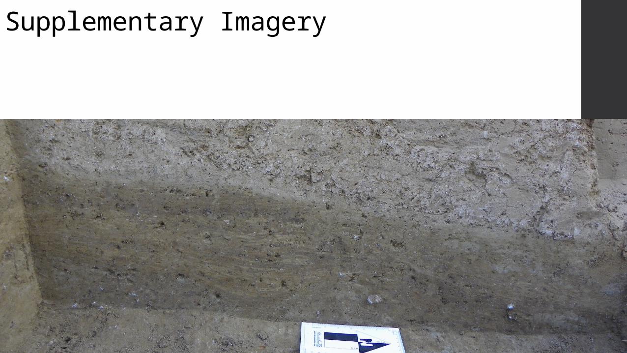
Supplementary Imagery
Supplementary Imagery

Supplementary Imagery

Supplementary Imagery
Charcoal from this feature dated to 6480-6250 BCE (2σ)

Supplementary Imagery5th Cataract Serir

Supplementary Imagery

Supplementary Imagery

Supplementary Imagery

Landsat 1.5 Imagery to Radiance
BSQ to BIL
FLAASH Atmospheric Correction NDVI =
Radiance to Kelvin
K1 = 666.09K2 = 1282.71
Combine NDVI & Temperature Image to view 2D Scatterplot
Determine coordinates for Wet & Dry Edges to determine linear equationDetermine coordinates for Wet & Dry Edges to determine linear equation
𝑇𝑉𝐷𝐼=𝑇 𝑠−𝑇 𝑠𝑚𝑖𝑛
𝑎+𝑏𝑁𝐷𝑉𝐼 −𝑇 𝑠𝑚𝑖𝑛

𝑇𝑉𝐷𝐼∗0.25 Radar SMI
Combined Soil Moisture Index
Eliminate Slope > 20°
CSMI/Slope%
Eliminate Areas w/in estimated & observed flood zones
Normalize Data & Select Locations > 0.8
Copyright © 2022 FDOKUMEN