GEOLOGY OF THE OHIO SHORE OF LAIΠERIE BETk'/EEI'I ...
295
■GEOLOGY OF THE OHIO SHORE OF LAIŒ ERIE BETk’/EEI'I FAIRPORT AMD THE PEMSYLVAHIA BORDER DISSERTATION Presented in Partial Fulfillment of the Requirements for the Degree Doctor of Philosophy in the Graduate School of The Ohio State University by JAIvES ELLIS CHRISTOPHER, A .B ., 1,1. Sc. The Ohio State University 19^9 Approved by: Advise Department of//Geology
-
Upload
khangminh22 -
Category
Documents
-
view
5 -
download
0
Transcript of GEOLOGY OF THE OHIO SHORE OF LAIΠERIE BETk'/EEI'I ...
■ GEOLOGY OF THE OHIO SHORE OF LAIŒ
ERIE BETk’/EEI'I FAIRPORT AMD THE
PEMSYLVAHIA BORDER
DISSERTATION
Presented in P a r tia l F u lfillm en t of the
Requirements fo r the Degree Doctor
of Philosophy in the Graduate
School of The Ohio State
U niversity
by
JAIvES ELLIS CHRISTOPHER, A .B., 1,1.Sc.
The Ohio State U niversity 19^9
Approved by:
Advise Department of//Geology
CONTENTS
Page
H'ITRODUCTION........................................................................................................ 1
Puipose and scope o f th e I n v e s t ig a t io n ............................................ 1
Acknowle dgmen t s ............................................................................................ 2
P revious W ork ............................................................. U
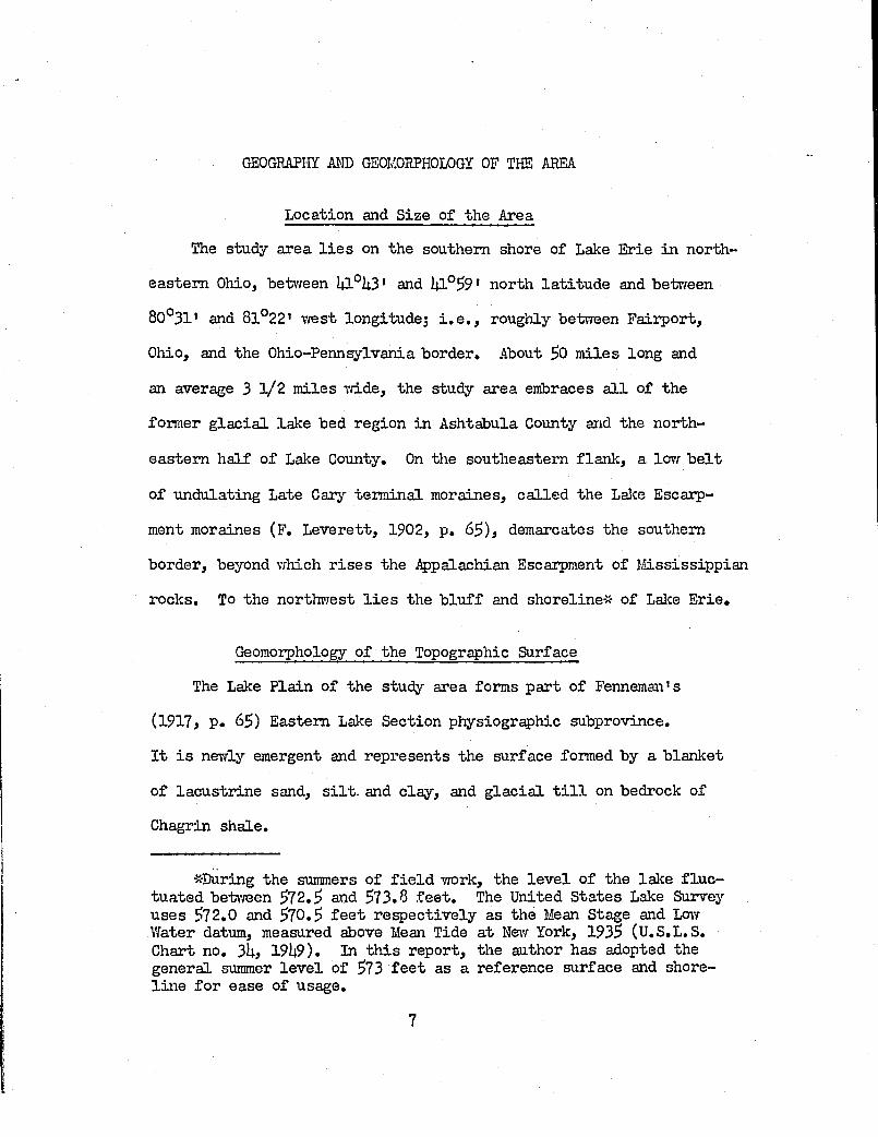
GEOGRAPHÏ AIŒ GEOMORPHOLOGY OF THE AREA............................................. 7
Location and s ize o f th e a r e a .............................................................. 7
Geomoiphology o f th e topograph ic su rface ....................................... 7
The Grand R iver ..................................................................... 11
The A shtabula R i v e r ......................................................................... 13
The Conneaut R i v e r .............................................................................. l 6
Hinor s t r e a m s ...................................................................................... l 6
Geomorphology o f th e bedrock su rface ..................... 20
GENERAL STRATIGRAPHY OF THE A Æ A ........................................................ 32
S tra tig ra p h y o f the b e d r o c k ......................................................................32
S tra tig ra p h y of the s u r f i c i a l d e p o s i t s ........................................... 36
G la c ia l t i l l .............................................................................................. 36
L acu strin e and f l u v i a t i l e d e p o s i t s ...........................................
i i
IX X
Madison tcrvmship sand d e p o s i t s ................................................... U7
DETAILED STRATIGRAPHY OF THE LAKE ERIE BLUFF IN THE AREA . . $2
Lake County 'P a in e sv i lle to w n s h ip ................................................... 53
P erry to w n s h ip .......................................................................................... 57
D eform ational f e a tu re s in th e la c u s tr in e d e p o s its . . 69
Madison to w n s h ip .................................................................... 76
A shtabula CountyGeneva to w n s h ip ..................... 81;
Saybrook to w n s h ip .............................................................................. 85
A shtabula to w n s h ip ......................................................................... 96
K in g sv ille to w n s h ip ......................................................................... IOI4
Conneaut to w n s h ip ................................................................................. 117
The o r ig in o f loam a t th e top of the s t r a t ig r a p h iese c tio n .............................................................................................. 120
Summary o f th e b lu f f s tra t ig ra p h y betweenF a irp o r t and the O hio-Pennsylvania b o rd e r .............................. 123
THE LATE 7/ISCOHSIN HISTORY OF THE STUDY AREA............................... 128
THE RELATIONSHIPS BETvVEEl'j BLUFF LITHOLOGIES MIDDEGRADATIONAL PROCESSES ............................................................................. 135
D egradation o f sandy b lu f f d e p o s its ............................................... 137
D egradation o f th e la c u s tr in e c l a y - s i l t member ...................... 139
D egradation of b lu f f s composed of competent g la c ia l t i l l lUO
XV
F a ilu re by Creep in c e r ta in b lu f f s o f g la c ia l t i l l . . . l50
Slumping in composite b lu f f s o f g la c ia l t i l l s and in terbedded la c u s tr in e c l a y .......................................... iS?
Group "A" s lu m p s ............................................................................. 1^7
Group "B" s lu m p s ............................................................................. l60
The sluîTÇJs o f P a in e sv il le to iv n sh ip ..................................... l 6 l
The slumps o f Geneva and Saybrook tœ m sh ips . . . . I 69
LITTORAL PROCESSES Alffi SOURCES ........................................................ I 8I
D esc rip tio n of th e beach d e p o sits in the a r e a .................... I 83
Stream mouth b e a c h e s ..................................................................... l83
Beaches inpounded by j e t t i e s .................................................... l8?
Shingle end bedrock defended beaches ................................... 190
M echanical and heav^'' m in era l analyses o f b lu f f andbeach s a m p le s ...................................................................................... 19$
O bservations on l i t t o r a l tra n s p o r t of sedim ents . . . . 200
Submerged s p i t s ............................................................................. 217
SUÎvliARY.............................................................................................. 222
CONCLUDIira REI.ÎARKS............................................................................. 228
BIBLIOGRAPHY..................................................................... .................... 231
APPENDIX AW ell s ec tio n s o f s u r f i c i a l d e p o sits on the LaJce P la in . 23$
APPENDIX BA tte rb erg va lu es o f b lu f f and lalce p la in samples . . . 2U5
M echanical and heavy m in era l a n a ly s e s .............................. 2h >
C alcu la tio n s o f b lu f f e ro s io n v s . q u a n tity o f beachs a n d ....................................................................................................... 2U8
APPENDIX GG lossary o f term s used in S o il M ech an ics .......................... 2k9
AUTOBIOGRAPHY....................... 2$0
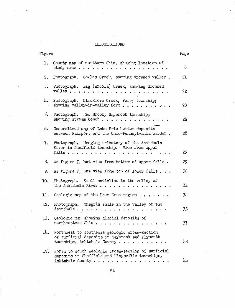
ILLUSTRATIONS
Figure Page
1. County map o f n o rth e rn Ohio, shovdng lo c a tio n ofstudy a r e a ............................................................................ 8
2. Photograph. Govdes Greek, shovdng drovmed v a lle y . 21
3. Photograph. Big (A reola) Creek, shovdng drovmedv a lle y . ......................................................................................... 22
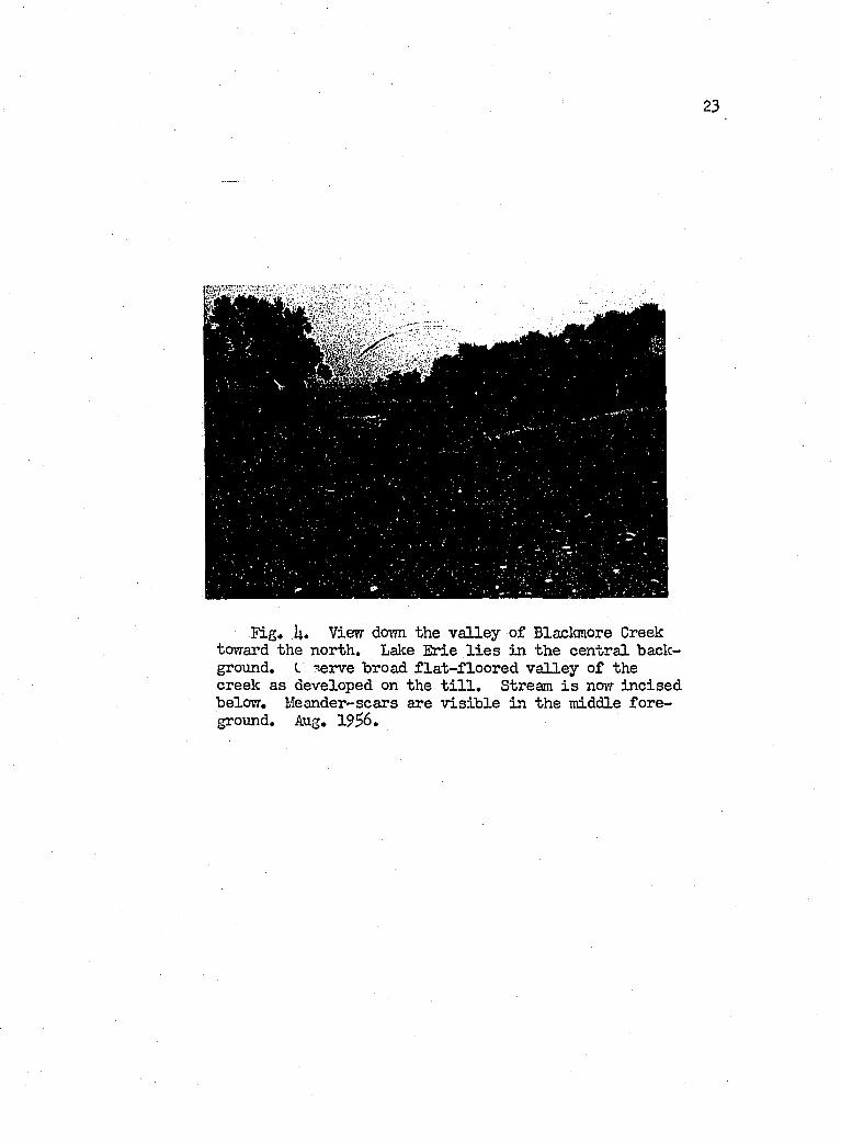
U. Photograph. Blackmore Greek, P erry tovmship;shovdng v a l le y - in -v a l le y f o r m ■ . . 23
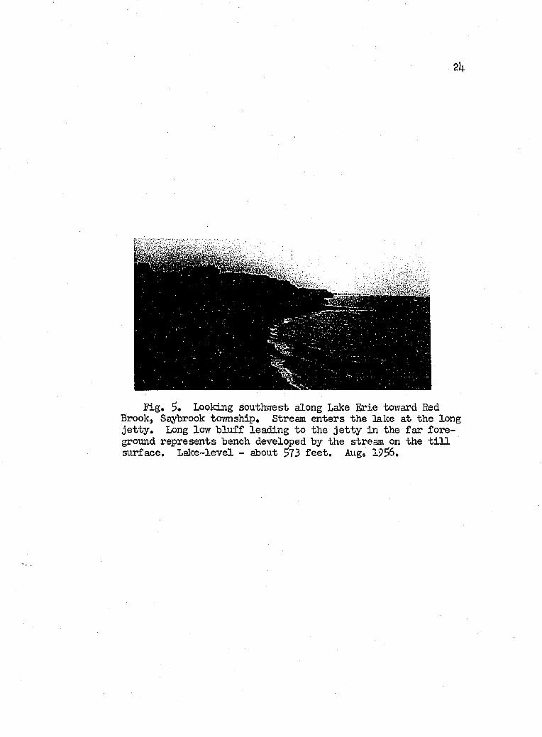
Photograph. Red Brook, Saybrook tovmship;shovdng stream bench .................................................. 2h
6. G eneralized map of Lake E rie bottom d e p o sitsbetvreen F a irp o r t and the O hio-Pennsylvania border . 28
7. Photograph. Hanging t r ib u ta r y o f the A shtabulaR iver in S h e ff ie ld tovmship. Vievr from upperf a l l s ................................................................................... 29
8. As f ig u re 7, b u t vievf from bottom of upper f a l l s . 29
9. As f ig u re 7, b u t viev; from top o f lovrer f a l l s . . . 30
10. Photograph. Sma].l a n t ic l in e in th e v a lle y ofth e A shtabula R i v e r ...................................................................... 31
11. Geologic map o f the Lake E rie r e g i o n ............................ 3U
12. Photograph. Chagrin shale in the v a lle y of theA sh ta b u la ......................................................................................... 33>
13. Geologic map shovdng g la c ia l d e p o s its o f n o rth e a s te rn O h io ........................................................................ 37
lU. Northwest to so u th eas t geologic c ro s s -s e c tio n of s u r f i c i a l d e p o s its in Saybrook and Plymouth t mm sh ip s, A shtabula C o u n ty ................................................... U3
1$. North to south geologic c ro s s -s e c tio n of s u r f i c i a l d ep o sits in S h e ff ie ld and K in g sv ille tow nships,A shtabula C o u n ty ........................................................................... Iiit
V i
Vax
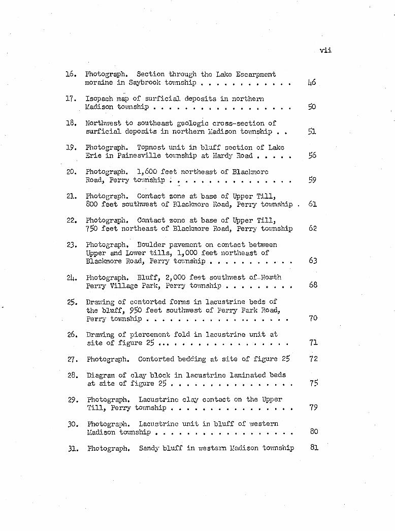
16. Photograph. S ec tion through the Lake Escarpment moraine in Saybrook to v m sh ip ................................................ 1|6
17. Isopach map of s u r f i c i a l d e p o sits in n o rth e rnMadison to v m sh ip ....................................................... SO
18. Northwest to so u th eas t geolog ic c ro s s -s e c tio n o fs u r f i c i a l d ep o sits in n o rth e rn Madison tovmship . . $1
19. Photograph. Topmost u n i t in b lu f f s e c tio n o f LakeE rie in P a in e sv i lle tovmship a t Hardy R o a d .................. $6
20. Photograph. 1,600 f e e t n o r th e a s t of BlackmoreRoad, Perry to-rmship ............................................................. ^9
21. Photograph. C ontact zone a t base o f Upper T i l l ,800 f e e t southw est o f Blaclcmore Road, P erry tovmship . 6 l
22. Photograph. C ontact zone a t base o f Upper T i l l ,750 f e e t n o r th e a s t o f Blaclcmore Road, P erry tovmship 62
23. Photograph. Boulder pavement on c o n tac t betvreenUpper and Lower t i l l s , 1,000 f e e t n o r th e a s t of Blaclcmore Road, P erry to v m s h ip ........................................... 63
2U. Photograph. B lu ff , 2,000 f e e t southw est o f-N orthP erry V illag e Park, p e rry to v m sh ip ..................... 68
23. Drawing o f c o n to rted foimis in la c u s tr in e beds ofthe b lu f f , 950 f e e t southw est o f p e rry Park Road,P erry to v m sh ip ............................................................................ 70
26. Dravâng o f p iercem ent fo ld in la c u s tr in e u n i t a ts i t e o f f ig u re 2 5 ..................................................................... 71
27. Photograph. C ontorted bedding a t s i t e o f f ig u re 25 72
28. Diagram of c la j’" b lock in la c u s tr in e lam inated bedsa t s i t e of f ig u re 2 5 ................................................................. 75
29. Photograph. L acu strin e c la y c o n tac t on the UpperT i l l , P erry to v m sh ip ................................................................. 79
30. Photograph. L acustrine u n i t in b lu f f of w este rnMadison tovmship ..................................................................... 80
31. Photograph. Sandy b lu f f in w estern Liadison tovmship 8 l
V llX
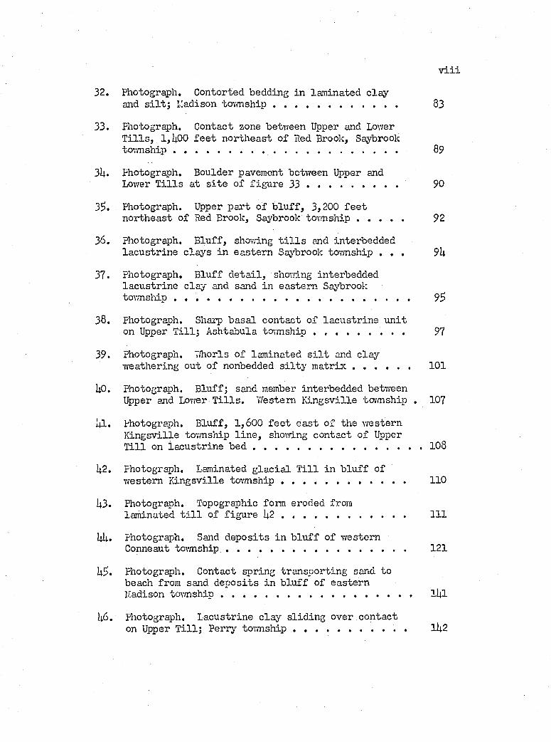
32. Photograph. C ontorted bedding in lam inated c layand s i l t ; lîadison to v m sh ip ............................................... 83
33. Photograph. C ontact zone between Upper and LovrerT i l l s , 1,^00 f e e t n o r th e a s t o f Red Brook, Saybrook tovmship . .......................... ................................................... 89
3U« Photograph. Boulder pavement between Upper andLovrer T i l l s a t s i t e of f ig u re 3 3 ................................... 90
35. Pliotograph. Upper p a r t o f b lu f f , 3,200 f e e tn o rth e a s t o f Red Brook, Saybrook to v m sh ip .................. 92
36. Photograph. B lu ff , showing t i l l s and in te rbeddedla c u s tr in e c lay s in e a s te rn Saybrook tovmship . . . 9k
37. Photograph. B lu ff d e ta i l , shmving in terbedded la c u s tr in e c lay and sand in e a s te rn Saybrooktovmsliip ..................... 95
38. Photograph. Sharp b a sa l c o n tac t o f la c u s tr in e u n i ton Upper T i l l ; A shtabula team s h i p ......................... 97
39. Photograph. U horls o f lam inated s i l t and c layw eathering ou t o f nonbedded s i l t y m a t r i x ...................... 101
UO. Photograph. B lu ff; sand member in te rbedded betvreenUpper and Lovrer T i l l s . W estern K in g sv ille ta .m sh ip . 107
1|1. Photograph. B lu ff , 1 ,600 f e e t e a s t o f the vresternK in g sv ille tovmship l in e , shovâng co n tac t o f Upper T i l l on la c u s tr in e b e d ............................. 108
U2. photograph. Laminated g la c ia l T i l l in b lu f f ofvre s te m K in g sv ille to v m sh ip ................................................ 110
U3. Photograph. Topographic form eroded fromlam inated t i l l o f f ig u re I4 .2 ............................................... I l l
Uii. Photograph. Sand d e p o s its in b lu f f o f w esternConneaut tw m s h ip ..................................................................... 121
U5. Photograph. C ontact sp ring tra n sp o r tin g sand tobeach from sand d e p o s its in b lu f f o f e a s te rn Madison to v m sh ip ......................... l l | l
I46. Photograph. L acu strin e cl%r s l id in g over c o n tac ton Upper T i l l ; P erry to v m sh ip ...................................... . lU2
XX
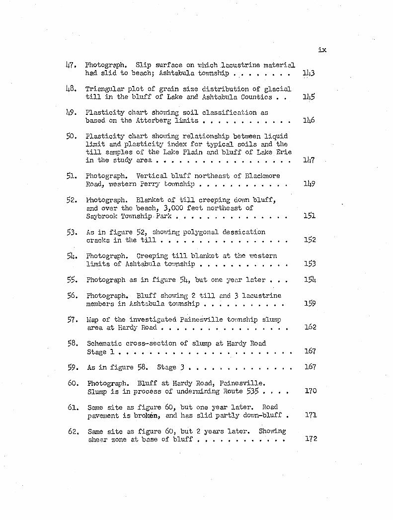
U7. Photograph. S lip su rface on vrhich la c u s tr in e m a te r ia lhad s l i d to beach; A shtabula to v m sh ip .............................. 1U3
I4.8. T rian g u la r p lo t o f g ra in s iz e d is t r ib u t io n of g la c ia lt i l l in the b lu f f o f Lalce and A shtabula Counties . . lk $
P la s t i c i t y c h a r t shovdng s o i l c la s s i f i c a t io n asbased on the A tte rb erg l i m i t s ................................................ IU6
$0. P la s t i c i t y c h a r t shovdng r e la t io n s h ip betvfeen l iq u idl im i t and p l a s t i c i t y index f o r ty p ic a l s o i l s and the t i l l samples o f th e Lal-:e P la in and b lu f f o f Lake E rie in the study a r e a ......................................................................... lU7
^1. Photograph. V e r tic a l b lu f f n o r th e a s t o f BlackmoreRoad, w estern P erry tw rnship . . . . . . . . . . . . lU9
$2. Photograph. B lanket o f t i l l c reep ing do\m b lu f f ,and over the beach, 3,000 f e e t n o r th e a s t of Saybrook Tovmship P a r k ............................................................ 1^1
$3» As in f ig u re 52, shovdng polygonal d e s s ic a tio ncracks in the t i l l ..................................................................... l52
5I1. photograph. Creeping t i l l b lan iie t a t the w esternl im i t s of A shtabula tc r .m sh ip ................................................ l53
55. Photograph as in f ig u re 5U, b u t one year l a t e r . . . l$ k
56. Photograph. B lu ff shovdng 2 t i l l and 3 la c u s t r in emembers in A shtabula to v m sh ip ........................................... l59
57. Hap of the in v e s t ig a te d P a in e sv i lle tovmship slumparea a t Hardy R o a d ................................................... 162
58. Schematic c ro s s -s e c tio n o f slump a t Hardy RoadStage 1 ............................................................................................... 167
59. As in f ig u re 58. Stage 3 ........................................................ 167
60. Photograph. B lu ff a t Hardy Road, P a in e sv i l le .Slump i s in p ro cess of undermining Route 535 . . . . 170
61. Same s i t e as f ig u re 60, b u t one y ear l a t e r . Roadpavement i s broken, and has s l i d p a r t ly dovm-bluff . 171
62. Same s i t e as f ig u re 60, b u t 2 y ears l a t e r . Shovdngshear zone a t base o f b l u f f ........................................... . 172
X
63. Same s i t e and time as f ig u re 62j shov/ing c o n ta c t zonebelow Upper T i l l and shear jo in t s a t base o f b lu f f . . 173
6U. Photograph. Slumping o f b lu f f in Geneva tovmship . . 1?8 -
65!. Photograph. T ensional f r a c tu r e s in slumpingg la c ia l t i l l o f Geneva tovmship .............................. 179
66. Photograph. Slumping in w este rn Saybrook tovmship . . I 80
67. Photograph. M eeting o f stream to r r e n t and wave f ro n ta t Big (A reola) Creek; e a s te rn Madison tovmship . . . 183
68. Photograph. Beach a t mouth o f V.heeler Creek, shovmng b a r r i e r e f f e c t o f th e stream on the l i t t o r a l d r i f t ;Geneva to v m sh ip .............................................................................. I 86
69. Map of Ind ian Creek beach promontory, Geneva tovmship 192
70. Photograph. Beach promontory a s tr id e the P a in e s v i l le - P e rry tovmship l i n e ..................................................................... 193
71. Photograph. B reaker l in e on submerged s p i t a t Geneva- on-the-Lalce beach promontory, Geneva tovmship . . . . 19U
72. Graph. Heavy m in era l sp ec ie s percen tage o f beachsamples, F a irp o r t to A s h ta b u la ........................................... 202
73. Graph. P lo t of median s ize v s . T ra sk 's so r tin gc o e f f ic ie n t ; F a irp o r t to A shtabula ................................... 202
7U. Map of shore betvreen F a irp o r t and A shtabula showinglo c a t io n of beach and b lu f f sanple s i t e s . . . . . . 202
73. Graph. Heavj'- m in era l sp ec ies percen tage o f beachsamples. Conneaut Tovmship Park beach .......................... 203
76. P lo t o f median s iz e v s . T ra sk 's s o r tin g c o e f f ic ie n t ;Conneaut Tovmship Park b e a c h ................................................ 203
77. Map of model beach shaped by steep w a v e s ....................... 207
78. Map o f model beach shaped by low v re v e s ........................... 208
79. Photograph. 7/alnut beach A shtabula, showinga c c re tio n under the in flu en ce of n o r th e a s t vrinds . . 210
80. Photograph. Walnut beach shovâng the e f f e c t o fe ro s io n by n o r th e a s t vând d riv en waves . . . . . . . 211
X I
81. Map of model beach shovdng the e f fe c t o f vraves andcurrents on a steep beach Ijdng at an angle to thevrave o r th o g o n a ls ......................................................................... 21h
82. Map o f model beach shovdng e f f e c t of a bedrock highon beach development at time of steep v/aves . . . . 219
83. As figu re 82, but shovdng beach development by lovrv/'aves.............................................................................................. 220
P la teI I . West to e a s t geologic c ro s s -s e c tio n of the Lalce
Escarpment, A shtabula County, O h io .............................. I4O
IV. S horeline map and s t r a t ig ra p h ie fence diagramof beach a t Mentor Headlands Park, F a irp o r t, 0 . . I 89
V II .- Bedrock map o f the Lalce P la in , e a s te rn Lalce CountyX. to th e Ohio-PennsylvLuda b o r d e r ............................................. Pocket
X I.- Fence diagram of b lu f f d e p o s its along the OhioX III. Lake E rie shore between F a irp o r t and the Ohio-
Pennsylvania bo rd er ................................................................. Pocket
XIV.- Maps o f beach promontory of c e n tr a l Madison,XVI. e a s te rn Geneva and c e n tr a l Saybrook tovmships . . . Pocket
XVII. O ffshore p r o f i l e s ...................................................................... Pocket
TableI . G eneralized ta b le o f f o r m a tio n s ....................................... 33
I I . S eq u en tia l lalce s tag es of the E rie b a s i n ................. 132
I I I . L is t o f heavy m inera l sp ec ies in b lu f f and beachs a m p le s ....................................................... 201
IV. M echanical analyses and A tte rberg v a lu es of b lu f fand Lake P la in g la c ia l t i l l s a m p le s .............................. 2kS
V. Heavy m ineral s^Jecies percen tage o f b lu f f samples . 2it6
VI. Heavy m ineral sp ec ies percen tage , median s ize andT ra sk 's s o r tin g c o e f f ic ie n t of beach samples . . . . 2hl
INTRODUCTION
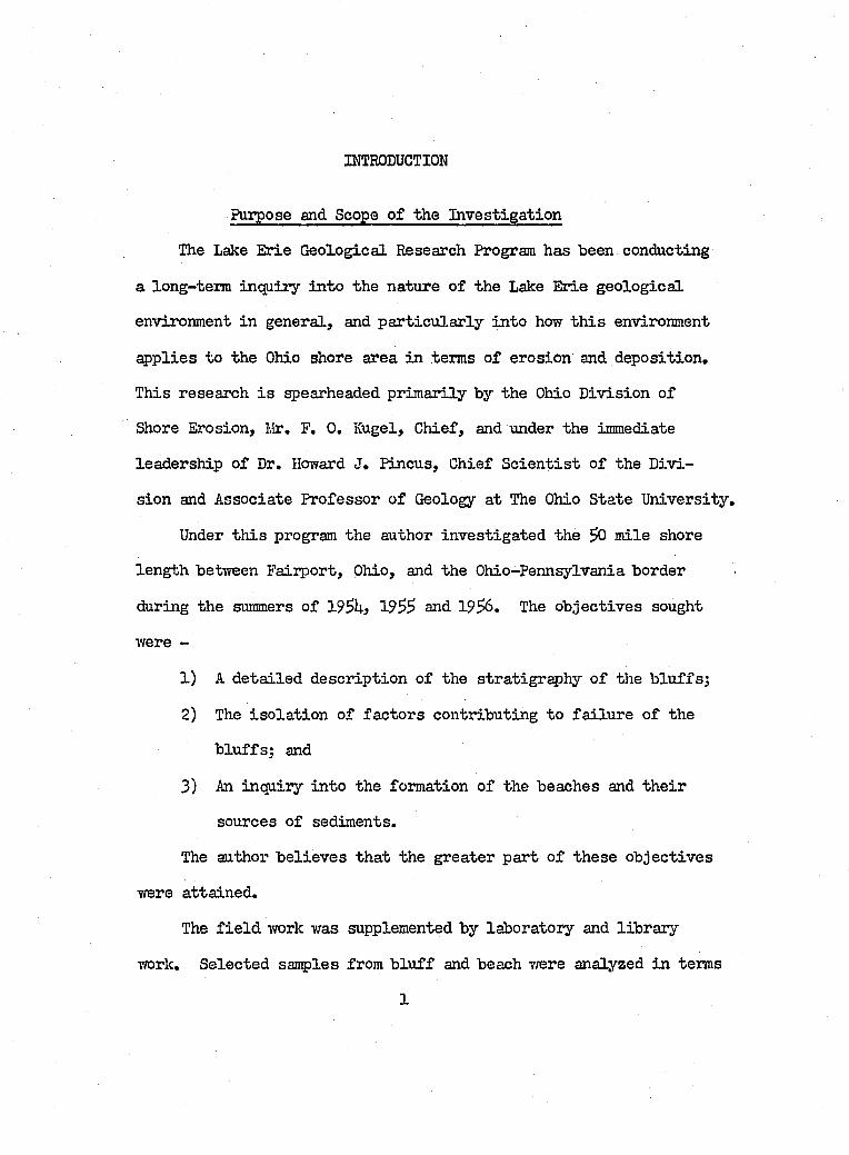
Purpose and Scope o f the In v estiga tion
The Lake Erie G eological Research Program has been conducting
a long-term inquiry in to the nature o f the Lake Erie g eo lo g ica l
environment in general, and p a r tic u la r ly in to how t h is environment
ap p lies to the Ohio shore area in terms o f erosion and deposition .
This research i s spearheaded prim arily by the Ohio D iv ision o f
Shore Erosion, Nr. F. 0 . Kugel, Chief, and under the immediate
leadership o f Dr. Howard J. Pincus, Chief S c ie n t is t o f the D iv i
sion and A ssociate Professor o f Geology at The Ohio State U niversity .
Under th is program the author in v estig a ted the $0 m ile shore
len gth between Fairport, Ohio, and the Ohio-Pennsylvania border
during the summers o f ISBh) 19SS and 1956. The o b jec tiv es sought
were -
1) A d e ta iled d escr ip tion o f the s tr a t ig r ^ h y o f the b lu ffs ;
2) The is o la t io n o f fa c to rs contributing to fa ilu r e o f the
b lu ffs ; and
3) An inquiry in to the formation o f the beaches and th e ir
sources o f sediments.
The author b e lie v e s th a t the greater part o f th ese o b jec tiv es
were atta ined .
The f i e ld work was supplemented by laboratory and lib ra ry
T/ork. Selected samples from b lu f f and beach were analyzed in terms
1
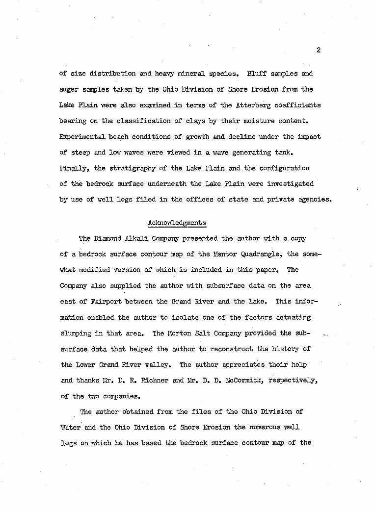
of s iz e d istr ib u tio n and heavy m ineral qpecies. B lu ff samples and
auger samples taken by the Ohio D iv ision o f Shore Erosion from the
Lake P lain vrere a lso examined in terms o f the Atterberg c o e f f ic ie n ts
bearing on the c la s s if ic a t io n of c lays by th e ir moisture content.
Experimental beach conditions o f growth and d ec lin e under the impact
o f steep and low waves were viewed in a wave generating tank.
F in a lly , the stratigraphy o f the Lalce P lain and the configuration
o f the bedrock surface underneath the Lake P la in were in v estig a ted
by use o f w e ll lo g s f i l e d in the o f f ic e s o f s ta te and p rivate agencies.
Acknorrledgments
The Diamond A lk a li Company presented the author v/ith a copy
of a bedrock surface contour map o f the Mentor Quadrangle, the some
what m odified version o f which i s included in th is paper. The
Company a lso supplied the author -with subsurface data on the area
ea st o f Fairport betvreen the Grand River and the lak e. This in fo r
mation enabled the author to is o la te one o f the fa c to r s actuating
slumping in th at area. The Morton S a lt Company provided the sub
surface data th at helped the author to reconstruct the h isto ry of
the Lower Grand River v a lle y . The author appreciates th e ir help
and thanks Mr. D. R. Richner and Mr. D. D. McCormick, resp ec tiv e ly ,
o f the two companies.
The author obtained from the f i l e s o f the Ohio D iv ision of
Water and the Ohio D iv ision o f Shore Erosion the numerous w e ll
lo g s on which he has based the bedrock surface contour map o f the
Perry, Ashtabula- and Conneaut quadrangles; and from which he has
attenpted to describe the stratigraphy of the Lalce P lain and the
Lake Escarpment moraines. The patience and generosity o f the s ta f f s
of the two D iv ision s were unbounded, and the author hopes, j u s t i
f ie d . He remembers them w ith gratitu de.
The author thanks P rofessors A. Brandenberger and F. J. Doyle
o f the In s t itu te o f Geodesy and Photogrammetry. The Ohio State
U niversity , who performed the photogrammetric and cartographic
work on the beach models described in t h is te x t .
In the area o f s o i l mechanics the author had to acquire new
s k i l l s . Thus he stands deeply indebted to Professor R. F. Baker
and l,îr. K. S. Senanthiraj a j , who opened the f a c i l i t i e s o f The Ohio
State U niversity Engineering Eqaeriment S tation to the author, and
showed him how to make the Atterberg t e s t s on h is b lu f f samples.
In th is connection, auger samples from the Lalce P la in included
in t h is d isser ta tio n were c la s s i f i e d by The Ohio State U niversity
S o ils Testing Laboratory as a courtesy to the Ohio D iv ision o f
Water. The author has b en efited and thanks them a lso .
C loser to home, there i s the Ohio D iv ision of Shore Erosion
w ithout whom th is d is ser ta t io n could not have come in to ex isten ce .
The author wants to thanlc h is competent and agreeable co-v/orkers,
Messrs. J. V. Verber, R. P. H artley, W. Lemlce and a ss is ta n ts on
whom the author has leaned on many occasions for inform ation on
the offshore area, and who have helped to map and run offshore
p r o f i le s .
The author extends h is gratitude to Doctors R, P. Goldthwait
and J, Forsyth, a u th o r itie s on the P leistocen e; th e ir constructive
c r it ic ism s have p u lled th is d isser ta tio n out o f many k e tt le -h o le s .
With deep appreciation the author, remembers Dr. H. J. Pincus,
Senior S c ie n t is t o f the Ohio D iv ision o f Shore Erosion, and the
author ' s fa c u lty adviser, who through the yeai's has contributed
the s tim u li th a t no\T brings th is work to fr u it io n .
In conclusion, the author greets a l l contributors to th is
ivork and not mentioned herein , and thanks them.
Previous Work
H ost o f th e v e ry e a r ly vrorkers, in c lu d in g M. C. Read (1873)
and C. S. P ro sse r (1912), concerned them selves p r im a r i ly v /ith th e
s tra t ig ra p h y o f th e bedrock. R ead 's work in p a r t i c u la r was one
of reconnaissance .
L everett (1902) and Leverett and Taylor (1915) in th e ir monu
mental monographs on the Great Lakes region described the topogr^hy
developed on the Lake Escaipment moraines, and the prominent beach
rid ges o f the former g la c ia l lalces,
F. J . Camey (1908 - 1917, unpublished n o te s) sp e c ia liz e d
in a s tudy of th e se form er la k e beach d e p o s its , and made d e ta i le d
maps o f them,
C. W. Hutton (19U0, unpublished M.S. th e s is . The Ohio State
U n iversity ), produced a geomorphic and jo in t study o f the area
s
covered by the U.S. G eological Survey topographic lS minute Ashta
b u la and Conneaut quadrangles.
More la t e ly , in 19L7, the Beach Erosion Board, U.S. Army Corps
of Engineers, in conjunction vdth the State of Ohio, conducted a
cooperative survey of shore erosion along the Ohio Shoreline o f
Lake E rie. The synopses of these surveys are published in House
Documents 3^1 and ^96 (19^2 and 19S3 r esp e c tiv e ly ). In conjunction
vri-th th is study, P. R. Shaffer made a g eo lo g ica l reconnaissance
o f the b lu ff s tr a t ig r ^ h y . His unpublished reports are on f i l e
Vidth the Ohio D iv ision of Shore Erosion.
The shore was mapped by the U.S. Army Corps of Engineers in
19U7, and airphotos were taken in 19SU and 19S6. Maps and photos
are f i l e d Tfith the Ohio D iv ision o f Shore Erosion, To the south
west o f the study area, the shore areas betr/een Fairport and the
w est boundarj’’ of Lake County were studied by Gordon (19^6) and
Christopher (19^6).
In terms of current work, a s e r ie s o f seven maps trea tin g
the engineering geology o f the Oliio Shoreline of Lake Erie by
H. J. Pincus i s in preparation. Both R. P. Hartley and J. L. Verber
are drawing up meps of the bottom d eposits o f the lake, and W. J*
Tinker I I I , i s worlcing on a genetic c la s s if ic a t io n o f Lake Erie
beaches.
Concerning map coverage, the area l i e s across the U.S. Geo
lo g ic a l Survey minute top ogr^ h ic sheets t i t l e d Conneaut,
Ashtabula, Perry and Mentor; the U.S. Lake Survey Charts, 1:80,000,
numbers 33 and 3U; and the U.S. Army Map Service topcgrjyhic sheet,
1:2^0,000, VSOl.
GEOGRAPHY AMD GEOMORPHOLOGY OF THE AREA
Location and Size o f the Area
The stndy area l i e s on the southern shore o f Lake Erie in north
eastern Ohio, betvfeen and l4l ° 39' north la t itu d e and betvfeen
80°31' and 8 l°2 2 ’ v/est lon gitu d e3 i . e . , roughly betvreen Fairport,
Ohio, and the Ohio-Pennsylvania border. About 30 m iles long and
an average 3 1 /2 m iles wide, the study area embraces a l l of the
former g la c ia l lake bed region in Ashtabula County and the north
eastern h a lf o f Lalce County. On the southeastern flan k , a lovr b e lt
o f undulating Late Cary term inal moraines, c a lle d the Lalce Escarp
ment moraines (F. L everett, 1902, p . 63 ), demarcates the southern
border, beyond which r is e s the i^palachian Escarpment o f M ississippian
rocks. To the northvrest l i e s the b lu ff and shoreline-x- o f Lake E rie,
Geomoiphology o f the Topographic Surface
The Lake P lain o f the study area forms part o f Fenneman's
(1917, p . 63) Eastern Lake Section physiographic subprovince.
I t i s newly emergent and represents the surface formed by a blanket
o f la cu str in e sand, s i l t , and c la y , and g la c ia l t i l l on bedrock of
Chagrin shale.
^During the summers o f f i e ld work, the le v e l o f the lake f lu c tu ated betv/een 372.3 and 373.8 f e e t . The United S ta tes Lake Surrey u ses 372.0 and 370.3 f e e t r esp e c tiv e ly as the Mean Stage and Low V/'ater datum, measured above Mean Tide at New York, 1935 (U .S.L .S. Chart no. 3U, 19U9). In th is report, the author has adopted the general summer le v e l o f 373 f e e t as a reference surface and shorel in e fo r ease o f usage.
- 4-1
1 F u i . T O N
I g s a u &WI C u Y A H A,
|H » M R Y j W O O D I S a m o u S K Y
,s e m e -c >k I H u b o m , , .' ^1— I MIO^Na , I
I L
s o M i i - E L
-31 t Æ . 6.1
-42S I
4-
AS >+“»
L 'L A ; K "::
g : E A !U G! A
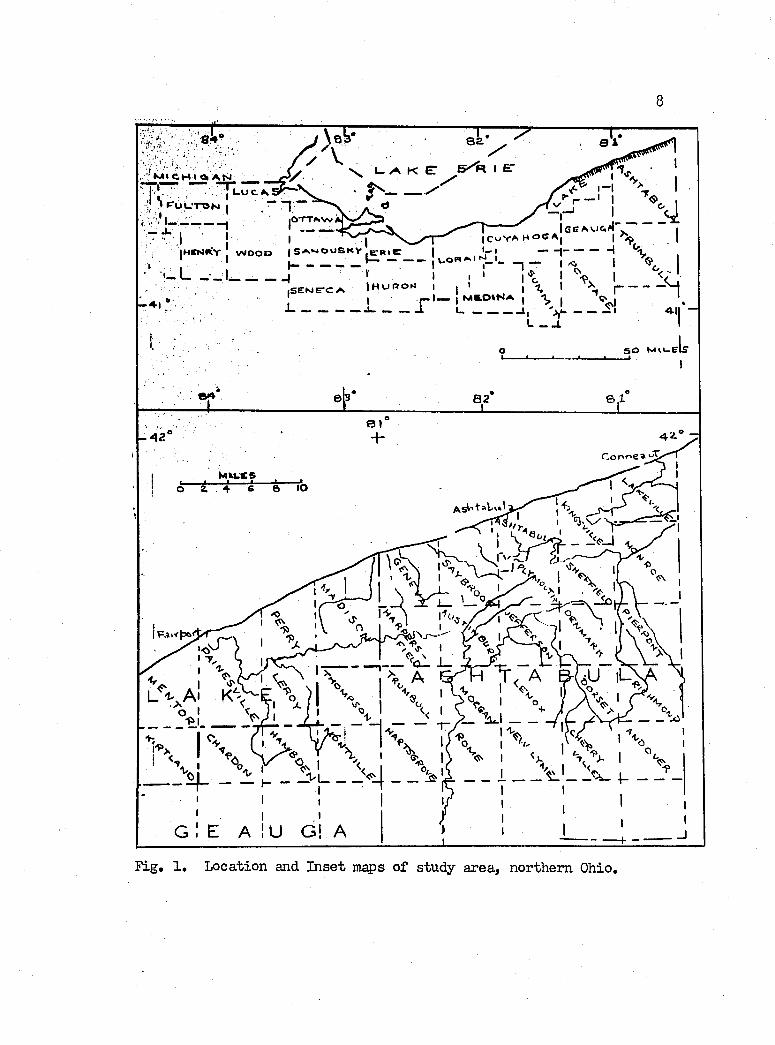
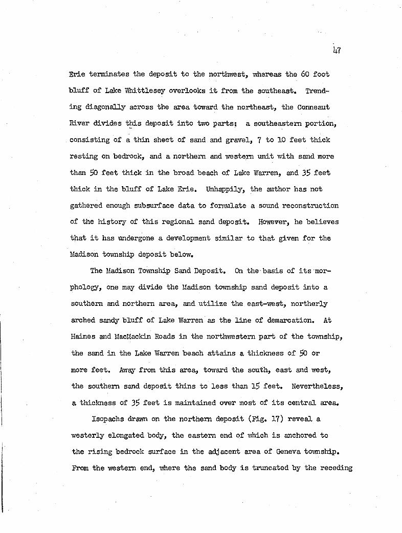
Fig. 1 , Location and In set maps of study area, northern Ohio,
Along the northvvestem edge o f the Lake P la in stands the 8
to 75 fo o t high b ln f f o f g la c ia l t i l l and la cu str in e d ep osits over
looking Lalce E rie. Against the southeastern margin r is e the flank
ing Lalce Escarpment moraines, a se r ie s o f k n o ll- lik e forms under
100 f e e t in r e l i e f , th a t mark one o f the southern lim its o f Late
Cary ic e readvances during the waning stage o f the Wisconsin Ice
sh eet. Between th ese margins the Lalce P la in f a l l s unevenly toward
the northeast w ith an o v era ll slope of about 30 f e e t per m ile,
and terraced slop es o f 10 to 1$ f e e t per m ile . The prominent breaks
in slope represent former shores o f g la c ia l lak es th at l e f t behind
beaches and b lu f fs S to 60 f e e t high.
Carved out o f the northwestern flank o f the Lake Escarpment
moraines over the greater part o f the area, the b lu f fs o f Lake
IV hittlesey, the base o f which l i e s at an e lev a tio n o f 720 to 7W
f e e t , a tta in s i t s g rea test development o f 60 f e e t in Ashtabula
County. However, i t i s everyvdiere -well pronounced, and in cer ta in
spots presents a long -view toward the north o f the Lake P la in . ■
The top o f the b lu f f across the area i s follovred by S tate Route 8U.
As i t s height in creases toward the northeast the r e l i e f developed
on the b lu f f and moraines becomes stronger, e sp e c ia lly in Geneva
and Saybrook tovmships where Cowles and Indian Greeks and Red Brook
tra n sect them.
Between the b lu f f o f Lake VJhittlesey and th at o f Lake Erie
l i e s the lo n g itu d in a lly continuous beach and b lu f f o f Lalce Warren
(680 to 690 f e e t in e lev a tio n on the c r e s t ) . This former shore
1 0
swings toward and aray from Lalce Erie as sa lie n t forms around r e la
t iv e ly th ick (35 to 50 f e e t ) , extensive sand and gravel dep osits
in Madison tovmship in the southwest, and K in gsv ille and Conneaut
townships in the northeast. These s a lie n ts apparently represent
d ep osition a l forms b u i l t out in to and shaped by Lake Warren, Be
tween th ese broad sand dep osits the Warren shore sweeps in land
to w ith in 3/U m ile o f the Lake fJh ittlesey b lu ff as i t cro sses Geneva,
Saybrook and Ashtabula townships. In th is area, from the Lalce
Warren shore toward Lake Erie in the north, a 5 to 20 fo o t th ick
n ess o f g la c ia l t i l l forms a broad, shelv in g , sand d e f ic ie n t , loam
covered surface. Apparently the shore o f Lalce Warren here i s p r i
m arily an erosion a l fea tu re .
Many sm aller topogrsphic fea tu res such as dunes, sand bars
and ^ i t s dot the land surface. Hutton (19U0) mapped many such
fea tu res on the Ashtabula and Conneaut topographic quadrangles.
The bars as mapped range between 0 .3 and 0 .6 m iles in len gth , and
m aintain axes roughly p a r a lle l to the Y/arren beach. A dditionally ,
tra ces o f l e s s d is t in c t beaches occur. An example o f such i s pre
sented by the beach o f Lake Lundy in Madison tovmsliip v/hich appar
e n tly con tro ls the w ester ly course o f Chapel Creek (Camey, 1919).
The Lake Erie shore o f the study area fea tu res throughout
most o f i t s length a wave-eroded b lu f f , broken by the gaps o f major
and minor streams. The b lu ff ranges in height from h$ f e e t in the
southwestern one-th ird o f the area., to 8 to 17 f e e t in the middle
one-th ird , and up to 75 f e e t in northeastern one-th ird . Only the 3
1 1
major r iv e r s , and a few sm aller streams as Big Greek, CovXLes Greek,
Red Brook and Yftiitman Greek open gaps in the b lu f f exceeding 600
f e e t .
By v ir tu e o f i t s very ex isten ce the b lu ff co n stitu te s an
erosion a l form; the product o f wave-erosion, surface wash, ground
water seepage and weathering in general. Since in general the
b lu f f i s carved out o f uncemented m ateria l, i t w astes rap id ly .
The homogeneous t i l l b lu f f s , an exceedingly rare type, r e s i s t wast
ing b e s t th'-iiVK.i to strong conpaction by overriding g la c ie r s , and
low perm eability. At the other end, b lu ffs of la cu str in e c la y
and sand, l ik e those th a t r is e in Perry, Madison, K in gsv ille and
Gonneaut tovvnsliips, r e trea t rsp id ly under the in flu en ce of ground
water seepage. B lu ffs of g la c ia l t i l l overlying r e la t iv e ly th ick ,
(6 f e e t or more) d ep osits o f basa l la cu str in e m aterial develop the
spectacular block slump th at a f f l i c t s the shore on both s id es of
Fairport Harbor and the shore across vrestem Geneva and eastern
Saybrook townships.
The major streams, such as the Grand, Ashtabula and Gonneaut
Rivers enter the study area from headvraters on the J^palachian
Plateau. On the other hand, the larger minor streams spring from
sources on the Lalce Escarpment moraines; and most o f the sm aller
minor streams extend headi'^ard no farth er than the beach of Lake
Warren.
The Grand River. The drainage basin o f t h is stream enconpasses
712 square m iles , which p laces i t a poor fourth in s iz e fo r Ohio
1 2
streams entering the Lake when compared v/ith the 6,^86 square m ile
drainage of the Maumee River, the la r g e s t o f the stream systems
(Ohio D iv ision of Water, 19^0). The Grand River in i t ia t e s i t s
58-m ile course on the Appalachian Plateau in vrestcentral Trumbull
County to the south of Ashtabula County, I t flow s due north on
a g la c ia l d r i f t - f i l l e d v a lle y fo r about 30 m iles before turning
abruptly v/est to follovr the Lake Escarpment moraines fo r 18 m iles.
Along th is w ester ly course below H arpersfield , the r iv er flov/s a t
the bottom o f a canyonlike v a lle y cut in shale , lUO to 180 f e e t
deep. Then i t swings north through the moraine a t northern Paines
v i l l e and continues i t s course on bedrock fo r U m iles . Beyond
the Lake Warren beach th e r iv er lea v es the shale and v/idens i t s
v a lle y on g la c ia l t i l l by a fa c to r o f 3, continues north an addi
t io n a l 2 m iles , and then meanders w est fo r 1 1 /2 m iles to southern
F aiip ort, There i t impinges on the Chagrin shale cropping out in
i t s southern v a lle y v /a ll a t the B & 0 ra ilroad bridge 5 from here
i t swings north and en ters the Lake at Fairport a fter another m ile.
Sweeping southv/esterly from Fairport in a great crescen t,
opening toward the northvrest, l i e s the Mentor Marsh, 3/U o f a m ile
wide and U 1 /2 m iles lon g . I t i s a l l th at remains o f a former
extension o f the loiver course o f the Grand River a fter the r iv er
v a lle y had been in ter sec te d by b lu f f r e trea t a t Fairport,
The Grand River i s in process o f recovering i t s ov/n ancient
v a lle y , and perhaps others, from the g la c ia l debris f i l l i n g i t .
However th is exhumation lack s system, fo r in i t s downcutting, the
13
r iv er missed segments o f the former v a lle y . Accordingly, certa in
len gth s o f i t s v a lle y -which are conparatively narrow are in te ip reted
as newly carved v a lle y . Other length s are broader, r e f le c t in g
the presence o f the an cestra l v a lle y . This rela tio n sh ip was ob
served by Camey (1908-1917 ) fo r the b ig meander be-bween the ceme
te r y and infirm ary ea st o f -the C ity o f P a in e sv ille (Perry topographic
quadrangle) a There, on a northbound course, the r iv er emerges from
a narro\Y "V" gorge in bedrock, and sweeps out the meander in a
fla -t-flo o red v a lle y -tavice as wide. Subsequent d r il l in g ju s t ea st
o f the cemetery shovrs th a t the bedrock surface l i e s at le a s t 8$
f e e t below the ground surface; i . e , , a t an e leva tion below 600
f e e t . Thus -vlr-fcually the en tire northeastern v a lle y -w a ll a t th is
s i t e c o n s is ts o f u n lith if ie d m aterial f i l l i n g an o ld v a lle y .
The Ashtabula River. P ossessing only 136 square m iles of
drainage basin and 32 m iles o f length , the Ashtabula River i s the
sm allest o f the three major s-breams in the study area. I t r is e s
in vfestem Pennsylvania and flovrs -wes-bward as the Ashtabula Creek
to K e llo g g sv ille in western Monroe township, of Ashtabula County.
There i t i s jo ined by the West Branch flow ing from the south, vdience
i t continues -west, then north, and vrest again on a Zig-Zag course
in to the c i t y o f Ashtabula, through which the stream flow s north
to the lake.
For most o f i t s course from Lalce Erie to a po in t bet-ween Cage-
v i l l e and K e llo g g sv ille , the r iv er has flu sh ed i t s an cestra l v a lle y
Ik
free o f g la c ia l f i l l . Farther upstream, however, the bedrock v a lle y
continues below the f i l l m ateria l.
The exposed bedrock v a lle y carved out o f the Chagrin shale
i s steep -w alled and f la t - f lo o r e d . I t s serai-angular areal pattern
seems to be a t le a s t p a r t ia l ly jo in t con tro lled ,
V/hereas the Grand River crosses the Lake Escarpment v/ith a
gradient o f 5 .5 f e e t per m ile below a w ester ly gradient o f 2 ,5
f e e t per m ile , the Ashtabula River tumbles onto the Lake P lain
at a ra te o f 20 f e e t per m ile, a fter m aintaining an upvalley west
e r ly gradient to G ageville o f 10 f e e t per m ile. Upstream, beyond
Cagev i l l e to K e llo g g sv ille the gradient on the v a lle y f i l l decreases
to 5 f e e t per m ile.
Three fa c to r s apparently ex erc ise great in fluence on the magni
tude of the stream gradient, e sp e c ia lly in terms o f i t s upstream
f la tte n in g : ( l ) g la c ia l v a lle y f i l l , ( 2) bedrock a tt itu d e , and
(3) n et lowering o f base le v e l . Just downstream from K e llo g g sv ille ,
the stream has developed a broad mature v a lle y on the g la c ia l f i l l
because th is m ateria l i s rea d ily eroded and reworked. Thus what
ever base le v e l i s imposed downstream, th is upstream portion fin d s
no d i f f ic u l t y in keeping adjusted to i t . The next v a lle y segment
downstream fo llo w s the strilce o f the bedrock from G ageville to the
lo c a l i t y where the r iv er turns north to cross the Lake Escarpment
as a consequent stream. I t s r e la t iv e ly low gradient probably re
f l e c t s the regimen of a higher base le v e l , or, s ince the stream
i s flow ing along the s tr ik e o f the beds, greater res is ta n ce to
IS
dovmcutting i s o ffered along t h is segment than in the consequent
portion immediately dovmstreara. The th ird segment, represented
by the passage o f the stream across the s tr ik e of the Chagrin shale
a l l the way to the southern edge of the c i t y o f Ashtabula, includes
the s i t e o f most a c tiv e downcutting and s teep est gradients. The
stream f a l l s lakeward on a p r o f i le of' abruptly steepened and f l a t
tened slopes th a t lead to a lovf-water expression o f an a ltern ation
o f f a l l s , a few f e e t h igh , and p o o ls o f water in the v a lle y f lo o r .
From t h is , the author p o stu la te s th a t the r iv er i s not only adjust
ing i t s v a lle y to the current base le v e l a t Lake E rie, but th at
the g en tly sloping f l a t segments ending at the d iffe re n t f a l l s
represent e a r lie r attempts to a tta in grade ivhen the base le v e l
was higher, i . e . , when the r iv er was emptying in to the g la c ia l
forerunners o f Lake E rie.
Thus the g en tler upstream gradients are le g a c ie s o f the p a st.
On the other hand, the f a l l s or knickpoints, products o f s ta t ic
rejuvenation of the v a lle y , are moving up valley to impose the new
gradient on the older v a lle y p r o f i le s .
Above Bushnell, Ashtabula Creek i s jo in ed by three barbed
tr ib u ta r ie s , the most prominent o f y/hich occurs 1 m ile northeast
of Bushnell in cen tra l Monroe toim ship. The other tvfo l i e ju s t
ea st o f the Ohio-Pennsylvania border. Presumably, the Ashtabula
v a lle y channelled in to Pennsylvania the meltwater from the Late
Cary ic e grounded on the Lake Escarpment.
16
BetvTeen the w ester ly courses o f the Ashtabula and Grand r iv er s
l i e linlcing troughs or channels now occupied by .Coffee and Center
Creeks o f Plymouth tovmship, i^ parently the streams once d irected
the flow o f the g lacier-b lock ed Ashtabula River southwesterly in to
the Grand River, which then e ith e r transferred the outflow south-
vrest in to the Chagrin-Cuyahoga drainage system flow ing south, or
due south in to the drainage system o f the Ohio River (L everett,
1902, PI. I I ) .
Conneaut River. This r iv er drains an area o f 192 square m iles,
th ree-fourth s o f which l i e s in Pennsylvania. I t en ters Ohio on
a w est by southwest bearing, and ju s t e a st o f K in gsv ille turns
toward the northeast, and em pties in to the lake a t Conneaut a fter
meandering across the Lake P la in in an entrenched v a lle y fo r 13
m iles. The Conneaut River lack s the deep spectacular gorge o f
e ith er the Grand or Ashtabula r iv er s , but l ik e them has i t s lower
course carved in to the Chagrin shale. East o f Famham and in to
Pennsylvania the r iv er flow s on g la c ia l t i l l . The bedrock v a lle y
s t i l l contains a great deal o f alluvium which was probably in tro
duced at the time o f the higher g la c ia l lalces.
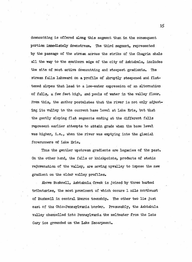
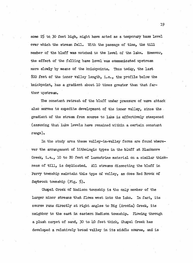
Minor streams. Cowles Creek, the la r g e s t o. .he minor streams,
drains an area o f 23 square m iles (House Doc. 31p1> p . l 5 ) . Tlae
stream r is e s on the Lake Escarpment moraines, and flow s in a v a lle y
of g la c ia l t i l l to Geneva, where i t enters upon the sh a le . Thence
northv/ard to the lake i t flow s in a 20 fo o t deep bedrock gorge which
opens out in to a broad drowned v a lle y about 1 m ile from the lalce.
17
At Lake E rie, the stream once meandered p a r a lle l to the shore for
1,800 f e e t before emptying in to the lak e. However, in te r c is io n
by the retrea tin g shore has l e f t th is lower p ortion stranded as
a swanp, 6^0 f e e t m de (F ig . 3 ) . Beneath the sv/amp l i e s the bottom
of the bedrock v a lle y , a t le a s t 18 f e e t below the lake le v e l , 373
f e e t in e lev a tio n .
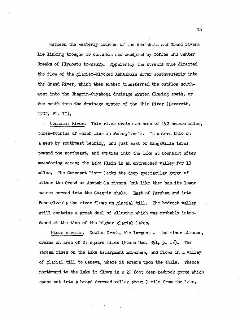
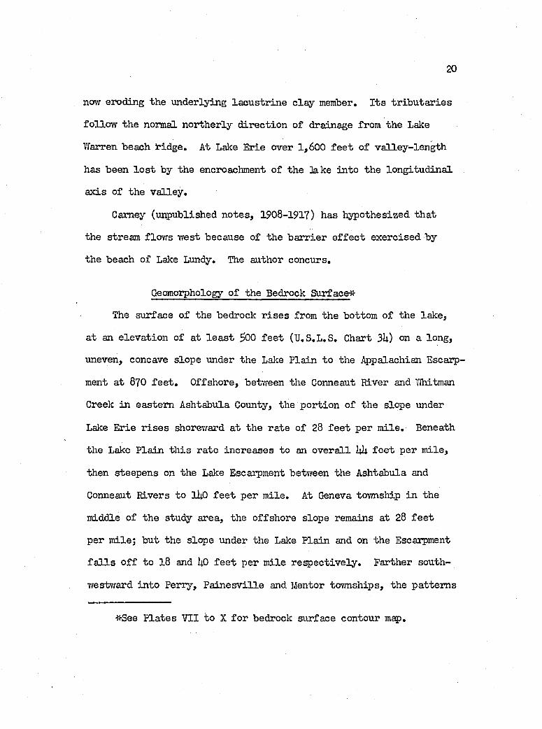
Both Wheeler and Big (Areola) creeks, the tiTO neighbors of
Cowles Creek to the southvrest in Geneva and Madison to\>mships
r esp ec tiv e ly , are a lso carved in to bedrock and ex h ib it droymed
mouths. The submerged v a lle y bottom of Big Creek l i e s a t an e le
vation o f 361 f e e t or about 12 f e e t below lake le v e l of 373 f e e t .
The e lev a tio n o f the drowned v a lle y of Wheeler Creek was not de
termined,
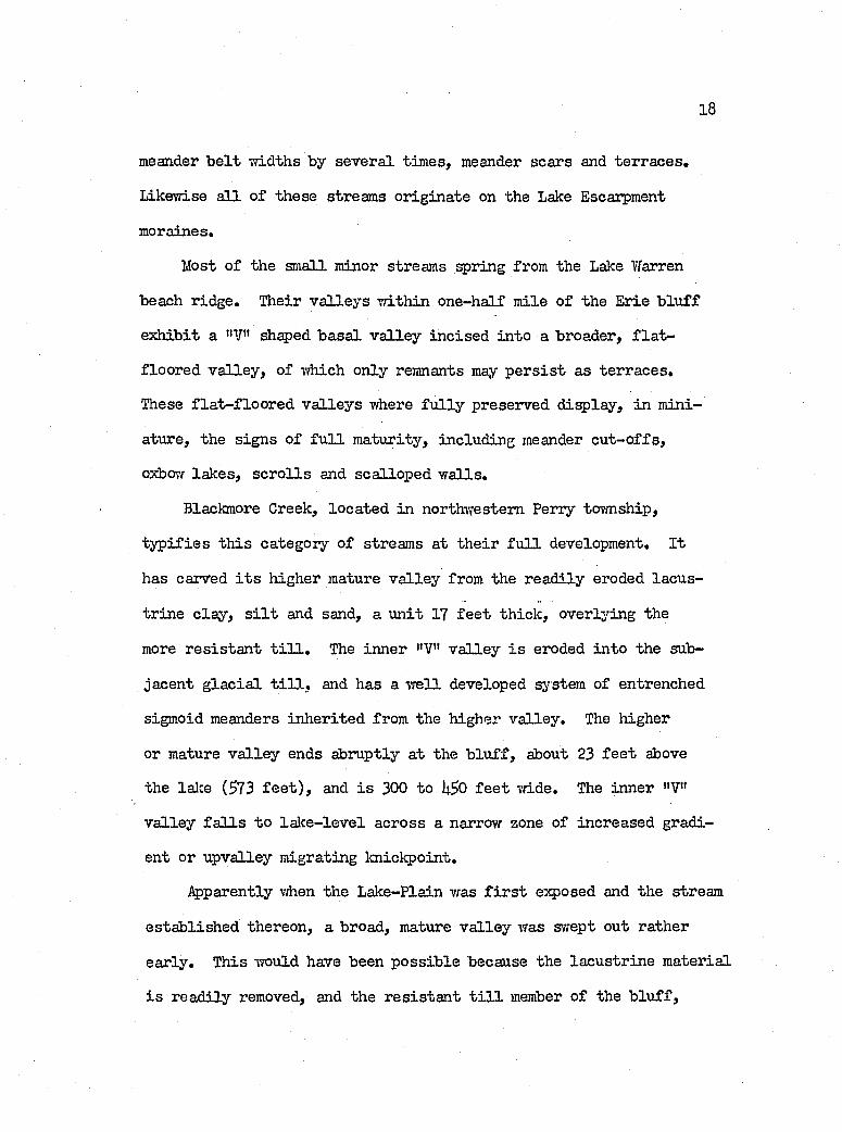
Indian Creek and Red Brook to the w est in Geneva and Saybrook
townships r e sp ec tiv e ly , have eroded out broad mature v a lle y s in
the g la c ia l t i l l . The Indian Creek v a lle y opens in to the Lake
about 3 f e e t below lalce le v e l o f 373 f e e t . Red Brook lik ew ise
has a drovmed mouth, s in ce i t s v a lle y f lo o r at the lake l i e s 12
f e e t below the lake le v e l . Also sim ilar in development and topo
graphic age, Whitman and Turkey Creeks o f Ashtabula and Conneaut
tov/nslTdps r esp e c tiv e ly , empty in to the lake at approximately lake
le v e l .
Thus the lower v a lle y s o f th ese seven streams are ty p ica ll y
mature, and revea l f l a t f lo o r s , v a lle y widths th at exceed the
18
meander b e lt widths by severa l tim es, meander scars and terra ces .
Likewise a l l o f th ese streams orig in ate on the Lake Escarpment
moraines.
Most o f the sm all minor streams spring from the Lake Warren
beach ridge. Their v a lle y s w ith in one-half m ile o f the Erie b lu ff
ex h ib it a "V" sh ^ ed b a sa l v a lle y in c ised in to a broader, f l a t -
floored v a lle y , of which only remnants may p e r s is t as terraces.
These f la t - f lo o r e d v a lle y s where f u l ly preserved d isp lay , in mini
ature, the sign s o f f u l l m aturity, including meander c u t-o ffs ,
oxbovf la k es , s c r o lls and scalloped w a lls ,
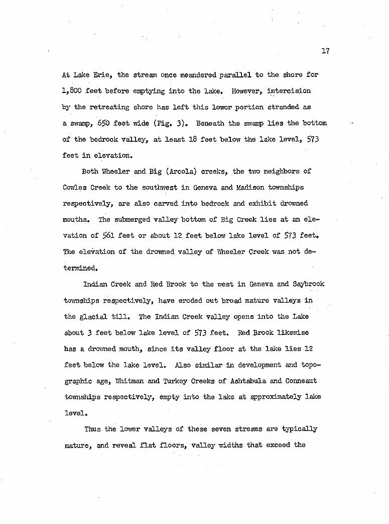
Blackmore Creek, loca ted in northwestern Perry tovmship,
ty p if ie s t l i is category o f streams at th e ir f u l l development. I t
has carved i t s higher mature v a lle y from the rea d ily eroded lacu s
tr in e c la y , s i l t and sand, a u n it 17 f e e t th ick , overlying the
more r e s is ta n t t i l l . The inner "V" v a lle y i s eroded in to the sub
jacent g la c ia l t i l l , and has a w e ll developed system of entrenched
sigmoid meanders in h er ited from the higher v a lley . The higher
or mature v a lle y ends abruptly a t the b lu ff , about 23 f e e t above
the lake (373 f e e t ) , and i s 300 to f e e t wide. The inner "V"
v a lle y f a l l s to la k e - le v e l across a narrow zone of increased gradi
ent or upvalley migrating knickpoint,
Apparently when the Lake-Plain was f i r s t exposed and the stream
estab lish ed thereon, a broad, mature v a lle y was swept out rather
early . This ivould have been p o ss ib le because the la cu str in e m aterial
i s rea d ily removed, and the r e s is ta n t t i l l member o f the b lu f f .
19
some ZS to. 30 f e e t high, might have acted as a temporary base le v e l
over which the stream f e l l , With the passage of tim e, the t i l l
member o f the b lu f f was notched to the le v e l o f the lak e . However,
the e f f e c t o f the f a l l in g base le v e l was communicated upstream
more slow ly by means o f the knickpoints. Thus today, the la s t
800 f e e t o f the inner v a lle y len gth , i . e . , the p r o f ile below the
k n ic lg o in t, has a gradient about 10 tim es greater than th at fa r
ther upstream.
The constant r e trea t o f the b lu ff under pressure of vrave attack
a lso serves to e:q)edite development o f the inner v a lle y , since the
gradient o f the stream from source to lake i s e f f e c t iv e ly steepened
(assuming th at lake le v e l s have remained vriLthin a certa in constant
range).
In the study area th ese v a lle y - in -v a lle y forms are found where
ver the arrangement of l i t h o lo g ie types in the b lu ff at Blackmore
Greek, i . e . , 10 to 20 f e e t o f la cu str in e m ateria l on a sim ilar th ick
ness o f t i l l , i s du plicated . A ll streams d issec tin g the b lu ff in
Perry township maintain t h is type of v a lle y , as does Red Brook of
Saybrook township (F ig , S ).
Chapel Creek of Madison tovmship i s the only member o f the
larger minor streams th a t flow s w est in to the lak e . In fa c t , i t s
course runs d ir e c t ly a t r ig h t angles to Big (Areola) Creek, i t s
neighbor to the ea st in eastern Madison tovmship. Flovdng through
a plush carpet o f sand, 30 to I4.0 f e e t th ick . Chapel Creek has
developed a r e la t iv e ly broad v a lle y in i t s middle course, and i s
20
now eroding the underlying la cu str in e c la y member. I t s tr ib u ta r ie s
fo llo w the normal northerly d irectio n of drainage from the Lake
Tfarren beach i*idge. At Lalce Erie over 1,600 f e e t o f v a lle y - le n ^ h
has been lo s t by the encroachment o f the ]ake in to the lo n g itu d in a l
ax is of the v a lle y .
Camey (unpublished n otes, 1908-1917) has hypothesized th at
the stream flow s w est because of the b arr ier e f f e c t exercised by
the beach o f Lake Lundy. The author concurs.
Geomorphology o f the Bedrock Surfaced
The surface o f the bedrock r is e s from the bottom o f the lake,
at an e lev a tio n o f at le a s t ^00 f e e t (U .S.L .S . Chart 314-) on a long,
uneven, concave slope under the Lalce P lain to the Appalachian Escarp
ment at 870 f e e t . Offshore, between the Conneaut River and TJhitman
Creek in eastern Ashtabula County, the portion o f the slope under
Lake Erie r is e s shoreward at the rate o f 28 f e e t per m ile . Beneath
the Lake P la in th is rate in creases to an o v e ra ll UU f e e t per m ile,
then steepens on the Lake Escarpment between the Ashtabula and
Conneaut Rivers to iLO f e e t per m ile. At Geneva township in the
middle o f the stuc^ area, the offshore slope remains at 28 f e e t
per m ile; but the slope under the Lake P lain and on the Escarpment
f a l l s o f f to 18 and I4.O f e e t per m ile resp e c tiv e ly . Farther south-
westward in to Perry, P a in e sv ille and Mentor tovmships, the pattern s
*See P la tes VII to X fo r bedrock surface contour map.
21
iSï:Fig. 2. Cowles Greek, Vievr toward the north east, and up aban
doned drovmed channel. Stream noiv flovra to the lake on a northerly course along the b lu f f vri.th the vdiite co ttages in the fa r background. The lake l i e s a t the end o f the wooded l in e at l e f t center-, Y/idth across v a lle y - 6^0 f e e t . Date- Aug, 1956,
22
F ig . 3. View up the v a lle y o f Big (Areola) Creek tovrard the south. Beach l i e s in foreground, Water- vray sho\m i s about 100 f e e t wide, Vfidth o f swanç> f i l l e d v a lle y = 1;00 to 300 f e e t .
23
Fig. h» View down the v a lle y o f Blackmore Creek toward the north. Lake Erie l i e s in the cen tra l background, L ?erve broad f la t - f lo o r e d v a lle y o f the creek as developed on the t i l l . Stream i s now in c ised below. Meander-scars are v is ib le in the middle foreground, Aug. 19S6,
2k
Fig. 5. Looking southvTest along Lake Erie toward Red Brook, Saybrook tovmship. Stream enters the lake at the long j e t t y . Long low b lu f f leading to the j e t t y in the fa r foreground represents bench developed by the stream on the t i l l surface. L ake-level - about 573 f e e t . Aug» 1956.
2g
of numerous buried channels and erosion a l highs assoc ia ted vd.th
ancestral streams o f the Grand-Chagrin River system and outwash
courses o f many g la c ie r s , describe a coirplicated surface, the e f fe c
t iv e reso lu tio n and in te ip r e ta t io n o f vrhich l i e someivhat beyond
the author's data.
Several d r i f t - f i l l e d v a lle y s , not now occupied by major streams,
are buried beneath the unconsolidated d ep o sits . The Austinburg
v a lle y o f the an cestra l Grand River, and the K irtland v a lle y be
tween the East Branch o f the Chagrin River and the Mentor Lagoon,
conç)rise the la r g e s t tvro.
The Austinburg v a lle y opens on the bedrock surface o f the
Lake P la in beneath the Lake "Whittlesey b lu f f in southwestern Say
brook tovmsliip. I t rep resen ts the northern extension o f the north-
south buried v a lle y of the Grand River, over which the present r iv er
flovra before turning vrest a t M echanicsville, A transverse cro ss-
sec tio n a l vievr, looking tovrards the north, rev ea ls th a t the slope
of the w est w a ll o f the v a lle y r is e s a t a ra te o f only 60 f e e t
per m ile , or l e s s than one degree. On the other hand, the ea st
vrall has a slope o f 280 f e e t per m ile, or roughly 3 degrees, which
makes i t four tim es steep er than the vrest s lop e, although s t i l l
r e la t iv e ly g en tle . On the vdiole, the p ortion o f the v a lle y m^ped
i s about 6 m iles wide across the top , and about 260 f e e t deep,
w ith a bottom e lev a tio n o f around 600 f e e t (P late I I ) ,
The K irtland v a lle y extends due south from the southvrest end
o f the Mentor Marsh to the Lalce-Geauga county l in e , where i t runs

26
under the v a lle y o f the East Branch of the Chagrin R iver, There
the buried v a lle y l i e s on the northeast side o f the r iv e r and heads
southeastward. The e lev a tio n o f the bottom o f the v a lle y ranges
from 5lO f e e t at the lake to I4OO fe e t in the south o f the study
area, i^ parently , drainage through the v a lle y was a t one time
m ostly toward the north in to the loiyer course o f an an cestra l Grand
River. Horrever, when the g la c ie r s h a lted on the Lake Escarpment,
or fa rth er to the north on the Lake P la in , the v a l le y 's gradient
was Epparently reversed by southerly draining meltiTater th at flowed
in to the Chagrin-Cuyahoga River sj’'stem. The older n orth erly p r o f ile
of the v a lle y under the Lake P lain i s r e la t iv e ly f l a t ; whereas
the in c ise d younger p r o f i le in southern Mentor tovmship in creases
southward to a gradient f e e t per m ile.
Buried v a lle y s o f the three major streams extend in to the
offshore area, but these were not in v estig a ted by the author.
However, R. H artley (personal communication, 19^9) rep orts the
presence of a buried v a lle y o f the Ashtabula River a t an e leva tion
of f e e t , or 68 f e e t belovf the le v e l of the lalce at 573 f e e t ,
and about one m ile offshore at the East Breakwater navigation al
l ig h t o f the harbor.
Very l i t t l e o f the subaqueous bedrock slope, lin k in g the shore
w ith the nearly f l a t bed of the lake, i s covered by sediments, vnLth
the exception o f the area o f f Mentor and P a in e sv ille townships
where extensive sand and gravel deposits are spread outvfard from
the shore and over the bottom of the la k e . An even larger area
27
o f sim ilar d ep osits covers the lalce-bottom o f f the Conneaut River,
but apparently ends a t the fo o t o f the subaqueous bedrock slope
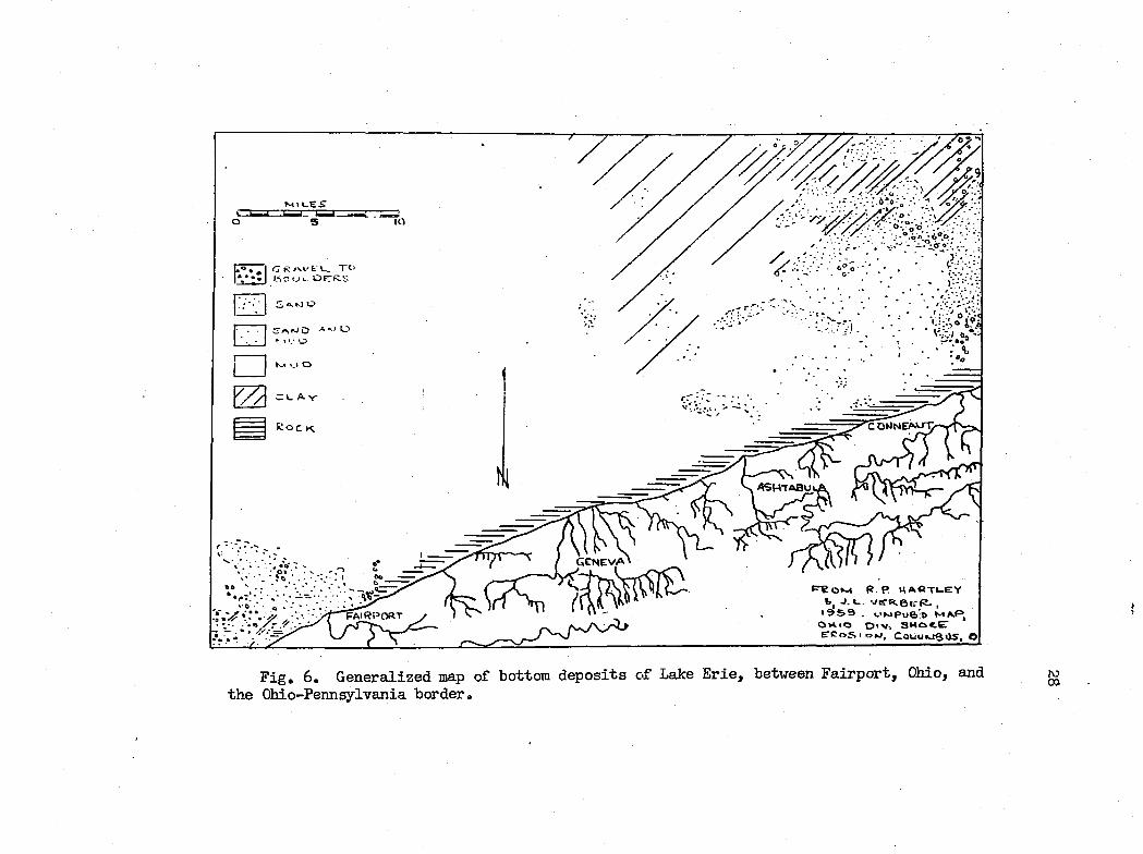
about one m ile offshore as sho\vn in Fig. 6 (H artley and Verber,
unpublished map. 19$9)»
The con tro l on drainage pattern s exercised by bedrock stru ct
ures has not been s p e c if ic a l ly studied; hojvever, inform ation ob
ta in ed from reconnaissance up the Ashtabula River strongly suggests
th a t the tr ib u ta r ie s and part o f the major stream i t s e l f are stru ct
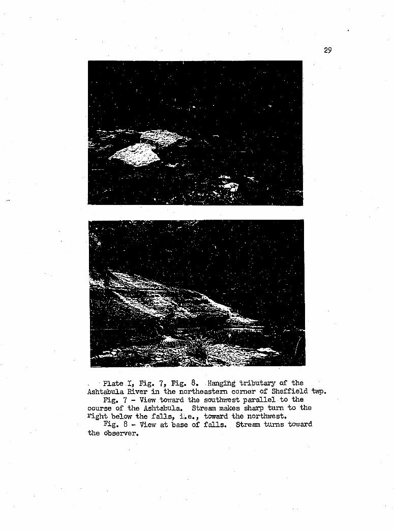
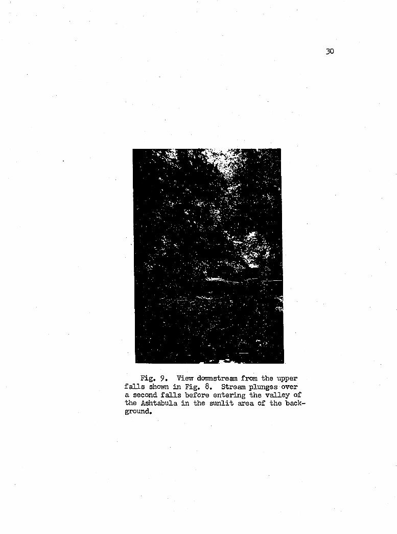
u r a lly con tro lled (F ig s, 7, 8 and 9 ) . These observations confirm
the conclusions of Hutton (19U0) who made a system atic study o f
jo in ts found in the v a lle y s o f the Conneaut and Ashtabula r iv e r s .
The author a lso sav/ many minor f a u lt s and fo ld s , e sp e c ia lly in the
north-south stre tch o f the Ashtabula River in Plymouth tovmship,
where he counted nine fa u lt s and two a n t ic l in e s in the two-m ile
segment o f v a lle y between Dewey Road and S tate Route 83. A ll fa u lt s
die out in the v a lle y w a ll a t a h eigh t o f 6 to 7 f e e t , and most
o f them occur in the f lo o r o f the v a lle y , or in the bench, k to
10 f e e t above the f lo o r o f the v a lle y .
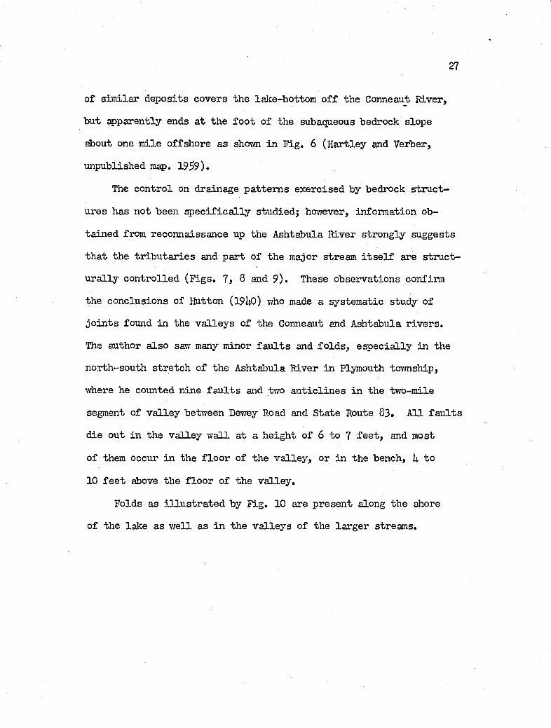
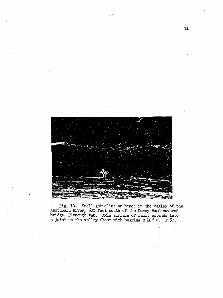
Folds as i l lu s t r a t e d by F ig. 10 are p resen t along the shore
of the lalce as vrell as in the v a lle y s o f the larger streams.
lO
TOC « /XV fu L.
A. M O
u A V
^ Roc^
P R a»s-t R . p H A « T 1- E Y k, j- A. VER.6ER. ,'959 . v.>k»Po6-o map»,Ot 'O O'V-. SHotE’E C o S . c j t j , C o liuwQ O S, O
F ig , 6 . Generalized map o f bottom deposits o f Lake E rie , between F airport, Ohio, and the Ohio-Pennsylvania border.
29
P late I , F ig . 7, F ig , 8, Hanging tr ib u tary of the Ashtabula River in the northeastern com er of S h effie ld tvç>.
F ig . 7 - View toward the southwest p a r a lle l to the course o f the Ashtabula. Stream malces sharp turn to the iy.ght below the f a l l s , i . e . , toward the northwest.
F ig . 8 - View a t base o f f a l l s . Stream turns toward the observer.
30
Fig, 9 . Vievr dormstream from the upper f a l l s shovm in F ig. 8. Stream plunges over a second f a l l s before entering the v a lle y of the Ashtabula in the s u n lit area of the background.
31
F ig , 10, Small a n t ic lin e on bench in the v a lle y o f the Ashtabula River, ÿ)0 f e e t south o f the Dewey Road covered bridge, Plymouth twp. Axis surface o f f a u lt extends in to a jo in t on the v a lle y f lo o r ivith bearing N ^0° W, 19^7,
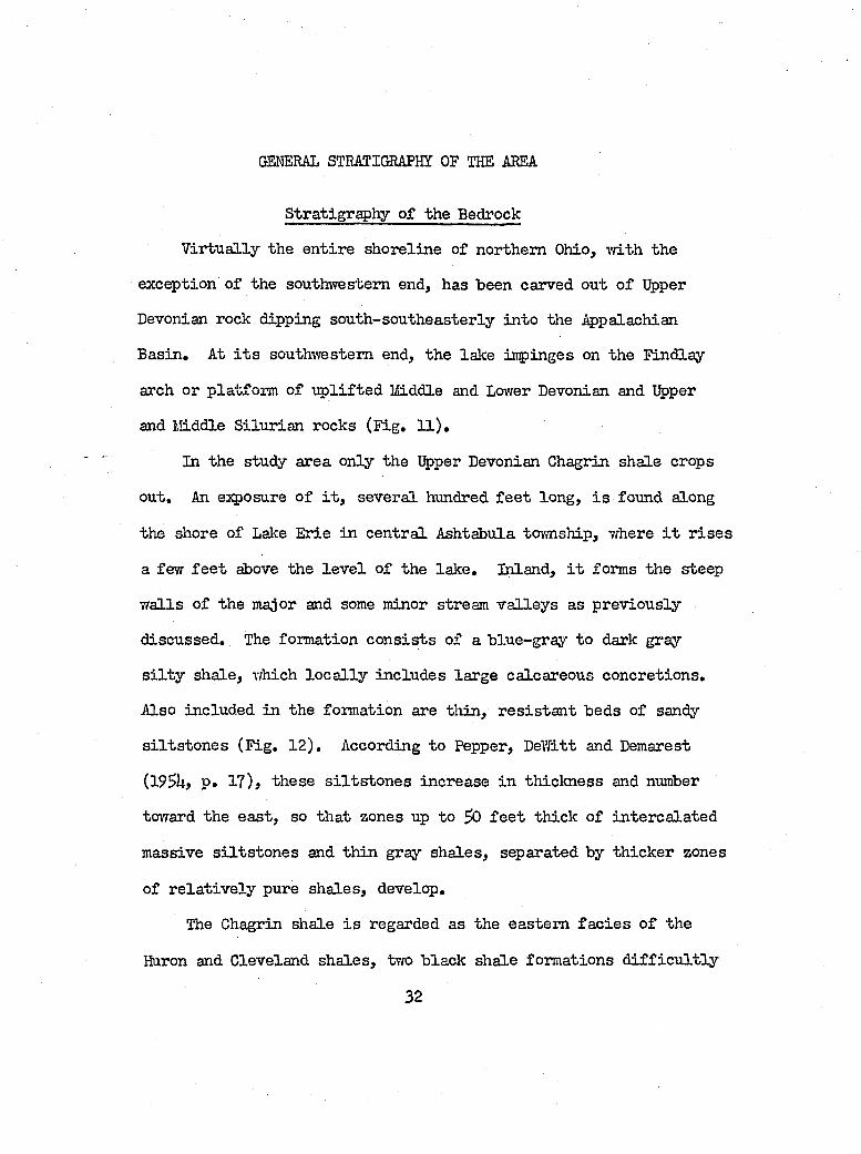
GENERAL STRATIGRAPHÏ OF THE AREA
Stratigraphy o f the Bedrock
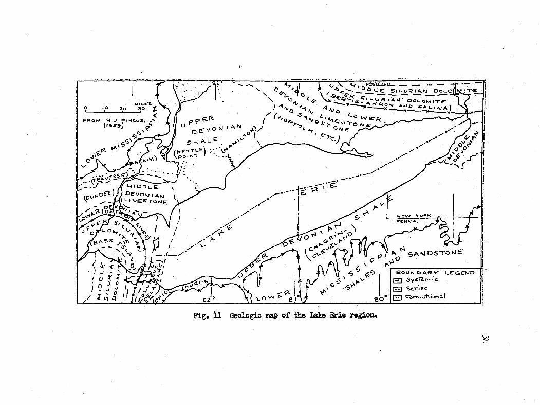
V irtu a lly the en tire shoreline of northern Ohio, ivith the
exception of the southwestern end, has been carved out o f Upper
Devonian rock dipping south -sou theasterly in to the J^palachian
B asin . At i t s southv'restem end, the lake inp inges on the Findlay
arch or platform o f u p lif te d Middle and Lower Devonian and Upper
and Middle S ilu r ian rocks (F ig , 11 ),
In the study area only the Upper Devonian Chagrin shale crops
out. An exposure o f i t , severa l hundred f e e t lon g , i s found along
the shore of Lake Erie in cen tra l Ashtabula township, where i t r is e s
a few f e e t above the le v e l o f the lak e . Inland, i t forms the steep
w a lls o f the major and some minor stream v a lle y s as p rev iou sly
discussed . The formation c o n s is ts o f a b lue-gray to dark gi*ay
s i l t y sh ale , which lo c a l ly inclu d es large calcareous concretion s.
Also included in the formation are th in , r e s is ta n t beds of sandy
s i l t s to n e s (F ig , 12 ), According to Pepper, DeWitt and Demarest
(19 U> p . 17)f th ese s i l t s to n e s increase in th ick ness and number
toward the e a st , so th at zones up to ^ f e e t th ick o f in terca la ted
massive s i l t s to n e s and th in gray sh a les, separated by th ick er zones
of r e la t iv e ly pure sh a les, develop.
The Chagrin shale i s regarded as the eastern fa c ie s o f the
Huron and Cleveland sh a les, two b lack shale form ations d i f f i c u l t ly
32
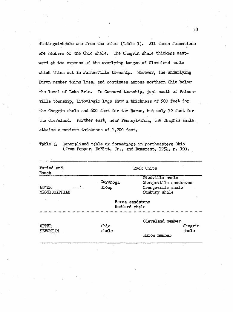
33
d istin gu ish ab le one from the other (Table l ) . All three formations
are members o f the Ohio sh a le . The Chagrin shale th ickens ea st
ward at the expense o f the overlying tongue o f Cleveland shale
which th in s out in P a in e sv ille tovmship, Hovrever, the underlying
Huron member th in s l e s s , and continues across northern Ohio below
the le v e l o f Lalce E rie. In Concord township, ju s t south o f Paines
v i l l e tovmship, l i th o lo g ie lo g s show a thiclcness o f 900 f e e t fo r
the Chagrin shale and 600 f e e t fo r the Huron, but only 12 f e e t for
the Cleveland, Farther e a st , near Pennsylvania, the Chagrin shale
a tta in s a maximum th ick ness o f 1 ,200 f e e t .
Tsble I . Generalized ta b le o f formations in northeastern Ohio (from Pepper, DeWitt, J r ., and Demarest, 19SL, p . 10 ).
Period and Epoch
Rock U nits
M eadville shaleCuyahoga S h arpsville sandstone
LOVTOR Group O rangeville shaleMISSISSIPPI# Sunbury shale
Berea sandstoneBedford shale
Cleveland memberUPPER Ohio ChagrinDEVONI# shale shale
Huron member
(KE-rTLfjV.ool '
Fig* U Geologic map o f the Lake Erie reg ion .
U)•p-
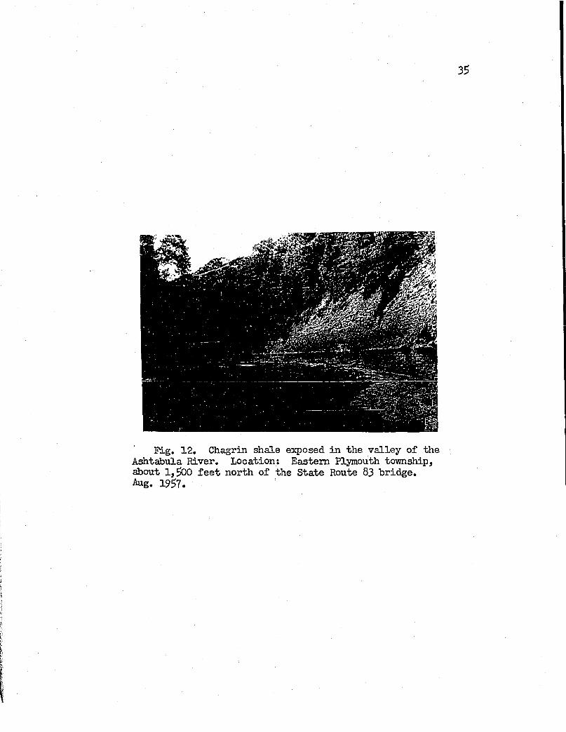
35
Fig. 12, Chagrin shale exposed in the v a lle y o f the Ashtabula River. Location; Eastern Plymouth to^rnship, about 1 ,^ 0 f e e t north of the State Route 83 bridge.Aug. 1957.
36
Stratigraphy o f the S u r f ic ia l D eposits#
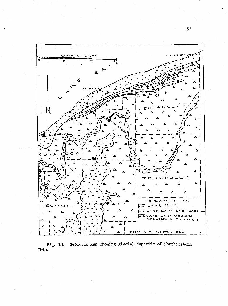
G lacia l T i l l . In broad topographic terms the g la c ia l t i l l
assumes both the lin ea r to cu rv ilin ear landforms ty p ic a l o f termi
n a l moraines, and the ex ten sive subdued surfaces a ssocia ted vri.th
ground moraines. The Lake Escaipment moraines (F ig , 13) p o ss ib ly
represent the marginal d ep osits o f the l a s t major readvance or
p e r h ^ s recess io n a l pause o f the Late Wisconsin ic e -sh e e t in the
study area.
On the other hand, the t i l l sh eets form the most vn.despread
stratigrap h ie member of the d ep osits superjacent to the Chagrin
shale; although th is statement, i s q u a lified by the fa c t th a t b asa l
gravels and sand up to 18 f e e t th ick o ften un d erlie the t i l l .
Along the shore the t i l l , u su a lly made up of tvio la y ers herein
c a lle d the %per T i l l and Lower T i l l , p resen ts an unbroken fron t
th a t ranges from a maximum th ick ness o f some 6S f e e t (ex c lu siv e
of 6 to 10 f e e t of in te r s tr a t if ie d la cu str in e d ep osits) in Paines-
v j.lle tovmship, to a low o f 10 f e e t in Madison tovmship. North
eastward in to Geneva township and beyond, th is th ick n ess again
in creases, f lu ctu a tin g between 2$ and ^0 f e e t according to the
presence and extent o f the la te r a l ly discontinuous in t e r s tr a t if ie d
la cu str in e beds.
Inland from the shore of Lake Erie in Lake County, the t i l l
th ickens u n t i l i t has passed beyond the Lake Warren beach and then
■JtLithologic sec tio n s l i s t e d in the te x t are described under Appendix.
37
5 U N ^ r v i \ T , - o - „c | o O ft o
f“ — 'E: X P U A T I O t- I|x x I L.<®>k ET B E U 1 >
(ô"T| ÙA rE CA.R'r ExJt> l\/ioR«\\SE^ u t. t. / A ^ 1 |A a | U ^ t E C A R ' r G R o o k i D
o_o I ^ MoRAITsJEI & O U T'vV ASHO o [o o "P
A I A * I ' * O ^ • I^ , (r oM G W. WHITE"» 19 5 3 .
F ig. 13, Geologic Map shov/ing g la c ia l d ep osits o f Northeastern Ohio.
38
proceeds to th in as the Lake Ti’/h it t le s e y b lu f f i s approached. Thus
in P a in e sv ille to\’mship, "whereas a thiclcness o f 6$ f e e t i s recorded
at the shore o f the lalce, only 6 f e e t o f th is thiclcness remains
at a p o in t one m ile south o f the Lalce T /h ittlesey ridge against the
Grand River v a lle y . Again, th is statement i s q u a lified by the
presence o f d r if" t-f illed v a lle y s in the "vicinity of the Grand River,
In Perry township, the thiclcness o f the t i l l , 3S f e e t a t the lake,
in creases to 73 f e e t under the Lake T/arren rid ge, but th in s to near
zero a t the town o f Perry, about one-quarter m ile north o f the
Lake IVhittlesey r id ge, Madison tovmship rev ea ls a sim ilar r e la t io n
ship as shown by the cro ss -se c tio n of,. Figure 17,
On the other hand, the o v era ll bedrock surface o f Ashtabula
County in the area "west o f K in gsv ille tovmship and north o f the
Lake Warren ridge, i s more th in ly covered w ith t i l l than sim ilar
areas in eastern Lake County, This mantle i s th in n est in Geneva
and Ashtabula tov"mslvips, vfhere only 3 to U f e e t and 10 f e e t respec
t iv e ly are reg istered , and th ick est in Saybrook tovmsliip, vdiere
19 f e e t are recorded. However, immediately south o f the r id ges
o f Lakes Warren and Y ftiittlesey, the t i l l th ickens to form m odified
benches facin g the north. From the foregoing, the author postu
la t e s th at the waves of Lakes Warren and Arkona-V/hittlesey had
cut away much of the t i l l on the Lake P la in , and had l e f t th ese
benches as erosion a l forms (F igs, lU and l 3 ) .
In general, the t o t a l th ick ness o f the t i l l on the Lake Escarp
ment exceeds th at on the Lake P la in , These moraines were examined
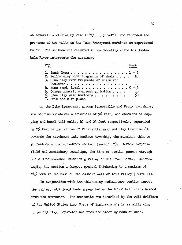
39
at severa l lo c a l i t i e s by Read (1873, p . ^16-17), who recorded the
presence o f two t i l l s in the Lake Escaipment moraines as reproduced
below. The sec tio n was measured in the lo c a l i t y where the Ashta
bula River in te r se c ts the moraines.
Top Feet
1 . Sandy lo a m ....................................................................1 - 22. Yellow c lay vd.th fragments o f shale . . . . 103 . Blue c la y w ith fragments of shale and
b o w ld ers ..................................................................... lUU. Fine sand, l o c a l ....................................................0 - 3
Coarse gravel, co a rsest at bottom . . . . 106 . Blue c lay w ith bowlders ....................... SO7. Erie shale in p lace
On the Lake Escarpment across P a in e sv ille and Perry tcnmships,
the sec tio n m aintains a th ick n ess of 96 f e e t , and c o n s is ts o f c o
ping and b asa l t i l l u n its , L7 and 23 f e e t r e sp ec tiv e ly , separated
by 2S f e e t o f la cu str in e or f lu v ia t i l e sand and c la y (se c t io n 6 ) .
Towards the northeast in to Madison township, the moraines th in to
70 f e e t on a r is in g bedrock contact (se c tio n 7 ) . Across Haipers-
f i e l d and Austinburg townships, the l in e o f sec tio n p a sses throu^i
the o ld north-south Austinburg v a lle y of the Grand River. Accord
in g ly , the sec tio n undergoes gradual thickening to a maximum of
2h^ f e e t a t the base o f the eastern w a ll o f th is v a lle y (P la te I I ) .
In conjunction v/ith the thickening sedimentary sec tio n across
the v a lle y , add ition al beds appear below the th ick t i l l u n its traced
from the southwest. The new u n its are described by the w e ll d r i l le r s
of the United S ta tes Amy Coips o f Engineers m ostly as s i l t y c lay
or pebbly c lay , separated one from the other by beds o f sand.
llO
w marf-G-k' s rI _
900'
TO O i t100 -
P l_ /A M A T > o r-a
5 3r&?vl PE BBl.r T'E-L. A U'3 Tl M BI R c:
Cx P
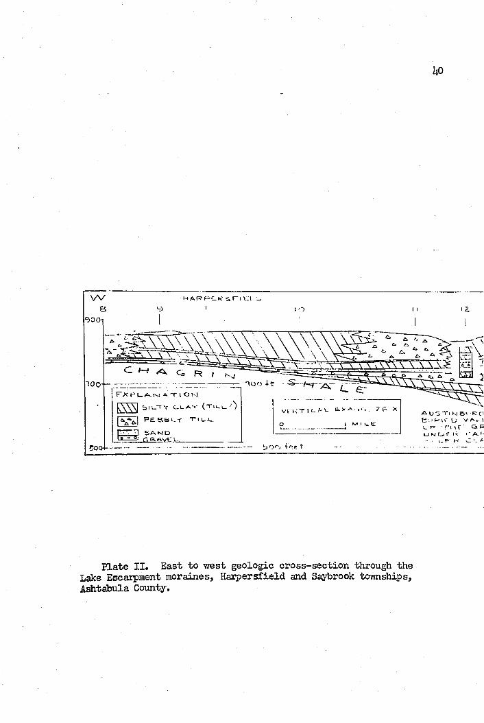
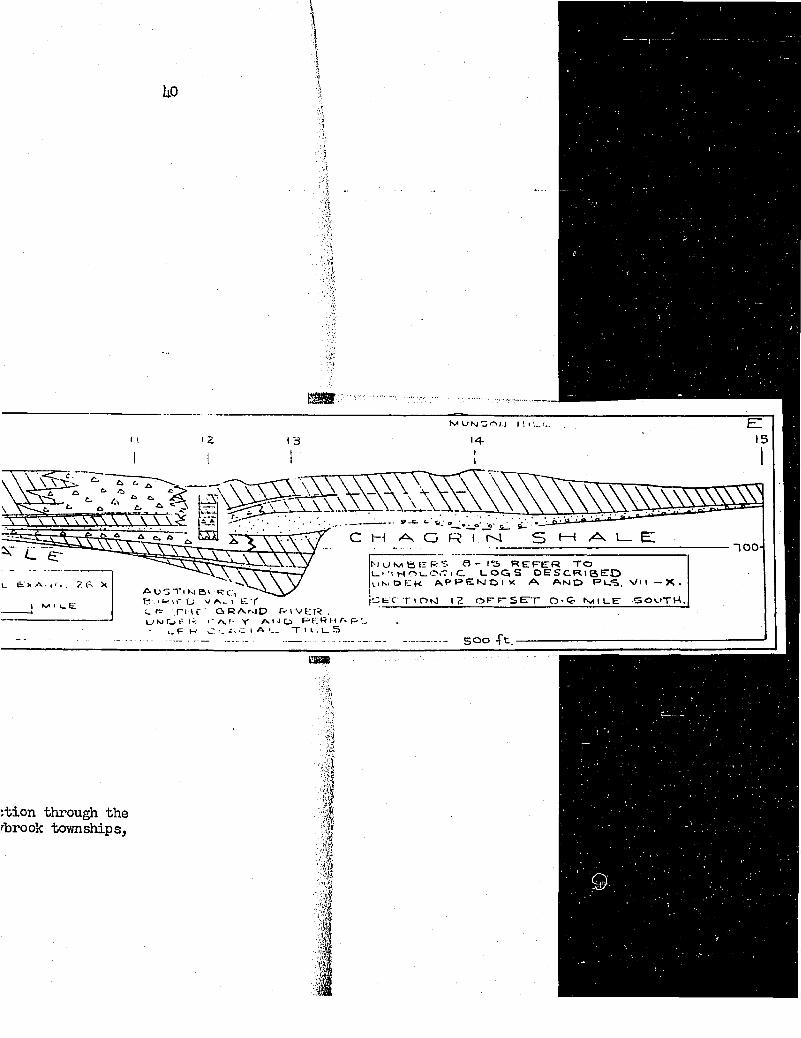
Plate I I . East to w est geo log ic cro ss -sec tio n through the Lake Escarpment moraines, H axpersfield and Saybrook townships, Ashtabula County.
llO
t v< U N - l o t J I 1 I ! . . I -
14-
100 -
A U j T l Kl B i R c:-,B ' . I K I r O V I E Y
u T r i i f qram D fvivER.U N C j f I 1 ' A . I ' T A I J CJ> R t l A F - - , I- E K C C 1 A i „ T 1 U. U. 5
MuNieerRT. a - I S refetr toE t 1 H O e O . T 1 C L O G S d e s c r i b e d v i t M O E K A P R S N I O I X A A n O P L S . V I I - X ,
C E C T I O K l I Z 0 - < 3 t v i l L E s o u t h .
500 -Tt.
:tion through the rbrook townships.
l a
They apparently occupy a p o s it io n o f onlap against the w est w a ll
of the v a lle y . The author has separated from the lo g s (se c tio n s
10, 11, 12 and 13) three ad d ition al u n its o f t i l l , p o ss ib ly Cary
in age (P la te I I ) . On the other hand, the two b asa l s i l t y c la y
u n its and the included sand in the ax is o f the v a lle y may be lacu s
tr in e in o r ig in , i f the fa c t th at they l i e below 700 f e e t in e le
vation , i . e . , below the le v e l o f the higher g la c ia l la k es , can be
construed as an in d ica tio n th a t the Austinburg v a lle y was an arm
of some pre-Late Cary g la c ia l Great Lake. Unfortunately, the author
lack s the means to t e s t e ith e r p o stu la te .
The stratigraphy becomes more s im p lified ea st o f the Austin
burg v a lle y . At lîunson H il l , Saybrook tov’mship, 90 f e e t o f t i l l
r e s t on more than 22 f e e t o f sand and gravel (se c tio n lU)'i Here
the one-m ile wide v a lle y o f Coffee Creek has been cut in to the
moraine. On the south sid e o f the d iv id e . Center Creek apparently
occupies a m o ra in e-filled bedrock v a lle y (F ig . l it ) .
Passing in to northern Jefferson tovmship, the moraine forming
the d ivide north o f the w ester ly course of the Ashtabula River,
th in s to about 23 to 30 f e e t from the 90 fo o t value o f Saybrook
township, although th ick er d ep osits are Icnown to occur in the v a lle y
of the Ashtabula at K e llo g g sv ille . N evertheless, the r e la t iv e ly
th in mantle o f t i l l on the d iv id e thickens northward to some 60
f e e t near the Lake W hittlesey b lu f f , as i l lu s tr a te d by the s t r a t i
graphie c ro ss -sec tio n o f Figure l3 .
U2
Eastward, between the courses of the Ashtabula and Conneaut
r iv ers , only $ to 20 f e e t o f g la c ia l t i l l covers the Lake Escarp
ment. However, on the northern side o f the Conneaut River, the
moraines thicken to values betrreen 60 and 90 f e e t (se c tio n s l 6
and 17) .
The sp a tia l re la tio n sh ip between the t i l l on the Lake P lain
and the moraines on the Lake Escarpment i s probably b e s t delin eated
in Saybrook and Geneva townships o f Ashtabula County (F ig . l it ) .
The rather steep b lu ff o f Lake Y iliittlesey marks the norther topo
graphic fro n t of the Lake Escarpment moraines, here UO f e e t th ick .
From the base o f the b lu f f the g la c ia l t i l l o f the Lalce P la in ex
tends northward as a th in sh eet. N evertheless, the author traced
the t i l l sheet in to the lower part o f the Lake Escarpment moraines
in the lo c a l i t y vrhere Cowles Creek turns north through the Lake
W hittlesey b lu ff .
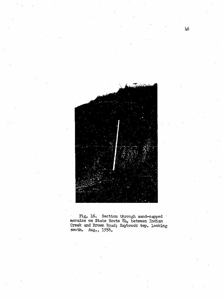
A s e r ie s o f k n o lls resembling kames, 20 to ^0 f e e t high , caps
the Lake T jhittlesey b lu f f in Saybrook tovmship. The author meas
ured the fo llow ing sec tio n in a gravel p i t cut in to one of these
h illo c k s .
Section 18
Location: State Route 81)., betvreen Indian Creek and BrovmRoad, Saybrook tovmship.
Top Feet
1 . Fine sand, red-brown, s t r a t i f ie d and w e llsorted .......................... . . . . . . . . ................... 8
Ce-mtCR c r e e -k %
300 -t _ A . K E e S i ^ A R P M E N T
L A K E :•.VHITTLESe»'BLUFF
E X P U Al'J
E 3 T l l _ l _ , G l A C 1 AL
ES] S A M D
E 3 G R A V E T L -
I O N "TOOLAKEgraesmere- -L U N D Y 6 E A C H
6 0 0 -
OVERY t y.LGQ
50 oJ1-500
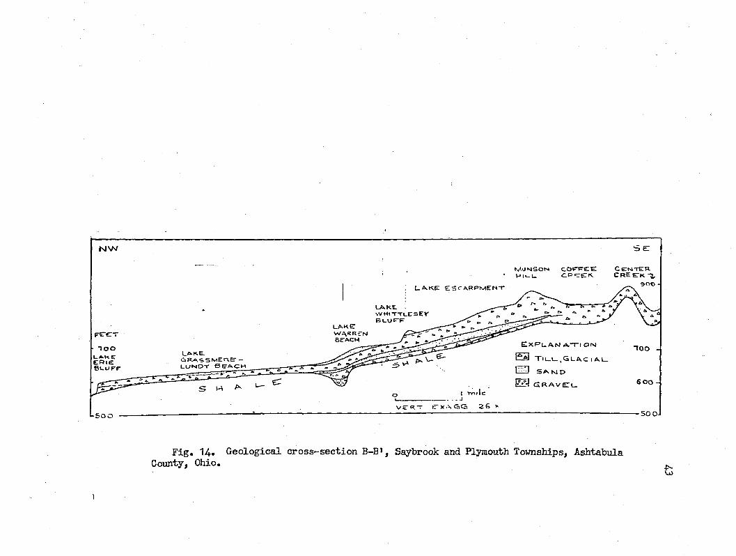
F ig . 14. G eological cro ss-sec tio n B-B', Saybrook and Plymouth Townships, Ashtabula County, Ohio.
A S M T A B Ü U A R i v e p V A L l e t
CA.«aEV»L\_e’
L.AKEv v H t- rX l-E 'S E"Y B L .U F -F -u a k e :
W A R A E T MBE-ACW -800
NORTH Kl NGSViLUeL A K E T
E R I ES L U R
F E E T CxPLANAT'OM[ 5 3 T I L L , G L A C I A L .
( 2 3 S A N D
R T I G R A V E L600 '
V E R T EX A G G . 2 6 X
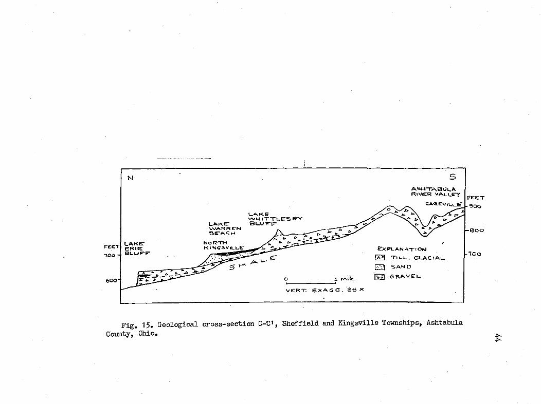
F ig . 15. G eological cro ss-sec tio n C-C», S h e ff ie ld and K in gsv ille Townships, Ashtabula County, Ohio.
2, Gravel and sand mixture j poorly sorted and irreg u la r ly bedded. P recise th o u ^ undulatoryb asa l contact .............................................. . . . 8
3. T i l l ; pebbly, poorly compacted s i l t y to sandyc la y (Road le v e l e leva tion : ca, 7$0 f e e t ) .......................9
“2F“
I t seems to the author th at perhaps a certa in amount o f the
Lake Escarpment moraines postdate the ty p ic a lly compacted t i l l
of the Lake P la in , vrhich in i t s turn would be co rre la tiv e w ith
lower portions of the Escarpment moraines. Units of the Lake P lain
t i l l s equivalent to the upper portion o f the Escarpment moraines
may have been removed by erosion a l a c t iv ity associated v/ith the
g la c ia l lalce s .
Since the t i l l s o f the Lake P lain underlie la cu str in e deposits
la id down in lak es Arkona and TJhittlesey, and sin ce la cu str in e beds
of Lake W hittlesey age have been dated at Cleveland, Ohio, by tech
niques based on Carbon II4., as 13,600 + ^ 0 years before present
(Goldthwait, 19^8, p , 216), then the t i l l s and moraines would not
be any younger than th is , i , e . . Late Cary Age,
Lacustrine and F lu v ia t ile D eposits. Two extensive d ep osits
of sand and gravel occupy broad areas o f the Lake P lain in the
study area. One such d ep osit, 20' to 30 f e e t th ick , covers an 11
square m ile area of Madison tovmship of Lake County, between the
b lu ffs o f Lalce W hittlesey in the south and Lake Erie in the north.
The other deposit, about 12 square m iles in area, i s loca ted in
Ashtabula County, between North K in gsv ille in the southwest, and
the c i t y of Conneaut in the northeast. The 70 fo o t b lu f f o f Lake
U6
F ig . 16. Section through sand-capped ' moraine on State Route 8U, between Indian Creek and Brovm Road; Saybrook twp. looking south. Aug., 19^6.
k l
Erie term inates the deposit to the northwest, whereas the 60 fo o t
b lu f f o f Lake "Whittlesey overlooks i t from the southeast. Trend
ing d iagonally across the area toward the northeast, the Conneaut
River d iv id es th is deposit in to tvro p arts; a southeastern portion ,
co n sistin g o f a th in sheet o f sand and gravel, 7 to 10 f e e t th ick
restin g on bedrock, and a northern and vrestem u n it vd.th sand more
than $0 f e e t th ick in the broad beach o f Lalce Vfarren, and 35 f e e t
th ick in the b lu ff o f Lake E rie, Unhsppily, the author has not
gathered enough subsurface data to formulate a sound reconstruction
of the h isto ry of th is reg ion al sand d ^ o s i t . However, he b e lie v e s
th at i t has undergone a development s im ilar to th at given fo r the
Madison toimship deposit below.
The Madison Tcnmship Sand D eposit, On the ■ b a s is of i t s mor
phology, one may divide the Madison township sand dep osit in to a
southern and northern area, and u t i l i z e the ea st-w est, northerly
arched sandy b lu ff o f Lake Warren as the l in e o f demarcation. At
Haines and MacMackin Roads in the northwestern part o f the tovmship,
the sand in the Lake Warren beach a tta in s a th ickness o f 30 or
more f e e t . Away from t h is area, toward the south, ea st and w est,
the southern sand deposit th in s to l e s s than l3 f e e t . N evertheless,
a th ick ness o f 33 f e e t i s maintained over most o f i t s cen tra l area,
Isopachs drawn on the northern deposit (F ig , 17) rev ea l a
w ester ly elongated body, the eastern end o f which i s anchored to
the r is in g bedrock surface in the adjacent area o f Geneva township.
From the western end, where the sand body i s truncated by the receding
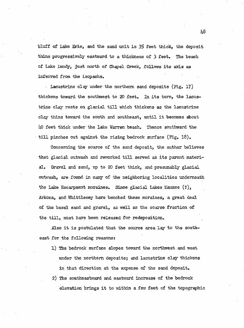
U8
b lu ff o f Lake E rie, and the sand u n it i s 3$ f e e t th ick , the dep osit
th in s p ro g ressiv ely eastward to a th ickness o f 3 f e e t . The beach
of Lake Lundy, ju s t north o f Chapel Creek, fo llo w s i t s a x is as
in ferred from the iscp ach s,
. Lacustrine clqy under the northern sand dep osits (F ig . 17)
th ickens toward the southwest to 20 f e e t . In i t s turn, the la cu s
tr in e c la y r e s ts on g la c ia l t i l l which th ickens as the la cu str in e
c la y th in s toward the south and southeast, u n t i l i t becomes about
UO f e e t th ick under the Lake Warren beach. Thence southward the
t i l l pinches out against the r is in g bedrock surface (F ig , l 8 ) .
Concerning the source o f the sand d ep osit, the author b e lie v e s
th at g la c ia l outwash and reworked t i l l served as i t s parent m ateri
a l, Gravel and send, up to 20 f e e t th ick , and presumably g la c ia l
outwash, are found in many of the neighboring lo c a l i t i e s underneath
the Lake Escarpment moraines. Since g la c ia l Lakes Maumee (?) ,
Arkona, and W hittlesey have benched th ese moraines, a great deal
of the b asa l sand and gravel, as w e ll as the coarse fr a c tio n of
the t i l l , must have been re leased fo r red ep osition .
Also i t i s p ostu lated th a t the source area la y to the south
ea st fo r the fo llow in g reasons;
1) The bedrock surface slop es toward the northwest and T/est
under the northern dep osits; and la cu str in e c la y th ickens
in th a t d irectio n at the expense of the sand d ep osit,
2) The southeastvTard and eastward increase o f the bedrock
e lev a tio n brings i t to -within a few f e e t o f the topographic

U9
surface in adjacent Geneva tovmship. There the bedrock
p resen ts a broadly shelving, t il l-v e n e e r e d surface, 20
to 1|0 f e e t higher than th a t in Madison tovmship,
3) A dditionally , in Geneva township, the b lu ff o f Lake W hittle
sey i s 20 f e e t higher than th at in Madison tovmship, which
im plies strong erosion of the t i l l and kame d ep osits found
th ere.
Thus the author concludes th a t the predominant l i t t o r a l d r i f t
of Lakes Arkona and W hittlesey was westward, and th at i t introduced
the bulk o f the sand d ep osits in to the area. Each lower lalce-stage
continued the red istr ib u tio n by bencliing the prev iou sly formed
sand d ep osit, and spreading the derived and newly introduced sed i
ments farth er northward and northwestward over the deeper water
fa c ie s o f la cu str in e c la y . The la s t o f th ese g la c ia l lak es on the
Lake P la in , i , e , . Lake Lundy, reshaped and extended the northern
deposit along the present s i t e o f G h^el Creek in to a beach or
sp it beyond the present shore o f Lake Erie,
I t i s worthy o f note, i f the foregoing be v a lid , th a t the
l i t t o r a l d r i f t o f th ese g la c ia l lak es proceeded in a d irectio n
opposite to the predominant northeastward l i t t o r a l d r if t e x is t in g
in Lake Erie today.
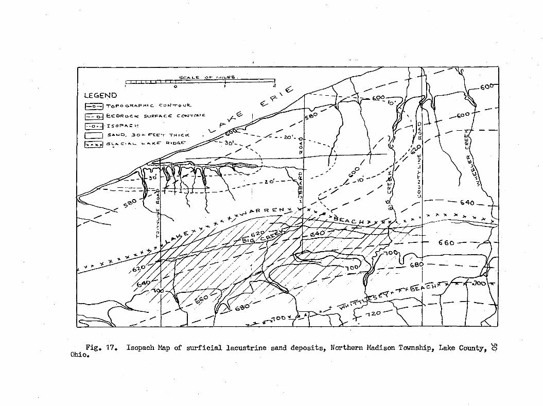
F ig , 17, Isopach Map of s u r f ic ia l la cu str in e sand d ep o sits . Northern Madison Township, Lake County, o Ohio,
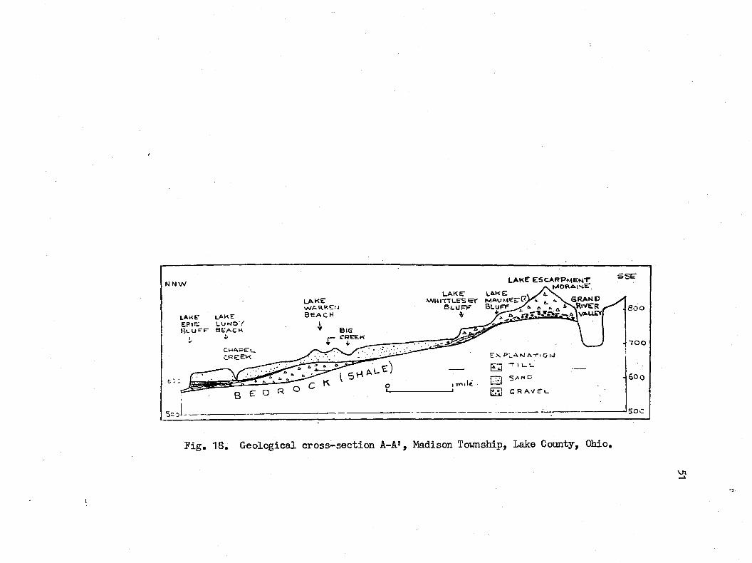
N N W
LAwr lake e p « e : L U N O YR l U " E b e a c hj/
LAKEvvARRENB E A C H
LAKE e s c a r p m e n tMORAINE"L A K e l a k e
VfH IT T U E S e r M A u M E E P G R A N PB L U F F B l u f f ^ ^ R iV E R
5 S E
6: :
V AUEY
C H A P E uc p e e k
B E O R
Ex plan ATI O iJE3[ g SANOFT°I G R A V E u
800
- T O O
- 50 0
50C
F ig , 18, G eological cro ss -sec tio n A-A>, Madison Township, Lake County, Ohio,
VJ«
DETAILED STRATIGRAPHY OF THE LAKE ERIE BLUFF IN THE AREA
An erosion a l fea tu re o f shore and mass masting processes, the
b lu ff o f Lalce Erie presen ts a v e r t ic a l stra tigrap h ie cro ss -sec tio n
of the Lake P la in , Two t i l l formations herein c a lle d the Upper
T i l l and Lower T i l l , lo c a l ly s^ a ra ted from each other by la cu s
tr in e s i l t , sand and c la y , red c la y le n se s , and boulder pavements,
can be traced throughout most o f the b lu f f area, from Mentor-on-
the-Lake to the Ohio-Pennsylvania border. These u n its co n stitu te
the s a lie n t stra tigrap h ie members o f the b lu f f , except in the areas
stretch in g across eastern Perry, Madison and western Geneva tovm-
sh ip s, and across K in gsv ille and Conneaut townships, vdiere two u n its
of la cu str in e c lay and sand, up to $0 fe e t th ick , dominate th e
section .
The dark la cu str in e c la y and s i l t which o v e r lie the Upper
T i l l , may or may not grade downward in to the t i l l , Where they do,
the tr a n s it io n zone i s marked by an increase in toughness, an in
crease in the percentage o f c la y and pebbles, and a decrease in
the percentage o f s i l t and sand, Likerri.se, th is pattern holds
true fo r the b asa l contact o f the la cu str in e c la y and s i l t in te r
bedded between the t i l l s .
Y/here the la cu str in e u n it between the t i l l s i s absent from
the sec tio n , the i n t e r t i l l contact has been loca ted by other c r i
te r ia ; such as, the presence o f boulder pavements, zones o f
S2
S 3
in ter fin g er in g or incorporation o f red, fa t ty , c la y m th pebbly,
greenish gray t i l l ; by the presence o f str in g ers and alignments
o f red la cu str in e c la y le n se s in the t i l l ; and by the p e r s is te n t
tendency of the contact to fo llo w an e lev a tio n ranging between
and S80 f e e t ; i . e . , 1 to 7 f e e t above la k e - le v e l (^73 f e e t ) .
With resp ect to the appearance of the t i l l s them selves, the
author found no sa tis fa c to r y method o f d istin gu ish in g one from
the other in the f i e ld or lab orato iy , save fo r a h igh ly subjective
in terp reta tion o f co lor d ifferen ces . The Upper T i l l appears to
be s l ig h t ly more p inkish gray than the Lower. The ex isten ce of
another older t i l l i s suggested by the le n se s o f greenish gray,
very pebbly t i l l occa sio n a lly incorporated in to the la cu str in e
c la y o f the i n t e r t i l l contact zone.
In the fo llow ing account, the b lu ff stratigraphy i s described
by townships, beginning vdth P a in esv ille in the southwest, and
proceeding northeastward. P la tes XI to XIII provide a continuous
section or fence diagram o f the stra tigrap h ie u n its .
P a in e sv ille Township
Throughout northwestern P a in e sv ille township, from the Grand
River to Bacon Road, th e b lu f f stra tigrap h ie d iv is io n s c o n s is t ,
in general, o f an upper t i l l u n it , U2 to U6 f e e t thi.ck, overlying
6 to 12 f e e t o f la cu str in e m ateria l, vdiich in turn r e s ts on the
b asa l member o f Lower T i l l . The contact on the Lov/er T i l l i s v i s i
b le near beach le v e l , e sp e c ia lly in the area ju s t ea st o f P a in esv ille
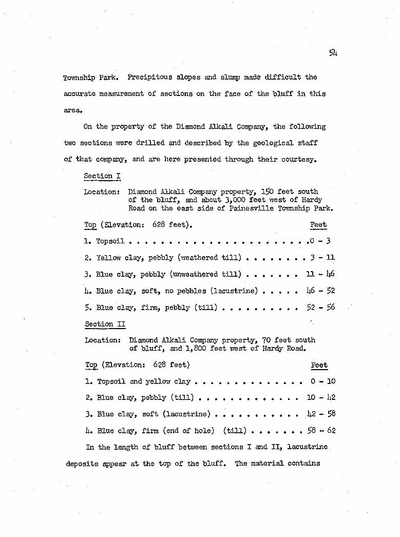
Tcïvmship Park. P recip itou s slop es and slurtp made d i f f ic u l t the
accurate measurement o f sec tio n s on the face o f the b lu ff in th is
area.
On the property o f the Diamond A lkali Coup any, the fo llow ing
two sec tio n s were d r il le d and described by the g eo lo g ica l s t a f f
of th at conpany, and are here presented through th e ir courtesy.
Section I
Location: Diamond A lk a li Conpany property, 1^0 f e e t southo f the b lu f f , and about 3,000 f e e t -west o f Hardy Road on the e a st sid e o f P a in e sv ille Tovmship Park.
Top (E levation: 628 f e e t ) . Feet
1. T opsoil .......................................................................................... 0 - 3
2. Yellovr c la y , pebbly (weathered t i l l ) . . . . . . . . 3 - 1 1
3. Blue c la y , pebbly (unweathered t i l l ) .......................... 11 - U6
U. Blue c la y , s o f t , no pebbles ( la c u s t r in e ) .................I4.6 - 32
3. Blue c lay , firm , pebbly ( t i l l ) ......................... 3 2 - 3 6
Section I I
Location: Diamond A lk a li Company property, 70 f e e t southof b lu f f , and 1,800 f e e t -west o f Hardy Road,
Top (E levation: 628 f e e t ) Feet
1 . Topsoil and yellovy c l a y .......................................... 0 - 1 0
2. Blue c lsy , pebbly ( t i l l ) ...................................................10 - U2
3. Blue c la y , s o f t (la cu str in e ) ...................... U 2 - 3 8
U. Blue c la y , firm (end o f h o le) ( t i l l ) . . . . . . . 38 - 62
In the length o f b lu ff between sec tio n s I and I I , la cu str in e
d ep osits appear a t the top o f the b lu f f . The m ateria l contains
lo c a l ly vrell sorted sand, but i s otherwise h igh ly pebbly, as i f
g la c ia l lake water had but poorly reworked g la c ia l d ep o sits . This
u n it i s described under Section I I I , u n it 1 , and portrayed under
ï l g . 19.
Section I I I
Location: At fo o t o f Hardy Road, on the eastern sid e o f Painesv i l l e Tovmship Park, P a in esv ille Twp.
Top (E levation: 628 f e e t ) . Feet
1 . Gravels o f a l l s iz e s . The coarse s iz e s are rounded, irreg u la r ly layered , and c o n s is t m ostly o f sh in g le, l/U to 1 /2 inches in great diameter. Very coarse sand, granules and pebbles l i e in i l l - d e f in e d len ses at the lovrer contact. M aterial becomes soupy wiien saturated, in d ica tin g high s i l t and c la y content(F ig, 1 9 ) ........................................................................... 3 .5
2. Clay, p eb b le-free , reddish gray to brovm, fa t ty .Contain fa tty ;r e d c la y nodules and th in le n se s o f f in e gray sand and s i l t . Lower contact i s gradatio n a l, as: in d icated by an increase dovmvrard of the pebble population, grayness and hardness, anda decrease o f th e moisture c o n te n t ...................................... 3 .0
3. T i l l , gray, very hard. Mostly s i l t y c la y . Upper 3 f e e t contain small pockets and surfaces o f sand.Lower contact i s obscured by slump. Thickness unmeasured . . . . . . . . . . . . . . . . . . . . .
U. Lacustrine c la y , sand and s i l t . Observed prim arily in the slump forms. Basal contact i s w e ll developed, and l i e s 2 to 7 f e e t above lake datum o f 373 f e e t .Contact zone in clu d es len ses o f gray-broam, fa t ty , pebble-free c la y and undulates, th ick en s, th in s and b ifu rca tes to include len ses o f t i l l . Combined th ickness o f u n its 3 and U = . . . . . ............................... U6 .0
3. T i l l , pebbly, gray, s i l t y c l a y _______________________ 2_t o t a l 3 ÏÏ3
Apparently, the lower part o f the %per T i l l intertongues
w ith , and incorporates large q u a n tities o f la cu str in e c lay and
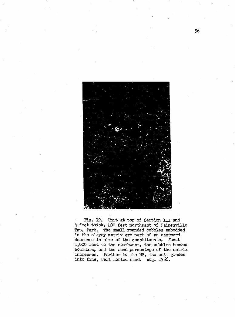
^ 6
51g, 19, Unit at top o f Section I I I and U f e e t th ick , I4.OO f e e t north east o f P a in e sv ille Tvjp, Park, The small rounded cobbles embedded in the c layey m atrix are p art o f an eastward decrease in s iz e o f the co n stitu en ts . About 1,000 f e e t to the southwest, the cobbles become boulders, and the sand percentage o f the m atrix in crea ses. Farther to the NE, the u n it grades in to f in e , w e ll sorted sand, Aug. 19^6,
$1
sand. Thus the b asa l contact cannot be properly delim ited . This
heterogeneity o f lith o lo g y i s b e liev ed to f a c i l i t a t e displacement
o f the Upper T i l l member, because o f the greater perm eability and
p la s t ic i t y o f the la cu str in e member. Slumping occurs throughout
the area as fa r northeast as Bacon Road, and i s described under
the Chapter dealing vrith "Mass Movement,"
Units 1 and 2 of Section I I I continue northeastvrard fo r 3,600
f e e t . Unit 1 thickens to 6 f e e t , and the s iz e fra c tio n s decrease
in to small pebbles in a m atrix o f s i l t and c lay . Unit 2 thickens
to it f e e t , and revea ls s l ig h t lam inations. T i l l remains the s a l i
ent member o f the b lu f f .
At Bacon Road, both u n its 1 and '2 have pinched out, leaving
the b lu ff a l l t i l l . The stretch o f b lu ff across the property of
In d u stria l Rayon iTas not in v estig a ted .
Perry Tormsliip
Northeastward across Perry township, the upper contact on the
t i l l undergoes a gen tle but constant decrease in e leva tion ( i . e . ,
from $9$ to 380 f e e t , over a d istance o f 23,000 f e e t ) on which
the la cu str in e d ep osits correspondingly expand in th ick ness. Both
Upper and Lower t i l l s remain in evidence on a lo c a l ly bold in ter
t i l l contact, th at fo llo w s a le v e l o f 373 to 37S f e e t , and wliich
becomes s tr ik in g ly d is t in c t in the southwestern part o f the area
by the presence o f boulder pavements. Two la cu str in e beds o v er lie
the Upper T il l ; an upper sandy u n it , and a lower clayey member. The
^ 8
upper u n it even tu a lly dominates the lith o lo g y in the northeastern
b lu ff area.
Section IV (F ig . 20)
Location: About 3,000 f e e t northeast o f the P a in esv ille -P errytcnvnship l in e , and 1,600 f e e t southwest o f Black- more Road.
Top (E levation: 620 f e e t ) Feet
1 . Clay; b u ff, s i l t y , p eb b le-free . Becomes laminated 3 f e e t from the top , and grades downward in to gray laminated c la y , s i l t and sand. Basal contact zone inclu des small (feiT inches long) surfaces o f redc l a y .............................. 18
2. T i l l . Pebbly, s i l t y c la y . Basal contact zone i s1 to 3 f e e t th ick , and 1 to f e e t above the beach . 22
3. T i l l . Like u n it 2 ....................................................................... 3u -
Section I I I remains c h a ra c ter is tic o f the b lu f f toward Black-
more Road, Y/ith the exception th a t the upper 3 f e e t o f u n it 1,
becomes d istin gu ish ab le as a separate u n it , which fa rth er to the
northeast develops as the sand member capping the b lu f f .
The contact zone between the t i l l s was traced from a p o in t
1, 200 f e e t southwest o f Blackmore Road to a p o in t 300 f e e t south-
vrest o f the second creek northeast o f Blackmore, fo r a b lu f f d is
tance o f 3,800 f e e t . This zone gen tly undulates between the e le
vation o f 573 and 578 f e e t . Strongly contorted, red-m ottled, pebbly,
and p ebb le-free c la y and sand characterize the m ateria l o f th is
zone. This m aterial strongly resembles the b asa l d ep o sits o f the
la cu str in e beds th at cover the t i l l in th is area and elseYdiere. The
red ^ o t s in the c la y c o n s is t o f small hem atitic p eb b le-size c la y bodies.
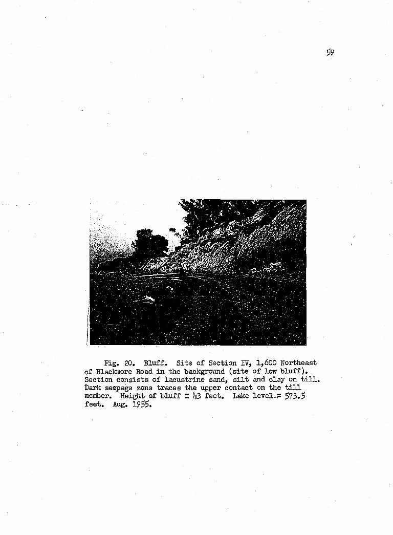
Fig. 20. B lu ff . S ite o f Section IV, 1,600 Northeast of Blackmore Road in the ‘background ( s i t e o f low b lu f f ) . Section c o n s is ts o f la cu str in e sand, s i l t and clay on t i l l . Dark seepage zone tra ces the upper contact on the t i l l member. Height o f b lu ff z k3 f e e t . Lake le v e l-P 573.5 f e e t . Aug. 1955.
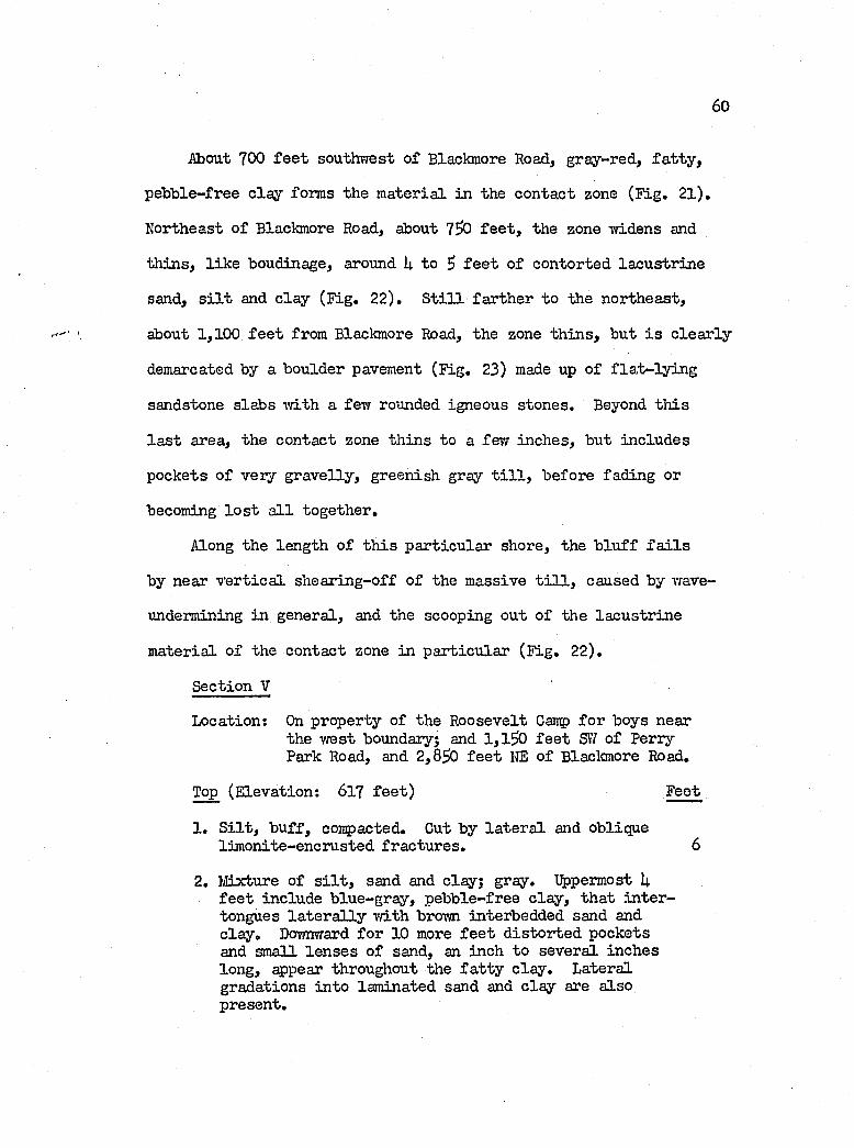
60
About 700 f e e t southvæst o f Blackmore Road, gray-red, fa t ty ,
p eb b le-free c la y forms the m aterial in the contact zone (F ig . 21),
Northeast o f Blackmore Road, about 7 ^ f e e t , the zone irvidens and
th in s , l ik e boudinage, around U to 5 f e e t o f contorted la cu str in e
sand, s i l t and c la y (F ig , 22), S t i l l farth er to the northeast,
about 1,100 f e e t from Blaclmore Road, the zone th in s , but i s c le a r ly
demarcated by a boulder pavement (F ig , 23) made up o f f la t - ly in g
sandstone slabs ivith a few rounded igneous stones. Beyond th is
l a s t area, the contact zone th in s to a fevr inches, but includes
pockets o f very gra v elly , greenish gray t i l l , before fading or
becoming lo s t a l l togeth er.
Along the length o f th is p a rticu lar shore, the b lu f f f a i l s
by near v e r t ic a l sh earin g-off o f the massive t i l l , caused by wave-
undermining in general, and the scooping out o f the la cu str in e
m aterial o f the contact zone in p a rticu la r (F ig , 22),
Section V
Location: On property o f the Roosevelt Cairp fo r boys nearthe w est boundary; and 1,1^0 f e e t SIT o f Perry Park Road, and 2 ,830 f e e t KE o f Blackmore Road,
Top (E levation: 617 fe e t ) Feet
1, S i l t , b u ff, contacted. Cut by la te r a l and oblique lim onite-encrusted fra c tu res , 6
2, Mixture o f s i l t , sand and clay; gray. Uppermost U f e e t include b lue-gray, p ebb le-free c la y , th a t in te r tongues la t e r a l ly v/ith brown interbedded sand and c la y , Dovmward fo r 10 more f e e t d is to r ted pockets and small le n se s o f sand, an inch to several inches long, ^ p ea r throughout the f a t ty c la y . Lateral gradations in to laminated sand and c la y are also present.
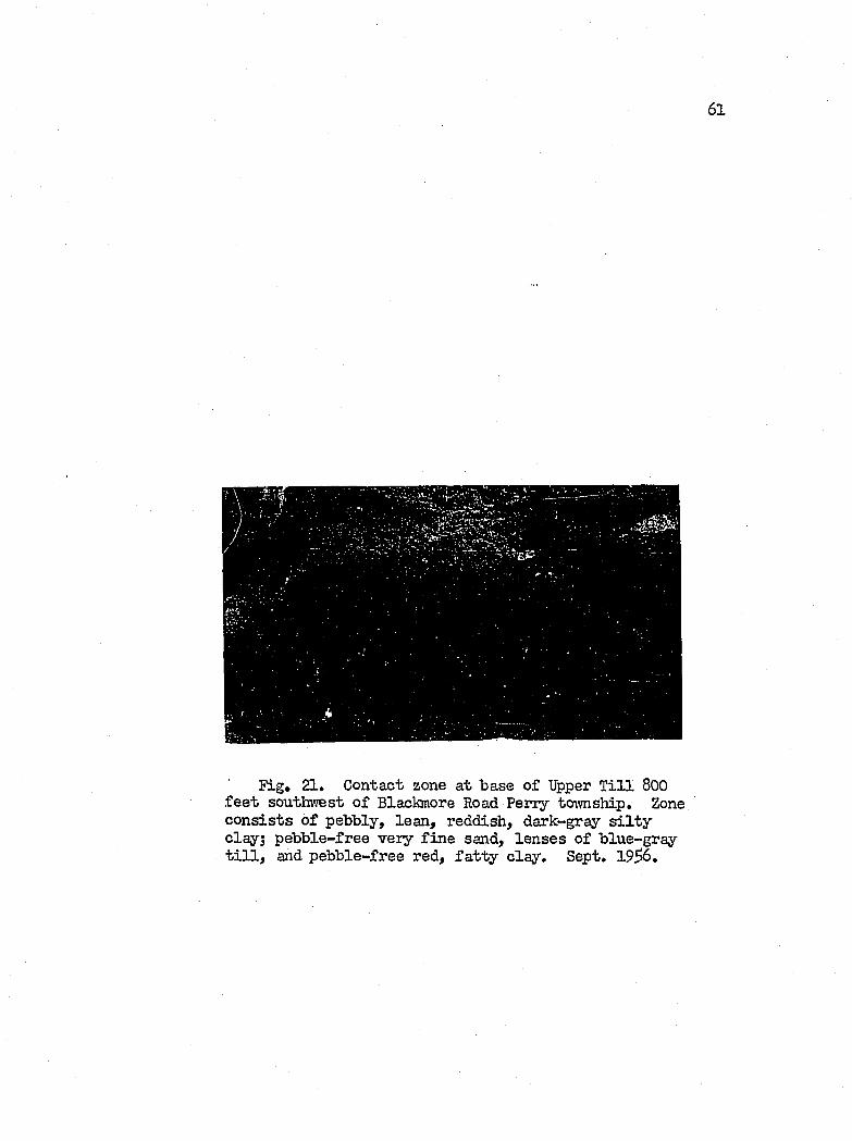
61
Fig, 21» Contact zone at base o f Upper T i l l 800 f e e t southwest o f Blackmore Road P en y township. Zone c o n s is ts o f pebbly, lean , reddish, dark-gray s i l t y clay; peb b le-free very f in e sand, le n se s o f b lue-gray t i l l , and p eb b le-free red, fa t t y c lay . Sept. 19^6,
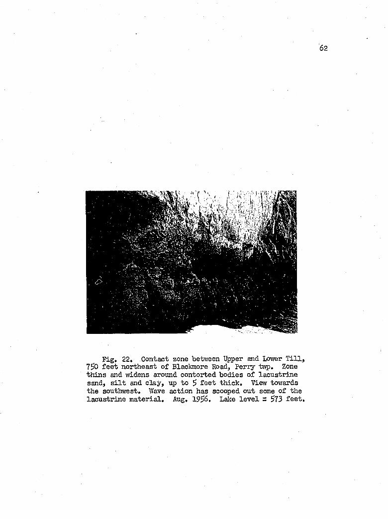
62
F ig . 22, Contact zone betv/een Upper and Ixnver T i l l , 7^0 f e e t northeast o f Blackmore Road, Perry t\vp. Zone th in s and 'widens around contorted bod ies o f la cu str in e sand, s i l t and c la y , up to $ f e e t th ick . View "towards the southvrest, Wave action has scooped out some o f the la cu str in e m ateria l, Aug, 19^6. Lalce le v e l = $73 f e e t .
63
F ig . 23. Boulder pavement on contact between %per and Lower T i l l s . Location - 1,100 f e e t northeast o f Blackmore Road. Aug. 19$6. Water le v e l: ^73 f e e t . Looking northea st . Observe wave nipping a t base o f b lu f f .
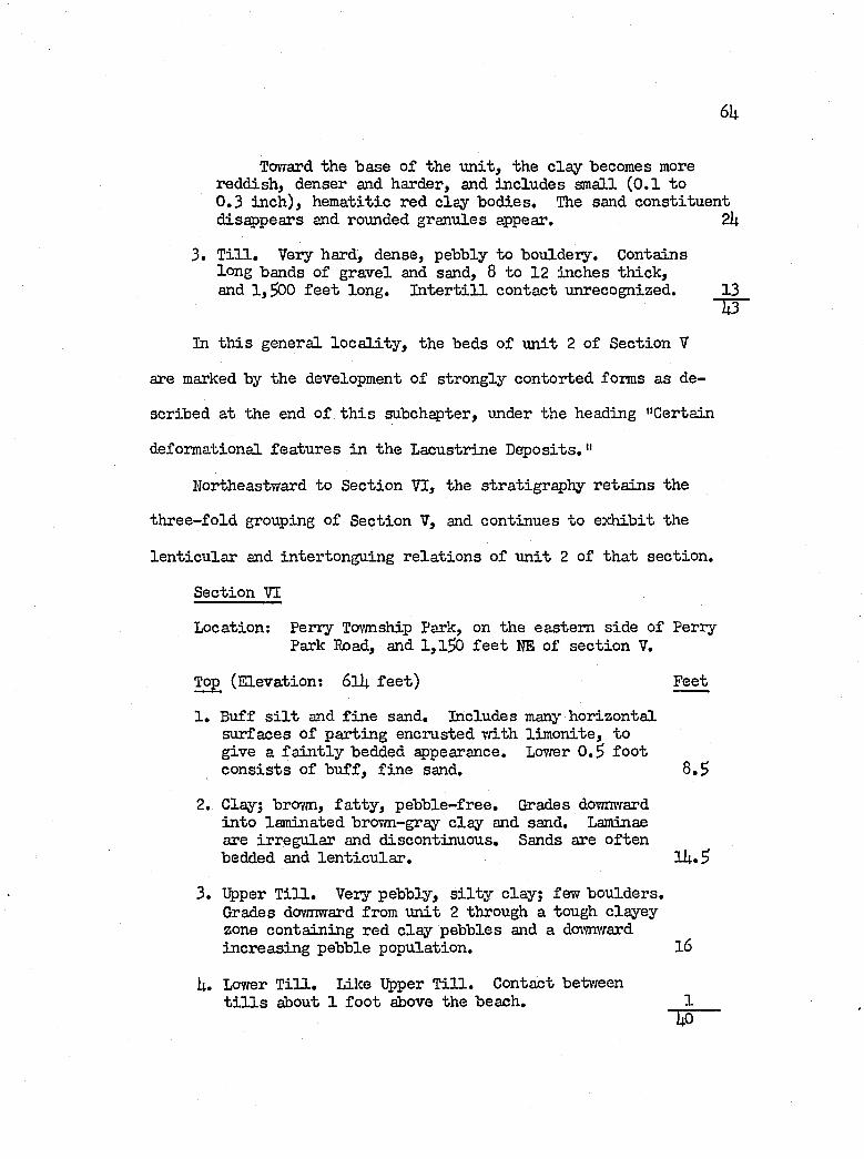
6U
Toward the base o f the u n it , the c la y becomes more reddish, denser and harder, and in clu des small (0 .1 to0 .3 in ch ), hem atitic red c lay bod ies. The sand con stitu en t disappears and rounded granules appear. 2k
3. T i l l . Very hard, dense, pebbly to bouldery. Contains long bands o f gravel and sand, 8 to 12 inches th ick , and 1,500 f e e t long. I n t e r t i l l contact unrecognized. 13
T T
In th is general lo c a l i t y , the beds o f u n it 2 o f Section V
are marked by the development o f strongly contorted forms as de
scribed a t the end o f t h is subchapter, under the heading "Certain
deformational fea tu res in the Lacustrine D e p o sits ."
Northeastward to Section VI, the s tr a t ig r ^ h y r e ta in s the
th ree -fo ld grouping of Section V, and continues to ex h ib it the
le n tic u la r and intertonguing r e la t io n s o f u n it 2 o f th a t section .
Section VI
Location; Perry Tovmship Park, on the eastern side o f Perry Park Road, and 1,1^0 f e e t HE of sec tio n V.
Top (E levation: 6lU fe e t ) Feet
1 . Buff s i l t and f in e sand. Includes many horizon ta l surfaces o f partin g encrusted Tjith lim on ite , to give a f a in t ly bedded appearance. Lower O.S fo o t c o n s is ts o f b u ff, f in e sand. 8 .S
2. Clay; brown, f a t ty , p eb b le-free . Grades downward in to laminated brown-gray c la y and sand. Laminae are irregu lar and discontinuous. Sands are o ften bedded and le n t ic u la r . l 4 .S
3. Upper Tin. Very pebbly, s i l t y c lay; few boulders.Grades downward from u n it 2 through a tough clayey zone contain ing red c la y pebbles and a doi'mward increasin g pebble population. l 6
U. Lower T i l l . Like Upper T i l l . Contact betweent i l l s about 1 fo o t above the beach. 1
"TiO
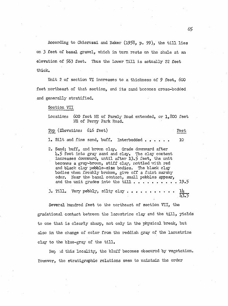
65
According to Chieruzzi and Baker (1958, p . 99), the t i l l l i e s
on 3 f e e t o f basa l gravel, which in turn r e s ts on the shale a t an
e leva tion of 563 f e e t . Thus the Lcnver T i l l i s ac tu a lly 22 fe e t
th ick .
Unit 2 of sec tio n VI in creases to a th iclo iess o f 9 f e e t , 600
f e e t northeast of that sec tio n , and i t s sand becomes cross-bedded
and generally s tr a t if ie d .
Section VII
Location: 600 f e e t I'lE o f Parmly Road extended, or 1,800 f e e tIIS o f Perry Park Road.
Top (E levation: 6l 6 fe e t ) Feet
1 . S i l t and f in e send, b u ff. In terbedded ...................... 10
2. Sand; b u ff, and bro-;m c lay . Grade da/mward a fter U . 5 f e e t in to gray sand and c lay . The c la y content increases dor/nvTard, u n t i l a fter 13.5 f e e t , the u n it becomes a gray-brovm, s t i f f c lay , m ottled w ith red and black c la y p eb b le-size bod ies. Hie black c lay bodies when fr e sh ly broken, give o f f a fa in t marshy odor. Near the b asa l contact, small pebbles appear,and the u n it grades in to the t i l l .......................................... 19 .5
3. T i l l . Very pebbly, s i l t y c lay ..................lUÏ Ï 3 3
Several hundred f e e t to the northeast o f sec tio n VII, the
gradational contact between the lacu str in e c lay and the t i l l , y ie ld s
to one th at i s c le a r ly sharp, not only in the ph ysica l break, but
also in the change of co lor from the reddish gray o f the la cu str in e
c lay to the blue-gray of the t i l l .
Be} id th is lo c a l i t y , the b lu ff becomes obscured by vegeta tion .
Hovrever, the stratigraphie r e la t io n s seem to maintain the order
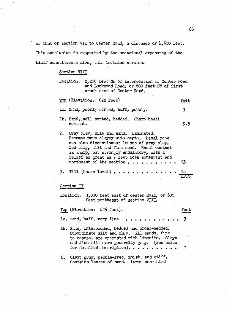
66
o f th at o f section VII to Center Road, a d istance o f U,5>00 fe e t .
This conclusion i s supported by the occasional exposures o f the
b lu ff con stitu en ts along th is is o la te d stretch .
Section VIII
Location; 2,200 f e e t NE o f in ter sec tio n of Center Road and Lockwood Road, or 600 f e e t SVf o f f i r s t creek ea st o f Center Road,
Top (E levation: 622 f e e t ) Feet
l a . Sand, poorly sorted , b u ff, pebbly. 3
lb . Sand, w e ll sorted , bedded. Sharp b asa lcontact, 9 ,5
2. Gray c la y , s i l t and sand. Laminated.Becomes more clayey vrLth depth. B asal zone contains discontinuous le n se s o f gray c lay , red c la y , s i l t and f in e sand. Basal contact i s sharp, but strongly undulatory, v/ith a r e l i e f as great as 7 f e e t both southvrest and northeast o f the sec tio n ...................... . . . . . 23
3. T i l l (beach l e v e l ) ............................................................ ll;
Section IX
Location: 3,000 f e e t e a st o f center Road, or 800f e e t northeast o f section VIII,
Top (E levation: 625 f e e t ) . Feet
la . Sand, b u ff, very f i n e ....................................................... 3
lb . Sand, interbedded, bedded and cross-bedded. Subordinate s i l t and c3a y . A ll sands, f in e to coarse, are encrusted v/ith lim o n ite . Clays and f in e s i l t s are gen era lly gray. (See below fo r d e ta iled d escr ip tio n )............................................... 7
2, Clay; gray, p eb b le-free , m oist, and s t i f f .Contains le n se s o f sand, Lov/er one-th ird
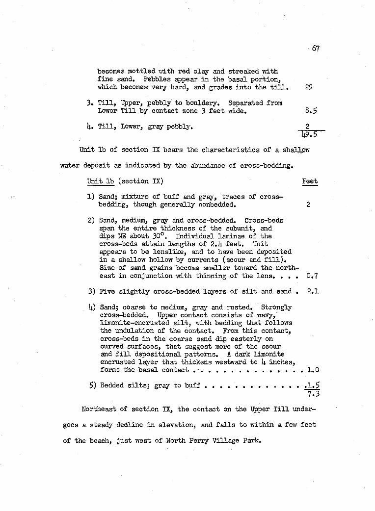
67
becomes m ottled vâth red c la y and streaked vdth f in e sand. Pebbles appear in the b asa l portion ,Tïhich becomes very hard, and grades in to the t i l l , 29
3, T i l l , Upper, pebbly to bouldery. Separated fromLower T i l l by contact zone 3 f e e t wide, 8 ,5
U, T i l l , Lovrer, gray pebbly, 2
Unit lb o f section IX bears the c h a r a c ter is t ic s o f a shallow
water deposit as in d icated by the abundance o f cross-bedding.
Unit lb (sec tio n IX) Feet
1) Sand; mixture of b u ff and gray, tra ces o f c ro ss- bedding, though genera lly nonbedded, 2
2) Sand, medium, gray and cross-bedded. Cross-beds ^ a n the e n tire th ickness o f the subunit, and dips NE about 30°. Individual laminae o f the cross-beds a tta in length s o f 2,U f e e t . Unit appears to be le n s lik e , and to have been deposited in a shallow hollow by currents (scour and f i l l ) .S ize o f sand grains become sm aller toward the northea st in conjunction ivith thinning o f the le n s , , , , 0 ,7
3) Five s l ig h t ly cross-bedded la y ers o f s i l t and sand , 2 ,1
U) Sand; coarse to medium, gray and rusted. Strongly cross-bedded. Upper contact c o n s is ts o f wavy, lim onite-encrusted s i l t , Tfith bedding th at fo llow s the undulation of the contact. From th is contact, cross-beds in the coarse sand dip e a ster ly on curved surfaces, th at suggest more of the scour and f i l l d ep osition a l p attern s, A dark lim onite encrusted la y er th at th ickens westward to I4. inches, forms the b asa l contact ........................................................... 1 ,0
5) Bedded s i l t s ; gray to b u f f ......................................... ..... ,1 ,57 .3
Northeast o f sec tio n IX, the contact on the Upper T i l l under
goes a steady decline in e lev a tio n , and f a l l s to w ith in a few f e e t
o f the beach, ju st w est o f North Perry V illage Park,
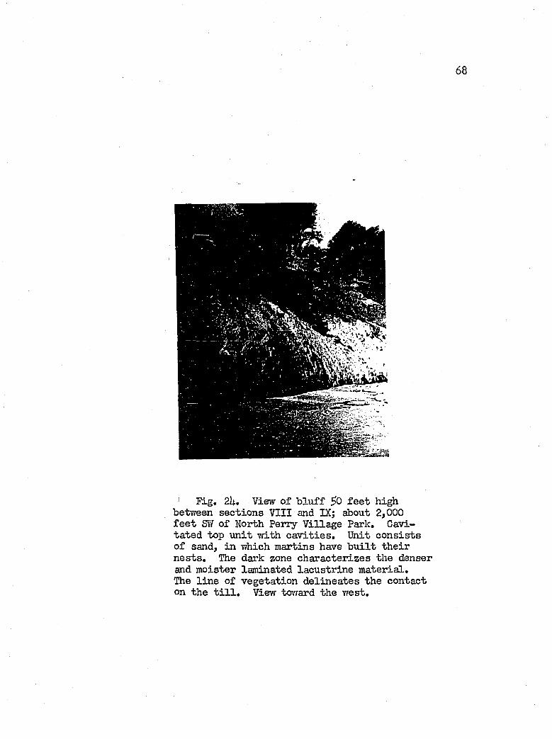
6 8
Fig. 2U. View o f b lu f f ^0 f e e t high between sec tio n s VIII and IX; about 2,000 f e e t SVf o f North Perry V illa g e Park, Cavi- ta ted top u n it w ith c a v it ie s . Unit c o n s is ts o f sand, in which martins have b u i l t th e ir n e s ts . The dark zone ch aracter izes the denser and m oister laminated la cu str in e m ateria l.The l in e o f v eg eta tion d e lin ea tes the contact on the t i l l . View tovrard the vrest.
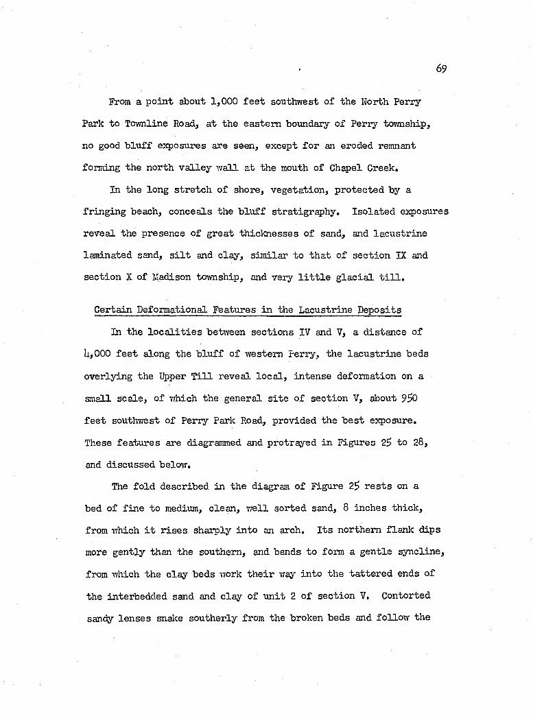
69
From a p o in t about 1,000 f e e t southwest o f the North Perry
Park to Townline Road, a t the eastern boundary o f Perry township,
no good b lu ff exposures are seen, except fo r an eroded remnant
forming the north v a lle y w a ll at the mouth of G h^ el Greek.
In the long stre tch o f shore, vegeta tion , protected by a
fr in g in g beach, conceals the b lu f f stratigraphy. Iso la ted exposures
revea l the presence o f great th ick n esses o f sand, and la cu str in e
laminated sand, s i l t and c lay , sim ilar to th at o f sec tio n IX and
sec tio n X of Madison township, and very l i t t l e g la c ia l t i l l .
Gertain Deformational Features in the Lacustrine D eposits
In the l o c a l i t i e s between sec tio n s IV and V, a d istance of
U,000 f e e t along the b lu f f o f western Perry, the la cu str in e beds
overlying the %per T i l l reveal lo c a l , in ten se deformation on a
small sca le , o f v/hich the general s i t e o f sec tio n V, about 9^0
f e e t southv/est o f Perry Park Road, provided the b e s t exposure.
These fea tu res are diagrammed and protrayed in Figures 25 to 28,
and discussed below.
The fo ld described in the diagram o f Figure 25 r e s t s on a
bed o f f in e to medium, clean , vrell sorted sand, 8 inches th ick ,
from which i t r is e s sharply in to an arch. I t s northern flan k dips
more gen tly than the southern, and bends to form a g en tle syncline,
from which the c la y beds work th e ir way in to the ta ttered ends o f
the interbedded sand and c la y of u n it 2 o f sec tio n V. Gontorted
sandy le n ses snalce southerly from the broken beds and fo llo w the
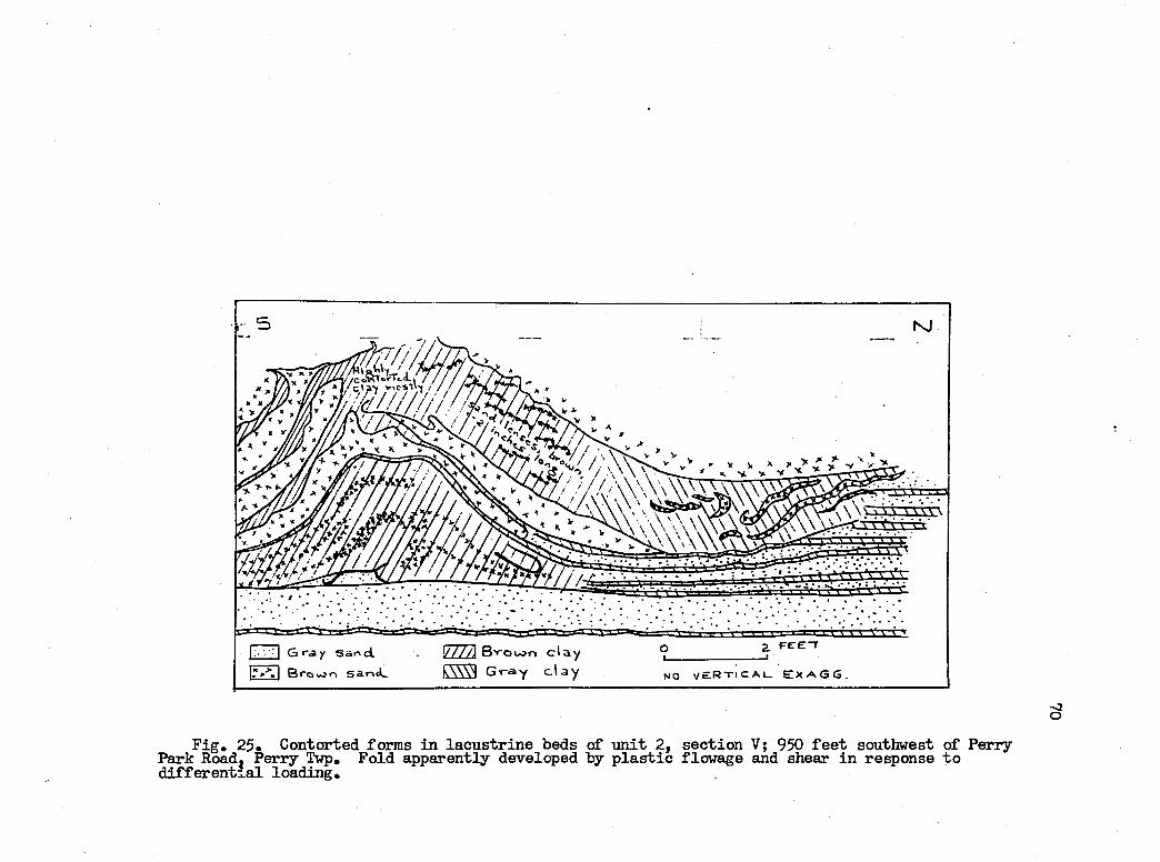
KJ
I////J Bvpoon d a y k\\\N G ray c l ay
] G ra y sand 1 Broiao sar><l_ e x AG G.NO
3
F ig . 25. Contorted forms in la cu str in e beds of u n it 2 , sec tio n V; 950 f e e t southwest of Perry Park Road. Perry Twp. Fold apparently developed by p la s t ic flowage and shear in response to d if fe r e n t ia l load ing.
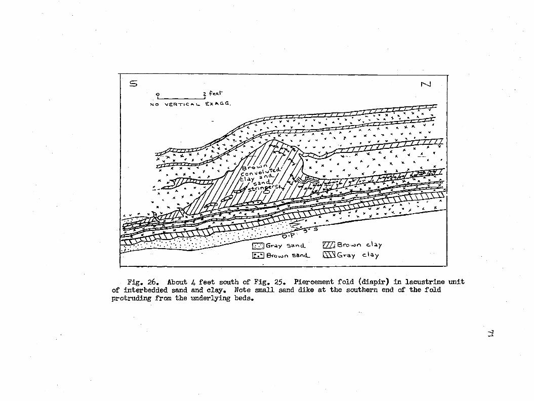
o __________________ Z f t t f
N O V E R T l C ^ l - E X ^ G Q .
|;.'-'.| Gray sand. %//] B ro^o d a yIr»*l & rou jn s a n d _ l \ \N G r a y d a y
F ig , 26, About U f e e t south of F ig , 25. Piercement fo ld (d iap ir) in la cu str in e u n it o f interbedded sand and c la y . Note small sand dike a t th e southern end of the fo ld protruding frœn the underlying beds.
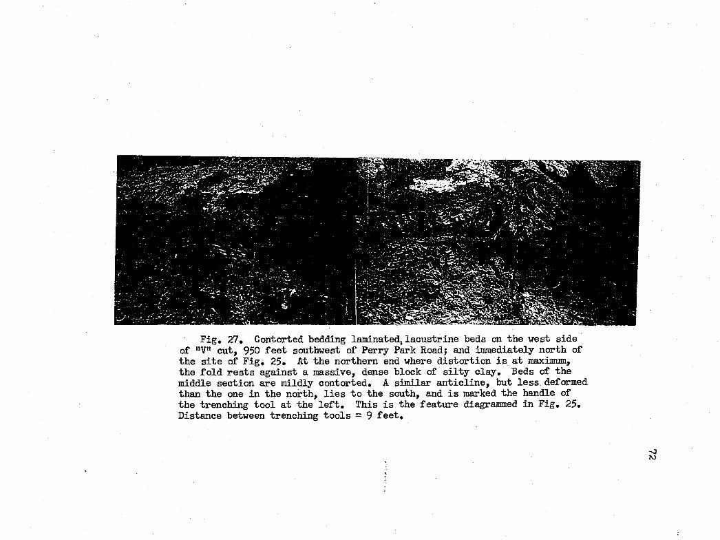
F ig , 27, Contorted bedding laminated, la cu str in e beds on th e west sid e of "V" cu t, 950 f e e t southwest of Perry Park Road; and immediately north of th e s i t e of F ig , 25* At the northern end where d is to r tio n i s a t maximum, the fo ld r e s t s against a m assive, dense block of s i l t y c la y , Beds of the middle section are m ildly contorted, A sim ilar a n t ic l in e , but le s s deformed than the one in the north, l i e s to the south, and i s marked the handle of th e trenching to o l a t the l e f t . This i s the fea tu re diagrammed in F ig , 25, D istance between trenching to o ls = 9 f e e t .
70
73
general curvature o f the syn clin e . On the northern flanlc o f the
a n tic lin e , the array of c lo s e ly im bricated and tvfisted miniature
len ses o f sand becomes leg io n , and assumes a be\’ri.ldering com plexity
on the apex o f the fo ld . Southward, the disorder dim inishes and
the crunpled forms stra ighten in to f l a t beds dipping southerly at
an angle o f 3 to 9 degrees, fo r a d istance of l 5 to 20 f e e t .
Most o f the d is to r tio n i s r e f le c te d by the primary c la y forms.
The disruption o f the interbeds a t the northern end o f the diagram
and the associa ted curled and waved sand str in g ers suggest the
former ex isten ce o f a d is to r tin g force , viiich was probably la rg e ly
congressional and exerted by a load. The body o f the a n t ic lin e
probably represents the s i t e o f le a s t s tr e s s in to which the p la s t ic
c la y members o f the loaded interbeds were squeezed. Involution
of the ends o f the opposing p a irs o f sandy le n se s in the lo\Ter
body o f the a n tic lin e in d ica tes ro ta tio n a l as w e ll as tra n sla tery
movement from d irectio n s both north and south. The e ig h t-in ch
sand u n it beloir, p o ss ib ly because o f a greater competency in a
confined environment, r e s is te d deformation more e f fe c t iv e ly .
About 1$ f e e t to the south o f the a n tic lin e o f Figure 2U oc
curs th at o f Figure 2^. The f l a t but southerly dipping beds of
Figure 2k repeat on a sm aller sca le the behavior o f i t s northern
counterpart. Again, primarj’- d is to r ted forms a tta in g rea test de
velopment on the northern flan k o f the fo ld . Sheared beds are
l e s s in evidence than those o f the more northerly neighbor; and
the a x ia l surface o f the as symétrie a l fo ld t i l t s toward the north.
7U
The penetration o f \ the brorm c la y by the upper part o f the fo ld
suggests diapirism , a behavior assoc ia ted vri.th piercement s a lt
p lu gs. Sand dikes intruded in to the southern flan k o f the fo ld
from the underlying bed in d ica te th at very l i t t l e la te r a l slippage
o f the fo ld has talcen p lace .
Both the fo ld o f Figure 25 and another 9 f e e t north o f i t ,
are shomi in Figure 26. The more northerly fo ld revea ls even greater
deformation than the fo ld o f Figure 25, and apparently grew against
the side o f a massive b lock o f dense, loamy c la y . This block in ter
rupts the normal h orizon ta l d is tr ib u tio n of the laminated beds o f
c la y and s i l t , and apparently had la in , on the f lo o r o f th is p a r ti
cular lake during the period th at the laminated beds vrere deposited.
As shovm in Figure 27, another such block (on the opposite
w a ll o f the cut) had apparently a lso undergone some deformation.
Overlying sand has been in jec te d in to the upper p ortion of the block,
forming a pocket, from wliich tongues o f sand ^ la y in to the body
of the c la y . Likevase, th in la y ers o f sandy m aterial r is e along
the southern margin as i f in response to squeezing. Adjacent to
the block diagrammed l i e s a sim ilar block immediately to the south,
which served as the opposing end o f the v is e between which the loam
o f u n it 1 o f sec tio n V was squeezed. The upper portions of both
blocks revea l some invasion o f the overlying h orizontal m aterial.
Beds restin g on the b lock s, as w e ll as the upper part o f the
blocks them selves, are cut by numerous, la te r a l , lim onite-encrusted
fra ctu res . These discontinuous fractu res even in te r se c t the
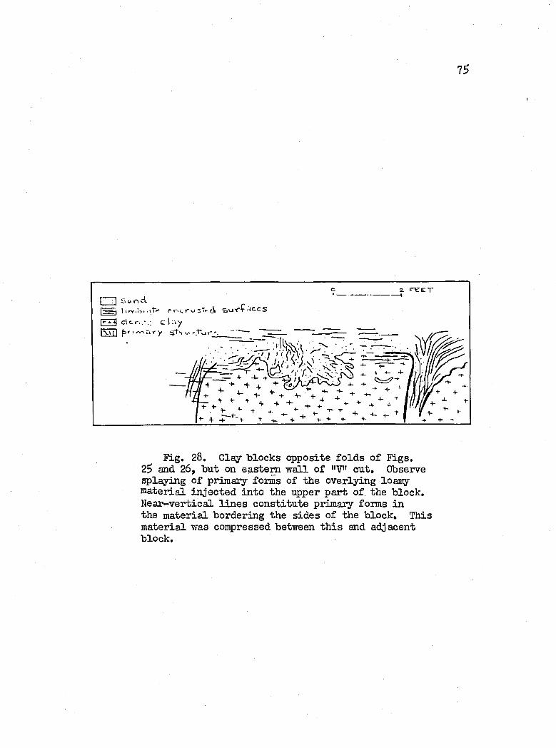
7S
d c - c \ .\y' r,-, 5 V y s t ^ i >-■ rV v
Fig. 28. Clay b locks opposite fo ld s o f F igs.2$ and 26, but on eastern w a ll o f "V" cu t. Observe splaying o f primary forms o f the overlying loamy zia teria l in jec te d in to the upper part o f the block. N ear-vertica l l in e s co n stitu te primary forms in the m aterial bordering the s id es o f the b lock . This m aterial was compressed between th is and adjacent block.
76
n ea r -v ertica l primaiy stru ctu ra l forms, and thus apparently post
date them. The author b e lie v e s th at th ese fractu res represent
surfaces o f pressure r e l i e f ; i . e . , the sediments involved -were
once loaded by a now absent agent.
Thus to summarize, a l l o f the contorted forms d iscussed re
v ea l evidence o f having been forced in to movement and deformed
by a force , a component o f which exercised a southerly th ru sting
e f fe c t on the sediments. Moreover, the presence o f sand dikes
penetrating the disturbed beds ru les out the p ro b a b ility th a t mass
s lid in g of the overlying beds was part of the disturbance. F in a lly ,
the laminated beds dip ^ to 9 degrees toward the south, or in a
d irection opposite th a t expected fo r d ep osition a l d ips in to the
lake basin . Thus i t seems th a t one may a ttr ib u te the deformation
described to d if fe r e n t ia l loading by some agent, probably from the
north, such as a heavy ic e mass. Another probable agent may be
the weight o f the column of g la c ia l lake w ater. In th is s itu a tio n ,
the loading would be equal, but disequilibrium may have been in
duced by unequal response o f the sediments to the s tr e s s imposed.
Madison Township
The b lu f f f a l l s across Madison toi,'mship from an e lev a tio n o f
630 f e e t in the southwest to $90 f e e t in the north east. By fa r
the greater proportion o f i t s con stitu en ts c o n s is ts o f la cu str in e
sand w ith a subordinate amount o f c lay . The contact on the t i l l
remains near la k e - le v e l throughout.
77
Section X
Location: 600 f e e t northeast o f Toivnline Road, a t the •western houndary o f Madison tovmsliip.
Top (E levation: 629 fe e t ) Feet
1. Sand; medium, b u ff and lim o n itic ; f r ia b le , washes and blows rea d ily . Bedded, ivith some lo c a l crossbedding. Beds dip 2 to hP south. Lower 1 .5 f e e t c o n s is t o f gray bedded sand. lÆuch o f the sand i s poorly sorted and ranges from medium to coarse. 31
2. Gray c lay , and le n t ic u la r bodies o f gray s i l t and sand. L ith o log ie8 are bedded, though o ften contorted . Clay i s f a t ty and p eb b le-free . 10
3. Gray c lay , fa t ty and pebbly. M ottled w ith hem atite.Grossly contorted. L atera lly , c la y in clu d es large masses o f reddish, gray, hard, pebbly c lay containing le n tic u la r bod ies o f s i l t and sand. The matrix s p e a r s to be a very p la s t ic t i l l , -which in co ip o- ra tes b locks o f the more ty p ic a lly hard s i l t y t i l l . 13
On the western sid e o f Townline Road, the contact on u n it
3 o f sec tio n X, f a l l s sharply to beach le v e l , and resembles an
erosional contact forming part o f the v a lle y w a ll o f an ancient
Chapel Creek, j^parently, some mass movement on the contact by
overlying lacu str in e m ateria l has taken p la ce , as i s ind icated
by the curved surfaces o f the contorted c la y beds Fig. 29. Below
the contact, a slab o f pebbly t i l l , 17 f e e t long and 3 f e e t th ick
in the middle, i s -v isib le in the fig u re . This slab o f t i l l appar
en tly co n stitu te s a remnant o f the Upper T i l l , since i t i s under
la in by red, p la s t ic c la y , a m aterial th a t c h a r a c te r is t ic a lly occu
p ie s the zone between Upper and Lower T i l l s across adjacent
Perry township.
78
Section XI
Location; I4.OO f e e t southwest o f Haines Road; about ^,100 f e e t northeast o f sec tio n X,
Top (E levation: 62? fe e t ) Feet
1 . Sand, f in e , b u ff. H orizontally bedded. Finer on the Tjhole than th a t in sec tio n X. Upper $f e e t c o n s is t o f poorly sorted , medium sand, 3U
2, Clay, s i l t y , gray. H orizontal la y ers a ltern ate w ith contorted ones, and are va rv elik e , i . e . , l/U to 1 /2 inch th ick , Toivard the base, the c la y becomes l e s s bedded, more massive and redder.Within a few f e e t o f the base, pebbles appear,as do str in g ers o f f in e , gray sand, red c la yle n ses and in c lu sio n s o f t i l l , 18
Toward the northeast the b lu f f lo s e s e lev a tio n at the expense
of u n its 1 and 2 o f sec tio n XI, The ra te o f d ec lin e in e lev a tio n
i s g rea test between Haines and T uttle Park, as shov/n on P late X.
Hence northeastward, no more tliick sand d ep o sits are encountered
in the b lu ff u n t i l one arrives in eastern Ashtabula township. Both
groups o f d ep o sits , v/ith resp ect to th e ir d is tr ib u tio n on the Lake
Plain , have been d iscussed under the chapter t i t l e d "General S tr a t i-
gr^ h y o f the Area,"
From Green Road toward the northeast, the b lu f f m aintains a
height o f 17 to 10 f e e t above the beach, i s m ostly grassy and b u i l t
over, and revea ls only sm all exposures o f the lith o lo g y .
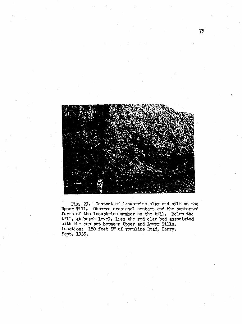
79
Fig. 29. Contact o f la cu str in e c la y and s i l t on the Upper T i l l . Observe erosion a l contact and the contorted forms o f the la cu str in e member on the t i l l . Below the t i l l , at beach le v e l , l i e s the red c la y bed associa ted \vith the contact between Upper and Lov/er T i l l s .Location: 1 ^ f e e t SvY o f Tov/nline Road, Perry.Sept. 19^^.
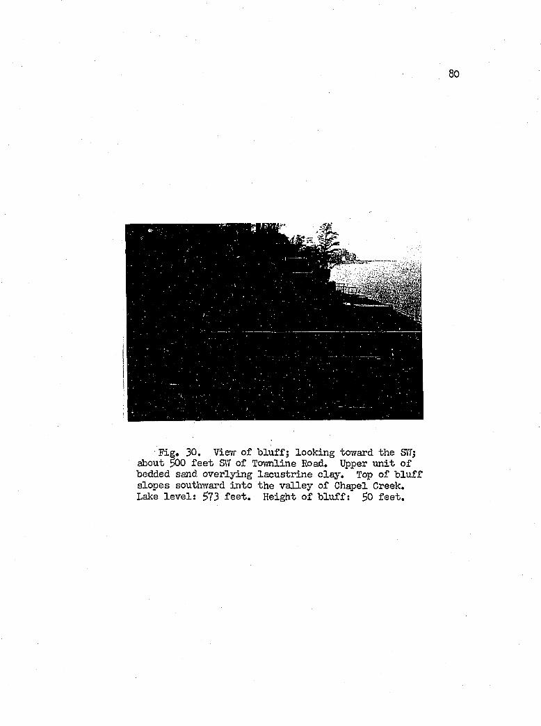
80
• F ig . 30, Vievr o f b lu ff; look ing toiYard the SÏÏ; about 300 f e e t SIT o f To\mline Road, Upper u n it o f bedded sand overly ing la cu str in e c la y . Top o f b lu f f slop es southvfard in to the v a lle y o f Chapel Greek, Lake le v e l; 5?3 f e e t . Height o f b lu ff : ^0 f e e t .
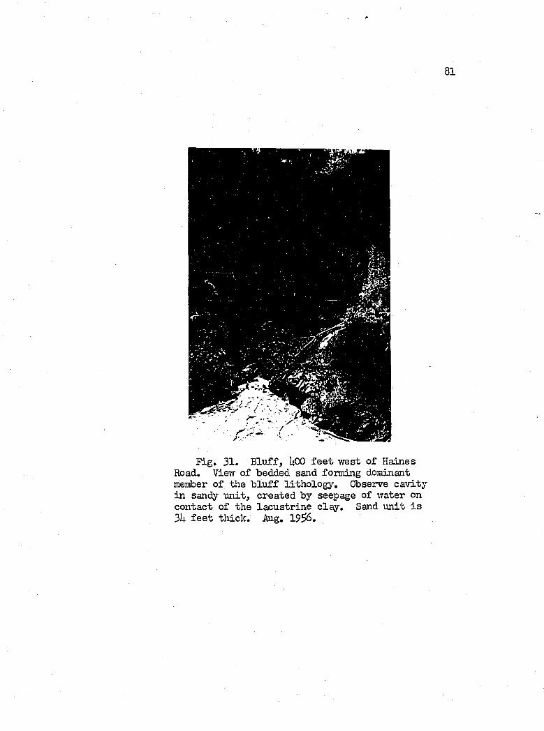
81
F ig , 31. B lu ff , UOO f e e t w est o f Haines Road, View o f bedded sand forming dominant member o f the b lu f f lith o lo g y . Observe ca v ity in sandy u n it , created by seepage of water on contact o f the la cu str in e c la y . Sand u n it i s 3U f e e t th ick , Aug, 1 9 ^ ,
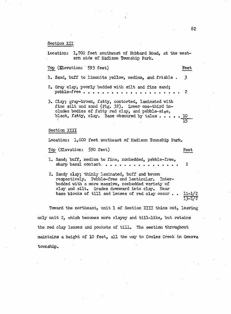
82
S ectio n XII
Location; 1,700 f e e t southvrest o f Hubbard Road, at the w estern sid e o f Madison Tov/nship Park.
Top (E levation: 593 f e e t ) Feet
1 . Sand, buff to lim onite yellow , medium, and fr ia b le . 3
2. Gray c lay , poorly bedded Tvith s i l t and f in e sand; p e b b le - fr e e ........................................................ ..............................2
3 . Clay; gray-brown, fa t ty , contorted, laminated Tfith f in e s i l t and sand (F ig. 32 ). Lovrer one-th ird in cludes bodies o f fa t ty red c lay , and p eb b le -size , black, fa t ty , c la y . Base obscured by ta lu s . . . . . 1 0
! - 53—
Section XIII
Location: 1,600 f e e t southeast o f Madison Township Park,
Top (E levation: 590 f e e t ) Feet
1. Sand; b u ff, medium to f in e , nonbedded, p eb b le-free ,shaip b asa l con tact......................................................................... 2
2. Sandy clay; th in ly laminated, b u ff and brovmresp ec tiv e ly . Pebble-free and le n t ic u la r . Interbedded v/ith a more m assive, nonbedded v a r ie ty o f c la y and s i l t . Grades dovmv/ard in to clas’’. Hear base b locks o f t i l l and le n se s o f red c la y occur . . 11-1/2
13-V 2
Toward the northeast, u n it 1 o f Section XIII th in s out, leav in g
only u n it 2, v/hich becomes more clayey and t i l l - l i l c e , but reta in s
the red c la y len ses and pockets of t i l l . The sec tio n throughout
maintains a height o f 10 f e e t , a l l the way to Cowles Greek in Geneva
tov/nship.
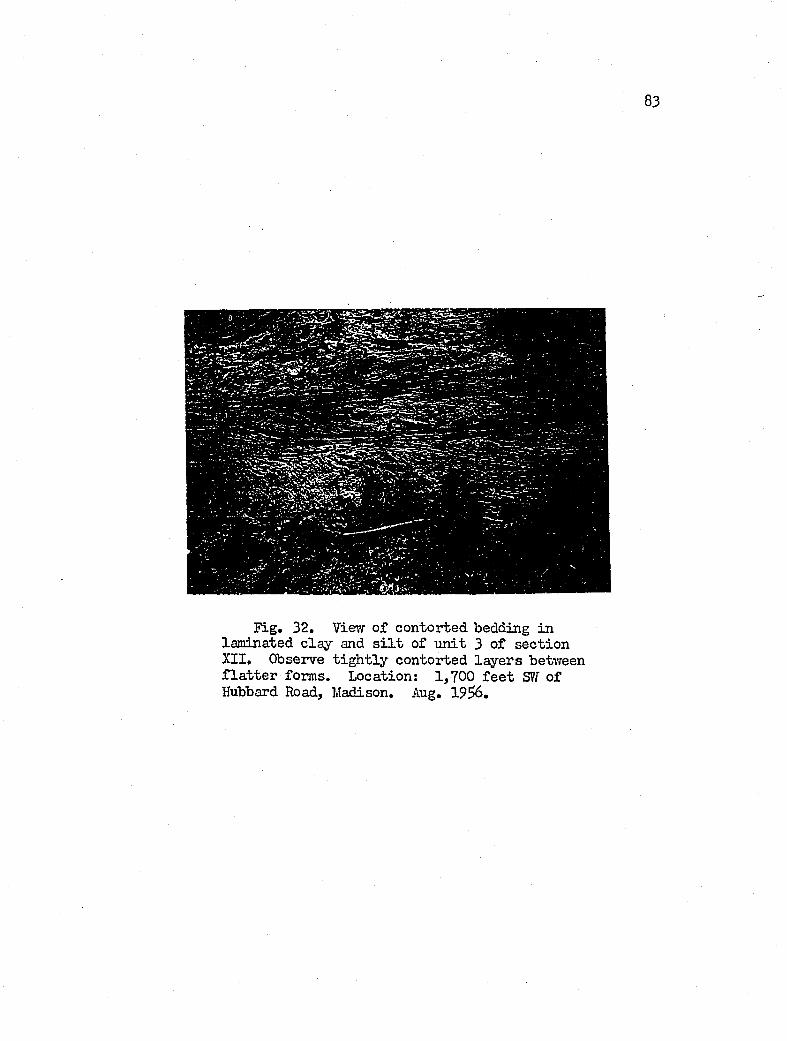
83
Fig. 32, Vievr o f contorted bedding in la mi nated c la y and s i l t o f u n it 3 o f sec tio n XII, Observe t ig h t ly contorted la y e rs between f la t t e r forms. Location; 1 ,700 f e e t S'il o f Hubbard Road, Madison, Aug. 19^6.
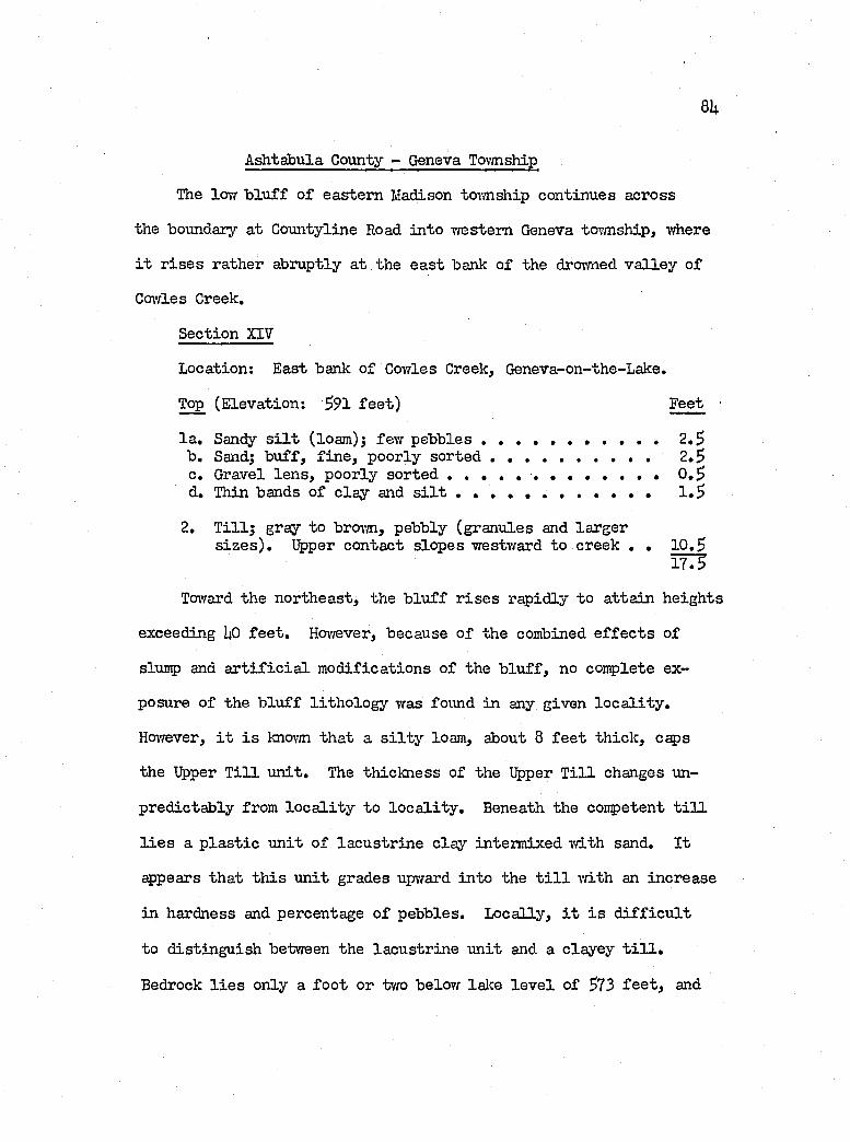
8U
A ^ tàbu la County - Geneva To-vmship
The lovr b lu f f o f eastern Madison tcnmship continues across
the boundary a t Countyline Road in to vrestem Geneva tormship, where
i t r is e s rather abruptly a t the e a st bank o f the droirned v a lle y o f
Cowles Creek,
Section XIY
Location: East bank o f Cowles Creek, Geneva-on-the-Lake.
Top (E levation: 591 fe e t ) Feet •
la . Sandy s i l t (loam); few pebbles ......................2 ,5b . Sand; b u ff, f in e , poorly s o r t e d .................................. . 2 ,5c. Gravel le n s , poorly s o r t e d ................... 0 ,5d. Thin bands o f c la y and s i l t « 1 ,5
2, T i l l ; gray to broim, pebbly (granules and largers iz e s ) . Upper contact slopes westward to creek , , 10 ,5
Ï T 3
Tovrard the north east, the b lu ff r i s e s rap id ly to a tta in heigh ts
exceeding UO f e e t , Hov/ever, because o f the combined e f f e c t s of
slump and a r t i f i c i a l m od ification s o f the b lu f f , no complete ex
posure o f the b lu f f lith o lo g y was found in any given lo c a l i t y ,
Hov/ever, i t i s knovm th at a s i l t y loam, about 8 f e e t th ick , caps
the Upper T i l l u n it . The th ick ness of the Upper T i l l changes un-
pred ictab ly from lo c a l i t y to lo c a l i t y . Beneath the competent t i l l
l i e s a p la s t ic u n it o f la cu str in e c la y interm ixed vriLth sand. I t
cppears th a t th is u n it grades upward in to the t i l l vd.th an increase
in hardness and percentage o f pebbles. L ocally , i t i s d i f f ic u l t
to d istin g u ish between the la cu str in e u n it and a c layey t i l l .
Bedrock l i e s only a fo o t or two belovc lalce le v e l of 573 f e e t , and
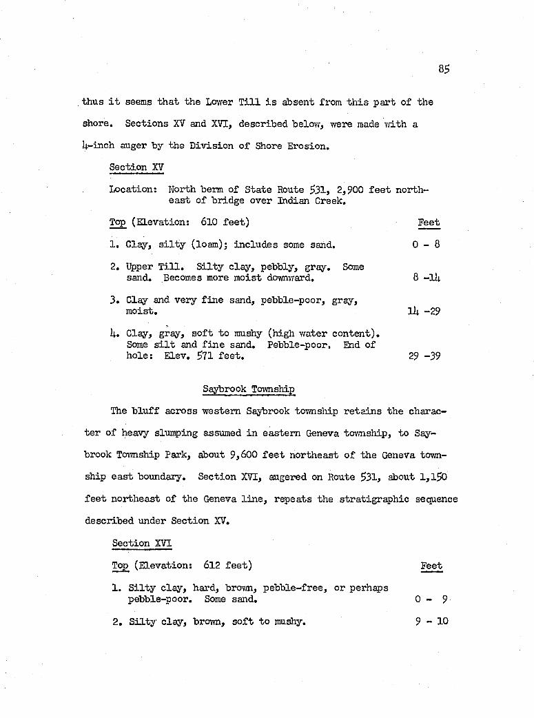
85
thus i t seems th a t the Lower T i l l i s absent from t h is part o f the
shore. Sections XV and XVI, described belov;, trere made vrLth a
U-inch auger by the D iv ision o f Shore Erosion.
Section XV
Location: North berm of S tate Route 531, 2,900 f e e t northea st o f bridge over Indian Creek,
Top (E levation: 6lO fe e t ) Feet
1, Clay, s i l t y (loam); in clu d es some sand. 0 - 8
2, Upper T i l l , S i l t y c la y , pebbly, gray. Somesand. Becomes more m oist dovnivrard, 6 - l l ;
3 , Clay and very f in e sand, pebble-poor, gray,m oist, lU -29
U» Clay, gray, s o f t to mushy (high vrater con ten t).Some s i l t and f in e sand. Pebble-poor, End ofhole: E lev, 571 f e e t , 29 -39
Saybrook Tcrwnship
The b lu f f across western Saybrook townsliip re ta in s the charac
te r o f heavy slumping assumed in eastern Geneva tovmship, to Say
brook Tovmship Park, about 9,600 f e e t northeast o f the Geneva tovm
ship e a st boundary. Section XVI, angered on Route 531, about l , l 5 0
f e e t northeast o f the Geneva l in e , repeats the stra tigrap h ie sequence
described under Section XV,
Section XVI
Top (E levation: 612 f e e t ) Feet
1, S i l t y c la y , hard, brovm, p eb b le-free , or perhaps pebble-poor. Some sand, 0 - 9
2, S i l t y c lay , brown, s o f t to mushy, 9 - 1 0
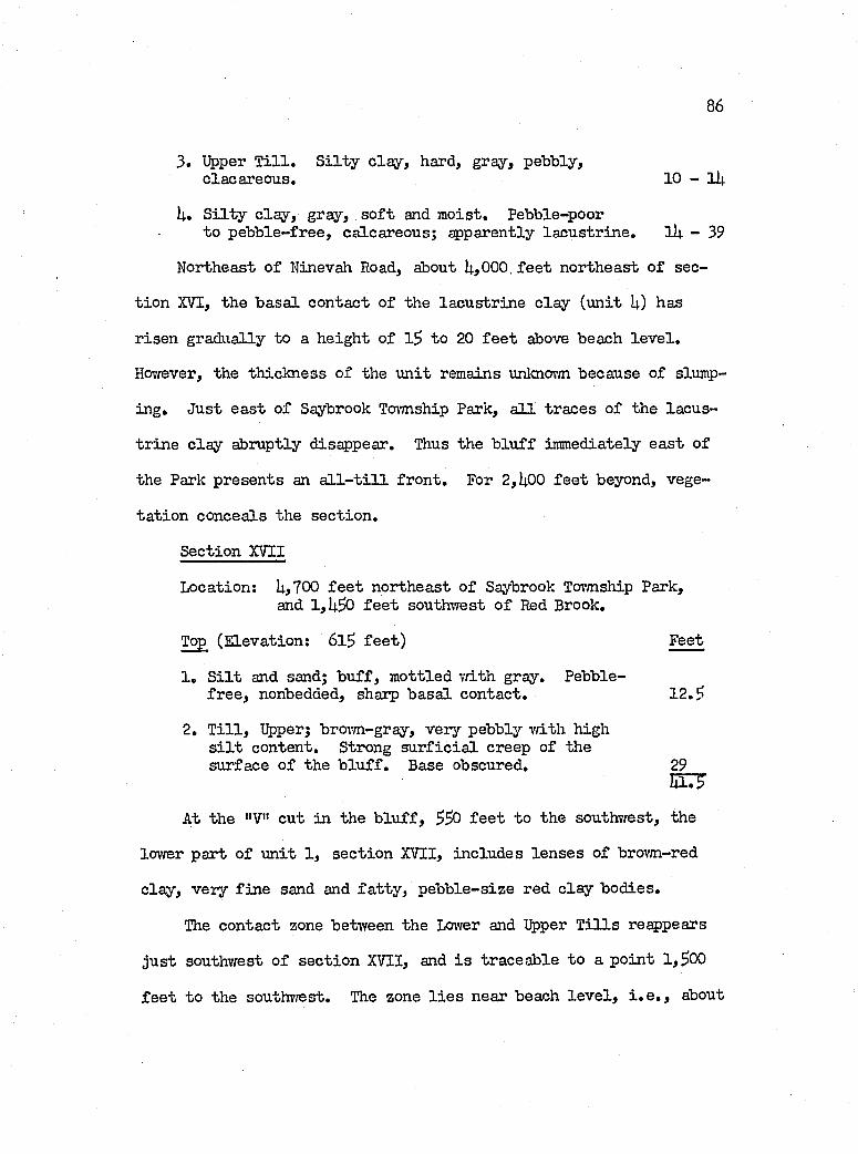
86
3. Upper T i l l . S i l t y c la y , hard, gray, pebbly,clacareous. 1 0 -1 1 +
U. S i l t y c la y , gray, s o f t and m oist. Pebble-poorto p eb b le-free , calcareous; spparently la cu str in e . lU - 39
Northeast o f Ninevah Road, about 1+,Q0G, f e e t northeast o f sec
t io n XVI, the b asa l contact o f the la cu str in e c la y (u n it !+) has
r isen gradually to a h eigh t o f 1$ to 20 f e e t above beach le v e l .
Hoi'fever, the th ick ness o f the u n it remains unknorm because o f slump
ing. Just e a st o f Saybrook Tovmship Park, a l l traces o f the lacu s
tr in e c la y abruptly disappear. Thus the b lu ff immediately e a st o f
the Park presents an a l l - t i l l fro n t. For 2,1+00 f e e t beyond, vege
ta t io n conceals the sec tio n .
Section XVII
Location; l+,700 f e e t northeast o f Saybrook Tovmship Park, and 1 , l+30 f e e t southwest o f Red Brook,
Top (E levation: 6 l5 f e e t ) Feet
1 , S i l t and sand; b u ff , m ottled w ith gray. Pebble-fr e e , nonbedded, sharp b asa l contact. 1 2 .S
2. T i l l , Upper; brown-gray, very pebbly v/ith high s i l t content. Strong s u r f ic ia l creep o f thesurface o f the b lu f f . Base obscured. 29
m3At the "V" cut in the b lu f f , $S0 f e e t to the southwest, the
lower part o f u n it 1, sec tio n XVII, includes le n se s o f brovm-red
c lay , very f in e sand and fa t ty , p eb b le-size red c la y b od ies.
The contact zone between the Lower and %per T i l l s reappears
ju s t southv/est o f sec tio n XVII, and i s traceab le to a p o in t 1,^00
f e e t to the southv/est. The zone l i e s near beach le v e l , i . e . , about
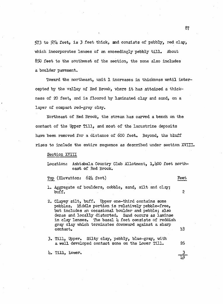
87
^73 to ^7h f e e t , i s 3 f e e t th ick , and c o n s is ts o f pebbly, red c la y ,
ivhich incorporates le n se s o f an exceedingly pebbly t i l l . About
8 ^ f e e t to the southv/est o f the sec tio n , the zone a lso includes
a boulder pavement.
Toward the northeast, u n it 1 in creases in th ick ness u n t i l in ter
cepted by the v a lle y of Red Brook, where i t has a tta ined a th ick
ness o f 20 fe e t , and i s floored by laminated c la y and sand, on a
layer o f compact red-gray clay .
Northeast o f Red Brook, the stream has carved a bench on the
contact o f the Upper T i l l , and most o f the la cu str in e deposits
have been removed fo r a d istance o f 600 f e e t . Beyond, the b lu ff
r is e s to include the en tire sequence as described under sec tio n XVIII.
Section XVIII
Location: Ashtabula Country Club Allotm ent, 1,U00 f e e t northea st o f Red Brook.
Top (E levation: 62U fe e t ) Feet
1 . Aggregate o f boulders, cobble, sand, s i l t and clay; b u ff. 2
2. Clayey s i l t , b u ff . I^per one-th ird contains some pebbles. lÆiddle portion i s r e la t iv e ly p eb b le-free , but includes an occasional boulder and pebble; a lso dense and lo c a l ly d isto rted . Sand occurs as laminae in c lay le n se s . The b asa l U f e e t c o n s is ts o f reddish gray c la y which term inates downv/ard against a sharp contact. l8
3. T i l l , Upper. S i l t y c la y , pebbly, b lue-gray, v/itha w e ll developed contact zone on the Lower T i l l . 26
U. T i l l , Lower. 3h9
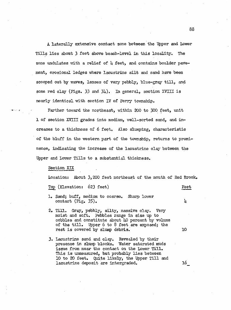
88
A la te r a l ly ex ten sive contact zone between the Upper and Lower
T i l l s l i e s about 3 f e e t above b ea ch -lev e l in th is lo c a l i t y . The
zone undulates vd-th a r e l i e f o f U f e e t , and contains boulder pave
ment, erosion a l led ges vdiere la cu str in e s i l t and sand have been
scooped out by waves, le n se s o f very pebbly, b lue-gray t i l l , and
some red c la y (F igs. 33 and 3U). In general, sec tio n XVIII i s
nearly id e n tic a l w ith sec tio n IV o f perry township.
Farther toward the north east, Tri.thin 200 to 300 f e e t , u n it
1 o f sec tio n XVIII grades in to medium, vrell-sorted sand, and in
creases to a thiclcness o f 6 f e e t . Also slumping, c h a ra cter is tic
o f the b lu ff in the T/estem part o f the tOTmship, returns to promi
nence, in d ica tin g the in crease o f the la cu str in e claj’' between the
Upper and Lovrer T i l l s to a su b sta n tia l th ick n ess.
Section XIX
Location: About 3,200 f e e t northeast o f the mouth o f Red Brook.
Top (E levation: 623 f e e t ) Feet
1. Sand; b u ff, medium to coarse. Sharp lowercontact (F ig . 3$ ). U
2. T i l l . Gray, pebbly, s i l t y , massive c la y . Very m oist and s o f t . Pebbles range in s iz e up to cobbles and co n stitu te about UO percent by volumeo f the t i l l . Upper 6 to 8 f e e t are exposed; ther e s t i s covered by slurp debris. 10
3 . Lacustrine sand and c la y . Revealed by th e ir presence in slurp b lock s. Water saturated muds is su e from near the contact on the Lovrer T i l l .This i s unmeasured, but probably l i e s between10 to 20 f e e t . Quite l ik e ly , the Upper T i l l and la cu str in e d eposit are intergraded. l6
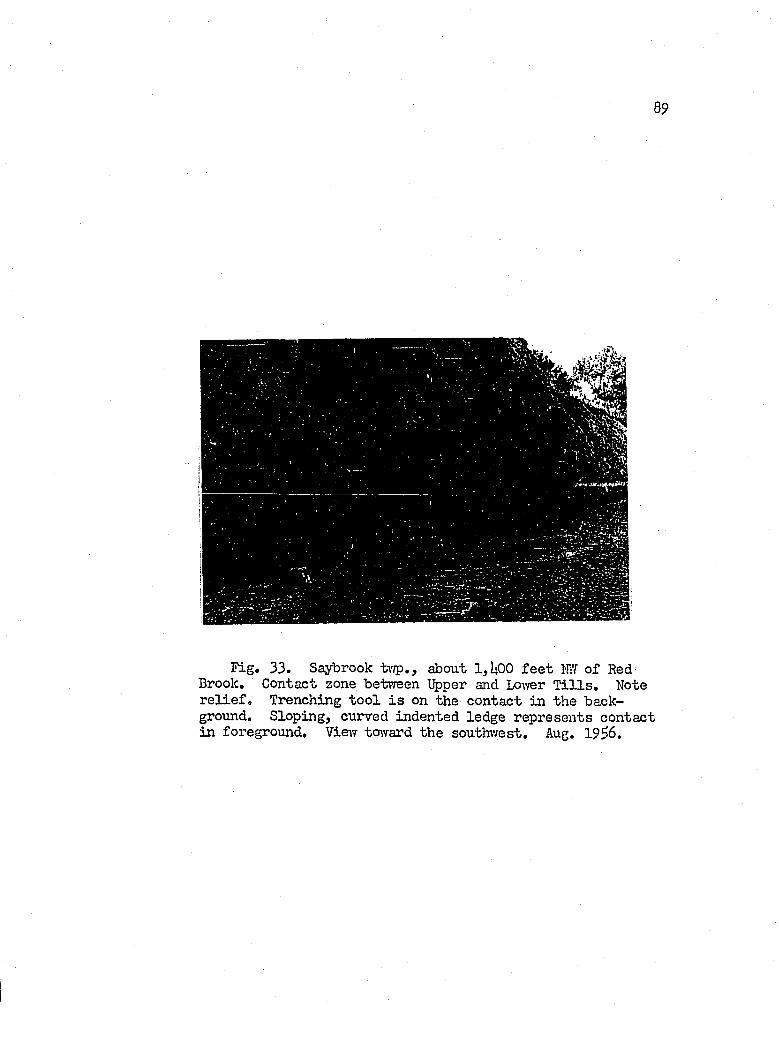
8 9
Fig. 33. Saybrook tv/p., about 1,U00 f e e t KY o f Red Brook. Contact zone between Upper and Lovrer T i l l s . Note r e l i e f . Trenching to o l i s on the contact in the background. Sloping, curved indented ledge represents contact in foreground. Vievf toward the southv/est. Aug. 19^6.
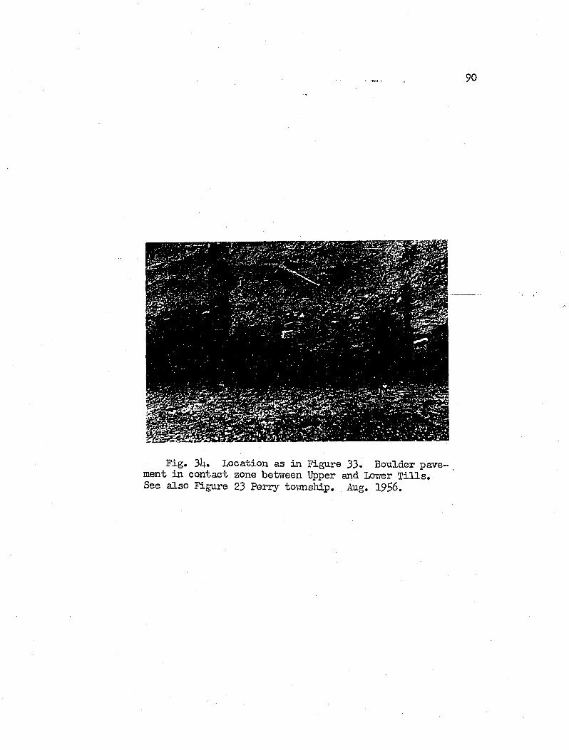
9 0
Fig. 3U. Location as in Figure 33. Boulder pavement in contact zone between Upper and Lcri’rer T i l l s ,See a lso Figure 23 Perry tovaiship. Aug. 19^6.
91
U. T i l l , Lower. Pebbly, s i l t y , hard c lay . 20
About 600 f e e t northeast o f Stowe Road, or about 1,800 fe e t
northeast of section XIX, slumping ends. This change i s re flec ted
in the b lu f f stratigraphy by a r ise in e leva tion o f the lacu str in e
clay contact on the Lower T i l l , a thinning o f the lacu str in e u n it,
and an increase in competency of the Upper T i l l .
Section XX
Location: 1,000 f e e t northeast o f Stowe Road.
Top (E levation: 623 fe e t ) Feet
1. T il l; gray, pebbly, s i l t y c lay . Upper 6 fe e t weathered b u ff, 1$
2. Very fin e sand, s i l t and c lay , gray-brovm to red-brown. Poorly bedded, p eb b le-free. Clay content in creases near lower contact, and becomes dark brovm. Red fa t ty c lay p eb b le-size bodies increase in percentage near lower contact; sand and clay become strongly contorted and compacted, and a few rounded granules appear doi’nrward. 9
3. T i l l , s i l t y c la y , pebbly, hard and m assive. 23h9
This stratigrap h ie sequence remains constant to the tovmship
of Ashtabula.
Section XXI
Location: 3,000 f e e t northeast of sec tio n XX, and1,300 f e e t southwest o f the Ashtabula tovmship l in e .
Top (E levation: 626 fe e t ) Feet
1. T i l l , Upper. Gray, pebbly, s i l t y clay; alsoincludes cobbles and boulders. 2k
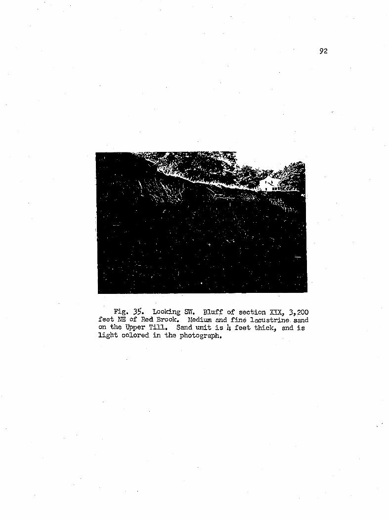
9 2
Fig. 3?. Looking Sil. B lu ff o f sec tio n XIX, 3,200 f e e t NE o f Red Brook, Medium and f in e la cu str in e sand on the %)per T i l l , Sand u n it i s 1| f e e t th ick , and i s l ig h t colored in the photograph.
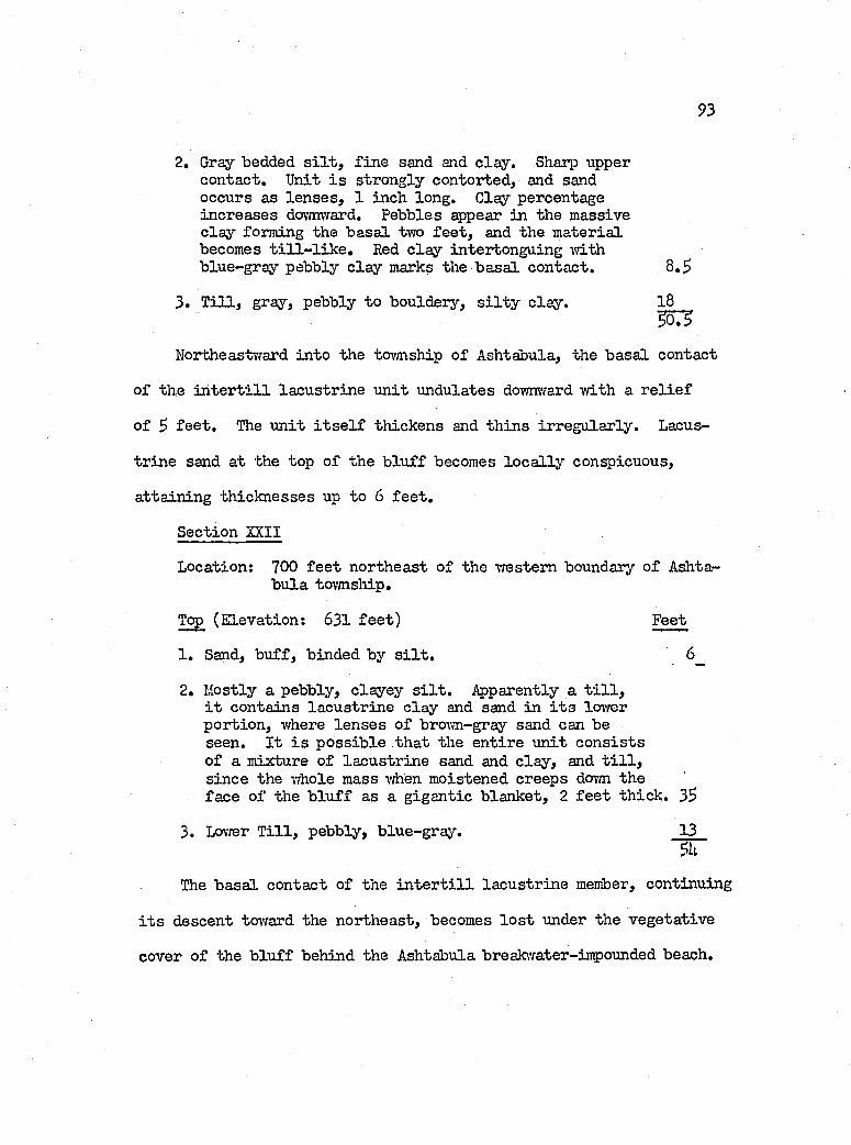
93
2. Gray bedded s i l t , f in e sand and c la y . Sharp upper contact. Unit i s strongly contorted, and sand occurs as le n se s , 1 inch long. Clay percentage in creases dovmward. Pebbles appear in the massive c la y forming the b asa l two fe e t , and the m aterial becomes t i l l - l i k e . Red c la y intertonguing m th blue-gray pebbly c la y marks the b a sa l contact. 8 .5
3 . T i l l , gray, pebbly to bouldery, s i l t y c lay . 18__3Ô3
Northeastward in to the tovmship o f Ashtabula, the b asa l contact
of the i n t e r t i l l la cu str in e u n it undulates downward vri.th a r e l i e f
of 5 f e e t . The u n it i t s e l f th ickens and th in s irreg u la r ly . Lacus
tr in e sand a t the top o f the b lu ff becomes lo c a l ly conspicuous,
a tta in in g th ick n esses up to 6 f e e t .
Section XXII
Location: 700 f e e t northeast o f the western boundary o f Ashtab u la tovmsliip.
Top (E levation: 631 fe e t ) Feet
1 . Sand, b u ff, binded by s i l t . 6_
2. Mostly a pebbly, c layey s i l t , i^ parently a t i l l , i t contains la cu str in e c la y and sand in i t s lovrer p ortion , vrhere le n se s o f brovm-gray sand can be seen. I t i s p o ss ib le th a t the en tire u n it c o n s is ts o f a mixture o f la cu str in e sand and c la y , and t i l l , s in ce the vdiole mass when moistened creeps dorm theface of the b lu f f as a g igan tic b lanket, 2 f e e t th ick . 35
3. Lovrer T i l l , pebbly, b lue-gray. 13
The b asa l contact o f the i n t e r t i l l la cu str in e member, continuing
i t s descent toward the northeast, becomes lo s t under the v eg eta tive
cover o f the b lu ff behind the Ashtabula breakwater-inpounded beach.
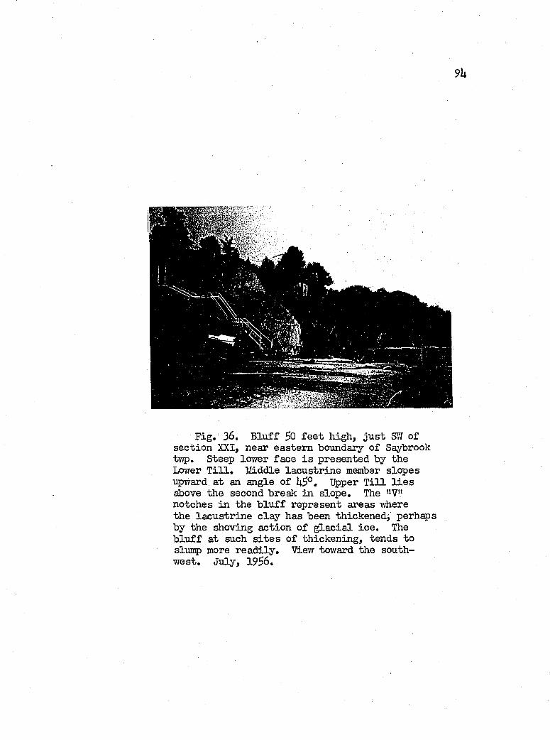
9k
1
F ig , 36. B lu ff So f e e t high , ju s t SÏÏ of sec tio n XXI, near eastern boundary o f Saybrook t ï ç . Steep lovrer fa ce i s presented by the Lovrer T i l l . lÆiddle la cu str in e member slop es upward at an angle o f Upper T i l l l i e sabove the second break in slop e. The "V" notches in the b lu f f represent areas where the la cu str in e c la y has been thickened^ perhaps by the shoving action o f g la c ia l ic e . The b lu f f at such s i t e s o f th icken ing, tends to slmrp more r ea d ily . View toward the southw est, July, I 9S6,
95
mg:F ig , 37. D e ta il o f b lu f f a t s i t e o f
sec tio n XXI, The section shown c o n s is ts o f % per and Lo\'rer T i l l s , and i n t e r t i l l la cu str in e u n it . Trenching to o l i s embedded on the b asa l contact o f the la cu str in e member, Saybrook township.Sept, 1956,
96
Ashtabula Tovmship, Northeast o f the Ashtabula River
Across the breadth o f Ashtabula tovmship, f iv e s tr a t ig r ^ h ic
members, exclu sive o f bedrock, form the b lu f f . These include tvro
t i l l members and an i n t e r t i l l la cu str in e u n it , vfhich are overla in
by la cu str in e laminated c la y s and sand, topped by a sandy lacu s
tr in e member restin g disconformably on the laminated u n it.
The two t i l l members and the i n t e r t i l l la cu str in e u n it are
co rre la tiv e s o f those to the southwest, and th erefore Late Cary
or older in Age. Tlie laminated c la y beds apparently r e s t on a
broad bench swept out on the ipper T i l l by an ancestra l Ashtabula
River, and were probably deposited in Lake Warren or some older
g la c ia l lalce. The sand deposit at the top o f the sec tio n and i t s
basal gravels, ranging in e lev a tio n between 626 and 635 f e e t , pro
bably date back to Lake Grassmere-Lake Lundy tim e.
About 2 m iles o f shore len gth , between the Ashtabula River
and R u ssell Road, 1 ,500 f e e t southwest o f sec tio n XXIII i s not
described in the fo llow in g d escrip tion o f the b lu f f . However,
the vo id has been f i l l e d on the fence diagram of P late XI by the
in ser tio n o f 3 graphic sec tio n s (A, B and C), o f Paul R. Shaffer
(urpub. r e p t . , 19U7).
Section XXIII
Location; Yflieatfieldj 1 ,500 f e e t northeast o f R u ssell Road (extended).
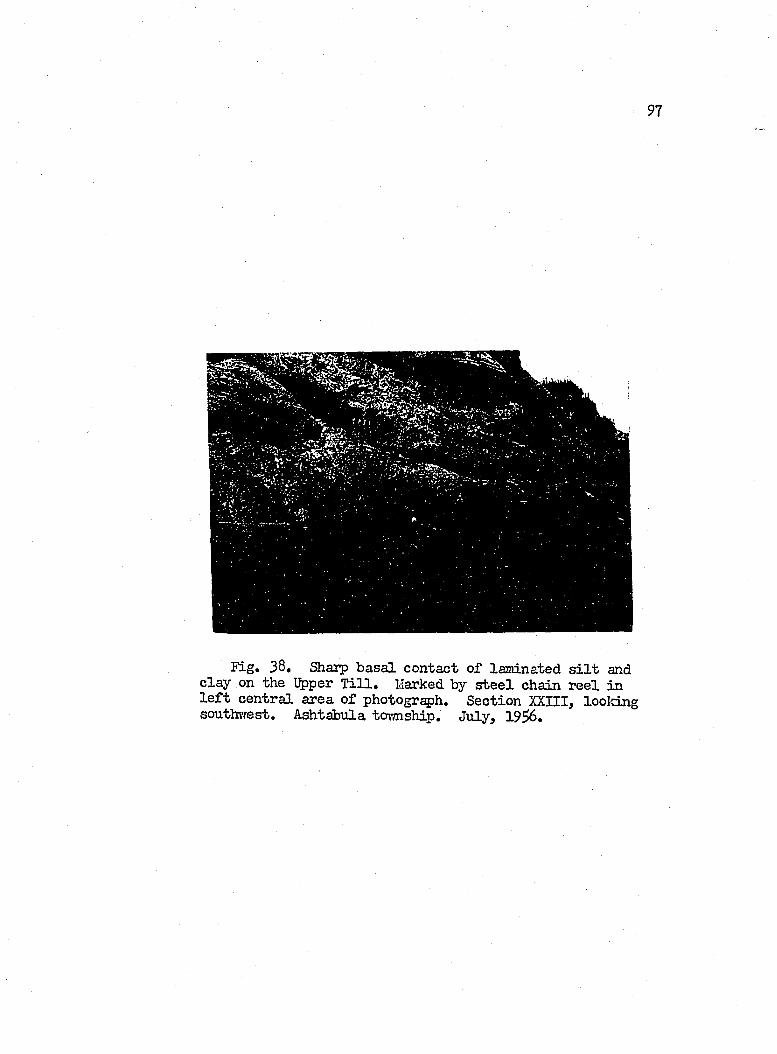
9 7
Fig. 38, Sharp b asa i contact o f laminated s i l t and c la y on the Upper T i l l . Marked by s t e e l chain r e e l in l e f t cen tra l area o f photogr^h . Section XXIII, looking soutln-rest. Ashtabula tovmship. July, 1 9 ^ .
98
Top (E levation; 631 f e e t ) Feet
1. Sand, f in e , lim o n ite -sta in ed , nonbedded, and h eav ily mixed 7/ith s i l t . Floored by 1 fo o t o f b asa l graveland coarse sand. Basal contact disconformable. 3
2. Sand, f in e , interbedded -with c la y . Clay laminae are 1 inch th ick , contorted, dense, and becomes b lu er gray vd-th depth. Tov/ard the w est, the sand interbeds increase to a th ick ness o f 1 fo o t . Contact drarm at seepage zone. 6
3. Laminated b lue-gray, f in e sand and fa t t y c lay .Laminated p a ir i s one to two inches th ick . L ocally contains small red c la y le n se s . Clay u n its become l e s s defined upward. Sand grades out dovmtward, and disappears near b a sa l contact, marked by red c la y p eb b le -s ize bod ies, b lack carbonaceous surfaces, and granules. Sharp b a sa l contact. 12
k» T i l l , T^per. Gray, pebbly, and in clu d es minute s i l t y le n se s . The b asa l contact undulates 2 to 3 f e e t above lake le v e l o f 373 f e e t . The contact zone i s th in , poorly delin eated , and rev ea ls th in ,(2 to 3 inches) sand le n se s , and one fo o t th ick pockets o f gravel binded by blue and red c la y . 33
3. T i l l , Lovrer. Like the Upper T i l l . 23 7 “
Farther to the n orth east, the i n t e r t i l l la cu str in e cla^r returns
to the sec tio n as revealed by sec tio n XXVI»
Section XXTV
Location: 3 ,3Ü0 f e e t e a st o f R u sse ll, or 330 f e e t southvresto f f i r s t stream ea st o f the Cleveland E lec tr ic and Illum inating Company's property.
Top (E levation: 637 fe e t ) Feet
1. Fine sand, b u ff, r e s tin g on 2 f e e t o f gravel and coarse sand. Pebbles are f l a t , rounded on the edges and h o r izo n ta lly aligned . 3 .S
99
2. Sandy s i l t ivith str in gers o f clay; brovm or rust; compact vd-th a fa in t bedding pattern . Clay i s fa t ty and contorted. Sharp b asa l contact markedby springs, 7 .S
3, Dense gray s i l t ; grading below the upper two fe e t in to th in laminated u n its o f gray s i l t and fa t ty gray c lay . Contorted bedding i s p resen t, and the u n it y ie ld s p la s t ic a l ly , and washes rea d ily when saturated. I t i s la rg e ly obscured by slump, and creep m aterial from the overlying u n it and i t s upper portion per se . Clay dominates the b asa l one-th ird , near the bottom o f which, th in , d is continuous, laminae o f red c ls y appear. Basal contact i s sharp, 17
U. T i l l , Upper, Pebbly, b lue-gray, Shaip b asa l contact marked by th in laminae o f f in e lim o n ite - sta ined send, iS
5, S i l t and c lay , b lue-gray, la c u s tr in e . Highly compact and p ebb le-free in the upper one-th ird , i t grades dovmvrard in to an irreg u la r ly bedded p ortion of very f in e sand, end p eb b le-free c lay .The b a sa l zone, (1 to 2 f e e t th ick ), c o n s is tso f pebbly c lay and includes small red -c lay bod ies.B asal contact remains shaip, and i s delin eated by a parting , 6 ,5
6 , T i l l , Lovrer, Pebbly, b lue-gray, 12 ,5
7 , Shale, greenish-gray to b lack , f i s s i l e , jo in ted .Chagrin,
62
Thus from sec tio n s XXIII to XXIV, a d istan ce o f 2,200 fe e t ,
the upper contact o f the Lovrer T i l l , as traced in the b lu f f , r is e s
on an undulating l in e from an e lev a tio n o f 57S f e e t to one o f 587
f e e t . The i n t e r t i l l la cu str in e m aterial, u n it 5 o f sec tio n XXIV,
malces i t s f i r s t appearance at a p o in t a feiv hundred f e e t southwest
of sec tio n XXIV, and In s thickened out o f the m aterial in the con
ta c t zone between the t i l l s o f section XXIII, Hence, northeastward
100
they remain present in the b lu f f , a corre la tab le u n it a l l the vray
to Gonneaut Tovmship Park,
This behavior i s th e eastern counterpart o f th at on the west
ern sid e o f the Ashtabula River, where the contact on the Lower
T i l l s lop es downward toward the Ashtabula River v a lle y , and the
i n t e r t i l l la cu str in e m ateria l le n se s out. The combined r e la t io n
ship thus p resen ts a c ro ss -se c tio n o f vAiat resem bles a g la c ia l
in te r s ta d ia l v a lle y o f the Ashtabula,
Section XXV
Location; 3,U00 f e e t w est o f Labounty Road, or 1,3^0 f e e t ea st o f f i r s t creek e a st o f R u ssell Road,
Top (E levation: 637 f e e t ) . Feet
la . B uff, f in e sand ................................................................. Ub . B uff, f in e sand binded vri-th s i l t ; compact , , « , 3c . Basal gravel zone, mixed w ith sand and s i l t .
Bedded gravel c o n s is ts o f c r y s ta ll in e and sed imentary typ es, are w e ll rounded and polish ed ; and range in s iz e from granules to cobbles.Sharp b asa l contact w ith springs 2
2, Gray s i l t and clay; laminated and banded. Thinlylaminated u n its , 1 to 2 f e e t th ick , and gen era lly contorted, a ltern ate w ith beds o f dense s i l t , 2 to 3 f e e t th ick . These dense s i l t u n its contain whorls o f laminated c la y , 8 to 2k inches in diameter, which v/eather out to leave c a v it ie s in the m atrix.This hab it causes the u n it to co lla p se (F ig , 3 8 ),Sharp b a sa l contact , , , , ............................... 13
3 , Upper T i l l ................................................... 12
U. Lacustrine c la y and s i l t ; h igh ly contorted. Likeu n it S o f sec tio n XX17......................................... 10
Lower T i l l .................................. lU
6, Chagrin sh ale . Jointed: N70°E and N3 * V . . . 3
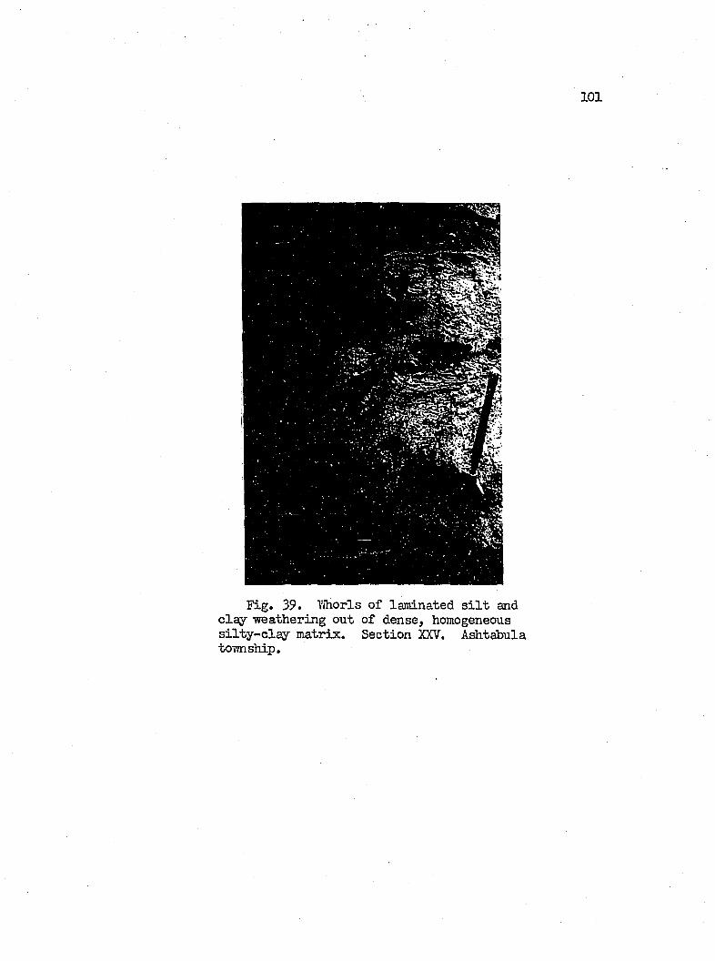
101
Fig. 39. YJhorls o f laminated s i l t and c la y weathering out o f dense, homogeneous s i l t y - c la y m atrix. Section XXV. Ashtabula township.
102
NortheasWard from sec tio n XXIV, the shale outcrop continues
to r is e , becoming, in the process, more e f fe c t iv e as a bulwark against
wave attack on the b lu ff . About oOO fe e t southvrest o f section
XXV, i t a tta in s a maximujn e lev a tio n of ^79 f e e t , or 6 f e e t above
lake le v e l . The shale p resen ts a serrated fro n t to the lal:e as
ou tlin ed by i t s jo in t pattern .
Section XXVI
Location; 2,1^0 f e e t e a st o f f i r s t creek e a st o f R u ssell Road, or 2,6^0 f e e t vrest o f Labounty Road.
Top (E levation: 635> f e e t ) Feet
1 . Sand, lim on ite-sta in ed , very f in e , w e ll sorted and nonbedded. O verlies basa l gravel zone. Sharp b asa l c o n t a c t .................................................................................................... S.S
2. Laminated gray c la y and s i l t , interbedded Vfith two fo o t beds o f very f in e sand. Unit i s l e s s coherent than u n it 2 o f sec tio n XXV, and contains b locks (Ipc5 f e e t ) o f t i l l , embedded in the u n it, which may represent ic e -r a fte d m ateria l. Sharp b asa l contact . l6
3. T i l l . Loiver contact i s debris c o v e r e d .................................18
U. S i l t and c lay , la c u s t r in e . A pparently y ie ld in g p l a s t i c a l l y under th e vreight o f the o v erly in g m a t e r i a l ........................................................................................... 6
5. T i l l , Low er.................................................................................. l5
6 . Chagrin s h a l e ............................................................................. 16 1 .S
northeast o f sec tio n XXVI, u n it 2 th in s against a r is in g t i l l
contact a fter a continuous ezqposure of more than a m ile . I t docs
not return to the sec tio n as a. s ig n if ic a n t member u n t i l Gonneaut
tovmship i s approached from eastern Ivingsville township.
103
S ection XXVII
Location: 2,100 f e e t vjest o f Labounty Road, and $00 f e e tnortheast o f section XXVI.
Top (E levation: 633 fe e t ) Feet
1. Fine sand, b u ff, grading .do\’/mvard in to a loamm ottled brcnm and gray , , . . .............................. 2
2, Clay, gray to brovm; becoming t i l l - l i k e dovmrard.Pinches out 300 f e e t to the northeast. I t i s the equivalent o f u n it 2 o f section TlT L ..................... U
3. Upper T i l l . Leaver 6 f e e t has slumped h eavily , and appear to raovb on shear p lanes p a r a lle l tothe slope (3 0 °), and on which are found th in layers of s i l t and sand, including lim on ite-sta in ed sand, which suggests the dovmward p erco la tion o f ground water through the fra ctu res . I t i s probable that th is lower portion of the t i l l , has incorporated v/itliin i t , a part o f the underlying lacu str in e s i l t and c la y . Lovrer contact u n lo c a te d ........................... 32
U. Pebble-free c la y and s i l t ; la cu str in e . Stronglycontorted. Contacts not located ................................ 6
$. T i l l , L ow er......................................................................... 1$
Tor,yard the northeast, about 600 f e e t , the i n t e r t i l l lacu str in e
m aterial th ickens to 1$ fe e t ; and the topography featu res creep
and flowage in the i n t e r t i l l la cu str in e m aterial, and slump in the
overlying t i l l . The upper contact o f the lovrer t i l l l i e s 23 fe e t
above the beach.
Section XXVIII
Location: 200 f e e t w est o f Laboimty Road.
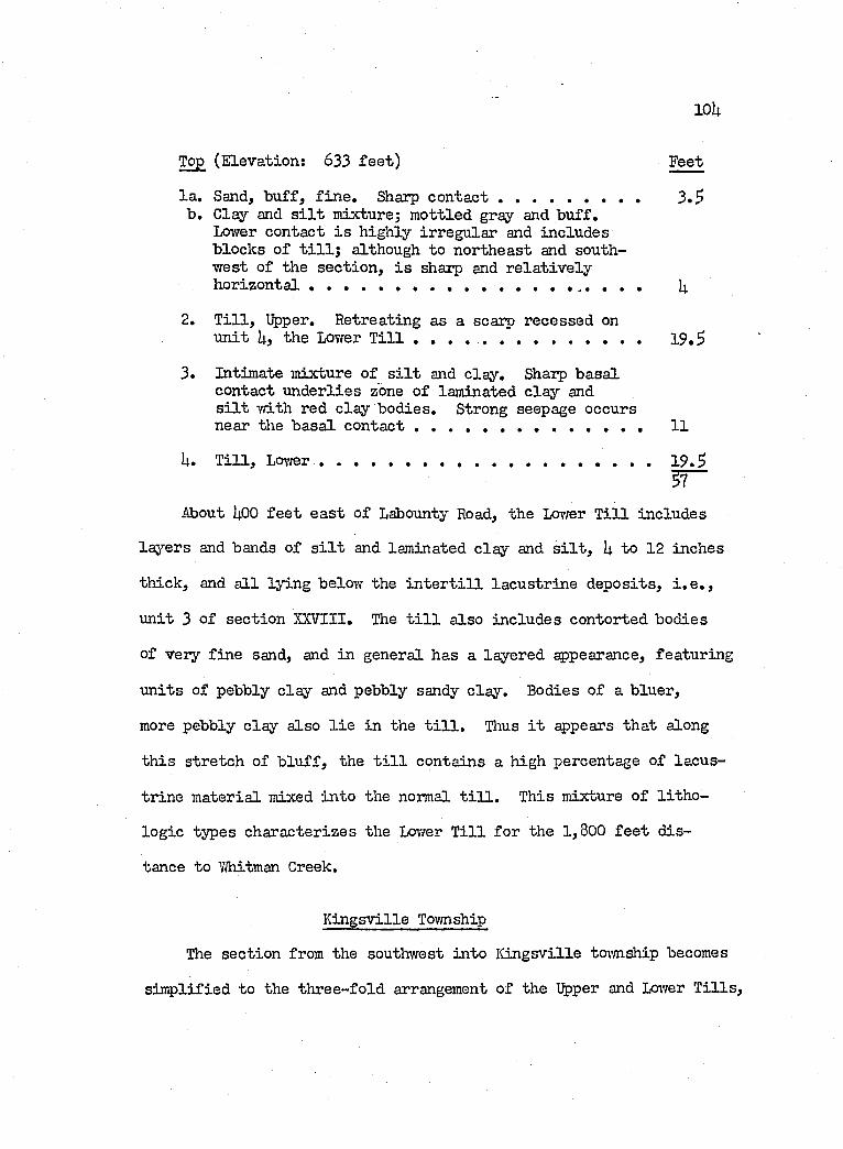
loU
Top (E levation: 633 f e e t ) Feet
la . Sand, b u ff, f in e . Sharp contact ................................... 3*5b . Clay and s i l t mixture; m ottled gray and b u ff.
Lower contact i s h igh ly irregu lar and includes blocks o f t i l l ; although to northeast and southw est o f the sec tio n , i s sharp and r e la t iv e ly h orizon ta l , ........................................................ .... , . , I4
2. T i l l , Upper, Retreating as a scarp recessed onu n it Uj the Lower T i l l ........................................................ 19 ,3
3, Intimate mixture o f s i l t and c lay . Sharp b asa lcontact u n d erlies zone o f laminated c la y and s i l t w ith red c lay bod ies. Strong seepage occursnear the b asa l c o n t a c t ....................................................... 11
U. T i l l , LoTfer.......................................................................................19 ,3
About I4.OO f e e t e a st o f Labounty Road, the Lovrer T i l l includes
la y ers and bands of s i l t and laminated c la y and s i l t , I4. to 12 inches
th ick , and a l l ly in g below the i n t e r t i l l la cu str in e d ep osits , i , e , ,
u n it 3 o f section XXVIII, The t i l l a lso inclu des contorted bodies
of very f in e sand, and in general has a layered appearance, featuring
u n its of pebbly c lay and pebbly sandy c lay . Bodies o f a b luer,
more pebbly c la y also l i e in the t i l l . Thus i t appears th at along
th is stretch of b lu f f , the t i l l contains a high percentage of lacus
tr in e m aterial mixed in to the normal t i l l . This mixture o f l i t h o
lo g ie types characterizes the Lovrer T i l l fo r the 1,800 f e e t d is
tance to 7/hitman Creek.
K in gsv ille Tovmship
The sec tio n from the southwest in to K in gsv ille tovmship becomes
s im p lified to the th ree -fo ld arrangement o f the Upper and Lower T i l l s ,
10$
separated by 20 to 30 f e e t o f la cu str in e m ateria l. However, on
the eastern side o f the Y/hitman Greek v a lle y the i n t e r t i l l lacu s
tr in e u n it , there 33 f e e t th ick , was d issec ted to a depth o f 18
f e e t and a vri-dth o f a t l e a s t 2,000 f e e t , by an an cestra l stream
of Y/hitman Creek, the v a lle y o f which was la te r f i l l e d w ith f in e
sand and covered by the Upper T i l l .
About 2,^00 f e e t northeast o f IVhitman Creek, three t i l l u n its
are present in the sec tio n , each separated by a la cu str in e u n it .
The author b e lie v e s th a t the uppermost o f th ese t i l l u n its le n se s
in to and out o f the sec tio n ivith in a d istan ce o f $,000 to 6,000
f e e t and i s apparently a la t e r phase o f the ic e advance th at de
p o sited the c h a r a cter is tic Upper T i l l .
A la cu str in e le n s subjacent to the Uppermost T i l l , and restin g
on the Upper T i l l , i s regarded as a shallow? v a lle y f i l l i n g o f another
an cestra l v a lle y , subsequent to th at described fo r Y/hitman Creek
above.
In the northeastern on e-th ird of the toi’msliip, a r e la t iv e ly
th ick sec tio n o f sand and subordinate lam inated c la y , returns to
the b lu f f , and th ickens northeastward on the fa l l in g contact o f
the Upper T i l l .
Section XXIX (F ig . UO)
Location; 700 f e e t northeast o f Y/hitman Creek at the Kingsv i l l e township w est boundary.
Top (E levation; 632 f e e t ) Feet
1. T i l l , Upper. B uff, s i l t y clay; s l ig h t ly beddedappearance, pebbly to cobbly. Sharp b asa l contact. 12
106
2. Gray sand, f in e ; some cross-beds, but m ostly massive and fr ia b le . Thins 300 tovyard the northea st by a r is in g basa l contact. 17.2
3. Laminated c lay and s i l t , gray. Clay la y ers in crease in th ickness from one-h alf inch near the top to m ostly c la y near the b asa l contact. There i t includes la y ers o f red and gray c la y w ith f in e pebbles, 7
U. T i l l , Lovrer. B lue-gray, s i l t y c lay . 20
Unit 2, as mentioned prev iou sly , represents a v a lle y f i l l i n g
of an an cestra l Y,hitman Greek v a lle y that vras cut in to u n it 3, o f
the sec tio n above.
i^proxim ately, 1,000 f e e t east o f Vhitman Creek, or 300 f e e t
northeast o f sec tio n XXIX, u n it 3 inclu des la rg e , dense, len ses
of s i l t , in tegrated in to the laminated c lay , s i l t and sand. Simi
la r blocks appear in the sec tio n s o f eastern Perry tovmsliip v/ithin
the laminated la cu str in e m aterial overlying the Upper T i l l . They
probably developed as a r e su lt o f a non-uniform d istr ib u tio n of
sediments over the bottom of the lake, since laminated la y ers are
observed to grade in to the margins o f these massive forms.
Toward the northeast, u n it 2 o f sec tio n XXX th in s against
the r is in g contact o f u n it 3, u n t i l about 900 f e e t from the section ,
i t becomes only 2 f e e t th ick ( f ig . U l). On the other hand, u n it
3 expands to 33 f e e t . The Upper T i l l a lso th in s to 2 f e e t , where
as the Lovrer T i l l remains at 17 fe e t .
107
î l g . I4.O. Looking south a t sec tio n XXIX. Upper T i l l 7 f e e t th ick o v e r lie s the pock marked sand u n it . Portion o f b lu f f covered by the clumps o f grass, represents the laminated c la y and s i l t u n it . The Lovrer T i l l in the foreground i s a bench former. K in gsv ille toivnship. June, 1957.
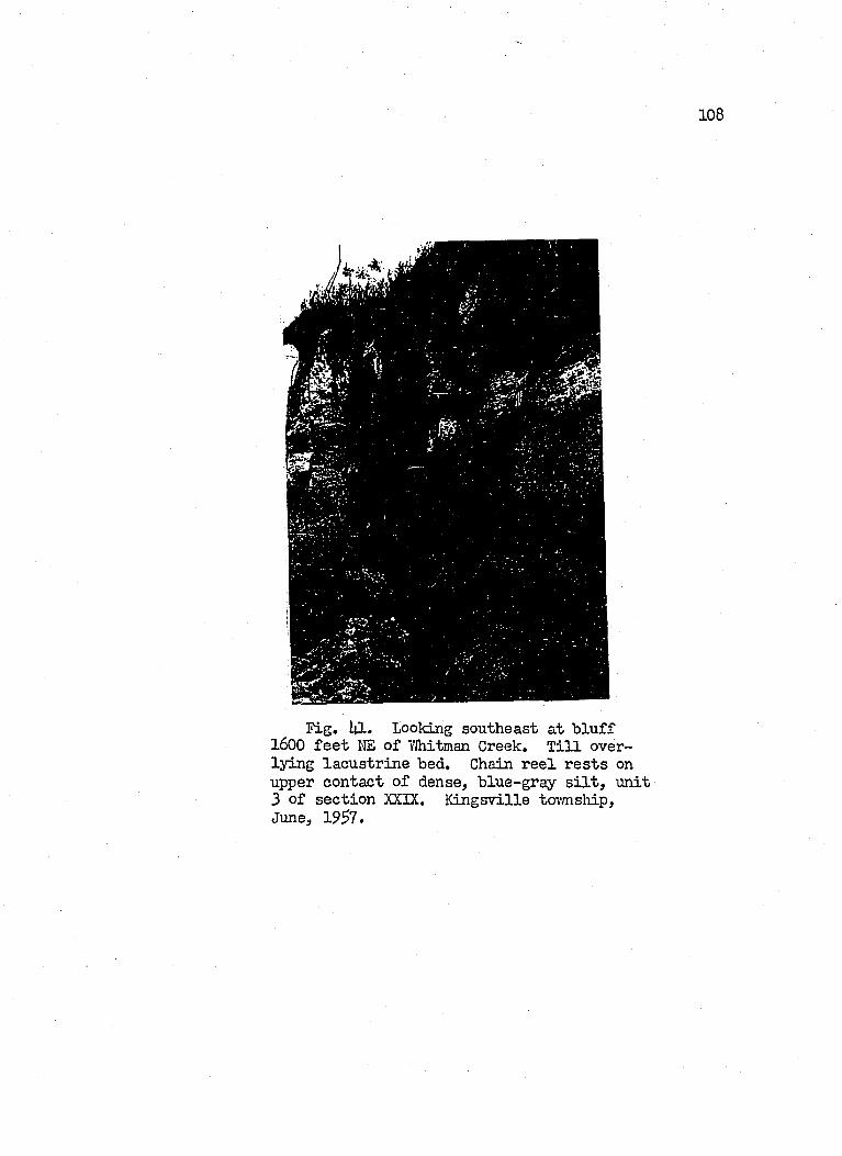
108
■. •
F ig . I4I. Looking southeast a t b lu ff 1600 f e e t I'lE o f VJhitman Creek, T i l l over- ly in g la cu str in e bed. Chain r e e l r e s ts on upper contact o f dense, b lue-gray s i l t , u n it 3 of sec tio n XXIX, K in gsv ille tovmsliip, June, 19^7 .
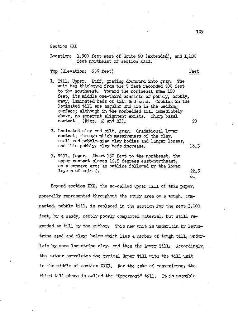
109
Section XXX
Location; 1,900 f e e t west o f Route 90 (extended), and 1,U00 f e e t northeast o f sec tio n XXIX,
Top (E levation: 63^ f e e t ) Feet
1. T i l l , Upper, B uff, grading dovmward in to gray. The u n it has thickened from the 5 f e e t recorded 200 fe e t to the southvrest. Toward the northeast some 100 f e e t , i t s middle one-th ird c o n s is ts o f pebbly, cobbly, wavy, laminated beds o f t i l l and sand. Cobbles in the laminated t i l l are angular and l i e in the bedding surface; although in the nonbedded t i l l immediately above, no apparent alignment e x is t s . Sharp b asa l contact. (F igs. U2 and U3), 20
2. Laminated c la y and s i l t , gray. Gradational lovrer contact, through which m assiveness o f the c lay , small red p eb b le-size c la y bodies and larger le n ses ,and th in pebbly, c la y beds increase. 1 8 .S
3. T i l l , Lower, About 1$0 f e e t to the northeast, the upper contact slop es 1 2 , degrees east-n orth east, on a concave arc; an o u tlin e follow ed by the lovrer la y ers o f urdt 2, 22.2
61
Beyond sec tio n XXX, the so -c a lled Upper T i l l of th is paper,
gen era lly represented throughout the study area by a tough, com
pacted, pebbly t i l l , i s replaced in the section fo r the next 3,000
f e e t , by a sandy, pebbly poorly compacted m ateria l, but s t i l l re
garded as t i l l by the author. This nevf u n it i s underlain by lacu s
tr in e sand and clay; below which l i e s a member o f tough t i l l , under
la in by more la cu str in e c la y , and then the Lovrer T i l l , Accordingly,
the author co rre la tes the ty p ic a l Upper T i l l v/ith the t i l l u n it
in the middle of sec tio n XXXI. For the salee o f convenience, the
th ird t i l l phase i s c a lle d the "Uppermost" t i l l . I t i s p o ssib le
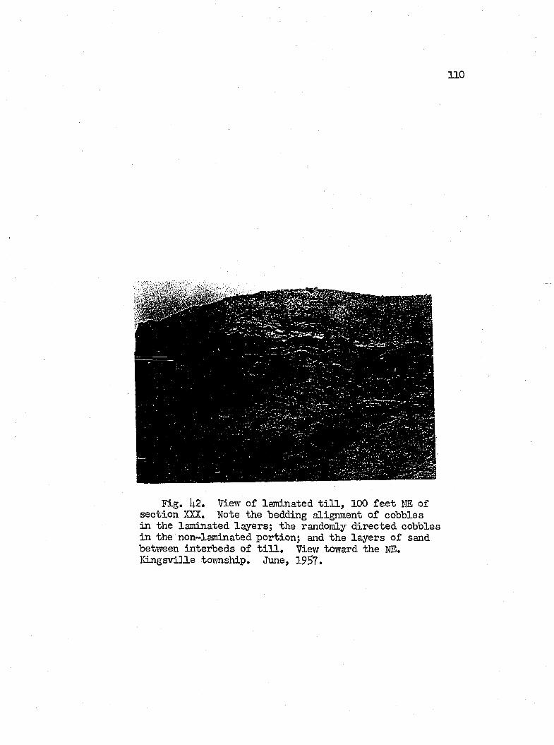
1 1 0
F ig . I|.2. View o f laminated t i l l , 100 f e e t I>IE of sec tio n XXX, Note the bedding alignment o f cobbles in the lam inated la y ers; the randomly d irected cobbles in the non-laminated portion; and the la y ers o f sand betvreen in terbeds o f t i l l . View toward the NE. Iîingsvi]l.e tovmship. June, 1957.
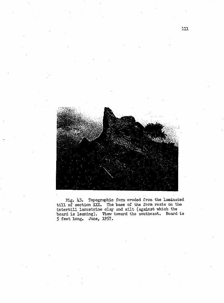
I l l
Fig. U3. Topogr^hic form eroded from the laminated t i l l o f sec tio n XXX. The hase o f the form r e s ts on the i n t e r t i l l la cu str in e c la y and s i l t (aga in st which the hoard i s lea n in g ). Vievf tovrard the southeast. Board i s $ f e e t lon g . June, 1957.
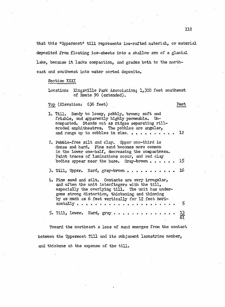
1 1 2
th a t th is "Uppermost" t i l l represents ic e -r a fte d m aterial, or m aterial
deposited from f lo a t in g ic e -sh e e ts in to a shallevT arm o f a g la c ia l
lak e, because i t lacks compaction, and grades both to the north
ea st and southwest in to water sorted d ep osits.
Section XXXI
Location; K in gsv ille Park A ssociation; 1,300 f e e t southwest o f Route 90 (extended).
Top (E levation: 636 f e e t ) Feet
1, T i l l , Sandy to loamy, pebbly, bro 'm; s o f t and fr ia b le , and ^ p a r en tly h igh ly permeable, Uh- compacted. Stands out as r idges separating r i l l - eroded amphitheatres. The pebbles are angular,and range up to cobbles in s ize , , , , , ..................... 12
2, Pebble-free s i l t and c la y . Upper one-th ird i s dense and hard. Fine sand becomes more commonin the lower on e-h a lf, decreasing the conpactness.Faint tra ces o f lam inations occur, and red c lay bodies appear near the base, Gray-bro\m ............................ l5
3, T i l l , Upper, Hard, gray-brow n..................................................l6
U, Fine sand and s i l t . Contacts are very irregu lar ,and o ften the u n it in ter fin g er s v/ith the t i l l , e sp e c ia lly the overlying t i l l . The u n it has undergone strong d is to r tio n , th ickening and thinning by as much as 6 f e e t v e r t ic a l ly fo r 12 f e e t horizo n ta lly ............................................................ S
$, T i l l , Lower, Hard, g r a y ...............................................................13SÏ
To vard the northeast a len s o f sand emerges from the contact
betTreen the Uppermost T i l l and i t s subjacent la cu str in e member,
and th ickens at the expense o f the t i l l .
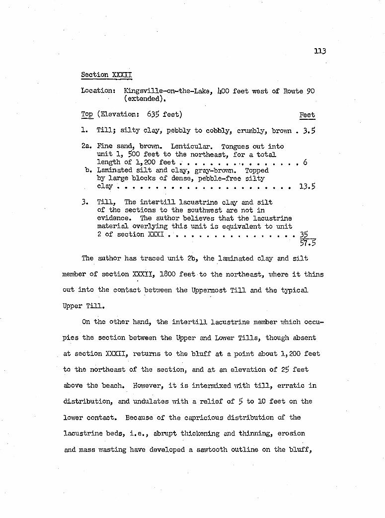
113
Section XXXII
Location; lü n gsv ille-on -th e-L ak e, UOO f e e t w est o f Route 90 (extended).
Top (E levation: 635 f e e t ) Feet
1. T i l l ; s i l t y c la y , pebbly to cobbly, crumbly, brovm . 3 .5
2a. Fine sand, brovm. L enticular. Tongues out in to u n it 1, 500 f e e t to the northeast, for a to t a llength of 1,200 f e e t ............................ 6
b. Laminated s i l t and c la y , gray-broim. Topped by large b locks o f dense, pebb le-free s i l t y c lay ................................................................................................13 .5
3. T i l l , The i n t e r t i l l la cu str in e c lay and s i l to f the sec tio n s to the southvrest are not inevidence. The author b e lie v e s th at the la cu str in e m aterial overlying th is u n it i s equivalent to u n it 2 o f sec tio n XXXI . ............................................................ 35
5775The author has traced u n it 2b, the laminated c lay and s i l t
member o f sec tio n XXXII, 1800 f e e t to the northeast, vdiere i t th in s
out in to the contact betvreen the Uppermost T i l l and the tj’p ic a l
Upper T i l l .
On the other hand, the i n t e r t i l l la cu str in e member which occu
p ie s the sec tio n between the Upper and Lower T i l l s , though absent
at sec tio n XXXII, returns to the b lu ff at a p o in t about 1,200 f e e t
to the northeast o f the sec tio n , and a t an e lev a tio n o f 25 f e e t
above the beach. However, i t i s interm ixed v/ith t i l l , e rra tic in
d istr ib u tio n , and undulates v/ith a r e l i e f o f 5 to 10 f e e t on the
Icnver contact. Because o f the capricious d is tr ib u tio n of the
la cu str in e beds, i . e . , abrupt thickening and th inning, erosion
and mass wasting have developed a sawtooth o u tlin e on the b lu ff .
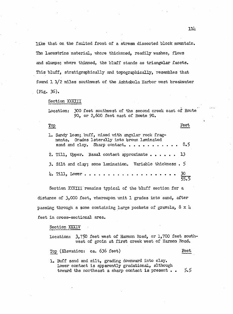
Iiu
l ik e th at on the fa u lted fro n t o f a stream d issec ted b lock mountain.
The la cu str in e m ateria l, where thickened, rea d ily washes, flow s
and slumps; where thinned, the b lu f f stands as triangu lar fa c e ts .
This b lu ff , s tra tig ra p h iea l ly and topographically, resembles th at
found 1 1 / 2 m iles southvrest o f the Ashtabula Harbor west breakwater
(Tig. 36),
Section XXXIII
Location: 300 f e e t southwest of the second creek e a st o f Route90, or 2,600 f e e t east o f Route 90,
Top Feet
1, Sandy loam; b u ff, mixed vdth angular rock fragments, Grades la te r a l ly in to brown laminatedsand and c lay . Sharp contact.....................................................8 ,5
2, T i l l , Upper, Basal contact approxim ate........................13
3, S i l t and clay; some lam ination. Variable th ickness , 5
U. T i l l , L ow er...................................................................................... 30__333
Section XXXIII remains ty p ica l of the b lu ff section fo r a
distance of 3,000 f e e t , whereupon u n it 1 grades in to sand, a fter
passing through a zone containing large pockets o f gravels, 8 x U
f e e t in c ro ss -se c tio n a l area.
Section XXXIV
Location: 3,750 f e e t Trest o f Harmon Road, or 1,700 f e e t southw est o f groin at f i r s t creek vrest o f Harmon Road,
Top (E levation: ca. 636 fe e t ) Feet
1 . Buff sand and s i l t , grading dcrymward in to c lay .Lower contact i s apparently gradational, although toward the northeast a sharp contact i s present , . 5 .5
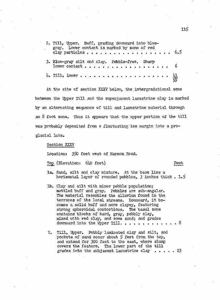
2. T i l l , Upper. Buff, grading dov/nTcard in to b lu e- grajr. Lower contact i s marked by zone o f redcla y p a r t ic le s . ..................................................................... 6.5!
3. Blue-gray s i l t and c lay . Pebble-free. Sharplovrer c o n t a c t ................................................... 6
U. T i l l , Lovrer....................................................................................... I4I
At the s i t e o f sec tio n XXXV belov/, the in tergrad ation al zone
between the Upper T i l l .and the superjacent la cu str in e claj'' i s marked
by an a ltern atin g sequence o f t i l l and la cu str in e m aterial through
an 8 fo o t zone. Thus i t sçspears th at the upper portion o f the t i l l
was probably deposited from a flu ctu a tin g ic e margin in to a pro
g la c ia l lake.
Section XXXV
Location: 3^0 f e e t w est o f Harmon Road.
Top (E levation: 6U0 fe e t ) Feet
la . Sand, s i l t and c la y m ixture. At the base l i e s ahorizon ta l la y er o f rounded pebbles, 3 inches th ick . 1 .3
lb . Clay and s i l t v/ith minor pebble population;m ottled bu ff and gray. Pebbles are sub-angular.The m aterial resembles the alluvium found in the terraces o f the lo c a l streams. Doi-mward, i t becomes a s o l id b u ff and more clayey , featu rin g strong spheroidal contortion s. The b a sa l zone contains b locks o f hard, gray, pebbly c la y , mixed T/ith red c la y , and some sand; and grades downward in to the Upper T i l l . . .......................................... 8
2. T i l l , Upper. Pebbly laminated c la y and s i l t , and pockets o f sand occur about 3 f e e t from the top, and extend fo r 300 f e e t to the e a st , v/here slump covers the fea tu re . The lovrer part o f the t i l l grades in to the subjacent la cu str in e c l a y .....................23
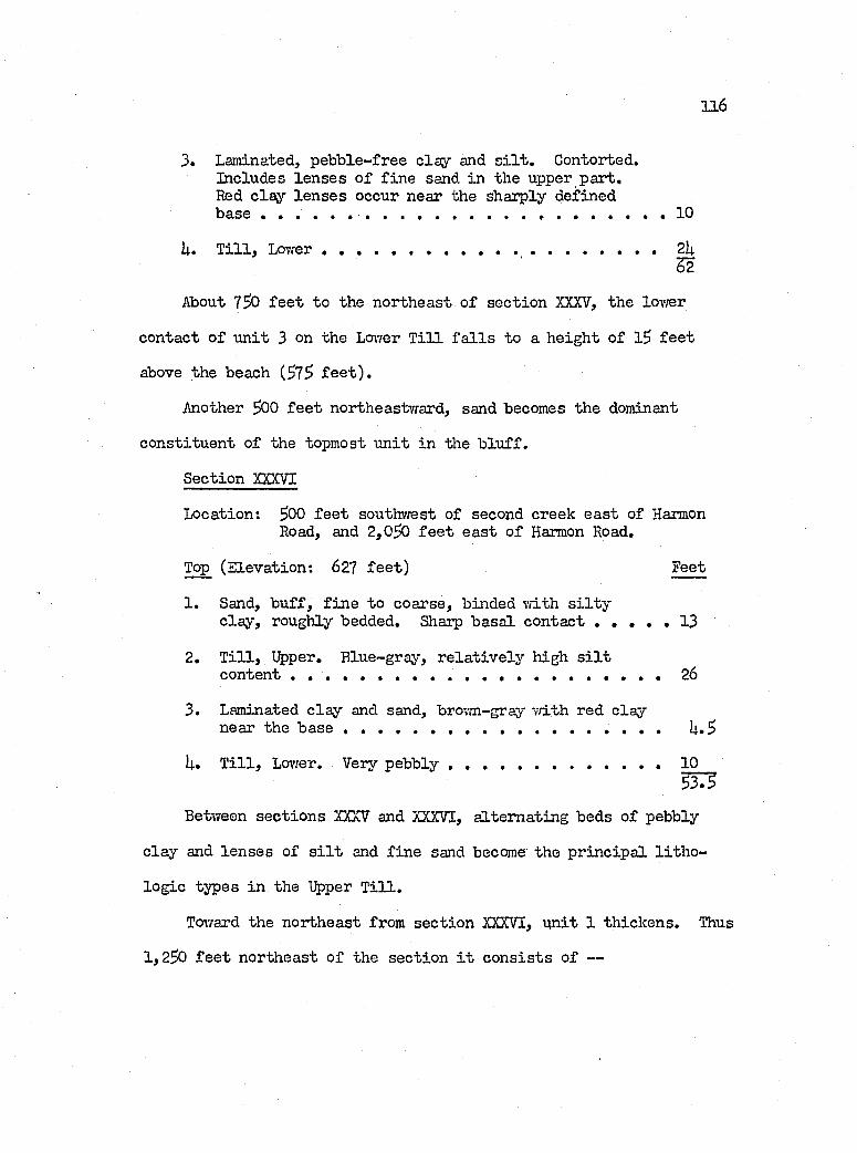
116
3. Laminated, p eb b le-free c la y and s i l t . Contorted.Includes le n se s o f f in e sand in the upper p art.Red c la y le n se s occur near the sharply definedb a s e ......................... . 1 0
U. T i l l , L ow er.......................................... 2k52
About 7^0 f e e t to the northeast o f sec tio n XXXV, the lovrer
contact o f u n it 3 on the Lower T i l l f a l l s to a h eigh t o f 1$ f e e t
above the beach (37^ f e e t ) .
Another $00 f e e t northeastward, sand becomes the dominant
con stitu en t o f the topmost u n it in the b lu f f .
Section XXXVI
Location: 300 f e e t southwest of second creek ea st of HarmonRoad, and 2,0^0 f e e t e a st o f Harmon Road.
Top (E levation: 627 fe e t ) Feet
1. Sand, b u ff, f in e to coarse, binded v/ith s i l t yc la y , roughly bedded. Sharp b asa l contact . . . . . 13
2. T i l l , Upper. B lue-gray, r e la t iv e ly high s i l tcontent ............................................................. 26
3. Laminated c la y and sand, brown-gray v/ith red c laynear the base U. 3
U. T i l l , Lovrer. Very p e b b ly ........................................................ 10337^
Between sec tio n s XXXV and XXXVI, a ltern atin g beds o f pebbly
c la y and le n se s o f s i l t and f in e sand become the p r in c ip a l l i t h o
lo g ie types in the Upper T i l l .
Toward the northeast from sec tio n XXXVI, u n it 1 th ick ens. Thus
1,230 f e e t northeast o f the sec tio n i t c o n s is ts o f —
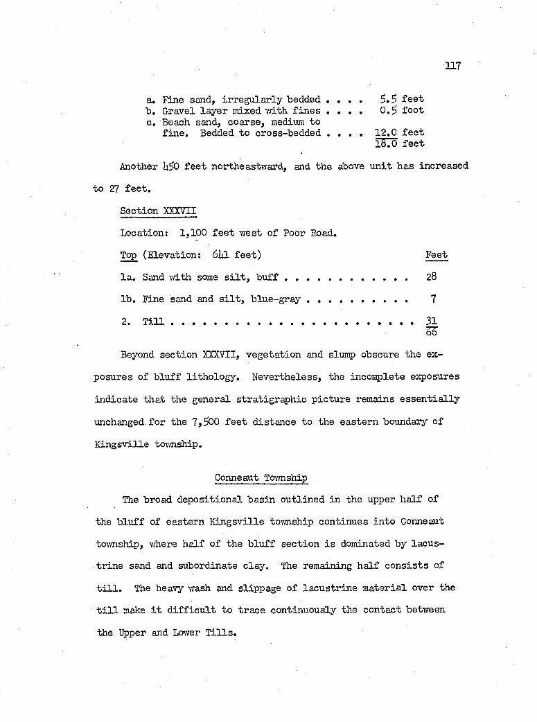
117
a« Fine sand, ir reg u la r ly bedded . . . . f e e tb . Gravel layer mixed rri-th f in e s . . . . 0 .^ fo o tc . Beach sand, coarse, medium to
f in e . Bedded to cross-bedded . . . . 12 .0 f e e tl8 .0 f e e t
Another U50 f e e t northeastward, and the above u n it has increased
to 27 f e e t .
Section XXXVII
Location; 1,100 f e e t w est o f Poor Road.
Top (E levation: 6Ip. f e e t ) Feet
la . Sand T/ith some s i l t , b u f f ........................................... 28
lb . Fine sand and s i l t , b lu e -g r a y ............................................. 7
2. T i l l ............................................................... 31
Beyond sec tio n XXX7II, vegeta tion and slunç) obscure the ex
posures o f b lu ff l ith o lo g y . N evertheless, the Incomplete exposures
in d ica te th at the general stra tigrap h ie p ic tu re remains e s s e n t ia l ly
unchanged fo r the 7,300 f e e t d istance to the eastern boundary o f
K in gsv ille township.
Conneaut Township
The broad d ep osition a l basin ou tlin ed in the upper h a lf of
the b lu ff o f eastern K in gsv ille township continues in to Conneaut
tovmship, where h a lf o f the b lu ff sec tio n i s dominated by la cu s
tr in e sand and subordinate c la y . The remaining h a lf c o n s is ts of
t i l l . The heavy wash and slippage o f la cu str in e m aterial over the
t i l l make i t d i f f i c u l t to trace continuously the contact betvreen
the Upper and Lo\rer T i l l s .
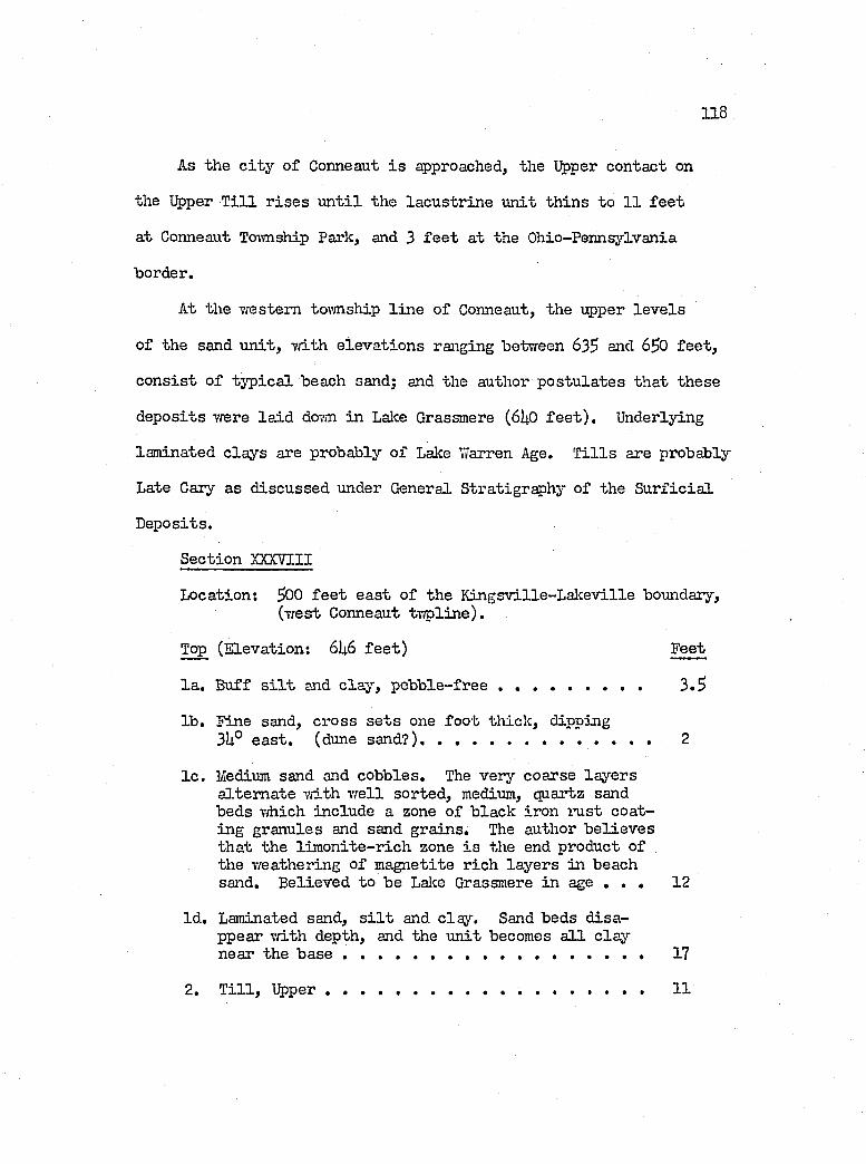
1 1 8
As the c i t y o f Conneaut i s approached^ the Upper contact on
the Upper T i l l r is e s u n t i l the la cu str in e u n it th in s to 11 f e e t
at Conneaut To-vvnship Park, and 3 f e e t at the Ohio-Pennsylvania
border.
At the western toimship l in e o f Conneaut, the upper le v e ls
of the sand u n it , v/ith e lev a tio n s ranging between 635 and 650 fe e t ,
c o n s ist o f ty p ic a l beach sand; end the author p o stu la tes th at these
d ep osits v/ere la id dcry/n in Lalce Grassmere (6U0 f e e t ) . Underlying
laminated c lays are probably o f Lake Warren Age. T i l l s are probably
Late Cary as d iscussed under General Stratigraphy o f the S u r f ic ia l
D eposits.
Section XXXVIII
Location: 500 f e e t ea st o f the K in gsv ille -L ak ev ille boundary,(west Conneaut tv /p line).
Top (E levation: 6U6 fe e t ) Feet
la . Buff s i l t and c la y , p e b b le - f r e e ................................... 3 .5
lb . Fine sand, cross s e t s one fo o t th ick , dipping3hP e a s t , (dune sand?)............................................................ 2
I c . Medium sand and cobbles. The very coarse la y ers a ltern ate v/ith v /e ll sorted , medium, quartz sand beds T/hich include a zone o f b lack iron I’u s t coating granules and sand grains. The author b e lie v e s th at the lim o n ite -r ich zone i s the end product of the v/eathering o f m agnetite r ich la y ers in beach sand. B elieved to be Lalce Grassmere in age . . . 12
Id . Laminated sand, s i l t and clay . Sand beds d isappear v/ith depth, and the u n it becomes a l l c la y near the b a s e ............................................................................. 17
2. T i l l , U pper............................................... .............................. 11
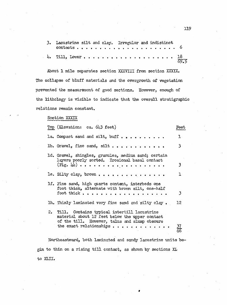
119
3. Lacustrine s i l t and c lay . Irregular and in d is t in c tcontacts ........................................................................................... 6
U. T i l l , Lcu’/ e r ....................................................................................... 18
About 1 m ile separates sec tio n XXXVIII from sectio n XXXIX.
The c o lls p se o f h lu ff m ateria ls and the overgrovrth o f vegeta tion
prevented the measurement of good sec tio n s. Ho-vTever, enough of
the lith o lo g y i s v is ib le to in d ica te th at the o v e ra ll stratigrap h ie
re la t io n s remain constant.
Section XXXIX
Top (E levation: ca. 6U3 fe e t ) Feet
la . Compact sand and s i l t , b u f f ............................................. 1
lb . Gravel, f in e sand, s i l t ..................................................... 3
Id . Gravel, sh in g les , granules, medium sand; cer ta in la y ers poorly sorted . Erosional b asa l contact (F ig . U U )................................................................. 3
l e . S i l t y c la y , brovm .................................................................. 1
I f . Fine sand, high quartz content, interbeds one fo o t th ick , a ltern ate v ith brovm s i l t , one-h alf fo o t t h i c k .................................................................................... 3
Ih. Thinly laminated very f in e send and s i l t y c la y . 12
2. T i l l . Contains ty p ic a l i n t e r t i l l la cu str in em aterial about 12 f e e t belov; the upper contact of the t i l l . Hovrever, ta lu s and slunp obscure the exact r e la t io n s h ip s ........................................................ 37
SF
hortheastward, both laminated and sandy la cu str in e u n its be
gin to th in on a r is in g t i l l contact, as shovm by sec tio n s XL
to XLII.
1 2 0
Section XL
Location; 900 f e e t e a st o f T/liitney Road.
Top (E levation: 638 fe e t ) Feet
1. Fine sand, w e ll sorted , b u ff, b a sa l gravel.Sharp contact from which water seeps . . . . . . . 20
2. T i l l . Covered by creeping b lu ff m aterial dovm to beach .................................................................................... Ul;
SC
Section XLI
Location: B lu ff ju s t w est of Conneaut Township Park,
Top (E levation: 627 fe e t ) Feet
1 . Pine sand, b u ff. Grades do^mward in to laminated c la y and s i l t . Lower 1 .5 f e e t i s gray. Sharpb a sa l c o n t a c t ........................................................... 11
2. T i l l , Contains tra ces o f la cu str in e m aterialhalfway do m the u n i t .............................................................. 35
Section XLII
Location: 500 f e e t w est o f the Pennsylvania border.
Top Feet
1 . Sand, f in e , b u ff; grading doimward in to c la y . . 3
2. T i l l , bouldery (to fo o t o f b l u f f ) ............................... 3639
The Origin o f Loam at the Top o f the Stratigraphie Section
A type o f loam resembling the lo c a l alluvium, here sandy, there
clayey and o ften pebbly, occurs u b iqu itously over the Lake P lain
and at the top o f the b lu f f sec tio n . I t grades la t e r a l ly from a
t i l l - l i k e lith o lo g y to one th a t i s purely la c u s tr in e , and includes
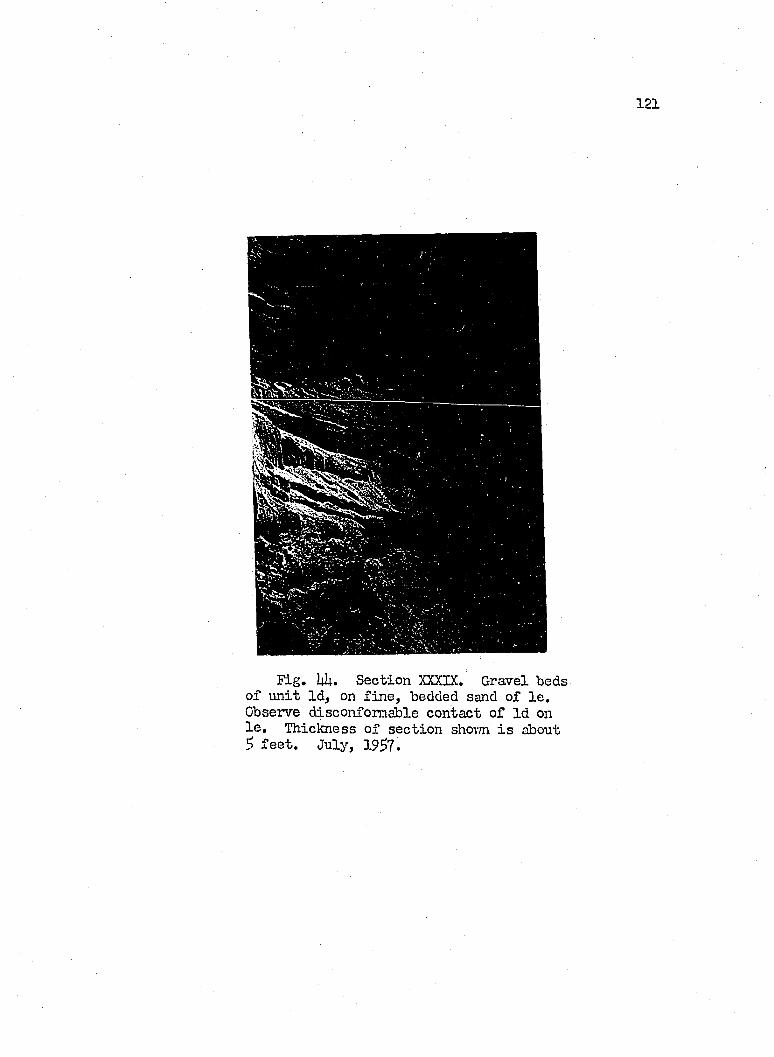
1 2 1
Fig, UI4.. Section XXXIX, Gravel beds o f u n it Id , on f in e , bedded sand of l e . Observe disconformable contact o f Id on l e . Thickness o f sec tio n shovm i s about S f e e t . July, 19^7.
1 2 2
b a s a l p o ck e ts o f g ra v e l. The au thor reg a rd s t h i s u n i t as th e p ro
duct o f sh ee t wash a c tin g on t i l l and la c u s t r in e d e p o s its o f th e
Lalce P la in , The p ro ce ss could have talcen p la ce e i th e r as a te rm i
n a l la c u s t r in e e f f e c t an d /o r as a s u b a e r ia l development.
Under th e f i r s t co n d itio n , th e au tho r p o s tu la te s th a t th e re
was a p o in t in th e f a l l i n g s tag e of th e g la c ia l lalce le v e l when
th e w ater became too shallow to perm it e x ten s iv e tr a n s p o r t o f m a te r ia l
from a r e a d i ly e ro d ib le bottom and shore , Tlius i t was p robab le
th a t lo c a l m a te r ia l on th e topograph ic h ig h s , as i t became d isag g re
gated by th e s a tu ra t in g e f f e c t o f la k e w a ter, v/as m erely spread
over th e Icn-rer a re a w ith o u t ex ten s iv e s o r tin g where th e g ra d ie n t
was low, and vri-th b e t t e r s o r t in g where th e s lo p es and th e permea
b i l i t y o f th e su rface p e rm itte d i t .
Under th e second co n d itio n , m eteoric sh ee t wash a c tin g on
low g ra d ie n ts o r h ig lily perm eable s lo p es could accom plish th e same
end. Loam d e p o s its o f K in g sv ille and Conneaut tovm ships and e ls e
where r e s t d i r e c t ly on co arse and medium sands p o s tu la te d as having
been d ep o sited in Lakes Grassmere and Lundy, th e l a s t g la c ia l la k e s
re p o rte d f o r th e Lalce P la in in th e study a re a . Thus i t i s p robab le
th a t most o f the loam d e p o s its p o s td a te th e p e rio d o f g la c ia l la k e s .
Also the h ig h p e rm e a b ility o f th e sand beds over which some su rface
ru n o ff must t r a v e l would i n h ib i t g u lly in g , s in ce so much w a ter i s
l o s t by seepage in to th e ground. On th e o th e r hand, d ep o s itio n o r
spread ing of m a te r ia l dovmslope by sh ee t wash would be fav o red .
123
Summary of the B lu ff Stratigraphy betTreen Fairport and the Ohio-Pennsylvania Border
i^parently, the ch a ra cter is tic stratigrap h ie sequence o f an
Upper T i l l overlying th ick la cu str in e c lay , s i l t and sand, which
in turn r e s t on the Lcn'rer T i l l , found in western P a in e sv ille , repre
sen ts the northeastern extension of a sim ilar sequence th at makes
up the b lu ff o f northeastern Mentor tovmship on the western side
o f the Grand River V alley. The i n t e r t i l l la cu str in e u n it remains,
a member o f the lith o lo g y fo r about 3 m iles ea st o f the Grand River
mouth, and l ik e i t s counterpart on the west side of the River, seems
incapable o f m aintaining the heavy overburden of the %per T i l l .
Thus heavy slurping a f fe c ts the shore o f Paine s v i l l e toim ship,
as i t does th at o f the Mentor Headlands area.
The i n t e r t i l l la cu str in e d ep osits d is^ p ea r from the sec tio n
as a s ig n if ic a n t u n it across Periy and Madison tovmships, and only
a contact zone, which one may trace at in terv a ls across Perry tovm
ship remains. This zone revea ls i t s e l f by a p h y sica l, undulatory
break in the m onolithic face o f the t i l l , by the presence o f fa t ty ,
p eb b le-free c lay , s i l t and sand, boulder pavements, and.by dense,
fa t ty , red c la y le n se s , and i t m aintains a general e leva tion rang
ing between ^73 and j?77 f e e t .
Lacustrine laminated c la y , s i l t and sand, superj acent to the
t i l l , gain prominence in the section from vrestern Perry tovmship
toward the northeast, and a tta in a maximum th iclm ess o f around
30 f e e t in cen tra l Perry to\m sliip. Thence they undergo thinning.

12U
as another sandy la cu str in e member, overlying the laminated beds
in creases to i t s maximum th ick n ess of 3E> f e e t in the b lu f f o f w est
ern Madison township. This sand u n it c o n s is ts o f d ep osits la id
dovm in Lakes Grassmere and Lundy. On i t s p art, the Upper T i l l
undergoes progressive th inning northeastvrard across eastern Perry
toTmship, and f a l l s below beach le v e l .
Across Madison tovmship, the b lu ff , having undergone a rapid
decline in e lev a tio n ju s t ea st o f Haines Road, in the western part
of the tovmship, a t the e:<pense o f the sand u n it , maintains a height
of 10 to 1^ f e e t , a l l the way to Cowles Greek in western Geneva
township, vihere i t abruptly r is e s . Across th is area, the contact
on the t i l l remains near lake le v e l , i . e . , 373 to 3TU fe e t . V/ith
the return o f the b lu f f to top o g r^ h ic prominence, the Upper T i l l
reoccupies the sec tio n at the top of the b lu f f . Sluttqping across
Geneva and western Saybrook townships, l ik e th a t in P a in e sv ille
tovmship, a lso returns. Auger borings by the D iv ision o f Shore
Erosion, revea l th at the ty p ic a l Upper T i l l o f compacted, s i l t y
c la y i s about lit f e e t th ick , and th at i t o v e r lie s a 23 fo o t th ick ,
someivhat permeable, pebble-poor to pebb le-free u n it o f s i l t y t i l l ,
and la cu str in e sandy to c layey m aterial.
Beyond Saybrook Tovmship Park, the la cu str in e i n t e r t i l l u n it
th in s out, and the b asa l contact of the Upper T i l l returns to beach
le v e l . On approaching Red Brook, sand appears in the top section
of the b lu f f , th ickening tovfard the brook.
125
East o f Red Brook, the lacu str in e c la y betvreen the Upper T i l l
and the overlying sand bed a tta in s lo c a l inportance, but th in s
rapidly against a r is in g t i l l contact, a fter an exposure o f 600
f e e t . The sand bed at the top o f the b lu ff le n se s out -vvithin 2,500
f e e t o f Red Brook. On the other hand, the i n t e r t i l l contact, near
beach le v e l , becomes vrell d elin eated by a boulder pavement, and
about 2,500 f e e t northeast o f Red Brook expands to include rather
th ick d ep osits o f la cu str in e m aterial.
On both s id es o f Red Brook, the stratigraphy throvTS some l ig h t
on the h isto ry o f the stream. The b a sa l contacts o f both la cu str in e
u n its - th a t on top of the Upper T i l l , and th a t betvTeen the t i l l s -
dip invrard toward the present v a lle y o f Red Brook, and probably
represent the c ro ss -se c tio n s o f an cestra l v a lle y s o f the present
stream, one of which was o b litera ted by drowning and g la c ia tio n ,
and the other by drowning in one o f the la te g la c ia l lalces.
Toward A shtabula tovm ship, th e i n t e r t i l l l a c u s t r in e m a te r ia l
r i s e s in th e s e c tio n , and th in s to th e b e n e f i t of th e Lower T i l l ,
which th roughout e a s te rn Saybrook a t ta in s an exposed th ic k n e ss o f
18 to 20 f e e t . However, in A shtabula tovmship, th e c o n tac t on th e
Lovrer T i l l f a l l s again belovr beach le v e l as th e r iv e r i s approached,
and a l l la c u s t r in e m a te r ia l d isap p ears from th e se c tio n , save f o r
a th in capping o f loamy m a te r ia l .
On th e e a s te rn s id e o f th e A shtabula R iver, th e Lov/er T i l l
re tu rn s to i t s p o s i t io n of prominence about 2 m ile s from the r iv e r .
126
and re ta in s t h is p o s it io n in to Conneaut tovmship. In l ik e manner,
the i n t e r t i l l la cu str in e beds return to the sec tio n , and a tta in a
maximum th ickness o f 3$ f e e t a t T,hitman Creek in the border area
of Ashtabula and K in gsv ille tovmships. The Upper T i l l , exclu sive
of the area ea st o f the c i t y of Conneaut, novhere a tta in s the I4O
fo o t th ickness o f eastern Paine s v i l l e tovmship, i t f lu c tu a te s vd.thin
short d istan ces, and ranges betv/een 6 and 30 f e e t .
F a ir ly th ick (17 f e e t ) d ep osits o f laminated la cu str in e c lay ,
superjacent to the Upper T i l l , crop out between R u ssell and Labounty
Roads o f Ashtabula township, vhere the u n it occupies an ^ p aren t
bench, cut by an an cestra l Ashtabula River on the t i l l . The la cu s
tr in e m aterial a lso grades dowmvard in to a tough c lay , v/ith sm all,
rounded pebbles or granules, and some red c la y , although the contact
on the t i l l remains marked by a p h ysica l break.
Above th ese lam inated beds l i e sand d ep osits , 7 to 20 f e e t
th ick . Both la cu str in e u n its term inate, in essen ce, against the
r is in g t i l l contact at Labounty Road. The sand u n it , l ik e th at
of Perry and Madison tovmships, forms a low topographic htmçi, and
i s regarded by the author as a d ep osition a l form la id dovm in Lake
Grassmere, and now truncated by the Lalce Erie b lu ff .
Across eastern KLngsville and a l l o f Conneaut tovmship v/est
of the c i t y o f Conneaut, sand d ep osits , to 6 m iles in b lu f f length ,
and m ostly 30 to 3^ f e e t th ick , occupy the b lu f f sec tio n . The
upper portion o f the d ep osits was probably la id dovm in G lacia l
Lalce Glassmere, 61+0 f e e t in e lev a tio n .
127
Northeast o f Whitman Creek of K in gsv ille tovTnship, two an cestra l
v a lle y s were cut and f i l l e d in the b lu f f sec tio n . The older v a lle y
was eroded in to the i n t e r t i l l la cu str in e c la y , and then f i l l e d
m th sand, and sealed by the %per T i l l . The younger v a lle y was
excavated farth er eastward in to the Upper T i l l . This v a lle y was
then drovmed by one o f the g la c ia l lalces, f i l l e d vdth la cu str in e
c lay , and covered by a la te r phase o f the lÿiper T i l l or reworked
g la c ia l m ateria l.
Other in tr a g la c ia l v a lle y s antedating the Upper T i l l are por
trayed in the b lu f fs adjacent to the Grand River, Ashtabula River,
and the aforementioned Red Brook.
THE LATE mSCONSIN HISTORY OF THE STUDY AREA
The ancestra l bedrock v a lle y s o f the Grand and Ashtabula r iv ers
predate the g la c ia l t i l l o f the study area by v ir tu e o f the fa c t
th at the t i l l s o f the Lalce P la in and the Lake Escarpment moraines
occupy segments o f th ese v a lle y s . On the other hand, the evidence
seems to in d ica te th a t the Conneaut River arrived in to the area
as a p o s t - t i l l event, s ince an ancestral v a lle y o f th is stream
Tfas not loca ted in the area. Moreover, along the w esterly course
of the Conneaut River, a northern bedrock w all to the bedrock floored
v a lle y i s v ir tu a l ly absent. Thus the fa l l in g surface o f the Lake
Escarpment forms the southern w a ll, from which the bedrock surface
descends northward to the Lake, independently o f the course o f the
above stream. Thus i t appears th at the Conneaut River i s con tro lled
topographically , e ith er by the presence o f the bedrock con tro lled
moraines or by the former ex isten ce o f an ic e - fr o n t in the area.
One o f the an cestra l bedrock v a lle y s of th e Lcnver Grand River
runs southwest betvreen the Mentor Marsh and the Lake Erie b lu ff
to enter the present basin of the lake under Mentor Harbor, where
i t jo in s the buried Kirtland v a lle y (P late IX) at an e lev a tio n of
^09 f e e t . Likev/ise, the ancestral v a lle y o f the Ashtabula River
enters the lalce s l ig h t ly west o f i t s present s i t e , and about 1
m ile offshore l i e s a t an e lev a tio n of 5o6 f e e t . Thus i t appears
th a t a period o f very low lake le v e ls preceded by some unlcnovm
1 2 8
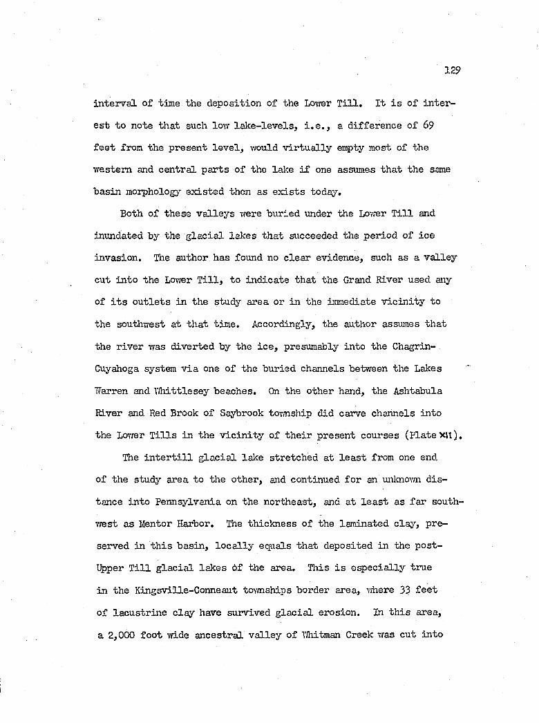
129
in ter v a l o f time the deposition of the Lovrer T i l l . I t i s o f in te r
e s t to note th at such lor/ la lc e -le v e ls , i . e . , a d ifferen ce o f 69
f e e t from the present le v e l , vreuld v ir tu a l ly empty most o f the
vre s te m and cen tra l p arts o f the lake i f one assumes th at the same
basin morphology ex isted then as e x is t s today.
Both o f these v a lle y s were buried under the Lower T i l l and
inundated by the g la c ia l lak es th a t succeeded the period o f ic e
invasion . The author has found no c lea r evidence, such as a v a lle y
cut in to the Lower T i l l , to in d ica te th at the Grand River used any
of i t s o u t le ts in the study area or in the immediate v ic in it y to
the southwest at th at tim e. Accordingly, the author assumes th at
the r iv er was d iverted by the ic e , presumably in to the Chagrin-
Cuyahoga system v ia one of the buried channels between the Lakes
Warren and W hittlesey beaches. On the other hand, the Ashtabula
River and Red Brook o f Saybrook tovmship did carve channels in to
the Lovrer T i l l s in the v ic in it y o f th e ir present courses (P late XU) .
The i n t e r t i l l g la c ia l lalce stretched a t le a s t from one end
of the study area to the other, and continued fo r an unlcnovm d is
tance in to Pennsylvania on the northeast, and at le a s t as fa r south
vrest as Mentor Harbor. The th ick ness o f the laminated c lay , pre
served in th is b asin , lo c a l ly equals th at deposited in the p o st-
üpper T i l l g la c ia l lak es o f the area. This i s e sp e c ia lly true
in the Kingsville-Conneaut townships border area, where 33 f e e t
o f la cu str in e c la y have survived g la c ia l erosion . In th is area,
a 2,000 fo o t vdde an cestra l v a lle y o f Whitman Creek was cut in to
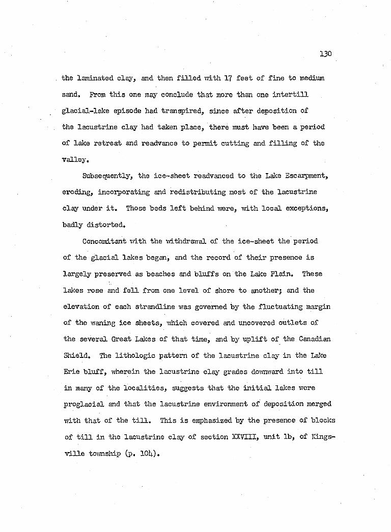
130
the laminated c lay , and then f i l l e d \Tith 17 f e e t o f f in e to medium
sand. From th is one may conclude th at more than one i n t e r t i l l
g la c ia l- la k e episode had transpired, since a fter deposition of
the la cu str in e c lay had taken p lace , there must have been a period
of lake re trea t and readvance to permit cu ttin g and f i l l i n g of the
v a lle y .
Subsequently, the ic e -sh e e t readvanced to the Lake Escarpment,
eroding, incorporating and red istr ib u tin g most o f the la cu str in e
c la y under i t . Those beds l e f t behind vrere, vri.th lo c a l exceptions,
badly d istorted .
Concomitant vriLth the mthdrarfal o f the ic e -sh e e t the period
of the g la c ia l lak es began, and the record of th e ir presence i s
la r g e ly preserved as beaches and b lu f fs on the Lake P la in . These
lakes rose and f e l l from one le v e l o f shore to anotherj and the
e lev a tio n o f each strand lin e was governed by the flu ctu a tin g margin
of the waning ic e sh eets , which covered and uncovered o u t le ts of
the severa l Great Lalces o f th a t tim e, and by u p l i f t o f the Canadian
Shield . The l i th o lo g ie pattern o f the la cu str in e claj''" in the Lalce
Erie b lu f f , wherein the la cu str in e c ls y grades dovnrnTard in to t i l l
in many o f the l o c a l i t i e s , suggests th at the i n i t i a l lalces were
p ro g la c ia l and th at the la cu str in e environment o f deposition merged
Tfith th at o f the t i l l . This i s emphasized by the presence o f blocks
of t i l l in the la cu str in e c la y of section XXVIII, u n it lb , of Kings
v i l l e township (p. lOU).
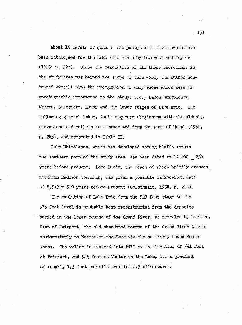
131
About 15 le v e l s o f g la c ia l and p o s tg la c ia l lake le v e l s have
been catalogued fo r the Lalce Erie basin by Leverett and Taylor
(191^, p . 397). Since the reso lu tion o f a l l th ese sh orelin es in
the study area was beyond the scope of th is work, the author con
tented h im self vdth the recogn ition of only those which were o f
stra tigrap h ie inçortance to the study; i . e . , Lalces Y fliittlesey,
V/’arren, Grassmere, Lundy and the lovrer stages o f Lake E rie. Tlie
fo llow in g g la c ia l lalces, th e ir sequence (beginning w ith the o ld e s t) ,
e lev a tio n s and o u t le ts are summarized from the vfork o f Hough (19^8,
p. 283) , and presented in Table I I .
Lake 7 /h ittle sey , which has developed strong b lu f fs across
the southern part o f the study area, has been dated as 12,800 _ 2^0
years before present. Lake Lundy, the beach o f which b r ie f ly crosses
northern I'adison tovmship, was given a p o ss ib le radiocarbon date
o f 8,^13 + ^00 years before present (Ooldthvrait, 1938. p . 2 l8 ) .
The evo lu tion o f Lake Erie from the 3U3 fo o t stage to the
373 fo o t le v e l i s probably b e s t reconstructed from the deposits
buried in the lovrer course o f the Grand River, as revealed by borings.
East o f Fairport, the old abandoned course of the Grand River trends
southw esterly to Mentor-on-the-Lalce v ia the southerly bovred Mentor
Marsh. The v a lle y i s in c ise d in to t i l l to an e lev a tio n of 33 l f e e t
at Fairport, and ^hh f e e t at Mentor-on-the-Lake, fo r a gradient
of roughly 1 .3 f e e t per m ile over the U.3 m ile course.
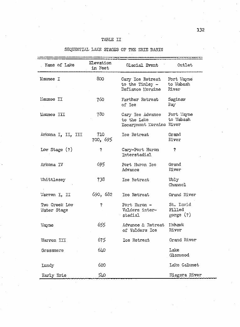
132
TABLE II
SEQUEI'ÎTIAL LAICE STAGES OF THE ERIE BASIN
Name o f Lake E lev a tio n in Feet G lac ia l Event O u tle t
Maumee I 800 Cary Ice R e trea t to th e T in ley - D efiance Moraine
F o rt Wayne to Wabash R iver
Maumee I I 760 F a rth e r R e trea t o f Ice
Saginai7Bay-
Maumee I I I 780 Cary Ice Advance F o rt Wayne to th e Lalce to Wabash Escarpment Moraine River
Arkona I , I I , I I I 710 700, 69$
Ice R e trea t GrandRiver
Lo\t Stage (?) ? C ary-Port Huron I n te r s ta d ia l
?
Arkona TV 69s P o rt Huron Ice Advance
GrandRiver
Y ih ittlesey 738 Ice R e trea t UblyChannel
V/arren I , I I 690, 682 Ice R e trea t Grand R iver
T’/fO Creek Loi? vrater Stage
? P o rt Huron - V alders i n t e r s ta d ia l
S t. David F i l le d gorge (?)
Wayne Advance & R e tre a t o f V alders Ice
ItohavvkRiver
Warren I I I 675 Ice R e trea t Grand R iver
Grassmere 6U0 LalceGlemTOod
Lundy 620 Lalce Calumet
E arly E rie 5U0 N iagara R iver
133
The sec tio n at the lower o u t le t c o n s ists o f I k f e e t o f medium
sand on 17 f e e t o f s i l t y muds, riiich in turn r e s ts on the t i l l .
Somewhere between the depths o f 9 and lU f e e t , i . e . , the e lev a tio n s
o f 566 and 561 f e e t , marsh d ep osits ai-e found in the sec tio n . At
the other end of th is v a lle y segment, on the w est side of the Grand
Hiver o f f Fairport, the fo llow in g represents a ty p ic a l section
recovered;
Top (E levation: 576.66 f e e t ) Elevation
1 . S oft, gray s i l t ............................ ...................................... .... 5732. S oft black peat ........................................................ 570.63. Sandy gray s i l t Tri.th seams of p e a t ................... 56U.6h. Loose medium to coarse gray sand and gravel , . , 553.05. Bro\-m sandy s i l t , some vegetation . ................. 55l.U6. Sandy t i l l .
S i l ty muds in the la cu str in e environment are genera lly a sso c i
ated vri-th deeper water sedimentary fa c ie s . Thus the presence of
the b asa l s i l t y muds in the sec tio n at Hentor-on-the-Lalce in d ica tes
th a t the mouth o f the r iv er was already drovmed to a great depth
at the time of deposition or, at le a s t , th at the ra te o f droaming
exceeded the rate o f f lu v ia t i l e tr a c tio n a l sedim entation. From
the equivalent sand and gravel sec tio n upstream at F aiiport, i t
appears th at the s i t e o f sedm entation had already sh ifted upstream
from some p o in t dovm stream, beyond the present lo c a le o f luentor-
on-the-Laice.
Apparently the le v e l o f the laJce had tem porarily ha lted in
i t s climb or had slowed at some value betvraen 56 l and 56it f e e t ,
because sedim entation in the lower v a lle y vras able to catch up
13U
v/ith th e lalce v /a te rs, and marsh d e p o sits came in to e x is te n c e .
Upstream, the s tead y inflov/ o f co a rse r d e t r i tu s tap e red o f f in to
s i l t s ; and a lso a l te rn a te d v /ith m arsh-form ing co n d itio n s , as in d i
ca ted by the beds of p e a t in te rb ed d ed v/ith th e s i l t . V/hereas i t
i s p o ss ib le th a t the source of the sand and g ra v e ls had d r ie d up,
the g re a te r p ro b a b i l i ty e x is t s th a t the stream meander a t F a iip o r t
a t t h i s tim e m ight have undergone in te r c is io n by th e -reced in g Iialce
E rie b lu f f , and thus d iv e rte d the r iv e r in to the lalce n o rth o f the
p re se n t harbor a t F a irp o r t . Tliis p a r t o f th e v a l le y must then have
become a baclcr/ater s e t t l i n g b a s in and swamp.
Subsequent in c re a se in th e le v e l o f th e lalce must have continued
slow ly, drcr/jning the v a l le y more, and in te n s i f jdng marsh co n d itio n s
over most o f th e v a l le y segment, a t e le v a tio n s between $6Q and
573 f e e t . Uoreover, a t 1,'entor-on-the-Lake, beach sand encroached
on th e v a l le y and began to s e a l i t o ff from th e lalce by damming.
Vfith th e opening o f the v a lle y to the lalce a t F a irp o r t , beach
m a te r ia l was ap p aren tly d riven in to th e v a l le y by wind and v/ater,
v /ith th e r e s u l t th a t a p o r tio n o f the marsh d e p o s its th e re was
covered v /ith sandy m a te r ia l up to an e le v a tio n of 580 f e e t , o r to
a depth of 7 f e e t .
THE RELATIONSHIPS BETWEEN BLUFF LITHOLOGIES AND DEGRADATIONAL PROCESSES
Three major l i th o lo g ie types characterize the b lu ff con stitu en ts
o f the area;
1. Poorly cemented la cu str in e sand
2. Massive laminated and nonlaminated c lay , s i l t and sand
3. G lacia l t i l l
Sand d ep osits more than 5 fe e t th ick , as a ru le , occupy the
topmost sec tio n of the b lu f f , and are developed, 10 to 35 f e e t th ick ,
across the tcnmships of Perry and Madison in the southwest, and a l l
of Ashtabula County between Ashtabula and Conneaut Harbors. The
lone exception to the stra tigrap h ie p o s it io n o f these d ep osits i s
found in the border area of Ashtabula and K in gsv ille tovmships,
vdiere 17 f e e t o f sand u n d erlies 5 to 17 f e e t of Upper T i l l .
Invariably, the massive la cu str in e c la y s underlie the sand
d ep osits . N evertheless, in terms of th iclm ess, the c lays outrank
the superj acent d ep osits in western and cen tra l Perry tovmship,
and in Ashtabula tovmship, northeast of Ashtabula Harbor, where
they range in th ickness from l5 to 32 f e e t . The upper tw o-thirds
of th ese c la y s are gen era lly interbedded w ith sand and s i l t ; but
dovmward in the sec tio n th ese subordinate la y ers become scarcer
as the c la y increases in homogeneity and density .
135
136
R egionally, g la c ia l t i l l forms the dominant l ith o lo g ie type,
and ex h ib its a v ir tu a l ly complete b lu ff- fr o n t across P a in e sv ille ,
western Perry, Geneva, Saybrook and eastern Conneaut townships.
Only in eastern Perry and a l l o f Madison township does the t i l l
disappear as a strong l i th o lo g ie con stitu en t of the b lu ff .
The degradational processes include -
1. Chemical and p h ysica l weathering;
2. Mass w asting, i . e . , the tran sfer dovmslope en masse o f b lu ff debris under the primary in fluence of gravity; and
3. Erosion, prim arily by water and Tând.
Weathering in terms of freez in g and tha\’/ing, oxidation , h yd rolysis,
hydration and so lu tion attacks the t i l l s most, s in ce a great deal
o f the t i l l contains p a r t ic le s derived from igneous and metamoiphic
rocks. Freezing and thairLng disrupt s i l t - r i c h m aterial by the grovrbh
of ic e c r y s ta ls . Hematite and p y r ite in the t i l l s are hydrated to
lim onite; carbonates are leached in to so lu tio n , and i t i s assumed
th a t hydrolysis reduces igneous m inerals such as fe ldspar and mica
to c la y m inerals. The net e f fe c t of th is process i s one th at in
creases the bulk o f the weathered t i l l , loosen s i t and renders i t
more su scep tib le to movement, e sp e c ia lly where t l i is process has
acted in the deep v e r t ic a l jo in ts o f the t i l l . On the other hand,
hydration o f m agnetite layers in the sand deposits has produced
the liraon itic cementing m aterial th at helps to bind the sand b lu ff .
Mass wasting expresses i t s e l f in a vri.de spread of types th at
range from the f a l l of sand grains dcnm-bluff to the v e r t ic a l c o llsp se
137
of tons of undermined massive b locks o f t i l l ; from small mud flov;s
to ex ten sive slumping and creep. This process operates most e f f e c t
iv e ly in the b lu f fs of t i l l and la cu str in e c la y , and i s strongly
aided by the weathering and erosion a l processes.
Erosion occurs prim arily by m eteoric and subsurface w aters,
runoff and seepage, and by the motion o f lalce waters th a t erode
and remove m aterial by wave and current action . Y/'ind a c t iv ity
makes i t s e l f f e l t by i t s d e fla t io n a l e f f e c t s on the sandy b lu f f .
No one l i th o lo g ie type occupies a given stretch o f b lu f f to
the exclu sion of the other; nor does one type o f degradational
process operate on the b lu f f to exclu sion o f the other. Neverthe
le s s , a cer ta in amount o f a sso c ia tio n does e x is t betvreen some o f
the degradational processes and a major l ith o lo g y o f a given area.
Degradation o f Sandy B lu ff D eposits
The b lu ff o f the Perry-lladison tovmship area e x h ib its , from
the top doimward, a 2$ to 3$ fo o t layer o f medium to very f in e sand
restin g on 1$ f e e t o f la cu str in e c la y , on 2 f e e t o f exposed t i l l .
The send u n i t m a in ta in s a s teep slope ranging from to 90 degrees
( f ig . 31 ). I t i s a lso p e re n n ia l ly damp to w et downward from the
uppermost 2 o r 3 f e e t , and c o n ta c t sp rin g s is su e from th e base over
th e la c u s tr in e beds.
One may a ttr ib u te the prevalence o f steep slop es on the sandy
b lu ff to (1) a s l ig h t in crease o f adhesion obtained by a tliin ,
cementing coat o f lim on ite on the in d iv idu a l grains; (2) strong
138
angularity o f the grains, and (3) the presence o f vadose -prater
seeping dovmvrard through the sands. These fa c to rs tend to increase
the intergranular fr ic t io n , so th at the angle o f in tern a l fr ic t io n ,
or angle o f repose (30 to 3^°), fo r lo o se ly p ile d sand i s grea tly
exceeded. As suggested by Kaye (19^0, p . 95-96), one may demon
s tra te the importance of intergranular fr ic t io n on sand strength
by f i l l i n g a s o ft rubber bladder vriLth lo o se dry sand under atmos
pheric pressure, and watching the r ig id ity of the sand increase
as the a ir in bladder i s evacuated. The increase in r ig id ity i s
attributed to the condition vfhereby the intergranular pressures
are ra ised by the sand bearing the vreight o f the atmosphere p ress
ing on the bladder. This -weight i s roughly equivalent to an over
burden o f 20 f e e t of sand. Dov’/npfai’d p erco lating -prater a lso adds
to the intergranular pressures, because the drag e f f e c t exercised
by the water on the sand grains acts to p u ll them together and
downward.
During periods of ra in , the high perm eability of the sand
preserves the upper portion of the b lu ff from strong sheet wash,
except under extreme con d itions. Hovrever, the r e la t iv e ly impermeable
f lo o r on the la cu str in e c lay serves as the substratum fo r contact
springs th at seep from the sand u n it. The basa l sand i s plucked
ai-ray and transported onto the beach as tr ic k le s forming mim.ature
allu -v ia l fans (F ig . U5). I f the springs become p a r ticu la r ly strong,
then large c a v it ie s develop in the b lu ff by co llap se o f the flanking
layers and masses in to the spring (F ig. 31).
139
This e f fe c t o f underground stream erosion acts to undermine
the fa ce o f the b lu ff in general, so th at th in la y e rs , chunlcs and
d iscre te p a r t ic le s f a l l o f f the fa ce as the general mass wasting
process. On the other hand, wave erosion by lake waters seldom
obtains the opportunity to attack the sand d ep osits d ir e c t ly since
these d ep osits maintain a p o s it io n recessed 10 to 30 f e e t above
the lak e, and 20 to lj.0 f e e t behind the s a lie n t subjacent t i l l and
la cu str in e c la y members. Wind d e fla tio n probably acts most e f f e c t
iv e ly during the dry summer months when the wind i s bloiving g u s t ily .
Most o f such m aterial Icnocked from the parent m aterial f a l l s as
ta lu s , and i s transported over the t i l l by the contact springs and
sheet wash.
The s itu a tio n described fo r the Madison-Perry township sand
deposits remains e s s e n t ia l ly the same fo r the Kingsville-Conneaut
d ep osits .
Degradation o f the Lacustrine C la y -S ilt Member
In terms o f i t s p h y sica l p rop erties, the la cu str in e c la y occu
p ie s a tr a n s it io n a l zone between the members dominated by sand and
those dominated by g la c ia l t i l l . Since in most areas th ese dep osits
are capped by sand, contact springs from the upper contact pour
over the face o f the c la y beds to exercise a cer ta in amount of
sheet Tfash and r i l l erosion thereon. The e ffe c t iv e n e ss o f th is
type of erosion on a given u n it depends in great measure on the
character o f the lam inations. In the presence o f numerous permeable
lUo
sand la y ers , a great deal o f the moisture i s stored u n t i l f u l l satu
ra tion of the sand beds i s accomplished. In such an even tu a lity ,
the c la y la y ers become p la s t ic and, weighted dovm by the excess
m oisture, may y ie ld p la c t ic a l ly . This i s e sp e c ia lly true o f the
lovrer massive p ortion o f the u n it, which c o n s ists m ostly o f c lay .
The en tire mass may then move over the t i l l contact as part flovf
and part sluiiç). Hovrever, actual s lid in g may depend on the dip of
the contact on the t i l l , s ince the dip does change from one lo c a l i t y
to another. East of Perry To^mship Park, s lid in g was observed
during the f i e ld season (P ig . U6), and there the dip of the contact
was lakeward. Southwest of the Park, the contact dips away from
the lak e, and fa ilu r e was observed to occur la r g e ly as flovr and
small sca le slumping and sapping of the la cu str in e u n it onto the
t i l l contact.
T/here the c la y la y ers tend to dominate the sand laminae, sheet
wash o f surface waters becomes e ffe c t iv e in removing a great deal
of the m ateria l. Chieruzzi and Baker (19$8, p. 8 l) p lace great
emphasis on th is process in th e ir d eta iled study o f the b lu ff at
Perry Township Park. The author concurs, but in region al terms,
b e lie v e s th at th is process as i t acts on the lacu str in e c lays i s
somewhat overshadovred by the processes o f mass w asting.
Degradation of B lu ffs Composed o f Competent G lacia l T i l l
C h a ra cter is tica lly , the t i l l c o n s is ts o f a heterogeneous as
semblage o f preconsolidated p a r t ic le s ranging from c la y to boulders.
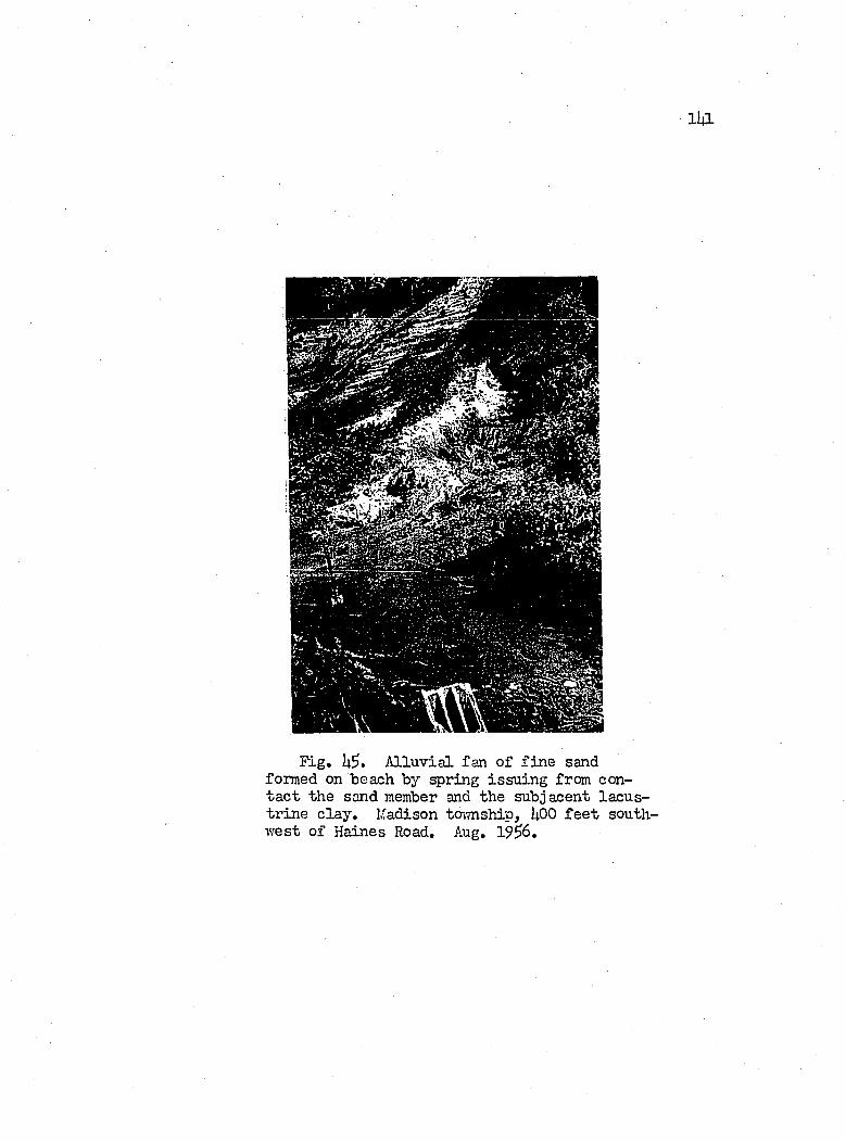
l i a
Fig. h$. A llu v ia l fan o f f in e sand formed on beach by spring issu in g from conta c t the sand member and the subjacent lacu str in e c la y , Madison township, UOO f e e t southw est o f Haines Road. Aug. 19^6.
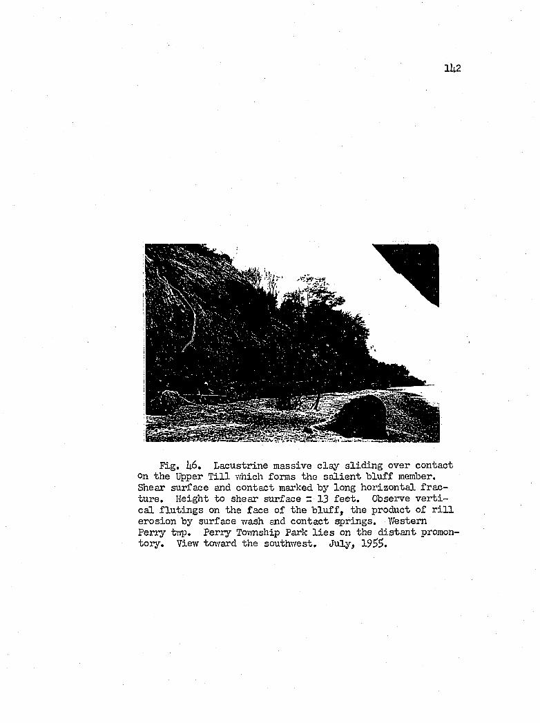
1U2
r ig , k6. Lacustrine massive c la y s lid in g over contact On the Upper T i l l which forms the s a lie n t b lu ff member. Shear surface and contact marked by long h orizon ta l fra c ture. Height to shear surface = 13 f e e t . Observe v e r t i c a l f lu t in g 8 on the face o f the b lu f f , the product o f r i l l erosion by surface vrash and contact springs. Western Perry tv/p. Perry Tovmship Park l i e s on the d is ta n t promontory . View toward the southwest. July, 1955.
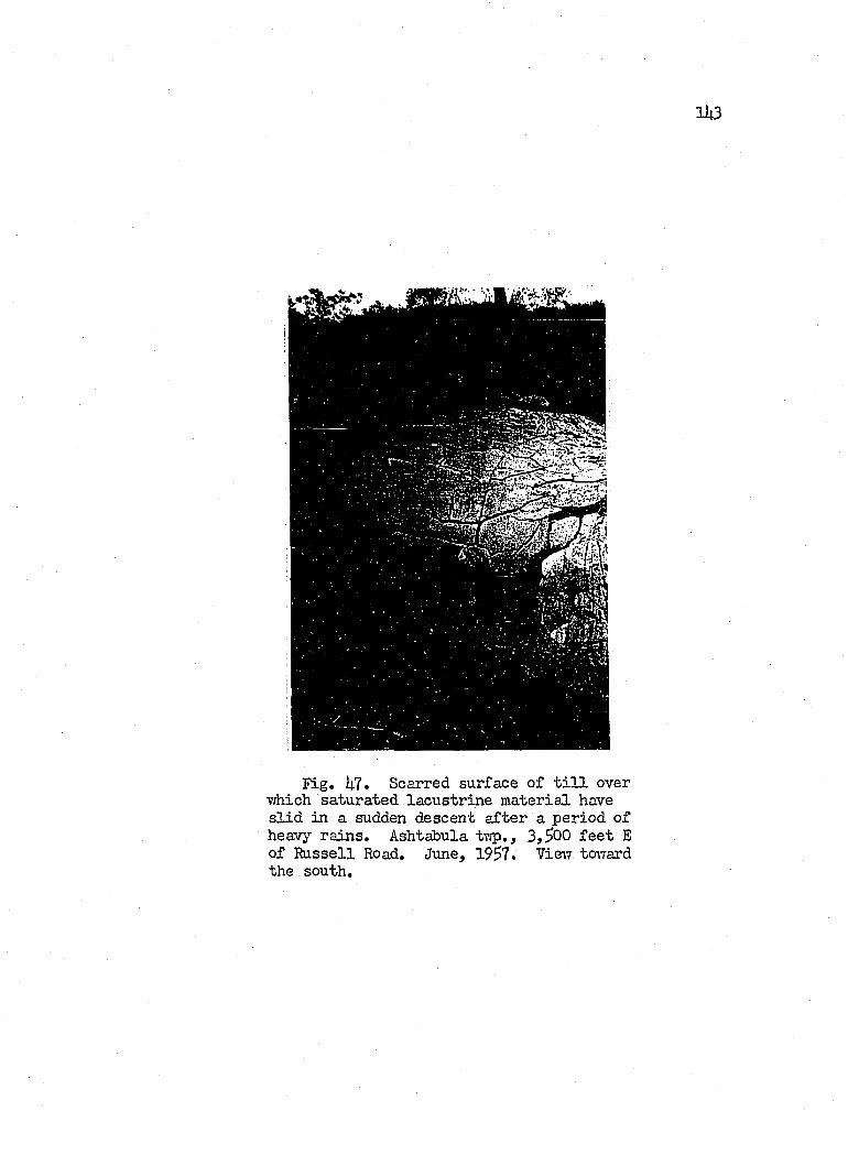
1U3
m .m '
Fig. U7. Scarred surface o f t i l l over T/hich saturated la cu str in e m aterial have s l id in a sudden descent a fter a period o f heavy ra in s , Ashtabula tv;p,, 3,^00 f e e t E of I ^ s s e l l Road. June, 19^7. Vieiv tcnTard the south.
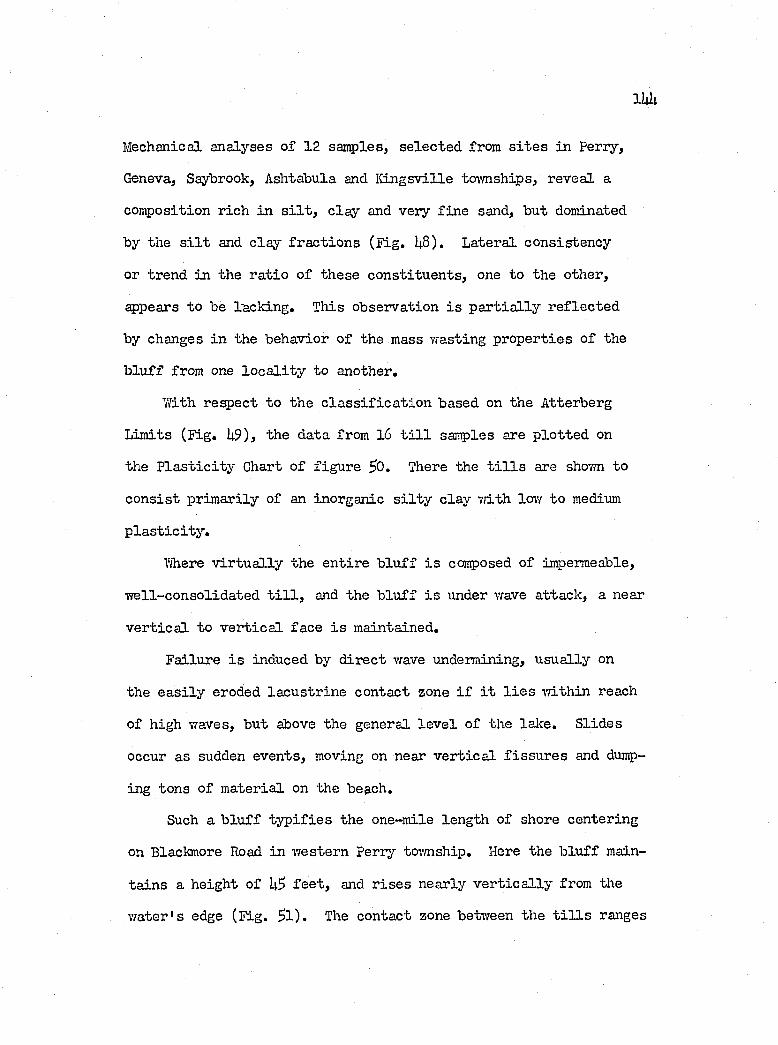
110;
Mechanical analyses o f 12 samples, se lec ted from s i t e s in Perry,
Geneva, Saybrook, Ashtabula and K in gsv ille tovmships, reveal a
composition r ich in s i l t , c la y and very f in e sand, but dominated
by the s i l t and c la y fr a c tio n s (F ig . U8). Lateral consisten cy
or trend in the r a tio o f th ese co n stitu en ts, one to the other,
appears to be lack ing, Tliis observation i s p a r t ia l ly r e f le c te d
by changes in the behavior o f the mass wasting prop erties o f the
b lu ff from one lo c a l i t y to another.
With respect to the c la s s if ic a t io n based on the Atterberg
Lim its (F ig , U9), the data from l6 t i l l samples are p lo tted on
the P la s t ic it y Chart o f fig u re 50, There the t i l l s are shovm to
co n s ist prim arily of an inorganic s i l t y c lay vdth low to medium
p la s t ic i t y .
Where v ir tu a l ly the en tire b lu ff i s conposed of impermeable,
w ell-con so lid a ted t i l l , and the b lu ff i s under wave attack , a near
v e r t ic a l to v e r t ic a l face i s maintained.
Failure i s induced by d irec t wave undermining, u su a lly on
the e a s i ly eroded la cu str in e contact zone i f i t l i e s w ith in reach
of high waves, but above the general le v e l o f the lalce. S lid es
occur as sudden events, moving on near v e r t ic a l f is s u r e s and dump
ing tons of m aterial on the [email protected].
Such a b lu f f ty p if ie s the one-mile length of shore centering
on Blackmore Road in western perry tovmship. Here the b lu ff main
ta in s a height of f e e t , and r is e s nearly v e r t ic a l ly from the
w ater's edge (F ig , 5 l ) , The contact zone betvreen the t i l l s ranges
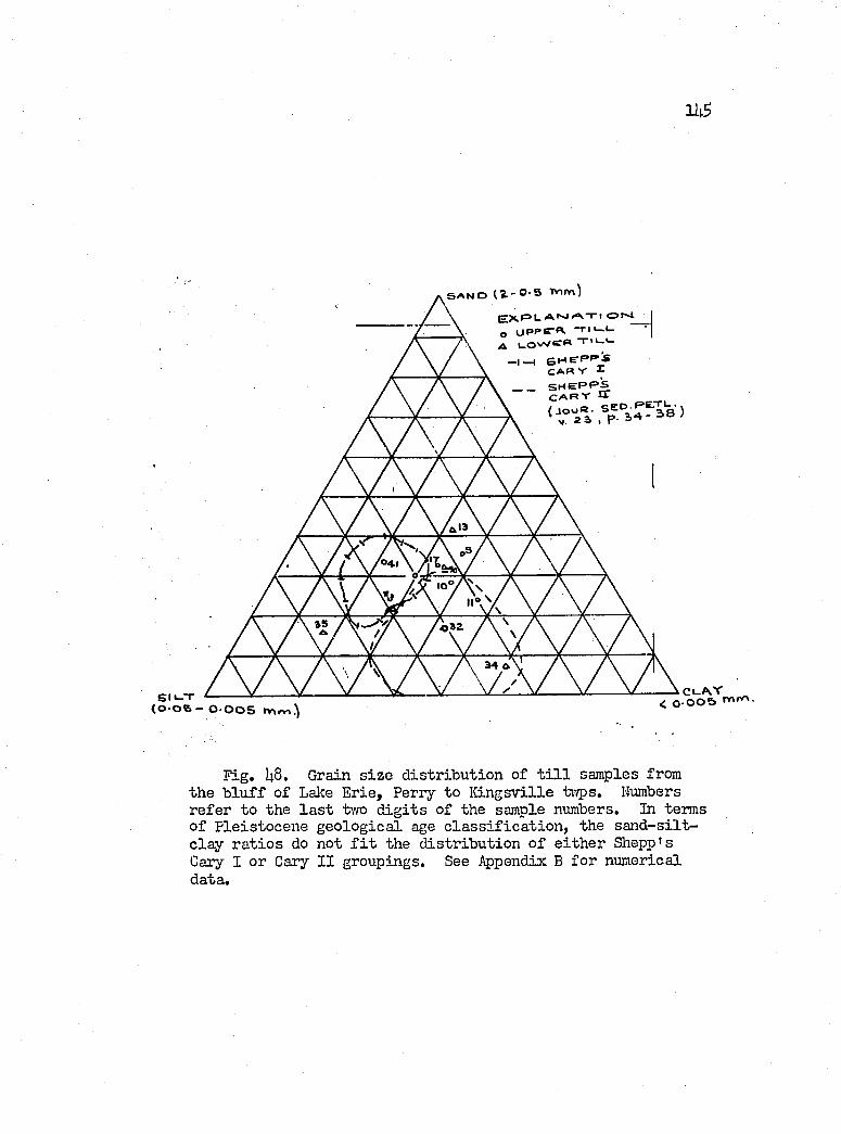
116
S A N D (%-O'S Tnm)E X » = » t - C ? t ^
O O P P E * * ^ ‘A i_owe« T '‘-'-
- I —t S H C P P ! : C A R V r
“ “ I aS y' o-
S l i - T(O OS - 0 005
C l-A vY < o - O O S r« 'Y » ’
Fig. U8. Grain s iz e d istr ib u tio n of t i l l samples from the b lu f f o f Lake E rie, Perry to K in gsv ille ti'/ps. Numbers refer to the la s t two d ig it s of the sample numbers. In terms o f P leistocen e g eo lo g ica l age c la s s if ic a t io n , the s a n d -s ilt - c la y r a tio s do not f i t the d istr ib u tio n o f e ith e r Shepp's Cary I or Cary I I groupings. See Appendix B fo r numerical data.
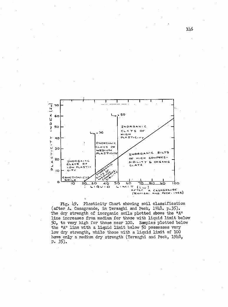
1 U 6
f - ioH
60)(U 0Z 5 0
lrJO« G * < » C C I . A . V S o r L.Ovst PL^S”rt“
— c i T r
XMOPC ANJl c C U A - r S C P
M E O l ON/ \P i. a S X i c . i t y
2 0 __ 5 0 4 OI LI QUI D
5 0
I N O « e « A N I c
C L A Y S O FHIGHP L A S T i C l -
iOn.||.CSSC O M E
S i L T S
o r H i C M c o M p p e s - S i f â i i - n r i> o r g a n i cC u A Y 3
C A S A G I ^ A i - ' O t
(-TERJ c n I
Fig. U9. P la s t ic i t y Chart shov/ing s o i l c la s s if ic a t io n (a f te r A. Casagrande, in Terzaghi and Peck, 19^8. p .35).Tlie dry strength o f inorganic s o i l s p lo tte d above the "A" l in e in creases from medium fo r those T/ith liq u id l im it belovr 50, to very high fo r those near 100. Samples p lo tte d belovT the "A" l in e Tfith a liq u id lim it below 50 p ossesses very low dry strength , vrhile those v/ith a l iq u id l im it of 100 have only a medium dry strength (Terzaghi and Peck, 19U8,P. 35).
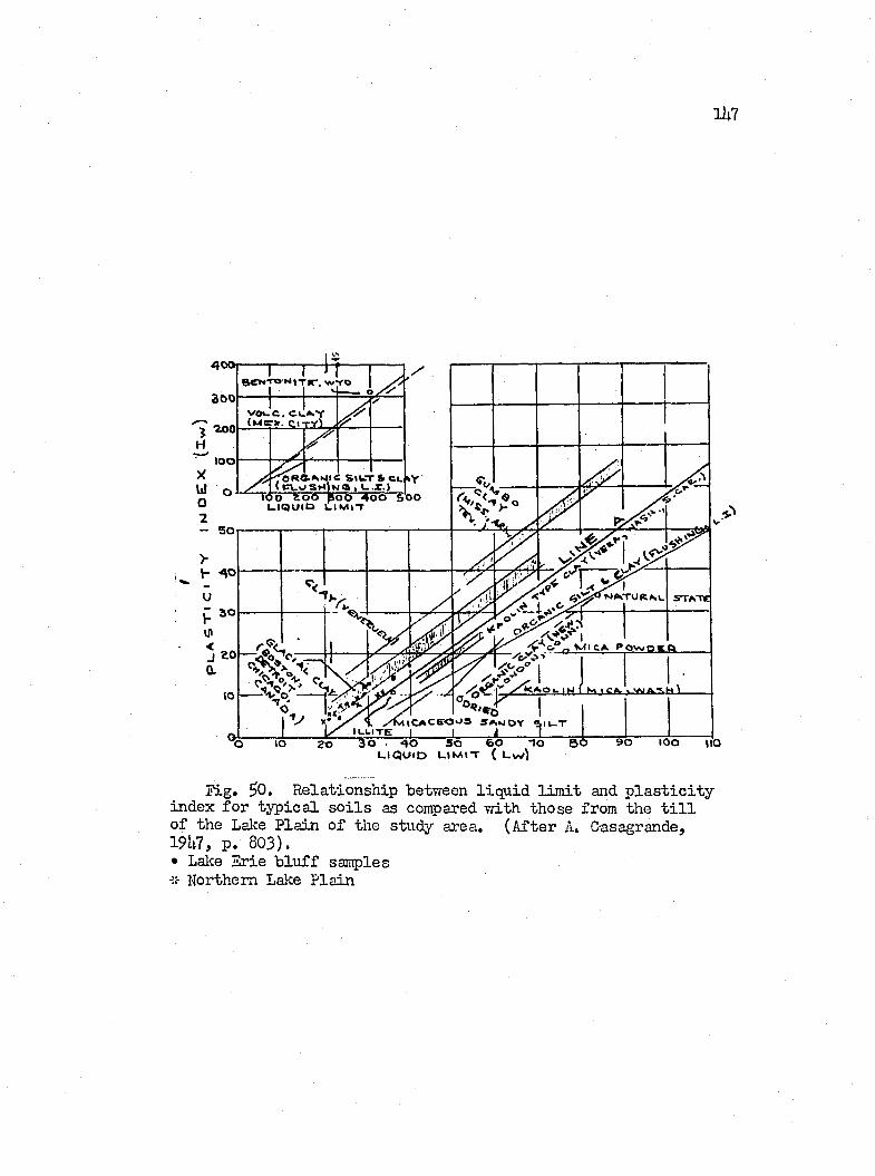
ih l
H
...... r ...1 -JBCNTON%T#r, W1 1 H-----roh— c
1VOUC. CUAY . iMBTir. CitV . />
( PVc smU: Siw l« , L' & CL 1 •I.JLIQUID LIMIT
h 40
M I C A P O W P t L Q
y ^ ^ O u l t J I M I C A . ' , V U A . « . H ^
°'"*6ILLITE
LIQUID L i m i t { L w |
Fig. ^0. R elationship between liq u id l im it and p la s t ic i t y index fo r ty p ic a l s o i l s as compared v/ith those from the t i l l of the Lalce P la in o f the study area. (A fter A. Casagrande,19U7, p. 803).• Lalce Erie b lu ff samples ■ÎÎ- Northern Lalce P lain
1U 8
in e lev a tio n betvreen ^?U and $76 f e e t , i . e . , 1 to 3 f e e t above
lalce le v e l , and c o n s is ts o f le n se s and pockets o f la cu str in e sand,
s i l t and c la y . Waves rea d ily undermine th is b lu ff by the removal
o f non resistant m aterial from the contact zone. V ertica l f is s u r e s
p a r a lle l to the fa ce o f the b lu ff develop near the base, p o ss ib ly
as a r e s u lt of hydration viiich may promote an expansion lalcevfard
of the b lu ff , or p o ss ib ly as a product o f freez in g and thai'dng
of c a p illa r y moisture drai-m up from the base o f the b lu ff . Ho\vbeit,
vdth s u f f ic ie n t undermining, do\’m come tons o f m aterial from above
(F ig. 51).
In general, the above described process o f mass vrasting, i . e . .
S o il F a ll (Vames, 1955, p. 22), operates vdierever in the study
area massive b asa l u n its o f competent t i l l are exposed to vreve
undermining. Horrever, the spectacular e f f e c t ejchibited at the
above s i t e becomes subdued in other lo c a l i t i e s by the fa c t th at
the t i l l i s seldom as th ick , and by the presence of th ick super
jacen t la cu str in e beds, on which re la ted processes o f degradation
operate more e f f e c t iv e ly . Thus debris i s supplied by these over-
ly in g beds in s u f f ic ie n t amount to reduce the in te n s ity of wave
attack against the b lu f f . To th is one must add the fa c to r o f sheet
and r i l l erosion o f the b lu ff by contact springs issu in g from the
la cu str in e u n it onto the b lu f f , which helps to reduce the upper
slope of the b asa l t i l l (F ig . U6).
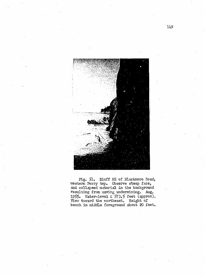
1 U 9
Fig. $1. B lu ff IΠo f Blackmore Road, Tfestem Perry Observe steep face ,and co llap sed m aterial in the background resu ltin g from vraving undermining. Aug. 1955. W ater-level z 573.5 f e e t (approx). View toT/ard the northeast. Height of bench in middle foreground about 20 f e e t .
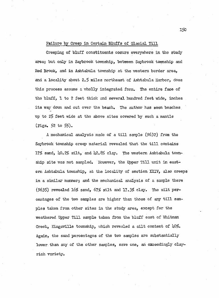
1^0
Failure by Creep in Certain B lu ffs o f G lacia l T i l l
Creeping of b lu ff co n stitu en ts occurs everyriaere in the study
area; but only in Saybrook to\m ship, between Saybrook toivnship and
Red Brook, and in Ashtabula tcnvnship at the western border area,
and a lo c a l i t y about 2 .5 m iles northeast o f Ashtabula Harbor, does
th is process assume a w holly in tegrated form. The en tire face of
the b lu ff , 1 to 2 f e e t th ick and severa l hundred f e e t vri.de, inches
i t s vray dovm and out over the beach. The author has seen beaches
up to 25 f e e t vri.de a t the above s i t e s covered by such a mantle
( ï i g s . 52 to 55).
A mechanical an a ly sis made o f a t i l l sample (9632) from the
Saybrook tovmship creep m aterial revealed th a t the t i l l contains
Yl% sand, UO.2^ s i l t , and ^2.8^ c lay . The western Ashtabula tovm
ship s i t e vras not sampled. However, the Upper T i l l u n it in ea st
ern Ashtabula tovmship, at the lo c a l i t y of sec tio n XXIV, a lso creeps
in a sim ilar manner; and the mechanical an a lysis o f a sançle there
(963S) revealed 16^ sand, 61% s i l t and 17.3^ c la y . The s i l t per
centages o f the tv/o samples are higher than those o f any t i l l sam
p le s talcen from other s i t e s in the study area, except fo r the
weathered Upper T i l l sample talcen from the b lu ff ea st o f VAiitman
Creek, K in gsville tovmship, which revealed a s i l t content of l+O .
Again, the sand percentages o f the two samples are su b sta n tia lly
loiver than any of the other samples, save one, an exceedingly c la y -
r ich v a r iety .
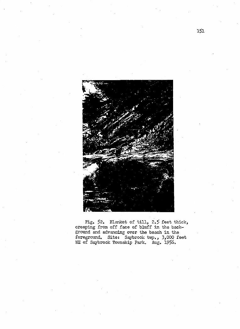
I S I
Fig. 3*2, Blanket o f t i l l , 2 .5 f e e t th ick , creeping from o f f face o f b lu ff in the background and advancing over the beach in the foreground. S ite ; Saybrook tv<p., 3,000 f e e t IIE o f Saybrook Tovmship Park. Aug. 1956.
1 5 2
Fig. 53. Like Fig. 52. Same area. Observe polygonal fra ctu res , the product o f repeated saturation and drying o f the t i l l . Freezing and thavving in the spring probably la id the groundvrark fo r the movement d isplayed . Aug. 1953.
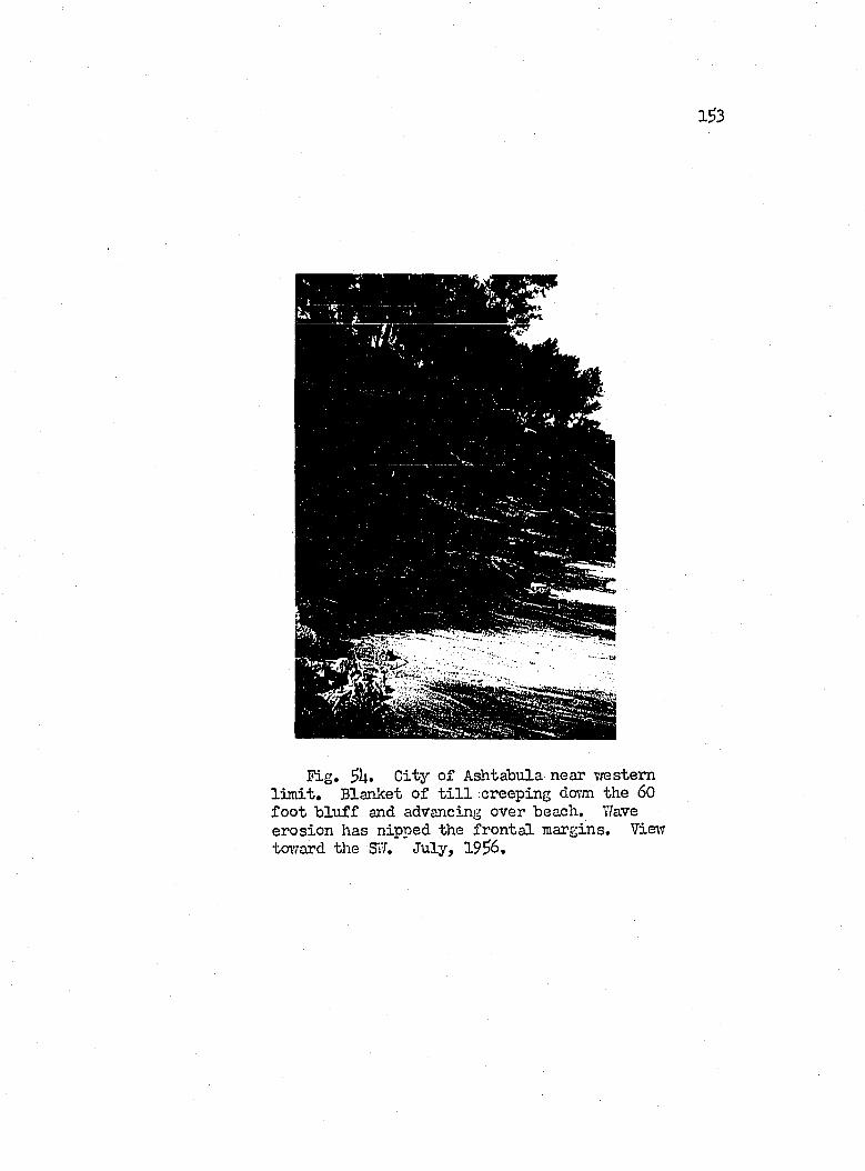
1^3
Fig. C ity o f Ashtabula near vrestemlim it . Blanket o f t i l l .creeping dovm the 60 fo o t b lu f f and advancing over beach, Tfave erosion has nipped the fr o n ta l margins. View tovrard the SvI. July, 19^6.
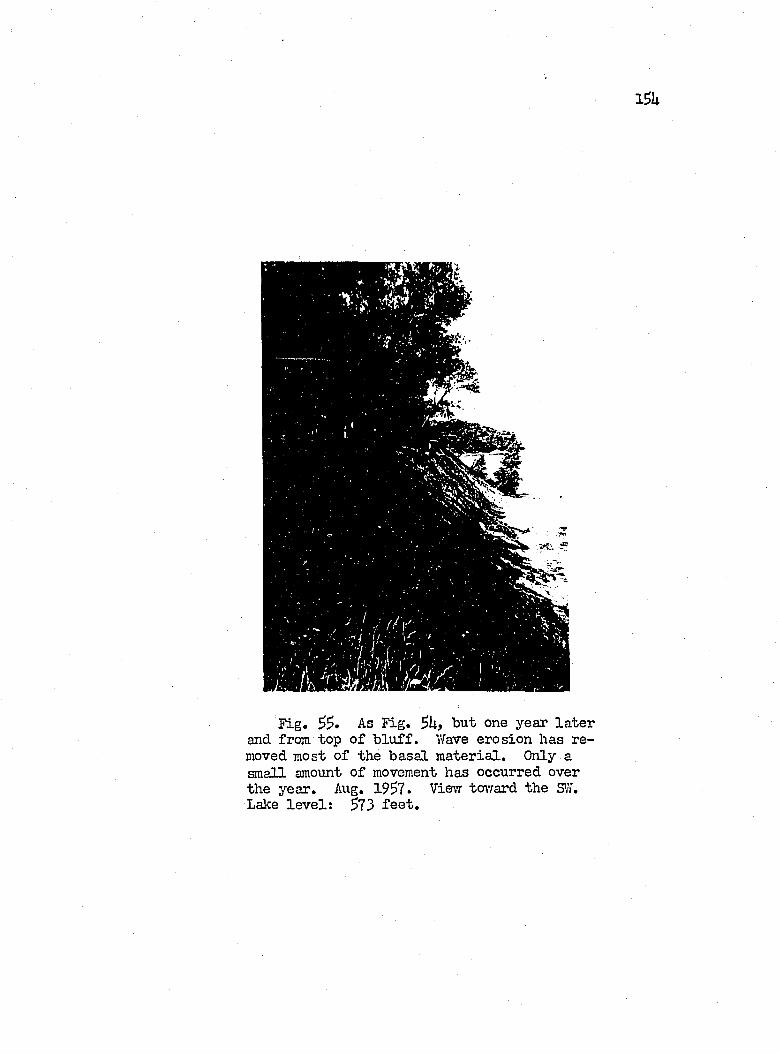
Fig. As Fig. Sltf but one year la te rand from top o f b lu f f . Wave erosion has removed most o f the b asa l m ateria l. Only a
amount o f movement has occurred over the year. Aug. 19^7. Vie;? toward the S'iY. Lake le v e l: 573 f e e t .
i s s
With r e j e c t to the creep phenomenon of th ese s i t e s , the high
s i l t content o f the b lu ff con stitu en t bears great s ig n ifica n ce .
Observations during the summers of 1?SS, 19^6 and 19^7 in d ica te
that the ty p ica l summer showers scarcely a ffe c t the q u a s i-s ta b ility
of these creeping masses. The rain barely wet the face o f the b lu ff ,
because o f the steep slopes and the resu lta n t rapid runoff.
On both hyp othetica l and em pirical grounds, as d iscussed by
ICrynine (l9lpL, p . 8 l) and Terzaghi and Peck (1 9 ^ , p. 131), sed i
ments dominated by the s i l t s ized fra c tio n are strongly su scep tib le
to d isruption by freez in g and thai'ring, because such sediments com
bine a considerable height o f "capillary r ise" ïâ th fa ir perm eability.
Moreover, the force o f c r y s ta ll iz a t io n th at induces a flcriT o f water
toward the zone of freezin g i s id e n tic a l in e f fe c t v/ith the c a p il
la ry force th a t causes water to r is e from a ground-water source
through the voids o f a s o i l toward the surface o f evaporation. Tlie
ic e formed tends to force the s i l t grains apart, thereby reducing j
the in tern a l resista n ce o f the m aterial. In co n trad istin ction ,
c la y l i th o lo g ie s p o ssess a "high c ^ i l l a r y r is e , " but l i t t l e perme
a b il ity . Sands, though h igh ly permeable, include v/ithin th e ir
structure s u f f ic ie n t ly large voids to accomodate the increase volume
gained by the freezin g of i n t e r s t i t i a l water.
Eventually, thav/ing ensues, and the s i l t s become saturated
v/ith m elt water from the ic e developed v/ithin them. Thus v/ith the
fab ric of the a ffected u n it already disrupted by freez in g , and the
intergranular pressure further reduced by the excess m oisture, the
1S6
surface layer o f the b lu ff i s s e t in to motion by g ra v ita tio n a l
s tr e s s . The depth o f f r o s t penetration ranges from 21 to 23 inches
for the area (Chieruzzi and Baker, 1958, p . 7 6 ). This depth i s
of the same order of the th ick ness o f the creeping masses which
ranges from 1 to 2 .5 f e e t .
Maximum rate o f movement apparently occurs in the early spring,
but as the b lu ff d r ies out during the summer months, movement comes
to a h a it . Not only the increased r ig id it y gained by the b lu ff
co n stitu en ts, but a].so the braking e f fe c t o f m aterial moving onto
the beach serve to end the motion. Heirever, the agents acting to
d isin teg ra te the creeping masses continue to fu n ction . D essication
and iTetting, e sp e c ia lly o f the lovrer portion o f these d ep osits,
fo llo w in rapid sequence, as implemented by r a in fa l l and spray from
rough -water on the la k e . A dditionally , vrater from above i s chan
n e lle d through the f is s u r e s in the b locks; Eventually the mass
th at had crept over the beach i s d issip a ted , leav in g the w inter-
spring process o f freez in g and thavring to resume the operation.
The end e f f e c t i s th a t of b lu ff r e trea t by p a r a lle l re trea t o f the
slope. The re trea t as measured at the top of the b lu ff in western
Ashtabula tovmship has been of the order of 2 f e e t per year fo r the
period 195U-1956.
1S7
Slumping in Composite B lu ffs o f G lacial T i l l s and Interbedded. Lacustrine Clay
B lu ff slumping, by fa r the most e f fe c t iv e o f the mass wasting
processes in the study area, a f fe c ts the folloTdng two groups of
stratigraphie sequences:
A, th at co n sistin g from top to bottom of la cu str in e beds.Upper T i l l , i n t e r t i l l la cu str in e beds, and LoT,7er T il l; and
B. th at which inclu des a v ir tu a l ly a l l - t i l l b lu ff sec tio n restin g on la cu str in e m aterial, d iscrete or poorly in te grated in to the t i l l near lalce le v e l . The LOTYer T i l l or bedrock may l i e below.
Slump in the area i s fa c i l i t a t e d by wave erosion o f the b lu ff
and by the presence of water-sa.turated u n its ly in g at depth in the
sec tio n o f b lu ff a ffec ted .
Group "A" Slumps Only the b lu ff o f Ashtabula County presents
the w ell-developed sequence o f th ick a ltern atin g beds o f g la c ia l
t i l l s and la cu str in e sediments p rereq u isite to th is category'' of
slump forms. A step lik e p r o f ile i s presented by th is stra tigrap h ie
succession , wherein the Lovrer T i l l forms the s a lie n t , b asa l fron t,
20 to 30 f e e t high, behind and above which lacu str in e sediments,
6 or more f e e t th ick , r is e on a subdued slope. Superjacent and
recessed more than 20 f e e t inland, the front of the Upper T i l l
r is e s shaip ly for a height o f l6 to 2 f e e t . At the top o f the
sec tio n , sloping inland fo r a h orizonta l d istance o f J.i.0 f e e t from
the shore, l i e s another la cu str in e u n it, 3 to 35» f e e t th ick (F ig. $6).
The Loiver T i l l i s characterized by low perm eability , l i th o lo g ie
consisten cy, toughness and good competency. Thus i t contributes

1 S 8
a stab le base fo r the overlying beds. On the other hand, the
la cu str in e u n it , interbedded betvreen the Lovrer and Upper T i l l s ,
contains miniature le n se s o f sand in s i l t y c lay , and bears moisture
p eren n ia lly . In some lo c a l i t i e s i t i s saturated vvith water even
in the r e la t iv e ly dry months o f summer, bhen the u n it exceeds 6
f e e t in th ick n ess, i t tends to f a i l under the s tr e s se s generated
by the overburden o f Upper T i l l and la cu str in e sediments. Failure
apparently occurs by p la s t ic y ie ld in g of the c lay , aided by the
removal o f sand by ground water issu in g at the base o f the u n it,
,'TJhere t l i i s la cu str in e u n it i s tliick enough to generate r e la
t iv e ly large displacem ents, flowage o f i t s co n stitu en ts causes
slumping to develop in the more conpetent Upper T i l l member over-
ly in g i t . On the other hand, a th in u n it o f such interbedded lacu s
tr in e deposits apparently produces l i t t l e adverse e f f e c t on the
resistan ce to fa ilu r e , Hovrever, one must condition th is observation
by the fa c t th a t th in interbeds of la cu str in e m ateria l are generally
discontinuous and drj’-, thus in d ica tin g th a t they do not in tercep t
sources o f ground water.
The la cu str in e m aterial a t the top o f the b lu ff may wash, flow
or slump, depending on the response of the p a rticu la r lith o lo g y
to the degradational forces acting thereon, Hovrever, good pem ea-
b i l i t y gen era lly ch aracterizes these beds, which th erefore act as
a good water bearer. Seepage from the contact on the Upper T i l l
fin d s i t s way below, to f a c i l i t a t e movement there, An example of
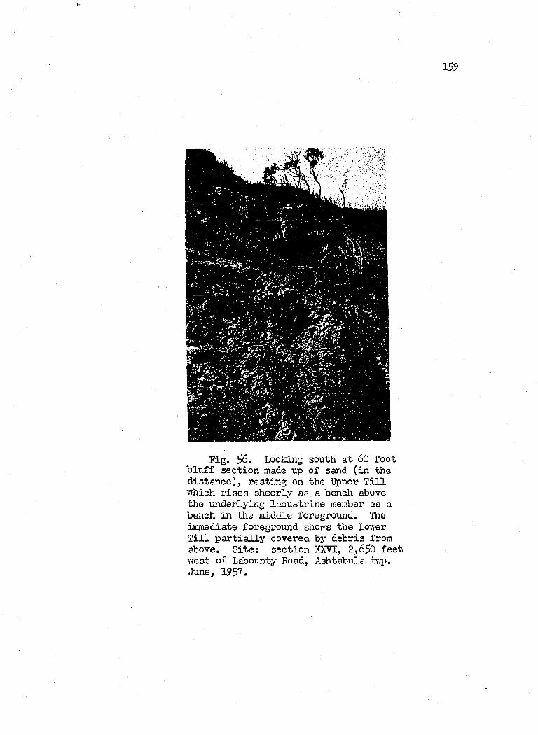
1^9
Fig. Looking south a t 60 fo o tb lu f f sec tio n made up o f sand (in the d ista n ce ), restin g on the Upper T i l l which r is e s sheerly as a bench above the underlying la cu str in e member as a bench in the middle foreground. The immediate foreground shows the Lovrer T i l l p a r t ia l ly covered by debris from above. S ite : sec tio n XXVI, 2,6^0 f e e twest o f Labounty Road, Ashtabula twp. June, 1957.
160
the erosion a l e f fe c t s o f such seepage i s revealed by the v e r t ic a l
f lu t in g s developed on the fa ce o f the Upper T i l l in Fig. ^6,
Group "B" Slumps Slung?s o f th is category involve the en tire
b lu ff as a u n it . Thus they are by far the most spectacu lar. By
the very nature .of th is tj’pe o f slumping, stra tigrap h ie r e la t io n s
o f the a ffected b lu f f become obscured, and inform ation in th is re
gard must n e c essa r ily be sought by d r il l in g in to the roof o f the
b lu ff . A dd itionally , one may obtain c lu es from the l ith o lo g y of
the slump blocks them selves. In general, the contact bn the Lovrer
T i l l l i e s near lake le v e l , and the co n stitu en ts o f the b lu f f co n s is t
of a r e la t iv e ly th in to th ick (10 to lj.6 f e e t ) cru st o f compacted
t i l l which grades dov/nward in to a more p la s t ic or clayey t i l l layer
and/or la cu str in e sand and c lay .
This substratum o f permeable and p la s t ic m ateria l co n stitu te s
the c r i t i c a l fa c to r . Apparently i t s subsurface extension and th ick
ness are ir reg u la r ly d istr ib u ted over small areas, and th is irregu
la r i t y i s perhaps a ttr ib u tab le to the d is to r tio n a l s tr e s se s imposed
on the la cu str in e m aterial by the g la c ie r s th at deposited the super
jacent t i l l . Auger sec tio n s made by the Ohio D iv ision of Shore
Erosion in to such d ep osits during the summer o f 19$6 revealed p la s t ic
c lays th at one could Icnead between the fin g ers vdthout the addition
o f more m oisture. Likewise, R. Chieruzzi (19^6, personal communi
ca tio n ), on malcing borings in to such c la y at the fo o t o f the Kentor
Headlands b lu f f in Mentor tovmship, found the c la y to have a natural
moisture content o f 13.9 to 2U.7 percent. Thus in th is category
l 6 l
o f slump, l ik e th at in group "A," the beds were m oist even during
the r e la t iv e ly dry months of summer, and therefore must transmit
even more water in the early spring when slump becomes accelerated»
The s i t e s o f th ese slu%)s in the study area extend across
P a in esv ille tovmship, but the author s p e c if ic a l ly studied the slump
ju s t ea st o f Hardy Road in Paine s v i l l e tovmship. A dditionally ,
a l l o f the b lu ff from Geneva-on-the-Lalce to Saybrook Tovmship Park
in cen tra l Saybrook Tovmship, a d istance o f U m iles , i s lik ew ise
affected and was stud ied over most of i t s length .
The Slumps of P a in e sv ille Tovmship Most o f the b lu ff o f Paines-
v i l l e tovmship, from the v ic in it y ea st o f F aiiport to Bacon Road,
undergoes slumping where i t i s exposed to wave attack. The w riter
se lec ted fo r studj’’ the 9,000 - fo o t stretch of shore centering on
Hardy Road ju s t ea st o f P a in e sv ille Tovmship Park, because the
slump process here ty p if ie s th a t o f the aforementioned shore length ,
and access to the shore was e a s i ly made. This s i t e and hinterland
i s shovm on the map o f Figure 57.
The b lu ff o f th is area ranges in e lev a tio n from 625 to 628
fe e t , i . e . , 52 to 55 f e e t above lake le v e l o f 573 f e e t . On the
other hand, bedrock l i e s 20 to 25 fe e t below the lake le v e l and
r is e s southward at a rate o f about 60 f e e t per m ile. G lacia l t i l l
dominates the s tr a tig r ^ h y , which p ossesses the tr ip a r t it e arrange
ment o f an Upper and Lovrer T i l l u n it separated by 6 to 10 f e e t o f
la cu str in e c lay . The r e la t iv e ly competent Upper T iU , UO to U6
f e e t th ick , forms the dominant member o f the b lu ff . Hovrever, the
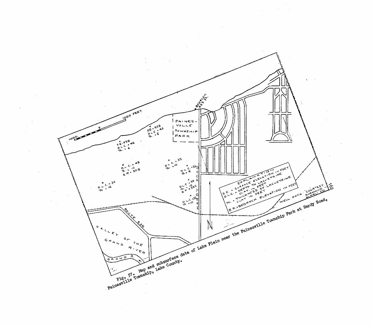
S.e-*c To WMS H I PP a r k
c-
%c-
-tw
163
r e la t iv e ly incompetent la cu str in e u n it occupies the c r i t i c a l basa l
section . On i t s part, the Lov/er T i l l l i e s m ostly at or below water-
le v e l .
This in essence i s the stratigraphy presented by the b lu ff
a l l the way in to western Perry tormship. However, in Perry town
ship, the la cu str in e u n it has thinned to between 1 .and 3 f e e t .
One suspects th a t th is th inning o f the la cu str in e u n it ex erc ises
a profound control on the type o f b lu ff fa ilu r e th at p r e v a ils . ' In
Perry tovmship, as d iscussed e a r lie r , -waves removing the lacu str in e
m aterial undermine the competent Upper T i l l which then f a i l s by
v e r t ic a l shear. Contrarivd.se, slumping occurs throughout Paines-
v i l l e tovmship, vfhere the Upper T i l l i s v ir tu a l ly f lo a t in g on a
r e la t iv e ly th ick substratum o f p la s t ic claj’" interbedded v/ith sand.
This la cu str in e u n it has been traced inland by means o f w e ll
lo g s fo r a d istance exceeding 3,000 f e e t , and the author assumes
th at i t probably extends a l l the way to w esterly Grand River v a lle y
(Figure 57). About 3,000 f e e t south o f the b lu ff , the top of the
lacu str in e u n it , as deterroined vrest of Hardy Road, l i e s at a general
e lev a tio n o f 595 to 600 f e e t , or roughly l5 f e e t above i t s e lev a tio n
in the b lu ff . Thus there apparently e x is t s a gentle slope on the
upper contact o f 1:200 or roughly 26 f e e t per m ile tov/ard the north.
Should one p ro ject the contact southward 2,000 f e e t to the w all
of the Grand River, i t would in tercep t i t at le a s t l5 f e e t and
more l ik e ly 20 f e e t above the surface o f the r iv er . This fa c t i f

I61i
v a lid i s o f s ig n ifica n ce in a negative sense, vrhen compared vdth
the other fa c t bearing on the r e la t iv e ly high moisture content o f
the la cu str in e c lay uherever sampled. Apparently one cannot a t t r i
bute in flu e n t seepage from the r iv er as the source of the m oisture,
î ln a l ly , the c lay tliin s toward the lak e, from a maximum of l6 fe e t ,
and a general order o f 10 f e e t in the south, to 6 f e e t in the b lu f f ,
thus providing fo r a larger m oisture storage volume in the south.
To account for the presence o f moisture in the la cu str in e u n it,
the author hypothesizes th a t the la cu str in e bed in tercep ts the
topographic surface in the area to the south, most . l ik e ly the north
ern w a ll of the Grand Hiver v a lle y . There, the u n it r ece iv es mois
ture by surface in f i l t r a t io n and tra n sfers i t northward down i t s
gradient. Since the c la y s have but lovr perm eability , the recharge
and discharge proceed slow ly. Tlris hypothesis can be extended to
another major area o f slumping, th at o f the I'entor Headlands area
on the western side o f the Grand River at Fairport, There the
abandoned v a lle y o f the Grand River, now the llentor Marsh, and the
presence o f even th ick er i n t e r t i l l la cu str in e c la y in the b lu f f
have s e t up what resembles s im ilar p h ysica l cond itions (Christopher,
1925).
Returning to the P a in e sv ille slumps, the presence o f moisture
in the i n t e r t i l l la cu str in e c la y and sand serves to so ften the very
foundation o f the b lu f f . The weight o f the t i l l above i s tran s
m itted to the sem ip lastic and p la s t ic c lay below, through which
the compressional s tr e s s i s p a r t ia l ly d istr ib u ted h y d ro sta tica lly .
165
Hwever, the confin ing pressure v/ithin the üacustrine c lay dim inishes
in the d irectio n o f the b lu f f , because o f the presence o f the boundary
between b lu ff and atmosphere, because of the lakeward d irected
hydraulic gradient and contact slope on the la cu str in e c la y , and
la s t ly , because of w etting by high waves. Consequently, the lacu str in e
clay y ie ld s p la s t ic a l ly , by the development o f what the author in te r
p rets as shear jo in ts (Figure 63), and by shearing on the lower
and upper contacts (Figure 62). Since the overlying t i l l in an
undisturbed s ta te n eith er bends nor flow s e a s i ly , i t even tually
breaks as i t s support i s removed, and develops a se r ie s o f rather
nondescript, lin ea r slump blocks mixed lYith debris.
The author observed th a t the surface o f shear near the base of
the b lu ff (Figure 62) slopes upward in to the b lu ff at an angle of
l e s s than 5 degrees vri.th resp ect to the horizon ta ls and th at the
angle on the back scarp o f the slump l i e s near the v e r t ic a l at
the top o f the b lu f f . Thus one can f i t the c la s s ic a l model o f a
dormvrard, ro ta tio n a l movement o f slumping m aterial on a concave
surface o f shear, as described by Sharpe, 1938, p. 65. However,
the t i l l i s b r i t t le and the la cu str in e u n it i s w e ll defined; thus
one should not expect to f in d a continuous d iscrete surface of
shear over any area in excess of 100 f e e t . Thus the diagrams o f
Figures 58 and 59 represent the author’s id e a liz a tio n o f the Paines-
v i l l e tovmship slump at Hardy Road, wherein steep surfaces o f shear,
developed in the t i l l , f la t t e n on encountering the la cu str in e u n it.
This s itu a tio n i s regarded as sim ilar to th at portrayed in Figure 13
1Ô 6
o f Vames' (1938, p . 27) vrork, where a photograph o f a slump cro ss-
section in la cu str in e c la y s revealed a sim ilar f la t te n in g o f the
shear surface along a bedding plane.
Over the years o f 195U to 19^7, the slunç» area at Hardy Road
has undergone a cy c le , wherein the slope on the b lu ff has increased
from a 1:2 r a tio to th at o f 1 :1 , then returned to the 1:2 r a t io .
This behavior i s p a r t ia l ly i l lu s t r a te d by F igs. 60 and 6 l . Move
ment during the summers, f a l l s and w inters was r e la t iv e ly sloiv,
which i s understandable in vievf o f the summers' dryness end the
v/inters' fr eeze . Greatest movement coincided w ith the spring period
o f thawing and freez in g , and prolonged r a in fa l l , in which a great
deal o f water was released fo r entrj’’ in to the numerous ten sio n a l
cracks on the slump b lock s, not to mention the recharging o f the
moisture carrying la cu str in e c lay and sand.
Thus w ith a l l o f the foregoing as background m ateria l, the
author summarizes h is im pressions on the top ic in the fo llow ing
reconstruction o f the I; stages o f events.
1. The slope of the b lu f f l i e s a t i t s maximum value o f roughly
U5 degrees, or a r a tio o f 1 :1 . One may regard th is slope
r a tio as c r i t i c a l , s ince further steepening lead s to f a i l
ure (Figure 58).
2. Lacustrine c lay near the base of the b lu f f , softened by
ground and surface water, begins to y ie ld , expanding lake
ward and subsiding v e r t ic a lly . Tensional fractu res in the
t i l l on the lower slope of the b lu ff r e f le c t th is flowage
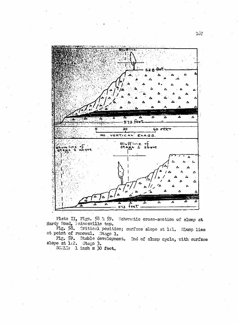
167
62 84^^^
_ j % \ / '■■ V
^ .6 A5 1 3 £ é e t
ik /' V r
B luffli^e. oÇ X abfiboï'- bn e. «V
^ a e « . l . <*.b o v e .
P la ie I I , F ige. 58 - 5°. Hchenatic cro ss-sec tio n o f slrunp a i Hardy Road, I-a in esv ille tv,p.
Flg. 58. C r it ic a l p o sitio n ; surface slope at 1 :1 . Slump l i e s a t p o in t o f renevral. Stage 1.
?ic« S’?» Stable development. End of slumj3 cy c le , vrith surface slope a t 1 :2 . Stage 3.
SC/JLS: 1 inch = 30 f e e t .
1 6 8
beneath the t i l l . Lakeward transport o f the lovrer c o n s tit
uents o f the b lu ff as creeping blocks leave the upper b lu f f
m aterial unsupported^ and fa ilu r e by slumping moves upslope,
vri.th l i t t l e change in the angle o f slope.
3. Surface waters enter the s I ueç) fractu res and lower the in tern a l
resistan ce o f the t i l l by hydration, a process th a t tends
to reduce the apparent cohesion o f c la y s iz e m aterial by
destroying the surface tension o f water f ilm s adhering to
the p a r t ic le s (Terzaghi and Peck, I 9I4.8, p . III1.-I28) . Thus
slunçiing, abetted by flow , continues u n t i l the r e la t iv e ly
low slope o f 30 degrees, or r a tio o f 1 :2 , i s developed. This
slope becomes explainable by the assumption th at the curva
ture on the surface of shear i s f la tte n e d through the ]acu s-
tr in e c la y u n it (Figure $9). Thus the movement of slump
blocks over the lovrer s l ip surface becomes impeded by in
creased f r ic t io n a l fo rces . Slope s t a b i l i t y can now be
achieved but fo r wave erosion .
U. Eroding o f the toe o f the slumped area and the removal o f
debris by vrave action in creases the angle of slope by short
ening the h orizon ta l spread of the b lu f f . A dditionally ,
by removal o f the toe m ateria l, conditions o f d isequilibrium
are rein forced . Hovrever, the force o f s ta t ic f r ic t io n i s
not overcome u n t i l the slope ra tion o f 1:1 i s approached.
The length o f a complete cycle ranges between U to years
under the high lake le v e l conditions o f 1 9 t o 1957. In estim ating
169
amounts o f shoreline re trea t in the area, one should s e le c t e ith e r
the top or bottom of the b lu f f and measure the r e trea t over a given
cy c le , since the ra tes o f r e trea t o f the top o f the b lu f f and th a t
of the bottom are p u lsa tio n a l and a ltern atin g .
The photographs o f Figures 60 to 62 portray the process of
slumping as i t developed over the years 19SS, 19^ and 19^7, at
the s i t e ju s t ea st o f Hardy Road. In sp ite o f the spectacular
nature o f the slumping here, the b lu ff l in e i t s e l f has retrea ted
only some f e e t in S years, or about 9 f e e t per year.
The Slumps of Geneva and Saybrook Townships In the m iles
of shore between Cowles Creek o f Geneva tovmship and Saybrook Tovm
ship Park, slumping a ffe c ts a l l unprotected b lu f f s . Should one
compare th is area w ith th at o f the above described P a in e sv ille
tovmship b lu f fs , one vrould f in d th at the b lu ffs l i e 10 to f e e t
lower, i . e . , they range from 2$ to I4.O f e e t high, the stratigraphy
i s s im ilar in the respect th a t g la c ia l t i l l o v e r lie s la cu str in e
clay , but the slumps o f the Geneva-Saybrook township area ex h ib it
greater complexity.
S tr a t ig r ^ h ic a lly , the Upper T i l l member c ^ s the b lu ff along
th is stretch of shore. Hovrever, i t lacks l ith o lo g ie isotropism ,
and grades dovmward in to a rather unpredictable h eterogen eity o f
la cu str in e c lay , s i l t and sand, a rather clayey t i l l or a mixture
of a l l . The consolidated Upper T i l l u n it apparently f lu c tu a te s in
th ickness from poin t to p o in t vfithin a few hundred f e e t . In l ik e
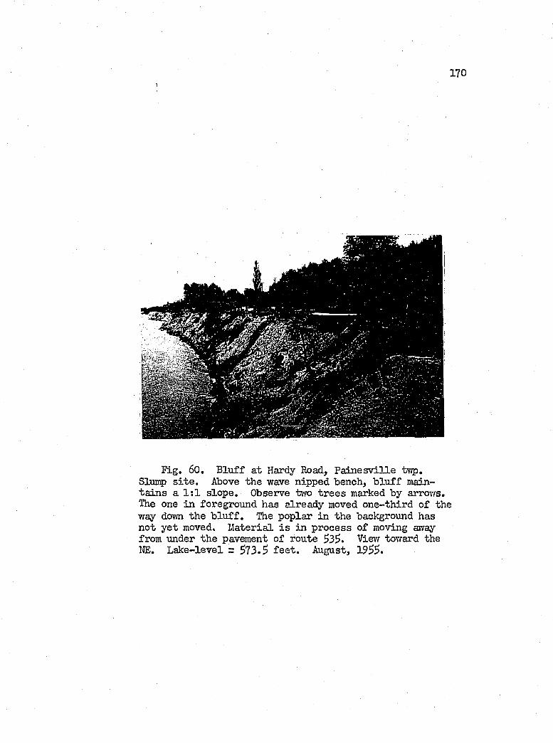
170
r ig . 60. B lu ff a t Hardy Road, P a in e sv ille t-wp,Slunap s i t e . Above the wave nipped bench, b lu f f mainta in s a 1 :1 s lop e. Observe two tr e e s marked by arrows. The one in foreground has already moved one-th ird o f the way down the b lu f f . The poplar in the background has not y e t moved. M aterial i s in process o f moving array from under the pavement o f route 53^. View toward the HE. L ake-level z 573.3 f e e t . August, 1955.
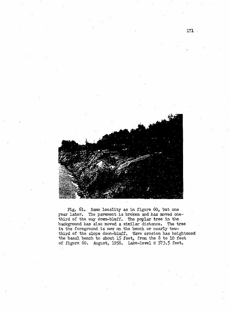
171
Fig. 61, Same lo c a l i t y as in fig u re 60, "but one year la te r . The pavement i s broken and has moved one- th ird o f the yray dorm-bluff. The poplar tree in the background has also moved a s im ilar d istan ce. The tree in the foreground i s noir on the bench or nearly two- th ird o f the slope dovm-bluff. Wave erosion has heightened the b asa l bench to about 1 f e e t , from the 8 to 10 f e e t of figu re 60. August, 19^6. L ake-level r S73.S f e e t .
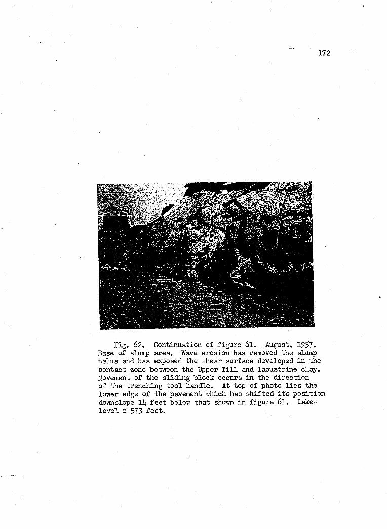
172
ï l g , 62. Continuation o f fig u re 61. August, 1957. Base of slump area. Wave erosion has removed the slxuiç ta lu s and has exposed the shear surface developed in the contact zone betvreen the Upper T i l l and la cu str in e c la y . Movement o f the s lid in g block occurs in the d irection o f the trenching to o l handle. At top o f photo l i e s the lOTfer edge of the pavement which has sh ifte d i t s p o s itio n dov/nslope lit. f e e t below th a t shown in fig u re 6I . Lake- l e v e l = 5 7 3 f e e t .
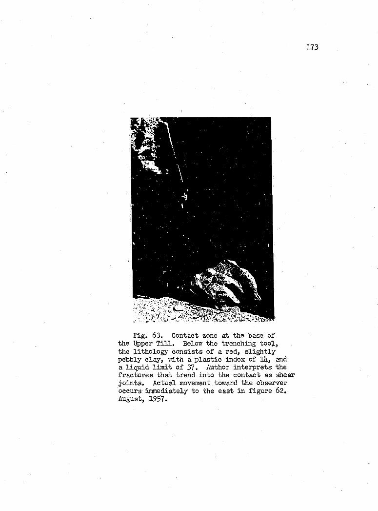
173
Fig. 63. Contact zone at the base o f the Upper T i l l . Below the trenching to o l , the lith o lo g y c o n s is ts o f a red, s l ig h t ly pebbly c la y , v/ith a p la s t ic index o f ll|., and a liq u id l im it o f 37. Author in terp re ts the fra ctu res th a t trend in to the contact as shear jo in ts . Actual movement toward the observer occurs immediately to the e a st in fig u re 62. August, 19^7.
17U
manner, the moisture content o f the subsurface m aterial v a r ies
according to the lo c a l perm eability .
The author's studj» su ffers from the lack o f core h o les made
behind slumping stretch es o f the b lu f f . Hoimver the author has
gathered much c o lla te r a l inform ation on the b lu f f l ith o lo g y from
the slumped fragments them selves, and has supervised the angering
of tffo section s in the very c r i t i c a l area ea st o f Indian Creek in
Geneva tovmship (sec tio n XV), and a p o in t in Saybrook tovmship
(sec tio n XVI), about 11^0 f e e t e a st o f the Geneva tovmship l in e .
The f i r s t o f the auger s i t e s vfas loca ted 2,$00 f e e t vrest o f
the vvest Saybrook tovmship boimdary and ll;0 f e e t in land o f the
vfaterline. This sec tio n revealed th at the Upper T i l l reta ined
i t s c h a r a c te r is t ic a lly tough, compacted lith o lo g y fo r only the
upper 10 f e e t . From lU to 39 f e e t belovf the surface, sand in te
grated in to the somewhat pebbly c lay and s i l t v/as encountered, and
the moisture content increased dovmward u n t i l in the l a s t 10 f e e t ,
i . e . , 29 to 39 f e e t belov; the surface, the m aterial became mushy;
i . e . , the liq u id l im it o f 32 fo r a sample 17 f e e t beloiv the sur
face was w e ll exceeded. The zone o f h ig h est moisture content l i e s
at an e lev a tio n of $71 f e e t , or roughly 2 .$ f e e t below the lalce
l e v e l of th at tim e. Unfortunately, the auger did not touch bedrock,
but the author i s f a ir ly certa in th at bedrock probably does not
l i e more than a fo o t belovr the e lev a tio n reached, s in ce at the shore
i t l i e s a t an e lev a tio n o f $71 f e e t as part o f a f l a t sh e lf sloping
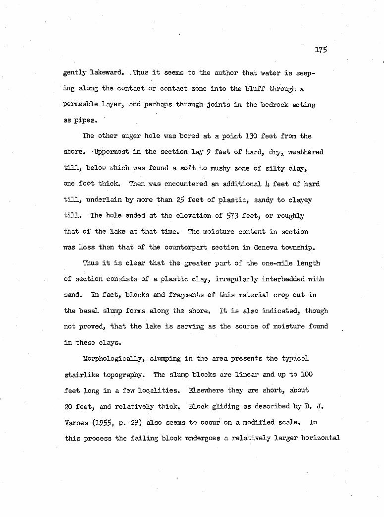
17 s
gently lakeward. .Thus i t seems to the author th at Virater i s seep
ing along the contact or contact zone in to the b lu ff through a
permeable la y er , and perhaps through jo in ts in the bedrock acting
as p ip es .
The other auger hole was bored at a po in t 130 f e e t from the
shore. Uppermost in the sec tio n la y 9 f e e t o f hard, dry, vreathered
t i l l , below which was found a s o f t to mushy zone o f s i l t y c lay ,
one fo o t th ick . Then was encountered an add itional h f e e t o f hard
t i l l , underlain by more than 2$ f e e t o f p la s t ic , sandy to clayey
t i l l . The hole ended a t the e lev a tio n of ^73 f e e t , or roughly
th at o f the lake at th a t tim e. The moisture content in section
was l e s s than th at o f the counterpart sec tio n in Geneva to\'mship.
Thus i t i s c lea r th a t the greater part o f the one-m ile length
o f sec tio n c o n s is ts o f a p la s t ic c lay , ir reg u la r ly interbedded vdth
sand. In fa c t , b locks and fragments o f th is m aterial crop out in
the b asa l slump forms along the shore. I t i s a lso in d icated , though
not proved, th a t the lake i s serving as the source o f moisture found
in th ese c la y s.
M orphologically, slumping in the area presents the ty p ica l
s ta ir lilc e topography. The slump blocks are lin ea r and up to 100
f e e t long in a few l o c a l i t i e s . Elsewhere they are short, about
20 f e e t , and r e la t iv e ly th ick . Block g lid in g as described by D. J.
Vames (19$S, p. 29) a lso seems to occur on a m odified sca le . In
th is process the f a i l in g block undergoes a r e la t iv e ly larger h orizontal
176
than v e r t ic a l d ip lacem en t as i t creeps over a p la s t ic c la y sub
stratum. Hear the Saybrook tovmship l in e in Geneva tovmship, th is
type o f behavior i s probably encouraged by movement on the f l a t
surface o f the bedrock contact, v;hich vrould tend to f la t te n the
ty p ica l curved surface o f shear th at develops in iso tr o p ic c lays
undergoing fa ilu r e .
The ch a ra cter is tic back scarp associa ted v/ith slump develops
normally in conjunction vfith a near v e r t ic a l subsidence o f 9 to 10
f e e t (Figure 6I4.). Then tra n s la tio n a l movement gains dominance in
the area lalce^vard o f the scarp. About 30 f e e t from the back scarp
ten sion a l fractu res appear, increasing in number toirard the b asa l
scarp fronting the lalce (Figure 63) vdiere s p l i t t in g o f f o f the debris
in to the lake ensues. The v/aves and l i t t o r a l currents act to re
d istr ib u te the m aterial as mud patches over the bedrock f lo o r o f f
shore. Apparently most o f the subsurface movement occurs p la s t ic a l ly
vfithout b e n e fit o f d irec t shear. Hovrever, the author has seen sur
faces o f shear underlying sluiip blocks s lid in g o f f a b asa l bench,
3 to 3 f e e t high, in the area. Likev/ise bacWard rotated blocks
vrere a lso observed.
Hortheastvfard in to Saybrook tovmship, creep and block g lid e
phenomena become le s s in evidence. Apparently the decrease in mois
ture content and the thickening of the Upper T i l l have le d to the
development of the long, lin ea r se r ie s o f b locks shovm in Figure 67.
177
Curiously, the re trea t o f the b lu ff here probably does not exceed
a fo o t or so per year; y e t in the sou time s te m part of the area,
in Geneva tovmship, the rate soars to 21 f e e t per year fo r the
years 19$k to 19^7.
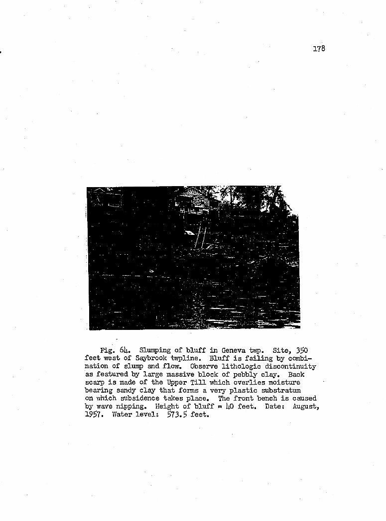
178
Fig. 6U. Sluraping o f b lu ff in Geneva tnp. S ite , 3SO f e e t vrest o f Saybrook tv/pline. B lu ff i s f a i l in g by combination of slump and flow . Observe l i th o lo g ie d isco n tin u ity as featured by large massive block o f pebbly c la y . Back scarp i s made o f the Upper T i l l which o v e r lie s moisture bearing sandy c la y th a t forms a very p la s t ic substratum on v/hich subsidence takes p lace . The fro n t bench i s caused by wave nipping. Height o f b lu ff = I4O f e e t . Date; August, I 9S7, Water le v e l : S73.S fe e t .
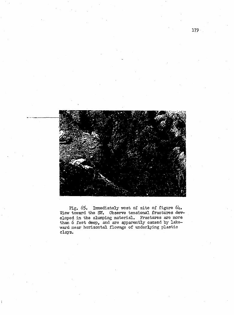
179
Fig. 6^, Immediately vrest o f s i t e o f figu re 6U. View toward the SW. Observe ten sio n a l fractu res developed in the slumping m ateria l. Fractures are more than 6 f e e t deep, and are apparently caused by lakeward near h orizon ta l flovrage o f underlying p la s t ic c la y s .
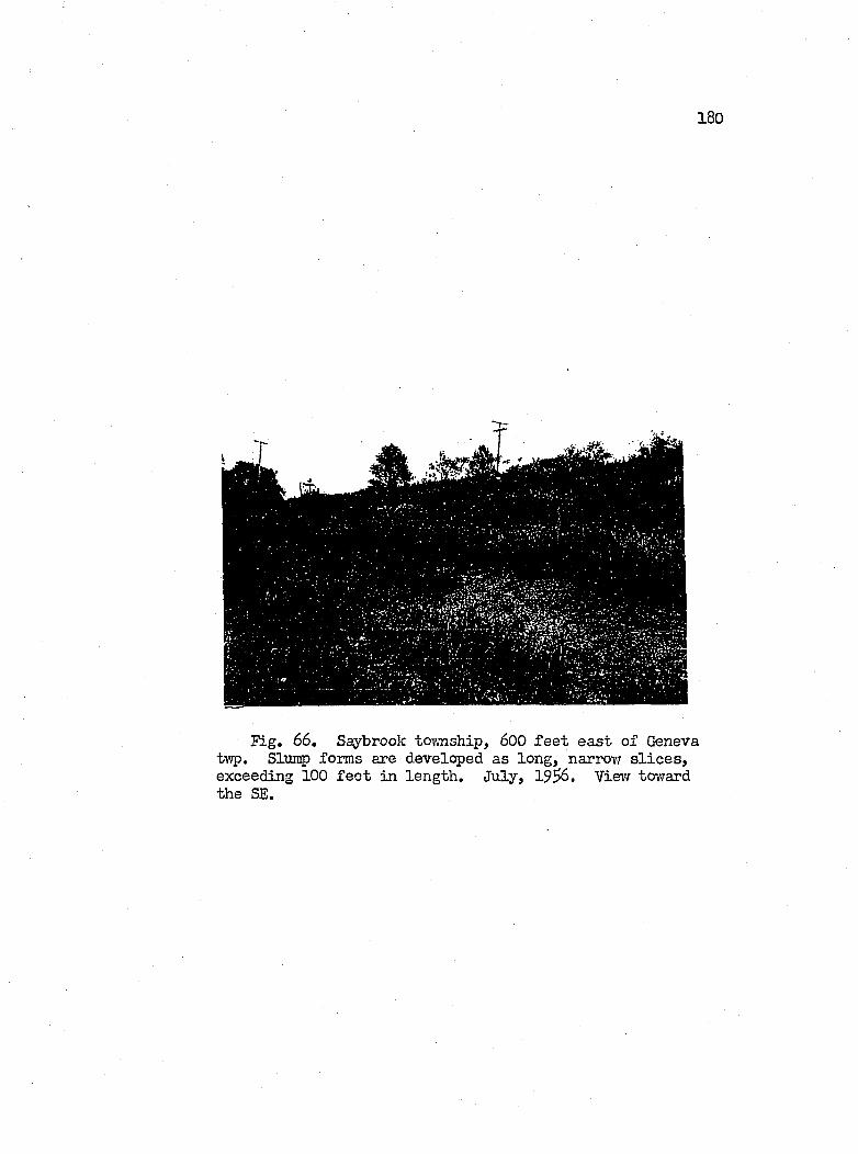
180
Fig, 66, Saybrook tovmship, 600 f e e t ea st o f Geneva tv;p. Slntiç) forms are developed as long, narrovf s l i c e s , exceeding 100 f e e t in len gth . July, 19$6. View toward the SE.
LITTORAL DEPOSITS AND SOURCES
In terms o f l i t t o r a l processes, water currents generated by
winds predominate as the most a c tiv e agent o f transport in the study
area. The d irectio n o f the l i t t o r a l d r if t s h if t s from northeast
to southwest, or v ic e versa, as the p rop ellin g winds move from the
one quadrant to the other. As measured over the years betvreen
1937 and 19U8, winds blowing from the southwest, west and northvrest,
accounted fo r ^proxim ately $2 percent o f the to t a l vrijid duration,
and 59 percent o f the to t a l vdnd movement. On the other hand, winds
from out o f the north and northeast accounted fo r only 20 percent
of the iTind duration, and 22 percent o f the vriLnd movement. Thus
the n et l i t t o r a l d r i f t was toward the northeast (House Doc. 3 5 l,
p. 22). This conclusion remains v a lid , as i s further substantiated
by the accretion o f a l l the active major beaches on the u p d rift
side of the major j e t t i e s .
One may regard the l i t t o r a l d ep osits , which now p ro tect rouglily
one-h alf o f the shore, as the accumulated product of past and present
b lu ff erosion , combined vri-th the m aterial introduced from the h in ter
land. Today, the major streams, as the Grand, Ashtabula and Conneaut,
contribute very l i t t l e m ateria l to the l i t t o r a l p rocesses, s ince
most o f the f lu v ia t i l e sediments are trapped vdthin the harbors by
breakv’/a ters. Hor do many o f the larger small streams, i . e . . Big
(Arc'ôla), TJheeler and Cowles creeks, and Red Brook, now add much
181
182
sediment, because r is in g lake waters have drovmed th e ir lovrer v a lley s;
and the swamps, consequent thereon, act as s e t t l in g basins fo r the
river-d erived d ep osits . F in a lly data c o lle c ted from the in v e s t i
gative work by the personnel of the Ohio D iv ision o f Shore Erosion
have, up to now, revealed no p o s it iv e evidence fo r shorev;ard move
ment o f sediments from the deep basin areas (H. J, Pincus, 19^3,
p. 119). Thus i t appears th at the exposed b lu ff i s the p resen tly
active contributor of m aterial to the l i t t o r a l stream, to which
one may add th at minor amount y ie ld ed by the small streams eroding
the Lake P lain .
Apparently, an enormous amount of m aterial th at has been added
to the l i t t o r a l stream in the past from b lu ff erosion i s permanently
l o s t to the area. The author estim ates th at about I).9i000,000 cubic
f e e t o f sand forms the beaches between the breakwater at Fairport
and th at a t Ashtabula (Appendix C). On the same length of shore
stand 6 ,3 ^ ,0 0 0 square f e e t o f b lu ff , at most 20 percent o f which
c o n s is ts o f m aterial su ita b le for beach b u ild in g (House Doc. 3^1,
p. 17). Thus, on th is b a s is , only I4O f e e t o f o v era ll b lu ff retrea t
i s needed to account fo r a l l exposed beach d ep osits in the area.
This i s a r e la t iv e ly sm all aanount over p o s t-g la c ia l tim es v/hen
compared v/ith the published values of b lu ff r e trea t betvreen the
years 1076 and 19^8, wherein the b lu ff from Perry tovmship to Ashta
bula Harbor has undergone an average 55 f e e t o f recession in only
72 years (House Doc. 351).
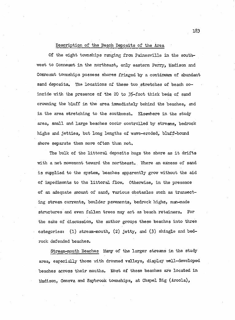
183
D escription of the Beach D eposits o f the Area
Of the e ig h t to\m ships ranging from P a in e sv ille in the south
west to Conneaut in the northeast, only eastern Perry, Madison and
Conneaut townships p ossess shores fringed by a continuum of abundant
sand d ep osits . The lo ca tio n s of th ese tvro stre tch es of beach co
in cid e vdth the presence of the 20 to 35 -foot th ick beds of sand
crovming the b lu ff in the area immediately behind the beaches, and
in the area stretch ing to the southwest. Elsewhere in the study
area, small and large beaches occur con tro lled by streams, bedrock
highs and j e t t i e s , but long lengths o f wave-eroded, bluff-bound
shore separate them more often than not.
The bulk of the l i t t o r a l d ep osits hugs the shore as i t d r if t s
v/ith a net movement toivard the northeast, V/here an excess o f sand
i s supplied to the system, beaches apparently grow without the aid
of impediments to the l i t t o r a l flov/. Otherv/ise, in the presence
o f an adequate amount o f sand, various o b stac les such as tran sect
ing stream currents, boulder pavements, bedrock h ighs, man-made
structures and even fa l le n tr e e s may act as beach reta in ers . For
the sake o f d iscu ssion , the author groups these beaches in to three
categories: ( l ) stream-mouth, (2) j e t t y , and (3) sh ingle and bed
rock defended beaches.
Stream-mouth Beaches Many o f the larger streams in the study
area, e sp e c ia lly those v/ith drov/ned v a lle y s , ±1 sp lay v/ell-developed
beaches across th e ir mouths. Most o f these beaches are located in
Madison, Geneva and Saybrook townships, at Chapel Big (A reola),
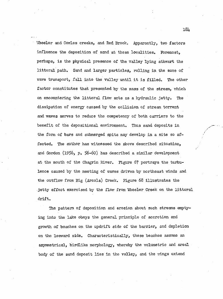
18U
Wheeler and Cov/les creeks, and Red Brook. Apparently, two fa c to rs
in flu ence the deposition o f sand at these l o c a l i t i e s . Foremost,
perhaps, i s the p h ysica l presence o f the v a lle y ly in g athwart the
l i t t o r a l path. Sand and larger p a r t ic le s , r o llin g in the zone o f
wave transport, f a l l in to the v a lle y u n t i l i t i s f i l l e d . The other
fa c to r co n stitu te s th at presented by the mass o f the stream, which
on encountering the l i t t o r a l flow acts as a hydraulic j e t t y . The
d iss ip a tio n of energy caused by the c o l l i s io n of stream torren t
and waves serves to reduce the competency o f both ca rr iers to the
b e n e fit of the d ep osition a l environment. Thus sand dep osits in
the form o f bars and submerged s p its may develop in a s i t e so af
fec ted . The author has w itnessed the above described s itu a tio n ,
and Gordon (19$6, p. 56-60) has described a sim ilar development
at the mouth o f the Chagrin River. Figure 6? portrays the turbu
lence caused by the meeting of waves driven by northeast winds and
the outflow from Big (Areola) Creek. Figure 68 i l lu s t r a t e s the
j e t t y e f f e c t exercised by the flov; from Y/heeler Creek on the l i t t o r a l
d r if t .
The pattern o f deposition and erosion about such streams enpty-
ing in to the lake obeys the general p r in c ip le o f accretion and
grov'/th o f beaches on the u p d rift side o f the b arrier , and depletion
on the leevfard s id e . C h a ra cter is tica lly , these beaches assume an
asymmetrical, b ird lik e morphology, T/hereby the volum etric and areal
body o f the sand deposit l i e s in the v a lle y , and the wings extend
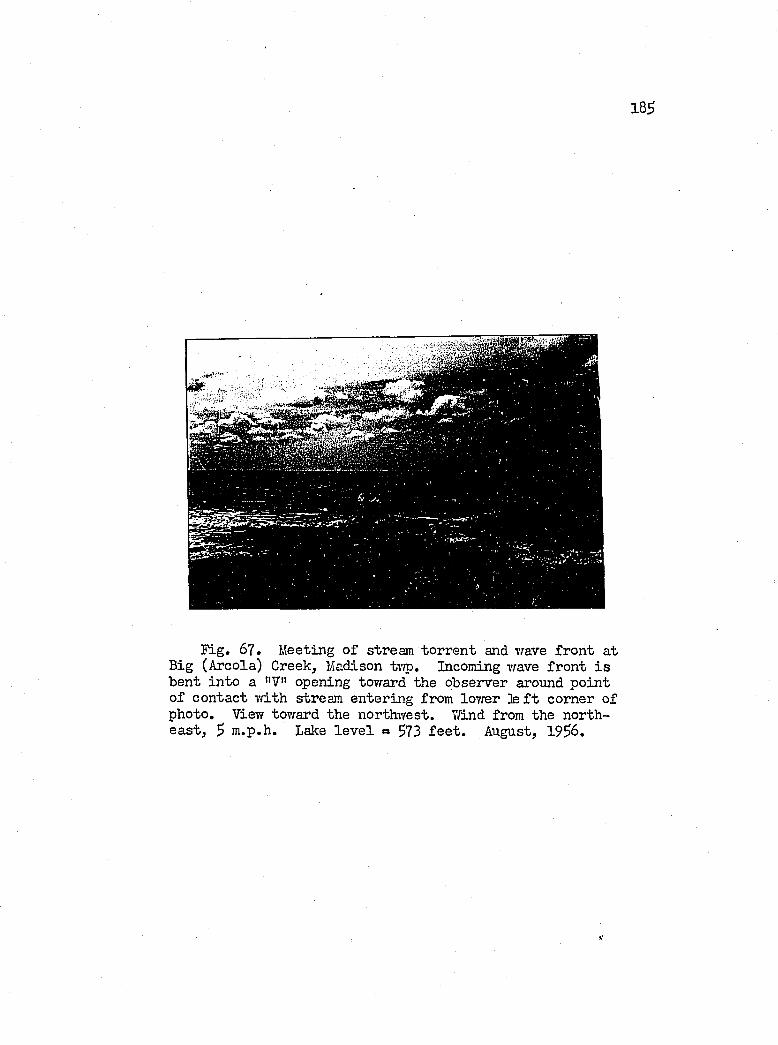
185
Fig. 67. Meeting o f stream torren t and wave fron t at Big (Areola) Creek, Madison tvro. Incoming wave fron t i s bent in to a "7" opening tovrard the observer around poin t o f contact vdth stream entering from lower ]e f t com er of photo. View toward the northwest. 7/ind from the northe a st , 5 m.p.h. Lake le v e l = 573 f e e t . August, 1936.
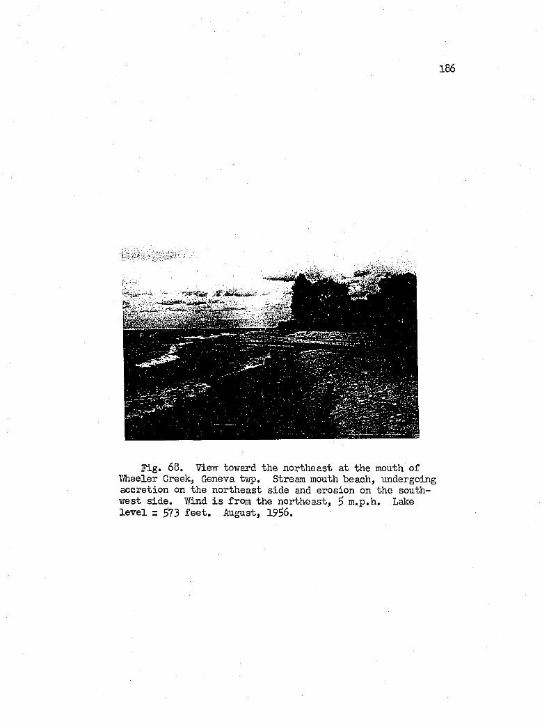
186
Fig. 68. Vievr toward the northeast at the mouth o f 7/heeler Creek, Geneva tv/p. Stream mouth beach, undergoing accretion on the northeast sid e and erosion on the southwest s id e . 7/ind i s from the northeast, $ m .p.h. Lake l e v e l = 5 7 3 f e e t . August, 1956.
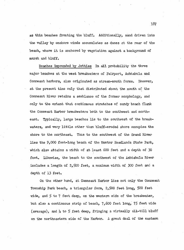
187
as th in beaches fronting the b lu f f . A dditionally , sand driven in to
the v a lle y by onshore vriLnds accumulates as dunes at the rear o f the
beach, where i t i s anchored by vegetation against a background of
marsh and b lu ff .
Beaches Impounded by J e t t ie s In a l l p rob ab ility the three
major beaches at the w est break-jaters of Fairport, Ashtabula and
Conneaut harbors, a lso orig inated as stream-mouth forms. However,
at the present time only th at d istr ib u ted about the mouth of the
Conneaut River reta in s a semblance o f the former morphology, and
only to the extent th a t continuous stretch es o f sandy beach flank
the Conneaut Harbor breakvfaters both to the soutluTest and north
e a s t . % )ic a lly , large beaches l i e to the southwest of the break
w aters, and very l i t t l e other than b lu ff-eroded shore occupies the
shore to the northeast. Thus to the southwest o f the Grand River
l i e s the 9,000 fo o t-lo n g beach o f the Mentor Headlands State Park,
which a lso a tta in s a vriLdth o f at le a s t 600 fe e t and a depth of 30
f e e t . Likev/ise, the beach to the southwest o f the Ashtabula River
includes a length of 2, ?00 f e e t , a maximum v/idth of 300 fe e t and a
depth o f 13 f e e t .
On the other hand, at Conneaut Harbor l i e s not only the Conneaut
Township Park beach, a triangu lar form, 2,$00 f e e t long, $00 fe e t
7/ide, and $ to 7 f e e t deep, on the western side o f tlie breakv/ater,
but also a continuous s tr ip o f beach, 7,600 f e e t long, 7S f e e t v/ide
(average), and U to $ f e e t deep, fr in g in g a v ir tu a lly a l l - t i l l b lu ff
on the northeastern sid e of the Harbor. A great deal o f the eastern
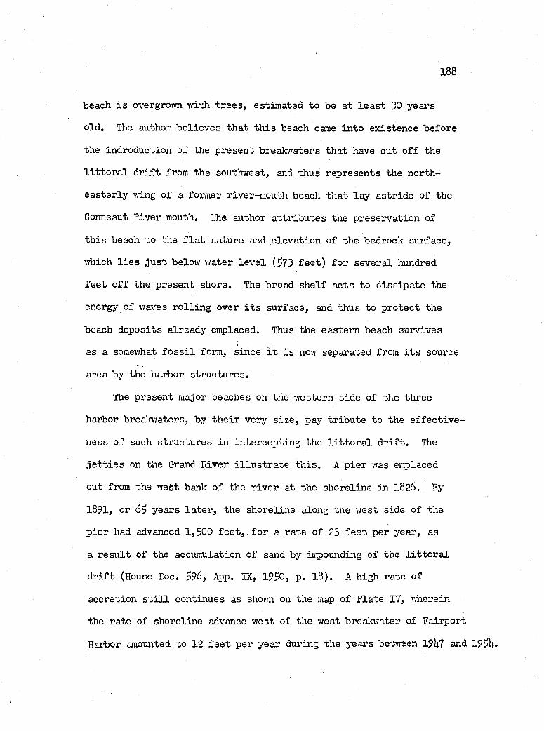
188
beach i s overgrown ■with tr e e s , estim ated to be at le a s t 30 years
old . The author b e lie v e s th at th is beach came in to ex isten ce before
the indroduction of the present breakvraters th a t have cut o f f the
l i t t o r a l d r if t from the southwest, and thus represents the north
e a ster ly vn.ng o f a former river-mouth beach th at la y astride of the
Conneaut Ri"ver mouth. Ibe author a ttr ib u te s the preservation of
th is beach to the f l a t nature and e lev a tio n of the bedrock surface,
which l i e s ju s t below v/ater le v e l (573 f e e t ) fo r severa l hundred
f e e t o f f the present shore. The broad sh e lf acts to d iss ip a te the
energy of waves r o llin g over i t s surface, and thus to p rotect the
beach dep osits already emplaced. Thus the eastern beach survives
as a somewhat f o s s i l form, since i t i s now separated from i t s source
area by the harbor structures.
The present major beaches on the western sid e o f the three
harbor breakwaters, by th e ir very s iz e , pay tr ib u te to the e f fe c t iv e
ness o f such structures in in tercep tin g the l i t t o r a l d r if t . The
j e t t i e s on the Grand River i l lu s t r a t e th is . A p ier was emplaced
out from the vreSt bank o f the r iv er at the shoreline in 1826. By
1891, or 65 years la te r , the shoreline along the w est side o f the
p ier had advanced 1 ,500 f e e t , fo r a rate o f 23 f e e t per year, as
a r e su lt o f the accumulation o f sand by impo'unding of the l i t t o r a l
d r if t (House Doc. 596, App. IX, 1950, p. 18). A high rate o f
accretion s t i l l continues as shovm on the map o f Pla'be IV, vfherein
the rate o f shoreline advance vrest of the vrest breakwater of Faiiport
Harbor amounted to 12 f e e t per year during the years betvreen 19U7 and 195U.
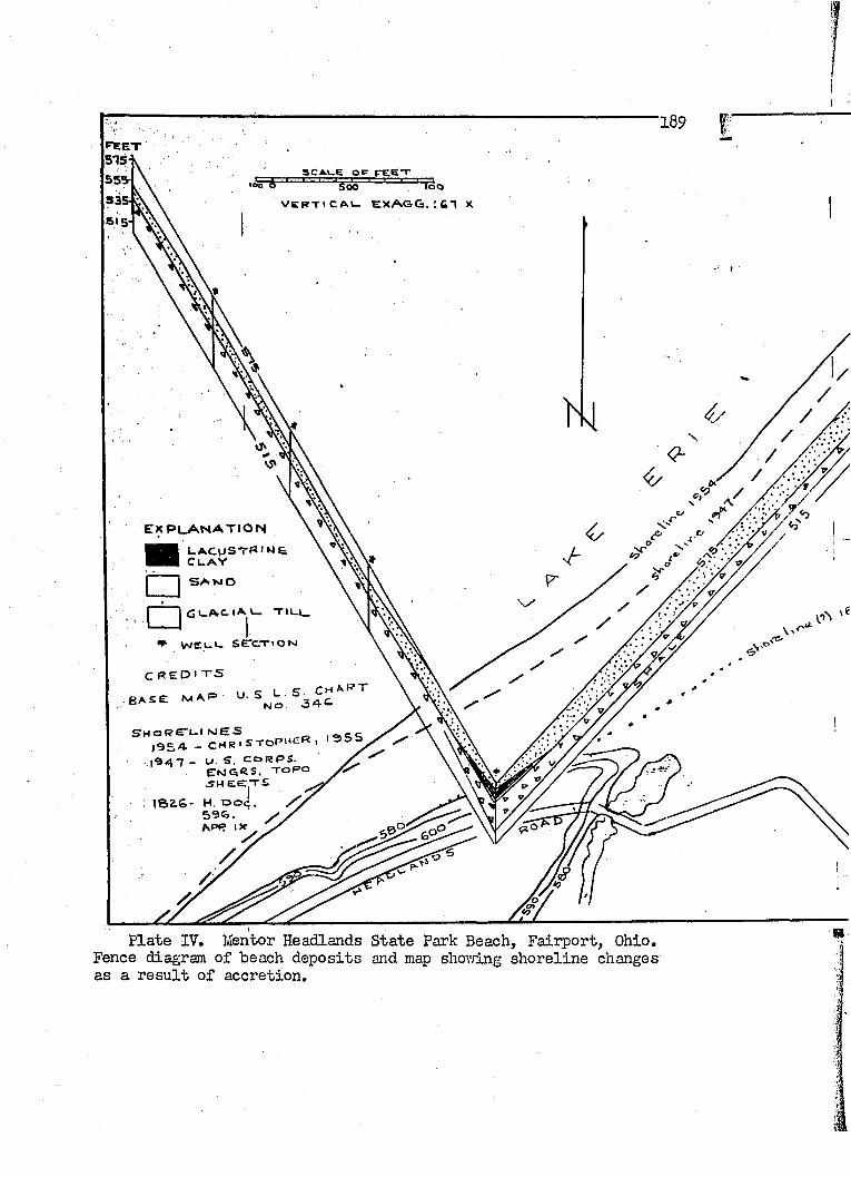
189
S C A U E O P f e e t 5 0 0
VCRTICA*- EXAGG. XSI 5
. re x p l a n a t i o n
■ LACUSTRINE Cl. AY□G I - A C - I A C . T I L L .
» w cuc sercTioN
C R E D I T S
• BASE M A(=
SHoRE-1.1 NES| 9 5 A - CHRi S T O P " £ « '
ENGRS. TORO .SH E E T S
: ISaS- H. Dod 596.
P late IV. Mentor Headlands State Park Beach, F a iiport, Ohio. Fence diagram of beach d ep osits and map shov/ing shoreline changes as a r e su lt o f accretion.
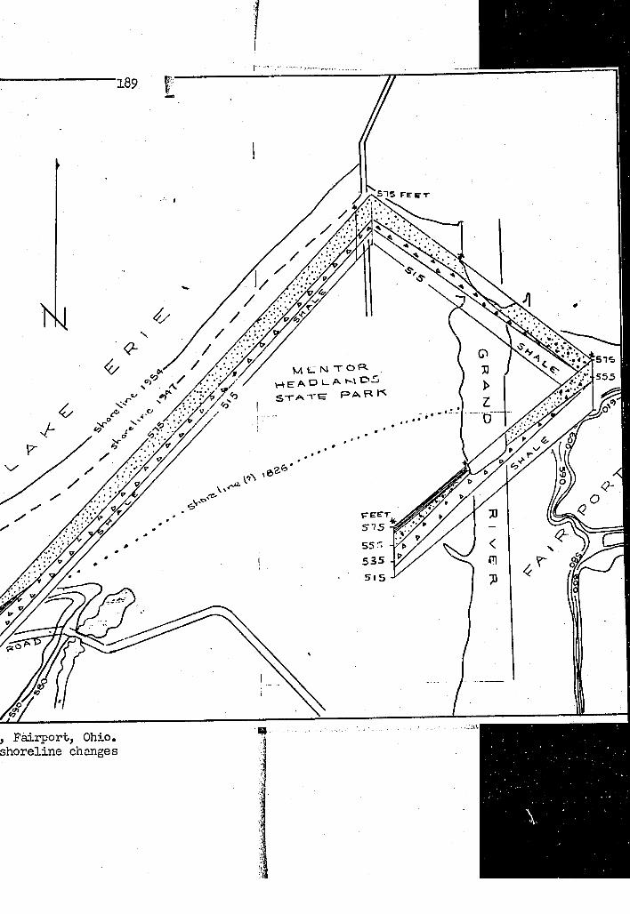
, F a iïp ort, Ohio, shoreline changes
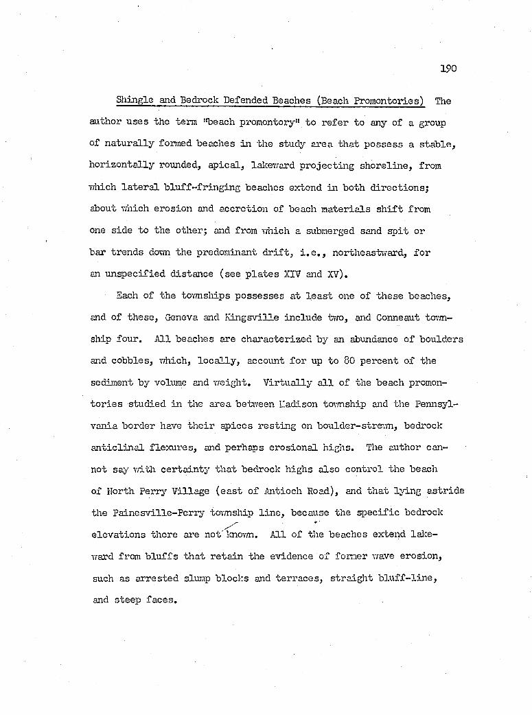
190
Shingle and Bedrock Defended Beaches (Beach Promontories) The
author u ses the term "beach promontory" to re fer to any of a group
of n a tu ra lly formed beaches in the study area th at p o ssess a s ta b le ,
h o r izo n ta lly rounded, a p ica l, lalceward p rojectin g sh orelin e , from
which la te r a l b lu ff- fr in g in g beaches extend in both d irectio n s;
about which erosion and accretion of beach m ateria ls s h i f t from
one side to the other; and from which a submerged sand s p it or
bar trends dovm the predominant d r if t , i . e . , northeastward, fo r
an u n sp ecified d istance (see p la te s XIV and XV).
Each of the tovmsliips p o ssesses at le a s t one o f th ese beaches,
and o f th ese , Geneva and K in gsv ille include two, and Gonneaut to’.m-
ship four. A ll beaches are characterized by an abundance o f boulders
and cobbles, which, lo c a l ly , account fo r up to 80 percent o f the
sediment by volume and w eight. V ir tu a lly a l l o f the beach promon
to r ie s studied in the area between L'adison tormship and the Pennsyl
vania border have th e ir ap ices res tin g on boulder-stream , bedrock
a n t ic l in a l f lex u res , and perhaps erosion a l h ighs. The author can
not say w ith cer ta in ty th a t bedrock highs a lso con tro l the beach
of I'lorth Perry V illage (e a s t o f Antioch Road), and th a t ly in g a str id e
the P a in esv ille -P erry tovmship l in e , because the ^ e c i f i c bedrock
e lev a tio n s there are not' laiovm. A ll o f the beaches extend la k e-
ward from b lu f fs th a t re ta in the evidence of former wave erosion ,
such as arrested slump b locks and terra ces , s tra ig h t b lu f f - l in e ,
and steep fa ce s .
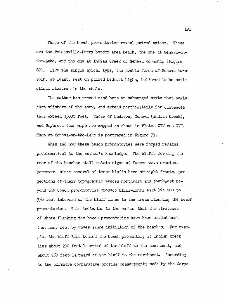
191
Tliree o f the beach promontories reveal paired ap ices. These
are the P a in esv ille -P erry border area beach, the one at Geneva-on-
the-Lalce, and the one a t Indian Creek o f Geneva tovmship (Figure
69) . Lilîe the s in g le ap ica l type, the double forms o f Geneva tovm
ship, a t le a s t , r e s t on paired bedrock h ighs, b e liev ed to be an ti
c l in a l flex u res in the shale.
The author has traced sand bars or submerged s p it s th a t begin
ju s t offshore of the apex, and extend north easterly fo r d istances
th at exceed 3,000 f e e t . Those o f L'adison, Geneva (Indian Greek),
and Saybrook tovvnships are mapped as shovm in P la tes XIV and XVI.
That a t Geneva-on-the-Lal:e i s portrayed in Figure 71.
T/hen and how th ese beach promontories were formed remains
problem atical to the author's knowledge. The b lu f fs forming the
rear o f the beaches s t i l l re ta in signs o f former vrave erosion .
lAoreover, since several of these b lu ffs have s tra ig h t fro n ts, pro
je c tio n s of th e ir topographic traces northeast and southwest be
yond the beach promontories produce b lu f f - l in e s th at l i e 200 to
3^0 f e e t lalcenvard o f the b lu ff l in e s in the ai’eas flanlring the beach
promontories. This in d ica tes to the author that the stretch es
of shore flanking the beach promontories have been eroded back
that many f e e t by waves since in i t ia t io n o f the beaches. For exam
p le , the b lu f f - l in e behind the beach promontory at Indian Greek
l i e s about 200 f e e t lalceward of the b lu ff to the southwest, and
about 25)0 f e e t lalcevrard of the b lu ff to the northeast. According
to the offshore comparative p r o file measurements made by the Gorps
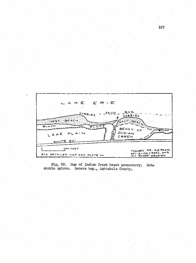
192
L _ A K e :
vIlCSf/y.'REACM.B >- o r F
k b e n c h o p
!q / < A N2/ C R e - E T K
g o u t E 5 3 '
■ J - O O F C E T , F - R . A I R P H O T Oo a . I • ■ s s A 'i , O H i ls
b i v S H O R E " E T R o S l O MF c o E * * r A iu . C D s e e * p l .a t e ’ % v
Fig. 69. Map o f Indian Creek beach promontory. Note double ^ i c e s . Geneva twp., Ashtabula County.
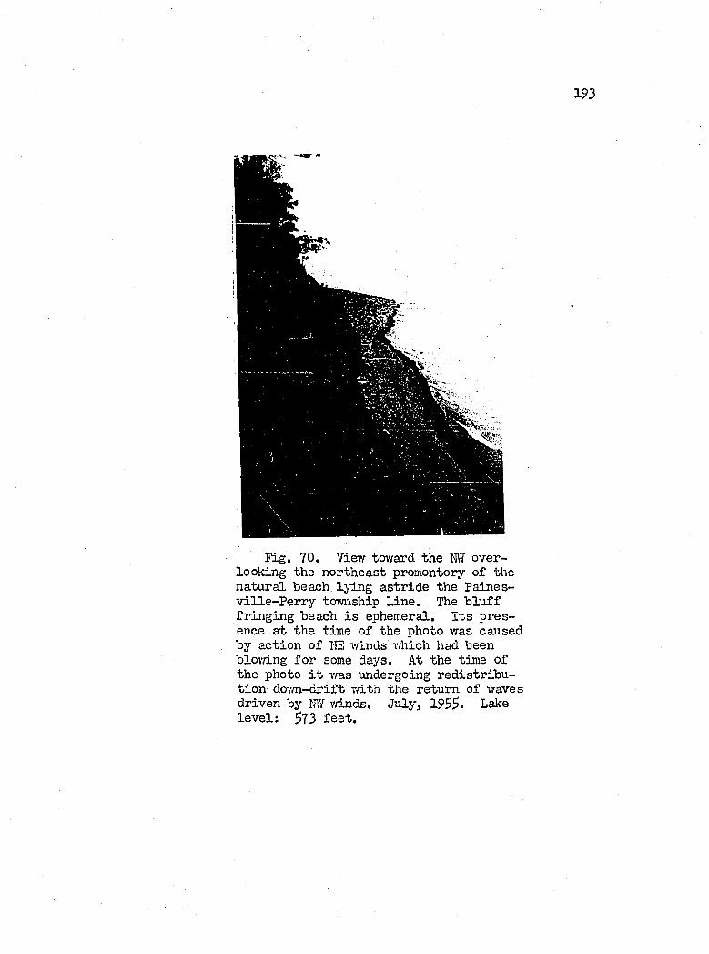
193
Fig. 70. Vievr toward the M overlooking the northeast promontory of the natural beach ly in g astr id e the Paines- v ille -P e r r y township l in e . The b lu f f fr in g in g beach i s ephemeral. I t s presence a t the time o f the photo was caused by action o f HE vdnds which had been bloTfing fo r some days. At the time of the photo i t was undergoing red istr ib u t io n dovm -drift T/ith the return of waves driven by MI vriLnds. July, 1955. Lake le v e l : 573 fe e t .
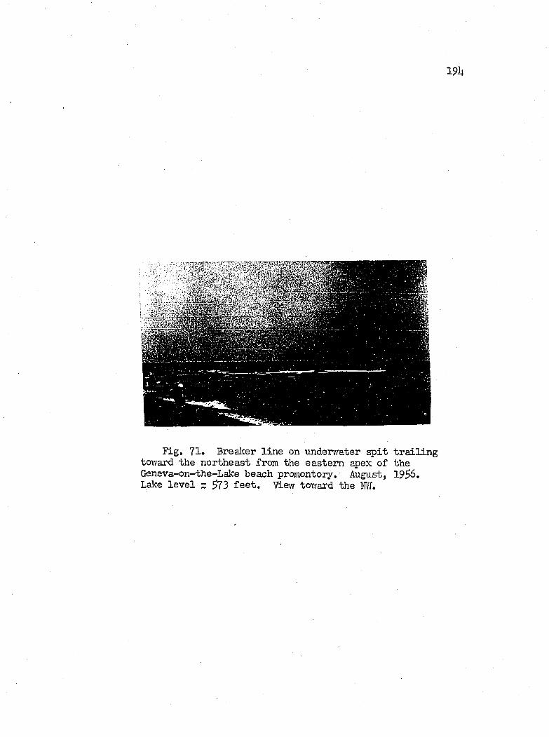
191;
Fig. 71. Breaker l in e on undervrater s p it t r a i l in g tOTfard the northeast from the eastern apex o f the Geneva-on-the-Lake beach promontory. August, 19^6. Lake le v e l z ^73 f e e t . View toward the M .
195
o f Engineers, the b lu ff to the northeast o f the promontory, s p e c if i
c a lly the p o in t at the Saj'brook-Geneva tovmship l in e , i . e . , U,500
f e e t to the northeast, has retreated 190 f e e t betv/een l8?6 and
19U8 (House Doc. 351, 1952, p. 2U). Thus i t appears th at the
Indian Creek beach promontory, at the le a s t , p re-dates 18?6, e ^ e -
c ia l ly i f one assumes th a t the shoreline in the area was r e la t iv e ly
stra ig h t.
With respect to the "hovr" o f formation, the author assumes
th a t the b lu f f had retreated in customary fashion under the impact
of wave erosion . However, the landward recess io n took place over
an upwaiped surface o f bedrock, which, as i t became more exposed
and c lo se r to lalce le v e l , developed strong f r ic t io n a l fo rces on
the waves as they passed over. Boulders and cobbles l e f t behind
by the retrea tin g b lu ff a lso took th e ir t o l l o f wave energy and
began to ex erc ise a b arr ier e f f e c t on the l i t t o r a l d r i f t . A sandy
beach anchored by the boulder pavement on the bedrock surface sub
sequently developed as a nucleus around vfhich further expansion
has taken p lace . In the meamvhile, vraye erosion continued i t s
degradational work on the flanking stretch es o f b lu ff .
Mechanical and Heavy I,mineral Analyses o f B lu ff and Beach Samples
In accordance w ith the procedure described by Krumbein and
P ettijohn (1938, ch. lU and l 5 ) , the author separated the heavy
m inerals in the 0 .25 to 0 .62 mm. s iz e range from nine o f the b lu ff
samples, and obtained th e ir r e la t iv e percentages by grain count
1 9 6
under the microscope. About 300 grains per sample were counted.
The s ix most important m inerals in terms o f th e ir frequences are
presented under Table IV (Appendix B). As shovm, p y r ite , amphibole
and clinopyroxene dominate the su ite .
According to Sindowski's (19U9, p. 8) tab le o f "Resistance
of heavy m inerals to w eathering," the amphiboles and clinopyroxenes
are h igh ly weatherable, i . e . , unstable, and they occupy Group II
o f h is seven-fo ld c la s s if ic a t io n , in which the most sta b le m inerals
are l i s t e d under Group VII. Tlie author's study seem to v e r ify
Sindowski's work with respect to the clinopyroxenes as shovm below.
That the sampled garnets, another of Sindowski's Group I I m inerals,
do not shovf signs o f corrosion may perhaps-be attrib uted to the
extreme youth of the g la c ia l d ep osits .
Both the b lu f f and beach d ep osits contain the same heavy min
e ra l su ite (Table I I I ) , which suggests th at beach dep osits are
by'-products of b lu ff erosion. Kovfever, the t i l l samples ai’e charac
te r ize d by a high percentage o f p y r ite (21.7 to I1I4..3 ) , most of
which i s authigenic. As viewed in s l id e s , the p y r ite occurs as
minute pyritohedrons and cubes, g lobu les and amorphous forms found
as in d iv idu al u n its , but more o ften in grains o f corroded pyroxenes
and amphiboles.
The percentage of clinopyroxene generally exceeds th at o f amphibole;
and since most o f the corroded m inerals appear to be clinopyroxenes,
i t appears th at th is mineral must have dominated the su ite at the
time o f deposition o f the t i l l s . N evertheless, th is gen era liza tion
197
does not apply to the topmost t i l l o f K in gsv ille tovmship, v/here
the ra tio amphibole/ clinopyroxene ranges from 2,^7 to U.U2, as
compared vrith the 0,6^ to 1 ,88 for the Upper and Lovrer T i l l s ,
As shoim on the map o f P late IV, Figure 7hi beach samples
vrere c o lle c te d from the Madison-Geneva tovmship length o f beach
(9551-9557), from the beach a t Red Brook in Saybrook tovmship
(9560-9563) and from the beaches v;est o f Ashtabula Harbor (956U-
9566),
In general, the median s iz e o f the sampled beach sand ranges
from 0 .21 to 0,^0 mm,, and decreases ta/fard the northeast, i . e . ,
the d irectio n o f the predominant l i t t o r a l d r i f t , fo r each o f the
lo ca tio n s o f continuous beaches, including the Gonneaut Tovmship
Park beach (P late V). P ettijohn and Ridge (1933) and Metter (1953,
p. Ul) a lso record a comparable trend for the median s iz e o f the
sand on the vmstern portion o f the beach a t Cedar p o in t. There the
trend i s in the opposite d irectio n , in keeping vdth the ivesterly
l i t t o r a l d r i f t there.
A ll o f the samples taken revea l good sortin g as described by
Trask's sorting c o e f f ic ie n t , Sq, which form ulates a geometric q u artile
deviation;
So =yOl/Q3 , vrhere 0% = the f i r s t q u artileQ3 = the th ird qu artile
A value l e s s than 2 ,5 in d ica tes good sortin g (Krumbein and P e t t i
john, ch, 9 ).
198
Although a system atic study was not made, in sp ection o f the
beach samples under the microscope revea ls th at quartz, shale and
sandstone fragments dominate the su ite . Rock fragments outweigh
the quartz p a r t ic le s by an outrigh t to narroiT margin in the pocket
beaches. On the other hand, quartz gains the m ajority in the larger
and more permanent beaches. T exturally, the quartz fragments range
from sharply angular to very rounded and from c ry sta l c lea r to
thoroughly frosted ; hcn-rever, the c lea r , angular v a r ie t ie s g rea tly
predominate over the others.
Concerning the beach heavy mineral su ite , the author examined
only the l/U to 1 /8 mm, s iz e , because th is group i s common to a l l
o f the samples. A dditionally , since the median s ize and sorting
c o e f f ic ie n t of the samples share the same general order of magni
tude, one f ix e d s ize group su ff ic e s as a b a s is o f coinparison (Rubey,
1933, p. 28). Moreover, the choice o f th is s iz e group rather than
the sm aller 1 /8 to l / l 6 mm. s iz e , which i s not common to a l l o f
the samples, reduces s ig n if ic a n t ly the percentage of m agnetite,
ilm en ite and garnets. These m inerals, though o ften v iv id ly d is
played in lo c a l spots along the shore, e .g . , at the mouth o f Big
(Areola) Creek, are apparently concentrated in response prim arily
to a h igh ly lo c a l sorting environment. Thus they pose a complex
region al pattern , and therefore in the author's opinion, are b etter
omitted rather than included in a regional study o f heavy mineral
trends.
199
i ^ i t e , the dominant mineral o f the b lu ff heavy mineral su ite ,
f a l l s to in sig n ifica n ce in the beach samples. However, exceptions
e x is t . Beach sediments newly derived from the b lu ff contain a high
percentage of p y r ite ; e .g . , the pocket beach sample, 95^0, includes
27.1 percent o f p y r ite . The major g laring exception in vo lves the
four samples, 9^68 to 9^71, o f Gonneaut Tormship Park. The p y r ite
percentage of these samples fo llo w s an increasin g trend toivard the
northeast; i . e . , a\vay from the b lu ff source, save fo r one small
creek, and ranges from 9 .1 to 22.0 (P late ? ) . I t has been observed
at the Mentor Headlands State Park beach, ju s t southwest o f Fairport
Harbor, th at offshore d ep osits contain more p y r ite and corroded
pyroxenes than do beach d ep o sits , and th at these d ep o sits , as send
bars, are frequently driven inshore by changed wave conditions
(Christopher, 19SS, p . 66 ). Thus i t i s p o ss ib le th a t the ty p ica l
beach deposits a t the Gonneaut Tovmship Park might have been con
taminated by such onshore movement ju s t p rior to sampling.
M agnetite-ilm enite and p y r ite share the same general charac
t e r i s t i c s o f s iz e , shape and density . Thus i f 80 and 90 percent
concentrations o f magnetite and ilm en ite occur in beach deposits
fo r mechanical reasons, then cer ta in ly sim ilar concentrations o f
p y r ite should a lso be found. This not being so, one must assume
th at the chemical response o f these m inerals to th e ir environment
supplies the d iscrim inating fa c to r . In the a ctiv e zone o f wave
action , p y r ite , a sulphide, i s rea d ily oxid ized to lim on ite , as
revealed by many grains o f p a r t ia l ly a ltered p yrite in the beach
200
samples. Limonite, o f course, hardly to le r a te s any abrasion, and
i s rea d ily carried avray in suspension.
A iphibole, hornblende in p a rticu la r , r e ta in s the dominant
p o s itio n in the heavy mineral su ite o f the beach sands, and shows
a tendency to decrease dovm-drift at the Red Brook and Gonneaut
beaches.
F ie ld and Laboratory Observations on L itto r a l Transport of Sediments
ViTith the general source o f the beach sediments and th e ir s i t e s
of deposition located , th e ir sp e c if ic path in the l i t t o r a l environ
ment, in great measure, remains obscured by the host o f variab les
acting on them. The study of wave motion and the boundary condi
t io n s e x is t in g between sediment and water medium, and betvreen vrater
and atmosphere, e n ta ils much e:xperimentation, tim e, patien ce , funds
and mathematical so p h istica tio n and in s ig h t, a l l o f which l i e beyond
the resources o f the author and the scope o f th is work. Thus by
n e c ess ity , the author's in v estig a tio n in to th is area i s lim ited
to some f i e ld and experim ental observations, from which a few ten ta
t iv e conclusions may be deduced,
Follov/ing a suggestion by H. J. Pincus th at the v/ave tank
designed o r ig in a lly fo r work in te r r e s tr ia l photogrammetry also
be used for model stu d ies o f beach behavior, the author attempted
to reproduce cer ta in f i e l d beach s itu a tio n s , such as the r e la t io n
ship o f vrave steepness to the development of sand bars, the angle
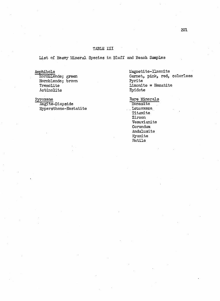
201
TABLE I I I
L ist o f Heavy I'Uneral Species in B lu ff and Beach Samples
Amphibole M agnetite-Ilm eniteHornblende; green Garnet, pink, red, c o lo r le s sHornblende; brorni P yriteTremolite Limonite = HematiteA ctin o lite Epidote
pyroxene Rare FdneralsAugite-Diop side KonaziteH ypersthene-Enstatite , , Leucoxene
T itan iteZirconV esuvianiteCorundumAndalusiteKyaniteR utile
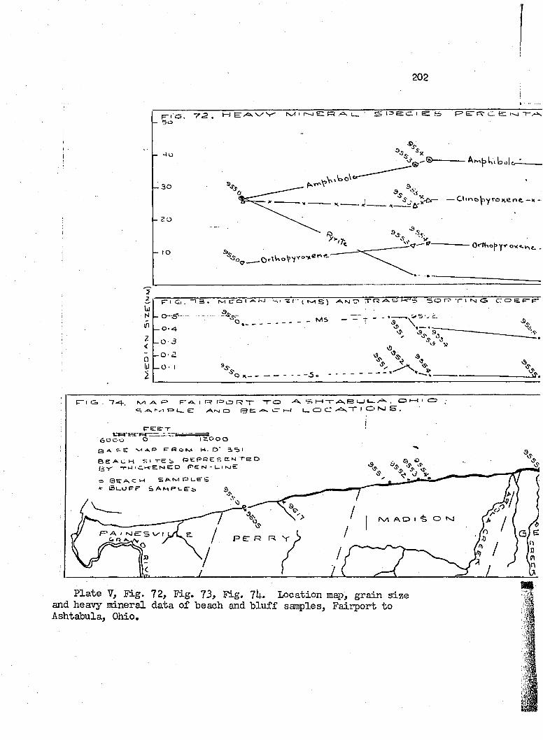
202
s | 3 E : C . I E = 5 F> ET F? tZ e r - JE T / O s V / V ' l\y l ' I— J EZ RF-iG. -72
- 30
f-Êj— — O ir io ^ y ro K e rv e .—;
K-'S s o rr CS C O E P -
- o ~ S - _ _ M S— O ' 4
- 0-3
-O 2
O X — —
, oI O tM S .
I— I T - > 5 s F 3
l _ O C « ^ TF“ I C j , " 7 4 . . N/1 / \ p a F - - 4 | F ? l = > o r ? ' r " T O
^ I ' , ! F 3 1 _ E / \ i s l C3 S e CT
erf KITKCI Z O O O
B e a c h s i t e i , » t p r e s e f ^ T e o
- r W ' C . ' - f E N E Z D N - L . i h u t=.
o S e A C M S A t v t P C E â
V Suupr sa m p c e s s
K /1 A O I “è o *sj
F * A I N J E S Ijj rj ^ p e: R R V
P late V, F ig. 72, F ig. 73, F ig, 7U. Location map, grain s ize and heavy m ineral data of beach and b lu ff samples, F aiiport to Ashtabula, Ohio,
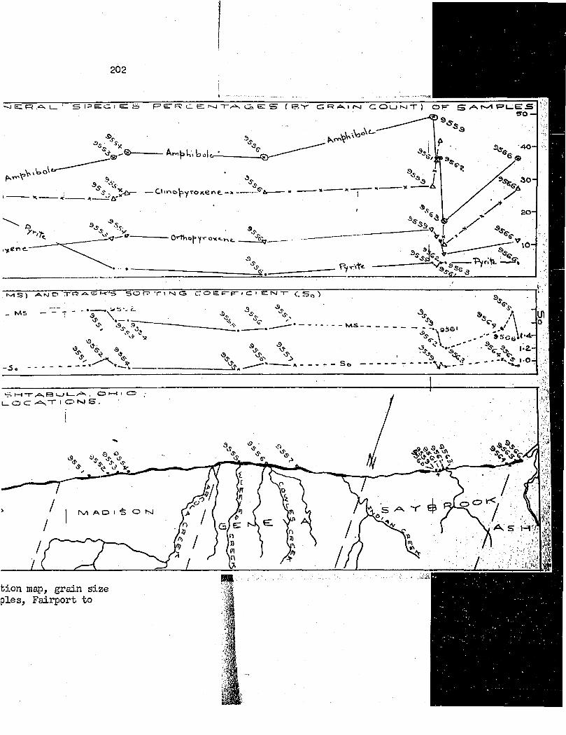
202
A(vi|3l,, bole—
9,^ — — OiriotiyroKerve.—X -»(----- «------X---- ÛT '
0>Tho|»Yr e^j____
Pyrit*.
% \ ' »SCGl('4-
- I *0 —
# &
. » >w
bion map, grain s ize p ies, F a iip ort to
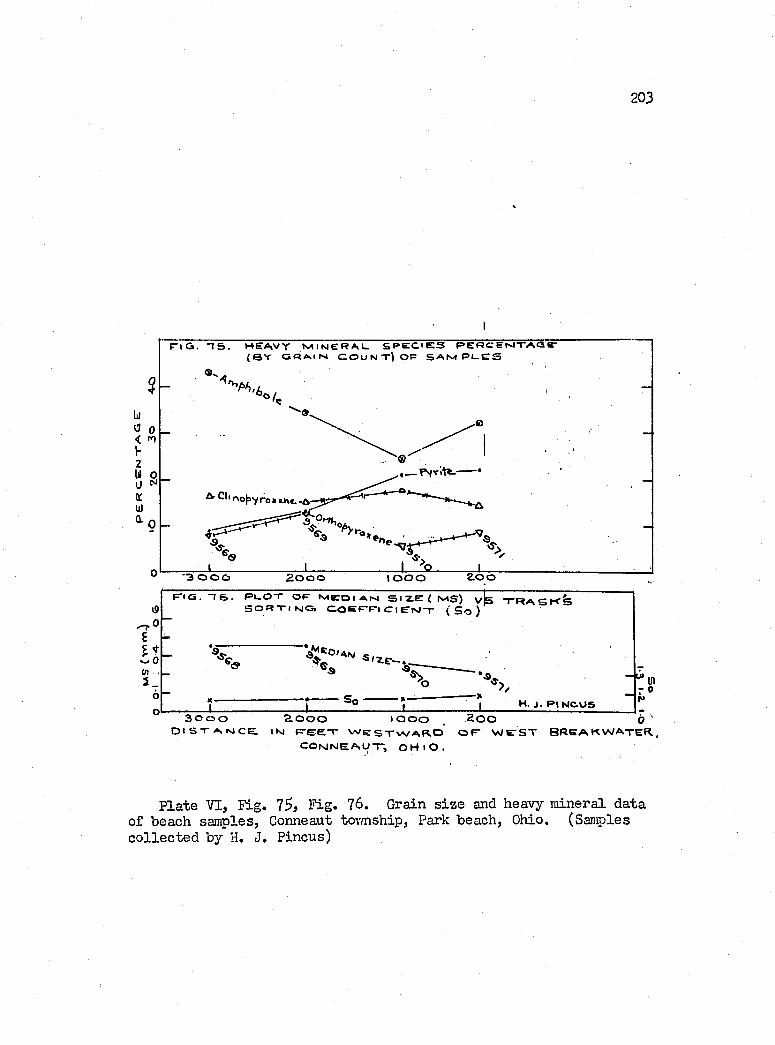
203
L)0 0 < m I- 2U Ou NOCWÛ. n
r i G . 1 5 . HEAVY IHINERAL. S P E C I E S P E R C E M T A a E - (B Y G R A I H C OU N T) OP S A M p e e s
, —PSTitt. *
i opyro)i»>ie.-A
3 0 0 0 2000 \ O O O 2 0 0
i9o-O6! :w5 .
p i Q . “I 6 . P e O T OP M r o I AM S I E E ( MS) v l s T R A S K ' S O R T I NOi O O E P P t Cl StM-r ( S o )
X X
•a,-kX
%H. j . P IN C U S
r'Sp3 0 0 0 2 0 0 0 I O O O . 2 0 0 o '
D I S T A H C e I N P G E T W e S T W A B . O O P W P S T B R E A K W A T E R . , C O t s J N E A U T , O H i O .
Plate VI, F ig. 75, F ig. ?6. Grain s iz e and heavy mineral data of beach samples, Gonneaut tovmship, Park beach, Ohio. (Samples c o lle c te d by H. J. Pincus)
20U
o f incidence o f wave orthogonale to beach erosion , and the e f f e c t
of bedrock highs on the s t a b i l i t y or development o f beach promontories.
The beach model vfas developed in a wave tank 2$ f e e t long, U
f e e t T/ide and h f e e t deep, th a t was constructed and described by
K elley (19^6, p. U6-U8). The drive mechanism i s modeled a fter the
design o f Coyer (19^3), but m odified to perform as an o s c i l la to r
producing simple harmonic waves. The wave generating b a f f le i s
hinged at the bottom and made to o s c i l la t e back and fo r th on the
hinge. Waves produced by th is type o f o s c i l la to r are deep water
in type, but i t i s expected th at because o f the shalloiY depth of
water used (7 to 8 in ch es), and the length o f passage (18 f e e t ) ,
th at the vraves developed shallow water ch a r a c ter is t ic s before
breaking.
After a se r ie s of prelim inary experiments in which f i e ld beach
and offshore phenomena vrere reproduced in m iniature, f ix e d , v e r t ic a l ,
stereo-photographs from a height of 10 f e e t above the model beach
were talcen, and provide the data from which the maps o f Figures
77 to 8 l were constructed. The se ttin g up o f cameras and the p lo t
t in g vrere performed by Professors A. Brandenberger and F. J. Doyle
o f the In s t itu te o f Geodesy, Photogrammetry, and Cartogrephy, The
Ohio S tate U niversity .
From h is experimental stu d ies vdLth beaches and v/aves, J. W.
Johnson (19U9) concludes th a t vraves which p ossess a steepness r a tio ,
i . e . , the ra tio o f deepvrater height to deep vrater length (Ho/ L o ) ,
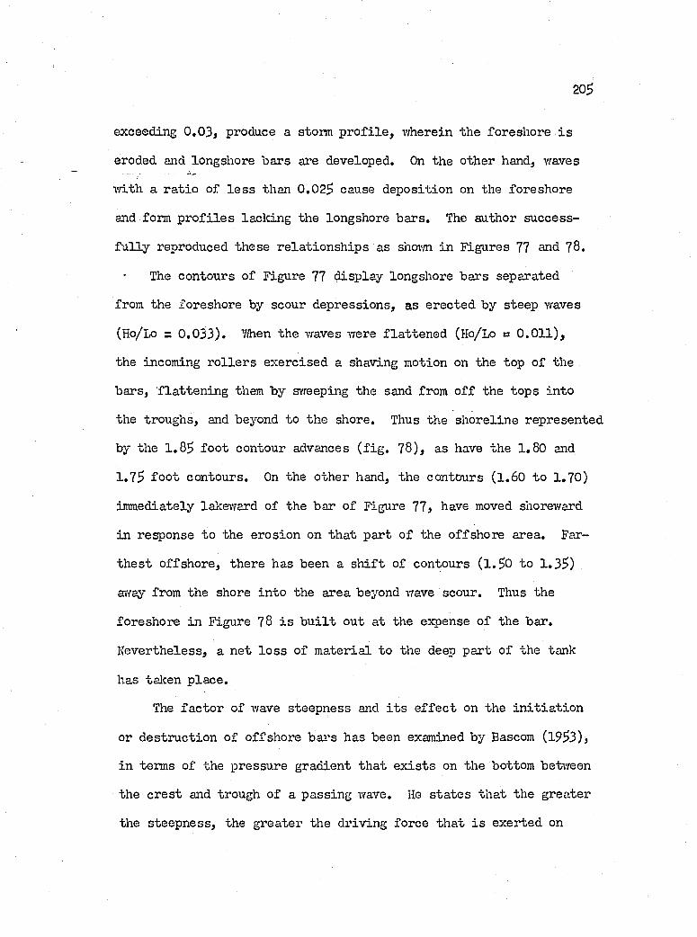
20S
exceeding 0 .0 3 , produce a storm p r o f i le , wherein the foreshore i s
eroded and longshore bars are developed. On the other hand, waves
v/ith a r a tio of l e s s than 0.02$ cause deposition on the foreshore
and form p r o f i le s lack ing the longshore bars. The author success
fu l ly reproduced these re la tio n sh ip s as shoim in Figures 77 and 78,
The contours o f Figure 77 d isp lay longshore bars separated
from the foreshore by scour depressions, as erected by steep waves
(Ho/Lo = 0 .0 3 3 ). 7/hen the waves were fla tte n e d (Ho/Lo = 0 .0 1 1 ),
the incoming r o lle r s exercised a shaving motion on the top o f the
bars, f la tte n in g them by svreeping the sand from o f f the tops in to
the troughs, and beyond to the shore. Thus the shoreline represented
by the 1 .8$ fo o t contour advances ( f ig . 78 ), as have the 1 .80 and
1 .7$ fo o t contours. On the other hand, the contours (1 .60 to 1 .70)
immediately lal:e\Tard o f the bar o f Figure 77, have moved shoreward
in response to the erosion on th a t part o f the offshore area. Far
th e s t offshore, there has been a s h if t of contours ( l .$ 0 to 1 .3$)
æray from the shore in to the area beyond wave scour. Thus the
foreshore in Figure 78 i s b u i l t out at the expense o f the bar.
N evertheless, a n et lo s s o f m aterial to the deep part o f the tank
has talcen p lace .
The fa c to r of wave steepness and i t s e f f e c t on the in i t ia t io n
or d estruction o f offshore bars has been examined by Bascom (19$3),
in terms o f the pressure gradient th a t e x is t s on the bottom between
the cre s t and trough of a passing wave. He s ta te s th at the greater
the steepness, the greater the driving force th at i s exerted on
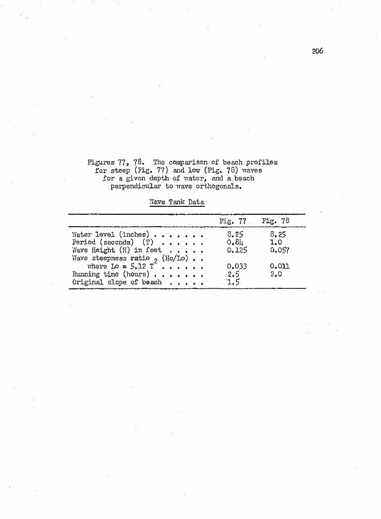
206
Figures 77 78. The comparison of beach p r o f i le s fo r steep (F ig . 77) and lovr (F ig. 78) waves
fo r a given depth of water, and a beach perpendicular to wave orthogonale.
Wave Tank Data
Fig. 77 F ig. 78
Water le v e l (inches) .......................... 8.25 8.25Period (seconds) (T) ...................... 0 .8b 1 .0Wave Height (H) in f e e t .................. 0 .125 0.057Wave steepness ra tio g (Ho/Lo) . .
Y/here Lo = 5.12 T ...................... 0.033 0.011Running time (hours) .......................... 2 .5 2.0O riginal slope of beach ................. i . S
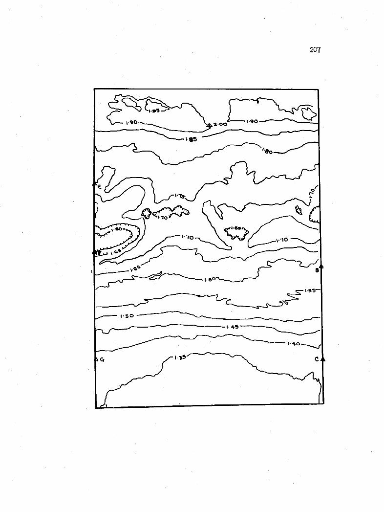
207
I -9Û2-00
/ I
v « o
1- 6 '
ISOI- 4 S
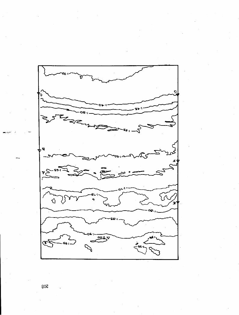
OS-1
o'-
802
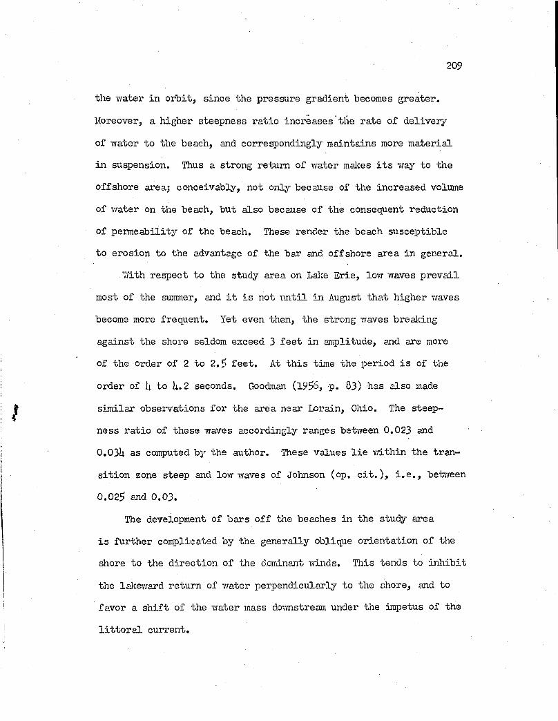
209
the vrater in o rb it, s ince the pressure gradient becomes greater.
Moreover, a higher steepness ra tio in creases the rate o f d e livery
of vrater to the beach, and correspondingly maintains more m aterial
in suspension. Thus a strong return of vrater makes i t s vray to the
offshore areaj conceivably, not only because of the increased volume
of vrater on the beach, but also because o f the consequent reduction
of perm eability o f the beach. These render the beach su scep tib le
to erosion to the advantage o f the bar and offshore area in general.
With respect to the study area on Lalce E rie, lovr waves p rev a il
most o f the summer, and i t i s not u n t i l in August th at higher vraves
become more frequent. Yet even then, the strong vraves breaking
against the shore seldom exceed 3 f e e t in amplitude, and are more
of the order o f 2 to 2 .3 f e e t . At th is time the period i s of the
order of I4. to U. 2 seconds. Goodman (1936, p. 83) has also made
sim ilar observations fo r the area near Lorain, Ohio. The steep
ness ra tio of these waves accordingly ranges between 0.023 and
0.03U as computed by the author. These values l i e vrithin the tran
s it io n zone steep and lovr vraves of Joluison (op. c i t . ) , i . e . , betvreen
0.023 end 0 . 03.
The development of bars o f f the beaches in the study area
i s further complicated by the generally oblique o r ien ta tion o f the
shore to the d irectio n o f the dominant m nds. This tends to in h ib it
the lakevrard return o f vrater perpendicularly to the shore, and to
favor a s h if t of the vrater mass dovmstream under the impetus o f the
l i t t o r a l current.
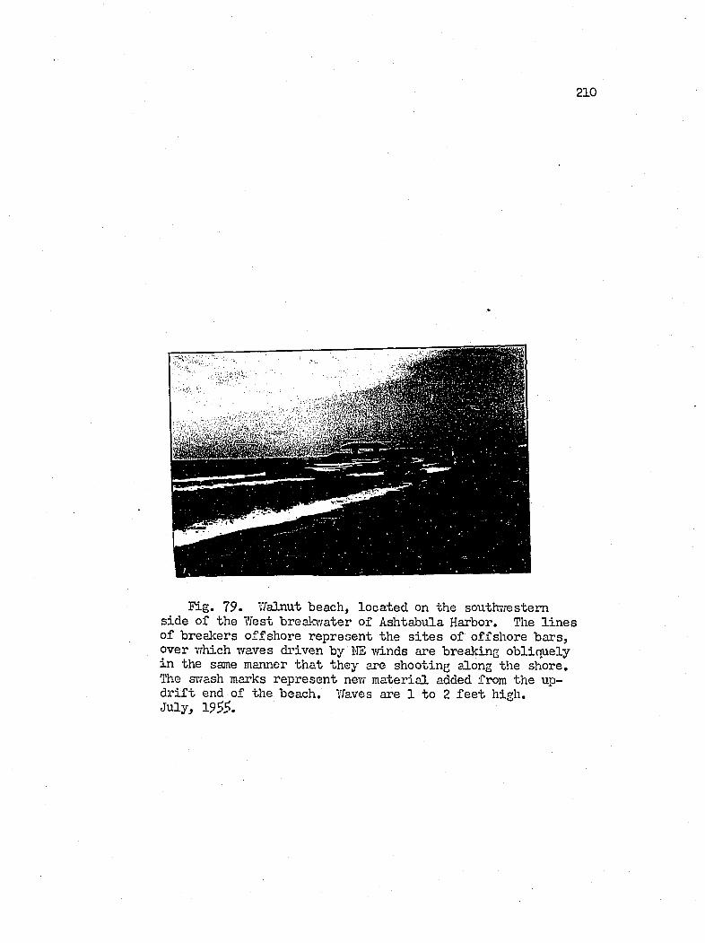
210
«
Fig. 79. Walnut beach, loca ted on the southvrestem sid e o f the West breakwater o f Ashtabula Harbor. The l in e s o f breakers o ffshore represent the s i t e s of offshore bars, over which waves driven by HE vri.nds are breaking ob liquely in the same manner th at they are shooting along the shore. The svfash marks represent new m aterial added from the up- d r if t end of the beach. Waves are 1 to 2 f e e t high.July, 195^.
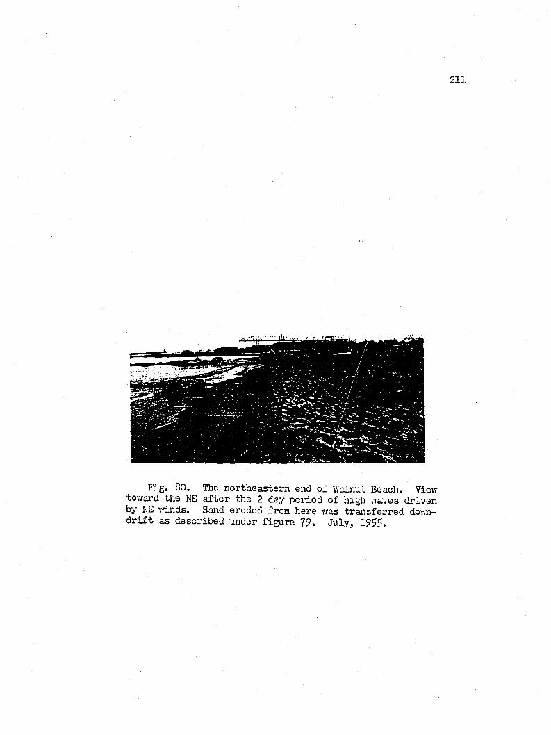
211
Fig, 80. The northeastern end o f Walnut Beach. View toward the Iffi a fter the 2 day period o f high waves driven by NE K'/inds. Sand eroded from here was transferred dovm- d r if t as described under figu re 79. July, 19^?.
212
At the large beach immediately southv/est o f the w est brealc-
water o f Ashtabula Harbor, the author ejqslored the offshore area
ju s t a fter waves o f the order c ite d above and driven by strong
northeast winds had eroded the eastern end o f the beach. These
waves had a lso carved furrows or g iant r ip p les in to the bars, 10
inches between the c r e s ts , and h to $ inches deep, a ligned p a r a lle l
to the bars. Moreover, the bars were traced on a l in e tlia t approached
the shore ob liquely to a small beach p ro jection about 1,500 fe e t
southvrest of the brealavater, beyond which no bars v/ere found.
Beach erosion had occurred at the northeastern portion o f the
beach, vAiereas deposition had taken place on the sou time s te m part
by tran sfer o f sediments downdrift (Figures 79 and 80),
Apparently the bars are formed in the area toward the north
ea st where an abundant sand supply, both onshore and offsh ore, i s
impounded against the breatavater. Toy;ard the southiTOst, the sand
cover th ins to a veneer on the bedrock o f shale. Under the impetus
of the ob liquely s tr ik in g northeast "find-driven waves, the shoreline
of the southwestern portion o f the beach grows lalceward. By the
same fo rce , the bars are extended toward the southvvest, but the
decreasing sand supply fo rces them to form nearer and nearer in
shore, u n t i l both shore and bar approach a junction . Beyond, the
beach b en efit in g by the double sources o f supply continues i t s
growth dovmdrift.
The steep waves accompanying strong r/inds from bhe northwest
or w est reverses the l i t t o r a l d r if t and the associated erosional
213
and dep osition a l p atterns. Supposedly, the advance o f the shoreline
at the northeastern h a lf o f the beach occurs in conjunction m th
the re trea t of the offshore bars lalce\Tard, This vras not in v e s t i
gated f u l ly in the f i e ld , although the rela tion sh ip i s suggested
by the increased d istance between bar and shore at such a tim e.
During th is period of strong northeast Tri.nds, the impounding
e f fe c t of the west breakwater at Ashtabula Harbor causes a p ile-u p
of water against i t . This in turn induces-a strong hydraulic gradi
ent d irected lakeward along the structure. The author has attempted
to duplicate th is condition in the wave tank as outlined under Table
VI and portrayed in Figure 81, as an inquirj'’ in to the nature of
sedimentation along the structure at such a time.
The model beach was aligned at an angle of degrees to the
orthogonals o f waves vd.th a steepness ra tio of 0 .0 $ . Under the
impact o f the steep waves, the shoreline on the west side of the
beach was rsp id ly eroded back, and a storm p r o f ile o f bar and trough
was carved on the offshore p r o f ile ( l ) . The waves were d eflected
toivard the e a st along the shoreline, and the swash formed a stream
as i t s volume was increased by the successive addition o f water
from the wave fron t s tr ik in g the shore in a delayed time continuum
from west to ea st (IV). 7i/here the flow impinged against the ea st
vrall o f the tank, i t swung toward the offshore area, b u ild in g a
tongue of sand or d e lta outward in to deeper water ( I I I ) . Area I I
o f the map had a se r ie s o f miniature channels running s tra ig h t doivn
from the top o f the sh e lf to the bottom of the slope, down which
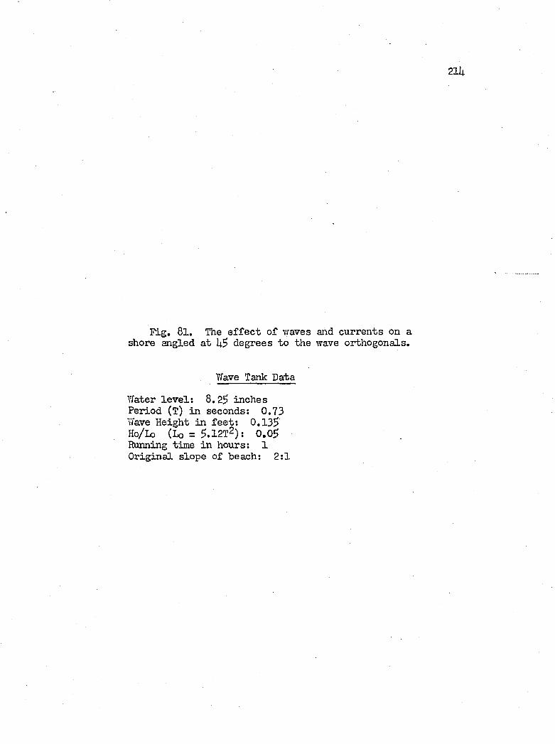
21it
Fig, 81, The e f f e c t o f waves and currents on a shore angled a t degrees to the wave orthogonals.
Wave Tank Data
Water le v e l ; 8,2$ inches Period (T) in seconds: 0 , 7 3
Wave Height in fe e t : 0 , 1 3 $
Ho/Lo ( L o = $ . 1 2 t 2 ) ; 0 . 0 $
Running time in hours: 1O riginal slope of beach; 2 : 1
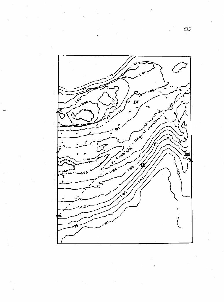
2lS
X
/ JV
fn
m
216
coarser sand p a r t ic le s and small pilecypod s h e lls s l id . The beach
surface of Area IV was covered by a concentrated layer o f magnetite
and garnet, the lag product o f sheet erosion o f the beach, in which
the l ig h t m inerals were swept away and the heavy m inerals l e f t .
By q u a lita tiv e tran sfer to the beach at Ashtabula Harbor, the '
author p o stu la tes th at a sim ilar s itu a tion as that in area I II
of the model e x is t s a].ong the west breaki'raterj i . e . , northvresterly
to southwesterly v/ind-im pelled l i t t o r a l floiT i s removing lakeward
a great deal of the sediments derived from the southwestern part
of the study area. I t i s probable that very l i t t l e o f th is m aterial
i s returned when the d r if t i s reversed. According to Krumbein and
Osheik (19^0), in th e ir study o f sediments impounded by harbor
j e t t i e s at Vfaukegan and Wilmette, I l l in o i s , on Lake Michigan, about
30 to $0 percent o f the shore d r if t escapes around these structures.
Likevri-se, the U.S. Corps o f Engineers (House Doc. ?96, 19?0, p. 33)
estim ates th at the west breakwater at Fairport, Ohio, lo s e s U?^000
cubic yards of the 1^0,000 cubic yards o f m aterial brought to i t
annually by the l i t t o r a l d r if t .
Under the th ird s e r ie s o f experiments, the author has e.ttempted
to reproduce the beach promontories discussed e a r lie r in the chapter,
on the b a s is o f the p ostu la te th at such beaches are con tro lled by
bedrock highs.
In th is experiment, the author graded the foreshore and immedi
ate offshore area o f the beach to a slope o f l:lU j and covered the
area m th roofing asphalt t i l e . The granulated surface o f the t i l e
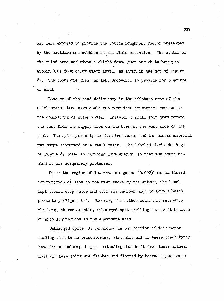
217
was l e f t exposed to provide the bottom roughness fa c to r presented
by the boulders and cobbles in the f i e ld s itu a tio n . The center o f
the t i l e d area w as.given a s l ig h t dome, ju s t enough to bring i t
w ith in 0.07 fo o t below water le v e l , as shovm in the map o f Figure
82. The baclcshore area was l e f t uncovered to provide fo r a source
of sand.
Because o f the sand d efic ien cy in the offshore area o f the
model beach, true bars could not come in to ex isten ce , even under
the conditions o f steep waves. Instead, a small s p it grew toward
the ea st from the supply area on the berm at the yiest side of the
tank. The s p it grew only to the s iz e shovm, and the excess m aterial
was swept shoreward to a small beach. The lab eled "bedrock" high
of Figure 02 acted to dim inish wave energy, so th a t the shore be
hind i t was adequately protected .
Under the regime o f low wave steepness (0,002)' and continued
in troduction o f sand to the w est shore by the author, the beach
kept tovrard deep water and over the bedrock high to form a beach
promontory (Figure 63), However, the author could not reproduce
the long, ch a r a c ter is tic , submerged s p it t r a il in g dovmdrift because
of s iz e lim ita tio n s in the equipment used.
Submerged S p its As mentioned in the sec tio n o f th is paper
dealing v/ith beach promontories, v ir tu a lly a l l of these beach types
have lin ea r submerged s p its extending dovmdrift from th e ir ap ices.
Host of these sp its are flanked and floored by bedrock, p ossess a
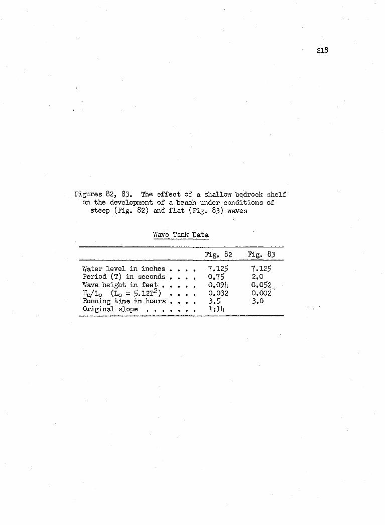
218
Figures 82, 83. The e f f e c t of a shallov; bqdrock sh e lf on the development o f a beach under conditions of
steep (F ig. 82) and f l a t (F ig. 83) waves
ïïave Tanlc Data
Fig. 82 Pig. 83
Tfater le v e l in inches . . . 7.125 7.125Period (T) in seconds . . . 0 .75 2.0Yfave height in f e e t . . . 0.09U 0.052Ho/L o (Lq = S.IET?) . . 0.032 0.002Running time in hours . . . 3 .5 3.0O riginal slope .................. . 1;1U
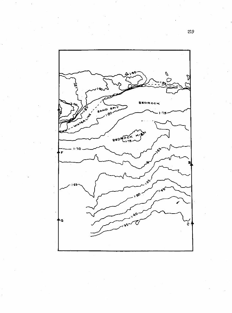
219
I T S
I 1 0
I CO
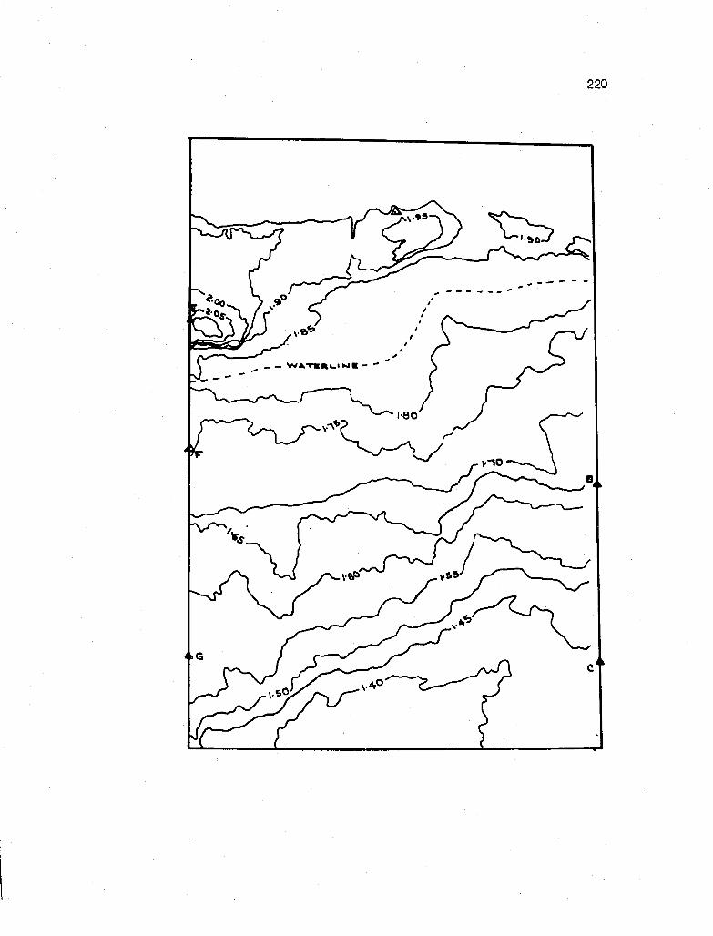
220
WA-TKRUIMK
100
221
r e la t iv e ly unbroken fron t fo r at le a s t 1,000 f e e t , and a tta in lengths
exceeding 3,000 f e e t . In a l l o f them the shore curves abruptly
ar/ay from the p o in t o f attachment at the apex, and then stra ightens
out. After periods o f prolonged wave action from the predominant
northwest to southvrest d irec tio n s , the bars become strongly developed,
and the area immediately to the le e of the beach apex becomes a
sh eltered cove.
Apparently the l i t t o r a l d r if t p ossesses an in e r t ia l quality
that enables i t to r e s i s t p a r t ia l ly the tendency to fo llo w the shore
lin e around the sharp bend of the beach apex; but, in stead , d irects
i t to maintain i t s o r ig in a l heading in to the lake for several thou
sands of f e e t . However, winds from the northeast act to disrupt
th is trend, and tend to break up the portion s o f the s p it s near
th e ir junction v/ith the beach, and drive the sand inshore to the
beach. Likevd.se, i t i s probable th at the submerged s p its can be
extended in a n orth easterly d irectio n fo r only a cer ta in distance
before in s t a b i l i t y i s incurred. At th is po in t the m aterial may
be swept to sea or shore. The author b e lie v e s th at the beach at
Red Brook in Saybrook township rece iv es much of i t s nourishment by
period ic destru ction of the submerged s p it running from the beach
promontory near Saybrook Tovmship Park (P late xv).
SWiARï
The Lake P la in , a d ep osition a l surface constructed o f a th in
layer to 75 fe e t ) o f Carj'- and post-Cary la cu str in e beds and
g la c ia l t i l l s capping the surface o f the Upper Devonian Chagrin
shale, i s newly emergent and in an erosional stage of topographic
youth. Controlled by the northwesterly region al slope o f 10 to
20 f e e t per m ile, most o f the drainage flow s as consequent streams
across the p la in to Lake Erie, a l l o f which occupy youthful v a lle y s
over most o f th e ir len gth s.
Along the southeastern flanlc o f the area r is e s the band o f
Late Cary Lake Escarpment moraines -with a r e l i e f somewhat under
100 f e e t . Into the northern flanlc of th ese moraines the rather
bold b lu ff of Lake Y /hittlesey has been cut to a maximum height o f
about 60 f e e t . Farther to the northrrest, and running between the
b lu ff of Laice Erie and th a t o f Lake W hittlesey, the sand-rich shore
of g la c ia l Lake Warren forms a bench l5 to 30 f e e t high.
Extensive sand and gravel d ep osits , up to 60 f e e t th ick lo c a l ly
and more generally 35 f e e t th ick , cover the bedrock f lo o r of Madison,
K in gsv ille and Conneaut tovmships, and the beach ridge o f g la c ia l
Lake Warren.
The bedrock surface r is e s through the mud of the lalce, at an
e lev a tio n of about 500 f e e t , on a long uneven, concave slope under
the Lalce P la in to the Appalachian Escarpment at 870 fe e t . Exposures
222
223
of the bedrock occur in the major v a lle y s , the larger v a lle y s of
the small streams and along the Lake Erie shore in eastern Ashta
bula tovmship.
A product o f erosion and mass w asting, the b lu f fs o f Lake Erie
present a v e r t ic a l stra tigrap h ie cro ss -sec tio n o f the Lake P lain .
G lacia l t i l l dominates the lith o lo g y across P a in e sv ille , eastern
Perry, Geneva, Saybrook, western Ashtabula and eastern Conneaut
tovmships. Elsewhere in the study area, la cu str in e d eposits co n sti
tu te the upper h a lf or v ir tu a l ly a l l o f the section ; and o f th ese ,
f in e sand forms the dominant co n stitu en t. S tratigrap h iea lly , p o st-
Cary la cu str in e interbedded sand, s i l t and c lay o v er lie Late Cary
g la c ia l t i l l s . These t i l l s , tvro in number where recognizable, are
gen era lly separated one from the other by interbedded lacu str in e
beds, 1 to 18 fe e t th ick , or by a boulder pavement or a zone of
red c la y and pockets o f an u n id en tified , pebbly t i l l . The author
has dated the major t i l l s as Late Cary under the assumption that
they are preV ihittlesey in age and o f the same age as the Late Cary
Lake Escarpment moraines.
L ith o lo g iea lly , the t i l l s co n s ist o f a pebbly to bouldery,
s i l t y to sandy c la y , as in d icated by v isu a l in sp ection , hydrometer
and s iev e analyses, and th e ir Atterberg l im it s . Hcr^ever, la te r a l
consisten cy of the sand, s i l t and c lay r a tio s appears as the excep
tio n rather than the ru le . On the whole the t i l l s p ossess medium
strength and lo-w s e n s it iv ity .
22U
The degradational processes acting on the b ln ff include -
1. Chemical and p h ysica l Aveatheringj2. Mass wasting; and3. Erosion by water and vdnd.
Weathering in terras o f freez in g and thawing, o:d.dation, hyd rolysis,
hydration and so lu tion , attacks the t i l l s most, since metamorphic
and igneous rock fragments, and s i l t co n stitu te a high percentage
of the t i l l s . Mass w asting i s expressed in a v a r ie ty of types that
include the f a l l o f sand grains, v e r t ic a l co llap se o f tons of wave-
undermined blocks of t i l l , small mudflows and extensive creep and
slump.
Sandy b lu f fs o f Perry, Madison and most o f Ashtabula County
northeast o f the harbor are la r g e ly undermined by basa l or in tra -
s tr a ta l contact springs plucking and transporting sand, and causing
adjacent and superjacent portions to f a l l from lack o f support.
Wind d e fla tio n a lso detaches much sand from the b lu f f , most o f which
f a l l s as ta lu s .
B lu ffs composed o f w e ll coinpacted t i l l s lacking a permeable
b asa l contact zone a ccessib le to ground-water, p ossess low perme
a b il i ty , r is e v e r t ic a l ly , and f a i l by d irect wave undermining which
causes v e r t ic a l shearing o f f of segments along jo in t surfaces.
This type of fa ilu r e i s ty p if ie d by the b lu ffs o f western Perry
tovmship.
Failure by creep o f a one to 2 1 /2 fo o t th ick layer of the
en tire b lu ff face occurs in b lu ffs associated v/ith a low sand content
and high s i l t percentage (lj.0 to 67) in a matrix o f c lay . Freezing
72$
and thavdng in conjunction vri.th wave scavenging i s postu lated to
keep the process in motion, Tliis phenomenon was observed in the
b lu ff o f the Saybrook-Ashtabula tovmship border area, and th at of
Ashtabula tovmship northeast of Ashtabula Harbor.
Slumping a f fe c ts three types of stra tigrap h ie sec tio n s;
1. That represented by 20 to 35 f e e t o f la cu str in e c la y super
jacen t to t i l l . The la cu str in e c la y slumps and i t s sur
face o f shear develops on the t i l l contact 10 to l5 f e e t
above the beach, as exh ib ited in cen tra l Perry toim ship.
2. That co n sistin g from top to bottom of ( l ) la cu str in e beds,
(2) "Upper" t i l l , (3) i n t e r t i l l la cu str in e beds, and
(U) a sa lie n t l5 to 25 fo o t high "Lower" t i l l . Here perme
able beds in (3) y ie ld to the soften ing and pluclcing e f f e c t
of ground water seepage. Their y ie ld in g causes the over-
ly in g beds to slump. This categorj’’ of slumping tj 'p ica lly
occurs in Ashtabula County.
3. That which c o n s is ts m ostly o f t i l l restin g on rather th ick
la cu str in e beds near or at la k e - le v e l. Slumping here i s
a major development o f th at which occurs under "b," since
the en tire b lu ff - s e c t io n i s a ffec ted . M oisture, again
the v i l la in , permeates the la cu str in e m aterial and i s
postu lated to seep from surface m eteoric sources in the
hinterland (P a in e sv ille tovmship) and from the Lake
(Geneva-Saybrook toivnships).
226
The products o f b lu f f erosion and stream erosion o f the Lake
Plain and Lalce Escarpment Moraines end in the lalce. Of th ese the
fa r greater contribution comes from the b li i f f s . According to the
data from heavy mineral analyses, the heavy mineral su ite s of the
g la c ia l t i l l s and beach include the same m inerals, except th a t the
su ite belonging to the t i l l s contain a higher percentage (kO%) of
p y r ite than do ty p ica l beach d ep osits (5%). The median s iz e d is
tr ib u tio n of the beach sand, th ere in for a given stretch o f beach
grain s iz e decreases dovmdrift, in d ica tes th a t the l i t t o r a l d r if t
toward the northeast ex cerc ise s a sortin g action on sediment in
transport sim ilar to th at o f streams.
About one-h alf o f the shore i s protected by permanent beaches.
These the author has grouped in to tv/o ca tegories;
1. stream-mouth - those con tro lled by the hydraulic b arrier
e f f e c t of streams issu in g in to the lake
2. beach promontories - those con tro lled by bedrock highs
The large stream-mouth beaches on the vrestern sid e of the break
waters at the Grand, Ashtabula, and Conneaut r iv er s , have had th e ir
vfidths m u ltip lied by the presence o f the harbor stru ctu res. Because
of the huge volume o f onshore and offshore sand comprising these
beaches, they conform to the " ty p ica l” beaches of oceanographic
researchers in th a t storm p r o f i le s o f sandbars and troughs come
and go vdth changes in the vdnd-vector and wave steepness.
On the other hand, the beach promontories are associated with
only a moderate sand supply. Most o f the sand i s concentrated on
227
the beaches and in submerged sp its th at t r a i l o f f dovmdrift (north
ea st) on a rocky bottom away from the lakevfard p rojectin g heads
of the beaches. Sand transferred dovmdrift v ia the submerged sp its
may even tu ally be moved inshore, i f the bottom remains shallov/,
or may become p a r t ia l ly l o s t o ffshore.
C O N C L U D I N G R E M A R K S
SHORE EROSION IN THE AREA.
Today's problem of eroding shore along the lake began in the
19U0's vri-th a 1 to 2 fo o t e lev a tio n increase o f the vrater-level.
This has been only the l a t e s t o f such ep isod ic r is e s . McDonald
(19^3, p. 2SI) a ttr ib u tes th is high stage o f the lalce to a p e r s is t
ent trend of above normal r a in fa l l during the 10-year period pre
ceding 1951, in -which the r a in fa l l average exceeded th at fo r the
years s in ce 1900 by 2,23 inches. Moreover, in 1930 and 1931, the
r a in fa l l was nearly 6 inches above th at average. The author has
not in v estig a ted th is aspect o f the problem, but has found no se r i
ous objection to th is co rre la tio n .
However, the problem i s not only one o f high lake le v e ls , but
also one o f a dim inishing sand supply. Under the natural economy,
the income o f sand should a t le a s t match the outgo of m aterial
from the beaches vfhich su ffer continuous a t tr it io n by comminution
of p a r t ic le s , a continual lo s s o f sediments to the deep parts o f
the lak e, and to areas dovmdrift of the study area. As has been
esta b lish ed e a r lie r in t h is paper the b lu f fs form v ir tu a lly the
only source of neiT m aterial to the beaches.
For every large stretch o f beach-protected shore in the study
area, there i s a sim ilar length of wave-eroded b lu ff u p d rift. As
the area undergoes greater r e s id e n t ia l and in d u str ia l development,
228
2 2 9
more attempts are made to stem b lu ff erosion by the addition o f
p rotective structures. The higher the e f f ic ie n c y o f these struc
tu res, the lower becomes the amount of sediment ava ilab le fo r dovm-
d r if t nourishment o f beaches. Thus in terms o f beach development
for a given la k e - le v e l, there seems to be a l im it to the shore
length o f b lu ff fo r which p rotection i s d esirab le .
Fortunately fo r the study ^ e a , the shore in the le e o f the
three major harbor structures i s ovmed by major in d u str ia l concerns
th at have land and economic resources enough to combat b lu ff re
cession as they see f i t . Likei'/ise, most of the land in the receding
shore areas o f P a in e sv ille . Perry, eastern Ashtabula and western
K in gsv ille toim ships c o n s is ts o f large undeveloped hold ings. From
the viei'fpoint o f beach accretion th is i s as i t should be. In the
author's opinion, no permanent bu ild ing on the Lake P lain should
be b u i l t T/ithin 1,000 f e e t o f the b lu ff in these areas u n less the
owner can cope v/ith the engineering problems involved v/ith v/ave
erosion and the processes o f b lu f f fa ilu r e .
The h eav ily inhabited shore o f eastern Geneva and western
Saybrook townships represents the most c r i t i c a l lo c a le in the study
area ivith the p o ssib le exception o f Paine s v i l l e tovmship ju s t ea st
of the Tovmship Park. The pecu liar nature o f b lu ff slumping here
may involve measures o f correction too c o s t ly and perhaps too la te
to save the houses near the edge o f the b lu f f . The in d ication s
230
are, as has "been d iscussed previously , th at the zone o f fa ilu r e
extends down to bedrock. Perhaps a reta in in g se myall anchored
in the bedrock might be a p a r t ia l so lu tion .
LITERATURE CITED
Barendsen, G. W., Deevey, E. S ., and Gralenski, L. J . , 1957, Yale natural radiocarbon measurements III ; Science, n . s . , v , 126, p. 908-919.
Bascom, W. N ., 1953, The c h a r a c ter is t ic s o f natural beaches: Proc,o f Uth conf. on Coastal Engineering, p. 163-180.
Boyer, C. B ., 1953, A multipurpose wave generator: Proc. MinnesotaIn tern at'1 Hydraulics Convention, p. 281-291.
Camey, F. J . , 1908-1917, Manuscript and notes on the beach ridges of the g la c ia l IsJces: Unpub., open f i l e o f the Ohio Geol.Surv., Columbus, 0.
. 1916, The abandoned sh orelin es o f the Ashtabula Quadrangle, Ohio: B u ll, o f S c i. Lab., Denison U niv., v o l. 18,p . 362- 369.
Campbell, L. J ., 1955, The la te g la c ia l and la cu str in e d eposits of Erie and Huron Counties, Oliio: Ph.D. d is ser ta tio n , TlieOhio State Univ., Columbus, 0 . ,
Casagrande, A., 19U7, C la ss if ic a t io n and id e n t if ic a t io n o f s o i ls :Proc. Amer. Soc. C iv il Engineers, p. 783-810.
Chieruzzi, R. and Balter, R. F ., 1958, A study o f Lalce Erie b lu ff recession ; Engr. Exper. S ta ., b u ll . 172, 100 p.
Christopher, J. E ., 1955, In v estiga tion o f Lake Erie Shore erosion between F aiiport Harbor and the Mentor Yacht Club, Lalce County,Ohio: M.S. th e s is . The Ohio State U niversity , 100 p.
Evans, 0. F ., 1938, F loating sand in the formation of svfash marks:Jour. Sed. P e t l . , v . 8, p. 71.
________ . 1939, Sorting and transportation of m ateria ls in theswash and backwash: Jour. Sed. P e t l . , v . 9, p. 28-31.
Fenneman, N. M., 1917, Physiographic d iv is io n s o f the United S tates:Annals of the Assoc. Amer. Geog., v . 6, p. 19-98.
Goldthwait, R. P ., 1958, Wisconsin Age fo r e s ts in western Ohio,Part I , age and g la c ia l events: Ohio Jour. S c i . , v . 58, p. 209-219.
231
232
Goodman, J . , 1936, An in v e stig a tio n of shoreline processes alongLake Erie betvveen the Vermilion and Huron Harbors, Erie County, Ohio: M.S. th e s is . The Ohio State Univ., I 8I4. p.
Gordon, D ., 1936, G eological processes along the chore of Lake Eriebetween Lakeline and Mentor-on-the Lalce, Lalce County, Ohio:M.S. th e s is . The Ohio State U niv., 122 p.
Hartley, R. P. and Verber, J. L ., 1939, Generalized map of bottom deposits o f Lalce E rie, 1:U00,000: Unpublished, the OhioD iv ision of Shore Erosion, Columbus, Ohio.
Hough, Jack L ., 1938, Geology of the Great Lakes: Univ. o f I l l in o i sPress, Urbane, H I . , 313 p.
House Document 331» 82nd Congress, 1932, Appendixes I I I , VII and XII, Ohio shoreline of Lake Erie between Faiiport and Ashtabula, beach erosion study: U6 p.
House Document 396, 3 l s t Congress, 1930, Appendix IX, shore o f "Lake Erie in Lake County, Ohio, beach erosion control study:3U p.
Hutton, C. VL, I 9I4.O, Geology of the Conneaut and Ashtabula quadrangles, Ohio: M.S. th e s is . The Ohio State Univ., 66 p.
Inman, D. L ., 19U9, Sorting o f sediments in the l ig h t o f f lu id mechanics: Jour. Sed. P e t l . , v . 19, p. 31-70.
Johnson, J. VL, 19U9, Scale e f f e c t s in hydraulic models involving wave motion: Trans. Amer.. Geophys. Un., v . 30, p. 317-323.
Kaye, C. A., 1930, P r in c ip les o f s o i l mechanics as vierred by ag eo lo g is t: Applied Sedimentation, P.D. Trask, Ed., p. 93-110.John Wiley and Sons, In c ., H .Ï.
K elley, R. A., 1936, A pplications of t e r r e s t r ia l photogrammetry for determination of shore movements: M.S. th e s is . The OhioState U niv., 93 p.
Krumbein, W. C. and Oshiek, L. E ., 1930, P u lsation al transport of sand by shore agents: Trans. Ajner. Geophys. Un., v . 31,p. 216- 220.
Krumbein, ¥ . C., and PettiJohn, F. J . , 1938, Manual o f Sedimentary Petrography: Appleton-Century-Crofts, In c ., N.Y., 3U9 p.
233
KrjTiine, D. P ., I 9I4I . S o il Mechanics; McGrœT-Hill Book Co., In c ., N.Y., U5l p.
ICrynine, D. P ., and Judd, R., 1937j P r in cip les o f Engineering Geology and Geotechnics: McGravr-Hill Book Co., In c ., N.Y.,730 p.
Lambe, T. W., 1931, S o il Testing for Engineers: John Wiley andSons, In c ., N.Y., l6 3 p.
L everett, F ., 1902, G lacia l formations and drainage fea tu res of the Erie and Ohio Basins: U.S. Geol. Surv. Iton. XV, 802 p.
L everett, F ., and Taylor, F. B ., 1913, The P leistocen e o f Indiana and Michigan and the h istorj’- of the Great Lalces: U.S. Geol. Surv. Mon. 33, 329 p.
Libbey, W. F ., 1931, Radiocarbon dates II; Science, n . s . , v , llU , p. 673-681.
McDonald, Y/. E ., 1933, V ariation in Great Lakes le v e ls in r e la t io n to engineering problems: Proc. o f Uth Conf. on CoastalEngineering, p . 2U9-237.
Mason, M. A., 1933, P r in c ip les o f shore p rotection fo r the Great Lakes: Proc. o f Uth Conf. on Coastal Engineering, p. 207-213.
M etter, R., 1933, Sedimentary p rocesses along Lake Erie shore from Cedar Point to Huron: 1931 In v estig a tio n s o f Lalce Erie shoreerosion , H. J. Pincus, Ed: Rept. of In v estig a tio n s, Div.Geol. Surv., Ohio, 138 p.
Pepper, J. F ., DeWitt J r ., W., Demarest, D. F ., 193U, Geology o fthe Bedford shale and Berea sandstone in the % palachian Basin; U.S. Geol. Surv. Prof. Paper 239, 111 p.
P ettijoh n , F. J . , and Ridge, J. D ., 1932, A tex tu ra l v ar ia tion se r ie s o f beach sands from Cedar Point, Ohio: Jour. Sed.P e t l . , V . 3, p. 30- 39.
Prosser, C. S ., 1912, The Devonian and M ississip p ian of northeastern Ohio: Ohio Geol. Surv., Uth s e r . , B u ll. l3
Read, M. C., 1873, Geology o f Ashtabula County: Ohio Geol. Surv.Rept. V . 1, Pt. 1, p. U8I-U92.
23U
, Geology o f Lalce County: , p.
Rubey, W. lY., 1933, The s iz e d is tr ib u tio n o f heavy m inerals vdthin a water la id sandstone: Jour. Sed. P e t l . , v . 2, p. 76- 88.
Thorndike, J r ., S ., 1930, Model study of sand transport along an in f in i t e ly long, s tra ig h t beach: Trans. M er. Geophys. Un.,V . 31, p. 333-363.
Shaffer, P. R., 19U7, Geologj'- o f Appendix I I I , south shore of Lake Erie: Unpublished r e p t ., f i l e s of the Ohio Div. Shore Erosion,Columbus, 0 . , 3U p.
________ , Geology o f Appendix V, south shore o f Lalce Erie: ________W p .
Terzaghi, K., 1933, Influence o f geo lo g ica l fa c to rs on the Engineering properties o f sediments: F if t ie th Anniversary volume,Econ. G eol., p. 337-617.
Terzaghi, K., and Peck, R. B ., 19U8, S o il Mechanics in Engineering P ractice: John Wiley and Sons, N.Y., 366 p.
Vames, D. J . , 1938, Landslide types and processes: Higltvvay ResearchBoard Spec. Rept. 29, Landslides and Engineering P ractice, Washington, B .C ., 232 p.
W iegel, R. L ., and Johnson, J. W., 1930, Elements o f wave theory: Proc. 1 s t Conf. on Coastal Engineering, p . 3-21.
Winslow, J. D ., White, G. W., Webber, E. E ., 1933, The water resources o f Cuyahoga County, Ohio: Ohio Div. Water, B u ll.26, 123 p.
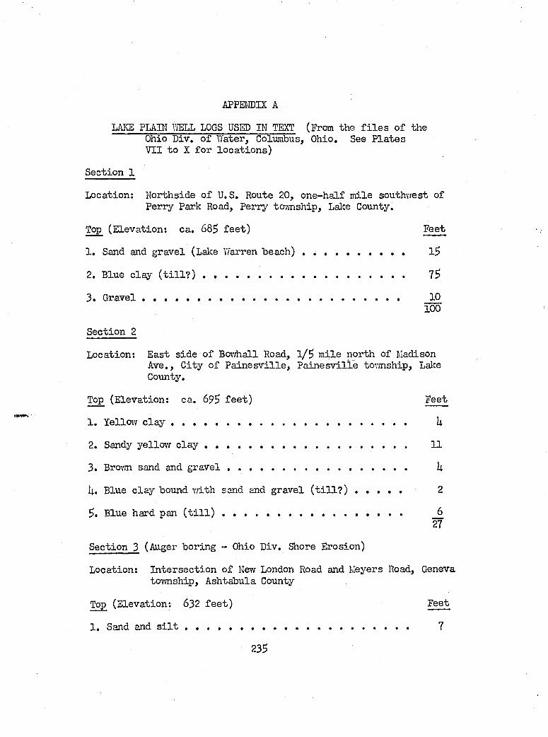
APPE1\!DIX A
LAKE PLAIN YiELL LOGS USED IN TEXT (From the f i l e s o f the Ohio Div. o f Y/ater, Columbus, Ohio, See P la tes VII to X fo r lo ca tio n s)
Section 1
Location: Korthside o f U.S. Route 20, one-h alf m ile southwest ofPerry Park Road, Perry ta;mship, Lalce County.
Top (E levation: ca. 68S fe e t ) Feet
1 . Sand and gravel (Lalce Warren h e a c h ) ............................................ 1$
2. Blue c lay ( t i l l ? ) ..............................................................................
3 . G r a v e l......................................................................................................... 10100
Section 2
Location: East side of Boi^hall Road, 1 /$ m ile north of MadisonAve., C ity o f Paine s v i l l e , Paine s v i l l e tovmship, Lalce County.
Top (E levation: ca. 69$ f e e t ) Feet
1. Yellovf c l a y ......................................................................................... U
2. Sandy yellow c l a y ............................................................................. 11
3. Brown sand and g r a v e l .................................................................... U
U. Blue c la y bound vdth sand and gravel ( t i l l ? ) ................ 2
$. Blue hard pan ( t i l l ) .................................................................... 627
Section 3 (Auger boring - Ohio Div. Shore Erosion)
Location: In tersectio n o f Nevf London Road and Meyers Road, Geneva tovmship, Ashtabula County
Top (E levation: 632 f e e t ) Feet
1. Sand and s i l t ..................................................................................... 7
23S
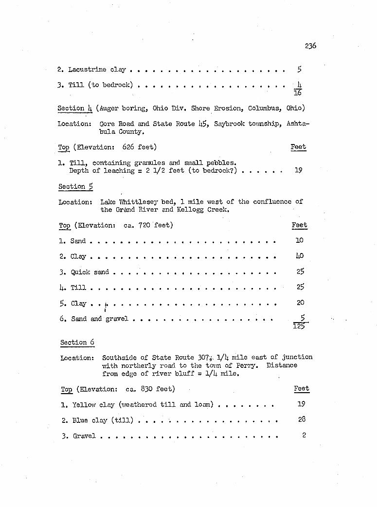
2 3 6
2. Lacustrine c l a y ...................................................................................... 5
3. T i l l (to b e d r o c k ) .................................................................................. UÏ6'
Section I4. (Auger boring, Ohio Div. Shore Erosion, Columbus, Ohio)
Location; Gore Road and State Route Saybrook tovmship, Ashtabu la County.
Top (E levation: 626 f e e t ) Feet
1 . T i l l , containing granules and small pebbles.Depth o f leach ing = 2 1 / 2 f e e t (to b ed ro ck ? )...................... 19
Section ^
Location: Lake D h ittle sey bed, 1 m ile v/est o f the confluence o fthe Grand River and Kellogg Creek.
Top (E levation: ca. 720 fe e t ) Feet
1 . S a n d ........................... ............................................................................ 10
2. Clay .................................................................................. UO
3. Quick s a n d ................................................................ 2$
h. T il]........................................................................................................... 23
5 . Clay.......................................................................................................... 20i
6. Sand and g r a v e l .......................... SÏ2T"
Section 6
Location: Southside o f S tate Route 307 l/U m ile ea st of junctionvdth northerly road to the tm'm of Perry. Distance from edge o f r iv er b lu ff = 1/U m ile.
Top (E levation: ca. 83O f e e t ) Feet
1. Yellov/ c lay (vreathered t i l l and lo a m ) .............................. 19
2. Blue c lay ( t i l l ) .............................................................................. 28
3 . G r a v e l................................................................................................... 2
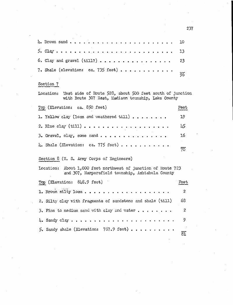
237
U. Brovm s a n d ............................................................................................... 10
C la y ............................................................................................................ 13
6. Clay and gravel ( t i l l ? ) ...................................................................... 23
7. Shale (e leva tion ; ca. 735 fe e t ) ................................................9%
Section 7
Location: \7est sid e o f Route 528, about 500 f e e t south of junctioniTith Route 307 East, Madison tormship. Lake County
Top (E levation: ca. 850 f e e t ) Feet
1. Yellovf c lay (loam and vreathered t i l l ) ..................................... 19
2. Blue cla '- ( t i l l ) ............................................................................ U5
3. Gravel, das'-, some s a n d ............................................................ l6
U. Shale (E levation: ca. 775 f e e t ) .............................................. ....70
Section 8 (U. S. Army Corps o f Engineers)
Location: About 1,000 f e e t northwest o f junction of Route 723and,307, H arpersfield tovmship, Ashtabula County
Top (E levation: 8U6.9 fe e t ) Feet
1. Brown s i l t y lo a m ............................................................................. 2
2. S i l t y c lay vdth fragments o f sandstone and shale ( t i l l ) 68
3. Fine to medium sand w ith c la y and w a t e r ................................ 2
U. Sandy c l a y ................................................................................. 9
5. Sandy shale (E levation: 767.9 fe e t ) .. ....................................... ....81
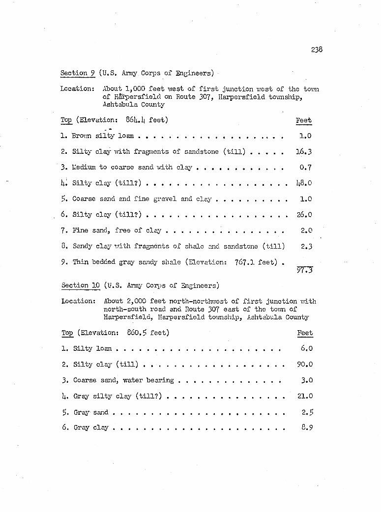
238
Section 9 (U.S. Array Corps of Engineers)
Location: About 1,000 f e e t west o f f i r s t junction w est of the tovnio f H arpersfield on Route 307, H arpersfield township, Ashtabula County
Top (E levation: 86Ii..li f e e t ) Feet
1. Brown s i l t y loam ............................................................... 1 .0
2. S i l t y c lay ivith fragments o f sandstone ( t i l l ) .................... 16 .3
3. lledium to coarse sand m th c l a y ................................................ 0 .7
S i l t y claj' ( t i l l ? ) ...................................................................................U8.0
?. Coarse sand and fin e gravel and c l a y ......................................... 1 .0
6. S i l ty c lay ( t i l l ? ) ................................................................................... 26.0
7. Fine sand, free o f c l a y ................................................................. 2 .0
8. Sandy c lay w ith fragments o f shale and sandstone ( t i l l ) 2.3
9. Thin bedded gray sandy shale (E levation: 767.1 fe e t ) .9 T 3
Section 10 (U.S. Array Cordis o f Engineers)
Location: About 2,000 f e e t north-northwest o f f i r s t junction v/ithnorth-south road and Route 307 ea st of the tovni o fH arpersfield , H arpersfield township, Ashtabula County
Top (E levation: 860.5 fe e t ) Feet
1. S i l t y lo a m ........................................................................................... 6 .0
2. S i l ty c la y ( t i l l ) .............................................................................. 90.0
3. Coarse sand, vrater b e a r in g ........................................................ 3 .0
U. Gray s i l t y c lay ( t i l l ? ) ................................................................. 21.0
5. Gray s a n d ............................................................................................... 2 .5
6. Gray c l a y .................................................................... 8.9
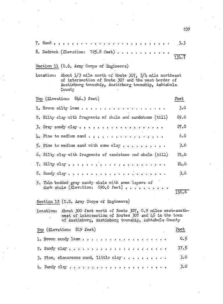
239
7. S an d ........................................................................................................... 3 .3
8. Bedrock (E levation: 725.8 fe e t ) ...................................................13U.7
Section 11 (U.S. Army Corps o f Engineers)
Location: About 1 /3 m ile north of Route 307, 3/U m ile northeasto f in ter sec tio n of Route 307 and the vfest border of Austinburg tam iship, Austinburg tovmship, Ashtabula County
Top (E levation: 8I4.6 .3 fe e t ) Feet
1. Bro-un s i l t y lo a m ............................................................................. 3 .0
2. S i l ty clay v.dth fragments o f shale and sandstone ( t i l l ) 69.0
3. Gray sandy c l a y ................................................... 27.0
U. Fine to medium s a n d ..................................................................... 6 .0
5 . Fine to medium sand vrith seme c l a y ....................................... 3 .0
6. S i l ty clay v/ith fragments of sandstone and shale ( t i l l ) 21.0
7 . S i l ty c l a y ............................. 2U.0
8. Sandy c l a y .......................................................................................... 3 .6
9 . Thin bedded gray sandy shale v/ith some la y ers o fdark shale (E levation; 690.O fe e t ) .......................... . . .
156.6
Section 12 (U.S. Array Corps of Engineers)
Location: About 300 f e e t north o f Route 307, 0 .9 m iles v/est-southwest o f in ter sec tio n o f Routes 307 and US in the tovm of Austinburg, Austinburg toim ship, Ashtabula County
Top (E levation: 8l9 f e e t ) Feet
1. Brovm sandy lo a m ............................................................................. 0 .5
2. Sandy c lay .............................................. 17.5
3. Fine, clacareous sand, l i t t l e c lay . ................................. 3 .0
k. Sandy c l a y .......................................................................................... 3 .0
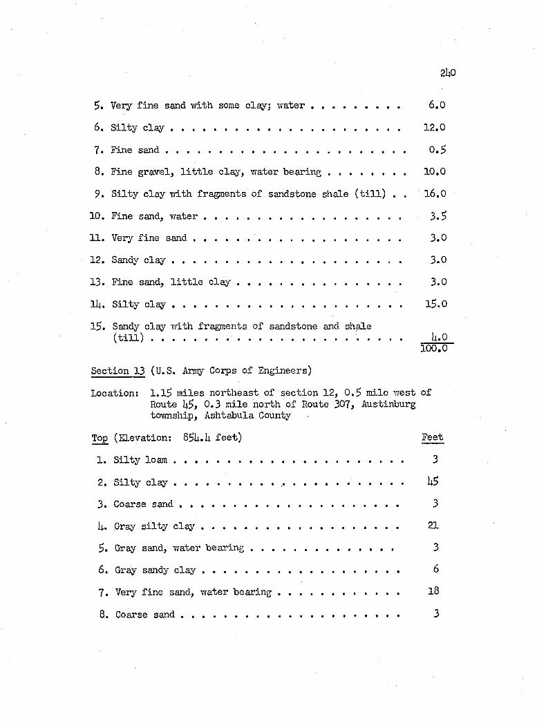
2itO
5. Very f in e sand 'vvith some clay; w a t e r ...................................... 6 ,0
6. S i l ty c l a y ......................................................................................... 12.0
7. Fine s a n d ............................................................................................. 0 ,$
8. Fine gravel, l i t t l e c la y , water bearing . . . . . . . . 10.0
9. S i l t y c la y T/ith fragments o f sandstone shale ( t i l l ) . . l6 ,0
10. Fine sand, w a t e r ............................................................................. 3 .5
11. Very fin e s a n d ................................................................................. 3 .0
12. Sandy c l a y ....................................................................................... . 3 .0
13. Fine sand, l i t t l e c l a y ................................................................ 3 .0
lU. S i l t y c l a y ................................................................... l5 .0
l5 . Sandy clay vdLth fragments o f sandstone and shale( t i l l ) ................................................................................. U.O
100 .0
Section 13 (U.S. Army Corps o f Engineers)
Location; l . l 5 m iles northeast o f sec tio n 12, 0 .5 m ile west o f Route 0 .3 m ile north of Route 307, Austinburg tovmship, Ashtabula County
Top (E levation: 83U.U fe e t ) Feet
1 . S i l t y lo a m ........................................................................................... 3
2. S i l ty c l a y .......................... .... . ................................................ U5
3. Coarse s a n d ...................................................................................... 3
U. Gray s i l t y c l a y ............................................................................. 21
5. Gray sand, water b e a r in g ......................................................... 3
6. Gray sandy c l a y ............................................................................. 6
7. Verj'- f in e sand, water b e a r in g ............................................... l8
8. Coarse s a n d ..................... 3
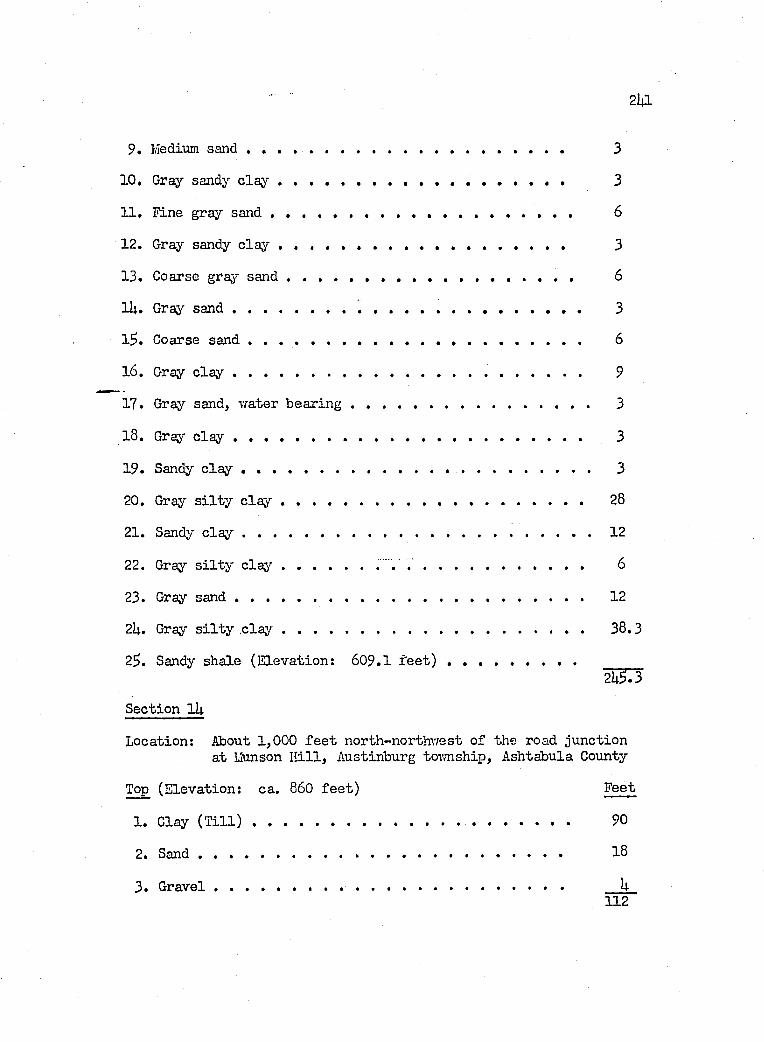
• ■ 2l4l
9. Medium s a n d ..................................................................................... 3
10. Gray sandy c l a y ............................. .............................................. 3
11. l in e gray s a n d ................................................................................ 6
12. Gray sandy c l a y ................ ............................................................ 3
13. Coarse graj* s a n d .............................................................................. 6
lU. Gray s a n d ............................................................................................... 3
l3 . Coarse s a n d .......................................................................................... 6
16 . Gray c l a y ............................................................................................... 9
17. Gray sand, %vater b e a r in g ................................................................. 3
18. Gray c l a y ............................................................................................... 3
19. Sandy c lay . ...................................................................................... 3
20. Gray s i l t y c l a y .................................................................................. 28
21. Sandy c l a y .................................................................................................... 12
22. Gray s i l t y c lay .................................. 6
23. Gray s a n d .............................................................................................. 12
2U. Gray s i l t y c l a y .................................................................................. 38.3
23. Sandy shale (E levation: 609.1 fe e t ) . . _____2ÜF3
Section lU
Location: About 1,000 f e e t north-northvrest o f the road junctionat Munson h i l l , Austinburg toTmship, Ashtabula County
Top (E levation: ca. 860 fe e t ) Feet
1. Clay ( T i l l ) ...................................................................................... 90
2. S a n d ................................................................................................... 18
3. G r a v e l...................................... h112
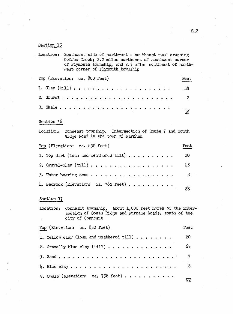
2U 2
Section 1^
Location; Southwest side o f northwest - southeast road crossing Coffee Creek; 2.2 m iles northeast o f southwest corner o f Plymouth township, and 2 ,3 m iles southwest o f northw est corner of Plymouth toivnship
Top (E levation: ca. 800 fe e t ) Feet
1. Clay ( t i l l ) ...................................................................................... Wt
2. G r a v e l....................................................... 2
3. Shale ...................................................................................................
Section l 6
Location: Conneaut tovmship. In tersection o f Route 7 and SouthRidge Road in the tovm of Famham
Top (E levation: ca. 838 fe e t ) Feet
1. Top d ir t (loam and weathered t i l l ) ...................................... 10
2. G ravel-clay ( t i l l ) ...................................................... U8
3. Water bearing s a n d ........................................................................ 8
U. Bedrock (E levation: ca. 762 fe e t ) .......................................
Section 17
Location: Conneaut tovmship. About 1,000 f e e t north of the in te r sec tio n o f South Ridge and Furnace Roads, south o f the c it y o f Conneaut
Top (E levation: ca. 830 fe e t ) Feet
1. Yellow c la y (loam and weathered t i l l ) ........................................ 20
2. Gravelly blue c lay ( t i l l ) .......................................................... 63
3. S a n d ..................................................................................... 7
H. Blue c l a y .............................................................................................. 8
3. Shale (e leva tion : ca. 738 fe e t ) ...........................................92
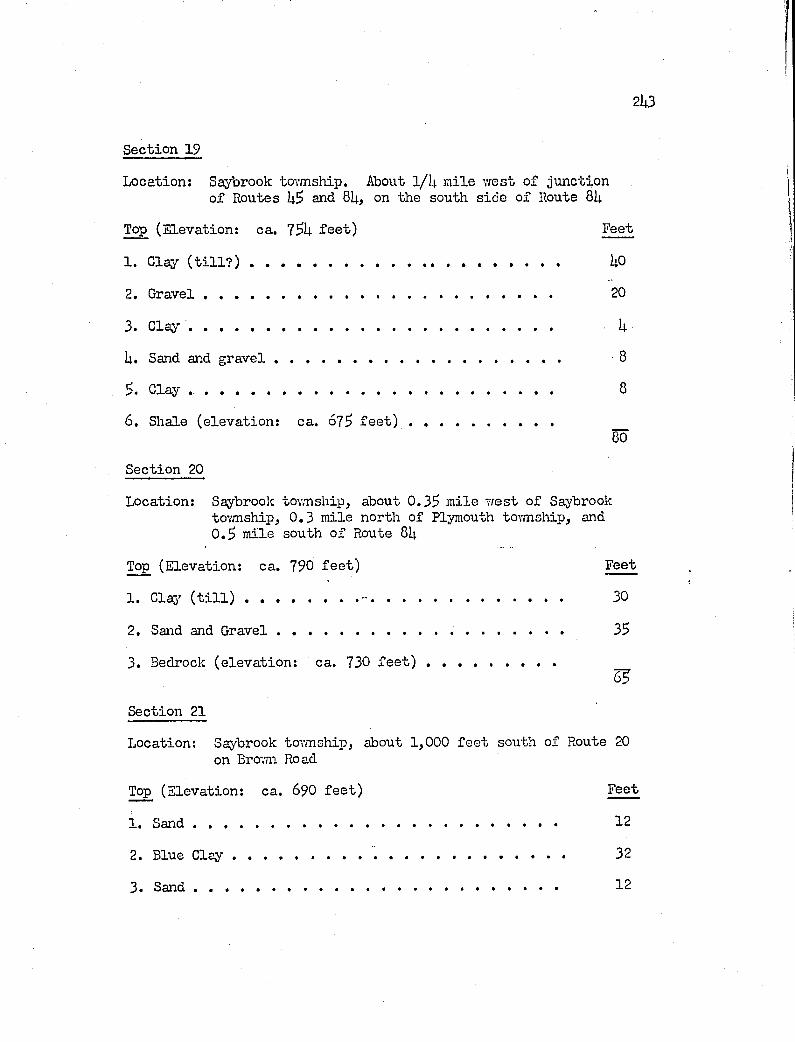
2 li3
Section 19
Location; Saybrook tovmship. About I/I4. m ile w est o f junction of Routes and 81). on the south sid e o f Route 81;
Top (E levation: ca. f e e t ) Feet
1. Clay ( t i l l ? ) ............................................................... ho
2. G r a v e l............................................................................................. 20
3. C la y ........................ 1;
U. Sand and g r a v e l ....................... 8
Clay ....................................................................................... 8
6 . Shale (e levation : ca. 67$ f e e t ) .......................................So
Section 20
Location: Saybrook tovmship^ about 0.3$ m ile w est o f Saybrooktovmship, 0 .3 m ile north of Plymouth township, and 0 .$ m ile south o f Route 81;
Top (E levation: ca. 790 fe e t ) Feet
1 . Clas ( t i l l ) .............................. - ..................................................... 30
2. Sand and G r a v e l..................................................................................... 3$
3. Bedrock (e leva tion : ca. 730 f e e t ) .. ...................................SK
Section 21
Location; Saybrook tovmship, about 1,000 fe e t south of Route 20 on Brovm Road
Top (E levation: ca. 6P0 f e e t ) Feet
1. S a n d ........................................................................................................... 12
2. Blue C la y ................................................................................................. 32
3. S a n d ........................................................................................................... 12
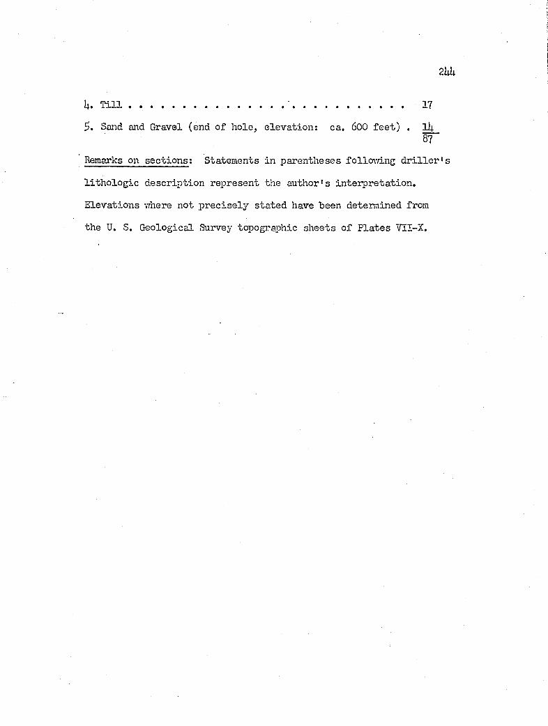
2hh
U. T i l l ................................................... 17
Sand and Gravel (end o f hole, e levation : ca. 600 fe e t ) . li;87
Remarks on s e c t io n s : Statements in parentheses fo llow ing d r i l l e r ' s
l i th o lo g ie descrip tion represent the author's in terp reta tion .
E levations where not p r e c ise ly sta ted have been determined from
the U. S. G eological Survey topographic sheets o f P la tes VII-X.
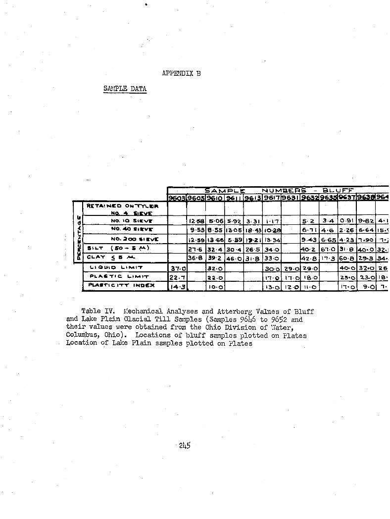
APPENDIX B
SAî.îPLE DATA
9 6 0 3 9 6 0 5 9 6 1 0 9 6S A M R U g M U M B E . P S - B U U F T
9 6 13 96t-r 9 6 3 1 9632 9633 9637 9 ^rctaikco ON-rYuem NQ..5L Sieve__
NO. t o s < c v r 1 2 - 58 5 0 6 5 9 2 3 31 i - n 5 2 3 4 0 9 1 9*62 4« I
NO. A O S l V x / g 9 5 3 8 5 5 1 3 - 0 5 1 0 - 4 3 10-28 6 1 I 4 -6 2 2 6 6 64 IG.(N O . 2 0 0 f t i a v c 1 2 - 5 9 13 66 6 5 9 1 9- 21 13-M 9 4 3 6-65 4 2 3 . 9 0
SILT (SO - 5 A ) 2 1 6 3 2 4 3 0 - 4 2 6 S 3 4 O 4 0 2 6 1 - 0 3 1 - 8 4 0 » OCUAV < 5 3 6 8 3 9 2 4 6 - 0 3 i - 8 3 3 - 0 4 2 8 n-3 60-8 2 9 - 3 3 4 »
LI Quid LI A4IT 3 7 - 0 3 2 O 3 0 - 0 2 9 O 2 9 - 0 4 0 0 3 2 * 0 2 6P L A S T I C l _ l N * |- r 2 2 - 1 2 2 O II O n o I B o 2 5 » 0 23.0 18»
P L A S T I C IT-r IMOeX J 4 - 3 10-0 13-0 12-0 ll-O n » o 9-0
Table IV. Mechanical Analyses and Atterberg Values o f B lu ff and Lake P la in G lacia l T i l l Samples (Samples 96I46 to 96^2 and th e ir values were obtained from the Ohio D iv ision o f '.Tater, Columbus, Ohio). Locations o f b lu f f samples p lo tted on P la tes Location o f Lake P lain samples p lo tted on P la tes
2U5
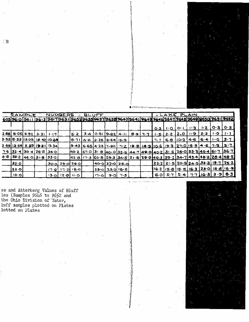
B
II
S a m r u b : N I U M B E . R S - B U U F T - l a k e : P L A I N9 6 1 1 9 6 1 3 9 6 1 - 7 9 6 ^ 1 9 6 3 5 9 6 3 7 9 6 4 0 9 * 4 % 9 * 4 g 9 * 4 g 9 6 % ! 1 9 6 5 26 0 5 | 9 6 I 0
0 - 3 1 - 0 O ' I 1-3 I ' Z 0 - 3 0 - 3
2 - 5 8 5 0 6 5 9 2 3 31 i-n 5 2 3 - 4 0 9 1 9 8 2 4 « II S 3 7 7 1 - 9 2 2 2 . 0 t ' 9 2 2 1 0 1- 1
3 - 5 3 8 5 5 laos 1 0 - 4 3 1 0 - 2 8 6 1 1 4 6 2 2 6 6 6 4 1 5 - 9 7 . 1 6-8 1 0 * 2 4 6 6 4 I'O 3 7
2 - 5 9 13 6 6 6 5 9 19-21 1 3 - 3 4 9 - 4 3 6 - 6 5 4 2 3 -1. 9 0 n - z 19- 8 1 4 9 1 0 - 6 1 9 - 3 % 7 ' 0 IS 5 4 6 7-9 @'7- 1 6 3 2 4 3 0 4 2 6 5 3 4 - 0 4 0 - 2 6 1 - 0 3 1 - 8 4 0 ' 0 3 2 . 5 44-7 49 0 4 0 - 2 3 1 6 26-0 3 3 3 4 0 4 61 7 3 6 - 7
6 8 3 9 2 4 6 0 3i-8 3 3 - 0 4 2 8 n - 3 6 0 - 8 2 9 - 3 3 4 ' S Zl -6 2 9 0 4 0 - 3 3 9 - 1 3 4 . 7 4 3 4 4 5 2 2 8 - 4 4 8 5
3 2 0 3 0 - 0 2 9 0 2 9 - 0 4 0 0 3 2 * 0 26.0 2 Z 2 21-5 2 0 - 9 2 4 0 33 3 1 9 - 7 2 5 - 2
22 0 n-o n- 0 I B 0 2 3 * 0 23.0 I 9 ' 5 l f e - 2 15-8 15-5 1 6 - 3 2 3 0 l S - 8 16-9
1 0 0 13 0 1 2 - 0 H - O n * o 9 . 0 n - s 6 0 5-7 5 4 7.7 JO-3 3 9 8-3
Bs and Atterberg Values o f B lu ff Les (Samples P6I46 to 96^2 and the Ohio D iv ision of Vfater, lu f f samples p lo tte d on P la tes lo tte d on P la tes
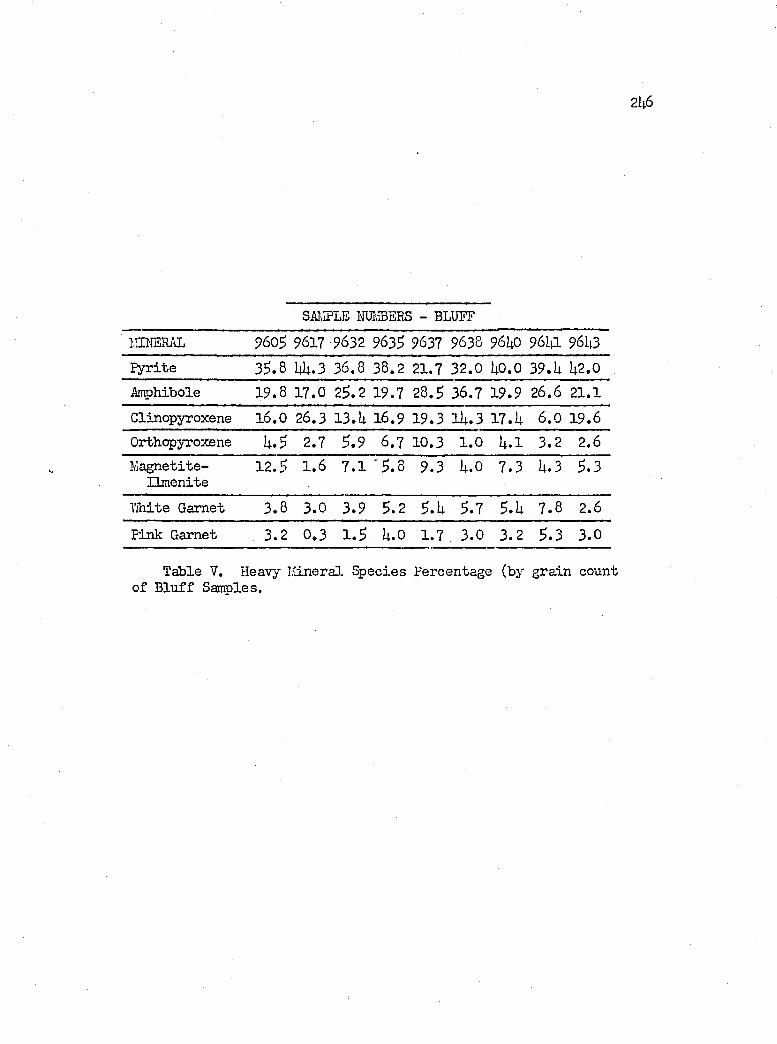
2U 6
SAlvIPLE m aE R S - BLUFF
lîIHSRAL 9605 9617 9632 9635 9637 9638 96UO 96m 96U3Pyrite 33.8 I1I1.3 36.8 38.2 21.7 32.0 UO.O 3 9 .U %2.0Amphibole 19.8 17.0 23.2 19.7 28.3 36.7 19.9 26.6 21.1
Clinopyroxene 16.0 26.3 1 3 .U 16.9 19 .3 lU .3 1 7 .U 6 .0 19.6Orthopyroxene U.3 2.7 3 .9 6 .7 10.3 1 .0 U .l 3 .2 2.6M agnetite-
Ilm enite12.3 1 .6 7 .1 ' 3 . 8 9.3 U.O 7 .3 U.3 3.3
White Garnet 3 .8 3 .0 3 .9 3 .2 3.U 3.7 3.U 7 .8 2.6
Pink Garnet 3 .2 0 .3 1 .3 U.O 1 .7 3 .0 3 .2 3 .3 3 .0
Table V. Heavy Ivlineral Species Percentage (by grain count of B lu ff Sançles.
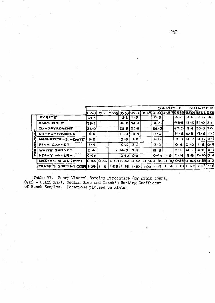
2U7
9 5 5 0P Y R I T I
S A M F»L_ C N J U M B E R l
9551 9552 95533 - 2
95542 8
9555 9 5 5 6 95570 9
95594 2
9560 95619563 6 3 5 4-:
w
a m p h i b o l e 26 7 36 6 4 2 0 36 9 48 9 1 3 5 31 OC L l H O P y R O Y C N E 2 6 O 23 9 2 5 8 2 6 O 2 1 9 5 4 3 6 0
i l l4 2
O P T H O P Y R O X E N E 6 6 12-0 1 3 1 \ I -O 14-a 6 3 1 2 - S 11'C
M40NCTITE - luMENITC 6-2 0 - 6 0-6 0 - 3 14 2 0 6 O- :
P I N K g a r n e t 1 - 4 6 5 3 2 0-2 0-6 2 1 0 I 6 0 - 9
W H I T E G A R N E T 2 - 4 1 4 - 3 T-2 1 3 - 3 2-6 1 4 - 2 3 -6 O -S
H E A V Y M I N E R A L 0 - 0 5 o-;o 0 5 0 4 4 1-9 0 14 9 - 8 O- lO 0 8M E D I A N S I Z E ( Yni r>) 0 - 5 0 0 - 5 0 0 - 4 2 O 4 2 0 - 3 4 0 - 3 5 0 - 3 8 0 3 5 O- IDS O 3 3 0 2TRASK’S SORTING COEFI 1 - 0 9 I- 1 5 1-25 I- 16 I lO I-OS I - n I - 1 4 I • 1 9 1 - 6 7 1-6
Table VI. Heavjr îvlineral Species Percentage (by grain count, 0*2$ - 0 .12$ mm.) , Median S ize and Trask’s Sorting C oefficen t o f Beach Samples. Locations p lo tte d on P la tes
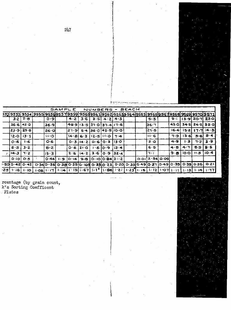
2U7
S A M P L - C N J U t v O E T R S - b e a c h
5 5 ? 95fÿ 9554 9555 955Ç 9557 9559 9560 9561 9Ç62 956$ 3564 9565 9566 9567 9568 9569 957Q 95713 2 2 8 0-9 4 2 3 6 3 5 4 2 4-3 5-5 9-1 13-9 2 0 - 7 2 2 - 0
36 6 4 2 0 36 9 4 8 9 13-5 37 0 37 4 17-6 36-7 4 3 0 34 2 24-2 3 2 - 0
23 9 25 8 26 O 27-9 5 4 36 0 42.5 t o o 27-5 16 4 15 2 * 7 . 7 14-312-0 131 11 -o 14-a 6 3 12-S 11- o 7-4 U-6 7 - 9 13-6 5 6 8-40-6 1-6 0 6 0-3 14-2 0-6 0 3 130 2 0 4 9 1-3 7-2 3 96 5 3 2 0-2 O 6 210 1-6 0 9 12 4 6 • 5 4 S 4-7 8 S 5 - 5
j 14-3 T 2 )3-3 2 6 14 2 3 6 O 9 32-4 7- 1 9 8 l o o n - 5 10-40 - / O 0 5 • 0 44 1-9 0 14 9-8 O- lO 0 84 31-2 0 0 1 2 34 0 09
•SO 0-42 O 42 O 34 0-35 0 38 0 35 0 1 0 9 0 33 O 2 2 0 20 0 35 0 4 9 0 27 0 49 0 35 0 3 5 0-26 0-21■25 1 16 I - lO i-oa 1 • I T 1 • 14 1 ' 1 9 1-67 \ - 1 * 1-86 1- 21 1 2 / I 1 5 12 1 " 0 7 1 ■ 1 1 1-13 1 4 1-77
rcentage (by grain count, k 's Sorting C oefficen t . P la tes
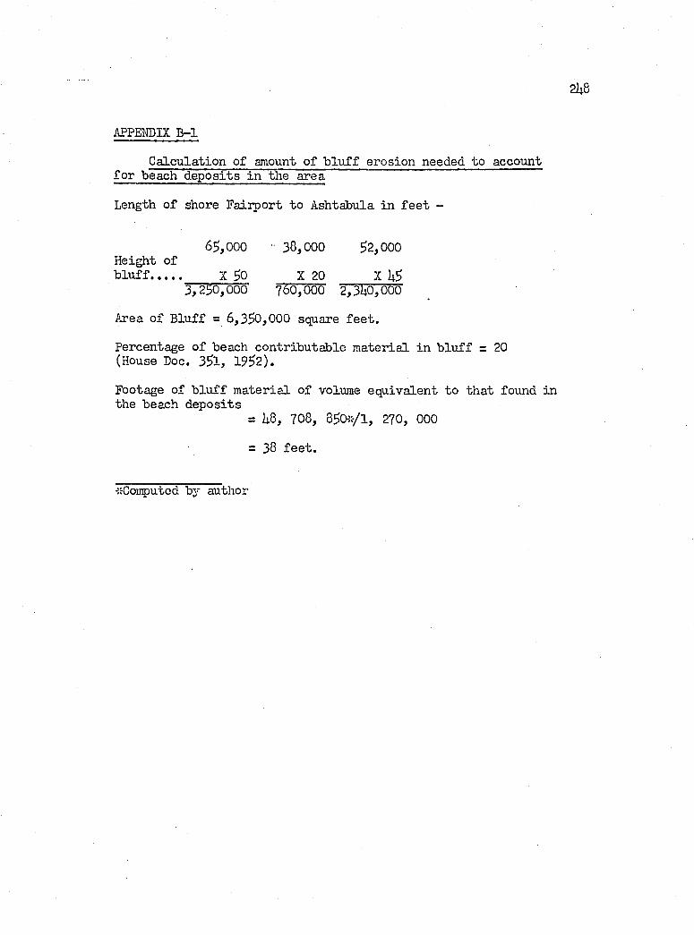
2hB
APPENDIX E-1
C alculation of amount o f b li if f erosion needed to account fo r beach deposits in the area
Length o f shore Fairport to Ashtabula in f e e t -
6$,000 ■ 38,000 32,000Height ofb lu f f X 30 X 20 X U3
3 ,230, 000' 760,000 2, 3U0,000
Area o f B lu ff = 6,330,000 square fe e t .
Percentage o f beach contributable m aterial in b lu f f = 20 (House Doc. 331, 1932).
Footage of b lu ff m aterial o f volume equivalent to th at found in the beach deposits
= U8, 708, 83ch;/1, 270, 000
= 38 f e e t .
-;:-Computed by author
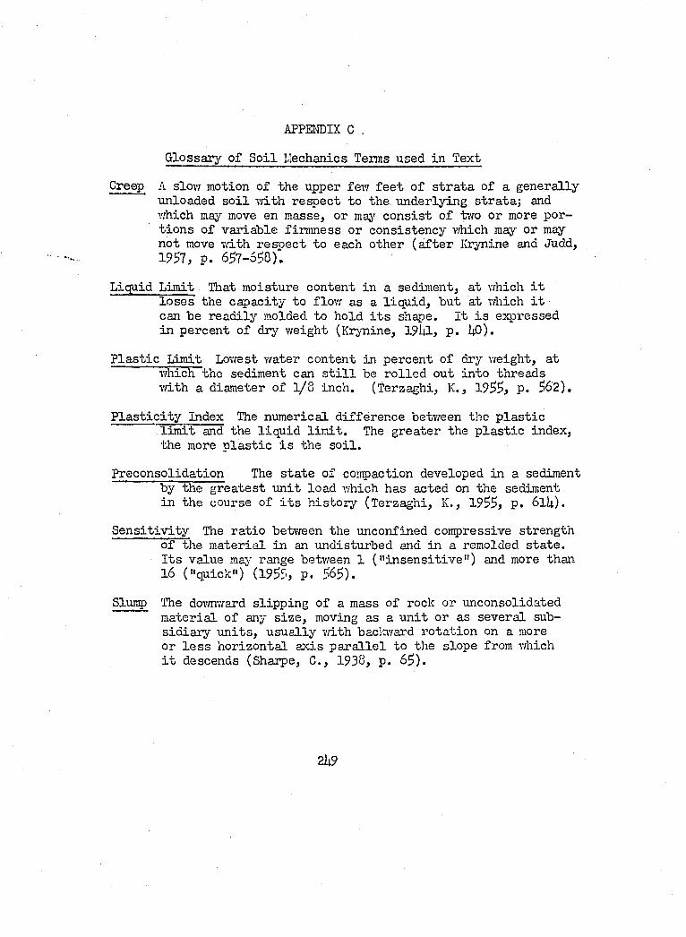
APPENDIX C .
Glossary o f S o il laechanlcs Terms used in Text
Creep A slow motion of the upper few f e e t o f s tra ta o f a generally unloaded s o i l vri.th respect to the underlying stra ta ; and which may move en masse, or maj’’ c o n s ist o f tiTO or more portio n s o f variab le firm ness or consistency which may or may not move w ith resp ect to each other (a f te r Krynine and Judd, 1957, p . 657-558).
Liquid Limit That moisture content in a sediment, at which i t lo s e s the capacity to flow as a liq u id , but at which i t can be read ily molded to hold i t s shape. I t i s expressed in percent o f dry weight (Krjnine, I 9I4I , p . UO).
P la s t ic Limit Lowest water content in percent o f dry w eight, at which the sediment can s t i l l be r o lle d out in to threads 7/ith a diameter of 1 /8 inch. (Terzaghi, K., 1955, p. 562).
P la s t ic i t y Index The numerical d ifferen ce between the p la s t iclim it and the liq u id l im it . The greater the p la s t ic index, the more p la s t ic i s the s o i l .
Preconsolidation The s ta te of compaction developed in a sediment by the grea test u n it load which has acted on the sediment in the course o f i t s h isto ry (Terzaghi, K., 1955, p. 61U).
S e n s it iv ity The ra tio between the unconfined compressive strength o f the m aterial in an undisturbed and in a remolded s ta te . I t s value ma)'' range between 1 (" in sen sitiv e" ) and more than 16 ("quick") (1955, p. 565).
Slutiy The doT/nward slip p in g o f a mass o f rock or unconsolidated m aterial o f any s iz e , moving as a u n it or as several subsid ia ry u n its , u su a lly vfith baclcward rota tion on a more or l e s s horizontal ax is p a r a lle l to the slope from which i t descends (Shaipe, G., 1938, p. 65).
2U9
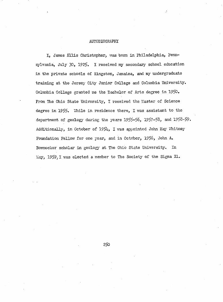
AUTOBIOGRAPHY
I , James E l l i s Christopher, was bom in P hiladelphia, Penn
sylvania, July 30, 1925. I received my secondary school education
in the p rivate schools o f Kingston, Jamaica, and my undergraduate
tra in in g at the Jersey C ity Junior College and Columbia U niversity .
Columbia College granted me the Bachelor o f Arts degree in 19^0,
From Hie Ohio State U niversity , I received the Master of Science
degree in 19^?. TJiile in residence there, I was a ss is ta n t to the
department o f geology during the years 1955-56, 1957-?8, and 1998-59.
A dditionally , in October o f 195Uj I was appointed John Haj' Whitney
Foundation Fellow for one year, and in October, 1956, John A.
Bownocker scholar in geology at The Ohio State U niversity . In
May, 1959,1 was e lec ted a member to The Society o f the Sigma Xi.
290
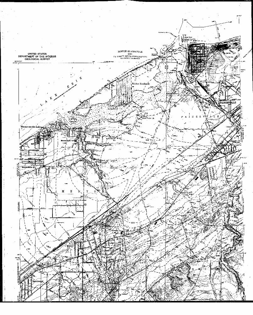
UNITED STATES DEPARTMENT OF THE INTERIOR
OEOLOQICAL SURVEY
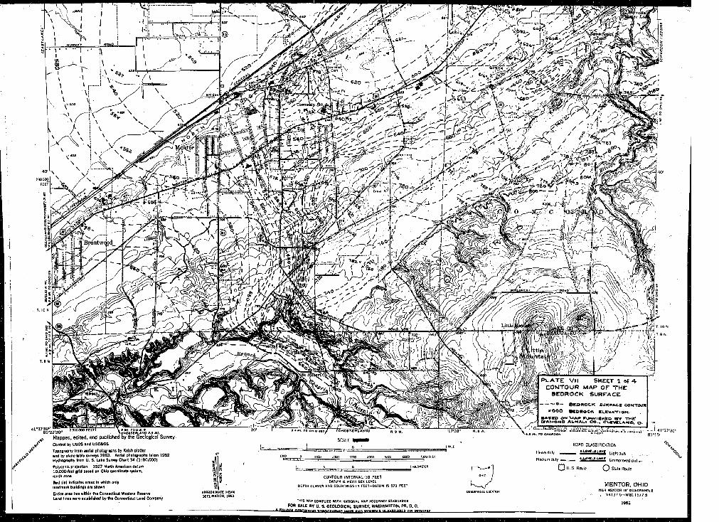
n t w ç p d
L ittle
M apped , ed ited , and published by th e G eological SurveyControl by USGS and USC&GS
Topoeraplty from aerial photographs by Kslih plotterand by plina-labis aurveya 1953 , Aerial photographs taken 1952Hydrography from U. S. la k e Survey Chart 34 (1 :8 0 ,0 0 0 )
Polyconic projection. 1927 North American datum 1 0 ,0 0 0 foot grid based on Ohio coordinate system, north fone
Red tint Indicates areas In which only landmark buildings are shown
Entire area lies within the Connecticut Western Reserve Land lines were estebllihed by the Connecticut Land Company
teHcarefiLANOtSCALE * *
looo ?ooc 1000 4000 MOO 6000 rpoo f f t t
COf^TOLR INTERVAL 10 FEET DATUM IS MEAN SEA LEVEL
DEPTH CURVES AND SOUNDINGS IN FEET-OATUM IS 570 FEET
THIS MAP COMPLIES WITH NATIONAL MAP ACCURACY STANDARDS FOR SALE BY U. S. OEOLOQICAL SURVEY. WASHINGTON. 2 5 , D. C.
- A P m n cB TnprwiBAewin u — « u n .v u e r u a rit avA ttaa i f nw B rn iir e r
P L A T E VII SHEET 1 of 4- CONTOUR MAP OF TH E
BED RO CK SU R FA C E
-------- ® — B R O N O C K SU N W AC K CO N TO U R
* 0 0 0 M E O R e C K K u e V A T iO N
BAOKO OM V A ^ tnjRNlBM KC, m v T M r O S A M O M P A U K A U t C O . , C L S V C L A N O . © .
ROAD CLASSIFICATION
Heavy duty ü & L Ü j Ü Î Light-duly .
Mcdium-duty .11 i Unimpioved d ill c '
Q U. s. Roule O Stale Route
M E N T O R . O H IOOUWRANGLL LOCATION
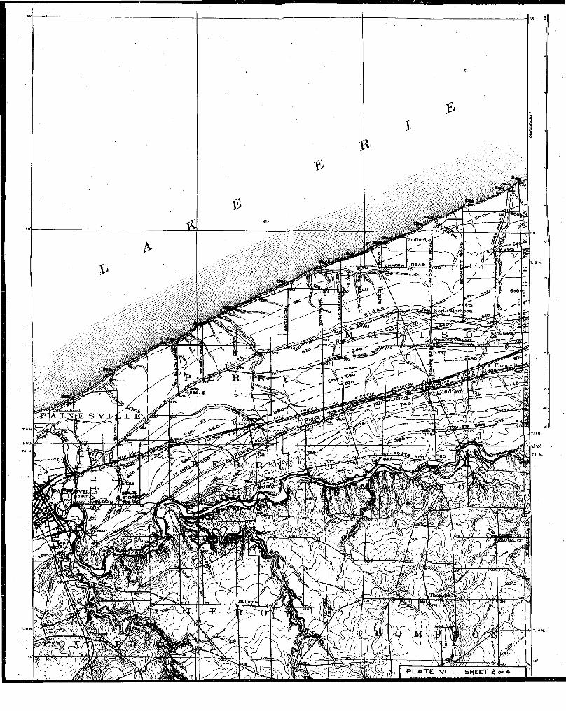
BaSLr
ïüHhn
P L A T E VIM S H E E T 2 of 4
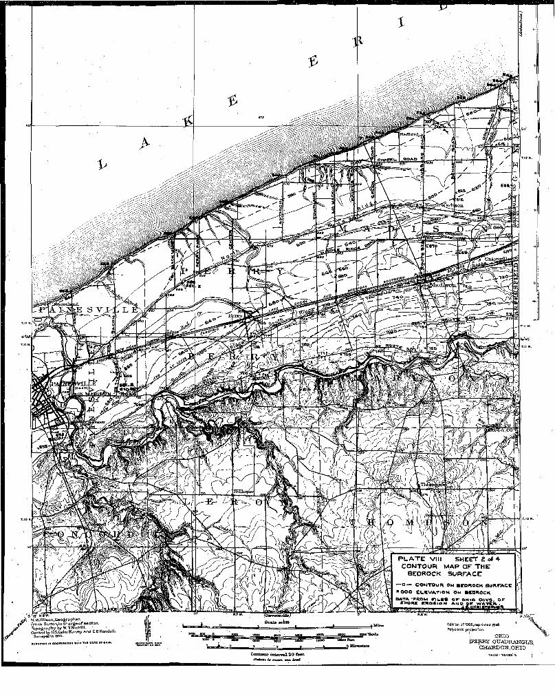
6 ftS ' o
K
P L A T E VIII s h e e t 2 of 4 C O N T O U R M A P O F T H E
BEDROCK S U R F A C E
o — C O N T O U R ON a r O R O C K S U R T A C C M OO O C L K V A T IO N CM BffO ROCK
'OturvUmyiO»} Soala t f à w
" /8 I ' I5 " H.BW.H.M .W Ufton.Geographor.
4<r Frank Sutton .in c h a rg e o fo e c tio n .Top o û r a V by W.N.Morrill.Contrai by U.S.LakoSljrvoy a n d C.B.Kondall.
S u rv « iy « d In 1904,
•uavKviD iH eoortn*Ti0N
Contour intepval 20 £»et ■Oatutn t» m M » mo. Uyi
Edition oP1906,r»pHntod 1948 Polyconic proioctlon,
O H IOLPERior o u a d r a n g -l e
CHAKDON.OHIONfcl3O-waiO0/l5 j
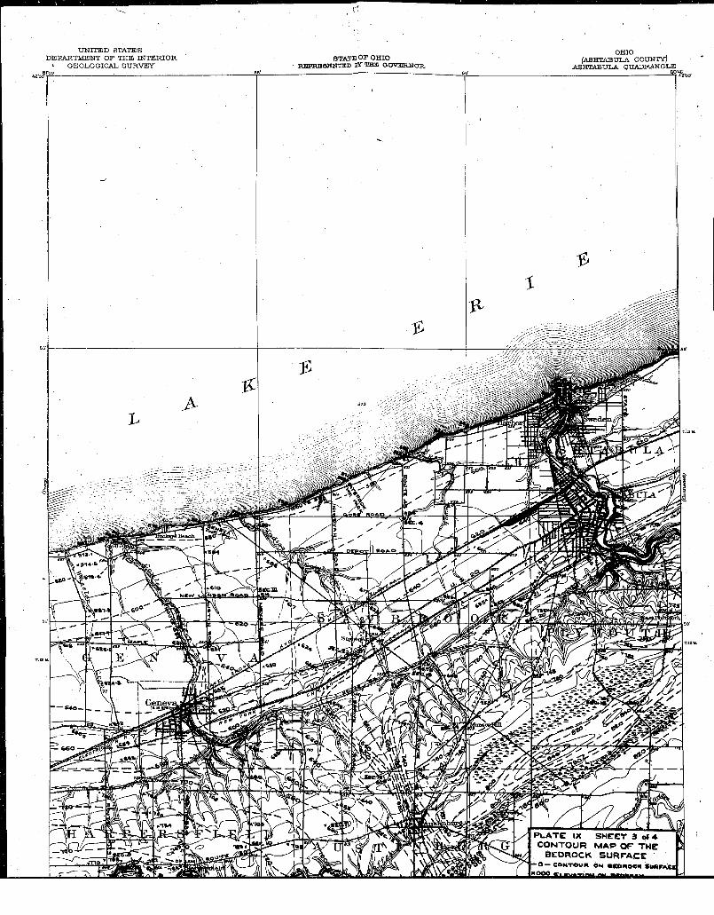
m r i T E D STATES D E P A R T M E N T O F T H E INTERIOR * G E O L O G I C A L S U R V E Y
OHIO([ASHTABULA COUNTY)
A S H T A B U L A Q U A D R A N G L ESTATE OP OHIO
RHPHESKNTBD BÏ" THE G O V E R N O R
Pgpgyrli moAO
i« *•»
P L A T E IX S H E E T 3 o f * C O N T O U R M A P O F T H E
B E D R O C K S U R F A C E- O — C a N T O w n ON ■C O A O CK S u n r A C I
SâSSJCUMSÎatfc
3 ^
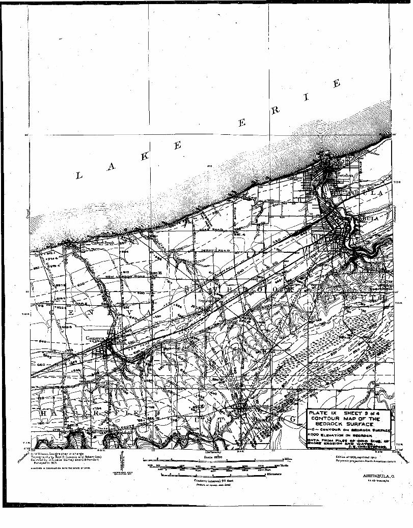
P L A T E IX S H E E T 3 o f 4 C O N T O U R M A P O F T H E
B E D R O C K S U R F A C E— O — C O N T O v m On OKOAOeM, fU A f A C t NOOO C u W A T IO N ON O gOm OCK
J.K.Om»«TOOwMfc." H .M .W ilson. G e o g r a p h e r in c h a r g e
T o p o g r » p h y ’b> Robt.O .C um m in e n d R obert Coeji Scale seldU Edition o f 1908, rep rin ted 194S Polyconic ppo jectlon .N orth A m erieC o n t r o l by U .S .L a k e S u r v e y a n d G S K en d a ll
lURVCVCe IN COOPCMTION
CoiUjyur ixUarmL 20 £eet ■AiAmi i» m«an. 4 M k iW
ASHTABULA..O.N4l48-WaO«B/lB
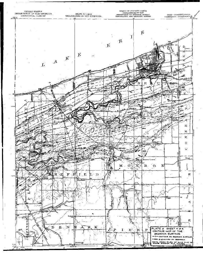
U N T T E B STATES D E P A R T M E N T OP T H E INTERIOR
G E O L O G I C A L S U R V E Y STATE OF OHIO REPRIS SENTED BY THE GOVBl^OH.
STATE OP P E N NSYLVANIA ly S P R E S B N T B D B Y T H E
D EPA R TM EN T O P IN T E R N A L A PPA IR S T O P O a R A P m C AND G EO LO G IC SU R V E Y
O H IO - P E N N S Y L V A N IA ÿ C O N N E A U T O U A U P.A N G IÆ
M u u r t tu C l
’rHag»
P L A T E X S H E E T 4 of 4 CONTOUR M A P O F T H E
BEDROCK S U R F A C E— O — C O N T O U R O K BKOEIOCK. S U R F A C E
* * 0 0 0 E U C V A -n O M O N B S O n o C K
J . K .c w m i e T o r w K R
UtddûxgB(A n d o v e r /aCfL6' M3
M.WIlHon. G a o é ra D h e r
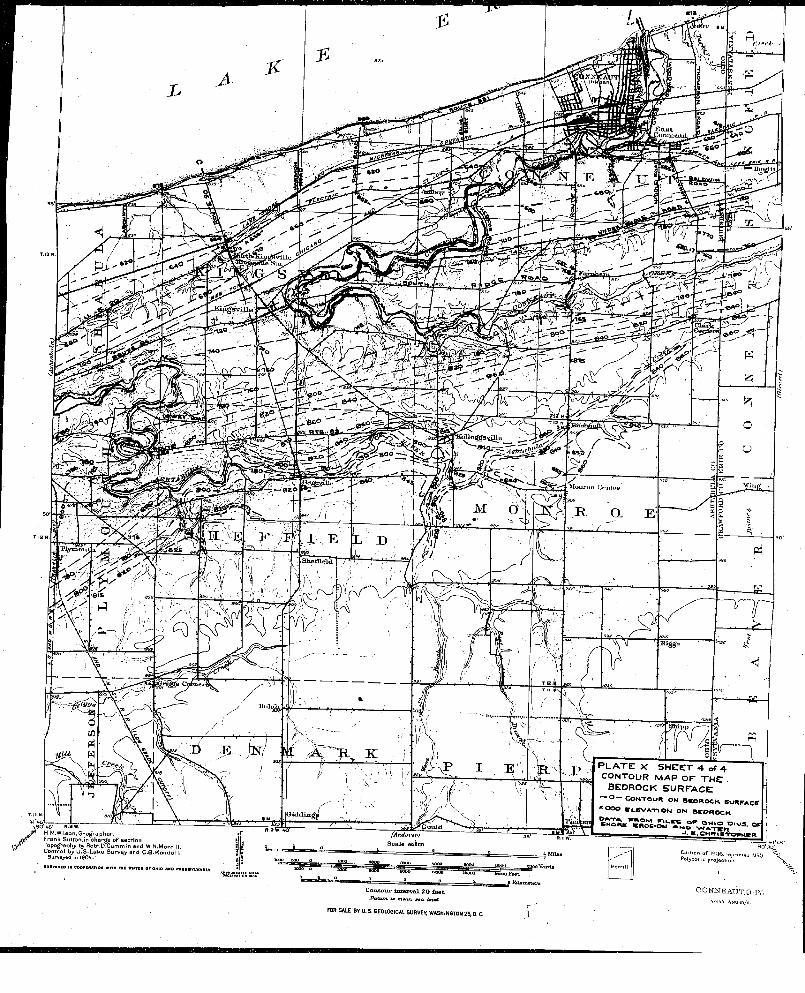
£!umiBtLUt
F a r a h n p ^
ojÇ svUliî
M o u n i o C«*iitoj
M d
X.',;^ A T 3 . KB -:e. .. N/rfW M
tSiddm(A n d o v e v t 35- R l w
S c a le ’Bvim
iw oo jaooo Vent
B Kilonistc
\80"4B" 1 .3 * .H.M.WHson, G e o g ra p h e r ,
rffc' F ra n k SuTTon.in c h a r g e o f s e c t io n ,l y T opography by R ob t.D .C um m in a n d W .N ,M orrill.
C o n tro l by U .S .L a k e S u r v e y a n d C .Q .K e n d a ll .Surveyed In 1904. '
a uav tv to im coorinATiOH with TNt e i T:# or Ohio aho pihh*vlvahia
I P L A T E X S H E E T 4 of 4' c o n t o u r m a p o f t h e
BEDROCK s u r f a c e .— O — C O N T O U R O N e v o iR O C K S U R F A C E |
* 0 0 0 S i .6 V A * n O N O N a c O R O C K | ,
D A .TA . WROKB FIV .W S O R O H iO t> tV S . O F | i 6HORR KR06I0M AnO WATCnJ . K .C M W t R T O P t
Edition of IQQ6, (tj QPolyconic projccicon ""t|.
C o n t o u r i n t e r v a l % 0 & e t XfUum it nitan. tta, ItvtlFOR SALE BY U. S. GEOUWiCAL 5URVE>; WASHINGTON 2S, D C Ï
COWNEIATJT.O-IV...
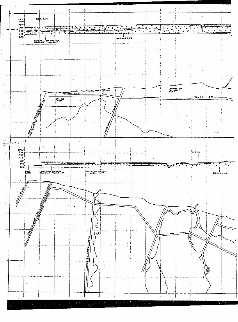
5905105 5 0
HINBWAH a o lS A 'T B U P O V TPWrtSHlF TOWMBMIF
S A v a a o o <
S3I
r c c r
POCKP O A O
KAADI80M G«N8VA row N V H iP TOWN8 H IP IwHCBLEP. CUKHK ROUTE SAS
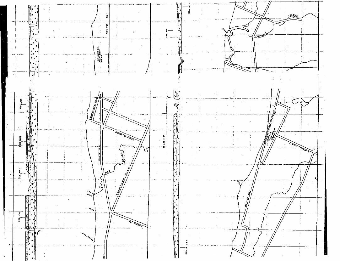
•» *4
' 4.1 '
1 -
a 13 : J ;
■tï-’
I
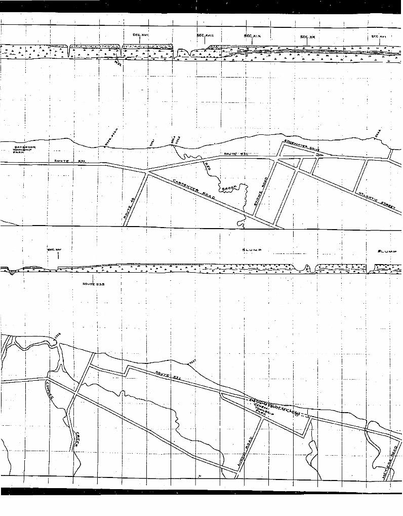
K a o T g - g a r
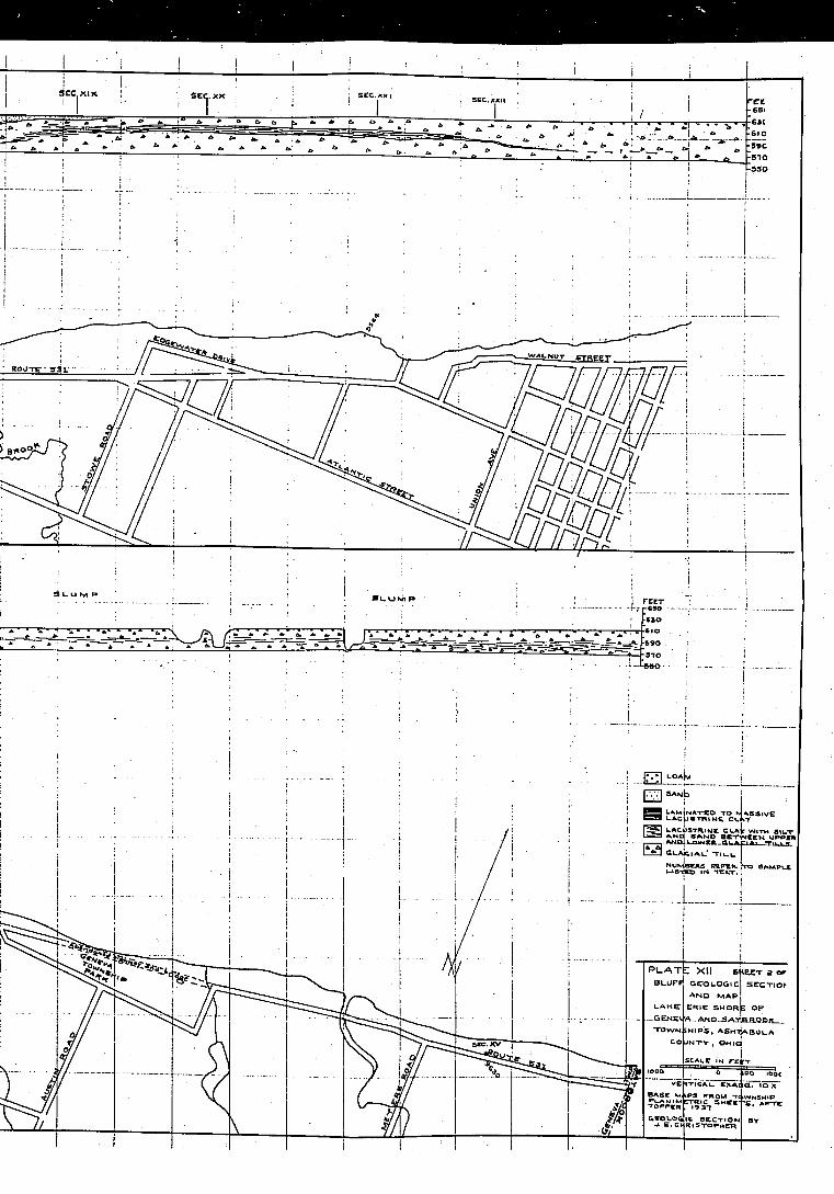
-59C-510-5 5 0
UNUT eypcçy
} B*oq
-«90
Ina-t s o t o Mai ----------- . j jS m tN E CLÀT
IS
P L A T E XIIBLUF^ e r a LOGIC
ANO MAP CRIE SHOR
A N D ^ A T
H IPS. AS«7 JNTV . OHIC
a . IDA
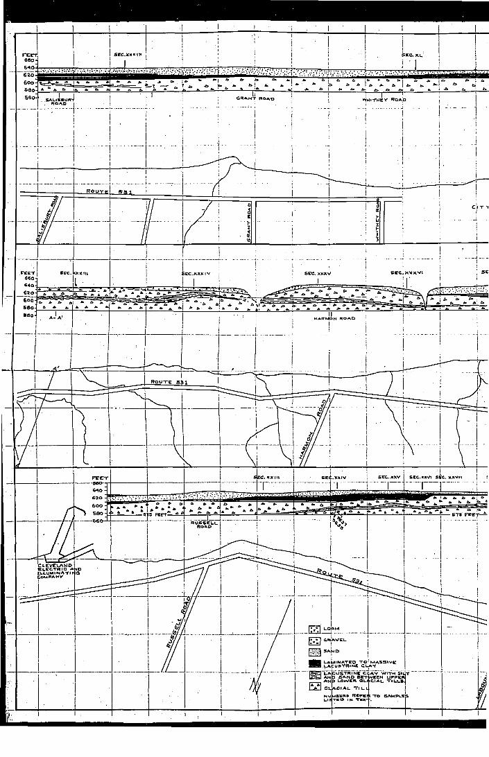
SCC.)CXX|M
‘MITMCY KOAO
R o u t e
s e e ; X X X V Is e c . SEC. x x x V
62 0 -
H A R M O N R O A D
1 I I
e c . X X II I s e c .x x iv
risec.X X V SI C. XXVII
580 -
C L E V E L A N D E L E C T R I C A N D IL L U M IN A T I rCo u p a n t
L A M IN A T E D T O L A C U S T R IN E C
L A V W IT H S lU T W E E N U P P E R
C IA L T I L L S
A
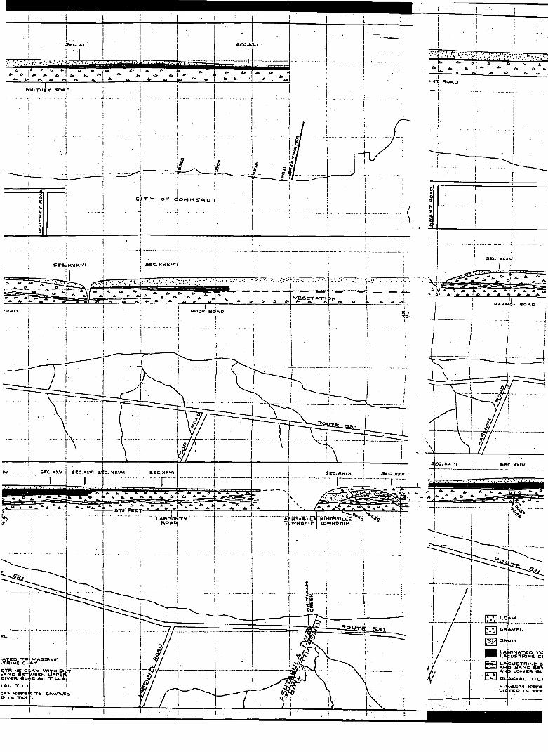
1
S E C . X L
^ I ' 1
s c c . x L I
6 * b i > a A P A 1 A A A ^
^ t> £» £> b ' L " . " J ' ( Ti l l :V V M I T N C Y R O A O j
' j . . . . . . . . . . . . . . . . i . . . . . . . . . . . . . . 1 " ' " :' ! i
i
! ' . . . . . . . . . . . . . . . .
S E C . X X X V5 ? C . x x x v ( rS C C i X V X '* !
V E Q E T A - r ,.; .NMARMON R O A D
P O O R R o a d
s e l .x x ivs e c . X X V I s e c . X X V I I 5CC.X X V M S C C . X H I K
513 F*etAinTABULÂT Ki'NasviLCi o ’*•»«*r/tU L IM K U I B 1 *m iB JB jC iM IS I
L A B O U N T YT O W N S H I P "m W N S M IPI 1 I
L A M IN A T E O T C L A C U S T R IN E C l
S H l a c u s t r i n e cA N D S A N D B n
_____ A N & L O W E R GL
E3 G LA C IA L T |i_ )
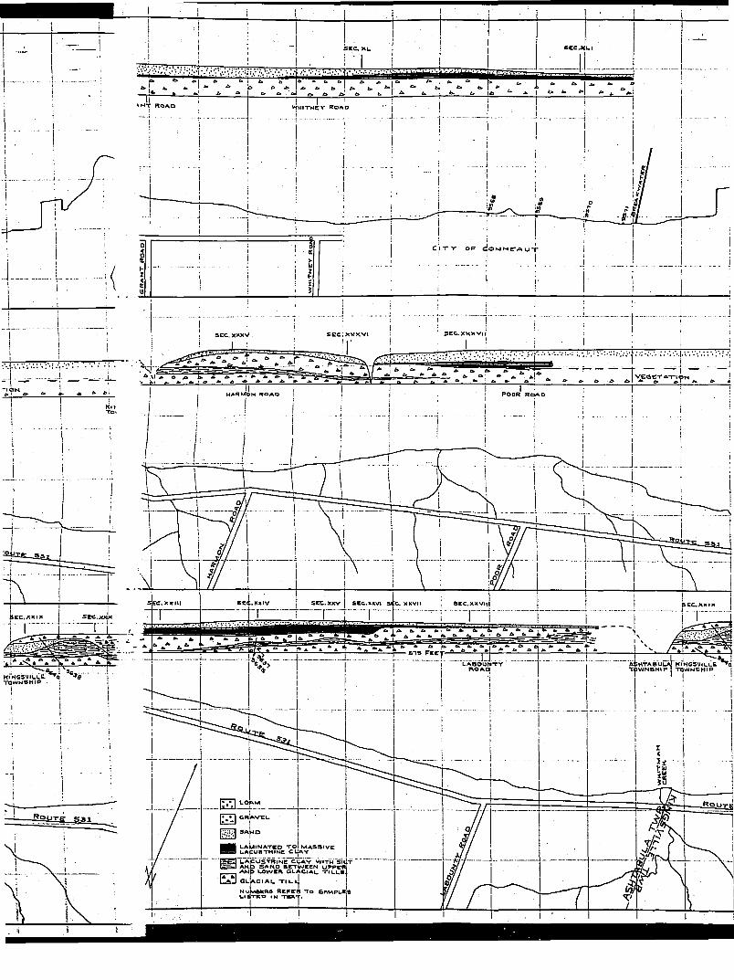
! IV f H I T N C V R O A .D' N T R O A O
5 E C . X X X V I IS C C iX V X V ls e e . X X X V
v j : G e T A - r . , f » N
i Ii PO O R R O A DMARMON R O A O
■ a^IS _ asj
ec. X X II I sec.XXIV S E C . XXV S C e .X K V I S E C . X X V II S E C .X X V t i
s e e . x x t xS C C .X X I X
KINOSVILUCC * n 3 w M S H i P
HTABULAT O W N S H I P
KINQ5 VILL& TO W N SH IP
L A M IN A T E D T O L A p U S T R IK ie C
L A C U S T R IN E A N D S A N D s r r A N D LO W ER
A V W ITH S lU T y V E E N U P P E R
Cl A U t i l l s
C I A L T I L L
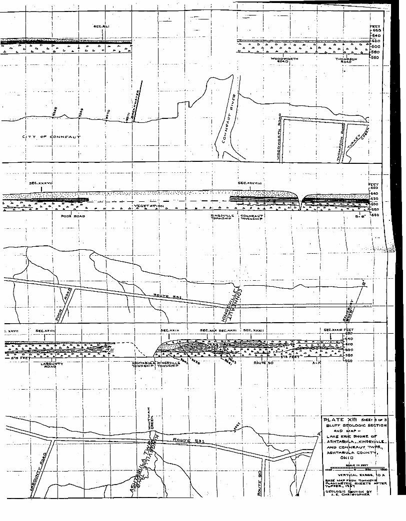
1-660•6 4 0
T H O M P S O N
S E C .X X X V llIS E C . X X X V I I
• 6 2 0
^ Q C T A T I A N•SCO
K560X iN O S V IU U e . C O N N K A O T ! TOWNSHIP I Township :PO O R R O A D
5BC.XKXHI F E E T r4*oS E C . X X X Us e e . x ^ s c c . A x x is c c . x x v t i
- 6 0 0
— S I S F s g | ** " - * 1*1• 3 8 0
A6HTX60LM t lHOSVIWUEQ t o w n s h i p ! - r e w N S H ip
R o u t e .90L A B ^ J T T
P L A T E X i n SHEET p o x 3 B L U F F G E O L O G IC S E C T IO N
A N P l i lA P -
l a k e e m k : s h o r e o r .. ASHTAÎ0LuLA.»-KlHQ6viLLC
AM D C O N IM C A U T T A /P S
A S H T A B U L A C O U N T S , OHIO
VKRTiiCAL CKSa«. \o As x s e MAP PÉQM -TOWMCMlf PUANI METRIC S H E E T S x r T S R
T I p P P S R . , I % S T
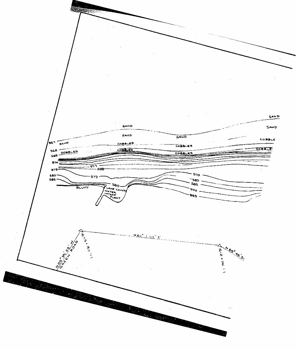
-
S'-* COBObÇ® '
51* T— ‘tr
6505 8 5
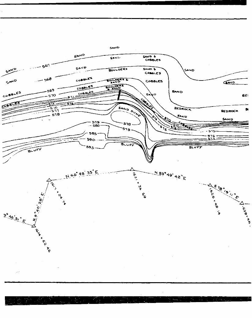
S E I
— 5 1 9 - 5BO
y - 5%s- — 5 9 0 -
f o 5
4 / / « /.V®/
0
a,
oi0"
•S'
e- '9'h •>
%"^A —
\ 1>g
T»
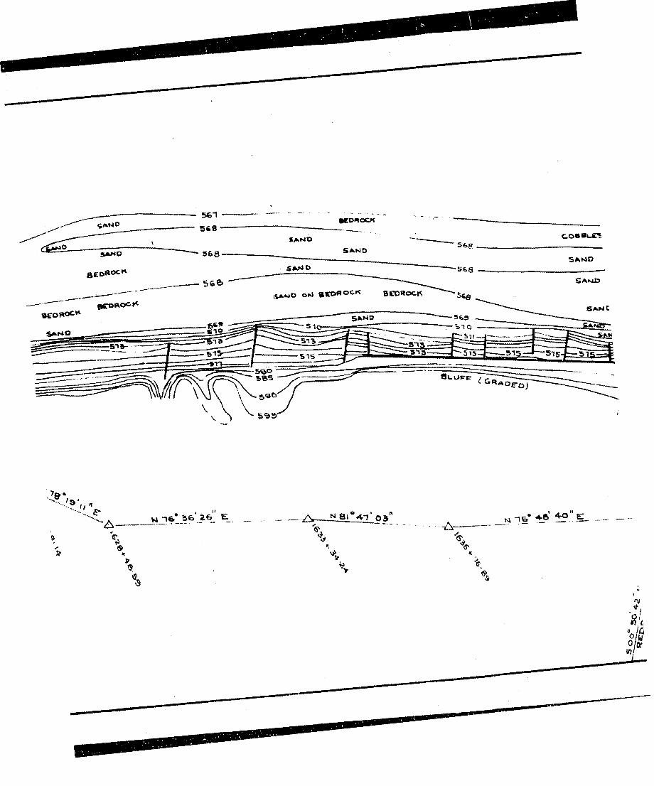
%-l566
SANIO
O tJ » C D « O C K
5T5 1 5
OuUfrpTT^r— ------‘ Ci«AO£-Oj
le
%
vt 1 6 * S fc Z€>_ E _
\ \
KV
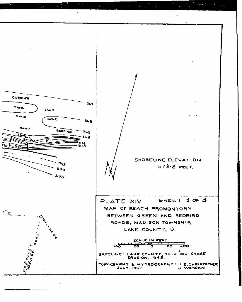
S H O R E L I N E E L E V A X I O M
5 7 3 2 FEET.
-A
%
P L A T E XIV S H E E T 4 OP 3M A P OF B E A C H P R O M O N T O R Y
B E T W E E N G R E E N AND R E O B I R D R o a d s , m a d i s o n t o w n s h i p ,
l a k e C O U N T Y , O.«
S C A L E I N P -C « T
Zoo lOO too 200
BAfCLlNC . LAK« COUNTY, OHIO DtV. SM.OKC'e r o s i o n , 1 9 4 3 .
TOPOGRAPHY C- M VOROCR APM Y : J . E.CwMlSTOPW&R JULY. I9 S7 J . WATSON
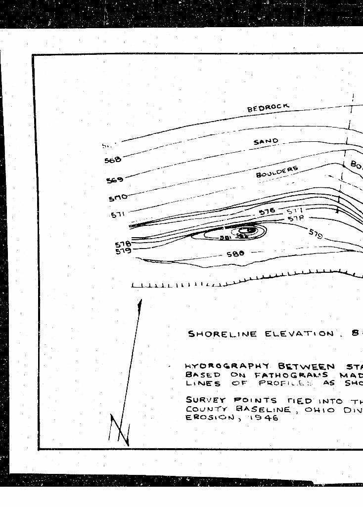
S H O R E L_ I W E E L . E V A T i O N . S
H'y' O R O < » R A P R t B E T \N E E .N BAk S t O O m FATW O g RAK,*S
ST/ M A t:
L . I M E S O F P R O F l ^ . t : : AS SMC
SURVEY P o , NTS rie.D irOTO C ouw T r S a s e u i ME , o u i o D»\j£ R 0 5 » O n1 , I S» 4 - 6
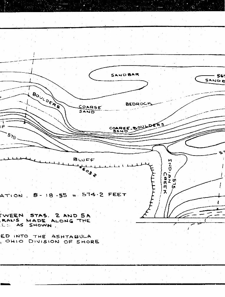
-------g
BEDROC.K^-"—
SAWO
F E E TATI OKJ . S - I 8 - 5 5
rvNEEN STAS. % AMD 5 A R A K ' S M A D E A u O K i < i T H E
.E :: A S S h o w n .
E D I N T O - T H E A S H T A 8 ÜL.A

56 î
SA W D S A R
BEOROC»-»;
i
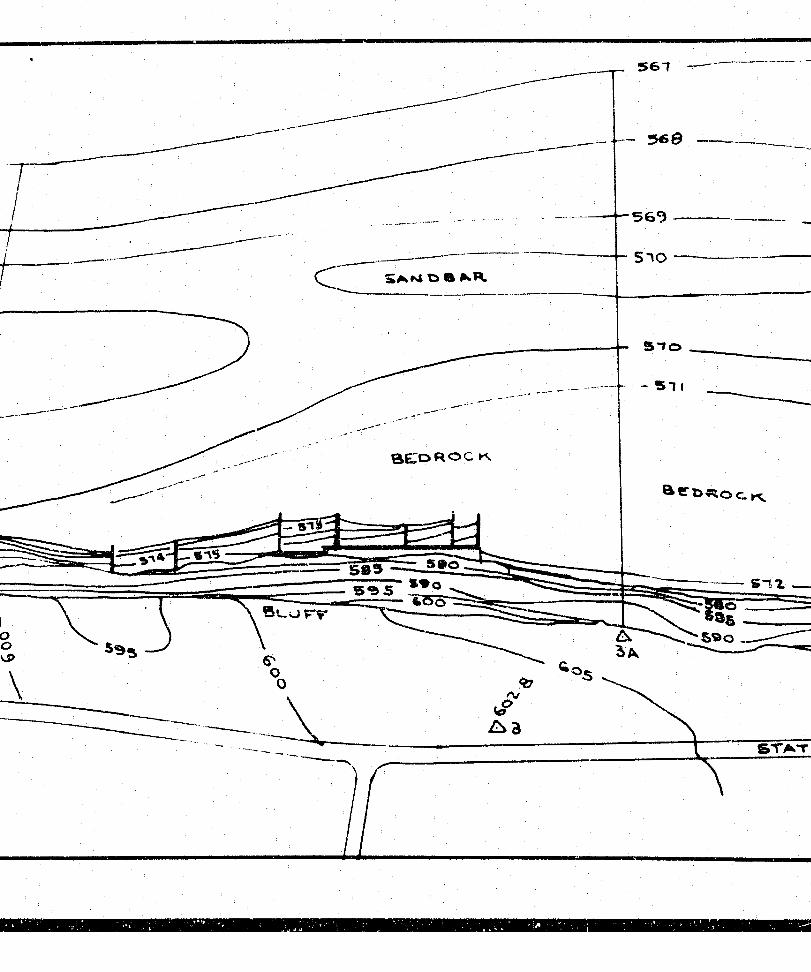
510SAkM O % . R.
a C D R O C Kk
5 0 5 S % 5 ^ 2 °
\S>
3
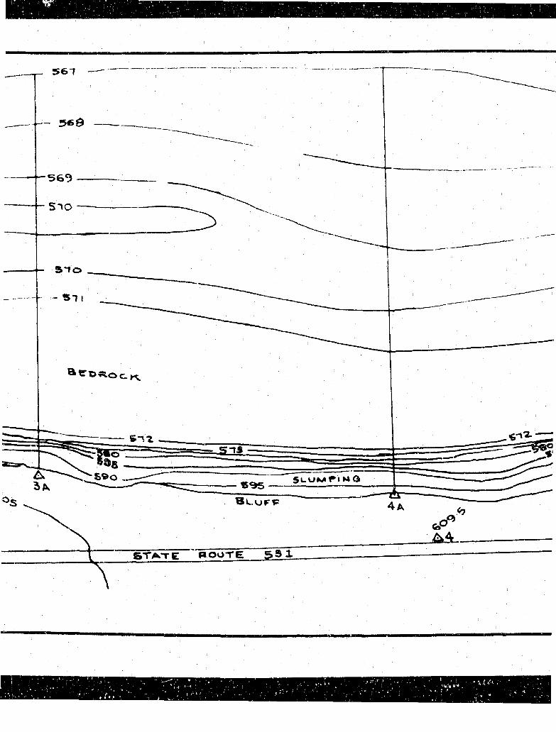
5 6 7
510
n s
r i M o
4 a
s t a t e ' R O U T E 5 5 1
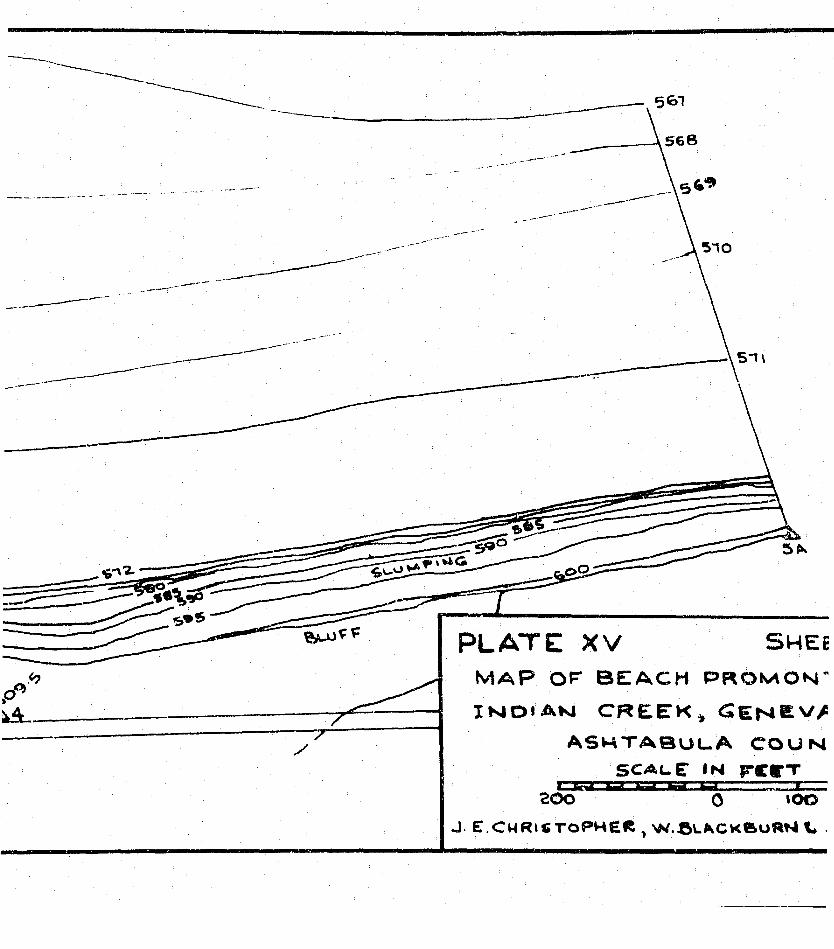
-7-
PLATE XV SWEEM A P o r B E A C H P R O M O N "
I N D I A N C R E E K * C E N Ê V /
A S H T A B U L . A C O U N S C A L E I N r c r “T
C3K200 0 1 0 0
J E.Ch r i s t o p h e r , > .X5l^c k » uRN L
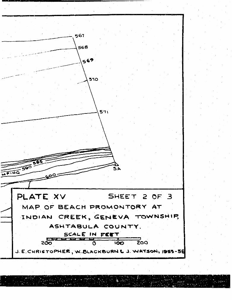
5 1 \
PLATE XV S H E E T 2 OF 3M A P O F B E A C H P R O M O kiT O « Y A T
I îsJ O i A k i C R E E K » T O W N S H I P ,
A S W T A B U L . A C O U N T Y .S C A L E I N r C E T
rzssi200
X0 » 0 0 2 0 0
J E.ChRiCToPHER W.ClikCkBuRN V J SNlft^TSoN, )»S%-5E
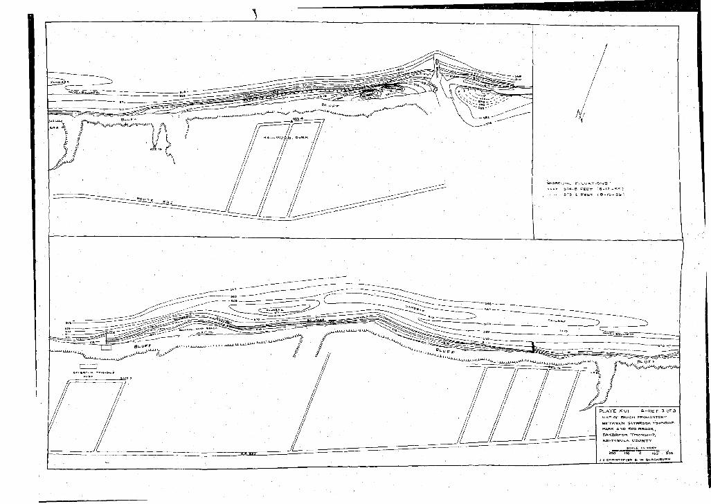
P L A T E X V I S H E E T 3 OF 3MAP o r BEACH PROMOMTOHr B E T W E E N S A raR Q Q K TOWNSH PARK A N D l*CD BROOK SA Y SR O O K *rov«»>4SASM TASU uA C O U N TY
«>»TOrM»H ». vg. Bl-ACN«U«N
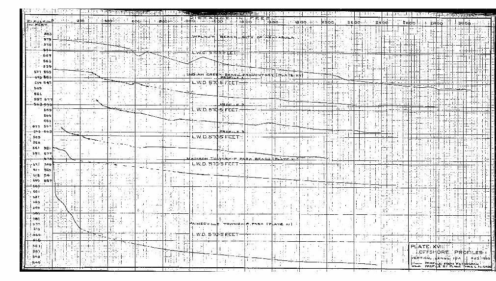
iTir-iE L - g U A .T l O K
W A u t > 4 m - m. i _ u a J . l - r - u l . ] .
LW.Di 'S Cia-H4: : I:t
4D H A M i C R F d :r‘
K i - B E A « k 4 _ ! p P R Q F lU f ? ' j
R C i M o . w r r o R
L.W.D, 51C 5 FTECT
E R . Q F I L F ?
UW.D. 51C G F C C T
P R Q g l L P S
L.W. D.snc5€|I
I P L A rT P X I ^f tP l J S O N . T Q j V N S M I P P»A E tK ^ .a E .A 'Z L Ü
LW.D. 5 1 (
= » A lls iE S V lU U
L . W . D . 510! 569
P U A T E . Xi . p F F S I -
V E R T l C A L
Yl!;r. ORÈ1 : PR. ! 5BT/ D n U E S . ' I :
> 0 G . - V 9 5 S: 5SS . J | . A ^ G . }0 .L e . * f» O M ^ A .T
E Q-f PulKUB4 0 4 A A W i A BLS c A u ic>A oe