Geography Alive - Teaching Guide 3.pdf
96
-
Upload
khangminh22 -
Category
Documents
-
view
3 -
download
0
Transcript of Geography Alive - Teaching Guide 3.pdf


TITLE VERSO

CONTENTS
Page
2 Countries in Context
3 A Geographer’s Tools
7 Solving Development Problems
10 Pakistan’s Neighbours
14 The Islamic World
15 Saudi Arabia
19 Malaysia
22 Morocco
26 Nigeria
30 Turkey
34 Uzbekistan
38 The World
39 Vietnam
43 Brazil
48 The People’s Republic of China
54 South Africa
58 The United Kingdom of Great Britain and Northern Ireland
63 The United States of America
67 Lesson Plans
73 Assessments
1

COUNTRIES IN CONTEXT Pupil’s Book page 1
The author has visited all of the countries mentioned in the book except South Africa, Nigeria, Malaysia, and Saudi Arabia. Get pupils to take a look at the photographs (going clockwise)—they are from Brazil, Turkey, Turkey, USA, Iran, and Afghanistan. The two in the centre are from Morocco (top) and Uzbekistan (bottom).
The teacher could talk about travelling and have a general discussion in class highlighting the importance of it with respect to it helping in breaking down barriers and misunderstandings. Ask pupils if they like to travel, and if so, where they would like most to go.
2

A GEOGRAPHER’S TOOLS Pupil’s Book 2–6
Physical regionsPoint out the main high regions: a long chain down the west side of Canada, USA, and South America, and from the Himalayas to Spain. Perhaps get pupils to look at the natural hazards maps on pp.74–75 of the Oxford School Atlas for Pakistan and get them to relate volcanoes/earthquakes to the highest land.
Climatic regionsGet pupils to notice where most deserts are located. Discuss the climate that is found in deserts that is extremely hot during the days and extremely cold during nights. Discuss the climate of Pakistan in detail. Get students to make a temperature chart that can be put up in the classroom, the students can then record the daily temperatures on it.
Gross Domestic ProductThe sum of all the economic activity produced within a country, normally given in US dollars. This includes wages, business, agriculture, industry, service—all the money moving around inside a country.
Gross National ProductLess frequently used but sometimes useful. This is GDP plus money coming from outside the country in the form of profits, dividends, rents, remittances from workers overseas—the last one quite important for Pakistan.
Balance of paymentsThis is just an extension of the typical domestic budgeting—on one side there is the family income, from wages and any other sources, and on the other, all expenditure such as rent, food, clothing, entertainment, transport, etc.—magnified to a national level. It is really how much one exports, balanced against how much one imports, or has to pay in debt servicing. Most countries of the world have a negative balance of payments, that is, they import more than they export. In a number of developed countries there are ‘invisible’ exports and imports, that is, money from dividends, rents and overseas businesses that help to balance the payments. The UK, for example, exports $351 bn worth of goods, and imports $473 bn—negative balance of $122 bn.
It might be worth mentioning that there is a strong international movement from some countries for the creditor nations, those that have lent money, to cancel the debts to the debtor countries. That is, cancel all the money owed to them. Perhaps pupils could discuss that. Is it a good idea? Would the poorer countries just run up more debts if the existing ones were cancelled? Should the richer countries be prepared to forego their loans?
3

These are aspects that need careful understanding by the teacher, and simplified explanation to students.
Sources of wealthIndustry is normally the most important source of wealth as it usually turns relatively low-cost raw materials into high-cost finished products. For example, iron ore is turned into high grade steel or motor cars and machinery. It might be worth asking students to suggest other products where highly skilled labour or technology adds to the final product.
Minerals are the second most valuable item, some of these rare but highly sought after metals such as titanium, chrome, and gold are as important as industrial products. Oil is a very valuable export item too because of the demand and relatively limited sources of supply. Coal, stone, and iron ore are less important.
Agriculture is normally the lowest in value in its contributions, apart from items such as fruits, flowers, tea, silk, coffee, etc. Grains need to be exported in very large quantities.
Social servicesGet pupils to look at the chart on p.6. France and USA are obviously developed and prosperous countries, Brazil (as we shall see in the chapter) is slowly changing from an underdeveloped country into a little more prosperous one. Zimbabwe, India, and China are underdeveloped/developing countries. Ask what are the characteristics of an underdeveloped vis-a-vis a developed nation.
Expectation of life is much lower and the underdeveloped countries shown are far from being the worst. In Afghanistan it is 44 years—little more than half the life span one can expect in France. The Congo is 54. Pakistan is 65. These figures are averages, and the low figures are often the result of appalling infant mortality rates. France—3 per 1000 live births; USA 6; Brazil—21; China—16; Zimbabwe—30; India—49; Congo—77; Afghanistan—151.
LiteracyWhile France and USA are probably correct about the figures of their literate population, the standards vary so much that it is difficult to be accurate. In some countries, the ability to write one’s name is the criterion of being literate. (Pakistan’s given figure is 50%, but this is probably over optimistic, especially outside the cities).
Birth rateIn underdeveloped countries, there is a long tradition of large families, mainly because of the high infant mortality rate and also to have more hands working the family land. Even though these problems are very much alleviated, the high birth rate continues—added to by ignorance of birth control. The 18th century economist Malthus said that food production would increase at an arithmetical rate (2…4…6…8…10…) while population increases at a geometrical rate (2…4…8…16…32…). While he was ignored at the time, it seems what he said was quite relevant. The figure for China is low because the law will allow only one child per couple. The countries given are by no means the worst offenders—the average annual increase in population is: Yemen—2.8; Afghanistan—2.6; Jordan—2.16; Oman—3.14; Gambia—2.53; most of central African states are over 3.0%. On the other hand,
4

many countries, especially in eastern Europe and the ex-USSR states show a negative population trend implying that the populations are actually falling (Pakistan—1.59%). Pakistan’s birth rate has fallen from an average of about six children per woman in 1985–90 to less than five children today. The population growth has fallen from an annual 3.5% in 1990 to 1.59% at present.
People per doctorThe figures are fairly obvious. There are far more doctors in the developed world, and in addition what constitutes a ‘doctor’ varies widely. In China, for example, the ‘bare-foot doctors’ are little more than simply trained health visitors. (Pakistan—74 doctor for about 1,000 patients). A contributory factor is that many doctors from underdeveloped countries come to the developed states for training and remain there because conditions are better there than at home.
Hospital bedsMuch the same as for doctors. The quality of hospital care and equipment can vary from little more than a shelter to a collection of highly specialized equipment.
Answers to Pupil’s Book page 7
1. a. Gross Domestic Product
b. Gives a good idea of how prosperous/rich a country is
c. All economic activity within the country—buying, selling, wages, building, exports, imports
2. Developed: Austria, Singapore, USA
Developing: Chile, Czech Republic, Malaysia
Underdeveloped: Bangladesh, India, Nigeria
3. High value: electronics, chemical manufacture, machinery manufacture, car production, oil
Moderate value: coal mining, asbestos mining, tea production
Low value: cotton, fruit, flowers
Lowest value: wheat, rice, timber (except for special timbers such as teak)
4. Balance of payments is the relationship between what a country earns and what it spends. If a country spends more than it earns, it usually has to borrow from richer countries or international organizations such the IMF or the World Bank. It has to repay this money with interest.
5. This has been fully dealt with in the previous pages. This is possibly better done as an oral class discussion. If pupils can get hold of library books containing current statistical material, perhaps they could find other aspects in which developed countries differ. Items to look up could be the number of children per woman, structure of GDP, % from agriculture, industry, services, etc.
5

6. Medical and dental services; pensions for retired people and those who cannot, for some reason, work; unemployment payment; free clinics and hospitals; education; care of those unable to live a full life such as mentally and physically handicapped people; nurseries; strict laws to protect children from working and all other forms of abuse.
7. High birth rate could be a discussion exercise. Main areas to talk (or write) about—strain on all services, especially education, health; unemployment as technology increases and fewer workers are needed; crime—largely because of unemployment; long-term difficulties as a large proportion of the population is elderly, in need of state care and social services; food supplies, especially as the majority of countries with very high birth rates are not particularly fertile or have inefficient agriculture.
Additional exercise
MCQs
Choose the correct answer.
1. Gross domestic product means
a. the wealth of a country
b. the money produced by the economic activities of a country
c. the money produced by a country and the money it receives from overseas
(the money produced by a country and the money it receives from overseas)
2. The current GDP of Pakistan is
a. US$ 600 b. US$ 2500
c. US$ 33,000 (US$ 2500)
3. Balance of payments can be defined as
a. A country’s imports and exports
b. the difference between the value of a country’s imports and its exports
c. the surplus of the value of a country’s imports over its exports
(the difference between the value of a country’s imports and its exports)
4. Which of the following is not an example of an extractive industry?
a. coal b. oil
c. chemicals (chemicals)
5. Which of the following activities includes social services?
a. health care b. farming
c. manufacturing (health care)
6

SOLVING DEVELOPMENTAL PROBLEMSPupil’s Book 8–10
Foreign debtAs we saw in the previous section this is a vicious cycle. Countries cannot improve much without industrialization; industrialization is very expensive as most machinery has to be imported; imports mean foreign loans, and foreign loans have to be repaid with interest.
Unfortunately, much of the borrowed money is spent unwisely on latest weapons, for example, as a matter of pride as some countries have no fear of war.
OverpopulationThis is one of the most desperate problems facing the developing world. There is an old tradition of large families, partly to replace the heavy infant mortality, and partly for labour purposes. Today, even in the poorest countries, there are some improvements in lifestyle and medicine, so that more babies grow up, and at the other end of life, more old people live longer. The population rises rapidly usually in those states that cannot afford the rise nor do they have the resources to sustain the increase.
These are the fertility rates (the average number of children per woman) for low and high birth rate countries:
Germany 1.41 Nigeria 5.01
Netherlands 1.66 Iraq 3.97
China 1.77 Pakistan 3.73
Denmark 1.74 Somalia 6.6
UK 1.66 Uganda 6.81
India 2.76 Afghanistan 6.58
China’s fertility rate is of course limited by law. Most of the central African states have rates of more than 6 children per woman.
In all of these countries, and many others, although the production does go up steadily, the population increases even more rapidly, so that the standards of living are in many cases actually going down.
Talk with pupils about the problems of overpopulation—education, health care, work and after some years, the difficulty of coping with old people.
Population giantsPakistan shares frontiers with the two largest states in the world in terms of population and though China has taken some drastic steps to limit its population increase, the rise in India is uncontrolled. By the middle of the 21st century, it is estimated that the population of India will exceed that of China.
7

Discuss a. How population can be controlled
b. The ethics of the draconian, though necessary, Chinese methods
IlliteracyAs the whole world becomes more technical, there is a desperate need for a literate work force. Education in some developing countries is not considered a top priority. Ask pupils if they consider education of vital importance. Why? In some Islamic countries there is a marked disparity between the literacy rates of males and females. Why is this? What should be done about it?
Answers to Pupil’s Book page 11
1. a. Natural lack of resources—few minerals, sources of power, etc.
b. Bad political management and tribal/ethnic/religious conflicts
c. Money directed to wrong ends—militarism, etc.
d. Poor agricultural land
e. Reluctance to give up traditional methods that are inefficient
f. Lack of education
2. Developed(France and USA)
Underdeveloped(Zimbabwe and India)
Life expectancy High Low
Literacy High Low
Birth rate Low High
Doctors/1000 population High Low
Hospital beds High Low
These comparative figures most surely prevent the underdeveloped countries from prospering. If the literacy rate of a country is low then that country is not making use of its people resources to the fullest. Development is curbed and is lower compared to that of a country with a higher literacy rate.
The birth rate of a country is another factor which, if too high, poses as a hinderance. Most underdeveloped countries have high birth rates. As a result, the resources per person keep falling as a country becomes more populous, thus disabling it from sustaining its residents.
3. Education is valuable because:
a. At the work place, it enables workers to read instructions.
b. Enables people to have a better grasp of the world by reading newspapers, etc.
c. Generally broadens the mind so that people are able to differentiate between fact and fiction.
8

d. Enables mobility—reading timetables, road instructions, etc.
e. Reading improves leisure activities.
f. Writing enables communication with family and friends.
4. a. Small-scale agriculture (unless highly specialised crops such as flowers) is inefficient because it does not allow the use of modern techniques and mechanisation. Small
plots are more difficult to cultivate than large ones because of the constant turning of the plough and other implements. Small-scale farming usually consists of dispersed plots which entail labour and time to travel from one to the other.
b. Cost: initially farmers would have to borrow heavily to buy equipment. The old small field systems would have to be broken up (leading to immense problems with legal
rights and traditional holdings). More efficient farming would mean huge numbers of people out of work—the majority with few skills and probably largely illiterate.
The obvious advantage would be improved cropping in amount and variety.
5. Countries with falling populations are all in eastern Europe or ex-Soviet Union countries, with the exception of Italy, Russia, Portugal, and Ireland. All of these have falling populations, and many other developed countries have population increases of 0 or close to it. Those with the highest increase in population are (a) underdeveloped and (b) all of those with a high rate of population increase are Muslim countries, except Uganda, Congo, and Angola.
Additional exercise
MCQs
Choose the correct answer.
1. The colonial powers used their colonies
a. to raise large armies and protect their homelands
b. to compete with other European nations
c. as sources of cheap raw materials (as sources of cheap raw materials)
2. Most of the poorer countries have managed to develop themselves because of:
a. their diplomatic policies which have enabled them to be part of lobbies
b. their mineral wealth and rich soil
c. their locations in the world (their mineral wealth and rich soil)
3. In 2007, it was estimated that the birth rate in Pakistan was
a. 8 per 1000 b. 28 per 1000
c. 215 per 1000 (28 per 1000)
9

PAKISTAN’S NEIGHBOURS Pupil’s Book 12–19
By world standards, Pakistan is surrounded by poor countries. The GDP per head of the four neighbouring states; Iran—$4,820; China—$3,270; India—$1,020. Afghanistan’s is not known but it must be among the poorest countries in the world. Pakistan’s in comparison is $990.
Communication with neighbouring states is generally low scale due to geographical conditions: desert and mountains between Pakistan and Iran; very high mountains between Pakistan and Afghanistan; even higher mountains between Pakistan and China; desert between Pakistan and India, apart from the north east through the disputed territory of Kashmir, which is relatively mountainous. (However, with the extensive use of computers in the big cities, communication has become much easier).
ChinaThis is dealt with in more detail on pp.89–97 of the Pupil’s Book. The basic facts are that it is the third largest country in the world, but only about 10% of the land is viable agriculturally. Its population makes up one-fifth of the whole world. There are strict birth control measures in place (one child per family under normal circumstances; if any more children are born most of the benefits of society are forfeited). Apart from the tropical rainforest, virtually every other kind of climatic region is found in China—from the highest mountains to fertile river valleys. Unlike the Indo-European group of languages, there is no way of getting at the mouth sound of a character—indeed different parts of China make completely different sounds for the same character, but all can read the script.
China has vast reserves of most minerals, and is potentially the most powerful nation on Earth, but mismanagement and corruption in the past, has slowed its progress. China is moving ahead steadily now and has already crossed 10% + growth rate for its economy.
IndiaIndia is more than four times the size of Pakistan, and has almost seven times the population. The land in general is more fertile than that of Pakistan, with reasonable amounts of water either from precipitation or irrigation. Agriculture is largely on a small-scale basis and inefficient. There are, however, some industries. In the recent past India has made a considerable headway in the Information Technology sector.
Main exports; textiles—20%; gems/jewellery—27.7%; engineering goods—47%; chemicals—9%; rest—20%
While it has many advantages, India’s soaring population is its main problem, and despite efforts of some politicians in the past to find a solution, it seems out of control.
AfghanistanIt is difficult to get reliable data on Afghanistan because of the secrecy of the previous (Taliban) regime and recent upheavals in the country in the aftermath of September 11, 2001. The Taliban enforced their own interpretation of Islam, with women virtually confined to the home. 80% of the active population work in agriculture, producing grain, rice, fresh and dried fruits, and potatoes.
10

These are all subsistence crops—there are a few exports such as jewels, carpets, wool, skins, fruit to Russia, central Asia, and Pakistan. There are only 12,350 km of paved roads, much of which are heavily damaged by fighting. There are small amounts of oil and gas, which are not fully exploited as they form a tiny industry.
Years of fighting—invasion by Russia, civil wars, and the consequences of September 11th—have left the country in a desperate state. The literacy rate is 28.1%—only 8% of girls of primary school age were enrolled, the lowest percentage in the world.
There are now 319,000 million internally displaced people in Afghanistan. Recent figures are difficult to obtain, but it seems like the country is in a sad state.
Infant mortality—151/1000 live births (2nd highest in the world) Birth rate—38.11/1000 population; Life expectancy—44.65 years; Number of children per woman—5.5. One can only hope that stability and some form of prosperity returns before too long.
IranThough farming accounts for 10% of the GDP, Iran is largely agriculturally unproductive. Wheat, barley, rice, sugar beet, tobacco, and wool (much for carpets) are the main agricultural products, together with some fruit. About 7.4% is forested, mainly in the Caspian Sea region. Iron ore is the main mineral, Iran being the 8th largest producer in the world. Much of this is processed in Iran, which has the largest steel output in East Asia. But oil and gas are the main products bringing reasonable wealth to Iran. The GDP stands at $10,970 per head.
After many years of political instability, and a long bitter war with Iraq, Iran now seems to be transforming into a more stable and moderate regime which will certainly allow the country to develop, especially with regard to trade relations with central Asia.
Answers to Pupil’s Book page 20
1. Population densities (per km2): Afghanistan—43; Iran—40; China—140; India—352; Pakistan—220
Additional information about population
High infant mortality in Afghanistan—poor conditions, few medical services or drugs available, harsh lifestyle, insufficient food—women whose husbands have been killed have no support other than charity.
Low birth rate in China—law restricting families to one child per family under normal circumstances. Breaking this law means loss of many social benefits.
2. Communication is difficult because of mountains and deserts.
Pakistan—Afghanistan: Khyber, Dorah, Khojak
Pakistan—China: Khunjerab
11

3. a. Relatively infertile in many areas—mountains, deserts. Only 10% of China is viable agriculturally.
Pakistan and Afghanistan have relatively few important mineral resources to back up a powerful industrial economy.
Largely inefficient agriculture—small-scale peasant farming
Low educational standards (except China)
Political problems hinder economic development.
b. Limiting families—one child per family normally. In discussion it might be brought out that problems lie ahead. In China, it is traditional for the children to look after and
provide for the parents when they grow old, though it is difficult to decide whose parents (husband’s or wife’s) should be cared for. There are virtually no state benefits in China for old people. In China there is great emphasis on the superior value of boys—if the baby is a girl, it creates problems. In the early days of the legislation, it was said that baby girls ‘died’ mysteriously at birth. Today, there are big posters and hoarding campaigns saying that girls are as good as boys. Peasants, who still rely heavily on manual labour, are allowed another child after four years if the first was a girl.
Though harsh, some strong action was essential as China’s population was rising exponentially—as it is it will continue to increase until about 2050, when the impact of the one-child begins to take effect.
One can compare this to India’s early attempts at population control by offering bicycles and other gifts to men who voluntarily had vasectomy operations to make themselves sterile. (Teachers to use their discretion while handling sensitive issues such as vasectomy).
4. a. The problem of Kashmir is the main obstacle to good relations between India and Pakistan. At the time of partition, Kashmir had a 75% Muslim population, but was
ruled by a Hindu ruler who opted for India. There have been two wars over Kashmir and two major battles (1948 and 1999—Kargil) as this area is of crucial geographical and political importance. Pupils should use the map on p.8 of the Oxford School Atlas for Pakistan to show how the Indus, Chenab, Sutlej, and Beas rivers rise in this region.
b. 3% (2007 est.) of Pakistan’s GDP is spent on defence; India 2.5% (2006 est.); Germany 1.5% (2005 est.); France 2.6% (2005 est.); China 4.3% (2006 est); Iran 2.5%
(2006 est.); Brazil 1.7% (2009 est.). This means Pakistan’s defence budget is about $US 378 billion a year (2009–10). The development of nuclear weapons increases not only the cost, but the risks as well. Nations must have a defence budget, but $378 billion/year is disproportionate to the size and resources of Pakistan. However, it is equally important for students to understand why Germany and France have such a low defence budget—because they have no threats, whereas Iran and Pakistan, and
12

China need to defend themselves. Another reason for disparity is that Pakistan and Iran have to import ammunition from abroad as compared to Germany and France that do not have this additional import cost to bear. Perhaps pupils could work out how many hospitals/schools/kilometres of highway say, half of the defence costs could buy.
Additional exercise
MCQs
Choose the correct answer.
1. The following are the immediate neighbours of Pakistan except for
a. Afghanistan, China, Iran
b. Nepal, Iraq, Bangladesh
c. Iran, China, India (Nepal, Iraq, Bangladesh)
2. Which of the following is the third largest country in the world?
a. India
b. China
c. Afghanistan (China)
3. The main deserts of India are
a. Thar
b. Gobi
c. Takla Makan (Thar)
4. Which of the following is not a reason for the slow growth of Pakistan’s economy?
a. money spent on defence
b. growing population
c. shortage of mineral wealth compared to developed nations
(shortage of mineral wealth compared to developed nations)
5. Iran is among the largest oil-producing countries of the world. It ranks
a. 2nd largest
b. 1st largest
c. 5th largest (5th largest)
13

THE ISLAMIC WORLD Pupil’s Book 21–22
The Muslim World spreads in a band through Asia and North Africa, largely for geographic and historical reasons. In Africa, its southwards spread was limited at the time by the great Sahara desert, and reached central Africa only later through traders. The northwards limits were perhaps reached in the semi-arid central Asian plains, and in Europe by the already strongly entrenched Christian sects. In India, Hinduism remained a great barrier, and even at the time of the Islamic Mughal period, Muslims were always a minority.
From an economic point of view, the Muslim world has not exploited its potential. Agriculturally, well over half is hot desert and much more only semi-productive land (largely the Asian steppes). Only Nigeria, Malaysia, Turkey and Indonesia are overall very fertile: the rest have patches of good land, especially in river valleys and coastal fringes, and there are large areas of low quality grassland, suitable for grazing or nomadic lifestyle.
Until the 20th century most of the Muslim world was part of the western empires. Egypt had nominal independence but was much under the influence of France and later Britain. The Turkish Ottoman Empire theoretically controlled most of what is now west Asia, but when the empire was defeated in World War I, Britain and France effectively became rulers of Syria, Lebanon, Palestine, what is now Jordan and Iraq. British influence was also very strong in Saudi Arabia.
World War II ended this domination and what now makes up the Muslim world are independent states.
Much of the Muslim world was very poor—those countries such as Malaysia, Indonesia, and Nigeria which did have some profitable raw materials were exploited by the colonial powers, and little industrial development was allowed. There were some metallic minerals—copper, tin, zinc, nickel, and gold—but the region had very little of the iron ore which is so vital for civilization in the 20/21st centuries.
But the discovery in the 20th century, especially after the 1940s that Nigeria, some of the north African states, the Gulf states, Malaysia, and Indonesia had vast reserves of oil altered the whole situation dramatically. The world was clamouring for oil for transport and fuel and much of the Muslim world became highly commercial. Wisely some of the states used the vast oil incomes to develop industries even if many raw materials have to be imported, because they realize that the oil reserves, though immense, will one day be exhausted.
14

SAUDI ARABIAPupil’s Book 23–29
Saudi Arabia is the richest country in Asia because of its huge oil reserves. Its GDP at US$24,200 per capita, is less than that of the smaller oil states of Kuwait ($51,700), Qatar ($145,300), Bahrain ($40,400), and Singapore ($62,200), but these have much smaller populations, so that their per capita figures are higher. (Qatar has 840,926, Bahrain 738,004, Kuwait 2,789,132, and Singapore 4,701,069 million). Meanwhile, Malaysia’s GDP is $14,700 per capita, Oman’s $25,800, Iran’s $11,200, Indonesia’s $4300 and Pakistan’s for comparison is $2400 and India’s $3400. Saudi Arabia’s wealth is not equally distributed in general. They are immensely rich, but about 20% of the population is still nomadic. Bedouins with their herds of camels, goats, and sheep roam the country.
Saudi Arabia is one of the few absolute monarchies left in the world. The King, who is also Prime Minister and guardian of the two Holy Mosques, has a council of ministers all chosen by him, two deputy prime ministers and a cabinet. There is also a consultative council of 90 scientists and experienced men to help him. The King can veto any decision of the council of ministers.
The country is ruled by Sharia Law.
It is 2,240,000 km2 in area, with a population of 29,000,000. Get pupils to work out population density compared with Pakistan—796,095 km2 in area, population 175,000,000. (Saudi Arabia has about 13 people per square kilometre, Pakistan has about 231). Ask why. The vital statistics may also be of interest. Expectation of life: Saudi males 79 years; females 78. Pakistan males 63, females 67. Again ask why. Let the kids come up with their own reasons! This great wealth is behind most of Saudi Arabia’s advantages. Oil was first discovered in 1938, but was not exploited until about 1945. Since then the income has increased dramatically. In just over half a century the country has changed from a wild, almost barren land, into, compared to what they were, a fairly advanced society. It might be worth trying to find out about the position of women in Saudi Arabia—they are not, for example, allowed to drive motor cars. This is a local law.
Apart from oil and gas Saudi Arabia does not have many mineral resources, though there are considerable amounts of gold. Chrome, tungsten, bauxite, uranium, silver, tin, and copper were discovered, but in (at the moment) relatively small amounts. As a result, Saudi Arabia’s manufacturing base is centred on goods manufactured from oil and gas—plastics, fertilizers, and other petrochemical products.
TourismSaudi Arabia does not encourage tourism except for the annual Hajj, when at least two million people visit the holy places. Why do you think Saudi Arabia does not want ordinary commercial tourists?
DefenceSaudi Arabia is one of the world’s biggest buyer of defence equipment and weapons, especially from the US and UK. About 10%of the total GDP is spent on defence and the forces are equipped with the most modern weapons available. Discuss why the government spends so much on the military
15

forces. (Saudi Arabia is surrounded by nations envious of its wealth. Nations worldwide would like to get control of the oil. There are rumblings, very suppressed at the moment, of discontentment with the non-democratic system of autocratic government).
Oil is the basis of Saudi Arabia’s wealth and power. This is only as long as the world needs petroleum for transport. All over the world scientists are trying to find alternative sources (a) of power and (b) renewable sources of energy such as biomass, for example. Get pupils to find out more about these alternatives—nuclear electricity, (75% of France’s electricity is nuclear); hydroelectric; wave/tidal power; wind power.
The great problem is transport, railways are easy enough and in many countries railway networks are powered by electricity—but at the moment much of this is thermal, i.e. made by burning oil or gas. The difficulty is in road transport. There are electric vehicles, but these demand huge batteries, taking up much of the load space. They have a very limited range—at best 30–40 kilometres before recharging. They are slow, and in general, useful at the moment, only for city delivery vehicles. If a breakthrough in the road transport problem by electricity could be achieved, the stranglehold of the oil producing countries could be broken. This, however, seems to be a long way in the future. Get pupils to think about this—devise non-petrol engine vehicles.
Answers to Pupil’s Book page 30
1. a. Oil and gas reserves—world’s largest exporter of oil, and with 19.5% of known world oil reserves.
b. Many Pakistanis work in the Saudi oil fields and the money they send home in the form of remittances helps the economy of Pakistan. The remittances to Pakistan
from Saudi Arabia were US$1343 million (also from Dubai US$624 million, and from Kuwait US$333 million).
2. Saudi Arabia, with its plentiful supply of fuel, has set up desalination plants, these provide a relatively cheap supply of energy—distillation takes vast amounts of heat. (Demonstrate—get very strong salt water and boil and condense steam. Maybe the Science Department would help with a retort. Taste before and after.)
The disadvantage of desalinated sea water is that while human beings and animals are happy to drink it, plants are not—and salt is poison for plants, so it cannot be used for irrigation.
3. a, b, c, e on atlas
d. The pipeline to Sidon made it easier to ship oil to Europe and USA. It also avoided the exorbitant Suez Canal fees. It had, however, to pass through two other countries,
and though both were Muslim, there was always a danger of getting attacked.
Therefore, this route was closed down and another pipeline by the name of Yanbu’al Bahr opened up. Owing to this, the distance travelled got cut down significantly, making it a route widely used for large amounts of oil exports.
16

4. a. Aridity—very little rain (generally 0—100 mm), poor infertile soil, immense heat in summers, desalinated water unsuitable for crops.
b. Wheat, barley, dates, grapes, onions, melons, pumpkins
5. Good social welfare services—free medical care, education, payment for injuries in accidents at work, pensions for old people and unemployment pay.
6. Basically, in the Arab-Israeli war of 1973, the oil producing Arab nations realized how dependent the West and Japan were on oil, and cut supplies. The effect on the West was catastrophic, with petrol rationing, speeds reduced to 80 kph to save fuel and in some countries, motoring banned on Sundays, together with other economy measures. It actually had the long-term effect of stimulating exploration for oil in other regions—especially in the North Sea—but the new discoveries need time to develop. The Arab countries realized the political power of oil.
In 1973, the price of oil rose from about $12 a barrel to $30. However, the effect of the new oil fields and of the older ones producing more than they had agreed with OPEC, brought the price down to about $10 (1986). In present times, oil prices are in the vicinity of $120 a barrell! (Feb 2011). The OPEC countries, (see below) however, control about 40% of world oil supplies.
7. OPEC = Organization of Petroleum Exporting Countries. Original members (1960)—Iran, Iraq, Kuwait, Saudi Arabia, Venezuela, subsequently joined by Qatar, Indonesia, Libya, UAE, Algeria, Nigeria, Equador, and Gabon. They dominate the market and by increasing or decreasing the amount they produce, they can regulate prices or exert immense political pressure.
Additional exercise
MCQs
Choose the correct answer.
1. The capital of Saudi Arabia is
a. Makkah
b. Riyadh
c. Jeddah (Riyadh)
2. Saudi Arabia is considered to be the most important Muslim country in the world because
a. it is the largest producer of oil in the world
b. it is the birthplace of Prophet Muhammad (PBUH)
c. it has the Ka’aba in Makkah (it has the Ka’aba in Makkah)
17

3. Saudi Arabia imports 70% of its food because
a. it is a rich country and can afford to do so
b. people are mostly nomads and cannot settle to produce goods
c. there is not enough fresh water to produce its own food
(there is not enough fresh water to produce its own food)
4. Some of the major transportation of Saudi oil is done from
a. the Gulf ports of Tanura and Dammam
b. the Gulf coast to Sidon
c. part of Yanbu’al Bahr (the Gulf coast to Sidon)
5. One well-known food cultivated in Saudi Arabia is
a. watermelon
b. dates
c. wheat (dates)
18

MALAYSIA Pupil’s Book 31–6
Malaysia is one of the great successes of the ex-colonial states, with a GDP rapidly approaching that of some of the industrialized western nations. It does, of course, have many natural benefits such as an abundant supply of minerals—oil, natural gas, iron, tin, bauxite, copper, and coal. It is heavily forested (2/3 of the local area) and valuable native species such as teak, sandalwood, camphor, and ebony are major export items. The government has a strict reforestation programme to maintain the timber industry. Where land has been cleared for agriculture, there is a plentiful supply of rain (Peninsular Malaysia about 2500 mm a year) and heat.
Malaysia has not been merely content to export raw materials, but is developing an industrial society—more than half of the value of its exports comes from manufactured goods. The value of exports exceeds that of imports, so the economic system is in good shape.
Malaysia became independent from Britain in 1957, but it was not until the early 1970s that the quarrels between the different states that made up the country were settled and serious development and prosperity began.
Tropical diseases have largely been conquered, though malaria is still a problem in the rural areas. The birth rate is low for an Asian country (21.4/1000—world average 19.8/1000) and the death rate at 5/1000 is about half the world average (8.3/1000). This is partly because prosperity has allowed a good system of social and medical welfare—pensions for elderly people, and those with disabilities such as blindness. Education and books are free from 6–15, but rather surprisingly for a rapidly-developing economy, not compulsory. However, it is estimated that about 90% of all children in the age group have six years of primary education.
Rubber—Malaysia produces a quarter of the world’s output. Pupils might be interested in the story of rubber, which is native to the Amazon forests. The governments there were very jealous of it, though there were until the 19th century few uses for it except for waterproof clothing. No seeds or plants of the rubber tree were allowed to be taken from the country, and officials searched the baggage of the many plant hunters who flocked to the jungle to find new flowers for British gardens. In 1876, however, an official British expedition to collect different species of plant, hid seeds of the rubber tree at the bottom of their plant boxes, and covered them with the more ordinary specimens they were taking back. The officials were probably a bit slack and did not check, but the seeds reached London where they were germinated in the tropical plant houses at Kew and at Singapore. The young trees were then planted in the region, which was of course then a British colony—and from this the huge industry developed.
The rubber tree is a very accommodating plant, it can be ‘tapped’ (see picture p.34) at 5–6 years and will produce about 50 grammes of latex (the white sap that becomes rubber) every two days for almost 20 years. When it has finished production of rubber, it is still valuable wood for everyday furniture—in the west it is in much demand as a ‘renewable’ source of timber among environmentalists. In its native habitat among the Indians of South America it found few uses except to make crude balls—the earliest explorers found the people playing a simple bat-and-ball game with rough rubber balls—and some report, for making waterproof shoes. The people dipped their
19

feet, or clay moulds of them, into the basin of latex and then allowed it to dry. After a number of dippings, a rubber ‘shoe’ could be peeled off.
Islam is the official religion of Malaysia with 58% of the population Muslim, but there is complete freedom for other religions.
Answers to Pupil’s Book page 37
1. Fertile, well-watered soil with plenty of heat—all of the country is close to the Equator.
Very rich in minerals—oil, gas, tin, iron, copper, silver, gold
2. a. Rubber, palm oil, pepper, cacao, tea; timbers, ebony, teak, and sandalwood
b. The agricultural products above are all high-value ones, compared with wheat and rice.
3. a. Oil, gas, tin, iron, copper, silver, gold
b. These are in general high-value minerals for export in the raw state, but also they are the basis of flourishing industries at home.
4. Petrol and petroleum products, light industrial products such as televisions and electronic equipment, furniture, clothing and footwear, domestic electrical appliances. Cars are now being built here under licence. They are produced here because, in general, the basic raw materials are found in Malaysia and there is a good supply of energy in the form of oil and gas, locally.
5. a. Malaysia exports more than it has to import. This means prosperity partly because it does not have any foreign debts to repay.
b. India and Pakistan (and most other countries) import more than they export. The difference has to be found from somewhere. Many countries have to borrow from
international organizations such as branches of the World Bank or from rich countries. These debts have to be repaid with interest.
6. Brunei—an important oil and gas source. Oil, 8,000,000 tonnes a year. Gas, 8 billion cubic metres. Mostly goes to Japan. Brunei has one of the largest gas liquefying plants in the world.
7. Points that could be raised:
• Developed nations (Japan, USA) have much fewer young people and more elderly.
• Malaysia and Pakistan are ‘young’ countries with a large number of people under 15. This will present many problems in years to come when all of these become elderly
and need more medical care.
• The large number under 15 in Malaysia and Pakistan will very soon present problems of employment—the economies/industrialization will have to expand very rapidly to
prevent serious unemployment.
8. Drawing question
20

Additional exercise
MCQs
Choose the correct answer.
1. The climate of Malaysia is
a. hot and wet
b. cold and dry
c. cold and wet (hot and wet)
2. Malaysia is the largest producer of
a. palm oil
b. rubber
c. tin (palm oil)
3. The major river of Malaysia is
a. Rajang
b. Pahang
c. Mekong (Pahang)
4. The name of the famous towers in Kuala Lumpur is
a. CN
b. Pahang
c. Petronas (Petronas)
5. In Malaysia, about 50% of the population is
a. Malay
b. Chinese
c. Indian (Malay)
21

MOROCCO Pupil’s Book 39–45
Morocco is the closest African state to western Europe, and because of its association with France and Spain, who shared it as colonies from the early 20th century until independence in 1957, has in parts become very Europeanized. French, Spanish, and English are widely spoken, and particularly in the last 30–40 years it has become a popular tourist destination: 8 million visitors in 2008, and one of the largest contributors to the national budget. The attraction for western Europeans is obvious: the climate is good in the tourist season (summer); there are fine beaches for those who want that type of hoilday; there are what seem to western Europeans exotic towns and cities and country: for the more serious it is steeped in history; it is only three or four hours away from most of Europe. There are even ski resorts in the mountains less than 50 kilometres south of the capital. Tourism comprises 20% of Morocco’s GDP, and is increasing all the time. Perhaps get tourist material from travel agencies and make wall charts.
North Africa was the breadbasket of the Roman Empire 2000 years ago, but the nomadic herdsmen with their sheep and goats have destroyed much of the agricultural land. The tree-climbing goats p.43 show how these have developed the ability to strip trees when vegetation is scarce.
Might be worth mentioning the name Atlas mountains. Atlas was the god of the Greeks and Romans who was supposed to support the sky, as a punishment for leading his fellow giants against the gods. Perhaps pupils could find some of the legends of Atlas—one tells of how Perseus, who had killed Medusa Gorgon, the terrible monster with vipers instead of hair, and whose look turned people to stone, hacked off her head, and carried it to the Titan Atlas. He exposed the giant to the gaze of the decapitated monster, and turned him to stone. Perhaps as an imaginative exercise—or some art work—they could describe or draw some further exploits of Perseus (read a few of them to the students from any book of classical mythology).
Morocco is basically an agrarian country, even though less than a quarter of the land is suitable for farming (ask what about the rest—desert, mountains). Like Pakistan, one of the weaknesses in agriculture is the fragmentation of land—most of the farms are less than 3 hectares. Ask why these small plots are inefficient (Too small for machinery, time wasted on tiny plots, old-fashioned methods, etc.). About half the population lives in the countryside, where the standard is relatively low.
Morocco’s health expenditure figures are roughly the same as those for Pakistan. Expectation of life in Morocco is 78.9/72.63 years (F and M) against Pakistan’s 67.5/63.84. The birth rate is 19.4/1000 of the population in Morocco and 25.3/1000 in Pakistan. Ask pupils why this should be so. Possibly climate, possibly remoteness of some of Pakistan’s areas, possible absence of large numbers of refugees, possible closeness of contact with western Europe and the colonial traditions of health, possible education (literacy in Morocco about 72%—65.7% male, 79% female against Pakistan’s 63/36%), possible higher urban population (Morocco 56%, Pakistan 36%). (Ask why this should affect life expectation). Possibly better diet—Morocco produces very large amounts of fruit. Note: Some of these figures differ from those in the pupil’s book, but these are from the latest statistics available.
22

IndustryMorocco has the world’s biggest known deposits of phosphate. Pupils to find out what this is used for—mainly for fertilizers, and some for other chemical products. Other industries tend to be small —mostly handicrafts, rather like the rural industries of Pakistan, much of them for the tourist trade, manufacture of leather goods, textiles, and some carpets. There, industries are connected with the processing of fruit and vegetables, and especially olive oil and canning of fish (sardines).
Agricultural products of MoroccoWheat—23,000,000 tonnes; barley—38,000,000 tonnes; maize—2,350,000 tonnes; fruit—3,000,000 tonnes (about half citrus); pulses—275,000 tonnes; sunflowers—61,000 tonnes; groundnuts—30,000 tonnes; sugar beet—3,000,000 tonnes; sugar cane—1,000,000 tonnes; cotton—31,000 tonnes
Could be some oral questioning—what are sunflowers seeds used for (edible oil and chewing). Make a list of all the citrus fruits you know (oranges, lemons, kinoos, grapefruit, etc.)
Perhaps discuss what pupils think are the relative values of these products—3 million tonnes of citrus fruits are obviously going to be more valuable than 38 million tonnes of barley.
What does the large amount of barley grown tell you about the agriculture, soil, etc.
Answers to Pupil’s Book pages 46–7
1. a. Warm climate—especially appeals to Europeans
b. Within easy reach of Europe
c. Reasonably stable unlike some other north African countries such as Algeria
d. Excellent historical sites especially of the Roman period
e. Fascinating cities which give Europeans a sense of being exotic—a kind of Arabian nights atmosphere, although only a few hours from home
f. Moderate attitudes—bathing beaches
g. Food especially appeals to Europeans
h. Islamic culture attracts people from further east
i. For Europeans it is relatively cheap
j. Wide variety of attractions—mountains and even skiing
2. Atlas in Greek mythology was a Titan—a race of giants who declared war on the Gods. The Titans were defeated, and as punishment, Atlas, their leader, was forced to hold up the sky. A later legend says that the Greek hero, Perseus, who killed Medusa, the evil monster woman who turned everyone to stone if they saw her face, cut off her head, by looking only in a mirror, and put it in a sack. Out of pity for Atlas he showed the giant the head, and the giant turned into stone. The mountains in southern Morocco were believed to be holding up the sky.
23

3. a. The fertile coastal plain
b. The two mountain ranges to the centre/south—the Atlas and the Rif Mountains.
c. South of the mountains the land merges into the Sahara desert.
Rivers are short and fast, of no use for navigation, but do produce some hydroelectric power. Also, Morocco is situated on the great west-east fault line that runs across to Pakistan, and so is subject to earthquakes.
4. a. Holdings are largely small family plots and make for inefficient agriculture.
b. Much of Morocco’s most fertile land has been destroyed by herds of goats. In Roman times, 2000 years ago, Morocco was called the Bread Basket of the Empire as it
produced much of Rome’s wheat.
5. a. Animals—sheep, goats, camels, horses, donkeys, cattle
b. These produce meat for local consumption, and most importantly, leather for leather goods of all kinds—bags, cases, footwear, leather jackets very important for exports
and for sale to tourists.
c. The goats especially have turned much of Morocco into deserts by their depredations —as in parts of Pakistan. The goats have actually learned to climb trees to get at the
leaves.
6. The Hassan II mosque is the second largest in the world. Its tower is the tallest minaret on earth. A laser beam from the top of the minaret is beamed towards Makkah. It is built over the sea on reclaimed land and part of the floor is glass so that the waters can be seen. Part of the roof slides open so that worshippers can see the sky. These—the sea and the sky—are to remind worshippers of the creation of God.
7. Manufactures—fertilizers, cloth and clothing, leather goods of all kinds, carpets, zinc. Clothing, leather work, carpets are sold to tourists.
8. a. Pupils to work out
b. Non-agrarian exports: phosphates, fertilizers, silver
Additional exercise
MCQs
Choose the correct answer.
1. The great mountain range in Morocco is
a. the Atlas Mountains
b. the Alps
c. the Rocky Mountains (the Atlas Mountains)
24

2. The rivers in Morocco are mainly used for
a. transportation
b. irrigation
c. fishing (irrigation)
3. About one-quarter of the population of Morocco is
a. Berber
b. Arab
c. African (Berber)
4. Morocco is located on the continent of
a. Asia
b. Africa
c. Europe (Africa)
5. One of the major mineral deposits in Morocco is
a. oil
b. iron
c. phosphate (phosphate)
25

NIGERIA Pupil’s Book 48–52
Nigeria sits on the west coast of Africa just north of the Equator. It is a little larger than Pakistan (Nigeria—924,000 km2, Pakistan—796,095 km2) but has a smaller population (Pakistan—180 million, Nigeria—149 million). About 50% of the population is Muslim, especially in the north; 40% Christian and 10% tribal religions. Actually tribal cults are widely practised by many people who profess to belong to more regular religions.
Nigeria is potentially the richest country in the whole of Africa—it has vast reserves of oil, and although it is the 15th largest producer of oil in the world, if efficiently exploited, it could be a strong rival to the Middle East states. It also has huge reserves of natural gas—much of that produced from oil refining is flared—that is, it is just burnt off uselessly. Agriculturally, it is generally extremely fertile with plenty of water, and is naturally warm due to its geographical location.
Yet with all of these incredible assets, the GDP of Nigeria is the same as that of Pakistan ($2400 per capita $2400 per capita).
The problems are of course political, coupled with incompetence and neglect of its resources.
Tribal problemsWhen the scramble by the Europeans (France, Spain, Portugal, Belgium, Britain, Italy, and later Germany) took place in the 19th century for the continent of Africa, which according to the Europeans did not belong to anyone, the dividing lines between the different nations’ colonies were drawn quite arbitrarily, often straight lines. These cut across the traditional African tribal boundaries. Nigeria was particularly badly divided with four very powerful tribes—Yoruba, Ibo, Fulani, and Hausa as well as dozens of smaller ones. Once independence came in 1960, these tribes fought bitterly for supreme power. The Ibos in the south broke away in 1967 to try to set up an independent state, there was a four year long bitter civil war with incredible atrocities, until the Ibos were forced to return. Since there have been dictators and military rule, Nigeria was, by general agreement, suspended from the Commonwealth in 1996–99 for refusing to become democratic. With the fall of the last dictator, Nigeria has now returned to democratic rule—however, inefficiency remains.
There are remains of a high culture in the region, with exquisite bronze work (Benin bronzes—pupils to find out something about these from websites and make drawings).
ResourcesApart from the huge reserves of oil and gas, Nigeria has large deposits of iron, coal, tin, lead, zinc, and some uranium—none of which are exploited fully.
Agriculture is still largely subsistence with families growing enough for themselves with perhaps a little local sale. The grains are mainly those of poor countries such as sorghum and millet, with some maize and rice in the south. Yams are universally grown—the swollen roots, which are pounded and eaten, can reach almost 2.5 metres in length. They are a kind of enormous potato or sweet potato, though not related to either plant. The other main subsistence crop is cassava, a root up to 9 cm
26

thick and 90 cm long. This too, is not dissimilar from yams/potatoes, though again it is a completely different species. Despite its fertility, Nigeria still has to import vast amounts of food.
Cocoa, rubber, groundnuts and palm oil are also grown on larger, more organized farms, mainly for export—cocoa and its products are the second largest export item, but provide only 5% of the exports along with rubber while oil provides 95%.
The oil of Nigeria is of high quality—very low in sulphur, which is why it is very much sought after in USA and Europe because of its low polluting ingredients. Perhaps ask pupils why this oil is sought after and commands high prices. Perhaps branch off into discussion of world pollution and global warming, and possible effects. Bangladesh would virtually disappear as the sea levels rise with the melting of the polar ice. Talk about what measures could be adopted to combat pollution, and what other forms there are.
Despite its raw materials and plentiful source of power, Nigerian industries are poor. 11,020,000,000. Again, in spite of its potential, Nigeria is deep in external debt—estimated at about Nigeria’s external debt is 11,020,00,000.
The right approach is to discuss what can be done by good government management, and what harm can be done by bad management. These are a few statistics vis-a-vis Pakistan (which has few natural assets) and Nigeria (which has so many).
Population growth: Pakistan 1.5% per year, Nigeria 1.9% per year
Life expectancy: Pakistan 63/67 (M and F), Nigeria 46/48
GDP per capita: Pakistan US$ 2400, Nigeria US$ 2400
Infant mortality: Pakistan 65/1000, Nigeria 92/1000 (perhaps discuss why Pakistan is so poor)
Literacy: Pakistan 49%, Nigeria 68% (Discuss why Pakistan is so low—The Economist lists it as the 13th lowest in the world—the other twelve are all central
African states.)
HealthAs a tropical country, Nigeria is bound to be beset with many diseases that breed rapidly in the humid heat. The main killers are malaria (quite easily preventable given money), yaws (a terrible skin disease which causes awful disfigurement and crippling deformities (however, a single shot of penicillin can cure it—if the money is available) and yellow fever (this is one of the world’s worst diseases, transmitted by mosquitoes, it causes very high fever and jaundice (hence ‘yellow’) and then general breakdown of most internal organs). Death follows in 4–8 days—morbidity rate is extremely high. There is no known cure once contracted, but there is a vaccine which prevents it. This is obligatory for people travelling to and from areas where the disease exists.
About 70% of adults and 80% of children suffering from these killers live in sub-Saharan Africa. Another recent killer disease is AIDS. The disease is believed to have originated in central Africa, probably a crossover from monkeys/apes where it is well known, but does not seem so serious. How it leaped the species boundary no one knows. In Zimbabwe and South Africa, incidence is about a quarter of the population. Perhaps as a relief from statistics and geography, pupils might like to do some investigation in reference books and websites on these diseases—especially malaria.
27

Answers to Pupil’s Book page 53
1. 5–12° north of the equator. Hot, moist, and sticky
2. Oil, gas, iron, coal, tin. Rubber, cocoa, as well as subsistence crops.
3. a. Political instability; tribal differences; very high birth rate outstripping any increase in production; diseases (note: life expectancy).
b. Pakistan: US$ 2400, Nigeria: US$2400
4. a. Subsistence farming—the family grows what it needs with none or very little for sale or trading
b. Inefficiency—small farms, backward methods, lack of capital
5. Yams—similar treatment as potatoes. Boiled and then mashed; can be fried or baked. Cassava—contains a dangerous poison which can be removed by heating (boiling). The root is grated, pressed to remove some of the juice which is poisonous, then boiled.
6. Export crops—great majority cocoa. Small amounts of rubber, palm oil, and groundnuts—total less than 1% of exports.
7. Nigeria has defaulted on its international debts. In the past, the country has been very unstable politically. There has been considerable corruption at all levels.
8. Look at the life expectancy and infant mortality rates above. As with so much of the developing world education seems to be the main hope—this question should probably be better tackled as an oral discussion.
9. a. Many of Nigeria’s financial problems are caused by the fluctuations in the oil market, which is notoriously unstable. This makes it difficult to project developments. In a
state depending almost entirely on a single commodity—either agrarian or mineral—it is very much at the mercy of the market. And the market is not above rigging prices for its own benefit. Pakistan has a wider range of export commodities, but it is highly dependent on cotton, which could be a problem. Fortunately, cotton is now much sought after as disillusionment with some synthetics has set in. Pakistan still needs to diversify more though.
b. Again, a country dependent almost entirely on a single commodity, especially oil, finds it difficult to plan ahead as the price of oil is so volatile. So it is often difficult
to balance the payments.
Some of these are difficult questions, and probably better taken as oral discussions where the teacher can add information and guide the discussion.
28

Additional exercise
MCQs
Choose the correct answer.
1. The number of ethnic groups in Nigeria is
a. 100
b. 200
c. 50 (200)
2. Nigeria has very large reserves of
a. oil
b. copper
c. coal (oil)
3. Nigeria produces almost as much oil as
a. Pakistan
b. Saudi Arabia
c. Kuwait (Kuwait)
4. The capital city of Nigeria is
a. Lagos
b. Abuja
c. Casablanca (Abuja)
5. Nigeria is located in
a. Africa
b. Asia
c. Australia (Africa)
29

TURKEY Pupil’s Book 54–60
Turkey geographically straddles Europe and Asia, with a small area in Europe, and the bulk of the country in Asia. This is significant as politically, socially, and culturally it has one foot in Asia and the other in Europe. Turkey is trying to increase its European influence. It is a member of North Atlantic Treaty Alliance (NATO) because during the Cold War, the USA needed missile bases within striking range of the former USSR. Turkey is already a member of the Council of Europe, and has applied for membership of the European Community (EC). The existing nations have agreed on principle, but have said that Turkey must improve its economy (inflation rate is enormous) and its human rights record first. Recently, it has done much to these ends—the death penalty has been abolished (July 2002) and other reforms made. This has got the Turks off the hook about the Kurdish rebel leader, Ocalan, who was captured and sentenced to death (1999) but had not been executed.
Turkey is geographically diverse, with high mountains in the eastern part of the country and the sea on the coasts. It is much more fertile than Pakistan, especially round the coasts. It is one of the few countries in the world, which is self-sufficient in food.
HistoryTurkey has a remarkable history. It was the western end of the Fertile Crescent some 6–7000 years ago, and is almost certainly the site of the world’s first city called ‘Catal Hüyük’ (this site has relatively recently been discovered, before this Jericho was considered the oldest). Though we would call it a small town, it had many of the characteristics of a city. Since then, as it stands at the crossroads of the Asian-African-European continents, it has seen invasion after invasion—Hittites, Phoenecians, Greeks, Romans, Seljuk Turks, Ottoman Turks, all of whom seem to have left some mark on the country. The word ‘Ottoman’ is a corruption of the Turkish name ‘Uthman’. The Ottoman empire covered all of north Africa, Europe as far as Hungary, and Arabia as far as Aden and Iraq. By the 19th century it was growing weak and called ‘ The Sick man of Europe’. The outer part of the empire was growing restless and trying to break away. When World War I came, the British and French attacked Turkey, which had joined Germany and Austria—tens of thousands of troops from the subcontinent were involved and suffered terrible losses. Arabs in the Middle East rebelled against Turkish rule, the Russians invaded from the north, and the country collapsed. Starvation, disease, and rebellion caused the deaths of about 6 million Turks—a quarter of the population.
After World War I, a young army officer Mustafa Kemal Ataturk took control and drove out invading Greeks, Italians, French, and British. He set up a republic based on a new capital, Ankara. Ataturk (pic p.60) now began a dramatic reform programme. Turkey became a secular state—that is, although 99% of the people were Sunni Muslims, Islam was not the state religion. He banned the characteristic red headdress (Fez) and forced people to abandon the Arabic script and to learn the Roman one (as this is). Education was emphasized and Ataturk was determined to turn Turkey into a modern state and was incredibly successful.
Perhaps pupils could do some work on Ataturk, one of the most remarkable statesmen of the 20th century. They can use reference books and websites and make wall displays with pictures if available.
30

Turkey has remained, apart from two short periods (1960–1 and 1980–3) of military rule because of unrest, a democratic country. Although a devout Islamic country, it is in some ways less strict than some other orthodox states—alcohol is permitted (though little used) with the government owning breweries and wine production plants. Non-Muslims are allowed in most mosques; in the Blue Mosque, one of the most famous, tourists usually outnumber the worshippers. Here an attendant takes ones’ shoes, and if he feels that the visitors clothing is not suitable, gives them a free enveloping robe—though a small donation to the mosque is appreciated. Many women, especially younger ones in cities, do not normally wear head covering.
Turkey is desperately trying to industrialize and make itself a modern state. It has made quite remarkable advances in this direction, and its GDP of US$11,400 is about the same as South Africa, Romania, and Costa Rica. Its growth rate of population is (1.27% annually), and well above the European average of 0.098% that is quite good for a developing country. Its literacy rate is about 87% of the adult population, well up the western standards. In many ways, Turkey is a country with a future.
The KurdsThese are a semi-nomadic people, originally from central Asia, settled for many centuries in what is now eastern Turkey (50%), Iraq, Syria, and parts of the former USSR. They have their own language and culture and number about 25–30 million people. In 1920, through treaties and the end of World War I, they were promised an independent country, but little has been done. Recently, there have been violent uprisings under the PKK, a communist organisation, but this group has now decided to abandon violence and follow democratic methods. This is one of the steps advocated for Turkey’s inclusion in the EC. Kurds are largely herders and from the wool of their tough animals, makers of fine rugs. The photograph on p.55 shows Kurds. In the background is Mt Ararat traditionally where Noah’s Ark came to rest after the Flood.
Answers to Pupil’s Book page 61
1. a. both Asia and Europe
b. self-sufficient in food
c. Greece, Bulgaria, Georgia, Armenia, Iran, Iraq, Syria
d. War—as has happened so often
2. Hagia Sophia: Holy place to both Muslims and Christians, and a museum to both religions. It is not dedicated to a specific saint as most Christian churches are, but to Holy Wisdom, which befits both religions.
3. Tourism—seaside holidays, serious yachting and cruising, archaeology, fascinating cities, and good food
4. Carpet manufacture because of its naturally tough nature
Much of the carpet industry is in small domestic units.
31

5. Grain: wheat, maize, barley
Fruits: apples, grapes, oranges, apricots, nuts, pears, raisins
Vegetables: potatoes, tomatoes, early general vegetables
Fibres: cotton, wool
Others: tea, tobacco, sugar beet, roses
It might be an activity in the right season to get all pupils who can to bring as many rose petals from flowers that are ‘going over’ to see how many are needed to weigh a gramme…or 10 grammes. They will get some idea of the amount in bulk to make a gramme of attar.
6. Turkey is centrally placed with access to Europe, the Americas, north Africa, Mediterranean ports, through Suez Canal to the Middle East—especially the oil states—the subcontinent and south east Asia, across the Black Sea to southern Russia.
7. ‘Other’ would include barren mountains, rocky land not fit for agriculture. The Turkish ‘forest’ is of little commercial use, except for peasants, as firewood.
8. a. Oil
b. Means that large amounts of expensive oil/petrol have to be imported, with resultant heavy deficit in balance of payments
c. On a major fault line in the Earth’s surface—liable to earthquakes. 1999 saw two— the one in August killed 17,000 and made 200,000 homeless; two months later
another killed 700.
Additional exercise
MCQs
Choose the correct answer.
1. The highest mountain range in Turkey is
a. the Taurus
b. the Ararat
c. the Pontic (the Ararat)
2. Turkey is prone to
a. floods
b. cyclones
c. earthquakes (earthquakes)
32
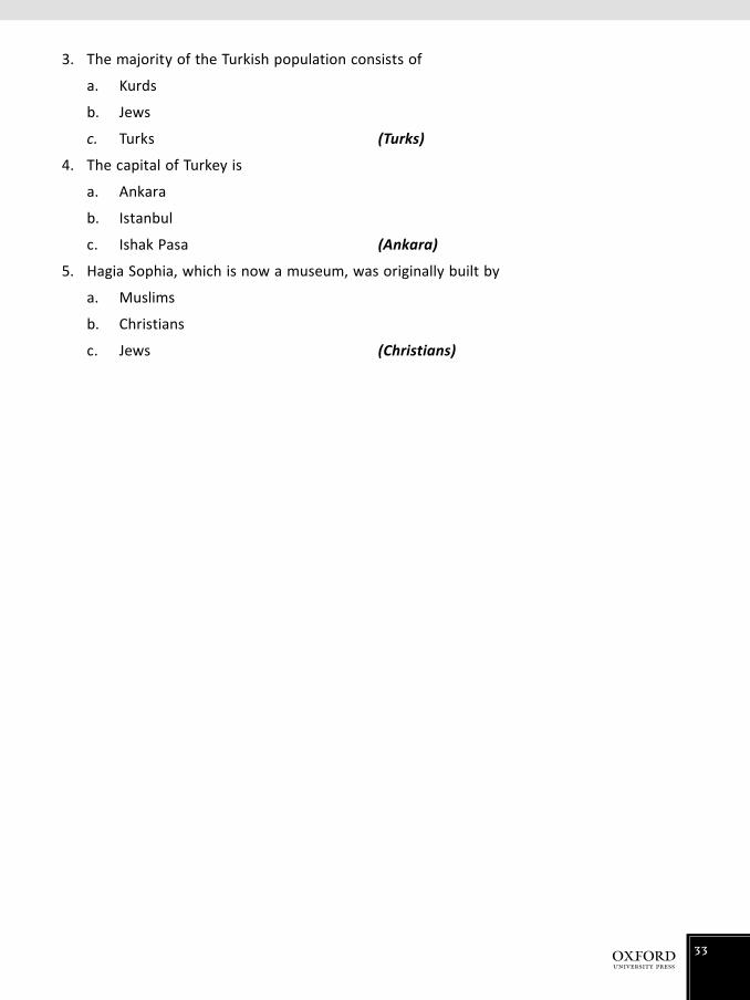
3. The majority of the Turkish population consists of
a. Kurds
b. Jews
c. Turks (Turks)
4. The capital of Turkey is
a. Ankara
b. Istanbul
c. Ishak Pasa (Ankara)
5. Hagia Sophia, which is now a museum, was originally built by
a. Muslims
b. Christians
c. Jews (Christians)
33

UZBEKISTAN Pupil’s Book 62–7
A landlocked state in central Asia, formerly one of the Soviet Republics, which became independent in 1991. It is about half the size of Pakistan, but has the vast Qyzylum desert that occupies well over half of the country.
Uzbekistan’s importance in the past was that it lay on the Silk Road, with its cities of Bukhara and Samarkand, important trading posts on that route. These cities, as well as Tashkent (or Tashkent) became rich and cultured.
It has a long history—an ancient Persian province, captured by Alexander the great. In 8th century AD it was captured by the Arabs, then in the 13/14th centuries by the Mongols under Ghengis (Changez) Khan and Taimur the Lame (photograph of tomb on p.66). The Uzbek Khanates took over in the 16th century, and Russia, under the tsars in 1865. In the later 19th century, the tsars began the ‘cottonification’ (as explained in the following paragraph) of Uzbekistan, and there were many revolutions against this as the Uzbeks fought against the loss of their traditional crops.
After the Russian Revolution of 1917, the Uzbeks fought against the communists, helped by the White Russians (supporters of the now-dead tsar) and bizarrely by British troops. By the early 1920s, the communists had taken firm hold, and under Stalin an even more extensive programme to develop cotton took place. It was the Communist aim that Uzbekistan would supply all of the USSR cotton. Everything—transport, machinery, and infrastructure was geared towards cotton production. Cotton is still a major agricultural crop accounting for 40% of the value of agricultural products. Besides raw cotton Uzbekistan also produces large amounts of cotton seed.
Unfortunately cotton demands a great deal of water, so that the rivers have been tapped for irrigation—as a result the largest inland water resource has been reduced to half its size in a short time. All of the rivers run into the Aral sea, and so much water is taken for irrigation that almost no water reaches the lake. Along with being only half its size, the Aral sea has become so salty, and so polluted with agricultural chemicals that nothing lives in it. Some attempt is being made by Uzbekistan and neighbouring states to reduce the amount of water taken for irrigation, but so far with little success.
An additional hazard with the intensive cultivation and irrigation is that as in Pakistan, salt is brought to the surface, poisoning it for the plants. The author was taken on a tour by the professor of Agriculture from Tashkent University and said that before planting in spring, the soil has to be ‘washed’ two times with clean water from deep underground to make it fit for the young plants. Machinery, especially tractors, are specially designed for cotton, and cannot be used for much else. However, diversification is spreading, but Uzbekistan still has to import huge amounts of grain and other foodstuffs.
Uzbekistan produces about 70,910 barrels of oil a day (Saudi Arabia produces more than 9,764,000), and considerable amounts of natural gas, some of which it exports to neighbouring states. There is a proposal to bring some to Pakistan as its industrial base expands by a pipeline across Afghanistan. However, much of this project will depend on political considerations. Textiles—Uzbekistan obviously has the raw materials in cotton for a considerable textile industry, and it is also the largest silk
34

producer in the former USSR. It has many sheep and goats, but like those in Pakistan the wool is harsh and very suitable for carpets. Bukhara is world famous for its carpets. The rarer karakul sheep, however, though the adults have the normal coarse hair for carpets, produce lambs with have tight curly black hair. Lambs are killed at birth and skinned (the fur, which is called Persian lamb, or sometimes, astrakan) is so valuable that the pregnant ewes are sometimes killed to get the unborn lamb. (Discuss the ethical aspect of this with the students. The astrakan fur is similar to the ‘shahtoosh’ wool from unborn lambs, in Kashmir, used to make shawls of the finest quality. Both practices are banned by the government of these countries.)
Uzbekistan lies on a major fault in the Earth’s surface that continues through Afghanistan and Pakistan. In 1996, the capital Tashkent was almost completely destroyed, with only several 15th and 16th century mosques and a madrassa remaining. It has been rebuilt in a very modern style with characteristic Soviet communist architecture (p.62).
An attempt has been made to encourage tourism, but in spite of the wonderful architecture in Samarkand and Bukhara and the site of the Silk Road, the infrastructure has hampered development. On the next house to the one shown on p.64 someone had, optimistically, painted ‘The Silk Road’.
The Uzbek language (a Turkic language) is now written in Roman script, like this. Before 1929 it was in Arabic script, but during 1940–1994 the Russians imposed the Cyrillic alphabet. In 1994, the Roman script was decreed. (Show a sample of the Cyrillic script, to the students.)
Some idea of Uzbekistan’s cultured past can be gathered by the fact that it was the home of three great Islamic scholars:
Al Beruni (973–1050) was the most famous Muslim scientist of the time. He wrote more than 113 books; most of them unfortunately are now lost. There were books on astronomy, astrology, geography, mechanics, meteorology, medicine, pharmacology, mineralogy, history, religion, philosophy, literature, and magic. At least one book on all of these subjects still exists. He had no scientific instruments, of course, and could only use his own eyes. He spoke fluent Sanskrit and one of his best known books is India from which we learnt almost all that we know of the languages, customs, science, and geography of the subcontinent at the time.
Ulugh Beg (early 15th century) was a famous astronomer and mathematician. A huge observatory that he built at Samarkand still exists, though this of course did not have telescopes (which had not been invented) or other scientific equipment.
Ali Shir Nava’i (late 15th Century) was a great scholar, poet, musician, and one of the most important writers in Turkic literature.
Perhaps discuss the rise and fall of civilizations/cultures. Uzbekistan, once a major country, is now relatively poor—GDP per capita US$3100. Discuss why. Obviously collapse of the Silk Road was a major factor, and being landlocked Uzbekistan could have little contact with the outside world. See what reaction you get to the idea that civilization keeps moving westwards—China, Fertile Crescent, Egypt, Greece, Rome, Britain, USA—where next? Or is this just coincidence. Can civilizations now fall with such international connections, and dependency? What makes a civilized state?
35

Answers to Pupil’s Book page 68
1. USSR; independent; Silk Route; China and the subcontinent; Italy
2. a. Water extracted for irrigation, which has virtually destroyed the important Aral Sea
b. Monoculture of cotton, which has precluded development of other crops
3. Irrigation used extensively because of low rainfall, and cotton needs considerable moisture for growth. Rivers Syr-Dary’ya and Amu Darya, formerly major waterways, have virtually dried up—at least little of their water reaches the Aral Sea—because so much is taken for irrigation.
This has destroyed the economy of the Aral Sea area—no fish, pollution of surrounding land by agricultural chemicals blown from the barren shores.
4. Decline in cotton because of synthetic materials such as nylon and terylene. Fortunately for Uzbekistan (and Pakistan) there has been a return to natural fibres recently.
5. a. Diversification is, in agricultural terms, growing crops other than the main one—here, cotton.
b. Uzbekistan is trying to grow more and more vegetables, fruit (especially grapes), rice, wheat, barley, and potatoes. The soil is not particularly fertile; there is relatively little
rain—the rivers from which water for irrigation comes rise in the Tien Shan mountains on the borders of China; the temperature is continental, i.e. extreme—January—6° to 2°; July—26° to 32°. Constant struggle against invading sand from the great desert
6. Reafforestation is needed to stabilize the encroaching desert.
7. a. Tomb of Taimur the Lame; Ulugh Beg’s observatory; beautiful mosques.
Additional exercise
MCQs
Choose the correct answer.
1. As part of USSR, Uzbekistan was forced to produce
a. rice
b. wheat
c. cotton (cotton)
2. Uzbekistan’s desert is called
a. Qyzylum
b. Gobi
c. Qian (Qyzylum)
36

3. The capital city of Uzbekistan is
a. Bukhara
b. Samarkand
c. Tashkent (Tashkent)
4. In Uzbekistan, 80% of the population is
a. Buddhist
b. Christian
c. Muslim (Muslim)
5. The tomb of Taimur is located in
a. Tashkent
b. Bukhara
c. Samarkand (Samarkand)
37

THE WORLD Pupil’s Book 69
The rest of the world is much more disparate than the Islamic one. The Muslim world is, with a few exceptions, more or less continuous—one could travel 8,000 kilometres from Pakistan to Nigeria without ever leaving an Islamic country. Apart from crossing the Suez Canal, you could go the whole way on foot or land transport. The Islamic world is united, of course, by religion and for many people, a knowledge of Arabic. A common religion means that throughout the whole region there are very similar customs, ceremonies, and ideas. Much of the Muslim world, too, has fairly similar climatic conditions—warm or hot, and dry.
The rest of the world is highly variable in every way. From Arctic regions where temperatures can reach from 40°C to tropical lands where it can be 60°C; vegetation can range from dense tropical forests, through millions of hectares of grassland to deserts where there has not been any rain for 400 years (Chile). There are great extremes of wealth and poverty: the GDPs range from $46,000 per person per year in USA to $800 per person in Malawi. Some are almost totally industrial (UK) and others almost entirely agricultural (Mongolia). They are separated by many thousands of kilometres of ocean or seas; they have hundreds of different languages and almost as many religions.
We have tried to select six countries that cover these wide extremes: highly developed countries such as USA and UK; countries that are steadily developing (Brazil, South Africa) and countries that are, at the moment, relatively poor but are trying to develop.
38

VIETNAM Pupil’s Book 71–8
Clinging in a long narrow strip to the eastern edge of the Asian landmass, Vietnam was relatively little known until World War II. It had been a colony of France for almost a century before it was occupied by Japan. After the defeat of the Japanese in 1945 the French tried to return, but a nationalist rising drove them out. The most dramatic and inexplicable event of the war was the French setting up a major battle at Dien Bien Phu—the most impossible situation in a valley dominated by mountains. The Vietnamese commander, General Giap, one of the most brilliant soldiers of the 20th century could only believe it was some sort of a trap, but slowly moved such heavy guns as he had into the surrounding hills, where he pounded the French positions. There was no land access to Dien Bien Phu, and all supplies for the French had to be dropped in by air. The Vietnamese overran the place and the war was virtually over.
After the rising against the French, Vietnam was split into two parts, a communist north supported by China, and a non-communist south supported by the USA. The politicians of the south were notoriously corrupt. As the communist north seemed to be gaining ground, the US sent at first advisers and then a huge army to support the south. Amazingly the mighty, sophisticated US forces, with total control of the air, huge tanks and heavy weapons, were defeated by the ill-equipped peasant army of the Viet Cong (the communist north) armed largely with home-made weapons. The US was forced to withdraw in humiliation. The communist north then occupied the whole of the country.
Vietnam must be the envy of Pakistani agriculture; a rich soil (in the delta of the great Mekong river, three or even four crops of rice can be grown each year); everywhere, plenty of water from rain and the 2000 rivers; a warm climate. In a narrow space it rises from sea level where tropical crops such as rice, rubber, bananas, mangoes, sugar cane can be grown, then up to the Central Highlands (about 1,000 m) where at different heights tobacco, cotton, coffee and tea, vegetables, citrus fruits can be grown. The long coastline (3240 km) is full of fish, as are the rivers and ponds. Vietnam should be very prosperous—it is the second largest producer of rice in the world and the third of coffee. Unfortunately, it suffers from a legacy of colonialism worse than most. Like so many developing countries its agriculture is very inefficient—still largely ancient methods and techniques, like the swinging irrigation basket on p.74. A simple electric pump would do the same job much more quickly and efficiently. Nevertheless, the peasants who make up 69% of the population have an excellent diet, largely fruit and vegetable and fish. There seems to be none of the malnutrition and starvation found in so many developing nations. The warm climate—the whole country is inside the Tropics—means that houses in the countryside can be very simple, consisting usually of one room for living (with beds), a sleeping room, and a kitchen, though this is often an open-sided courtyard at the back of the house. The furniture is very simple—often only a chair for the senior man, and beds, plus a television. The Vietnamese are inveterate tv watchers, and in the many areas where there is no electricity, battery-powered black and white sets are used. The programmes are however, fairly limited, as in most communist countries, with a fair diet of political speeches.
39

The peopleFor two thousand years, Vietnam has been invaded by country after country, attracted by its agricultural wealth. For a thousand years it was dominated by China, but people from neighbouring Laos and Cambodia have, from time to time, occupied it. A strong element, largely traders and merchants, from the subcontinent settled there, so that there are small Hindu and Muslim communities. Cut off for so long from mainstream Islam, the Vietnamese variety has gone its own way. Only a few passages of the Quran are learnt, and are recited by rote, usually without any idea of their meaning. Ramadan is reduced to three days, and the ablutions before worship can be the simple miming of drawing water from a well. (Discretion advised.)
The main religion practised is Buddhism, to which about 9.3% of the people belong. But here again it is very varied. In the south, it was brought to Vietnam by monks and traders from Sri Lanka and southeast Asia. This is the strict, early form of Buddhism known as Theravada, which believes that only monks can attain Nirvana—a kind of paradise, though that is not strictly the word for it. Non-monks (both men and women) must wait for rebirth in the hope that then they will become monks. Perhaps tell pupils about the cycle of rebirth–which is common to Hinduism as well. In Theravada, Buddha is regarded as a human teacher, not as a divinity.
The northern part of Vietnam received its form of Buddhism from China—the Mahayana form—which is a much looser variety with a whole pantheon of gods and semi-deities. Among Christians, 6.7% are Catholic and 0.5% Protestants, a survivor of the French occupation. The Vietnamese language is based on the Chinese, monosyllabic, and with five rising and falling ‘tones’. The same sound, with a different tone, has a completely different meaning. There are no tenses and no plurals. Since the 18th century, however, under the influence of French missionaries, the Roman alphabet has been adopted.
The conical hat, so characteristic of Vietnam (pp.72,74,75) is now worn mainly in the countryside, but even here the ubiquitous baseball cap is gaining popularity with young people. The basic function of the broad conical hat is to keep the strong sun away from the face, as a pale complexion is considered to be a mark of beauty. Some fashionable young women wear long gloves to prevent their arms from getting tanned. The traditional dress of the women is the very beautiful ‘ao dai’. This consists of long loose trousers and a long tunic which comes up to the ankles. This is still very widely worn, though for work, a shorter tunic is generally used.
Ethnic groupsOver the centuries many people who have invaded Vietnam have left behind areas, which are still dominated by different tribes. Many are from China and southeast Asia. Many retain their traditional costumes (p.73) which they wear as a matter of course and not for special occasions. There are many ethnic customs—people live in long houses raised on stilts, with cubicles for different family groups inside. The agricultural practices of some of the ethnic people are very primitive—some still practise the slash-and-burn farming, whereby they burn down an area of the forest, plant crops for a few years until the soil is exhausted, and then move on to burn down another area. The government is trying desperately to stop this as it is wasteful. The standard of living of the ethnic people is generally very low, though they usually have enough to eat. The author went unannounced into a small settlement of Black Hmong, people who had been resettled from slash-and-burn and given a
40

few hectares of land. They lived—all in their brilliant ethnic costumes—in large earth-floored huts, with walls and roofs of rice straw. The only furniture was bizarrely a large four-poster bed (for the mosquito net, which had huge holes in it), a shelf on the wall with an electric torch, a small mirror, a brush and a comb. The cooking department was a hole scooped in the floor furthest from the bed, with a small burning wood fire.
MineralsVietnam has some mines, especially those of valuable metals such as titanium, gold, and silver. There are a number of coal mines. These minerals need a vast amount of capital to enable them to develop. Such an industry is there but it is developing very slowly and is geared towards local consumption—farm tools, and chemicals.
CommunicationCommunication is poor. There is a single main road running the length of the country, but it is narrow and in dire need of repair in many places. Repairing is primitive, with mainly women carrying baskets of stones, which the men pound in with hammers. A single railway runs parallel with the road from north to south. This is a narrow-gauge track, optimistically named ‘The Reunification Express’ and is extremely slow and uncomfortable.
TourismThis is one of the most rapidly expanding sectors of the economy. The coastline is extremely attractive in both scenery and climate—especially to people from the west. Huge modern hotels are springing all along the coast, most of the joint ventures have been with France, and some have also been with Japan and Australia. The food, the sights and the history are a great attraction as Vietnam struggles to recover from many centuries of wars.
Answers to Pupil’s Book page 79
1. A developing country. Balance of payments deficit; generally primitive agriculture; underdeveloped industry and mining; low electricity consumption.
2. Many centuries of invasion and occupation by various outside powers
3. There is so much water—seas and rivers—and fishing is still on a relatively simple scale, unlike that in Europe and America where sophisticated boats and equipment have caused severe over-fishing. In the hot, humid climate, animals tend to get many diseases, and in general, Vietnam cannot afford the expensive treatment and prevention. Fish do not have this problem, and along with chicken, and ducks that are reared on huge ponds, these provide the main protein for the people.
4. Probably a discussion question—the overcrowded scooter, the women ferrying heavy loads of coal, the swinging water ‘pump’
5. a. Rice, tea, coffee, sugar cane, cotton, mangoes, bananas, citrus fruits, pineapples, lychees, potatoes, cabbages, aubergines, tobacco, tomatoes
41

b. The warm moist climate encourages the growth of pests and diseases. The cost of treatment and prevention is beyond the means of most peasant farmers.
Additional exercise
MCQs
Choose the correct answer.
1. The Vatican City is
a. known as an important business centre
b. the place where the Pope lives
c. a member of the United Nations (the place where the Pope lives)
2. The capital of Vietnam is
a. Mekong
b. Ho Chi Min
c. Hanoi (Hanoi)
3. Vietnam is the world’s second largest exporter of
a. rice
b. coffee
c. rubber (rice)
4. Farming in Vietnam has low yield due to
a. the infertile soil of the irregular terrain
b. inefficient irrigation systems
c. traditional farming practices (traditional farming practices)
5. Rare metals that are mined in Vietnam include
a. coal, titanium, and gold
b. zinc, silver, gold, and titanium
c. phosphate, copper, and titanium (zinc, silver, gold, and titanium)
42

BRAZIL Pupil’s Book 80–7
Brazil is another country which has vast potential in all its resources—agricultural, mineral, developing industrial—but it has not tapped its resources to their full potential. This is partly due to its huge size and inaccessibility of some regions, but perhaps has more to do with inefficiency and political problems. Its GDP at about US$10,000 is less than that of its neighbour Argentina with US$13,900, which has much fewer resources. It rates 109 in the world order of GDP. It is the fifth largest country in the world (to Russia, China, Canada, and USA) but more than a third of its 8,500,000 km2 is the dense Amazon basin jungle, which is of small economic importance, so far. To get some idea of the size of Brazil, ten countries the area of Pakistan would fit comfortably inside its frontiers.
Its population of 199,000,000 is concentrated on the eastern coastal plain—86% of the people are urban, a proportion that is unfortunately increasing rapidly as poor peasants pour in from the plateau and countryside. The ‘favelas’ or shanty towns, which have grown up on the periphery of the main cities are similar to those of some areas in Pakistan, and also the slums of Calcutta.
MineralsIndustry is the greatest source of wealth for a country, followed by minerals. If a country has a good supply of minerals—of the right sort, of course—its industrial base can quickly follow. This is happening, even though slowly, in Brazil. It has huge deposits of coal, iron, bauxite (for aluminium), and rapidly developing sources of oil and gas. Important minerals, because of their high value (they are relatively rare), are quartz crystal, manganese, beryllium, mica, graphite, titanium, chrome, and mercury.
Get pupils to find out more about these minerals and their uses, etc.—from reference books or websites.
Gold was found in the Amazon basin in the 1970s and started a Gold Rush in the region—largely by unscrupulous men who exploited the Indians of the forest to labour for them and destroyed their environment. The government has been able to do little about this.
AgricultureOnly 7% of the country is cultivated, but there are vast ranches in the interior for cattle. It is the world’s largest grower of soya beans (get pupils to find out what these are used for), coffee, sugar cane, papaya, and cassava (get pupils to find out what the last one is). There could be some ‘research’ work on these. Coffee, for example—how it is grown and how it is processed. Perhaps many use instant coffee—how is this produced from the beans.
Sugar cane—pupils will be familiar with the processes and uses of this from Pakistan’s own industry, but Brazil in the 1980s when its economic problems were at their worst, made petroleum from sugar. This is a relatively simple industrial process but the resulting fuel, while as good as petrol, needs some adjustments to the car engine. With the discovery of their own off-shore oil wells, the petrol from the sugar process is less important, but it is VERY important on a long-term world scale. Oil resources are finite, and fuel from renewable sources such as plants will almost certainly become
43

essential, barring some major scientific breakthrough in power such as solar cells, wave/tide/wind electricity.
Pupils could discuss this—oil from sustainable sources, electrical power from the sun via solar cells, battery-powered vehicles charged from hydroelectric or nuclear stations. Ask why not the conventional thermal (oil/gas/coal) power stations. What advantages would accrue from electrically-powered transport? (No pollution) What disadvantages are there with battery-power vehicles? (Batteries are very heavy indeed and would take up the whole of the boot space. They have very limited range, and need frequent charging. This takes several hours. A solution would be to take ready, charged batteries from the service station, but this also would take considerable time because of the weight. Electrically-powered vehicles are relatively slow. The dream of scientists for many many years has been to create a battery, which can be recharged just by adding chemicals—but no progress has been made in this field. Clockwork vehicles like toys? Has been tried—even Leonardo da Vinci made one powered by springs but its range was only a few dozen metres.
Rubber—The Amazon Basin is the original home of the rubber tree—check that pupils know how rubber is obtained (photo p.34 of text). Until the 19th century, Brazil had a monopoly of the rubber production—actually very limited until the advent of the bicycle and more especially the motor car—and guarded the hide very carefully. All consignments of plants (Amazon was a popular field for the avid plant hunters of 19th century Europe) were carefully searched for rubber tree seeds or plants. However, a British expedition managed to hide some seeds at the bottom of a basket containing other samples, took them to London where they were bred in the famous Kew Gardens’ glass houses (as explained earlier in the segment on Malaysia). The plants were taken to southeast Asia—especially Malaysia—where they flourished. The indigenous people of the Amazon had little use for the rubber sap—they made it into balls for playing games (before this balls were made of leather or cloth stuffed with feathers or hair and did not bounce) and amusingly for making waterproof boots. They dipped their naked feet (they had no shoes anyway) into the pot of latex and then took out their feet and let the latex dry. They repeated this many times with the rubber layer building up thicker and thicker, thus giving way to the world’s first Wellingtons.
Today Brazil is NOT amongst the ten top producers in the world, and synthetic rubber is being produced in most developed countries, whose main ingredient is a by-product of oil. It was developed largely in Germany in World Wars I and II because they could not get the natural product.
CoffeeAlthough not a native of Brazil (the original home is in Ethiopia), coffee flourishes in Brazil. It is by far the world’s largest producer based on the number of 60 kg bags (47.2 million bags in 2009). Brazil is the largest producer of coffee, 28% of the total, Colombia is a distant second at 16%. It is one of Brazil’s biggest exports both as raw beans and as instant coffee (mention any well-known brand name of coffee). Coffee is, however, highly subjected to weather conditions—a frost can destroy almost a whole crop, and the price on world markets fluctuates wildly so that it is a tricky crop to grow—at one stage Brazil was fuelling its steam trains with coffee beans that it could not sell.
The rainforestThe destruction of the rainforest is one of the world’s major ecological disasters because the oxygenation it supplies is vital. (Explain how plants take in carbon dioxide, which we breathe out,
44

and with the help of light and chlorophyll they give out oxygen which we breathe in. Use the term photosynthesis).
In actuality, when the forest has been cleared the soil is not particularly fertile. The giant trees live on the thin layer of decaying leaves on the surface—they are very shallow rooted which is why many of them have buttressed roots to support their great height. When cleared even this shallow layer is washed away by the heavy rains. The resulting open land grows crops of grass for cattle for a year or two, and then becomes very poor land indeed.
IndustryBrazil is probably the richest country in the world with its vast resources, both in terms of minerals and agriculture. It is desperately trying to become a major industrial nation—about 60% of the value of its exports are of manufactured goods—most derived from its own mines, oil and gas wells, and farms. It is in the top ten of the world’s producers of tin, aluminium, cotton, gold, rice, coarse grains (maize etc.), oilseeds, coffee, and cocoa.
It has a large motor car and aeroplane industry, but much of these are being built under licence (EXPLAIN THE TERM). Ask for names of car/aeroplane models from other countries such as Germany, USA, Japan.
It has a negative balance of payments and servicing this debt takes much away from the national income. Its GDP is about US$10,000.
Answers to Pupil’s Book page 88
1. a. 3,400,000 km2
b. More than four times the size of Pakistan
c. The Equator cuts through the centre of the Amazon rainforest.
2. Gloomy—permanent twilight; moist. Majority of animals and birds are in the canopy. Lack of food means that there are few animals on the ground. Plants have adapted by (a) climbing up trees to get to the canopy, (b) parasitic—grow on existing plants taking nourishment from them, or (c) saprophytes—living on decaying material on the forest floor.
3. Cutting down forests (a) for timber, much of which is very valuable, and (b) to clear land for agriculture. Dangers—the trees cannot be replaced; there may be many valuable drugs in the forest, as yet unknown (quinine was discovered here); when trees were removed there was erosion of the soil due to heavy rains. See above.
4. Most important crops: soya beans, coffee, oil seeds, cotton, rice, maize and coarse grains, cocoa, sugar cane. Other crops: bananas, papaya, cassava, oranges
5. Brazil has a wealth of minerals, such as basic coal, oil, and iron, as well as more unusual ones. There is plenty of electric power from hydroelectric plants. Having these raw materials within the country along with very cheap electricity is important to a developing industry.
45

6. Political mismanagement, corruption, and dictatorship have hindered development. The years of bad administration led to raging inflation of over 440% in 1991 and massive borrowing from other countries. The average inflation 1990–9 (when things were improving) was 289%: inflation in Pakistan for the same period was 10%. Brazil’s foreign debt (Dec 2009 est.) is $273.7 billion.
7. Biomass is the use of vegetables to make fuel/alcohol—in this case the vegetable being sugarcane. Because then it had no oil, and to save by importing less foreign supplies Brazil turned to what it had plenty of. It is used less now because oil has been discovered in Brazil, and natural petroleum is more convenient. The ‘biomass process’ is important for when oil supplies may in the distant future be exhausted.
8. Corrupt and weak governments, usually military dictatorships—now on a more stable political and nominal democracy. Migration to the cities from the countryside is still not solved. Gulf between the rich and the poor is still largely unsolved but industrialization does give more people a chance of a better life. Urban slums are still a major problem.
9. Electricity—hydroelectric power from the many rivers. This helps by providing cheap power for the developing industry. Power is often one of the main costs of industry.
10. Parts of the interior are not particularly good agricultural land, and getting an income from them is very hard work. Facilities—running water and electricity are not available in many remote areas. The cities of the east coast where the industrial area is located seems to offer a much better standard of living than the agricultural regions, where the workers are very much under the control of the great landlords.
Additional exercise
MCQs
Choose the correct answer.
1. The longest river in the world, Amazon, is located in
a. Brazil
b. Mexico
c. South Africa (Brazil)
2. The famous waterfalls located in Brazil are called
a. Victoria falls
b. Niagara falls
c. Iguacu falls (Iguacu falls)
46

3. The capital city of Brazil is called
a. Brasilia
b. Rio de Janeiro
c. Salvador (Brasilia)
4. The motor vehicle fuel made from sugar cane is called
a. petrol
b. ethanol
c. alcohol (ethanol)
5. The Amazon rainforest covers this per cent of Brazil
a. 40%
b. 50%
c. 30% (40%)
47

THE PEOPLE’S REPUBLIC OF CHINA Pupil’s Book 89–97
The sheer size of China, its vast population and its immense diversity makes it difficult to cover it in much detail. In general, this section will give a few extra facts which might make it a little more interesting.
From the Fact File p.89 get pupils to work out how much bigger and how much more populous it is than Pakistan.
Point out the diversity in the photographs on pp.94–95—the primitive wood and rice straw houses of a village in the centre (Guizho province) and the sophisticated high rise city of the east. In the cities of the eastern side businessmen dress exactly as their European counterparts.
Some statistics that can be discussed:
China Pakistan
GDP $6600 $2400 (2010)
Expectation of life 72/76 64/67 (2010)
Infant mortality 16.51/1000 65.32/1000 (2010)
Adult literacy 96% 49.9% (2010)
Annual pop. growth 0.494% 1.58% (2010)
As in Pakistan these figures vary from region to region—the western and mountainous parts of China have much worse figures for all than the more developed eastern half.
These rather depressing statistics can be ignored of course—but perhaps one can look for an answer to these differences. Obviously China is much richer in natural resources: it has no natural hostile neighbours; it is a total dictatorship—the one-child policy could never be introduced in Pakistan; there is no religious element in the equation.
AgricultureOnly about 15% of China is economically viable for agriculture—the rest is desert, mountain, or unsuitable land. Tibet is too cold, for example. Half of the arable land is irrigated from the huge network of rivers many of which also form the main transport routes. The main mechanical transport is the railway. Road transport is still relatively primitive outside the town and cities.
Ask pupils why China has such a poor road infrastructure—the country is so vast—well over 3,000 km north-south and east-west and the terrain often so difficult that a modern road system would be astronomically expensive. China traditionally is very localized, but the future may bring a change.
In towns, the main means of transport is the bicycle—Shanghai streets are unbelievable—it seems that every cycle in the world is there. Bizarrely, the great majority of these have brand names such as EAGLE, SWALLOW, GOLDEN EAGLE in gold paint in Roman script. The owners cannot read this script, much less know what the words mean. It can be only assumed that it is some kind of prestige to be riding bicycles of these brands.
48

If this is mentioned, perhaps ask pupils what they consider confers status—brand of shoes, ownership of mobile phones, etc.
When the communists took power in 1949, they organized agriculture on the commune basis. A large area of state land was allocated to a number of brigades or about 600 people. All these lived in a village in the centre of the brigade land, and all, apart from a few specialists such as medical and administrative people worked on the land. Each brigade was given a quota of crops, depending on the region, which it had to produce. Each peasant family had a small garden plot for vegetables, some chicken, and fruit. The authorities were puzzled as to why the crops on the peasants’ own garden and their animals produced about three times as much as the common fields. All cultivation was with hand tools, or at best by buffalo. The author was on a commune near Nanjing where there was one communal toilet for the village, built on stilts over a pit into which the sewage fell. This was jealously guarded. The author did not know how this was allocated, but the women would carry buckets of the stinking fluid to their little gardens and with a bowl on the end of a two-metre pole, pour it around the base of their own plants-lettuce, cabbage, tomatoes. No wonder they grew better crops than the common fields.
Rice is the largest crop with a third of all the cultivated land allocated to it. About 190 million tonnes were produced in one year, just to give an idea. In the north where it is cooler, wheat is grown—again about a third of land, but as wheat is not as productive, only 105 million tonnes were harvested. Coarse grains—millet, sorghum, barley, oats, and maize together make about 112 million tonnes.
In the 1980s, the authorities saw that the commune system was not fulfilling its potential and thus the ‘responsibility system’ was introduced. Each family was allocated land—of a number of hectares—and was under contract to produce a certain amount for the state, after which they could grow what they wanted and sell it on the free market. This was immediately successful.
Oil seeds such as cotton, soya, sunflower, sesame, and peanuts are very important as oil is used (as in Pakistan) for cooking. Cattle are used largely as draught but not eating, and around 90% of Chinese people are lactose intolerant—that is they are not able to digest milk after infancy so that milk and milk products do not figure largely in the traditional Chinese diet.
Industrial crops are cotton (largest producer in the world—twice as much as Pakistan), flax (for linen) and hemp. This is a coarse fibre which is normally used for making sacks, ropes, and packing material, but in the remoter parts is used for making clothes. Silk, of course is very valuable; it is a specialized agricultural product—the reason for the Silk Road of ancient times. China is easily the world’s largest producer of silk—the development of silk from the moth to the finished produce could be a very interesting project for the class. Such delightful snippets as that each silk worm produces a single continuous thread 600–900 m long.
Fish—China is the largest producer of fish in the world. Many of them are bred in ponds and lakes. Traditionally, manure was thrown into the water, which bred tiny microbes. These were eaten by the next largest up the chain and those by large ones still, until the edible fish—often carp—were able to grow quickly.
Chinese people also eat snakes, and in some regions, dogs, but these are expensive luxuries. The diet of the majority is rice with vegetables.
Perhaps a mention of terracing. This form of agriculture is very inefficient, demanding constant upkeep of the banks between the strips. Regulating the flow from one strip to another also demands
49

constant work and is the source of many disputes. It more or less precludes the use of mechanical cultivation. But it does increase the area of cultivatable land dramatically.
MineralsIf it is found under the ground, China has it. Along with vast deposits of coal and iron, it has uranium, gold, tin, tungsten, manganese, molybdenum, vanadium, magnetite, aluminium, zinc, lead and oil reserves claimed to be second only to Saudi Arabia. These rare and expensive metals seem to have been provided specially for industrial use in the 21st century. Get pupils to find out what they are along with their uses.
IndustryHydel provides the bulk of the electricity to the industries. Industry is still rapidly developing, especially smaller domestic items such as radios, kitchen equipment, fridges, electronics, and textiles but heavy goods are catching up—heavy machinery, weapons, etc. It has a positive balance of payments and is the most rapidly growing economy in the world—(GDP real growth 2010 est; China 10.3%, Qatar 19.4%, Singapore 14.6%,India 8.3%, Pakistan 2.7%, Japan 3%) Whether this rapid industrialization in China can continue probably depends on the political situation as always.
In the early days of the People’s Republic of China, Mao decreed the Great Leap Forward in 1958. China, he said, would become industrialized. There was great investment in industry much of which was pointless. The infrastructure and the trained workers did not exist; there was great emphasis on cottage industry—peasants were forced to build mini blast furnaces in their gardens to make steel. If they managed to make any, it was useless. More peasants were set to make electrical equipment—winding many kilometres of fine wire for transformers was a popular task, but was far beyond the ability of the farm workers. As a result, the land was neglected and it is estimated that 20 million people died of starvation.
Perhaps ask pupils to look in their homes for kitchen electrical items, electronic equipment, etc. to see how many they can find that is made in China.
Some of the earlier ‘reforms’ were madness. Mao decreed that birds were eating far too much of the harvest, so he ordered all the peasants to swarm into the fields for days with sticks killing millions of birds. It certainly reduced the bird population dramatically but he had overlooked the fact that the birds ate insects, which now had free reign in the fields, and as a result the crops lost even more.
China has made remarkable progress since 1978, when Deng Xiaoping took over as the Chairman of the Chinese Communist Party. He brought China in touch with the outside world and set up a proper industrial base, to improve the economy. China’s economic growth has increased to about 10% now.
The people91.5% of the people are of the Han race, though there are minorities such as the Mongolians, Tibetans, Kazakhs, Miaos, and Uigurs who are Muslims. All these have their own languages, but the vast number of Chinese people use Mandarin, or Puthongua. This is the character language we all know but though everyone in China can read Mandarin, they make different mouth sounds when speaking it. There are about a dozen main dialects, and hundreds of smaller ones, these are all so
50
different that they might as well be considered as foreign languages. More people read Chinese than any other language in the world, but almost all of them are Chinese or descendants of Chinese people abroad.
It is a difficult language where each character represents a whole word or even a phrase, unlike most other languages which are built up from letters of an alphabet. There is of course, no way in which a person can look at a character and speak it, unless he or she knows it.
Students can do a project on China, getting more information from reference books and the Internet.
Answers to Pupil’s Book page 98
1. a. The vast number of people, with soaring numbers in cities not producing food
b. Inefficient agricultural methods—still largely use hand tools on tiny peasant plots.
c. Transport problems
d. Limited amount of land available for agriculture
2. Terracing—also called contour planting. On steep hillsides, narrow level plots are created by building banks of soil or mud. The plots follow the line of the hill from which they are cut. Water flows from the upper plots to the lower ones. Get pupils to draw a cross section of a terraced hillside.
Terracing enables terrain that is not suitable for ordinary agriculture to be used. Gives much more area for agriculture. Disadvantages—extremely labour intensive, needs constant maintenance, machinery can rarely be used as plots are narrow and impossible to reach except on foot.
3. a. coal and tin b. lead and zinc c. nickel, aluminium, gold
4. a. The population will continue to rise until the one child per family generation reaches the child-bearing age. This should be from the 1990s onward. It is estimated that the
population will stabilize in the 2040s, when India, which has no such limitations, will probably become the most populous country.
b. Problems found in China: the Chinese are passionately fond of their children. Having only one child, parents lavish all their care and money on them. In China, many of
the children are so demanding that they are often called Little Emperors and Empresses. They often grow up to be selfish and demanding, and overweight. Obesity is a serious problem as the children often eat as much as they like often western ‘junk’ food.
In China, it is traditional for the children to look after their parents when they are too old to work. There is little government aid for the elderly. Now the problem that
will arise is going to be which parents are the children going to take care of—husband’s or wife’s.
51

5. China in many ways is still underdeveloped, and inefficient. Manpower (or more often womanpower) is used where in developed countries machinery would be used. The author has visited coal mines (drift mines going into hillsides) when men hack out the coal from the face, and women with baskets carry it outside.
6. a. This is not actually mentioned in the text but 20% of electricity is hydroelectric, the rest, thermal using coal or oil. Perhaps mention the big new barrage schemes to
generate more hydroelectric, especially the Three Gorges scheme on the Yangtze. Get pupils to find out more about this from websites.
b. As in Pakistan transmission lines from power stations to remote settlements is not economical, especially because of the relatively small amounts used. In China, which
is twelve times as big as Pakistan, the problem is more acute.
c. Supplying fuel to distant places for power stations with poor infrastructure
7. a. Lack of infrastructure—transport, power, communications
Lack of trained personnel
Much of the technical equipment and skills have to be imported.
b. High cost items—electrical, electronics, domestic equipment, textiles. These can be done on a relatively small scale and the overseas money they attract can be used to
buy heavier equipment and build big engineering factories.
Additional exercise
MCQs
Choose the correct answer.
1. The capital of China is
a. Shanghai
b. Beijing
c. Lujiazui (Beijing)
2. One of the major deserts in China is
a. the Tibet desert
b. the Sahara desert
c. the Gobi desert (the Gobi desert)
3. The system of government in China is
a. communist
b. capitalist
c. socialist (communist)
52

4. To bring more land into cultivation, the farm land of China’s mountainous areas is
a. mechanised
b. used on an extensive scale
c. terraced (terraced)
5. China is the world’s largest producer of
a. gold and zinc
b. coal and tin
c. lead and zinc (coal and tin)
53

SOUTH AFRICA Pupil’s Book 99–105
South Africa, half as big as Pakistan but with only a third of its population, is potentially one of the richest states in Africa. In some ways it is a model for developing countries that had been under colonial rule for so long. Settled by the Dutch over 200 years ago, most of it was taken over by the British in the 19th/early 20thcenturies. The descendants of the Dutch (Boers) are still the largest white race here.
Even after South Africa became British territory, the Boers, because they were by far the largest white race, dominated the government. They treated the non-white people at best as children who needed firm handling, and at worst—which was usual—as little more than their slaves. This attitude intensified after World War II when a more extreme Nationalist (Boer) party was in power. They established apartheid (separate living). Non-white people were denied almost everything except work for the whites. Because there was virtually no education for the non-white people, few leaders could develop. Yet a few did, the most important being Nelson Mandela—who was a kind of Jinnah for South Africa. Like Jinnah he was a lawyer, and tried to get some rights for the non-white people. For this, he was imprisoned for 27 years. Finally in the early 1990s, a more enlightened Boer, De Klerk became prime minister, and he saw the injustice of what was happening. Mandela was released from gaol, and a fairly rapid progress to non-white majority rule took place. In 1994, Mandela was elected President with De Klerk as his second deputy. Teacher to read excerpts from Mandela’s autobiography in class.
Despite the atrocities such as massacres in the streets of the non-white townships by Boer police and troops, the transition was otherwise peaceful. It was Mandela’s call to the nation to start the new government afresh on a positive note without any revenge. As a result, there was no revenge, and the two races, along with the Asians and the Coloureds (half white/half non-white or Asian) tried to make South Africa fulfil its potential.
The EconomyUntil World War I, South Africa’s economy was largely dependent on mining—gold, silver, diamonds, and the others mentioned in the textbook, though the rare metals such as vanadium, uranium, titanium and platinum were not in so much demand as they are today. Discovered in the 19th century little use could be found for them until the mid 20th century.
Get pupils to find out what their uses are today.
Gold (still the world’s largest producer) and diamonds were the backbone of South Africa’s economy. Today, South Africa is rapidly expanding its manufacturing side, which now contributes to 31.1% of the GDP. The country has many of the raw materials and produces machinery, iron and steel goods, paper, chemicals, textiles, and coal products. More recently it has had a considerable export of wine, flowers, early fruit, and vegetables—many of these flown to Europe where they are put on sale the day after they are picked.
54

TourismThis is a recent and very important aspect of South Africa’s economy. It has a good climate, with beaches for those who enjoy sea and sand holidays. But it is the flora and fauna of the country which are the main attraction. It is estimated that there are 20,000 different species of plant, many of them found only in South Africa, and 200 different mammals. There are 30 national parks, the largest being the Kruger Park of 20,000 square kilometres, which are left in their unspoilt state. Here, people come to watch and photograph the animals from the safety of well-protected vehicles. There are wild trails where more adventurous people can trek. These are presumably away from the more dangerous animals.
PicturesThe Zulus (p.101) were once the most powerful warrior people in South Africa, and for many years defeated the British army in pitched battles. They are still the largest Bantu (non-white) group. Traditionally cattle breeders, they were the best fighting men in southern Africa. The Zulus are among the most developed of the non-white people. Today, as here, they carry token shields and weapons that are limited to sticks. They are probably from a tourist village.
The cattle ranch (p.100). The central plateau is in the background. This is made of very old hard rock, which is the source of the rare and precious minerals.
The Big Hole at Kimberley (p.103), now kept as a kind of museum of the great diamond mine.
The ‘Halfmens’ trees (p.102)—one of the trails along which more adventurous tourists travel. Ask pupils why these trees are called ‘halfmens’.
Johannesburg (p.99)—a typical modern city with high rise buildings.
Another typical house of a different tribe (p.102). This one too, from its smart appearance is probably in a tourist region.
Get pupils to find out the differences between the Indian and African elephants (p.105)—they are very different beasts.
Answers to Pupil’s Book page 106
1. Apartheid—separate lives for non-whites and whites—with the non-whites always an oppressed and downtrodden minority, with virtually no rights at all. Along with the injustices listed on p.99 they were not allowed to use the same benches in parks and cities as the whites, nor use the same taps for drinking water.
Opinions in discussion. Could be broadened out into a general discussion on segregation and discrimination at many levels—racial (e.g. Jews in Hitler’s Germany), religious persecution, political persecution (Stalin’s Russia).
2. Mandela—the Jinnah of South Africa who virtually created the present state, or at least enabled it to come about. This could be a project. Students to get details from reference books, websites, etc. Visit the travel agencies for brochures on South Africa. Make wall charts.
55

3. Diamonds, gold, and rare metals are increasingly manufactured. Pupils to find out why the rare metals in particular are so valuable.
4. South Africa is called ‘The Rainbow Nation’ because it is a mixture of many races—non-white, white, brown, and yellow (large numbers of Chinese).
5. a. Majority of the land is not particularly fertile; rainfall in most areas at best is scanty.
b. The coastal plain is fertile and has a Mediterranean climate. Fruits, flowers, vegetables, grapes are all high value crops, both for the big cities in South Africa, and
for sale abroad (increasingly flown to Europe).
6. Good climate, game safaris, wild trekking, floral tours, ethnic tours, etc.
7. Great gulf between whites and non-whites. Poverty, unemployment, poorer education, lack of opportunity among non-white people. Relatively few non-white people in positions of power in industry and commerce though there are plenty in political power.
8. Virtually all energy supply is thermal from the plentiful coal supplies. Some small solar power station is located in remote areas.
9. Most forests were cut down to clear land for agriculture in the 19th century. Remaining woods were heavily used by local people for domestic purposes such as cooking because there was little electricity in rural communities.
Eucalyptus and pine are very rapid growing trees, and can be cut down in 10–30 years, unlike such trees as oak that can take a hundred years to grow.
Additional exercise
MCQs
Choose the correct answer.
1. Nelson Mandela was imprisoned for
a. 37 years
b. 27 years
c. 16 years (27 years)
2. Dutch settlers in South Africa are called
a. Zulus
b. Hans
c. Boers (Boers)
3. The capital city of South Africa is
a. Pretoria
b. Cape town
c. Johannesburg (Pretoria)
56

4. Two-thirds of South Africa consists of
a. high, dry plateau
b. rainforest
c. tundra (high, dry plateau)
5. South Africa is the world’s largest producer of
a. zinc
b. tin
c. gold (gold)
57

THE UNITED KINGDOM OF GREAT BRITAIN AND NORTHERN IRELAND Pupil’s Book 107–115
The UK is about a third the size of Pakistan and has about a third of its population. At the end of the 18th century its population was only about ten million, and yet a century later it controlled a fifth of the world’s surface and a quarter of its people. Much of this dramatic rise to power was due to the fact that it was an island which had not been invaded since 1066, and had developed immense sea power. In the 18th century it went through two revolutions namely the farming revolution, and the industrial revolution. Much of the present state of the UK is due to these.
The UK is a very fertile land, with a very moderate climate. In the past it could satisfy most of its needs in food and clothing. The farming revolution of about 1750–1800 changed the agriculture from an almost medieval one of open common fields, to self-contained farms, with fields surrounded by hedges. Animal breeding increased the size of sheep and cows some three or four times. At the end of the 18th century came the Industrial Revolution during which the steam engine was invented to replace animal and water power, spinning and weaving machines were invented, and the first railway in the world was opened in 1829. All over some parts of the UK, huge factories were built, mainly for textiles, but these in turn demanded other industries. An easy and plentiful supply of coal and iron made UK the first industrialized country in the world. It had some 30–40 years of a headstart compared to most other nations, and that made it dominant in the world.
All through the 19th century, the UK was the leading industrial nation, but towards the end, the USA and Germany were fast catching up. In the 20th century some Asian countries such as Japan also became industrialized and because of lower labour costs began to take over British markets.
Two World Wars (1914–18, 1939–45) totally exhausted the UK. Her supplies of coal and iron were beginning to run out in the latter half of the 20thcentury, and many of her industries, built many years earlier, were old-fashioned and inefficient by the standards of modern machinery in some other countries.
A major development came in the 1970s. In the Arab-Israeli war of 1973, oil-producing states of the Gulf and Saudi Arabia put pressure on countries supplying Israel with weapons, by cutting back their output of oil and increasing the price by as much as four times. There was panic in the west, especially Europe where petrol was rationed; private motoring was forbidden on Sundays and speed limits of 80 kph were enforced to reduce consumption. But this drove the west to seek other sources of oil and Britain was fortunate to find vast oilfields just off the coast in the North Sea. Natural gas was also discovered. The North Sea oilfields, shared with Norway are about the fifth largest in the world today, and at the same time more and more are being discovered.
Though the North Sea oil helped Britain with fuel, the decline in the manufacturing industry continued. Today it ranks 7th in the world ratings, behind USA, Japan, Germany, China, France, and Italy.
The UK, however, with its excellent communications and experience in international finance turned to handling and dealing with money—banking, insurance, stock exchanges—and is the second largest
58

in the world to New York. Today services make up about 77.1% of the GDP, with agriculture at 0.9% and industry at about 22%.
Another of the services is air transport. London airport is the fourth busiest international airport in the world, a hub of air travel. To give some idea, there is one movement (a take-off or landing) every 20–25 SECONDS throughout the 24 hours. Houses for miles around the airport have been equipped with double-glazing windows by the authorities to try to keep out some of the noise. Today tourism is one of the largest industries in the UK, the 6th largest in the world. The UK has no spectacular mountains—the highest point is Ben Nevis in Scotland (1,341 m). There are no great rivers (Thames is the longest, it being 330 km (Indus 2,720 km) but the countryside is always green and lush. It is well wooded almost everywhere, with large amounts of reafforestation in progress. Outside the major cities, life is generally relaxed and quiet. People come largely for the history—the fact that there has been no invasion for a thousand years means that many buildings such as castles, houses, churches, and other places such as barns that are many hundreds of years old are still standing, with many of them still in use. (Photos bottom p.107 and typical countryside p.108)
CommonwealthThis is a unique voluntary association of 54 nations, all except Mozambique formerly part of the old empire, who maintain close links in many ways. 16 of these have the queen as head of state, 33 are republics and 5 have their own monarchs. At a more serious level (other than sport), the Commonwealth promotes democratic ideas (Nigeria, Sierra Leone, and South Africa were all suspended from membership until the rest of the Commonwealth decided that they had returned to a just government). It promotes economic growth and the richer members help poorer ones with money. It involves itself in social issues, and consults on defence matters. Leaders of the Commonwealth countries meet every other year in one country or another to discuss issues that concern them all.
ImmigrationAfter World War II, there was a desperate shortage of workers in UK—300,000 men, all of working age, had been killed and about the same number wounded. There was a vast amount to be done, repairing houses and cities, rebuilding industry, etc. As a result huge numbers of workers, particularly from the Caribbean poured into UK to work. They integrated reasonably well and brought their families to the country. Later, more people came from the Commonwealth countries for various reasons. Today there are people from the Caribbean, Africa, India, Pakistan, Bangladesh, and China and other parts of Asia . Many of these, especially those from the subcontinent settled in the old textile areas of UK, that is in the cities of the north where they could practice the skills they had. Some of these became very wealthy and became millionaires, and a number are members of Parliament at the House of Lords. All over many of the northern towns, mosques are to be seen and there is complete religious tolerance. In districts where there are a number of immigrants, you will see shops selling foodstuffs, clothing, and other items that the society needs.
In general, the people have integrated well into society, but there have been some serious racial riots. These are caused mainly by young men, often unemployed and poor, who resent the newcomers and say they are stealing their jobs. If there were no immigrants these youths would probably still not work. Some of the young immigrants are resentful because they feel they do not have a fair
59

share in the jobs that are available. A serious problem is that many of them feel stranded between two cultures, they have been born and brought up in UK and have little contact with their homeland yet have not acquired equality with the white youths. There are extreme political groups of young white men often of limited intelligence who try to foment racial problems, but these are a minute minority, and are strogly disliked as much by the UK people as by the immigrants.
Answers to Pupil’s Book page 116
1. UK has a maritime climate, the temperature being moderated by the proximity of the sea. Siberia has a continental climate, far from the sea where temperatures soar and fall very rapidly. In addition, the UK is further moderated by the North Atlantic Drift (Gulf Stream because it originates in the Gulf of Mexico). This keeps the western coast of UK and Ireland about 5°C higher than that on the same latitude in Canada.
2. a. New, larger, and high-tech trawlers equipped with detectors that can pinpoint shoals of fish have exhausted some species since they are being caught more quickly than
they can reproduce. The EU is imposing quotas saying how much fish each country can catch. They are forcing many fishing fleets to be reduced in numbers.
b. Fish farming is the same as animal farming on land. Deep water inlets or creeks are shut off by nets at the sea end. Fish eggs are hatched in special hatcheries and when
the tiny fish are large enough they are put in these huge cages and fed with high-protein food to make them grow quickly. Most people say that farmed fish are not as good in taste as natural ones, but soon they may be the only ones available. Also, they are much cheaper than the naturally caught ones.
3. Visible exports/imports are goods that can be handled such as cars, electronics, foodstuffs, oil, etc. Invisible exports/imports are money for services such as banking, insurance, profits from overseas businesses, salaries earned overseas, etc.
4. a. The oil crisis of 1970 caused panic in the west because by far the largest suppliers (Saudi Arabia and the Gulf States), raised the prices dramatically and cut output. The
west was by now totally dependent on oil for transport and power generation.
b. This crisis benefited the UK because in the frantic search for alternative sources of oil, it found vast reserves of both oil and gas a few miles off its own shores in the
North Sea.
The UK, together with Norway that shares the oil fields under the sea, is about a fifth in the world.
5. a. The UK energy comes from about 35% coal-fired stations (this is a political not an economic reason, to keep the mines open). The percentage is, however, rapidly
falling. Nuclear power provides about 20% and oil/gas 40%. There is virtually no hydroelectric power as there are no suitable rivers or mountains to store water.
b. Experimental sources of power are wind farms, gigantic windmills with rotors 30–40 metres long. They are not very efficient, and in a strong wind it would take over
60

1000 of them to produce the output of one power station. However, once built, the power is virtually free, and UK has constant winds throughout the year, mainly from the same direction. More are being built, some out at sea as the noise is disturbing on land. Renewable sources for small thermal stations, burning wood from specially quick-growing trees, farm waste such as straw, methane gas from sewage works and rubbish dumps. Experiments with wave power are continuing as UK has waves all throughout the year.
6. UK farms are much larger than the majority of the farms in Pakistan, and are managed by a few workers with large amounts of expensive machinery. An average farm is 100–200 ha. If these methods were used widely in Pakistan there would be massive unemployment.
7. This is a discussion question.
8. The UK’s power and wealth was based at first on textiles, in the 18th century it was wool, and then cotton. Then after the Industrial Revolution came machinery, transport, equipment, steel bridges, and other heavy metal equipment, such as shipbuilding. The UK was known in the 19th century as The Workshop of the World. In the later 19th and 20th centuries, other countries caught up and because labour costs were lower could produce goods for world markets much more cheaply than the UK.
Additional exercise
MCQs
Choose the correct answer.
1. Stonehenge is famous because
a. it is a temple built 4000 years ago
b. on the longest day of the year the Sun shines straight onto its altar
c. it is a domestic building built 500 years ago
(on the longest day of the year the Sun shines straight onto its altar)
2. A famous river in England is
a. the Thames
b. the Nile
c. the Amazon (the Thames)
3. The temperature of the United Kingdom is moderated by
a. the North Atlantic Drift
b. warm winds coming from the huge Asian land mass
c. its closeness to the tropical regions (the North Atlantic Drift)
61

4. The capital city of the United Kingdom is
a. London
b. England
c. Glasgow (London)
5. The production of oil in the United Kingdom is the
a. 2nd largest in the world
b. 10th largest in the world
c. highest in the world (10th largest in the world)
62

THE UNITED STATES OF AMERICA Pupil’s Book 117–126
The sheer wealth of the USA is difficult to imagine. It is little wonder that the dollar dominates the world markets. GDP is the wealth produced by all economic activity within the country over a year. The actual figure for the USA is US$14.72 trillion.
Its area is a little less than that of China, but it has only 310,232,863 people.
Get pupils to work out density—number of people per square kilometre. (China—139.54; USA— 32.19)
The US is virtually a world by itself. It can grow enough food such as crops, meat, fish to feed all of its population. It could be self-sufficient in fuel, especially oil and natural gas, if it was not so profligate with its resources since it has one-fifth of the world’s coal and produces almost 60% of the oil it needs. It has the biggest road network in the world. Many of the vehicles are very large powerful machines which use a totally disproportionate amount of fuel that is ridiculously cheap. Motor cars are used to go to the nearest shops, even if only a few hundred metres away, and the author has found people travelling by their car from one shop to the next one they want to visit, even if it is only a dozen metres away.
While the average American is prosperous, there are some poor sections especially among the Hispanic people from Mexico, many of whom have slipped in illegally and have to take jobs at low wages because they are not in a position to bargain. Many not-white people are poor too and other coloured as well as some white people. Even then their standard of living is high by the standard of living of many developing countries. But the US is a land of opportunity, and in general anyone, whatever race they belong to, if they have the ability, can succeed and rise to positions of immense wealth and power.
ConstitutionThe US has what is called a federal constitution. There are 50 states, 48 in one solid block, Alaska separated from this by Canada, and Hawaii across the Pacific. Each state has its own government, with a kind of parliament and president, which handles affairs which are best dealt with locally such as education, roads, promotion and regulation of agriculture, industry and commerce in the state, prisons, social security, and welfare. The federal government, that meets in Washington DC (District of Columbia), is not part of any state and deals with matters concerning the whole country such as war, treaties, alliances, currency, tariffs, and taxes between the states. Members of these states and federal governments are elected by popular vote for a lower chamber normally called the House of Representatives, and an upper chamber called the Senate. There is also a Supreme Court of nine senior judges, chosen for life by the president at the time, who can decide whether any law passed by Congress is legal or not.
The Stars and StripesNo one knows what the original flag was, but for long the flag of the USA has been the stars and stripes. There are 13 stripes that stand for the original 13 states, and (at present) 50 stars that stand
63

for the 50 present states. The number of stars has obviously changed over the years as new states were added to the union.
Perhaps pupils to draw a coloured US flag and label what the stars and the stripes stand for.
Get pupils to compare the lifestyles of boys and girls in the USA and Pakistan.
Ask pupils if they know about the Twin Trade Towers destroyed in a terrorist raid on 11/9/01. This could be the jumping off place for much discussion—is there any justification for such an attack?
While the US is very generous in aid to underdeveloped nations, it refuses to sign the international convention of global gas emission, which seems to be destroying the atmosphere. It refuses to cut down its exhaust or industrial emissions and is generally reckoned to be responsible for a major part of all global carbon dioxide.
Answers to Pupil’s Book page 127
1. Mississippi-Missouri rivers. This drains and waters a large part of North America, but unlike the Indus it is navigable for about 1,700 km from the coast.
2. a. The very high standard of living along with freedom of speech, usually people have sufficient money. Violence, crime, often poor education especially in ethnic
neighbourhoods, health problems
b. Project work
3. Although many non-whites do achieve high positions it is much harder for them to do so. They often live in the poorest housing, attend the poorest schools, a very high proportion are from one-parent families, they tend to take the poorer manual jobs and often gravitate to crime.
4. The US has virtually all the raw materials for industry within its own borders. Over the years it has attracted the best brains, scientists, businessmen, doctors, engineers, etc. to emigrate there, attracted by high salaries, high living standards, and by excellent professional facilities for their work or research.
In addition, the US being located away from the great land mass has never been invaded or suffered wars on its territory.
5. a. The sheer size of the fertile land with vast farms.
b. Mechanization allows huge fields to be cultivated.
6. The east coast is the most heavily populated since the original settlements were here. The bulk of the industries are located here.
The mid-west/central area is the least populated (apart from Alaska). These have the great plains in the northern part and desert in the south. The vast farms and ranches here need relatively fewer people to work them.
The west coast has two populous areas, California in the south and the northwest. California is famous for the film industry and electronics, while the northwest has a gigantic aircraft industry (Boeing) as well as other industries.
64

7. a. Kansas farm—20 cm square. Typical Pakistani peasant farm—1.4 cm square.
b. Pakistan—mainly had tools with bullocks for power. US—heavy use of machinery. The peasant cuts his grain with a hand sickle, ties it in bundles and carries it to the
threshing floor where it is threshed by bullocks or hand flails. The grain is repeatedly tossed in the air to get rid of the chaff (threshing). The machines shown on p.120 will cut a swathe 5–7 metres wide at one go, thresh it and pour the grain ready for storing out of the pipe seen on the top into waiting trucks.
If such methods were introduced in Pakistan on a large scale (a) there would have to be massive joining of fields as the machines must have large areas to work on, and
(b) there would be mass unemployment, poverty, migration to the already over-crowded cities.
8. Farms further to the west of Kansas are on soil which is poorer and drier than the Midwest. However, grass grows well enough so these are in general the great ranching areas for cattle. Some of the main ranching states are Montana, Wyoming, and Idaho.
9. The violence in American culture is deep seated, partly stemming from the early settlements. Now, however, it is often the cause of deprivation, poverty, jealousy of what others have, lax laws in many cases, corruption, drugs, and gangs controlling them, the universal availability of guns—buy by post and no questions asked, etc. The ethnic problem as indicated above is also an important factor contributing to violence.
Additional exerciseMCQs
Choose the correct answer.
1. USA’s largest river is the
a. Mississippi
b. Missouri
c. Ohio (Mississippi)
2. The number of states USA has is
a. 48
b. 51
c. 50 (50)
3. Golden Gate bridge is in
a. San Francisco
b. Washington
c. New York (San Francisco)
65

4. The capital city of USA is
a. New York
b. Washington D.C.
c. Newark (Washington D.C.)
5. The famous Rockies are an example of
a. volcanic mountains
b. fold mountains
c. block mountains (fold mountains)
Statistics quoted are from various sources and so may vary. Sources for these statistics are:
– The Economist Year Book for 2011
– Pakistan Economic Survey 2009–10
– Internet
– Other reference books
66

LESSON PLAN
Topics: Countries in context A geographer’s tools
Time: 40 minutes
Learning outcomes:
By the end of the lesson students should be able to:
• identify different physical and climatic regions of the world
• outline the important factors that differentiate between the developed and developing countries of the world
Resources: pupil’s book, charts, physical map of the world, world map showing climatic regions of the world, class set of cards with factors affecting developed and developing countries with the features for each factor written separately.
Introduction: 5 minutes
Oral revision of GDP and balance of payments
Explanation: 30 minute
Prior reading of pages 1 to 6 of the pupil’s book is required.
• Explain the purpose of both types of map mentioned under resources above. Use the maps to identify the different physical and climatic regions of the world and discuss the factors that set them apart.
• Use flow charts to explain the other factors that separates developed and under developed countries of the world.
• Pair work: a set of cards with all the factors and descriptions should be given to each pair. Students should match the factors to the descriptions.
Recapitulation: 5 minutes
• After the pair work students can share their answers with the class and give reasons for placing each description with its factor
Homework:
• Reading of pages 1 to 6
• Attempt questions on page 7.
67

LESSON PLAN
Topic: Solving development problemsTime: 40 minutes
Learning outcomes:
By the end of the lesson students should be able to:
• explain the problems faced by the developing countries of the world
• suggest ways of solving these problems
Resources: pupil’s book, charts illustrating each problem, video clips showing the general problems faced by developing countries
Introduction: 5 minutes
The video clips can be shown to create interest.
Explanation: 30 minutes
Prior reading of pages 8 to 10 of the pupil’s book is required.
• Discuss the problems after watching the video clips.
• Students should analyze the problems faced by these nations in terms of causes, effects, solutions.
• Important points should be noted on the board.
• Charts can also be used to further enhance understanding
Recapitulation: 5 minutes
• After the explanation of the charts, the students should reflect on the video shown in the beginning and determine how each factor influenced those situations.
Homework:
• Reading of pages 8 to 10 of the pupil’s book
• Attempt questions on page 11.
68

LESSON PLAN
Topic: Pakistan’s neighboursTime: 40 minutes
Learning outcomes:
By the end of the lesson students should be able to:
• describe the major social, geographical, and economic features of the countries that surround Pakistan, namely China, India, Afghanistan, and Iran.
Resources: pupil’s book, video clips showing the sociological features of countries neighbouring Pakistan, library, Internet, magazines, chart, markers, adhesive material
Introduction: 5 minutes
Open discussion of which countries share a border with Pakistan and how each of them is important for Pakistan.
Explanation: 30 minutes
Prior reading of pages 12 to 19 of the pupil’s book is required.
• This topic can be studied through cooperative learning. Divide the class into four groups and ask each group to study one of the countries, Afghanistan, India, China, or Iran.
• Before the lesson, students should research the country assigned to their group and bring their results to the lesson. In particular they should explore the country’s sociological set up, geographical significance, and its economic position.
• The teacher can teach this lesson in several sessions. In one session the group tasks can be assigned. Students should organize the research amongst the members of the group and set the deadline as the next lesson.
• The first 15 minutes of the second session can be used for students to share their findings in groups, and in the latter half of the period they can continue their research in the library if necessary. Each group should produce a poster to show the results of their research.
• In the final session students will present their findings to the other groups. Each group will be given 10 minutes to make their presentation using posters, PowerPoint, etc.
Recapitulation: 5 minutes
The teacher can sum up by highlighting the social, economic, and geographical aspects of each country and the consequent importance for Pakistan to maintain cordial relationships with its neighbours.
Homework:
• Reading of pages 12 to 19 of the pupil’s book
• Research on assigned country
• Attempt questions on page 20 of the pupil’s book.
69

LESSON PLAN
Topic: The Islamic worldTime: 40 minutes
Learning outcomes:
By the end of the lesson students should be able to:
• identify some of the Islamic countries of the world
• describe the locations, populations, climatic features, and economies of some Islamic countries, namely Saudi Arabia, Malaysia, Morocco, Nigeria, Turkey, and Uzbekistan
Resources: pupil’s book, library, Internet, coloured markers, adhesive materials, world political map, blank world map, tape recorder
Introduction: 5 minutes
Students should be asked to name the Islamic countries of the world and locate them on the blank world map.
Explanation: 30 minutes
Prior reading of relevant sections of the pupil’s book is required.
Note: the world political map should hang continuously at the front of the classroom.
• Before the lesson the students should visit the library or surf the Internet and collect books or download pictures of the countries to be studied in class. Each country will be studied in a separate session, so students can be informed in advance which pictures they should bring.
• The teacher can collect recordings of the national anthem of each country and its national dress. The teacher can encourage the students to collect the major products produced by these countries.
• The teacher can create an atmosphere in the classroom to motivate the students. The national anthem of the country can be played at a low volume in the background and two students can wear the national dress of the country under discussion.
• Students can trace the map of each country and draw its flag in their notebooks.
• The teacher should explain the geographical features of each country.
• By looking at its latitude, the students will deduce the climate of the region. Later the teacher can highlight the characteristics of the population and the types of occupation suited to that particular country. These features should be noted on the board using different colours to differentiate between them.
• The students’ pictures should be displayed and students can show products from those countries.
70

Recapitulation: 5 minutes
• The teacher can prepare a short quiz for the end of each lesson.
Homework:
• Reading of the relevant sections of the pupil’s book
• Attempt questions at the end of the lesson on each country and collect information about that country.
Note: All Islamic countries will be taught in the same way so this lesson plan is applicable to all six Muslim countries: Saudi Arabia, Malaysia, Morocco, Nigeria, Turkey, and Uzbekistan.
The teacher can teach each country in one whole period so the six lessons will follow the same pattern.
71

LESSON PLANTopic: The WorldTime: 40 minutes
Learning outcomes:
By the end of the lesson students should be able to:
• identify the major sovereign countries that constitute the UN
• differentiate between countries according to their levels of economic development, i.e. developing or developed states
• describe the major geographical, economic, and social features of Vietnam, Brazil, China, South Africa, the UK, Northern Ireland, and the USA
Resources: pupil’s book, political world map, blank world map, sets of cards prepared with the names of countries and their descriptions
Introduction: 5 minutes
Explore orally the concept of rich countries, poor countries, and countries that are trying to improve their economic standing. Locate these countries on the blank world map.
Explanation: 30 minutes
Prior reading of relevant sections of the pupil’s book is required.
• The teacher should describe the influential geographical and climatic features of the country and list them on the board.
• Based on this information, students should suggest the types of occupation the people may have: this can be done cooperatively by students, in discussion groups of 3 or 4.
• Each group can present its findings to the whole calss and these can be listed on the board.
Recapitulation: 5 minutes
• Card sorting activity: students should work in pairs to match the cards according to the descriptions of the countries
Note: Each country will be studied in a separate session.
Homework:
• Prior reading of the relevant section of the pupil’s book
• Attempt questions at the end of the chapter.
72
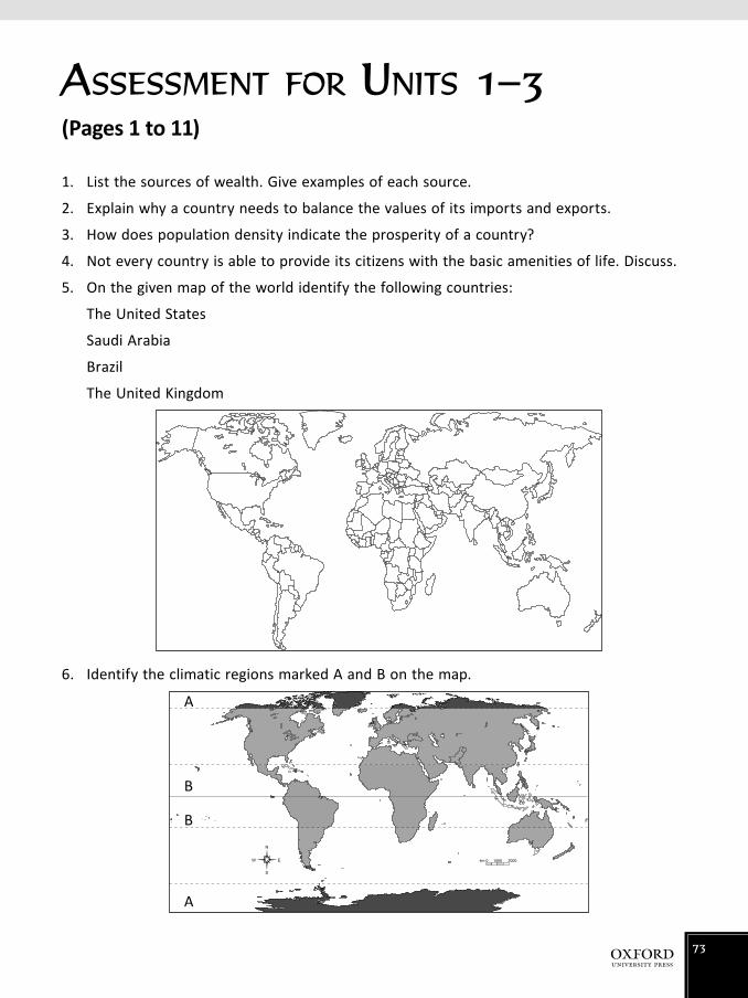
ASSESSMENT FOR UNITS 1–3(Pages 1 to 11)
1. List the sources of wealth. Give examples of each source.
2. Explain why a country needs to balance the values of its imports and exports.
3. How does population density indicate the prosperity of a country?
4. Not every country is able to provide its citizens with the basic amenities of life. Discuss.
5. On the given map of the world identify the following countries:
The United States
Saudi Arabia
Brazil
The United Kingdom
6. Identify the climatic regions marked A and B on the map.
1000 20000km
A
B
B
A
73

7. Fill in the following flowchart to show the problems faced by the developing countries of the world.
Poor, developing countries
Answers
1. Industries (cars, electronics, machines); Mining (coal, metals, oil); Agriculture—fruit, flowers, fibres (cotton, jute, wood, silk)
2. Just like families, countries also have to balance what they earn with their expenditure, for example if a country imports more than it exports then it has to borrow money which has to be paid back with interest.
3. Population density refers to the average number of people living on one square kilometre of land.
4. Underdeveloped countries do not have the funds to provide its citizens with the services, such as education, health, housing, sanitation—the situation is reversed with developed countries. So the availability of social services is the indication of the country’s wealth.
5. Please check if students have marked correctly.
6. A = polar; B = tropical
7. Foreign debt
Overpopulation
Illiteracy
Colonial legacy
74

ASSESSMENT FOR UNIT 4(Pages 12 to 9)
1. The pass that connects Pakistan with Afghanistan is the
a. Khunjerab Pass
b. Khyber Pass
c. Karakorum Pass
2. The most traditional route connecting Asia to the subcontinent was
a. the road from Gilgit to Kashi
b. the natural pass between the Karakorum mountains
c. the Khyber Pass
3. Compare the geographical features of India with those of China.
4. Describe the measures that have been taken by China to solve its problem of overpopulation.
5. Discuss the reasons that led to the economic turmoil in Afghanistan after 1979.
6. Assess how far industrialization in Iran has contributed towards its development.
75

7. Identify the picture shown below.
8. On the given map of the world identify the immediate neighbours of Pakistan marked A–D.
D
CBA
Answers
1. b. Khyber Pass
2. b. the natural pass between the Karakorum mountains
3. China: In SW high plateau—Tibet (4500 to 9000 m); NW of the country—desert, the famous Gobi and Takla Makan deserts; East—fertile areas; valley of Huang He and Yangtze River
India: North—the Himalayas; South—Deccan Plateau; South—Thal Desert; Rivers, Ganga and Brahmaputra—most of India has reasonably fertile land.
4. In 1970, the Chinese government ordered that no family could have more than one child. In case of violation strict punishment is imposed.
5. In 1979, when the Soviet Union invaded Afghanistan a long civil war started. This totally devastated the country. The infrastructure—roads, electricity, communications, etc. has not been developed. Afghanistan has the highest mortality rate in the world: 157 deaths per 1000 before the age of one year. It had extensive forests—deforestation for fuel his nomadic herds has taken place extensively. Mineral deposits have not been explored due to the political condition in the country. There are virtually no exports, except for that of illegal drugs of which Afghanistan is the second largest producer in the world.
6. Industrial activities like food processing, iron and steel, machinery and textiles and minerals are limited due to shortage of skilled workers. Carpets are a very valuable export and fetch very high prices. Industrial activities have not been able to bring much benefit towards economic prosperity.
7. Khyber Pass
8. Please check if the students have named then correctly.
76

ASSESSMENT FOR UNITS 5–7(Pages 21 to 36)
Choose the correct answer for each question.
1. One of the most common minerals mined in Malaysia is
a. oil b. gold c. tin
2. The capital of Malaysia is
a. Kuala Lampur b. Sarawak c. Rabat
3. Malaysia lies in the
a. Equatorial region b. Temperate region c. Polar region
4. The river that flows to the west of Malaysia is the
a. Rajang b. Kinabatangan c. Pahang
5. One of the more unusual features of the desert is
a. oases b. underground water sources c. temporary rivers
6. How has the oil-rich country, Saudi Arabia, utilized its resources?
7. Describe the lifestyle of the people of this desert region.
8. How does the standard of literacy in Saudi Arabia compare with that of Malaysia?
9. How has the climate facilitated the agricultural activities in Malaysia?
10. On the given map of Saudi Arabia identify the cities named as A–D.
A B
CD
77

11. Give details of the following features of Saudi Arabia’s climate:
a. temperature b. rainfall c. humidity
12. a. Identify the human activity that is taking place in the picture above.
b. Briefly describe the activity and assess how important it is for Malaysia.
13.
a. Describe the coastline features of Malaysia as shown in the picture above.
b. Explain how the tourist industry in Malaysia is flourishing.
78

Answers
1. c 2. a 3. a 4. c 5. b
6. It is an oil-rich country and has natural gas reserves. It generates large sums of money through export. It is able to produce cheap energy; it also produces fertilizers, plastics, steel from local iron ore. Gold, uranium, and copper have also been discovered here.
7. Its huge income from oil allows Saudi Arabia to have social services equal to and even better than the Western world. Education is free from primary to university level. The population is mostly made up of nomads, who are illiterate. The country has a generous welfare system.
8. Just like Saudi Arabia, education in Malaysia is free but not compulsory. However, the literary rate is higher in Malaysia as more of the population lives in the cities, while in Saudi Arabia the majority of the population is nomadic and illiterate.
9. Being located close to the equator, the climate is hot and wet. Monsoon winds bring rainfall—average rainfall is 2300—3300 mm a year; the temperature remains between 23° and 30°C. Humidity is high—the rainfall is highest in the world which encourages agricultural activities.
10. A. Madina B. Ryadh C. Makkah D. Jeddah
11. a. temperature 10-23°C in winter; 26-42°C in summer
b. rainfall 480 mm a year
c. humidity low, mostly dry
12. a. Rubber plantation
b. In the plantation, rubber sap is collected in these small containers as shown. Malaysia is the largest producer of rubber in the world which helps bring in foreign
exchange to the country.
13. a. There are wide coastal plains ranging from 16-64km in width; narrow swampy coastal plains which are heavily forested.
b. Many tourists from around the world come to the region to enjoy the beaches and the unique climate of this region.
79

ASSESSMENT FOR UNITS 8 AND 9(Pages 39 to 52)
1. Describe the peculiar features of the minaret of the Mosque of Hassan II in Morocco.
2. Name the two tribes that inhabit Morocco and describe the lifestyles adopted by these people.
3. Explain how its unique terrain and the historic locations have contributed to Morocco’s tourist industry.
4. List the factors that hinder Nigeria from becoming the wealthiest country on the African continent.
5. The major source of fish in Morocco is and , where and fish are caught.
6. The major cities of Nigeria are , , and .
Select the correct answers for questions 7 – 11.
7. The largest and most important city in Nigeria is
a. Kano b. Abuja c. Lagos
8. The religion most commonly followed in Nigeria is
a. Islam
b. Christianity
c. Buddhism
9. The savannahs of Africa consist of
a. mangroves, swamps and forests
b. rocky plateaus
c. natural grass and shrubland
10. The main food eaten by the people of Nigeria is
a. yams b. wheat c. meat
11. Most of Nigeria’s electricity is generated from
a. the river Niger
b. gas
c. coal
80

12. a. Identify the mosque shown in the picture above.
b. Explain the significance of its construction.
Answers
1. It is 200 m tall, at the top is a laser which sends a beam towards Makkah; floor is made of glass so that worshippers can see the ocean below. The sky becomes visible when the roof slides open.
2. Arabs and Berbers: Berbers are usually small farmers who earn a rather poor living—they grow crops on tiny patches.
3. Morrocco has two great mountain ranges—the Rif and the Atlas. It also has many fast flowing rivers. The beautiful terrain makes it a very popular destination for tourists. The cities of Casablanca, Rabat, Fes, and Marrakech have immense historic value.
4. Nigeria has a low GDP because of constant political upheaval, intertribal warfare, and one of the very high rates of population increase in the world. So the increased output cannot keep pace with the increasing population.
5. Mediterranean Sea; Atlantic Ocean; tuna, mackerel, or anchovies; shellfish
6. Lagos; Ibadan, Kano
7. c 8. a 9. c 10. a 11. b
12. a. Mosque of Hassan II
b. It is the third largest mosque in the world. It is built on land reclaimed from the sea. The minerat is the tallest in the world. The glass floor makes the ocean visible. The
sliding roof makes the sky visible.
81

ASSESSMENT FOR UNITS 10 AND 11(Pages 54 to 67)
1. Describe the topography of Anatolia and explain its historical significance.
2. Explain how Turkey is making itself prominent in world politics.
3. What types of economic activity are practised by the people of Turkey?
4. In which types of occupation are the majority of the people of Uzbekistan engaged?
Select the correct answers for questions 5–7
5. The capital city of Uzbekistan is
a. Samarkand
b. Tashkent
c. Qyzylum
6. The two major rivers of Uzbekistan are
a. the Syr Dary’ya and the Amu Darya
b. the Tigris and the Euphrates
c. the Anatolia and the Nile
7. The important mining in Uzbekistan is for
a. oil and natural gas
b. coal
c. gold
8. a. Identify the monument shown in the illustration.
b. What does the monument signify?
82

9. Compare the climate of Turkey with that of Uzbekistan.
Climatic feature
Turkey Uzbekistan
Temperature
10. Refer to the photograph above to describe the types of house found in rural Uzbekistan.
Answers
1. Anatolia has two ranges of young mountains—Taurus and Pontic. They run in an east-west direction, with very narrow but fertile coastal plains alongside them. In the centre is the relatively dry Anatolian Plateau where the capital Ankara is located. It was part of the ancient Fertile Crescent, 6000 years ago.
2. Turkey is key in establishing links between the Islamic world and the west. It is already a member of NATO. It was also a member of the UN Security Council until 2010 and is about to join the European Union.
3. Farming—crops such as wheat, barley, maize, sugar beet, tobacco, tea, cotton, and potatoes are grown; Fruit farming—apples, grapes, oranges, apricot, hazel nuts, tomatoes are grown; Fishing—fish such as anchovies; Mining—minerals such as coal, oil, natural gas, chromium, iron, lead, and zinc, etc.; Industrial activities; Merchants and traders.
4. Most people are farmers. Uzbekistan is the greatest cotton growing state in the former Soviet Union. Wheat, barley, rice, vegetables, and fruits are grown as well as trees for silk production. Though industry and mining sectors exist, they are not fully developed.
83

5. b 6. a 7. c
8. a. A monument built to Kemal Ataturk
b. It signifies Ataturk’s efforts to educate the people by travelling from village to village helping adults to learn how to read and write.
9. Climatic feature
Turkey Uzbekistan
-4 to 4°C (winters) Temperature 2 to 3°C (winters)
18 to 28°C (summers) 26 to 32°C (summers)
10. Houses made of clay. Very basic; without any modern amenities
84

ASSESSMENT FOR UNITS 12 AND 13(Pages 71 to 87)
Select the correct answers for questions 1–8.
1. The function of the buttress roots in a rainforest is to
a. support the height and weight of the tree
b. provide oxygen for the tree
c. tap underground nutrients for the tree
d. produce alcohol from the tree to power cars
2. The second largest city in Brazil is
a. Mato Grasso
b. Brasilia
c. Rio de Janeiro
3. Vietnam is endowed with the richness of fertile soil through
a. its 2300 rivers
b. its extensive coastal plain
c. its ranges of low mountains to the west
4. The climate of Vietnam is
a. Mediterranean
b. temperate
c. Equatorial
5. An ideal source of energy for Vietnam would be
a. hydroelectricity
b. fossil fuels
c. solar panels
6. Mato Grasso is
a. one of the mountain ranges in Brazil
b. an area of tough grass and hardy shrubs
c. a fertile region with extensive farming activities
85

7. Brazil is the world’s second largest producer of
a. iron ore
b. tin
c. coal
8. In Brazil vehicles use energy from
a. hydroelectric power
b. biofuel
c. thermal power
9. Name some trees which grow is the Vietnam forest. What is the timber used for?
10. Describe the geographical features of Brazil and Vietnam.
11. Explain why the forest cover in Brazil is under serious threat.
12. Suggest steps that can be taken by the government of Vietnam to bring itself into the pack of developed countries of the world.
13. How significant are the rainforests for the environment?
14. List the minerals found in Brazil.
15. Explain how the landscape of Vietnam has influenced the settlement of its people.
16. List the economic activities of the people of Vietnam.
86

17. a. Identify the waterfall in Brazil shown in the picture above.
b. Describe the significance of this feature.
Answers
1. a 2. c 3. a 4. c
5. a 6. b 7. a 8. b
9. Rubber, teak, and bamboo. These are used as building material and in paper making.
10. Vietnam: a narrow coastal plain and some higher land called the Central Highlands. The mountains are not very tall. It has 2300 rivers. 1600 of these flow into the sea. Mekong, originating in Tibet, is the eleventh longest river in the world. It is surrounded by alluvial plains.
Brazil: Amazon forest covers 40% of the country; Brazilian highlands rise up to (1000 m to 2700 m); the Amazon river is the second longest in the world.
11. The forest cover in Brazil is under serious threat because of logging, for building roads, and mining which provides minerals which are important; and forest fires when the dry leaves on the forest floor catch fire.
12. It needs to control its population which is already 89 million. Establish more industries so that it can utilize its resources more effectively.
13. They provide half the oxygen to the world, are home to a wide variety of animals; largest variety of plants exist here.
14. Iron-ore, bauxite, tine, coal, phosphate, manganese, chromium, nickel, potassium, zinc, gold, natural gas
87

15. Mekong and Red rivers and their tributaries are surrounded by rich alluvial plain. Due to this, there are floating fish farms. 69% of the people grow vegetables, fruit, coffee, tea, and rubber.
16. Farming, fishing, forestry, mining, trading, and tourism
17. a. Iguacu Fall
b. This fall is in the shape of a horseshoe about 2.7 km across. It is three times the size of Niagara Falls.
88

ASSESSMENT FOR UNITS 14 AND 15(Pages 89 to 105)
1. a. List two important cities of China.
b. What is the significance of each of the cities you have mentioned above?
2. Compare life in modern China with that in the traditional villages.
3. Identify this significant landmark of China.
4. Refer to the illustration below to describe the general topography of South Africa.
Select the correct answers for questions 5–7
5. The oil reserves in China are claimed to be the
a. largest in the world
b. 2nd largest in the world
c. depleting
6. The capital of South Africa is
a. Pretoria
b. Johannesburg
c. Durban
89

7. The major pass that connects the mountains to the forest in South Africa is the
a. Zulu
b. Magoebaskloof
c. Namaqualand
8. Discuss the natural hazard that leads to major calamities in China.
9. Describe the diversity of the climate that prevails in China.
10. Explain the factors that enable China to be engaged in extensive agricultural activity.
11. How far do you agree that Pakistan’s markets are overwhelmed by Chinese goods? Give reasons to justify your point of view.
12. When did apartheid begin in South Africa and how did it end?
13. Fill in the blanks.
a. The climate in South Africa is the .
b. The longest river in South Africa is the .
c. The most famous park in South Africa, with 500 species of birds and 140 different animals, is .
14. Choose the correct answers.
a. The Great Wall of China is famous because it
i) was built 200 years ago
ii) is visible from the Moon
iii) was used to protect China from invaders
b. The Big Hole in Kimberley is known because it is
i) an enormous reserve of diamonds
ii) an industrial region
iii) a provider of employment to a large number of workers
c. South Africa is known as the ‘Rainbow Nation’ because
i) it is made up of people from different racial groups
ii) it has beautiful with exotic climatic conditions
iii) rare minerals are extracted there
90
Answers
1. a. Beijing and Shanghai
b. Beijing is the capital city of China. Shanghai is an important port city.
2. At present half the workforce works in agriculture and lives in villages and has a simple lifestyle. Modern China has a fast pace of modernization where high-tech way of life is the norm.
3. The Great Wall of China
4. A fairly dry plateau. Land is suitable for agriculture and grazing animals. Fold mountains in the distance.
5. b 6. a 7. b
8. River Yangtze is liable to change its course leading to floods; earthquakes as fault lines pass through the country.
9. South is mild with 300 frost free days a year; north—frost for five months; south west temperature is below freezing for 10 months of the year; east—rainfall is moderate, 700 to 2000 mm per year; further West it gets drier—no significant rain in desert regions
10. River basins such as Huang He, Yangtze, and Xi Jiang are fertile. Irrigation facilities are the largest in the world.
11. Most students should agree with this statement, reason being that they are cheaper than goods from the rest of the world.
12. 1948—the beginning of apartheid when a harsh dictator won the elections and the coloured people were treated very badly—they were treated as third grade citizens. Nelson Mandela, a lawyer, struggled for better treatment but was put into prison on charges of treason. Change finally came in 1990 when F.W. de Klerk was elected and finally by 1994 the coloured majority could be part of the government.
13. a. subtropical b. Orange River c. Kruger
14. a. ii) b. i) c. i)
91

ASSESSMENT FOR UNITS 16 AND 17(Pages 107 to 126)
D
A
C B
1. Identify the countries marked A–D on the map of the United Kingdom.
2. Refer to the picture above to identify the peculiar features of the English countryside.
92

3. List the economic activities of the people in the UK.
Economic activities
4. a. Identify the man-made feature shown above.
b. Explain the significance of this feature.
5. What are the reasons for the historic British supremacy over the seas?
6. Discuss the changes that lead to the Industrial Revolution in Britain.
7. Describe the measures taken by Britain to enhance its energy resources.
8. Describe the life of a young person in Britain.
9. Compare the lifestyle of the people of the USA with that of the people of Pakistan.
93

10. Fill in the blanks.
a. The mountain range that rises to an altitude of 6200 m in the USA is the .
b. The largest river in the USA, which flows into the Pacific Ocean is .
11. Select the correct answers.
a. USA is said to be the ‘melting pot’ of people because of
i) its existing climatic conditions
ii) the variety of people who live here
iii) its rugged terrain
b. An area in USA which is the heart of administrative, commercial, and financial activities of the country is
i) Chicago
ii) Megalopolis
iii) New York
Answers
1. Northern Ireland, Scotland, England, Wales
2. Lush green fields, thick vegetation cover, scattered country houses
3. Agriculture, forestry, fishing, mining, trade, industry
4. a. Golden Gate bridge
b. It is the longest suspension bridge in the world.
5. No place in the UK is more than 100 km from the sea. It has excellent deep water ports, it has estuaries and deep inlets round the coast.
6. Industrial revolution started with a huge boom in textile industry especially in cotton and wool; then heavy industries such as railway, etc. started; ship building also flourished.
7. Great Britain is exploring unconventional ways of electricity production to enhance its enegery resources, eg. wind turbines, solar panels, burning methane gas from waste, and small tidal schemes.
8. Laws strongly protect the interest of the young citizens; they are not allowed to work until they are at least 13. Then too they can only work for two hours a day. Education is free and compulsory. British youngsters do not usually have healthy eating habits.
9. People in the USA are more independent and have more laws to provide them protection against any abuse. Education and health facilities are also much better.
10. a. Rockies b. Columbia River
11. a. ii) b. ii)
94