Final Report on a 16 Helicopter-borne Geophysical Survey ...
186
GM 63514 FINAL REPORT ON A HELICOPTER-BORNE GEOPHYSICAL SURVEY
-
Upload
khangminh22 -
Category
Documents
-
view
0 -
download
0
Transcript of Final Report on a 16 Helicopter-borne Geophysical Survey ...

GM 63514FINAL REPORT ON A HELICOPTER-BORNE GEOPHYSICAL SURVEY

Final Report on a 16 Helicopter-borne Geophysical Survey
Quebec, Canada 4. \
For
Central Uranium Corp. / Azimut Exploration Inc.
1 10 De La Barre Street, Suite 214 Longueuil, Quebec Canada, J4K 1A3
Ressources naturelles et Faune, Ou ,bec
07 MAI 2008 By GM 6351 4 Service de la Géoinformatiai
McPhar Geosurveys Ltd. 500 Cochrane Drive, Unit A
Markham, Ontario Canada, L3R 8E2
REç MA R
1p~~
February, 2008
McPhar # 0720
1-1

1. 2. 3.
SURVEY SURVEY
TABLE OF CONTENTS Pane #
INTRODUCTION AREA OPERATIONS
7 8
12
3.1 Operations Base 12 3.2 Magnetic Base Station 12
3.3 Survey Conditions 12
3.4 Navigation 12
3.5 Survey Specifications 13 3.5.1 Survey Line Specifications 13 3.5.2 Flight Specifications 14 3.5.3 Magnetic Diurnal Variations 14
3.5.4 Aircraft Speed 14
3.5.5 Terrain Clearance 14
3.5.6 Data Recording 15
3.6 Field Processing & Quality Control 15
3.7 Survey Statistics and Project Diary 16
4. HELICOPTER AND EQUIPMENT 18
4.1 The Helicopter 18
4.2 The Survey Instrumentation 19 4.2.1 THEM Survey System Overview 19
4.2.2 Airborne Magnetometer 21
4.2.3 Gamma-ray Spectrometer System 21
4.2.4 Altimeter 22
4.2.5 The GPS/Omnistar Navigation System 22 4.2.6 Data Acquisition/Recording System 23 4.2.7 Ground Data Acquisition System / Base Station Magnetometer 23
4.2.8 Field Computer Workstation 24
4.2.9 Spares 24
5. INSTRUMENT CHECKS AND CALIBRATIONS 25
5.1 Airborne Magnetometer and THEM System Tests and Calibrations 25
5.1.1 Magnetic Heading Effect 25
5.1.2 Lag Tests 25
5.1.3 EM System 25
5.1.4 Other Daily Checks 25
5.2 Airborne Gamma-ray Spectrometer System Tests and Calibrations 26
5.2.1 Test Line 26
5.2.2 Altitude Attenuation Coefficients 26
5.2.3 Cosmic Window Calibrations 26
5.2.4 Spectrometer Calibration on Transportable Pad — Stripping Ratios 26
5.3 Altimeter Calibration Test 26
6. DATA QUALITY CONTROL AND PROCESSING 27 6.1 Data Management 27
6.2 Field Data Quality Control and Field Pre-Processing 30
6.3 Flight Path Compilation 33
Final Report on a Helicopter-borne Geophysical Survey, Quebec, Canada McPhar 0720 Page 2

6.4 Base Station Magnetic Data 33
6.5 Radar Altimeter Data and Digital Terrain Model 34
6.6 Magnetic Data Processing 34 6.6.1 Processing of Static Magnetic Data Acquired on Magnetic Base Station 34 6.6.2 Filtering 34 6.6.3 Corrections to the Magnetic Data 35 6.6.4 Advanced Levelling of Magnetic Data — Micro-levelling 35 6.6.5 IGRF Correction 35 6.6.6 Gridding 35 6.6.7 Magnetic Derivatives 35
6.7 Electromagnetic Data Processing 37 6.7.1 Data Pre-Processing and Window Extraction 38 6.7.2 Correction to the Electromagnetic Data 38 6.7.3 Additional Corrections Applied to Profile Data 39
6.8 Corrections to Radiometric Data 39 6.8.1 Background to Corrections and Processing 39 6.8.2 Processing Applied Using GEOSOFT Radiometric Processing System 41
7. INTERPRETATION 45
7.1 Introduction 45 7.1.1 Geology 45 7.1.2 Electromagnetic Survey 46 7.1.3 Magnetic survey 46 7.1.4 Radiometric Survey 47
7.2 Interpretation of Individual Blocks 48 7.2.1 Block A 48 7.2.2 Block B 49 7.2.3 Block CF North 50 7.2.4 Block CF South 52 7.2.5 Block D 53 7.2.6 Block E 54 7.2.7 Block G 55 7.2.8 Block H 57 7.2.9 Block I 58 7.2.10 Block J 59 7.2.11 Block K 60
7.3 Reference 61 8. DELIVERABLE PRODUCTS 62
8.1 Maps 62 8.2 Digital Data 62 8.3 Report 63
Final Report on a Helicopter-borne Geophysical Survey, Quebec, Canada McPhar 0720 Page 3

LIST of FIGURES
Figure 1: Location of the survey areas 8 Figure 2: Typical Survey Terrain 11 Figure 3: Survey Helicopter AS-350BA 18 Figure 4: THEM System configuration. 20 Figure 5: Geometrics G-822A Airborne Cesium Magnetometer Sensor 21 Figure 6: The base station GEM GSM-19 Magnetometer and Data Logger 23 Figure 7: Data Processing Flow Chart. 28 Figure 8: Data Processing and Data Loading Flow Chart 29 Figure 9: Data Processing and Data Loading Flow Chart (magnetic data) 31 Figure 10: Data Processing and Data Loading Flow Chart (radiometric data) 32
LIST of TABLES
Table 1: Boundary Coordinates of South Bienville Area in NAD83, UTM Zone 18N/ UTM Zone 19N 9
Table 2: Description of Survey Block 13 Table 3: Survey Sampling Rates 15 Table 4: Survey Scan Rates 15 Table 5: Project Diary 16 Table 6: Field Personnel 17 Table 7: Standard Gamma-ray Spectrometer Data Acquisition Windows 22 Table 8: Statistics of Magnetic Data. 46 Table 9: Statistics of Uranium Data 47 Table 10: List of Block A high uranium areas. 49 Table 11: List of Block B high uranium areas. 50 Table 12: List of Block CF North high Uranium Areas. 51 Table 13: List of Block CF South high uranium areas 53 Table 14: List of Block E high uranium areas. 55 Table 15: List of Block G high uranium areas. 56 Table 16: List of Block H high uranium areas. 57 Table 17: List of Block I high uranium areas. 58 Table 18: List of Block J high uranium areas. 59 Table 19: List of Block K high uranium areas. 61
Final Report on aHelicopter--home Geophysical Survey, Quebec, Canada McPhar 0720 Page 4

APPENDICES
APPENDIX 1 System Tests and Reports
• Radar Altimeter Test • Magnetic Base Station Form • Time Windows Channel Setting • Cosmic and Aircraft Background Test • Altitude Attenuation Test • Anomaly Reports • Weekly Reports
APPENDIX 2 Equipment Documentation
• Eurocopter AS350B2 A-STAR Helicopter • THEM Digital Time-Domain Electromagnetic System • NovAtel Pro Pak V3 Generic DGPS System • Terra TRA-3000/TRI-30 Radar Altimeter • Geometrics G-822A Airborne Cesium Magnetometer • Omnistar 3000 LR GPS Receiver • GEM Systems GSM-19 Overhauser Magnetometer • Field Data Processing Workstations • Geosoft Montaj Processing Software
APPENDIX 3 Personnel Resumes
• Dr. Tomas Grand • Jean M. Hubert • Dallas Antill • Dr. Slavomir Daniel • Asif M. Mirza • Liz Johnson
APPENDIX 4 Digital Data Specifications
Final Report on a Helicopter-borne Geophysical Survey, Quebec, Canada
McPhar 0720 Page 5

APPENDIX 5 Page Size Maps
• Flight Path with Topography • Digital Terrain Model (DTM) • Total Magnetic Field (IGRF Corrected) • Reduction to the Magnetic Pole of the TMF (IGRF Corrected) • Calculated First Vertical Derivative of the TMF (IGRF Corrected) • Calculated Second Vertical Derivative of the TMF (IGRF Corrected) • Analytic Signal of the TMF (IGRF Corrected) • Horizontal gradient of the RTP TMF (IGRF Corrected) • EM Anomaly Map — dB/dt Z-channel — Window No. 15 • Radiometric Map (Total Count in cps) • Radiometric Map (Potassium in cps) • Radiometric Map (Thorium in cps) • Radiometric Map (Uranium in cps) • Radiometric Map (Potassium/Thorium) • Radiometric Map (Uranium/Potassium) • Radiometric Map (Uranium/Thorium) • Radiometric Ternary Map • Geophysical Interpretation Map
Final Report on a Helicopter-borne Geophysical Survey, Quebec, Canada McPhar 0720 Page 6

1. INTRODUCTION
A detailed high-resolution helicopter-borne spectrometer, magnetic and time domain electromagnetic survey was carried out during the period of 10 July 2007 to 11 September 2007 on behalf of Central Uranium Corporation hereinafter referred to as "CUC", by McPhar Geosurveys Ltd, hereinafter referred to as "McPhar", over the survey blocks situated in the surrounding area of South Bienville in Quebec.
The purpose of the survey was to acquire high-resolution geophysical data to map the geophysical characteristics of the geology and structure in an effort to provide an insight into geologic and geophysical settings conducive to economic (U) mineralization.
The survey area consisted of twelve blocks. Ten out of twelve blocks were completed. Two blocks were not surveyed due to the weather conditions. The survey areas were flown over ten blocks with a nominal mean helicopter terrain clearance of 85 metres on both flight lines and tie lines. Flight line spacing was approximately 200 metres and tie lines at a spacing of approximately 2000 metres. A total of 5398 line-kilometres of data were acquired, covering an area of approximately 952 square kilometres.
The THEMgeophysical system was mounted on Eurocopters AS-350BA (with registrations C-FLOO & C- FPHY) and AS-350132 (with registration C-GAWV) supplied by Helicraft 2000 Inc., St. Hubert, Quebec.
The data acquisition involved the use of precision real-time differential GPS positioning, a high sensitivity magnetometer and spectrometer system incorporated into the THEM helicopter electromagnetic time domain system towed beneath a helicopter.
Mobilization of the helicopter, equipment and personnel from Toronto to Lac Pau area was completed on 09 July 2007. Several fuel caches were established near the survey project areas and production flights commenced on 17 July 2007. Installation of the survey equipment into the helicopter and pre-survey test and calibration flights were completed on 15 July 2007. On 12 August 2007 the THEM sensor weak link support cable broke and sections of the transmitter loop were damaged. Personnel and equipment were demobilized to Ontario for repair. Re-mobilization of equipment and personnel from Ontario back to Lac Pau Air Saguenay camp was completed on 30 August 2007. The final production flight was completed on 11 September 2007.
Final data processing, map compilation and report preparation was completed by McPhar at its Markham, Ontario office.
Final Report on a Helicopter-borne Geophysical Survey, Quebec, Canada
McPhar 072D Page 7

74.0`N 72'17W
70N
0 ^ 2~ 24E
34A
A BLOCK 107.7 km2
!BLOCK I 57 km2
SOUTH BIENVILLE H BLOCK ' 31.06 km2 r 17
D BLOCK 29.37 km2
24D r_, J BLodc 21.03 kJ112
K BLOCK 25.53 km2
CF BLOCK 310.46 km
GBLOCK 26.73 6.731un2
B BLOCK 23 169.88 km2
E BLOCK 171.8 km2
CENTRAL URANIUM CORP.
Airborne Survey Areas Central Minto &
South Bienville, Quebec
LOCATION MAP
C 25 50 75
km ti.er.t_. 4u+3
ô x
33P
34G 34H
24C
23N
i
A BLOCK 516.56 km2
CENTRAL MINTOT
B BLOCK, 18 74 km'
34B
Î'Tâ".~ ~
2. SURVEY AREA
The survey consisted of twelve blocks located in the surrounding area of South Bienville and Central Minto in Quebec (Figure1). Topography of the survey area was variable, from flat to rolling wooded hills. Elevation ranged from approximately 200 metres to 2200 metres above sea level.
The survey block was identified by CUC as South Bienville and Central Minto areas.
Figure 1: Location of the survey areas
The survey block corner coordinates were provided by CUC in NAD83, UTM Zone 18/19N Basting and northing. The following tables contain the survey block corner coordinates of South Bienville Area.
Final Report on a Helicopter-borne Geophysical Survey, Quebec, Canada McPhar 0720 Page 8

McPHAR ~
Table I: Boundary Coordinates of South Bienville Area in NAD83, UTM Zone 18N/ UTM Zone 19N
1 677371 6218033 2 675827 6218009 3 675466 6227347 4 680129 6227501 5 679992 6230218 6 686715 6230506 7 687139 6221289 8 683991 6221153 9 684031 6220208
10 681963 6220080 11 682000 6219214 12 677332 6218979
lo~ck:_.~..4-,~~oüt~i Bienv. e, `;, one 19N
• UT
1 321297 6185685 2 321541 6192146 3 324687 6191978 4 324591 6190167 5 331908 6189838 6 331670 6184284 7 332224 6184223 8 332167 6183318 9 334789 6183257
10 334753 6182311 11 339996 6182115 12 339894 6179357 13 339337 6179338 14 339122 6172916 15 333355 6173093 16 333440 6175891 17 329815 6176070 18 329884 6177843 19 328308 6177984 20 328474 6181607 21 324253 6181815 22 324386 6184533 23 322322 6184656 24 322363 6185641 25 321275 6185686
1 336281 6195201 2 336308 6197094 3 333784 6197190 4 333893 6200027 5 330221 6200169 6 330394 6205686 7 328361 6205767 8 328396 6206633 9 327869 6206733
10 327938 6209571 11 338398 6209087 12 338431 6209954 13 341038 6209936 14 341108 6211827 15 345738 6211579 16 345574 6207009 17 340936 6207178 18 340902 6206232 19 337232 6206290 20 337136 6202586 21 340234 6202549 22 340241 6201523 23 341214 6201487 24 341147 6199675 25 342740 6199617 26 342708 6198750 27 344786 6198596 28 344765 6196782 29 350964 6196564 30 350866 6193727 31 353480 6193638 32 353200 6185365 33 346408 6185600 34 346506 6188357 35 345974 6188376 36 345963 6189323 37 343390 6189416 38 343383 6190441 39 340808 6190456 40 340739 6188565 41 336036 6188741 42 336108 6190632 43 332472 6190771 44 332611 6195500 45 336243 6195361
Final Report on a Helicopter-borne Geophysical Survey, Quebec, Canada McPhar 0720 Page 9

1 673598 6142741 2 673379 6148295 3 678665 6148467 4 678867 6142951
673638 673468 681861 681994
6181740 6185443 6185747 6182043
1 2 3
Blcok E -1-outh B TM Alb 19N' ,.
McPHAR ~
1 340994 6152383 2 340913 6149546 3 343019 6149510 4 342854 6144900 5 339696 6145054 6 339728 6145920 7 338653 6145960 8 338642 6145053 9 337566 6145092
10 337463 6142295 11 334302 6142413 12 334092 6136819 13 329873 6137019 14 329908 6137925 15 324097 6138192 16 324341 6143746 17 324857 6143725 18 324915 6144630 19 325408 6144611 20 325542 6147407 21 326573 6147406 22 326630 6148271 23 328196 6148170 24 328269 6150061 25 329836 6150000 26 329967 6152796
1 343340 6173653 2 343507 6178302 3 349266 6178099 4 349127 6173449
1 2 3 4 5
686037 685817 692012 692095 693131 693299
6210063 6215658 6215930 6214079 6214125 6210383
1 331206 6225183 2 331270 6227942 3 334432 6227740 4 334362 6225928 5 336385 6225850 6 336299 6221277 7 332597 6221341 8 332789 6225121
1 340614 6212792 2 340827 6217360 3 343380 6217187 4 343415 6218133 5 345976 6218198 6 345850 6213469 7 344839 6213584
344757 6212561
Final Report on a Helicopter-borne Geophysical Survey, Quebec, Canada McPhar 0720 Page 10

Figure 2: Typical Survey Terrain
Final Report on a Helicopter-borne Geophysical Survey, Quebec, Canada McPhar 0720 Page 11

3. SURVEY OPERATIONS
3.1 Operations Base
Survey operations were based out of two different camps. Operations were controlled from Explo-Sylva Outfitter camp from mobilization until 12 August 2007 when system required repairs in Ontario. On the second remobilization to Lac Pau survey operations were controlled from Air Saguenay Camp from 30 August 2007 until the final survey flight on 11 September 2007. Permission was obtained to park and operate the helicopter, and to locate and operate the ground magnetometer base station from the camps. Several fuel caches were also established near the survey areas to cut down ferry time during survey operations. The THEM system remained in the survey area after each flight, again to reduce helicopter ferry times.
Quality Control and preliminary data processing was undertaken by the crew at both the Explo-Sylva and Air Saguenay Outfitter Camps in Quebec, and by the McPhar senior geophysicist/quality control supervisor at McPhar's Markham, Ontario office.
3.2 Magnetic Base Station
To monitor and record diurnal variations of the earth's magnetic field, a GSM-19 Overhauser magnetometer base station was utilized. It was set up at base of operations. Every effort was made to ensure that the magnetometer sensor was placed in a location with a low magnetic gradient, away from power lines and moving metallic objects, such as motor vehicles and aircraft, without compromising safety and local activity.
The total magnetic field recorded at the base station was averaged from all measurements acquired during the survey. The average total magnetic intensity was determined to be 57,471 nanoTesla. (nT)
3.3 Survey Conditions
Weather conditions during the survey were variable. Temperatures ranged from 3°C to 25 °C, with most days being partly cloudy to overcast. Fog, rain, mist, and high winds delayed some flights. No survey was possible on a total of twenty three days, due to the weather conditions.
Sunspot activity, and hence diurnal geomagnetic activity, was general quiet during the entire data acquisition period. Four lines of data were lost due to the geomagnetic activity being out of contract specification. They were reflown at a later date.
3.4 Navigation
Navigation was assisted by an OmniStar 3000 LRS real-time GPS receiver system that reports GPS co-ordinates as WGS-84 latitude & longitude and directs the pilot over the pre-programmed two-dimensional (2-D) survey grid. The x-y position of the helicopter as reported by the GPS system is recorded together with the terrain clearance, as reported by the radar altimeter.
Final Report on a Helicopter-borne Geophysical Survey, Quebec, Canada McPhar 0720 Page 12

McPHAR ~
3.5 Survey Specifications
3.5.1 Survey Line Specifications
Table 2: Description of Survey Block
ARE1111 A AME
ii APPROX AREA
108
LINE R.L. SPACING
200 m x 2,000 m
TFLIGHT FLIGHT
LINE-KM
540
TIE LINE-KM
58
TOTAL LINE-KM
598
PRIMARY
DIRECTION
358° 188°
A Block South Bienville
B Block South Bienville
170
200 m x 2,000 m
849 86 935 02°192°
CF Block South
Bienville 311
200 m x 2,000 m
1670 169 1839 02° / 92°
D Block South Bienville 29
200 m x 2,000 m
145 16 161 358° / 88°
E Block South Bienville
187
200 m x 2,000 m
950 97 1047 2°192°
G Block South Bienville 27
200 m x 2,000 m
135 17 152 2°192°
H Block South Bienville 31
200 m x 2,000 m
156 17 173 178° / 88°
I Block South Bienville 39
200 m x 2,000 m
192 21 213 177° / 87°
J Block South Bienville 24
200 m x 2,000 m
121 16 137 02°1 92°
K Block South Bienville 26
200 m x 2,000 m
128 15 143 03° / 93°
Totals 952 4,886 512 5,398
Final Report on a Helicopter-borne Geophysical Survey, Quebec, Canada McPhar 0720 Page 13

3.5.2 Flight Specifications
The following technical flight specifications were adhered to:
a) Traverse Lines - maximum deviation from the nominal traverse line location should not exceed 25 metres over a distance greater than 2 km, except where safety requirements take precedence.
b) Tie Lines - maximum deviation from the nominal control line location should not exceed 25 metres over a distance greater than 2 km, except where safety requirements take precedence.
c) Survey Altitude — survey helicopter altitude should be 280 feet above ground level (AGL). The altitude tolerance will be limited to ±15 feet, except in areas where government regulations prevent flying at this height, and in areas of severe topography where the pilot's judgement will prevail.
d) Aircraft Speed - nominal helicopter speed will be approximately 90 to 120 kph; therefore, aircraft speed tolerance will be limited to ±10.0 %, except in areas of extreme topography.
e) Airborne data is not acceptable when gathered during magnetic storms or short term disturbance of magnetic activity at the ground base station that exceeds parameters as specified in section 3.5.3 below.
3.5.3 Magnetic Diurnal Variations
The following technical specifications for magnetic diurnal were adhered to:
a) Flight lines, or portions thereof, should be reflown if the magnetic diurnal exceeds a maximum deviation of 25 nT peak-to-peak over a straight-line chord over 5 minutes.
b) Survey flying will be suspended in the case of severe magnetic diurnal activity.
3.5.4 Aircraft Speed
Normal helicopter speed was proposed as approximately 90 to 120 kph, ±10%. The pilot made every sensible effort to keep an accurate airspeed, however, it was accepted that aircraft speed varied, based on the pilot's judgment of safe flying conditions around man-made structures, over rugged terrain, or where prohibited by Canadian DOT regulations. An average helicopter speed of 105 kmph was achieved during the survey.
3.5.5 Terrain Clearance
Following nominal terrain clearances for the helicopter and instrumentation during normal survey flying are:
Nominal Achieved average
Helicopter - 85 metres 110 metres Magnetometer 57 metres 82 metres TDEM Transmitter 31 metres 56 metres TDEM Receivers - 60 metres 82 meters Gamma-ray Spectrometer 31 metres 56 metres
Final Report on a Helicopter-borne Geophysical Survey, Quebec, Canada McPhar 0720 Page 14

McPHAR ~
The pilot made every sensible effort to maintain accurate terrain clearances, however, it was accepted that terrain clearance may vary, based on the pilot's judgment of safe flying conditions around man-made structures, over rugged terrain, or where prohibited by Canadian DOT regulations. An average helicopter terrain clearance of 110 metres was achieved over the survey blocks.
3.5.6 Data Recording
The following parameters were recorded during the survey:
Table 3: Survey Sampling Rates
SURVEY PARAMETER PROJECTE DSAMPLIN G RATES
ACHIEVED SAMPLING
RATES
Airborne GPS positional data (Longitude, Latitude, height, time) 1 sec 1 sec
Terrain clearance provided by radar altimeter 0.1 sec 0.1 sec
Airborne Total Magnetic Field 0.1 sec 0.1 sec
Electromagnetic Data 0.1 sec 0.1 sec
Gamma ray Spectrometry Data I sec 1 sec
Ground based Total Magnetic Field — GEM system 1 sec 1 sec
Considering the projected nominal and actual average helicopter speed, the following scan rates were achieved:
Table 4: Survey Scan Rates
SURVEY PARAMETER PROJECTED SCAN RATE
ACHIEVED SCAN RATE
Airborne GPS positional data (Longitude, Latitude, height, time) 30 m 29 m
Terrain clearance provided by radar altimeter 3 ni 2.9 m
THEM TDEM Sensor
Gamma ray Spectrometer data 30 ni 29 m
Airborne Total Magnetic Field 3 m 2.9 m
3.6 Field Processing & Quality Control
The survey data was transferred to portable magnetic media on a flight-by-flight basis, and then copied to the field data processing workstation. In-field data processing included: reduction of the data to Geosoft's GDB database format and inspection of all data for adherence to contract specifications.
Final Report on a Helicopter-borne Geophysical Survey, Quebec, Canada McPhar 0720 Page 15

3.7 Survey Statistics and Project Diary
The survey entailed a total of 117 flights; of which 46 flights were production flights. The first production flight was Flt #10 on 17 July 2007, with the last production flight, Flt #117 on 11 September 2007. The remaining flights were either test and/or calibration flights/fuel cache/ferry or flights that were aborted due to aircraft or equipment problems.
Table 5: Project Diary
9 July Crew mobilized by road/air to Lac Pau - Installation of equipment in helicopter
10 July Equipment assembled 11 July 1 2.5 Fuel caches established 12 July 2,3 1 Equipment tested - abort due to
weather 13 July Poor weather - no survey flights 14 July 4 4.1 Poor weather - no survey flights -
more fuel caches established 15 July 5,6,7,8 2.2 Test and calibration flight 16 July Poor weather - no survey flights 17 July 9,10,1 1,12 5.6 177.6 Two production flights 18 July 13,14,15,16 5.1 119.7 One production flight and fuel cache
flights 19 July 17,18,19,20 5.6 284.2 Two production flights 20 July 21,22,23,24 6.1 305.6 Two production flights 21 July 25,26,27,28,29 8.1 360.2 Three production flights 22 July 30,31,32 2.2 One production flight - abort due to
weather 23 July Poor weather - no survey flights 24 July 33,34,35,36 6.7 289.5 Two production flights 25 July 37,38,39,40 6.5 238.4 Two production flights 26 July Poor weather - no survey flights 27 July Poor weather - no survey flights 28 July 41,42 1.6 Poor weather - flight aborted 29 July 43,44,45,46 5.1 211.9 Two production flights 30 July 47,48,49,50,51 6.3 288.4 Two production flights 31 July 52,53,54,55,56 7.3 313.4 Two production flights 1 Aug 57,58,59,60,61 7.0 397.7 Three production flights 2 Aug 62,63,64,65,66 6.8 354.3 Three production flights 3 Aug 67,68,69 3.3 92.7 One production flight 4 Aug 70,71 1.6 Poor weather - no survey flights 5 Aug 72,73 1.7 Poor weather - no survey flights
Final Report on a Helicopter-borne Geophysical Survey, Quebec, Canada
McPhar 0720 Page 16

MCPHAR ~
6 Aug 74,75,76 3.0 Poor weather — no survey flights 7 Aug Poor weather — no survey flights 8 Aug 77,78,79,80,81,82 9.8 394.9 Four production flights 9 Aug 83,84,85,86,87,88 9.8 477.5 Four production flights 10 Aug Poor weather — no survey flights 11 Aug 89,90,91,92 6.5 234.5 Two production flights 12 Aug 93,94,95,96 4.5 28.0 One production flight — weak link
cable broke on F1t094. Crew demobilized for repairs
30 Aug Crew re-mobilized on site 31 Aug Assembled equipment 1 Sept Assembled equipment 2 Sept 97 0.5 Flight test check. System 2 arrived on
site — assembling started 3 Sept 98 0.3 Lag test flown for system 1 4 Sept Poor weather — no survey flights 5 Sept 99,100,101,102 5.3 103.9 Test and calibration flight for system
1 flown. 6 Sept Poor weather — no survey flights 7 Sept 103,104,105,106,107 8.3 361.7 Three production flights. Second
helicopter arrived for system 2. 8 Sept Poor weather — no survey flights 9 Sept 108,109,110,110,111 6.0 268.2 Two production flights for system 1.
System 2 was ground tested. 10 Sept 112,113,114,115 11.5 213.0 Two production flights for system 1.
System 2 tests and calibration flights. 11 Sept 116,117.118.119 5.8 Reflights flown. Totals 167.6 5,395.2
The following personnel were the onsite crew:
Table 6: Field Personnel
Project Manager/QC Geophysicist Dallas Antill 48 Technician/Operator Len Sellwood 48 Technician/Operator Franck Biellard 48 Helicopter Pilot Michel Meunier 38 Helicopter Pilot David Laporte 9 Helicopter Pilot Julian Nault 3 Helicopter AME Yves Therriault 25 Helicopter AME Stephane Legal 9 Helicopter AME JB Mckinnon 13
McPhar Geosurveys Ltd. of Markham, Ontario, Canada, was responsible for the field operations, all geophysical matters and the overall coordination and management of the survey.
Final Report on a Helicopter-borne Geophysical Survey, Quebec, Canada McPhar 0720 Page 17

4. HELICOPTER AND EQUIPMENT
4.1 The Helicopter
The survey was flown using a Eurocopters AS-350BA & AS-350B2 helicopters. This helicopters were capable of up to 3.0 hours flight duration with the THEM system and a crew of two people on board. The helicopter was rented from Heli-Craft 2000 Inc.
Figure 3: Survey Helicopter AS-35013A
The installation of the geophysical and ancillary equipment was carried out by McPhar personnel in Lac Pau, with final adjustments, calibration and testing completed prior to production survey flights.
Aircraft Registration:
Canadian, C-FLOO Engine: Turbomeca ARRIEL 1B — 642 HP Empty weight: 1750 lb/795 kg Gross weight: 4960 lb/2254 kg Max cruise:
135 kn/248 kph Max rate of climb:
1350+ fpm/6.9 mps Service ceiling: 16000 ft/4923 m Standard fuel: 142 gal/540 litres Survey duration:
3.0 hours
Final Report on a Helicopter-borne Geophysical Survey, Quebec, Canada McPhar 0720 Page 18

4.2 The Survey Instrumentation
4.2.1 THEM Survey System Overview
The THEM (Time-domain Helicopter ElectroMagnetic) system is a member of the INPUT/GEOTEM/QUESTEM family of airborne EM systems, utilizing a half-sine wave pulse transmission, followed by an interval of transmitter off time in a continuous alternating series.
The nominal pulse width used in this application was 4.036442 ms for transmitter on-time followed by an off-time interval of approximately 16.6 ms. The system comprised of a vertical-axis 7.5-m diameter dipole transmitter suspended 55 metres below the helicopter. A mean terrain clearance of 110 metres for the helicopter yielded a 56 metre height above ground for the transmitter. Time window setting for system used on this survey is described in form of table in Appendix 1.
The receiver consisted of a 3-axis dipole (X, Y and Z-coils) housed in a Kevlar shell, mounted to the magnetometer boom. In this position it was 82 metres above the ground at the helicopter's nominal terrain clearance of 110 metres during the survey. Figure: 5 shows the THEM system configuration.
The tow cable was constructed of coaxial cables complete with a strain member. The length of the tow cable was nominally 55 metres between the helicopter and transmitter. A weak link assembly was used to attach the tow cable to the helicopter. The on-board section of the tow cable consisted of coaxial cable, with its length customized to suit the helicopter.
The THEM receiver recorded the time derivative of the magnetic component of electromagnetic field generated by the EM transmitter plus the secondary fields generated by conductors in the ground. The vertical and horizontal components of these fields were detected in the X, Y and Z coils respectively.
The nominal transmitter frequency was 30 Hz or 60 pulses per second. The current, X-coil, Y-coil and Z-coil data from each pulse was sampled using 1024 points and recorded in a binary file. In post-flight processing, the EM time series were stacked and output at 10 samples per second, or approximately 2.9 metre intervals along flight track. EM channel windows were programmable during post-flight processing.
Ancillary instrumentation installed in the helicopter included:
• A Geometrics G-822A high-sensitivity cesium magnetometer in a towed-bird airfoil, 0.001 nT/20 Hz resolution
• A real-time DGPS Navigation System, comprising a GPS/OmniStar 3000 LS receiver, and a GEONAV GPS computer and pilot steering indicator (PSI)
• A Terra IRA-3000/Tri - 30 Radar Altimeter • The RS-500 multi-channel gamma-ray spectrometer with 8.4 litres of NaI sensors with a sampling
rate of 1 second was installed on the THEM transmitter system. • The THEM Data Collector PC-based Data Acquisition System
A complement of spare parts and test equipment were maintained at the survey site.
Final Report on a Helicopter-borne Geophysical Survey, Quebec, Canada McPhar 0720 Page 19

85m MTC
Magnetometer
X, Y, Z coplanar EM receiver coils
Gammaray Spectrometer
Sensors
Transmitter Loop
31m MTC
d
E ~
McPHAR
The software and instruments used at the base stations:
• A Combined GPS and Magnetometer Base Station, comprising of a GEM GSM-19 Proton magnetometer and GPS card.
• A Field Workstation, comprising of a portable Pentium PC, printer and full data processing software (Geosoft Montaj Processing Software)
• A complement of spare parts and test equipment were maintained at the survey site.
Figure 4: THEM System configuration.
Final Report on a Helicopter-borne Geophysical Survey, Quebec, Canada McPhar 0720 Page 20

4.2.2 Airborne Magnetometer
Figure 5: Geometrics G-822A Airborne Cesium Magnetometer Sensor
The magnetic sensor utilized for the survey was a Geometrics G-822A optically pumped cesium vapour magnetic field sensor, mounted on a boom. The reported sensitivity of the magnetic sensor is 0.0005 nanoTesla (nT) at a sampling rate of 20 times per second.
A cesium vapour magnetic sensor is in essence a miniature atomic absorption unit, which produces a signal whose frequency (Larmor frequency) is proportional to the intensity of the ambient magnetic field. The unit consists of three main elements: a cesium vapour lamp; an absorption cell; and a photosensitive diode. These three units are all mounted along a common optical axis within the sensor housing. The electronic support system is mounted approximately three metres from the sensor, and transmits the Larmor signal to a counter in the data acquisition system which converts the signal to magnetic field strength in nanoTesla.
The magnetometer sensor is housed in its own airfoil (bird) and is attached to the tow cable 27 metres above the THEM transmitter loop. In this position it was 82 metres above the ground at the helicopter's average terrain clearance of 110 metres during the survey.
The G-822A magnetometer is described in Appendix 2.
4.2.3 Gamma-ray Spectrometer System
The gamma-ray spectrometer system included a Radiation Solutions RS-500 multi-channel gamma-ray spectrometer with 8.4 litres of Nal sensors with a sampling rate of 1 second. The thermally isolated NaI(TI) crystal sensors were installed on the THEM transmitter system.
The RS-500 self-stabilizing spectrometer tracks and corrects for the spectral drift of the system by following a Thorium spectral peak. The standard regions of interest for Total Count (TC), Potassium (K), Uranium (U), Thorium (Th) and cosmic radiation were recorded for post survey processing. The averages recorded with window limits in MeV are shown in the following table:
Final Report on a Helicopter-borne Geophysical Survey, Quebec, Canada McPhar 0720 Page 21

Table 7: Standard Gamma-ray Spectrometer Data Acquisition Windows
Standard Gamma-ray Spectrometer Data Acquisition Windows Element Lower Boundary (MeV) Upper Boundary (MeV)
Total Count 0.41 2.81 Potassium 1.37 1.57 Uranium 1.66 1.86 Thorium 2.41 2.81 Cosmic 3.00 03
The spectrometer was calibrated on a daily basis using its Multiple Peak Gain Stabilization on natural isotopes technique. This process uses advanced algorithms to utilize spectral signatures to achieve high quality stabilization for system start up. No test sources were required for calibration or stabilization.
Outside air condition data (temperature, humidity and barometric pressure) was not recorded digitally. Outside temperature was recorded by operator into flight logs and further used for radiometric data processing.
4.2.4 Altimeter
A Terra TRA-3000 radar altimeter system recorded the ground clearance to an accuracy off 1.5 m from 12 m — 30 m; ± 5% over a range of 30 m —152 m; and 7% over a range of 152 m — 762 m. The antenna was mounted on the nose of the helicopter.
The altimeter was interfaced to the data acquisition system with the output sampled at 10 times/ second, and was digitally recorded.
The altimeter is further described in Appendix 2.
4.2.5 The GPS/Omnistar Navigation System
An OmniSTAR 3000LRS DGPS navigation system input to a navigation computer and pilot steering indicator (PSI) provided the navigation control. The pilot steering indicator (PSI) provided steering and cross-track guidance to the pilot. The pilot was provided with GPS and altimeter data to aid in the flying of the aircraft.
Survey co-ordinates were set-up prior to commencement of the survey, the information loaded into the airborne navigation system. The co-ordinate system employed in the survey design and digital recording was WGS-84 latitude and longitude. The GPS positional data was recorded at one-second intervals and used with data obtained from three different differential services: Space Based Augmentation Systems (SBAS), OmniSTAR, and DGPS beacon stations, to calculate real-time differentially corrected locations.
The GPS receiver is fully described in Appendix 2.
Final Report on a Helicopter-borne Geophysical Survey, Quebec, Canada McPhar 0720 Page 22

MCPHAR NMI
4.2.6 Data Acquisition/Recording System
A PC-based data acquisition system (DAS) referred to as the THEM Data Collector was used to record the geophysical and navigation data on board the helicopter. Data was simultaneously recorded on a hard disk at a repetition rate of 0.05 sec for post-flight computer processing. The five main functions fulfilled by the DAS are:
1) System control and monitoring; 2) Data acquisition; 3) Real-time data processing; 4) Navigation; and 5) Data playback and analysis.
The THEM data collector is a fully PC-compatible microcomputer. All data collection routines, checking, buffering, recording and verification are software controlled for maximum flexibility. The recorded data was monitored on a colour LCD display as pseudo-analog traces to verify quality and functionality of the system.
All geophysical and navigation data on board the helicopter was recorded in binary .DAT files. The binary data was transferred to portable recording media (DVD) on a flight-by-flight basis, and then copied to the field data processing workstation. Binary data were extracted with THEM Geophysics' proprietary Extractor software and transferred to Geosoft's GDB database format for further inspection.
The THEM Data Collector is described in Appendix 2.
4.2.7 Ground Data Acquisition System / Base Station Magnetometer
A GEM Systems GSM-19 Overhauser magnetometer, configured to make base station measurements, was utilized as a base station on this project. The GSM-19 has a resolution of 0.001 nT at a sampling rate of once per second. The base station magnetometer was positioned at the fuel cache near the survey area.
Every effort was made to ensure that the magnetometer sensor was placed in a location of a low magnetic gradient and away from electric transmission lines, and moving metallic objects, such as motor vehicles and aircraft.
The GSM-19 magnetometer is described in Appendix 2.
Figure 6: The base station GEM GSM-19 Magnetometer and Data Logger
Final Report on a Helicopter-borne Geophysical Survey, Quebec, Canada McPhar 0720 Page 23

4.2.8 Field Computer Workstation
A Data Processing Field Workstation (FWS), comprised of a dedicated PC- based notebook computer for use at the technical base in the field, was used on this project. The FWS is designed for use with Geosoft's Oasis MontajTM Data Processing Software. The FWS has a data re-plot capability, and if necessary, can be used to produce pseudo-analogue charts from the recorded digital data within less than 12 hours after the completion of a survey flight. It is also capable of processing and imaging all the geophysical and navigation data acquired during the survey, producing semi-final, preliminary-levelled maps.
The FWS was used to accomplish the following:
• Quality Control/Digital Data Verification - flight data quality and completeness were assured by both statistical and graphical means on a daily basis
• Flight Path Plots - flight path plots were generated from the GPS satellite data to verify the completeness and accuracy of each day's flying
• Preliminary Maps - the Geosoft's software system permitted preliminary maps to be quickly and efficiently created for noise and coherency checks.
Two workstations were dedicated to the project, a PC-compatible PENTIUM Centrino Notebook computer, 1 GB of memory and 60 GB hard disk drive, and one P4 desktop PC for Data backup and archiving. Data was backed up and stored on DVD on a regular basis.
The Oasis Montaj software is designed for airborne data editing, compilation, processing and plotting. The software reads the portable data media from the airborne system, then checks for gaps, spikes or other defects and permits the data to be edited where necessary. The base station GPS/magnetometer data is checked, edited, processed and then merged with the airborne data. GPS flight path plots are created and plotted for both flight planning and flight path verification.
The FWS is described in Appendix 2.
4.2.9 Spares
A normal compliment of spare parts, tools, back-up software, and necessary test instrumentation was kept available in the field office.
Final Report on a Helicopter-borne Geophysical Survey, Quebec, Canada McPhar 0720 Page 24

5. INSTRUMENT CHECKS AND CALIBRATIONS
5.1 Airborne Majinetometer and THEM System Tests and Calibrations
5.1.1 Magnetic Heading Effect
The magnetic heading effect was determined by flying a cloverleaf pattern oriented in the same direction as the survey lines and tie lines. Two passes in each direction were flown over a recognizable feature on the ground in order to obtain sufficient statistical information to estimate the heading error. A negligible heading error of less then 1 nT was determined and was monitored continuously on daily basis during the survey following the data collected at tests line.
5.1.2 Lag Tests
A Lag Test was performed to ascertain the time difference between the magnetometer readings and the operation of the GPS System. The test was flown over an identifiable magnetic anomaly on selected test line by flying the same line in opposite directions at survey altitude. According to several reinstallations the system lag was monitored on daily basis and individual lag correction was applied for selected individual flights and lines. The lag test results indicated a variable shift lag from 1.2 to 3.5 seconds present in the system.
5.1.3 EM System
The system was calibrated according to the contractor's standard procedures. The operator maintained a daily log of any events that may have affected the overall system performance and calibration. Procedures for calibration outlined by the manufacturer of the THEM system were adhered to by the field personnel.
EM calibration sequences were carried out a minimum of two times per flight, at the beginning and end of each flight and possibly in the middle. The base level for each EM channel and channel drift was inspected and defined on a flight-by-flight basis. The method employed involved a combination of survey and data-processing procedures. The base level was defined by flying a high altitude (500 m or higher) segment at the start, in the middle and at the end of any production flight.
5.1.4 Other Daily Checks
The validity of data on all system channels was checked at the start and end of each survey flight, together with the synchronization of each of the systems (airborne and ground).
Final Report on a Helicopter-home Geophysical Survey, Quebec, Canada McPhar 0720 Page 25

5.2 Airborne Gamma-ray Spectrometer System Tests and Calibrations
The following gamma-ray spectrometer system tests and calibrations were carried out.
5.2.1 Test Line
A test line was flown and recorded at survey altitude at the start and end of each survey day to test the repeatability of the gamma-ray spectrometer system and monitor the effects of soil moisture. The statistics and average deviation of radiometric data was calculated and inspected for repeatability. After live time, background, and height correction, the average Th window count rate over the test line should be within 10% of the mean Th window count rate for all previous flights. No flights were suspended following the criteria of this test.
5.2.2 Altitude Attenuation Coefficients
The exponential altitude attenuation coefficients were derived from a test flight completed on 15 July 2007 and again on 5 September 2007 in the Lac Pau area, Quebec. This was accomplished by flying a test line at various altitudes of approximately 200, 300, 400, 500 and 700 feet. A series of background measurements were made at the same time and same altitudes over a water body to determine the background due to cosmic radiation, radon decay products in the air and the radioactivity of the aircraft and equipment. The altitude attenuation coefficients of the initial calibration are included in Appendix 1.
5.2.3 Cosmic Window Calibrations
Cosmic and aircraft background tests were performed for the spectrometer on August 08, 2007. The cosmic coefficients were calculated from a sequence of passes flown at various altitudes above the ground (approximately 892, 1235, 1467, & 1688 metres) with each altitude flown for a minimum of 5 minutes. Coefficients were determined by linear regression of cosmic counts versus each spectral window (TC, K, Th and U) as described in the IAEA Report 323 (1991). The results of the calibration are presented in Appendix 1.
5.2.4 Spectrometer Calibration on Transportable Pad — Stripping Ratios
The stripping ratios for the gamma-ray spectrometer were determined as a part of seasonal calibration and were provided by spectrometer manufacturer.
The stripping ratios are provided in section 6 of this report.
5.3 Altimeter Calibration Test
Checks of the radar altimeter calibration were undertaken before the production flights and after survey completion. Calibrations were determined by comparing the radar altitude with a suitable reading from the GPS system during radar "stack" over a flat area. According to several reinstallations the altimeter calibration was monitored on daily basis during the landing and taking-off of the helicopter at the operation base. Results of initial and closure altimeter calibration tests are in Appendix L
Final Report on a Helicopter-borne Geophysical Survey, Quebec, Canada McPhar 0720 Page 26

AR
6. DATA QUALITY CONTROL AND PROCESSING
Data quality control and data processing were carried out in two stages. The initial field processing was completed on-site at the base of operations. The final data processing was completed in data processing centre of McPhar in Markham, Ontario. A summary of the basic actions conducted during each data-processing stage appears below.
Field Processing a.) Data pre-processing and extraction with THEM Geophysics' proprietary Extractor
software b.) Transfer of extracted data into Geosoft's Database c.) Transfer and pre-processing of magnetic base station data in Geosoft's Database d.) QC and pre-processing of GPS and altimeter data in Geosoft's Database e.) Compilation of flight path in Geosoft's Database f.) QC and pre-processing of magnetic data
g•)
QC and pre-processing of EM data h.)
QC and pre-processing of gamma ray spectrometry data
Final Processing a.) Final flight path compilation b.) Processing of GPS and altimeter data c.) Processing of magnetic data
• Processing of magnetic base station data • Corrections on magnetic data and levelling • Production of magnetic derivative maps
d.) Processing of EM data • Normalization to ppm • Filtering and levelling of EM channels • Gridding of selected EM channel
e.) Processing of radiometric data • Window (ROI) extraction • Corrections and levelling of radiometric data • Gridding
f.) Production of final maps g.) Compilation of final report
6.1 Data Manajement
Each production flight was recorded as separate raw data binary DAT files on removable 20 GB hard drives and archived onto DVD. The raw DAT file was comprised of:
• Real-time differentially corrected GPS data defined by WGS84 longitude, WGS84 latitude, WGS84 ellipsoidal height and GPS time
• Radar Altimeter data • Magnetic data measured by airborne magnetometer • Bz channel - EM data measured by vertical-axis dipole (Z-coil) on coplanar receiver -
Final Report on a Helicopter-borne Geophysical Survey, Quebec, Canada McPhar 0720 Page 27

N~ 4
Filter Spikes
Wavelet Filter
Points
Restore Baseline
Generate Output
File
Stack and Window Points
Wavelet Filter
Points
A
Synchronize GPS Data
I I > EM Processing Path
> Mag Processing Path
> GPS Processing Path
n > Common
Raw Data Stored on CD ROM
MCPHAR ~
1024 samples for the waveform • Radiometric data recorded as gamma ray spectrum resolved into 256 channels over the energy detection range of 0 keV to 3000 keV and the cosmic channel over 3 MeV.
Raw data in binary DAT file format were recorded in the helicopter on removable 20 GB hard drives. Data duplication was carried out with DVD-ROM burning hardware and software and archived on DVD.
The binary DAT file was pre-processed and extracted to ASCII format using THEM Geophysics' proprietary Extractor software. The data pre-processing and extraction is illustrated by the flow chart in 7.
Figure 7: Data Processing Flow Chart.
The ASCII flight data was loaded on a daily basis into a flight specific Geosoft database. The EM drift, magnetic diurnal corrections, and other flight-scale phenomena were processed using Geosoft. Individual flights were separated into their constituent survey lines prior to the preparation of final products. The start and end frames for each flight line were determined and incorporated into the database. The line limits were refined via on-screen inspection of the actual flight path superimposed upon the planned flight path. Duplicate lines were inspected to determine which should be removed. Upon completion of the QA/QC process, the flight specific Geosoft database was merged into the project maser database.
The digitally recorded magnetic ground base station data was loaded and processed in a separate Geosoft database and merged into a master Geosoft database. Three separate project master databases were produced for each survey block:
Final Report on a Helicopter-borne Geophysical Survey, Quebec, Canada McPhar 0720 Page 28

Day2 Geosoft Database
FINAL FIELD DATA PROCESSING
Raw Stagy DAT Fik
Httactd AS CIIfsk Day 1- Pidt 2 Day 1- Fliplt 2
RawBisay DAT File A~ HaractdASCIIfik Day 1- Man ~ Day 1- Flidtn
BEN Binaty DAT File Retracted AS CIIBk Dar 2 - Mt 1 i~„Ci -- Day 2 - FSEid 1
Raw Binary DAT Fik Flaraacttd AS CIIfik Day 2-Flipht2 1—~
~
—4 Day 2-Pliplt2
Rasv Binary DAT Fik _e, D I n arand ASCIIft1e Day2 - Filtn r ~ Day 2-Wigan
Raw Binary DAT File Dayn- Flidt 1
Raw Binay DAT File Dayn- Platt 2
Raw Binary DAT Pik Dayn- Flipttn
Baratta ASCIISk Dayn- nett 1
flaractdASCIIfi1e Davit - nett 2
Retracted ASCII51e Darn- Fidtn
Magnetic Base 9adan RAW DATA
Magnetic Base Station
MASTER
CDOS/FT
DATADASD
DeBy Galt Database
Day2
Magnetic Bate &rice RAW DATA
Day 1
Nageant Base Station RAW DATA
Dayn
Day Gott Database
Day
McPHAR ~
Magnetic Master Database — holding airborne magnetic data, base station magnetic data and auxiliary GPS and altimeter data.
EM Master Database — holding airborne EM data, auxiliary GPS and altimeter data.
Radiometric Master Database — holding airborne gamma-ray spectrometry data, auxiliary GPS, altimeter and external temperature data.
Following the survey demobilization, the raw data binary DAT files, magnetic base station data, daily and master Geosoft databases were shipped to the Markham, Ontario office of McPhar for final processing.
The project master databases were used for preparation of flight path maps, all magnetic products, production and presentation of the digital elevation model (topography) product, basic and advanced EM and radiometric data processing. Data processing and data loading chart flow is described in 9.
Raw Waxy DAT Pik HtracudASCIIfik Day 1 - nett 1 Day 1- Fk*a.1
Figure 8: Data Processing and Data Loading Flow Chart
Final Report on a Helicopter-borne Geophysical Survey, Quebec, Canada McPhar 0720 Page 29

6.2 Field Data Quality Control and Field Pre-Processing
Daily quality control, initial processing and archiving of the data were completed on-site at the base of operations using Geosoft's Montaj software and a notebook PC computer. All data were verified upon receipt.
The pre-processing or in-field processing sequence included the following quality control measures:
a) Examination and checking of all incoming data to ensure completeness of data sets. b) Data pre-processing with THEM Geophysics' proprietary Extractor software. c) Extraction of pre-processed data to ASCII format using THEM Geophysics' proprietary
Extractor software. d) Transfer of extracted ASCII data into a Geosoft database. e) Merge and processing of magnetic base station data into Geosoft database. f) The production of preliminary flight path maps, speed checks, terrain clearance checks.
(The flight path was plotted and compared to the nominal flight plan. The line number and its delimiting fiducials were noted in the Flight Log and in the Geosoft database)
g) Full profile quality control of all acquired traces for noise levels, data completeness and adherence to contract specifications.
h) Preliminary processing of magnetic data: • The magnetic data were edited for spikes and interpolated. • Edited magnetic data was gridded using a minimum curvature algorithm and
inspected in plan. i) Preliminary processing of EM data:
• The EM channels were processed and inspected as sets of coloured stacked profiles.
j) Preliminary processing of radiometric data: • K, Th, U and TC energy windows were extracted from the spectra • Extracted K, Th, U and TC acquired along survey lines was gridded and inspected in
plan and profiles • The radiometric data acquired along the test line was inspected and analyzed
k) Archiving of raw and in field pre-processed data 1) Preliminary digital data and maps were posted to ftp site for inspection and further analysis
undertaken by client's representative.
Final Report on a Helicopter-borne Geophysical Survey, Quebec, Canada McPhar 0720 Page 30

AIRBORNE FIELD DATA INFORMATION GROUND STATIC DATA
Magnetic Data
DGPS
Radar Altim
Magnetic Base Station Data
DATABASE (Data QC and pre-processing)
CORRECTIONS AND ENHANCEMENTS
Processing of static magnetic data acquired on magnetic base station
j i
Filtering
Standard corrections to compensate the manoeuver noise, diurnal variation, lag, and heading effect
\n
Advanced levelling of magnetic data -statistical levelling of tie lines and advanced levelling
(careful levelling and microlevelling)
IGRF correction
Interpolate line data to regular data grids
Calculation of magnetic derivative grids
Generate Flight Path, Production of Standard and Derivative Maps
Figure 9: Data Processing and Data Loading Flow Chart (magnetic data)
Final Report on a Helicopter-borne Geophysical Survey, Quebec, Canada McPhar 0720 Page 31

Generate Flight Path, Contour and Ternary Maps
Interpolate line data to regular data grids
CORRECTIONS
Noise Adjusted Singular Value Decomposition (NASVD)
K, Th, U, TC and Cosmic window extraction
System dead-time correction
Filtering
Calculation of STP altitude
Cosmic stripping and aircraft background correction s r
Radon background correction
Stripping correction for spectral overlap
Height attenuation correction
Conversion to apparent radioelement concentration
Ft
Calculation of radiometric ratios
Outside Air Condition Data - Temperature
Radar Altim
AIRBORNE FIELD DATA INFORMATION
DGPS amma Ray
DATABASE (Data QC and pre-processing)
~
- Barometric Pressure
- Humidity
Figure 10: Data Processing and Data Loading Flow Chart (radiometric data)
Final Report on a Helicopter-borne Geophysical Survey, Quebec, Canada McPhar 0720 Page 32

MCPHAR ~
6.3 Flight Path Compilation
The flight path was derived from real-time differentially corrected GPS positions recorded by a GPS receiver and transferred to the data acquisition/recording system. A position was sampled and calculated 1 times per second to an accuracy of better than ±2-3 metres. These position data were merged together with electromagnetic, magnetic, radiometric and ancillary data in the daily Geosoft GDB databases, and finally in the project master Geosoft GDB Databases. The GPS WGS84 latitude and longitudes were re-projected into NAD83, UTM Zone 19N. The flight path was plotted and compared to the nominal flight plan.
Survey GPS Latitude and Longitude were defined as:
X,Y channels 1 IoWGS84 IaWGS84
Datum IWGS 84
Ellipsoid IWGS 84
MajAx,Eccen,PrimeMer 16378137,0.08181919084,0
Local datum transform IWGS 84] World
Projected UTM coordinates were defined as:
Length units
Projection
Type
LatO,LonO,SF,FE,FN
metre
UTM zone 19N
Transverse Mercator
[IL-69,0.99960000000000004,500000,0
Datum [WGS 84
Ellipsoid [WGS 84
MajAx,Eccen,PrimeMer 6378137,0.08181919084,0
Local datum transform [WGS 84] World
6.4 Base Station Magnetic Data
The base station magnetometer data was edited, plotted and merged into the base station Geosoft GDB database on a daily basis for further processing. A non-linear filter to remove spikes and a 15 fiducial (15 seconds; 1 second per fiducial) low-pass filter were applied to smooth the diurnal channel. The processed static magnetic base station data was exported to an ASCII lookup table. The magnetic base station data was then imported into the Project Master Geosoft Database using the date and GPS time in seconds of day as the reference channel.
The QA/QC procedure to determine acceptable magnetic base station data involved:
• De-spiking of the base station data resulting from cultural activities not associated with the performance of the survey.
Final Report on a Helicopter-borne Geophysical Survey, Quebec, Canada McPhar 0720 Page 33

• Determination of the maximum noise of the observed total magnetic intensity (TMI; 1 nT maximum allowable).
• Determination of the rate of diurnal change (maximum gradient of 25 nT for a 5 minute chord).
6.5 Radar Altimeter Data and Digital Terrain Model
The radar altimeter data were filtered with a non-linear filter (filter width of 1 second; filter amplitude tolerance of 5 metres) to remove spurious spikes. Additional smoothing of the radar altimeter data was achieved through application of a low-pass filter. A digital terrain model (DTM) channel was calculated by subtracting the filtered radar altimeter data from the GPS elevation defined by the WGS84 ellipsoidal height.
The DTM channel was gridded using a minimum curvature algorithm with a grid cell size of 50 metres and inspected for continuity. Micro-levelling of the DTM was then completed accompanied by further shift to SRTM level and smoothing utilizing three passes of a 3 x 3 cell Hanning filter prior to contouring and DTM map production.
6.6 Magnetic Data Processing
Final processing of the magnetic data involved the application of traditional corrections to compensate for diurnal variation, lag, heading effects and levelling prior to gridding. Processes applied to improve the gridding include micro-levelling and application of higher order filter operators.
Advanced full processing of magnetic data was implemented in Geosoft's Oasis Montaj software as follows:
1. Processing of static magnetic data acquired on magnetic base station 2. Filtering of airborne magnetic data 3. Standard corrections to compensate the diurnal variation, lag and heading effect 4. IGRF correction 5. Statistical levelling of tie lines and advanced levelling (careful levelling and micro-
levelling) 6. Gridding 7. Calculation of magnetic derivative grids 8. Production of standard magnetic and derivative maps
6.6.1 Processing of Static Magnetic Data Acquired on Magnetic Base Station
The base station magnetometer data was edited, plotted and merged into the base station Geosoft GDB database on a daily basis for further processing. A non-linear filter to remove spikes and a 5 fiducials (5 seconds) low-pass filter were applied to smooth the diurnal channel. To adjust the airborne magnetic data for relative drift, an average total field value of 57,471T was subtracted from all diurnal values.
6.6.2 Filtering
A non-linear filter to remove spikes and a 5 fiducials (0.5 seconds) low-pass filter were applied to smooth the airborne magnetic data.
Final Report on a Helicopter-borne Geophysical Survey, Quebec, Canada
McPhar 0720 Page 34

MC~
6.6.3 Corrections to the Magnetic Data
The processing of the data involved the application of the following corrections:
• Correction for diurnal variation using the digitally recorded ground base station magnetic values • Adjustment of the data for the time lag between the GPS position and the position of the magnetic
sensor (individual lag correction for individual flights and lines was applied according to the daily lag tests carried out on selected test line)
• IGRF correction • Network adjustment using the flight line and tie line information to level the survey data set.
6.6.4 Advanced Levelling of Magnetic Data — Micro-levelling
After applying the above corrections to the profile data, residual line-direction-related noise was removed through application of micro-levelling. This technique consists of applying directional and high pass filters to produce a grid containing noise-only in the line direction. In order to differentiate between the signal and noise, the noise grid is extracted from the profile database. An optimum amplitude limit and a filter length are determined, so that the final error channel reflects only the noise present on the grid, without removing or changing the geological signal content. This error channel is then subtracted from the initial data channel to obtain the final micro-levelled channel. The corrected data were then used to generate the final Total Magnetic Field grid free of line direction noise.
6.6.5 IGRF Correction
The International Geomagnetic Reference Field (IGRF) is a long-wavelength regional magnetic field calculated from permanent observatory data collected around the world. The IGRF is updated and determined by an international committee of geophysicists every 5 years. Secular variations in the Earth's magnetic field are incorporated into the determination of the IGRF.
The IGRF was calculated using the following parameters for the survey area:
IGRF model year: 2005 Date: variable according to date channel in database Position: variable according to WGS84 longitude and latitude GPS data Elevation: variable according to GPS data
6.6.6 Gridding
The corrected data was used to generate the Total Magnetic Field grid. Corrected magnetic line data was interpolated between survey lines using a random point minimum curvature gridding algorithm to yield x-y grid values for a standard grid cell size of 50 m. Further smoothing utilizing of a 3 x 3 cell Hanning filter prior to contouring and TMF map production was applied.
6.6.7 Magnetic Derivatives
The Total Magnetic Field data was subjected to a variety of filtering techniques, yielding colour/contour images of the following:
Final Report on a Helicopter-borne Geophysical Survey, Quebec, Canada McPhar 0720 Page 35

• Reduction to the magnetic pole (RTP) • Calculation of the first vertical derivative (1 VD) • Calculation of the second vertical derivative (2VD) • Calculation of the analytic signal (AS) • Calculation of the horizontal gradient (HG)
All of these spatial filtering techniques were completed using the Oasis Montaj Magmap module.
Reduction to the Magnetic Pole
The true magnetic anomaly position over the source may be shifted by the magnetic inclination and declination of the magnetic field at a given location on the Earth. To compensate for the shift, the magnetic data was recomputed so that magnetic anomalies will appear as if located at the north magnetic pole. The result of this operation is that in theory, the magnetic anomaly is located directly overtop of the source. The computation is referred to as "reduction to the magnetic pole" (RTP) and is computed using a FFT (Fast Fourier Transform) operation.
The RTP not only shifts the anomalies to their correct position with respect to the causative magnetic bodies, but assists in the direct correlation and comparison of magnetic anomalies, trends, structural axis, and discontinuities with mapped geologic surface expression.
The RTP was calculated from 1GRF corrected TMF using the following parameters for the survey area:
Geomagnetic Inclination: 77° Geomagnetic Declination: -21.7°
First Vertical Derivative
The vertical derivative indicates the rate of change of the magnetic field with height. The first vertical derivative (1 VD) has the effect of sharpening anomalies, allowing improved spatial location of source axes and contacts. The 1 VD was calculated using standard procedures implemented with the Geosoft's Magmap module, using the IGRF corrected TMF grid for processing.
Second Vertical Derivative
To enhance local anomalies in the map and help outline the edges of anomalous bodies from the data, a second vertical derivative (2VD) map was computed from the data. A second vertical derivative map is a powerful interpretive tool that can be used to assist in the delineation of causative bodies and accurately locate changes in the magnetic field gradients. Better definition of discontinuities and their relation to geology can be gained from the use of this tool. A second vertical derivative map will show steep gradients over faults and positive closures over "up thrown" blocks. The 2VD was calculated using standard procedures implemented with the Geosoft's Magmap module, using the using the IGRF corrected TMF grid for processing.
Final Report on a Helicopter-borne Geophysical Survey, Quebec, Canada McPhar 0720 Page 36

Analytic Signal
The Analytic signal (Roest et al. 1992) is the square root of the sum of the squares of the derivatives in the x, y, and z directions of the TMF:
AS= ~( dx l
! ddyF l2 -~ (
dâF )2
Where: AS is the Analytic Signal; dTF/dx is the horizontal gradient in the x direction; dTF/dy is the horizontal gradient in they direction; dTF/dz is the horizontal gradient in the z direction; TF is the total magnetic field intensity.
The analytic signal image is useful for interpretation, as it does not depend of the direction of magnetization or the direction of the Earth's magnetic field. As a result, bodies of the same geometry will have the same analytic signal shape. The Analytic was also calculated using Geosoft's Magmap module. Analytic Signal (AS) was calculated from the grid of IGRF corrected TMF.
Horizontal Gradient
To highlight anomalous area that may be the result of a magnetic source of the limited strike length, a Horizontal Gradient is computed. The horizontal gradient is an interpretive tool that can accurately define the edges of magnetic features such as dykes and vertical cylindrical geological units that have sharp, but limited in area, magnetic gradient and geometry. The horizontal gradient will indicate peak gradients along the edges of narrow dykes and a circular, donut shaped anomaly over vertical cylinder sources. The Geosoft's Magmap module was used again. The horizontal derivative in x and y directions was calculated from TMF & RTP TMF grids. The horizontal gradient was calculated from x and y derivative components.
6.7 Electromagnetic Data Processing
Final Processing of electromagnetic data comprised of the following basic actions:
• Data pre-processing and window extraction with THEM Geophysics' Extractor software
• Application of lag, normalization and drift corrections to the electromagnetic data • Application of additional levelling corrections to profile data
The data pre-processing and window extraction was carried out in the field with THEM Geophysics' Extractor software. Additional processing was completed on data merged in the Project Master Geosoft's GDB Database using modules of Geosoft's Oasis Montaj.
Final Report on a Helicopter-borne Geophysical Survey, Quebec, Canada
McPhar 0720 Page 37

6.7.1 Data Pre-Processing and Window Extraction
All production flight raw binary .DAT files were accessed with THEM Geophysics' proprietary Extractor software. Among the functions included in Extractor are:
• Average X,Y,Z and current full waveform reviewing • GPS and geophysics synchronization • Raw data high frequency noise rejection • Raw data rectification and stacking • End of pulse ringing suppression • Baseline correction • Normalization to parts per million (ppm) • Interactive output window definition • Output window filtering • Output sample interval selection • ASCII file preparation
Data pre-processing and extraction chart flow is illustrated in flow chart form in figure 9.
The Extractor program was used to convert the raw EM data to ASCII windowed data suitable for importing to Geosoft. While Extractor offered a number of processing options to smooth, normalize, and compensate the data, more control could be exercised once the data were imported into Geosoft. Therefore only minimal smoothing and the normalization options were selected in the Extractor program.
Post-flight processing the EM time series consisted of stacking the signal to obtain output at 10 samples per second, or approximately 3 m intervals along the survey path. The full waveforms for each receiver were also integrated from 1024 samples into 42 "windows" or time-constrained channels (selected time gates).
The THEM data was extracted into nine (11) on-time windows and twenty-six (31) off-time windows. The on-time windows were used for calculation of the total primary field and for normalization/conversion of the measurement units to parts-per-million (ppm). The 31 off-time windows covered the entire off-time spectra including early, medium and late time gates.The window channel setting is described in Appendix 1.
6.7.2 Correction to the Electromagnetic Data
The processing of the data involved the application of the following corrections:
• Filtering and normalization to ppm • Offset levelling and drift corrections • Adjustment of the data for the time lag between the GPS position and the position of the EM
coils, according to lag test carried out at the start of production flights.
Final Report on a Helicopter-borne Geophysical Survey, Quebec, Canada McPhar 0720 Page 38

Extracted EM data were normalized to ppm by primary field strength as recorded at the receiver coils. Two windows (window # 1 and window # 11) were positioned in time such that the ranges of the on-time measurements were maximized. These channels were used for the calculation of the total primary field and to normalize to ppm.
The normalized EM data were filtered to remove spurious spikes through application of a non-linear filtering technique. This was followed by a low-pass filter with a wavelength of 35 fiducials (3.5 seconds) to remove any remaining high-frequency noise.
The objective of offset levelling and drift corrections was to establish the absolute base (zero) level for the EM data. Each EM channel base level was inspected and defined on a flight-by-flight basis. The method employed involved a combination of survey and data-processing procedures. The base level was defined by flying at high altitude (500 m or higher) at the start and at the end of each flight. To carry out levelling and/or drift corrections, the high-altitude flight data segments were inspected to determine the base (zero) level for each EM channel. "Base levels" were tabulated into a look up table and then interpolated over time across the entire dataset providing an adjustment for each data point on every EM channel. The "base level" look up table file was created using McPhar's proprietary TDEMZERO.GX for use in Geosoft's Oasis Montaj. Finally the tabulated and interpolated "base levels" were subtracted from the EM data.
6.7.3 Additional Corrections Applied to Profile Data
After applying the above corrections to the profile data, residual line-direction-related noise was removed through application of micro-levelling. The micro-levelling technique consists of adding additional "base level" points for each EM channel at the locations between high-altitude zero levels. To carry out "micro-levelling", the additional base levels for each EM channel were inspected and determined at flat non-anomalous data segments on a line-by-line basis.
No electromagnetic anomaly caused by bedrock conductor was identified in all surveys over selected survey blocks. Therefore the apparent conductance maps were compiled and no EM anomalies were picked. The next stage of processing involved a gridding (minimum curvature gridding; grid cell size of 50 m) of selected EM channel (dBz/dt; early time window # 15) only. The grids of selected time window amplitude are presented in one EM anomaly colour contour map for each block.
6.8 Corrections to Radiometric Data
6.8.1 Background to Corrections and Processing
Gamma-ray spectrometer surveys are utilized for mapping the concentration and distribution of naturally occurring radio elements. The use of an airborne gamma-ray spectrometer allows for the in-situ analysis of radioelement concentrations of naturally occurring Potassium (K), Uranium (U) and Thorium (Th) in the field.
For a geologist, maps showing concentrations of K, U, and Th can be diagnostic in the mapping of rocks and soils which aid in geological mapping, and in the exploration for uranium, gold, tin and tungsten deposits where the primary mineralization process is often related to K metasomatism or alteration.
Final Report on a Helicopter-borne Geophysical Survey, Quebec, Canada
McPhar 0720 Page 39

Radioactivity measurements from an airborne platform are dependent upon the detection of gamma rays produced through radioactive decay of the nuclide to be detected. Only three radioactive elements emit sufficient gamma radiation to be measured by airborne methods. The three major sources are:
• Potassium-40 (40K) which is 0.011% of all potassium • Daughter products from the 238U decay series, • Daughter products from the 232Th decay series.
High-energy cosmic rays of non-terrestrial origin can be detected by airborne gamma-ray spectrometer surveys. This cosmic radiation interacts with molecules in the atmosphere, the aircraft, and the NaI detectors resulting in the production of high-energy radiation. This radiation is detectable and increases exponentially with height above sea level and it must be compensated for to obtain reliable and repeatable measurements and the detection of terrestrial radiation sources.
The traditional energy windows used to detect gamma ray radiation from K, Th, and U sources have overlapping areas where the energy recorded for a given element contains some contribution from all three radio elements. A correction procedure, known as stripping, is applied to the data to compensate for this spectral overlapping.
The natural gamma ray spectrum over the range of 0 to approximately 3000 keV is resolved by the spectrometer used into 512 channels, each channel ranging from 5 to 6.5 keV in width. A separate channel records all high-energy radiation above 3000 keV, the cosmic radiation contribution. Within the defined radioelement windows, the counts recorded are summed over a given time period.
Care must be taken during the acquisition of gamma-ray spectrometer data because the contribution from radon gas and related decay products in the atmosphere can result in misleading count rates. Radon gas can also diffuse from the ground, but only one radon nuclide is directly related to the Uranium decay series. In order to minimise the impact of radon "contamination", radiometric surveys are not completed during rain or fog conditions as radon "washes" from the air and increases ground concentrations of the element. Survey flights are not attempted for a period of at least 2 hours after precipitation has finished so as to allow proper dispersion of radon gas to previously normal background levels.
Radiometric surveys have no depth penetration; most radioactive sources are recorded from the upper 1.5 metres of the ground. In addition, the presence of water (in either liquid or solid states) effectively masks radiation making radiometric surveys ineffective over bodies of water or snow-covered areas.
Spectrometer data are recorded in counts per second. The instrumentation requires a fraction of a second to process the incoming data — during this time period no counts are recorded. This interval is referred to as "equipment down time or system dead-time ". A correction is applied to compensate for this time period.
Final Report on a Helicopter-borne Geophysical Survey, Quebec, Canada McPhar 0720 Page 40

6.8.2 Processing Applied Using GEOSOFT Radiometric Processing System
Please refer to Fig. 10 for a summary of radiometric data processing.
The reduction of radiometric data follows standard processing steps implemented in the Geosoft's Radiometric Processing System module, as outlined in the recommendations of IAEA-TECDOC-1363 - Guidelines for radioelement mapping using gamma ray spectrometry data. The processing of radiometric data involved processing of counts accumulated in recorded ROI window of downward looking detector:
1. Extraction of uncorrected data accumulated in K, U, Th, TC and Cosmic windows from spectra
2. System dead-time correction 3. Filtering 4. Calculation of STP (Standard Temperature and Pressure) altitude. 5. Cosmic stripping and aircraft background correction 6. Radon background correction 7. Stripping correction for spectral overlap 8. Altitude attenuation correction 9. Gridding 10. Production of radioelement maps
Energy Window Extraction
The uncorrected data accumulated in K, Th, U and TC energy windows was extracted from the spectra. Further standard radiometric processing was applied following the guidelines defined by IAEA technical reports.
For this extraction, standard energy regions of interest (ROI) were used (see Table 9).
Dead-time Correction and filtering
A dead-time system correction of 10 micro seconds/pulse was applied to each window using the following equation:
N=n/(1—TC *t) where: N - corrected count rate (counts/sec);
n - observed count rate (counts/sec); TC - total count rate over all channels (counts/sec); t - the equipment dead time per pulse.
The data was subjected to a suitable low pass filter to minimize the statistical noise and to improve the count statistics.
The following filter standard parameters were applied:
Final Report on a Helicopter-borne Geophysical Survey, Quebec, Canada McPhar 0720 Page 41

MCPHAR
COSMIC: LP Short Wavelength Cutoff (fiducials) 1®
TOTAL COUNT: LP Short Wavelength Cutoff (fiducials) 14.0
POTASSIUM: LP Short Wavelength Cutoff (fiducials) 5.0
URANIUM: LP Short Wavelength Cutoff (fiducials) 17.0
THORIUM LP Short Wavelength Cutoff (fiducials) 17.0
RADAR ALTIMETER: LP Short Wavelength Cutoff (fiducials) 15.0
Calculation of the Effective Altitude above Ground Level
The low-pass pre-filtered radar altimetry, barometric pressure and temperature data was used to calculate the effective height AGL for standard temperature and pressure (STP) using the following equation:
HsTP = (273.15 * P * HS) / [101.325 (T + 273.15)]
where: HSTP - effective height at STP (metres); Hs - observed height above ground level (metres); T - air temperature (°C); P - barometric pressure (kPa).
Barometric pressure was calculated from GPS altitude data of the gamma ray spectrometer using following equation:
P=1013.25 * EXP(-Galt / 8580.87)
where:
P - barometric pressure (kPa) Galt - GPS altitude of the gamma-ray spectrometer
Cosmic stripping and aircraft background correction
Cosmic radiation and aircraft background radiation was removed from each spectral window using the cosmic coefficients and aircraft background radiation values determined from test flight data using the following equation:
N=a+b*C where: N - the combined cosmic and aircraft background in each spectral window,
a - the aircraft background in the window, b - the cosmic stripping factor for the window, and C - the low-pass pre-filtered cosmic channel count.
The following coefficients received from aircraft and cosmic background test (appendix 1) was applied:
Final Report on a Helicopter-borne Geophysical Survey, Quebec, Canada
McPhar 0720 Page 42

McPHAR ~
Cosmic Stripping Ratio (Counts per cosmic count)
Aircraft background (cps)
SLOPE
(an)
INTERCEPT
(bn) TC 0.83233 19.3 K 0.04969 3.15 U 0.04509 0.03 Th 0.06853 -1.45
U (Upward) n/a n/a
Radon background correction
The presence of radon (222Rn) gas in the atmosphere contributes to the measured spectrometric data which constitutes the `Radon Background' component. This component was monitored through the use of flight segments flown over a number of lakes present in survey area. The series of flights over water indicates minimum variations of background Radon. The residual background Radon is removed from the data during levelling procedures.
Stripping correction for spectral overlap
The stripping correction is a series of equations used to correct each of the K, U and Th window count rates for gamma-rays not originating from their particular radioelement or decay series. The following is the stripping correction:
Mc, K=[nTh(aY—(3)+nu(aR—y)+nK(1 —aa)]/A
nu,u= [nTh (g —a)+ nu (1 - b 13)+nK (b a — g)] /A
nTh,Th=[nTh(1— gy)+nu(by - a)+nK(ag - b)]/A
A= 1 — gy — a(a — gP) — b(R — ay)
where: nTh, nu, nK - unstripped counts in Th, U, K windows nTh,Th, nU,U, nK,K - stripped counts in Th, U, K windows
Coefficients a,f3,y are forward stripping ratios and a, b, and g are reverse stripping ratios. These coefficients were determined by system experiments during the seasonal pad calibrations and were provided by system manufacturer. The following coefficients were applied:
Th into U a = 0.25 Th into K (3 = 0.40 U into K y = 0.81 U into Th a = 0.06 K into Th b = 0.0047 K into U g = 0.003
Final Report on a Helicopter-borne Geophysical Survey, Quebec, Canada McPhar 0720 Page 43

McPHAR
Altitude attenuation correction
This correction was used to normalize the data to a constant terrain clearance of 60 m above ground level (AGL) at standard temperature and pressure (STP). Attenuation coefficients for each of the energy windows were determined from test flights.
The measured count rate is related to the actual count rate at the nominal survey altitude by the equation:
Ns = N eµ(h-ho)
where: Ns - the count rate normalized to the nominal survey altitude, ho N - the background corrected, stripped count rate at effective height
- the attenuation coefficient for that window, ho - the nominal survey altitude, and h - the effective height.
The following coefficients were used for processing:
Element Attenuation TC -0.0075 K -0.0099 U -0.00580 Th -0.0083
Gridding
Finally, de-corrugation and micro-levelling techniques were applied to minimize the fine line directional levelling noise. Corrected elements K,Th, U, TC line data and calculated ratios U/Th, U/K and K/Th was interpolated between survey lines using a random point minimum curvature gridding algorithm to yield x-y grid values for a standard grid cell size of l/3"d of the nominal flight line spacing (a 50 metre grid cell size). Further smoothing utilizing one pass of a 3 x 3 cell Hanning filter prior to contouring and map production was applied.
Ternary Maps
The corrected elements K, Th and U were normalized prior production of normalized grids used for ternary maps. Following normalization formulas were used using unique maximum values for individual components for all blocks:
K nortn K01/(K01+ThOl+U01); Th norm Th01/(K01+ThO1+U01); U nor,,,=U01/(K01+ThO1+U01)
here: K01=K/300cps ; Th01=Th/ 100cps ; UO l =U/75cps
Final Report on a Helicopter-borne Geophysical Survey, Quebec, Canada McPhar 0720 Page 44

Aft
7. INTERPRETATION
Interpretation of geological and geophysical data was carried out by Jean M. Hubert of MB Geosolutions of Quebec-City.
7.1 Introduction
7.1.1 Geology
The survey areas are underlain by Archean formations.
The Brésolles Suite is composed of early tonalitic gneisses alternating whitish leucocratic bands and dark grey intermediate to mafic bands. The Brésolles gneissic rocks are highly injected by granite and pegmatite dykes.
The Aubert Formations consist of fine to medium grained dark grey banded paragneiss, slightly migmatized and injected with abundant granitic material. These paragneisses contain 15 to 35% mafic minerals, mainly hornblende and biotite. Epidote, allanite, sphene and potash feldspar have also been observed.
The Favard Suite includes two units and one subunit. The trondhjemite is the principal formation of the Favard 1 Suite. It consists of a medium grained trondhjemite containing less than 10% of mafic minerals dominated by biotite. Trondhjemites contain enclaves of diorite and amphibolite forming less than 40% of the outcrops area. Potash feldspar account for less than 1% of the rocks but are slightly more abundant in migmatized zones. A hornblende biotite tonalite, containing 15 to 25% mafic minerals was observed in a few places. An informal subunit (Favard lb) was defined in areas where the migmatization is more intense and regular. This migmatization process translates into the presence of a granodioritic to granitic mobilizate, which constitutes between 5 to 40% of the rock.
The Favard 2 Suite consists of medium-grained tonalite, which contains less than 10% of mafic minerals. Its texture varies from massive to strongly foliated or even gneissic. It can be confounded with a gneissic Brésolles unit. Numerous enclaves of amphibolite and amphibolitized diorite are present in this unit. A hornblende biotite tonalite, containing 15 to 25% mafic minerals was observed in a few places.
The La Bazinière Suite is mainly composed of granodiorite, with minor monzodiorite and quartz monzodiorite. They sometimes display a porphyritic texture due to the presence of one to 3 cm long feldspar phenocrysts. Their texture varies from massive to gneissic. This variation may even be observed on an outcrop-scale. The magnetic content is also quite variable in these rocks, which varies from nonmagnetic to strongly magnetic.
The Coursolles Suite is composed of hornblende-biotite tonalite and granodiorite. These rocks contain 20 to 30% quartz, up to 25% K-feldspar and 10 to 16% ferromagnesian minerals, essentially hornblende. Unit Coursolles 2a occupies sectors where the tonalites were affected by a migmatization process. The granodioritic and granitic mobilizate generally constitutes between 10 to 50% of the rocks.
Final Report on a Helicopter-borne Geophysical Survey, Quebec, Canada
McPhar 0720 Page 45

McPHAR
The Chateauguay Suite is composed of gabbro, diorite and ultramafic rocks that form restricted bodies or dykes of a few kilometers long. The gabbro is the dominant lithology.
The Maurel Suite is mainly composed of hornblende-biotite granodiorite, but it also includes quartz monzodiorite and monzogranite. The porphyritic granodiorite is characterized by high magnetic susceptibility. It has a distinctive porphyritic texture caused by the presence of potash feldspar one to 5 cm long. The phenocryst content varies from 5 to 25%, but may reach 50% locally. The rocks always contain magnetite, associated with biotite, which explains the highly magnetic nature of the unit.
The Tramont Suite is formed of granitic bodies of variable dimensions. The Tramont Suite also forms dykes and multiple injections between one and ten metres in size that crosscut all other Archean units.
A uraniferous deposit was discovered by Uranerz in 1976 near Lac Gayot (SNRC 23M/15). The Lac Gayot deposit was found in the paleoproterozoic sediments of the Sakami Formation. Reserves estimated in 1980 totalled 50 millions tonnes grading 0.10% U308.
7.1.2 Electromagnetic Survey
No electromagnetic anomaly caused by a bedrock conductor was identified in all the surveys.
7.1.3 Magnetic survey
The next table shows the characteristics of the magnetic values of each block in relation to the International Geomagnetic Reference Field (IGRF).
Table 8: Statistics of Magnetic Data
Block IGRF mean (nT)
Magnetic Range in relation to IGRF Min (nT) Max (nT) Mean (nT)
A 57460 -99 1160 427 B 57352 82 1408 484
CF North 57367 -166 3972 357 CF South 57334 -42 1361 277
D 57371 248 1437 189 E 57293 7 1453 355 G 57311 166 946 437 H 57416 32 773 290 I 57418 149 941 508 J 57393 125 1058 528 K 57365 230 1143 550
The IGRF is a mathematical model fitting the main magnetic field of the earth. The model consists of spherical harmonic coefficients derived from observatory and satellite data. It is used to remove long wavelength components from survey data to obtain the anomalous magnetic field containing the shorter wavelength components of exploration interest.
Final Report on a Helicopter-borne Geophysical Survey, Quebec, Canada McPhar 0720 Page 46

McPHAR
Except for Block CF North, the magnetic variation is relatively weak; this is in accordance with the felsic character of the rocks. High magnetic values are caused by more mafic formations.
7.1.4 Radiometric Survey
Radiometric data reflect the distribution of radioactive elements in the uppermost 10 - 20 cm of the ground. It is significantly affected by water, overburden as well as bedrock composition. There are many lakes in this area and if outcrops are scarce, a weak radiometric peak could be due to a rock exposure, a mineralized boulder or covered bedrock mineralization.
The final processed radiometric data are in counts per second. The sensitivity coefficients for this system are unknown and the data could not be converted to an equivalent element. The evaluation of anomalies could only be relative to this survey. No comparison could be done with a survey made elsewhere with another system
Table 9: Statistics of Uranium Data
Block Uranium Range Min (cps) Max (cps) Mean (cps) Standard
deviation (cps) A 0.1 48.87 12.02 6.52 B 0.1 16.69 5.52 2.40
CF North 0.1 25.53 9.67 3.95 CF South 0.1 22.06 7.29 3.34
D 0.1 14.01 3.97 2.41 E 0.1 26.27 4.08 2.29 G 0.1 27.74 9.76 5.52 H 0.1 18.89 6.69 3.08 I 0.1 43.73 10.74 5.81 J 0.1 26.21 6.72 3.33 K 0.1 17.35 7.08 2.54
Highest Uranium values are in the Blocks A and I. This could be due to significant uranium mineralization directly observable on outcrops but that does not mean that other blocks are less promising. A few metres thickness of overburden can obliterate a uranium ore body. The airborne survey could lead directly to the discovery of a uranium body but also contributes to define glacial fans or float trains and leads to a hidden body.
To delineate the more promising areas on each block, regions of high uranium values were delineated. Anomalies greater than the mean plus two standard deviations were mapped with open circles and anomalies greater than mean plus three standard deviations with full back circles.
Uranium anomalies are usually associated with high potassium and thorium values. Uranium deposits have high uranium/thorium and uranium/potassium ratios. The uranium/potassium ratio reveals a wider anomaly. Care must be taken when looking at the ratios. Over a lake or a swamp, the thorium count is
Final Report on a Helicopter-borne Geophysical Survey, Quebec, Canada McPhar 0720 Page 47

very low and gives a U/Th ratio out of scale. The U/Th ratio should not be taken into account when the uranium or the thorium counts are very low. Normal U/Th ratio in rocks is around 0.25- 0.30.
7.2 Interpretation of Individual Blocks
7.2.1 Block A
Geology The survey area is underlain by the granitic rocks of the Tramont Suite. Rocks of the Chateauguay Suite are reported in the south east corner of the property.
Magnetic Survey
The area has been divided in four magnetic domains designated A to E. The limits of these domains do not correspond with the actual interpreted geological contacts.
Domain A is characterised by low magnetism. It should correspond to the granitic rocks of the Tramont Suite.
Domains B, C, D and E have higher magnetism and could correspond to the mafic rocks of the Chateauguay Suite but they are located in the north part of the property. No significant magnetic anomaly is observed in the area mapped as Chateauguay Suite.
Many linear features cross the property. They could be caused by faults or diabase dykes.
Radiometric Survey
The final uranium data range from 0.1 to 48.87 counts per second with a mean of 12.02 cps and a standard deviation of 6.52 cps. Seven areas showing high uranium values, identified from 1 to 7, were delineated with a medium contour filled with a close pattern. These areas are presented in table 3. Areas of medium to high uranium values were also outlined with a fine contour filled with a large pattern. Peak uranium anomalies were automatically picked. The background level of this area is high. To help locate the most interesting areas, only anomalies greater than 20 cps were selected. Seventy-one (71) anomalies are greater than 30 cps; they are identified with full black circles. Three hundred twenty-seven (327) anomalies were found between 20 and 30 cps and they are identified with open circles. More than half of these anomalies lie in the seven selected areas. A list of these four hundred ninety-eight anomalies can be found in Annexes.
Final Report on a Helicopter-borne Geophysical Survey, Quebec, Canada McPhar 0720 Page 48

McPHAR s
Table 10: List of Block A high uranium areas.
High Uranium Area X Y
Number of anomalies >30 cps
Number of anomalies > 20 and <30 cps
1 307660 6227050 6 51
2 308330 6224456 10 35
3 313950 6224526 1 1
4 305900 6223400 11 37
5 307600 6222300 31 49
6 303860 6221685 5 22
7 303300 6219200 1 15
High uranium areas are prime exploration targets. Areas number 5 and 6 show the highest Uranium/Thorium ratio, which is a characteristic of a local enrichment in uranium. The stronger anomalies of area number 5 are in a zone of low U/Th ratio. Area numbers 2, 4 and 7 also have a U/Th ratio above the background and areas number 1 and 3 do not show a significant elevation.
All seven selected areas should be considered as priority exploration targets. Outside these areas, the anomalies showing a high Uranium count and a high U/Th ratio should also be considered as valuable exploration targets.
7.2.2 Block B
Geology
The survey area is underlain by intrusive rocks: tonalitic gneisses of the Brésolles Suite and gneissic granodiorites and quartz monzodiorites of the La Bazinière Suite, which were intruded by the granodiorite pluton of the Maurel Suite.
This area is poor in outcrops and it is covered by numerous lakes. Many geological contacts were inferred according to the magnetic data.
Magnetic Survey
The magnetic data have been divided in five domains designated A to F. Domains A and F are characterized by low magnetism. They correspond to the acidic parts of the La Bazinière Suite. The magnetism of Domain C is relatively high and it is attributed to the magnetic intrusives of the Maurel Suite.
Domains B include three zones of moderate magnetism surrounding or within Domain C. Parts of it were interpreted by Gosselin and Simard as part of the Maurel Suite. It could either be a low magnetic part of the intrusives or a high magnetic part of the La Bazinière Suite.
Final Report on a Helicopter-borne Geophysical Survey, Quebec, Canada McPhar 0720 Page 49

MCPHAR `NI
Domain D and Domain E are identified as Brésolles Suite by Gosselin and Simard. Domain D is highly magnetic like Domain C and could be a mafic intrusive or a mafic part of the Brésolles Suite.
Radiometric Survey
The final uranium data range from 0.1 to 16.69 counts per second with a mean of 5.52 cps and a standard deviation of 2.40 cps. Six areas showing high uranium values, identified from 1 to 6, were delineated with a medium contour filled with a close pattern. These areas are presented in Table 4. Areas of medium to high uranium values were also outlined with a fine contour filled with a large pattern.
Peak uranium anomalies were automatically picked. Eighty (80) anomalies are greater than 12 cps; they are identified with full black circles. One hundred forty (140) anomalies were found between 10 and 12 cps and they are identified with open circles. Nearly half of these anomalies lie in the six selected areas; others are in the extensions of these zones or distributed irregularly on the survey area. A list of these one hundred eighty-five anomalies can be found in Annexes.
Table 11: List of Block B high uranium areas.
High Uranium Area X Y
Number of anomalies greater than 12cps
Number of anomalies between 10 and 12 cps
1 331000 6189100 2 7
2 324000 6186300 19 4
3 338400 6179800 6 3
4 336400 6178000 6 5
5 334500 6179100 2 4
6 335400 6174500 16 4
High uranium areas are prime exploration targets. However, areas number 1 and number 5 have fewer peak anomalies and should be considered with lower priority. All high peak uranium anomalies are associated with a Uranium/Thorium ratio greater than the mean, which is a characteristic of a local enrichment in uranium. The highest uranium anomalies should also be considered as exploration targets even if they are not in the six selected areas.
7.2.3 Block CF North
Geology
The survey area is underlain by gneissic granodiorites and quartz monzodiorites of the La Bazinière Suite. A gneissic tonalite of the Favard Suite is reported in the north east part of the property.
Final Report on a Helicopter-borne Geophysical Survey, Quebec, Canada McPhar 0720 Page 50

=WI ~F.
Magnetic Survey
The magnetic survey has been divided in three domains designated A to C. Domains A is characterized by low magnetism. It corresponds to the acidic parts of La Bazinière Suite. Domain B is moderately magnetic and belongs also to La Bazinière Suite. Domain C is magnetically weak and would be part of the Favard Suite.
Many magnetic lineaments, which can be related to faults, are strongly marked and coincide also to topographic features.
Radiometric Survey
The final uranium data range from 0.1 to 25 counts per second with a mean of 9.7 cps and a standard deviation of 3.9 cps. Peak uranium anomalies were automatically picked. Eight hundred fifty-two (852) uranium peaks have amplitude greater than 10 cps. They are scattered and are mainly in the La Bazinière Suite. Only a few weak anomalies are present in the Favard Suite.
To enhance the favourable areas, only anomalies greater than 14 cps were plotted. Two hundred forty-six (246) anomalies are greater than 17 cps, seventy-two greater than 20 cps; they are identified with full black circles. Three hundred thirty-six (336) anomalies were found between 14 and 17 cps and they are identified with open circles. A list of these five hundred eighty-two anomalies can be found in Annexes.
Uranium anomalies are evenly scattered and delineating the favourable zone is not easy. An attempt was made to group the highest anomalies and the more dense areas. Nine areas showing high uranium values, identified 1 to 9, were delineated with a medium contour filled with a close pattern. These areas are presented in Table 5. High Uranium values were also outlined with a fine contour filled with a large pattern. Most of the anomalies form linear features, which can be of geological or topographical nature.
Uranium, Thorium and Potassium have higher values in an area of the La Bazinière Suite that includes the magnetic area and about half of the non magnetic one. Low Uranium/Thorium and Uranium/Potassium ratio values and high Thorium/Potassium ratio values are observed in that area, so the Thorium shows the most relative increase in that area. U/Th ratios associated with Uranium anomalies have lower values in that area than in the other parts of the map.
Table 12: List of Block CF North high Uranium Areas.
High Uranium Area
X Y Number of anomalies greater than 20 cps
Number of anomalies between 17 and 20cps
Number of anomalies betweenl4 and 17 cps
I 333100 6208300 2 10 7
2 340350 6209600 1 3 5
3 336700 6206500 7 17 20
Final Report on a Helicopter-borne Geophysical Survey, Quebec, Canada
McPhar 0720 Page 51

4 345000 6196400 0 6 7
5 335700 6203400 17 21 12
6 331900 6201000 13 24 7
7 336200 6202100 2 8 3
8 335400 6200800 2 7 6
9 339100 6200400 24 59 30
High uranium areas are prime exploration targets, but anomalies are so scattered that the classification by areas has not very much meaning. Individual anomalies with high amplitude should be considered and also those in rows with adjacent anomalies.
7.2.4 Block CF South
Geology
The survey area is underlain by intrusive rocks: tonalitic gneisses of the Brésolles Suite and gneissic granodiorites and quartz monzodiorites of the La Bazinière Suite. A granitic intrusive of the Tramont Suite and paragneiss of the Aubert Suite are reported in the south east part of the property.
Magnetic Survey
The magnetic data have been divided in ten domains designated A to J. Domains A is characterized by low magnetism. It corresponds to the acidic parts of La Bazinière Suite. Domains D and E are moderately magnetic. They are identified as part of the Brésolles Suite by Gosselin and Simard. Domains B and C are magnetically similar to Domain D. They could belong to the Brésolles Suite or be magnetic formations of the La Bazinière Suite. Domain F has a low magnetism like the domain A but was mapped as part of the Brésolles Suite instead of the La Bazinière.
Domains G and H are two magnetic dykes or highly magnetic formations of the Brésolles and Aubert Suites. Domains I and J have a magnetism similar to domain E but domain I was mapped as the Aubert Formation and domain J as the Tramont Suite.
Radiometric Survey
The final uranium data range from 0.1 to 22.1 counts per second with a mean of 7.3 cps and a standard deviation of 3.3 cps. Peak uranium anomalies were automatically picked. Eight hundred fifty-two (852) uranium peaks have amplitude greater than 10 cps. They are scattered and are mainly in the La Bazinière Suite.
To enhance the favourable areas, only anomalies greater than 14 cps were plotted. Sixty-eight (68) anomalies are greater than 17 cps; they are identified with full black circles. Two hundred four (204) anomalies were found between 14 and 17 cps and they are identified with open circles. A list of these two hundred seventy-two anomalies can be found in Annexes.
Final Report on a Helicopter-borne Geophysical Survey, Quebec, Canada McPhar 0720 Page 52

McPHAR
Uranium anomalies are evenly scattered and delineating the favourable zone is not easy. An attempt was made to group the highest anomalies and the more dense areas.
Nine areas showing high uranium values, identified 1 to 9, were delineated with a medium contour filled with a close pattern. These areas are presented in Table 6. Areas of medium to high uranium values were also outlined with a fine contour filled with a large pattern.
Uranium, Thorium and Potassium have higher values in the La Bazinière Suite and most of the anomalies coincide with a local elevation of the U/Th, U/K and Th/K ratios. The U/Th ratio has a lower background in the La Bazinière Suite where are most of the uranium anomalies and higher values in the Brésolles Suite. An inverse pattern is observed for the Th/K and U/K ratios with higher values in the La Bazinière Suite and lower in the Brésolles Suite.
High uranium areas are prime exploration targets, but anomalies are so scattered that the classification by areas has not very much meaning. Individual anomalies should be considered, mainly those with high amplitude and those in rows with adjacent anomalies. Small groups of three to five anomalies, forming linear anomalies mainly in northeast-southwest direction, can be observed on the map.
Table 13: List of Block CF South high uranium areas.
High Uranium Area
X Y Number of anomalies greater thanl7cps
Number of anomalies between14 and 17 cps
I 336100 6197600 4 3
2 340100 6197000 2 6
3 341300 6197800 5 9
4 345000 6196400 13 14
5 344200 6195000 18 21
6 346900 6193800 12 16
7 345250 6193700 2 3
8 350200 6192000 5 6
9 351800 6191400 1 4
7.2.5 Block D
Geology
The survey area is underlain by the rocks of the Favard Suite and the Coursolles Suite. A small intrusion of the Maurel Suite lay between them in the southwest part of the map. A small Tramont Suite intrusive is reported north of the eastern half of the map and a Chateauguay Suite intrusive is north of the western part.
Final Report on a Helicopter-borne Geophysical Survey, Quebec, Canada McPhar 0720 Page 53

Magnetic Survey
The magnetic data have been divided in four domains designated A to D. Domain A is moderately magnetic and corresponds to the Favard Suite. The small mafic intrusive of the Maurel Suite should also be part of this domain.
Domains B, C and D are mapped as the Coursolles Suite. Domain C could correspond to a more mafic part of it. Domain D could represent the mafic intrusive that is reported a few hundred metres north of the area.
Radiometric Survey
The final uranium data range from 0.1 to 14 counts per second with a mean of 4 cps and a standard deviation of 2.4 cps. There is practically no anomaly in that area; however, mineralization can be masked by the overburden, which could reduce the amplitude of the anomalies. Uranium anomalies greater than 10 cps were automatically picked. Only eighteen anomalies were selected. They are scattered all over the map. A list of these eighteen anomalies can be found in Annexes.
7.2.6 Block E
Geology
The survey area is underlain by intrusive rocks: tonalitic gneisses of the Brésolles Suite and foliated gneissic tonalite of the Favard 2 Suite.
Magnetic Survey
The total magnetic field ranges from 57277 nT to 58716 nT. Higher magnetic values are due to the mafic parts of the intrusive suites or to some mafic intrusives.
The magnetic data have been divided in five domains designated A to F. The limits of these domains do not correspond very well with the actual interpreted geological contacts.
Domain A and B are characterised by high magnetism. Outcrops of diorite and gabbro of the Brésolles Suite were observed in those areas. The magnetism of Domain C is moderate to high and it is also attributed to the Brésolles Suite. Domain D has a low to moderate magnetism and corresponds to the felsic rocks of the Favard-2 Suite. Domain E is a small high magnetism area in Domain D and could be an enclave of an amphibolitized diorite or a gabbroic intrusive.
Radiometric Survey
The final uranium data range from 0.1 to 26.27 counts per second with a mean of 4.07 cps and a standard deviation of 2.29 cps. Five areas showing high uranium values, identified from 1 to 5, were delineated with a medium contour filled with a close pattern. These areas are presented in table 7. Areas of medium to high uranium values were also outlined with a fine contour filled with a large pattern.
Final Report on a Helicopter-borne Geophysical Survey, Quebec, Canada McPhar 0720 Page 54

MCPHAR '
Peak uranium anomalies were automatically picked. Thirty-four (34) anomalies are greater than 12 cps; they are identified with full black circles. Seventy-two (72) anomalies were found between 10 and 12 cps and they are identified with open circles. More than half of these anomalies lie in the four selected areas. A list of these one hundred six anomalies can be found in Annexes.
High uranium areas are prime exploration targets. Area number 3 shows the highest Uranium/Thorium ratio, which is a characteristic of a local enrichment in Uranium. Area numbers 1 and 2 also have a high Uranium/Thorium. Numbers 4 and 5 areas do not show a significant elevation of the U/Th ratio.
Care must be taken when looking at the U/Th ratio. Over a lake or a swamp, the thorium count is very low and gives a U/Th ratio out of scale. U/Th ratio should not be taken into account when the uranium or the thorium counts are very low. Normal U/Th ratio in rocks is around 0.25- 0.30.
Table 14: List of Block E high uranium areas.
High Uranium Area X Y
Number of anomalies greater than 12cps
Number of anomalies between 10 and 12 cps
1 335638 6151561 4 9
2 331777 6146430 4 0
3 328878 6146218 5 0
4 327151 6144459 6 4
5 331130 6140661 3 4
Care must be taken when looking at the U/Th ratio. Over a lake or a swamp, the thorium count is very low and gives a U/Th ratio out of scale. U/Th ratio should not be taken into account when the uranium or the thorium counts are very low. Normal U/Th ratio in rocks is around 0.25- 0.30.
All five selected areas should be considered as priority exploration targets. Outside these areas, the anomalies showing a high Uranium count and a high U/Th ratio should also be considered as exploration targets.
7.2.7 Block G
Geology
The survey area is underlain by gneissic tonalite rocks of the Favard Suite. Volcanic rocks of the Gayot Complex are reported in the north east corner of the map area and tonalitic gneisses of La Brésolles Suite were mapped in an area up to 1.5 km of the western boundary.
Magnetic Survey The magnetic data have been divided in four domains designated A to D. Except for domain A, which corresponds to the Gayot Complex, the limits of the magnetic domains differ from the interpreted
Final Report on a Helicopter-borne Geophysical Survey, Quebec, Canada McPhar 0720 Page 55

MCPHAR
geological contacts. This is probably due to the similarities between the Favard Suite and the Brésolles Suite.
Domain B and Domain D are moderately magnetic and should be related to mafic parts of the Favard or Brésolles Suites. Domain D can be caused by a deep magnetic intrusive. A more thorough survey would aid in confirming this.
Radiometric Survey
The final uranium data range from 0.1 to 27 counts per second with a mean of 9.7 cps and a standard deviation of 5.5 cps. Peak uranium anomalies were automatically picked. Fifty-six anomalies are greater than 20 cps and ninety-three are between 15 and 20 cps. Uranium anomalies greater than 20 cps are identified with full black circles and anomalies between 15 and 20cps by open circles. A list of these five hundred eighty-two anomalies can be found in Annexes.
Uranium anomalies are concentrated in the southern half of the survey area. The highest anomalies and areas of high density of anomalies have been delineated. Five areas showing high uranium values, identified 1 to 5, were delineated with a medium contour filled with a close pattern. These areas are presented in Table 8. High Uranium values were also outlined with a fine contour filled with a large pattern.
Uranium, Thorium and Potassium have their highest values in the anomalous areas. The rocks in this area should be more felsic than in the north part. Anomalous areas and individual anomalies are characterised by low Uranium/Thorium and Potassium/Thorium ratios and by high Uranium/Potassium ratios. Thorium shows the most relative increase in that area. U/Th ratios associated with Uranium anomalies have lower values in that area than in the other parts of the map.
Table 15: List of Block G high uranium areas.
High Uranium Area
X Y Number of anomalies greater than 20 cps
Number of anomalies between 15 and 20cps
1 343800 6175400 10 9
2 346000 6175600 4 14
3 345800 6174200 32 42
4 348760 6174980 3 2
4 348530 6173700 4 6
Anomalous areas are limited mainly by lakes and swamps that cover a large part of the property. High uranium areas are prime exploration targets, but moderate anomalies could have lower mplitude due to the overburden.
Final Report on a Helicopter-borne Geophysical Survey, Quebec, Canada McPhar 0720 Page 56

McPHAR
7.2.8 Block H
Geology
The survey area is underlain by the rocks of the Favard Suite and the Coursolles Suite.
Magnetic Survey
The magnetic data have been divided in three domains designated A to C. Domain A is moderately magnetic and corresponds to the Favard Suite. Domain B is magnetically variable and mapped as the Coursolles Suite. Domain C is weakly magnetic and belongs to a felsic part of the Favard Suite.
A few magnetic lineaments were plotted. Two of them, in the western part, are recognized as faults on the geological map. '
Radiometric Survey
The final uranium data range from 0.1 to 19 counts per second with a mean of 7 cps and a standard deviation of 3.1 cps. Uranium anomalies were automatically picked. Five anomalies are greater than 16 cps and fifty-one are between 13 and 16 cps. Uranium anomalies greater than 16 cps are identified with full black circles and anomalies between 13 and 16cps by open circles. A list of these fifty-six anomalies can be found in Annexes.
Uranium anomalies are scattered on the survey area. Five areas of greater interest, were delineated with a medium contour filled with a close pattern and identified 1 to 5. These areas are presented in Table 9. High Uranium areas were also outlined with a fine contour filled with a large pattern.
Zones 1, 2 and 4 are located near a presumed fault. Zone 5 shows a small group of anomalies near a presumed contact and a magnetic lineament.
The ternary map shows a predominance of potassium in a 1-km wide band at the south of the map. This is due to a thorium and uranium decrease in this area rather than a potassium increase.
Table 16: List of Block H high uranium areas.
High Uranium Area
X Y Number of anomalies greater than 16 cps
Number of anomalies between 13 and 16 cps
1 297800 6186000 1 4
297800 6184700 3 3 3 300800 6185500 1 6 4 300000 6183700 - 4 5 303800 6185600 - 5
Final Report on a Helicopter-borne Geophysical Survey, Quebec, Canada
McPhar 0720 Page 57

McPHAR w
7.2.9 Block I
Geology
The survey area is underlain by the rocks of the Coursolles Suite.
Magnetic Survey
Seven magnetic areas were delineated and are identified A to G. They could be related to the mafic part of the Coursolles Suite.
Radiometric Survey
The final uranium data range from 0.1 to 44 counts per second with a mean of 10.75cps and a standard deviation of 5.8 cps. Uranium anomalies were automatically picked. Two hundred sixty-one anomalies are greater than 15cps.Twenty-five anomalies are greater than 25 cps; they are identified by full black circles. Seventy-eight are between 20 and 25cps and are identified with open circles. A list of these one hundred three anomalies can be found in Annexes.
High Uranium areas were outlined with a fine contour filled with a large pattern. Seven areas, showing high amplitude anomalies or close groups of anomalies, were delineated with a medium contour filled with a close pattern and identified 1 to 7. These areas are presented in the next table.
Table 17: List of Block I high uranium areas
High Uranium Area
X Y Number of anomalies greater than 25 cps
Number of anomalies between 20 and 25 cps
1 315400 6214700 4 7
2 317800 6214600 2 1
3 316000 6213600 1 10
4 316000 6213000 5 13
5 317000 6212100 3 -
6 318300 6212000 7 4
7 312700 6211100 2 1
Final Report on a Helicopter-borne Geophysical Survey, Quebec, Canada McPhar 0720 Page 58

McPHAR
7.2.10 Block J
Geology
The survey area is underlain by the rocks of the Coursolles and the Favard Suites.
Magnetic Survey
Three magnetic zones were delineated and are identified A to C. Zone A is moderately magnetic and is located at the north of the property. It is associated with migmatized trondhjemites of the Favard Suite. It is limited at the south by a fault, reported on the geology map. Zone B is a weakly magnetic area between two faults. Zone C is moderately magnetic. Zones B and C are mapped as migmatized tonalites of the Favard Suite.
A few magnetic lineaments in a northwest southeast direction could be related to local faults.
Radiometric Survey
Radiometric data reflect the distribution of radioactive elements in the uppermost 10 - 20 cm of the ground. It is significantly affected by water, overburden as well as bedrock composition. A weak radiometric peak could be due to a rock exposure, a mineralized boulder or covered bedrock mineralization.
The final uranium data range from 0.1 to 26.2 counts per second with a mean of 6.7 cps and a standard deviation of 3.31 cps. Uranium anomalies were automatically picked. Fifteen anomalies are greater than 16cps and are identified with full black circles. Thirty-seven are between 13 and 16cps and are identified with open circles. A list of these fifty-two anomalies can be found in Annexes.
Table 18: List of Block J high uranium areas.
High Uranium Area
X Y Number of anomalies greater than 16 cps
Number of anomalies between 13 and 16 cps
I 332800 6227750 1 5
7 336000 6225700 3 2
3 336000 6225000 3 i
4 336000 6224200 I 2
5 335200 6223700 2 2
6 334450 6221100 1 5
7 331300 6225400 1 -
High Uranium areas were outlined with a fine contour filled with a large pattern.
Final Report on a Helicopter-borne Geophysical Survey, Quebec, Canada McPhar 0720 Page 59

Six areas, showing high amplitude anomalies or close groups of anomalies, were delineated with a medium contour filled with a close pattern and identified 1 to 6. These areas are presented in Table 11.
Area 1 includes six anomalies in a linear pattern. Areas 2 and 3 are located near magnetic lineaments that could be related to faults. Area 7 has only one anomaly but it is the strongest of the survey, 26.2 cps.
All uranium anomalies in selected areas show high thorium and potassium values and high U/Th and U /K ratios but low K/Th ratio.
7.2.11 Block K
Geology
The survey area is underlain by the trondhjemites of the Favard 1 and lb Suites and tonalitic gneisses of the Brésolles Suites.
Magnetic Survey
Four magnetic zones were delineated and are identified A to D. Zones A and B are moderately magnetic. Zone A and the eastern part of zone C were mapped as gneisses of the Brésolles Suite. Zone B corresponds to the migmatized trondhjemite of the Favard lb Suite.
Zone C is slightly magnetic and its western part is also mapped as migmatized trondhjemite of the Favard lb Suite.
Zone D is not magnetic and corresponds to the Favard 1 Suite. This unit is limited to the north by a fault that corresponds to a magnetic lineament. Other magnetic lineaments are in a northeast southwest direction and are supported by topographic features.
Radiometric Survey
The final uranium data range from 0.1 to 17.3 counts per second with a mean of 7.1 cps and a standard deviation of 2.54 cps. Uranium anomalies were automatically picked. Five anomalies are greater than 15cps and are identified with full black circles. Thirty-one are between 12 and 15cps and are identified with open circles. A list of these thirty-six anomalies can be found in Annexes.
High Uranium areas were outlined with a fine contour filled with a large pattern.
Two areas, showing high amplitude anomalies or close groups of anomalies, were delineated with a medium contour filled with a close pattern and identified 1 and 2. These areas are presented in the next table. Both areas show low U/Th and K /Th ratios but high U/K ratio.
Final Report on a Helicopter-borne Geophysical Survey, Quebec, Canada McPhar 0720 Page 60

McPHAR w
Table 19: List of Block K high uranium areas.
High X Y Number of Number of Uranium anomalies greater anomalies between Area than 15 cps 12 and 15 cps
1 344640 6217400 4 12
2 340950 6212950 1 6
7.3 Reference
Gosselin, C. - Simard, M., 2001 Geology of Lac Gayot area B NTS 23M Géologie Québec, Ministère des Ressources Naturelles, Québec; RG 2000-03
Simard, M. - Gosselin, C. - David, J. 2002 Geology of the Maricourt area - NTS 24D Géologie Québec, Ministère des Ressources Naturelles, Québec; RG 2001-07
Gosselin, C. - Simard, M. - David, J. 2002 Geology of the Lacs des Loups Marins area B NTS 34A Géologie Québec, Ministère des Ressources Naturelles, Québec; RG 2002-06
Gosselin, C. B Roy, P. B David, J., 2004 Geology of Lac Bienville area B NTS 33P Géologie Québec, Ministère des Ressources Naturelles, Québec; RG 2003-04
Final Report on a Helicopter-borne Geophysical Survey, Quebec, Canada McPhar 0720 Page 61

8. DELIVERABLE PRODUCTS
The survey data are presented as colour/contour maps on paper, produced at a scale of 1:25,000 for each block and 1:100,000 for all blocks. A set of report-sized colour/contour images, on paper, is included as Appendix 5.
The deliverable items of this survey are:
8.1 Maps
The following maps are delivered in two (2) paper copies.
• Flight Path with Topography • Digital Terrain Model (DTM) • Total Magnetic Field (1GRF Corrected) • Reduction to the Magnetic Pole of the TMF (IGRF Corrected) • Calculated First Vertical Derivative of the TMF (IGRF Corrected) • Calculated Second Vertical Derivative of the TMF (IGRF Corrected) • Analytic Signal of the TMF (IGRF Corrected) • Horizontal gradient of the RTP TMF (IGRF Corrected) • EM Anomaly Map — dB/dt Z-channel — Window No. 15 • Radiometric Map (Total Count in cps) • Radiometric Map (Potassium in cps) • Radiometric Map (Thorium in cps) • Radiometric Map (Uranium in cps) • Radiometric Map (Potassium/Thorium) • Radiometric Map (Uranium/Potassium) • Radiometric Map (Uranium/Thorium) • Radiometric Ternary Map • Geophysical Interpretation Map
8.2 Dijiital Data
The final processed line and grid data, in GEOSOFT format, are delivered in two (2) copies on CD/DVD-ROM. Full descriptions of the digital data formats are included in Appendix 4.
Final Report on a Helicopter-borne Geophysical Survey, Quebec, Canada McPhar 0720 Page 62

8.3 Report
Two (2) copies of a survey report were delivered, complete with all final maps as page size maps. This report provides information about the acquisition, processing and presentation of the survey data.
Respectfully submitted, Respectfully Submitted,
McPhar Geosurveys Ltd. MB Geosolutions
JI'_~(-//`yam+/J t,_ , ti-L /1
.is. Dr. Tomas Grand 7 Jean M. Hubert Chief Geophysicist Geophysicist
old 22~ tE
Final Report on a Helicopter-borne Geophysical Survey, Quebec, Canada McPhar 0720 Page 63

Appendix 1
System Tests and Reports
• Radar Altimeter Test • Magnetic Base Station Form • Time Windows Channe, Setting • Cosmic and Aircraft Background Test • Altitude Attenuation Test • Anomaly Reports • Weekly Reports

McPhar Geosurveys Ltd. Altimeter Calibration Test
Project: 0720 Central Uranium Corporation
Location: Lac Pau, Quebec, Canada
Date: July 15, 2007
Flight: 5
Test No. System 1 - Test 1
Aircraft: C-FLOO
AVERAGE (m) Mean Range Ground GPS Altitude (test start) 485.00 Mean Range Ground GPS Altitude (test end) 485.00 1{I Avrage Range Ground GPS Attitude 485.00
Nominal Altitude above ground
Nominal Altitude above ground
Radar Altitude Raw Data
DGPS Altitude Ellipsoidal Height
DGPS Aircraft Altitude AGL Ellipsoidal Height
Calibrated Radar Altitude
Line (m) (ft) (m) (m) (m) (m) S400 125.78 400 124.11 609.09 124.09 122.98 S500 152.40 500 147.74 630.25 145.25 146.47 S600 182.88 600 189.22 672.67 187.67 187.71 S700 213.36 700 208.24 691.42 206.42 206.61 S800 243.84 800 254.85 737.78 252.78 252.95 S900 274.32 900 261.34 744.90 259.90 259.39
DGPS-Raw Radar Slope =10.9940963459 1-0.3989140
Radar Altimeter Calibration y = 0.9941x - 0.3989
le = 0.9998
,1211
DG
PS
Alt
itud
e A
ircr
aft A
ltit
u de
AG
L y [
m]
~ ~ N
A
O
O
O
8 Ô
O
C
7 C
O O
O
•
100.00 120.00 140.00 160.00 180.00 200.00 220.00 240.00 260.00 280.00
Raw Radar Value [m]
• Seriesl - Linear (Seriesl)]

Magnetic Base Station Form S
tati
on Number: MB01 Location: Lac Pau, Quebec, Canada Type: Base Station
City: Lac Pau Prov: Quebec Country: Canada 1
Po
sitio
n
' System: Latitude: SD Longitude: SD Ellipsoidal Height SD
WGS-84 N 54° 50' 28.5" 3 m W 69° 53' 20.8" 3 m 496 m
System: Easting SD Northing SD Sensor Height SD
UTM zone 19 N 6077489 3 m 442902 3 m 168 cm
d c rn i
System: Total Magnetic Field SD Inclination
Declination
Av. Total Filed 57,417 nT
.2 C
Topographic description / Notes.
"Located in the east direction two hundred yards of the main building at Explo-Sylva camp at Lac Pau.
Date of establishment: 10/07/2007 By: McPhar Geosurveys Ltd. Date of measurement: 10/07/2007 By: McPhar Geosurveys Ltd.

Window # Start at sample # of samples in window Start Time End Time Window Centre in milliseconds
1 7 1 0.114 0.114 0.114
ON
TIME
2 44 1 0.716 0.716 0.716 3 69 1 1.123 1.123 1.123 4 91 1 1.481 1.481 1.481 5 108 1 1.758 1.758 1.758 6 120 1 1.953 1.953 1.953 7 138 1 2.246 2.246 2.246 8 157 1 2.555 2.555 2.555 9 187 1 3.044 3.044 3.044 10 216 1 3.516 3.516 3.516
_ 11 244 1 3.971 3.971 3.971 12 254 3 4.134 4.167 4.150
OF
F TIME
13 255 3 4.150 4.183 4.167 14 256 3 4.167 4.199 4.183 15 257 5 4.183 4.248 4.215 16 258 5 4.199 4.264 4.232 17 260 5 4.232 4.297 4.264 18 263 11 4.281 4.443 4.362 19 267 15 4.346 4.574 4.460 20 271 19 4.411 4.704 4.557 21 274 23 4.460 4.818 4.639 22 283 27 4.606 5.029 4.818 23 290 31 4.720 5.208 4.964 24 305 45 4.964 5.680 5.322 25 320 59 5.208 6.152 5.680 26 337 65 5.485 6.527 6.006 27 353 71 5.745 6.885 6.315 28 370 77 6.022 7.259 6.641 29 390 83 6.348 7.682 7.015 30 410 89 6.673 8.105 7.389 31 430 95 6.999 8.529 7.764 32 450 101 7.324 8.952 8.138 33 470 107 7.650 9.375 8.512 34 490 113 7.975 9.798 8.887 35 510 119 8.301 10.221 9.261 36 530 125 8.626 10.644 9.635 37 550 131 8.952 11.068 10.010 38 570 137 9.277 11.491 10.384 39 600 143 9.766 12.077 10.921 40 650 149 10.579 12.988 11.784 41 700 155 11.393 13.900 12.646 42 800 161 13.021 15.625 14.323

McPhar Geosurveys Ltd. DETERMINATION OF COSMIC AND AIRCRAFT BACKGROUNDS
Project: 0720 - CENTRAL URANIUM CORPORATION
Location: Lac Pau, Quebec, Canada
Date: August 8, 2007
Test No. System 1 - Test 1
Aircraft: C-FLOO
DETERMINATION Deadtime corrected DATA SUMMARY
OF COSMIC AND AIRCRAFT BACKGROUNDS and filtered.
: AVERAGED DATA AT INDICATED GPS ELEVATIONS
LINE Altitude AGL (m)
GPS Altitude (m)
TC (cps)
K (cps)
U (cps)
TH (cps)
COSMIC (cps)
900 892.1 1327.7 73.8 6.5 2.8 3.0 64.9
1200 1235.2 1648.7 81.5 6.8 3.6 3.8 75.4
1500 1467.0 1914.4 89.7 7.1 3.9 4.4 84.8
1700 1688.2 2151.9 98.6 8.1 4.2 5.0 94.9
RESULTS OF LSQ FIT TO N, = a,,.COS + b„ RELATION :
COEFFICIENTS
Cosmic Stripping Ratio (Counts per cosmic count)
Aircraft background (cps)
SLOPE
(an) INTERCEPT
(b,)
TC 0.83233 19.30002 K 0.04969 3.15568 U 0.04509 0.03126 Th 0.06853 -1.45143
TOTAL COUNT COSMIC DEPENDENCE: ,...,..
Comuc Klemm(ed 03 1 00
6191 -3 35 I o I Is '538 8153 8201
8182 89 -0 89 90 8 7
9190 9860 9S'-9 •0 r5 m e5 .0 .5 1m e0 e5
POTASSIUM COSMIC DEPENDENCE: m~1̀
io Comme Mewed FR
7 ' 6194 653 638 Z̀ -5.36 6 92 690 Y I. 8182 - 08 -.3-
S
91.90 8 0 's- m 55 ro >s m as m e KO
Co* KM I • r... 1.•••.••.•.I
URANIUM COSMIC DEPENDENCE: a...
Comic Mewed F0
6191 22 -9 296 e -5 38 364 3 43 81.82 391 386
9490 418 431 2 mm atm rom 75.m mm WOG mm mm 1mm
c.ii•• lni I • .....--e..e..VI
THORIUM COSMIC DEPENDENCE:
Core Mewed Fe
61 94 2.96 3 00
-5 38 3'8 -1 i 3 _ 81.82 1.36 1.36
9190 5.03 5.05
M is M IS • OS ee e5 100
COSMIC ALTITUDE DEPENDENCE °M r`
m GNS.almude Conine Fn .ai
132-69 6194 613- D 1618 -2 -5 31 -5.9-
m
1911.12 84.62 85 56 m
215193 94 90 91.14 m
9, 1® Noe am
ors ma* OM
Pilot Michel Meunier Approved: Date: 8-Aug-2007 Operator Len Sellwood Name: Dr. Tomas Grand QC/PM: Dallas Antill

POTASSIUM ATTENUATION
y = 51.23eo.00aa
R2 = 0.9866
80 00 100.00 120.00 140.00 180.00 180.00 200.00 220.00
I • 540441 -Bp9n. (561441)I 'SALTER (8444344)
3000
25 00 a
2- 20.00
I
~1500
4< 1000
2. 500
0.00 80 00
y = 3.457e4.00ex
R2 = 0.8682
250 -~
~ 200
1.50
180
050
8000 10000 120.00 140.00 160 00 180.00 20000 220.00
I ■ LEASU7E0 -Elp«I. (IAFASURFD)I RAL7STP(a41744)
URANIUM ATiBIW110N 300
000 80 00
MEW ATTENUATION
y = 11.994e-00065
R2 =0.8851
8000 100.00 12000 140.00 18U.00 18000 283.00 220 00
I ■ WARMS) -F.,6bn.(/.EAS1RiED)i
RAL7STP(wMr44)
8.00
8 00
7 00
$ 6 00
3 500
400
300
2 00
1.00
0.00 8000
McPhar Geosurveys Ltd. Spectrometer Attitude Attenuation Test
Project: 0720 CENTRAL URAM M CORPORATION
Location: Lac Pau, Quebec, Canada
Date: July 15, 2007
Flight: 5
Test No. System 1 - Test 1
Aircraft: C-FLOO
ALTITUDE ATTENUATION COEFFICIENT CALIBRATION
LNE RALTISTP)
(m)
TC (CPS)
K
(CPS)
U
(CPS)
TH (CPS)
RALTISTP) (m)
5400 68.0 351.9 28.46 2.52 7.63 68.0
5500 89.0 282.6 20.69 2.19 5.82 89.0
5600 102.5 228.8 17.12 1.55 4.90 102.5 S700 157.1 150.9 10.47 1.54 2.52 157.1 5800 190.0 162.4 10.51 1.30 3.54 190.0
205.1 5900 205.1 125.3 6.96 1.04 2.61
RESULTS OF LSO FIT :
COEFFICIENTS
Element Attenuation
TC -0.00750 K -0.00990 U -0.00580 Th -0.00830
881t0723:) Iieand Ft
68.00 35167 47266
89.00 28263 40378
102.50 22881 36490
157 10 150.94 242 29
205 10 125.34 169 04
TOTAL COUNT ALTITUDE DEPENDENCE
400.00
unm
y = 540.48e-0.0075 TOTAL COINRATIaawnON
R2 = 0.9586
TO
TA
L C
OU
NT
IW
tI
ffi
8 8 8 8 8 8
•
SO WI 100.00 120.00 140.00
RA1.757P(8441744)
180.00 181.00 200.00 22000
I N AEASU7E0-b000(1EA98RE0)I
a4e¢N) 381n4N Pt _
68.00 26.46 42.93 8900 2069 34.87 10250 17.12 30.31 137.10 10.47 47.77 205.10 696 11.03
POTASSIUM ALTITUDE DEPENDENCE:
Rai (31P) Me4ared Ft
6800 252 lll
8900 219 275
102.50 1 55 2.55
15710 54 1.86
20510 1 04 140
URANIUM ALTITUDE DEPENDENCE:
101e1:8e1 141wN es 6800 7.63 1033 8900 382 867 10230 _ 4.90 775 157.10 2.32 693 203.10 261 331
THORIUM ALTITUDE DEPENDENCE
Approved: Date: 15-Jul-2007 Nome: Tomes Grand

Anomaly Report A Block South Bienville Anomaly ID X Y Uranium Thorium Potassium Total Count U/Th U/K K /Th Longitude Latitude Line Fiducial
U001 302471.067 6219457.37 22.01 41.03 183.32 1647.56 0.54 0.12 4.47 -72.174282 56.079385 L10 11446 U002 302499.727 6220101.54 20.83 39.45 188.12 1582.21 0.53 0.11 4.77 -72.1742979 56.0851758 L10 11467 U003 302781.798 6225639.59 21.2 55.29 214.84 1972.12 0.38 0.1 3.89 -72.1738622 56.1349741 L10 11641 U004 302799.562 6225962.83 26.36 78.29 214.02 2317.53 0.34 0.12 2.73 -72.1738159 56.1378812 L10 11651 U005 303019.193 6225912.22 25.82 82.37 266.33 2498.41 0.31 0.1 3.23 -72.1702498 56.1375178 L20 11177 U006 303009.724 6225753.91 20.86 81.59 229.27 2220.82 0.26 0.09 2.81 -72.170285 56.1360937 L20 11182 U007 302990.227 6225402.16 20.29 38.47 155.72 1512.66 0.53 0.13 4.05 -72.1703383 56.1329301 L20 11193 U008 302980.522 6224974.11 20.41 35.7 106.02 1231.64 0.57 0.19 2.97 -72.170178 56.129086 L20 11206 U009 302974.513 6224773.68 22.37 48.43 178.04 1780.46 0.46 0.13 3.68 -72.1701264 56.1272855 L20 11212 U010 302956.386 6224414.51 20.43 33.55 149.02 1426.03 0.61 0.14 4.44 -72.1701523 56.124056 L20 11223 U011 302795.668 6221393.13 23.4 35.07 176.1 1551.52 0.67 0.13 5.02 -72.1705023 56.0968847 L20 11314 U012 302763.088 6220809.2 22.24 30.16 143.71 1382.63 0.74 0.15 4.76 -72.1705943 56.0916329 L20 11332 U013 302726.055 6220353.39 20.04 27.26 102.44 1057.79 0.74 0.2 3.76 -72.1708523 56.0875285 L20 11346 U014 302674.39 6219188.99 26.88 52.31 206.72 1849.9 0.51 0.13 3.95 -72.1708224 56.0770613 L20 11384 U015 302924.337 6220404.11 20.29 36.04 165.87 1442.35 0.56 0.12 4.6 -72.1677081 56.0880653 L30 10814 U016 302945.495 6220889.96 20.34 43.95 196.8 1666.34 0.46 0.1 4.48 -72.1677267 56.0924325 L30 10830 U017 303092.664 6223492.98 23 35.27 180.68 1565.04 0.65 0.13 5.12 -72.1672836 56.115845 L30 10915 U018 303102.414 6223718.78 21.44 44.09 186.59 1778.05 0.49 0.11 4.23 -72.1672936 56.1178748 L30 10922 U019 303221.259 6226217.36 23.14 75.1 202.22 2030.87 0.31 0.11 2.69 -72.1672286 56.1403386 L30 11000 U020 303445.168 6226022.41 22.41 56.65 188.72 1866.27 0.4 0.12 3.33 -72.1634871 56.1386819 L40 10495 U021 303429.612 6225744.11 22.16 70.34 200.78 1923.89 0.31 0.11 2.85 -72.1635318 56.1361788 L40 10504 U022 303305.42 6223644.08 20.72 37.57 161.22 1514.72 0.55 0.13 4.29 -72.1639786 56.1172882 L40 10571 U023 303223.792 6222129.54 22.64 28.55 137.15 1346.03 0.79 0.17 4.8 -72.1641733 56.1036675 L40 10619 U024 303208.687 6221642.87 30.83 32.79 138.5 1458 0.94 0.22 4.22 -72.1640574 56.0992954 L40 10635 U025 303197.003 6221350.64 25.27 27.52 144.15 1382.84 0.92 0.18 5.24 -72.1640297 56.0966689 L40 10645 U026 303181.799 6220998.58 28.93 34.89 179.01 1656.13 0.83 0.16 5.13 -72.1640145 56.0935043 L40 10657 U027 303083.262 6219500.59 21.84 39.38 176.28 1621.68 0.55 0.12 4.48 -72.1644928 56.0800251 L40 10707 U028 303069.363 6219266.3 23.14 51.61 192.11 1770.19 0.45 0.12 3.72 -72.1645434 56.0779176 L40 10715 U029 303059.665 6219041.64 25.98 37.81 203.48 1659.05 0.69 0.13 5.38 -72.1645336 56.0758981 L40 10723 U030 303240.994 6218967.21 22.6 43.47 192.43 1806.15 0.52 0.12 4.43 -72.1615702 56.075305 L50 10085 U031 303284.834 6219164.5 20.64 48.97 194.31 1769.19 0.42 0.11 3.97 -72.161012 56.077093 L50 10093 U032 303303.667 6219376.02 20 31.89 115.8 1129.23 0.63 0.17 3.63 -72.1608654 56.0789983 L50 10101 U033 303287.458 6219940.35 20.3 45.3 160.12 1494.38 0.45 0.13 3.53 -72.1615403 56.0840543 L50 10121 U034 303340.755 6220904.8 24.86 40.3 175.29 1639.71 0.62 0.14 4.35 -72.1613945 56.0927284 L50 10153 U035 303389.345 6221641.06 31.09 51.55 198.64 1964.54 0.6 0.16 3.85 -72.1611564 56.0993535 L50 10178 U036 303411.602 6222063.58 20.58 28 174.42 1412.48 0.74 0.12 6.23 -72.16111 56.1031531 L50 10193 U037 303486.482 6223725.27 27.89 44.97 173.12 1712.71 0.62 0.16 3.85 -72.1611309 56.118091 L50 10247 U038 303585.351 6225854.85 24.91 72.39 225.93 2128.47 0.34 0.11 3.12 -72.1611113 56.1372363 L50 10313 U039 303844.749 6226337.3 21.57 55.3 162.11 1751.44 0.39 0.13 2.93 -72.1572988 56.1416711 L60 9765 U040 303687.329 6223744.73 26.75 43.99 157.4 1568.73 0.61 0.17 3.58 -72.1579199 56.1183483 L60 9860 U041 303631.918 6222925.27 23.26 38.54 225.2 1719.07 0.6 0.1 5.84 -72.1582069 56.1109739 L60 9893 U042 303621.149 6222665.52 21.89 29.92 151.73 1390.95 0.73 0.14 5.07 -72.1581888 56.1086393 L60 9904 U043 303613.996 6221833.37 28.69 30.61 158.3 1664.71 0.94 0.18 5.17 -72.1576919 56.101171 L60 9935 U044 303596.551 6221416.46 22.47 26.06 125.77 1226.46 0.86 0.18 4.83 -72.1576655 56.0974237 L60 9951 U045 303581.914 6221101.72 26.02 25.46 129.2 1209.1 1.02 0.2 5.07 -72.1576691 56.0945941 L60 9963 U046 303554.673 6220703.59 21.76 21.95 110.05 1071.64 0.99 0.2 5.01 -72.1578137 56.0910112 L60 9978 U047 303474.839 6219360.22 20.42 55.53 207.81 1722.95 0.37 0.1 3.74 -72.1581077 56.0789268 L60 10027 U048 303639.611 6218949.26 20.65 43.09 189.9 1632.86 0.48 0.11 4.41 -72.1551629 56.0753077 L70 9351

Anomaly ID X Y Uranium Thorium Potassium Total Count UITh U/K K Rh Longkude Latitude Line Fiducial U049 303868.887 6219140.33 24.44 48.74 193.92 1684.68 0.5 0.13 3.98 -72.1548334 56.0770339 L70 9359 U050 303692.838 6219403.64 23.79 49.42 188.71 1725.85 0.48 0.13 3.82 -72.1546424 56.0794059 L70 9369 U051 303694.157 6219625.06 27.46 67.3 244.45 2196.38 0.41 0.11 3.63 -72.1547837 56.0813928 L70 9377 U052 303740.166 6220569.67 20.03 31.12 148.58 1304.35 0.64 0.13 4.77 -72.1547388 56.089886 L70 9410 U053 303779.649 6221501.98 28.75 44.39 181.79 1800.39 0.65 0.16 4.1 -72.1547895 56.0982661 L70 9443 U054 303792.061 6221731.71 23.73 35.89 188.64 1591.04 0.66 0.13 5.26 -72.154759 1-56.1003322 L70 9451 U055 303835.249 6222352.76 30.83 36.98 138.81 1647.47 0.83 0.22 3.75 -72.1545218 56.1059214 L70 9472 U056 303840.006 6222564.83 21.23 23.48 157.73 1266.55 0.9 0.13 6.72 -72.1546012 56.1078259 L70 9479 U057 303915.277 6223382.01 21.8 39.65 183.61 1622.51 0.55 0.12 4.63 -72.1539929 56,1151878 L70 9505 U058 303918.097 6223658.79 20.96 37.65 177.2 1491.28 0.56 0.12 4.71 -72.1541509 56.117672 L70 9514 U059 303906.974 6223932.1 21.39 37.57 179.44 1606.91 0.57 0.12 4.78 -72.1545303 56.1201194 L70 9523 U060 303950.651 6224923.98 21.48 35.73 152.78 1419.88 0.6 0.14 4.28 -72.1545578 56.1290356 L70 9555 U061 303968.814 6225262.84 23.1 51.37 168.68 1644.18 0.45 0.14 3.28 -72.1545151 56.132083 L70 9566 U062 304206.564 6225861.71 23.1 53.05 210.33 1916.82 0.44 0.11 3.96 -72.1511356 56.1375531 L80 9068 U063 304188.031 6225579.21 22.1 62.52 241.95 2018.97 0.35 0.09 3.87 -72.1512259 58.1350112 L80 9079 U064 304160.714 6225216.56 25.79 67.43 281.2 2372.5 0.38 0.09 4.17 -72.1513984 56.1317465 L80 9093 U065 304014.265 6221868.28 21.34 37.32 171.53 1531.93 0.57 0.12 4.6 -72.1512925 56.1016485 L80 9208 U066 304000.861 6221623.9 30.4 53.42 195.26 1892.49 0.57 0.16 3.66 -72.1513284 56.0994506 L80 9216 U067 303981.436 6221250.11 24.44 35.6 171.23 1629.78 0.69 0.14 4.81 -72.151366 56.0960893 L80 9228 U068 303888.893 6219510.76 33.4 52.19 201.9 1893.26 0.64 0.17 3.87 -72.1515757 56.0804473 L80 9285 U069 304131.493 6220606.69 21.74 34.27 168.57 1463.31 0.63 0.13 4.92 -72.1484863 56.0903785 L90 8715 U070 304191.279 6221614.56 23.26 35.66 127.27 1295.28 0.65 0.18 3.57 -72.1482652 56.0994448 L90 8747 U071 304261.419 6223103.64 23.9 29.62 119.48 1207.71 0.81 0.2 4.03 -72.1482306 56.1128324 L90 8793 U072 304295.613 6223742.19 21.58 36.79 139.45 1284.27 0.59 0.15 3.79 -72.1481497 56.118575 L90 8812 U073 304680.029 6226787.96 20.35 66.82 215.54 2051.73 0.3 0.09 3.23 -72.1442073 56.1460566 L100 8407 U074 304339.039 6220667.35 24.43 45.72 129.91 1472.56 0.53 0.19 2.84 -72.1452001 56.0910077 L100 8613 U075 304536.887 6220645.96 21.23 40.03 171.76 1579.43 0.53 0.12 4.29 -72.1420095 56.0908967 L110 8095 U076 304581.458 6221549.85 27.44 33.26 155.51 1583.19 0.83 0.18 4.68 -72.1419551 58.099024 L110 8122 U077 304605.722 6221924.85 21.29 38.88 165.98 1613.65 0.55 0.13 4.27 -72.1418399 56.1023981 L110 8133 U078 305057.165 6226219.99 24.43 47 183.85 1746.32 0.52 0.13 3.91 -72.1377311 56.1411154 L120 7801 U079 304869.503 6223408.56 20.45 46.09 155.71 1613.36 0.44 0.13 3.38 -72.1386897 56.1158167 L120 7896 1..1080 304840.681 6222553.64 23.17 28.36 121.72 1272.36 0.82 0.19 4.29 -72.1385276 56.1081352 L120 7925 U081 304811.818 6221965.49 25.03 41.57 156.53 1539.11 0.6 0.16 3.77 -72.1385612 56.1028469 L120 7945 U082 304780.507 6221246.34 20.28 38.4 185.18 1551.26 0.53 0.11 4.82 -72.1385385 56.0963824 L120 7970 U083 304735.546 6220593.94 22.07 36.48 144.07 1532.02 0.6 0.15 3.95 -72.1387835 56.0905111 L120 7993 U084 304886.531 6219877.89 21.6 35.71 134.19 1353.4 0.6 0.16 3.76 -72.1358382 56.0841488 L130 7440 U085 304926.163 6220298.14 20 27.84 145.87 1253.33 0.72 0.14 5.24 -72.1355088 56.0879352 L130 7454 U086 304979.95 6221493.03 28.44 46.89 160.01 1611.6 0.61 0.18 3.41 -72.1355175 56.0986769 L130 7491 U087 304991.792 6221798.59 31.13 64.74 202.53 2030.97 0.48 0.15 3.13 -72.1355504 56,1014231 L130 7500 U088 305029.132 6222504.48 23.58 37.32 146.66 1579.06 0.63 0.16 3.93 -72.1354662 56.107771 L130 7521 U089 305083.449 6223526.59 21.35 59.17 213.37 1910.84 0.36 0.1 3.61 -72.1353404 56.1169629 L130 7552 1.1090 305327.13 6228045 20.97 66.2 173.92 1684.14 0.32 0.12 2.63 -72.1347269 56.1575983 L130 7685 U091 305463.724 6226516.6 26.36 60.94 174.53 1938.73 0.43 0.15 2.86 -72.1314148 56.1439422 L140 7186 U092 305308.135 6223629.19 30.17 64.57 208.55 1956.83 0.47 0.14 3.23 -72.1318071 56.117975 L140 7276 U093 305286.74 6223296.12 26.29 59.91 193.62 1947.31 0.44 0.14 3.23 -72.1319077 56.1149782 L140 7286 U094 305222.313 6222089.91 23.29 30.07 134.41 1343.88 0.77 0.17 4.47 -72.1320625 56.1041306 L140 7323 U095 305199.241 6221601.9 29.52 59.71 189.48 2027.95 0.49 0.16 3.17 -72.132077 56.0997431 L140 7338 U096 305145.844 6220710.14 21.08 38.84 156.54 1410.36 0.54 0.13 4.03 -72.132284 56.091721 L140 7365 U097 305315.721 6220658.51 36.95 55.06 218.87 2186.08 0.67 0.17 3.98 -72.1295202 56.091327 L150 6849

Anomaly ID X Y Uranium Thorium Potassium Total Count U/Th UJK K /Th Longitude Latitude Line Fiducial U098 305471.763 6223375.13 34.76 71.8 242.54 2396.31 0.48 0.14 3.38 -72.1289942 56.1157623 L150 6942 U099 305478.585 6223657.98 20.24 52.49 195.2 1887.66 0.39 0.1 3.72 -72.1290908 56.1183026 L150 6952 U100 305577.58 6225354.48 21.46 57.86 227.98 1997.47 0.37 0.09 3.94 -72.1287375 56.1335629 L150 7009 U101 305651.692 6226641.47 22.15 83.46 237.53 2378.04 0.27 0.09 2.85 -72.1284853 56.1451391 L150 7051 U102 305665.066 6226890.49 22.63 65.07 204.59 2097.32 0.35 0.11 3.14 -72.128452 56.1473785 L150 7059 U103 305882.207 6226957.67 21.45 42.92 144.35 1565.79 0.5 0.15 3.36 -72.1250112 56.1480696 L160 6548 U104 305861.601 6226462.8 24.61 51.24 185.58 1735.23 0.48 0.13 3.62 -72.1249818 56.1436216 L160 6564 U105 305844.569 6226090.06 22.64 46.68 224.01 1862.69 0.49 0.1 4.8 -72.1249839 56.1402707 L160 6576 U106 305831.511 6225871.57 20.66 65.36 261.7 2232.5 0.32 0.08 4 -72.1250346 56.1383052 L160 6583 U107 305796.243 6225330.41 24.95 50.67 209.76 1847.47 0.49 0.12 4.14 -72.125207 56.1334359 L160 6601 U108 305719.764 6223866.02 20.14 58.46 210.57 1892.08 0.34 0.1 3.6 -72.1253692 56.1202672 L160 6647 U109 305700.877 6223529.02 33.14 60.3 238.96 2319.64 0.55 0.14 3.96 -72.1254271 56.1172361 L160 6657 U110 305694.057 6223263.35 28.42 58.91 184.23 1980.33 0.48 0.15 3.13 -72.1253433 56.1148499 L160 6665 U111 305554.196 6220738.74 25.61 34.61 144.28 1490.33 0.74 0.18 4.17 -72.1257515 56.0921437 L160 6741 U112 305645.584 6220041.6 26.44 36.03 225.35 1837.43 0.73 0.12 6.25 -72.1237782 56.0859265 L170 6193 U113 305742.101 6220759.12 27.86 64.16 174.85 2064.21 0.43 0.16 2.73 -72.1227508 56.092403 L170 6221 U114 305747.849 6220928.74 28.74 50.86 229.7 1947.24 0.57 0.13 4.52 -72.1227818 56.093927 L170 6227 U115 305756.589 6221187.45 23.74 67.12 224.91 2228.83 0.35 0.11 3.35 -72.1228295 56.0962516 L170 6236 U116 305780.85 6221569.95 21.37 41.95 174.61 1538.27 0.51 0.12 4.16 -72.1227181 56.099693 L170 6249 U117 305850.128 6222708.32 26.23 55.7 209.99 2048.19 0.47 0.12 3.77 -72.1224335 56.109934 L170 6287 U118 305852.929 6222943.05 24.13 53.02 232.15 1938.21 0.46 0.1 4.38 -72.1225592 56.112041 L170 6295 U119 305864.677 6223206.08 30.14 67.99 262.08 2443.92 0.44 0.11 3.85 -72.1225618 56.1144055 L170 6304 U120 305876.821 6223380.04 40.48 74.86 254.95 2462.72 0.54 0.16 3.41 -72.1224933 56.1159711 L170 6310 U121 305895.701 6223689.63 26.57 63.98 260.5 2196.94 0.42 0.1 4.07 -72.1224153 56.1187562 L170 6321 U122 305992.627 6225458.99 25.06 76.1 304.59 2541.62 0.33 0.08 4 -72.1221456 56.1346693 L170 6380 U123 306010.372 6225691.52 22.03 77.15 271.98 2405.04 0.29 0.08 3.53 -72.1220297 56.1367626 L170 6388 U124 306044.5 6226494.14 21.32 69.65 249.48 2078.42 0.31 0.09 3.58 -72.1220654 56.1439771 L170 6416 U125 306049.579 6226701.68 27.99 84.86 284.4 2617.41 0.33 0.1 3.35 -72.1221349 56.1458411 L170 6423 U126 306059.697 6226933.7 23.04 64.79 214.28 2000.52 0.36 0.11 3.31 -72.1221412 56.1479268 L170 6431 U127 305942.45 6220837.74 36.44 51.75 189.17 2019.85 0.7 0.19 3.66 -72.1195926 56.0931897 L180 3851 U128 306036.894 6222739.66 26.06 57.41 194.91 2031.41 0.45 0.13 3.4 -72.1194576 56.110291 L180 3915 U129 306056.67 6223094.07 30.47 46.92 188.49 1763.48 0.65 0.16 4.02 -72.1193975 56.1134786 L180 3927 U130 306082.659 6223354.48 29.44 55.3 196.66 2161.01 0.53 0.15 3.56 -72.1191694 56.1158254 L180 3936 U131 306095.109 6223470.51 29.85 67.54 232.02 2275.06 0.44 0.13 3.44 -72.1190537 56.1168714 L180 3940 U132 306118.924 6223736.25 26.63 58.12 237.92 2149.71 0.46 0.11 4.09 -72.1188643 56.1192651 L180 3949 U133 306137.107 6224061.39 20.63 56.09 180.29 1722.3 0.37 0.11 3.21 -72.1188085 56.1221895 L180 3960 U134 306179.547 6225382.77 20.42 83.04 233.86 2293.79 0.25 0.09 2.82 -72.1190871 56.1340615 L180 4005 U135 306191.93 6225677.49 24.8 88.37 220.96 2242.09 0.36 0.11 3.23 -72.1191024 56.1367105 L180 4016 U136 306203.103 6226023.95 20.82 52.35 208.02 1870.27 0.4 0.1 3.97 -72.1191748 56.1398232 L180 4029 U137 306262.886 6226683.73 22.24 76.53 265.52 2366.03 0.29 0.08 3.47 -72.1186939 56.1457667 L180 4053 U138 306516.924 6227458.99 34.37 110.6 245.76 2793.18 0.31 0.14 2.22 -72.1151744 56.152825 L190 3477 U139 306480.179 6226884.51 24.03 64.86 200.35 2050.92 0.37 0.12 3.09 -72.1153476 56.1476561 L190 3497 U140 306477.351 6226683.76 24.69 62.78 244.02 2078.98 0.39 0.1 3.89 -72.1152473 56.145854 L190 3504 U141 306470.592 6226430.95 21.7 50 164.09 1698.25 0.43 0.13 3.28 -72.1151723 56.1435832 L190 3513 U142 306442.821 6226186.4 20.59 57.89 205.39 1854.79 0.36 0.1 3.55 -72.1154409 56.1413779 L190 3522 U143 306421.237 6226000.46 20.7 47.44 192.89 1731.53 0.44 0.11 4.07 -72.1156527 56.139701 L190 3529 U144 306403.544 6225706.34 20.71 56.87 222.67 1963.12 0.36 0.09 3.92 -72.1157234 56.1370552 L190 3540 U145 306396.068 6225544.39 25.16 72.11 221.24 2105.74 0.35 0.11 3.07 -72.1157259 56.1355993 L190 3546 U146 306313.833 6223844.47 28.37 47.73 176.81 1757.78 0.59 0.16 3.7 -72.1158127 56.1203151 L190 3609

}
Anomaly ID X Y Uranium Thorium Potassium Total Count U/Th U/K K /Th Longitude Latitude Une Fiducial U147 306306.093 6223708.29 22.49 54.27 215.23 2014.88 0.41 0.1 3.97 -72.1158382 56.1190902 L190 3614 U148 306288.189 6223492.28 33.51 64.84 220.76 2276.89 0.52 0.15 3.4 -72.1159689 56.117145 L190 3622 U149 306282.633 6223272.84 24.73 52.69 210.3 1947.38 0.47 0.12 3.99 -72.1158989 56.1151741 L190 3630 U150 306273.311 6223108.53 24.31 59.67 203.49 2115.48 0.41 0.12 3.41 -72.1159294 56.1136962 L190 3636 U151 306265.87 6222863.06 28.52 61.9 184.71 2120.11 0.46 0.15 2.98 -72.1158707 56.111491 L190 3645 U152 306183.008 6221115.16 33.67 57.05 188.8 2092.68 0.59 0.18 3.31 -72.1159331 56.0957761 L190 3711 U153 306157.404 6220827.2 33.87 50.2 184.45 2022.53 0.67 0.18 3.67 -72.1161352 56.0931823 L190 3722 U154 306338.49 6220624.83 20.67 39.66 106.18 1363.79 0.52 0.19 2.68 -72.1130824 56.0914401 L200 3156 U155 306357.211 6220849.29 21.6 52.44 179.73 1868.42 0.41 0.12 3.43 -72.1129445 56.0934614 L200 3164 U156 306369.722 6220989.49 26.46 47.42 194.78 1949.01 0.56 0.14 4.11 -72.1128453 56.0947242 L200 3169 U157 306378.877 6221215.72 22.32 46.42 185.02 1783.68 0.48 0.12 3.99 -72.1128622 56.0967577 L200 3177 U158 306396.841 6221415.7 21.43 38.93 189.13 1590.02 0.55 0.11 4.86 -72.1127188 56.0985591 L200 3184 U159 306450.936 6222834.18 26.95 67.54 216.42 2159.96 0.4 0.12 3.2 -72.1128783 56.1113068 L200 3231 U160 306456.678 6222988.36 25.78 37.42 199.19 1733.64 0.69 0.13 5.32 -72.1128978 56.1126924 L200 3236 U161 306477.809 6223326.39 32.46 60.3 226.02 2124.99 0.54 0.14 3.75 -72.1128036 56.1157336 L200 3247 U162 306492.922 6223543.3 31.2 61.59 220.01 2245.57 0.51 0.14 3.57 -72.1127181 56.1176858 L200 3254 U163 306515.248 6224187.73 23.39 57.96 232.25 2043.45 0.4 0.1 4.01 -72.1128269 56.1234763 L200 3275 U164 306544.469 6224495.99 25.12 50.69 195.82 1885.04 0.5 0.13 3.86 -72.1125811 56.1262537 L200 3285 U165 306660.174 6226921.97 21.21 61.01 151.6 1622.34 0.35 0.14 2.48 -72.112482 56.1480652 L200 3364 U166 306683.552 6227304.12 36.47 127.82 263.26 3093.55 0.29 0.14 2.06 -72.1123837 56.1515031 L200 3377 U167 306896.703 6227262.01 28.82 104.57 235.99 2516.62 0.28 0.12 2.26 -72.1089271 56.1512116 L210 2795 U168 306881.218 6226858.28 26.56 94.88 212.66 2440.99 0.28 0.12 2.24 -72.1088833 56.1475833 L210 2810 U169 306727.135 6224447.19 20 53.22 200.01 1949.01 0.38 0.1 3.76 -72.1096116 56.1258898 L210 2907 U170 306723.124 6224309.1 20.02 86.18 268.94 2311.06 0.23 0.07 3.12 -72.109576 56.1246493 L210 2912 U171 306683.634 6223468.79 29.6 56.67 204.91 2114.63 0.52 0.14 3.62 -72.1096015 56.1170944 L210 2943 U172 306651.765 6222865.57 24.99 55.87 214.77 2186.98 0.45 0.12 3.84 -72.1096764 56.1116697 L210 2965 U173 306546.328 6220820.42 27.78 55.05 191.1 2117.32 0.5 0.15 3.47 -72.1098885 56.0932789 L210 3041 U174 306741.957 6220692.42 25 41.67 177.49 1630.62 0.6 0.14 4.26 -72.1066563 56.0922097 L220 2457 U175 306747.893 6220868.41 23.47 54.35 186.89 1906.21 0.43 0.13 3.44 -72.1066882 56.093791 L220 2464 U176 306757.803 6221045.1 32.13 80.78 237.62 2453.31 0.4 0.14 2.94 -72.1066569 56.0953802 L220 2471 U177 306777.442 6221456.91 22.74 38.23 193.82 1628.79 0.59 0.12 5.07 -72.1066395 56.0990827 L220 2487 U178 306840.591 6222819.14 24.42 44.2 180.68 1791.12 0.55 0.14 4.09 -72.1066109 56.1113296 L220 2536 U179 306860.462 6223050.42 21.85 31.65 152.85 1383.05 0.69 0.14 4.83 -72.1064592 56.1134125 L220 2544 U180 306868.306 6223277.06 23.2 46.22 173.93 1832.41 0.5 0.13 3.76 -72.1064972 56.115449 L220 2552 U181 306874.29 6223475.04 31.77 61.91 218.74 2140.79 0.51 0.15 3.53 -72.1065443 56.1172277 L220 2559 U182 306922.555 6224224.64 25.44 65.02 246.6 2188.28 0.39 0.1 3.79 -72.1063116 56.1239723 L220 2584 U183 306955.567 6224627.79 20.14 50.72 220.1 1735.37 0.4 0.09 4.34 -72.1060731 56.1276024 L220 2597 U184 306957.931 6225186.88 22.85 42.48 203.6 1693.8 0.54 0.11 4.79 -72.1064398 56.1326193 L220 2615 U185 307043.569 6226665 21.54 49.33 124.42 1525.05 0.44 0.17 2.52 -72.1061341 56.1459149 L220 2664 U186 307064.007 6227001.43 21.91 115.21 259.87 2818.06 0.19 0.08 2.26 -72.1060492 56.1489415 L220 2676 U187 307074.6 6227218.48 26.38 88.22 190.73 2254.07 0.3 0.14 2.16 -72.1060362 56.150893 L220 2684 11188 307092.356 6227513.91 25.22 94.22 252.59 2697.84 0.27 0.1 2.68 -72.1059648 56.1535507 L220 2695 U189 307289.389 6227511.46 23.12 73.51 194.57 2200.51 0.31 0.12 2.65 -72.1027959 56.1536083 L230 2091 U190 307284.253 6227318.19 22.3 77.43 188.34 2052.38 0.29 0.12 2.43 -72.1027386 56.1518723 L230 2098 U191 307269.14 6226951.57 23.3 104.63 233.41 2642.24 0.22 0.1 2.23 -72.1027162 56.148577 L230 2111 U192 307262.403 6226729.42 25.09 89.27 220.42 2344.36 0.28 0.11 2.47 -72.1026638 56.1465813 L230 2119 U193 307215.383 6225734.1 20.02 34.24 190.85 1600.15 0.58 0.1 5.57 -72.1026994 56.1376328 L230 2157 U194 307188.493 6225209.68 28.3 38.64 180.26 1684 0.73 0.16 4.66 -72.1027522 56.132917 L230 2177 U195 307169.335 6224835.51 20.67 36.14 157.13 1467.92 0.57 0.13 4.35 _-72.1027894 56.1295524 L230 _ 2192

Anomaly ID X Y Uranium Thorium Potassium Total Count UITh U/K K /Th Lonpitude Latitude Line Fiduclal U196 307093.089 6223344.57 25.41 40.1 132.54 1609.5 0.63 0.19 3.31 -72.1029363 56.1161456 L230 2246 U197 307079.11 6223153.44 21.43 26.03 202.18 1454.43 0.82 0.11 7.77 -72.1030227 56.1144252 L230 2253 U198 307058.174 6222880.94 26.84 50.77 232.03 2157.46 0.53 0.12 4.57 -72.1031619 56.111972 L230 2263 U199 307039.289 6222663.72 21.44 77.39 241.48 2204.5 0.28 0.09 3.12 -72.1033082 56.1100155 L230 2271 U200 307024.317 6222152.66 38.63 105.65 270.68 2999.79 0.37 0.14 2.56 -72.1031793 56.1054244 L230 2290 U201 307011.456 6221876.21 32.64 62.2 216.29 2232.13 0.52 0.15 3.48 -72.1031861 56.102939 L230 2300 U202 307001.006 6221566.3 44.22 66.57 171.84 2406.67 0.66 0.26 2.58 -72.1031299 56.1001544 L230 2311 U203 306974.748 6221138.61 29.58 65.73 194.16 1970.36 0.45 0.15 2.95 -72.1032425 56.0963067 L230 2326 U204 306960.068 6220941.26 20.45 36.84 97.91 1255.69 0.56 0.21 2.66 -72.1033356 56.0945303 L230 2333 U205 307145.6 6220985.75 32.83 38.72 154.04 1753.6 0.85 0.21 3.98 -72.10039 56.0950043 L240 1584 U206 307162.754 6221249.57 25.72 50.87 162.34 1790.59 0.51 0.16 3.19 -72.100305 56.0973781 L240 1593 U207 307186.082 6221451.76 21.49 45.41 156.14 1517.77 0.47 0.14 3.44 -72.1000765 56.0992015 L240 1600 U208 307200.041 6221675.52 39.78 59.93 118.47 2004.68 0.66 0.34 1.98 -72.1000138 56.1012146 L240 1608 U209 307198.363 6222002.47 48.87 124.46 289.41 3635.86 0.39 0.17 2.33 -72.1002767 56.1041472 L240 1620 U210 307210.783 6222366.45 25.49 111.94 268.82 2813.07 0.23 0.09 2.4 -72.1003401 56.1074177 L240 1634 U211 307237.159 6222804.84 25.78 48.45 189.12 1800.65 0.53 0.14 3.9 -72.100233 56.1113614 L240 1651 U212 307250.934 6223011.87 34.73 62.63 252.37 2279.75 0.55 0.14 4.03 -72.1001613 56.1132244 L240 1659 U213 307304.06 6223999.89 21.41 42.93 185.22 1612.75 0.5 0.12 4.31 -72.1000216 56.1221099 L240 1695 U214 307372.002 6225083.77 32.62 58.1 277.6 2325.85 0.56 0.12 4.78 -72.0997131 56.1318615 L240 1732 U215 307383.315 6225374.22 24.69 45.92 199.52 1766.18 0.54 0.12 4.35 -72.0997411 56.1344718 L240 1742 U216 307446.486 6226831.72 21.06 82.85 193.77 2174.5 0.25 0.11 2.34 -72.0997793 56.1475734 L240 1794 U217 307469.902 6227190.79 34.21 122.59 289.14 3227.99 0.28 0.12 2.36 -72.0996625 56.1508043 L240 1807 U218 307471.311 6227299.55 35.24 126.67 263.21 3128.53 0.28 0.13 2.08 -72.0997184 56.1517806 L240 1811 U219 307487.224 6227630.11 24.79 98.4 224.79 2596.5 0.25 0.11 2.28 -72.0997016 56.1547526 L240 1823 U220 307681.762 6227441.75 28.13 112.19 212.92 2712.21 0.25 0.13 1.9 -72.0964384 56.1531412 L250 21717 U221 307679.956 6227280.39 32.03 131.74 265.69 3198.8 0.24 0.12 2.02 -72.0963509 56.1516928 L250 21723 U222 307653.005 6226722.15 22.03 58.09 172.32 1866.32 0.38 0.13 2.97 -72.096381 56.1466736 L250 21744 U223 307646.097 6226505.62 34.26 93.54 262.42 2774.71 0.37 0.13 2.81 -72.0963357 56.1447283 L250 21752 U224 307640.09 6226341.76 31.71 102.19 236.77 2766.73 0.31 0.13 2.32 -72.096314 56.1432557 L250 21758 U225 307632.127 6226071.92 22.34 39.82 172.87 1659.79 0.56 0.13 4.34 -72.0962471 56.1408316 L250 21768 U226 307592.605 6225300.45 26.83 47.09 200.96 1970.25 0.57 0.13 4.27 -72.0963254 56.1338944 L250 21796 U227 307471.889 8223199.6 28.89 52.62 219.42 2087.59 0.55 0.13 4.17 -72.0967519 56.1149976 L250 21874 U228 307466.322 6222959.92 22.78 43.1 153.15 1639.5 0.53 0.15 3.55 -72.0966653 56.1128451 L250 21883 U229 307454.946 6222538.56 41.2 109.43 255.83 2871.43 0.38 0.16 2.34 -72.0965441 56.1090602 L250 21899 U230 307435.896 6222301.31 36.14 130.14 264.64 3267.93 0.27 0.13 2.03 -72.0966789 56.1069241 L250 21908 U231 307414.414 6222042.18 42.56 109.77 277.3 3205.57 0.39 0.15 2.53 -72.0968369 56.1045905 L250 21918 U232 307409.735 6221916.6 40.39 77.43 205.93 2384.93 0.52 0.2 2.66 -72.0968215 56.103462 L250 21923 U233 307360.144 6221053.68 24.29 37.37 151.19 1557.43 0.65 0.16 4.05 -72.0969955 56.0957002 L250 21956 U234 307345.319 6220722.86 22.69 33.14 181.96 1670.01 0.68 0.12 5.49 -72.0969951 56.0927262 L250 21968 U235 307582.393 6220713.1 20.3 31.43 134.34 1500.23 0.65 0.15 4.27 -72.0931832 56.0927341 L260 21153 U236 307571.347 6220920.95 23.54 32.45 187.78 1607.81 0.73 0.13 5.79 -72.0935101 56.0945944 L260 21160 U237 307566.484 6221097.35 20.96 35.18 172.45 1462.95 0.6 0.12 4.9 -72.0937152 56.0961751 L260 21166 U238 307571.607 6221442.79 20.91 30.38 112.15 1282.28 0.69 0.19 3.69 -72.0938817 56.0992763 L260 21178 U239 307574.236 6221556.95 20.55 25.68 152.33 1352.21 0.8 0.13 5.93 -72.0939217 56.1003016 L260 21182 U240 307596.21 6221970.61 31.07 90.47 226.02 2510.32 0.34 0.14 2.5 -72.0938669 56.1040217 L260 21197 U241 307606.9 6222174.48 40.73 70.47 209.07 2335.43 0.58 0.19 2.97 -72.0938421 56.105855 L260 21205 U242 307619.071 6222386.37 45.83 166.11 296.61 3952.79 0.28 0.15 1.79 -72.0937993 56.1077609 L260 21214 U243 307632.111 6222582.66 29.69 83.87 234.28 2459.11 0.35 0.13 2.79 -72.0937314 56.1095273 L260 21222 U244 307701.118 6224133.81 24.96 59.87 247.19 2183.83 0.42 0.1 4.13 -72.0937409 56.1234714 L260 21279

Anomaly ID X Y Uranium Thorium Potassium Total Count UITh U/K K ITh Longitude Latitude Line Fiducial U245 307710.24 6224321.04 21.81 40.87 206.11 1776.62 0.53 0.11 5.04 -72.0937293 56.1251549 L260 21286 U246 307778.91 6225520.09 26.95 36.35 208.38 1691.84 0.74 0.13 5.73 -72.0934905 56.13594 L260 21329 U247 307823.899 6226312.22 34.83 112.02 267.02 2776.01 0.31 0.13 2.38 -72.0933388 56.1430648 L260 21357 U248 307832.184 6226597.12 21.91 79.23 220.76 2216.12 0.28 0.1 2.79 -72.0934112 56.1456242 L260 21367 U249 307848.641 6226850.67 20.88 84.89 204.42 2216.81 0.25 0.1 2.41 -72.0933296 56.1479055 L260 21376 U250 307869.913 6227153.67 24.73 115.32 234.61 2709.63 0.21 0.11 2.03 -72.0932062 56.1506325 L260 21387 U251 307883.217 6227388.91 38.07 119.15 266.4 3068.81 0.32 0.14 2.24 -72.0931621 56.1527483 L260 21396 U252 307894.83 6227619.74 28.73 93.89 237.51 2493.9 0.31 0.12 2.53 -72.093142 56.1548239 L260 21405 U253 308020.642 6229908.7 20.51 39.64 162.84 1559.82 0.52 0.13 4.11 -72.0927709 56.1754102 L260 21486 U254 308096.164 6227426.91 21.48 83.42 201.2 2305.89 0.26 0.11 2.41 -72.0897666 56.153175 L270 20767 U255 308089.948 6227279 26.99 88.85 188.53 2232.04 0.3 0.14 2.12 -72.0897599 56.1518455 L270 20772 U256 308078.503 6227072.73 23.69 74.42 155.82 1975.49 0.32 0.15 2.09 -72.0897952 56.1499903 L270 20779 U257 308052.441 6226581.31 22.61 105.86 229.75 2642.24 0.21 0.1 2.17 -72.08986 56.1455709 L270 20796 U258 308018.045 6226233.41 24.42 75.93 235.92 2452.33 0.32 0.1 3.11 -72.0901621 56.1424359 L270 20808 U259 308007.156 6225411.16 28.07 58.74 194.29 1878.57 0.48 0.14 3.31 -72.0897449 56.1350545 L270 20837 U260 307967.514 6224689.36 21.41 53.6 207.48 1869.74 0.4 0.1 3.87 -72.089862 56.1285628 L270 20865 U261 307955.803 6224464.81 28.8 89.37 245.4 2489.28 0.32 0.12 2.75 -72.0898884 56.1265435 L270 20874 U262 307941.808 6224339.42 34.87 79.28 244.11 2504.67 0.44 0.14 3.08 -72.090023 56.1254129 L270 20879 U263 307924.651 6224085.88 25.97 56.88 182.98 1836.13 0.46 0.14 3.22 -72.090116 56.1231313 L270 20889 U264 307856.187 6222894.76 20.36 46.48 132.74 1503.56 0.44 0.15 2.86 -72.0903582 56.1124174 L270 20934 U265 307838.346 6222619.7 31.85 106.78 282.73 2835.29 0.3 0.11 2.65 -72.0904467 56.1099425 L270 20945 U266 307840.751 6222468.87 39.22 139.24 240.39 3401.64 0.28 0.16 1.73 -72.0902995 56.1085903 L270 20951 U267 307836.249 6222301.43 39.53 125.79 245.6 3156.63 0.31 0.16 1.95 -72.0902513 56.1070862 L270 20957 U268 307815.571 6221879.63 27.77 63.06 159.68 1831.66 0.44 0.17 2.53 -72.0902799 56.1032937 L270 20972 U269 307793.291 6221435.25 25.35 30.9 174.01 1535.27 0.82 0.15 5.63 -72.0903178 56.0992978 L270 20988 U270 307769.575 6220937.62 23.26 30.18 158.03 1471.9 0.77 0.15 5.24 -72.0903406 56.0948237 L270 21006 U271 307937.292 6220968.4 23.5 44.46 170.8 1584.33 0.53 0.14 3.84 -72.0876709 56.0951673 L280 20212 U272 307960.329 6221379.9 25.1 32.21 161.79 1455.73 0.78 0.16 5.02 -72.0875968 56.0988684 L280 20227 U273 307985.917 6221777.17 25.86 31.67 136.03 1383.4 0.82 0.19 4.3 -72.0874716 56.1024429 L280 20242 U274 308000.151 6222050.25 30.47 68.53 199.89 2119.26 0.44 0.15 2.92 -72.0874393 56.1048986 L280 20252 U275 308008.967 6222239.99 43.16 87.9 210.19 2517.46 0.49 0.21 2.39 -72.0874342 56.1066044 L280 20259 U276 308020.017 6222406.01 39.69 157.6 290.24 3836.79 0.25 0.14 1.84 -72.0873761 56.1080984 L280 20265 U277 308036.593 6222602.51 28.61 105.36 224.05 2734.94 0.27 0.13 2.13 -72.0872512 56.109868 L280 20272 U278 308049.915 6222775.36 26,46 77.26 198.25 2261.14 0.34 0.13 2.57 -72.0871616 56.1114241 L280 20278 U279 308115.779 6224072.18 27.63 77.13 203.13 2251.45 0.36 0.14 2.63 -72.0870363 56.1230853 L280 20322 U280 308122.972 6224273.84 34.31 94.89 254.75 2927.56 0.36 0.13 2.68 -72.0870658 56.1248974 L280 20329 U281 308132.068 6224469.16 32.01 103.58 242.82 2817.33 0.31 0.13 2.34 -72.0870602 56.1266534 L280 20336 U282 308137.765 6225039.43 25 38.13 182.58 1540.3 0.66 0.14 4.79 -72.0873789 56.131772 L280 20356 U283 308150.298 6225333.89 29.27 48.62 204.04 1962.54 0.6 0.14 4.2 -72.0873894 56.1344188 L280 20366 U284 308231.676 6226319.43 31.35 106.53 257.33 2738.36 0.29 0.12 2.42 -72.086791 56.1432935 L280 20400 U285 308240.718 6226518.07 29.95 110.24 289.56 2992.19 0.27 0.1 2.63 -72.0867887 56.1450792 L280 20407 U286 308280.049 6227255.31 23.11 65.83 204.02 2100.62 0.35 0.11 3.1 -72.0866872 56.1517094 L280 20432 U287 308463.803 6226694.21 22.52 81.13 235.23 2394.6 0.28 0.1 2.9 -72.0833301 56.1467491 L290 19818 U288 308458.096 6226483.99 30.07 98.23 251.58 2557.67 0.31 0.12 2.56 -72.0832707 56.1448608 L290 19826 U289 308433.666 6226296.62 26.59 70.18 225.94 2180.5 0.38 0.12 3.22 -72.0835286 56.14317 L290 19833 U290 308363.638 6225169.45 21.38 51.88 174.55 1771.18 0.41 0.12 3.36 -72.0838436 56.1330292 L290 19878 U291 308343.817 6224986.1 23.64 58.62 214.75 2065.87 0.4 0.11 3.66 -72.0840303 56.1313763 L290 19886 U292 308338.834 6224834.12 23.34 52.23 216.84 1919.11 0.45 0.11 4.15 -72.0840011 56.1300107 L290 19893 U293 308344.524 6224594.29 47.81 84.58 253.42 2706.76 0.57 0.19 3 -72.0837374 56.1278614 L290 19904

Anomaly ID X Y Uranium Thorium Potassium Total Count UITh U/K K /Th Longitude Latitude Line Fiducial U294 308352.954 6224383.43 41.81 100.83 235.44 3048.71 0.41 0.18 2.33 -72.0834505 56.125973 L290 19913 U295 308343.876 6224160.36 33.63 66.97 224.14 2371.94 0.5 0.15 3.35 -72.083436 56.123968 L290 19922 U296 308258.447 6222826.44 33.44 103.83 232.03 2909.57 0.32 0.14 2.23 -72.0838499 56.1119661 L290 19975 U297 308245.837 6222324.3 41.81 84.2 218.48 2511.18 0.5 0.19 2.59 -72.0836918 56.1074559 L290 19995 U298 308221.316 6221993.28 23.75 37.45 135.47 1419.45 0.63 0.18 3.62 -72.0838478 56.1044763 L290 20007 U299 308186.957 6221707.4 23.23 35.41 162.23 1645.64 0.66 0.14 4.58 -72.0841942 56.1018976 L290 20017 U300 308167.481 6221428.79 20.7 38.55 165.56 1441.68 0.54 0.13 4.29 -72.0843068 56.0993902 L290 20027 U301 308364.148 6221685.2 34.17 54.89 188.41 2178.39 0.62 0.18 3.43 -72.0813338 56.1017695 L300.1 19260 U302 308374.916 6221879.4 20.74 26.68 137.62 1255.07 0.78 0.15 5.16 -72.0813002 56.1035161 L300.1 19267 U303 308386.018 6222124.78 21.49 39.82 155.68 1620.58 0.54 0.14 3.91 -72.081298 56.1057221 L300.1 19276 U304 308393.761 6222341.56 42.14 92.63 215.81 2717.03 0.45 0.2 2.33 -72.0813292 56.1076701 L300.1 19284 U305 308441.999 6223212.64 25.39 34.92 213.49 1745.36 0.73 0.12 6.11 -72.0811797 56.1155046 L300.1 19317 U306 308494.588 6224089.25 24.45 67.98 197.48 2064.37 0.36 0.12 2.91 -72.0809642 56.1233905 L300.1 19349 U307 308515.257 6224491.33 46.96 89.41 261.09 3091.07 0.53 0.18 2.92 -72.0809208 56.1270061 L300.1 19364 U308 308527.945 6224845.46 26.71 52.1 212.04 1952.35 0.51 0.13 4.07 -72.0809712 56.1301884 L300.1 19377 U309 308557.876 6225335.95 21.44 54.39 195.3 1787.03 0.39 0.11 3.59 -72.0808426 56.1346009 L300.1 19394 U310 308604.263 6226249.61 20.59 54.11 190.92 1783.1 0.38 0.11 3.53 -72.0807533 56.1428166 L300.1 19425 U311 308628.882 6226495.89 30.36 74.96 207.4 2205.53 0.4 0.15 2.77 -72.0805346 56.1450361 L300.1 19434 U312 308532.287 6220899.73 25.67 35.32 194.94 1689.47 0.73 0.13 5.52 -72.0780719 56.0947898 L310 16436 U313 308587.373 6221994.39 21.23 26.12 157.59 1269.02 0.81 0.13 6.03 -72.0779719 56.104633 L310 16474 U314 308813.252 6222477 23.38 52.77 226.38 1943.83 0.44 0.1 4.29 -72.0779023 56.1089732 L310 16491 U315 308708.828 6224387.61 35.1 57.94 191.42 2201.78 0.61 0.18 3.3 -72.077737 56.1261531 L310 16560 U316 308722.716 6224566.2 30.39 63.13 212.46 2057.72 0.48 0.14 3.37 -72.077642 56.1277609 L310 16567 U317 308733.941 6224774.46 28.89 59.75 179.19 1981.73 0.48 0.16 3 -72.077611 56.1296339 L310 16575 U318 308753.902 6225140.97 20.74 55.43 182.04 1744.39 0.37 0.11 3.28 -72.0775532 56.1329302 L310 16588 U319 308782.01 6225608.45 23.32 40.46 155.63 1501.96 0.58 0.15 3.85 -72.0774369 56.1371355 L310 16604 U320 308824.391 6226483.55 24.12 77.98 262.51 2358.16 0.31 0.09 3.37 -72.0773837 56.1450037 L310 16636 U321 309053.213 6226506.98 22.53 48.74 108.93 1336.65 0.46 0.21 2.24 -72.0737231 56.1453055 L320 16109 U322 309050.953 6226247.12 26.31 49.44 166.96 1678.98 0.53 0.16 3.38 -72.0735732 56.1429732 L320 16118 U323 309006.274 6225458.75 25.34 49.75 209.37 1809.57 0.51 0.12 4.21 -72.0737263 56.1358822 L320 16146 U324 309000.209 6225095.28 20.8 47.37 189.1 1753.63 0.44 0.11 3.99 -72.0735633 56.1326188 L320 16159 U325 308988.357 6224832.06 24.68 53.23 180.57 1767.22 0.46 0.14 3.39 -72.0735652 56.1302525 L320 16168 U326 308981.828 6224684.59 22.98 40.97 189.26 1693.34 0.56 0.12 4.62 -72.0735645 56.1289268 L320 16173 U327 308889.423 6223291.89 25.56 38.92 189.31 1693.18 0.66 0.14 4.86 -72.0740514 56.1163948 L320 16220 U328 308778.037 6221066.92 20.79 41.06 209.3 1765.82 0.51 0.1 5.1 -72.0742472 56.0983882 L320 16297 U329 308966.93 6221097.81 23.83 43.09 205.43 1674.31 0.55 0.12 4.77 -72.0712374 56.0967408 L330 15572 U330 309156.65 6225112.86 22.56 42.14 177.41 1670.14 0.54 0.13 4.21 -72.0710625 56.1328391 L330 15716 U331 309184.037 6225442.13 26.38 57.14 162.34 1853.94 0.46 0.16 2.84 -72.0708582 56.1358042 L330 15727 U332 309187.648 6225653.12 20.41 30.9 172.5 1551.53 0.66 0.12 5.58 -72.0709512 56.1376986 L330 15734 U333 309278.908 6227434.52 21.14 32.05 96.35 1229.59 0.66 0.22 3.01 -72.07076 56.1537174 L330 15796 U334 309403.782 6225356.09 20.33 43.71 149.39 1583.42 0.47 0.14 3.42 -72.067266 56.13512 L340 15345 U335 309574.052 6225344.95 23.95 39.52 167.15 1508.15 0.61 0.14 4.23 -72.0645223 56.135088 L350 14914 U336 310043.389 6229879.2 20.58 28 138.87 1294.23 0.73 0.15 4.96 -72.0602162 56.1759558 L360 14376 U337 309786.655 6225152.75 21.66 23.5 157.91 1283.02 0.92 0.14 6.72 -72.0609692 56.1334483 L360 14529 U338 309931.979 6224709.66 22.6 29.62 167.18 1398.37 0.76 0.14 5.64 -72.0583186 56.1295309 L370 14097 U339 310269.849 6226514.25 26.23 69.64 203.77 2085.94 0.38 0.13 2.93 -72.0541752 56.145856 L380 13708 U340 310628.517 6230202.62 25.64 43.1 187.91 1678.46 0.59 0.14 4.36 -72.0510352 56.1790904 L390 13502 U341 310831.349 6226487.67 21.09 51.65 158.06 1670.91 0.41 0.13 3.06 -72.045132 56.1458404 L410 12643 U342 311026.847 6229960.67 20.68 34.72 157.46 1464.67 0.6 0.13 4.54 -72.0444558_ 56.1770776 L410 12749

Anomaly ID X Y Uranium Thorium Potassium Total Count U/Th U/K K ITh Longitude Latitude Line Fiducial U343 311048.112 6226364.06 21.75 39.09 160.12 1434.52 0.56 0.14 4.1 -72.0415605 56.1448172 L420 10531 U344 311453.242 6230361.11 23.47 81.13 220.69 2389.34 0.29 0.11 2.72 -72.0378813 56.1808393 L430 10337 U345 311461.411 6230473.61 23.49 66.6 205.87 2120.51 0.35 0.11 3.09 -72.0378296 56.1818519 L430 10341 U346 311826.676 6229941.71 28.2 72.04 183.12 2001.16 0.39 0.15 2.54 -72.0315771 56.177224 L450 9597 U347 312054.51 6230047.49 20.34 61.64 179.88 1802.46 0.33 0.11 2.92 -72.0279871 56.1782629 L460 8937 U348 312043.869 6229757.26 24.08 43.55 171.3 1628.51 0.55 0.14 3.93 -72.0279531 56.1756547 L460 8947 U349 311951.208 6224399.56 20.81 63.43 199.65 1851.47 0.33 0.1 3.15 -72.0256605 56.127548 L470 8638 U350 312229.799 6229995.09 21.19 62.67 196.77 1861.98 0.34 0.11 3.14 -72.0251305 56.1778619 L470 8846 U351 312250.609 6230418.84 20.85 66 197.47 1875.75 0.32 0.11 2.99 -72.025095 56.181672 L470 8862 U352 312147.517 6224401.71 22.55 87.51 198.24 2355 0.26 0.11 2.27 -72.0225084 56.1276446 L480 8357 U353 312804.582 6225455.22 20.09 32.48 161.54 1398.44 0.62 0.12 4.97 -72.0126925 56.137355 L510 7150 U354 313357.834 6224529.68 21.56 39.23 135.42 1387.77 0.55 0.16 3.45 -72.0031545 56.1292673 L540 6091 U355 313498.101 6223678.14 25.09 35.5 116.78 1448.34 0.71 0.21 3.29 -72.0003057 56.1216817 L550 5570 U356 313583.224 6225128.12 22.22 44.68 165.85 1655.97 0.5 0.13 3.71 -71.9999518 56.1347248 L550 5624 U357 313791.769 6225268.83 25.28 60.34 170.62 1839.14 0.42 0.15 2.83 -71.9966992 56.1360687 L560 5285 U358 313705.248 6223704.35 29.67 35.18 137.55 1538.5 0.84 0.22 3.91 -71.9969967 56.1219977 L560 5343 U359 313892.386 6223468.86 23.1 41.08 130.73 1432.41 0.56 0.18 3.18 -71.9938265 56.1199577 L570 4781 U360 313952.963 6224521.99 31.72 113.52 225.31 2746.51 0.28 0.14 1.98 -71.993588 56.1294305 L570 4820 U361 313996.367 6225401.54 21.06 45.85 149.96 1619.89 0.46 0.14 3.27 -71.9935042 56.1373391 L570 4852 U362 305636.387 6226859.39 21.67 72.56 227.79 2018.33 0.3 0.1 3.14 -72.1288902 56.1470879 T10020 12765 U363 306141.905 6226837.7 21.83 77.31 256.95 2316.39 0.28 0.08 3.32 -72.1207501 56.1470989 T10020 12780 U364 306408.457 6226826.93 26.64 67.81 251.33 2370.59 0.39 0.11 3.71 -72.1164585 56.1471105 T10020 12788 U365 306745.078 6226822.7 26.14 78.11 299.89 2465.23 0.33 0.09 3.84 -72.1110455 56.147209 110020 12798 U366 306946.2 6226817.29 27.9 103.79 245.32 2456.71 0.27 0.11 2.36 -72.1078092 56.1472418 110020 12804 U367 307189.828 6226806.78 21.12 106.34 260.39 2520.52 0.2 0.08 2.45 -72.1038861 56.1472461 110020 12811 U368 307296.808 6226804.73 23.15 95.58 220.94 2399.38 0.24 0.1 2.31 -72.1021653 56.1472709 T10020 12814 U369 307695.681 6226791.43 22.9 69.35 211.5 2443.14 0.33 0.11 3.05 -72.0957452 56.1473124 110020 12825 U370 313902.132 6224413.41 24.13 97.33 252.13 2441.39 0.25 0.1 2.59 -71.9943288 56.1284365 110030 13118 U371 308978.607 6224659.08 21.12 36.09 189.63 1600.34 0.59 0.11 5.25 -72.0735979 56.1286966 T10030 13293 U372 308747.708 6224671.2 27.76 64.63 213.39 2059.08 0.43 0.13 3.3 -72.0773158 56.128713 110030 13302 U373 308380.733 6224692.9 29.12 52.07 235.93 1854.09 0.56 0.12 4.53 -72.0832266 56.1287605 T10030 13316 U374 307862.725 6224732.65 21.65 45.7 192.53 1608.98 0.47 0.11 4.21 -72.0915765 56.128909 T10030 13335 U375 307449.628 6224743.22 20.76 33.9 195.15 1480.88 0.61 0.11 5.76 -72.0982201 56.1288375 110030 13351 U376 303995.794 6222956.66 20.09 38.11 166.94 1530.29 0.53 0.12 4.38 -72.1523877 56.1114049 T10040 13687 U377 305926.582 6222864.86 24.74 57.25 225.95 1872.04 0.43 0.11 3.95 -72.1213198 56.1113694 T10040 13746 U378 306171.098 6222846.13 23.55 64.32 191.05 2056.1 0.37 0.12 2.97 -72.1173801 56.1113006 T10040 13753 U379 306240.837 6222840.39 23.72 64.33 187.7 2077.23 0.37 0.13 2.92 -72.1162562 56.1112775 T10040 13755 U380 306487.592 6222823.89 26.23 67.9 216.63 1990.69 0.39 0.12 3.19 -72.1122822 56.1112293 T10040 13762 U381 306703.167 6222814.16 25.05 55.03 221.34 2005.83 0.46 0.11 4.02 -72.1088138 56.1112293 T10040 13768 U382 306988.282 6222800.91 23.35 41.63 197.11 1733.06 0.56 0.12 4.73 -72.1042263 56.1112257 110040 13776 U383 307094.733 6222796.49 29.25 46.78 188.38 1942.82 0.63 0.16 4.03 -72.1025139 56.111229 T10040 13779 U384 307543.751 6222767.56 23.66 59.61 236.42 1978.72 0.4 0.1 3.97 -72.0952833 56.1111506 T10040 13792 U385 308049.3 6222749.73 23.15 78.06 197.36 2223.62 0.3 0.12 2.53 -72.087153 56.1111939 T10040 13807 U386 308221.984 6222743.69 22.29 78.13 222.6 2118.59 0.29 0.1 2.85 -72.084376 56.111209 T10040 13812 U387 307531.215 6220754.25 21 34.67 132.47 1603.95 0.61 0.16 3.82 -72.0940342 56.0930827 T10050 14324 U388 307306.382 6220756.93 23.72 32.26 197.49 1494.06 0.74 0.12 6.12 -72.0976445 56.0930162 T10050 14333 U389 306791.797 6220778.5 25.98 54.48 181.73 1847.3 0.48 0.14 3.34 -72.1059186 56.093002 T10050 14354 U390 306506.912 6220800.69 29.06 57.85 185.59 2103.54 0.5 0.16 3.21 -72.1105068 56.0930859 T10050 14365 U391 306140.766 6220819.89 31.81 50.46 186.94 2097.19 0.63 0.17 3.7 -72.1163969 56.09311 T10050 14379

}
Anomaly ID X Y Uranium Thorium Potassium Total Count U/Th U/K K Rh Longitude Latitude Line Fiduciai U392 305956.623 6220829.53 32.88 51.28 189.32 2176.18 0.64 0.17 3.69 -72.1193592 56.0931217 T10050 14386 U393 305850.989 6220838.19 33 54.79 226.57 2111.83 0.6 0.15 4.14 -72.1210607 56.0931565 T10050 14390 U394 303455.097 6220973.3 22.06 27.12 150.76 1531.64 0.81 0.15 5.56 -72.1596099 56.0933899 T10050 14484 U395 303211.828 6220977.5 24.2 33.13 184.04 1741.2 0.73 0.13 5.55 -72.163517 56.0933276 T10050 14494 U396 302751.156 6218956.15 21.93 45.48 210.01 1897.45 0.48 0.1 4.62 -72.1694193 56.0750041 T10060 14659 U397 303109.67 6218967.97 20.17 42.27 196.3 1728.66 0.48 0.1 4.64 -72.1636773 56.0752578 T10060 14671 U398 303612.362 6218988.07 21.6 54.63 220.35 1997.63 0.4 0.1 4.03 -72.1556284 56.0756447 T10060 14687

Anomaly Report B Block South Bienville Anomary ID X Y Total Count Thorium Uranium Potassium U/Th U/K KJTh Latitude Longitude Line Fiducial
0001 321454.16 6186603.24 798.82 19.29 10.42 76.01 0.54 0.14 3.94 55.7920190 -71.8479461 L10 34289 U002 321601.90 6185860.45 743.32 11.88 14.73 65.22 1.24 0.23 5.49 55.7854076 -71.8451065 L20 33816 U003 321671.24 6187755.75 578.70 9.84 10.34 59.25 1.05 0.17 6.02 55.8024420 -71.8452430 L20 33889 0004 321708.25 6188948.75 664.32 8.96 10.39 70.22 1.16 0.15 7.83 55.8131617 -71.8454347 L20 33937 0005 321986.56 6190983.59 576.19 8.98 10.24 62.14 1.14 0.16 6.92 55.8315253 -71.8423312 L30 33538 U006 321910.62 6188806.47 697.31 10.89 11.08 62.28 1.02 0.18 5.72 55.8119595 -71.8421164 L30 33615 1)007 321820.15 6186485.03 551.86 10.90 10.34 56.90 0.95 0.18 5.22 55.7910932 -71.8420391 L30 33691 U008 322298.78 6188340.73 819.91 7.26 12.55 80.24 1.73 0.16 11.05 55.8079228 -71.8356262 L50 33016 U009 322778.33 6190498.27 805.85 10.54 10.33 77.89 0.98 0.13 7.39 55.8274611 -71.8293901 L70 32275 U010 322650.24 6186765.66 995.42 20.72 10.64 89.59 0.51 0.12 4.32 55.7939168 -71.8289997 L70 32391 U011 322835.09 6186768.18 874.08 13.04 10.83 92.67 0.83 0.12 7.11 55.7940071 -71.8260567 L80 31966 U012 322855.04 6187504.54 947.46 11.16 13.52 102.90 1.21 0.13 9.22 55.8006227 -71.8262178 L80 31995 11013 323078.93 6187700.88 833.56 12.56 11.18 86.31 0.89 0.13 6.87 55.8024668 -71.8227783 L90 31699 U014 323055.62 6187216.60 961.14 12.94 14.73 78.55 1.14 0.19 6.07 55.7981122 -71.8228350 L90 31714 U015 323251.16 6187405.40 922.48 11.21 15.60 84.64 1.39 0.18 7.55 55.7998781 -71.8198422 L100 31328 U016 323345.30 6189558.60 745.47 11.92 10.77 75.70 0.90 0.14 6.35 55.8192359 -71.8197400 L100 31412 U017 323402.35 6191529.78 741.23 11.58 10.27 79.00 0.89 0.13 6.83 55.8369468 -71.8201112 L100 31484 U018 323449.38 6186879.82 914.71 14.84 12.13 98.16 0.82 0.12 6.62 55.7952337 -71.8163434 L110 31023 U019 323414.54 6185573.86 885.87 14.24 13.26 76.69 0.93 0.17 5.39 55.7835007 -71.8160523 L110 31066 U020 323633.45 6186692.96 847.54 9.27 11.89 82.19 1.28 0.14 8.87 55.7936239 -71.8132902 L120 30584 U021 323686.59 6187877.04 841.70 12.99 11.24 85.74 0.86 0.13 6.60 55.8042697 -71.8132103 L120 30631 U022 323892.74 6188073.96 802.73 15.45 12.15 80.33 0.79 0.15 5.20 55.8061121 -71.8100529 L130 30309 U023 323825.92 6185937.69 835.30 13.32 13.16 76.65 0.99 0.17 5.76 55.7869160 -71.8097358 L130 30374 U024 324021.28 6186262.79 948.87 12.50 12.77 85.60 1.02 0.15 6.85 55.7899046 -71.8068343 L140 29900 U025 324053.55 6186890.52 968.99 13.49 12.95 98.80 0.96 0.13 7.32 55.7955499 -71.8067257 L140 29924 U026 324212.28 6185708.13 850.74 13.92 13.07 71.74 0.94 0.18 5.15 55.7849963 -71.8034343 L150 29685 U027 324422.25 6186023.60 898.14 12.98 13.24 83.54 1.02 0.16 6.44 55.7879038 -71.8002934 L160 29211 U028 324426.62 6186421.27 870.74 10.20 15.12 86.45 1.48 0.17 8.48 55.7914743-71.8004800 L160 29225 U029 324618.53 6185705.18 948.07 13.04 15.78 93.26 1.21 0.17 7.15 55.7851173 -71.7969621 L170 28854 U030 324766.74 6184608.77 919.88 11.54 11.44 96.04 0.99 0.12 8.32 55.7753312 -71.7938971 L180 28445 U031 324812.52 6185869.31 810.14 10.18 10.04 84.20 0.99 0.12 8.27 55.7866606 -71.7939781 L180 28495 U032 324983.16 6184804.67 1057.95 15.02 16.69 93.16 1.11 0.18 6.20 55.7771676 -71.7905768 L190 26669 U033 325184.61 6185013.19 933.37 9.89 15.78 94.97 1.59 0.17 9.60 55.7791119 -71.7875026 L200 26234 U034 325194.64 6185495.01 679.50 7.49 13.09 79.40 1.75 0.16 10.60 55.7834397 -71.7876519 L200 26253 U035 325355.51 6185106.20 830.67 13.87 13.34 71.28 0.96 0.19 5.14 55.7800083 -71.7848408 L210 25922 U036 325512.43 6183523.71 846.34 12.17 12.24 79.82 1.01 0.15 6.56 55.7658626 -71.7813297 L220 25440 U037 325543.87 6184298.72 813.54 14.54 12.97 85.63 0.89 0.15 5.89 55.7728294 -71.7813247 L220 25472 U038 325629.59 6185689.89 740.43 8.10 10.33 86.45 1.28 0.12 10.67 55.7853456 -71.7808495 L220 25529 U039 325767.68 6184980.56 769.52 9.76 12.34 74.38 1.26 0.17 7.62 55.7790293 -71.7781969 L230 25183 U040 325909.71 6183481.91 821.88 8.05 12.70 73.59 1.58 0.17 9.14 55.7656305 -71.7749786 L240 24705 U041 327088.15 6182315.85 599.36 10.92 10.08 67.09 0.92 0.15 6.15 55.7555876 -71.7554804 L300 22458 U042 327348.48 6183585.11 648.23 10.80 11.96 68.35 1.11 0.18 6.33 55.7670720 -71.7521400 L310 22303 U043 327940.37 6183817.32 602.33 7.13 10.80 71.45 1.51 0.15 10.02 55.7693669 -71.7428636 L340 21007 1)044 328132.90 6182006.05 719.12 9.80 10.05 75.55 1.03 0.13 7.71 55.7531791 -71.7386580 L350 20832 U045 328646.71 6180679.04 526.04 9.84 10.40 39.76 1.06 0.26 4.04 55.7414511 -71.7296487 L380 5561 U046 328796.29 6179734.10 689.83 13.05 10.12 80.39 0.78 0.13 6.16 55.7330230 -71.7266772 L390 5928 U047 328947.52 6183612.74 730.42 13.03 10.63 92.87 0.82 0.11 7.13 55.7678878 -71.7267004 L390 6079 U048 329260.38 6186434.45 734.48 10.00 10.28 94.11 1.03 0.11 9.41 55.7933234 -71.7234866 L400 6535

Anomaly_ID X Y Total Count Thorium Uranium Potassium U/Th U/K K/Th Latitude Longitude Line Fiducial U049 329139.82 6183237.77 685.04 7.17 11.93 77.35 1.66 0.15 10.79 55.7645903 -71.7234041 L400 6650 U050 329128.31 6182989.83 612.39 10.34 11.40 71.58 1.10 0.16 6.92 55.7623609 -71.7234322 L400 6659 U051 329038.35 6180101.35 509,72 6.98 12.57 39.46 1.80 0.32 5.65 55.7364046 -71.7230566 L400 6764 U052 329188.55 6179629.11 493.75 9.86 10.17 46.72 1.03 0.22 4.74 55.7322191 -71.7203723 L410 6996 U053 329233.11 6181675.57 455.23 6.22 10.38 36.01 1.67 0.29 5.79 55.7506021 -71.7209420 L410 7076 U054 329293.47 6183299.60 697.73 11.40 11.04 75.63 0.97 0.15 6.64 55.7651994 -71.7209969 L410 7137 U055 329449.53 6179696.32 567.81 8.57 10.83 69.31 1.26 0.16 8.08 55.7329143 -71.7162630 L420 7802 U056 330163.38 6189802.80 793.38 10.74 11.80 104.88 1.10 0.11 9.76 55.8238729 -71.7112028 L440 8455 U057 329898.48 6177441.57 635.23 3.79 11.56 77.98 3.05 0.15 20.59 55.7128350 -71.7077201 L450 9075 U058 329940.17 6178275.56 623.06 8.10 10.11 63.45 1.25 0.16 7.84 55.7203349 -71.7075754 L450 9108 U059 330311.09 6189445.45 802.35 18.56 10.77 88.65 0.58 0.12 4.78 55.8207175 -71.7086249 L450 9518 U060 330532.70 6189307.65 713.97 7.90 10.68 88.92 1.35 0.12 11.25 55.8195585 -71.7050059 L460 9636 U061 330203.40 6179709.01 572.61 6.14 11.55 51.76 1.88 0.22 8.43 55.7332929 -71.7042794 L460 9964 U062 330171.96 6178192.31 617.00 9.41 10.55 73.49 1.12 0.14 7.81 55.7196689 -71.7038380 L460 10020 U063 330150.19 6177574.21 601.55 4.09 12.38 76.30 3.03 0.16 18.65 55.7141137 -71.7038006 L460 10044 U064 330442.12 6180868.07 563.37 8.55 10.49 65.69 1.23 0.16 7.68 55.7437794 -71.7012011 L470 10379 U065 330600.49 6178663.77 511.02 5.49 10.01 60.04 1.82 0.17 10.93 55.7240504 -71.6973157 L480 11229 U066 331128.17 6188879.10 852.26 10.47 11.65 110.27 1.11 0.11 10.54 55.8159208 -71.6952470 L490 14177 U067 331049.18 6186593.50 620.02 6.19 10.00 78.57 1.62 0.13 12.69 55.7953792 -71.6950875 L490 14247 U068 330790.45 6178747.20 561.68 6.78 15.17 47.22 2.24 0.32 6.96 55.7248655 -71.6943464 L490 14500 U069 330919.73 6177126.37 592.79 8.36 12.26 68.46 1.47 0.18 8.19 55.7103630 -71.6912892 L500 14700 U070 331003.35 6179307.48 490.69 5.99 11.54 43.30 1.93 0.27 7.23 55.7299685 -71.6913066 L500 14790 U071 331490.99 6188809.08 806.82 14.00 12.08 89.90 0.86 0.13 6.42 55.8154190 -71.6894200 L510 15283 U072 331181.01 6179063.42 513.04 7.17 11.63 41.22 1.62 0.28 5.75 55.7278399 -71.6883302 L510 15601 U073 331153.36 6178315.45 623.46 6.62 10.34 80.91 1.56 0.13 12.23 55.7211169 -71.6883085 L510 15624 U074 331363.90 6178445.95 548.39 7.67 11.46 62.41 1.49 0.18 8.13 55.7223615 -71.6850408 L520 15859 U075 331711.60 6188863.91 793.62 12.13 13.08 85.74 1.08 0.15 7.07 55.8159879 -71.6859374 L520 16259 U076 331863.27 6181244.96 518.55 6.74 10.38 51.62 1.54 0.20 7.65 55.7476574 -71.6788208 L540 17149 U077 332051.47 6181619.55 643.57 9.51 10.34 79.46 1.09 0.13 8.35 55.7510849 -71.6760562 L550 17413 U078 331960.16 6177702.66 538.91 9.54 10.01 48.45 1.05 0.21 5.08 55.7158971 -71.6751024 L550 17546 U079 332066.93 6176603.42 613.56 8.32 10.97 70.34 1.32 0.16 8.45 55.7060677 -71.6727307 L560 17711 U080 332431.80 6176432.17 601.03 8.77 10.41 63.91 1.19 0.16 7.29 55.7046568 -71.6668259 L580 18394 U081 332778.25 6178971.34 765.29 12.92 11.31 89.19 0.88 0.13 6.90 55.7275671 -71.6628699 L590 18866 U082 332726.00 6177833.28 630.84 9.67 10.20 62.24 1.05 0.16 6.44 55.7173342 -71.6630052 L590 18902 U083 332889.68 6177611.91 571.33 9.69 11.05 64.23 1.14 0.17 6.63 55.7154038 -71.6602675 L600 19101 U084 332951.22 6178926.96 794.92 19.52 11.39 88.44 0.58 0.13 4.53 55.7272283 -71.6600918 L600 19151 U085 333000.25 6180184.47 534.02 5.55 11.87 50.28 2.14 0.24 9.05 55.7385322 -71.6600798 L600 19195 U086 333202.07 6179628.18 795.54 15.24 10.56 98.62 0.69 0.11 6.47 55.7336087 -71.6565296 L610 19490 U087 333096.71 6176980.80 652.00 8.56 10.21 59.90 1.19 0.17 6.99 55.7098103 -71.6565910 L610 19570 U088 333426.58 6180600.47 601.72 9.12 10.53 67.48 1.15 0.16 7.40 55.7424129 -71.6535508 L620 19858 U089 333678.42 6181448.50 706.98 11.89 10.34 92.18 0.87 0.11 7.75 55.7501110 -71.6500599 L630 20068 U090 333611.01 6179688.65 708.59 11.52 11.29 81.08 0.98 0.14 7.04 55.7342920 -71.6500613 L630 20122 U091 333583.45 6178677.28 706.30 8.68 10.81 80.85 1.25 0.13 9.31 55.7252048 -71.6498844 L630 20154 U092 333443.35 6174826.95 695.09 13.21 10.10 81.20 0.76 0.12 6.15 55.6905970 -71.6497711 L630 20273 U093 333601.80 6174778.92 699.21 12.81 13.68 70.48 1.07 0.19 5.50 55.6902203 -71.6472241 L640 23888 U094 333618.08 6175545.83 624.06 9.27 10.78 68.86 1.16 0.16 7.43 55.6971095 -71.6474310 L640 23920 U095 333709.19 6177514.45 704.08 14.18 11.07 74.36 0.78 0.15 5.24 55.7148106 -71.6471780 L640 24000 U096 333728.51 6178262.69 608.26 7.53 11.27 67.47 1.50 0.17 8.96 55.7215332 -71.6473254 L640 24031 11097 333765.10 6179041.88 676.38 8.24 11.07 77.97 1.34 0.14 9.46 55.7285396 -71.6472169 L640 24064

}
}
Anomaly_ID X Y Total Count Thorium Uranium Potassium U/Th U/K K/Th Latitude Longitude Line Fiducial U098 333839.65 6180931.76 655.82 10.10 11.59 74.80 1.15 0.15 7.40 55.7455283 -71.6471797 L640 24140 U099 333971.90 6178749.71 749.66 12.22 13.06 82.13 1.07 0.16 6.72 55.7259881 -71.6437502 L650 22635 U100 333950.57 6177593.59 702.60 11.37 12.05 68.32 1.06 0.18 6.01 55.7156037 -71.6433881 L650 22671 U101 333919.63 6176667.29 521.50 5.61 11.52 52.68 2.05 0.22 9.39 55.7072788 -71.6433182 L650 22701 U102 333839.07 6174621.94 721.03 13.42 12.83 72.56 0.96 0.18 5.41 55.6888925 -71.6433588 L650 22770 U103 333955.64 6173236.13 586.94 11.71 11.05 58.86 0.94 0.19 5.03 55.6764936 -71.6406678 L660 22929 U104 333997.75 6174327.63 434.17 7.26 11.12 41.33 1.53 0.27 5.69 55.6863051 -71.6406594 L660 22973 U105 334008.97 6174759.50 611.86 10.89 12.00 61.78 1.10 0.19 5.67 55.6901854 -71.6407424 L660 22989 U106 334070.75 6175953.87 591.60 10.38 11.23 68.85 1.08 0.16 6.63 55.7009269 -71.6404838 L660 23035 U107 334107.83 6177545.61 723.46 12.26 10.49 83.91 0.86 0.13 6.84 55.7152269 -71.6408586 L660 23103 U108 334167.26 6179033.71 766.13 11.70 12.35 90.26 1.06 0.14 7.72 55.7286040 -71.6408153 L660 23170 U109 334320.95 6183166.02 734.94 12.01 10.59 81.07 0.88 0.13 6.75 55.7657473 -71.6408767 L660 23351 U110 334464.70 6181545.20 655.54 12.21 10.52 74.63 0.86 0.14 6.11 55.7512484 -71.6376054 L670 21684 U111 334383.36 6179138.07 737.23 6.48 10.29 90.78 1.59 0.11 14.01 55.7296147 -71.6374413 L670 21764 U112 334313.69 6176523.06 625.06 9.58 10.35 64.64 1.08 0.16 6.75 55.7061189 -71.6369666 L670 21855 U113 334246.26 6175050.08 603.80 6.66 13.73 60.28 2.06 0.23 9.06 55.6928747 -71.6371476 L670 21906 U114 334439.94 6175073.85 598.42 8.04 11.36 64.42 1.41 0.18 8.01 55.6931542 -71.6340841 L680 22141 U115 334472.21 6177420.04 645.88 6.42 12.36 70.05 1.93 0.18 10.91 55.7142242 -71.6349889 L680 22236 U116 334544.33 6179016.74 774.77 12.40 11.81 90.18 0.95 0.13 7.27 55.7285806 -71.6348076 L680 22303 U117 334679.78 6181760.10 727.80 10.93 11.01 81.41 1.01 0.14 7.45 55.7532508 -71.6343124 L680 22414 U118 334708.84 6182726.92 614.69 8.91 10.55 65.75 1.18 0.16 7.38 55.7619386 -71.6344352 L680 22453 U119 334863.45 6181073.25 845.33 17.46 10.45 91.12 0.60 0.11 5.22 55.7471484 -71.6309740 L690 20810 U120 334807.06 6179642.55 714.47 6.47 11.69 79.27 1.81 0.15 12.26 55.7342874 -71.6310067 L690 20855 U121 334723.42 6177225.73 592.15 12.59 10.08 68.23 0.80 0.15 5.42 55.7125658 -71.6308775 L690 20931 U122 334649.37 6174974.55 653.29 11.72 12.70 57.22 1.08 0.22 4.88 55.6923342 -71.6306962 L690 21004 U123 334794.45 6174659.45 667.26 12.63 11.07 66.48 0.88 0.17 5.26 55.6895553 -71.6282008 L700 21221 U124 334905.88 6177019.57 659.64 13.47 10.47 86.07 0.78 0.12 6.39 55.7107775 -71.6278521 L700 21320 U125 334976.32 6178560.57 734.84 15.87 10.70 84.09 0.67 0.13 5.30 55.7246333 -71.6276613 L700 21383 U126 334974.20 6179270.96 779.69 9.79 13.82 102.80 1.41 0.13 10.50 55.7310090 -71.6281235 L700 21413 U127 335253.81 6181299.54 675.03 10.07 11.43 82.10 1.14 0.14 8.15 55.7493124 -71.6248986 L710 19841 U128 335162.58 6178091.22 670.52 9.56 10.86 70.28 1.14 0.15 7.35 55.7204839 -71.6244163 L710 19943 U129 335047.37 6174346.90 767.40 14.86 12.91 74.67 0.87 0.17 5.02 55.6868359 -71.6239939 L710 20066 U130 335216.95 6174829.17 691.77 13.23 12.30 80.52 0.93 0.15 6.08 55.6912223 -71.6215893 L720 20266 U131 335327.11 6177489.95 829.23 14.73 13.59 97.33 0.92 0.14 6.61 55.7151428 -71.6214380 L720 20367 U132 335394.70 6180370.68 738.62 10.58 10.22 92.26 0.97 0.11 8.72 55.7410230 -71.6220969 L720 20470 U133 335692.43 6181210.30 681.73 10.19 13.59 77.60 1.33 0.18 7.61 55.7486605 -71.6178646 L730 20654 U134 335542.80 6177443.65 734.48 12.01 11.91 77.28 0.99 0.15 6.44 55.7148004 -71.6179807 L730.1 18971 U135 335499.58 6176489.89 506.98 9.68 10.17 52.78 1.05 0.19 5.45 55.7062248 -71.6180950 L730.1 19002 U136 335454.71 6175093.24 691.38 10.50 13.66 66.77 1.30 0.20 6.36 55.6936733 -71.6179696 L730.1 19048 U137 335402.73 6173966.83 670.61 15.93 13.18 61.75 0.83 0.21 3.88 55.6835450 -71.6181196 L730.1 19084 1)138 335542.67 6173356.92 598.62 12.48 11.35 58.80 0.91 0.19 4.71 55.6781178 -71.6155307 L740 19215 U139 335576.35 6174167.26 631.03 11.40 15.56 59.56 1.36 0.26 5.22 55.6854029 -71.6154813 L740 19247 U140 335587.48 6175162.48 708.79 11.81 14.82 62.63 1.26 0.24 5.30 55.6943397 -71.6159012 L740 19283 1)141 335726.95 6178056.26 745.00 14.38 11.27 85.21 0.78 0.13 5.93 55.7203616 -71.6154203 L740 19382 U142 336042.25 6180563.35 661.07 6.19 10.68 94.06 1.72 0.11 15.18 55.7429720 -71.6119092 L750 19659 U143 335984.72 6178692.28 591.01 11.25 12.46 69.97 1.11 0.18 6.22 55.7261578 -71.6117023 L750 19717 U144 335969.83 6177655.61 727.15 11.09 12.84 77.20 1.16 0.17 6.96 55.7168476 -71.6113178 L750 19751 U145 335853.54 6174686.58 601.00 9.33 12.04 69.48 1.29 0.17 7.44 55.6901581 -71.6113880 L750.1 18058 U146 335793.05 6173907.39 858.66 15.30 16.28 81.09 1.06 0.20 5.30 55.6831436 -71.6118827 L750.1 18089

Anomaly ID X Y Total Count Thorium Uranium Potassium U/Th U/K K/Th Latitude Longitude Line Fiducial U147 335930.88 6173863.91 754.74 16.59 14.14 70.44 0.85 0.20 4.25 55.6827999 -71.6096669 L760 18262 U148 336016.04 6174577.75 601.72 5.42 11.98 60.73 2.21 0.20 11.20 55.6892362 -71.6087408 L760 18291 U149 336024.14 6175257.19 446.70 7.01 12.37 43.27 1.76 0.29 6.17 55.6953376 -71.6090185 L760 18319 U150 336125.10 6177861.03 766.96 11.69 12.53 85.16 1.07 0.15 7.28 55.7187439 -71.6089717 L760 18421 U151 336171.62 6178841.88 714.54 15.12 11.24 84.66 0.74 0.13 5.60 55.7275638 -71.6088192 L760 18460 U152 336257.93 6181217.57 717.01 14.16 10.05 79.91 0.71 0.13 5.64 55.7489172 -71.6088694 L760 18551 U153 336444.91 6181160.13 692.76 11.55 11.11 76.79 0.96 0.14 6.65 55.7484648 -71.6058594 L770 18701 U154 336352.51 6177990.88 837.76 13.81 12.26 88.83 0.89 0.14 6.43 55.7199863 -71.6054331 L770 18803 U155 336276.20 6175786.19 578.43 8.53 10.10 59.13 1.18 0.17 6.93 55.7001711 -71.6053286 L770.1 17079 U156 336219.42 6174181.60 707.84 9.78 15.77 79.11 1.61 0.20 8.09 55.6857489 -71.6052724 L770.1 17132 U157 336321.37 6173451.99 552.69 12.36 12.34 49.06 1.00 0.25 3.97 55.6792343 -71.6032173 L780 17294 U158 336393.24 6174618.21 578.45 8.64 11.49 67.09 1.33 0.17 7.76 55.6897266 -71.6027711 L780 17340 U159 336452.13 6175865.05 613.10 9.71 10.01 78.01 1.03 0.13 8.03 55.7009383 -71.6025794 L780 17386 U160 336562.68 6178351.43 689.29 11.94 10.37 68.78 0.87 0.15 5.76 55.7232935 -71.6023062 L780 17480 U161 336691.97 6182048.17 626.28 12.15 12.66 69.37 1.04 0.18 5.71 55.7565192 -71.6024586 L780 17627 U162 336550.71 6173469.79 555.92 8.69 12.01 40.27 1.38 0.30 4.64 55.6794713 -71.5995846 L790 14478 U163 336701.02 6177332.46 482.49 7.67 10.97 49.57 1.43 0.22 6.46 55.7141938 -71.5994981 L790 14625 U164 336736.66 6178021.75 731.00 11.25 12.64 77.18 1.12 0.16 6.86 55.7203929 -71.5993426 L790 14651 U165 336855.63 6181565.69 587.07 7.15 10.52 66.95 1.47 0.16 9.37 55.7522437 -71.5995654 L790 14792 U166 336995.15 6178719.05 797.40 11.35 15.29 88.69 1.35 0.17 7.81 55.7267389 -71.5956472 L800 14981 U167 336968.02 6177858.60 600.45 6.31 10.36 50.43 1.64 0.21 7.99 55.7190062 -71.5955661 L800 15009 U168 336805.20 6173667.24 630.20 11.36 11.63 58.70 1.02 0.20 5.16 55.6813292 -71.5956591 L800 15151 U169 337060.07 6175369.95 582.75 11.41 11.10 60.94 0.97 0.18 5.34 55.6966987 -71.5926217 L810 13569 U170 337129.05 6177943.47 631.92 12.73 10.54 62.71 0.83 0.17 4.93 55.7198221 -71.5930559 L810 13687 U171 337208.01 6179522.77 776.11 12.18 15.26 89.86 1.25 0.17 7.38 55.7340247 -71.5927400 L810 13752 U172 337232.46 6180158.78 733.78 12.80 10.48 95.49 0.82 0.11 7.46 55.7397418 -71.5927296 L810 13778 U173 337419.70 6180214.23 498.53 6.60 10.78 47.35 1.63 0.23 7.17 55.7403024 -71.5897835 L820 14004 U174 337388.36 6178347.84 726.56 12.63 11.48 86.64 0.91 0.13 6.86 55.7235389 -71.5891724 L820 14064 U175 337308.47 6175402.46 548.80 6.68 12.03 56.49 1.80 0.21 8.45 55.6970738 -71.5886931 L820 14171 U176 337817.78 6179955.76 819.59 15.57 10.67 82.84 0.69 0.13 5.32 55.7381158 -71.5832962 L840 13062 U177 337640.83 6173813.81 707.00 11.50 12.37 75.16 1.08 0.16 6.54 55.6829250 -71.5824701 L840 13265 U178 338048.39 6180924.81 677.43 11.68 10.98 63.91 0.94 0.17 5.47 55.7468913 -71.5802015 L850 17034 U179 338010.98 6179844.86 739.57 9.69 13.74 70.65 1.42 0.19 7.29 55.7371850 -71.5801568 L850 17070 U180 338209.76 6180004.98 904.97 12.88 13.10 84.17 1.02 0.16 6.54 55.7386887 -71.5770889 L860 16821 U181 338442.56 6181261.49 644.23 9.41 11.05 71.12 1.17 0.16 7.56 55.7500451 -71.5741278 L870 16163 U182 338403.26 6179860.53 857.17 12.00 13.75 83.57 1.15 0.16 6.96 55.7374566 -71.5739249 L870 16218 U183 338396.16 6179598.58 866.49 10.10 11.72 83.37 1.16 0.14 8.26 55.7351028 -71.5738829 L870 16227 U184 338447.33 6174905.90 683.20 7.31 12.42 62.49 1.70 0.20 8.55 55.6929969 -71.5702999 L880 15774 U185 338494.96 6176417.54 581.27 5.07 10.14 62.73 2.00 0.16 12.37 55.7065819 -71.5704339 L880 15831 U186 338539.76 6178752.59 624.13 8.78 10.29 68.50 1.17 0.15 7.80 55.7275569 -71.5710989 L880 15914 U187 338596.24 6179998.32 918.85 13.63 13.35 84.76 0.98 0.16 6.22 55.7387577 -71.5709359 L880 15958 U188 338657.27 6181479.58 596.05 5.31 10.83 72.75 2.04 0.15 13.69 55.7520742 -71.5708395 L880 16014 U189 338866.37 6181427.89 555.83 7.83 10.67 62.29 1.36 0.17 7.96 55.7516799 -71.5674809 L890 15296 U190 338765.26 6179856.25 865.56 11.69 12.79 85.11 1.09 0.15 7.28 55.7375387 -71.5681629 L890 15345 U191 338783.70 6174232.74 731.85 8.13 10.21 72.87 1.25 0.14 8.96 55.6870663 -71.5645585 L900 14901 U192 338994.40 6179589.67 807.14 8.00 14.50 78.44 1.81 0.18 9.80 55.7352220 -71.5643602 L900 15102 U193 339015.39 6180883.70 590.60 6.83 10.15 72.79 1.49 0.14 10.65 55.7468446 -71.5647884 L900 15149 U194 338959.39 6173408.11 611.25 6.93 10.24 70.26 1.48 0.15 10.14 55.6797224 -71.5612827 L910 14736 U195 339417.08 6180565.30 760.04 11.75 10.14 77.32 0.86 0.13 6.58 55.7441199 -71.5582089 L920 14272

Anomaly_ID X Y Total Count Thorium Uranium Potassium UlTh U/K K/Th Latitude Longitude Line Fiducial U196 339633.86 6179906.30 813.26 10.39 10.26 89.55 0.99 0.11 8.62 55.7382763 -71.5543725 L930 14113 U197 323326.48 6191718.33 773.19 10.36 10.74 84.24 1.04 0.13 8.13 55.8386112 -71.8214438 T10000 34767 U198 324078.91 6191692.22 791.25 10.61 13.50 86.24 1.27 0.16 8.13 55.8386517 -71.8094269 T10000 34791 U199 327885.43 6189596.37 694.28 6.54 10.04 81.09 1.53 0.12 12.39 55.8212139 -71.7473898 T10010 13893 U200 328825.17 6189561.98 712.67 10.73 10.43 80.62 0.97 0.13 7.52 55.8212391 -71.7323867 T10010 13924 U201 330008.65 6189524.48 743.33 13.05 10.45 88.92 0.80 0.12 6.81 55.8213205 -71.7134958 T10010 13963 U202 330894.69 6189495.77 650.99 10.81 11.51 71.48 1.06 0.16 6.61 55.8213738 -71.6993522 T10010 13989 U203 331530.46 6189466.47 869.80 19.26 11.55 108.81 0.60 0.11 5.65 55.8213330 -71.6891981 T10010 14011 U204 331070.62 6185447.32 550.95 6.34 10.41 64.65 1.64 0.16 10.20 55.7850994 -71.6940353 T10030 9125 U205 324327.67 6185591.92 1003.00 14.60 13.97 81.01 0.96 0.17 5.55 55.7839953 -71.8015215 110030 9438 U206 324035.98 6185616.61 948.84 12.62 13.70 92.51 1.09 0.15 7.33 55.7841109 -71.8061830 T10030 9452 U207 321722.69 6185750.48 784.14 14.77 13.01 73.88 0.88 0.18 5.00 55.7844652 -71.8431109 T10030 9557 U208 336371.09 6181203.84 738.84 10.86 13.30 69.95 1.23 0.19 6.44 55.7488322 -71.6070604 T10050 10564 U209 335543.75 6181227.18 716.16 8.87 10.97 73.92 1.24 0.15 8.34 55.7487615 -71.6202408 T10050 10598 U210 333547.08 6181280.35 689.71 8.89 11.48 80.44 1.29 0.14 9.05 55.7485567 -71.6520476 T10050 10679 U211 332486.50 6181330.54 767.59 9.60 13.43 82.89 1.40 0.16 8.64 55.7486415 -71.6689557 T10050 10721 U212 333250.99 6179458.62 724.01 11.37 10.36 78.52 0.91 0.13 6.91 55.7321036 -71.6556481 T10060 11215 U213 336740.58 6179338.10 634.35 8.52 11.80 75.26 1.39 0.16 8.84 55.7322099 -71.6000658 110060 11324 U214 338650.62 6179225.87 696.11 9.56 11.76 84.22 1.23 0.14 8.81 55.7318421 -71.5696148 T10060 11378 U215 333671.37 6177285.96 615.97 7.42 12.43 63.29 1.68 0.20 8.53 55.7127468 -71.6476406 T10070 11804 U216 338466.51 6175202.72 804.23 11.31 12.57 77.09 1.11 0.16 6.82 55.6956677 -71.5701701 T10080 12336 U217 338810.04 6173105.22 813.62 12.81 12.11 87.01 0.95 0.14 6.79 55.6769540 -71.5634775 T10090 12531 U218 338415.19 6173112.84 782.66 12.20 11.12 84.17 0.91 0.13 6.90 55.6768912 -71.5697543 T10090 12552 U219 336951.51 6173169.42 638.52 10.85 10.34 72.29 0.95 0.14 6.66 55.6769098 -71.5930389 T10090 12619 U220 334991.13 6173240.44 722.48 12.27 11.31 66.44 0.92 0.17 5.41 55.6768852 -71.6242221 T10090 12702

Anomaly Report CF North Block South Bienville Anomaly ID X Y Uranium Thorium Potassium Total Count U/Th U/K K/Th Longitude Latitude Line Fiducial U001 327996.5 6207206 15.10317 25.89473 151.919163 1018.15907 0.583253 0.099416 5.866798 -71.75681 55.9793 L10 46887 U002 328828 6208502 14.9024 21.93245 117.442979 995.743656 0.679468 0.126891 5.354759 -71.74433 55.99122 L50 46398 U003 328954.6 6206898 14.00334 19.44351 118.262823 962.685136 0.720206 0.118409 6.082381 -71.74128 55.97687 L60 46246 U004 329813.2 6208122 14.02641 18.93744 117.389547 947.869759 0.82813 0.119486 6.930772 -71.72831 55.98816 L100 45612 U005 329780.1 6206852 14.13711 26.93247 169.007194 1174.73316 0.52491 0.083648 6.275221 -71.72804 55.97675 L100 45652 U006 329980.6 6206689 15.54807 24.95664 138.963445 1102.57925 0.623003 0.111886 5.568196 -71.72473 55.97536 L110 45450 U007 329992.7 6207442 16.70854 18.71161 131.458446 985.741712 0.89295 0.127101 7.025503 -71.72501 55.98212 L110 45475 U008 330014 6207890 14.46668 18.7284 142.108295 1084.52728 0.772446 0.1018 7.587849 -71.72495 55.98615 L110 45489 U009 330293.6 6209330 14.55784 28.37936 137.430369 1209.30477 0.512973 0.105929 4.842618 -71.72138 55.99917 L120 45268 U010 330167.8 6206891 16.10311 21.04148 138.342471 1115.09547 0.765303 0.1164 6.574751 -71.72186 55.97724 L120 45349 U011 330154.9 6206286 17.62586 16.59124 146.806844 1076.25359 1.062359 0.120062 8.848457 -71.72168 55.9718 L120 45367 U012 330352.5 6206269 15.85311 21.40756 158.971467 1129.79695 0.740538 0.099723 7.425948 -71.71851 55.97173 L130 45134 U013 330381.9 6207149 17.30238 21.20973 153.987584 1133.34992 0.815776 0.112362 7.260235 -71.71859 55.97963 L130 45163 U014 330410.6 6207582 14.83788 21.84847 145.325828 1178.69409 0.679126 0.102101 6.651533 -71.71841 55.98353 L130 45177 U015 330554.8 6206752 15.07863 30.96587 156.344044 1235.58432 0.486943 0.096445 5.048915 -71.71558 55.97613 L140 44681 U016 330543.9 6206485 14.09914 16.93147 108.199533 854.177977 0.832718 0.130307 6.39044 -71.71558 55.97373 L140 44689 U017 330474 6204288 15.65005 19.96002 160.166169 1227.4414 0.78407 0.097711 8.024347 -71.71532 55.95399 L140 44755 U018 330379.6 6201737 17.42441 25.07406 190.377681 1300.73261 0.694918 0.091525 7.592616 -71.71523 55.93106 L140 44834 U019 330351.6 6201135 17.80425 29.57334 229.639319 1590.00534 0.602037 0.077531 7.765079 -71.71529 55.92564 L140 44853 U020 330340.5 6200417 18.7405 45.80461 242.65452 1817.2361 0.40914 0.077231 5.2976 -71.71502 55.9192 L140 44876 U021 330540.7 6200238 18.46245 33.00659 194.427744 1418.21014 0.559356 0.094958 5.890573 -71.71171 55.91766 L150 44272 U022 330582.8 6200938 19.80024 31.11483 222.191643 1614.2808 0.63636 0.089113 7.14102 -71.71148 55.92396 L150 44296 U023 330572.8 6201633 18.93469 29.16158 191.345502 1342.73783 0.649303 0.098956 6.561561 -71.71207 55.9302 L150 44318 U024 330675 6204159 17.97896 36.71341 238.130305 1775.56873 0.489711 0.075501 6.486194 -71.71202 55.9529 L150 44396 U025 330774.6 6206790 15.94442 28.32517 183.459068 1299.84633 0.562906 0.08691 6.476892 -71.71208 55.97655 L150 44482 U026 330848.4 6209306 17.08794 28.5048 173.915757 1428.2124 0.599476 0.098254 6.101281 -71.71248 55.99916 L150 44561 U027 331060.1 6209222 15.10505 27.70863 153.559309 1203.75052 0.545139 0.098366 5.541931 -71.70904 55.99848 L160 43942 U028 331032.2 6208688 15.09705 27.93433 134.710522 1095.70752 0.540448 0.11207 4.822399 -71.70915 55.99368 L160 43963 U029 330998.2 6208261 14.37741 30.12682 175.625618 1311.67475 0.477229 0.081864 5.829544 -71.70943 55.98983 L160 43977 U030 330972.7 6206822 18.17222 16.31486 139.25517 1050.51088 1.113844 0.130496 8.535478 -71.70893 55.97691 L160 44022 U031 330884.5 6204510 14.71773 19.14427 138.106891 1010.79237 0.76878 0.106568 7.214008 -71.70889 55.95612 L160 44097 U032 330832.2 6203227 15.65585 21.41541 150.116308 1083.57626 0.731056 0.104291 7.009734 -71.70892 55.94459 L160 44137 U033 330795 6202105 18.70016 30.86531 175.043581 1393.22518 0.605863 0.106831 5.671208 -71.70882 55.93451 L160 44171 U034 330774 6201583 14.92005 28.8244 184.371672 1355.63552 0.517619 0.080924 6.396376 -71.70882 55.92982 L160 44187 U035 330765 6201105 19.31359 31.19298' 199.771091 1583.84996 0.619165 0.096679 6.404362 -71.70867 55.92552 L160 44202 U036 330933.8 6200301 20.12315 30.20313 201.253967 1617.11261 0.66626 0.099989 6.663349 -71.70547 55.91836 L170 43611 U037 330940.9 6200772 19.84671 27.44906 181.550336 1447.67037 0.723038 0.109318 6.614081 -71.70565 55.92259 L170 43628 U038 330969.3 6201037 21.27644 34.43138 189.574431 1531.36297 0.617937 0.112233 5.505862 -71.70536 55.92498 L170 43637 U039 330992 6201442 18.38064 28.47379 199.188392 1460.0872 0.645528 0.092278 6.995499 -71.70525 55.92862 L170 43650 U040 331138.5 6206085 24.56938 17.75111 153.650323 1234.35586 1.384103 0.159905 8.655813 -71.70581 55.97035 L170 43802 U041 331158.9 6206688 15.20231 19.93454 146.175884 1124.99241 0.762611 0.104 7.332793 -71.70587 55.97576 L170 43822 U042 331271.7 6209111 15.47225 24.91171 153.992125 1128.63063 0.621084 0.100474 6.181515 -71.70558 55.99756 L170 43899 U043 331356.3 6206562 15.01758 26.20887 184.11374 1348.40755 0.572996 0.081567 7.024863 -71.70263 55.9747 L180 43367

Anomaly ID X Y Uranium Thorium Potassium Total Count UlTh U/K K/Th Longitude Latitude Line Fiducial U044 331342.3 6206155 16.74246 15.20985 168.680736 1184.84914 1.100764 0.099255 11.09023 -71.7026 55.97105 L180 43380 U045 331186.9 6202031 18.88914 27.27987' 187.300532 1511.00362 0.692421 0.100849 6.865889 -71.7025 55.93398 L180 43507 U046 331160.4 6200863 20.02941 27.24379 182.46525 1442.93548 0.735192 0.109771 6.6975 -71.7022 55.92349 L180 43544 U047 331122.5 6200148 22.45827 27.24769 214.932658 1620.708 0.824227 0.10449 7.888107 -71.70236 55.91706 L180 43565 U048 331355 6200468 18.76948 27.5791 206.532721 1467.19713 0.680569 0.090879 7.488741 -71.69884 55.92001 L190 42948 U049 331373.2 6201091 16.97049 22.57111 178.677705 1335,68817 0.751868 0.094978 7.916214 -71,69894 55.92561 L190 42969 U050 331377.9 6201492 17.94091 40.77042 194.365438 1573.636 0.44004f 0.092305 4.767315 -71.69911 55.92921 L190 42982 U051 331453.4 6203019 14.854 19.55667 138.064269 1001.57069 0.759536 0.107588 7.059702 -71.69886 55.94294 L190 43029 U052 331499.2 6204723 14.43325 19.46367 122.332503 905.902189 0.741548 0.117984 6.28517 -71.69919 55.95825 L190 43087 U053 331561 6206165 15.55778 14.15865 154.576241 1069.97922 1.098818 0.100648 10.91744 -71.6991 55.97122 L190 43134 U054 331595.9 6207587 19.26987 25.00724 153.490706 1220.14308 0.770572 0.125544 6.137851 -71.69943 55.98399 L190 43182 U055 331603.9 6208215 16.37292 35.94937 225.461428 1609.02243 0.455444 0.07262 6.271638 -71.6997 55.98963 L190 43202 U056 331855.6 6209209 16.04093 24.67216' 150.454645 1187.3116 0.650163 0.106616 6.098155 -71.69629 55.99864 L200 42615 U057 331802.6 6207847 18.45474 22.71608 172.281105 1306.21323 0.812408 0.10712 7.584103 -71.69629 55.9864 L200 42663 U058 331756.4 6206524 16.09836 15.28112 125.307489 1067.83133 1.053481 0.128471 8.20015 -71.6962 55.97451 L200 42703 U059 331708.3 6205368 15.53586 23.73667 175.985748 1339.00435 0.654509 0.088279 7.414087 -71.69625 55.96412 L200 42739 U060 331652.5 6203334 15.13318 20.80965 121.195414 954.129257 0.727219 0.124866 5.823999 -71.69587 55.94584 L200 42802 U061 331610.1 6201863 17.4415 26.3994 159.129945 1267.42639 0.660678 0.109605 6.027786 -71.69563 55.93262 L200 42846 U062 331582.5 6201248 15.2159 26.59976 177.567403 1283.70448 0.572031 0.085691 6.675526 -71.69569 55.92709 L200 42865 U063 331548.8 6200648 22.1005 23.76977 207.485484 1516.65312 0.929774 0.106516 8.728966 -71.69585 55.9217 L200 42884 U064 331531 6200310 18.49963 23.34312 191.620313 1414.25854 0.792509 0.096543 8.208858 -71.69593 55.91866 L200 42895 U065 331751.7 6200201 16.9172 24.17454 149.544374 1275.29109 0.699794 0.113125 6.186028 -71.69233 55.91776 L210 42296 U066 331777.8 6200915 22.57915 36.48397 211.43895 1667.16456 0.618879 0.106788 5.795394 -71.69236 55.92418 L210 42320 U067 331787.2 6201342 16.24736 26.57811 179.491891 1416.07203 0.611306 0.090519 6.753374 -71.69248 55.92801 L210 42333 U068 331850.8 6203467 14.39414 17.37449 153.809698 1082.532 0.828464 0.093584 8.852615 -71,69278 55.94711 L210 42395 U069 331898.9 6204828 15.57825 23.92359 119.574581 1015.31227 0.651167 0.130281 4.998188 -71.69286 55.95933 L210 42437 U070 331938.2 6205519 14.4374 22.02078 143.893002 1173.84868 0.655626 0.100334 6.534419 -71.69266 55.96555 L210 42458 U071 331999.7 6208146 20.20153 39.87391 174.053522 1471.97914 0.506635 0.116065 4.365098 -71.69332 55.98915 L210 42541 U072 332023.8 6208702 15.35214 19.6455 143.122869 1148.45651 0.781458 0.107265 7.285276 -71.69328 55.99415 L210 42559 U073 332046.4 6209025 14.52861 23.35166 180.252743 1308.04634 0.622166 0.080601 7.719055 -71.69312 55.99705 L210 42570 U074 332227.9 6209260 14.55832 17.15175 122.23638 921.516345 0.848795 0.1191 7.126759 -71.69036 55.99923 L220 41980 U075 332185.9 6208041 17.27478 26.0024 198.259064 1449.93713 0.664353 0.087132 7.624646 -71.69027 55.98828 L220 42019 U076 332187.2 6207507 15,05669 19.46444 125.587922 1009.68582 0.773549 0.11989 6.452174 -71.68992 55.98348 L220 42034 U077 331973.5 6201279 17.64894 30.83847 187.669808 1330.83001 0.572303 0.094043 6.085574 -71.68946 55.9275 L220 42220 U078 331965.9 6200925 25.53047 43.30876 261.836151 1932.67933 0.589499 0.097506 6.045802 -71.68936 55.92433 L220 42231 U079 331967.6 6200664 22.65073 28.76914 194.090355 1488.50878 0.787327 0.116702 6.746477 -71.68917 55.92199 1.220 42239 U080 332164,6 6201046 21.04529 34.78943 215.684592 1624.91011 0.604934 0.097574 6.199716 -71.68626 55.92549 L230 41705 U081 332193.9 6201624 14.52498 32.85188 173.649114 1280.05713 0.442136 0.083646 5.28582 -71.68615 55.93068 L230 41721 U082 332282.8 6204042 16.08059 14.42871 135.050113 1014.44159 1.114486 0.119071 9.359821 -71.68623 55.95241 L230 41787 U083 332340.6 6205721 14.09985 26.61639 144.019633 1189.04095 0.529743 0.097902 5.410937 -71.68635 55.9675 L230 41835 U084 332652 6209197 16.66285 25.73702 164.003289 1190.85495 0.647427 0.101601 6.372271 -71.68353 55.99881 L240 31374 U085 332611.5 6207963 18.57381 36.74058 183.703625 1430.45566 0.505539 0.101107 5.000019 -71.68341 55.98772 L240 31418 U086 332461.9 6203429 15.34911 16.52801 182.599288 1219.06223 0.928672 0.084059 11.04787 -71.68298 55.94698 L240 31563 U087 332377.5 6200989 18.14478 24.55844 200.367884 1514.72352 0.738841 0.090557 8.158818 -71.68282 55.92504 L240 31636

Anomaly ID X Y Uranium Thorium Potassium Total Count U/Th U/K K/Th Longitude Latitude Line Fiducial U088 332543.1 6200457 18.68972 24.84938 167.500265 1197.00031 0.75212 0.11158 6.74062 -71.67984 55.92032 L250 31029 U089 332553.7 6200757 21,97793 45.46232 222.346299 1827.62273 0.483432 0.098845 4.890782 -71.67986 55.92303 L250 31040 U090 332558.6 6201010 15.94812 22.12473 116.892751 1101.05589 0.720828 0.136434 5.283352 -71.67994 55.9253 L250 31049 U091 332567.1 6201579 17.2804 29.30948 162.923726 1284.43495 0.589584 0.106064 5.558738 -71.68015 55.93041 L250 31068 U092 332642.5 6203566 14.91562 22.81707 125.429847 1045.43366 0.653705 0.118916 5.497194 -71.68018 55.94827 L250 31133 U093 332757.6 6206527 15.36015 28.79874 155.43626 1273.80485 0.533362 0.09882 5.397328 -71.68018 55.97488 L250 31231 U094 332763.6 6206810 15.56481 15.7985 135.650094 1068.91227 0.985208 0.114742 8.586266 -71.68026 55.97742 L250 31240 U095 332792.4 6207520 15.14734 21.50453 140.286679 1130.80002 0.704379 0.107974 6.523588 -71.68024 55.9838 L250 31264 U096 332815.8 6208024 21.82186 30.15958 201.772185 1597.26049 0.723547 0.108151 6.690152 -71.68018 55.98834 L250 31282 U097 332839.1 6208487 14.85892 24.29155 140.882092 1127.19267 0.611691 0.105471 5.799634 -71.68009 55.9925 L250 31298 U098 333037.7 6209325 15.66514 31.5493 175.136459 1295.38273 0.496529 0.089445 5.5512 -71.67743 56.00009 L260 30656 U099 333022.7 6208761 17.36177 18.13493 125.984121 1033.60803 0.957366 0.137809 6.94704 -71.67732 55.99502 L260 30682 U100 333019.8 6208448 14.63934 23.76994 154.451933 1191.05074 0.615876 0.094783 6.497783 -71.67717 55.99222 L260 30693 U101 332997.1 6207999 17.75913 31.41524 224.81455 1622.7492 0.565303 0.078995 7.1562254 -71.67726 55.98818 L260 30708 U102 332984.5 6207758 16.7632 35.06164 157.204954 1290.60067 0.478106 0.106633 4.483673 -71.67731 55.98601 L260 30716 U103 332963 6207196 16.45623 20.88189 155.556521 1116.30254 0.788062 0.105789 7.449352 -71.6773 55.98096 L260 30734 U104 332928.4 6206104 15.07865 31.47018 168.792728 1344.00456 0.479141 0.089332 5.363577 -71.67718 55.97115 L260 30769 U105 332861.5 6204092 17.45591 22.65585 132.50469 1104.87512 0.770481 0.131738 5.848585 -71.677 55.95307 L260 30836 U106 332831.7 6203061 14.93419 20.53534 143.595726 1088.03951 0.727243 0.104002 6.992616 -71.67684 55.9438 L260 30869 U107 332803.5 6202190 15.12867 17.42784 161.076858 1215.5265 0.868075 0.093922 9.242503 -71.67675 55.93597 L260 30896 U108 332750.9 6200780 16.07476 27.985 144.415817 1247.71382 0.574406 0.111309 5.160472 -71.67672 55.9233 L260 30939 U109 332728.3 6200106 17.52541 19.24976 182.13326 1278.41794 0.910422 0.096223 9.461586 -71.67667 55.91724 L260 30961 U110 332939.8 6200155 15,68453 22.76817 197.881306 1300.49151 0.68888 0.079262 8.691139 -71.67332 55.91776 L270 30300 U111 332975.1 6201265 20.81108 22.34702 183.264697 1359.33326 0.931269 0.113558 8.200856 -71.67344 55.92773 L270 30338 U112 332999.4 6201495 17.23829 24.28256 155.849882 1204.39648 0.709904 0,110608 6.418183 -71.67319 55.9298 L270 30346 U113 333009.9 6202407 15.81264 13.2973 95.2256753 885.541273 1.189161 0.166054 7.161277 -71.67359 55.93799 L270 30378 U114 333063.5 6203650 17.90598 16.97499 137.30681 1046.85573 1.054844 0.130409 8.08877 -71.6735 55.94917 L270 30420 U115 333072.5 6204306 14.40184 22.02084 139.963515 1146.20293 0.65401 0.102897 6.355958 -71.67376 55.95506 L270 30442 U116 333172.1 6206907 14.25297 17.65246 161.932076 1144.17965 0.807421 0.088018 9.173344 -71.67378 55.97844 L270 30531 U117 333215 6207846 14.10167 25.02956 158.43973 1292.60481 0.563401 0.089003 6.330104 -71.67367 55.98688 L270 30564 U118 333434.9 6208898 15.10526 27.35645 144.208599 1160.7478 0.552164 0.104746 5.271465 -71.6708 55.9964 L280 29357 U119 333412 6208092 16.64044 17.69074 160.055712 1235.87432 0.94063 0.103967 9.047429 -71.67067 55.98915 L280 29386 U120 333397.3 6207817 14.35941 32.26515 164.689316 1351.15345 0.445044 0.087191 5.104248 -71.67074 55.98668 L280 29395 U121 333378.7 6206915 14.68852 17.65845 123.793601 988.116494 0.831813 0.118653 7.010446 -71.67048 55.97858 L280 29424 U122 333331.3 6205983 16.23042 31.54027 165.718833 1275.44398 0.514594 0.09794 5.254198 -71.67066 55.9702 L280 29452 U123 333324.6 6205655 18.76708 18.85309 117.946365 1017.03247 0.995438 0.159115 6.256076 -71.67056 55.96725 L280 29462 U124 333283.6 6204617 15.15025 20.63976 108.512244 979.820878 0.734032 0.139618 5.257437 -71.67058 55.95792 L280 29495 U125 333270.5 6203877 19.43422 17.38161 131.137677 1198.62441 1.118091 0.148197 7.544623 -71.67033 55.95128 L280 29520 U126 333248.9 6203527 19.70114 24.38486 137.180385 1159.40966 0.807925 0.143615 5.625637 -71.67046 55.94813 L280 29532 U127 333220.8 6202626 14.83791 21.53531 150.07657 1140.36323 0.689004 0.098869 6.96886 -71.67035 55.94003 L280 29561 U128 333208 6202234 14.88529 19.75502 140.630243 1101.79405 0.753494 0.105847 7.118709 -71.67031 55.93651 L280 29573 U129 333190 6201668 20.01542 20.39368 146.338665 1249.74251 0.981452 0.136775 7.175689 -71.67025 55.93142 L280 29590 U130 333180.7 6201271 16.45244 22.63679 169.818675 1198.17157 0.726801 0.096882 7.50189 -71.67015 55.92786 L280 29602 U131 333161.3 6200714 16.03107 26.69403 152.466111 1186.47345 0.600549 0.105145 5.711619 -71.67012 55.92285 L280 29619

Anomaly ID X Y Uranium Thorium Potassium Total Count U/Th U/K K/Th Longitude Latitude Line Fiducial U132 333365.1 6201207 17.14478 19.23705 161.576032 1233.67711 0.891237 0.10611 8.399209 -71.66717 55.92734 L290 29017 U133 333440.7 6202703 14.12263 21.90147 153.831776 1134.7794 0.644826 0.091806 7.023811 -71,66688 55.9408 L290 29068 U134 333471.3 6203418 14.92192 25.21339 141.028575 1207.5274 0.591825 0.105808 5.593399 -71.66683 55.94723 L290 29093 U135 333478.7 6204047 14.81512 19.31412 144.147499 1086.26164 0.767061 0.102777 7.463322 -71.6671 55.95287 L290 29115 U136 333540.6 6205434 15.93266 14.30027 68.0304411 695.416021 1.114151 0.234199 4.757285 -71.66697 55.96535 L290 29163 U137 333549.5 6205998 15.44243 24.86579 137.792768 1221.14138 0.621031 0.11207 5.541459 -71.66717 55.97041 L290 29183 U138 333623.2 6208202 18.51151 26.81483 191.090958 1348.29144 0.690346 0.096873 7.126315 -71.66736 55.99022 L290 29259 U139 333636.2 6208702 18.4136 18.14473 167.915572 1146.97769 1.014818 0.10966 9.254234 -71.66746 55.99471 L290 29276 U140 333815.7 6208364 14.77512 28.75515 157.562012 1257.60484 0.513825 0.093773 5.479437 -71.66438 55.99173 L300 28025 U141 333796.2 6208023 14.37038 28.22018 205.125778 1294.17102 0.509223 0.070056 7.268761 -71.66448 55.98867 L300 28037 U142 333774.5 6206913 16.00518 15.73458 139.968736 1020.385 1.017198 0.114348 8.895611 -71.66414 55.9787 L300 28075 U143 333749.7 6206152 16.06246 20.39538 105.527041 953.875894 0.787554 0.152212 5.174065 -71.66407 55.97187 L300 28102 U144 333734.5 6205765 16.50872 27.82241 112.572583 1082.12663 0.593361 0.14665 4.046113 -71.66407 55.96838 L300 28115 U145 333693.9 6204972 16.04652 17.04895 78.9944037 823.55375 0.941203 0.203135 4.633387 -71.66423 55.96125 L300 28142 U146 333666.8 6204573 14.38005 33.65489 126.563502 1119.15248 0.42728 0.113619 3.760628 -71.66442 55.95766 L300 28156 U147 333653.4 6203704 16.73282 32.19374 171.103519 1271.38921 0.519754 0.097794 5.314808 -71.6641 55.94985 L300 28185 U148 333649.1 6203300 15.57715 25.79196 151.927952 1208.72441 0.603954 0.10253 5.890516 -71.66392 55.94623 L300 28198 U149 333629.2 6202414 15.18954 22.12805 126.652075 1029.6371 0.686438 0.119931 5.723597 -71.66369 55.93827 L300 28229 U150 333609.5 6202155 20.20757 20.02965 170.635304 1205.01229 1.008883 0.118426 8.519138 -71.66384 55.93594 L300 28239 U151 333583.9 6201701 16.92348 26.39977 146.340972 1183.60208 0.641046 0.115644 5.543266 -71.66397 55.93185 L300 28256 U152 333542 6200500 14.95148 22.76906 199.293311 1259.12063 0.656658 0.075022 8.752814 -71.6639 55.92107 L300 28297 U153 333734.2 6200232 14.41337 20.96673 137.730899 1101.71497 0.68744 0.104649 6.56902 -71.66067 55.91873 L310 27561 U154 333793.9 6201379 14.21878 23.13468 155.420998 1138.93667 0.614609 0.091486 6.718096 -71.66042 55.92904 L310 27600 U155 333822.4 6202210 14.6281 23.95216 129.004373 1102.34977 0.610722 0.113392 5.385918 -71.66047 55.93651 L310 27629 U156 333845 6202733 15.10347 26.84232 147.273393 1171.42741 0.562674 0.102554 5.486613 -71.66043 55.94121 L310 27646 U157 333889.8 6204053 14.60161 30.07446 154.240339 1196.24436 0.485515 0.094668 5.128615 -71.66053 55.95307 L310 27691 U158 333955.5 6206231 17.3253 31.35733 166.739661 1362.64824 0.552512 0.103906 5.317407 -71.66082 55.97264 L310 27767 U159 334034.3 6208282 15.06713 28.70803 182.712082 1422.54256 0.52484 0.082464 6.364495 -71.66082 55.99108 L310 27838 U160 334049.4 6208761 14.99728 22.05654 139.980351 1135.88486 0.679947 0.107138 6.346433 -71.66088 55.99538 L310 27854 U161 334182.5 6208038 17.71739 31.03617 166.21102 1378.99024 0.570863 0.106596 5.355398 -71.6583 55.98894 L320 12353 U162 334148.8 6206181 16.66732 33.01589 184.566492 1485.85873 0.504827 0.090305 5.590233 -71.6577 55.97226 L320 12425 U163 334147.1 6205886 19.8945 30.88738 179.22713 1429.84439 0.644098 0.111002 5.8026 -71.65754 55.96962 L320 12436 U164 334117.3 6205011 15.21495 22.09005 111.238642 1033.099 0.688769 0.136778 5.035689 -71.65748 55.96175 L320 12468 U165 334106.7 6204638 16.40552 14.19547 85.2692877 773.036009 1.155687 0.192397 6.006796 -71.65742 55.95839 L320 12481 U166 334053.4 6203501 20.36262 25.67717 139.530848 1200.56903 0.793024 0.145936 5.434042 -71.65757 55.94817 L320 12521 U167 334054.2 6203250 16.31978 23.98916 138.018373 1161.28962 0.680298 0.118244 5.753365 -71.65741 55.94592 L320 12530 U168 334048.1 6202815 15.55291 30.57763 141.580015 1214.36743 0.508637 0.109852 4.630183 -71.65724 55.94202 L320 12545 U169 334036.9 6202484 14.2315 21.95594 151.182306 1142.09141 0.648184 0.094135 6.885713 -71.65721 55.93904 L320 12556 U170 334010.1 6201809 15.65403 22.76183 169.474274 1192.91826 0.687732 0.092368 7.445546 -71.65723 55.93297 L320 12578 U171 333993 6201532 15.63791 24.02472 142.833372 1215.32955 0.650909 0.109484 5.945266 -71.65733 55.93048 L320 12587 U172 333921.6 6199518 14.18346 8.668082 112.038531 839.54764 1.636286 0.126595 12.92541 -71.65723 55.91238 L320 12652 U173 333907.8 6199152 14.3604 11.73467 101.235279 867.455587 1.223758 0.141852 8.627022 -71.65723 55.90909 L320 12664 U174 334170.2 6200787 18.06995 20.1039 147.796693 1114.18612 0.898828 0.122262 7.351644 -71.65404 55.92386 L330 12034 U175 334227 6201917 17.93762 29.12891 168.332039 1272.17266 0.615801 0.106561 5.778865 -71.65382 55.93401 L330 12064

Anomaly ID X Y Uranium Thorium Potassium Total Count U/Th U/K KITh Longitude Latitude Une Fiducial U176 334243.8 6202390 16.99894 19.90881 136.637564 989.149047 0.85384 0.124409 6.863172 -71.65385 55.93827 L330 12076 U177 334241.8 6202905 19.89244 24.95862 155.407485 1274.85715 0.797017 0.128002 6.226606 -71.65419 55.94288 L330 12089 U178 334319.4 6204883 14.6679 24.22237 145.703707 1142.78993 0.605552 0.100669 6.015254 -71.65417 55.96067 L330 12143 U179 334333.2 6205877 18.88626 24.82254 124.654051 1243.77518 0.760851 0.151509 5.021808 -71.65456 55.9696 L330 12171 U180 334349.5 6206167 16.0414 48.64865 192.85824 1633.90582 0.32974 0.083177 3.964308 -71.65447 55.9722 L330 12179 U181 334603.7 6208338 14.99501 30.57397 155.808589 1227.08219 0.49045 0.09624 5.096119 -71.65174 55.99177 L340 10187 U182 334600.6 6208069 17.7547 28.31014 157.416462 1281.13972 0.62715 0.112788 5.560427 -71.65162 55.98936 L340 10197 U183 334581.6 6207379 15.15453 24.55114 161.056799 1252.80967 0.617264 0.094094 6.560054 -71.6515 55.98316 L340 10221 U184 334551.7 6206264 14.75948 43.52687 184.374279 1492.11054 0.339089 0.080052 4.235872 -71.6513 55.97315 L340 10260 U185 334502 6204648 14.7563 23.64977 130.071729 1057.6417 0.623951 0.113447 5.499915 -71.6511 55.95862 L340 10317 U186 334451 6203435 17.3556 20.94729 111.134638 1016.34474 0.828537 0.156167 5.305442 -71.65117 55.94772 L340 10365 U187 334425.9 6202734 17.03726 23.35804 114.820337 1042.22471 0.729396 0.148382 4.915668 -71.65114 55.94141 L340 10391 U188 334422.4 6202462 16.20496 28.01649 160.459086 1200.24019 0.578408 0.100991 5.727309 -71.65103 55.93897 L340 10401 U189 334387.4 6201245 16.9504 22.92617 140.182733 1202.44982 0.739347 0.120916 6.114529 -71.65085 55.92804 L340 10444 U190 334301.5 6199570 15.5236 19.91958 164.883796 1108.27523 0.779314 0.094149 8.277475 -71.65119 55.91298 L340 10499 U191 334554.8 6200336 17.01672 27.36682 184.069558 1242.60435 0.621801 0.092447 6.726012 -71.64761 55.91994 L350 9858 U192 334562.2 6200766 16.74221 17.76429 127.84514 1017.79175 0.942464 0.130957 7.19675 -71.64776 55.9238 L350 9870 U193 334580.3 6201599 17.35508 30.76355 169.328414 1338.26516 0.564144 0.102494 5.50419 -71.64798 55.93128 L350 9893 U194 334648.9 6203146 15.77571 33.49177 154.374469 1332.05243 0.471032 0.102191 4.609326 -71.64783 55.94519 L350 9935 U195 334663.5 6203437 17.67074 18.35434 120.378389 1113.69007 0.962756 0.146793 6.558579 -71.64777 55.94781 L350 9943 U196 334685.3 6204139 14.73018 22.85948 116.842008 1051.63823 0.644379 0.126069 5.111314 -71.64786 55.95412 L350 9963 U197 334763.6 6206315 17.28923 32.50677 168.493546 1422.13592 0.531865 0.102611 5.183336 -71.64794 55.97368 L350 10025 U198 334855.1 6209225 17.18921 20.74798 155.200798 1145.42309 0.828477 0.110755 7.480285 -71.64826 55.99983 L350 10100 U199 335051.9 6208855 15.66204 20.83085 146.893182 1121.0015 0.751867 0.106622 7.051714 -71.64488 55.99657 L360 8893 U200 335013.2 6208047 14.14915 35.72897 149.894996 1245.98902 0.396013 0.094394 4.195335 -71.645 55.98931 L360 8925 U201 334975.2 6207266 16.29012 26.20229 154.556086 1229.5762 0.621706 0.105399 5.898571 -71.64513 55.98228 L360 8954 U202 334970 6206702 14.97213 28.78756 161.959504 1174.13302 0.52009 0.092444 5.626024 -71.64487 55.97722 L360 8975 U203 334955.9 6206148 19.22851 26.95319 169.497562 1333.58595 0.713404 0.113444 6.288589 -71.64476 55.97224 L360 8995 U204 334916.3 6205207 14.42795 34.71032 157.668035 1290.532 0.415667 0.091508 4.542397 -71.64482 55.96378 L360 9030 U205 334873.9 6203875 17.08349 28.78135 120.97601 1065.1493 0.593561 0.141214 4.203278 -71.64468 55.95181 L360 9079 U206 334837.6 6203186 20.00456 30.42373 130.648394 1202.67645 0.657531 0.153118 4.294293 -71.64484 55.94561 L360 9105 U207 334809.6 6202719 20.58194 33.33499 196.750922 1471.87606 0.617428 0.104609 5.902234 -71.645 55.94142 L360 9123 U208 334806.3 6202458 15.3968 31.08675 166.070063 1351.70278 0.495285 0.092713 5.342149 -71.64489 55.93907 L360 9133 U209 334804.1 6201705 14.6437 28.83779 136.121983 1218.06188 0.507796 0.107578 4.720264 -71.64447 55.93231 L360 9162 U210 334750.5 6201116 14.743 30.38472 133.773494 1129.14886 0.485211 0.110209 4.402657 -71.64496 55.927 L360 9184 U211 334748.6 6200432 15.16808 16.87825 154.851236 1106.95383 0.898676 0.097953 9.174601 -71.64458 55.92087 L360 9209 U212 334734.3 6200208 14.24144 16.62689 168.800045 1123.35773 0.85653 0.084369 10.15223 -71.64467 55.91885 L360 9217 U213 334717.1 6199842 17.34618 17.37309 153.400828 1140.8903 0.998451 0.113077 8.829796 -71.64472 55.91556 L360 9230 U214 334703.1 6198770 14.13314 16.37484 156.933259 1001.11049 0.863101 0.090058 9.583802 -71.64429 55.90594 L360 9270 U215 334699.1 6198483 15.97858 17.06677 107.454767 911.174871 0.93624 0.148701 6.29614 -71.64417 55.90336 L360 9280 U216 335249.5 6208819 14.50486 25.40681 141.767044 1194.90377 0.570904 0.102315 5.579884 -71.64169 55.99632 L370 38801 U217 335221.7 6208076 14.49874 27.00308 123.793469 1079.26323 0.536929 0.11712 4.584421 -71.64168 55.98964 L370 38830 U218 335212.1 6207580 17.18083 41.12635 165.858025 1476.41867 0.417757 0.103588 4.032889 -71.64153 55.98518 L370 38850 U219 335196.3 6207400 14.6948 33.13487 176.252391 1353.13828 0.443484 0.083374 5.319241 -71.64168 55.98356 L370 38857

Anomaly ID X Y Uranium Thorium Potassium Total Count U/Th U/K K/Th Longitude Latitude Line Fiducial U220 335142.9 6206570 15.92249 31.63693 171.459561 1364.56185 0.503288 0.092864 5.419602 -71.64202 55.97609 L370 38889 U221 335134.6 6205209 19.17804 30.15086 138.910567 1226.05395 0.636069 0.13806 4.607185 -71.64132 55.96387 L370 38946 U222 335088.9 6204356 14.94853 21.27102 143.741034 1100.7454 0.702765 0.103996 6.757599 -71.64153 55.9562 L370 38982 U223 335097.9 6204181 17.16361 29.56961 147.585119 1214.70399 0.580448 0.116296 4.991109 -71.64128 55.95463 L370 38990 U224 335087.6 6203828 21.79934 27.28155 132.400124 1259.52426 0.79905 0.164647 4.853101 -71.64123 55.95146 L370 39006 U225 335072.7 6203497 19.57685 22.23433 162.068731 1278.95291 0.880479 0.120794 7.289121 -71.64127 55.94849 L370 39022 U226 335047.8 6203324 16.59402 27.6725 119.656561 1137.45674 0.599657 0.13868 4.324024 -71.64156 55.94693 L370 39030 U227 335030.1 6203018 23.04334 22.38149 136.578258 1256.00476 1.029571 0.168719 6.102287 -71.64166 55.94418 L370 39044 U228 335032.8 6202619 17.66057 32.44377 203.082651 1569.54392 0.544344 0.086962 6.259527 -71.64137 55.9406 L370 39062 U229 335004.8 6202130 17.09117 20.71676 129.390629 1008.19102 0.824992 0.13209 6.2457 -71.64152 55.9362 L370 39084 U230 335006.6 6201745 14.97988 26.89886 137.359044 1172.7442 0.556896 0.109056 5.1065 -71.64125 55.93274 L370 39101 U231 334975.9 6201161 16.19369 19.60311 139.126903 1013.52123 0.826077 0.116395 7.097184 -71.64139 55.92749 L370 39126 U232 334953 6200692 15.07022 13.08503 85.7056214 803.29651 1.151714 0.175837 6.549897 -71.64147 55.92327 L370 39147 U233 334944.1 6200228 16.47112 21.49224 159.37586 1172.3213 0.766375 0.103348 7.415507 -71.64133 55.9191 L370 39171 U234 334882.5 6198156 16.9899 15.44738 148.498805 1084.0199 1.099856 0.114411 9.613202 -71.64105 55.90048 L370 39267 U235 335136.7 6200214 15.16439 16.35968 148.928546 981.472023 0.926937 0.101823 9.103388 -71.63824 55.91904 L380 38509 U236 335222.4 6202870 14.45736 40.04704 191.988414 1474.78018 0.361009 0.075303 4.794073 -71.63849 55.94291 L380 38571 U237 335271.3 6203790 14.66422 31.10143 154.285917 1363.07087 0.471497' 0.095046 4.960734 -71.63827 55.95119 L380 38592 U238 335292.6 6204941 16.31487 55.60587 220.220772 1790.16198 0.293402 0.074084 3.960387 -71.63863 55.96152 L380 38617 U239 335351.8 6206661 15.17554 32.65405 202.057634 1540.00487 0.464737 0.075105 6.187829 -71.63874 55.97698 L380 38655 U240 335648.7 6209151 14.1403 28.70309 144.924858 1148.95731 0.49264 0.09757 5.049102 -71.6355 55.99943 L390 35350 U241 335652 6208834 15.8993 21.99039 142.56723 1099.97359 0.723011 0.111521 6.483159 -71.63526 55.99659 L390 35365 U242 335613.9 6207734 18.7045 48.56953 166.937929 1609.08078 0.385108 0.112045 3.437092 -71.63519 55.9867 L390 35410 U243 335570.3 6206991 20.96053 42.67808 189.595259 1661.38243 0.491131 0.110554 4.44245 -71.63544 55.98002 L390 35441 U244 335563.5 6206667 14.05134 48.67901 209.62427 1630.56875 0.288653 0.067031 4.306256 -71.63535 55.97711 L390 35455 U245 335557 6206452 18.05726 41.96963 211.674704 1640.85422 0.430246 0.085307 5.043521 -71.63532 55.97518 L390 35464 U246 335542.4 6206089 16.27128 23.59391 154.08158 1209.66744 0.689639 0.105602 6.530565 -71.63533 55.97191 L390 35479 U247 335479 6203929 17.64347 31.86102 142.671718 1305.99238 0.553764 0.123665 4.47794 -71.63503 55.95251 L390 35570 U248 335459.2 6203716 19.05508 40.75469 169.585542 1497.5627 0.467556 0.112363 4.161129 -71.63522 55.95059 L390 35579 U249 335441.3 6203070 19.02259 31.41947 180.884101 1503.9103 0.60544 0.105165 5.757071 -71.63511 55.94478 L390 35606 U250 335411.9 6202568 18.42347 29.84116 186.299216 1311.08004 0.617384 0.098892 6.243029 -71.63527 55.94026 L390 35626 U251 335390.5 6202200 17.49791 32.97549 176.114588 1420.73654 0.518504 0.097084 5.340773 -71.63539 55.93695 L390 35641 U252 335385.2 6201987 17.85375 32.19544 114.642464 1089.99938 0.554543 0.155734 3.56083 -71.63535 55.93504 L390 35649 U253 335364.4 6201072 15.50549 23.22731 126.090462 1044.64745 0.667555 0.122971 5.428544 -71.63512 55.92682 L390 35683 U254 335366 6200866 14.95892 18.14235 115.398498 980.837352 0.824531 0.129628 6.360726 -71.63497 55.92498 L390 35691 U255 335336.9 6200438 16.63579 17.50566 118.259699 869.34809 0.950309 0.140672 6.755513 -71.63517 55.92113 L390 35708 U256 335284.7 6198702 14.33664 15.4441 145.963101 1091.96454 0.928292 0.098221 9.451059 -71.63495 55.90552 L390 35779 U257 335498.4 6198954 15.65445 14.67152 127.404628 914.174526 1.066996 0.122872 8.683806 -71.63169 55.90786 L400 35014 U258 335554 6200576 15.52847 30.15368 152.099471 1214.51896 0.514978 0.102094 5.044144 -71.63179 55.92243 L400 35059 U259 335637.9 6202345 16.41507 25.54537 177.965838 1306.48862 0.642585 0.092237 6.966658 -71.63152 55.93834 L400 35105 U260 335659.5 6203568 20.60842 32.47577 182.054057 1443.9459 0.634579 0.113199 5.605843 -71.63192 55.94933 L400 35136 U261 335708.5 6205705 15.318 29.58935 147.388191 1205.34033 0.517686 0.10393 4.981123 -71.63244 55.96852 L400 35189 U262 335754.6 6206322 16.15183 30.35584 160.57468 1244.90997 0.532083 0.100588 5.289747 -71.63208 55.97408 L400 35205 U263 335801.9 6206817 14.98143 40.21978 175.275712 1535.38472 0.372489 0.085473 4.357948 -71.63163 55.97854 L400 35218

Anomaly ID X Y Uranium Thorium Potassium Total Count U/Th U/K K/Th Longitude Latitude Line Fiducial U264 336026.9 6208702 16.79291 23.64228 179.210305 1426.91238 0.710291 0.093705 7.580076 -71.62917 55.99553 L410 33929 U265 336004 6207488 14.04853 39.4627 169.821333 1414.24464 0.355995 0.082725 4.303337 -71.6288 55.98463 L410 33982 U266 335987.5 6206803 22.34532 52.7979 203.619037 1804.25663 0.423224 0.109741 3.856575 -71.62865 55.97847 L410 34012 U267 335929.6 6205855 18.74951 51.39946 228.17018 1854.87942 0.36478 0.082173 4.439155 -71.629 55.96994 L410 34051 U268 335917.1 6205616 19.69248 62.29563 280.725415 2016.06562 0.316113 0.070149 4.506342 -71.62905 55.9678 L410 34061 U269 335859 6203834 21.87037 35.08052 180.585059 1485.00406 0.623433 0.121108 5.147731 -71.62889 55.95178 L410 34131 U270 335833 6203163 24.27705 41.77062 170.264747 1591.44956 0.581199 0.142584 4.076184 -71.6289 55.94575 L410 34157 U271 335819 6202315 16.51267 31.9632 170.446244 1388.68076 0.516615 0.096879 5.332578 -71.62861 55.93813 L410 34189 U272 335813.3 6201945 16.36831 30.10896 158.34082 1270.29708 0.543636 0.103374 5.258927 -71.62848 55.93481 L410 34203 U273 335761.7 6200844 19.4205 26.03588 150.142358 1358.29286 0.745913 0.129347 5.766747 -71.62863 55.92491 L410 34246 U274 335866.7 6198345 17.55888 11.87754 166.864616 1073.53603 1.478326 0.105228 14.04875 -71.62544 55.90251 L420 33546 U275 335932.7 6200539 19.86978 22.31921 152.067506 1284.13876 0.890255 0.130664 6.8133 -71.62571 55.92223 L420 33606 U276 336029.7 6202159 20.44362 33.6486 186.523996 1529.69664 0.607562 0.109603 5.543291 -71.62515 55.9368 L420 33648 U277 336055.3 6202841 22.95852 41.5959 199.469781 1714.65952 0.551942 0.115098 4.795419 -71.62515 55.94294 L420 33667 U278 336063.5 6203234 20.39715 38.26501 160.802012 1481.93214 0.53305 0.126846 4.202325 -71.62526 55.94647 L420 33678 U279 336072.9 6203704 19.53384 40.44263 188.088389 1531.55818 0.483001 0.103855 4.650746 -71.62539 55.95069 L420 33691 U280 336095.5 6204308 15.64532 30.68575 116.865384 1165.70591 0.509856 0.133875 3.808458 -71.6254 55.95612 L420 33707 U281 336163.8 6206198 21.35039 43.18628 246.605492 1904.44328 0.494379 0.086577 5.710274 -71.62545 55.9731 L420 33757 U282 336217.2 6208977 17.06703 25.55791 143.380581 1160.07509 0.667779 0.119033 5.610028 -71.62629 55.99807 L420 33831 U283 336425.9 6208444 18.29257 31.71149 150.602392 1281.18958 0.576844 0.121463 4.749143 -71.62263 55.99336 L430 32552 U284 336413.7 6207975 14.7018 48.85532 175.313922 1601.51837 0.300925 0.08386 3.588431 -71.62253 55.98913 L430 32571 U285 336405.6 6207341 16.55234 39.54713 180.96965 1520.25229 0.418547 0.091465 4.57605 -71.62228 55.98344 L430 32596 U286 336367.4 6206739 18.82216 43.85413 193.20506 1635.44174 0.429199 0.097421 4.405629 -71.62253 55.97803 L430 32619 U287 336343.4 6206370 15.40013 42.93312 189.207144 1455.38052 0.358701 0.081393 4.407021 -71.62269 55.97471 L430 32634 U288 336357.4 6205881 17.63995 47.19801 218.064895 1791.80955 0.373743 0.080893 4.620214 -71.62216 55.97032 L430 32654 U289 336284.5 6204660 17.23916 35.85526 162.006954 1483.92498 0.480799 0.10641 4.51836 -71.62259 55.95934 L430 32703 U290 336248.4 6203372 21.21728 33.04807 175.951518 1404.55058 0.642013 0.120586 5.324108 -71.62239 55.94777 L430 32753 U291 336250.8 6203133 20.62874 31.32624 165.167261 1488.72068 0.658513 0.124896 5.272489 -71.6222 55.94562 L430 32762 U292 336232.9 6202811 20.04114 42.06255 174.222805 1607.17129 0.476461 0.115032 4.141993 -71.62229 55.94273 L430 32774 U293 336210.9 6201944 17.2264 37.0649 201.464655 1582.75062 0.464763 0.085506 5.435457 -71.62212 55.93493 L430 32809 U294 336191.7 6201319 20.7566 31.07563 160.085568 1343.54387 0.667938 0.129659 5.151483 -71.62205 55.92932 L430 32834 U295 336173 6200790 21.09016 32.8995 190.704654 1463.40942 0.641048 0.110591 5.796582 -71.62202 55.92457 L430 32856 U296 336121.2 6199718 14.49677 15.33791 90.1840436 723.483558 0.945159 0.160746 5.879814 -71.6222 55.91493 L430 32898 U297 336083.2 6198583 16.31386 10.14502 41.828856 493.308554 1.608065 0.390014 4.123091 -71.62212 55.90473 L430 32942 U298 336366.4 6200902 19.2826 30.97771 173.16819 1377.43582 0.622467 0.111352 5.590091 -71.619 55.92563 L440 32234 U299 336368.4 6201263 14.7537 37.43168 166.012186 1363.10998 0.39415 0.088871 4.435072 -71.61919 55.92888 L440 32244 U300 336421.8 6202220 21.56639 42.6602 187.468208 1476.105 0.505539 0.11504 4.394453 -71.61891 55.93749 L440 32271 U301 336419.3 6202805 19.20994 34.36939 193.678177 1534.15659 0.558926 0.099185 5.635193 -71.61931 55.94274 L440 32287 U302 336444.5 6203139 21.93674 38.61274 177.284079 1525.613 0.568122 0.123738 4.591336 -71.61911 55.94574 L440 32296 U303 336509 6205257 17.62265 36.94977 201.484986 1518.79597 0.476935 0.087464 5.452943 -71.61936 55.96477 L440 32351 U304 336568.8 6206129 17.40667 38.06467 175.786692 1474.24991 0.457292 0.099022 4.618107 -71.61893 55.97262 L440 32374 U305 336576.3 6206753 15.35482 35.51568 193.319435 1396.40306 0.432339 0.079427 5.443214 -71.61919 55.97822 L440 32390 U306 336570.7 6207137 19.86844 43.64892 220.351538 1763.44929 0.455187 0.090167 5.04827 -71.61951 55.98167 L440 32400 U307 336582.1 6207589 17.17714 32.75343 198.296439 1554.14571 0.524438 0.086624 6.054219 -71.6196 55.98573 L440 32413

Anomaly ID X Y Uranium Thorium Potassium Total Count UITh U/K K/Th Longitude Latitude Line Fiducial U308 336642.8 6208393 14.70482 27.62085 160.578812 1217.25486 0.532381 0.091574 5.813681 -71.61912 55.99297 L440 32437 U309 336918.3 6208668 16.22074 17.14406 158.142181 1196.84444 0.946143 0.102571 9.224314 -71.61488 55.99553 L450 30976 U310 336854.5 6207615 15.97095 48.60019 191.994955 1658.48844 0.328619 0.083184 3.950498 -71.61526 55.98605 L450 31017 U311 336805.9 6207123 14.92866 48.00583 197.934862 1697.48533 0.310976 0.075422 4.123143 -71.61574 55.98162 L450 31036 U312 336816.1 6206231 14.21387 31.75621 184.533917 1362.74299 0.447593 0.077026 5.810955 -71.61504 55.97363 L450 31069 U313 336744.5 6205416 21.84963 58.80496 190.127249 1816.03785 0.371561 0.114921 3.233184 -71.61569 55.96628 L450 31100 U314 336711.3 6205073 19.21389 36.59691 202.937467 1676.14617 0.525014 0.094679 5.545208 -71.61601 55.9632 L450 31113 U315 336706.2 6204821 18.34264 35.61479 193.412165 1530.04043 0.515029 0.094837 5.430669 -71.61594 55.96093 1450 31123 U316 336697.6 6204338 15.21853 41.43624 174.852822 1497.03828 0.367276 0.087036 4.219804 -71.61578 55.95659 L450 31141 U317 336654.4 6203274 21.78956 44.26383 192.441691 1706.53662 0.492266 0.113227 4.347606 -71.61583 55.94702 L450 31179 U318 336650 6203068 20.80873 28.88915 144.042827 1315.9469 0.720296 0.144462 4.986053 -71.61578 55.94517 L450 31187 U319 336574.5 6202008 18.89644 40.40558 197.908377 1565.76032 0.467669 0.095481 4.898045 -71.61634 55.93563 L450 31228 U320 336571.3 6201246 14.72315 21.56108 130.786467 1173.81808 0.682857 0.112574 6.065858 -71.61593 55.9288 L450 31260 U321 336581.5 6200695 14.8078 22.49338 100.794382 1051.88982 0.658318 0.146911 4.48107 -71.61544 55.92386 L450 31283 U322 336707.6 6199836 17.61148 14.1917 102.997634 940.153099 1.240971 0.170989 7.257598 -71.6129 55.91619 L460 30628 U323 336767.1 6200703 17.93309 29.0434 164.35727 1313.50949 0.617458 0.10911 5.659022 -71.61247 55.92399 L460 30652 U324 336787.9 6201262 15.79129 40.023 181.53682 1500.32537 0.394555 0.086987 4.535812 -71.61248 55.92901 L460 30667 U325 336786.2 6202409 17.9614 31.9577 157.121061 1326.67334 0.562037 0.114316 4.916532 -71.6132 55.93931 L460 30697 U326 336831.5 6203032 19.77907 48.56257 166.490441 1509.53415 0.40729 0.1188 3.42837 -71.61285 55.94492 L460 30714 U327 336837.2 6203326 14.67104 34.76791 155.376849 1357.1291 0.421971 0.094422 4.468973 -71.61294 55.94755 L460 30722 U328 336874.6 6204463 16.66809 37.50224 165.862077 1461.80937 0.444456 0.100494 4.422724 -71.61303 55.95778 L460 30753 U329 336896.4 6205323 22.27527 48.68671 226.219748 1907.10589 0.457523 0.098467 4.646437 -71.6132 55.9655 L460 30776 U330 336906.7 6205794 15.32942 41.3213 168.777565 1513.2696 0.370981 0.090826 4.084517 -71.61332 55.96973 L460 30789 U331 336944 6206249 14.51353 27.69701 167.094354 1379.95934 0.524011 0.086858 6.032938 -71.613 55.97383 L460 30802 U332 336986.6 6207377 16.09025 32.49389 176.691472 1401.22707 0.495178 0.091064 5.437684 -71.613 55.98396 L460 30833 U333 337018.6 6208032 15.29036 36.75383 207.714028 1482.21052 0.416021 0.073613 5.651493 -71.61288 55.98985 L460 30851 U334 337293.3 6208978 15.06639 25.48933 125.575835 1078.12868 0.591086 0.119978 4.926604 -71.60906 55.99844 L470 27163 U335 337226.4 6208105 15.87824 33.59119 173.401434 1393.49907 0.47269 0.091569 5.162111 -71.6096 55.99058 L470 27198 U336 337199.9 6207859 16.75727 25.04708 185.824293 1433.89444 0.669031 0.090178 7.419001 -71.60988 55.98836 L470 27208 U337 337201.5 6207201 20.63887 39.23656 215.481983 1630.13274 0.526011 0.09578 5.491867 -71.60945 55.98246 L470 27236 U338 337182.2 6206740 17.72918 32.45698 162.822662 1335.64518 0.546236 0.108886 5.016568 -71.60948 55.97832 L470 27256 U339 337148.3 6206076 17.57201 41.21138 194.569975 1561.25366 0.426387 0.090312 4.721268 -71.60962 55.97234 L470 27284 U340 337125.9 6205356 17.96956 34.17484 187.25585 1470.52041 0.525813 0.095963 5.479348 -71.60955 55.96588 L470 27313 U341 337084 6204565 14.24025 37.55951 170.673719 1478.85425 0.379138 0.083436 4.544088 -71.60974 55.95876 L470 27341 U342 337088.8 6204231 16.47882 36.39593 243.542438 1633.33218 0.452765 0.067663 6.691475 -71.60946 55.95577 L470 27353 U343 337061.3 6203741 16.28346 31.27566 215.24651 1657.15006 0.520643 0.07565 6.882238 -71.6096 55.95135 L470 27371 U344 337054.5 6203237 17.34829 34.95698 217.096433 1616.88889 0.496275 0.079911 6.210388 -71.60941 55.94683 L470 27391 U345 337012.1 6202634 14.28977 27.5018 134.501696 1193.26689 0.519594 0.106242 4.89065 -71.60972 55.9414 L470 27416 U346 337008.6 6202131 15.99573 24.01249 174.598117 1367.53055 0.666142 0.091615 7.271137 -71.60947 55.93689 L470 27438 U347 336992.3 6201830 16.32365 38.49161 182.231295 1520.75047 0.424083 0.089577 4.734313 -71.60955 55.93418 L470 27450 U348 336972.8 6201152 20.1682 42.96443 201.326154 1610.70393 0.469416 0.100177 4.685879 -71.60946 55.92809 L470 27478 U349 336954 6200809 18.33601 33.53918 153.178994 1456.64365 0.546704 0.119703 4.567166 -71,60955 55.925 L470 27492 U350 336944.1 6200520 16.85334 30.46489 133.267832 1207.11516 0.553205 0.126462 4.374473 -71.60953 55.92241 L470 27504 U351 336919.8 6199706 18.82446 21.27905 147.41443 1191.22058 0.884648 0.127698 6.92768 -71.60943 55.91509 L470 27538

Anomaly ID X Y Uranium Thorium Potassium Total Count U/Th U/K K/Th Longitude Latitude Line Fiducial U352 336914.8 6199400 18.28078 24.56158 177.414539 1315.20098 0.744284 0.10304 7.223255 -71.60933 55.91234 L470 27551 U353 336908.6 6199069 14.42531 15.33297 106.274469 783.637001 0.940803 0.135736 6.931107 -71.60923 55.90937 L470 27565 U354 336876.3 6198280 14.13616 11.38605 94.3449628 759.03168 1.241534 0.149835 8.286017 -71.60927 55.90228 L470 27597 U355 337174.6 6200335 18.98682 32.6502 170.430977 1447.58495 0.581522 0.111405 5.219905 -71.60574 55.92082 L480 26809 U356 337169.8 6201069 16.89953 33.01101 190.920972 1556.91951 0.511936 0.088516 5.783555 -71.60626 55.92741 L480 26830 U357 337195.7 6201804 18.85165 35.86937 153.284669 1453.39687 0.525564 0.122985 4.273414 -71.60629 55.93401 L480 26850 U358 337209.4 6202251 16.76302 34.44528 104.702395 1163.92433 0.486656 0.160102 3.039673 -71.60634 55.93803 L480 26862 U359 337373.7 6206527 14.78844 33.80459 129.952304 1211.2898 0.437469 0.113799 3.84422 -71.60629 55.97647 L480 26991 U360 337395.3 6207153 18.71901 32.31918 190.34345 1424.46889 0.579192 0.098343 5.889489 -71.60632 55.9821 L480 27009 U361 337705.8 6209202 17.09811 16.62647 128.432667 1021.45772 1.028367 0.133129 7.724591 -71.60259 56.00059 L490 25564 U362 337630.1 6208057 15.28799 38.85075 191.600846 1583.68986 0.393506 0.079791 4.931716 -71.60311 55.99029 L490 25612 U363 337579 6207059 15.78957 29.05366 197.489889 1393.3983 0.543462 0.079951 6.797418 -71.60332 55.98131 L490 25653 U364 337565.3 6206663 15.18941 23.1292 137.641205 1159.31118 0.65672 0.110355 5.950972 -71.6033 55.97776 L490 25669 U365 337438.3 6202653 16.69223 44.39896 234.828567 1780.33288 0.37596 0.071083 5.289056 -71.60292 55.94172 L490 25824 U366 337373.2 6201415 17.77046 41.58229 191.651536 1642.54009 0.427357 0.092723 4.60897 -71.60321 55.93058 L490 25872 U367 337342.4 6200535 20.33415 38.09748 162.294269 1479.34111 0.53374 0.125292 4.259974 -71.60318 55.92268 L490 25905 U368 337320.3 6199577 15.70345 22.97864 148.779552 1195.87783 0.683393 0.105548 6.474691 -71.60295 55.91407 L490 25943 U369 337317.9 6199329 17.99141 30.16904 159.282443 1296.83913 0.596353 0.112953 5.279666 -71.60284 55.91184 L490 25953 U370 337491.5 6199289 15.94435 16.24954 135.618772 1087.29481 0.981219 0.117567 8.346009 -71.60004 55.91154 L500 25188 U371 337541.8 6200185 25.21874 43.46991 200.086696 1743.75372 0.580142 0.126039 4.602878 -71.59978 55.9196 L500 25215 U372 337556.7 6200460 22.02023 21.81318 181.151961 1398.91598 1.009492 0.121557 8.304702 -71.5997 55.92208 L500 25224 U373 337571.3 6200862 19.65315 40.70899 214.265616 1704.13828 0.482772 0.091723 5.263349 -71.59971 55.92569 L500 25237 U374 337595.7 6201744 22.50784 41.15929 130.472648 1520.78033 0.546847 0.17251 3.169944 -71.59985 55.93362 L500 25264 U375 337624.1 6202540 17.46557 33.31275 154.235142 1338.1934 0.524291 0.11324 4.629913 -71.59988 55.94077 L500 25288 U376 337773.9 6207175 16.34677 37.02855 185.583096 1425.61849 0.441464 0.088083 5.011892 -71.60027 55.98242 L500 25431 U377 337800.2 6208024 15.77793 34.64229 143.723825 1315.20871 0.455453 0.109779 4.148797 -71.60036 55.99005 L500 25457 U378 338004 6207814 17.80036 43.31667 182.492958 1470.6 0.410936 0.09754 4.212996 -71.59697 55.98823 L510 23989 U379 337988.7 6207484 15.44219 40.66611 196.786813 1577.72217 0.379731 0.078472 4.839086 -71.59702 55.98526 L510 24003 U380 337998.2 6207218 16.42574 36.07801 181.895856 1481.30268 0.455284 0.090303 5.041737 -71.59671 55.98288 L510 24014 U381 337828.9 6202397 19.80313 50.42802 203.623904 1828.05529 0.392701 0.097253 4.037912 -71.59652 55.93955 L510 24208 U382 337803.3 6201851 20.6909 50.3655 199.116287 1771.75563 0.410815 0.103914 3.953426 -71.5966 55.93465 L510 24231 U383 337794 6201604 19.5477 48.6052 218.695348 1809.17228 0.402173 0.089383 4.499423 -71.5966 55.93242 L510 24241 U384 337786.9 6201240 20.72769 47.6509 226.594664 1715.0604 0.434991 0.091475 4.755307 -71.59649 55.92915 L510 24256 U385 337740.5 6200015 17.41819 45.07932 215.393196 1738.26412 0.38639 0.080867 4.778093 -71.5965 55.91814 L510 24306 U386 337703.5 6199291 20.37342 24.31905 136.440452 1236.73038 0.837756 0.149321 5.610436 -71.59666 55.91163 L510 24337 U387 337918.9 6199654 18.8548 27.14919 150.143476 1283.50845 0.694489 0.125579 5.530312-71.59343 55.91496 L520 23565 U388 337950.4 6200378 22.3242 28.36978 187.594217 1476.54907 0.786901 0.119003 6.612466 -71.59336 55.92147 L520 23587 U389 337993 6201241 21.44108 44.12799 204.611548 1624.58113 0.485884 0.104789 4.636775 -71.5932 55.92923 L520 23614 U390 337997.7 6201731 18.48889 56.66031 241.588224 1932.96389 0.326311 0.076531 4.2638 -71.59342 55.93363 L520 23629 U391 338020.4 6202518 17.09471 37.98714 168.849833 1411.48077 0.450013 0.101242 4.444921 -71.59353 55.9407 L520 23654 U392 338176.3 6206626 15.37978 28.34536 144.758287 1164.96826 0.542586 0.106245 5.106948 -71.5935 55.97763 L520 23784 U393 338194.5 6207173 14.52511 35.94164 182.7596 1301.74913 0.40413 0.079477 5.084899 -71.59354 55.98255 L520 23802 U394 338212.8 6207699 15.3888 42.37639 191.7767 1631.39437 0.363146 0.080243 4.525556 -71.59356 55.98727 L520 23819 U395 338478.7 6209210 14.84074 26.91971 173.681885 1219.17076 0.551297 0.085448 6.451849 -71.59021 56.00093 L530 22377

Anomaly ID X Y Uranium Thorium Potassium Total Count U/Th U/K K/Th Longitude Latitude Line Fiducial U396 338422.4 6208776 16.10703 22.22149 168.483254 1222.70191 0.72484 0.0956 7.581995 -71.59085 55.99701 L530 22393 U397 338423.3 6207687 16.80159 35.9349 201.8033 1524.2219 0.467556 0.083257 5.615803 -71.59018 55.98723 L530 22434 U398 338207.7 6202632 19.13134 35.74741 200.810682 1568.30782 0.535181 0.095271 5.61749 -71.5906 55.94179 L530 22622 U399 338200.6 6201970 19.21534 44.46813 194.569692 1695.44742 0.432115 0.098758 4.375486 -71.59032 55.93584 L530 22646 U400 338181.9 6201106 19.89029 33.02473 154.707594 1424.46776 0.602285 0.128567 4.684599 -71.5901 55.92808 L530 22677 U401 338159.6 6200633 17.47254 40.31902 190.765156 1539.09601 0.433357 0.091592 4.731394 -71.59017 55.92383 L530 22694 U402 338131.1 6199789 18.54459 34.63277 183.231107 1499.14038 0.535464 0.101209 5.290686 -71.59012 55.91624 L530 22725 U403 338099.6 6198726 15.79763 13.09287 63.6244244 723.699166 1.206583 0.248295 4.859473 -71.58999 55.9067 L530 22763 U404 338287.1 6198767 15.51058 18.02073 114.546681 984.430304 0.860707 0.135408 6.356383 -71.58702 55.90713 L540 21932 U405 338323.8 6199641 19.97453 26.49927 171.139963 1338.93689 0.753777 0.116715 6.45829 -71.58695 55.91498 L540 21959 U406 338366.6 6200993 20.19535 42.57982 221.503069 1748.29606 0.474294 0.091174 5.202067 -71.58708 55.92713 L540 22002 U407 338396.1 6201733 23.11243 54.68341 235.257859 1920.74569 0.422659 0.098243 4.30218 -71.58705 55.93378 L540 22025 U408 338420.4 6202377 16.67554 38.54869 187.833805 1517.06054 0.432584 0.088778 4.872638 -71.58705 55.93957 L540 22046 U409 338604 6207753 16.56627 45.51615 179.849037 1510.20149 0.363965 0.092112 3.951323 -71.58733 55.98789 L540 22214 U410 338637.7 6208785 15.38034 24.70559 176.992138 1373.02599 0.622545 0.086898 7.164054 -71.58741 55.99716 L540 22246 U411 338689.2 6209932 14.27017 31.18401 169.331789 1210.8721 0.457612 0.084273 5.430083 -71.58727 56.00748 L540 22280 U412 338817.1 6209928 15.838 25.4186 177.759201 1164.83662 0.623087 0.089098 6.993272 -71.58522 56.00749 L550 41016 U413 338846.4 6208980 16.09093 34.81648 214.259735 1570.53934 0.462164 0.0751 6.153975 -71.58418 55.99898 L550 41051 U414 338818 6207645 23.92414 33.47281 158.882702 1383.97562 0.714734 0.150577 4.74662 -71.58384 55.98699 L550 41095 U415 338612.9 6202062 19.83247 40.00281 182.60116 1456.98443 0.495777 0.108611 4.564708 -71.58378 55.93681 L550 41270 U416 338591.1 6201513 17.26198 41.92096 175.295841 1642.90114 0.411774 0.098473 4.18158 -71.5838 55.93187 L550 41287 U417 338551.2 6200842 20.71307 34.03441 198.962517 1496.10743 0.608592 0.104105 5.845922 -71.58404 55.92583 L550 41307 U418 338539.2 6200130 17.8805 25.73404 183.918195 1484.76581 0.694819 0.09722 7.146883 -71.5838 55.91945 L550 41329 U419 338537 6199660 21.12636 27.52075 172.02681 1389.30477 0.767652 0.122809 6.250804 -71.58356 55.91522 L550 41344 U420 338510.3 6198498 15.56778 27.36635 130.549923 1114.88867 0.568866 0.119248 4.770454 -71.58329 55.90478 L550 41381 U421 338669.6 6198243 16.17016 24.41648 140.964836 1060.7424 0.662264 0.114711 5.773347 -71.58059 55.90255 L560 40625 U422 338719.5 6199275 14.45405 25.058 181.770086 1320.31616 0.576824 0.079518 7.253973 -71.58041 55.91182 L560 40658 U423 338749.4 6200221 18.53866 33.13908 177.531746 1459.89575 0.55942 0.104424 5.357173 -71.5805 55.92033 L560 40688 U424 338773.6 6201400 20.01395 47.58139 221.815221 1710.88567 0.420626 0.090228 4.661806 -71.58081 55.93092 L560 40724 U425 338835.7 6202337 21.4799 30.20881 203.310389 1436.64486 0.711048 0.105651 6.730169 -71.58038 55.93935 L560 40752 U426 339051.9 6209076 14.44556 30.4678 203.602368 1382.8796 0.474125 0.07095 6.682542 -71.58095 55.99991 L560 40947 U427 339232 6209571 15.06236 26.92503 201.065263 1397.00948 0.559419 0.074913 7.467597 -71.57836 56.00441 L570 39585 U428 339230.2 6208716 15.85426 25.55022 183.582297 1330.23786 0.620514 0.086361 7.185154 -71.57788 55.99674 L570 39619 U429 339200.1 6207900 14.3181 29.92977 151.877667 1159.92495 0.47839 0.094274 5.074468 -71.57787 55.98941 L570 39649 U430 339198.1 6207269 16.2625 32.75542 163.248177 1324.50241 0.496483 0.099618 4.983853 -71.57753 55.98375 L570 39672 U431 339166.2 6206789 15.57265 34.25166 195.549767 1402.8008 0.454654 0.079635 5.709206 -71.57775 55.97942 L570 39690 U432 338987.7 6202043 17.50615 22.34645 161.814407 1256.93873 0.783397 0.108187 7.241167 -71.57777 55.93677 L570 39852 U433 338988 6201564 14.71647 42.98167 209.964065 1666.41442 0.342389 0.07009 4.884968 -71.57748 55.93246 L570 39869 U434 338978.8 6201332 14.27521 43.22023 203.374951 1617.53335 0.33029 0.070192 4.70555 -71.57749 55.93038 L570 39877 U435 338947.6 6200591 15.48519 29.80268 161.712029 1326.19591 0.519591 0.095758 5.426091 -71.57755 55.92371 L570 39902 U436 338947.1 6200322 17.82467 38.37181 198.972278 1664.45897 0.464525 0.089584 5.185376 -71.5774 55.92131 L570 39911 U437 338938.8 6199899 16.98166 37.30327 154.140808 1408.12492 0.455232 0.11017 4.132099 -71.57728 55.9175 L570 39925 U438 338919.7 6199047 14.17837 27.65368 152.643772 1181.49537 0.512712 0.092885 5.519836 -71.57708 55.90985 L570 39953 U439 339143.2 6200139 22.87087 43.26598 219.043803 1713.64957 0.528611 0.104412 5.062726 -71.57415 55.91972 L580 39202

Anomaly ID X Y Uranium Thorium Potassium Total Count UlTh U/K K/Th Longitude Latitude Line Fiducial U440 339156.6 6200518 18.82097 33.90305 182.396474 1488.12766 0.555141 0.103187 5.379942 -71.57416 55.92313 L580 39215 U441 339174.7 6201003 14.38787 31.12661 182.990988 1347.25798 0.462237 0.078626 5.878924 -71.57416 55.92749 L580 39232 U442 339193.2 6201483 19.37371 38.50283 197.752998 1639.26021 0.503176 0.097969 5.136063 -71.57415 55.93181 L580 39248 U443 339200.1 6201723 17.51844 35.33363 215.478753 1536.7275 0.495801 0.0813 6.098404 -71.57419 55.93397'1_580 39256 U444 339200.4 6202114 19.12576 26.48107 170.611513 1368.3353 0.722243 0.112101 6.442774 -71.57441 55.93747 L580 39269 U445 339387.2 6207586 14.68764 28.68191 164.920308 1241.13636 0.512087 0.089059 5.749976 -71.57469 55.98665 L580 39445 U446 339461.8 6209817 15.09392 36.12474 189.102714 1468.92178 0.417828 0.079819 5.234714 -71.57483 56.0067 L580 39519 U447 339641.2 6209433 17.8804 25.83438 176.439899 1282.48736 0.692117 0.10134 6.829656 -71.57172 56.00332 L590 37992 U448 339580.7 6207660 14.39575 37.09066 182.304629 1349.43024 0.388123 0.078965 4.915109 -71.57163 55.98738 L590 38062 U449 339572.5 6206985 15.25804 29.9748 161.674109 1247.69308 0.509029 0.094375 5.393667 -71.57136 55.98132 L590 38090 U450 339458.8 6202662 17.71455 32.6551 252.210624 1630.00439 0.542474 0.070237 7.723469 -71.57061 55.94247 L590 38252 U451 339378 6201586 16.03143 37.60064 174.497432 1386.56247 0.42636 0.091872 4.64081 -71.57126 55.93279 L590 38290 U452 339381.7 6200803 15.57868 26.84227 205.680759 1480.89217 0.580379 0.075742 7.662571 -71.57073 55.92576 L590 38317 U453 339354.7 6200143 19.22046 37.55697 168.917976 1501.30108 0.511768 0.113786 4.497647 -71.57077 55.91983 L590 38339 U454 339346.5 6199891 20.67963 37.53751 153.664029 1484.21975 0.550906 0.134577 4.093612 -71.57076 55.91757 L590 38347 U455 339322 6199229 20.15746 22.76708 158.286281 1272.62315 0.885378 0.127348 6.952419 -71.57075 55.91162 L590 38368 U456 339310.9 6198975 17.43542 23.60846 145.699045 1098.24588 0.738524 0.119667 6.171475 -71.57078 55.90934 L590 38376 U457 339292.9 6198692 17.87926 27.21388 148.298699 1175.47192 0.656991 0.120562 5.449377 -71.5709 55.90679 L590 38385 U458 339279.6 6198278 16.36351 28.8483 167.613021 1240.91447 0.567226 0.097627 5.810153 -71.57087 55.90306 L590 38399 U459 339461.7 6198088 16.38623 23.52641 153.505879 1229.46631 0.696504 0.106747 6.524832 -71.56784 55.90142 L600 37560 U460 339534.3 6199964 17.2129 37.51303 183.98144 1576.1762 0.458851 0.093558 4.904468 -71.5678 55.91829 L600 37620 U461 339538.6 6200960 21.61735 27.51433 185.15137 1481.74525 0.785676 0.116755 6.729271 -71.56832 55.92723 L600 37652 U462 339627.5 6202376 15.29999 34.34194 222.963289 1503.87928 0.445519 0.068621 6.492449 -71.56774 55.93996 L600 37696 U463 339760.4 6206684 14.50018 22.9071 160.108831 1184.94398 0.633 0.090565 6.989486 -71.56818 55.97868 L600 37828 U464 339803.8 6207033 15.16039 26.95473 121.225772 1059.63179 0.562439 0.125059 4.497383 -71.56769 55.98183 L600 37838 U465 339874.9 6209731 16.52798 21.8426 194.451332 1390.05845 0.756686 0.084998 8.902389 -71.56816 56.00607 L600 37923 U466 340042.5 6209154 15.47759 24.65359 174.571143 1352.43704 0.627803 0.088661 7.080964 -71.56513 56.00095 L610 34899 U467 340028.8 6208360 16.49493 22.68986 150.470128 1144.20739 0.726974 0.109623 6.631602 -71.56487 55.99382 L610 34924 U468 339806.3 6201861 16.68156 27.94753 173.535682 1367.14685 0.596889 0.096128 6.209339 -71.56457 55.9354 L610 35118 U469 339790.7 6201442 16.3196 33.26642 212.112795 1556.89209 0.490573 0.076938 6.376183 -71.56458 55.93164 L610 35130 U470 339743.9 6200743 17.48457 26.40324 203.161758 1350.96249 0.662213 0.086062 7.694577 -71.56491 55.92534 L610 35150 U471 339735 6200021 20.10177 45.57292 201.90726 1646.73862 0.44109 0.099559 4.430422 -71.56462 55.91887 L610 35171 U472 339714.9 6199313 17.76671 22.66058 186.708874 1390.86062 0.784036 0.095157 8.239367 -71.56453 55.91251 L610 35192 U473 339668.1 6198545 15.06021 28.21658 146.197511 1220.943 0.533736 0.103013 5.181262 -71.56482 55.90559 L610 35215 U474 339863.4 6198140 18.32618 27.15183 123.682612 1079.39605 0.674952 0.148171 4.555222 -71.56146 55.90202 L620 34430 U475 339878.7 6198647 16.94205 19.11246 118.838464 1054.16137 0.88644 0.142564 6.217852 -71.56151 55.90658 L620 34448 U476 339912.3 6199677 18.95421 40.87025 217.418857 1607.63197 0.463765 0.087178 5.319733 -71.56159 55.91583 L620 34484 U477 339996.7 6201873 14.42497 35.29589 246.168541 1692.56827 0.408687 0.058598 6.974426 -71.56154 55.93558 L620 34561 U478 340207.2 6207434 14.99164 25.86381 120.869033 1106.97244 0.579638 0.124032 4.673288 -71.56147 55.98556 L620 34745 U479 340304.1 6209677 19.10012 35.84829 177.251146 1504.99864 0.532804 0.107757 4.944479 -71.56125 56.00573 L620 34816 U480 340501.3 6209607 18.49068 37.61583 200.784989 1489.69985 0.491567 0.092092 5.337779 -71.55805 56.00516 L630 33316 U481 340488.1 6209383 21.30072 29.34792 174.928535 1406.03987 0.7258 0.121768 5.960509 -71.55813 56.00315 L630 33324 U482 340411.3 6208108 15.38077 30.7472 151.528667 1253.93554 0.500233 0.101504 4.92821 -71.5586 55.99168 L630 33369 U483 340370.9 6206767 17.54672 31.16396 148.358775 1247.4774 0.563045 0.118272 4.760588 -71.55845 55.97963 L630 33415

Anomaly ID X Y Uranium Thorium Potassium Total Count U/Th U/K K/Th Longitude Latitude Line Fiducial U484 340180.6 6201782 14.47663 35.25228 259.703798 1741.59093 0.410658 0.055743 7.367007 -71.55854 55.93482 L630 33594 U485 340114.9 6199640 20.04747 46.63171 258.509523 1891.42586 0.429911 0.07755 5.543642 -71.55833 55.91557 L630 33668 U486 340063.9 6198673 15,68002 14.00633 122.851369 927.592848 1.119495 0.127634 8.771132 -71.55857 55.90687 L630 33702 U487 340065.8 6198430 15.47296 26.93262 170.595383 1245.40544 0.574506 0.0907 6.334155 -71.55839 55.90469 L630 33711 U488 340067.1 6198194 15.53254 27.58576 158.946079 1276.72442 0.563064 0.097722 5.761889 -71.55823 55.90258 L630 33720 U489 340265.3 6198316 15.05047 24.34442 153.617414 1169.57785 0.618231 0.097974 6.310171 -71.55514 55.90373 L640 32868 U490 340325.9 6199298 16.77958 44.74144 167.361697 1530.2751 0.375035 0.100259 3.740642 -71.55475 55.91257 L640 32901 U491 340342.7 6199573 17.28819 51.96208 234.770941 1744.89465 0.332708 0.073639 4.518121 -71.55464 55.91504 L640 32910 U492 340376.6 6201022 16.96196 27.87458 179.0777 1368.08112 0.60851 0.094718 6.42441 -71.55496 55.92806 L640 32956 U493 340563.1 6206659 14.6664 30.21306 159.686099 1243.96951 0.485433 0.091845 5.285334 -71.55531 55.97872 L640 33151 U494 340612.5 6207772 14.42477 26.06946 157.358622 1177.94818 0.553321 0.091668 6.036128 -71.55518 55.98873 L640 33187 U495 340648.4 6208241 15.37739 29.08343 185.447164 1306.64313 0.528734 0.082921 6.376386 -71.55488 55.99295 L640 33203 U496 340654.1 6208497 14.64315 19.5239 137.042901 1126.05456 0.750011 0.106851 7.019238 -71.55494 55.99525 L640 33212 U497 340628.7 6208850 14.06343 15.57114 133.05462 956.578591 0.903173 0.105697 8.544952 -71.55556 55.99841 L640 33224 U498 340669.2 6209654 14.99098 30.46193 184.297825 1380.85774 0.492122 0.081341 6.050104 -71.55539 56.00564 L640 33251 U499 340692.1 6209872 15.8643 23.44367 164.845438 1132.67573 0.676699 0.096237 7.031553 -71.55515 56.00761 L640 33259 U500 340886.9 6209974 17.38105 11.71036 138.067519 914.277294 1.484245 0.125888 11.7902 -71.55209 56.00858 L650 31699 U501 340868.4 6209700 16.79204 23.6734 175.489298 1371.47506 0.709321 0.095687 7.412932 -71.55222 56.00612 L650 31710 U502 340865.9 6209426 15.24845 44.57847 245.001517 1792.07669 0.342059 0.062238 5.495961 -71.5521 56.00366 L650 31720 U503 340552.3 6200802 18.34872 23.13462 214.864419 1481.84942 0.793128 0.085397 9.287572 -71.55202 55.92615 L650 32025 U504 340537.5 6200367 14.76967 32.08912 211.290408 1476.73868 0.46027 0.069902 6.584488 -71.552 55.92224 L650 32040 U505 340529.3 6199479 20.76326 42.8266 278.463058 1980.22292 0.484822 0.074564 6.502105 -71.55161 55.91426 L650 32070 U506 340513 6199015 15.21106 26.81131 180.792617 1320.69575 0.567337 0.084135 6.743147 -71.55159 55.91009 L650 32086 U507 340477 6198097 14.23039 25.07255 127,90942 1029.396 0.567569 0.111254 5.101573 -71.55163 55.90184 L650 32118 U508 340663.4 6197895 14.61284 32.45657 169.160217 1298.7291 0.450228 0.086385 5.211895 -71.54853 55.90009 L660 31232 U509 340714.9 6198798 15.6048 26.49538 174.13396 1311.64845 0.588963 0.089614 6.572238 -71.54824 55.90821 L660 31264 U510 340723.2 6199033 19.71242 30.67281 189.862471 1496.68335 0.642667 0.103825 6.189927 -71.54825 55.91032 L660 31272 U511 340716.7 6199396 18.10142 49.74943 244.59699 1918.33349 0.363852 0.074005 4.916579 -71.54856 55.91358 L660 31284 U512 340785.6 6200698 18.25537 30.10929 227.372956 1625.29877 0.606304 0.080288 7.551587 -71.54823 55.92529 L660 31327 U513 341067.7 6209384 14.14047 17.38665 119.832222 1031.07038 0.813295 0.118002 6.892199 -71.54884 56.00335 L661 39241 U514 340932.5 6200470 18.03431 32.1673 228.651922 1605.65925 0.560641 0.078872 7.10821 -71.54575 55.92329 L670 30495 U515 340882.4 6198999 18.31487 28.37344 179.338767 1355.20535 0.645494 0.102124 6.320657 -71.54568 55.91007 L670 30545 U516 340886.7 6198426 19.51989 30.13951 183.791301 1327.5031 0.647651 0.106207 6.098019 -71.54528 55.90493 L670 30566 U517 340998.1 6201487 14.43616 31.41358 176.388612 1309.26304 0.459552 0.081843 5.615044 -71.5453 55.93244 L670.1 32097 U518 340927.8 6199898 14.74022 17.75437 182.225833 1208.4004 0.83023 0.08089 10.26372 -71.54548 55.91815 L670.1 32159 U519 340916.3 6199378 19.87345 43.14072 242.545277 1788.58419 0.460666 0.081937 5.622189 -71.54536 55.91348 L670.1 32175 U520 341117.8 6199164 16.60235 42.44307 242.535639 1805.53343 0.391168 0.068453 5.714376 -71.54202 55.91163 L680 30335 U521 341158 6200593 14.14004 35.24644 175.057356 1479.40219 0.401176 0.080774 4.966667 -71.54221 55.92447 L680 30382 U522 341080.5 6197893 14.90352 34.64333 174.005084 1433.50888 0.430199 0.08565 5.022758 -71.54187 55.90021 L680.1 33679 U523 341091.5 6198531 17.05173 23.59221 186.08261 1383.52946 0.72277 0.091635 7.88746 -71.54206 55.90594 L680.1 33699 U524 341114.6 6199073 16.09511 31.93877 197.248082 1481.79366 0.503937 0.081598 6.17582 -71.54201 55.91081 L680.1 33716 U525 341129.2 6199632 16.79425 21.40432 143.213926 1140.85497 0.78462 0.117267 6.69089 -71.54211 55.91584 L680.1 33733 U526 341307.3 6199082 20.63126 32.37412 190.171394 1491.42627 0.637276 0.108488 5.87418 -71.53894 55.91095 L690 29607 U527 341266.9 6198309 18.74995 17.11173 153.166122 1185.79681 1.095736 0.122416 8.950942 -71.53913 55.90401 L690 29632

Anomaly ID X Y Uranium Thorium Potassium Total Count U/Th U/K K/Th Longitude Latitude Line Fiducial U528 341298 6199100 20.38821 36.42326 220.799878 1600.75724 0.559758 0.092338 6.062057 -71.5391 55.91112 L690.1 33910 U529 341289.5 6198367 16.57266 28.53388 174.349628 1357.56464 0.580806 0.095054 6.110267 -71.5388 55.90453 L690.1 33933 U530 341478.6 6197932 15.77182 25.59312 170.410463 1297.14632 0.616252 0.092552 6.658448 -71.53553 55.90069 L700 29485 U531 341497.5 6198733 16.42097 21.38123 143.607007 1207.04069 0.768009 0.114347 6.7165 -71.5357 55.90789 L700 29511 U532 341461.5 6198166 14.87425 28.24284 182.353176 1332.12737 0.526655 0.081568 6.456616 -71.53594 55.90279 L700.1 34484 U533 341934 6211263 15.33819 15.36819 110.740167 872.813428 0.998048 0.138506 7.205802 -71.53607 56.0205 L701 38462 U534 341935 6210793 14.43619 13.38762 92.3321107 768.385412 1.078324 0.156351 6.89683 -71.53578 56.01628 L701 38479 U535 341704 6198952 16.83885 32.01815 186.080185 1441.24626 0.525916 0.090492 5.81171 -71.53252 55.90992 L710 26839 U536 341676.1 6198381 16.21894 28.90301 160.552933 1372.43501 0.561151 0.101019 5.554886 -71.53263 55.90478 L710 26859 U537 341664.1 6198131 23.59753 32.14717 214.125476 1620.35982 0.734047 0.110204 6.660787 -71.53268 55.90254 L710 26868 U538 342098.5 6210538 15.10328 9.087381 113.86921 850.613234 1.662006 0.132637 12.53048 -71.53301 56.01405 L711 38369 U539 341893.8 6198352 17.43529 34.64222 222.731814 1731.34958 0.503296 0.078279 6.429491 -71.52914 55.9046 L720 26716 U540 342073.5 6198670 19.14245 32.99569 217.729369 1586.93984 0.58015 0.087919 6.598722 -71.52645 55.90751 L730 26158 U541 342061.6 6198176 16.71286 34.37389 184.431902 1407.52736 0.486208 0.090618 5.365464 -71.52636 55.90307 L730 26175 U542 342286.2 6198242 14.2979 21.07637 136.331937 1145.94261 0.678385 0.104876 6.468474 -71.52281 55.90374 L740 26034 U543 342293.2 6198529 15.53181 38.66738 247.080117 1869.42757 0.401677 0.062861 6.389885 -71.52286 55.90632 L740 26043 U544 342315.8 6198865 19.89444 25.05035 171.109301 1380.07265 0.794178 0.116267 6.830616 -71.5227 55.90934 L740 26054 U545 342318 6199399 17.6042 41.6097 236.546871 1750.58235 0.423079 0.074422 5.684897 -71.52297 55.91413 L740 26072 U546 342527.7 6199308 14.38134 32.73892 214.090566 1444.69227 0.439273 0.067174 6.539328 -71.51957 55.91338 L750 25464 U547 342501.4 6198775 16.32101 38.25386 226.379725 1610.46263 0.42665 0.072096 5.917828 -71.51968 55.90859 L750 25482 U548 342710.1 6198600 20.14244 46.25264 246.724155 1785.20698 0.435487 0.08164 5.334271 -71.51624 55.90709 L760 25380 U549 342718 6199188 14.98365 26.04432 190.821687 1322.50581 0.575314 0.078522 7.326807 -71.51646 55.91237 L760 25401 U550 343067.7 6209447 14.73796 9.418408 95.2374829 833.475638 1.564804 0.15475 10.11185 -71.51684 56.00458 L761 37412 U551 343007.8 6208291 15.02014 21.8319 185.48913 1235.38813 0.687991 0.080976 8.496245 -71.51712 55.99417 L761 37448 U552 342899.7 6198617 15.14087 39.97277 199.790146 1568.87878 0.37878 0.075784 4.998156 -71.51322 55.90731 L770 24789 U553 343328.2 6211385 14.40615 9.488598 91.0617214 705.96914 1.518259 0.158202 9.596963 -71.5138 56.02205 L771 37297 U554 343106.9 6198746 16.84873 33.56085 225.653228 1592.30565 0.502035 0.074666 6.723704 -71.50998 55.90853 L780 24747 U555 343298.5 6198624 15.60574 32.50259 178.817817 1300.97928 0.480138 0.087272 5.501649 -71.50685 55.90749 L790 24120 U556 344293.2 6210467 14.18341 6.569085 115.90881 789.416153 2.159114 0.122367 17.64459 -71.4978 56.01413 L821 36256 U557 344253.1 6197761 14.27063 23.10781 164.088689 1166.66582 0.617567 0.086969 7.101007 -71.4911 55.90006 L840 34605 U558 344658.8 6209156 14.11605 12.25495 112.021418 873.810506 1.151866 0.126012 9.140915 -71.49118 56.00248 L841 35906 U559 344703.9 6198703 14.93892 29.57825 242.737724 1548.84551 0.505064 0.061543 8.206628 -71.48444 55.90866 L860 33928 U560 345026.5 6208446 14.41156 13.60933 219.687586 1205.73043 1.058947 0.0656 16.14243 -71.48488 55.99623 L861 35541 U561 331264.1 6209123 14.63322 22.84332 144.63218 1090.78356 0.640591 0.101175 6.331487 -71.70571 55.99766 T10010 52222 U562 336254.3 6208893 14.04066 28.70202 185.993773 1270.14883 0.489187 0.07549 6.480163 -71.62565 55.99732 T10010 52365 U563 338506 6208866 14.32744 24.89561 178.712482 1306.60488 0.5755 0.08017 7.178473 -71.58957 55.99784 T10010 52429 U564 335570.1 6206971 19.51152 42.1032 179.393211 1630.18327 0.463421 0.108764 4.260798 -71.63543 55.97984 T10020 51765 U565 330365.2 6207149 17.04773 20.89934 149.375258 1108.55735 0.815707 0.114127 7.147367 -71.71886 55.97963 T10020 51943 U566 333697.9 6204988 14.89211 17.27642 75.6706339 810.254157 0.861991 0.196802 4.379996 -71.66418 55.9614 T10030 51299 U567 335308.7 6204895 15.32437 51.88133 224.335552 1706.91522 0.295373 0.06831 4.324013 -71.63835 55.96111 T10030 51345 U568 336623.3 6204900 14.76785 41.80711 226.418128 1668.16999 0.353238 0.065224 5.415781 -71.61731 55.96161 T10030 51380 U569 336054.7 6202955 18.33155 39.4827 219.175281 1674.777 0.464293 0.083639 5.551172 -71.62523 55.94396 T10040 50931 U570 335039.2 6203001 21.25855 25.33906 142.002689 1282.24182 0.838964 0.149705 5.604102 -71.6415 55.94402 T10040 50963 U571 334295.7 6203058 15.74255 25.45738 154.984198 1256.70477 0.618389 0.101575 6.087988 -71.65343 55.94428 T10040 50985

Anomaly ID X Y Uranium Thorium Potassium Total Count 11/Th U/K K/Th Longitude Latitude Line Fiducial U572 331091.8 6201097 17.00009 28.42891 196.498884 1433.91578 0.597986 0.086515 6.911938 -71.70344 55.92556 T10050 50404 U573 332166 6201075 19.88776 30.78592 190.829769 1468.69505 0.646002 0.104217 6.198605 -71.68625 55.92574 T10050 50434 U574 334379.3 6201005 14.25364 23.20807 155.156129 1131.51998 0.614167 0.091866 6.685438 -71.65083 55.92588 T10050 50493 U575 336374.2 6200942 18.41275 26.47767 166.659824 1327.40305 0.695407 0.110481 6.294353 -71.6189 55.926 T10050 50546 U576 337585.9 6200904 18.87789 43.55381 201.36559 1656.38244 0.433438 0.093749 4.623375 -71.5995 55.92607 T10050 50579 U577 338551.8 6200878 19.65871 36.4075 190.43724 1510.0583 0.539963 0.103229 5.230715 -71.58405 55.92616 T10050 50605 U578 339497 6200837 15.53576 29.26232 197.521325 1439.13871 0.530914 0.078654 6.750022 -71.56891 55.92611 T10050 50632 U579 340563 6200795 18.06268 23.82627 214.486608 1483.63018 0.758099 0.084214 9.002105 -71.55185 55.92608 T10050 50663 U580 342072.3 6198718 17.72829 32.85774 206.078323 1496.27582 0.539547 0.086027 6.271836 -71.5265 55.90794 T10060 49916 U581 340745.9 6198780 15.01678 26.74546 165.216814 1302.53645 0.56147 0.090891 6.177378 -71.54773 55.90806 T10060 49965 U582 335497.6 6198992 15.02595 11.49202 130.410408 893.992146 1.307511 0.11522 11.34791 -71.63173 55.9082 T10060 50146

Anomaly Report CF South Block South Bienville Anomaly ID X Y Uranium Thorium Potassium Total Count UITh U/K K/Th Longotude Latitude Line Fiducial
U001 334436.78 6197177 14.2004585 16.9603037 138.31402 976.665127 0.83727619 0.10266825 8.15516172 -71.6475667 55.8915443 L350 9774 0002 334638.395 6197187.29 14.8772288 15.462841 99.4989785 888.163395 0.96212777 0.14952142 6.43471523 -71.6443528 55.8917059 L360 9326 0003 335657.013 6197876.82 17.3776511 14.0901479 160,476261 1057.62783 1.23331928 0.10828799 11.3892531 -71.6285017 55.8982434 L410 34357 0004 335839.755 6197550.67 15.8577863 14.5549533 142.210449 998.502561 1.08951131 0.11150929 9.77058779 -71.6253845 55.8953783 L420 33524 0005 336071.044 6197778.74 15.8683766 20.5239664 187.846529 1307.81749 0.77316325 0.08447522 9.15254513 -71.6218281 55.8975042 L430 32973 11006 336273.366 6197922.04 19.2329265 18.6723132 142.827171 1072.6237 1.03002377 0.13465874 7.64914178 -71.6186827 55.8988592 L440 32150 U007 336459.265 6197712.33 17.2033551 14.5037772 103.46449 913.913261 1.18612931 0.16627304 7.13362381 -71.6155861 55.8970401 L450 31399 0008 336432.094 6197290.8 15.9274959 13.3717983 140.016017 973.981485 1.19112595 0.11375481 10.4709938 -71.6157654 55.8932473 L450 31415 U009 336617.993 6197191.47 17.6138911 13.3516319 139.365758 1000.66699 1.31923133 0.12638607 10.4381066 -71.6127361 55.8924188 L460 30557 U010 336850.927 6197115.06 16.0155534 13.9668591 132.182 967.630454 1.14668253 0.12116289 9.46397459 -71.6089694 55.8918119 L470 27641 U011 337028.25 6196710.92 15.8633016 8.68093797 131.813604 930.288513 1.82737184 0.12034647 15.1842582 -71.6058938 55.8882445 L480 26705 U012 337246.225 6197146.02 16.6758809 14.2856808 121.836641 939.710445 1.16731439 0.13687082 8.52858485 -71.602674 55.8922236 L490 26040 U013 337410.092 6196419.86 15.047399 11.1479568 135.778773 956.173989 1.34978985 0.11082291 12.1797003 -71.5996205 55.8857609 L500 25098 U014 338441.557 6197112.93 14.2129034 11.0610362 98.3359608 743.226941 1.28495225 0.14453414 8.89030277 -71.5835611 55.8923288 L550 41424 U015 339024.608 6197408.64 14.7260421 17.0802317 160.223124 1181.28331 0.86216876 0.09190959 9.38061771 -71.5744236 55.8951783 L580 39115 U016 339660.454 6197823.42 14.1142128 15.1618061 118.894152 1025.05406 0.93090577 0.11871242 7.84168795 -71.564512 55.8991135 L610 35237 11017 339618.95 6197023.75 16.0342163 22.0010728 152.256477 1115.4591 0.72879247 0.10531057 6.92041147 -71.5647012 55.8919218 L610 35262 U018 339608.55 6196431.97 14.1974567 12.7818806 124.301346 871.712839 1.11074865 0.11421804 9.7248089 -71.5645168 55.8866064 L610 35281 U019 339791.799 6196521.21 17.086154 22.3945909 107.3845 962.560655 0.76295897 0.15911192 4.79510883 -71.5616429 55.8874684 L620 34375 U020 339810.008 6197073.8 15.3092358 24.4394423 138.828005 1108.30986 0.62641511 0.11027484 5.68048989 -71.561679 55.8924346 L620 34394 U021 340024.848 6197208.31 15.4631239 25.0898848 144.531373 1139.44467 0.61630908 0.10698801 5.76054348 -71.5583267 55.8937134 L630 33758 U022 340017.549 6196924.34 20.6269066 16.763629 145.156811 1128.19501 1.23045592 0.14210085 8.65903268 -71.5582755 55.891162 L630 33769 U023 339960.535 6195595.03 14.6678403 19.3606245 136.902031 985.886149 0.75761194 0.10714114 7.07115778 -71.5584007 55.879211 L630 33818 U024 340164.102 6195789.27 15.721362 16.8220191 150.408959 996.350965 0.93457046 0.10452411 8.94119535 -71.5552647 55.8810221 L640 32776 U025 340245.813 6197053.08 15.1544471 22.7617346 149.363315 1045.71523 0.66578613 0.1014603 6.56203571 -71.5547054 55.8923933 L640 32823 11026 340452.322 6197732.02 15.0111454 23.3916817 134.690672 1144.38489 0.64173006 0.11144903 5.75805854 -71.5518069 55.8985561 L650 32131 11027 340354.711 6195105.62 17.3330543 13.0064343 119.213756 908.152018 1.33265228 0.14539475 9.16575231 -71.5518181 55.8749486 L650 32224 11028 340546.016 6194960.43 15.620319 20.8676831 118.503456 964.754778 0.74854113 0.13181319 5.67880273 -71.5486782 55.8737087 L660 31132 U029 340555.145 6195232.38 15.1841358 10.5874846 103.137629 787.95861 1.43415895 0.14722208 9.74146671 -71.5486924 55.8761528 L660 31141 U030 340657.268 6197237.93 14.4296443 17.9543826 125.704939 1053.12948 0.80368368 0.1147898 7.00135122 -71.5482418 55.8941889 L660 31208 U031 340860.187 6197817.58 17.7711866 37.5027557 194.176078 1545.33177 0.47386349 0.09152099 5.17764826 -71.5453411 55.8994589 L670 30588 U032 340791.707 6196304.36 15.6730447 23.3574822 148.982289 1170.13115 0.67100746 0.10520072 6.37835396 -71.5455452 55.8858533 L670 30640 U033 340768.47 6195326.73 14.5375444 22.4374695 155.61491 1132.18723 0.64791372 0.09342 6.93549289 -71.5453417 55.8770702 L670 30672 U034 340711.57 6193145.92 14.321324 15.2154524 111.480611 792.180979 0.9412355 0.12846471 7.32680226 -71.5449691 55.8574759 L670 30743 U035 340855.858 6197652.05 16.4099005 30.3320479 172.097586 1370.33252 0.54100866 0.0953523 5.67378722 -71.5453129 55.8979717 L670.1 32228 U036 340803.808 6195805.75 14.8058828 18.7520225 113.44317 938.200666 0.78956191 0.13051365 6.04964986 -71.5450589 55.8813817 L670.1 32283 U037 341019.05 6196647.38 14.3725483 15.2436833 119.366008 855.285392 0.94285272 0.12040738 7.83052271 -71.5421157 55.8890075 L680 30253 U038 341045.285 6197532.89 16.5669889 23.4041758 137.950877 1029.0222 0.70786466 0.12009339 5.8942848 -71.5422166 55.8969646 L680 30282 U039 341053.795 6197777.29 17.2648852 39.8151966 195.768523 1484.1579 0.43362552 0.0881903 4.91692971 -71.5422242 55.8991613 L680 30290 U040 341058.587 6197444.51 16.1732606 16.9316599 131.410668 1102.95199 0.95520821 0.12307418 7.76123951 -71.5419522 55.8961758 L680.1 33664 U041 341251.666 6197840.77 18.5551899 29.1866366 165.884225 1400.85473 0.63574266 0.11185627 5.68356771 -71.5391001 55.8997963 L690 29648 U042 341258.6 6197097.07 18.7941096 26.9215694 188.205742 1250.46179 0.69810602 0.09985938 6.99089046 -71.5385532 55.893123 L690 29675 U043 341253.232 6197543.39 15.1773172 24.1668092 189.923549 1409.18965 0.62802321 0.07991277 7.85885911 -71.5389007 55.8971275 L690.1 33959 11044 341226.14 6196965.15 16.2488651 26.7230482 134.349334 1139.75373 0.60804684 0.12094489 5.02747039 -71.5389943 55.8919281 L690.1 33977 11045 341398.724 6195910.03 14,4925237 16.3482275 121.984504 942.866844 0.88648899 0.11880627 7.46163486 -71.5356196 55.8825139 L700 29417 U046 341349.907 6194666.16 14.1820407 17.3516285 108.171685 852.127087 0.81733197 0.13110677 6.23409412 -71.5356709 55.8713324 L700.1 34365 U047 341457.788 6197449.02 14.6954665 17.7663042 154.330036 1146.93922 0.82715383 0.09522104 8.68667081 -71.5355775 55.8963478 L700.1 34460

Anomaly ID X Y Uranium Thorium Potassium Total Count 11/Th U/K K/Th Longotude Latitude Line Fiducial U048 341640.89 6197356.39 15.6974558 31.858164 143.370564 1238.57742 0.49272945 0.10948869 4.50027703 -71.5325981 55.8955765 L710 26896 U049 341603.936 6196594.09 14.0578772 27.4720227 115.683128 1021.13366 0.51171613 0.12152055 4.21094323 -71.5327424 55.8887217 L710 26922 U050 341567.643 6195602.45 16.7183845 16.441246 147.114587 1026.744 1.0168563 0.11364192 8.94789773 -71.5327421 55.8798085 L710 26956 U051 341544.83 6194794.51 15.1663737 19.2674734 107.398994 945.044903 0.78714907 0.14121523 5.57410886 -71.532634 55.8725487 L710 26984 U052 341497.835 6193387.57 15.3143296 13.3321455 91.201849 797.276379 1.14867705 0.16791688 6.84074811 -71.5325619 55.859904 L710 27031 U053 341432.42 6191862.77 14.9616417 10.6669629 99.5131224 769.066513 1.40261496 0.15034843 9.32909617 -71.5327151 55.8461953 L710 27084 U054 341869.966 6197808.5 17.6542954 23.4122056 128.006734 1180.78005 0.75406374 0.13791693 5.46752135 -71.5292027 55.8997101 L720 26698 U055 342044.279 6197630.15 15.4484359 29.9847897 160.03193 1243.29073 0.51520908 0.09653346 5.33710361 -71.5263136 55.8981663 L730 26194 U056 341900.705 6193905.2 16.5901765 10.86488 137.443371 924.760233 1.52695442 0.12070554 12.6502429 -71.5264336 55.8646827 L730 26314 U057 342232.232 6197059.29 16.5263824 23.3973332 141.071191 1165.20334 0.70633616 0.11714924 6.02937053 -71.5229781 55.8931037 L740 25997 U058 342245.787 6197346.75 14.1837124 30.5637648 157.682094 1260.54159 0.46406954 0.08995132 5.15911882 -71.5229291 55.8956884 L740 26006 U059 342452.403 6197397.21 15.3316883 24.907097 179.058458 1257.81667 0.61555501 0.08562393 7.18905369 -71.5196577 55.896209 L750 25525 U060 342413.546 6196871.61 16.970287 24.1910024 140.042872 1165.95447 0.70151235 0.12117923 5.78904791 -71.5199725 55.8914783 L750 25542 U061 342288.488 6193159.48 14.9589784 15.448832 99.282901 815.640732 0.96829186 0.15067024 6.42656356 -71.5198099 55.8581157 L750 25662 U062 342498.468 6193251.52 14.0580623 20.3971838 129.234223 970.737159 0.68921584 0.10877972 6.33588556 -71.5165121 55.8590105 L760 25202 U063 342556.741 6194983.59 14.9078945 21.9874192 108.764976 938.972108 0.6780193 0.13706521 4.94669133 -71.5165877 55.8745774 L760 25259 U064 342845.387 6196972.1 14.0111713 24.393492 128.237563 1161.28804 0.57438153 0.10925949 5.25704001 -71.5131327 55.8925214 L770 24850 U065 342734.701 6194410.11 17.3444477 24.6607617 153.214221 1176.32879 0.70332165 0.1132039 6.21287464 -71.5134136 55.8694877 L770 24936 U066 342719.553 6193717.16 14.3221106 13.1564611 101.762637 835.73623 1.08859901 0.14074036 7.73480316 -71.5132535 55.8632625 L770 24959 U067 342702.653 6193370.1 16.1874348 16.0841041 137.107303 1054.12236 1.0064244 0.11806399 8.52439788 -71.513322 55.8601416 L770 24970 U068 342921.634 6194254.61 16.0927549 25.5515014 119.556147 1053.43194 0.62981641 0.13460416 4.67902629 -71.5103391 55.8681528 L780 24583 U069 342935.441 6194751.37 20.2529358 16.3285222 156.161584 1150.42729 1.24034102 0.12969218 9.56373044 -71.5104065 55.8726164 L780 24600 U070 342971.532 6195774.74 14.1929454 21.2254089 148.7306 1065.65574 0.66867712 0.0954272 7.00719597 -71.5104233 55.8818144 L780 24635 U071 343264.623 6197455.65 15.5461712 18.5806577 122.098004 968.06538 0.83668573 0.12732535 6.57124233 -71.5067157 55.8969986 L790 24161 U072 343216.508 6196541.45 15.1767662 27.0461322 148.598545 1147.80295 0.56114368 0.10213267 5.49426232 -71.5069549 55.8887766 L790 24192 U073 343181.998 6195651.55 18.5066381 24.10628 155.896505 1130.55729 0.76771024 0.11871105 6.46704945 -71.5069909 55.8807772 L790 24225 U074 343156.784 6194647.41 15.538077 22.3398346 139.791023 1136.08878 0.69553232 0.11115218 6.257478 -71.5068124 55.8717553 L790 24260 U075 343141.153 6194257.07 16.9919068 24.8600171 140.293205 1157.18866 0.68350342 0.1211171 5.64332698 -71.5068361 55.8682463 L790 24273 1.1076 343128.722 6194015.07 17.6107402 19.1877996 112.630038 1023.0976 0.91780926 0.15635918 5.86987773 -71.5068946 55.8660699 L790 24281 U077 343059.548 6192166.43 14.772169 16.3462894 111.552399 864.463204 0.90370167 0.13242359 6.82432546 -71.5069294 55.8494531 L790 24344 U078 343321.536 6194175.75 16.0532842 27.4019526 167.238789 1301.46738 0.58584453 0.0959902 6.1031705 -71.5039094 55.867575 L800 23890 U079 343341.715 6194719.76 17.5838101 16.396302 135.046929 1133.25408 1.07242536 0.13020518 8.23642606 -71.5039016 55.8724649 L800 23910 U080 343352.772 6195027.71 14.7682495 20.8975156 164.284152 1217.05533 0.70669882 0.08989455 7.86142023 -71.5039031 55.8752328 L800 23921 U081 343367.547 6195575.5 14.6198244 25.0153226 174.67784 1239.4235 0.58443477 0.08369593 6.9828338 -71.5039838 55.8801549 L800 23940 U082 343419.179 6196566.6 19.7790281 30.4878885 175.285516 1350.31216 0.64875034 0.11283892 5.74934915 -71.5037323 55.8890683 L800 23977 U083 343452.63 6197435.91 14.5919267 25.1624503 141.067812 1065.83906 0.57990881 0.10343909 5.60628277 -71.5037007 55.8968825 L800 24009 U084 343672.758 6197559.08 16.6306151 19.5144682 138.604783 1147.70695 0.85221975 0.11998587 7.10266772 -71.500255 55.8980596 L810 23470 U085 343594.639 6196173 19.4073138 30.8638752 173.127916 1339.4477 0.62880353 0.11209812 5.60940306 -71.5007023 55.8855921 1.810 23515 U086 343589.444 6195597.85 15.273461 31.7045373 164.179328 1342.71381 0.4817437 0.09302914 5.17841743 -71.5004532 55.8804275 L810 23534 U087 343574.254 6195238.07 17.2002597 33.1968009 148.985685 1252.87411 0.51813004 0.11544908 4.4879531 -71.5004881 55.877193 L810 23546 U088 343566.055 6194968.02 17.3613699 17.4383163 136.418512 1032.1723 0.99558751 0.1272655 7.82291764 -71.5004631 55.8747663 L810 23555 U089 343511.665 6194107.76 19.2366283 20.0818208 135.137433 1112.13959 0.95791256 0.14234863 6.72934164 -71.5008349 55.8670264 L810 23584 U090 343785.439 6195394.74 15.1151577 27.571594 149.857918 1273.6153 0.54821486 0.10086326 5.43522867 -71.4972062 55.8786679 L820 23240 U091 343818.236 6195938.65 15.2306215 32.9696354 169.328104 1255.2449 0.46195905 0.08994739 5.1358804 -71.496996 55.883561 L820 23260 U092 343813.827 6196203.05 17.091675 25.4057181 128.526612 1161.02559 0.67274914 0.1329816 5.05896397 -71.4972189 55.885933 L820 23270 U093 343868.816 6197732.02 14.8428996 21.8031508 146.912994 1093.29975 0.68076856 0.1010319 6.73815429 -71.4972224 55.8996757 L820 23329 U094 344009.768 6196690.18 16.1934559 29.8535514 168.330227 1388.41654 0.5424298 0.09620052 5.63853274 -71.49437 55.8903692 L830 34744 U095 344001.695 6196363.38 15.5117874 24.379204 153.281418 1202.40532 0.63627128 0.10119809 6.28738401 -71.4943107 55.887433 L830 34754

} ) ~
Anomaly ID X Y Uranium Thorium Potassium Total Count URh U/K KiTh Longotude Latitude Line Fiducial U096 343989.412 6195847.02 16.337131 16.7792521 143.946011 1138.04772 0.97365073 0.11349485 8.57880973 -71.4942094 55.8827939 L830 34771 U097 343984.058 6195178.81 19.8193157 23.1689715 161.73913 1317.11328 0.85542492 0.12253878 6.98085066 -71.4939102 55.8767939 L830 34793 U098 343972.725 6194573.7 17.0098559 19.3390736 107.526455 1005.64996 0.87955898 0.15819229 5.56006236 -71.4937428 55.8713584 L830 34811 U099 343933.963 6193716.53 15.2108746 17.6068344 93.8124822 810.264006 0.86391876 0.16214127 5.32818563 -71.4938682 55.8636514 L830 34836 U100 344157.756 6194548.98 14.5552649 20.7946684 119.636874 1004.14937 0.69995177 0.12166203 5.75324754 -71.4907744 55.8711964 L840 34482 U101 344154.476 6194870.28 15.3466754 28.3227753 153.279754 1220.6549 0.54184928 0.100122 5.41189034 -71.4910115 55.8740795 L840 34494 U102 344174.597 6195238.41 16.2225208 21.4118506 137.995503 1098.84084 0.75764216 0.11755833 6.44481904 -71.4909019 55.8773905 L840 34508 U103 344218.862 6196186.17 19.2356836 26.74209 151.786224 1245.55151 0.71930368 0.12672878 5.67592974 -71.4907401 55.8859125 L840 34544 U104 344232.055 6196372.26 16.6254051 29.0130734 168.469586 1300.02506 0.5730315 0.09868491 5.80667838 -71.4906364 55.8875872 L840 34551 U105 344248.936 6197100.26 15.4001829 23.3704717 169.928957 1261.362 0.65895901 0.09062718 7.27109661 -71.4907856 55.8941277 L840 34579 U106 344467.002 6197231.88 15.1931992 26.3506742 182.416572 1292.09134 0.57657725 0.08328848 6.92265294 -71.4873775 55.8953796 L850 34006 U107 344369.985 6195200.77 18.6502746 24.4080093 137.331171 1210.08626 0.7641047 0.13580511 5.62647978 -71.4877603 55.8771157 L850 34070 U108 344361.233 6194915.15 22.0601329 30.1640092 169.115592 1329.44882 0.73133955 0.13044411 5.60653561 -71.487736 55,874549 L850 34079 U109 344319.012 6193650.21 14.646852 24.7341694 130.392549 1085.38585 0.59217076 0.1123289 5.27175774 -71.4876838 55.8631805 L850 34117 U110 344267.401 6191843.5 15.4122538 24.6801954 126.722 1031.74622 0.6244786 0.12162256 5.13456224 -71.4874707 55.8469456 L850 34170 U111 344236.968 6191224 16.0506731 10.4164194 87.8073482 777.107158 1.5409012 0.18279419 8.42970555 -71.487601 55.8413746 L850 34188 U112 344441.411 6191815.53 14.8957041 15.0495955 111.309043 907.196721 0.98977439 0.13382295 7.39614849 -71.4846782 55.8467505 L860 33673 U113 344554.274 6194436.68 14.6566484 27.2222688 181.643135 1297.62063 0.53840657 0.08068925 6.67259354 -71.4843793 55.8703162 L860 33768 U114 344564.984 6194801.26 15.6212101 26.3549174 153.831128 1237.13204 0.59272468 0.10154778 5.83690419 -71.4844174 55.8735925 L860 33781 U115 344592.087 6195409.34 16.6536448 21.3028788 156.520957 1161.10896 0.7817556 0.10639882 7.3474087 -71.4843333 55.8790597 L860 33804 U116 344622.699 6195981.03 18.3189175 31.2150588 177.320026 1324.75256 0.58686154 0.10330992 5.6805924 -71.4841724 55.8842014 L860 33826 U117 344835.651 6196869.78 18.2467291 31.4529087 169.629472 1379.9722 0.58012851 0.10756815 5.39312513 -71.4812806 55.8922481 L870 33295 U118 344826.944 6196552.69 14.5848755 31.509731 152.704398 1246.3644 0.46286893 0.09551051 4.84626157 -71.4812379 55.8893989 L870 33309 U119 344822.338 6195998.59 17.5908551 36.1268408 175.109969 1465.84127 0,48691927 0.10045605 4.84708779 -71.480994 55.8844234 L870 33328 U120 344790.611 6195226.33 14.8745788 24.5392637 170.566321 1243.48068 0.60615424 0.08720701 6.95075139 -71.4810583 55.8774809 L870 33353 U121 344770.625 6194636.96 18.7985287 30.3631295 146.386193 1278.02095 0.61912355 0.12841736 4.82118263 -71.4810398 55.8721838 L870 33372 U122 344742.824 6194182.81 14.2889602 19.5917339 89.1375866 829.613358 0.72933617 0.1603023 4.54975486 -71.4812236 55.8680981 L870 33387 U123 344718.049 6193722.11 20.3741007 32.2454027 189.705109 1481.44791 0.63184513 0.1073988 5.88316761 -71.4813553 55.8639545 L870 33403 U124 344604.119 6190247.99 19.8016652 20.5924139 138.676442 1130.92555 0.9616 0.1427904 6.7343461 -71.4811853 55.8327316 L870 33518 U125 344771.384 6190057.62 16.3568611 10.0186697 109.183101 783.591251 1.63263802 0.14981129 10.8979639 -71.4784087 55.8310765 L880 33010 U126 344965.361 6194769.86 16.6332807 27.8842117 155.72229 1161.91381 0.5965125 0.10681374 5.58460436 -71.4780066 55.8734394 L880 33187 U127 344982.996 6195321.59 14.3348678 21.6083006 129.54997 1061.49605 0.66339635 0.11065126 5.99537987 -71.4780407 55.8783978 L880 33205 U128 345020.255 6196379.56 16.5210656 28.9978012 163.642251 1269.02371 0.56973511 0.10095844 5.64326411 -71.478051 55.8879069 L880 33240 U129 345031.133 6196607.62 16.8552856 27.6658003 182.477168 1274.79539 0.60924627 0.09236929 6.59576682 -71.4780078 55.8899577 L880 33248 U130 345213.837 6196655.41 15.5496859 30.5501654 177.870289 1418.76102 0.5089886 0.08742149 5.82223653 -71.4751167 55.8904454 L890 32696 U131 345166.675 6194993.19 16.8130271 23.7241479 109.633957 1088.90696 0.70868834 0.15335602 4.62119683 -71.4749199 55.8755089 L890 32754 U132 345119.342 6193527.16 15.7896076 17.6535695 150.628807 1070.02487 0.89441445 0.10482462 8.53248445 -71.4748382 55.8623335 L890 32798 U133 345099.108 6192751.51 15.8714202 15.1089051 113.521657 894.400783 1.05046793 0.13980962 7.51355947 -71.4747183 55.8553643 L890 32823 U134 345001.92 6190409.63 15.0741146 17.8444877 120.082967 968.161037 0.84474908 0.12553083 6.72941522 -71.4749325 55.8343105 L890 32902 U135 345312.449 6193604.39 16.4306198 27.7677877 138.490676 1156.62129 0.59171512 0.11864062 4.98745803 -71.4717998 55.8630888 L900 32534 U136 345326.93 6193854.05 16.5840137 17.2652439 116.113081 979.25442 0.96054326 0.1428264 6.72524997 -71.471711 55.8653346 L900 32543 U137 345364.757 6194747.78 18.4973029 30.0810514 156.769074 1249.32211 0.61491544 0.11799076 5.21155568 -71.471617 55.8733696 L900 32574 U138 345381.798 6195057.54 18.3600033 27.4084093 165.421757 1316.47582 0.66986752 0.11098905 6.03543806 -71.4715216 55.8761557 L900 32585 U139 345445.665 6196667.87 15.179432 26.727195 148.081321 1157.57162 0.56793958 0.10250741 5.54047371 -71.4714206 55.8906316 L900 32643 U140 345612.947 6195965.49 18.5717665 32.1139861 190.254996 1424.6909 0.57830773 0.09761513 5.92436565 -71.468348 55.8843802 L910 32127 U141 345582.099 6195602.46 16.0672269 23.6539252 150.716799 1234.79897 0.67926261 0.10660541 6.37174583 -71.4686337 55.8811115 L910 32139 U142 345569.815 6195224.88 18.5108257 25.2277537 117.710921 1098.96457 0.73374847 0.15725666 4.66592954 -71.4686147 55.8777181 L910 32151 U143 345524.772 6194112.71 14.3759954 16.1008717 122.871844 1030.57028 0.89287063 0.11699992 7.63137839 -71.4687001 55.8677199 L910 32186

Anomaly ID X Y Uranium Thorium Potassium Total Count U/Th U/K K/Th Longotude Latitude Line Fiducial U144 345409.055 6190633.24 14.2359951 17.1869576 88.8598802 767.447349 0.82830222 0.16020723 5.17019257 -71.4685656 55.8364483 L910 32298 U145 345750.39 6194300.47 18.9869162 27.0596964 189.173816 1293.15071 0.70166775 0.10036757 6.99098074 -71.4652051 55.8694777 L920 31963 U146 345765.756 6194543.36 18.6222714 21.4722924 157.124941 1226.00162 0.86726983 0.11851888 7.31756714 -71.4650979 55.8716629 L920 31972 U147 345794.993 6195244.32 15.2161522 13.750217 90.6420537 831.671345 1.10661179 0.16787078 6.59204531 -71.46503 55.8779647 L920 31997 U148 345823.441 6195718.54 18.1808218 28.0268999 174.619098 1311.0686 0.64869186 0.10411703 6.23041073 -71.4648456 55.8822308 L920 32014 U149 345821.806 6196112.62 18.1738207 29.6530237 157.446228 1295.21329 0.61288255 0.11542875 5.30961799 -71.465096 55.8857678 L920 32029 U150 345992.426 6196259.56 19.1392646 32.0067966 164.432903 1314.83737 0.59797501 0.11639559 5.13743705 -71.4624544 55.8871414 L930 31516 U151 345983.802 6195162.64 16.9016209 20.2649915 125.553936 1165.04197 0.8340305 0.13461642 6.19560763 -71.4619685 55.8772918 L930 31551 U152 345955.822 6194536.43 16.763844 17.3559926 163.567399 1133.54051 0.96588218 0.10248891 9.42426069 -71.4620594 55.8716615 L930 31571 U153 345900.808 6193131.94 17.261537 15.1529949 113.167108 950.722292 1.13915019 0.1525314 7.46829973 -71.4621396 55.8590361 L930 31614 U154 345796.996 6189929.91 14.4387699 10.6082451 77.516397 668.346143 1.36108939 0.1862673 7.30718379 -71.4619782 55.8302587 L930 31710 U155 346086.681 6192598.56 14.234607 18.5561604 122.916262 962.699837 0.7671095 0.11580735 6.62401379 -71.4588703 55.8543074 L940 31302 U156 346139.188 6194067.04 15.1179593 23.1413625 139.336916 1201.39854 0.65328734 0.10849931 6.02111981 -71.4588653 55.8675064 L940 31356 U157 346170.857 6194573.93 19.8667813 16.8324976 143.75355 1149.07114 1.18026343 0.13820028 8.54023882 -71.4586473 55.8720668 L940 31375 U158 346201.726 6195599.29 17.7736872 23.063271 157.669976 1312.62432 0.77064902 0.11272715 6.83641 -71.4587364 55.8812811 L940 31413 U159 346218.069 6195996.93 16.812965 25.925559 186.45525 1342.8593 0.64850926 0.09017158 7.19194714 -71.4587012 55.8848559 L940 31427 11160 346217.219 6196289.08 14.4340102 30.4639232 148.872202 1213.15783 0.47380668 0.09695571 4.88683616 -71.4588806 55.8874783 L940 31437 11161 346409.664 6195829.15 14.3063668 23.4298132 153.945275 1245.38173 0.61060524 0.09293151 6.57048667 -71.4555459 55.8834109 L950 30850 U162 346397.108 6195473.15 17.2381504 25.4514495 176.160696 1216.6904 0.67729543 0.09785469 6.92144062 -71.4555446 55.8802111 L950 30863 U163 346385.202 6195083.71 14.4159031 20.0083176 148.264474 1131.92171 0.72049551 0.097231 7.41014196 -71.455514 55.8767114 L950 30877 U164 346379.88 6194806.89 16.128115 23.0525376 160.33123 1162.92769 0.69962428 0.10059247 6.95503603 -71.455442 55.8742247 L950 30887 U165 346358.929 6194324.93 14.9683903 29.8714875 188.771295 1397.09008 0,5010929 0.07929378 6.31944745 -71.4555034 55.8698916 L950 30904 U166 346553.148 6193813.69 15.94094 30.7069986 144.200595 1257.49453 0.51913051 0.11054698 4.69601723 -71.4521132 55.865364 L960 30655 U167 346552.341 6194275.68 18.1933594 32.4067446 168.061473 1444.17697 0.56140657 0.1082542 5.18600293 -71.4523875 55.869511 L960 30673 U168 346577.194 6194729.73 20.5404588 25.3908711 171.818916 1345.92605 0.80897023 0.11954713 6.76695632 -71.4522477 55.8735949 L960 30691 U169 346606.579 6195815.77 15.9145206 25.8558334 161.946836 1309.98544 0.61550987 0.09827003 6.2634545 -71.4523934 55.8833535 L960 30735 U170 346639.996 6196223.05 16.229246 28.0109559 152.898237 1260.0924 0.57938922 0.1061441 5.45851551 -71.4520903 55.8870202 L960 30751 U171 346787.193 6195889.07 15.7237016 28.6664109 170.348115 1200.70315 0.54850611 0.09230335 5.9424291 -71.4495502 55.884069 L970 29948 U172 346775.694 6195160.31 15.8874074 31.736021 171.091054 1293.93829 0.5006112 0.09285937 5.39106821 -71.4493217 55.8775233 L970 29972 U173 346748.334 6194080.25 18.0244473 33.2274607 190.688586 1489.63874 0.54245636 0.09452295 5.73888529 -71.449148 55.867819 L970 30008 U174 346730.775 6193560.73 16.5558024 20.0504718 150.27049 1143.79076 0.82570638 0.11017334 7.49461119 -71.4491346 55.8631497 L970 30026 U175 346451.746 6186204.51 17.1557614 11.6345977 152.190191 979.674784 1.47454702 0.1127258 13.0808297 -71.4494327 55.7970244 L970 30265 U176 346907.127 6193249.62 15.1861633 27.5644039 153.768666 1197.50226 0.55093386 0.0987598 5.57852317 -71.446144 55.8604129 L980 29752 U177 346948.576 6193947.17 17.4838486 29.284014 185.532262 1374.27009 0.59704413 0.09423616 6.33561581 -71.445876 55.866688 L980 29778 U178 346959.138 6194661.88 16.4301692 18.2341779 137.082254 1150.95761 0.90106443 0.11985628 7.5178741 -71.4461109 55.8731072 L980 29804 1)179 346981.756 6195411.15 14.0789013 20.0773613 138.000011 1056.32412 0.70123265 0.10202102 6.8734137 -71.4461728 55.8798406 L980 29832 U180 347021.735 6196675.23 14.893772 21.1075019 110.601423 927.965875 0.7056151 0.13466167 5.2399106 -71.4462484 55.8912008 L980 29882 U181 347189.864 6195820.64 17.1383132 22.9136899 136.29525 1058.87826 0.74795082 0.12574402 5.94820172 -71.4430804 55.8835825 L990 29115 U182 347148.19 6193960.27 18.7131309 36.1984934 196.260492 1438.34109 0.51695883 0.09534844 5.42178619 -71.4426967 55.8668689 L990 29172 U183 347118.472 6193339.17 18.9815657 16.2906146 134.463822 1075.15415 1.16518414 0.14116485 8.25406687 -71.442821 55.8612838 L990 29192 U184 346990.602 6189715.8 14.4769583 14.907515 118.032793 877.526109 0.97111814 0.122652 7.91767061 -71.4428202 55.8287163 L990 29304 U185 347212.292 6190466.46 18.6000053 11.7738533 87.1572637 810.530896 1.57977213 0.2134074 7.40261167 -71.4397066 55.8355252 L1000 28826 U186 347290.115 6192496.91 14.9824396 24.2211823 131.001325 1083.53164 0.61856764 0.11436861 5.40854379 -71.4396071 55.8537772 L1000 28898 U187 347299.404 6192933.43 14.8189651 23.2497745 158.502787 1225.73782 0.63738102 0.0934934 6.8173903 -71.4397045 55.8576988 L1000 28915 U188 347356.975 6194681.09 14.7127898 19.3634017 137.445699 1040.21632 0.75982464 0.10704438 7.09822069 -71.4397694 55.8734058 L1000 28975 1)189 347412.439 6196532.43 15.2669965 18.5698066 118.765187 944.181681 0.82214084 0.12854774 6.39560707 -71.4399266 55.8900428 L1000 29037 U190 347595.619 6195889.63 14.32249 16.3418129 142.124733 1008.79341 0.87643213 0.10077409 8.69699916 -71.4366387 55.8843303 L1010 25922 U191 347509.365 6193183.55 19.1943441 21.7166124 162.207765 1251.4435 0.88385535 0.11833184 7.46929412 -71.436494 55.8600106 L1010 26004

Anomaly ID X Y Uranium Thorium Potassium Total Count U/Th U/K K/Th Longotude Latitude Line Fiducial U192 347500.226 6192931.66 14.1929365 29.4666977 169.883696 1251.50519 0.48166024 0.08354502 5.76527773 -71.4364982 55.8577465 L1010 26012 U193 347385.682 6189904.4 14.7244472 12.9008305 100.448425 784.312442 1.14135654 0.14658714 7.78619834 -71.436625 55.8305344 L1010 26106 U194 347534.725 6188131.37 14.7692386 7.94420461 79.6119948 723.013727 1.85912112 0.18551524 10.0213928 -71.4332537 55.8146649 L1020 25492 U195 347591.862 6189490.53 14.9740491 19.9893155 100.658773 860.990038 0.74910265 0.1487605 5.03562882 -71.4331045 55.8268842 L1020 25547 U196 347630.395 6190516.72 16.2907738 15.7163488 122.900305 922.728442 1.03654952 0.13255275 7.81990189 -71.4330653 55.8361085 L1020 25589 U197 347695.068 6193041.39 15.1872164 22.2851212 136.822691 1101.95558 0,6814958 0.11099925 6.13964313 -71.43345 55.8587931 L1020 25697 U198 347721.264 6193553.04 14.5413102 24.0946841 140.843315 1180.37028 0.60350699 0.10324459 5.8454103 -71.4333191 55.8633945 L1020 25718 U199 347750.752 6194126.2 15.2090736 20.2347979 155.89727 1193.77183 0.75162963 0.09755831 7.70441447 -71.4331702 55.868549 L1020 25741 U200 347757.061 6194700.81 16.6142502 17.0415863 120.040529 937.48402 0.97492393 0.13840534 7.04397626 -71.4333922 55.8737093 L1020 25763 U201 347755.681 6194928.79 15.6412394 16.4033576 145.100805 1010.73345 0.95353889 0.10779568 8.84579907 -71.4335423 55.8757554 L1020 25772 U202 348018,688 6196125.23 15.1272808 23.1364473 126.654821 974.165661 0.65382902 0.11943707 5.47425538 -71.4300137 55.886579 L1030 24999 U203 347957.668 6194525.09 16.2796995 19.1954462 152.249654 1082.15651 0.84810217 0.10692766 7.93155065 -71.4300904 55.8721952 L1030 25051 U204 347906.712 6193180.23 15.1108501 18.6321014 158.615206 1094.06856 0.81101158 0.09526735 8.51300679 -71.4301497 55.8601063 L1030 25096 U205 347936.729 6188543.56 14.6631546 11.9761869 102.408476 768.551036 1.2243592 0.14318302 8.55100853 -71.4270748 55.8184918 L1040 24621 U206 348100.738 6193135.53 14.9374979 19.4740139 161.800267 1237.94978 0.76704772 0.0923206 8.3085217 -71.4270277 55.8597661 L1040 24802 U207 348296.301 6192434.58 16.2592142 17.4628951 131.438877 1128.26235 0.93107209 0.12370171 7.52675181 -71.4235142 55.8535352 L1050 24245 U208 348261.256 6191210.26 14.1934334 14.3384324 113.481806 890.401113 0.98988739 0.12507233 7.91451974 -71.4233892 55.8425333 L1050 24285 U209 348116.656 6186987.71 14.0944236 12.8465618 124,882536 948.927749 1.09713586 0.11286145 9.72108632 -71.4233375 55.8045812 L1050 24423 U210 348489.917 6192398.46 19.899398 25.0044217 129.298902 1203.00178 0.79583516 0.1539023 5.17104146 -71.4204041 55.8532717 L1060 23895 U211 348495.137 6192591.54 19.5900861 28.8127061 180.376127 1383.30715 0.67991136 0.10860687 6.26029803 -71.4204286 55.8550067 L1060 23903 U212 348544.24 6193544.21 15.429672 21.2203217 147.450766 1083.6387 0.72711772 0.10464287 6.9485641 -71.4201767 55.8635743 L1060 23938 U213 348558.397 6194337.18 14.174628 19.9343567 140.364561 1093.20112 0.71106523 0.10098438 7.04133887 -71.4203936 55.8706974 L1060 23970 U214 348760.064 6193684 14.3065327 18.5822423 141.924312 972.824607 0.76990346 0.10080396 7.63763114 -71.4168094 55.864897 L1070 23327 U215 348669.304 6191552.04 14.1787903 17.2517141 111.343351 881.597462 0.82187719 0.12734295 6.45404568 -71.4170693 55.8457296 L1070 23395 L1216 348473.051 6186574.42 14.2108731 13.5769218 120.255077 811.227838 1.0466933 0.11817275 8.85731529 -71.4174268 55.800983 L1070 23561 U217 348675.145 6186414.13 14.3666915 21.7350153 165.148432 1127.53886 0.66099293 0.0869926 7.59826621 -71.4141167 55.7996072 L1080 22780 U218 348689.017 6186690.92 14.5502511 10.1303396 131.779955 934.055442 1.43630438 0.11041323 13.008444 -71.4140495 55.8020964 L1080 22791 1.1219 348723.868 6188584.06 14.1858264 13.9043198 113.164216 827.233405 1.02024599 0.12535612 8.13878116 -71.4145464 55.8191025 L1080 22868 U220 348833.053 6191600.08 15.1051854 19.8477132 114.309291 994.372916 0.76105419 0.13214311 5.75931796 -71.4144833 55.8462122 L1080 22989 U221 348931.29 6193691.48 14.8416303 23.0719864 149.668753 1160.34391 0.64327492 0.09916319 6.48703367 -71.4140801 55.8650178 L1080 23074 U222 348942.711 6193916.72 14.0207999 17.9392284 139.53255 1030.67467 0.78157207 0.10048408 7.77806865 -71.4140233 55.8670434 L1080 23083 U223 349058.242 6192112.12 15.7970808 21.4276367 144.851948 1020.88627 0.73722926 0.10905674 6.76005247 -71.4111748 55.8508794 L1090 22484 U224 349013.054 6190422.48 14.0154354 12.3334846 100.057191 790.442865 1.13637271 0.14007424 8.11264572 -71.4109564 55.835697 L1090 22543 U225 348879.585 6186536.85 14.8614889 10.0747568 129.325566 908.658661 1.47512136 0.11491532 12.8365943 -71.4109266 55.8007729 L1090 22667 U226 348843.524 6185549.51 14.3128041 15.3651709 130.577055 965.078581 0.93150959 0.10961194 8.49824939 -71.4109534 55.791898 L1090 22702 U227 349203.52 6190554.89 15.5943316 15.181179 100.87757 819.198974 1.02721479 0.15458671 6.64491012 -71.4079916 55.8369452 L1100 22022 U228 349295.777 6192093.49 16.4831472 23.5809025 126.883561 1080.35145 0.69900409 0.12990767 5.38077627 -71.4073737 55.8507863 L1100 22087 U229 349331.444 6193355.57 15.9788222 22.4779275 132.889233 1135.96678 0.71086723 0.12024166 5.9119878 -71.4075054 55.8621275 L1100 22141 U230 349517.251 6193192.03 14.7234739 14.0655446 108.72717 840.403736 1.04677595 0.13541669 7.73003626 -71.4044486 55.8607173 L1110 21485 U231 349494.497 6192129.18 14.8223093 14.4070823 129.082156 996.167521 1.02882103 0.11482849 8.95963201 -71.4042223 55.8511688 L1110 21523 U232 349388.22 6189451.95 15.0189909 15.5162954 120.475556 903.621456 0.96794953 0.12466422 7.76445363 -71.4044338 55.8271014 L1110 21618 U233 349645.773 6191243.25 14.2589157 15.3600641 109.037191 910.517661 0.92831095 0.13077112 7.09874585 -71.4013175 55.8432627 L1120 21103 U234 349827.251 6196255.85 14.4916302 12.7881807 107.546072 845.808445 1.13320499 0.13474811 8.40980233 -71,4011979 55.8883186 L1120 21304 U235 349781.068 6189665.74 15.4135074 13.7132869 126.551667 939.339322 1.12398344 0.12179616 9.22839782 -71.3982866 55.8291431 L1130 20671 U236 350047.024 6191295.75 18.5302453 17.4078684 100.583249 903.848325 1.06447527 0.18422795 5.77803361 -71.3949444 55.8438589 L1140 20165 U237 350074.672 6191999.56 14.305352 20.6674989 130.043453 986.155219 0.69216658 0.1100044 6.29217177 -71.3948919 55.8501858 L1140 20197 U238 350084.868 6192411.54 14.8360432 15.5457537 120.074497 979.458967 0.95434698 0.12355699 7.7239418 -71.3949568 55.8538874 L1140 20215 U239 350431.624 6196249.73 14.7650967 22.3614681 158.836879 1089.98039 0.66029192 0.09295761 7.10315077 -71.3915404 55.8884516 L1150 32763

Anomaly ID X Y Uranium Thorium Potassium Total Count U/Th U/K K/Th Longotude Latitude Line Fiducial U240 350219.661 6190610.95 19.6773113 14.552083 122.796001 1016.16002 1.35219895 0.16024391 8.43837965 -71.3918122 55.8377648 L1150 32931 U241 350436.656 6191143.4 14.7589916 14.8317443 117.740743 892.678418 0.9950948 0.12535161 7.93842858 -71.3886436 55.842612 L1160 32484 U242 350451.628 6191620.65 17.6855872 10.4115733 91.0989497 795.117242 1.69864695 0.19413602 8.74977747 -71.3886676 55.8469011 L1160 32502 U243 350462.378 6191922.58 16.070616 19.20267 146.553727 1101.73798 0.83689487 0.10965682 7.63194527 -71.3886624 55.849615 L1160 32514 U244 350481.279 6192426.09 17.0262585 18.6429672 130.755377 1045.28849 0.91328051 0.1302146 7.01365697 -71.3886382 55.8541411 L1160 32535 U245 350697.149 6192526.64 14.2371324 14.3186434 133.551799 908.83991 0.99430735 0.10660382 9.32712654 -71.3852482 55.8551105 L1170 32016 11246 350688.549 6192270.6 19.9839182 12.8584095 139.473899 990.859989 1.55415164 0.1432807 10.8469013 -71.3852446 55.8528094 L1170 32024 U247 350788.843 6190166.43 15.5410968 12.7447877 104.227446 802.001656 1.21940806 0.14910753 8.17804485 -71.3824877 55.8339504 L1180 31598 U248 351238.685 6191154.05 14.646564 11.2834477 117.293625 807.147148 1.29805751 0.12487093 10.3951938 -71.3758528 55.8429555 L1200 31002 11249 351651.688 6191197.37 16.039914 12.8088459 105.639765 853.184509 1.25225286 0.15183595 8.24740697 -71.3692868 55.8434716 L1220 30375 U250 351666.706 6192124.43 14.0817392 15.4835442 99.9567971 873.108431 0.90946485 0.14087826 6.4556794 -71.3695537 55.8517988 L1220 30410 U251 351695.391 6192816.72 14.4895036 9.85458572 95.0547609 786.869179 1.47033107 0.15243322 9.64573891 -71.3694743 55.8580227 L1220 30434 U252 351850.197 6191358.78 18.2472963 15.9315798 126.215931 1023.25008 1.14535385 0.14457205 7.9223738 -71.3662075 55.8449816 L1230 29937 U253 352043.257 6191409.92 16.4093672 15.7583465 122.904511 960.428884 1.04131276 0.13351314 7.79932789 -71.3631548 55.8454999 L1240 29741 U254 352063.181 6192032.45 14.8979245 15.5050719 126.598519 916.37626 0.96084201 0.11767851 8.16497461 -71.3631762 55.8510948 L1240 29765 U255 352293.814 6192693.81 14.6625471 17.3607175 116.734655 928.012314 0.84458186 0.12560578 6.72406853 -71.3598555 55.8571028 L1250 29253 U256 352221.914 6191173.87 14.3127294 12.6450222 97.2921931 778.19775 1.13188646 0.14711077 7.69411012 -71.3601756 55.8434355 L1250 29297 U257 352446.205 6191475.13 16.7771456 11.8270318 95.3449093 781.438172 1.41854237 0.17596268 8.0616093 -71.3567605 55.8462087 L1260 29102 11258 352596.179 6190012.98 15.3243187 15.8681953 117.143684 908.356655 0.96572537 0.13081643 7.38229408 -71.3535739 55.833128 L1270 28693 U259 342411.995 6196718.07 14.6991634 18.4572869 140.782637 1132.34484 0.79638808 0.10441034 7.62748271 -71.5199079 55.8900996 110070 49307 U260 345039.73 6196621.01 16.2264649 29.1878402 182.139443 1285.83794 0.55593236 0.08908814 6.24025078 -71.4778781 55.8900806 110070 49379 11261 347410.783 6196526.37 14.9323135 18.6348628 117.334565 952.185185 0.80131062 0.1272627 6.29650815 -71.4399496 55.8899878 T10070 49444 U262 347951.922 6194526.68 16.0290938 19.2556392 151.092441 1077.45754 0.83243634 0.10608799 7.84665931 -71.4301831 55.8722077 T10080 50079 U263 346919.188 6194555.14 15.1542492 25.0790889 148.940743 1188.40385 0.60425836 0.10174683 5.93884188 -71.4466885 55.8721363 T10080 50118 U264 346174.383 6194577.27 19.8092581 17.0064717 143.097092 1146.00301 1.16480705 0.13843229 8.41427276 -71.4585929 55.872098 T10080 50147 U265 344787.685 6194632.79 17.8980407 29.0239941 145.963216 1236.97308 0.6166636 0.12262021 5.02905341 -71.4807651 55.8721519 T10080 50202 U266 342927.278 6194742.1 19.9771343 15.4450049 154.383125 1150.24872 1.29343658 0.12939973 9.995667 -71.5105315 55.8725306 T10080 50282 U267 341538.005 6194756.05 14.3123471 21.2158022 107.348221 920.83207 0.67460787 0.13332636 5.05982379 -71.5327205 55.8722012 T10080 50337 U268 348426.716 6192509.3 15.1551836 24.8589405 148.780515 1214.36387 0.6096472 0.10186269 5.98499019 -71.4214746 55.8542469 T10090 49657 11269 350095.776 6192415.25 14.0482155 15.5654948 121.099528 982.570641 0.9025229 0.11600553 7.77999863 -71.3947847 55.8539241 110090 49699 U270 350493.015 6192384.81 14.8642128 19.4570196 139.547085 1096.35277 0.76395117 0.10651754 7.1720689 -71.3884281 55.8537741 T10090 49709 U271 347211.601 6190538.55 15.3628921 11.9095526 78.0310815 710.579231 1.28996384 0.1968817 6.55197423 -71.4397581 55.8361722 T10100 48545 U272 345381.268 6190639.75 14.0055464 17.7966273 92.0344995 809.1945 0.78697756 0.15217713 5.17145736 -71.4690126 55.8364979 T10100 48614

Anomaly Report D Block South Bienville Anomaly ID X Y Uranium Thorium Potassium Total Count U/Th U/K K/Th Longitude Latitude Line Fiducial U001 294610.2 6147743 10.3227 15.09873 112.445479 799.101149 0.68368 0.091802 7.447346 -72.24644 55.43275 L40 50430 U002 294804.5 6144524 10.1765 12.23124 83.5668127 656.467449 0.832008 0.121777 6.832243 -72.24101 55.40396 L60 49879 U003 294921.8 6146140 10.18259 17.59704 117.030084 839.552928 0.578654 0.087008 6.650554 -72.24035 55.4185 L60 49945 U004 295155 6147118 12.43743 14.20398 99.606655 724.667592 0.87563 0.124866 7.012587 -72.23738 55.42737 L70 49737 U005 295466.6 6147841 14.01263 11.12314 90.812732 728.551912 1.259774 0.154302 8.164311 -72.233 55.43399 L80 49569 U006 295806.4 6147827 11.87959 16.90595 80.2160147 727.482104 0.702687 0.148095 4.74484 -72.22763 55.43401 L100 44590 U007 295822.7 6148154 10.40404 15.33285 81.0990178 662.540053 0.678546 0.128288 5.289233 -72.22761 55.43695 L100 44601 U008 296361.7 6147111 10.1727 11.47085 65.3416906 520.939899 0.886831 0.155685 5.696323 -72.21834 55.42781 L130 40851 U009 297559.4 6147054 11.21936 16.59529 110.573493 841.440581 0.676057 0.101465 6.662943 -72.19941 55.4278 L190 39559 U010 297877.6 6148939 10.86792 12.18664 91.9791018 667.82461 0.89179 0.118156 7.547537 -72.19575 55.44484 L200 39436 U011 297917.8 6146153 10.21837 20.91159 87.1392454 801.590409 0.488646 0.117265 4.167032 -72.1931 55.41986 L210 39140 U012 298069.9 6144914 10.50932 13.19676 97.2831077 694.059096 0.796356 0.108028 7.371743 -72.1898 55.40881 L220 38849 U013 298160.7 6146214 11.69479 18.80762 118.421541 958.579439 0.621811 0.098756 6.296466 -72.18931 55.42051 L220 38895 U014 298167.2 6146408 10.89193 21.15772 102.973893 812.715075' 0.514797 0.105774 4.866966 -72.18935 55.42225 L220 38902 U015 298173.8 6146682 13.97017 19.05135 101.408857 842.114393 0.73329 0.137761 5.322923 -72.18944 55.42471 L220 38912 U016 298217.2 6147561 11.39852 31.2357 164.428693 1305.39797 0.36492 0.069322 5.264127 -72.1894 55.43262 L220 38944 U017 299083.6 6149157 11.23486 11.8215 82.668261 639.506344 0.950375 0.135903 6.993041 -72.17688 55.44729 L260 38132 U018 296374.5 6144636 10.66258 20.13585 107.558738 861.296147 0.529532 0.099133 5.341653 -72.21634 55.40562 T10000 51312

Anomaly Report E Block South Bienvill Anomaly ID X Y Uranium Thorium Potassium Total Count UlTh U/K KITh Longotude Latitude Line Fiducial
U001 325433.55 6143415.93 10.45 13.05 73.04 605.85 0.80 0.14 5.60 -71.7572181 55.4058649 L60 23121 U002 325950.13 6146913.20 10.13 4.49 53.86 477.05 2.26 0.19 11.99 -71.7512521 55.4374380 L80 22355 U003 326260.16 6144521.34 10.36 6.20 52.57 550.51 1.67 0.20 8.48 -71.7448670 55.4160800 L100 21760 U004 326232.69 6143712.63 11.64 6.93 65.01 580.04 1.68 0.18 9.39 -71.7447968 55.4088116 L100 21782 0005 326467.78 6144461.45 10.81 9.51 63.48 513.85 1.14 0.17 6.68 -71.7415538 55.4156159 L110 21528 U006 326642.69 6143896.51 10.14 8.18 67.61 557.97 1.24 0.15 8.26 -71.7384431 55.4106071 L120 21095 U007 326861.22 6144673.50 10.19 8.36 67.13 586.31 1.22 0.15 8.03 -71.7354776 55.4176582 L130 20796 U008 327058.80 6144720.12 13.99 11.72 60.01 661.29 1.19 0.23 5.12 -71.7323888 55.4181463 L140 20326 U009 327254.67 6144308.59 12.96 13.23 81.27 800.66 0.98 0.16 6.14 -71.7290433 55.4145217 L150 20021 U010 327274.79 6144591.36 15.44 16.81 113.56 956.04 0.92 0.14 6.76 -71.7289009 55.4170669 L150 20030 U011 327464.65 6144798.57 14.89 14.53 71.73 710.75 1.02 0.21 4.94 -71.7260333 55.4189935 L160 19553 U012 327639.63 6143792.19 10.35 9.89 78.23 641.61 1.05 0.13 7.91 -71.7226504 55.4100221 L170 19240 U013 327829.64 6143655.45 10.49 3.68 33.69 336.40 2.85 0.31 9.15 -71.7195683 55.4088615 L180 25112 U014 328088.24 6144722.77 10.08 12.85 48.06 521.19 0.78 0.21 3.74 -71.7161463 55.4185322 L190 24621 U015 328082.87 6144453.05 10.69 13.31 62.93 619.97 0.80 0.17 4.73 -71.7160648 55.4161093 L190 24631 U016 328237.49 6143812.55 10.33 7.51 76.27 540.75 1.38 0.14 10.15 -71.7132309 55.4104146 L200 24200 U017 328433.24 6149404.47 10.22 10.96 58.24 610.35 0.93 0.18 5.31 -71.7135859 55.4606745 L200 24374 U018 328513.45 6146650.50 10.28 7.26 58.88 528.76 1.42 0.17 8.11 -71.7106224 55.4359839 L210 23689 U019 328521.68 6146023.36 26.27 11.58 93.43 1024.63 2.27 0.28 8.07 -71.7101067 55.4303577 L210 23710 U020 328644.66 6144533.68 12.76 6.95 53.81 573.85 1.84 0.24 7.74 -71.7072500 55.4170297 L220 23331 U021 328698.76 6146097.46 16.11 6.91 69.02 706.07 2.33 0.23 9.99 -71.7073570 55.4310847 L220 23373 U022 328815.10 6148820.17 10.24 10.65 54.20 538.30 0.96 0.19 5.09 -71.7071943 55.4555637 L220 23459 U023 328925.95 6146213.74 15.38 11.68 87.76 788.35 1.32 0.18 7.51 -71.7038422 55.4322077 L230 22810 U024 329144.10 6146318.51 16.59 10.96 76.63 785.60 1.51 0.22 6.99 -71.7004629 55.4332242 L240 20003 U025 329448.22 6149742.38 12.21 6.22 62.60 564.74 1.96 0.20 10.07 -71.6977596 55.4640621 L250 19304 U026 329342.02 6146412.27 13.01 8.47 75.10 715.50 1.54 0.17 8.86 -71.6973959 55.4341348 L250 19412 U027 329182.15 6141896.97 11.30 10.56 40.65 522.74 1.07 0.28 3.85 -71.6971552 55.3935505 L250 19563 U028 329369.38 6142073.38 12.31 3.69 52.89 577.32 3.33 0.23 14.32 -71.6943103 55.3951990 L260 19011 U029 329856.16 6149951.53 10.10 8.87 69.40 559.30 1.14 0.15 7.82 -71.6914427 55.4660814 L270 18395 U030 330001.44 6149310.62 10.53 10.93 42.05 455.55 0.96 0.25 3.85 -71.6887558 55.4603792 L280 18167 U031 330140.51 6152402.02 10.63 10.47 55.39 544.78 1.02 0.19 5.29 -71.6884482 55.4881754 L280 18253 U032 330257.13 6149405.77 10.80 9.17 69.85 613.10 1.18 0.15 7.61 -71.6847748 55.4613219 L290 17379 U033 330093.74 6144819.64 10.09 11.11 74.39 612.43 0.91 0.14 6.70 -71.6845583 55.4201006 L290 17545 U034 330326.40 6146758.14 25.18 7.47 60.09 961.37 3.37 0.42 8.05 -71.6820667 55.4375811 L300 17006 U035 330694.80 6145662.26 11.31 6.86 58.03 519.93 1.65 0.19 8.46 -71.6755847 55.4278719 L320 15859 U036 331075.03 6150250.17 11.13 9.07 57.80 563.05 1.23 0.19 6.38 -71.6723669 55.4691842 L330 15080 U037 331071.42 6149955.63 12.16 9.26 68.30 563.97 1.31 0.18 7.38 -71.6722450 55.4665391 L330 15090 U038 330998.56 6148021.64 11.85 4.67 37.89 425.12 2.54 0.31 8.11 -71.6722215 55.4491546 L330 15158 U039 331333.90 6152286.29 10.20 7.02 50.00 464.79 1.45 0.20 7.13 -71.6695126 55.4875495 L340 26051 U040 331170.27 6145719.37 10.33 6.01 49.59 468.77 1.72 0.21 8.25 -71.6681144 55.4285485 L340 26339 U041 330959.00 6140903.91 12.45 7.14 45.84 428.46 1.74 0.27 6.42 -71.6685327 55.3852519 L340 26557 U042 330938.88 6140408.16 10.13 18.00 66.16 699.78 0.56 0.15 3.68 -71.6685502 55.3807950 L340 26576 U043 331132.12 6140391.34 13.75 10.18 53.54 564.49 1.35 0.26 5.26 -71.6654936 55.3807106 L350 25519 U044 331315.42 6146032.50 10.36 9.80 54.92 559.17 1.06 0.19 5.60 -71.6660128 55.4314092 L350 25705 U045 331583.19 6152424.26 10.56 3.92 49.47 439.71 2.69 ~ 0.21 12.62 -71.6656554 55.4888739 L350 25931 U046 331630.16 6149316.79 11.45 10.91 70.80 649.44 1.05 0.16 6.49 -71.6630305 55.4609973 L360 24822 U047 331593.33 6146635.20 12.09 9.47 65.21 616.23 1.28 0.19 6.89 -71.6619901 55.4369147 L360 24934 U048 331304.25 6140151.13 11.61 19.47 78.80 811.28 0.60 0.15 4.05 -71.6626350 55.3786135 L360 25209

Anomaly ID X Y Uranium Thorium Potassium Total Count U/Th U/K K/Th Longotude Latitude Line Fiducial U049 331543.83 6140709.82 10.40 9.48 59.76 616.63 1.10 0.17 6.30 -71.6591947 55.3837107 L370 24166 U050 331750.77 6146434.46 12.67 9.69 88.99 701.74 1.31 0.14 9.18 -71.6593832 55.4351668 L370 24355 U051 331822.66 6149111.57 11.28 7.00 54.23 505.44 1.61 0.21 7.74 -71.6598654 55.4592214 L370 24447 U052 332124.39 6152467.79 10.14 13.81 53.87 583.96 0.73 0.19 3.90 -71.6571262 55.4894507 L380 23422 U053 332056.63 6149444.69 10.91 9.31 72.14 645.52 1.17 0.15 7.75 -71.6563705 55.4622919 L380 23533 U054 331954.12 6146410.96 12.21 7.94 65.82 600.34 1.54 0.19 8.29 -71.6561586 55.4350257 L380 23638 U055 331918.72 6140707.11 11.34 12.93 57.86 580.15 0.88 0.20 4.48 -71.6532822 55.3838149 L390 22939 U056 332161.28 6147009.72 10.20 4.64 58.29 467.99 2.20 0.17 12.56 -71.6532489 55.4404712 L390 23133 U057 332471.86 6150665.08 10.03 5.05 45.62 383.83 1.99 0.22 9.03 -71.6505459 55.4733885 L400 22274 U058 332888.40 6150580.98 12.14 8.04 68.32 529.87 1.51 0.18 8.50 -71.6439129 55.4727761 L420 21085 U059 332489.01 6138818.41 10.94 8.30 69.61 576.87 1.32 0.16 8.39 -71.6431593 55.3670563 L420 21501 U060 333340.58 6151878.60 10.81 9.67 66.64 563.71 1.12 0.16 6.89 -71.6375457 55.4845779 L440 35432 U061 333479.32 6151065.39 11.17 5.26 52.24 482.22 2.12 0.21 9.93 -71.6348651 55.4773257 L450 35266 U062 333645.91 6148836.14 10.42 5.37 55.88 521.34 1.94 0.19 10.40 -71.6308987 55.4573720 L460 34271 U063 333289.02 6139038.46 10.47 5.50 65.55 543.14 1.90 0.16 11.93 -71.6306819 55.3693036 L460 34617 U064 334059.53 6149572.64 11.67 9.79 45.04 523.57 1.19 0.26 4.60 -71.6248043 55.4641234 L480 33113 U065 334242.60 6149958.74 10.27 6.16 67.65 501.49 1.67 0.15 10.98 -71.6221421 55.4676512 L490 32827 U066 334529.58 6151250.60 14.21 7.50 73.94 632.89 1.89 0.19 9.86 -71.6183767 55.4793445 L500 31874 U067 334081.37 6138389.49 10.97 6.25 45.57 439.98 1.75 0.24 7.29 -71.6178086 55.3637464 L500 32301 U068 334584.12 6148235.54 10.12 7.46 74.08 533.70 1.36 0.14 9.92 -71.6157211 55.4522987 L510 31621 U069 334859.42 6149742.21 10.47 12.18 64.10 616.23 0.86 0.16 5.26 -71.6122673 55.4659161 L520 31142 U070 335090.75 6150778.05 11.19 6.14 60.31 553.89 1.82 0.19 9.83 -71.6092266 55.4752922 L530 28149 U071 335290.87 6151144.94 13.34 6.50 50.16 549.13 2.05 0.27 7.72 -71.6062814 55.4786530 L540 27499 U072 335533.78 6151440.20 13.17 9.89 64.27 601.10 1.33 0.20 6.50 -71.6026169 55.4813851 L550 27348 U073 335717.28 6151556.57 10.93 10.84 57.21 587.26 1.01 0.19 5.28 -71.5997853 55.4824913 L560 26587 U074 335886.66 6151808.67 10.41 7.49 53.00 500.69 1.39 0.20 7.07 -71.5972569 55.4848111 L570 26459 U075 336143.40 6151875.98 10.52 7.70 55.71 545.10 1.37 0.19 7.24 -71.5932381 55.4855014 L580 25756 U076 336140.02 6151562.93 11.31 9.45 54.96 549.35 1.20 0.21 5.82 -71.5931069 55.4826902 L580 25766 U077 336004.19 6144194.27 11.90 10.78 75.47 668.24 1.10 0.16 7.00 -71.5909129 55.4164995 L590 25381 U078 336324.20 6151721.76 10.64 8.65 54.32 595.98 1.23 0.20 6.28 -71.5902890 55.4841776 L590 25632 U079 336516.61 6151350.19 11.80 8.09 43.73 510.19 1.46 0.27 5.41 -71.5870289 55.4809065 L600 24927 U080 336477.87 6149782.20 10.33 5.14 66.79 516.60 2.01 0.15 13.00 -71.5867187 55.4668184 L600 24983 U081 336937.78 6152286.74 12.48 7.72 48.96 507.17 1.62 0.25 6.34 -71.5809215 55.4894541 L620 24028 U082 336927.28 6151388.01 10.36 5.49 41.48 399.01 1.89 0.25 7.55 -71.5805598 55.4813831 L620 24060 U083 336867.70 6143900.77 15.53 3.59 50.20 562.26 4.32 0.31 13.96 -71.5771144 55.4141528 L630 23659 U084 337002.75 6149440.06 10.23 7.07 66.12 561.21 1.45 0.15 9.36 -71.5782246 55.4639222 L630 23846 U085 337145.10 6152343.80 11.18 11.75 57.94 626.40 0.95 0.19 4.93 -71.5776773 55.4900354 L630 23940 U086 337195.33 6147722.01 10.39 4.54 52.52 467.97 2.29 0.20 11.58 -71.5741767 55.4485639 L640 23293 U087 337488.34 6151059.22 12.52 14.04 85.60 820.79 0.89 0.15 6.10 -71.5714990 55.4786183 L650 23001 U088 337717.23 6151134.07 10.74 14.10 86.69 752.33 0.76 0.12 6.15 -71.5679250 55.4793662 L660 22317 U089 337459.82 6143476.96 10.07 5.22 40.77 431.98 1.93 0.25 7.82 -71.5675240 55.4105450 L660 22573 U090 337877.36 6151175.05 11.88 13.48 87.53 684.26 0.88 0.14 6.49 -71.5654179 55.4797872 L670 1187 U091 338700.83 6150322.58 10.21 8.16 76.94 562.53 1.25 0.13 9.43 -71.5519071 55.4724069 L710 3490 U092 339891.29 6151059.58 12.32 16.87 72.77 717.32 0.73 0.17 4.31 -71.5335182 55.4794138 L770.3 3815 U093 340521.21 6151451.15 10.17 4.79 63.89 584.97 2.12 0.16 13.33 -71.5237861 55.4831347 L800.1 6035 U094 336705.32 6152053.41 11.17 8.00 46.44 472.28 1.40 0.24 5.80 -71.5844595 55.4872820 T9970 30476 U095 336277.33 6150063.57 12.16 11.78 74.63 653.93 1.03 0.16 6.33 -71.5900531 55.4692771 T9980 30955 U096 330887.99 6150229.39 12.14 10.50 62.09 626.99 1.16 0.20 5.91 -71.6753096 55.4689330 T9980 31211 U097 329625.48 6148289.54 10.11 4.10 61.06 461.80 2.46 0.17 14.88 -71.6940695 55.4510834 T9990 31507

Anomaly ID X Y Uranium Thorium Potassium Total Count U/Th U/K K/Th Longotude Latitude Line Fiducial U098 331846.38 6146230.57 12.35 5.78 43.90 489.26 2.14 0.28 7.60 -71.6577508 55.4333695 T10000 32553 U099 330860.00 6146247.49 11.61 7.88 68.76 574.32 1.47 0.17 8.73 -71.6733324 55.4331820 T10000 32600 U100 330390.87 6146256.37 11.39 4.53 65.96 522.05 2.51 0.17 14.56 -71.6807434 55.4330995 T10000 32622 U101 329156.16 6146305.02 19.74 8.95 78.17 812.88 2.21 0.25 8.73 -71.7002642 55.4331073 T10000 32676 U102 326618.03 6144371.31 10.57 6.43 47.90 437.89 1.64 0.22 7.45 -71.7391272 55.4148600 T10010 33018 U103 326976.05 6144353.84 12.80 11.56 61.35 661.60 1.11 0.21 5.31 -71.7334675 55.4148296 T10010 33029 U104 327368.39 6144334.19 13.31 15.63 88.15 861.99 0.85 0.15 5.64 -71.7272648 55.4147915 T10010 33041 U105 335330.13 6144115.87 11.01 5.26 56.36 463.92 2.09 0.20 10.72 -71.6015036 55.4155699 T10010 33277 U106 331212.95 6140264.66 12.00 17.26 77.10 787.58 0.69 0.16 4.47 -71.6641427 55.3796012 T10030 34359

Anoma v Report G Block South Bienville Anomaly ID X Y Uranium Thorium Potassium Total Count U/Th U/K KRh Longitude Latitude Line Fiducial
U001 343445 6174259 26.43 19.95 84.93 1500.16 1.32 0.31 4.26 -71.49051 55.68883 L10 13544 U002 343439 6174586 16.29 12.53 84.74 1197.62 1.30 0.19 6.76 -71.49079 55.69176 L10 13558 U003 343461 6175176 27.74 17.72 118.71 1687.75 1.56 0.23 6.70 -71.49077 55.69707 L10 13582 U004 343465 6175533 16.21 11.86 56.18 994.72 1.37 0.29 4.74 -71.49092 55.70027 L10 13595 U005 343773 6175813 19.80 9.39 66.53 1093.27 2.11 0.30 7.08 -71.48618 55.70288 L20 13339 U006 343738 6175590 20.35 17.91 83.31 1294.13 1.14 0.24 4.65 -71.48661 55.70087 L20 13347 U007 343698 6175339 20.23 13.55 84.21 1247.09 1.49 0.24 6.21 -71.48710 55.69860 L20 13356 U008 343668 6175070 23.31 22.80 120.05 1659.88 1.02 0.19 5.27 -71.48743 55.69618 L20 13366 U009 343644 6174771 21.68 10.15 85.20 1193.85 2.14 0.25 8.39 -71.48763 55.69349 L20 13377 U010 343636 6174566 18.31 10.45 68.82 1048.55 1.75 0.27 6.58 -71.48764 55.69164 L20 13385 U011 343629 6174282 27.29 21.30 86.39 1560.04 1.28 0.32 4.06 -71.48760 55.68910 L20 13395 U012 343604 6173898 19.61 20.43 78.69 1474.06 0.96 0.25 3.85 -71.48777 55.68564 L20 13409 U013 343829 6173896 16.75 15.63 91.00 1243.67 1.07 0.18 5.82 -71.48420 55.68569 L30 13007 U014 343832 6174131 19.64 16.07 78.30 1292.54 1.22 0.25 4.87 -71.48428 55.68781 L30 13016 U015 343845 6174371 20.87 19.08 105.15 1553.91 1.09 0.20 5.51 -71.48421 55.68996 L30 13025 U016 343883 6175115 17.06 12.36 82.39 1295.32 1.38 0.21 6.66 -71.48403 55.69665 L30 13052 U017 343886 6175631 24.94 15.86 75.04 1305.26 1.57 0.33 4.73 -71.48427 55.70129 L30 13071 U018 343883 6175841 19.60 15.86 74.47 1208.59 1.24 0.26 4.69 -71.48445 55.70317 L30 13079 U019 344092 6175808 15.85 8.35 68.91 1038.26 1.90 0.23 8.25 -71.48110 55.70294 L40 12846 U020 344068 6175408 27.56 21.15 133.95 1816.18 1.30 0.21 6.33 -71.48125 55.69934 L40 12861 U021 344019 6174498 23.76 16.70 107.64 1520.37 1.42 0.22 6.45 -71.48152 55.69115 L40 12893 U022 344022 6174279 22.38 15.19 81.58 1283.72 1.47 0.27 5.37 -71.48135 55.68919 L40 12901 U023 344015 6174033 15.99 15.41 102.32 1260.49 1.04 0.16 6.64 -71.48132 55.68698 L40 12910 U024 344199 6173624 25.15 9.59 81.57 1292.43 2.62 0.31 8.51 -71.47816 55.68337 L50 12488
12503' U025 344208 6173947 17.27 14.00 97.04 1241.13 1.23 0.18 6.93 -71.47819 55.68628 L50 U026 344216 6174287 18.49 15.87 87.28 1316.90 1.17 0.21 5.50 -71.47827 55.68933 L50 12517 U027 344226 6174478 18.04 10.90 75.62 1255.09 1.65 0.24 6.93 -71.47821 55.69105 L50 12525 U028 344235 6174654 19.31 9.72 80.98 1193.83 1.99 0.24 8.33 -71.47817 55.69263 L50 12532 U029 344252 6175057 15.02 7.52 87.20 1030.66 2.00 0.17 11.60 -71.47813 55.69625 L50 12549 U030 344274 6175291 21.24 10.83 78.64 1270.21 1.96 0.27 7.26 -71.47792 55.69836 L50 12559 U031 344282 6175477 24.90 14.21 98.35 1359.07 1.75 0.25 6.92 -71.47789 55.70003 L50 12567 U032 344274 6175720 17.79 10.71 73.82 1091.15 1.66 0.24 6.89 -71.47816 55.70221 L50 12577 U033 344474 6176146 17.73 7.40 61.16 1006.76 2.40 0.29 8.26 -71.47523 55.70609 L60 12303 U034 344457 6175615 20.45 9.85 86.39 1259.18 2.08 0.24 8.77 -71.47519 55.70132 L60 12323 U035 344461 6174785 21.55 8.82 61.47 958.25 2.44 0.35 6.97 -71.47465 55.69387 L60 12353 U036 344420 6174297 19.39 7.33 68.69 1017.38 2.65 0.28 9.37 -71.47504 55.68949 L60 12370 U037 344384 6173753 18.88 22.63 101.25 1365.60 0.83 0.19 4.47 -71.47529 55.68459 L60 12390 U038 344591 6173663 20.15 14.71 82.11 1246.50 1.37 0.25 5.58 -71.47195 55.68384 L70 11958 U039 344595 6173960 19.36 17.68 100.00 1386.71 1.09 0.19 5.66 -71.47205 55.68651 L70 11971 U040 344618 6174278 16.35 7.65 69.04 1151.88 2.14 0.24 9.03 -71.47187 55.68937 L70 11985 U041 344647 6175133 19.45 16.77 88.64 1306.76 1.16 0.22 5.29 -71.47189 55.69706 L70 12020 U042 344671 6175753 15.98 13.37 104.16 1107.70 1.20 0.15 7.79 -71.47187 55.70263 L70 12046 U043 344682 6176226 15.50 8.68 59.80 984.07 1.79 0.26 6.89 -71.47197 55.70688 L70 12066 U044 344847 6174551 18.35 14.32 71.17 1173.08 1.28 0.26 4.97 -71.46838 55.69190 L80 11833

Anomaly ID X Y Uranium Thorium Potassium Total Count UITh U/K K/Th Longitude Latitude Line Fiducial U045 344832 6174301 15.95 12.17 81.10 1135.35 1.31 0.20 6.67 -71.46849 55.68965 L80 11842 U046 344830 6174089 21.04 15.43 71.70 1197.62 1.36 0.29 4.65 -71.46840 55.68775 L80 11850 U047 344829 6173848 21.64 15.27 80.02 1312.84 1.42 0.27 5.24 -71.46828 55.68559 L80 11859 U048 345010 6173691 17.05 9.32 112.06 1442.85 1.83 0.15 12.03 -71.46531 55.68423 L90 11300 U049 345001 6173850 18.11 12.28 76.79 1267.48 1.47 0.24 6.25 -71.46554 55.68566 L90 11308 U050 344989 6174260 18.38 11.58 75.78 1117.24 1.59 0.24 6.54 -71.46597 55.68933 L90 11327 U051 345043 6174879 16.79 9.20 82.76 1195.11 1.82 0.20 8.99 -71.46545 55.69491 L90 11352 U052 345064 6175446 18.12 11.35 78.92 1121.77 1.60 0.23 6.95 -71.46544 55.70000 L90 11375 U053 345349 6176443 15.10 7.17 59.78 860.06 2.10 0.25 8.33 -71.46148 55.70905 L100 2562 U054 345267 6174682 25.68 20.07 90.21 1637.73 1.28 0.28 4.49 -71.46179 55.69321 L100 2623 U055 345260 6174149 24.46 16.39 104.46 1465.09 1.49 0.23 6.37 -71.46159 55.68843 L100 2641 U056 345253 6173737 22.34 13.32 107.79 1440.79 1.68 0.21 8.09 -71.46148 55.68472 L100 2655 U057 345531 6175994 15.38 9.52 76.68 1000.54 1.62 0.20 8.05 -71.45834 55.70508 L110 1903 U058 345518 6175753 16.06 6.77 86.20 1026.43 2.37 0.19 12.74 -71.45841 55.70290 L110 1912 U059 345492 6175253 21.69 27.55 142.05 1859.53 0.79 0.15 5.16 -71.45854 55.69841 L110 1930 U060 345481 6174932 16.24 9.33 76.85 1182.09 1.74 0.21 8.24 -71.45853 55.69552 L110 1941 U061 345480 6174595 17.22 16.00 86.38 1336.20 1.08 0.20 5.40 -71.45836 55.69249 L110 1952 U062 345460 6174184 20.49 23.66 115.81 1572.26 0.87 0.18 4.90 -71.45844 55.68880 L110 1966 U063 345437 6173948 19.36 12.77 95.28 1326.24 1.52 0.20 7.46 -71.45867 55.68667 L110 1975 U064 345626 6173804 18.91 12.50 108.89 1407.84 1.51 0.17 8.71 -71.45559 55.68544 L120 1533 U065 345660 6174377 21.48 19.60 115.46 1440.01 1.10 0.19 5.89 -71.45538 55.69060 L120 1556 U066 345701 6175356 23.37 15.60 122.75 1610.69 1.50 0.19 7.87 -71.45527 55.69940 L120 1597 U067 345700 6175598 16.83 23.41 99.27 1449.22 0.72 0.17 4.24 -71.45542 55.70157 L120 1608 U068 345715 6176028 16.79 17.25 78.02 1202.81 0.97 0.22 4.52 -71.45542 55.70543 L120 1627 U069 345941 6175805 15.50 16.04 67.16 1021.54 0.97 0.23 4.19 -71.45170 55.70351 L130 1351 U070 345860 6174489 24.29 15.29 90.33 1468.39 1.59 0.27 5.91 -71.45226 55.69166 L130 1398 U071 345840 6173921 24.15 16.65 124.19 1693.61 1.45 0.19 7.46 -71.45226 55.68656 L130 1419 U072 345832 6173711 18.57 19.22 107.01 1492.70 0.97 0.17 5.57 -71.45227 55.68467 L130 1428 U073 346012 6173738 20.96 10.67 99.22 1390.51 1.96 0.21 9.29 -71.44942 55.68497 L140 2806 U074 346046 6174297 22.47 20.75 117.01 1497.64 1.08 0.19 5.64 -71.44920 55.69000 L140 2828 U075 346071 6174737 22.50 31.40 104.44 1685.86 0.72 0.22 3.33 -71.44904 55.69395 L140 2845 U076 346081 6175300 22.13 18.22 101.99 1545.52 1.21 0.22 5.60 -71.44920 55.69901 L140 2867 U077 346095 6175624 19.78 16.52 87.80 1451.03 1.20 0.23 5.31 -71.44916 55.70193 L140 2879 U078 346308 6176190 18.49 16.90 82.43 1372.06 1.09 0.22 4.88 -71.44609 55.70708 L150 2623 U079 346301 6175625 15.30 14.15 97.44 1106.29 1.08 0.16 6.88 -71.44588 55.70200 L150 2643 U080 346272 6174579 18.20 14.86 105.56 1431.40 1.23 0.17 7.11 -71.44575 55.69260 L150 2679 U081 346254 6174189 22.56 21.62 93.66 1593.07 1.04 0.24 4.33 -71.44582 55.68910 L150 2692 U082 346243 6173790 23.81 12.17 100.59 1378.98 1.96 0.24 8.26 -71.44577 55.68551 L150 2705 U083 346439 6173611 15.34 12.14 80.33 1117.91 1.26 0.19 6.62 -71.44256 55.68396 L160 2275 U084 346367 6173801 18.65 15.58 89.10 1226.58 1.20 0.21 5.72 -71.44382 55.68565 L160 2283 U085 346446 6174018 21.39 18.87 92.96 1442.85 1.13 0.23 4.93 -71.44267 55.68762 L160 2292 U086 346448 6174457 21.71 17.70 99.07 1470.44 1.23 0.22 5.60 -71.44290 55.69156 L160 2311 U087 346472 6174743 17.41 15.53 90.67 1355.86 1.12 0.19 5.84 -71.44267 55.69414 L160 2323 U088 346475 6175707 18.75 10.22 61.78 1052.79 1.83 0.30 6.04 -71.44316 55.70280 L160 2366 U089 346477 6175892 20.52 16.65 115.12 1439.23 1.23 0.18 6.92 -71.44324 55.70445 L160 2374

Anomaly ID X Y Uranium Thorium Potassium Total Count U/Th U/K K/Th Longitude Latitude Line Fiducial U090 346716 6175843 18.50 18.68 82.62 1248.63 0.99 0.22 4.42 -71.43941 55.70409 L170.1 2103 U091 346712 6175673 18.44 13.22 75.98 1149.16 1.40 0.24 5.75 -71.43938 55.70256 L170.1 2109 U092 346672 6174857 18.96 16.38 91.64 1282.90 1.16 0.21 5.60 -71.43956 55.69523 L170.1 2137 U093 346656 6174594 20.04 15.68 83.98 1401.81 1.28 0.24 5.36 -71.43966 55.69286 L170.1 2146 U094 346644 6174243 22.48 14.84 95.46 1449.16 1.51 0.24 6.43 -71.43966 55.68971 L170.1 2158 U095 346632 6174008 19.36 12.45 97.46 1359.10 1.55 0.20 7.83 -71.43971 55.68759 L170.1 2166 U096 346820 6173785 15.92 14.15 96.69 1250.62 1.13 0.16 6.84 -71.43661 55.68565 L180 3579 U097 346834 6173997 19.48 16.07 120.41 1362.85 1.21 0.16 7.49 -71.43650 55.68756 L180 3587 U098 346851 6174201 23.23 12.88 94.92 1461.50 1.80 0.24 7.37 -71.43635 55.68939 L180 3595 U099 346864 6174629 23.60 14.41 109.21 1480.96 1.64 0.22 7.58 -71.43638 55.69324 L180 3611 U100 346883 6174870 20.30 15.24 103.68 1406.97 1.33 0.20 6.80 -71.43621 55.69541 L180 3620 U101 346881 6175055 21.77 17.89 81.10 1363.18 1.22 0.27 4.53 -71.43635 55.69707 L180 3627 U102 346897 6175922 15.90 17.50 88.56 1292.61 0.91 0.18 5.06 -71.43658 55.70486 L180 3661 U103 347103 6174971 16.97 16.91 67.43 1107.96 1.00 0.25 3.99 -71.43277 55.69638 L190 3433 U104 347079 6174621 18.53 17.64 114.83 1516.64 1.05 0.16 6.51 -71.43296 55.69324 L190 3445 U105 347040 6174114 17.57 13.77 100.51 1336.66 1.28 0.17 7.30 -71.43329 55.68867 L190 3463 U106 347216 6173998 18.28 11.85 77.91 1103.75 1.54 0.23 6.57 -71.43043 55.68769 L200 3075 U107 347241 6174254 16.45 9.56 102.64 1262.57 1.72 0.16 10.74 -71.43018 55.68999 L200 3086 U108 347261 6174569 22.08 14.97 83.15 1303.22 1.47 0.27 5.55 -71.43004 55.69283 L200 3099 U109 347264 6174787 19.87 10.67 72.83 1183.91 1.86 0.27 6.82 -71.43011 55.69478 L200 3108 U110 347280 6175094 16.87 20.29 74.27 1161.93 0.83 0.23 3.66 -71.43002 55.69755 L200 3121 U111 347434 6174140 18.06 17.09 95.97 1335.22 1.06 0.19 5.62 -71.42705 55.68903 L210 4740 U112 347434 6173942 15.73 20.99 111.97 1535.00 0.75 0.14 5.33 -71.42693 55.68726 L210 4747 U113 347645 6174221 18.63 23.24 129.08 1596.52 0.80 0.14 5.56 -71.42374 55.68982 L220 4376 U114 347637 6174895 15.87 14.96 80.03 1201.21 1.06 0.20 5.35 -71.42424 55.69588 L220 4403 U115 347883 6174610 19.00 15.56 102.82 1403.62 1.22 0.18 6.61 -71.42017 55.69339 L230 4232 U116 348052 6174482 19.68 12.67 78.34 1245.48 1.55 0.25 6.18 -71.41742 55.69229 L240 3891 U117 348052 6174963 23.08 17.62 98.15 1459.46 1.31 0.24 5.57 -71.41767 55.69661 L240 3911 U118 348061 6173818 16.99 12.76 60.71 1113.70 1.33 0.28 4.76 -71.41690 55.68634 L240.1 5663 U119 348288 6175514 20.73 16.34 86.99 1290.20 1.27 0.24 5.32 -71.41423 55.70163 L250 5501 U120 348270 6174764 17.51 16.15 126.29 1547.21 1.08 0.14 7.82 -71.41410 55.69490 L250 5529 U121 348231 6173691 23.50 17.97 79.69 1424.83 1.31 0.29 4.43 -71.41413 55.68525 L250 5570 U122 348448 6173691 22.58 15.57 116.02 1665.94 1.45 0.19 7.45 -71.41068 55.68531 L260 5169 U123 348445 6174873 17.61 11.83 46.95 915.71 1.49 0.37 3.97 -71.41139 55.69593 L260 5212 U124 348497 6175483 18.10 13.09 74.19 1177.94 1.38 0.24 5.67 -71.41089 55.70142 L260 5232 U125 348673 6174894 24.53 18.58 73.76 1409.42 1.32 0.33 3.97 -71.40778 55.69618 L270 5012 U126 348650 6173773 15.09 10.35 82.14 1120.39 1.46 0.18 7.94 -71.40751 55.68612 L270 5053 U127 348639 6173567 22.97 13.76 96.73 1605.30 1.67 0.24 7.03 -71.40757 55.68426 L270 5061 U128 348795 6173720 19.82 20.56 115.40 1594.44 0.96 0.17 5.61 -71.40518 55.68569 L280 6460 U129 348859 6174692 16.61 8.86 73.53 1134.79 1.88 0.23 8.30 -71.40470 55.69443 L280 6492 U130 348866 6175043 21.92 13.02 111.22 1567.76 1.68 0.20 8.54 -71.40478 55.69758 L280 6503 U131 348915 6175935 18.82 9.55 45.08 889.91 1.97 0.42 4.72 -71.40450 55.70561 L280 6531 U132 349236 6177095 16.80 9.02 54.32 921.23 1.86 0.31 6.02 -71.40003 55.71612 L290 6193 U133 349073 6175256 22.04 10.89 70.87 1141.07 2.02 0.31 6.51 -71.40161 55.69956 L290 6261 U134 349165 6175693 15.66 7.84 40.54 824.86 2.00 0.39 5.17 -71.40039_ 55.70351 T10010 7238

Anomaly ID X Y Uranium Thorium Potassium Total Count U/Th U/K K/Th Longitude Latitude Line Fiducial U135 346876 6175802 18.32 15.26 89.73 1253.93 1.20 0.20 5.88 -71.43685 55.70378 T10010 7333 U136 346708 6175805 16.67 14.27 80.72 1113.16 1.17 0.21 5.66 -71.43952 55.70375 T10010 7340 U137 345990 6175833 16.40 6.96 87.67 1068.94 2.36 0.19 12.60 -71.45095 55.70377 T10010 7370 U138 343494 6174043 21.35 10.48 98.44 1287.94 2.04 0.22 9.39 -71.48961 55.68690 T10020 6916 U139 343846 6174012 18.42 18.77 110.33 1371.15 0.98 0.17 5.88 -71.48399 55.68674 T10020 6930 U140 344425 6173916 15.82 11.36 111.64 1305.37 1.39 0.14 9.83 -71.47473 55.68607 T10020 6952 U141 345081 6173875 18.71 14.46 88.77 1296.27 1.29 0.21 6.14 -71.46429 55.68591 T10020 6974 U142 345651 6173865 17.58 10.44 108.79 1361.56 1.68 0.16 10.42 -71.45522 55.68599 T10020 6992 U143 346087 6173847 22.46 11.60 141.52 1570.64 1.94 0.16 12.20 -71.44828 55.68597 T10020 7007 U144 346392 6173845 17.23 11.66 86.10 1276.24 1.48 0.20 7.39 -71.44344 55.68605 T10020 7018 U145 346970 6173831 16.66 15.29 82.05 1304.11 1.09 0.20 5.37 -71.43424 55.68611 T10020 7037 U146 348194 6173819 20.35 14.31 84.63 1335.56 1.42 0.24 5.91 -71.41480 55.68638 T10020 7078 U147 348447 6173803 16.67 11.63 65.91 1006.50 1.43 0.25 5.67 -71.41076 55.68632 T10020 7087 U148 348686 6173790 17.71 10.38 69.84 1035.44 1.71 0.25 6.73 -71.40695 55.68628 T10020 7095 U149 348897 6173787 16.08 16.90 115.87 1425.22 0.95 0.14 6.85 -71.40360 55.68632 T10020 7102

Anomaly Report H Block South Bienville Anomaly ID X Y Uranium Thorium Potassium Total Count UITh U/K iUTh Longitude Latitude Line Fiducial
U001 297235.4 6184548 15.75904 27.35321 165.647783 1188.1176 0.576131 0.095136 6.055881 -72.23208 55.76404 L10 53733 U002 297460 6186155 13.59595 23.16266 147.29501 1090.65452 0.586977 0.092304 6.359159 -72.2297 55.77855 L20 44813 U003 297603.8 6184434 13.97921 43.32678 162.944369 1429.49872 0.322646 0.085791 3.760823 -72.22613 55.76317 L30 45000 U004 297694.8 6185998 16.90795 32.05547 136.076867 1219.71366 0.527459 0.124253 4.245044 -72.22584 55.77723 L30 45068 U005 297721.9 6186383 13.02349 40.02916 183.324341 1427.27156 0.32535 0.071041 4.57977 -72.2257 55.7807 L30 45087 U006 298038.4 6184577 16.56296 39.57534 154.659336 1403.72253 0.418517 0.107093 3.907972 -72.21932 55.76463 L50 45335 U007 298051.7 6185047 17.15254 39.83044 118.267379 1294.79678 0.430639 0.145032 2.969271 -72.21946 55.76885 L50 45353 U008 298118.1 6186264 14.43821 24.20939 145.627646 1144.30353 0.596389 0.099145 6.015338 -72.2193 55.7798 L50 45399 0009 298454.3 6184774 14.01234 35.39457 109.898161 1078.60274 0.39589 0.127503 3.104944 -72.21285 55.76657 L70 45665 U010 298470.7 6185005 18.8879 44.52917 135.729139 1372.88839 0.424169 0.139159 3.048095 -72.21276 55.76865 L70 45674 U011 298511.7 6185797 13.96985 30.1588 116.838138 962.73067 0.46321 0.119566 3.874097 -72.21269 55.77578 L70 45705 U012 298762.7 6186427 14.76043 30.38869 109.051849 1021.99743 0.485721 0.135352 3.588567 -72.20916 55.78153 L80 45775 U013 298717.2 6185623 14.86878 24.30071 143.321203 1139.61637 0.611866 0.103744 5.89782 -72.20929 55.7743 L80 45801 U014 299055.7 6184982 15.74473 30.25453 92.4235533 955.85416 0.520409 0.170354 3.054867 -72.20343 55.76869 1100 55815 U015 299604.7 6184066 14.26511 29.11089 151.634441 1186.51375 0.490027 0.094076 5.208856 -72.19402 55.7607 L130 56257 U016 299636.2 6184444 14.63672 38.51621 155.814888 1343.38476 0.380015 0.093937 4.045437 -72.1938 55.7641 L130 56270 U017 299643.1 6184938 15.57162 34.4763 140.228399 1248.47039 0.451662 0.111045 4.067385 -72.19405 55.76853 L130 56286 U018 299846 6184716 14.47208 43.01341 166.228797 1429.26662 0.336455 0.087061 3.864581 -72.19066 55.76662 L140 56442 U019 299780.7 6183821 13.50431 16.44411 140.645385 895.001471 0.821225 0.096017 8.552932 -72.19104 55.75857 L140 56472 U020 300076.9 6185517 13.34346 24.3306 138.63215 1157.16479 0.548423 0.096251 5.697851 -72.18757 55.77391 L150 56627 U021 300169.6 6183583 14.70693 18.78289 141.830814 1042.56188 0.782996 0.103693 7.551065 -72.18468 55.75659 1160 56790 U022 300433.6 6184845 14.3053 40.35072 162.405748 1400.60646 0.354524 0.088084 4.024854 -72.1814 55.76803 L170 56919 U023 300495 6185807 15.37511 31.66914 142.386932 1237.32108 0.485492 0.107981 4.496078 -72.18113 55.77669 L170 56953 U024 301067.5 6185304 16.89893 40.4106 138.477616 1255.05832 0.418181 0.122034 3.426765 -72.17165 55.77241 L200 57377 U025 301283.9 6185318 14.63276 33.20602 141.927395 1230.5574 0.440666 0.1031 4.274146 -72.16822 55.77262 L210 57583 U026 301525 6186120 15.57891 24.9397 99.1819909 944.995842 0.624663 0.157074 3.976872 -72.16496 55.77992 L220 57670 U027 301814.4 6184248 13.86526 38.78199 184.166639 1352.48042 0.357518 0.075286 4.748767 -72.159 55.76324 L240 58049 U028 302226.3 6184343 13.39688 32.93148 136.787531 1130.42808 0.406811 0.097939 4.153701 -72.15251 55.76426 L260 58380 U029 302369.4 6183491 13.14305 22.46738 149.008287 1067.8799 0.584984 0.088203 6.632205 -72.14962 55.75668 L270 58495 U030 302471.9 6185721 13.81343 32.13651 140.4121 1178.39386 0.429836 0.098378 4.369239 -72.1496 55.77672 L270 58571 U031 302711.2 6185889 13.95511 30.70545 134.197428 1203.13915 0.454483 0.103989 4.370475 -72.14591 55.77833 L280 58650 U032 302860.4 6185293 13.86059 30.90782 128.322985 1201.28148 0.448449 0.108013 4.151797 -72.14311 55.77305 L290 58883 U033 303052.1 6184784 14.88879 32.41057 139.680239 1153.14059 0.459381 0.106592 4.309713 -72.13969 55.76856 L300 59018 U034 303476.5 6185870 13.13586 31.80255 131.4189 1286.40384 0.413044 0.099954 4.132338 -72.13372 55.77847 L320 59307 U035 303429.1 6184517 13.81577 32.28237 123.547688 1175.9117 0.427966 0.111825 3.827094 -72.1335 55.76631 L320 59357 U036 303679.4 6185366 14.19895 33.36511 128.62796 1267.04338 0.425563 0.110388 3.855163 -72.13012 55.77403 L330 59538 U037 303696.9 6185611 14.89849 41.97137 185.270309 1448.41342 0.354968 0.080415 4.414207 -72.13002 55.77623 L330 59546 U038 303889.6 6185665 13.26942 30.99634 105.714982 1118.14332 0.428096 0.125521 3.410563 -72.12699 55.7768 L340 59636 U039 304034.7 6184339 14.68341 28.65116 132.260107 1167.29108 0.512489 0.111019 4.616221 -72.12373 55.76496 L350 59812 U040 304207.6 6184180 14.78446 36.20997 162.65529 1423.88786 0.408298 0.090894 4.492003 -72.12086 55.76361 L360 59971 U041 304483.3 6185845 13.04987 32.20196 139.505399 1217.59502 0.405251 0.093544 4.332202 -72.11767 55.77865 L370 60152 U042 304692.4 6185880 14.07614 35.27952 124.034462 1171.66092 0.398989 0.113486 3.515764 -72.11437 55.77905 L380 60220 U043 304670.9 6185640 15.01116 33.6906 140.477894 1169.81105 0.445559 0.106858 4.169646 -72.11454 55.77689 L380 60228

Anomaly ID X Y Uranium Thorium Potassium Total Count U/Th U/K K/Th Longitude Latitude Line Fiducial U044 304586.2 6183636 13.53046 29.24507 119.036621 1094.86851 0.462658 0.113666 4.070314 -72.11445 55.75888 L380 60297 U045 305309.7 6186109 13.52684 33.03933 153.839617 1373.96695 0.409416 0.087928 4.656257 -72.1047 55.78136 L410 60766 U046 305388 6183802 13.72248 24.1649 152.766564 1155.9758 0.567868 0.089826 6.321837 -72.10181 55.76069 L420 60889 U047 297635.2 6185972 13.19166 21.98593 113.382883 1145.47421 0.600005 0.116346 5.157066 -72.22677 55.77698 T10000 61379 U048 299820.4 6185824 13.51934 26.73322 133.526583 1000.81632 0.505713 0.101248 4.994781 -72.19188 55.77656 T10000 61442 U049 300486 6185792 14.51383 33.80306 143.469391 1230.57133 0.429365 0.101163 4.244273 -72.18126 55.77654 T10000 61460 U050 303814.9 6185618 15.71546 44.26879 163.543458 1228.24155 0.355001 0.096093 3.694328 -72.12815 55.77634 T10000 61552 U051 299785.8 6183830 13.31402 16.80421 146.028174 950.600331 0.792303 0.091174 8.689975 -72.19097 55.75866 T10010 61207

Anoma v Report I Block South Bienville Anomaly ID X Y Uranium Thorium Potassium Total Count UlTh KlTh U/K Longitude Latitude Line Fiducial
U001 312288.5 6211913 23.11 26.5 166.88 1434.81 0.87 6.3 0.14 -72.01149 56.01565 L20 6759 0002 312544.4 6213143 21.63 37.72 164.45 1506.95 0.57 4.36 0.13 -72.00825 56.02678 L30 7047 0003 312475.1 6211051 21.55 21.92 178.24 1258.78 0.98 8.13 0.12 -72.0079 56.00798 L30 7134 0004 312655.1 6211175 31.3 41.92 155.76 1713.45 0.75 3.72 0.2 -72.0051 56.00916 L40 7259 U005 312720.3 6212940 20.95 24.6 190.56 1424.03 0.85 7.75 0.11 -72.00529 56.02503 L40 7318 0006 312801.6 6214795 21.81 32.79 174.94 1402.58 0.67 5.34 0.12 -72.00528 56.0417 L40 7379 U007 312930.9 6213089 21.35 35.32 192.17 1547.61 0.6 5.44 0.11 -72.00202 56.02645 L50 7578 U008 312888.2 6211228 43.73 35.48 219.41 1958.44 1.23 6.18 0.2 -72.0014 56.00974 L50 7647 0009 313085.4 6211857 22.04 31.96 169.87 1451.21 0.69 5.32 0.13 -71.99868 56.01546 L60 7789 U010 313109.3 6212943 23.96 39.52 180.18 1627.08 0.61 4.56 0.13 -71.99906 56.02521 L60 7827 U011 313357 6213502 21.27 44.12 198.12 1780.46 0.48 4.49 0.11 -71.99547 56.03032 L70 8055 U012 313471.5 6211710 20.55 31.06 176.39 1477.09 0.66 5.68 0.12 -71.9924 56.01428 L80 8278 U013 313533.2 6213050 20.55 31.92 174.32 1423.83 0.64 5.46 0.12 -71.99234 56.02634 L80 8322 1)014 313550.5 6213541 23.67 53.52 206.18 1731.5 0.44 3.85 0.11 -71.9924 56.03075 L80 8338 U015 313582.3 6214415 21.66 42.21 196.44 1681.86 0.51 4.65 0.11 -71.9925 56.0386 L80 8366 U016 313770.2 6213529 22.28 30.79 186.55 1593.51 0.72 6.06 0.12 -71.98887 56.03073 L90 8555 U017 313682.9 6211042 20.88 27.16 156.16 1233.6 0.77 5.75 0.13 -71.98855 56.00838 L90 8650 U018 313935.6 6213173 20.82 35.42 176.02 1433.59 0.59 4.97 0.12 -71.98597 56.02759 L100 8842 U019 314194.8 6214874 22.62 29.79 190.84 1527 0.76 6.41 0.12 -71.983 56.04296 L110 9012 U020 314189.9 6214518 22.95 44.19 228.56 1804.33 0.52 5.17 0.1 -71.98283 56.03976 L110 9025 U021 314336.8 6213289 20.38 48.76 220.19 1826.21 0.42 4.52 0.09 -71.97963 56.02879 L120 9351 U022 314402 6214868 21.13 40.31 161.15 1481.38 0.52 4 0.13 -71.97967 56.04298 L120 9405 U023 314605.9 6215223 21.06 38.62 144.38 1318.21 0.55 3.74 0.15 -71.97665 56.04625 L130 9499 U024 314580.5 6214500 23.26 45.7 240.11 1874 0.51 5.25 0.1 -71.97656 56.03975 L130 9529 11025 314548.5 6213276 21.35 49.08 199.96 1777.8 0.43 4.07 0.11 -71.97622 56.02875 L130 9574 U026 314816.4 6214102 28.62 54.35 274.52 2072.29 0.53 5.05 0.1 -71.9725 56.03627 L140 9887 U027 314811.9 6214359 20.84 37.27 192.3 1589.2 0.56 5.16 0.11 -71.97275 56.03857 L140 9896 U028 314989 6214354 22.39 42.3 230.37 1888.39 0.53 5.45 0.1 -71.96991 56.03859 L150 10043 U029 314982.6 6214069 24.39 56.53 267.14 2112.1 0.43 4.73 0.09 -71.96982 56.03604 L150 10054 U030 315156.4 6212968 23.04 44.01 235.72 1847.83 0.52 5.36 0.1 -71.96627 56.02622 L160.1 10352 U031 315158.7 6213956 21.31 55.22 220.38 1876.96 0.39 3.99 0.1 -71.96692 56.0351 L160.1 10383 U032 315187.9 6214530 26.22 56.9 239.81 2048.75 0.46 4.21 0.11 -71.96684 56.04026 L160.1 10400 U033 315382.3 6214644 25.14 51.6 233.32 1933.43 0.49 4.52 0.11 -71.96381 56.04135 L170 12071 U034 315377.2 6214438 26.51 46.53 195.76 1853.54 0.57 4.21 0.14 -71.96375 56.0395 L170 12079 U035 315280.8 6211033 21.27 41.92 165.69 1620.48 0.51 3.95 0.13 -71.96295 56.00891 L170 12197 U036 315535.3 6212816 20.99 35.12 201.93 1589.97 0.6 5.75 0.1 -71.9601 56.02501 L180 12365 U037 315554.7 6213331 24.15 52.54 237.03 2034.76 0.46 4.51 0.1 -71.96014 56.02964 L180 12380 U038 315589.2 6214319 20.91 44.54 208.76 1730.22 0.47 4.69 0.1 -71.96026 56.03852 L180 12409 U039 315631.4 6215275 24.06 33.82 193.04 1517.65 0.71 5.71 0.12 -71.96025 56.04711 L180 12437 U040 315807.3 6215329 24.69 27.99 193.14 1486.92 0.88 6.9 0.13 -71.95746 56.04766 L190 12500 U041 315774.3 6214889 20.33 25.68 186.8 1403.34 0.79 7.27 0.11 -71.95769 56.0437 L190 12517 U042 315773.8 6214510 22.36 35.17 169.06 1426.15 0.64 4.81
, 0.13 -71,95744 56.0403 L190 12531
U043 315772.8 6214267 21.58 36.14 189.93 1619.46 0.6 5.26 0.11 -71.95729 56.03812 L190 12540 U044 315764.2 6213771 20.11 53.35 243.72 2007.23 0.38 4.57 0.08 -71.95708 56.03367 L190 12558

Anomaly ID X Y Uranium Thorium Potassium Total Count UITh KITh U/K Longitude Latitude Line Fiducial U045 315762.7 6213527 23 51.53 224.85 1815.35 0.45 4.36 0.1 -71.95694 56.03148 L190 12567 U046 315749.8 6213305 23.56 48.6 209.97 1841.26 0.48 4.32 0.11 -71.95699 56.02948 L190 12575 U047 315918.7 6212878 24.77 46.43 187.88 1622.81 0.53 4.05 0.13 -71.954 56.02572 L200 12825 U048 315930.3 6213378 23.8 54 224.45 1965.45 0.44 4.16 0.11 -71.95415 56.0302 L200 12841 U049 315945.8 6213612 23.1 54.73 225.2 1986.88 0.42 4.11 0.1 -71.95406 56.03231 L200 12849 U050 315951.1 6213794 22.14 49.43 244.89 1813.16 0.45 4.95 0.09 -71.9541 56.03394 L200 12855 U051 316209.1 6214499 20.84 39.34 199.38 1577.72 0.53 5.07 0.1 -71.95045 56.04037 L210 13004 U052 316165.9 6213515 22.78 40.44 202.97 1735.23 0.56 5.02 0.11 -71.95047 56.03152 L210 13037 U053 316149.6 6213152 21.34 48.16 216.32 1742.49 0.44 4.49 0.1 -71.95048 56.02826 L210 13049 U054 316291 6211803 21.72 30.1 160.98 1485.39 0.72 5.35 0.13 -71.94729 56.01621 L220 13261 U055 316355.4 6213529 25.64 48.58 208.91 1798.34 0.53 4.3 0.12 -71.94744 56.03172 L220 13314 U056 316574.5 6213732 20.22 44.56 189.7 1690.02 0.45 4.26 0.11 -71.94407 56.03363 L230 13481 U057 316552.1 6213303 21.72 40.93 189.19 1700.61 0.53 4.62 0.11 -71.94414 56.02977 L230 13496 U058 316542.5 6212907 24.25 47.66 179.52 1709.18 0.51 3.77 0.14 -71.94402 56.02621 L230 13509 U059 316537.6 6212692 23.56 36.34 170.63 1620.08 0.65 4.7 0.14 -71.94395 56.02428 L230 13516 U060 316509 6211870 22.91 34.19 176.92 1552.45 0.67 5.17 0.13 -71.94385 56.0169 L230 13543 U061 316742.5 6212847 26.76 47.61 183.38 1770.74 0.56 3.85 0.15 -71.94077 56.02575 L240 13733 U062 316769.2 6213752 23.64 32.07 188.86 1510.31 0.74 5.89 0.13 -71.94096 56.03388 L240 13761 U063 316988.4 6214487 20.71 33.94 176.79 1435.2 0.61 5.21 0.12 -71.93795 56.04056 L250 13897 U064 316935.9 6212933 22.43 32.5 182.88 1621.25 0.69 5.63 0.12 -71.93773 56.0266 L250 13948 U065 316917.7 6212194 32.38 48.16 176.92 1858.04 0.67 3.67 0.18 -71.93752 56.01996 L250 13974 U066 316908.5 6211815 26.58 32.59 192.04 1689.27 0.82 5.89 0.14 -71.93741 56.01655 L250 13988 U067 316904.4 6211546 22.28 26.34 172 1441.94 0.85 6.53 0.13 -71.93729 56.01414 L250 13998 U068 317103.7 6212196 29.14 41.87 212.06 1832.85 0.7 5.06 0.14 -71.93454 56.02005 L260 14164 U069 317128.5 6212777 24.05 45.05 185.49 1634.65 0.53 4.12 0.13 -71.93454 56.02527 L260 14181 U070 317169.3 6213670 24.95 33.91 202.26 1580.4 0.74 5.96 0.12 -71.9345 56.0333 L260 14208 U071 317373.3 6213068 24.24 34.36 169.08 1463.17 0.71 4.92 0.14 -71.93082 56.02797 L270 14409 U072 317308.2 6211559 22.06 21.13 106.96 1149.6 1.04 5.06 0.21 -71.93083 56.01441 L270 14463 U073 317522.5 6212653 26.61 47.9 202.32 1739.78 0.56 4.22 0.13 -71.92814 56.02431 L280 14669 U074 317579.3 6214510 27.92 39.11 200.78 1643.25 0.71 5.13 0.14 -71.9285 56.04099 L280 14726 U075 317791.4 6214514 21.61 37.63 161.93 1516.62 0.57 4.3 0.13 -71.9251 56.04111 L290 14841 U076 317736.3 6212619 29.98 38.89 178.17 1658.25 0.77 4.58 0.17 -71.9247 56.02409 L290 14908 U077 317707.2 6211767 20.97 40.72 178.04 1621.4 0.51 4.37 0.12 -71.92458 56.01642 L290 14938 U078 317879.2 6211714 25.4 38.56 169.76 1535.82 0.66 4.4 0.15 -71.92179 56.01601 L300 15105 U079 317881.3 6212021 29.3 42.72 175.68 1612.12 0.69 4.11 0.17 -71.92197 56.01877 L300 15115 U080 317915.1 6212620 25.42 31.66 156.1 1433.29 0.8 4.93 0.16 -71.92183 56.02416 L300 15134 U081 317932.9 6212997 23.49 28.9 154.23 1424.39 0.81 5.34 0.15 -71.9218 56.02755 L300 15146 U082 318109.4 6212163 36.43 49.61 197.56 1978.13 0.73 3.98 0.18 -71.91841 56.02013 L310 15388 U083 318110.7 6211785 28.19 35.42 183.02 1666.45 0.8 5.17 0.15 -71.91813 56.01675 L310 15401 U084 318289.3 6211729 22.29 38.8 189.07 1663.37 0.57 4.87 0.12 -71.91523 56.01631 L320 15573 U085 318311.4 6212199 32.27 36.08 179.51 1837.5 0.89 4.98 0.18 -71.9152 56.02054 L320 15588 U086 318509.3 6212101 28.04 39.37 170.05 1696.82 0.71 4.32 0.16 -71.91196 56.01972 L330 15728 U087 318699.3 6211759 25.65 30.57 157.6 1453.8 0.84 5.16 0.16 -71.90868 56.01673 L340 15907 U088 318714.2 6212139 21.25 34.03 190.13 1597.52 0.62 5.59 0.11 -71.9087 56.02015 L340 15919 U089 318723.7 6213001 22.65 38.42 153.12 1447.67 0.59 3.99 0.15 -71.90913 56.02788 L340 15947 U090 318909.4 6212112 21.45 36.29 188.42 1685.73 0.59 5.19 0.11 -71.90556 56.01998 L350 16059

Anomaly ID X Y Uranium Thorium Potassium Total Count U/Th K/Th U/K Longitude Latitude Line Fiducial U091 319109.8 6212405 20.1 24.16 154.71 1198.96 0.83 6.4 0.13 -71.90254 56.02268 L360 16255 U092 318083 6214687 25.14 40.36 162.23 1559.3 0.62 4.02 0.15 -71.92054 56.04277 T10000 16406 U093 314902.4 6214819 23.69 37.95 192.38 1670.64 0.62 5.07 0.12 -71.97162 56.04273 T10000 16517 U094 314097.4 6214851 25.2 39.23 184.44 1676.66 0.64 4.7 0.14 -71.98454 56.04271 T10000 16548 U095 313288.8 6214869 20.76 37.94 160.03 1418.32 0.55 4.22 0.13 -71.99752 56.04256 T10000 16578 U096 312779.9 6212931 21.41 24.92 174.62 1328.37 0.86 7.01 0.12 -72.00433 56.02498 T10010 16748 U097 314822.2 6212845 21.16 31.1 170.77 1314.92 0.68 5.49 0.12 -71.97154 56.025 T10010 16813 U098 315478.3 6212811 22.85 34.94 186.95 1534.7 0.65 5.35 0.12 -71.96101 56.02494 T10010 16834 U099 315964.5 6212801 21.22 39.07 187.72 1655.22 0.54 4.8 0.11 -71.95321 56.02504 T10010 16849 U100 316217.6 6212789 26.57 35.81 198.97 1691.35 0.74 5.56 0.13 -71.94915 56.02503 T10010 16857 U101 316792.7 6212764 24.7 52.72 203.4 1898.8 0.47 3.86 0.12 -71.93991 56.02502 T10010 16876 U102 317165.9 6212748 23.29 33.15 154 1358.72 0.7 4.65 0.15 -71.93392 56.02502 T10010 16888 U103 317665.9 6212736 24.71 43.02 183.92 1816.98 0.57 4.28 0.13 -71.9259 56.02511 T10010 16904

Anomaly Resort J Block South Bienville Anomaly ID X Y Uranium Thorium Potassium Total Count UlTh U/K K/Th Longitude Latitude Line Fiducial
U001 331299.7 6225396 26.21 27.1 167.09 1474.86 0.97 0.16 6.17 -71.7154 56.14372 L10 2927 U002 332192.5 6227757 15.43 16.61 141.2 1021.26 0.93 0.11 8.5 -71.70253 56.16523 L50 2439 U003 332433.6 6227878 18.14 22.99 134.2 1086.59 0.79 0.14 5.84 -71.69873 56.16639 L60 2206 U004 332391.5 6226496 13.53 21.38 114.84 888.47 0.63 0.12 5.37 -71.69854 56.15397 L60 2256 U005 332374.3 6225544 13.42 26.84 135.3 1171.71 0.5 0.1 5.04 -71.69821 56.14542 L60 2290 U006 332600 6226584 14.56 30.31 121.73 1080.96 0.48 0.12 4.02 -71.69524 56.15484 L70 2111 U007 332617.8 6227490 13.24 19.73 119.42 1006.59 0.67 0.11 6.05 -71.69552 56.16298 L70 2146 U008 332966.1 6221433 13.7 13.24 123.36 841.94 1.03 0.11 9.31 -71.68612 56.10874 L100 5126 U009 333119.4 6224531 17.36 23.06 136.68 1167.34 0.75 0.13 5.93 -71.6856 56.1366 L100 5223 U010 333221.8 6227598 13.77 24.79 159.51 1140.54 0.56 0.09 6.43 -71.68587 56.16416 L100 5325 U011 333405.1 6227603 15.11 16.44 149.37 1124.6 0.92 0.1 9.09 -71.68293 56.16427 L110 4843 U012 333371.4 6226876 13.04 19.02 95.17 821.84 0.69 0.14 5 -71.68302 56.15773 L110 4871 U013 333452.4 6222197 15.14 32.56 126.16 1201.04 0.47 0.12 3.88 -71.67879 56.11577 L120 4603 U014 333824.5 6227700 15.87 36.48 160.46 1383.39 0.43 0.1 4.4 -71.67624 56.16528 L130 4294 U015 333798.3 6227490 14.78 23.56 138.37 1065.86 0.63 0.11 5.87 -71.67653 56.16339 L130 4304 U016 333673.5 6223364 13.07 17.69 104.15 917.7 0.74 0.13 5.89 -71.67596 56.12631 L130 4460 U017 333796 6221539 13.69 31.24 151.27 1240.07 0.44 0.09 4.84 -71.67286 56.10998 L140 4019 U018 333983.6 6226262 13.81 20.24 163.34 1094.15 0.68 0.08 8.07 -71.67279 56.15243 L140 4172 U019 334218.3 6227372 13.33 18.4 144.75 1026.21 0.72 0.09 7.87 -71.66971 56.16248 L150 3739 U020 334056.4 6221729 16.06 24.95 120.71 1065.3 0.64 0.13 4.84 -71.6688 56.11177 L150 3955 U021 334258.2 6221663 13.74 27.08 149.12 1286.98 0.51 0.09 5.51 -71.66551 56.11125 L160 3470 U022 334360.9 6226211 14.16 27.03 149.75 1240.8 0.52 0.09 5.54 -71.66669 56.15211 L160 3614 U023 334537.6 6225207 13.66 15.51 116.82 928.59 0.88 0.12 7.53 -71.66322 56.14315 L170 3268 U024 334416.1 6221505 14.6 14.72 124.97 937.54 0.99 0.12 8.49 -71.66288 56.10989 L170 3415 U025 334635.5 6221716 13.48 25.3 126.03 1109.28 0.53 0.11 4.98 -71.65949 56.11186 L180 3052 U026 334669.7 6224613 14.66 18.36 108.33 940.58 0.8 0.14 5.9 -71.66073 56.13787 L180 3140 U027 334968.1 6225721 13.87 14.32 129.98 974.31 0.97 0.11 9.08 -71.65662 56.14792 L190 2821 U028 334960.6 6225206 15.05 21.07 94.92 977.28 0.71 0.16 4.51 -71.65642 56.1433 L190 2842 U029 334869.9 6223229 16.03 41.68 185.53 1327.85 0.38 0.09 4.45 -71.65666 56.12551 L190 2925 U030 335070.1 6223748 17.3 29.26 153.06 1272.29 0.59 0.11 5.23 -71.65376 56.13025 L200 2703 U031 335306.6 6223697 15.92 27.9 160.33 1139.65 0.57 0.1 5.75 -71.64993 56.12987 L210 2497 U032 335775 6225768 19.11 42.5 185.92 1530.74 0.45 0.1 4.37 -71.64368 56.14862 L230 2001 U033 335758.3 6225564 14.19 30.74 158.32 1343.25 0.46 0.09 5.15 -71.64382 56.14678 L230 2010 U034 335869.8 6224279 14.99 17.73 120.67 1011.49 0.85 0.12 6.8 -71.64124 56.13529 L240 1886 U035 335907.1 6225088 18.26 32.69 137.13 1173.02 0.56 0.13 4.19 -71.64113 56.14256 L240 1913 U036 336152 6225568 16.96 25.92 153.35 1331.37 0.65 0.11 5.92 -71.63749 56.14696 L250 1545 U037 336126.5 6224971 13.63 37.68 147.64 1294.98 0.36 0.09 3.92 -71.63754 56.14159 L250 1572 U038 336119.6 6224652 17.71 26.53 136.28 1179.42 0.67 0.13 5.14 -71.63745 56.13872 L250 1587 U039 336108.1 6223976 14.56 30.59 161.55 1216.21 0.48 0.09 5.28 -71.63722 56.13265 L250 1618 U040 336256.1 6224101 17.37 26.97 146.5 1185.01 0.64 0.12 5.43 -71.63492 56.13382 L260 1415 U041 336298.4 6224854 17.41 37.88 159.8 1396.65 0.46 0.11 4.22 -71.6347 56.14059 L260 1440 U042 336322.4 6225455 21.39 30.48 170.63 1322.72 0.7 0.13 5.6 -71.63468 56.146 L260 1461 U043 336307.8 6225713 18.5 39.98 170.4 1501.39 0.46 0.11 4.26 -71.63508 56.14831 L260 1470 U044 332188.9 6227728 14.77 13.73 149.22 1011.25 1.08 0.1 10.87 -71.70257 56.16496 T9970 3167

Anomaly ID X Y Uranium Thorium Potassium Total Count U/Th U/K KITh Longitude Latitude Line Fiducial U045 332776.7 6227731 14.21 19.56 163.01 1060.25 0.73 0.09 8.34 -71.69312 56.1652 T9970 3193 U046 333828.5 6227672 15.96 40.17 162.63 1413.13 0.4 0.1 4.05 -71.67616 56.16503 T9970 3240 U047 335749.5 6225575 13.6 31.44 157.89 1335.38 0.43 0.09 5.02 -71.64397 56.14688 T9980 3440 U048 332982.3 6223667 13.84 16.34 121.42 882.49 0.85 0.11 7.43 -71.68726 56.12879 T9990 3734 U049 334990.7 6223625 14.17 21.68 159.72 1198.3 0.65 0.09 7.37 -71.65496 56.12912 T9990 3815 U050 335214.3 6223635 17.54 23.33 113.63 1046.62 0.75 0.15 4.87 -71.65137 56.12928 T9990 3824 U051 334112.1 6221656 15.42 32.28 125.41 1130.08 0.48 0.12 3.88 -71.66786 56.11114 T10000 4058 U052 333529.9 6221664 14.66 25.43 137.1 1121.3 0.58 0.11 5.39 -71.67721 56.11101 T10000 4076

Anomaly Report K Block South Bienville Anomaly ID X Y Uranium Thorium Potassium Total Count UITh U/K K1Th Longitude Latitude Line Fiducial
U001 340674 6212948 13.42 18.31 112.95 937.39 0.73 0.12 6.17 -71.55727 56.03521 L10 20737 U002 340680 6213241 13.01 16.58 116.78 886.93 0.79 0.11 7.04 -71.55734 56.03784 L10 20747 U003 340699 6213596 12.81 10.34 92.07 717.21 1.24 0.14 8.91 -71.55725 56.04104 L10 20759 U004 340881 6213139 13.29 16.39 52.22 662.04 0.81 0.25 3.19 -71.55405 56.03699 L20 21030 U005 341070 6212917 12.11 18.4 115.25 946.37 0.66 0.11 6.26 -71.5509 56.03506 L30 21085 U006 341174 6215794 12.48 17.13 123.11 921.23 0.73 0.1 7.19 -71.55093 56.06092 L30 21188 U007 341356 6216841 13.55 12.41 100.6 779 1.09 0.13 8.11 -71.54863 56.07038 L40 21290 U008 341480 6212872 12.27 19.4 124.01 942.59 0.63 0.1 6.39 -71.5443 56.03479 L50 21448 0009 341878 6212788 15.4 17.52 128.2 946.11 0.88 0.12 7.32 -71.53787 56.03417 L70 21813 U010 342348 6214212 12.35 10.88 90.83 663.83 1.14 0.14 8.35 -71.53117 56.04711 L90 22244 U011 342345 6214590 13.76 11.92 85.56 719.76 1.15 0.16 7.18 -71.53143 56.0505 L90 22257 U012 343076 6213026 14.42 12.35 98.43 777.56 1.17 0.15 7.97 -71.51879 56.03671 L130 22932 U013 343995 6216317 12.78 11.82 86 687.29 1.08 0.15 7.27 -71.50598 56.06655 L170 23920 U014 344259 6217865 16.45 6.07 95.71 754.18 2.71 0.17 15.76 -71.50265 56.08053 L180 24036 U015 344311 6213218 13.07 14.62 131.65 908.57 0.89 0.1 9.01 -71.49911 56.03883 L190 24253 U016 344319 6213509 13.27 12.94 97.08 804.6 1.03 0.14 7.5 -71.49914 56.04144 L190 24265 U017 344419 6217187 12.46 11.39 95.29 775.2 1.09 0.13 8.36 -71.49968 56.07449 L190 24406 U018 344443 6217630 12.14 12.89 103.01 768.45 0.94 0.12 7.99 -71.49955 56.07848 L190 24423 U019 344453 6217971 17.35 11.16 124.57 903.13 1.55 0.14 11.16 -71.49958 56.08154 L190 24438 U020 344645 6217589 15.89 13.43 92.25 797.4 1.18 0.17 6.87 -71.49628 56.07817 L200 24492 U021 344499 6213346 12.12 18.41 124.45 874.46 0.66 0.1 6.76 -71.49617 56.04004 L200 24614 U022 344752 6214688 12.42 9.88 104.84 681.61 1.26 0.12 10.61 -71.49289 56.05217 L210 24752 U023 344836 6217310 14.93 18.94 115.31 950.36 0.79 0.13 6.09 -71.49305 56.07573 L210 24850 U024 345037 6217102 12.25 14.95 111.36 867.98 0.82 0.11 7.45 -71.48971 56.07392 L220 24945 U025 345189 6215953 12.14 13.75 96.39 747.21 0.88 0.13 7.01 -71.48661 56.06367 L230 25173 U026 345229 6216900 13.88 14.34 82.93 742.56 0.97 0.17 5.78 -71.48652 56.07217 L230 25205 U027 345237 6217248 12.66 13.42 72.12 689.08 0.94 0.18 5.37 -71.48659 56.0753 L230 25217 U028 345376 6217149 14.66 9.74 73.1 667.39 1.51 0.2 7.51 -71.4843 56.07445 L240 25310 U029 345636 6217134 12.05 14.51 95.06 774.03 0.83 0.13 6.55 -71.48012 56.07441 L250 25569 U030 345651 6217521 12.46 12.32 84.89 744.64 1.01 0.15 6.89 -71.4801 56.07789 L250 25582 U031 345852 6217390 12.75 17.95 57.94 681.63 0.71 0.22 3.23 -71.47679 56.07677 L260 25654 U032 345790 6216161 12.79 12.8 69.92 634.78 1 0.18 5.46 -71.47708 56.06572 L260 25688 U033 345709 6217086 15.9 18.92 91.81 812.52 0.84 0.17 4.85 -71.47892 56.074 T10000 26319 U034 345355 6217103 12.9 6.21 58.16 570.8 2.08 0.22 9.37 -71.48461 56.07404 T10000 26330 U035 345100 6217112 14.28 13.5 127.28 1006.39 1.06 0.11 9.43 -71.48871 56.07404 T10000 26338 U036 342035 6213226 13.24 13.25 108.78 749.62 1 0.12 8.21 -71.5356 56.03815 T10020 25952

Job #:
Client: Area:
McPhar Geosurveys Ltd.
0720
WEEKLY
Base: Aircraft:
OPERATIONS
Lac Pau, Quebec
REPORT
Reg.No: Week Ending:
C-FLOO July 15, 2007
Central Uranium Corporation AS 350 BA Zone C
Date Flt Area Flight Time Production Down Time Comments Total Ferry Survey Flown Accepted A/C Equip. Diurnal WX
9-Jul-07 Monday ■■
■■
■■ ■■
■■
■■
■■
Crew and equipment arrived. ■■
10-Jul-07 Tuesday
■■
■■
■■
■■
■■
■■
■■
Equipment assembled
Wednesday 11-Jul-07
1 _ ., 2 5 ■■ ■■
■■
Fuel started to be cached. •• Due to weather no flights could be flown.
••
Thursday 12-Jul-07
2 0.3
•• • ■ •• ■
Due to weather - test and calibration flight could not 3 0.7 be continued.
Friday 13-Jul-07 ■■ ■■ ■■ ■■ ■■
■ No flights due to weather (winds)
■■
Saturday 14-Jul-07
4 4 1 ■■ ■■
■■ ■
Due to weather no survey flights could be flown. We used today to cache more fuel in project area. ■■
Sunday 15-Jul-07
5 1.1 II• NM •I• ■
Lag, attenuation. and radar stack tests flown 6 0.4 in the morning. Rain stopped us from doing anymore 7 0.2 flying in the afternoon 8 0.5
FLIGHT TIME PRODUCTION DOWN TIME SUMMARY Days on site Total Ferry Survey Flown Accepted A/C Equip Diurnal WX Stand by days km/hour km/day
Weekly Totals 9.80 2.50 0.00 0.00 0.00 0 0 0 4 4 0.00 0.00 Previous Totals 0 0.00 0.00 0.00 0.00 0.00 0 0 0 0 C #DIV/01 #DIV/01 Project Totals 7 9.80 2.50 0.00 0.00 0.00 0 0 0 4 4 0.00 0.00 Est. days remain #DIV/01
Projec manager: QC Geophysicist: Operator:
Dallas Antill Pilot: AME:
Michel Meunier Total km to fly: 8474.00 km remaining: 8474.00 Percent Done: 0.00
Dallas Antill Yves Therriault Len Sellwood

McPhar Geosurveys Ltd. WEEKLY OPERATIONS REPORT Aiiim,
McPHAR Numor
Job #: 0720 Base: Lac Pau, Quebec Week Ending: July 22, 2007 Client: Central Uranium Corporation Aircraft: AS 350 BA Reg.No: C-FLOO
Area: Zone C
Date Flt # Area Flight Time Production Down Time Comments Total Ferry Survey Flown Accepted NC Equip. Diurnal WX
Monday Due to the weather (rain) no flights were flown 16-Jul-07 INE MN ME
■
Tuesday 9 1.4 1 4 Ferry system to survey area 17-Jul-07 10 Block B 1.6 1.6 72.2 72.2 En En Eli mu Production
11 Block G 2.0 2.0 105.4 105.4 Production 12 0.6 0.6 Ferry back to Lac Pau
Wednesday 13 0.7 0.7 Ferry to survey area 18-Jul-07 14 Block B & G 2.1 2.1 119.7 119.7 UU ■■ ■■ ■■ Production
15 1.6 1.6 NM MN ME Slung fuel drums and recon flight for second fuel cache 16 0.7 0.7 Ferry back to Lac Pau
Thursday 17 0.8 0 8 Ferry to survey area 19-Jul-07 18 Block B 2.0 2.0 150.3 150 3
~1. MI M. MM MN Production 19 Block B 2.0 2.0 133.9 133.9 Production 20 0.8 0.8 Ferry back to Lac Pau
Friday 21 0.8 0.8 Ferry to survey area 20-Jul-07 22 Block B 2.0 2.0 152.2 152.2 MI MN MN MN MN • Production
23 Block B 2.5 2.5 153.4 153.4 Production 24 0.8 0.8 ' Ferry back to Lac Pau
Saturday 25 0.8 0 8 Ferry to survey area 21-Jul-07 26 Block B 2.2 2.2 143.8 143.8 MM MN MM. M. :IM Production
27 Block B & E 2.2 2.2 102.1 102.1 Production 28 Block E 2.1 2.1 114.1 114.1 Production 29 0.8 0.8 Ferry back to Lac Pau
Sunday 30 0.8 0.8 Due to weather (rain) no flights were flown. 22-Jul-07 31 0.6 0.6 M■ NM Mil
IIM ■■ MN Fuel barrels slung
32 0.8 0.8 ' Ferry back to Lac Pau
FLIGHT TIME PRODUCTION DOWN TIME SUMMARY Days on site Total Ferry Survey Flown Accepted A/C Equip Diurnal WX Stand by days km/hour km/day
Weekly Totals 32.70 11.20 21.50 1247.10 1247.10 0 0 0 _ _ 38.14 178.16 Previous Totals 7 9.80 0.00 0.00 0.00 0.00 0 0 0 4 4 0.00 0.00 Project Totals 14 42.50 11.20 21.50 1247.10 1247.10 0 0 0 6 6 29.34 89.08 Est. days remain 81 13
Projec manager: Dallas Antill Pilot: Michel Meunier Total km to fly: 8474.00 QC Geophysicist: Dallas Antill AME: Yves Therriault km remaining: 7226.90 Operator: Len Sellwood Percent Done: 14.72

McPhar Geosurveys Ltd. WEEKLY OPERATIONS REPORT MCPHAR5
w Job #: 0720 Base: Lac Pau, Quebec Week Ending: July 29, 2007 Client: Central Uranium Corporation Aircraft: AS 350 BA Reg.No: C-FLOO
Area: Zone C
Date Flt# Area Flight Time Production Down Time Comments Total Ferry Survey Flown Accepted A/C Equip. Diurnal WX
Monday Due to the weather (rain) no flights were flown 23-Jul-07 MI
■■ ■■ ■■
■■ ■■
■
Tuesday 33 0.8 0.8 Ferry system to survey area 24-Jul-07 34 Block E 2.7 2.7 142.9 142 9 :: En E. .. Production
35 Block E 2.4 2.4 146.6 146 5 Production 36 0.8 0.8 Ferry back to Lac Pau
vvednesday 37 0.8 0.8 Ferry to survey area 25-Jul-07 38 Block E 2.5 2.5 141.9 _ 141.9 ■■ ■■ ■■ Production
39 Block E 2.4 2 4 96.5 96 5 ■■ II. MI■ Production 40 0.8 0.8 Ferry back to Lac Pau
Thursday ■■ ■■ ■■ Due to the weather (rain) no flights were flown 26-Jul-07 ■■ ■■ ■■
■
Friday Due to the weather (rain) no flights were flown 27-Jul-0- ■■ ■■ ■■ ■■ ■■ ■■
■
Saturday 41 0.8 0 8 ■■ ■■ ■■ Due to the weather (rain) no flights were flown 28-Jul-07 42 0 8 0.8 ■■ ■■ ■■ ■ Flight to survey area was flown but aborted.
Sunday 43 0 8 0 8 Ferry to survey area 29-Jul-07 44 Block E 2 1 2 1 143.2 143.2 um .. NE ■■ Production
45 Block E 1 4 1 4 68.7 68.7 Production - flight aborted due to rain/winds 46 0 8 0.8 Ferry back to Lac Pau
FLIGHT TIME PRODUCTION DOWN TIME SUMMARY Days on site Total Ferry Survey Flown Accepted A/C Equip Diurnal WX Stand by days km/hour km/day
Weekly Totals 7 19.90 6.40 13.50 739.80 739.80 0 0 0 4 4 3-188 Previous Totals 14 42.50 11.20 21.50 1247.11 1247.10 0 0 0 6 _ 20 34 cc Project Totals 21 62.40 17.60 35.00 1986.91 1986.90 0 0 0 10 10 31 84 94 51 Est. days remain 68.56
Projec manager: Dallas Antill Pilot: Michel Meunier Total km to fly: 8474.00 QC Geophysicist: Dallas Antill AME: Yves Therriault km remaining: 6487.10 Operator: Len Sellwood Percent Done: 23.45

McPhar Geosurveys Ltd. WEEKLY OPERATIONS REPORT IN Ilh. McPHAR
Job #: 0720 Base: Lac Pau, Quebec Week Ending: August 5, 2007 Client: Central Uranium Corporation Aircraft•, AS 350 BA Reg.No: C-FLOO
Area: Zone C
Date Fit# Area Flight Time Production Down Time Comments Total Ferry Survey Flown Accepted A/C Equip. Diurnal WX
Monday 47 0.3 0.3 Ferry flight aborted due to weather 30-Jul-07 48 0.8 0.8 MI II~ MO ■■ Ferry flight to survey area
49 Block E 2.3 2.3 146.6 146.6 Production 50 Block CF 2.1 2.1 141.8 141.8 Production 51 0.8 0.8 Ferry flight back to Lac Pau
Tuesday 52 0.8 0.8 Ferry to survey area 31-Jul-07 53 1.0 1.0 •• MI MI •• Slung drums
54 Block CF 2.4 2.4 155.8 155.8 Production 55 Block CF 2.3 2.3 157.6 157.6 Production 56 0.8 0.8 Ferry back to Lac Pau
Wednesday 57 0.8 0.8 Ferry to survey area 1-Aug-07 58 Block CF 1.5 1.5 105.6 105.6 ■■ •• ■■ ■■ Production
59 Block CF 2.0 2.0 164.1 184.1 ■■ ■■ M. MM Production 60 Block CF 1.9 1.9 128.0 128.0 Production 61 0.8 0.8 Ferry back to Lac Pau
Thursday 62 0.8 0.8 Ferry to survey area 2-Aug-07 63 Block CF 2.3 2.3 165.1 165.1 •• •• •• • ■ Production
64 Block CF 2.0 2.0 152.1 152.1 Production 65 Block CF 0.9 0.9 37.1 37.1 Production - Flt aborted due to rain 66 0.8 0.8 Ferry back to Lac Pau
Friday 67 0.8 0.8 Ferry to survey area 3-Aug-07 68 Block CF 1.7 1.7 92.7 92.7 •• •• •• ■ Production
69 0.8 0.8 Ferry back to Lac Pau
Saturday 70 0.8 _ 0.8 Ferry to survey area (rain/wind) 4-Aug-07 71 0.8 0.8 ■■ IN, ■■ ■ Ferry back to Lac Pau
Sunday 72 1.1 1.1 Ferry to survey area (wind) 5-Aug-07 73 0.6 0.6 ■■
■■ ■■ ■■ ■■ ■■ Ferry back to Lac Pau
FLIGHT TIME PRODUCTION DOWN TIME SUMMARY Days on site Total Ferry Survey Flown Accepted A/C Equip Diurnal WX Stand by days km/hour km/day
Weekly Totals 7 34.00 12.60 21.40 1446.50 1446.50 0 0 0 2 2 42.54 206.64 Previous Totals 21 62.40 17.60 35.00 1986.91 1986.91 0 0 0 10 10 31.84 94.61 Project Totals 28 96.40 30.20 56.40 3433.41 3433.41 0 0 0 12 12 35.62 122.62 Est. days remain 41.11
Project manager: Dallas Antill Pilot: Michel Meunier Total km to fly: 8474.00 QC Geophysicist: Dallas Antill AME: Yves Therrlault km remaining: 5040.59 Operator: Len Sellwood Percent Done: 40.52

McPhar Geosurveys Ltd.
WEEKLY OPERATIONS REPORT
McPHAR
Job*. 0720 Client: Central Uranium Corporation
Area: Zone C
Base: Lac Pau, Quebec Week Ending: August 12, 2007
Aircraft AS 350 BA Reg.No: C-FLOO
Date FR• Area Flight11me Production Down Time Comments Total Ferry Survey Flown Accepted NC Equip. Diurnal WX
Monday 6-Aug-07
74 0.9 0.9
■■• ■ •• • ~ ■ Ferry to survey area
75 1.2 1.2 Slung fuel drums 76 0.9 0.9 Ferry back to Lac Pau
Tuesday 7-Aug-07 •■•■ ME E• EMI Weather - no flights
Wednesday 8-Aug-07
77 0.8 0.8 ■■
MM ■E Min
WM Mil
■■
MM
Ferry to survey area 78 Block CF 2.2 2.2 127.4 127.4 Production 79 Block D 2.1 2.1 83.5 83.5 Production 80 Block D & H 2.5 2.1 106.7 106.7 Production 81 Block CF 1.4 1.4 77.2 77.2 Production 82 0.8 0.8 Ferry back to Lac Pau
Thursday 9-Aug-07
83 0.8 0.8 •• •• • MI u.
Ferry to survey area 84 Block CF 2.2 2.2 111.1 111.1 Production 85 Block CF 2.0 2.0 138.1 138.1 Production 86 Block CF 1.6 1.6 85.3 85.3 Production 87 Block H 2.1 2.1 143.0 143.0 Production 88 0.8 0.8 Ferry back to Lac Pau
Friday 10-Aug-07
■■■■ •• • ~ ■ Weather - no flights
Saturday 11-Aug-07
89 1.2 1.2
EMI •• •• ••
Ferry to survey area 90 Block K ' 2.5 2.5 142.6 142.6 Production 91 Block J 2.0 2.0 91.9 91.9 Production 92 0.8 0.8 Ferry back to Lac Pau
Sunday 12-Aug-07
93 0.9 0.9
■■• NE ill . mu mu Ferry to survey area
94 Block J 0.8 0.8 28.0 28.0 Production - aborted - weak link broke 95 2.0 2.0 Ferry retrieving system from lake 96 0.8 0.8 Ferry back to Lac Pau
FLIGHT TIME PRODUCTION DOWN TIME SUMMARY Days on site Total Ferry Survey Flown Accepted NC Equip Diurnal WX Stand by days km/hour km/day
Weekly Totals 7 33.30 11.90 21.00 1134.80 1134.80 0 0 0 3 3 34.08 162.11 Previous Totals 28 96.40 30.20 56.40 3433.41 3433.41 0 0 0 12 12 35.62 122.62 Project Totals 35 129.70 42.10 77.40 4568.21 4568.21 0 0 0 15 15 35.22 130.52 Est. days remain 29.92
Project manager: QC Geophysicist. Operator:
Dallas Antill Pilot AME:
David Laporte Total km to fly: 8474.00 km remaining: 3905.79 Percent Done: 53.91
Dallas Antlll Stephan Legal Len Sellwood

McPhar Geosurveys Ltd. WEEKLY OPERATIONS REPORT McPHAR
Job # 0720 Base: Lac Pau, Quebec Week Ending: September 2, 2007 Client: Central Uranium Corporation Aircraft: AS 350 BA+ Reg.No: C-FPHY Area: Zone C
Date Flt # Area Flight Time Production Down Time Comments Total Ferry Survey Flown Accepted A/C Equip. Diurnal WX
Monday EN MN27-Aug-07 MN ME NM ME
Tuesday 28-Aug-07 NM MI NM •• MN •• Mii MI
Wednesday Crew members arrived last night in Lac Pau 29-Aug-07 .■ ■■ NMNM MI ■■ .■
Thursday ■■ ■. ■■ System 1 install/assembly 30-Aug-07 ME MI EN NE
Friday System 1 install/assembly 31-Aug-07 ME MNENNM ME NM ME ME
Saturday System 1 install/assembly 1-Sep-07 NM MO MIMO MO NM ••
Sunday 97 0.5 0.5 Weight and balance flight check 2-Sep-07 MI NM NM
• Rain aborted test and calibration flight. Second system and crew arrived
— 1
FLIGHT TIME PRODUCTION DOWN TIME SUMMARY Days on site Total Ferry Survey Flown Accepted A/C Equip Diurnal WX Stand by days km/hour km/day
Weekly Totals 5 0.50 0.50 0.00 0.00 0.00 0 0 0 1 1 0.00 0 00 Previous Totals 35 96.40 30.20 56.40 4568.21 4568.21 0 0 0 15 15 47.39 130.52 Project Totals 40 96.90 30.70 56.40 4568.21 4568.21 0 0 0 16 16 47.14 114 21 Est. days remain 34.20
Project manager: Dallas Anti! Pilot: Michel Meunier Total km to fly: 8474.00 QC Geophysicist: Dallas Antill AME: JB McKinnon km remaining: 3905.79 Operator: Len Sellwood Percent Done: 53.91

McPhar Geosurveys Ltd. WEEKLY OPERATIONS REPORT Inky
MCPHAR. w
Job #: 0720 Base: Lac Pau, Quebec Week Ending: September 9, 2007 Client: Central Uranium Corporation Aircraft: AS 350 BA+ / B2 Reg.No: C-FPHY / C-GAWV
Area: Zone C
Date Flt # Area Flight Time Production Down Time Comments Total Ferry Survey Flown Accepted A/C Equip. Diurnal WX
P;Icna:a. 98. 0 3 0 3 Lag test- flight aborted due to rain MM ■■
ME ■■
ME ■■
Tuesday Weather - rain - no flights 4-Sep-07 ■■
■■ ■■ ■■
■■ ■■
Wednesday 99 1.0 1 0 Lag, radar, attenuation test flown 5-Sep-07 100 1.5 1 5 ■■ ■■ ■■ ■■ Ferry with system to survey area
101 Block J 1.7 1.7 103.9 103.9 ■■ ■■ Mill Mill Production 102 1.0 1.0 Ferry back to Lac Pau
Thursday Weather - rain - no flights 6-Sep-07 ■■
■■ ■■ ■■
■■ ■■
■
Friday 103 1.0 1.0 Ferry to survey area 7-Sep-07 104 Block J/A 3.0 3.0 101.9 101.9 .. E. '- E. Production - finished Block J start on Block A
105 Block A 1.8 1.8 104.0 104.0 Production - Block A 106 Block A 1.2 1 2 36.0 36.0 Production - Block A 107 1.3 1 3 Ferry back to Lac Pau
Saturday 8-Sep-07 ■■ ■■ MM ■■ME ME ■ Weather - rain/high winds - no flights
Install equipment in B2
Sunday 108 1.0 1 0 Ferry to survey area 9-Sep-07 109 Block A 1.2 1.2 69.6 69.6 Es E. E. on Production - Block A
110 Block A 2.8 2.8 198.5 198.5 Production - Block A 111 1.0 _ 1.0 Ferry back to Lac Pau
FLIGHT TIME PRODUCTION DOWN TIME SUMMARY Days on site Total Ferry Survey Flown Accepted A/C Equip Diurnal WX Stand by days km/hour km/day
Weekly Totals 7 19.80 8.10 11.70 613.90 613.90 0 0 0 4 4 31 01 87.70 Previous Totals 40 96.90 30.70 56.40 4568.20 4568.20 0 0 0 16 16 47 14 114.21 Project Totals 47 116.70 38.80 68.10 5182.10 5182.10 0 0 0 20 20 44 41 110.26 Est. days remain 29.86
Project manager: Dallas Antill Pilot: Michel Meunier / Julian N. Total km to fly: 8474.00 QC Geophysicist: Dallas Antill AME: JB McKinnon km remaining: 3291.90 Operator: Len Sellwood / Bogden S. Percent Done: 61.15

McPhar Geosurveys Ltd. WEEKLY OPERATIONS REPORT MCPHAR
w Job #: 0720 Base: Lac Pau, Quebec Week Ending: September 16, 2007 Client: Central Uranium Corporation Aircraft: AS 350 BA+ / B2 Reg.No: C-FPHY / C-GAWV
Area: Zone C
Date Flt # Area Flight Time Production Down Time Comments Total Ferry Survey Flown Accepted A/C Equip. Diurnal WX
I;londay 112 1.8 1 8 Ferry to survey area 10-Sep-07 113 Block I 4.3 4.3 213.0 213.0 En •• E. EN Production
114 Block I 2.6 2 6 Production 115 2.8 2.8 Ferry back to Lac Pau
Tuesday 116 1.0 1.0 Ferry to survey area 11-Sep-07 117 Block A 0.8 6 8 E. .. s •.
MN Production-Reflights Block A 118 3.0 ? n Recon flight and fuel cache for West Block 119 1.0 1 0 Ferry back to Lac Pau
Wednesday 12-Sep-07 MEMI■■ ■■ ■■M. ■■
Thursday 13-Sep-07 MN NMMNMO MN ME EN MN
Friday 14-Sep-07 •• ME • ••ENI
MN
Saturday 15-Sep-07 •• MN • •MNM
MN
Sunday 16-Sep-07
all. EN NM
•• M■ ••
FLIGHT TIME PRODUCTION DOWN TIME SUMMARY Days on site Total Ferry Survey Flown Accepted A/C Equip Diurnal WX Stand by days km/hour km/day
Weekly Totals 2 17.30 6.60 10 70 213.00 213.00 0 0 0 0 0 12 31 106.50 Previous Totals 47 116.70 38.80 68.10 5182.10 5182.10 0 0 0 20 20 44 41 110.26 Project Totals 49 134.00 45.40 78.80 5395.10 5395.10 0 0 0 20 20 40 c 110.10 Est. days remain 27.96
Project manager: Dallas Antill Pilot: Michel Meunier / Julian N. Total km to fly: 8474.00 QC Geophysicist: Dallas Antill AME: JB McKinnon km remaining: 3078.90 Operator: Len Sellwood I Boqden S. Percent Done: 63.67

APPENDIX 2
Equipment Documentation
• Eurocopter AS350B2 A-STAR Helicopter • THEM Digital Time-Domain Electromagnetic System • NovAtel ProPak V3 Generic DGPS System • Free Flight TRA-3000/TRI-30 Radar Altimeter • Geometrics G-822A Airborne Cesium Magnetometer • Omnistar 3000 LR GPS Receiver • GEM Systems GSM-19 Overhauser Magnetometer • Field Data Processing Workstations • Geosoft Montaj Processing Software

McPhar Geosurveys Ltd. 500 Cochrane Dr., Unit A., Markham
Ontario, Canada L3R 8E2 Tel: (905) 948-8060, Fax: (905) 948-1823
E-Mail: [email protected] WebSite: www.mgssurveys.com
Specification
kts r 155
kts 130
Rate of climb, oblique flight ft/min r 2,085
hr
ft
ft
ft
ft
Unit Ac/Wt
Weight (standard aircraft 2,561 lbs.)
IVNE Cruising speed
[Fuel consumption at cruising speed
lb I 3,970
lb/nm I 2.51
1Range
Endurance
Hovering ceiling I.G.E. ISA
Hovering ceiling I.G.E. ISA + 20 degrees
Hovering ceiling O.G.E. ISA rHovering ceiling O.G.E. ISA + 20 degrees
nm 374
~ 16,580
4.0
r 14,450
14,450
12,150
Service Ceiling
ft
>20,000
ip THE EUROCOPTER AS350B A-STAR HELICOPTER
AS350-B A-Star

Mama Ines mown owe aaM•la.alaa imam yMyr•mown 0.a.el wawa. MIN arawlaiea•ady*
I.M t—e Law• 2 d— UM 1 ~
w...
_:
*aka =Welt.
'I
MI ~ ' ' ~.. .R. ~ Mii 111111 ~~~ —~ c, K, so.
rl•. 01. • tee.n•I.,n u „a .
Mr a.aw...lr , aw, w, ,a ~, aw. w
—J••
Profilesof THEM dots collected ~ over a lorge massive sulphide depose containing nekel (2.5 9e at SLAV) in Eastern Quebec Mama6, *es drilled by Rodewcll at a depth d 450 meters.
Data Processing
• High sampling rate, Idle a no Biasing • Archived raw data Indefiritely re-processable • Windows number end positons easily reconfigured • ON time data • Advanced DSP algorithms improves signal-to-noise • Wavelet filtering retains more information then averaging a low-pass filter • Frequency domain (FFT) processing available • Access and modfication of processing parameters • Process allows visualizelon of raw and processed data et different stages • Calculated Bfidd
Mw.M Hier
Points
Radom uaaea
amr•a —► ola•u
PIY
Mack and whew J Points
wa.~ei•r
vr+.a
Q--. CM Pro~xatlna ras,
Q- •— Map Proc.alna Polit
GPS Paocn.Inp Pam
n—• Common
Raw Data etor.d on CD ROM
Ina/ CO tam> co
...., atr M
.w v...,..1 a w.,«.. lI.
ylI• OM!
— m _ - .••• • - • — ea.
wn..<•en \.w...-,.• — w
Mulct channel stacked pretties - megneks TDEM, preliminary geological inteipretation from the calculated conductance. Dept section is created using a DTM calculated from radar altimeter and GPSZ data.
THEM is a versatile state-of-the-art lime-danain Ejelicopler-borne LlecthoMagnetic button-on system based on computer contrdled electronics, a very powerful transmitter and an advanced Baal signed processing software package. It is highly adaptable and suited for shallow soil mapping and/or deep ore body exploration. A standard system carrprises a two-turn loop-transnetter assembly, a dgital receiver and a three comment (X Y, Z) receiver. THEM works at 30 Hz and transmits a half sine wave 4ms prise with a 250 KNIA peak moment. It is light, easily transportable and may be rapidly deployed, typica'ly in about half-a-day. The survey system indudes a hgh-sensitivity cesium magnetometer, a reed-time OmdSTAR/GPS navigation system, a radar altimeter and a PC-based data acquisition system. A gamma-ray spectrometer and colour digital imaging system are cptionally available.
Data Ac • uisition
Features: • Windows-based platform • Separate displays for data monitoring and navigation • Real-time pre-processing end display of EM, MAG date • Special diagnostic modes for system troubleshooting
• Automatic data quality monitoring and fault detection • Several display modes for viewing raw EM data, windowed
profiles or FFT analyse • 2D visual navigation display • Instant replay function provides gulch visual data
interpretation far anomaly picking immediately after the flight
• Automatic flight numbering and fight loge help keep survey data organized
• Key acquisition parameters we embedded in the data ties for recovery during post-processing
EM Data: • X-coil, Z-coil and loop current digitized using e 4-channel 16
bbl A/D converter • 128, 256, 512,1024 or 2048 samples per EM pulse a 15, 25, 30, 45, 50, 75 or 90 Hz repetition rate • archived raw data stows reprocessing
Other Date: • one 32-bit magnetometer reading per EM pulse • 1 radareltineter reading every six EM pulses • CPS altitude, latitude, longitude and tine at 5 points per
second • Optional digital photos as.PG mages with associated gee
referencing
Displayed Data: • Three x 4 EM channels, window selectable (X and Z) • Scope mode (bid X end Z and current waveform
• Powerapectnane • Megndaneter
Clay ~ •~ Buckingham Test Lln•
I.Yall.w l.b Amplltue•s N ppm
Ga,qha•.
Àe. ~. PMeeale. +■
yll~ A
oaana. data Mid Nisei II.* a a'n'°'
' St •
7̀: i
_
THEM data collected over db Buekrgham Test Limo
aa• Mu —
I etl•. MRIICN Pula e1b pa1
. .. .. ... e+now
~ — new tn.
— w.. ~ .ms — tym.Lr
N aia.,+~:e
MIND M. ayn~A
—awe e•a.a
_r~.a.10 S
rr
~— a.â.a.:„ elao.
/\ / A
:lao ".- ~r
MAD
10110 a, o=PM."
ICI •n MOO
AIM :aC y
•dl•1p-_. . . ij . . . .... .- —:w, —
71.
Sewer, despbys from the THEMsystcm doing savoy showing EMdaea(upper tit pend), magnetic data (lower /dit pant/) and navigation (right side panel)
Multi charnel stacked pmts magnetks, TDEM, preAmina y geobgical ixapretation from the calculated conductance.. Depth section is created using a DTMcalculated from radar altimeter and GPS 1 dab

•••••.,.•rw—w. u.:
f
aae..e.,••..w
THEM' Helicopter-borne Digital
Time Domain Electromagnetic System
The THEMsystem features:
• Good contouring in mountainous terrain • NO COMPENSATION of data required • Slower speed (80 km/hour versus 220 km/hour for
fixed-wing system) and lower survey altitude (35 metres versus 75 metres for fixed-wing system) provides better anomaly resolution
• Accurate anomaly positioning (+1- 1.5 metres) • Immediate follow-up possible, anomalies may be
drilled without ground follow-up • Recorded ON-time signal • Measurement of three components (x, y, z) of the
secondary anomalous response • Measurement of both da/dt and B field • Fast in-field processing • FFT or wavelet modes • Fast (0.1 second) stacking integration • No calibration necessary
McPHAR
McPhar Geosurveys Ltd. 500 Cochrane Drive, Unit A
Markham, Ontario. Canada L3R 8E2 Tel: (1-905) 948-8060, Fax: (1-905) 948-1823
E-Mail: [email protected] WebSite: www.rngssurveys corn
Top: offset profiles map fora selected dine gates, with enemy picks Middle.• apparovd candkurtivdy map, with anomaly picks; Bottom first vertical derivative of TM/,, with anomaly picks shows good cohcntvvx facaten of targets freYween TDEM and Magnetics
atroce
Quality Control, Data Processing & Interpretation
Quality Control
All of THEMs airborne systems are mobilized with a geophysicist and a PC-based date processing system to support them. The Field QC Workstation can process airborne IDEM, magnetic and rediametnc data, and produce plots/ mops in full colour of the survey data within hours of the survey flight ending
The software, which is the core of this system, permits the Q.C. geophysicist to differentially correct the GPS navigation data; carry out flight path recovery, undertake diurnal corrections end processing of magnetics data; perform radiometric corrections end prelininery processing, TEEM leveling and proceaang; end generally to perform fitering, gridding end contouring of data, imaging of selected data and plotting to any map scale and layout.
Data Processing
The acquired survey datais first impacted in the field on the FWS by the Q.C. geophysicist. The data ara then sent to the data processing center where t is finally processed and mapped. Colour images, black-line contour maps (where appropriate), and offset and decked profiles are then produced. A survey reporta provided. A full range of products are routinely derived from the date.
Specifications
Transmitter: Loop Demeter:
8 meters Loop Axis. Vertical Current Waveform
Halt-Sine Turns:
2 Pulse Length
4ns Frequencies
25, 30, 45, 90,150 Hz (programmable) Loop Area
50m' Peek Current
2T, 2200A Tow Cable Length
60 meters
Receiver: Coils exile
Horizontal and vertical Four channels Curent, X, V end Z
Max Sampling rate
1024 points per half cycle at 90 Hz Survey earning rate
1024 per half cycle at 30Hz, 512 et 90 Sampling
Full waveform Gates number
Programmable (max 256) Gates positions
Programmable Gates width
Progremmeble Off time
4.500to 16 ms On line signal
Recorded and processed
Mechanical: Maxmun airspeed:
100 kin per hour Flying height:
30 meters AGI. Temperature: -40•C to +45•C Power requirement
50 Amps at 28 VDC Shipping length:
2.5 Matera Weight:
200 kg
Interpretation & Modeling
The interpretationknodeling of geophysical results into meaningful geological pera-netme Is the prime function of any interpreter. The manipulation of geophysical data a only a means to an end, and the final product of the interpretation is the compilation of a series of maps shoving interpreted geological parameters. The data Recessing routines and mathematical operators applied to the data are not the end product of the interpretation; they help delineate geologic and economic tergals to be diecussed in the final report.
Many techniques are available to apply to an interpretation project; to determine depths to causative sources, to delineate dscorrhnuities and boundaries, and to draw conclusions regarding geological structure beneath the survey.
A wide variety of contour and interpretation maps, profiles, cross-sections and models, and a written report are usually the result of the interpretation.

ProPak°-V3
Features Three high-speed serial ports and USB 1.1 capability
Integrated OmniSTAR and CDGPS
NovAtel's ProPak-V3 is a durable, high-performance receiver with advanced capabilities,
including 72 available channels. L1 and L2 GLONASS, USB communication and SPANTM
support.
Flexibility and Ease of Integration
GPS modernized signals and L1 and L2 GLONASS
The ProPak-V3 provides the same easy-to-use interface as the ProPak-G2pkus, while adding the ability to provide
L1 and L2 GPS+GLONASS positioning. The ProPak-V3 also features integrated L-band corrections from
geostationary satellite systems such as OmniSTAR and CDGPS. Additionally, with firmware upgrades, your
investment will continue to work into the future, tracking L5 signals as soon as they are available.
Supports peripheral devices, including an Inertial Measurement Unit (IMU)
Protects against harsh conditions
AdVanceTM RTK
The ProPak-V3 features a durable metal enclosure to ensure that your receiver delivers accurate positions
even in harsh environments and EMI conditions. Combined with one of NovAtel's rugged GPS-700 series
antennas, the ProPak-V3 provides superior tracking performance, positioning accuracy and reliability.
Benefits Ensures flexible installation and quick configuration '
GLONASS
Sub-meter accuracy without the need for additional hardware
Improved position availability in challenging or limited visibility environments
The OEMVm Family of GNSS receivers offers GPS+GLONASS positions and measurements in real-time.
The GLONASS measurements are used in combination with GPS to provide more satellites for
positioning in challenging environments. The OEMV-1 G, OEMV-2 and OEMV-3 receivers, and their
enclosures, are all configurable as either GPS-only or GPS+GLONASS. The addition of GLONASS
satellites to the positioning solution enables users to work more often and increases availability of a
position in obstructed sky conditions.
Combined GPS and inertial navigation, including attitude data and continuous positioning
Support for systems integrators
Robust and reliable RTK performance
The ProPak-V3 can power external peripherals such as a UHF radio or an Inertial Measurement Unit
(IMU). A single cable from the receiver to an IMU, creates an enhanced system that delivers 100
He position and attitude measurements and robust performance. Supported by NovAtel's SPAN
technology, it is unaffected by short outages or reduced satellite coverage. In
addition, the ProPak-V3 supports an Application Programming Interface (API)
for user-specific software routines.
NovAtel Precise thinking

RoHS COMML.N1
Precise thinking
ProPak®-V3
Performance'
Physical & Electrical
Included Accessories
Single Point L1 Single Point L1/L2 SBAS2 CDGPS2 DGPS OmniSTAR2
VBS XP HP
RT-20Tm a RT-2®
0.7 m 0.15 m 0.1 m 0.2 m
1 an+lppm
1.8 m 1.5 m 0.6 m 0.6 m
0.45 m
Measurement Precision L1 C/A Code L1 Carrier Phase
6cmRMS 0.75 mm RMS
(differential channel) 25 cm RMS 2 mm RMS
(differential channel)
20Hz 20Hz 20Hz
60 s 35 s
Time Accuracy'
Velocity Accuracy
Dynamics Velocity8 Vibration Altitude8
Signal Reacquisition L1 L2
515 m/s 4 G (sustained tracking)
18,288 m
0.5 s (typical) 1.0 s (typical)
20 nsRMS
0.03 m/s RMS
Size 185x160x71 mm
Weight 1.0 kg
Power Input Voltage' +9 to +18 VDC Power Consumption 2.5 W (typical)10
Antenna LNA Power Output Output Voltage +5 VDC Maximum Current 100 mA
Communication Ports • 1 RS-232 or RS-422 serial port capable of
921,600 bps
• 1 RS-232 or RS-422 serial port capable of 230,400 bps
• 1 RS-232 serial port capable of 230,400 bps
• 1 USB 1.1 port capable of 5 Mbps
Input/Output Connectors Power
4-pin LEMO Antenna Input
TNC female External Oscillator
BNC female COM1
DB-9 male COM2
DB-9 male AUX (COM3)
DB-9 male VO
DB-9 female
Environmental Temperature
Operating -40°C to +75°C Storage -45°C to +95°C
Humidity
95% non-condensing Waterproof
IEC 60529 IPX7 Vibration (operating)
Random
MIL-STD-202G 214A Sinusoidal
SAE J1211 4.7 Shock (non-operating)
IEC 68-2-27 Ea
Regulatory Emissions
FCC Part 15
Class B EN 55022
Class B Immunity
EN61000-6-2 Safety
EN60950
• Automotive 12 VDC power adapter with 3A slow-blow fuse
• Mounting bracket
• Straight serial cable
• Null-modem serial cable
• VO port interface cable
• USB cable
Optional Accessories
• GPS-700 series antennas
• ANT-500 series antennas
• RF Cables - 5,10 and 30 m lengths
• AC adapters - International and North American
Additional Features
• Multiple software models, including L1 GPS or GLONASS, L1 /L2 GPS or GLONASS, and carrier-phase positioning
• Auxiliary strobe signals, including a configurable PPS output and two mark inputs
• Field-upgradeable firmware
• Supports RTCM SC-104 version 3.0, CMR version 3.0, CMR+, NMEA 0183 version 3.01, and RICA DO-217 message types
• Application Programming Interface (API)
1 Typical values. Performance specifications subject to CAS system characteristics, US 000 operational degradation, ionospheric and tropospheric conditions, satellite geometry, baseline length, multipath effects and the presence of intentional or unintentional interference sources.
2 GPS-only. 3 Expecled accuracy after static convergence. 4 Slower data rates are expo for API customers.The
maximum data rate is dependent on the size of the application.
5 Typical value. No almanac or ephemerides and no approximate position or time.
6 Typical value. Almanac and recent ephemerides saved mid approximate posbion and time entered.
7 lime accuracy does not include biases due to RF or antenna delay.
8 Export licensing restricts operation to a maximum of 18,288 meters and 514 meters per second.
9 While operating without an external IMU, the ProPak-V3 can accept an input voltage between +6 and +18 VDC.
10 When running a GPS-any model.
Channel Configuration 14 L1, 14 L2, 6 L5 GPS
12 L1, 12 L2 GLONASS 2 SBAS 1 L-band
Horizontal Position Accuracy (RMS)
L2 P(Y) Code L2 Carrier Phase
Data Rate' Measurements Position OmniSTAR HP
Time to First Fix Cold Starts Hot Start6
NovAtel Version 3 - Specifications subject to change without notice. Refer to www.novalel.com for specification revisions.
® 2007 NovAtel Inc. All rights reserved. Printed in Canada. 009558 NavAter, ProPak• and RT-2° are registered trademarks of NovAtel Inc. SPAN', OEMV', AdVance' and RT-201Y are trademarks of NovAtel Inc.
www.novatel.com 1-800-NOVATEL (U.S. & Canada) or 403-295-4900 I Europe +44 (0)1993 852-436 I SE Asia & Australia 461 (0) 400 833-601 I [email protected]

Key Features and Benefits
• Increased pilot safety
• Lightweight
• Easy installation
• Highly visible panel display
• 2-year warranty
• NVG (optional)
The Complete TRA 3000 Radar Altimeter System
FreeF light Radar Altimeter TRA 3000
For critical flying operations, the FreeFlight TRA 3000T"r Radar Altimeter, combined with the TRI40 Radar Indicator, provides the pilot with highly accurate altitude-above-ground-level (AGL) information. This real-time system offers an extra measure of operational safety during landing, navigation, or hovering. It is especially useful in flying search and rescue missions, forestry operations, pipeline maintenance, offshore helicopter operations, aeromedical emergency medical services, border patrol, and electronic news gathering operations.
Sending a continuous signal from a single antenna, the TRA 3000 radar altimeter provides precise AGL information from 2,500 feet down to 40 feet. The transmitter/receiver and antenna fit in a single, lightweight, aerodynamic unit that can be easily installed on the fuselage or under the wing. Innovative design reduces the size and weight of
the system and significantly increases transmitter efficiency.
TRI40 Radar Indicator The FRA 3000 radar altimeter is used with the TRI40 indicator. This panel-mounted indicator provides important information when there are no visual clues to the landscape surrounding the airport or your flight path. The indicator displays the AGL and your preselected decision height (DH) in a bright, LED readout and provides an audible warning when you descend below the DH. A test button sends a 40-foot altitude code to the
indicator to test the display and warning alerts at any time.
The TRI40 also includes a visual and audible gear-up warning when the aircraft is below 100 feet. Atrip-point output allows you to activate additional pilot alerts every 100 feet up to 800 feet.
Whether you are a private or professional pilot, the cost-effective FreeFlight TRA 3000 Radar Altimeter System is the ideal choice where precise, near-ground navigation and safety are key. The system is covered by a two-year warranty.

FreeFlight Radar Altimeter 1 RA 3000
TECHNICAL SPECIFICATIONS
IRA 3000/TR140
Altitude range: Power requirements: Environmental:
Size (HxWxL):
Weight:
Antenna(s) response angle when mounted 1-6° from horizontal: Display type: Transmitter power: Frequency: Display update rate: Altitude accuracy:
Decision height selection:
Flag(s): Self-test:
Jlsual OH alert: Aural DH alert: Gear warning: ARINC analog outputs:
Trip point outputs: Display disable: Anti-hover circuit:
40 to 2500 ft. (12 to 762 m) 27.5 VllC; 120% 600 mA TRI: -4°F to +131°F (-20°C to +55°C) 'l'ltA: -40"F to -158°F (-40°C to -70°C) Alt: -45,000 ft. (13,716 m) 'l'Rt:1.375x3.5x7.5 in. (3.5x9.9x19cm) 'l'RA:1x5x7.625 in. (2.5x12.7x19.4cm) TRI: 0.75 lb. (0.34 kg) 'l'RA: 1.5 lbs. (0.68 kg)
Dual; ±20° pitch, ±30° roll LEI), yellow seven segment. auto dim 20 mW typicaL 10 mW minimum 100 MHz sweep, within 4.2 to 4.4 UHz 2 times/sec. min. 40 to 100ft+5ft(12to30.5m:+1.5m) 100 to 500 ft +5% (30.5 to 152.4 m:15%) 500 to 2500 ft +7% (152.4 to 762 m: -7'°)
50-ft. increments from 0 to 600 ft. plus 700, 800, 900 ft. (15.2-m increments from 0 to 183 m, plus 213, 244, 274 m)
Displays "U" when unlocked Indicates "8's," then DH & gear lights, then 40 ft. (12 m) altitude Internal DH light; External output 1-kHz tone output Internal gear light aural and visual out A: 2.5 mV/ft., 0 V-0 ft. B: 20 mb7ft., 400 mV-0 ft. Eight fixed trip points; 100 to 800 ft. (30 to 244 m) Two strut switch inputs—ground or line
None
CERTIFICATIONS
PMA Elegible, Cessna 182Q, Mooney M2OJ, M2OM, M2UR
Note: Speccations subject to change without notice. Made the U.S.A.
EFreeFlight For Sales Information: FreeFlight Systems 3700 Interstate 35 S. Waco, TX 76706 USA +1 (254) 662-0000 www.freeflightsystems corn
Copyright ®2005 FreeFlight Systems. /i rights Reserved.

G-822A CESIUM MAGNETOMETER
Airborne and Vehicle Applications with Multi-Sensor Array Capability
Automatic Hemisphere Switching
Highest Sensitivity — 0.0005 nT/✓Hz RMS with the G-822A Super-Counter
Highest Versatility — Full Aircraft Compensation with RMS AARC500. Super-Counter option for post acquisition compensation or optional G-823A configuration with CM-221 Internal Mini-Counter
Very low heading error — ±0.15nT over entire 360° Equatorial and Polar spins
Gradiometer arrays offering simultaneous operation of up to four separate sensors with the RMS Instruments AARC500, Geometrics' G-822A Super-Counter or optional CM-221 Internal Mini-counter (up to 8 sensors, see G-823A Data Sheet)
Geometrics offers complete turnkey systems including Birds, Stingers, Wingtip installation accessories as well as Digital Data Acquisition Systems, Flight Path Recovery, GPS Navigation, Gamma Ray Spectrometers, VLF EM , Post Acquisition Data Processing Software and Training
The G-822A is designed for all airborne or mobile applications where the unique combination of high sensitivity and very rapid sampling of the earth's magnetic field are required. Applications include mapping geologic structure for mining, oil and gas exploration and the detection and delineation of target bodies in environmental, archaeological or military UXO ordnance type surveys. The unit consists of a high performance low heading error cesium vapor sensor with its associated cables and driver electronics Optional internal counter available (see G-823A data sheet).
The G-822A sensor uses a precise well-proven design with carefully selected and tested components to insure the very best specifications in sensitivity, low noise, heading error and absolute accuracy. A proven record of stable and reliable operation over long periods is the hallmark of the industry standard G-822A. A single coaxial cable of up to standard 10 meters length supplies both 28 VDC power and Larmor signal transmission from the sensor driver electronics to a
RMS Instruments' AARC500 Automatic Digital Compensator, Geometrics 822A Super-Counter or customer supplied Larmor counter. Internal or external signal/power filter-decoupler assemblies are available to provide extremely low noise operation.
The interconnect cable from the driver/electronics to the sensor may be supplied in various lengths (see specs on reverse) with a standard length of 13.5 ft. Tuning throughout the earth's field range is fully automatic and includes automatic hemisphere switching for equatorial surveys.
The sensor/electronics package is weatherproof, temperature controlled, and delivers full performance under extreme operating conditions. Accessories include special mounting clamps and orientation platforms for installation into a variety of vehicle or aircraft mounting configurations, as well as Birds, Stingers, Wing Tip fairings and complete integrated airborne geophysical survey systems with data logging and display.

MODEL G-822A CESIUM MAGNETOMETER SENSOR SPECIFICATIONS OPERATING PRINCIPLE: Self-oscillating split-beam Cesium Vapor (non-radioactive)
OPERATING RANGE: 20,000 to 100,000 nT
OPERATING ZONES:
SENsITIviTY:
The earth's field vector should be at an angle greater than 6° from the sensor's equator and greater than 6° away from the sensor's long axis. Automatic hemisphere switching.
<0.0005 nTWHz rms. Typically 0.003 nT P-P at a 0.1 second sample rate using 822A Supercounter, 0.02nT P-P for CM-221
HEADING ERROR: 10.15 nT (over entire 360° polar and equatorial spin)
ABSOLUTE ACCURACY: <3 nT throughout range
OUTPUT: Cycle of Larmor frequency = 3.498572 Hz/nT, 2V P-P coupled through the sensor power input
MECHANICAL:
Sensor: 2.375" (60.32 mm) dia., 5.75" (146 mm) long, 12 oz (339 g) - any orientation in 7' dia. stinger
Sensor Electronics: 2.5" (63.5 mm) dia., 11' (279.4 mm) long, 22 oz (623 g)
Cables:
Sensor to electronics: Standard 162 in. (13 ft 6 inch or4.1 m). Other lengths available from 2.4ft (0.75m) at 40 inch (1m) increments with connector on electronics end. Note: Cable lengths are approximate due to cable dielectric variations
Sensor Electronics to Counter: Standard 10m, up to 165 ft (50 m) (Coax with signal superimposed on power, requires decoupler board or box.)
OPERATING TEMPERATURE: -30°F to +122°F (-35°C to +50°C)
STORAGE TEMPERATURE: ALTITUDE:
-48°F to +158°F (-45°C to +70°C)
Up to 30,000 ft (9,000 m)
WEATHERPROOF: O-Ring sealed for operation in rain or 100% humidity
POWER: 24 to 32 VDC, 1 amp at tum-on and 0.5 amp thereafter
ACCESSORIES: Standard: Power/Larmor coaxial cable (electronics to counter), standard length
10m, maximum 50m, spare O rings, operation manual and carrying/storage case
Optional: Signal/Power Decoupler, board or multi- channel box:
Separates the Larmor signal from the power (28 V) to enable connection to RMS Instruments' AADCII Automatic Aeromagnetic Compensator or Customer supplied counter
Internal Decoupler: P/N 27504 - up to two sensor installation
External Decoupler. P/N 27560 - three and four sensor installation
Internal CM-221 Counter See G-823 A Data Sheet
Stinger, Wingtip, Bird Contact Factory for complete system integration information
Base Station Accessories Non-magnetic Tripod, clamps cables
SPECIFICATIONS SUBJECT TO CHANGE WITHOUT NOTICE
12/06
GEOMETRICS, INC. 2190 Fortune Drive, San Jose, California 95131 www.geometrics.com 408-954-0522 • Fax 408-954-0902 • Email: sales(dgeometrics.corn
GEOMETRICS Europe 20 Eden Way, Pages industrial Park, Leighton Buzzard, LU7 4TZ • 44-1525-383438 • Fax 44-1525-328200 • eml: chrls(aageorentals.co.uk
GEOMETRICS China Laurel Technologies- Belling Office, Suite 1807-1810, Kun Tal International Mansion,
ETRKS #12B Chaowal St., Beijing, China 100020 • Tel 86-10-5879-0099 • Fax (010) 5879-0989 • eml: laurel(dilauretech.com.cn

Menu
• Home
Airborne Spectrome
4 Contact Us
• Careers
RSX-4 AIRBORN DETECTOR PACK
256 CU INS - 4L Sodium Iodide XTAL Assembly
256 CU INS - 4L Sodium Iodide XTAL Assembly
256 CU INS - 4L Sodium Iodide XTAL Assembly
256 CU INS - 4L Sodium Iodide XTAL Assembly
RS-ADS Spectrometer Module
11411
1 Spectrometer Module RS-ADS
RS-ADS Spectrometer Module
RS-ADS Spectrometer Module
DPU Data Processing Unit
Power Supply
i
R SI Radiation Sob Inc
,.~" ✓~—... --44 or
~-- ATION SOLUTIONS INC
RS-500 Airborne Gamma Ray Spectrometer The RS-500 is the world's most advanced AIRBORNE gamma-ray spectrometer system utilizing state-of-the-art DSP/FPGA technology for previously unachievable levels of spectral data performance.
RSI has added very advanced technologies to the RS-500 systems to make it at the very leading-edge of this type of equipment and making obsolete all current available technologies by a significant factor. Yet it is designed to be easy to interface and virtually foolproof to use making the RS-500 system the clear technological leader in this sophisticated field.
Description
• Features
+ Technical Specifications
v Benefits
Downloads
• RS500 Brochure (coming soon)
UNIQUE FEATURES
• State-of-the-art design using FPGA/DSP technology • Each xtal output is fully LINEARIZED permitting multi-xtal summing with no distortion • NO requirement for radioactive sources for system setup • NO requirement for radioactive sources for system validation • UNLIMITED number of xtal summing • >20x improvement on signal throughput compared to older systems • Fully automatic gain stabilization on Natural Isotopes world wide • Each xtal pack operates independently • System readily integrates into users data systems • Individual xtal data storage with NO increase in data volume • Post-flight analysis techniques effectively eliminate re-flies for data problems • Easy to integrate system with very straightforward User interfaces
httpJ/www.radiationsolutions.ca/ (1 of 3)10/09/2007 4:05:16 PM

RSI Radiation Solutions Inc
TECHNICAL SPECIFICATIONS
Channels
1024
RSX-1
1 x 4L Nal (TI)
Differential non-linearity <0.2% over top 99.5%
RSX-2
2 x 4L Nal (TI) Integral non-linearity
<0.01% over top 99.5%
RSX-4
4 x 4L Nal (TI) Zero dead time
YES (*)
RSX-5
4+1 x 4L Nal (TI)
Baseline restoration
Digital (IPBR) (**)
Energy resolution <8.5%(****)
Pulse shaping
Digital (AOPS) (***)
Pile-up rejection
Digital (<40nS)
Pile-up contamination
<0.1% @ 250kcps Composite spectrum
YES
Individual spectra
YES
State of health
YES I/O
Ethernet
Sample rate
0.1-10 per sec
Timing
Internal/External
Detector configuration
YES
Gain stabilization
Automatic multi-peak
Operational parameters YES
State of health
All critical parameters Trigger signal
YES
Calibration data
YES
Notes (*) The RS-400 has no dead time in a traditional sense. A live time dock will be adjusted for loss of system measured pile-up rejections to give an apparent dead time to ensure the absolute count rate is correct. (*`) IPBR - Individual Pulse Baseline Restoration. The baseline is established for each individual pulse for maximum pulse height accuracy. (***) AOPS - Automatic Optimized Pulse Shaping. Pulses are continuously analyzed and the signal pulse shaping adjusted for optimum performance. (***") Stated energy resolution is for new systems. Refurbished system performance depends on quality of Xtals supplied.
USER BENEFITS of the RS500 SYSTEM
1. NO TEST SOURCES needed for SYSTEM STARTUP STABILIZATION In the past most users had Cesium sources for in field start-up stabilization but with the ever increasing difficulty of radioactive source shipments, a better solution is needed. The RS500 system uses MULTIPLE-PEAK Gain Stabilization on natural isotopes. In ALL locations on the earth's surface there are varying amounts of K, U and Th in the rocks/soils. The RS500 uses very advanced algorithms to utilize these spectral signatures to achieve fast high quality stabilization for system startup. The system uses statistical techniques to verify correct stabilization by computing spectral Quality-of-Fit to automatically advice users when the system is ready to go. Data tests shows that GOOD fit could be achieved in typically 20 seconds under normal low background conditions (30 Gy/h) and a VERY-HIGH quality fit within a few minutes under essentially any geological conditions.
2. NO TEST SOURCES needed for SYSTEM IN-FLIGHT OPERATION The same analysis algorithms described above are also used for in-flight stabilization. The use of MULTIPLE-PEAKS for Gain Stabilization ensures highest confidence and quality performance under any local geological conditions
3. NO TEST SOURCES needed to VERIFY SYSTEM PERFORMANCE A common requirement in geophysical Surveys is the need to carry out GROUND CHECKS using Uranium and Thorium sources to prove that system performance is being maintained. These sources are also very problematic for legal transportation. The RS500 implements a special feature that has "perfect" spectra in memory for the Potassium, Uranium and Thorium spectra that are geologically prevalent. Prior to flight, as the system performs it's automatic pre-flight stabilization described in item (1) above - at the automatic end of this test the accumulated spectra are fitted to the "perfect" spectra in memory and a Quality-of-Fit for K, U and Th is determined. These data are used to PROVE that system performance is within the required ranges. RSI will develop a peer-reviewed paper to explain this technological advance that can be used to satisfy local in-field Customer Quality control requirements
MtpJ/www.radiationaolutions.ca/ (2 of 3)10/09/2007 4:05:16 PM

RSI Radiation Solutions Inc
4 SPECTRAL DATA STORAGE The RS500 can be sampled at any setting between 0.1sec/sample and 10 sec/sample but in normal Geophysical applications a 1 sec data rate is normally recommended however very low ground spacing users may operate at a higher rate. A typical system operates with 9 xtals (8 DOWN and 1 UP). The RS500 uses advanced data compression methods to compress data typically by 10x. For this reason RSI recommend that the RAW data from ALL xtals are recorded in the data system. A 9 xtal system operated at 1/sec would generate fully compressed 1024 channel spectral data for ALL xtals of typically 7MB/HOUR a relatively trivial data storage requirement for today's data systems (note that currently at 1 sec data - recording UP and DOWN uncompressed data = 14MB/HOUR!).
5. SPECTRAL DATA VALIDATION The huge advantage of ALL SPECTRA data storage is that RSI can provide the user with a Utility program that reads all the COMPRESSED data stored, analyses ALL individual spectra for Quality-of-Fit and provides the user with this result for QC control. If ALL spectra are OK the Utility then sums them to provide the UNCOMPRESSED spectra for summed DOWN and UP xtals for user data analysis.
6. SPECTRAL DATA RECOVERY In the event that the analysis process shows serious data errors on any of the spectra, RSI can provide data tools and services to remove the problem data PRIOR to summing to avoid data contamination. In many cases RSI can also help the users resample the BAD data to correct it and permit the majority of the bad data to be reused.
These 2 features (5+6) means that re-flies for bad data quality should be almost eliminated.
7. ENVIRONMENTAL APPLICATIONS The RS500 has an enormous dynamic range because of a very high throughput ADC system. Typical older systems are limited to in reality 50,000cps/system before overloads and distortion occur. The RS500 system has a throughput for EACH xtal of 250,000cps with less than 0.1% pile-up distortion a 20 to 50 times improvement. This makes the system ideal for wide dynamic range measurements such as Nuclear site mapping etc.
Copyright ©2005-2006 Radiation Solutions Inc. Canada
httpJ/www.radiationsolutions.ca/ (3 of 3)10/09l2007 4:05:16 PM

Proton Precession Magnetometer Q ;Gratlôormetelr VLF (GSM-19 v6o0)
QuickTracker (GSM-19T) console with sensor and cable. Can also be configured with additional sensor for gradiometer(simultaneous) readings.
The new v6.0 system is the industry's latest innovation in proton precession design - with many new technologies that deliver significant benefits for geophysical applications.
Key technologies include: ..:... ........ Integrated GPS option (the only system with fully built-in GPS)
250/0 increase in sensitivity over GEM's v5.0 system
Enhanced memory (increased by 8 times to 4 Mbytes standard and expandable to 32 Mbytes)
Programmable base station (for scheduling base stations in one of three modes)
Optional DGPS real-time and post-time processing (for metre to sub-metre positioning accuracy)
Rapid data transfer (using the advanced GEMLinkW software)
Internet-based upgrades (from ice or field)
And all of these technologies come complete with the most attractive prices and warranty in the business!
For geophysical survey groups who require a complete solution for end-to-end magnetic data acquisition at an affordable price, the QuickTrackerTM (GSM-19T) proton precession family is the proven choice - for even the most challenging environments.
From robust field units to efficient survey modes to fast data downloading, Quick Tracker is carefully designed to deliver the maximum value in a proton precession system.
The GSM-19T also provides numerous technologies that differentiate it from other systems. For example, it is the only proton precession system with integrated GPS (optional) for high-sensitivity, accurately-positioned ground surveys.
With other v6.0 upgrades, Quick Tracker also leads in sensitivity, memory, base station technology, and other key areas.
Designed From the Ground Up
Leading the list of advances is GEM's rover unit which features a 25% increase in sensitivity-- reflecting new processing algorithms and implementation of the latest RISC microprocessors.
In addition, v6.0 standard memory is 4 Mbytes (expandable in 4 Mybte increments) which translates into 209,715 readings of line I station data or more than 600,000 readings for base station units.
The new memory capacity sets an industry standard, but more importantly, it means that operators can now handle even the largest surveys with ease.
Another important innovation is GEM's unique programmable base station which you can enable via either a field unit or a Personal Computer as follows:
Daily scheduling (define working hours and minutes each day). This mode provides economy of memory and battery usage on a daily basis.
Flexible scheduling (up to 30 on / off periods). Simply define a series of intervals and the base station will turn itself on as you need. This mode provides the greatest flexibility for longer surveys where leaving your base station running increases efficiency.
Immediate start. This mode is the traditional mode of starting a base station unit and leaving it until the operator can return to turn off the unit.
Survey Planning and Efficiency
One of the traditional challenges in ground magnetometer / gradiometer surveys is ensuring that surveys are designed and implemented as effectively as possible.
With the v6.0 proton precession system, GEM addresses this challenge through

Specifications Performance
Sensitivity:
Resolution:
Absolute Accuracy:
Dynamic Range:
Gradient Tolerance:
< 0.1 nT
0 01 nT
1 nT
10,000 to 120,000 nT
Over 7000 nT/m
Sampling Rate. 1 reading per 3 to 60 sec
!perating Temperature: -40C to +60C
Operating Modes
Manual: Coordinates, time, date and reading stored automatically at minimum 3 second interval.
Base Station. Time, date and reading stored at 3 to 60 second intervals.
Remote Control: Optional remote control using RS-232 interface.
Input / Output: RS-232 or analog (optional) output using 6-pin weatherproof connector.
- 4Mbvtes (# of R - • "ngs ., Mobi 15
Base Station:. 699,050
Gradiome ter: 174,762
Walkin Mar: 299,593
it •~
Console:. 223 x 69 x 240mm
Sensor: 170 x 71 mm diameter cylinder
Console: 2.1 kg
Sensor and Staff Assembly: 2.2 kg
Standard Components
- • conso e, I r software, batteries, harness, charger, sensor with cable, RS-232 cable, staff, instruction manual and shipping case
• Optional VLF
•. Up to 3 stations between 15 to 30 0 kHz
Parameters: Vertical in-phase and out-of-phase components as % of total field. 2 relative components of the horizontal field.
Resolution: 0 1% of toal field
tons
S TEMS AIISAfvLLl/ IUMI I1.11S
standard GEM capabilities, such as the Walking Mag option that enables the operator to sample while walking. Though there is some increase in noise, many users find this is balanced by improved field productivity. Having nearly continous data on survey lines also helps increase the accuracy of interpretations.
Another innovation is GPS way point pre-programming. Now you can define a complete survey in the office on your Personal Computer and download this information directly to a rover unit via RS-232. Then, the operator simply performs the survey using the points as their survey guide -- with a resulting decrease in errors and more rapid survey completion.
Survey Operations
QuickTracker also helps the operator on a daily basis while performing surveys. A key feature is the easy-to-read LCD data display in graphical (or text) format along with a signal quality indicator to determine when readings need to be repeated.
And, although GEM's proton precession unit is very tolerant to gradients, it also provides a warning indicator so that the operator can monitor data quality continuously. Other features operators appreciate include easy-to-use line and station incrementing -- as well as end-of-line indicators.
Fast Data Transfer
Another traditional area in which time is lost in surveys is in data transfer. In v6.0, GEM addressed this in several ways:
Data download is tripled to 115 KBaud (fastest rate possible with RS-232).
PC-based data reduction is now possible using an upgraded version of GEMLinkW, GEM's proprietary data transfer software.
GPS and Other Software
GEM Systems recently became the only manufacturer to provide a fully integrated GPS option for its line of proton precession products. Along with metre to sub-metre positioning options, the new processing functionality enables users to take advantage of the benefits of GPS.
Some of the capabilities include:
Pre-programming of way points.
Post-processing of GPS data. GEM's DGPS option enables transfer of GPS data for post-processing and merging via 3rd party software.
Precise time synchronization of field and base station units. This capability is particularly important for working in noisy magnetic conditions and provides
the highest accuracy possible.
In addition to its own software, GEM is also pleased to offer a variety of data analysis and processing software from 3rd party developers.
Ongoing Maintenance and Support
As a potential user of a GSM-19T system -- the industry's end-to-end magnetometer I gradiometer solution -- you should also know that we stand by our technologies, products and services.
With a 22-year record of success and new innovations -- plus Internet-based upgrades that keep your system up-to-date and our ongoing support — we believe that you will find that GEM offers the best solution in proton precession units today.
GEM Systems, Inc. 52 West Beaver Creek Road, 14
Richmond Hill, ON Canada L4B 1L9
Email: [email protected] Web: www.gemsys.ca

G"--0"0-T Knowledge from Data
Oasis montaj Software for Earth Science Mapping and Processing

Using montaj, geoscientists can efficiently import, view, process, and share earth science datasets, grids and images within one integrated environment. The Oasis montaj software package includes a rich set of built-in data import, processing, visualization, mapping, and
integration capabilities. It features Geosoft's complete library of basic and advanced gridding utilities, and plotting functionality.
A variety of monta] extensions are available for advanced geophysics and geochemical data processing, analysis and quality control, making Oasis montai one of the most robust and comprehensive geoscience mapping and processing systems in the world.
Oasis montai Mapping and Processing Software
Geosoft's Oasis montajr`" is powerful map-
ping and processing software designed to
meet the rigorous demands of earth science
investigations and exploration.
The Oasis monta] software provides an
optimal environment for integrating, viewing
and comparing large-volume geophysical,
geochemical and geological data. It accel-
erates data analysis to support effective
daily problem-solving and decision-making.
Geosoft montar extensions add geophysi-
cal and geochemical analysis, 3D drillhole
plotting, gravity and magnetic filtering, leveling, interpretation and other functionality
to Oasis montaj.
Additionally, montaj plus' extensions,
developed by Geosoft technology partners,
utilize the Oasis montaj platform to deliver
specialized gravity and magnetics data
processing and modeling capabilities
within the montaj environment.
High-performance database Oasis montaj's high-performance database
provides efficient storage for very large
geoscientifc data sets. Direct access to
data contained in the database is provided
through a spreadsheet window and an
integrated profile display window. The
database provides key advantage for
working with large datasets at each stage
of the project lifecycle, from acquisition,
storage, processing and analysis through
to visualization and integration with other
data and information.
~:~ ' ~~. •:;:1; .t '~'Y - -5.'f- - ,r -.lb
..: I - Z{ ~qirm.; ~
: :
:1 ;â AMti .-.. ri i2.... ~., MI ... -, F.i .. •
.,.,
•._ 1/tri'"Ail ."tiitaniiiiilelt
S +t, 1 ~i1, !̀1~i1~jk~ 1►P Y~~~~~' t'ir' Y 1 r
~ ~ ,~
t 1 1 LL►V►L;b~~h1f v~ti~~ ~
i'a
Yp.l M 1
Database Support for Up To 2 Billion Data Points per Channel
Rapid data processing The montaj processing engine enables
users to run numerous filters and processes
on their data. It provides the ability to
rapidly assess and experiment with data
in real-time. Users can easily combine
data and have multiple profile windows
On-the-fly Projection
open for comparison with maps. They can
work with collections of data points or
treat individual points. Geosoft's advanced
projection engine provides on-the-fly
projection, and can handle over 2000
datums and projections .
Dynamic linking Oasis montaj provides all the capabilities
required to dynamically interact with data,
evaluate results and add value throughout
your project lifecycle. Using montaj, geosci-
entists can edit maps interactively, apply
e .:;:
--`
-
-0,II ei:x .-~~
iPil y
•. ®° . ~~. .
_~ ._.
'.' .,=
_ . ~̀ - ..
Dynamic Linking of Multiple Data Views in 1D, 2D and 3D

dynamic linking to maps and track map creation processes, aH within one mapping environment. The dynamic linking of multiple
views of imagery, maps, profiles, data and metadata in Oasis montaj provides a quick point of reference for visually linking common features or areas of interest.
Advanced gridding capabilities Oasis montaj's gridding algorithms are fast, efficient and optimized for large-volume geoscientific data.
..........
:; ..
..e A--- ^~J/,.2".. y -. ,
,..
. . J
Robust and Varied Gridd'ng Algorithms
The software's advanced gridding capabilities enable users to interpolate data and produce grids using these Geosoft gridding routines: Minimum Curvature, Bi-Directional, Trended, Gradient, Tinning and Kriging. A variety of grid processing tools and advanced grid utilities are provided for grid enhancement and manipulation.
Professional quality map production Oasis montaj's rich plotting capabilities enable users to quickly and easily create multiple and varied types of maps, including gridded maps, surface maps, posted value maps, and sub-location maps. The software provides a full featured dynamic contouring algorithm with gradient feathering and extensive labeling control for professional quality presentation results.
Professional Quality Maps
3D Visualization The Oasis montaj software provides a range of options for visualizing data in three dimensions. Users can display multiple surfaces, each with own relief and contents, and each with its own orientation in 3D space.
3D Symbols
Stacked 3D Plot
Users can drape a coloured grid or image file over a topographic surface or digital elevation model (DEM) grid. The 3D technology also enables you to display any Geosoft map aggregate, which may contain a number of images, symbols and interpretation features over a topographic surface grid.
Data sharing with GIS and specialized applications A number of plug-ins and data conversion options provide superior connectivity between your montaj mapping software,
and your GIS or specialized modeling applications. Software plug-ins are available for ER Mapper and MapInfo.
The freely available Oasis Montaj Viewer provides a wide variety of grid Format conversions, ensuring compatibility with leading GIS and specialized applications, including mine modeling and environ-mental software.
Oasis montaj also includes a Geosoft DAP client which enables users to search and retrieve geoscientific datosets, imagery and other map data directly form a DAP server on a local network or on the Internet.
Why montaj? Productivity and Time Savings
"Geosoft's data processing software contributes
very significantly to increased productivity in
massaging and interpreting exploration data.
An outstanding technical support team behind
the scenes serves to enhance the client experience with the product."
Russ Fenton, Anglo American Exploration (Canada) Ltd.
Powerful Gridding Routines
"The raw power that Oasis montaj provides
for quickly and easily creating and recreating
grids, tweaking colour bars, recontouring,
doing real-time sun shading with different
orientations of lineaments, is not available in
any other software program."
BIB Pearson, Pearson Technologies
Interactive Visualization
'Our Oasis montaj system provides a powerful way of viewing and visualizing the data, and it allows you to combine different data sets, in
different ways, to make the best use of all the
data you have available."
Mark Parkey African Eagle Resources
Data Integration
"In general, I think people don't realize how easy it is to integrate all of their datasets,
whether it's seismic and non-seismic, raster
and vector. GIS software and Oasis montaj
provide some great tools for that."
Dr. Mkhal Ruder, Wintermoon Geotechnologies
Industry Applications Geoscientists are using Oasis montaj for:
• Airborne, marine and ground gravity and
magnetic survey data processing, analysis
and quality control
• Mineral exploration target generation
and evaluation
• Oil and Gas potential field exploration
• UXO (Unexploded Ordnance) detection
• Subsurface geologic and hydrologic characterization
• Environmental site characterization
• Archaeological site investigation
• Oceanography

• Minimum Curvature (Random) • Line (Bi-Directional) •Trended gridding •Tinning (Natural Neighbour, Linear and Nearest
Neighbour) • Gradient Gridding
• Kriging
- Interactive Shading display • Create shaded relief grids - Display of grid outline • Grid windowing • Standard grid statistics tools
- Grid Filters *Grid peaks
• Grid Boolean operators to merge overlapping grids or display the parts of grids that overlap
• Grid math functions • Grid volume • Grid mask
Numerous gridding algorithms
Grid processing and enhancement tools
Advanced grid utilities
Oasis monta] Features and Benefits
• Easy to create, import, and export maps, databases, grids, and point data profiles
• Project Explorer used for browsing and tracking project items, including
databases, grids and maps • Extensive data processing/manipulation capabilities
• Extensive map editing tools - Including CAD tools to draw interpretations
on maps
• Support for over 2000 projection/datum combinations
• Support Scripts to automate routine tasks • E license - management options, include license viewing, updating, parking
and transferring between machines
• Project Explorer tools include 3D, edit bar and Map Group editing undo/redo capability
• Metadata access tool to view data file properties • Create GXs to support your custom methodology or workflow
• Short cut/hot keys
Database Features • Databases — Optimized for handling very High Volume Data
• Easy Profile display and data manipulation capabilities • Variable Data Display options • Line scrolling ability • Line and Group selection options
• Array channel support • Math expression capabilities including
logical operators • Interactive direct data linking of point data in GDB with
displayed grids and maps
Mapping Features • Symbol and profile plotting options
• Contouring • Maps support on-the-fly re-projections for data display • Multiple maps display with linked shadow cursors
• Individual transparency settings for grid and vector groups
- Full zooming and panning features • Full editing of polygons, lines, polylines and rectangles
• Edit/Move/Add vertices of vector groups - Polygon edit bar, exclusion zones and editing of zones •Tools to draw circles/ellipses and n-sided polygons
• Unlimited undo/redo map editing
Supported Data Formats
Oasis monta] provides seamless access to both original spatial data and processed information (grids, images and vector plots).
Cannon Grid Formats (GOD) including: Common image forets (1MG) including:
Geosoft grid files
Surfer grid file IGRD)
USGS (.ddf, .dem)
DEM files
Earth Resource Mapper (ERM)
Grid eXchange Format (GXF)
Spatial data import formats include:
ASCII data files, CSV
Database table files (single or all tables)
Excel Spreadsheets
Geosoft XYZ data files
Geosoft binary data files
Rat archive data files
Blocked binary data files
ODBC data files
ASEG GDF files
RMS data files
Picodas PDAS data files
USGS data files
AMIRA format files
Processed data import formes include:
Mapinfo TAB files
Arc View shape files
Microstation DON files
Maxwell Plate files
AutoCAD DXF (DXF)
Geosoft plot (PLT(
Grid and Image Formats
Windows Bitmap (BMP)
Uncompressed PC Paintbrush IPCX)
GeoTIFF Image (TIF)
Tagged Image File Format (TIFF)
Targa Image (TGA(
IMG Image (1MG)
JPEG File Interchange Format (JPG)
J2K JPEG 2000 Image
Draw Perfect (WPG(
PCIDSK Format (GIX)
Kodak Photo CD Format (PCD)
Portable Network Graphics Format (PNG)
EOSAT MSS (Old 4 Band BIL)
Landsat MSS (4 band BSQ) and
Landsat TM
System Requirements Operating System:
CPU:
RAM Memory:
Graphics:
Printer/Plotters:
Installation Disk Space:
Data Disk Space:
Windows XP recommended, Windows 2000
(INTEL) A Pentium CPU required.
512 MB or more recommended, 128 MB minimum (get as much RAM as you can afford)
24-bit graphics card with 3-D acceleration is recommended and required for full colour imaging. Recommend 64MB RAM on card.
Any Windows supported colour printer. Hewlett Packard large-format inkjet plotters are recommended.
400 MB (depending upon software configuration)
40 —100 GB (Your business requirements will dictate your disk size.)

monta] Extensions Advanced Geophysical, Geological and Geochemical Analysis
montai Geophysics The montaj"' Geophysics extension provides a range of filters and statistical tools for working with large-volume geophysical data. Spatial 1 D Filters enable field geophysicists to process data by applying a variety of space-domain filters (linear and non-linear). The 1D FFT Filter enables you to apply a variety of Fourier domain filters to one-dimensional (line) potential field and other data. A variety of geostatistical tools provide the ability for summary and advanced statistics, including histogram, scatter and triplot analysis, and the ability to subset data based on code or map group classification.
montai Geochemistry
The montaj"' Geochemistry extension provides QA/QC and analysis capabilities to ensure that your
geochemical data is of the highest quality. Geochemical assay data typically indudes standards and
duplicate samples that must be extracted and analyzed to ensure that all results fall within statistical
limits. This extension indudes easy-to-use standard and duplicate handling capabilities that simplify the
quality control process, and help to confirm the validity of the data you receive from the labs that you
montai Drillhole Plotting The monta]"' Drillhole Plotting extension enables quick, easy and accurate production of presentation qualitydrillhole section and plan maps. Drillhole data is presented in a 3D space within the Oasis montaj environment. This extension enables geologists to set up drill projects, manage results dynamically, and interpret results for follow up drilling and decision-making. The extension includes plan, section, stacked section and 3D visualization. Also induded is a Strip Log and Compositing tool for displaying up to 16 ship log plots per map, and for calculating and annotating composite intervals on plotted strip logs.
montai Airborne Quality Control The montaj"' Airborne Quality Control extension provides essential tools for planning an airborne survey, and meeting basic tender specifications. The extension includes flight path planning tools, the ability to monitor the survey progress, and streamlined quality control (QC) tools. A built-in mapping wizard automatically displays QC results. Quality control functions provide the ability to perform tests for altitude deviation, flight path deviation, flight line separation, sample spacing, diurnal drift and magnetic noise.
montai Geophysics Levelling The montaj"' Geophysics Levelling extension includes advanced tools for processing and enhancing airborne magnetic and other geophysical data. It provides a step-by-step methodology for accomplishing a variety of levelling and correction tasks. The Microlevelling toolkit enables you to perform microlevelling corrections on line-based data.
montai UX-Detect The montaj"' UX-Detect extension provides unique capabilities for locating and analyzing UXO targets, based on magnetic (total field and gradiometer) and electromagnetic data. Use UX-Detect to quickly locate the ground position of potential UXO targets in large volumes of data and narrow these selections to a final target list. Geophysical correction tools identify and remove noise in data from sources such as background geology or instrument-inherent sources. Depth, size and apparent weight calculations further characterize UXO targets for informed decisions.

13
•
.immammui.
❑I~~~~A1 + = ~~~ 0►~1A~ ~ ~~~~
J
!ME
montai MAGMAP Filtering The montaj' MAGMAP Filtering extension provides a 2D-FFT filter library to allow the application of common Fourier domain filters to gridded data in Oasis montaj. MAGMAP rapidly processes and enhances gridded datasets by applying a wide range of robust geophysical and mathematical filters. The extension lets you apply multiple filters together, modify selected filter parameters, and define and apply your own filters.
montai Gridknit The montaj" GridKnit extension delivers two advanced methods for rapidly and accurately merging virtually any pair of geophysical grids. The blending method quickly merges grids via standard smoothing functions. The suturing method enables you to automatically or manually define a join path, then applies a proprietary multi-frequency correction to eliminate differences between the grids along the path. "Postage stamp" stitching allows easy insertion of high-resolution grids into regional backgrounds.
montai Grav/Mag Interpretation The monta]"' Grav/Mag Interpretation extension includes Euler 3D Deconvolution processing routines to
automatically locate and determine depth for gridded magnetic and gravity data. Euler 3D automates 3D geologic
interpretation by delineating magnetic and grovimetric boundaries and calculating source depths. The extension also includes the Keating Magnetic Correlation Coefficients tool for Kimberlite Exploration. This tool uses a simple pattern recognition technique to locate magnetic anomalies that resemble the response of modeled Kimberlite pipes.
A Source Edge Detection (SED) tool is included for locating edges ((e.g. geological contacts) or peaks from potential field data by analyzing the local gradients. The Source Parameter Imaging (SPI) tool quickly and easily calculates the depth of magnetic sources.
montai Induced Polarization The montaj"' Induced Polarization extension performs a variety of tasks on your IP data including import, quality control, processing, gridding, and plotting. This extension is designed for both contractors and in-house geophysicists. Import, perform basic quality control, process, and present data from both time and frequency domain surveys. Import time-domain or frequency-domain data in Zonge, Iris, Scintrex, Phoenix and Geosoft formats. Process data from dipole-dipole, pole-dipole, pole-pole, or gradient surveys. Automatically calculate apparent resistivity, metal factor, IP, Self Potential and individual time slices. Evaluate duplicate samples with the unique quality
control tool. Filter your data using standard pant-leg filters. Produce pseudo-section presentations, including stacked sections, and instantly convert your stacked sections to display in three dimensions.
montai 256-Channel Radiometrics Processing The montai"' 256-Channel Radiometrics Processing extension provides the capability to visualize and
process 256 channel spectrometer data. From a data handling and processing perspective, there are three main phases in airborne spectrometer surveying — acquisition, processing and presentation. This extension is designed specifically for processing row data collected from airborne surveys.
montai Gravity and Terrain Correction The montai"' Gravity and Terrain Correction extension provides a complete system for processing and
reducing gravity data from conventional ground surveys. Apply terrain corrections from digital elevation models (DEMs) or gridded elevation data. With the streamlined menu system, perform all the standard gravity processing steps quickly and easily. In addition, the uniquely optimized terrain reduction algorithm delivers accurate corrections quickly, even for very large data sets.

For more information on Geosoft's software and solutions contact [email protected]. Visit www.geosoft.com.
Expand your capabilities with montaj plus partner extensions
A variety of montaj plus' extensions have been developed by Geosoft technology
partners to deliver specialized capabilities, such as 3D gravity and magnetics modeling
to your integrated Oasis montaj environment. These extensions take full advantage of
montaj's 3D environment, database and processing engine capabilities. All montaj
plus extensions require Oasis montaj.
monta] plus' Extensions
PotentQ Modeling Lite
GM-SYS Basic Profile Modeling
GM-SYS Intermediate Profile Modeling
GM-SYS Advanced Profile Modeling
GM-SYS 3D Modeling
Depth To Basement
Isostatic Residual
Grav/Mag Filtering
Compudrape

Geosoft Inc. Established in 1986, Geosoft is a leading provider of earth
science mapping and exploration software that supports essential decision-making in mineral exploration, oil and gas
exploration, government, and in environmental investigations
including UXO (Unexploded Ordnance) detection.
The company's core software platform, Oasis montaj, delivers proven, industry-standard technology for mapping
and processing large-volume geoscientific data, including geophysical, geological and geochemical datasets.
Global technical support
Geosoft provides global technical support through its offices
in North America, South America, Europe, South Africa and Australia. The company's global presence ensures
responsive support for Geosoft's international customer
base, which is comprised of multi-national mining and oil and gas companies, large government and educational
institutions, and a diverse geoscience consultant community.
Research and development strength
Geosoft's in-house team of dedicated developers and geo-
scientists support a strong software development program
with regular software upgrades, responsive bug fixes and
enhancements. The company also develops and implements
customized technology projects for its customers through its
Custom Solutions services.
Wide-ranging Custom Solution projects have helped to
solve data access, distribution and management problems for companies with large geoscientific data assets.
Projects have also addressed software integration and interoperability issues, and have met unique company
requirements for data processing, analysis, quality control
and quality assurance.
Industry-standard formats for geophysical datasets
Geosoft's GRD grid and GDB database formats are the
industry standards for geophysical datasets. The GDB and GRD have been adopted by international government
geological surveys, and survey contractors as the standard
formats for distributing and sharing geophysical survey data.
Open development standards
Geosoft's GX development library enables geoscientists to
edit and create their own custom GXs for Oasis montaj.
Earth science consultants have leveraged GX tools to support and enhance their unique methodology, adding
value to the services they deliver to their customers. Companies have utilized GX development tools to build
customized technology solutions that fit their user workflow
and user interface needs.
Geosoft supports the Microsoft .NET development environ-
ment. With .NET, a GX developer can build single functions
or suites of functions into a .NET DLL that is run directly from
Oasis montaj.
Industry-leading core technology
Geosoft's Oasis montaj database technology, processing
engine and development libraries are licensed and utilized by world leaders in exploration and other earth
science markets, as part of scaleable, enterprise
technology solutions.
Oasis montaj delivers the same industry-leading technology
in an affordable commercial configuration designed for
geoscientists.
GEOSOFT
Geosoft Inc.
8th Floor, 85 Richmond St. West Toronto, ON M5H 2C9 Tel: (416) 369-01 11 Fax: (416) 369-9599
International Offices:
Geosoft Africa Ltd. Geosoft Australia Pty. Ltd. Geosoft Europe Ltd. Geosoft Latinoamerica Ltda
www.geosoft.com

McPhar Geosurveys Ltd.
500 Cochrane Dr., Unit A., Markham Ontario, Canada L3R 8E2
Tel: (905) 948-8060, Fax: (905) 948-1823 E-Mail: [email protected]
WebSite: www.mgssurveys.com
McPHAR
FIELD DATA PROCESSING WORKSTATIONS
Our Field Data Processing Workstations (FWS) are dedicated PC-based microcomputer systems for use at the technical base in the field. The workstations are designed for use with Geosoft OASIS, MPS and MONTAJ, ENCOM, and other data processing software, as well as in-house developed software and utilities.
The FWS has a data replot capability, and may be used to produce pseudo analog charts from the recorded digital data within less than 12 hours after the completion of a survey flight, if this s necessary. It is also capable of processing and imaging all the geophysical and navigation data acquired during the survey, producing semi-final, preliminary-levelled maps in either black-line contours on Mylar or full colour contours on paper.
FWS FEATURES
Portability - the workstations can be packaged and transported to the field with a minimum of effort Digital Data Verification - flight data quality and completeness can be assured by both statistical and graphical means Flight Path Plots - flight path plots can be quickly generated from the GPS satellite data to verify the completeness and accuracy of a day's flying Versatility - the FINS can be used in both the field and the office. Data pre-processed in the field can be up-loaded to the computers at the Data Processing Centre to speed data turnaround.
• QC and Preliminary Maps - the software will permit preliminary maps of the magnetic and gamma-ray spectrometer data to be quickly and efficiently created in the field, providing a quick and efficient method to undertake QC Verification of newly acquired data.
THE HARDWAP'
The workstations are PC-compatible PENTIUM microcomputers with a 2GHz or faster processor, 512 MB of memory, a large capacity hard disk drive, an extended VGA graphics card with VGA monitor and a colour inkjet plotter for generating maps and/or profiles, and ZIP, JAZZ and writeable CD-ROM drives to backup data.
THE SOFTWARi
The FINS software enables the user to read the FLASH cards, ZIP cartridges or PCMCIA removable hard disks from the airbome system, check the data for gaps, spikes or other defects and permits editing where necessary.
The base station GPS/magnetometer data is checked and edited, and where necessary merged with the airborne data. Post-survey differential GPS corrections are made using either C3NAV and/or WAYPOINT software. GPS flight path plots may be created and plotted. Multi-channel stacked profiles of the recorded and edited data may be produced on the dot-matrix printer.
The Software includes:
• Geosoft OASIS/Montaj Airborne Processing Software
• PC-based airbome data compilation and binary database system for in-field processing and compilation of large volumes of time or fiducial based airborne data
• Proprietary data for processing HEM data
• GrafNAV GPS processing/differential GPS correction software
• McPhar's proprietary software and utilities
• General Utility software (WINDOWS 200 PRO, Norton Utilities, Norton Anti-virus, Xtree Gold, LapLink, etc.)

APPENDIX 3
Personnel Resumes
• Dr. Tomas Grand • Jean M. Hubert • Slavomir Daniel • Dallas Antill • Len Sellwood • Asif M. Mirza • Liz Johnson

McPhar Geosurveys Ltd. 500 Cochrane Dr., Unit A, Markham
Ontario, Canada L3R 8E2 Tel: (905) 948-8060, Fax: (905) 948-1823
E-Mail: [email protected] WebSite: www.mgssurveys.com
RÉSUMÉ Name: Tomas Grand Profession: Chief Geophysicist Education: Dr. (Ph.D.), Geophysics (1988)
Comenius University, Bratislava, Czechoslovakia
Experience:
2005 McPhar Geosurveys Ltd., Newmarket, Ontario, Canada - Chief Geophysicist - supervising all geophysical activities of the company, including research and development of instrumentation and software; training and workshops, data processing, interpretation and reporting. Project Management and QC of field surveys.
2003 to 2005 Senior Geophysicist/Projects Manager, McPhar Geosurveys Ltd., Newmarket, Ontario, Canada - responsible for processing of airborne geophysical data in the field; on-site quality control (QC) of acquired geophysical data; installation of ground base station geophysical instruments; operational logistics and client liaison report writing.
1995 to 1996 Aero Surveys Inc., Uxbridge, Ontario, Canada — Geophysicist — field QC and data processing on HEM/MAG surveys, Voisey's Bay, Labrador.
1994 to 2003 Zebra Earth Sciences Ltd., Vice-President and Geophysicist - an agency based in Czech Republic providing geotechnical services and representing several Canadian manufacturers of geotechnical equipment. Since 2000 associated with AEA Technology PLC of U.K., acting as training manager and consultant for EU geological and environmental projects conducted in Central and Eastern Europe. Various projects, surveys and/or processing and interpretation of geophysical data; mineral exploration, coal exploration, geothermal energy exploration, engineering and environmental geophysics, undertaken in Europe, North and Central America, Asia.
1988 -1994 Geofyzika Brno (in 1992 transformed to Geocomplex a.s. Bratislava, Slovakia) - Senior Geophysicist, Project Manager. Responsible for managing and conducting of gravity surveys, data processing, interpretation and development of geophysical software for mineral exploration, coal exploration, oil and gas exploration, regional geology studies and geotechnical surveys
Languages: English, German, Russian, Slovak

Relevant Work Experience (geophysical surveys and training/ data processing of geophysical data) :
Gravity
Responsible for managing and conducting of more than 50 gravity surveys, data processing, interpretation (mineral exploration, coal exploration, oil and gas exploration, geothermal energy exploration, geotechnical and environmental projects) - surveys in Czech and Slovak Republics, Turkey, United Arab Emirates, Mexico, Thailand.
Induced Polarization/Resistivity
Surveys in Thailand, Philippines, Slovak Republic, U.A.E. Training programs conducted in Philippines Yemen, Costa-Rica, Mexico.
Magnetics
Mineral exploration, environmental and geotechnical surveys conducted in Czech and Slovak Republics, Philippines
Ground and Airborne Data Processing
Responsible for managing and conducting of data processing (gravity, ground and airborne magnetic/EM/radiometric, IP/Resistivity and GPR data) in various projects undertaken in Czech and Slovak Republics, Denmark, Mexico, Canada, South-eastern Asia, Russia, Turkey, U.A.E., Mexico.
Data processing and data interpretation training programs undertaken in Europe, Canada, USA, Costa Rica, Mexico, Yemen, Turkey and Saudi Arabia.
Major Clients for whom the surveys and geophysical/geological compilations have been performed include:
Geological Survey of Slovakia, Ministry of Environment of Slovakia, H&O Consulting (Denmark), AEA Technology plc. (U.K), European Commission, Geonika, G-Impulz Inset and GHE (Czech Republic), TIMCO (U.A.E), RTZ Mining, KACST (Saudi Arabia), Ministry of Agriculture of Yemen, Ban Pu Coal (Thailand), Birlik Co. Ltd (Turkey), Pemex (Mexico), Scintrex Ltd., Geosoft Inc., Quantec, GEM Systems, Inc (Canada)
Dr. Tomas Grand, page 2

JEAN HUBERT
1912, Boulevard Laurier Quebec (Québec) Canada GIS 1M8 Tel. : (418) 688-9450 Cel: (418) 803-9450 email: [email protected]
GEOPHYSICIST
Experience: Project management Compilation and analysis of geoscientific data Acquisition, processing and plotting of geoscientific data.
ACADEMIC HISTORY
2001 AEC - Programmer-Analyst CEGEP F.X. Garneau
1974 Complementary study in geophysics at the master degree. Université de Montréal, École Polytechnique.
1972 Bachelor of Applied Sciences - Geological Engineering, option geophysics. Université de Montréal, École Polytechnique.
TECHNICAL KNOWLEDGE
Geophysics Electrical methods: Induced polarization, resistivity, mise-à-la-masse, spontaneous polarization. Electromagnetic methods: airborne, horizontal loops, vertical loops, very low frequency. Potential methods: gravity, magnetism. Ground Penetrating Radar Radiometric methods Seismic refraction method Data processing, plotting, interpretation
Computer Systems: DOS, Windows, Linux Software: WordPerfect Office (WordPerfect, QuattroPro, Presentation), CorelDraw 5
Microsoft Office ( Word, Excel, PowerPoint, Access, FrontPage) Geosoft, Oasismontaj, Mapinfo, Res2Dinv,
Language: C++, Basic, Java, Cobol, Visual Basic, SQL, HTML, JavaScript, Jscript, VBScript, ASP
Language:
French, English (working knowledge), Spanish (limited knowledge)
PROFESSIONAL ASSOCIATION
Ordre des Ingénieurs du Québec (OIQ) # 22848 Prospector and Developers Association of Canada # 214121

EMPLOYMENT HISTORY
1993 - Consulting Geophysicist Perform gravity, magnetic and IP surveys for Geosig Ltd in the scope of gold, sulfides and diamond exploration . Process the data and write the reports Apply geophysics to iron ore exploration, compile old geophysical survey data, process high-resolution aeromagnetic data, supervise gravimetric survey, process and interpret data. Evaluate the mineral potential of the exploration targets. Apply geophysics to mining exploration and groundwater research Carry out geophysical surveys (induced polarization, electromagnetic, magnetic, gravity and seismic) in Canada, in West Africa and in South America. Process data and recommend follow-up.
1982 - 1993 SOQUEM, Sainte-Foy (Québec) Chief geophysicist, project manager Advise the project managers in the involvement of the geophysics in the scope of their projects. Prepare the technical specifications and the calls for tenders, select the contractor and negotiate the agreement for all geophysical surveys. Supervise the accomplishment of the surveys, process the data, analyze the results and recommend a follow-up. Devise, plan and manage mineral exploration projects.
1974 - 1982 GEOMINES LIMITED, Montréal (Québec) Geophysicist Plan and supervise all geophysical works carried out by Géomines. Execute various geophysical surveys in mineral exploration, groundwater research and environmental studies. Process, plot and analyze data. Manage the National Project of Water Supply of the Ivory Coast at the Regional Office of Bouaké, for two and half years, in the scope of a project of technical assistance of CIDA.

McPhar Geosunveys Ltd. 500 Cochrane Dr., Unit A, Markham
Ontario, Canada L3R 8E2 Tel: (905) 948-8060, Fax: (905) 948-1823
E-Mail: [email protected] WebSite: www.mgssurveys.com
RÉSUMÉ Name: Slavomir DANIEL Profession: Geophysicist Education: Dr. (Ph.D.), Geophysics (1988)
Comenius University, Bratislava, Czechoslovakia
Experience:
2005 -2006 McPhar Geosurveys Ltd., Newmarket, Ontario, Canada - Quality control processor - geophysical processing of the airborne and field measurement data, quality control of data.
1997 to 2006 Senior Geophysicist/Projects Manager, Koral,s.r.o. Slovakia - Responsible for creation of GIS. Logistic operation and Project management of geophysical data
1996 to 1997 Geological Survey of Slovak republic — Chief of GIS department —Responsible for quality control of processing data. Logistic manager
1988 -1994 Geofyzika Brno (in 1992 transformed to Geocomplex a.s. Bratislava, Slovakia) - Senior Geophysicist. Responsible for managing and conducting data processing, interpretation and development of GIS software.
Languages: English, Russian, Slovak

Relevant Work Experience (data processing of geophysical data) :
Data processing
More than 50 projects conducted mainly in Slovak republic.
Field data Quality control, processing of gravimetry and magnetometry survey
India , Cuddalore, 2005
Quality control and data processing of Airborne surveys
2006, McPhar Canadian projects.

McPhar Geosurveys Ltd. 500 Cochrane Dr., Unit A, Markham
Ontario, Canada L3R 8E2 Tel: (905) 948-8060, Fax: (905) 948-1823
E-Mail: info(mgssurveys.com WebSite: www.mggsurveys.com
RÉSUMÉ NAME: Dallas Antill
PROFESSION: Geophysical Technician
EDUCATION:
1999 University of Lethbridge, Lethbridge, Alberta B.Sc. Environmental Science Major
1998 Lethbridge Community College, Lethbridge, Alberta Watershed Management Diploma
RELEVANT WORK EXPERIENCE:
2004 — Present McPhar Geosurveys Ltd., Markham, Ontario, Canada. Geophysical Operator/ QC Geophysical Technician • Gravity meter operator in Bolivia • QC technician on numerous airborne surveys in Canada and Greenland.
2002 — 2003 Excel Geophysics Inc., Geophysical Operator/Data Processor • Crew supervisor on various Western Canada and US projects • Field acquisition and processing of GPS and gravity survey data for oil
and gas exploration • Repaired and maintained LaCoste and Romberg gravity meters
2002 — 2002 Airport Terminal Services, Calgary International Airport, Ramp Agent • Pinebrook Golf and Country Club, grounds crew
2000 - 2001 Traveled and worked throughout Australia
2000 — 2000 Sid's Oilfield Services, Shaunavon, Saskatchewan, Canada, - under the direction of Erditas Environmental Solutions • Landfill reclamation • Well monitoring • Soil sampling
1999 — 1999 Traveled throughout Southwest USA studying environmental and geographical attributes of the area through the University of Lethbridge
1998 — 1998 JRT Communications, Lethbridge, Alberta, Canada, GPS Field Technician • Mapped fields throughout Southern Alberta using Motorola LGT 1000
GPS units

Dallas Antill Page 2
SKILLS:
Technical Skills (Field/Lab) Global position system/surveying
Soil classification and surveys Reclamation/contaminant management Gravity surveying
Computer Skills: GIS (Arc View) Lcica SkiPro, Map Source Microsoft Applications — Word/Excel
CERTIFICATION:
Standard First Aid and CPR H2S WHMIS

McPhar Geosurveys Ltd. 500 Cochrane Dr., Unit A, Markham
Ontario, Canada L3R 8E2 Tel: (416) 410-5811, E-Fax: (801) 459-2786
E-Mail: [email protected] WebSite: www.mgssurveys.com
RÉSUMÉ
NAME: Len Sellwood
PROFESSION: Technical/Operator
EDUCATION: Slough Technical College, UK Mechanical Technician
George Brown College, Toronto Electronics Technician
RELEVANT EMPLOYMENT HISTORY:
2005-Present
2001-2005
1999-2001
1995-2001
1982-1995
1978-1982
McPhar Geosurveys Ltd - Technician/Operator - responsible for maintaining and operating airborne geophysical systems in the field. Experienced in operating fixed-wing magnetometer, gravity/magnetometer and multi-sensor systems.
Ran Bed and Breakfast, Niagaira-on-the-Lake, Ontairo, Canada, Schoolmasters House — responsible for restoring and converting 1818 house to Bed and Breakfast
MDS Sciex, Quadropole Technician — responsible for building mechanical and electrical sub assemblies in clean room conditions, inspection and testing material and assembles from sub-contractors, generated non-conformance reports.
Research House Inc., Administrator — market research company jointly owned by my wife and myself, sold in 2000, responsible for installed and operated Audio Video systems in Focus Group rooms; oversaw construction of 65 place call centres in Toronto and Montreal, Canada; upgraded wiring for telephone and setting up computer networks.
Barringer Research Ltd., Crew Chief/R&D Technician — responsible for building proprietary airborne geophysical equipment; installed, tested and ran surveys worldwide; planned surveys, arranged all logistics, customs and clearances where required; assisted in development of prototype drug and explosive detectors.
Hudson Bay Exploration and Development, Crew Chief/Operator — responsible for maintaining and operating Geonics EM33 installed in DC3 Aircraft, ran day-to-day operations in the field; took care of

Len Sellwood Page 2
logistics and flight planning; worked closely with field offices across Canada in survey scheduling.
1976-1978
1976-1969
Barringer Research Ltd., Geophysical Equipment Operator/Navigator — responsible for installing and operating geophysical equipment in fixed and rotor wing aircraft; prepared flight plans, navigated and operated on two-man crews.
Fairey Surveys Ltd., UK, Geophysical Operator — responsible for installing and operating airborne geophysical equipment in company aircraft; flight path recovery and data reduction in head office.

McPhar Geosurveys Ltd. 500 Cochrane Dr., Unit A, Markham
Ontario, Canada L3R 8E2 Tel: (905) 948-8060, Fax: (905) 948-1823
E-Mail: [email protected] WebSite: www.mgssurveys.com
RÉSUMÉ NAME: Asif M. Mirza
PROFESSION: Data Processing Manager
EDUCATION:
• M.Sc., Applied Environmental Measurement Techniques, Chalmers University of Technology, Sweden
• M.Sc., Applied Geophysics, Dept. of Earth Science, Quaid-I-Azam University, Islamabad, Pakistan
• B.Sc., Applied Geology, Institute of Geology, University of the Punjab, Lahore, Pakistan
REVELVANT EMPLOYMENT HISTORY:
2004 — Present McPhar Geosurveys Ltd, Markham, Ontario, Canada - Geophysicist • Airborne geophysical field data management and preliminary processing, of
different projects, using Geosoft Oasis Montaj • Quality control decisions of survey data within the specification laid down
with clients and McPhar's standards • Gridding, contouring and leveling of magnetic and electromagnetic
geophysical data to produce profiles and contours maps • Setup and operate ground base station system, comprising magnetometer and
GPS system • Producing of backup CD-ROM's of the processed data for forwarding to
clients via internet or company network site • Making final reports of the processed geophysical data for clients
2000 — 2001 SEFEC (Pvt.) Ltd, Karachi, Pakistan - Field Geophysicist • Seismic reflection data acquisition with the help of dynamite in Attock Area,
Pakistan • Seismic reflection data recorded in the field using well-defined field
parameters, i.e. source and spread configuration • Seismic spread and geophone arrays designed using walk away test and
spectral analysi s • Performed field seismic data processing Attock Area, Pakistan

Asif Mirza Page 2
TRAINING:
Internship • Seismic Data Processing, OGDCL, Islamabad, Pakistan
Technical Courses • Evaluation of Aggregates as constructional material, Course arranged by the Kent State
University, Ohio, USA and Institute of Geology, University of the Punjab, Lahore, Pakistan • Course on Geographical Information System (GIS), Course arranged by the National
University of Science and Technology, Islamabad, Pakistan • Course on Seismic Stratigraphy and Tectonics (Basin Analysis and Computer Modelling),
Course arranged by Petroleum Geology Investigators ApS, Copenhagen, Denmark and the Dept. of Earth Sciences, Quaid-i-Azam University, Islamabad, Pakistan
• Well Logging interpretation, course arranged by Petroleum Geology Investigators ApS, Copenhagen, Denmark and the Dept. of Earth Sciences, Quaid-i-Azam University, Islamabad, Pakistan
HIGHLIGHTS OF QUALIFICATIONS:
■ Experience as a field geophysicist • Airborne geophysical data management and processing • Seismic reflection data processing experience in Geophysical Investigations
for the demarcation of overburden from the bedrock and concerning oil resources
• Extensive experience in 2-D seismic reflection data interpretation ■ Experience in seismic data interpretation with the help of Seismic
Straitigraphy, Borehole logging, Gravity and Resistivity methods ■ Data acquisition with the help of different environmental instruments • Research about new environmental issues • Risk assessments and cost estimates related to environmental clean up ■ Evaluation of groundwater potential along sea shoreline, environmental
investigations, remedial activities ■ Master's in Environmental Science, Master's in Geophysics and Bachelor of
Applied Geology • Knowledge and work experience of the software's, Geosoft Montaj, DOS,
Windows XP/NT/2000, MS Office, Corel DRAW 9, Arc view GIS
LANGUAGES: English, Urdu, Hindi and Punjabi

McPhar Geosurveys Ltd. 500 Cochrane Dr., Unit A, Markham
Ontario, L3R 8E2 Tel: (905) 948-8060, Fax: (905) 948-1823
E-Mail: [email protected] WebSite: www.mgssurveys.com
RÉSUMÉ NAME: Liz Johnson
PROFESSION: GIS Engineer/Quality Control Technician
EDUCATION: B. Engg. in Civil Engineering/Geomatics 2003-2007 Ryerson University, Toronto, Ontario
RELEVANT WORK EXPERIENCE:
2007 — Present McPhar Geosurveys Ltd., Markham, Ontario — GIS/QC Technician • Airborne geophysical field data management and preliminary processing, of
different projects, using Geosoft Oasis Montaj • Quality control decisions of survey data within the specification laid down with
clients and McPhar's standards • Gridding, contouring and leveling of magnetic and electromagnetic geophysical
data to produce profiles and contours maps • Set up and operate ground base station system, comprising magnetometer and GPS
system • Producing of backup CD-ROM's of the processed data for forwarding to clients
via internet or company network site • Making final reports of the processed geophysical data for clients • Researching, finding, analyzing and using the various types of data sources from
maps to geological surveys • Gather data, graphics, maps, and photographs for inclusion in GIS systems • Assist in the design, implementation, and maintenance of the GIS databases • Generate high quality cartographic layouts for specific projects, and meetings
2007 Ministry of Transportation, ON - Geomatics Plan Technician • Analyzed ownership of highway parcels using Geowarehouse • Edited highway plans using AutoCAD and ArcGIS 9.2 • Performed digital imagery manipulation of ortho photos using CAD • Updated maps of highway parcels on Product Centre • Developed and updated key maps for highways on ArcGIS 9.2 • Maintained file/data management
2005 Ryerson Bridge Building Competition, Participant

Liz Johnson Page 2
2004
2003
AWARDS:
2006
The Canadian Society for Civil Engineering (CSCE), Student Membership
Heart & Stroke Foundation of Canada, Administrative Volunteer • Provided customer assistance • Updated the data records on the Prism database • Organized the filing system
Association of Ontario Land Surveyors Educational Foundation Award


r
McPhar Geosurveys Ltd.
Digital File Organization
Directory Structure:
Digital data is arranged on the CD_ROM in the following structure:
Report:
Report
• Azimut-Central Uranium Corp_Final_Report.pdf
Appendices
• Appendices.pdf
Appendix 1: System Tests and Reports
• Radar Altimeter Test • Magnetic Base Station Form • Time Windows Channel Setting • Cosmic and Aircraft Background Test • Altitude Attenuation Test • Anomaly Reports • Weekly Reports
Appendix 2: Technical Information
• Eurocopter AS350B2 A-STAR Helicopter • THEM Digital Time-Domain Electromagnetic System • NovAtel ProPak V3 Generic DGPS System • Free Flight TRA-3000/TRI-30 Radar Altimeter • Geometrics G-822A Airborne Cesium Magnetometer • Omnistar 3000 LR GPS Receiver • GEM Systems GSM-19 Overhauser Magnetometer • Field Data Processing Workstations • Geosoft Montaj Processing Software
Appendix 3: McPhar Personnel Resumes

• Dr. Tomas Grand • Jean M. Hubert • Slavomir Daniel • Dallas Antill • Len Sellwood • Asif M. Mirza • Liz Johnson
Appendix 4: Digital Data Specifications
Appendix 5: Page Size Maps
• Flight Path with Topography • Digital Terrain Model (DTM) • Total Magnetic Field (IGRF Corrected) • Reduction to the Magnetic Pole of the TMF (IGRF Corrected) • Calculated First Vertical Derivative of the TMF (IGRF Corrected) • Calculated Second Vertical Derivative of the TMF (IGRF Corrected) • Analytic Signal of the TMF (IGRF Corrected) • Horizontal gradient of the RTP TMF (IGRF Corrected) • EM Anomaly Map — dB/dt Z-channel — Window No. 15 • Radiometric Map (Total Count in cps) • Radiometric Map (Potassium in cps) • Radiometric Map (Thorium in cps) • Radiometric Map (Uranium in cps) • Radiometric Map (Potassium/Thorium) • Radiometric Map (Uranium/Potassium) • Radiometric Map (Uranium/Thorium) • Radiometric Ternary Map • Geophysical Interpretation Map
Geosoft Grid Files: • A_1VD_F.grd— Calculated First Vertical Derivative of the TMF (IGRF Corrected) • A_2VD_F.grd— Calculated Second Vertical Derivative of the TMF (IGRF Corrected) • A_AS_F.grd— Analytic Signal of the TMF (IGRF Corrected) • A_DTM_F.grd— Digital Terrain Model (Flown Survey Area) • A_EM_z15_F.grd— EM Anamoly • A_K_F.grd- Radiometric Potassium (K) • A_Knorm.grd- Radiometric Potassium (K) • A_KratioTh_F.grd- Radiometric Potassium (K) • A_RTP_F.grd—Total Magnetic Field Reduced to the Magnetic Pole(IGRF Corrected) • A_RTP_HG_F.grd-Total Magnetic Field Reduced to the Magnetic Pole(IGRF
Corrected) • A_SRTM_F.grd- Digital Terrain Model • A TC F.grd- Radiometric Total Count (TC)

• A_Th_F.grd- Radiometric Thorium (Th) • A_Thnorm.grd- Radiometric Thorium (Th) • A_TMF_F.grd- Total Magnetic Field (IGRF Corrected) • A_U_F.grd- Radiometric Uranium (U) • A_Unorm.grd- Radiometric Uranium (U) • A_UratioK_F.grd- Radiometric Uranium (U) • A_UratioTh_F.grd- Radiometric Uranium (U) • B_1VD_F.grd— Calculated First Vertical Derivative of the TMF (IGRF Corrected) • B_2VD_F.grd— Calculated Second Vertical Derivative of the TMF (IGRF Corrected) • B_AS_F.grd— Analytic Signal of the TMF (IGRF Corrected) • B_DTM_F.grd— Digital Terrain Model (Flown Survey Area) • B_EM_z15_F.grd— EM Anamoly • B_K_F.grd- Radiometric Potassium (K) • B_Knorm.grd- Radiometric Potassium (K) • B_KratioTh_F.grd- Radiometric Potassium (K) • B_RTP_F.grd—Total Magnetic Field Reduced to the Magnetic Pole(IGRF Corrected) • B_RTP_HG_F.grd-Total Magnetic Field Reduced to the Magnetic Pole(IGRF
Corrected) • B_SRTM_F.grd- Digital Terrain Model • B_TC_F.grd- Radiometric Total Count (TC) • B_Th_F.grd- Radiometric Thorium (Th) • B_Thnorm.grd- Radiometric Thorium (Th) • B_TMF_F.grd- Total Magnetic Field (IGRF Corrected) • B_U_F.grd- Radiometric Uranium (U) • B_Unorm.grd- Radiometric Uranium (U) • B_UratioK_F.grd- Radiometric Uranium (U) • B_UratioTh_F.grd- Radiometric Uranium (U) • CF_IVD_F.grd— Calculated First Vertical Derivative of the TMF (IGRF Corrected) • CF_2VD_F.grd— Calculated Second Vertical Derivative of the TMF (IGRF
Corrected) • CF_AS_F.grd— Analytic Signal of the TMF (IGRF Corrected) • CF_DTM_F.grd— Digital Terrain Model (Flown Survey Area) • CF_EM_z15_F.grd— EM Anamoly • CF_K_F.grd- Radiometric Potassium (K) • CF_Knorm.grd- Radiometric Potassium (K) • CF_KratioTh_F.grd- Radiometric Potassium (K) • CF_RTP_F.grd—Total Magnetic Field Reduced to the Magnetic Pole(IGRF
Corrected) • CF_RTP_HG_F.grd-Total Magnetic Field Reduced to the Magnetic Pole(IGRF
Corrected) • CF_SRTM_F.grd- Digital Terrain Model • CF_TC_F.grd- Radiometric Total Count (TC) • CF_Th_F.grd- Radiometric Thorium (Th) • CF Thnorm.grd- Radiometric Thorium (Th)

• CF_TMF_F.grd- Total Magnetic Field (IGRF Corrected) • CF_U_F.grd- Radiometric Uranium (U) • CF_Unorm.grd- Radiometric Uranium (U) • CF_UratioK_F.grd- Radiometric Uranium (U) • CF_UratioTh_F.grd- Radiometric Uranium (U) • D_1VD_F.grd— Calculated First Vertical Derivative of the TMF (IGRF Corrected) • D_2VD_F.grd— Calculated Second Vertical Derivative of the TMF (IGRF Corrected) • D_AS_F.grd— Analytic Signal of the TMF (IGRF Corrected) • D_DTM_F.grd— Digital Terrain Model (Flown Survey Area) • D_EM_z15_F.grd— EM Anamoly • D_K_F.grd- Radiometric Potassium (K) • D_Knorm.grd- Radiometric Potassium (K) • D_KratioTh_F.grd- Radiometric Potassium (K) • D_RTP_F.grd—Total Magnetic Field Reduced to the Magnetic Pole(IGRF Corrected) • D_RTP_HG_F.grd-Total Magnetic Field Reduced to the Magnetic Pole(IGRF
Corrected) • D_SRTM_F.grd- Digital Terrain Model • D_TC_F.grd- Radiometric Total Count (TC) • D_Th_F.grd- Radiometric Thorium (Th) • D_Thnorm.grd- Radiometric Thorium (Th) • D_TMF_F.grd- Total Magnetic Field (IURF Corrected) • D_U_F.grd- Radiometric Uranium (U) • D_Unorm.grd- Radiometric Uranium (U) • D_UratioK_F.grd- Radiometric Uranium (U) • D_UratioTh_F.grd- Radiometric Uranium (U) • E_1 VD_F.grd— Calculated First Vertical Derivative of the TMF (IGRF Corrected) • E_2VD_F.grd— Calculated Second Vertical Derivative of the TMF (IGRF Corrected) • E_AS—F.grd— Analytic Signal of the TMF (IGRF Corrected) • E_DTM_F.grd— Digital Terrain Model (Flown Survey Area) • E_EM_z15_F.grd— EM Anamoly • E_K_F.grd- Radiometric Potassium (K) • E_Knorm.grd—Radiometric Potassium (K) • E_KratioTh_F.grd- Radiometric Potassium (K) • E_RTP_F.grd—Total Magnetic Field Reduced to the Magnetic Pole(IGRF Corrected) • E_RTP_HG_F.grd-Total Magnetic Field Reduced to the Magnetic Pole(IGRF
Corrected) • E_SRTM_F.grd- Digital Terrain Model • E_TC_F.grd- Radiometric Total Count (TC) • E_Th_F.grd- Radiometric Thorium (Th) • E_Thnorm.grd- Radiometric Thorium (Th) • E_TMF_F.grd- Total Magnetic Field (IGRF Corrected) • E_U_F.grd- Radiometric Uranium (U) • E_Unorm.grd- Radiometric Uranium (U) • E_UratioK F.grd- Radiometric Uranium (U)

• E_UratioTh_F.grd- Radiometric Uranium (U) • G_1 VD_F.grd— Calculated First Vertical Derivative of the TMF (IGRF Corrected) • G_2VD_F.grd— Calculated Second Vertical Derivative of the TMF (IGRF Corrected) • G_AS_F.grd— Analytic Signal of the TMF (IGRF Corrected) • G_DTM_F.grd— Digital Terrain Model (Flown Survey Area) • G_EM_z15_F.grd— EM Anamoly • G_K_F.grd- Radiometric Potassium (K) • G_Knorm.grd- Radiometric Potassium (K) • G_KratioTh_F.grd- Radiometric Potassium (K) • G_RTP_F.grd—Total Magnetic Field Reduced to the Magnetic Pole(IGRF
Corrected) • G_RTP_HG_F.grd-Total Magnetic Field Reduced to the Magnetic Pole(IGRF
Corrected) • G_SRTM_F.grd- Digital Terrain Model • G_TC_F.grd- Radiometric Total Count (TC) • G_Th_F.grd- Radiometric Thorium (Th) • G_Thnorm.grd- Radiometric Thorium (Th) • G_TMF_F.grd- Total Magnetic Field (IGRF Corrected) • G_U_F.grd- Radiometric Uranium (U) • G_Unorm.grd- Radiometric Uranium (U) • G_UratioK_F.grd- Radiometric Uranium (U) • G_UratioTh_F.grd- Radiometric Uranium (U) • H_1VD_F.grd— Calculated First Vertical Derivative of the TMF (IGRF Corrected) • H_2VD_F.grd— Calculated Second Vertical Derivative of the TMF (IGRF Corrected) • H_AS_F.grd— Analytic Signal of the TMF (IGRF Corrected) • H_DTM_F.grd— Digital Terrain Model (Flown Survey Area) • H_EM_z15_F.grd— EM Anamoly • H_K_F.grd- Radiometric Potassium (K) • H_Knorm.grd- Radiometric Potassium (K) • H_KratioTh_F.grd- Radiometric Potassium (K) • H_RTP_F.grd—Total Magnetic Field Reduced to the Magnetic Pole(IGRF
Corrected) • H_RTP_HG_F.grd-Total Magnetic Field Reduced to the Magnetic Pole(IGRF
Corrected) • H_SRTM_F.grd- Digital Terrain Model • H_TC_F.grd- Radiometric Total Count (TC) • H_Th_F.grd- Radiometric Thorium (Th) • H_Thnorm.grd- Radiometric Thorium (Th) • H_TMF_F.grd- Total Magnetic Field (IGRF Corrected) • H_U_F.grd- Radiometric Uranium (U) • H_Unorm.grd- Radiometric Uranium (U) • H_UratioK_F.grd- Radiometric Uranium (U) • H_UratioTh_F.grd- Radiometric Uranium (U) • 11VD F.grd— Calculated First Vertical Derivative of the TMF (IGRF Corrected)

• I_2VD_F.grd— Calculated Second Vertical Derivative of the TMF (IGRF Corrected) • I_AS_F.grd— Analytic Signal of the TMF (IGRF Corrected) • I_DTM_F.grd— Digital Terrain Model (Flown Survey Area) • I_EM_z15_F.grd— EM Anamoly • I_K_F.grd- Radiometric Potassium (K) • I_Knorm.grd- Radiometric Potassium (K) • I_KratioTh_F.grd- Radiometric Potassium (K) • I_RTP_F.grd—Total Magnetic Field Reduced to the Magnetic Pole(IGRF Corrected) • I_RTP_HG_F.grd-Total Magnetic Field Reduced to the Magnetic Pole(IGRF
Corrected) • I_SRTM_F.grd- Digital Terrain Model • I_TC_F.grd- Radiometric Total Count (TC) • I_Th_F.grd- Radiometric Thorium (Th) • I_Thnorm.grd- Radiometric Thorium (Th) • I_TMF_F.grd- Total Magnetic Field (IGRF Corrected) • I_U_F.grd- Radiometric Uranium (U) • I_Unorm.grd- Radiometric Uranium (U) • I_UratioK_F.grd- Radiometric Uranium (U) • I_UratioTh_F.grd- Radiometric Uranium (U) • J_1VD_F.grd— Calculated First Vertical Derivative of the TMF (IGRF Corrected) • J_2VD_F.grd— Calculated Second Vertical Derivative of the TMF (IGRF Corrected) • J_AS_F.grd— Analytic Signal of the TMF (IGRF Corrected) • J_DTM_F.grd— Digital Terrain Model (Flown Survey Area) • J_EM_z15_F.grd— EM Anamoly • J_K_F.grd- Radiometric Potassium (K) • J_Knorm.grd- Radiometric Potassium (K) • J_KratioTh_F.grd- Radiometric Potassium (K) • J_RTP_F.grd—Total Magnetic Field Reduced to the Magnetic Pole(IGRF Corrected) • J_RTP_HG_F.grd-Total Magnetic Field Reduced to the Magnetic Pole(IGRF
Corrected) • J_SRTM_F.grd- Digital Terrain Model • J_TC_F.grd- Radiometric Total Count (TC) • J_Th_F.grd- Radiometric Thorium (Th) • J_Thnorm.grd- Radiometric Thorium (Th) • J_TMF_F.grd- Total Magnetic Field (IGRF Corrected) • J_U_F.grd- Radiometric Uranium (U) • J_Unorm.grd- Radiometric Uranium (U) • J_UratioK_F.grd- Radiometric Uranium (U) • J_UratioTh_F.grd- Radiometric Uranium (U) • K_I VD_F.grd— Calculated First Vertical Derivative of the TMF (IGRF Corrected) • K_2VD_F.grd— Calculated Second Vertical Derivative of the TMF (IGRF Corrected) • K_AS_F.grd— Analytic Signal of the TMF (IGRF Corrected) • K_DTM_F.grd— Digital Terrain Model (Flown Survey Area) • K EM z15 F.grd— EM Anamoly

• K_K_F.grd- Radiometric Potassium (K) • K_Knorm.grd- Radiometric Potassium (K) • K_KratioTh_F.grd- Radiometric Potassium (K) • K_RTP_F.grd—Total Magnetic Field Reduced to the Magnetic Pole(IGRF
Corrected) • K_RTP_HG_F.grd-Total Magnetic Field Reduced to the Magnetic Pole(IGRF
Corrected) • K_SRTM_F.grd- Digital Terrain Model • K_TC_F.grd- Radiometric Total Count (TC) • K_Th_F.grd- Radiometric Thorium (Th) • K_Thnorm.grd- Radiometric Thorium (Th) • K_TMF_F.grd- Total Magnetic Field (IGRF Corrected) • K_U_F.grd- Radiometric Uranium (U) • K_Unorm.grd- Radiometric Uranium (U) • K_UratioK_F.grd- Radiometric Uranium (U) • K_UratioTh_F.grd- Radiometric Uranium (U)
Packed Geosoft Map Files:
• 0720_All Blocks_1 VD- Calculated First Vertical Derivative of the TMF (IGRF Removed)
• 0720_All Blocks_2VD- Calculated Second Vertical Derivative of the TMF (IGRF Removed)
• 0720_All Blocks_AS— Analytic Signal of the TMF (IGRF Removed) • 0720_All Blocks_DTM- Digital Terrain Model (SRTM 90m) • 0720_All Blocks_EM— EM Anamoly • 0720_All Blocks_FP1- Flight Path with Topography (Derived from corrected GPS
Data) • 0720_All Blocks_HG- Calculated Horizontal Gradient of TMF RTP • 0720_All Blocks_K- Radiometric Map (Potassium in cps) • 0720_All Blocks_K ratio Th- Radiometric Map (Thorium in cps) • 0720_All Blocks_RTP— Reduced to the Magnetic Pole of the TMF (IGRF Removed) • 0720_All Blocks_TC- Radiometric Map (Total Count in cps) • 0720_All Blocks_Ternary— Radiometric Ternary Map • 0720_All Blocks_Th- Radiometric Map (Thorium in cps) • 0720_All Blocks_TMF- Total Magnetic Field (IGRF Removed) • 0720_All Blocks_U- Radiometric Map (Uranium in cps) • 0720_All Blocks_U ratio K- Radiometric Map (Uranium/Potassium) • 0720_All Blocks_U ratio Th- Radiometric Map (Uranium/Thorium) • 0720_All Blocks_Interpretation-Geophysical Interpretation Map • 0720_A Block South Bienville_1VD- Calculated First Vertical Derivative of the
TMF (IGRF Removed)
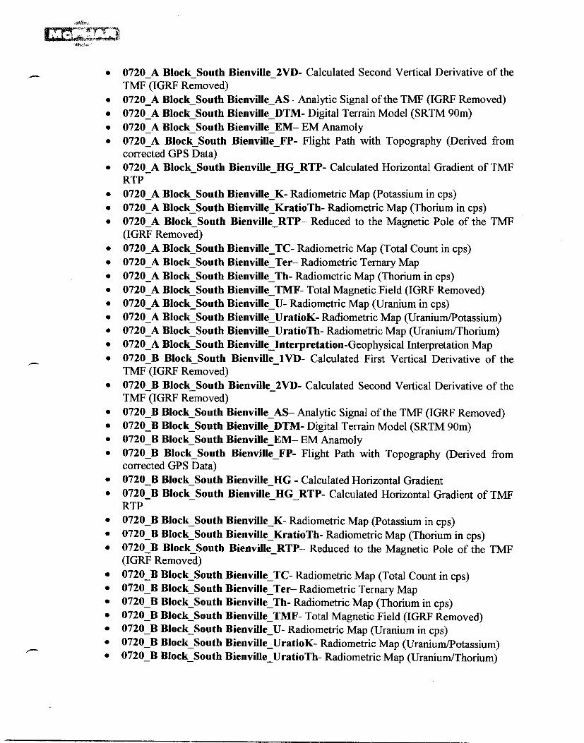
• 0720_A Block_South Bienville_2VD- Calculated Second Vertical Derivative of the TMF (IGRF Removed)
• 0720_A Block_South Bienville_AS— Analytic Signal of the TMF (IGRF Removed) • 0720_A Block_South Bienville_DTM- Digital Terrain Model (SRTM 90m) • 0720_A Block_South Bienville_EM— EM Anamoly • 0720_A Block South Bienville_FP- Flight Path with Topography (Derived from
corrected GPS Data) • 0720_A Block_South Bienvill e _HG_RTP- Calculated Horizontal Gradient of TMF
RTP • 0720_A Block_South Bienville _K- Radiometric Map (Potassium in cps) • 0720_A Block_South Bienville _KratioTh- Radiometric Map (Thorium in cps) • 0720_A Block_South Bienvill e RTP— Reduced to the Magnetic Pole of the TMF
(IGRF Removed) 0720_A Block_South Bienville_ TC- Radiometric Map (Total Count in cps) 0720_A Block_South Bienville_ Ter— Radiometric Ternary Map 0720_A Block_South Bienville_ Th- Radiometric Map (Thorium in cps) 0720_A Block_South Bienville_ TMF- Total Magnetic Field (IGRF Removed) 0720_A Block_South Bienville_ U- Radiometric Map (Uranium in cps) 0720_A Block_South Bienville_ UratioK- Radiometric Map (Uranium/Potassium) 0720 A Block South Bienville UratioTh- Radiometric Map (Uranium/Thorium) 0720_A Block_South Bienville_Interpretation-Geophysical Interpretation Map 0720_B Block_South Bienville_1 VD- Calculated First Vertical Derivative of the TMF (IGRF Removed)
• 0720 B Block_South Bienville_2VD- Calculated Second Vertical Derivative of the TMF (IGRF Removed)
• 0720_B Block_South Bienville_AS— Analytic Signal of the TMF (IGRF Removed) • 0720_B Block_South Bienville_DTM- Digital Terrain Model (SRTM 90m) • 0720_B Block_South Bienville_EM— EM Anamoly • 0720_B Block_South Bienville_FP- Flight Path with Topography (Derived from
corrected GPS Data) • 0720_B Block_South Bienville_HG - Calculated Horizontal Gradient • 0720_B Block_South Bienville_HGRTP- Calculated Horizontal Gradient of TMF
RTP • 0720_B Block_South Bienville_K- Radiometric Map (Potassium in cps) • 0720 B Block_South Bienville_KratioTh- Radiometric Map (Thorium in cps) • 0720_B Block_South Bienville_RTP— Reduced to the Magnetic Pole of the TMF
(IGRF Removed) • 0720_B Block_South Bienville_TC- Radiometric Map (Total Count in cps) • 0720_B Block_South Bienville_Ter— Radiometric Ternary Map • 0720_B Block_South Bienville_Th- Radiometric Map (Thorium in cps) • 0720_B Block_South Bienville_TMF- Total Magnetic Field (IGRF Removed) • 0720_B Block_South Bienville_U- Radiometric Map (Uranium in cps) • 0720_B Block_South Bienville_UratioK- Radiometric Map (Uranium/Potassium) • 0720_B Block South Bienville_UratioTh- Radiometric Map (Uranium/Thorium)
• •
•
•
•
•

• 0720_B Block South Bienville_Interpretation-Geophysical Interpretation Map • 0720_CF_North Block_1VD- Calculated First Vertical Derivative of the TMF
(IGRF Removed) • 0720CF_ North Block_2VD- Calculated Second Vertical Derivative of the TMF
(IGRF Removed) • 0720_CF _ North Block _AS— Analytic Signal of the TMF (IGRF Removed) • 0720_CF _ North Block _DTM- Digital Terrain Model (SRTM 90m) • 0720_CF _ North Block _EM— EM Anamoly • 0720_CF _ North Block _FP- Flight Path with Topography (Derived from corrected
GPS Data) • 0720_CF _ North Block _HG_RTP- Calculated Horizontal Gradient of TMF RTP • 0720_CF _ North Block _K- Radiometric Map (Potassium in cps) • 0720_CF_ North Block _KratioTh- Radiometric Map (Thorium in cps) • 0720_CF _ North Block _RTP— Reduced to the Magnetic Pole of the TMF (IGRF
Removed) • 0720_CF _ North Block _TC- Radiometric Map (Total Count in cps) • 0720_CF _ North Block _Ter— Radiometric Ternary Map • 0720_CF _ North Block _Th- Radiometric Map (Thorium in cps) • 0720_CF _ North Block _TMF- Total Magnetic Field (IGRF Removed) • 0720_CF_ North Block _U- Radiometric Map (Uranium in cps) • 0720_ _ CF _ North Block UratioK- Radiometric Map (Uranium/Potassium) • 0720_CF _ North Block _UratioTh- Radiometric Map (Uranium/Thorium) • 0720_CF _ North Block _Interpretation-Geophysical Interpretation Map • 0720_ CF South Block_1VD- Calculated First Vertical Derivative of the TMF
(IGRF Removed) • 0720_CF _South Block _2VD- Calculated Second Vertical Derivative of the TMF
(IGRF Removed) • 0720_CF _South Block _AS— Analytic Signal of the TMF (IGRF Removed) • 0720_CF _South Block _DTM- Digital Terrain Model (SRTM 90m) • 0720_CF _South Block_EM— EM Anamoly • 0720_CF _South Block _FP- Flight Path with Topography (Derived from corrected
GPS Data) • 0720_CF South Block _HG_RTP- Calculated Horizontal Gradient of TMF RTP _ • 0720_CF _South Block K- Radiometric Map (Potassium in cps) • 0720_CF _South Block _KratioTh- Radiometric Map (Thorium in cps) • 0720_CF _South Block RTP— Reduced to the Magnetic Pole of the TMF (IGRF
Removed) • 0720_CF _South Block _TC- Radiometric Map (Total Count in cps) • 0720_CF _South Block Ter— Radiometric Ternary Map • 0720_CF_South Block _Th- Radiometric Map (Thorium in cps) • 0720_CF _South Block_TMF- Total Magnetic Field (IGRF Removed) • 0720_CF _South Block _U- Radiometric Map (Uranium in cps) • 0720_CF _South Block _UratioK- Radiometric Map (Uranium/Potassium) • 0720_CF _South Block _UratioTh- Radiometric Map (Uranium/Thorium)

• 0720_CF _South Block_ Interpretation-Geophysical Interpretation Map • 0720_D Block_South Bienville_1VD- Calculated First Vertical Derivative of the
TMF (IGRF Removed) • 0720_D Block_South Bienville_2VD- Calculated Second Vertical Derivative of the
TMF (IGRF Removed) • 0720_D Block_South Bienville_AS— Analytic Signal of the TMF (IGRF Removed) • 0720_D Block_South Bienville_DTM- Digital Terrain Model (SRTM 90m) • 0720_D Block_South Bienville_EM— EM Anamoly • 0720_D Block_South Bienville_FP- Flight Path with Topography (Derived from
corrected GPS Data) • 0720_D Block_South Bienville_HG_RTP- Calculated Horizontal Gradient of TMF
RTP • 0720_D Block_South Bienville_K- Radiometric Map (Potassium in cps) • 0720_D Block_South Bienville_KratioTh- Radiometric Map (Thorium in cps) • 0720_D Block_South Bienville_RTP— Reduced to the Magnetic Pole of the TMF
(IGRF Removed) • 0720_D Block_South Bienville_TC- Radiometric Map (Total Count in cps) • 0720_D Block_South Bienville_Ter— Radiometric Ternary Map • 0720_D Block_South Bienville_Th- Radiometric Map (Thorium in cps) • 0720_D Block_South Bienville_TMF- Total Magnetic Field (IGRF Removed) • 0720_D Block_South Bienville_U- Radiometric Map (Uranium in cps) • 0720_D Block South Bienville_UratioK- Radiometric Map (Uranium/Potassium) • 0720_D Block_South Bienville_UratioTh- Radiometric Map (Uranium/Thorium) • 0720_D Block_South Bienville_Interpretation-Geophysical Interpretation Map • 0720_E Block_South Bienville_1VD- Calculated First Vertical Derivative of the
TMF (IGRF Removed) • 0720_E Block_South Bienville_2VD- Calculated Second Vertical Derivative of the
TMF (IGRF Removed) • 0720_E Block_South Bienville_AS— Analytic Signal of the TMF (IGRF Removed) • 0720_E Block_South Bienville_DTM- Digital Terrain Model (SRTM 90m) • 0720_E Block_South Bienville_EM— EM Anamoly • 0720_E Block_South Bienville_FP- Flight Path with Topography (Derived from
corrected GPS Data) • 0720_E Block_South Bienville_HG - Calculated Horizontal Gradient • 0720_E Block_South Bienville_HG_RTP- Calculated Horizontal Gradient of TMF
RTP • 0720_E Block_South Bienville_K- Radiometric Map (Potassium in cps) • 0720_E Block_South Bienville_KratioTh- Radiometric Map (Thorium in cps) • 0720_E Block_South Bienville_RTP— Reduced to the Magnetic Pole of the TMF
(IGRF Removed) • 0720_E Block_South Bienville_TC- Radiometric Map (Total Count in cps) • 0720_E Block_South Bienville_Ter— Radiometric Ternary Map • 0720_E Block_South Bienville_Th- Radiometric Map (Thorium in cps) • 0720E Block South Bienville_TMF- Total Magnetic Field (IGRF Removed)

• 0720 E Block South Bienville_U- Radiometric Map (Uranium in cps) • 0720_E Block_South Bienville_UratioK- Radiometric Map (Uranium/Potassium) • 0720_E Block_South Bienville_UratioTh- Radiometric Map (Uranium/Thorium) • 0720_E Block_South Bienville_Interpretation-Geophysical Interpretation Map • 0720_G Block_South Bienville_1 VD- Calculated First Vertical Derivative of the
TMF (IGRF Removed) • 0720_G Block_South Bienville_2VD- Calculated Second Vertical Derivative of the
TMF (IGRF Removed) • 0720_G Block_South Bienville_AS— Analytic Signal of the TMF (IGRF Removed) • 0720_G Block_South Bienville_DTM- Digital Terrain Model (SRTM 90m) • 0720_G Block_South Bienville_EM— EM Anamoly • 0720_G Block_South Bienville_FP- Flight Path with Topography (Derived from
corrected GPS Data) • 0720_G Block_South Bienville_HG_RTP- Calculated Horizontal Gradient of TMF
RTP • 0720_G Block_South Bienville_K- Radiometric Map (Potassium in cps) • 0720_G Block_South Bienville_KratioTh- Radiometric Map (Thorium in cps) • 0720_G Block_South Bienville_RTP— Reduced to the Magnetic Pole of the TMF
(IGRF Removed) • 0720_G Block_South Bienville_TC- Radiometric Map (Total Count in cps) • 0720_G Block_South Bienville_Ter— Radiometric Ternary Map • 0720_G Block_South Bienville_Th- Radiometric Map (Thorium in cps) • 0720_G Block_South Bienville_TMF- Total Magnetic Field (IGRF Removed) • 0720_G Block_South Bienville_U- Radiometric Map (Uranium in cps) • 0720_G Block_South Bienville_UratioK- Radiometric Map (Uranium/Potassium) • 0720_G Block_South Bienville_UratioTh- Radiometric Map (Uranium/Thorium) • 0720_G Block_South Bienville_Interpretation-Geophysical Interpretation Map • 0720_H Block_South Bienville_I VD- Calculated First Vertical Derivative of the
TMF (IGRF Removed) • 0720_H Block_South Bienville_2VD- Calculated Second Vertical Derivative of the
TMF (IGRF Removed) • 0720_H Block_South Bienville_AS— Analytic Signal of the TMF (IGRF Removed) • 0720_H Block_South Bienville_DTM- Digital Terrain Model (SRTM 90m) • 0720_H Block_South Bienville_EM— EM Anamoly • 0720_H Block_South Bienville_FP- Flight Path with Topography (Derived from
corrected GPS Data) • 0720_H Block_South Bienville_HG_RTP- Calculated Horizontal Gradient of TMF
RTP • 0720_H Block_South Bienville_K- Radiometric Map (Potassium in cps) • 0720_H Block_South Bienville_KratioTh- Radiometric Map (Thorium in cps) • 0720_H Block_South Bienville_RTP— Reduced to the Magnetic Pole of the TMF
(IGRF Removed) • 0720_H Block_South Bienville_TC- Radiometric Map (Total Count in cps) • 0720_H Block South Bienville_Ter— Radiometric Ternary Map

• 0720_H Block_South Bienville_Th- Radiometric Map (Thorium in cps) • 0720_H Block_South Bienville_TMF- Total Magnetic Field (IGRF Removed) • 0720H Block_South Bienville_U- Radiometric Map (Uranium in cps) • 0720_H Block_South Bienville_UratioK- Radiometric Map (Uranium/Potassium) • 0720_H Block_South Bienville_UratioTh- Radiometric Map (Uranium/Thorium) • 0720_H Block_South Bienville_Interpretation-Geophysical Interpretation Map • 0720_I Block_South Bienville_1VD- Calculated First Vertical Derivative of the
TMF (IGRF Removed) • 0720 I Block_South Bienville_2VD- Calculated Second Vertical Derivative of the
TMF (IGRF Removed) • 0720_I Block_South Bienville_AS— Analytic Signal of the TMF (IGRF Removed) • 0720_I Block_South Bienville_DTM- Digital Terrain Model (SRTM 90m) • 0720_I Block_South Bienville_EM— EM Anamoly • 0720_I Block South Bienville_FP- Flight Path with Topography (Derived from
corrected GPS Data) • 0720 I Block South Bienville HG RTP- Calculated Horizontal Gradient of TMF
RTP • 0720_I Block_South Bienville_K- Radiometric Map (Potassium in cps) • 0720_I Block_South Bienville_KratioTh- Radiometric Map (Thorium in cps) • 0720_I Block_South Bienville_RTP— Reduced to the Magnetic Pole of the TMF
(IGRF Removed) • 0720_I Block_South Bienville_TC- Radiometric Map (Total Count in cps) • 0720_I Block_South Bienville_Ter— Radiometric Ternary Map • 0720_I Block_South Bienville_Th- Radiometric Map (Thorium in cps) • 0720_I Block_South Bienville_TMF- Total Magnetic Field (IGRF Removed) • 0720_I Block_South Bienville_U- Radiometric Map (Uranium in cps) • 0720_I Block_South Bienville_UratioK- Radiometric Map (Uranium/Potassium) • 0720I Block_South Bienville_UratioTh- Radiometric Map (Uranium/Thorium) • 0720_I Block_South Bienville_Interpretation-Geophysical Interpretation Map • 0720 J Block_South Bienville_1 VD- Calculated First Vertical Derivative of the
TMF (IGRF Removed) • 0720_J Block_South Bienville 2VD- Calculated Second Vertical Derivative of the
TMF (IGRF Removed) • 0720_J Block_South Bienville_AS— Analytic Signal of the TMF (IGRF Removed) • 0720_J Block_South Bienville_DTM- Digital Terrain Model (SRTM 90m) • 0720_J Block_South Bienville_EM— EM Anamoly • 0720_J Block_South Bienville_FP- Flight Path with Topography (Derived from
corrected GPS Data) • 0720 J Block South Bienville_HG_RTP- Calculated Horizontal Gradient of TMF
RTP • 0720_J Block_South Bienville_K- Radiometric Map (Potassium in cps) • 0720_J Block_South Bienville_KratioTh- Radiometric Map (Thorium in cps) • 0720_J Block_South Bienville_RTP— Reduced to the Magnetic Pole of the TMF
(IGRF Removed)

• 0720_J Block_South Bienville_TC- Radiometric Map (Total Count in cps) • 0720_J Block_South Bienville_Ter— Radiometric Ternary Map • 0720_J Block_South Bienville_Th- Radiometric Map (Thorium in cps) • 0720_J Block_South Bienville_TMF- Total Magnetic Field (IGRF Removed) • 0720_J Block_South Bienville_U- Radiometric Map (Uranium in cps) • 0720_J Block_South Bienville_UratioK- Radiometric Map (Uranium/Potassium) • 0720_J Block_South Bienville_UratioTh- Radiometric Map (Uranium/Thorium) • 0720_J Block_South Bienville_Interpretation-Geophysical Interpretation Map • 0720_K Block_South Bienville_1VD- Calculated First Vertical Derivative of the
TMF (IGRF Removed) • 0720_K Block_South Bienville_2VD- Calculated Second Vertical Derivative of the
TMF (IGRF Removed) • 0720K Block_South Bienville_AS— Analytic Signal of the TMF (IGRF Removed) • 0720__K Block_South Bienville_DTM- Digital Terrain Model (SRTM 90m) • 0720_K Block_South Bienville_EM— EM Anamoly • 0720_K Block_South Bienville_FP- Flight Path with Topography (Derived from
corrected GPS Data) • 0720_K Block_South Bienville_HG_RTP- Calculated Horizontal Gradient of TMF
RTP • 0720_K Block_South Bienville_K- Radiometric Map (Potassium in cps) • 0720_K Block_South Bienville_KratioTh- Radiometric Map (Thorium in cps) • 0720_K Block_South Bienville_RTP— Reduced to the Magnetic Pole of the TMF
(IGRF Removed) • 0720_K Block_South Bienville_TC- Radiometric Map (Total Count in cps) • 0720_K Block_South Bienville_Ter— Radiometric Ternary Map • 0720_K Block_South Bienville_Th- Radiometric Map (Thorium in cps) • 0720_K Block_South Bienville_TMF- Total Magnetic Field (IGRF Removed) • 0720_K Block_South Bienville_U- Radiometric Map (Uranium in cps) • 0720_K Block_South Bienville_UratioK- Radiometric Map (Uranium/Potassium) • 0720_K Block_South Bienville_UratioTh- Radiometric Map (Uranium/Thorium) • 0720_K Block South BienvilleInterpretation-Geophysical Interpretation Map
Free Viewer:
• Geosoft Oasis Montaj 6.4 free viewer for viewing maps
Database:
Geosoft gdb file:
• 0720_Anomaly_A Block_South Bienville • 0720_Anomaly_B Block_South Bienville • 0720_Anomaly_CF North Block_South Bienville • 0720_Anomaly_CF South Block_South Bienville

• 0720_Anomaly_D Block_South Bienville • 0720_Anomaly_E Block_South Bienville • 0720_Anomaly_G Block_South Bienville • 0720_Anomaly_H BLock_South Bienville • 0720_Anomaly_I Block_South Bienville • 0720_Anomaly J Block_South Bienville • 0720_Anomaly_K Block_South Bienville • 0720_EM_A Block_South Bienville • 0720_EM_B Block_South Bienville • 0720_EM_CF Block_South Bienville • 0720_EM_D Block_South Bienville • 0720EM_E Block_South Bienville • 0720_EM_G Block_South Bienville • 0720_EM_H BLock_South Bienville • 0720_EM_I Block_South Bienville • 0720_EM J Block_South Bienville • 0720_EM K Block South Bienville • 0720_Mag_A Block_South Bienville • 0720_Mag_B Block_South Bienville • 072O_Mag_CF Block_South Bienville • 0720_Mag_D Block_South Bienville • 0720_Mag_E Block_South Bienville • 0720_Mag_G Block_South Bienville • 0720_Mag_H BLock_South Bienville • 0720_Mag I Block_South Bienville • 0720_Mag J Block_South Bienville • 0720_Mag_K Block_South Bienville • 0720_Spec_A Block_South Bienville • 0720_Speç B Block_South Bienville • 0720_Spec_CF Block_South Bienville • 0720_Spec_D Block_South Bienville • 0720_Speç E Block_South Bienville • 0720_Speç G Block_South Bienville • 0720_Spec_H BLock_South Bienville • 0720_Spec_I Block_South Bienville • 0720_Spec_J Block_South Bienville • 0720_Spec K Block_South Bienville

CLIENT: Central Uranium Corp.. Project # 0720 (PAGE 1 OF 1
Databases: 0720_Mag.GDB
DATABASE DESCRIPTION Proc: T.Grand
Channel Type Units/Format Description
Fid RAW system fiducial
date YYYY/MM/DD flight date
fit flight number
gpstm_sec RAW Secods of Day GPS time
X RAW/PROC metre Easting - projected to UTM zone 19 N I WGS84 - Real time DGPS position
Y RAW/PROC metre Northing - projected to UTM zone 19 N / WGS84 -Real time DGPS position
Lon_deg RAW Decimal of Degrees Longitude - WGS84 - Real time DGPS position
Lat_deg RAW Decimal of Degrees Latitude - WGS84 - Real time DGPS position
bmag RAW/PROC nT Total Magnetic Field (TMF) - Base station data
TMF raw RAW nT Total Magnetic Field (TMF) - airborne data
IGRF PROC nT IGRF - model 2005, date=Date channel; Long, Lat, Galt_m
inc PROC nT inclination - model 2005, date=Date channel; Long, Lat, Galt_m
dec PROC nT declination - model 2005, date=Date channel; Long, Lat, Galt_m
TMF_IGRF PROC nT Total Magnetic Field (TMF) - airborne data - final corrected and leveled , IGRF corrected data

CLIENT: Central Uranium Project # 0720 IPAGE 1 OF 1
LIST of Database Channels - 0720_SPEC.GDB
Proc.: Tomas Grand
- Final Digital Radiometric Data
Channel Type Units Description
Date PROC YYYY/Mvt/DD Date of Survey - Local Date when flight occurred
lid RAW seconds Fiducials
lit PROC Flight Number
x RAW/PROC m Easting - DGPS corrected data - WGS84 - UTM z 19 N
y RAW/PROC m Northing - DGPS corrected data - WGS84 - UTM z 19 N
Lon RAW/PROC Degrees decimals Longitude - WGS84
Lat RAW/PROC Degrees decimals Latitude - WGS84
Galt RAW/PROC m GPS altitude - sea level
Temp RAW C air temperature in Celsuis degrees
Raft RAW/PROC m Radar altimeter attitude of the helicopter
Ralstp PROC m Effective height of the spectrometer, calculated from radar data to nominal heigth= 60 m for standard
temperature and pressure (STP)
dtm PROC m DTM - Digital Terrain Model calculated from GPS and Radar altimeter data - after leveling
TC_raw, K raw, Th_Raw, U_Raw
RAW cps TC, K, Th, U - RAW , downward looking
Cosmic_Raw RAW cps Cosmic Ray - RAW downward looking
TC_lev, K_lev, Th lev, U lev PROC cps TC.K.Th,U - final levelled ROI channels
U Th, U K. K Th PROC ratios - UTTh; U/K; K/Th

CLIENT: Central Uranium Project # 0720 PAGE 1 OF 1
LIST of Database Channels - 0720_EM.GDB
Proc.: Tomas Grand
- Final Digital EM Data
Channel Type Units Description
Date PROC YYYYMMDD Date of Survey - Local Date when flight occurred
fid RAW seconds Fiducials
flt PROC Flight Number
x RAW/PROC m Easting - DGPS corrected data - WGS84 - UTM z 19 N
y RAW/PROC m Northing - DGPS corrected data - WGS84 - UTM z 19 N
dBzdt ON PROC Array Cahnnel - 11 ON Time Windows - dBz/dt
dBzdt_OFF PROC ppm Array Cahnnel - 31 OFF Time Windows - dBz/dt

APPENDIX 5
Page Size Maps
• Flight Path with Topography • Digital Terrain Model (DTM) • Total Magnetic Field (IGRF Corrected) • Reduction to the Magnetic Pole of the TMF (IGRF Corrected) • Calculated First Vertical Derivative of the TMF (IGRF Corrected) • Calculated Second Vertical Derivative of the TMF (IGRF Corrected) • Analytic Signal of the TMF (IGRF Corrected) • Horizontal gradient of the RTP TMF (IGRF Corrected) • EM Anomaly Map — dB/dt Z-channel — Window No. 15 • Radiometric Map (Total Count in cps) • Radiometric Map (Potassium in cps) • Radiometric Map (Thorium in cps) • Radiometric Map (Uranium in cps) • Radiometric Map (Potassium/Thorium) • Radiometric Map (Uranium/Potassium) • Radiometric Map (Uranium/Thorium) • Radiometric Ternary Map • Geophysical Interpretation Map