ERIE COUNTY NATURAL HERITAGE INVENTORY UPDATE
564
ERIE COUNTY NATURAL HERITAGE INVENTORY UPDATE December 2012 Prepared for: The Erie County Department of Planning Erie County Courthouse, Room 111 140 West 6 th Street Erie, PA 16501 Prepared by: Pennsylvania Natural Heritage Program Western Pennsylvania Conservancy 800 Waterfront Drive Pittsburgh, PA 15222 This project was funded through grants supplied by the DCNR Wild Resource Conservation Program, the Erie Community Foundation, and Pennsylvania Sea Grant Copies of this report are available in electronic format through the Pennsylvania Natural Heritage Program website, www.naturalheritage.state.pa.us, and through the Erie County Planning Commission. This report may be cited as: Pennsylvania Natural Heritage Program. 2012. Erie County Natural Heritage Inventory. Western Pennsylvania Conservancy. Pittsburgh, PA.
-
Upload
khangminh22 -
Category
Documents
-
view
0 -
download
0
Transcript of ERIE COUNTY NATURAL HERITAGE INVENTORY UPDATE
ERIE COUNTY NATURAL HERITAGE INVENTORY
UPDATE
December 2012
Prepared for:
The Erie County Department of Planning
Erie County Courthouse, Room 111 140 West 6th Street
Erie, PA 16501
Prepared by:
Pennsylvania Natural Heritage Program
Western Pennsylvania Conservancy 800 Waterfront Drive Pittsburgh, PA 15222
This project was funded through grants supplied by the DCNR Wild Resource Conservation Program, the Erie Community Foundation, and Pennsylvania Sea Grant
Copies of this report are available in electronic format through the Pennsylvania Natural Heritage Program website, www.naturalheritage.state.pa.us, and through the Erie County Planning Commission.
This report may be cited as: Pennsylvania Natural Heritage Program. 2012. Erie County Natural Heritage Inventory. Western Pennsylvania Conservancy. Pittsburgh, PA.

Erie County Natural Heritage Inventory - Acknowlegemnents / ii
Erie County Natural Heritage Inventory - Acknowlegemnents / iii
ACKNOWLEDGEMENTS We would like to acknowledge the many citizens and landowners of the county and surrounding areas who volunteered information, time, and effort to the inventory and granted permission to access land. A very special thank you goes out to the people of Erie County for their interest and hospitality.
We especially thank:
The Erie County Environmental Advisory Committee (EAC) including the following members: Brian Winslow, Asbury Woods Nature Center
Tom Erdman, Bureau of Forestry Emily Beck, Visit Erie Earl J. Brown, Erie County Conservation District Martin Visnosky, Erie County Environmental Coalition Tom Fuhrman, Lake Erie Region Conservancy Jody Lasko, Natural Resources Conservation Service Kelly Burch, Pennsylvania Department of Environmental Protection Shayne Hoachlander, Pennsylvania Game Commission David Skellie, Pennsylvania Sea Grant Sarah Galloway, Pennsylvania Lake Erie Watershed Association Harry Leslie, Presque Isle State Park Jerry Covert, Regional Science Consortium Darran Crabtree, The Nature Conservancy Ed Masteller, Tom Ridge Environmental Center Mathew Elwell, Erie County Department of Planning Jake Welsh, Erie County Department of Planning Jerry McWilliams, Tom Ridge Environmental Center Mike Campbell, Mercyhurst College, Tom Ridge Environmental Center
Bonnie Isaac, Carnegie Museum of Natural History, Collections Manger of Section of Botany Timothy Pearce, Carnegie Museum of Natural History, Asst. Curator and Head of Section of
Mollusks Ben Coulter, naturalist Mark Lethaby, Tom Ridge Environmental Center
We would like to thank the Pennsylvania Department of Conservation and Natural Resources for providing funding to make this project possible through their Wild Resource Conservation Program.
We want to recognize the Pennsylvania Natural Heritage Program and NatureServe for providing the foundation for the work that we perform for these studies. Current and former PNHP staff that contributed to this report include JoAnn Albert, Charles Bier, Jake Boyle, Kierstin Carlson, Tony Davis, Jeremy Deeds, Alice Doolittle, Charlie Eichelberger, Rocky Gleason, Steve Grund, Jim Hart, Tyson Johnston, Susan Klugman, Matt Kowalski, John Kunsman, Betsy Leppo, Beth Meyer, Ryan Miller, Sally Ray, Erika Schoen, Andrew Strassman, David Yeany, Jeff Wagner, Mary Walsh, Denise Watts, David Yeany, and Ephraim Zimmerman. Additionally, this report has incorporated ideas and approaches developed for conservation science initiatives recently undertaken in other states, most notably the Massachusetts BioMap project, and the Maryland Green Infrastructure project. We gratefully acknowledge the vision of these projects for providing the basis for improved ways to represent conservation information in the County Natural Heritage Inventory reports.

Erie County Natural Heritage Inventory - Acknowlegemnents / iv
Without the support and help from these people and organizations, the inventory would not have seen completion. We encourage comments and questions. The success of the report will be measured by the use it receives, and the utility it serves to those making decisions about resources and land use throughout the county. Thank you for your interest.
Christopher Tracey Peter Woods Conservation Planning Coordinator Ecologist Pennsylvania Natural Heritage Program Pennsylvania Natural Heritage Program
Erie County Natural Heritage Inventory – Table of Contents / v
TABLE OF CONTENTS How to use this document
The Erie County Natural Heritage Inventory Update is designed to provide information about the biodiversity of Erie County. The Introduction of the report has an overview of the process behind this inventory as well as an overview of the Natural History of Erie County. Results are presented at the broad landscape view, and then finer scale results are presented by township. Natural Heritage Areas that cross municipal boundaries are cross-referenced in each township section. Finally, conclusions and overall recommendations follow the township sections.
ACKNOWLEDGEMENTS ............................................................................................................... iii TABLE OF CONTENTS .................................................................................................................... v INTRODUCTION .............................................................................................................................. 1
Pennsylvania Natural Heritage Program ....................................................................................... 2 Current Status of Pennsylvania’s Natural Heritage ....................................................................... 3
OVERVIEW OF ERIE COUNTY’S NATURAL FEATURES ........................................................ 9 Physiography and Geology .......................................................................................................... 11 Vegetation .................................................................................................................................... 19 Hydrology .................................................................................................................................... 29 Climate ......................................................................................................................................... 34 Disturbance .................................................................................................................................. 35 Energy and Extractable Resources .............................................................................................. 37 Invasive Species in Erie County .................................................................................................. 39
AN INTRODUCTION TO THE ANIMALS OF ERIE COUNTY ................................................ 47 Mammals of Erie County ............................................................................................................. 48 Birds of Erie County .................................................................................................................... 52 Reptiles and Amphibians of Erie County .................................................................................... 62 Fish of Erie County ...................................................................................................................... 66 Freshwater Mussels of Erie County ............................................................................................. 70 Insects of Erie County .................................................................................................................. 73 Land Snails of Erie County .......................................................................................................... 78
METHODS........................................................................................................................................ 81 Site Selection ................................................................................................................................ 81 Ground Surveys ........................................................................................................................... 81 Mapping of Natural Heritage Areas ............................................................................................ 82 Site Descriptions .......................................................................................................................... 84 Site Significance Ranks ............................................................................................................... 86 Species of Concern List and Factsheets ....................................................................................... 87 Ecological Value Analysis ........................................................................................................... 88
GENERAL INVENTORY RESULTS AND DISCUSSION .......................................................... 93 Natural Heritage Areas ................................................................................................................ 93 Ecological Value Analysis ......................................................................................................... 120 Erie County’s contribution to biodiversity in Pennsylvania ...................................................... 121 Future research in Erie County .................................................................................................. 121 General recommendations ......................................................................................................... 123 Results by Township .................................................................................................................. 128
NATURAL HERITAGE AREA DESCRIPTIONS ....................................................................... 144
Erie County Natural Heritage Inventory – Table of Contents / vi
TABLE OF FIGURES Figure 1: Landcover classification from 2006 National Land Cover Dataset in Erie County .... 12 Figure 2: Elevation map of Erie County ..................................................................................... 13 Figure 3: Bedrock geology and physiographic regions of Erie County ...................................... 14 Figure 4: Diagram of deglaciation in a valley in northwestern Pennsylvania ............................ 15 Figure 5: Movement and migration of Presque Isle from 1790 to 1970 ..................................... 15 Figure 6: Surficial deposits from Wisconsin and Illinoisan glaciations in Erie County ............. 16 Figure 7: Generalized soil associations of Erie County .............................................................. 18 Figure 8: Pennsylvania forest blocks .......................................................................................... 26 Figure 9: Forest patches of Erie County ..................................................................................... 28 Figure 10: Watersheds of Erie County ........................................................................................ 32 Figure 11: Vegetated riparian buffers ......................................................................................... 33 Figure 12: Important Bird Areas of Erie County ........................................................................ 58 Figure 13: Core Habitat and Supporting Landscape ................................................................... 82 Figure 14: Example of the mapping of forest that contributes to interior forest ......................... 83 Figure 15: Map of the Natural Heritage Areas (NHAs) within Erie County .............................. 94 Figure 16: Relative distribution of NHA designated land in Erie County ................................ 103 Figure 17: Changes in Core Habitat area between the 1993 and 2012 Natural Heritage Inventories ............................................................................................... 104 Figure 18: Predicted ecological value across Erie County ........................................................ 121 Figure 19: Distribution of species and natural communities of concern by municipality ........ 122 TABLE OF TABLES Table 1: General soil series of Erie County ................................................................................ 17 Table 2: Examples of natural and anthropogenic disturbances ................................................... 35 Table 3: Invasive plants in Erie County ...................................................................................... 40 Table 4: The 13 exotic plants that are on the state Noxious Weed Control list .......................... 41 Table 5: Invasive animals of Erie County ................................................................................... 42 Table 6: Birds representative of wetland habitat found in Erie County ...................................... 54 Table 7: Birds representative of interiro forest habitat found in Erie County ............................. 55 Table 8: Birds representative of grassland habitat found in Erie County ................................... 56 Table 9: Fish communities of Erie County ................................................................................. 67 Table 10: Native freshwater mussels found in Erie County ....................................................... 72 Table 11: Tiger beetles known from Erie County ....................................................................... 75 Table 12: Natural Heritage Area Significance Ranks ................................................................. 80 Table 13: Natural Heritage Areas of Erie County, listed by map order ...................................... 95 Table 14: Natural Heritage Areas of Erie County prioritized by their Biodiversity Significance Ranks ...................................................................................................... 96 Table 15: Amount of overlap between conservation land and NHA Core Habitat in Erie County ........................................................................................................... 103 Table 16: Species and Natural Communities of Conservation Concern in Erie County .......... 105
Erie County Natural Heritage Inventory - Introduction / 1
INTRODUCTION
Our natural environment is vital for human health and sustenance. A healthy environment provides clean air and water; supports fish, game, and agriculture; and furnishes renewable sources of materials for countless aspects of our livelihoods and economy. In addition to these material services, a clean and healthy environment plays a central role in our quality of life, whether through its aesthetic value, found in forested ridges, mountain streams, and encounters with wildlife, or in the opportunities it provides for exploration, recreation, and education. Finally, a healthy natural environment supports economic growth by adding to the region’s attractiveness as a location for new business enterprises, and provides the basis for the recreation, tourism, and forestry industries. Fully functional ecosystems are the key indicators of a healthy environment and maintaining functioning ecosystems is essential to the long-term sustainability of our economies.
An ecosystem is “the complex of interconnected living organisms inhabiting a particular area or unit of space, together with their environment and all their interrelationships and relationships with the environment” (Ostroumov 2002). All the parts of an ecosystem are interconnected. The survival of any species or the continuation of a given natural process depends upon the system as a whole; in turn, these species and processes contribute to maintaining the system. Another important consideration in assessing ecosystem health is the concept of biodiversity. Biodiversity can be defined as the full variety of life that occurs in a given place, and is measured at several scales: genes, species, natural communities, and landscapes.
Diversity typically allows species or communities to adapt successfully to environmental changes or disease. Genetic diversity, for example, refers to the variation in genetic makeup between individuals and populations of organisms. Though sugar maple (Acer saccharum) may be found in many areas of Pennsylvania, those in Erie County likely have a different genetic makeup than those in Philadelphia County; this allows these trees to survive in the unique conditions in which they grow. In order to conserve genetic diversity, plants native to an area from local genetic stock should be used as much as possible in both private and public plantings in Erie County. It is also important to maintain natural patterns of gene flow; this is made possible through the preservation of migration paths and corridors across the landscape, and through encouraging the dispersal of pollen and seeds among populations (Thorne et al., 1996). Furthermore, declines in native species diversity can alter ecosystem processes such as nutrient cycling, decomposition, and plant productivity (Naeem et al. 1999, Randall 2000). Because of the interdependent nature of our natural systems, including those we directly depend on for our livelihood and quality of life, it is essential to conserve native biodiversity at all scales (genes, species, natural communities, and landscapes) if ecosystems are to continue functioning.
From an ecological perspective, a landscape is “a large area of land that includes a mosaic of natural community types and a variety of habitats for many species” (Massachusetts Biomap 2000). A natural community is “an interacting assemblage of organisms, their physical environment, and the natural processes that affect them” (Thompson and Sorenson 2000). Natural communities are usually defined by their dominant plant species or the geological features on which they depend; Erie County examples include Hemlock Palustrine Forest and Herbaceous Vernal Pond. Each type of natural community represents habitat for a different group of species, hence identification and stewardship of the full range of native community types is needed to meet the challenge of conserving habitat for all species. Classifying these communities gives ecologists, planners, managers, and landowners a common language with which to discuss land conservation. At the landscape scale, it is important to consider whether communities and habitats are isolated or connected. It is equally important to maintain corridors of natural landscape traversable by wildlife, and to preserve natural areas large enough to support viable populations and ecosystems.
Erie County Natural Heritage Inventory - Introduction / 2
The Pennsylvania Natural Heritage Program
The Pennsylvania Natural Heritage Program (PNHP) is a partnership between the Western Pennsylvania Conservancy (WPC), the Pennsylvania Department of Conservation and Natural Resources (DCNR), the Pennsylvania Game Commission (PGC), and the Pennsylvania Fish and Boat Commission (PFBC). Founded in 1982, PNHP is part of a network of Natural Heritage Programs that utilize common methodology developed by Heritage Programs and The Nature Conservancy, and refined through NatureServe – the organization that represents the network of Natural Heritage Programs (see the box at right).
PNHP collects and stores location and baseline ecological information about rare plants, rare animals, unique plant communities, significant habitats, and geologic features in Pennsylvania. Currently, the PNHP database is Pennsylvania's chief storehouse of such information with over 20,000 detailed digital occurrence records. Though not a regulatory organization, as part of its function PNHP provides expert input on species impacted by projects that require permits as issued by the Pennsylvania Department of Environmental Protection (DEP). Although data from PNHP feed into the environmental review tool known as the Pennsylvania Natural Diversity Inventory (PNDI), the process of environmental review is housed within DCNR.
As part of the information maintained by PNHP, a system of global ranks and state ranks is used to describe the relative degree of rarity for species and natural communities. This system is especially useful in understanding how imperiled a resource is throughout its range, as well as understanding the rarity of resources that do not have official state status, such as invertebrate animals and natural communities. A summary of global and state ranks can be found in the methods section.
PNHP is valuable for its ability to supply technically sound data that can be applied to natural resource decisions. Information on the occurrences of elements of special concern (species and natural communities) gathered from museums, universities, colleges, and recent fieldwork by professionals throughout the state is used by PNHP to identify the areas of highest natural integrity and significance in Erie County.
The Erie County Natural Heritage Inventory (CNHI) report presents the known outstanding natural features in the county. The CNHI provides maps of the best natural communities (habitats) and all the known locations of animal and plant species of concern (endangered, threatened, or rare) in Erie County. A written description and a summary table of the sites, including quality and degree of rarity are included.
NatureServe, the natural heritage network, was originally founded by The Nature Conservancy in the early 1970s, with the first program established in South Carolina in 1974. The concept was to create a federation of programs in all 50 U.S. states, using a common database and data management methodology to document the extent of biodiversity throughout the country, with an emphasis on rare and threatened species and natural communities. Many programs were established with state environmental protection or natural resource agencies, while some are housed in universities. Pennsylvania’s partnership with three agencies and a non-profit is unique among the programs.
Over time the heritage network has expanded throughout Canada and 12 Latin American countries. In 1994, the Association for Biodiversity Information (ABI) was founded to more closely coordinate activities of the network, and ABI transformed into NatureServe in 2001 as The Nature Conservancy transferred administration of the network to NatureServe.
All programs in the heritage network use a common data management system outlined on these pages, based on the original concepts of elements, element occurrences, and rarity ranks. Today, the NatureServe network stands as the most comprehensive source of information on the locations and status of biodiversity and natural communities throughout the western hemisphere.
Erie County Natural Heritage Inventory - Introduction / 3
Potential threats and some suggestions for protection of the rare plants or animals at the site are included in many of the individual site descriptions. Selected geologic features of statewide significance are also noted. In addition, the inventory describes areas that are significant on a county-wide scale, but do not merit state-wide status as exemplary natural communities. These locally significant sites represent good examples of habitats that are relatively rare in the county, support a high diversity of plant species, and/or provide valuable wildlife habitat on a local level.
The information and maps presented in this report provide a useful guide for planning development and parks, for conserving natural areas, and for setting priorities for the preservation of the most vulnerable natural areas. All of the sites in this report were evaluated for their importance in protecting biological diversity on a state and local level, but many also have scenic value and provide water quality protection; they are also often potential sites for low-impact passive recreation, nature observation, and environmental education.
The inventory is one tool that will aid in the creation of municipal and county comprehensive plans, and the emphasis on biological diversity should inform county and regional open space and greenways plans already underway. Erie County, its municipalities, land trusts, and other organizations can also use the Natural Heritage Inventory to identify potential protection projects that may be eligible for funding through federal, state or community grant programs such as Community Conservation Partnerships Program via DCNR. Landowners will also find this inventory useful in managing and planning for the use of their land; it gives them the opportunity to explore alternatives that will provide for their needs and still protect the species and habitats that occur on their land. For example, the Forest Stewardship program, coordinated by the Pennsylvania Department of Conservation and Natural Resources, Bureau of Forestry, assists landowners in creating management plans. This plan is developed based on landowner objectives (e.g., wildlife or timber management). Land managers may wish to consult this report and the Pennsylvania Natural Diversity Inventory (PNDI) in an effort to avoid potential conflicts in areas with species of concern, and to identify ways of enhancing or protecting this resource. Users of this document are encouraged to contact the Pennsylvania Natural Heritage Program for additional information.
Current Status of Pennsylvania’s Natural Heritage
Pennsylvania’s natural heritage is rich in biodiversity; the state includes many examples of high quality natural communities, and large expanses of natural landscapes. Over 20,000 species are known to occur in the state. The extensive tracts of forest in the northern and central parts of Pennsylvania represent a large fraction of areas remaining in the mid-Atlantic region with habitat suitable for many forest-dependent species of birds and mammals. Unfortunately, biodiversity and ecosystem health are seriously threatened in many parts of the state by pollution and habitat loss. Of the 3,500 species of vertebrates and vascular plants that have been documented in the state, more than one in ten are currently imperiled. Since European settlement, 156 plant and animal species have been lost from Pennsylvania, and 351 are threatened or endangered (Pennsylvania 21st Century Environment Commission, 1998). Many of these species are imperiled because available habitat in the state has been reduced and/or degraded.
Aquatic Environments
Fifty-six percent of Pennsylvania’s wetlands have been lost or substantially degraded by filling, draining, or conversion to ponds (Dahl, 1990). According to the Pennsylvania Department of Environmental Protection (DEP), 60% of those Pennsylvania lakes that have thus far been assessed for biological health are listed as Impaired. Of the 83,000 miles of stream in Pennsylvania, almost 70,000 miles have been assessed for water quality; nearly 11,000 miles have been designated as Impaired due to abandoned mine discharges (AMD), acid precipitation, and agricultural and urban runoff (DEP, 2004). The species that depend on these habitats are correspondingly under threat: 58% of threatened or endangered plant species are wetland or aquatic species; 13% of Pennsylvania’s 200 native fish species have been lost with an

Erie County Natural Heritage Inventory - Introduction / 4
additional 23% imperiled, and 18 of Pennsylvania’s 67 native freshwater mussel species are extirpated with another 22 imperiled (Goodrich et al., 2003).
Forested Environments
Prior to European settlement, over 90% of Pennsylvania’s land area was forested. Today, 60% of the state is still forested, but much of this forest is fragmented by non-forest uses such as roads, utility rights-of-way, agriculture, and housing. Only 42% of our state’s forest is interior forest habitat; therefore, some of the species that depend upon interior forest habitat are in decline (Goodrich et al., 2003). In addition to habitat fragmentation, forest pests, acid precipitation (which causes loss of needed nutrients leading to stunted tree growth), overbrowsing by deer, and invasive species also threaten forest ecosystem health.
References: Dahl, T.E. (1990). Wetlands Losses the United States 1790s to 1980s. U.S. Department of the Interior, Fish and Wildlife
Service, Washington, D.C. Goodrich, L. J., Brittingham, M., Bishop, J.A., and P. Barber. (2003). Wildlife Habitat in Pennsylvania: Past, Present, and
Future. Pennsylvania Department of Conservation and Natural Resources, Harrisburg, PA. Available at: http://www.dcnr.state.pa.us/wlhabitat/ (accessed October 2009).Naeem et al., 1999
Ostroumov, S.A. (2002). New Definitions of the Concepts and Terms Ecosystem and Biogeocenosis. Doklady Biological Sciences 383 (1-6): 141-143.
Pennsylvania 21st Century Environment Commission. (1998). Report of the 21st Century Environment Commission. Available from http://www.21stcentury.state.pa.us/2001/final.htm (accessed October 2009).
Randall, J.M. (2000). Improving Management of Nonnative Invasive Plants in Wilderness and Other Natural Areas. USDA Forest Service Proceedings, Washington, D.C. RMRS-P-15(5), 64-73.
Thompson, E.H. and E.R. Sorenson. 2000. Wetland, Woodland, Wildland: A Guide to the Natural Communities of Vermont. University Press of New England, Hanover, NH.
Thorne, S.G., Kim, K.C., and K.C. Steiner. Eds. 1996. A Heritage for the 21st Century: Conserving Pennsylvania's Native Biological Diversity. A report by the Pennsylvania Biodiversity Technical Committee. Pennsylvania Fish and Boat Commission. Harrisburg, PA.
Erie County Natural Heritage Inventory - Introduction / 5
OVERVIEW OF COUNTY NATURAL HERITAGE INVENTORIES The Pennsylvania Natural Heritage Program is responsible for collecting, tracking, and interpreting information regarding the commonwealth’s biological diversity. County Natural Heritage Inventories (CNHIs) are an important part of the work of PNHP. Since 1989, PNHP has conducted county inventories as a means to both gather new information about natural resources and to pass this information along to those responsible for making decisions about the resources in the county, including the community at large. This CNHI focuses on the best examples of living ecological resources in Erie County. The county must address historical, cultural, educational, water supply, agricultural, and scenic resources through other projects and programs. Although the inventory was conducted using a tested and proven methodology, it is best viewed as a preliminary report on the county’s natural heritage. Further investigations could, and likely will, uncover additional areas of significance. Likewise, in-depth investigations of sites listed in this report could reveal features of further or greater significance than those that have been documented. This document can be updated as necessary to accommodate new information and we encourage additional inventory work across the county to further the efforts begun with this study.
Consider this inventory an invitation for Erie County residents to explore and discuss their natural heritage, and to learn about and participate in the conservation of their resources. Ultimately, it will be up to the landowners and residents of Erie County to determine how to use this inventory. Some applications of this information for local groups follow:
Planners and Government Staff: Typically, the planning office in a county coordinates with PNHP to administer county inventory projects. Often, the inventories are used in conjunction with other resource information (agricultural areas, slope and soil overlays, floodplain maps, etc.) for review of various projects, and for comprehensive planning. The Natural Heritage Areas (NHAs) identified in this report may be included under various categories of zoning such as conservation areas, forest zones, parks, greenways, or agricultural security areas. There are many possibilities to provide for the conservation of NHAs within the context of public amenities, recreational opportunities, and resource management.
County, State, and Federal Agencies: In many counties, Natural Heritage Areas lie within or include state or federal lands. Agencies such as the Pennsylvania Game Commission, the Pennsylvania Bureau of Forestry, and the Army Corps of Engineers can use the inventory to understand the resource. Agencies can also learn the requirements of the individual plant, animal, or community elements, and the general approach that protection could assume. County Conservation Districts may use the inventories to focus attention on resources (e.g., high diversity streams or wetlands), and as a reference for encouraging good management practices.
Environmental and Development Consultants: Environmental consultants are called upon to plan for a multitude of development projects including road construction, housing developments, commercial
Natural Heritage Inventories and Environmental Review The results presented in this report represent a snapshot in time; they highlight sensitive natural areas within Erie County. The sites in the Erie County Natural Heritage Inventory have been identified to help guide wise land use and county planning. The Erie County Natural Heritage Inventory is a planning tool, but does not substitute for an environmental review since information is constantly being updated as natural resources are both destroyed and discovered. Planning Commissions and applicants for building permits can conduct free, online, environmental reviews to inform them of potential project-specific conflicts around sensitive natural resources. A link to the state’s free online environmental review tool can be found by visiting the PNHP website at http://www.naturalheritage.state.pa.us/.
If conflicts are noted during the environmental review process, the online service informs applicants of the relevant agencies they need to contact. Additionally, if new information on species of concern becomes available during environmental review, the review may be reconsidered by the jurisdictional agency.
Erie County Natural Heritage Inventory - Introduction / 6
enterprises, and infrastructure expansion. Design of these projects requires that impacted resources be known and understood. Decisions made with inadequate information can lead to substantial and costly delays. By using data provided on the biological resources (including rare, threatened, or endangered plants and animals) provided in this CNHI, consultants can identify potential conflicts long before establishing footprints, developing detailed plans, and applying for permits. This allows projects to adapt early on when flexibility is at a maximum.
Environmental consultants are increasingly called upon to produce resource plans (e.g., River Conservation Plans) that must integrate a variety of biological, physical, and social information. County Inventories can help define watershed-level resources and priorities for conservation, and therefore are often used as the framework for these plans.
Developers: Utilizing this inventory allows developers to consider options that not only protect key resources, but also add value to projects. Incorporating greenspace, wetlands, and forest buffers into various kinds of development can attract homeowners and businesses that desire to have natural amenities nearby. Just as parks have traditionally raised property values, so too can natural areas. County Natural Heritage Inventories can suggest areas where development and conservation can complement one another.
Educators: Curricula in primary, secondary, and college level classes often focus on biological science at the chemical or microbiological level; field sciences do not always receive the attention that they require. Local natural areas can provide unique opportunities for students to witness, first-hand, the organisms and natural communities that are critical to maintaining biological diversity. By developing curriculum for Environment and Ecology Academic Standards around Natural Heritage Areas, educators can show students where and why local and regional diversity occurs, and why it is significant. With proper permission and guidance, students can increase their understanding of Natural Heritage Areas by establishing research or monitoring projects.
Conservation Organizations: Organizations that have as part of their missions the conservation of biological diversity can turn to the CNHI as a source of prioritized places in the county. Such a reference can help guide internal planning, and define the essential resources on which to focus protection efforts. Land trusts and conservancies throughout Pennsylvania have made use of the inventories to do this sort of planning and prioritization, and many are now engaged in conservation efforts on highly significant sites in individual counties and regions.
Erie County Natural Heritage Inventory - Introduction / 7
The Role of County Natural Heritage Inventories
The Pennsylvania Natural Heritage Program (PNHP) assesses the conservation needs of animal and vascular plant species native to Pennsylvania. While Pennsylvania also hosts a diversity of other life forms such as mosses and fungi, too little is known of these species to assess their conservation status. The goal of this report is to identify areas important in sustaining biodiversity at the species, natural community, and landscape levels, and to provide this information so landowners can be more fully informed when making land use decisions. PNHP’s County Natural Heritage Inventories (CNHIs) identify areas in the county that support Pennsylvania’s rare, threatened, or endangered species, as well as natural communities that are considered to be rare or exceptional in the state. The areas that support these features are identified as Natural Heritage Areas (NHAs).
For each NHA, a description of the area’s natural features and recommendations for maintaining their viability are provided. In an effort to provide as much information as possible when planning for biodiversity conservation, this report also includes species and natural community fact sheets, references, links to information on invasive exotic species, and mapping from other conservation planning efforts such as the Pennsylvania Audubon’s Important Bird Area Project. Coupled with other available land use information, this report can help to guide the planning and land management necessary to maintain the ecosystems on which our living heritage depends.
Erie County Natural Heritage Inventory - Introduction / 8
2011 UPDATE SUMMARY The original Erie County Natural Heritage Inventory (CNHI), which was completed in 1993, included descriptions, maps, and rankings of sites of ecological significance in the county. This report, designed to inform the planning process, presented the ecological resources of the county as known at that time. However, since it was a static document, it does not reflect new information obtained in the intervening years. Between 2008 and 2011, the Pennsylvania Natural Heritage Program (PNHP) conducted new fieldwork and analyses to update the inventory report.
Specific changes between the original 1993 report and the 2011 update include the following: • Biological Diversity Areas (BDAs) have been renamed to Natural Heritage Areas (NHAs). • Some sites have been added, and some sites have been removed because the rare species once
present have apparently disappeared. • Additional taxa that were not tracked by PNHP in 1993 have been added. • The new report also reflects changes in species’ state legal ranks and natural heritage ranks. • Many species that could not be named in the original report are now named, with the permission
of the various agencies which have jurisdiction over their respective taxonomic groups. However, some species are still unnamed and are listed as a sensitive species of concern, because they are potentially targets of illegal collection which may affect their population.
• NHA boundaries have been redrawn to show Core Habitat and Supporting Landscape to communicate a more refined understanding of each site’s conservation needs, and which land uses are appropriate in which places. New boundaries may reflect new information about the distribution of species at a site, and in other cases they reflect an increase in our understanding of a species’ habitat needs.
• Landscape Conservation Areas (LCAs) have not been included in this version—PNHP is currently reevaluating the designation and mapping of LCAs
• Analyses and discussions of forest blocks and riparian corridors have been added to the report, reflecting a growing recognition of the importance of landscape-scale conservation.
Erie County Natural Heritage Inventory – County Overview / 9
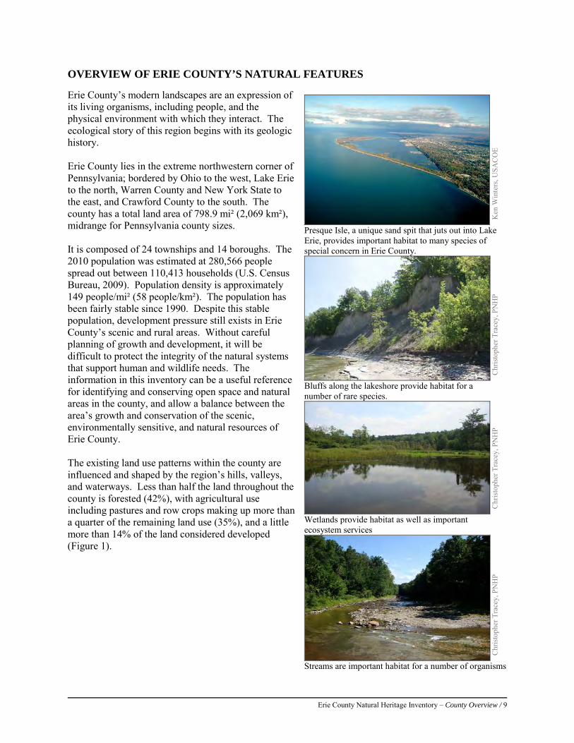
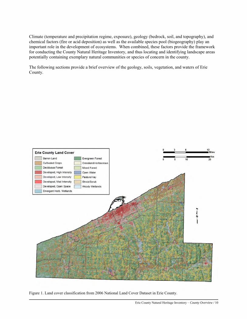
OVERVIEW OF ERIE COUNTY’S NATURAL FEATURES Erie County’s modern landscapes are an expression of its living organisms, including people, and the physical environment with which they interact. The ecological story of this region begins with its geologic history. Erie County lies in the extreme northwestern corner of Pennsylvania; bordered by Ohio to the west, Lake Erie to the north, Warren County and New York State to the east, and Crawford County to the south. The county has a total land area of 798.9 mi² (2,069 km²), midrange for Pennsylvania county sizes. It is composed of 24 townships and 14 boroughs. The 2010 population was estimated at 280,566 people spread out between 110,413 households (U.S. Census Bureau, 2009). Population density is approximately 149 people/mi² (58 people/km²). The population has been fairly stable since 1990. Despite this stable population, development pressure still exists in Erie County’s scenic and rural areas. Without careful planning of growth and development, it will be difficult to protect the integrity of the natural systems that support human and wildlife needs. The information in this inventory can be a useful reference for identifying and conserving open space and natural areas in the county, and allow a balance between the area’s growth and conservation of the scenic, environmentally sensitive, and natural resources of Erie County. The existing land use patterns within the county are influenced and shaped by the region’s hills, valleys, and waterways. Less than half the land throughout the county is forested (42%), with agricultural use including pastures and row crops making up more than a quarter of the remaining land use (35%), and a little more than 14% of the land considered developed (Figure 1).
Ken
Win
ters
, USA
CO
E
Presque Isle, a unique sand spit that juts out into Lake Erie, provides important habitat to many species of special concern in Erie County.
Chr
istop
her T
race
y, P
NH
P
Bluffs along the lakeshore provide habitat for a number of rare species.
Chr
istop
her T
race
y, P
NH
P
Wetlands provide habitat as well as important ecosystem services
Chr
istop
her T
race
y, P
NH
P
Streams are important habitat for a number of organisms
Erie County Natural Heritage Inventory – County Overview / 10
Climate (temperature and precipitation regime, exposure), geology (bedrock, soil, and topography), and chemical factors (fire or acid deposition) as well as the available species pool (biogeography) play an important role in the development of ecosystems. When combined, these factors provide the framework for conducting the County Natural Heritage Inventory, and thus locating and identifying landscape areas potentially containing exemplary natural communities or species of concern in the county. The following sections provide a brief overview of the geology, soils, vegetation, and waters of Erie County.
Figure 1. Land cover classification from 2006 National Land Cover Dataset in Erie County.
Erie County Natural Heritage Inventory – County Overview / 11
Physiography and Geology
A physiographic province is a geographic region in which all parts are similar in geologic structure and climate, and which has a unified geomorphic or surficial history. This means that the landforms on the surface were formed similarly, and have comparable bedrock and climate. A region’s topography, climate, and geology affect the development of soils, hydrology (movement, distribution, and quality of water), and land use patterns. These factors also influence the distributions of plant and animal. Because of the differences in climate and soils, certain plants and animals are expected to occur within some physiographic provinces and not others.
Erie County covers 1,558 square miles and overlaps with the Appalachian Plateau and the Central Lowlands Physiographic Provinces. Most of the southern portion of the county is within the Northwestern Glaciated Plateau Section of the Appalachian Plateau Physiographic Province, while the relatively narrow strip of the Eastern Lake Section makes up the Central Lowlands Physiographic Province. The Appalachian Plateau extends throughout western and northern Pennsylvania from Greene County north to Erie, then east to Pike County. It is characterized by “high, flat-topped divides separated by steep-sided valleys in which flow deeply entrenched streams” (Willard 1976). The sedimentary rock below the province is fairly uniform having not been folded or faulted like much of the other bedrock in Pennsylvania. The sandstone and shale bedrock originated when sediment was laid down in the shallow inland seas that covered much of Pennsylvania. The lower layers of sediment were compressed over time by the weight of the newer layers piled above them. Individual grains were cemented together by minerals that precipitated (minerals solidified out of the solution between the grains) out from the pressure (Van Diver 1990). Next, these layers of sedimentary rock were uplifted 400-500 million years ago when two island chains collided with the eastern edge of North America (during the Taconic and Acadian Orogenies, or mountain-building events) to form a plateau elevated above the surrounding regions. Most topographic relief in this area is defined by streams which have cut valleys over geologic time.
The reason that this area does not resemble what one might consider a plateau is due to these valleys created by streams (Van Diver 1990). This topography results in the Allegheny Plateau being susceptible to flash floods.
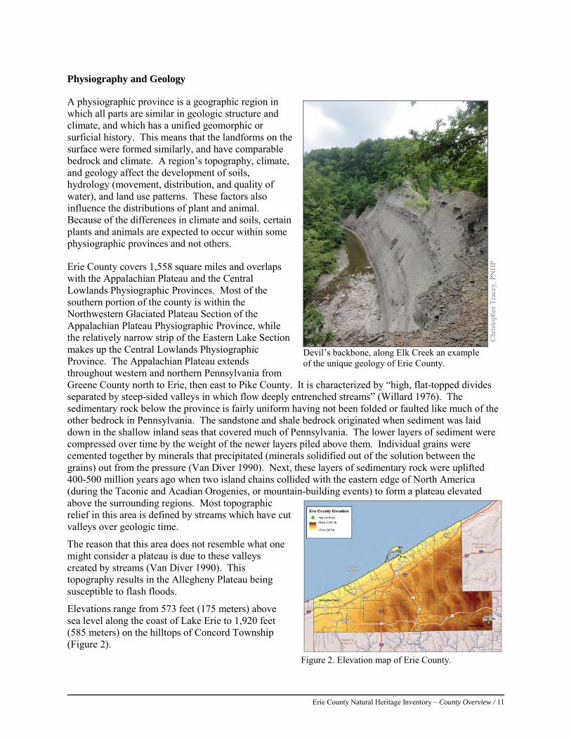
Elevations range from 573 feet (175 meters) above sea level along the coast of Lake Erie to 1,920 feet (585 meters) on the hilltops of Concord Township (Figure 2).
Chr
istop
her T
race
y, P
NH
P
Devil’s backbone, along Elk Creek an example of the unique geology of Erie County.
Figure 2. Elevation map of Erie County.
Erie County Natural Heritage Inventory – County Overview / 12
The following sections describe the bedrock and glacial geology of Erie County as well as the soils. A discussion of the ecological implications of the geology concludes this section
Bedrock geology
The bedrock layers that are exposed in Erie County were laid down in the late Devonian era and early Mississippian era, between approximately 345 and 385 million years ago. This area was part of a large inland sea at the time. The sediments that were deposited here came from an older mountain range (i.e. the Catskills) that ran along the eastern border of Pennsylvania into New York (Schultz, 1999). Much later, these rocks were uplifted and tilted slightly to the south and southeast. Erosion since this time has removed the overlying rock layers and left the bedrock layers that we see today
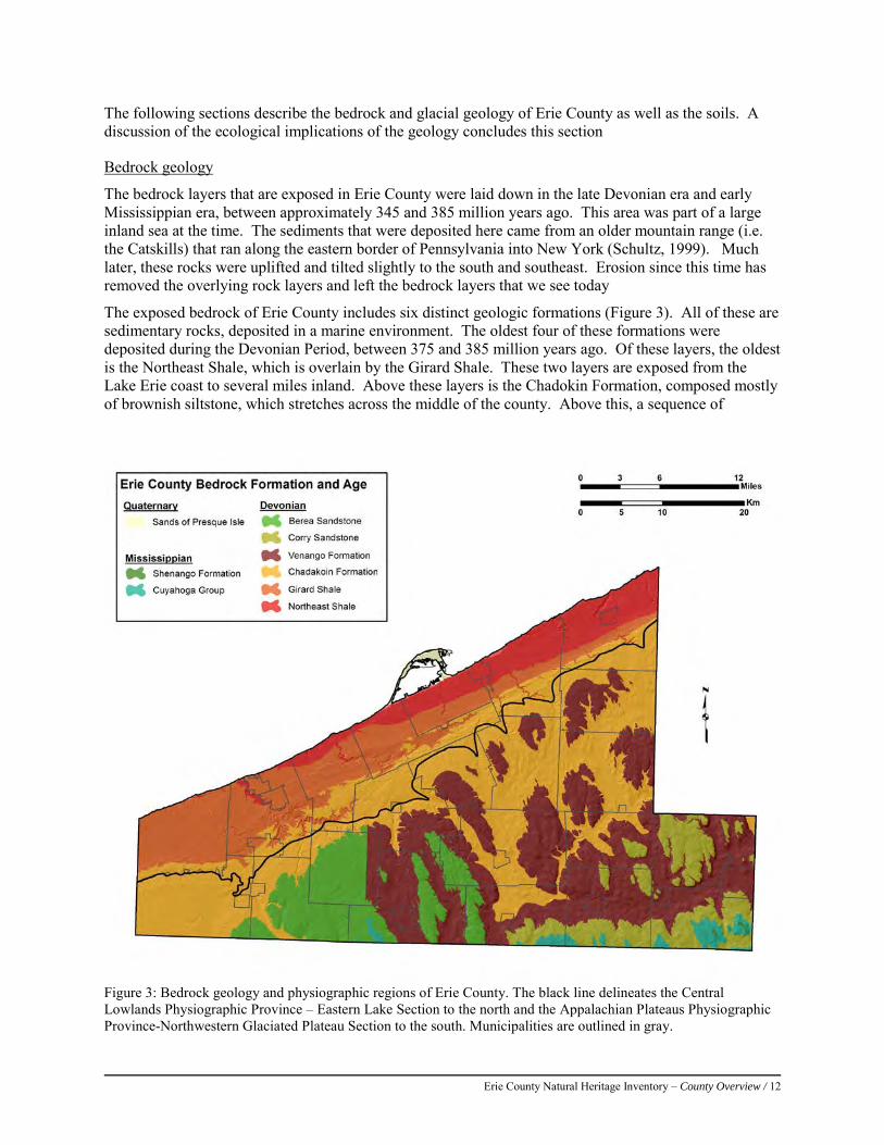
The exposed bedrock of Erie County includes six distinct geologic formations (Figure 3). All of these are sedimentary rocks, deposited in a marine environment. The oldest four of these formations were deposited during the Devonian Period, between 375 and 385 million years ago. Of these layers, the oldest is the Northeast Shale, which is overlain by the Girard Shale. These two layers are exposed from the Lake Erie coast to several miles inland. Above these layers is the Chadokin Formation, composed mostly of brownish siltstone, which stretches across the middle of the county. Above this, a sequence of
Figure 3: Bedrock geology and physiographic regions of Erie County. The black line delineates the Central Lowlands Physiographic Province – Eastern Lake Section to the north and the Appalachian Plateaus Physiographic Province-Northwestern Glaciated Plateau Section to the south. Municipalities are outlined in gray.
Erie County Natural Heritage Inventory – County Overview / 13
siltstones, sandstones, and shales stretch across the southern part of the county. The hilltops along the south edge of Erie County are composed of younger Mississippian rocks, deposited between 345 and 359 million years ago. These rocks include the gray siltstones and shales of the Cuyahoga Group, with the highest hilltops in the southeast corner of the county being tipped with the gray sandstone of the Shenango Formation.
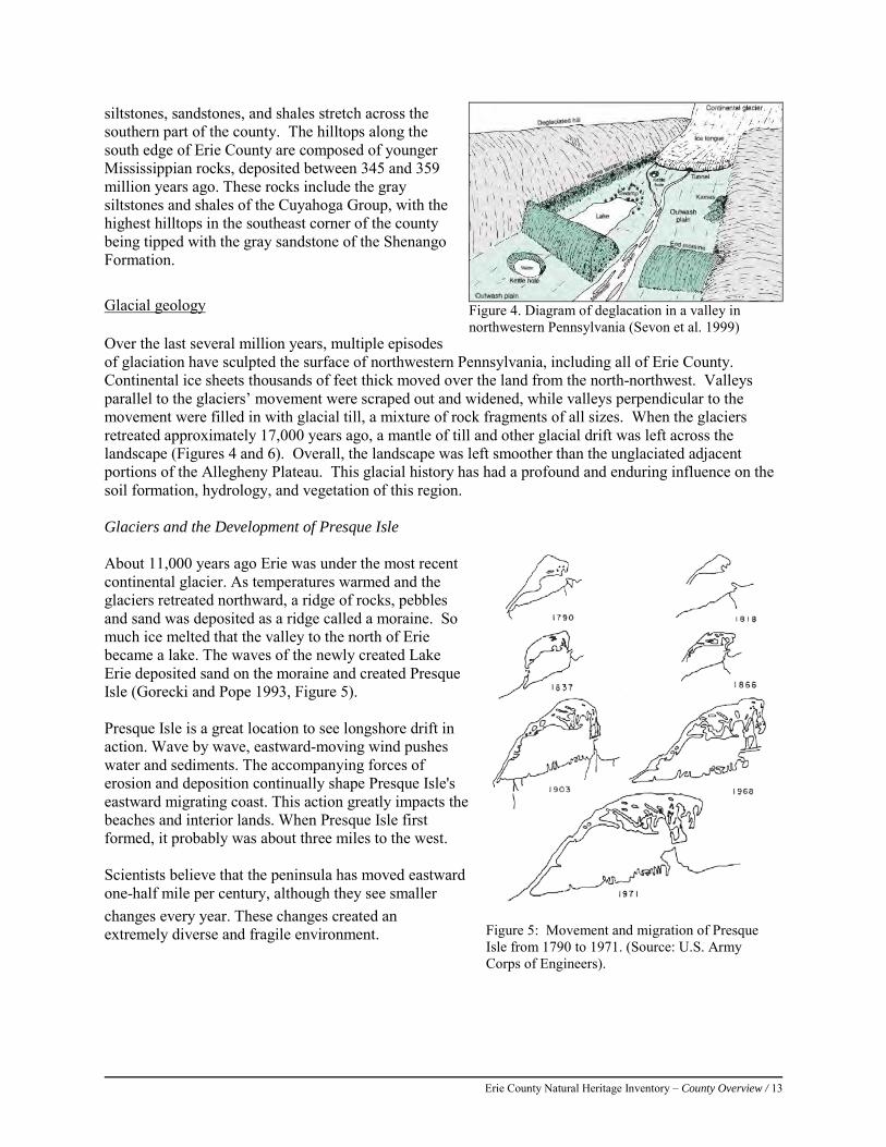
Glacial geology Over the last several million years, multiple episodes of glaciation have sculpted the surface of northwestern Pennsylvania, including all of Erie County. Continental ice sheets thousands of feet thick moved over the land from the north-northwest. Valleys parallel to the glaciers’ movement were scraped out and widened, while valleys perpendicular to the movement were filled in with glacial till, a mixture of rock fragments of all sizes. When the glaciers retreated approximately 17,000 years ago, a mantle of till and other glacial drift was left across the landscape (Figures 4 and 6). Overall, the landscape was left smoother than the unglaciated adjacent portions of the Allegheny Plateau. This glacial history has had a profound and enduring influence on the soil formation, hydrology, and vegetation of this region. Glaciers and the Development of Presque Isle About 11,000 years ago Erie was under the most recent continental glacier. As temperatures warmed and the glaciers retreated northward, a ridge of rocks, pebbles and sand was deposited as a ridge called a moraine. So much ice melted that the valley to the north of Erie became a lake. The waves of the newly created Lake Erie deposited sand on the moraine and created Presque Isle (Gorecki and Pope 1993, Figure 5). Presque Isle is a great location to see longshore drift in action. Wave by wave, eastward-moving wind pushes water and sediments. The accompanying forces of erosion and deposition continually shape Presque Isle's eastward migrating coast. This action greatly impacts the beaches and interior lands. When Presque Isle first formed, it probably was about three miles to the west. Scientists believe that the peninsula has moved eastward one-half mile per century, although they see smaller changes every year. These changes created an extremely diverse and fragile environment.
Figure 4. Diagram of deglacation in a valley in northwestern Pennsylvania (Sevon et al. 1999)
Figure 5: Movement and migration of Presque Isle from 1790 to 1971. (Source: U.S. Army Corps of Engineers).
Erie County Natural Heritage Inventory – County Overview / 14
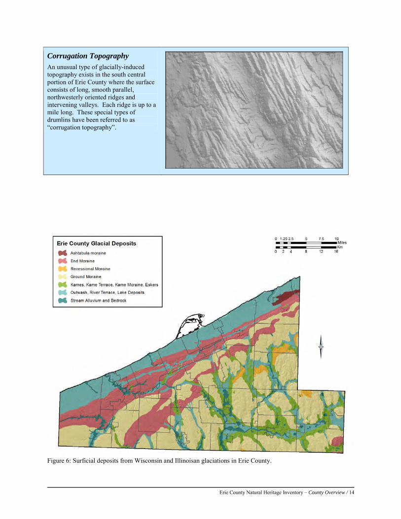
Corrugation Topography
An unusual type of glacially-induced topography exists in the south central portion of Erie County where the surface consists of long, smooth parallel, northwesterly oriented ridges and intervening valleys. Each ridge is up to a mile long. These special types of drumlins have been referred to as “corrugation topography”.
Figure 6: Surficial deposits from Wisconsin and Illinoisan glaciations in Erie County.
Erie County Natural Heritage Inventory – County Overview / 15
Soils
A soil association is a “natural grouping of soils based on similarities in climatic or physiographic factors and soil parent materials” (Canadian Soil Information System, 1995). It includes a number of soil types, usually one or two major soils and a minor soil; it is named after the major soils. The soils of Erie County are made up of 10 main series, which are mapped in Figure 7. More detailed soil maps are available online at http://websoilsurvey.nrcs.usda.gov Table 1 summarizes available information from the Soil Survey about soil associations found in Erie County. Soil character exerts a strong influence on vegetation, as all plant species have individual requirements for soil qualities such as nutrient availability (like nitrogen, potassium, or phosphorus), moisture levels, and pH (acidity or alkalinity of the soil). .
Ecological implications of geology
Several important habitat types are linked directly to the geology and geomorphic history of the county. These types are mentioned briefly below, and are described in more detail in the Vegetation and Results sections. Much of the county is underlain by a layer of unsorted lodgment till, the ground up rock and other material that was under the glacier. This layer which contains a large amount of limestone and other calcareous bedrock was scooped out of the Lake Erie basin by glaciers and deposited in the form of till, kames, and eskers. Lodgment till often has a high silt and clay content and is predisposed to poor infiltration which favors vernal pool and other wetland formation. Kames are glacial deposits that have been laid down in contact with glacial ice and which tend to be sorted by particle size. This makes them more porous than glacial till, and water flows through them relatively easily and tends to become alkaline from contact with carbonate minerals. Where these waters seep out at the edge of a kame field, conditions may be suitable for several rare natural communities, including Buckthorn-Sedge-Golden Ragwort Fens, Open Sedge Fens, and Golden Saxifrage – Sedge Rich Seeps. Numerous rare species also occur in these conditions.
With a kame field, there are often depressions called kettles that form when blocks of glacial ice are buried in the kame deposits. Smaller kettles often contain herbaceous vernal ponds, or vernal pools. Larger kettles can contain acidic glacial peatlands, which host numerous species of concern.
The larger tributary creeks of Lake Erie often host a group of natural communities called the Great Lakes Region Scarp Complex. The combination of the sloping of the land toward the lake, together with the softness of the shale, allows the creeks to cut deep gorges into the shale. The steep sides of these gorges can support dry open woodlands, or alkaline seepage wetlands, depending on the local hydrology. Both habitat types are recognized as rare in Pennsylvania, and both types support rare plant species. These systems occur on Elk Creek, Little Elk Creek, Falls (Falk) Run, Walnut Creek, Fourmile Creek, Sixmile Creek, Twelvemile Creek, Sixteenmile Creek, and Twentymile Creek (Sevon et al. 1999).
The Pennsylvanian bedrock occurs over 35% of the state, mostly under the Appalachian Plateau (Schultz, 1999). No igneous or metamorphic rocks of any kind are known within the county, which is consistent with the geologic history of the region. Several important habitat types are linked directly to the geology and geomorphic history of the county including vernal pools. Vernal pools are temporary pools that provide a place protected from predators where amphibians can safely breed. Geology is an important factor in the location of vernal pools; the origins of most of the depressions that collect water are from geologic processes such as glaciation (Colburn, 2004), although vernal pools also occur outside the glaciated region, especially on floodplains.

Erie County Natural Heritage Inventory – County Overview / 16
In addition to these habitat types, the DCNR Bureau of Topographic and Geologic Survey (TopoGeo) maintains an inventory of unique geologic features within the commonwealth (Geyer and Bolles, 1979; Geyer and Bolles, 1987). Four of these features (Devils Backbone, Drumlins, Presque Isle, and Titus Bog) are considered to be some the best remaining example of their types in Pennsylvania. These features are discussed in more detail in the Results section.
Figure 7: Generalized soil associations of Erie County (NRCS 2010)
Table 1: General soil series of Erie County. The modern generalized soil units mapped in Figure 7 above do not have descriptions available from the USGS. Here we present generalized soils descriptions from the Erie County Soil Survey (Taylor et al. 1960). These units correspond roughly to the units mapped in Figure 7, as described in the second column below.
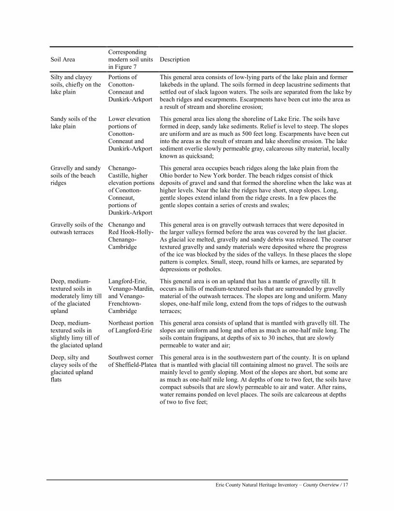
Erie County Natural Heritage Inventory – County Overview / 17
Soil Area Corresponding modern soil units in Figure 7
Description
Silty and clayey soils, chiefly on the lake plain
Portions of Conotton-Conneaut and Dunkirk-Arkport
This general area consists of low-lying parts of the lake plain and former lakebeds in the upland. The soils formed in deep lacustrine sediments that settled out of slack lagoon waters. The soils are separated from the lake by beach ridges and escarpments. Escarpments have been cut into the area as a result of stream and shoreline erosion;
Sandy soils of the lake plain
Lower elevation portions of Conotton-Conneaut and Dunkirk-Arkport
This general area lies along the shoreline of Lake Erie. The soils have formed in deep, sandy lake sediments. Relief is level to steep. The slopes are uniform and are as much as 500 feet long. Escarpments have been cut into the areas as the result of stream and lake shoreline erosion. The lake sediment overlie slowly permeable gray, calcareous silty material, locally known as quicksand;
Gravelly and sandy soils of the beach ridges
Chenango-Castille, higher elevation portions of Conotton-Conneaut, portions of Dunkirk-Arkport
This general area occupies beach ridges along the lake plain from the Ohio border to New York border. The beach ridges consist of thick deposits of gravel and sand that formed the shoreline when the lake was at higher levels. Near the lake the ridges have short, steep slopes. Long, gentle slopes extend inland from the ridge crests. In a few places the gentle slopes contain a series of crests and swales;
Gravelly soils of the outwash terraces
Chenango and Red Hook-Holly-Chenango-Cambridge
This general area is on gravelly outwash terraces that were deposited in the larger valleys formed before the area was covered by the last glacier. As glacial ice melted, gravelly and sandy debris was released. The coarser textured gravelly and sandy materials were deposited where the progress of the ice was blocked by the sides of the valleys. In these places the slope pattern is complex. Small, steep, round hills or kames, are separated by depressions or potholes.
Deep, medium-textured soils in moderately limy till of the glaciated upland
Langford-Erie, Venango-Mardin, and Venango-Frenchtown-Cambridge
This general area is on an upland that has a mantle of gravelly till. It occurs as hills of medium-textured soils that are surrounded by gravelly material of the outwash terraces. The slopes are long and uniform. Many slopes, one-half mile long, extend from the tops of ridges to the outwash terraces;
Deep, medium-textured soils in slightly limy till of the glaciated upland
Northeast portion of Langford-Erie
This general area consists of upland that is mantled with gravelly till. The slopes are uniform and long and often as much as one-half mile long. The soils contain fragipans, at depths of six to 30 inches, that are slowly permeable to water and air;
Deep, silty and clayey soils of the glaciated upland flats
Southwest corner of Sheffield-Platea
This general area is in the southwestern part of the county. It is on upland that is mantled with glacial till containing almost no gravel. The soils are mainly level to gently sloping. Most of the slopes are short, but some are as much as one-half mile long. At depths of one to two feet, the soils have compact subsoils that are slowly permeable to air and water. After rains, water remains ponded on level places. The soils are calcareous at depths of two to five feet;
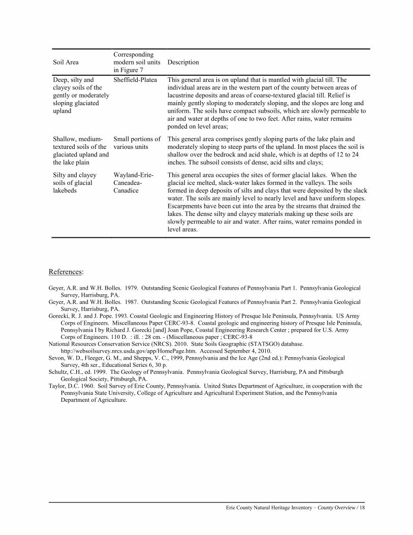
Erie County Natural Heritage Inventory – County Overview / 18
Soil Area Corresponding modern soil units in Figure 7
Description
Deep, silty and clayey soils of the gently or moderately sloping glaciated upland
Sheffield-Platea This general area is on upland that is mantled with glacial till. The individual areas are in the western part of the county between areas of lacustrine deposits and areas of coarse-textured glacial till. Relief is mainly gently sloping to moderately sloping, and the slopes are long and uniform. The soils have compact subsoils, which are slowly permeable to air and water at depths of one to two feet. After rains, water remains ponded on level areas;
Shallow, medium-textured soils of the glaciated upland and the lake plain
Small portions of various units
This general area comprises gently sloping parts of the lake plain and moderately sloping to steep parts of the upland. In most places the soil is shallow over the bedrock and acid shale, which is at depths of 12 to 24 inches. The subsoil consists of dense, acid silts and clays;
Silty and clayey soils of glacial lakebeds
Wayland-Erie-Caneadea-Canadice
This general area occupies the sites of former glacial lakes. When the glacial ice melted, slack-water lakes formed in the valleys. The soils formed in deep deposits of silts and clays that were deposited by the slack water. The soils are mainly level to nearly level and have uniform slopes. Escarpments have been cut into the area by the streams that drained the lakes. The dense silty and clayey materials making up these soils are slowly permeable to air and water. After rains, water remains ponded in level areas.
References: Geyer, A.R. and W.H. Bolles. 1979. Outstanding Scenic Geological Features of Pennsylvania Part 1. Pennsylvania Geological
Survey, Harrisburg, PA. Geyer, A.R. and W.H. Bolles. 1987. Outstanding Scenic Geological Features of Pennsylvania Part 2. Pennsylvania Geological
Survey, Harrisburg, PA. Gorecki, R. J. and J. Pope. 1993. Coastal Geologic and Engineering History of Presque Isle Peninsula, Pennsylvania. US Army
Corps of Engineers. Miscellaneous Paper CERC-93-8. Coastal geologic and engineering history of Presque Isle Peninsula, Pennsylvania I by Richard J. Gorecki [and] Joan Pope, Coastal Engineering Research Center ; prepared for U.S. Army Corps of Engineers. 110 D. : ill. : 28 cm. - (Miscellaneous paper ; CERC-93-8
National Resources Conservation Service (NRCS). 2010. State Soils Geographic (STATSGO) database. http://websoilsurvey.nrcs.usda.gov/app/HomePage.htm. Accessed September 4, 2010.
Sevon, W. D., Fleeger, G. M., and Shepps, V. C., 1999, Pennsylvania and the Ice Age (2nd ed.): Pennsylvania Geological Survey, 4th ser., Educational Series 6, 30 p.
Schultz, C.H., ed. 1999. The Geology of Pennsylvania. Pennsylvania Geological Survey, Harrisburg, PA and Pittsburgh Geological Society, Pittsburgh, PA.
Taylor, D.C. 1960. Soil Survey of Erie County, Pennsylvania. United States Department of Agriculture, in cooperation with the Pennsylvania State University, College of Agriculture and Agricultural Experiment Station, and the Pennsylvania Department of Agriculture.

Erie County Natural Heritage Inventory – County Overview / 19
Vegetation
The interaction of geology, climate, and history produces the pattern of vegetation expressed on the landscape today. Vegetation provides several critical functions in the landscape including the regulation of cycles (such as the water, carbon, and nitrogen cycles), soil formation, and wildlife habitat. Within a region, these vegetation patterns governed by natural ecosystem processes and disturbances can be classified as plant communities that exist as repeating patterns across the landscape. A plant community is defined as an assemblage of plant populations sharing a common environment and interacting with each other, with animal populations, and with the physical environment (Whitaker 1975). The classification of vegetation communities typically revolves around common plant species co-occurring within a site, their habit (growth form), and physical site characteristics (climate, slope, soils, pattern of disturbance). Upland and wetland plant community types, defined by present vegetation, were described for Pennsylvania by the Pennsylvania Natural Heritage Program and Pennsylvania Bureau of Forestry for scientific and site management purposes (Fike 1999, Zimmerman et al. 2012, see: http://www.naturalheritage.state.pa.us/Communities.aspx). As with rare plant and animal species PNHP identifies and monitors uncommon plant community types and lists rare types as elements of special conservation concern. In addition to rare types, high quality examples of common naturally occurring plant communities, such as old growth forest, are also monitored by PNHP. Upland and wetland plant community types occurring in Erie County are described in this report, and rare and high quality examples are included in the Natural Heritage Areas described in the results section below. Rare plant communities often contain populations of rare species. It is important to note that unlike species, boundaries between community types in nature are generally blurry and difficult to define; there may be wide transitions between distinct communities. For mapping purposes the best representation of the lines between communities are drawn, and it is acknowledged that some boundaries between community types in the field are less distinct than others. A sampling of common community types in Erie County is presented below.
Chr
istop
her T
race
y, P
NH
P
Wattsburg Fen and the surrounding swamp forest in winter.
Erie County Natural Heritage Inventory – County Overview / 20
Major Forest Groups
The following sections provide an overview and descriptions of the major forest groups in Erie County.
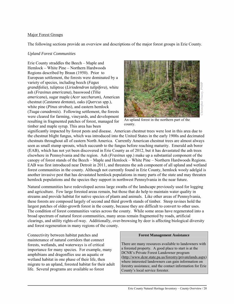
Upland Forest Communities
Erie County straddles the Beech – Maple and Hemlock – White Pine – Northern Hardwoods Regions described by Braun (1950). Prior to European settlement, the forests were dominated by a variety of species, including beech (Fagus grandifolia), tuliptree (Liriodendron tulipifera), white ash (Fraxinus americana), basswood (Tilia americana), sugar maple (Acer saccharum), American chestnut (Castanea dentata), oaks (Quercus spp.), white pine (Pinus strobus), and eastern hemlock (Tsuga canadensis). Following settlement, the forests were cleared for farming, vineyards, and development resulting in fragmented patches of forest, managed for timber and maple syrup. This area has been significantly impacted by forest pests and disease. American chestnut trees were lost in this area due to the chestnut blight fungus, which was introduced into the United States in the early 1900s and decimated chestnuts throughout all of eastern North America. Currently American chestnut trees are almost always seen as small stump sprouts, which succumb to the fungus before reaching maturity. Emerald ash borer (EAB), which has not yet been discovered in Erie County as of 2012, but it has devastated the ash trees elsewhere in Pennsylvania and the region. Ash (Fraxinus spp.) make up a substantial component of the canopy of forest stands of the Beech – Maple and Hemlock – White Pine – Northern Hardwoods Regions. EAB was first introduced near Detroit in 2011, and threatens the ash component of all upland and wetland forest communities in the county. Although not currently found in Erie County, hemlock wooly adelgid is another invasive pest that has devastated hemlock populations in many parts of the state and may threaten hemlock populations and the species they support in northwest Pennsylvania in the near future.
Natural communities have redeveloped across large swaths of the landscape previously used for logging and agriculture. Few large forested areas remain, but those that do help to maintain water quality in streams and provide habitat for native species of plants and animals. Like other areas of Pennsylvania, these forests are composed largely of second and third growth stands of timber. Steep ravines hold the largest patches of older-growth forest in the county, because they are difficult to convert to other uses. The condition of forest communities varies across the county. While some areas have regenerated into a broad spectrum of natural forest communities, many areas remain fragmented by roads, artificial clearings, and utility rights-of-way. Additionally, over-browsing by deer is affecting biological diversity and forest regeneration in many regions of the county.
Connectivity between habitat patches and maintenance of natural corridors that connect forests, wetlands, and waterways is of critical importance for many species. For example, many amphibians and dragonflies use an aquatic or wetland habitat in one phase of their life, then migrate to an upland, forested habitat for their adult life. Several programs are available so forest
Chr
istop
her T
race
y, P
NH
P
An upland forest in the northern part of the county.
Forest Management Assistance There are many resources available to landowners with a forested property. A good place to start is at the DCNR’s Private Forest Landowner program (http://www.dcnr.state.pa.us/forestry/privatelands.aspx) where interested landowners can gain information on forestry assistance, and the contact information for Erie County’s local service forester.
Erie County Natural Heritage Inventory – County Overview / 21
landowners can better manage their forestlands.
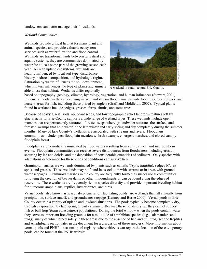
Wetland Communities
Wetlands provide critical habitat for many plant and animal species, and provide valuable ecosystem services such as water filtration and flood control. Wetlands are transitional lands between terrestrial and aquatic systems; they are communities dominated by water for at least some part of the growing season each year. As with upland ecosystems, wetlands are heavily influenced by local soil type, disturbance history, bedrock composition, and hydrologic regime. Saturation by water influences the soil development, which in turn influences the type of plants and animals able to use that habitat. Wetlands differ regionally based on topography, geology, climate, hydrology, vegetation, and human influences (Stewart, 2001). Ephemeral pools, wetlands occurring in river and stream floodplains, provide food resources, refuges, and nursery areas for fish, including those prized by anglers (Graff and Middleton, 2007). Typical plants found in wetlands include sedges, grasses, ferns, shrubs, and some trees.
Because of heavy glacial soils, abundant seeps, and low topographic relief landform features left by glacial activity, Erie County supports a wide range of wetland types. These wetlands include open marshes that are permanently saturated; forested seeps where groundwater saturates the surface; and forested swamps that hold water in the late winter and early spring and dry completely during the summer months. Many of Erie County’s wetlands are associated with streams and rivers. Floodplain communities include open floodplain meadows, shrub swamps, emergent marshes, and closed canopy floodplain forest.
Floodplains are periodically inundated by floodwaters resulting from spring runoff and intense storm events. Floodplain communities can receive severe disturbances from floodwaters including erosion, scouring by ice and debris, and the deposition of considerable quantities of sediment. Only species with adaptations or tolerance for these kinds of conditions can survive here.
Graminoid marshes are wetlands dominated by plants such as cattails (Typha latifolia), sedges (Carex spp.), and grasses. These wetlands may be found in association with streams or in areas with ground water seepages. Graminoid marshes in the county are frequently formed as successional communities following the creation of beaver dams or other impoundments or can be found along the edges of reservoirs. These wetlands are frequently rich in species diversity and provide important breeding habitat for numerous amphibians, reptiles, invertebrates, and birds.
Vernal pools, also known as seasonal/ephemeral or fluctuating ponds, are wetlands that fill annually from precipitation, surface runoff, and groundwater seepage (Kenney and Burne 2000). Vernal pools in Erie County occur in a variety of upland and lowland situations. The pools typically become completely dry, through evaporation, by late spring or early summer. Because these ponds dry up, they cannot support fish or bull frog (Rana catesbeiana) populations. During the brief window when the pools contain water, they serve as important breeding grounds for a multitude of amphibian species (e.g., salamanders and frogs), many of which breed solely in these areas due to the absence of fish and bull frog (see the Reptiles and Amphibians section later in the document for a discussion of these species). More information about vernal pools and PNHP’s seasonal pool registry, where citizens can report the location of these temporary pools, can be found at the PNHP website.
Chr
istop
her T
race
y, P
NH
P
A wetland in south-central Erie County.
Erie County Natural Heritage Inventory – County Overview / 22
Although wetlands are relatively rare throughout much of Pennsylvania, they are fairly common in Erie County due to its glacial history and they provide an important refuge for plants and important habitat for nesting and migrating birds. Many other animal groups such as amphibians, reptiles, dragonflies, damselflies, moths, and butterflies also depend on specific wetland habitats for all or a portion of their life cycles.
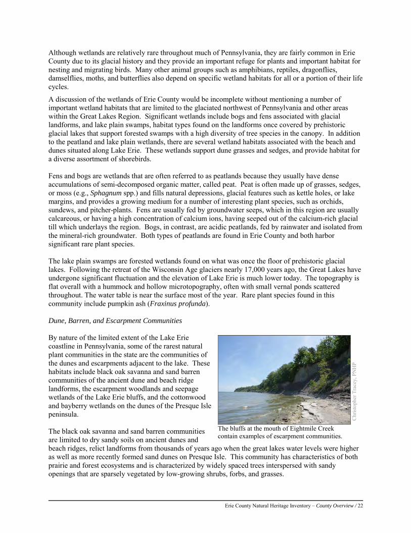
A discussion of the wetlands of Erie County would be incomplete without mentioning a number of important wetland habitats that are limited to the glaciated northwest of Pennsylvania and other areas within the Great Lakes Region. Significant wetlands include bogs and fens associated with glacial landforms, and lake plain swamps, habitat types found on the landforms once covered by prehistoric glacial lakes that support forested swamps with a high diversity of tree species in the canopy. In addition to the peatland and lake plain wetlands, there are several wetland habitats associated with the beach and dunes situated along Lake Erie. These wetlands support dune grasses and sedges, and provide habitat for a diverse assortment of shorebirds. Fens and bogs are wetlands that are often referred to as peatlands because they usually have dense accumulations of semi-decomposed organic matter, called peat. Peat is often made up of grasses, sedges, or moss (e.g., Sphagnum spp.) and fills natural depressions, glacial features such as kettle holes, or lake margins, and provides a growing medium for a number of interesting plant species, such as orchids, sundews, and pitcher-plants. Fens are usually fed by groundwater seeps, which in this region are usually calcareous, or having a high concentration of calcium ions, having seeped out of the calcium-rich glacial till which underlays the region. Bogs, in contrast, are acidic peatlands, fed by rainwater and isolated from the mineral-rich groundwater. Both types of peatlands are found in Erie County and both harbor significant rare plant species. The lake plain swamps are forested wetlands found on what was once the floor of prehistoric glacial lakes. Following the retreat of the Wisconsin Age glaciers nearly 17,000 years ago, the Great Lakes have undergone significant fluctuation and the elevation of Lake Erie is much lower today. The topography is flat overall with a hummock and hollow microtopography, often with small vernal ponds scattered throughout. The water table is near the surface most of the year. Rare plant species found in this community include pumpkin ash (Fraxinus profunda). Dune, Barren, and Escarpment Communities By nature of the limited extent of the Lake Erie coastline in Pennsylvania, some of the rarest natural plant communities in the state are the communities of the dunes and escarpments adjacent to the lake. These habitats include black oak savanna and sand barren communities of the ancient dune and beach ridge landforms, the escarpment woodlands and seepage wetlands of the Lake Erie bluffs, and the cottonwood and bayberry wetlands on the dunes of the Presque Isle peninsula. The black oak savanna and sand barren communities are limited to dry sandy soils on ancient dunes and beach ridges, relict landforms from thousands of years ago when the great lakes water levels were higher as well as more recently formed sand dunes on Presque Isle. This community has characteristics of both prairie and forest ecosystems and is characterized by widely spaced trees interspersed with sandy openings that are sparsely vegetated by low-growing shrubs, forbs, and grasses.
Chr
istop
her T
race
y, P
NH
P
The bluffs at the mouth of Eightmile Creek contain examples of escarpment communities.
Erie County Natural Heritage Inventory – County Overview / 23
Active dunes on Presque Isle also support the dry Great Lakes Region Cottonwood – Bayberry Community dominated by widely-spaced cottonwood trees. The swales between dunes are usually flooded much of the year and support the Great Lakes Bayberry – Mixed Shrub wetland. Wetlands along Lake Erie are threatened by the invasive giant reed (Phragmites australis subsp. australis) which can grow as tall as 20 feet and out-competes native wetland vegetation. Major features of the Lake Erie landscape are the lake-front and tributary bluffs, rising more than 100 feet from the lake or its tributaries. The bluff face communities are characteristically open with a mixture of shrubs and sometimes with scattered trees. This is a very dynamic system and the structure of the vegetation depends largely on its successional status. When dry, these near vertical bluffs are sparsely vegetated. One notable species from dry bluff woodlands is Canada buffaloberry (Shepherdia canadensis). Exposed bluffs are important nesting areas for bank swallows (Riparia riparia). At places along the bluff where water seeps out along its face, the vegetative cover is dense and composed primarily of grasses and sedges. These vertical wetlands support several rare plants including grass-of-Parnassus (Parnassia glauca), golden-fruited sedge (Carex aurea), brook lobelia (Lobelia kalmii), variegated scouring rush (Equisetum variegatum), smallhead rush (Juncus brachycephalus), and alpine rush (Juncus alpinoarticulatus).
Classification of Natural Plant Communities in Pennsylvania
Terrestrial & Palustrine Plant Communities of Pennsylvania 2nd Edition (Zimmerman et. al 2012) was used to describe plant communities occurring in Erie County. This work represents an update to the Fike (1999) system which for many years served as the most current community classification system for Pennsylvania’s palustrine and terrestrial plant communities. This report was developed by the Pennsylvania Natural Heritage Program to classify and describe plant communities in Pennsylvania, with the understanding that plant communities provide a valuable framework for organizing biological information and are mappable units, which are useful tools for land management and conservation planning. Aquatic communities (lakes, streams, and rivers), communities where vegetation is absent or not a definitive characteristic (caves, scree slopes), and communities resulting from extensive human disturbance (old agricultural fields, manmade wetlands) are not addressed in this classification. More information on community classification in Pennsylvania is available at http://www.naturalheritage.state.pa.us/communities.aspx).
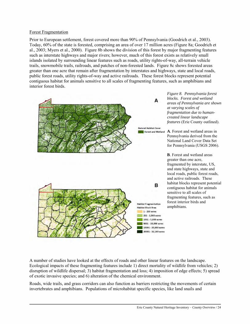
Erie County Natural Heritage Inventory – County Overview / 24
Forest Fragmentation
Prior to European settlement, forest covered more than 90% of Pennsylvania (Goodrich et al., 2003). Today, 60% of the state is forested, comprising an area of over 17 million acres (Figure 8a; Goodrich et al., 2003; Myers et al., 2000). Figure 8b shows the division of this forest by major fragmenting features such as interstate highways and major rivers; however, much of this forest exists as relatively small islands isolated by surrounding linear features such as roads, utility rights-of-way, all-terrain vehicle trails, snowmobile trails, railroads, and patches of non-forested lands. Figure 8c shows forested areas greater than one acre that remain after fragmentation by interstates and highways, state and local roads, public forest roads, utility rights-of-way and active railroads. These forest blocks represent potential contiguous habitat for animals sensitive to all scales of fragmenting features, such as amphibians and interior forest birds.
A number of studies have looked at the effects of roads and other linear features on the landscape. Ecological impacts of these fragmenting features include 1) direct mortality of wildlife from vehicles; 2) disruption of wildlife dispersal; 3) habitat fragmentation and loss; 4) imposition of edge effects; 5) spread of exotic invasive species; and 6) alteration of the chemical environment.
Roads, wide trails, and grass corridors can also function as barriers restricting the movements of certain invertebrates and amphibians. Populations of microhabitat specific species, like land snails and
Figure 8. Pennsylvania forest blocks. Forest and wetland areas of Pennsylvania are shown at varying scales of fragmentation due to human-created linear landscape features (Erie County outlined). A. Forest and wetland areas in Pennsylvania derived from the National Land Cover Data Set for Pennsylvania (USGS 2006). B. Forest and wetland areas greater than one acre, fragmented by interstate, US, and state highways, state and local roads, public forest roads, and active railroads. These habitat blocks represent potential contiguous habitat for animals sensitive to all scales of fragmenting features, such as forest interior birds and amphibians.
Erie County Natural Heritage Inventory – County Overview / 25
salamanders that generally require moist habitats, may be isolated by inhospitable, dry corridors (Williams, 1995; Blaustein et al., 1994). Roads can be a significant source of mortality for a variety of animals. Amphibians may be especially vulnerable to road-kill because their life histories often involve inconspicuous individuals migrating between wetland and upland habitats. One study conducted in southeastern Pennsylvania documented over 100 road-killed salamanders and frogs on a single one-mile stretch of road on one rainy night during the spring breeding season (Goodrich et al., 2003).
Large and mid-sized mammals are particularly susceptible to vehicle collisions on secondary roads, while birds and small mammals are most vulnerable on wider, high-speed highways (Forman and Alexander, 1998). In Upper St. Clair Township, Pennsylvania, over a recent four year period, white-tailed deer mortality due to road-kills was approximately four times higher than mortality due to hunting (Upper St. Clair Township Department of Deer Management, 2005). Bobcat (Lynx rufus) road-kills reported in Pennsylvania between 1985 and 2000 totaled 637 (Goodrich et al., 2003).
Animals may alter their behavior in the presence of a road. One study found that small forest mammals (such as the eastern chipmunk, the eastern gray squirrel, and the deer mouse) were reluctant to venture onto road surfaces where the distance between forest margins exceeded 65.6 feet (20 meters) (Oxley et al., 1974). The same study concluded that a four lane, divided highway might be as effective a barrier to the dispersal of small forest mammals as a body of freshwater twice as wide. A study conducted in North Carolina found that black bears shift their home ranges away from areas with high road densities (Brody and Pelton, 1989). Traffic noise has been shown to interfere with songbird vocal communication, which affects their territorial behavior and their mating success (Seiler, 2001). Some forest butterflies, such as the West Virginia white (Pieris virginiensis), will not cross open habitats; its current rarity may be a function of habitat fragmentation and isolation (Williams, 1995). Consequences of the isolation of populations include reduced genetic diversity and reduced breeding success, which may ultimately result in local extinctions (Seiler, 2001).
Fragmentation of contiguous forested landscapes into smaller, isolated tracts has an effect on plant and animal distribution and community composition. When a large piece of forest tract is fragmented, or split into pieces, the resulting forest islands may lack some of the habitats that existed in the original tract, or may be smaller than the minimum area required by a given species (Lynch and Whigham, 1984). For example, the Louisiana waterthrush (Seiurus motacilla) is rarely found in small woodlots because they require upland forest streams within their territory, and most small woodlots lack this necessary component (Robbins, 1980; Robinson, et al., 1995). Area-sensitive species such as the northern goshawk (Accipiter gentilis), barred owl (Strix varia), Bobcat (Lynx rufus), and timber rattlesnake (Crotalus horridus) require interior forest areas in excess of 6,000 acres (2,428 hectares) to accommodate breeding and foraging territories (Ciszek, 2002; Mazur and James, 2000; Squires and Reynolds, 1997).
Edge forest is composed of a zone of altered microclimate and contrasting community structure distinct from the interior forest (Matlack, 1993). Along with a reduction in total forested area, forest fragmentation creates a suite of edge effects which can extend around 1,000 feet (300 meters) into the remaining fragment (Forman and Deblinger, 2000). Edge effects include increased light intensity, reduced depth of the leaf-litter layer, altered plant and insect abundance, reduced numbers of macroinvertebrates, and fewer species of macroinvertebrates (Haskell, 2000; Watkins et al., 2003; Yahner, 1995). The macroinvertebrates in the leaf litter are significant for the pivotal role they play in energy and nutrient cycling; these macroinvertebrates also provide prey for salamanders and ground-feeding birds (Voshell, 2002). Additionally, a number of studies have shown that the nesting success of forest-interior songbirds is lower near forest edges than in the interior due to increased densities of nest predators and brooding parasites.
Not only do roads act to fragment forests, but roads can also act as corridors for invasive plant dispersal and toxic chemicals, and pollute nearby aquatic systems (Forman and Alexander, 1998; Trombulak and Frissell, 2000; Watkins et al., 2003; Williams, 1995). Vehicles and road construction operations transport
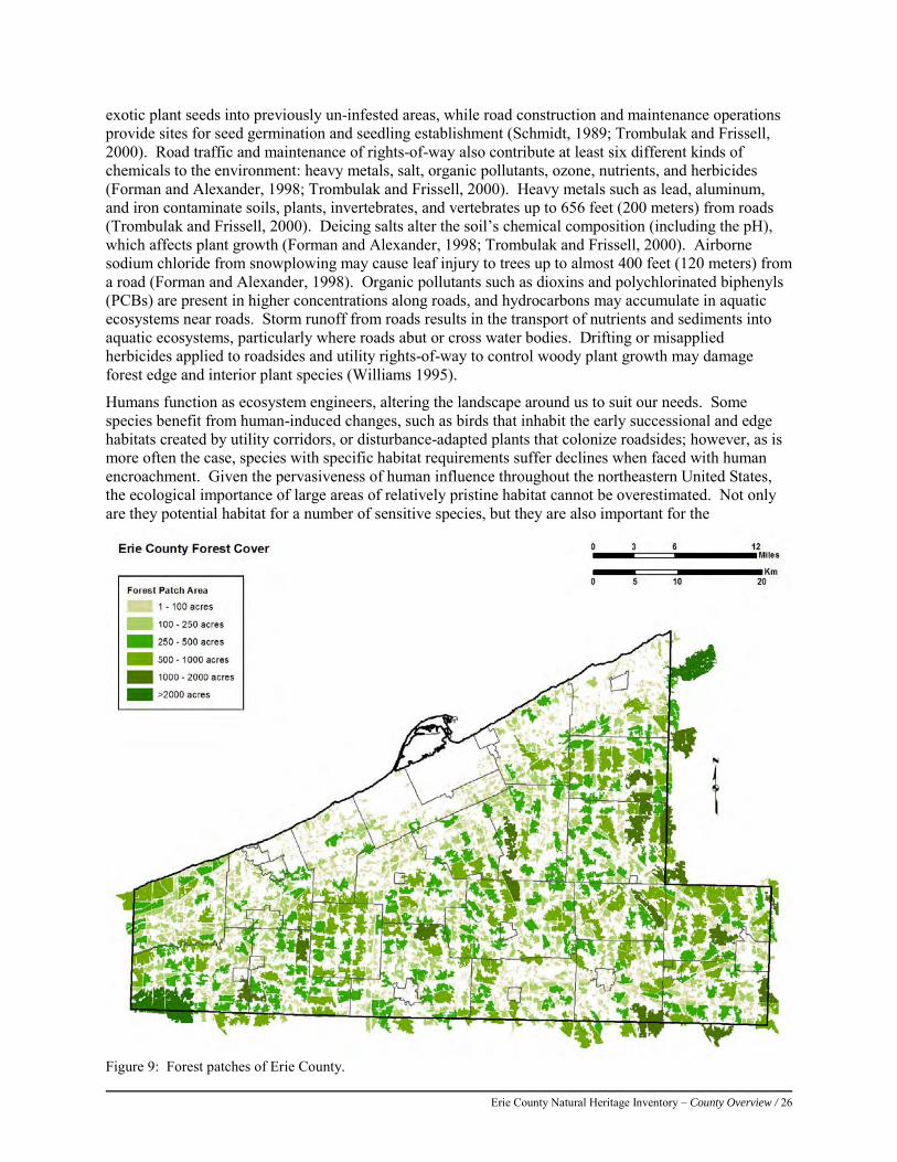
Erie County Natural Heritage Inventory – County Overview / 26
exotic plant seeds into previously un-infested areas, while road construction and maintenance operations provide sites for seed germination and seedling establishment (Schmidt, 1989; Trombulak and Frissell, 2000). Road traffic and maintenance of rights-of-way also contribute at least six different kinds of chemicals to the environment: heavy metals, salt, organic pollutants, ozone, nutrients, and herbicides (Forman and Alexander, 1998; Trombulak and Frissell, 2000). Heavy metals such as lead, aluminum, and iron contaminate soils, plants, invertebrates, and vertebrates up to 656 feet (200 meters) from roads (Trombulak and Frissell, 2000). Deicing salts alter the soil’s chemical composition (including the pH), which affects plant growth (Forman and Alexander, 1998; Trombulak and Frissell, 2000). Airborne sodium chloride from snowplowing may cause leaf injury to trees up to almost 400 feet (120 meters) from a road (Forman and Alexander, 1998). Organic pollutants such as dioxins and polychlorinated biphenyls (PCBs) are present in higher concentrations along roads, and hydrocarbons may accumulate in aquatic ecosystems near roads. Storm runoff from roads results in the transport of nutrients and sediments into aquatic ecosystems, particularly where roads abut or cross water bodies. Drifting or misapplied herbicides applied to roadsides and utility rights-of-way to control woody plant growth may damage forest edge and interior plant species (Williams 1995).
Humans function as ecosystem engineers, altering the landscape around us to suit our needs. Some species benefit from human-induced changes, such as birds that inhabit the early successional and edge habitats created by utility corridors, or disturbance-adapted plants that colonize roadsides; however, as is more often the case, species with specific habitat requirements suffer declines when faced with human encroachment. Given the pervasiveness of human influence throughout the northeastern United States, the ecological importance of large areas of relatively pristine habitat cannot be overestimated. Not only are they potential habitat for a number of sensitive species, but they are also important for the
Figure 9: Forest patches of Erie County.

Erie County Natural Heritage Inventory – County Overview / 27
maintenance of vital ecosystem processes and services such as nutrient cycling, pollination, predator-prey interactions, and natural disturbance regimes. Additionally, large forested areas also serve to filter and regulate the flows of streams within watersheds and store large quantities of carbon as biomass.
Using Forest Patches in Land Use Planning Where is the best place, ecologically, to situate any given land use, such as a new housing development, road, shopping center, farm, or nature reserve? Although the answer to this question probably depends largely on place specific variables such as slope or distance to existing development, landscape ecology can offer a useful generic answer, which can then be adapted to the planning and design questions at hand. Four “indispensable patterns” of natural land cover must be maintained in order to protect native species and natural processes:
1) Large natural patches – Large patches are the only way to protect interior species and species with large home ranges. Large patches also prevent natural disturbances, such as windthrows of trees, from affecting all of the land at once, thus allowing several successional stages to be represented at any given time.
2) Vegetated riparian corridors – Naturally vegetated corridors along waterways are essential for protecting many aquatic species (e.g., fish, mussels, and amphibians).
3) Connectivity between large patches – The landscape must provide functional connectivity for species of conservation interest—that is, linkages that these species can use for movement through their home range, migration, and dispersal into new sites. Functionality will most likely be served by wide continuous corridors, but stepping stones of suitable habitat may allow movement across less suitable habitat types.
4) Natural remnants in human-dominated areas – Within agricultural and urban landscapes, three types of natural remnants should be protected (in descending priority):
a. Areas of high conservation value, such as rare species habitat b. Landscape types that provide essential ecosystem services (e.g., wetlands that provide
flood control) c. Remnants of the former natural landcover that provide edge species habitat and human
access to nature. These principles are considered indispensable because no feasible alternative exists for the functions that they provide. Used together, they form the basis of the coarse-filter/fine-filter approach to conservation.
Erie County Natural Heritage Inventory – County Overview / 28
References: Blaustein, A.R., Wake, D.B., and W.P. Sousa. (1994). Amphibian Declines: Judging Stability, Persistence, and Susceptibility of
Populations to Local and Global Extinctions. Conservation Biology 8(1):60-71. Braun, E.L. (1950). Deciduous forest of eastern North America. The Free Press, MacCillan Publishing Company, New York.
596 pp. Brody, A.J., and Pelton, M.R. (1989). Effects of Roads on Black Bear Movements in Western North Carolina. Wildlife Society
Bulletin 17: 5-10. Fike, J. (1999). Terrestrial and Palustrine Plant Communities of Pennsylvania. Pennsylvania Natural Diversity Inventory.
Pennsylvania Department of Natural Resources, Harrisburg, PA. Forman, R.T., and L.E. Alexander. (1998). Roads and their Major Ecological Effects. Annual Review of Ecology and
Systematic 29:207-231. Goodrich, L. J., Brittingham, M., Bishop, J.A., and P. Barber. (2003). Wildlife Habitat in Pennsylvania: Past, Present, and
Future. Pennsylvania Department of Conservation and Natural Resources, Harrisburg, PA. Available at: http://www.dcnr.state.pa.us/wlhabitat/ (accessed October 2009).
Graff and Middleton, 2007 Haskell, D.G. (2000). Effects of Forest Roads on Macroinvertebrate Soil Fauna of the Southern Appalachian Mountains.
Conservation Biology 14(1):57-63. Matlack, G.R. (1993). Microenvironment Variation Within and Among Forest Edge Sites in the Eastern United States.
Biological Conservation 66:185-194. Myers, W.L., Brooks, R., and J. Bishop. (2000). Final Report U.S. Geological Survey-Gap Analysis Program. Pennsylvania
Gap Analysis Project, Penn State University, University Park, PA. Available at: http://www.orser.psu.edu/PAGAP/gappage.htm (accessed October 2009).
Oxley, D.J., Fenton, M.B., and Carmody, G.R. (1974). The Effects of Roads on Populations of Small Mammals. Journal of Applied Ecology 11:51-59.
Schmidt, W. (1989). Plant Dispersal by Motor Cars. Plant Ecology 80 (2): 147-152. Seiler, A. (2001). Ecological Effects of Roads: A Review. Introductory Research Essay No. 9, Swedish University of
Agricultural Sciences, Upsala, Sweden. Trombulak, S.C., and C.A. Frissell. (2000). Review of the Ecological Effects of Roads on Terrestrial and Aquatic Communities.
Conservation Biology 14 (1):18-30. Voshell, Jr, J.R. (2002). A Guide to Common Freshwater Invertebrates of North America. McDonald and Woodward
Publishing Co., Blacksburg, Virginia. Watkins, R.Z., Chen, J., Pickens, J., and K.D. Brosofske. (2003). Effects of Forest Roads on Understory Plants in a Managed
Hardwood Landscape. Conservation Biology 17(2):411-419. Whitaker 1975 Williams, C.E. (1995). Effects of Powerline Corridors on Forest Ecosystem Integrity. Pages 76-86 in S.K. Majumdar, E.W.
Miller, and F. J. Brenner (eds.), Environmental Contaminants, Ecosystems and Human Health. Pennsylvania Academy of Science, Easton, PA.
Yahner, R. H. 1995. Eastern deciduous forest: ecology and wildlife conservation. University of Minnesota Press, Minneapolis, Minn. 220 p.
Zimmerman, E., T. Davis, G. Podniesinski, M. Furedi, J. McPherson, S. Seymour, B. Eichelberger, N. Dewar, J. Wagner, and J. Fike (editors). 2012. Terrestrial and Palustrine Plant Communities of Pennsylvania, 2nd Edition. Pennsylvania Natural Heritage Program, Pennsylvania Department of Conservation and Natural Resources, Harrisburg, Pennsylvania.
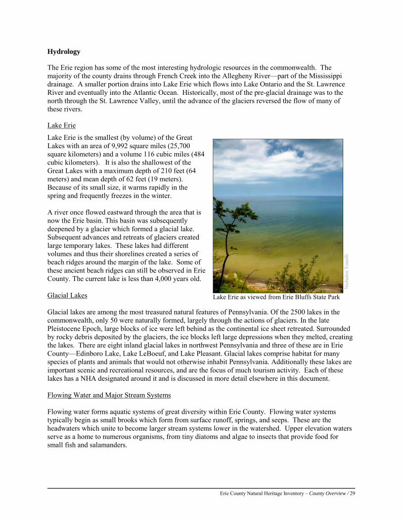
Erie County Natural Heritage Inventory – County Overview / 29
Hydrology
The Erie region has some of the most interesting hydrologic resources in the commonwealth. The majority of the county drains through French Creek into the Allegheny River—part of the Mississippi drainage. A smaller portion drains into Lake Erie which flows into Lake Ontario and the St. Lawrence River and eventually into the Atlantic Ocean. Historically, most of the pre-glacial drainage was to the north through the St. Lawrence Valley, until the advance of the glaciers reversed the flow of many of these rivers.
Lake Erie
Lake Erie is the smallest (by volume) of the Great Lakes with an area of 9,992 square miles (25,700 square kilometers) and a volume 116 cubic miles (484 cubic kilometers). It is also the shallowest of the Great Lakes with a maximum depth of 210 feet (64 meters) and mean depth of 62 feet (19 meters). Because of its small size, it warms rapidly in the spring and frequently freezes in the winter. A river once flowed eastward through the area that is now the Erie basin. This basin was subsequently deepened by a glacier which formed a glacial lake. Subsequent advances and retreats of glaciers created large temporary lakes. These lakes had different volumes and thus their shorelines created a series of beach ridges around the margin of the lake. Some of these ancient beach ridges can still be observed in Erie County. The current lake is less than 4,000 years old. Glacial Lakes Glacial lakes are among the most treasured natural features of Pennsylvania. Of the 2500 lakes in the commonwealth, only 50 were naturally formed, largely through the actions of glaciers. In the late Pleistocene Epoch, large blocks of ice were left behind as the continental ice sheet retreated. Surrounded by rocky debris deposited by the glaciers, the ice blocks left large depressions when they melted, creating the lakes. There are eight inland glacial lakes in northwest Pennsylvania and three of these are in Erie County—Edinboro Lake, Lake LeBoeuf, and Lake Pleasant. Glacial lakes comprise habitat for many species of plants and animals that would not otherwise inhabit Pennsylvania. Additionally these lakes are important scenic and recreational resources, and are the focus of much tourism activity. Each of these lakes has a NHA designated around it and is discussed in more detail elsewhere in this document. Flowing Water and Major Stream Systems Flowing water forms aquatic systems of great diversity within Erie County. Flowing water systems typically begin as small brooks which form from surface runoff, springs, and seeps. These are the headwaters which unite to become larger stream systems lower in the watershed. Upper elevation waters serve as a home to numerous organisms, from tiny diatoms and algae to insects that provide food for small fish and salamanders.
Nic
halo
s Ton
elli
Lake Erie as viewed from Erie Bluffs State Park
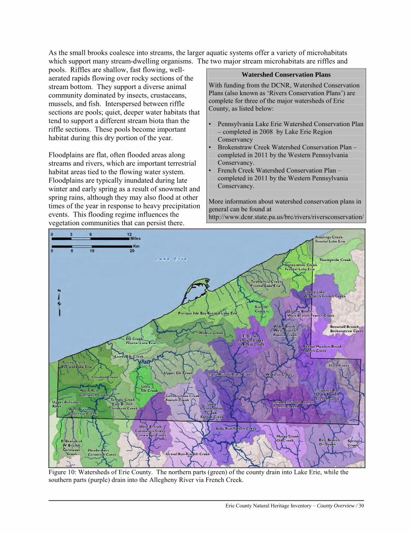
Erie County Natural Heritage Inventory – County Overview / 30
As the small brooks coalesce into streams, the larger aquatic systems offer a variety of microhabitats which support many stream-dwelling organisms. The two major stream microhabitats are riffles and pools. Riffles are shallow, fast flowing, well-aerated rapids flowing over rocky sections of the stream bottom. They support a diverse animal community dominated by insects, crustaceans, mussels, and fish. Interspersed between riffle sections are pools; quiet, deeper water habitats that tend to support a different stream biota than the riffle sections. These pools become important habitat during this dry portion of the year. Floodplains are flat, often flooded areas along streams and rivers, which are important terrestrial habitat areas tied to the flowing water system. Floodplains are typically inundated during late winter and early spring as a result of snowmelt and spring rains, although they may also flood at other times of the year in response to heavy precipitation events. This flooding regime influences the vegetation communities that can persist there.
Watershed Conservation Plans
With funding from the DCNR, Watershed Conservation Plans (also known as ‘Rivers Conservation Plans’) are complete for three of the major watersheds of Erie County, as listed below: • Pennsylvania Lake Erie Watershed Conservation Plan
– completed in 2008 by Lake Erie Region Conservancy
• Brokenstraw Creek Watershed Conservation Plan – completed in 2011 by the Western Pennsylvania Conservancy.
• French Creek Watershed Conservation Plan – completed in 2011 by the Western Pennsylvania Conservancy.
More information about watershed conservation plans in general can be found at http://www.dcnr.state.pa.us/brc/rivers/riversconservation/
Figure 10: Watersheds of Erie County. The northern parts (green) of the county drain into Lake Erie, while the southern parts (purple) drain into the Allegheny River via French Creek.
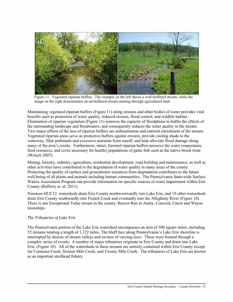
Erie County Natural Heritage Inventory – County Overview / 31
Figure 11. Vegetated riparian buffers. The example on the left shows a well-buffered stream, while the image on the right demonstrates an un-buffered stream running through agricultural land.
Maintaining vegetated riparian buffers (Figure 11) along streams and other bodies of water provides vital benefits such as protection of water quality, reduced erosion, flood control, and wildlife habitat. Elimination of riparian vegetation (Figure 11) removes the capacity of floodplains to buffer the effects of the surrounding landscape and floodwaters, and consequently reduces the water quality in the stream. Two major effects of the loss of riparian buffers are sedimentation and nutrient enrichment of the stream. Vegetated riparian areas serve as protective buffers against erosion, provide cooling shade to the waterway, filter pollutants and excessive nutrients from runoff, and help alleviate flood damage along many of the area’s creeks. Furthermore, intact, forested riparian buffers preserve the water temperature, food resources, and cover necessary for healthy populations of game fish such as the native brook trout (Welsch 2007).
Mining, forestry, industry, agriculture, residential development, road building and maintenance, as well as other activities have contributed to the degradation of water quality in many areas of the county. Protecting the quality of surface and groundwater resources from degradation contributes to the future well-being of all plants and animals including human communities. The Pennsylvania State-wide Surface Waters Assessment Program can provide information on specific sources of water impairment within Erie County (Rafferty et. al. 2011).
Nineteen HUC12 watersheds drain Erie County northwestwardly into Lake Erie, and 19 other watersheds drain Erie County southwardly into French Creek and eventually into the Allegheny River (Figure 10). There is one Exceptional Value stream in the county: Beaver Run in Amity, Concord, Union and Wayne townships. The Tributaries of Lake Erie The Pennsylvania portion of the Lake Erie watershed encompasses an area of 508 square miles, including 52 streams totaling a length of 1,122 miles. The bluff face along Pennsylvania’s Lake Erie shoreline is interrupted by dozens of stream valleys and ravines of varying sizes. These were formed through a complex series of events. A number of major tributaries originate in Erie County and drain into Lake Erie. (Figure 10). All of the watersheds in these streams are entirely contained within Erie County except for Conneaut Creek, Sixteen Mile Creek, and Twenty Mile Creek. The tributaries of Lake Erie are known as an important steelhead fishery.
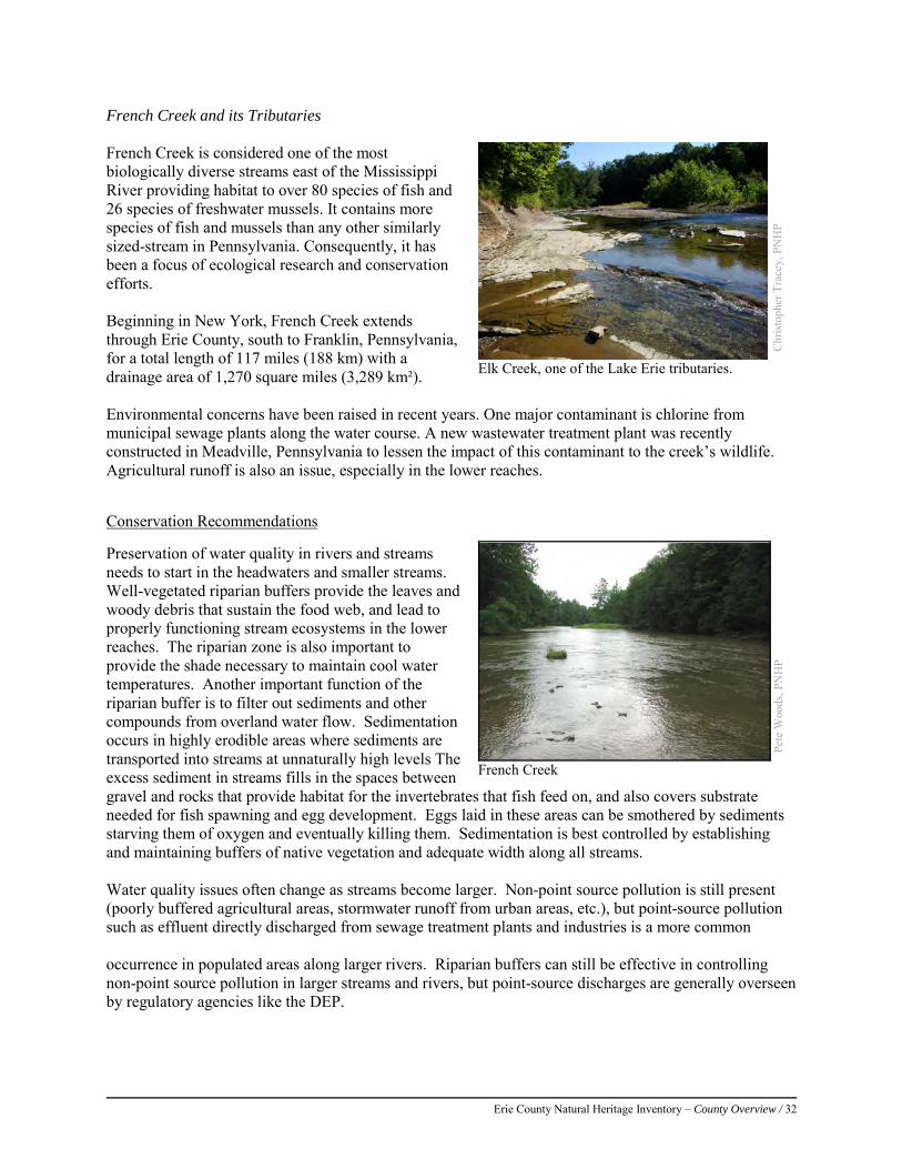
Erie County Natural Heritage Inventory – County Overview / 32
French Creek and its Tributaries French Creek is considered one of the most biologically diverse streams east of the Mississippi River providing habitat to over 80 species of fish and 26 species of freshwater mussels. It contains more species of fish and mussels than any other similarly sized-stream in Pennsylvania. Consequently, it has been a focus of ecological research and conservation efforts. Beginning in New York, French Creek extends through Erie County, south to Franklin, Pennsylvania, for a total length of 117 miles (188 km) with a drainage area of 1,270 square miles (3,289 km²). Environmental concerns have been raised in recent years. One major contaminant is chlorine from municipal sewage plants along the water course. A new wastewater treatment plant was recently constructed in Meadville, Pennsylvania to lessen the impact of this contaminant to the creek’s wildlife. Agricultural runoff is also an issue, especially in the lower reaches. Conservation Recommendations Preservation of water quality in rivers and streams needs to start in the headwaters and smaller streams. Well-vegetated riparian buffers provide the leaves and woody debris that sustain the food web, and lead to properly functioning stream ecosystems in the lower reaches. The riparian zone is also important to provide the shade necessary to maintain cool water temperatures. Another important function of the riparian buffer is to filter out sediments and other compounds from overland water flow. Sedimentation occurs in highly erodible areas where sediments are transported into streams at unnaturally high levels The excess sediment in streams fills in the spaces between gravel and rocks that provide habitat for the invertebrates that fish feed on, and also covers substrate needed for fish spawning and egg development. Eggs laid in these areas can be smothered by sediments starving them of oxygen and eventually killing them. Sedimentation is best controlled by establishing and maintaining buffers of native vegetation and adequate width along all streams. Water quality issues often change as streams become larger. Non-point source pollution is still present (poorly buffered agricultural areas, stormwater runoff from urban areas, etc.), but point-source pollution such as effluent directly discharged from sewage treatment plants and industries is a more common occurrence in populated areas along larger rivers. Riparian buffers can still be effective in controlling non-point source pollution in larger streams and rivers, but point-source discharges are generally overseen by regulatory agencies like the DEP.
Chr
istop
her T
race
y, P
NH
P
Elk Creek, one of the Lake Erie tributaries.
Pete
Woo
ds, P
NH
P French Creek
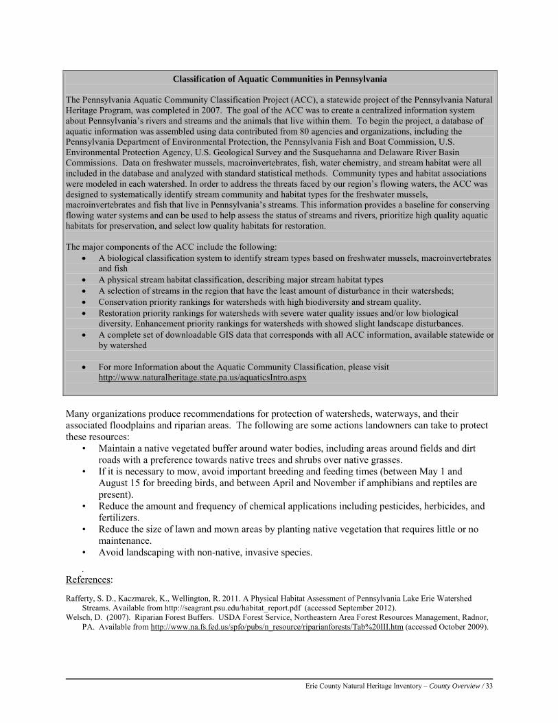
Erie County Natural Heritage Inventory – County Overview / 33
Many organizations produce recommendations for protection of watersheds, waterways, and their associated floodplains and riparian areas. The following are some actions landowners can take to protect these resources:
• Maintain a native vegetated buffer around water bodies, including areas around fields and dirt roads with a preference towards native trees and shrubs over native grasses.
• If it is necessary to mow, avoid important breeding and feeding times (between May 1 and August 15 for breeding birds, and between April and November if amphibians and reptiles are present).
• Reduce the amount and frequency of chemical applications including pesticides, herbicides, and fertilizers.
• Reduce the size of lawn and mown areas by planting native vegetation that requires little or no maintenance.
• Avoid landscaping with non-native, invasive species.
•
References: Rafferty, S. D., Kaczmarek, K., Wellington, R. 2011. A Physical Habitat Assessment of Pennsylvania Lake Erie Watershed
Streams. Available from http://seagrant.psu.edu/habitat_report.pdf (accessed September 2012). Welsch, D. (2007). Riparian Forest Buffers. USDA Forest Service, Northeastern Area Forest Resources Management, Radnor,
PA. Available from http://www.na.fs.fed.us/spfo/pubs/n_resource/riparianforests/Tab%20III.htm (accessed October 2009).
Classification of Aquatic Communities in Pennsylvania The Pennsylvania Aquatic Community Classification Project (ACC), a statewide project of the Pennsylvania Natural Heritage Program, was completed in 2007. The goal of the ACC was to create a centralized information system about Pennsylvania’s rivers and streams and the animals that live within them. To begin the project, a database of aquatic information was assembled using data contributed from 80 agencies and organizations, including the Pennsylvania Department of Environmental Protection, the Pennsylvania Fish and Boat Commission, U.S. Environmental Protection Agency, U.S. Geological Survey and the Susquehanna and Delaware River Basin Commissions. Data on freshwater mussels, macroinvertebrates, fish, water chemistry, and stream habitat were all included in the database and analyzed with standard statistical methods. Community types and habitat associations were modeled in each watershed. In order to address the threats faced by our region’s flowing waters, the ACC was designed to systematically identify stream community and habitat types for the freshwater mussels, macroinvertebrates and fish that live in Pennsylvania’s streams. This information provides a baseline for conserving flowing water systems and can be used to help assess the status of streams and rivers, prioritize high quality aquatic habitats for preservation, and select low quality habitats for restoration. The major components of the ACC include the following:
• A biological classification system to identify stream types based on freshwater mussels, macroinvertebrates and fish
• A physical stream habitat classification, describing major stream habitat types • A selection of streams in the region that have the least amount of disturbance in their watersheds; • Conservation priority rankings for watersheds with high biodiversity and stream quality. • Restoration priority rankings for watersheds with severe water quality issues and/or low biological
diversity. Enhancement priority rankings for watersheds with showed slight landscape disturbances. • A complete set of downloadable GIS data that corresponds with all ACC information, available statewide or
by watershed
• For more Information about the Aquatic Community Classification, please visit http://www.naturalheritage.state.pa.us/aquaticsIntro.aspx
Erie County Natural Heritage Inventory – County Overview / 34
Climate Annual precipitation totals about 42 inches, which is fairly evenly distributed throughout the year. Snowfall exceeds 72 inches per year, on average, with heavy snows sometimes experienced late in April. An average snowfall of 100 inches per year can fall in parts of Erie County several miles inland from the lake (Pennsylvania State Climatologist 2010). Summers are generally warm, averaging about 70°F along Lake Erie, however high temperatures of 90°F or above occur on an average of 10 to 20 days per year. There are places, such as adjacent to Lake Erie, where readings of 100°F have rarely, if ever, been reached. Daily temperatures during the warm season usually have a range of about 20°F over much of the state, while the daily range in winter is several degrees less. The last freeze of the season is typically during the month of May, and the first freeze is typically in early October. The growing season is usually between 121 and 180 days (Pennsylvania State Climatologist 2010). The Lake Erie Plain bordering Lake Erie is a narrow 40-mile strip of flat, rich land three to four miles wide that has a unique and agriculturally advantageous climate typical of the coastal areas surrounding much of the Great Lakes. Both in spring and autumn the lake water exerts a moderating influence on the temperature regime and the freeze-free season is extended about 45 days. In the autumn, this prevents early freezing temperatures, which is a critical factor in the growing of fruit and vegetables. Erie County is in hardiness zone 6 (National Arbor Day Foundation 2006). References: National Arbor Day Foundation. 2006. http://www.arborday.org/media/zones.cfm Pennsylvania State Climatologist. 2010. Archived Climate Data. Pennsylvania State Climate Office, University Park, PA.
Available from http://climate.met.psu.edu/ (accessed October 2012).
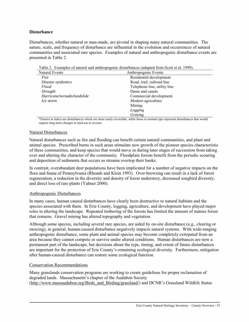
Erie County Natural Heritage Inventory – County Overview / 35
Disturbance Disturbances, whether natural or man-made, are pivotal in shaping many natural communities. The nature, scale, and frequency of disturbance are influential in the evolution and occurrences of natural communities and associated rare species. Examples of natural and anthropogenic disturbance events are presented in Table 2.
Table 2. Examples of natural and anthropogenic disturbances (adapted from Scott et al. 1999). Natural Events Anthropogenic Events Fire Residential development Disease epidemics Road, trail, railroad line Flood Telephone line, utility line Drought Dams and canals Hurricane/tornado/landslide Commercial development Ice storm Modern agriculture Mining Logging Grazing *Entries in italics are disturbances which are more easily reversible, while those in normal type represent disturbances that would require long-term changes in land use to reverse.
Natural Disturbances
Natural disturbances such as fire and flooding can benefit certain natural communities, and plant and animal species. Prescribed burns in such areas stimulate new growth of the pioneer species characteristic of these communities, and keep species that would move in during later stages of succession from taking over and altering the character of the community. Floodplain forests benefit from the periodic scouring and deposition of sediments that occurs as streams overtop their banks.
In contrast, overabundant deer populations have been implicated for a number of negative impacts on the flora and fauna of Pennsylvania (Rhoads and Klein 1993). Over-browsing can result in a lack of forest regeneration, a reduction in the diversity and density of forest understory, decreased songbird diversity, and direct loss of rare plants (Yahner 2000).
Anthropogenic Disturbances
In many cases, human caused disturbances have clearly been destructive to natural habitats and the species associated with them. In Erie County, logging, agriculture, and development have played major roles in altering the landscape. Repeated timbering of the forests has limited the amount of mature forest that remains. Gravel mining has altered topography and vegetation.
Although some species, including several rare species, are aided by on-site disturbance (e.g., clearing or mowing), in general, human-caused disturbance negatively impacts natural systems. With wide-ranging anthropogenic disturbance, some plant and animal species may become completely extirpated from an area because they cannot compete or survive under altered conditions. Human disturbances are now a permanent part of the landscape, but decisions about the type, timing, and extent of future disturbances are important for the protection of Erie County’s remaining ecological diversity. Furthermore, mitigation after human-caused disturbance can restore some ecological function.
Conservation Recommendations
Many grasslands conservation programs are working to create guidelines for proper reclamation of degraded lands. Massachusetts’s chapter of the Audubon Society (http://www.massaudubon.org/Birds_and_Birding/grassland/) and DCNR’s Grassland Wildlife Status
Erie County Natural Heritage Inventory – County Overview / 36
Program (http://www.dcnr.state.pa.us/wlhabitat/farmlands/farm_wildlife.aspx) are good places to start for conservation information surrounding reclamation of lands with anthropogenic disturbances.
Wetland and riparian restoration is also important in preventing erosion, protecting water quality, providing habitat and wildlife corridors, and maintaining the health of aquatic organisms. References: Rhoads, A.F. and W.M. Klein, Jr,. (1993). The Vascular Flora of Pennsylvania: Annotated Checklist and Atlas. American
Philosophical Society, Philadelphia, PA. Scott, J.M., Norse, E.A., Arita, H., Dobson, A., Estes, J.A., Foster, M., Gilbert, B., Jensen, D.B., Knight, R.L., Mattson, D., and
M.E. Soule. (1999). The Issue of Scale in Selecting and Designing Biological Reserves. pp. 19-37. In M.E. Soule and J. Terborgh (eds.), Continental conservation: Scientific Foundations of Regional Reserve Networks. Island Press, Washington, D.C.
Yahner, R.H. (2000). Eastern Deciduous Forest: Ecology and Wildlife Conservation. University of Minnesota Press: Minneapolis, MN.
Erie County Natural Heritage Inventory – County Overview / 37
Energy and Extractable Resources
Humans value natural ecosystems for the resources they provide: food, energy, and materials. Resources available for use can be separated into renewable, where the resource will naturally replenish itself in a timescale that is comparable to its use, and non-renewable, where the extracted resource is available only in a fixed amount or cannot be replaced before it is exhausted or never replaced. Human use of natural resources and the infrastructure that brings these resources to communities can have significant effects on local and regional biodiversity.
Renewable
Sources of water in the county are dug and drilled wells, springs, storage reservoirs and natural lakes. Conservation recommendations in the water resources sections of this report will help ensure the protection of public and private water supplies in the county.
Approximately 42% (217,448 acres) of the land within Erie County is currently under forest cover. Wood products and forestry contributes roughly $5.6 million to Erie County’s economy annually (Penn State Timber Market Report 2007). Much of the forests of Erie County are second or third growth.
Farming is one of Erie County’s chief industries with total agricultural production being worth over $21 million per year (USDA 2011). There are two distinct regions of agriculture in Erie County (Erie County Natural and Historic Resources Plan 2003):
• The Lake Plain where flatter topography and the moderating effects of Lake Erie allow the production of fruits and vegetables.
• The Uplands where corn, grains, and potatoes are the main crops along with the county’s remaining beef and dairy farms.
Measures to preserve Erie County’s soil and water resources can ensure that quality agricultural lands are conserved.
Pennsylvania has seen an increased interest in wind energy and the deployment of wind turbines. Although the best wind resources in Erie County are offshore in Lake Erie, there is a potential for commercial wind development in the coastal townships (U.S. Department of Energy 2010). Large scale commercial wind development may have a negative effect on bird and bat populations and their migratory corridors along Lake Erie in the region (Ewert et al. 2011, Great Lakes Wind Collaborative 2011).
Non-renewable
The development of Erie County’s fossil fuel resources has influenced the region’s economy and has also left a legacy on the landscape and the environment. The county has a long history of shallow gas well development with approximately 3,767 mapped oil and gas wells. These wells occur in every township in the county. The status of these wells and the completeness of the data are unknown so it is possible there are many older wells that remain unrecorded. Additionally, the county is underlain by the Utica shale—a deep formation that is one of the subjects of the current gas boom. Recovery of natural gas from the Utica shale involves a process known as hydraulic fracturing, where water and chemicals are pumped under pressure to open up cracks in the shale from which the gas is extracted. This method of drilling is associated with a number of environmental concerns, including the disposal of wastewater from wells, the potential risk of chemical spills, and the forest fragmentation from access roads and pipelines.
Gravel mining is still an active industry in Erie County; older abandoned mine lands occur across many of the townships in the county, several of the boroughs, and within the city of Erie. No data is available showing the extent of mining operations in the county.
Erie County Natural Heritage Inventory – County Overview / 38
References: Erie County Natural and Historic Resources Plan 2003
http://www.eriecountyplanning.org/uploads/pdf/Plansandcont/erieco_natres_plan_dec_03.pdf Ewert, D.N., J.B. Cole, and E Grman. 2011. Wind Energy: Great Lakes Regional Guidelines. Unpublished report, The Nature
Conservancy, Lansing, Michigan. Great Lakes Wind Collaborative. 2011. State of the Science: An Assessment of Research on the Ecological Impacts of Wind
Energy in the Great Lakes Region. Great Lakes Commission. Available at: http://www.glc.org/energy/wind/sosworkshop/pdf/Scientific-Assessment-Report-final.pdf. Accessed on February 21, 2013.
Penn State Timber Market Report, 2007 U.S. Department of Energy. 2010. Pennsylvania - Annual Average Wind Speed at 80 m
http://www.windpoweringamerica.gov/wind_resource_maps.asp?stateab=pa
Erie County Natural Heritage Inventory – County Overview / 39
Invasive Species in Erie County
Natural habitats within Erie County are threatened by the invasion of exotic (non-native) plant and animal species. These invasive species are plants, animals, and other organisms that do not naturally occur in the area and are likely to cause harm to the natural environment, the economy, or to human health. Because they have been removed from the control of their natural enemies, they usually spread rampantly. Once established, it is extremely difficult to control their spread. Invasive species are recognized as one of the leading threats to biodiversity and impose enormous economic costs to agriculture, forestry, fisheries, and other enterprises, as well as to human health (Swearingen et al. 2010).
The introduction of non-native species into Pennsylvania began with the initial European settlement in the 17th century (Thompson 2002) and continues to this day. Plants and animals have been deliberately introduced for a variety of reasons including food sources, erosion control, landscaping, and game for hunting and fishing. Other species have been accidentally introduced as ‘stowaways’ through global trade and transportation. These introductions have had drastic effects on Pennsylvania’s biodiversity over time. For example, over 37% of the plant species now found in the commonwealth did not occur here during the first period of European settlement (Thompson 2002).
Invasive Plants
Invasive plants are exotic plants which are not native to Pennsylvania and are harmful to our native plants, animals, and ecosystems (MA-IPC 2007). Currently, over 285 invasive plant species are impacting Pennsylvania. Qualities that make these plants invasive include their ability to reproduce rapidly, spread quickly over the landscape, and the fact that they have few, if any, natural controls (such as herbivores and diseases) to keep them in check. Invasive plants share a number of common characteristics that allow them to spread rapidly, and make them difficult to remove or control. These characteristics include the following:
• Utilization of runners or rhizomes that allow them to rapidly colonize new areas • Production of large numbers of seeds that survive to germinate • Designs that allow for extensive dispersal of seeds away from the parent plant by wind, water,
wildlife, and people
In short, invasive plant infestations can be extremely expensive to control, as well as environmentally destructive. Invasive plants are capable of displacing native plants from natural communities, especially rare and vulnerable plants in small populations (Swearingen et al. 2010). This impact on natives is worsened by the tendency for native wildlife to prefer native species over invasive species for food. In addition, many invasive shrubs, including bush honeysuckle, provide fruits that native birds find attractive, yet these fruits do not provide the nutrition and high-fat content the birds need in their diets (Swearingen et al. 2010).
Aggressive invasive plants can also transform a diverse small-scale ecosystem, such as a wetland or meadow, into a monoculture of a single species, drastically reducing the overall plant richness of an area, and limiting its ecological value. The decrease in plant diversity can, in turn, impact the mammals, birds, and insects in the area because the invasive plants do not provide the same food and cover value as the natural native plant species (Swearingen et al. 2010).
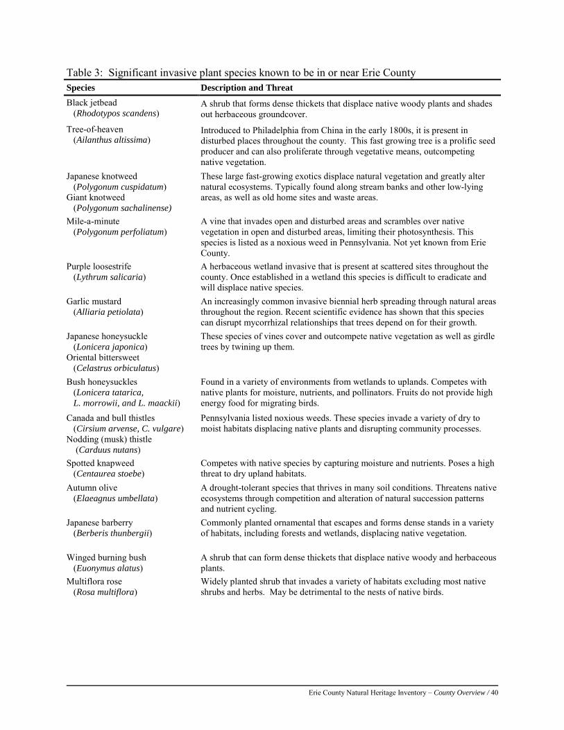
Erie County Natural Heritage Inventory – County Overview / 40
Table 3: Significant invasive plant species known to be in or near Erie County Species Description and Threat Black jetbead (Rhodotypos scandens)
A shrub that forms dense thickets that displace native woody plants and shades out herbaceous groundcover.
Tree-of-heaven (Ailanthus altissima)
Introduced to Philadelphia from China in the early 1800s, it is present in disturbed places throughout the county. This fast growing tree is a prolific seed producer and can also proliferate through vegetative means, outcompeting native vegetation.
Japanese knotweed (Polygonum cuspidatum) Giant knotweed (Polygonum sachalinense)
These large fast-growing exotics displace natural vegetation and greatly alter natural ecosystems. Typically found along stream banks and other low-lying areas, as well as old home sites and waste areas.
Mile-a-minute (Polygonum perfoliatum)
A vine that invades open and disturbed areas and scrambles over native vegetation in open and disturbed areas, limiting their photosynthesis. This species is listed as a noxious weed in Pennsylvania. Not yet known from Erie County.
Purple loosestrife (Lythrum salicaria)
A herbaceous wetland invasive that is present at scattered sites throughout the county. Once established in a wetland this species is difficult to eradicate and will displace native species.
Garlic mustard (Alliaria petiolata)
An increasingly common invasive biennial herb spreading through natural areas throughout the region. Recent scientific evidence has shown that this species can disrupt mycorrhizal relationships that trees depend on for their growth.
Japanese honeysuckle (Lonicera japonica) Oriental bittersweet (Celastrus orbiculatus)
These species of vines cover and outcompete native vegetation as well as girdle trees by twining up them.
Bush honeysuckles (Lonicera tatarica, L. morrowii, and L. maackii)
Found in a variety of environments from wetlands to uplands. Competes with native plants for moisture, nutrients, and pollinators. Fruits do not provide high energy food for migrating birds.
Canada and bull thistles (Cirsium arvense, C. vulgare) Nodding (musk) thistle (Carduus nutans)
Pennsylvania listed noxious weeds. These species invade a variety of dry to moist habitats displacing native plants and disrupting community processes.
Spotted knapweed (Centaurea stoebe)
Competes with native species by capturing moisture and nutrients. Poses a high threat to dry upland habitats.
Autumn olive (Elaeagnus umbellata)
A drought-tolerant species that thrives in many soil conditions. Threatens native ecosystems through competition and alteration of natural succession patterns and nutrient cycling.
Japanese barberry (Berberis thunbergii)
Commonly planted ornamental that escapes and forms dense stands in a variety of habitats, including forests and wetlands, displacing native vegetation.
Winged burning bush (Euonymus alatus)
A shrub that can form dense thickets that displace native woody and herbaceous plants.
Multiflora rose (Rosa multiflora)
Widely planted shrub that invades a variety of habitats excluding most native shrubs and herbs. May be detrimental to the nests of native birds.
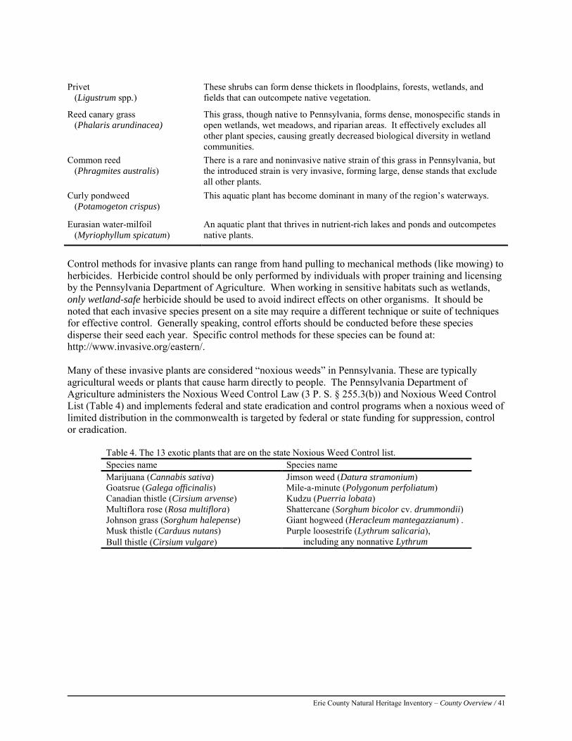
Erie County Natural Heritage Inventory – County Overview / 41
Privet (Ligustrum spp.)
These shrubs can form dense thickets in floodplains, forests, wetlands, and fields that can outcompete native vegetation.
Reed canary grass (Phalaris arundinacea)
This grass, though native to Pennsylvania, forms dense, monospecific stands in open wetlands, wet meadows, and riparian areas. It effectively excludes all other plant species, causing greatly decreased biological diversity in wetland communities.
Common reed (Phragmites australis)
There is a rare and noninvasive native strain of this grass in Pennsylvania, but the introduced strain is very invasive, forming large, dense stands that exclude all other plants.
Curly pondweed (Potamogeton crispus)
This aquatic plant has become dominant in many of the region’s waterways.
Eurasian water-milfoil (Myriophyllum spicatum)
An aquatic plant that thrives in nutrient-rich lakes and ponds and outcompetes native plants.
Control methods for invasive plants can range from hand pulling to mechanical methods (like mowing) to herbicides. Herbicide control should be only performed by individuals with proper training and licensing by the Pennsylvania Department of Agriculture. When working in sensitive habitats such as wetlands, only wetland-safe herbicide should be used to avoid indirect effects on other organisms. It should be noted that each invasive species present on a site may require a different technique or suite of techniques for effective control. Generally speaking, control efforts should be conducted before these species disperse their seed each year. Specific control methods for these species can be found at: http://www.invasive.org/eastern/. Many of these invasive plants are considered “noxious weeds” in Pennsylvania. These are typically agricultural weeds or plants that cause harm directly to people. The Pennsylvania Department of Agriculture administers the Noxious Weed Control Law (3 P. S. § 255.3(b)) and Noxious Weed Control List (Table 4) and implements federal and state eradication and control programs when a noxious weed of limited distribution in the commonwealth is targeted by federal or state funding for suppression, control or eradication.
Table 4. The 13 exotic plants that are on the state Noxious Weed Control list. Species name Species name Marijuana (Cannabis sativa) Jimson weed (Datura stramonium) Goatsrue (Galega officinalis) Mile-a-minute (Polygonum perfoliatum) Canadian thistle (Cirsium arvense) Kudzu (Puerria lobata) Multiflora rose (Rosa multiflora) Shattercane (Sorghum bicolor cv. drummondii) Johnson grass (Sorghum halepense) Giant hogweed (Heracleum mantegazzianum) . Musk thistle (Carduus nutans) Purple loosestrife (Lythrum salicaria),
including any nonnative Lythrum Bull thistle (Cirsium vulgare)
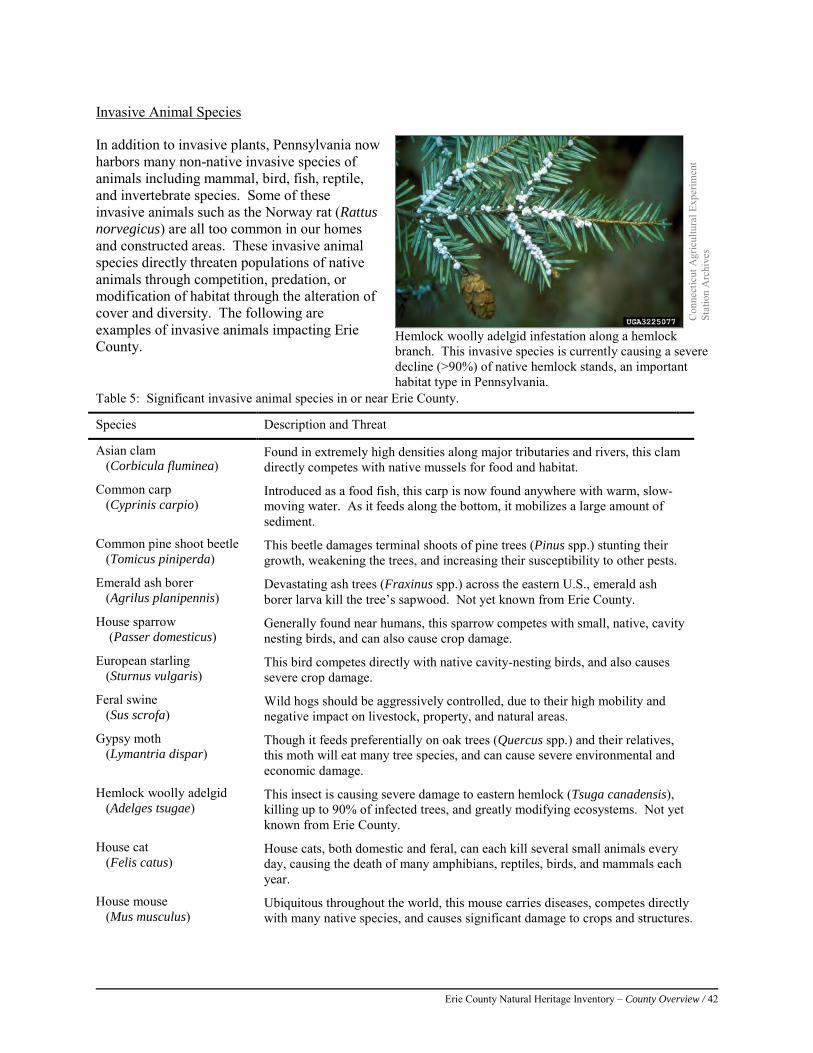
Erie County Natural Heritage Inventory – County Overview / 42
Invasive Animal Species
In addition to invasive plants, Pennsylvania now harbors many non-native invasive species of animals including mammal, bird, fish, reptile, and invertebrate species. Some of these invasive animals such as the Norway rat (Rattus norvegicus) are all too common in our homes and constructed areas. These invasive animal species directly threaten populations of native animals through competition, predation, or modification of habitat through the alteration of cover and diversity. The following are examples of invasive animals impacting Erie County.
Con
nect
icut
Agr
icul
tura
l Exp
erim
ent
Stat
ion
Arc
hive
s
Hemlock woolly adelgid infestation along a hemlock branch. This invasive species is currently causing a severe decline (>90%) of native hemlock stands, an important habitat type in Pennsylvania.
Table 5: Significant invasive animal species in or near Erie County.
Species Description and Threat
Asian clam (Corbicula fluminea)
Found in extremely high densities along major tributaries and rivers, this clam directly competes with native mussels for food and habitat.
Common carp (Cyprinis carpio)
Introduced as a food fish, this carp is now found anywhere with warm, slow-moving water. As it feeds along the bottom, it mobilizes a large amount of sediment.
Common pine shoot beetle (Tomicus piniperda)
This beetle damages terminal shoots of pine trees (Pinus spp.) stunting their growth, weakening the trees, and increasing their susceptibility to other pests.
Emerald ash borer (Agrilus planipennis)
Devastating ash trees (Fraxinus spp.) across the eastern U.S., emerald ash borer larva kill the tree’s sapwood. Not yet known from Erie County.
House sparrow (Passer domesticus)
Generally found near humans, this sparrow competes with small, native, cavity nesting birds, and can also cause crop damage.
European starling (Sturnus vulgaris)
This bird competes directly with native cavity-nesting birds, and also causes severe crop damage.
Feral swine (Sus scrofa)
Wild hogs should be aggressively controlled, due to their high mobility and negative impact on livestock, property, and natural areas.
Gypsy moth (Lymantria dispar)
Though it feeds preferentially on oak trees (Quercus spp.) and their relatives, this moth will eat many tree species, and can cause severe environmental and economic damage.
Hemlock woolly adelgid (Adelges tsugae)
This insect is causing severe damage to eastern hemlock (Tsuga canadensis), killing up to 90% of infected trees, and greatly modifying ecosystems. Not yet known from Erie County.
House cat (Felis catus)
House cats, both domestic and feral, can each kill several small animals every day, causing the death of many amphibians, reptiles, birds, and mammals each year.
House mouse (Mus musculus)
Ubiquitous throughout the world, this mouse carries diseases, competes directly with many native species, and causes significant damage to crops and structures.
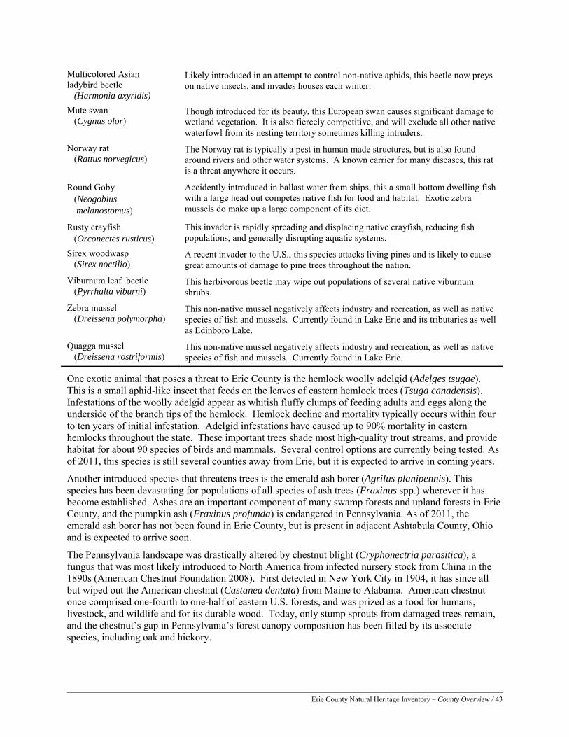
Erie County Natural Heritage Inventory – County Overview / 43
One exotic animal that poses a threat to Erie County is the hemlock woolly adelgid (Adelges tsugae). This is a small aphid-like insect that feeds on the leaves of eastern hemlock trees (Tsuga canadensis). Infestations of the woolly adelgid appear as whitish fluffy clumps of feeding adults and eggs along the underside of the branch tips of the hemlock. Hemlock decline and mortality typically occurs within four to ten years of initial infestation. Adelgid infestations have caused up to 90% mortality in eastern hemlocks throughout the state. These important trees shade most high-quality trout streams, and provide habitat for about 90 species of birds and mammals. Several control options are currently being tested. As of 2011, this species is still several counties away from Erie, but it is expected to arrive in coming years.
Another introduced species that threatens trees is the emerald ash borer (Agrilus planipennis). This species has been devastating for populations of all species of ash trees (Fraxinus spp.) wherever it has become established. Ashes are an important component of many swamp forests and upland forests in Erie County, and the pumpkin ash (Fraxinus profunda) is endangered in Pennsylvania. As of 2011, the emerald ash borer has not been found in Erie County, but is present in adjacent Ashtabula County, Ohio and is expected to arrive soon.
The Pennsylvania landscape was drastically altered by chestnut blight (Cryphonectria parasitica), a fungus that was most likely introduced to North America from infected nursery stock from China in the 1890s (American Chestnut Foundation 2008). First detected in New York City in 1904, it has since all but wiped out the American chestnut (Castanea dentata) from Maine to Alabama. American chestnut once comprised one-fourth to one-half of eastern U.S. forests, and was prized as a food for humans, livestock, and wildlife and for its durable wood. Today, only stump sprouts from damaged trees remain, and the chestnut’s gap in Pennsylvania’s forest canopy composition has been filled by its associate species, including oak and hickory.
Multicolored Asian ladybird beetle (Harmonia axyridis)
Likely introduced in an attempt to control non-native aphids, this beetle now preys on native insects, and invades houses each winter.
Mute swan (Cygnus olor)
Though introduced for its beauty, this European swan causes significant damage to wetland vegetation. It is also fiercely competitive, and will exclude all other native waterfowl from its nesting territory sometimes killing intruders.
Norway rat (Rattus norvegicus)
The Norway rat is typically a pest in human made structures, but is also found around rivers and other water systems. A known carrier for many diseases, this rat is a threat anywhere it occurs.
Round Goby (Neogobius melanostomus)
Accidently introduced in ballast water from ships, this a small bottom dwelling fish with a large head out competes native fish for food and habitat. Exotic zebra mussels do make up a large component of its diet.
Rusty crayfish (Orconectes rusticus)
This invader is rapidly spreading and displacing native crayfish, reducing fish populations, and generally disrupting aquatic systems.
Sirex woodwasp (Sirex noctilio)
A recent invader to the U.S., this species attacks living pines and is likely to cause great amounts of damage to pine trees throughout the nation.
Viburnum leaf beetle (Pyrrhalta viburni)
This herbivorous beetle may wipe out populations of several native viburnum shrubs.
Zebra mussel (Dreissena polymorpha)
This non-native mussel negatively affects industry and recreation, as well as native species of fish and mussels. Currently found in Lake Erie and its tributaries as well as Edinboro Lake.
Quagga mussel (Dreissena rostriformis)
This non-native mussel negatively affects industry and recreation, as well as native species of fish and mussels. Currently found in Lake Erie.
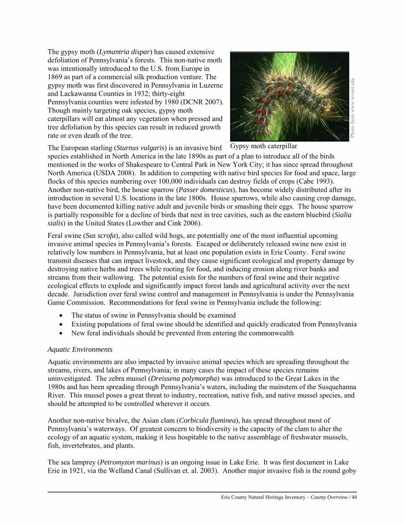
Erie County Natural Heritage Inventory – County Overview / 44
The gypsy moth (Lymantria dispar) has caused extensive defoliation of Pennsylvania’s forests. This non-native moth was intentionally introduced to the U.S. from Europe in 1869 as part of a commercial silk production venture. The gypsy moth was first discovered in Pennsylvania in Luzerne and Lackawanna Counties in 1932; thirty-eight Pennsylvania counties were infested by 1980 (DCNR 2007). Though mainly targeting oak species, gypsy moth caterpillars will eat almost any vegetation when pressed and tree defoliation by this species can result in reduced growth rate or even death of the tree.
The European starling (Sturnus vulgaris) is an invasive bird species established in North America in the late 1890s as part of a plan to introduce all of the birds mentioned in the works of Shakespeare to Central Park in New York City; it has since spread throughout North America (USDA 2008). In addition to competing with native bird species for food and space, large flocks of this species numbering over 100,000 individuals can destroy fields of crops (Cabe 1993). Another non-native bird, the house sparrow (Passer domesticus), has become widely distributed after its introduction in several U.S. locations in the late 1800s. House sparrows, while also causing crop damage, have been documented killing native adult and juvenile birds or smashing their eggs. The house sparrow is partially responsible for a decline of birds that nest in tree cavities, such as the eastern bluebird (Sialia sialis) in the United States (Lowther and Cink 2006).
Feral swine (Sus scrofa), also called wild hogs, are potentially one of the most influential upcoming invasive animal species in Pennsylvania’s forests. Escaped or deliberately released swine now exist in relatively low numbers in Pennsylvania, but at least one population exists in Erie County. Feral swine transmit diseases that can impact livestock, and they cause significant ecological and property damage by destroying native herbs and trees while rooting for food, and inducing erosion along river banks and streams from their wallowing. The potential exists for the numbers of feral swine and their negative ecological effects to explode and significantly impact forest lands and agricultural activity over the next decade. Jurisdiction over feral swine control and management in Pennsylvania is under the Pennsylvania Game Commission. Recommendations for feral swine in Pennsylvania include the following:
• The status of swine in Pennsylvania should be examined • Existing populations of feral swine should be identified and quickly eradicated from Pennsylvania • New feral individuals should be prevented from entering the commonwealth
Aquatic Environments
Aquatic environments are also impacted by invasive animal species which are spreading throughout the streams, rivers, and lakes of Pennsylvania; in many cases the impact of these species remains uninvestigated. The zebra mussel (Dreissena polymorpha) was introduced to the Great Lakes in the 1980s and has been spreading through Pennsylvania’s waters, including the mainstem of the Susquehanna River. This mussel poses a great threat to industry, recreation, native fish, and native mussel species, and should be attempted to be controlled wherever it occurs. Another non-native bivalve, the Asian clam (Corbicula fluminea), has spread throughout most of Pennsylvania’s waterways. Of greatest concern to biodiversity is the capacity of the clam to alter the ecology of an aquatic system, making it less hospitable to the native assemblage of freshwater mussels, fish, invertebrates, and plants. The sea lamprey (Petromyzon marinus) is an ongoing issue in Lake Erie. It was first document in Lake Erie in 1921, via the Welland Canal (Sullivan et. al. 2003). Another major invasive fish is the round goby
Pho
to fr
om w
ww
.wvn
et.e
du
Gypsy moth caterpillar
Erie County Natural Heritage Inventory – County Overview / 45
(Neogobius melanostomus). This species arrived via ballast water from ships and has altered food webs of the Great Lakes (Pennsylvania Sea Grant 2003). Another aquatic species, the rusty crayfish (Orconectes rusticus), has been introduced to many of Pennsylvania’s watersheds from its native range in the midwestern United States. Rusty crayfish can reproduce in large numbers and reduce lake and stream vegetation, depriving native fish and their prey of cover and food. Their size and aggressive nature keeps many fish species from feeding on them. Rusty crayfish may also reduce native crayfish, freshwater mussels, and reptile and amphibian populations by outcompeting them for food and habitat or by directly preying on young individuals.
Overall Invasive Recommendations
Erie County has few sites that are free from non-native species, and invasive species are an increasing threat to biodiversity. Successful control of invasive plant species is a time, labor, and resource-intensive process. Prevention or control during the early stages of establishment is the best money-saving strategy. In areas where invasive plants are well established, multiple control strategies and follow-up treatments will be necessary. Specific treatment depends on the target species biological characteristics and population size. Invasive plants can often be controlled using biological, mechanical, or chemical methods. The resources listed below provide additional information on invasive species:
• Natural Heritage Areas (NHAs) identified in this report can serve as priority areas for early detection, control, and monitoring of invasive species.
• Many educational resources are available on invasive exotic species. Regional groups such as the Mid-Atlantic Invasive Plant Council (MA-IPC) can help with funding opportunities and educational outreach on invasive species. This organization’s website is http://www.maipc.org/
• Pennsylvania has a Noxious Weed law that prevents the propagation, sale, or transport of thirteen weed species within the commonwealth. Pennsylvania’s Noxious Weed List can be found on the USDA’s PLANTS website at http://plants.usda.gov/java/noxious?rptType=State&statefips=42. Some of the thirteen species that are currently listed are agricultural weeds; however, purple loosestrife (Lythrum salicaria), giant hogweed (Heracleum mantegazzianum), kudzu (Pueraria lobata), mile-a-minute (Polygonum perfoliatum), Canada thistle (Cirsium arvense), and multiflora rose (Rosa multiflora) are weeds that often threaten natural areas.
• The Pennsylvania Fish and Boat Commission maintains a list of aquatic nuisance species that are prohibited from possession, sale, barter, or distribution within the commonwealth (PA Code 58.71.6). This list includes the zebra mussel and the rusty crayfish, among others. More information can be retrieved from the Fish and Boat Commission’s website at http://www.fish.state.pa.us/ans.htm.
• Cooperative Weed Management Areas (CWMAs), once largely confined to the western states, are increasingly forming in the east. A CWMA is a partnership of landowners, including federal, state, and local government agencies, individuals and various interested groups that work together to manage noxious weeds and invasive plants in a defined geographic area. An overview of CWMAs can be found online at http://www.weedcenter.org/weed_mgmt_areas/wma_overview.html.
After intensive removal of invasive species, replanting with native species is often needed to restore the natural habitat and prevent reinvasion. Specialized nurseries, landscape architects, and horticultural professionals can assist with native plant restoration. Complete eradication of invasive non-native plants from a site may not always be achievable, but it is possible to reduce infestations within native plant communities to a level which can be routinely maintained. Control of invasive plants is critical to the long-term protection of Pennsylvania's natural areas and rare species, and therefore requires continuous monitoring efforts.

Erie County Natural Heritage Inventory – County Overview / 46
References: American Chestnut Foundation. 2008. History of the American Chestnut Foundation. The American Chestnut Foundation,
Bennington, VT. Available from http://www.acf.org/history.php. Accessed October 2009. Aquatic Invasive Species Management Plan Committee (AISMPC). 2006. Commonwealth of Pennsylvania Invasive Species
Council aquatic invasive species management plan. Pennsylvania Invasive Species Council (PISC), 75 pp Cabe, P.R. 1993. European Starling (Sturnus vulgaris), The Birds of North America Online (A. Poole, Ed.). Ithaca: Cornell Lab
of Ornithology; Retrieved from the Birds of North America Online: http://bna.birds.cornell.edu/bna/species/048 (accessed October 2009)
DCNR. 2007. What is the Gypsy Moth? Pennsylvania DCNR, Harrisburg, PA. Available from http://www.dcnr.state.pa.us/Forestry/gypsymoth/index.aspx (accessed October 2009).
Lowther, P.E. and C.L. Cink. 2006. House Sparrow (Passer domesticus), The Birds of North America Online (A. Poole, Ed.). Ithaca: Cornell Lab of Ornithology; Retrieved from the Birds of North America Online: http://bna.birds.cornell.edu/bna/species/012 (accessed October 2009).
MA-IPC. 2007. What is MA-IPC? Mid-Atlantic Exotic Pest Plant Council (MA-IPC), Arlington, VA. Available from http://ma-ipc.org/ (accessed October 2012).
Pennsylvania Sea Grant. 2003. Round Goby Fact Sheet. http://seagrant.psu.edu/publications/fs/Round_Goby_12-2003.pdf Sullivan, W. P., Gavin C. Christie, Floyd C. Cornelius, Michael F. Fodale, David A. Johnson, Joseph F. Koonce, Geraldine L.
Larson, Rodney B. McDonald, Katherine M. Mullett, Charles K. Murray, Phillip A. Ryan. 2003. The Sea Lamprey in Lake Erie: a Case History. Journal of Great Lakes Research. 29: 615-636,
Swearingen, J., B. Slattery, K. Reshetiloff, and S. Zwicker. 2010. Plant Invaders of Mid-Atlantic Natural Areas, 4th ed. National Park Service and U.S. Fish and Wildlife Service. Washington, DC. 168pp
Thompson, S.A., editor. 2002. Biodiversity in Pennsylvania: Snapshot 2002.Pennsylvania Biodiversity Partnership, Pittsburgh, Pennsylvania. 60 pp.
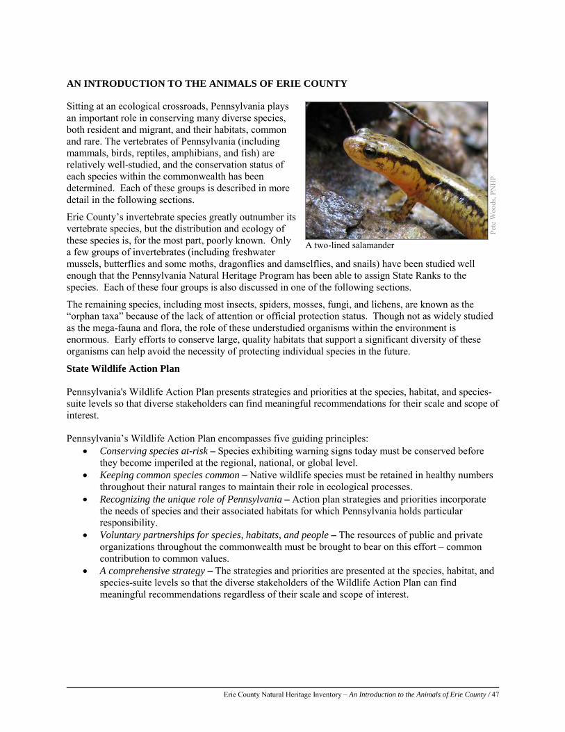
Erie County Natural Heritage Inventory – An Introduction to the Animals of Erie County / 47
AN INTRODUCTION TO THE ANIMALS OF ERIE COUNTY
Sitting at an ecological crossroads, Pennsylvania plays an important role in conserving many diverse species, both resident and migrant, and their habitats, common and rare. The vertebrates of Pennsylvania (including mammals, birds, reptiles, amphibians, and fish) are relatively well-studied, and the conservation status of each species within the commonwealth has been determined. Each of these groups is described in more detail in the following sections.
Erie County’s invertebrate species greatly outnumber its vertebrate species, but the distribution and ecology of these species is, for the most part, poorly known. Only a few groups of invertebrates (including freshwater mussels, butterflies and some moths, dragonflies and damselflies, and snails) have been studied well enough that the Pennsylvania Natural Heritage Program has been able to assign State Ranks to the species. Each of these four groups is also discussed in one of the following sections.
The remaining species, including most insects, spiders, mosses, fungi, and lichens, are known as the “orphan taxa” because of the lack of attention or official protection status. Though not as widely studied as the mega-fauna and flora, the role of these understudied organisms within the environment is enormous. Early efforts to conserve large, quality habitats that support a significant diversity of these organisms can help avoid the necessity of protecting individual species in the future.
State Wildlife Action Plan Pennsylvania's Wildlife Action Plan presents strategies and priorities at the species, habitat, and species-suite levels so that diverse stakeholders can find meaningful recommendations for their scale and scope of interest. Pennsylvania’s Wildlife Action Plan encompasses five guiding principles:
• Conserving species at-risk – Species exhibiting warning signs today must be conserved before they become imperiled at the regional, national, or global level.
• Keeping common species common – Native wildlife species must be retained in healthy numbers throughout their natural ranges to maintain their role in ecological processes.
• Recognizing the unique role of Pennsylvania – Action plan strategies and priorities incorporate the needs of species and their associated habitats for which Pennsylvania holds particular responsibility.
• Voluntary partnerships for species, habitats, and people – The resources of public and private organizations throughout the commonwealth must be brought to bear on this effort – common contribution to common values.
• A comprehensive strategy – The strategies and priorities are presented at the species, habitat, and species-suite levels so that the diverse stakeholders of the Wildlife Action Plan can find meaningful recommendations regardless of their scale and scope of interest.
Pete
Woo
ds, P
NH
P
A two-lined salamander
Erie County Natural Heritage Inventory – An Introduction to the Animals of Erie County / 48
Mammals of Erie County Erie County’s unique geographic location within the commonwealth and its mix of upland and wetland habitats support dozens of species of mammals. Some of these species are secretive and their presence goes largely unnoticed by the general public, while other species are more conspicuous, and in some cases their populations are managed as game animals. Throughout Erie County, white-tailed deer (Odocoileus virginianus) exist in large numbers, and have for the past 60-70 years. High deer populations have negatively impacted the health of Erie County’s natural landscapes through the heavy browsing of forested habitats, threatening forest regeneration and numerous plant species of concern. Once preferred food plants become scarce, the deer turn to agricultural crops and suburban ornamental plantings. Problems associated with deer overpopulation have been known for many years, as noted in the Mammal Survey of Northwestern Pennsylvania from 1949 (Richmand and Rosland):
“Of special interest in this section is the great abundance of deer which have, and are continuing to produce marked changes in the vegetation of the forest. Overbrowsing has practically eliminated yew, hobble bush (Viburnum alnifolia) and (Viburnum acerifolium) and painted trillium. Hemlock is the only tree that is being reproduced and only a few young hemlocks survive to get above the browse line. Beech, maple, oaks are all browsed to the ground. In addition to the effects of overbrowsing, deer have trampled out many of the creeping perennial plants, and in these places the soil has the compacted appearance of an old sheep pasture”
The Pennsylvania Game Commission (PGC) has altered their management plan for deer harvest across the state in order to set target deer densities based on the health of the deer herd, the health of the habitat, and the number of deer-human conflicts in a given area. Today, the PGC annually adjusts the number of permits issued for antlerless deer within their Wildlife Management Units (WMUs) in order to bring the population to a level that the habitat can sustain. Over the past ten years, the northwestern portion of the state has received an increase in the number of antlerless licenses, which has been bringing the deer population in check with the habitat. Despite much of the public’s perception that deer numbers are dwindling, a multitude of scientific studies by the PGC and independent auditors have shown that deer populations in the region remain strong. Pennsylvania’s black bears (Ursus americanus) provide hunting opportunities across much of the state, though harvests are typically low in Erie County. Sound management by the PGC has allowed the previously overharvested bear population in Pennsylvania to quadruple since in the early 1980s. Bear populations are expanding throughout the county and appear strongest in the eastern portion, especially around Corry, perhaps in response to low hunting pressure. Because of the large urban and suburban population within Erie County, bear-human conflicts will likely increase as time goes on (Shayne Hoachlander, personal communication).
Cha
rlie
Eich
elbe
rger
, PN
HP
White-tailed deer are important economic resources in Erie County.
Erie County Natural Heritage Inventory – An Introduction to the Animals of Erie County / 49
Another game species, the bobcat (Lynx rufus), is also on the rise in Pennsylvania and hunting and trapping opportunities in the state have been expanded accordingly. However, bobcats in Erie County are still relatively scarce and WMU 1B does not currently have a season for bobcat harvest. Other mammals commonly observed in Erie County include gray and fox squirrels (Sciurus carolinensis, S. niger), raccoon (Procyon lotor), white-footed mouse (Peromyscus leucopus), deer mouse (P. maniculatus), striped skunk (Mephitis mephitis), Virginia opossum (Didelphis virginiana), red fox (Vulpes vulpes), coyote (Canis latrans), northern short-tailed shrew (Blarina brevicauda), and the ubiquitous eastern chipmunk (Tamias striatus). These “generalist” species occur throughout many different habitats in Erie County, from forests to fields to backyards, and are in no jeopardy of disappearing from the landscape. Unlike the generalists, other mammal species have fairly restricted habitat needs and are termed “habitat specialists.” They may be restricted to wetlands and waterways, open meadow and grassland habitats, forest interior, or caves and mines. Wetlands and waterways play a major role in providing habitat for Erie County’s mammals. It is not uncommon to find multiple species of shrews, rodents, weasels, and bats, as well as sign of larger mammal species in these habitats. The ermine (Mustela erminea), mink (M. vison), least weasel (M. nivalis), and long-tailed weasel (M. frenata) can be found foraging along wetlands and waterways where prey items are abundant. Also tied to aquatic environments is the star-nosed mole (Condylura cristata), which despite its awkwardness on land is a surprisingly adept swimmer and diver. Muskrat (Ondatra zibethicus) and beaver (Castor canadensis) are both managed as furbearing species and are found throughout Erie County. Although beavers were extirpated from Pennsylvania by 1912, reintroduction efforts have had remarkable success, and the annual harvest routinely exceeds 200 individuals in Erie County (PGC data). The largest member of Pennsylvania’s extant weasels, the river otter (Lontra canadensis), has been reintroduced to many regions of Pennsylvania where it was previously trapped to near extirpation. Following an initial reintroduction program during the 1980s, the species has made an outstanding comeback, and otter sightings along Erie County’s creeks are increasing. Open habitats in the form of meadows and dormant agricultural lands serve as habitat for species including eastern cottontail (Sylvilagus floridanus), woodchuck (Marmota monax), meadow vole (Microtus pennsylvanicus), and meadow jumping mouse (Zapus hudsonius). Southern bog lemmings (Synaptomys cooperi) prefer soggy meadows but may also inhabit fallow agricultural lands. Bog lemmings exist in very low densities, unlike most other small rodents whose populations are consistently large. One species that formerly occurred within the fields and meadows of Erie County is the state-endangered least shrew (Cryptotis parva). Historically the least shrew was widespread throughout Pennsylvania, inhabiting early successional fields and meadows that were kept open by rotational cropping and forestry practices. Today populations of least shrews are known to exist only in Adams and York counties. Forested habitats are home to the state furbearer, the handsome gray fox (Urocyon cinereoargenteus), a skilled tree climber whose eerie screams warn other foxes that they are intruding on claimed hunting territories. Snowshoe hares (Lepus americanus) also inhabit brushy forests in the northern tier, but changes in habitat and competition with deer for food have caused declines of this species and it may only be found in the extreme southeastern corner of Erie County. Also found in forested habitats is the porcupine (Erethizon dorsatum), which is often persecuted for the damage they can do to wooden structures and trees. It is important to note that the trees killed by porcupines create habitat for many other animals, and play an important role in the overall health of forested systems. The fisher (Martes pennanti), a large weasel which regularly eats porcupines, has shown extensive range expansion in recent years from the original reintroduction sites. Although the fisher is considered a forest interior specialist, it is proliferating in non-traditional habitats surprisingly well. Sightings of fisher have been increasing across much of the state, including Erie County (PGC Data). Red squirrels (Tamiasciurus hudsonicus),
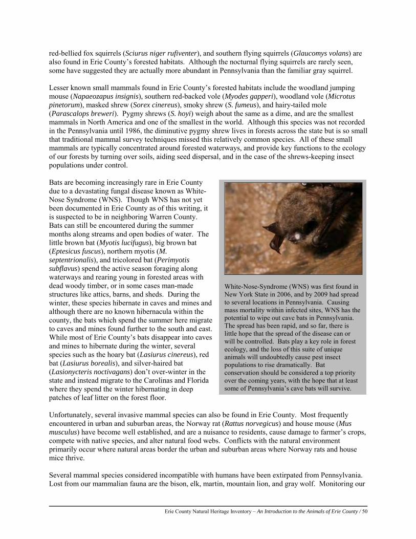
Erie County Natural Heritage Inventory – An Introduction to the Animals of Erie County / 50
White-Nose-Syndrome (WNS) was first found in New York State in 2006, and by 2009 had spread to several locations in Pennsylvania. Causing mass mortality within infected sites, WNS has the potential to wipe out cave bats in Pennsylvania. The spread has been rapid, and so far, there is little hope that the spread of the disease can or will be controlled. Bats play a key role in forest ecology, and the loss of this suite of unique animals will undoubtedly cause pest insect populations to rise dramatically. Bat conservation should be considered a top priority over the coming years, with the hope that at least some of Pennsylvania’s cave bats will survive.
red-bellied fox squirrels (Sciurus niger rufiventer), and southern flying squirrels (Glaucomys volans) are also found in Erie County’s forested habitats. Although the nocturnal flying squirrels are rarely seen, some have suggested they are actually more abundant in Pennsylvania than the familiar gray squirrel. Lesser known small mammals found in Erie County’s forested habitats include the woodland jumping mouse (Napaeozapus insignis), southern red-backed vole (Myodes gapperi), woodland vole (Microtus pinetorum), masked shrew (Sorex cinereus), smoky shrew (S. fumeus), and hairy-tailed mole (Parascalops breweri). Pygmy shrews (S. hoyi) weigh about the same as a dime, and are the smallest mammals in North America and one of the smallest in the world. Although this species was not recorded in the Pennsylvania until 1986, the diminutive pygmy shrew lives in forests across the state but is so small that traditional mammal survey techniques missed this relatively common species. All of these small mammals are typically concentrated around forested waterways, and provide key functions to the ecology of our forests by turning over soils, aiding seed dispersal, and in the case of the shrews-keeping insect populations under control. Bats are becoming increasingly rare in Erie County due to a devastating fungal disease known as White-Nose Syndrome (WNS). Though WNS has not yet been documented in Erie County as of this writing, it is suspected to be in neighboring Warren County. Bats can still be encountered during the summer months along streams and open bodies of water. The little brown bat (Myotis lucifugus), big brown bat (Eptesicus fuscus), northern myotis (M. septentrionalis), and tricolored bat (Perimyotis subflavus) spend the active season foraging along waterways and rearing young in forested areas with dead woody timber, or in some cases man-made structures like attics, barns, and sheds. During the winter, these species hibernate in caves and mines and although there are no known hibernacula within the county, the bats which spend the summer here migrate to caves and mines found further to the south and east. While most of Erie County’s bats disappear into caves and mines to hibernate during the winter, several species such as the hoary bat (Lasiurus cinereus), red bat (Lasiurus borealis), and silver-haired bat (Lasionycteris noctivagans) don’t over-winter in the state and instead migrate to the Carolinas and Florida where they spend the winter hibernating in deep patches of leaf litter on the forest floor. Unfortunately, several invasive mammal species can also be found in Erie County. Most frequently encountered in urban and suburban areas, the Norway rat (Rattus norvegicus) and house mouse (Mus musculus) have become well established, and are a nuisance to residents, cause damage to farmer’s crops, compete with native species, and alter natural food webs. Conflicts with the natural environment primarily occur where natural areas border the urban and suburban areas where Norway rats and house mice thrive. Several mammal species considered incompatible with humans have been extirpated from Pennsylvania. Lost from our mammalian fauna are the bison, elk, martin, mountain lion, and gray wolf. Monitoring our
Erie County Natural Heritage Inventory – An Introduction to the Animals of Erie County / 51
remaining populations of mammals could provide a better picture of the conservation needs of Erie County’s mammals as well as where reintroduction efforts may be warranted for lost or declining species. Of utmost importance to the conservation of the region’s wildlife is maintaining acreage of fallow fields (instead of row crops), avoiding further fragmentation of the forested patches, and protection of existing wetlands. Restoration of previously destroyed wetlands is needed to secure those mammal species that live in these declining environs. Although humans can provide this type of habitat restoration, the long-term effects that beavers may play in modifying wetland systems may naturally allow for this restoration over time. These restored habitats would serve a multitude of mammal species, as well as many other species of plants and animals, both common and rare. Expanded conservation programs such as the Conservation Reserve Enhancement Program (CREP) and Landowner Incentive Program (LIP) may provide the opportunities for landowners to become directly involved with the conservation of Erie County mammals. Important Mammal Areas (IMAs) IMAs were designated by the Mammal Technical Committee of the Pennsylvania Biological Survey to protect areas that are deemed of utmost importance for mammal conservation and to sustain populations of mammal species of special concern. (Pennsylvania Game Commission 2012). Currently, there are 45 IMAs throughout the state of Pennsylvania, and IMA #1, Presque Isle State Park, is located in Erie County. Note: The following information is adapted from the Important Mammal Areas Assessment Reports, 2005. Presque Isle State Park IMA:
Presque Isle State Park is a spit of land that juts from the Eastern Lake Section of Erie County’s Central Lowland Province, and it harbors Pennsylvania’s only ‘seashore.’ This section of land contains approximately five different habitats that include deciduous, coniferous, and mixed forests, grasslands, shrubby habitats, and swamps which all contain their own unique flora and fauna. The park boasts upwards of 48 mammal species, but further survey work is needed to confirm the presence of some of these species. A deer exclosure is located within the park which demonstrates the need to keep large herbivore herds in balance with their habitats. With more than four million visitors per year, there is a potential for negative impacts on important habitats within the IMA. In order to inform the public about habitat conservation, Presque Isle State Park promotes environmental education and routinely provides 20-25 programs per year on mammals for the general public in addition to numerous school groups. References: Cunningham, H.N. 1989. The mammals of a forest-agricultural site in Erie County, Pennsylvania. J. PA Acad. Sci. 63:82-87. Czarnecki, G. 1988. Denning habits of red fox (Vulpes vulpes) on Presque Isle, Erie Co., Pennsylvania. J. PA Acad. Sci. 62:42-
43. Richmand, N.P. and H.R. Rosland. 1949. Mammal survey of northwestern Pennsylvania. Pennsylvania Game Commission. 67
pp. Wesdock, P.S., T.E. Zahniser, and S.J. Ropski. 1988. A study of the small mammals of Presque Isle State Park, Erie County,
Pennsylvania. . J. PA Acad. Sci. 62:62. Pennsylvania Game Commission. 2012. Important Mammal Areas Project: An Overview. Available at:
http://www.portal.state.pa.us/portal/server.pt/document/1058134/important_mammal_areas_project_overview_pdfAccessed on Nov 12, 2012.
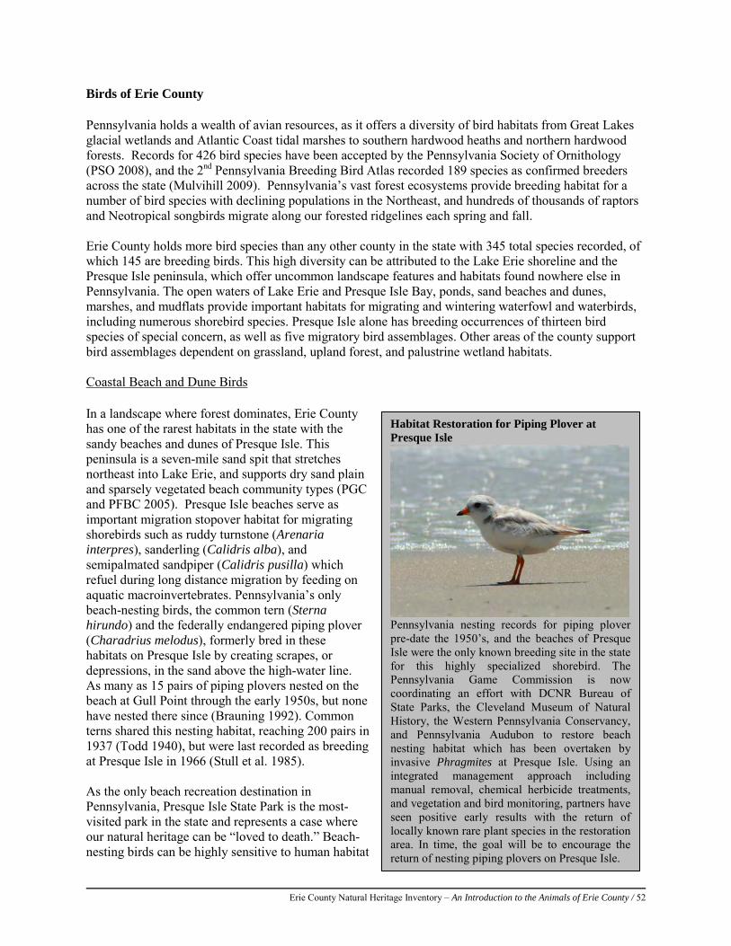
Erie County Natural Heritage Inventory – An Introduction to the Animals of Erie County / 52
Birds of Erie County Pennsylvania holds a wealth of avian resources, as it offers a diversity of bird habitats from Great Lakes glacial wetlands and Atlantic Coast tidal marshes to southern hardwood heaths and northern hardwood forests. Records for 426 bird species have been accepted by the Pennsylvania Society of Ornithology (PSO 2008), and the 2nd Pennsylvania Breeding Bird Atlas recorded 189 species as confirmed breeders across the state (Mulvihill 2009). Pennsylvania’s vast forest ecosystems provide breeding habitat for a number of bird species with declining populations in the Northeast, and hundreds of thousands of raptors and Neotropical songbirds migrate along our forested ridgelines each spring and fall. Erie County holds more bird species than any other county in the state with 345 total species recorded, of which 145 are breeding birds. This high diversity can be attributed to the Lake Erie shoreline and the Presque Isle peninsula, which offer uncommon landscape features and habitats found nowhere else in Pennsylvania. The open waters of Lake Erie and Presque Isle Bay, ponds, sand beaches and dunes, marshes, and mudflats provide important habitats for migrating and wintering waterfowl and waterbirds, including numerous shorebird species. Presque Isle alone has breeding occurrences of thirteen bird species of special concern, as well as five migratory bird assemblages. Other areas of the county support bird assemblages dependent on grassland, upland forest, and palustrine wetland habitats. Coastal Beach and Dune Birds In a landscape where forest dominates, Erie County has one of the rarest habitats in the state with the sandy beaches and dunes of Presque Isle. This peninsula is a seven-mile sand spit that stretches northeast into Lake Erie, and supports dry sand plain and sparsely vegetated beach community types (PGC and PFBC 2005). Presque Isle beaches serve as important migration stopover habitat for migrating shorebirds such as ruddy turnstone (Arenaria interpres), sanderling (Calidris alba), and semipalmated sandpiper (Calidris pusilla) which refuel during long distance migration by feeding on aquatic macroinvertebrates. Pennsylvania’s only beach-nesting birds, the common tern (Sterna hirundo) and the federally endangered piping plover (Charadrius melodus), formerly bred in these habitats on Presque Isle by creating scrapes, or depressions, in the sand above the high-water line. As many as 15 pairs of piping plovers nested on the beach at Gull Point through the early 1950s, but none have nested there since (Brauning 1992). Common terns shared this nesting habitat, reaching 200 pairs in 1937 (Todd 1940), but were last recorded as breeding at Presque Isle in 1966 (Stull et al. 1985). As the only beach recreation destination in Pennsylvania, Presque Isle State Park is the most-visited park in the state and represents a case where our natural heritage can be “loved to death.” Beach-nesting birds can be highly sensitive to human habitat
Habitat Restoration for Piping Plover at Presque Isle
Pennsylvania nesting records for piping plover pre-date the 1950’s, and the beaches of Presque Isle were the only known breeding site in the state for this highly specialized shorebird. The Pennsylvania Game Commission is now coordinating an effort with DCNR Bureau of State Parks, the Cleveland Museum of Natural History, the Western Pennsylvania Conservancy, and Pennsylvania Audubon to restore beach nesting habitat which has been overtaken by invasive Phragmites at Presque Isle. Using an integrated management approach including manual removal, chemical herbicide treatments, and vegetation and bird monitoring, partners have seen positive early results with the return of locally known rare plant species in the restoration area. In time, the goal will be to encourage the return of nesting piping plovers on Presque Isle.
Erie County Natural Heritage Inventory – An Introduction to the Animals of Erie County / 53
disturbance, and it is widely accepted that summer recreational disturbance contributed to the extirpation of the state’s only beach-nesters (Brauning 1992, PGC and PFBC 2005). In addition to disturbance, other threats to beach-nesting birds include increased potential nest predators (i.e., raccoon, fox, gulls, crows) and habitat degradation by the addition of foreign sands to the Presque Isle beaches. As a dynamic ecosystem, the beach community is shaped and changed by wind, waves, and storm events which can erode existing beach or create new beach habitat. Nearly 50 years of efforts to mitigate beach loss with the addition of non-native sands have introduced non-native vegetation which degrade suitable beach-nesting habitat (PGC and PFBC 2005). Conservation Recommendations Coordinated efforts among conservation partners will be necessary to restore and conserve coastal beach and dune habitat at Presque Isle and encourage the return of nesting piping plover and common tern. Both species have been identified as Wildlife Action Plan Priority Species for Pennsylvania (PGC and PFBC 2005), and the commonwealth has a responsibility to attempt to recover the Great Lakes breeding piping plover, a federally endangered population (USFWS 2003). The designation of Gull Point Natural Area by the Department of Conservation and Natural Resources will afford protection from disturbance to critical beach habitat (DCNR 1992). Habitat restoration should be undertaken to remove non-native or unnatural beach vegetation (see inset above). Predator control measures (i.e., hunting, trapping, or contraceptives) should be implemented to manage potential nest predators. Beach restoration areas and new potential nesting habitat should be monitoring from April through August for evidence of the return of beach-nesters and through November for beach use as stopover habitat for migrant shorebirds. Wetland Birds Some birds specialize in wetland habitats and are uniquely adapted to a life in transition between terrestrial and aquatic environments. Known as wetland obligate species, these birds live and breed in riparian forests, emergent marshes, or dense shrub swamps. More than half of all bird species of special concern in Pennsylvania are wetland obligates (Brauning et al. 1994, Gross 2002), and even more species of special concern utilize wetlands at some point during their life cycle. Unfortunately, wetlands are an imperiled habitat across Pennsylvania; about 56% of originally occurring wetlands were lost by the mid-1980s (Dahl, 1990, Myers et al., 2000). This habitat loss took a variety of forms as wetlands were drained, filled, converted to lakes and ponds, or transitioned to other habitat types through natural succession (Tiner, 1990). Forested wetlands and riparian forests represent some of the most important types of wetlands for birds and typically have larger, older trees occupied by cavity-dependent and bark foraging species. These wetlands provide nesting sites for raptor species and colonial waterbirds, and take centuries to replace once removed. Erie County wetlands comprise nearly six percent of the total area with nearly 85% of these existing as forested/shrub wetlands. These wetlands exist in extensive areas along LeBoeuf Creek and Turkey Creek as well as other parts of the county, providing important nesting habitat for birds like swamp sparrow (Melospiza georgiana), willow flycatcher (Empidonax traillii), and American woodcock (Scolopax minor). The other major wetland habitat important to birds in the county is freshwater emergent marsh, which comprises about nine percent of its wetlands, but is widely dispersed and offers breeding habitat for secretive marsh birds like marsh wren and the Pennsylvania endangered black tern (Chlidonias niger) (Brauning 1992). Other wetland birds, including waterfowl, shorebirds, and wading birds for example, also require these habitats for nesting and foraging during migration. Because many wetland species are
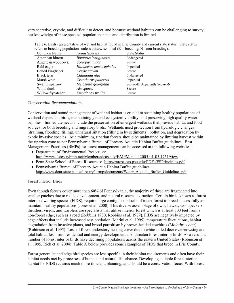
Erie County Natural Heritage Inventory – An Introduction to the Animals of Erie County / 54
very secretive, cryptic, and difficult to detect, and because wetland habitats can be challenging to survey, our knowledge of these species’ population status and distribution is limited.
Table 6: Birds representative of wetland habitat found in Erie County and current state status. State status refers to breeding populations unless otherwise noted (B = breeding; N= non-breeding).
Common Name Genus Species State Status American bittern Botaurus lentiginosus Endangered American woodcock Scolopax minor Secure Bald eagle Haliaeetus leucocephalus Imperiled Belted kingfisher Ceryle alcyon Secure Black tern Chilidonia niger Endangered Marsh wren Cistothorus palustris Imperiled Swamp sparrow Melospiza georgiana Secure-B, Apparently Secure-N Wood duck Aix sponsa Secure Willow flycatcher Empidonax traillii Secure
Conservation Recommendations Conservation and sound management of wetland habitat is crucial to sustaining healthy populations of wetland-dependent birds, maintaining general ecosystem viability, and preserving high quality water supplies. Immediate needs include the preservation of emergent wetlands that provide habitat and food sources for both breeding and migratory birds. Wetlands need protection from hydrologic changes (draining, flooding, filling), unnatural siltation (filling in by sediments), pollution, and degradation by exotic invasive species. At a minimum, riparian forests should be maintained by limiting harvest within the riparian zone as per Pennsylvania Bureau of Forestry Aquatic Habitat Buffer guidelines. Best Management Practices (BMPs) for forest management can be accessed at the following websites: • Department of Environmental Protection: http://www.forestrybmp.net/Members/dcassidy/BMPManual.2005-01-05.1751/view • Penn State School of Forest Resources: http://rnrext.cas.psu.edu/PDFs/FSPrinciples.pdf • Pennsylvania Bureau of Forestry Aquatic Habitat Buffer guidelines:
http://www.dcnr.state.pa.us/forestry/sfrmp/documents/Water_Aquatic_Buffer_Guidelines.pdf Forest Interior Birds Even though forests cover more than 60% of Pennsylvania, the majority of these are fragmented into smaller patches due to roads, development, and natural resource extraction. Certain birds, known as forest interior-dwelling species (FIDS), require large contiguous blocks of intact forest to breed successfully and maintain healthy populations (Jones et al. 2000). This diverse assemblage of owls, hawks, woodpeckers, thrushes, vireos, and warblers are specialists that utilize interior forest which is at least 300 feet from a non-forest edge, such as a road (Robbins 1980, Robbins et al. 1989). FIDS are negatively impacted by edge effects that include increased nest predation (Marini et al. 1995), temperature fluctuations, habitat degradation from invasive plants, and brood parasitism by brown-headed cowbirds (Molothrus ater) (Robinson et al. 1995). Loss of forest understory nesting cover due to white-tailed deer overbrowsing and total habitat loss from residential and energy development also threaten forest interior birds. As a result, a number of forest interior birds have declining populations across the eastern United States (Robinson et al. 1995, Rich et al. 2004). Table X below provides some examples of FIDS that breed in Erie County. Forest generalist and edge bird species are less specific in their habitat requirements and often have their habitat needs met by processes of human and natural disturbance. Developing suitable forest interior habitat for FIDS requires much more time and planning, and should be a conservation focus. With forest
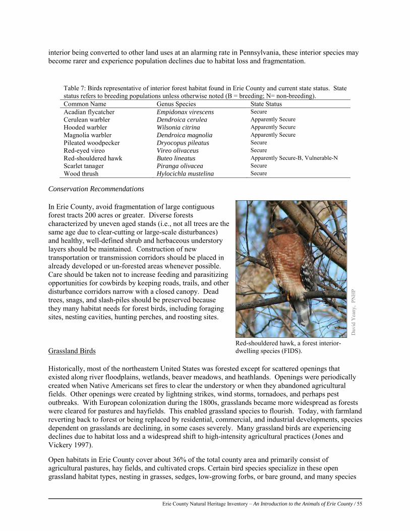
Erie County Natural Heritage Inventory – An Introduction to the Animals of Erie County / 55
interior being converted to other land uses at an alarming rate in Pennsylvania, these interior species may become rarer and experience population declines due to habitat loss and fragmentation.
Conservation Recommendations In Erie County, avoid fragmentation of large contiguous forest tracts 200 acres or greater. Diverse forests characterized by uneven aged stands (i.e., not all trees are the same age due to clear-cutting or large-scale disturbances) and healthy, well-defined shrub and herbaceous understory layers should be maintained. Construction of new transportation or transmission corridors should be placed in already developed or un-forested areas whenever possible. Care should be taken not to increase feeding and parasitizing opportunities for cowbirds by keeping roads, trails, and other disturbance corridors narrow with a closed canopy. Dead trees, snags, and slash-piles should be preserved because they many habitat needs for forest birds, including foraging sites, nesting cavities, hunting perches, and roosting sites. Grassland Birds Historically, most of the northeastern United States was forested except for scattered openings that existed along river floodplains, wetlands, beaver meadows, and heathlands. Openings were periodically created when Native Americans set fires to clear the understory or when they abandoned agricultural fields. Other openings were created by lightning strikes, wind storms, tornadoes, and perhaps pest outbreaks. With European colonization during the 1800s, grasslands became more widespread as forests were cleared for pastures and hayfields. This enabled grassland species to flourish. Today, with farmland reverting back to forest or being replaced by residential, commercial, and industrial developments, species dependent on grasslands are declining, in some cases severely. Many grassland birds are experiencing declines due to habitat loss and a widespread shift to high-intensity agricultural practices (Jones and Vickery 1997). Open habitats in Erie County cover about 36% of the total county area and primarily consist of agricultural pastures, hay fields, and cultivated crops. Certain bird species specialize in these open grassland habitat types, nesting in grasses, sedges, low-growing forbs, or bare ground, and many species
Table 7: Birds representative of interior forest habitat found in Erie County and current state status. State status refers to breeding populations unless otherwise noted (B = breeding; N= non-breeding). Common Name Genus Species State Status Acadian flycatcher Empidonax virescens Secure Cerulean warbler Dendroica cerulea Apparently Secure Hooded warbler Wilsonia citrina Apparently Secure Magnolia warbler Dendroica magnolia Apparently Secure Pileated woodpecker Dryocopus pileatus Secure Red-eyed vireo Vireo olivaceus Secure Red-shouldered hawk Buteo lineatus Apparently Secure-B, Vulnerable-N Scarlet tanager Piranga olivacea Secure Wood thrush Hylocichla mustelina Secure
Dav
id Y
eany
, PN
HP
Red-shouldered hawk, a forest interior- dwelling species (FIDS).
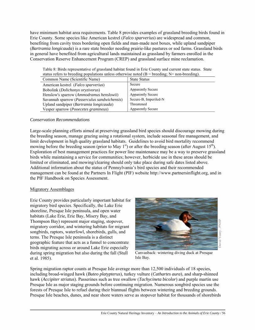
Erie County Natural Heritage Inventory – An Introduction to the Animals of Erie County / 56
have minimum habitat area requirements. Table 8 provides examples of grassland breeding birds found in Erie County. Some species like American kestrel (Falco sparverius) are widespread and common, benefiting from cavity trees bordering open fields and man-made nest boxes, while upland sandpiper (Bartramia longicauda) is a rare state breeder needing prairie-like pastures or sod farms. Grassland birds in general have benefited from agricultural lands maintained as grassland by farmers enrolled in the Conservation Reserve Enhancement Program (CREP) and grassland surface mine reclamation.
Table 8: Birds representative of grassland habitat found in Erie County and current state status. State status refers to breeding populations unless otherwise noted (B = breeding; N= non-breeding). Common Name (Scientific Name) State Status American kestrel (Falco sparverius) Secure Bobolink (Dolichonyx oryzivorus) Apparently Secure Henslow's sparrow (Ammodramus henslowii) Apparently Secure Savannah sparrow (Passerculus sandwichensis) Secure-B, Imperiled-N Upland sandpiper (Bartramia longicauda) Threatened Vesper sparrow (Pooecetes gramineus) Apparently Secure
Conservation Recommendations Large-scale planning efforts aimed at preserving grassland bird species should discourage mowing during the breeding season, manage grazing using a rotational system, include seasonal fire management, and limit development in high quality grassland habitats. Guidelines to avoid bird mortality recommend mowing before the breeding season (prior to May 1st) or after the breeding season (after August 15th). Exploration of best management practices for power line maintenance may be a way to preserve grassland birds while maintaining a service for communities; however, herbicide use in these areas should be limited or eliminated, and mowing/clearing should only take place during safe dates listed above. Additional information about the status of Pennsylvania’s bird species and their recommended management can be found at the Partners In Flight (PIF) website http://www.partnersinflight.org, and in the PIF Handbook on Species Assessment. Migratory Assemblages Erie County provides particularly important habitat for migratory bird species. Specifically, the Lake Erie shoreline, Presque Isle peninsula, and open water habitats (Lake Erie, Erie Bay, Misery Bay, and Thompson Bay) represent major staging, stopover, migratory corridor, and wintering habitats for migrant songbirds, raptors, waterfowl, shorebirds, gulls, and terns. The Presque Isle peninsula is a distinct geographic feature that acts as a funnel to concentrate birds migrating across or around Lake Erie especially during spring migration but also during the fall (Stull et al. 1985). Spring migration raptor counts at Presque Isle average more than 12,500 individuals of 18 species, including broad-winged hawk (Buteo platypterus), turkey vulture (Cathartes aura), and sharp-shinned hawk (Accipiter striatus). Passerines such as tree swallow (Tachycineta bicolor) and purple martin use Presque Isle as major staging grounds before continuing migration. Numerous songbird species use the forests of Presque Isle to refuel during their biannual flights between wintering and breeding grounds. Presque Isle beaches, dunes, and near shore waters serve as stopover habitat for thousands of shorebirds
Dav
id Y
eany
, PN
HP
Canvasback: wintering diving duck at Presque Isle Bay.
Erie County Natural Heritage Inventory – An Introduction to the Animals of Erie County / 57
and wintering habitat for thousands of gulls and terns including ring-billed gull (Larus delawarensis) and Forster’s tern (Sterna forsteri). Finally, hundreds of thousands of migratory waterfowl use the open waters of Lake Erie and Presque Isle bays during spring and fall migration and some throughout winter. Diving ducks like canvasback (Aythya valisineria) and lesser scaup (Aythya affinis) gather in large rafts on Lake Erie and Erie Bay (Stull et al. 1985), while dabbling ducks like northern pintail (Anas acuta), mallard (Anas platyrhynchos), and American black duck (Anas rubripes) forage in the marshes, ponds, and lagoons of Presque Isle. Conservation Recommendations Conservation for migratory bird habitat needs requires creativity and cooperation among wide-ranging partners. The areas utilized by these migratory assemblages vary greatly and each demands different measures for conservation. Migrating gulls, terns, and shorebirds will benefit from beach habitat restoration and protection from human disturbance. Shrub/scrub and forest habitat on Presque Isle should be maintained for passerines for use as a stopover site during migration. Raptors using the shoreline as a migration corridor should be afforded a protective buffer from off shore wind energy projects to minimize disturbance and collision mortality. Presque Isle is a sub-focus area under the Atlantic Coast Joint Venture (2005) Waterfowl Implementation Plan, and per this plan, efforts should continue to reduce human disturbance to migrating and nesting birds, invasive species should be aggressively controlled, and research is needed to understand the effects of contaminants (e.g., selenium) on waterfowl and the relationship of botulism to the invasive zebra mussel (Dreissena polymorpha) and round goby (Neogobius melanostomus). Important Bird Areas (IBAs) of Erie County Erie County includes four Important Bird Areas (IBAs): Presque Isle State Park, Roderick Wildlife Reserve-State Game Lands #314, Presque Isle Bay Martin Roost, and Cussewago Bottom (Figure 12). Descriptions for IBAs refer to the entire site, which may extend beyond Erie County, and do not necessarily reflect the portion of the IBA within the county.
Note: The following information is adapted from Audubon Pennsylvania IBA site descriptions and conservation plans (Audubon, 2011).
Presque Isle State Park IBA Located in Millcreek Township in the extreme northwestern corner of Pennsylvania, the 3,115 acre (1,261 hectare) Presque Isle State Park IBA is a sand-spit peninsula jutting seven miles into Lake Erie. The peninsula was formed by centuries of long-shore drift. Sand eroding from the lake shore west of the peninsula is moved by the prevailing wave action along the peninsula and deposited at its eastern, distal end. Wetlands comprise 458 acres on Presque Isle State Park, including black gum-red maple swamps, marshes, and wet meadows. Four forest communities encompass 1,392 acres and include mixed oak, northern hardwoods, pine plantation, and cottonwood types. The remaining habitats make up 39 acres of old fields and savannah. IBA qualifying criteria:
• The site regularly supports migrating and wintering waterfowl up to 100,000 individuals. • The site regularly supports migrating shorebirds up to 1,500 individuals of 39 species. • The site regularly supports numerous breeding wading birds up to 100 individuals, and migrating
and wintering gulls up to 500,000 individuals. • The site is recognized as having an exceptional concentration and diversity of birdlife. More than
325 species have been recorded.
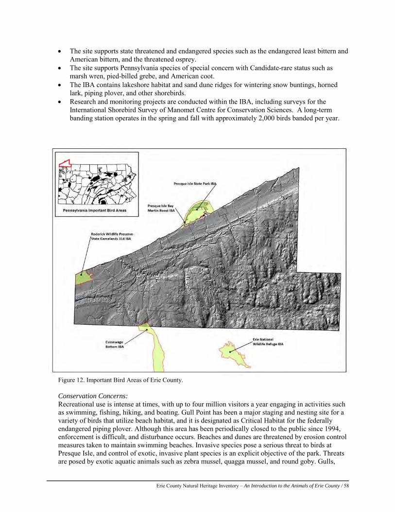
Erie County Natural Heritage Inventory – An Introduction to the Animals of Erie County / 58
• The site supports state threatened and endangered species such as the endangered least bittern and American bittern, and the threatened osprey.
• The site supports Pennsylvania species of special concern with Candidate-rare status such as marsh wren, pied-billed grebe, and American coot.
• The IBA contains lakeshore habitat and sand dune ridges for wintering snow buntings, horned lark, piping plover, and other shorebirds.
• Research and monitoring projects are conducted within the IBA, including surveys for the International Shorebird Survey of Manomet Centre for Conservation Sciences. A long-term banding station operates in the spring and fall with approximately 2,000 birds banded per year.
Figure 12. Important Bird Areas of Erie County.
Conservation Concerns: Recreational use is intense at times, with up to four million visitors a year engaging in activities such as swimming, fishing, hiking, and boating. Gull Point has been a major staging and nesting site for a variety of birds that utilize beach habitat, and it is designated as Critical Habitat for the federally endangered piping plover. Although this area has been periodically closed to the public since 1994, enforcement is difficult, and disturbance occurs. Beaches and dunes are threatened by erosion control measures taken to maintain swimming beaches. Invasive species pose a serious threat to birds at Presque Isle, and control of exotic, invasive plant species is an explicit objective of the park. Threats are posed by exotic aquatic animals such as zebra mussel, quagga mussel, and round goby. Gulls,
Erie County Natural Heritage Inventory – An Introduction to the Animals of Erie County / 59
loons, and diving ducks can become exposed to deadly toxins and contaminants that are accumulated by these invasive animals and spread through the food web.
Roderick Wildlife Reserve-State Game Land #314 IBA This site contains 3,455 acres, located on the westernmost portion of the Lake Erie shoreline in Pennsylvania at the Ohio border, and includes 2.5 miles of lakefront – the longest stretch of undeveloped shoreline on the southern shore of Lake Erie. The steep bluffs on the lake shore are backed by gentle uplands laced with wetlands, streams, old fields, second-growth forest, and shrubland. Wetlands comprise 49% of the site, while the remaining forest consists of aspen, American beech, white oak, sugar maple, and silky dogwood. Both red and silver maples grow abundantly in the wooded swamps. Originally owned by U.S. Steel, the Western Pennsylvania Conservancy acquired this site for protection in 1989 and handed over site management to the Pennsylvania Game Commission in 1991. IBA qualifying criteria:
• The site regularly supports migrating and breeding American woodcock with Pennsylvania Game Commission spring surveys indicating a minimum estimate of 50 pairs
• The IBA contains important wetland and early successional habitat for species like mourning warbler.
• The Pennsylvania Game Commission regularly conducts research on American woodcock habitat management.
Conservation Concerns:
The IBA is managed by the Pennsylvania Game Commission as part of the North American Bird Conservation Initiative Atlantic Coast Joint Venture Bird Conservation Region 13. The site is open to the public and hunting is permitted. Management of the site focuses on American woodcock and other shrub associated avifauna. Invasive exotic plant species control is needed, with Phragmites becoming a particular problem. More extensive monitoring is needed for migrants and waterfowl. Residential development continues to increase in the surrounding landscape and is an increasing concern as this site may become a habitat island.
Presque Isle Bay Martin Roost IBA At 4.3 acres, this site is the only known pre-migratory roost site and staging area for purple martins (Progne subis) in Pennsylvania. Individuals gather in great numbers to roost in cattail marsh islands located in Erie Bay, near the foot of Presque Isle. The islands provide security from predators and the relatively warm, shallow waters serve to attract the birds. The birds save energy by roosting in the radiating warmth, which also creates conditions favorable to a superabundance of aerial insect prey. The martins use this roost until they are ready to migrate to Brazil. IBA qualifying criteria:
The site regularly supports more than 100,000 purple martins during fall migration. Purple martins gather in huge numbers, along with red-winged blackbirds, common grackles, bank swallows, barn swallows, and European starlings. Total numbers of all species combined can reach 150,000 individuals. Each day the martins engage in two mass movements: a near-dawn exodus from the roost and a return starting just before sunset. Purple martin use of the site starts in early July, peaks in August, and continues through early September.
Conservation Concerns:
This site is under threat by a proposed dredging operation to provide boat traffic access to a planned marina in the corner of Presque Isle Bay. Due to the shallow waters and vulnerability of the birds, it is
Erie County Natural Heritage Inventory – An Introduction to the Animals of Erie County / 60
important that boaters maintain a minimum buffer distance of 200 yards to reduce disturbance. Ongoing research is conducted by the Purple Martin Conservation Association during the 6-8 week roosting period from July to September to sight recover color-banded individuals. Results from this research have demonstrated that the Presque Isle Bay Martin Roost supports individuals from a 250-mile radius and serves as an important staging ground for martins migrating to wintering grounds in Brazil.
Cussewago Bottom IBA Cussewago Creek, its floodplain, and adjacent uplands comprise the 12,682 acre Cussewago Bottom IBA (referred to as the Bottoms) primarily in Crawford County, but a small portion is located in Elk Creek Township in Erie County. Cussewago Creek, a low-gradient stream, snakes its way south-southeast through a long and narrow glacial outwash valley, joining French Creek at Meadville. Through the natural processes of stream meander, many cutoffs, oxbows, and backwaters have been created in the Bottoms. Side streams dammed by beavers and frequent flooding maintain the Bottoms’ abundant wetlands. Some emergent herbaceous wetlands occur in the Bottoms, notably at State Game Lands #269, but most of the wetlands are shrub-scrub or woody wetlands. Tracts of upland forest and agricultural lands add diversity to the landscape. Shrub-scrub, forested, and emergent wetlands comprise the most important avian habitats in Cussewago Bottoms. The open waters of Cussewago Creek and the small lake at SGL #269 are especially important to bald eagles and waterfowl. Adjacent upland forests and an abundance of land in early successional stages are important to a variety of Neotropical migrants. Seasonally flooded pastures and agricultural fields provide most of the habitat used by migrating shorebirds. IBA qualifying criteria:
• The site regularly supports numerous shorebirds during migration periods including Wilson’s snipe, lesser yellowlegs, greater yellowlegs, and occasionally dunlin.
• The IBA is recognized as having an exceptional concentration and diversity of birdlife in Pennsylvania with nearly 200 species identified, including a high number of Neotropical migrants.
• The site supports the state threatened bald eagle. • The IBA represents a prime example of a lowland stream, floodplain, and wetlands-uplands
complex in glaciated northwestern Pennsylvania with extensive bottomland hardwood forest and many habitat types.
Conservation Concerns:
Siltation and pollution from agriculture, gas well development, gravel mining, logging, land clearing, and filling occur with varying frequency and effect in the Bottoms. Invasive species, common reed and reed canary grass in particular, have taken over some areas. Residential development is perhaps the greatest future threat to this IBA, as idle farms that currently provide a diversity of bird habitat are beginning to be sub-divided.

Erie County Natural Heritage Inventory – An Introduction to the Animals of Erie County / 61
References: Audubon Pennsylvania. 2011. Audubon Pennsylvania Birds Conservation: The Important Bird Area Program in Pennsylvania.
Audubon Pennsylvania, Harrisburg, PA. Available from http://pa.audubon.org/iba/ (accessed October 2011). Brauning, Daniel W., ed. 1992. Atlas of Breeding Birds in Pennsylvania. Pittsburgh, PA: University of Pittsburgh Press. 484pp. Brauning, D.W., M.C. Brittingham, D.A. Gross, R.C. Leberman, T.L. Master, and R.S. Mulvihill. 1994. Pennsylvania breeding
birds of special concern: a listing rationale and status update. J. Pa. Acad. Sci. 68:3-28. Dahl, T.E. (1990). Wetlands Losses the United States 1790s to 1980s. U.S. Department of the Interior, Fish and Wildlife Service,
Washington, D.C. Gross, D.A. (2002). The Current Pennsylvania List of Breeding Birds of Special Concern and Species Under Consideration. PSO
Newsletter, 13(3): 8. Jones, A.L. and P.D. Vickery. (1997). Conserving Grassland Birds: Managing Small Grasslands Including Conservation Lands,
Corporation Headquarters, Recreation Fields, and Small Landfills for Grassland Birds. Massachusetts Audubon Society, Lincoln, Massachusetts.
Marini, M.A., Robinson, S.K., and E.J. Heske. (1995). Edge Effects on Nest Predation in the Shawnee-National-Forest, Southern Illinois. Biological Conservation 74(3): 203-213.
Mulvihill, B. 2009. Thanks to all our 2nd PBBA Volunteers: Results at Press Time. The PennsylAvian Monitor, 5(1): 1. Myers, W.L., Brooks, R., and J. Bishop. (2000). Final Report U.S. Geological Survey-Gap Analysis Program. Pennsylvania Gap
Analysis Project, Penn State University, University Park, PA. Available at: http://www.orser.psu.edu/PAGAP/gappage.htm (accessed October 2009).
Robinson, S.K. (1994). Nesting Success of Forest Songbirds in Northwestern Illinois. Final Report, Project W-115-R-3. Illinois Natural History Survey, Center of Wildlife Ecology, Urbana, IL.
Robbins, C.R., Dawson D.K., and B.A. Dowell. (1989). Habitat Area Requirements of Breeding Forest Birds of the Middle Atlantic States. Wildlife Monographs 103: 1-34.
Robbins, C.S. 1980. Effects of Forest Fragmentation on Breeding Bird Populations in the Piedmont of the Mid-Atlantic Region. Atlantic Naturalist 33: 31-36.
Robinson, S.K., Thompson III, F.R., Donovan, T.M., Whitehead, D.R., and J. Faaborg. (1995). Regional Forest Fragmentation and the Nesting Success of Migratory Birds. Science 267:1987-1990.
Stull, J., J.A. Stull, and G.M. McWilliams. 1985. Birds of Erie County Pennsylvania, including Presque Isle. Allegheny Press, Eglin, Pennsylvania.
Todd, W.E.C. 1940. Birds of Western Pennsylvania. U. Pittsburgh Press, Pittsburgh PA. DCNR, 1992. Presque Isle State Park Resource Management Plan, DCNR, Harrisburg, PA . U.S. Fish and Wildlife Service. 2003. Recovery Plan for the Great Lakes Piping Plover (Charadrius melodus). Ft. Snelling,
Minnesota. Viii + 141 pp. Rich, T.D., C.J. Beardmore, H. Berlanga, P.J. Blancher, M.S.W. Bradstreet, G.S. Butcher, D.W. Demarest, E.H. Dunn, W.C.
Hunter, E.E. Inigo-Elias, J.A. Kennedy, A.M. Martell, A.O. Panjabi, D.N. Pashley, K.V. Rosenberg, C.M. Rustay, J.S. Wendt, T.C. Will. 2004. Partners in Flight North American Landbird Conservation Plan. Cornell Lab of Ornithology. Ithaca, NY.
Atlantic Coast Joint Venture. 2005. North American Waterfowl Management Plan: Atlantic Coast Joint Venture Waterfowl Implementation Plan Revision.
Pennsylvania Game Commission and Pennsylvania Fish and Boat Commission [PGC and PFBC]. 2005. Pennsylvania comprehensive wildlife conservation strategy. Version 1.0. 762 pp.
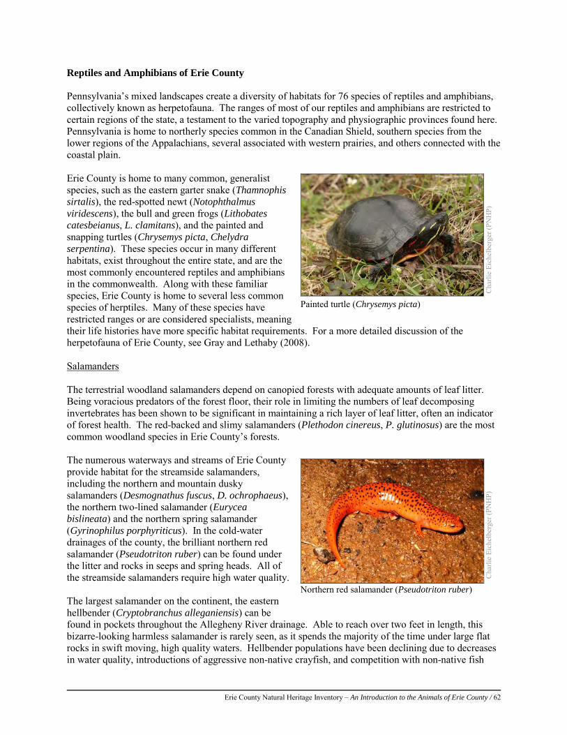
Erie County Natural Heritage Inventory – An Introduction to the Animals of Erie County / 62
Reptiles and Amphibians of Erie County Pennsylvania’s mixed landscapes create a diversity of habitats for 76 species of reptiles and amphibians, collectively known as herpetofauna. The ranges of most of our reptiles and amphibians are restricted to certain regions of the state, a testament to the varied topography and physiographic provinces found here. Pennsylvania is home to northerly species common in the Canadian Shield, southern species from the lower regions of the Appalachians, several associated with western prairies, and others connected with the coastal plain. Erie County is home to many common, generalist species, such as the eastern garter snake (Thamnophis sirtalis), the red-spotted newt (Notophthalmus viridescens), the bull and green frogs (Lithobates catesbeianus, L. clamitans), and the painted and snapping turtles (Chrysemys picta, Chelydra serpentina). These species occur in many different habitats, exist throughout the entire state, and are the most commonly encountered reptiles and amphibians in the commonwealth. Along with these familiar species, Erie County is home to several less common species of herptiles. Many of these species have restricted ranges or are considered specialists, meaning their life histories have more specific habitat requirements. For a more detailed discussion of the herpetofauna of Erie County, see Gray and Lethaby (2008). Salamanders The terrestrial woodland salamanders depend on canopied forests with adequate amounts of leaf litter. Being voracious predators of the forest floor, their role in limiting the numbers of leaf decomposing invertebrates has been shown to be significant in maintaining a rich layer of leaf litter, often an indicator of forest health. The red-backed and slimy salamanders (Plethodon cinereus, P. glutinosus) are the most common woodland species in Erie County’s forests. The numerous waterways and streams of Erie County provide habitat for the streamside salamanders, including the northern and mountain dusky salamanders (Desmognathus fuscus, D. ochrophaeus), the northern two-lined salamander (Eurycea bislineata) and the northern spring salamander (Gyrinophilus porphyriticus). In the cold-water drainages of the county, the brilliant northern red salamander (Pseudotriton ruber) can be found under the litter and rocks in seeps and spring heads. All of the streamside salamanders require high water quality. The largest salamander on the continent, the eastern hellbender (Cryptobranchus alleganiensis) can be found in pockets throughout the Allegheny River drainage. Able to reach over two feet in length, this bizarre-looking harmless salamander is rarely seen, as it spends the majority of the time under large flat rocks in swift moving, high quality waters. Hellbender populations have been declining due to decreases in water quality, introductions of aggressive non-native crayfish, and competition with non-native fish
Cha
rlie
Eich
elbe
rger
(PN
HP)
Painted turtle (Chrysemys picta)
Cha
rlie
Eich
elbe
rger
(PN
HP)
Northern red salamander (Pseudotriton ruber)
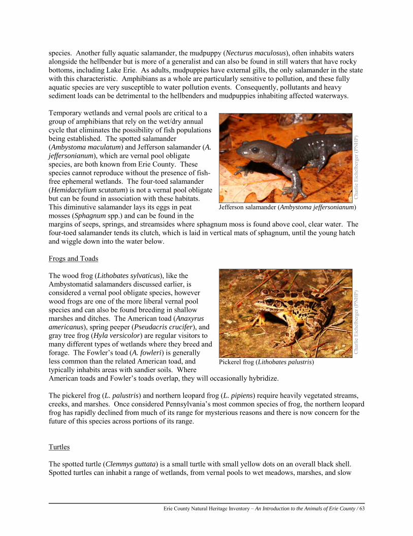
Erie County Natural Heritage Inventory – An Introduction to the Animals of Erie County / 63
species. Another fully aquatic salamander, the mudpuppy (Necturus maculosus), often inhabits waters alongside the hellbender but is more of a generalist and can also be found in still waters that have rocky bottoms, including Lake Erie. As adults, mudpuppies have external gills, the only salamander in the state with this characteristic. Amphibians as a whole are particularly sensitive to pollution, and these fully aquatic species are very susceptible to water pollution events. Consequently, pollutants and heavy sediment loads can be detrimental to the hellbenders and mudpuppies inhabiting affected waterways. Temporary wetlands and vernal pools are critical to a group of amphibians that rely on the wet/dry annual cycle that eliminates the possibility of fish populations being established. The spotted salamander (Ambystoma maculatum) and Jefferson salamander (A. jeffersonianum), which are vernal pool obligate species, are both known from Erie County. These species cannot reproduce without the presence of fish-free ephemeral wetlands. The four-toed salamander (Hemidactylium scutatum) is not a vernal pool obligate but can be found in association with these habitats. This diminutive salamander lays its eggs in peat mosses (Sphagnum spp.) and can be found in the margins of seeps, springs, and streamsides where sphagnum moss is found above cool, clear water. The four-toed salamander tends its clutch, which is laid in vertical mats of sphagnum, until the young hatch and wiggle down into the water below. Frogs and Toads The wood frog (Lithobates sylvaticus), like the Ambystomatid salamanders discussed earlier, is considered a vernal pool obligate species, however wood frogs are one of the more liberal vernal pool species and can also be found breeding in shallow marshes and ditches. The American toad (Anaxyrus americanus), spring peeper (Pseudacris crucifer), and gray tree frog (Hyla versicolor) are regular visitors to many different types of wetlands where they breed and forage. The Fowler’s toad (A. fowleri) is generally less common than the related American toad, and typically inhabits areas with sandier soils. Where American toads and Fowler’s toads overlap, they will occasionally hybridize. The pickerel frog (L. palustris) and northern leopard frog (L. pipiens) require heavily vegetated streams, creeks, and marshes. Once considered Pennsylvania’s most common species of frog, the northern leopard frog has rapidly declined from much of its range for mysterious reasons and there is now concern for the future of this species across portions of its range. Turtles The spotted turtle (Clemmys guttata) is a small turtle with small yellow dots on an overall black shell. Spotted turtles can inhabit a range of wetlands, from vernal pools to wet meadows, marshes, and slow
Cha
rlie
Eich
elbe
rger
(PN
HP)
Jefferson salamander (Ambystoma jeffersonianum)
Cha
rlie
Eich
elbe
rger
(PN
HP)
Pickerel frog (Lithobates palustris)
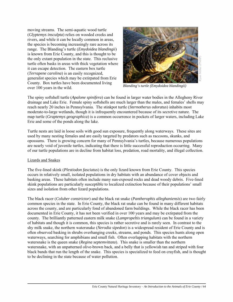
Erie County Natural Heritage Inventory – An Introduction to the Animals of Erie County / 64
moving streams. The semi-aquatic wood turtle (Glyptemys insculpta) relies on wooded creeks and rivers, and while it can be locally common in areas, the species is becoming increasingly rare across its range. The Blanding’s turtle (Emydoidea blandingii) is known from Erie County, and this is thought to be the only extant population in the state. This reclusive turtle often basks in areas with thick vegetation where it can escape detection. The eastern box turtle (Terrapene carolina) is an easily recognized, generalist species which may be extirpated from Erie County. Box turtles have been documented living over 100 years in the wild. The spiny softshell turtle (Apalone spinifera) can be found in larger water bodies in the Allegheny River drainage and Lake Erie. Female spiny softshells are much larger than the males, and females’ shells may reach nearly 20 inches in Pennsylvania. The stinkpot turtle (Sternotherus odoratus) inhabits most moderate-to-large wetlands, though it is infrequently encountered because of its secretive nature. The map turtle (Graptemys geographica) is a common occurrence in pockets of larger waters, including Lake Erie and some of the ponds along the lake. Turtle nests are laid in loose soils with good sun exposure, frequently along waterways. These sites are used by many nesting females and are easily targeted by predators such as raccoons, skunks, and opossums. There is growing concern for many of Pennsylvania’s turtles, because numerous populations are nearly void of juvenile turtles, indicating that there is little successful reproduction occurring. Many of our turtle populations are in decline from habitat loss, predation, road mortality, and illegal collection. Lizards and Snakes The five-lined skink (Plestiodon fasciatus) is the only lizard known from Erie County. This species occurs in relatively small, isolated populations in dry habitats with an abundance of cover objects and basking areas. These habitats often include many sun-exposed rocks and dead woody debris. Five-lined skink populations are particularly susceptible to localized extinction because of their populations’ small sizes and isolation from other lizard populations. The black racer (Coluber constrictor) and the black rat snake (Pantherophis alleghaniensis) are two fairly common species in the state. In Erie County, the black rat snake can be found in many different habitats across the county, and are particularly fond of abandoned farm buildings. While the black racer has been documented in Erie County, it has not been verified in over 100 years and may be extirpated from the county. The brilliantly patterned eastern milk snake (Lampropeltis triangulum) can be found in a variety of habitats and though it is common, this species is rather secretive and is rarely seen. In contrast to the shy milk snake, the northern watersnake (Nerodia sipedon) is a widespread resident of Erie County and is often observed basking in shrubs overhanging creeks, streams, and ponds. This species hunts along open waterways, searching for amphibians and small fish. Often overlapping habitats with the northern watersnake is the queen snake (Regina septemvittata). This snake is smaller than the northern watersnake, with an unpatterned olive-brown back, and a belly that is yellowish tan and striped with four black bands that run the length of the snake. This species is specialized to feed on crayfish, and is thought to be declining in the state because of water pollution.
Rya
n M
iller
(PN
HP)
Blanding’s turtle (Emydoidea blandingii)
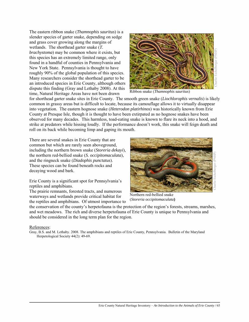
Erie County Natural Heritage Inventory – An Introduction to the Animals of Erie County / 65
The eastern ribbon snake (Thamnophis sauritus) is a slender species of garter snake, depending on sedge and grass cover growing along the margins of wetlands. The shorthead garter snake (T. brachystoma) may be common where it exists, but this species has an extremely limited range, only found in a handful of counties in Pennsylvania and New York State. Pennsylvania is thought to have roughly 90% of the global population of this species. Many researchers consider the shorthead garter to be an introduced species in Erie County, although others dispute this finding (Gray and Lethaby 2008). At this time, Natural Heritage Areas have not been drawn for shorthead garter snake sites in Erie County. The smooth green snake (Liochlorophis vernalis) is likely common in grassy areas but is difficult to locate, because its camouflage allows it to virtually disappear into vegetation. The eastern hognose snake (Heterodon platirhinos) was historically known from Erie County at Presque Isle, though it is thought to have been extirpated as no hognose snakes have been observed for many decades. This harmless, toad-eating snake is known to flare its neck into a hood, and strike at predators while hissing loudly. If the performance doesn’t work, this snake will feign death and roll on its back while becoming limp and gaping its mouth. There are several snakes in Erie County that are common but which are rarely seen aboveground, including the northern brown snake (Storeria dekayi), the northern red-bellied snake (S. occipitomaculata), and the ringneck snake (Diadophis punctatus). These species can be found beneath rocks and decaying wood and bark. Erie County is a significant spot for Pennsylvania’s reptiles and amphibians. The prairie remnants, forested tracts, and numerous waterways and wetlands provide critical habitat for the reptiles and amphibians. Of utmost importance to the conservation of the county’s herpetofauna is the protection of the region’s forests, streams, marshes, and wet meadows. The rich and diverse herpetofauna of Erie County is unique to Pennsylvania and should be considered in the long term plan for the region. References: Gray, B.S. and M. Lethaby. 2008. The amphibians and reptiles of Erie County, Pennsylvania. Bulletin of the Maryland
Herpetological Society 44(2): 49-69.
Cha
rlie
Eich
elbe
rger
(PN
HP)
Ribbon snake (Thamnophis sauritus)
Cha
rlie
Eich
elbe
rger
(PN
HP)
Northern red-bellied snake (Storeria occipitomaculata)
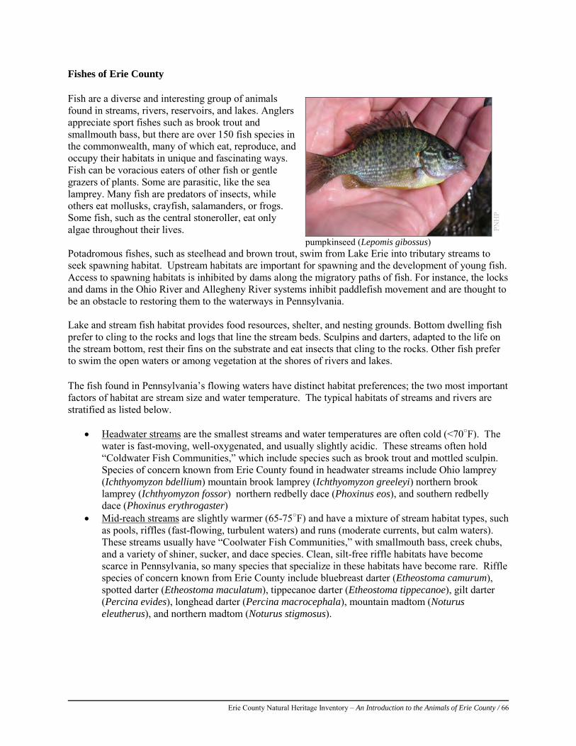
Erie County Natural Heritage Inventory – An Introduction to the Animals of Erie County / 66
Fishes of Erie County Fish are a diverse and interesting group of animals found in streams, rivers, reservoirs, and lakes. Anglers appreciate sport fishes such as brook trout and smallmouth bass, but there are over 150 fish species in the commonwealth, many of which eat, reproduce, and occupy their habitats in unique and fascinating ways. Fish can be voracious eaters of other fish or gentle grazers of plants. Some are parasitic, like the sea lamprey. Many fish are predators of insects, while others eat mollusks, crayfish, salamanders, or frogs. Some fish, such as the central stoneroller, eat only algae throughout their lives. Potadromous fishes, such as steelhead and brown trout, swim from Lake Erie into tributary streams to seek spawning habitat. Upstream habitats are important for spawning and the development of young fish. Access to spawning habitats is inhibited by dams along the migratory paths of fish. For instance, the locks and dams in the Ohio River and Allegheny River systems inhibit paddlefish movement and are thought to be an obstacle to restoring them to the waterways in Pennsylvania. Lake and stream fish habitat provides food resources, shelter, and nesting grounds. Bottom dwelling fish prefer to cling to the rocks and logs that line the stream beds. Sculpins and darters, adapted to the life on the stream bottom, rest their fins on the substrate and eat insects that cling to the rocks. Other fish prefer to swim the open waters or among vegetation at the shores of rivers and lakes. The fish found in Pennsylvania’s flowing waters have distinct habitat preferences; the two most important factors of habitat are stream size and water temperature. The typical habitats of streams and rivers are stratified as listed below.
• Headwater streams are the smallest streams and water temperatures are often cold (<70○F). The water is fast-moving, well-oxygenated, and usually slightly acidic. These streams often hold “Coldwater Fish Communities,” which include species such as brook trout and mottled sculpin. Species of concern known from Erie County found in headwater streams include Ohio lamprey (Ichthyomyzon bdellium) mountain brook lamprey (Ichthyomyzon greeleyi) northern brook lamprey (Ichthyomyzon fossor) northern redbelly dace (Phoxinus eos), and southern redbelly dace (Phoxinus erythrogaster)
• Mid-reach streams are slightly warmer (65-75○F) and have a mixture of stream habitat types, such as pools, riffles (fast-flowing, turbulent waters) and runs (moderate currents, but calm waters). These streams usually have “Coolwater Fish Communities,” with smallmouth bass, creek chubs, and a variety of shiner, sucker, and dace species. Clean, silt-free riffle habitats have become scarce in Pennsylvania, so many species that specialize in these habitats have become rare. Riffle species of concern known from Erie County include bluebreast darter (Etheostoma camurum), spotted darter (Etheostoma maculatum), tippecanoe darter (Etheostoma tippecanoe), gilt darter (Percina evides), longhead darter (Percina macrocephala), mountain madtom (Noturus eleutherus), and northern madtom (Noturus stigmosus).
PNH
P
pumpkinseed (Lepomis gibossus)
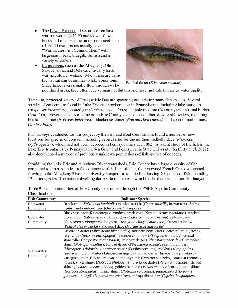
Erie County Natural Heritage Inventory – An Introduction to the Animals of Erie County / 67
• The Lower Reaches of streams often have warmer waters (>75○F) and slower flows. Pools and runs become more prominent than riffles. These streams usually have “Warmwater Fish Communities,” with largemouth bass, bluegill, sunfish and a variety of darters.
• Large rivers, such as the Allegheny, Ohio, Susquehanna, and Delaware, usually have warmer, slower waters. When there are dams, the habitat can be similar to lake conditions. Since large rivers usually flow through well-populated areas, they often receive many pollutants and have multiple threats to water quality.
The calm, protected waters of Presque Isle Bay are spawning grounds for many fish species. Several species of concern are found in Lake Erie and nowhere else in Pennsylvania, including lake sturgeon (Acipenser fulvescens), spotted gar (Lepisosteus oculatus), tadpole madtom (Noturus gyrinus), and burbot (Lota lota). Several species of concern in Erie County use lakes and other slow or still waters, including blackchin shiner (Notropis heterodon), blacknose shiner (Notropis heterolepis), and central mudminnow (Umbra limi). Fish surveys conducted for this project by the Fish and Boat Commission found a number of new locations for species of concern, including several sites for the northern redbelly dace (Phoxinus erythrogaster), which had not been recorded in Pennsylvania since 1862. A recent study of the fish in the Lake Erie tributaries by Pennsylvania Sea Grant and Pennsylvania State University (Rafferty et al. 2012) also documented a number of previously unknown populations of fish species of concern. Straddling the Lake Erie and Allegheny River watersheds, Erie County has a large diversity of fish compared to other counties in the commonwealth. In particular, the renowned French Creek watershed flowing to the Allegheny River is a diversity hotspot for aquatic life, hosting 70 species of fish, including 13 darter species. The bottom dwelling darters do not have a swim bladder that keeps other fish buoyant. Table 9. Fish communities of Erie County determined through the PNHP Aquatic Community Classification. Fish Community Indicator Species Coldwater Community
Brook trout (Salvelinus fontinalis) mottled sculpin (Cottus bairdii), brown trout (Salmo trutta), and rainbow trout (Oncorhynchus mykiss)
Coolwater Community
Blacknose dace (Rhinichthys atratulus), creek chub (Semotilus atromaculatus), stocked brown trout (Salmo trutta), white sucker (Catostomus commersoni), redside dace (Clinostomus elongatus), longnose dace (Rhinichthys cataractae), fathead minnow (Pimephales promelas), and pearl dace (Margariscus margarita)
Warmwater Community
Greenside darter (Etheostoma blennioides), northern hogsucker (Hypentelium nigricans), river chub (Nocomis micropogon), bluntnose minnow (Pimephales notatus), central stoneroller Campostoma anomalum), rainbow darter (Etheostoma caeruleum), rosyface shiner (Notropis rubellus), banded darter (Etheostoma zonale), smallmouth bass (Micropterus dolomieu), common shiner (Luxilus cornutus), rockbass (Amploplites rupestris), johnny darter (Etheostoma nigrum), fantail darter (Etheostoma flabellare), variegate darter (Etheostoma variatum), logperch (Percina caprodes), stonecat (Noturus flavus), silver shiner (Notropis photogenis), blackside darter (Percina maculata), striped shiner (Luxilus chrysocephalus), golden redhorse (Moxostoma erythrurum), sand shiner (Notropis stramineus), mimic shiner (Notropis volucellus), pumpkinseed (Lepomis gibbosus), bluegill (Lepomis macrochirus), and spotfin shiner (Cyprinella spiloptera)
Banded darter (Etheostoma zonale)
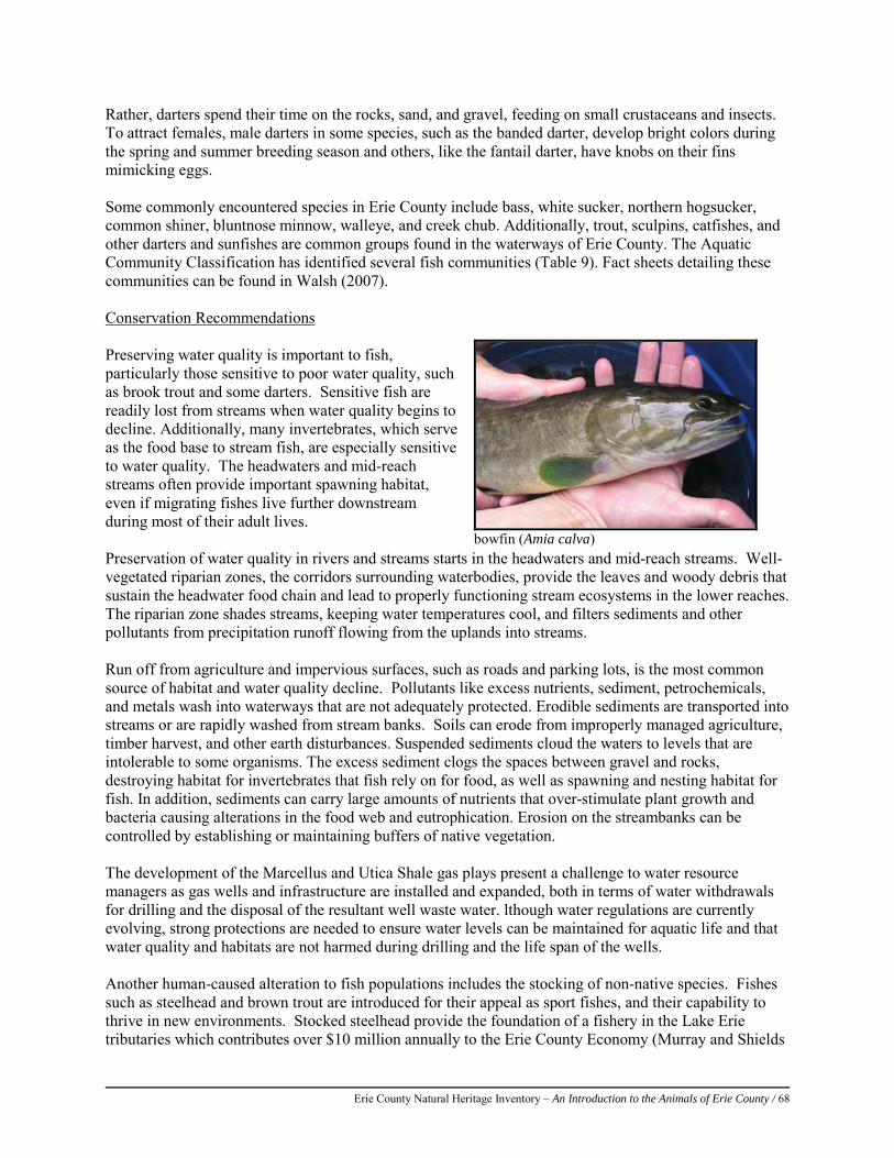
Erie County Natural Heritage Inventory – An Introduction to the Animals of Erie County / 68
Rather, darters spend their time on the rocks, sand, and gravel, feeding on small crustaceans and insects. To attract females, male darters in some species, such as the banded darter, develop bright colors during the spring and summer breeding season and others, like the fantail darter, have knobs on their fins mimicking eggs. Some commonly encountered species in Erie County include bass, white sucker, northern hogsucker, common shiner, bluntnose minnow, walleye, and creek chub. Additionally, trout, sculpins, catfishes, and other darters and sunfishes are common groups found in the waterways of Erie County. The Aquatic Community Classification has identified several fish communities (Table 9). Fact sheets detailing these communities can be found in Walsh (2007). Conservation Recommendations
Preserving water quality is important to fish, particularly those sensitive to poor water quality, such as brook trout and some darters. Sensitive fish are readily lost from streams when water quality begins to decline. Additionally, many invertebrates, which serve as the food base to stream fish, are especially sensitive to water quality. The headwaters and mid-reach streams often provide important spawning habitat, even if migrating fishes live further downstream during most of their adult lives. Preservation of water quality in rivers and streams starts in the headwaters and mid-reach streams. Well-vegetated riparian zones, the corridors surrounding waterbodies, provide the leaves and woody debris that sustain the headwater food chain and lead to properly functioning stream ecosystems in the lower reaches. The riparian zone shades streams, keeping water temperatures cool, and filters sediments and other pollutants from precipitation runoff flowing from the uplands into streams. Run off from agriculture and impervious surfaces, such as roads and parking lots, is the most common source of habitat and water quality decline. Pollutants like excess nutrients, sediment, petrochemicals, and metals wash into waterways that are not adequately protected. Erodible sediments are transported into streams or are rapidly washed from stream banks. Soils can erode from improperly managed agriculture, timber harvest, and other earth disturbances. Suspended sediments cloud the waters to levels that are intolerable to some organisms. The excess sediment clogs the spaces between gravel and rocks, destroying habitat for invertebrates that fish rely on for food, as well as spawning and nesting habitat for fish. In addition, sediments can carry large amounts of nutrients that over-stimulate plant growth and bacteria causing alterations in the food web and eutrophication. Erosion on the streambanks can be controlled by establishing or maintaining buffers of native vegetation.
The development of the Marcellus and Utica Shale gas plays present a challenge to water resource managers as gas wells and infrastructure are installed and expanded, both in terms of water withdrawals for drilling and the disposal of the resultant well waste water. lthough water regulations are currently evolving, strong protections are needed to ensure water levels can be maintained for aquatic life and that water quality and habitats are not harmed during drilling and the life span of the wells. Another human-caused alteration to fish populations includes the stocking of non-native species. Fishes such as steelhead and brown trout are introduced for their appeal as sport fishes, and their capability to thrive in new environments. Stocked steelhead provide the foundation of a fishery in the Lake Erie tributaries which contributes over $10 million annually to the Erie County Economy (Murray and Shields
bowfin (Amia calva)
Erie County Natural Heritage Inventory – An Introduction to the Animals of Erie County / 69
2004). Stocked brown trout are also an important component of the fishery. Steelhead and brown trout, which are not native to Pennsylvania and do not reproduce naturally here, are stocked in the tributaries as smolt, live most of their lives in Lake Erie, and are targeted by anglers when they return to the tributaries as adults. Unfortunately, the success of stocked fish may be at the expense of native fishes. Stocked species are often more aggressive than native species and can out-compete the natives for food and habitat. This leads to losses in biodiversity as the native fishes are displaced or die because they cannot co-exist with the introduced species. Accidental introduction of non-native fishes, and well-intentioned efforts to control them, can be another threat to native fishes. The sea lamprey (Petromyzon marinus) was introduced to the Great Lakes almost a century ago, and it decimated the once lucrative lake trout fishery. Ongoing efforts to control sea lamprey use chemical lampricides to kill larval lamprey in tributary streams. Native lamprey species are also affected by lampricides, and all five of the native lamprey species in Erie County are considered species of conservation concern. The silver lamprey (Ichthyomyzon unicuspis), historically known from several Lake Erie tributaries in Pennsylvania, is now known from only a single tributary, and those streams are all subjected to lampricide treatments. Lampricides can also kill mudpuppies (Necturus maculosus), which are considered vulnerable in Pennsylvania and are the only local host for the rare salamander mussel (Simpsonias ambigua). The round goby (Neogobius melanostomus) is an exotic species which has colonized Lake Erie and the lower parts of tributary streams (Phillips 2003). This fish appears to be outcompeting and displacing a number of native fishes. For more information on Pennsylvania’s fish species, go to the website below: http://www.fish.state.pa.us/pafish/fishhtms/chapindx.htm For more information on Pennsylvania’s fish communities and stream types, see Walsh (2007). References: Murray, C., and M. Shields. 2004. Creel analysis and economic impact of Pennsylvania’s Lake Erie tributary fisheries in Erie County,
Pennsylvania with special emphasis on landlocked steelhead trout (Oncorhyncus mykiss). PennsylvaniaFish and Boat Commission and Center for Economic and Community Development, Pennsylvania State University. Available at: http://fishandboat.com/images/fisheries/research/erietribs2004/000index.pdf. Accessed January 9, 2013.
Phillips, E. C., Washek, M. E., Hertel, A. W., and Niebel, B. M. 2003 The Round Goby (Neogobius melanostomus) in Pennsylvania Tributary Streams of Lake Erie. Journal of Great Lakes Research 29:34-40.
Rafferty, S.D., Lybrook, J., Kacmarek, K.M., Lethaby, M., and Wellington, R. 2012. An assessment of the Pennsylvania Lake Erie watershed fish community. The Pennsylvania State University. Unpublished manuscript.
Walsh, M.C., J. Deeds, and B. Nightingale. 2007. User’s Manual and Data Guide to the Pennsylvania Aquatic Community Classification. Pennsylvania Natural Heritage Program, Western Pennsylvania Conservancy, Middletown, PA, and Pittsburgh, PA. Available at: http://www.naturalheritage.state.pa.us/aquaticsIntro.aspx.
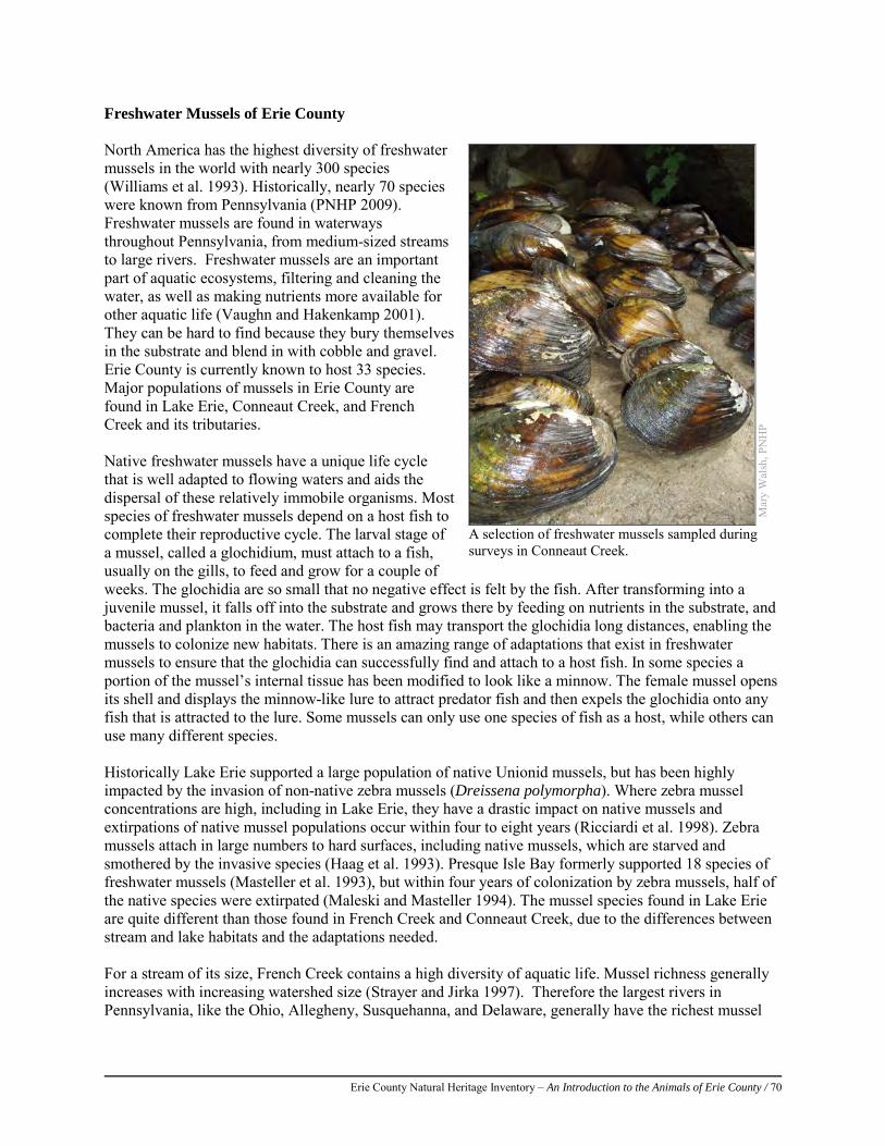
Erie County Natural Heritage Inventory – An Introduction to the Animals of Erie County / 70
Freshwater Mussels of Erie County North America has the highest diversity of freshwater mussels in the world with nearly 300 species (Williams et al. 1993). Historically, nearly 70 species were known from Pennsylvania (PNHP 2009). Freshwater mussels are found in waterways throughout Pennsylvania, from medium-sized streams to large rivers. Freshwater mussels are an important part of aquatic ecosystems, filtering and cleaning the water, as well as making nutrients more available for other aquatic life (Vaughn and Hakenkamp 2001). They can be hard to find because they bury themselves in the substrate and blend in with cobble and gravel. Erie County is currently known to host 33 species. Major populations of mussels in Erie County are found in Lake Erie, Conneaut Creek, and French Creek and its tributaries. Native freshwater mussels have a unique life cycle that is well adapted to flowing waters and aids the dispersal of these relatively immobile organisms. Most species of freshwater mussels depend on a host fish to complete their reproductive cycle. The larval stage of a mussel, called a glochidium, must attach to a fish, usually on the gills, to feed and grow for a couple of weeks. The glochidia are so small that no negative effect is felt by the fish. After transforming into a juvenile mussel, it falls off into the substrate and grows there by feeding on nutrients in the substrate, and bacteria and plankton in the water. The host fish may transport the glochidia long distances, enabling the mussels to colonize new habitats. There is an amazing range of adaptations that exist in freshwater mussels to ensure that the glochidia can successfully find and attach to a host fish. In some species a portion of the mussel’s internal tissue has been modified to look like a minnow. The female mussel opens its shell and displays the minnow-like lure to attract predator fish and then expels the glochidia onto any fish that is attracted to the lure. Some mussels can only use one species of fish as a host, while others can use many different species. Historically Lake Erie supported a large population of native Unionid mussels, but has been highly impacted by the invasion of non-native zebra mussels (Dreissena polymorpha). Where zebra mussel concentrations are high, including in Lake Erie, they have a drastic impact on native mussels and extirpations of native mussel populations occur within four to eight years (Ricciardi et al. 1998). Zebra mussels attach in large numbers to hard surfaces, including native mussels, which are starved and smothered by the invasive species (Haag et al. 1993). Presque Isle Bay formerly supported 18 species of freshwater mussels (Masteller et al. 1993), but within four years of colonization by zebra mussels, half of the native species were extirpated (Maleski and Masteller 1994). The mussel species found in Lake Erie are quite different than those found in French Creek and Conneaut Creek, due to the differences between stream and lake habitats and the adaptations needed. For a stream of its size, French Creek contains a high diversity of aquatic life. Mussel richness generally increases with increasing watershed size (Strayer and Jirka 1997). Therefore the largest rivers in Pennsylvania, like the Ohio, Allegheny, Susquehanna, and Delaware, generally have the richest mussel
Mar
y W
alsh
, PN
HP
A selection of freshwater mussels sampled during surveys in Conneaut Creek.
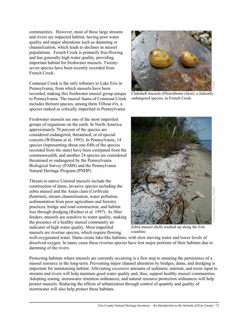
Erie County Natural Heritage Inventory – An Introduction to the Animals of Erie County / 71
communities. However, most of these large streams and rivers are impacted habitat, having poor water quality and major alterations such as damming or channelization, which leads to declines in mussel populations. French Creek is primarily free-flowing and has generally high water quality, providing important habitat for freshwater mussels. Twenty-seven species have been recently recorded from French Creek. Conneaut Creek is the only tributary to Lake Erie in Pennsylvania, from which mussels have been recorded, making this freshwater mussel group unique to Pennsylvania. The mussel fauna of Conneaut Creek includes thirteen species, among them Villosa iris, a species ranked as critically imperiled in Pennsylvania. Freshwater mussels are one of the most imperiled groups of organisms on the earth. In North America approximately 70 percent of the species are considered endangered, threatened, or of special concern (Williams et al. 1993). In Pennsylvania, 14 species (representing about one-fifth of the species recorded from the state) have been extirpated from the commonwealth, and another 24 species are considered threatened or endangered by the Pennsylvania Biological Survey (PABS) and the Pennsylvania Natural Heritage Program (PNHP). Threats to native Unionid mussels include the construction of dams, invasive species including the zebra mussel and the Asian clam (Corbicula fluminea), stream channelization, water pollution, sedimentation from poor agriculture and forestry practices, bridge and road construction, and habitat loss through dredging (Richter et al. 1997). As filter feeders, mussels are sensitive to water quality, making the presence of a healthy mussel community an indicator of high water quality. Most imperiled mussels are riverine species, which require flowing, well-oxygenated water. Dams create lake-like habitats, with slow moving water and lower levels of dissolved oxygen. In many cases these riverine species have lost major portions of their habitats due to damming of the rivers. Protecting habitats where mussels are currently occurring is a first step to ensuring the persistence of a mussel resource in the long-term. Preventing major channel alteration by bridges, dams, and dredging is important for maintaining habitat. Alleviating excessive amounts of sediment, nutrient, and toxin input to streams and rivers will help maintain good water quality and, thus, support healthy mussel communities. Adopting zoning, stormwater retention ordinances, and natural resource protection ordinances will help protect mussels. Reducing the effects of urbanization through control of quantity and quality of stormwater will also help protect these habitats.
PNH
P
Clubshell mussels (Pleurobema clava), a federally endangered species, in French Creek.
Chr
isto
pher
Tra
cey,
PN
HP
Zebra mussel shells washed up along the Erie coastline.
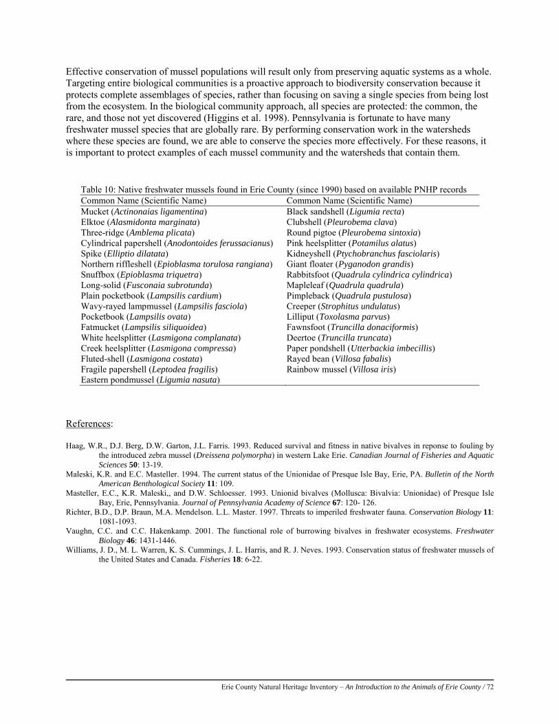
Erie County Natural Heritage Inventory – An Introduction to the Animals of Erie County / 72
Effective conservation of mussel populations will result only from preserving aquatic systems as a whole. Targeting entire biological communities is a proactive approach to biodiversity conservation because it protects complete assemblages of species, rather than focusing on saving a single species from being lost from the ecosystem. In the biological community approach, all species are protected: the common, the rare, and those not yet discovered (Higgins et al. 1998). Pennsylvania is fortunate to have many freshwater mussel species that are globally rare. By performing conservation work in the watersheds where these species are found, we are able to conserve the species more effectively. For these reasons, it is important to protect examples of each mussel community and the watersheds that contain them.
References:
Haag, W.R., D.J. Berg, D.W. Garton, J.L. Farris. 1993. Reduced survival and fitness in native bivalves in reponse to fouling by the introduced zebra mussel (Dreissena polymorpha) in western Lake Erie. Canadian Journal of Fisheries and Aquatic Sciences 50: 13-19.
Maleski, K.R. and E.C. Masteller. 1994. The current status of the Unionidae of Presque Isle Bay, Erie, PA. Bulletin of the North American Benthological Society 11: 109.
Masteller, E.C., K.R. Maleski,, and D.W. Schloesser. 1993. Unionid bivalves (Mollusca: Bivalvia: Unionidae) of Presque Isle Bay, Erie, Pennsylvania. Journal of Pennsylvania Academy of Science 67: 120- 126.
Richter, B.D., D.P. Braun, M.A. Mendelson. L.L. Master. 1997. Threats to imperiled freshwater fauna. Conservation Biology 11: 1081-1093.
Vaughn, C.C. and C.C. Hakenkamp. 2001. The functional role of burrowing bivalves in freshwater ecosystems. Freshwater Biology 46: 1431-1446.
Williams, J. D., M. L. Warren, K. S. Cummings, J. L. Harris, and R. J. Neves. 1993. Conservation status of freshwater mussels of the United States and Canada. Fisheries 18: 6-22.
Table 10: Native freshwater mussels found in Erie County (since 1990) based on available PNHP records Common Name (Scientific Name) Common Name (Scientific Name) Mucket (Actinonaias ligamentina) Black sandshell (Ligumia recta) Elktoe (Alasmidonta marginata) Clubshell (Pleurobema clava) Three-ridge (Amblema plicata) Round pigtoe (Pleurobema sintoxia) Cylindrical papershell (Anodontoides ferussacianus) Pink heelsplitter (Potamilus alatus) Spike (Elliptio dilatata) Kidneyshell (Ptychobranchus fasciolaris) Northern riffleshell (Epioblasma torulosa rangiana) Giant floater (Pyganodon grandis) Snuffbox (Epioblasma triquetra) Rabbitsfoot (Quadrula cylindrica cylindrica) Long-solid (Fusconaia subrotunda) Mapleleaf (Quadrula quadrula) Plain pocketbook (Lampsilis cardium) Pimpleback (Quadrula pustulosa) Wavy-rayed lampmussel (Lampsilis fasciola) Creeper (Strophitus undulatus) Pocketbook (Lampsilis ovata) Lilliput (Toxolasma parvus) Fatmucket (Lampsilis siliquoidea) Fawnsfoot (Truncilla donaciformis) White heelsplitter (Lasmigona complanata) Deertoe (Truncilla truncata) Creek heelsplitter (Lasmigona compressa) Paper pondshell (Utterbackia imbecillis) Fluted-shell (Lasmigona costata) Rayed bean (Villosa fabalis) Fragile papershell (Leptodea fragilis) Rainbow mussel (Villosa iris) Eastern pondmussel (Ligumia nasuta)
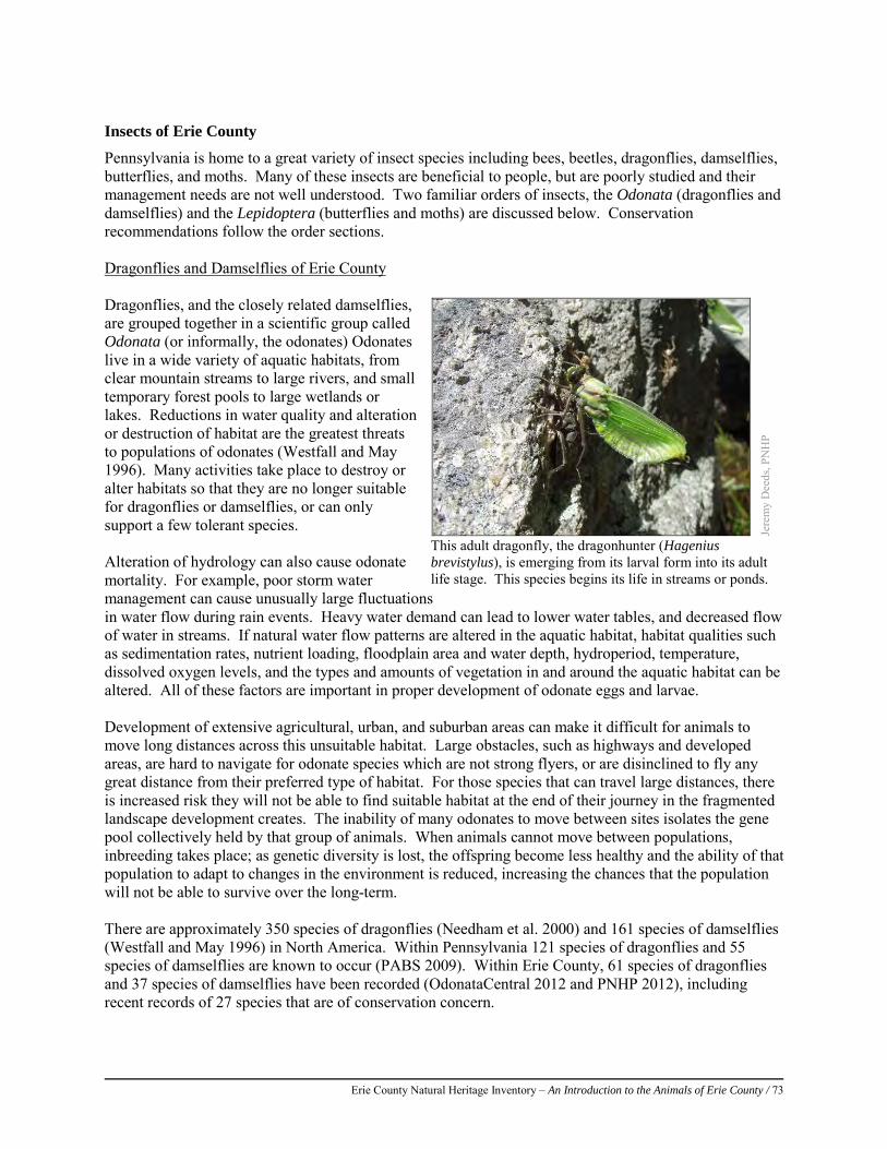
Erie County Natural Heritage Inventory – An Introduction to the Animals of Erie County / 73
Insects of Erie County
Pennsylvania is home to a great variety of insect species including bees, beetles, dragonflies, damselflies, butterflies, and moths. Many of these insects are beneficial to people, but are poorly studied and their management needs are not well understood. Two familiar orders of insects, the Odonata (dragonflies and damselflies) and the Lepidoptera (butterflies and moths) are discussed below. Conservation recommendations follow the order sections. Dragonflies and Damselflies of Erie County Dragonflies, and the closely related damselflies, are grouped together in a scientific group called Odonata (or informally, the odonates) Odonates live in a wide variety of aquatic habitats, from clear mountain streams to large rivers, and small temporary forest pools to large wetlands or lakes. Reductions in water quality and alteration or destruction of habitat are the greatest threats to populations of odonates (Westfall and May 1996). Many activities take place to destroy or alter habitats so that they are no longer suitable for dragonflies or damselflies, or can only support a few tolerant species. Alteration of hydrology can also cause odonate mortality. For example, poor storm water management can cause unusually large fluctuations in water flow during rain events. Heavy water demand can lead to lower water tables, and decreased flow of water in streams. If natural water flow patterns are altered in the aquatic habitat, habitat qualities such as sedimentation rates, nutrient loading, floodplain area and water depth, hydroperiod, temperature, dissolved oxygen levels, and the types and amounts of vegetation in and around the aquatic habitat can be altered. All of these factors are important in proper development of odonate eggs and larvae. Development of extensive agricultural, urban, and suburban areas can make it difficult for animals to move long distances across this unsuitable habitat. Large obstacles, such as highways and developed areas, are hard to navigate for odonate species which are not strong flyers, or are disinclined to fly any great distance from their preferred type of habitat. For those species that can travel large distances, there is increased risk they will not be able to find suitable habitat at the end of their journey in the fragmented landscape development creates. The inability of many odonates to move between sites isolates the gene pool collectively held by that group of animals. When animals cannot move between populations, inbreeding takes place; as genetic diversity is lost, the offspring become less healthy and the ability of that population to adapt to changes in the environment is reduced, increasing the chances that the population will not be able to survive over the long-term. There are approximately 350 species of dragonflies (Needham et al. 2000) and 161 species of damselflies (Westfall and May 1996) in North America. Within Pennsylvania 121 species of dragonflies and 55 species of damselflies are known to occur (PABS 2009). Within Erie County, 61 species of dragonflies and 37 species of damselflies have been recorded (OdonataCentral 2012 and PNHP 2012), including recent records of 27 species that are of conservation concern.
Jere
my
Dee
ds, P
NH
P
This adult dragonfly, the dragonhunter (Hagenius brevistylus), is emerging from its larval form into its adult life stage. This species begins its life in streams or ponds.
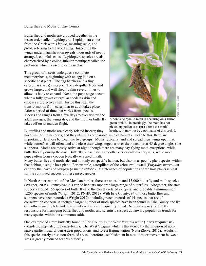
Erie County Natural Heritage Inventory – An Introduction to the Animals of Erie County / 74
Butterflies and Moths of Erie County Butterflies and moths are grouped together in the insect order called Lepidoptera. Lepidoptera comes from the Greek words lepido, meaning scale, and ptera, referring to the word wing. Inspecting the wings under magnification reveals thousands of neatly arranged, colorful scales. Lepidoptera species are also characterized by a coiled, tubular mouthpart called the proboscis which is used to drink nectar. This group of insects undergoes a complete metamorphosis, beginning with an egg laid on a specific host plant. The egg hatches and a tiny caterpillar (larva) emerges. The caterpillar feeds and grows larger, and will shed its skin several times to allow its body to expand. Next, the pupa stage occurs when a fully grown caterpillar sheds its skin and exposes a protective shell. Inside this shell the transformation from caterpillar to adult takes place. After a period of time that varies from species to species and ranges from a few days to over winter, the adult emerges, the wings dry, and the moth or butterfly takes off on its maiden flight. Butterflies and moths are closely related insects; they have similar life histories, and they utilize a comparable suite of habitats. Despite this, there are important differences between the two groups. Moths typically land and spread their wings open flat, while butterflies will often land and close their wings together over their back, or at 45-degree angles (the skippers). Moths are mostly active at night, though there are many day-flying moth exceptions, while butterflies fly during the day. Butterfly pupae have a smooth exterior called a chrysalis, while moth pupae often form a cocoon typically wrapped in silk. Many butterflies and moths depend not only on specific habitat, but also on a specific plant species within that habitat, a single host plant. For example, caterpillars of the zebra swallowtail (Eurytides marcellus) eat only the leaves of pawpaw (Asimina triloba). Maintenance of populations of the host plants is vital for the continued success of these insect species. In North America north of the Mexican border, there are an estimated 13,000 butterfly and moth species (Wagner, 2005). Pennsylvania’s varied habitats support a large range of butterflies. Altogether, the state supports around 156 species of butterfly and the closely related skippers, and probably a minimum of 1,200 species of moth (Wright, 2012; PNHP, 2012). With Erie County, 94 of those butterflies and skippers have been recorded (Wright 2012), including recent records of 14 species that are of conservation concern. Although a larger number of moth species have been found in Erie County, the list of moths in incomplete and new county records are frequently found. No state agency is directly responsible for managing butterflies and moths, and scientists suspect downward population trends for many species within the commonwealth. One example of a rare butterfly found in Erie County is the West Virginia white (Pieris virginiensis), considered imperiled in Pennsylvania. The West Virginia white is threatened by the invasion of non- native garlic mustard, dense deer populations, and forest fragmentation (NatureServe, 2012). Adults of this species rarely cross non-forested areas, therefore, establishment in new sites, or movement between sites is greatly reduced for this butterfly.
Pete
Woo
ds, P
NH
P
A pondside pyralid moth is nectaring on a Huron green orchid. Interestingly, the moth has not picked up pollen sacs (just above the moth’s head), so it may not be a pollinator of this orchid.
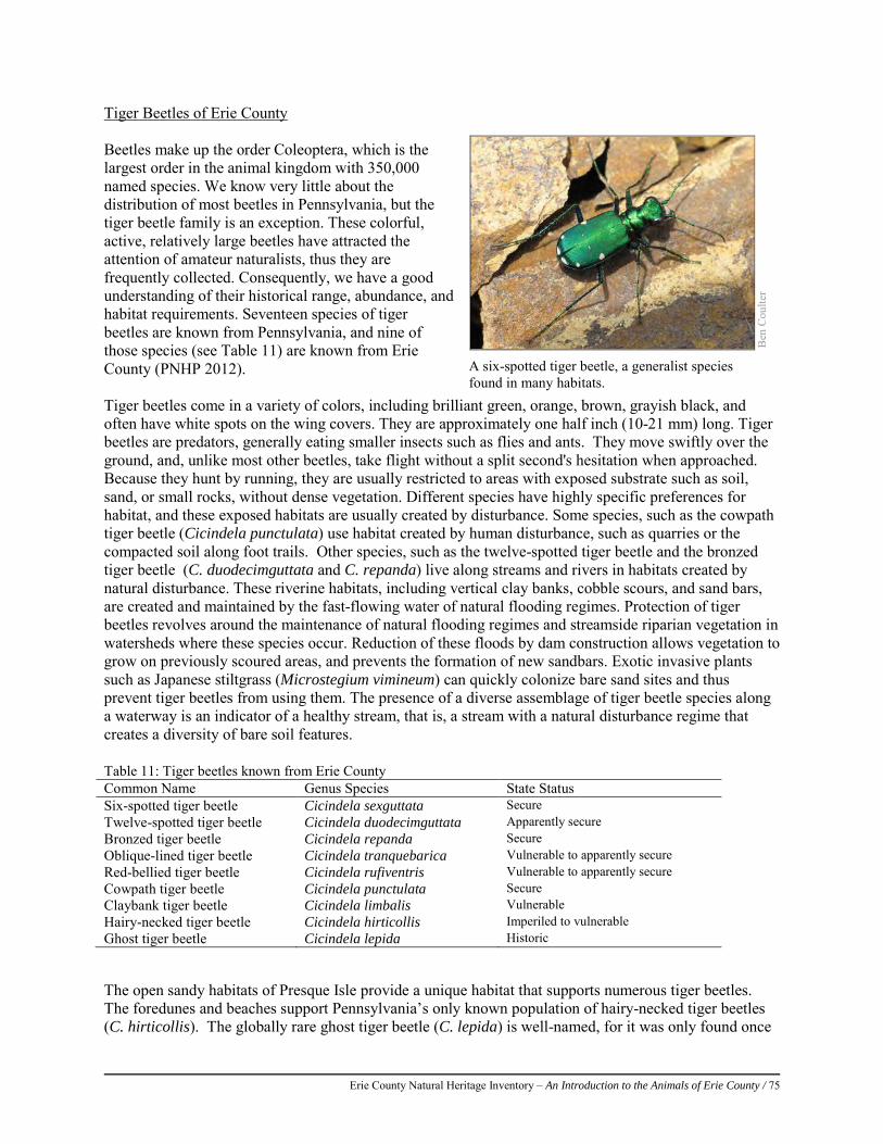
Erie County Natural Heritage Inventory – An Introduction to the Animals of Erie County / 75
Tiger Beetles of Erie County Beetles make up the order Coleoptera, which is the largest order in the animal kingdom with 350,000 named species. We know very little about the distribution of most beetles in Pennsylvania, but the tiger beetle family is an exception. These colorful, active, relatively large beetles have attracted the attention of amateur naturalists, thus they are frequently collected. Consequently, we have a good understanding of their historical range, abundance, and habitat requirements. Seventeen species of tiger beetles are known from Pennsylvania, and nine of those species (see Table 11) are known from Erie County (PNHP 2012). Tiger beetles come in a variety of colors, including brilliant green, orange, brown, grayish black, and often have white spots on the wing covers. They are approximately one half inch (10-21 mm) long. Tiger beetles are predators, generally eating smaller insects such as flies and ants. They move swiftly over the ground, and, unlike most other beetles, take flight without a split second's hesitation when approached. Because they hunt by running, they are usually restricted to areas with exposed substrate such as soil, sand, or small rocks, without dense vegetation. Different species have highly specific preferences for habitat, and these exposed habitats are usually created by disturbance. Some species, such as the cowpath tiger beetle (Cicindela punctulata) use habitat created by human disturbance, such as quarries or the compacted soil along foot trails. Other species, such as the twelve-spotted tiger beetle and the bronzed tiger beetle (C. duodecimguttata and C. repanda) live along streams and rivers in habitats created by natural disturbance. These riverine habitats, including vertical clay banks, cobble scours, and sand bars, are created and maintained by the fast-flowing water of natural flooding regimes. Protection of tiger beetles revolves around the maintenance of natural flooding regimes and streamside riparian vegetation in watersheds where these species occur. Reduction of these floods by dam construction allows vegetation to grow on previously scoured areas, and prevents the formation of new sandbars. Exotic invasive plants such as Japanese stiltgrass (Microstegium vimineum) can quickly colonize bare sand sites and thus prevent tiger beetles from using them. The presence of a diverse assemblage of tiger beetle species along a waterway is an indicator of a healthy stream, that is, a stream with a natural disturbance regime that creates a diversity of bare soil features.
The open sandy habitats of Presque Isle provide a unique habitat that supports numerous tiger beetles. The foredunes and beaches support Pennsylvania’s only known population of hairy-necked tiger beetles (C. hirticollis). The globally rare ghost tiger beetle (C. lepida) is well-named, for it was only found once
B
en C
oulte
r
A six-spotted tiger beetle, a generalist species found in many habitats.
Table 11: Tiger beetles known from Erie County Common Name Genus Species State Status Six-spotted tiger beetle Cicindela sexguttata Secure Twelve-spotted tiger beetle Cicindela duodecimguttata Apparently secure Bronzed tiger beetle Cicindela repanda Secure Oblique-lined tiger beetle Cicindela tranquebarica Vulnerable to apparently secure Red-bellied tiger beetle Cicindela rufiventris Vulnerable to apparently secure Cowpath tiger beetle Cicindela punctulata Secure Claybank tiger beetle Cicindela limbalis Vulnerable Hairy-necked tiger beetle Cicindela hirticollis Imperiled to vulnerable Ghost tiger beetle Cicindela lepida Historic
Erie County Natural Heritage Inventory – An Introduction to the Animals of Erie County / 76
in Pennsylvania, on Presque Isle in 1968. Although a number of surveys have failed to relocate this population there is some hope that this elusive species is still present. Aquatic Invertebrates Nearly every stream contains aquatic invertebrates, or macroinvertebrates. There are a wide variety of macroinvertebrates, each having different habitat requirements, feeding activities, tolerances to pollution, and responses to changes in water quality and stream characteristics. Freshwater snails, bivalves, and crayfish are aquatic macroinvertebrates that remain in an aquatic habitat during their entire life. Most macroinvertebrates are juvenile stages of insects that utilize terrestrial habitat as adults. For example mayflies (Ephemeroptera), caddisflies (Trichoptera), stoneflies (Plecoptera), and dragonflies and damselflies (Odonata) all spend their larval stage in aquatic habitats such as wetlands or streams before they emerge from the water and transform into a winged adult. Other common aquatic invertebrates include true flies (Diptera), beetles (Coleoptera), and hellgrammites (Megaloptera). Some species are aquatic larvae for a few weeks, while longer-lived species can remain larvae for two to three years. Aquatic macroinvertebrates can feed on algae, diatoms, leaf litter, woody debris, and sometimes other invertebrates. Freshwater macroinvertebrates are an essential food source for fish, and generally serve as the base of the food web in aquatic systems. Stream macroinvertebrates are also collected the world over to monitor water quality and provide information about stream and watershed health and quality. The Pennsylvania Aquatic Community Classification (ACC) identified twelve types of stream macroinvertebrate communities in the state, in streams which vary in size, habitat type, and water quality. See the ACC reports for more information about macroinvertebrates and aquatic communities in Pennsylvania (Walsh et al. 2007a and 2007b; http://www.naturalheritage.state.pa.us/aquaticsIntro.aspx).
General Conservation Recommendations for Insects
The specific habitat requirements of most non-pest insects are not well understood. Protecting habitats where species of concern currently occur is a first step towards ensuring their long term survival. Alteration and destruction of habitat is the greatest threat to populations of these groups of insects.
When conserving Odonata and Lepidoptera species, three major criteria should be covered that are unique to these taxa:
1. Protect the specific habitat required for each stage of the lifecycle (egg, larvae, pupae, adult) for the species of concern. Most research has focused on the larval habitat and food plants of dragonflies, damselflies, butterflies, and moths. This makes sense because of the more sedentary nature of the larvae compared to the adult, and the tighter association of larvae to specific habitat requirements. Adults are also associated with the larval habitat during mating and egg laying, but there is limited understanding of the adult’s habitat for perching and upland feeding areas.
2. Maintain the balance that is necessary between predators and their prey. Larval and adult odonates feed on other insects that share their habitat such as mosquitoes, midges, gnats, and other flies. This helps to control many pest species; however, chemical control may have unintended effects on these species. Pest control can also severely reduce populations of butterflies and moths. For example, insecticides, such as Bacillus thuringiensis (Bt) and diflubenzuron (Dimilin) used for the control of gypsy moths and protection of timber resources may affect populations of native butterflies and moths miles from the spray location. Timing of spraying, conditions acceptable for application, and the size of spray blocks must be adjusted to protect native populations. Most populations are vulnerable to changes in the distribution and abundance of their host plants, and mowing or spraying while eggs or larvae are on the plants can extirpate local populations.
Erie County Natural Heritage Inventory – An Introduction to the Animals of Erie County / 77
3. Protect the species and their habitat within healthy functioning ecosystems. Landscape scale conservation of aquatic, meadow, and forested habitats is needed for the preservation of these insect groups. Reduced use of pesticides for lawn care and landscaping can help improve the water quality, and reduce native insect mortality.
References NatureServe. 2012. NatureServe Explorer: An online encyclopedia of life [web application]. Version 7.1. NatureServe,
Arlington, Virginia. Available at: http://www.natureserve.org/explorer (accessed: December 2012). Needham, J.G., Westfall, M.J., and M.L. May. 2000. Dragonflies of North America. Scientific Publishers, Florida. OdonataCentral 2012. Regional Checklist for Erie County, Pennsylvania. Available at:
http://www.odonatacentral.org/index.php/ChecklistAction.showChecklist/location_id/13525. Accessed December 2012. Wagner, D. 2005. Caterpillars of Eastern North America. – A Guide to Identification and Natural History. Princeton University
Press, Princeton, NJ. Westfall, M.J. and May, M.L. 1996. Damselflies of North America. Scientific Publishers, Florida. Wright, D. 2012. Atlas of Pennsylvania Butterflies, 11th edition. Unpublished document.
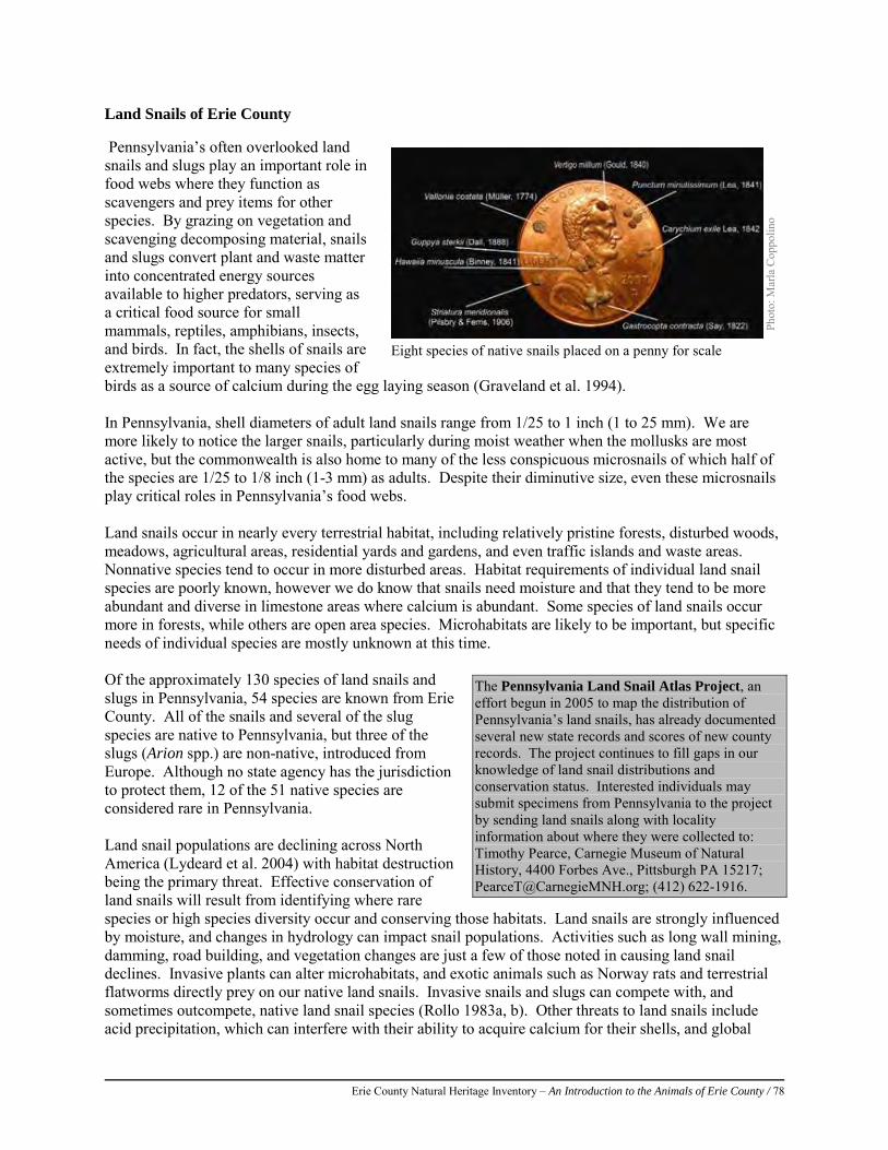
Erie County Natural Heritage Inventory – An Introduction to the Animals of Erie County / 78
Land Snails of Erie County Pennsylvania’s often overlooked land snails and slugs play an important role in food webs where they function as scavengers and prey items for other species. By grazing on vegetation and scavenging decomposing material, snails and slugs convert plant and waste matter into concentrated energy sources available to higher predators, serving as a critical food source for small mammals, reptiles, amphibians, insects, and birds. In fact, the shells of snails are extremely important to many species of birds as a source of calcium during the egg laying season (Graveland et al. 1994). In Pennsylvania, shell diameters of adult land snails range from 1/25 to 1 inch (1 to 25 mm). We are more likely to notice the larger snails, particularly during moist weather when the mollusks are most active, but the commonwealth is also home to many of the less conspicuous microsnails of which half of the species are 1/25 to 1/8 inch (1-3 mm) as adults. Despite their diminutive size, even these microsnails play critical roles in Pennsylvania’s food webs. Land snails occur in nearly every terrestrial habitat, including relatively pristine forests, disturbed woods, meadows, agricultural areas, residential yards and gardens, and even traffic islands and waste areas. Nonnative species tend to occur in more disturbed areas. Habitat requirements of individual land snail species are poorly known, however we do know that snails need moisture and that they tend to be more abundant and diverse in limestone areas where calcium is abundant. Some species of land snails occur more in forests, while others are open area species. Microhabitats are likely to be important, but specific needs of individual species are mostly unknown at this time. Of the approximately 130 species of land snails and slugs in Pennsylvania, 54 species are known from Erie County. All of the snails and several of the slug species are native to Pennsylvania, but three of the slugs (Arion spp.) are non-native, introduced from Europe. Although no state agency has the jurisdiction to protect them, 12 of the 51 native species are considered rare in Pennsylvania. Land snail populations are declining across North America (Lydeard et al. 2004) with habitat destruction being the primary threat. Effective conservation of land snails will result from identifying where rare species or high species diversity occur and conserving those habitats. Land snails are strongly influenced by moisture, and changes in hydrology can impact snail populations. Activities such as long wall mining, damming, road building, and vegetation changes are just a few of those noted in causing land snail declines. Invasive plants can alter microhabitats, and exotic animals such as Norway rats and terrestrial flatworms directly prey on our native land snails. Invasive snails and slugs can compete with, and sometimes outcompete, native land snail species (Rollo 1983a, b). Other threats to land snails include acid precipitation, which can interfere with their ability to acquire calcium for their shells, and global
Phot
o: M
arla
Cop
polin
o
Eight species of native snails placed on a penny for scale
The Pennsylvania Land Snail Atlas Project, an effort begun in 2005 to map the distribution of Pennsylvania’s land snails, has already documented several new state records and scores of new county records. The project continues to fill gaps in our knowledge of land snail distributions and conservation status. Interested individuals may submit specimens from Pennsylvania to the project by sending land snails along with locality information about where they were collected to: Timothy Pearce, Carnegie Museum of Natural History, 4400 Forbes Ave., Pittsburgh PA 15217; [email protected]; (412) 622-1916.
Erie County Natural Heritage Inventory – An Introduction to the Animals of Erie County / 79
climate change, which will alter temperatures and moisture patterns. The quintessentially slow moving snails might be unable to cope with these shifting habitats. Prepared by Dr. Timothy A. Pearce, Carnegie Museum of Natural History References:
Graveland, J., R. van der Wal, J.H. van Balen, and A.J. van Noordwijk. 1994 Poor reproduction in forest passerines from decline of snail abundance on acidified soils. Nature, London. 368, 446-448.
Lydeard, C., R.H. Cowie, W.F. Ponder, A.E. Bogan, P. Bouchet, S.A. Clark, K.S. Cummings, T.J. Frest, O. Gargominy, D.G. Herbert, R. Hershler, K.E. Perez, B. Roth, M. Seddon, E.E. Strong, and F.G. Thompson. (2004). The global decline of nonmarine mollusks. Bioscience 54:321–330.
Rollo, C.D. 1983a. Consequences of competition on the reproduction and mortality of three species of terrestrial slugs. Researches in Population Ecology, 25: 20-43.
Rollo, C.D. 1983b. Consequences of competition on the time budgets, growth and distributions of three species of terrestrial slugs. Researches in Population Ecology, 25: 44-68

Erie County Natural Heritage Inventory – An Introduction to the Animals of Erie County / 80
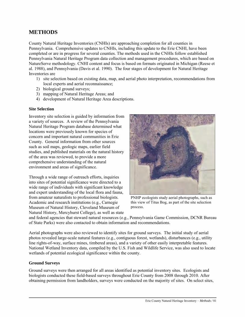
Erie County Natural Heritage Inventory – Methods / 81
METHODS County Natural Heritage Inventories (CNHIs) are approaching completion for all counties in Pennsylvania. Comprehensive updates to CNHIs, including this update to the Erie CNHI, have been completed or are in progress for several counties. The methods used in the CNHIs follow established Pennsylvania Natural Heritage Program data collection and management procedures, which are based on NatureServe methodology. CNHI content and focus is based on formats originated in Michigan (Reese et al. 1988), and Pennsylvania (Davis et al. 1990). The four stages of development for Natural Heritage Inventories are
1) site selection based on existing data, map, and aerial photo interpretation, recommendations from local experts and aerial reconnaissance;
2) biological ground surveys; 3) mapping of Natural Heritage Areas; and 4) development of Natural Heritage Area descriptions.
Site Selection
Inventory site selection is guided by information from a variety of sources. A review of the Pennsylvania Natural Heritage Program database determined what locations were previously known for species of concern and important natural communities in Erie County. General information from other sources such as soil maps, geologic maps, earlier field studies, and published materials on the natural history of the area was reviewed, to provide a more comprehensive understanding of the natural environment and areas of significance. Through a wide range of outreach efforts, inquiries into sites of potential significance were directed to a wide range of individuals with significant knowledge and expert understanding of the local flora and fauna, from amateur naturalists to professional biologists. Academic and research institutions (e.g., Carnegie Museum of Natural History, Cleveland Museum of Natural History, Mercyhurst College), as well as state and federal agencies that steward natural resources (e.g., Pennsylvania Game Commission, DCNR Bureau of State Parks) were also contacted to obtain information and recommendations. Aerial photographs were also reviewed to identify sites for ground surveys. The initial study of aerial photos revealed large-scale natural features (e.g., contiguous forest, wetlands), disturbances (e.g., utility line rights-of-way, surface mines, timbered areas), and a variety of other easily interpretable features. National Wetland Inventory data, compiled by the U.S. Fish and Wildlife Service, was also used to locate wetlands of potential ecological significance within the county.
Ground Surveys
Ground surveys were then arranged for all areas identified as potential inventory sites. Ecologists and biologists conducted these field-based surveys throughout Erie County from 2008 through 2010. After obtaining permission from landholders, surveys were conducted on the majority of sites. On select sites,
PNHP ecologists study aerial photographs, such as this view of Titus Bog, as part of the site selection process.
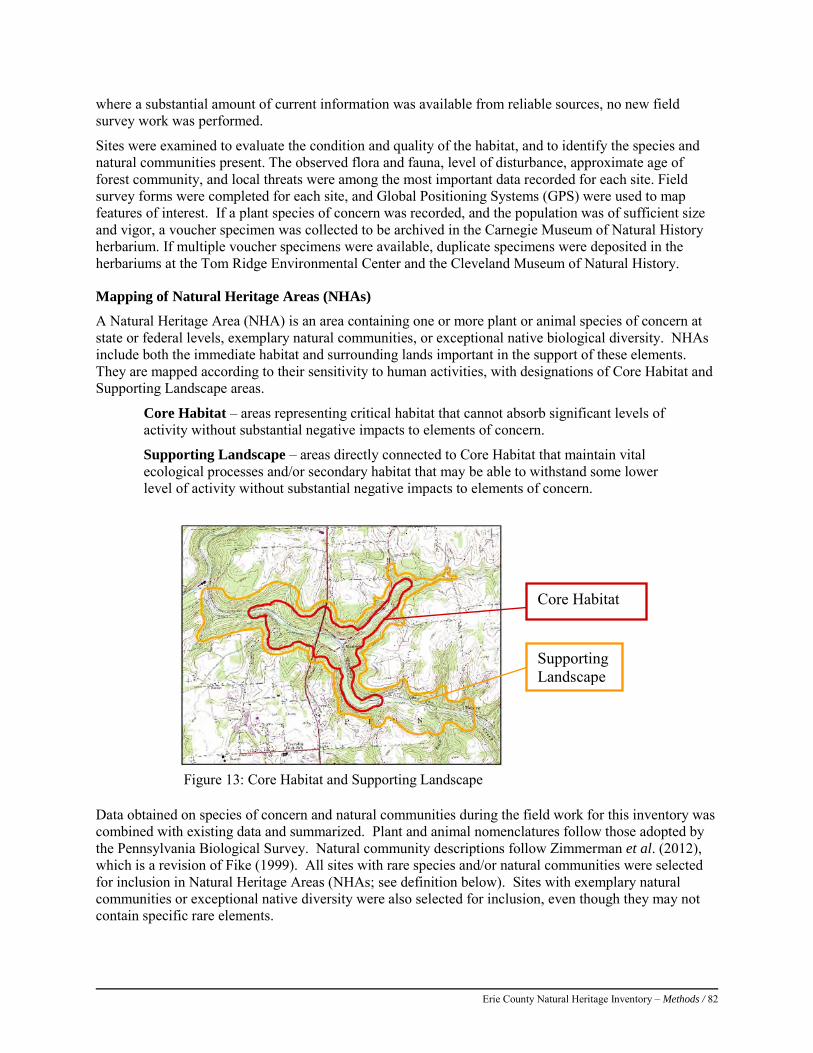
Erie County Natural Heritage Inventory – Methods / 82
where a substantial amount of current information was available from reliable sources, no new field survey work was performed.
Sites were examined to evaluate the condition and quality of the habitat, and to identify the species and natural communities present. The observed flora and fauna, level of disturbance, approximate age of forest community, and local threats were among the most important data recorded for each site. Field survey forms were completed for each site, and Global Positioning Systems (GPS) were used to map features of interest. If a plant species of concern was recorded, and the population was of sufficient size and vigor, a voucher specimen was collected to be archived in the Carnegie Museum of Natural History herbarium. If multiple voucher specimens were available, duplicate specimens were deposited in the herbariums at the Tom Ridge Environmental Center and the Cleveland Museum of Natural History.
Mapping of Natural Heritage Areas (NHAs)
A Natural Heritage Area (NHA) is an area containing one or more plant or animal species of concern at state or federal levels, exemplary natural communities, or exceptional native biological diversity. NHAs include both the immediate habitat and surrounding lands important in the support of these elements. They are mapped according to their sensitivity to human activities, with designations of Core Habitat and Supporting Landscape areas.
Core Habitat – areas representing critical habitat that cannot absorb significant levels of activity without substantial negative impacts to elements of concern.
Supporting Landscape – areas directly connected to Core Habitat that maintain vital ecological processes and/or secondary habitat that may be able to withstand some lower level of activity without substantial negative impacts to elements of concern.
Figure 13: Core Habitat and Supporting Landscape Data obtained on species of concern and natural communities during the field work for this inventory was combined with existing data and summarized. Plant and animal nomenclatures follow those adopted by the Pennsylvania Biological Survey. Natural community descriptions follow Zimmerman et al. (2012), which is a revision of Fike (1999). All sites with rare species and/or natural communities were selected for inclusion in Natural Heritage Areas (NHAs; see definition below). Sites with exemplary natural communities or exceptional native diversity were also selected for inclusion, even though they may not contain specific rare elements.
Core Habitat
Supporting Landscape
Erie County Natural Heritage Inventory – Methods / 83
Spatial data on the elements of concern were compiled in a Geographic Information System (ESRI ArcGIS 10). Boundaries defining Core Habitat and Supporting Landscapes for each NHA were delineated using PNHP specifications for Conservation Planning Polygons (CPPs) for the elements of concern. These specifications are based on scientific literature and expert knowledge for individual species or animal assemblages and may incorporate physical factors (e.g., slope, aspect, hydrology); ecological factors (e.g., species composition, disturbance regime); or input provided by jurisdictional government agencies. NHAs may represent a combination of CPPS for multiple species and populations or they may represent critical habitat defined by a CPP for just one element of biodiversity. NHAs are mapped without regard to political boundaries, and can extend across property boundaries onto un-surveyed lands. NHA boundaries vary in size and extent depending on the physical characteristics of a given site and the ecological requirements of its unique natural elements. (For instance, two Core Habitat wetlands of exactly the same size occurring in the same region may require Supporting Landscape areas of very different size and shape to support their functions if one receives mostly ground water and the other receives mostly surface water, or if one supports a plant species of concern, while the other supports a bird species of concern.) Each NHA is then assigned a significance rank based on its importance and contribution to biological diversity and ecological integrity of both the state and the county (Table 14). These ranks can be used to help prioritize future conservation efforts.

Erie County Natural Heritage Inventory – Methods / 84
Site Descriptions
A description outlining the conservation priorities, threats and stresses, and conservation recommendations is presented for each site. Each site description includes a table listing the species tracked by PNHP documented at that site. This table includes the species common and scientific names. A species listed as a “Sensitive Species of Concern” is unnamed by request of the jurisdictional agency responsible for its protection, due to factors such as illegal collection, intentional destruction, or potential to be disturbed by people. Additional information noted in the table includes Conservation Status Ranks, State Status, and the last date this species was officially observed with its quality rank (see below). Site descriptions are designed to be shared with interested individuals and potential users, and are available to the public via the PNHP website at http://www.naturalheritage.state.pa.us/cnhi/cnhi.htm. Conservation Status Rank Definitions Determining which species and ecosystems are thriving and which are rare or declining is crucial for targeting conservation efforts toward elements of biodiversity in greatest need. NatureServe and its member programs use a suite of factors to assess the conservation status of plant, animal and fungal species, as well as ecological communities and systems. These assessments lead to the designation of a conservation status rank. For species, these ranks provide an estimate of extinction risk, while for ecological communities and systems they provide an estimate of the risk of elimination. The decisions regarding PNDI rank and status are made by a state-recognized panel of experts of the Pennsylvania Biological Survey, following NatureServe guidelines. The conservation status of each species or ecosystem is identified by a number from 1 to 5, preceded by a letter reflecting the appropriate geographic scale of the assessment (G = Global and S = Subnational). The numbers have the following meaning:
1 = Critically Imperiled: at very high risk of extinction due to extreme rarity (often 5 or fewer populations), very steep declines, or other factors.
2 = Imperiled: at high risk of extinction or elimination due to very restricted range, very few populations, steep declines, or other factors.
3 = Vulnerable: at moderate risk of extinction or elimination due to a restricted range, relatively few populations, recent and widespread declines, or other factors.
4 = Apparently Secure: uncommon but not rare; some cause for long-term concern due to declines or other factors.
5 = Secure: common; widespread and abundant. For example, G1 would indicate that a species is critically imperiled across its entire range (i.e., globally). In this example, the species as a whole is regarded as being at very high risk of extinction. A rank of S3 would indicate the species is vulnerable and at moderate risk within a particular state or province, even though it may be more secure elsewhere. Species and ecosystems are designated with either an "X" (presumed extinct or extirpated) if there is no expectation that they still survive, or an "H" (possibly extinct or extirpated) if they are known only from historical records but there is a chance they may still exist. Other variants and qualifiers are used to add information or indicate any range of uncertainty. Additional information regarding conservation status rank definitions, as well as complete descriptions of ranks and qualifiers can be found at http://www.naturalheritage.state.pa.us/RankStatusDef.aspx
Erie County Natural Heritage Inventory – Methods / 85
or http://www.natureserve.org/explorer/ranking.htm. PNHP typically tracks all species ranked S1-S3 in Pennsylvania. Some less-rare species are also tracked if they are thought to be of conservation interest, while some species (e.g., many invertebrates) that are likely in the S1-S3 ranges are not yet tracked due to a lack of scientific information. Federal and State Status Definitions Federally listed species are under the jurisdiction of the US Fish and Wildlife Service and have the following status definition:
• LE = Listed Endangered: a species which is in danger of extinction throughout all or a significant portion of its range.
• LT = Listed Threatened: any species which is likely to become an endangered species within the foreseeable future throughout all or a significant portion of its range.
The three state jurisdictional agencies (DCNR, PGC, PFBC) each have slightly different definitions that define status ranks of species under their jurisdiction. Therefore, for the purposes of this report, the following general definitions are used to indicate the degree of rarity of each species.
• PE = Pennsylvania Endangered: species in imminent danger of extinction or extirpation throughout their range in Pennsylvania if the deleterious factors affecting them continue to operate.
• PT = Pennsylvania Threatened: species that may become endangered within the foreseeable future throughout their range in Pennsylvania unless the casual factors affecting the organism are abated.
• N = No Status – no current legal status, but the species is under study for listing consideration in the future.
Please refer to http://www.naturalheritage.state.pa.us/RankStatusDef.aspx for a precise and expanded list of Federal and State Status definitions. Quality Rank Definitions Each population of a species of concern is assigned a quality rank, based on the estimated probability that it will persist over time. The most commonly assigned ranks are summarized below:
• A: Excellent Viability – very likely to persist for 20-30 years in current condition or better. • B: Good Viability – likely to persist for 20-30 years in current condition or better. • C: Fair Viability – persistence uncertain, or decline in condition likely over 20-30 years. • D: Poor Viability – very high risk of extirpation. • E: Verified Extant – recently verified as still existing, but without enough information to estimate
viability. • H: Historical – recent field information is lacking, but might still be present • F: Failed to Find – recent field surveys have failed to locate the species, but habitat still exists and
there is a possibility of persistence. • X: Extirpated – surveys demonstrate persuasively that the species is no longer present.
Combination ranks (such as AB or CD) are used to indicate a range of uncertainty associated with a population’s viability. Please refer to http://www.natureserve.org/explorer/eorankguide.htm for expanded definitions and application of quality ranks.
Erie County Natural Heritage Inventory – Methods / 86
Site Significance Ranks Each Natural Heritage Area is assigned a significance rank that represents the site’s biodiversity importance. Ranks are calculated by a score that represents the G-ranks and S-ranks of each species present at the site, weighted by the Quality ranks for those populations. These scores are summed for each site to produce an overall site score. These scores were used to guide the ranking of the site by expert review. Site scores are assigned categorical ranks (see Table 12) based on score thresholds and criteria defined by PNHP biologists. Table 12. Natural Heritage Area Significance Ranks
Ranks Description Global Sites which have global importance for biological diversity and Pennsylvania has a primary
role to maintain (e.g. most of the known occurrences are within Pennsylvania). Sites in this category generally contain one or more occurrences of species of global concern (e.g. G2 and G1) or large concentrations of species of lower significance.
Regional
Sites which have regional importance for biological diversity and these Pennsylvania sites are important for maintaining representation of those species in the greater Northeast /mid-Atlantic region. Sites in this category generally contain one or more occurrences of species of global concern (e.g., G3) or concentrations of species of lower significance.
State Sites which are important for the biological diversity and ecological integrity at the state scale. Sites have occurrences of elements of concern with lower ranks (G and S rank see above), smaller populations or extent, or generally lower biodiversity scores than Global or Regional ranked areas.
Local Sites which have importance to biological diversity at the county scale, but are not, as yet, known to contain species of concern or state significant natural communities. Often recognized because of their relative size, undisturbed character, or proximity to areas of known significance, these sites may be targeted with future surveys.
Ranks of the sites may change (up or down) as new occurrences of species are discovered at a site or the population is confirmed extirpated. Sites are not currently ranked on protection status, management need, or other factors. However, PNHP biologists are currently working on methodologies that will assess these factors.
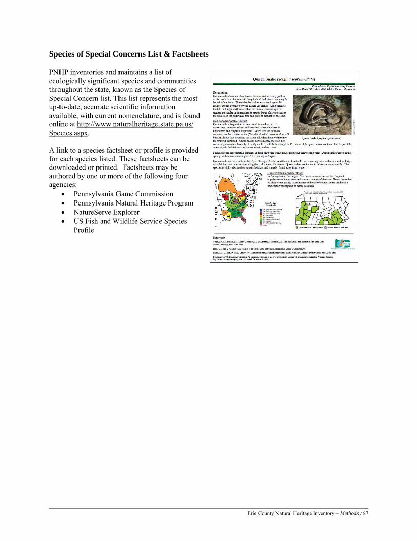
Erie County Natural Heritage Inventory – Methods / 87
Species of Special Concerns List & Factsheets PNHP inventories and maintains a list of ecologically significant species and communities throughout the state, known as the Species of Special Concern list. This list represents the most up-to-date, accurate scientific information available, with current nomenclature, and is found online at http://www.naturalheritage.state.pa.us/ Species.aspx. A link to a species factsheet or profile is provided for each species listed. These factsheets can be downloaded or printed. Factsheets may be authored by one or more of the following four agencies:
• Pennsylvania Game Commission • Pennsylvania Natural Heritage Program • NatureServe Explorer • US Fish and Wildlife Service Species
Profile
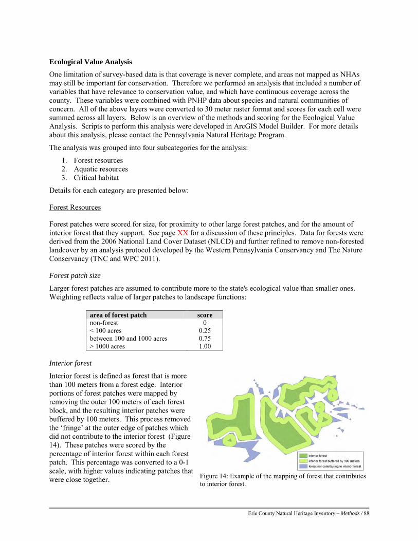
Erie County Natural Heritage Inventory – Methods / 88
Ecological Value Analysis
One limitation of survey-based data is that coverage is never complete, and areas not mapped as NHAs may still be important for conservation. Therefore we performed an analysis that included a number of variables that have relevance to conservation value, and which have continuous coverage across the county. These variables were combined with PNHP data about species and natural communities of concern. All of the above layers were converted to 30 meter raster format and scores for each cell were summed across all layers. Below is an overview of the methods and scoring for the Ecological Value Analysis. Scripts to perform this analysis were developed in ArcGIS Model Builder. For more details about this analysis, please contact the Pennsylvania Natural Heritage Program.
The analysis was grouped into four subcategories for the analysis:
1. Forest resources 2. Aquatic resources 3. Critical habitat
Details for each category are presented below:
Forest Resources
Forest patches were scored for size, for proximity to other large forest patches, and for the amount of interior forest that they support. See page XX for a discussion of these principles. Data for forests were derived from the 2006 National Land Cover Dataset (NLCD) and further refined to remove non-forested landcover by an analysis protocol developed by the Western Pennsylvania Conservancy and The Nature Conservancy (TNC and WPC 2011).
Forest patch size
Larger forest patches are assumed to contribute more to the state's ecological value than smaller ones. Weighting reflects value of larger patches to landscape functions:
area of forest patch score non-forest 0 < 100 acres 0.25 between 100 and 1000 acres 0.75 > 1000 acres 1.00
Interior forest
Interior forest is defined as forest that is more than 100 meters from a forest edge. Interior portions of forest patches were mapped by removing the outer 100 meters of each forest block, and the resulting interior patches were buffered by 100 meters. This process removed the ‘fringe’ at the outer edge of patches which did not contribute to the interior forest (Figure 14). These patches were scored by the percentage of interior forest within each forest patch. This percentage was converted to a 0-1 scale, with higher values indicating patches that were close together.
Figure 14: Example of the mapping of forest that contributes to interior forest.
Erie County Natural Heritage Inventory – Methods / 89
Forest patch Proximity
Proximity is a unitless measurement calculated by Fragstats 3.4, a program which computes metrics related to landscape fragmentation. Proximity measures the isolation of a focal patch of forest and the degree of forest fragmentation in the vicinity of the focal patch. Proximity is calculated as the sum, across all patches within 2000 meters from the center of the focal patch, of the area of each patch divided by the square of the distance to the focal patch (McGarigal et al. 2002). Thus, a forest patch will score highly for this metric if nearby forest patches are close, large, and numerous. Proximity measures were scaled from 0-1, with higher values indicating patches that were close together.
Aquatic Resources
Active River Area
The Active River Area is a holistic conservation framework for rivers and streams that integrates both physical and ecological processes that form, change, and maintain a wide array of habitat types and conditions in and along rivers and streams (Smith et al. 2008). The framework is intended to inform efforts to protect and restore the ecological integrity of rivers and streams by providing a means for explicitly considering the spatial area necessary for natural processes and disturbance regimes to occur. Equally importantly, the active river area provides a range of important benefits to society, including the reduction of flood and erosion hazards, water quality protection, providing recreational and scenic amenities and providing for important habitat for terrestrial and other non-aquatic species. Land within the active river area is scored as 1, while non-active river area is scored as 0.
Wetlands
The National Wetland Inventory was used to identify wetlands to include in the analysis. Impoundments were excluded, and all other wetland types were given a score of 1. Eastern Brook Trout Joint Venture
HUC12 watersheds are scored for the predicted condition of their native brook trout populations, as predicted by Thieling (2006).
Native brook trout status score brook trout absent 0 present, greatly reduced present, reduced present, intact
.25 0.70 1.00
DEP Chapter 93 Streams
Section 93.4b of the Pennsylvania Code allows DEP to designate streams as High Quality and Exceptional Quality. Streams were converted to 30 meter raster format and scored as follows:
DEP Chapter 93 stream status score Exceptional Value streams 1.00 High Quality streams other streams
.25 0
Erie County Natural Heritage Inventory – Methods / 90
Aquatic Community Classification
The Aquatic Community Classification (ACC) rates HUC 12 watersheds for conservation value based on high quality biological communities, fish and macroinvertebrate metrics, and least disturbed streams. (Walsh et al. 2007) These ratings were combined and scored as follows:
ACC scores for (1) biological communities, (2) fish and macroinverts, and (3) least disturbed streams
score
below 80th percentile for all three scores 0 a mix of 80th and 90th percentile for all 3 scores above 90th percentile for all three scores
0.50 1.00
Critical Habitat
Rare Species
For each species or natural community of conservation concern, a Core Habitat polygon was drawn, based on specifications developed by PNHP. Each polygon was scored by the combination of its global conservation rank (G-rank) and state conservation rank (S-rank), using the same scoring system used in the determination of significance rankings of NHAs (see Table 12, page 88). Please refer to the PNHP website (http://www.naturalheritage.state.pa.us/RankStatusDef.aspx) for an explanation of conservation ranks, and see page 87 for an explanation of quality ranks. Values range from 0 (the lowest biodiversity value) to 1 (the highest biodiversity value).
Forest interior bird species (FIDS) habitat
FIDS habitat is a key component of ecological value in PA. An index of the quality of FIDS habitat was created from bird abundance data for the Second Atlas of Pennsylvania Breeding Birds (Wilson et al., 2012). The values of this index are categorized as percentiles in 5% increments, and are scored to the four categories listed below.
FIDS habitat score score Below 80th percentile 0 80-90th percentile 90-95th percentile
0.25 0.75
95th percentile and above 1.00
Important Bird Areas (IBA)
IBAs (Audubon, 2011) represent the best habitats for birds using all habitats and accounts for important landscape functions such as migratory corridors. Land within IBAs is scored as 1.0, while other areas are scored as 0.
Landform Variety
The Nature Conservancy produced a measure of landform diversity based on 11 landform types from a model. Variety is number of landform types within 100 acre circle centered on each 30 meter grid cell. Scores ranged from 1 to 11, and for this analysis they were scaled to a range of 0 to 1.
Erie County Natural Heritage Inventory – Methods / 91
Combining layers
Three Model Builder scripts were constructed in ArcGIS 10.0 for each of the sub-categories described above. These model builder scripts allow for each section to be updated as new data becomes available. The results of these three submodels were also combined using a model builder script. The result was a 30m resolution raster with values ranging from 0 to 0.56 statewide. Results are best interpreted within a regional context due to large amounts of variation in ecological resources across the state. References: Audubon Pennsylvania. 2011. Audubon Pennsylvania Birds Conservation: The Important Bird Area Program in Pennsylvania.
Audubon Pennsylvania, Harrisburg, PA. Available from http://pa.audubon.org/iba/ (accessed October 2011). Reese, G.A., Albert, D.A., Crispin, S.R., Wilsmann, L.A., and S.J. Ouwinga. (1988). A Natural Heritage Inventory of Oakland
County, Michigan. Volume I: Technical Report: Michigan Natural Features Inventory, Lansing, Michigan. Davis, A.F., Smith, T.L., Wilkinson, A.M., Drayton, E.B., and G.J. Edinger. (1990). A Natural Areas Inventory of Lancaster
County, Pennsylvania. Pennsylvania Science Office of the Nature Conservancy, Middletown, Pennsylvania. Fike, J. (1999). Terrestrial and Palustrine Plant Communities of Pennsylvania. Pennsylvania Natural Diversity Inventory.
Pennsylvania Department of Natural Resources, Harrisburg, PA. McGarigal, K., SA Cushman, MC Neel, and E Ene. 2002. FRAGSTATS: Spatial Pattern Analysis Program for Categorical Maps.
Computer software program produced by the authors at the University of Massachusetts, Amherst. Available at the following web site: http://www.umass.edu/landeco/research/fragstats/fragstats.html
Smith, M.P., R. Schiff, A. Olivero, and J.G. MacBroom. 2008. The active river area: a conservation framework for protecting rivers and streams. The Nature Conservancy, Boston, Massachusetts.
Thieling, T.M. 2006. Assessment and predictive model for brook trout (Salvelinus fontinalis) population status in the eastern United States. Masters Thesis, James Madison University, Harrisonburg, Virginia.
Wilson, A.M., D.W. Brauning, and R.S. Mulvihill, Editors 2012. Second atlas of Pennsylvania breeding birds. The Pennsylvania State University Press, University Park, PA. 586 pp.
Wenger, S. 1999. A review of the scientific literature on riparian buffer width, extent and vegetation. Office of Public Service and Outreach, Institute of Ecology, University of Georgia. Available at: http://www.rivercenter.uga.edu/service/tools/buffers/buffer_lit_review.pdf. Accessed December 20,2012.
Zimmerman, E., T. Davis, G. Podniesinski, M. Furedi, J. McPherson, S. Seymour, B. Eichelberger, N. Dewar, J. Wagner, and J. Fike (editors). 2012. Terrestrial and Palustrine Plant Communities of Pennsylvania, 2nd Edition. Pennsylvania Natural Heritage Program, Pennsylvania Department of Conservation and Natural Resources, Harrisburg, Pennsylvania.

Erie County Natural Heritage Inventory – Methods / 92
Erie County Natural Heritage Inventory – General Inventory Results and Discussion/ 93
GENERAL INVENTORY RESULTS AND DISCUSSION To update this County Natural Heritage Inventory, the ecologists, zoologists, and botanists of the Pennsylvania Natural Heritage Program, and partner organizations, have explored the natural resources of Erie County. This work represents an organized effort to inventory the biodiversity present throughout the county. Some of the earliest survey work in this area was completed by botanists and other naturalists during the early part of the 19th century. These early explorers provided records that, whenever possible, have been updated in this report. In the surveys conducted for this inventory, researchers have not only identified rare and endangered plants and animals, but also many common species, for which no formal records previously existed in museum and agency records. This inventory of rare species has resulted in the designation of 117 Natural Heritage Areas in Erie County (Figure 15). Both Core Habitat and Supporting Landscape are shown. Brief site descriptions and their significance ranks are presented in Table 14.. Ten of the sites are ranked as having Global Significance, 23 have Regional Significance, 83 have State Significance, and one has Local Significance. These Significance Ranks are discussed in detail in the methods sections. Presque Isle has the largest concentration of species tracked by PNHP of any similarly size area in the commonwealth and is, consequently the highest scoring site in the state. Similarly, French Creek has a high abundance of globally rare mussels; it is of global importance as one of the last refugia for those species. Many of the regionally significant sites harbor species ranked as Globally Vulnerable (G3). One of these species, the West Virginia white (Pieris virginiensis), is declining throughout its range and Erie County holds a significant number of populations. We expected to have more Locally Significant sites in Erie County but many of our ground surveys yielded results for tracked species—perhaps a testament to the biodiversity contained within Erie County’s borders
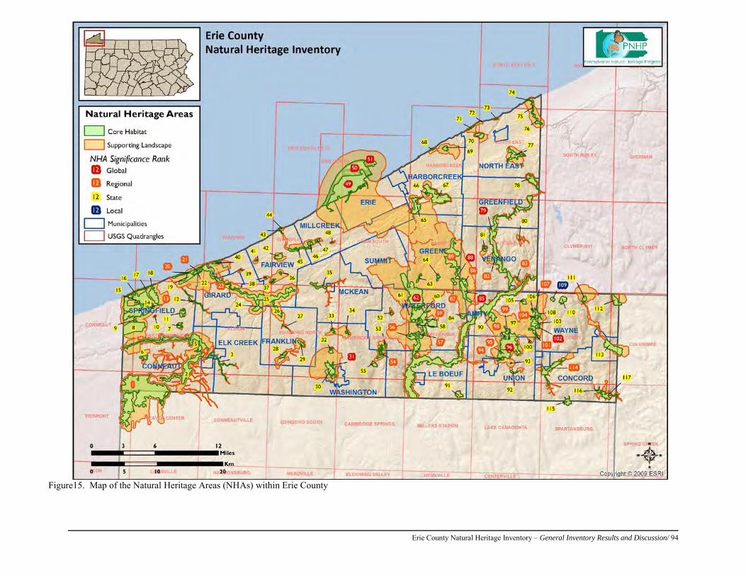
Erie County Natural Heritage Inventory – General Inventory Results and Discussion/ 94
Figure15. Map of the Natural Heritage Areas (NHAs) within Erie County
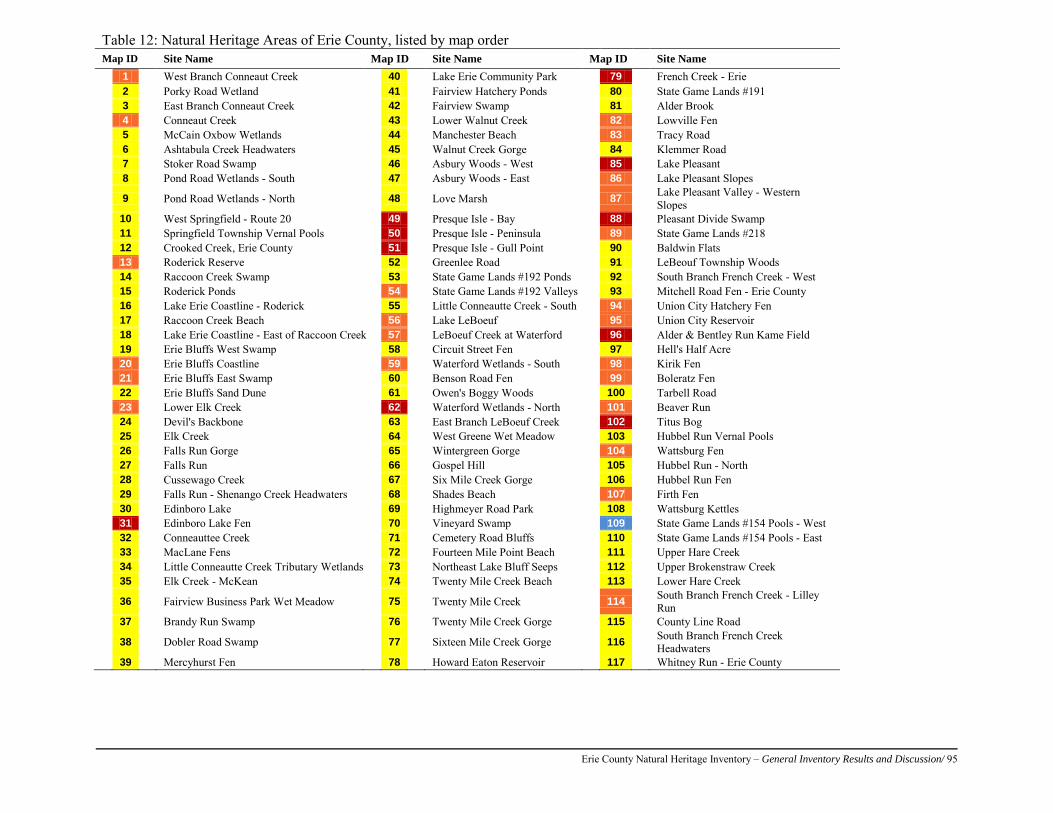
Erie County Natural Heritage Inventory – General Inventory Results and Discussion/ 95
Table 12: Natural Heritage Areas of Erie County, listed by map order Map ID Site Name Map ID Site Name Map ID Site Name
1 West Branch Conneaut Creek 40 Lake Erie Community Park 79 French Creek - Erie
2
Porky Road Wetland
41
Fairview Hatchery Ponds
80
State Game Lands #191
3
East Branch Conneaut Creek
42
Fairview Swamp
81
Alder Brook
4
Conneaut Creek
43
Lower Walnut Creek
82
Lowville Fen
5
McCain Oxbow Wetlands
44
Manchester Beach
83
Tracy Road
6
Ashtabula Creek Headwaters
45
Walnut Creek Gorge
84
Klemmer Road
7
Stoker Road Swamp
46
Asbury Woods - West
85
Lake Pleasant
8
Pond Road Wetlands - South
47
Asbury Woods - East
86
Lake Pleasant Slopes
9
Pond Road Wetlands - North
48
Love Marsh
87
Lake Pleasant Valley - Western Slopes
10
West Springfield - Route 20
49
Presque Isle - Bay
88
Pleasant Divide Swamp
11
Springfield Township Vernal Pools
50
Presque Isle - Peninsula
89
State Game Lands #218
12
Crooked Creek, Erie County
51
Presque Isle - Gull Point
90
Baldwin Flats
13
Roderick Reserve
52
Greenlee Road
91
LeBeouf Township Woods
14
Raccoon Creek Swamp
53
State Game Lands #192 Ponds
92
South Branch French Creek - West
15
Roderick Ponds
54
State Game Lands #192 Valleys 93
Mitchell Road Fen - Erie County
16
Lake Erie Coastline - Roderick
55
Little Conneautte Creek - South 94
Union City Hatchery Fen
17
Raccoon Creek Beach
56
Lake LeBoeuf
95
Union City Reservoir
18
Lake Erie Coastline - East of Raccoon Creek 57
LeBoeuf Creek at Waterford
96
Alder & Bentley Run Kame Field
19
Erie Bluffs West Swamp
58
Circuit Street Fen
97
Hell's Half Acre
20
Erie Bluffs Coastline
59
Waterford Wetlands - South
98
Kirik Fen
21
Erie Bluffs East Swamp
60
Benson Road Fen
99
Boleratz Fen
22
Erie Bluffs Sand Dune
61
Owen's Boggy Woods
100
Tarbell Road
23
Lower Elk Creek
62
Waterford Wetlands - North
101
Beaver Run
24
Devil's Backbone
63
East Branch LeBoeuf Creek
102
Titus Bog
25
Elk Creek
64
West Greene Wet Meadow
103
Hubbel Run Vernal Pools
26
Falls Run Gorge
65
Wintergreen Gorge
104
Wattsburg Fen
27
Falls Run
66
Gospel Hill
105
Hubbel Run - North
28
Cussewago Creek
67
Six Mile Creek Gorge
106
Hubbel Run Fen
29
Falls Run - Shenango Creek Headwaters
68
Shades Beach
107
Firth Fen
30
Edinboro Lake
69
Highmeyer Road Park
108
Wattsburg Kettles
31
Edinboro Lake Fen
70
Vineyard Swamp
109
State Game Lands #154 Pools - West
32
Conneauttee Creek
71
Cemetery Road Bluffs
110
State Game Lands #154 Pools - East
33
MacLane Fens
72
Fourteen Mile Point Beach
111
Upper Hare Creek
34
Little Conneautte Creek Tributary Wetlands 73
Northeast Lake Bluff Seeps
112
Upper Brokenstraw Creek
35
Elk Creek - McKean
74
Twenty Mile Creek Beach
113
Lower Hare Creek
36
Fairview Business Park Wet Meadow
75
Twenty Mile Creek
114
South Branch French Creek - Lilley Run
37
Brandy Run Swamp
76
Twenty Mile Creek Gorge
115
County Line Road
38
Dobler Road Swamp
77
Sixteen Mile Creek Gorge
116
South Branch French Creek Headwaters
39
Mercyhurst Fen
78
Howard Eaton Reservoir
117
Whitney Run - Erie County
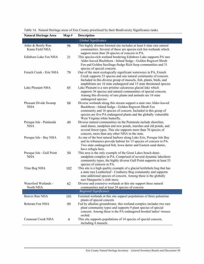
Erie County Natural Heritage Inventory – General Inventory Results and Discussion/ 96
Table 14. Natural Heritage areas of Erie County prioritized by their Biodiversity Significance ranks. Natural Heritage Area Map # Description Global Significance Alder & Bently Run
Kame Field NHA 96 This highly diverse forested site includes at least 6 state rare natural
communities. Several of these are species rich fen wetlands which support more than 20 species of concern in PA.
Edinboro Lake Fen NHA 31 This species-rich wetland bordering Edinboro Lake supports PA rare Alder-leaved Buckthorn - Inland Sedge - Golden Ragwort Shrub Fen and Golden Saxifrage-Sedge Rich Seep communities and 31 species of special concern.
French Creek - Erie NHA 79 One of the most ecologically significant waterways in PA, French Creek supports 53 species and one natural community of concern. Included in this diverse group of mussels, fish, plants, birds, and amphibians are 16 state endangered and 15 state threatened species
Lake Pleasant NHA 85 Lake Pleasant is a rare pristine calcareous glacial lake which supports 36 species and natural communities of special concern. Among this diversity of rare plants and animals are 16 state endangered species.
Pleasant Divide Swamp NHA
88 Diverse wetlands along this stream support a state rare Alder-leaved Buckthorn - Inland Sedge - Golden Ragwort Shrub Fen community and 16 species of concern. Included in this group of species are five PA endangered plants and the globally vulnerable West Virginia white butterfly.
Presque Isle - Peninsula NHA
49 Diverse natural communities on the Peninsula include shoreline, sand dunes, sandplain and new ponds, marshes and old ponds, and several forest types. This site supports more than 70 species of concern, more than any other NHA in the state.
Presque Isle - Bay NHA 51 As one of the best natural harbors along Lake Erie, Presque Isle Bay and its tributaries provide habitat for 15 species of concern in PA. Two state endangered fish, Iowa darter and Eastern sand darter, have refugia here.
Presque Isle - Gull Point NHA
50 This area is the only example of the Great Lakes beach-dune-sandplain complex in PA. Comprised of several dynamic lakeshore community types, the highly diverse Gull Point supports at least 53 species of concern in PA.
Titus Bog NHA 102 This site is a high quality example of a glacial kettlehole bog that has a state rare Leatherleaf - Cranberry Bog community and supports nine additional species of concern. Among these is the globally rare Marguerite’s club moss.
Waterford Wetlands - North NHA
62 Diverse and extensive wetlands at this site support three natural communities and at least 24 species of concern
Regional Significance Beaver Run NHA 101 Forested wetlands at this site support populations of three palustrine
plants of special concern. Boleratz Fen NHA 99 Fed by alkaline groundwater, this wetland complex includes two rare
plant community types and supports 9 plant species of special concern. Among these is the PA endangered hooded ladies’-tresses orchid.
Conneaut Creek NHA 4 This site supports populations of 14 species of special concern, including 4 mussels.
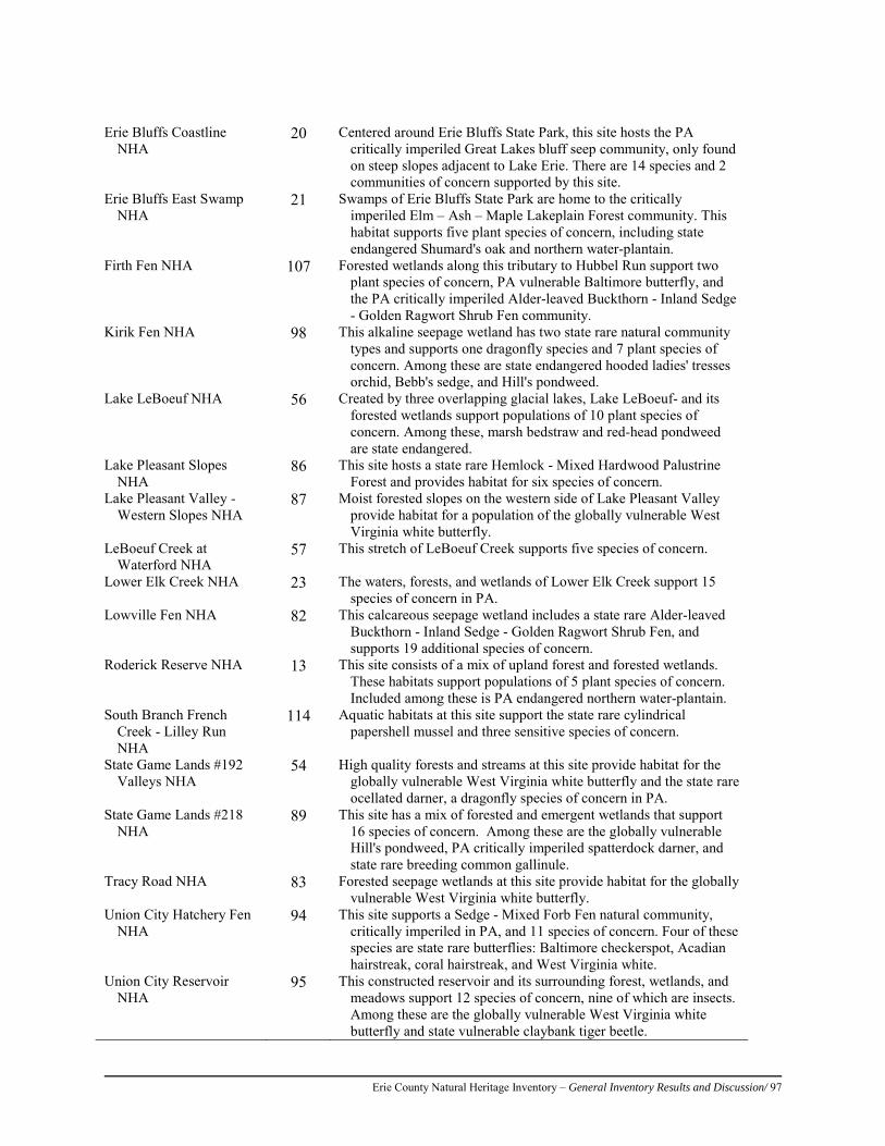
Erie County Natural Heritage Inventory – General Inventory Results and Discussion/ 97
Erie Bluffs Coastline
NHA 20 Centered around Erie Bluffs State Park, this site hosts the PA
critically imperiled Great Lakes bluff seep community, only found on steep slopes adjacent to Lake Erie. There are 14 species and 2 communities of concern supported by this site.
Erie Bluffs East Swamp NHA
21 Swamps of Erie Bluffs State Park are home to the critically imperiled Elm – Ash – Maple Lakeplain Forest community. This habitat supports five plant species of concern, including state endangered Shumard's oak and northern water-plantain.
Firth Fen NHA 107 Forested wetlands along this tributary to Hubbel Run support two plant species of concern, PA vulnerable Baltimore butterfly, and the PA critically imperiled Alder-leaved Buckthorn - Inland Sedge - Golden Ragwort Shrub Fen community.
Kirik Fen NHA 98 This alkaline seepage wetland has two state rare natural community types and supports one dragonfly species and 7 plant species of concern. Among these are state endangered hooded ladies' tresses orchid, Bebb's sedge, and Hill's pondweed.
Lake LeBoeuf NHA 56 Created by three overlapping glacial lakes, Lake LeBoeuf- and its forested wetlands support populations of 10 plant species of concern. Among these, marsh bedstraw and red-head pondweed are state endangered.
Lake Pleasant Slopes NHA
86 This site hosts a state rare Hemlock - Mixed Hardwood Palustrine Forest and provides habitat for six species of concern.
Lake Pleasant Valley - Western Slopes NHA
87 Moist forested slopes on the western side of Lake Pleasant Valley provide habitat for a population of the globally vulnerable West Virginia white butterfly.
LeBoeuf Creek at Waterford NHA
57 This stretch of LeBoeuf Creek supports five species of concern.
Lower Elk Creek NHA 23 The waters, forests, and wetlands of Lower Elk Creek support 15 species of concern in PA.
Lowville Fen NHA 82 This calcareous seepage wetland includes a state rare Alder-leaved Buckthorn - Inland Sedge - Golden Ragwort Shrub Fen, and supports 19 additional species of concern.
Roderick Reserve NHA 13 This site consists of a mix of upland forest and forested wetlands. These habitats support populations of 5 plant species of concern. Included among these is PA endangered northern water-plantain.
South Branch French Creek - Lilley Run NHA
114 Aquatic habitats at this site support the state rare cylindrical papershell mussel and three sensitive species of concern.
State Game Lands #192 Valleys NHA
54 High quality forests and streams at this site provide habitat for the globally vulnerable West Virginia white butterfly and the state rare ocellated darner, a dragonfly species of concern in PA.
State Game Lands #218 NHA
89 This site has a mix of forested and emergent wetlands that support 16 species of concern. Among these are the globally vulnerable Hill's pondweed, PA critically imperiled spatterdock darner, and state rare breeding common gallinule.
Tracy Road NHA 83 Forested seepage wetlands at this site provide habitat for the globally vulnerable West Virginia white butterfly.
Union City Hatchery Fen NHA
94 This site supports a Sedge - Mixed Forb Fen natural community, critically imperiled in PA, and 11 species of concern. Four of these species are state rare butterflies: Baltimore checkerspot, Acadian hairstreak, coral hairstreak, and West Virginia white.
Union City Reservoir NHA
95 This constructed reservoir and its surrounding forest, wetlands, and meadows support 12 species of concern, nine of which are insects. Among these are the globally vulnerable West Virginia white butterfly and state vulnerable claybank tiger beetle.
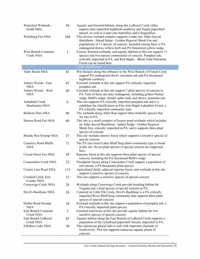
Erie County Natural Heritage Inventory – General Inventory Results and Discussion/ 98
Waterford Wetlands - South NHA
59 Aquatic and forested habitats along this LeBoeuf Creek valley support state imperiled highbush-cranberry and fragile papershell mussel, as well as 4 state rare butterflies and 6 dragonflies.
Wattsburg Fen NHA 104 This diverse wetland complex supports a state rare Alder-leaved Buckthorn - Inland Sedge - Golden Ragwort Shrub Fen and populations of 13 species of concern. Included among these is PA endangered downy willow-herb and PA threatened yellow sedge.
West Branch Conneaut Creek NHA
1 Forests, forested wetlands, and aquatic habitats at this site support 11 species and two natural communities of concern. Pumpkin ash, critically imperiled in PA, and Red Maple – Black Gum Palustrine Forest can be found here.
State Significance Alder Brook NHA 81 Wet thickets along this tributary to the West Branch of French Creek
support PA endangered showy mountain ash and PA threatened highbush cranberry.
Asbury Woods - East NHA
47 Forested wetlands at this site support PA critically imperiled pumpkin ash.
Asbury Woods - West NHA
46 Forested wetlands at this site support 7 plant species of concern in PA. Four of these are state endangered, including golden-fruited sedge, Bebb's sedge, slender spike-rush, and showy mountain ash.
Ashtabula Creek Headwaters NHA
6 This site supports PA critically imperiled pumpkin ash and is a candidate for classification as Elm-Ash-Maple Lakeplain Forest, a PA critically imperiled community type.
Baldwin Flats NHA 90 The wetlands along Alder Run support three butterfly species that are rare in PA.
Benson Road Fen NHA 60 This site is a small complex of beaver pond wetlands which includes an Alder-leaved Buckthorn - Inland Sedge - Golden Ragwort Shrub Fen, critically imperiled in PA, and it supports three plant species of concern.
Brandy Run Swamp NHA 37 This site includes interior forest which supports a sensitive species of special concern.
Cemetery Road Bluffs NHA
71 The PA rare Great Lakes Bluff Seep plant community type is found at this site. Seven plant species of special concern are supported here.
Circuit Street Fen NHA 58 Riparian forest at this site supports three plant species of special concern, including the PA threatened Bebb's sedge.
Conneauttee Creek NHA 32 Floodplain forests along Conneauttee Creek support a population of red currant, a PA threatened plant species.
County Line Road NHA 115 Agricultural fields, adjacent riparian forest, and wetlands at this site support a sensitive species of concern.
Crooked Creek, Erie County NHA
12 This site supports a sensitive species of special concern.
Cussewago Creek NHA 28 Wetlands along Cussewago Creek provide breeding habitat for Virginia rail, a bird species of special concern in PA.
Devil's Backbone NHA 24 Centered on Little Elk Creek, Devil's Backbone is a PA critically imperiled River Bluff Seep community that supports three plant species of special concern.
Dobler Road Swamp NHA
38 Forested wetlands at this site support a population of pumpkin ash, a PA critically imperiled plant species.
East Branch Conneaut Creek NHA
3 Forested waterways at this site provide aquatic habitat for two sensitive species of special concern.
East Branch LeBoeuf Creek NHA
63 Aquatic habitat along the East Branch of LeBeouf Creek supports a population of the cylindrical papershell mussel, imperiled in PA.
Edinboro Lake NHA 30 This calcareous glacial lake is rich with important elements of biodiversity. This site supports numerous aquatic plants of concern.
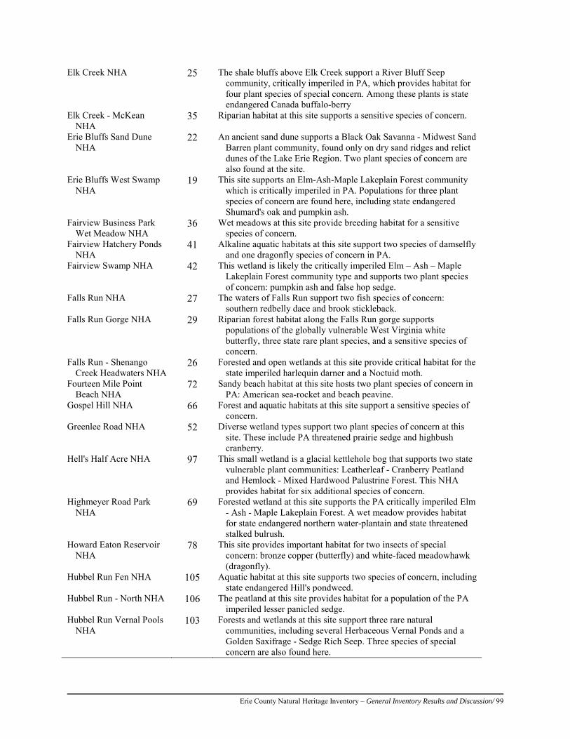
Erie County Natural Heritage Inventory – General Inventory Results and Discussion/ 99
Elk Creek NHA 25 The shale bluffs above Elk Creek support a River Bluff Seep community, critically imperiled in PA, which provides habitat for four plant species of special concern. Among these plants is state endangered Canada buffalo-berry
Elk Creek - McKean NHA
35 Riparian habitat at this site supports a sensitive species of concern.
Erie Bluffs Sand Dune NHA
22 An ancient sand dune supports a Black Oak Savanna - Midwest Sand Barren plant community, found only on dry sand ridges and relict dunes of the Lake Erie Region. Two plant species of concern are also found at the site.
Erie Bluffs West Swamp NHA
19 This site supports an Elm-Ash-Maple Lakeplain Forest community which is critically imperiled in PA. Populations for three plant species of concern are found here, including state endangered Shumard's oak and pumpkin ash.
Fairview Business Park Wet Meadow NHA
36 Wet meadows at this site provide breeding habitat for a sensitive species of concern.
Fairview Hatchery Ponds NHA
41 Alkaline aquatic habitats at this site support two species of damselfly and one dragonfly species of concern in PA.
Fairview Swamp NHA 42 This wetland is likely the critically imperiled Elm – Ash – Maple Lakeplain Forest community type and supports two plant species of concern: pumpkin ash and false hop sedge.
Falls Run NHA 27 The waters of Falls Run support two fish species of concern: southern redbelly dace and brook stickleback.
Falls Run Gorge NHA 29 Riparian forest habitat along the Falls Run gorge supports populations of the globally vulnerable West Virginia white butterfly, three state rare plant species, and a sensitive species of concern.
Falls Run - Shenango Creek Headwaters NHA
26 Forested and open wetlands at this site provide critical habitat for the state imperiled harlequin darner and a Noctuid moth.
Fourteen Mile Point Beach NHA
72 Sandy beach habitat at this site hosts two plant species of concern in PA: American sea-rocket and beach peavine.
Gospel Hill NHA 66 Forest and aquatic habitats at this site support a sensitive species of concern.
Greenlee Road NHA 52 Diverse wetland types support two plant species of concern at this site. These include PA threatened prairie sedge and highbush cranberry.
Hell's Half Acre NHA 97 This small wetland is a glacial kettlehole bog that supports two state vulnerable plant communities: Leatherleaf - Cranberry Peatland and Hemlock - Mixed Hardwood Palustrine Forest. This NHA provides habitat for six additional species of concern.
Highmeyer Road Park NHA
69 Forested wetland at this site supports the PA critically imperiled Elm - Ash - Maple Lakeplain Forest. A wet meadow provides habitat for state endangered northern water-plantain and state threatened stalked bulrush.
Howard Eaton Reservoir NHA
78 This site provides important habitat for two insects of special concern: bronze copper (butterfly) and white-faced meadowhawk (dragonfly).
Hubbel Run Fen NHA 105 Aquatic habitat at this site supports two species of concern, including state endangered Hill's pondweed.
Hubbel Run - North NHA 106 The peatland at this site provides habitat for a population of the PA imperiled lesser panicled sedge.
Hubbel Run Vernal Pools NHA
103 Forests and wetlands at this site support three rare natural communities, including several Herbaceous Vernal Ponds and a Golden Saxifrage - Sedge Rich Seep. Three species of special concern are also found here.
Erie County Natural Heritage Inventory – General Inventory Results and Discussion/ 100
Klemmer Road NHA 84 Forested and aquatic habitats at this site support a sensitive species of concern.
Lake Erie Coastline - East of Raccoon Creek NHA
18 This site supports two plant species of concern. These are the PA endangered variegated horsetail and PA threatened small-headed rush.
Lake Erie Coastline - Roderick NHA
16 This stretch of Lake Erie shoreline supports six plant species of concern in PA. Among these species is the state endangered variegated horsetail.
Lake Erie Community Park NHA
40 Lake bluff and forest ravine habitats support three plant species of special concern. The Great Lakes Bluff Seep plant community, critically imperiled in PA, is also found at this site.
LeBeouf Township Woods NHA
91 Forest and aquatic habitats at this site support a sensitive species of concern.
Little Conneauttee Creek - South NHA
55 The site’s riparian forest, wetlands, and adjacent agricultural lands support a sensitive species of concern.
Little Conneauttee Creek Tributary Wetlands NHA
34 Beaver ponds and forested wetlands support two dragonfly and one plant species of concern.
Love Marsh NHA 48 This wetland supports a population of the Lower Hare Creek NHA 113 This site's aquatic habitat and wetlands support two sensitive species
of special concern. Lower Walnut Creek
NHA 43 This creek supports two sensitive species of concern in PA.
MacLane Fens NHA 33 There are five plant species of concern that are supported by forested wetlands at this site. Kames, or small gravel hills created by glaciers, make the groundwater alkaline so it can support these rare plants.
Manchester Beach NHA 44 This beach natural community supports populations of 6 plant species of concern. Among these is the PA endangered purple sandgrass.
McCain Oxbow Wetlands NHA
5 Oxbows along Conneaut Creek support 4 species of concern.
Mercyhurst Fen NHA 39 Comprised of a PA critically imperiled Alder-leaved Buckthorn – Sedge - Golden Ragwort Fen community, this site supports seven plant species of special concern. Among these are PA’s only known population of dwarf scouring rush.
Mitchell Road Fen - Erie County NHA
93 This site supports two state rare natural communities, including the golden saxifrage - Pennsylvania bitter-cress - spring run community, and four plant species of concern.
Northeast Lake Bluff Seeps NHA
73 Only found along steep lake or stream side slopes in the Great Lakes ecoregion, this Great Lakes bluff seep community provides refugia for four plant species of concern. Among these are PA endangered variegated horsetail and Carolina grass-of-Parnassus.
Owen's Boggy Woods NHA
61 A degraded fen at this site still supports several species of concern.
Pond Road Wetlands - North NHA
9 Forested wetlands north of Pond Road support a population of larger St. John's-wort, a plant species listed as threatened in PA.
Pond Road Wetlands - South NHA
8 This site contains an Elm – Ash - Maple Lakeplain Forest community, critically imperiled in PA. Eleven additional species of concern have populations at this site.
Porky Road Wetland NHA
2 This forested site provides habitat for the PA rare butterfly known as the black dash.
Raccoon Creek Swamp NHA
17 This site is comprised of the PA critically imperiled Elm – Ash - Maple Lakeplain Forest community, and supports a population of pumpkin ash, also critically imperiled in PA.
Erie County Natural Heritage Inventory – General Inventory Results and Discussion/ 101
Raccoon Creek Beach NHA
14 This site supports several plant species of concern, including the PA endangered variegated horsetail.
Roderick Ponds NHA 15 This cluster of artificial pond wetlands provides habitat for the state rare bronze copper butterfly, and both the amber-winged spreadwing and azure bluet damselflies.
Shades Beach NHA 68 This site supports seven plant species of concern in PA, including state endangered golden-fruited sedge, bushy cinquefoil, and Canada buffalo-berry.
Six Mile Creek Gorge NHA
67 The steep gorge walls along Six-Mile Creek support a complex of River Bluff Seep communities, critically imperiled in PA. These bluffs, along with upland forest, floodplain, and riverine habitat support 6 species of concern.
Sixteen Mile Creek Gorge NHA
77 Steep slopes along Sixteen Mile Creek support the River Bluff Seep community type, critically imperiled in PA. Two plant species of concern and one sensitive species of concern are found at this site.
Springfield Township Vernal Pools NHA
92 This forested site contains several ephemeral pool wetlands, considered vulnerable in PA. These vernal pools vary in wetness throughout the year, and provide critical spring time breeding habitat for amphibians like spotted salamander and wood frog.
South Branch French Creek Headwaters NHA
116 Wetland and aquatic habitats support a population of PA threatened lesser panicled sedge and two sensitive species of concern.
South Branch French Creek - West NHA
11 Aquatic habitats at this site support populations of two state rare mussels: wavy-rayed lampmussel and creek heelsplitter.
State Game Lands #154 Pools - East NHA
110 This forested site contains several ephemeral pool wetlands, considered vulnerable in PA. These vernal pools vary in wetness throughout the year, and provide critical spring time breeding habitat for amphibians like spotted salamander and wood frog.
State Game Lands #191 NHA
80 Emergent marsh and open water habitat at this site supports the PA rare sweetflag spreadwing dragonfly and a sensitive species of concern.
State Game Lands #192 Ponds NHA
53 At least 10 dragonfly, damselfly, and butterfly species of concern have been recorded at these impoundments and forested wetlands. Among these are the PA critically imperiled Cyrano darner and spatterdock darner.
Stoker Road Swamp NHA 7 This site supports a population of pumpkin ash, a plant species of concern which is critically imperiled in PA.
Tarbell Road NHA 100 Forested wetlands on this headwaters tributary to Beaver Run support two plant species of concern: Clinton's wood fern and showy mountain-ash.
Twenty Mile Creek NHA 75 This forested stretch of Twenty Mile Creek supports populations of three species of concern and includes a River Bluff Seep natural community, critically imperiled in PA.
Twenty Mile Creek Beach NHA
74 Sandy beach and aquatic habitats at the mouth of Twenty Mile Creek support a state critically imperiled Great Lakes Sparsely Vegetated Shore community and nine plant species of concern. Among these are PA endangered bushy cinquefoil and purple sandgrass.
Twenty Mile Creek Gorge NHA
76 Steep slopes along this forested section of Twenty Mile Creek support a River Bluff Seep community, critically imperiled in PA, and six additional species of concern. Included among these are PA endangered golden-fruited sedge and capillary beaked-rush.
Upper Brokenstraw Creek NHA
112 This site's mix of riparian wetland, aquatic, and forested habitat support two sensitive species of concern.
Upper Hare Creek NHA 111 Forested wetlands and aquatic habitats along this section of Hare Creek support a population of hairy honeysuckle, critically imperiled in PA, and a sensitive species of concern.

Erie County Natural Heritage Inventory – General Inventory Results and Discussion/ 102
Vineyard Swamp NHA 70 Forested wetlands at this site support populations of two plant species of concern: cyperus-like sedge and yellow water-crowfoot.
Walnut Creek Gorge NHA
45 Steep slopes support the state rare River Bluff Seeps. This site's forests and wetlands also support populations for six plant species of concern. Among these are PA endangered golden-fruited sedge, variegated horsetail, and brook lobelia.
Wattsburg Kettles NHA 108 Near the headwaters of Hubbel Run there are 4 glacial kettle pools which comprise a state vulnerable Hemlock Palustrine Forest community.
West Greene Wet Meadow NHA
64 Wet meadows at this site provide breeding habitat for a sensitive species of concern.
West Springfield - Route 20 NHA
10 This site supports an occurrence of racemed milkwort, critically imperiled in PA.
Whitney Run - Erie County NHA
117 Comprised of forested wetlands and aquatic habitat along Whitney Run, this site supports two plant species of concern and three sensitive species of concern.
Wintergreen Gorge NHA 65 Steep slopes along Fourmile Creek support the PA critically imperiled River Bluff Seep community. Populations for at least four plant species of concern are found here. Among these are state endangered golden-fruited sedge, and Canada buffalo-berry.
Local Significance State Game Lands #154
Pools - West NHA 109 This forested site contains several vernal pools, considered
vulnerable in PA. These vernal pools vary in wetness throughout the year, and provide critical spring time breeding habitat for amphibians like spotted salamander and wood frog.
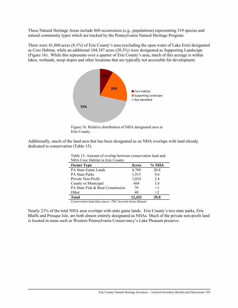
Erie County Natural Heritage Inventory – General Inventory Results and Discussion/ 103
These Natural Heritage Areas include 860 occurrences (e.g., populations) representing 319 species and natural community types which are tracked by the Pennsylvania Natural Heritage Program. There were 41,860 acres (8.1%) of Erie County’s area (excluding the open water of Lake Erie) designated as Core Habitat, while an additional 104,187 acres (20.3%) were designated as Supporting Landscape (Figure 16). While this represents over a quarter of Erie County’s area, much of this acreage is within lakes, wetlands, steep slopes and other locations that are typically not accessible for development.
8%
20%
72%
Core HabitatSupporting LandscapeNot-identified
Figure 16. Relative distribution of NHA designated area in Erie County.
Additionally, much of the land area that has been designated as an NHA overlaps with land already dedicated to conservation (Table 15).
Table 15. Amount of overlap between conservation land and NHA Core Habitat in Erie County Owner Type Acres % NHA PA State Game Lands 8,709 20.8 PA State Parks 1,915 4.6 Private Non-Profit 1,024 2.4 County or Municipal 664 1.6 PA State Fish & Boat Commission 79 >1 Other 40 >2 Total 12,431 29.8 Conservation land data source: TNC Secured Areas Dataset
Nearly 21% of the total NHA area overlaps with state game lands. Erie County’s two state parks, Erie Bluffs and Presque Isle, are both almost entirely designated as NHAs. Much of the private non-profit land is located in areas such as Western Pennsylvania Conservancy’s Lake Pleasant preserve.
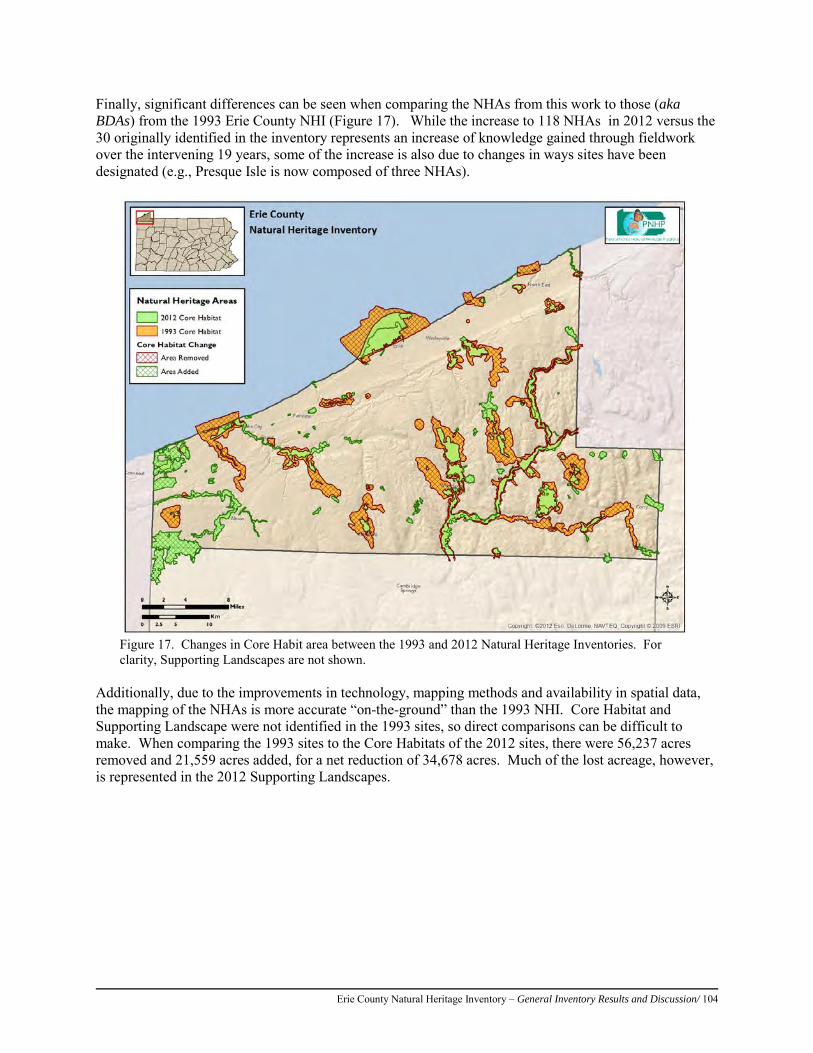
Erie County Natural Heritage Inventory – General Inventory Results and Discussion/ 104
Finally, significant differences can be seen when comparing the NHAs from this work to those (aka BDAs) from the 1993 Erie County NHI (Figure 17). While the increase to 118 NHAs in 2012 versus the 30 originally identified in the inventory represents an increase of knowledge gained through fieldwork over the intervening 19 years, some of the increase is also due to changes in ways sites have been designated (e.g., Presque Isle is now composed of three NHAs).
Figure 17. Changes in Core Habit area between the 1993 and 2012 Natural Heritage Inventories. For clarity, Supporting Landscapes are not shown.
Additionally, due to the improvements in technology, mapping methods and availability in spatial data, the mapping of the NHAs is more accurate “on-the-ground” than the 1993 NHI. Core Habitat and Supporting Landscape were not identified in the 1993 sites, so direct comparisons can be difficult to make. When comparing the 1993 sites to the Core Habitats of the 2012 sites, there were 56,237 acres removed and 21,559 acres added, for a net reduction of 34,678 acres. Much of the lost acreage, however, is represented in the 2012 Supporting Landscapes.
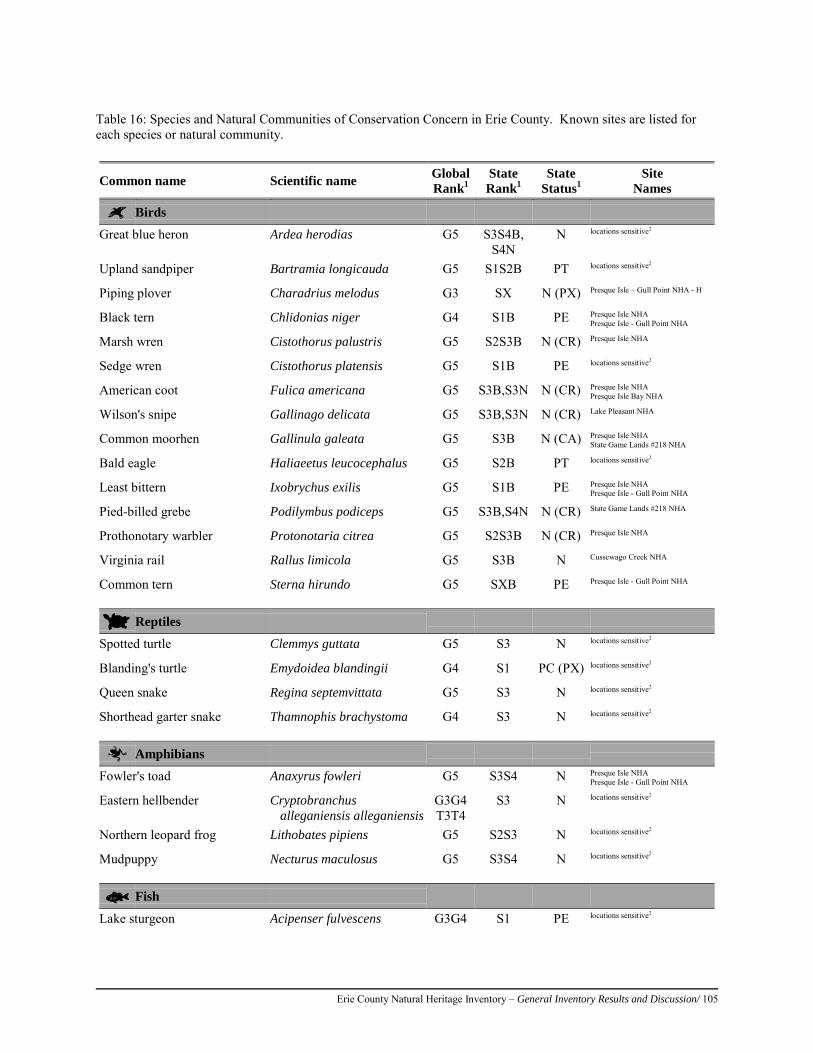
Erie County Natural Heritage Inventory – General Inventory Results and Discussion/ 105
Table 16: Species and Natural Communities of Conservation Concern in Erie County. Known sites are listed for each species or natural community.
Common name Scientific name Global Rank1
State Rank1
State Status1
Site Names
Birds
Great blue heron Ardea herodias G5 S3S4B, S4N
N locations sensitive2
Upland sandpiper Bartramia longicauda G5 S1S2B PT locations sensitive2
Piping plover Charadrius melodus G3 SX N (PX) Presque Isle – Gull Point NHA - H
Black tern Chlidonias niger G4 S1B PE Presque Isle NHA Presque Isle - Gull Point NHA
Marsh wren Cistothorus palustris G5 S2S3B N (CR) Presque Isle NHA
Sedge wren Cistothorus platensis G5 S1B PE locations sensitive2
American coot Fulica americana G5 S3B,S3N N (CR) Presque Isle NHA Presque Isle Bay NHA
Wilson's snipe Gallinago delicata G5 S3B,S3N N (CR) Lake Pleasant NHA
Common moorhen Gallinula galeata G5 S3B N (CA) Presque Isle NHA State Game Lands #218 NHA
Bald eagle Haliaeetus leucocephalus G5 S2B PT locations sensitive2
Least bittern Ixobrychus exilis G5 S1B PE Presque Isle NHA Presque Isle - Gull Point NHA
Pied-billed grebe Podilymbus podiceps G5 S3B,S4N N (CR) State Game Lands #218 NHA
Prothonotary warbler Protonotaria citrea G5 S2S3B N (CR) Presque Isle NHA
Virginia rail Rallus limicola G5 S3B N Cussewago Creek NHA
Common tern Sterna hirundo G5 SXB PE Presque Isle - Gull Point NHA
Reptiles
Spotted turtle Clemmys guttata G5 S3 N locations sensitive2
Blanding's turtle Emydoidea blandingii G4 S1 PC (PX) locations sensitive2
Queen snake Regina septemvittata G5 S3 N locations sensitive2
Shorthead garter snake Thamnophis brachystoma G4 S3 N locations sensitive2
Amphibians
Fowler's toad Anaxyrus fowleri G5 S3S4 N Presque Isle NHA Presque Isle - Gull Point NHA
Eastern hellbender Cryptobranchus alleganiensis alleganiensis
G3G4 T3T4
S3 N locations sensitive2
Northern leopard frog Lithobates pipiens G5 S2S3 N locations sensitive2
Mudpuppy Necturus maculosus G5 S3S4 N locations sensitive2
Fish
Lake sturgeon Acipenser fulvescens G3G4 S1 PE locations sensitive2
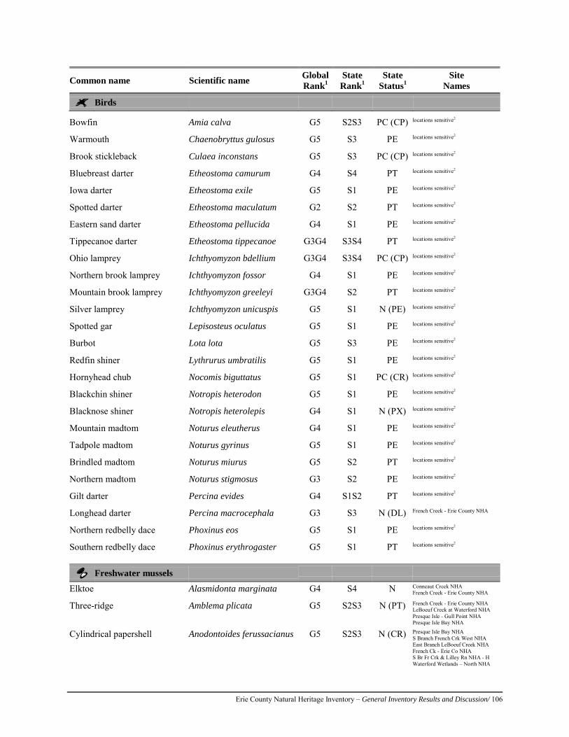
Erie County Natural Heritage Inventory – General Inventory Results and Discussion/ 106
Common name Scientific name Global Rank1
State Rank1
State Status1
Site Names
Birds
Bowfin Amia calva G5 S2S3 PC (CP) locations sensitive2
Warmouth Chaenobryttus gulosus G5 S3 PE locations sensitive2
Brook stickleback Culaea inconstans G5 S3 PC (CP) locations sensitive2
Bluebreast darter Etheostoma camurum G4 S4 PT locations sensitive2
Iowa darter Etheostoma exile G5 S1 PE locations sensitive2
Spotted darter Etheostoma maculatum G2 S2 PT locations sensitive2
Eastern sand darter Etheostoma pellucida G4 S1 PE locations sensitive2
Tippecanoe darter Etheostoma tippecanoe G3G4 S3S4 PT locations sensitive2
Ohio lamprey Ichthyomyzon bdellium G3G4 S3S4 PC (CP) locations sensitive2
Northern brook lamprey Ichthyomyzon fossor G4 S1 PE locations sensitive2
Mountain brook lamprey Ichthyomyzon greeleyi G3G4 S2 PT locations sensitive2
Silver lamprey Ichthyomyzon unicuspis G5 S1 N (PE) locations sensitive2
Spotted gar Lepisosteus oculatus G5 S1 PE locations sensitive2
Burbot Lota lota G5 S3 PE locations sensitive2
Redfin shiner Lythrurus umbratilis G5 S1 PE locations sensitive2
Hornyhead chub Nocomis biguttatus G5 S1 PC (CR) locations sensitive2
Blackchin shiner Notropis heterodon G5 S1 PE locations sensitive2
Blacknose shiner Notropis heterolepis G4 S1 N (PX) locations sensitive2
Mountain madtom Noturus eleutherus G4 S1 PE locations sensitive2
Tadpole madtom Noturus gyrinus G5 S1 PE locations sensitive2
Brindled madtom Noturus miurus G5 S2 PT locations sensitive2
Northern madtom Noturus stigmosus G3 S2 PE locations sensitive2
Gilt darter Percina evides G4 S1S2 PT locations sensitive2
Longhead darter Percina macrocephala G3 S3 N (DL) French Creek - Erie County NHA
Northern redbelly dace Phoxinus eos G5 S1 PE locations sensitive2
Southern redbelly dace Phoxinus erythrogaster G5 S1 PT locations sensitive2
Freshwater mussels
Elktoe Alasmidonta marginata G4 S4 N Conneaut Creek NHA French Creek - Erie County NHA
Three-ridge Amblema plicata G5 S2S3 N (PT) French Creek - Erie County NHA LeBoeuf Creek at Waterford NHA Presque Isle - Gull Point NHA Presque Isle Bay NHA
Cylindrical papershell Anodontoides ferussacianus G5 S2S3 N (CR) Presque Isle Bay NHA S Branch French Crk West NHA East Branch LeBoeuf Creek NHA French Ck - Erie Co NHA S Br Fr Crk & Lilley Rn NHA - H Waterford Wetlands – North NHA
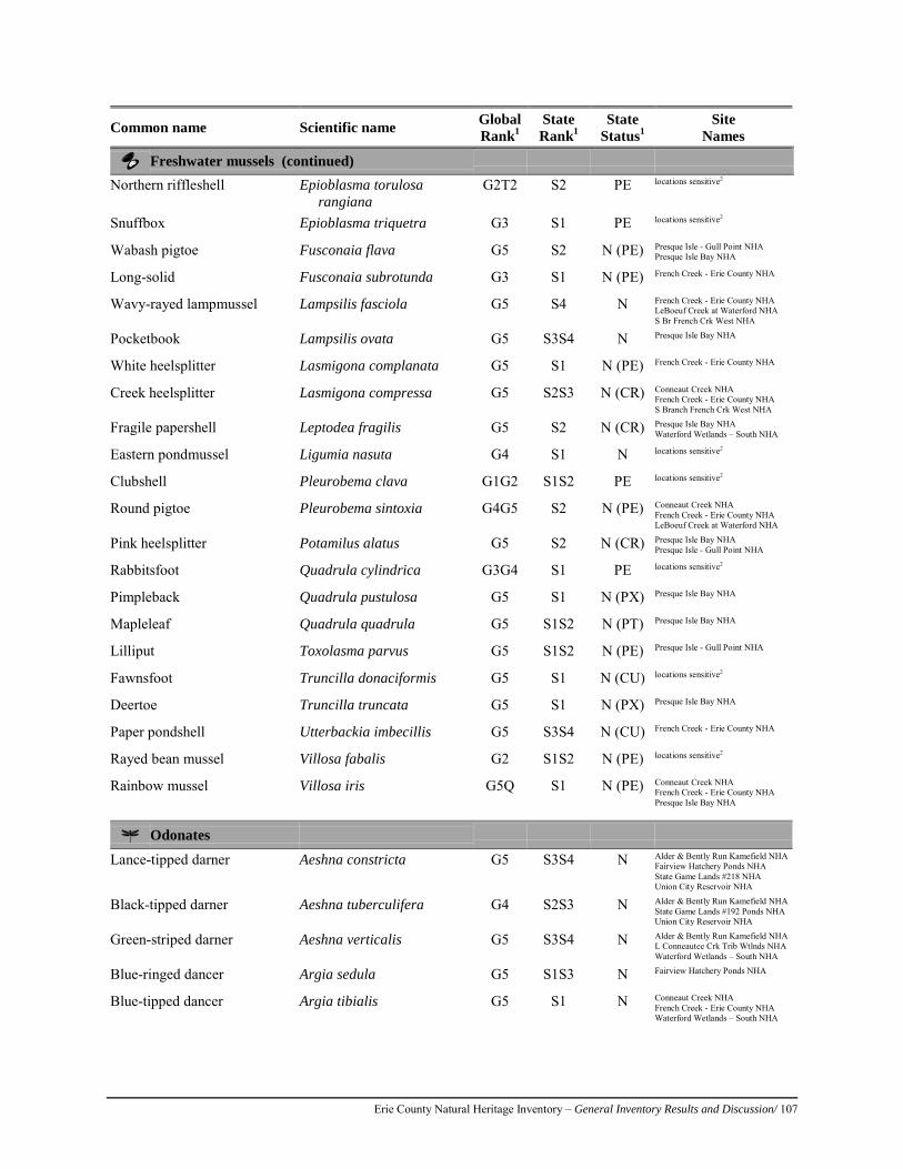
Erie County Natural Heritage Inventory – General Inventory Results and Discussion/ 107
Common name Scientific name Global Rank1
State Rank1
State Status1
Site Names
Freshwater mussels (continued)
Northern riffleshell Epioblasma torulosa rangiana
G2T2 S2 PE locations sensitive2
Snuffbox Epioblasma triquetra G3 S1 PE locations sensitive2
Wabash pigtoe Fusconaia flava G5 S2 N (PE) Presque Isle - Gull Point NHA Presque Isle Bay NHA
Long-solid Fusconaia subrotunda G3 S1 N (PE) French Creek - Erie County NHA
Wavy-rayed lampmussel Lampsilis fasciola G5 S4 N French Creek - Erie County NHA LeBoeuf Creek at Waterford NHA S Br French Crk West NHA
Pocketbook Lampsilis ovata G5 S3S4 N Presque Isle Bay NHA
White heelsplitter Lasmigona complanata G5 S1 N (PE) French Creek - Erie County NHA
Creek heelsplitter Lasmigona compressa G5 S2S3 N (CR) Conneaut Creek NHA French Creek - Erie County NHA S Branch French Crk West NHA
Fragile papershell Leptodea fragilis G5 S2 N (CR) Presque Isle Bay NHA Waterford Wetlands – South NHA
Eastern pondmussel Ligumia nasuta G4 S1 N locations sensitive2
Clubshell Pleurobema clava G1G2 S1S2 PE locations sensitive2
Round pigtoe Pleurobema sintoxia G4G5 S2 N (PE) Conneaut Creek NHA French Creek - Erie County NHA LeBoeuf Creek at Waterford NHA
Pink heelsplitter Potamilus alatus G5 S2 N (CR) Presque Isle Bay NHA Presque Isle - Gull Point NHA
Rabbitsfoot Quadrula cylindrica G3G4 S1 PE locations sensitive2
Pimpleback Quadrula pustulosa G5 S1 N (PX) Presque Isle Bay NHA
Mapleleaf Quadrula quadrula G5 S1S2 N (PT) Presque Isle Bay NHA
Lilliput Toxolasma parvus G5 S1S2 N (PE) Presque Isle - Gull Point NHA
Fawnsfoot Truncilla donaciformis G5 S1 N (CU) locations sensitive2
Deertoe Truncilla truncata G5 S1 N (PX) Presque Isle Bay NHA
Paper pondshell Utterbackia imbecillis G5 S3S4 N (CU) French Creek - Erie County NHA
Rayed bean mussel Villosa fabalis G2 S1S2 N (PE) locations sensitive2
Rainbow mussel Villosa iris G5Q S1 N (PE) Conneaut Creek NHA French Creek - Erie County NHA Presque Isle Bay NHA
Odonates
Lance-tipped darner Aeshna constricta G5 S3S4 N Alder & Bently Run Kamefield NHA Fairview Hatchery Ponds NHA State Game Lands #218 NHA Union City Reservoir NHA
Black-tipped darner Aeshna tuberculifera G4 S2S3 N Alder & Bently Run Kamefield NHA State Game Lands #192 Ponds NHA Union City Reservoir NHA
Green-striped darner Aeshna verticalis G5 S3S4 N Alder & Bently Run Kamefield NHA L Conneautee Crk Trib Wtlnds NHA Waterford Wetlands – South NHA
Blue-ringed dancer Argia sedula G5 S1S3 N Fairview Hatchery Ponds NHA
Blue-tipped dancer Argia tibialis G5 S1 N Conneaut Creek NHA French Creek - Erie County NHA Waterford Wetlands – South NHA
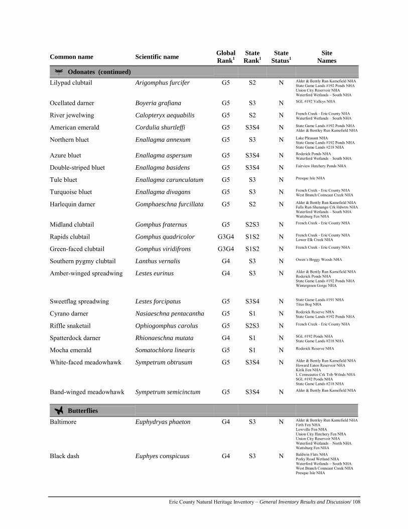
Erie County Natural Heritage Inventory – General Inventory Results and Discussion/ 108
Common name Scientific name Global Rank1
State Rank1
State Status1
Site Names
Odonates (continued)
Lilypad clubtail Arigomphus furcifer G5 S2 N Alder & Bently Run Kamefield NHA State Game Lands #192 Ponds NHA Union City Reservoir NHA Waterford Wetlands – South NHA
Ocellated darner Boyeria grafiana G5 S3 N SGL #192 Valleys NHA
River jewelwing Calopteryx aequabilis G5 S2 N French Creek - Erie County NHA Waterford Wetlands – South NHA
American emerald Cordulia shurtleffi G5 S3S4 N State Game Lands #192 Ponds NHA Alder & Bentley Run Kamefield NHA
Northern bluet Enallagma annexum G5 S3 N Lake Pleasant NHA State Game Lands #192 Ponds NHA State Game Lands #218 NHA
Azure bluet Enallagma aspersum G5 S3S4 N Roderick Ponds NHA Waterford Wetlands – South NHA
Double-striped bluet Enallagma basidens G5 S3S4 N Fairview Hatchery Ponds NHA
Tule bluet Enallagma carunculatum G5 S3 N Presque Isle NHA
Turquoise bluet Enallagma divagans G5 S3 N French Creek - Erie County NHA West Branch Conneaut Creek NHA
Harlequin darner Gomphaeschna furcillata G5 S2 N Alder & Bently Run Kamefield NHA Falls Run-Shenango Crk Hdwtrs NHA Waterford Wetlands – South NHA Wattsburg Fen NHA
Midland clubtail Gomphus fraternus G5 S2S3 N French Creek - Erie County NHA
Rapids clubtail Gomphus quadricolor G3G4 S1S2 N French Creek - Erie County NHA Lower Elk Creek NHA
Green-faced clubtail Gomphus viridifrons G3G4 S1S2 N French Creek - Erie County NHA
Southern pygmy clubtail Lanthus vernalis G4 S3 N Owen’s Boggy Woods NHA
Amber-winged spreadwing Lestes eurinus G4 S3 N Alder & Bently Run Kamefield NHA Roderick Ponds NHA State Game Lands #192 Ponds NHA Wintergreen Gorge NHA
Sweetflag spreadwing Lestes forcipatus G5 S3S4 N State Game Lands #191 NHA
Titus Bog NHA
Cyrano darner Nasiaeschna pentacantha G5 S1 N Roderick Reserve NHA State Game Lands #192 Ponds NHA
Riffle snaketail Ophiogomphus carolus G5 S2S3 N French Creek - Erie County NHA
Spatterdock darner Rhionaeschna mutata G4 S1 N SGL #192 Ponds NHA State Game Lands #218 NHA
Mocha emerald Somatochlora linearis G5 S1 N Roderick Reserve NHA
White-faced meadowhawk Sympetrum obtrusum G5 S3S4 N Alder & Bently Run Kamefield NHA Howard Eaton Reservoir NHA Kirik Fen NHA L Conneautee Crk Trib Wtlnds NHA SGL #192 Ponds NHA State Game Lands #218 NHA
Band-winged meadowhawk Sympetrum semicinctum G5 S3S4 N Alder & Bently Run Kamefield NHA
Butterflies
Baltimore Euphydryas phaeton G4 S3 N Alder & Bentley Run Kamefield NHA Firth Fen NHA Lowville Fen NHA Union City Hatchery Fen NHA Union City Reservoir NHA Waterford Wetlands – North NHA Wattsburg Fen NHA
Black dash Euphyes conspicuus G4 S3 N Baldwin Flats NHA Porky Road Wetland NHA Waterford Wetlands – South NHA West Branch Conneaut Creek NHA Presque Isle NHA
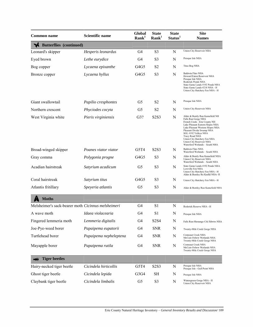
Erie County Natural Heritage Inventory – General Inventory Results and Discussion/ 109
Common name Scientific name Global Rank1
State Rank1
State Status1
Site Names
Butterflies (continued)
Leonard's skipper Hesperis leonardus G4 S3 N Union City Reservoir NHA
Eyed brown Lethe eurydice G4 S3 N Presque Isle NHA
Bog copper Lycaena epixanthe G4G5 S2 N Titus Bog NHA
Bronze copper Lycaena hyllus G4G5 S3 N Baldwin Flats NHA Howard Eaton Reservoir NHA Presque Isle NHA Roderick Ponds NHA State Game Lands #192 Ponds NHA State Game Lands #218 NHA - H Union City Hatchery Fen NHA - H
Giant swallowtail Papilio cresphontes G5 S2 N Presque Isle NHA
Northern crescent Phyciodes cocyta G5 S2 N Union City Reservoir NHA
West Virginia white Pieris virginiensis G3? S2S3 N Alder & Bently Run Kamefield NH Falls Run Gorge NHA French Creek - Erie County NH Lake Pleasant Eastern Slopes NHA Lake Pleasant Western Slopes NHA Pleasant Divide Swamp NHA SGL #192 Valleys NHA Tracy Road NHA Union City Hatchery Fen NHA Union City Reservoir NHA Waterford Wetlands – South NHA
Broad-winged skipper Poanes viator viator G5T4 S2S3 N Baldwin Flats NHA Waterford Wetlands – South NHA
Gray comma Polygonia progne G4G5 S3 N Alder & Bently Run Kamefield NHA Union City Reservoir NHA Waterford Wetlands – South NHA
Acadian hairstreak Satyrium acadicum G5 S3 N State Game Lands #192 Ponds NHA Lowville Fen NHA Union City Hatchery Fen NHA - H Alder & Bentley Rn Kmfld NHA- H
Coral hairstreak Satyrium titus G4G5 S3 N Union City Hatchery Fen NHA - H
Atlantis fritillary Speyeria atlantis G5 S3 N Alder & Bentley Run Kamefield NHA
Moths
Melsheimer's sack-bearer moth Cicinnus melsheimeri G4 S1 N Roderick Reserve NHA - H
A wave moth Idaea violacearia G4 S1 N Presque Isle NHA
Fingered lemmeria moth Lemmeria digitalis G4 S2S4 N Falls Run-Shenango Crk Hdwtrs NHA
Joe-Pye-weed borer Papaipema eupatorii G4 SNR N Twenty-Mile Creek Gorge NHA
Turtlehead borer Papaipema nepheleptena G4 SNR N Conneaut Creek NHA McCain Oxbow Wetlands NHA Twenty-Mile Creek Gorge NHA
Mayapple borer Papaipema rutila G4 SNR N Conneaut Creek NHA McCain Oxbow Wetlands NHA Twenty-Mile Creek Gorge NHA
Tiger beetles
Hairy-necked tiger beetle Cicindela hirticollis G5T4 S2S3 N Presque Isle NHA Presque Isle - Gull Point NHA
Ghost tiger beetle Cicindela lepida G3G4 SH N Presque Isle NHA
Claybank tiger beetle Cicindela limbalis G5 S3 N Wintergreen Gorge NHA - H Union City Reservoir NHA
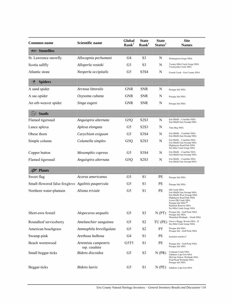
Erie County Natural Heritage Inventory – General Inventory Results and Discussion/ 110
Common name Scientific name Global Rank1
State Rank1
State Status1
Site Names
Stoneflies
St. Lawrence snowfly Allocapnia pechumani G4 S3 N Wintergreen Gorge NHA
Scotia sallfly Alloperla vostoki G3 S3 N Twenty-Mile Creek Gorge NHA Twentymile Creek NHA
Atlantic stone Neoperla occipitalis G5 S3S4 N French Creek - Erie County NHA
Spiders
A sand spider Arctosa littoralis GNR SNR N Presque Isle NHA
A sac-spider Oxysoma cubana GNR SNR N Presque Isle NHA
An orb-weaver spider Singa eugeni GNR SNR N Presque Isle NHA
Snails
Flamed tigersnail Anguispira alternata G5Q S2S3 N Erie Bluffs – Coastline NHA Erie Bluffs East Swamp NHA
Lance aplexa Aplexa elongata G5 S2S3 N Titus Bog NHA
Obese thorn Carychium exiguum G5 S3S4 N Erie Bluffs – Coastline NHA Erie Bluffs East Swamp NHA
Simple column Columella simplex G5Q S2S3 N Erie Bluffs – Coastline NHA Erie Bluffs East Swamp NHA Highmeyer Road Park NHA Six-Mile Creek Gorge NHA
Copper button Mesomphix cupreus G5 S3S4 N Erie Bluffs – Coastline NHA Erie Bluffs East Swamp NHA
Flamed tigersnail Anguispira alternata G5Q S2S3 N Erie Bluffs – Coastline NHA Erie Bluffs East Swamp NHA
Plants
Sweet flag Acorus americanus G5 S1 PE Presque Isle NHA
Small-flowered false-foxglove Agalinis paupercula G5 S1 PE Presque Isle NHA
Northern water-plantain Alisma triviale G5 S1 PE Elk Creek NHA Erie Bluffs East Swamp NHA Erie Bluffs West Swamp NHA Highmeyer Road Park NHA Lower Elk Creek NHA Presque Isle NHA Roderick Reserve NHA Six-Mile Creek Gorge NHA
Short-awn foxtail Alopecurus aequalis G5 S3 N (PT) Presque Isle - Gull Point NHA Presque Isle NHA Waterford Wetlands – North NHA
Roundleaf serviceberry Amelanchier sanguinea G5 S2 TU (PE) Owen’s Boggy Woods NHA - H Six-Mile Creek Gorge NHA
American beachgrass Ammophila breviligulata G5 S2 PT Presque Isle NHA Presque Isle - Gull Point NHA
Swamp-pink Arethusa bulbosa G4 S1 PE locations sensitive2
Beach wormwood Artemisia campestris ssp. caudata
G5T5 S1 PE Presque Isle - Gull Point NHA Presque Isle NHA
Small beggar-ticks Bidens discoidea G5 S3 N (PR) Conneaut Creek NHA Edinboro Lake Fen NHA McCain Oxbow Wetlands NHA Pond Road Wetlands NHA Presque Isle NHA
Beggar-ticks Bidens laevis G5 S1 N (PE) Edinboro Lake Fen NHA
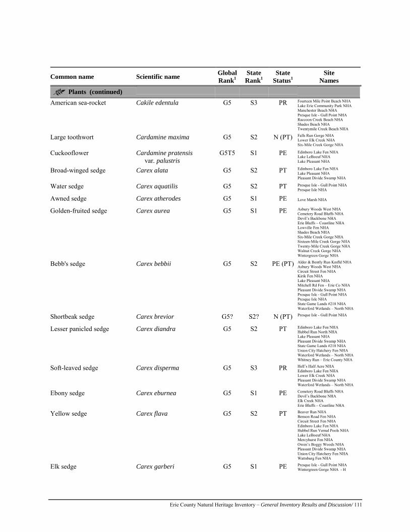
Erie County Natural Heritage Inventory – General Inventory Results and Discussion/ 111
Common name Scientific name Global Rank1
State Rank1
State Status1
Site Names
Plants (continued) American sea-rocket Cakile edentula G5 S3 PR Fourteen Mile Point Beach NHA
Lake Erie Community Park NHA Manchester Beach NHA Presque Isle - Gull Point NHA Raccoon Creek Beach NHA Shades Beach NHA Twentymile Creek Beach NHA
Large toothwort Cardamine maxima G5 S2 N (PT) Falls Run Gorge NHA Lower Elk Creek NHA Six-Mile Creek Gorge NHA
Cuckooflower Cardamine pratensis var. palustris
G5T5 S1 PE Edinboro Lake Fen NHA Lake LeBoeuf NHA Lake Pleasant NHA
Broad-winged sedge Carex alata G5 S2 PT Edinboro Lake Fen NHA Lake Pleasant NHA Pleasant Divide Swamp NHA
Water sedge Carex aquatilis G5 S2 PT Presque Isle - Gull Point NHA Presque Isle NHA
Awned sedge Carex atherodes G5 S1 PE Love Marsh NHA
Golden-fruited sedge Carex aurea G5 S1 PE Asbury Woods West NHA Cemetery Road Bluffs NHA Devil’s Backbone NHA Erie Bluffs – Coastline NHA Lowville Fen NHA Shades Beach NHA Six-Mile Creek Gorge NHA Sixteen-Mile Creek Gorge NHA Twenty-Mile Creek Gorge NHA Walnut Creek Gorge NHA Wintergreen Gorge NHA
Bebb's sedge Carex bebbii G5 S2 PE (PT) Alder & Bently Run Kmfld NHA Asbury Woods West NHA Circuit Street Fen NHA Kirik Fen NHA Lake Pleasant NHA Mitchell Rd Fen – Erie Co NHA Pleasant Divide Swamp NHA Presque Isle - Gull Point NHA Presque Isle NHA State Game Lands #218 NHA Waterford Wetlands – North NHA
Shortbeak sedge Carex brevior G5? S2? N (PT) Presque Isle - Gull Point NHA
Lesser panicled sedge Carex diandra G5 S2 PT Edinboro Lake Fen NHA Hubbel Run North NHA Lake Pleasant NHA Pleasant Divide Swamp NHA State Game Lands #218 NHA Union City Hatchery Fen NHA Waterford Wetlands – North NHA Whitney Run – Erie County NHA
Soft-leaved sedge Carex disperma G5 S3 PR Hell’s Half Acre NHA Edinboro Lake Fen NHA Lower Elk Creek NHA Pleasant Divide Swamp NHA Waterford Wetlands – North NHA
Ebony sedge Carex eburnea G5 S1 PE Cemetery Road Bluffs NHA Devil’s Backbone NHA Elk Creek NHA Erie Bluffs – Coastline NHA
Yellow sedge Carex flava G5 S2 PT Beaver Run NHA Benson Road Fen NHA Circuit Street Fen NHA Edinboro Lake Fen NHA Hubbel Run Vernal Pools NHA Lake LeBoeuf NHA Mercyhurst Fen NHA Owen’s Boggy Woods NHA Pleasant Divide Swamp NHA Union City Hatchery Fen NHA Wattsburg Fen NHA
Elk sedge Carex garberi G5 S1 PE Presque Isle - Gull Point NHA Wintergreen Gorge NHA - H
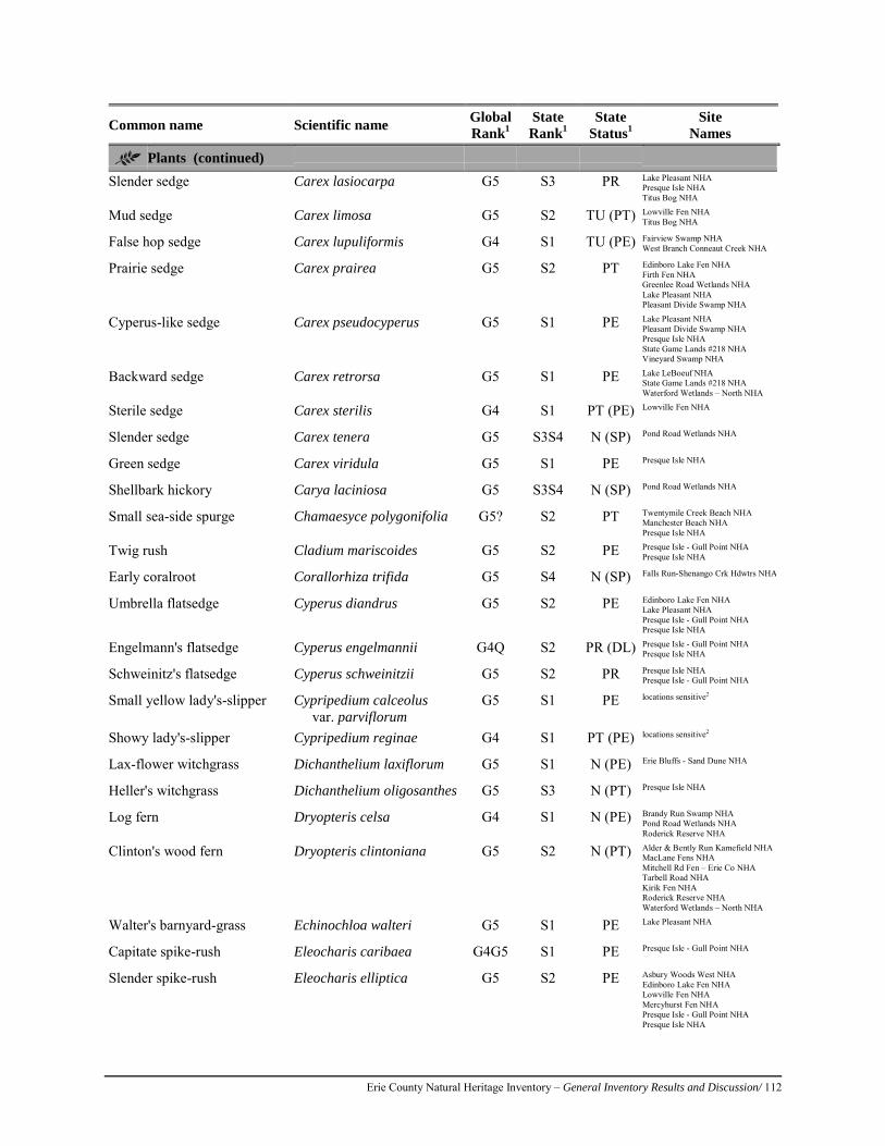
Erie County Natural Heritage Inventory – General Inventory Results and Discussion/ 112
Common name Scientific name Global Rank1
State Rank1
State Status1
Site Names
Plants (continued) Slender sedge Carex lasiocarpa G5 S3 PR Lake Pleasant NHA
Presque Isle NHA Titus Bog NHA
Mud sedge Carex limosa G5 S2 TU (PT) Lowville Fen NHA Titus Bog NHA
False hop sedge Carex lupuliformis G4 S1 TU (PE) Fairview Swamp NHA West Branch Conneaut Creek NHA
Prairie sedge Carex prairea G5 S2 PT Edinboro Lake Fen NHA Firth Fen NHA Greenlee Road Wetlands NHA Lake Pleasant NHA Pleasant Divide Swamp NHA
Cyperus-like sedge Carex pseudocyperus G5 S1 PE Lake Pleasant NHA Pleasant Divide Swamp NHA Presque Isle NHA State Game Lands #218 NHA Vineyard Swamp NHA
Backward sedge Carex retrorsa G5 S1 PE Lake LeBoeuf NHA State Game Lands #218 NHA Waterford Wetlands – North NHA
Sterile sedge Carex sterilis G4 S1 PT (PE) Lowville Fen NHA
Slender sedge Carex tenera G5 S3S4 N (SP) Pond Road Wetlands NHA
Green sedge Carex viridula G5 S1 PE Presque Isle NHA
Shellbark hickory Carya laciniosa G5 S3S4 N (SP) Pond Road Wetlands NHA
Small sea-side spurge Chamaesyce polygonifolia G5? S2 PT Twentymile Creek Beach NHA Manchester Beach NHA Presque Isle NHA
Twig rush Cladium mariscoides G5 S2 PE Presque Isle - Gull Point NHA Presque Isle NHA
Early coralroot Corallorhiza trifida G5 S4 N (SP) Falls Run-Shenango Crk Hdwtrs NHA
Umbrella flatsedge Cyperus diandrus G5 S2 PE Edinboro Lake Fen NHA Lake Pleasant NHA Presque Isle - Gull Point NHA Presque Isle NHA
Engelmann's flatsedge Cyperus engelmannii G4Q S2 PR (DL) Presque Isle - Gull Point NHA Presque Isle NHA
Schweinitz's flatsedge Cyperus schweinitzii G5 S2 PR Presque Isle NHA Presque Isle - Gull Point NHA
Small yellow lady's-slipper Cypripedium calceolus var. parviflorum
G5 S1 PE locations sensitive2
Showy lady's-slipper Cypripedium reginae G4 S1 PT (PE) locations sensitive2
Lax-flower witchgrass Dichanthelium laxiflorum G5 S1 N (PE) Erie Bluffs - Sand Dune NHA
Heller's witchgrass Dichanthelium oligosanthes G5 S3 N (PT) Presque Isle NHA
Log fern Dryopteris celsa G4 S1 N (PE) Brandy Run Swamp NHA Pond Road Wetlands NHA Roderick Reserve NHA
Clinton's wood fern Dryopteris clintoniana G5 S2 N (PT) Alder & Bently Run Kamefield NHA MacLane Fens NHA Mitchell Rd Fen – Erie Co NHA Tarbell Road NHA Kirik Fen NHA Roderick Reserve NHA Waterford Wetlands – North NHA
Walter's barnyard-grass Echinochloa walteri G5 S1 PE Lake Pleasant NHA
Capitate spike-rush Eleocharis caribaea G4G5 S1 PE Presque Isle - Gull Point NHA
Slender spike-rush Eleocharis elliptica G5 S2 PE Asbury Woods West NHA Edinboro Lake Fen NHA Lowville Fen NHA Mercyhurst Fen NHA Presque Isle - Gull Point NHA Presque Isle NHA
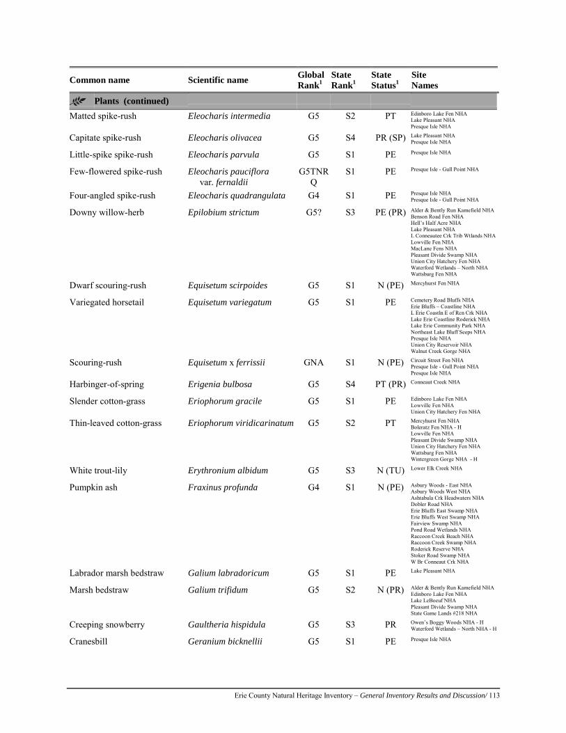
Erie County Natural Heritage Inventory – General Inventory Results and Discussion/ 113
Common name Scientific name Global Rank1
State Rank1
State Status1
Site Names
Plants (continued) Matted spike-rush Eleocharis intermedia G5 S2 PT Edinboro Lake Fen NHA
Lake Pleasant NHA Presque Isle NHA
Capitate spike-rush Eleocharis olivacea G5 S4 PR (SP) Lake Pleasant NHA Presque Isle NHA
Little-spike spike-rush Eleocharis parvula G5 S1 PE Presque Isle NHA
Few-flowered spike-rush Eleocharis pauciflora var. fernaldii
G5TNRQ
S1 PE Presque Isle - Gull Point NHA
Four-angled spike-rush Eleocharis quadrangulata G4 S1 PE Presque Isle NHA Presque Isle - Gull Point NHA
Downy willow-herb Epilobium strictum G5? S3 PE (PR) Alder & Bently Run Kamefield NHA Benson Road Fen NHA Hell’s Half Acre NHA Lake Pleasant NHA L Conneautee Crk Trib Wtlands NHA Lowville Fen NHA MacLane Fens NHA Pleasant Divide Swamp NHA Union City Hatchery Fen NHA Waterford Wetlands – North NHA Wattsburg Fen NHA
Dwarf scouring-rush Equisetum scirpoides G5 S1 N (PE) Mercyhurst Fen NHA
Variegated horsetail Equisetum variegatum G5 S1 PE Cemetery Road Bluffs NHA Erie Bluffs – Coastline NHA L Erie Coastln E of Rcn Crk NHA Lake Erie Coastline Roderick NHA Lake Erie Community Park NHA Northeast Lake Bluff Seeps NHA Presque Isle NHA Union City Reservoir NHA Walnut Creek Gorge NHA
Scouring-rush Equisetum x ferrissii GNA S1 N (PE) Circuit Street Fen NHA Presque Isle - Gull Point NHA Presque Isle NHA
Harbinger-of-spring Erigenia bulbosa G5 S4 PT (PR) Conneaut Creek NHA
Slender cotton-grass Eriophorum gracile G5 S1 PE Edinboro Lake Fen NHA Lowville Fen NHA Union City Hatchery Fen NHA
Thin-leaved cotton-grass Eriophorum viridicarinatum G5 S2 PT Mercyhurst Fen NHA Boleratz Fen NHA - H Lowville Fen NHA Pleasant Divide Swamp NHA Union City Hatchery Fen NHA Wattsburg Fen NHA Wintergreen Gorge NHA - H
White trout-lily Erythronium albidum G5 S3 N (TU) Lower Elk Creek NHA
Pumpkin ash Fraxinus profunda G4 S1 N (PE) Asbury Woods - East NHA Asbury Woods West NHA Ashtabula Crk Headwaters NHA Dobler Road NHA Erie Bluffs East Swamp NHA Erie Bluffs West Swamp NHA Fairview Swamp NHA Pond Road Wetlands NHA Raccoon Creek Beach NHA Raccoon Creek Swamp NHA Roderick Reserve NHA Stoker Road Swamp NHA W Br Conneaut Crk NHA
Labrador marsh bedstraw Galium labradoricum G5 S1 PE Lake Pleasant NHA
Marsh bedstraw Galium trifidum G5 S2 N (PR) Alder & Bently Run Kamefield NHA Edinboro Lake Fen NHA Lake LeBoeuf NHA Pleasant Divide Swamp NHA State Game Lands #218 NHA
Creeping snowberry Gaultheria hispidula G5 S3 PR Owen’s Boggy Woods NHA - H Waterford Wetlands – North NHA - H
Cranesbill Geranium bicknellii G5 S1 PE Presque Isle NHA
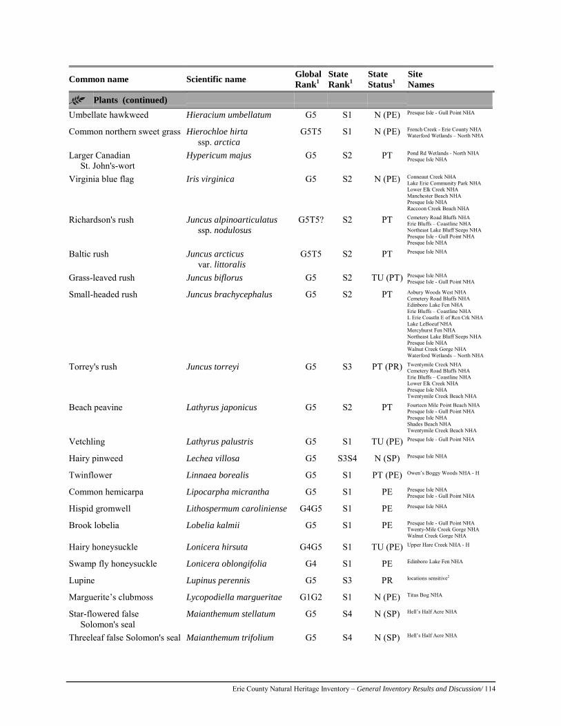
Erie County Natural Heritage Inventory – General Inventory Results and Discussion/ 114
Common name Scientific name Global Rank1
State Rank1
State Status1
Site Names
Plants (continued) Umbellate hawkweed Hieracium umbellatum G5 S1 N (PE) Presque Isle - Gull Point NHA
Common northern sweet grass Hierochloe hirta ssp. arctica
G5T5 S1 N (PE) French Creek - Erie County NHA Waterford Wetlands – North NHA
Larger Canadian St. John's-wort
Hypericum majus G5 S2 PT Pond Rd Wetlands - North NHA Presque Isle NHA
Virginia blue flag Iris virginica G5 S2 N (PE) Conneaut Creek NHA Lake Erie Community Park NHA Lower Elk Creek NHA Manchester Beach NHA Presque Isle NHA Raccoon Creek Beach NHA
Richardson's rush Juncus alpinoarticulatus ssp. nodulosus
G5T5? S2 PT Cemetery Road Bluffs NHA Erie Bluffs – Coastline NHA Northeast Lake Bluff Seeps NHA Presque Isle - Gull Point NHA Presque Isle NHA
Baltic rush Juncus arcticus var. littoralis
G5T5 S2 PT Presque Isle NHA
Grass-leaved rush Juncus biflorus G5 S2 TU (PT) Presque Isle NHA Presque Isle - Gull Point NHA
Small-headed rush Juncus brachycephalus G5 S2 PT Asbury Woods West NHA Cemetery Road Bluffs NHA Edinboro Lake Fen NHA Erie Bluffs – Coastline NHA L Erie Coastln E of Rcn Crk NHA Lake LeBoeuf NHA Mercyhurst Fen NHA Northeast Lake Bluff Seeps NHA Presque Isle NHA Walnut Creek Gorge NHA Waterford Wetlands – North NHA
Torrey's rush Juncus torreyi G5 S3 PT (PR) Twentymile Creek NHA Cemetery Road Bluffs NHA Erie Bluffs – Coastline NHA Lower Elk Creek NHA Presque Isle NHA Twentymile Creek Beach NHA
Beach peavine Lathyrus japonicus G5 S2 PT Fourteen Mile Point Beach NHA Presque Isle - Gull Point NHA Presque Isle NHA Shades Beach NHA Twentymile Creek Beach NHA
Vetchling Lathyrus palustris G5 S1 TU (PE) Presque Isle - Gull Point NHA
Hairy pinweed Lechea villosa G5 S3S4 N (SP) Presque Isle NHA
Twinflower Linnaea borealis G5 S1 PT (PE) Owen’s Boggy Woods NHA - H
Common hemicarpa Lipocarpha micrantha G5 S1 PE Presque Isle NHA Presque Isle - Gull Point NHA
Hispid gromwell Lithospermum caroliniense G4G5 S1 PE Presque Isle NHA
Brook lobelia Lobelia kalmii G5 S1 PE Presque Isle - Gull Point NHA Twenty-Mile Creek Gorge NHA Walnut Creek Gorge NHA
Hairy honeysuckle Lonicera hirsuta G4G5 S1 TU (PE) Upper Hare Creek NHA - H
Swamp fly honeysuckle Lonicera oblongifolia G4 S1 PE Edinboro Lake Fen NHA
Lupine Lupinus perennis G5 S3 PR locations sensitive2
Marguerite’s clubmoss Lycopodiella margueritae G1G2 S1 N (PE) Titus Bog NHA
Star-flowered false Solomon's seal
Maianthemum stellatum G5 S4 N (SP) Hell’s Half Acre NHA
Threeleaf false Solomon's seal Maianthemum trifolium G5 S4 N (SP) Hell’s Half Acre NHA
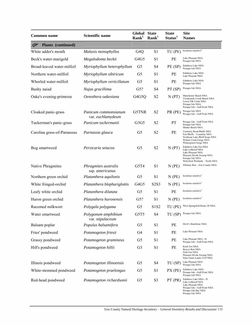
Erie County Natural Heritage Inventory – General Inventory Results and Discussion/ 115
Common name Scientific name Global Rank1
State Rank1
State Status1
Site Names
Plants (continued) White adder's mouth Malaxis monophyllos G4Q S1 TU (PE) locations sensitive2
Beck's water-marigold Megalodonta beckii G4G5 S1 PE Lake Pleasant NHA Presque Isle NHA
Broad-leaved water-milfoil Myriophyllum heterophyllum G5 S4 PE (SP) Edinboro Lake NHA Presque Isle NHA
Northern water-milfoil Myriophyllum sibiricum G5 S1 PE Edinboro Lake NHA Lake Pleasant NHA
Whorled water-milfoil Myriophyllum verticillatum G5 S1 PE Edinboro Lake NHA Presque Isle NHA
Bushy naiad Najas gracillima G5? S4 PT (SP) Presque Isle NHA
Oake's evening-primrose Oenothera oakesiana G4G5Q S2 N (PT) Manchester Beach NHA Twentymile Creek Beach NHA Lower Elk Creek NHA Presque Isle NHA Presque Isle - Gull Point NHA
Cloaked panic-grass Panicum commonsianum var. euchlamydeum
G5TNR S2 PR (PE) Presque Isle NHA Presque Isle - Gull Point NHA
Tuckerman's panic-grass Panicum tuckermanii G3G5 S2 PT Presque Isle - Gull Point NHA Presque Isle NHA Shades Beach NHA
Carolina grass-of-Parnassus Parnassia glauca G5 S2 PE Cemetery Road Bluffs NHA Erie Bluffs – Coastline NHA Northeast Lake Bluff Seeps NHA Walnut Creek Gorge NHA Wintergreen Gorge NHA
Bog smartweed Persicaria setacea G5 S2 N (PT) Edinboro Lake Fen NHA Lake LeBoeuf NHA Lake Pleasant NHA Pleasant Divide Swamp NHA Presque Isle NHA Waterford Wetlands – North NHA
Native Phragmites Phragmites australis ssp. americanus
G5T4 S1 N (PE) Whitney Run – Erie County NHA
Northern green orchid Platanthera aquilonis G5 S1 N (PE) locations sensitive2
White fringed-orchid Platanthera blephariglottis G4G5 S2S3 N (PE) locations sensitive2
Leafy white orchid Platanthera dilatata G5 S1 PE locations sensitive2
Huron green orchid Platanthera huronensis G5? S1 N (PE) locations sensitive2
Racemed milkwort Polygala polygama G5 S1S2 TU (PE) West Springfield Route 20 NHA
Water smartweed Polygonum amphibium var. stipulaceum
G5T5 S4 TU (SP) Presque Isle NHA
Balsam poplar Populus balsamifera G5 S1 PE Devil’s Backbone NHA
Fries' pondweed Potamogeton friesii G4 S1 PE Lake Pleasant NHA
Grassy pondweed Potamogeton gramineus G5 S1 PE Lake Pleasant NHA - H Presque Isle - Gull Point NHA
Hill's pondweed Potamogeton hillii G3 S1 PE Kirik Fen NHA Beaver Run NHA Firth Fen NHA Pleasant Divide Swamp NHA State Game Lands #218 NHA
Illinois pondweed Potamogeton illinoensis G5 S4 TU (SP) Lake Pleasant NHA Presque Isle NHA
White-stemmed pondweed Potamogeton praelongus G5 S1 PX (PE) Edinboro Lake NHA Presque Isle - Gull Point NHA Presque Isle NHA
Red-head pondweed Potamogeton richardsonii G5 S3 PT (PR) Edinboro Lake NHA - H Lake LeBoeuf NHA Lake Pleasant NHA Presque Isle - Gull Point NHA Presque Isle Bay NHA Presque Isle NHA
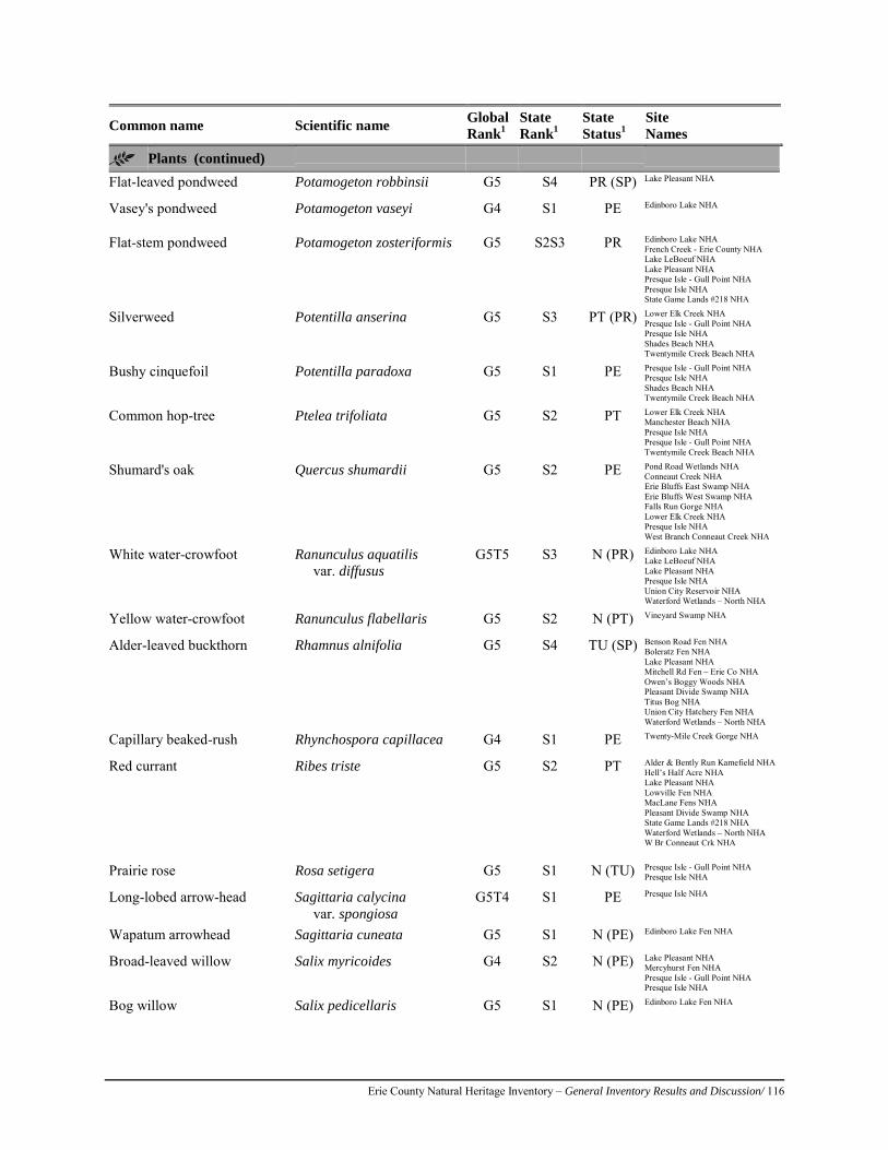
Erie County Natural Heritage Inventory – General Inventory Results and Discussion/ 116
Common name Scientific name Global Rank1
State Rank1
State Status1
Site Names
Plants (continued) Flat-leaved pondweed Potamogeton robbinsii G5 S4 PR (SP) Lake Pleasant NHA
Vasey's pondweed Potamogeton vaseyi G4 S1 PE Edinboro Lake NHA
Flat-stem pondweed Potamogeton zosteriformis G5 S2S3 PR Edinboro Lake NHA French Creek - Erie County NHA Lake LeBoeuf NHA Lake Pleasant NHA Presque Isle - Gull Point NHA Presque Isle NHA State Game Lands #218 NHA
Silverweed Potentilla anserina G5 S3 PT (PR) Lower Elk Creek NHA Presque Isle - Gull Point NHA Presque Isle NHA Shades Beach NHA Twentymile Creek Beach NHA
Bushy cinquefoil Potentilla paradoxa G5 S1 PE Presque Isle - Gull Point NHA Presque Isle NHA Shades Beach NHA Twentymile Creek Beach NHA
Common hop-tree Ptelea trifoliata G5 S2 PT Lower Elk Creek NHA Manchester Beach NHA Presque Isle NHA Presque Isle - Gull Point NHA Twentymile Creek Beach NHA
Shumard's oak Quercus shumardii G5 S2 PE Pond Road Wetlands NHA Conneaut Creek NHA Erie Bluffs East Swamp NHA Erie Bluffs West Swamp NHA Falls Run Gorge NHA Lower Elk Creek NHA Presque Isle NHA West Branch Conneaut Creek NHA
White water-crowfoot Ranunculus aquatilis var. diffusus
G5T5 S3 N (PR) Edinboro Lake NHA Lake LeBoeuf NHA Lake Pleasant NHA Presque Isle NHA Union City Reservoir NHA Waterford Wetlands – North NHA
Yellow water-crowfoot Ranunculus flabellaris G5 S2 N (PT) Vineyard Swamp NHA
Alder-leaved buckthorn Rhamnus alnifolia G5 S4 TU (SP) Benson Road Fen NHA Boleratz Fen NHA Lake Pleasant NHA Mitchell Rd Fen – Erie Co NHA Owen’s Boggy Woods NHA Pleasant Divide Swamp NHA Titus Bog NHA Union City Hatchery Fen NHA Waterford Wetlands – North NHA
Capillary beaked-rush Rhynchospora capillacea G4 S1 PE Twenty-Mile Creek Gorge NHA
Red currant Ribes triste G5 S2 PT Alder & Bently Run Kamefield NHA Hell’s Half Acre NHA Lake Pleasant NHA Lowville Fen NHA MacLane Fens NHA Pleasant Divide Swamp NHA State Game Lands #218 NHA Waterford Wetlands – North NHA W Br Conneaut Crk NHA
Prairie rose Rosa setigera G5 S1 N (TU) Presque Isle - Gull Point NHA Presque Isle NHA
Long-lobed arrow-head Sagittaria calycina var. spongiosa
G5T4 S1 PE Presque Isle NHA
Wapatum arrowhead Sagittaria cuneata G5 S1 N (PE) Edinboro Lake Fen NHA
Broad-leaved willow Salix myricoides G4 S2 N (PE) Lake Pleasant NHA Mercyhurst Fen NHA Presque Isle - Gull Point NHA Presque Isle NHA
Bog willow Salix pedicellaris G5 S1 N (PE) Edinboro Lake Fen NHA

Erie County Natural Heritage Inventory – General Inventory Results and Discussion/ 117
Common name Scientific name Global Rank1
State Rank1
State Status1
Site Names
Plants (continued) Meadow willow Salix petiolaris G5 S4 TU (SP) Lake Pleasant NHA
Presque Isle NHA
Autumn willow Salix serissima G4 S2 PT Boleratz Fen NHA Edinboro Lake Fen NHA MacLane Fens NHA Wattsburg Fen NHA
Pineland pimpernel Samolus parviflorus G5T5 S3 TU (PR) Conneaut Creek NHA Lower Elk Creek NHA Pond Road Wetlands NHA Raccoon Creek Beach NHA West Branch Conneaut Creek NHA
Pod-grass Scheuchzeria palustris G5 S1 PE Titus Bog NHA
Seaside bluestem Schizachyrium scoparium var. littorale
G5T5 S3 PR Presque Isle NHA Presque Isle - Gull Point NHA
Hard-stemmed bulrush Schoenoplectus acutus G5 S2 PE Lake Pleasant NHA Waterford Wetlands – North NHA
River bulrush Schoenoplectus fluviatilis G5 S3 PR Edinboro Lake Fen NHA Presque Isle - Gull Point NHA Presque Isle NHA Walnut Creek Gorge NHA
Smith's bulrush Schoenoplectus smithii G5? S1 PE Presque Isle - Gull Point NHA Presque Isle NHA
Water bulrush Schoenoplectus subterminalis
G4G5 S3 N (PR) Lake Pleasant NHA Presque Isle NHA Titus Bog NHA
Stalked bulrush Scirpus pedicellatus G4 S1 PT Elk Creek NHA Highmeyer Road Park NHA
Canada buffalo-berry Shepherdia canadensis G5 S1 PE Devil’s Backbone NHA Elk Creek NHA Falls Run Gorge NHA Shades Beach NHA Six-Mile Creek Gorge NHA Sixteen-Mile Creek Gorge NHA Wintergreen Gorge NHA
Bog goldenrod Solidago uliginosa G4G5 S2 N (PT) Lake Pleasant NHA Roderick Reserve NHA - H
Showy mountain-ash Sorbus decora G4G5 S1 PE Alder Brook NHA Asbury Woods West NHA Lake Pleasant NHA Pleasant Divide Swamp NHA State Game Lands #218 NHA Tarbell Road NHA Waterford Wetlands – North NHA
Branching bur-reed Sparganium androcladum G4G5 S1 PE Presque Isle NHA
Shining ladies'-tresses Spiranthes lucida G5 S3 N (PT) Asbury Woods West NHA Lake Pleasant NHA - H Lowville Fen NHA Presque Isle NHA
Hooded ladies'-tresses Spiranthes romanzoffiana G5 S1 PE Kirik Fen NHA MacLane Fens NHA Boleratz Fen NHA Mitchell Rd Fen – Erie Co NHA Mercyhurst Fen NHA Lowville Fen NHA Wattsburg Fen NHA - H
Sand dropseed Sporobolus cryptandrus G5 S3 PR (DL) Presque Isle NHA
Mountain starwort Stellaria borealis G5 S1S2 N (TU) Alder & Bently Run Kamefield NHA
Rush aster Symphyotrichum boreale G5 S1 PE Edinboro Lake Fen NHA Lake Pleasant NHA
Bushy aster Symphyotrichum dumosum G5 S1 TU (PE) Presque Isle NHA Presque Isle - Gull Point NHA
White heath aster Symphyptrichum ericoides G5 S3 TU Lk Erie Coastline Roderick NHA - H
Rydberg's ivy Toxicodendron rydbergii G5 S1 N (PE) Presque Isle NHA
Purple sandgrass Triplasis purpurea G4G5 S1 PE Manchester Beach NHA Presque Isle NHA Twentymile Creek Beach NHA
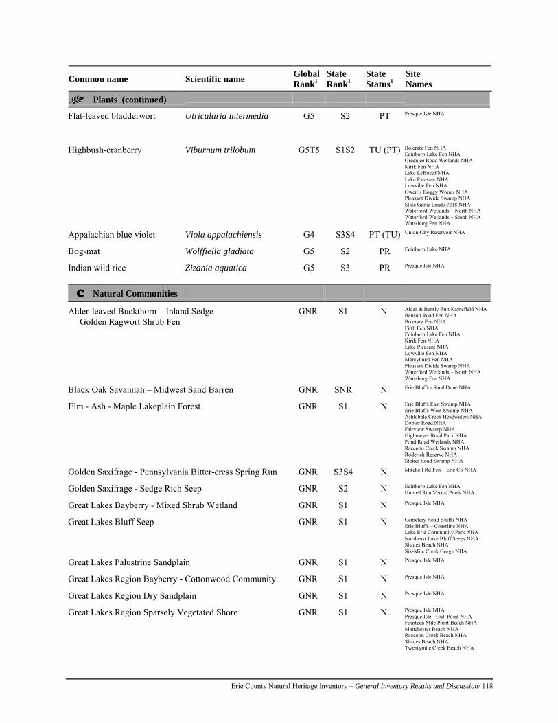
Erie County Natural Heritage Inventory – General Inventory Results and Discussion/ 118
Common name Scientific name Global Rank1
State Rank1
State Status1
Site Names
Plants (continued)
Flat-leaved bladderwort Utricularia intermedia G5 S2 PT Presque Isle NHA
Highbush-cranberry Viburnum trilobum G5T5 S1S2 TU (PT) Boleratz Fen NHA Edinboro Lake Fen NHA Greenlee Road Wetlands NHA Kirik Fen NHA Lake LeBoeuf NHA Lake Pleasant NHA Lowville Fen NHA Owen’s Boggy Woods NHA Pleasant Divide Swamp NHA State Game Lands #218 NHA Waterford Wetlands – North NHA Waterford Wetlands – South NHA Wattsburg Fen NHA
Appalachian blue violet Viola appalachiensis G4 S3S4 PT (TU) Union City Reservoir NHA
Bog-mat Wolffiella gladiata G5 S2 PR Edinboro Lake NHA
Indian wild rice Zizania aquatica G5 S3 PR Presque Isle NHA
C Natural Communities
Alder-leaved Buckthorn – Inland Sedge – Golden Ragwort Shrub Fen
GNR S1 N Alder & Bently Run Kamefield NHA Benson Road Fen NHA Boleratz Fen NHA Firth Fen NHA Edinboro Lake Fen NHA Kirik Fen NHA Lake Pleasant NHA Lowville Fen NHA Mercyhurst Fen NHA Pleasant Divide Swamp NHA Waterford Wetlands – North NHA Wattsburg Fen NHA
Black Oak Savannah – Midwest Sand Barren GNR SNR N Erie Bluffs - Sand Dune NHA
Elm - Ash - Maple Lakeplain Forest GNR S1 N Erie Bluffs East Swamp NHA Erie Bluffs West Swamp NHA Ashtabula Creek Headwaters NHA Dobler Road NHA Fairview Swamp NHA Highmeyer Road Park NHA Pond Road Wetlands NHA Raccoon Creek Swamp NHA Roderick Reserve NHA Stoker Road Swamp NHA
Golden Saxifrage - Pennsylvania Bitter-cress Spring Run GNR S3S4 N Mitchell Rd Fen – Erie Co NHA
Golden Saxifrage - Sedge Rich Seep GNR S2 N Edinboro Lake Fen NHA Hubbel Run Vernal Pools NHA
Great Lakes Bayberry - Mixed Shrub Wetland GNR S1 N Presque Isle NHA
Great Lakes Bluff Seep GNR S1 N Cemetery Road Bluffs NHA Erie Bluffs – Coastline NHA Lake Erie Community Park NHA Northeast Lake Bluff Seeps NHA Shades Beach NHA Six-Mile Creek Gorge NHA
Great Lakes Palustrine Sandplain GNR S1 N Presque Isle NHA
Great Lakes Region Bayberry - Cottonwood Community GNR S1 N Presque Isle NHA
Great Lakes Region Dry Sandplain GNR S1 N Presque Isle NHA
Great Lakes Region Sparsely Vegetated Shore GNR S1 N Presque Isle NHA Presque Isle - Gull Point NHA Fourteen Mile Point Beach NHA Manchester Beach NHA Raccoon Creek Beach NHA Shades Beach NHA Twentymile Creek Beach NHA
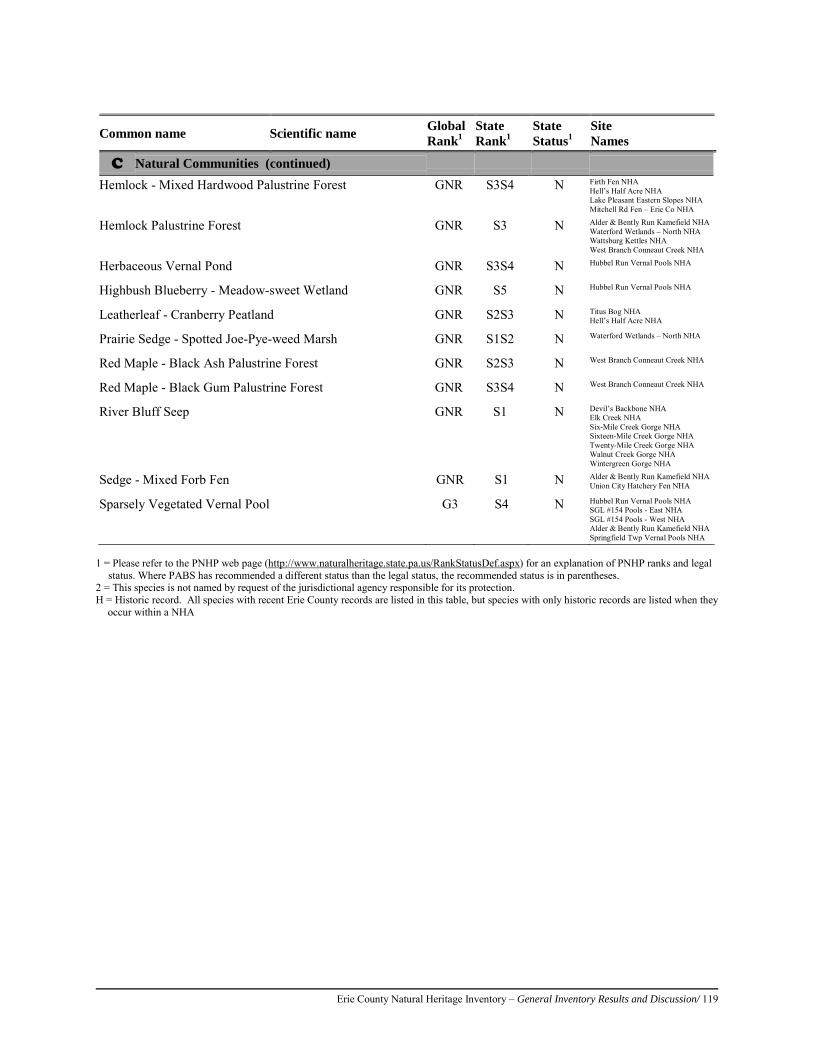
Erie County Natural Heritage Inventory – General Inventory Results and Discussion/ 119
1 = Please refer to the PNHP web page (http://www.naturalheritage.state.pa.us/RankStatusDef.aspx) for an explanation of PNHP ranks and legal
status. Where PABS has recommended a different status than the legal status, the recommended status is in parentheses. 2 = This species is not named by request of the jurisdictional agency responsible for its protection. H = Historic record. All species with recent Erie County records are listed in this table, but species with only historic records are listed when they
occur within a NHA
Common name Scientific name Global Rank1
State Rank1
State Status1
Site Names
C Natural Communities (continued) Hemlock - Mixed Hardwood Palustrine Forest GNR S3S4 N Firth Fen NHA
Hell’s Half Acre NHA Lake Pleasant Eastern Slopes NHA Mitchell Rd Fen – Erie Co NHA
Hemlock Palustrine Forest GNR S3 N Alder & Bently Run Kamefield NHA Waterford Wetlands – North NHA Wattsburg Kettles NHA West Branch Conneaut Creek NHA
Herbaceous Vernal Pond GNR S3S4 N Hubbel Run Vernal Pools NHA
Highbush Blueberry - Meadow-sweet Wetland GNR S5 N Hubbel Run Vernal Pools NHA
Leatherleaf - Cranberry Peatland GNR S2S3 N Titus Bog NHA Hell’s Half Acre NHA
Prairie Sedge - Spotted Joe-Pye-weed Marsh GNR S1S2 N Waterford Wetlands – North NHA
Red Maple - Black Ash Palustrine Forest GNR S2S3 N West Branch Conneaut Creek NHA
Red Maple - Black Gum Palustrine Forest GNR S3S4 N West Branch Conneaut Creek NHA
River Bluff Seep GNR S1 N Devil’s Backbone NHA Elk Creek NHA Six-Mile Creek Gorge NHA Sixteen-Mile Creek Gorge NHA Twenty-Mile Creek Gorge NHA Walnut Creek Gorge NHA Wintergreen Gorge NHA
Sedge - Mixed Forb Fen GNR S1 N Alder & Bently Run Kamefield NHA Union City Hatchery Fen NHA
Sparsely Vegetated Vernal Pool G3 S4 N Hubbel Run Vernal Pools NHA SGL #154 Pools - East NHA SGL #154 Pools - West NHA Alder & Bently Run Kamefield NHA Springfield Twp Vernal Pools NHA
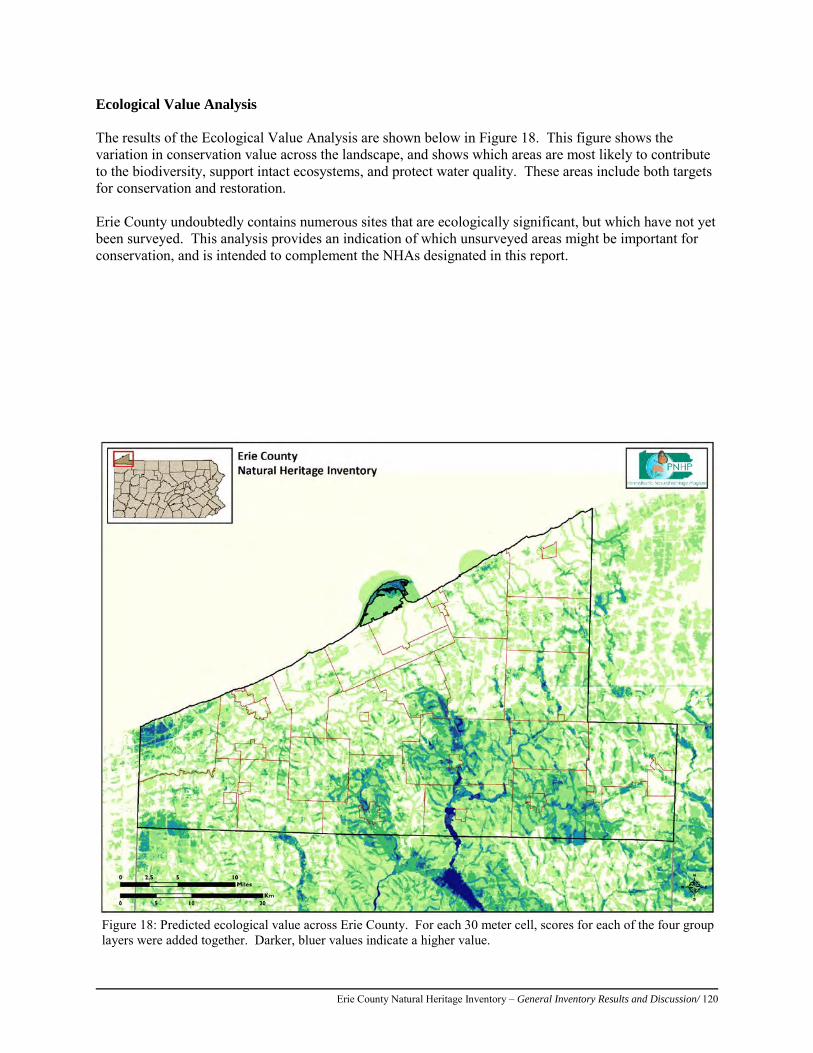
Erie County Natural Heritage Inventory – General Inventory Results and Discussion/ 120
Ecological Value Analysis The results of the Ecological Value Analysis are shown below in Figure 18. This figure shows the variation in conservation value across the landscape, and shows which areas are most likely to contribute to the biodiversity, support intact ecosystems, and protect water quality. These areas include both targets for conservation and restoration. Erie County undoubtedly contains numerous sites that are ecologically significant, but which have not yet been surveyed. This analysis provides an indication of which unsurveyed areas might be important for conservation, and is intended to complement the NHAs designated in this report.
Figure 18: Predicted ecological value across Erie County. For each 30 meter cell, scores for each of the four group layers were added together. Darker, bluer values indicate a higher value.
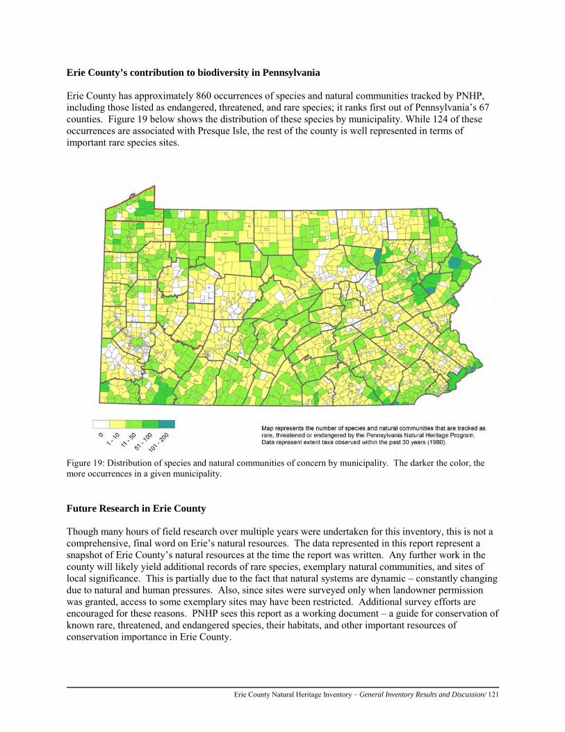
Erie County Natural Heritage Inventory – General Inventory Results and Discussion/ 121
Erie County’s contribution to biodiversity in Pennsylvania Erie County has approximately 860 occurrences of species and natural communities tracked by PNHP, including those listed as endangered, threatened, and rare species; it ranks first out of Pennsylvania’s 67 counties. Figure 19 below shows the distribution of these species by municipality. While 124 of these occurrences are associated with Presque Isle, the rest of the county is well represented in terms of important rare species sites.
Figure 19: Distribution of species and natural communities of concern by municipality. The darker the color, the more occurrences in a given municipality. Future Research in Erie County Though many hours of field research over multiple years were undertaken for this inventory, this is not a comprehensive, final word on Erie’s natural resources. The data represented in this report represent a snapshot of Erie County’s natural resources at the time the report was written. Any further work in the county will likely yield additional records of rare species, exemplary natural communities, and sites of local significance. This is partially due to the fact that natural systems are dynamic – constantly changing due to natural and human pressures. Also, since sites were surveyed only when landowner permission was granted, access to some exemplary sites may have been restricted. Additional survey efforts are encouraged for these reasons. PNHP sees this report as a working document – a guide for conservation of known rare, threatened, and endangered species, their habitats, and other important resources of conservation importance in Erie County.
Erie County Natural Heritage Inventory – General Inventory Results and Discussion/ 122
Since this inventory represents known conditions at the time the report was written, it is recommended that future inventory work in the county focus on the following areas and organisms: • Municipalities with few reports of rare species such as Elk Creek Township, which may be under
surveyed. • Vernal pools, breeding habitat for species like amphibians. There is a short window during which
these pools retain water and are easily recognized. Additional surveys for these pools in the spring are warranted.
The Pennsylvania Natural Heritage Program can provide the county with formal updates to this report at regular intervals. Additionally, a series of biodiversity and conservation planning services are available through PNHP to supplement the results of this inventory. Please contact the Pennsylvania Natural Heritage Program for additional information regarding these services (412-288-2777; http//www.naturalheritage.state.pa.us/). A Final Note on Rare, Threatened, and Endangered Species The rare and endangered species highlighted in this report are some of the several hundred species in Pennsylvania that are threatened with extirpation or extinction. If a species becomes extinct, or is lost from a portion of its native range as happens with extirpation, the ecosystem in which it lived will lose an important element. Often the repercussions of extinctions are not known until the species is gone, and more often than not the species is not replaceable in the system. This may be because the habitat has been altered to the point that the species and the ecosystem cycles upon which its survival depends are no longer intact. Rare species are often indicative of fragile ecosystems that may have become degraded - protection of rare species may help monitor the quality of Erie County’s ecosystems. A great example of a rare species acting as an indicator of environmental quality is the osprey - a bird species which indicated the deleterious effects of the pesticide DDT in our environment. Another reason for protecting rare species is for their value as unique genetic resources, with immeasurable scientific and potential economic importance. Every species may provide significant information for future use in genetic research and medical practices. Beyond these practical considerations, perhaps the most compelling reasons for stewardship are the aesthetic and ethical considerations; there is beauty and recreational value inherent in healthy, species-rich ecosystems. The protection of rare and endangered species depends on several factors, including increasing scientific knowledge and concerted efforts from government agencies, educational institutions, private organizations, and individuals. The following section outlines general recommendations to begin to protect the species outlined in this report.
Submitting Additional Data As the state repository for biodiversity data, the Pennsylvania Natural Heritage Program appreciates submissions of data regarding rare, threatened, and endangered species, and potential survey sites. Species we currently track are listed on our website at: http//www.naturalheritage.state.pa.us Please contact PNHP if you have additional data to submit.
Erie County Natural Heritage Inventory – General Inventory Results and Discussion/ 123
General Recommendations The following are general recommendations for the protection of the Natural Heritage Areas within Erie County. Approaches to protecting a natural heritage area are wide ranging, and factors such as land ownership, time constraints, and tools and resource availability should be considered when prioritizing protection of these sites. Prioritization works best when incorporated into a long-term county or region-wide plan. Opportunities may arise that do not conform to a plan, and the decision on how to manage or protect a natural heritage area may be made on a site by site basis. Keep in mind that personnel in the Pennsylvania Natural Heritage Program and staff from state natural resource agencies are available to discuss more specific options for preservation. The following are approaches and recommendations for natural heritage area conservation.
1. Consider conservation initiatives for natural heritage areas on private land. Conservation easements protect land while leaving it in private ownership. An easement is a legal agreement between a landowner and a conservation organization or government agency that permanently limits a property’s use in order to protect its conservation values. It can be tailored to the needs of both the landowner and the conservation organization, and will not be extinguished with new ownership. Tax incentives may apply to conservation easements donated for conservation purposes. Lease and management agreements also allow the landowner to retain ownership and temporarily ensure protection of land. There are no tax incentives for these conservation methods. A lease to a land trust or government agency can protect land temporarily, and ensure that its conservation values will be maintained. This can be a first step to help a landowner decide if they want to pursue more permanent protection methods. Management agreements require landowners and land trusts to work together to develop a plan for managing resources (such as plant or animal habitat, watersheds, forested areas, or agricultural lands) with the land trust offering technical expertise. Land acquisition by a conservation organization can be at fair market value or as a bargain sale where a purchase price is set below fair market value with tax benefits that reduce or eliminate the disparity. One strategy is to identify areas that may be excellent locations for new county or township parks. Sites that can serve more than one purpose such as wildlife habitat, flood and sediment control, water supply, recreation, and environmental education are ideal. Private lands adjacent to public lands should be examined for acquisition when a Natural Heritage Area is present on either property, and there is a need of additional land to complete protection of the associated natural features. Fee simple acquisition is when a buyer purchases land outright, and has maximum control over the use and management of the property and its resources. This conservation initiative is appropriate when the property’s resources are highly sensitive, and protection cannot be guaranteed using other conservation approaches. Unrestricted donations of land are welcomed by land trusts. The donation of land entitles the donor to a charitable deduction for the full market value, as well as a release from the responsibility of managing the land. If the land is donated because of
Erie County Natural Heritage Inventory – General Inventory Results and Discussion/ 124
its conservation value, the land will be permanently protected. A donation of land that is not of high biological significance may be sold, with or without restrictions, to a conservation buyer, and the funds used to further the land trust’s conservation mission. The Pennsylvania Land Trust Association website offers a search engine to find land trusts (http://conserveland.org). The Lake Erie Regional Conservancy is an example of a local land trust in Erie County. They are located in Erie, PA and can be contacted at 814-566-9319 ([email protected]; http://lerc-erie.org/). The Western Pennsylvania Conservancy is a regional land trust that can be contacted at 412-288-2777 ([email protected]; http://www.waterlandlife.org). Local zoning ordinances are one of the best-known regulatory tools available to municipalities. Examples of zoning ordinances a municipality can adopt include overlay districts where the boundary is tied to a specific resource or interest such as riverfront protection and floodplains, and zoning to protect stream corridors and other drainage areas using buffer zones. Often overlooked, zoning can prevent municipal or county-wide development activities which are undesirable to the majority of the residents, and allow for planning that can meet the goals of the county residents. For example, the Erie County Comprehensive Plan states that empty storefronts are a concern for many residents (Erie County Planning Commission, 2005). Regulations which require that businesses concentrate development and restrict sprawl might be a step toward infill and revitalization of downtown business districts.
2. Prepare management plans that address species of concern and natural communities. Many of the natural heritage areas that are already protected are in need of additional management plans to ensure the continued existence of the associated natural elements. Existing management plans should be updated or new plans developed to address conservation needs for species of concern and natural communities. Recommendations may include: removal of invasive plant species; leaving the area alone to mature and recover from previous disturbance; creating natural areas within existing parks; limiting land-use practices such as mineral extraction, residential or industrial development, and agriculture; or implementing sustainable forestry practices. For example, some species simply require continued availability of a natural community while others may need specific management practices such as canopy thinning, mowing, or burning to maintain their habitat requirements.
Existing parks and conservation lands provide important habitat for plants and animals at both the county level and on a regional scale. For example, these lands may serve as nesting or wintering areas for birds or as stopover areas during migration. Management plans for these areas should emphasize a reduction in activities that fragment habitat. Adjoining landowners should be educated about the importance of their land as it relates to habitat value, especially for species of concern, and agreements should be worked out to minimize activities that may threaten native flora and fauna.
3. Protect bodies of water.
Protection of lakes, reservoirs, wetlands, rivers, and creeks is vital for ensuring the health of human communities and natural ecosystems; multiple functions and services can be preserved by protecting aquatic habitats, including biodiversity, drinking water supplies, and recreational resources. Many rare species, unique natural communities,
Erie County Natural Heritage Inventory – General Inventory Results and Discussion/ 125
and locally significant habitats occur in wetlands and water bodies; these are directly dependent on natural hydrologic systems and water quality for their continued existence. Ecosystem processes also provide clean water supplies for human communities and do so at significant cost savings in comparison to water treatment facilities; therefore, protection of high quality watersheds is the best way to ensure the viability of natural habitats and water quality. Scrutinize development proposals for their impact on entire watersheds, not just the immediate project area. Cooperative efforts in land use planning among municipal, county, state, and federal agencies, developers, and residents can lessen the impact of development on watersheds.
4. Provide for buffers around natural heritage areas.
Development plans should provide for natural buffers between disturbances and natural heritage areas. Disturbances may include construction of new roads and utility corridors, non-sustainable timber harvesting, and fragmentation of large pieces of land. Storm runoff from these activities results in the transport of nutrients and sediments into aquatic ecosystems. County and township officials can encourage landowners to maintain vegetated buffer zones within riparian zones. Vegetated buffers (preferably of Pennsylvania native plant species) help reduce erosion and sedimentation while shading and cooling the water. Preserving water quality in rivers and streams is important to fish as some species, such as brook trout and some darters, are highly sensitive to poor water quality. Sensitive fish are readily lost from streams when water quality starts to decline. Creating or maintaining a vegetated buffer benefits aquatic animal life, provides habitat for other wildlife species, and creates a diversity of habitats along the creek or stream. Staff at the Pennsylvania Natural Heritage Program (PNHP) or natural resources agencies can provide further guidance regarding buffer considerations appropriate for various kinds of natural resources. Waterways that include natural heritage areas, identified in the Results section of this report, are important, sensitive areas that should be protected. For example, conserving natural areas around watersheds that supply municipal water provides an additional protective buffer around the water supply, maintains habitat for wildlife, and may also provide (low impact) recreation opportunities.
5. Reduce fragmentation of the landscape surrounding natural heritage areas. Encourage development in sites that have already seen past disturbances (especially mined and deforested areas). Care should be taken to ensure that protected natural areas do not become islands surrounded by development. In these situations, the site is effectively isolated, and its value for wildlife is greatly reduced. Careful planning can maintain natural environments along with the plants and animals associated with them. A balance between growth and the conservation of natural and scenic resources can be achieved by guiding development away from the most environmentally sensitive areas. The reclamation of previously disturbed areas for commercial and industrial projects, also known as brownfield development, presents one way to encourage economic growth while allowing ecologically sensitive areas to remain undisturbed. For example, reclaimed surface mines can be used for development (potentially even wind development) when feasible. Cluster development can be used to allow the same amount of development on much less land, and leave the remaining land intact for wildlife and native plants. By compressing development into already disturbed areas with existing infrastructure (villages, roads, existing rights-of-way), large pieces of the

Erie County Natural Heritage Inventory – General Inventory Results and Discussion/ 126
landscape can be maintained intact. If possible, networks or corridors of woodlands or greenspace should be preserved linking natural areas to each other. Preserving greenspace around development can provide ample recreation opportunities, and potentially increase nearby property value.
6. Encourage the formation of grassroots organizations.
County and municipal governments can do much of the work necessary to plan for the protection and management of natural areas identified in this report; however, grassroots organizations are needed to assist with obtaining funding, identifying landowners who wish to protect their land, and providing information about easements, land acquisition, management, and stewardship of protected sites. Increasingly, local watershed organizations and land trusts are taking proactive steps to accomplish conservation at the local level. When activities threaten to impact ecological features, the responsible agency should be contacted. If no agency exists, private groups such as conservancies, land trusts, and watershed associations should be sought for ecological consultation and specific protection recommendations.
7. Manage for invasive species.
Invasive species threaten native diversity by dominating habitat used by native species and by disrupting the integrity of the ecosystems they occupy. Management for invasive species depends upon the extent of their establishment. Small infestations may be easily controlled or eliminated but larger, well established populations typically present difficult management challenges. The earlier exotic invasive species are identified and controlled, the greater the likelihood of eradication with the smallest expenditure of resources. Below is a list of sources for invasive species information.
The Mid-Atlantic Invasive Plant Council (MA-IPC) is a non-profit organization (501c3) dedicated to addressing the problem of invasive exotic plants and their threat to the Mid-Atlantic region's economy, environment, and human health by providing leadership, representing the mid-Atlantic region at national meetings and conferences, monitoring and disseminating research on impacts and controls of invasives, facilitating information development and exchange, coordinating the on the ground removal of invasives, and providing access to training on species identification and management. Information is available at http://www.ma-ipc.org.
Several excellent websites exist to provide information about invasive exotic species. The following sources provide individual species profiles for the most troublesome invaders, with information such as the species’ country of origin, ecological impact, geographic distribution, and control techniques. • Department of Conservation and Natural Resources web site:
http://www.dcnr.state.pa.us/forestry/plants/invasiveplants/index.htm • The Nature Conservancy’s Weeds on the Web at http://tncinvasives.ucdavis.edu/ • The Virginia Natural Heritage Program’s invasive plant page at
http://www.dcr.virginia.gov/natural_heritage/invspinfo.shtml • The Missouri Department of Conservation’s Missouri Vegetation Management
Manual at http://mdc.mo.gov/nathis/exotic/vegman/ • U.S. Department of the Interior, National Park Service invasive species monitoring
resources at http://www.nature.nps.gov/biology/invasivespecies/ or
Erie County Natural Heritage Inventory – General Inventory Results and Discussion/ 127
http://science.nature.nps.gov/im/monitor/invasives/ • Invasive species information clearinghouse listing numerous other resources on a
variety of related topics at http://www.invasivespeciesinfo.gov/
8. Incorporate natural heritage inventory information into planning efforts. One of the main roles of this document is to integrate conservation information into the planning process. Over half of Erie County residents identify with the need for a Planned Growth Option of development (Erie County Planning Commission, 2005); a scenario that balances the need for jobs while also protecting the county’s rural qualities. Through internal planning, decision making related to land use development, and participation in regional planning initiatives, counties and municipalities can profoundly shape the land and landscapes of Pennsylvania. Natural Heritage Areas can be readily included in comprehensive plans, greenway and open space plans, park and recreation plans, and regional planning initiatives. DCNR-funded greenway and open space plans, Heritage Region plans, and River Conservation Plans are good examples of planning efforts that reach beyond county boundaries. PNHP staff are available to help incorporate County Natural Heritage Inventory data and recommendations into county and municipal plans.

Erie County Natural Heritage Inventory – General Inventory Results and Discussion/ 128
Results by Township As the ‘organizing unit’ for Pennsylvania’s planning and decision making is the municipality, this section presents an overview of each township (and associated cities and boroughs) and a list of the NHAs present within each. These lists will help township officials and other users use this inventory most efficiently. Amity Township Amity Township holds the distinction of being the township in Erie County with the fewest residents. According to the 2010 U.S. Census, 1,073 persons reside in this 28.3 square mile area. Amity Township is bordered by Venango Township to the north, Wayne Township to the east, Union Township to the south, and Waterford Township to the west. Only 4% of this lightly populated township is developed; 47% of the area is forested and 38% is farmland. One forested tract within the township exceeds 1,000 acres and several others are in the 500 to 800 acre range. The bedrock that underlies this landscape is primarily siltstone, sandstone, and shale. Public lands in Amity Township include State Game Lands #102, #162, #167, and #190. French Creek and its tributaries flow northward through the township as part of the Allegheny drainage. Beaver Run, an exceptional value (EV) stream, has its headwaters in the southeast corner of the township. The highest quality streams in the state are given the ranking of EV by the Department of Environmental Protection (DEP). At the other end of the spectrum is Hubble Run, a tributary to French Creek. Hubbel Run is classified as impaired for aquatic life by DEP. The cause for the impairment is listed as unknown. Natural Heritage Areas that occur within Amity Township include
• Alder & Bently Run Kame Field NHA • Baldwin Flats NHA • Beaver Run NHA • Boleratz Fen NHA • Firth Fen NHA • French Creek – Erie NHA • Hubbel Run Fen NHA • Hubbel Run – North NHA • Hubbell Run Vernal Pools NHA • Kirik Fen NHA • Lake Pleasant NHA • Titus Bog NHA • Wattsburg Fen NHA • Wattsburg Kettles NHA
Concord Township, City of Corry and Elgin Borough Concord Township occupies the southeastern corner of the county and covers 32.7 square miles. The city of Corry and the borough of Elgin are located along the border with Wayne Township to the north. The city of Corry covers 6.0 square miles and has 6,605 residents. Elgin Borough measures 1.9 square miles in area and has the smallest population (218 residents) of any borough in Erie County according to the 2010 U.S. Census.
Erie County Natural Heritage Inventory – General Inventory Results and Discussion/ 129
This area is underlain by bedrock that is predominantly siltstone, sandstone, and shale with some conglomerate. Approximately 38% of the township is in agriculture, 49% is forested, and 4% is developed. Most of the forested tracts are less than 500 acres with a few in the 500 to 700 acre range. One forest block that extends across the border into Warren County covers over 1000 acres. Public lands include State Game Land #144 and a small sliver of State Game Land #291 along the Warren County line. Concord Township is part of the Allegheny drainage. The South Branch French Creek flows westward through the township. Beaver Run, an exceptional value (EV) stream, flows through Elgin just before its confluence with the South Branch French Creek. The highest quality streams in the state are given the ranking of EV by the DEP. Unfortunately, several of the headwater streams that also feed the South Branch are classified as impaired for aquatic life by the Department of Environmental Protection (DEP) due to siltation from road runoff. Bear Creek flows into the city of Corry where it joins with Hare Creek. Bear Creek is classified as impaired for aquatic life by DEP due to organic enrichment and low dissolved oxygen levels. Natural Heritage Areas that occur within Concord Township include
• County Line Road NHA • Lower Hare Creek NHA • South Branch French Creek - Lilley Run NHA • South Branch French Creek Headwaters NHA • Whitney Run NHA
Conneaut Township and Albion Borough Conneaut Township marks the southwestern corner of Erie County and shares the county line with Crawford County to the south and the state line with Ohio to the west. The township covers 43.5 square miles. The borough of Albion occupies a 1.1 square mile area near the eastern edge of the township. The bedrock here reveals layers of siltstone and sandstone along with lesser amounts of shale. Half of Conneaut Township is forested and contains some of the largest forest blocks in Erie County. Two tracts along the southern border with Crawford County exceed 2,000 acres. Most of these two large tracts are within State Game Lands #101. Roughly a third (31%) of the township consists of farmlands, and 6% of the land is developed. Conneaut Township has the distinction of being the township in Erie County with the highest percentage of wetlands (11%). Conneaut Township is part of the Lake Erie drainage. Several small tributaries to the Ashtabula Creek flow westward across the state line into Ohio. The remainder of the township drains into either the Conneaut Creek or one of its tributaries. Conneaut Creek divides Conneaut and Springfield townships, and along this stretch is listed as impaired by DEP with a fish consumption advisory due to high mercury levels. Marsh Run a tributary in the central portion of the township is also listed as impaired for aquatic life; the cause of the impairment is unknown. Natural Heritage Areas that occur within Concord Township include
• Ashtabula Creek Headwaters NHA • Conneaut Creek NHA • East Branch Conneaut Creek NHA • Porky Road Wetland NHA • West Branch Conneaut Creek NHA
Erie County Natural Heritage Inventory – General Inventory Results and Discussion/ 130
Elk Creek Township and Cranesville Borough Elk Creek Township sits along the southern county line with Crawford County and encompasses 34.9 square miles. The borough of Cranesville is 0.9 square miles in size and sits at the western edge of the township alongside Conneaut Township. Over half (51%) of the township is covered by forest. Many of the forested tracts exceed 250 acres with one block exceeding 1000 acres. Agricultural land covers 39% of the township, with 7% of the land developed. Sandstone and siltstone along with lesser amounts of shale and conglomerate constitute the bedrock that makes up the township. The only State Game Land in the township is a sliver of State Game Land #152 that is mostly in Crawford County. Likewise, a small portion of the upper tip of the Cussewago Bottom Important Bird Area extends across the Crawford County line into Elk Creek Township. Historic documents indicate that there was a large deposit of bog iron, an impure ore that develops by the chemical oxidation of iron in bogs and swamps, located in a wetland east of Wellsburg. It’s unclear whether this wetland still exists in the township. Much of the forests in this area were predominately white ash and oak in the 1800s. Elk Creek Township is split between two drainages. The western portion of the township is part of the Lake Erie drainage and includes tributaries to the East Branch Conneaut Creek as well as Little Elk Creek and its tributaries. Cranesville Borough is part of this drainage with numerous small tributaries to the East Branch Conneaut Creek flowing westward through the borough. The eastern sector of the township is part of the Allegheny drainage. This region is drained by the Cussewago Creek as it moves southward into Crawford County Natural Heritage Areas that occur within Elk Creek Township include
• East Branch Conneaut Creek NHA Fairview Township Fairview envelopes 29.2 square miles and is located along the edge of Lake Erie. Girard Township is situated to its west and Millcreek Township to the east. Franklin and McKean townships border to the south and east respectively. Fairview is the third most highly populated township in Erie County with 10,102 persons living there at the time of the 2010 U.S. Census. Approximately 25% of Fairview Township is developed; 34% is forested, and 36% is in agriculture. Most of the forested tracts are less than 250 acres. Two of the largest tracts are shared with Franklin Township but none of the tracts in the township exceed 1,000 acres. The major components of the bedrock within the township are shale and siltstone along with some sandstone. All the streams in the township are part of the Lake Erie drainage. Walnut Creek which flows into Fairview Township from Millcreek Township is impaired according to the Department of Environmental Protection (DEP) due to the negative effects of land development, road runoff, urban runoff, and storm sewers on aquatic life. Trout Run, west of the Walnut Creek drainage, is impaired due to nutrients and siltation from agriculture. Both Trout Run and Walnut Creek flow directly into Lake Erie. On a positive note, Bear Run, a tributary that feeds into Walnut Creek is still listed as attaining the standards set by DEP for healthy streams. The waterways in the southern half of the township are part of the Elk Creek drainage and are listed by DEP as supporting aquatic life.
Erie County Natural Heritage Inventory – General Inventory Results and Discussion/ 131
Natural Heritage Areas that occur within Fairview Township include • Brandy Run Swamp NHA • Dobler Road Swamp NHA • Elk Creek NHA • Erie Downs Wet Meadow NHA • Fairview Hatchery Ponds NHA • Fairview Swamp NHA • Falls Run Gorge NHA • Lower Walnut Creek NHA • Manchester Beach NHA • Walnut Creek Gorge NHA
Franklin Township Franklin Township covers a total area of 28.7 square miles. Franklin is surrounded by five other townships, Fairview to the north, McKean to the north and east, Washington to the east and south, Elk Creek to the south and west, and Girard to the west. Over half of Franklin Township is forested (51%), agriculture accounts for 41% of the land use, and approximately 6% of the land is developed. At least half of the forest blocks within the township average from 500 to 700 acres in size. While sandstone dominates the bedrock, siltstone is prominent along the eastern edge and northwest corner of the township. Franklin Township is split between two major watersheds. Tributaries of Elk Creek drain the northern and western portion of the township toward Lake Erie, while Cussewago Creek and Shenango Creek drain the southern and eastern portions of the township toward French Creek. All streams within Franklin Township are listed by the Department of Environmental Protection (DEP) as supporting aquatic life. One of the most important stone quarries in the county was located here and provided the square sandstone flagging for the Erie Court House floors. Natural Heritage Areas that occur within Franklin Township include
• Cussewago Creek NHA • Falls Run NHA • Falls Run - Shenango Creek Headwaters NHA • Falls Run Gorge NHA
Girard Township, Lake City Borough, Girard Borough, and Platea Borough Girard Township is one of seven townships that border Lake Erie. Girard Township encompasses 31.9 square miles. Within its borders are three boroughs: Lake City, Girard, and Platea. Lake City, as the name implies, sits alongside Lake Erie. It covers 1.8 square miles; 3,031 people reside here. Girard Borough adjoins the south side of Lake City. Girard Borough is 2.3 square miles in area and has a population of 3,104. Platea Borough is located along the southern edge of Girard Township next to Elk Creek Township. Platea covers 3.3 square miles, making it the largest borough in area in Erie County; but from the perspective of population size it is not large. The 2010 U.S. Census listed 430 residents for Platea Borough. Approximately, 14% of Girard Township is developed, with forested land (41%) and agricultural lands (41%) roughly equal in size. The largest tracts of forest occur in the southeastern sector of the township

Erie County Natural Heritage Inventory – General Inventory Results and Discussion/ 132
with two tracts measuring between 500 and 700 acres in size. Like much of the region, the bedrock is dominated by shale and siltstone along with some sandstone. Erie Bluffs State Park stretches along a mile of undeveloped shoreline between Girard and Springfield townships. Elk Creek and its tributaries flow northward to Lake Erie and drain much of the township including Lake City. Crooked Creek flows through the southwestern corner of Girard Township. Within Platea, water drains into both the Crooked Creek and Halls Run watersheds. Two unnamed streams in the northeastern portion of the township are classified as impaired for aquatic life due to agriculture related siltation; one of the streams flows through Girard Borough. All waterways within the township are part of the Lake Erie drainage. Natural Heritage Areas that occur within Girard Township include
• Crooked Creek NHA • Devil's Backbone NHA • Elk Creek NHA • Erie Bluffs Coastline NHA • Erie Bluffs East Swamp NHA • Erie Bluffs Sand Dune NHA • Lake Erie Community Park NHA • Lower Elk Creek NHA • Mercyhurst Fen NHA
Greene Township Greene Township is located in the northern half of Erie County and is surrounded by six other townships: Harborcreek to the north, Greenfield and Venango to the east, Waterford to the south, and Summit and Millcreek to the west. Green Township encompasses 37.6 square miles. Forest (43%) and agricultural lands (42%) cover much of the landscape, while approximately 5% of the township is developed. Many of the forest patches in the township are less than 250 acres with some larger ones between 250 and 500 acres. The two largest forest blocks (tracts of over 1,200 acres) occur in the western half of the township. The bedrock within the township is dominated by siltstone and sandstone with lesser amounts of shale and conglomerate. Public lands which occur in Greene Township include portions of State Game Lands #109, #161, and #218. The southern two-thirds of the township is part of the Allegheny drainage, while the upper third flows into the Lake Erie drainage. Fourmile and Sixmile creeks flow to Lake Erie and the East Branch LeBoeuf and its tributaries flow southward into the Allegheny system. The East Branch LeBoeuf supports aquatic life in its upper reaches but aquatic life is impaired in the lower reaches before its confluence with LeBoeuf Creek which occurs just across the township line in Waterford Township. The reason for the impairment is listed by the Department of Environmental Protection (DEP) as unknown. Natural Heritage Areas that occur within Greene Township include
• East Branch LeBoeuf Creek NHA • Lake Pleasant Valley - Western Slopes NHA • Pleasant Divide Swamp NHA • State Game Lands #218 NHA • Waterford Wetlands NHA • West Greene Wet Meadow NHA • Wintergreen Gorge NHA
Erie County Natural Heritage Inventory – General Inventory Results and Discussion/ 133
Greenfield Township Greenfield is one of the northern tier of townships in Erie County and shares a border with New York State to the east. Greenfield Township measures 34.1 squares miles in area. Over half of the township is forested (51%) and nearly a third exists as farmland (31%) while 6% is developed. Many of the forested areas are between 250 and 1,000 acres; one forest block exceeds 750 acres and another is over 1,000 acres. Another large tract that is part of State Game Land #191 extends into Venango Township and covers over 1,000 acres. State Game Land #163 also covers a portion of one of the larger forest blocks. Siltstone, sandstone, and shale are the main components of the bedrock in Greenfield Township. A divide between the Lake Erie drainage and the Allegheny drainage diagonally crosses the township from the southwest corner to the northeast area. Tributaries to the Sixmile, Sevenmile, Eightmile, and Twelvemile creeks have their start in Greenfield Township and make their way northward to Lake Erie. The streams in the southern half of the township are tributaries to the West Branch French Creek and are a part of the Allegheny drainage which eventually joins with the waters of the Ohio River. Only one of the tributaries to the West Branch French Creek is listed by the Department of Environmental Protection (DEP) as not supporting aquatic life. Natural Heritage Areas that occur within Greenfield Township include
• French Creek – Erie NHA • Howard Eaton Reservoir NHA
Harborcreek Township and Wesleyville Borough Harborcreek Township extends from the shores of Lake Erie south to Greene Township. The city of Erie, and Lawrence Park and Millcreek townships lie to the west, and North East and Greenfield townships are to the east. Harborcreek Township covers 34.1 square miles and has a population of 17,234 (2010 U.S. Census). Approximately equal parts of the land cover in Harborcreek Township are either forested (33%) or in agriculture (36%) while 22% of the land is developed. The forest blocks are mainly small with most forest patches less than 250 acres. Two of the largest forest blocks are between 500 and 700 acres in size. The bedrock is predominately shale and siltstone with lesser amounts of sandstone. Wesleyville Borough covers 0.5 square miles and is situated to the south of Lawrence Park Township with the city of Erie to its west. Fourmile Creek forms the border between the township and Wesleyville’s eastern side. Only one unnamed stream in the township is classified as impaired by the Department of Environmental Protection (DEP) and does not support aquatic life due to siltation from residential development and road runoff. This stream flows to the east of Lawrence Park Township and Wesleyville Borough. The other streams within the township such as Fourmile, Sixmile, Sevenmile, Eightmile, and Twelvemile creeks are listed by DEP as supporting aquatic life. They all flow northward into Lake Erie. Natural Heritage Areas that occur within Harborcreek Township include
• Gospel Hill NHA • Highmeyer Road Park NHA • Shades Beach NHA • Six Mile Creek Gorge NHA • Wintergreen Gorge NHA
Erie County Natural Heritage Inventory – General Inventory Results and Discussion/ 134
Lawrence Park Township Physically Lawrence Park is the smallest township in Erie County (1.8 square miles), but when population sizes are compared, Lawrence Park has more people than approximately half of the other townships. According to the 2011 U.S. Census report 3,982 people live in Lawrence Park. The township is bordered by Lake Erie, the city of Erie, Wesleyville Borough, and Harborcreek Township. Most of the township is developed (95%) with forest covering less than 2% of the landscape and farmland about 1%. Underlying the township is bedrock made up of shale and siltstone. Lawrence Park is part of the Lake Erie drainage. Fourmile Creek flows through the township into Lake Erie and an unnamed tributary to Lake Erie flows near the boundary line with the city of Erie. There are no Natural Heritage Areas that occur within Lawrence Park Township. LeBoeuf Township and Mill Village Borough LeBoeuf Township encompasses 33.8 square miles and sits along the southern edge of Erie County along the border with Crawford County. Washington Township is to the west, Waterford Township to the north, and Union Township to the east. Le Boeuf Township completely surrounds the borough of Mill Village which occupies 0.9 square miles. Approximately 45% of LeBoeuf Township is in agriculture and 42% is in forest while slightly less than 6% of the landscape is developed. Most forest tracts are less than 300 acres, with a few larger ones occurring primarily in the western half of the township; none exceed 1,000 acres. The underlying bedrock within the township is made up of siltstone and sandstone along with lesser amounts of shale and conglomerate. LeBoeuf Township is within the Allegheny drainage. French Creek and its tributaries carry water from LeBoeuf Township into Crawford County. Several tributaries to French Creek flow through Mill Village. Most streams within the township support aquatic life, but a section of LeBoeuf Creek as it enters LeBoeuf Township is classified by the Department of Environmental Protection (DEP) as impaired up to the point where it flows into French Creek. The cause for the impairment is listed as unknown. A few unnamed tributaries along the western township line with Washington Township are also classified as impaired for aquatic life due to siltation related to agriculture. Natural Heritage Areas that occur within Le Boeuf Township include
• French Creek – Crawford NHA • French Creek – Erie NHA • LeBeouf Township Woods NHA
McKean Township and McKean Borough McKean Township is one of the interior counties of Erie County and extends over 37.1 square miles. Six townships surround it: Millcreek to the north, Summit to the northeast, Waterford to the east and south, Washington and Franklin to the south, and Fairview to the west. McKean Borough is a small borough (0.6 square miles) located within the borders of McKean Township. McKean Borough is the second smallest borough when ranked by population size; 388 persons reside here (2010 U.S. Census).
Erie County Natural Heritage Inventory – General Inventory Results and Discussion/ 135
Forested (43%) and agricultural (44%) lands cover nearly equal portions of McKean Township while 9% of the land is developed. Many of the forest tracts in McKean Township total less than 250 acres; a few are in the 250 to 500 acre range and two tracts measure over 500 acres; none exceed 1,000 acres. Siltstone dominates the bedrock along with sandstone and shale. Most of McKean Township is part of the Lake Erie drainage and is drained by Elk Creek and its tributaries. Elk Creek runs through the borough of McKean. Along the upper edge of the township are several tributaries to Walnut Creek that have their start in McKean Township and flow northward into Millcreek Township. DEP has classified these tributaries as impaired for aquatic life due to urban runoff, storm sewers, and residential and road runoff. The southeastern corner of the township is part of the Allegheny drainage; the headwaters for the Little Conneauttee Creek have their beginnings here. Natural Heritage Areas that occur within McKean Township include
• Elk Creek - McKean NHA Millcreek Township and the City of Erie Millcreek Township spans 32.5 square miles. The township flanks the city of Erie on three sides and the unincorporated Presque Isle peninsula sits to the north. It is one of seven townships that border Lake Erie. According to the 2010 U.S. Census Bureau, Millcreek Township has the largest population of any township in Erie County. There are 53,515 people living within the township. The city of Erie is Pennsylvania’s fourth largest city with a population of 101,789 people (2010 U.S. Census). This port city is located along the shoreline of Lake Erie. The city covers 19.1 square miles and is surrounded to the south and west by Millcreek Township and by Lawrence Park and Harborcreek townships and Wesleyville Borough to the northeast. The city of Erie is the county seat for Erie County. Much of Millcreek Township is developed (62%) and forests make up just 20% of the landscape. The forest blocks are small, with most being less than 250 acres; farmlands cover 8% of the township. Presque Isle State Park extends from Millcreek Township out into Lake Erie as a peninsula formed from fine sands deposits—this area is actually unincorporated borough. Two Important Bird Areas (IBA), Presque Isle Bay Martin Roost and Presque Isle State Park, are located within Millcreek Township. Shale and siltstone make up the bedrock in this area. Millcreek Township and the city of Erie are part of the Lake Erie drainage. Walnut Creek which flows from Millcreek Township into Fairview Township is impaired according to the Department of Environmental Protection (DEP) due to the negative effects of land development, road runoff, urban runoff, and storm sewers on aquatic life. Some of the upper reaches of Mill Creek still support aquatic life but as the stream flows through the city of Erie, urban runoff, storm sewers, and siltation impair aquatic life. At least four other unnamed streams that flow through the city of Erie are impaired by the same problems as those that degrade Mill Creek. Only the tributary that flows along the border with Lawrence Park Township is still listed as unimpaired.
Erie County Natural Heritage Inventory – General Inventory Results and Discussion/ 136
Natural Heritage Areas that occur within Millcreek Township include • Asbury Woods – East NHA • Asbury Woods – West NHA • Love Marsh NHA • Presque Isle – Bay NHA • Presque Isle - Gull Point NHA • Presque Isle – Peninsula NHA • Walnut Creek Gorge NHA • Wintergreen Gorge NHA
North East Township and North East Borough As the name implies, North East Township is located in northeastern Erie County. The township extends over 42.5 square miles and is unique in that it fronts Lake Erie and shares a border with New York State. North East Borough occupies 1.3 square miles and is situated within the northern portion of North East Township. North East Borough has the second greatest population of any borough in Erie County; 4,294 persons reside there according to the 2010 U.S. Census Bureau. Shale and siltstone dominate the bedrock of North East Township. Agricultural lands cover over half (54%) of the landscape; making North East the township with the highest percentage of agricultural lands in Erie County. Forests cover 26% of the township and developed areas occupy 13%. The majority of the forest tracts in the township are less than 250 acres with just two tracts that fall between 500 and 750 acres. Most of the township is part of the Eastern Lake Erie drainage with the exception of a small area in the southeast corner which flows into the Allegheny drainage. The Twelvemile and Sixteennmile creeks flow directly into Lake Erie plus a number of small tributaries northeast of Sixteenmile Creek. Siltation from residential runoff affects one of the major tributaries to Sixteenmile Creek, including the section of stream that flows through North East Borough. While much of the drainage supports aquatic life, the lower reaches and one polluting tributary cause Sixteenmile Creek to be ranked as an impaired stream as it enters Lake Erie. Natural Heritage Areas that occur within North East Township include
• Cemetery Road Bluffs NHA • Fourteen Mile Point Bluffs NHA • Howard Eaton Reservoir NHA • Northeast Lake Bluff Seeps NHA • Sixteen Mile Creek Gorge NHA • Twenty Mile Creek NHA • Twenty Mile Creek Beach NHA • Twenty Mile Creek Gorge NHA • Vineyard Swamp NHA
Springfield Township Springfield Township is unique in that it fronts Lake Erie and borders the state of Ohio. Girard Township is to the east and Conneaut Township lies to the south and east. The township covers 37.5 square miles. Erie Bluffs State Park stretches along a mile of undeveloped shoreline between Girard and Springfield
Erie County Natural Heritage Inventory – General Inventory Results and Discussion/ 137
townships. State Game Land #314, also an Important Bird Area (IBA), covers the northwest corner of the township. Forest covers over half (54%) of Springfield Township. This is the second highest percentage of forest cover of any township in Erie County, exceeded only by Wayne Township. Springfield Township has several areas with relatively large forested areas, especially along the shoreline of Lake Erie. Several tracts that exceed 500 acres are part of State Game Land #314. Within the township most forest tracts are smaller; many are less than 250 acres. Farmland makes up another 25% of the land use. Springfield ranks second among townships in Erie County for the presence of wetlands which cover over 9% of the landscape; developed areas utilize an additional 10% of the land. The bedrock underlying Springfield Township is made up of shale and siltstone. Crooked Creek, Raccoon Creek, and Turkey Creek drain most of the township by flowing northward into Lake Erie. They are a part of the Lake Erie drainage. Conneaut Creek, which divides Conneaut and Springfield townships, also eventually flows into Lake Erie. It is designated as an impaired stream by the Department of Environmental Protection (DEP) because of a fish consumption advisory issued due to high mercury levels in fish. Natural Heritage Areas that occur within Springfield Township include
• Conneaut Creek NHA • Crooked Creek NHA • Erie Bluffs Coastline NHA • Erie Bluffs East Swamp NHA • Erie Bluffs Sand Dune NHA • Erie Bluffs West Swamp NHA • Lake Erie Coastline - East of Raccoon Creek NHA • Lake Erie Coastline – Roderick NHA • Pond Road Wetlands – North NHA • Pond Road Wetlands – South NHA • Raccoon Creek Beach NHA • Raccoon Creek Swamp NHA • Roderick Ponds NHA • Roderick Reserve NHA • Springfield Township Vernal Pools NHA • Stoker Road Swamp NHA • West Springfield - Route 20 NHA
Summit Township Summit is the second smallest township in Erie County occupying 23.7 square miles and surrounded by Millcreek Township to the northwest, Greene to the east, Waterford to the south and McKean to the southwest. Although physically small in size, according to the 2010 U.S. Census, Summit Township has the fourth largest population of all the townships in Erie County, with 6,603 residents. Forty-two percent of the township is forested, 29% is in agriculture and 20% is developed. Forest tracts tend to be small with most less than 250 acres. The largest forest tracts in the township are at the southern end; none exceed 800 acres in size. A portion of State Game Land #109 is in the southeast corner and includes some of the forested tracts. The bedrock within the township is primarily siltstone with lesser amounts of sandstone plus some shale and conglomerate.
Erie County Natural Heritage Inventory – General Inventory Results and Discussion/ 138
Walnut Creek and its tributaries flow to the north and west towards Lake Erie. The main stem of Walnut Creek and some tributaries are classified as impaired for aquatic life by DEP due to land development, road runoff, urban runoff, and storm sewers. The southeastern portion of the township is part of the Allegheny drainage; LeBoeuf Creek flows southward into Waterford Township. Much of LeBoeuf Creek and its tributaries in Summit Township are impaired for aquatic life from their beginnings in the center of the township to where the creek enters State Game Land #109. The causes for impairment cited by DEP are variable water flow, and siltation from natural and agricultural sources. Natural Heritage Areas that occur within Summit Township include
• Waterford Wetlands NHA Union Township and Union City Borough Union Township extends over 36.6 square miles and is one of the townships that falls along the Crawford County line. Le Boeuf and Waterford townships are to the west, Amity to the north, and Wayne and Concord townships lie to the east.
According to the 2010 U.S. Census, Union Township has the third smallest population of all townships in Erie County; 1,655 people live there. Just 5% of the township is developed while 43% of the township is in agriculture and forests cover 44% of the landscape. Most of the forested patches are less than 500 acres in size. Straddling the border with Crawford County are two large tracts of forest, each tract covering more than a 1,000 acres. State Game Land #102 crosses the border shared with Amity Township. Siltstone and sandstone dominate the bedrock along with shale and some conglomerate.
Union City Borough measures 1.8 square miles in area and is surrounded by Union Township. The South Branch French Creek flows westward across the township, passing also through Union City Borough. Bentley Run, a tributary to the South Branch that flows into Union City, is listed as impaired for aquatic life by the Department of Environmental Protection (DEP) due to siltation, organic enrichment, low dissolved oxygen levels, and an upstream impoundment. Agricultural nutrients and road runoff also impair two other tributaries that flow into the South Branch French Creek and pass through Union City. South Branch French Creek is a part of the Allegheny drainage. On a positive note, the headwaters for several small tributaries to Beaver Run which is an exceptional value (EV) stream have their start in the northeast corner of the township. The highest quality streams in the state are given the ranking of ‘EV’ by DEP. Natural Heritage Areas that occur within Union Township include
• Alder & Bently Run Kame Field NHA • Hell's Half Acre NHA • Kirik Fen NHA • Mitchell Road Fen NHA • South Branch French Creek – West NHA • Tarbell Road NHA • Union City Hatchery Fen NHA • Union City Reservoir NHA
Venango Township and Wattsburg Borough Venango Township borders New York state to the east, Greenfield Township to the north, Green Township to the west, and Amity and a small section of Waterford Township to the south. The borough of Wattsburg covers 0.3 square miles which makes it the smallest borough in Erie County; and with 403
Erie County Natural Heritage Inventory – General Inventory Results and Discussion/ 139
residents, it is the third smallest borough when ranked by population. Wattsburg is located along the banks of French Creek. Nearly half of Venango Township is forested (47%) and 38% of the township is in agriculture, while 8% of the land is developed. The largest forest tract exceeds 1,500 acres; and adjacent to that tract is one that that extends into Greenfield Township and covers an additional 1,000 acres. Along the eastern side of the township is a forest tract that extends across the border with New York State and covers over 1,500 acres. Most of the other forest patches are less than 500 acres in size. Siltstone, sandstone, and shale along with some conglomerate rock make up the bedrock within the township. Portions of State Game Lands #155, #167, and #191 are found in Venango Township. State Game Land #191 is within one of the larger forested areas of the township. West Branch French Creek flows southward through the middle of the township and meets up with French Creek in the borough of Wattsburg. Alder Brook, a tributary to the West Branch is classified as impaired for aquatic life by DEP. The cause for the impairment is unknown. Venango Township is part of the Allegheny drainage. Lake Pleasant lies in the extreme southwestern corner of the township and at one time was proposed as the water source for the city of Erie. Natural Heritage Areas that occur within Venango Township include
• Alder Brook NHA • French Creek – Erie NHA • Lake Pleasant NHA • Lake Pleasant Slopes NHA • Lowville Fen NHA • State Game Lands #191 NHA • Tracy Road NHA
Washington Township and Edinboro Borough Washington is the second largest township in Erie County encompassing 45.7 square miles. The Crawford County line forms the entire southern boundary. Franklin and Elk Creek townships lie to west, McKean Township to the north, and Waterford and Le Boeuf townships are to the east. Edinboro Borough, at 2.4 square miles in size, is the second largest borough in Erie County; however, it is the largest borough from a population standpoint. According to the 2010 U.S. Census Bureau, Edinboro has 6,438 permanent residents, although the actual population is, on average, much larger than this, due to the more than 8,000 students of Edinboro University. The borough is located in the southern half of Washington Township. The borough is located in the southern half of Washington Township Nearly half (47%) of the township is covered by forested tracts; many are small and less than 250 acres, while a few larger ones are in the 500–700 acre range. The largest forest tract is in the northern part of the township and exceeds 1,000 acres. A part of State Game Lands #192 coincides with a portion of a forest block that overlaps the Washington/ Waterford Township line. Forty percent of the township is in agriculture and nine percent of the landscape is developed. Siltstone and sandstone along with lesser amounts of shale make up the main components of the township’s bedrock. Washington Township is part of the Allegheny drainage with the exception of a small area in the northwest corner of the township that flows into Lake Erie. Conneattee Creek and Little Conneauttee creeks drain most of the township. The stretch of the Conneauttee Creek and its tributaries that flow through Edinboro, along with Lake Edinboro, are classified as impaired by the Department of
Erie County Natural Heritage Inventory – General Inventory Results and Discussion/ 140
Environmental Protection (DEP) due to urban runoff, storms sewers, siltation, and nutrients from grazing related agriculture. Aquatic life is also impaired in some other sections of the Little Conneauttee due to siltation and grazing related agriculture. Natural Heritage Areas that occur within Washington Township include
• Conneauttee Creek NHA • Edinboro Lake NHA • Edinboro Lake Fen NHA • Little Conneautte Creek – South NHA • Little Conneautte Creek Trib NHA • MacLane Fens NHA • State Game Lands #192 Creeks NHA
Waterford Township and Waterford Borough Waterford is the largest township in Erie County, covering 50.5 square miles and is located in south central Erie County. It shares borders with eight other townships. Waterford Borough is 1.2 square miles in size and is located within Waterford Township. Like most of Erie County, a study of the geology reveals layers of siltstone, sandstone, shale, and some conglomerate. Most of the landscape in Waterford Township is either forested (44%) or farmlands (38%). One forest tract of over 1,000 acres occurs along the northern edge of the township and is shared with Greene Township. A number of forested tracts are between 500 and 1,000 acres and many of the smaller tracts are less than 250 acres. Some of the larger forest blocks are part of State Game Land #109. State Game Land #190 also contains some of the forested tracts. Waterford Township ranks third among townships in Erie County for the presence of wetlands. Wetlands cover nearly 9% of the landscape and developed areas occupy 6% of the township. All but a very small area in the northwest corner of the township is within the Allegheny drainage with LeBoeuf Creek being the principal stream that flows southward through the township. South of Waterford, LeBoeuf Creek is classified as impaired for aquatic life by the Department of Environmental Protection (DEP). The cause for the impairment is listed as unknown. French Creek crosses the eastern portion of the township. Natural Heritage Areas that occur within Waterford Township include
• Benson Road Fen NHA • Circuit Street Fen NHA • French Creek – Erie NHA • Greenlee Road NHA • Klemmer Road NHA • Lake LeBoeuf NHA • Lake Pleasant NHA • State Game Lands #192 Creeks NHA • State Game Lands #192 Ponds NHA • Waterford Wetlands NHA

Erie County Natural Heritage Inventory – General Inventory Results and Discussion/ 141
Wayne Township Wayne Township measures 38.3 square miles in area and shares a border with New York State to the north. To the east of Wayne Township is Warren County. Amity and Union townships are to the west and Concord Township is to the south. The city of Corry and the borough of Elgin are located along the border between Concord and Wayne townships. The township is 33% in agriculture, 60% in forest, and 4% developed. Most of the forested areas within Wayne Township are between 250 and 1,000 acres, with one large tract of more than 1,000 acres northwest of Corry. Wayne Township has the highest percentage of forested land among all the townships in Erie County. State Game Land #263 and State Game Land #154 are contained within the forested areas. The underlying bedrock of the township consists of sandstone, siltstone, and shale.
The western half of the township is drained by tributaries that flow into South Branch French Creek while the waters from those in the eastern half eventually join with Brokenstraw Creek. Both the French Creek and Brokenstraw drainages are part of the larger Allegheny drainage. Beaver Run which cuts across the southwest corner of the township is designated as an exceptional value (EV) stream. The highest quality streams in the state are given the ranking of ‘EV’ by the Department of Environmental Protection. Natural Heritage Areas that occur within Wayne Township include
• Beaver Run NHA • Firth Fen NHA • Hubbell Run Vernal Pools NHA • State Game Lands #154 Pools – East NHA • State Game Lands #154 Pools – West NHA • Titus Bog NHA • Upper Brokenstraw Creek NHA • Upper Hare Creek NHA • Wattsburg Fen NHA • Wattsburg Kettles NHA
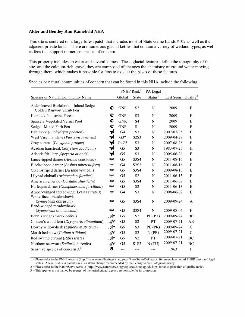
Alder and Bentley Run Kamefield NHA This site is centered on a large forest patch that includes most of State Game Lands #102 as well as the adjacent private lands. There are numerous glacial kettles that contain a variety of wetland types, as well as fens that support numerous species of concern. This property includes an esker and several kames. These glacial features define the topography of the site, and the calcium-rich gravel they are composed of changes the chemistry of ground water moving through them, which makes it possible for fens to exist at the bases of these features. Species or natural communities of concern that can be found in this NHA include the following:
PNHP Rank1 PA Legal Species or Natural Community Name Global State Status1 Last Seen Quality2 Alder-leaved Buckthorn – Inland Sedge – Golden Ragwort Shrub Fen C GNR S2 N 2009 E
Hemlock Palustrine Forest C GNR S3 N 2009 E Sparsely Vegetated Vernal Pool C GNR S4 N 2009 E Sedge - Mixed Forb Fen C GNR S1 N 2009 E Baltimore (Euphydryas phaeton) G4 S3 N 2007-07-05 E West Virginia white (Pieris virginiensis) G3? S2S3 N 2009-04-29 E Gray comma (Polygonia progne) G4G5 S3 N 2007-08-28 E Acadian hairstreak (Satyrium acadicum) G5 S3 N 1983-07-25 H Atlantis fritillary (Speyeria atlantis) G5 S3 N 2005-06-26 E Lance-tipped darner (Aeshna constricta) G5 S3S4 N 2011-08-16 E Black-tipped darner (Aeshna tuberculifera) G4 S2S3 N 2011-08-16 E Green-striped darner (Aeshna verticalis) G5 S3S4 N 2009-08-13 E Lilypad clubtail (Arigomphus furcifer) G5 S2 N 2011-06-13 E American emerald (Cordulia shurtleffii) G5 S3S4 N 2011-06-08 E Harlequin darner (Gomphaeschna furcillata) G5 S2 N 2011-06-13 E Amber-winged spreadwing (Lestes eurinus) G4 S3 N 2008-06-02 E White-faced meadowhawk (Sympetrum obtrusum) G5 S3S4 N 2009-09-24 A Band-winged meadowhawk (Sympetrum semicinctum) G5 S3S4 N 2009-08-05 E Bebb’s sedge (Carex bebbii) G5 S2 PE (PT) 2009-09-24 BC Clinton’s wood fern (Dryopteris clintoniana) G5 S2 PT 2009-07-21 AB Downy willow-herb (Epilobium strictum) G5 S3 PE (PR) 2009-09-24 C Marsh bedstraw (Galium trifidum) G5 S2 N (PR) 2009-07-21 C Red swamp currant (Ribes triste) G5 S2 PT 2009-07-21 BC Northern starwort (Stellaria borealis) G5 S1S2 N (TU) 2009-07-21 BC Sensitive species of concern A3 S --- --- --- 1963 H 1 = Please refer to the PNHP website (http://www.naturalheritage.state.pa.us/RankStatusDef.aspx) for an explanation of PNHP ranks and legal
status. A legal status in parentheses is a status change recommended by the Pennsylvania Biological Survey. 2 = Please refer to the NatureServe website (http://www.natureserve.org/explorer/eorankguide.htm) for an explanation of quality ranks. 3 = This species is not named by request of the jurisdictional agency responsible for its protection.
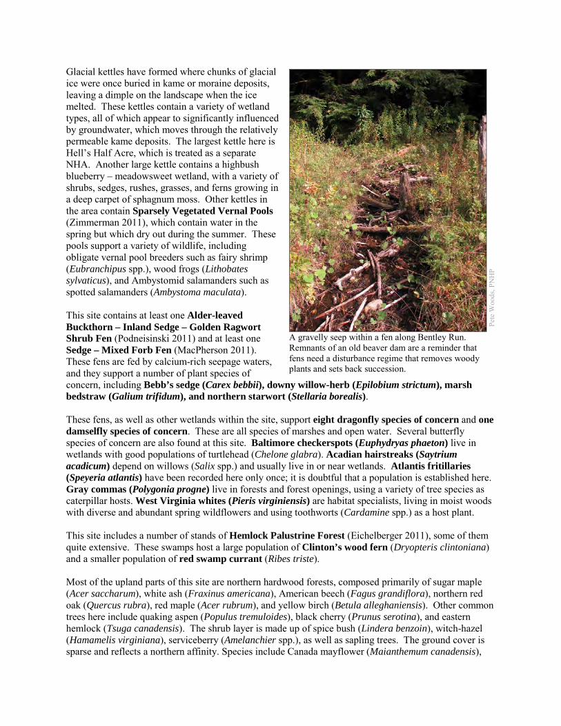
Glacial kettles have formed where chunks of glacial ice were once buried in kame or moraine deposits, leaving a dimple on the landscape when the ice melted. These kettles contain a variety of wetland types, all of which appear to significantly influenced by groundwater, which moves through the relatively permeable kame deposits. The largest kettle here is Hell’s Half Acre, which is treated as a separate NHA. Another large kettle contains a highbush blueberry – meadowsweet wetland, with a variety of shrubs, sedges, rushes, grasses, and ferns growing in a deep carpet of sphagnum moss. Other kettles in the area contain Sparsely Vegetated Vernal Pools (Zimmerman 2011), which contain water in the spring but which dry out during the summer. These pools support a variety of wildlife, including obligate vernal pool breeders such as fairy shrimp (Eubranchipus spp.), wood frogs (Lithobates sylvaticus), and Ambystomid salamanders such as spotted salamanders (Ambystoma maculata). This site contains at least one Alder-leaved Buckthorn – Inland Sedge – Golden Ragwort Shrub Fen (Podneisinski 2011) and at least one Sedge – Mixed Forb Fen (MacPherson 2011). These fens are fed by calcium-rich seepage waters, and they support a number of plant species of concern, including Bebb’s sedge (Carex bebbii), downy willow-herb (Epilobium strictum), marsh bedstraw (Galium trifidum), and northern starwort (Stellaria borealis). These fens, as well as other wetlands within the site, support eight dragonfly species of concern and one damselfly species of concern. These are all species of marshes and open water. Several butterfly species of concern are also found at this site. Baltimore checkerspots (Euphydryas phaeton) live in wetlands with good populations of turtlehead (Chelone glabra). Acadian hairstreaks (Saytrium acadicum) depend on willows (Salix spp.) and usually live in or near wetlands. Atlantis fritillaries (Speyeria atlantis) have been recorded here only once; it is doubtful that a population is established here. Gray commas (Polygonia progne) live in forests and forest openings, using a variety of tree species as caterpillar hosts. West Virginia whites (Pieris virginiensis) are habitat specialists, living in moist woods with diverse and abundant spring wildflowers and using toothworts (Cardamine spp.) as a host plant. This site includes a number of stands of Hemlock Palustrine Forest (Eichelberger 2011), some of them quite extensive. These swamps host a large population of Clinton’s wood fern (Dryopteris clintoniana) and a smaller population of red swamp currant (Ribes triste). Most of the upland parts of this site are northern hardwood forests, composed primarily of sugar maple (Acer saccharum), white ash (Fraxinus americana), American beech (Fagus grandiflora), northern red oak (Quercus rubra), red maple (Acer rubrum), and yellow birch (Betula alleghaniensis). Other common trees here include quaking aspen (Populus tremuloides), black cherry (Prunus serotina), and eastern hemlock (Tsuga canadensis). The shrub layer is made up of spice bush (Lindera benzoin), witch-hazel (Hamamelis virginiana), serviceberry (Amelanchier spp.), as well as sapling trees. The ground cover is sparse and reflects a northern affinity. Species include Canada mayflower (Maianthemum canadensis),
Pete
Woo
ds, P
NH
P
A gravelly seep within a fen along Bentley Run. Remnants of an old beaver dam are a reminder that fens need a disturbance regime that removes woody plants and sets back succession.
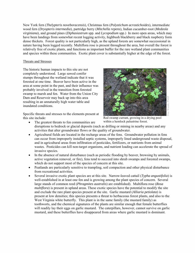
New York fern (Thelypteris noveboracensis), Christmas fern (Polystichum acrostichoides), intermediate wood fern (Dryopteris intermedia), partridge berry (Mitchella repens), Indian cucumber-root (Medeola virginiana), and ground pines (Diphasiastrum spp. and Lycopodium spp.) In more open areas, which may have been landings from somewhat recent logging activity, highbush blackberry and black raspberry form dense thickets. Forest quality is not particularly high, as the upland forests are somewhat successional in nature having been logged recently. Multiflora rose is present throughout the area, but overall the forest is relatively free of exotic plants, and functions as important buffer for the rare wetland plant communities and species within these communities. Exotic plant cover is substantially higher at the edge of the forest. Threats and Stresses The historic human impacts to this site are not completely understood. Large sawed conifer stumps throughout the wetland indicate that it was forested at one time. Beaver have been active in the area at some point in the past, and their influence was probably involved in the transition from forested swamp to marsh and fen. Water from the Union City Dam and Reservoir may back up into this area resulting in an unnaturally high water table and inundated conditions. Specific threats and stresses to the elements present at this site include:
• The greatest threats to fen communities are disruptions to bedrock or glacial deposits (such as drilling or mining in nearby areas) and any activities that alter groundwater flows or the quality of groundwater.
• Agricultural fields are located in the recharge areas of the fens. Groundwater pollution in fens can occur from improperly installed septic systems, improperly lined underground waste disposal, and in agricultural areas from infiltration of pesticides, fertilizers, or nutrients from animal wastes. Pesticides can kill non-target organisms, and nutrient loading can accelerate the spread of invasive species.
• In the absence of natural disturbance (such as periodic flooding by beaver, browsing by animals, active vegetation removal, or fire), fens tend to succeed into shrub swamps and forested swamps, which do not support most of the species of concern at this site.
• Peatlands are particularly sensitive to trampling, soil compaction and other physical disturbance from recreational activities.
• Several invasive exotic plant species are at this site. Narrow-leaved cattail (Typha angustifolia) is well-established in at least one fen and is growing among the plant species of concern. Several large stands of common reed (Phragmites australis) are established). Multiflora rose (Rosa multiflora) is present in upland areas. These exotic species have the potential to modify the site and exclude the rare plant species present at the site. Garlic mustard (Alliaria petiolata) is present at low densities; this species presents a threat to herbaceous forest plants, and also to the West Virginia white butterfly. This plant is in the same family (the mustard family) as toothworts, and the chemical signatures of the plants are similar enough that female butterflies will readily lay their eggs on garlic mustard. The caterpillars, however, cannot survive on garlic mustard, and these butterflies have disappeared from areas where garlic mustard is dominant.
Pete
Woo
ds, P
NH
P
Red swamp currant, growing in a drying pool within a hemlock palustrine forest.
• Dragonflies and damselflies rely on good water quality, although the tolerances of individual species to different types of pollution are not well-understood. Erosion, whether caused by deforestation, poor agricultural practices, or the destruction of riparian zones, leads to increased silt loads and shifting, unstable stream bottoms. Siltation and contaminants such as heavy metals, pesticides, and abandoned mine drainage are potential threats to this species. All of Bentley Run is classified by DEP as Impaired, because of siltation and anoxic conditions.
• Pesticide use is a potential threat to the numerous insect species of concern at this site. • Fragmentation of the forest is a serious threat to the West Virginia white, because these butterflies
do not cross wide roads or other non-forested areas. The result is that populations are becoming isolated, and if a population is extirpated the chances are low that remaining populations will be able to recolonize the habitat.
• High densities of white-tailed deer pose another threat to West Virginia whites, because deer browsing greatly reduces the abundance of many of the wildflowers that are crucial nectar sources for the butterflies. Although their flight period is short, adults rely on several successive waves of spring wildflowers to produce a steady supply of nectar. A reduction in abundance or diversity of spring wildflowers can leave these butterflies without a source of food. Deer browsing is also a serious threat to plant species of concern located on adjacent NHAs.
• The hemlock woolly adelgid (Adelges tsugae), native to Asia, is a sap-feeding insect that attacks eastern hemlock (Tsuga canadensis). As of 2011, the hemlock woolly adelgid is still several counties away to the east and south, but it is expected to arrive in coming years, with devastating effects on hemlock populations. Infestations are followed by high levels of hemlock mortality, which opens up the forest canopy and drastically alters the forest habitat. In areas that are currently hemlock palustrine forest, the loss of the deep shade and cool microclimate could exclude species such as Clinton’s wood fern and red swamp currant.
• Because the amphibians that breed in vernal pools spend the rest of year in upland forest up to 1000 feet (300 meters) from the pools, deforestation within this distance reduces habitat for those animals (Semlitsch and Bodie 2003). Deforestation within a few hundred feet of a pool can affect hydrology of pools; reduced forest cover in the immediate vicinity of a pool can increase evaporation, and reduce the amount of time the pool holds water. Some of the pools here are adjacent to agricultural fields, and at least one of them has been bisected by a road.
Conservation Recommendations The north-central part of this site is contained within State Game Land #102, and is largely protected from development. The south-central portion is in industrial timber production, while the eastern and western edges of the Core Habitat are owned by a number of private landowners. The following steps are recommended to ensure the persistence of these species at this site:
• Drilling, mining, or other disruptions to bedrock or glacial deposits should not be undertaken within half a mile of a seepage wetland without a thorough understanding of bedrock layers and groundwater flows. Groundwater flow patterns do not always mirror surface watersheds, and in some cases aquifers may be contiguous over large areas.
• A natural buffer around the wetlands should be maintained in order to minimize nutrient runoff, pollution, and sedimentation. Pesticide use should be avoided within the Surrounding Landscape.
• Remove invasive plant species. The fen and any other early-successional habitats are particularly susceptible to weedy plant invasion and will require a sustained and targeted approach to invasive management. Control of invasive species in the area will require extensive and continual effort. Focus initial control efforts on selected areas surrounding species of concern.
o Invasive species management needs to be coordinated by individuals familiar with the rare species as well as the invasive species present.
o Continual invasive species monitoring and control will be necessary. o The presence of invasive species in fens often is an indicator of nutrient pollution,
especially if the invasive species are limited to discreet portions of the fen. In these instances, potential sources of surface and groundwater pollution should be identified and mitigated.
• The fen may require periodic disturbance such as cutting, burning, or grazing to maintain the open canopy which is indicative of this community and the rare species that occupy the community.
• The effect of beaver on fens is uncertain and needs more research. On one hand, allowing beaver to persist in the area may help fen habitat by setting back succession; over time beaver ponds are abandoned and the resulting beaver meadow may become a fen until conditions are again suitable for beaver. On the other hand, the seedbank of fen species may not remain viable until conditions are good for growth, and the accumulation of nutrient-laden sediments may encourage weedy species.
• Avoid creating permanent impoundments. • Reduction of deer density in the area would minimize damage to several plant species of concern,
and allow the persistence of the West Virginia white. If this possibility is not feasible, deer exclosures could protect plants in smaller areas.
• Conserve and expand the forested riparian buffers of all streams and wetlands. Conserve at least a 100 meter (328 feet) buffer of native woody vegetation where it exists along the waterways and establish at least a 100 foot buffer where it is lacking to help reduce erosion, sedimentation, and pollution. Additionally, best management practices (BMPs) that focus on limiting the introduction of non-point sources of pollution into surface and groundwater should be applied to the surrounding area.
• As of 2012, available treatments for hemlock woolly adelgid are not economically feasible at a scale suitable for large natural areas. At a smaller scale, injection of insecticides into tree trunks or into the soil around a tree can control adelgids for up to several years at a time, although there may be unintended effects on other species. Continued applications of horticultural oil or insecticidal soap can also control hemlock woolly adelgids. Biological controls are being researched, although they have so far had limited success at keeping adelgid populations in check (DCNR 2012).
• A natural buffer around the wetland should be maintained in order to minimize nutrient runoff, pollution, and sedimentation. Protecting vernal pools and the surrounding 1000 feet of upland forest is critical for protection of water quality, amphibian breeding, and terrestrial habitat for adult and juvenile amphibians.
Location and Additional Information
Municipalities: Amity Township and Union Township USGS quads: Union City 1993 Erie CNHI reference: Alder Run, Bentley Run BDA; Union Township BDA Associated NHAs: Union City Reservoir NHA, Boleratz Fen NHA, Hell’s Half Acre NHA, Kirik Fen NHA, Union City Hatchery Fen NHA Overlapping Protected Lands: State Game Land #102 PNHP Significance Rank: Global
References Eichelberger, B. 2011. Pennsylvania Natural Heritage Program. Hemlock Palustrine Forest Factsheet. Available from:
http://www.naturalheritage.state.pa.us/Community.aspx?=16028 Date Accessed: October 15, 2012 McPherson, J. 2011. Pennsylvania Natural Heritage Program. Sedge – Mixed Forb Fen Factsheet. Available from:
http://www.naturalheritage.state.pa.us/Community.aspx?=16009 Date Accessed: October 15, 2012 Podniesinski 2011. Pennsylvania Natural Heritage Program. Alder-leaved Buckthorn – Inland Sedge – Golden Ragwort Shrub
Fen Factsheet. Available from: http://www.naturalheritage.state.pa.us/Community.aspx?=30002 Date Accessed: August 01, 2012
Semlitsch, R.D. and J.R. Bodie. 2003. Biological Criteria for Buffer Zones around Wetlands and Riparian Habitats for Amphibians and Reptiles. Conservation Biology, 17: 1219-1228.
Zimmerman, E. 2011. Pennsylvania Natural Heritage Program. Sparsely Vegetated Vernal Pool Community Factsheet. Available from: http://www.naturalheritage.state.pa.us/Community.aspx?=30027 Date Accessed: October 15, 2012
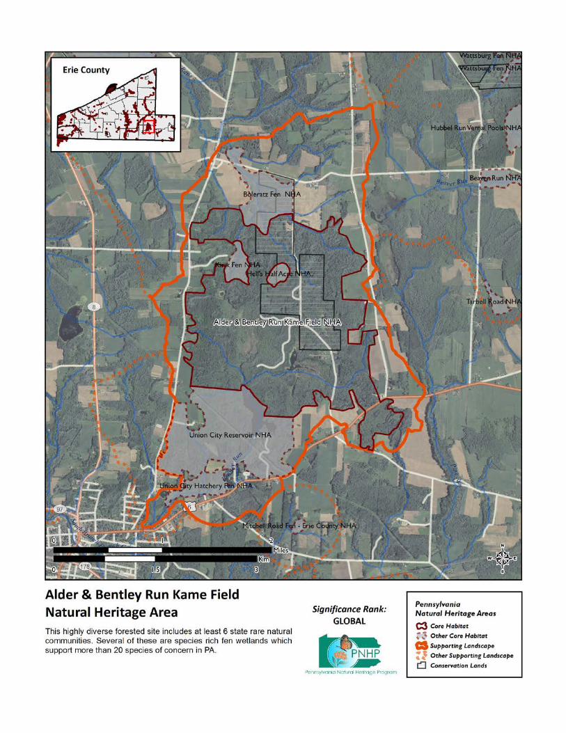
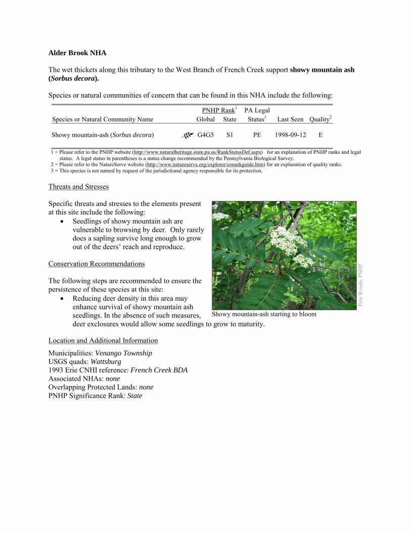
Alder Brook NHA The wet thickets along this tributary to the West Branch of French Creek support showy mountain ash (Sorbus decora). Species or natural communities of concern that can be found in this NHA include the following:
PNHP Rank1 PA Legal Species or Natural Community Name Global State Status1 Last Seen Quality2 Showy mountain-ash (Sorbus decora) G4G5 S1 PE 1998-09-12 E 1 = Please refer to the PNHP website (http://www.naturalheritage.state.pa.us/RankStatusDef.aspx) for an explanation of PNHP ranks and legal
status. A legal status in parentheses is a status change recommended by the Pennsylvania Biological Survey. 2 = Please refer to the NatureServe website (http://www.natureserve.org/explorer/eorankguide.htm) for an explanation of quality ranks. 3 = This species is not named by request of the jurisdictional agency responsible for its protection.
Threats and Stresses Specific threats and stresses to the elements present at this site include the following:
• Seedlings of showy mountain ash are vulnerable to browsing by deer. Only rarely does a sapling survive long enough to grow out of the deers’ reach and reproduce.
Conservation Recommendations The following steps are recommended to ensure the persistence of these species at this site:
• Reducing deer density in this area may enhance survival of showy mountain ash seedlings. In the absence of such measures, deer exclosures would allow some seedlings to grow to maturity.
Location and Additional Information
Municipalities: Venango Township USGS quads: Wattsburg 1993 Erie CNHI reference: French Creek BDA Associated NHAs: none Overlapping Protected Lands: none PNHP Significance Rank: State
Pete
Woo
ds, P
NH
P
Showy mountain-ash starting to bloom
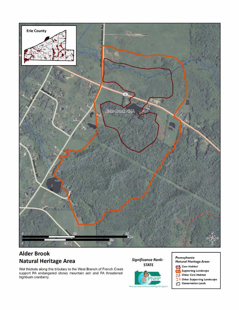
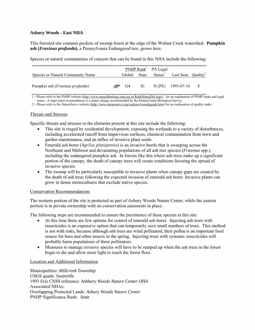
Asbury Woods - East NHA This forested site contains pockets of swamp forest at the edge of the Walnut Creek watershed. Pumpkin ash (Fraxinus profunda), a Pennsylvania Endangered tree, grows here. Species or natural communities of concern that can be found in this NHA include the following:
PNHP Rank1 PA Legal Species or Natural Community Name Global State Status1 Last Seen Quality2 Pumpkin ash (Fraxinus profunda) G4 S1 N (PE) 1993-07-16 E 1 = Please refer to the PNHP website (http://www.naturalheritage.state.pa.us/RankStatusDef.aspx) for an explanation of PNHP ranks and legal
status. A legal status in parentheses is a status change recommended by the Pennsylvania Biological Survey. 2 = Please refer to the NatureServe website (http://www.natureserve.org/explorer/eorankguide.htm) for an explanation of quality ranks.
Threats and Stresses Specific threats and stresses to the elements present at this site include the following:
• This site is ringed by residential development, exposing the wetlands to a variety of disturbances, including accelerated runoff from impervious surfaces, chemical contamination from lawn and garden maintenance, and an influx of invasive plant seeds.
• Emerald ash borer (Agrilus planipennis) is an invasive beetle that is sweeping across the Northeast and Midwest and devastating populations of all ash tree species (Fraxinus spp.), including the endangered pumpkin ash. In forests like this where ash trees make up a significant portion of the canopy, the death of canopy trees will create conditions favoring the spread of invasive species.
• The swamp will be particularly susceptible to invasive plants when canopy gaps are created by the death of ash trees following the expected invasion of emerald ash borer. Invasive plants can grow in dense monocultures that exclude native species.
Conservation Recommendations The western portion of the site is protected as part of Asbury Woods Nature Center, while the eastern portion is in private ownership with no conservation easements in place. The following steps are recommended to ensure the persistence of these species at this site:
• At this time there are few options for control of emerald ash borer. Injecting ash trees with insecticides is an expensive option that can temporarily save small numbers of trees. This method is not with risks, because although ash trees are wind pollinated, their pollen is an important food source for bees and other insects in the spring. Injecting trees with systemic insecticides will probably harm populations of these pollinators.
• Measures to manage invasive species will have to be ramped up when the ash trees in the forest begin to die and allow more light to reach the forest floor.
Location and Additional Information Municipalities: Millcreek Township USGS quads: Swanville 1993 Erie CNHI reference: Ashbury Woods Nature Center OHA Associated NHAs: Overlapping Protected Lands: Asbury Woods Nature Center PNHP Significance Rank: State
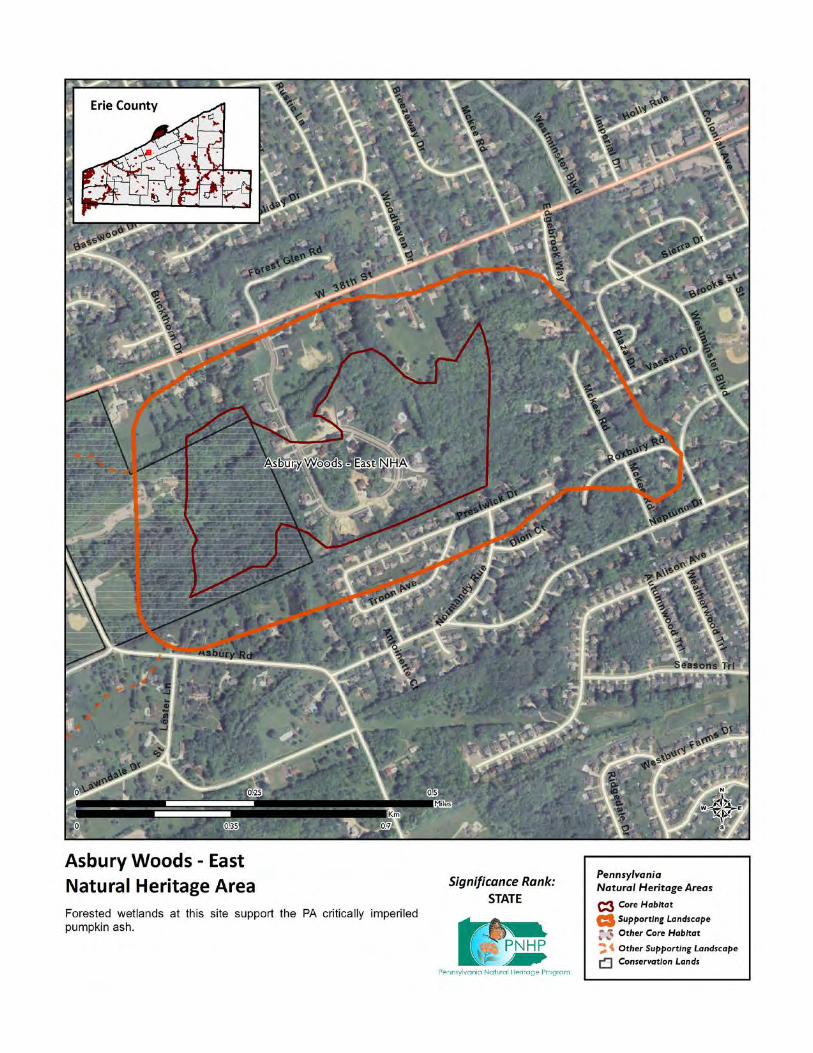
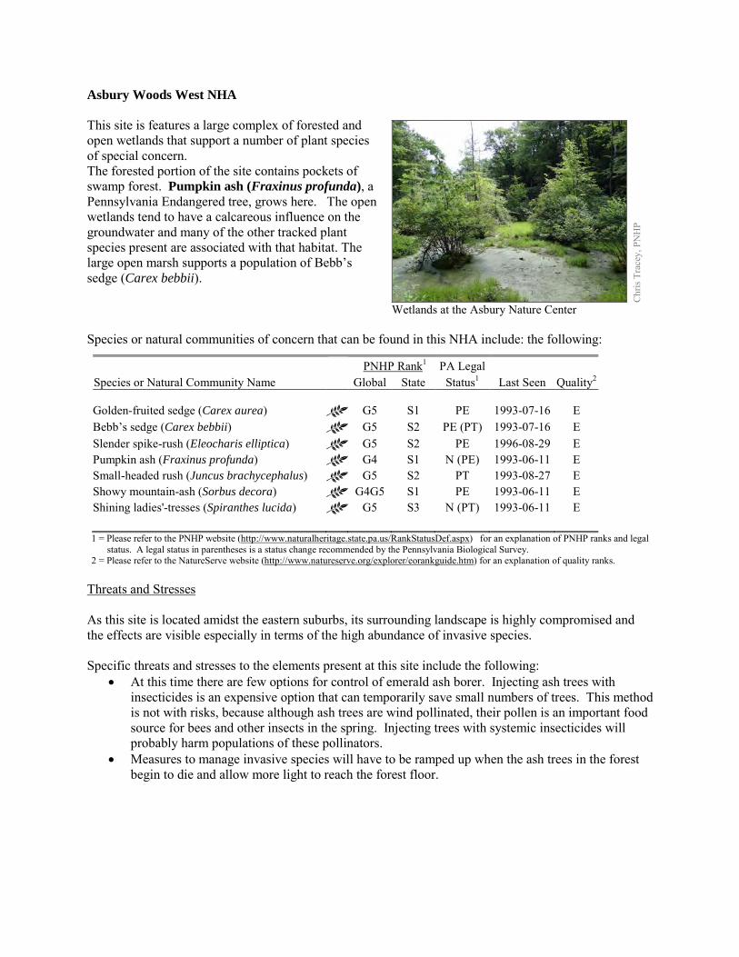
Asbury Woods West NHA This site is features a large complex of forested and open wetlands that support a number of plant species of special concern. The forested portion of the site contains pockets of swamp forest. Pumpkin ash (Fraxinus profunda), a Pennsylvania Endangered tree, grows here. The open wetlands tend to have a calcareous influence on the groundwater and many of the other tracked plant species present are associated with that habitat. The large open marsh supports a population of Bebb’s sedge (Carex bebbii). Species or natural communities of concern that can be found in this NHA include: the following:
PNHP Rank1 PA Legal Species or Natural Community Name Global State Status1 Last Seen Quality2 Golden-fruited sedge (Carex aurea) G5 S1 PE 1993-07-16 E Bebb’s sedge (Carex bebbii) G5 S2 PE (PT) 1993-07-16 E Slender spike-rush (Eleocharis elliptica) G5 S2 PE 1996-08-29 E Pumpkin ash (Fraxinus profunda) G4 S1 N (PE) 1993-06-11 E Small-headed rush (Juncus brachycephalus) G5 S2 PT 1993-08-27 E Showy mountain-ash (Sorbus decora) G4G5 S1 PE 1993-06-11 E Shining ladies'-tresses (Spiranthes lucida) G5 S3 N (PT) 1993-06-11 E 1 = Please refer to the PNHP website (http://www.naturalheritage.state.pa.us/RankStatusDef.aspx) for an explanation of PNHP ranks and legal
status. A legal status in parentheses is a status change recommended by the Pennsylvania Biological Survey. 2 = Please refer to the NatureServe website (http://www.natureserve.org/explorer/eorankguide.htm) for an explanation of quality ranks.
Threats and Stresses As this site is located amidst the eastern suburbs, its surrounding landscape is highly compromised and the effects are visible especially in terms of the high abundance of invasive species. Specific threats and stresses to the elements present at this site include the following:
• At this time there are few options for control of emerald ash borer. Injecting ash trees with insecticides is an expensive option that can temporarily save small numbers of trees. This method is not with risks, because although ash trees are wind pollinated, their pollen is an important food source for bees and other insects in the spring. Injecting trees with systemic insecticides will probably harm populations of these pollinators.
• Measures to manage invasive species will have to be ramped up when the ash trees in the forest begin to die and allow more light to reach the forest floor.
Chr
is Tr
acey
, PN
HP
Wetlands at the Asbury Nature Center
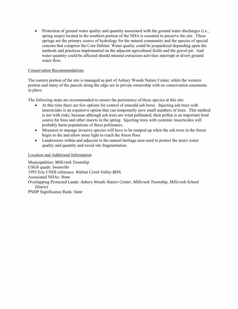
• Protection of ground water quality and quantity associated with the ground water discharges (i.e., spring seeps) located in the southern portion of the NHA is essential to preserve the site. These springs are the primary source of hydrology for the natural community and the species of special concern that comprise the Core Habitat. Water quality could be jeopardized depending upon the methods and practices implemented on the adjacent agricultural fields and the gravel pit. And water quantity could be affected should mineral extraction activities interrupt or divert ground water flow.
Conservation Recommendations The eastern portion of the site is managed as part of Asbury Woods Nature Center, while the western portion and many of the parcels along the edge are in private ownership with no conservation easements in place. The following steps are recommended to ensure the persistence of these species at this site:
• At this time there are few options for control of emerald ash borer. Injecting ash trees with insecticides is an expensive option that can temporarily save small numbers of trees. This method is not with risks, because although ash trees are wind pollinated, their pollen is an important food source for bees and other insects in the spring. Injecting trees with systemic insecticides will probably harm populations of these pollinators.
• Measures to manage invasive species will have to be ramped up when the ash trees in the forest begin to die and allow more light to reach the forest floor.
• Landowners within and adjacent to the natural heritage area need to protect the area's water quality and quantity and avoid site fragmentation.
Location and Additional Information
Municipalities: Millcreek Township USGS quads: Swanville 1993 Erie CNHI reference: Walnut Creek Valley BDA Associated NHAs: None Overlapping Protected Lands: Asbury Woods Nature Center, Millcreek Township, Millcreek School
District PNHP Significance Rank: State
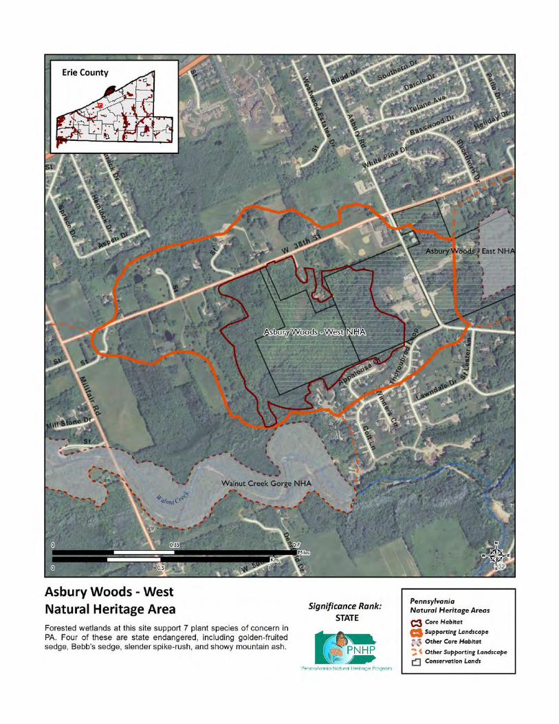
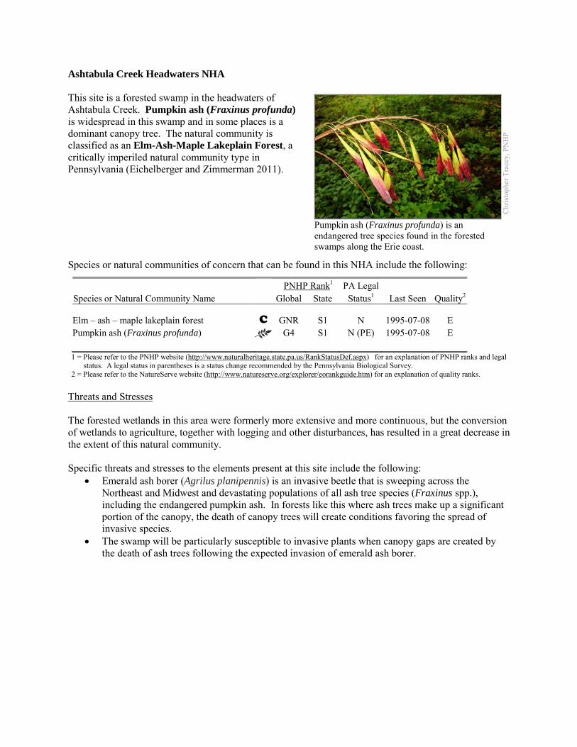
Ashtabula Creek Headwaters NHA This site is a forested swamp in the headwaters of Ashtabula Creek. Pumpkin ash (Fraxinus profunda) is widespread in this swamp and in some places is a dominant canopy tree. The natural community is classified as an Elm-Ash-Maple Lakeplain Forest, a critically imperiled natural community type in Pennsylvania (Eichelberger and Zimmerman 2011). Species or natural communities of concern that can be found in this NHA include the following:
PNHP Rank1 PA Legal Species or Natural Community Name Global State Status1 Last Seen Quality2 Elm – ash – maple lakeplain forest C GNR S1 N 1995-07-08 E Pumpkin ash (Fraxinus profunda) G4 S1 N (PE) 1995-07-08 E 1 = Please refer to the PNHP website (http://www.naturalheritage.state.pa.us/RankStatusDef.aspx) for an explanation of PNHP ranks and legal
status. A legal status in parentheses is a status change recommended by the Pennsylvania Biological Survey. 2 = Please refer to the NatureServe website (http://www.natureserve.org/explorer/eorankguide.htm) for an explanation of quality ranks.
Threats and Stresses The forested wetlands in this area were formerly more extensive and more continuous, but the conversion of wetlands to agriculture, together with logging and other disturbances, has resulted in a great decrease in the extent of this natural community. Specific threats and stresses to the elements present at this site include the following:
• Emerald ash borer (Agrilus planipennis) is an invasive beetle that is sweeping across the Northeast and Midwest and devastating populations of all ash tree species (Fraxinus spp.), including the endangered pumpkin ash. In forests like this where ash trees make up a significant portion of the canopy, the death of canopy trees will create conditions favoring the spread of invasive species.
• The swamp will be particularly susceptible to invasive plants when canopy gaps are created by the death of ash trees following the expected invasion of emerald ash borer.
Chr
istop
her T
race
y, P
NH
P
Pumpkin ash (Fraxinus profunda) is an endangered tree species found in the forested swamps along the Erie coast.
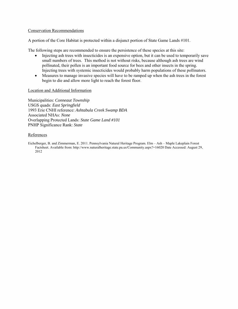
Conservation Recommendations A portion of the Core Habitat is protected within a disjunct portion of State Game Lands #101. The following steps are recommended to ensure the persistence of these species at this site:
• Injecting ash trees with insecticides is an expensive option, but it can be used to temporarily save small numbers of trees. This method is not without risks, because although ash trees are wind pollinated, their pollen is an important food source for bees and other insects in the spring. Injecting trees with systemic insecticides would probably harm populations of these pollinators.
• Measures to manage invasive species will have to be ramped up when the ash trees in the forest begin to die and allow more light to reach the forest floor.
Location and Additional Information Municipalities: Conneaut Township USGS quads: East Springfield 1993 Erie CNHI reference: Ashtabula Creek Swamp BDA Associated NHAs: None Overlapping Protected Lands: State Game Land #101 PNHP Significance Rank: State References Eichelberger, B. and Zimmerman, E. 2011. Pennsylvania Natural Heritage Program. Elm – Ash – Maple Lakeplain Forest
Factsheet. Available from: http://www.naturalheritage.state.pa.us/Community.aspx?=16020 Date Accessed: August 29, 2012
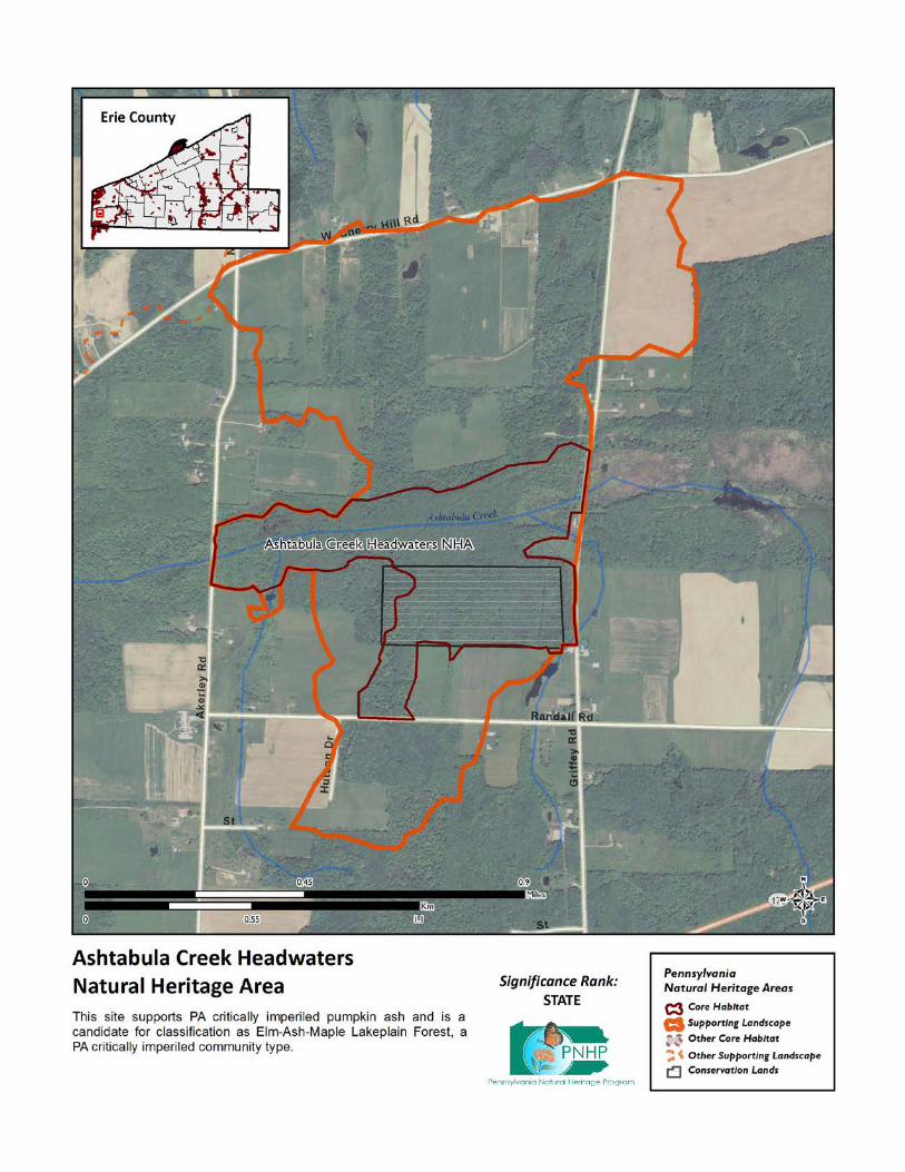
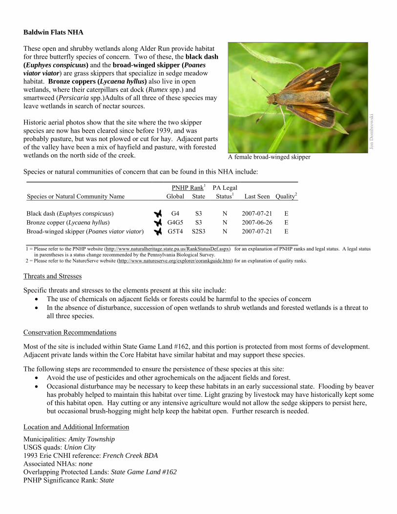
Baldwin Flats NHA These open and shrubby wetlands along Alder Run provide habitat for three butterfly species of concern. Two of these, the black dash (Euphyes conspicuus) and the broad-winged skipper (Poanes viator viator) are grass skippers that specialize in sedge meadow habitat. Bronze coppers (Lycaena hyllus) also live in open wetlands, where their caterpillars eat dock (Rumex spp.) and smartweed (Persicaria spp.)Adults of all three of these species may leave wetlands in search of nectar sources. Historic aerial photos show that the site where the two skipper species are now has been cleared since before 1939, and was probably pasture, but was not plowed or cut for hay. Adjacent parts of the valley have been a mix of hayfield and pasture, with forested wetlands on the north side of the creek. Species or natural communities of concern that can be found in this NHA include:
PNHP Rank1 PA Legal Species or Natural Community Name Global State Status1 Last Seen Quality2 Black dash (Euphyes conspicuus) G4 S3 N 2007-07-21 E Bronze copper (Lycaena hyllus) G4G5 S3 N 2007-06-26 E Broad-winged skipper (Poanes viator viator) G5T4 S2S3 N 2007-07-21 E 1 = Please refer to the PNHP website (http://www.naturalheritage.state.pa.us/RankStatusDef.aspx) for an explanation of PNHP ranks and legal status. A legal status
in parentheses is a status change recommended by the Pennsylvania Biological Survey. 2 = Please refer to the NatureServe website (http://www.natureserve.org/explorer/eorankguide.htm) for an explanation of quality ranks.
Threats and Stresses Specific threats and stresses to the elements present at this site include:
• The use of chemicals on adjacent fields or forests could be harmful to the species of concern • In the absence of disturbance, succession of open wetlands to shrub wetlands and forested wetlands is a threat to
all three species.
Conservation Recommendations Most of the site is included within State Game Land #162, and this portion is protected from most forms of development. Adjacent private lands within the Core Habitat have similar habitat and may support these species. The following steps are recommended to ensure the persistence of these species at this site:
• Avoid the use of pesticides and other agrochemicals on the adjacent fields and forest. • Occasional disturbance may be necessary to keep these habitats in an early successional state. Flooding by beaver
has probably helped to maintain this habitat over time. Light grazing by livestock may have historically kept some of this habitat open. Hay cutting or any intensive agriculture would not allow the sedge skippers to persist here, but occasional brush-hogging might help keep the habitat open. Further research is needed.
Location and Additional Information
Municipalities: Amity Township USGS quads: Union City 1993 Erie CNHI reference: French Creek BDA Associated NHAs: none Overlapping Protected Lands: State Game Land #162 PNHP Significance Rank: State
Jon
Dom
brow
ski
A female broad-winged skipper
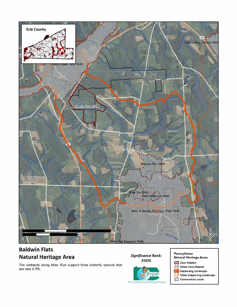
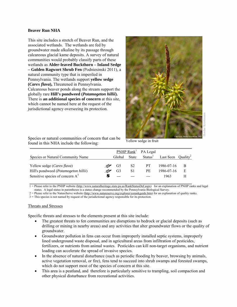
Beaver Run NHA This site includes a stretch of Beaver Run, and the associated wetlands. The wetlands are fed by groundwater made alkaline by its passage through calcareous glacial kame deposits. A survey of natural communities would probably classify parts of these wetlands as Alder-leaved Buckthorn – Inland Sedge – Golden Ragwort Shrub Fen (Podniesinski 2011), a natural community type that is imperiled in Pennsylvania. The wetlands support yellow sedge (Carex flava), Threatened in Pennsylvania. Calcareous beaver ponds along the stream support the globally rare Hill’s pondweed (Potamogeton hillii). There is an additional species of concern at this site, which cannot be named here at the request of the jurisdictional agency overseeing its protection. Species or natural communities of concern that can be found in this NHA include the following:
PNHP Rank1 PA Legal Species or Natural Community Name Global State Status1 Last Seen Quality2 Yellow sedge (Carex flava) G5 S2 PT 1986-07-16 B Hill's pondweed (Potamogeton hillii) G3 S1 PE 1986-07-16 E Sensitive species of concern A3 S --- --- --- 1963 H 1 = Please refer to the PNHP website (http://www.naturalheritage.state.pa.us/RankStatusDef.aspx) for an explanation of PNHP ranks and legal
status. A legal status in parentheses is a status change recommended by the Pennsylvania Biological Survey. 2 = Please refer to the NatureServe website (http://www.natureserve.org/explorer/eorankguide.htm) for an explanation of quality ranks. 3 = This species is not named by request of the jurisdictional agency responsible for its protection.
Threats and Stresses Specific threats and stresses to the elements present at this site include:
• The greatest threats to fen communities are disruptions to bedrock or glacial deposits (such as drilling or mining in nearby areas) and any activities that alter groundwater flows or the quality of groundwater.
• Groundwater pollution in fens can occur from improperly installed septic systems, improperly lined underground waste disposal, and in agricultural areas from infiltration of pesticides, fertilizers, or nutrients from animal wastes. Pesticides can kill non-target organisms, and nutrient loading can accelerate the spread of invasive species.
• In the absence of natural disturbance (such as periodic flooding by beaver, browsing by animals, active vegetation removal, or fire), fens tend to succeed into shrub swamps and forested swamps, which do not support most of the species of concern at this site.
• This area is a peatland, and therefore is particularly sensitive to trampling, soil compaction and other physical disturbance from recreational activities.
Hor
dur K
ristin
sson
Yellow sedge in fruit
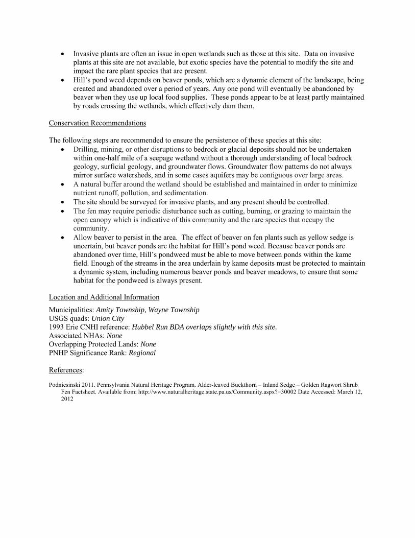
• Invasive plants are often an issue in open wetlands such as those at this site. Data on invasive plants at this site are not available, but exotic species have the potential to modify the site and impact the rare plant species that are present.
• Hill’s pond weed depends on beaver ponds, which are a dynamic element of the landscape, being created and abandoned over a period of years. Any one pond will eventually be abandoned by beaver when they use up local food supplies. These ponds appear to be at least partly maintained by roads crossing the wetlands, which effectively dam them.
Conservation Recommendations The following steps are recommended to ensure the persistence of these species at this site:
• Drilling, mining, or other disruptions to bedrock or glacial deposits should not be undertaken within one-half mile of a seepage wetland without a thorough understanding of local bedrock geology, surficial geology, and groundwater flows. Groundwater flow patterns do not always mirror surface watersheds, and in some cases aquifers may be contiguous over large areas.
• A natural buffer around the wetland should be established and maintained in order to minimize nutrient runoff, pollution, and sedimentation.
• The site should be surveyed for invasive plants, and any present should be controlled. • The fen may require periodic disturbance such as cutting, burning, or grazing to maintain the
open canopy which is indicative of this community and the rare species that occupy the community.
• Allow beaver to persist in the area. The effect of beaver on fen plants such as yellow sedge is uncertain, but beaver ponds are the habitat for Hill’s pond weed. Because beaver ponds are abandoned over time, Hill’s pondweed must be able to move between ponds within the kame field. Enough of the streams in the area underlain by kame deposits must be protected to maintain a dynamic system, including numerous beaver ponds and beaver meadows, to ensure that some habitat for the pondweed is always present.
Location and Additional Information
Municipalities: Amity Township, Wayne Township USGS quads: Union City 1993 Erie CNHI reference: Hubbel Run BDA overlaps slightly with this site. Associated NHAs: None Overlapping Protected Lands: None PNHP Significance Rank: Regional References: Podniesinski 2011. Pennsylvania Natural Heritage Program. Alder-leaved Buckthorn – Inland Sedge – Golden Ragwort Shrub
Fen Factsheet. Available from: http://www.naturalheritage.state.pa.us/Community.aspx?=30002 Date Accessed: March 12, 2012
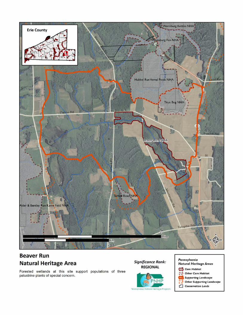
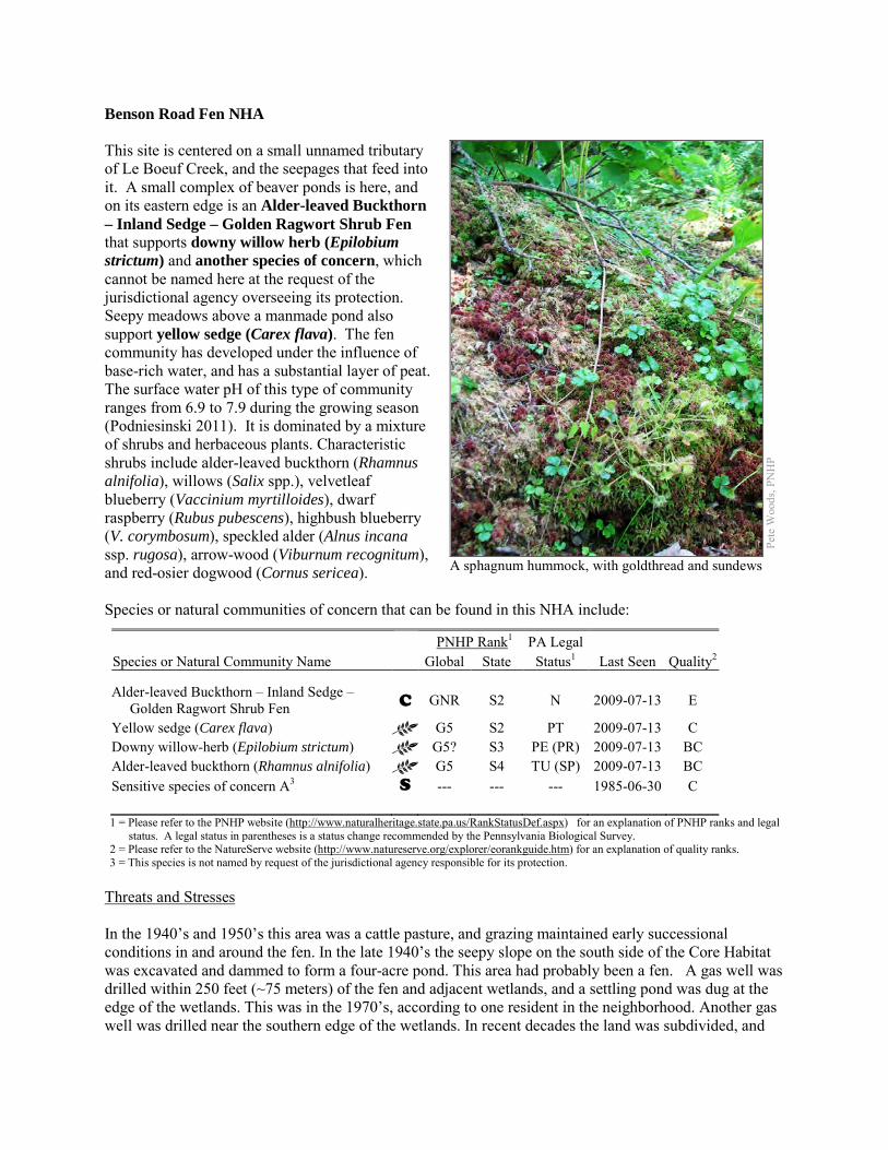
Benson Road Fen NHA This site is centered on a small unnamed tributary of Le Boeuf Creek, and the seepages that feed into it. A small complex of beaver ponds is here, and on its eastern edge is an Alder-leaved Buckthorn – Inland Sedge – Golden Ragwort Shrub Fen that supports downy willow herb (Epilobium strictum) and another species of concern, which cannot be named here at the request of the jurisdictional agency overseeing its protection. Seepy meadows above a manmade pond also support yellow sedge (Carex flava). The fen community has developed under the influence of base-rich water, and has a substantial layer of peat. The surface water pH of this type of community ranges from 6.9 to 7.9 during the growing season (Podniesinski 2011). It is dominated by a mixture of shrubs and herbaceous plants. Characteristic shrubs include alder-leaved buckthorn (Rhamnus alnifolia), willows (Salix spp.), velvetleaf blueberry (Vaccinium myrtilloides), dwarf raspberry (Rubus pubescens), highbush blueberry (V. corymbosum), speckled alder (Alnus incana ssp. rugosa), arrow-wood (Viburnum recognitum), and red-osier dogwood (Cornus sericea). Species or natural communities of concern that can be found in this NHA include:
PNHP Rank1 PA Legal Species or Natural Community Name Global State Status1 Last Seen Quality2 Alder-leaved Buckthorn – Inland Sedge – Golden Ragwort Shrub Fen C GNR S2 N 2009-07-13 E
Yellow sedge (Carex flava) G5 S2 PT 2009-07-13 C Downy willow-herb (Epilobium strictum) G5? S3 PE (PR) 2009-07-13 BC Alder-leaved buckthorn (Rhamnus alnifolia) G5 S4 TU (SP) 2009-07-13 BC Sensitive species of concern A3 S --- --- --- 1985-06-30 C 1 = Please refer to the PNHP website (http://www.naturalheritage.state.pa.us/RankStatusDef.aspx) for an explanation of PNHP ranks and legal
status. A legal status in parentheses is a status change recommended by the Pennsylvania Biological Survey. 2 = Please refer to the NatureServe website (http://www.natureserve.org/explorer/eorankguide.htm) for an explanation of quality ranks. 3 = This species is not named by request of the jurisdictional agency responsible for its protection.
Threats and Stresses In the 1940’s and 1950’s this area was a cattle pasture, and grazing maintained early successional conditions in and around the fen. In the late 1940’s the seepy slope on the south side of the Core Habitat was excavated and dammed to form a four-acre pond. This area had probably been a fen. A gas well was drilled within 250 feet (~75 meters) of the fen and adjacent wetlands, and a settling pond was dug at the edge of the wetlands. This was in the 1970’s, according to one resident in the neighborhood. Another gas well was drilled near the southern edge of the wetlands. In recent decades the land was subdivided, and
Pete
Woo
ds, P
NH
P
A sphagnum hummock, with goldthread and sundews
the land upslope of the fen has been mowed grass. The upslope edge of the fen has been left to grow into a dense stand of tall shrubs and trees, which are unsuitable habitat for the species of concern here. The remaining fen habitat is a narrow strip between a beaver pond on the downslope side, and a dense canopy on the upslope side. Specific threats and stresses to the elements present at this site include:
• The greatest threats to fen communities are disruptions to bedrock or glacial deposits (such as drilling or mining in nearby areas) and any activities that alter groundwater flows or the quality of groundwater.
• The area upslope of the fen is a residential neighborhood, where use of chemicals is a concern. Groundwater pollution in fens can occur from improperly installed septic systems, improperly lined underground waste disposal, and in agricultural areas from infiltration of pesticides, fertilizers, or nutrients from animal wastes. Pesticides can kill non-target organisms, and nutrient loading can accelerate the spread of invasive species.
• In the absence of natural disturbance (such as periodic flooding by beaver, browsing by animals, active vegetation removal, or fire), fens tend to succeed into shrub swamps and forested swamps, which do not support most of the species of concern at this site. One species of concern from this site has not been seen in recent years, and succession is one possible reason.
• Peatlands are particularly sensitive to trampling, soil compaction and other physical disturbance from recreational activities.
• Several invasive exotic plant species are at this site. Several patches of common reed (Phragmites australis) are established in the wetlands surrounding the fen. Small-flowered willow herb (Epilobium parviflorum) is the dominant species in the herbaceous seeps above the pond. Multiflora rose (Rosa multiflora) is present at this site. These exotic species have the potential to severely modify the site and impact the rare plant species present at the site.
Conservation Recommendations This site is entirely on private land and there are no conservation easements in place. The following steps are recommended to ensure the persistence of these species at this site:
• Drilling, mining, or other disruptions to bedrock or glacial deposits should not be undertaken within one-half mile of a seepage wetland without a thorough understanding of local bedrock geology, surficial geology, and groundwater flows. Groundwater flow patterns do not always mirror surface watersheds, and in some cases aquifers may be contiguous over large areas.
• Trails should be sited away from the wetland, or elevated boardwalks employed to prevent peat compaction and other disturbance in the wetland.
• A natural buffer around the wetland should be maintained in order to minimize nutrient runoff, pollution, and sedimentation.
• Remove invasive plant species. The fen and any other early successional habitat created by beaver pond abandonment are particularly susceptible to weedy plant invasion and will require a sustained and targeted approach to invasive management. Control of invasive species in the area will require extensive and continual effort. Focus initial control efforts on selected areas surrounding species of concern.
o Invasive species management needs to be coordinated by individuals familiar with the rare species as well as the invasive species present.
o Continual invasive species monitoring and control will be necessary.
o The presence of invasive species in fens often is an indicator of nutrient pollution, especially if the invasive species are limited to discreet portions of the fen. In these instances, potential sources of surface and groundwater pollution should be identified and mitigated.
• The fen may require periodic disturbance such as cutting, burning, or grazing to maintain the open canopy which is indicative of this community and the rare species that occupy the community. Allow beaver to persist in the area. Beaver flooding will set back succession in the lower parts of the landscape. Over time beaver ponds will be abandoned, and the resulting beaver meadow may become a fen until conditions are again suitable for beaver.
• The effect of beaver on fens is uncertain and needs more research. On one hand, allowing beaver to persist in the area may help fen habitat by setting back succession; over time beaver ponds are abandoned and the resulting beaver meadow may become a fen until conditions are again suitable for beaver. On the other hand, the seedbank of fen species may not remain viable until conditions are good for growth, and the accumulation of nutrient-laden sediments may encourage weedy species. The beaver ponds below the fen are also potential habitat for the globally rare Hill’s pondweed (Potamogeton hillii). Future surveys at this site should target this species.
• Avoid creating permanent impoundments. • Reduce the deer density in the area to minimize damage to several plant species of concern.
Location and Additional Information
Municipalities: Waterford Township USGS quads: Waterford 1993 Erie CNHI reference: French Creek BDA Associated NHAs: None Overlapping Protected Lands: This will be calculated via a spatial join and added later PNHP Significance Rank: State References: Podniesinski 2011. Pennsylvania Natural Heritage Program. Alder-leaved Buckthorn – Inland Sedge – Golden Ragwort Shrub
Fen Factsheet. Available from: http://www.naturalheritage.state.pa.us/Community.aspx?=30002 Date Accessed: September 11, 2012
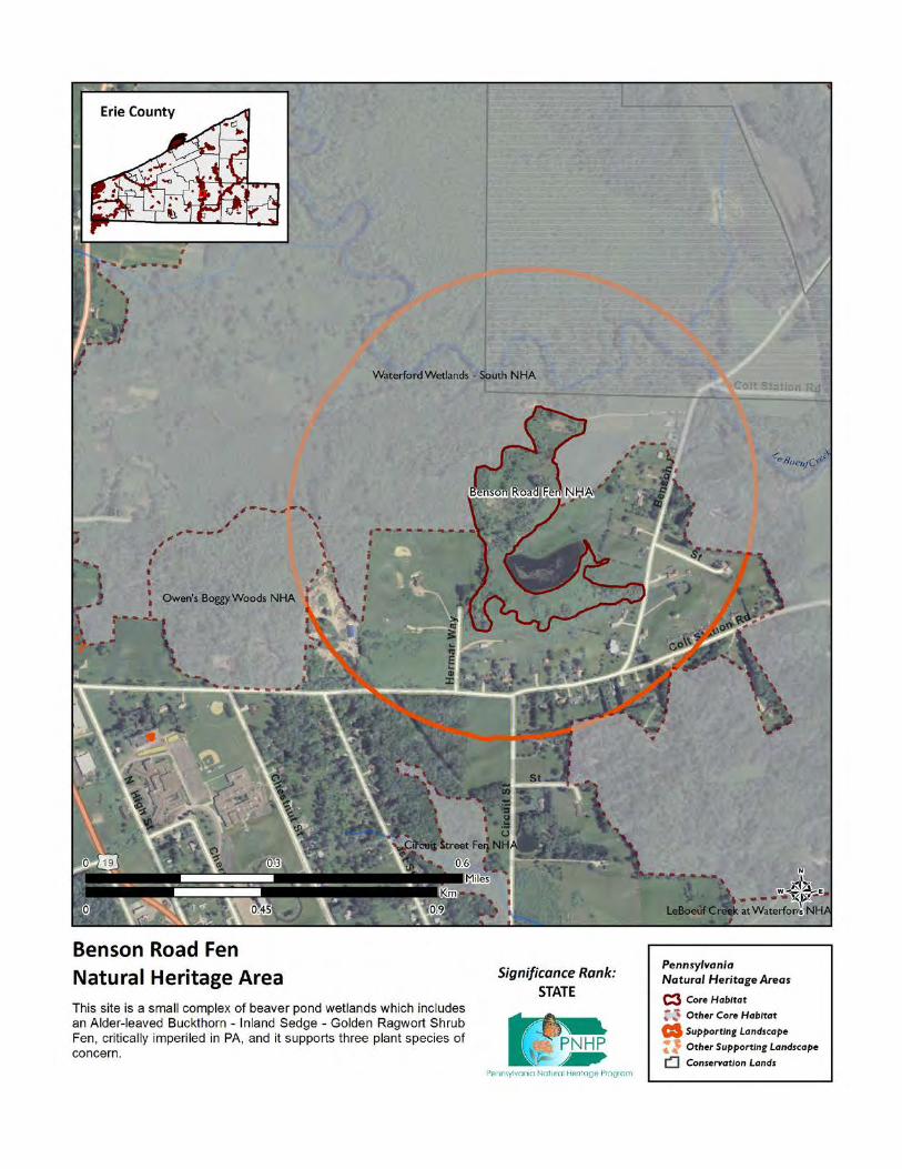
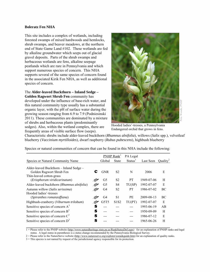
Boleratz Fen NHA This site includes a complex of wetlands, including forested swamps of mixed hardwoods and hemlocks, shrub swamps, and beaver meadows, at the northern end of State Game Land #102. These wetlands are fed by alkaline groundwater which seeps out of glacial gravel deposits. Parts of the shrub swamps and herbaceous wetlands are fens, alkaline seepage peatlands which are rare in Pennsylvania and which support numerous species of concern. This NHA supports several of the same species of concern found in the associated Kirik Fen NHA, as well as additional species of concern. The Alder-leaved Buckthorn – Inland Sedge – Golden Ragwort Shrub Fen community has developed under the influence of base-rich water, and this natural community type usually has a substantial organic layer, with the pH of surface water during the growing season ranging from 6.9 to 7.9 (Podniesinski 2011). These communities are dominated by a mixture of shrubs and herbaceous plants (predominantly sedges). Also, within the wetland complex, there are frequently areas of visible surface flow (seeps). Characteristic shrubs include alder-leaved buckthorn (Rhamnus alnifolia), willows (Salix spp.), velvetleaf blueberry (Vaccinium myrtilloides), dwarf raspberry (Rubus pubescens), highbush blueberry Species or natural communities of concern that can be found in this NHA include the following:
PNHP Rank1 PA Legal Species or Natural Community Name Global State Status1 Last Seen Quality2 Alder-leaved Buckthorn – Inland Sedge – Golden Ragwort Shrub Fen C GNR S2 N 2006 E Thin-leaved cotton-grass (Eriophorum viridicarinatum) G5 S2 PT 1949-07-06 H Alder-leaved buckthorn (Rhamnus alnifolia) G5 S4 TU(SP) 1992-07-07 E Autumn willow (Salix serissima) G4 S2 PT 1986-07-02 BC Hooded ladies’-tresses (Spiranthes romanzoffiana) G4 S1 PE 2009-08-13 BC Highbush-cranberry (Viburnum trilobum) G5T5 S1S2 TU(PT) 1992-07-07 E Sensitive species of concern A3 S --- --- --- 1993-06-19 AB Sensitive species of concern B3 S --- --- --- 1950-09-09 H Sensitive species of concern C3 S --- --- --- 1986-07-12 E Sensitive species of concern D3 S --- --- --- 1965-06-26 H 1 = Please refer to the PNHP website (http://www.naturalheritage.state.pa.us/RankStatusDef.aspx) for an explanation of PNHP ranks and legal
status. A legal status in parentheses is a status change recommended by the Pennsylvania Biological Survey. 2 = Please refer to the NatureServe website (http://www.natureserve.org/explorer/eorankguide.htm) for an explanation of quality ranks. 3 = This species is not named by request of the jurisdictional agency responsible for its protection.
Pete
Woo
ds, P
NH
P
Hooded ladies’-tresses, a Pennsylvania Endangered orchid that grows in fens.
(V. corymbosum), speckled alder (Alnus incana ssp. rugosa), arrow-wood (Viburnum recognitum), and red-osier dogwood (Cornus sericea). Threats and Stresses Specific threats and stresses to the elements present at this site include the following:
• The greatest threats to fen communities are disruptions to bedrock or glacial deposits (such as drilling or mining in nearby areas) and any activities that alter groundwater flows or the quality of groundwater.
• These wetlands are bordered on three sides by agricultural fields. • Groundwater pollution in fens can occur from improperly installed septic systems, improperly
lined underground waste disposal, and in agricultural areas from infiltration of pesticides, fertilizers, or nutrients from animal wastes. Pesticides can kill non-target organisms, and nutrient loading can accelerate the spread of invasive species.
• In the absence of natural disturbance (such as periodic flooding by beaver, browsing by animals, active vegetation removal, or fire), fens tend to succeed into shrub swamps and forested swamps, which do not support most of the species of concern at this site.
• Peatlands are particularly sensitive to trampling, soil compaction, and other physical disturbance from recreational activities.
• Based on recent surveys to the nearby Kirik Fen NHA, which is upstream of this site, invasive exotic plant species such as narrow-leaved cattail (Typha angustifolia) and common reed (Phragmites australis) are probably present. These exotic species have the potential to modify the site and impact the rare plant species present at the site.
• Viburnum leaf beetle (Pyrrhalta viburni) is an introduced pest that eats highbush cranberry and other species of viburnum. Within Pennsylvania, this pest has spread throughout the range of highbush cranberry and is decimating populations of the shrub. The long-term effects of this invasion remain unknown, but all populations of highbush cranberry are at serious risk.
• The hemlock swamps here are threatened by the hemlock woolly adelgid, a sap-feeding insect from Asia that attacks eastern hemlock (Tsuga canadensis). As of 2011, the hemlock woolly adelgid is still several counties away to the east and south, but it is expected to arrive in coming years with devastating effects on hemlock populations. Infestations are followed by high levels of hemlock mortality, which opens up the forest canopy and drastically alters the forest habitat.
• Fenno Road runs alongside part of this wetland and crosses its outlet; runoff from the road runs directly into habitat for species of concern.
Conservation Recommendations Approximately half of the Core Habitat is protected as part of State Game Land #102. The rest of the site is on private land, with no conservation easements. The following steps are recommended to ensure the persistence of these species at this site:
• Drilling, mining, or other disruptions to bedrock or glacial deposits should not be undertaken within one-half mile of a seepage wetland without a thorough understanding of local bedrock geology, surficial geology, and groundwater flows. Groundwater flow patterns do not always mirror surface watersheds, and in some cases aquifers may be contiguous over large areas.
• Trails should be sited away from the wetland, or elevated boardwalks employed to prevent peat compaction and other disturbance in the wetland.
• A buffer of natural vegetation around the wetland should be established in order to minimize nutrient runoff, pollution, and sedimentation.
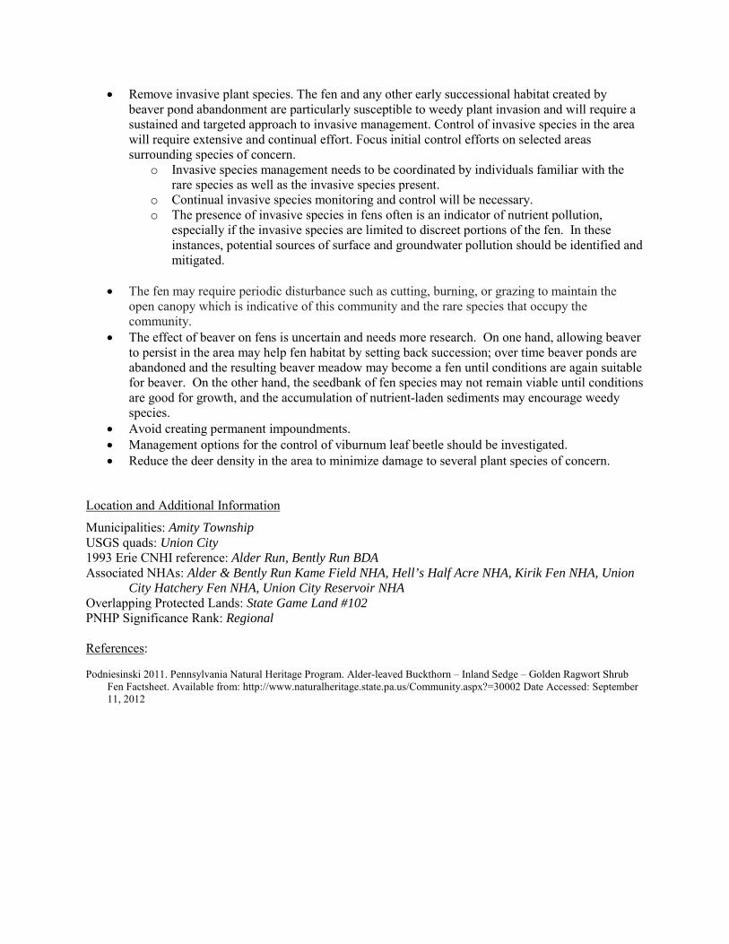
• Remove invasive plant species. The fen and any other early successional habitat created by beaver pond abandonment are particularly susceptible to weedy plant invasion and will require a sustained and targeted approach to invasive management. Control of invasive species in the area will require extensive and continual effort. Focus initial control efforts on selected areas surrounding species of concern.
o Invasive species management needs to be coordinated by individuals familiar with the rare species as well as the invasive species present.
o Continual invasive species monitoring and control will be necessary. o The presence of invasive species in fens often is an indicator of nutrient pollution,
especially if the invasive species are limited to discreet portions of the fen. In these instances, potential sources of surface and groundwater pollution should be identified and mitigated.
• The fen may require periodic disturbance such as cutting, burning, or grazing to maintain the open canopy which is indicative of this community and the rare species that occupy the community.
• The effect of beaver on fens is uncertain and needs more research. On one hand, allowing beaver to persist in the area may help fen habitat by setting back succession; over time beaver ponds are abandoned and the resulting beaver meadow may become a fen until conditions are again suitable for beaver. On the other hand, the seedbank of fen species may not remain viable until conditions are good for growth, and the accumulation of nutrient-laden sediments may encourage weedy species.
• Avoid creating permanent impoundments. • Management options for the control of viburnum leaf beetle should be investigated. • Reduce the deer density in the area to minimize damage to several plant species of concern.
Location and Additional Information
Municipalities: Amity Township USGS quads: Union City 1993 Erie CNHI reference: Alder Run, Bently Run BDA Associated NHAs: Alder & Bently Run Kame Field NHA, Hell’s Half Acre NHA, Kirik Fen NHA, Union
City Hatchery Fen NHA, Union City Reservoir NHA Overlapping Protected Lands: State Game Land #102 PNHP Significance Rank: Regional References: Podniesinski 2011. Pennsylvania Natural Heritage Program. Alder-leaved Buckthorn – Inland Sedge – Golden Ragwort Shrub
Fen Factsheet. Available from: http://www.naturalheritage.state.pa.us/Community.aspx?=30002 Date Accessed: September 11, 2012
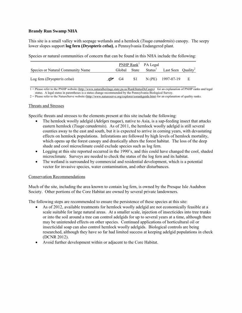
Brandy Run Swamp NHA This site is a small valley with seepage wetlands and a hemlock (Tsuga canadensis) canopy. The seepy lower slopes support log fern (Dryopteris celsa), a Pennsylvania Endangered plant. Species or natural communities of concern that can be found in this NHA include the following:
PNHP Rank1 PA Legal Species or Natural Community Name Global State Status1 Last Seen Quality2 Log fern (Dryopteris celsa) G4 S1 N (PE) 1997-07-19 E 1 = Please refer to the PNHP website (http://www.naturalheritage.state.pa.us/RankStatusDef.aspx) for an explanation of PNHP ranks and legal
status. A legal status in parentheses is a status change recommended by the Pennsylvania Biological Survey. 2 = Please refer to the NatureServe website (http://www.natureserve.org/explorer/eorankguide.htm) for an explanation of quality ranks.
Threats and Stresses Specific threats and stresses to the elements present at this site include the following:
• The hemlock woolly adelgid (Adelges tsugae), native to Asia, is a sap-feeding insect that attacks eastern hemlock (Tsuga canadensis). As of 2011, the hemlock woolly adelgid is still several counties away to the east and south, but it is expected to arrive in coming years, with devastating effects on hemlock populations. Infestations are followed by high levels of hemlock mortality, which opens up the forest canopy and drastically alters the forest habitat. The loss of the deep shade and cool microclimate could exclude species such as log fern.
• Logging at this site reported occurred in the 1990’s, and this could have changed the cool, shaded microclimate. Surveys are needed to check the status of the log fern and its habitat.
• The wetland is surrounded by commercial and residential development, which is a potential vector for invasive species, water contamination, and other disturbances.
Conservation Recommendations Much of the site, including the area known to contain log fern, is owned by the Presque Isle Audubon Society. Other portions of the Core Habitat are owned by several private landowners. The following steps are recommended to ensure the persistence of these species at this site:
• As of 2012, available treatments for hemlock woolly adelgid are not economically feasible at a scale suitable for large natural areas. At a smaller scale, injection of insecticides into tree trunks or into the soil around a tree can control adelgids for up to several years at a time, although there may be unintended effects on other species. Continued applications of horticultural oil or insecticidal soap can also control hemlock woolly adelgids. Biological controls are being researched, although they have so far had limited success at keeping adelgid populations in check (DCNR 2012).
• Avoid further development within or adjacent to the Core Habitat.

Location and Additional Information Municipalities: Fairview Township USGS quads: Fairview, Swanville 1993 Erie CNHI reference: Previously unrecognized site Associated NHAs: None Overlapping Protected Lands: This will be calculated via a spatial join and added later PNHP Significance Rank: State References Department of Conservation and Natural Resources. 2012. Forest Health Fact Sheet: Hemlock Woolly Adelgid.
http://www.dcnr.state.pa.us/ucmprd2/groups/public/documents/document/dcnr_007179.pdf
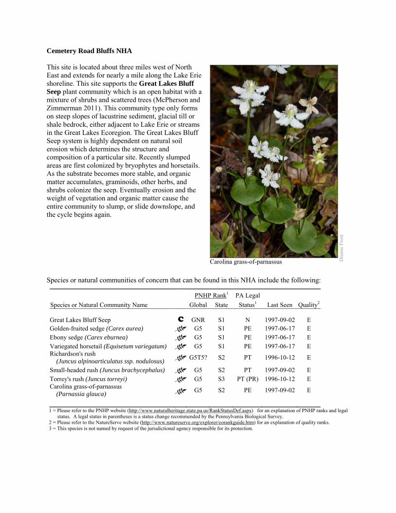
Cemetery Road Bluffs NHA This site is located about three miles west of North East and extends for nearly a mile along the Lake Erie shoreline. This site supports the Great Lakes Bluff Seep plant community which is an open habitat with a mixture of shrubs and scattered trees (McPherson and Zimmerman 2011). This community type only forms on steep slopes of lacustrine sediment, glacial till or shale bedrock, either adjacent to Lake Erie or streams in the Great Lakes Ecoregion. The Great Lakes Bluff Seep system is highly dependent on natural soil erosion which determines the structure and composition of a particular site. Recently slumped areas are first colonized by bryophytes and horsetails. As the substrate becomes more stable, and organic matter accumulates, graminoids, other herbs, and shrubs colonize the seep. Eventually erosion and the weight of vegetation and organic matter cause the entire community to slump, or slide downslope, and the cycle begins again. Species or natural communities of concern that can be found in this NHA include the following:
PNHP Rank1 PA Legal Species or Natural Community Name Global State Status1 Last Seen Quality2 Great Lakes Bluff Seep C GNR S1 N 1997-09-02 E Golden-fruited sedge (Carex aurea) G5 S1 PE 1997-06-17 E Ebony sedge (Carex eburnea) G5 S1 PE 1997-06-17 E Variegated horsetail (Equisetum variegatum) G5 S1 PE 1997-06-17 E Richardson's rush (Juncus alpinoarticulatus ssp. nodulosus) G5T5? S2 PT 1996-10-12 E
Small-headed rush (Juncus brachycephalus) G5 S2 PT 1997-09-02 E Torrey's rush (Juncus torreyi) G5 S3 PT (PR) 1996-10-12 E Carolina grass-of-parnassus (Parnassia glauca) G5 S2 PE 1997-09-02 E
1 = Please refer to the PNHP website (http://www.naturalheritage.state.pa.us/RankStatusDef.aspx) for an explanation of PNHP ranks and legal
status. A legal status in parentheses is a status change recommended by the Pennsylvania Biological Survey. 2 = Please refer to the NatureServe website (http://www.natureserve.org/explorer/eorankguide.htm) for an explanation of quality ranks. 3 = This species is not named by request of the jurisdictional agency responsible for its protection.
Carolina grass-of-parnassus D
iann
e Fr
ost
Threats and Stresses The greatest threats to the Great Lakes Bluff Seep community is direct physical disturbance, invasive plant species, and hydrological alterations affecting groundwater flows to the seeps along the bluffs. Specific threats and stresses to the elements present at this site include the following:
• Human activities resulting in development and groundwater alteration can exacerbate natural soil erosion or slumping. The rate of slumping is thought to have increased in recent decades due to reduced long-shore sand transport. The amount of impervious surface within the supporting watershed may also increase the rate of bluff retreat.
• Invasion of non-native plant species such as colt’s foot (Tussilago farfara), common reed (Phragmites australis), and European alder (Alnus glutinosa) threaten native plants and may alter physical and chemical processes along the bluffs.
Conservation Recommendations This entire site is privately owned. We recommend that the core habitat, as well as the supporting landscape, of this site be fully protected during any potential development activities. The following steps are recommended to ensure the persistence of these species at this site:
• Great Lakes Bluff Seeps are sensitive habitats, and as steep slopes are frequently attractive to hikers and climbers, care should be used when accessing these sites. Upslope disturbances to the deep glacial soils or bedrock could destabilize these habitats and should be avoided.
• Property owners could also contribute to ground water quality and quantity protection by reducing or avoiding the application of pesticides and/or fertilizers within site boundaries and avoiding artificial drainage of subsurface waters.
• Development and timber harvesting within the NHA should be avoided. • Care should be taken to control and prevent the spread of invasive species. • A natural vegetation buffer should be allowed to develop along the stream valley crest within the
site's boundary in order to reduce the threat of human-induced erosion and to protect surface water quality and quantity entering the NHA. Trail construction along the top of tributary gorges should be limited to avoid impacting this community.
• This NHA should be protected as a part of a large system of shoreline scarp woodlands and forested seeps to facilitate native seed dispersal and wildlife movement.
Location and Additional Information
Municipalities: North East Township USGS quads: Harborcreek 1993 Erie CNHI reference: Previously unrecognized site Associated NHAs: None Overlapping Protected Lands: None – private ownership PNHP Significance Rank: State References McPherson, J. and Zimmerman, E. 2011. Pennsylvania Natural Heritage Program. Great Lakes Bluff Seep Factsheet. Available
from: http://www.naturalheritage.state.pa.us/Community.aspx?=16040 Date Accessed: March 28, 2012
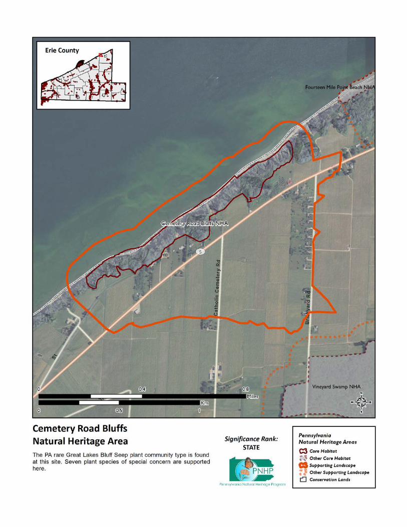
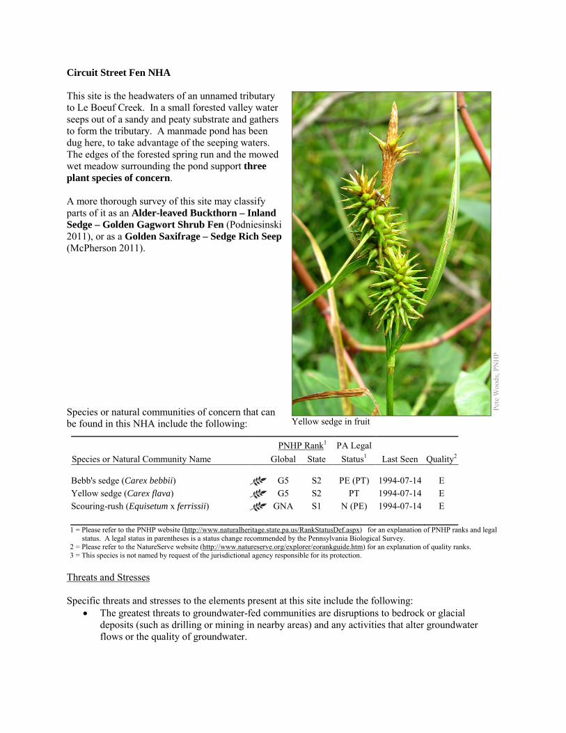
Circuit Street Fen NHA This site is the headwaters of an unnamed tributary to Le Boeuf Creek. In a small forested valley water seeps out of a sandy and peaty substrate and gathers to form the tributary. A manmade pond has been dug here, to take advantage of the seeping waters. The edges of the forested spring run and the mowed wet meadow surrounding the pond support three plant species of concern. A more thorough survey of this site may classify parts of it as an Alder-leaved Buckthorn – Inland Sedge – Golden Gagwort Shrub Fen (Podniesinski 2011), or as a Golden Saxifrage – Sedge Rich Seep (McPherson 2011). Species or natural communities of concern that can be found in this NHA include the following:
PNHP Rank1 PA Legal Species or Natural Community Name Global State Status1 Last Seen Quality2 Bebb's sedge (Carex bebbii) G5 S2 PE (PT) 1994-07-14 E Yellow sedge (Carex flava) G5 S2 PT 1994-07-14 E Scouring-rush (Equisetum x ferrissii) GNA S1 N (PE) 1994-07-14 E 1 = Please refer to the PNHP website (http://www.naturalheritage.state.pa.us/RankStatusDef.aspx) for an explanation of PNHP ranks and legal
status. A legal status in parentheses is a status change recommended by the Pennsylvania Biological Survey. 2 = Please refer to the NatureServe website (http://www.natureserve.org/explorer/eorankguide.htm) for an explanation of quality ranks. 3 = This species is not named by request of the jurisdictional agency responsible for its protection.
Threats and Stresses Specific threats and stresses to the elements present at this site include the following:
• The greatest threats to groundwater-fed communities are disruptions to bedrock or glacial deposits (such as drilling or mining in nearby areas) and any activities that alter groundwater flows or the quality of groundwater.
Pete
Woo
ds, P
NH
P
Yellow sedge in fruit
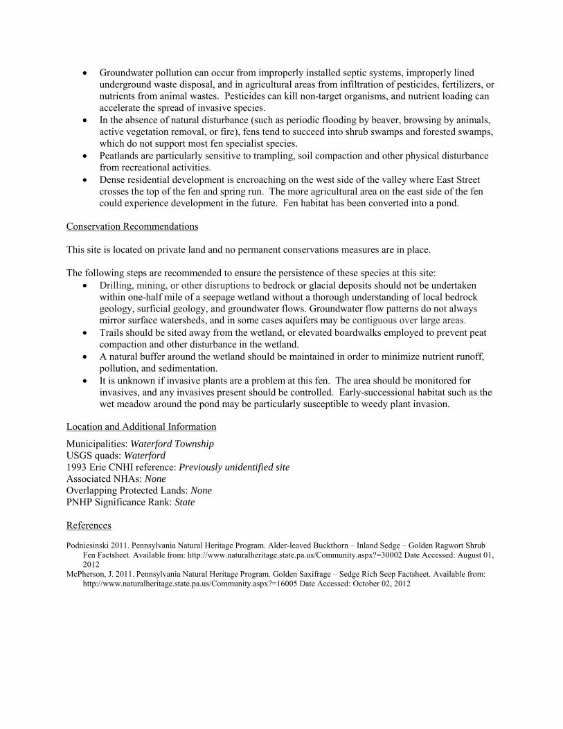
• Groundwater pollution can occur from improperly installed septic systems, improperly lined underground waste disposal, and in agricultural areas from infiltration of pesticides, fertilizers, or nutrients from animal wastes. Pesticides can kill non-target organisms, and nutrient loading can accelerate the spread of invasive species.
• In the absence of natural disturbance (such as periodic flooding by beaver, browsing by animals, active vegetation removal, or fire), fens tend to succeed into shrub swamps and forested swamps, which do not support most fen specialist species.
• Peatlands are particularly sensitive to trampling, soil compaction and other physical disturbance from recreational activities.
• Dense residential development is encroaching on the west side of the valley where East Street crosses the top of the fen and spring run. The more agricultural area on the east side of the fen could experience development in the future. Fen habitat has been converted into a pond.
Conservation Recommendations This site is located on private land and no permanent conservations measures are in place. The following steps are recommended to ensure the persistence of these species at this site:
• Drilling, mining, or other disruptions to bedrock or glacial deposits should not be undertaken within one-half mile of a seepage wetland without a thorough understanding of local bedrock geology, surficial geology, and groundwater flows. Groundwater flow patterns do not always mirror surface watersheds, and in some cases aquifers may be contiguous over large areas.
• Trails should be sited away from the wetland, or elevated boardwalks employed to prevent peat compaction and other disturbance in the wetland.
• A natural buffer around the wetland should be maintained in order to minimize nutrient runoff, pollution, and sedimentation.
• It is unknown if invasive plants are a problem at this fen. The area should be monitored for invasives, and any invasives present should be controlled. Early-successional habitat such as the wet meadow around the pond may be particularly susceptible to weedy plant invasion.
Location and Additional Information
Municipalities: Waterford Township USGS quads: Waterford 1993 Erie CNHI reference: Previously unidentified site Associated NHAs: None Overlapping Protected Lands: None PNHP Significance Rank: State References Podniesinski 2011. Pennsylvania Natural Heritage Program. Alder-leaved Buckthorn – Inland Sedge – Golden Ragwort Shrub
Fen Factsheet. Available from: http://www.naturalheritage.state.pa.us/Community.aspx?=30002 Date Accessed: August 01, 2012
McPherson, J. 2011. Pennsylvania Natural Heritage Program. Golden Saxifrage – Sedge Rich Seep Factsheet. Available from: http://www.naturalheritage.state.pa.us/Community.aspx?=16005 Date Accessed: October 02, 2012
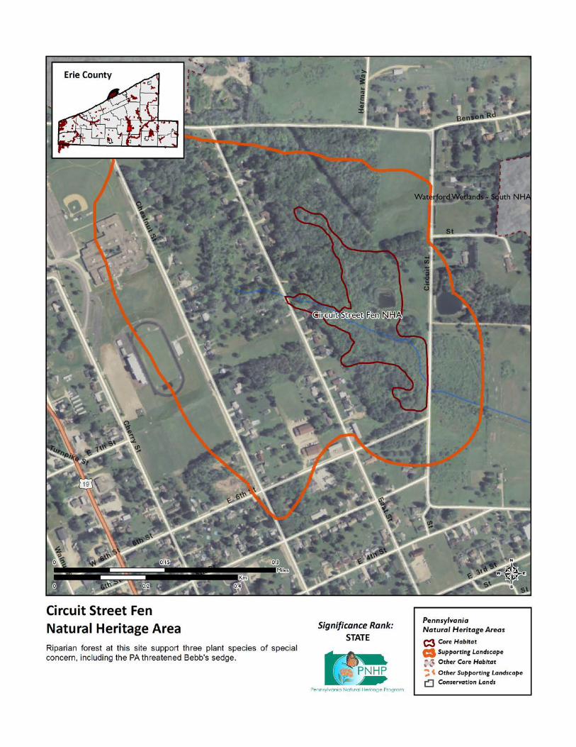
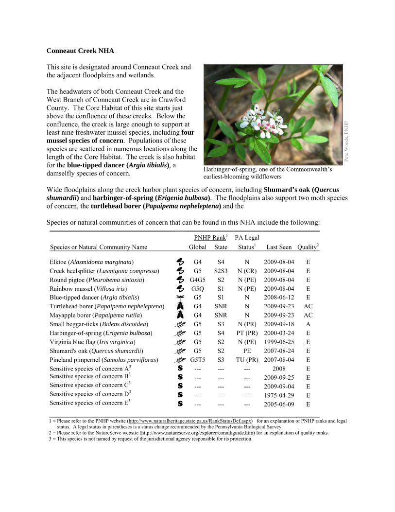
Conneaut Creek NHA This site is designated around Conneaut Creek and the adjacent floodplains and wetlands. The headwaters of both Conneaut Creek and the West Branch of Conneaut Creek are in Crawford County. The Core Habitat of this site starts just above the confluence of these creeks. Below the confluence, the creek is large enough to support at least nine freshwater mussel species, including four mussel species of concern. Populations of these species are scattered in numerous locations along the length of the Core Habitat. The creek is also habitat for the blue-tipped dancer (Argia tibialis), a damselfly species of concern. Wide floodplains along the creek harbor plant species of concern, including Shumard’s oak (Quercus shumardii) and harbinger-of-spring (Erigenia bulbosa). The floodplains also support two moth species of concern, the turtlehead borer (Papaipema nepheleptena) and the Species or natural communities of concern that can be found in this NHA include the following:
PNHP Rank1 PA Legal Species or Natural Community Name Global State Status1 Last Seen Quality2 Elktoe (Alasmidonta marginata) G4 S4 N 2009-08-04 E Creek heelsplitter (Lasmigona compressa) G5 S2S3 N (CR) 2009-08-04 E Round pigtoe (Pleurobema sintoxia) G4G5 S2 N (PE) 2009-08-04 E Rainbow mussel (Villosa iris) G5Q S1 N (PE) 2009-08-04 E Blue-tipped dancer (Argia tibialis) G5 S1 N 2008-06-12 E Turtlehead borer (Papaipema nepheleptena) G4 SNR N 2009-09-23 AC Mayapple borer (Papaipema rutila) G4 SNR N 2009-09-23 AC Small beggar-ticks (Bidens discoidea) G5 S3 N (PR) 2009-09-18 A Harbinger-of-spring (Erigenia bulbosa) G5 S4 PT (PR) 2000-03-24 E Virginia blue flag (Iris virginica) G5 S2 N (PE) 1999-06-25 E Shumard's oak (Quercus shumardii) G5 S2 PE 2007-08-24 E Pineland pimpernel (Samolus parviflorus) G5T5 S3 TU (PR) 2007-08-04 E Sensitive species of concern A3 S --- --- --- 2008 E Sensitive species of concern B3 S --- --- --- 2009-09-25 E Sensitive species of concern C3 S --- --- --- 2009-09-04 E Sensitive species of concern D3 S --- --- --- 1975-04-29 E Sensitive species of concern E3 S --- --- --- 2005-06-09 E 1 = Please refer to the PNHP website (http://www.naturalheritage.state.pa.us/RankStatusDef.aspx) for an explanation of PNHP ranks and legal
status. A legal status in parentheses is a status change recommended by the Pennsylvania Biological Survey. 2 = Please refer to the NatureServe website (http://www.natureserve.org/explorer/eorankguide.htm) for an explanation of quality ranks. 3 = This species is not named by request of the jurisdictional agency responsible for its protection.
Pete
Woo
ds, P
NH
P
Harbinger-of-spring, one of the Commonwealth’s earliest-blooming wildflowers

mayapple borer (Papaipema rutila). The floodplains contain numerous channel scar wetlands, which support Virginia blue flag (Iris virginica), small beggars ticks (Bidens discoidea) and pineland pimpernel (Samolus parviflorus). This site supports five species of concern that cannot be named here at the request of the jurisdictional agency overseeing their protection. These species rely on good quality water. An additional species of concern has been found in the Ohio portion of the Conneaut Creek, and it is possible that it is also present in this site. The Binational Conservation Blueprint for the Great Lakes identified Conneaut Creek and its associated wetlands as one of two priority areas in Pennsylvania for the conservation of biodiversity. (The Nature Conservancy, 2007). Immediately downstream from this NHA, in Ohio, Conneaut Creek is recognized as a State Wild and Scenic River, one of only three rivers in the state to receive the Wild River designation (Ohio Department of Natural Resources 2012). Conditions at this NHA contribute to the quality of the downstream river in Ohio. Threats and Stresses Specific threats and stresses to the elements present at this site include the following:
• Sedimentation is a main cause of the freshwater mussel declines throughout North America, because it renders stream bottoms unsuitable as mussel habitat. Erosion, whether caused by deforestation, poor agricultural practices, or the destruction of riparian zones, leads to increased silt loads and shifting, unstable stream bottoms. Siltation and contaminants, such as heavy metals, pesticides, and abandoned mine drainage, have long been recognized as threats to mussels (Ortmann 1909; Williams et al. 1993). Increases in siltation can also indirectly impact freshwater mussel communities by interfering with host fish – mussel interactions. Increased sedimentation can reduce the abundance, diversity, and reproduction of fish, including the host fish that are necessary for protection and dispersal of virtually all freshwater mussels during their larval stage. The increased turbidity associated with suspended sediment loads also interferes with the visual cues used by both adult mussels and host fish in the transfer of the glochidia, or mussel larvae (Box and Mossa 1999). Damselflies also rely on good water quality, although the tolerances of individual species to different types of pollution are not well-understood. The same factors that threaten mussels also potentially threaten the blue dancer damselfly.
• The floodplain of Conneaut Creek contains many agricultural fields. For many of these fields, the buffer between the field and the creek is minimal or nonexistent. Numerous roads cross the floodplain and the creek, and in some cases buildings have been placed on the floodplain, potentially exposing the floodplain habitat to various disturbances.
• The moth species of concern at this site are vulnerable to insecticides and habitat destruction.
Pete
Woo
ds, P
NH
P
A blue-tipped dancer
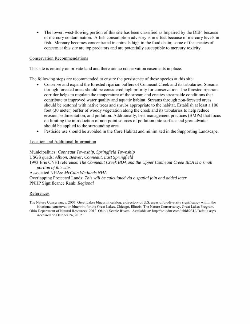
• The lower, west-flowing portion of this site has been classified as Impaired by the DEP, because of mercury contamination. A fish consumption advisory is in effect because of mercury levels in fish. Mercury becomes concentrated in animals high in the food chain; some of the species of concern at this site are top predators and are potentially susceptible to mercury toxicity.
Conservation Recommendations This site is entirely on private land and there are no conservation easements in place. The following steps are recommended to ensure the persistence of these species at this site:
• Conserve and expand the forested riparian buffers of Conneaut Creek and its tributaries. Streams through forested areas should be considered high priority for conservation. The forested riparian corridor helps to regulate the temperature of the stream and creates streamside conditions that contribute to improved water quality and aquatic habitat. Streams through non-forested areas should be restored with native trees and shrubs appropriate to the habitat. Establish at least a 100 foot (30 meter) buffer of woody vegetation along the creek and its tributaries to help reduce erosion, sedimentation, and pollution. Additionally, best management practices (BMPs) that focus on limiting the introduction of non-point sources of pollution into surface and groundwater should be applied to the surrounding area.
• Pesticide use should be avoided in the Core Habitat and minimized in the Supporting Landscape. Location and Additional Information Municipalities: Conneaut Township, Springfield Township USGS quads: Albion, Beaver, Conneaut, East Springfield 1993 Erie CNHI reference: The Conneaut Creek BDA and the Upper Conneaut Creek BDA is a small
portion of this site. Associated NHAs: McCain Wetlands NHA Overlapping Protected Lands: This will be calculated via a spatial join and added later PNHP Significance Rank: Regional References The Nature Conservancy. 2007. Great Lakes blueprint catalog: a directory of U.S. areas of biodiversity significancy within the
binational conservation blueprint for the Great Lakes. Chicago, Illinois: The Nature Conservancy, Great Lakes Program. Ohio Department of Natural Resources. 2012. Ohio’s Scenic Rivers. Available at: http://ohiodnr.com/tabid/2310/Default.aspx.
Accessed on October 24, 2012.
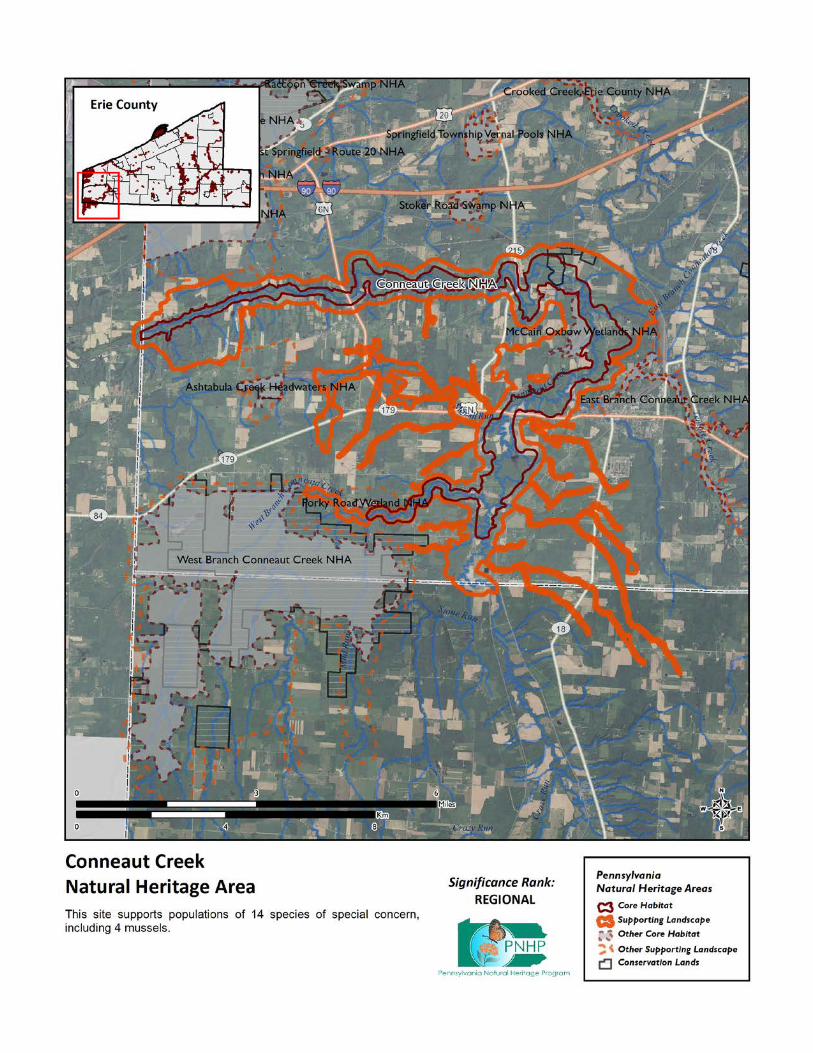
County Line Road NHA This NHA is located on the Erie/Crawford County boundary along County Line Road about 2 miles north of Spartansburg near the intersection of Pennsylvania Routes 89 and 173. The site’s agricultural fields, adjacent riparian forest and wetlands support a sensitive species of concern. This species cannot be named at the request of the agency overseeing its protection. Species or natural communities of concern that can be found in this NHA include the following:
PNHP Rank1 PA Legal Species or Natural Community Name Global State Status1 Last Seen Quality2 Sensitive species of concern A3 S --- --- --- 2011 E 1 = Please refer to the PNHP website (http://www.naturalheritage.state.pa.us/RankStatusDef.aspx) for an explanation of PNHP ranks and legal
status. A legal status in parentheses is a status change recommended by the Pennsylvania Biological Survey. 2 = Please refer to the NatureServe website (http://www.natureserve.org/explorer/eorankguide.htm) for an explanation of quality ranks.
3 = This species is not named by request of the jurisdictional agency responsible for its protection. Threats and Stresses Specific threats and stresses to the elements present within this site include the following:
• The sensitive species of concern is vulnerable to human disturbance. Significant additional human disturbance within 1000 feet (305 meters) could trigger permanent abandonment of the area.
• The species of concern at this site rely on good water quality, and is vulnerable to siltation and chemical pollution.
Conservation Recommendations Additional development within the Core Habitat should be avoided to protect the sensitive species of concern. Disturbance within the Core Habitat should not be a problem for this species if it occurs during non-breeding season (August – November). The entire site is privately owned and landowners in the Core Habitat should be aware that the species is sensitive to disturbance. Maintaining high quality aquatic habitat is important to this species. The following steps are recommended to ensure the persistence of these species at this site:
• Conserve and expand the forested riparian buffers of tributaries to Stranahan Run. Streams through forested areas should be considered high priority for conservation. The forested riparian corridor helps regulate stream temperature and creates streamside conditions contributing to improved water quality and aquatic habitat.
• Establish at least a 100 foot buffer of woody vegetation along streams to help reduce erosion, sedimentation, and pollution. Streams through non-forested areas should be restored with native trees and shrubs appropriate to the habitat.
• Additionally, best management practices (BMPs) that focus on limiting the introduction of non-point sources of pollution into surface and groundwater should be applied to the surrounding area

Location and Additional Information Municipalities: Sparta Township, Crawford County; Concord Township, Erie County USGS quads: Spartansburg 1993 Erie CNHI reference: Previously unidentified site Associated NHAs: None Overlapping Protected Lands: None – private ownership PNHP Significance Rank: State

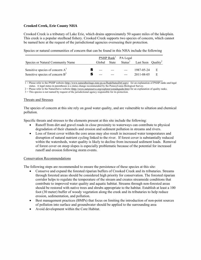
Crooked Creek, Erie County NHA Crooked Creek is a tributary of Lake Erie, which drains approximately 50 square miles of the lakeplain. This creek is a popular steelhead fishery. Crooked Creek supports two species of concern, which cannot be named here at the request of the jurisdictional agencies overseeing their protection. Species or natural communities of concern that can be found in this NHA include the following
PNHP Rank1 PA Legal Species or Natural Community Name Global State Status1 Last Seen Quality2 Sensitive species of concern A3 S --- --- --- 1987-05-24 E Sensitive species of concern B3 S --- --- --- 2011-08-05 E 1 = Please refer to the PNHP website (http://www.naturalheritage.state.pa.us/RankStatusDef.aspx) for an explanation of PNHP ranks and legal
status. A legal status in parentheses is a status change recommended by the Pennsylvania Biological Survey. 2 = Please refer to the NatureServe website (http://www.natureserve.org/explorer/eorankguide.htm) for an explanation of quality ranks. 3 = This species is not named by request of the jurisdictional agency responsible for its protection.
Threats and Stresses The species of concern at this site rely on good water quality, and are vulnerable to siltation and chemical pollution. Specific threats and stresses to the elements present at this site include the following:
• Runoff from dirt and gravel roads in close proximity to waterways can contribute to physical degradation of their channels and erosion and sediment pollution in streams and rivers.
• Loss of forest cover within the core areas may also result in increased water temperatures and disruption of natural nutrient cycling linked to the river. If forest cover is substantially reduced within the watersheds, water quality is likely to decline from increased sediment loads. Removal of forest cover on steep slopes is especially problematic because of the potential for increased runoff and erosion following storm events.
Conservation Recommendations The following steps are recommended to ensure the persistence of these species at this site:
• Conserve and expand the forested riparian buffers of Crooked Creek and its tributaries. Streams through forested areas should be considered high priority for conservation. The forested riparian corridor helps to regulate the temperature of the stream and creates streamside conditions that contribute to improved water quality and aquatic habitat. Streams through non-forested areas should be restored with native trees and shrubs appropriate to the habitat. Establish at least a 100 foot (30 meter) buffer of woody vegetation along the creek and its tributaries to help reduce erosion, sedimentation, and pollution.
• Best management practices (BMPs) that focus on limiting the introduction of non-point sources of pollution into surface and groundwater should be applied to the surrounding area
• Avoid development within the Core Habitat.

Location and Additional Information
Municipalities: Girard Township, Springfield Township USGS quads: Albion, East Springfield 1993 Erie CNHI reference: Lake Plain Shoreline BDA Associated NHAs: None Overlapping Protected Lands: None PNHP Significance Rank: State
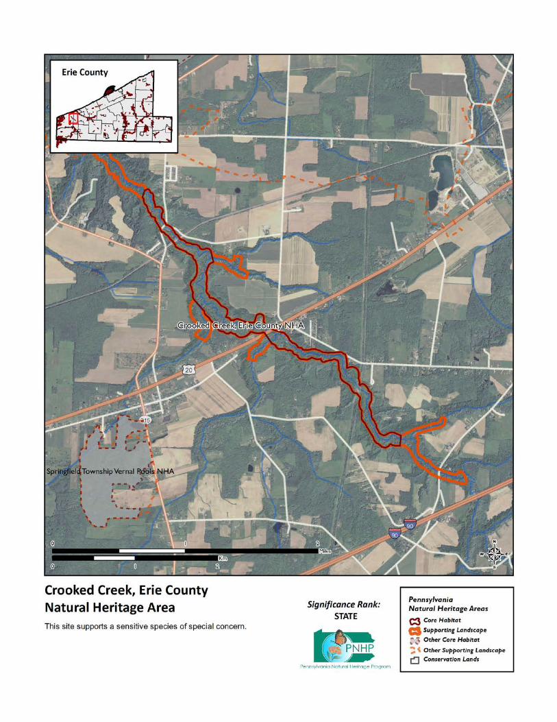
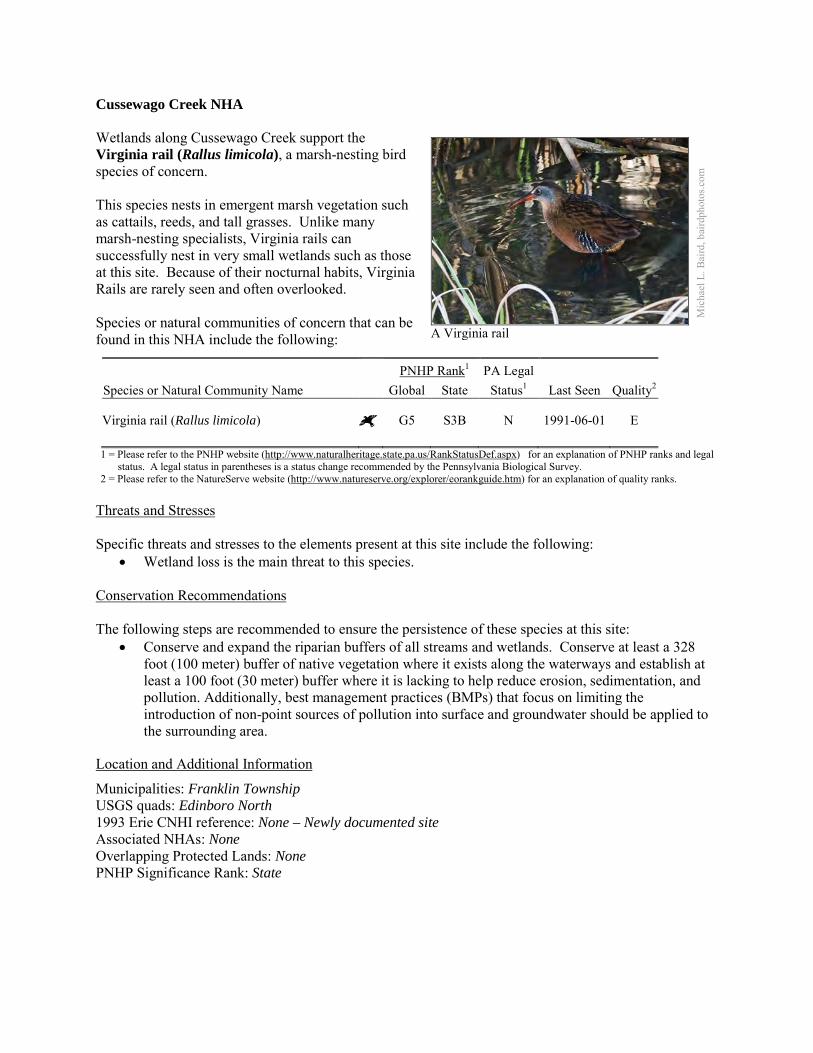
Cussewago Creek NHA Wetlands along Cussewago Creek support the Virginia rail (Rallus limicola), a marsh-nesting bird species of concern. This species nests in emergent marsh vegetation such as cattails, reeds, and tall grasses. Unlike many marsh-nesting specialists, Virginia rails can successfully nest in very small wetlands such as those at this site. Because of their nocturnal habits, Virginia Rails are rarely seen and often overlooked. Species or natural communities of concern that can be found in this NHA include the following:
PNHP Rank1 PA Legal Species or Natural Community Name Global State Status1 Last Seen Quality2 Virginia rail (Rallus limicola) G5 S3B N 1991-06-01 E 1 = Please refer to the PNHP website (http://www.naturalheritage.state.pa.us/RankStatusDef.aspx) for an explanation of PNHP ranks and legal
status. A legal status in parentheses is a status change recommended by the Pennsylvania Biological Survey. 2 = Please refer to the NatureServe website (http://www.natureserve.org/explorer/eorankguide.htm) for an explanation of quality ranks.
Threats and Stresses Specific threats and stresses to the elements present at this site include the following:
• Wetland loss is the main threat to this species. Conservation Recommendations The following steps are recommended to ensure the persistence of these species at this site:
• Conserve and expand the riparian buffers of all streams and wetlands. Conserve at least a 328 foot (100 meter) buffer of native vegetation where it exists along the waterways and establish at least a 100 foot (30 meter) buffer where it is lacking to help reduce erosion, sedimentation, and pollution. Additionally, best management practices (BMPs) that focus on limiting the introduction of non-point sources of pollution into surface and groundwater should be applied to the surrounding area.
Location and Additional Information
Municipalities: Franklin Township USGS quads: Edinboro North 1993 Erie CNHI reference: None – Newly documented site Associated NHAs: None Overlapping Protected Lands: None PNHP Significance Rank: State
Mic
hael
L. B
aird
, bai
rdph
otos
.com
A Virginia rail
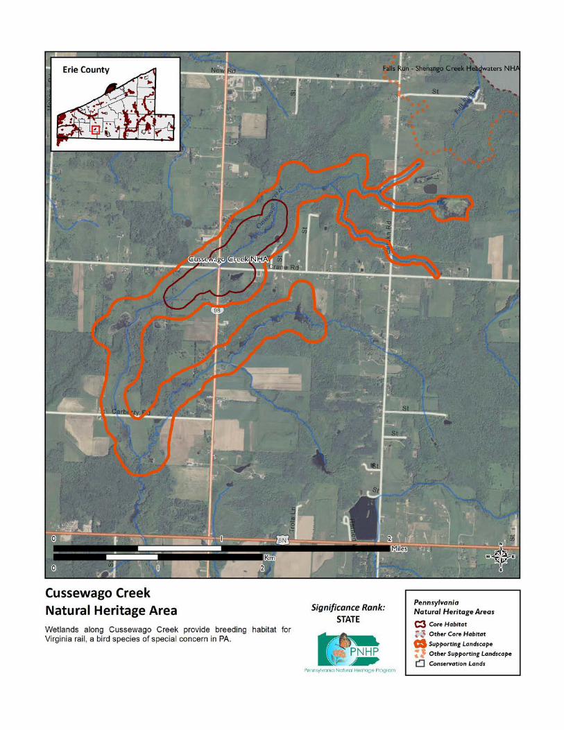
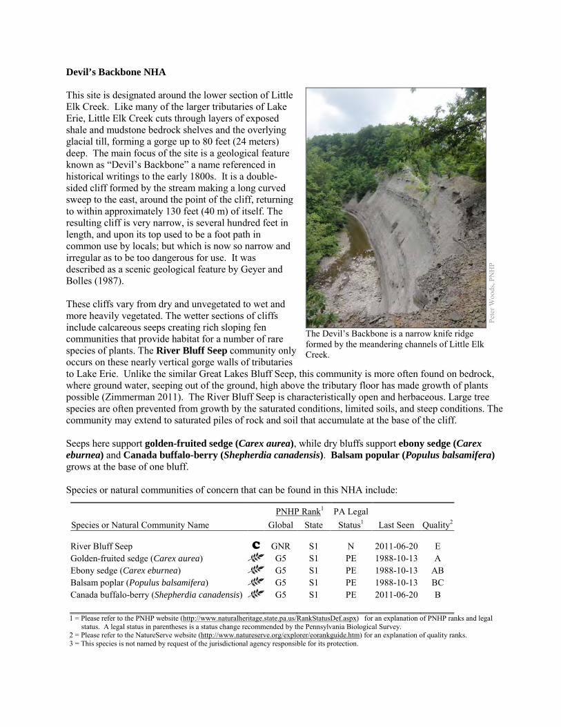
Devil’s Backbone NHA This site is designated around the lower section of Little Elk Creek. Like many of the larger tributaries of Lake Erie, Little Elk Creek cuts through layers of exposed shale and mudstone bedrock shelves and the overlying glacial till, forming a gorge up to 80 feet (24 meters) deep. The main focus of the site is a geological feature known as “Devil’s Backbone” a name referenced in historical writings to the early 1800s. It is a double-sided cliff formed by the stream making a long curved sweep to the east, around the point of the cliff, returning to within approximately 130 feet (40 m) of itself. The resulting cliff is very narrow, is several hundred feet in length, and upon its top used to be a foot path in common use by locals; but which is now so narrow and irregular as to be too dangerous for use. It was described as a scenic geological feature by Geyer and Bolles (1987). These cliffs vary from dry and unvegetated to wet and more heavily vegetated. The wetter sections of cliffs include calcareous seeps creating rich sloping fen communities that provide habitat for a number of rare species of plants. The River Bluff Seep community only occurs on these nearly vertical gorge walls of tributaries to Lake Erie. Unlike the similar Great Lakes Bluff Seep, this community is more often found on bedrock, where ground water, seeping out of the ground, high above the tributary floor has made growth of plants possible (Zimmerman 2011). The River Bluff Seep is characteristically open and herbaceous. Large tree species are often prevented from growth by the saturated conditions, limited soils, and steep conditions. The community may extend to saturated piles of rock and soil that accumulate at the base of the cliff. Seeps here support golden-fruited sedge (Carex aurea), while dry bluffs support ebony sedge (Carex eburnea) and Canada buffalo-berry (Shepherdia canadensis). Balsam popular (Populus balsamifera) grows at the base of one bluff. Species or natural communities of concern that can be found in this NHA include:
PNHP Rank1 PA Legal Species or Natural Community Name Global State Status1 Last Seen Quality2 River Bluff Seep C GNR S1 N 2011-06-20 E Golden-fruited sedge (Carex aurea) G5 S1 PE 1988-10-13 A Ebony sedge (Carex eburnea) G5 S1 PE 1988-10-13 AB Balsam poplar (Populus balsamifera) G5 S1 PE 1988-10-13 BC Canada buffalo-berry (Shepherdia canadensis) G5 S1 PE 2011-06-20 B 1 = Please refer to the PNHP website (http://www.naturalheritage.state.pa.us/RankStatusDef.aspx) for an explanation of PNHP ranks and legal
status. A legal status in parentheses is a status change recommended by the Pennsylvania Biological Survey. 2 = Please refer to the NatureServe website (http://www.natureserve.org/explorer/eorankguide.htm) for an explanation of quality ranks. 3 = This species is not named by request of the jurisdictional agency responsible for its protection.
Pete
r Woo
ds, P
NH
P
The Devil’s Backbone is a narrow knife ridge formed by the meandering channels of Little Elk Creek.
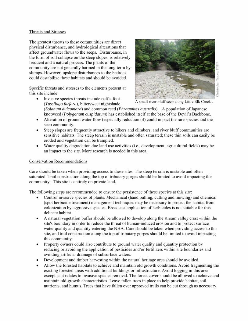
Threats and Stresses The greatest threats to these communities are direct physical disturbance, and hydrological alterations that affect groundwater flows to the seeps. Disturbance, in the form of soil collapse on the steep slopes, is relatively frequent and a natural process. The plants of the community are not generally harmed in the long-term by slumps. However, upslope disturbances to the bedrock could destabilize these habitats and should be avoided. Specific threats and stresses to the elements present at this site include:
• Invasive species threats include colt’s-foot (Tussilago farfara), bittersweet nightshade (Solanum dulcamara) and common reed (Phragmites australis). A population of Japanese knotweed (Polygonum cuspidatum) has established itself at the base of the Devil’s Backbone.
• Alteration of ground water flow (especially reduction of) could impact the rare species and the seep community.
• Steep slopes are frequently attractive to hikers and climbers, and river bluff communities are sensitive habitats. The steep terrain is unstable and often saturated; these thin soils can easily be eroded and vegetation can be trampled.
• Water quality degradation due land use activities (i.e., development, agricultural fields) may be an impact to the site. More research is needed in this area.
Conservation Recommendations Care should be taken when providing access to these sites. The steep terrain is unstable and often saturated. Trail construction along the top of tributary gorges should be limited to avoid impacting this community. This site is entirely on private land. The following steps are recommended to ensure the persistence of these species at this site:
• Control invasive species of plants. Mechanical (hand pulling, cutting and mowing) and chemical (spot herbicide treatment) management techniques may be necessary to protect the habitat from colonization by aggressive species. Broadcast application of herbicides is not suitable for this delicate habitat.
• A natural vegetation buffer should be allowed to develop along the stream valley crest within the site's boundary in order to reduce the threat of human-induced erosion and to protect surface water quality and quantity entering the NHA. Care should be taken when providing access to this site, and trail construction along the top of tributary gorges should be limited to avoid impacting this community.
• Property owners could also contribute to ground water quality and quantity protection by reducing or avoiding the application of pesticides and/or fertilizers within site boundaries and avoiding artificial drainage of subsurface waters.
• Development and timber harvesting within the natural heritage area should be avoided. • Allow the forested habitats to achieve and maintain old growth conditions. Avoid fragmenting the
existing forested areas with additional buildings or infrastructure. Avoid logging in this area except as it relates to invasive species removal. The forest cover should be allowed to achieve and maintain old-growth characteristics. Leave fallen trees in place to help provide habitat, soil nutrients, and humus. Trees that have fallen over approved trails can be cut through as necessary.
Chr
istop
her T
race
y, P
NH
P
A small river bluff seep along Little Elk Creek .

• Further inventory for moths and other invertebrates is recommended, because these undersurveyed groups may form a substantial part of the biodiversity of bluff seep communities.
• Research is needed to better understand the patterns of succession of plant species, especially species of conservation concern, on these slump habitats.
Location
Municipalities: Girard Township USGS quads: Albion 1993 Erie CNHI reference: Devils Backbone BDA encompassed the bluffs at this site and at Elk Creek
and Falls Run. Associated NHAs: Elk Creek NHA, Falls Run NHA, Lower Elk Creek NHA Overlapping Protected Lands: None – private ownership PNHP Significance Rank: State References Geyer, A.R. and W.H. Bolles. (1987). Outstanding Scenic Geological Features of Pennsylvania Part 2. Pennsylvania Geological
Survey, Harrisburg, PA. Zimmerman 2011. Pennsylvania Natural Heritage Program. River Bluff Seep Factsheet. Available from:
http://www.naturalheritage.state.pa.us/Community.aspx?=30030 Date Accessed: March 12, 2012
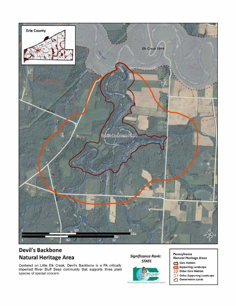
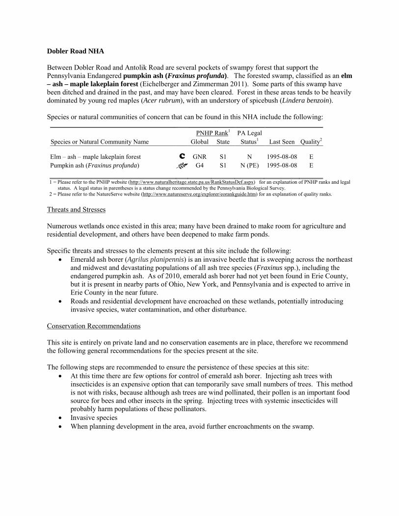
Dobler Road NHA Between Dobler Road and Antolik Road are several pockets of swampy forest that support the Pennsylvania Endangered pumpkin ash (Fraxinus profunda). The forested swamp, classified as an elm – ash – maple lakeplain forest (Eichelberger and Zimmerman 2011). Some parts of this swamp have been ditched and drained in the past, and may have been cleared. Forest in these areas tends to be heavily dominated by young red maples (Acer rubrum), with an understory of spicebush (Lindera benzoin). Species or natural communities of concern that can be found in this NHA include the following:
PNHP Rank1 PA Legal Species or Natural Community Name Global State Status1 Last Seen Quality2 Elm – ash – maple lakeplain forest C GNR S1 N 1995-08-08 E Pumpkin ash (Fraxinus profunda) G4 S1 N (PE) 1995-08-08 E 1 = Please refer to the PNHP website (http://www.naturalheritage.state.pa.us/RankStatusDef.aspx) for an explanation of PNHP ranks and legal
status. A legal status in parentheses is a status change recommended by the Pennsylvania Biological Survey. 2 = Please refer to the NatureServe website (http://www.natureserve.org/explorer/eorankguide.htm) for an explanation of quality ranks.
Threats and Stresses Numerous wetlands once existed in this area; many have been drained to make room for agriculture and residential development, and others have been deepened to make farm ponds. Specific threats and stresses to the elements present at this site include the following:
• Emerald ash borer (Agrilus planipennis) is an invasive beetle that is sweeping across the northeast and midwest and devastating populations of all ash tree species (Fraxinus spp.), including the endangered pumpkin ash. As of 2010, emerald ash borer had not yet been found in Erie County, but it is present in nearby parts of Ohio, New York, and Pennsylvania and is expected to arrive in Erie County in the near future.
• Roads and residential development have encroached on these wetlands, potentially introducing invasive species, water contamination, and other disturbance.
Conservation Recommendations This site is entirely on private land and no conservation easements are in place, therefore we recommend the following general recommendations for the species present at the site. The following steps are recommended to ensure the persistence of these species at this site:
• At this time there are few options for control of emerald ash borer. Injecting ash trees with insecticides is an expensive option that can temporarily save small numbers of trees. This method is not with risks, because although ash trees are wind pollinated, their pollen is an important food source for bees and other insects in the spring. Injecting trees with systemic insecticides will probably harm populations of these pollinators.
• Invasive species • When planning development in the area, avoid further encroachments on the swamp.
Location and Additional Information
Municipalities: Fairview Township USGS quads: Fairview 1993 Erie CNHI reference: None Associated NHAs: Overlapping Protected Lands: None PNHP Significance Rank: State References Eichelberger, B. and Zimmerman, E. 2011. Pennsylvania Natural Heritage Program. Elm – Ash – Maple Lakeplain Forest
Factsheet. Available from: http://www.naturalheritage.state.pa.us/Community.aspx?=16020 Date Accessed: August 29, 2012
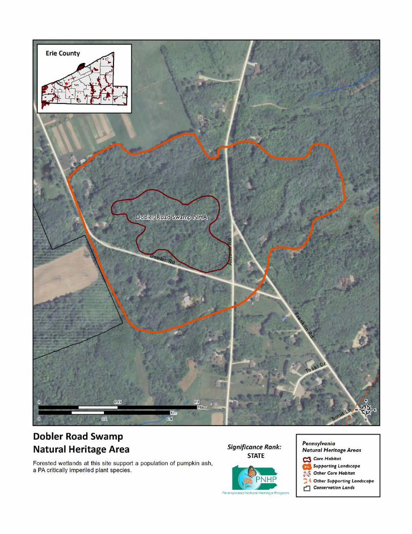
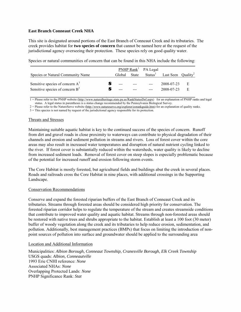
East Branch Conneaut Creek NHA This site is designated around portions of the East Branch of Conneaut Creek and its tributaries. The creek provides habitat for two species of concern that cannot be named here at the request of the jurisdictional agency overseeing their protection. These species rely on good quality water. Species or natural communities of concern that can be found in this NHA include the following:
PNHP Rank1 PA Legal Species or Natural Community Name Global State Status1 Last Seen Quality2 Sensitive species of concern A3 S --- --- --- 2008-07-23 E Sensitive species of concern B3 S --- --- --- 2008-07-23 E 1 = Please refer to the PNHP website (http://www.naturalheritage.state.pa.us/RankStatusDef.aspx) for an explanation of PNHP ranks and legal
status. A legal status in parentheses is a status change recommended by the Pennsylvania Biological Survey. 2 = Please refer to the NatureServe website (http://www.natureserve.org/explorer/eorankguide.htm) for an explanation of quality ranks. 3 = This species is not named by request of the jurisdictional agency responsible for its protection.
Threats and Stresses Maintaining suitable aquatic habitat is key to the continued success of the species of concern. Runoff from dirt and gravel roads in close proximity to waterways can contribute to physical degradation of their channels and erosion and sediment pollution in streams and rivers. Loss of forest cover within the core areas may also result in increased water temperatures and disruption of natural nutrient cycling linked to the river. If forest cover is substantially reduced within the watersheds, water quality is likely to decline from increased sediment loads. Removal of forest cover on steep slopes is especially problematic because of the potential for increased runoff and erosion following storm events. The Core Habitat is mostly forested, but agricultural fields and buildings abut the creek in several places. Roads and railroads cross the Core Habitat in nine places, with additional crossings in the Supporting Landscape. Conservation Recommendations Conserve and expand the forested riparian buffers of the East Branch of Conneaut Creek and its tributaries. Streams through forested areas should be considered high priority for conservation. The forested riparian corridor helps to regulate the temperature of the stream and creates streamside conditions that contribute to improved water quality and aquatic habitat. Streams through non-forested areas should be restored with native trees and shrubs appropriate to the habitat. Establish at least a 100 foot (30 meter) buffer of woody vegetation along the creek and its tributaries to help reduce erosion, sedimentation, and pollution. Additionally, best management practices (BMPs) that focus on limiting the introduction of non-point sources of pollution into surface and groundwater should be applied to the surrounding area
Location and Additional Information
Municipalities: Albion Borough, Conneaut Township, Cranesville Borough, Elk Creek Township USGS quads: Albion, Conneautville 1993 Erie CNHI reference: None Associated NHAs: None Overlapping Protected Lands: None PNHP Significance Rank: Stat
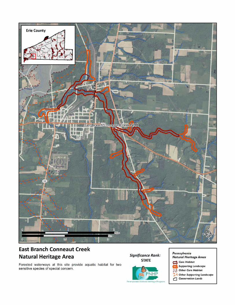
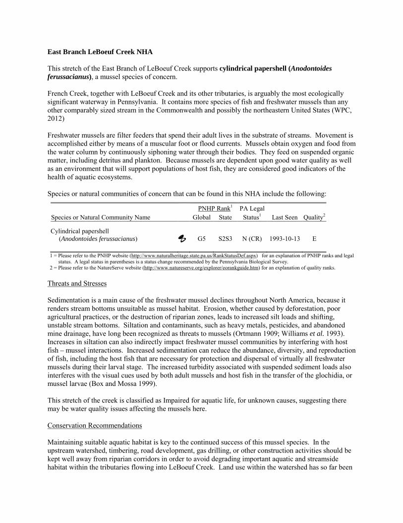
East Branch LeBoeuf Creek NHA This stretch of the East Branch of LeBoeuf Creek supports cylindrical papershell (Anodontoides ferussacianus), a mussel species of concern. French Creek, together with LeBoeuf Creek and its other tributaries, is arguably the most ecologically significant waterway in Pennsylvania. It contains more species of fish and freshwater mussels than any other comparably sized stream in the Commonwealth and possibly the northeastern United States (WPC, 2012) Freshwater mussels are filter feeders that spend their adult lives in the substrate of streams. Movement is accomplished either by means of a muscular foot or flood currents. Mussels obtain oxygen and food from the water column by continuously siphoning water through their bodies. They feed on suspended organic matter, including detritus and plankton. Because mussels are dependent upon good water quality as well as an environment that will support populations of host fish, they are considered good indicators of the health of aquatic ecosystems. Species or natural communities of concern that can be found in this NHA include the following:
PNHP Rank1 PA Legal Species or Natural Community Name Global State Status1 Last Seen Quality2 Cylindrical papershell (Anodontoides ferussacianus) G5 S2S3 N (CR) 1993-10-13 E 1 = Please refer to the PNHP website (http://www.naturalheritage.state.pa.us/RankStatusDef.aspx) for an explanation of PNHP ranks and legal
status. A legal status in parentheses is a status change recommended by the Pennsylvania Biological Survey. 2 = Please refer to the NatureServe website (http://www.natureserve.org/explorer/eorankguide.htm) for an explanation of quality ranks.
Threats and Stresses Sedimentation is a main cause of the freshwater mussel declines throughout North America, because it renders stream bottoms unsuitable as mussel habitat. Erosion, whether caused by deforestation, poor agricultural practices, or the destruction of riparian zones, leads to increased silt loads and shifting, unstable stream bottoms. Siltation and contaminants, such as heavy metals, pesticides, and abandoned mine drainage, have long been recognized as threats to mussels (Ortmann 1909; Williams et al. 1993). Increases in siltation can also indirectly impact freshwater mussel communities by interfering with host fish – mussel interactions. Increased sedimentation can reduce the abundance, diversity, and reproduction of fish, including the host fish that are necessary for protection and dispersal of virtually all freshwater mussels during their larval stage. The increased turbidity associated with suspended sediment loads also interferes with the visual cues used by both adult mussels and host fish in the transfer of the glochidia, or mussel larvae (Box and Mossa 1999). This stretch of the creek is classified as Impaired for aquatic life, for unknown causes, suggesting there may be water quality issues affecting the mussels here. Conservation Recommendations Maintaining suitable aquatic habitat is key to the continued success of this mussel species. In the upstream watershed, timbering, road development, gas drilling, or other construction activities should be kept well away from riparian corridors in order to avoid degrading important aquatic and streamside habitat within the tributaries flowing into LeBoeuf Creek. Land use within the watershed has so far been
compatible with maintaining the high-quality conditions within this site, but the anticipated upswing in gas development could pose a challenge to maintaining water quality. Any planning of future development within the watershed should seek to avoid potential impacts to both the physical character and water quality of the LeBoeuf Creek. The following steps are recommended to ensure the persistence of these species at this site:
• Conserve and expand the forested riparian buffers of LeBoeuf Creek and its tributaries. Streams through forested areas should be considered high priority for conservation. The forested riparian corridor helps to regulate the temperature of the stream and creates streamside conditions that contribute to improved water quality and aquatic habitat. Streams through non-forested areas should be restored with native trees and shrubs appropriate to the habitat. Establish at least a 100 foot (30 meter) buffer of woody vegetation along the creek and its tributaries to help reduce erosion, sedimentation, and pollution.
• Best management practices (BMPs) that focus on limiting the introduction of non-point sources of pollution into surface and groundwater should be applied to the surrounding area
Location and Additional Information
Municipalities: Greene Township USGS quads: Hammett 1993 Erie CNHI reference: French Creek BDA Associated NHAs: None Overlapping Protected Lands: This will be calculated via a spatial join and added later PNHP Significance Rank: State References Box, J. B. and Mossa, J. (1999). Sediment, land use and freshwater mussels: prospects and problems. Journal of the North
American Benthological Society 18(1): 99-117. Williams, J. D., M. L. Warren, K. S. Cummings, J. L. Harris, and R. J. Neves. (1993). Conservation status of freshwater mussels
of the United States and Canada. Fisheries 18: 6-22. Ortmann, A.E. (1909). The destruction of the fresh-water fauna in western Pennsylvania. Proceedings of the American
Philosophical Society 48:90-110.
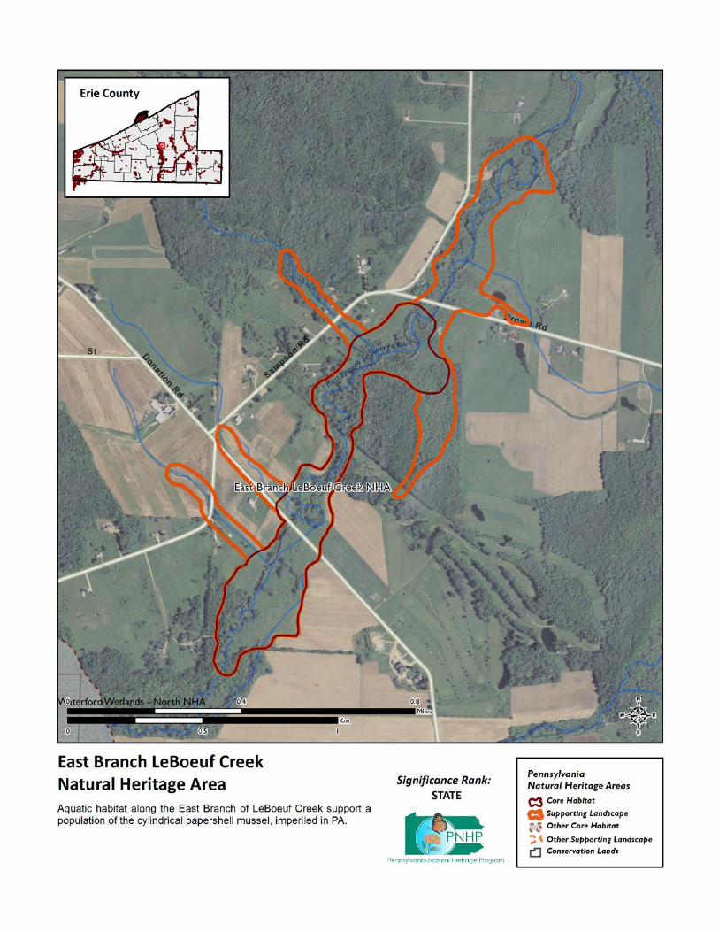
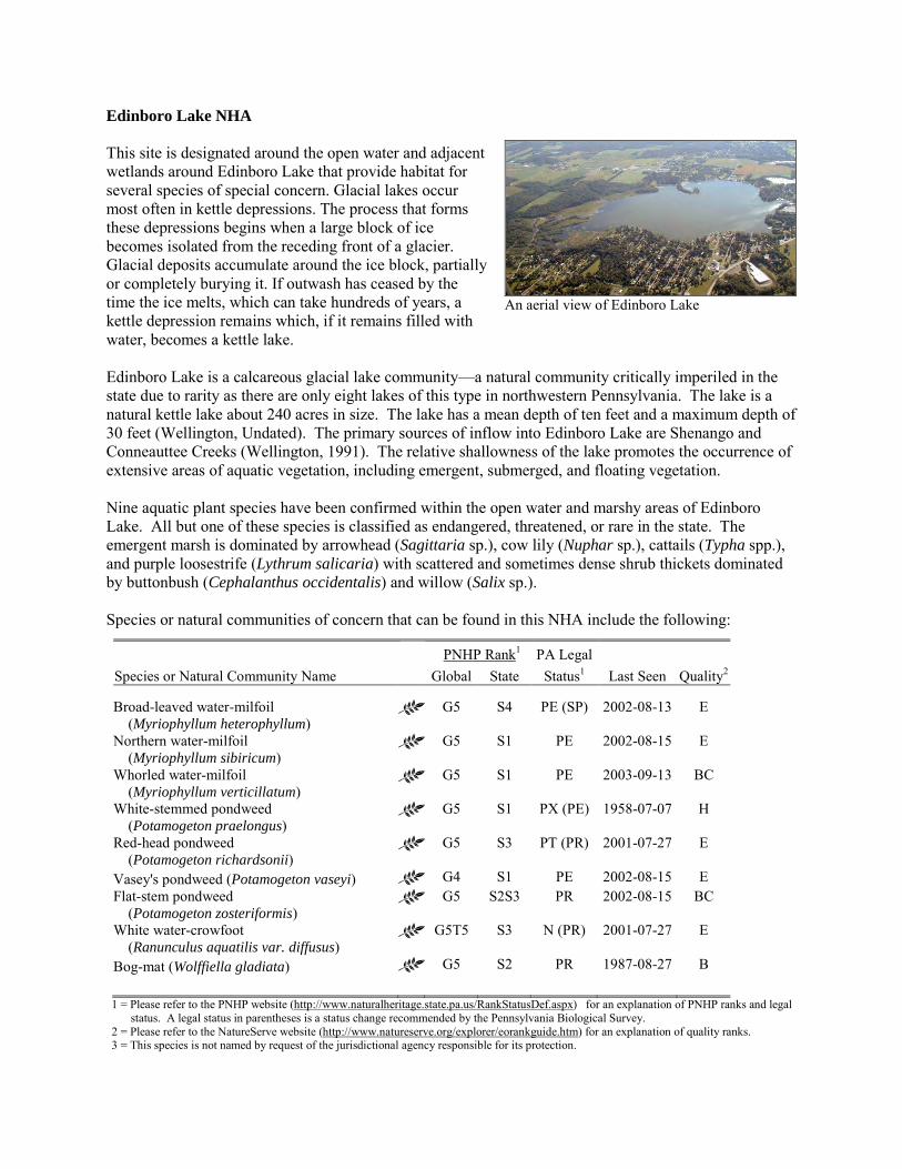
Edinboro Lake NHA This site is designated around the open water and adjacent wetlands around Edinboro Lake that provide habitat for several species of special concern. Glacial lakes occur most often in kettle depressions. The process that forms these depressions begins when a large block of ice becomes isolated from the receding front of a glacier. Glacial deposits accumulate around the ice block, partially or completely burying it. If outwash has ceased by the time the ice melts, which can take hundreds of years, a kettle depression remains which, if it remains filled with water, becomes a kettle lake. Edinboro Lake is a calcareous glacial lake community—a natural community critically imperiled in the state due to rarity as there are only eight lakes of this type in northwestern Pennsylvania. The lake is a natural kettle lake about 240 acres in size. The lake has a mean depth of ten feet and a maximum depth of 30 feet (Wellington, Undated). The primary sources of inflow into Edinboro Lake are Shenango and Conneauttee Creeks (Wellington, 1991). The relative shallowness of the lake promotes the occurrence of extensive areas of aquatic vegetation, including emergent, submerged, and floating vegetation. Nine aquatic plant species have been confirmed within the open water and marshy areas of Edinboro Lake. All but one of these species is classified as endangered, threatened, or rare in the state. The emergent marsh is dominated by arrowhead (Sagittaria sp.), cow lily (Nuphar sp.), cattails (Typha spp.), and purple loosestrife (Lythrum salicaria) with scattered and sometimes dense shrub thickets dominated by buttonbush (Cephalanthus occidentalis) and willow (Salix sp.).
Species or natural communities of concern that can be found in this NHA include the following:
PNHP Rank1 PA Legal Species or Natural Community Name Global State Status1 Last Seen Quality2 Broad-leaved water-milfoil (Myriophyllum heterophyllum)
G5 S4 PE (SP) 2002-08-13 E
Northern water-milfoil (Myriophyllum sibiricum)
G5 S1 PE 2002-08-15 E
Whorled water-milfoil (Myriophyllum verticillatum)
G5 S1 PE 2003-09-13 BC
White-stemmed pondweed (Potamogeton praelongus)
G5 S1 PX (PE) 1958-07-07 H
Red-head pondweed (Potamogeton richardsonii)
G5 S3 PT (PR) 2001-07-27 E
Vasey's pondweed (Potamogeton vaseyi) G4 S1 PE 2002-08-15 E Flat-stem pondweed (Potamogeton zosteriformis)
G5 S2S3 PR 2002-08-15 BC
White water-crowfoot (Ranunculus aquatilis var. diffusus)
G5T5 S3 N (PR) 2001-07-27 E
Bog-mat (Wolffiella gladiata) G5 S2 PR 1987-08-27 B 1 = Please refer to the PNHP website (http://www.naturalheritage.state.pa.us/RankStatusDef.aspx) for an explanation of PNHP ranks and legal
status. A legal status in parentheses is a status change recommended by the Pennsylvania Biological Survey. 2 = Please refer to the NatureServe website (http://www.natureserve.org/explorer/eorankguide.htm) for an explanation of quality ranks. 3 = This species is not named by request of the jurisdictional agency responsible for its protection.
An aerial view of Edinboro Lake
Edinboro Lake harbors a number of both rare natural communities and species of concern in Pennsylvania. The rare natural communities are Edinboro Lake, a calcareous glacial lake, and unusual types of wetlands adjacent to the lake. In particular, one of the wetlands is locally known as Edinboro Lake Fen and is of particular interest because it is habitat for special concern species, and in itself is an unusual type of wetland. The lake provides habitat for six plant species of special concern. Threats and Stresses Edinboro Lake is an exceptional ecological resource, which is a seriously threatened by development and agriculture. Except for the northeastern shoreline of the lake, nearly the entire shoreline has been developed. Only narrow strips of natural vegetation occur along most of the shoreline. Consequently, the lake lacks the buffer needed to protect the community's exceptional ecological resources. These activities are compromised, however, by the lake’s advanced state of eutrophication. The lake currently experiences dense algal blooms throughout the summer. Water clarity is low. The deeper waters are completely anoxic for prolonged periods. Aquatic plant growth is extensive. All of these phenomena are the direct or indirect effects of excessive nutrient loading to the lake and any long-term plan to prevent further deterioration in water quality, or to improve water quality, must address this nutrient loading. Edinboro Lake was originally a smaller, shallower lake. Since 1800, the lake level has been raised several times by dams (WPC 2000). Each of these water level changes submerged existing wetlands and created new ones. Specific threats and stresses to the elements present at this site include the following:
• Point-source and nonpoint-source pollution entering Edinboro from development within the watershed has accelerated eutrophication by the input of excess nutrients. Heavy sediment loads enter the lake via Conneauttee Creek. This sedimentation is presumably related to agriculture, which is the primary land use within the creek's watershed, while the nutrient overloading is due both to agriculture and septic systems within the watershed. Accelerated eutrophication and water quality degradation, from heavy sediment loads and excess nutrient input, degrades fishery habitats, natural community biodiversity, and the aesthetic qualities of this component of the Erie County’s natural heritage.
• PCBs and mercury are present in lake sediments (WPC 2000). • The use of road salts (primarily sodium chloride) as deicing agents, pose significant impacts to
aquatic systems (Kaushal et al 2005). These salts are toxic to plants and animals, can pollute groundwater, and facilitate mobilization of heavy metals across roadside soils (Fidorra 2003). Due to the close proximity of Edinboro Lake to highly developed areas, and the deteriorated nature of a portion of the lake’s shoreline, road salt application takes on a heightened risk for aquatic pollution potential. The need for shoreline restoration becomes paramount with the combination of denuded shoreline, heavy metal inputs, and roads salt pollution on the eastern side of the lake.
• Areas associated with high levels of human activity, especially swimming areas and boat launches, are generally devoid of aquatic vegetation. Indeed, vegetation is often removed (either physically or with chemicals) in order to facilitate these activities. With good management, a moderate level of these activities can be consistent with a healthy lake flora. Boat launches should be specific and use of other sites should be prevented. The main boat launch is at the eastern end of the lake. There are no vascular plants growing at this site. This is due not only to direct disturbance, but also to erosion and resulting siltation of the substrate.
• There are no horsepower limits on the lake, allowing water skiing and the use of personal watercraft. There is some evidence that motorboat use may churn up the bottom of the lake, reducing visibility and potentially impacting vegetation.
• Invasive species threaten the integrity of the glacial lake and populations of species of concern. Eurasian water milfoil (Myriophyllum spicatum) is a major problem at Edinboro Lake, and is probably the most abundant aquatic plant in the lake. Dense beds of this species extend into deeper waters compared to almost any other species in the lake. This invasive aquatic plant spreads through fragmentation, and often overwhelms lakes and chokes out native vegetation. Zebra mussels are established in the lake, affecting the ecology of the lake and also threatening French creek mussels downstream. (Smith and Crabtree 2010).
Conservation Recommendations Edinboro Lake is a valuable recreational and economic asset to the county and the region. It provides a focus for year-round activities that include boating, swimming, angling and hunting. The following steps are recommended to ensure the persistence of these species at this site:
• Educate watershed community as to the importance of these special habitats. • Continue to protect wetland habitats through education and conservation easements. • Evaluate ways to reduce excess phosphorus inputs into Lake Pleasant. A phosphorous budget of
this lake might be helpful to assess the amount of cultural eutrophication, and to suggest the most effective measures to address this issue.
• Management options for the control of viburnum leaf beetle should be investigated. • Limit the amount of development around the lake.
Location and Additional Information
Municipalities: Edinboro Borough, Washington Township USGS quads: Edinboro North, Edinboro South 1993 Erie CNHI reference: This site was part of the French Creek #2 BDA Associated NHAs: Edinboro Lake Fen NHA Overlapping Protected Lands: None PNHP Significance Rank: State References Bradley, C.P. 2009. Reconstructing the historical trophic status of Edinboro Lake, Pennsylvania using diatom
analysis, Edinboro University of Pennsylvania M.S. Thesis, 128 p. Edinboro Lake Watershed Association. 2009. Edinboro Lake Management Plan Fidorra, J. 2003. Mobilization of copper and nickel from soils impacted by deicing salt (NaCl) at Lake Pleasant,
Erie County, Pennsylvania. Department of Environmental Science, Allegheny College. Meadville, Pa. unpublished report.
Smith, T.A. and D. Crabtree. 2010. Freshwater Mussel (Unionidae: Bivalvia) Distributions and Densities in French Creek, Pennsylvania. Northeastern Naturalist 17(3): 387-414.
Sujay S Kaushal, Peter M Groffman, Gene E Likens, Kenneth T Belt, William P Stack, Victoria R Kelly, Lawrence E Band, Gary T Fisher. 2005. Increased salinization of fresh water in the northeastern United States. Proceedings of the National Academy of Sciences of the United States of America 102: 13517-20
Ostrofsky, M. L., B. L. Bodamer, K. J. Butkas and A. D. McMille. 2004. A Trophic Assessment and Phosphorus Budget for Edinboro Lake, Erie County, PA. Allegheny College, Biology Department, Meadville, PA 16335.
Wellington, R. 1991. Trophic state analysis Edinboro Lake 1991 Erie County, Pennsylvania. Erie County Department of Health. Erie, PA. 23 pp.
Western Pennsylvania Conservancy. 2000. Summary Report: Health and Management of the Edinboro Lake Ecosystem. Report to the Edinboro Regional Community Services, Inc. 65 pp.

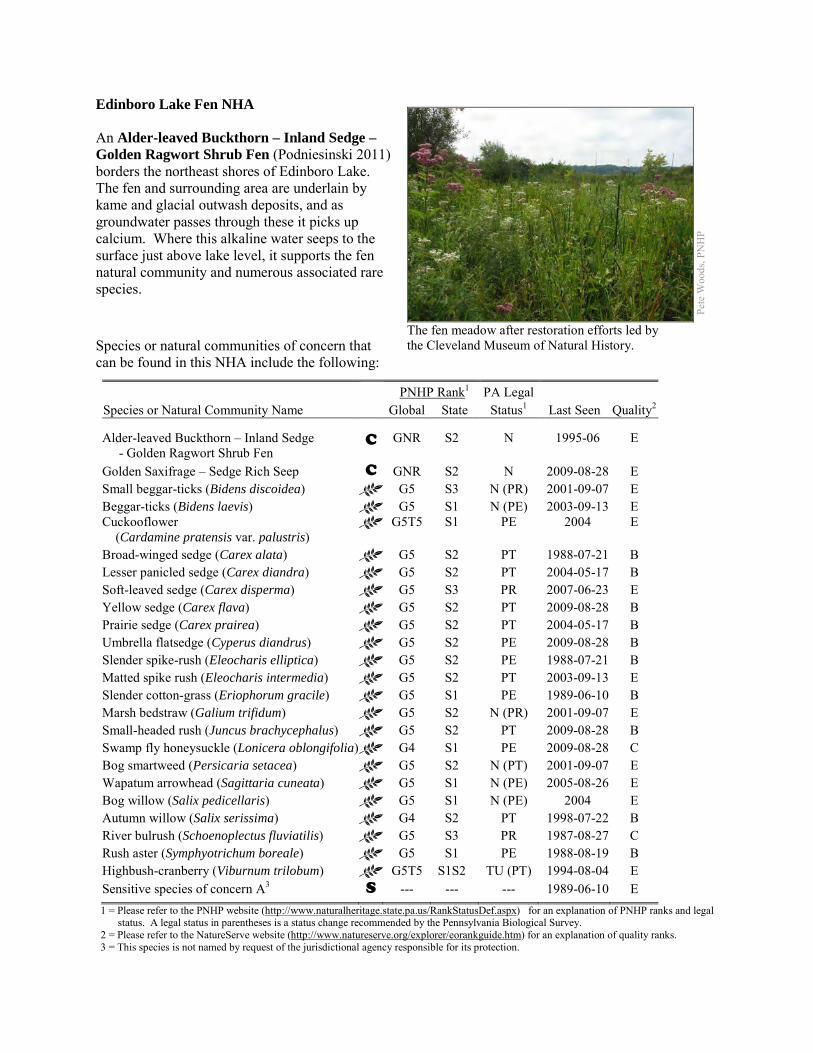
Edinboro Lake Fen NHA An Alder-leaved Buckthorn – Inland Sedge – Golden Ragwort Shrub Fen (Podniesinski 2011) borders the northeast shores of Edinboro Lake. The fen and surrounding area are underlain by kame and glacial outwash deposits, and as groundwater passes through these it picks up calcium. Where this alkaline water seeps to the surface just above lake level, it supports the fen natural community and numerous associated rare species.
Species or natural communities of concern that can be found in this NHA include the following:
PNHP Rank1 PA Legal Species or Natural Community Name Global State Status1 Last Seen Quality2 Alder-leaved Buckthorn – Inland Sedge - Golden Ragwort Shrub Fen
C GNR S2 N 1995-06 E
Golden Saxifrage – Sedge Rich Seep C GNR S2 N 2009-08-28 E Small beggar-ticks (Bidens discoidea) G5 S3 N (PR) 2001-09-07 E Beggar-ticks (Bidens laevis) G5 S1 N (PE) 2003-09-13 E Cuckooflower (Cardamine pratensis var. palustris)
G5T5 S1 PE 2004 E
Broad-winged sedge (Carex alata) G5 S2 PT 1988-07-21 B Lesser panicled sedge (Carex diandra) G5 S2 PT 2004-05-17 B Soft-leaved sedge (Carex disperma) G5 S3 PR 2007-06-23 E Yellow sedge (Carex flava) G5 S2 PT 2009-08-28 B Prairie sedge (Carex prairea) G5 S2 PT 2004-05-17 B Umbrella flatsedge (Cyperus diandrus) G5 S2 PE 2009-08-28 B Slender spike-rush (Eleocharis elliptica) G5 S2 PE 1988-07-21 B Matted spike rush (Eleocharis intermedia) G5 S2 PT 2003-09-13 E Slender cotton-grass (Eriophorum gracile) G5 S1 PE 1989-06-10 B Marsh bedstraw (Galium trifidum) G5 S2 N (PR) 2001-09-07 E Small-headed rush (Juncus brachycephalus) G5 S2 PT 2009-08-28 B Swamp fly honeysuckle (Lonicera oblongifolia) G4 S1 PE 2009-08-28 C Bog smartweed (Persicaria setacea) G5 S2 N (PT) 2001-09-07 E Wapatum arrowhead (Sagittaria cuneata) G5 S1 N (PE) 2005-08-26 E Bog willow (Salix pedicellaris) G5 S1 N (PE) 2004 E Autumn willow (Salix serissima) G4 S2 PT 1998-07-22 B River bulrush (Schoenoplectus fluviatilis) G5 S3 PR 1987-08-27 C Rush aster (Symphyotrichum boreale) G5 S1 PE 1988-08-19 B Highbush-cranberry (Viburnum trilobum) G5T5 S1S2 TU (PT) 1994-08-04 E Sensitive species of concern A3 S --- --- --- 1989-06-10 E 1 = Please refer to the PNHP website (http://www.naturalheritage.state.pa.us/RankStatusDef.aspx) for an explanation of PNHP ranks and legal
status. A legal status in parentheses is a status change recommended by the Pennsylvania Biological Survey. 2 = Please refer to the NatureServe website (http://www.natureserve.org/explorer/eorankguide.htm) for an explanation of quality ranks. 3 = This species is not named by request of the jurisdictional agency responsible for its protection.
Pete
Woo
ds, P
NH
P
The fen meadow after restoration efforts led by the Cleveland Museum of Natural History.
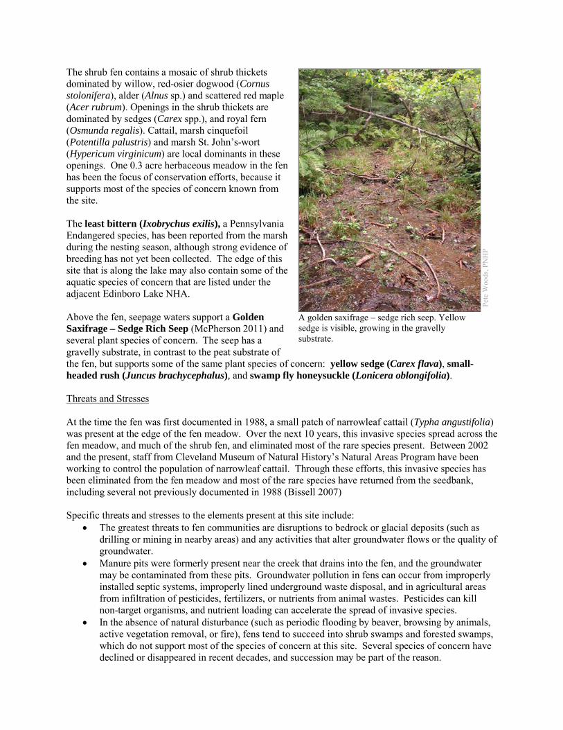
The shrub fen contains a mosaic of shrub thickets dominated by willow, red-osier dogwood (Cornus stolonifera), alder (Alnus sp.) and scattered red maple (Acer rubrum). Openings in the shrub thickets are dominated by sedges (Carex spp.), and royal fern (Osmunda regalis). Cattail, marsh cinquefoil (Potentilla palustris) and marsh St. John’s-wort (Hypericum virginicum) are local dominants in these openings. One 0.3 acre herbaceous meadow in the fen has been the focus of conservation efforts, because it supports most of the species of concern known from the site. The least bittern (Ixobrychus exilis), a Pennsylvania Endangered species, has been reported from the marsh during the nesting season, although strong evidence of breeding has not yet been collected. The edge of this site that is along the lake may also contain some of the aquatic species of concern that are listed under the adjacent Edinboro Lake NHA. Above the fen, seepage waters support a Golden Saxifrage – Sedge Rich Seep (McPherson 2011) and several plant species of concern. The seep has a gravelly substrate, in contrast to the peat substrate of the fen, but supports some of the same plant species of concern: yellow sedge (Carex flava), small-headed rush (Juncus brachycephalus), and swamp fly honeysuckle (Lonicera oblongifolia). Threats and Stresses At the time the fen was first documented in 1988, a small patch of narrowleaf cattail (Typha angustifolia) was present at the edge of the fen meadow. Over the next 10 years, this invasive species spread across the fen meadow, and much of the shrub fen, and eliminated most of the rare species present. Between 2002 and the present, staff from Cleveland Museum of Natural History’s Natural Areas Program have been working to control the population of narrowleaf cattail. Through these efforts, this invasive species has been eliminated from the fen meadow and most of the rare species have returned from the seedbank, including several not previously documented in 1988 (Bissell 2007) Specific threats and stresses to the elements present at this site include:
• The greatest threats to fen communities are disruptions to bedrock or glacial deposits (such as drilling or mining in nearby areas) and any activities that alter groundwater flows or the quality of groundwater.
• Manure pits were formerly present near the creek that drains into the fen, and the groundwater may be contaminated from these pits. Groundwater pollution in fens can occur from improperly installed septic systems, improperly lined underground waste disposal, and in agricultural areas from infiltration of pesticides, fertilizers, or nutrients from animal wastes. Pesticides can kill non-target organisms, and nutrient loading can accelerate the spread of invasive species.
• In the absence of natural disturbance (such as periodic flooding by beaver, browsing by animals, active vegetation removal, or fire), fens tend to succeed into shrub swamps and forested swamps, which do not support most of the species of concern at this site. Several species of concern have declined or disappeared in recent decades, and succession may be part of the reason.
Pete
Woo
ds, P
NH
P
A golden saxifrage – sedge rich seep. Yellow sedge is visible, growing in the gravelly substrate.
• Peatlands are particularly sensitive to trampling, soil compaction, and other physical disturbance from recreational activities.
• Viburnum leaf beetle (Pyrrhalta viburni) is an introduced pest that eats highbush-cranberry and other species of Viburnum. This pest has spread throughout the Pennsylvania range of highbush-cranberry and is decimating populations of the shrub. The long-term effects of this invasion remain unknown, but all populations of highbush-cranberry are at serious risk.
• Overbrowsing by white-tailed deer is a serious threat to the overall understory plant diversity. Some of the plant species of concern are particularly susceptible to deer herbivory.
Conservation Recommendations Permanent protection of the site has not been put in place, but both the landowner and the Cleveland Museum of Natural History are committed to continued ecological stewardship of the fen. The following steps are recommended to ensure the persistence of these species at this site:
• Narrow-leaved cattail remains a threat to the fen. Ongoing control efforts must continue, to prevent a resurgence of the species. The presence of this species in fens often is an indicator of nutrient pollution. Potential sources of surface and groundwater pollution should be identified and mitigated.
• A deer exclosure has been constructed around the fen meadow, providing protection for many of the species of concern that occur there.
• The fen may require periodic disturbance such as cutting, burning, or grazing to maintain the open canopy which is indicative of this community and the rare species that occupy it.
• Drilling, mining, or other disruptions to bedrock or glacial deposits should not be undertaken within one-half mile of a seepage wetland without a thorough understanding of bedrock layers and groundwater flows. Groundwater flow patterns do not always mirror surface watersheds, and in some cases aquifers may be contiguous over large areas.
• Any trails constructed at this site should be placed away from the wetland, or elevated boardwalks employed to prevent peat compaction and other disturbance in the wetland.
• A natural buffer around the wetland should be maintained in order to minimize nutrient runoff, pollution, and sedimentation.
• Management options for the control of viburnum leaf beetle should be investigated.
Location and Additional Information
Municipalities: Washington Township USGS quads: Edinboro North 1993 Erie CNHI reference: French Creek #2 Associated NHAs: Edinboro Lake NHA Overlapping Protected Lands: None PNHP Significance Rank: Global
References Bissel, J.K. Restoration and recovery of a sedge-rush fen meadow degraded by non-native Typha angustifolia in NW
Pennsylvania. Natural Areas Conference 2007 Abstracts. Accessed July 31, 2012 at http://www.naturalarea.org/conferenceAbstracts.aspx?p=408
McPherson, J. 2011. Pennsylvania Natural Heritage Program. Golden Saxifrage – Sedge Rich Seep Factsheet. Available from: http://www.naturalheritage.state.pa.us/Community.aspx?=16005 Date Accessed: September 11, 2012
Podniesinski 2011. Pennsylvania Natural Heritage Program. Alder-leaved Buckthorn – Inland Sedge – Golden Ragwort Shrub Fen Factsheet. Available from: http://www.naturalheritage.state.pa.us/Community.aspx?=30002 Date Accessed: September 11, 2012
Western Pennsylvania Conservancy. 2000. Summary Report: Health and Management of the Edinboro Lake Ecosystem. Report to the Edinboro Regional Community Services, Inc. 65 pp. Available online: http://www.paconserve.org/rc/pdfs/edinlake.pdf
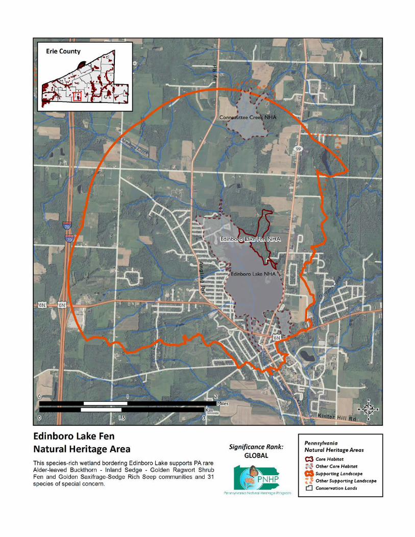
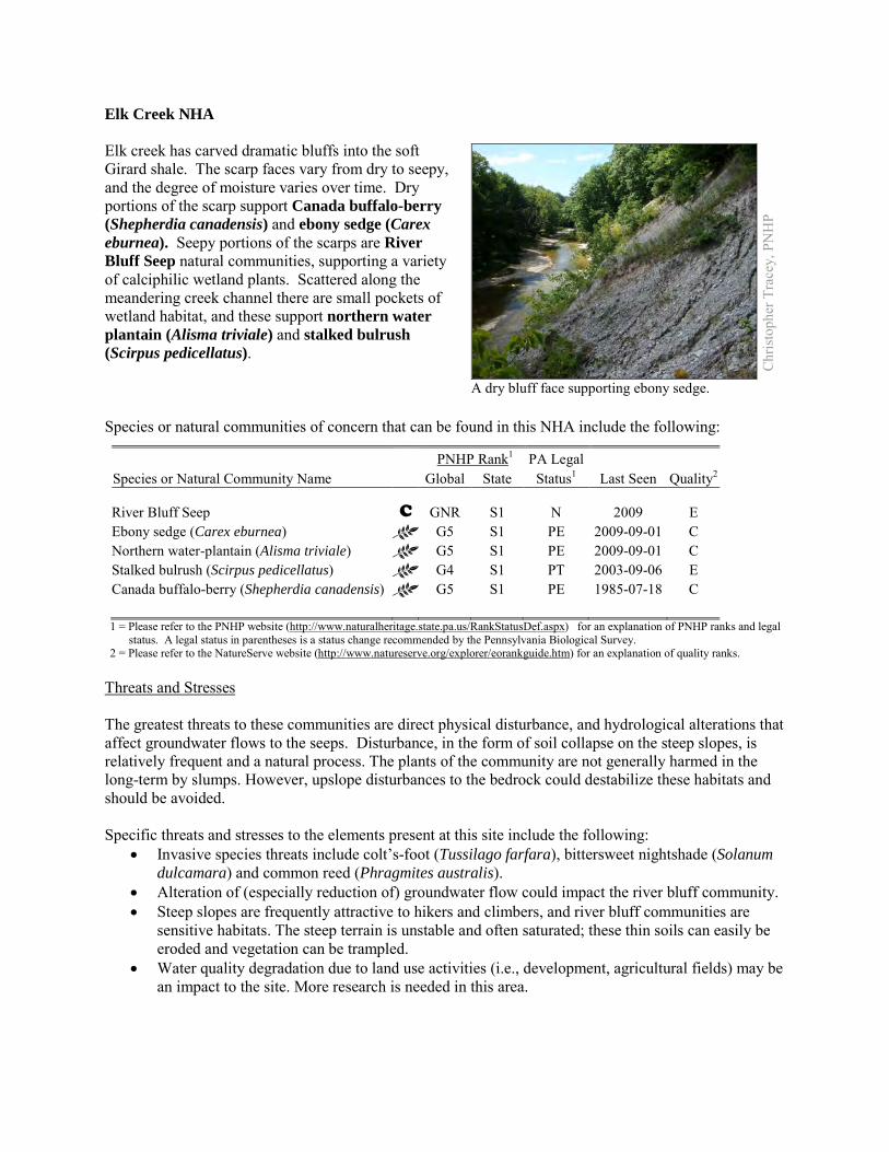
Elk Creek NHA Elk creek has carved dramatic bluffs into the soft Girard shale. The scarp faces vary from dry to seepy, and the degree of moisture varies over time. Dry portions of the scarp support Canada buffalo-berry (Shepherdia canadensis) and ebony sedge (Carex eburnea). Seepy portions of the scarps are River Bluff Seep natural communities, supporting a variety of calciphilic wetland plants. Scattered along the meandering creek channel there are small pockets of wetland habitat, and these support northern water plantain (Alisma triviale) and stalked bulrush (Scirpus pedicellatus). Species or natural communities of concern that can be found in this NHA include the following:
PNHP Rank1 PA Legal Species or Natural Community Name Global State Status1 Last Seen Quality2 River Bluff Seep C GNR S1 N 2009 E Ebony sedge (Carex eburnea) G5 S1 PE 2009-09-01 C Northern water-plantain (Alisma triviale) G5 S1 PE 2009-09-01 C Stalked bulrush (Scirpus pedicellatus) G4 S1 PT 2003-09-06 E Canada buffalo-berry (Shepherdia canadensis) G5 S1 PE 1985-07-18 C 1 = Please refer to the PNHP website (http://www.naturalheritage.state.pa.us/RankStatusDef.aspx) for an explanation of PNHP ranks and legal
status. A legal status in parentheses is a status change recommended by the Pennsylvania Biological Survey. 2 = Please refer to the NatureServe website (http://www.natureserve.org/explorer/eorankguide.htm) for an explanation of quality ranks.
Threats and Stresses The greatest threats to these communities are direct physical disturbance, and hydrological alterations that affect groundwater flows to the seeps. Disturbance, in the form of soil collapse on the steep slopes, is relatively frequent and a natural process. The plants of the community are not generally harmed in the long-term by slumps. However, upslope disturbances to the bedrock could destabilize these habitats and should be avoided. Specific threats and stresses to the elements present at this site include the following:
• Invasive species threats include colt’s-foot (Tussilago farfara), bittersweet nightshade (Solanum dulcamara) and common reed (Phragmites australis).
• Alteration of (especially reduction of) groundwater flow could impact the river bluff community. • Steep slopes are frequently attractive to hikers and climbers, and river bluff communities are
sensitive habitats. The steep terrain is unstable and often saturated; these thin soils can easily be eroded and vegetation can be trampled.
• Water quality degradation due to land use activities (i.e., development, agricultural fields) may be an impact to the site. More research is needed in this area.
Chr
isto
pher
Tra
cey,
PN
HP
A dry bluff face supporting ebony sedge.
Conservation Recommendations The Core Habitat of this site is almost entirely on private land. The following steps are recommended to ensure the persistence of these species at this site:
• Control invasive species of plants. Mechanical (hand pulling, cutting and mowing) and chemical (spot herbicide treatment) management techniques may be necessary to protect the habitat from colonization by aggressive species. Broadcast application of herbicides is not suitable for this delicate habitat.
• A natural vegetation buffer should be allowed to develop along the stream valley crest within the site's boundary in order to reduce the threat of human-induced erosion and to protect surface water quality and quantity entering the NHA. Care should be taken when providing access to this site, and trail construction along the top of tributary gorges should be limited to avoid impacting this community.
• Property owners could also contribute to ground water quality and quantity protection by reducing or avoiding the application of pesticides and/or fertilizers within site boundaries and avoiding artificial drainage of subsurface waters.
• Avoiding timber harvesting and further development within the natural heritage area will protect the species of concern
• Allow the forested habitats to achieve and maintain old growth conditions. Avoid fragmenting the existing forested areas with additional buildings or infrastructure. Avoid logging in this area except as it relates to invasive species removal. The forest cover should be allowed to achieve and maintain old-growth characteristics. Leave fallen trees in place to help provide habitat, soil nutrients, and humus. Trees that have fallen over approved trails can be cut through as necessary.
• Further inventory for moths and other invertebrates is recommended, because these undersurveyed groups may form a substantial part of the biodiversity of bluff seep communities.
• Research is needed to better understand the patterns of succession of plant species, especially species of conservation concern, on these slump habitats.
Location and Additional Information
Municipalities: Girard Township, Girard Borough, Fairview Township USGS quads: Albion, Edinboro North 1993 Erie CNHI reference: Battles Museum OHA, Devil’s Backbone Associated NHAs: Devil’s Backbone NHA, Falls Run Gorge NHA, Lower Elk Creek NHA Overlapping Protected Lands: none PNHP Significance Rank: State References Zimmerman 2011. Pennsylvania Natural Heritage Program. River Bluff Seep Factsheet. Available from:
http://www.naturalheritage.state.pa.us/Community.aspx?=30030 Date Accessed: March 12, 2012
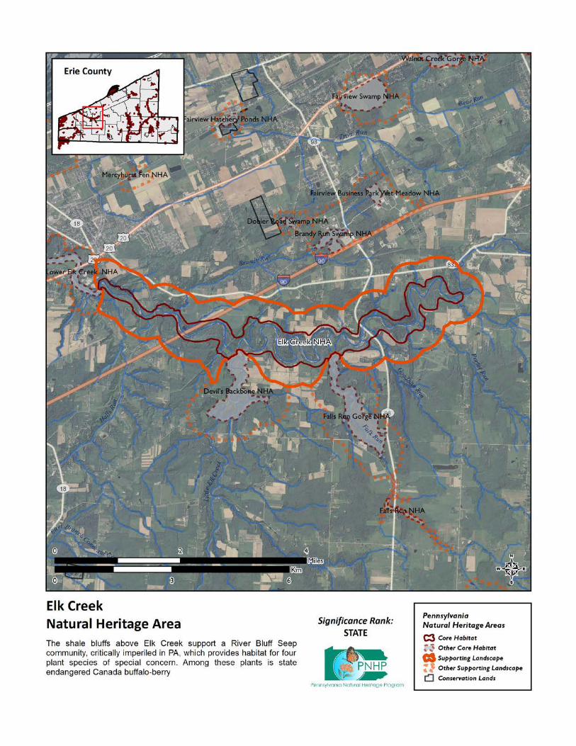
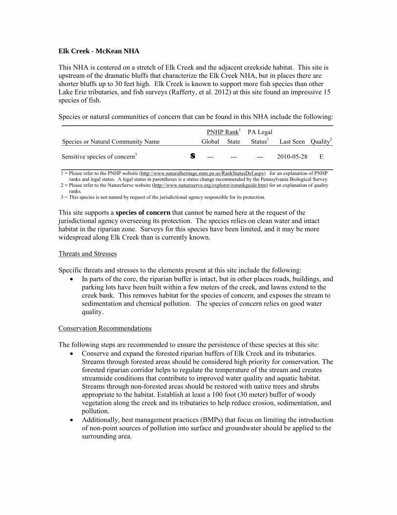
Elk Creek - McKean NHA This NHA is centered on a stretch of Elk Creek and the adjacent creekside habitat. This site is upstream of the dramatic bluffs that characterize the Elk Creek NHA, but in places there are shorter bluffs up to 30 feet high. Elk Creek is known to support more fish species than other Lake Erie tributaries, and fish surveys (Rafferty, et al. 2012) at this site found an impressive 15 species of fish. Species or natural communities of concern that can be found in this NHA include the following:
PNHP Rank1 PA Legal Species or Natural Community Name Global State Status1 Last Seen Quality2 Sensitive species of concern3 S --- --- --- 2010-05-28 E 1 = Please refer to the PNHP website (http://www.naturalheritage.state.pa.us/RankStatusDef.aspx) for an explanation of PNHP
ranks and legal status. A legal status in parentheses is a status change recommended by the Pennsylvania Biological Survey. 2 = Please refer to the NatureServe website (http://www.natureserve.org/explorer/eorankguide.htm) for an explanation of quality
ranks. 3 = This species is not named by request of the jurisdictional agency responsible for its protection.
This site supports a species of concern that cannot be named here at the request of the jurisdictional agency overseeing its protection. The species relies on clean water and intact habitat in the riparian zone. Surveys for this species have been limited, and it may be more widespread along Elk Creek than is currently known. Threats and Stresses Specific threats and stresses to the elements present at this site include the following:
• In parts of the core, the riparian buffer is intact, but in other places roads, buildings, and parking lots have been built within a few meters of the creek, and lawns extend to the creek bank. This removes habitat for the species of concern, and exposes the stream to sedimentation and chemical pollution. The species of concern relies on good water quality.
Conservation Recommendations The following steps are recommended to ensure the persistence of these species at this site:
• Conserve and expand the forested riparian buffers of Elk Creek and its tributaries. Streams through forested areas should be considered high priority for conservation. The forested riparian corridor helps to regulate the temperature of the stream and creates streamside conditions that contribute to improved water quality and aquatic habitat. Streams through non-forested areas should be restored with native trees and shrubs appropriate to the habitat. Establish at least a 100 foot (30 meter) buffer of woody vegetation along the creek and its tributaries to help reduce erosion, sedimentation, and pollution.
• Additionally, best management practices (BMPs) that focus on limiting the introduction of non-point sources of pollution into surface and groundwater should be applied to the surrounding area.

Location and Additional Information
Municipalities: McKean Borough, McKean Township USGS quads: Edinboro North, Swanville 1993 Erie CNHI reference: None Associated NHAs: None Overlapping Protected Lands: None PNHP Significance Rank: State References Rafferty, S.D., Lybrook, J., Kacmarek, K.M., Lethaby, M., and Wellington, R. 2012. An assessment of the Pennsylvania Lake Erie
watershed fish community. The Pennsylvania State University. Unpublished manuscript.
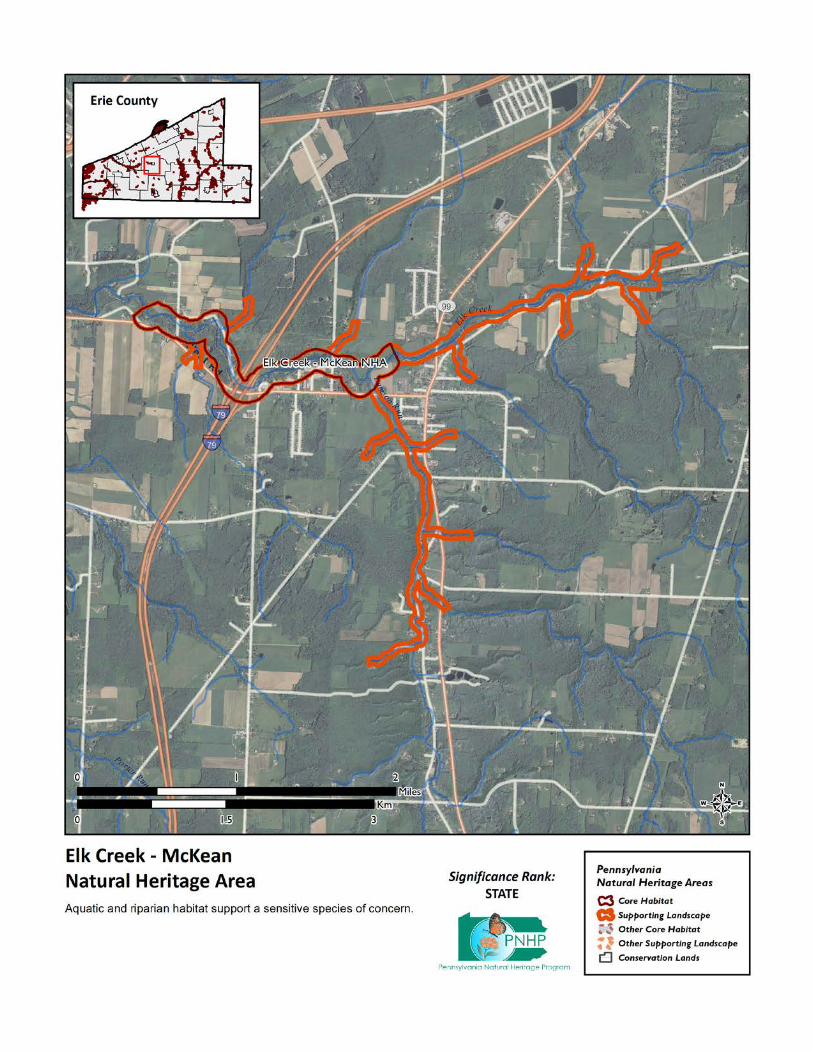
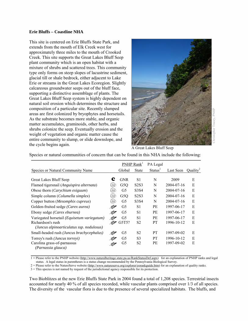
Erie Bluffs – Coastline NHA This site is centered on Erie Bluffs State Park, and extends from the mouth of Elk Creek west for approximately three miles to the mouth of Crooked Creek. This site supports the Great Lakes Bluff Seep plant community which is an open habitat with a mixture of shrubs and scattered trees. This community type only forms on steep slopes of lacustrine sediment, glacial till or shale bedrock, either adjacent to Lake Erie or streams in the Great Lakes Ecoregion. Slightly calcareous groundwater seeps out of the bluff face, supporting a distinctive assemblage of plants. The Great Lakes Bluff Seep system is highly dependent on natural soil erosion which determines the structure and composition of a particular site. Recently slumped areas are first colonized by bryophytes and horsetails. As the substrate becomes more stable, and organic matter accumulates, graminoids, other herbs, and shrubs colonize the seep. Eventually erosion and the weight of vegetation and organic matter cause the entire community to slump, or slide downslope, and the cycle begins again. Species or natural communities of concern that can be found in this NHA include the following:
PNHP Rank1 PA Legal Species or Natural Community Name Global State Status1 Last Seen Quality2 Great Lakes Bluff Seep C GNR S1 N 2009 E Flamed tigersnail (Anguispira alternata) G5Q S2S3 N 2004-07-16 E Obese thorn (Carychium exiguum) G5 S3S4 N 2004-07-16 E Simple column (Columella simplex) G5Q S2S3 N 2004-07-16 E Copper button (Mesomphix cupreus) G5 S3S4 N 2004-07-16 E Golden-fruited sedge (Carex aurea) G5 S1 PE 1997-06-17 E Ebony sedge (Carex eburnea) G5 S1 PE 1997-06-17 E Variegated horsetail (Equisetum variegatum) G5 S1 PE 1997-06-17 E Richardson's rush (Juncus alpinoarticulatus ssp. nodulosus)
G5T5? S2 PT 1996-10-12 E
Small-headed rush (Juncus brachycephalus) G5 S2 PT 1997-09-02 E Torrey's rush (Juncus torreyi) G5 S3 PT 1996-10-12 E Carolina grass-of-parnassus (Parnassia glauca)
G5 S2 PE 1997-09-02 E
1 = Please refer to the PNHP website (http://www.naturalheritage.state.pa.us/RankStatusDef.aspx) for an explanation of PNHP ranks and legal
status. A legal status in parentheses is a status change recommended by the Pennsylvania Biological Survey. 2 = Please refer to the NatureServe website (http://www.natureserve.org/explorer/eorankguide.htm) for an explanation of quality ranks. 3 = This species is not named by request of the jurisdictional agency responsible for its protection.
Two Bioblitzes at the new Erie Bluffs State Park in 2004 found a total of 1,208 species. Terrestrial insects accounted for nearly 40 % of all species recorded, while vascular plants comprised over 1/3 of all species. The diversity of the vascular flora is due to the presence of several specialized habitats. The bluffs, and
Chr
istop
her T
race
y, P
NH
P
A Great Lakes Bluff Seep
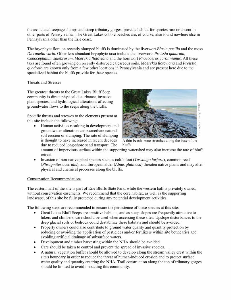
the associated seepage slumps and steep tributary gorges, provide habitat for species rare or absent in other parts of Pennsylvania. The Great Lakes cobble beaches are, of course, also found nowhere else in Pennsylvania other than the Erie coast. The bryophyte flora on recently slumped bluffs is dominated by the liverwort Blasia pusilla and the moss Dicranella varia. Other less abundant bryophyte taxa include the liverworts Preissia quadrata, Conocephalum salebrosum, Moerckia flotoviana and the hornwort Phaeoceros carolinianus. All these taxa are found often growing on recently disturbed calcareous soils. Moerckia flotoviana and Preissia quadrata are known only from a few other locations in Pennsylvania and are present here due to the specialized habitat the bluffs provide for these species. Threats and Stresses The greatest threats to the Great Lakes Bluff Seep community is direct physical disturbance, invasive plant species, and hydrological alterations affecting groundwater flows to the seeps along the bluffs. Specific threats and stresses to the elements present at this site include the following:
• Human activities resulting in development and groundwater alteration can exacerbate natural soil erosion or slumping. The rate of slumping is thought to have increased in recent decades due to reduced long-shore sand transport. The amount of impervious surface within the supporting watershed may also increase the rate of bluff retreat.
• Invasion of non-native plant species such as colt’s foot (Tussilago farfara), common reed (Phragmites australis), and European alder (Alnus glutinosa) threaten native plants and may alter physical and chemical processes along the bluffs.
Conservation Recommendations The eastern half of the site is part of Erie Bluffs State Park, while the western half is privately owned, without conservation easements. We recommend that the core habitat, as well as the supporting landscape, of this site be fully protected during any potential development activities. The following steps are recommended to ensure the persistence of these species at this site:
• Great Lakes Bluff Seeps are sensitive habitats, and as steep slopes are frequently attractive to hikers and climbers, care should be used when accessing these sites. Upslope disturbances to the deep glacial soils or bedrock could destabilize these habitats and should be avoided.
• Property owners could also contribute to ground water quality and quantity protection by reducing or avoiding the application of pesticides and/or fertilizers within site boundaries and avoiding artificial drainage of subsurface waters.
• Development and timber harvesting within the NHA should be avoided. • Care should be taken to control and prevent the spread of invasive species. • A natural vegetation buffer should be allowed to develop along the stream valley crest within the
site's boundary in order to reduce the threat of human-induced erosion and to protect surface water quality and quantity entering the NHA. Trail construction along the top of tributary gorges should be limited to avoid impacting this community.
Chr
istop
her T
race
y, P
NH
P
A thin beach zone stretches along the base of the bluffs
• This NHA should be protected as a part of a large system of shoreline scarp woodlands and forested seeps to facilitate native seed dispersal and wildlife movement.
Location and Additional Information
Municipalities: Girard Township, Springfield Township USGS quads: Fairview SW, Fairview 1993 Erie CNHI reference: Lake Plain Shoreline BDA Associated NHAs: Erie Bluffs East Swamp NHA, Erie Bluffs West Swamp NHA, Erie Bluffs Sand Dune
NHA, Lower Elk Creek NHA Overlapping Protected Lands: Erie Bluffs State Park, Elk Creek Access, Girard Township PNHP Significance Rank: Regional References McPherson, J. and Zimmerman, E. 2011. Pennsylvania Natural Heritage Program. Great Lakes Bluff Seep Factsheet. Available
from: http://www.naturalheritage.state.pa.us/Community.aspx?=16040 Date Accessed: March 28, 2012
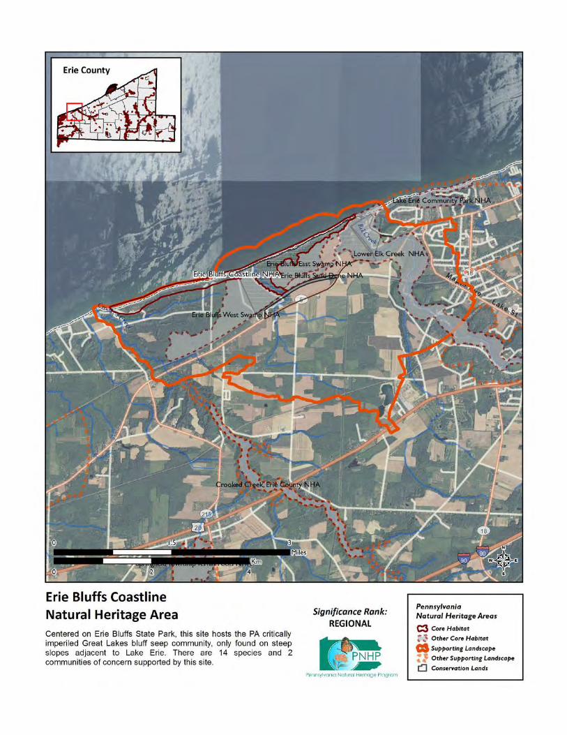
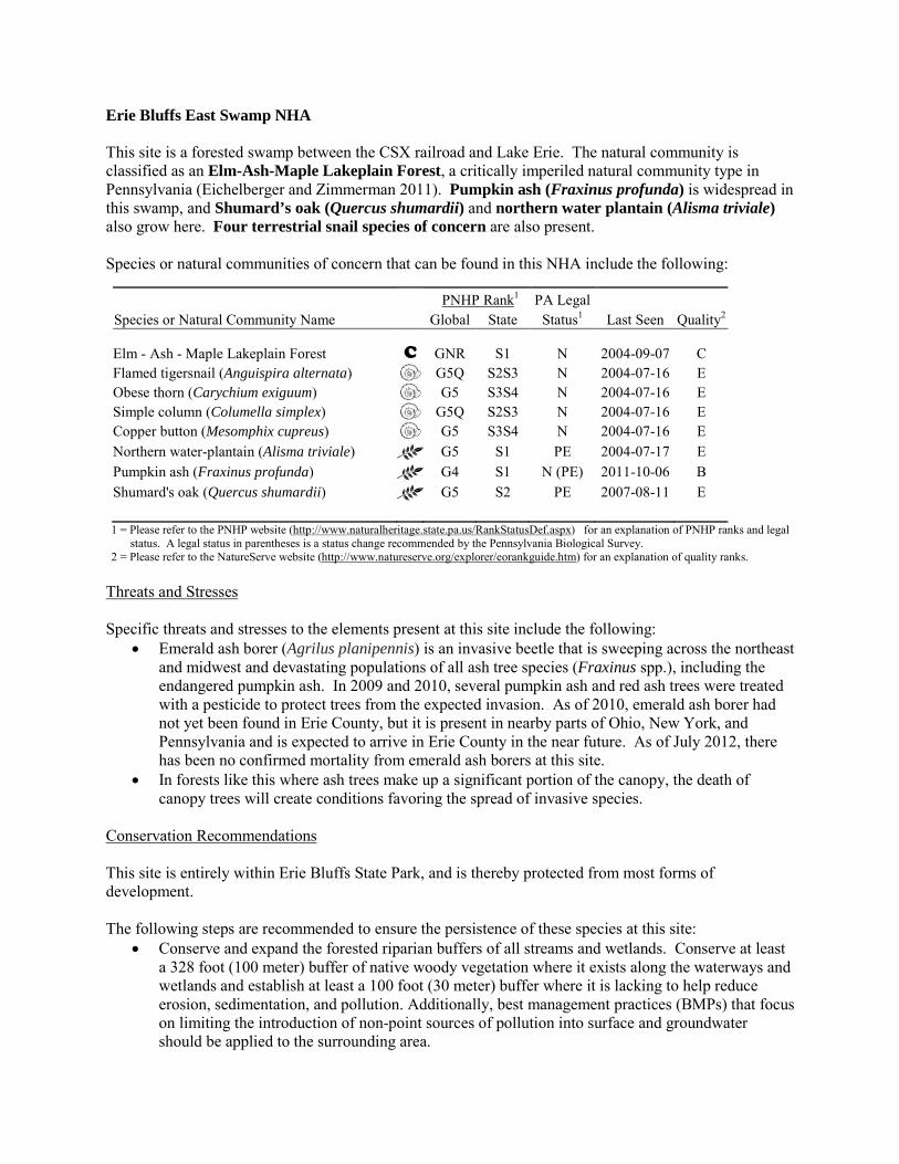
Erie Bluffs East Swamp NHA This site is a forested swamp between the CSX railroad and Lake Erie. The natural community is classified as an Elm-Ash-Maple Lakeplain Forest, a critically imperiled natural community type in Pennsylvania (Eichelberger and Zimmerman 2011). Pumpkin ash (Fraxinus profunda) is widespread in this swamp, and Shumard’s oak (Quercus shumardii) and northern water plantain (Alisma triviale) also grow here. Four terrestrial snail species of concern are also present. Species or natural communities of concern that can be found in this NHA include the following:
PNHP Rank1 PA Legal Species or Natural Community Name Global State Status1 Last Seen Quality2 Elm - Ash - Maple Lakeplain Forest C GNR S1 N 2004-09-07 C Flamed tigersnail (Anguispira alternata) G5Q S2S3 N 2004-07-16 E Obese thorn (Carychium exiguum) G5 S3S4 N 2004-07-16 E Simple column (Columella simplex) G5Q S2S3 N 2004-07-16 E Copper button (Mesomphix cupreus) G5 S3S4 N 2004-07-16 E Northern water-plantain (Alisma triviale) G5 S1 PE 2004-07-17 E Pumpkin ash (Fraxinus profunda) G4 S1 N (PE) 2011-10-06 B Shumard's oak (Quercus shumardii) G5 S2 PE 2007-08-11 E 1 = Please refer to the PNHP website (http://www.naturalheritage.state.pa.us/RankStatusDef.aspx) for an explanation of PNHP ranks and legal
status. A legal status in parentheses is a status change recommended by the Pennsylvania Biological Survey. 2 = Please refer to the NatureServe website (http://www.natureserve.org/explorer/eorankguide.htm) for an explanation of quality ranks.
Threats and Stresses Specific threats and stresses to the elements present at this site include the following:
• Emerald ash borer (Agrilus planipennis) is an invasive beetle that is sweeping across the northeast and midwest and devastating populations of all ash tree species (Fraxinus spp.), including the endangered pumpkin ash. In 2009 and 2010, several pumpkin ash and red ash trees were treated with a pesticide to protect trees from the expected invasion. As of 2010, emerald ash borer had not yet been found in Erie County, but it is present in nearby parts of Ohio, New York, and Pennsylvania and is expected to arrive in Erie County in the near future. As of July 2012, there has been no confirmed mortality from emerald ash borers at this site.
• In forests like this where ash trees make up a significant portion of the canopy, the death of canopy trees will create conditions favoring the spread of invasive species.
Conservation Recommendations This site is entirely within Erie Bluffs State Park, and is thereby protected from most forms of development. The following steps are recommended to ensure the persistence of these species at this site:
• Conserve and expand the forested riparian buffers of all streams and wetlands. Conserve at least a 328 foot (100 meter) buffer of native woody vegetation where it exists along the waterways and wetlands and establish at least a 100 foot (30 meter) buffer where it is lacking to help reduce erosion, sedimentation, and pollution. Additionally, best management practices (BMPs) that focus on limiting the introduction of non-point sources of pollution into surface and groundwater should be applied to the surrounding area.
• Injecting ash trees with insecticides is an expensive option that can temporarily save small numbers of trees. This method is not with risks, because although ash trees are wind pollinated, their pollen is an important food source for bees and other insects in the spring. Injecting trees with systemic insecticides will probably harm populations of these pollinators, but it may be the only way to save reproductive ash trees.
• Measures to manage invasive species will have to be ramped up when the ash trees in the forest begin to die and allow more light to reach the forest floor
Location and Additional Information
Municipalities: Girard Township, Springfield Township USGS quads: Fairview SW 1993 Erie CNHI reference: Lake Plain Shoreline Associated NHAs: Erie Bluffs Coastline NHA, Erie Bluffs West Swamp NHA, Erie Bluffs Sand Dune
NHA. Overlapping Protected Lands: Erie Bluffs State Park PNHP Significance Rank: Regional References Department of Conservation and Natural Resources; Wallace Roberts and Todd, LLC; and Economic Research Associates.
2008. Master Plan for Erie Bluffs State Park. Available from: http://www.dcnr.state.pa.us/ucmprd2/groups/public/documents/document/dcnr_004875.pdf. Date Accessed: November 14, 2012
Eichelberger, B. and Zimmerman, E. 2011. Pennsylvania Natural Heritage Program. Elm – Ash – Maple Lakeplain Forest Factsheet. Available from: http://www.naturalheritage.state.pa.us/Community.aspx?=16020 Date Accessed: August 29, 2012
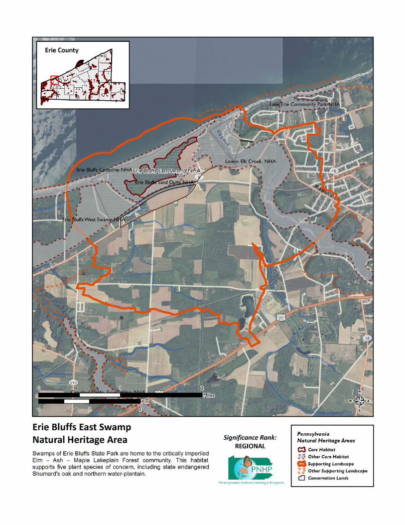
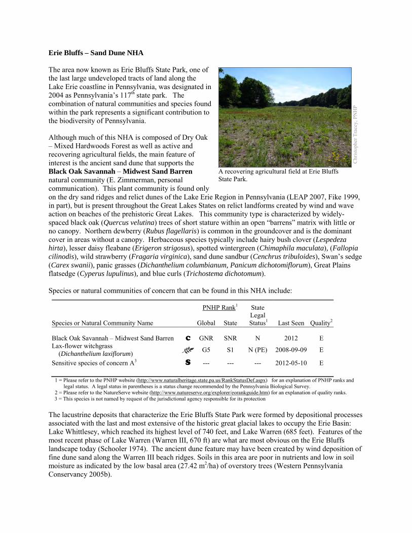
Erie Bluffs – Sand Dune NHA The area now known as Erie Bluffs State Park, one of the last large undeveloped tracts of land along the Lake Erie coastline in Pennsylvania, was designated in 2004 as Pennsylvania’s 117th state park. The combination of natural communities and species found within the park represents a significant contribution to the biodiversity of Pennsylvania.
Although much of this NHA is composed of Dry Oak – Mixed Hardwoods Forest as well as active and recovering agricultural fields, the main feature of interest is the ancient sand dune that supports the Black Oak Savannah – Midwest Sand Barren natural community (E. Zimmerman, personal communication). This plant community is found only on the dry sand ridges and relict dunes of the Lake Erie Region in Pennsylvania (LEAP 2007, Fike 1999, in part), but is present throughout the Great Lakes States on relict landforms created by wind and wave action on beaches of the prehistoric Great Lakes. This community type is characterized by widely-spaced black oak (Quercus velutina) trees of short stature within an open “barrens” matrix with little or no canopy. Northern dewberry (Rubus flagellaris) is common in the groundcover and is the dominant cover in areas without a canopy. Herbaceous species typically include hairy bush clover (Lespedeza hirta), lesser daisy fleabane (Erigeron strigosus), spotted wintergreen (Chimaphila maculata), (Fallopia cilinodis), wild strawberry (Fragaria virginica), sand dune sandbur (Cenchrus tribuloides), Swan’s sedge (Carex swanii), panic grasses (Dichanthelium columbianum, Panicum dichotomiflorum), Great Plains flatsedge (Cyperus lupulinus), and blue curls (Trichostema dichotomum). Species or natural communities of concern that can be found in this NHA include:
PNHP Rank1 State
Species or Natural Community Name
Global State Legal
Status1 Last Seen Quality2 Black Oak Savannah – Midwest Sand Barren C GNR SNR N 2012 E Lax-flower witchgrass (Dichanthelium laxiflorum) G5 S1 N (PE) 2008-09-09 E
Sensitive species of concern A3 S --- --- --- 2012-05-10 E
1 = Please refer to the PNHP website (http://www.naturalheritage.state.pa.us/RankStatusDef.aspx) for an explanation of PNHP ranks and legal status. A legal status in parentheses is a status change recommended by the Pennsylvania Biological Survey.
2 = Please refer to the NatureServe website (http://www.natureserve.org/explorer/eorankguide.htm) for an explanation of quality ranks. 3 = This species is not named by request of the jurisdictional agency responsible for its protection
The lacustrine deposits that characterize the Erie Bluffs State Park were formed by depositional processes associated with the last and most extensive of the historic great glacial lakes to occupy the Erie Basin: Lake Whittlesey, which reached its highest level of 740 feet, and Lake Warren (685 feet). Features of the most recent phase of Lake Warren (Warren III, 670 ft) are what are most obvious on the Erie Bluffs landscape today (Schooler 1974). The ancient dune feature may have been created by wind deposition of fine dune sand along the Warren III beach ridges. Soils in this area are poor in nutrients and low in soil moisture as indicated by the low basal area (27.42 m2/ha) of overstory trees (Western Pennsylvania Conservancy 2005b).
Chr
istop
her T
race
y, P
NH
P
A recovering agricultural field at Erie Bluffs State Park.
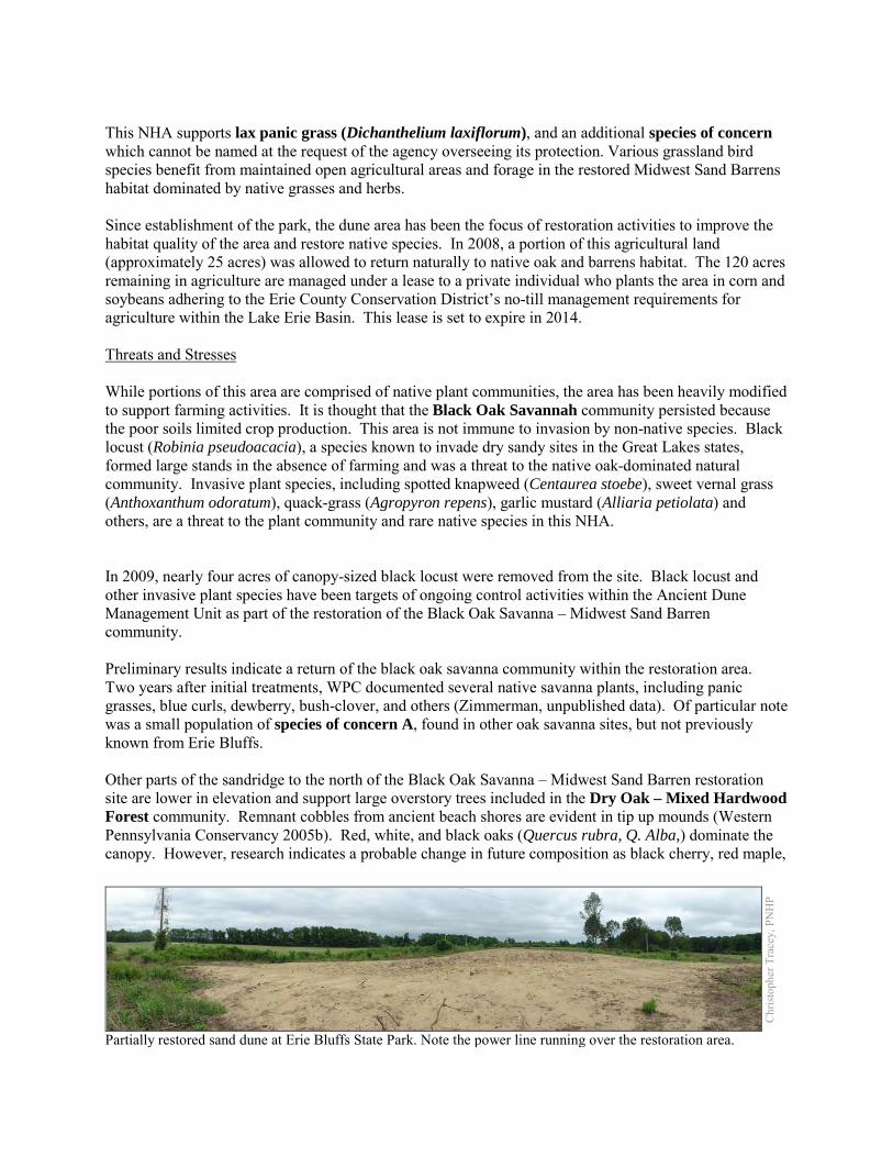
This NHA supports lax panic grass (Dichanthelium laxiflorum), and an additional species of concern which cannot be named at the request of the agency overseeing its protection. Various grassland bird species benefit from maintained open agricultural areas and forage in the restored Midwest Sand Barrens habitat dominated by native grasses and herbs. Since establishment of the park, the dune area has been the focus of restoration activities to improve the habitat quality of the area and restore native species. In 2008, a portion of this agricultural land (approximately 25 acres) was allowed to return naturally to native oak and barrens habitat. The 120 acres remaining in agriculture are managed under a lease to a private individual who plants the area in corn and soybeans adhering to the Erie County Conservation District’s no-till management requirements for agriculture within the Lake Erie Basin. This lease is set to expire in 2014. Threats and Stresses While portions of this area are comprised of native plant communities, the area has been heavily modified to support farming activities. It is thought that the Black Oak Savannah community persisted because the poor soils limited crop production. This area is not immune to invasion by non-native species. Black locust (Robinia pseudoacacia), a species known to invade dry sandy sites in the Great Lakes states, formed large stands in the absence of farming and was a threat to the native oak-dominated natural community. Invasive plant species, including spotted knapweed (Centaurea stoebe), sweet vernal grass (Anthoxanthum odoratum), quack-grass (Agropyron repens), garlic mustard (Alliaria petiolata) and others, are a threat to the plant community and rare native species in this NHA. In 2009, nearly four acres of canopy-sized black locust were removed from the site. Black locust and other invasive plant species have been targets of ongoing control activities within the Ancient Dune Management Unit as part of the restoration of the Black Oak Savanna – Midwest Sand Barren community. Preliminary results indicate a return of the black oak savanna community within the restoration area. Two years after initial treatments, WPC documented several native savanna plants, including panic grasses, blue curls, dewberry, bush-clover, and others (Zimmerman, unpublished data). Of particular note was a small population of species of concern A, found in other oak savanna sites, but not previously known from Erie Bluffs. Other parts of the sandridge to the north of the Black Oak Savanna – Midwest Sand Barren restoration site are lower in elevation and support large overstory trees included in the Dry Oak – Mixed Hardwood Forest community. Remnant cobbles from ancient beach shores are evident in tip up mounds (Western Pennsylvania Conservancy 2005b). Red, white, and black oaks (Quercus rubra, Q. Alba,) dominate the canopy. However, research indicates a probable change in future composition as black cherry, red maple,
Chr
istop
her T
race
y, P
NH
P
Partially restored sand dune at Erie Bluffs State Park. Note the power line running over the restoration area.
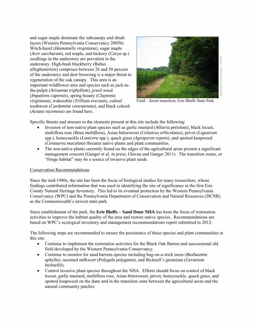
and sugar maple dominate the subcanopy and shrub layers (Western Pennsylvania Conservancy 2005b). Witch-hazel (Hamamelis virginiana), sugar maple (Acer saccharum), red maple, and hickory (Carya sp.) seedlings in the understory are prevalent in the understory. High-bush blackberry (Rubus alleghaniensis) comprises between 26 and 50 percent of the understory and deer browsing is a major threat to regeneration of the oak canopy. This area is an important wildflower area and species such as jack-in- the-pulpit (Arisaema triphyllum), jewel weed (Impatiens capensis), spring beauty (Claytonia virginiana), wakerobin (Trillium erectum), cutleaf toothwort (Cardamine concatenata), and black cohosh (Actaea racemosa) are found here. Specific threats and stresses to the elements present at this site include the following:
• Invasion of non-native plant species such as garlic mustard (Alliaria petiolata), black locust, multiflora rose (Rosa multiflora), Asian bittersweet (Celastrus orbiculatus), privet (Ligustrum spp.), honeysuckle (Lonicera spp.), quack grass (Agropyron repens), and spotted knapweed (Centaurea maculata) threaten native plants and plant communities.
• The non-native plants currently found on the edges of the agricultural areas present a significant management concern (Ganger et al. in press, Gluvna and Ganger 2011). The transition zones, or “fringe habitat” may be a source of invasive plant seeds.
Conservation Recommendations Since the mid-1980s, the site has been the focus of biological studies for many researchers, whose findings contributed information that was used in identifying the site of significance in the first Erie County Natural Heritage Inventory. This led to its eventual protection by the Western Pennsylvania Conservancy (WPC) and the Pennsylvania Department of Conservation and Natural Resources (DCNR) as the Commonwealth’s newest state park. Since establishment of the park, the Erie Bluffs – Sand Dune NHA has been the focus of restoration activities to improve the habitat quality of the area and restore native species. Recommendations are based on WPC’s ecological inventory and management recommendations report submitted in 2012. The following steps are recommended to ensure the persistence of these species and plant communities at this site:
• Continue to implement the restoration activities for the Black Oak Barren and successional old field developed by the Western Pennsylvania Conservancy.
• Continue to monitor for sand barrens species including bug-on-a-stick moss (Buxbaumia aphylla), racemed milkwort (Polygala polygama), and Bicknell’s geranium (Geranium bicknellii).
• Control invasive plant species throughout the NHA. Efforts should focus on control of black locust, garlic mustard, multiflora rose, Asian bittersweet, privet, honeysuckle, quack grass, and spotted knapweed on the dune and in the transition zone between the agricultural areas and the natural community patches
Ephr
aim
Zim
mer
man
, PN
HP
Field – forest transition, Erie Bluffs State Park
• Conduct a formal assessment of the white-tailed deer (Odocoileus virginianus) population of Erie Bluffs Sate Park. Develop a deer population control plan if necessary to reduce the resident deer population.
• Remove unneeded powerlines and telephone poles from the site. • Formally develop the “Dune Trail” to provide access to several spectacular sites along the bluffs
that overlook Lake Erie. Location and Additional Information Municipalities: Girard Township, Springfield Township USGS quads: Fairview SW 1993 Erie CNHI reference: Lake Plain Shoreline BDA Associated NHAs: Erie Bluffs Coastline NHA, Erie Bluffs East Swamp Overlapping Protected Lands: Erie Bluffs State Park PNHP Significance Rank: State References Ganger MT, McGivern J, Boccian L, Brown N-A, and Perenic J (in press) Vegetation Characterization of the Fringe Habitat in
the Erie Bluffs State Park in Erie County, Pennsylvania. Journal of the Pennsylvania Academy of Sciences. Gluvna, J. E. and Ganger, M.T. 2011. First-year colonization of an old field within the Erie Bluffs State Park in northwestern
Pennsylvania. Journal of the Pennsylvania Academy of Science 85:81-87. Lake Erie Allegheny Partnership. 2007. Black Oak Savanna / Midwest Sand Barren fact sheet. Cleveland Museum of Natural
History. Available at: http://www.leapbio.org/docs/LEAP_legacy_sandbarren.pdf. Date Accessed: November 13, 2012. Natural Resources Inventory and Management Recommendations for Erie Bluffs State Park. Western Pennsylvania Conservancy. 2005a. BioBlitz at Erie Bluffs State Park (Coho Tract), May 14-15, July 16-17 2004, Report
to Pennsylvania Department of Conservation and Natural Resources (DCNR). 2005. Western Pennsylvania Conservancy, 209 Fourth Ave. Pittsburgh, PA 15222.
Western Pennsylvania Conservancy. 2005b. Rapid Inventory and Assessment of Landscape, Ecological and Biodiversity Resources Relative to Management Options. Report to Pennsylvania Department of Conservation and Natural Resources (DCNR). 2005. Western Pennsylvania Conservancy, 209 Fourth Ave. Pittsburgh, PA 15222.

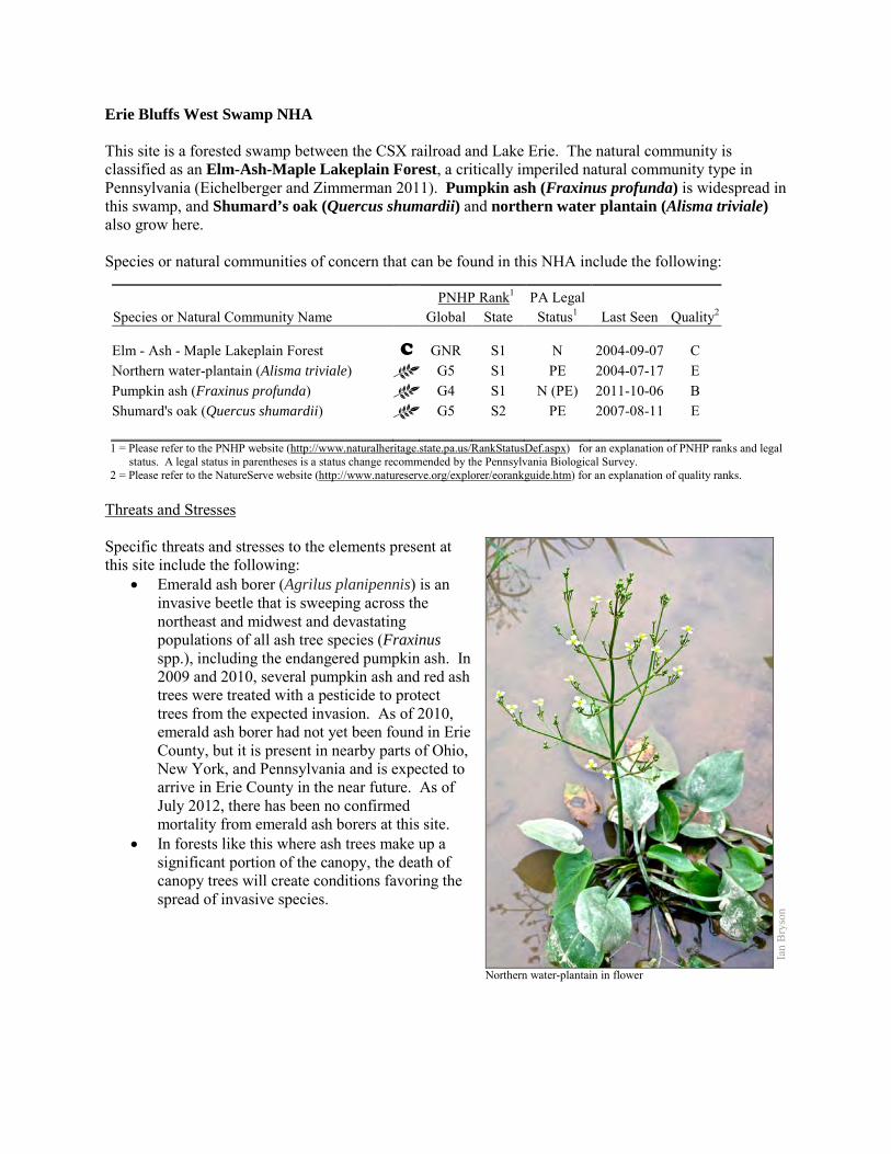
Erie Bluffs West Swamp NHA This site is a forested swamp between the CSX railroad and Lake Erie. The natural community is classified as an Elm-Ash-Maple Lakeplain Forest, a critically imperiled natural community type in Pennsylvania (Eichelberger and Zimmerman 2011). Pumpkin ash (Fraxinus profunda) is widespread in this swamp, and Shumard’s oak (Quercus shumardii) and northern water plantain (Alisma triviale) also grow here. Species or natural communities of concern that can be found in this NHA include the following:
PNHP Rank1 PA Legal Species or Natural Community Name Global State Status1 Last Seen Quality2 Elm - Ash - Maple Lakeplain Forest C GNR S1 N 2004-09-07 C Northern water-plantain (Alisma triviale) G5 S1 PE 2004-07-17 E Pumpkin ash (Fraxinus profunda) G4 S1 N (PE) 2011-10-06 B Shumard's oak (Quercus shumardii) G5 S2 PE 2007-08-11 E 1 = Please refer to the PNHP website (http://www.naturalheritage.state.pa.us/RankStatusDef.aspx) for an explanation of PNHP ranks and legal
status. A legal status in parentheses is a status change recommended by the Pennsylvania Biological Survey. 2 = Please refer to the NatureServe website (http://www.natureserve.org/explorer/eorankguide.htm) for an explanation of quality ranks.
Threats and Stresses Specific threats and stresses to the elements present at this site include the following:
• Emerald ash borer (Agrilus planipennis) is an invasive beetle that is sweeping across the northeast and midwest and devastating populations of all ash tree species (Fraxinus spp.), including the endangered pumpkin ash. In 2009 and 2010, several pumpkin ash and red ash trees were treated with a pesticide to protect trees from the expected invasion. As of 2010, emerald ash borer had not yet been found in Erie County, but it is present in nearby parts of Ohio, New York, and Pennsylvania and is expected to arrive in Erie County in the near future. As of July 2012, there has been no confirmed mortality from emerald ash borers at this site.
• In forests like this where ash trees make up a significant portion of the canopy, the death of canopy trees will create conditions favoring the spread of invasive species.
Ian
Bry
son
Northern water-plantain in flower
Conservation Recommendations This site is partially within Erie Bluffs State Park, and the remainder is privately owned, without conservation easements. The following steps are recommended to ensure the persistence of these species at this site:
• Conserve and expand the forested riparian buffers of all streams and wetlands. Conserve at least a 328 foot (100 meter) buffer of native woody vegetation where it exists along the waterways and wetlands and establish at least a 100 foot (30 meter) buffer where it is lacking to help reduce erosion, sedimentation, and pollution. Additionally, best management practices (BMPs) that focus on limiting the introduction of non-point sources of pollution into surface and groundwater should be applied to the surrounding area.
• Injecting ash trees with insecticides is an expensive option that can temporarily save small numbers of trees. This method is not with risks, because although ash trees are wind pollinated, their pollen is an important food source for bees and other insects in the spring. Injecting trees with systemic insecticides will probably harm populations of these pollinators, but it may be the only way to save reproductive ash trees.
• Measures to manage invasive species will have to be ramped up when the ash trees in the forest begin to die and allow more light to reach the forest floor
Location and Additional Information
Municipalities: Springfield Township USGS quads: East Springfield, Fairview SW 1993 Erie CNHI reference: Lake Plain Shoreline Associated NHAs: Erie Bluffs Coastline NHA, Erie Bluffs East Swamp NHA, Erie Bluffs Sand Dune
NHA. Overlapping Protected Lands: Erie Bluffs State Park PNHP Significance Rank: State References Department of Conservation and Natural Resources; Wallace Roberts and Todd, LLC; and Economic Research Associates.
2008. Master Plan for Erie Bluffs State Park. Available from: http://www.dcnr.state.pa.us/ucmprd2/groups/public/documents/document/dcnr_004875.pdf. Date Accessed: November 14, 2012
McPherson, J. and Zimmerman, E. 2011. Pennsylvania Natural Heritage Program. Great Lakes Bluff Seep Factsheet. Available from: http://www.naturalheritage.state.pa.us/Community.aspx?=16040 Date Accessed: March 28, 2012
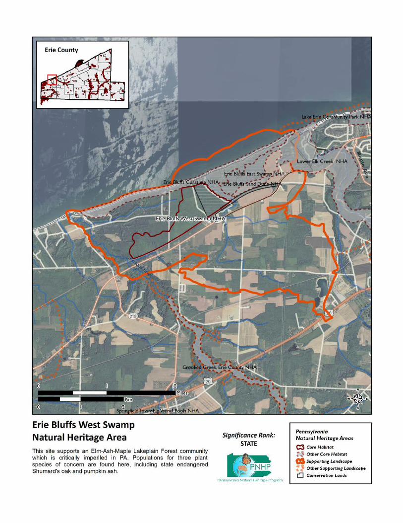
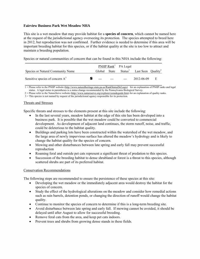
Fairview Business Park Wet Meadow NHA This site is a wet meadow that may provide habitat for a species of concern, which cannot be named here at the request of the jurisdictional agency overseeing its protection. The species attempted to breed here in 2012, but reproduction was not confirmed. Further evidence is needed to determine if this area will be important breeding habitat for this species, or if the habitat quality at the site is too low to attract and maintain a breeding population. Species or natural communities of concern that can be found in this NHA include the following:
PNHP Rank1 PA Legal Species or Natural Community Name Global State Status1 Last Seen Quality2 Sensitive species of concern A3 S --- --- --- 2012-06-09 E 1 = Please refer to the PNHP website (http://www.naturalheritage.state.pa.us/RankStatusDef.aspx) for an explanation of PNHP ranks and legal
status. A legal status in parentheses is a status change recommended by the Pennsylvania Biological Survey. 2 = Please refer to the NatureServe website (http://www.natureserve.org/explorer/eorankguide.htm) for an explanation of quality ranks.
3 = This species is not named by request of the jurisdictional agency responsible for its protection. Threats and Stresses Specific threats and stresses to the elements present at this site include the following:
• In the last several years, meadow habitat at the edge of this site has been developed into a business park. It is possible that the wet meadow could be converted to commercial development. As development of adjacent land continues, the storm runoff, noise, and traffic, could be deleterious to the habitat quality.
• Buildings and parking lots have been constructed within the watershed of the wet meadow, and the large area of newly impervious surface has altered the meadow’s hydrology and is likely to change the habitat quality for the species of concern.
• Mowing and other disturbances between late spring and early fall may prevent successful reproduction
• Roaming feral and outside pet cats represent a significant threat of predation to this species. • Succession of the breeding habitat to dense shrubland or forest is a threat to this species, although
scattered shrubs are part of its preferred habitat. Conservation Recommendations The following steps are recommended to ensure the persistence of these species at this site:
• Developing the wet meadow or the immediately adjacent area would destroy the habitat for the species of concern.
• Study the effect of the hydrological alterations on the meadow and consider how remedial actions such as rain barrels, detention ponds, or changing the direction of runoff would change the habitat quality.
• Continue to monitor the species of concern to determine if this is a long-term breeding site. • Avoid disturbance between late spring and early fall. If mowing cannot be avoided, it should be
delayed until after August to allow for successful breeding. • Remove feral cats from the area, and keep pet cats indoors. • Prevent trees and shrubs from growing dense stands in these fields.

Location and Additional Information
Municipalities: Fairview Township USGS quads: Swanville 1993 Erie CNHI reference: Previously unrecognized site Associated NHAs: None Overlapping Protected Lands: None; private land. PNHP Significance Rank: State
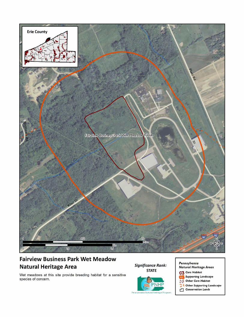
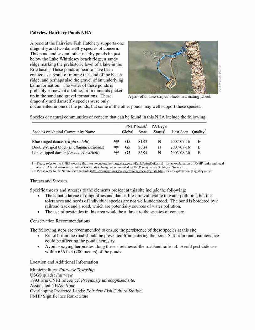
Fairview Hatchery Ponds NHA A pond at the Fairview Fish Hatchery supports one dragonfly and two damselfly species of concern. This pond and several other nearby ponds lie just below the Lake Whittlesey beach ridge, a sandy ridge marking the prehistoric level of a lake in the Erie basin. These ponds appear to have been created as a result of mining the sand of the beach ridge, and perhaps also the gravel of an underlying kame formation. The water of these ponds is probably somewhat alkaline, from minerals picked up in the sand and gravel formations. These dragonfly and damselfly species were only documented in one of the ponds, but some of the other ponds may well support these species. Species or natural communities of concern that can be found in this NHA include the following:
PNHP Rank1 PA Legal Species or Natural Community Name Global State Status1 Last Seen Quality2 Blue-ringed dancer (Argia sedula) G5 S1S3 N 2007-07-16 E Double-striped bluet (Enallagma basidens) G5 S3S4 N 2007-07-16 E Lance-tipped darner (Aeshna constricta) G5 S3S4 N 2003-08-30 E 1 = Please refer to the PNHP website (http://www.naturalheritage.state.pa.us/RankStatusDef.aspx) for an explanation of PNHP ranks and legal
status. A legal status in parentheses is a status change recommended by the Pennsylvania Biological Survey. 2 = Please refer to the NatureServe website (http://www.natureserve.org/explorer/eorankguide.htm) for an explanation of quality ranks.
Threats and Stresses Specific threats and stresses to the elements present at this site include the following:
• The aquatic larvae of dragonflies and damselflies are vulnerable to water pollution, but the tolerances and needs of individual species are not well-understood. The pond is bordered by a railroad track and a road, which are potentially sources of water pollution.
• The use of pesticides in this area would be a threat to the species of concern. Conservation Recommendations The following steps are recommended to ensure the persistence of these species at this site:
• Runoff from the road should be prevented from entering the pond. Salt from road maintenance could be affecting the pond chemistry.
• Avoid spraying herbicides along these stretches of the road and railroad. Avoid pesticide use within 656 feet (200 meters) of the ponds.
Location and Additional Information
Municipalities: Fairview Township USGS quads: Fairview 1993 Erie CNHI reference: Previously unrecognized site. Associated NHAs: None Overlapping Protected Lands: Fairview Fish Culture Station PNHP Significance Rank: State
Pete
Woo
ds, P
NH
P
A pair of double-striped bluets in a mating wheel.
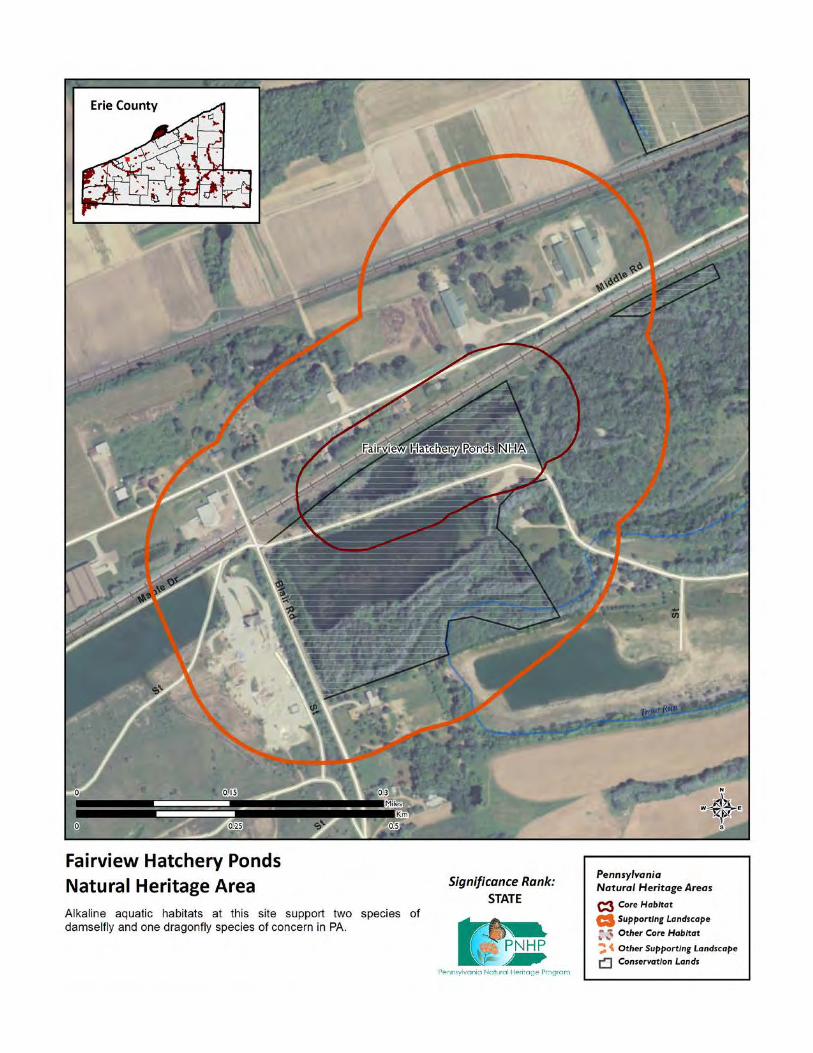
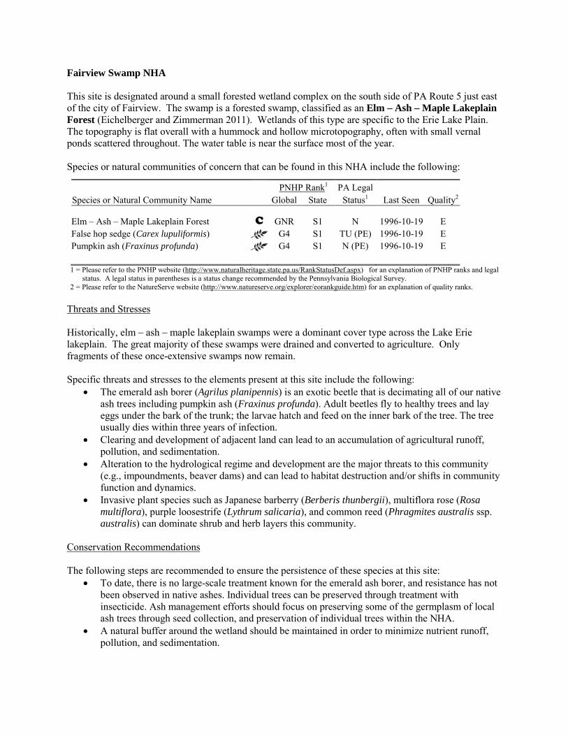
Fairview Swamp NHA This site is designated around a small forested wetland complex on the south side of PA Route 5 just east of the city of Fairview. The swamp is a forested swamp, classified as an Elm – Ash – Maple Lakeplain Forest (Eichelberger and Zimmerman 2011). Wetlands of this type are specific to the Erie Lake Plain. The topography is flat overall with a hummock and hollow microtopography, often with small vernal ponds scattered throughout. The water table is near the surface most of the year. Species or natural communities of concern that can be found in this NHA include the following:
PNHP Rank1 PA Legal Species or Natural Community Name Global State Status1 Last Seen Quality2 Elm – Ash – Maple Lakeplain Forest C GNR S1 N 1996-10-19 E False hop sedge (Carex lupuliformis) G4 S1 TU (PE) 1996-10-19 E Pumpkin ash (Fraxinus profunda) G4 S1 N (PE) 1996-10-19 E 1 = Please refer to the PNHP website (http://www.naturalheritage.state.pa.us/RankStatusDef.aspx) for an explanation of PNHP ranks and legal
status. A legal status in parentheses is a status change recommended by the Pennsylvania Biological Survey. 2 = Please refer to the NatureServe website (http://www.natureserve.org/explorer/eorankguide.htm) for an explanation of quality ranks.
Threats and Stresses Historically, elm – ash – maple lakeplain swamps were a dominant cover type across the Lake Erie lakeplain. The great majority of these swamps were drained and converted to agriculture. Only fragments of these once-extensive swamps now remain. Specific threats and stresses to the elements present at this site include the following:
• The emerald ash borer (Agrilus planipennis) is an exotic beetle that is decimating all of our native ash trees including pumpkin ash (Fraxinus profunda). Adult beetles fly to healthy trees and lay eggs under the bark of the trunk; the larvae hatch and feed on the inner bark of the tree. The tree usually dies within three years of infection.
• Clearing and development of adjacent land can lead to an accumulation of agricultural runoff, pollution, and sedimentation.
• Alteration to the hydrological regime and development are the major threats to this community (e.g., impoundments, beaver dams) and can lead to habitat destruction and/or shifts in community function and dynamics.
• Invasive plant species such as Japanese barberry (Berberis thunbergii), multiflora rose (Rosa multiflora), purple loosestrife (Lythrum salicaria), and common reed (Phragmites australis ssp. australis) can dominate shrub and herb layers this community.
Conservation Recommendations The following steps are recommended to ensure the persistence of these species at this site:
• To date, there is no large-scale treatment known for the emerald ash borer, and resistance has not been observed in native ashes. Individual trees can be preserved through treatment with insecticide. Ash management efforts should focus on preserving some of the germplasm of local ash trees through seed collection, and preservation of individual trees within the NHA.
• A natural buffer around the wetland should be maintained in order to minimize nutrient runoff, pollution, and sedimentation.
• Direct impacts and habitat alteration should be avoided (e.g., roads, trails, filling of wetlands) and low impact alternatives (e.g., elevated footpaths, boardwalks, bridges) should be utilized in situations where accessing the wetland can not be avoided.
• Care should also be taken to control and prevent the spread of invasive species within the wetland.
Location and Additional Information
Municipalities: Fairview Township USGS quads: Swanville 1993 Erie CNHI reference: Previously unrecognized site Associated NHAs: None Overlapping Protected Lands: None – private ownership PNHP Significance Rank: State References Eichelberger, B. and Zimmerman, E. 2011. Pennsylvania Natural Heritage Program. Elm – Ash – Maple Lakeplain Forest
Factsheet. Available from: http://www.naturalheritage.state.pa.us/Community.aspx?=16020 Date Accessed: August 29, 2012
Falls Run NHA This site is designated around a stretch of Falls Run (also known, apparently erroneously, as Falk Run) that supports two species of concern that cannot be named here at the request of the jurisdictional agency overseeing their protection. These species rely on good quality water. The extent of the habitat occupied by these species is unknown; their habitat may extend further upstream and downstream from the NHA. Species or natural communities of concern that can be found in this NHA include the following:
PNHP Rank1 PA Legal Species or Natural Community Name Global State Status1 Last Seen Quality2 Sensitive species of concern A3 S --- --- --- 2011-08-01 E Sensitive species of concern B3 S --- --- --- 2011-08-01 E 1 = Please refer to the PNHP website (http://www.naturalheritage.state.pa.us/RankStatusDef.aspx) for an explanation of PNHP ranks and legal
status. A legal status in parentheses is a status change recommended by the Pennsylvania Biological Survey. 2 = Please refer to the NatureServe website (http://www.natureserve.org/explorer/eorankguide.htm) for an explanation of quality ranks. 3 = This species is not named by request of the jurisdictional agency responsible for its protection.
Threats and Stresses Maintaining suitable aquatic habitat is key to the continued success of the species of concern. Runoff from dirt and gravel roads in close proximity to waterways can contribute to physical degradation of their channels and erosion and sediment pollution in streams and rivers. Loss of forest cover within the core areas may also result in increased water temperatures and disruption of natural nutrient cycling linked to the river. If forest cover is substantially reduced within the watersheds, water quality is likely to decline from increased sediment loads. Removal of forest cover on steep slopes is especially problematic because of the potential for increased runoff and erosion following storm events. The Core Habitat is nearly all forested, with one road crossing. Within the Supporting Landscape, however, some agriculture abuts the creek. Conservation Recommendations Conserve and expand the forested riparian buffers of Falls Run and its tributaries. Streams through forested areas should be considered high priority for conservation. The forested riparian corridor helps to regulate the temperature of the stream and creates streamside conditions that contribute to improved water quality and aquatic habitat. Streams through non-forested areas should be restored with native trees and shrubs appropriate to the habitat. Establish at least a 100 foot (30 meter) buffer of woody vegetation along the creek and its tributaries to help reduce erosion, sedimentation, and pollution. Additionally, best management practices (BMPs) that focus on limiting the introduction of non-point sources of pollution into surface and groundwater should be applied to the surrounding area
Location and Additional Information
Municipalities: Franklin Township USGS quads: Edinboro North 1993 Erie CNHI reference: Devil’s Backbone BDA Associated NHAs: Falls Run Gorge NHA, Falls Run - Shenango Creek Headwaters NHA Overlapping Protected Lands: None PNHP Significance Rank: State
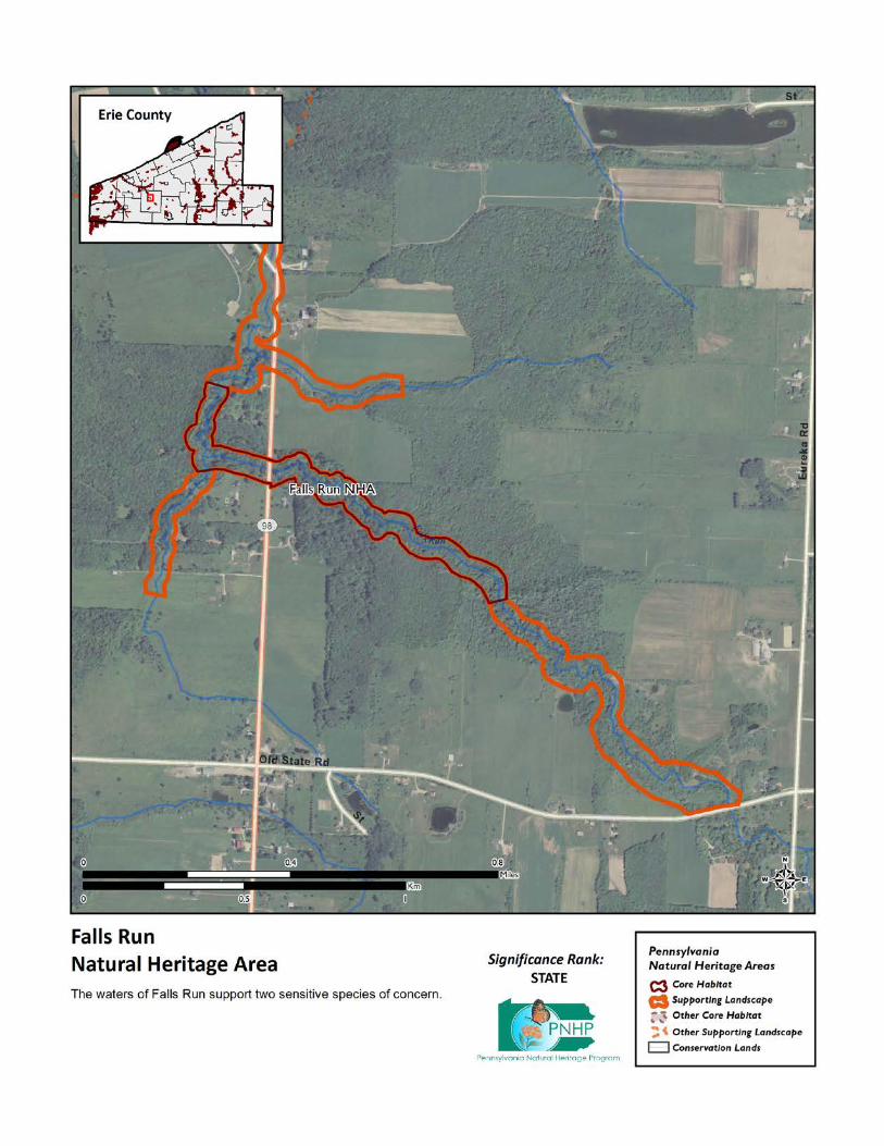
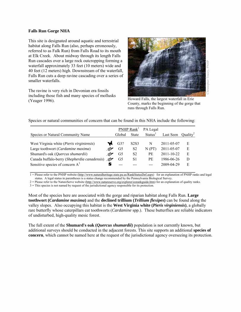
Falls Run Gorge NHA This site is designated around aquatic and terrestrial habitat along Falls Run (also, perhaps erroneously, referred to as Falk Run) from Falls Road to its mouth at Elk Creek. About midway through its length Falls Run cascades over a large rock outcropping forming a waterfall approximately 33 feet (10 meters) wide and 40 feet (12 meters) high. Downstream of the waterfall, Falls Run cuts a deep ravine cascading over a series of smaller waterfalls. The ravine is very rich in Devonian era fossils including those fish and many species of mollusks (Yeager 1996). Species or natural communities of concern that can be found in this NHA include the following:
PNHP Rank1 PA Legal Species or Natural Community Name Global State Status1 Last Seen Quality2 West Virginia white (Pieris virginiensis) G3? S2S3 N 2011-05-07 E Large toothwort (Cardamine maxima) G5 S2 N (PT) 2011-05-07 E Shumard's oak (Quercus shumardii) G5 S2 PE 2011-10-22 E Canada buffalo-berry (Shepherdia canadensis) G5 S1 PE 1986-06-26 D Sensitive species of concern A3 S --- --- --- 2009-04-29 E 1 = Please refer to the PNHP website (http://www.naturalheritage.state.pa.us/RankStatusDef.aspx) for an explanation of PNHP ranks and legal
status. A legal status in parentheses is a status change recommended by the Pennsylvania Biological Survey. 2 = Please refer to the NatureServe website (http://www.natureserve.org/explorer/eorankguide.htm) for an explanation of quality ranks. 3 = This species is not named by request of the jurisdictional agency responsible for its protection.
Most of the species here are associated with the gorge and riparian habitat along Falls Run. Large toothwort (Cardamine maxima) and the declined trillium (Trillium flexipes) can be found along the valley slopes. Also occupying this habitat is the West Virginia white (Pieris virginiensis), a globally rare butterfly whose caterpillars eat toothworts (Cardamine spp.). These butterflies are reliable indicators of undisturbed, high-quality mesic forest. The full extent of the Shumard's oak (Quercus shumardii) population is not currently known, but additional surveys should be conducted in the adjacent forests. This site supports an additional species of concern, which cannot be named here at the request of the jurisdictional agency overseeing its protection.
Chr
istop
her T
race
y, P
NH
P
Howard Falls, the largest waterfall in Erie County, marks the beginning of the gorge that runs through Falls Run.
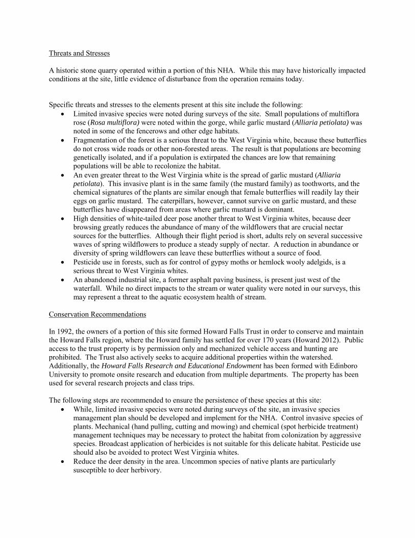
Threats and Stresses A historic stone quarry operated within a portion of this NHA. While this may have historically impacted conditions at the site, little evidence of disturbance from the operation remains today. Specific threats and stresses to the elements present at this site include the following:
• Limited invasive species were noted during surveys of the site. Small populations of multiflora rose (Rosa multiflora) were noted within the gorge, while garlic mustard (Alliaria petiolata) was noted in some of the fencerows and other edge habitats.
• Fragmentation of the forest is a serious threat to the West Virginia white, because these butterflies do not cross wide roads or other non-forested areas. The result is that populations are becoming genetically isolated, and if a population is extirpated the chances are low that remaining populations will be able to recolonize the habitat.
• An even greater threat to the West Virginia white is the spread of garlic mustard (Alliaria petiolata). This invasive plant is in the same family (the mustard family) as toothworts, and the chemical signatures of the plants are similar enough that female butterflies will readily lay their eggs on garlic mustard. The caterpillars, however, cannot survive on garlic mustard, and these butterflies have disappeared from areas where garlic mustard is dominant.
• High densities of white-tailed deer pose another threat to West Virginia whites, because deer browsing greatly reduces the abundance of many of the wildflowers that are crucial nectar sources for the butterflies. Although their flight period is short, adults rely on several successive waves of spring wildflowers to produce a steady supply of nectar. A reduction in abundance or diversity of spring wildflowers can leave these butterflies without a source of food.
• Pesticide use in forests, such as for control of gypsy moths or hemlock wooly adelgids, is a serious threat to West Virginia whites.
• An abandoned industrial site, a former asphalt paving business, is present just west of the waterfall. While no direct impacts to the stream or water quality were noted in our surveys, this may represent a threat to the aquatic ecosystem health of stream.
Conservation Recommendations In 1992, the owners of a portion of this site formed Howard Falls Trust in order to conserve and maintain the Howard Falls region, where the Howard family has settled for over 170 years (Howard 2012). Public access to the trust property is by permission only and mechanized vehicle access and hunting are prohibited. The Trust also actively seeks to acquire additional properties within the watershed. Additionally, the Howard Falls Research and Educational Endowment has been formed with Edinboro University to promote onsite research and education from multiple departments. The property has been used for several research projects and class trips. The following steps are recommended to ensure the persistence of these species at this site:
• While, limited invasive species were noted during surveys of the site, an invasive species management plan should be developed and implement for the NHA. Control invasive species of plants. Mechanical (hand pulling, cutting and mowing) and chemical (spot herbicide treatment) management techniques may be necessary to protect the habitat from colonization by aggressive species. Broadcast application of herbicides is not suitable for this delicate habitat. Pesticide use should also be avoided to protect West Virginia whites.
• Reduce the deer density in the area. Uncommon species of native plants are particularly susceptible to deer herbivory.
• Allow the forested habitats to achieve and maintain old growth conditions. Avoid fragmenting the existing forested areas with additional buildings or infrastructure. Avoid logging in this area except as it relates to invasive species removal. The forest cover should be allowed to achieve and maintain old-growth characteristics. Leave fallen trees in place to help provide habitat, soil nutrients, humus and tilth. Trees that have fallen over approved trails can be cut through as necessary.
• The lower portion of the Falls Run valley below Howard Falls is in very good shape and should be maintained in an undisturbed condition. Work with the numerous adjacent landowners to preserve the wooded ravine in its current intact condition. Limit residential encroachment on the forested ravine and degradation of the habitat.
• Expand the forested riparian buffer towards the headwaters of Falls Run. The recharge area of Falls Run is largely unvegetated and under agricultural management and would benefit from additional natural tree cover.
• The threat of the industrial site to the health of the stream health should be evaluated. If the site is truly abandoned, the site could represent a possible restoration project.
Location and Additional Information
Municipalities: Fairview Township and Franklin Township USGS quads: Edinboro North 1993 Erie CNHI reference: Devil’s Backbone BDA Associated NHAs: Falls Run – Shenango Creek Headwaters NHA, Elk Creek NHA Overlapping Protected Lands: Howard Falls Trust PNHP Significance Rank: State References Yeager, K.M. 1996. Fossil Fishes (Arthrodira and Acanthodida) from the Upper Devonian Chadakoin Formation of Erie County,
Pennsylvania. The Ohio Journal of Science. 96: 52-56. Howard, D. 2012. The Howard Falls Irrevocable Trust. http://www.howardfalls.com/ Accessed 2012-02-12
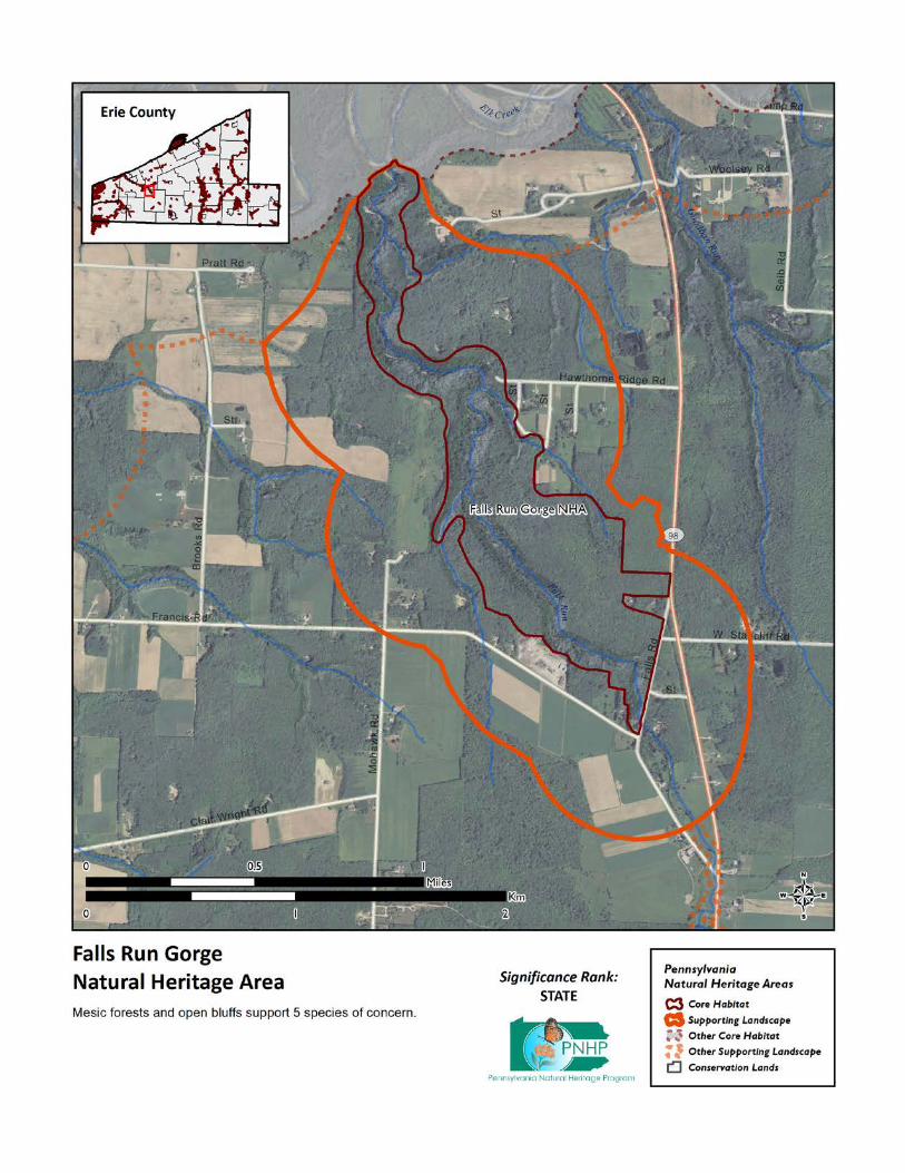
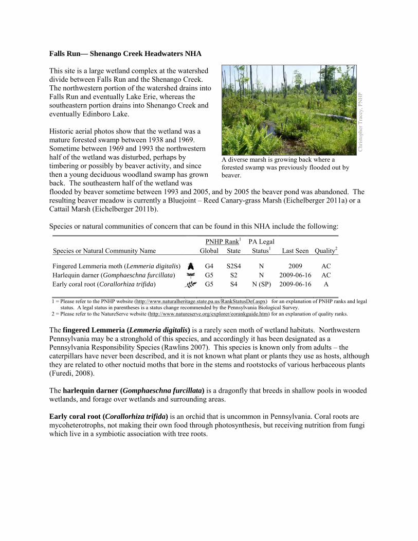
Falls Run— Shenango Creek Headwaters NHA This site is a large wetland complex at the watershed divide between Falls Run and the Shenango Creek. The northwestern portion of the watershed drains into Falls Run and eventually Lake Erie, whereas the southeastern portion drains into Shenango Creek and eventually Edinboro Lake. Historic aerial photos show that the wetland was a mature forested swamp between 1938 and 1969. Sometime between 1969 and 1993 the northwestern half of the wetland was disturbed, perhaps by timbering or possibly by beaver activity, and since then a young deciduous woodland swamp has grown back. The southeastern half of the wetland was flooded by beaver sometime between 1993 and 2005, and by 2005 the beaver pond was abandoned. The resulting beaver meadow is currently a Bluejoint – Reed Canary-grass Marsh (Eichelberger 2011a) or a Cattail Marsh (Eichelberger 2011b). Species or natural communities of concern that can be found in this NHA include the following:
PNHP Rank1 PA Legal Species or Natural Community Name Global State Status1 Last Seen Quality2 Fingered Lemmeria moth (Lemmeria digitalis) G4 S2S4 N 2009 AC Harlequin darner (Gomphaeschna furcillata) G5 S2 N 2009-06-16 AC Early coral root (Corallorhiza trifida) G5 S4 N (SP) 2009-06-16 A 1 = Please refer to the PNHP website (http://www.naturalheritage.state.pa.us/RankStatusDef.aspx) for an explanation of PNHP ranks and legal
status. A legal status in parentheses is a status change recommended by the Pennsylvania Biological Survey. 2 = Please refer to the NatureServe website (http://www.natureserve.org/explorer/eorankguide.htm) for an explanation of quality ranks.
The fingered Lemmeria (Lemmeria digitalis) is a rarely seen moth of wetland habitats. Northwestern Pennsylvania may be a stronghold of this species, and accordingly it has been designated as a Pennsylvania Responsibility Species (Rawlins 2007). This species is known only from adults – the caterpillars have never been described, and it is not known what plant or plants they use as hosts, although they are related to other noctuid moths that bore in the stems and rootstocks of various herbaceous plants (Furedi, 2008). The harlequin darner (Gomphaeschna furcillata) is a dragonfly that breeds in shallow pools in wooded wetlands, and forage over wetlands and surrounding areas. Early coral root (Corallorhiza trifida) is an orchid that is uncommon in Pennsylvania. Coral roots are mycoheterotrophs, not making their own food through photosynthesis, but receiving nutrition from fungi which live in a symbiotic association with tree roots.
Chr
istop
her T
race
y, P
NH
P
A diverse marsh is growing back where a forested swamp was previously flooded out by beaver.
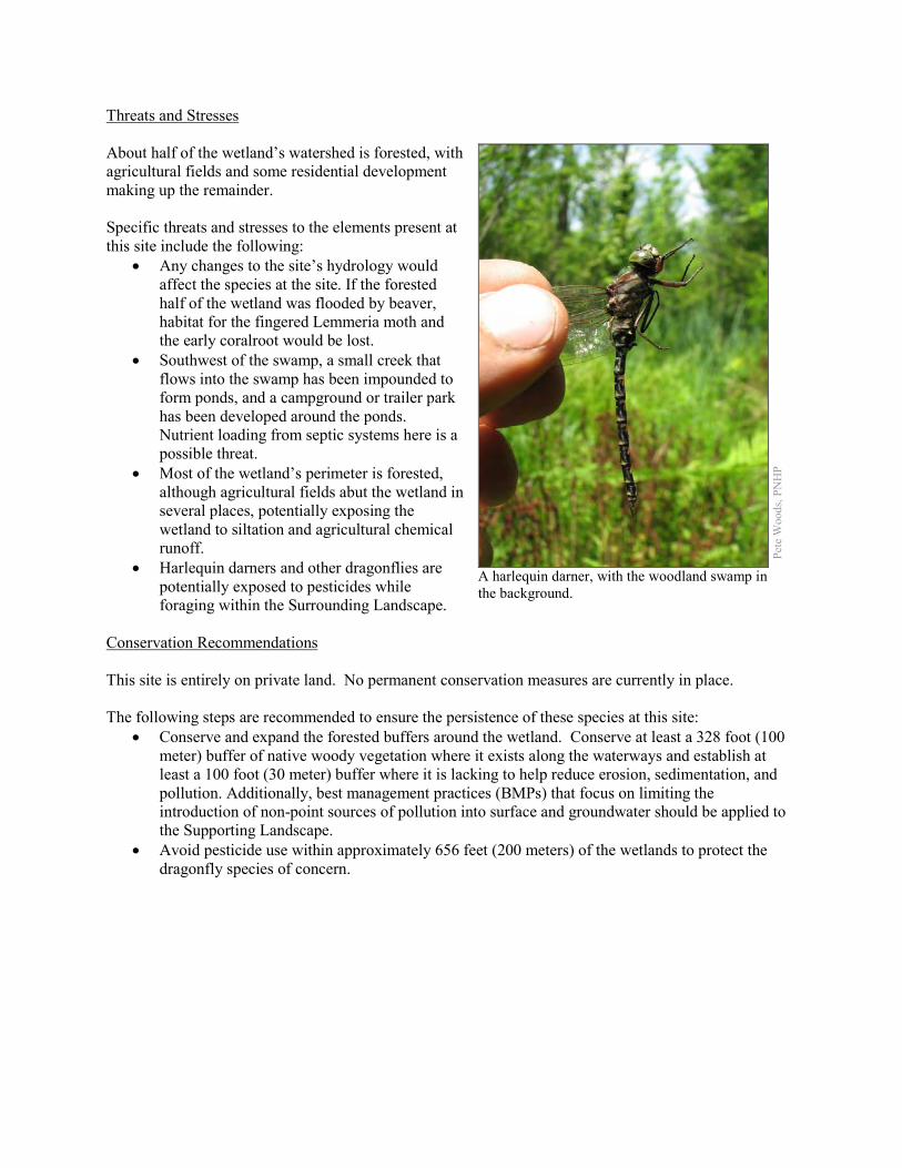
Threats and Stresses About half of the wetland’s watershed is forested, with agricultural fields and some residential development making up the remainder. Specific threats and stresses to the elements present at this site include the following:
• Any changes to the site’s hydrology would affect the species at the site. If the forested half of the wetland was flooded by beaver, habitat for the fingered Lemmeria moth and the early coralroot would be lost.
• Southwest of the swamp, a small creek that flows into the swamp has been impounded to form ponds, and a campground or trailer park has been developed around the ponds. Nutrient loading from septic systems here is a possible threat.
• Most of the wetland’s perimeter is forested, although agricultural fields abut the wetland in several places, potentially exposing the wetland to siltation and agricultural chemical runoff.
• Harlequin darners and other dragonflies are potentially exposed to pesticides while foraging within the Surrounding Landscape.
Conservation Recommendations This site is entirely on private land. No permanent conservation measures are currently in place. The following steps are recommended to ensure the persistence of these species at this site:
• Conserve and expand the forested buffers around the wetland. Conserve at least a 328 foot (100 meter) buffer of native woody vegetation where it exists along the waterways and establish at least a 100 foot (30 meter) buffer where it is lacking to help reduce erosion, sedimentation, and pollution. Additionally, best management practices (BMPs) that focus on limiting the introduction of non-point sources of pollution into surface and groundwater should be applied to the Supporting Landscape.
• Avoid pesticide use within approximately 656 feet (200 meters) of the wetlands to protect the dragonfly species of concern.
Pete
Woo
ds, P
NH
P
A harlequin darner, with the woodland swamp in the background.
Location and Additional Information Municipalities: Franklin Township USGS quads: Edinboro North 1993 Erie CNHI reference: Previously unrecognized site Associated NHAs: None Overlapping Protected Lands: None PNHP Significance Rank: State References Eichelberger, B. 2011. Pennsylvania Natural Heritage Program. Bluejoint – Reed Canary-grass Marsh Factsheet. Available from:
http://www.naturalheritage.state.pa.us/Community.aspx?=16000 Date Accessed: June 20, 2012. Eichelberger, B. 2011. Pennsylvania Natural Heritage Program. Cat-tail Marsh Factsheet. Available from:
http://www.naturalheritage.state.pa.us/Community.aspx?=16002 Date Accessed: June 20, 2012. Furedi, M.A. 2008. Pennsylvania Natural Heritage Program. Climate Change Vulnerability Index Assesment for Lemmeria
digitata. Available from: http://www.naturalheritage.state.pa.us/CCVI.aspx Accessed: October 10, 2012 Rawlins, J.E. 2007. Pennsylvania Comprehensive Wildlife Conservation Strategy Version 1.1, Appendix 5, Invertebrates. In
Pennsylvania Game Commission. 2005. Pennsylvania Comprehensive Wildlife Strategy Version 1.0.
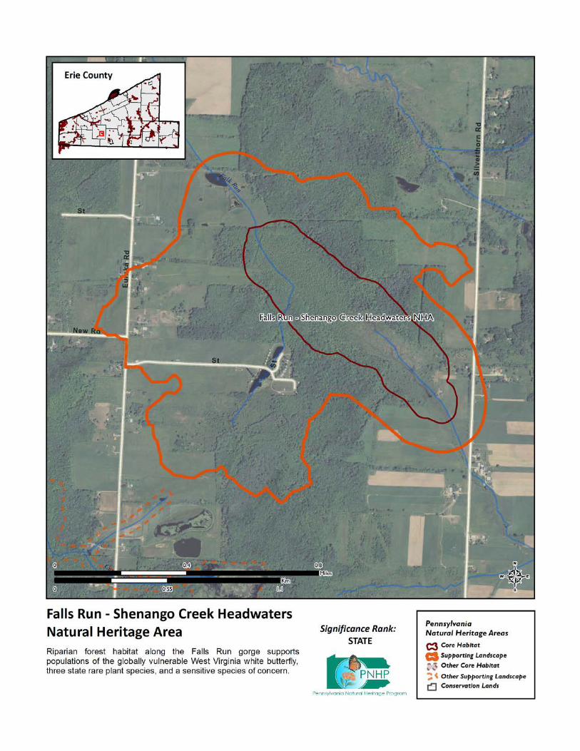
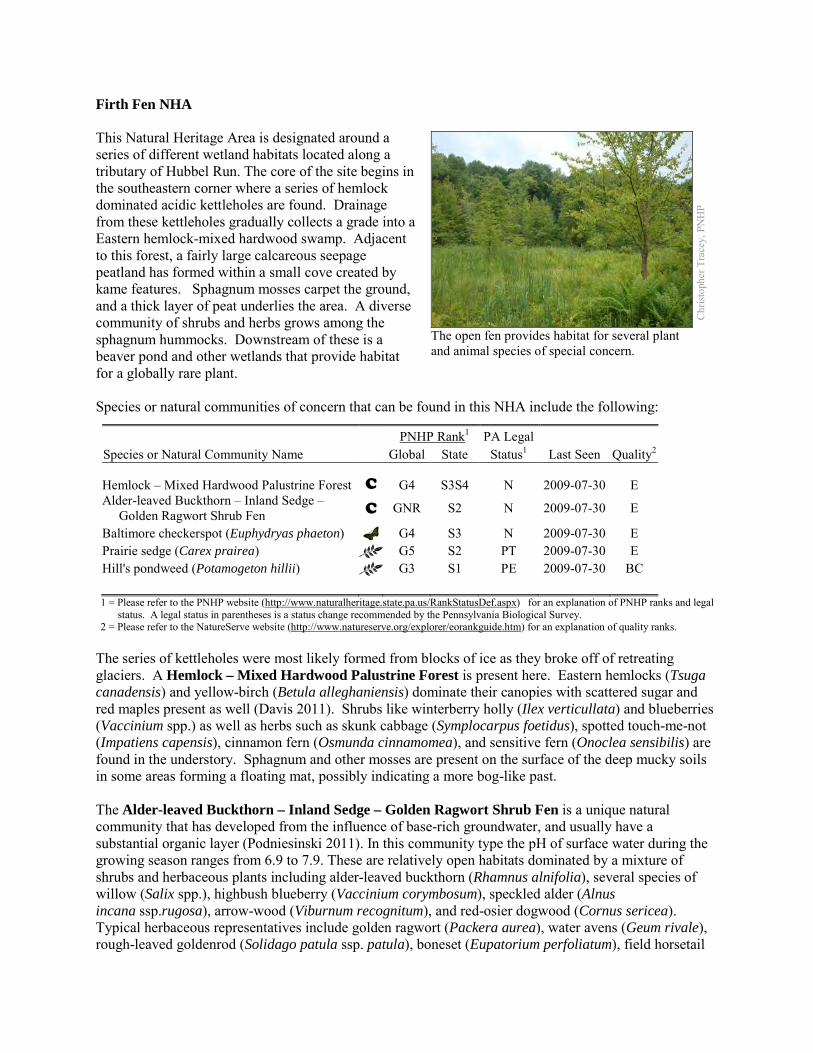
Firth Fen NHA This Natural Heritage Area is designated around a series of different wetland habitats located along a tributary of Hubbel Run. The core of the site begins in the southeastern corner where a series of hemlock dominated acidic kettleholes are found. Drainage from these kettleholes gradually collects a grade into a Eastern hemlock-mixed hardwood swamp. Adjacent to this forest, a fairly large calcareous seepage peatland has formed within a small cove created by kame features. Sphagnum mosses carpet the ground, and a thick layer of peat underlies the area. A diverse community of shrubs and herbs grows among the sphagnum hummocks. Downstream of these is a beaver pond and other wetlands that provide habitat for a globally rare plant. Species or natural communities of concern that can be found in this NHA include the following:
PNHP Rank1 PA Legal Species or Natural Community Name Global State Status1 Last Seen Quality2 Hemlock – Mixed Hardwood Palustrine Forest C G4 S3S4 N 2009-07-30 E Alder-leaved Buckthorn – Inland Sedge – Golden Ragwort Shrub Fen C GNR S2 N 2009-07-30 E
Baltimore checkerspot (Euphydryas phaeton) G4 S3 N 2009-07-30 E Prairie sedge (Carex prairea) G5 S2 PT 2009-07-30 E Hill's pondweed (Potamogeton hillii) G3 S1 PE 2009-07-30 BC 1 = Please refer to the PNHP website (http://www.naturalheritage.state.pa.us/RankStatusDef.aspx) for an explanation of PNHP ranks and legal
status. A legal status in parentheses is a status change recommended by the Pennsylvania Biological Survey. 2 = Please refer to the NatureServe website (http://www.natureserve.org/explorer/eorankguide.htm) for an explanation of quality ranks.
The series of kettleholes were most likely formed from blocks of ice as they broke off of retreating glaciers. A Hemlock – Mixed Hardwood Palustrine Forest is present here. Eastern hemlocks (Tsuga canadensis) and yellow-birch (Betula alleghaniensis) dominate their canopies with scattered sugar and red maples present as well (Davis 2011). Shrubs like winterberry holly (Ilex verticullata) and blueberries (Vaccinium spp.) as well as herbs such as skunk cabbage (Symplocarpus foetidus), spotted touch-me-not (Impatiens capensis), cinnamon fern (Osmunda cinnamomea), and sensitive fern (Onoclea sensibilis) are found in the understory. Sphagnum and other mosses are present on the surface of the deep mucky soils in some areas forming a floating mat, possibly indicating a more bog-like past. The Alder-leaved Buckthorn – Inland Sedge – Golden Ragwort Shrub Fen is a unique natural community that has developed from the influence of base-rich groundwater, and usually have a substantial organic layer (Podniesinski 2011). In this community type the pH of surface water during the growing season ranges from 6.9 to 7.9. These are relatively open habitats dominated by a mixture of shrubs and herbaceous plants including alder-leaved buckthorn (Rhamnus alnifolia), several species of willow (Salix spp.), highbush blueberry (Vaccinium corymbosum), speckled alder (Alnus incana ssp.rugosa), arrow-wood (Viburnum recognitum), and red-osier dogwood (Cornus sericea). Typical herbaceous representatives include golden ragwort (Packera aurea), water avens (Geum rivale), rough-leaved goldenrod (Solidago patula ssp. patula), boneset (Eupatorium perfoliatum), field horsetail
Chr
istop
her T
race
y, P
NH
P
The open fen provides habitat for several plant and animal species of special concern.
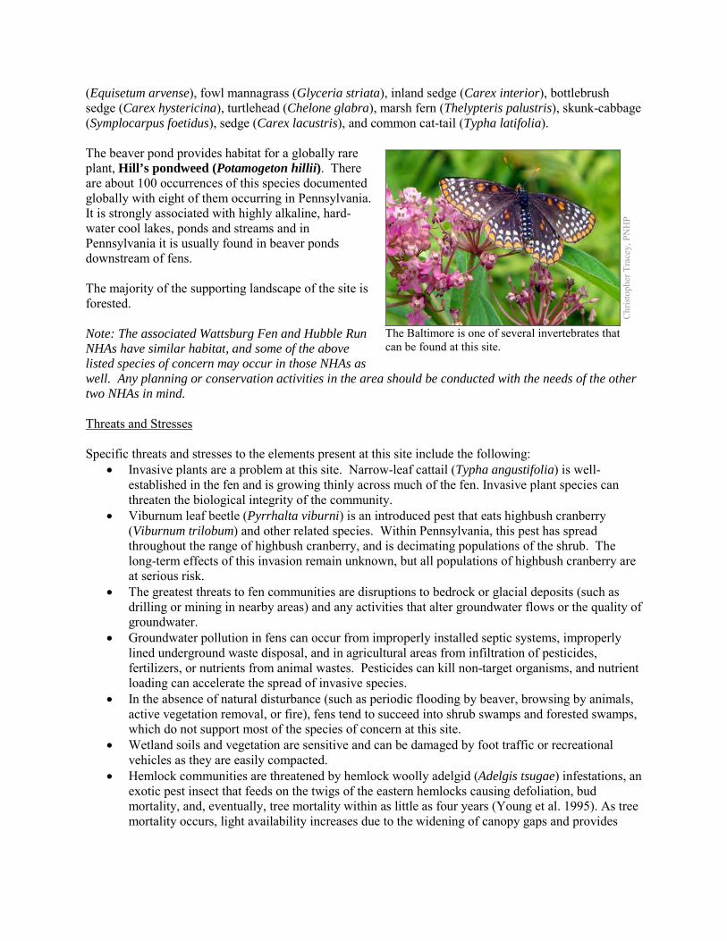
(Equisetum arvense), fowl mannagrass (Glyceria striata), inland sedge (Carex interior), bottlebrush sedge (Carex hystericina), turtlehead (Chelone glabra), marsh fern (Thelypteris palustris), skunk-cabbage (Symplocarpus foetidus), sedge (Carex lacustris), and common cat-tail (Typha latifolia). The beaver pond provides habitat for a globally rare plant, Hill’s pondweed (Potamogeton hillii). There are about 100 occurrences of this species documented globally with eight of them occurring in Pennsylvania. It is strongly associated with highly alkaline, hard-water cool lakes, ponds and streams and in Pennsylvania it is usually found in beaver ponds downstream of fens. The majority of the supporting landscape of the site is forested. Note: The associated Wattsburg Fen and Hubble Run NHAs have similar habitat, and some of the above listed species of concern may occur in those NHAs as well. Any planning or conservation activities in the area should be conducted with the needs of the other two NHAs in mind. Threats and Stresses Specific threats and stresses to the elements present at this site include the following:
• Invasive plants are a problem at this site. Narrow-leaf cattail (Typha angustifolia) is well-established in the fen and is growing thinly across much of the fen. Invasive plant species can threaten the biological integrity of the community.
• Viburnum leaf beetle (Pyrrhalta viburni) is an introduced pest that eats highbush cranberry (Viburnum trilobum) and other related species. Within Pennsylvania, this pest has spread throughout the range of highbush cranberry, and is decimating populations of the shrub. The long-term effects of this invasion remain unknown, but all populations of highbush cranberry are at serious risk.
• The greatest threats to fen communities are disruptions to bedrock or glacial deposits (such as drilling or mining in nearby areas) and any activities that alter groundwater flows or the quality of groundwater.
• Groundwater pollution in fens can occur from improperly installed septic systems, improperly lined underground waste disposal, and in agricultural areas from infiltration of pesticides, fertilizers, or nutrients from animal wastes. Pesticides can kill non-target organisms, and nutrient loading can accelerate the spread of invasive species.
• In the absence of natural disturbance (such as periodic flooding by beaver, browsing by animals, active vegetation removal, or fire), fens tend to succeed into shrub swamps and forested swamps, which do not support most of the species of concern at this site.
• Wetland soils and vegetation are sensitive and can be damaged by foot traffic or recreational vehicles as they are easily compacted.
• Hemlock communities are threatened by hemlock woolly adelgid (Adelgis tsugae) infestations, an exotic pest insect that feeds on the twigs of the eastern hemlocks causing defoliation, bud mortality, and, eventually, tree mortality within as little as four years (Young et al. 1995). As tree mortality occurs, light availability increases due to the widening of canopy gaps and provides
Chr
istop
her T
race
y, P
NH
P
The Baltimore is one of several invertebrates that can be found at this site.
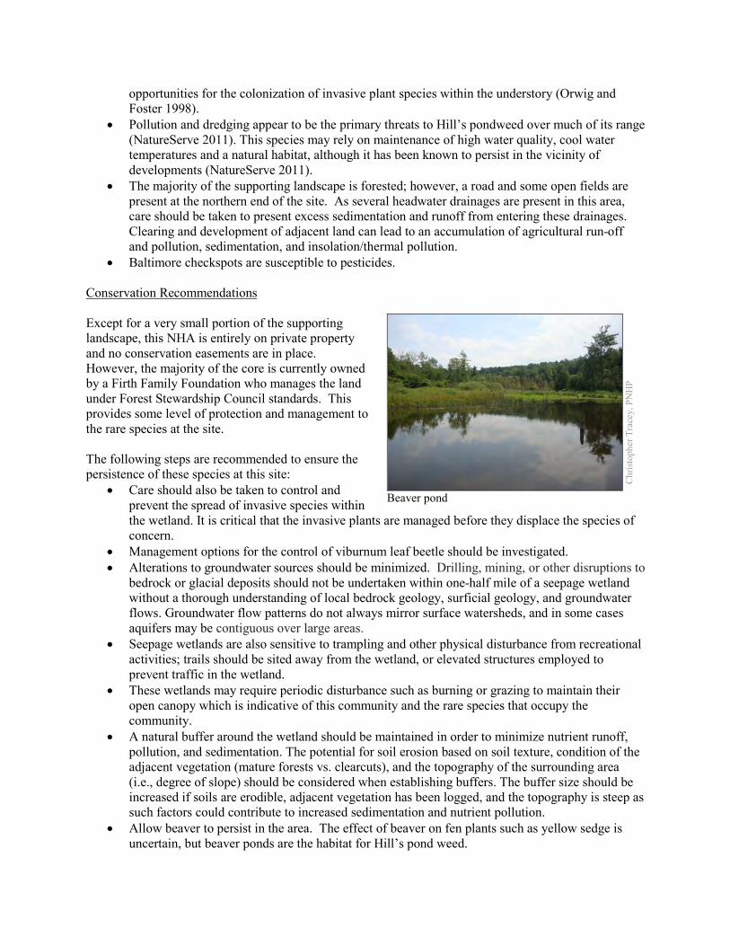
opportunities for the colonization of invasive plant species within the understory (Orwig and Foster 1998).
• Pollution and dredging appear to be the primary threats to Hill’s pondweed over much of its range (NatureServe 2011). This species may rely on maintenance of high water quality, cool water temperatures and a natural habitat, although it has been known to persist in the vicinity of developments (NatureServe 2011).
• The majority of the supporting landscape is forested; however, a road and some open fields are present at the northern end of the site. As several headwater drainages are present in this area, care should be taken to present excess sedimentation and runoff from entering these drainages. Clearing and development of adjacent land can lead to an accumulation of agricultural run-off and pollution, sedimentation, and insolation/thermal pollution.
• Baltimore checkspots are susceptible to pesticides. Conservation Recommendations Except for a very small portion of the supporting landscape, this NHA is entirely on private property and no conservation easements are in place. However, the majority of the core is currently owned by a Firth Family Foundation who manages the land under Forest Stewardship Council standards. This provides some level of protection and management to the rare species at the site. The following steps are recommended to ensure the persistence of these species at this site:
• Care should also be taken to control and prevent the spread of invasive species within the wetland. It is critical that the invasive plants are managed before they displace the species of concern.
• Management options for the control of viburnum leaf beetle should be investigated. • Alterations to groundwater sources should be minimized. Drilling, mining, or other disruptions to
bedrock or glacial deposits should not be undertaken within one-half mile of a seepage wetland without a thorough understanding of local bedrock geology, surficial geology, and groundwater flows. Groundwater flow patterns do not always mirror surface watersheds, and in some cases aquifers may be contiguous over large areas.
• Seepage wetlands are also sensitive to trampling and other physical disturbance from recreational activities; trails should be sited away from the wetland, or elevated structures employed to prevent traffic in the wetland.
• These wetlands may require periodic disturbance such as burning or grazing to maintain their open canopy which is indicative of this community and the rare species that occupy the community.
• A natural buffer around the wetland should be maintained in order to minimize nutrient runoff, pollution, and sedimentation. The potential for soil erosion based on soil texture, condition of the adjacent vegetation (mature forests vs. clearcuts), and the topography of the surrounding area (i.e., degree of slope) should be considered when establishing buffers. The buffer size should be increased if soils are erodible, adjacent vegetation has been logged, and the topography is steep as such factors could contribute to increased sedimentation and nutrient pollution.
• Allow beaver to persist in the area. The effect of beaver on fen plants such as yellow sedge is uncertain, but beaver ponds are the habitat for Hill’s pond weed.
Chr
istop
her T
race
y, P
NH
P
Beaver pond
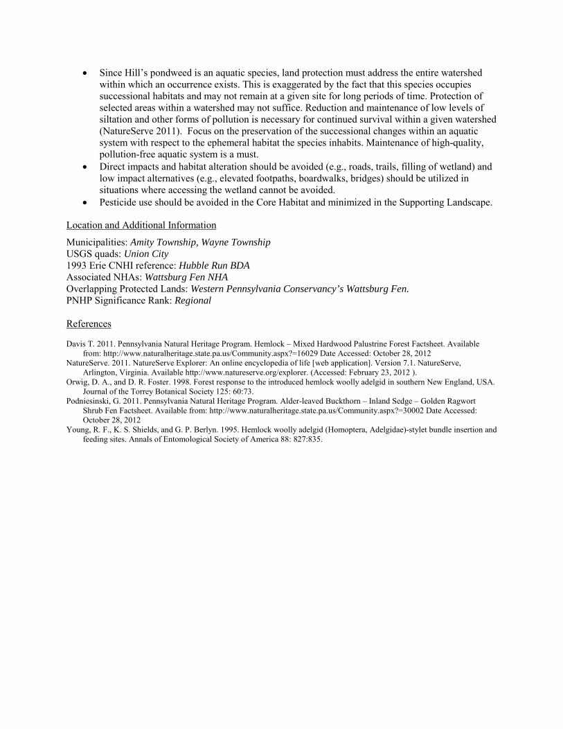
• Since Hill’s pondweed is an aquatic species, land protection must address the entire watershed within which an occurrence exists. This is exaggerated by the fact that this species occupies successional habitats and may not remain at a given site for long periods of time. Protection of selected areas within a watershed may not suffice. Reduction and maintenance of low levels of siltation and other forms of pollution is necessary for continued survival within a given watershed (NatureServe 2011). Focus on the preservation of the successional changes within an aquatic system with respect to the ephemeral habitat the species inhabits. Maintenance of high-quality, pollution-free aquatic system is a must.
• Direct impacts and habitat alteration should be avoided (e.g., roads, trails, filling of wetland) and low impact alternatives (e.g., elevated footpaths, boardwalks, bridges) should be utilized in situations where accessing the wetland cannot be avoided.
• Pesticide use should be avoided in the Core Habitat and minimized in the Supporting Landscape.
Location and Additional Information
Municipalities: Amity Township, Wayne Township USGS quads: Union City 1993 Erie CNHI reference: Hubble Run BDA Associated NHAs: Wattsburg Fen NHA Overlapping Protected Lands: Western Pennsylvania Conservancy’s Wattsburg Fen. PNHP Significance Rank: Regional References Davis T. 2011. Pennsylvania Natural Heritage Program. Hemlock – Mixed Hardwood Palustrine Forest Factsheet. Available
from: http://www.naturalheritage.state.pa.us/Community.aspx?=16029 Date Accessed: October 28, 2012 NatureServe. 2011. NatureServe Explorer: An online encyclopedia of life [web application]. Version 7.1. NatureServe,
Arlington, Virginia. Available http://www.natureserve.org/explorer. (Accessed: February 23, 2012 ). Orwig, D. A., and D. R. Foster. 1998. Forest response to the introduced hemlock woolly adelgid in southern New England, USA.
Journal of the Torrey Botanical Society 125: 60:73. Podniesinski, G. 2011. Pennsylvania Natural Heritage Program. Alder-leaved Buckthorn – Inland Sedge – Golden Ragwort
Shrub Fen Factsheet. Available from: http://www.naturalheritage.state.pa.us/Community.aspx?=30002 Date Accessed: October 28, 2012
Young, R. F., K. S. Shields, and G. P. Berlyn. 1995. Hemlock woolly adelgid (Homoptera, Adelgidae)-stylet bundle insertion and feeding sites. Annals of Entomological Society of America 88: 827:835.
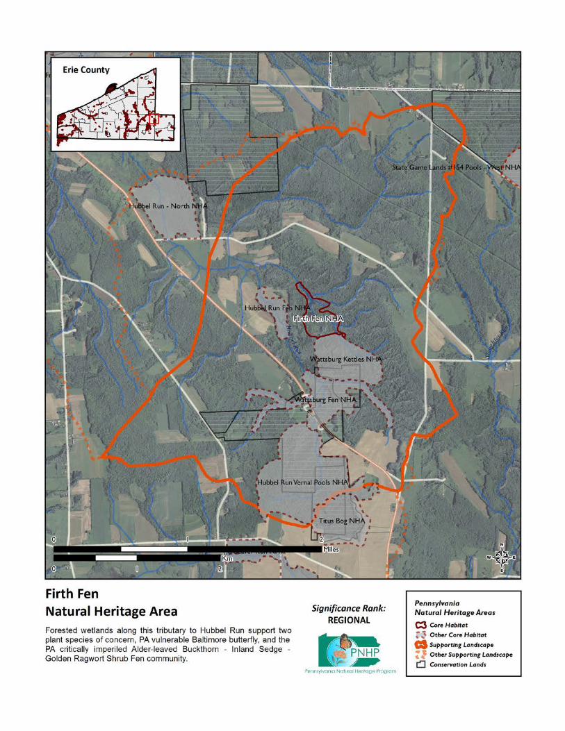
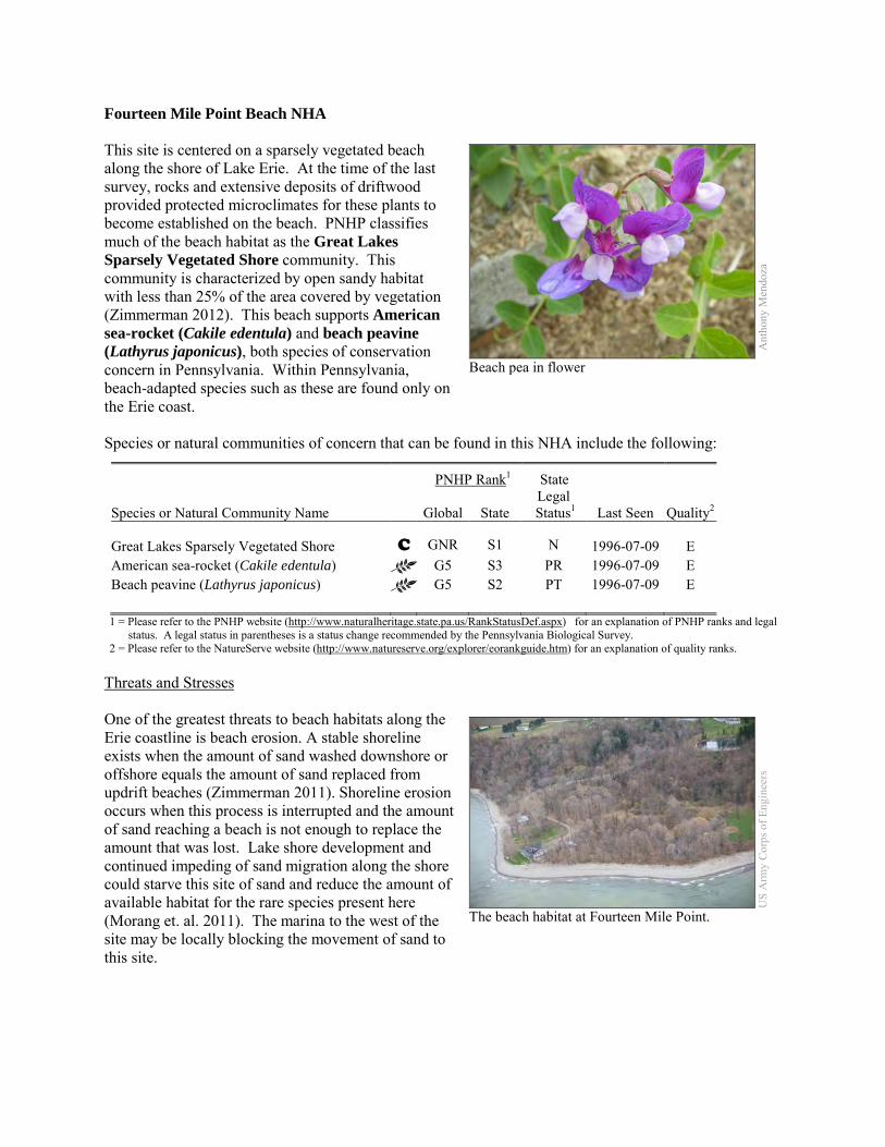
Fourteen Mile Point Beach NHA This site is centered on a sparsely vegetated beach along the shore of Lake Erie. At the time of the last survey, rocks and extensive deposits of driftwood provided protected microclimates for these plants to become established on the beach. PNHP classifies much of the beach habitat as the Great Lakes Sparsely Vegetated Shore community. This community is characterized by open sandy habitat with less than 25% of the area covered by vegetation (Zimmerman 2012). This beach supports American sea-rocket (Cakile edentula) and beach peavine (Lathyrus japonicus), both species of conservation concern in Pennsylvania. Within Pennsylvania, beach-adapted species such as these are found only on the Erie coast. Species or natural communities of concern that can be found in this NHA include the following:
PNHP Rank1 State
Species or Natural Community Name
Global State Legal
Status1 Last Seen Quality2 Great Lakes Sparsely Vegetated Shore C GNR S1 N 1996-07-09 E American sea-rocket (Cakile edentula) G5 S3 PR 1996-07-09 E Beach peavine (Lathyrus japonicus) G5 S2 PT 1996-07-09 E 1 = Please refer to the PNHP website (http://www.naturalheritage.state.pa.us/RankStatusDef.aspx) for an explanation of PNHP ranks and legal
status. A legal status in parentheses is a status change recommended by the Pennsylvania Biological Survey. 2 = Please refer to the NatureServe website (http://www.natureserve.org/explorer/eorankguide.htm) for an explanation of quality ranks.
Threats and Stresses One of the greatest threats to beach habitats along the Erie coastline is beach erosion. A stable shoreline exists when the amount of sand washed downshore or offshore equals the amount of sand replaced from updrift beaches (Zimmerman 2011). Shoreline erosion occurs when this process is interrupted and the amount of sand reaching a beach is not enough to replace the amount that was lost. Lake shore development and continued impeding of sand migration along the shore could starve this site of sand and reduce the amount of available habitat for the rare species present here (Morang et. al. 2011). The marina to the west of the site may be locally blocking the movement of sand to this site.
Ant
hony
Men
doza
Beach pea in flower
US
Arm
y Co
rps o
f Eng
inee
rs
The beach habitat at Fourteen Mile Point.
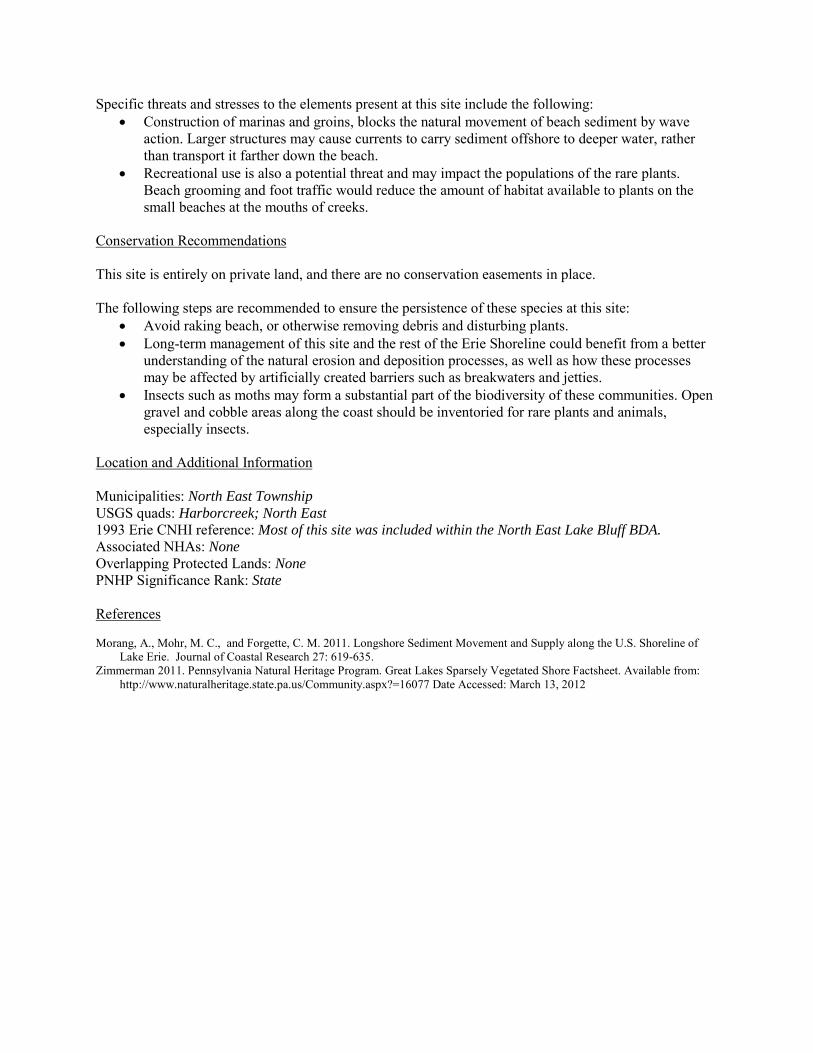
Specific threats and stresses to the elements present at this site include the following: • Construction of marinas and groins, blocks the natural movement of beach sediment by wave
action. Larger structures may cause currents to carry sediment offshore to deeper water, rather than transport it farther down the beach.
• Recreational use is also a potential threat and may impact the populations of the rare plants. Beach grooming and foot traffic would reduce the amount of habitat available to plants on the small beaches at the mouths of creeks.
Conservation Recommendations This site is entirely on private land, and there are no conservation easements in place. The following steps are recommended to ensure the persistence of these species at this site:
• Avoid raking beach, or otherwise removing debris and disturbing plants. • Long-term management of this site and the rest of the Erie Shoreline could benefit from a better
understanding of the natural erosion and deposition processes, as well as how these processes may be affected by artificially created barriers such as breakwaters and jetties.
• Insects such as moths may form a substantial part of the biodiversity of these communities. Open gravel and cobble areas along the coast should be inventoried for rare plants and animals, especially insects.
Location and Additional Information Municipalities: North East Township USGS quads: Harborcreek; North East 1993 Erie CNHI reference: Most of this site was included within the North East Lake Bluff BDA. Associated NHAs: None Overlapping Protected Lands: None PNHP Significance Rank: State References Morang, A., Mohr, M. C., and Forgette, C. M. 2011. Longshore Sediment Movement and Supply along the U.S. Shoreline of
Lake Erie. Journal of Coastal Research 27: 619-635. Zimmerman 2011. Pennsylvania Natural Heritage Program. Great Lakes Sparsely Vegetated Shore Factsheet. Available from:
http://www.naturalheritage.state.pa.us/Community.aspx?=16077 Date Accessed: March 13, 2012
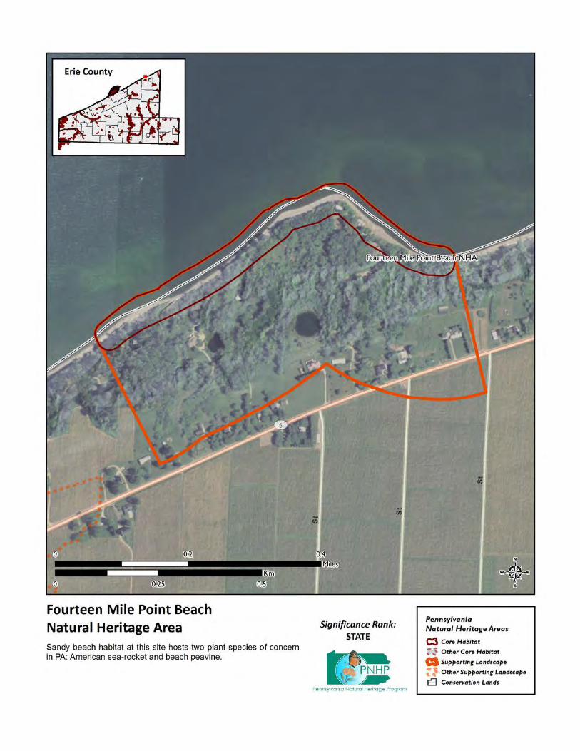
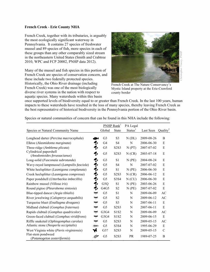
French Creek - Erie County NHA French Creek, together with its tributaries, is arguably the most ecologically significant waterway in Pennsylvania. It contains 27 species of freshwater mussel and 89 species of fish, more species in each of these groups than any other comparably sized stream in the northeastern United States (Smith and Crabtree 2010, WPC and FCP 20002, PNHP data 2012). Many of the mussel and fish species in this portion of French Creek are species of conservation concern, and these include two federally protected species. Historically, the Ohio River drainage (including French Creek) was one of the most biologically diverse river systems in the nation with respect to aquatic species. Many watersheds within this basin once supported levels of biodiversity equal to or greater than French Creek. In the last 100 years, human impacts to these watersheds have resulted in the loss of many species, thereby leaving French Creek as the best representative of historical biodiversity in the Pennsylvania portion of the Ohio River basin.
Species or natural communities of concern that can be found in this NHA include the following:
PNHP Rank1 PA Legal Species or Natural Community Name Global State Status1 Last Seen Quality2 Longhead darter (Percina macrocephala) G3 S3 N (DL) 2009-08-26 B Elktoe (Alasmidonta marginata) G4 S4 N 2006-06-30 E Three-ridge (Amblema plicata) G5 S2S3 N (PT) 2007-07-02 E Cylindrical papershell (Anodontoides ferussacianus) G5 S2S3 N (CR) 2003-07-18 E
Long-solid (Fusconaia subrotunda) G3 S1 N (PE) 2004-08-24 E Wavy-rayed lampmussel (Lampsilis fasciola) G5 S4 N 2007-07-02 E White heelsplitter (Lasmigona complanata) G5 S1 N (PE) 2006-06-30 E Creek heelsplitter (Lasmigona compressa) G5 S2S3 N (CR) 2006-06-12 E Paper pondshell (Utterbackia imbecillis) G5 S3S4 N (CU) 2006-06-30 E Rainbow mussel (Villosa iris) G5Q S1 N (PE) 2003-06-26 E Round pigtoe (Pleurobema sintoxia) G4G5 S2 N (PE) 2007-07-02 E Blue-tipped dancer (Argia tibialis) G5 S1 N 2009-06-09 AC River jewelwing (Calopteryx aequabilis) G5 S2 N 2009-06-12 AC Turquoise bluet (Enallagma divagans) G5 S3 N 2007-06-11 E Midland clubtail (Gomphus fraternus) G5 S2S3 N 2007-06-11 E Rapids clubtail (Gomphus quadricolor) G3G4 S1S2 N 2009-06-09 AC Green-faced clubtail (Gomphus viridifrons) G3G4 S1S2 N 2009-06-15 E Riffle snaketail (Ophiogomphus carolus) G5 S2S3 N 2009-05-15 AC Atlantic stone (Neoperla occipitalis) G5 S3S4 N 1995-06-29 E West Virginia white (Pieris virginiensis) G3? S2S3 N 2009-05-15 C Flat-stem pondweed (Potamogeton zosteriformis) G5 S2S3 PR 1989-07-25 B
Chr
istop
her T
race
y, P
NH
P
French Creek at The Nature Conservancy’s Mystic Island property at the Erie-Crawford county border
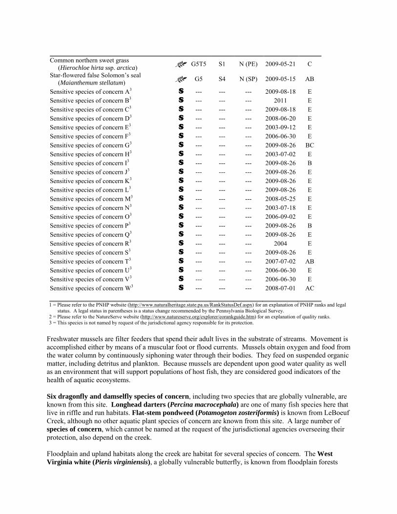
Common northern sweet grass (Hierochloe hirta ssp. arctica) G5T5 S1 N (PE) 2009-05-21 C
Star-flowered false Solomon’s seal (Maianthemum stellatum) G5 S4 N (SP) 2009-05-15 AB
Sensitive species of concern A3 S --- --- --- 2009-08-18 E Sensitive species of concern B3 S --- --- --- 2011 E Sensitive species of concern C3 S --- --- --- 2009-08-18 E Sensitive species of concern D3 S --- --- --- 2008-06-20 E Sensitive species of concern E3 S --- --- --- 2003-09-12 E Sensitive species of concern F3 S --- --- --- 2006-06-30 E Sensitive species of concern G3 S --- --- --- 2009-08-26 BC Sensitive species of concern H3 S --- --- --- 2003-07-02 E Sensitive species of concern I3 S --- --- --- 2009-08-26 B Sensitive species of concern J3 S --- --- --- 2009-08-26 E Sensitive species of concern K3 S --- --- --- 2009-08-26 E Sensitive species of concern L3 S --- --- --- 2009-08-26 E Sensitive species of concern M3 S --- --- --- 2008-05-25 E Sensitive species of concern N3 S --- --- --- 2003-07-18 E Sensitive species of concern O3 S --- --- --- 2006-09-02 E Sensitive species of concern P3 S --- --- --- 2009-08-26 B Sensitive species of concern Q3 S --- --- --- 2009-08-26 E Sensitive species of concern R3 S --- --- --- 2004 E Sensitive species of concern S3 S --- --- --- 2009-08-26 E Sensitive species of concern T3 S --- --- --- 2007-07-02 AB Sensitive species of concern U3 S --- --- --- 2006-06-30 E Sensitive species of concern V3 S --- --- --- 2006-06-30 E Sensitive species of concern W3 S --- --- --- 2008-07-01 AC 1 = Please refer to the PNHP website (http://www.naturalheritage.state.pa.us/RankStatusDef.aspx) for an explanation of PNHP ranks and legal
status. A legal status in parentheses is a status change recommended by the Pennsylvania Biological Survey. 2 = Please refer to the NatureServe website (http://www.natureserve.org/explorer/eorankguide.htm) for an explanation of quality ranks. 3 = This species is not named by request of the jurisdictional agency responsible for its protection.
Freshwater mussels are filter feeders that spend their adult lives in the substrate of streams. Movement is accomplished either by means of a muscular foot or flood currents. Mussels obtain oxygen and food from the water column by continuously siphoning water through their bodies. They feed on suspended organic matter, including detritus and plankton. Because mussels are dependent upon good water quality as well as an environment that will support populations of host fish, they are considered good indicators of the health of aquatic ecosystems. Six dragonfly and damselfly species of concern, including two species that are globally vulnerable, are known from this site. Longhead darters (Percina macrocephala) are one of many fish species here that live in riffle and run habitats. Flat-stem pondweed (Potamogeton zosteriformis) is known from LeBoeuf Creek, although no other aquatic plant species of concern are known from this site. A large number of species of concern, which cannot be named at the request of the jurisdictional agencies overseeing their protection, also depend on the creek. Floodplain and upland habitats along the creek are habitat for several species of concern. The West Virginia white (Pieris virginiensis), a globally vulnerable butterfly, is known from floodplain forests
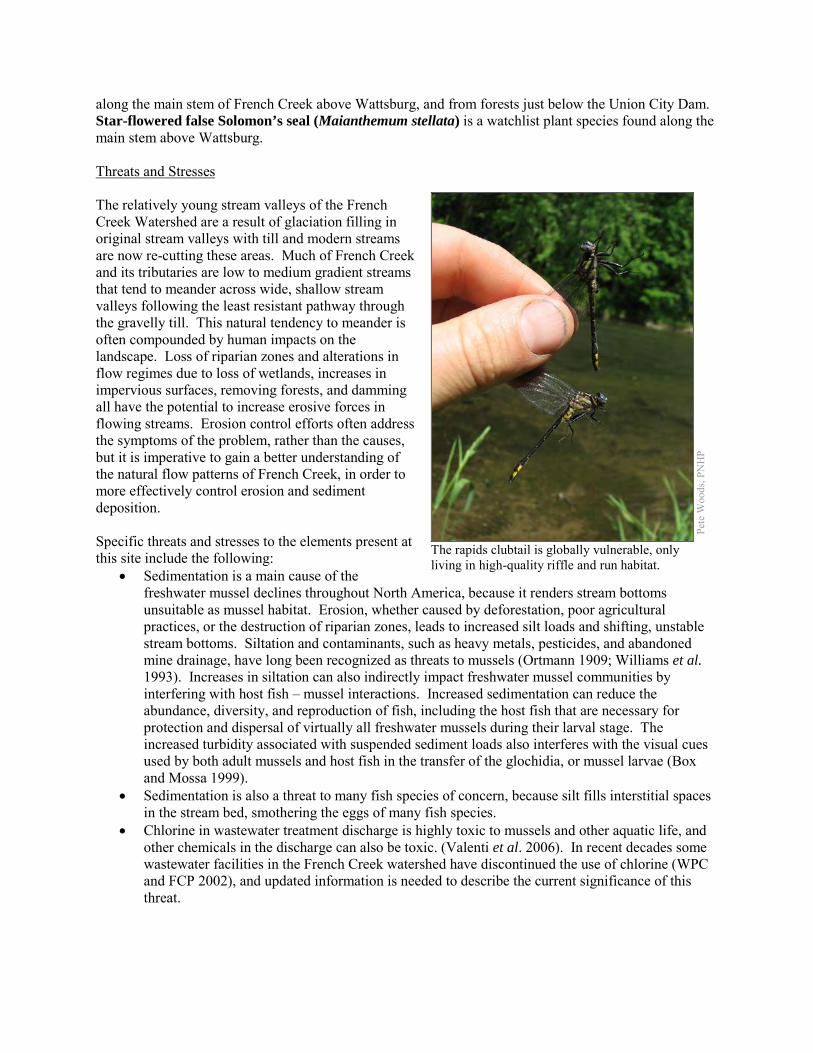
along the main stem of French Creek above Wattsburg, and from forests just below the Union City Dam. Star-flowered false Solomon’s seal (Maianthemum stellata) is a watchlist plant species found along the main stem above Wattsburg. Threats and Stresses The relatively young stream valleys of the French Creek Watershed are a result of glaciation filling in original stream valleys with till and modern streams are now re-cutting these areas. Much of French Creek and its tributaries are low to medium gradient streams that tend to meander across wide, shallow stream valleys following the least resistant pathway through the gravelly till. This natural tendency to meander is often compounded by human impacts on the landscape. Loss of riparian zones and alterations in flow regimes due to loss of wetlands, increases in impervious surfaces, removing forests, and damming all have the potential to increase erosive forces in flowing streams. Erosion control efforts often address the symptoms of the problem, rather than the causes, but it is imperative to gain a better understanding of the natural flow patterns of French Creek, in order to more effectively control erosion and sediment deposition. Specific threats and stresses to the elements present at this site include the following:
• Sedimentation is a main cause of the freshwater mussel declines throughout North America, because it renders stream bottoms unsuitable as mussel habitat. Erosion, whether caused by deforestation, poor agricultural practices, or the destruction of riparian zones, leads to increased silt loads and shifting, unstable stream bottoms. Siltation and contaminants, such as heavy metals, pesticides, and abandoned mine drainage, have long been recognized as threats to mussels (Ortmann 1909; Williams et al. 1993). Increases in siltation can also indirectly impact freshwater mussel communities by interfering with host fish – mussel interactions. Increased sedimentation can reduce the abundance, diversity, and reproduction of fish, including the host fish that are necessary for protection and dispersal of virtually all freshwater mussels during their larval stage. The increased turbidity associated with suspended sediment loads also interferes with the visual cues used by both adult mussels and host fish in the transfer of the glochidia, or mussel larvae (Box and Mossa 1999).
• Sedimentation is also a threat to many fish species of concern, because silt fills interstitial spaces in the stream bed, smothering the eggs of many fish species.
• Chlorine in wastewater treatment discharge is highly toxic to mussels and other aquatic life, and other chemicals in the discharge can also be toxic. (Valenti et al. 2006). In recent decades some wastewater facilities in the French Creek watershed have discontinued the use of chlorine (WPC and FCP 2002), and updated information is needed to describe the current significance of this threat.
Pete
Woo
ds, P
NH
P
The rapids clubtail is globally vulnerable, only living in high-quality riffle and run habitat.
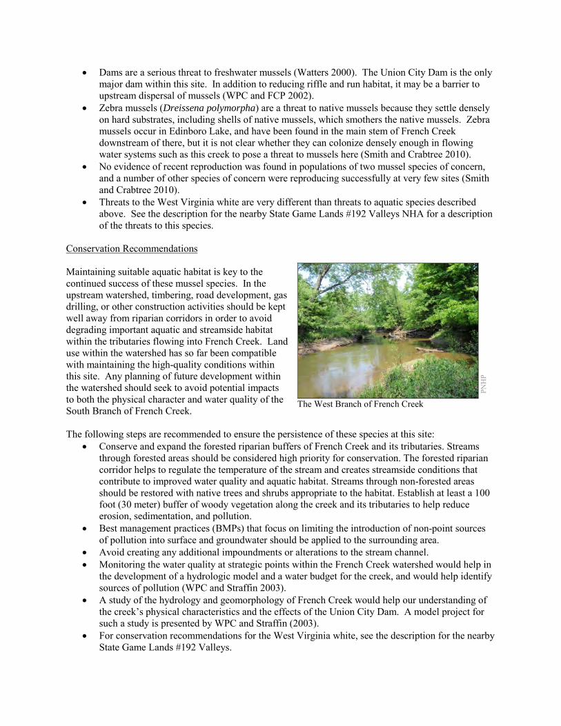
• Dams are a serious threat to freshwater mussels (Watters 2000). The Union City Dam is the only major dam within this site. In addition to reducing riffle and run habitat, it may be a barrier to upstream dispersal of mussels (WPC and FCP 2002).
• Zebra mussels (Dreissena polymorpha) are a threat to native mussels because they settle densely on hard substrates, including shells of native mussels, which smothers the native mussels. Zebra mussels occur in Edinboro Lake, and have been found in the main stem of French Creek downstream of there, but it is not clear whether they can colonize densely enough in flowing water systems such as this creek to pose a threat to mussels here (Smith and Crabtree 2010).
• No evidence of recent reproduction was found in populations of two mussel species of concern, and a number of other species of concern were reproducing successfully at very few sites (Smith and Crabtree 2010).
• Threats to the West Virginia white are very different than threats to aquatic species described above. See the description for the nearby State Game Lands #192 Valleys NHA for a description of the threats to this species.
Conservation Recommendations Maintaining suitable aquatic habitat is key to the continued success of these mussel species. In the upstream watershed, timbering, road development, gas drilling, or other construction activities should be kept well away from riparian corridors in order to avoid degrading important aquatic and streamside habitat within the tributaries flowing into French Creek. Land use within the watershed has so far been compatible with maintaining the high-quality conditions within this site. Any planning of future development within the watershed should seek to avoid potential impacts to both the physical character and water quality of the South Branch of French Creek. The following steps are recommended to ensure the persistence of these species at this site:
• Conserve and expand the forested riparian buffers of French Creek and its tributaries. Streams through forested areas should be considered high priority for conservation. The forested riparian corridor helps to regulate the temperature of the stream and creates streamside conditions that contribute to improved water quality and aquatic habitat. Streams through non-forested areas should be restored with native trees and shrubs appropriate to the habitat. Establish at least a 100 foot (30 meter) buffer of woody vegetation along the creek and its tributaries to help reduce erosion, sedimentation, and pollution.
• Best management practices (BMPs) that focus on limiting the introduction of non-point sources of pollution into surface and groundwater should be applied to the surrounding area.
• Avoid creating any additional impoundments or alterations to the stream channel. • Monitoring the water quality at strategic points within the French Creek watershed would help in
the development of a hydrologic model and a water budget for the creek, and would help identify sources of pollution (WPC and Straffin 2003).
• A study of the hydrology and geomorphology of French Creek would help our understanding of the creek’s physical characteristics and the effects of the Union City Dam. A model project for such a study is presented by WPC and Straffin (2003).
• For conservation recommendations for the West Virginia white, see the description for the nearby State Game Lands #192 Valleys.
PNH
P
The West Branch of French Creek
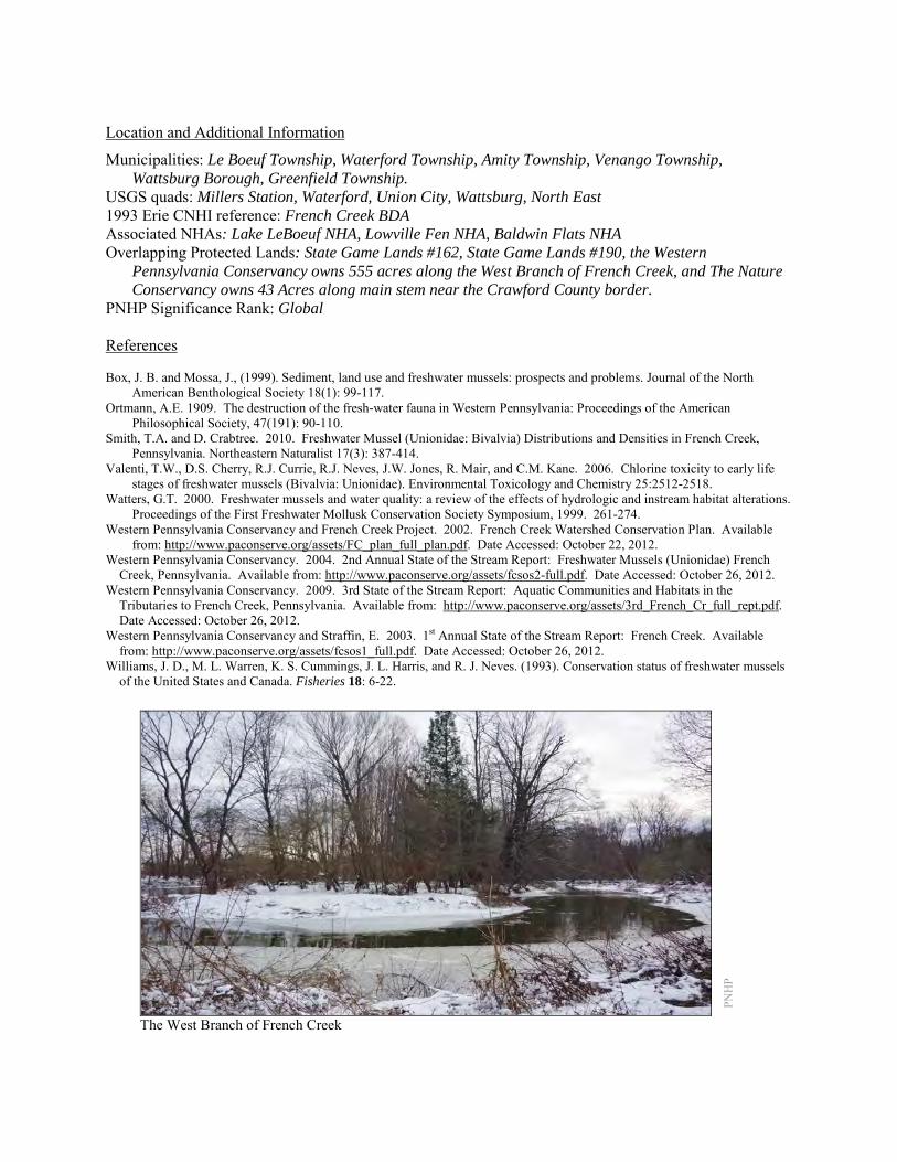
Location and Additional Information
Municipalities: Le Boeuf Township, Waterford Township, Amity Township, Venango Township, Wattsburg Borough, Greenfield Township.
USGS quads: Millers Station, Waterford, Union City, Wattsburg, North East 1993 Erie CNHI reference: French Creek BDA Associated NHAs: Lake LeBoeuf NHA, Lowville Fen NHA, Baldwin Flats NHA Overlapping Protected Lands: State Game Lands #162, State Game Lands #190, the Western
Pennsylvania Conservancy owns 555 acres along the West Branch of French Creek, and The Nature Conservancy owns 43 Acres along main stem near the Crawford County border.
PNHP Significance Rank: Global References Box, J. B. and Mossa, J., (1999). Sediment, land use and freshwater mussels: prospects and problems. Journal of the North
American Benthological Society 18(1): 99-117. Ortmann, A.E. 1909. The destruction of the fresh-water fauna in Western Pennsylvania: Proceedings of the American
Philosophical Society, 47(191): 90-110. Smith, T.A. and D. Crabtree. 2010. Freshwater Mussel (Unionidae: Bivalvia) Distributions and Densities in French Creek,
Pennsylvania. Northeastern Naturalist 17(3): 387-414. Valenti, T.W., D.S. Cherry, R.J. Currie, R.J. Neves, J.W. Jones, R. Mair, and C.M. Kane. 2006. Chlorine toxicity to early life
stages of freshwater mussels (Bivalvia: Unionidae). Environmental Toxicology and Chemistry 25:2512-2518. Watters, G.T. 2000. Freshwater mussels and water quality: a review of the effects of hydrologic and instream habitat alterations.
Proceedings of the First Freshwater Mollusk Conservation Society Symposium, 1999. 261-274. Western Pennsylvania Conservancy and French Creek Project. 2002. French Creek Watershed Conservation Plan. Available
from: http://www.paconserve.org/assets/FC_plan_full_plan.pdf. Date Accessed: October 22, 2012. Western Pennsylvania Conservancy. 2004. 2nd Annual State of the Stream Report: Freshwater Mussels (Unionidae) French
Creek, Pennsylvania. Available from: http://www.paconserve.org/assets/fcsos2-full.pdf. Date Accessed: October 26, 2012. Western Pennsylvania Conservancy. 2009. 3rd State of the Stream Report: Aquatic Communities and Habitats in the
Tributaries to French Creek, Pennsylvania. Available from: http://www.paconserve.org/assets/3rd_French_Cr_full_rept.pdf. Date Accessed: October 26, 2012.
Western Pennsylvania Conservancy and Straffin, E. 2003. 1st Annual State of the Stream Report: French Creek. Available from: http://www.paconserve.org/assets/fcsos1_full.pdf. Date Accessed: October 26, 2012.
Williams, J. D., M. L. Warren, K. S. Cummings, J. L. Harris, and R. J. Neves. (1993). Conservation status of freshwater mussels of the United States and Canada. Fisheries 18: 6-22.
PNH
P
The West Branch of French Creek
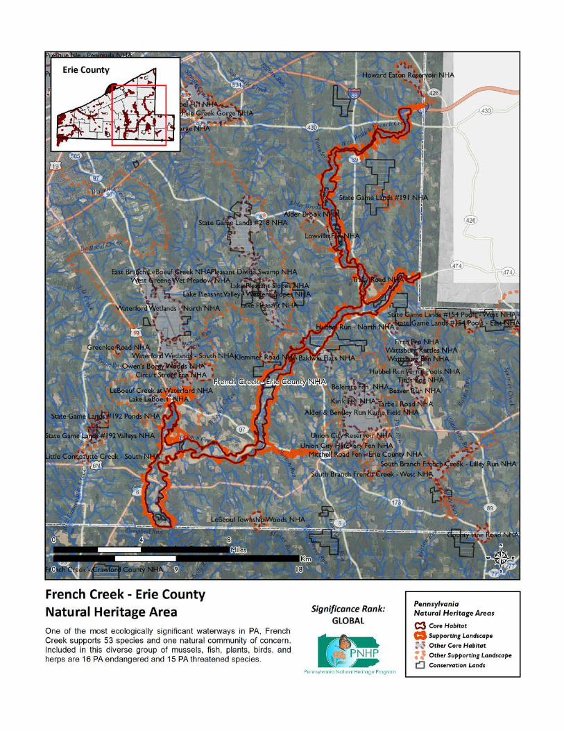
Gospel Hill NHA This NHA is situated between the Gospel Hill Country Club and Pennsylvania Route 430 west of Sixmile Creek. The site’s forest and nearby aquatic habitats support a sensitive species of concern. This species cannot be named at the request of the agency overseeing its protection. Species or natural communities of concern that can be found in this NHA include the following:
PNHP Rank1 PA Legal Species or Natural Community Name Global State Status1 Last Seen Quality2 Sensitive species of concern A3 S --- --- --- 2011 E 1 = Please refer to the PNHP website (http://www.naturalheritage.state.pa.us/RankStatusDef.aspx) for an explanation of PNHP ranks and legal
status. A legal status in parentheses is a status change recommended by the Pennsylvania Biological Survey. 2 = Please refer to the NatureServe website (http://www.natureserve.org/explorer/eorankguide.htm) for an explanation of quality ranks. 3 = This species is not named by request of the jurisdictional agency responsible for its protection.
Threats and Stresses Specific threats and stresses to the elements present within this site include the following:
• The sensitive species of concern is vulnerable to human disturbance. Significant additional human disturbance within 1000 feet (305 meters) could trigger permanent abandonment of the area.
• The species of concern at this site rely on good water quality, and is vulnerable to siltation and chemical pollution.
Conservation Recommendations Additional development within the Core Habitat should be avoided to protect the sensitive species of concern. Disturbance within the Core Habitat should not be a problem for this species if it occurs during non-breeding season (August – November). The entire site is privately owned and landowners in the Core Habitat should be aware that the species is sensitive to disturbance. Maintaining high quality aquatic habitat is important to this species. Development has occurred outside and on the periphery of Core Habitat. Additional buildings, roads and infrastructure have fragmented the landscape, and increasing the amount of impervious surface and edge habitat in threatens the immediate watershed. The following steps are recommended to ensure the persistence of these species at this site:
• Conserve and expand the forested riparian buffers for Sixmile Creek and a tributary to Fourmile Creek. Streams through forested areas should be considered high priority for conservation. The forested riparian corridor helps regulate stream temperature and creates streamside conditions contributing to improved water quality and aquatic habitat.
• Establish at least a 100 foot buffer of woody vegetation along streams to help reduce erosion, sedimentation, and pollution. Streams through non-forested areas should be restored with native trees and shrubs appropriate to the habitat.
• Additionally, best management practices (BMPs) that focus on limiting the introduction of non-point sources of pollution into surface and groundwater should be applied to the surrounding area
• Avoid fragmenting the existing forested areas with additional buildings or infrastructure. Avoid logging in this area except as it relates to invasive species removal to maintain mature forest conditions.

Location and Additional Information
Municipalities: Harborcreek Township USGS quads: Harborcreek 1993 Erie CNHI reference: Six Mile Creek Gorge Associated NHAs: Six Mile Creek Gorge Overlapping Protected Lands: None – private ownership PNHP Significance Rank: State
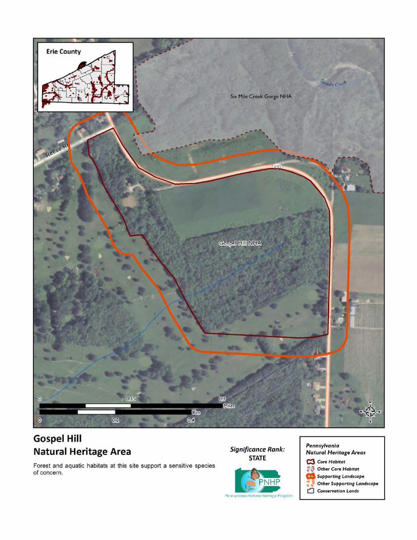
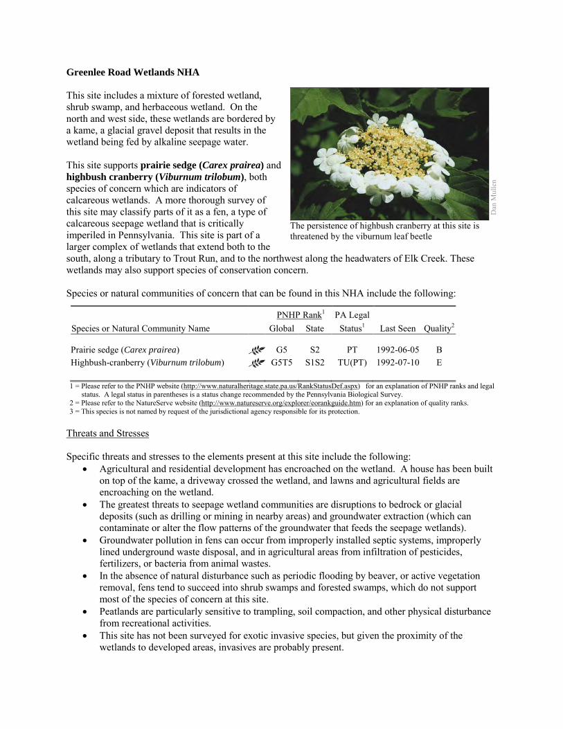
Greenlee Road Wetlands NHA This site includes a mixture of forested wetland, shrub swamp, and herbaceous wetland. On the north and west side, these wetlands are bordered by a kame, a glacial gravel deposit that results in the wetland being fed by alkaline seepage water. This site supports prairie sedge (Carex prairea) and highbush cranberry (Viburnum trilobum), both species of concern which are indicators of calcareous wetlands. A more thorough survey of this site may classify parts of it as a fen, a type of calcareous seepage wetland that is critically imperiled in Pennsylvania. This site is part of a larger complex of wetlands that extend both to the south, along a tributary to Trout Run, and to the northwest along the headwaters of Elk Creek. These wetlands may also support species of conservation concern. Species or natural communities of concern that can be found in this NHA include the following:
PNHP Rank1 PA Legal Species or Natural Community Name Global State Status1 Last Seen Quality2 Prairie sedge (Carex prairea) G5 S2 PT 1992-06-05 B Highbush-cranberry (Viburnum trilobum) G5T5 S1S2 TU(PT) 1992-07-10 E 1 = Please refer to the PNHP website (http://www.naturalheritage.state.pa.us/RankStatusDef.aspx) for an explanation of PNHP ranks and legal
status. A legal status in parentheses is a status change recommended by the Pennsylvania Biological Survey. 2 = Please refer to the NatureServe website (http://www.natureserve.org/explorer/eorankguide.htm) for an explanation of quality ranks. 3 = This species is not named by request of the jurisdictional agency responsible for its protection.
Threats and Stresses Specific threats and stresses to the elements present at this site include the following:
• Agricultural and residential development has encroached on the wetland. A house has been built on top of the kame, a driveway crossed the wetland, and lawns and agricultural fields are encroaching on the wetland.
• The greatest threats to seepage wetland communities are disruptions to bedrock or glacial deposits (such as drilling or mining in nearby areas) and groundwater extraction (which can contaminate or alter the flow patterns of the groundwater that feeds the seepage wetlands).
• Groundwater pollution in fens can occur from improperly installed septic systems, improperly lined underground waste disposal, and in agricultural areas from infiltration of pesticides, fertilizers, or bacteria from animal wastes.
• In the absence of natural disturbance such as periodic flooding by beaver, or active vegetation removal, fens tend to succeed into shrub swamps and forested swamps, which do not support most of the species of concern at this site.
• Peatlands are particularly sensitive to trampling, soil compaction, and other physical disturbance from recreational activities.
• This site has not been surveyed for exotic invasive species, but given the proximity of the wetlands to developed areas, invasives are probably present.
Dan
Mul
len
The persistence of highbush cranberry at this site is threatened by the viburnum leaf beetle
• Viburnum leaf beetle (Pyrrhalta viburni) is an introduced pest that eats highbush cranberry and other species of Viburnum. Within Pennsylvania, this pest has spread throughout the range of highbush cranberry and is decimating populations of the shrub. The long-term effects of this invasion remain unknown, but all populations of highbush cranberry are at serious risk.
Conservation Recommendations The following steps are recommended to ensure the persistence of these species at this site:
• Conserve and expand a vegetated buffer around the wetlands. Conserve at least a 328 foot (100 meter) buffer of native woody vegetation where it exists along the waterways and establish at least a 100 foot (~30 meter) buffer where it is lacking to help reduce erosion, sedimentation, and pollution. Additionally, best management practices (BMPs) that focus on limiting the introduction of non-point sources of pollution into surface and groundwater should be applied to the surrounding area.
• Drilling, mining, or other disruptions to bedrock or glacial deposits should not be undertaken within one-half mile of a seepage wetland without a thorough understanding of bedrock layers and groundwater flows. Groundwater flow patterns do not always mirror surface watersheds, and in some cases aquifers may be contiguous over large areas.
• Trails should be sited away from the wetland, or elevated boardwalks employed to prevent peat compaction and other disturbance in the wetland.
• A natural buffer around the wetland should be maintained in order to minimize nutrient runoff, pollution, and sedimentation.
• Survey for and remove invasive plant species. Part of the wetland is an early-successional habitat and is particularly susceptible to weedy plant invasion and will require a sustained and targeted approach to invasive management. Control of invasive species in the area will require extensive and continual effort. Focus initial control efforts on selected areas surrounding species of concern.
• Allow beaver to persist in the area. Beaver flooding will set back succession in the lower parts of the landscape. Over time beaver ponds will be abandoned, and the resulting beaver meadow may become a fen until conditions are again suitable for beaver.
• Management options for the control of viburnum leaf beetle should be investigated. • This area has not been extensively surveyed. Additional surveys here and in adjacent wetlands
may reveal the presence of additional species of concern.
Location and Additional Information Municipalities: Waterford Township USGS quads: Cambridge Springs NE 1993 Erie CNHI reference: This site was encompassed by French Creek BDA Associated NHAs: None Overlapping Protected Lands: None PNHP Significance Rank: State
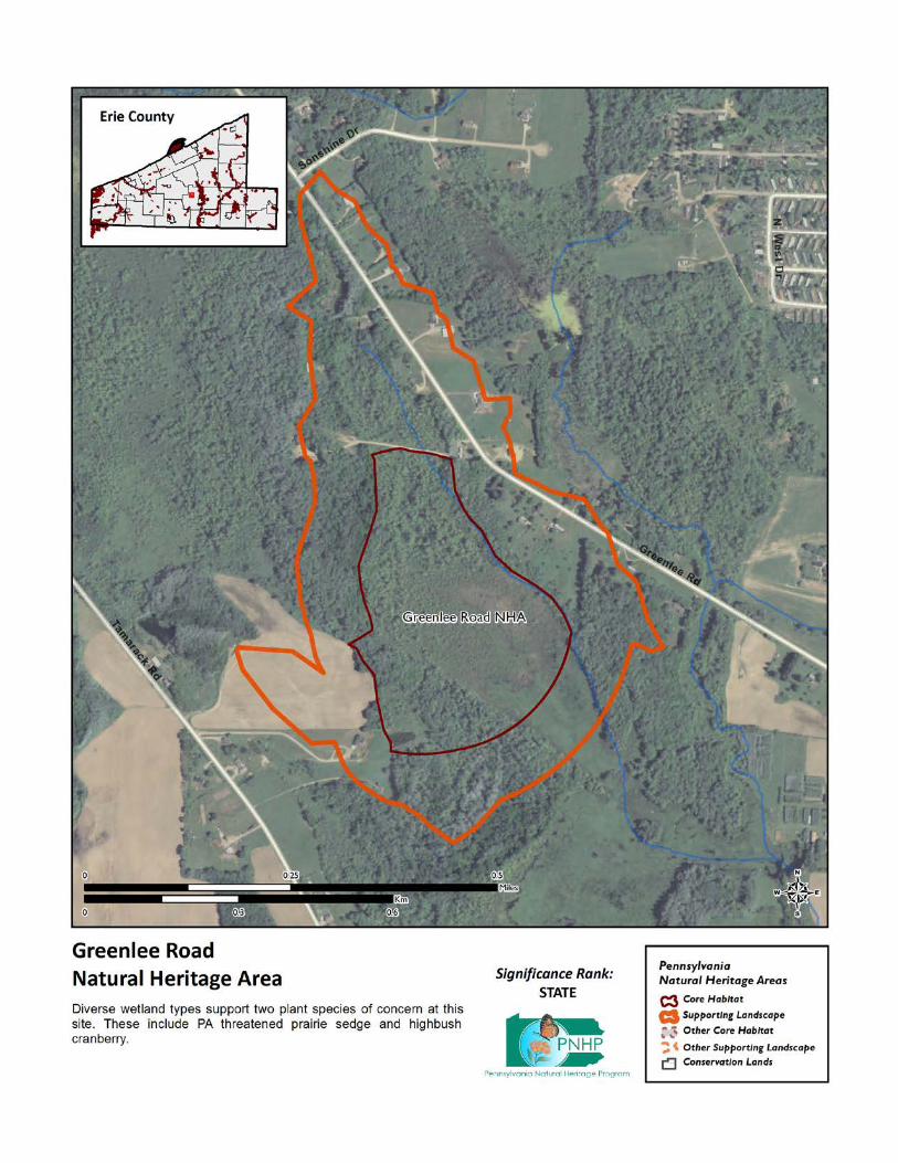

Hell’s Half Acre NHA This site is designated around a small glacial bog community locally known as Hell's Half-Acre that provides habitat for several species of concern. Kettlehole bogs originate from glacial activity, when a block of ice calves from the front of the receding glacier and then becomes buried in sediment from glacial outwash. As the ice block melts, relatively deep, steep sided depressions are left in the landscape. These depressions fill with surface water or groundwater, and wetlands form. As plant matter builds up as peat, the center of the wetland can become isolated from the influence of groundwater, resulting in an acidic bog. Water levels in the basin change considerably during the year as surface run off from rain and snow events as well as evapotranspiration vary throughout the growing season. Species or natural communities of concern that can be found in this NHA include the following:
PNHP Rank1 PA Legal Species or Natural Community Name Global State Status1 Last Seen Quality2 Leatherleaf – Cranberry Bog C G5 S2S3 N 2009-04-27 B Hemlock – Mixed Hardwood Palustrine Forest C G5 S3S4 N 2009-04-27 B Red currant (Ribes triste) G5 S2 PT 1987-08-08 E Threeleaf false Soloman’s-seal (Maianthemum trifolium) G5 S4 N (SP) 2009-04-27 B
Soft-leaved cedge (Carex disperma) G5 S3 PR 1987-08-08 B Downy willow-herb (Epilobium strictum) G5? S3 PE (PR) 2009-07-21 B Starflower (Maianthemum stellatum) G5 S4 N (SP) 2009-04-27 B 1 = Please refer to the PNHP website (http://www.naturalheritage.state.pa.us/RankStatusDef.aspx) for an explanation of PNHP ranks and legal
status. A legal status in parentheses is a status change recommended by the Pennsylvania Biological Survey. 2 = Please refer to the NatureServe website (http://www.natureserve.org/explorer/eorankguide.htm) for an explanation of quality ranks.
The process of succession formed the unique ecosystem that is found at Hell’s Half Acre today. Centrally located within the kettlehole basin is an approximately half acre sphagnum-dominated floating peat mat, which is a Leatherleaf – Cranberry Bog (Furedi 2011). Pitcher plants (Sarracenia purpurea) are present here. The glacial bog community provides habitat for three species of special concern considered to be threatened in Pennsylvania. The bog provides habitat for several plants and insects of concern. Most of these species can be found on the floating bog mat consisting of a thick mat of peatmoss (Sphagnum spp.) on which the dominant species include large cranberry (Vaccinium macrocarpon), small cranberry (V. oxycoccos), leather leaf (Chamaedaphne calyculata), cottongrass (Eriophorum sp.), sedges (Carex spp.), fragrant water lily (Nymphaea odorata) and sundews (Drosera spp.). Scattered white pine (Pinus strobus) and highbush blueberry (V. corymbosum) can be found throughout the site.
Chr
istop
her T
race
y, P
NH
P
The bog community at Hell’s Half Acre.

A Hemlock - Mixed Hardwood Palustrine Forest encircles the floating peat mat. This describes a group of wetland forests that are dominated by a mixture of conifers and hardwood species. The substrate is usually mineral soil or muck over mineral soil. There is generally some groundwater enrichment in these systems. Eastern hemlock (Tsuga canadensis) contributes between 25% to 75% of the canopy. Other conifer species that may occur with hemlock include eastern white pine (Pinus strobus), (Davis 2011). This community also serves as a buffer for sediment and pollution runoff from adjacent developed lands by slowing the flow of surficial water causing sediment to settle within this wetland. The moat surrounding the floating bog mat contains shrub thickets dominated variously by buttonbush (Cephalanthus occidentalis), speckled alder (Alnus incana ssp. rugosa), willow (Salix sp.), leatherleaf (Chamaedaphne calyculata), chokeberry (Aronia sp.), spiraea (Spiraea alba.), and northern arrowwood (Viburnum recognitum). Dominant tree species in this area include white pine (Pinus strobus), silver maple (Acer saccharinum), red maple (A. rubrum), and quaking aspen (Populus tremuloides). The site also provides high quality habitat for forest interior birds, such as Wood Thrush (Hylocichla mustelina), Veery (Catharus fuscescens), Acadian Flycatcher (Empidonax virescens), and Black-billed Cuckoo (Coccyzus erythropthalmus). The supporting landscape for the site is based on the local watershed of the bog. Threats and Stresses Bogs are fragile environments, vulnerable to changes brought about through both natural occurrences and human interference. This community may be more susceptible to degradation due to the fact that it is often associated with small, isolated basins. An examination of historic aerial photos shows that the area around Hell’s Half Acre have been cleared and converted to agricultural use as far back as 1939. Past timber harvesting has occurred in proximity to the site. Specific threats and stresses to the elements present at this site include the following:
• Bogs are threatened by habitat alteration (e.g., logging in adjacent uplands, flooding), deposition (e.g., sedimentation, nutrient loading), and alterations to the hydrological regime (e.g., removal of beaver dams or other impoundments, lowering of the water table).
• Several of the species here may be under collection pressure by hobbyists or the commercial trade. Collection can impact the population size and quality and also lead to the degradation of this community type.
• Excessive visitation to the site may compact the peat and impact the habitat for the rare species present there. Any visits should be conducted in small groups and avoid the most sensitive areas of the site.
• Agricultural fields present to the south and east of the bog may be impacting the site via alterations of the water table, sedimentation, and nutrient input to the bog.
Chr
istop
her T
race
y, P
NH
P
A pitcher plant in flower.

• Since the majority of the water at this site enters via surface flow over a relatively small watershed, any draining of the bog moat will negatively impact the bog and the species that live there.
• Eastern hemlock communities are threatened by hemlock woolly adelgid (Adelgis tsugae) infestations. This is an exotic pest insect that feeds on the twigs of the eastern hemlocks causing defoliation, bud mortality, and, eventually, tree mortality within as little as four years (Young et al. 1995). As tree mortality occurs, light availability increases due to the widening of canopy gaps and provides opportunities for the colonization of invasive plant species within the understory (Orwig and Foster 1998).
• Hemlock – Mixed Hardwood Palustrine Forests are threatened by habitat alteration, deposition (sedimentation, agricultural runoff) and alterations to the hydrological regime (beaver dams, lowering of water tables). Clearing and development of adjacent land can lead to accumulation of agricultural run-off and pollution, sedimentation, and insolation/thermal pollution.
Conservation Recommendations The eastern portion of Hell’s Half Acre is part of State Game Land #102 and managed by the Pennsylvania Game Commissions with the purpose of protecting and maintaining the site's ecological integrity. The eastern portion of the site is under private ownership. The following steps are recommended to ensure the persistence of these species at this site:
• The existing natural buffer around the wetland should be maintained in order to minimize nutrient runoff, pollution, and sedimentation. Areas of the core habitat and supporting landscape that are not currently under natural vegetated cover should be restored with appropriate species.
• Direct impacts and habitat alteration should be avoided (e.g., filling of wetlands) and low impact alternatives (e.g., elevated footpaths, boardwalks, bridges) should be considered in situations where accessing the wetland cannot be avoided.
• Care should also be taken to control and prevent the introduction and spread of invasive species within the wetland.
• Alterations to ground and surface water sources should be prevented or minimized. • As of 2012, available treatments for hemlock woolly adelgid are not economically feasible at a
scale suitable for large natural areas. At a smaller scale, injection of insecticides into tree trunks or into the soil around a tree can control adelgids for up to several years at a time, although there may be unintended effects on other species. Continued applications of horticultural oil or insecticidal soap can also control hemlock woolly adelgids. Biological controls are being researched, although they have so far had limited success at keeping adelgid populations in check (DCNR 2012).
Location and Additional Information
Municipalities: Union Township USGS quads: Union City 1993 Erie CNHI reference: Bentley Run/Alder Run BDA Associated NHAs: Alder & Bentley Run Kame Field NHA, Boleratz Fen NHA, Kirik Fen NHA, Union
City Hatchery Fen NHA, Union City Reservoir NHA Overlapping Protected Lands: State Game Land #102 PNHP Significance Rank: State
References Davis T. 2011. Pennsylvania Natural Heritage Program. Hemlock – Mixed Hardwood Palustrine Forest Factsheet. Available
from: http://www.naturalheritage.state.pa.us/Community.aspx?=16029 Date Accessed: July 25, 2012. Department of Conservation and Natural Resources. 2012. Forest Health Fact Sheet: Hemlock Woolly Adelgid.
http://www.dcnr.state.pa.us/ucmprd2/groups/public/documents/document/dcnr_007179.pdf Furedi, M. 2011. Pennsylvania Natural Heritage Program. Leatherleaf – Cranberry Bog Factsheet. Availa.ble from:
http://www.naturalheritage.state.pa.us/Community.aspx?=16041 Date Accessed: October 23, 2012 Ireland, Alex W., and Robert K. Booth. 2011. Hydroclimatic variability drives episodic expansion of a floating peat mat in a
North American kettlehole basin. Ecology 92:11–18. Orwig, D. A., and D. R. Foster. 1998. Forest response to the introduced hemlock woolly adelgid in southern New England, USA.
Journal of the Torrey Botanical Society 125: 60:73. Young, R. F., K. S. Shields, and G. P. Berlyn. 1995. Hemlock woolly adelgid (Homoptera, Adelgidae)-stylet bundle insertion and
feeding sites. Annals of Entomological Society of America 88: 827:835.
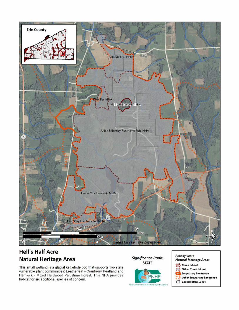
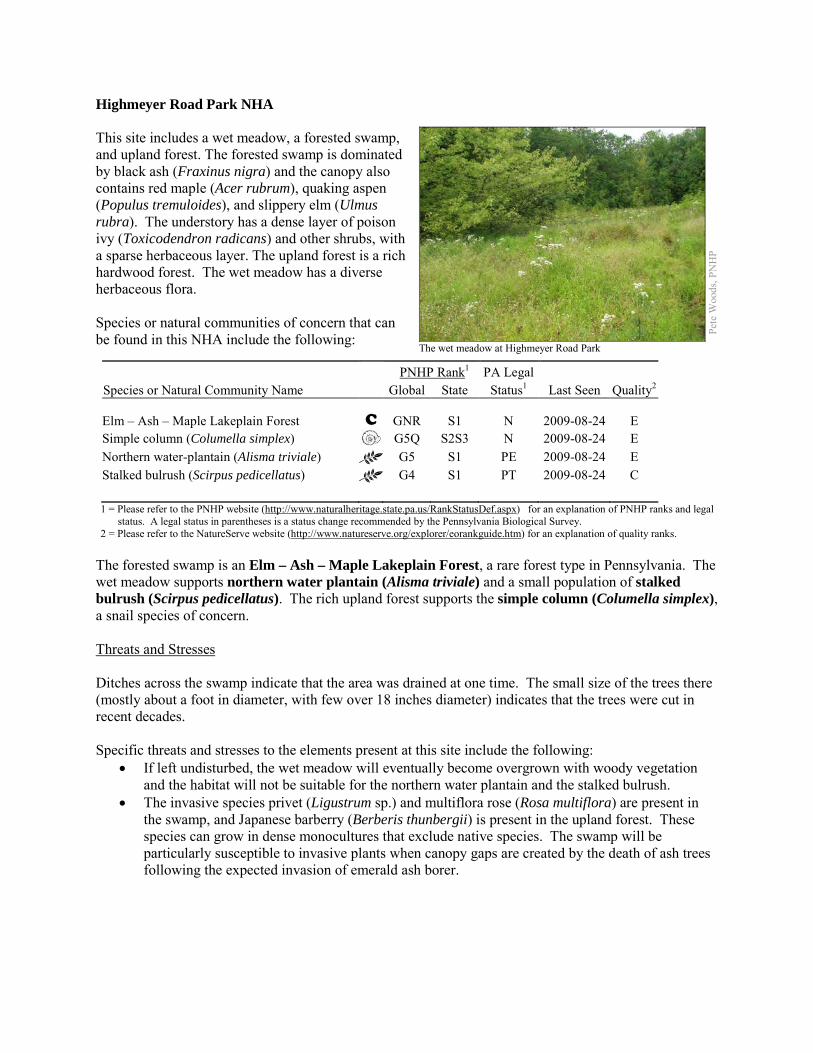
Highmeyer Road Park NHA This site includes a wet meadow, a forested swamp, and upland forest. The forested swamp is dominated by black ash (Fraxinus nigra) and the canopy also contains red maple (Acer rubrum), quaking aspen (Populus tremuloides), and slippery elm (Ulmus rubra). The understory has a dense layer of poison ivy (Toxicodendron radicans) and other shrubs, with a sparse herbaceous layer. The upland forest is a rich hardwood forest. The wet meadow has a diverse herbaceous flora. Species or natural communities of concern that can be found in this NHA include the following:
PNHP Rank1 PA Legal Species or Natural Community Name Global State Status1 Last Seen Quality2 Elm – Ash – Maple Lakeplain Forest C GNR S1 N 2009-08-24 E Simple column (Columella simplex) G5Q S2S3 N 2009-08-24 E Northern water-plantain (Alisma triviale) G5 S1 PE 2009-08-24 E Stalked bulrush (Scirpus pedicellatus) G4 S1 PT 2009-08-24 C 1 = Please refer to the PNHP website (http://www.naturalheritage.state.pa.us/RankStatusDef.aspx) for an explanation of PNHP ranks and legal
status. A legal status in parentheses is a status change recommended by the Pennsylvania Biological Survey. 2 = Please refer to the NatureServe website (http://www.natureserve.org/explorer/eorankguide.htm) for an explanation of quality ranks.
The forested swamp is an Elm – Ash – Maple Lakeplain Forest, a rare forest type in Pennsylvania. The wet meadow supports northern water plantain (Alisma triviale) and a small population of stalked bulrush (Scirpus pedicellatus). The rich upland forest supports the simple column (Columella simplex), a snail species of concern. Threats and Stresses Ditches across the swamp indicate that the area was drained at one time. The small size of the trees there (mostly about a foot in diameter, with few over 18 inches diameter) indicates that the trees were cut in recent decades. Specific threats and stresses to the elements present at this site include the following:
• If left undisturbed, the wet meadow will eventually become overgrown with woody vegetation and the habitat will not be suitable for the northern water plantain and the stalked bulrush.
• The invasive species privet (Ligustrum sp.) and multiflora rose (Rosa multiflora) are present in the swamp, and Japanese barberry (Berberis thunbergii) is present in the upland forest. These species can grow in dense monocultures that exclude native species. The swamp will be particularly susceptible to invasive plants when canopy gaps are created by the death of ash trees following the expected invasion of emerald ash borer.
Pete
Woo
ds, P
NH
P
The wet meadow at Highmeyer Road Park
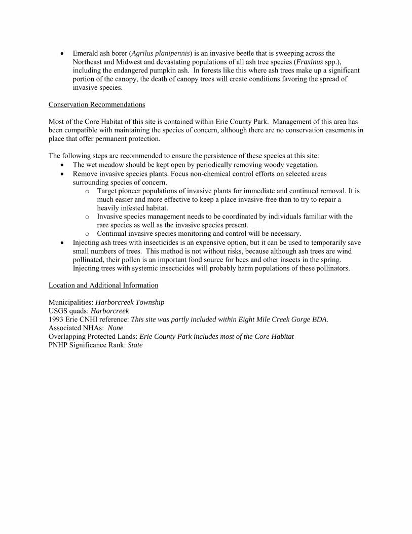
• Emerald ash borer (Agrilus planipennis) is an invasive beetle that is sweeping across the Northeast and Midwest and devastating populations of all ash tree species (Fraxinus spp.), including the endangered pumpkin ash. In forests like this where ash trees make up a significant portion of the canopy, the death of canopy trees will create conditions favoring the spread of invasive species.
Conservation Recommendations Most of the Core Habitat of this site is contained within Erie County Park. Management of this area has been compatible with maintaining the species of concern, although there are no conservation easements in place that offer permanent protection. The following steps are recommended to ensure the persistence of these species at this site:
• The wet meadow should be kept open by periodically removing woody vegetation. • Remove invasive species plants. Focus non-chemical control efforts on selected areas
surrounding species of concern. o Target pioneer populations of invasive plants for immediate and continued removal. It is
much easier and more effective to keep a place invasive-free than to try to repair a heavily infested habitat.
o Invasive species management needs to be coordinated by individuals familiar with the rare species as well as the invasive species present.
o Continual invasive species monitoring and control will be necessary. • Injecting ash trees with insecticides is an expensive option, but it can be used to temporarily save
small numbers of trees. This method is not without risks, because although ash trees are wind pollinated, their pollen is an important food source for bees and other insects in the spring. Injecting trees with systemic insecticides will probably harm populations of these pollinators.
Location and Additional Information Municipalities: Harborcreek Township USGS quads: Harborcreek 1993 Erie CNHI reference: This site was partly included within Eight Mile Creek Gorge BDA. Associated NHAs: None Overlapping Protected Lands: Erie County Park includes most of the Core Habitat PNHP Significance Rank: State
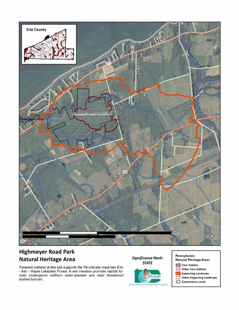
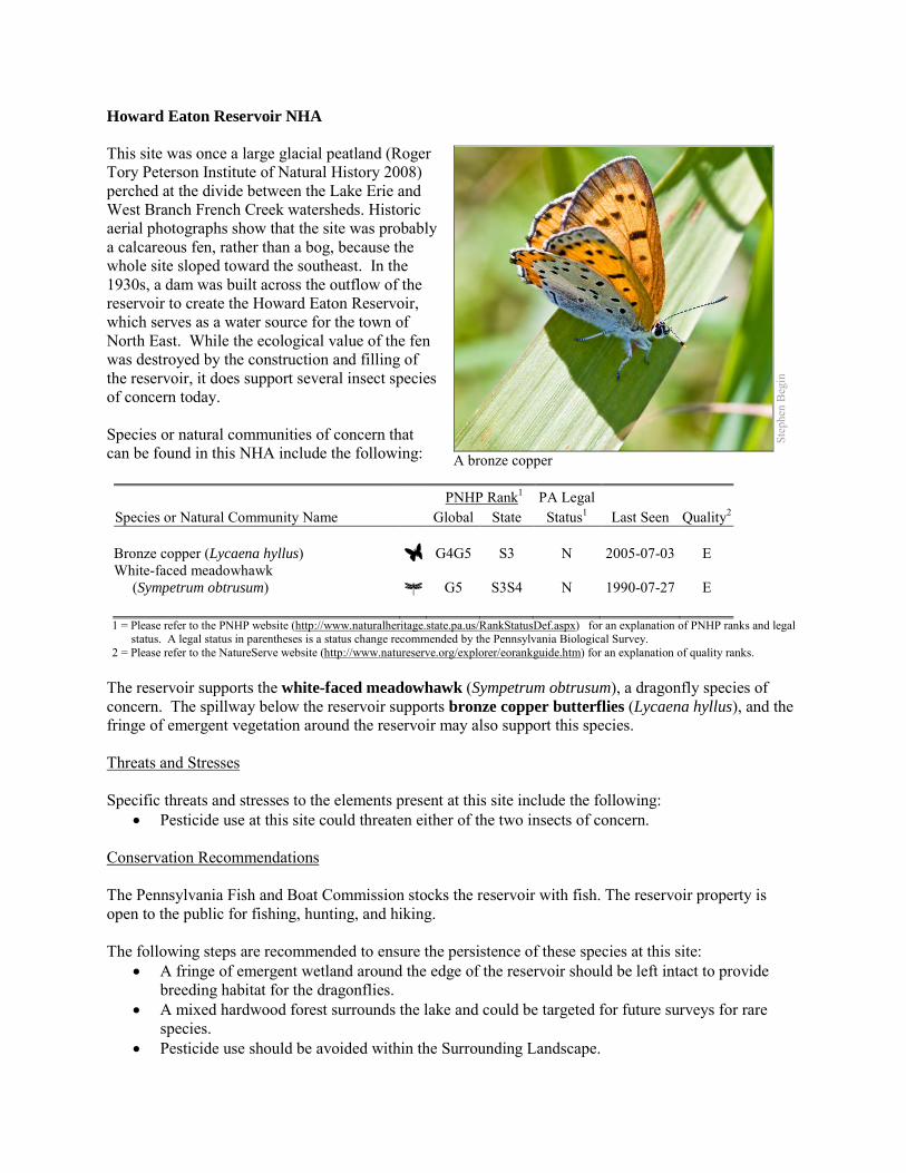
Howard Eaton Reservoir NHA This site was once a large glacial peatland (Roger Tory Peterson Institute of Natural History 2008) perched at the divide between the Lake Erie and West Branch French Creek watersheds. Historic aerial photographs show that the site was probably a calcareous fen, rather than a bog, because the whole site sloped toward the southeast. In the 1930s, a dam was built across the outflow of the reservoir to create the Howard Eaton Reservoir, which serves as a water source for the town of North East. While the ecological value of the fen was destroyed by the construction and filling of the reservoir, it does support several insect species of concern today. Species or natural communities of concern that can be found in this NHA include the following: PNHP Rank1 PA Legal Species or Natural Community Name Global State Status1 Last Seen Quality2
Bronze copper (Lycaena hyllus) G4G5 S3 N 2005-07-03 E White-faced meadowhawk (Sympetrum obtrusum) G5 S3S4 N 1990-07-27 E 1 = Please refer to the PNHP website (http://www.naturalheritage.state.pa.us/RankStatusDef.aspx) for an explanation of PNHP ranks and legal
status. A legal status in parentheses is a status change recommended by the Pennsylvania Biological Survey. 2 = Please refer to the NatureServe website (http://www.natureserve.org/explorer/eorankguide.htm) for an explanation of quality ranks.
The reservoir supports the white-faced meadowhawk (Sympetrum obtrusum), a dragonfly species of concern. The spillway below the reservoir supports bronze copper butterflies (Lycaena hyllus), and the fringe of emergent vegetation around the reservoir may also support this species. Threats and Stresses Specific threats and stresses to the elements present at this site include the following:
• Pesticide use at this site could threaten either of the two insects of concern. Conservation Recommendations The Pennsylvania Fish and Boat Commission stocks the reservoir with fish. The reservoir property is open to the public for fishing, hunting, and hiking. The following steps are recommended to ensure the persistence of these species at this site:
• A fringe of emergent wetland around the edge of the reservoir should be left intact to provide breeding habitat for the dragonflies.
• A mixed hardwood forest surrounds the lake and could be targeted for future surveys for rare species.
• Pesticide use should be avoided within the Surrounding Landscape.
Step
hen
Beg
in
A bronze copper

Location and Additional Information
Municipalities: Greenfield Township and North East Township USGS quads: North East 1993 Erie CNHI reference: None Associated NHAs: None; the species of concern at this site were not tracked at the time of the first Erie
CNHI Overlapping Protected Lands: None PNHP Significance Rank: State References Roger Tory Peterson Institute of Natural History. 2008. Howard Eaton Reservoir. Available at: http://www.rtpi.org/howard-eaton-reservoir.html
Accessed February 10, 2012.

Hubbel Run Fen NHA Seepy wetlands along Hubbel Run near its headwaters support a species of concern, which cannot be named here at the request of the jurisdictional agency overseeing its protection. Although most wetlands are acidic, fens are alkaline. Groundwater from the surrounding basin percolates through glacial sediments that contains limestone gravel and particles deposited during the last ice age. The water becomes alkaline and continues to flow underground until the topography and geology is such that it seeps out at the surface, where a fen may form. The species of concern is a fen indicator, and an assessment of the natural community here may find that a fen, a community type critically imperiled in Pennsylvania, is present. Species or natural communities of concern that can be found in this NHA include the following:
PNHP Rank1 PA Legal Species or Natural Community Name Global State Status1 Last Seen Quality2 Sensitive species of concern A3 S --- --- --- 1992-07-29 B 1 = Please refer to the PNHP website (http://www.naturalheritage.state.pa.us/RankStatusDef.aspx) for an explanation of PNHP ranks and legal
status. A legal status in parentheses is a status change recommended by the Pennsylvania Biological Survey. 2 = Please refer to the NatureServe website (http://www.natureserve.org/explorer/eorankguide.htm) for an explanation of quality ranks. 3 = This species is not named by request of the jurisdictional agency responsible for its protection.
Threats and Stresses Specific threats and stresses to the elements present at this site include the following:
• The greatest threats to fen communities are disruptions to bedrock or glacial deposits (such as drilling or mining in nearby areas) and any activities that alter groundwater flows or the quality of groundwater.
• Groundwater pollution in fens can occur from improperly installed septic systems, improperly lined underground waste disposal, and in agricultural areas from infiltration of pesticides, fertilizers, or nutrients from animal wastes. Pesticides can kill non-target organisms, and nutrient loading can accelerate the spread of invasive species.
• Peatlands are particularly sensitive to trampling, soil compaction, and other physical disturbance from recreational activities.
• Overbrowsing by white-tailed deer is a serious threat to the overall understory plant diversity. The species of concern is particularly susceptible to deer herbivory.
Conservation Recommendations This site is entirely on private land and there are no conservation easements in place. The following steps are recommended to ensure the persistence of these species at this site:
• Drilling, mining, or other disruptions to bedrock or glacial deposits should not be undertaken within one-half mile of a seepage wetland without a thorough understanding of local bedrock geology, surficial geology, and groundwater flows. Groundwater flow patterns do not always mirror surface watersheds, and in some cases aquifers may be contiguous over large areas.
• Trails should be sited away from the wetland, or elevated boardwalks employed to prevent peat compaction and other disturbance in the wetland.
• A natural buffer around the wetland should be maintained in order to minimize nutrient runoff, pollution, and sedimentation.
• Monitor for and remove invasive plant species. • Fens may require periodic disturbance such as cutting, burning, or grazing to maintain the open
canopy which is indicative of this community and the rare species that occupy it. • Reduce the deer density in the area to minimize damage to the species of concern. If this is not
feasible, a deer exclosure would protect the species of concern.
Location and Additional Information
Municipalities: Amity Township USGS quads: Union City 1993 Erie CNHI reference: Hubbel Run BDA, Wattsburg Fen Natural Area Associated NHAs: Wattsburg Fen NHA, Firth Fen NHA Overlapping Protected Lands: None PNHP Significance Rank: State
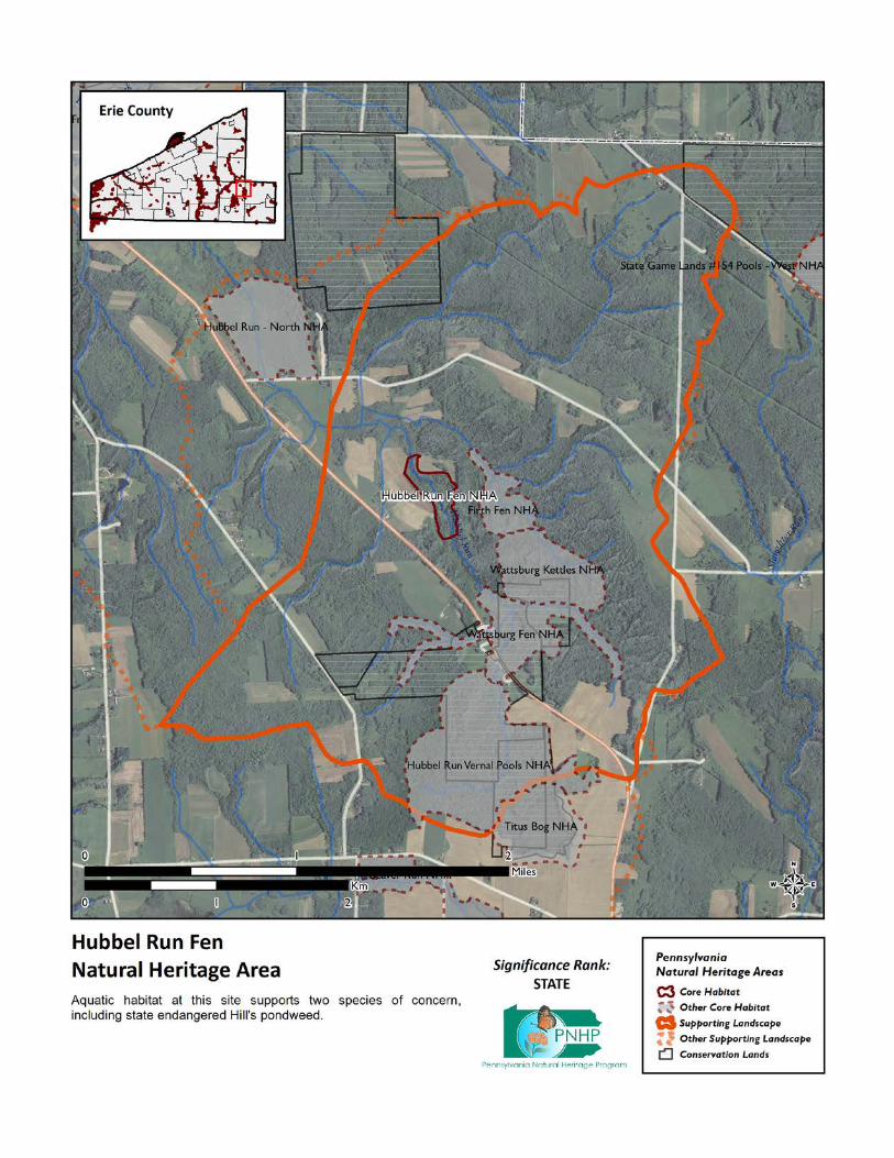
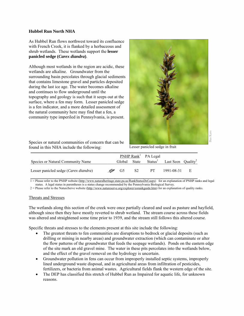
Hubbel Run North NHA As Hubbel Run flows northwest toward its confluence with French Creek, it is flanked by a herbaceous and shrub wetlands. These wetlands support the lesser panicled sedge (Carex diandra). Although most wetlands in the region are acidic, these wetlands are alkaline. Groundwater from the surrounding basin percolates through glacial sediments that contains limestone gravel and particles deposited during the last ice age. The water becomes alkaline and continues to flow underground until the topography and geology is such that it seeps out at the surface, where a fen may form. Lesser panicled sedge is a fen indicator, and a more detailed assessment of the natural community here may find that a fen, a community type imperiled in Pennsylvania, is present. Species or natural communities of concern that can be found in this NHA include the following:
PNHP Rank1 PA Legal Species or Natural Community Name Global State Status1 Last Seen Quality2 Lesser panicled sedge (Carex diandra) G5 S2 PT 1991-08-31 E 1 = Please refer to the PNHP website (http://www.naturalheritage.state.pa.us/RankStatusDef.aspx) for an explanation of PNHP ranks and legal
status. A legal status in parentheses is a status change recommended by the Pennsylvania Biological Survey. 2 = Please refer to the NatureServe website (http://www.natureserve.org/explorer/eorankguide.htm) for an explanation of quality ranks.
Threats and Stresses The wetlands along this section of the creek were once partially cleared and used as pasture and hayfield, although since then they have mostly reverted to shrub wetland. The stream course across these fields was altered and straightened some time prior to 1939, and the stream still follows this altered course. Specific threats and stresses to the elements present at this site include the following:
• The greatest threats to fen communities are disruptions to bedrock or glacial deposits (such as drilling or mining in nearby areas) and groundwater extraction (which can contaminate or alter the flow patterns of the groundwater that feeds the seepage wetlands). Ponds on the eastern edge of the site mark an old gravel mine. The water in these pits percolates into the wetlands below, and the effect of the gravel removal on the hydrology is uncertain.
• Groundwater pollution in fens can occur from improperly installed septic systems, improperly lined underground waste disposal, and in agricultural areas from infiltration of pesticides, fertilizers, or bacteria from animal wastes. Agricultural fields flank the western edge of the site.
• The DEP has classified this stretch of Hubbel Run as Impaired for aquatic life, for unknown reasons.
Bas
Ker
s
Lesser panicled sedge in fruit
• Peatlands are particularly sensitive to trampling, soil compaction, and other physical disturbance from recreational activities.
• Exotic invasive plant species may be present. These exotic species have the potential to severely modify the site and impact the rare plant species present.
Conservation Recommendations This site is entirely on private land, and there are no conservation easements in place. The following steps are recommended to ensure the persistence of these species at this site:
• Drilling, mining, or other disruptions to bedrock or glacial deposits should not be undertaken within one-half mile of a seepage wetland without a thorough understanding of bedrock layers and groundwater flows. Groundwater flow patterns do not always mirror surface watersheds, and in some cases aquifers may be contiguous over large areas.
• A natural buffer around the wetland should be maintained in order to minimize nutrient runoff, pollution, and sedimentation.
• Invasive plant species should be monitored for, and removed where present.
Location and Additional Information
Municipalities: Amity Township USGS quads: Union City 1993 Erie CNHI reference: Hubbel Run BDA encompassed this site and several others Associated NHAs: none Overlapping Protected Lands: none PNHP Significance Rank: State
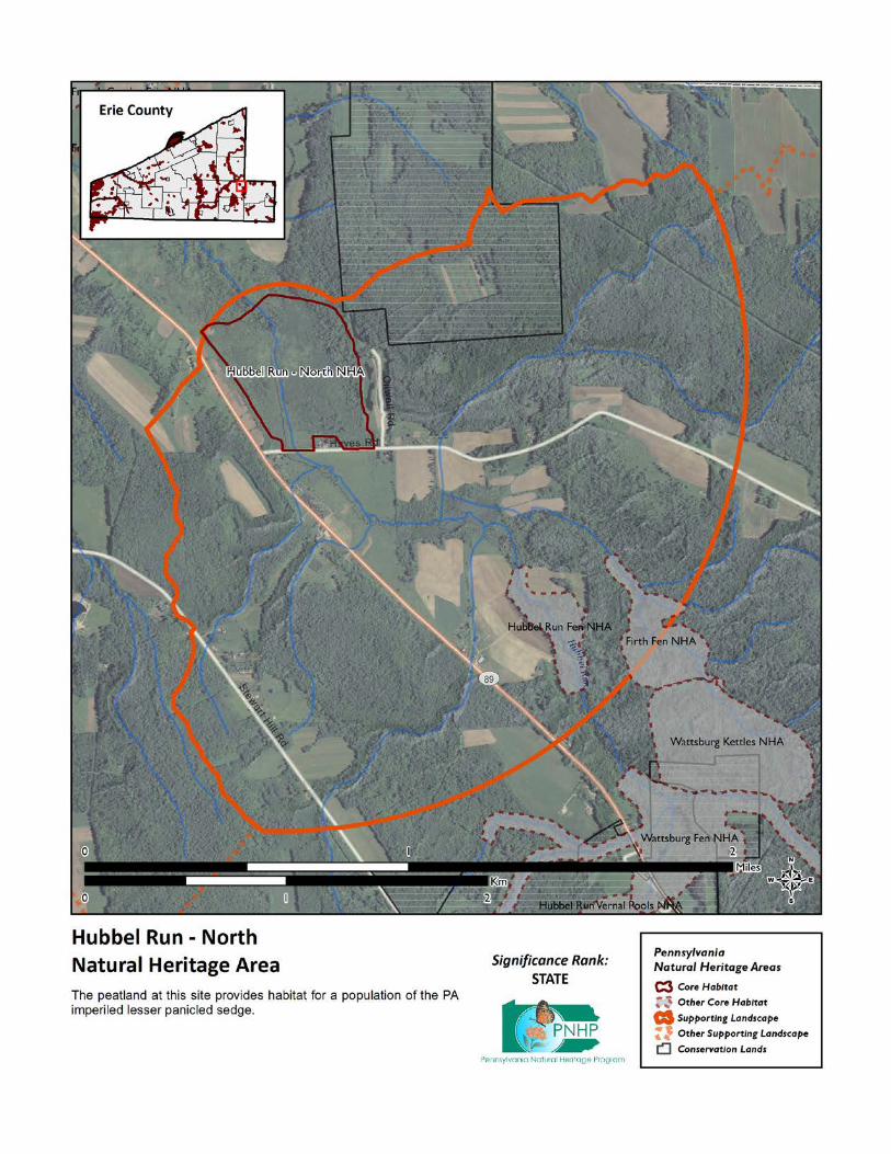
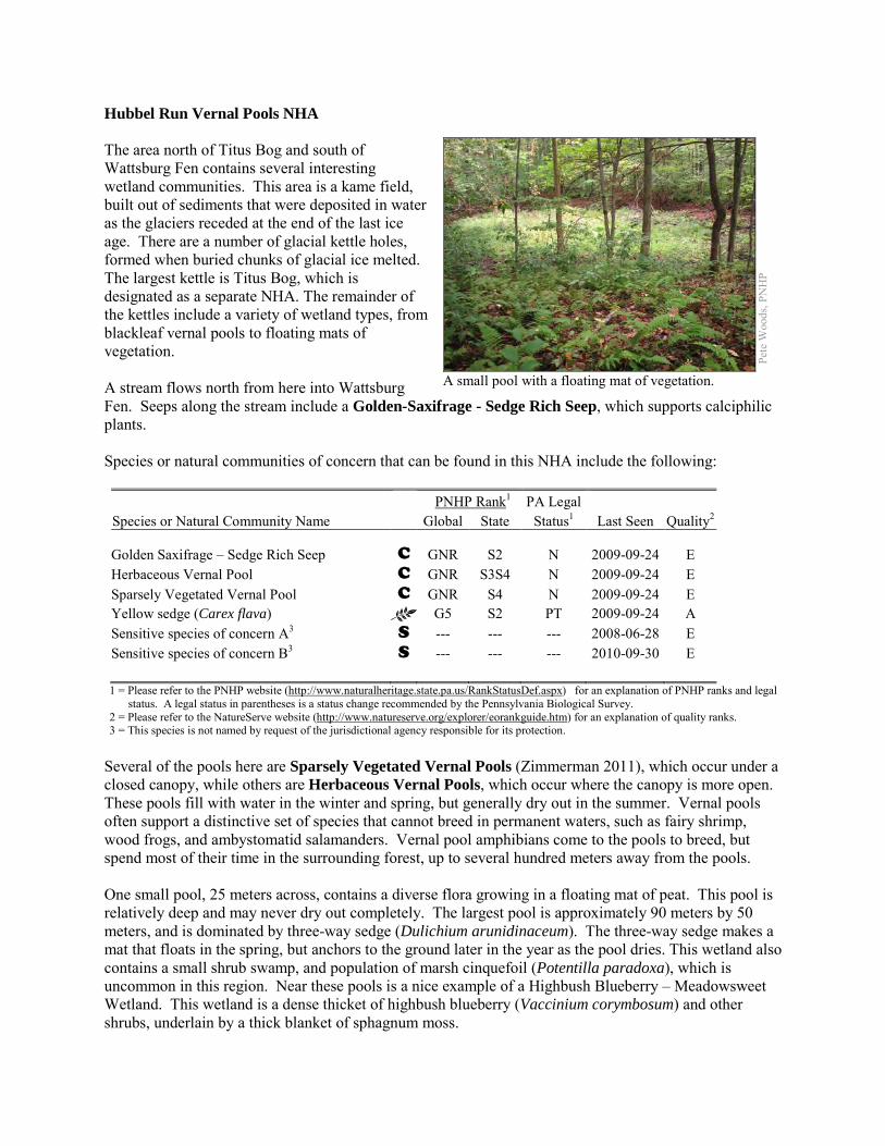
Hubbel Run Vernal Pools NHA The area north of Titus Bog and south of Wattsburg Fen contains several interesting wetland communities. This area is a kame field, built out of sediments that were deposited in water as the glaciers receded at the end of the last ice age. There are a number of glacial kettle holes, formed when buried chunks of glacial ice melted. The largest kettle is Titus Bog, which is designated as a separate NHA. The remainder of the kettles include a variety of wetland types, from blackleaf vernal pools to floating mats of vegetation. A stream flows north from here into Wattsburg Fen. Seeps along the stream include a Golden-Saxifrage - Sedge Rich Seep, which supports calciphilic plants. Species or natural communities of concern that can be found in this NHA include the following: PNHP Rank1 PA Legal Species or Natural Community Name Global State Status1 Last Seen Quality2 Golden Saxifrage – Sedge Rich Seep C GNR S2 N 2009-09-24 E Herbaceous Vernal Pool C GNR S3S4 N 2009-09-24 E Sparsely Vegetated Vernal Pool C GNR S4 N 2009-09-24 E Yellow sedge (Carex flava) G5 S2 PT 2009-09-24 A Sensitive species of concern A3 S --- --- --- 2008-06-28 E Sensitive species of concern B3 S --- --- --- 2010-09-30 E 1 = Please refer to the PNHP website (http://www.naturalheritage.state.pa.us/RankStatusDef.aspx) for an explanation of PNHP ranks and legal
status. A legal status in parentheses is a status change recommended by the Pennsylvania Biological Survey. 2 = Please refer to the NatureServe website (http://www.natureserve.org/explorer/eorankguide.htm) for an explanation of quality ranks. 3 = This species is not named by request of the jurisdictional agency responsible for its protection.
Several of the pools here are Sparsely Vegetated Vernal Pools (Zimmerman 2011), which occur under a closed canopy, while others are Herbaceous Vernal Pools, which occur where the canopy is more open. These pools fill with water in the winter and spring, but generally dry out in the summer. Vernal pools often support a distinctive set of species that cannot breed in permanent waters, such as fairy shrimp, wood frogs, and ambystomatid salamanders. Vernal pool amphibians come to the pools to breed, but spend most of their time in the surrounding forest, up to several hundred meters away from the pools. One small pool, 25 meters across, contains a diverse flora growing in a floating mat of peat. This pool is relatively deep and may never dry out completely. The largest pool is approximately 90 meters by 50 meters, and is dominated by three-way sedge (Dulichium arunidinaceum). The three-way sedge makes a mat that floats in the spring, but anchors to the ground later in the year as the pool dries. This wetland also contains a small shrub swamp, and population of marsh cinquefoil (Potentilla paradoxa), which is uncommon in this region. Near these pools is a nice example of a Highbush Blueberry – Meadowsweet Wetland. This wetland is a dense thicket of highbush blueberry (Vaccinium corymbosum) and other shrubs, underlain by a thick blanket of sphagnum moss.
Pete
Woo
ds, P
NH
P
A small pool with a floating mat of vegetation.
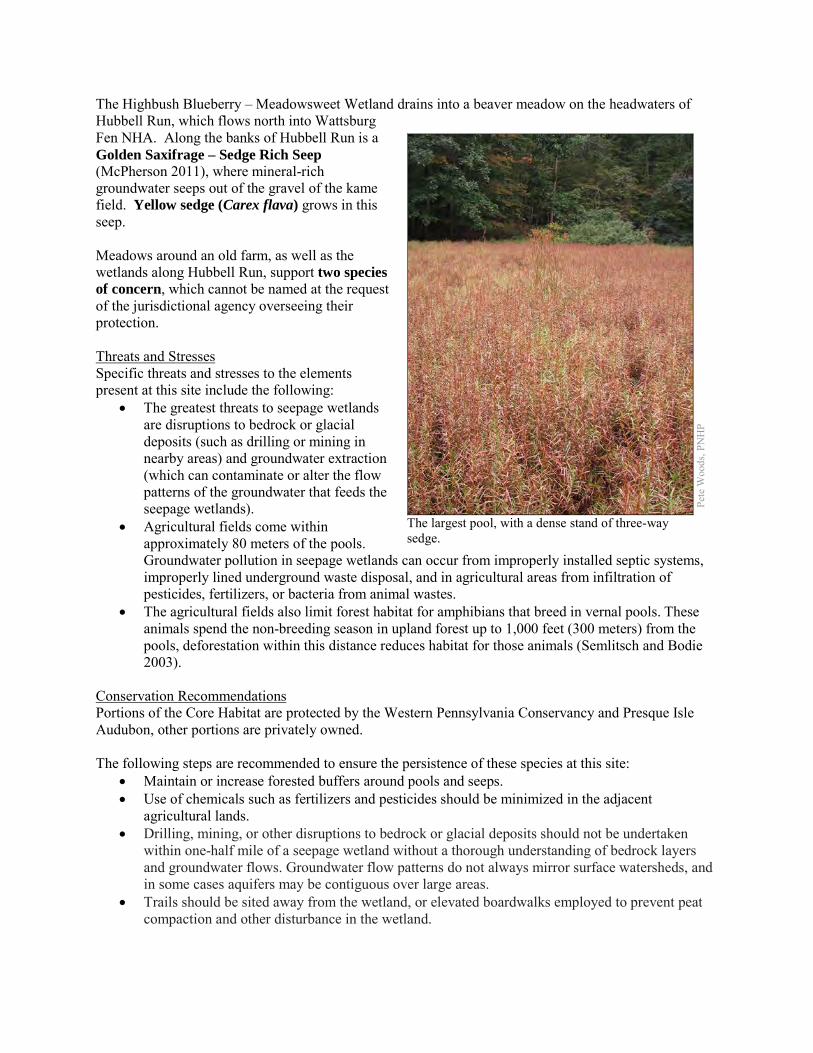
The Highbush Blueberry – Meadowsweet Wetland drains into a beaver meadow on the headwaters of Hubbell Run, which flows north into Wattsburg Fen NHA. Along the banks of Hubbell Run is a Golden Saxifrage – Sedge Rich Seep (McPherson 2011), where mineral-rich groundwater seeps out of the gravel of the kame field. Yellow sedge (Carex flava) grows in this seep. Meadows around an old farm, as well as the wetlands along Hubbell Run, support two species of concern, which cannot be named at the request of the jurisdictional agency overseeing their protection. Threats and Stresses Specific threats and stresses to the elements present at this site include the following:
• The greatest threats to seepage wetlands are disruptions to bedrock or glacial deposits (such as drilling or mining in nearby areas) and groundwater extraction (which can contaminate or alter the flow patterns of the groundwater that feeds the seepage wetlands).
• Agricultural fields come within approximately 80 meters of the pools. Groundwater pollution in seepage wetlands can occur from improperly installed septic systems, improperly lined underground waste disposal, and in agricultural areas from infiltration of pesticides, fertilizers, or bacteria from animal wastes.
• The agricultural fields also limit forest habitat for amphibians that breed in vernal pools. These animals spend the non-breeding season in upland forest up to 1,000 feet (300 meters) from the pools, deforestation within this distance reduces habitat for those animals (Semlitsch and Bodie 2003).
Conservation Recommendations Portions of the Core Habitat are protected by the Western Pennsylvania Conservancy and Presque Isle Audubon, other portions are privately owned. The following steps are recommended to ensure the persistence of these species at this site:
• Maintain or increase forested buffers around pools and seeps. • Use of chemicals such as fertilizers and pesticides should be minimized in the adjacent
agricultural lands. • Drilling, mining, or other disruptions to bedrock or glacial deposits should not be undertaken
within one-half mile of a seepage wetland without a thorough understanding of bedrock layers and groundwater flows. Groundwater flow patterns do not always mirror surface watersheds, and in some cases aquifers may be contiguous over large areas.
• Trails should be sited away from the wetland, or elevated boardwalks employed to prevent peat compaction and other disturbance in the wetland.
Pete
Woo
ds, P
NH
P
The largest pool, with a dense stand of three-way sedge.
Location and Additional Information
Municipalities: Amity Township, Wayne Township USGS quads: Union City 1993 Erie CNHI reference: Titus Bog Natural Area overlapped with this site, and Hubbel Run BDA
encompassed this site and several others. Associated NHAs: Titus Bog NHA, Wattsburg Fen NHA Overlapping Protected Lands: Western Pennsylvania Conservancy’s Wattsburg Fen Natural Area, and
Presque Isle Audubon’s Titus Bog. PNHP Significance Rank: State References McPherson, J. 2011. Pennsylvania Natural Heritage Program. Golden Saxifrage – Sedge Rich Seep Factsheet. Available from:
http://www.naturalheritage.state.pa.us/Community.aspx?=16005 Date Accessed: September 11, 2012. Semlitsch, R.D. and J.R. Bodie. 2003. Biological Criteria for Buffer Zones around Wetlands and Riparian Habitats for
Amphibians and Reptiles. Conservation Biology, 17: 1219-1228. Zimmerman, E. 2011. Pennsylvania Natural Heritage Program. Sparsely Vegetated Vernal Pool Community Factsheet. Available
from: http://www.naturalheritage.state.pa.us/Community.aspx?=30027 Date Accessed: August 29, 2012.
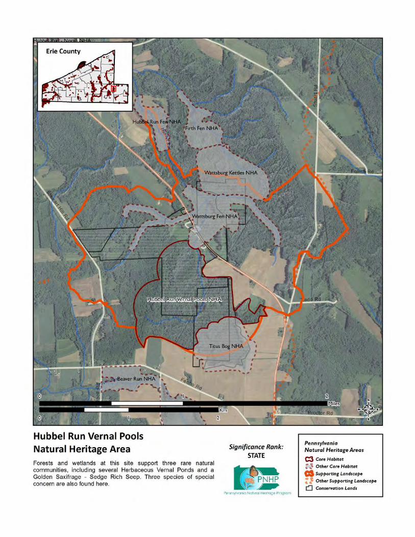
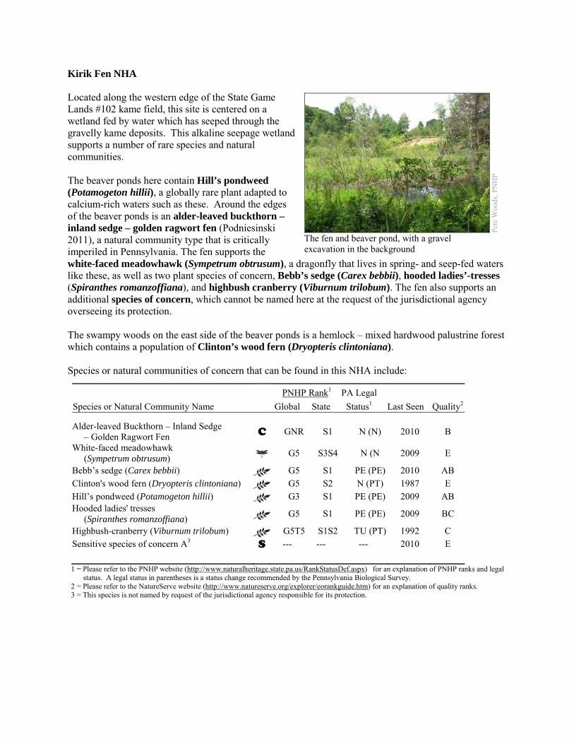
Kirik Fen NHA Located along the western edge of the State Game Lands #102 kame field, this site is centered on a wetland fed by water which has seeped through the gravelly kame deposits. This alkaline seepage wetland supports a number of rare species and natural communities. The beaver ponds here contain Hill’s pondweed (Potamogeton hillii), a globally rare plant adapted to calcium-rich waters such as these. Around the edges of the beaver ponds is an alder-leaved buckthorn – inland sedge – golden ragwort fen (Podniesinski 2011), a natural community type that is critically imperiled in Pennsylvania. The fen supports the white-faced meadowhawk (Sympetrum obtrusum), a dragonfly that lives in spring- and seep-fed waters like these, as well as two plant species of concern, Bebb’s sedge (Carex bebbii), hooded ladies’-tresses (Spiranthes romanzoffiana), and highbush cranberry (Viburnum trilobum). The fen also supports an additional species of concern, which cannot be named here at the request of the jurisdictional agency overseeing its protection. The swampy woods on the east side of the beaver ponds is a hemlock – mixed hardwood palustrine forest which contains a population of Clinton’s wood fern (Dryopteris clintoniana). Species or natural communities of concern that can be found in this NHA include:
PNHP Rank1 PA Legal Species or Natural Community Name Global State Status1 Last Seen Quality2 Alder-leaved Buckthorn – Inland Sedge – Golden Ragwort Fen C GNR S1 N (N) 2010 B
White-faced meadowhawk (Sympetrum obtrusum) G5 S3S4 N (N 2009 E
Bebb’s sedge (Carex bebbii) G5 S1 PE (PE) 2010 AB Clinton's wood fern (Dryopteris clintoniana) G5 S2 N (PT) 1987 E Hill’s pondweed (Potamogeton hillii) G3 S1 PE (PE) 2009 AB Hooded ladies' tresses (Spiranthes romanzoffiana) G5 S1 PE (PE) 2009 BC
Highbush-cranberry (Viburnum trilobum) G5T5 S1S2 TU (PT) 1992 C Sensitive species of concern A3 S --- --- --- 2010 E 1 = Please refer to the PNHP website (http://www.naturalheritage.state.pa.us/RankStatusDef.aspx) for an explanation of PNHP ranks and legal
status. A legal status in parentheses is a status change recommended by the Pennsylvania Biological Survey. 2 = Please refer to the NatureServe website (http://www.natureserve.org/explorer/eorankguide.htm) for an explanation of quality ranks. 3 = This species is not named by request of the jurisdictional agency responsible for its protection.
Pete
Woo
ds, P
NH
P
The fen and beaver pond, with a gravel excavation in the background
Threats and Stresses A small gravel pit has been excavated on the west side of the fen. Gravel is the source of the alkalinity for the groundwater that supports the fen and the associated species, so gravel excavation can change the hydrology and chemistry of the wetland. Furthermore, this sort of disturbance at the edge of a sensitive wetland can be a vector for introducing invasive species into the wetland. Succession to a closed-canopy forest is a threat to most fen species, which require open conditions. A disturbance regime of periodic beaver flooding can temporarily remove fen habitat, but ultimately maintains it by setting back succession. An access road crosses the stream, and water backs up behind the road. This floods a portion of the fen habitat, but also creates habitat for Hill’s pondweed. Specific threats and stresses to the elements present at this site include:
• The greatest threats to fen communities are disruptions to bedrock or glacial deposits (such as drilling or mining in nearby areas) and any activities that alter groundwater flows or the quality of groundwater.
• Groundwater pollution in fens can occur from improperly installed septic systems, improperly lined underground waste disposal, and in agricultural areas from infiltration of pesticides, fertilizers, or nutrients from animal wastes. Pesticides can kill non-target organisms, and nutrient loading can accelerate the spread of invasive species. Dragonflies such as the white-faced meadowhawk rely on good water quality, although the tolerances of individual species to different types of pollution are not well-understood. Siltation and contaminants such as heavy metals and pesticides are potential threats to this species.
• In the absence of natural disturbance (such as periodic flooding by beaver, browsing by animals, active vegetation removal, or fire), fens tend to succeed into shrub swamps and forested swamps, which do not support most of the species of concern at this site.
• Peatlands are particularly sensitive to trampling, soil compaction and other physical disturbance from recreational activities.
• As an early successional habitat type, fens particularly susceptible to invasive exotic plant species, which have the potential to severely modify this site and impact the rare plant species present here. Narrowleaf cattail (Typha angustifolia) is established in the fen and is a serious threat here, while multiflora rose (Rosa multiflora) is also present and common reed (Phragmites australis) is present at low density in the upper part of the watershed.
• Viburnum leaf beetle (Pyrrhalta viburni) is an introduced pest that eats highbush cranberry and other species of Viburnum. Within Pennsylvania, this pest has spread throughout the range of highbush cranberry, and is decimating populations of the shrub. The long-term effects of this invasion remain unknown, but all populations of highbush cranberry are at serious risk. In 2010, Viburnum leaf beetles had heavily damaged the arrow-wood (V. dentatum) at this site, and only one stump sprout of highbush cranberry was found, suggesting that the shrub had been killed to the ground by beetles.
• Hemlock wooly adelgids (Adelges tsugae) are expected to reach this region in coming years, with devastating effects on hemlock populations. Hemlock is one of the dominant canopy trees at this site, and the loss of the deep shade and cool microclimate could exclude species such as Clinton’s wood fern.
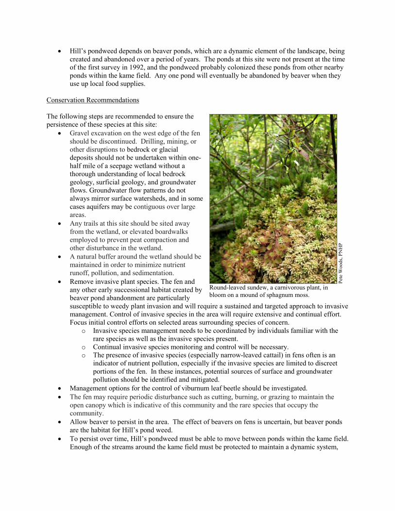
• Hill’s pondweed depends on beaver ponds, which are a dynamic element of the landscape, being created and abandoned over a period of years. The ponds at this site were not present at the time of the first survey in 1992, and the pondweed probably colonized these ponds from other nearby ponds within the kame field. Any one pond will eventually be abandoned by beaver when they use up local food supplies.
Conservation Recommendations The following steps are recommended to ensure the persistence of these species at this site:
• Gravel excavation on the west edge of the fen should be discontinued. Drilling, mining, or other disruptions to bedrock or glacial deposits should not be undertaken within one-half mile of a seepage wetland without a thorough understanding of local bedrock geology, surficial geology, and groundwater flows. Groundwater flow patterns do not always mirror surface watersheds, and in some cases aquifers may be contiguous over large areas.
• Any trails at this site should be sited away from the wetland, or elevated boardwalks employed to prevent peat compaction and other disturbance in the wetland.
• A natural buffer around the wetland should be maintained in order to minimize nutrient runoff, pollution, and sedimentation.
• Remove invasive plant species. The fen and any other early successional habitat created by beaver pond abandonment are particularly susceptible to weedy plant invasion and will require a sustained and targeted approach to invasive management. Control of invasive species in the area will require extensive and continual effort. Focus initial control efforts on selected areas surrounding species of concern.
o Invasive species management needs to be coordinated by individuals familiar with the rare species as well as the invasive species present.
o Continual invasive species monitoring and control will be necessary. o The presence of invasive species (especially narrow-leaved cattail) in fens often is an
indicator of nutrient pollution, especially if the invasive species are limited to discreet portions of the fen. In these instances, potential sources of surface and groundwater pollution should be identified and mitigated.
• Management options for the control of viburnum leaf beetle should be investigated. • The fen may require periodic disturbance such as cutting, burning, or grazing to maintain the
open canopy which is indicative of this community and the rare species that occupy the community.
• Allow beaver to persist in the area. The effect of beavers on fens is uncertain, but beaver ponds are the habitat for Hill’s pond weed.
• To persist over time, Hill’s pondweed must be able to move between ponds within the kame field. Enough of the streams around the kame field must be protected to maintain a dynamic system,
Pete
Woo
ds, P
NH
P
Round-leaved sundew, a carnivorous plant, in bloom on a mound of sphagnum moss.
including numerous beaver ponds and beaver meadows, to ensure that some habitat for the pondweed is always present.
Location and Additional Information
Municipalities: Amity Township, Union Township USGS quads: Union City 1993 Erie CNHI reference: Alder Run, Bently Run BDA Associated NHAs: Alder & Bently Run Kame Field NHA, Boleratz Fen NHA, Hell’s Half Acre NHA,
Union City Hatchery Fen NHA, Union City Reservoir NHA Overlapping Protected Lands: None PNHP Significance Rank: Regional References Podniesinski. Greg. 2011. Pennsylvania Natural Heritage Program. Alder-leaved Buckthorn – Inland Sedge – Golden Ragwort
Shrub Fen Factsheet. Available from: http://www.naturalheritage.state.pa.us/Community.aspx?=30002 Date Accessed: March 12, 2012

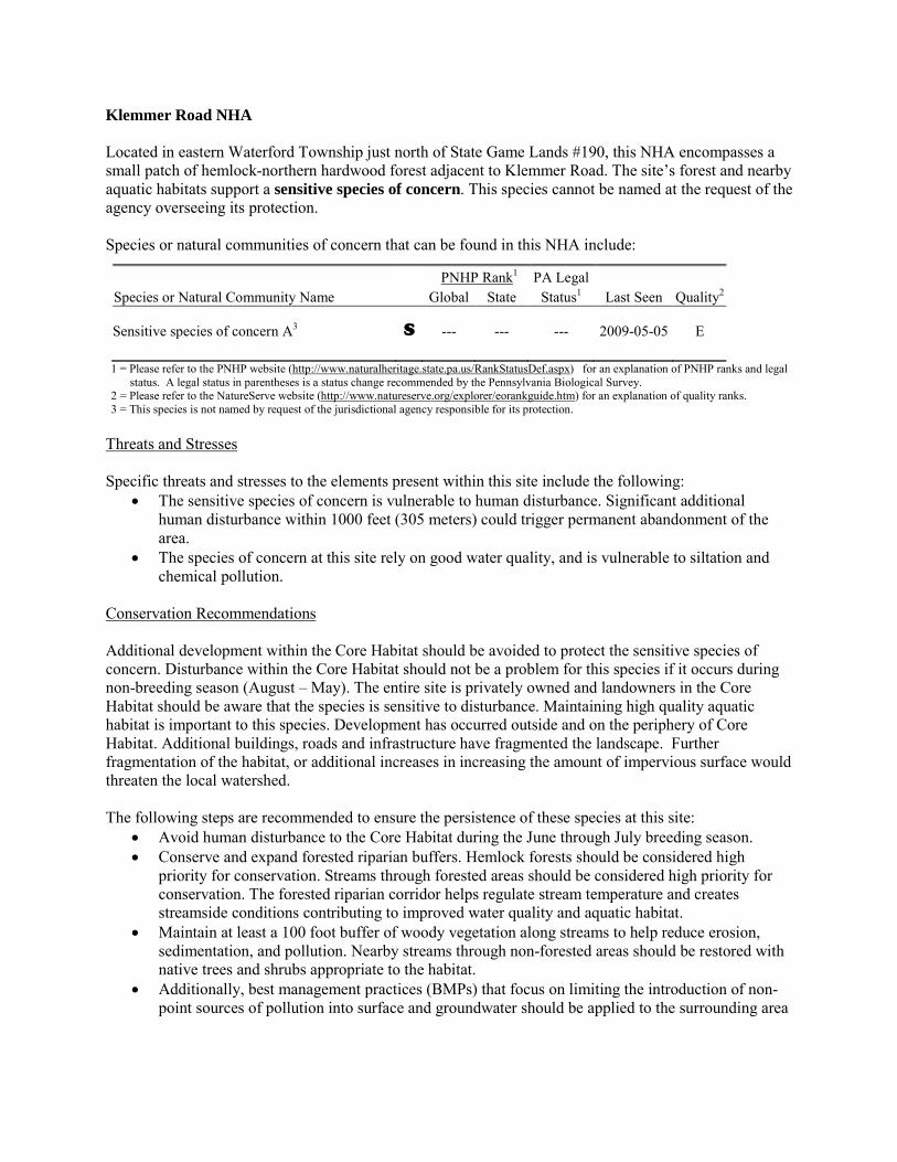
Klemmer Road NHA Located in eastern Waterford Township just north of State Game Lands #190, this NHA encompasses a small patch of hemlock-northern hardwood forest adjacent to Klemmer Road. The site’s forest and nearby aquatic habitats support a sensitive species of concern. This species cannot be named at the request of the agency overseeing its protection. Species or natural communities of concern that can be found in this NHA include:
PNHP Rank1 PA Legal Species or Natural Community Name Global State Status1 Last Seen Quality2 Sensitive species of concern A3 S --- --- --- 2009-05-05 E 1 = Please refer to the PNHP website (http://www.naturalheritage.state.pa.us/RankStatusDef.aspx) for an explanation of PNHP ranks and legal
status. A legal status in parentheses is a status change recommended by the Pennsylvania Biological Survey. 2 = Please refer to the NatureServe website (http://www.natureserve.org/explorer/eorankguide.htm) for an explanation of quality ranks. 3 = This species is not named by request of the jurisdictional agency responsible for its protection.
Threats and Stresses Specific threats and stresses to the elements present within this site include the following:
• The sensitive species of concern is vulnerable to human disturbance. Significant additional human disturbance within 1000 feet (305 meters) could trigger permanent abandonment of the area.
• The species of concern at this site rely on good water quality, and is vulnerable to siltation and chemical pollution.
Conservation Recommendations Additional development within the Core Habitat should be avoided to protect the sensitive species of concern. Disturbance within the Core Habitat should not be a problem for this species if it occurs during non-breeding season (August – May). The entire site is privately owned and landowners in the Core Habitat should be aware that the species is sensitive to disturbance. Maintaining high quality aquatic habitat is important to this species. Development has occurred outside and on the periphery of Core Habitat. Additional buildings, roads and infrastructure have fragmented the landscape. Further fragmentation of the habitat, or additional increases in increasing the amount of impervious surface would threaten the local watershed. The following steps are recommended to ensure the persistence of these species at this site:
• Avoid human disturbance to the Core Habitat during the June through July breeding season. • Conserve and expand forested riparian buffers. Hemlock forests should be considered high
priority for conservation. Streams through forested areas should be considered high priority for conservation. The forested riparian corridor helps regulate stream temperature and creates streamside conditions contributing to improved water quality and aquatic habitat.
• Maintain at least a 100 foot buffer of woody vegetation along streams to help reduce erosion, sedimentation, and pollution. Nearby streams through non-forested areas should be restored with native trees and shrubs appropriate to the habitat.
• Additionally, best management practices (BMPs) that focus on limiting the introduction of non-point sources of pollution into surface and groundwater should be applied to the surrounding area
• Avoid fragmenting the existing forested areas with additional buildings or infrastructure. Avoid logging in this area except as it relates to invasive species removal to maintain mature forest conditions.
Location and Additional Information
Municipalities: Waterford USGS quads: Waterford 1993 Erie CNHI reference: Previously unidentified site Associated NHAs: None Overlapping Protected Lands: None – private ownership PNHP Significance Rank: State
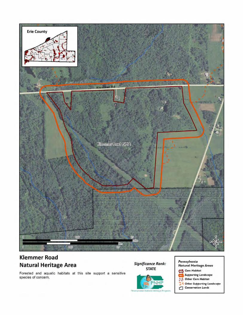
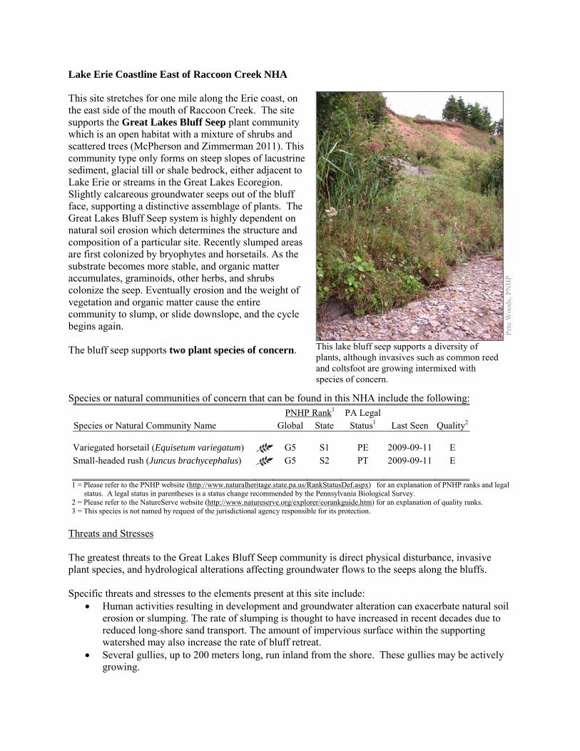
Lake Erie Coastline East of Raccoon Creek NHA This site stretches for one mile along the Erie coast, on the east side of the mouth of Raccoon Creek. The site supports the Great Lakes Bluff Seep plant community which is an open habitat with a mixture of shrubs and scattered trees (McPherson and Zimmerman 2011). This community type only forms on steep slopes of lacustrine sediment, glacial till or shale bedrock, either adjacent to Lake Erie or streams in the Great Lakes Ecoregion. Slightly calcareous groundwater seeps out of the bluff face, supporting a distinctive assemblage of plants. The Great Lakes Bluff Seep system is highly dependent on natural soil erosion which determines the structure and composition of a particular site. Recently slumped areas are first colonized by bryophytes and horsetails. As the substrate becomes more stable, and organic matter accumulates, graminoids, other herbs, and shrubs colonize the seep. Eventually erosion and the weight of vegetation and organic matter cause the entire community to slump, or slide downslope, and the cycle begins again. The bluff seep supports two plant species of concern. Species or natural communities of concern that can be found in this NHA include the following: PNHP Rank1 PA Legal Species or Natural Community Name Global State Status1 Last Seen Quality2 Variegated horsetail (Equisetum variegatum) G5 S1 PE 2009-09-11 E Small-headed rush (Juncus brachycephalus) G5 S2 PT 2009-09-11 E 1 = Please refer to the PNHP website (http://www.naturalheritage.state.pa.us/RankStatusDef.aspx) for an explanation of PNHP ranks and legal
status. A legal status in parentheses is a status change recommended by the Pennsylvania Biological Survey. 2 = Please refer to the NatureServe website (http://www.natureserve.org/explorer/eorankguide.htm) for an explanation of quality ranks. 3 = This species is not named by request of the jurisdictional agency responsible for its protection.
Threats and Stresses The greatest threats to the Great Lakes Bluff Seep community is direct physical disturbance, invasive plant species, and hydrological alterations affecting groundwater flows to the seeps along the bluffs. Specific threats and stresses to the elements present at this site include:
• Human activities resulting in development and groundwater alteration can exacerbate natural soil erosion or slumping. The rate of slumping is thought to have increased in recent decades due to reduced long-shore sand transport. The amount of impervious surface within the supporting watershed may also increase the rate of bluff retreat.
• Several gullies, up to 200 meters long, run inland from the shore. These gullies may be actively growing.
Pete
Woo
ds, P
NH
P
This lake bluff seep supports a diversity of plants, although invasives such as common reed and coltsfoot are growing intermixed with species of concern.

• Invasive exotic plants such as common reed (Phragmites australis), colt’s foot (Tussilago farfara), and European alder (Alnus glutinosa) are present; they threaten native plants and may alter physical and chemical processes along the bluffs.
Conservation Recommendations Several properties within this NHA were recently conserved by the Western Pennsylvania Conservancy and the Lake Erie Region Conservancy and transferred to the Pennsylvania Game Commission as an expansion of State Game Lands #314 (Myers 2012). The following steps are recommended to ensure the persistence of these species at this site:
• Great Lakes bluff seeps are sensitive habitats, and as steep slopes are frequently attractive to hikers and climbers, care should be used when accessing these sites. Upslope disturbances to the deep glacial soils or bedrock could destabilize these habitats and should be avoided.
• Property owners could also contribute to ground water quality and quantity protection by reducing or avoiding the application of pesticides and/or fertilizers within site boundaries and avoiding artificial drainage of subsurface waters.
• Development and timber harvesting within the NHA should be avoided. • Care should be taken to control and prevent the spread of invasive species. • A natural vegetation buffer should be allowed to develop along the crest of the bluffs and gullies,
in order to reduce the threat of human-induced erosion and to protect surface water quality and quantity entering the NHA.
• This NHA should be protected as a part of a large system of shoreline scarp woodlands and forested seeps to facilitate native seed dispersal and wildlife movement.
Location and Additional Information
Municipalities: Springfield Township USGS quads: East Springfield 1993 Erie CNHI reference: None; previously unrecognized site. Associated NHAs: Raccoon Creek Beach NHA, Lake Erie Coastline - Roderick NHA Overlapping Protected Lands: Raccoon Park overlaps with the west end of the site. The Western
Pennsylvania Conservancy owns a portion of the middle of the site. PNHP Significance Rank: State References McPherson, J. and Zimmerman, E. 2011. Pennsylvania Natural Heritage Program. Great Lakes Bluff Seep Factsheet. Available
from: http://www.naturalheritage.state.pa.us/Community.aspx?=16040 Date Accessed: March 28, 2012. Myers, Valerie. "Conservancy acquires waterfront acres in Erie County." Erie Times-News [Erie, PA] 24 May 2012. Prin
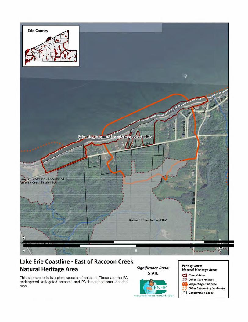
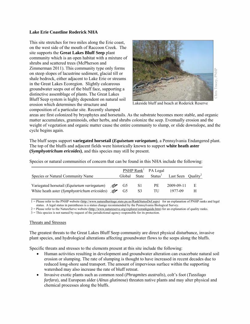
Lake Erie Coastline Roderick NHA This site stretches for two miles along the Erie coast, on the west side of the mouth of Raccoon Creek. The site supports the Great Lakes Bluff Seep plant community which is an open habitat with a mixture of shrubs and scattered trees (McPherson and Zimmerman 2011). This community type only forms on steep slopes of lacustrine sediment, glacial till or shale bedrock, either adjacent to Lake Erie or streams in the Great Lakes Ecoregion. Slightly calcareous groundwater seeps out of the bluff face, supporting a distinctive assemblage of plants. The Great Lakes Bluff Seep system is highly dependent on natural soil erosion which determines the structure and composition of a particular site. Recently slumped areas are first colonized by bryophytes and horsetails. As the substrate becomes more stable, and organic matter accumulates, graminoids, other herbs, and shrubs colonize the seep. Eventually erosion and the weight of vegetation and organic matter cause the entire community to slump, or slide downslope, and the cycle begins again. The bluff seeps support variegated horsetail (Equisetum variegatum), a Pennsylvania Endangered plant. The top of the bluffs and adjacent fields were historically known to support white heath aster (Symphyotrichum ericoides), and this species may still be present. Species or natural communities of concern that can be found in this NHA include the following:
PNHP Rank1 PA Legal Species or Natural Community Name Global State Status1 Last Seen Quality2 Variegated horsetail (Equisetum variegatum) G5 S1 PE 2009-09-11 E White heath aster (Symphyotrichum ericoides) G5 S3 TU 1977-09 H 1 = Please refer to the PNHP website (http://www.naturalheritage.state.pa.us/RankStatusDef.aspx) for an explanation of PNHP ranks and legal
status. A legal status in parentheses is a status change recommended by the Pennsylvania Biological Survey. 2 = Please refer to the NatureServe website (http://www.natureserve.org/explorer/eorankguide.htm) for an explanation of quality ranks. 3 = This species is not named by request of the jurisdictional agency responsible for its protection.
Threats and Stresses The greatest threats to the Great Lakes Bluff Seep community are direct physical disturbance, invasive plant species, and hydrological alterations affecting groundwater flows to the seeps along the bluffs. Specific threats and stresses to the elements present at this site include the following:
• Human activities resulting in development and groundwater alteration can exacerbate natural soil erosion or slumping. The rate of slumping is thought to have increased in recent decades due to reduced long-shore sand transport. The amount of impervious surface within the supporting watershed may also increase the rate of bluff retreat.
• Invasive exotic plants such as common reed (Phragmites australis), colt’s foot (Tussilago farfara), and European alder (Alnus glutinosa) threaten native plants and may alter physical and chemical processes along the bluffs.
Chr
is T
race
y, P
NH
P
Lakeside bluff and beach at Roderick Reserve
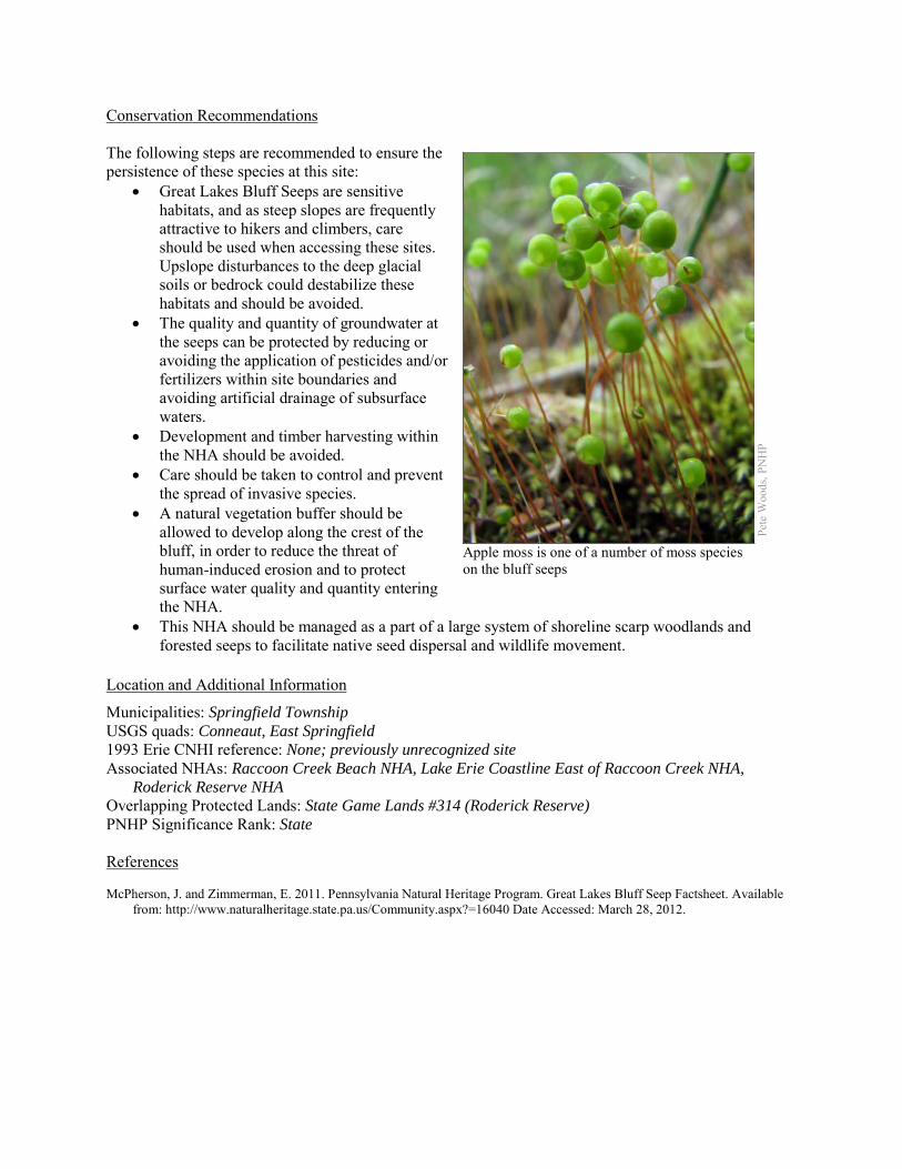
Conservation Recommendations The following steps are recommended to ensure the persistence of these species at this site:
• Great Lakes Bluff Seeps are sensitive habitats, and as steep slopes are frequently attractive to hikers and climbers, care should be used when accessing these sites. Upslope disturbances to the deep glacial soils or bedrock could destabilize these habitats and should be avoided.
• The quality and quantity of groundwater at the seeps can be protected by reducing or avoiding the application of pesticides and/or fertilizers within site boundaries and avoiding artificial drainage of subsurface waters.
• Development and timber harvesting within the NHA should be avoided.
• Care should be taken to control and prevent the spread of invasive species.
• A natural vegetation buffer should be allowed to develop along the crest of the bluff, in order to reduce the threat of human-induced erosion and to protect surface water quality and quantity entering the NHA.
• This NHA should be managed as a part of a large system of shoreline scarp woodlands and forested seeps to facilitate native seed dispersal and wildlife movement.
Location and Additional Information
Municipalities: Springfield Township USGS quads: Conneaut, East Springfield 1993 Erie CNHI reference: None; previously unrecognized site Associated NHAs: Raccoon Creek Beach NHA, Lake Erie Coastline East of Raccoon Creek NHA,
Roderick Reserve NHA Overlapping Protected Lands: State Game Lands #314 (Roderick Reserve) PNHP Significance Rank: State References McPherson, J. and Zimmerman, E. 2011. Pennsylvania Natural Heritage Program. Great Lakes Bluff Seep Factsheet. Available
from: http://www.naturalheritage.state.pa.us/Community.aspx?=16040 Date Accessed: March 28, 2012.
Apple moss is one of a number of moss species on the bluff seeps
Pet
e W
oods
, PN
HP
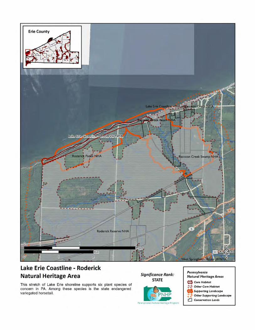
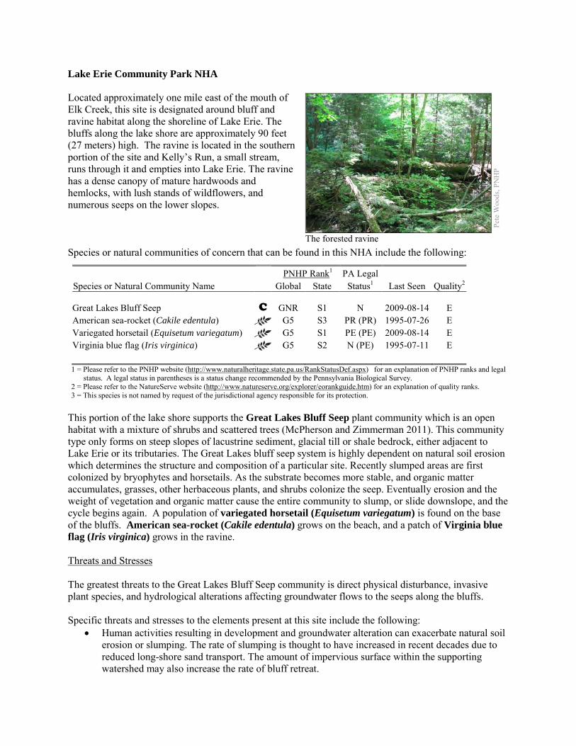
Lake Erie Community Park NHA Located approximately one mile east of the mouth of Elk Creek, this site is designated around bluff and ravine habitat along the shoreline of Lake Erie. The bluffs along the lake shore are approximately 90 feet (27 meters) high. The ravine is located in the southern portion of the site and Kelly’s Run, a small stream, runs through it and empties into Lake Erie. The ravine has a dense canopy of mature hardwoods and hemlocks, with lush stands of wildflowers, and numerous seeps on the lower slopes. Species or natural communities of concern that can be found in this NHA include the following:
PNHP Rank1 PA Legal Species or Natural Community Name Global State Status1 Last Seen Quality2 Great Lakes Bluff Seep C GNR S1 N 2009-08-14 E American sea-rocket (Cakile edentula) G5 S3 PR (PR) 1995-07-26 E Variegated horsetail (Equisetum variegatum) G5 S1 PE (PE) 2009-08-14 E Virginia blue flag (Iris virginica) G5 S2 N (PE) 1995-07-11 E 1 = Please refer to the PNHP website (http://www.naturalheritage.state.pa.us/RankStatusDef.aspx) for an explanation of PNHP ranks and legal
status. A legal status in parentheses is a status change recommended by the Pennsylvania Biological Survey. 2 = Please refer to the NatureServe website (http://www.natureserve.org/explorer/eorankguide.htm) for an explanation of quality ranks. 3 = This species is not named by request of the jurisdictional agency responsible for its protection.
This portion of the lake shore supports the Great Lakes Bluff Seep plant community which is an open habitat with a mixture of shrubs and scattered trees (McPherson and Zimmerman 2011). This community type only forms on steep slopes of lacustrine sediment, glacial till or shale bedrock, either adjacent to Lake Erie or its tributaries. The Great Lakes bluff seep system is highly dependent on natural soil erosion which determines the structure and composition of a particular site. Recently slumped areas are first colonized by bryophytes and horsetails. As the substrate becomes more stable, and organic matter accumulates, grasses, other herbaceous plants, and shrubs colonize the seep. Eventually erosion and the weight of vegetation and organic matter cause the entire community to slump, or slide downslope, and the cycle begins again. A population of variegated horsetail (Equisetum variegatum) is found on the base of the bluffs. American sea-rocket (Cakile edentula) grows on the beach, and a patch of Virginia blue flag (Iris virginica) grows in the ravine. Threats and Stresses The greatest threats to the Great Lakes Bluff Seep community is direct physical disturbance, invasive plant species, and hydrological alterations affecting groundwater flows to the seeps along the bluffs. Specific threats and stresses to the elements present at this site include the following:
• Human activities resulting in development and groundwater alteration can exacerbate natural soil erosion or slumping. The rate of slumping is thought to have increased in recent decades due to reduced long-shore sand transport. The amount of impervious surface within the supporting watershed may also increase the rate of bluff retreat.
Pete
Woo
ds, P
NH
P
The forested ravine
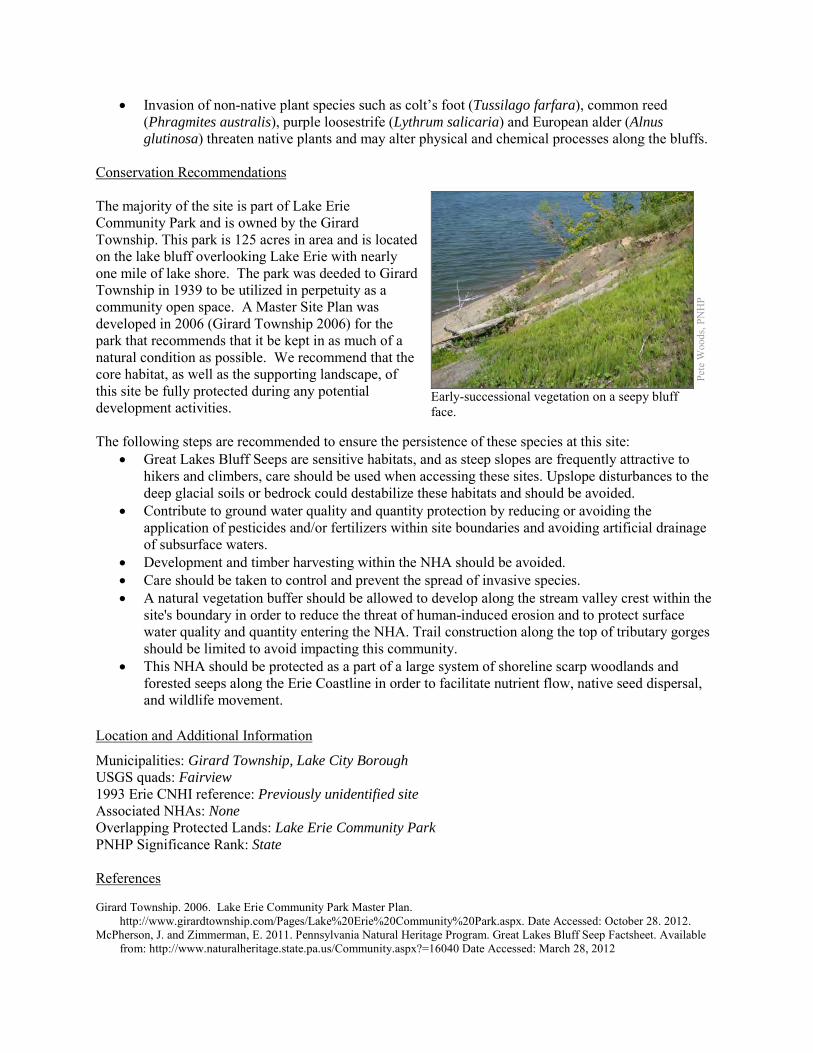
• Invasion of non-native plant species such as colt’s foot (Tussilago farfara), common reed (Phragmites australis), purple loosestrife (Lythrum salicaria) and European alder (Alnus glutinosa) threaten native plants and may alter physical and chemical processes along the bluffs.
Conservation Recommendations The majority of the site is part of Lake Erie Community Park and is owned by the Girard Township. This park is 125 acres in area and is located on the lake bluff overlooking Lake Erie with nearly one mile of lake shore. The park was deeded to Girard Township in 1939 to be utilized in perpetuity as a community open space. A Master Site Plan was developed in 2006 (Girard Township 2006) for the park that recommends that it be kept in as much of a natural condition as possible. We recommend that the core habitat, as well as the supporting landscape, of this site be fully protected during any potential development activities. The following steps are recommended to ensure the persistence of these species at this site:
• Great Lakes Bluff Seeps are sensitive habitats, and as steep slopes are frequently attractive to hikers and climbers, care should be used when accessing these sites. Upslope disturbances to the deep glacial soils or bedrock could destabilize these habitats and should be avoided.
• Contribute to ground water quality and quantity protection by reducing or avoiding the application of pesticides and/or fertilizers within site boundaries and avoiding artificial drainage of subsurface waters.
• Development and timber harvesting within the NHA should be avoided. • Care should be taken to control and prevent the spread of invasive species. • A natural vegetation buffer should be allowed to develop along the stream valley crest within the
site's boundary in order to reduce the threat of human-induced erosion and to protect surface water quality and quantity entering the NHA. Trail construction along the top of tributary gorges should be limited to avoid impacting this community.
• This NHA should be protected as a part of a large system of shoreline scarp woodlands and forested seeps along the Erie Coastline in order to facilitate nutrient flow, native seed dispersal, and wildlife movement.
Location and Additional Information
Municipalities: Girard Township, Lake City Borough USGS quads: Fairview 1993 Erie CNHI reference: Previously unidentified site Associated NHAs: None Overlapping Protected Lands: Lake Erie Community Park PNHP Significance Rank: State References Girard Township. 2006. Lake Erie Community Park Master Plan.
http://www.girardtownship.com/Pages/Lake%20Erie%20Community%20Park.aspx. Date Accessed: October 28. 2012. McPherson, J. and Zimmerman, E. 2011. Pennsylvania Natural Heritage Program. Great Lakes Bluff Seep Factsheet. Available
from: http://www.naturalheritage.state.pa.us/Community.aspx?=16040 Date Accessed: March 28, 2012
Pete
Woo
ds, P
NH
P
Early-successional vegetation on a seepy bluff face.
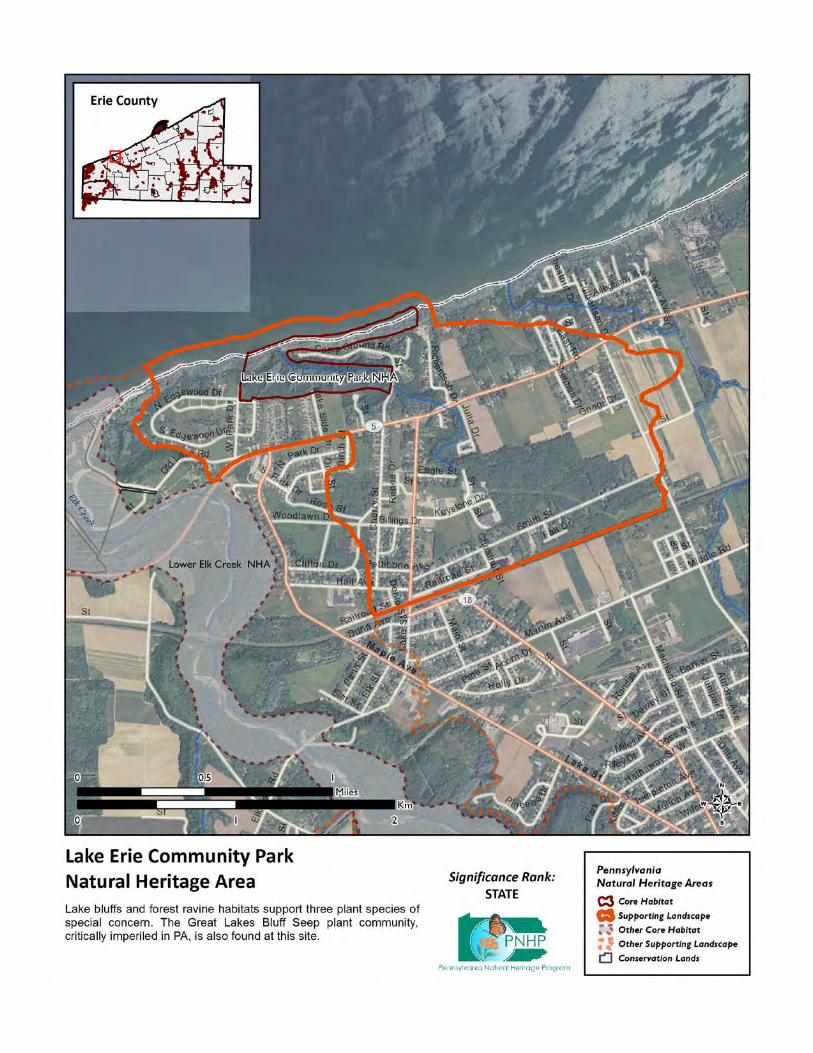
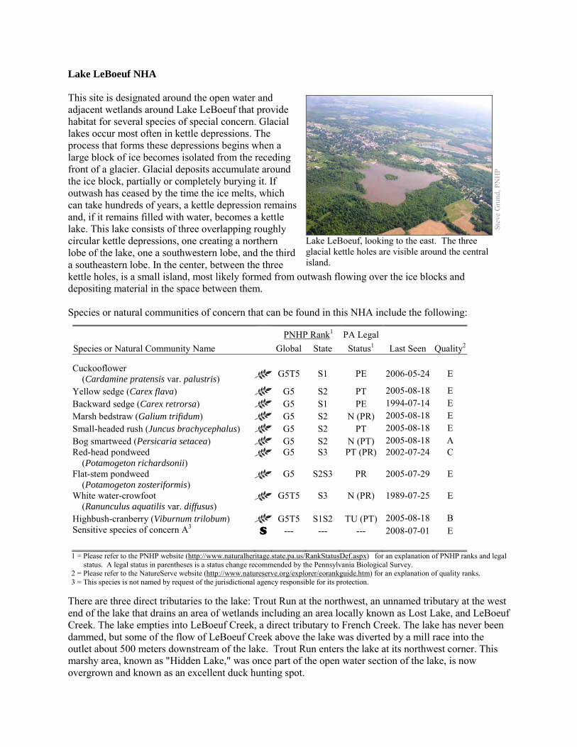
Lake LeBoeuf NHA This site is designated around the open water and adjacent wetlands around Lake LeBoeuf that provide habitat for several species of special concern. Glacial lakes occur most often in kettle depressions. The process that forms these depressions begins when a large block of ice becomes isolated from the receding front of a glacier. Glacial deposits accumulate around the ice block, partially or completely burying it. If outwash has ceased by the time the ice melts, which can take hundreds of years, a kettle depression remains and, if it remains filled with water, becomes a kettle lake. This lake consists of three overlapping roughly circular kettle depressions, one creating a northern lobe of the lake, one a southwestern lobe, and the third a southeastern lobe. In the center, between the three kettle holes, is a small island, most likely formed from outwash flowing over the ice blocks and depositing material in the space between them. Species or natural communities of concern that can be found in this NHA include the following:
PNHP Rank1 PA Legal Species or Natural Community Name Global State Status1 Last Seen Quality2 Cuckooflower (Cardamine pratensis var. palustris) G5T5 S1 PE 2006-05-24 E
Yellow sedge (Carex flava) G5 S2 PT 2005-08-18 E Backward sedge (Carex retrorsa) G5 S1 PE 1994-07-14 E Marsh bedstraw (Galium trifidum) G5 S2 N (PR) 2005-08-18 E Small-headed rush (Juncus brachycephalus) G5 S2 PT 2005-08-18 E Bog smartweed (Persicaria setacea) G5 S2 N (PT) 2005-08-18 A Red-head pondweed (Potamogeton richardsonii)
G5 S3 PT (PR) 2002-07-24 C
Flat-stem pondweed (Potamogeton zosteriformis)
G5 S2S3 PR 2005-07-29 E
White water-crowfoot (Ranunculus aquatilis var. diffusus)
G5T5 S3 N (PR) 1989-07-25 E
Highbush-cranberry (Viburnum trilobum) G5T5 S1S2 TU (PT) 2005-08-18 B Sensitive species of concern A3 S --- --- --- 2008-07-01 E 1 = Please refer to the PNHP website (http://www.naturalheritage.state.pa.us/RankStatusDef.aspx) for an explanation of PNHP ranks and legal
status. A legal status in parentheses is a status change recommended by the Pennsylvania Biological Survey. 2 = Please refer to the NatureServe website (http://www.natureserve.org/explorer/eorankguide.htm) for an explanation of quality ranks. 3 = This species is not named by request of the jurisdictional agency responsible for its protection.
There are three direct tributaries to the lake: Trout Run at the northwest, an unnamed tributary at the west end of the lake that drains an area of wetlands including an area locally known as Lost Lake, and LeBoeuf Creek. The lake empties into LeBoeuf Creek, a direct tributary to French Creek. The lake has never been dammed, but some of the flow of LeBoeuf Creek above the lake was diverted by a mill race into the outlet about 500 meters downstream of the lake. Trout Run enters the lake at its northwest corner. This marshy area, known as "Hidden Lake," was once part of the open water section of the lake, is now overgrown and known as an excellent duck hunting spot.
Stev
e G
rund
, PN
HP
Lake LeBoeuf, looking to the east. The three glacial kettle holes are visible around the central island.
Threats and Stresses At 70 acres (28.3 ha), Lake LeBoeuf is one of the smaller lakes in northwestern Pennsylvania; however, it has by far the largest watershed of these lakes. The large size of the watershed relative to the size of the lake creates challenges for management as lakes are natural sediment traps because flow velocity decreases as the stream enters the lake basin, and sediments drop out. Therefore, a small lake with a large watershed is prone to relatively excessive sedimentation, as well as nutrient loading and other pollution. This situation, at least in part, accounts for signs of accelerated eutrophication at Lake LeBoeuf. Longtime local residents assert that the lake is filling with sediment, and that it is much less deep than it once was. Additionally, there is currently low visibility in the lake, but an 1897 report states that the lake was “very clear ... absolutely pure ... in the center is a charming little island.” The shoreline of the lake is well buffered, except for a small access area and boat launches on the northwest edge of Corilla Lake. Specific threats and stresses to the elements present at this site include the following:
• The use of road salts (primarily sodium chloride) as deicing agents, pose significant impacts to aquatic systems (Richardson 1974). These salts are toxic to plants and animals, can pollute groundwater, and facilitate mobilization of heavy metals across roadside soils (Fidorra 2003). Due to the close proximity of Lake LeBoeuf to State Route 19, and the deteriorated nature of a portion of the lake’s shoreline, road salt application takes on a heightened risk for aquatic pollution potential. The need for shoreline restoration becomes paramount with the combination of denuded shoreline, heavy metal inputs, and roads salt pollution on the eastern side of the lake.
• Areas associated with high levels of human activity, especially swimming areas and boat launches, are generally devoid of aquatic vegetation. Indeed, vegetation is often removed (either physically or with chemicals) in order to facilitate these activities. With good management, a moderate level of these activities can be consistent with a healthy lake flora. Boat launches should be designated and use of other sites should be prevented. The main boat launch is at the eastern end of the lake. There are no vascular plants growing at this site. This is due not only to direct disturbance, but also to erosion and resulting siltation of the substrate.
• Invasive species threaten the integrity of the glacial lake and populations of species of concern. Eurasian water milfoil (Myriophyllum spicatum) is a major problem at LeBoeuf Lake, and is probably the most abundant aquatic plant in the lake. Dense beds of this species extend into deeper waters than those occupied by almost any other species in the lake. This invasive aquatic plant spreads through fragmentation, and often overwhelms lakes and chokes out native vegetation.
• Signs of eutrophication include algal blooms and abnormal growths of duckweeds, especially at the eastern end of the lake. The magnificent bryozoan (Pectinatella magnifica), a tiny colonial aquatic animal, is also common in the lake and is another sign of eutrophic conditions (Ryan Evans, pers. comm.).
• There is no horsepower limit for Lake LeBoeuf, but a no wake speed rule applies to the entire lake, which is used for fishing and the enjoyment of nature more than for boating for boating’s sake. There is some evidence that motorboat use may churn up the bottom of the lake, reducing visibility and potentially impacting vegetation.
• Viburnum leaf beetle (Pyrrhalta viburni) is an introduced pest that eats highbush-cranberry and other species of viburnum. Within Pennsylvania, this pest has spread throughout the range of highbush-cranberry, and is decimating populations of the shrub. The long-term effects of this invasion remain unknown, but all populations of highbush- cranberry are at serious risk
Conservation Recommendations The wetland west of the lake known as Lost Lake was apparently once much more open than it is today. Long-time residents report having used it as a swimming hole in their youth. Further botanical surveys at Lost Lake may provide some insight into the nature of this wetland. Historical research may also help to elucidate the processes that have produced changes there. Studies of hydrology and water chemistry would be very useful. The following steps are recommended to ensure the persistence of these species at this site:
• Educate the watershed community as to the importance of these special habitats. • Continue to protect wetland habitats through education and conservation easements where
applicable. • Evaluate ways to reduce excess phosphorus inputs into Lake LeBoeuf. A phosphorous budget of
this lake might be helpful to assess the amount of cultural eutrophication, and to suggest the most effective measures to address this issue.
• Management options for the control of viburnum leaf beetle should be investigated. • Limit the amount of development around the lake.
Location and Additional Information
Municipalities: Waterford Borough, Waterford Township USGS quads: Waterford 1993 Erie CNHI reference: French Creek – Upper BDA Associated NHAs: LeBoeuf Creek at Waterford NHA, French Creek – Erie NHA Overlapping Protected Lands: None PNHP Significance Rank: Regional References Grund, Steve, and James K Bissell. “Documenting the Native and Introduced Flora Associated with Glacial Lakes in Northwest
Pennsylvania.” Glacial Lakes Floral Inventory: Final Report for Year Two. Unpublished. 2003. Grund, Steve, and James K. Bissell. “Documenting the Native and Introduced Flora Associated with Glacial Lakes in Northwest
Pennsylvania.” Glacial Lakes Floral Inventory: Final Report for Year Three. Unpublished. 2004.
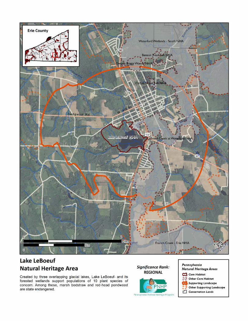
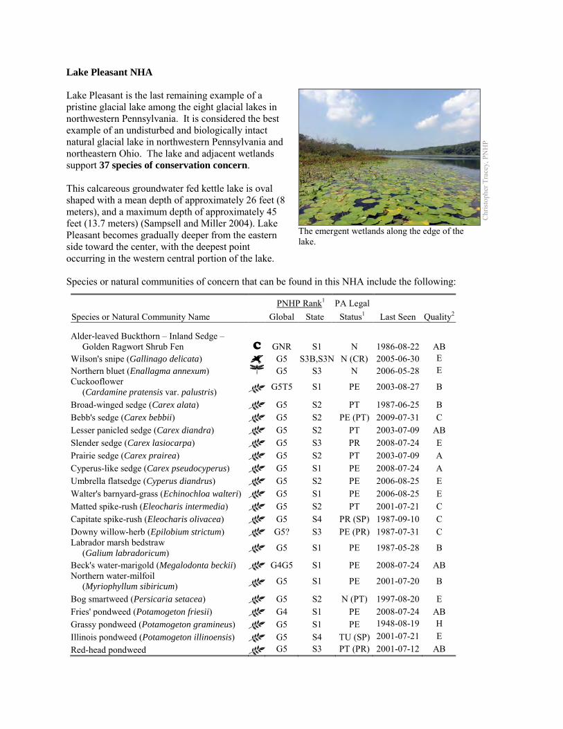
Lake Pleasant NHA Lake Pleasant is the last remaining example of a pristine glacial lake among the eight glacial lakes in northwestern Pennsylvania. It is considered the best example of an undisturbed and biologically intact natural glacial lake in northwestern Pennsylvania and northeastern Ohio. The lake and adjacent wetlands support 37 species of conservation concern. This calcareous groundwater fed kettle lake is oval shaped with a mean depth of approximately 26 feet (8 meters), and a maximum depth of approximately 45 feet (13.7 meters) (Sampsell and Miller 2004). Lake Pleasant becomes gradually deeper from the eastern side toward the center, with the deepest point occurring in the western central portion of the lake. Species or natural communities of concern that can be found in this NHA include the following:
PNHP Rank1 PA Legal Species or Natural Community Name Global State Status1 Last Seen Quality2 Alder-leaved Buckthorn – Inland Sedge – Golden Ragwort Shrub Fen C GNR S1 N 1986-08-22 AB Wilson's snipe (Gallinago delicata) G5 S3B,S3N N (CR) 2005-06-30 E Northern bluet (Enallagma annexum) G5 S3 N 2006-05-28 E Cuckooflower (Cardamine pratensis var. palustris) G5T5 S1 PE 2003-08-27 B
Broad-winged sedge (Carex alata) G5 S2 PT 1987-06-25 B Bebb's sedge (Carex bebbii) G5 S2 PE (PT) 2009-07-31 C Lesser panicled sedge (Carex diandra) G5 S2 PT 2003-07-09 AB Slender sedge (Carex lasiocarpa) G5 S3 PR 2008-07-24 E Prairie sedge (Carex prairea) G5 S2 PT 2003-07-09 A Cyperus-like sedge (Carex pseudocyperus) G5 S1 PE 2008-07-24 A Umbrella flatsedge (Cyperus diandrus) G5 S2 PE 2006-08-25 E Walter's barnyard-grass (Echinochloa walteri) G5 S1 PE 2006-08-25 E Matted spike-rush (Eleocharis intermedia) G5 S2 PT 2001-07-21 C Capitate spike-rush (Eleocharis olivacea) G5 S4 PR (SP) 1987-09-10 C Downy willow-herb (Epilobium strictum) G5? S3 PE (PR) 1987-07-31 C Labrador marsh bedstraw (Galium labradoricum) G5 S1 PE 1987-05-28 B
Beck's water-marigold (Megalodonta beckii) G4G5 S1 PE 2008-07-24 AB Northern water-milfoil (Myriophyllum sibiricum) G5 S1 PE 2001-07-20 B
Bog smartweed (Persicaria setacea) G5 S2 N (PT) 1997-08-20 E Fries' pondweed (Potamogeton friesii) G4 S1 PE 2008-07-24 AB Grassy pondweed (Potamogeton gramineus) G5 S1 PE 1948-08-19 H Illinois pondweed (Potamogeton illinoensis) G5 S4 TU (SP) 2001-07-21 E Red-head pondweed G5 S3 PT (PR) 2001-07-12 AB
Chr
istop
her T
race
y, P
NH
P
The emergent wetlands along the edge of the lake.
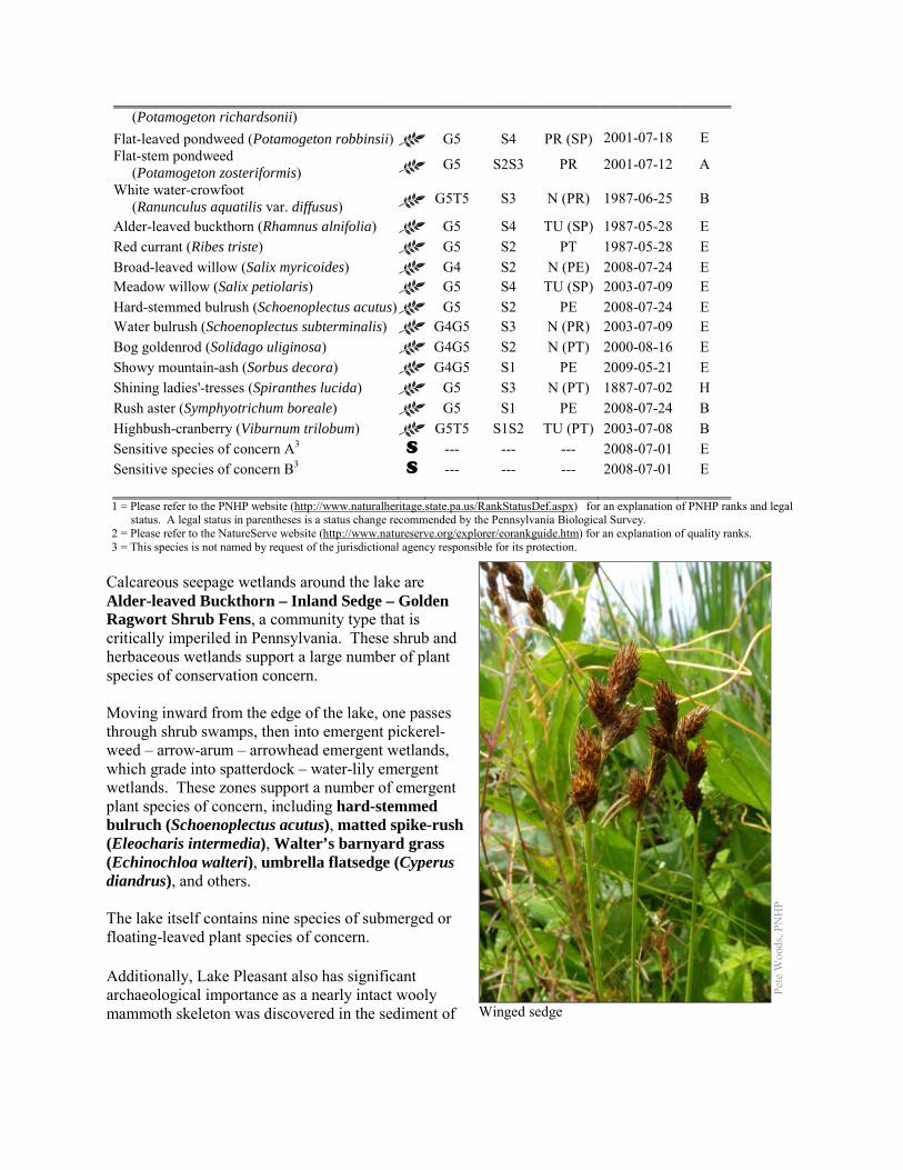
(Potamogeton richardsonii) Flat-leaved pondweed (Potamogeton robbinsii) G5 S4 PR (SP) 2001-07-18 E Flat-stem pondweed (Potamogeton zosteriformis) G5 S2S3 PR 2001-07-12 A
White water-crowfoot (Ranunculus aquatilis var. diffusus) G5T5 S3 N (PR) 1987-06-25 B
Alder-leaved buckthorn (Rhamnus alnifolia) G5 S4 TU (SP) 1987-05-28 E Red currant (Ribes triste) G5 S2 PT 1987-05-28 E Broad-leaved willow (Salix myricoides) G4 S2 N (PE) 2008-07-24 E Meadow willow (Salix petiolaris) G5 S4 TU (SP) 2003-07-09 E Hard-stemmed bulrush (Schoenoplectus acutus) G5 S2 PE 2008-07-24 E Water bulrush (Schoenoplectus subterminalis) G4G5 S3 N (PR) 2003-07-09 E Bog goldenrod (Solidago uliginosa) G4G5 S2 N (PT) 2000-08-16 E Showy mountain-ash (Sorbus decora) G4G5 S1 PE 2009-05-21 E Shining ladies'-tresses (Spiranthes lucida) G5 S3 N (PT) 1887-07-02 H Rush aster (Symphyotrichum boreale) G5 S1 PE 2008-07-24 B Highbush-cranberry (Viburnum trilobum) G5T5 S1S2 TU (PT) 2003-07-08 B Sensitive species of concern A3 S --- --- --- 2008-07-01 E Sensitive species of concern B3 S --- --- --- 2008-07-01 E 1 = Please refer to the PNHP website (http://www.naturalheritage.state.pa.us/RankStatusDef.aspx) for an explanation of PNHP ranks and legal
status. A legal status in parentheses is a status change recommended by the Pennsylvania Biological Survey. 2 = Please refer to the NatureServe website (http://www.natureserve.org/explorer/eorankguide.htm) for an explanation of quality ranks. 3 = This species is not named by request of the jurisdictional agency responsible for its protection.
Calcareous seepage wetlands around the lake are Alder-leaved Buckthorn – Inland Sedge – Golden Ragwort Shrub Fens, a community type that is critically imperiled in Pennsylvania. These shrub and herbaceous wetlands support a large number of plant species of conservation concern. Moving inward from the edge of the lake, one passes through shrub swamps, then into emergent pickerel-weed – arrow-arum – arrowhead emergent wetlands, which grade into spatterdock – water-lily emergent wetlands. These zones support a number of emergent plant species of concern, including hard-stemmed bulruch (Schoenoplectus acutus), matted spike-rush (Eleocharis intermedia), Walter’s barnyard grass (Echinochloa walteri), umbrella flatsedge (Cyperus diandrus), and others. The lake itself contains nine species of submerged or floating-leaved plant species of concern. Additionally, Lake Pleasant also has significant archaeological importance as a nearly intact wooly mammoth skeleton was discovered in the sediment of
Pete
Woo
ds, P
NH
P
Winged sedge
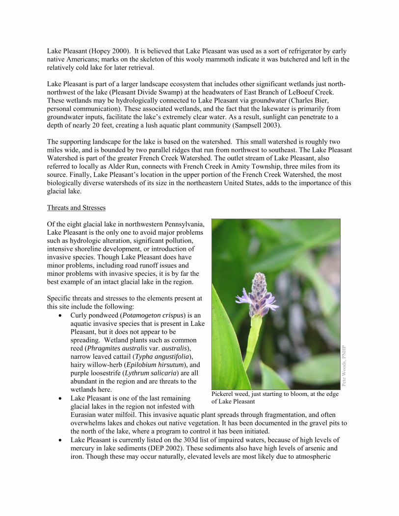
Lake Pleasant (Hopey 2000). It is believed that Lake Pleasant was used as a sort of refrigerator by early native Americans; marks on the skeleton of this wooly mammoth indicate it was butchered and left in the relatively cold lake for later retrieval. Lake Pleasant is part of a larger landscape ecosystem that includes other significant wetlands just north-northwest of the lake (Pleasant Divide Swamp) at the headwaters of East Branch of LeBoeuf Creek. These wetlands may be hydrologically connected to Lake Pleasant via groundwater (Charles Bier, personal communication). These associated wetlands, and the fact that the lakewater is primarily from groundwater inputs, facilitate the lake’s extremely clear water. As a result, sunlight can penetrate to a depth of nearly 20 feet, creating a lush aquatic plant community (Sampsell 2003). The supporting landscape for the lake is based on the watershed. This small watershed is roughly two miles wide, and is bounded by two parallel ridges that run from northwest to southeast. The Lake Pleasant Watershed is part of the greater French Creek Watershed. The outlet stream of Lake Pleasant, also referred to locally as Alder Run, connects with French Creek in Amity Township, three miles from its source. Finally, Lake Pleasant’s location in the upper portion of the French Creek Watershed, the most biologically diverse watersheds of its size in the northeastern United States, adds to the importance of this glacial lake. Threats and Stresses Of the eight glacial lake in northwestern Pennsylvania, Lake Pleasant is the only one to avoid major problems such as hydrologic alteration, significant pollution, intensive shoreline development, or introduction of invasive species. Though Lake Pleasant does have minor problems, including road runoff issues and minor problems with invasive species, it is by far the best example of an intact glacial lake in the region. Specific threats and stresses to the elements present at this site include the following:
• Curly pondweed (Potamogeton crispus) is an aquatic invasive species that is present in Lake Pleasant, but it does not appear to be spreading. Wetland plants such as common reed (Phragmites australis var. australis), narrow leaved cattail (Typha angustifolia), hairy willow-herb (Epilobium hirsutum), and purple loosestrife (Lythrum salicaria) are all abundant in the region and are threats to the wetlands here.
• Lake Pleasant is one of the last remaining glacial lakes in the region not infested with Eurasian water milfoil. This invasive aquatic plant spreads through fragmentation, and often overwhelms lakes and chokes out native vegetation. It has been documented in the gravel pits to the north of the lake, where a program to control it has been initiated.
• Lake Pleasant is currently listed on the 303d list of impaired waters, because of high levels of mercury in lake sediments (DEP 2002). These sediments also have high levels of arsenic and iron. Though these may occur naturally, elevated levels are most likely due to atmospheric
Pete
Woo
ds, P
NH
P
Pickerel weed, just starting to bloom, at the edge of Lake Pleasant
deposition from human sources, historic land use practices, and roadside runoff (Sampsell and Miller 2004).
• The use of road salt (primarily sodium chloride) as deicing agents poses significant impacts to aquatic systems (Richardson 1974). These salts are toxic to plants and animals, can pollute groundwater, and facilitate mobilization of heavy metals across roadside soils (Fidorra 2003). Due to the close proximity of Lake Pleasant to State Route 1001 and the deteriorated nature of the lake’s eastern shoreline, road salt application takes on a heightened risk for aquatic pollution potential. The need for shoreline restoration becomes paramount with the combination of denuded shoreline, heavy metal inputs, and roads salt pollution on the eastern side of the lake.
• With few roads in the watershed, there is little potential in the watershed for a toxic spill. However, the one place where this could occur would be the most disastrous, along Lake Pleasant Road (State Route 1001) adjacent to the eastern side of Lake Pleasant. As mentioned above, this area lacks a riparian buffer, and a spill could have severe impacts on the health of the lake. This threat would be alleviated if a spill response protocol existed for the watershed, if the riparian buffer was restored, or the road was relocated. The last of these options is the most difficult, but poses the best protection of lake resources. Though this action would undoubtedly create natural resource issues in the relocated area, the lake, as a top resource priority, would at least be protected.
• Nutrient levels are also somewhat high in the lake; due in part to natural processes, but also amplified by anthropogenic sources. In particular, nitrogen and phosphorus levels in the lake are quite high, causing the lake to be classified as meso-eutrophic. Sources of phosphorus are most likely due to internal loading, leachate and failing septic systems, and runoff (Sampsell and Miller 2004). High phosphorus concentrations have also been attributed to intense recreational activity and settlement around the lake in the early 1900s (Johnson and Ostrofsky 2004). Though increased nutrients often occur from agriculture, there is little agricultural activity within the watershed, and this is most likely not a source of nutrient loading.
• Damselflies such as the northern bluet rely on good water quality, although the tolerances of individual species to different types of pollution are not well-understood. Siltation and contaminants such as heavy metals, and pesticides are potential threats to this species, as well as other species of concern.
Conservation Recommendations The diversity of habitats and the health of the watershed facilitates the high biodiversity at this site. Protection and management of these resources are important if they are to maintain the high quality of the lake. Most importantly, these communities require protection of the quality and quantity of water entering the lake for future health and biological productivity (Klein 1993). The Western Pennsylvania Conservancy has developed a series of conservation plans for the lake and its watershed (Sampsell 2004, 2005). Approximately three fourths of the shoreline has been protected by the Western Pennsylvania Conservancy. Additional portions of the watershed are contained within State Game Lands #161 and #155. The following steps are recommended to ensure the persistence of these species at this site:
• The Pennsylvania Fish and Boat Commission currently limits watercraft operation to manual propulsion only (the use of any type of motor, gas and/or electric, is prohibited). We recommend that this restriction should be continued.
• Monitor the curly pondweed population in the lake, and monitor the results of Eurasian water-milfoil control in the gravel ponds. Watch for new introductions of Eurasian water-milfoil, common reed, narrow-leaf cattail, and other invasive plants, and take aggressive actions to control them when present. Educate boaters about the risk of invasive species and the importance of guarding against introduction of species such as Eurasian water milfoil.
• Conserve and expand the forested riparian buffers of all wetlands and the streams that feed into them. Conserve at least a 328 foot (100 meter) buffer of native woody vegetation where it exists along the waterways and establish at least a 100 foot (30 meter) buffer where it is lacking to help reduce erosion, sedimentation, and pollution. Additionally, best management practices (BMPs) that focus on limiting the introduction of non-point sources of pollution into surface and groundwater should be applied to the surrounding area.
• Evaluate ways to reduce heavy metals in Lake Pleasant from roadside runoff and leaking septic systems.
• Evaluate ways to reduce phosphorus inputs into Lake Pleasant. • Avoid using pesticides in the Core Habitat unless absolutely necessary for conservation purposes,
and minimize their use in the Supporting Landscape. • Surveys for invertebrates have been limited at this site, and additional surveys should be
conducted. There is good potential for the NHA to support a number of butterfly, moth, odonate, and aquatic snail species of concern.
Location and Additional Information
Municipalities: Amity Township, Venango Township, Waterford Township USGS quads: Hammett, Waterford 1993 Erie CNHI reference: Sixteen Mile Creek Gorge Natural Area Associated NHAs: None Overlapping Protected Lands: Western Pennsylvania Conservancy PNHP Significance Rank: Global References Bissell, James K., Balczon, Joe, Masteller, Edwin C. “A Survey of Macrophytes of Lake Pleasant, Erie County.” Journal of
Pennsylvania Academy of Sciences 63: 3-6, 1989. Fidorra, J. 2003. Mobilization of copper and nickel from soils impacted by deicing salt (NaCl) at Lake Pleasant, Erie County,
Pennsylvania. Department of Environmental Science, Allegheny College. Meadville, Pa. unpublished report. Sujay S Kaushal, Peter M Groffman, Gene E Likens, Kenneth T Belt, William P Stack, Victoria R Kelly, Lawrence E Band, Gary
T Fisher. 2005. Increased salinization of fresh water in the northeastern United States. Proceedings of the National Academy of Sciences of the United States of America. 102: 13517-20.
Grund, Steve, and James K Bissell. “Documenting the Native and Introduced Flora Associated with Glacial Lakes in Northwest Pennsylvania.” Glacial Lakes Floral Inventory: Final Report for Year Two. Unpublished. 2003.
Grund, Steve, and James K. Bissell. “Documenting the Native and Introduced Flora Associated with Glacial Lakes in Northwest Pennsylvania.” Glacial Lakes Floral Inventory: Final Report for Year Three. Unpublished. 2004.
Hopey, Don. “In the Mud of Lake Pleasant, a Mammoth Find.” Pittsburgh Post Gazzette. February 28th , 2000 http://www.post-gazette.com/healthscience/20000228woolly2.asp
Sampsell, Todd, and Miller, David. “Lake Pleasant Watershed Assessment and Protection Plan.” Western Pennsylvania Conservancy and Argonne National Laboratory. 2004
Shepps, V.C., G. W. White, J. B. Droste, and R. F. Sitler. “Glacial Geology of Northwestern Pennsylvania.” Pennsylvania Geological Survey, 4th Series, Bulletin G 32. 1959
Wellington. Robert J. “Lake Pleasant Survey.” Erie County Department of Health, Unpublished report. August 28, 1991. Welte, Nevin T. “Preliminary Control Planning for Invasive Plant Species at Lake Pleasant Ponds.” Mercyhurst College Biology
Department. December 2002. Schmidt Copeland Parker Stevens. 2003. Lake Pleasant Conservation Area Master Site Plan. Available at:
http://www.paconserve.org/rc/pdfs/lp-msp.pdf Accessed November 11, 2012. Western Pennsylvania Conservancy. 2005. Lake Pleasant Watershed Conservation Plan. Available at:
http://www.dcnr.state.pa.us/ucmprd1/groups/public/documents/document/dcnr_004936.pdf Accessed November 11, 2012.
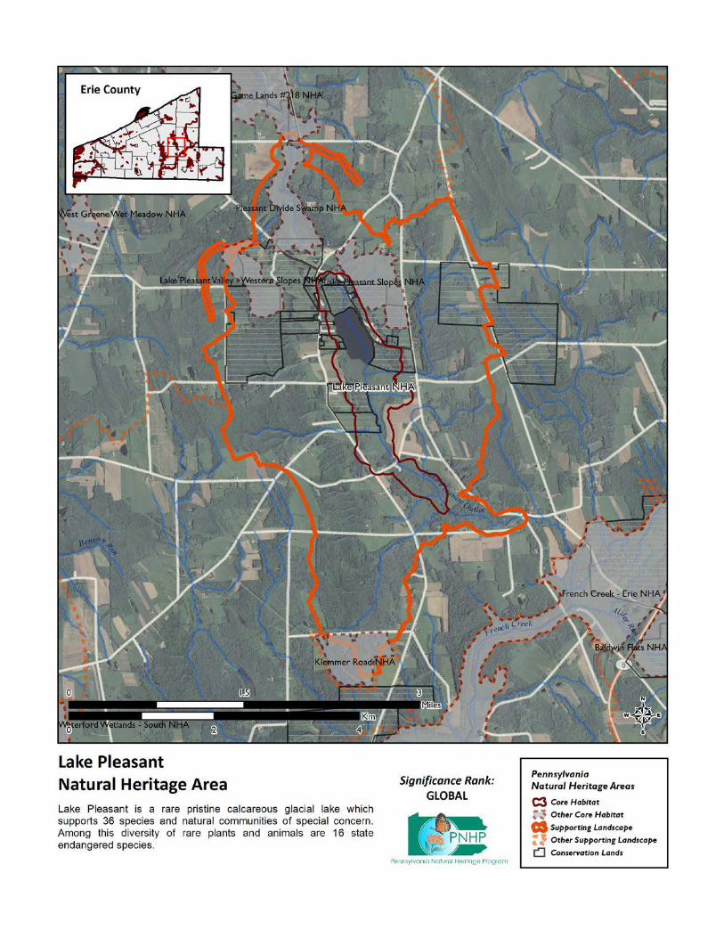
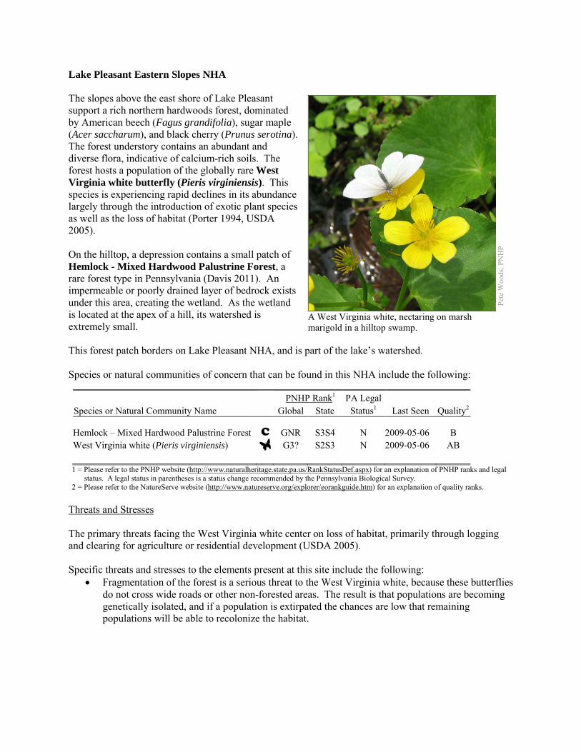
Lake Pleasant Eastern Slopes NHA The slopes above the east shore of Lake Pleasant support a rich northern hardwoods forest, dominated by American beech (Fagus grandifolia), sugar maple (Acer saccharum), and black cherry (Prunus serotina). The forest understory contains an abundant and diverse flora, indicative of calcium-rich soils. The forest hosts a population of the globally rare West Virginia white butterfly (Pieris virginiensis). This species is experiencing rapid declines in its abundance largely through the introduction of exotic plant species as well as the loss of habitat (Porter 1994, USDA 2005). On the hilltop, a depression contains a small patch of Hemlock - Mixed Hardwood Palustrine Forest, a rare forest type in Pennsylvania (Davis 2011). An impermeable or poorly drained layer of bedrock exists under this area, creating the wetland. As the wetland is located at the apex of a hill, its watershed is extremely small. This forest patch borders on Lake Pleasant NHA, and is part of the lake’s watershed. Species or natural communities of concern that can be found in this NHA include the following:
PNHP Rank1 PA Legal Species or Natural Community Name Global State Status1 Last Seen Quality2 Hemlock – Mixed Hardwood Palustrine Forest C GNR S3S4 N 2009-05-06 B West Virginia white (Pieris virginiensis) G3? S2S3 N 2009-05-06 AB 1 = Please refer to the PNHP website (http://www.naturalheritage.state.pa.us/RankStatusDef.aspx) for an explanation of PNHP ranks and legal
status. A legal status in parentheses is a status change recommended by the Pennsylvania Biological Survey. 2 = Please refer to the NatureServe website (http://www.natureserve.org/explorer/eorankguide.htm) for an explanation of quality ranks.
Threats and Stresses The primary threats facing the West Virginia white center on loss of habitat, primarily through logging and clearing for agriculture or residential development (USDA 2005). Specific threats and stresses to the elements present at this site include the following:
• Fragmentation of the forest is a serious threat to the West Virginia white, because these butterflies do not cross wide roads or other non-forested areas. The result is that populations are becoming genetically isolated, and if a population is extirpated the chances are low that remaining populations will be able to recolonize the habitat.
Pete
Woo
ds, P
NH
P
A West Virginia white, nectaring on marsh marigold in a hilltop swamp.
• An even greater threat to the West Virginia white is the spread of garlic mustard (Alliaria petiolata). This invasive plant is in the same family (the mustard family) as toothworts, and the chemical signatures of the plants are similar enough that female butterflies will readily lay their eggs on garlic mustard. The caterpillars, however, cannot survive on garlic mustard, and these butterflies have disappeared from areas where garlic mustard is dominant. Garlic mustard was not observed at this site, but it is present in the area and is expected to arrive here eventually.
• Other invasive plants that are present at the site include multiflora rose (Rosa multiflora) and Japanese barberry (Bergeris thunbergii). These species are currently growing at low densities, but if unchecked they will spread and may displace native plants.
• High densities of white-tailed deer pose another threat to West Virginia whites, because deer browsing greatly reduces the abundance of many of the wildflowers that are crucial nectar sources for the butterflies. Although their flight period is short, adults rely on several successive waves of spring wildflowers to produce a steady supply of nectar. A reduction in abundance or diversity of spring wildflowers can leave these butterflies without a source of food.
• The use of pesticides in this forest while West Virginia whites are active would threaten them. • The hemlock woolly adelgid (Adelges tsugae), native to Asia, is a sap-feeding insect that attacks
eastern hemlock (Tsuga canadensis). As of 2011, the hemlock woolly adelgid is still several counties away to the east and south, but it is expected to arrive in coming years, with devastating effects on hemlock populations. Infestations are followed by high levels of hemlock mortality, and the resulting loss of the deep shade and cool microclimate will drastically change the microclimate.
Conservation Recommendations A portion of the Core Habitat has been protected by the Western Pennsylvania Conservancy, while a portion of the core habitat is under private ownership. The following steps are recommended to ensure the persistence of these species at this site:
• The invasive plant species at this site should be removed, and the area should be monitored for garlic mustard and additional invasive plants.
• White-tailed deer should be kept to a low density to avoid degradation of the forest’s diversity. • Avoid fragmenting the existing forested areas with additional buildings or infrastructure. New
development such as housing, roads, and powerlines should be concentrated in areas that have already been disturbed.
• Avoid logging in this area except as it relates to invasive species removal. The forest cover should be allowed to achieve and maintain old-growth characteristics. Leave fallen trees in place to help provide habitat, soil nutrients, and humus.
• Avoid pesticide use between early April and the end of June. • As of 2012, available treatments for hemlock woolly adelgid are not economically feasible at a
scale suitable for large natural areas. At a smaller scale, injection of insecticides into tree trunks or into the soil around a tree can control adelgids for up to several years at a time, although there may be unintended effects on other species. Continued applications of horticultural oil or insecticidal soap can also control hemlock woolly adelgids. Biological controls are being researched, although they have so far had limited success at keeping adelgid populations in check (DCNR 2012).
Location and Additional Information
Municipalities: Venango Township USGS quads: Hammett 1993 Erie CNHI reference: This site was contained within the French Creek BDA Associated NHAs: Lake Pleasant NHA Overlapping Protected Lands: Western Pennsylvania Conservancy PNHP Significance Rank: Regional References Davis T. 2011. Pennsylvania Natural Heritage Program. Hemlock – Mixed Hardwood Palustrine Forest Factsheet. Available
from: http://www.naturalheritage.state.pa.us/Community.aspx?=16029 Date Accessed: October 11, 2012. Department of Conservation and Natural Resources. 2012. Forest Health Fact Sheet: Hemlock Woolly Adelgid.
http://www.dcnr.state.pa.us/ucmprd2/groups/public/documents/document/dcnr_007179.pdf Porter, A. 1994. Implications of Introduced Garlic Mustard (Alliaria petiolata) In the habitat of Pieris virginiensis (Pieridae).
Journal of the Lepidopterists' Society 48(2), 171-172. USDA Forest Service, Eastern Region. 2005. Conservation Assessment for the West Virginia White (Pieris virginiensis
Edwards). James Bess, OTIS Enterprises, 13501 south 750 west, Wanatah, Indiana 46390. http://www.fs.fed.us/r9/wildlife/tes/ca-overview/docs/insects/Pieris_Virginiensis.pdf
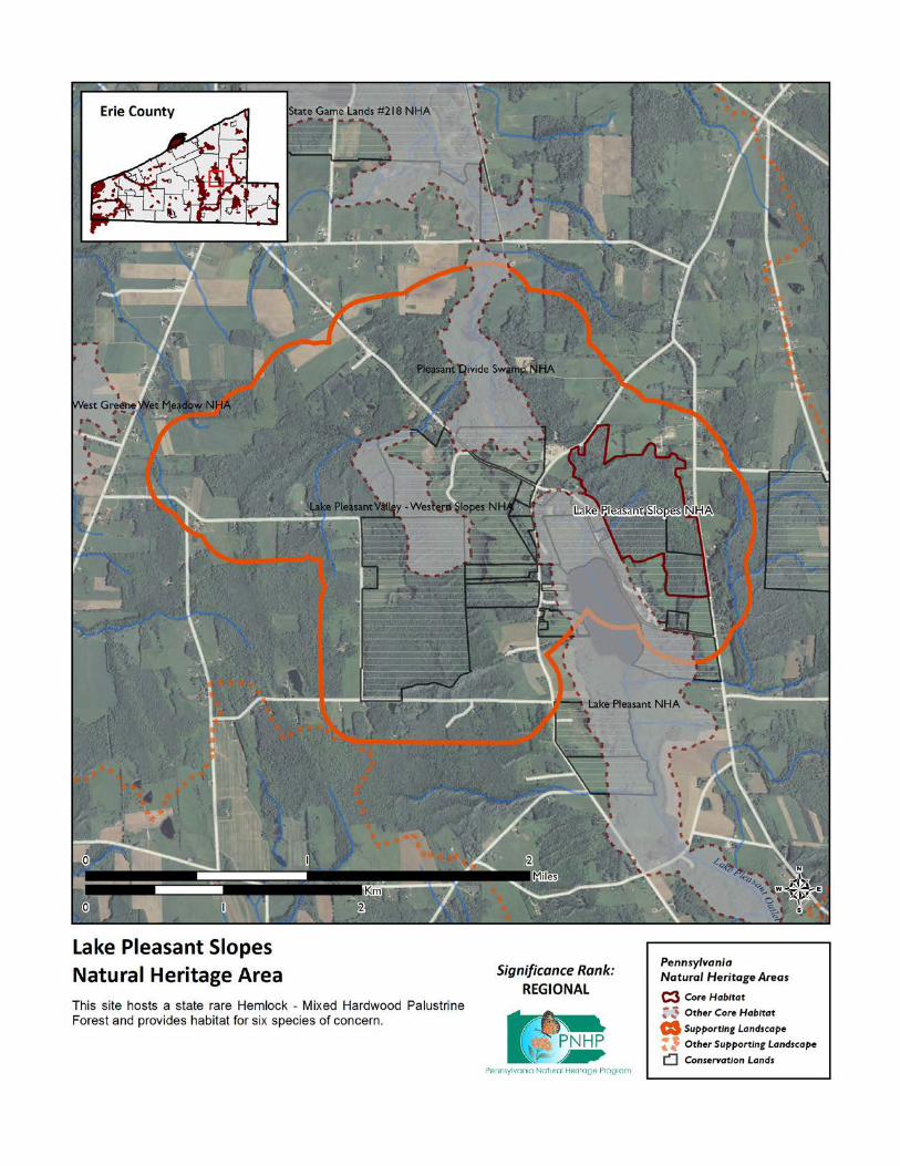
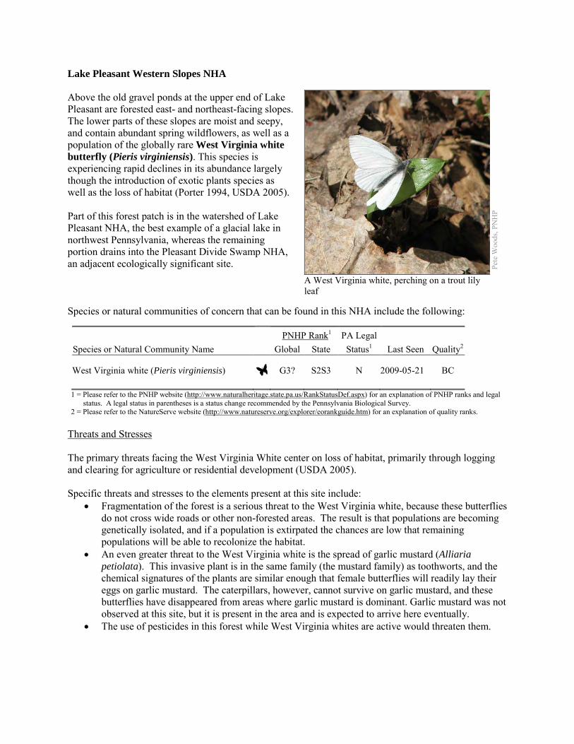
Lake Pleasant Western Slopes NHA Above the old gravel ponds at the upper end of Lake Pleasant are forested east- and northeast-facing slopes. The lower parts of these slopes are moist and seepy, and contain abundant spring wildflowers, as well as a population of the globally rare West Virginia white butterfly (Pieris virginiensis). This species is experiencing rapid declines in its abundance largely though the introduction of exotic plants species as well as the loss of habitat (Porter 1994, USDA 2005). Part of this forest patch is in the watershed of Lake Pleasant NHA, the best example of a glacial lake in northwest Pennsylvania, whereas the remaining portion drains into the Pleasant Divide Swamp NHA, an adjacent ecologically significant site. Species or natural communities of concern that can be found in this NHA include the following:
PNHP Rank1 PA Legal Species or Natural Community Name Global State Status1 Last Seen Quality2 West Virginia white (Pieris virginiensis) G3? S2S3 N 2009-05-21 BC 1 = Please refer to the PNHP website (http://www.naturalheritage.state.pa.us/RankStatusDef.aspx) for an explanation of PNHP ranks and legal
status. A legal status in parentheses is a status change recommended by the Pennsylvania Biological Survey. 2 = Please refer to the NatureServe website (http://www.natureserve.org/explorer/eorankguide.htm) for an explanation of quality ranks.
Threats and Stresses The primary threats facing the West Virginia White center on loss of habitat, primarily through logging and clearing for agriculture or residential development (USDA 2005). Specific threats and stresses to the elements present at this site include:
• Fragmentation of the forest is a serious threat to the West Virginia white, because these butterflies do not cross wide roads or other non-forested areas. The result is that populations are becoming genetically isolated, and if a population is extirpated the chances are low that remaining populations will be able to recolonize the habitat.
• An even greater threat to the West Virginia white is the spread of garlic mustard (Alliaria petiolata). This invasive plant is in the same family (the mustard family) as toothworts, and the chemical signatures of the plants are similar enough that female butterflies will readily lay their eggs on garlic mustard. The caterpillars, however, cannot survive on garlic mustard, and these butterflies have disappeared from areas where garlic mustard is dominant. Garlic mustard was not observed at this site, but it is present in the area and is expected to arrive here eventually.
• The use of pesticides in this forest while West Virginia whites are active would threaten them.
Pete
Woo
ds, P
NH
P
A West Virginia white, perching on a trout lily leaf
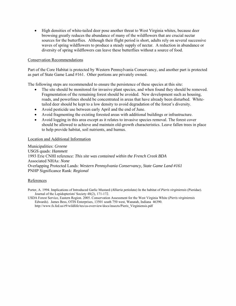
• High densities of white-tailed deer pose another threat to West Virginia whites, because deer browsing greatly reduces the abundance of many of the wildflowers that are crucial nectar sources for the butterflies. Although their flight period is short, adults rely on several successive waves of spring wildflowers to produce a steady supply of nectar. A reduction in abundance or diversity of spring wildflowers can leave these butterflies without a source of food.
Conservation Recommendations Part of the Core Habitat is protected by Western Pennsylvania Conservancy, and another part is protected as part of State Game Land #161. Other portions are privately owned. The following steps are recommended to ensure the persistence of these species at this site:
• The site should be monitored for invasive plant species, and when found they should be removed. Fragmentation of the remaining forest should be avoided. New development such as housing, roads, and powerlines should be concentrated in areas that have already been disturbed. White-tailed deer should be kept to a low density to avoid degradation of the forest’s diversity.
• Avoid pesticide use between early April and the end of June. • Avoid fragmenting the existing forested areas with additional buildings or infrastructure. • Avoid logging in this area except as it relates to invasive species removal. The forest cover
should be allowed to achieve and maintain old-growth characteristics. Leave fallen trees in place to help provide habitat, soil nutrients, and humus.
Location and Additional Information
Municipalities: Greene USGS quads: Hammett 1993 Erie CNHI reference: This site was contained within the French Creek BDA Associated NHAs: None Overlapping Protected Lands: Western Pennsylvania Conservancy, State Game Land #161 PNHP Significance Rank: Regional References Porter, A. 1994. Implications of Introduced Garlic Mustard (Alliaria petiolata) In the habitat of Pieris virginiensis (Pieridae).
Journal of the Lepidopterists' Society 48(2), 171-172. USDA Forest Service, Eastern Region. 2005. Conservation Assessment for the West Virginia White (Pieris virginiensis
Edwards). James Bess, OTIS Enterprises, 13501 south 750 west, Wanatah, Indiana 46390. http://www.fs.fed.us/r9/wildlife/tes/ca-overview/docs/insects/Pieris_Virginiensis.pdf
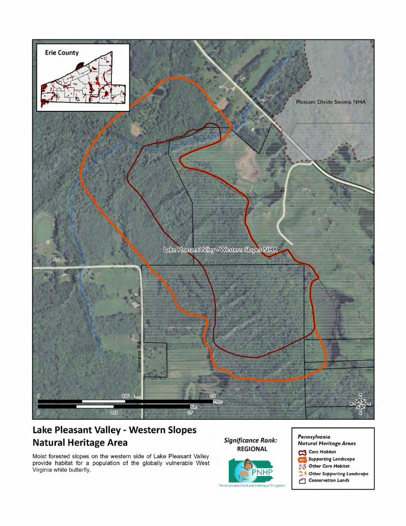
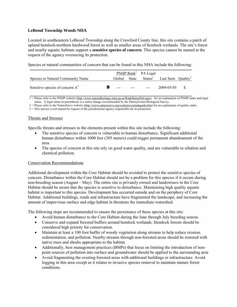
LeBeouf Township Woods NHA Located in southeastern LeBeouf Township along the Crawford County line, this site contains a patch of upland hemlock-northern hardwood forest as well as smaller areas of hemlock wetlands. The site’s forest and nearby aquatic habitats support a sensitive species of concern. This species cannot be named at the request of the agency overseeing its protection. Species or natural communities of concern that can be found in this NHA include the following:
PNHP Rank1 PA Legal Species or Natural Community Name Global State Status1 Last Seen Quality2 Sensitive species of concern A3 S --- --- --- 2009-05-05 E 1 = Please refer to the PNHP website (http://www.naturalheritage.state.pa.us/RankStatusDef.aspx) for an explanation of PNHP ranks and legal
status. A legal status in parentheses is a status change recommended by the Pennsylvania Biological Survey. 2 = Please refer to the NatureServe website (http://www.natureserve.org/explorer/eorankguide.htm) for an explanation of quality ranks. 3 = This species is not named by request of the jurisdictional agency responsible for its protection.
Threats and Stresses Specific threats and stresses to the elements present within this site include the following:
• The sensitive species of concern is vulnerable to human disturbance. Significant additional human disturbance within 1000 feet (305 meters) could trigger permanent abandonment of the area.
• The species of concern at this site rely on good water quality, and are vulnerable to siltation and chemical pollution.
Conservation Recommendations Additional development within the Core Habitat should be avoided to protect the sensitive species of concern. Disturbance within the Core Habitat should not be a problem for this species if it occurs during non-breeding season (August – May). The entire site is privately owned and landowners in the Core Habitat should be aware that the species is sensitive to disturbance. Maintaining high quality aquatic habitat is important to this species. Development has occurred outside and on the periphery of Core Habitat. Additional buildings, roads and infrastructure have fragmented the landscape, and increasing the amount of impervious surface and edge habitat in threatens the immediate watershed. The following steps are recommended to ensure the persistence of these species at this site:
• Avoid human disturbance to the Core Habitat during the June through July breeding season. • Conserve and expand forested buffers around hemlock wetlands. Hemlock forests should be
considered high priority for conservation. • Maintain at least a 100 foot buffer of woody vegetation along streams to help reduce erosion,
sedimentation, and pollution. Nearby streams through non-forested areas should be restored with native trees and shrubs appropriate to the habitat.
• Additionally, best management practices (BMPs) that focus on limiting the introduction of non-point sources of pollution into surface and groundwater should be applied to the surrounding area
• Avoid fragmenting the existing forested areas with additional buildings or infrastructure. Avoid logging in this area except as it relates to invasive species removal to maintain mature forest conditions.

Location and Additional Information
Municipalities: LeBeouf Township USGS quads: Millers Station 1993 Erie CNHI reference: Leboeuf Township Woods Associated NHAs: None Overlapping Protected Lands: None – private ownership PNHP Significance Rank: State
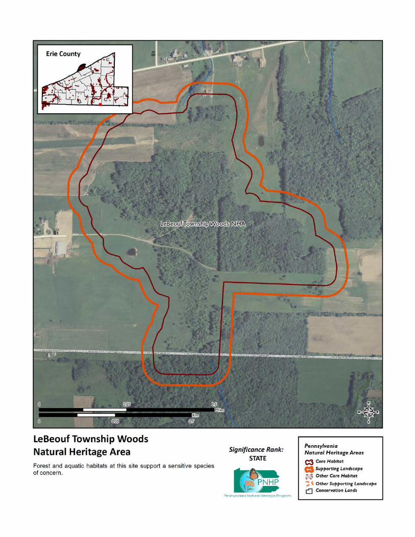
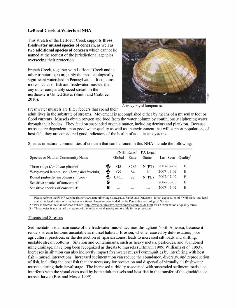
LeBoeuf Creek at Waterford NHA This stretch of the LeBoeuf Creek supports three freshwater mussel species of concern, as well as two additional species of concern which cannot be named at the request of the jurisdictional agencies overseeing their protection. French Creek, together with LeBoeuf Creek and its other tributaries, is arguably the most ecologically significant watershed in Pennsylvania. It contains more species of fish and freshwater mussels than any other comparably sized stream in the northeastern United States (Smith and Crabtree 2010). Freshwater mussels are filter feeders that spend their adult lives in the substrate of streams. Movement is accomplished either by means of a muscular foot or flood currents. Mussels obtain oxygen and food from the water column by continuously siphoning water through their bodies. They feed on suspended organic matter, including detritus and plankton. Because mussels are dependent upon good water quality as well as an environment that will support populations of host fish, they are considered good indicators of the health of aquatic ecosystems. Species or natural communities of concern that can be found in this NHA include the following:
PNHP Rank1 PA Legal Species or Natural Community Name Global State Status1 Last Seen Quality2 Three-ridge (Amblema plicata) G5 S2S3 N (PT) 2007-07-02 E Wavy-rayed lampmussel (Lampsilis fasciola) G5 S4 N 2007-07-02 E Round pigtoe (Pleurobema sintoxia) G4G5 S2 N (PE) 2007-07-02 E Sensitive species of concern A3 S --- --- --- 2006-06-30 E Sensitive species of concern B3 S --- --- --- 2007-07-02 E 1 = Please refer to the PNHP website (http://www.naturalheritage.state.pa.us/RankStatusDef.aspx) for an explanation of PNHP ranks and legal
status. A legal status in parentheses is a status change recommended by the Pennsylvania Biological Survey. 2 = Please refer to the NatureServe website (http://www.natureserve.org/explorer/eorankguide.htm) for an explanation of quality ranks. 3 = This species is not named by request of the jurisdictional agency responsible for its protection.
Threats and Stresses Sedimentation is a main cause of the freshwater mussel declines throughout North America, because it renders stream bottoms unsuitable as mussel habitat. Erosion, whether caused by deforestation, poor agricultural practices, or the destruction of riparian zones, leads to increased silt loads and shifting, unstable stream bottoms. Siltation and contaminants, such as heavy metals, pesticides, and abandoned mine drainage, have long been recognized as threats to mussels (Ortmann 1909; Williams et al. 1993). Increases in siltation can also indirectly impact freshwater mussel communities by interfering with host fish – mussel interactions. Increased sedimentation can reduce the abundance, diversity, and reproduction of fish, including the host fish that are necessary for protection and dispersal of virtually all freshwater mussels during their larval stage. The increased turbidity associated with suspended sediment loads also interferes with the visual cues used by both adult mussels and host fish in the transfer of the glochidia, or mussel larvae (Box and Mossa 1999).
PNH
P
A wavy-rayed lampmussel
This stretch of the creek is classified as Impaired for aquatic life, for unknown causes, suggesting there may be water quality issues affecting the mussels here. Conservation Recommendations Maintaining suitable aquatic habitat is key to the continued success of these mussel species. In the upstream watershed, timbering, road development, gas drilling, or other construction activities should be kept well away from riparian corridors in order to avoid degrading important aquatic and streamside habitat within the tributaries flowing into LeBoeuf Creek. Land use within the watershed has so far been compatible with maintaining the high-quality conditions within this site, but the anticipated upswing in gas development could pose a challenge to maintaining water quality. Any planning of future development within the watershed should seek to avoid potential impacts to both the physical character and water quality of the LeBoeuf Creek. The following steps are recommended to ensure the persistence of these species at this site:
• Conserve and expand the forested riparian buffers of LeBoeuf Creek and its tributaries. Streams through forested areas should be considered high priority for conservation. The forested riparian corridor helps to regulate the temperature of the stream and creates streamside conditions that contribute to improved water quality and aquatic habitat. Streams through non-forested areas should be restored with native trees and shrubs appropriate to the habitat. Establish at least a 100 foot (30 meter) buffer of woody vegetation along the creek and its tributaries to help reduce erosion, sedimentation, and pollution.
• Best management practices (BMPs) that focus on limiting the introduction of non-point sources of pollution into surface and groundwater should be applied to the surrounding area.
Location and Additional Information
Municipalities: Waterford Borough, Waterford Township USGS quads: Waterford 1993 Erie CNHI reference: French Creek BDA Associated NHAs: Lake LeBoeuf NHA, French Creek – Erie County NHA, Waterford Wetlands – South
NHA Overlapping Protected Lands: None PNHP Significance Rank: Regional References Smith, T.A. and D. Crabtree. 2010. Freshwater Mussel (Unionidae: Bivalvia) Distributions and Densities in French Creek,
Pennsylvania. Northeastern Naturalist 17(3): 387-414.
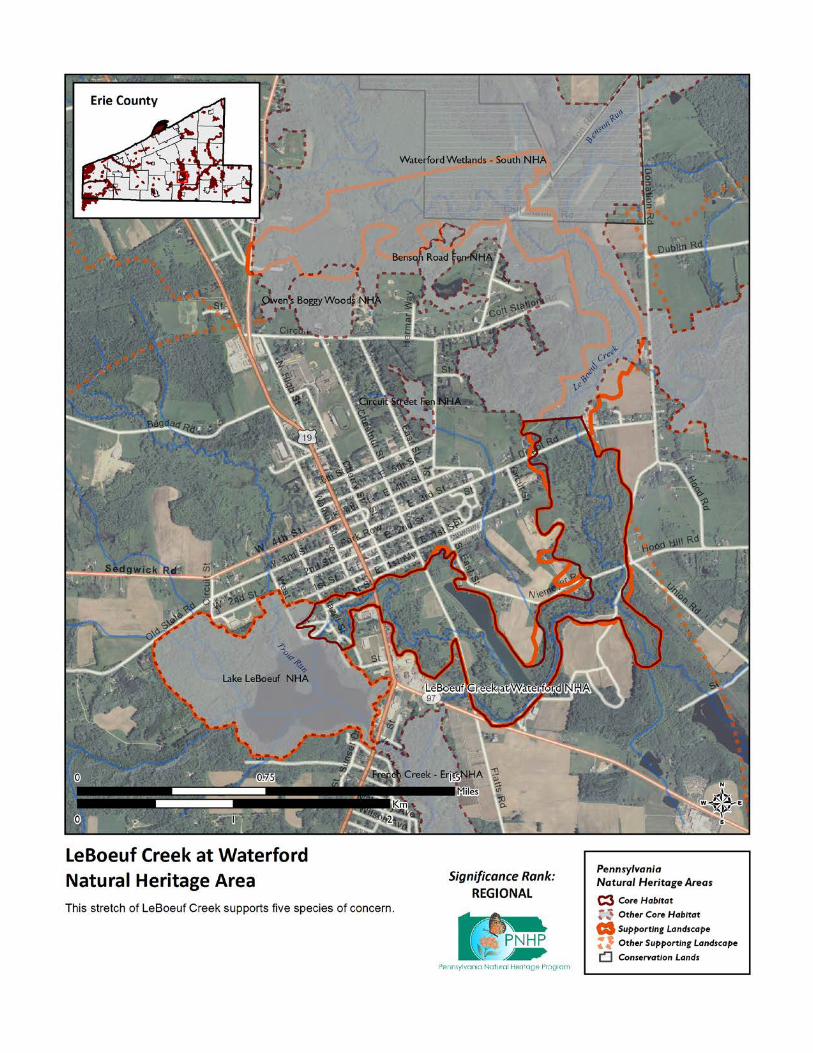
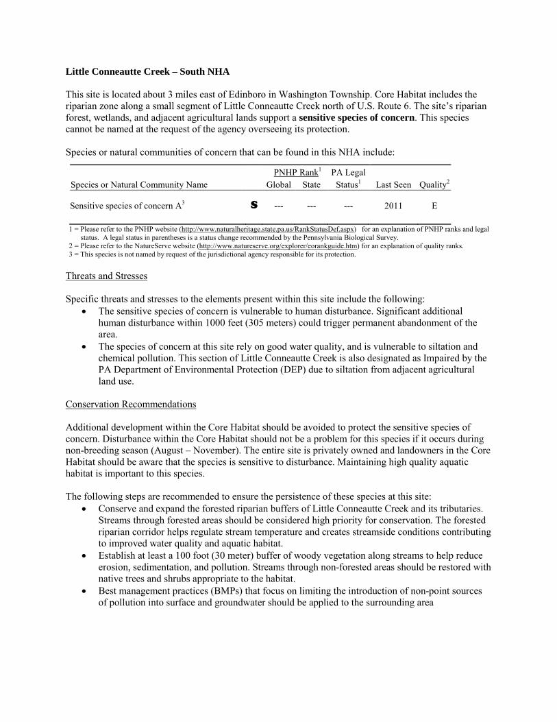
Little Conneautte Creek – South NHA This site is located about 3 miles east of Edinboro in Washington Township. Core Habitat includes the riparian zone along a small segment of Little Conneautte Creek north of U.S. Route 6. The site’s riparian forest, wetlands, and adjacent agricultural lands support a sensitive species of concern. This species cannot be named at the request of the agency overseeing its protection. Species or natural communities of concern that can be found in this NHA include:
PNHP Rank1 PA Legal Species or Natural Community Name Global State Status1 Last Seen Quality2 Sensitive species of concern A3 S --- --- --- 2011 E 1 = Please refer to the PNHP website (http://www.naturalheritage.state.pa.us/RankStatusDef.aspx) for an explanation of PNHP ranks and legal
status. A legal status in parentheses is a status change recommended by the Pennsylvania Biological Survey. 2 = Please refer to the NatureServe website (http://www.natureserve.org/explorer/eorankguide.htm) for an explanation of quality ranks. 3 = This species is not named by request of the jurisdictional agency responsible for its protection.
Threats and Stresses Specific threats and stresses to the elements present within this site include the following:
• The sensitive species of concern is vulnerable to human disturbance. Significant additional human disturbance within 1000 feet (305 meters) could trigger permanent abandonment of the area.
• The species of concern at this site rely on good water quality, and is vulnerable to siltation and chemical pollution. This section of Little Conneautte Creek is also designated as Impaired by the PA Department of Environmental Protection (DEP) due to siltation from adjacent agricultural land use.
Conservation Recommendations Additional development within the Core Habitat should be avoided to protect the sensitive species of concern. Disturbance within the Core Habitat should not be a problem for this species if it occurs during non-breeding season (August – November). The entire site is privately owned and landowners in the Core Habitat should be aware that the species is sensitive to disturbance. Maintaining high quality aquatic habitat is important to this species. The following steps are recommended to ensure the persistence of these species at this site:
• Conserve and expand the forested riparian buffers of Little Conneautte Creek and its tributaries. Streams through forested areas should be considered high priority for conservation. The forested riparian corridor helps regulate stream temperature and creates streamside conditions contributing to improved water quality and aquatic habitat.
• Establish at least a 100 foot (30 meter) buffer of woody vegetation along streams to help reduce erosion, sedimentation, and pollution. Streams through non-forested areas should be restored with native trees and shrubs appropriate to the habitat.
• Best management practices (BMPs) that focus on limiting the introduction of non-point sources of pollution into surface and groundwater should be applied to the surrounding area

Location and Additional Information Municipalities: Washington USGS quads: Cambridge Springs NE 1993 Erie CNHI reference: Previously unidentified site Associated NHAs: None Overlapping Protected Lands: None – private ownership PNHP Significance Rank: State
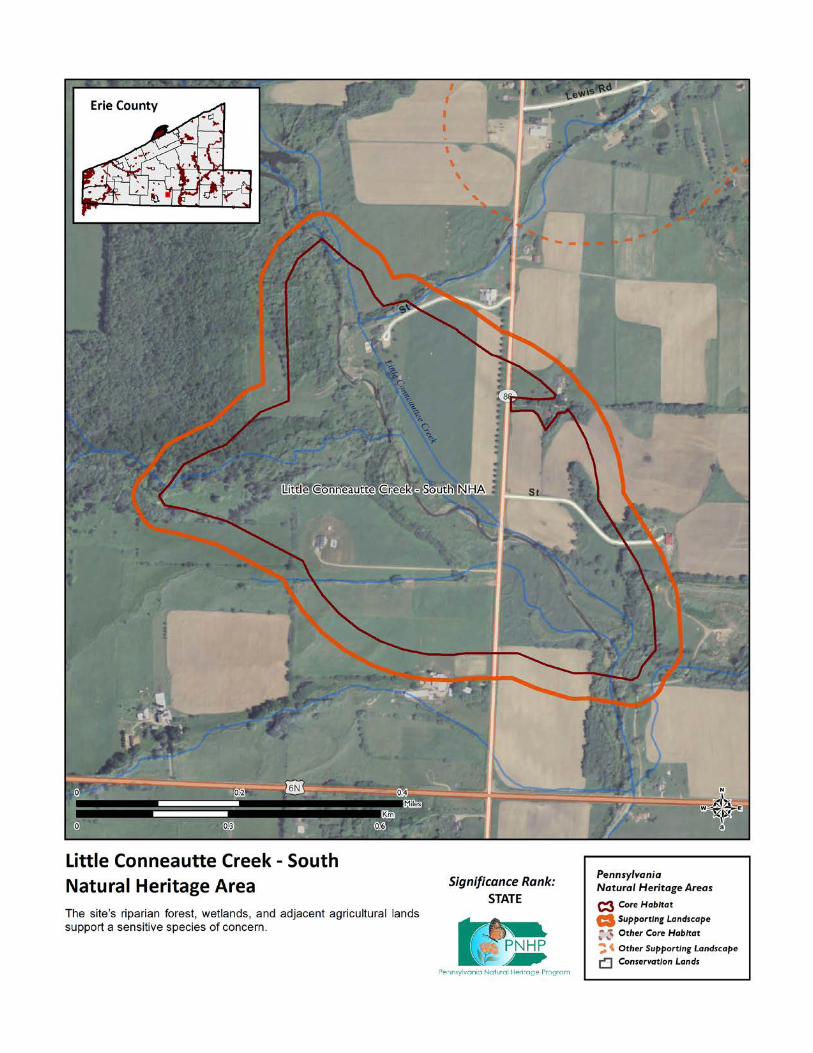
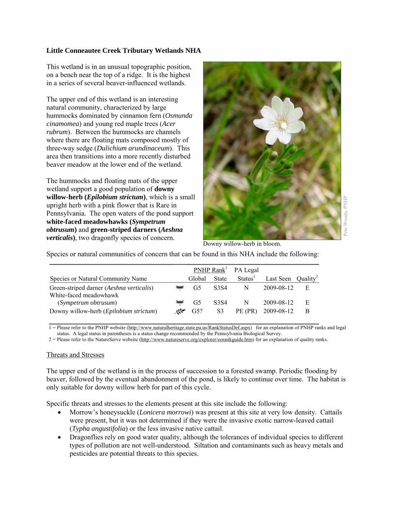
Little Conneautee Creek Tributary Wetlands NHA This wetland is in an unusual topographic position, on a bench near the top of a ridge. It is the highest in a series of several beaver-influenced wetlands. The upper end of this wetland is an interesting natural community, characterized by large hummocks dominated by cinnamon fern (Osmunda cinamomea) and young red maple trees (Acer rubrum). Between the hummocks are channels where there are floating mats composed mostly of three-way sedge (Dulichium arundinaceum). This area then transitions into a more recently disturbed beaver meadow at the lower end of the wetland. The hummocks and floating mats of the upper wetland support a good population of downy willow-herb (Epilobium strictum), which is a small upright herb with a pink flower that is Rare in Pennsylvania. The open waters of the pond support white-faced meadowhawks (Sympetrum obtrusum) and green-striped darners (Aeshna verticalis), two dragonfly species of concern. Species or natural communities of concern that can be found in this NHA include the following:
PNHP Rank1 PA Legal Species or Natural Community Name Global State Status1 Last Seen Quality2 Green-striped darner (Aeshna verticalis) G5 S3S4 N 2009-08-12 E White-faced meadowhawk (Sympetrum obtrusum) G5 S3S4 N 2009-08-12 E Downy willow-herb (Epilobium strictum) G5? S3 PE (PR) 2009-08-12 B 1 = Please refer to the PNHP website (http://www.naturalheritage.state.pa.us/RankStatusDef.aspx) for an explanation of PNHP ranks and legal
status. A legal status in parentheses is a status change recommended by the Pennsylvania Biological Survey. 2 = Please refer to the NatureServe website (http://www.natureserve.org/explorer/eorankguide.htm) for an explanation of quality ranks.
Threats and Stresses The upper end of the wetland is in the process of succession to a forested swamp. Periodic flooding by beaver, followed by the eventual abandonment of the pond, is likely to continue over time. The habitat is only suitable for downy willow herb for part of this cycle. Specific threats and stresses to the elements present at this site include the following:
• Morrow’s honeysuckle (Lonicera morrowi) was present at this site at very low density. Cattails were present, but it was not determined if they were the invasive exotic narrow-leaved cattail (Typha angustifolia) or the less invasive native cattail.
• Dragonflies rely on good water quality, although the tolerances of individual species to different types of pollution are not well-understood. Siltation and contaminants such as heavy metals and pesticides are potential threats to this species.
Pete
Woo
ds, P
NH
P
Downy willow-herb in bloom.
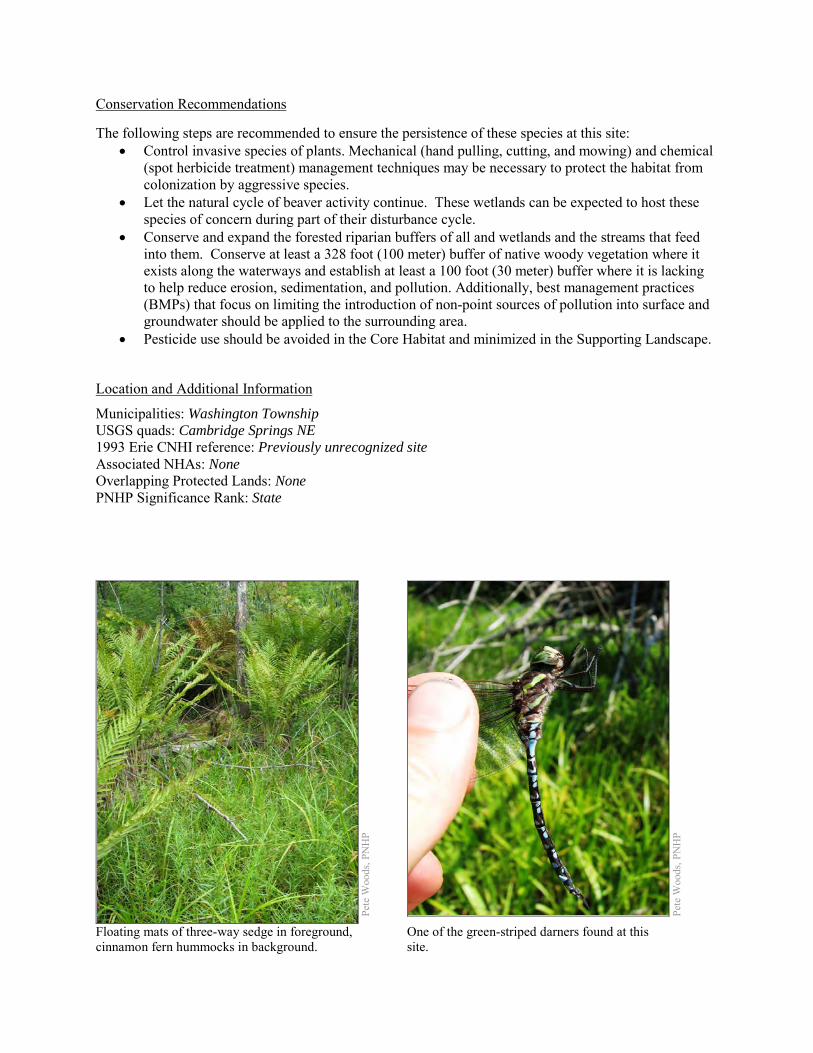
Conservation Recommendations The following steps are recommended to ensure the persistence of these species at this site:
• Control invasive species of plants. Mechanical (hand pulling, cutting, and mowing) and chemical (spot herbicide treatment) management techniques may be necessary to protect the habitat from colonization by aggressive species.
• Let the natural cycle of beaver activity continue. These wetlands can be expected to host these species of concern during part of their disturbance cycle.
• Conserve and expand the forested riparian buffers of all and wetlands and the streams that feed into them. Conserve at least a 328 foot (100 meter) buffer of native woody vegetation where it exists along the waterways and establish at least a 100 foot (30 meter) buffer where it is lacking to help reduce erosion, sedimentation, and pollution. Additionally, best management practices (BMPs) that focus on limiting the introduction of non-point sources of pollution into surface and groundwater should be applied to the surrounding area.
• Pesticide use should be avoided in the Core Habitat and minimized in the Supporting Landscape.
Location and Additional Information
Municipalities: Washington Township USGS quads: Cambridge Springs NE 1993 Erie CNHI reference: Previously unrecognized site Associated NHAs: None Overlapping Protected Lands: None PNHP Significance Rank: State
Pete
Woo
ds, P
NH
P
Pe
te W
oods
, PN
HP
Floating mats of three-way sedge in foreground, cinnamon fern hummocks in background.
One of the green-striped darners found at this site.
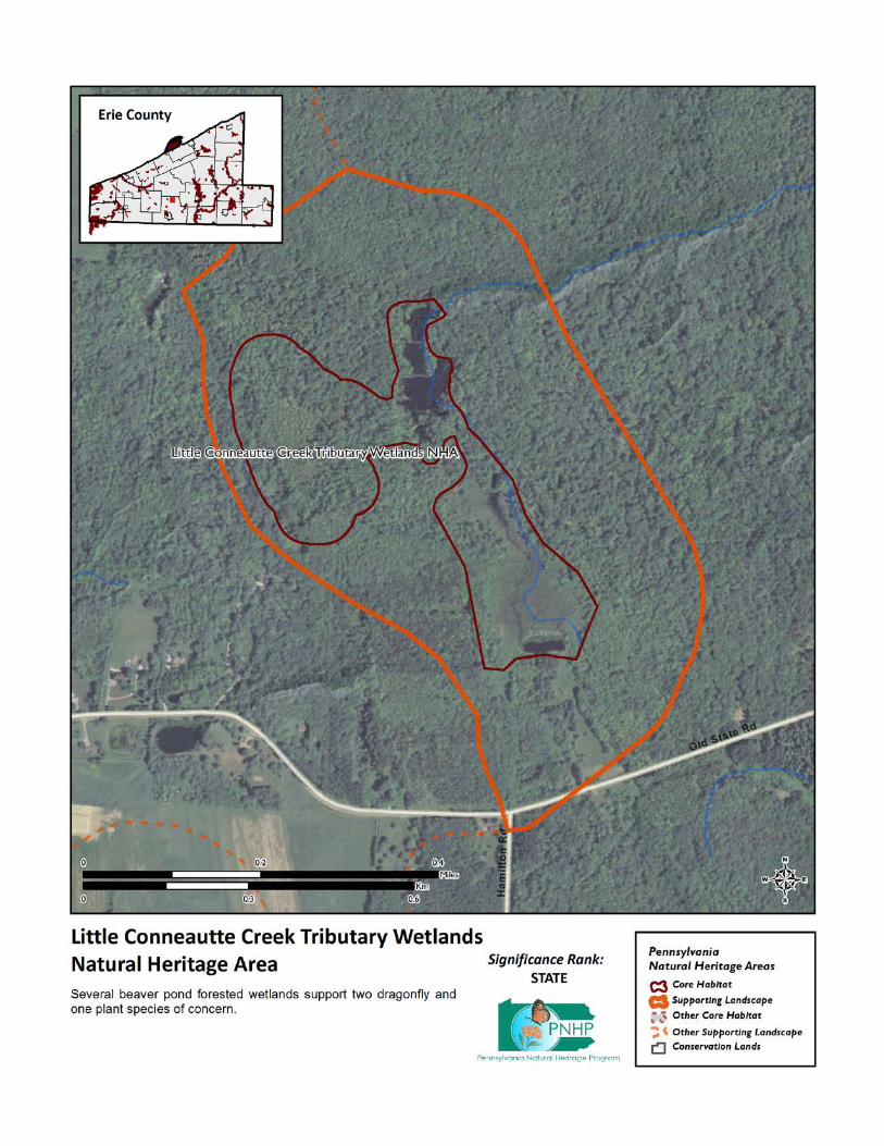
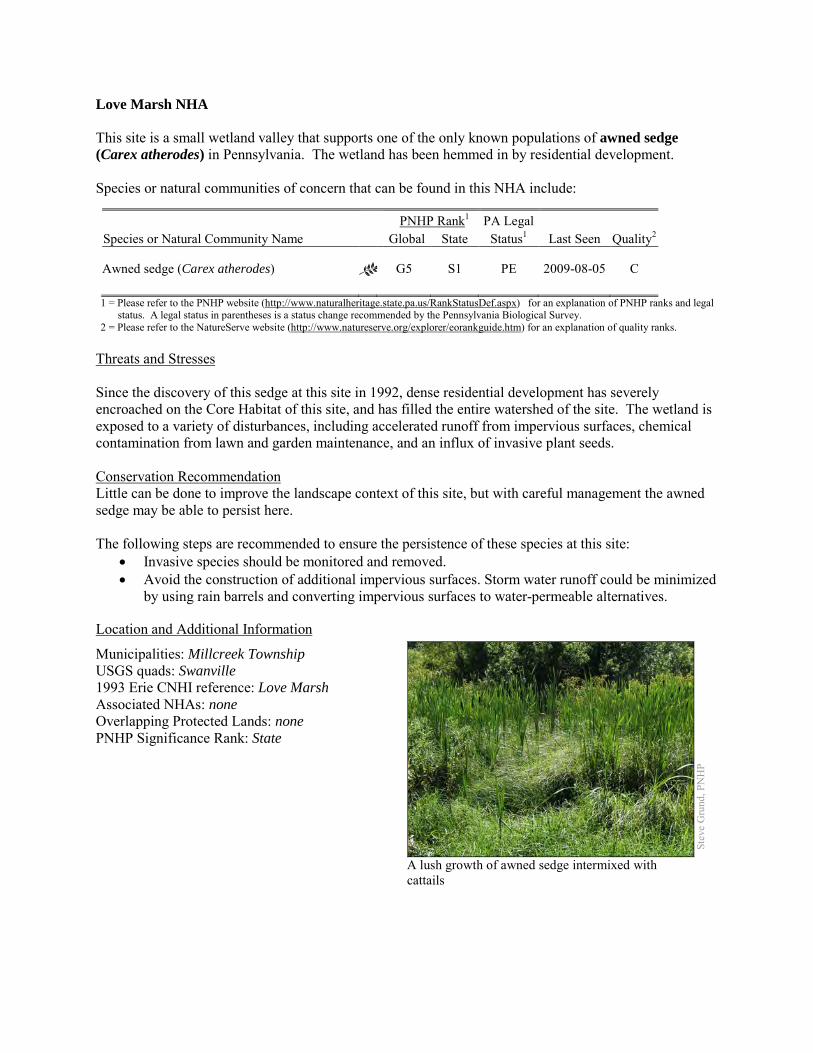
Love Marsh NHA This site is a small wetland valley that supports one of the only known populations of awned sedge (Carex atherodes) in Pennsylvania. The wetland has been hemmed in by residential development. Species or natural communities of concern that can be found in this NHA include:
PNHP Rank1 PA Legal Species or Natural Community Name Global State Status1 Last Seen Quality2 Awned sedge (Carex atherodes) G5 S1 PE 2009-08-05 C 1 = Please refer to the PNHP website (http://www.naturalheritage.state.pa.us/RankStatusDef.aspx) for an explanation of PNHP ranks and legal
status. A legal status in parentheses is a status change recommended by the Pennsylvania Biological Survey. 2 = Please refer to the NatureServe website (http://www.natureserve.org/explorer/eorankguide.htm) for an explanation of quality ranks.
Threats and Stresses Since the discovery of this sedge at this site in 1992, dense residential development has severely encroached on the Core Habitat of this site, and has filled the entire watershed of the site. The wetland is exposed to a variety of disturbances, including accelerated runoff from impervious surfaces, chemical contamination from lawn and garden maintenance, and an influx of invasive plant seeds. Conservation Recommendation Little can be done to improve the landscape context of this site, but with careful management the awned sedge may be able to persist here. The following steps are recommended to ensure the persistence of these species at this site:
• Invasive species should be monitored and removed. • Avoid the construction of additional impervious surfaces. Storm water runoff could be minimized
by using rain barrels and converting impervious surfaces to water-permeable alternatives.
Location and Additional Information
Municipalities: Millcreek Township USGS quads: Swanville 1993 Erie CNHI reference: Love Marsh Associated NHAs: none Overlapping Protected Lands: none PNHP Significance Rank: State
Stev
e G
rund
, PN
HP
A lush growth of awned sedge intermixed with cattails
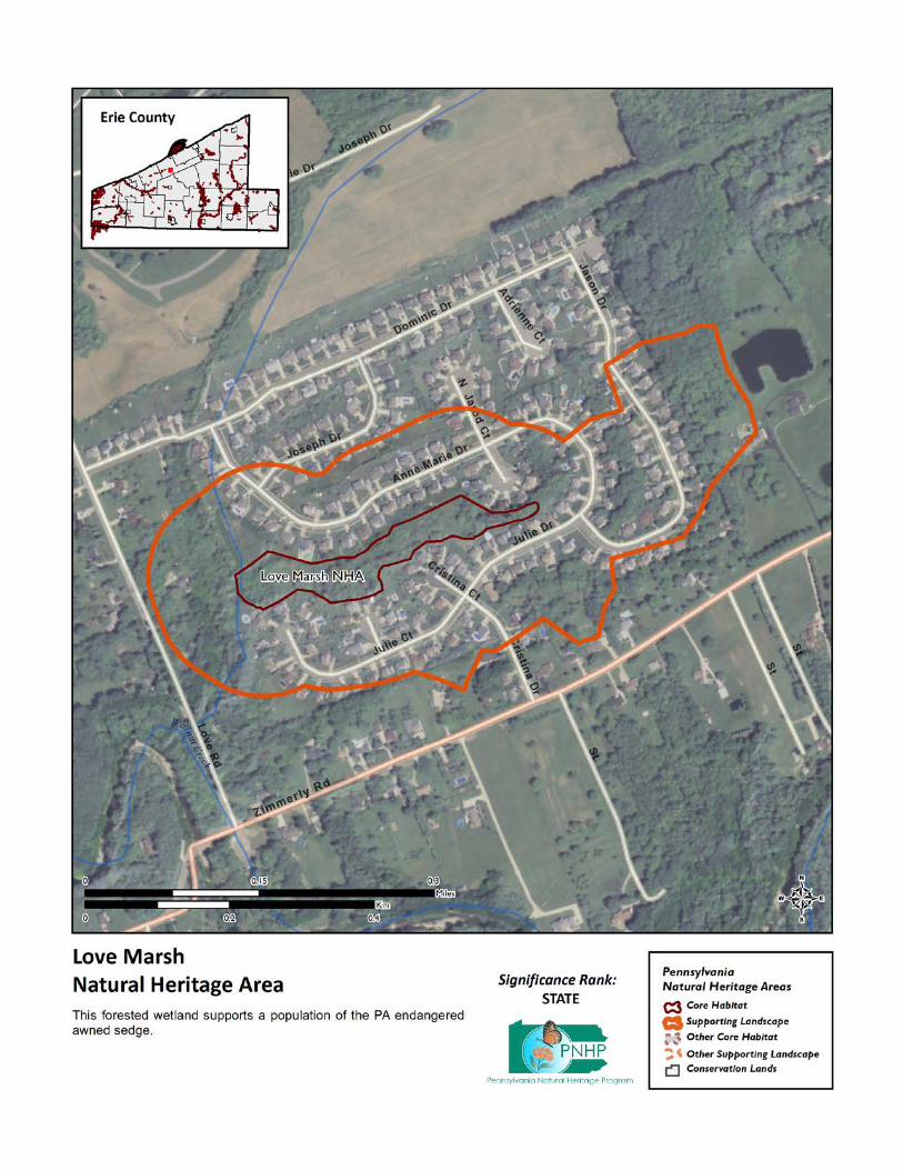
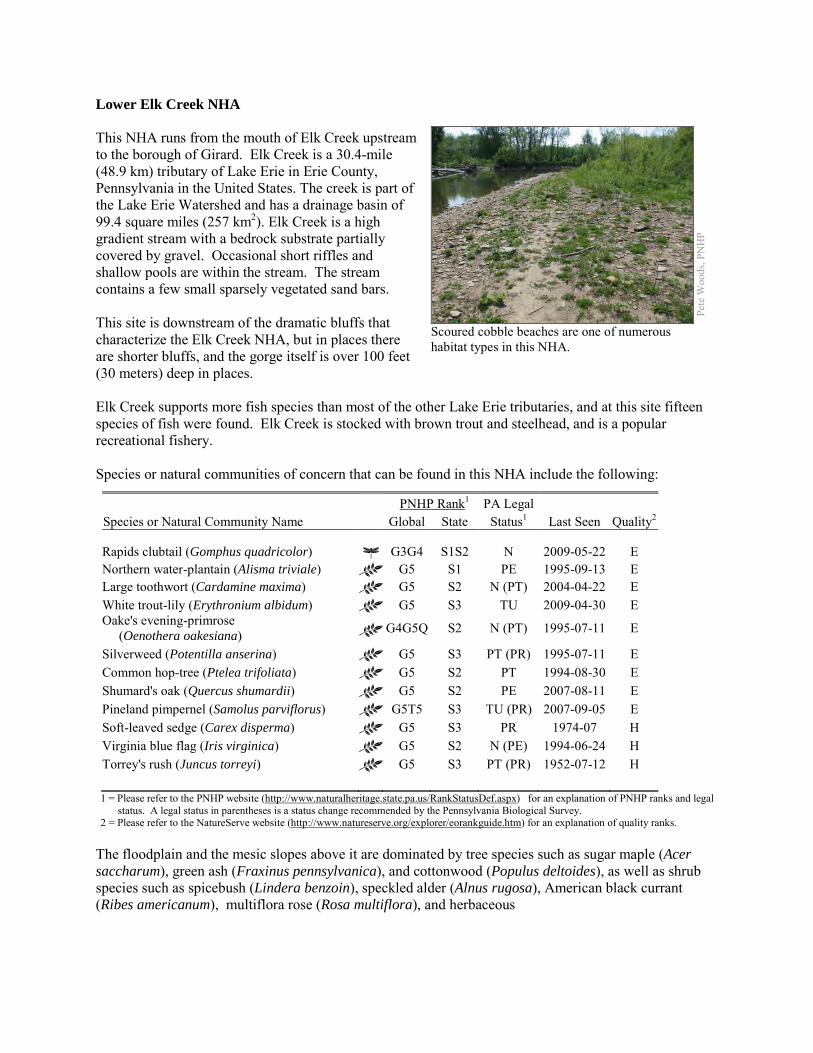
Lower Elk Creek NHA This NHA runs from the mouth of Elk Creek upstream to the borough of Girard. Elk Creek is a 30.4-mile (48.9 km) tributary of Lake Erie in Erie County, Pennsylvania in the United States. The creek is part of the Lake Erie Watershed and has a drainage basin of 99.4 square miles (257 km2). Elk Creek is a high gradient stream with a bedrock substrate partially covered by gravel. Occasional short riffles and shallow pools are within the stream. The stream contains a few small sparsely vegetated sand bars. This site is downstream of the dramatic bluffs that characterize the Elk Creek NHA, but in places there are shorter bluffs, and the gorge itself is over 100 feet (30 meters) deep in places. Elk Creek supports more fish species than most of the other Lake Erie tributaries, and at this site fifteen species of fish were found. Elk Creek is stocked with brown trout and steelhead, and is a popular recreational fishery. Species or natural communities of concern that can be found in this NHA include the following:
PNHP Rank1 PA Legal Species or Natural Community Name Global State Status1 Last Seen Quality2 Rapids clubtail (Gomphus quadricolor) G3G4 S1S2 N 2009-05-22 E Northern water-plantain (Alisma triviale) G5 S1 PE 1995-09-13 E Large toothwort (Cardamine maxima) G5 S2 N (PT) 2004-04-22 E White trout-lily (Erythronium albidum) G5 S3 TU 2009-04-30 E Oake's evening-primrose (Oenothera oakesiana) G4G5Q S2 N (PT) 1995-07-11 E
Silverweed (Potentilla anserina) G5 S3 PT (PR) 1995-07-11 E Common hop-tree (Ptelea trifoliata) G5 S2 PT 1994-08-30 E Shumard's oak (Quercus shumardii) G5 S2 PE 2007-08-11 E Pineland pimpernel (Samolus parviflorus) G5T5 S3 TU (PR) 2007-09-05 E Soft-leaved sedge (Carex disperma) G5 S3 PR 1974-07 H Virginia blue flag (Iris virginica) G5 S2 N (PE) 1994-06-24 H Torrey's rush (Juncus torreyi) G5 S3 PT (PR) 1952-07-12 H 1 = Please refer to the PNHP website (http://www.naturalheritage.state.pa.us/RankStatusDef.aspx) for an explanation of PNHP ranks and legal
status. A legal status in parentheses is a status change recommended by the Pennsylvania Biological Survey. 2 = Please refer to the NatureServe website (http://www.natureserve.org/explorer/eorankguide.htm) for an explanation of quality ranks.
The floodplain and the mesic slopes above it are dominated by tree species such as sugar maple (Acer saccharum), green ash (Fraxinus pennsylvanica), and cottonwood (Populus deltoides), as well as shrub species such as spicebush (Lindera benzoin), speckled alder (Alnus rugosa), American black currant (Ribes americanum), multiflora rose (Rosa multiflora), and herbaceous
Pete
Woo
ds, P
NH
P
Scoured cobble beaches are one of numerous habitat types in this NHA.
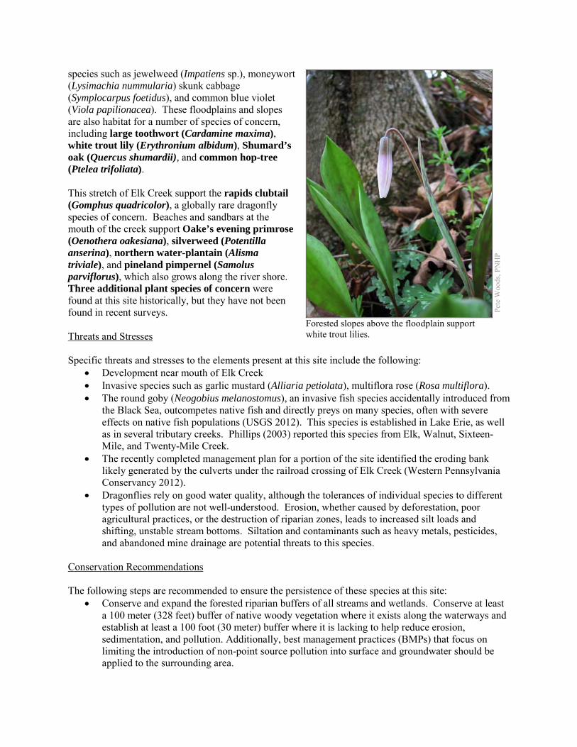
species such as jewelweed (Impatiens sp.), moneywort (Lysimachia nummularia) skunk cabbage (Symplocarpus foetidus), and common blue violet (Viola papilionacea). These floodplains and slopes are also habitat for a number of species of concern, including large toothwort (Cardamine maxima), white trout lily (Erythronium albidum), Shumard’s oak (Quercus shumardii), and common hop-tree (Ptelea trifoliata). This stretch of Elk Creek support the rapids clubtail (Gomphus quadricolor), a globally rare dragonfly species of concern. Beaches and sandbars at the mouth of the creek support Oake’s evening primrose (Oenothera oakesiana), silverweed (Potentilla anserina), northern water-plantain (Alisma triviale), and pineland pimpernel (Samolus parviflorus), which also grows along the river shore. Three additional plant species of concern were found at this site historically, but they have not been found in recent surveys. Threats and Stresses Specific threats and stresses to the elements present at this site include the following:
• Development near mouth of Elk Creek • Invasive species such as garlic mustard (Alliaria petiolata), multiflora rose (Rosa multiflora). • The round goby (Neogobius melanostomus), an invasive fish species accidentally introduced from
the Black Sea, outcompetes native fish and directly preys on many species, often with severe effects on native fish populations (USGS 2012). This species is established in Lake Erie, as well as in several tributary creeks. Phillips (2003) reported this species from Elk, Walnut, Sixteen-Mile, and Twenty-Mile Creek.
• The recently completed management plan for a portion of the site identified the eroding bank likely generated by the culverts under the railroad crossing of Elk Creek (Western Pennsylvania Conservancy 2012).
• Dragonflies rely on good water quality, although the tolerances of individual species to different types of pollution are not well-understood. Erosion, whether caused by deforestation, poor agricultural practices, or the destruction of riparian zones, leads to increased silt loads and shifting, unstable stream bottoms. Siltation and contaminants such as heavy metals, pesticides, and abandoned mine drainage are potential threats to this species.
Conservation Recommendations The following steps are recommended to ensure the persistence of these species at this site:
• Conserve and expand the forested riparian buffers of all streams and wetlands. Conserve at least a 100 meter (328 feet) buffer of native woody vegetation where it exists along the waterways and establish at least a 100 foot (30 meter) buffer where it is lacking to help reduce erosion, sedimentation, and pollution. Additionally, best management practices (BMPs) that focus on limiting the introduction of non-point source pollution into surface and groundwater should be applied to the surrounding area.
Pete
Woo
ds, P
NH
P
Forested slopes above the floodplain support white trout lilies.
• Remove invasive plant species. o Target pioneer populations of invasive plants for immediate and continued removal. It is
much easier and more effective to keep a place invasive-free than to try and repair a heavily infested habitat.
o Invasive species management needs to be coordinated by individuals familiar with the rare species as well as the invasive species present.
o Continual invasive species monitoring and control will be necessary • Management strategies for round gobies are being researched, but none can be recommended at
this time. • Pesticide use should be avoided in the Core Habitat and minimized in the Supporting Landscape.
Location and Additional Information
Municipalities: Girard Township, Girard Borough, Lake City Borough USGS quads: Albion, Fairview, Fairview SW 1993 Erie CNHI reference: Lower Plain Lakeshore BDA included the mouth of Elk Creek Associated NHAs: Elk Creek NHA Overlapping Protected Lands: The PA Fish and Boat Commission owns the Elk Creek Access area at the
mouth of Elk Creek. Upstream of here, the Western Pennsylvania Conservancy owns a parcel and manages it for public access and the species of concern that are present.
PNHP Significance Rank: Regional References Phillips, E.C., M.E. Washek, A.W. Hertel, and B.M. Niebel. 2003. The round goby (Neogobius melanostomus) in Pennsylvania
tributary streams of Lake Erie. Journal of Great Lakes Research 29(1):34-40. United States Geological Service. Round goby fact sheet. Available from:
http://nas.er.usgs.gov/queries/factsheet.aspx?SpeciesID=713. Date Accessed: October 8, 2012. Western Pennsylvania Conservancy. 2012. Fairview Evergreen Nurseries Management Plan.
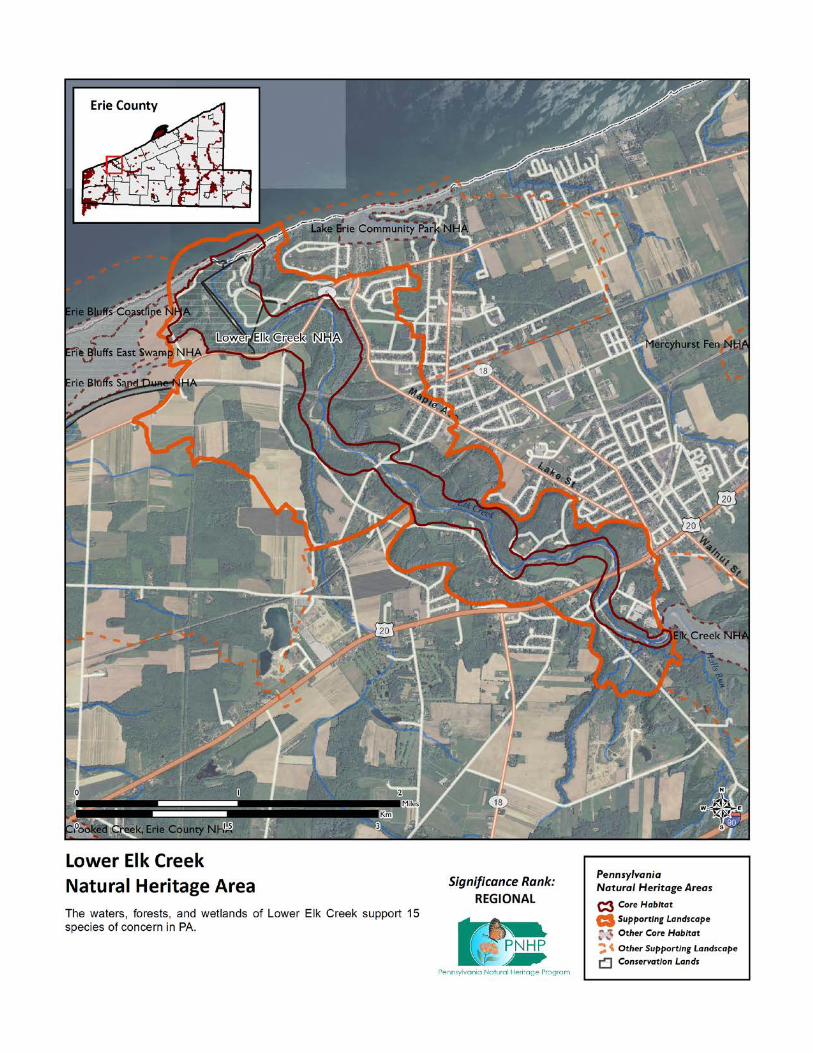
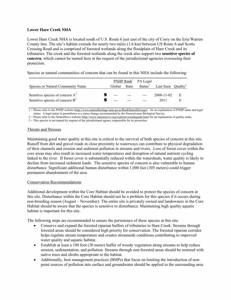
Lower Hare Creek NHA Lower Hare Creek NHA is located south of U.S. Route 6 just east of the city of Corry on the Erie/Warren County line. The site’s habitat extends for nearly two miles (1.6 km) between US Route 6 and Scotts Crossing Road and is comprised of forested wetlands along the floodplain of Hare Creek and its tributaries. The creek and the forested wetlands along the creek also support two sensitive species of concern, which cannot be named here at the request of the jurisdictional agencies overseeing their protection. Species or natural communities of concern that can be found in this NHA include the following:
PNHP Rank1 PA Legal Species or Natural Community Name Global State Status1 Last Seen Quality2 Sensitive species of concern A3 S --- --- --- 2008-11-02 E Sensitive species of concern B3 S --- --- --- 2011 E 1 = Please refer to the PNHP website (http://www.naturalheritage.state.pa.us/RankStatusDef.aspx) for an explanation of PNHP ranks and legal
status. A legal status in parentheses is a status change recommended by the Pennsylvania Biological Survey. 2 = Please refer to the NatureServe website (http://www.natureserve.org/explorer/eorankguide.htm) for an explanation of quality ranks. 3 = This species is not named by request of the jurisdictional agency responsible for its protection.
Threats and Stresses Maintaining good water quality at this site is critical to the survival of both species of concern at this site. Runoff from dirt and gravel roads in close proximity to waterways can contribute to physical degradation of their channels and erosion and sediment pollution in streams and rivers. Loss of forest cover within the core areas may also result in increased water temperatures and disruption of natural nutrient cycling linked to the river. If forest cover is substantially reduced within the watersheds, water quality is likely to decline from increased sediment loads. The sensitive species of concern is also vulnerable to human disturbance. Significant additional human disturbance within 1,000 feet (305 meters) could trigger permanent abandonment of the area. Conservation Recommendations Additional development within the Core Habitat should be avoided to protect the species of concern at this site. Disturbance within the Core Habitat should not be a problem for this species if it occurs during non-breeding season (August – November). The entire site is privately owned and landowners in the Core Habitat should be aware that the species is sensitive to disturbance. Maintaining high quality aquatic habitat is important for this site. The following steps are recommended to ensure the persistence of these species at this site:
• Conserve and expand the forested riparian buffers of tributaries to Hare Creek. Streams through forested areas should be considered high priority for conservation. The forested riparian corridor helps regulate stream temperature and creates streamside conditions contributing to improved water quality and aquatic habitat.
• Establish at least a 100 foot (30 meter) buffer of woody vegetation along streams to help reduce erosion, sedimentation, and pollution. Streams through non-forested areas should be restored with native trees and shrubs appropriate to the habitat.
• Additionally, best management practices (BMPs) that focus on limiting the introduction of non-point sources of pollution into surface and groundwater should be applied to the surrounding area.

Location and Additional Information Municipalities: Corry Township in Erie County; Columbus Township in Warren County USGS quads: Columbus, Corry 1993 Erie CNHI reference: Previously unrecognized site Associated NHAs: Hare Creek North Overlapping Protected Lands: None; private land PNHP Significance Rank: State
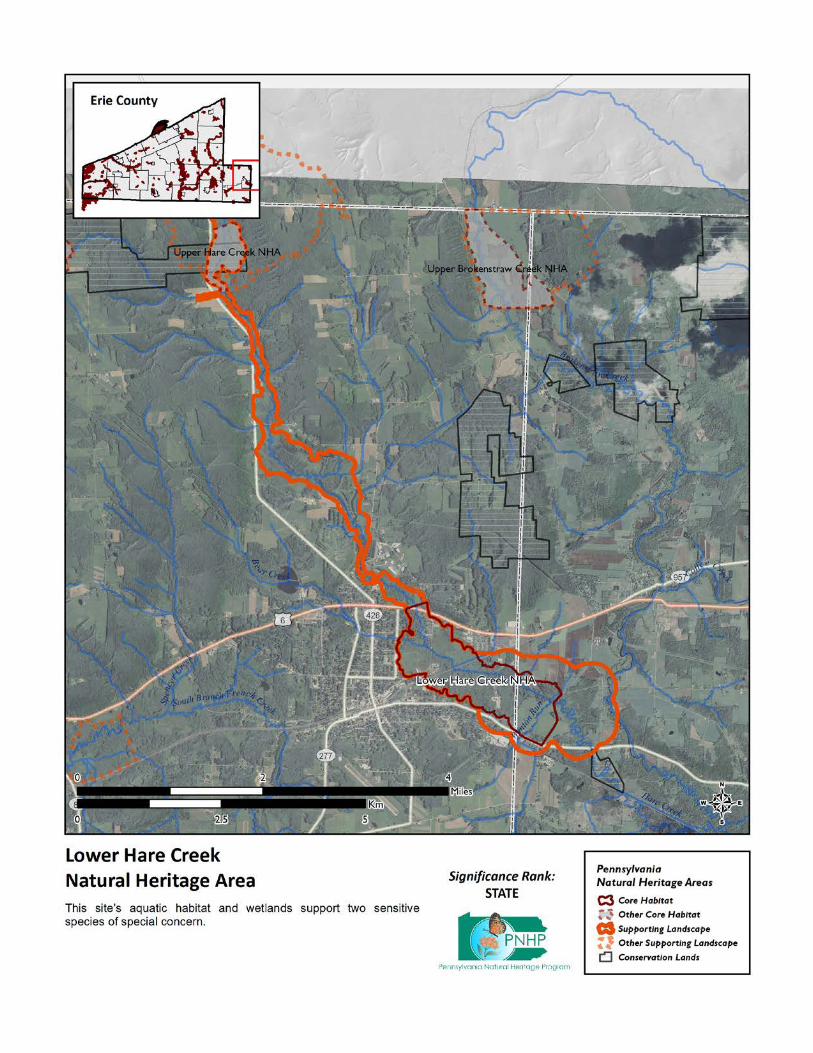

Lower Walnut Creek NHA This site is designated around mouth and lower reaches of Walnut Creek. This site supports two species of concern that cannot be named here at the request of the jurisdictional agency overseeing its protection. This species relies on good quality water. Species or natural communities of concern that can be found in this NHA include the following:
PNHP Rank1 PA Legal Species or Natural Community Name Global State Status1 Last Seen Quality2 Sensitive species of concern A3 S --- --- --- 2002 E Sensitive species of concern B3 S --- --- --- 2002 E 1 = Please refer to the PNHP website (http://www.naturalheritage.state.pa.us/RankStatusDef.aspx) for an explanation of PNHP ranks and legal
status. A legal status in parentheses is a status change recommended by the Pennsylvania Biological Survey. 2 = Please refer to the NatureServe website (http://www.natureserve.org/explorer/eorankguide.htm) for an explanation of quality ranks. 3 = This species is not named by request of the jurisdictional agency responsible for its protection.
Threats and Stresses Maintaining suitable aquatic habitat is key to the continued success of the species of concern. Specific threats and stresses to the elements present at this site include the following:
• Runoff from dirt and gravel roads in close proximity to waterways can contribute to physical degradation of their channels and erosion and sediment pollution in streams and rivers.
• Loss of forest cover within the core areas may also result in increased water temperatures and disruption of natural nutrient cycling linked to the river. If forest cover is substantially reduced within the watersheds, water quality is likely to decline from increased sediment loads. Removal of forest cover on steep slopes is especially problematic because of the potential for increased runoff and erosion following storm events.
Conservation Recommendations The following steps are recommended to ensure the persistence of these species at this site:
• Conserve and expand the forested riparian buffers of Walnut Creek and its tributaries. Streams through forested areas should be considered high priority for conservation. The forested riparian corridor helps to regulate the temperature of the stream and creates streamside conditions that contribute to improved water quality and aquatic habitat. Streams through non-forested areas should be restored with native trees and shrubs appropriate to the habitat. Establish at least a 100 foot (30 meter) buffer of woody vegetation along the creek and its tributaries to help reduce erosion, sedimentation, and pollution.
• Best management practices (BMPs) that focus on limiting the introduction of non-point sources of pollution into surface and groundwater should be applied to the surrounding area
Location and Additional Information
Municipalities: Fairview Township USGS quads: Swanville 1993 Erie CNHI reference: None Associated NHAs: Manchester Beach NHA Overlapping Protected Lands: Walnut Creek Access (Lake Erie) PNHP Significance Rank: State
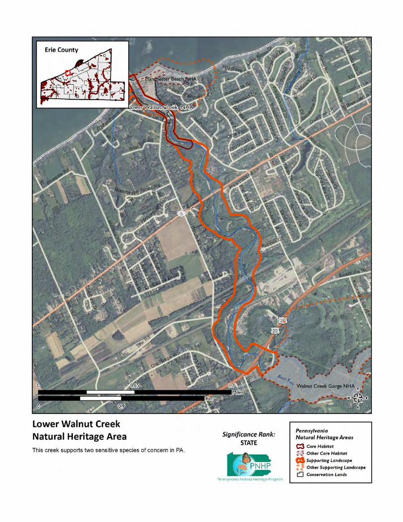
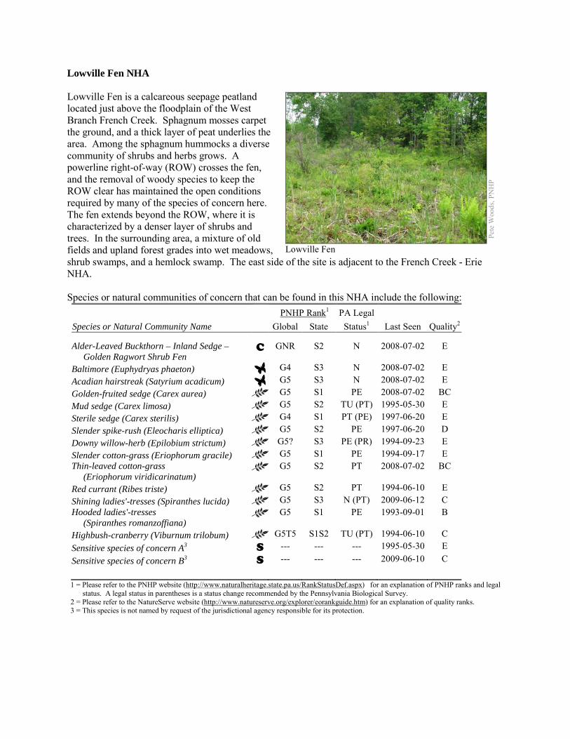
Lowville Fen NHA Lowville Fen is a calcareous seepage peatland located just above the floodplain of the West Branch French Creek. Sphagnum mosses carpet the ground, and a thick layer of peat underlies the area. Among the sphagnum hummocks a diverse community of shrubs and herbs grows. A powerline right-of-way (ROW) crosses the fen, and the removal of woody species to keep the ROW clear has maintained the open conditions required by many of the species of concern here. The fen extends beyond the ROW, where it is characterized by a denser layer of shrubs and trees. In the surrounding area, a mixture of old fields and upland forest grades into wet meadows, shrub swamps, and a hemlock swamp. The east side of the site is adjacent to the French Creek - Erie NHA. Species or natural communities of concern that can be found in this NHA include the following:
PNHP Rank1 PA Legal Species or Natural Community Name Global State Status1 Last Seen Quality2 Alder-Leaved Buckthorn – Inland Sedge – Golden Ragwort Shrub Fen
C GNR S2 N 2008-07-02 E
Baltimore (Euphydryas phaeton) G4 S3 N 2008-07-02 E Acadian hairstreak (Satyrium acadicum) G5 S3 N 2008-07-02 E Golden-fruited sedge (Carex aurea) G5 S1 PE 2008-07-02 BC Mud sedge (Carex limosa) G5 S2 TU (PT) 1995-05-30 E Sterile sedge (Carex sterilis) G4 S1 PT (PE) 1997-06-20 E Slender spike-rush (Eleocharis elliptica) G5 S2 PE 1997-06-20 D Downy willow-herb (Epilobium strictum) G5? S3 PE (PR) 1994-09-23 E Slender cotton-grass (Eriophorum gracile) G5 S1 PE 1994-09-17 E Thin-leaved cotton-grass (Eriophorum viridicarinatum)
G5 S2 PT 2008-07-02 BC
Red currant (Ribes triste) G5 S2 PT 1994-06-10 E Shining ladies'-tresses (Spiranthes lucida) G5 S3 N (PT) 2009-06-12 C Hooded ladies'-tresses (Spiranthes romanzoffiana)
G5 S1 PE 1993-09-01 B
Highbush-cranberry (Viburnum trilobum) G5T5 S1S2 TU (PT) 1994-06-10 C Sensitive species of concern A3 S --- --- --- 1995-05-30 E Sensitive species of concern B3 S --- --- --- 2009-06-10 C 1 = Please refer to the PNHP website (http://www.naturalheritage.state.pa.us/RankStatusDef.aspx) for an explanation of PNHP ranks and legal
status. A legal status in parentheses is a status change recommended by the Pennsylvania Biological Survey. 2 = Please refer to the NatureServe website (http://www.natureserve.org/explorer/eorankguide.htm) for an explanation of quality ranks. 3 = This species is not named by request of the jurisdictional agency responsible for its protection.
Pete
Woo
ds, P
NH
P
Lowville Fen
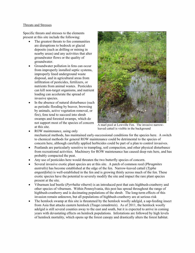
Threats and Stresses Specific threats and stresses to the elements present at this site include the following:
• The greatest threats to fen communities are disruptions to bedrock or glacial deposits (such as drilling or mining in nearby areas) and any activities that alter groundwater flows or the quality of groundwater.
• Groundwater pollution in fens can occur from improperly installed septic systems, improperly lined underground waste disposal, and in agricultural areas from infiltration of pesticides, fertilizers, or nutrients from animal wastes. Pesticides can kill non-target organisms, and nutrient loading can accelerate the spread of invasive species.
• In the absence of natural disturbance (such as periodic flooding by beaver, browsing by animals, active vegetation removal, or fire), fens tend to succeed into shrub swamps and forested swamps, which do not support most of the species of concern at this site.
• ROW maintenance, using only mechanical methods, has maintained early-successional conditions for the species here. A switch to chemical methods for general ROW maintenance could be detrimental to the species of concern here, although carefully applied herbicides could be part of a plan to control invasives.
• Peatlands are particularly sensitive to trampling, soil compaction, and other physical disturbance from recreational activities. Machinery for ROW maintenance has caused deep ruts here, and has probably compacted the peat.
• Any use of pesticides here would threaten the two butterfly species of concern. • Several invasive exotic plant species are at this site. A patch of common reed (Phragmites
australis) has become established at the edge of the fen. Narrow-leaved cattail (Typha angustifolia) is well-established in the fen and is growing thinly across much of the fen. These exotic species have the potential to severely modify the site and impact the rare plant species present at the site.
• Viburnum leaf beetle (Pyrrhalta viburni) is an introduced pest that eats highbush-cranberry and other species of viburnum. Within Pennsylvania, this pest has spread throughout the range of highbush-cranberry and is decimating populations of the shrub. The long-term effects of this invasion remain unknown, but all populations of highbush-cranberry are at serious risk
• The hemlock swamp at this site is threatened by the hemlock woolly adelgid, a sap-feeding insect from Asia that attacks eastern hemlock (Tsuga canadensis). As of 2011, the hemlock woolly adelgid is still several counties away to the east and south, but it is expected to arrive in coming years with devastating effects on hemlock populations. Infestations are followed by high levels of hemlock mortality, which opens up the forest canopy and drastically alters the forest habitat.
Pete
Woo
ds, P
NH
P
A marl pool at Lowville Fen. The invasive narrow-leaved cattail is visible in the background
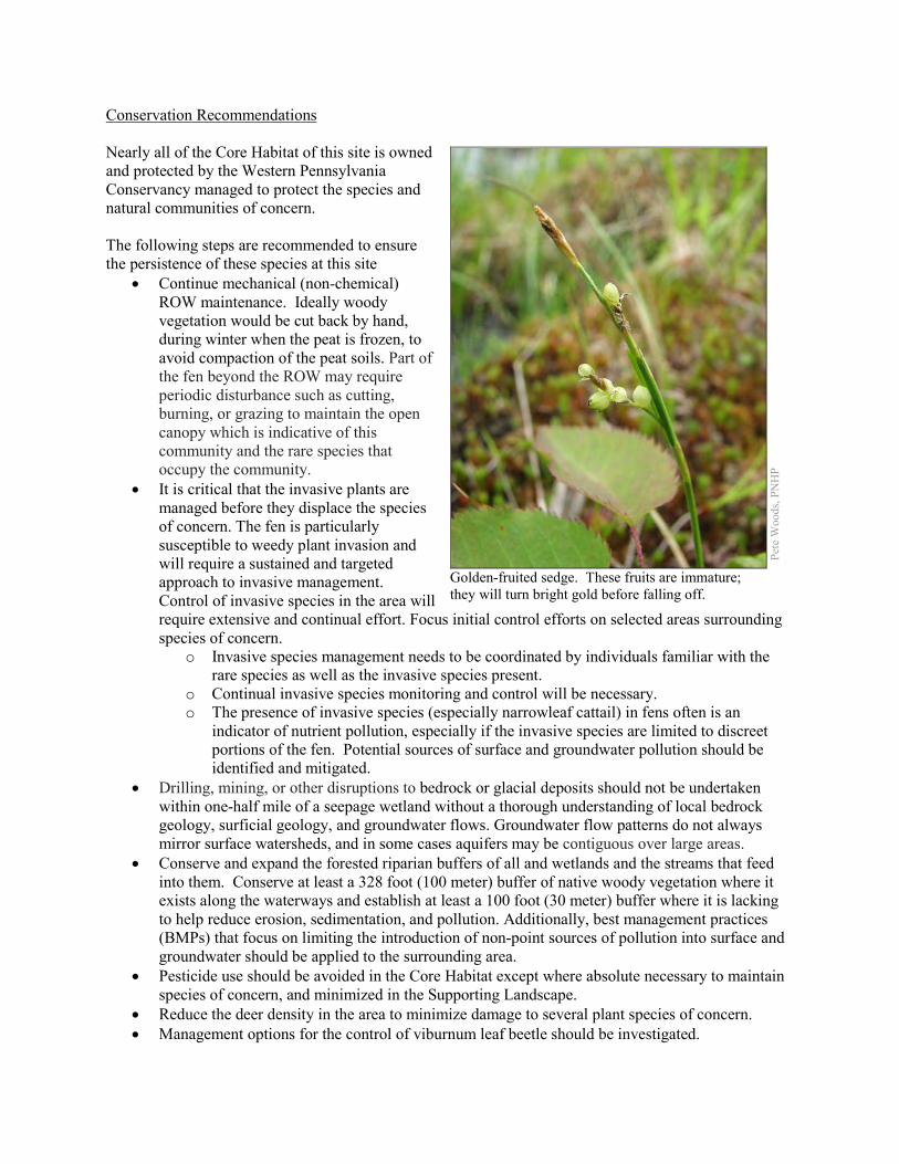
Conservation Recommendations Nearly all of the Core Habitat of this site is owned and protected by the Western Pennsylvania Conservancy managed to protect the species and natural communities of concern. The following steps are recommended to ensure the persistence of these species at this site
• Continue mechanical (non-chemical) ROW maintenance. Ideally woody vegetation would be cut back by hand, during winter when the peat is frozen, to avoid compaction of the peat soils. Part of the fen beyond the ROW may require periodic disturbance such as cutting, burning, or grazing to maintain the open canopy which is indicative of this community and the rare species that occupy the community.
• It is critical that the invasive plants are managed before they displace the species of concern. The fen is particularly susceptible to weedy plant invasion and will require a sustained and targeted approach to invasive management. Control of invasive species in the area will require extensive and continual effort. Focus initial control efforts on selected areas surrounding species of concern.
o Invasive species management needs to be coordinated by individuals familiar with the rare species as well as the invasive species present.
o Continual invasive species monitoring and control will be necessary. o The presence of invasive species (especially narrowleaf cattail) in fens often is an
indicator of nutrient pollution, especially if the invasive species are limited to discreet portions of the fen. Potential sources of surface and groundwater pollution should be identified and mitigated.
• Drilling, mining, or other disruptions to bedrock or glacial deposits should not be undertaken within one-half mile of a seepage wetland without a thorough understanding of local bedrock geology, surficial geology, and groundwater flows. Groundwater flow patterns do not always mirror surface watersheds, and in some cases aquifers may be contiguous over large areas.
• Conserve and expand the forested riparian buffers of all and wetlands and the streams that feed into them. Conserve at least a 328 foot (100 meter) buffer of native woody vegetation where it exists along the waterways and establish at least a 100 foot (30 meter) buffer where it is lacking to help reduce erosion, sedimentation, and pollution. Additionally, best management practices (BMPs) that focus on limiting the introduction of non-point sources of pollution into surface and groundwater should be applied to the surrounding area.
• Pesticide use should be avoided in the Core Habitat except where absolute necessary to maintain species of concern, and minimized in the Supporting Landscape.
• Reduce the deer density in the area to minimize damage to several plant species of concern. • Management options for the control of viburnum leaf beetle should be investigated.
Pete
Woo
ds, P
NH
P
Golden-fruited sedge. These fruits are immature; they will turn bright gold before falling off.
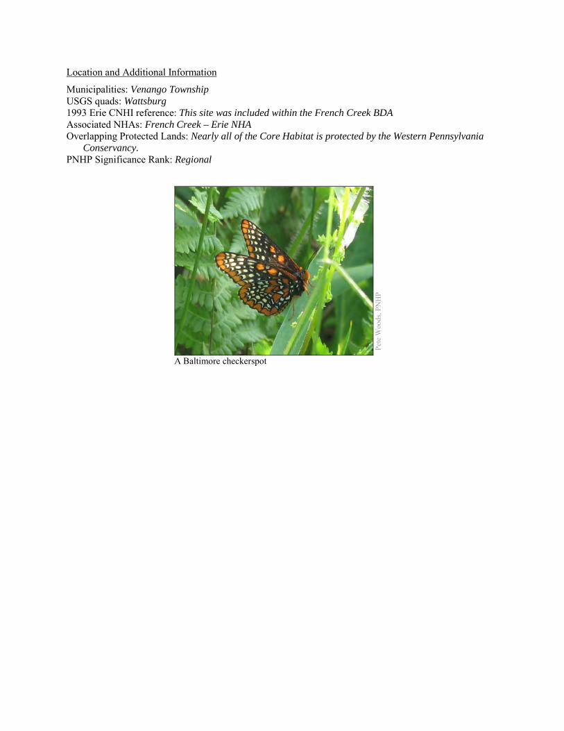
Location and Additional Information
Municipalities: Venango Township USGS quads: Wattsburg 1993 Erie CNHI reference: This site was included within the French Creek BDA Associated NHAs: French Creek – Erie NHA Overlapping Protected Lands: Nearly all of the Core Habitat is protected by the Western Pennsylvania
Conservancy. PNHP Significance Rank: Regional
Pete
Woo
ds, P
NH
P
A Baltimore checkerspot
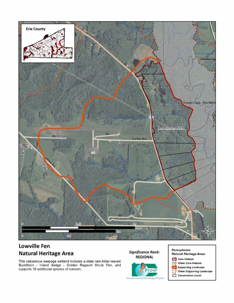
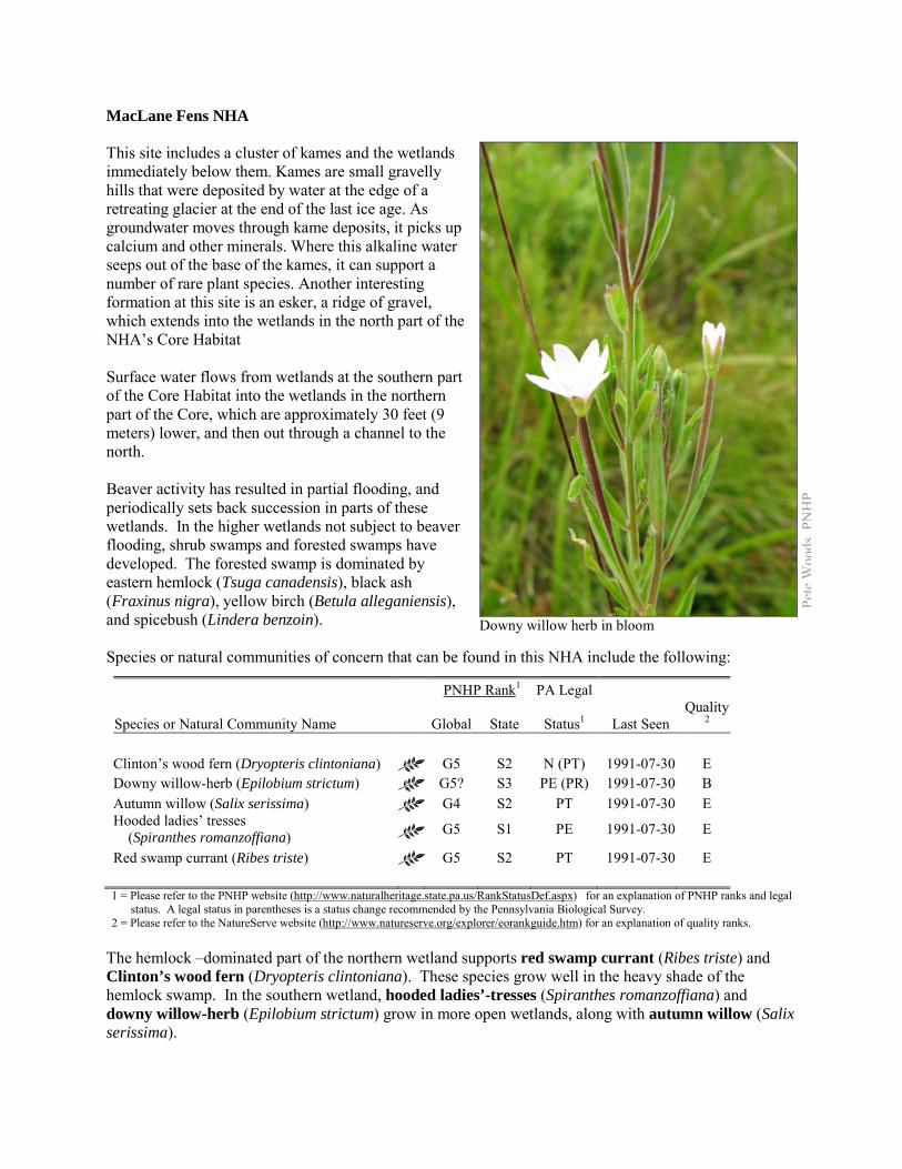
MacLane Fens NHA This site includes a cluster of kames and the wetlands immediately below them. Kames are small gravelly hills that were deposited by water at the edge of a retreating glacier at the end of the last ice age. As groundwater moves through kame deposits, it picks up calcium and other minerals. Where this alkaline water seeps out of the base of the kames, it can support a number of rare plant species. Another interesting formation at this site is an esker, a ridge of gravel, which extends into the wetlands in the north part of the NHA’s Core Habitat Surface water flows from wetlands at the southern part of the Core Habitat into the wetlands in the northern part of the Core, which are approximately 30 feet (9 meters) lower, and then out through a channel to the north. Beaver activity has resulted in partial flooding, and periodically sets back succession in parts of these wetlands. In the higher wetlands not subject to beaver flooding, shrub swamps and forested swamps have developed. The forested swamp is dominated by eastern hemlock (Tsuga canadensis), black ash (Fraxinus nigra), yellow birch (Betula alleganiensis), and spicebush (Lindera benzoin). Species or natural communities of concern that can be found in this NHA include the following:
PNHP Rank1 PA Legal
Species or Natural Community Name
Global State Status1 Last Seen Quality
2
Clinton’s wood fern (Dryopteris clintoniana) G5 S2 N (PT) 1991-07-30 E Downy willow-herb (Epilobium strictum) G5? S3 PE (PR) 1991-07-30 B Autumn willow (Salix serissima) G4 S2 PT 1991-07-30 E Hooded ladies’ tresses (Spiranthes romanzoffiana) G5 S1 PE 1991-07-30 E
Red swamp currant (Ribes triste) G5 S2 PT 1991-07-30 E 1 = Please refer to the PNHP website (http://www.naturalheritage.state.pa.us/RankStatusDef.aspx) for an explanation of PNHP ranks and legal
status. A legal status in parentheses is a status change recommended by the Pennsylvania Biological Survey. 2 = Please refer to the NatureServe website (http://www.natureserve.org/explorer/eorankguide.htm) for an explanation of quality ranks.
The hemlock –dominated part of the northern wetland supports red swamp currant (Ribes triste) and Clinton’s wood fern (Dryopteris clintoniana). These species grow well in the heavy shade of the hemlock swamp. In the southern wetland, hooded ladies’-tresses (Spiranthes romanzoffiana) and downy willow-herb (Epilobium strictum) grow in more open wetlands, along with autumn willow (Salix serissima).
Pete
Woo
ds, P
NH
P
Downy willow herb in bloom
Threats and Stresses Specific threats and stresses to the elements present at this site include the following:
• The greatest threats to fen communities are disruptions to bedrock or glacial deposits (such as drilling or mining in nearby areas) and any activities that alter groundwater flows or the quality of groundwater. The kame between the two wetlands has been mined for gravel, and mining may be ongoing. Mining within the recharge area of a fen could impact the quality and quantity of groundwater feeding the fen.
• Groundwater pollution in fens can occur from improperly installed septic systems, improperly lined underground waste disposal, and in agricultural areas from infiltration of pesticides, fertilizers, or nutrients from animal wastes. Pesticides can kill non-target organisms, and nutrient loading can accelerate the spread of invasive species.
• In the absence of natural disturbance (such as periodic flooding by beaver, browsing by animals, active vegetation removal, or fire), fens tend to succeed into shrub swamps and forested swamps, which do not support most of the species of concern at this site.
• Peatlands are particularly sensitive to trampling, soil compaction and other physical disturbance from recreational activities.
• Invasive exotic plants may be present - these have the potential to modify the site and impact the rare plant species present at the site.
• Agricultural development followed by residential development has encroached on these wetlands. • An impoundment in the southern wetland has created a small permanent pond. In contrast to
beaver impoundments, which are temporary and can actually create fen habitat by setting back succession, this pond removes habitat for wetland species.
Conservation Recommendations The site is entirely on private property, and no conservation easements are in place. Further surveys here would probably classify parts of the wetlands as Hemlock Palustrine Forest and Buckthorn – Sedge – Golden Ragwort Fen, both of which are natural communities of conservation concern in Pennsylvania. The following steps are recommended to ensure the persistence of these species at this site:
• Stop mining gravel on central kame, leave other kames intact. Drilling, mining, or other disruptions to bedrock or glacial deposits should not be undertaken within one-half mile of a seepage wetland without a thorough understanding of local bedrock geology, surficial geology, and groundwater flows. Groundwater flow patterns do not always mirror surface watersheds, and in some cases aquifers may be contiguous over large areas.
• Limit residential development around the edge of the Core Habitat. • A natural buffer around the wetland should be maintained in order to minimize nutrient runoff,
pollution, and sedimentation. • Monitor for invasive plants, and remove them when present. • The fen may require periodic disturbance such as cutting, burning, or grazing to maintain the
open canopy which is indicative of this community and the rare species that occupy the community.
• The effect of beaver on fens is uncertain and needs more research. On one hand, allowing beaver to persist in the area may help fen habitat by setting back succession; over time beaver ponds are abandoned and the resulting beaver meadow may become a fen until conditions are again suitable for beaver. On the other hand, the seedbank of fen species may not remain viable until conditions are good for growth, and the accumulation of nutrient-laden sediments may encourage weedy species.
• Avoid creating permanent impoundments.

Location and Additional Information
Municipalities: Washington Township USGS quads: Edinboro North 1993 Erie CNHI reference: MacLane Fens Associated NHAs: none Overlapping Protected Lands: none PNHP Significance Rank: State
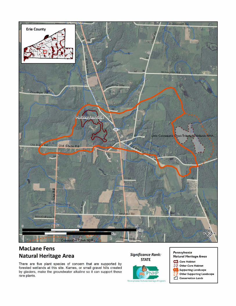
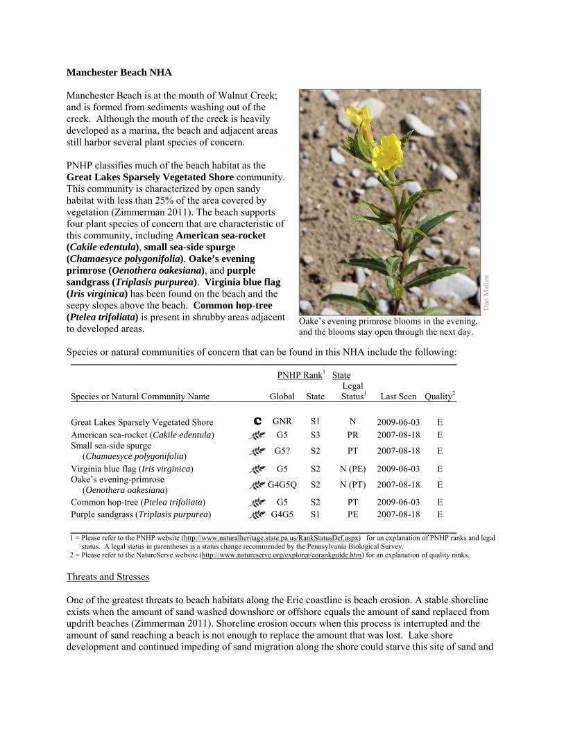
Manchester Beach NHA Manchester Beach is at the mouth of Walnut Creek; and is formed from sediments washing out of the creek. Although the mouth of the creek is heavily developed as a marina, the beach and adjacent areas still harbor several plant species of concern. PNHP classifies much of the beach habitat as the Great Lakes Sparsely Vegetated Shore community. This community is characterized by open sandy habitat with less than 25% of the area covered by vegetation (Zimmerman 2011). The beach supports four plant species of concern that are characteristic of this community, including American sea-rocket (Cakile edentula), small sea-side spurge (Chamaesyce polygonifolia), Oake’s evening primrose (Oenothera oakesiana), and purple sandgrass (Triplasis purpurea). Virginia blue flag (Iris virginica) has been found on the beach and the seepy slopes above the beach. Common hop-tree (Ptelea trifoliata) is present in shrubby areas adjacent to developed areas. Species or natural communities of concern that can be found in this NHA include the following:
PNHP Rank1 State
Species or Natural Community Name
Global State Legal
Status1 Last Seen Quality2 Great Lakes Sparsely Vegetated Shore C GNR S1 N 2009-06-03 E American sea-rocket (Cakile edentula) G5 S3 PR 2007-08-18 E Small sea-side spurge (Chamaesyce polygonifolia) G5? S2 PT 2007-08-18 E
Virginia blue flag (Iris virginica) G5 S2 N (PE) 2009-06-03 E Oake’s evening-primrose (Oenothera oakesiana) G4G5Q S2 N (PT) 2007-08-18 E
Common hop-tree (Ptelea trifoliata) G5 S2 PT 2009-06-03 E Purple sandgrass (Triplasis purpurea) G4G5 S1 PE 2007-08-18 E 1 = Please refer to the PNHP website (http://www.naturalheritage.state.pa.us/RankStatusDef.aspx) for an explanation of PNHP ranks and legal
status. A legal status in parentheses is a status change recommended by the Pennsylvania Biological Survey. 2 = Please refer to the NatureServe website (http://www.natureserve.org/explorer/eorankguide.htm) for an explanation of quality ranks.
Threats and Stresses One of the greatest threats to beach habitats along the Erie coastline is beach erosion. A stable shoreline exists when the amount of sand washed downshore or offshore equals the amount of sand replaced from updrift beaches (Zimmerman 2011). Shoreline erosion occurs when this process is interrupted and the amount of sand reaching a beach is not enough to replace the amount that was lost. Lake shore development and continued impeding of sand migration along the shore could starve this site of sand and
Dan
Mul
len
Oake’s evening primrose blooms in the evening, and the blooms stay open through the next day.
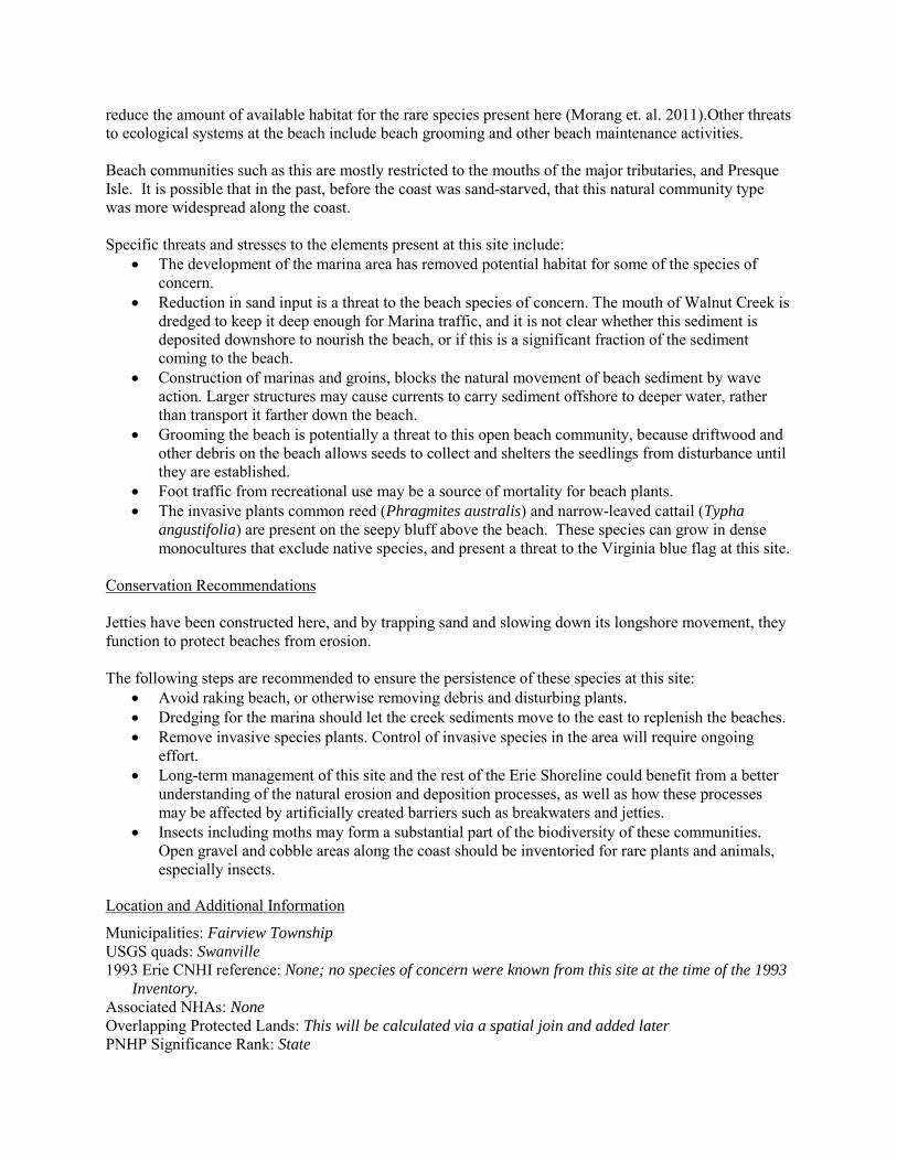
reduce the amount of available habitat for the rare species present here (Morang et. al. 2011).Other threats to ecological systems at the beach include beach grooming and other beach maintenance activities. Beach communities such as this are mostly restricted to the mouths of the major tributaries, and Presque Isle. It is possible that in the past, before the coast was sand-starved, that this natural community type was more widespread along the coast. Specific threats and stresses to the elements present at this site include:
• The development of the marina area has removed potential habitat for some of the species of concern.
• Reduction in sand input is a threat to the beach species of concern. The mouth of Walnut Creek is dredged to keep it deep enough for Marina traffic, and it is not clear whether this sediment is deposited downshore to nourish the beach, or if this is a significant fraction of the sediment coming to the beach.
• Construction of marinas and groins, blocks the natural movement of beach sediment by wave action. Larger structures may cause currents to carry sediment offshore to deeper water, rather than transport it farther down the beach.
• Grooming the beach is potentially a threat to this open beach community, because driftwood and other debris on the beach allows seeds to collect and shelters the seedlings from disturbance until they are established.
• Foot traffic from recreational use may be a source of mortality for beach plants. • The invasive plants common reed (Phragmites australis) and narrow-leaved cattail (Typha
angustifolia) are present on the seepy bluff above the beach. These species can grow in dense monocultures that exclude native species, and present a threat to the Virginia blue flag at this site.
Conservation Recommendations Jetties have been constructed here, and by trapping sand and slowing down its longshore movement, they function to protect beaches from erosion. The following steps are recommended to ensure the persistence of these species at this site:
• Avoid raking beach, or otherwise removing debris and disturbing plants. • Dredging for the marina should let the creek sediments move to the east to replenish the beaches. • Remove invasive species plants. Control of invasive species in the area will require ongoing
effort. • Long-term management of this site and the rest of the Erie Shoreline could benefit from a better
understanding of the natural erosion and deposition processes, as well as how these processes may be affected by artificially created barriers such as breakwaters and jetties.
• Insects including moths may form a substantial part of the biodiversity of these communities. Open gravel and cobble areas along the coast should be inventoried for rare plants and animals, especially insects.
Location and Additional Information
Municipalities: Fairview Township USGS quads: Swanville 1993 Erie CNHI reference: None; no species of concern were known from this site at the time of the 1993
Inventory. Associated NHAs: None Overlapping Protected Lands: This will be calculated via a spatial join and added later PNHP Significance Rank: State

References Morang, A., Mohr, M. C., and Forgette, C. M. 2011. Longshore Sediment Movement and Supply along the U.S. Shoreline of
Lake Erie. Journal of Coastal Research 27: 619-635. Zimmerman 2011. Pennsylvania Natural Heritage Program. Great Lakes Sparsely Vegetated Shore Factsheet. Available from:
http://www.naturalheritage.state.pa.us/Community.aspx?=16077 Date Accessed: March 13, 2012
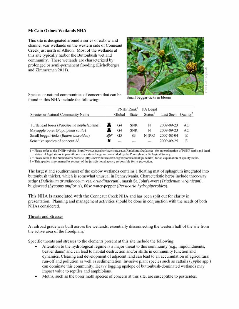
McCain Oxbow Wetlands NHA This site is designated around a series of oxbow and channel scar wetlands on the western side of Conneaut Creek just north of Albion. Most of the wetlands at this site typically harbor the Buttonbush wetland community. These wetlands are characterized by prolonged or semi-permanent flooding (Eichelberger and Zimmerman 2011). Species or natural communities of concern that can be found in this NHA include the following:
PNHP Rank1 PA Legal Species or Natural Community Name Global State Status1 Last Seen Quality2 Turtlehead borer (Papaipema nepheleptena) G4 SNR N 2009-09-23 AC Mayapple borer (Papaipema rutila) G4 SNR N 2009-09-23 AC Small beggar-ticks (Bidens discoidea) G5 S3 N (PR) 2007-08-04 E Sensitive species of concern A3 S --- --- --- 2009-09-25 E 1 = Please refer to the PNHP website (http://www.naturalheritage.state.pa.us/RankStatusDef.aspx) for an explanation of PNHP ranks and legal
status. A legal status in parentheses is a status change recommended by the Pennsylvania Biological Survey. 2 = Please refer to the NatureServe website (http://www.natureserve.org/explorer/eorankguide.htm) for an explanation of quality ranks. 3 = This species is not named by request of the jurisdictional agency responsible for its protection.
The largest and southernmost of the oxbow wetlands contains a floating mat of sphagnum integrated into buttonbush thicket, which is somewhat unusual in Pennsylvania. Characteristic herbs include three-way sedge (Dulichium arundinaceum var. arundinaceum), marsh St. John's-wort (Triadenum virginicum), bugleweed (Lycopus uniflorus), false water-pepper (Persicaria hydropiperoides). This NHA is associated with the Conneaut Creek NHA and has been split out for clarity in presentation. Planning and management activities should be done in conjunction with the needs of both NHAs considered. Threats and Stresses A railroad grade was built across the wetlands, essentially disconnecting the western half of the site from the active area of the floodplain. Specific threats and stresses to the elements present at this site include the following:
• Alteration to the hydrological regime is a major threat to this community (e.g., impoundments, beaver dams) and can lead to habitat destruction and/or shifts in community function and dynamics. Clearing and development of adjacent land can lead to an accumulation of agricultural run-off and pollution as well as sedimentation. Invasive plant species such as cattails (Typha spp.) can dominate this community. Heavy logging upslope of buttonbush-dominated wetlands may impact value to reptiles and amphibians.
• Moths, such as the borer moth species of concern at this site, are susceptible to pesticides.
Fritz
Flo
hr R
eyno
lds
Small beggar-ticks in bloom
Conservation Recommendations This site is entirely on private land. A portion of the site was reserved in the Wetlands Reserve Program (WRP) and a portion of the Conneaut Creek floodplain was restored into wetland habitat (Smith 2008). The WRP program provides financial incentives to protect, restore, and enhance wetlands on their property. This voluntary program strives to achieve the greatest wetland functions and values and optimum wildlife habitat on every enrolled acre. The following steps are recommended to ensure the persistence of these species at this site:
• Conserve and expand the forested riparian buffers of all streams and wetlands. Conserve at least a 328 foot (100 meter) buffer of native woody vegetation where it exists along the waterways and establish at least a 100 foot (30 meter) buffer where it is lacking to help reduce erosion, sedimentation, and pollution. Additionally, best management practices (BMPs) that focus on limiting the introduction of non-point sources of pollution into surface and groundwater should be applied to the surrounding area.
• Pesticide use should be avoided in the Core Habitat and minimized in the Supporting Landscape. • A natural buffer around the wetland should be maintained in order to minimize nutrient runoff,
pollution, and sedimentation. The potential for soil erosion based on soil texture, condition of the adjacent vegetation (mature forests vs. clearcuts), and the topography of the surrounding area (i.e., degree of slope) should be considered when establishing buffers. The buffer size should be increased if soils are erodible, adjacent vegetation has been logged, and the topography is steep as such factors could contribute to increased sedimentation and nutrient pollution.
• Direct impacts and habitat alteration should be avoided (e.g., roads, trails, filling of wetlands) and low impact alternatives (e.g., elevated footpaths, boardwalks, bridges) should be utilized in situations where accessing the wetland cannot be avoided.
• Care should also be taken to control and prevent the spread of invasive species within the wetland.
• This region of Conneaut Creek has numerous oxbows and channel scar wetlands that may harbor additional populations of the species present at this site. Additional surveys should be conducted in these habitats.
Location and Additional Information
Municipalities: Conneaut Township USGS quads: Albion, East Springfield 1993 Erie CNHI reference: None Associated NHAs: Conneaut Creek NHA Overlapping Protected Lands: A portion of the site is enrolled in the Wetlands Reserve Program PNHP Significance Rank: State References Eichelberger, B. and Zimmerman, E. 2011. Pennsylvania Natural Heritage Program. Buttonbush Wetland Factsheet. Available
from: http://www.naturalheritage.state.pa.us/Community.aspx?=16036 Date Accessed: October 11, 2012 Smith, Ryan. Area farm helps bring wetlands preservation total to two million acres. Meadville Tribune. October 21, 2008
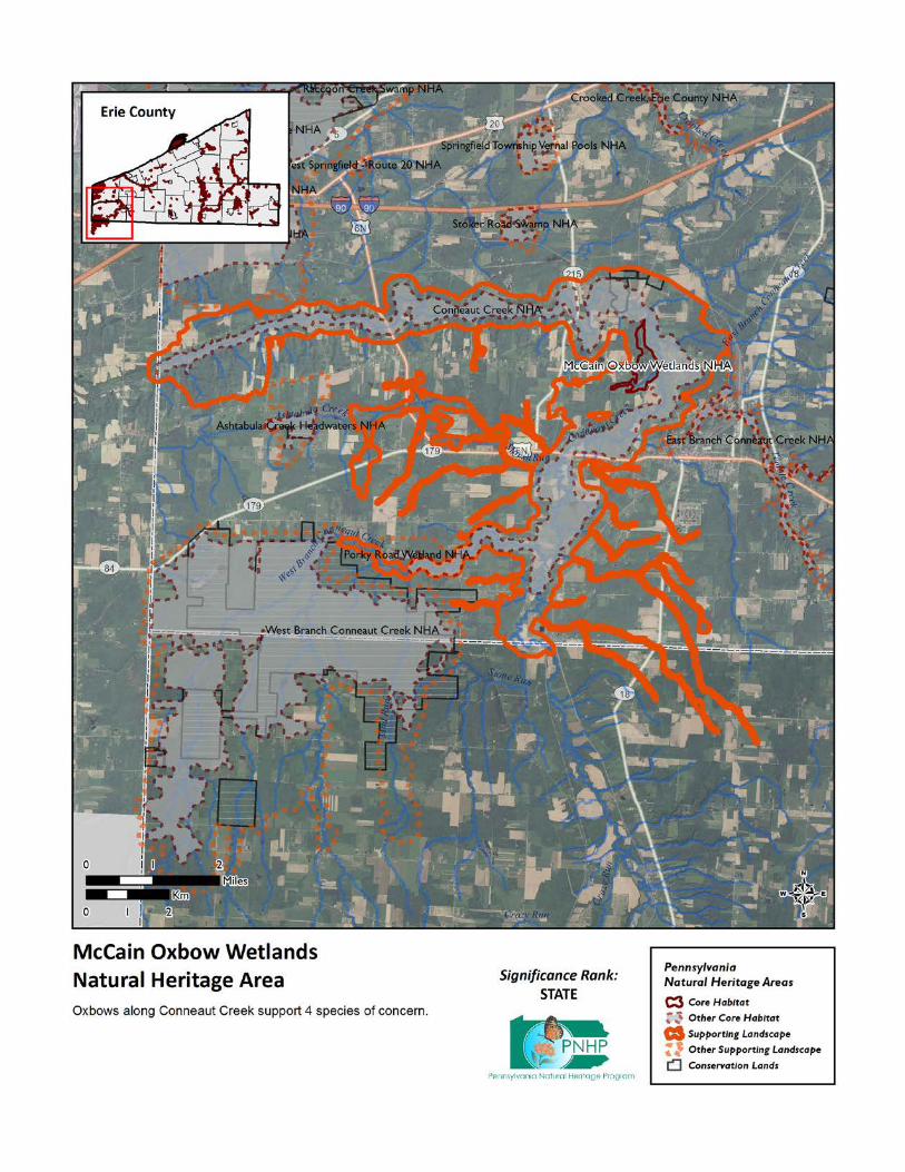
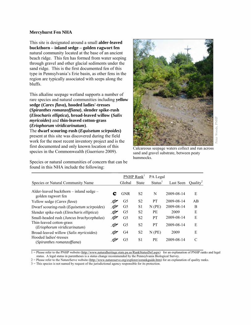
Mercyhurst Fen NHA This site is designated around a small alder-leaved buckthorn – inland sedge – golden ragwort fen natural community located at the base of an ancient beach ridge. This fen has formed from water seeping through gravel and other glacial sediments under the sand ridge. This is the first documented fen of this type in Pennsylvania’s Erie basin, as other fens in the region are typically associated with seeps along the bluffs. This alkaline seepage wetland supports a number of rare species and natural communities including yellow sedge (Carex flava), hooded ladies'-tresses (Spiranthes romanzoffiana), slender spike-rush (Eleocharis elliptica), broad-leaved willow (Salix myricoides) and thin-leaved cotton-grass (Eriophorum viridicarinatum). The dwarf scouring-rush (Equisetum scirpoides) present at this site was discovered during the field work for the most recent inventory project and is the first documented and only known location of this species in the Commonwealth (Guerriero 2009). Species or natural communities of concern that can be found in this NHA include the following:
PNHP Rank1 PA Legal Species or Natural Community Name Global State Status1 Last Seen Quality2 Alder-leaved buckthorn – inland sedge – golden ragwort fen C GNR S2 N 2009-08-14 E
Yellow sedge (Carex flava) G5 S2 PT 2009-08-14 AB Dwarf scouring-rush (Equisetum scirpoides) G5 S1 N (PE) 2009-08-14 B Slender spike-rush (Eleocharis elliptica) G5 S2 PE 2009 E Small-headed rush (Juncus brachycephalus) G5 S2 PT 2009-08-14 E Thin-leaved cotton-grass (Eriophorum viridicarinatum) G5 S2 PT 2009-08-14 E
Broad-leaved willow (Salix myricoides) G4 S2 N (PE) 2009 E Hooded ladies'-tresses (Spiranthes romanzoffiana) G5 S1 PE 2009-08-14 C
1 = Please refer to the PNHP website (http://www.naturalheritage.state.pa.us/RankStatusDef.aspx) for an explanation of PNHP ranks and legal
status. A legal status in parentheses is a status change recommended by the Pennsylvania Biological Survey. 2 = Please refer to the NatureServe website (http://www.natureserve.org/explorer/eorankguide.htm) for an explanation of quality ranks. 3 = This species is not named by request of the jurisdictional agency responsible for its protection.
Pete
r Woo
ds, P
NH
P
Calcareous seepage waters collect and run across sand and gravel substrate, between peaty hummocks.
Other common species present at the site include golden ragwort (Packera aurea), round-leaved sundew (Drosera rotundifolia), and bayberry (Myrica pensylvanica). The supporting landscape is based on the surface watershed as well as the probable area of groundwater influence. A more in-depth groundwater study may be useful to determine the area that is feeding the fen. Threats and Stresses While the presence of utility lines generally impact most natural sites, vegetation management activities of the lines have kept this habitat open, potentially leading to maintenance of the fen habitat. There are a number of old gravel mines to the east of this site. As gravel is the source of the alkalinity for the groundwater that supports the fen and the associated species, excavation or other mining can change the hydrology and chemistry of the wetland. Specific threats and stresses to the elements present at this site include:
• The edge habitat provided by the railroad creates conditions favorable for many introduced species of plants including common reed (Phragmites australis), Canada thistle (Cirsium arvense) and narrow-leaf cattail (Typha angustifolia) among others. These exotic species have the potential to modify the site and impact the rare plant species present at the site.
• As mentioned above, maintenance activities for the utility lines as well as potentially from the railroad right-of-way have helped to maintain the open habitat for the fen community.
• Wetland soils and vegetation are sensitive and will be damaged by foot traffic or recreational vehicles as they are easily compacted.
• The greatest threats to fen communities are disruptions to bedrock or glacial deposits (such as drilling or mining in nearby areas) and any activities that alter groundwater flows or the quality of groundwater.
• There is the potential for impacts to water quality if pesticides or fertilizers are applied to the agricultural fields.
• An access road crosses the eastern side of the fen and may impact downstream water flow. Additionally the culvert that drains the stream under the railroad tracks should be kept clear to prevent flooding of the fen site.
• Seepage wetlands are also sensitive to trampling, soil compression and other physical disturbance from recreational activities; trails should be sited away from the wetland, or elevated structures employed to prevent traffic in the wetland.
Conservation Recommendations Mercyhurst College owns the majority of the site. We recommend that the core habitat, as well as the supporting landscape, of this site be fully protected during any potential development activities. The following steps are recommended to ensure the persistence of these species at this site:
• Control invasive species in order to avoid impacts to the rare species present that the site. Consider integrating this site into invasive plant management efforts conducted through the Erie Basin Cooperative Weed Management Area.
• Additional wetland habitat occurs to the east and north (across the railroad tracks) of this fen. Although preliminary investigations did not indicate the presence of any additional fen habitat, surveys should be conducted for species of special concern.
• Drilling, mining, or other disruptions to bedrock or glacial deposits should not be undertaken within one-half mile of a seepage wetland without a thorough understanding of local bedrock geology, surficial geology, and groundwater flows. The groundwater recharge area for the fen is poorly understood. Groundwater flow patterns do not always mirror surface watersheds, and in some cases aquifers may be contiguous over large areas. Additional studies should be undertaken to determine the patterns of groundwater flow at the site.
• Fragmentation of the remaining habitat should be avoided. New development such as housing, roads, and utility lines should be concentrated in areas that have already been disturbed.
• Reduce the deer density in the area. Uncommon species of native plants are particularly susceptible to deer herbivory.
• Expand the forested buffer upslope along the southern side of the fen. The recharge area of this fen is largely unvegetated and would benefit from additional tree cover.
Location and Additional Information
Municipalities: Girard Borough, Girard Township USGS quads: Fairview 1993 Erie CNHI reference: Newly documented site Associated NHAs: None Overlapping Protected Lands: The Pennsylvania Fish and Boat Commission owns a small portion of the
supporting landscape across the railroad tracks. PNHP Significance Rank: State References Guerriero, John. “Botanical treasure found in Girard.” Erie Daily Times [Erie, PA] 16 September 2009. Print. Podniesinski. Greg. 2011. Pennsylvania Natural Heritage Program. Alder-leaved Buckthorn – Inland Sedge – Golden Ragwort
Shrub Fen Factsheet. Available from: http://www.naturalheritage.state.pa.us/Community.aspx?=30002 Date Accessed: March 12, 2012
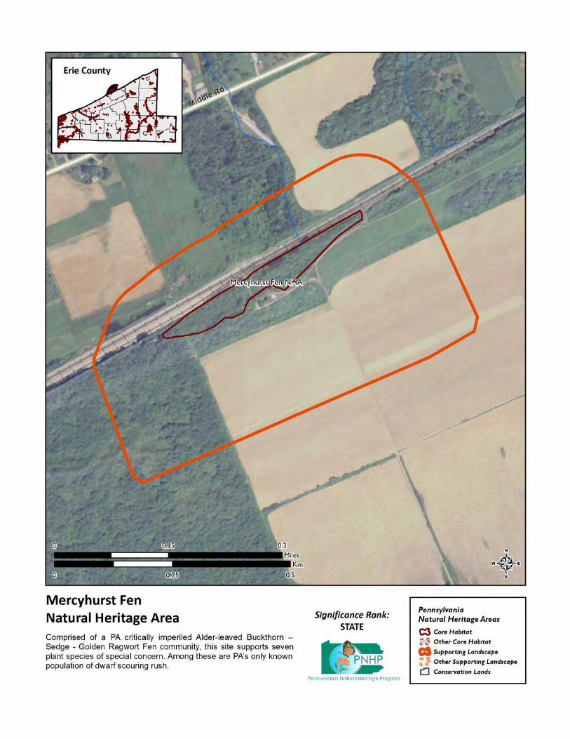
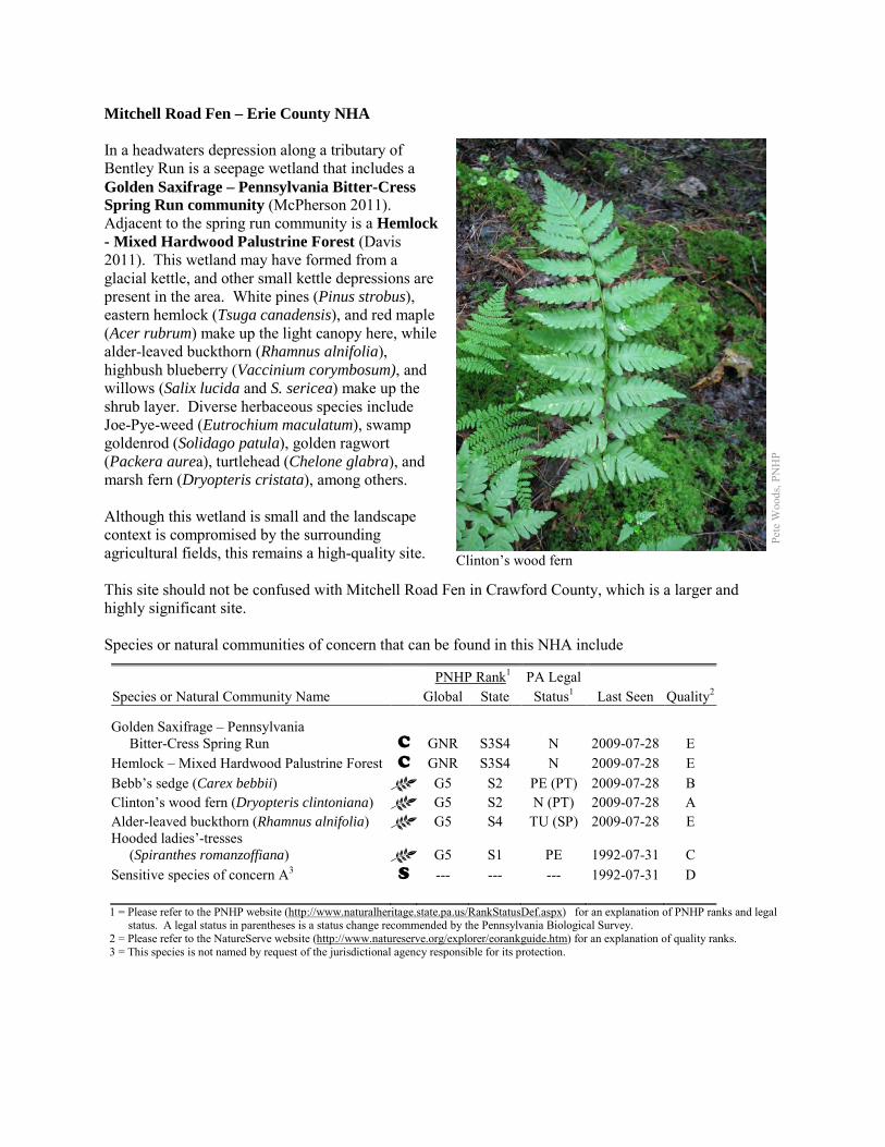
Mitchell Road Fen – Erie County NHA In a headwaters depression along a tributary of Bentley Run is a seepage wetland that includes a Golden Saxifrage – Pennsylvania Bitter-Cress Spring Run community (McPherson 2011). Adjacent to the spring run community is a Hemlock - Mixed Hardwood Palustrine Forest (Davis 2011). This wetland may have formed from a glacial kettle, and other small kettle depressions are present in the area. White pines (Pinus strobus), eastern hemlock (Tsuga canadensis), and red maple (Acer rubrum) make up the light canopy here, while alder-leaved buckthorn (Rhamnus alnifolia), highbush blueberry (Vaccinium corymbosum), and willows (Salix lucida and S. sericea) make up the shrub layer. Diverse herbaceous species include Joe-Pye-weed (Eutrochium maculatum), swamp goldenrod (Solidago patula), golden ragwort (Packera aurea), turtlehead (Chelone glabra), and marsh fern (Dryopteris cristata), among others. Although this wetland is small and the landscape context is compromised by the surrounding agricultural fields, this remains a high-quality site. This site should not be confused with Mitchell Road Fen in Crawford County, which is a larger and highly significant site. Species or natural communities of concern that can be found in this NHA include
PNHP Rank1 PA Legal Species or Natural Community Name Global State Status1 Last Seen Quality2 Golden Saxifrage – Pennsylvania Bitter-Cress Spring Run C GNR S3S4 N 2009-07-28 E Hemlock – Mixed Hardwood Palustrine Forest C GNR S3S4 N 2009-07-28 E Bebb’s sedge (Carex bebbii) G5 S2 PE (PT) 2009-07-28 B Clinton’s wood fern (Dryopteris clintoniana) G5 S2 N (PT) 2009-07-28 A Alder-leaved buckthorn (Rhamnus alnifolia) G5 S4 TU (SP) 2009-07-28 E Hooded ladies’-tresses (Spiranthes romanzoffiana) G5 S1 PE 1992-07-31 C Sensitive species of concern A3 S --- --- --- 1992-07-31 D 1 = Please refer to the PNHP website (http://www.naturalheritage.state.pa.us/RankStatusDef.aspx) for an explanation of PNHP ranks and legal
status. A legal status in parentheses is a status change recommended by the Pennsylvania Biological Survey. 2 = Please refer to the NatureServe website (http://www.natureserve.org/explorer/eorankguide.htm) for an explanation of quality ranks. 3 = This species is not named by request of the jurisdictional agency responsible for its protection.
Pete
Woo
ds, P
NH
P
Clinton’s wood fern
The Golden Saxifrage – Pennsylvania Bitter-Cress Spring Run community supports Bebb’s sedge (Carex bebbii) and hooded ladies’-tresses (Spiranthes romazoffiana). The Hemlock - Mixed Hardwood Palustrine Forest supports Clinton’s wood fern (Dryopteris clintoniana). The site also supports an additional species of concern, which cannot be named here at the request of the jurisdictional agency overseeing its protection. Parts of the wetland would probably qualify as an Alder-leaved Buckthorn – Inland Sedge – Golden Ragwort Shrub Fen, a natural community type that is critically imperiled in Pennsylvania. Threats and Stresses Specific threats and stresses to the elements present at this site include the following:
• The Core Habitat of this site is almost completely surrounded by agricultural fields. Groundwater pollution in fens can occur from improperly installed septic systems, improperly lined underground waste disposal, and in agricultural areas from infiltration of pesticides, fertilizers, or nutrients from animal wastes. Pesticides can kill non-target organisms, and nutrient loading can accelerate the spread of invasive species.
• Hemlock – Mixed Hardwood Palustrine Forests are threatened by habitat alteration, deposition (sedimentation, agricultural runoff), and alterations to the hydrological regime (beaver dams, lowering of water tables). Clearing and development of adjacent land can lead to accumulation of agricultural run-off and pollution, sedimentation, and insolation/thermal pollution.
• Eastern hemlock communities are threatened by hemlock woolly adelgid (Adelgis tsugae) infestations. This exotic insect pest feeds on the twigs of the eastern hemlocks, causing defoliation, bud mortality, and, eventually, tree mortality within as little as four years (Young et al. 1995). As tree mortality occurs, light availability increases due to the widening of canopy gaps and provides opportunities for the colonization of invasive plant species within the understory (Orwig and Foster 1998). The loss of the deep shade and cool microclimate under the hemlock canopy decreases habitat suitability for species such as Clinton’s wood fern.
• The greatest threats to fen communities are disruptions to bedrock or glacial deposits (such as drilling or mining in nearby areas) and any activities that alter groundwater flows or the quality of groundwater.
• Peatlands are particularly sensitive to trampling, soil compaction and other physical disturbance from recreational activities.
• The invasive plant species coltsfoot (Tussalago farfara), vernal sweet grass (Anthoxanthum odorata), and small-flowered willow-herb (Epilobium parviflorum) are present in the fen. At this time these species are growing at low density, but they can form dense stands that exclude native species.
• Some of the plant species of concern are particularly vulnerable to deer browsing.
Conservation Recommendations The site is entirely on private property, and no conservation easements are in place. The following steps are recommended to ensure the persistence of these species at this site:
• Drilling, mining, or other disruptions to bedrock or glacial deposits should not be undertaken within one-half mile of a seepage wetland without a thorough understanding of local bedrock geology, surficial geology, and groundwater flows. Groundwater flow patterns do not always mirror surface watersheds, and in some cases aquifers may be contiguous over large areas.
• Trails should be sited away from the wetland, or elevated boardwalks employed to prevent peat compaction and other disturbance in the wetland.
• A wider buffer of natural vegetation around the wetland should be maintained in order to minimize nutrient runoff, pollution, and sedimentation.
• Remove invasive species plants. Control of invasive species in the area will require ongoing effort. Focus non-chemical control efforts on selected areas surrounding species of concern.
o Target pioneer populations of invasive plants for immediate and continued removal. It is much easier and more effective to keep a site invasive-free than to try to repair a heavily infested habitat.
o Invasive species management needs to be coordinated by individuals familiar with the rare species as well as the invasive species present.
o Continual invasive species monitoring and control will be necessary • Reduce the deer density in the area to minimize damage to plant species of concern.
Location and Additional Information
Municipalities: Union Township USGS quads: Union City 1993 Erie CNHI reference: French Creek BDA Associated NHAs: none Overlapping Protected Lands: This will be calculated via a spatial join and added later PNHP Significance Rank: State References Davis T. 2011. Pennsylvania Natural Heritage Program. Hemlock – Mixed Hardwood Palustrine Forest Factsheet. Available
from: http://www.naturalheritage.state.pa.us/Community.aspx?=16029 Date Accessed: September 28, 2012. McPherson, J. 2011. Pennsylvania Natural Heritage Program. Golden Saxifrage – Pennsylvania Bitter-cress Spring Run
Factsheet. Available from: http://www.naturalheritage.state.pa.us/Community.aspx?=16004 Date Accessed: September 28, 2012.
Young, R. F., K. S. Shields, and G. P. Berlyn. 1995. Hemlock woolly adelgid (Homoptera, Adelgidae)-stylet bundle insertion and feeding sites. Annals of Entomological Society of America 88: 827:835.
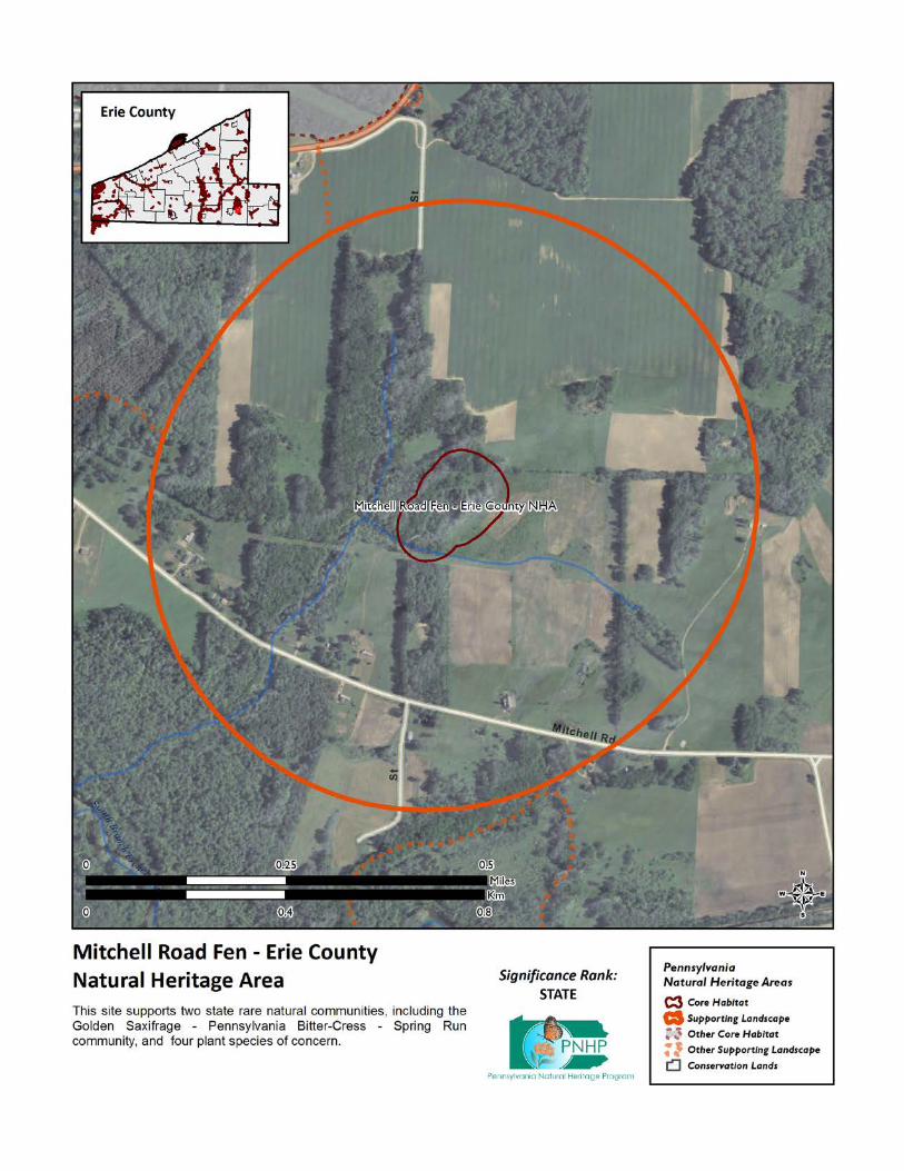
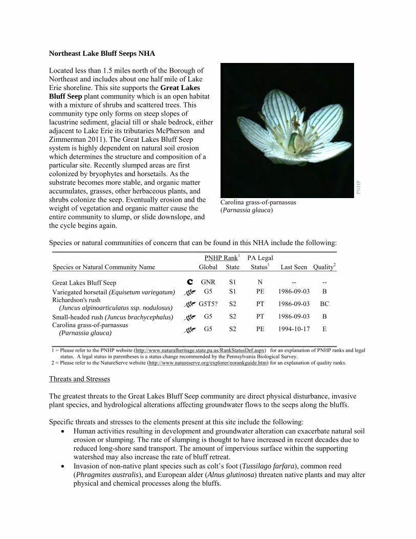
Northeast Lake Bluff Seeps NHA Located less than 1.5 miles north of the Borough of Northeast and includes about one half mile of Lake Erie shoreline. This site supports the Great Lakes Bluff Seep plant community which is an open habitat with a mixture of shrubs and scattered trees. This community type only forms on steep slopes of lacustrine sediment, glacial till or shale bedrock, either adjacent to Lake Erie its tributaries McPherson and Zimmerman 2011). The Great Lakes Bluff Seep system is highly dependent on natural soil erosion which determines the structure and composition of a particular site. Recently slumped areas are first colonized by bryophytes and horsetails. As the substrate becomes more stable, and organic matter accumulates, grasses, other herbaceous plants, and shrubs colonize the seep. Eventually erosion and the weight of vegetation and organic matter cause the entire community to slump, or slide downslope, and the cycle begins again. Species or natural communities of concern that can be found in this NHA include the following:
PNHP Rank1 PA Legal Species or Natural Community Name Global State Status1 Last Seen Quality2 Great Lakes Bluff Seep C GNR S1 N -- -- Variegated horsetail (Equisetum variegatum) G5 S1 PE 1986-09-03 B Richardson's rush (Juncus alpinoarticulatus ssp. nodulosus) G5T5? S2 PT 1986-09-03 BC
Small-headed rush (Juncus brachycephalus) G5 S2 PT 1986-09-03 B Carolina grass-of-parnassus (Parnassia glauca) G5 S2 PE 1994-10-17 E
1 = Please refer to the PNHP website (http://www.naturalheritage.state.pa.us/RankStatusDef.aspx) for an explanation of PNHP ranks and legal
status. A legal status in parentheses is a status change recommended by the Pennsylvania Biological Survey. 2 = Please refer to the NatureServe website (http://www.natureserve.org/explorer/eorankguide.htm) for an explanation of quality ranks.
Threats and Stresses The greatest threats to the Great Lakes Bluff Seep community are direct physical disturbance, invasive plant species, and hydrological alterations affecting groundwater flows to the seeps along the bluffs. Specific threats and stresses to the elements present at this site include the following:
• Human activities resulting in development and groundwater alteration can exacerbate natural soil erosion or slumping. The rate of slumping is thought to have increased in recent decades due to reduced long-shore sand transport. The amount of impervious surface within the supporting watershed may also increase the rate of bluff retreat.
• Invasion of non-native plant species such as colt’s foot (Tussilago farfara), common reed (Phragmites australis), and European alder (Alnus glutinosa) threaten native plants and may alter physical and chemical processes along the bluffs.
PNH
P
Carolina grass-of-parnassus (Parnassia glauca)
Conservation Recommendations This entire site is privately owned. We recommend that the core habitat, as well as the supporting landscape, of this site be fully protected during any potential development activities. The following steps are recommended to ensure the persistence of these species at this site:
• Great Lakes bluff seeps are sensitive habitats, and as steep slopes are frequently attractive to hikers and climbers, care should be used when accessing these sites. Upslope disturbances to the deep glacial soils or bedrock could destabilize these habitats and should be avoided.
• Property owners could also contribute to ground water quality and quantity protection by reducing or avoiding the application of pesticides and/or fertilizers within site boundaries and avoiding artificial drainage of subsurface waters.
• Development and timber harvesting within the NHA should be avoided. • Care should be taken to control and prevent the spread of invasive species. • A natural vegetation buffer should be allowed to develop along the stream valley crest within the
site's boundary in order to reduce the threat of human-induced erosion and to protect surface water quality and quantity entering the NHA. Trail construction along the top of tributary gorges should be limited to avoid impacting this community.
• This NHA should be protected as a part of a large system of shoreline scarp woodlands and forested seeps to facilitate nutrient flow, native seed dispersal, and wildlife movement.
Location and Additional Information
Municipalities: North East Township USGS quads: North East 1993 Erie CNHI reference: North East Lake Bluff Associated NHAs: Fourteen Mile Point Bluffs, Cemetery Road Bluffs Overlapping Protected Lands: None – private ownership PNHP Significance Rank: State References McPherson, J. and Zimmerman, E. 2011. Pennsylvania Natural Heritage Program. Great Lakes Bluff Seep Factsheet. Available
from: http://www.naturalheritage.state.pa.us/Community.aspx?=16040 Date Accessed: March 28, 2012
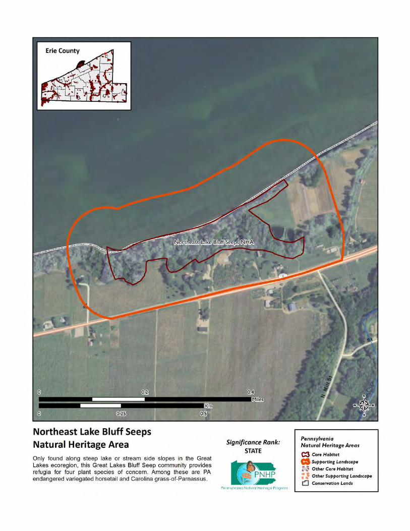
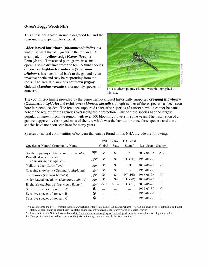
Owen’s Boggy Woods NHA This site is designated around a degraded fen and the surrounding seepy hemlock forest. Alder-leaved buckthorn (Rhamnus alnifolia) is a watchlist plant that still grows in the fen area. A small patch of yellow sedge (Carex flava), a Pennsylvania Threatened plant grows in a small opening some distance from the fen. A third species of concern, highbush cranberry (Viburnum trilobum), has been killed back to the ground by an invasive beetle and may be resprouting from the roots. The area also supports southern pygmy clubtail (Lanthus vernalis), a dragonfly species of concern. The cool microclimate provided by the dense hemlock forest historically supported creeping snowberry (Gaultheria hispidula) and twinflower (Linnaea borealis), though neither of these species has been seen here in recent decades. The fen once supported three other species of concern, which cannot be named here at the request of the agencies overseeing their protection. One of these species had the largest population known from the region, with over 500 blooming flowers in some years. The installation of a gas well apparently destroyed most of the fen, which was the habitat for these three species, and these species have not been seen here for many years. Species or natural communities of concern that can be found in this NHA include the following:
PNHP Rank1 PA Legal Species or Natural Community Name Global State Status1 Last Seen Quality2 Southern pygmy clubtail (Lanthus vernalis) G4 S3 N 2009-06-25 AC Roundleaf serviceberry (Amelanchier sanguinea) G5 S2 TU (PE) 1966-08-06 H
Yellow sedge (Carex flava) G5 S2 PT 2009-06-25 C Creeping snowberry (Gaultheria hispidula) G5 S3 PR 1966-08-06 H Twinflower (Linnaea borealis) G5 S1 PT (PE) 1966-06-26 H Alder-leaved buckthorn (Rhamnus alnifolia) G5 S4 TU (SP) 2009-06-25 E Highbush-cranberry (Viburnum trilobum) G5T5 S1S2 TU (PT) 2009-06-25 E Sensitive species of concern A3 S --- --- --- 1992-07-30 C Sensitive species of concern B3 S --- --- --- 1966-08-06 H Sensitive species of concern C3 S --- --- --- 1966-08-06 H 1 = Please refer to the PNHP website (http://www.naturalheritage.state.pa.us/RankStatusDef.aspx) for an explanation of PNHP ranks and legal
status. A legal status in parentheses is a status change recommended by the Pennsylvania Biological Survey. 2 = Please refer to the NatureServe website (http://www.natureserve.org/explorer/eorankguide.htm) for an explanation of quality ranks. 3 = This species is not named by request of the jurisdictional agency responsible for its protection.
Pete
Woo
ds, P
NH
P
This southern pygmy clubtail was photographed at this site.
Threats and Stresses The fen was largely destroyed by the installation of a gas well in the fen or adjacent to it. The hydrology of the fen may have been interrupted by the gas well, or by soil compaction that occurred during the construction process. Hydrology of the area may have been further altered by the heavy recontouring of the land on the adjacent parcel to the east. Specific threats and stresses to the elements present at this site include the following:
• The hydrology of this site may have been severely altered. The greatest threats to fen communities are disruptions to bedrock or glacial deposits (such as drilling or mining in nearby areas) and any activities that alter groundwater flows or the quality of groundwater.
• Groundwater pollution in fens can occur from improperly installed septic systems, improperly lined underground waste disposal, and in agricultural areas from infiltration of pesticides, fertilizers, or nutrients from animal wastes. Pesticides can kill non-target organisms, and nutrient loading can accelerate the spread of invasive species.
• In the absence of natural disturbance such as periodic flooding by beaver, or active vegetation removal, fens tend to succeed into dense shrub swamps and then forested swamp, which do not support most of the species of concern at this site.
• Peatlands are particularly sensitive to trampling, soil compaction and other physical disturbance from recreational activities. Soils at this site were presumably compacted by gas well construction.
• A monoculture of common reed (Phragmites australis) near the gas well has displaced native plants.
• The hemlock woolly adelgid (Adelges tsugae), native to Asia, is a sap-feeding insect that attacks eastern hemlock (Tsuga canadensis). As of 2011, the hemlock woolly adelgid is still several counties away to the east and south, but it is expected to arrive in coming years, with devastating effects on hemlock populations. Infestations are followed by high levels of hemlock mortality, which opens up the forest canopy and drastically alters the forest habitat. The loss of the deep shade and cool microclimate could exclude species such as twinflower and creeping snowberry, and will also result in warmer stream temperatures, which may prevent southern pygmy clubtails from persisting here.
• Viburnum leaf beetle (Pyrrhalta viburni) is an introduced pest that eats highbush cranberry and other species of Viburnum. Within Pennsylvania, this pest has spread throughout the range of highbush cranberry, and is decimating populations of the shrub. The long-term effects of this invasion remain unknown, but all populations of highbush cranberry are at serious risk
• Dragonflies rely on good water quality, although the tolerances of individual species to different types of pollution are not well-understood. Siltation and contaminants such as heavy metals, pesticides, and abandoned mine drainage are potential threats to the southern pygmy clubtail
Conservation Recommendations Restoration of this site might be possible, but if the unique hydrology that supported a fen has been altered, restoration is unlikely to be successful. The following steps are recommended to ensure the persistence of these species at this site:
• Drilling, mining, or other disruptions to bedrock or glacial deposits should not be undertaken within one-half mile of a seepage wetland without a thorough understanding of local bedrock geology, surficial geology, and groundwater flows. Groundwater flow patterns do not always mirror surface watersheds, and in some cases aquifers may be contiguous over large areas. It is uncertain if the hydrology at this site can be restored.
• Trails should be sited away from the wetland, or elevated boardwalks employed to prevent peat compaction and other disturbance in the wetland.
• A natural buffer around the wetland should be maintained in order to minimize nutrient runoff, pollution, and sedimentation.
• Remove Phragmites and other invasive plant species. Fens, as early-successional habitats, are particularly susceptible to weedy plant invasion. Control of invasive species in the area will require extensive and continual effort. Focus initial control efforts on selected areas surrounding species of concern. It is possible that removal of invasive plants will allow some of the species of concern to return from the seedbank.
• Habitat restoration could be accompanied by a reduction of the deer density in the area to improve chances of restoring the species of concern. A deer exclosure could have the same effect, within a limited area.
• Conserve and expand the forested riparian buffers of all and wetlands and the streams that feed into them. Conserve at least a 328 foot (100 meter) buffer of native woody vegetation where it exists along the waterways and establish at least a 100 foot (30 meter) buffer where it is lacking to help reduce erosion, sedimentation, and pollution. Additionally, best management practices (BMPs) that focus on limiting the introduction of non-point sources of pollution into surface and groundwater should be applied to the surrounding area.
• Pesticide use should be avoided in the Core Habitat and minimized in the Supporting Landscape. • Management options for the control of viburnum leaf beetle should be investigated. • As of 2012, available treatments for hemlock woolly adelgid are not economically feasible at a
scale suitable for large natural areas. At a smaller scale, continued applications of horticultural oil or insecticidal soap can control hemlock woolly adelgids. Biological controls are being researched, though they have so far had limited success at keeping adelgid populations in check.
Location and Additional Information
Municipalities: Waterford Township USGS quads: Waterford 1993 Erie CNHI reference: French Creek BDA Associated NHAs: Waterford Wetlands – South NHA, Benson Road Fen NHA Overlapping Protected Lands: None PNHP Significance Rank: State
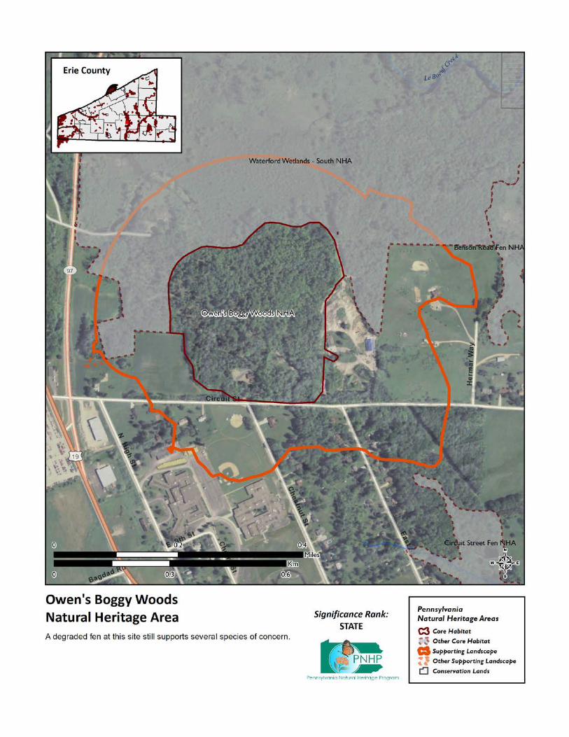
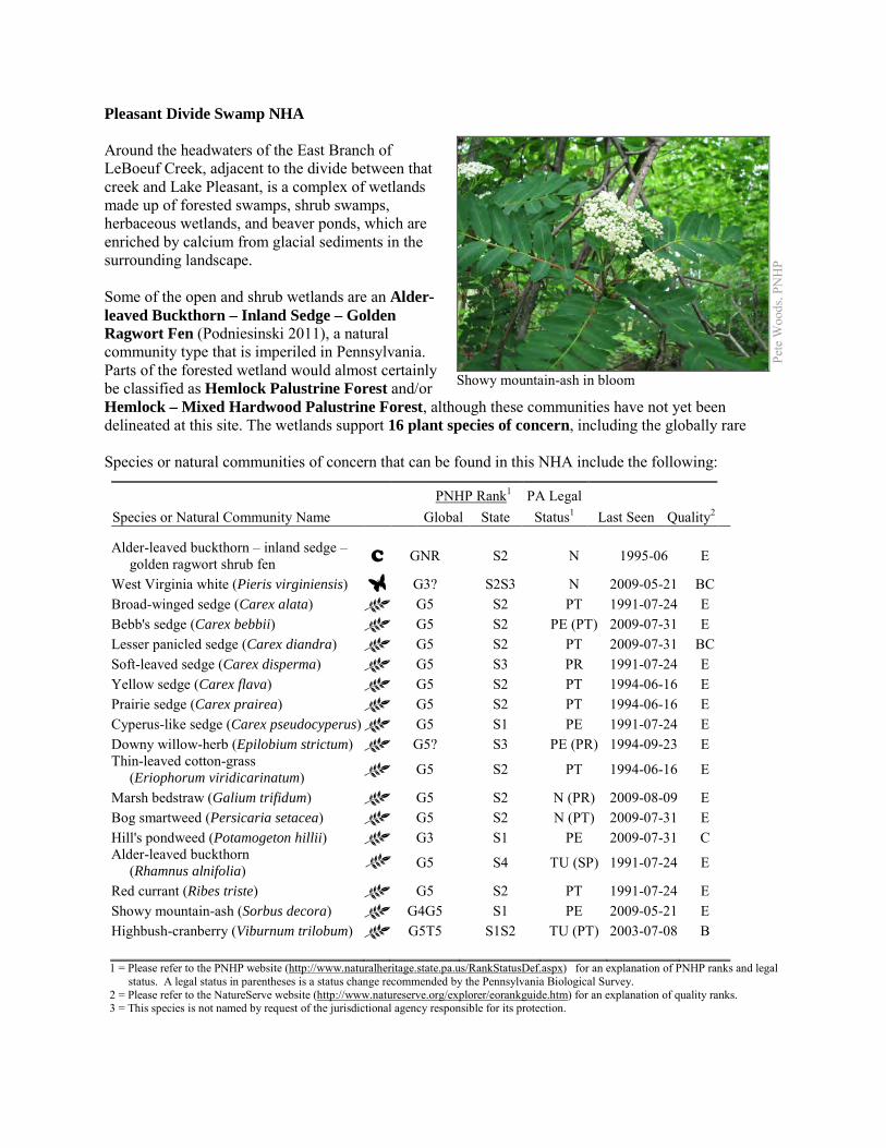
Pleasant Divide Swamp NHA Around the headwaters of the East Branch of LeBoeuf Creek, adjacent to the divide between that creek and Lake Pleasant, is a complex of wetlands made up of forested swamps, shrub swamps, herbaceous wetlands, and beaver ponds, which are enriched by calcium from glacial sediments in the surrounding landscape. Some of the open and shrub wetlands are an Alder-leaved Buckthorn – Inland Sedge – Golden Ragwort Fen (Podniesinski 2011), a natural community type that is imperiled in Pennsylvania. Parts of the forested wetland would almost certainly be classified as Hemlock Palustrine Forest and/or Hemlock – Mixed Hardwood Palustrine Forest, although these communities have not yet been delineated at this site. The wetlands support 16 plant species of concern, including the globally rare Species or natural communities of concern that can be found in this NHA include the following:
PNHP Rank1 PA Legal Species or Natural Community Name Global State Status1 Last Seen Quality2 Alder-leaved buckthorn – inland sedge – golden ragwort shrub fen C GNR S2 N 1995-06 E
West Virginia white (Pieris virginiensis) G3? S2S3 N 2009-05-21 BC Broad-winged sedge (Carex alata) G5 S2 PT 1991-07-24 E Bebb's sedge (Carex bebbii) G5 S2 PE (PT) 2009-07-31 E Lesser panicled sedge (Carex diandra) G5 S2 PT 2009-07-31 BC Soft-leaved sedge (Carex disperma) G5 S3 PR 1991-07-24 E Yellow sedge (Carex flava) G5 S2 PT 1994-06-16 E Prairie sedge (Carex prairea) G5 S2 PT 1994-06-16 E Cyperus-like sedge (Carex pseudocyperus) G5 S1 PE 1991-07-24 E Downy willow-herb (Epilobium strictum) G5? S3 PE (PR) 1994-09-23 E Thin-leaved cotton-grass (Eriophorum viridicarinatum) G5 S2 PT 1994-06-16 E
Marsh bedstraw (Galium trifidum) G5 S2 N (PR) 2009-08-09 E Bog smartweed (Persicaria setacea) G5 S2 N (PT) 2009-07-31 E Hill's pondweed (Potamogeton hillii) G3 S1 PE 2009-07-31 C Alder-leaved buckthorn (Rhamnus alnifolia)
G5 S4 TU (SP) 1991-07-24 E
Red currant (Ribes triste) G5 S2 PT 1991-07-24 E Showy mountain-ash (Sorbus decora) G4G5 S1 PE 2009-05-21 E Highbush-cranberry (Viburnum trilobum) G5T5 S1S2 TU (PT) 2003-07-08 B 1 = Please refer to the PNHP website (http://www.naturalheritage.state.pa.us/RankStatusDef.aspx) for an explanation of PNHP ranks and legal
status. A legal status in parentheses is a status change recommended by the Pennsylvania Biological Survey. 2 = Please refer to the NatureServe website (http://www.natureserve.org/explorer/eorankguide.htm) for an explanation of quality ranks. 3 = This species is not named by request of the jurisdictional agency responsible for its protection.
Pete
Woo
ds, P
NH
P
Showy mountain-ash in bloom
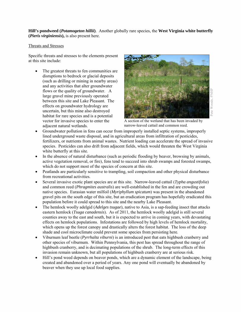
Hill’s pondweed (Potamogeton hillii). Another globally rare species, the West Virginia white butterfly (Pieris virginiensis), is also present here. Threats and Stresses Specific threats and stresses to the elements present at this site include:
• The greatest threats to fen communities are
disruptions to bedrock or glacial deposits (such as drilling or mining in nearby areas) and any activities that alter groundwater flows or the quality of groundwater. A large gravel mine previously operated between this site and Lake Pleasant. The effects on groundwater hydrology are uncertain, but this mine also destroyed habitat for rare species and is a potential vector for invasive species to enter the adjacent natural wetlands.
• Groundwater pollution in fens can occur from improperly installed septic systems, improperly lined underground waste disposal, and in agricultural areas from infiltration of pesticides, fertilizers, or nutrients from animal wastes. Nutrient loading can accelerate the spread of invasive species. Pesticides can also drift from adjacent fields, which would threaten the West Virginia white butterfly at this site.
• In the absence of natural disturbance (such as periodic flooding by beaver, browsing by animals, active vegetation removal, or fire), fens tend to succeed into shrub swamps and forested swamps, which do not support most of the species of concern at this site.
• Peatlands are particularly sensitive to trampling, soil compaction and other physical disturbance from recreational activities.
• Several invasive exotic plant species are at this site. Narrow-leaved cattail (Typha angustifolia) and common reed (Phragmites australis) are well-established in the fen and are crowding out native species. Eurasian water milfoil (Myriphyllum spicatum) was present in the abandoned gravel pits on the south edge of this site, but an eradication program has hopefully eradicated this population before it could spread to this site and the nearby Lake Pleasant.
• The hemlock woolly adelgid (Adelges tsugae), native to Asia, is a sap-feeding insect that attacks eastern hemlock (Tsuga canadensis). As of 2011, the hemlock woolly adelgid is still several counties away to the east and south, but it is expected to arrive in coming years, with devastating effects on hemlock populations. Infestations are followed by high levels of hemlock mortality, which opens up the forest canopy and drastically alters the forest habitat. The loss of the deep shade and cool microclimate could prevent some species from persisting here.
• Viburnum leaf beetle (Pyrrhalta viburni) is an introduced pest that eats highbush cranberry and other species of viburnum. Within Pennsylvania, this pest has spread throughout the range of highbush cranberry, and is decimating populations of the shrub. The long-term effects of this invasion remain unknown, but all populations of highbush cranberry are at serious risk.
• Hill’s pond weed depends on beaver ponds, which are a dynamic element of the landscape, being created and abandoned over a period of years. Any one pond will eventually be abandoned by beaver when they use up local food supplies.
Pete
Woo
ds, P
NH
P
A section of the wetland that has been invaded by narrow-leaved cattail and common reed.
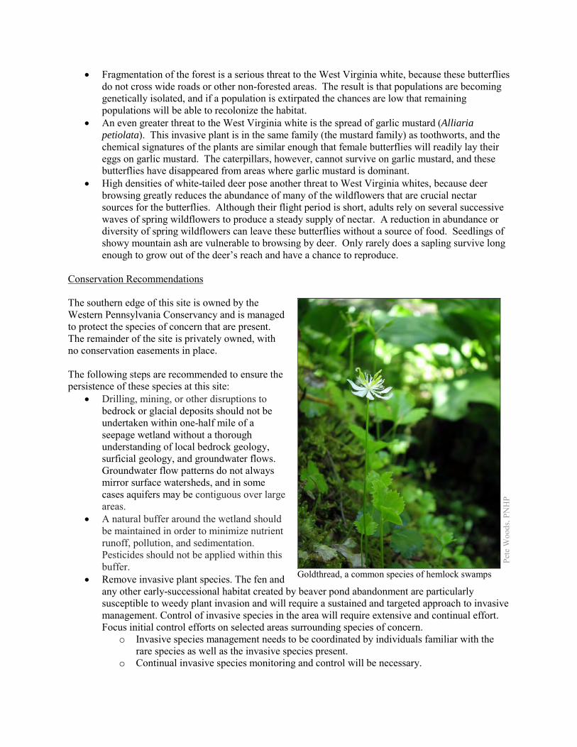
• Fragmentation of the forest is a serious threat to the West Virginia white, because these butterflies do not cross wide roads or other non-forested areas. The result is that populations are becoming genetically isolated, and if a population is extirpated the chances are low that remaining populations will be able to recolonize the habitat.
• An even greater threat to the West Virginia white is the spread of garlic mustard (Alliaria petiolata). This invasive plant is in the same family (the mustard family) as toothworts, and the chemical signatures of the plants are similar enough that female butterflies will readily lay their eggs on garlic mustard. The caterpillars, however, cannot survive on garlic mustard, and these butterflies have disappeared from areas where garlic mustard is dominant.
• High densities of white-tailed deer pose another threat to West Virginia whites, because deer browsing greatly reduces the abundance of many of the wildflowers that are crucial nectar sources for the butterflies. Although their flight period is short, adults rely on several successive waves of spring wildflowers to produce a steady supply of nectar. A reduction in abundance or diversity of spring wildflowers can leave these butterflies without a source of food. Seedlings of showy mountain ash are vulnerable to browsing by deer. Only rarely does a sapling survive long enough to grow out of the deer’s reach and have a chance to reproduce.
Conservation Recommendations The southern edge of this site is owned by the Western Pennsylvania Conservancy and is managed to protect the species of concern that are present. The remainder of the site is privately owned, with no conservation easements in place. The following steps are recommended to ensure the persistence of these species at this site:
• Drilling, mining, or other disruptions to bedrock or glacial deposits should not be undertaken within one-half mile of a seepage wetland without a thorough understanding of local bedrock geology, surficial geology, and groundwater flows. Groundwater flow patterns do not always mirror surface watersheds, and in some cases aquifers may be contiguous over large areas.
• A natural buffer around the wetland should be maintained in order to minimize nutrient runoff, pollution, and sedimentation. Pesticides should not be applied within this buffer.
• Remove invasive plant species. The fen and any other early-successional habitat created by beaver pond abandonment are particularly susceptible to weedy plant invasion and will require a sustained and targeted approach to invasive management. Control of invasive species in the area will require extensive and continual effort. Focus initial control efforts on selected areas surrounding species of concern.
o Invasive species management needs to be coordinated by individuals familiar with the rare species as well as the invasive species present.
o Continual invasive species monitoring and control will be necessary.
Pete
Woo
ds, P
NH
P
Goldthread, a common species of hemlock swamps
o The presence of invasive species in fens often is an indicator of nutrient pollution, especially if the invasive species are limited to discreet portions of the fen. In these instances, potential sources of surface and groundwater pollution should be identified and mitigated.
• The fen may require periodic disturbance such as cutting, burning, or grazing to maintain the open canopy which is indicative of this community and the rare species that occupy the community.
• Allow beaver to persist in the area. The effect of beaver on fen plants such as yellow sedge is uncertain, but beaver ponds are the habitat for Hill’s pond weed. Because beaver ponds are abandoned over time, Hill’s pondweed must be able to move between ponds within the kame field. Enough of the streams in the area underlain by kame deposits must be protected to maintain a dynamic system, including numerous beaver ponds and beaver meadows, to ensure that some habitat for the pondweed is always present.
• Management options for the control of viburnum leaf beetle should be investigated. • As of 2012, available treatments for hemlock woolly adelgid are not economically feasible at a
scale suitable for large natural areas. At a smaller scale, continued applications of horticultural oil or insecticidal soap can control hemlock woolly adelgids. Biological controls are being researched, though they have so far had limited success at keeping adelgid populations in check.
• Garlic mustard and other invasive species must be controlled in this area to avoid serious losses of biodiversity. Fragmentation of the remaining forest should be avoided. New development such as housing, roads, and powerlines should be concentrated in areas that have already been disturbed.
• White-tailed deer should be kept to a low density to avoid degradation of the forest’s diversity. Reducing deer density in this area may enhance survival of showy mountain ash seedlings. In the absence of such measures, deer exclosures would allow some show mountain-ash seedlings to grow to maturity, although exclosures would probably not be large enough to protect a viable population of West Virginia whites.
Location and Additional Information
Municipalities: Greene Township USGS quads: Hammett 1993 Erie CNHI reference: French Creek BDA Associated NHAs: None Overlapping Protected Lands: Western Pennsylvania Conservancy’s Lake Pleasant tract covers the
southern edge of this site. PNHP Significance Rank: Global References Podniesinski 2011. Pennsylvania Natural Heritage Program. Alder-leaved Buckthorn – Inland Sedge – Golden Ragwort Shrub
Fen Factsheet. Available from: http://www.naturalheritage.state.pa.us/Community.aspx?=30002 Date Accessed: August 01, 2012
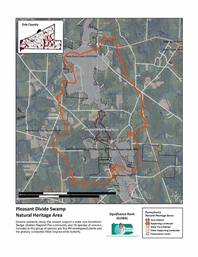
Pond Road Wetlands - North NHA This site is designated around a patch of swamp forest and an adjacent disturbed sandy area that supports a species of concern. Species or natural communities of concern that can be found in this NHA include the following: PNHP Rank1 State
Species or Natural Community Name
Global State Legal
Status1 Last Seen Quality2 Larger Canadian St. John’s-wort (Hypericum majus)
G5 S2 PT 1996-09-04 E
1 = Please refer to the PNHP website (http://www.naturalheritage.state.pa.us/RankStatusDef.aspx) for an explanation of PNHP ranks and
legal status. A legal status in parentheses is a status change recommended by the Pennsylvania Biological Survey. 2 = Please refer to the NatureServe website (http://www.natureserve.org/explorer/eorankguide.htm) for an explanation of quality ranks.
The sandy flats to the west of the pond are a disturbed habitat that was created during the excavation of the pond. This disturbance created conditions that support larger Canadian St. John’s-wort (Hypericum majus), a Pennsylvania Threatened species. Additional surveys in this area would almost certainly identify the forested wetland area as an Elm – Ash – Maple Lakeplain Forest, a natural community type that is critically imperiled in Pennsylvania and which can host a number of rare plant species. Threats and Stresses Specific threats and stresses to the elements present at this site include the following:
• The lakeplain swamp would be threatened by logging or by any hydrologic change. • Emerald ash borer (Agrilus planipennis) is an invasive beetle that is sweeping across the
Northeast and Midwest and devastating populations of all ash tree species (Fraxinus spp.), including the endangered pumpkin ash. In forests like this where ash trees probably make up a significant portion of the canopy, the death of canopy trees will create conditions favoring the spread of invasive species.
• Larger Canadian St. John’s-wort is an early successional species that grows in disturbed areas. Over time, the habitat will become less suitable unless disturbance keeps the area in an early successional state.
Conservation Recommendations This area is privately owned, and no conservation easements are in place. The following steps are recommended to ensure the persistence of these species at this site:
• Keep the area just west of the pond free of most woody vegetation. • Timbering and other disturbances should be avoided in and around the forested wetlands. • At this time there are few options for control of emerald ash borer. Injecting ash trees with
insecticides is an expensive option that can temporarily save small numbers of trees. This method is not without risks, because although ash trees are wind pollinated, their pollen is an important food source for bees and other insects in the spring. Injecting trees with systemic insecticides will probably harm populations of these pollinators.

Location and Additional Information
Municipalities: Springfield Township USGS quads: Conneaut, East Springfield 1993 Erie CNHI reference: None; previously unrecognized site Associated NHAs: Pond Road Wetlands – South NHA; Roderick Reserve NHA Overlapping Protected Lands: None PNHP Significance Rank: State
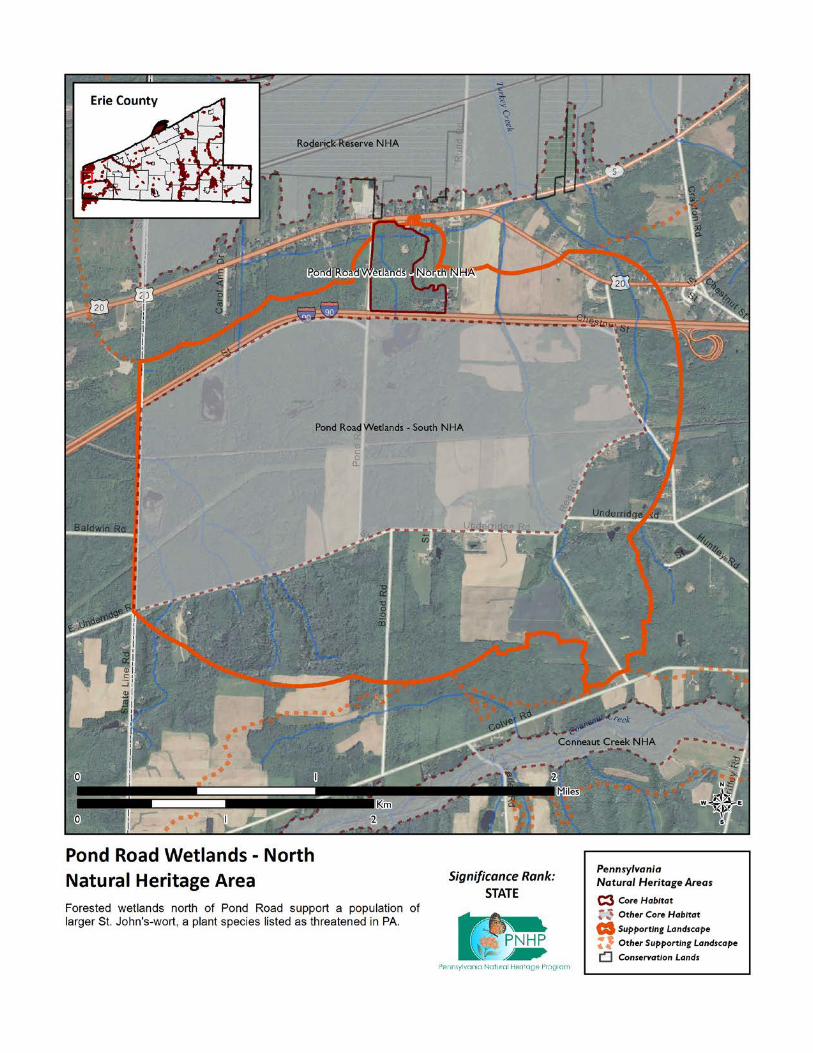
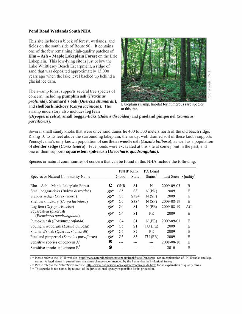
Pond Road Wetlands South NHA This site includes a block of forest, wetlands, and fields on the south side of Route 90. It contains one of the few remaining high-quality patches of Elm – Ash – Maple Lakeplain Forest on the Erie Lakeplain. This low-lying site is just below the Lake Whittlesey Beach Escarpment, a ridge of sand that was deposited approximately 13,000 years ago when the lake level backed up behind a glacial ice dam. The swamp forest supports several tree species of concern, including pumpkin ash (Fraxinus profunda), Shumard’s oak (Quercus shumardii), and shellbark hickory (Carya laciniosa). The swamp understory also includes log fern (Dryopteris celsa), small beggar-ticks (Bidens discoidea) and pineland pimpernel (Samolus parviflorus). Several small sandy knobs that were once sand dunes lie 400 to 500 meters north of the old beach ridge. Rising 10 to 15 feet above the surrounding lakeplain, the sandy, well drained soil of these knobs supports Pennsylvania’s only known population of southern wood-rush (Luzula bulbosa), as well as a population of slender sedge (Carex tenera). Five ponds were excavated at this site at some point in the past, and one of them supports squarestem spikerush (Eleocharis quadrangulata). Species or natural communities of concern that can be found in this NHA include the following:
PNHP Rank1 PA Legal Species or Natural Community Name Global State Status1 Last Seen Quality2 Elm – Ash – Maple Lakeplain Forest C GNR S1 N 2009-09-03 B Small beggar-ticks (Bidens discoidea) G5 S3 N (PR) 2009 E Slender sedge (Carex tenera) G5 S3S4 N (SP) 2009 E Shellbark hickory (Carya laciniosa) G5 S3S4 N (SP) 2009-08-19 E Log fern (Dryopteris celsa) G4 S1 N (PE) 2009-08-19 AC Squarestem spikerush (Eleocharis quadrangulata) G4 S1 PE 2009 E
Pumpkin ash (Fraxinus profunda) G4 S1 N (PE) 2009-09-03 E Southern woodrush (Luzula bulbosa) G5 S1 TU (PE) 2009 E Shumard’s oak (Quercus shumardii) G5 S2 PE 2009 E Pineland pimpernel (Samolus parviflorus) G5 S3 TU (PR) 2009 E Sensitive species of concern A3 S --- --- --- 2008-08-10 E Sensitive species of concern B3 S --- --- --- 2010 E 1 = Please refer to the PNHP website (http://www.naturalheritage.state.pa.us/RankStatusDef.aspx) for an explanation of PNHP ranks and legal
status. A legal status in parentheses is a status change recommended by the Pennsylvania Biological Survey. 2 = Please refer to the NatureServe website (http://www.natureserve.org/explorer/eorankguide.htm) for an explanation of quality ranks. 3 = This species is not named by request of the jurisdictional agency responsible for its protection.
Pete
Woo
ds, P
NH
P
Lakeplain swamp, habitat for numerous rare species at this site.
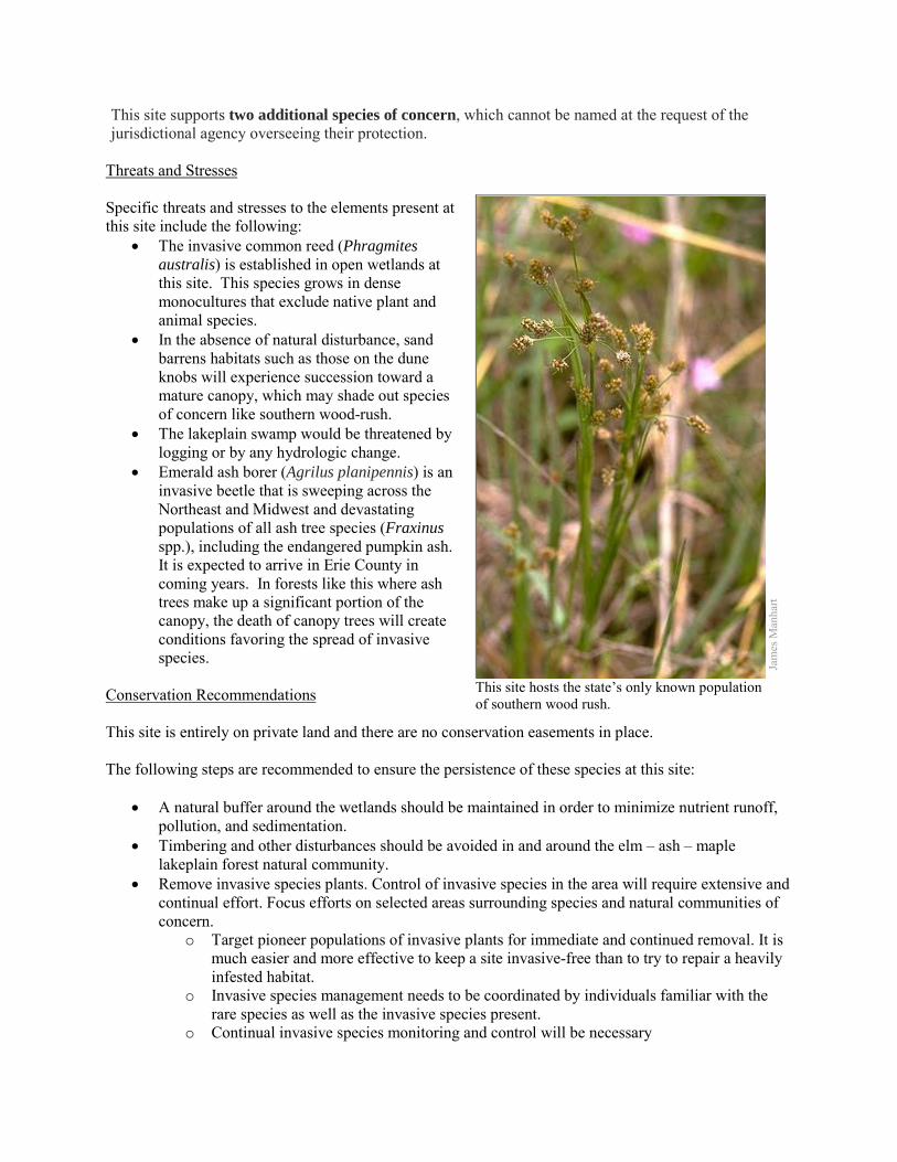
This site supports two additional species of concern, which cannot be named at the request of the jurisdictional agency overseeing their protection.
Threats and Stresses Specific threats and stresses to the elements present at this site include the following:
• The invasive common reed (Phragmites australis) is established in open wetlands at this site. This species grows in dense monocultures that exclude native plant and animal species.
• In the absence of natural disturbance, sand barrens habitats such as those on the dune knobs will experience succession toward a mature canopy, which may shade out species of concern like southern wood-rush.
• The lakeplain swamp would be threatened by logging or by any hydrologic change.
• Emerald ash borer (Agrilus planipennis) is an invasive beetle that is sweeping across the Northeast and Midwest and devastating populations of all ash tree species (Fraxinus spp.), including the endangered pumpkin ash. It is expected to arrive in Erie County in coming years. In forests like this where ash trees make up a significant portion of the canopy, the death of canopy trees will create conditions favoring the spread of invasive species.
Conservation Recommendations This site is entirely on private land and there are no conservation easements in place. The following steps are recommended to ensure the persistence of these species at this site:
• A natural buffer around the wetlands should be maintained in order to minimize nutrient runoff,
pollution, and sedimentation. • Timbering and other disturbances should be avoided in and around the elm – ash – maple
lakeplain forest natural community. • Remove invasive species plants. Control of invasive species in the area will require extensive and
continual effort. Focus efforts on selected areas surrounding species and natural communities of concern.
o Target pioneer populations of invasive plants for immediate and continued removal. It is much easier and more effective to keep a site invasive-free than to try to repair a heavily infested habitat.
o Invasive species management needs to be coordinated by individuals familiar with the rare species as well as the invasive species present.
o Continual invasive species monitoring and control will be necessary
Jam
es M
anha
rt
This site hosts the state’s only known population of southern wood rush.

• Active stewardship of the dune knob habitat may be necessary to ensure the persistence of the southern wood-rush.
• Injecting ash trees with insecticides is an expensive option, but it can be used to temporarily save small numbers of pumpkin ash trees. This method is not without risks, because although ash trees are wind pollinated, their pollen is an important food source for bees and other insects in the spring. Injecting trees with systemic insecticides will probably harm populations of these pollinators.
Location and Additional Information
Municipalities: Springfield Township USGS quads: Conneaut, East Springfield 1993 Erie CNHI reference: none Associated NHAs: none Overlapping Protected Lands: none PNHP Significance Rank: State
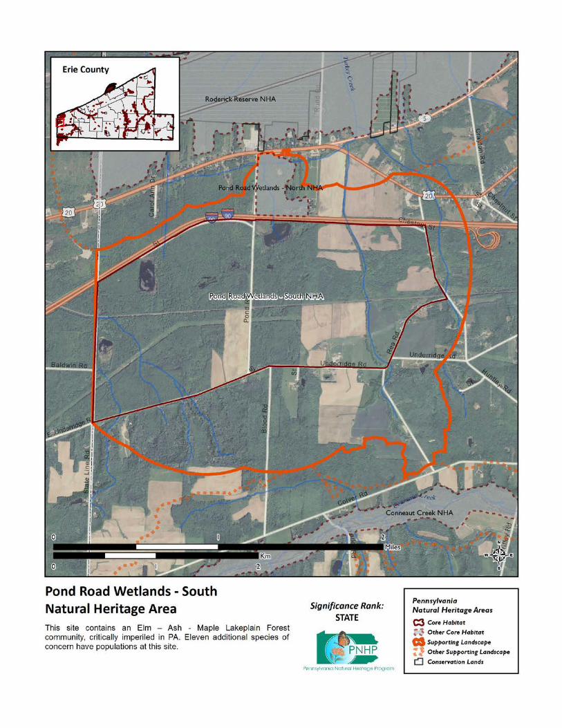
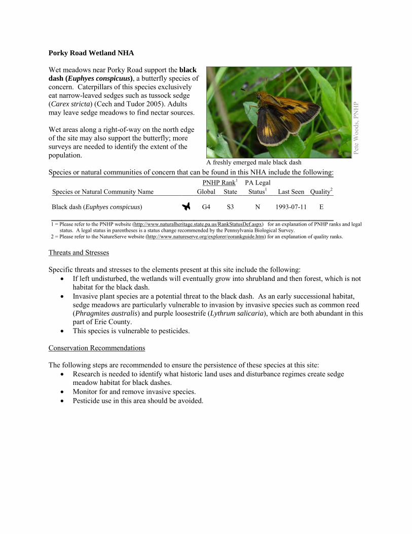
Porky Road Wetland NHA Wet meadows near Porky Road support the black dash (Euphyes conspicuus), a butterfly species of concern. Caterpillars of this species exclusively eat narrow-leaved sedges such as tussock sedge (Carex stricta) (Cech and Tudor 2005). Adults may leave sedge meadows to find nectar sources. Wet areas along a right-of-way on the north edge of the site may also support the butterfly; more surveys are needed to identify the extent of the population. Species or natural communities of concern that can be found in this NHA include the following: PNHP Rank1 PA Legal Species or Natural Community Name Global State Status1 Last Seen Quality2 Black dash (Euphyes conspicuus) G4 S3 N 1993-07-11 E 1 = Please refer to the PNHP website (http://www.naturalheritage.state.pa.us/RankStatusDef.aspx) for an explanation of PNHP ranks and legal
status. A legal status in parentheses is a status change recommended by the Pennsylvania Biological Survey. 2 = Please refer to the NatureServe website (http://www.natureserve.org/explorer/eorankguide.htm) for an explanation of quality ranks.
Threats and Stresses Specific threats and stresses to the elements present at this site include the following:
• If left undisturbed, the wetlands will eventually grow into shrubland and then forest, which is not habitat for the black dash.
• Invasive plant species are a potential threat to the black dash. As an early successional habitat, sedge meadows are particularly vulnerable to invasion by invasive species such as common reed (Phragmites australis) and purple loosestrife (Lythrum salicaria), which are both abundant in this part of Erie County.
• This species is vulnerable to pesticides. Conservation Recommendations The following steps are recommended to ensure the persistence of these species at this site:
• Research is needed to identify what historic land uses and disturbance regimes create sedge meadow habitat for black dashes.
• Monitor for and remove invasive species. • Pesticide use in this area should be avoided.
Pete
Woo
ds, P
NH
P
A freshly emerged male black dash
Location and Additional Information Municipalities: Conneaut Township USGS quads: Beaver Center 1993 Erie CNHI reference: Previously unrecognized site Associated NHAs: None Overlapping Protected Lands: None PNHP Significance Rank: State References Cech, R. and G. Tudor. 2005. Butterflies of the East Coast: An Observer’s Guide. Princeton University Press, Princeton, New
Jersey.
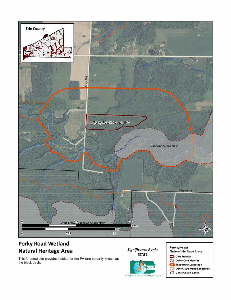
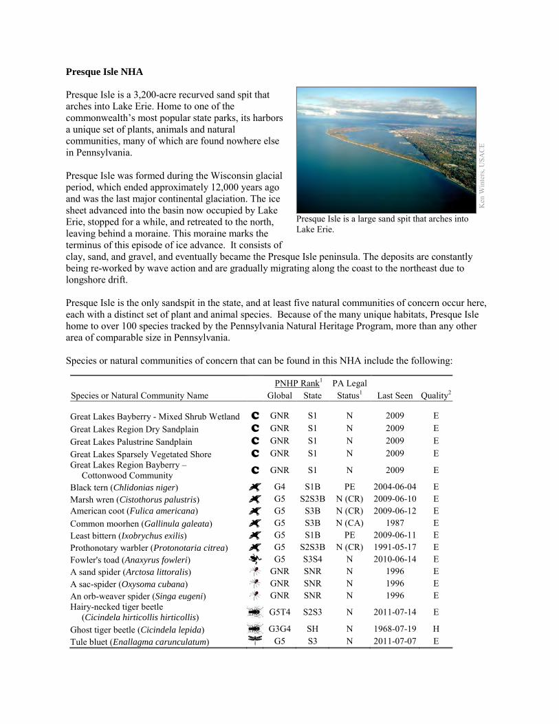
Presque Isle NHA Presque Isle is a 3,200-acre recurved sand spit that arches into Lake Erie. Home to one of the commonwealth’s most popular state parks, its harbors a unique set of plants, animals and natural communities, many of which are found nowhere else in Pennsylvania. Presque Isle was formed during the Wisconsin glacial period, which ended approximately 12,000 years ago and was the last major continental glaciation. The ice sheet advanced into the basin now occupied by Lake Erie, stopped for a while, and retreated to the north, leaving behind a moraine. This moraine marks the terminus of this episode of ice advance. It consists of clay, sand, and gravel, and eventually became the Presque Isle peninsula. The deposits are constantly being re-worked by wave action and are gradually migrating along the coast to the northeast due to longshore drift. Presque Isle is the only sandspit in the state, and at least five natural communities of concern occur here, each with a distinct set of plant and animal species. Because of the many unique habitats, Presque Isle home to over 100 species tracked by the Pennsylvania Natural Heritage Program, more than any other area of comparable size in Pennsylvania. Species or natural communities of concern that can be found in this NHA include the following:
PNHP Rank1 PA Legal Species or Natural Community Name Global State Status1 Last Seen Quality2 Great Lakes Bayberry - Mixed Shrub Wetland C GNR S1 N 2009 E Great Lakes Region Dry Sandplain C GNR S1 N 2009 E Great Lakes Palustrine Sandplain C GNR S1 N 2009 E Great Lakes Sparsely Vegetated Shore C GNR S1 N 2009 E Great Lakes Region Bayberry – Cottonwood Community C GNR S1 N 2009 E
Black tern (Chlidonias niger) G4 S1B PE 2004-06-04 E Marsh wren (Cistothorus palustris) G5 S2S3B N (CR) 2009-06-10 E American coot (Fulica americana) G5 S3B N (CR) 2009-06-12 E Common moorhen (Gallinula galeata) G5 S3B N (CA) 1987 E Least bittern (Ixobrychus exilis) G5 S1B PE 2009-06-11 E Prothonotary warbler (Protonotaria citrea) G5 S2S3B N (CR) 1991-05-17 E Fowler's toad (Anaxyrus fowleri) G5 S3S4 N 2010-06-14 E A sand spider (Arctosa littoralis) GNR SNR N 1996 E A sac-spider (Oxysoma cubana) GNR SNR N 1996 E An orb-weaver spider (Singa eugeni) GNR SNR N 1996 E Hairy-necked tiger beetle (Cicindela hirticollis hirticollis) G5T4 S2S3 N 2011-07-14 E
Ghost tiger beetle (Cicindela lepida) G3G4 SH N 1968-07-19 H Tule bluet (Enallagma carunculatum) G5 S3 N 2011-07-07 E
Ken
Win
ters
, USA
CE
Presque Isle is a large sand spit that arches into Lake Erie.
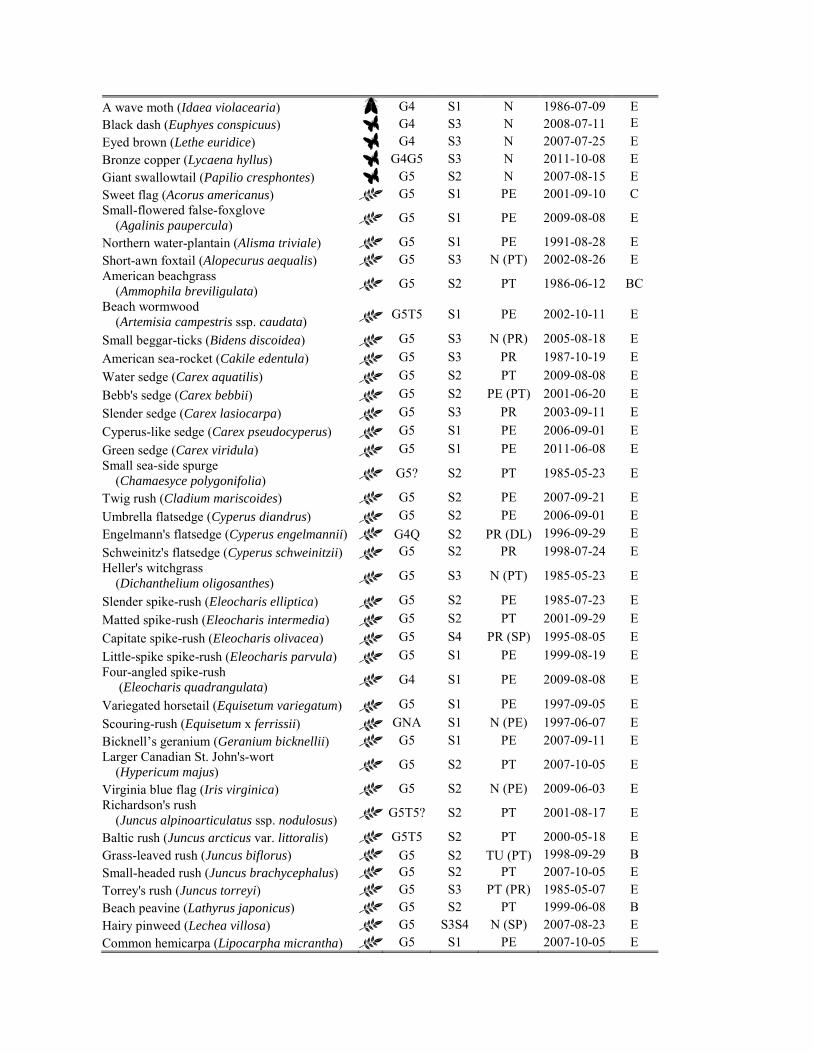
A wave moth (Idaea violacearia) G4 S1 N 1986-07-09 E Black dash (Euphyes conspicuus) G4 S3 N 2008-07-11 E
Eyed brown (Lethe euridice) G4 S3 N 2007-07-25 E Bronze copper (Lycaena hyllus) G4G5 S3 N 2011-10-08 E Giant swallowtail (Papilio cresphontes) G5 S2 N 2007-08-15 E Sweet flag (Acorus americanus) G5 S1 PE 2001-09-10 C Small-flowered false-foxglove (Agalinis paupercula) G5 S1 PE 2009-08-08 E
Northern water-plantain (Alisma triviale) G5 S1 PE 1991-08-28 E Short-awn foxtail (Alopecurus aequalis) G5 S3 N (PT) 2002-08-26 E American beachgrass (Ammophila breviligulata) G5 S2 PT 1986-06-12 BC
Beach wormwood (Artemisia campestris ssp. caudata) G5T5 S1 PE 2002-10-11 E
Small beggar-ticks (Bidens discoidea) G5 S3 N (PR) 2005-08-18 E American sea-rocket (Cakile edentula) G5 S3 PR 1987-10-19 E Water sedge (Carex aquatilis) G5 S2 PT 2009-08-08 E Bebb's sedge (Carex bebbii) G5 S2 PE (PT) 2001-06-20 E Slender sedge (Carex lasiocarpa) G5 S3 PR 2003-09-11 E Cyperus-like sedge (Carex pseudocyperus) G5 S1 PE 2006-09-01 E Green sedge (Carex viridula) G5 S1 PE 2011-06-08 E Small sea-side spurge (Chamaesyce polygonifolia) G5? S2 PT 1985-05-23 E
Twig rush (Cladium mariscoides) G5 S2 PE 2007-09-21 E Umbrella flatsedge (Cyperus diandrus) G5 S2 PE 2006-09-01 E Engelmann's flatsedge (Cyperus engelmannii) G4Q S2 PR (DL) 1996-09-29 E Schweinitz's flatsedge (Cyperus schweinitzii) G5 S2 PR 1998-07-24 E Heller's witchgrass (Dichanthelium oligosanthes) G5 S3 N (PT) 1985-05-23 E
Slender spike-rush (Eleocharis elliptica) G5 S2 PE 1985-07-23 E Matted spike-rush (Eleocharis intermedia) G5 S2 PT 2001-09-29 E Capitate spike-rush (Eleocharis olivacea) G5 S4 PR (SP) 1995-08-05 E Little-spike spike-rush (Eleocharis parvula) G5 S1 PE 1999-08-19 E Four-angled spike-rush (Eleocharis quadrangulata) G4 S1 PE 2009-08-08 E
Variegated horsetail (Equisetum variegatum) G5 S1 PE 1997-09-05 E Scouring-rush (Equisetum x ferrissii) GNA S1 N (PE) 1997-06-07 E Bicknell’s geranium (Geranium bicknellii) G5 S1 PE 2007-09-11 E Larger Canadian St. John's-wort (Hypericum majus) G5 S2 PT 2007-10-05 E
Virginia blue flag (Iris virginica) G5 S2 N (PE) 2009-06-03 E Richardson's rush (Juncus alpinoarticulatus ssp. nodulosus) G5T5? S2 PT 2001-08-17 E
Baltic rush (Juncus arcticus var. littoralis) G5T5 S2 PT 2000-05-18 E Grass-leaved rush (Juncus biflorus) G5 S2 TU (PT) 1998-09-29 B Small-headed rush (Juncus brachycephalus) G5 S2 PT 2007-10-05 E Torrey's rush (Juncus torreyi) G5 S3 PT (PR) 1985-05-07 E Beach peavine (Lathyrus japonicus) G5 S2 PT 1999-06-08 B Hairy pinweed (Lechea villosa) G5 S3S4 N (SP) 2007-08-23 E Common hemicarpa (Lipocarpha micrantha) G5 S1 PE 2007-10-05 E
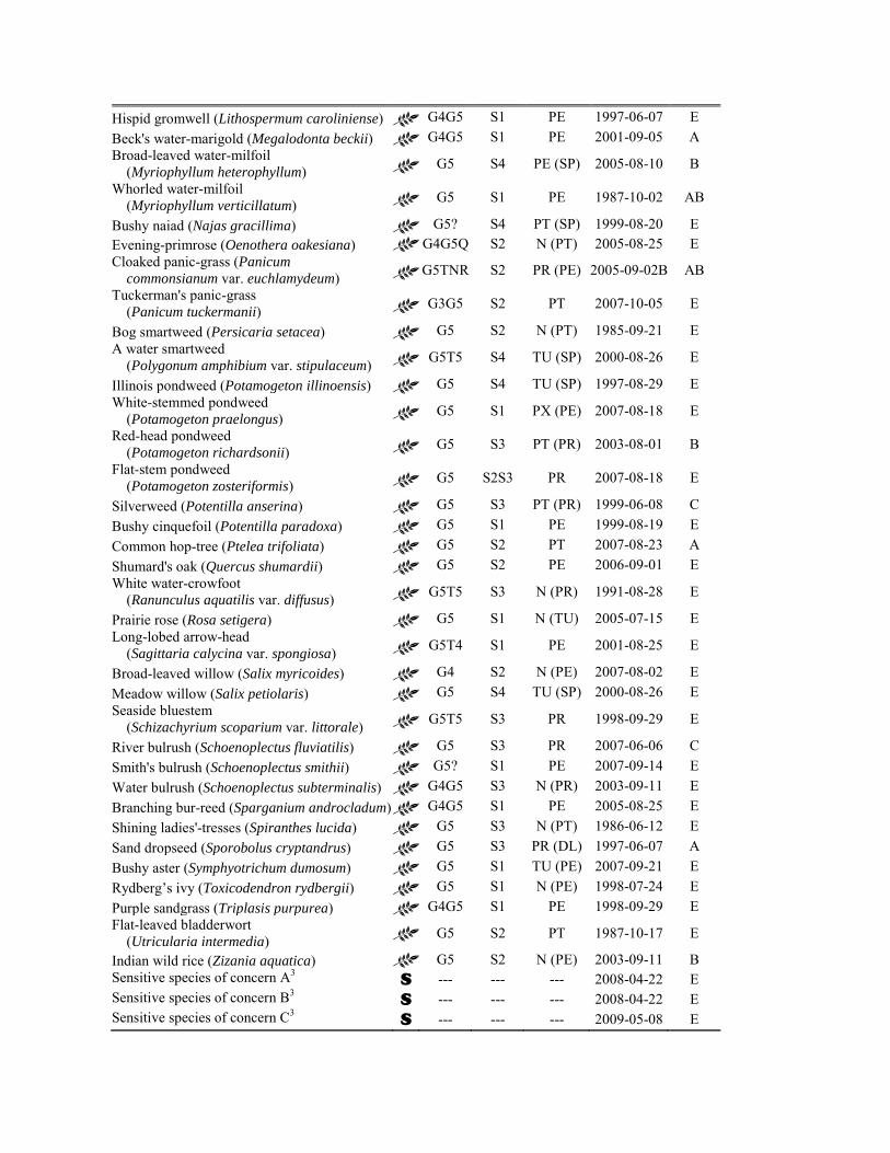
Hispid gromwell (Lithospermum caroliniense) G4G5 S1 PE 1997-06-07 E Beck's water-marigold (Megalodonta beckii) G4G5 S1 PE 2001-09-05 A Broad-leaved water-milfoil (Myriophyllum heterophyllum) G5 S4 PE (SP) 2005-08-10 B
Whorled water-milfoil (Myriophyllum verticillatum) G5 S1 PE 1987-10-02 AB
Bushy naiad (Najas gracillima) G5? S4 PT (SP) 1999-08-20 E Evening-primrose (Oenothera oakesiana) G4G5Q S2 N (PT) 2005-08-25 E Cloaked panic-grass (Panicum commonsianum var. euchlamydeum) G5TNR S2 PR (PE) 2005-09-02B AB
Tuckerman's panic-grass (Panicum tuckermanii) G3G5 S2 PT 2007-10-05 E
Bog smartweed (Persicaria setacea) G5 S2 N (PT) 1985-09-21 E A water smartweed (Polygonum amphibium var. stipulaceum) G5T5 S4 TU (SP) 2000-08-26 E
Illinois pondweed (Potamogeton illinoensis) G5 S4 TU (SP) 1997-08-29 E White-stemmed pondweed (Potamogeton praelongus) G5 S1 PX (PE) 2007-08-18 E
Red-head pondweed (Potamogeton richardsonii) G5 S3 PT (PR) 2003-08-01 B
Flat-stem pondweed (Potamogeton zosteriformis) G5 S2S3 PR 2007-08-18 E
Silverweed (Potentilla anserina) G5 S3 PT (PR) 1999-06-08 C Bushy cinquefoil (Potentilla paradoxa) G5 S1 PE 1999-08-19 E Common hop-tree (Ptelea trifoliata) G5 S2 PT 2007-08-23 A Shumard's oak (Quercus shumardii) G5 S2 PE 2006-09-01 E White water-crowfoot (Ranunculus aquatilis var. diffusus) G5T5 S3 N (PR) 1991-08-28 E
Prairie rose (Rosa setigera) G5 S1 N (TU) 2005-07-15 E Long-lobed arrow-head (Sagittaria calycina var. spongiosa) G5T4 S1 PE 2001-08-25 E
Broad-leaved willow (Salix myricoides) G4 S2 N (PE) 2007-08-02 E Meadow willow (Salix petiolaris) G5 S4 TU (SP) 2000-08-26 E Seaside bluestem (Schizachyrium scoparium var. littorale) G5T5 S3 PR 1998-09-29 E
River bulrush (Schoenoplectus fluviatilis) G5 S3 PR 2007-06-06 C Smith's bulrush (Schoenoplectus smithii) G5? S1 PE 2007-09-14 E Water bulrush (Schoenoplectus subterminalis) G4G5 S3 N (PR) 2003-09-11 E Branching bur-reed (Sparganium androcladum) G4G5 S1 PE 2005-08-25 E Shining ladies'-tresses (Spiranthes lucida) G5 S3 N (PT) 1986-06-12 E Sand dropseed (Sporobolus cryptandrus) G5 S3 PR (DL) 1997-06-07 A Bushy aster (Symphyotrichum dumosum) G5 S1 TU (PE) 2007-09-21 E Rydberg’s ivy (Toxicodendron rydbergii) G5 S1 N (PE) 1998-07-24 E Purple sandgrass (Triplasis purpurea) G4G5 S1 PE 1998-09-29 E Flat-leaved bladderwort (Utricularia intermedia) G5 S2 PT 1987-10-17 E
Indian wild rice (Zizania aquatica) G5 S2 N (PE) 2003-09-11 B Sensitive species of concern A3 S --- --- --- 2008-04-22 E Sensitive species of concern B3 S --- --- --- 2008-04-22 E Sensitive species of concern C3 S --- --- --- 2009-05-08 E
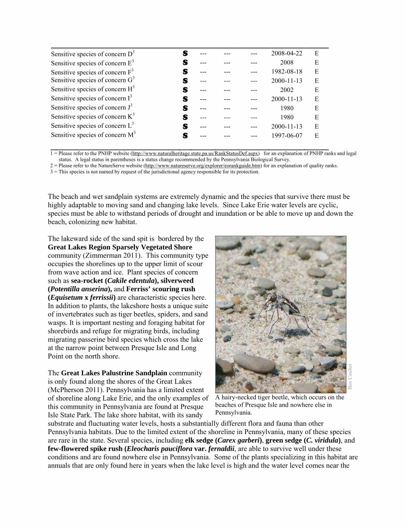
Sensitive species of concern D3 S --- --- --- 2008-04-22 E Sensitive species of concern E3 S --- --- --- 2008 E Sensitive species of concern F3 S --- --- --- 1982-08-18 E Sensitive species of concern G3 S --- --- --- 2000-11-13 E Sensitive species of concern H3 S --- --- --- 2002 E Sensitive species of concern I3 S --- --- --- 2000-11-13 E Sensitive species of concern J3 S --- --- --- 1980 E Sensitive species of concern K3 S --- --- --- 1980 E Sensitive species of concern L3 S --- --- --- 2000-11-13 E Sensitive species of concern M3 S --- --- --- 1997-06-07 E 1 = Please refer to the PNHP website (http://www.naturalheritage.state.pa.us/RankStatusDef.aspx) for an explanation of PNHP ranks and legal
status. A legal status in parentheses is a status change recommended by the Pennsylvania Biological Survey. 2 = Please refer to the NatureServe website (http://www.natureserve.org/explorer/eorankguide.htm) for an explanation of quality ranks. 3 = This species is not named by request of the jurisdictional agency responsible for its protection.
The beach and wet sandplain systems are extremely dynamic and the species that survive there must be highly adaptable to moving sand and changing lake levels. Since Lake Erie water levels are cyclic, species must be able to withstand periods of drought and inundation or be able to move up and down the beach, colonizing new habitat. The lakeward side of the sand spit is bordered by the Great Lakes Region Sparsely Vegetated Shore community (Zimmerman 2011). This community type occupies the shorelines up to the upper limit of scour from wave action and ice. Plant species of concern such as sea-rocket (Cakile edentula), silverweed (Potentilla anserina), and Ferriss’ scouring rush (Equisetum x ferrissii) are characteristic species here. In addition to plants, the lakeshore hosts a unique suite of invertebrates such as tiger beetles, spiders, and sand wasps. It is important nesting and foraging habitat for shorebirds and refuge for migrating birds, including migrating passerine bird species which cross the lake at the narrow point between Presque Isle and Long Point on the north shore. The Great Lakes Palustrine Sandplain community is only found along the shores of the Great Lakes (McPherson 2011). Pennsylvania has a limited extent of shoreline along Lake Erie, and the only examples of this community in Pennsylvania are found at Presque Isle State Park. The lake shore habitat, with its sandy substrate and fluctuating water levels, hosts a substantially different flora and fauna than other Pennsylvania habitats. Due to the limited extent of the shoreline in Pennsylvania, many of these species are rare in the state. Several species, including elk sedge (Carex garberi), green sedge (C. viridula), and few-flowered spike rush (Eleocharis pauciflora var. fernaldii, are able to survive well under these conditions and are found nowhere else in Pennsylvania. Some of the plants specializing in this habitat are annuals that are only found here in years when the lake level is high and the water level comes near the
Ben
Cou
lter
A hairy-necked tiger beetle, which occurs on the beaches of Presque Isle and nowhere else in Pennsylvania.
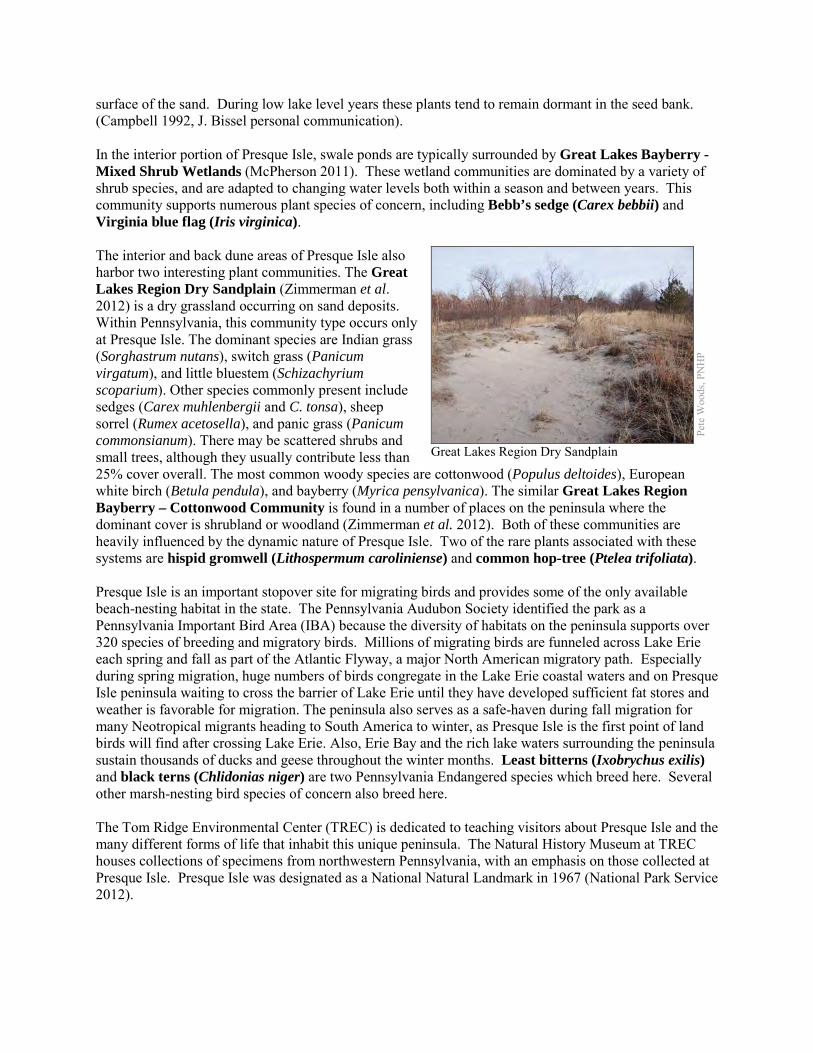
surface of the sand. During low lake level years these plants tend to remain dormant in the seed bank. (Campbell 1992, J. Bissel personal communication). In the interior portion of Presque Isle, swale ponds are typically surrounded by Great Lakes Bayberry - Mixed Shrub Wetlands (McPherson 2011). These wetland communities are dominated by a variety of shrub species, and are adapted to changing water levels both within a season and between years. This community supports numerous plant species of concern, including Bebb’s sedge (Carex bebbii) and Virginia blue flag (Iris virginica). The interior and back dune areas of Presque Isle also harbor two interesting plant communities. The Great Lakes Region Dry Sandplain (Zimmerman et al. 2012) is a dry grassland occurring on sand deposits. Within Pennsylvania, this community type occurs only at Presque Isle. The dominant species are Indian grass (Sorghastrum nutans), switch grass (Panicum virgatum), and little bluestem (Schizachyrium scoparium). Other species commonly present include sedges (Carex muhlenbergii and C. tonsa), sheep sorrel (Rumex acetosella), and panic grass (Panicum commonsianum). There may be scattered shrubs and small trees, although they usually contribute less than 25% cover overall. The most common woody species are cottonwood (Populus deltoides), European white birch (Betula pendula), and bayberry (Myrica pensylvanica). The similar Great Lakes Region Bayberry – Cottonwood Community is found in a number of places on the peninsula where the dominant cover is shrubland or woodland (Zimmerman et al. 2012). Both of these communities are heavily influenced by the dynamic nature of Presque Isle. Two of the rare plants associated with these systems are hispid gromwell (Lithospermum caroliniense) and common hop-tree (Ptelea trifoliata). Presque Isle is an important stopover site for migrating birds and provides some of the only available beach-nesting habitat in the state. The Pennsylvania Audubon Society identified the park as a Pennsylvania Important Bird Area (IBA) because the diversity of habitats on the peninsula supports over 320 species of breeding and migratory birds. Millions of migrating birds are funneled across Lake Erie each spring and fall as part of the Atlantic Flyway, a major North American migratory path. Especially during spring migration, huge numbers of birds congregate in the Lake Erie coastal waters and on Presque Isle peninsula waiting to cross the barrier of Lake Erie until they have developed sufficient fat stores and weather is favorable for migration. The peninsula also serves as a safe-haven during fall migration for many Neotropical migrants heading to South America to winter, as Presque Isle is the first point of land birds will find after crossing Lake Erie. Also, Erie Bay and the rich lake waters surrounding the peninsula sustain thousands of ducks and geese throughout the winter months. Least bitterns (Ixobrychus exilis) and black terns (Chlidonias niger) are two Pennsylvania Endangered species which breed here. Several other marsh-nesting bird species of concern also breed here. The Tom Ridge Environmental Center (TREC) is dedicated to teaching visitors about Presque Isle and the many different forms of life that inhabit this unique peninsula. The Natural History Museum at TREC houses collections of specimens from northwestern Pennsylvania, with an emphasis on those collected at Presque Isle. Presque Isle was designated as a National Natural Landmark in 1967 (National Park Service 2012).
Pete
Woo
ds, P
NH
P
Great Lakes Region Dry Sandplain
Note: The boundaries between this site and the associated Presque Isle – Bay and Presque Isle – Gull Point NHAs are indistinct, and some of the above listed species of concern may occur in those NHAs as well. Any planning or conservation activities in the area should be conducted with the needs of the other two NHAs in mind. Threats and Stresses Although the French name Presque Isle means "almost an island," the area has actually been an island several times. Storm waves have broken through the neck to isolate the main section of the spit at least four times since 1819. A number of shoreline management techniques dating to the 1800s have been used to compensate for the loss of beach sand and serve to protect the park. Since 1819, the U.S. Army Corps of Engineers has attempted to control erosion at Presque Isle and successfully closed a number of breaches in the neck of the peninsula caused by storms. Because the shorelines of the Great Lakes have been extensively developed for industry, recreation, and residences, the extent of natural wetland communities has been greatly diminished. Pennsylvania has limited shoreline area along Lake Erie, and most of it is composed of cobble below steep Lake Erie bluffs; flatter areas were often developed. Presque Isle State Park is the only remaining area that hosts the palustrine sandplain community, and historically it is unlikely there were other examples in Pennsylvania. While the site is protected as a state park, the community may currently be experiencing some declines in quality and extent from invasive species and recreational overuse. Large harbor jetties built in the 1800s along the Lake Erie coast in Ohio may have trapped much of the sediment that is carried eastward by longshore currents, creating conditions where much of the southern coast of Lake Erie is severely sand starved compared to 200 years ago (Morang et. al. 2011). The U.S. Army Corps of Engineers has spent millions of dollars over the past century to stabilize the area, but the problems continue. Efforts to control beach erosion at Presque Isle now consist of beach nourishment coupled with 58 breakwaters that were constructed between 1989 and 1992. Breakwaters slow erosion by partially blocking the waves; as the waves lose energy, they drop sand. The result is less sand carried along the shoreline and a "building out" of the beaches. The breakwaters have reduced the huge volumes of sand required to nourish the beaches. Erosion of the beach, whether it is “natural” erosion or erosion exacerbated by interruptions to historical sand supply, can negatively impact beach ecology by removing habitat. Other threats to ecological systems at the beach include beach grooming and other beach maintenance activities. Even attempts at beach restoration may disrupt the ecological health of the beach. Imported sand may smother natural habitat. The grain size and color of imported sand may influence the reproductive habits of species that utilize sandy beaches for these functions. Specific threats and stresses to the elements present at this site include the following:
• Narrow-leaved cattail (Typha angustifolia), hybrid cattail (Typha x glauca) and the invasive exotic subspecies of common reed (Phragmites australis ssp. australis) are a major threat to all wetlands on the peninsula. These three species have replaced the great majority of the wetland communities on the peninsula. A number of ongoing control efforts have been targeting these and other invasive plant species, and have been successful in cases where the level of effort is maintained. Biocontrol agents (Gallerucella beetles) for purple loosestrife (Lythrum salicaria) were released here in the 1990’s, which may be preventing purple loosestrife from being as much of a problem as it could be otherwise. Other invasive species present on the peninsula include Japanese bush honeysuckle (Lonicera morrowi), Chinese bittersweet (Celastrus orbiculatus), hairy willow-herb (Epilobium hirsutum), jet-bead (Rhodotypos scandens), reed canary grass (Phalaris arundinacea), mugwort (Artemesia vulgaris), black locust (Robinia pseudoacacia), garlic mustard (Alliaria petiolata), European alder (Alnus glutinosa), and Japanese knotweed (Polygonum cuspidatum).
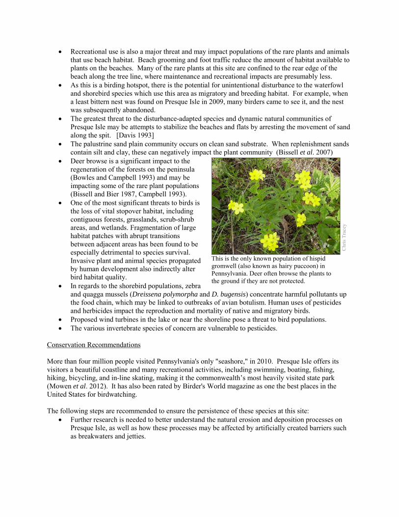
• Recreational use is also a major threat and may impact populations of the rare plants and animals that use beach habitat. Beach grooming and foot traffic reduce the amount of habitat available to plants on the beaches. Many of the rare plants at this site are confined to the rear edge of the beach along the tree line, where maintenance and recreational impacts are presumably less.
• As this is a birding hotspot, there is the potential for unintentional disturbance to the waterfowl and shorebird species which use this area as migratory and breeding habitat. For example, when a least bittern nest was found on Presque Isle in 2009, many birders came to see it, and the nest was subsequently abandoned.
• The greatest threat to the disturbance-adapted species and dynamic natural communities of Presque Isle may be attempts to stabilize the beaches and flats by arresting the movement of sand along the spit. [Davis 1993]
• The palustrine sand plain community occurs on clean sand substrate. When replenishment sands contain silt and clay, these can negatively impact the plant community (Bissell et al. 2007)
• Deer browse is a significant impact to the regeneration of the forests on the peninsula (Bowles and Campbell 1993) and may be impacting some of the rare plant populations (Bissell and Bier 1987, Campbell 1993).
• One of the most significant threats to birds is the loss of vital stopover habitat, including contiguous forests, grasslands, scrub-shrub areas, and wetlands. Fragmentation of large habitat patches with abrupt transitions between adjacent areas has been found to be especially detrimental to species survival. Invasive plant and animal species propagated by human development also indirectly alter bird habitat quality.
• In regards to the shorebird populations, zebra and quagga mussels (Dreissena polymorpha and D. bugensis) concentrate harmful pollutants up the food chain, which may be linked to outbreaks of avian botulism. Human uses of pesticides and herbicides impact the reproduction and mortality of native and migratory birds.
• Proposed wind turbines in the lake or near the shoreline pose a threat to bird populations. • The various invertebrate species of concern are vulnerable to pesticides.
Conservation Recommendations More than four million people visited Pennsylvania's only "seashore," in 2010. Presque Isle offers its visitors a beautiful coastline and many recreational activities, including swimming, boating, fishing, hiking, bicycling, and in-line skating, making it the commonwealth’s most heavily visited state park (Mowen et al. 2012). It has also been rated by Birder's World magazine as one the best places in the United States for birdwatching. The following steps are recommended to ensure the persistence of these species at this site:
• Further research is needed to better understand the natural erosion and deposition processes on Presque Isle, as well as how these processes may be affected by artificially created barriers such as breakwaters and jetties.
Chr
is Tr
acey
This is the only known population of hispid gromwell (also known as hairy puccoon) in Pennsylvania. Deer often browse the plants to the ground if they are not protected.
• It is understood that the natural communities of Presque Isle are highly dynamic, affected by movement of the substrate by wind, currents, and storms; and by changes in the water level over seasons and decades. However, further research is needed to learn about how these processes affect communities over longer time scales, including the frequency of disturbances, the rate of movement of communities on the landscape, and the process of succession in plant communities.
• Continue extensive and sustained efforts to remove invasive species. Management efforts should ensure proper identification of the exotic subspecies of common reed, so that the Pennsylvania Endangered native subspecies, Phragmites australis spp. americanus, is not targeted.
• Pesticide use should be avoided, to prevent the unintended killing of numerous invertebrate species of concern.
Location and Additional Data
Municipalities: Millcreek Township USGS quads: Erie North, Erie North OE West, Swanville 1993 Erie CNHI reference: Presque Isle Associated NHAs: Presque Isle – Bay NHA, Presque Isle – Gull Point NHA Overlapping Protected Lands: Presque Isle State Park PNHP Significance Rank: Global References The Economic Significance and Impact of Pennsylvania State Parks: An Updated Assessment of 2010 Park Visitor Spending on the State and Local Economy. 2012. Submitted by the Department of Recreation, Park and Tourism Management . The Pennsylvania State University Campbell, JM. 1992. Habitat and Population Ecology of Lobelia kalmii on Presque Isle, PA Correlated with Changes in Lake
Erie Water Levels. Journal of the Pennsylvania Academy of Science, Vol. 66, No. 3, p 123-127. Campbell, J. M. 1993. Effects of grazing by white-tailed deer on a population of Lithospermum caroliniense at Presque Isle.
Journal of the Pennsylvania Academy of Science, Vol. 67, p 103-108. Bissell, J.K. and C.W. Bier. 1987. Presque Isle State Park: Botanical survey and Natural Community Classification. Report to
Department of Conservation and Natural Resources. Cleveland Museum of Natural History and Western Pennsylvania Conservancy. Available at: http://www.gpo.gov/fdsys/pkg/CZIC-qk62-b57-1987/html/CZIC-qk62-b57-1987.htm Date Accessed: November 26, 2012.
Bissell, J.K., P MacKeigan, G Ormiston, S Aviram and K Burls. 2007. Natural Communities of Gull Point, Presque Isle State Park. Report to Western Pennsylvania Conservancy. Cleveland Museum of Natural History.
Bowles, G. H. and Campbell, J. M. 1993. Relationship between population density of white-tailed deer and the density of understory trees in forests of Erie County, PA. Journal of the Pennsylvania Academy of Science, Vol. 67, p 109-114.
Davis, A. F. 1993. Rare Wetland Plants and Their Habitats in Pennsylvania. Proceedings of the Academy of Natural Sciences of Philadelphia. 114; 254-262.
Eichelberger, B. 2011. Pennsylvania Natural Heritage Program. Water-willow (Decodon verticillatus) Shrub Wetland Factsheet. Available from: http://www.naturalheritage.state.pa.us/Community.aspx?=16046 Date Accessed: October 16, 2012
Foyle, A.M. and Norton, K.P., 2006. Late Holocene Nearshore Change at a Nontidal Transgressive Systems Tract Strandplain Complex, Presque Isle, Pennsylvania, U.S.A. Journal of Coastal Research, 22(2), 406-423. West Palm Beach (Florida), ISSN 0749-0208.
Ingersoll, T. D. 1885. Glacial Origin of Presque Isle, Lake Erie. The American Naturalist. 19:865-867 Jennings, O.E. 1909. A botanical survey of Presque Isle, Erie County, Pennsylvania. Ann. Carnegie Mus. 5:289-419. Kormondy, E. 1969. Comparative ecology of sandspit ponds. Amer. Midl. Nat. 82:28-61. McPherson, J. 2011. Pennsylvania Natural Heritage Program. Great Lakes Bayberry – Mixed Shrub Wetland Factsheet.
Available from: http://www.naturalheritage.state.pa.us/Community.aspx?=16034 Date Accessed: October 16, 2012. McPherson 2011. Pennsylvania Natural Heritage Program. Great Lakes Palustrine Sandplain Factsheet. Available from:
http://www.naturalheritage.state.pa.us/Community.aspx?=16003 Date Accessed: March 01, 2012. Morang, A., M.C. Mohr, and C.M. Forgette. 2011. Longshore Sediment Movement and Supply along the U.S. Shoreline of Lake
Erie. Journal of Coastal Research: Volume 27, Issue 4: 619-635. National Park Service. 2012. National Natural Landmarks – Presque Isle. http://www.nature.nps.gov/nnl/site.cfm?Site=PRIS-
PA. Accessed 2012-02-15.

Mowen, A.J., A.R. Graefe, N.E. Trauntvein, D.J. Stynes. 2012. The Economic Significance and Impact of Pennsylvania State Parks: An Updated Assessment of 2010 Park Visitor Spending on the State and Local Economy. Submitted to the Department of Conservation and Natural Resources. Department of Recreation, Park and Tourism Management, Pennsylvania State University.
Zimmerman, E. 2011. Pennsylvania Natural Heritage Program. Great Lakes Sparsely Vegetated Shore Factsheet. Available from: http://www.naturalheritage.state.pa.us/Community.aspx?=16077 Date Accessed: October 16, 2012.
Zimmerman, E., T. Davis, G. Podniesinski, M. Furedi, J. McPherson, S. Seymour, B. Eichelberger, N. Dewar, J. Wagner, and J. Fike (editors). 2012. Terrestrial and Palustrine Plant Communities of Pennsylvania, 2nd Edition. Pennsylvania Natural Heritage Program, Pennsylvania Department of Conservation and Natural Resources, Harrisburg, Pennsylvania.
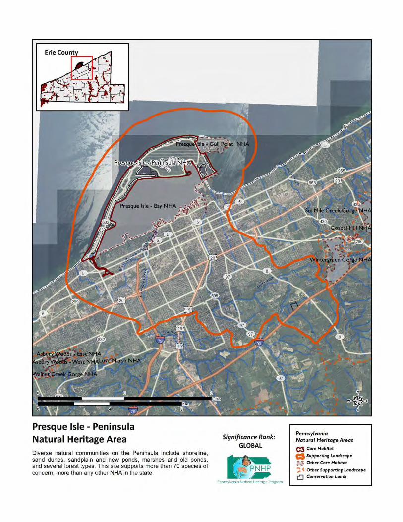
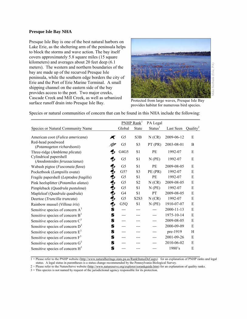
Presque Isle Bay NHA Presque Isle Bay is one of the best natural harbors on Lake Erie, as the sheltering arm of the peninsula helps to block the storms and wave action. The bay itself covers approximately 5.8 square miles (15 square kilometers) and averages about 20 feet deep (6.1 meters). The western and northern boundaries of the bay are made up of the recurved Presque Isle peninsula, while the southern edge borders the city of Erie and the Port of Erie Marine Terminal. A small shipping channel on the eastern side of the bay provides access to the port. Two major creeks, Cascade Creek and Mill Creek, as well as urbanized surface runoff drain into Presque Isle Bay. Species or natural communities of concern that can be found in this NHA include the following:
PNHP Rank1 PA Legal Species or Natural Community Name Global State Status1 Last Seen Quality2 American coot (Fulica americana) G5 S3B N (CR) 2009-06-12 E Red-head pondweed (Potamogeton richardsonii) G5 S3 PT (PR) 2003-08-01 B
Three-ridge (Amblema plicata) G4G5 S1 PE 1992-07 E Cylindrical papershell (Anodontoides ferussacianus) G5 S1 N (PE) 1992-07 E
Wabash pigtoe (Fusconaia flava) G5 S1 PE 2009-08-05 E Pocketbook (Lampsilis ovata) G5? S3 PE (PR) 1992-07 E Fragile papershell (Leptodea fragilis) G5 S1 PE 1992-07 E Pink heelsplitter (Potamilus alatus) G5 S2 N (CR) 2009-08-05 E Pimpleback (Quadrula pustulosa) G5 S1 N (PE) 1992-07 E Mapleleaf (Quadrula quadrula) G4 S1 PT 2009-08-05 E Deertoe (Truncilla truncata) G5 S2S3 N (CR) 1992-07 E Rainbow mussel (Villosa iris) G5Q S1 N (PE) 1910-07-07 E Sensitive species of concern A3 S --- --- --- 2000-11-13 E Sensitive species of concern B3 S --- --- --- 1975-10-14 E Sensitive species of concern C3 S --- --- --- 2009-08-05 E Sensitive species of concern D3 S --- --- --- 2000-09-09 E Sensitive species of concern E3 S --- --- --- pre-1919 H Sensitive species of concern F3 S --- --- --- 2001-09-26 E Sensitive species of concern G3 S --- --- --- 2010-06-02 E Sensitive species of concern H3 S --- --- --- 1980’s E 1 = Please refer to the PNHP website (http://www.naturalheritage.state.pa.us/RankStatusDef.aspx) for an explanation of PNHP ranks and legal
status. A legal status in parentheses is a status change recommended by the Pennsylvania Biological Survey. 2 = Please refer to the NatureServe website (http://www.natureserve.org/explorer/eorankguide.htm) for an explanation of quality ranks. 3 = This species is not named by request of the jurisdictional agency responsible for its protection.
Mik
e St
erba
nk (E
rie, P
A)
Protected from large waves, Presque Isle Bay provides habitat for numerous bird species.
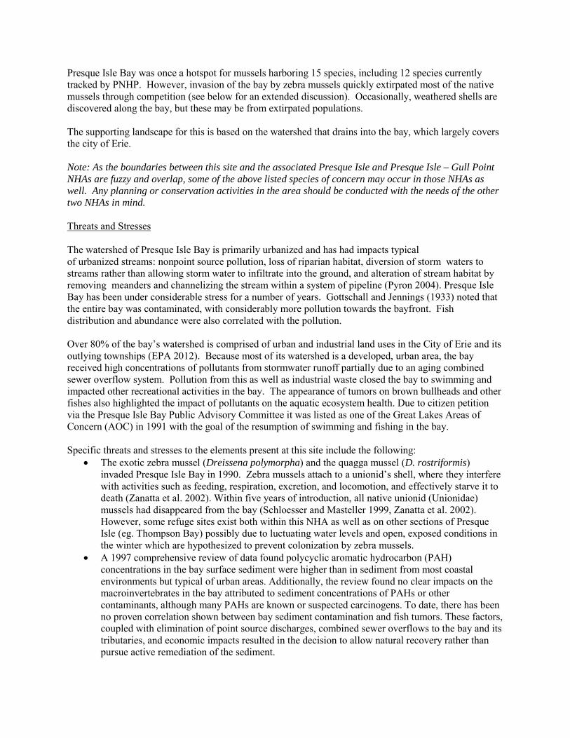
Presque Isle Bay was once a hotspot for mussels harboring 15 species, including 12 species currently tracked by PNHP. However, invasion of the bay by zebra mussels quickly extirpated most of the native mussels through competition (see below for an extended discussion). Occasionally, weathered shells are discovered along the bay, but these may be from extirpated populations. The supporting landscape for this is based on the watershed that drains into the bay, which largely covers the city of Erie. Note: As the boundaries between this site and the associated Presque Isle and Presque Isle – Gull Point NHAs are fuzzy and overlap, some of the above listed species of concern may occur in those NHAs as well. Any planning or conservation activities in the area should be conducted with the needs of the other two NHAs in mind. Threats and Stresses The watershed of Presque Isle Bay is primarily urbanized and has had impacts typical of urbanized streams: nonpoint source pollution, loss of riparian habitat, diversion of storm waters to streams rather than allowing storm water to infiltrate into the ground, and alteration of stream habitat by removing meanders and channelizing the stream within a system of pipeline (Pyron 2004). Presque Isle Bay has been under considerable stress for a number of years. Gottschall and Jennings (1933) noted that the entire bay was contaminated, with considerably more pollution towards the bayfront. Fish distribution and abundance were also correlated with the pollution. Over 80% of the bay’s watershed is comprised of urban and industrial land uses in the City of Erie and its outlying townships (EPA 2012). Because most of its watershed is a developed, urban area, the bay received high concentrations of pollutants from stormwater runoff partially due to an aging combined sewer overflow system. Pollution from this as well as industrial waste closed the bay to swimming and impacted other recreational activities in the bay. The appearance of tumors on brown bullheads and other fishes also highlighted the impact of pollutants on the aquatic ecosystem health. Due to citizen petition via the Presque Isle Bay Public Advisory Committee it was listed as one of the Great Lakes Areas of Concern (AOC) in 1991 with the goal of the resumption of swimming and fishing in the bay. Specific threats and stresses to the elements present at this site include the following:
• The exotic zebra mussel (Dreissena polymorpha) and the quagga mussel (D. rostriformis) invaded Presque Isle Bay in 1990. Zebra mussels attach to a unionid’s shell, where they interfere with activities such as feeding, respiration, excretion, and locomotion, and effectively starve it to death (Zanatta et al. 2002). Within five years of introduction, all native unionid (Unionidae) mussels had disappeared from the bay (Schloesser and Masteller 1999, Zanatta et al. 2002). However, some refuge sites exist both within this NHA as well as on other sections of Presque Isle (eg. Thompson Bay) possibly due to luctuating water levels and open, exposed conditions in the winter which are hypothesized to prevent colonization by zebra mussels.
• A 1997 comprehensive review of data found polycyclic aromatic hydrocarbon (PAH) concentrations in the bay surface sediment were higher than in sediment from most coastal environments but typical of urban areas. Additionally, the review found no clear impacts on the macroinvertebrates in the bay attributed to sediment concentrations of PAHs or other contaminants, although many PAHs are known or suspected carcinogens. To date, there has been no proven correlation shown between bay sediment contamination and fish tumors. These factors, coupled with elimination of point source discharges, combined sewer overflows to the bay and its tributaries, and economic impacts resulted in the decision to allow natural recovery rather than pursue active remediation of the sediment.
Conservation Recommendations The Presque Isle Bay Public Advisory Committee (PAC) provides advice to Pennsylvania Department of Environmental Protection (PA-DEP) for developing a Remedial Action Plan to restore beneficial uses in the Bay. As a community partnership, the PAC’s mission is to enhance and protect the environmental quality and economic vitality of the Bay and its watershed. The following steps are recommended to ensure the persistence of these species at this site:
• As this site is adjacent to an urbanized area, and receives a significant amount of polluted runoff, efforts should be made to control and reduce the amount of stormwater entering the system. Passive green infrastructure, such as trees, constructed wetlands, and other similar methods would allow for natural infiltration and uptake of stormwater and will help mitigate the impact of runoff.
Location and Additional Information
Municipalities: Millcreek Township and the City of Erie USGS quads: Erie North, Erie South, Swanville 1993 Erie CNHI reference: Presque Isle BDA Associated NHAs: Presque Isle NHA, Presque Isle – Gull Point NHA. Overlapping Protected Lands: None (open water habitat) PNHP Significance Rank: Global References Diz, H. R. 2005. An assessment of sediment contamination in Presque Isle Bay, PA, with historical comparisons. Aquatic
Ecosystem Health & Management. 8: 21-31. Gottschall, R. Y. and Jennings, O. E. 1933. Limnological Studies at Erie, Pa. Transactions of the American Microscopical
Society. 52: 181-191. Glacial Origin of Presque Isle, Lake Erie. T. Dwight Ingersoll. The American Naturalist , Vol. 19, No. 9 (Sep., 1885), pp. 865-
867 Presque Isle Bay Area of Concern. http://www.epa.gov/glnpo/aoc/presque.html. Accessed: 2012-02-18. Masteller, E.C., K.R. Maleski and D.W. Schloesser. 1993. Unionid bivalves (Mollusca: Bivalvia: Unionidae) of Presque Isle Bay,
Erie, Pennsylvania. Journal of the Pennsylvania Academy of Science. 67: 120-126. Phillips, E. C. 2008. Invertebrate Colonization of Native and Invasive Aquatic Macrophytes in Presque Isle Bay, Lake Erie.
Journal of Freshwater Ecology 23: 451-457. DOI: 10.1080/02705060.2008.9664223 Pyron, M, R. A. Ruffing, A. L. Lambert. 2004. Assessment of Fishes of the Presque Isle Bay Watershed, Erie, PA. Northeastern
Naturalist 11:261-272. Ricciardi, A., Neves, R. J. and Rasmussen, J. B. 1998. Impending extinctions of North American freshwater mussels (Unionoida)
following the zebra mussel (Dreissena polymorpha) invasion . Journal of Animal Ecology, 67: 613–619. doi: 10.1046/j.1365-2656.1998.00220.x
Schloesser , D. W., and E. C. Masteller. 1999. Mortality of Unionid Bivalves (Mollusca) Associated with Dreissenid Mussels (Dreissena polymorpha and D. bugensis) in Presque Isle Bay, Lake Erie. Northeastern Naturalist. 6: 341-352.
Zanatta, D. T., Mackie, G. L. Mackie, Metcalfe-Smith, J. L., and Woolnough, D. A. 2002. A Refuge for Native Freshwater Mussels (Bivalvia: Unionidae) from Impacts of the Exotic Zebra Mussel (Dreissena polymorpha) in Lake St. Clair. Journal of Great Lakes Research. 28:479–489
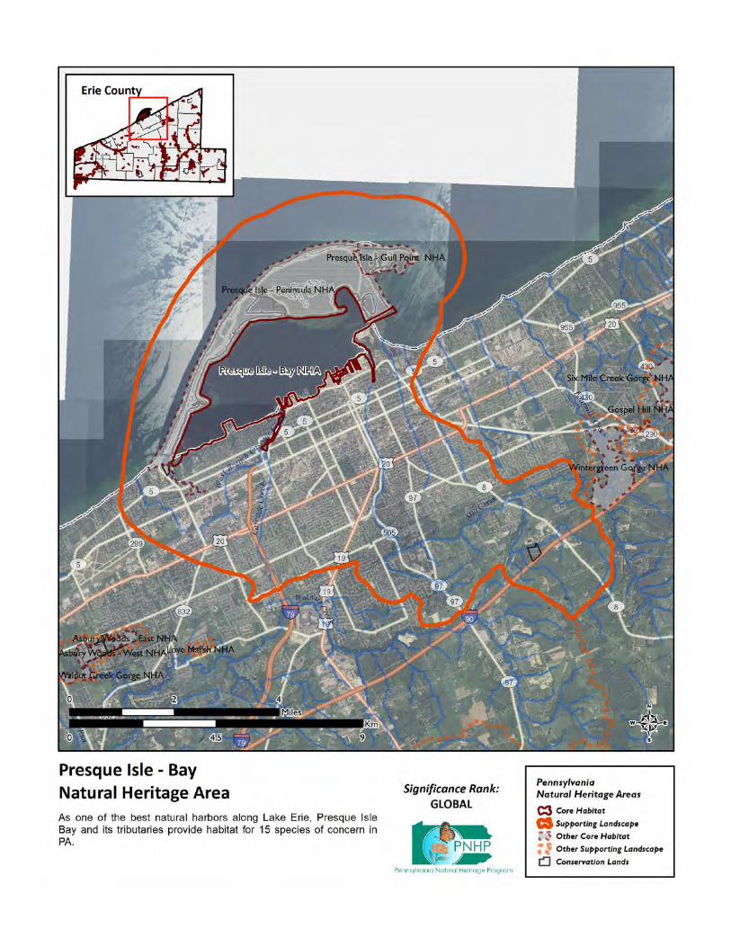
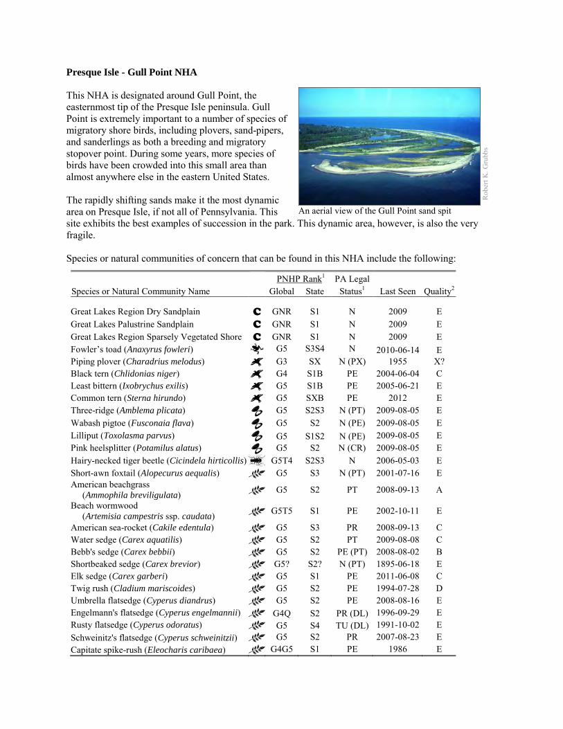
Presque Isle - Gull Point NHA This NHA is designated around Gull Point, the easternmost tip of the Presque Isle peninsula. Gull Point is extremely important to a number of species of migratory shore birds, including plovers, sand-pipers, and sanderlings as both a breeding and migratory stopover point. During some years, more species of birds have been crowded into this small area than almost anywhere else in the eastern United States. The rapidly shifting sands make it the most dynamic area on Presque Isle, if not all of Pennsylvania. This site exhibits the best examples of succession in the park. This dynamic area, however, is also the very fragile. Species or natural communities of concern that can be found in this NHA include the following:
PNHP Rank1 PA Legal Species or Natural Community Name Global State Status1 Last Seen Quality2 Great Lakes Region Dry Sandplain C GNR S1 N 2009 E Great Lakes Palustrine Sandplain C GNR S1 N 2009 E Great Lakes Region Sparsely Vegetated Shore C GNR S1 N 2009 E Fowler’s toad (Anaxyrus fowleri) G5 S3S4 N 2010-06-14 E Piping plover (Charadrius melodus) G3 SX N (PX) 1955 X? Black tern (Chlidonias niger) G4 S1B PE 2004-06-04 C Least bittern (Ixobrychus exilis) G5 S1B PE 2005-06-21 E Common tern (Sterna hirundo) G5 SXB PE 2012 E Three-ridge (Amblema plicata) G5 S2S3 N (PT) 2009-08-05 E Wabash pigtoe (Fusconaia flava) G5 S2 N (PE) 2009-08-05 E Lilliput (Toxolasma parvus) G5 S1S2 N (PE) 2009-08-05 E Pink heelsplitter (Potamilus alatus) G5 S2 N (CR) 2009-08-05 E Hairy-necked tiger beetle (Cicindela hirticollis) G5T4 S2S3 N 2006-05-03 E Short-awn foxtail (Alopecurus aequalis) G5 S3 N (PT) 2001-07-16 E American beachgrass (Ammophila breviligulata) G5 S2 PT 2008-09-13 A
Beach wormwood (Artemisia campestris ssp. caudata) G5T5 S1 PE 2002-10-11 E
American sea-rocket (Cakile edentula) G5 S3 PR 2008-09-13 C Water sedge (Carex aquatilis) G5 S2 PT 2009-08-08 C Bebb's sedge (Carex bebbii) G5 S2 PE (PT) 2008-08-02 B Shortbeaked sedge (Carex brevior) G5? S2? N (PT) 1895-06-18 E Elk sedge (Carex garberi) G5 S1 PE 2011-06-08 C Twig rush (Cladium mariscoides) G5 S2 PE 1994-07-28 D Umbrella flatsedge (Cyperus diandrus) G5 S2 PE 2008-08-16 E Engelmann's flatsedge (Cyperus engelmannii) G4Q S2 PR (DL) 1996-09-29 E Rusty flatsedge (Cyperus odoratus) G5 S4 TU (DL) 1991-10-02 E Schweinitz's flatsedge (Cyperus schweinitzii) G5 S2 PR 2007-08-23 E Capitate spike-rush (Eleocharis caribaea) G4G5 S1 PE 1986 E
Rob
ert K
. Gru
bbs
An aerial view of the Gull Point sand spit
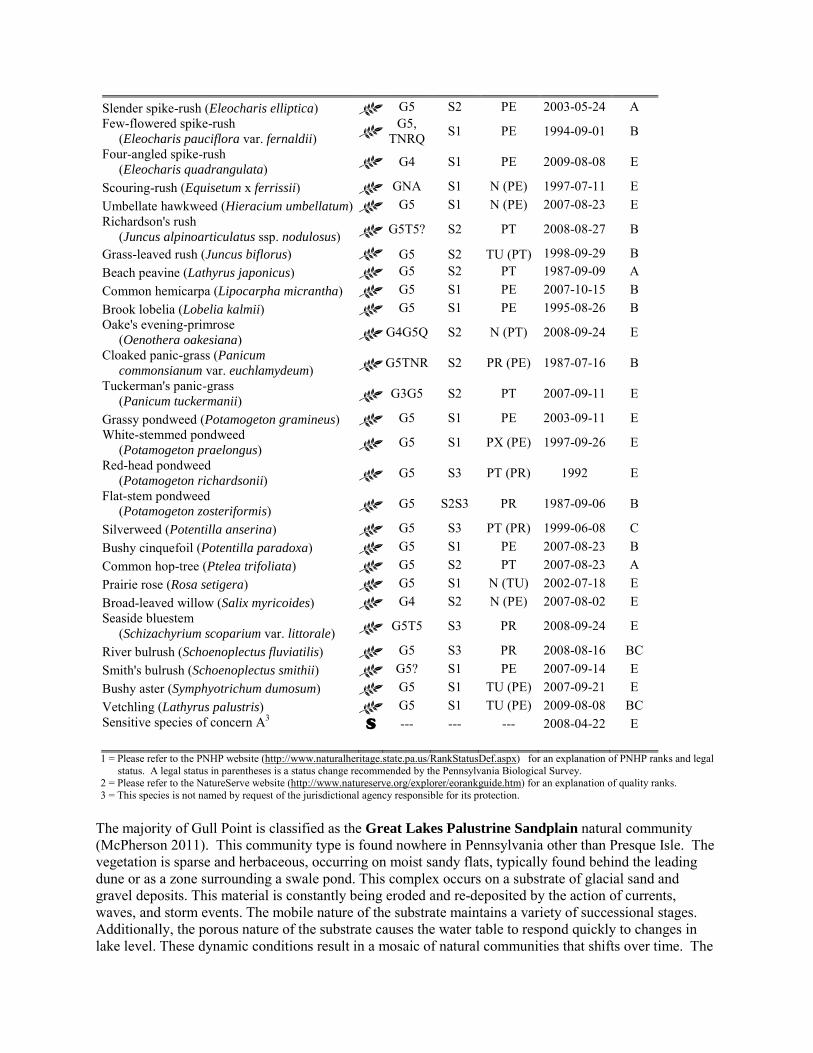
Slender spike-rush (Eleocharis elliptica) G5 S2 PE 2003-05-24 A Few-flowered spike-rush (Eleocharis pauciflora var. fernaldii)
G5, TNRQ S1 PE 1994-09-01 B
Four-angled spike-rush (Eleocharis quadrangulata) G4 S1 PE 2009-08-08 E
Scouring-rush (Equisetum x ferrissii) GNA S1 N (PE) 1997-07-11 E Umbellate hawkweed (Hieracium umbellatum) G5 S1 N (PE) 2007-08-23 E Richardson's rush (Juncus alpinoarticulatus ssp. nodulosus) G5T5? S2 PT 2008-08-27 B
Grass-leaved rush (Juncus biflorus) G5 S2 TU (PT) 1998-09-29 B Beach peavine (Lathyrus japonicus) G5 S2 PT 1987-09-09 A Common hemicarpa (Lipocarpha micrantha) G5 S1 PE 2007-10-15 B Brook lobelia (Lobelia kalmii) G5 S1 PE 1995-08-26 B Oake's evening-primrose (Oenothera oakesiana) G4G5Q S2 N (PT) 2008-09-24 E
Cloaked panic-grass (Panicum commonsianum var. euchlamydeum) G5TNR S2 PR (PE) 1987-07-16 B
Tuckerman's panic-grass (Panicum tuckermanii) G3G5 S2 PT 2007-09-11 E
Grassy pondweed (Potamogeton gramineus) G5 S1 PE 2003-09-11 E White-stemmed pondweed (Potamogeton praelongus) G5 S1 PX (PE) 1997-09-26 E
Red-head pondweed (Potamogeton richardsonii) G5 S3 PT (PR) 1992 E
Flat-stem pondweed (Potamogeton zosteriformis) G5 S2S3 PR 1987-09-06 B
Silverweed (Potentilla anserina) G5 S3 PT (PR) 1999-06-08 C Bushy cinquefoil (Potentilla paradoxa) G5 S1 PE 2007-08-23 B Common hop-tree (Ptelea trifoliata) G5 S2 PT 2007-08-23 A Prairie rose (Rosa setigera) G5 S1 N (TU) 2002-07-18 E Broad-leaved willow (Salix myricoides) G4 S2 N (PE) 2007-08-02 E Seaside bluestem (Schizachyrium scoparium var. littorale) G5T5 S3 PR 2008-09-24 E
River bulrush (Schoenoplectus fluviatilis) G5 S3 PR 2008-08-16 BC Smith's bulrush (Schoenoplectus smithii) G5? S1 PE 2007-09-14 E Bushy aster (Symphyotrichum dumosum) G5 S1 TU (PE) 2007-09-21 E Vetchling (Lathyrus palustris) G5 S1 TU (PE) 2009-08-08 BC Sensitive species of concern A3 S --- --- --- 2008-04-22 E 1 = Please refer to the PNHP website (http://www.naturalheritage.state.pa.us/RankStatusDef.aspx) for an explanation of PNHP ranks and legal
status. A legal status in parentheses is a status change recommended by the Pennsylvania Biological Survey. 2 = Please refer to the NatureServe website (http://www.natureserve.org/explorer/eorankguide.htm) for an explanation of quality ranks. 3 = This species is not named by request of the jurisdictional agency responsible for its protection.
The majority of Gull Point is classified as the Great Lakes Palustrine Sandplain natural community (McPherson 2011). This community type is found nowhere in Pennsylvania other than Presque Isle. The vegetation is sparse and herbaceous, occurring on moist sandy flats, typically found behind the leading dune or as a zone surrounding a swale pond. This complex occurs on a substrate of glacial sand and gravel deposits. This material is constantly being eroded and re-deposited by the action of currents, waves, and storm events. The mobile nature of the substrate maintains a variety of successional stages. Additionally, the porous nature of the substrate causes the water table to respond quickly to changes in lake level. These dynamic conditions result in a mosaic of natural communities that shifts over time. The
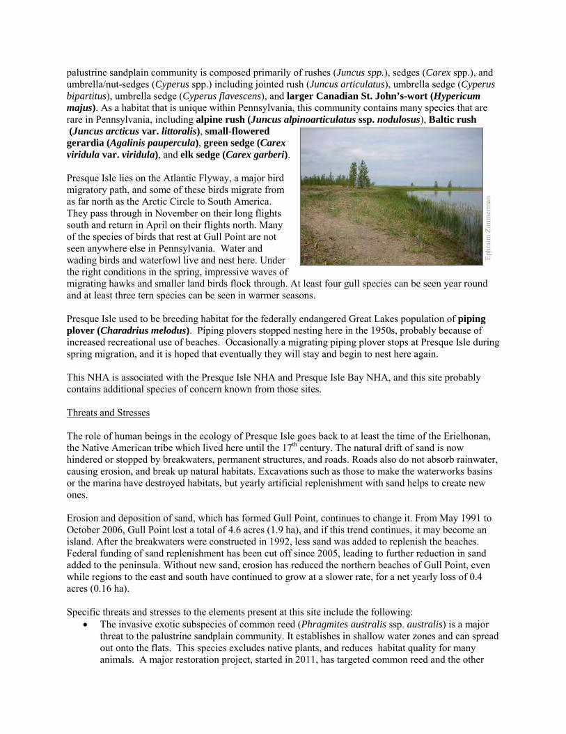
palustrine sandplain community is composed primarily of rushes (Juncus spp.), sedges (Carex spp.), and umbrella/nut-sedges (Cyperus spp.) including jointed rush (Juncus articulatus), umbrella sedge (Cyperus bipartitus), umbrella sedge (Cyperus flavescens), and larger Canadian St. John’s-wort (Hypericum majus). As a habitat that is unique within Pennsylvania, this community contains many species that are rare in Pennsylvania, including alpine rush (Juncus alpinoarticulatus ssp. nodulosus), Baltic rush (Juncus arcticus var. littoralis), small-flowered gerardia (Agalinis paupercula), green sedge (Carex viridula var. viridula), and elk sedge (Carex garberi). Presque Isle lies on the Atlantic Flyway, a major bird migratory path, and some of these birds migrate from as far north as the Arctic Circle to South America. They pass through in November on their long flights south and return in April on their flights north. Many of the species of birds that rest at Gull Point are not seen anywhere else in Pennsylvania. Water and wading birds and waterfowl live and nest here. Under the right conditions in the spring, impressive waves of migrating hawks and smaller land birds flock through. At least four gull species can be seen year round and at least three tern species can be seen in warmer seasons. Presque Isle used to be breeding habitat for the federally endangered Great Lakes population of piping plover (Charadrius melodus). Piping plovers stopped nesting here in the 1950s, probably because of increased recreational use of beaches. Occasionally a migrating piping plover stops at Presque Isle during spring migration, and it is hoped that eventually they will stay and begin to nest here again. This NHA is associated with the Presque Isle NHA and Presque Isle Bay NHA, and this site probably contains additional species of concern known from those sites. Threats and Stresses The role of human beings in the ecology of Presque Isle goes back to at least the time of the Erielhonan, the Native American tribe which lived here until the 17th century. The natural drift of sand is now hindered or stopped by breakwaters, permanent structures, and roads. Roads also do not absorb rainwater, causing erosion, and break up natural habitats. Excavations such as those to make the waterworks basins or the marina have destroyed habitats, but yearly artificial replenishment with sand helps to create new ones. Erosion and deposition of sand, which has formed Gull Point, continues to change it. From May 1991 to October 2006, Gull Point lost a total of 4.6 acres (1.9 ha), and if this trend continues, it may become an island. After the breakwaters were constructed in 1992, less sand was added to replenish the beaches. Federal funding of sand replenishment has been cut off since 2005, leading to further reduction in sand added to the peninsula. Without new sand, erosion has reduced the northern beaches of Gull Point, even while regions to the east and south have continued to grow at a slower rate, for a net yearly loss of 0.4 acres (0.16 ha). Specific threats and stresses to the elements present at this site include the following:
• The invasive exotic subspecies of common reed (Phragmites australis ssp. australis) is a major threat to the palustrine sandplain community. It establishes in shallow water zones and can spread out onto the flats. This species excludes native plants, and reduces habitat quality for many animals. A major restoration project, started in 2011, has targeted common reed and the other
Ephr
aim
Zim
mer
man
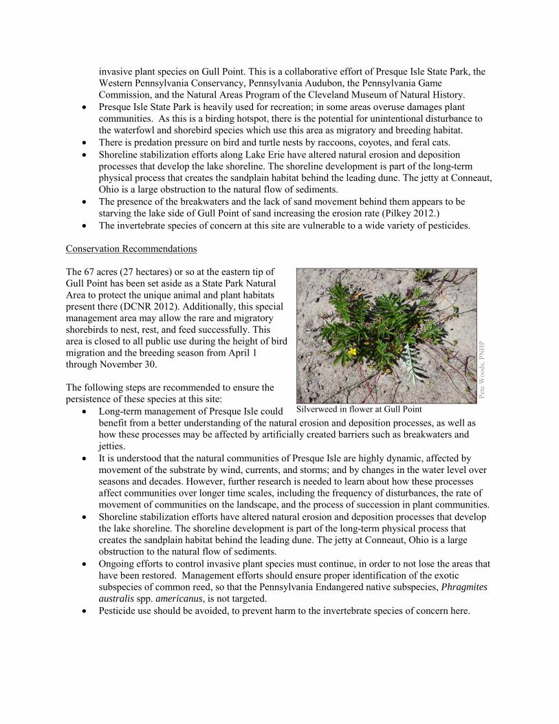
invasive plant species on Gull Point. This is a collaborative effort of Presque Isle State Park, the Western Pennsylvania Conservancy, Pennsylvania Audubon, the Pennsylvania Game Commission, and the Natural Areas Program of the Cleveland Museum of Natural History.
• Presque Isle State Park is heavily used for recreation; in some areas overuse damages plant communities. As this is a birding hotspot, there is the potential for unintentional disturbance to the waterfowl and shorebird species which use this area as migratory and breeding habitat.
• There is predation pressure on bird and turtle nests by raccoons, coyotes, and feral cats. • Shoreline stabilization efforts along Lake Erie have altered natural erosion and deposition
processes that develop the lake shoreline. The shoreline development is part of the long-term physical process that creates the sandplain habitat behind the leading dune. The jetty at Conneaut, Ohio is a large obstruction to the natural flow of sediments.
• The presence of the breakwaters and the lack of sand movement behind them appears to be starving the lake side of Gull Point of sand increasing the erosion rate (Pilkey 2012.)
• The invertebrate species of concern at this site are vulnerable to a wide variety of pesticides. Conservation Recommendations The 67 acres (27 hectares) or so at the eastern tip of Gull Point has been set aside as a State Park Natural Area to protect the unique animal and plant habitats present there (DCNR 2012). Additionally, this special management area may allow the rare and migratory shorebirds to nest, rest, and feed successfully. This area is closed to all public use during the height of bird migration and the breeding season from April 1 through November 30. The following steps are recommended to ensure the persistence of these species at this site:
• Long-term management of Presque Isle could benefit from a better understanding of the natural erosion and deposition processes, as well as how these processes may be affected by artificially created barriers such as breakwaters and jetties.
• It is understood that the natural communities of Presque Isle are highly dynamic, affected by movement of the substrate by wind, currents, and storms; and by changes in the water level over seasons and decades. However, further research is needed to learn about how these processes affect communities over longer time scales, including the frequency of disturbances, the rate of movement of communities on the landscape, and the process of succession in plant communities.
• Shoreline stabilization efforts have altered natural erosion and deposition processes that develop the lake shoreline. The shoreline development is part of the long-term physical process that creates the sandplain habitat behind the leading dune. The jetty at Conneaut, Ohio is a large obstruction to the natural flow of sediments.
• Ongoing efforts to control invasive plant species must continue, in order to not lose the areas that have been restored. Management efforts should ensure proper identification of the exotic subspecies of common reed, so that the Pennsylvania Endangered native subspecies, Phragmites australis spp. americanus, is not targeted.
• Pesticide use should be avoided, to prevent harm to the invertebrate species of concern here.
Pete
Woo
ds, P
NH
P
Silverweed in flower at Gull Point
Location and Additional Information
Municipalities: Millcreek Township USGS quads: Erie North 1993 Erie CNHI reference: Presque Isle BDA Associated NHAs: Presque Isle NHA, Presque Isle Bay NHA Overlapping Protected Lands: Presque Isle State Park PNHP Significance Rank: Global References Bissell JK (1993) Rare plants and rare plant communities of Presque Isle. Bartonia 57:2–8 Bissell, J.K., P MacKeigan, G Ormiston, S Aviram and K Burls. 2007. Natural Communities of Gull Point, Presque Isle State
Park. Report to Western Pennsylvania Conservancy. Cleveland Museum of Natural History. Davis, A. F. 1993. Rare Wetland Plants and Their Habitats in Pennsylvania. Proceedings of the Academy of Natural Sciences of
Philadelphia. 114; 254-262. Department of Conservation and Natural Resources. 2012. State Park Natural Areas.
http://www.dcnr.state.pa.us/stateparks/recreation/naturalareas/where/index.htm Date Accessed November 30, 2012. Foyle, A.M. and Norton, K.P., 2006. Late Holocene Nearshore Change at a Nontidal Transgressive Systems Tract Strandplain
Complex, Presque Isle, Pennsylvania, U.S.A. Journal of Coastal Research, 22(2), 406-423. West Palm Beach (Florida), ISSN 0749-0208.
Ingersoll, T. D. 1885. Glacial Origin of Presque Isle, Lake Erie. The American Naturalist. 19:865-867 Jennings, O.E. 1909. A botanical survey of Presque Isle, Erie County, Pennsylvania. Ann. Carnegie Mus. 5:289-419. Kormondy, E. 1969. Comparative ecology of sandspit ponds. Amer. Midl. Nat. 82:28-61. McPherson 2011. Pennsylvania Natural Heritage Program. Great Lakes Palustrine Sandplain Factsheet. Available from:
http://www.naturalheritage.state.pa.us/Community.aspx?=16003 Date Accessed: March 01, 2012 Nord, A.N. and A. Gover. 2011. Invasive Plants at Presque Isle State Park: A Five-Year Management Plan. Submitted to Presque
Isle State Park management. Andrew Morang, Michael C. Mohr, and Craig M. Forgette. 2011. Longshore Sediment Movement and Supply along the U.S.
Shoreline of Lake Erie. Journal of Coastal Research: Volume 27, Issue 4: 619-635. Pilkey, O. H. 2012. Presque Isle Breakwaters: Successful Failures? Pitfalls of Shoreline Stabilization. Coastal Research Library,
2012, Volume 3, 131-139. Schaney, Christopher. 2003. The History of Presque Isle and the City of Erie, Pennsylvania: A Remote Sensing Case Study.
Thesis submitted to the Eberly College of Arts and Sciences at West Virginia University. http://wvuscholar.wvu.edu:8881//exlibris/dtl/d3_1/apache_media/L2V4bGlicmlzL2R0bC9kM18xL2FwYWNoZV9tZWRpYS82OTA5.pdf
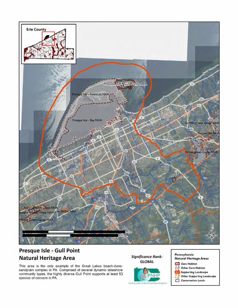
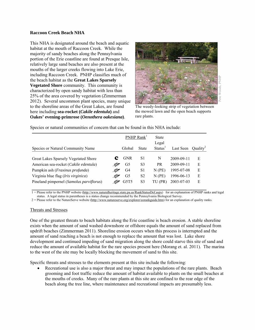
Raccoon Creek Beach NHA This NHA is designated around the beach and aquatic habitat at the mouth of Raccoon Creek. While the majority of sandy beaches along the Pennsylvania portion of the Erie coastline are found at Presque Isle, relatively large sand beaches are also present at the mouths of the larger creeks flowing into Lake Erie, including Raccoon Creek. PNHP classifies much of the beach habitat as the Great Lakes Sparsely Vegetated Shore community. This community is characterized by open sandy habitat with less than 25% of the area covered by vegetation (Zimmerman 2012). Several uncommon plant species, many unique to the shoreline areas of the Great Lakes, are found here including sea-rocket (Cakile edentula) and Oakes’ evening-primrose (Oenothera oakesiana). Species or natural communities of concern that can be found in this NHA include:
PNHP Rank1 State
Species or Natural Community Name
Global State Legal
Status1 Last Seen Quality2 Great Lakes Sparsely Vegetated Shore C GNR S1 N 2009-09-11 E American sea-rocket (Cakile edentula) G5 S3 PR 2009-09-11 E Pumpkin ash (Fraxinus profunda) G4 S1 N (PE) 1995-07-08 E Virginia blue flag (Iris virginica) G5 S2 N (PE) 1996-06-13 E Pineland pimpernel (Samolus parviflorus) G5T5 S3 TU (PR) 2003-07-03 E 1 = Please refer to the PNHP website (http://www.naturalheritage.state.pa.us/RankStatusDef.aspx) for an explanation of PNHP ranks and legal
status. A legal status in parentheses is a status change recommended by the Pennsylvania Biological Survey. 2 = Please refer to the NatureServe website (http://www.natureserve.org/explorer/eorankguide.htm) for an explanation of quality ranks.
Threats and Stresses One of the greatest threats to beach habitats along the Erie coastline is beach erosion. A stable shoreline exists when the amount of sand washed downshore or offshore equals the amount of sand replaced from updrift beaches (Zimmerman 2011). Shoreline erosion occurs when this process is interrupted and the amount of sand reaching a beach is not enough to replace the amount that was lost. Lake shore development and continued impeding of sand migration along the shore could starve this site of sand and reduce the amount of available habitat for the rare species present here (Morang et. al. 2011). The marina to the west of the site may be locally blocking the movement of sand to this site. Specific threats and stresses to the elements present at this site include the following:
• Recreational use is also a major threat and may impact the populations of the rare plants. Beach grooming and foot traffic reduce the amount of habitat available to plants on the small beaches at the mouths of creeks. Many of the rare plants at this site are confined to the rear edge of the beach along the tree line, where maintenance and recreational impacts are presumably less.
Pete
Woo
ds, P
NH
P
The weedy-looking strip of vegetation between the mowed lawn and the open beach supports rare plants.
• Construction of marinas and groins, blocks the natural movement of beach sediment by wave action. Larger structures may cause currents to carry sediment offshore to deeper water, rather than transport it farther down the beach.
Conservation Recommendations The Core Habitat of this site is nearly all within Raccoon Creek Park, owned and managed by Springfield Township. Raccoon Creek Park was purchased in 1965 as a Project 70 site, which limits the use of the land to conservation, recreation, and historical preservation (Environmental Planning and Design, LLC and Toole Recreation Planning, 2009). The following steps are recommended to ensure the persistence of these species at this site:
• A management plan should be developed for the site taking into account the presence of the rare species.
• Long-term management of this site and the rest of the Erie Shoreline could benefit from a better understanding of the natural erosion and deposition processes, as well as how these processes may be affected by artificially created barriers such as breakwaters and jetties.
• Insects, including beetles and lepidopterans, may form a substantial part of the biodiversity of these communities. Open gravel and cobble areas along the coast should be inventoried for rare plants and animals, especially insects.
Location and Additional Information
Municipalities: Springfield USGS quads: East Springfield 1993 Erie CNHI reference: Previously unidentified site Associated NHAs: Overlapping Protected Lands: Springfield Township—Raccoon Park PNHP Significance Rank: State References Environmental Planning and Design, LLC and Toole Recreation Planning. 2009. Park Master Planning: Eagley, Raccoon Creek,
and Bicentennial Parks. Produced for Springfield Township, Erie County. Available from: http://www.dep.state.pa.us/river/grants/prevfunded/2007/docs/2007-PE-08.pdf
Morang, A., Mohr, M. C., and Forgette, C. M. 2011. Longshore Sediment Movement and Supply along the U.S. Shoreline of Lake Erie. Journal of Coastal Research 27: 619-635.
Zimmerman 2011. Pennsylvania Natural Heritage Program. Great Lakes Sparsely Vegetated Shore Factsheet. Available from: http://www.naturalheritage.state.pa.us/Community.aspx?=16077 Date Accessed: March 13, 2012
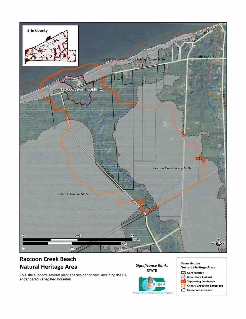
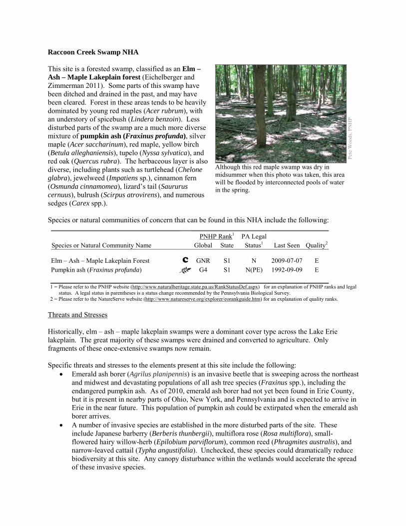
Raccoon Creek Swamp NHA This site is a forested swamp, classified as an Elm – Ash – Maple Lakeplain forest (Eichelberger and Zimmerman 2011). Some parts of this swamp have been ditched and drained in the past, and may have been cleared. Forest in these areas tends to be heavily dominated by young red maples (Acer rubrum), with an understory of spicebush (Lindera benzoin). Less disturbed parts of the swamp are a much more diverse mixture of pumpkin ash (Fraxinus profunda), silver maple (Acer saccharinum), red maple, yellow birch (Betula alleghaniensis), tupelo (Nyssa sylvatica), and red oak (Quercus rubra). The herbaceous layer is also diverse, including plants such as turtlehead (Chelone glabra), jewelweed (Impatiens sp.), cinnamon fern (Osmunda cinnamomea), lizard’s tail (Saururus cernuus), bulrush (Scirpus atrovirens), and numerous sedges (Carex spp.). Species or natural communities of concern that can be found in this NHA include the following:
PNHP Rank1 PA Legal Species or Natural Community Name Global State Status1 Last Seen Quality2 Elm – Ash – Maple Lakeplain Forest C GNR S1 N 2009-07-07 E Pumpkin ash (Fraxinus profunda) G4 S1 N(PE) 1992-09-09 E 1 = Please refer to the PNHP website (http://www.naturalheritage.state.pa.us/RankStatusDef.aspx) for an explanation of PNHP ranks and legal
status. A legal status in parentheses is a status change recommended by the Pennsylvania Biological Survey. 2 = Please refer to the NatureServe website (http://www.natureserve.org/explorer/eorankguide.htm) for an explanation of quality ranks.
Threats and Stresses Historically, elm – ash – maple lakeplain swamps were a dominant cover type across the Lake Erie lakeplain. The great majority of these swamps were drained and converted to agriculture. Only fragments of these once-extensive swamps now remain. Specific threats and stresses to the elements present at this site include the following:
• Emerald ash borer (Agrilus planipennis) is an invasive beetle that is sweeping across the northeast and midwest and devastating populations of all ash tree species (Fraxinus spp.), including the endangered pumpkin ash. As of 2010, emerald ash borer had not yet been found in Erie County, but it is present in nearby parts of Ohio, New York, and Pennsylvania and is expected to arrive in Erie in the near future. This population of pumpkin ash could be extirpated when the emerald ash borer arrives.
• A number of invasive species are established in the more disturbed parts of the site. These include Japanese barberry (Berberis thunbergii), multiflora rose (Rosa multiflora), small-flowered hairy willow-herb (Epilobium parviflorum), common reed (Phragmites australis), and narrow-leaved cattail (Typha angustifolia). Unchecked, these species could dramatically reduce biodiversity at this site. Any canopy disturbance within the wetlands would accelerate the spread of these invasive species.
Pete
Woo
ds, P
NH
P
Although this red maple swamp was dry in midsummer when this photo was taken, this area will be flooded by interconnected pools of water in the spring.
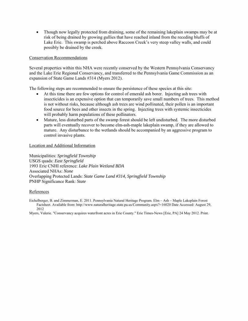
• Though now legally protected from draining, some of the remaining lakeplain swamps may be at risk of being drained by growing gullies that have reached inland from the receding bluffs of Lake Erie. This swamp is perched above Raccoon Creek’s very steep valley walls, and could possibly be drained by the creek.
Conservation Recommendations Several properties within this NHA were recently conserved by the Western Pennsylvania Conservancy and the Lake Erie Regional Conservancy, and transferred to the Pennsylvania Game Commission as an expansion of State Game Lands #314 (Myers 2012). The following steps are recommended to ensure the persistence of these species at this site:
• At this time there are few options for control of emerald ash borer. Injecting ash trees with insecticides is an expensive option that can temporarily save small numbers of trees. This method is not without risks, because although ash trees are wind pollinated, their pollen is an important food source for bees and other insects in the spring. Injecting trees with systemic insecticides will probably harm populations of these pollinators.
• Mature, less disturbed parts of the swamp forest should be left undisturbed. The more disturbed parts will eventually recover to become elm-ash-maple lakeplain swamp, if they are allowed to mature. Any disturbance to the wetlands should be accompanied by an aggressive program to control invasive plants.
Location and Additional Information Municipalities: Springfield Township USGS quads: East Springfield 1993 Erie CNHI reference: Lake Plain Wetland BDA Associated NHAs: None Overlapping Protected Lands: State Game Land #314, Springfield Township PNHP Significance Rank: State References Eichelberger, B. and Zimmerman, E. 2011. Pennsylvania Natural Heritage Program. Elm – Ash – Maple Lakeplain Forest
Factsheet. Available from: http://www.naturalheritage.state.pa.us/Community.aspx?=16020 Date Accessed: August 29, 2012
Myers, Valerie. "Conservancy acquires waterfront acres in Erie County." Erie Times-News [Erie, PA] 24 May 2012. Print.
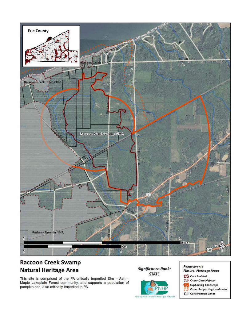
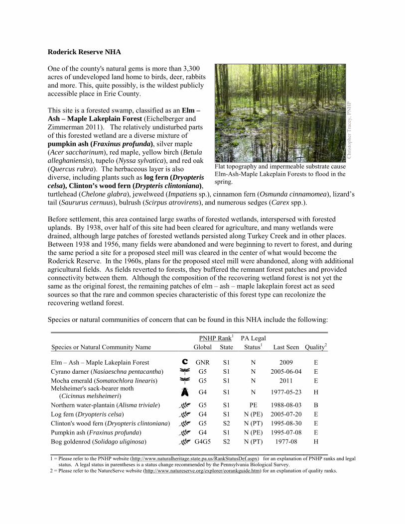
Roderick Reserve NHA One of the county's natural gems is more than 3,300 acres of undeveloped land home to birds, deer, rabbits and more. This, quite possibly, is the wildest publicly accessible place in Erie County. This site is a forested swamp, classified as an Elm – Ash – Maple Lakeplain Forest (Eichelberger and Zimmerman 2011). The relatively undisturbed parts of this forested wetland are a diverse mixture of pumpkin ash (Fraxinus profunda), silver maple (Acer saccharinum), red maple, yellow birch (Betula alleghaniensis), tupelo (Nyssa sylvatica), and red oak (Quercus rubra). The herbaceous layer is also diverse, including plants such as log fern (Dryopteris celsa), Clinton’s wood fern (Drypteris clintoniana), turtlehead (Chelone glabra), jewelweed (Impatiens sp.), cinnamon fern (Osmunda cinnamomea), lizard’s tail (Saururus cernuus), bulrush (Scirpus atrovirens), and numerous sedges (Carex spp.). Before settlement, this area contained large swaths of forested wetlands, interspersed with forested uplands. By 1938, over half of this site had been cleared for agriculture, and many wetlands were drained, although large patches of forested wetlands persisted along Turkey Creek and in other places. Between 1938 and 1956, many fields were abandoned and were beginning to revert to forest, and during the same period a site for a proposed steel mill was cleared in the center of what would become the Roderick Reserve. In the 1960s, plans for the proposed steel mill were abandoned, along with additional agricultural fields. As fields reverted to forests, they buffered the remnant forest patches and provided connectivity between them. Although the composition of the recovering wetland forest is not yet the same as the original forest, the remaining patches of elm – ash – maple lakeplain forest act as seed sources so that the rare and common species characteristic of this forest type can recolonize the recovering wetland forest. Species or natural communities of concern that can be found in this NHA include the following: PNHP Rank1 PA Legal Species or Natural Community Name Global State Status1 Last Seen Quality2 Elm – Ash – Maple Lakeplain Forest C GNR S1 N 2009 E Cyrano darner (Nasiaeschna pentacantha) G5 S1 N 2005-06-04 E Mocha emerald (Somatochlora linearis) G5 S1 N 2011 E Melsheimer's sack-bearer moth (Cicinnus melsheimeri) G4 S1 N 1977-05-23 H
Northern water-plantain (Alisma triviale) G5 S1 PE 1988-08-03 B Log fern (Dryopteris celsa) G4 S1 N (PE) 2005-07-20 E Clinton's wood fern (Dryopteris clintoniana) G5 S2 N (PT) 1995-08-30 E Pumpkin ash (Fraxinus profunda) G4 S1 N (PE) 1995-07-08 E Bog goldenrod (Solidago uliginosa) G4G5 S2 N (PT) 1977-08 H 1 = Please refer to the PNHP website (http://www.naturalheritage.state.pa.us/RankStatusDef.aspx) for an explanation of PNHP ranks and legal
status. A legal status in parentheses is a status change recommended by the Pennsylvania Biological Survey. 2 = Please refer to the NatureServe website (http://www.natureserve.org/explorer/eorankguide.htm) for an explanation of quality ranks.
Chr
istop
her T
race
y, P
NH
P
Flat topography and impermeable substrate cause Elm-Ash-Maple Lakeplain Forests to flood in the spring.
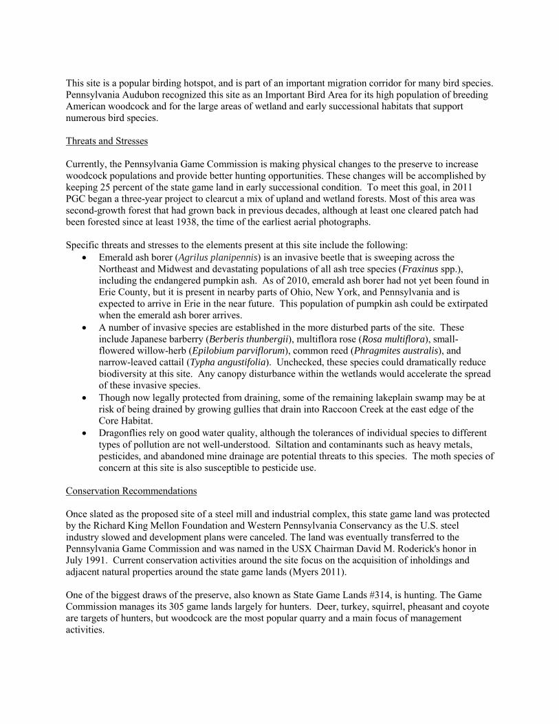
This site is a popular birding hotspot, and is part of an important migration corridor for many bird species. Pennsylvania Audubon recognized this site as an Important Bird Area for its high population of breeding American woodcock and for the large areas of wetland and early successional habitats that support numerous bird species. Threats and Stresses Currently, the Pennsylvania Game Commission is making physical changes to the preserve to increase woodcock populations and provide better hunting opportunities. These changes will be accomplished by keeping 25 percent of the state game land in early successional condition. To meet this goal, in 2011 PGC began a three-year project to clearcut a mix of upland and wetland forests. Most of this area was second-growth forest that had grown back in previous decades, although at least one cleared patch had been forested since at least 1938, the time of the earliest aerial photographs. Specific threats and stresses to the elements present at this site include the following:
• Emerald ash borer (Agrilus planipennis) is an invasive beetle that is sweeping across the Northeast and Midwest and devastating populations of all ash tree species (Fraxinus spp.), including the endangered pumpkin ash. As of 2010, emerald ash borer had not yet been found in Erie County, but it is present in nearby parts of Ohio, New York, and Pennsylvania and is expected to arrive in Erie in the near future. This population of pumpkin ash could be extirpated when the emerald ash borer arrives.
• A number of invasive species are established in the more disturbed parts of the site. These include Japanese barberry (Berberis thunbergii), multiflora rose (Rosa multiflora), small-flowered willow-herb (Epilobium parviflorum), common reed (Phragmites australis), and narrow-leaved cattail (Typha angustifolia). Unchecked, these species could dramatically reduce biodiversity at this site. Any canopy disturbance within the wetlands would accelerate the spread of these invasive species.
• Though now legally protected from draining, some of the remaining lakeplain swamp may be at risk of being drained by growing gullies that drain into Raccoon Creek at the east edge of the Core Habitat.
• Dragonflies rely on good water quality, although the tolerances of individual species to different types of pollution are not well-understood. Siltation and contaminants such as heavy metals, pesticides, and abandoned mine drainage are potential threats to this species. The moth species of concern at this site is also susceptible to pesticide use.
Conservation Recommendations Once slated as the proposed site of a steel mill and industrial complex, this state game land was protected by the Richard King Mellon Foundation and Western Pennsylvania Conservancy as the U.S. steel industry slowed and development plans were canceled. The land was eventually transferred to the Pennsylvania Game Commission and was named in the USX Chairman David M. Roderick's honor in July 1991. Current conservation activities around the site focus on the acquisition of inholdings and adjacent natural properties around the state game lands (Myers 2011). One of the biggest draws of the preserve, also known as State Game Lands #314, is hunting. The Game Commission manages its 305 game lands largely for hunters. Deer, turkey, squirrel, pheasant and coyote are targets of hunters, but woodcock are the most popular quarry and a main focus of management activities.
The following steps are recommended to ensure the persistence of these species at this site: • At this time there are few options for control of emerald ash borer. Injecting ash trees with
insecticides is an expensive option that can temporarily save small numbers of trees. This method is not with risks, because although ash trees are wind pollinated, their pollen is an important food source for bees and other insects in the spring. Injecting trees with systemic insecticides will probably harm populations of these pollinators.
• Mature, less disturbed parts of the swamp forest should be left undisturbed. The more disturbed parts will eventually recover to become elm-ash-maple lakeplain swamp, if they are allowed to mature. Any disturbance to the wetlands should be accompanied by an aggressive program to control invasive plants.
• Conserve and expand the forested riparian buffers of all and wetlands and the streams that feed into them. Conserve at least a 328 foot (100 meter) buffer of native woody vegetation where it exists along the waterways and establish at least a 100 foot (30 meter) buffer where it is lacking to help reduce erosion, sedimentation, and pollution. Additionally, best management practices (BMPs) that focus on limiting the introduction of non-point sources of pollution into surface and groundwater should be applied to the surrounding area.
• Pesticide use should be avoided in the Core Habitat and minimized in the Supporting Landscape.
Location and Additional Information
Municipalities: Springfield Township USGS quads: Conneaut, East Springfield 1993 Erie CNHI reference: Roderick Reserve BDA Associated NHAs: Lake Erie Coastline - Roderick Overlapping Protected Lands: State Game Land #314 PNHP Significance Rank: Regional References Eichelberger, B. and Zimmerman, E. 2011. Pennsylvania Natural Heritage Program. Elm – Ash – Maple Lakeplain Forest
Factsheet. Available from: http://www.naturalheritage.state.pa.us/Community.aspx?=16020 Date Accessed: August 29, 2012
Myers, Valerie. 2011-02-03. Conservancy buys new land for Roderick Wildlife Reserve. Erie Times News. http://www.goerie.com/apps/pbcs.dll/article?AID=/20110203/NEWS02/302039909/-1/ETN
Myers, Valerie. "Conservancy acquires waterfront acres in Erie County." Erie Times-News [Erie, PA] 24 May 2012. Print.
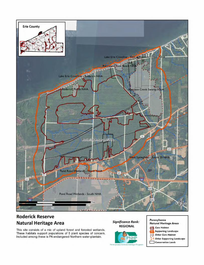
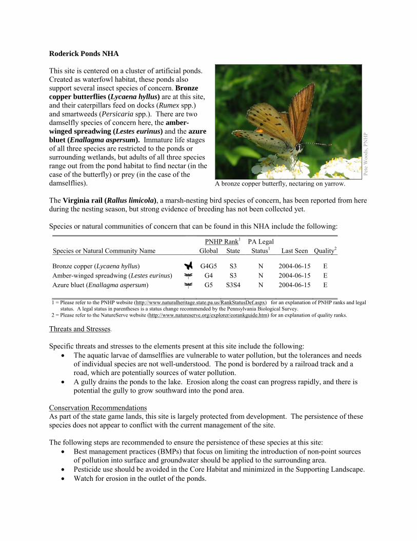
Roderick Ponds NHA This site is centered on a cluster of artificial ponds. Created as waterfowl habitat, these ponds also support several insect species of concern. Bronze copper butterflies (Lycaena hyllus) are at this site, and their caterpillars feed on docks (Rumex spp.) and smartweeds (Persicaria spp.). There are two damselfly species of concern here, the amber-winged spreadwing (Lestes eurinus) and the azure bluet (Enallagma aspersum). Immature life stages of all three species are restricted to the ponds or surrounding wetlands, but adults of all three species range out from the pond habitat to find nectar (in the case of the butterfly) or prey (in the case of the damselflies). The Virginia rail (Rallus limicola), a marsh-nesting bird species of concern, has been reported from here during the nesting season, but strong evidence of breeding has not been collected yet. Species or natural communities of concern that can be found in this NHA include the following:
PNHP Rank1 PA Legal Species or Natural Community Name Global State Status1 Last Seen Quality2 Bronze copper (Lycaena hyllus) G4G5 S3 N 2004-06-15 E Amber-winged spreadwing (Lestes eurinus) G4 S3 N 2004-06-15 E Azure bluet (Enallagma aspersum) G5 S3S4 N 2004-06-15 E 1 = Please refer to the PNHP website (http://www.naturalheritage.state.pa.us/RankStatusDef.aspx) for an explanation of PNHP ranks and legal
status. A legal status in parentheses is a status change recommended by the Pennsylvania Biological Survey. 2 = Please refer to the NatureServe website (http://www.natureserve.org/explorer/eorankguide.htm) for an explanation of quality ranks.
Threats and Stresses. Specific threats and stresses to the elements present at this site include the following:
• The aquatic larvae of damselflies are vulnerable to water pollution, but the tolerances and needs of individual species are not well-understood. The pond is bordered by a railroad track and a road, which are potentially sources of water pollution.
• A gully drains the ponds to the lake. Erosion along the coast can progress rapidly, and there is potential the gully to grow southward into the pond area.
Conservation Recommendations As part of the state game lands, this site is largely protected from development. The persistence of these species does not appear to conflict with the current management of the site. The following steps are recommended to ensure the persistence of these species at this site:
• Best management practices (BMPs) that focus on limiting the introduction of non-point sources of pollution into surface and groundwater should be applied to the surrounding area.
• Pesticide use should be avoided in the Core Habitat and minimized in the Supporting Landscape. • Watch for erosion in the outlet of the ponds.
Pete
Woo
ds, P
NH
P
A bronze copper butterfly, nectaring on yarrow.

Location and Additional Information
Municipalities: Springfield Township USGS quads: Conneaut 1993 Erie CNHI reference: None; previously unrecognized site. Associated NHAs: Roderick Reserve NHA Overlapping Protected Lands: State Game Land #314 PNHP Significance Rank: State
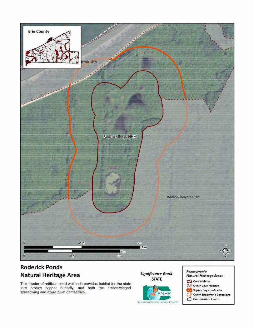
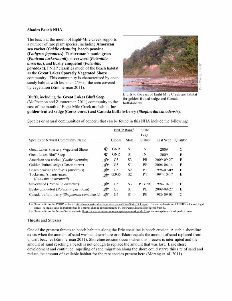
Shades Beach NHA The beach at the mouth of Eight-Mile Creek supports a number of rare plant species, including American sea rocket (Cakile edentula), beach peavine (Lathyrus japonicus), Tuckerman’s panic-grass (Panicum tuckermanii), silverweed (Potentilla anserina), and bushy cinquefoil (Potentilla paradoxa). PNHP classifies much of the beach habitat as the Great Lakes Sparsely Vegetated Shore community. This community is characterized by open sandy habitat with less than 25% of the area covered by vegetation (Zimmerman 2011). Bluffs, including the Great Lakes Bluff Seep (McPherson and Zimmerman 2011) community to the east of the mouth of Eight-Mile Creek are habitat for golden-fruited sedge (Carex aurea) and Canada buffalo-berry (Shepherdia canadensis). Species or natural communities of concern that can be found in this NHA include the following:
PNHP Rank1 State
Species or Natural Community Name
Global State Legal
Status1 Last Seen Quality2 Great Lakes Sparsely Vegetated Shore C GNR S1 N 2009 C Great Lakes Bluff Seep C GNR S1 N 2009 E American sea-rocket (Cakile edentula) G5 S3 PR 2009-09-27 E Golden-fruited sedge (Carex aurea) G5 S1 PE 2006-06-14 E Beach peavine (Lathyrus japonicus) G5 S2 PT 1996-07-09 E Tuckerman's panic-grass (Panicum tuckermanii)
G3G5 S2 PT 1994-10-17 E
Silverweed (Potentilla anserina) G5 S3 PT (PR) 1994-10-17 E Bushy cinquefoil (Potentilla paradoxa) G5 S1 PE 2009-09-27 E Canada buffalo-berry (Shepherdia canadensis) G5 S1 PE 1986-09-03 C 1 = Please refer to the PNHP website (http://www.naturalheritage.state.pa.us/RankStatusDef.aspx) for an explanation of PNHP ranks and legal
status. A legal status in parentheses is a status change recommended by the Pennsylvania Biological Survey. 2 = Please refer to the NatureServe website (http://www.natureserve.org/explorer/eorankguide.htm) for an explanation of quality ranks.
Threats and Stresses One of the greatest threats to beach habitats along the Erie coastline is beach erosion. A stable shoreline exists when the amount of sand washed downshore or offshore equals the amount of sand replaced from updrift beaches (Zimmerman 2011). Shoreline erosion occurs when this process is interrupted and the amount of sand reaching a beach is not enough to replace the amount that was lost. Lake shore development and continued impeding of sand migration along the shore could starve this site of sand and reduce the amount of available habitat for the rare species present here (Morang et. al. 2011).
Pete
Woo
ds, P
NH
P
Bluffs to the east of Eight Mile Creek are habitat for golden-fruited sedge and Canada buffaloberry.
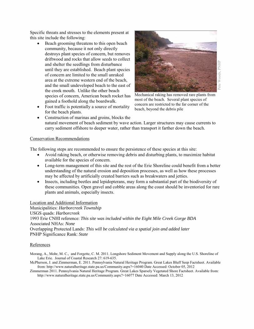
Specific threats and stresses to the elements present at this site include the following:
• Beach grooming threatens to this open beach community, because it not only directly destroys plant species of concern, but removes driftwood and rocks that allow seeds to collect and shelter the seedlings from disturbance until they are established. Beach plant species of concern are limited to the small unraked area at the extreme western end of the beach, and the small undeveloped beach to the east of the creek mouth. Unlike the other beach species of concern, American beach rocket has gained a foothold along the boardwalk.
• Foot traffic is potentially a source of mortality for the beach plants.
• Construction of marinas and groins, blocks the natural movement of beach sediment by wave action. Larger structures may cause currents to carry sediment offshore to deeper water, rather than transport it farther down the beach.
Conservation Recommendations The following steps are recommended to ensure the persistence of these species at this site:
• Avoid raking beach, or otherwise removing debris and disturbing plants, to maximize habitat available for the species of concern.
• Long-term management of this site and the rest of the Erie Shoreline could benefit from a better understanding of the natural erosion and deposition processes, as well as how these processes may be affected by artificially created barriers such as breakwaters and jetties.
• Insects, including beetles and lepidopterans, may form a substantial part of the biodiversity of these communities. Open gravel and cobble areas along the coast should be inventoried for rare plants and animals, especially insects.
Location and Additional Information Municipalities: Harborcreek Township USGS quads: Harborcreek 1993 Erie CNHI reference: This site was included within the Eight Mile Creek Gorge BDA Associated NHAs: None Overlapping Protected Lands: This will be calculated via a spatial join and added later PNHP Significance Rank: State References Morang, A., Mohr, M. C., and Forgette, C. M. 2011. Longshore Sediment Movement and Supply along the U.S. Shoreline of
Lake Erie. Journal of Coastal Research 27: 619-635. McPherson, J. and Zimmerman, E. 2011. Pennsylvania Natural Heritage Program. Great Lakes Bluff Seep Factsheet. Available
from: http://www.naturalheritage.state.pa.us/Community.aspx?=16040 Date Accessed: October 05, 2012 Zimmerman 2011. Pennsylvania Natural Heritage Program. Great Lakes Sparsely Vegetated Shore Factsheet. Available from:
http://www.naturalheritage.state.pa.us/Community.aspx?=16077 Date Accessed: March 13, 2012
Pete
Woo
ds, P
NH
P
Mechanical raking has removed rare plants from most of the beach. Several plant species of concern are restricted to the far corner of the beach, beyond the debris pile
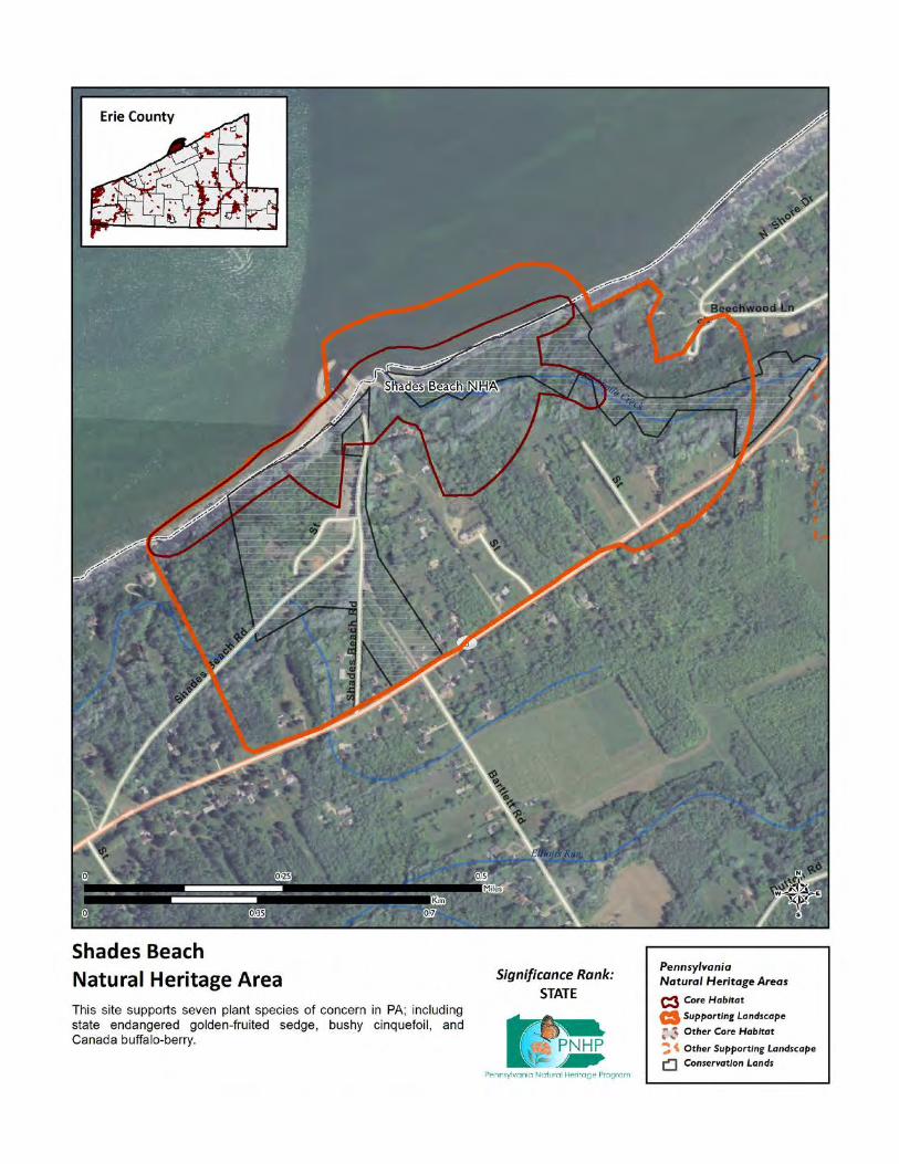
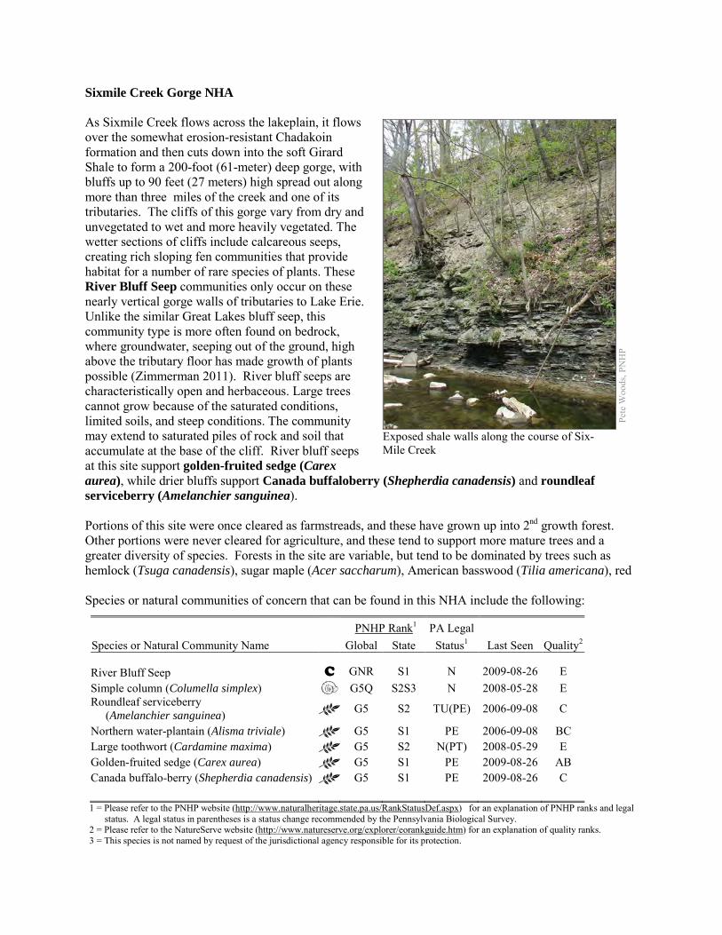
Sixmile Creek Gorge NHA As Sixmile Creek flows across the lakeplain, it flows over the somewhat erosion-resistant Chadakoin formation and then cuts down into the soft Girard Shale to form a 200-foot (61-meter) deep gorge, with bluffs up to 90 feet (27 meters) high spread out along more than three miles of the creek and one of its tributaries. The cliffs of this gorge vary from dry and unvegetated to wet and more heavily vegetated. The wetter sections of cliffs include calcareous seeps, creating rich sloping fen communities that provide habitat for a number of rare species of plants. These River Bluff Seep communities only occur on these nearly vertical gorge walls of tributaries to Lake Erie. Unlike the similar Great Lakes bluff seep, this community type is more often found on bedrock, where groundwater, seeping out of the ground, high above the tributary floor has made growth of plants possible (Zimmerman 2011). River bluff seeps are characteristically open and herbaceous. Large trees cannot grow because of the saturated conditions, limited soils, and steep conditions. The community may extend to saturated piles of rock and soil that accumulate at the base of the cliff. River bluff seeps at this site support golden-fruited sedge (Carex aurea), while drier bluffs support Canada buffaloberry (Shepherdia canadensis) and roundleaf serviceberry (Amelanchier sanguinea). Portions of this site were once cleared as farmstreads, and these have grown up into 2nd growth forest. Other portions were never cleared for agriculture, and these tend to support more mature trees and a greater diversity of species. Forests in the site are variable, but tend to be dominated by trees such as hemlock (Tsuga canadensis), sugar maple (Acer saccharum), American basswood (Tilia americana), red Species or natural communities of concern that can be found in this NHA include the following:
PNHP Rank1 PA Legal Species or Natural Community Name Global State Status1 Last Seen Quality2 River Bluff Seep C GNR S1 N 2009-08-26 E Simple column (Columella simplex) G5Q S2S3 N 2008-05-28 E Roundleaf serviceberry (Amelanchier sanguinea) G5 S2 TU(PE) 2006-09-08 C
Northern water-plantain (Alisma triviale) G5 S1 PE 2006-09-08 BC Large toothwort (Cardamine maxima) G5 S2 N(PT) 2008-05-29 E Golden-fruited sedge (Carex aurea) G5 S1 PE 2009-08-26 AB Canada buffalo-berry (Shepherdia canadensis) G5 S1 PE 2009-08-26 C 1 = Please refer to the PNHP website (http://www.naturalheritage.state.pa.us/RankStatusDef.aspx) for an explanation of PNHP ranks and legal
status. A legal status in parentheses is a status change recommended by the Pennsylvania Biological Survey. 2 = Please refer to the NatureServe website (http://www.natureserve.org/explorer/eorankguide.htm) for an explanation of quality ranks. 3 = This species is not named by request of the jurisdictional agency responsible for its protection.
Pete
Woo
ds, P
NH
P
Exposed shale walls along the course of Six-Mile Creek
maple (A. rubrum), red oak (Quercus rubra), black cherry (Prunus serotina), yellow birch (Betula alleganiensis), American beech (Fagus grandifolia), and white ash (Fraxinus americana). The floodplain and lower slopes support large toothwort (Cardamine maxima), a plant that is Threatened in Pennsylvania. Two areas of the upland forest (one near Clark Road access, and another area on the north side of the gorge) also contain vernal pools, seasonally flooded wetlands that support breeding of species such as spotted salamanders and wood frogs. These amphibians breed in the pools when they are full of water in the spring, and adults spend the rest of the year living in the surrounding upland forest. Small wetlands are scattered along the creek bed, and some of these support the Pennsylvania Endangered northern water plantain (Alisma triviale). Threats and Stresses Sixmile Creek Park has not been developed for recreational use since it was acquired in the late 1960s. This, plus the difficulty in accessing the park, has resulted in a low level of use, but that use has been lightly enforced. The Sixmile Creek Park Master Park Site Plan Summary Report (2008) identifies a number of illegal uses, including ATV use, clearcutting, creation of campfire sites, and illegal dumping. With the exception of ATV use, damage is limited to small parts of the park and on the whole, the gorge and the surrounding forest are impressively intact for a public park this close to an urban area. Specific threats and stresses to the elements present at this site include the following:
• The Sixmile Creek Park Master Park Site Plan Summary Report (Environmental Planning and Design 2008) found that “the past and ongoing use of the property by ATV enthusiasts is a severe problem which must be addressed. In the most accessible areas of the Park … the ATV network of trails has denuded the understory vegetation leaving a compacted dirt floor beneath the forest canopy. On the steeper slopes these trails have caused deep gullies or rills to form in the highly erodible soils contributing to the further loss of site vegetation and to the deposition of sediment in the Creek. ATV use is a recreation form which is incompatible with the erodible soils and unique environmental features of the Sixmile Creek property. Nor is it compatible with the more passive activities for which the Park is suited. The sport is a good example of a recreation type which requires the specialized activity areas designed to meet specific market demands recommended by the 2003 Erie County Recreation Plan.”
• A number of invasive plant species are well-established in the park, and in places they are crowding out native species. Star-of-Bethlehem (Ornithogallum umbellatum), day lily (Hemerocallus fulvus), and periwinkle (Vinca minor) grow densely in the upper end of the park, near Route 531. Multiflora rose (Rosa multiflora), dame’s rocket (Hesperis matronalis), and garlic mustard (Alliaria petiolata) are also present in the park. Common reed (Phragmites australis) and coltsfoot (Tusilago farfara) are established on some of the river bluff seeps.
• The hemlock-dominated slopes and riparian areas are vulnerable to attack from hemlock woolly adelgids (Adelges tsugae), a sap-feeding insect native to Asia. As of 2011, the hemlock woolly adelgid is still several counties away to the east and south, but it is expected to arrive in coming years, with devastating effects on hemlock populations. Infestations are followed by high levels of hemlock mortality, which opens up the forest canopy and drastically alters the forest habitat. The loss of the deep shade and cool microclimate may prevent some species from persisting here.
• The greatest threats to river bluff seeps, and other community types dependent on groundwater, are disruptions to bedrock or glacial deposits (such as drilling or mining in nearby areas) and
groundwater extraction (which can contaminate or alter the flow patterns of the groundwater that feeds the seepage wetlands.
• Groundwater pollution in groundwater-fed natural communities can occur from improperly installed septic systems, improperly lined underground waste disposal, and in agricultural areas from infiltration of pesticides, fertilizers, or bacteria from animal wastes.
• This large forest block is at risk of fragmentation by conversion of forest to other cover types. Conservation Recommendations Most of the Core Habitat that is southeast of Interstate 90 is part of the 450 acre Sixmile Creek Park. Purchased from the state by Erie County in the late 1960s with Project 70 Land Acquisition and Borrowing Act funds, the park is the responsibility Harborcreek Township. The remainder of the Core Habitat is under private ownership, with no permanent conservation measures in place. The following steps are recommended to ensure the persistence of these species at this site:
• As of 2012, available treatments for hemlock woolly adelgid are not economically feasible at a scale suitable for large natural areas. At a smaller scale, continued applications of horticultural oil or insecticidal soap can control hemlock woolly adelgids. Biological controls are being researched, though they have so far had limited success at keeping adelgid populations in check.
• Drilling, mining, or other disruptions to bedrock or glacial deposits should not be undertaken within half a mile of a seepage wetland without a thorough understanding of bedrock layers and groundwater flows. Groundwater flow patterns do not always mirror surface watersheds, and in some cases aquifers may be contiguous over large areas.
• A natural buffer around wetlands should be maintained in order to minimize nutrient runoff, pollution, and sedimentation.
• As of 2012, available treatments for hemlock woolly adelgid are not economically feasible at a scale suitable for large natural areas. At a smaller scale, injection of insecticides into tree trunks or into the soil around a tree can control adelgids for up to several years at a time, although there may be unintended effects on other species. Continued applications of horticultural oil or insecticidal soap can also control hemlock woolly adelgids. Biological controls are being researched, although they have so far had limited success at keeping adelgid populations in check (DCNR 2012).
• Remove invasive plant species. River bluff seeps and other early-successional habitats are particularly susceptible to weedy plant invasion and will require a sustained and targeted approach to invasive management. Control of invasive species in the area will require extensive and continual effort.
o Invasive species management needs to be coordinated by individuals familiar with the rare species as well as the invasive species present.
o Continuing invasive species monitoring and control will be necessary. • Further inventory for moths and other invertebrates is recommended, because these
undersurveyed groups may form a substantial part of the biodiversity of bluff seep communities. • Research is needed to better understand the patterns of succession of plant species, especially
species of conservation concern, on these slump habitats.
Location and Additional Information
Municipalities: Harborcreek Township USGS quads: Hammett, Harborcreek 1993 Erie CNHI reference: Six Mile Creek BDA Associated NHAs: Gospel Hill NHA Overlapping Protected Lands: Sixmile Creek Park PNHP Significance Rank: State References Department of Conservation and Natural Resources. 2012. Forest Health Fact Sheet: Hemlock Woolly Adelgid.
http://www.dcnr.state.pa.us/ucmprd2/groups/public/documents/document/dcnr_007179.pdf Environmental Planning and Design, LLC. 2008. Sixmile Creek Park Master Park Site Plan Summary Report. Available from:
http://www.eriecountyplanning.org/index.php?page=six-mile-creek. Date Accessed: October 10, 2012. Zimmerman, E. 2011. Pennsylvania Natural Heritage Program. River Bluff Seep Factsheet. Available from:
http://www.naturalheritage.state.pa.us/Community.aspx?=30030. Date Accessed: April 30, 2012
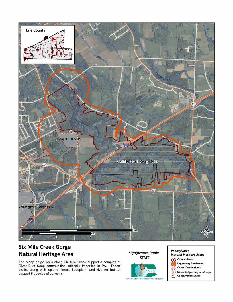
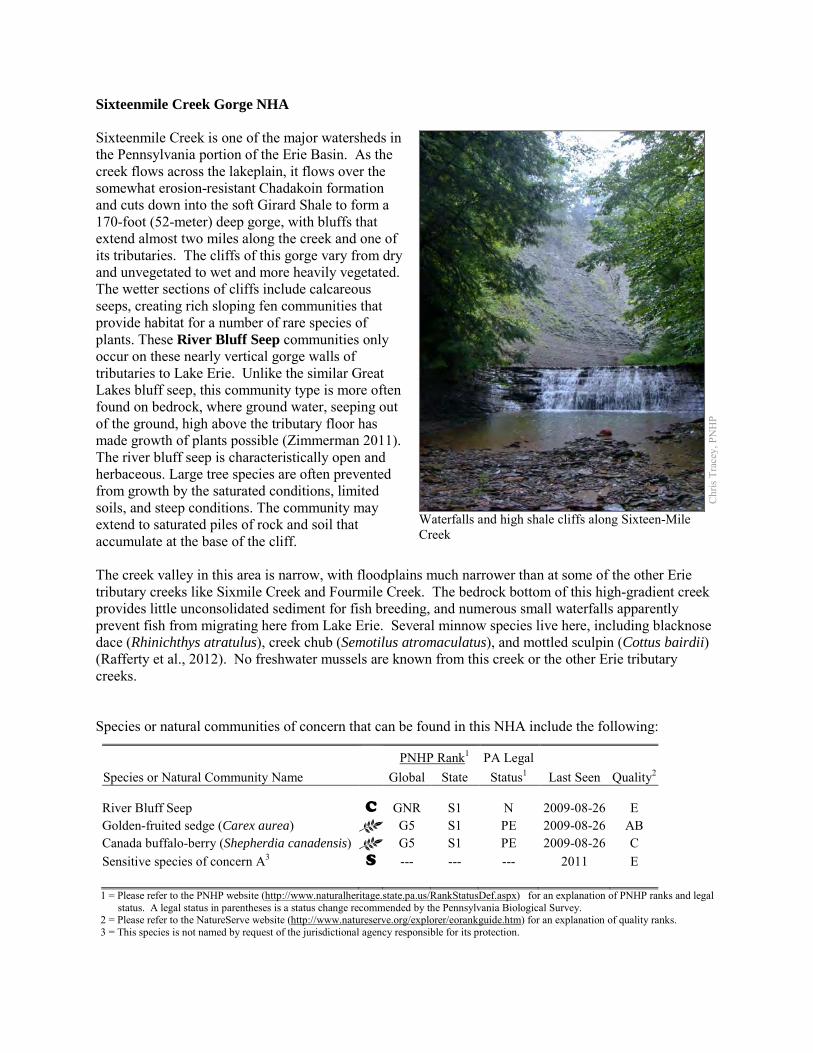
Sixteenmile Creek Gorge NHA Sixteenmile Creek is one of the major watersheds in the Pennsylvania portion of the Erie Basin. As the creek flows across the lakeplain, it flows over the somewhat erosion-resistant Chadakoin formation and cuts down into the soft Girard Shale to form a 170-foot (52-meter) deep gorge, with bluffs that extend almost two miles along the creek and one of its tributaries. The cliffs of this gorge vary from dry and unvegetated to wet and more heavily vegetated. The wetter sections of cliffs include calcareous seeps, creating rich sloping fen communities that provide habitat for a number of rare species of plants. These River Bluff Seep communities only occur on these nearly vertical gorge walls of tributaries to Lake Erie. Unlike the similar Great Lakes bluff seep, this community type is more often found on bedrock, where ground water, seeping out of the ground, high above the tributary floor has made growth of plants possible (Zimmerman 2011). The river bluff seep is characteristically open and herbaceous. Large tree species are often prevented from growth by the saturated conditions, limited soils, and steep conditions. The community may extend to saturated piles of rock and soil that accumulate at the base of the cliff. The creek valley in this area is narrow, with floodplains much narrower than at some of the other Erie tributary creeks like Sixmile Creek and Fourmile Creek. The bedrock bottom of this high-gradient creek provides little unconsolidated sediment for fish breeding, and numerous small waterfalls apparently prevent fish from migrating here from Lake Erie. Several minnow species live here, including blacknose dace (Rhinichthys atratulus), creek chub (Semotilus atromaculatus), and mottled sculpin (Cottus bairdii) (Rafferty et al., 2012). No freshwater mussels are known from this creek or the other Erie tributary creeks. Species or natural communities of concern that can be found in this NHA include the following:
PNHP Rank1 PA Legal Species or Natural Community Name Global State Status1 Last Seen Quality2 River Bluff Seep C GNR S1 N 2009-08-26 E Golden-fruited sedge (Carex aurea) G5 S1 PE 2009-08-26 AB Canada buffalo-berry (Shepherdia canadensis) G5 S1 PE 2009-08-26 C Sensitive species of concern A3 S --- --- --- 2011 E 1 = Please refer to the PNHP website (http://www.naturalheritage.state.pa.us/RankStatusDef.aspx) for an explanation of PNHP ranks and legal
status. A legal status in parentheses is a status change recommended by the Pennsylvania Biological Survey. 2 = Please refer to the NatureServe website (http://www.natureserve.org/explorer/eorankguide.htm) for an explanation of quality ranks. 3 = This species is not named by request of the jurisdictional agency responsible for its protection.
Chr
is Tr
acey
, PN
HP
Waterfalls and high shale cliffs along Sixteen-Mile Creek
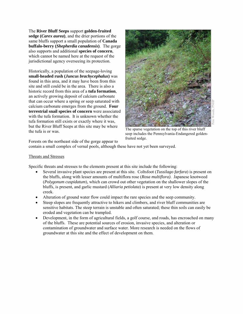
The River Bluff Seeps support golden-fruited sedge (Carex aurea), and the drier portions of the same bluffs support a small population of Canada buffalo-berry (Shepherdia canadensis). The gorge also supports and additional species of concern, which cannot be named here at the request of the jurisdictional agency overseeing its protection. Historically, a population of the seepage-loving small-headed rush (Juncus brachycephalus) was found in this area, and it may have been from this site and still could be in the area. There is also a historic record from this area of a tufa formation, an actively growing deposit of calcium carbonate that can occur where a spring or seep saturated with calcium carbonate emerges from the ground. Four terrestrial snail species of concern were associated with the tufa formation. It is unknown whether the tufa formation still exists or exactly where it was, but the River Bluff Seeps at this site may be where the tufa is or was. Forests on the northeast side of the gorge appear to contain a small complex of vernal pools, although these have not yet been surveyed. Threats and Stresses Specific threats and stresses to the elements present at this site include the following:
• Several invasive plant species are present at this site. Coltsfoot (Tussilago farfara) is present on the bluffs, along with lesser amounts of multiflora rose (Rosa multiflora). Japanese knotweed (Polygonum cuspidatum), which can crowd out other vegetation on the shallower slopes of the bluffs, is present, and garlic mustard (Alliaria petiolata) is present at very low density along creek.
• Alteration of ground water flow could impact the rare species and the seep community. • Steep slopes are frequently attractive to hikers and climbers, and river bluff communities are
sensitive habitats. The steep terrain is unstable and often saturated; these thin soils can easily be eroded and vegetation can be trampled.
• Development, in the form of agricultural fields, a golf course, and roads, has encroached on many of the bluffs. These are potential sources of erosion, invasive species, and alteration or contamination of groundwater and surface water. More research is needed on the flows of groundwater at this site and the effect of development on them.
Pete
Woo
ds, P
NH
P
The sparse vegetation on the top of this river bluff seep includes the Pennsylvania-Endangered golden-fruited sedge.

Conservation Recommendations This site is entirely on private property with no public access, and no permanent conservation measures are in place. The following steps are recommended to ensure the persistence of these species at this site:
• Care should also be taken to control and prevent the spread of invasive species as well as control invasive species already on the site.
• A natural vegetation buffer should be allowed to develop along the stream valley crest within the site's boundary in order to reduce the threat of human-induced erosion and to protect surface water quality and quantity entering the NHA. Trail construction along the top of tributary gorges should be limited to avoid impacting this community.
• Property owners could also contribute to ground water quality and quantity protection by reducing or avoiding the application of pesticides and/or fertilizers within site boundaries and avoiding artificial drainage of subsurface waters.
• Development and timber harvesting within the natural heritage area should be avoided. • Further inventory for moths and other invertebrates is recommended, because these
undersurveyed groups may form a substantial part of the biodiversity of bluff seep communities. • Research is needed to better understand the patterns of succession of plant species, especially
species of conservation concern, on these slump habitats.
Location and Additional Information
Municipalities: North East Township USGS quads: North East 1993 Erie CNHI reference: Sixteenmile Creek Gorge Natural Area Associated NHAs: none Overlapping Protected Lands: none PNHP Significance Rank: State References: Rafferty, S.D., Lybrook, J., Kacmarek, K.M., Lethaby, M., and Wellington, R. 2012. An assessment of the Pennsylvania Lake Erie watershed
fish community. The Pennsylvania State University. Unpublished manuscript. Zimmerman, E. 2011. Pennsylvania Natural Heritage Program. River Bluff Seep Factsheet. Available from:
http://www.naturalheritage.state.pa.us/Community.aspx?=30030 Date Accessed: April 30, 2012
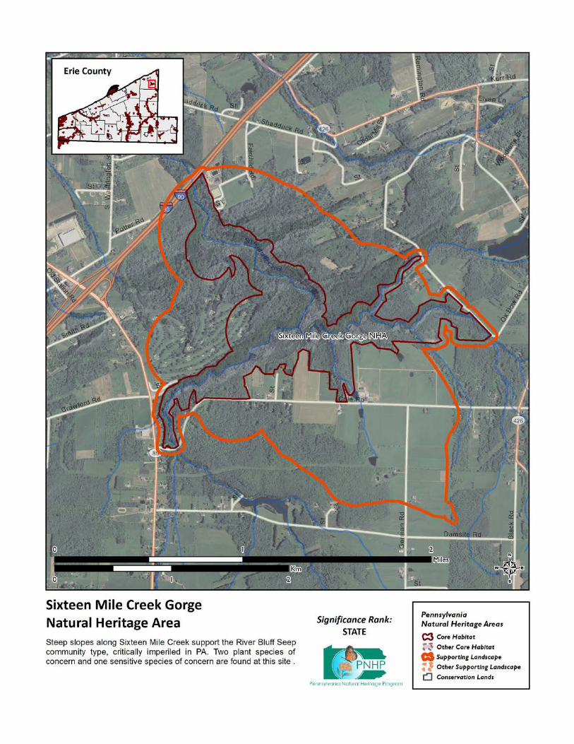
South Branch French Creek Headwaters NHA This site is designated around the streams and wetlands in the headwaters of the South Branch of French Creek. This site supports two species of concern that cannot be named here at the request of the jurisdictional agency overseeing their protection. These species rely on good quality water. As a tributary of French Creek, this stream is part of the most ecologically significant waterway in Pennsylvania. French Creek contains more species of fish and freshwater mussels than any other comparably sized stream in the Commonwealth and possibly the northeastern United States (WPC, 2002). Species or natural communities of concern that can be found in this NHA include the following:
PNHP Rank1 PA Legal Species or Natural Community Name Global State Status1 Last Seen Quality2 Sensitive species of concern A3 S --- --- --- 2009-09-14 E Sensitive species of concern B3 S --- --- --- 2009-09-14 E 1 = Please refer to the PNHP website (http://www.naturalheritage.state.pa.us/RankStatusDef.aspx) for an explanation of PNHP ranks and legal
status. A legal status in parentheses is a status change recommended by the Pennsylvania Biological Survey. 2 = Please refer to the NatureServe website (http://www.natureserve.org/explorer/eorankguide.htm) for an explanation of quality ranks. 3 = This species is not named by request of the jurisdictional agency responsible for its protection.
Threats and Stresses Maintaining suitable aquatic habitat is key to the continued success of the species of concern. Runoff from dirt and gravel roads in close proximity to waterways can contribute to physical degradation of their channels and erosion and sediment pollution in streams and rivers. Loss of forest cover within the core areas may also result in increased water temperatures and disruption of natural nutrient cycling linked to the river. If forest cover is substantially reduced within the watersheds, water quality is likely to decline from increased sediment loads. Removal of forest cover on steep slopes is especially problematic because of the potential for increased runoff and erosion following storm events. Conservation Recommendations Conserve and expand the forested riparian buffers of Whitney Creek and its tributaries. Streams through forested areas should be considered high priority for conservation. The forested riparian corridor helps to regulate the temperature of the stream and creates streamside conditions that contribute to improved water quality and aquatic habitat. Streams through non-forested areas should be restored with native trees and shrubs appropriate to the habitat. Establish at least a 100 foot (30 meter) buffer of woody vegetation along the creek and its tributaries to help reduce erosion, sedimentation, and pollution. Additionally, best management practices (BMPs) that focus on limiting the introduction of non-point sources of pollution into surface and groundwater should be applied to the surrounding area
Location and Additional Information
Municipalities: Concord Township USGS quads: Spartansburg 1993 Erie CNHI reference: The lower stretch of this NHA overlaps with the French Creek BDA. Associated NHAs: None Overlapping Protected Lands: None; private lands. PNHP Significance Rank: State References: Western Pennsylvania Conservancy, 2002. French Creek Watershed Conservation Plan. Available from:
http://www.paconserve.org/assets/FC_plan_full_plan.pdf. Date Accessed: October 22, 2012.
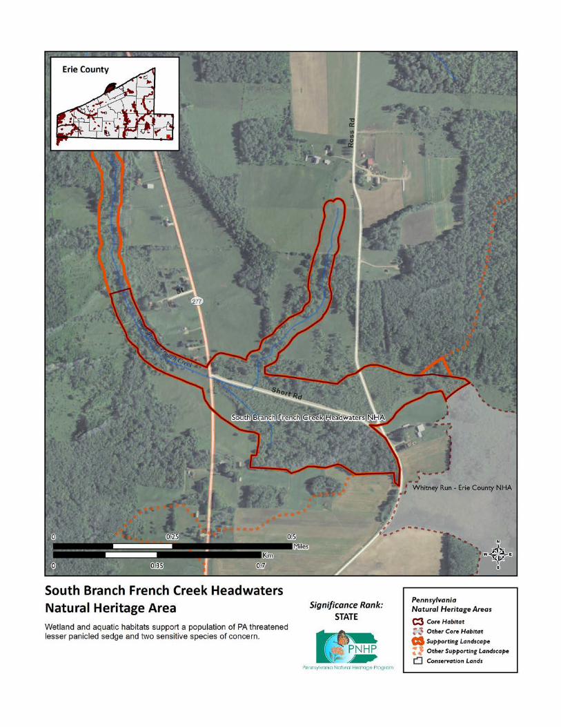
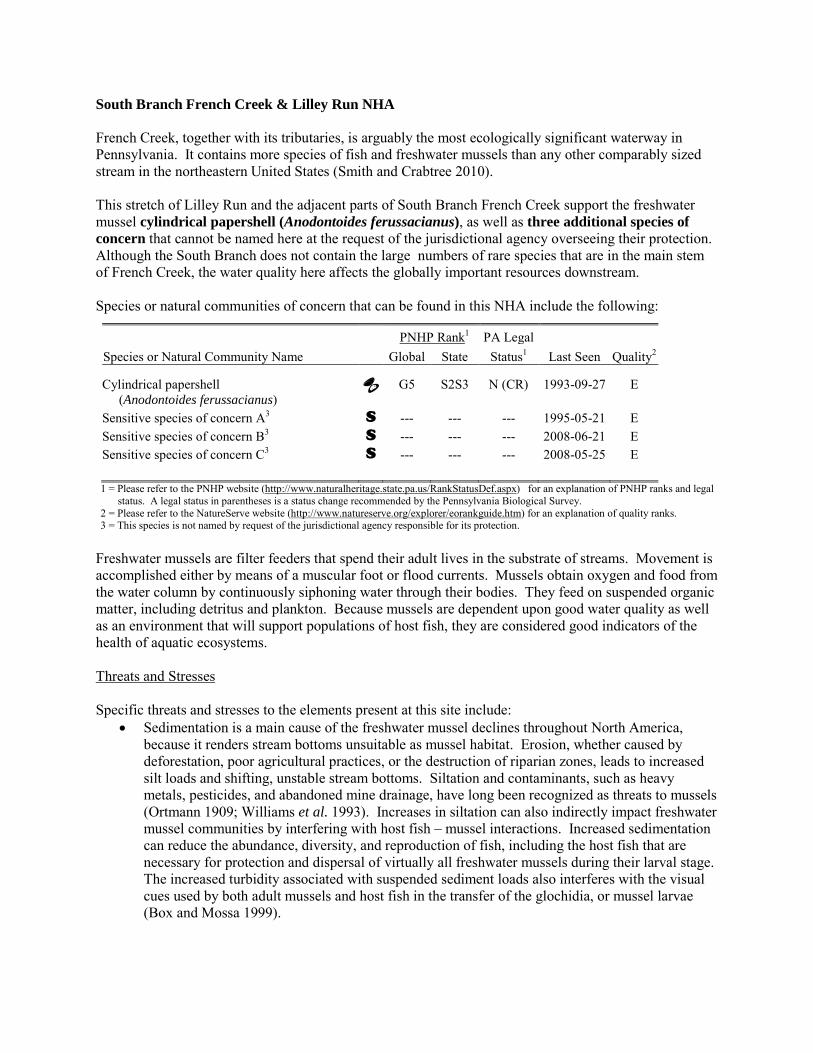
South Branch French Creek & Lilley Run NHA French Creek, together with its tributaries, is arguably the most ecologically significant waterway in Pennsylvania. It contains more species of fish and freshwater mussels than any other comparably sized stream in the northeastern United States (Smith and Crabtree 2010). This stretch of Lilley Run and the adjacent parts of South Branch French Creek support the freshwater mussel cylindrical papershell (Anodontoides ferussacianus), as well as three additional species of concern that cannot be named here at the request of the jurisdictional agency overseeing their protection. Although the South Branch does not contain the large numbers of rare species that are in the main stem of French Creek, the water quality here affects the globally important resources downstream. Species or natural communities of concern that can be found in this NHA include the following:
PNHP Rank1 PA Legal Species or Natural Community Name Global State Status1 Last Seen Quality2 Cylindrical papershell (Anodontoides ferussacianus)
G5 S2S3 N (CR) 1993-09-27 E
Sensitive species of concern A3 S --- --- --- 1995-05-21 E Sensitive species of concern B3 S --- --- --- 2008-06-21 E Sensitive species of concern C3 S --- --- --- 2008-05-25 E 1 = Please refer to the PNHP website (http://www.naturalheritage.state.pa.us/RankStatusDef.aspx) for an explanation of PNHP ranks and legal
status. A legal status in parentheses is a status change recommended by the Pennsylvania Biological Survey. 2 = Please refer to the NatureServe website (http://www.natureserve.org/explorer/eorankguide.htm) for an explanation of quality ranks. 3 = This species is not named by request of the jurisdictional agency responsible for its protection.
Freshwater mussels are filter feeders that spend their adult lives in the substrate of streams. Movement is accomplished either by means of a muscular foot or flood currents. Mussels obtain oxygen and food from the water column by continuously siphoning water through their bodies. They feed on suspended organic matter, including detritus and plankton. Because mussels are dependent upon good water quality as well as an environment that will support populations of host fish, they are considered good indicators of the health of aquatic ecosystems. Threats and Stresses Specific threats and stresses to the elements present at this site include:
• Sedimentation is a main cause of the freshwater mussel declines throughout North America, because it renders stream bottoms unsuitable as mussel habitat. Erosion, whether caused by deforestation, poor agricultural practices, or the destruction of riparian zones, leads to increased silt loads and shifting, unstable stream bottoms. Siltation and contaminants, such as heavy metals, pesticides, and abandoned mine drainage, have long been recognized as threats to mussels (Ortmann 1909; Williams et al. 1993). Increases in siltation can also indirectly impact freshwater mussel communities by interfering with host fish – mussel interactions. Increased sedimentation can reduce the abundance, diversity, and reproduction of fish, including the host fish that are necessary for protection and dispersal of virtually all freshwater mussels during their larval stage. The increased turbidity associated with suspended sediment loads also interferes with the visual cues used by both adult mussels and host fish in the transfer of the glochidia, or mussel larvae (Box and Mossa 1999).
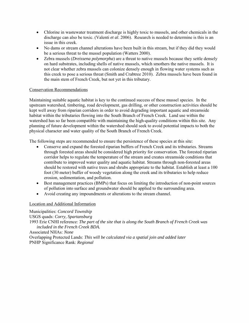
• Chlorine in wastewater treatment discharge is highly toxic to mussels, and other chemicals in the discharge can also be toxic. (Valenti et al. 2006). Research is needed to determine is this is an issue in this creek.
• No dams or stream channel alterations have been built in this stream, but if they did they would be a serious threat to the mussel population (Watters 2000).
• Zebra mussels (Dreissena polymorpha) are a threat to native mussels because they settle densely on hard substrates, including shells of native mussels, which smothers the native mussels. It is not clear whether zebra mussels can colonize densely enough in flowing water systems such as this creek to pose a serious threat (Smith and Crabtree 2010). Zebra mussels have been found in the main stem of French Creek, but not yet in this tributary.
Conservation Recommendations Maintaining suitable aquatic habitat is key to the continued success of these mussel species. In the upstream watershed, timbering, road development, gas drilling, or other construction activities should be kept well away from riparian corridors in order to avoid degrading important aquatic and streamside habitat within the tributaries flowing into the South Branch of French Creek. Land use within the watershed has so far been compatible with maintaining the high-quality conditions within this site. Any planning of future development within the watershed should seek to avoid potential impacts to both the physical character and water quality of the South Branch of French Creek. The following steps are recommended to ensure the persistence of these species at this site:
• Conserve and expand the forested riparian buffers of French Creek and its tributaries. Streams through forested areas should be considered high priority for conservation. The forested riparian corridor helps to regulate the temperature of the stream and creates streamside conditions that contribute to improved water quality and aquatic habitat. Streams through non-forested areas should be restored with native trees and shrubs appropriate to the habitat. Establish at least a 100 foot (30 meter) buffer of woody vegetation along the creek and its tributaries to help reduce erosion, sedimentation, and pollution.
• Best management practices (BMPs) that focus on limiting the introduction of non-point sources of pollution into surface and groundwater should be applied to the surrounding area.
• Avoid creating any impoundments or alterations to the stream channel.
Location and Additional Information
Municipalities: Concord Township USGS quads: Corry, Spartansburg 1993 Erie CNHI reference: The part of the site that is along the South Branch of French Creek was
included in the French Creek BDA. Associated NHAs: None Overlapping Protected Lands: This will be calculated via a spatial join and added later PNHP Significance Rank: Regional
References: Box, J. B. and Mossa, J., (1999). Sediment, land use and freshwater mussels: prospects and problems. Journal of the North
American Benthological Society 18(1): 99-117. Ortmann, A.E. 1909; The destruction of the fresh-water fauna in Western Pennsylvania: Proceedings of the American
Philosophical Society, 47(191): 90-110. Smith, T.A. and D. Crabtree. 2010. Freshwater Mussel (Unionidae: Bivalvia) Distributions and Densities in French Creek,
Pennsylvania. Northeastern Naturalist 17(3): 387-414. Valenti, T.W., D.S. Cherry, R.J. Currie, R.J. Neves, J.W. Jones, R. Mair, and C.M. Kane. 2006. Chlorine toxicity to early life
stages of freshwater mussels (Bivalvia: Unionidae). Environmental Toxicology and Chemistry 25:2512-2518. Watters, G.T. 2000. Freshwater mussels and water quality: a review of the effects of hydrologic and instream habitat alterations.
Proceedings of the First Freshwater Mollusk Conservation Society Symposium, 1999. 261-274. Western Pennsylvania Conservancy, 2002. French Creek Watershed Conservation Plan. Available from:
http://www.paconserve.org/assets/FC_plan_full_plan.pdf. Date Accessed: October 22, 2012. Williams, J. D., M. L. Warren, K. S. Cummings, J. L. Harris, and R. J. Neves. (1993). Conservation status of freshwater mussels
of the United States and Canada. Fisheries 18: 6-22.
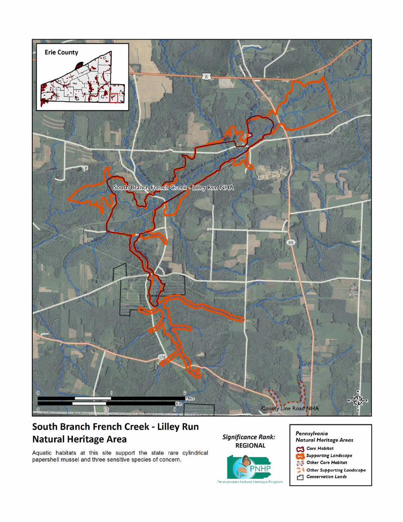

South Branch French Creek West NHA French Creek, together with its tributaries, is arguably the most ecologically significant waterway in Pennsylvania. It contains more species of fish and freshwater mussels than any other comparably sized stream in the northeastern United States (Smith and Crabtree 2010) This stretch of the South Branch of French Creek supports three freshwater mussel species of concern. Freshwater mussels are filter feeders that spend their adult lives in the substrate of streams. Movement is accomplished either by means of a muscular foot or flood currents. Mussels obtain oxygen and food from the water column by continuously siphoning water through their bodies. They feed on suspended organic matter, including detritus and plankton. Because mussels are dependent upon good water quality as well as an environment that will support populations of host fish, they are considered good indicators of the health of aquatic ecosystems. Species or natural communities of concern that can be found in this NHA include:
PNHP Rank1 PA Legal Species or Natural Community Name Global State Status1 Last Seen Quality2 Cylindrical papershell (Anodontoides ferussacianus) G5 S2S3 N (CR) 1993-06-08 E
Wavy-rayed lampmussel (Lampsilis fasciola) G5 S4 N 1993-06-08 E Creek heelsplitter (Lasmigona compressa) G5 S2S3 N (CR) 1993-06-08 E 1 = Please refer to the PNHP website (http://www.naturalheritage.state.pa.us/RankStatusDef.aspx) for an explanation of PNHP ranks and legal
status. A legal status in parentheses is a status change recommended by the Pennsylvania Biological Survey. 2 = Please refer to the NatureServe website (http://www.natureserve.org/explorer/eorankguide.htm) for an explanation of quality ranks. 3 = This species is not named by request of the jurisdictional agency responsible for its protection.
Threats and Stresses Specific threats and stresses to the elements present at this site include:
• Sedimentation is a main cause of the freshwater mussel declines throughout North America, because it renders stream bottoms unsuitable as mussel habitat. Erosion, whether caused by deforestation, poor agricultural practices, or the destruction of riparian zones, leads to increased silt loads and shifting, unstable stream bottoms. Siltation and contaminants, such as heavy metals, pesticides, and abandoned mine drainage, have long been recognized as threats to mussels (Ortmann 1909; Williams et al. 1993). Increases in siltation can also indirectly impact freshwater mussel communities by interfering with host fish – mussel interactions. Increased sedimentation can reduce the abundance, diversity, and reproduction of fish, including the host fish that are necessary for protection and dispersal of virtually all freshwater mussels during their larval stage. The increased turbidity associated with suspended sediment loads also interferes with the visual cues used by both adult mussels and host fish in the transfer of the glochidia, or mussel larvae (Box and Mossa 1999).
PNH
P
Wavy-rayed lampmussel
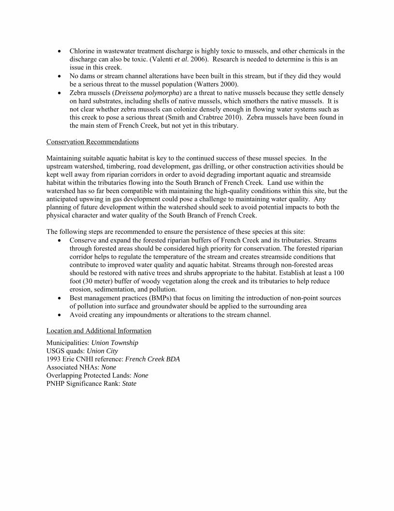
• Chlorine in wastewater treatment discharge is highly toxic to mussels, and other chemicals in the discharge can also be toxic. (Valenti et al. 2006). Research is needed to determine is this is an issue in this creek.
• No dams or stream channel alterations have been built in this stream, but if they did they would be a serious threat to the mussel population (Watters 2000).
• Zebra mussels (Dreissena polymorpha) are a threat to native mussels because they settle densely on hard substrates, including shells of native mussels, which smothers the native mussels. It is not clear whether zebra mussels can colonize densely enough in flowing water systems such as this creek to pose a serious threat (Smith and Crabtree 2010). Zebra mussels have been found in the main stem of French Creek, but not yet in this tributary.
Conservation Recommendations Maintaining suitable aquatic habitat is key to the continued success of these mussel species. In the upstream watershed, timbering, road development, gas drilling, or other construction activities should be kept well away from riparian corridors in order to avoid degrading important aquatic and streamside habitat within the tributaries flowing into the South Branch of French Creek. Land use within the watershed has so far been compatible with maintaining the high-quality conditions within this site, but the anticipated upswing in gas development could pose a challenge to maintaining water quality. Any planning of future development within the watershed should seek to avoid potential impacts to both the physical character and water quality of the South Branch of French Creek. The following steps are recommended to ensure the persistence of these species at this site:
• Conserve and expand the forested riparian buffers of French Creek and its tributaries. Streams through forested areas should be considered high priority for conservation. The forested riparian corridor helps to regulate the temperature of the stream and creates streamside conditions that contribute to improved water quality and aquatic habitat. Streams through non-forested areas should be restored with native trees and shrubs appropriate to the habitat. Establish at least a 100 foot (30 meter) buffer of woody vegetation along the creek and its tributaries to help reduce erosion, sedimentation, and pollution.
• Best management practices (BMPs) that focus on limiting the introduction of non-point sources of pollution into surface and groundwater should be applied to the surrounding area
• Avoid creating any impoundments or alterations to the stream channel.
Location and Additional Information
Municipalities: Union Township USGS quads: Union City 1993 Erie CNHI reference: French Creek BDA Associated NHAs: None Overlapping Protected Lands: None PNHP Significance Rank: State
References Box, J. B. and Mossa, J., (1999). Sediment, land use and freshwater mussels: prospects and problems. Journal of the North
American Benthological Society 18(1): 99-117. Ortmann, A.E. 1909; The destruction of the fresh-water fauna in Western Pennsylvania: Proceedings of the American
Philosophical Society, 47(191): 90-110. Smith, T.A. and D. Crabtree. 2010. Freshwater Mussel (Unionidae: Bivalvia) Distributions and Densities in French Creek,
Pennsylvania. Northeastern Naturalist 17(3): 387-414. Valenti, T.W., D.S. Cherry, R.J. Currie, R.J. Neves, J.W. Jones, R. Mair, and C.M. Kane. 2006. Chlorine toxicity to early life
stages of freshwater mussels (Bivalvia: Unionidae). Environmental Toxicology and Chemistry 25:2512-2518. Watters, G.T. 2000. Freshwater mussels and water quality: a review of the effects of hydrologic and instream habitat alterations.
Proceedings of the First Freshwater Mollusk Conservation Society Symposium, 1999. 261-274. Western Pennsylvania Conservancy, 2002. French Creek Watershed Conservation Plan. Available from:
http://www.paconserve.org/assets/FC_plan_full_plan.pdf. Date Accessed: October 22, 2012. Williams, J. D., M. L. Warren, K. S. Cummings, J. L. Harris, and R. J. Neves. (1993). Conservation status of freshwater mussels
of the United States and Canada. Fisheries 18: 6-22. Ortmann, A.E. 1909. The destruction of the fresh-water fauna in western Pennsylvania. Proceedings of the American Philosophical Society 48:90-110.
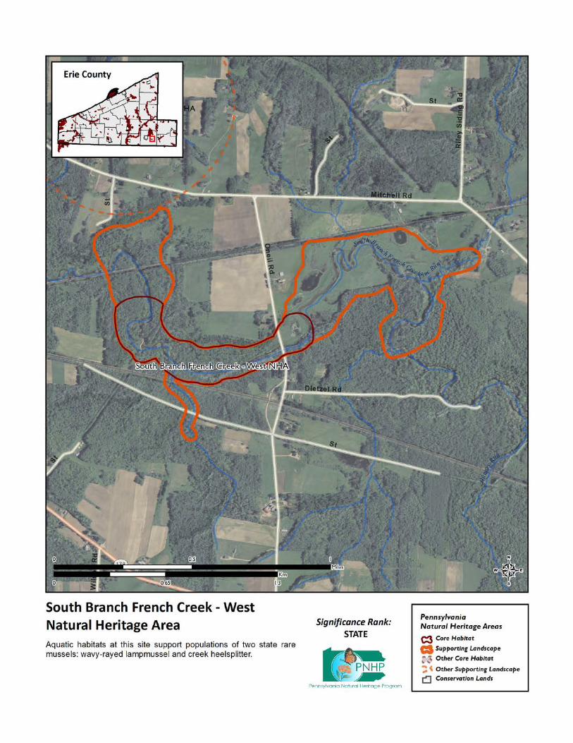
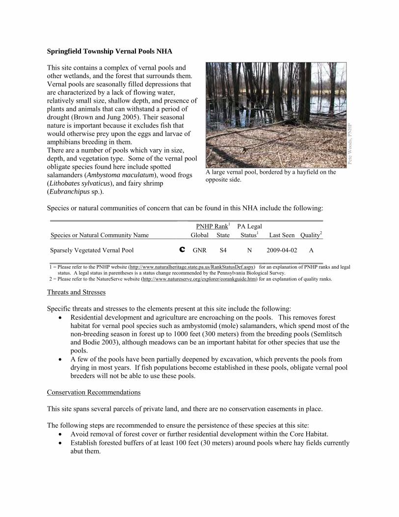
Springfield Township Vernal Pools NHA This site contains a complex of vernal pools and other wetlands, and the forest that surrounds them. Vernal pools are seasonally filled depressions that are characterized by a lack of flowing water, relatively small size, shallow depth, and presence of plants and animals that can withstand a period of drought (Brown and Jung 2005). Their seasonal nature is important because it excludes fish that would otherwise prey upon the eggs and larvae of amphibians breeding in them. There are a number of pools which vary in size, depth, and vegetation type. Some of the vernal pool obligate species found here include spotted salamanders (Ambystoma maculatum), wood frogs (Lithobates sylvaticus), and fairy shrimp (Eubranchipus sp.). Species or natural communities of concern that can be found in this NHA include the following: PNHP Rank1 PA Legal Species or Natural Community Name Global State Status1 Last Seen Quality2 Sparsely Vegetated Vernal Pool C GNR S4 N 2009-04-02 A 1 = Please refer to the PNHP website (http://www.naturalheritage.state.pa.us/RankStatusDef.aspx) for an explanation of PNHP ranks and legal
status. A legal status in parentheses is a status change recommended by the Pennsylvania Biological Survey. 2 = Please refer to the NatureServe website (http://www.natureserve.org/explorer/eorankguide.htm) for an explanation of quality ranks.
Threats and Stresses Specific threats and stresses to the elements present at this site include the following:
• Residential development and agriculture are encroaching on the pools. This removes forest habitat for vernal pool species such as ambystomid (mole) salamanders, which spend most of the non-breeding season in forest up to 1000 feet (300 meters) from the breeding pools (Semlitsch and Bodie 2003), although meadows can be an important habitat for other species that use the pools.
• A few of the pools have been partially deepened by excavation, which prevents the pools from drying in most years. If fish populations become established in these pools, obligate vernal pool breeders will not be able to use these pools.
Conservation Recommendations This site spans several parcels of private land, and there are no conservation easements in place. The following steps are recommended to ensure the persistence of these species at this site:
• Avoid removal of forest cover or further residential development within the Core Habitat. • Establish forested buffers of at least 100 feet (30 meters) around pools where hay fields currently
abut them.
Pete
Woo
ds, P
NH
P
A large vernal pool, bordered by a hayfield on the opposite side.

Location and Additional Information
Municipalities: Springfield Township USGS quads: East Springfield 1993 Erie CNHI reference: None; previously unrecognized site Associated NHAs: None Overlapping Protected Lands: None; private lands. PNHP Significance Rank: State References Brown, L. J. and R.E. Jung. 2005. “An introduction to Mid-Atlantic Seasonal Pools,” EPA-903-B-05-001. U.S. Environmental
Protection Agency, Mid-Atlantic Integrated Assessment, Ft. Meade, Maryland. epa.gov/bioiweb1/pdf/EPA-903-B-05-001AnIntroductiontoMid-AtlanticSeasonalPools.pdf
Semlitsch, R.D. and J.R. Bodie. 2003. Biological Criteria for Buffer Zones around Wetlands and Riparian Habitats for Amphibians and Reptiles. Conservation Biology, 17: 1219-1228.
Zimmerman, E. 2011. Pennsylvania Natural Heritage Program. Sparsely Vegetated Vernal Pool Community Factsheet. Available from: http://www.naturalheritage.state.pa.us/Community.aspx?=30027 Date Accessed: August 29, 2012
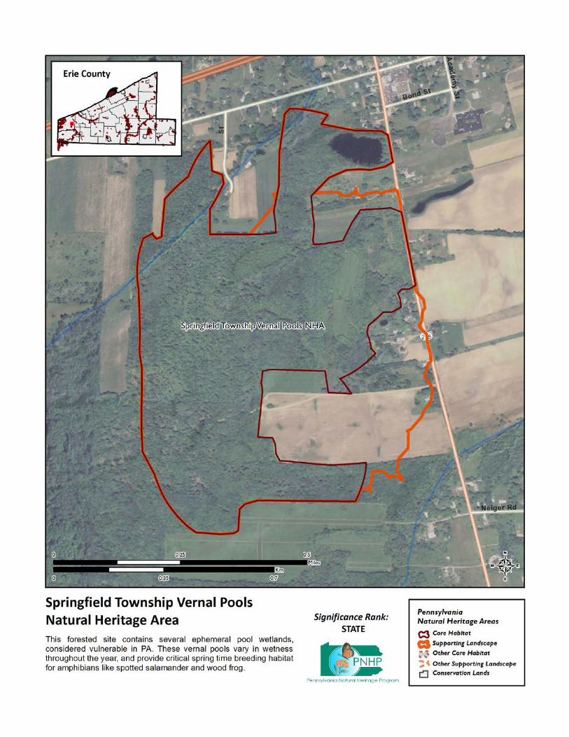
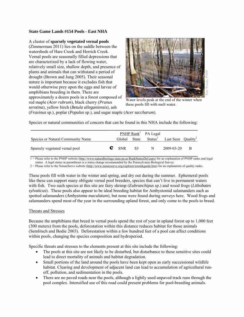
State Game Lands #154 Pools - East NHA A cluster of sparsely vegetated vernal pools (Zimmerman 2011) lies on the saddle between the watersheds of Hare Creek and Herrick Creek. Vernal pools are seasonally filled depressions that are characterized by a lack of flowing water, relatively small size, shallow depth, and presence of plants and animals that can withstand a period of drought (Brown and Jung 2005). Their seasonal nature is important because it excludes fish that would otherwise prey upon the eggs and larvae of amphibians breeding in them. There are approximately a dozen pools in a forest composed of red maple (Acer rubrum), black cherry (Prunus serotina), yellow birch (Betula alleganiensis), ash (Fraxinus sp.), poplar (Populus sp.), and sugar maple (Acer saccharum). Species or natural communities of concern that can be found in this NHA include the following: PNHP Rank1 PA Legal Species or Natural Community Name Global State Status1 Last Seen Quality2 Sparsely vegetated vernal pool C SNR S3 N 2009-03-20 B 1 = Please refer to the PNHP website (http://www.naturalheritage.state.pa.us/RankStatusDef.aspx) for an explanation of PNHP ranks and legal
status. A legal status in parentheses is a status change recommended by the Pennsylvania Biological Survey. 2 = Please refer to the NatureServe website (http://www.natureserve.org/explorer/eorankguide.htm) for an explanation of quality ranks.
These pools fill with water in the winter and spring, and dry out during the summer. Ephemeral pools like these can support many obligate vernal pool breeders, species that can’t live in permanent waters with fish. Two such species at this site are fairy shrimp (Eubranchipus sp.) and wood frogs (Lithobates sylvaticus). These pools also appear to be ideal breeding habitat for Ambystomid salamanders such as spotted salamanders (Ambystoma maculatum), but none were found during surveys here. Wood frogs and salamanders spend most of the year in the surrounding upland forest, and only come to the pools to breed. Threats and Stresses Because the amphibians that breed in vernal pools spend the rest of year in upland forest up to 1,000 feet (300 meters) from the pools, deforestation within this distance reduces habitat for those animals (Semlitsch and Bodie 2003). Deforestation within a few hundred feet of a pool can affect conditions within pools, changing the species composition and hydroperiod. Specific threats and stresses to the elements present at this site include the following:
• The pools at this site are not likely to be disturbed, but disturbance to these sensitive sites could lead to direct mortality of animals and habitat degradation.
• Small portions of the land around the pools have been kept open as early successional wildlife habitat. Clearing and development of adjacent land can lead to accumulation of agricultural run-off, pollution, and sedimentation in the pools.
• There are no paved roads near the pools, although a lightly used unpaved track runs through the pool complex. Intensified use of this road could present problems for pool-breeding animals.
Pete
Woo
ds, P
NH
P
Water levels peak at the end of the winter when these pools fill with melt water.
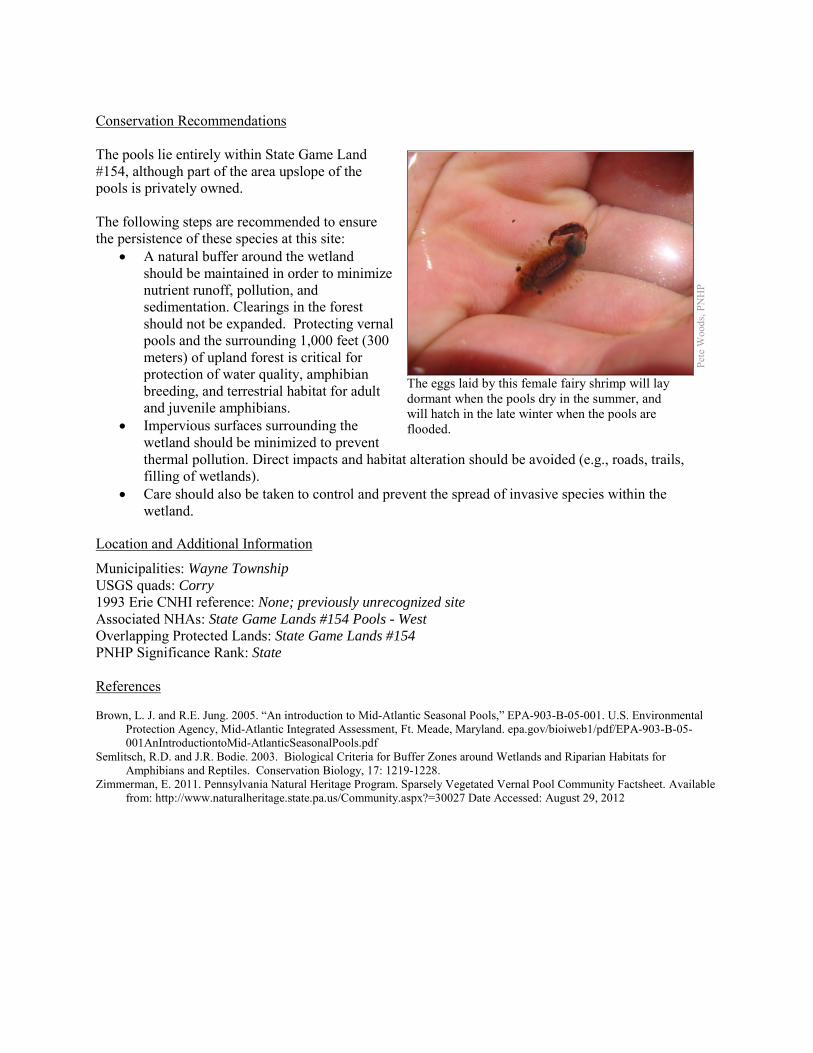
Conservation Recommendations The pools lie entirely within State Game Land #154, although part of the area upslope of the pools is privately owned. The following steps are recommended to ensure the persistence of these species at this site:
• A natural buffer around the wetland should be maintained in order to minimize nutrient runoff, pollution, and sedimentation. Clearings in the forest should not be expanded. Protecting vernal pools and the surrounding 1,000 feet (300 meters) of upland forest is critical for protection of water quality, amphibian breeding, and terrestrial habitat for adult and juvenile amphibians.
• Impervious surfaces surrounding the wetland should be minimized to prevent thermal pollution. Direct impacts and habitat alteration should be avoided (e.g., roads, trails, filling of wetlands).
• Care should also be taken to control and prevent the spread of invasive species within the wetland.
Location and Additional Information
Municipalities: Wayne Township USGS quads: Corry 1993 Erie CNHI reference: None; previously unrecognized site Associated NHAs: State Game Lands #154 Pools - West Overlapping Protected Lands: State Game Lands #154 PNHP Significance Rank: State References Brown, L. J. and R.E. Jung. 2005. “An introduction to Mid-Atlantic Seasonal Pools,” EPA-903-B-05-001. U.S. Environmental
Protection Agency, Mid-Atlantic Integrated Assessment, Ft. Meade, Maryland. epa.gov/bioiweb1/pdf/EPA-903-B-05-001AnIntroductiontoMid-AtlanticSeasonalPools.pdf
Semlitsch, R.D. and J.R. Bodie. 2003. Biological Criteria for Buffer Zones around Wetlands and Riparian Habitats for Amphibians and Reptiles. Conservation Biology, 17: 1219-1228.
Zimmerman, E. 2011. Pennsylvania Natural Heritage Program. Sparsely Vegetated Vernal Pool Community Factsheet. Available from: http://www.naturalheritage.state.pa.us/Community.aspx?=30027 Date Accessed: August 29, 2012
Pete
Woo
ds, P
NH
P
The eggs laid by this female fairy shrimp will lay dormant when the pools dry in the summer, and will hatch in the late winter when the pools are flooded.
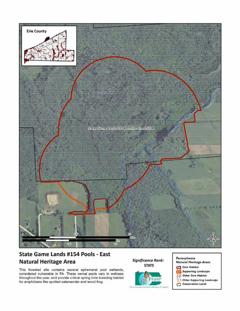
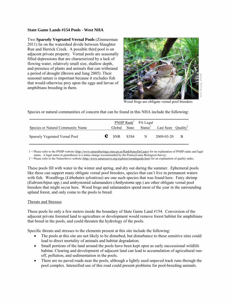
State Game Lands #154 Pools - West NHA Two Sparsely Vegetated Vernal Pools (Zimmerman 2011) lie on the watershed divide between Slaughter Run and Herrick Creek. A possible third pool is on adjacent private property. Vernal pools are seasonally filled depressions that are characterized by a lack of flowing water, relatively small size, shallow depth, and presence of plants and animals that can withstand a period of drought (Brown and Jung 2005). Their seasonal nature is important because it excludes fish that would otherwise prey upon the eggs and larvae of amphibians breeding in them. Species or natural communities of concern that can be found in this NHA include the following: PNHP Rank1 PA Legal Species or Natural Community Name Global State Status1 Last Seen Quality2 Sparsely Vegetated Vernal Pool C SNR S3S4 N 2009-03-20 B
1 = Please refer to the PNHP website (http://www.naturalheritage.state.pa.us/RankStatusDef.aspx) for an explanation of PNHP ranks and legal
status. A legal status in parentheses is a status change recommended by the Pennsylvania Biological Survey. 2 = Please refer to the NatureServe website (http://www.natureserve.org/explorer/eorankguide.htm) for an explanation of quality ranks.
These pools fill with water in the winter and spring, and dry out during the summer. Ephemeral pools like these can support many obligate vernal pool breeders, species that can’t live in permanent waters with fish. Woodfrogs (Lithobates sylvaticus) are one such species that was found here. Fairy shrimp (Eubranchipus spp.) and ambystomid salamanders (Ambystoma spp.) are other obligate vernal pool breeders that might occur here. Wood frogs and salamanders spend most of the year in the surrounding upland forest, and only come to the pools to breed. Threats and Stresses These pools lie only a few meters inside the boundary of State Game Land #154. Conversion of the adjacent private forested land to agriculture or development would remove forest habitat for amphibians that breed in the pools, and could threaten the hydrology of the pools. Specific threats and stresses to the elements present at this site include the following:
• The pools at this site are not likely to be disturbed, but disturbance to these sensitive sites could lead to direct mortality of animals and habitat degradation.
• Small portions of the land around the pools have been kept open as early successional wildlife habitat. Clearing and development of adjacent land can lead to accumulation of agricultural run-off, pollution, and sedimentation in the pools.
• There are no paved roads near the pools, although a lightly used unpaved track runs through the pool complex. Intensified use of this road could present problems for pool-breeding animals.
Pete
Woo
ds, P
NH
P
Wood frogs are obligate vernal pool breeders
Conservation Recommendations The forest in the Core Habitat should not be clearcut or converted to other land uses. The following steps are recommended to ensure the persistence of these species at this site:
• A natural buffer around the wetland should be maintained in order to minimize nutrient runoff, pollution, and sedimentation. Clearings in the forest should not be expanded. Protecting vernal pools and the surrounding 1,000 feet (300 meters) of upland forest is critical for protection of water quality, amphibian breeding, and terrestrial habitat for adult and juvenile amphibians (Semlitsch and Bodie 2003).
• Impervious surfaces surrounding the wetland should be minimized to prevent thermal pollution. Direct impacts and habitat alteration should be avoided (e.g., roads, trails, filling of wetlands).
• Care should also be taken to control and prevent the spread of invasive species within the wetland.
Location and Additional Information
Municipalities: Wayne Township USGS quads: Corry 1993 Erie CNHI reference: None; previously unrecognized site Associated NHAs: State Game Lands #154 Pools - East Overlapping Protected Lands: State Game Lands #154 PNHP Significance Rank: Local References Brown, L. J. and R.E. Jung. 2005. “An introduction to Mid-Atlantic Seasonal Pools,” EPA-903-B-05-001. U.S. Environmental
Protection Agency, Mid-Atlantic Integrated Assessment, Ft. Meade, Maryland. epa.gov/bioiweb1/pdf/EPA-903-B-05-001AnIntroductiontoMid-AtlanticSeasonalPools.pdf
Semlitsch, R.D. and J.R. Bodie. 2003. Biological Criteria for Buffer Zones around Wetlands and Riparian Habitats for Amphibians and Reptiles. Conservation Biology, 17: 1219-1228.
Zimmerman, E. 2011. Pennsylvania Natural Heritage Program. Sparsely Vegetated Vernal Pool Community Factsheet. Available from: http://www.naturalheritage.state.pa.us/Community.aspx?=30027 Date Accessed: August 29, 2012
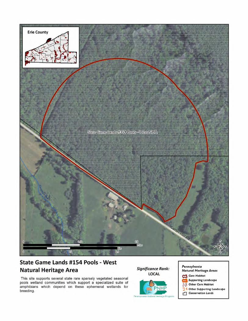
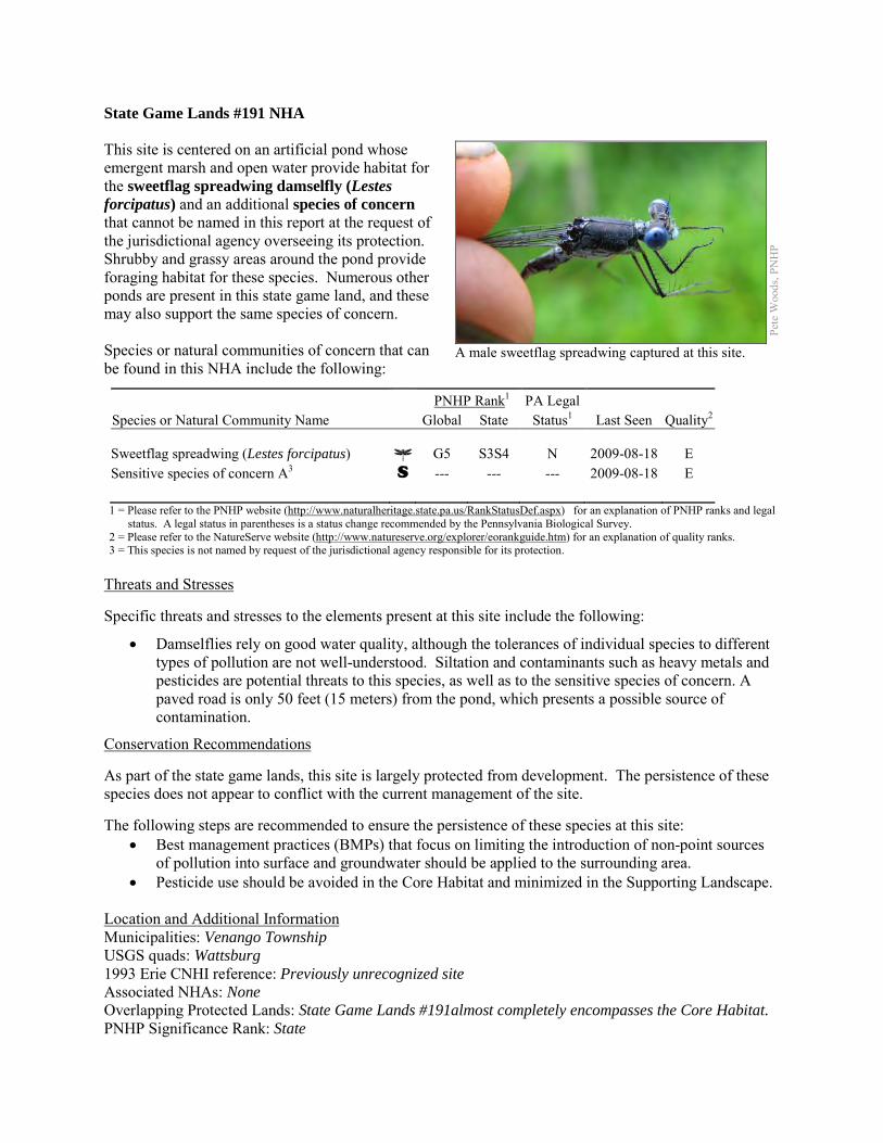
State Game Lands #191 NHA This site is centered on an artificial pond whose emergent marsh and open water provide habitat for the sweetflag spreadwing damselfly (Lestes forcipatus) and an additional species of concern that cannot be named in this report at the request of the jurisdictional agency overseeing its protection. Shrubby and grassy areas around the pond provide foraging habitat for these species. Numerous other ponds are present in this state game land, and these may also support the same species of concern. Species or natural communities of concern that can be found in this NHA include the following:
PNHP Rank1 PA Legal Species or Natural Community Name Global State Status1 Last Seen Quality2 Sweetflag spreadwing (Lestes forcipatus) G5 S3S4 N 2009-08-18 E Sensitive species of concern A3 S --- --- --- 2009-08-18 E 1 = Please refer to the PNHP website (http://www.naturalheritage.state.pa.us/RankStatusDef.aspx) for an explanation of PNHP ranks and legal
status. A legal status in parentheses is a status change recommended by the Pennsylvania Biological Survey. 2 = Please refer to the NatureServe website (http://www.natureserve.org/explorer/eorankguide.htm) for an explanation of quality ranks. 3 = This species is not named by request of the jurisdictional agency responsible for its protection.
Threats and Stresses Specific threats and stresses to the elements present at this site include the following:
• Damselflies rely on good water quality, although the tolerances of individual species to different types of pollution are not well-understood. Siltation and contaminants such as heavy metals and pesticides are potential threats to this species, as well as to the sensitive species of concern. A paved road is only 50 feet (15 meters) from the pond, which presents a possible source of contamination.
Conservation Recommendations As part of the state game lands, this site is largely protected from development. The persistence of these species does not appear to conflict with the current management of the site. The following steps are recommended to ensure the persistence of these species at this site:
• Best management practices (BMPs) that focus on limiting the introduction of non-point sources of pollution into surface and groundwater should be applied to the surrounding area.
• Pesticide use should be avoided in the Core Habitat and minimized in the Supporting Landscape. Location and Additional Information Municipalities: Venango Township USGS quads: Wattsburg 1993 Erie CNHI reference: Previously unrecognized site Associated NHAs: None Overlapping Protected Lands: State Game Lands #191almost completely encompasses the Core Habitat. PNHP Significance Rank: State
Pete
Woo
ds, P
NH
P
A male sweetflag spreadwing captured at this site.
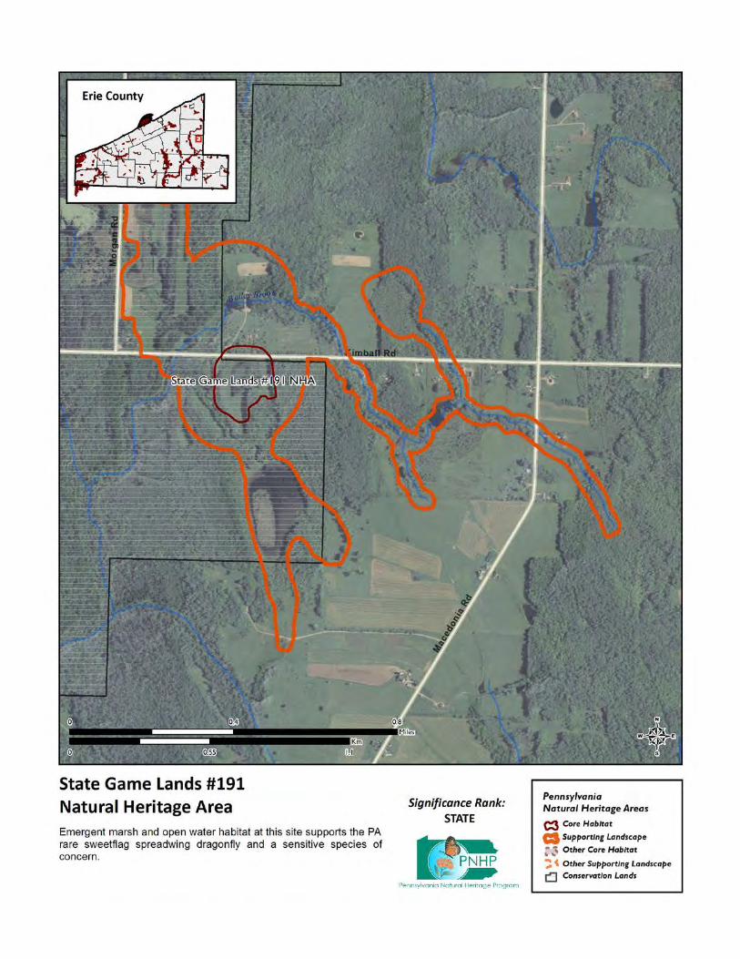

State Game Lands #192 Ponds NHA This site is designated around a series of impoundments along a small tributary of French Creek host a number of dragonfly, damselfly, and butterfly species of concern. Eight dragonfly and damselfly species of concern breed in the ponds here. The ponds, as well as open fields and shrublands adjacent to the ponds, provide foraging opportunities for these insects. This site also supports two butterfly species of concern. Bronze coppers (Lycaena hyllus) breed in stands of smartweed (Persicaria spp.) or dock (Rumex spp.) in the emergent fringe of the ponds, while Acadian hairstreaks (Satyrium acadica) breed in the shrubby willows at this site. Species or natural communities of concern that can be found in this NHA include the following:
PNHP Rank1 PA Legal Species or Natural Community Name Global State Status1 Last Seen Quality2 Bronze copper (Lycaena hyllus) G4G5 S3 N 2005-08-24 E Acadian hairstreak (Satyrium acadica) G5 S3 N 2008-07-11 E Black-tipped darner (Aeshna tuberculifera) G4 S2S3 N 2005-08-24 E Lilypad clubtail (Arigomphus furcifer) G5 S2 N 2011-06-08 E American emerald (Cordulia shurtleffi) G5 S3S4 N 2007-06-02 E Northern bluet (Enallagma annexum) G5 S3 N 2005-08-24 E Amber-winged spreadwing (Lestes eurinus) G4 S3 N 2007-07-10 E Cyrano darner (Nasiaeschna pentacantha) G5 S1 N 2007-07-10 E Spatterdock darner (Rhionaeschna mutata) G4 S2 N 2008-07-01 E White-faced meadowhawk (Sympetrum obtrusum)
G5 S3S4 N 2005-08-24 E
1 = Please refer to the PNHP website (http://www.naturalheritage.state.pa.us/RankStatusDef.aspx) for an explanation of PNHP ranks and legal
status. A legal status in parentheses is a status change recommended by the Pennsylvania Biological Survey. 2 = Please refer to the NatureServe website (http://www.natureserve.org/explorer/eorankguide.htm) for an explanation of quality ranks.
Threats and Stresses Specific threats and stresses to the elements present at this site include the following:
• If succession toward a mature forest is allowed to occur, it would eventually reduce foraging opportunities for dragonflies and nectaring opportunities for butterflies.
• The wetland fringe around the pools which sustains the butterfly species of concern is minimal, which likely limits the populations of these species and may make them vulnerable to extirpation.
• Dragonflies and damselflies rely on good water quality, although the tolerances of individual species to different types of pollution are not well-understood. Siltation and contaminants such as heavy metals and pesticides are are potential threats to this species. The butterfly species of concern are also susceptible to pesticides.
Pete
Woo
ds, P
NH
P
A spatterdock darner
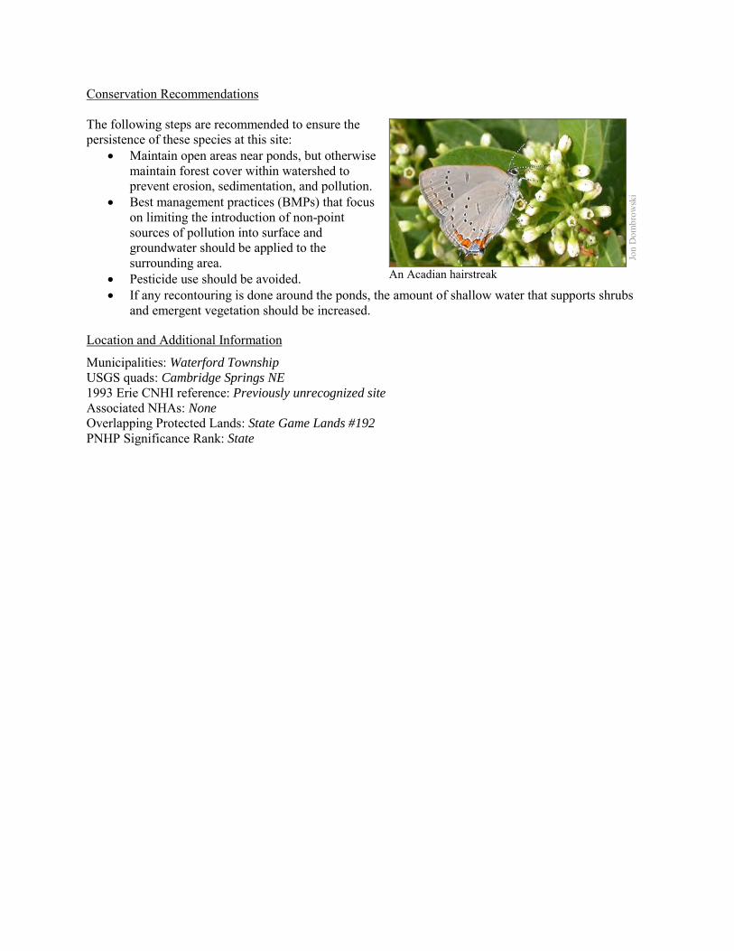
Conservation Recommendations The following steps are recommended to ensure the persistence of these species at this site:
• Maintain open areas near ponds, but otherwise maintain forest cover within watershed to prevent erosion, sedimentation, and pollution.
• Best management practices (BMPs) that focus on limiting the introduction of non-point sources of pollution into surface and groundwater should be applied to the surrounding area.
• Pesticide use should be avoided. • If any recontouring is done around the ponds, the amount of shallow water that supports shrubs
and emergent vegetation should be increased.
Location and Additional Information
Municipalities: Waterford Township USGS quads: Cambridge Springs NE 1993 Erie CNHI reference: Previously unrecognized site Associated NHAs: None Overlapping Protected Lands: State Game Lands #192 PNHP Significance Rank: State
Jon
Dom
brow
ski
An Acadian hairstreak
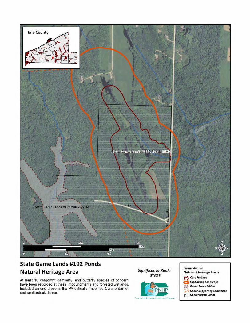
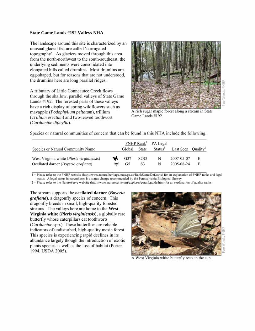
State Game Lands #192 Valleys NHA The landscape around this site is characterized by an unusual glacial feature called ‘corrugated topography’. As glaciers moved through this area from the north-northwest to the south-southeast, the underlying sediments were consolidated into elongated hills called drumlins. Most drumlins are egg-shaped, but for reasons that are not understood, the drumlins here are long parallel ridges. A tributary of Little Conneautee Creek flows through the shallow, parallel valleys of State Game Lands #192. The forested parts of these valleys have a rich display of spring wildflowers such as mayapple (Podophyllum peltatum), trillium (Trillium erectum) and two-leaved toothwort (Cardamine diphylla). Species or natural communities of concern that can be found in this NHA include the following:
PNHP Rank1 PA Legal Species or Natural Community Name Global State Status1 Last Seen Quality2 West Virginia white (Pieris virginiensis) G3? S2S3 N 2007-05-07 E Ocellated darner (Boyeria grafiana) G5 S3 N 2005-08-24 E 1 = Please refer to the PNHP website (http://www.naturalheritage.state.pa.us/RankStatusDef.aspx) for an explanation of PNHP ranks and legal
status. A legal status in parentheses is a status change recommended by the Pennsylvania Biological Survey. 2 = Please refer to the NatureServe website (http://www.natureserve.org/explorer/eorankguide.htm) for an explanation of quality ranks.
The stream supports the ocellated darner (Boyeria grafiana), a dragonfly species of concern. This dragonfly breeds in small, high-quality forested streams. The valleys here are home to the West Virginia white (Pieris virginiensis), a globally rare butterfly whose caterpillars eat toothworts (Cardamine spp.) These butterflies are reliable indicators of undisturbed, high-quality mesic forest. This species is experiencing rapid declines in its abundance largely though the introduction of exotic plants species as well as the loss of habitat (Porter 1994, USDA 2005).
Pete
Woo
ds, P
NH
P
A rich sugar maple forest along a stream in State Game Lands #192
Pete
Woo
ds, P
NH
P
A West Virginia white butterfly rests in the sun.
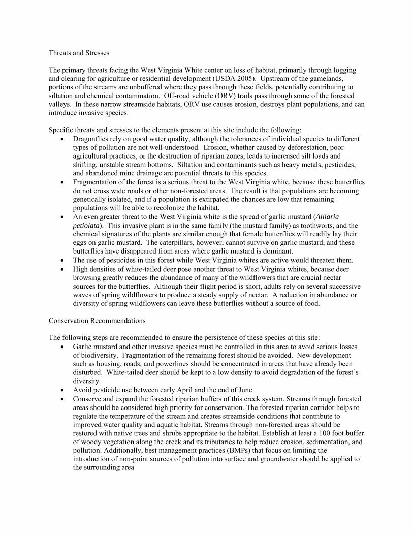
Threats and Stresses The primary threats facing the West Virginia White center on loss of habitat, primarily through logging and clearing for agriculture or residential development (USDA 2005). Upstream of the gamelands, portions of the streams are unbuffered where they pass through these fields, potentially contributing to siltation and chemical contamination. Off-road vehicle (ORV) trails pass through some of the forested valleys. In these narrow streamside habitats, ORV use causes erosion, destroys plant populations, and can introduce invasive species. Specific threats and stresses to the elements present at this site include the following:
• Dragonflies rely on good water quality, although the tolerances of individual species to different types of pollution are not well-understood. Erosion, whether caused by deforestation, poor agricultural practices, or the destruction of riparian zones, leads to increased silt loads and shifting, unstable stream bottoms. Siltation and contaminants such as heavy metals, pesticides, and abandoned mine drainage are potential threats to this species.
• Fragmentation of the forest is a serious threat to the West Virginia white, because these butterflies do not cross wide roads or other non-forested areas. The result is that populations are becoming genetically isolated, and if a population is extirpated the chances are low that remaining populations will be able to recolonize the habitat.
• An even greater threat to the West Virginia white is the spread of garlic mustard (Alliaria petiolata). This invasive plant is in the same family (the mustard family) as toothworts, and the chemical signatures of the plants are similar enough that female butterflies will readily lay their eggs on garlic mustard. The caterpillars, however, cannot survive on garlic mustard, and these butterflies have disappeared from areas where garlic mustard is dominant.
• The use of pesticides in this forest while West Virginia whites are active would threaten them. • High densities of white-tailed deer pose another threat to West Virginia whites, because deer
browsing greatly reduces the abundance of many of the wildflowers that are crucial nectar sources for the butterflies. Although their flight period is short, adults rely on several successive waves of spring wildflowers to produce a steady supply of nectar. A reduction in abundance or diversity of spring wildflowers can leave these butterflies without a source of food.
Conservation Recommendations The following steps are recommended to ensure the persistence of these species at this site:
• Garlic mustard and other invasive species must be controlled in this area to avoid serious losses of biodiversity. Fragmentation of the remaining forest should be avoided. New development such as housing, roads, and powerlines should be concentrated in areas that have already been disturbed. White-tailed deer should be kept to a low density to avoid degradation of the forest’s diversity.
• Avoid pesticide use between early April and the end of June. • Conserve and expand the forested riparian buffers of this creek system. Streams through forested
areas should be considered high priority for conservation. The forested riparian corridor helps to regulate the temperature of the stream and creates streamside conditions that contribute to improved water quality and aquatic habitat. Streams through non-forested areas should be restored with native trees and shrubs appropriate to the habitat. Establish at least a 100 foot buffer of woody vegetation along the creek and its tributaries to help reduce erosion, sedimentation, and pollution. Additionally, best management practices (BMPs) that focus on limiting the introduction of non-point sources of pollution into surface and groundwater should be applied to the surrounding area
Location and Additional Information
Municipalities: Washington, Township, Waterford Township USGS quads: Cambridge Springs NE 1993 Erie CNHI reference: Previously unidentified site Associated NHAs: State Game Lands #192 Ponds Overlapping Protected Lands: State Game Land #192 PNHP Significance Rank: Regional References Porter, A. 1994. Implications of Introduced Garlic Mustard (Alliaria petiolata) In the habitat of Pieris virginiensis (Pieridae).
Journal of the Lepidopterists' Society 48(2), 171-172. USDA Forest Service, Eastern Region. 2005. Conservation Assessment for the West Virginia White (Pieris virginiensis
Edwards). James Bess, OTIS Enterprises, 13501 south 750 west, Wanatah, Indiana 46390. http://www.fs.fed.us/r9/wildlife/tes/ca-overview/docs/insects/Pieris_Virginiensis.pdf
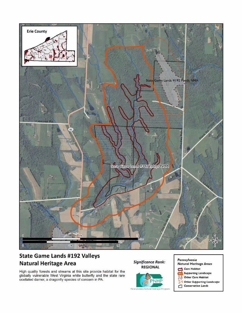
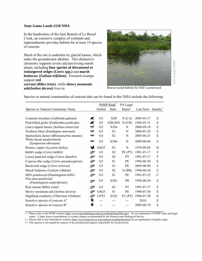
State Game Lands #218 NHA In the headwaters of the East Branch of Le Boeuf Creek, an extensive complex of wetlands and impoundments provides habitat for at least 19 species of concern. Much of the site is underlain by glacial kames, which make the groundwater alkaline. This distinctive chemistry supports seven calcium-loving marsh plants, including four species of threatened or endangered sedges (Carex spp.) and marsh bedstraw (Galium trifidum). Forested swamps support red currant (Ribes triste), while showy mountain ash(Sorbus decora) lives in Species or natural communities of concern that can be found in this NHA include the following:
PNHP Rank1 PA Legal Species or Natural Community Name Global State Status1 Last Seen Quality2 Common moorhen (Gallinula galeata) G5 S3B N (CA) 2005-05-17 E Pied-billed grebe (Podilymbus podiceps) G5 S3B,S4N N (CR) 1986-05-31 E Lance-tipped darner (Aeshna constricta) G5 S3S4 N 2008-09-10 E Northern bluet (Enallagma annexum) G5 S3 N 2004-05-29 E Spatterdock darner (Rhionaeschna mutata) G4 S2 N 2005-06-21 E White-faced meadowhawk (Sympetrum obtrusum) G5 S3S4 N 2009-08-06 E
Bronze copper (Lycaena hyllus) G4G5 S3 N 1979-09-05 H Bebb's sedge (Carex bebbii) G5 S2 PE (PT) 1991-07-17 F Lesser panicled sedge (Carex diandra) G5 S2 PT 1991-07-17 F Cyperus-like sedge (Carex pseudocyperus) G5 S1 PE 1996-08-30 E Backward sedge (Carex retrorsa) G5 S1 PE 2009-08-09 E Marsh bedstraw (Galium trifidum) G5 S2 N (PR) 1996-08-30 E Hill's pondweed (Potamogeton hillii) G3 S1 PE 1991-07-25 C Flat-stem pondweed (Potamogeton zosteriformis) G5 S2S3 PR 1996-08-30 E
Red currant (Ribes triste) G5 S2 PT 1991-07-17 E Showy mountain-ash (Sorbus decora) G4G5 S1 PE 1996-07-30 E Highbush-cranberry (Viburnum trilobum) G5T5 S1S2 TU (PT) 1996-07-30 E Sensitive species of concern A3 S --- --- --- 2010 E Sensitive species of concern B3 S --- --- --- 2009-08-19 E 1 = Please refer to the PNHP website (http://www.naturalheritage.state.pa.us/RankStatusDef.aspx) for an explanation of PNHP ranks and legal
status. A legal status in parentheses is a status change recommended by the Pennsylvania Biological Survey. 2 = Please refer to the NatureServe website (http://www.natureserve.org/explorer/eorankguide.htm) for an explanation of quality ranks. 3 = This species is not named by request of the jurisdictional agency responsible for its protection.
Pete
Woo
ds, P
NH
P
Beaver pond habitat for Hill’s pondweed
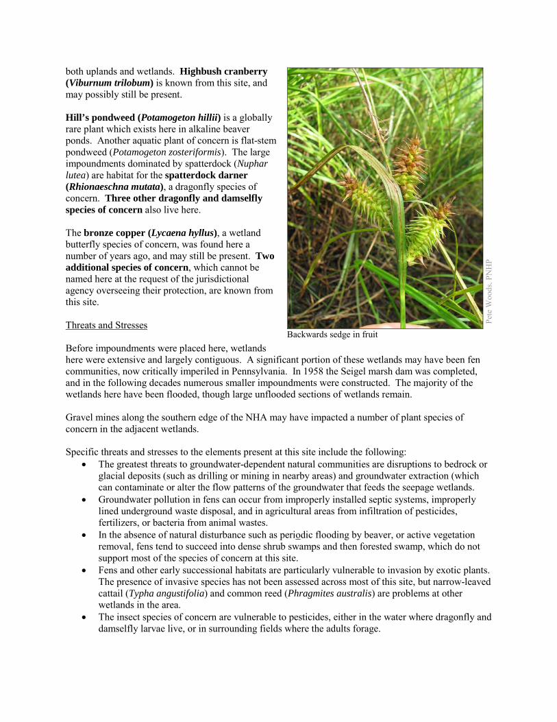
both uplands and wetlands. Highbush cranberry (Viburnum trilobum) is known from this site, and may possibly still be present. Hill’s pondweed (Potamogeton hillii) is a globally rare plant which exists here in alkaline beaver ponds. Another aquatic plant of concern is flat-stem pondweed (Potamogeton zosteriformis). The large impoundments dominated by spatterdock (Nuphar lutea) are habitat for the spatterdock darner (Rhionaeschna mutata), a dragonfly species of concern. Three other dragonfly and damselfly species of concern also live here. The bronze copper (Lycaena hyllus), a wetland butterfly species of concern, was found here a number of years ago, and may still be present. Two additional species of concern, which cannot be named here at the request of the jurisdictional agency overseeing their protection, are known from this site. Threats and Stresses Before impoundments were placed here, wetlands here were extensive and largely contiguous. A significant portion of these wetlands may have been fen communities, now critically imperiled in Pennsylvania. In 1958 the Seigel marsh dam was completed, and in the following decades numerous smaller impoundments were constructed. The majority of the wetlands here have been flooded, though large unflooded sections of wetlands remain. Gravel mines along the southern edge of the NHA may have impacted a number of plant species of concern in the adjacent wetlands. Specific threats and stresses to the elements present at this site include the following:
• The greatest threats to groundwater-dependent natural communities are disruptions to bedrock or glacial deposits (such as drilling or mining in nearby areas) and groundwater extraction (which can contaminate or alter the flow patterns of the groundwater that feeds the seepage wetlands.
• Groundwater pollution in fens can occur from improperly installed septic systems, improperly lined underground waste disposal, and in agricultural areas from infiltration of pesticides, fertilizers, or bacteria from animal wastes.
• In the absence of natural disturbance such as periodic flooding by beaver, or active vegetation removal, fens tend to succeed into dense shrub swamps and then forested swamp, which do not support most of the species of concern at this site.
• Fens and other early successional habitats are particularly vulnerable to invasion by exotic plants. The presence of invasive species has not been assessed across most of this site, but narrow-leaved cattail (Typha angustifolia) and common reed (Phragmites australis) are problems at other wetlands in the area.
• The insect species of concern are vulnerable to pesticides, either in the water where dragonfly and damselfly larvae live, or in surrounding fields where the adults forage.
Pete
Woo
ds, P
NH
P
Backwards sedge in fruit
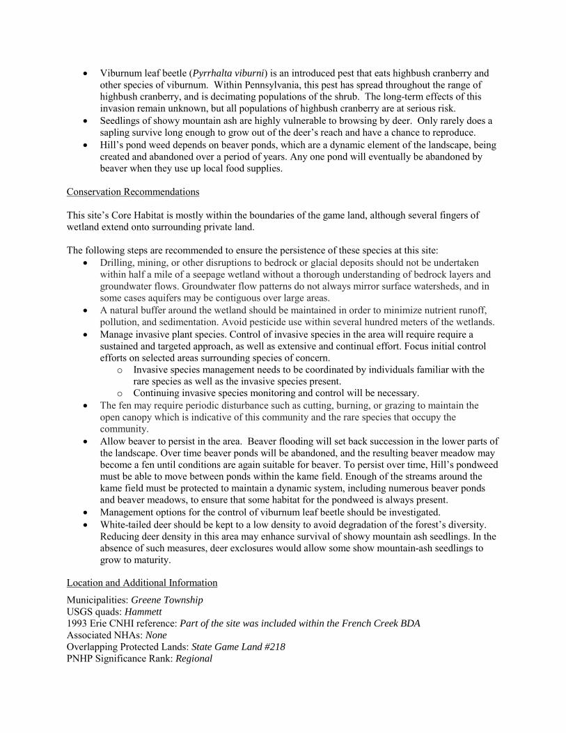
• Viburnum leaf beetle (Pyrrhalta viburni) is an introduced pest that eats highbush cranberry and other species of viburnum. Within Pennsylvania, this pest has spread throughout the range of highbush cranberry, and is decimating populations of the shrub. The long-term effects of this invasion remain unknown, but all populations of highbush cranberry are at serious risk.
• Seedlings of showy mountain ash are highly vulnerable to browsing by deer. Only rarely does a sapling survive long enough to grow out of the deer’s reach and have a chance to reproduce.
• Hill’s pond weed depends on beaver ponds, which are a dynamic element of the landscape, being created and abandoned over a period of years. Any one pond will eventually be abandoned by beaver when they use up local food supplies.
Conservation Recommendations This site’s Core Habitat is mostly within the boundaries of the game land, although several fingers of wetland extend onto surrounding private land. The following steps are recommended to ensure the persistence of these species at this site:
• Drilling, mining, or other disruptions to bedrock or glacial deposits should not be undertaken within half a mile of a seepage wetland without a thorough understanding of bedrock layers and groundwater flows. Groundwater flow patterns do not always mirror surface watersheds, and in some cases aquifers may be contiguous over large areas.
• A natural buffer around the wetland should be maintained in order to minimize nutrient runoff, pollution, and sedimentation. Avoid pesticide use within several hundred meters of the wetlands.
• Manage invasive plant species. Control of invasive species in the area will require require a sustained and targeted approach, as well as extensive and continual effort. Focus initial control efforts on selected areas surrounding species of concern.
o Invasive species management needs to be coordinated by individuals familiar with the rare species as well as the invasive species present.
o Continuing invasive species monitoring and control will be necessary. • The fen may require periodic disturbance such as cutting, burning, or grazing to maintain the
open canopy which is indicative of this community and the rare species that occupy the community.
• Allow beaver to persist in the area. Beaver flooding will set back succession in the lower parts of the landscape. Over time beaver ponds will be abandoned, and the resulting beaver meadow may become a fen until conditions are again suitable for beaver. To persist over time, Hill’s pondweed must be able to move between ponds within the kame field. Enough of the streams around the kame field must be protected to maintain a dynamic system, including numerous beaver ponds and beaver meadows, to ensure that some habitat for the pondweed is always present.
• Management options for the control of viburnum leaf beetle should be investigated. • White-tailed deer should be kept to a low density to avoid degradation of the forest’s diversity.
Reducing deer density in this area may enhance survival of showy mountain ash seedlings. In the absence of such measures, deer exclosures would allow some show mountain-ash seedlings to grow to maturity.
Location and Additional Information
Municipalities: Greene Township USGS quads: Hammett 1993 Erie CNHI reference: Part of the site was included within the French Creek BDA Associated NHAs: None Overlapping Protected Lands: State Game Land #218 PNHP Significance Rank: Regional
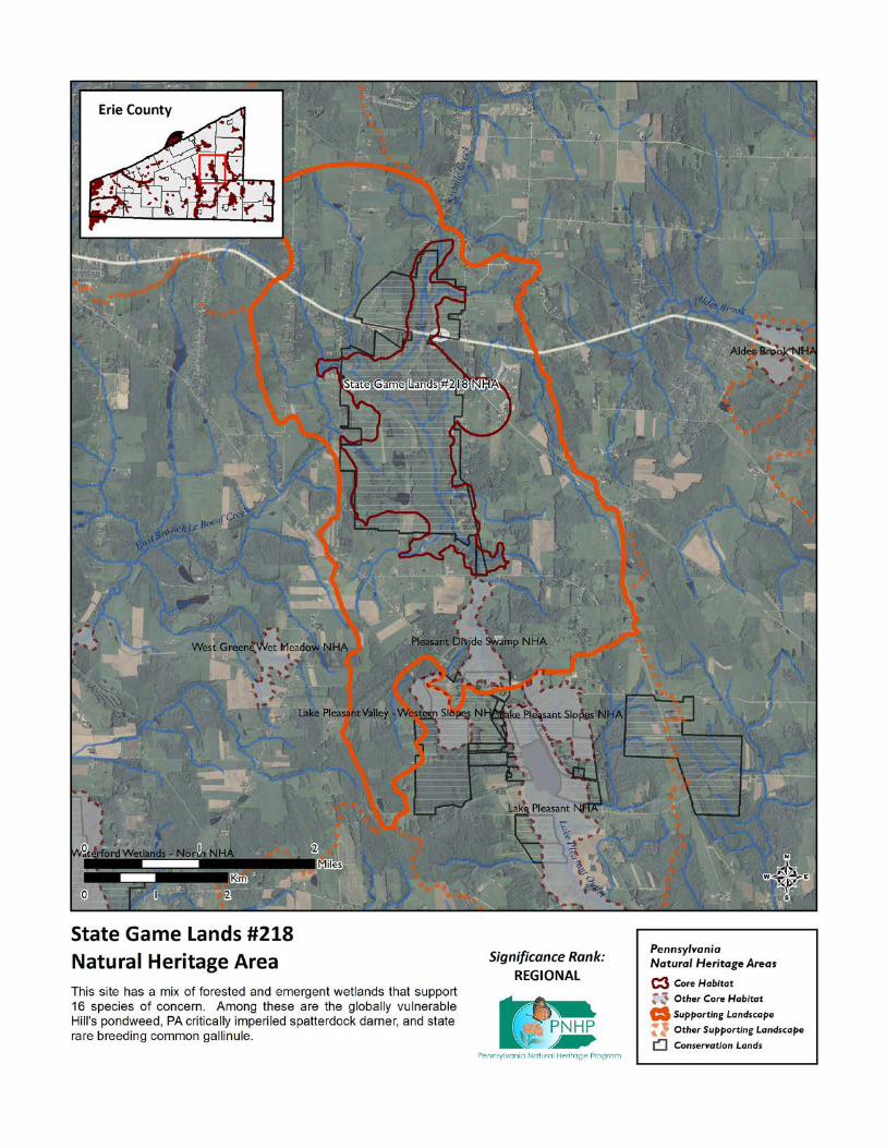
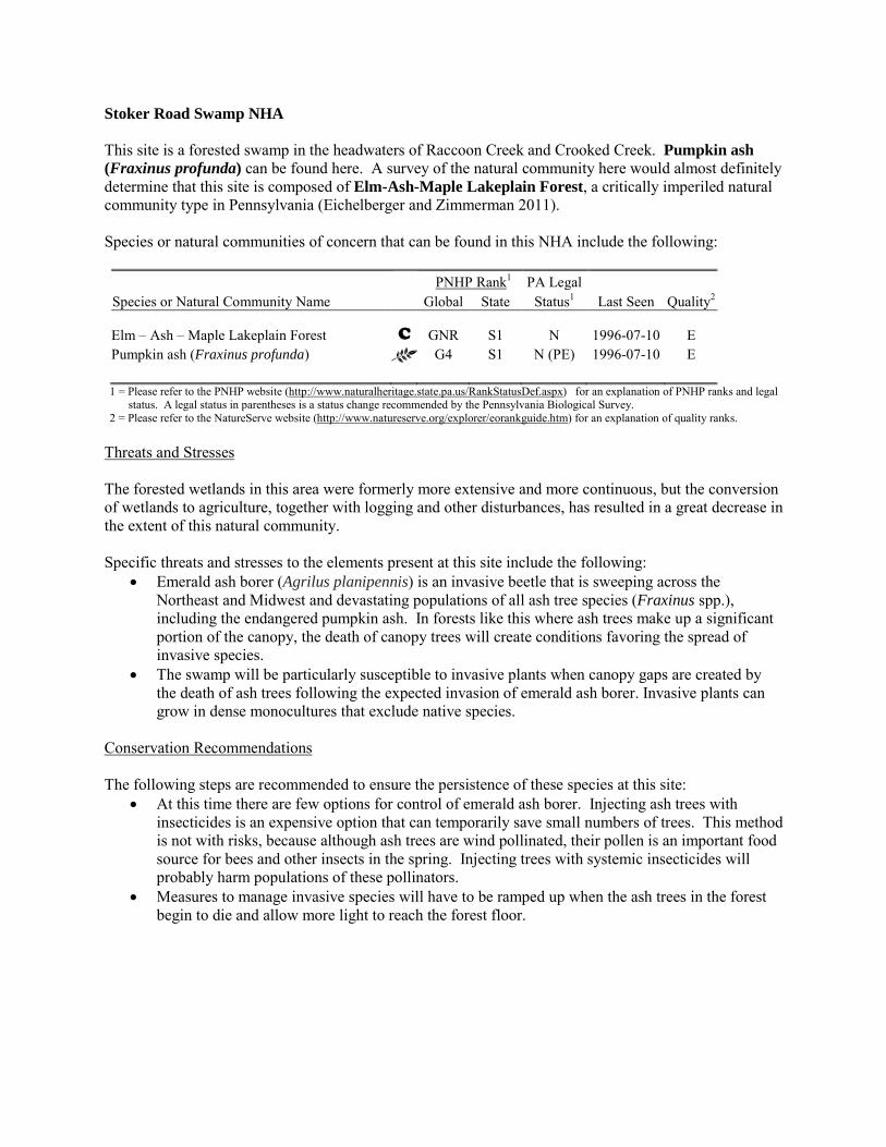
Stoker Road Swamp NHA This site is a forested swamp in the headwaters of Raccoon Creek and Crooked Creek. Pumpkin ash (Fraxinus profunda) can be found here. A survey of the natural community here would almost definitely determine that this site is composed of Elm-Ash-Maple Lakeplain Forest, a critically imperiled natural community type in Pennsylvania (Eichelberger and Zimmerman 2011). Species or natural communities of concern that can be found in this NHA include the following: PNHP Rank1 PA Legal Species or Natural Community Name Global State Status1 Last Seen Quality2 Elm – Ash – Maple Lakeplain Forest C GNR S1 N 1996-07-10 E Pumpkin ash (Fraxinus profunda) G4 S1 N (PE) 1996-07-10 E 1 = Please refer to the PNHP website (http://www.naturalheritage.state.pa.us/RankStatusDef.aspx) for an explanation of PNHP ranks and legal
status. A legal status in parentheses is a status change recommended by the Pennsylvania Biological Survey. 2 = Please refer to the NatureServe website (http://www.natureserve.org/explorer/eorankguide.htm) for an explanation of quality ranks.
Threats and Stresses The forested wetlands in this area were formerly more extensive and more continuous, but the conversion of wetlands to agriculture, together with logging and other disturbances, has resulted in a great decrease in the extent of this natural community. Specific threats and stresses to the elements present at this site include the following:
• Emerald ash borer (Agrilus planipennis) is an invasive beetle that is sweeping across the Northeast and Midwest and devastating populations of all ash tree species (Fraxinus spp.), including the endangered pumpkin ash. In forests like this where ash trees make up a significant portion of the canopy, the death of canopy trees will create conditions favoring the spread of invasive species.
• The swamp will be particularly susceptible to invasive plants when canopy gaps are created by the death of ash trees following the expected invasion of emerald ash borer. Invasive plants can grow in dense monocultures that exclude native species.
Conservation Recommendations The following steps are recommended to ensure the persistence of these species at this site:
• At this time there are few options for control of emerald ash borer. Injecting ash trees with insecticides is an expensive option that can temporarily save small numbers of trees. This method is not with risks, because although ash trees are wind pollinated, their pollen is an important food source for bees and other insects in the spring. Injecting trees with systemic insecticides will probably harm populations of these pollinators.
• Measures to manage invasive species will have to be ramped up when the ash trees in the forest begin to die and allow more light to reach the forest floor.
References Eichelberger, B. and Zimmerman, E. 2011. Pennsylvania Natural Heritage Program. Elm – Ash – Maple Lakeplain Forest
Factsheet. Available from: http://www.naturalheritage.state.pa.us/Community.aspx?=16020 Date Accessed: August 29, 2012
Location and Additional Information Municipalities: Conneaut Township USGS quads: East Springfield 1993 Erie CNHI reference: None; previously unrecognized site Associated NHAs: None Overlapping Protected Lands: None PNHP Significance Rank: State
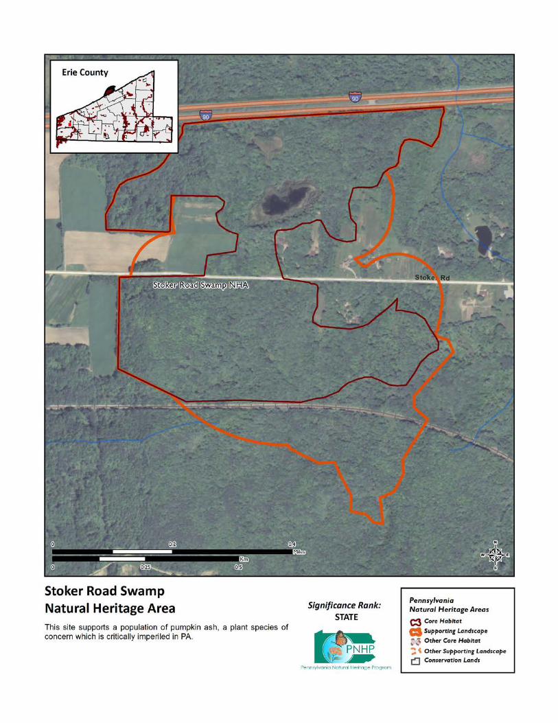
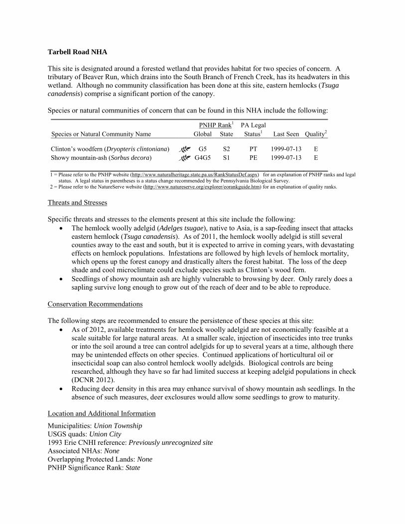
Tarbell Road NHA This site is designated around a forested wetland that provides habitat for two species of concern. A tributary of Beaver Run, which drains into the South Branch of French Creek, has its headwaters in this wetland. Although no community classification has been done at this site, eastern hemlocks (Tsuga canadensis) comprise a significant portion of the canopy. Species or natural communities of concern that can be found in this NHA include the following:
PNHP Rank1 PA Legal Species or Natural Community Name Global State Status1 Last Seen Quality2 Clinton’s woodfern (Dryopteris clintoniana) G5 S2 PT 1999-07-13 E Showy mountain-ash (Sorbus decora) G4G5 S1 PE 1999-07-13 E 1 = Please refer to the PNHP website (http://www.naturalheritage.state.pa.us/RankStatusDef.aspx) for an explanation of PNHP ranks and legal
status. A legal status in parentheses is a status change recommended by the Pennsylvania Biological Survey. 2 = Please refer to the NatureServe website (http://www.natureserve.org/explorer/eorankguide.htm) for an explanation of quality ranks.
Threats and Stresses Specific threats and stresses to the elements present at this site include the following:
• The hemlock woolly adelgid (Adelges tsugae), native to Asia, is a sap-feeding insect that attacks eastern hemlock (Tsuga canadensis). As of 2011, the hemlock woolly adelgid is still several counties away to the east and south, but it is expected to arrive in coming years, with devastating effects on hemlock populations. Infestations are followed by high levels of hemlock mortality, which opens up the forest canopy and drastically alters the forest habitat. The loss of the deep shade and cool microclimate could exclude species such as Clinton’s wood fern.
• Seedlings of showy mountain ash are highly vulnerable to browsing by deer. Only rarely does a sapling survive long enough to grow out of the reach of deer and to be able to reproduce.
Conservation Recommendations The following steps are recommended to ensure the persistence of these species at this site:
• As of 2012, available treatments for hemlock woolly adelgid are not economically feasible at a scale suitable for large natural areas. At a smaller scale, injection of insecticides into tree trunks or into the soil around a tree can control adelgids for up to several years at a time, although there may be unintended effects on other species. Continued applications of horticultural oil or insecticidal soap can also control hemlock woolly adelgids. Biological controls are being researched, although they have so far had limited success at keeping adelgid populations in check (DCNR 2012).
• Reducing deer density in this area may enhance survival of showy mountain ash seedlings. In the absence of such measures, deer exclosures would allow some seedlings to grow to maturity.
Location and Additional Information
Municipalities: Union Township USGS quads: Union City 1993 Erie CNHI reference: Previously unrecognized site Associated NHAs: None Overlapping Protected Lands: None PNHP Significance Rank: State

References Department of Conservation and Natural Resources. 2012. Forest Health Fact Sheet: Hemlock Woolly Adelgid.
http://www.dcnr.state.pa.us/ucmprd2/groups/public/documents/document/dcnr_007179.pdf
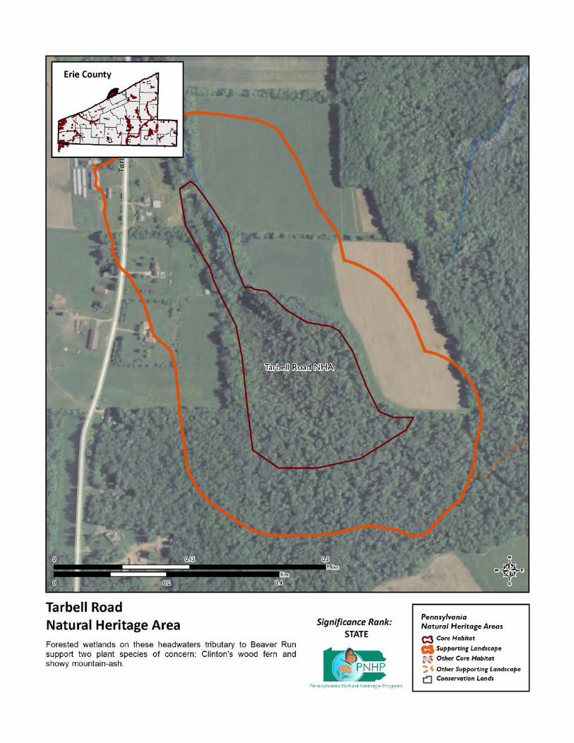
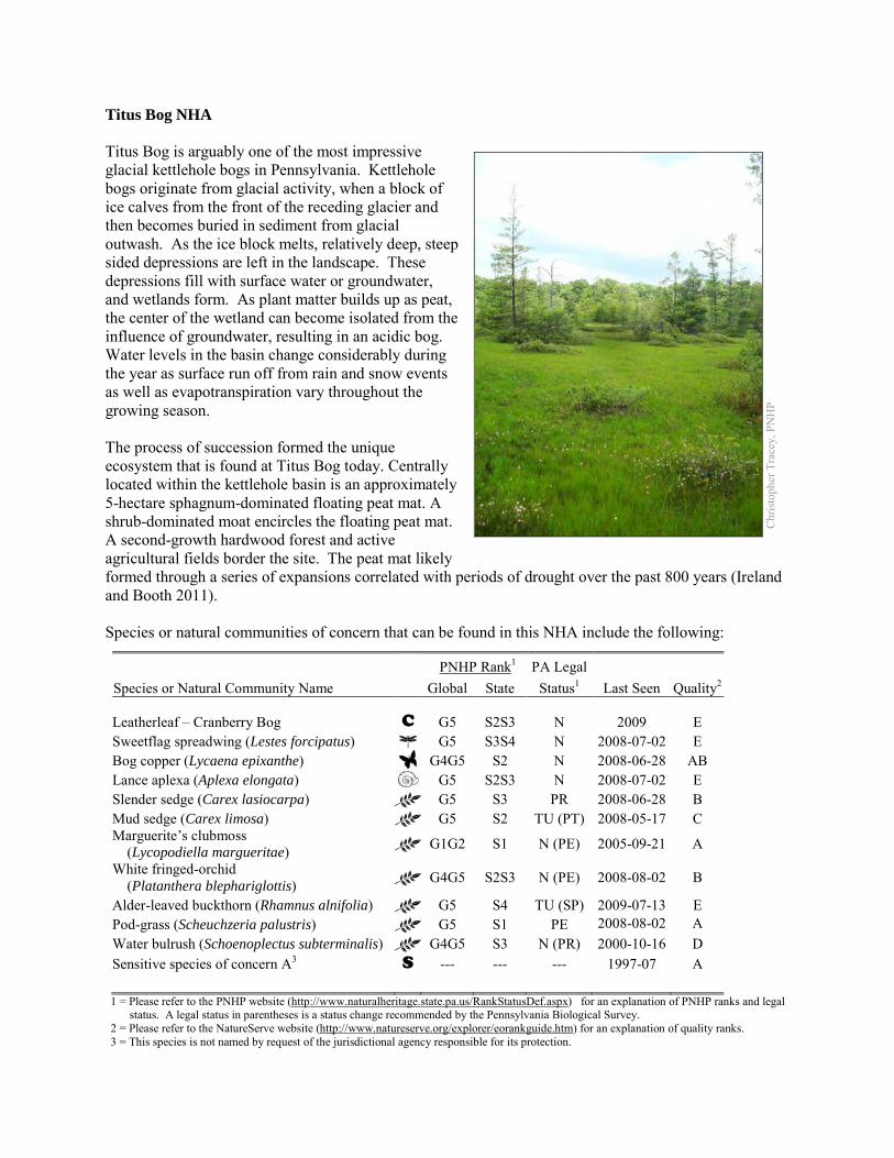
Titus Bog NHA Titus Bog is arguably one of the most impressive glacial kettlehole bogs in Pennsylvania. Kettlehole bogs originate from glacial activity, when a block of ice calves from the front of the receding glacier and then becomes buried in sediment from glacial outwash. As the ice block melts, relatively deep, steep sided depressions are left in the landscape. These depressions fill with surface water or groundwater, and wetlands form. As plant matter builds up as peat, the center of the wetland can become isolated from the influence of groundwater, resulting in an acidic bog. Water levels in the basin change considerably during the year as surface run off from rain and snow events as well as evapotranspiration vary throughout the growing season. The process of succession formed the unique ecosystem that is found at Titus Bog today. Centrally located within the kettlehole basin is an approximately 5-hectare sphagnum-dominated floating peat mat. A shrub-dominated moat encircles the floating peat mat. A second-growth hardwood forest and active agricultural fields border the site. The peat mat likely formed through a series of expansions correlated with periods of drought over the past 800 years (Ireland and Booth 2011). Species or natural communities of concern that can be found in this NHA include the following:
PNHP Rank1 PA Legal Species or Natural Community Name Global State Status1 Last Seen Quality2 Leatherleaf – Cranberry Bog C G5 S2S3 N 2009 E Sweetflag spreadwing (Lestes forcipatus) G5 S3S4 N 2008-07-02 E Bog copper (Lycaena epixanthe) G4G5 S2 N 2008-06-28 AB Lance aplexa (Aplexa elongata) G5 S2S3 N 2008-07-02 E Slender sedge (Carex lasiocarpa) G5 S3 PR 2008-06-28 B Mud sedge (Carex limosa) G5 S2 TU (PT) 2008-05-17 C Marguerite’s clubmoss (Lycopodiella margueritae) G1G2 S1 N (PE) 2005-09-21 A
White fringed-orchid (Platanthera blephariglottis) G4G5 S2S3 N (PE) 2008-08-02 B
Alder-leaved buckthorn (Rhamnus alnifolia) G5 S4 TU (SP) 2009-07-13 E Pod-grass (Scheuchzeria palustris) G5 S1 PE 2008-08-02 A Water bulrush (Schoenoplectus subterminalis) G4G5 S3 N (PR) 2000-10-16 D Sensitive species of concern A3 S --- --- --- 1997-07 A 1 = Please refer to the PNHP website (http://www.naturalheritage.state.pa.us/RankStatusDef.aspx) for an explanation of PNHP ranks and legal
status. A legal status in parentheses is a status change recommended by the Pennsylvania Biological Survey. 2 = Please refer to the NatureServe website (http://www.natureserve.org/explorer/eorankguide.htm) for an explanation of quality ranks. 3 = This species is not named by request of the jurisdictional agency responsible for its protection.
Chr
istop
her T
race
y, P
NH
P
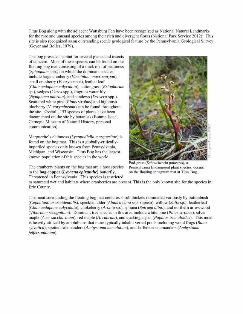
Titus Bog along with the adjacent Wattsburg Fen have been recognized as National Natural Landmarks for the rare and unusual species among their rich and divergent floras (National Park Service 2012). This site is also recognized as an outstanding scenic geological feature by the Pennsylvania Geological Survey (Geyer and Bolles, 1979). The bog provides habitat for several plants and insects of concern. Most of these species can be found on the floating bog mat consisting of a thick mat of peatmoss (Sphagnum spp.) on which the dominant species include large cranberry (Vaccinium macrocarpon), small cranberry (V. oxycoccos), leather leaf (Chamaedaphne calyculata), cottongrass (Eriophorum sp.), sedges (Carex spp.), fragrant water lily (Nymphaea odorata), and sundews (Drosera spp.). Scattered white pine (Pinus strobus) and highbush blueberry (V. corymbosum) can be found throughout the site. Overall, 153 species of plants have been documented on the site by botanists (Bonnie Isaac, Carnegie Museum of Natural History, personal communication). Marguerite’s clubmoss (Lycopodiella margueritae) is found on the bog mat. This is a globally-critically-imperiled species only known from Pennsylvania, Michigan, and Wisconsin. Titus Bog has the largest known population of this species in the world. The cranberry plants on the bog mat are a host species to the bog copper (Lycaena epixanthe) butterfly, Threatened in Pennsylvania. This species is restricted to saturated wetland habitats where cranberries are present. This is the only known site for the species in Erie County. The moat surrounding the floating bog mat contains shrub thickets dominated variously by buttonbush (Cephalanthus occidentalis), speckled alder (Alnus incana ssp. rugosa), willow (Salix sp.), leatherleaf (Chamaedaphne calyculata), chokeberry (Aronia sp.), spiraea (Spiraea alba.), and northern arrowwood (Viburnum recognitum). Dominant tree species in this area include white pine (Pinus strobus), silver maple (Acer saccharinum), red maple (A. rubrum), and quaking aspen (Populus tremuloides). This moat is heavily utilized by amphibians that more typically inhabit vernal pools including wood frogs (Rana sylvatica), spotted salamanders (Ambystoma maculatum), and Jefferson salamanders (Ambystoma jeffersonianum).
Chr
istop
her T
race
y, P
NH
P
Pod-grass (Scheuchzeria palustris), a Pennsylvania Endangered plant species, occurs on the floating sphagnum mat at Titus Bog.
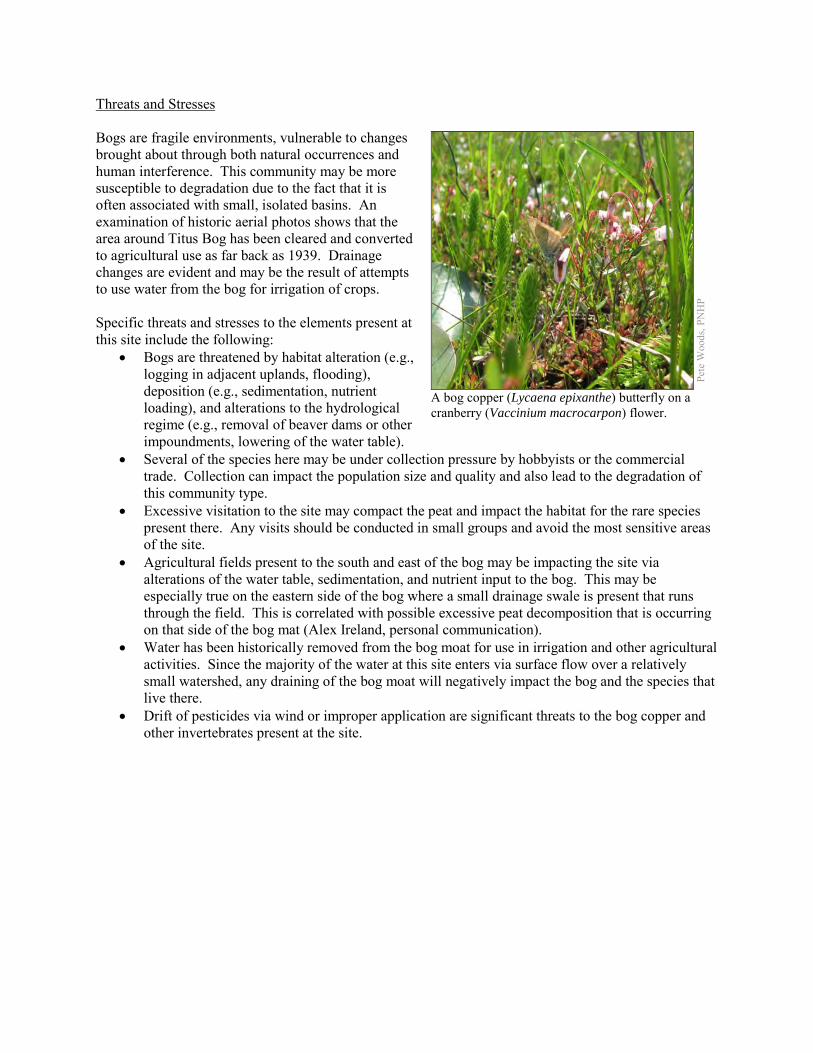
Threats and Stresses Bogs are fragile environments, vulnerable to changes brought about through both natural occurrences and human interference. This community may be more susceptible to degradation due to the fact that it is often associated with small, isolated basins. An examination of historic aerial photos shows that the area around Titus Bog has been cleared and converted to agricultural use as far back as 1939. Drainage changes are evident and may be the result of attempts to use water from the bog for irrigation of crops. Specific threats and stresses to the elements present at this site include the following:
• Bogs are threatened by habitat alteration (e.g., logging in adjacent uplands, flooding), deposition (e.g., sedimentation, nutrient loading), and alterations to the hydrological regime (e.g., removal of beaver dams or other impoundments, lowering of the water table).
• Several of the species here may be under collection pressure by hobbyists or the commercial trade. Collection can impact the population size and quality and also lead to the degradation of this community type.
• Excessive visitation to the site may compact the peat and impact the habitat for the rare species present there. Any visits should be conducted in small groups and avoid the most sensitive areas of the site.
• Agricultural fields present to the south and east of the bog may be impacting the site via alterations of the water table, sedimentation, and nutrient input to the bog. This may be especially true on the eastern side of the bog where a small drainage swale is present that runs through the field. This is correlated with possible excessive peat decomposition that is occurring on that side of the bog mat (Alex Ireland, personal communication).
• Water has been historically removed from the bog moat for use in irrigation and other agricultural activities. Since the majority of the water at this site enters via surface flow over a relatively small watershed, any draining of the bog moat will negatively impact the bog and the species that live there.
• Drift of pesticides via wind or improper application are significant threats to the bog copper and other invertebrates present at the site.
Pete
Woo
ds, P
NH
P
A bog copper (Lycaena epixanthe) butterfly on a cranberry (Vaccinium macrocarpon) flower.
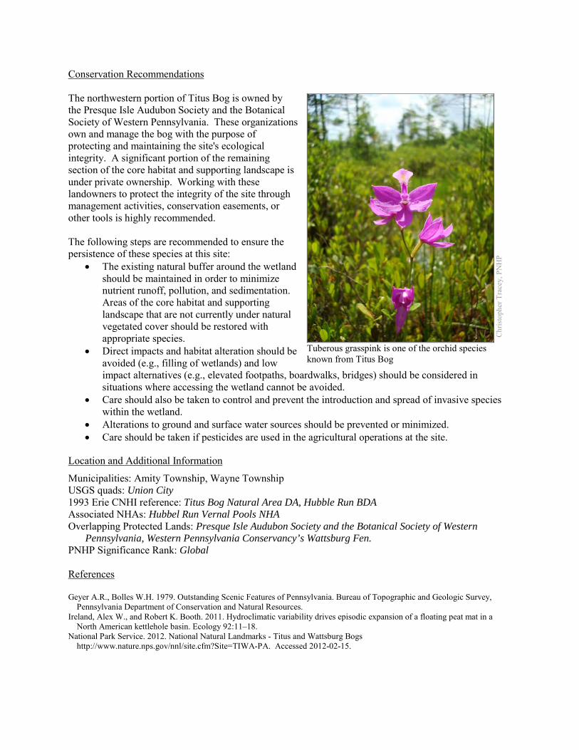
Conservation Recommendations The northwestern portion of Titus Bog is owned by the Presque Isle Audubon Society and the Botanical Society of Western Pennsylvania. These organizations own and manage the bog with the purpose of protecting and maintaining the site's ecological integrity. A significant portion of the remaining section of the core habitat and supporting landscape is under private ownership. Working with these landowners to protect the integrity of the site through management activities, conservation easements, or other tools is highly recommended. The following steps are recommended to ensure the persistence of these species at this site:
• The existing natural buffer around the wetland should be maintained in order to minimize nutrient runoff, pollution, and sedimentation. Areas of the core habitat and supporting landscape that are not currently under natural vegetated cover should be restored with appropriate species.
• Direct impacts and habitat alteration should be avoided (e.g., filling of wetlands) and low impact alternatives (e.g., elevated footpaths, boardwalks, bridges) should be considered in situations where accessing the wetland cannot be avoided.
• Care should also be taken to control and prevent the introduction and spread of invasive species within the wetland.
• Alterations to ground and surface water sources should be prevented or minimized. • Care should be taken if pesticides are used in the agricultural operations at the site.
Location and Additional Information
Municipalities: Amity Township, Wayne Township USGS quads: Union City 1993 Erie CNHI reference: Titus Bog Natural Area DA, Hubble Run BDA Associated NHAs: Hubbel Run Vernal Pools NHA Overlapping Protected Lands: Presque Isle Audubon Society and the Botanical Society of Western
Pennsylvania, Western Pennsylvania Conservancy’s Wattsburg Fen. PNHP Significance Rank: Global References Geyer A.R., Bolles W.H. 1979. Outstanding Scenic Features of Pennsylvania. Bureau of Topographic and Geologic Survey,
Pennsylvania Department of Conservation and Natural Resources. Ireland, Alex W., and Robert K. Booth. 2011. Hydroclimatic variability drives episodic expansion of a floating peat mat in a
North American kettlehole basin. Ecology 92:11–18. National Park Service. 2012. National Natural Landmarks - Titus and Wattsburg Bogs
http://www.nature.nps.gov/nnl/site.cfm?Site=TIWA-PA. Accessed 2012-02-15.
Chr
istop
her T
race
y, P
NH
P
Tuberous grasspink is one of the orchid species known from Titus Bog
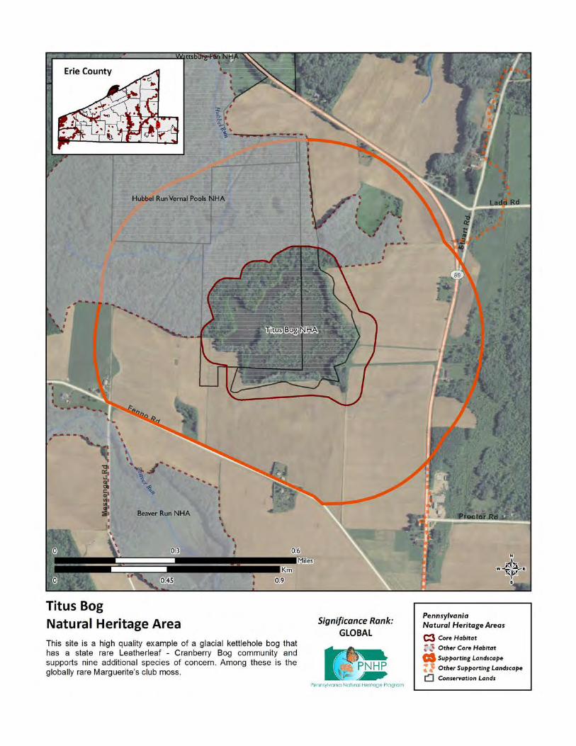
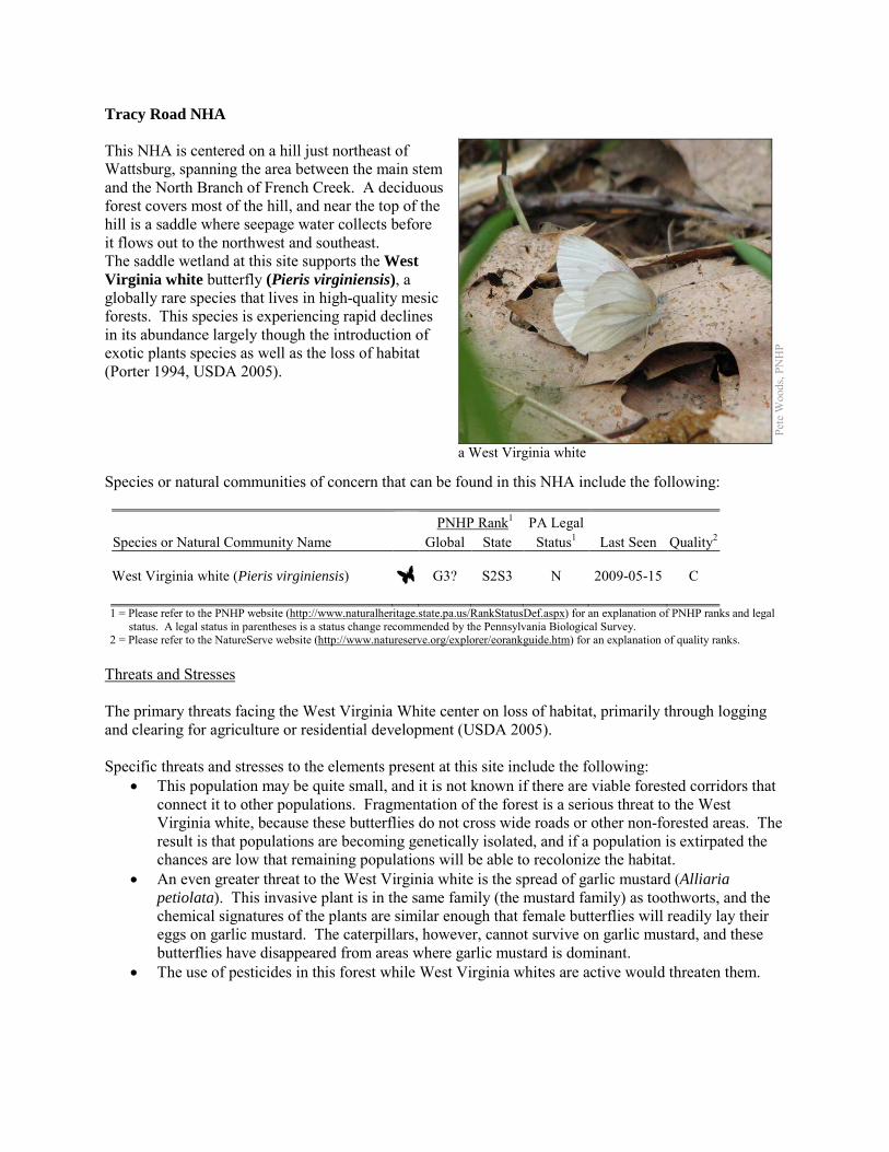
Tracy Road NHA This NHA is centered on a hill just northeast of Wattsburg, spanning the area between the main stem and the North Branch of French Creek. A deciduous forest covers most of the hill, and near the top of the hill is a saddle where seepage water collects before it flows out to the northwest and southeast. The saddle wetland at this site supports the West Virginia white butterfly (Pieris virginiensis), a globally rare species that lives in high-quality mesic forests. This species is experiencing rapid declines in its abundance largely though the introduction of exotic plants species as well as the loss of habitat (Porter 1994, USDA 2005). Species or natural communities of concern that can be found in this NHA include the following: PNHP Rank1 PA Legal Species or Natural Community Name Global State Status1 Last Seen Quality2 West Virginia white (Pieris virginiensis) G3? S2S3 N 2009-05-15 C 1 = Please refer to the PNHP website (http://www.naturalheritage.state.pa.us/RankStatusDef.aspx) for an explanation of PNHP ranks and legal
status. A legal status in parentheses is a status change recommended by the Pennsylvania Biological Survey. 2 = Please refer to the NatureServe website (http://www.natureserve.org/explorer/eorankguide.htm) for an explanation of quality ranks.
Threats and Stresses The primary threats facing the West Virginia White center on loss of habitat, primarily through logging and clearing for agriculture or residential development (USDA 2005). Specific threats and stresses to the elements present at this site include the following:
• This population may be quite small, and it is not known if there are viable forested corridors that connect it to other populations. Fragmentation of the forest is a serious threat to the West Virginia white, because these butterflies do not cross wide roads or other non-forested areas. The result is that populations are becoming genetically isolated, and if a population is extirpated the chances are low that remaining populations will be able to recolonize the habitat.
• An even greater threat to the West Virginia white is the spread of garlic mustard (Alliaria petiolata). This invasive plant is in the same family (the mustard family) as toothworts, and the chemical signatures of the plants are similar enough that female butterflies will readily lay their eggs on garlic mustard. The caterpillars, however, cannot survive on garlic mustard, and these butterflies have disappeared from areas where garlic mustard is dominant.
• The use of pesticides in this forest while West Virginia whites are active would threaten them.
Pete
Woo
ds, P
NH
P
a West Virginia white
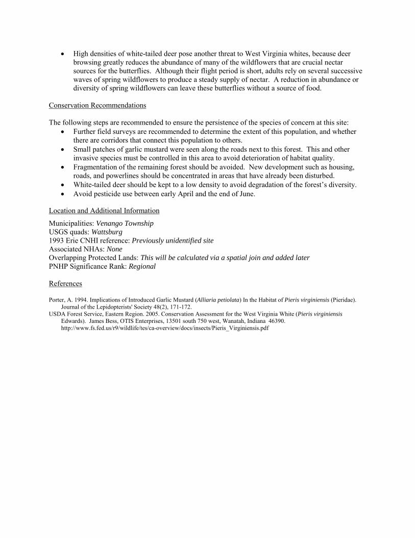
• High densities of white-tailed deer pose another threat to West Virginia whites, because deer browsing greatly reduces the abundance of many of the wildflowers that are crucial nectar sources for the butterflies. Although their flight period is short, adults rely on several successive waves of spring wildflowers to produce a steady supply of nectar. A reduction in abundance or diversity of spring wildflowers can leave these butterflies without a source of food.
Conservation Recommendations The following steps are recommended to ensure the persistence of the species of concern at this site:
• Further field surveys are recommended to determine the extent of this population, and whether there are corridors that connect this population to others.
• Small patches of garlic mustard were seen along the roads next to this forest. This and other invasive species must be controlled in this area to avoid deterioration of habitat quality.
• Fragmentation of the remaining forest should be avoided. New development such as housing, roads, and powerlines should be concentrated in areas that have already been disturbed.
• White-tailed deer should be kept to a low density to avoid degradation of the forest’s diversity. • Avoid pesticide use between early April and the end of June.
Location and Additional Information
Municipalities: Venango Township USGS quads: Wattsburg 1993 Erie CNHI reference: Previously unidentified site Associated NHAs: None Overlapping Protected Lands: This will be calculated via a spatial join and added later PNHP Significance Rank: Regional References Porter, A. 1994. Implications of Introduced Garlic Mustard (Alliaria petiolata) In the Habitat of Pieris virginiensis (Pieridae).
Journal of the Lepidopterists' Society 48(2), 171-172. USDA Forest Service, Eastern Region. 2005. Conservation Assessment for the West Virginia White (Pieris virginiensis
Edwards). James Bess, OTIS Enterprises, 13501 south 750 west, Wanatah, Indiana 46390. http://www.fs.fed.us/r9/wildlife/tes/ca-overview/docs/insects/Pieris_Virginiensis.pdf
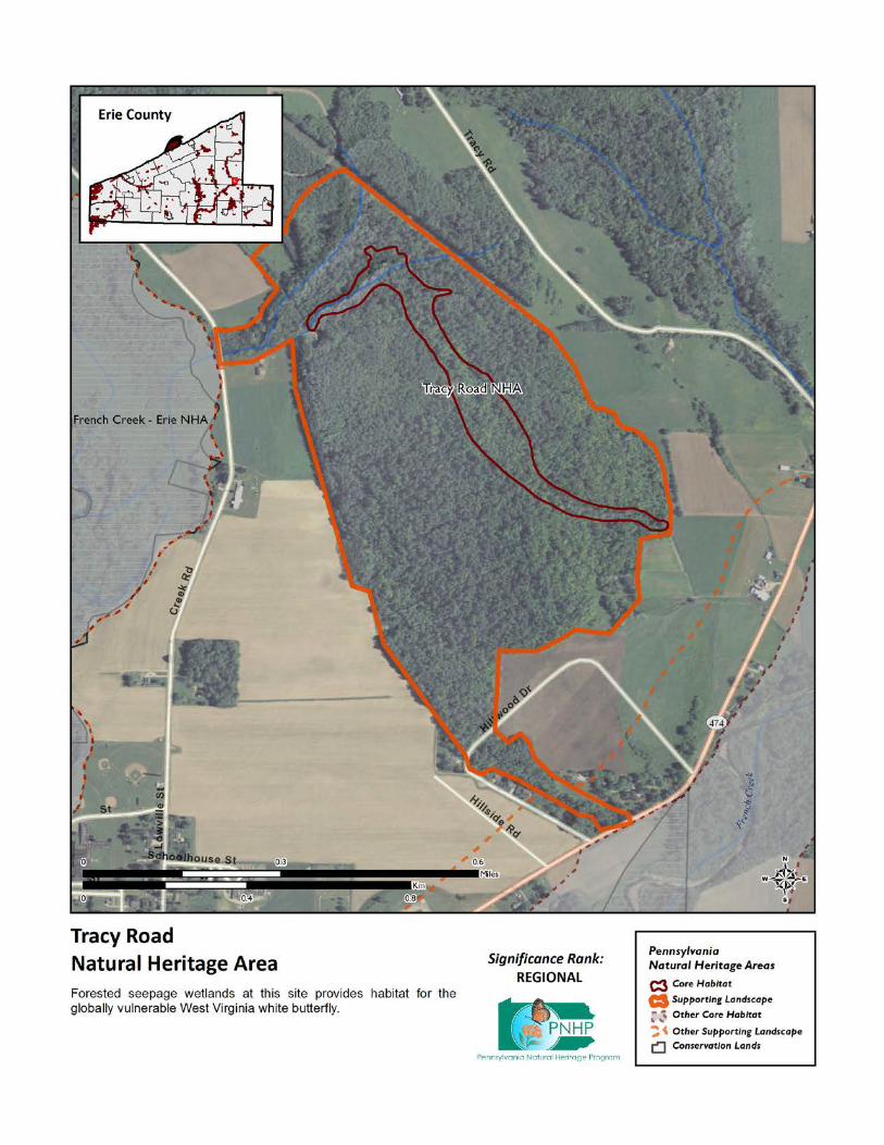
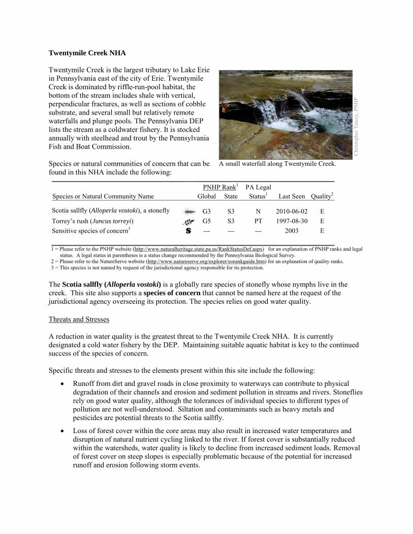
Twentymile Creek NHA Twentymile Creek is the largest tributary to Lake Erie in Pennsylvania east of the city of Erie. Twentymile Creek is dominated by riffle-run-pool habitat, the bottom of the stream includes shale with vertical, perpendicular fractures, as well as sections of cobble substrate, and several small but relatively remote waterfalls and plunge pools. The Pennsylvania DEP lists the stream as a coldwater fishery. It is stocked annually with steelhead and trout by the Pennsylvania Fish and Boat Commission. Species or natural communities of concern that can be found in this NHA include the following:
PNHP Rank1 PA Legal Species or Natural Community Name Global State Status1 Last Seen Quality2 Scotia sallfly (Alloperla vostoki), a stonefly G3 S3 N 2010-06-02 E Torrey’s rush (Juncus torreyi) G5 S3 PT 1997-08-30 E Sensitive species of concern3 S --- --- --- 2003 E 1 = Please refer to the PNHP website (http://www.naturalheritage.state.pa.us/RankStatusDef.aspx) for an explanation of PNHP ranks and legal
status. A legal status in parentheses is a status change recommended by the Pennsylvania Biological Survey. 2 = Please refer to the NatureServe website (http://www.natureserve.org/explorer/eorankguide.htm) for an explanation of quality ranks. 3 = This species is not named by request of the jurisdictional agency responsible for its protection.
The Scotia sallfly (Alloperla vostoki) is a globally rare species of stonefly whose nymphs live in the creek. This site also supports a species of concern that cannot be named here at the request of the jurisdictional agency overseeing its protection. The species relies on good water quality. Threats and Stresses A reduction in water quality is the greatest threat to the Twentymile Creek NHA. It is currently designated a cold water fishery by the DEP. Maintaining suitable aquatic habitat is key to the continued success of the species of concern. Specific threats and stresses to the elements present within this site include the following:
• Runoff from dirt and gravel roads in close proximity to waterways can contribute to physical degradation of their channels and erosion and sediment pollution in streams and rivers. Stoneflies rely on good water quality, although the tolerances of individual species to different types of pollution are not well-understood. Siltation and contaminants such as heavy metals and pesticides are potential threats to the Scotia sallfly.
• Loss of forest cover within the core areas may also result in increased water temperatures and disruption of natural nutrient cycling linked to the river. If forest cover is substantially reduced within the watersheds, water quality is likely to decline from increased sediment loads. Removal of forest cover on steep slopes is especially problematic because of the potential for increased runoff and erosion following storm events.
Chr
istop
her T
race
y, P
NH
P
A small waterfall along Twentymile Creek.
• The round goby (Neogobius melanostomus), an exotic invasive species, is a potential threat to the aquatic ecosystem of Twentymile Creek. The round goby (Neogobius melanostomus) has successfully colonized Lake Erie, where it appears to be out-competing and possibly displacing native fish species. As the round goby moves into the lake’s tributary streams it could further jeopardize native species. Phillips et al. (2003) found that the goby was feeding exclusively on aquatic insects, and considered the fish a threat to native fish species in Pennsylvania tributary streams. They also noted that the round goby accounted for 30% of the total fish count, but had moved only 0.4 miles (0.7 km) upstream, where a waterfall impeded further passage.
Conservation Recommendations Most of the Twentymile Creek watershed is in New York State and joint efforts across state lines are necessary in order to effectively address management of the stream. The following steps are recommended to ensure the persistence of these species at this site:
• Conserve and expand the forested riparian buffers of Twentymile Creek and its tributaries. Streams through forested areas should be considered high priority for conservation. The forested riparian corridor helps to regulate the temperature of the stream and creates streamside conditions that contribute to improved water quality and aquatic habitat. Streams through non-forested areas should be restored with native trees and shrubs appropriate to the habitat. Establish at least a 100 foot (30 meter) buffer of woody vegetation along the creek and its tributaries to help reduce erosion, sedimentation, and pollution.
• Best management practices (BMPs) that focus on limiting the introduction of non-point sources of pollution into surface and groundwater should be applied to the surrounding area (Pyron et al. 2004).
• Avoid using pesticides within the boundaries of this site.
Location and Additional Information
Municipalities: North East Township USGS quads: North East, North East OE N 1993 Erie CNHI reference: None Associated NHAs: Twenty Mile Creek Gorge, Twenty Mile Creek Beach Overlapping Protected Lands: North East Township Community Conservation Park PNHP Significance Rank: State References Phillips, E. C., Washek, M. E., Hertel, A. W., and Niebel, B. M. 2003 The Round Goby (Neogobius melanostomus) in
Pennsylvania Tributary Streams of Lake Erie. Journal of Great Lakes Research 29:34-40. Pyron, Mark, Renea A. Ruffing, and Angela L. Lambert. 2004. Assessment of Fishes of the Presque Isle Bay Watershed, Erie,
PA. Northeastern Naturalist 11:261-272
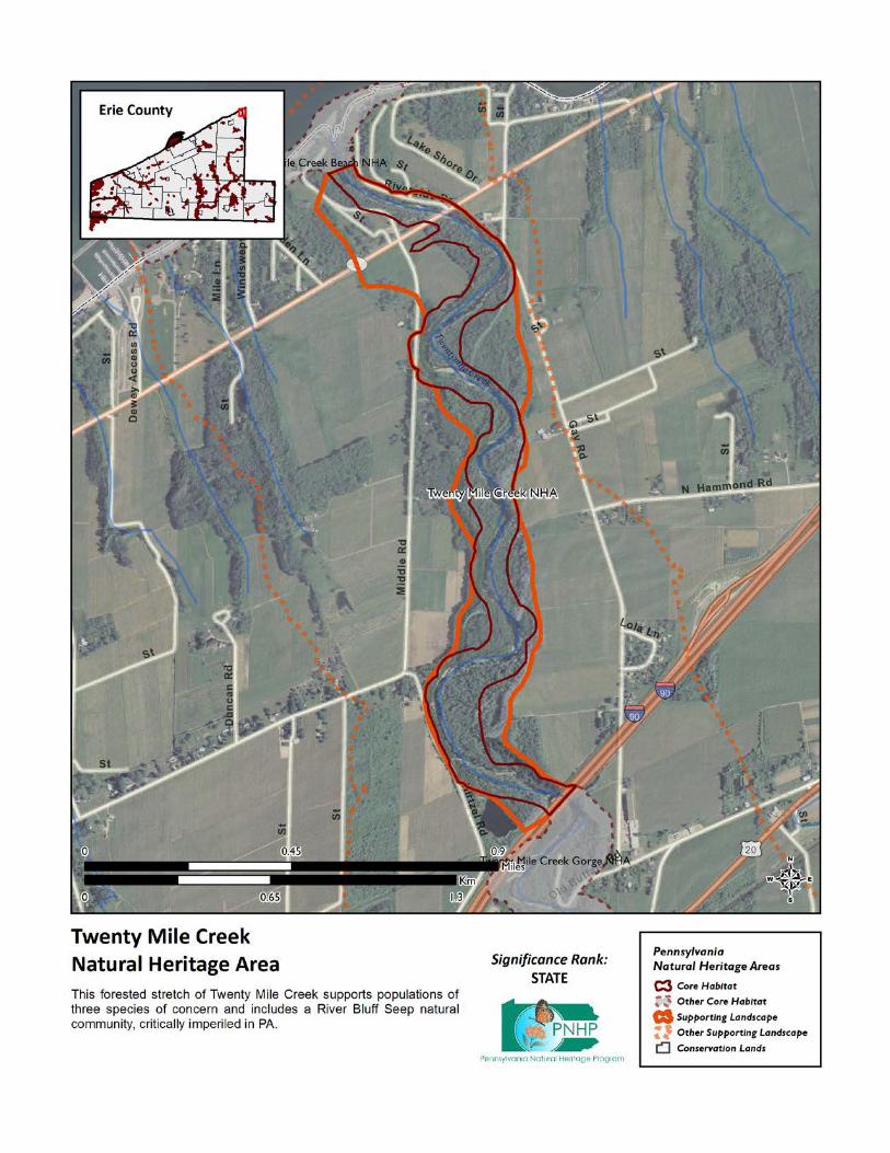
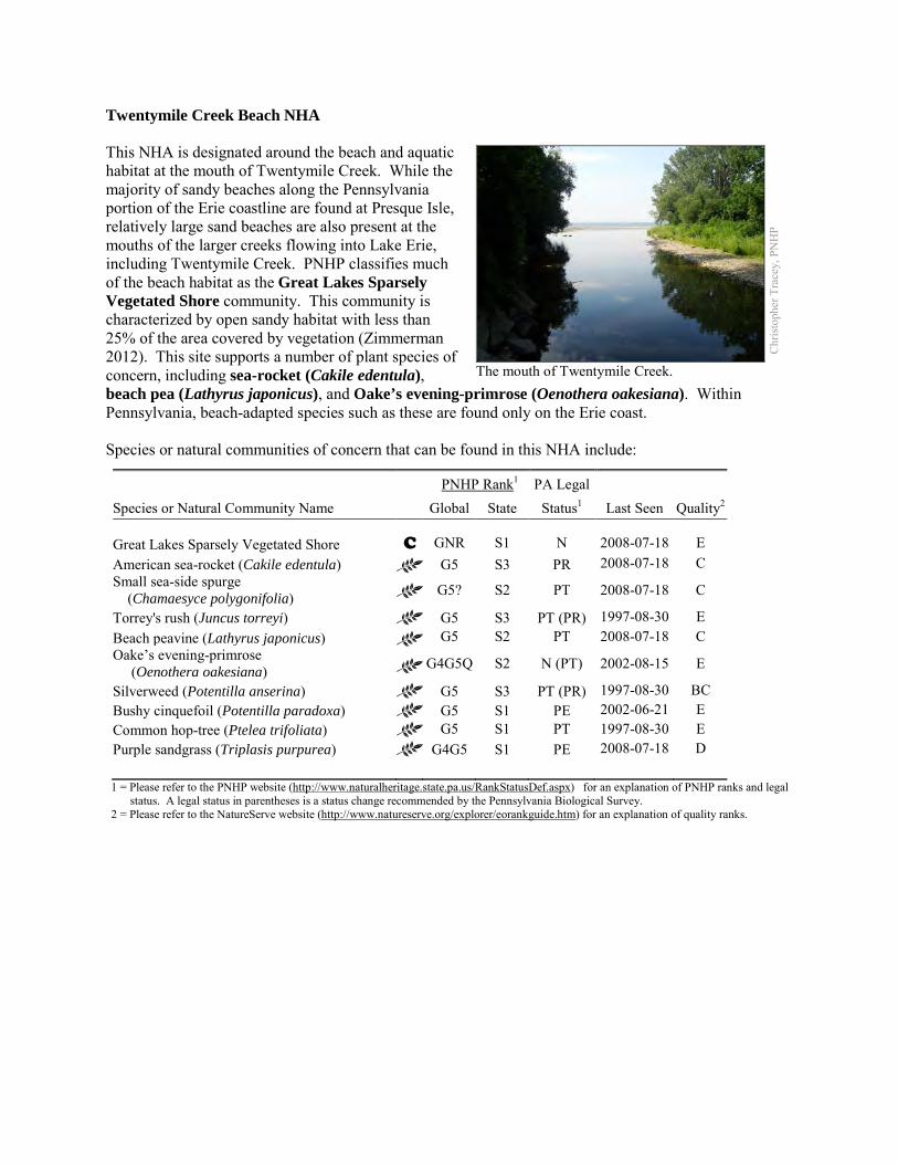
Twentymile Creek Beach NHA This NHA is designated around the beach and aquatic habitat at the mouth of Twentymile Creek. While the majority of sandy beaches along the Pennsylvania portion of the Erie coastline are found at Presque Isle, relatively large sand beaches are also present at the mouths of the larger creeks flowing into Lake Erie, including Twentymile Creek. PNHP classifies much of the beach habitat as the Great Lakes Sparsely Vegetated Shore community. This community is characterized by open sandy habitat with less than 25% of the area covered by vegetation (Zimmerman 2012). This site supports a number of plant species of concern, including sea-rocket (Cakile edentula), beach pea (Lathyrus japonicus), and Oake’s evening-primrose (Oenothera oakesiana). Within Pennsylvania, beach-adapted species such as these are found only on the Erie coast. Species or natural communities of concern that can be found in this NHA include:
PNHP Rank1 PA Legal Species or Natural Community Name Global State Status1 Last Seen Quality2 Great Lakes Sparsely Vegetated Shore C GNR S1 N 2008-07-18 E American sea-rocket (Cakile edentula) G5 S3 PR 2008-07-18 C Small sea-side spurge (Chamaesyce polygonifolia) G5? S2 PT 2008-07-18 C
Torrey's rush (Juncus torreyi) G5 S3 PT (PR) 1997-08-30 E Beach peavine (Lathyrus japonicus) G5 S2 PT 2008-07-18 C Oake’s evening-primrose (Oenothera oakesiana) G4G5Q S2 N (PT) 2002-08-15 E
Silverweed (Potentilla anserina) G5 S3 PT (PR) 1997-08-30 BC Bushy cinquefoil (Potentilla paradoxa) G5 S1 PE 2002-06-21 E Common hop-tree (Ptelea trifoliata) G5 S1 PT 1997-08-30 E Purple sandgrass (Triplasis purpurea) G4G5 S1 PE 2008-07-18 D 1 = Please refer to the PNHP website (http://www.naturalheritage.state.pa.us/RankStatusDef.aspx) for an explanation of PNHP ranks and legal
status. A legal status in parentheses is a status change recommended by the Pennsylvania Biological Survey. 2 = Please refer to the NatureServe website (http://www.natureserve.org/explorer/eorankguide.htm) for an explanation of quality ranks.
Chr
istop
her T
race
y, P
NH
P
The mouth of Twentymile Creek.
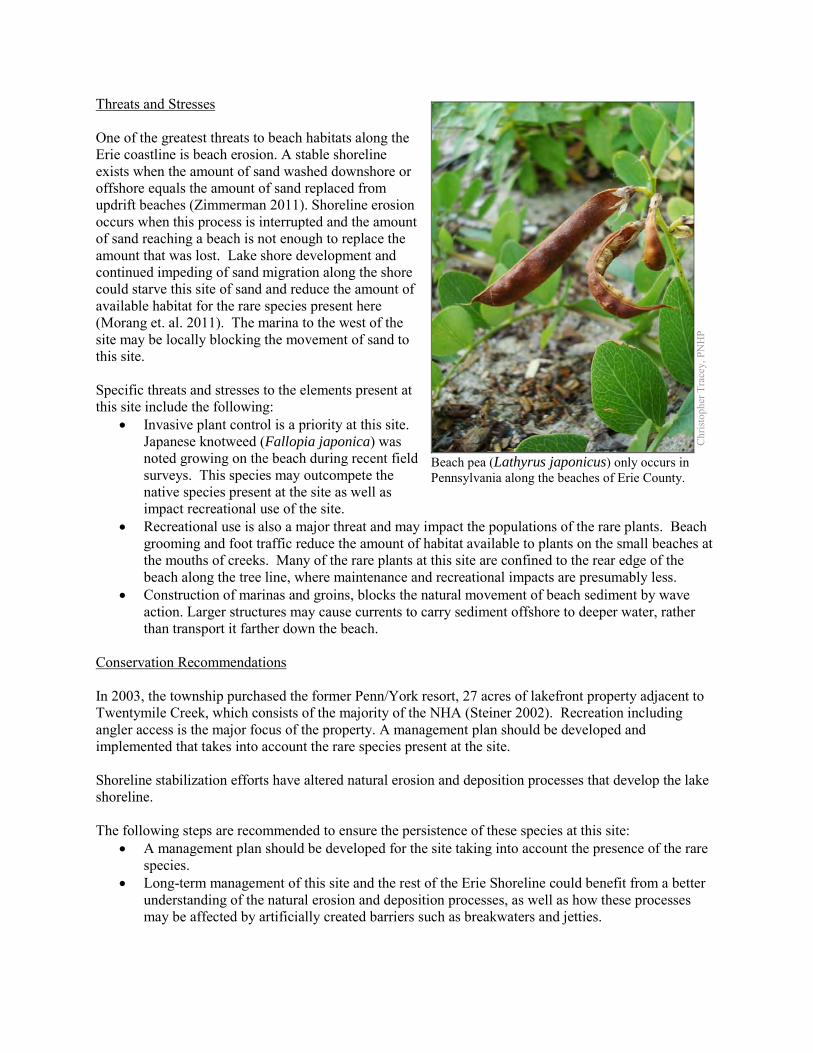
Threats and Stresses One of the greatest threats to beach habitats along the Erie coastline is beach erosion. A stable shoreline exists when the amount of sand washed downshore or offshore equals the amount of sand replaced from updrift beaches (Zimmerman 2011). Shoreline erosion occurs when this process is interrupted and the amount of sand reaching a beach is not enough to replace the amount that was lost. Lake shore development and continued impeding of sand migration along the shore could starve this site of sand and reduce the amount of available habitat for the rare species present here (Morang et. al. 2011). The marina to the west of the site may be locally blocking the movement of sand to this site. Specific threats and stresses to the elements present at this site include the following:
• Invasive plant control is a priority at this site. Japanese knotweed (Fallopia japonica) was noted growing on the beach during recent field surveys. This species may outcompete the native species present at the site as well as impact recreational use of the site.
• Recreational use is also a major threat and may impact the populations of the rare plants. Beach grooming and foot traffic reduce the amount of habitat available to plants on the small beaches at the mouths of creeks. Many of the rare plants at this site are confined to the rear edge of the beach along the tree line, where maintenance and recreational impacts are presumably less.
• Construction of marinas and groins, blocks the natural movement of beach sediment by wave action. Larger structures may cause currents to carry sediment offshore to deeper water, rather than transport it farther down the beach.
Conservation Recommendations In 2003, the township purchased the former Penn/York resort, 27 acres of lakefront property adjacent to Twentymile Creek, which consists of the majority of the NHA (Steiner 2002). Recreation including angler access is the major focus of the property. A management plan should be developed and implemented that takes into account the rare species present at the site. Shoreline stabilization efforts have altered natural erosion and deposition processes that develop the lake shoreline. The following steps are recommended to ensure the persistence of these species at this site:
• A management plan should be developed for the site taking into account the presence of the rare species.
• Long-term management of this site and the rest of the Erie Shoreline could benefit from a better understanding of the natural erosion and deposition processes, as well as how these processes may be affected by artificially created barriers such as breakwaters and jetties.
Chr
istop
her T
race
y, P
NH
P
Beach pea (Lathyrus japonicus) only occurs in Pennsylvania along the beaches of Erie County.
• Insects, including beetles and lepidopterans, may form a substantial part of the biodiversity of these communities. Open gravel and cobble areas along the coast should be inventoried for rare plants and animals, especially insects.
Location and Additional Information
Municipalities: North East Township USGS quads: North East, PA 1993 Erie CNHI reference: None; this site had not been surveyed by botanists at the time of the 1993
Inventory Associated NHAs: Twenty Mile Creek NHA Overlapping Protected Lands: North East Township Community Conservation Park PNHP Significance Rank: State References Morang, A., Mohr, M. C., and Forgette, C. M. 2011. Longshore Sediment Movement and Supply along the U.S. Shoreline of
Lake Erie. Journal of Coastal Research 27: 619-635. Steiner, Linda. 2002. Twentymile Creek Public Access. Pennsylvania Angler & Boater, November-December 2002. pg 7-10 Zimmerman 2011. Pennsylvania Natural Heritage Program. Great Lakes Sparsely Vegetated Shore Factsheet. Available from:
http://www.naturalheritage.state.pa.us/Community.aspx?=16077 Date Accessed: March 13, 2012
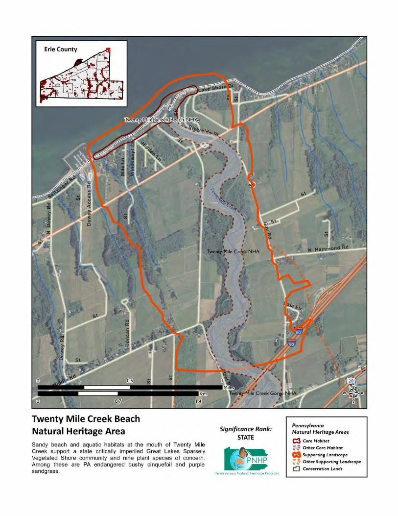
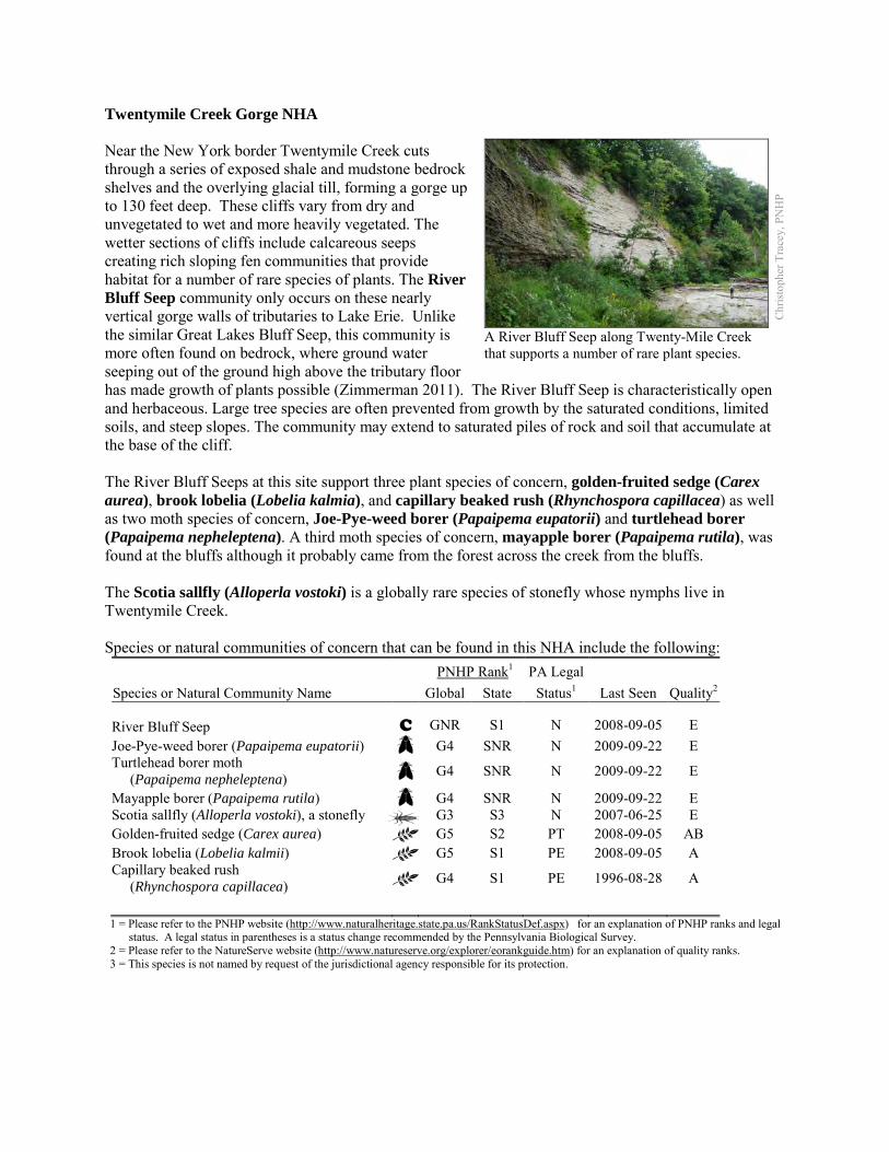
Twentymile Creek Gorge NHA Near the New York border Twentymile Creek cuts through a series of exposed shale and mudstone bedrock shelves and the overlying glacial till, forming a gorge up to 130 feet deep. These cliffs vary from dry and unvegetated to wet and more heavily vegetated. The wetter sections of cliffs include calcareous seeps creating rich sloping fen communities that provide habitat for a number of rare species of plants. The River Bluff Seep community only occurs on these nearly vertical gorge walls of tributaries to Lake Erie. Unlike the similar Great Lakes Bluff Seep, this community is more often found on bedrock, where ground water seeping out of the ground high above the tributary floor has made growth of plants possible (Zimmerman 2011). The River Bluff Seep is characteristically open and herbaceous. Large tree species are often prevented from growth by the saturated conditions, limited soils, and steep slopes. The community may extend to saturated piles of rock and soil that accumulate at the base of the cliff. The River Bluff Seeps at this site support three plant species of concern, golden-fruited sedge (Carex aurea), brook lobelia (Lobelia kalmia), and capillary beaked rush (Rhynchospora capillacea) as well as two moth species of concern, Joe-Pye-weed borer (Papaipema eupatorii) and turtlehead borer (Papaipema nepheleptena). A third moth species of concern, mayapple borer (Papaipema rutila), was found at the bluffs although it probably came from the forest across the creek from the bluffs. The Scotia sallfly (Alloperla vostoki) is a globally rare species of stonefly whose nymphs live in Twentymile Creek. Species or natural communities of concern that can be found in this NHA include the following:
PNHP Rank1 PA Legal Species or Natural Community Name Global State Status1 Last Seen Quality2 River Bluff Seep C GNR S1 N 2008-09-05 E Joe-Pye-weed borer (Papaipema eupatorii) G4 SNR N 2009-09-22 E Turtlehead borer moth (Papaipema nepheleptena) G4 SNR N 2009-09-22 E
Mayapple borer (Papaipema rutila) G4 SNR N 2009-09-22 E Scotia sallfly (Alloperla vostoki), a stonefly G3 S3 N 2007-06-25 E Golden-fruited sedge (Carex aurea) G5 S2 PT 2008-09-05 AB Brook lobelia (Lobelia kalmii) G5 S1 PE 2008-09-05 A Capillary beaked rush (Rhynchospora capillacea) G4 S1 PE 1996-08-28 A
1 = Please refer to the PNHP website (http://www.naturalheritage.state.pa.us/RankStatusDef.aspx) for an explanation of PNHP ranks and legal
status. A legal status in parentheses is a status change recommended by the Pennsylvania Biological Survey. 2 = Please refer to the NatureServe website (http://www.natureserve.org/explorer/eorankguide.htm) for an explanation of quality ranks. 3 = This species is not named by request of the jurisdictional agency responsible for its protection.
Chr
istop
her T
race
y, P
NH
P
A River Bluff Seep along Twenty-Mile Creek that supports a number of rare plant species.
Threats and Stresses The greatest threats to these communities are direct physical disturbance and hydrological alterations that affect groundwater flows to the seeps. Disturbance, in the form of soil collapse on the steep slopes, is relatively frequent and a natural process. The plants of the community are not generally harmed in the long-term by slumps. However, upslope disturbances to the bedrock could destabilize these habitats and should be avoided. Specific threats and stresses to the elements present at this site include the following:
• Invasive species threats include coltsfoot (Tussilago farfara), bittersweet nightshade (Solanum dulcamara), and common reed (Phragmites australis).
• Alteration of ground water flow (especially reduction of) could impact the rare species and the seep community.
• Steep slopes are frequently attractive to hikers and climbers, and river bluff communities are sensitive habitats. The steep terrain is unstable and often saturated; these thin soils can easily be eroded and vegetation can be trampled.
• Stoneflies rely on good water quality, although the tolerances of individual species to different types of pollution are not well-understood. Siltation and contaminants such as heavy metals, pesticides, and abandoned mine drainage are potential threats to the Scotia sallfly. Pesticides are also a threat to the moth species of concern at this site.
• Water quality degradation due land use activities (e.g., development, agricultural fields) may be an impact to the site. More research is needed in this area.
Conservation Recommendations Aerial imagery and published reports indicate that these conservation features also extend across the state line into New York, and conservation activities could be conducted in cooperation with neighboring entities (Hunt et al. 2002). The following steps are recommended to ensure the persistence of these species at this site:
• Care should also be taken to control and prevent the spread of invasive species as well as control invasive species already on the site.
• A natural vegetation buffer should be allowed to develop along the stream valley crest within the site's boundary in order to reduce the threat of human-induced erosion and to protect surface water quality and quantity entering the NHA. Care should be taken when providing access to this site, and trail construction along the top of tributary gorges should be limited to avoid impacting this community.
• Property owners could also contribute to ground water quality and quantity protection by reducing or avoiding the application of pesticides and/or fertilizers within site boundaries and avoiding artificial drainage of subsurface waters.
• Development and timber harvesting within the NHA should be avoided. • Further inventory for moths and other invertebrates is recommended, because these
undersurveyed groups may form a substantial part of the biodiversity of bluff seep communities. • Research is needed to better understand the patterns of succession of plant species, especially
species of conservation concern, on these slump habitats.
Location and Additional Information
Municipalities: North East Township USGS quads: North East 1993 Erie CNHI reference: Twenty Mile Creek BDA Associated NHAs: Twentymile Creek NHA Overlapping Protected Lands: None – private ownership PNHP Significance Rank: State References Hunt, D. M., G. J. Edinger, J. J. Schmid, D.J. Evans, P. G. Novak, A. M. Olivero, and S. M. Young. 2002. Lake Erie Gorges
Biodiversity Inventory & Landscape Integrity Analysis: A Final Report Prepared for the Central/Western New York Chapter of The Nature Conservancy. New York Natural Heritage Program
Zimmerman 2011. Pennsylvania Natural Heritage Program. River Bluff Seep Factsheet. Available from: http://www.naturalheritage.state.pa.us/Community.aspx?=30030 Date Accessed: March 12, 2012
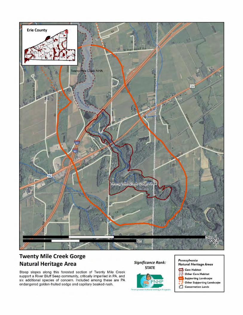
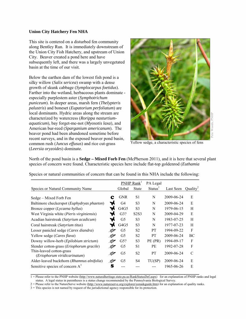
Union City Hatchery Fen NHA This site is centered on a disturbed fen community along Bentley Run. It is immediately downstream of the Union City Fish Hatchery, and upstream of Union City. Beaver created a pond here and have subsequently left, and there was a largely unvegetated basin at the time of our visit. Below the earthen dam of the lowest fish pond is a silky willow (Salix sericea) swamp with a dense growth of skunk cabbage (Symplocarpus foetidus). Farther into the wetland, herbaceous plants dominate - especially purplestem aster (Symphotrichum puniceum). In deeper areas, marsh fern (Thelypteris palustris) and boneset (Eupatorium perfoliatum) are local dominants. Hydric areas along the stream are characterized by watercress (Rorippa nasturtium-aquaticum), bay forget-me-not (Myosotis laxa), and American bur-reed (Sparganium americanum). The beaver pond had been abandoned sometime before recent surveys, and in the exposed beaver pond basin, common rush (Juncus effusus) and rice cut-grass (Leersia oryzoides) dominate. North of the pond basin is a Sedge – Mixed Forb Fen (McPherson 2011), and it is here that several plant species of concern were found. Characteristic species here include flat-top goldenrod (Euthamia Species or natural communities of concern that can be found in this NHA include the following:
PNHP Rank1 PA Legal Species or Natural Community Name Global State Status1 Last Seen Quality2 Sedge – Mixed Forb Fen C GNR S1 N 2009-06-24 E Baltimore checkerspot (Euphydryas phaeton) G4 S3 N 2009-06-24 E Bronze copper (Lycaena hyllus) G4G5 S3 N 1979-06-15 H West Virginia white (Pieris virginiensis) G3? S2S3 N 2009-04-29 E Acadian hairstreak (Satyrium acadicum) G5 S3 N 1983-07-25 H Coral hairstreak (Satyrium titus) G4G5 S3 N 1977-07-23 H Lesser panicled sedge (Carex diandra) G5 S2 PT 1994-09-22 F Yellow sedge (Carex flava) G5 S2 PT 2009-06-24 BC Downy willow-herb (Epilobium strictum) G5? S3 PE (PR) 1994-09-17 F Slender cotton-grass (Eriophorum gracile) G5 S1 PE 1992-07-28 F Thin-leaved cotton-grass (Eriophorum viridicarinatum) G5 S2 PT 2009-06-24 C
Alder-leaved buckthorn (Rhamnus alnifolia) G5 S4 TU(SP) 2009-06-24 E Sensitive species of concern A3 S --- --- --- 1965-06-26 E 1 = Please refer to the PNHP website (http://www.naturalheritage.state.pa.us/RankStatusDef.aspx) for an explanation of PNHP ranks and legal
status. A legal status in parentheses is a status change recommended by the Pennsylvania Biological Survey. 2 = Please refer to the NatureServe website (http://www.natureserve.org/explorer/eorankguide.htm) for an explanation of quality ranks. 3 = This species is not named by request of the jurisdictional agency responsible for its protection.
Pete
Woo
ds, P
NH
P
Yellow sedge, a characteristic species of fens
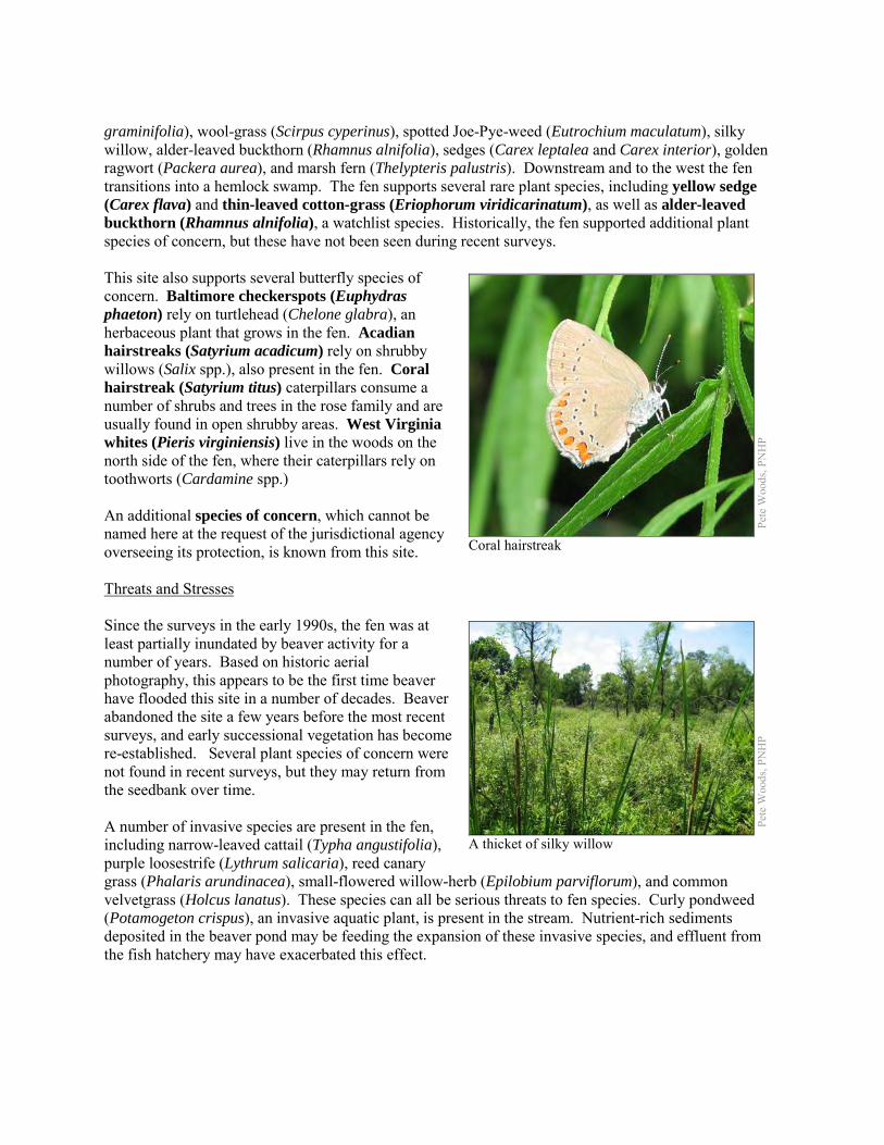
graminifolia), wool-grass (Scirpus cyperinus), spotted Joe-Pye-weed (Eutrochium maculatum), silky willow, alder-leaved buckthorn (Rhamnus alnifolia), sedges (Carex leptalea and Carex interior), golden ragwort (Packera aurea), and marsh fern (Thelypteris palustris). Downstream and to the west the fen transitions into a hemlock swamp. The fen supports several rare plant species, including yellow sedge (Carex flava) and thin-leaved cotton-grass (Eriophorum viridicarinatum), as well as alder-leaved buckthorn (Rhamnus alnifolia), a watchlist species. Historically, the fen supported additional plant species of concern, but these have not been seen during recent surveys. This site also supports several butterfly species of concern. Baltimore checkerspots (Euphydras phaeton) rely on turtlehead (Chelone glabra), an herbaceous plant that grows in the fen. Acadian hairstreaks (Satyrium acadicum) rely on shrubby willows (Salix spp.), also present in the fen. Coral hairstreak (Satyrium titus) caterpillars consume a number of shrubs and trees in the rose family and are usually found in open shrubby areas. West Virginia whites (Pieris virginiensis) live in the woods on the north side of the fen, where their caterpillars rely on toothworts (Cardamine spp.) An additional species of concern, which cannot be named here at the request of the jurisdictional agency overseeing its protection, is known from this site. Threats and Stresses Since the surveys in the early 1990s, the fen was at least partially inundated by beaver activity for a number of years. Based on historic aerial photography, this appears to be the first time beaver have flooded this site in a number of decades. Beaver abandoned the site a few years before the most recent surveys, and early successional vegetation has become re-established. Several plant species of concern were not found in recent surveys, but they may return from the seedbank over time. A number of invasive species are present in the fen, including narrow-leaved cattail (Typha angustifolia), purple loosestrife (Lythrum salicaria), reed canary grass (Phalaris arundinacea), small-flowered willow-herb (Epilobium parviflorum), and common velvetgrass (Holcus lanatus). These species can all be serious threats to fen species. Curly pondweed (Potamogeton crispus), an invasive aquatic plant, is present in the stream. Nutrient-rich sediments deposited in the beaver pond may be feeding the expansion of these invasive species, and effluent from the fish hatchery may have exacerbated this effect.
Pete
Woo
ds, P
NH
P
Coral hairstreak
Pete
Woo
ds, P
NH
P
A thicket of silky willow
Specific threats and stresses to the elements present at this site include the following: • The greatest threats to fen communities are disruptions to bedrock or glacial deposits (such as
drilling or mining in nearby areas) and any activities that alter groundwater flows or the quality of groundwater.
• Groundwater pollution in fens can occur from improperly installed septic systems, improperly lined underground waste disposal, and in agricultural areas from infiltration of pesticides, fertilizers, or nutrients from animal wastes. All of the butterfly species of concern at this site are vulnerable to pesticides, and nutrient loading can accelerate the spread of invasive species.
• In the absence of natural disturbance (such as periodic flooding by beaver, browsing by animals, active vegetation removal, or fire), fens tend to succeed into shrub swamps and forested swamps, which do not support most of the species of concern at this site. Several species of concern have declined or disappeared in recent decades, and succession may be part of the reason.
• Peatlands are particularly sensitive to trampling, soil compaction and other physical disturbance from recreational activities.
• Fragmentation of the forest is a serious threat to the West Virginia white, because these butterflies do not cross wide roads or other non-forested areas. The result is that populations are becoming genetically isolated, and if a population is extirpated the chances are low that remaining populations will be able to recolonize the habitat. This population has already become separated from the nearby population below the reservoir.
• An even greater threat to the West Virginia white is the spread of garlic mustard (Alliaria petiolata). This invasive plant is in the same family (the mustard family) as toothworts, and the chemical signatures of the plants are similar enough that female butterflies will readily lay their eggs on garlic mustard. The caterpillars, however, cannot survive on garlic mustard, and these butterflies have disappeared from areas where garlic mustard is dominant. Though not found here during a survey, garlic mustard is very widespread in the area and it will eventually arrive at this site.
• High densities of white-tailed deer pose another threat to West Virginia whites, because deer browsing greatly reduces the abundance of many of the wildflowers that are crucial nectar sources for the butterflies. Although their flight period is short, adults rely on several successive waves of spring wildflowers to produce a steady supply of nectar. A reduction in abundance or diversity of spring wildflowers can leave these butterflies without a source of food. Additionally, some of the plant species of concern are vulnerable to deer browse.
Conservation Recommendations The following steps are recommended to ensure the persistence of these species at this site:
• To maintain a viable West Virginia white population, avoid fragmenting the remaining forest. New development such as housing, roads, and powerlines should be concentrated in areas that have already been disturbed.
• White-tailed deer should be kept to a low density to avoid degradation of the forest’s diversity. • Drilling, mining, or other disruptions to bedrock or glacial deposits should not be undertaken
within one-half mile of a seepage wetland without a thorough understanding of local bedrock geology, surficial geology, and groundwater flows. Groundwater flow patterns do not always mirror surface watersheds, and in some cases aquifers may be contiguous over large areas.
• Trails should be sited away from the wetland, or elevated boardwalks employed to prevent peat compaction and other disturbance in the wetland.
• A natural buffer around the wetlands should be maintained in order to minimize nutrient runoff, pollution, and sedimentation.
• Remove invasive plant species. The fen and any other early-successional habitat created by beaver pond abandonment are particularly susceptible to weedy plant invasion and will require a sustained and targeted approach to invasive management. Control of invasive species in the area will require extensive and continual effort. Focus initial control efforts on selected areas surrounding species of concern.
o Invasive species management needs to be coordinated by individuals familiar with the rare species as well as the invasive species present.
o Continual invasive species monitoring and control will be necessary. o Monitor for the presence of garlic mustard. o The presence of invasive species in fens often is an indicator of nutrient pollution.
Effluent from the fish hatchery may be the main source of nutrients at this site; this should be addressed.
• The fen may require periodic disturbance such as cutting, burning, or grazing to maintain the open canopy which is indicative of this community and the rare species that occupy the community.
• The effect of beaver on fens is uncertain and needs more research. On one hand, allowing beaver to persist in the area may help fen habitat by setting back succession; over time beaver ponds are abandoned and the resulting beaver meadow may become a fen until conditions are again suitable for beaver. On the other hand, the seedbank of fen species may not remain viable until conditions are good for growth, and the accumulation of nutrient-laden sediments may encourage weedy species.
• Avoid creating additional permanent impoundments. • White-tailed deer should be kept to a low density to avoid degradation of the forest’s diversity
and loss of some of the species of concern. In the absence of such measures, deer exclosures would allow some show plant species of concern to survive, although exclosures would probably not be large enough to protect a viable population of West Virginia whites.
• Pesticide use should be avoided in the Core Habitat and minimized in the Supporting Landscape.
Location and Additional Information
Municipalities: Union Township USGS quads: Union City 1993 Erie CNHI reference: Alder Run, Bently Run BDA Associated NHAs: Alder & Bently Run Kame Field NHA, Boleratz Fen NHA, Hell’s Half Acre NHA,
Kirik Fen NHA, Union City Reservoir NHA Overlapping Protected Lands: Part of the site is owned by the PA Fish and Boat Commission, the
remainder is in private ownership. PNHP Significance Rank: Regional References McPherson, J. 2011. Pennsylvania Natural Heritage Program. Sedge – Mixed Forb Fen Factsheet. Available from:
http://www.naturalheritage.state.pa.us/Community.aspx?=16009 Date Accessed: August 29, 2012
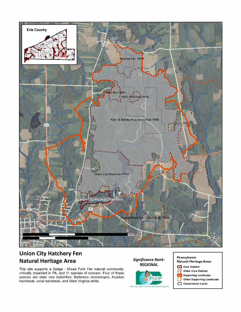
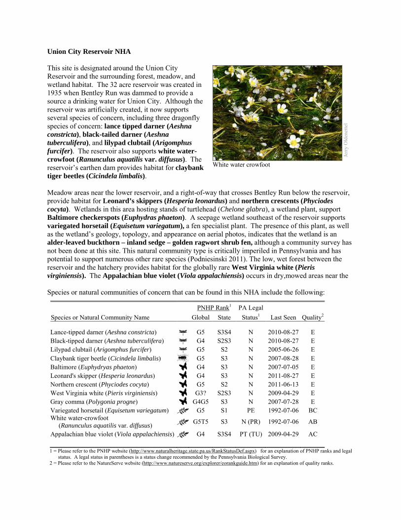
Union City Reservoir NHA This site is designated around the Union City Reservoir and the surrounding forest, meadow, and wetland habitat. The 32 acre reservoir was created in 1935 when Bentley Run was dammed to provide a source a drinking water for Union City. Although the reservoir was artificially created, it now supports several species of concern, including three dragonfly species of concern: lance tipped darner (Aeshna constricta), black-tailed darner (Aeshna tuberculifera), and lilypad clubtail (Arigomphus furcifer). The reservoir also supports white water-crowfoot (Ranunculus aquatilis var. diffusus). The reservoir’s earthen dam provides habitat for claybank tiger beetles (Cicindela limbalis). Meadow areas near the lower reservoir, and a right-of-way that crosses Bentley Run below the reservoir, provide habitat for Leonard’s skippers (Hesperia leonardus) and northern crescents (Phyciodes cocyta). Wetlands in this area hosting stands of turtlehead (Chelone glabra), a wetland plant, support Baltimore checkerspots (Euphydras phaeton). A seepage wetland southeast of the reservoir supports variegated horsetail (Equisetum variegatum), a fen specialist plant. The presence of this plant, as well as the wetland’s geology, topology, and appearance on aerial photos, indicates that the wetland is an alder-leaved buckthorn – inland sedge – golden ragwort shrub fen, although a community survey has not been done at this site. This natural community type is critically imperiled in Pennsylvania and has potential to support numerous other rare species (Podniesinski 2011). The low, wet forest between the reservoir and the hatchery provides habitat for the globally rare West Virginia white (Pieris virginiensis). The Appalachian blue violet (Viola appalachiensis) occurs in dry,mowed areas near the Species or natural communities of concern that can be found in this NHA include the following:
PNHP Rank1 PA Legal Species or Natural Community Name Global State Status1 Last Seen Quality2 Lance-tipped darner (Aeshna constricta) G5 S3S4 N 2010-08-27 E Black-tipped darner (Aeshna tuberculifera) G4 S2S3 N 2010-08-27 E Lilypad clubtail (Arigomphus furcifer) G5 S2 N 2005-06-26 E Claybank tiger beetle (Cicindela limbalis) G5 S3 N 2007-08-28 E Baltimore (Euphydryas phaeton) G4 S3 N 2007-07-05 E Leonard's skipper (Hesperia leonardus) G4 S3 N 2011-08-27 E Northern crescent (Phyciodes cocyta) G5 S2 N 2011-06-13 E West Virginia white (Pieris virginiensis) G3? S2S3 N 2009-04-29 E Gray comma (Polygonia progne) G4G5 S3 N 2007-07-28 E Variegated horsetail (Equisetum variegatum) G5 S1 PE 1992-07-06 BC White water-crowfoot (Ranunculus aquatilis var. diffusus) G5T5 S3 N (PR) 1992-07-06 AB
Appalachian blue violet (Viola appalachiensis) G4 S3S4 PT (TU) 2009-04-29 AC 1 = Please refer to the PNHP website (http://www.naturalheritage.state.pa.us/RankStatusDef.aspx) for an explanation of PNHP ranks and legal
status. A legal status in parentheses is a status change recommended by the Pennsylvania Biological Survey. 2 = Please refer to the NatureServe website (http://www.natureserve.org/explorer/eorankguide.htm) for an explanation of quality ranks.
Jerry
Old
enet
tel
White water crowfoot
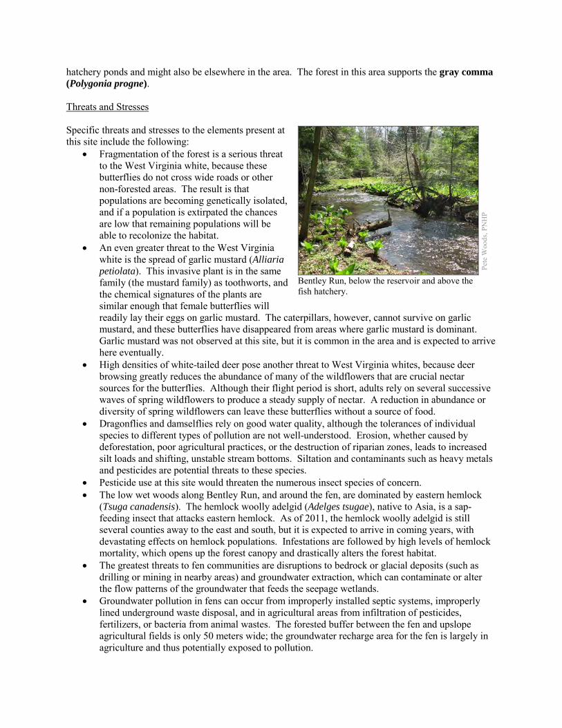
hatchery ponds and might also be elsewhere in the area. The forest in this area supports the gray comma (Polygonia progne). Threats and Stresses Specific threats and stresses to the elements present at this site include the following:
• Fragmentation of the forest is a serious threat to the West Virginia white, because these butterflies do not cross wide roads or other non-forested areas. The result is that populations are becoming genetically isolated, and if a population is extirpated the chances are low that remaining populations will be able to recolonize the habitat.
• An even greater threat to the West Virginia white is the spread of garlic mustard (Alliaria petiolata). This invasive plant is in the same family (the mustard family) as toothworts, and the chemical signatures of the plants are similar enough that female butterflies will readily lay their eggs on garlic mustard. The caterpillars, however, cannot survive on garlic mustard, and these butterflies have disappeared from areas where garlic mustard is dominant. Garlic mustard was not observed at this site, but it is common in the area and is expected to arrive here eventually.
• High densities of white-tailed deer pose another threat to West Virginia whites, because deer browsing greatly reduces the abundance of many of the wildflowers that are crucial nectar sources for the butterflies. Although their flight period is short, adults rely on several successive waves of spring wildflowers to produce a steady supply of nectar. A reduction in abundance or diversity of spring wildflowers can leave these butterflies without a source of food.
• Dragonflies and damselflies rely on good water quality, although the tolerances of individual species to different types of pollution are not well-understood. Erosion, whether caused by deforestation, poor agricultural practices, or the destruction of riparian zones, leads to increased silt loads and shifting, unstable stream bottoms. Siltation and contaminants such as heavy metals and pesticides are potential threats to these species.
• Pesticide use at this site would threaten the numerous insect species of concern. • The low wet woods along Bentley Run, and around the fen, are dominated by eastern hemlock
(Tsuga canadensis). The hemlock woolly adelgid (Adelges tsugae), native to Asia, is a sap-feeding insect that attacks eastern hemlock. As of 2011, the hemlock woolly adelgid is still several counties away to the east and south, but it is expected to arrive in coming years, with devastating effects on hemlock populations. Infestations are followed by high levels of hemlock mortality, which opens up the forest canopy and drastically alters the forest habitat.
• The greatest threats to fen communities are disruptions to bedrock or glacial deposits (such as drilling or mining in nearby areas) and groundwater extraction, which can contaminate or alter the flow patterns of the groundwater that feeds the seepage wetlands.
• Groundwater pollution in fens can occur from improperly installed septic systems, improperly lined underground waste disposal, and in agricultural areas from infiltration of pesticides, fertilizers, or bacteria from animal wastes. The forested buffer between the fen and upslope agricultural fields is only 50 meters wide; the groundwater recharge area for the fen is largely in agriculture and thus potentially exposed to pollution.
Pete
Woo
ds, P
NH
P
Bentley Run, below the reservoir and above the fish hatchery.
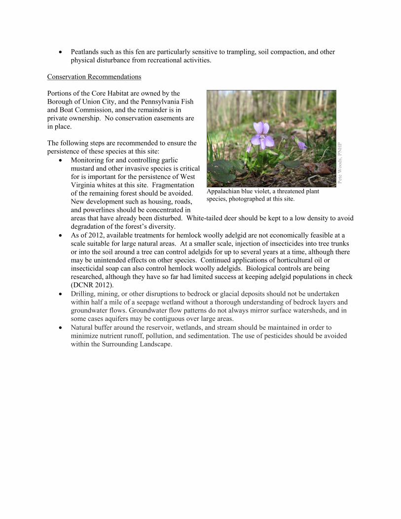
• Peatlands such as this fen are particularly sensitive to trampling, soil compaction, and other physical disturbance from recreational activities.
Conservation Recommendations Portions of the Core Habitat are owned by the Borough of Union City, and the Pennsylvania Fish and Boat Commission, and the remainder is in private ownership. No conservation easements are in place. The following steps are recommended to ensure the persistence of these species at this site:
• Monitoring for and controlling garlic mustard and other invasive species is critical for is important for the persistence of West Virginia whites at this site. Fragmentation of the remaining forest should be avoided. New development such as housing, roads, and powerlines should be concentrated in areas that have already been disturbed. White-tailed deer should be kept to a low density to avoid degradation of the forest’s diversity.
• As of 2012, available treatments for hemlock woolly adelgid are not economically feasible at a scale suitable for large natural areas. At a smaller scale, injection of insecticides into tree trunks or into the soil around a tree can control adelgids for up to several years at a time, although there may be unintended effects on other species. Continued applications of horticultural oil or insecticidal soap can also control hemlock woolly adelgids. Biological controls are being researched, although they have so far had limited success at keeping adelgid populations in check (DCNR 2012).
• Drilling, mining, or other disruptions to bedrock or glacial deposits should not be undertaken within half a mile of a seepage wetland without a thorough understanding of bedrock layers and groundwater flows. Groundwater flow patterns do not always mirror surface watersheds, and in some cases aquifers may be contiguous over large areas.
• Natural buffer around the reservoir, wetlands, and stream should be maintained in order to minimize nutrient runoff, pollution, and sedimentation. The use of pesticides should be avoided within the Surrounding Landscape.
Pete
Woo
ds, P
NH
P
Appalachian blue violet, a threatened plant species, photographed at this site.
Location and Additional Information Municipalities: Union Township USGS quads: Union City 1993 Erie CNHI reference: Alder Run, Bentley Run BDA Associated NHAs: Alder & Bently Run Kame Field NHA, Boleratz Fen NHA, Hell’s Half Acre NHA,
Kirik Fen NHA, Union City Hatchery Fen NHA Overlapping Protected Lands: None; private land. PNHP Significance Rank: Regional References Department of Conservation and Natural Resources. 2012. Forest Health Fact Sheet: Hemlock Woolly Adelgid.
http://www.dcnr.state.pa.us/ucmprd2/groups/public/documents/document/dcnr_007179.pdf Podniesinski 2011. Pennsylvania Natural Heritage Program. Alder-leaved Buckthorn – Inland Sedge – Golden
Ragwort Shrub Fen Factsheet. Available from: http://www.naturalheritage.state.pa.us/Community.aspx?=30002 Date Accessed: August 01, 2012
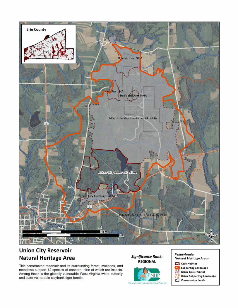
Upper Brokenstraw Creek NHA This site is the uppermost part of the Pennsylvania portion of the Brokenstraw Creek valley. It supports two species of concern, which cannot be named here at the request of the jurisdictional agencies overseeing their protection. The Core Habitat of the site is mostly hayfield, with wetter sections being hemlock swamp, shrub thickets and some herbaceous wetlands. The forest patch at the southeastern end of the Core Habitat appears to contain several vernal pools, although these have not been surveyed. Other portions of the site would probably qualify as hemlock palustrine forest. Species or natural communities of concern that can be found in this NHA include the following:
PNHP Rank1 PA Legal Species or Natural Community Name Global State Status1 Last Seen Quality2 Sensitive species of concern A3 S --- --- --- 2011 E Sensitive species of concern B3 S --- --- --- 2008-06-28 E 1 = Please refer to the PNHP website (http://www.naturalheritage.state.pa.us/RankStatusDef.aspx) for an explanation of PNHP ranks and legal
status. A legal status in parentheses is a status change recommended by the Pennsylvania Biological Survey. 2 = Please refer to the NatureServe website (http://www.natureserve.org/explorer/eorankguide.htm) for an explanation of quality ranks. 3 = This species is not named by request of the jurisdictional agency responsible for its protection.
Threats and Stresses Specific threats and stresses to the elements present at this site include the following:
• Runoff from dirt and gravel roads in close proximity to waterways can contribute to physical degradation of their channels and erosion and sediment pollution in streams and rivers.
• Loss of forest cover within the core areas may also result in increased water temperatures and disruption of natural nutrient cycling linked to the river. If forest cover is substantially reduced within the watersheds, water quality is likely to decline from increased sediment loads. Removal of forest cover on steep slopes is especially problematic because of the potential for increased runoff and erosion following storm events.
• The sensitive species of concern is vulnerable to human disturbance. Significant human disturbance within 1000 feet (305 m) could trigger permanent abandonment of the area.
Conservation Recommendations This site is entirely on private land, and no conservation easements are in place. The following steps are recommended to ensure the persistence of these species at this site:
• Conserve and expand the forested riparian buffers of Brokenstraw Creek and its tributaries. Streams through forested areas should be considered high priority for conservation. The forested riparian corridor helps to regulate the temperature of the stream and creates streamside conditions that contribute to improved water quality and aquatic habitat. Streams through non-forested areas should be restored with native trees and shrubs appropriate to the habitat. Establish at least a 100 foot buffer of woody vegetation along the creek and its tributaries to help reduce erosion, sedimentation, and pollution. Additionally, best management practices (BMPs) that focus on limiting the introduction of non-point sources of pollution into surface and groundwater should be applied to the surrounding area
• The species of concern is presumably habituated to the agricultural activities that typically occur here, but any other intense disturbance should be avoided during the growing season.

Location and Additional Information
Municipalities: Wayne Township USGS quads: Columbus 1993 Erie CNHI reference: None; previously unrecognized site Associated NHAs: None Overlapping Protected Lands: None; private land PNHP Significance Rank: State
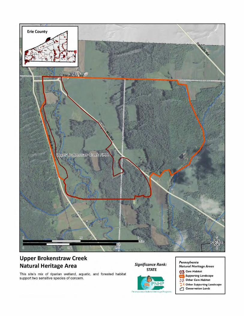
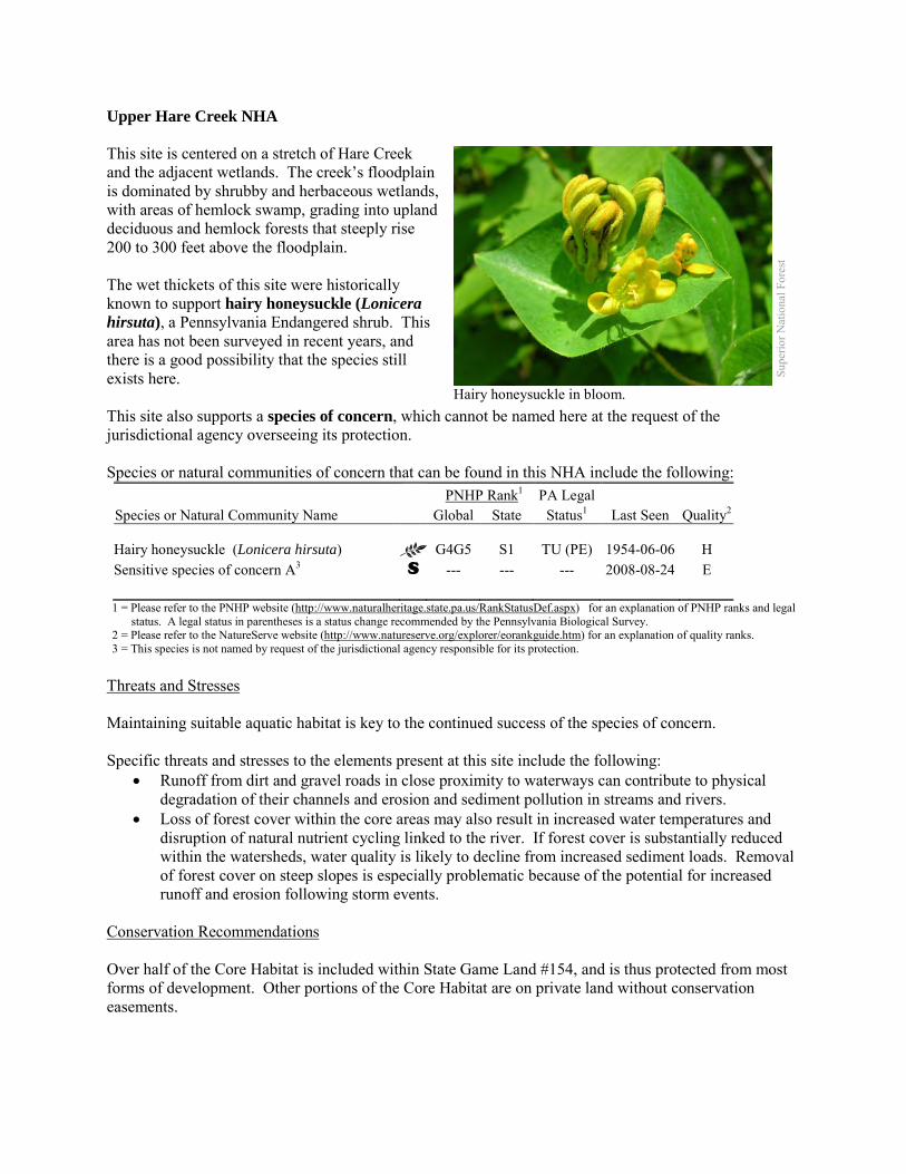
Upper Hare Creek NHA This site is centered on a stretch of Hare Creek and the adjacent wetlands. The creek’s floodplain is dominated by shrubby and herbaceous wetlands, with areas of hemlock swamp, grading into upland deciduous and hemlock forests that steeply rise 200 to 300 feet above the floodplain. The wet thickets of this site were historically known to support hairy honeysuckle (Lonicera hirsuta), a Pennsylvania Endangered shrub. This area has not been surveyed in recent years, and there is a good possibility that the species still exists here. This site also supports a species of concern, which cannot be named here at the request of the jurisdictional agency overseeing its protection. Species or natural communities of concern that can be found in this NHA include the following: PNHP Rank1 PA Legal Species or Natural Community Name Global State Status1 Last Seen Quality2 Hairy honeysuckle (Lonicera hirsuta) G4G5 S1 TU (PE) 1954-06-06 H Sensitive species of concern A3 S --- --- --- 2008-08-24 E 1 = Please refer to the PNHP website (http://www.naturalheritage.state.pa.us/RankStatusDef.aspx) for an explanation of PNHP ranks and legal
status. A legal status in parentheses is a status change recommended by the Pennsylvania Biological Survey. 2 = Please refer to the NatureServe website (http://www.natureserve.org/explorer/eorankguide.htm) for an explanation of quality ranks. 3 = This species is not named by request of the jurisdictional agency responsible for its protection.
Threats and Stresses Maintaining suitable aquatic habitat is key to the continued success of the species of concern. Specific threats and stresses to the elements present at this site include the following:
• Runoff from dirt and gravel roads in close proximity to waterways can contribute to physical degradation of their channels and erosion and sediment pollution in streams and rivers.
• Loss of forest cover within the core areas may also result in increased water temperatures and disruption of natural nutrient cycling linked to the river. If forest cover is substantially reduced within the watersheds, water quality is likely to decline from increased sediment loads. Removal of forest cover on steep slopes is especially problematic because of the potential for increased runoff and erosion following storm events.
Conservation Recommendations Over half of the Core Habitat is included within State Game Land #154, and is thus protected from most forms of development. Other portions of the Core Habitat are on private land without conservation easements.
Supe
rior N
atio
nal F
ores
t
Hairy honeysuckle in bloom.
The following steps are recommended to ensure the persistence of these species at this site: • Conserve and expand the forested riparian buffers of Hare Creek and its tributaries. Streams
through forested areas should be considered high priority for conservation. The forested riparian corridor helps to regulate the temperature of the stream and creates streamside conditions that contribute to improved water quality and aquatic habitat.
• Streams through non-forested areas should be restored with native trees and shrubs appropriate to the habitat. Establish at least a 100 foot (30 meter) buffer of woody vegetation along the creek and its tributaries to help reduce erosion, sedimentation, and pollution.
• Best management practices (BMPs) that focus on limiting the introduction of non-point sources of pollution into surface and groundwater should be applied to the surrounding area.
Location and Additional Information
Municipalities: Wayne Township USGS quads: Corry 1993 Erie CNHI reference: none – At the time of the 1993 Inventory, the hairy honeysuckle was already a
historic occurrence, and the other species of concern had not yet been found here. Associated NHAs: This site is upstream of the Lower Hare Creek NHA Overlapping Protected Lands: State Game Lands #154 PNHP Significance Rank: State
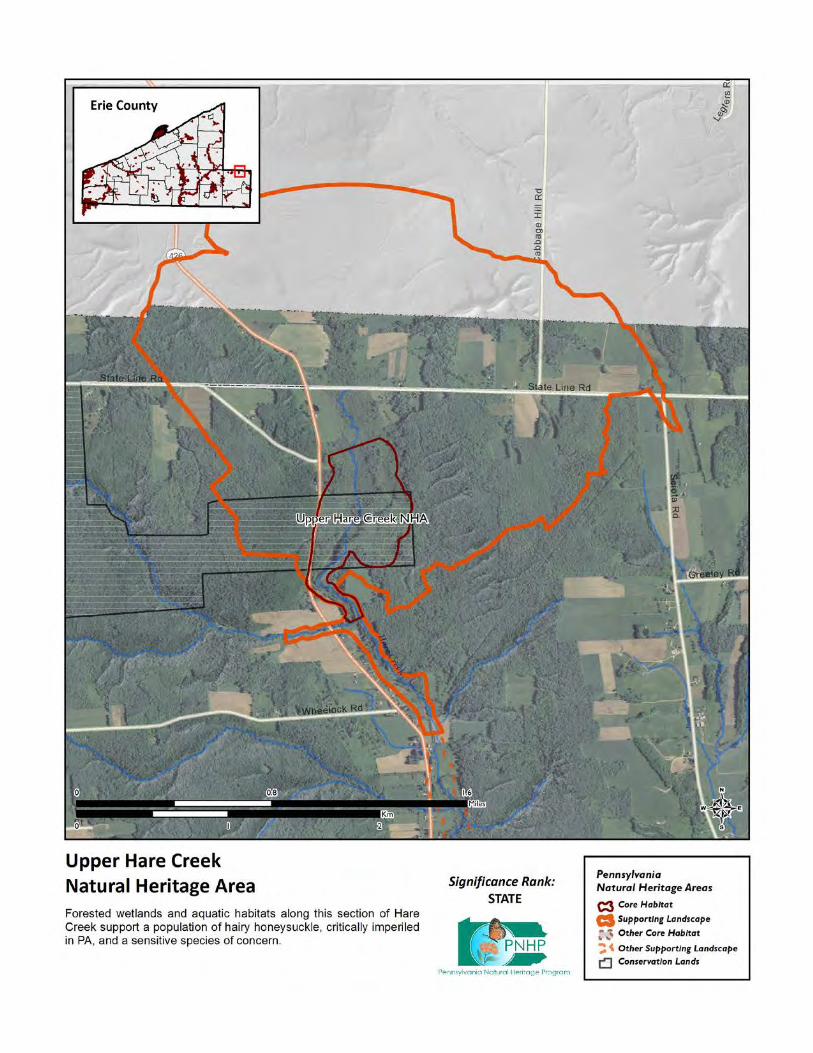
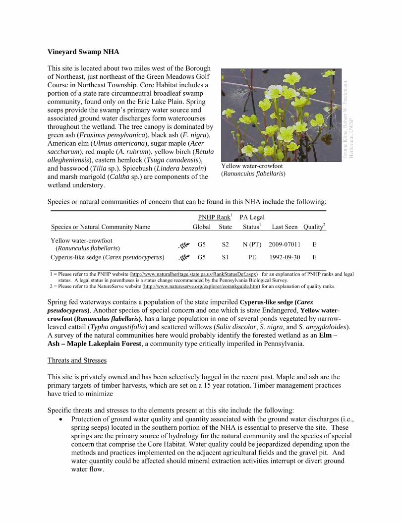
Vineyard Swamp NHA This site is located about two miles west of the Borough of Northeast, just northeast of the Green Meadows Golf Course in Northeast Township. Core Habitat includes a portion of a state rare circumneutral broadleaf swamp community, found only on the Erie Lake Plain. Spring seeps provide the swamp’s primary water source and associated ground water discharges form watercourses throughout the wetland. The tree canopy is dominated by green ash (Fraxinus pensylvanica), black ash (F. nigra), American elm (Ulmus americana), sugar maple (Acer saccharum), red maple (A. rubrum), yellow birch (Betula allegheniensis), eastern hemlock (Tsuga canadensis), and basswood (Tilia sp.). Spicebush (Lindera benzoin) and marsh marigold (Caltha sp.) are components of the wetland understory. Species or natural communities of concern that can be found in this NHA include the following:
PNHP Rank1 PA Legal Species or Natural Community Name Global State Status1 Last Seen Quality2 Yellow water-crowfoot (Ranunculus flabellaris) G5 S2 N (PT) 2009-07011 E
Cyperus-like sedge (Carex pseudocyperus) G5 S1 PE 1992-09-30 E 1 = Please refer to the PNHP website (http://www.naturalheritage.state.pa.us/RankStatusDef.aspx) for an explanation of PNHP ranks and legal
status. A legal status in parentheses is a status change recommended by the Pennsylvania Biological Survey. 2 = Please refer to the NatureServe website (http://www.natureserve.org/explorer/eorankguide.htm) for an explanation of quality ranks.
Spring fed waterways contains a population of the state imperiled Cyperus-like sedge (Carex pseudocyperus). Another species of special concern and one which is state Endangered, Yellow water-crowfoot (Ranunculus flabellaris), has a large population in one of several ponds vegetated by narrow-leaved cattail (Typha angustifolia) and scattered willows (Salix discolor, S. nigra, and S. amygdaloides). A survey of the natural communities here would probably identify the forested wetland as an Elm – Ash – Maple Lakeplain Forest, a community type critically imperiled in Pennsylvania. Threats and Stresses This site is privately owned and has been selectively logged in the recent past. Maple and ash are the primary targets of timber harvests, which are set on a 15 year rotation. Timber management practices have tried to minimize Specific threats and stresses to the elements present at this site include the following:
• Protection of ground water quality and quantity associated with the ground water discharges (i.e., spring seeps) located in the southern portion of the NHA is essential to preserve the site. These springs are the primary source of hydrology for the natural community and the species of special concern that comprise the Core Habitat. Water quality could be jeopardized depending upon the methods and practices implemented on the adjacent agricultural fields and the gravel pit. And water quantity could be affected should mineral extraction activities interrupt or divert ground water flow.
Joan
ne K
line,
Rob
ert W
. Fre
ckm
ann
Her
bariu
m, U
WSP
Yellow water-crowfoot (Ranunculus flabellaris)
• Emerald ash borer (Agrilus planipennis) is an invasive beetle that is sweeping across the Northeast and Midwest and devastating populations of all ash tree species (Fraxinus spp.), including the endangered pumpkin ash. In forests like this where ash trees make up a significant portion of the canopy, the death of canopy trees will create conditions favoring the spread of invasive species.
Conservation Recommendations The following steps are recommended to ensure the persistence of these species at this site:
• Injecting ash trees with insecticides is an expensive option, but it can be used to temporarily save small numbers of trees. This method is not without risks, because although ash trees are wind pollinated, their pollen is an important food source for bees and other insects in the spring. Injecting trees with systemic insecticides would probably harm populations of these pollinators.
• Measures to manage invasive species will have to be ramped up when the ash trees in the forest begin to die and allow more light to reach the forest floor.
• A vegetated buffer should be allowed to develop within the entire site boundary • Landowners within and adjacent to the natural heritage area need to protect the area's water
quality and quantity and avoid site fragmentation.
Location and Additional Information
Municipalities: North East Township USGS quads: Harborcreek, North East 1993 Erie CNHI reference: Lake Plain Forested Wetland BDA was designated around substantially the
same features. Associated NHAs: none Overlapping Protected Lands: Several of the parcels overlapping with this site are under agricultural
easements. PNHP Significance Rank: State References Eichelberger, B. and Zimmerman, E. 2011. Pennsylvania Natural Heritage Program. Elm – Ash – Maple Lakeplain
Forest Factsheet. Available from: http://www.naturalheritage.state.pa.us/Community.aspx?=16020 Date Accessed: April 13, 2012
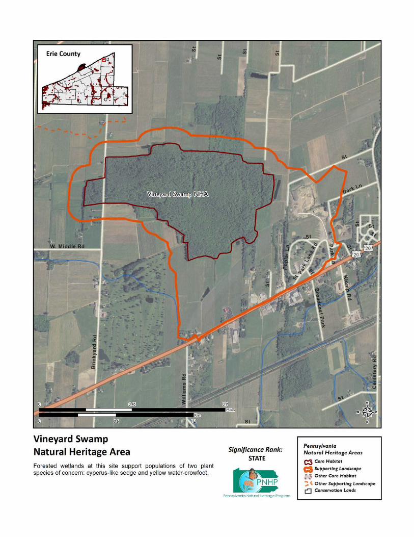
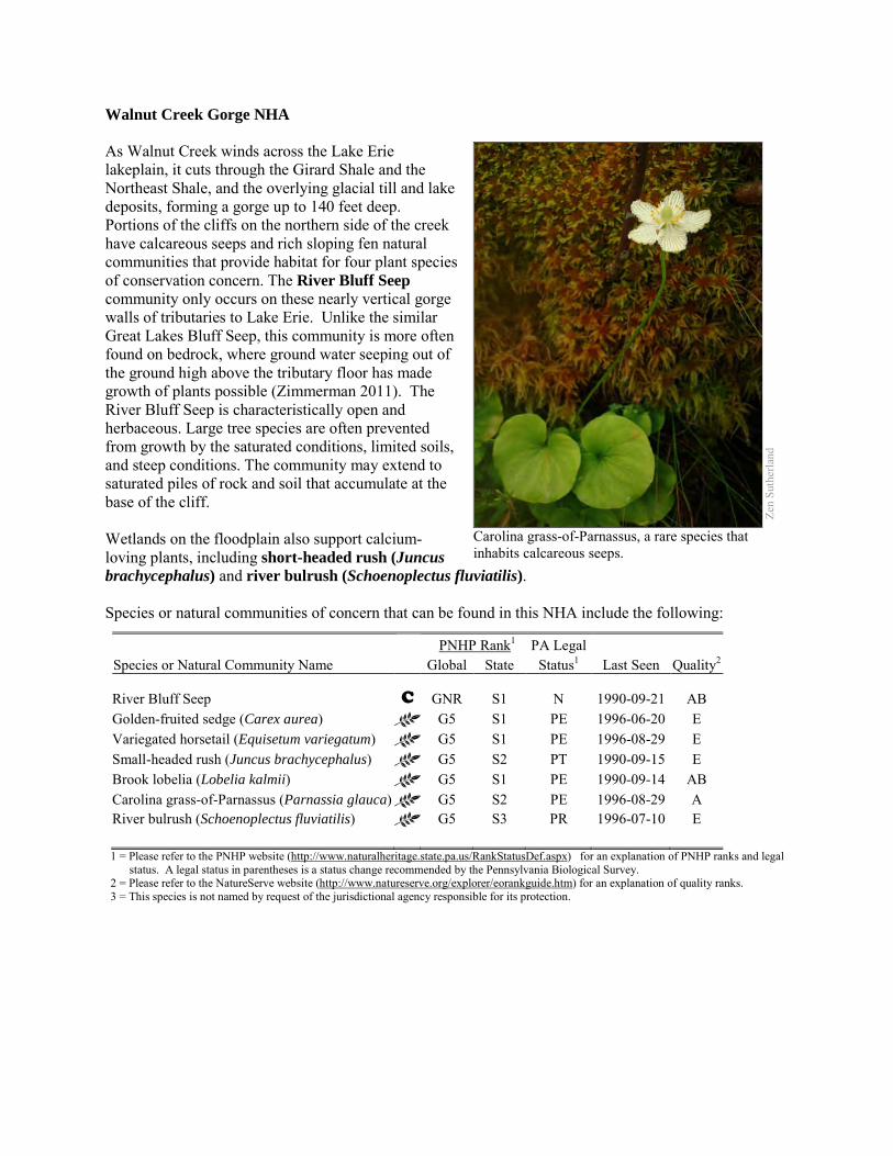
Walnut Creek Gorge NHA As Walnut Creek winds across the Lake Erie lakeplain, it cuts through the Girard Shale and the Northeast Shale, and the overlying glacial till and lake deposits, forming a gorge up to 140 feet deep. Portions of the cliffs on the northern side of the creek have calcareous seeps and rich sloping fen natural communities that provide habitat for four plant species of conservation concern. The River Bluff Seep community only occurs on these nearly vertical gorge walls of tributaries to Lake Erie. Unlike the similar Great Lakes Bluff Seep, this community is more often found on bedrock, where ground water seeping out of the ground high above the tributary floor has made growth of plants possible (Zimmerman 2011). The River Bluff Seep is characteristically open and herbaceous. Large tree species are often prevented from growth by the saturated conditions, limited soils, and steep conditions. The community may extend to saturated piles of rock and soil that accumulate at the base of the cliff. Wetlands on the floodplain also support calcium-loving plants, including short-headed rush (Juncus brachycephalus) and river bulrush (Schoenoplectus fluviatilis). Species or natural communities of concern that can be found in this NHA include the following:
PNHP Rank1 PA Legal Species or Natural Community Name Global State Status1 Last Seen Quality2 River Bluff Seep C GNR S1 N 1990-09-21 AB Golden-fruited sedge (Carex aurea) G5 S1 PE 1996-06-20 E Variegated horsetail (Equisetum variegatum) G5 S1 PE 1996-08-29 E Small-headed rush (Juncus brachycephalus) G5 S2 PT 1990-09-15 E Brook lobelia (Lobelia kalmii) G5 S1 PE 1990-09-14 AB Carolina grass-of-Parnassus (Parnassia glauca) G5 S2 PE 1996-08-29 A River bulrush (Schoenoplectus fluviatilis) G5 S3 PR 1996-07-10 E 1 = Please refer to the PNHP website (http://www.naturalheritage.state.pa.us/RankStatusDef.aspx) for an explanation of PNHP ranks and legal
status. A legal status in parentheses is a status change recommended by the Pennsylvania Biological Survey. 2 = Please refer to the NatureServe website (http://www.natureserve.org/explorer/eorankguide.htm) for an explanation of quality ranks. 3 = This species is not named by request of the jurisdictional agency responsible for its protection.
Zen
Suth
erla
nd
Carolina grass-of-Parnassus, a rare species that inhabits calcareous seeps.
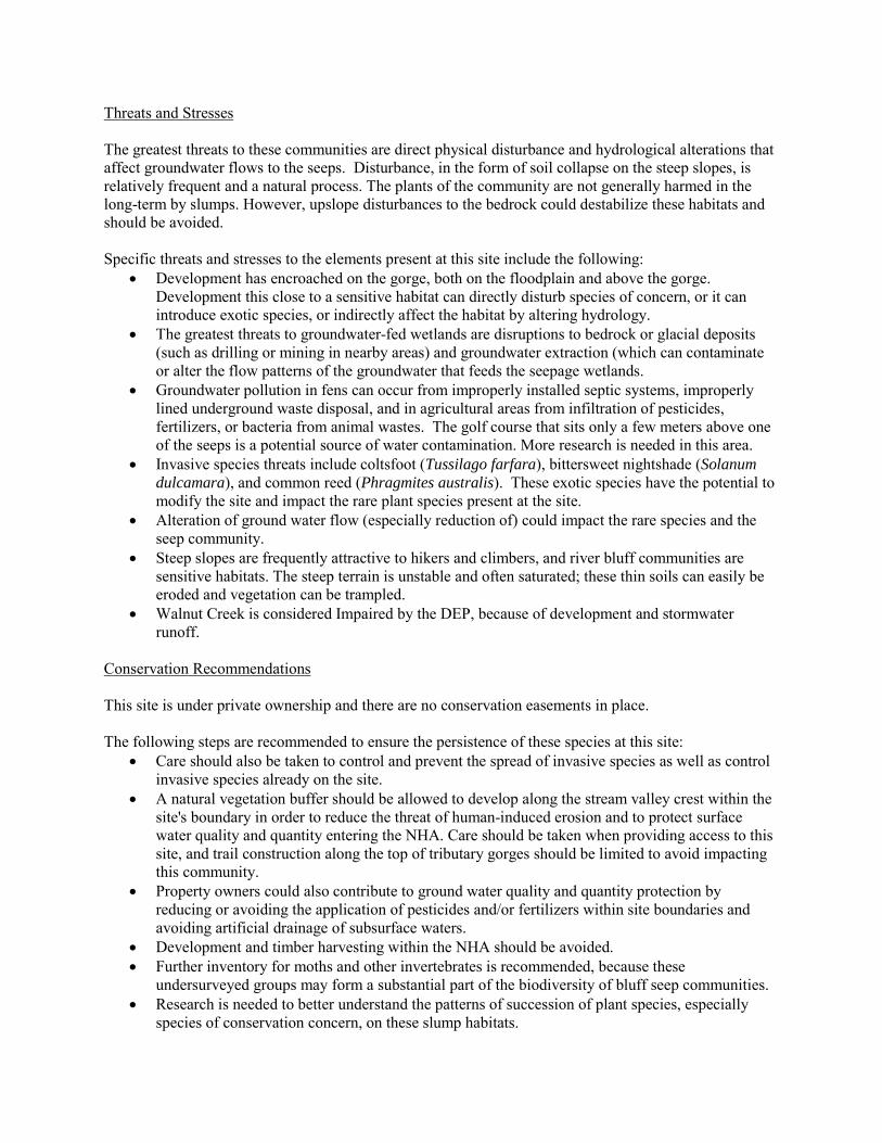
Threats and Stresses The greatest threats to these communities are direct physical disturbance and hydrological alterations that affect groundwater flows to the seeps. Disturbance, in the form of soil collapse on the steep slopes, is relatively frequent and a natural process. The plants of the community are not generally harmed in the long-term by slumps. However, upslope disturbances to the bedrock could destabilize these habitats and should be avoided. Specific threats and stresses to the elements present at this site include the following:
• Development has encroached on the gorge, both on the floodplain and above the gorge. Development this close to a sensitive habitat can directly disturb species of concern, or it can introduce exotic species, or indirectly affect the habitat by altering hydrology.
• The greatest threats to groundwater-fed wetlands are disruptions to bedrock or glacial deposits (such as drilling or mining in nearby areas) and groundwater extraction (which can contaminate or alter the flow patterns of the groundwater that feeds the seepage wetlands.
• Groundwater pollution in fens can occur from improperly installed septic systems, improperly lined underground waste disposal, and in agricultural areas from infiltration of pesticides, fertilizers, or bacteria from animal wastes. The golf course that sits only a few meters above one of the seeps is a potential source of water contamination. More research is needed in this area.
• Invasive species threats include coltsfoot (Tussilago farfara), bittersweet nightshade (Solanum dulcamara), and common reed (Phragmites australis). These exotic species have the potential to modify the site and impact the rare plant species present at the site.
• Alteration of ground water flow (especially reduction of) could impact the rare species and the seep community.
• Steep slopes are frequently attractive to hikers and climbers, and river bluff communities are sensitive habitats. The steep terrain is unstable and often saturated; these thin soils can easily be eroded and vegetation can be trampled.
• Walnut Creek is considered Impaired by the DEP, because of development and stormwater runoff.
Conservation Recommendations This site is under private ownership and there are no conservation easements in place. The following steps are recommended to ensure the persistence of these species at this site:
• Care should also be taken to control and prevent the spread of invasive species as well as control invasive species already on the site.
• A natural vegetation buffer should be allowed to develop along the stream valley crest within the site's boundary in order to reduce the threat of human-induced erosion and to protect surface water quality and quantity entering the NHA. Care should be taken when providing access to this site, and trail construction along the top of tributary gorges should be limited to avoid impacting this community.
• Property owners could also contribute to ground water quality and quantity protection by reducing or avoiding the application of pesticides and/or fertilizers within site boundaries and avoiding artificial drainage of subsurface waters.
• Development and timber harvesting within the NHA should be avoided. • Further inventory for moths and other invertebrates is recommended, because these
undersurveyed groups may form a substantial part of the biodiversity of bluff seep communities. • Research is needed to better understand the patterns of succession of plant species, especially
species of conservation concern, on these slump habitats.

Location and Additional Information Municipalities: Fairview Township, Millcreek Township USGS quads: Swanville 1993 Erie CNHI reference: Walnut Creek Valley Associated NHAs: None Overlapping Protected Lands: None PNHP Significance Rank: State References Zimmerman 2011. Pennsylvania Natural Heritage Program. River Bluff Seep Factsheet. Available from:
http://www.naturalheritage.state.pa.us/Community.aspx?=30030 Date Accessed: March 12, 2012
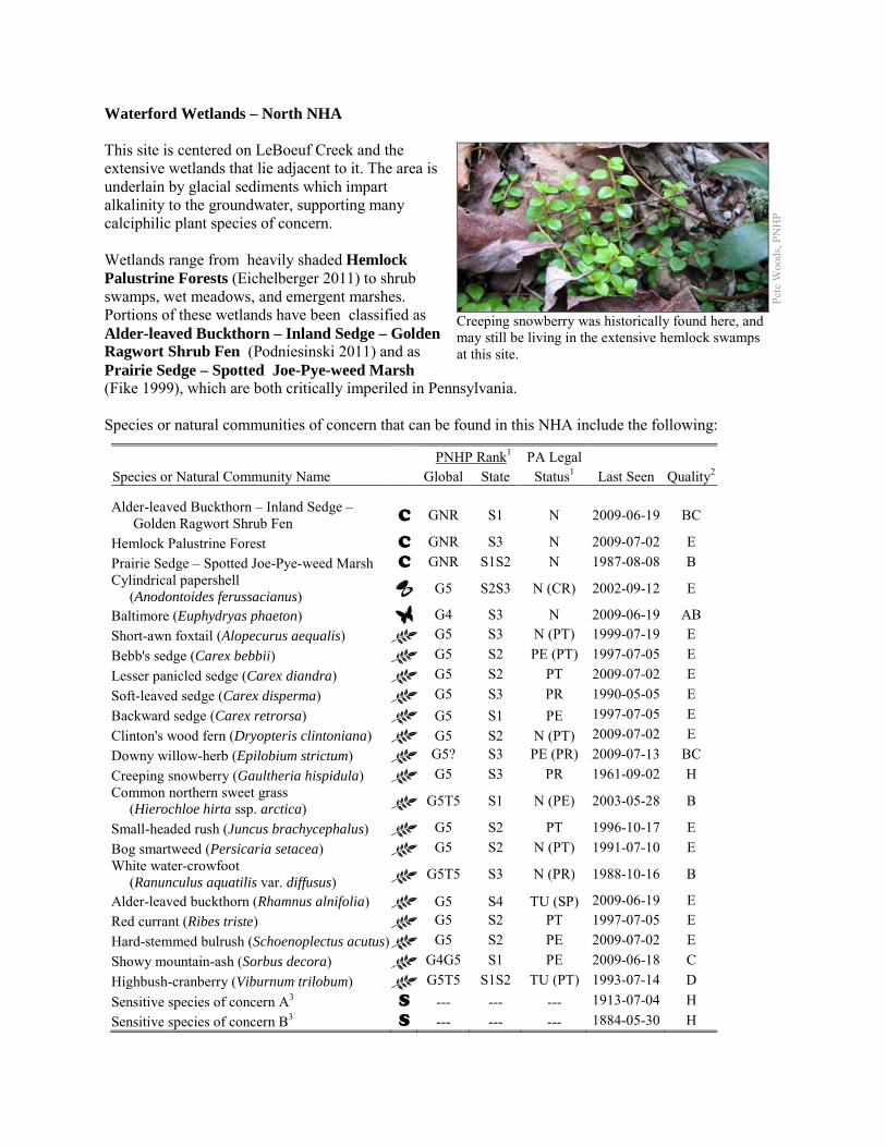
Waterford Wetlands – North NHA This site is centered on LeBoeuf Creek and the extensive wetlands that lie adjacent to it. The area is underlain by glacial sediments which impart alkalinity to the groundwater, supporting many calciphilic plant species of concern. Wetlands range from heavily shaded Hemlock Palustrine Forests (Eichelberger 2011) to shrub swamps, wet meadows, and emergent marshes. Portions of these wetlands have been classified as Alder-leaved Buckthorn – Inland Sedge – Golden Ragwort Shrub Fen (Podniesinski 2011) and as Prairie Sedge – Spotted Joe-Pye-weed Marsh (Fike 1999), which are both critically imperiled in Pennsylvania. Species or natural communities of concern that can be found in this NHA include the following:
PNHP Rank1 PA Legal Species or Natural Community Name Global State Status1 Last Seen Quality2 Alder-leaved Buckthorn – Inland Sedge – Golden Ragwort Shrub Fen C GNR S1 N 2009-06-19 BC
Hemlock Palustrine Forest C GNR S3 N 2009-07-02 E Prairie Sedge – Spotted Joe-Pye-weed Marsh C GNR S1S2 N 1987-08-08 B Cylindrical papershell (Anodontoides ferussacianus) G5 S2S3 N (CR) 2002-09-12 E
Baltimore (Euphydryas phaeton) G4 S3 N 2009-06-19 AB Short-awn foxtail (Alopecurus aequalis) G5 S3 N (PT) 1999-07-19 E Bebb's sedge (Carex bebbii) G5 S2 PE (PT) 1997-07-05 E Lesser panicled sedge (Carex diandra) G5 S2 PT 2009-07-02 E Soft-leaved sedge (Carex disperma) G5 S3 PR 1990-05-05 E Backward sedge (Carex retrorsa) G5 S1 PE 1997-07-05 E Clinton's wood fern (Dryopteris clintoniana) G5 S2 N (PT) 2009-07-02 E Downy willow-herb (Epilobium strictum) G5? S3 PE (PR) 2009-07-13 BC Creeping snowberry (Gaultheria hispidula) G5 S3 PR 1961-09-02 H Common northern sweet grass (Hierochloe hirta ssp. arctica) G5T5 S1 N (PE) 2003-05-28 B
Small-headed rush (Juncus brachycephalus) G5 S2 PT 1996-10-17 E Bog smartweed (Persicaria setacea) G5 S2 N (PT) 1991-07-10 E White water-crowfoot (Ranunculus aquatilis var. diffusus) G5T5 S3 N (PR) 1988-10-16 B
Alder-leaved buckthorn (Rhamnus alnifolia) G5 S4 TU (SP) 2009-06-19 E Red currant (Ribes triste) G5 S2 PT 1997-07-05 E Hard-stemmed bulrush (Schoenoplectus acutus) G5 S2 PE 2009-07-02 E Showy mountain-ash (Sorbus decora) G4G5 S1 PE 2009-06-18 C Highbush-cranberry (Viburnum trilobum) G5T5 S1S2 TU (PT) 1993-07-14 D Sensitive species of concern A3 S --- --- --- 1913-07-04 H Sensitive species of concern B3 S --- --- --- 1884-05-30 H
Pete
Woo
ds, P
NH
P
Creeping snowberry was historically found here, and may still be living in the extensive hemlock swamps at this site.
Sensitive species of concern C3 S --- --- --- Pre-1953 H Sensitive species of concern D3 S --- --- --- 1997-07-05 H Sensitive species of concern E3 S --- --- --- 1985-06-26 BC 1 = Please refer to the PNHP website (http://www.naturalheritage.state.pa.us/RankStatusDef.aspx) for an explanation of PNHP ranks and legal
status. A legal status in parentheses is a status change recommended by the Pennsylvania Biological Survey. 2 = Please refer to the NatureServe website (http://www.natureserve.org/explorer/eorankguide.htm) for an explanation of quality ranks. 3 = This species is not named by request of the jurisdictional agency responsible for its protection.
The wetlands and surrounding uplands at this site support 22 plant species of concern, as well as the Baltimore checkerspot butterfly (Euphydryas phaeton). Surveys here have been mainly limited to botanical surveys, but this site is likely to support many of the invertebrate species of concern known from the adjacent Waterford Wetlands – South NHA. The stretch of Le Boeuf Creek that runs through this site supports the cylindrical papershell (Anodontoides ferusaccianus), also known from upstream of here in the East Branch of LeBoeuf Creek. This site also contributes to the water quality that sustains numerous other freshwater mussel species of concern at sites downstream from here. Threats and Stresses Specific threats and stresses to the elements present at this site include the following:
• Four tributaries flowing into this wetland are classified as Imparied by the DEP, because of agricultural siltation and other causes. While many of the tributaries of this site flow through forest or at least mimimally buffered agricultural fields, some tributaries have no buffer from agricultural activities. Sedimentation is a main cause of the freshwater mussel declines throughout North America, because it renders stream bottoms unsuitable as mussel habitat. Erosion, whether caused by deforestation, poor agricultural practices, or the destruction of riparian zones, leads to increased silt loads and shifting, unstable stream bottoms. Siltation and contaminants, such as heavy metals, pesticides, and abandoned mine drainage, have long been recognized as threats to mussels (Ortmann 1909; Williams et al. 1993). Increases in siltation can also indirectly impact freshwater mussel communities by interfering with host fish – mussel interactions. Increased sedimentation can reduce the abundance, diversity, and reproduction of fish, including the host fish that are necessary for protection and dispersal of virtually all freshwater mussels during their larval stage. The increased turbidity associated with suspended sediment loads also interferes with the visual cues used by both adult mussels and host fish in the transfer of the glochidia, or mussel larvae (Box and Mossa 1999).
• The greatest threats to fen communities are disruptions to bedrock or glacial deposits (such as drilling or mining in nearby areas) and groundwater extraction (which can contaminate or alter the flow patterns of the groundwater that feeds the seepage wetlands.
• Groundwater pollution in fens can occur from improperly installed septic systems, improperly lined underground waste disposal, and in agricultural areas from infiltration of pesticides, fertilizers, or bacteria from animal wastes.
• In the absence of natural disturbance such as periodic flooding by beaver, or active vegetation removal, fens tend to succeed into dense shrub swamps and then forested swamp, which do not support most of the species of concern at this site. Several species of concern have declined or disappeared in recent decades, and succession may be part of the reason.
• Peatlands are particularly sensitive to trampling, soil compaction and other physical disturbance from recreational activities.
• The status of invasive species at this site is not known, but early successional habitats such as fens are particularly susceptible to invasive exotic species. Narrow-leaved cattail (Typha angustifolia) and common reed (Phragmites australis) are common in the area and spreading, and are likely present at this site. These exotic species have the potential to modify the site and crowd out the rare plant species.
• Baltimore checkerspots and other invertebrates are highly susceptible to pesticide use. Wetland-dependent invertebrate species often move through the surrounding uplands to forage.
• Seedlings of showy mountain ash are highly vulnerable to browsing by deer. When deer densities are high, a sapling rarely survives long enough to grow out of the deer’s reach, and to have a chance of reproducing. Other plant species of concern at this site are also vulnerable to deer browsing.
• The hemlock woolly adelgid (Adelges tsugae), native to Asia, is a sap-feeding insect that attacks eastern hemlock (Tsuga canadensis). As of 2011, the hemlock woolly adelgid is still several counties away to the east and south, but it is expected to arrive in coming years, with devastating effects on hemlock populations. Infestations are followed by high levels of hemlock mortality, which opens up the forest canopy and drastically alters the forest habitat. The loss of the deep shade and cool microclimate could prevent species such as Clinton’s wood fern, soft-leaved sedge, and creeping snowberry from persisting here.
• Viburnum leaf beetle (Pyrrhalta viburni) is an introduced pest that eats highbush cranberry and other species of viburnum. Within Pennsylvania, this pest has spread throughout the range of highbush cranberry, and is decimating populations of the shrub. The long-term effects of this invasion remain unknown, but all populations of highbush cranberry are at serious risk
Conservation Recommendations The following steps are recommended to ensure the persistence of these species at this site:
• Conserve and expand the forested riparian buffers of LeBoeuf Creek and its tributaries. Streams through forested areas should be considered high priority for conservation. The forested riparian corridor helps to regulate the temperature of the stream and creates streamside conditions that contribute to improved water quality and aquatic habitat. Streams through non-forested areas should be restored with native trees and shrubs appropriate to the habitat. Establish at least a 100 foot (30 meter) buffer of woody vegetation along the creek and its tributaries to help reduce erosion, sedimentation, and pollution.
• Best management practices (BMPs) that focus on limiting the introduction of non-point sources of pollution into surface and groundwater should be applied to the surrounding area
• Drilling, mining, or other disruptions to bedrock or glacial deposits should not be undertaken within half a mile of a seepage wetland without a thorough understanding of bedrock layers and groundwater flows. Groundwater flow patterns do not always mirror surface watersheds, and in some cases aquifers may be contiguous over large areas.
• Trails should be sited away from fens, or elevated boardwalks employed to prevent peat compaction and other disturbance in the wetlands.
• Monitor for and remove invasive plant species. Control of invasive species in the area will require extensive and continual effort. Focus initial control efforts on selected areas surrounding species of concern.
• The fen may require periodic disturbance such as cutting, burning, or grazing to maintain the open canopy which is indicative of this community and the rare species that occupy the community.
• Allow beaver to persist in the area. Beaver flooding will set back succession in the lower parts of the landscape. Over time beaver ponds will be abandoned, and the resulting beaver meadows may become fens until conditions are again suitable for beaver.
• Management options for the control of viburnum leaf beetle should be investigated. • Pesticide use should be avoided in the Core Habitat and minimized in the Supporting Landscape. • As of 2012, available treatments for hemlock woolly adelgid are not economically feasible at a
scale suitable for large natural areas. At a smaller scale, injection of insecticides into tree trunks or into the soil around a tree can control adelgids for up to several years at a time, although there may be unintended effects on other species. Continued applications of horticultural oil or insecticidal soap can also control hemlock woolly adelgids. Biological controls are being researched, although they have so far had limited success at keeping adelgid populations in check (DCNR 2012).
• White-tailed deer should be kept to a low density to avoid degradation of the forest’s diversity. Reducing deer density in this area may enhance survival of showy mountain ash seedlings. In the absence of such measures, deer exclosures would allow some show mountain-ash seedlings to grow to maturity.
• Management options for the control of viburnum leaf beetle should be investigated.
Location and Additional Information
Municipalities: Green Township, Summit Township, Waterford Township USGS quads: Cambridge Springs NE, Erie South, Hammett, Waterford 1993 Erie CNHI reference: French Creek BDA Associated NHAs: Waterford Wetlands – South NHA, East Branch LeBoeuf Creek NHA Overlapping Protected Lands: State Game Land #109 PNHP Significance Rank: Global References Box, J. B. and Mossa, J., (1999). Sediment, land use and freshwater mussels: prospects and problems. Journal of the North
American Benthological Society 18(1): 99-117. Department of Conservation and Natural Resources. 2012. Forest Health Fact Sheet: Hemlock Woolly Adelgid.
http://www.dcnr.state.pa.us/ucmprd2/groups/public/documents/document/dcnr_007179.pdf Eichelberger, B. 2011. Pennsylvania Natural Heritage Program. Hemlock Palustrine Forest Factsheet. Available from:
http://www.naturalheritage.state.pa.us/Community.aspx?=16028 Date Accessed: November 06, 2012 Fike, J. 1999. Terrestrial and palustrine plant communities of Pennsylvania. Pennsylvania Natural Diversity Inventory.
Harrisburg, PA. 86 pp. Ortmann, A.E. 1909. The destruction of the fresh-water fauna in Western Pennsylvania: Proceedings of the American
Philosophical Society, 47(191): 90-110. Podniesinski 2011. Pennsylvania Natural Heritage Program. Alder-leaved Buckthorn – Inland Sedge – Golden Ragwort Shrub
Fen Factsheet. Available from: http://www.naturalheritage.state.pa.us/Community.aspx?=30002 Date Accessed: August 01, 2012
Williams, J. D., M. L. Warren, K. S. Cummings, J. L. Harris, and R. J. Neves. (1993). Conservation status of freshwater mussels of the United States and Canada. Fisheries 18: 6-22.
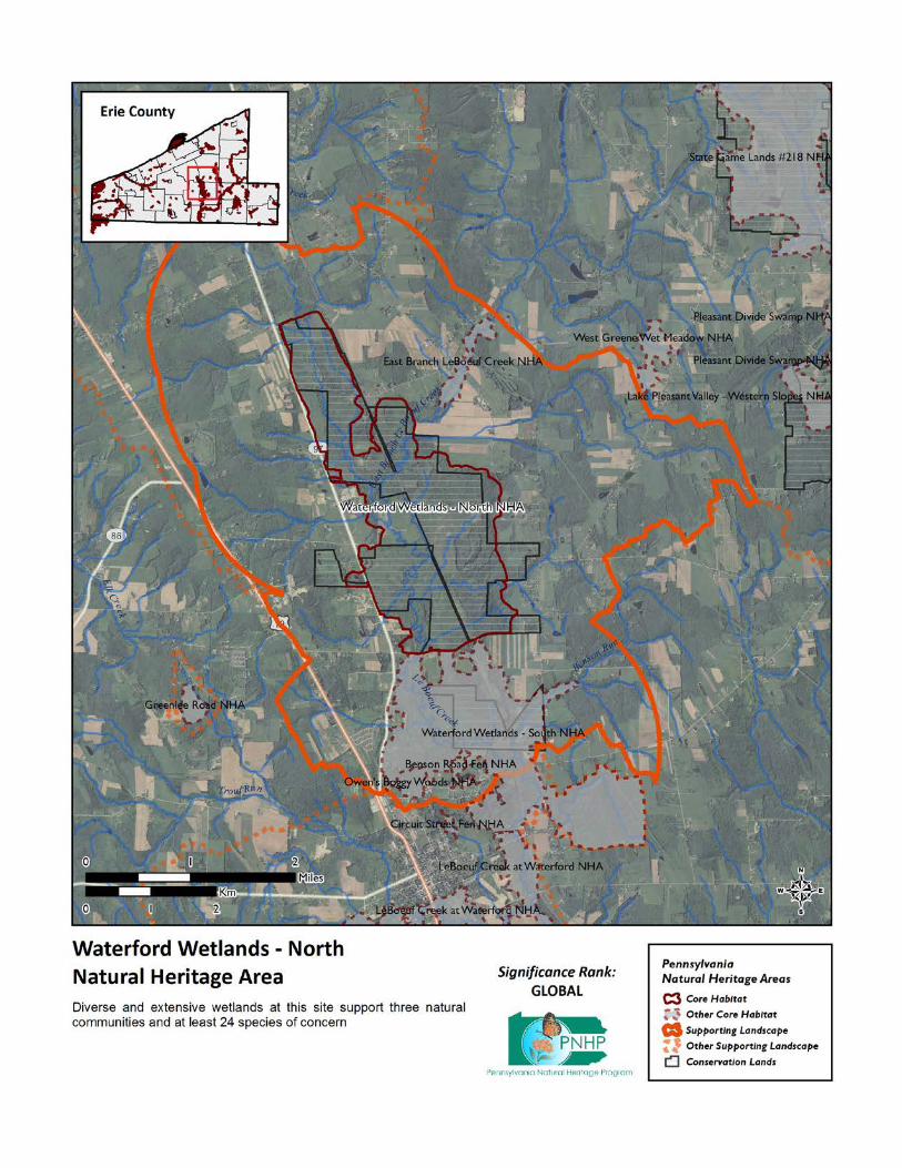
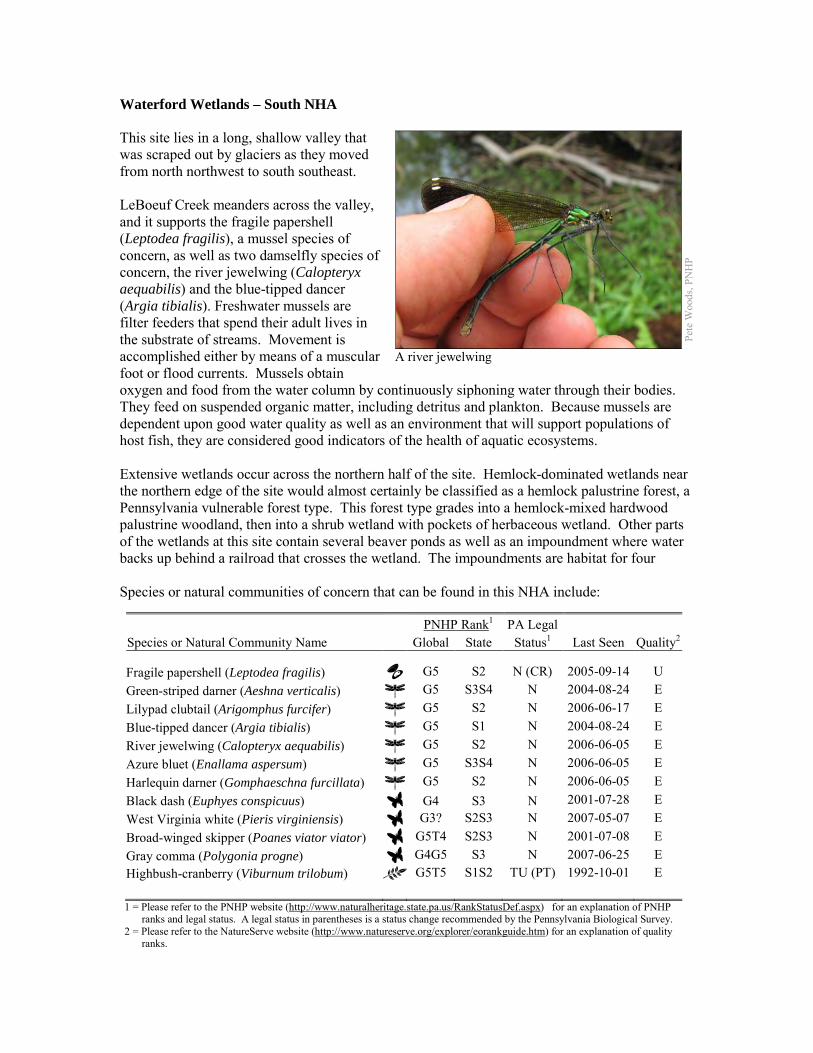
Waterford Wetlands – South NHA This site lies in a long, shallow valley that was scraped out by glaciers as they moved from north northwest to south southeast. LeBoeuf Creek meanders across the valley, and it supports the fragile papershell (Leptodea fragilis), a mussel species of concern, as well as two damselfly species of concern, the river jewelwing (Calopteryx aequabilis) and the blue-tipped dancer (Argia tibialis). Freshwater mussels are filter feeders that spend their adult lives in the substrate of streams. Movement is accomplished either by means of a muscular foot or flood currents. Mussels obtain oxygen and food from the water column by continuously siphoning water through their bodies. They feed on suspended organic matter, including detritus and plankton. Because mussels are dependent upon good water quality as well as an environment that will support populations of host fish, they are considered good indicators of the health of aquatic ecosystems. Extensive wetlands occur across the northern half of the site. Hemlock-dominated wetlands near the northern edge of the site would almost certainly be classified as a hemlock palustrine forest, a Pennsylvania vulnerable forest type. This forest type grades into a hemlock-mixed hardwood palustrine woodland, then into a shrub wetland with pockets of herbaceous wetland. Other parts of the wetlands at this site contain several beaver ponds as well as an impoundment where water backs up behind a railroad that crosses the wetland. The impoundments are habitat for four Species or natural communities of concern that can be found in this NHA include:
PNHP Rank1 PA Legal Species or Natural Community Name Global State Status1 Last Seen Quality2 Fragile papershell (Leptodea fragilis) G5 S2 N (CR) 2005-09-14 U Green-striped darner (Aeshna verticalis) G5 S3S4 N 2004-08-24 E Lilypad clubtail (Arigomphus furcifer) G5 S2 N 2006-06-17 E Blue-tipped dancer (Argia tibialis) G5 S1 N 2004-08-24 E River jewelwing (Calopteryx aequabilis) G5 S2 N 2006-06-05 E Azure bluet (Enallama aspersum) G5 S3S4 N 2006-06-05 E Harlequin darner (Gomphaeschna furcillata) G5 S2 N 2006-06-05 E Black dash (Euphyes conspicuus) G4 S3 N 2001-07-28 E West Virginia white (Pieris virginiensis) G3? S2S3 N 2007-05-07 E Broad-winged skipper (Poanes viator viator) G5T4 S2S3 N 2001-07-08 E Gray comma (Polygonia progne) G4G5 S3 N 2007-06-25 E Highbush-cranberry (Viburnum trilobum) G5T5 S1S2 TU (PT) 1992-10-01 E 1 = Please refer to the PNHP website (http://www.naturalheritage.state.pa.us/RankStatusDef.aspx) for an explanation of PNHP
ranks and legal status. A legal status in parentheses is a status change recommended by the Pennsylvania Biological Survey. 2 = Please refer to the NatureServe website (http://www.natureserve.org/explorer/eorankguide.htm) for an explanation of quality
ranks.
Pete
Woo
ds, P
NH
P
A river jewelwing
dragonfly and damselfly species of concern. Sedge-dominated wetlands within this site support broad-winged skippers (Poanes viator viator) and black dashes (Euphyes conspicuus). Forests at this site support the globally vulnerable West Virginia white butterfly (Pieris virginiensis) and the Pennsylvania vulnerable gray comma butterfly (Polygonia progne). Surveys in this site have been mostly limited to invertebrates; this site is very likely to contain some of the plant species of concern known from the adjacent NHAs. Threats and Stresses
• Sedimentation is a main cause of the freshwater mussel declines throughout North America, because it renders stream bottoms unsuitable as mussel habitat. Erosion, whether caused by deforestation, poor agricultural practices, or the destruction of riparian zones, leads to increased silt loads and shifting, unstable stream bottoms. Siltation and contaminants, such as heavy metals, pesticides, and abandoned mine drainage, have long been recognized as threats to mussels (Ortmann 1909; Williams et al. 1993). Increases in siltation can also indirectly impact freshwater mussel communities by interfering with host fish – mussel interactions. Increased sedimentation can reduce the abundance, diversity, and reproduction of fish, including the host fish that are necessary for protection and dispersal of virtually all freshwater mussels during their larval stage. The increased turbidity associated with suspended sediment loads also interferes with the visual cues used by both adult mussels and host fish in the transfer of the glochidia, or mussel larvae (Box and Mossa 1999).
• Dragonflies and damselflies also rely on good water quality, although the tolerances of individual species to different types of pollution are not well-understood. Siltation and contaminants such as heavy metals and pesticides are potential threats to these species. Pesticides are also a threat to the butterfly species of concern.
• Fragmentation of the forest is a serious threat to the West Virginia white, because these butterflies do not cross wide roads or other non-forested areas. The result is that populations are becoming genetically isolated, and if a population is extirpated the chances are low that remaining populations will be able to recolonize the habitat.
• An even greater threat to the West Virginia white is the spread of garlic mustard (Alliaria petiolata). This invasive plant is in the same family (the mustard family) as toothworts, and the chemical signatures of the plants are similar enough that female butterflies will readily lay their eggs on garlic mustard. The caterpillars, however, cannot survive on garlic mustard, and these butterflies have disappeared from areas where garlic mustard is dominant.
• Invasive plant species are also a potential threat to the broad-winged skipper and the black dash. As an early successional habitat, sedge meadows are particularly vulnerable to invasion by invasive species such as common reed (Phragmites australis) and purple loosestrife (Lythrum salicaria), which are both common and spreading in this part of Erie County.
• High densities of white-tailed deer pose another threat to West Virginia whites, because deer browsing greatly reduces the abundance of many of the wildflowers that are crucial nectar sources for the butterflies. Although their flight period is short, adults rely on several successive waves of spring wildflowers to produce a steady supply of nectar. A reduction in abundance or diversity of spring wildflowers can leave these butterflies without a source of food.
• The hemlock woolly adelgid (Adelges tsugae), native to Asia, is a sap-feeding insect that attacks eastern hemlock (Tsuga canadensis). As of 2011, the hemlock woolly adelgid is still several counties away to the east and south, but it is expected to arrive in coming years, with devastating effects on hemlock populations. Infestations are followed by high levels of hemlock mortality, which opens up the forest canopy and drastically alters the forest habitat. The loss of the deep shade and cool microclimate would exclude a number of species that rely on this habitat.
• Viburnum leaf beetle (Pyrrhalta viburni) is an introduced pest that eats highbush cranberry and other species of Viburnum. Within Pennsylvania, this pest has spread throughout the range of highbush cranberry, and is decimating populations of the shrub. The long-term effects of this invasion remain unknown, but all populations of highbush cranberry are at serious risk
• If left undisturbed, sedge meadows will eventually grow into shrubland and then forest, which is not habitat for the broad-winged skipper or the black dash.
Conservation Recommendations The following steps are recommended to ensure the persistence of these species at this site:
• Conserve and expand the forested riparian buffers of the streams and wetlands at this site. Conserve at least a 328 foot (100 meter) buffer of native woody vegetation where it exists along the waterways and establish at least a 100 foot (30 meter) buffer where it is lacking to help reduce erosion, sedimentation, and pollution. Additionally, best management practices (BMPs) that focus on limiting the introduction of non-point sources of pollution into surface and groundwater should be applied to the surrounding area.
• Pesticide use should be avoided in the Core Habitat and minimized in the Supporting Landscape.
• Fragmentation of the remaining forest should be avoided. New development such as housing, roads, and powerlines should be concentrated in areas that have already been disturbed. White-tailed deer should be kept to a low density to avoid degradation of the forest’s diversity.
• As of 2012, available treatments for hemlock woolly adelgid are not economically feasible at a scale suitable for large natural areas. At a smaller scale, injection of insecticides into tree trunks or into the soil around a tree can control adelgids for up to several years at a time, although there may be unintended effects on other species. Continued applications of horticultural oil or insecticidal soap can also control hemlock woolly adelgids. Biological controls are being researched, although they have so far had limited success at keeping adelgid populations in check (DCNR 2012).
• Management options for the control of viburnum leaf beetle should be investigated. • Allow beaver to persist in the landscape. Natural disturbance cycles will create open
wetland habitat for the species which depend on it. Research is needed to identify what historic land uses and disturbance regimes create sedge meadow habitat for black dashes.
• Monitor for and remove invasive species, especially garlic mustard.

Location and Additional Information
Municipalities: Waterford Township USGS quads: Waterford 1993 Erie CNHI reference: French Creek BDA Associated NHAs: Waterford Wetlands – North NHA, LeBoeuf Creek at Waterford NHA, Owen’s
Boggy Woods NHA, Benson Road Fen NHA Overlapping Protected Lands: State Game Land #109 PNHP Significance Rank: Regional References Box, J. B. and Mossa, J., (1999). Sediment, land use and freshwater mussels: prospects and problems. Journal of the
North American Benthological Society 18(1): 99-117. Cech, R. and G. Tudor. 2005. Butterflies of the East Coast: An Observer’s Guide. Princeton University Press,
Princeton, New Jersey. Department of Conservation and Natural Resources. 2012. Forest Health Fact Sheet: Hemlock Woolly Adelgid.
http://www.dcnr.state.pa.us/ucmprd2/groups/public/documents/document/dcnr_007179.pdf Ortmann, A.E. 1909. The destruction of the fresh-water fauna in Western Pennsylvania: Proceedings of the American
Philosophical Society, 47(191): 90-110. Williams, J. D., M. L. Warren, K. S. Cummings, J. L. Harris, and R. J. Neves. (1993). Conservation status of
freshwater mussels of the United States and Canada. Fisheries 18: 6-22.
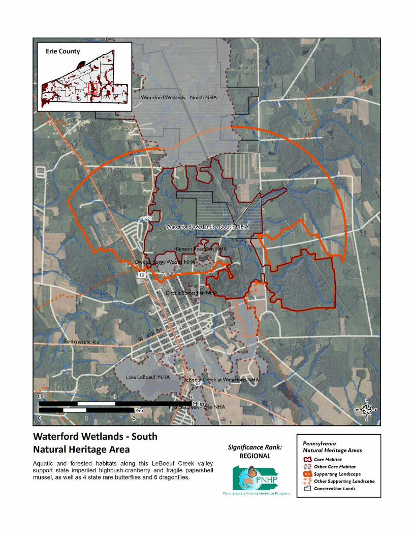
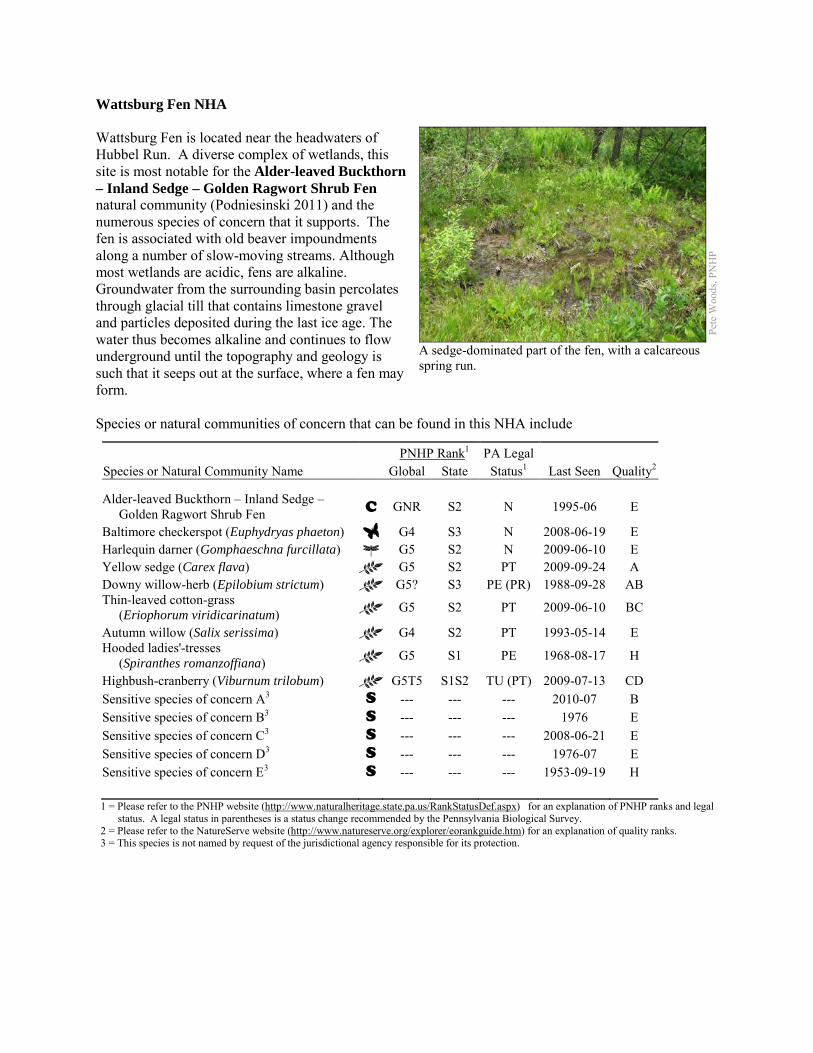
Wattsburg Fen NHA Wattsburg Fen is located near the headwaters of Hubbel Run. A diverse complex of wetlands, this site is most notable for the Alder-leaved Buckthorn – Inland Sedge – Golden Ragwort Shrub Fen natural community (Podniesinski 2011) and the numerous species of concern that it supports. The fen is associated with old beaver impoundments along a number of slow-moving streams. Although most wetlands are acidic, fens are alkaline. Groundwater from the surrounding basin percolates through glacial till that contains limestone gravel and particles deposited during the last ice age. The water thus becomes alkaline and continues to flow underground until the topography and geology is such that it seeps out at the surface, where a fen may form. Species or natural communities of concern that can be found in this NHA include
PNHP Rank1 PA Legal Species or Natural Community Name Global State Status1 Last Seen Quality2 Alder-leaved Buckthorn – Inland Sedge – Golden Ragwort Shrub Fen C GNR S2 N 1995-06 E
Baltimore checkerspot (Euphydryas phaeton) G4 S3 N 2008-06-19 E Harlequin darner (Gomphaeschna furcillata) G5 S2 N 2009-06-10 E Yellow sedge (Carex flava) G5 S2 PT 2009-09-24 A Downy willow-herb (Epilobium strictum) G5? S3 PE (PR) 1988-09-28 AB Thin-leaved cotton-grass (Eriophorum viridicarinatum) G5 S2 PT 2009-06-10 BC
Autumn willow (Salix serissima) G4 S2 PT 1993-05-14 E Hooded ladies'-tresses (Spiranthes romanzoffiana) G5 S1 PE 1968-08-17 H
Highbush-cranberry (Viburnum trilobum) G5T5 S1S2 TU (PT) 2009-07-13 CD Sensitive species of concern A3 S --- --- --- 2010-07 B Sensitive species of concern B3 S --- --- --- 1976 E Sensitive species of concern C3 S --- --- --- 2008-06-21 E Sensitive species of concern D3 S --- --- --- 1976-07 E Sensitive species of concern E3 S --- --- --- 1953-09-19 H 1 = Please refer to the PNHP website (http://www.naturalheritage.state.pa.us/RankStatusDef.aspx) for an explanation of PNHP ranks and legal
status. A legal status in parentheses is a status change recommended by the Pennsylvania Biological Survey. 2 = Please refer to the NatureServe website (http://www.natureserve.org/explorer/eorankguide.htm) for an explanation of quality ranks. 3 = This species is not named by request of the jurisdictional agency responsible for its protection.
Pete
Woo
ds, P
NH
P
A sedge-dominated part of the fen, with a calcareous spring run.
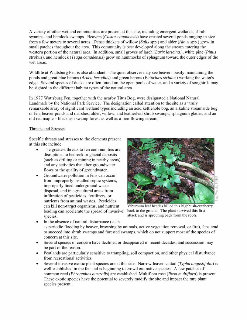
A variety of other wetland communities are present at this site, including emergent wetlands, shrub swamps, and hemlock swamps. Beavers (Castor canadensis) have created several ponds ranging in size from a few meters to several acres. Dense thickets of willow (Salix spp.) and alder (Alnus spp.) grow in small patches throughout the area. This community is best developed along the stream entering the western portion of the natural area. In addition, small groves of larch (Larix laricina.), white pine (Pinus strobus), and hemlock (Tsuga canadensis) grow on hummocks of sphagnum toward the outer edges of the wet areas. Wildlife at Wattsburg Fen is also abundant. The quiet observer may see beavers busily maintaining the ponds and great blue herons (Ardea herodias) and green herons (Butorides striatus) working the water's edge. Several species of ducks are often found on the open pools of water, and a variety of songbirds may be sighted in the different habitat types of the natural area. In 1977 Wattsburg Fen, together with the nearby Titus Bog, were designated a National Natural Landmark by the National Park Service. The designation called attention to the site as a “truly remarkable array of significant wetland types including an acid kettlehole bog, an alkaline streamside bog or fen, beaver ponds and marshes, alder, willow, and leatherleaf shrub swamps, sphagnum glades, and an old red maple – black ash swamp forest as well as a free-flowing stream.” Threats and Stresses Specific threats and stresses to the elements present at this site include:
• The greatest threats to fen communities are disruptions to bedrock or glacial deposits (such as drilling or mining in nearby areas) and any activities that alter groundwater flows or the quality of groundwater.
• Groundwater pollution in fens can occur from improperly installed septic systems, improperly lined underground waste disposal, and in agricultural areas from infiltration of pesticides, fertilizers, or nutrients from animal wastes. Pesticides can kill non-target organisms, and nutrient loading can accelerate the spread of invasive species.
• In the absence of natural disturbance (such as periodic flooding by beaver, browsing by animals, active vegetation removal, or fire), fens tend to succeed into shrub swamps and forested swamps, which do not support most of the species of concern at this site.
• Several species of concern have declined or disappeared in recent decades, and succession may be part of the reason.
• Peatlands are particularly sensitive to trampling, soil compaction, and other physical disturbance from recreational activities.
• Several invasive exotic plant species are at this site. Narrow-leaved cattail (Typha angustifolia) is well-established in the fen and is beginning to crowd out native species. A few patches of common reed (Phragmites australis) are established. Multiflora rose (Rosa multiflora) is present. These exotic species have the potential to severely modify the site and impact the rare plant species present.
Pete
Woo
ds, P
NH
P
Viburnum leaf beetles killed this highbush-cranberry back to the ground. The plant survived this first attack and is sprouting back from the roots.
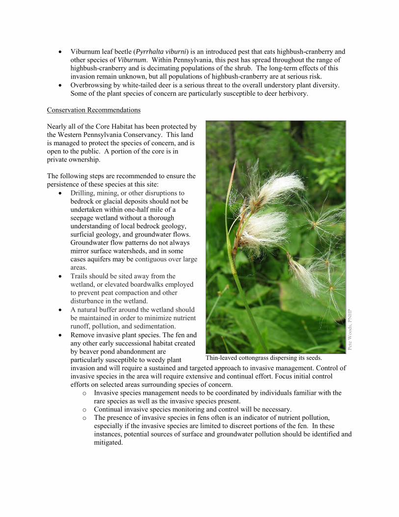
• Viburnum leaf beetle (Pyrrhalta viburni) is an introduced pest that eats highbush-cranberry and other species of Viburnum. Within Pennsylvania, this pest has spread throughout the range of highbush-cranberry and is decimating populations of the shrub. The long-term effects of this invasion remain unknown, but all populations of highbush-cranberry are at serious risk.
• Overbrowsing by white-tailed deer is a serious threat to the overall understory plant diversity. Some of the plant species of concern are particularly susceptible to deer herbivory.
Conservation Recommendations Nearly all of the Core Habitat has been protected by the Western Pennsylvania Conservancy. This land is managed to protect the species of concern, and is open to the public. A portion of the core is in private ownership. The following steps are recommended to ensure the persistence of these species at this site:
• Drilling, mining, or other disruptions to bedrock or glacial deposits should not be undertaken within one-half mile of a seepage wetland without a thorough understanding of local bedrock geology, surficial geology, and groundwater flows. Groundwater flow patterns do not always mirror surface watersheds, and in some cases aquifers may be contiguous over large areas.
• Trails should be sited away from the wetland, or elevated boardwalks employed to prevent peat compaction and other disturbance in the wetland.
• A natural buffer around the wetland should be maintained in order to minimize nutrient runoff, pollution, and sedimentation.
• Remove invasive plant species. The fen and any other early successional habitat created by beaver pond abandonment are particularly susceptible to weedy plant invasion and will require a sustained and targeted approach to invasive management. Control of invasive species in the area will require extensive and continual effort. Focus initial control efforts on selected areas surrounding species of concern.
o Invasive species management needs to be coordinated by individuals familiar with the rare species as well as the invasive species present.
o Continual invasive species monitoring and control will be necessary. o The presence of invasive species in fens often is an indicator of nutrient pollution,
especially if the invasive species are limited to discreet portions of the fen. In these instances, potential sources of surface and groundwater pollution should be identified and mitigated.
Pe
te W
oods
, PN
HP Thin-leaved cottongrass dispersing its seeds.
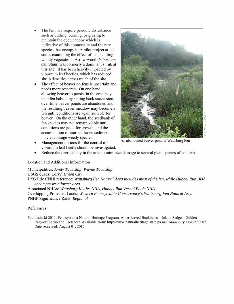
• The fen may require periodic disturbance such as cutting, burning, or grazing to maintain the open canopy which is indicative of this community and the rare species that occupy it. A pilot project at this site is examining the effect of hand cutting woody vegetation. Arrow-wood (Viburnum dentatum) was formerly a dominant shrub at this site. It has been heavily impacted by viburnum leaf beetles, which has reduced shrub densities across much of the site.
• The effect of beaver on fens is uncertain and needs more research. On one hand, allowing beaver to persist in the area may help fen habitat by setting back succession; over time beaver ponds are abandoned and the resulting beaver meadow may become a fen until conditions are again suitable for beaver. On the other hand, the seedbank of fen species may not remain viable until conditions are good for growth, and the accumulation of nutrient-laden sediments may encourage weedy species.
• Management options for the control of viburnum leaf beetle should be investigated.
• Reduce the deer density in the area to minimize damage to several plant species of concern.
Location and Additional Information
Municipalities: Amity Township, Wayne Township USGS quads: Corry, Union City 1993 Erie CNHI reference: Wattsburg Fen Natural Area includes most of the fen, while Hubbel Run BDA
encompasses a larger area Associated NHAs: Wattsburg Kettles NHA, Hubbel Run Vernal Pools NHA Overlapping Protected Lands: Western Pennsylvania Conservancy’s Wattsburg Fen Natural Area PNHP Significance Rank: Regional References Podniesinski 2011. Pennsylvania Natural Heritage Program. Alder-leaved Buckthorn – Inland Sedge – Golden
Ragwort Shrub Fen Factsheet. Available from: http://www.naturalheritage.state.pa.us/Community.aspx?=30002 Date Accessed: August 01, 2012
Pete
Woo
ds, P
NH
P
An abandoned beaver pond at Wattsburg Fen
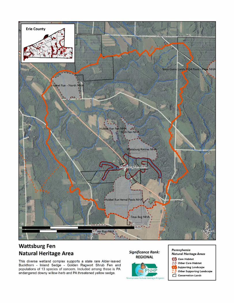
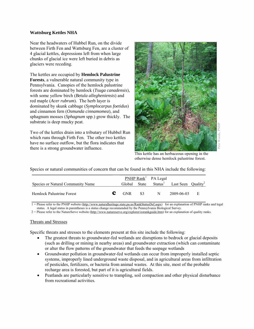
Wattsburg Kettles NHA Near the headwaters of Hubbel Run, on the divide between Firth Fen and Wattsburg Fen, are a cluster of 4 glacial kettles, depressions left from when large chunks of glacial ice were left buried in debris as glaciers were receding. The kettles are occupied by Hemlock Palustrine Forests, a vulnerable natural community type in Pennsylvania. Canopies of the hemlock palustrine forests are dominated by hemlock (Tsuga canadensis), with some yellow birch (Betula allegheniensis) and red maple (Acer rubrum). The herb layer is dominated by skunk cabbage (Symplocarpus foetidus) and cinnamon fern (Osmunda cinnamomea), and sphagnum mosses (Sphagnum spp.) grow thickly. The substrate is deep mucky peat. Two of the kettles drain into a tributary of Hubbel Run which runs through Firth Fen. The other two kettles have no surface outflow, but the flora indicates that there is a strong groundwater influence. Species or natural communities of concern that can be found in this NHA include the following:
PNHP Rank1 PA Legal Species or Natural Community Name Global State Status1 Last Seen Quality2 Hemlock Palustrine Forest C GNR S3 N 2009-06-03 E 1 = Please refer to the PNHP website (http://www.naturalheritage.state.pa.us/RankStatusDef.aspx) for an explanation of PNHP ranks and legal
status. A legal status in parentheses is a status change recommended by the Pennsylvania Biological Survey. 2 = Please refer to the NatureServe website (http://www.natureserve.org/explorer/eorankguide.htm) for an explanation of quality ranks.
Threats and Stresses Specific threats and stresses to the elements present at this site include the following:
• The greatest threats to groundwater-fed wetlands are disruptions to bedrock or glacial deposits (such as drilling or mining in nearby areas) and groundwater extraction (which can contaminate or alter the flow patterns of the groundwater that feeds the seepage wetlands
• Groundwater pollution in groundwater-fed wetlands can occur from improperly installed septic systems, improperly lined underground waste disposal, and in agricultural areas from infiltration of pesticides, fertilizers, or bacteria from animal wastes. At this site, most of the probable recharge area is forested, but part of it is agricultural fields.
• Peatlands are particularly sensitive to trampling, soil compaction and other physical disturbance from recreational activities.
Pete
Woo
ds, P
NH
P
This kettle has an herbaceous opening in the otherwise dense hemlock palustrine forest.
• The hemlock woolly adelgid (Adelges tsugae), native to Asia, is a sap-feeding insect that attacks eastern hemlock (Tsuga canadensis). As of 2011, the hemlock woolly adelgid is still several counties away to the east and south, but it is expected to arrive in coming years, with devastating effects on hemlock populations. Infestations are followed by high levels of hemlock mortality, which opens up the forest canopy and drastically alters the forest habitat. The loss of the deep shade and cool microclimate could exclude many species.
Conservation Recommendations The following steps are recommended to ensure the persistence of these species at this site:
• Drilling, mining, or other disruptions to bedrock or glacial deposits should not be undertaken within half a mile of a seepage wetland without a thorough understanding of bedrock layers and groundwater flows. Groundwater flow patterns do not always mirror surface watersheds, and in some cases aquifers may be contiguous over large areas.
• A natural buffer around the wetland should be maintained in order to minimize nutrient runoff, pollution, and sedimentation.
• As of 2012, available treatments for hemlock woolly adelgid are not economically feasible at a scale suitable for large natural areas. At a smaller scale, injection of insecticides into tree trunks or into the soil around a tree can control adelgids for up to several years at a time, although there may be unintended effects on other species. Continued applications of horticultural oil or insecticidal soap can also control hemlock woolly adelgids. Biological controls are being researched, although they have so far had limited success at keeping adelgid populations in check (DCNR 2012).
• More thorough surveys of the kettles are warranted; several species of concern are associated with hemlock swamps.
Location and Additional Information
Municipalities: Amity Township, Wayne Township USGS quads: Union City 1993 Erie CNHI reference: Previously unrecognized site Associated NHAs: Firth Fen NHA, Wattsburg Fen NHA Overlapping Protected Lands: Two of the kettles are within Western Pennsylvania Conservancy’s
Wattsburg Fen Natural Area. PNHP Significance Rank: State References Department of Conservation and Natural Resources. 2012. Forest Health Fact Sheet: Hemlock Woolly Adelgid.
http://www.dcnr.state.pa.us/ucmprd2/groups/public/documents/document/dcnr_007179.pdf Eichelberger, B. 2011. Pennsylvania Natural Heritage Program. Hemlock Palustrine Forest Factsheet. Available from:
http://www.naturalheritage.state.pa.us/Community.aspx?=16028 Date Accessed: November 28, 2012
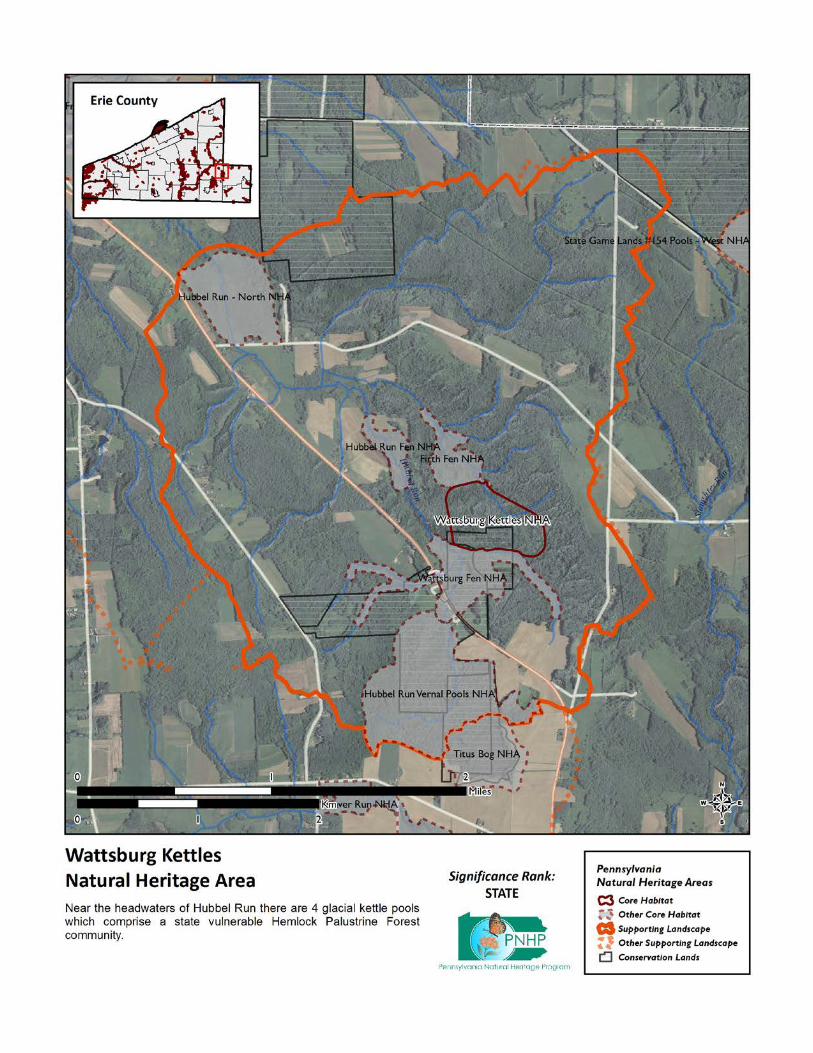
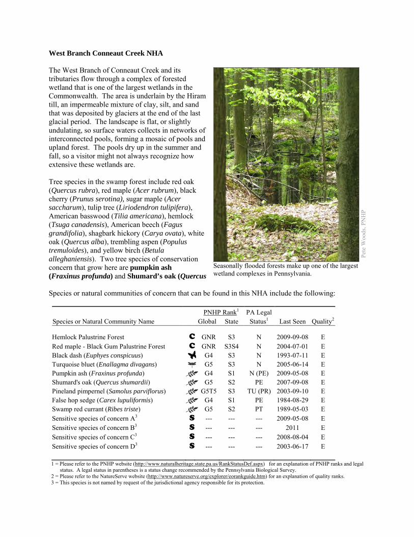
West Branch Conneaut Creek NHA The West Branch of Conneaut Creek and its tributaries flow through a complex of forested wetland that is one of the largest wetlands in the Commonwealth. The area is underlain by the Hiram till, an impermeable mixture of clay, silt, and sand that was deposited by glaciers at the end of the last glacial period. The landscape is flat, or slightly undulating, so surface waters collects in networks of interconnected pools, forming a mosaic of pools and upland forest. The pools dry up in the summer and fall, so a visitor might not always recognize how extensive these wetlands are. Tree species in the swamp forest include red oak (Quercus rubra), red maple (Acer rubrum), black cherry (Prunus serotina), sugar maple (Acer saccharum), tulip tree (Liriodendron tulipifera), American basswood (Tilia americana), hemlock (Tsuga canadensis), American beech (Fagus grandifolia), shagbark hickory (Carya ovata), white oak (Quercus alba), trembling aspen (Populus tremuloides), and yellow birch (Betula alleghaniensis). Two tree species of conservation concern that grow here are pumpkin ash (Fraxinus profunda) and Shumard’s oak (Quercus Species or natural communities of concern that can be found in this NHA include the following: PNHP Rank1 PA Legal Species or Natural Community Name Global State Status1 Last Seen Quality2 Hemlock Palustrine Forest C GNR S3 N 2009-09-08 E Red maple - Black Gum Palustrine Forest C GNR S3S4 N 2004-07-01 E Black dash (Euphyes conspicuus) G4 S3 N 1993-07-11 E Turquoise bluet (Enallagma divagans) G5 S3 N 2005-06-14 E Pumpkin ash (Fraxinus profunda) G4 S1 N (PE) 2009-05-08 E Shumard's oak (Quercus shumardii) G5 S2 PE 2007-09-08 E Pineland pimpernel (Samolus parviflorus) G5T5 S3 TU (PR) 2003-09-10 E False hop sedge (Carex lupuliformis) G4 S1 PE 1984-08-29 E Swamp red currant (Ribes triste) G5 S2 PT 1989-05-03 E Sensitive species of concern A3 S --- --- --- 2009-05-08 E Sensitive species of concern B3 S --- --- --- 2011 E Sensitive species of concern C3 S --- --- --- 2008-08-04 E Sensitive species of concern D3 S --- --- --- 2003-06-17 E 1 = Please refer to the PNHP website (http://www.naturalheritage.state.pa.us/RankStatusDef.aspx) for an explanation of PNHP ranks and legal
status. A legal status in parentheses is a status change recommended by the Pennsylvania Biological Survey. 2 = Please refer to the NatureServe website (http://www.natureserve.org/explorer/eorankguide.htm) for an explanation of quality ranks. 3 = This species is not named by request of the jurisdictional agency responsible for its protection.
Pete
Woo
ds, P
NH
P
Seasonally flooded forests make up one of the largest wetland complexes in Pennsylvania.
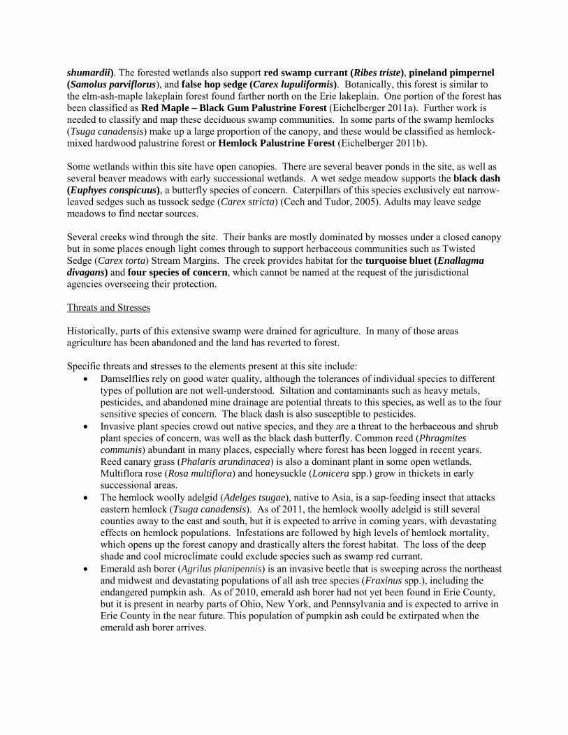
shumardii). The forested wetlands also support red swamp currant (Ribes triste), pineland pimpernel (Samolus parviflorus), and false hop sedge (Carex lupuliformis). Botanically, this forest is similar to the elm-ash-maple lakeplain forest found farther north on the Erie lakeplain. One portion of the forest has been classified as Red Maple – Black Gum Palustrine Forest (Eichelberger 2011a). Further work is needed to classify and map these deciduous swamp communities. In some parts of the swamp hemlocks (Tsuga canadensis) make up a large proportion of the canopy, and these would be classified as hemlock-mixed hardwood palustrine forest or Hemlock Palustrine Forest (Eichelberger 2011b). Some wetlands within this site have open canopies. There are several beaver ponds in the site, as well as several beaver meadows with early successional wetlands. A wet sedge meadow supports the black dash (Euphyes conspicuus), a butterfly species of concern. Caterpillars of this species exclusively eat narrow-leaved sedges such as tussock sedge (Carex stricta) (Cech and Tudor, 2005). Adults may leave sedge meadows to find nectar sources. Several creeks wind through the site. Their banks are mostly dominated by mosses under a closed canopy but in some places enough light comes through to support herbaceous communities such as Twisted Sedge (Carex torta) Stream Margins. The creek provides habitat for the turquoise bluet (Enallagma divagans) and four species of concern, which cannot be named at the request of the jurisdictional agencies overseeing their protection. Threats and Stresses Historically, parts of this extensive swamp were drained for agriculture. In many of those areas agriculture has been abandoned and the land has reverted to forest. Specific threats and stresses to the elements present at this site include:
• Damselflies rely on good water quality, although the tolerances of individual species to different types of pollution are not well-understood. Siltation and contaminants such as heavy metals, pesticides, and abandoned mine drainage are potential threats to this species, as well as to the four sensitive species of concern. The black dash is also susceptible to pesticides.
• Invasive plant species crowd out native species, and they are a threat to the herbaceous and shrub plant species of concern, was well as the black dash butterfly. Common reed (Phragmites communis) abundant in many places, especially where forest has been logged in recent years. Reed canary grass (Phalaris arundinacea) is also a dominant plant in some open wetlands. Multiflora rose (Rosa multiflora) and honeysuckle (Lonicera spp.) grow in thickets in early successional areas.
• The hemlock woolly adelgid (Adelges tsugae), native to Asia, is a sap-feeding insect that attacks eastern hemlock (Tsuga canadensis). As of 2011, the hemlock woolly adelgid is still several counties away to the east and south, but it is expected to arrive in coming years, with devastating effects on hemlock populations. Infestations are followed by high levels of hemlock mortality, which opens up the forest canopy and drastically alters the forest habitat. The loss of the deep shade and cool microclimate could exclude species such as swamp red currant.
• Emerald ash borer (Agrilus planipennis) is an invasive beetle that is sweeping across the northeast and midwest and devastating populations of all ash tree species (Fraxinus spp.), including the endangered pumpkin ash. As of 2010, emerald ash borer had not yet been found in Erie County, but it is present in nearby parts of Ohio, New York, and Pennsylvania and is expected to arrive in Erie County in the near future. This population of pumpkin ash could be extirpated when the emerald ash borer arrives.
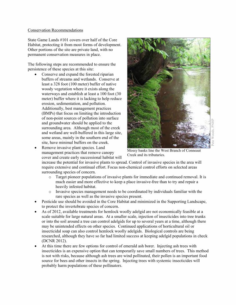
Conservation Recommendations State Game Lands #101 covers over half of the Core Habitat, protecting it from most forms of development. Other portions of the site are private land, with no permanent conservation measures in place. The following steps are recommended to ensure the persistence of these species at this site:
• Conserve and expand the forested riparian buffers of streams and wetlands. Conserve at least a 328 foot (100 meter) buffer of native woody vegetation where it exists along the waterways and establish at least a 100 foot (30 meter) buffer where it is lacking to help reduce erosion, sedimentation, and pollution. Additionally, best management practices (BMPs) that focus on limiting the introduction of non-point sources of pollution into surface and groundwater should be applied to the surrounding area. Although most of the creek and wetland are well-buffered in this large site, some areas, mainly in the southern end of the site, have minimal buffers on the creek.
• Remove invasive plant species. Land management practices that remove canopy cover and create early successional habitat will increase the potential for invasive plants to spread. Control of invasive species in the area will require extensive and continual effort. Focus non-chemical control efforts on selected areas surrounding species of concern.
o Target pioneer populations of invasive plants for immediate and continued removal. It is much easier and more effective to keep a place invasive-free than to try and repair a heavily infested habitat.
o Invasive species management needs to be coordinated by individuals familiar with the rare species as well as the invasive species present.
• Pesticide use should be avoided in the Core Habitat and minimized in the Supporting Landscape, to protect the invertebrate species of concern.
• As of 2012, available treatments for hemlock woolly adelgid are not economically feasible at a scale suitable for large natural areas. At a smaller scale, injection of insecticides into tree trunks or into the soil around a tree can control adelgids for up to several years at a time, although there may be unintended effects on other species. Continued applications of horticultural oil or insecticidal soap can also control hemlock woolly adelgids. Biological controls are being researched, although they have so far had limited success at keeping adelgid populations in check (DCNR 2012).
• At this time there are few options for control of emerald ash borer. Injecting ash trees with insecticides is an expensive option that can temporarily save small numbers of trees. This method is not with risks, because although ash trees are wind pollinated, their pollen is an important food source for bees and other insects in the spring. Injecting trees with systemic insecticides will probably harm populations of these pollinators.
Pete
Woo
ds, P
NH
P
Mossy banks line the West Branch of Conneaut Creek and its tributaries.
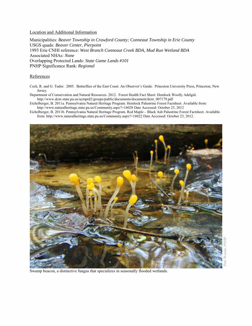
Location and Additional Information
Municipalities: Beaver Township in Crawford County; Conneaut Township in Erie County USGS quads: Beaver Center, Pierpoint 1993 Erie CNHI reference: West Branch Conneaut Creek BDA, Mud Run Wetland BDA Associated NHAs: None Overlapping Protected Lands: State Game Lands #101 PNHP Significance Rank: Regional References Cech, R. and G. Tudor. 2005. Butterflies of the East Coast: An Observer’s Guide. Princeton University Press, Princeton, New
Jersey. Department of Conservation and Natural Resources. 2012. Forest Health Fact Sheet: Hemlock Woolly Adelgid.
http://www.dcnr.state.pa.us/ucmprd2/groups/public/documents/document/dcnr_007179.pdf Eichelberger, B. 2011a. Pennsylvania Natural Heritage Program. Hemlock Palustrine Forest Factsheet. Available from:
http://www.naturalheritage.state.pa.us/Community.aspx?=16028 Date Accessed: October 23, 2012 Eichelberger, B. 2011b. Pennsylvania Natural Heritage Program. Red Maple – Black Ash Palustrine Forest Factsheet. Available
from: http://www.naturalheritage.state.pa.us/Community.aspx?=16022 Date Accessed: October 23, 2012.
Pete
Woo
ds, P
NH
P
Swamp beacon, a distinctive fungus that specializes in seasonally flooded wetlands.
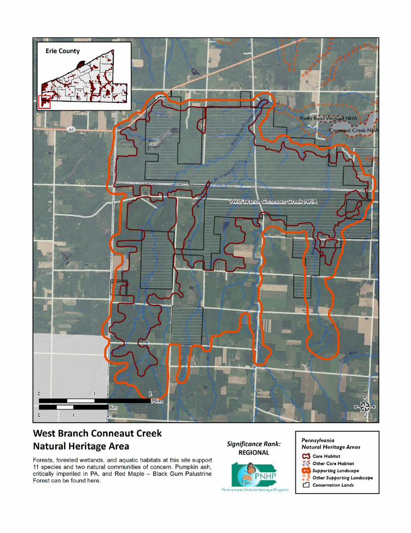
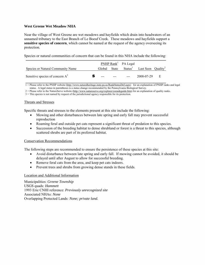
West Greene Wet Meadow NHA Near the village of West Greene are wet meadows and hayfields which drain into headwaters of an unnamed tributary to the East Branch of Le Boeuf Creek. These meadows and hayfields support a sensitive species of concern, which cannot be named at the request of the agency overseeing its protection. Species or natural communities of concern that can be found in this NHA include the following:
PNHP Rank1 PA Legal Species or Natural Community Name Global State Status1 Last Seen Quality2 Sensitive species of concern A3 S --- --- --- 2008-07-29 E 1 = Please refer to the PNHP website (http://www.naturalheritage.state.pa.us/RankStatusDef.aspx) for an explanation of PNHP ranks and legal
status. A legal status in parentheses is a status change recommended by the Pennsylvania Biological Survey. 2 = Please refer to the NatureServe website (http://www.natureserve.org/explorer/eorankguide.htm) for an explanation of quality ranks. 3 = This species is not named by request of the jurisdictional agency responsible for its protection.
Threats and Stresses Specific threats and stresses to the elements present at this site include the following:
• Mowing and other disturbances between late spring and early fall may prevent successful reproduction
• Roaming feral and outside pet cats represent a significant threat of predation to this species. • Succession of the breeding habitat to dense shrubland or forest is a threat to this species, although
scattered shrubs are part of its preferred habitat. Conservation Recommendations The following steps are recommended to ensure the persistence of these species at this site:
• Avoid disturbance between late spring and early fall. If mowing cannot be avoided, it should be delayed until after August to allow for successful breeding.
• Remove feral cats from the area, and keep pet cats indoors. • Prevent trees and shrubs from growing dense stands in these fields.
Location and Additional Information
Municipalities: Greene Township USGS quads: Hammett 1993 Erie CNHI reference: Previously unrecognized site Associated NHAs: None Overlapping Protected Lands: None; private land.
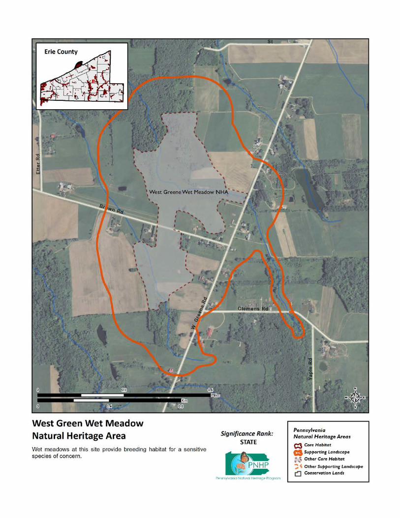
PNHP Significance Rank:
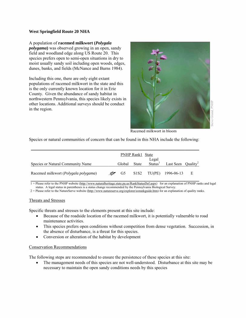
West Springfield Route 20 NHA A population of racemed milkwort (Polygala polygama) was observed growing in an open, sandy field and woodland edge along US Route 20. This species prefers open to semi-open situations in dry to moist usually sandy soil including open woods, edges, dunes, banks, and fields (McNance and Burns 1984). Including this one, there are only eight extant populations of racemed milkwort in the state and this is the only currently known location for it in Erie County. Given the abundance of sandy habitat in northwestern Pennsylvania, this species likely exists in other locations. Additional surveys should be conduct in the region. Species or natural communities of concern that can be found in this NHA include the following:
PNHP Rank1 State
Species or Natural Community Name
Global State Legal
Status1 Last Seen Quality2 Racemed milkwort (Polygala polygama) G5 S1S2 TU(PE) 1996-06-13 E 1 = Please refer to the PNHP website (http://www.naturalheritage.state.pa.us/RankStatusDef.aspx) for an explanation of PNHP ranks and legal
status. A legal status in parentheses is a status change recommended by the Pennsylvania Biological Survey. 2 = Please refer to the NatureServe website (http://www.natureserve.org/explorer/eorankguide.htm) for an explanation of quality ranks.
Threats and Stresses Specific threats and stresses to the elements present at this site include:
• Because of the roadside location of the racemed milkwort, it is potentially vulnerable to road maintenance activities.
• This species prefers open conditions without competition from dense vegetation. Succession, in the absence of disturbance, is a threat for this species.
• Conversion or alteration of the habitat by development Conservation Recommendations The following steps are recommended to ensure the persistence of these species at this site:
• The management needs of this species are not well-understood. Disturbance at this site may be necessary to maintain the open sandy conditions needs by this species
Stev
e G
rund
, PN
HP
Racemed milkwort in bloom
Location and Additional Information
Municipalities: Springfield Township USGS quads: East Springfield 1993 Erie CNHI reference: None; previously unrecognized site Associated NHAs: None Overlapping Protected Lands: None PNHP Significance Rank: State References McCance, R.M., Jr., and J.F. Burns, eds. 1984. Ohio endangered and threatened vascular plants: Abstracts of state-listed taxa.
Division Natural Areas and Preserves, Ohio Dept. Natural Resources, Columbus. 635 pp.
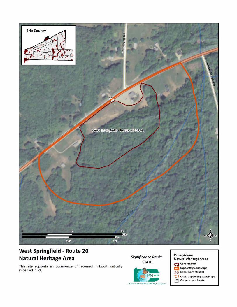
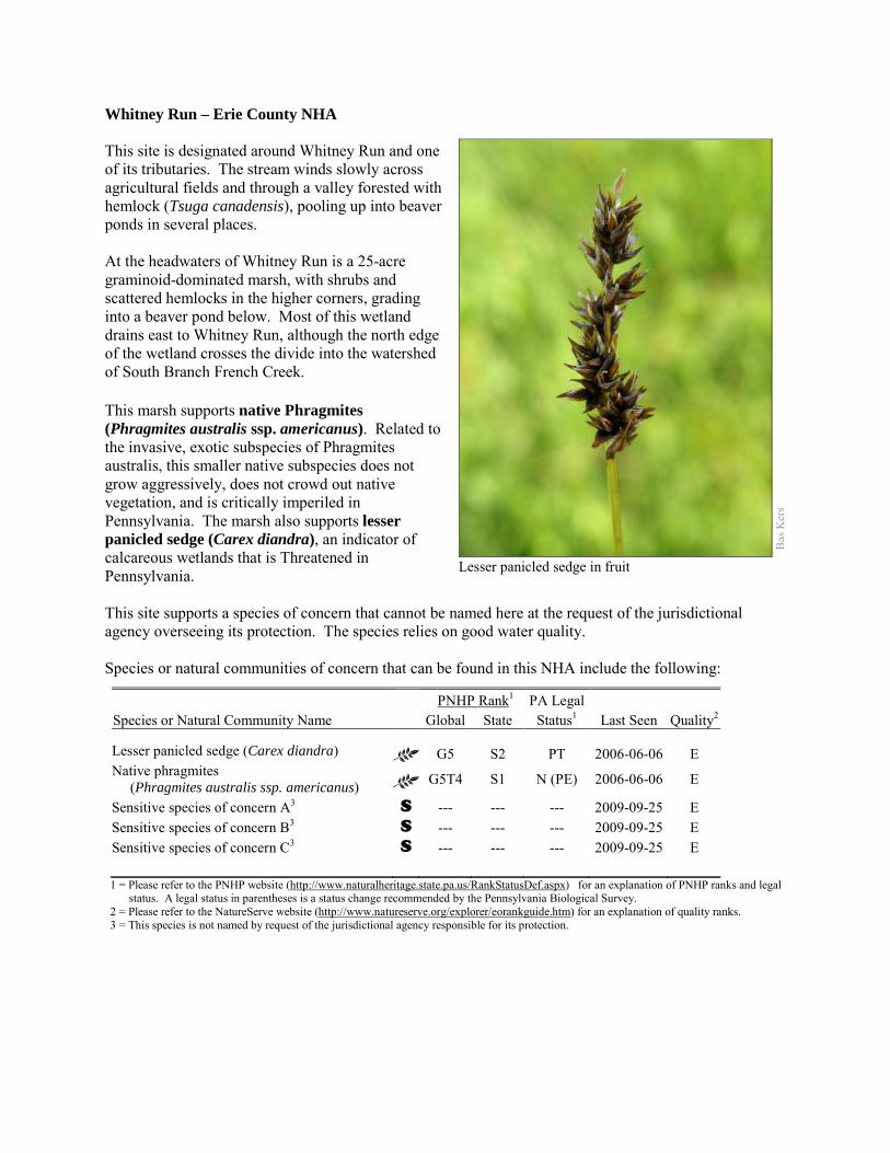
Whitney Run – Erie County NHA This site is designated around Whitney Run and one of its tributaries. The stream winds slowly across agricultural fields and through a valley forested with hemlock (Tsuga canadensis), pooling up into beaver ponds in several places. At the headwaters of Whitney Run is a 25-acre graminoid-dominated marsh, with shrubs and scattered hemlocks in the higher corners, grading into a beaver pond below. Most of this wetland drains east to Whitney Run, although the north edge of the wetland crosses the divide into the watershed of South Branch French Creek. This marsh supports native Phragmites (Phragmites australis ssp. americanus). Related to the invasive, exotic subspecies of Phragmites australis, this smaller native subspecies does not grow aggressively, does not crowd out native vegetation, and is critically imperiled in Pennsylvania. The marsh also supports lesser panicled sedge (Carex diandra), an indicator of calcareous wetlands that is Threatened in Pennsylvania. This site supports a species of concern that cannot be named here at the request of the jurisdictional agency overseeing its protection. The species relies on good water quality. Species or natural communities of concern that can be found in this NHA include the following:
PNHP Rank1 PA Legal Species or Natural Community Name Global State Status1 Last Seen Quality2 Lesser panicled sedge (Carex diandra) G5 S2 PT 2006-06-06 E Native phragmites (Phragmites australis ssp. americanus) G5T4 S1 N (PE) 2006-06-06 E
Sensitive species of concern A3 S --- --- --- 2009-09-25 E Sensitive species of concern B3 S --- --- --- 2009-09-25 E Sensitive species of concern C3 S --- --- --- 2009-09-25 E 1 = Please refer to the PNHP website (http://www.naturalheritage.state.pa.us/RankStatusDef.aspx) for an explanation of PNHP ranks and legal
status. A legal status in parentheses is a status change recommended by the Pennsylvania Biological Survey. 2 = Please refer to the NatureServe website (http://www.natureserve.org/explorer/eorankguide.htm) for an explanation of quality ranks. 3 = This species is not named by request of the jurisdictional agency responsible for its protection.
Bas
Ker
s
Lesser panicled sedge in fruit
Threats and Stresses Maintaining suitable aquatic habitat is key to the continued success of the species of concern. Specific threats and stresses to the elements present at this site include the following:
• Runoff from dirt and gravel roads in close proximity to waterways can contribute to physical degradation of their channels and erosion and sediment pollution in streams and rivers.
• Loss of forest cover within the core areas may also result in increased water temperatures and disruption of natural nutrient cycling linked to the river. If forest cover is substantially reduced within the watersheds, water quality is likely to decline from increased sediment loads. Removal of forest cover on steep slopes is especially problematic because of the potential for increased runoff and erosion following storm events.
Farm fields abut the wetland on several sides, creating the potential for erosion of sediment into the wetland, chemical contamination of the water, and introduction of invasive species. Conservation Recommendations The following steps are recommended to ensure the persistence of these species at this site:
• Conserve and expand the forested riparian buffers of Hare Creek and its tributaries. Streams through forested areas should be considered high priority for conservation. The forested riparian corridor helps to regulate the temperature of the stream and creates streamside conditions that contribute to improved water quality and aquatic habitat.
• Streams through non-forested areas should be restored with native trees and shrubs appropriate to the habitat. Establish at least a 100 foot (30 meter) buffer of woody vegetation along the creek and its tributaries to help reduce erosion, sedimentation, and pollution.
• Best management practices (BMPs) that focus on limiting the introduction of non-point sources of pollution into surface and groundwater should be applied to the surrounding area.
Location and Additional Information
Municipalities: Concord Township, Spring Creek Township USGS quads: Spartansburg, Spring Creek 1993 Erie CNHI reference: None; no species of concern were known from this site at the time of the 1993
Inventory. Associated NHAs: None Overlapping Protected Lands: None PNHP Significance Rank: State
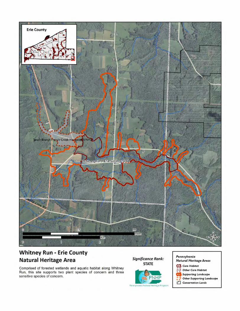
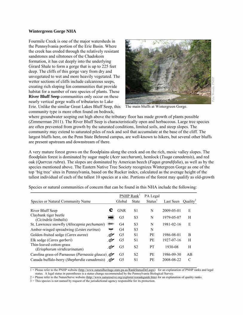
Wintergreen Gorge NHA Fourmile Creek is one of the major watersheds in the Pennsylvania portion of the Erie Basin. Where the creek has eroded through the relatively resistant sandstones and siltstones of the Chadokoin formation, it has cut deeply into the underlying Girard Shale to form a gorge that is up to 225 feet deep. The cliffs of this gorge vary from dry and unvegetated to wet and more heavily vegetated. The wetter sections of cliffs include calcareous seeps, creating rich sloping fen communities that provide habitat for a number of rare species of plants. These River Bluff Seep communities only occur on these nearly vertical gorge walls of tributaries to Lake Erie. Unlike the similar Great Lakes Bluff Seep, this community type is more often found on bedrock, where groundwater seeping out high above the tributary floor has made growth of plants possible (Zimmerman 2011). The River Bluff Seep is characteristically open and herbaceous. Large tree species are often prevented from growth by the saturated conditions, limited soils, and steep slopes. The community may extend to saturated piles of rock and soil that accumulate at the base of the cliff. The largest bluffs here, on the Penn State Behrend campus, are well-known to hikers, but several other bluffs are present upstream and downstream of there. A very mature forest grows on the floodplains along the creek and on the rich, mesic valley slopes. The floodplain forest is dominated by sugar maple (Acer saccharum), hemlock (Tsuga canadensis), and red oak (Quercus rubra). The slopes are dominated by American beech (Fagus grandifolia), as well as by the species mentioned above. The Eastern Native Tree Society recognizes Wintergreen Gorge as one of the top ‘big tree’ sites in Pennsylvania, based on the Rucker index, calculated as the average height of the tallest individual of each of the tallest 10 species at a site. Portions of the forest may qualify as old-growth Species or natural communities of concern that can be found in this NHA include the following:
PNHP Rank1 PA Legal Species or Natural Community Name Global State Status1 Last Seen Quality2 River Bluff Seep C GNR S1 N 2009-05-01 E Claybank tiger beetle (Cicindela limbalis) G5 S3 N 1979-05-07 H
St. Lawrence snowfly (Allocapnia pechumani) G4 S3 N 1981-02-16 E Amber-winged spreadwing (Lestes eurinus) G4 S3 N Golden-fruited sedge (Carex aurea) G5 S1 PE 1986-08-01 B Elk sedge (Carex garberi) G5 S1 PE 1927-07-16 H Thin-leaved cotton-grass (Eriophorum viridicarinatum) G5 S2 PT 1930-08 H
Carolina grass-of-Parnassus (Parnassia glauca) G5 S2 PE 1986-09-30 AB Canada buffalo-berry (Shepherdia canadensis) G5 S1 PE 2008-08-22 C 1 = Please refer to the PNHP website (http://www.naturalheritage.state.pa.us/RankStatusDef.aspx) for an explanation of PNHP ranks and legal
status. A legal status in parentheses is a status change recommended by the Pennsylvania Biological Survey. 2 = Please refer to the NatureServe website (http://www.natureserve.org/explorer/eorankguide.htm) for an explanation of quality ranks. 3 = This species is not named by request of the jurisdictional agency responsible for its protection.
Pete
Woo
ds, P
NH
P
The main bluffs at Wintergreen Gorge.
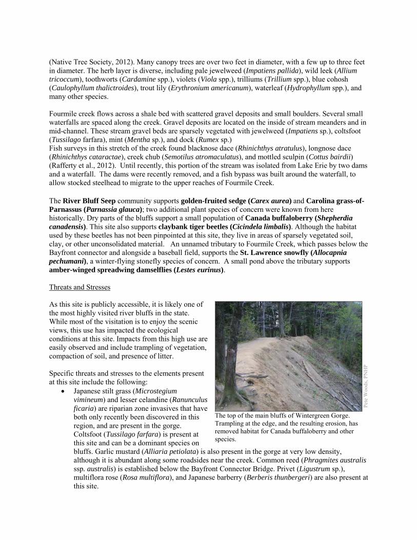
(Native Tree Society, 2012). Many canopy trees are over two feet in diameter, with a few up to three feet in diameter. The herb layer is diverse, including pale jewelweed (Impatiens pallida), wild leek (Allium tricoccum), toothworts (Cardamine spp.), violets (Viola spp.), trilliums (Trillium spp.), blue cohosh (Caulophyllum thalictroides), trout lily (Erythronium americanum), waterleaf (Hydrophyllum spp.), and many other species. Fourmile creek flows across a shale bed with scattered gravel deposits and small boulders. Several small waterfalls are spaced along the creek. Gravel deposits are located on the inside of stream meanders and in mid-channel. These stream gravel beds are sparsely vegetated with jewelweed (Impatiens sp.), coltsfoot (Tussilago farfara), mint (Mentha sp.), and dock (Rumex sp.) Fish surveys in this stretch of the creek found blacknose dace (Rhinichthys atratulus), longnose dace (Rhinichthys cataractae), creek chub (Semotilus atromaculatus), and mottled sculpin (Cottus bairdii) (Rafferty et al., 2012). Until recently, this portion of the stream was isolated from Lake Erie by two dams and a waterfall. The dams were recently removed, and a fish bypass was built around the waterfall, to allow stocked steelhead to migrate to the upper reaches of Fourmile Creek. The River Bluff Seep community supports golden-fruited sedge (Carex aurea) and Carolina grass-of-Parnassus (Parnassia glauca); two additional plant species of concern were known from here historically. Dry parts of the bluffs support a small population of Canada buffaloberry (Shepherdia canadensis). This site also supports claybank tiger beetles (Cicindela limbalis). Although the habitat used by these beetles has not been pinpointed at this site, they live in areas of sparsely vegetated soil, clay, or other unconsolidated material. An unnamed tributary to Fourmile Creek, which passes below the Bayfront connector and alongside a baseball field, supports the St. Lawrence snowfly (Allocapnia pechumani), a winter-flying stonefly species of concern. A small pond above the tributary supports amber-winged spreadwing damselflies (Lestes eurinus). Threats and Stresses As this site is publicly accessible, it is likely one of the most highly visited river bluffs in the state. While most of the visitation is to enjoy the scenic views, this use has impacted the ecological conditions at this site. Impacts from this high use are easily observed and include trampling of vegetation, compaction of soil, and presence of litter. Specific threats and stresses to the elements present at this site include the following:
• Japanese stilt grass (Microstegium vimineum) and lesser celandine (Ranunculus ficaria) are riparian zone invasives that have both only recently been discovered in this region, and are present in the gorge. Coltsfoot (Tussilago farfara) is present at this site and can be a dominant species on bluffs. Garlic mustard (Alliaria petiolata) is also present in the gorge at very low density, although it is abundant along some roadsides near the creek. Common reed (Phragmites australis ssp. australis) is established below the Bayfront Connector Bridge. Privet (Ligustrum sp.), multiflora rose (Rosa multiflora), and Japanese barberry (Berberis thunbergeri) are also present at this site.
Pete
Woo
ds, P
NH
P
The top of the main bluffs of Wintergreen Gorge. Trampling at the edge, and the resulting erosion, has removed habitat for Canada buffaloberry and other species.

• Alteration of groundwater flow could impact the rare species and the seep community. • Steep slopes are frequently attractive to hikers and climbers, and river bluff communities are
sensitive habitats. The steep terrain is unstable and often saturated; these thin soils can easily be eroded and vegetation can be trampled. The top edge of a bluff community often supports rare species, and this portion of the main bluffs at this site has been trampled and destroyed.
• Water quality degradation due to land use activities (e.g., development, agricultural fields) may be an impact to the site. More research is needed in this area.
• Development from the campus, residential areas, a cemetery, agricultural fields, and surface mines has encroached on many of the bluffs. These are potential sources of erosion, invasive species, and alteration or contamination of groundwater and surface water.
• High quality surface waters are critical for maintaining aquatic life such as the St. Lawrence snowfly.
Conservation Recommendations The majority of this site overlaps with the campus of Penn State Erie, the Behrend College. Campus master planning and maintenance should be conducted with the ecological needs of the species present here. The following steps are recommended to ensure the persistence of these species at this site:
• Care should be taken to control and prevent the spread of invasive species as well as control invasive species already on the site.
• A natural vegetation buffer should be allowed to develop along the stream valley crest within the site's boundary in order to reduce the threat of human-induced erosion and to protect surface water quality and quantity entering the NHA. Care should be taken when providing access to this site, and trail construction along the top of tributary gorges should be limited to avoid impacting this community.
• Property owners could also contribute to groundwater quality and quantity protection by reducing or avoiding the application of pesticides and/or fertilizers within site boundaries and avoiding artificial drainage of subsurface waters.
• Development and timber harvesting within the NHA should be avoided. • Further inventory for moths and other invertebrates is recommended, because these
undersurveyed groups may form a substantial part of the biodiversity of bluff seep communities. Surveys are needed to determine the habitat used by the claybank tiger beetles.
• Research is needed to better understand the patterns of succession of plant species, especially species of conservation concern, on these slump habitats.
• Late-season surveys are needed to check the status of the fall ephemeral Carolina grass-of-Parnassus.
Pete
Woo
ds, P
NH
P
Toothworts and trilliums on a moist lower slope of the Wintergreen Gorge.
Location and Additional Information
Municipalities: Millcreek Township, Greene Township, Harborcreek USGS quads: Hammett, Harborcreek 1993 Erie CNHI reference: Wintergreen Gorge BDA was designated to protect substantially the same
resources, although a few invertebrates outside the main gorge have been added recently. Associated NHAs: none Overlapping Protected Lands: This will be calculated via a spatial join and added later PNHP Significance Rank: State References Eastern Native Tree Society website (http://www.nativetreesociety.org/). Date Accessed 3/15/2012. Rafferty, S.D., Lybrook, J., Kacmarek, K.M., Lethaby, M., and Wellington, R. 2012. An assessment of the Pennsylvania Lake Erie watershed
fish community. The Pennsylvania State University. Unpublished manuscript. Zimmerman, E. 2011. Pennsylvania Natural Heritage Program. River Bluff Seep Factsheet. Available from:
http://www.naturalheritage.state.pa.us/Community.aspx?=30030 Date Accessed: April 30, 2012