ENVIRONMENTAL IMPACT REPORT Trail Change in Use ...
525
FINAL ENVIRONMENTAL IMPACT REPORT Trail Change in Use and Improvement Project Samuel P. Taylor State Park September 2012 Lead Agency State of California DEPARTMENT OF PARKS AND RECREATION Acquisition and Development One Capitol Mall - Suite 410 Sacramento, California 95814
-
Upload
khangminh22 -
Category
Documents
-
view
0 -
download
0
Transcript of ENVIRONMENTAL IMPACT REPORT Trail Change in Use ...
FINAL
ENVIRONMENTAL IMPACT REPORT
Trail Change in Use and Improvement Project Samuel P. Taylor State Park
September 2012
Lead Agency
State of California DEPARTMENT OF PARKS AND RECREATION
Acquisition and Development One Capitol Mall - Suite 410
Sacramento, California 95814


FINAL ENVIRONMENTAL IMPACT REPORT
Trail Change in Use and Improvement Project Samuel P. Taylor State Park
State Clearinghouse No. 2011032070
September 2012
Lead Agency
State of California DEPARTMENT OF PARKS AND RECREATION
Acquisition and Development One Capitol Mall-Suite 410
Sacramento, California 95814


BILLS’ TRAIL CHANGE‐IN‐USE AND IMPROVEMENT PROJECT SAMUEL P. TAYLOR STATE PARK
CALIFORNIA STATE PARKS I
TABLE of CONTENTS Chapter/Section Page
1.0 INTRODUCTION .................................................................................................... 1 1.1. Content of the FEIR ....................................................................................... 1 1.2. CEQA Requirements Regarding Comments and Responses ....................... 4 1.3. Relationship to the DEIR and RDEIR ............................................................ 4 1.4. Findings ......................................................................................................... 5
2.0 PROJECT DESCRIPTION ....................................................................................... 7 2.1. Introduction .................................................................................................... 7 2.2. Local and Regional Setting ............................................................................ 7 2.3. Background and Need for the Project ........................................................... 7 2.4. Project Objectives ....................................................................................... 15 2.5. Project Requirements .................................................................................. 16 2.6. Change in Use Process ............................................................................... 16 2.7. Policy Considerations .................................................................................. 17 2.8. Project Details ............................................................................................. 18 2.9. User Groups ................................................................................................ 18 2.10. Sustainable Trails ........................................................................................ 25 2.11. Detailed Project Description ........................................................................ 27 2.12. Project Requirements .................................................................................. 37 2.13. Analytical Methodology................................................................................ 49 2.14. Project Implementation ................................................................................ 49 2.15. Trail Maintenance ........................................................................................ 50 2.16. Trail Safety and User Conflict/Rule Enforcement ........................................ 51 2.17. Accessibility ................................................................................................. 51 2.18. Park Closure ................................................................................................ 52 2.19. Regulatory Requirements, Permits, and Approvals ..................................... 52
3.0 ALTERNATIVES TO THE PROPOSED PROJECT ....................................................... 53 3.1. Project Objectives ....................................................................................... 53 3.2. Alternatives .................................................................................................. 53
4.0 ENVIRONMENTAL ANALYSIS ................................................................................ 57 4.1. Aesthetics / Visual Resources ..................................................................... 57 4.2. Air Quality .................................................................................................... 65 4.3. Biological Resources ................................................................................... 75 4.4. Greenhouse Gas Emissions and Climate Change ...................................... 98 4.5. Cultural Resources .................................................................................... 105 4.6. Geology and Soils ..................................................................................... 115 4.7. Hazards and Hazardous Materials ............................................................ 124 4.8. Hydrology and Water Quality ..................................................................... 129 4.9. Land Use and Planning (Includes Agriculture, Minerals, and Recreation) . 142 4.10. Noise ......................................................................................................... 156 4.11. Public Services .......................................................................................... 165 4.12. Utilities ....................................................................................................... 170 4.13. Transportation, Circulation, and Traffic ..................................................... 174
5.0 GROWTH-INDUCING AND CUMULATIVE IMPACTS ................................................. 183

BILLS’ TRAIL CHANGE‐IN‐USE AND IMPROVEMENT PROJECT SAMUEL P. TAYLOR STATE PARK
CALIFORNIA STATE PARKS II
5.1. Growth-Inducing Impacts (Population, Housing, and Employment) .......... 183 6.0 SIGNIFICANCE OF ENVIRONMENTAL IMPACTS ..................................................... 185
6.1. Cumulative Impacts ................................................................................... 185 6.2. Environmental Effects Found to be No Impact .......................................... 185 6.3. Environmental Effects Found to be Less Than Significant Impact ............. 185 6.4. Environmental Effects Found to be Significant .......................................... 186 6.5. Cumulative Impacts ................................................................................... 186 6.6. Overriding Consideration ........................................................................... 186
7.0 COMMENTS AND RESPONSES TO THE DEIR AND REDEIR .................................. 187 7.1. Master Responses .................................................................................... 189
7.2. COMMENTS LETTERS AND DPR RESPONSES ..................................................... 211 8.0 REPORT PREPARATION .................................................................................... 463 9.0 REFERENCES .................................................................................................. 465

BILLS’ TRAIL CHANGE‐IN‐USE AND IMPROVEMENT PROJECT SAMUEL P. TAYLOR STATE PARK
CALIFORNIA STATE PARKS III
List of Figures
Figure 1: Area Map.......................................................................................................... 7 Figure 2: Map from Samuel P. Taylor Park Brochure ...................................................... 9 Figure 3: Trail Change in Use Project. Map shows Bills' Trail (red), Gravesite Fire Road (blue) and Barnabe Fire Road (purple). Barnabe Fire Road is not a part of the project. ...................................................................................................................................... 13 Figure 4: Typical Pinch Point Boulder Construction ...................................................... 29 Figure 5: Proposed Trail Improvements ........................................................................ 31 Figure 6: Pinch Point Construction Section View and Plan View .................................. 33 Figure 7: Typical Pinch Point Diagram adapted from IMBA .......................................... 35 Figure 8 Yield Triangle .................................................................................................. 51 Figure 9: Erosion on Gravesite Fire Road south of Deadmans Gulch ........................... 62

BILLS’ TRAIL CHANGE‐IN‐USE AND IMPROVEMENT PROJECT SAMUEL P. TAYLOR STATE PARK
CALIFORNIA STATE PARKS IV
List of Tables
Table 1: Mountain Biking Styles .................................................................................... 21 Table 2: Standard and Specific Project Requirements .................................................. 39 Table 3: Marin County Attainment Designations ........................................................... 67 Table 4: Operational Criteria ....................................................................................... 104 Table 5: Central California Taxonomic System ........................................................... 106 Table 6: Cultural Period Characteristics (Reproduced from fig II.7 (Stewart 2003:105)) .................................................................................................................................... 107 Table 7: Active Faults in the Vicinity of SPTSP ........................................................... 117 Table 8: Soil Formation ............................................................................................... 118 Table 9: Potential Construction-Related Impacts ........................................................ 135 Table 10 Potential Operational Impacts to Water Quality ............................................ 137 Table 11 Samuel P. Taylor State Park Existing Facilities ............................................ 144 Table 12 SPTSP Attendance Figures.......................................................................... 145 Table 13 California State Parks in Marin County ......................................................... 146 Table 14 NPS Parks in Marin County .......................................................................... 147 Table 15 Marin County Parks ...................................................................................... 148 Table 16 Marin County Open Space Preserves .......................................................... 150 Table 17 Private Recreational Facilities in Marin County ............................................ 153 Table 18: Sound Levels and Noise Characteristics Generated by Various Sources ... 159 Table 19 Level of Service Description (LOS) .............................................................. 175 Table 20: List of Commenters on the DEIR and RDEIR .............................................. 187

BILLS’ TRAIL CHANGE‐IN‐USE AND IMPROVEMENT PROJECT SAMUEL P. TAYLOR STATE PARK
CALIFORNIA STATE PARKS V
Appendices
A Clearwater Hydrology Report, June 23, 2009 B DPR Policy Notice 2005-06 “Trails Policy” C Trail Change-In-Use Survey and Trail Log D Trail Use Conflict Study E Notice of Preparation (NOP) F Special Status Wildlife and Plant Species G Patrick Vaughn-Trail Observations H Karl Knapp Primary Qualifications I Stakeholders Mailing Distribution List J Mitigation Monitoring and Reporting Plan

BILLS’ TRAIL CHANGE‐IN‐USE AND IMPROVEMENT PROJECT SAMUEL P. TAYLOR STATE PARK
CALIFORNIA STATE PARKS VI

BILLS’ TRAIL CHANGE‐IN‐USE AND IMPROVEMENT PROJECT SAMUEL P. TAYLOR STATE PARK
CALIFORNIA STATE PARKS VII
Acronyms and Abbreviations AADT Annual Average Daily Traffic AAQS Ambient Air Quality Standards AB Assembly Bill ADA Americans with Disabilities Act AMSL Average Mean Sea Level APE Area of Potential Effect APEFZ Alquist-Priolo Earthquake Fault Zoning AQMP Air Quality Management Plan ARB/CARB California Air Resources Board BAAQMD Bay Area Air Quality Management District BMPs Best Management Practices BSVFB Big Sur Volunteer Fire Brigade CA California CAA Clean Air Act CAAQS California Ambient Air Quality Standards Cal Fire California Department of Forestry and Fire Caltrans California Department of Transportation CCAA California Clean Air Act CCC California Conservation Corps CCR California Code of Regulations CDFG California Department of Fish and Game CESA California Endangered Species Act CEQA California Environmental Quality Act CGS California Geological Survey CHP California Highway Patrol CNDDB California Natural Diversity Database (Calif. Dept. of Fish and Game) CNEL Community Noise Equivalent Level CNG Compressed Natural Gas CNPS California Native Plant Society CO Carbon Monoxide CRHR California Register of Historic Resources CRF California Red-Legged Frog CRWQCB California Regional Water Quality Control Board CSQA California Storm Water Quality Association CWA Clean Water Act dB decibel dbh diameter at breast height DEC Department of Emergency Services DEIR Draft Environmental Impact Report DFG California Department of Fish and Game DOT Department of Transportation DPR California Department of Parks and Recreation
BILLS’ TRAIL CHANGE‐IN‐USE AND IMPROVEMENT PROJECT SAMUEL P. TAYLOR STATE PARK
CALIFORNIA STATE PARKS VIII
DTSC California Department of Toxic Substance Control DWR Department of Water Resources EIR Environmental Impact Report EOC Emergency Operations Center EPA Environmental Protection Agency ESA Endangered Species Act FEMA Federal Emergency Management Agency FPD Fire Protection District ft feet g gallon GIS Global Information System GP General Plan H2S Hydrogen Sulfide HCP Habitat Conservation Plan IS/MND Initial Study / Mitigated Negative Declaration LCP Local Coastal Plan Ldn Day/night Average Sound Level Leq Equivalent Sound Level LF Linear Feet LNG Liquefied Natural Gas LOS Level of Service LUP Land Use Plan MBTA Migratory Bird Treaty Act MLD Most Likely Descendent MND Mitigated Negative Declaration mph miles per hour MRZ Mineral Resource Zone MSL Mean Sea Level NAAQS National Ambient Air Quality Standards NAHC Native American Heritage Council NCCP Natural Community Conservation Plan NO2 Nitrogen Dioxide NOC Notice of Completion NOI Notice of Intent NOP Notice of Preparation NOx Nitrogen Oxide NPDES National Pollution Discharge Elimination System NWP Nationwide Permit O3 Ozone OES Office of Emergency Services OHP Office of Historic Preservation OPR/SCH Office of Planning and Research / State Clearinghouse OHWM Ordinary High Water Mark Pb lead

BILLS’ TRAIL CHANGE‐IN‐USE AND IMPROVEMENT PROJECT SAMUEL P. TAYLOR STATE PARK
CALIFORNIA STATE PARKS IX
PM particulate matter PM10 particulate matter (particles with an aerodynamic diameter of 10 Microns or less) PM 2.5 particulate matter (particles with an aerodynamic diameter of 2.5 Microns or less) POST Peace Officer Standard Training PRC Public Resources Code PVC polyvinyl chloride RWQCB Regional Water Quality Control Board RV Recreational Vehicle SAFZ San Andreas Fault Zone SB Senate Bill SEA Significant Ecological Area SEMS Statewide Mutual Services SFWQCB Central Coast Regional Water Quality Control Board SO2 Sulfur Dioxide SO4 Sulfates SOD Sudden Oak Death SP State Park SPRP Spill Prevention Response Plan SPTSP Samuel P. Taylor State Park sq square SR State Route SRA State Recreation Area SWPPP Storm Water Pollution Prevention Plan SWRCB State Water Resources Control Board U.S. United States USACOE United States Army Corps of Engineers USEPA United States Environmental Protection Agency USFS United States Forestry Service USFWS United States Fish and Wildlife Service USGS United States Geological Service VC Vinyl Chloride VOC Volatile Organic Compounds VRP Visibility Reducing Particle

BILLS’ TRAIL CHANGE‐IN‐USE AND IMPROVEMENT PROJECT SAMUEL P. TAYLOR STATE PARK
CALIFORNIA STATE PARKS X

BILLS’ TRAIL CHANGE‐IN‐USE AND IMPROVEMENT PROJECT SAMUEL P. TAYLOR STATE PARK
CALIFORNIA STATE PARKS XI
Trails Glossary
Whenever the following terms are used, the intent and meaning will be interpreted as follows:
Armored Crossing - A dip the trail grade aligned with a natural drainage that the trail has intersected and lined with large flat topped rock to create a sustainable surface during periods when the drainage caries water. Back Slope – The bank along the uphill side of the trail usually sloped back a varying degree, depending on bank composition and slope stability. Berm – The ridge of material formed on the outer edge of the trail that projects higher than the center of the trail tread. Borrow – Soil, gravel, or rock materials taken from approved locations away from the trail. Bridge – A structure, including supports, erected over a depression or stream and having a deck for carrying traffic. Brushing – Removal of living and dead vegetation from a trail. Classification – The designation indicating intended use and maintenance specifications for a particular use. Clearing – Removal of windfall trees, uproots, leaning trees, loose limbs, wood chunks, etc. for a trail. Clearing Limits – The outer edges or a clearing area as specified by trail class, shown on drawings or explained in class definition. Climbing Turn – A turn that is constructed on a slope of 30% or less when measured between the exterior boundaries of the turn and changes the direction of the trail 120-180 degrees. Compacted - The degree of consolidation that is obtained by tamping with hand tools or by stomping mineral soil and small aggregate in successive layers not more than 6 inches in depth. Cribbing structures - Timbers or logs structures constructed over minor drainage crossings. Culvert – A drainage structure composed of rock, metal or wood that is placed approximately perpendicular to and under the trail. Drainage Dip – A reverse in the grade of the trail bed accompanied by outslope that will divert water off the rail bed. Duff – A layer of decaying organic plant materials deposited on the surface of the ground principally comprised of leaves, needles, woody debris and humus. Entrenched Trail – Cupping, rutting or trenching in the trail tread surface resulting from trampling, standing water, uncontrolled surface runoff or a combination of these factors. Fill-Slope – Area of excavated material cast on the down slope side of trail cut (also called embankment). Ford – A water level stream crossing constructed to provide a level surface for safe traffic passage. Full bench – Where the total width of the trail bed is excavated into slope and the trail bed width is not made of compacted fill-slope. Hazardous Tree – An unstable tree, 5 inches or greater in diameter at breast height, that is likely to fall across the trail. Incised Drainages – Drainages that are deeply and sharply cut into the landscape.

BILLS’ TRAIL CHANGE‐IN‐USE AND IMPROVEMENT PROJECT SAMUEL P. TAYLOR STATE PARK
CALIFORNIA STATE PARKS XII
Inslope – Where the trail bed is sloped downward toward the backslope of the trail. Mineral Soil – Soil or aggregate that is free from organic substance and contains no particles larger than 2 inches in greatest dimension. Mud Sill – Foundation on which a bridge is built. Outslope – The trail bed is sloped downward toward the embankment or daylight side of the trail. Parallel Ditching – A lateral drainage ditch constructed adjacent to the trail tread to catch surface water sheeting from the tread surface and divert it away from the trail. Generally, this drainage system is used in low, flat areas or areas where multiple entrenched trails have developed. Physiography - A description of the features and phenomena of nature Pinch Point - A trail speed-control measure constructed of logs or boulders protruding onto the trail from each side creating the need to travel an “S” path to negotiate through. Pre-Field – Performing a physical examination of the project work site in order to evaluate solutions to trail deficiencies, select the appropriate course of action, formulate the design and quantify the material, equipment and person hour requirements. Puncheon – A log or timber structure built to cross a swamp. Usually consists of sills, stringers and a log deck. Retaining or Crib Wall – A log or rock construction to support trail tread or retain backslope. Sideslope – The natural slope of the ground measured at right angles to the center line of the trail. Single Track – A trail so narrow that users must general travel in single file. Slide – Material that has slid onto the trailway from the back slope and possibly beyond in quantities sufficient to block the trail. Slough (sluff) – The materials from the back slope or the area of the back slope that has been deposited on the trail bed and projects higher that the center of the trail. Slump – When the trail bed material has moved downward causing a dip in the trail grade. Specifications – Standards to which trails and trail structures are built and maintained according to class. Stringer – Log or timber that rests on mud sills and spans a water course, muddy areas, etc. supports the tread surface. Sustainable Trail – A trail that was designed, constructed or reconstructed to a standard such that it does not adversely impact natural and cultural resources, can withstand the impacts of the intended user and the natural elements while receiving only routine cyclic maintenance, and meets the needs of the intended user to the degree that they do not deviate from the established trail alignment. Switchback – A turn that is constructed on a slope of more than 30 percent when measured between the exterior boundaries of the trail 120 -180 degrees. The landing is the turning portion of the switchback. The approaches are the 20 foot trail sections upgrade and downgrade from the landing. Technical Trail Feature (TTF) – An obstacle on the trail requiring negotiation; the feature can be either built or natural, such as an elevated bridge or rock face. Temporally – Lasting only a short time. Tie Log – A structural member notched into the horizontal facer and wing walls used to secure the facer and wings by using the mass of the backfill.

BILLS’ TRAIL CHANGE‐IN‐USE AND IMPROVEMENT PROJECT SAMUEL P. TAYLOR STATE PARK
CALIFORNIA STATE PARKS XIII
Trail Bed – The portion of trailway between the hinge point of the back slope and the hinge point of the fill-slope. Trail Hardening – The manual, mechanical or chemical compaction/firming of the trail tread surface resulting in a hard and flat surface that sheets water effectively and resists the indentations that are created by trampling. Trail Log – An inventory of physical features along or adjacent to a trail. An item by item footage record of trail features and facilities or improvements on a specific trail. Travel Way or Corridor – Includes tread surface and clearing limits. Turnpike – tread made stable by raising trail bed above wet, boggy areas by placing mineral soil between parallel side logs. Usually includes ditches alongside the road. Water Bar – A device used for turning water off the trail, usually made of logs or stones. Water Course – Any natural or constructed channel where water will collect and flow.


Executive Summary

EXECUTIVE SUMMARY
This Environmental Impact Report (EIR) addresses the potential environmental impacts associated with the implementation of the proposed Trail Change in Use and Improvement Project, in Samuel P. Taylor State Park (SPTSP) hereafter to be referred to as the “proposed project.” Project Synopsis
Project Proponent: California Department of Parks and Recreation One Capital Mall, Suite 410 Sacramento, CA 95814
Contact: Brad Michalk
Environmental Coordinator (916) 445-8783 bmichalk@ parks.ca.gov
Purpose of the EIR
This Environmental Impact Report (EIR) has been prepared by the California State Parks (DPR) as lead agency pursuant to the California Environmental Quality Act (CEQA) Public Resources Code 21000 et. seq., and the State CEQA Guidelines (California Code of Regulations, Section 15000 et. seq.). This EIR has been prepared to evaluate the environmental effects of the proposed Trail Change in Use and Improvement Project for Bill’s Trail and Gravesite Fire Road in SPTSP.
EIRs are informational documents “which will inform public agency decision-makers and the public generally of the significant environmental effect of a project, identify possible ways to minimize the significant effects, and describe reasonable alternatives to the project” (Section 15121 of the CEQA Guidelines). The purpose of this EIR is to evaluate the environmental effects of the proposed Trail Change in Use and Improvement Project by DPR
This EIR is intended for use by both decision makers and the public. It provides relevant information concerning the potential environmental effects associated with the construction and operation of a proposed residential development.
Project Location SPTSP is located 6.5 miles west of the town of Fairfax and 2.5 air miles east of Olema. The rural community of Lagunitas sits on the east boundary of the park, while the town of Nicasio is just over the ridge to the northeast 1.7 miles away. Both Sir Francis Drake Boulevard and Lagunitas Creek bisect the park travelling southeast to northwest.
Site Description and Background Bills’ Trail is named for William "Bill" Lintow, a former park maintenance supervisor and Bill Taylor Northern Regional Maintenance Specialist (Price, 2011). The trail was

constructed in 1988-1989 to connect Barnabe Fire Road to Devil's Gulch. Originally constructed with a 48” bench, the trail has narrowed in places over the years, particularly on the upper portion near Barnabe Peak, through normal sloughing on the inside hinge and narrowing of the tread with vegetation overgrowth. Although the trail has received minimal maintenance, it has aged relatively well over the years with very little sediment washing from the trail into Devil’s Gulch, a perennial tributary to Lagunitas Creek, considered prime habitat for aquatic species.
One individual involved in the original trail construction recalled that it was constructed as a full multiuse trail open to hikers, mountain bikers and equestrians. According to this account, sometime after its opening, DPR received complaints from equestrians about conflicts with mountain bikers. To resolve the conflict DPR attempted to restrict bikes to up-hill direction only; however, conflicts and complaints continued. Mountain bikes were finally excluded under a Superintendent’s order; the trail has been used exclusively by hikers and equestrians since that time. (Hanson, 2011)
There is no evidence however, of a Superintendent’s Order either prohibiting mountain bikes or allowing equestrian use on the trail. Additionally, the map on the park brochure indicates that Bills’ Trail is a hiking only trail. A complete and documented history of Bills’ Trail may be forever elusive due to the passage of time and personnel. Although DPR has attempted to convey an accurate history, whether the trail has historically been single use, dual use or multiuse does not impact the proposed project. The baseline conditions on which the project was evaluated include hiking and equestrian use.
Project Description
Class I trails include accessible, equestrian, bike, interpretive, and hiking uses. Generally, these trails contain spur trails, gravel, turnpikes and puncheons or other drainage structures for resource protection and visitor safety.
Bill’s Trail is currently used by equestrians and hikers only. Recently mountain biking interest groups have petitioned to open Bill’s Trail to biking as well. DPR proposes to change the ‘use’ of Bill’s Trail to allow mountain biking in addition to hiking and horseback riding making the trail consistent with the Department’s policy to construct multiple use trails. In order to convert the trail to Class I that would allow mountain biking, DPR must “catch up” with the deferred maintenance that has narrowed the trail, reduced drainage function, allowed exotic species to flourish and reduced user safety.
Bill's Trail has a constructed width of 48", the standard for multi-use trails in State Parks and continues nearly four (4) miles between the trail head in Devil’s Gulch and the junction with the Barnabe Fire Road at 1,160-foot elevation. DPR staff completed a Trail Use Change Survey and prepared a trail log identifying needed repairs, soil types, and features. The following summarizes the proposed work:

Project Component
Work
Trail Work Brush the trail from top of cut bank to top of fill slope to maintain constructed trail width and original brushed line of sight;
Improve trail out-sloping and remove any developing outer edge (berm) trail tread to original design width averaging 48” (from top hinge of fillslope to bottom hinge of cut bank or back slope) to maintain drainage. Trail bench work will be limited to maximum of 6" in depth; ground disturbance will stay within the existing profile (top of cut bank to bottom of fill slope);
Remove debris collecting on the inside hinge to maintain trail width and remove loose debris;
Bridge Repair/Drainage
Replace wood-armored ephemeral stream crossings with rock armored crossings, as needed;
Install armored rock crossings at all ephemeral drainages and micro drainages to harden the trail tread. Specific work to include:
Manually excavate up to 18” of trail tread (in the ephemeral drainage) and backfill with large, flat-topped rock to provide a stable crossing;
Place rock in the ephemeral stream channel gradient; Repair bridges as needed; no work would occur lower than existing bridge
components within the bed and/or stream channel. Specific work to include: Excavate bridge approaches (and abutments as necessary) outward to first
substantive vegetation and backfill with gravel; Install gravel surfacing to provide a stable tread surface at bridge approaches; Resource Management; Remove non-native eucalyptus trees identified by a DPR-approved
Environmental Scientist to improve the stand management and encourage naturally occurring tree species.
Where eucalyptus would be removed at least 75 square feet of basal area per acre (any tree species) would be retained on the slope;
Logs hoisted to the trail would be suspended to minimize ground impacts; User Safety
Construct pinch points with two, 18" diameter or larger logs (from existing downed trees on site or imported as needed) protruding onto the trail from each side creating the need to travel an 'S’ path to negotiate the path through the logs. Pinch points will be placed in approximately 100 locations along Bill’s Trail to reduce bicycle speed and increase the 'line of sight" at curves, improving user safety. Where appropriate, rocks could be used in place of eucalyptus logs;
Install signage to inform user groups how to have a safe and fun trail experience without conflict;
Repair, replace or install split rail fencing along trail as needed for safety, resource protection, and shortcut prevention;
Gravesite Fire Road
Improve and rehabilitate limited sections of road as needed per California State Park guidelines;
Ditchouts and rolling dips will be armored with aggregate at and near the outlet to reduce erosion. Aggregate would transitionally increase in size toward the outlet end.
No work will be performed on Barnabe Fire Road and is not a part of this project.
Project Objectives DPR’s mission is to provide for the health, inspiration, and education of the people of California by helping to preserve the State’s extraordinary biological diversity, protecting its most valued natural and cultural resources, and creating opportunities for high-

quality recreation. In addition to fulfilling the Department’s mission statement, the project objectives include:
Meet departmental policy to provide a multiuse trail;
Provide additional sustainable opportunities for mountain biking within the DPR system;
Provide an opportunity for high quality recreation while protecting resources; and
Convert existing well-designed trails to multi-uses thereby reducing pressure from user groups to create use-specific new trails in pristine areas.
Project Alternatives
As required by Section 15126.6 of the State CEQA Guidelines, this EIR examines a range of reasonable alternatives to the proposed project. The following alternatives were evaluated:
Alternative Description 1 No Project The no project alternative assumes that the proposed Trail Change in Use
Project (Project) would not be implemented. The existing conditions on Gravesite Fire Road would remain and sedimentation would continue into Deadmans Gulch resulting in impacts to Coho habitat in Lagunitas Creek.
2 Bill’s Trail Maintenance Only
This alternative entails maintenance on Bill’s Trail and Gravesite Fire Road would remain in its existing condition. Mountain biking would continue to be prohibited on Bill’s Trail.
3 Bill’s Trail and Gravesite Fire Road Maintenance
This alternative entails maintaining Bill’s Trail back to its original profile for hiking and equestrian use. Gravesite Fire Road would be realigned where necessary and rehabilitated per California State Park guidelines.
4 Exclude Equestrian use
This alternative entails improving Bill’s Trail to a Class II trail standard for hikers only. Gravesite Fire road would be improved as proposed under the Preferred Alternative allowing continued use by equestrians and mountain bikers.
5 Close and Rehabilitate Bill’s Trail
Under this alternative, the trail would be closed to all uses and rehabilitated. Gravesite Fire Road between Barnabe Fire Road and Deadmans Gulch would be improved to eliminate sedimentation while continuing to provide maintenance access to the gravesite and water well. Like Bill’s Trail, Gravesite Road between Devil’s Gulch and Deadmans Gulch would be closed and rehabilitated to its natural condition.
CEQA Requirements
This EIR has been prepared in accordance with CEQA (Public Resources Code Sections 21000 et. seq.); the CEQA Guidelines published by the Resources Agency of the State of California (California Code of Regulations Sections 15000 et. seq., as amended). This EIR has also been prepared pursuant to the DPR Operational Guidelines on Environmental Review (2003) Notice of Preparation
In compliance with Section 15082 of the CEQA Guidelines, DPR circulated a Notice of Preparation (NOP) dated March 30, 2011, to interested agencies, groups, and individuals, including the State Clearinghouse at the California Office of Planning and Research. The SCH monitors compliance of state agencies in providing timely

responses and assigned state identification number (SCH # 2011032070) to this EIR. The NOP is included in Appendix A. The NOP was intended to encourage interagency communication concerning the proposed action and provide sufficient background information about the proposed action so that agencies, organizations, and individuals could respond with specific comments and questions on the scope and content of the EIR. Areas of Known Controversy
Controversial aspects of the project include hydrological impacts (erosion and sediment-related) resulting from introducing mountain bikes onto Bill’s Trail. These concerns have been analyzed in the EIR and will be addressed through standard and specific project requirements including implementation of appropriate Best Management Practices. Also considered controversial are the issues of safety and conflicts between the various user groups, particularly as it relates to the difference in speed on the trail between bikes and horses/hikers. The issue of safety was addressed in the Section 4.13, Transportation, Circulation and Traffic as well as in the project description. The issue of conflict as it relates to user displacement is addressed in the Sections 4.1 and 4.9, Aesthetics and Land Use and Planning. Bicycle speed was considered in its potential role in creating environmental impacts and specific project requirements incorporated to reduce speeds and consequently environmental impacts. Environmental Analysis The following table provides a summary of impacts related to the proposed project. The table focuses on significant environmental impacts resulting from the project pursuant to the CEQA Guidelines Section 15123(b)(1).

Summary of Impacts
Significant and Unavoidable Less Than Significant Project
Requirements/ Mitigation No Impact or Less Than Significant
Impact Aesthetics – Degrade
visual character or quality of the site
Air Quality – Contribute to an existing air quality violation, create fugitive dust
Biological Resources – Adverse effect on candidate animal species, riparian or sensitive natural community,
Climate Change/Greenhouse Gases – Generate GHG emission, Conflict with an applicable plan, policy or regulation to control GHG emissions
Cultural Resources – impact archeological resources or human remains
Geology and Soils – Soil Erosion / Seismic events
Hazards and Hazardous Materials – hazard to the public involving hazardous materials
Hydrology and Water Quality – Create erosion / Violate water quality standards
Land Use & Planning – Increase use of regional parks, require expansion of recreation facilities
Traffic & Circulation –Incompatible use increasing hazards
Aesthetics – Adverse effect on scenic vista, scenic resources including scenic highways
Air Quality – Conflict with air quality plan/regulation, expose sensitive receptors to pollutants, Create objectionable odors
Biological Resources – Adverse effect on candidate plant species, Conflict with local policies protecting biological resources, Conflict with a Habitat Conservation Plan
Cultural Resources – impact historic resources
Geology and Soils – Unstable / Expansive soils, septic systems on unsupportable soils, paleontological features
Hazards and Hazardous Materials – emit hazardous emissions close to school; locate within 2 miles of airport; located on hazardous materials site; interfere with emergency response plan
Hydrology and Water Quality – Place structures in flood hazard area; exposure from flooding; seiche, tsunami or mudflow
Land Use & Planning Noise - Excessive long
term noise, vibration, airport noise
Public Services Traffic & Circulation Growth Inducing/
Cumulative Impacts
Parks has incorporated Standard Project Requirements, Specific Project Requirements and Mitigation Measures that have ensured that no significant impacts result or mitigate impacts to a less than significant level. Therefore, the proposed project will result in no unavoidable significant impacts.

Chapter 1.0 Introduction


BILLS’ TRAIL CHANGE‐IN‐USE AND IMPROVEMENT PROJECT SAMUEL P. TAYLOR STATE PARK
CALIFORNIA STATE PARKS 1
1.0 INTRODUCTION On April 19, 2011, the California Department of Parks and Recreation (DPR) released to the general public and public agencies the Draft Environmental Impact Report (DEIR) for the Trail Change-In-Use and Improvement Project at Samuel P. Taylor State Park (Project). The project consists of changing the use of Bills’ Trail to allow mountain biking in addition to hiking as well as formalizing horseback riding, making the trail consistent with the Department’s policy to construct multiple use trails. In order to convert the trail to Class I that would allow mountain biking, DPR must “catch up” with the deferred maintenance that has narrowed the trail, reduced drainage function, allowed exotic species to flourish and reduced user safety. Improvements to Gravesite Fire Road would also be constructed.
The DEIR for the Project was originally made available for public review and comment for a period of 45 days that was to have ended on June 1, 2011. That comment period was extended to July 11, 2011, for a total of 85 days. During this public review period, a total of 42 letters, emails and faxes were received in opposition to the Change-in-Use project.
DPR also received 10 letters, 69 post cards and 588 emails supporting the project. Only 3 of these letters contained specific comments on the DEIR; the others all simply expressed support. No response was necessary for the letters, post cards or emails only indicating support nor have they been included.
On September 15, 2011, DPR released a Recirculated Draft EIR (RDEIR) that was made available for public review and comment for 45 days ending on October 31, 2011. DPR received eighteen comments on the RDEIR; 16 of which opposed or had specific concerns and 2 of which supported the project.
According to CEQA Guidelines Section 15088(a), “the lead agency shall evaluate comments on environmental issues received from persons who reviewed the Draft EIR and shall prepare a written response.” This document provides responses to written comments received during the public comment period that address environmental issues.
1.1. Content of the FEIR This Final Environmental Impact Report has been prepared in accordance with the California Environmental Quality Act (CEQA) as amended (Public Resources Code Section 21000 et seq.) and CEQA Guidelines (California Administrative Code Section 15000 et seq.).
According to CEQA Guidelines Section 15132, the Final EIR (FEIR) shall consist of:
a. The Draft Environmental Impact Report (Draft EIR) or a revision of the Draft;
b. Comments and recommendations received on the Draft EIR either verbatim or in summary;
c. A list of persons, organizations, and public agencies comments on the Draft EIR;

BILLS’ TRAIL CHANGE‐IN‐USE AND IMPROVEMENT PROJECT SAMUEL P. TAYLOR STATE PARK
CALIFORNIA STATE PARKS 2
d. The responses of the Lead Agency to significant environmental points raised in the review and consultation process; and
e. Any other information added by the Lead Agency.
This document contains responses to comments received on the DEIR for the Trail Change in Use and Improvement Project Samuel P. Taylor State Park as well as the RDEIR. These comments were received during the public review period, which occurred between April 11, 2011 and June 1, 2011 for the DEIR, and September 15, 2011 and October 31, 2011 for the RDEIR. This document has been prepared in accordance with CEQA and the CEQA Guidelines and represents the independent judgment of the Lead Agency. This document and the circulated Draft Supplement to the EIR comprise the Final Supplement to the EIR (Final SEIR), in accordance with the CEQA Guidelines, Section 15132.
This document is organized as follows:
Section 1 - Introduction This chapter provides an introduction to the project, identifies CEQA requirements, and describes the purpose and organization of this document.
Section 2 - Project Description This chapter describes the reasons for the project, location, background, project scope, project requirements, objectives, implementation, and regulatory requirements.
Section 3 - Alternatives to the Proposed Project This section identifies and provides analysis of reasonable alternatives for the proposed project, including a discussion of potential environmental impacts that could result from implementation of each alternative and a comparative analysis. It also includes a discussion of those alternatives considered, but deemed infeasible.
Section 4 - Environmental Analysis Section 4.0 contains an analysis of the environmental topics and potential impacts identified during initial project planning. Each subsection contains a description of the baseline conditions (environmental setting) as it relates to the specific topic; describes Project Requirements that have been incorporated into the Project, identifies and determines the significance of potential environmental impacts; and specifies mitigation measures, where appropriate, that will be implemented to reduce potential impacts to the lowest level feasible.
The following is a list and descriptive summary of the environmental topics addressed in the Environmental Analysis:
Aesthetics/Visual Resources - Addresses visual impacts of the proposed project, including construction activities and nighttime illumination.
Air Quality - Addresses the incremental and cumulative effect the proposed project could have on the air quality in the vicinity of the project site and within the Bay Area Air Quality Management District.
Biological Resources - Addresses potential impacts to the plant and animal species within the project area, threatened and endangered species, jurisdictional wetlands, and habitat.

BILLS’ TRAIL CHANGE‐IN‐USE AND IMPROVEMENT PROJECT SAMUEL P. TAYLOR STATE PARK
CALIFORNIA STATE PARKS 3
Greenhouse Gases and Climate Change - Impacts of greenhouse gases on global climate change are addressed.
Cultural Resources - Addresses potential impacts to historic and archaeological resources in the project’s area of potential effect.
Geology and Soils - Addresses geotechnical impacts associated with site development, including changes in topography, soil erosion, and potential geologic and seismic impacts during reconstruction and use of the trail.
Hazards and Hazardous Materials - Addresses potential Project impacts resulting from transportation and/or use of hazardous materials and exposure to toxic materials. This section also evaluates the possibility of increased fire danger
Hydrology and Water Quality - Addresses changes in drainage patterns, absorption rates and runoff, surface water quality, and quality/quantity of groundwater.
Land Use and Planning (includes Agriculture, Mineral Resources, and Recreation) - Addresses the potential impacts to land uses within the project site and in the surrounding community, including land use compatibility issues and consistency of the proposed project with existing plans and policies and recreational opportunities.
Noise - Addresses the level of noise temporarily generated during the project.
Public Services and Utilities - Addresses potential impacts of the Project to local public services; availability of utilities (including community sewer, water, solid waste disposal facilities, and services).
Transportation, Circulation, and Traffic - Addresses effects of the proposed project on existing road conditions, vehicular circulation and flow, safety hazards, emergency access, and alternative modes of transportation.
Section 5 - Growth-Inducing and Cumulative Impacts Section 5.0 identifies and discusses ways in which the Project could induce growth either, locally or regionally, by increasing population, housing, and/or employment.
Cumulative impacts associated with the Project are identified and discussed. This includes both temporary and long-term impacts that, if combined with one or more other projects in the vicinity, could result in a significant cumulative environmental impact.
Section 6 - Significance of Environmental Impacts This section identifies both direct and indirect significant effects of the proposed project on the environment, during the construction phase and over the long-term use of the trail. This will include significant environmental effects that cannot be avoided and significant irreversible environmental changes that would be caused if the proposed project were implemented.
Section 7 – Comments and Responses This section contains master response to recurring comments, comments and DPR’s response letters to those comments.
Section 8 - Report Preparation

BILLS’ TRAIL CHANGE‐IN‐USE AND IMPROVEMENT PROJECT SAMUEL P. TAYLOR STATE PARK
CALIFORNIA STATE PARKS 4
This section identifies those who contributed to and/or were responsible for the DEIR preparation, distribution, and accuracy of the information contained in this document.
Section 9 - References This section identifies the references and sources used in the preparation of this DEIR.
Appendices The Appendices contain supportive documentation for information, evaluations, and determinations presented as part of this FEIR.
1.2. CEQA Requirements Regarding Comments and Responses
CEQA Guidelines Section 15204 (a) outlines parameters for submitting comments, and reminds persons and public agencies that the focus of review and comment of Draft EIRs should be “on the sufficiency of the document in identifying and analyzing possible impacts on the environment and ways in which significant effects of the project might be avoided or mitigated. Comments are most helpful when they suggest additional specific alternatives or mitigation measures that would provide better ways to avoid or mitigate the significant environmental effects. At the same time, reviewers should be aware that the adequacy of an EIR is determined in terms of what is reasonably feasible. …CEQA does not require a lead agency to conduct every test or perform all research, study, and experimentation recommended or suggested by commenters. When responding to comments, lead agencies need only respond to significant environmental issues and do not need to provide all information requested by reviewers, as long as a good faith effort at full disclosure is made in the EIR.”
CEQA Guidelines Section 15204 (c) further advises, “Reviewers should explain the basis for their comments, and should submit data or references offering facts, reasonable assumptions based on facts, or expert opinion supported by facts in support of the comments. Pursuant to Section 15064, an effect shall not be considered significant in the absence of substantial evidence.” Section 15204 (d) also states, “Each responsible agency and trustee agency shall focus its comments on environmental information germane to that agency’s statutory responsibility.” Section 15204 (e) states, “This section shall not be used to restrict the ability of reviewers to comment on the general adequacy of a document or of the lead agency to reject comments not focused as recommended by this section.”
In accordance with the CEQA, Public Resources Code Section 21092.5, copies of the written responses to public agencies will be forwarded to commenting agencies at least 10 days prior to certifying the environmental impact report. The responses will be forwarded with copies of this Final EIR, as permitted by CEQA, and will conform to the legal standards established for response to comments on Draft EIRs.
1.3. Relationship to the DEIR and RDEIR Pursuant to Section 15132 of the State CEQA Guidelines, the FEIR shall consist of the Draft EIR or a revision of the draft. As a recirculated DEIR (RDEIR) was also released and further revisions were made based on responses to comments received on the

BILLS’ TRAIL CHANGE‐IN‐USE AND IMPROVEMENT PROJECT SAMUEL P. TAYLOR STATE PARK
CALIFORNIA STATE PARKS 5
RDEIR, it was determined that a revised EIR should be prepared that encompassed all the revisions.
1.4. Findings
CEQA Guidelines §15091indicate that no public agency will approve or carry out a project, for which an EIR has been certified, which identifies one or more significant environmental effects of the project, unless the public agency makes one or more written findings for each of those significant effects, accompanied by a brief explanation of the rationale for each finding. Findings have been incorporated into this Final EIR at the end of each revised topic of Section 4.0, Environmental Analysis that identifies a potentially significant environmental impact.

BILLS’ TRAIL CHANGE‐IN‐USE AND IMPROVEMENT PROJECT SAMUEL P. TAYLOR STATE PARK
CALIFORNIA STATE PARKS 6
This page left intentionally blank

Chapter 2.0 Project Description


BILLS’ TRAIL CHANGE‐IN‐USE AND IMPROVEMENT PROJECT SAMUEL P. TAYLOR STATE PARK
CALIFORNIA STATE PARKS 7
2.0 Project Description 2.1. Introduction The intent of this document is to evaluate the environmental effects of the Trail Change in Use and Improvement Project at SPTSP.
2.2. Local and Regional Setting SPTSP consists of approximately 2685 acres located in the coastal hills of Marin County. The park is located 6.5 miles west of the town of Fairfax and 2.5 air miles east of Olema (see Figure 1: Area Map). The rural community of Lagunitas sits on the east boundary of the park, while the town of Nicasio is just over the ridge to the northeast 1.7 miles away. Both Sir Francis Drake Boulevard and Lagunitas Creek bisect the park travelling southeast to northwest.
2.3. Background and Need for the Project
Bills’ Trail is named for William "Bill" Lintow, a former park maintenance supervisor and Bill Taylor Northern Regional Maintenance Specialist (Price, 2011). The trail was constructed in 1988-1989 to connect Barnabe Fire Road to Devil's Gulch (see Figure 3). Originally constructed with a 48” bench, the trail has narrowed in places over the years, particularly on the upper portion near Barnabe Peak, through normal sloughing on the inside hinge and narrowing of the tread with vegetation overgrowth. Although the trail
Figure 1: Area Map

BILLS’ TRAIL CHANGE‐IN‐USE AND IMPROVEMENT PROJECT SAMUEL P. TAYLOR STATE PARK
CALIFORNIA STATE PARKS 8
has received minimal maintenance, it has aged relatively well over the years with very little sediment washing from the trail into Devil’s Gulch, a perennial tributary to Lagunitas Creek, considered prime habitat for listed species.
One individual involved in the original trail construction recalled that it was constructed as a full multiuse trail open to hikers, mountain bikers and equestrians. According to this account, sometime after its opening, DPR received complaints from equestrians about conflicts with mountain bikers. To resolve the conflict DPR attempted to restrict bikes to up-hill direction only; however, conflicts and complaints continued. Mountain bikes were finally excluded under a Superintendent’s order; the trail has been used exclusively by hikers and equestrians since that time. (Hanson, 2011)
There is no evidence however, of a Superintendent’s Order either prohibiting mountain bikes or allowing equestrian use on the trail. Additionally, the map on the park brochure indicates that Bills’ Trail is a hiking only trail. Please see Figure 2. A complete and documented history of Bills’ Trail may be forever elusive due to the passage of time and personnel. Although DPR has attempted to convey an accurate history, whether the trail has historically been single use, dual use or multiuse does not impact the proposed project. The baseline conditions on which the project was evaluated include hiking and equestrian use.
bmichalk
Typewritten Text
bmichalk
Typewritten Text
bmichalk
Typewritten Text
bmichalk
Typewritten Text
bmichalk
Typewritten Text
bmichalk
Typewritten Text
bmichalk
Typewritten Text
bmichalk
Typewritten Text
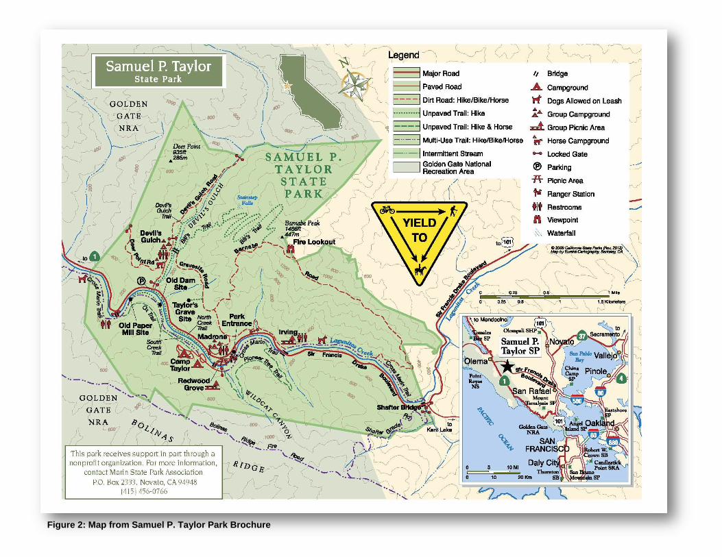
Figure 2: Map from Samuel P. Taylor Park Brochure

BILLS’ TRAIL CHANGE‐IN‐USE AND IMPROVEMENT PROJECT SAMUEL P. TAYLOR STATE PARK
CALIFORNIA STATE PARKS 10
This page left intentionally blank

BILLS’ TRAIL CHANGE‐IN‐USE AND IMPROVEMENT PROJECT SAMUEL P. TAYLOR STATE PARK
CALIFORNIA STATE PARKS 11
The following is a physiographic description of Bills’ Trail prepared by Clearwater Hydrology (CH) on June 23, 2009 (See Appendix A):
“Bills’ Trail traverses primarily north –facing, upland slopes within the Devil’s Gulch Watershed. Trail elevations range from roughly 200’ at the Devil’s Gulch Bridge crossing to 1,200’ at the Barnabe Fire Road junction, just below Barnabe Peak. Trail grades range from nearly level to 11 percent, with the steepest segment occurring closest to the Devil’s Gulch channel bed at a downslope distance of as little as 10-15’. Steep first and second order creeks draining similarly steep, forested slopes deliver sediment and debris to Devil’s Gulch, which is aligned southwest-northeast. The trail alignment initially parallels the nearly vertical to vertical canyon walls formed by the main stem channel incision, and then turns gradually eastward and further from the channel. Once the trail begins a series of switchbacks, it is several hundred feet from the Devil’s Gulch channel.
The trail crosses two of Devil’s Gulch’s perennial tributaries numerous times, at designated bridge crossings Nos. 1-7. In addition, stabilized tributary crossing occur where perennial flow is absent. At these ephemeral channel crossings, logs and rock cribbing structures have been installed to allow subsurface drainage and maintain drier track conditions. Since upslope sediment has buried the upstream face of the structures it is likely that sediment and debris-laden flow does occasionally flow over the trail surface during higher intensity rainstorms.
The upland physiography, or landscape, is composed of the incised, lower order stream channels and intervening, often pronounced, secondary ridges and small spur ridges separating these streams. Topographic hollows or swales are often located upslope of the headwaters of many lower order streams. Swales are often the source of rapidly moving debris-flows during periods of prolonged rainfall, and they can be a major source of stream sediment and debris.
Large to small topographic or benches or steppes of flatter gradient are scattered throughout the uplands of the Devil’s Gulch watershed. One significant bench occurs alongside the main stream channel, opposite a point 2,000’ or so upslope of the trailhead, occupying a stream terrace on the inside of a meander. The bench thins out in the upstream direction as the channel meander moves to the southern edge of the canyon. The benches or steppes located on the steeper mid-slopes of hillsides are typically of landslide origin.

BILLS’ TRAIL CHANGE‐IN‐USE AND IMPROVEMENT PROJECT SAMUEL P. TAYLOR STATE PARK
CALIFORNIA STATE PARKS 12
This page left intentionally blank

Figure 3: Trail Change in Use Project. Map shows Bills' Trail (red), Gravesite Fire Road (blue) and Barnabe Fire Road (purple). Barnabe Fire Road is not a part of the project.

BILLS’ TRAIL CHANGE‐IN‐USE AND IMPROVEMENT PROJECT SAMUEL P. TAYLOR STATE PARK
CALIFORNIA STATE PARKS 15
Ongoing, erosive slope processes of variable rates (both temporally and spatially) are responsible for the development of the upland physiography and these processes also transport derived sediment to the upland channels (lower order streams). The lower order tributaries are often storage sites for upslope sediment. Delivery to the main stem channel occurs episodically in response to less frequent, more intense runoff-producing rainstorms and debris flows. In addition to slumps, earthflow, combined slump-earthflows, and debris-flow, sediment moves downslope in response to downslope creep, overland sheet-wash, rutting-rilling, and within the stream channels, gully head advancement and bank slumping.
In their dormant or suspended state of inactivity, such landslide features particularly large old flatter slumps, become storage areas for sediment eroded from above by both natural erosion and tail/road-induced erosion. Broader, convex ridges are also common storage areas for eroded trail and hillslope sediments. Sediment stored in hillslope depositional zones may not reach stream channels for hundreds to thousands of years. However, eroded hillslope or trail sediment that is transported downslope for short distances to tributary or main stem channel may reach receiving waters in the course of a single storm event.”
Gravesite Fire Road Gravesite Fire Road was originally constructed in part to provide maintenance access to a water well near Deadmans Gulch as well as the historic Taylor family gravesite. The road is narrow as it rises away from Devil’s Gulch and widens as it approaches Deadmans Gulch. Gravesite Fire Road is open to mountain bikes, hikers and equestrians and provides a link between lower Bills’ Trail and Barnabe Fire Road as well as the Madrone Group Campsite.
Gravesite Fire Road is poorly designed and is presently recognized as a direct source of sedimentation into Deadmans Gulch an ephemeral tributary to Lagunitas Creek. Lower Gravesite Fire Road, opposite lower Bills’ Trail is also a direct source of sedimentation into Devils Gulch where temporary erosion control measures have recently been employed. DPR prepared a Notice of Exemptions (NOE) in 2010 to perform temporary maintenance work to reduce this sedimentation into Devil’s Gulch. The proposed work will upgrade and install culverts and place rock at the outlet to improve drainage and reduce erosive conditions.
Nevertheless, additional improvements (including a minor trail relocation) are still necessary to portions of Gravesite Fire Road to reduce sedimentation into Deadmans Gulch and Devils Gulch and improve water quality.
Designating Bills’ Trail to a multiuse classification would complete a looped trail system for mountain biking, hikers and equestrians.
2.4. Project Objectives DPR’s mission is to provide for the health, inspiration, and education of the people of California by helping to preserve the State’s extraordinary biological diversity, protecting its most valued natural and cultural resources, and creating opportunities for high-quality recreation. In addition to fulfilling the Department’s mission statement, the project objectives include:

BILLS’ TRAIL CHANGE‐IN‐USE AND IMPROVEMENT PROJECT SAMUEL P. TAYLOR STATE PARK
CALIFORNIA STATE PARKS 16
Meet departmental policy to provide a multiuse trail;
Provide additional sustainable opportunities for mountain biking within the DPR system;
Provide an opportunity for high quality recreation while protecting resources; and
Convert existing well-designed trails to multi-uses thereby reducing pressure from user groups to create use-specific new trails in pristine areas.
Without this project, sedimentation would continue to occur from Gravesite Fire Road resulting in impacts to prime habitat for listed species in Lagunitas Creek.
2.5. Project Requirements DPR has two types of Project Requirements: Standard and Specific. Standard Project Requirements are applied to projects statewide at all parks as required, and were developed from Best Management Practices (BMPs) and known regulatory requirements. For example, a Standard Project Requirement addressing the treatment of the inadvertent discovery of archaeological features is assigned to all projects statewide that include ground-disturbing work. However, for a project that does not have ground disturbance, such as replacing a roof on a historic structure, this Standard Project Requirement would not be necessary and therefore not applied to the project. Specific Project Requirements are written for, and applied to projects based on specific actions unique to a project and/or area that are necessary to complete the project while protecting resources. Table 1 lists Standard Project Requirements and Specific Project Requirements that will be incorporated into the Project, as applicable.
After incorporating the Requirements into the project description, whether standard or specific, DPR evaluates the significance of impacts based on CEQA Guidelines Section 15064.5 and Appendix G. After further impact analysis, if impacts are potentially significant or are potentially significant and unavoidable, DPR provides mitigation measure(s) to reduce impacts to a less than significant level. Continuing with the analysis, DPR could determine that although Project Requirements and mitigation measures have been included, project impacts are significant and unavoidable; therefore, could provide a Statement of Overriding Consideration (see Section 6.5).
2.6. Change in Use Process DPR’s Policy No. 2005-06 (See Appendix B) is to provide trails to access park features and facilities and provide planning that will effectively meet near-term and long-term recreation activities. Multiuse trails and trail connectivity with adjacent public trail systems is considered in the development or changes to trail systems or individual trails.
DPR considers requests for trail use change (addition or removal) from both park staff and user groups. Once a request has been made, an evaluation of the trail is performed by qualified staff that considers circulation, safety, trail sustainability, soils and geologic conditions, as well as impacts to resources and park operations. In turn, a team, from Visitor Services, Resources, Maintenance and a Trails specialist prepares a detailed trail log based on the evaluation. Once the trail log is complete the trail expert with representatives from Visitor Services completes a detailed “Trail Use Change

BILLS’ TRAIL CHANGE‐IN‐USE AND IMPROVEMENT PROJECT SAMUEL P. TAYLOR STATE PARK
CALIFORNIA STATE PARKS 17
Survey”. Technical Services, Natural and Cultural Services, Defensive Planning and Park Management also provide input on the survey.
Once the Trail Use Change survey is complete DPR staff makes a recommendation to the District Superintendent whether to move forward to the next step or deny the change in use. If the recommendation is to move forward the project goes through DPRs environmental review process. If the use request is denied, DPR staff meets with the requesting group and notifies them the request has been denied.
The environmental review process identifies and discloses to DPR and the public the significant environmental impacts of a proposed project prior to its consideration and approval. If potential adverse environmental impacts are identified, the CEQA process next attempts to identify ways to prevent or reduce these impacts by requiring consideration of feasible project alternatives or the adoption of mitigation measures for project impacts that cannot be avoided along with appropriate mitigation monitoring.
Mountain bike groups and individuals have petitioned to reopen Bills’ Trail to mountain bikes. In 2009, DPR prepared a NOE to perform minor alterations to Bills’ Trail to accommodate all users, consistent with CSP Policy Notice 2005-06. The proposal would have allowed mountain bikers and equestrians access to Bills’ Trail on alternate days. Following considerable discussion from various interests groups, DPR rescinded the NOE on June 24, 2009, and opted instead to prepare an EIR for the project.
2.7. Policy Considerations The DPR Operations Manual limits improvements undertaken within State Park units to those that make areas available for public enjoyment and education, consistent with the preservation of natural, scenic, cultural and ecological values. Improvements that do not enhance these resource values, are attractions in themselves (see DOM Section 0317.1.2), or are otherwise available to the public within a reasonable distance outside the park, cannot be undertaken within State Parks.
Attractions in themselves refer to those facilities that a portion of the public uses without experiencing the other opportunities for which a park was established (e.g. community centers, team sports complexes, destination restaurants), do not depend on location within a State Park and are prohibited. Attractions in themselves can have the following impacts:
Reduce parkland available for resource-based outdoor recreational uses; Displace park users; Reduce the options and area for development of park facilities; Reduce the units sense of place; Reduce open space and habitat or restorable habitat acreage; Consume staff time for General Plan amendments, contracts and overseeing
improvements.
Title 14 of the California Code of Regulations (CCR), Section 4301(i) provides authority to the Park Superintendent to issue special instructions (Superintendent’s Order) to curtail or restrict activities in certain areas of the parks. Section 4326 makes it a crime to violate said order.

BILLS’ TRAIL CHANGE‐IN‐USE AND IMPROVEMENT PROJECT SAMUEL P. TAYLOR STATE PARK
CALIFORNIA STATE PARKS 18
2.8. Project Details DPR is responsible for the maintenance and management of over 1,500 trails and pedestrian routes throughout the most biologically diverse state in the nation State Park trails provide a wide variety of experiences to the visitor, from outstanding vistas, including opportunities for wildlife viewing, to access to significant natural and cultural features in an unparalleled range of environmental settings. These routes are an integral component of the many programs and facilities that the Department is trusted to interpret, maintain, and protect.
2.9. User Groups It is likely that there will never be enough financial resources to meet demands, or space to build complete trails for every user group. As a result, safety considerations, sensitivity to other trail users and environmental resources requires trail guidelines for trails open to multiple use.
DPR policy states that “California State Parks will provide trails for accessing park features and facilities and provide planning that will effectively meet near-term and long- term recreation opportunities. The Department, through a public planning process, will strive to meet recreational, educational and interpretation needs of its diverse trail users by developing trails within state park units, consistent with unit classification, general plan directives, cultural and natural resource protection, public safety, accessibility, user compatibility and other legal and policy mandates.” Further, California Code of Regulations (CCR) includes the following:
§4359
No person shall ride, drive, lead, or keep a saddle or pack animal in a unit, or portion thereof, except on such roads, beaches, trails, or areas so designated by the Department.
No saddle or pack animal shall be hitched to any tree, shrub, or structure in any manner that might cause damage thereto;
No person shall ride any animal in a manner that might endanger life or limb of any animal, person or property;
No person shall allow their animal to stand unattended or insecurely tied;
All persons opening a closed gate shall close the same after passing through it. Reference: Section 5008, Public Resources Code.
§4360
No person shall operate an operator or gravity propelled device in any unit, or portion thereof, when the Department has issued an order prohibiting such activity. The Department may establish speed limits for units or portions thereof in which these devices are used. Speed limits will be posted. Section 5008, Public Resources Code
In summary: equestrian users are allowed on designated trails, non-motorized cyclists are allowed on all trails unless specifically prohibited, and hikers are allowed on all trails.

BILLS’ TRAIL CHANGE‐IN‐USE AND IMPROVEMENT PROJECT SAMUEL P. TAYLOR STATE PARK
CALIFORNIA STATE PARKS 19
2.9.1. Hikers/Pedestrians
Hiking has long been an important outdoor activity. Hiking trails are pathways developed and managed for the enjoyment of nature. Multi-use trails address a variety of recreation needs, accommodate both foot and other forms of travel and are managed according to those uses.
“Tread Lightly on Land and Water” includes the following suggestions for a safe, fun hiking experience:
Travel Responsibly Travel responsibly on designated roads, trails or areas. Stay on the trail even if it is rough and muddy. Walk single file to avoid widening the trail. Comply with all signs and respect barriers. Buddy up with two or three hikers, reducing vulnerability if you have an accident. Respect the Rights of Others Respect the rights of others, including private property owners, all recreational
trail users, campers and others so they can enjoy their recreational activities undisturbed.
Be considerate of others on the road or trail. Leave gates as you find them. If crossing private property, be sure to ask permission from the landowner(s). Keep the noise down. Proceed with caution around horses and pack animals. Sudden, unfamiliar
activity may spook animals—possibly causing injury to animals, handlers, and others on the trail.
When encountering horses on the trail, move to the downhill side of the trail, stop, and ask the rider the best way to proceed.
Keep your pets under control; this protects your pet, other recreationists and wildlife.
Educate Yourself Educate yourself prior to a trip by obtaining travel maps and regulations from
public agencies and planning for your trip. Make a realistic plan and stick to it. Always tell someone of your travel plans. Contact the land manager for area restrictions, closures, and permit
requirements. Check the weather forecast for your destination. Plan accordingly. Carry a compass or a GPS unit and know how-to use it. Carry water and emergency supplies even on short hikes. Choose appropriate footwear for the terrain. Solid, lightweight hiking boots are
best. Sandals can be used on trails in summer and around your campsite. Dress in layers and always carry a jacket. Weather conditions can change
unexpectedly. Your pack weight should not exceed one third of your body weight.
Avoid Sensitive Areas Avoid sensitive areas such as meadows, lakeshores, wetlands and streams and
seasonal nesting or breeding areas. Stay on designated routes.

BILLS’ TRAIL CHANGE‐IN‐USE AND IMPROVEMENT PROJECT SAMUEL P. TAYLOR STATE PARK
CALIFORNIA STATE PARKS 20
Do not disturb historical, archeological, or paleontological sites. Avoid “spooking” livestock and wildlife you encounter and keep your distance.
Do Your Part Do your part by modeling appropriate behavior, leaving the area better than you
found it, properly disposing of waste, minimizing the use of fire, avoiding the spread of invasive species, and restoring degraded areas.
Carry a trash bag and pick up litter left by others. Pack out what you pack in. Repackage snacks and food in baggies. This reduces weight and the amount of
trash to carry out. In areas without toilets, use a portable waste bag if possible and pack out your
waste, otherwise, it’s necessary to bury your waste. Human waste should be disposed of in a shallow hole (6”-8” deep) at least 200 feet from water sources, campsites, or trails. Cover and disguise the hole with natural materials. It is recommended to pack out your toilet paper. High-use areas may have other restrictions so check with a land manager.
Take a small bag and pack out your pet’s waste, especially in front country areas or if it is left on or near trails or trailhead areas.
2.9.2. Mountain Biking
Mountain biking is a broad term used to describe a sport that consists of riding bicycles off-road using specially adapted mountain bikes. It first emerged in Marin County during the 1970s by cyclists seeking to explore unpaved trails (Kollar, 2011).
Since its introduction mountain biking has expanded and become more specialized (see Table 1 below). The sport now consists of multiple sub-categories including cross country (XC), trail riding, all mountain, downhill, freeride, street riding, dirt jumping and trials.

BILLS’ TRAIL CHANGE‐IN‐USE AND IMPROVEMENT PROJECT SAMUEL P. TAYLOR STATE PARK
CALIFORNIA STATE PARKS 21
Table 1: Mountain Biking Styles
Specific Mountain Bike Riding Styles
Description
All-Mountain Riders seeking a variety of trails, especially those providing technical challenge. This style focuses on climbing and descending on varying terrain.
BMX or Dirt Jumpers Riders looking for areas dedicated for jumping features. These riders often participate in other riding styles but focus on jumps.
Cross Country Riders orientated towards longer distances (10-100 miles), multiple connecting loops and natural obstacles.
Downhill Riders using specialized equipment on challenging, downward trails. This riding style is popular at ski resorts during the summer months.
Free Ride Riders looking for technical challenge through features like rocks, bridges, jumps, logs, and drop-offs. Free riders can be found on all trails from cross country to dedicated experience zones.
Racing A competition style of riding where riders race against each other and/or the clock. This style involves traveling over various terrain and features from a starting point to a finishing point.
Urban A style of riding related to BMX but focusing on riding over challenging man-made features.
Most riding styles entail speed and/or navigating Technical Trail Features (TTFs). TTFs are armored natural features or built structures on trails that provide the rider physical and mental challenges. Riding styles that focus on the challenges of speed or TTFs are inconsistent with DPR DOM Section 0317.1.2 as these are essentially attractions in themselves. Consequently, the proposed project has been designed to reduce speed and eliminate as much as possible potential technical challenges that the aggressive mountain biker seeks.
XC riding most closely approximates the riding style that DPR envisions on Bills’ Trail. XC mountain biking is defined by the terrain on which it is performed and consists of a mix of rough forest paths and single-track (although no single-track is being considered), smooth fire roads, and paved paths connecting other trails. On Bills’ Trail the mode of transport is secondary and incidental to enjoyment of the natural, scenic, cultural and ecological values found within SPTSP.
Mountain bike trails have been designed for use by non-motorized bicycles equipped for off-road use. These trails are selected or constructed to accommodate the speed and erosive forces many people commonly associate with mountain bikes tires. Specifications for multi-use trails, including mountain bikes closely match the trail designs for equestrians and Class I hiking trails, resulting in potential for high use and user conflicts. “Tread Lightly on Land and Water” includes the following suggestions for a safe, fun mountain biking experience:
Travel Responsibly Avoid trails that are obviously wet and muddy Cross streams slowly, at a 90-degree angle to the stream. When climbing, use a gear that provides comfortable momentum and maintains
traction. When descending, avoid locking your bike’s wheels, which gauges the trail.

BILLS’ TRAIL CHANGE‐IN‐USE AND IMPROVEMENT PROJECT SAMUEL P. TAYLOR STATE PARK
CALIFORNIA STATE PARKS 22
Ride in the middle of the trails to minimize widening of the trails. Avoid sideslipping, which can lead to erosion.
Slow down when sight lines are poor. Maintain a reasonable distance between you and your fellow riders. Make your presence known when approaching others and going around blind
corners. Comply with all signs and respect barriers. Buddy up with two or three riders, reducing vulnerability if you have an accident
or breakdown. Listening to headphones or ear buds can make it difficult to hear and
communicate with other recreationists. In some areas it is illegal to operate bikes with both ears covered.
Don’t mix riding with alcohol or drugs. Respect The Rights of Others Be considerate of others on the road or trail. Leave gates as you find them. If crossing private property, be sure to ask permission from the landowner(s). Yield the right of way to those passing you or travelling uphill. Proceed with caution around pack animals. Sudden, unfamiliar activity may
spook animals—possibly causing injury to animals, handlers, and others on the trail.
When encountering horses on the trail, move to the side of the trail, stop, remove your helmet and speak—you want the horse to know you are human. Ask the rider the best way to proceed.
Keep the dust down.
Educate Yourself Educate yourself prior to a trip by obtaining travel maps and regulations from
public agencies and planning for your trip. Make a realistic plan and stick to it. Always tell someone of your travel plans. Check the weather forecast for your destination. Plan accordingly. Carry a compass or a GPS unit and know how-to use it. Carry water and emergency supplies even on short rides. Dress in layers and always carry a jacket. Weather conditions can change
unexpectedly.
Avoid Sensitive Areas Avoid sensitive areas such as meadows, lakeshores, wetlands and streams,
unless on designated routes and seasonal nesting or breeding areas. Do not disturb historical, archeological, or paleontological sites. Avoid “spooking” livestock and wildlife you encounter and keep your distance. Motorized and mechanized vehicles are not allowed in designated Wilderness
Areas
Do Your Part Carry a trash bag on your bike and pick up litter left by others. Pack out what you pack in. Practice minimum impact camping by using established sites and camping 200
feet from water resources and trails.

BILLS’ TRAIL CHANGE‐IN‐USE AND IMPROVEMENT PROJECT SAMUEL P. TAYLOR STATE PARK
CALIFORNIA STATE PARKS 23
Observe proper sanitary waste disposal or pack your waste out. Before and after a ride, wash your mountain bike and support vehicle to reduce
the spread of invasive species.
2.9.3. Equestrians
“Tread Lightly on Land and Water” makes the following suggestions for a safe, fun horseback riding experience.
Travel Responsibly Stay on designated roads, trails, and other areas open to horse use. Ride single file to reduce trail damage. Don’t cut switchbacks. Comply with all signs and respect barriers. Buddy up with two or three riders reducing vulnerability if you have an accident. Respect the rights of Others: Be considerate of others on the road or trail. Be prepared to let other trail enthusiasts know what needs to be done to keep
you, the horse, and other passersby safe when you meet on the trail. Remember many people are afraid of horses and may react unpredictably. Be alert and aware of the presence of other trail enthusiasts. If possible, pull to
the side of the trail when you hear oncoming off-highway vehicles or bicycles. Leave gates as you find them. If crossing private property, be sure to ask
permission from the landowner(s). Keep the noise down. Be especially cautious around hikers, bikes, and motorized vehicles
Educate Yourself Obtain a map of your destination and determine which areas are open to horses. Make a realistic plan and stick to it. Always tell someone of your travel plans. Check the weather forecast for your destination. Plan clothing, equipment, and
supplies accordingly. Carry a compass or a Global Positioning System a (GPS) unit and know how to
use it. Carry water and emergency supplies even on short trips. Keep groups small and carry lightweight gear to reduce the number of animals
needed. Pre-plan camp locations that provide plenty of room and the proper environment
for confining animals. Take responsibility for your horse’s education. Introduce it to vehicles and
situations it may encounter on shared trails.
Avoid Sensitive Areas Avoid sensitive areas such as meadows, lakeshores, wetlands, streams and
seasonal nesting or breeding areas. Stay on the trail. Do not disturb historical, archeological, or paleontological sites. Avoid “spooking” livestock and wildlife you encounter and keep your distance. Water animals in areas where stream banks and water access can withstand
hard use and are downstream from campsites.

BILLS’ TRAIL CHANGE‐IN‐USE AND IMPROVEMENT PROJECT SAMUEL P. TAYLOR STATE PARK
CALIFORNIA STATE PARKS 24
Do Your Part Model appropriate behavior. Leave the area better than you found it, Properly dispose waste; Minimize the use of fire; Avoid the spread of invasive species; and Restore degraded areas.
2.9.4. Sharing Trails Hiking, cycling and horseback riding are all popular ways of enjoying the outdoors and obtaining a high-quality recreation experience. Many trails are converting from one use to multi-use to address the needs of more user groups. The following guidelines could help increase user safety and user enjoyment. In general:
Know the park rules – if bikes or horses are not permitted, don’t use the trail. Know the rules of right of way (bikes yield to horses and hikers; hikers yield to
horses). Make yourself available for communication (easy with the music)
2.9.5. Trail Classes Placing trails into class categories creates a management system to objectively assign standards and priorities that are consistent with the primary function, environmental sensitivity, the relationship to developed facilities and visitor use.
Class I – Includes accessible, equestrian and bike, interpretive, and hiking uses. Gravel, turnpikes, puncheons or other drainage structures are required in areas of trail trenching, trampling, multiple trails or saturated trail beds, for resource protection and visitor safety. The trail bed is 36-48” wide; trail clearing will be 8’ high and wide (4’ feet from trail center), equestrian trails will be 10’ high; brushing limits will be 8’ high, equestrian trail 10’ high; trail structures will have a 48” tread width and a minimum 40” tread width between handrails and posts, equestrian bridges will have a 52” minimum tread width between handrails; ‘all access’ trail tread will be designed to accommodate wheelchairs and be a minimum of 5’ wide for two wheelchairs to pass one another.
Class II – Includes hiking trails providing access into regions away from developed visitor facilities, native material is used from the trail tread; drainage structures such as turnpikes or puncheons are only installed over wetlands; trail bed is a minimum of 24” wide and trail tread will vary from 18-24” depending on surrounding terrain. Trail clearing is the same as for Class I trails.
Class III – Includes lightly used hiking trails; native materials is used for trail tread; drainage structures are only installed as a mitigation measure; trail bed is a minimum of 18” wise and trail tread is 12-18” wide depending on surrounding terrain. Trail clearing will be 8 feet high by 6 feet wide.

BILLS’ TRAIL CHANGE‐IN‐USE AND IMPROVEMENT PROJECT SAMUEL P. TAYLOR STATE PARK
CALIFORNIA STATE PARKS 25
Class IV – Special use and access trails; tread bed and tread work is minimal to provide safe footing; designed to avoid all need for structures and drainage controls; trail clearing limits are minimal for passage.
2.10. Sustainable Trails DPR defines a sustainable trail as one that was designed, constructed or reconstructed to a standard such that it does not adversely impact natural and cultural resources, can withstand the impacts of the intended user and the natural elements while receiving only routine cyclic maintenance, and meets the needs of the intended user to the degree that they do not deviate from the established trail alignment.
Trails that do not meet the sustainable trail definition but are considered integral to park operations and their impacts can be minimized with trail structures to prevent damage to the resources. The protocols for Trail Project Design and Implementation Using Best Management Practices involve evaluation of the existing site conditions, gathering data on the designated user types, establish environmental limitations (natural and cultural constraints), maintaining community trail circulation and connectivity, establishing design parameters, setting construction specifications and implementing the prescribed trails action work plan that maximizes protection to Park natural and cultural resources, does not disrupt visitor use and operations and provides for long term facility life span.
Bills’ Trail is unique in that in spite of its setting within a sensitive environment and infrequent maintenance history, the trail remains in relatively good condition with little sedimentation discharged from the trail into Devils Gulch. Its stability in light of its maintenance history is in part, what makes the trail a good candidate for multiuse.
The following sections describe components of a sustainable trail:
2.10.1. Trail Tread Normally, native soil used to construct the trail base is adequate to carry foot trail traffic. Imported tread surfacing can be used on heavy use trails, in wet areas, across rock slides, and equestrian trails. The depth and width of surfacing material is determined on a case by case basis depending on the quality of the native material.
Tread Maintenance consists of keeping the tread surface serviceable and consists of:
Restoration of uniform out-sloped, in-sloped or crowned surfaces Restoration of original width Maintenance of backslope Filling of ruts and holes in the tread Restoration of sections damaged by slides, uproots, and washouts Removal of loose rocks Restoration of fill approaches Restoration of crown to turnpike with fine gravel of mineral soil
2.10.2. Trail Grade and Alignment All land areas have an inherent and variable ability to sustain recreational use without suffering damage to soils, vegetation or water. This ability can be relatively low,

BILLS’ TRAIL CHANGE‐IN‐USE AND IMPROVEMENT PROJECT SAMUEL P. TAYLOR STATE PARK
CALIFORNIA STATE PARKS 26
especially in mountainous areas and forests with steep slopes and abundant water runoff.
As a general rule, the trail should not be steeper than 10%; grades of 1-7% are ideal. Some grade must be provided to adjust to drainage needs. Grade should undulate gently to provide natural drainage and to eliminate monotonous stretches, level stretches and long steep grades that tire users.
The ideal alignment will “fit” the trail to the ground, follow the contours of the land and offer the user views from the trail. When a switchback is necessary, it should use a topographic feature as a turning point so it does not appear to be ‘carved out of the hillside’.
2.10.3. Trail Drainage
Drainage control on a trail relates to two primary types of water control, surface and subsurface-water. Before a trail are constructed surface water flows in a sheet along the natural ground surface. After a trail is constructed the sheet flow is cutoff and channeled into the trail. If allowed to accumulate, this water will erode the trail surface. Subsurface water, one of the most troublesome drainage problems, is best handled by trail relocation. Alternate solutions are to lower the water table or to construct a puncheon, culvert or French drains.
The unchecked flow of water from rain has the highest ability to damage a trail. During heavy rain, a large amount of water is present at the surface; some water is absorbed directly into the soil, but when the soil is saturated the water that isn’t absorbed flows freely along the surface as sheet flow until it collects in small channels or streams.
Problems occur when the trail interrupts the natural drainage process and the trail becomes the stream channel. Trails in flat, low-lying, wet terrain as well as mountain bogs with highly organic, wet soils, are plagued by destruction of plants. Wet, slippery and muddy locations develop quickly on theses soils causing water puddling on the trail tread and force users to use the side of the tread causing soil breakdown and trail widening.
The following techniques can be used to divert water, stabilize damaged soils and allow trailside plant life to recover. The correct method to use depends on terrain features, volume of water involved and soil characteristics.
Clear the stream channel up and down stream of logs, sticks, silt or other debris to decrease water flow or widening of the stream bed and crossing the trail.
Maintain the out-slope by grading the trail so that the outside edge is lower than the inside edge to allow sheet flow to follow its natural course across the trail and downslope.
Install drain dips (an exaggerated outslope that ends in a shallow trough) when runoff water is in excess of what a normal outslope design can accommodate.
Install water bars (a physical structure across the trail that turns and directs water to the downhill side of a trail).
Install/Clean a parallel ditch – excavate a depression parallel to the trail tread wide enough to carry the anticipated volume of water and maintain a ditch bank slope of 1:1; maintain a plant-free ditch.

BILLS’ TRAIL CHANGE‐IN‐USE AND IMPROVEMENT PROJECT SAMUEL P. TAYLOR STATE PARK
CALIFORNIA STATE PARKS 27
Install/Clean Culverts – when surface flows or underground springs are intercepted by a trail, a culvert can be placed perpendicular to the trail to redirect water to the downhill side of the trail.
Install/Clean turnpikes (hardened trail tread raised above the ground through boggy, wet, or muddy areas) – water is collected and channeled by parallel ditches to culverts that carry the flow under the turnpike.
Construct a rock causeway (an elevated section of trail contained by rock through permanent or seasonally wet areas) as inconspicuously as possible, as close to the minimum height and width needed to bridge the problem.
Install a drainage lens to solve the low volume flows of springs or seeps that bisect a trail.
2.11. Detailed Project Description Although most evidence suggests that Bills’ Trail is a hiking only trail, it is currently used by equestrians and hikers. More recently, mountain biking interest groups have petitioned to open Bills’ Trail to biking as well. DPR proposes to change the ‘use’ of Bills’ Trail to allow mountain biking in addition to hiking as well as formalizing equestrian use, making the trail consistent with the Department’s policy to construct multi use trails. In order to convert the trail to Class I that would sustainably and safely allow all three user groups, DPR must “catch up” with the deferred maintenance that has narrowed the trail, reduced drainage function, allowed exotic species to flourish and reduced user safety.
Bills’ Trail has a constructed width of 48", the standard for multi-use trails in State Parks and continues nearly four (4) miles between the trail head in Devil’s Gulch and the junction with the Barnabe Fire Road at 1,160-foot elevation. DPR staff completed a Trail Use Change Survey and prepared a trail log (Appendix C) identifying needed repairs, soil types, and features. The following summarizes the proposed work:
2.11.1. Trail Work/Routine Maintenance
Brush the trail from top of cut bank to top of fill-slope to maintain constructed trail width and original brushed line of sight;
Improve trail out-sloping and remove any developing outer edge (berm) trail tread to original design width averaging 48” (from top hinge of fill-slope to bottom hinge of cut bank or back slope) to maintain drainage. Trail bench work will be limited to maximum of 6" in depth; ground disturbance will stay within the existing profile (top of cut bank to bottom of fill-slope);
Remove debris collecting on the inside hinge to maintain trail width and remove loose debris.
2.11.2. Bridge Repair/Drainage
Replace wood-armored ephemeral stream crossings with rock armored crossings, as needed;
Install armored rock crossings at all ephemeral drainages and micro drainages to harden the trail tread. Specific work to include:

BILLS’ TRAIL CHANGE‐IN‐USE AND IMPROVEMENT PROJECT SAMUEL P. TAYLOR STATE PARK
CALIFORNIA STATE PARKS 28
Manually excavate up to 18” of trail tread (in the ephemeral drainage) and backfill with large, flat-topped rock to provide a stable crossing;
Place rock in the ephemeral stream channel gradient; Repair bridges as needed; no work would occur lower than existing bridge
components within the bed and/or stream channel. Specific work to include: Excavate bridge approaches (and abutments as necessary) outward to first
substantive vegetation and backfill with gravel; Install gravel surfacing to provide a stable tread surface at bridge approaches.
2.11.3. Resource Management
Remove non-native eucalyptus trees identified by a DPR-approved Environmental Scientist to improve the stand management and encourage naturally occurring tree species.
Where eucalyptus would be removed at least 75 square feet of basal area per acre (any tree species) would be retained on the slope;
Logs hoisted to the trail would be suspended to minimize ground impacts; Construct closeable and lockable barriers at each bridge to facilitate closing the trail
to users as necessary.
2.11.4. User Safety
Construct pinch points with boulders (See Figure 4) or large logs (from existing downed trees on site or imported as needed) protruding onto the trail from each side creating the need to travel an 'S’ path to negotiate the path through the logs. Pinch points will be placed in approximately 100 locations along Bills’ Trail to reduce bicycle speed and increase the 'line of sight" at curves, improving user safety.
Install signage to inform user groups how to have a safe and fun trail experience without conflict;

BILLS’ TRAIL CHANGE‐IN‐USE AND IMPROVEMENT PROJECT SAMUEL P. TAYLOR STATE PARK
CALIFORNIA STATE PARKS 29
Repair, replace or install split rail fencing along trail as needed for safety, resource protection, and shortcut prevention.
2.11.5. Gravesite Fire Road
Improve and rehabilitate limited sections of road as needed per California State Park guidelines (Brian R. Merrill, 2003);
Ditchouts and rolling dips will be armored with aggregate at and near the outlet to reduce erosion. Aggregate would transitionally increase in size toward the outlet end.
No work will be performed on Barnabe Fire Road; it is not a part of this project
Figure 4: Typical Pinch Point Boulder Construction

BILLS’ TRAIL CHANGE‐IN‐USE AND IMPROVEMENT PROJECT SAMUEL P. TAYLOR STATE PARK
CALIFORNIA STATE PARKS 30
This page left intentionally blank

Figure 5: Proposed Trail Improvements

BILLS’ TRAIL CHANGE‐IN‐USE AND IMPROVEMENT PROJECT SAMUEL P. TAYLOR STATE PARK
CALIFORNIA STATE PARKS 32
This page left intentionally blank

Figure 6: Pinch Point Construction Section View and Plan View

BILLS’ TRAIL CHANGE‐IN‐USE AND IMPROVEMENT PROJECT SAMUEL P. TAYLOR STATE PARK
CALIFORNIA STATE PARKS 34
This page left intentionally blank

Figure 7: Typical Pinch Point Diagram adapted from IMBA

BILLS’ TRAIL CHANGE‐IN‐USE AND IMPROVEMENT PROJECT SAMUEL P. TAYLOR STATE PARK
CALIFORNIA STATE PARKS 36
This page left intentionally blank

BILLS’ TRAIL CHANGE‐IN‐USE AND IMPROVEMENT PROJECT SAMUEL P. TAYLOR STATE PARK
CALIFORNIA STATE PARKS 37
2.12. Project Requirements
DPR has two types of Project Requirements: Standard and Specific. Standard Project Requirements are applied to projects statewide at all parks as required, and were developed from Best Management Practices (BMPs) and known regulatory requirements. For example, a Standard Project Requirement addressing the treatment of the inadvertent discovery of archaeological features is assigned to all projects statewide that include ground-disturbing work. However, for a project that does not have ground disturbance, such as replacing a roof on a historic structure, this Standard Project Requirement would not be necessary and therefore not applied to the project. Specific Project Requirements are written for, and applied to projects based on specific actions unique to a project and/or area that are necessary to complete the project while protecting resources. Table 2 lists Standard Project Requirements and Specific Project Requirements that will be incorporated into the Project, as applicable.
After incorporating the Requirements into the project description, whether standard or specific, DPR evaluates the significance of impacts based on CEQA Guidelines Section 15064.5 and Appendix G. After further impact analysis, if impacts are potentially significant or are potentially significant and unavoidable, DPR provides mitigation measure(s) to reduce impacts to a less than significant level. Continuing with the analysis, DPR could determine that although Project Requirements and mitigation measures have been included, project impacts are significant and unavoidable; therefore, could provide a Statement of Overriding Consideration (see Section 6.6).

BILLS’ TRAIL CHANGE‐IN‐USE AND IMPROVEMENT PROJECT SAMUEL P. TAYLOR STATE PARK
CALIFORNIA STATE PARKS 38
This page left intentionally blank

39
Table 2: Standard and Specific Project Requirements
PROJECT REQUIREMENTS PROJECT REQUIREMENTS DESCRIPTION
Air Quality
Standard Project Requirement AIR 1: Ozone-Related Emissions
DPR and its contractor(s) will maintain all construction equipment in good mechanical condition, according to manufacturer’s specifications. Construction equipment exhaust emissions will not exceed Bay Area Air Quality Management District (BAAQMD) Regulation IV – Rule 400 – Visible Emissions limitations (Cal EPA 2007b).
All off-road and portable diesel-powered equipment, including but not limited to bulldozers, graders, cranes, loaders, scrapers, backhoes, generator sets, compressors, auxiliary power units, will be fueled with California Air Resources Control Board (CARB)-certified motor vehicle diesel fuel.
Idling time for all diesel-powered equipment will be limited to five minutes, except as necessary to maintain a continuous workflow or for safety considerations.
The use of diesel construction equipment meeting the CARB’s 1996 or newer certification standard for off-road heavy-duty diesel engines will be maximized to the extent feasible.
Electric and/or gasoline-powered equipment or equipment using alternative fuels, such as compressed natural gas (CNG), liquefied natural gas (LNG), propane, or biodiesel, will be substituted for diesel-powered equipment, when available.
Standard Project Requirement AIR 2: Particulate Matter Fugitive Dust Emissions
Ground-disturbing activities will be suspended when sustained winds exceed 25 mph, instantaneous gusts exceed 35 mph, or dust from construction might obscure driver visibility on public roads.
Disturbed areas of the site will be watered as necessary depending on the conditions, using water trucks and/or sprinkler systems, to prevent airborne dust from leaving the site. If available, reclaimed (non-potable) water will be used.
All dirt stockpiles would be covered (tarped) or watered daily, as necessary to prevent dispersion of windblown dust.
All trucks hauling dirt, sand, soil, or other loose materials would be covered or would maintain at least two feet of freeboard (minimum vertical distance between top of load and top of trailer), in accordance with California Vehicle Code Section 23114.
All disturbed areas in inactive portions of the site would be covered, seeded, and/or watered until a suitable cover is established or construction activities are resumed. Non-toxic soil stabilizers could be used in accordance with county, Regional Water Quality Control Board

40
PROJECT REQUIREMENTS PROJECT REQUIREMENTS DESCRIPTION (RWQCB), (CRWQCB) and California Air Resources Board (CARB) standards.
Permanent dust control measures would be implemented as soon as possible following completion of any soil disturbing activities.
The name and telephone number of such persons will be posted on site throughout construction and provided to the BAAQMD. The phone number of the Bay Area Air Quality Management District will also be visible to ensure compliance with Rule 402 (Nuisance) (CEPA 2007b). Project requirements would also be implemented during holidays, weekend periods, or times when work is temporarily suspended, as necessary to control site conditions generating fugitive dust.
Biological Resources Specific Project Requirement BIO 1.1: Marin blind harvestman
A DPR-approved biological monitor will survey for species of harvestman prior to any project activities that require the moving of any medium to large sized rocks. If any specimens are located then the DPR-approved biological monitor will relocate the species to a suitable location outside of the project area.
Specific Project Requirement BIO 1.2: Marin Hesperian
If any snail species is found on the project site while work activities are being conducted, work in the vicinity of the snail will be delayed until the species is relocated to a suitable location outside of the project area by a DPR-approved biological monitor.
Standard Project Requirement BIO1.3: California red-legged frog
Construction personnel will be instructed by a USFWS or DPR-approved biological monitor in the life history of the California red-legged frog and its habitat, and instruction in the appropriate protocol to follow in the event that a California red-legged frog is found onsite.
A USFWS -approved biological monitor will be onsite during all activities within 500 feet of perennial streams to ensure there are no impacts to individual California red-legged frogs that might potentially move through the project area on dispersal.
Immediately prior to the start of work each morning a USFWS or DPR-approved biological monitor will conduct a visual inspection of the construction zone, prior to the start of work.
A U.S. Fish and Wildlife Service approved biologist shall survey the work site two weeks before the onset of activities. If California red-legged frogs (CRLF) or tadpoles are found, the approved biologist shall capture and relocate them away from the project construction site and to the nearest suitable aquatic habitat. If egg masses are found, they shall not be removed and no work shall occur until the tadpoles metamorphose and then relocate the

41
PROJECT REQUIREMENTS PROJECT REQUIREMENTS DESCRIPTION metamorphs. Only the approved biologist shall be able to capture, handle and relocate the animals, and he/she shall be given ample time to move the animals prior to commencement of work.
Standard Project Requirement BIO 1.4: Northern Spotted Owl
If possible, all noise-generating construction activities will occur outside of the breeding season for the northern spotted owl (September 1 – January 31). The specific dates of the breeding season could be adjusted through consultations with USFWS based on the characteristics of the local population
If construction activities must be scheduled during the breeding season, protocol-level surveys by a USFWS or DPR-approved biologist will be conducted prior to construction to locate nests, or survey data from local biologists monitoring owl populations in the area may be used if appropriate.
If a breeding pair and/or nest are located during surveys, then no construction activities resulting in noise disturbance above ambient levels may occur within ¼ mile of the nest during the breeding season.
Standard Project Requirement BIO 1.5: Nesting Raptors and Migratory Birds
If possible, all noise-generating construction activities will occur outside the raptor and migratory bird breeding season (September 16 – January 31).
If construction-related activities must be scheduled during the breeding season, then focused surveys for nesting migratory bird and raptor species will be conducted by a DPR-approved biologist before construction activities occur in these months to identify active nests.
Surveys for active raptor nests will be conducted within a 500-foot radius of the project area 10 days prior to the beginning of construction at each work site. If nesting raptors are found, no construction will occur within a 500-foot radius of the nest until the young have fledged and the young will no longer be impacted by project activities (as determined by a DPR-approved biologist) and there is no evidence of a second attempt at nesting.
Surveys for active migratory bird nests will be conducted within a 100-foot radius of the project area 10 days prior to the beginning of construction at each work site. If active nests are located, then no construction activities will occur within a 100-foot radius of the nest tree until the young have fledged and the young will no longer be impacted by project activities (as determined by a DPR-approved biologist).

42
PROJECT REQUIREMENTS PROJECT REQUIREMENTS DESCRIPTION Standard Project Requirement BIO 1.6: Sensitive Bat Species
If possible, all noise-generating construction activities will occur outside the bat maternity season (September 1 – January 31).
If project activities must be conducted during the bat maternity season, prior to work, a DPR-approved bat specialist will conduct surveys of suitable bat roosting habitat within 100-feet of the work area. If potential bat roosts are found, night emergence surveys shall be conducted to determine presence or absence of bats. If bats are absent then work shall begin within 1-2 days. If bats are present, work shall not comment within 100-feet of the roost and shall be postponed until the end of the maternity season.
Standard Project Requirement BIO 2.1: Sensitive Natural Plant Communities
Within the root health zone (5 times dbh) of any native tree with a dbh of 12 inches or greater, no roots with a diameter of 2 inches or greater will be severed by project activities, unless authorized in advance by a DPR-approved biologist.
Standard Project Requirement BIO 2.2: Sudden Oak Death
All project activities that could spread Phytophthora ramorum to new locations will be subject to Best Management Practices (BMPs) developed by the California Oak Mortality Task Force and available online at http://www.suddenoakdeath.org/html/best_ management_practices.html.
Sudden Oak Death BMPs include but are not limited to:
Inform personnel that they are working in a Sudden Oak Death (SOD)-infested area, unauthorized movement of plant material is prohibited, and the intent of these prevention measures is to prevent spread of SOD.
Before leaving project area, remove or wash-off accumulations of plant debris, soil, and mud from shoes, boots, vehicles, and heavy equipment, etc. Clean with denatured alcohol or similar materials.
Standard Project Requirement BIO 3: Wetlands, Riparian Zones, and Waters of the U.S.
A wetlands and waters of the United States delineation report will be prepared and submitted to the appropriate office of the U. S. Army Corps of Engineers (USACE) for jurisdictional determination under Section 404 of the Clean Water Act.
If required by the USACE a 404 permit under the Nationwide Permit Program will be obtained for this project and all conditions imposed by the permitting authority will be implemented.
Cultural Resources Standard Project Requirement CULT 2:
In the event that previously undocumented/unflagged cultural resources (including but not limited to dark soil containing shellfish, bone, flaked stone, groundstone, or deposits of

43
PROJECT REQUIREMENTS PROJECT REQUIREMENTS DESCRIPTION Previously Undocumented Resources
historic material) are encountered during project activities, all work in that location will be temporarily halted and diverted to another location, until DPR’s State Representative is contacted; a DPR-qualified cultural resource specialist will record and evaluate the find and work with the Project Proponent and/or Construction Contractor to implement avoidance, preservation, or recovery measures, as appropriate, prior to any work resuming at that specific location.
Standard Project Requirement CULT 3: Human Remains
In the event that human remains are discovered during Program Actions, all work at that location will be temporarily halted and diverted to another location. Any human remains and/or funerary objects will be left in place. The Project Proponent and/or Construction Contractor will immediately contact the DPR State’s Representative who will then contact the DPR Sector Superintendent. The DPR Sector Superintendent (or authorized representative) will notify the County Coroner, in accordance with §7050.5 of the California Health and Safety Code, and the Native American Heritage Commission (NAHC) will be notified within 24 hours of the discovery if the Coroner determines that the remains are Native American. The NAHC will designate the “Most Likely Descendent” (MLD) of the deceased Native American. The MLD will recommend an appropriate disposition of the remains. If a Native American monitor is at the Park at the time of the discovery, and that person has been designated the MLD by the NAHC, the monitor will make the recommendation of the appropriate disposition. Work will not resume in the area of the find until proper disposition is complete (PRC §5097.98). No human remains or funerary objects will be cleaned, photographed, analyzed, or removed from the site prior to determination. If it is determined the find indicates a sacred or religious site, the site will be avoided to the maximum extent practicable
Geology and Soils Standard Project Requirement GEO 1 Best Management Practices
Bare earth materials at water course crossings will receive 80% to 85% mulch cover using on site native materials. Where the ground is not mulched, native vegetation will be planted.
Brushing of trail cuts will minimize the damage to root systems to help retain vegetation on the cut-slope. Upon removal of temporary sidecast and initial sediment flush controls lighter materials will be collected from brushing and placed (as feasible considering the steepness of the slope) as an additional filter at the trail edge where it is at the top of the banks of the main stem of Devil’s Gulch or within the buffer limits for sidecast control (0 to 30, 130 to 375 and 8475 to 8510). Aggregate will also be placed along the same trail section.
Rock will be obtained from a Surface Mining and Reclamation Act (SMARA) approved

44
PROJECT REQUIREMENTS PROJECT REQUIREMENTS DESCRIPTION quarry and contain no more fines than necessary to act as a binder. Aggregate will be placed at crossings to inhibit rutting per the guidelines of the governing regulatory agency.
Where eucalyptus will be removed at least 75 square feet of basal area per acre (any tree species) will be retained on the slope. Logs hoisted to the trail will be suspended to minimize ground impacts.
To inhibit moisture capture logs used for pinch points will be no longer than necessary. Logs will not be placed within the buffers for watercourses outlined for sidecast and initial sediment control.
Ditchouts and rolling dips along the fire roads will be armored with aggregate at and near the outlet (if founded in fill) to inhibit erosion. Alternatively, the fill will be removed from the outlet of the drainage structure.
Specific Project Requirement GEO 2 Seismic Event
In the event of a large earthquake on a nearby fault or significant rainfall event, the trail will be inspected to determine if cracks or cutbank failures could contribute sediment to nearby watercourses – if such material is identified it will either be stabilized or relocated outside the buffer zone identified for sidecast materials.
Specific Project Requirement GEO 3 Revegetation Plan
This project will result in temporary impacts to native vegetation resulting from proposed trail improvements. These impacts will be addressed by implementing a revegetation plan that will restore native plant habitat in affected areas. The objective is to establish self-sustaining native vegetation. This plan will include the following elements:
Identification of areas requiring revegetation;
Identification of native species that are appropriate and site specific;
Requirement that plantings be grown from native seed/cuttings collected in the park or plantings from local nurseries that are derived from genetic stock that was obtained from areas surrounding the park; and
A monitoring and maintenance program that includes follow-up plantings as necessary to achieve success criteria as outlined in this plan.
Hazards and Hazardous Materials
Standard Project Requirement HAZ 1 a-c Spill Prevention
Prior to the start of construction, the Contractor will inspect all equipment for leaks and inspect equipment daily thereafter until it is removed from the project site.
Prior to the start of construction, the contractor will prepare a Stormwater Pollution Prevention Plan (SWPPP) that will include Best Management Practices (BMPs) for materials

45
PROJECT REQUIREMENTS PROJECT REQUIREMENTS DESCRIPTION management, fueling, repair, and maintenance of vehicles and equipment, and spill prevention and control. The Contractor will maintain a spill kit on-site throughout the life of the project. The SWPPP will include a map that delineates construction staging areas and where refueling, lubrication, and maintenance of equipment may occur. Areas designated for refueling, lubrication, and maintenance of equipment will be at least 50 feet away from all streams. In the event of any spill or release of any chemical in any physical form at the project site or within the boundaries of the Park during construction, the contractor will immediately notify the appropriate DPR staff (e.g., project manager, supervisor, or State Representative).
Equipment will be cleaned and repaired (other than emergency repairs) outside the park boundaries. All contaminated water, sludge, spill residue, or other hazardous compounds will be disposed of outside park boundaries, at a lawfully permitted or authorized destination.
Standard Project Requirement HAZ 2 Health and Safety
DPR will include, in any contract documents or in internal work plan documents, health and safety specifications on how to manage any potential hazardous incidents. The specifications will include methods for safe handling, collection, and proper disposal of any contaminated soil and refuse uncovered during the excavation and grading procedures. The specifications will discuss the proper personal protection during construction, the use of an exclusion zone if necessary to prevent exposure to the public, and the proper disposal procedures for any hazardous substances encountered.
Project Specific Requirement HAZ 7 a-c – Fire Safety
A fire safety plan will be developed by the contractor and/or DPR and approved by DPR prior to the start of construction. This plan will include the emergency reporting procedures of the Marin County Fire Department.
Spark arrestors or turbo-charging (which eliminates sparks in exhaust) and fire extinguishers will be required for all heavy equipment.
Construction crews will be required to park vehicles away from flammable material, such as dry grass or brush. At the end of each workday, heavy equipment will be parked over asphalt or concrete to reduce the chance of fire. The contractor will also be required to have fire extinguishers on site.
Hydrology and Water Quality Standard Project Requirement HYDRO 1: Erosion, Sediment
A Stormwater Pollution Prevention Plan (SWPPP) will be required that includes temporary construction and permanent post-construction Best Management Practices (BMPs) to control soil and surface water runoff, including, but not limited to, use of silt fences, weed-

46
PROJECT REQUIREMENTS PROJECT REQUIREMENTS DESCRIPTION Control and Pollution Prevention
free straw bales, weed-free fiber rolls, and/or sediment detention basins to prevent soil loss and siltation. SWPPP will also include measures to allow construction to occur outside the normal construction season. Long term revegetation BMPs will be guided by the Project Revegetation Plan (see Bio 10, Revegetation Plan).
The SWPPP will also include spill prevention, vehicle and equipment management, and materials management BMPs to prevent releases of non-sediment pollutants, such as vehicle and equipment fluids and any construction-related materials.
Flow will not be concentrated toward the slump near 7010 and if other drainage modifications are made will not divert flow from one micro-watershed to another for slopes below the Barnabe and Gravesite fire roads. Berms will be removed from the road edge where consistent with vehicular safety and micro-drainage integrity can be respected.
Trail construction activities will occur between April 15 and October 15 each year to avoid the period of highest rainfall, streamflows and erosion potential. During periods of inclement weather, operations will be shut down until streamflows are sufficiently low and soil/channel conditions are sufficiently dry and stable to allow construction to continue without the threat of substantial soil compaction, erosion, sedimentation, or offsite sediment transport. Construction activities can occur outside of this window outside of riparian areas if winter season operating conditions permit and with appropriate BMPs in place.
No excavation work will occur on slopes greater than 10% during periods of heavy rains (at least ½ inch of precipitation in a 24-hour period) or when soils are saturated.
Work will be directed and/or inspected periodically on-site by the Project Manager or other qualified personnel to assure soil compaction and finish grading meet job specifications.
Plant duff and organic soil will be removed from graded areas and stored. After grading is complete the stored material will be spread over disturbed areas intended for revegetation as identified in the Project Revegetation Plan.
Specific Project Requirement HYDRO 2: Initial Trail Closure
The trail and road will be closed during construction and remain closed for one year following completion of construction to allow the trail to season. Gates will be constructed at each of the 7 bridge crossings that will remain locked until the trail is open for use.
Specific Project Requirement HYDRO 3: Seasonal Trail Closures
Bills’ Trail will be closed seasonally during periods of saturated and softened soils to maximize sustainability, minimize trail maintenance, and support resource protection by limiting potential rain generated sediment transport. Closure will be ensured by locked gates at each of the 7 bridge crossings including the bridge over Devil’s Gulch.

47
PROJECT REQUIREMENTS PROJECT REQUIREMENTS DESCRIPTION
Noise
Specific Project Requirement NOISE 1: Construction Noise Reduction Plan
Prior to the start of construction, DPR and/or its Contractor will prepare a Construction Noise Reduction Plan that will address noise control methods during construction activities at the project site and in staging and storage areas. Measures identified in the Construction Noise Reduction Plan will be implemented by DPR and/or its Contractor throughout the construction period and monitored by DPR. The plan will be approved in advance by Marin County Community Development Agency and conform to noise reduction requirements of the County.
Standard Project Requirement NOISE 2: Noise Exposure
Project-related activities could occur seven days per week and will generally be limited to the hours of 7:00 a.m. to 6:00 p.m.,
Internal combustion engines used for any purpose in the project areas will be equipped with a muffler of a type recommended by the manufacturer. Equipment and trucks used for project-related activities will utilize DPR-approved noise control techniques (e.g., engine enclosures, acoustically attenuating shields or shrouds, intake silencers, ducts, etc.) whenever feasible and necessary.
Stationary noise sources and staging areas will be located as far from visitors as possible. If they must be located near visitors, stationary noise sources will be muffled to the extent feasible, and/or where practicable, enclosed within temporary sheds.

BILLS’ TRAIL CHANGE‐IN‐USE AND IMPROVEMENT PROJECT SAMUEL P. TAYLOR STATE PARK
CALIFORNIA STATE PARKS 48
This page left intentionally blank

BILLS’ TRAIL CHANGE‐IN‐USE AND IMPROVEMENT PROJECT SAMUEL P. TAYLOR STATE PARK
CALIFORNIA STATE PARKS 49
2.13. Analytical Methodology
In determining the appropriate analytical methodology for this DEIR, DPR followed the following steps:
Step 1: Incorporation of Standard and Specific Project Requirements into the Project.
DPR reviewed potentially applicable environmental protection measures that it has used for other projects throughout the State and selected those that were deemed applicable to the Project. Next, DPR reviewed environmental protection measures that could be incorporated into this Project at the Park. As discussed below in Section 2.5.2, these measures are titled Standard Project Requirements and Specific Project Requirements, respectively. Standard and Specific Project Requirements were then incorporated into the Project.
Step 2: Impact Analysis
After incorporating Project Requirements, DPR next evaluated the significance of potential impacts of the Project on the full ranges of CEQA resource topics. Many of the potential impacts were determined to be less than significant; however, DPR proceeded to Step 3, Mitigation, for impacts that could not be reduced to a level of less than significant through incorporation of Project Requirements.
Step 3: Mitigation
For impacts that were either potentially significant or potentially significant and unavoidable, DPR provided mitigation measures that reduced these impacts to the extent feasible. DPR then reviewed the potential impacts, and made applicable findings as described in Step 4, below.
Step 4: Findings Determination
After incorporation of Project Requirements and Mitigation, DPR determined the significance of impacts to environmental resources issues. Each resource section provides applicable findings for each significance determination. In addition, Section 6.0, Significance of Environmental Impacts, organizes these findings based on whether such findings were no impact, less than significant, potentially significant or potentially significant and unavoidable.
2.14. Project Implementation
Work would generally occur Monday through Friday, during daylight hours. Weekend or holiday work could be implemented to accelerate the construction schedule or address emergencies or unforeseen circumstances.
The ground upslope and down slope of the average 48” trail edge is steep and does not allow off road staging areas or simple equipment turn around. On Bills’ Trail (and Gravesite Fire Road north of Deadmans Gulch) work crews would plan carefully to bring equipment in, stage and turn along the trail, particularly where the trail narrows. Due to site constraints, work in these areas would require the use of specialized equipment

BILLS’ TRAIL CHANGE‐IN‐USE AND IMPROVEMENT PROJECT SAMUEL P. TAYLOR STATE PARK
CALIFORNIA STATE PARKS 50
including mechanized wheelbarrows, hand operated mechanized compactors and assorted hand tools. The open space adjacent to the Horse Camp would be used as a staging area for work on Bills’ Trail.
Because of the generally wider profile, work on Gravesite Fire Road allows a greater variety of construction equipment options. In addition to the equipment noted above, work on the road could also employ a Bobcat®, backhoe, a dump truck, grader, and larger dozer and transport vehicles. Numerous open areas along Gravesite Fire Road can serve as staging areas for this project component. Most equipment would be transported to the site and remain until the associated work is completed. Transport vehicles for material or equipment, delivery trucks, and crew vehicles would also be present intermittently at the site.
The trail and road will be closed during construction and remain closed for one year following completion of construction to allow the trail to season. Additionally, Bills’ Trail will be closed seasonally during periods of saturated and softened soils to maximize sustainability, minimize trail maintenance, and support resource protection by limiting potential rain generated sediment transport.
2.15. Trail Maintenance
DPR is responsible for the maintenance and management of over 1,500 trails and pedestrian routes throughout the most biologically diverse state in the nation. State Park trails provide a wide variety of experiences to the visitor, from outstanding vistas, including opportunities for wildlife viewing, to access to significant natural and cultural features in an unparalleled range of environmental settings. These routes are an integral component of the many programs and facilities that DPR is trusted to interpret, maintain, and protect.
The State Trails Handbook recommends that trail maintenance activities be prioritized between essential and nonessential activities. DPR considers essential those activities that ensure visitor safety and protect the resource and trail investment. Nonessential activities are those which are directed solely toward visitor convenience.
Trail work directed mainly toward nonessential activities could sacrifice resource protection through the neglect of essential maintenance activities. Neglect of drainage maintenance can develop into a situation where a trail system could literally be washed away. On the other hand, a trail that receives no clearing or brushing could grow over to a point of physical closure with little resource or safety problems.
DPR recognizes that a firm annual maintenance program prevents expensive reconstruction projects. With the understanding that there is a limited amount of money and manpower for trail work, that work should be directed toward the factors that are causing the most damage. Ideally, drainage maintenance, clearing, tread maintenance and brushing are considered annual trail maintenance and performed as a unit. Construction, reconstruction, rehabilitation and restoration are considered facility trail maintenance and performed on a project basis.
In the spirit of partnering with other entities for park operations, DPR will continue to seek opportunities to share maintenance responsibilities with trail users and user groups.

BILLS’ TRAIL CHANGE‐IN‐USE AND IMPROVEMENT PROJECT SAMUEL P. TAYLOR STATE PARK
CALIFORNIA STATE PARKS 51
2.16. Trail Safety and User Conflict/Rule Enforcement DPR trails are not intended as active recreation facilities where nature appreciation may be secondary to athletic or skill challenge. Mountain bike speed or technical riding, equestrian endurance or poker runs, and group trail runs are examples of activities that are not compatible with DPR trails, except potentially by specific plan and design in State Recreation Areas that do allow more active recreational activities. DPR trails are designed to accommodate passive, nature-oriented type of shared trail use by combining the design requirements for each individual use into a trail where they can comfortably mix.
Public safety is part of the mission of DPR, and trail design for shared use is an important safety consideration. However, user safety particularly depends on compliance with the appropriate type of trail use, and rules and guidelines for trail use, including reasonable speed, yielding to other users per the “yield triangle”, warning when passing, and having the appropriate knowledge or skill to be on trails shared with other users. Multiuse Trail Conflict Management entails getting the information to the trail users about appropriate trail use; monitoring trail use, encouraging compliance, and where necessary, responding to situations of non-compliance.
While public safety is of paramount concern for DPR, it should not be confused with conflict. Conflicts can be defined as a situation in which people perceive a threat (physical, emotional, power, status, etc.) to their well-being. Some conflicts may lead to safety issues and are appropriately addressed in Chapter 4.13. Preventing user conflicts, both with respect to safety and with user attitudes, is certainly a goal of the project. Conflicts related to user attitudes towards one another are considered to be social issues, which are not treated as significant effects on the environment under CEQA.
Policy No. 2005-06 outlines the procedure DPR uses for conflict resolution. The goal is to create an opportunity for more meaningful public input and could include: creation of an ad-hoc committee that will sunset when the issue is resolved, facilitating public meeting(s), sponsoring user forums, replying to letters, or any other activity that allows the public an opportunity for providing suggestions and/or relaying concerns.
A Safety report was prepared as part of the Statewide Trails Change-in-Use Program EIR. The report includes surveys of DPR units and outside agencies used to collect data about incidents survey of reported incidents that occurred on trails. The number of agencies reporting incidents or injuries is extremely small. That report is appended to this document (Appendix D).
2.17. Accessibility
All programs, services, and activities offered by a public entity must be accessible to persons with disabilities. Emerging trail design concepts are beginning to eliminate obstacles such as stairs and excessive linear grades, which often prohibit users with disabilities from enjoying trails. On March 15, 2011 the Department of Justice (DOJ)
Figure 8 Yield Triangle

BILLS’ TRAIL CHANGE‐IN‐USE AND IMPROVEMENT PROJECT SAMUEL P. TAYLOR STATE PARK
CALIFORNIA STATE PARKS 52
revised Federal guidelines that contain technical provisions for accessible trails allowing “other power-driven mobility devices” to be used by “individuals with mobility disabilities.” The State Parks Accessibility unit continually rehabilitates existing State Park trails, campsites, and restrooms to comply with the Americans with Disabilities Act (ADA).
2.18. Park Closure
The DEIR was released for public comment in April 2011, prior to release of the State Park closure list in May. Since January, DPR has engaged in a collaborative process between Headquarters and the District Superintendents to identify and determine closures and plan for partnerships to keep as many parks open as possible.
DPR has reached a short-term agreement with the National Park Service by which Samuel P. Taylor will be operated under the auspices of the Golden Gate National Recreation Area. The park will continue to be operated in accordance with DPR policies and regulations including allowing equestrians and mountain bikes on appropriate roads and trails.
2.19. Regulatory Requirements, Permits, and Approvals
Activities that might affect natural or cultural resources, traffic, and air or water quality could be subject to review and approval by local, state, and/or federal responsible/trustee agencies. Consultations, permits, and/or approvals could be required from the following agencies and organizations:
United States Army Corps of Engineers (USACOE) U.S. Fish and Wildlife Service (USFWS) State Water Resources Control Board (SWRCB) California Department of Fish and Game (CDFG) San Francisco Regional Water Quality Control Board (SFWQCB)

Chapter 3.0 Alternatives to the Proposed Project


BILLS’ TRAIL CHANGE‐IN‐USE AND IMPROVEMENT PROJECT SAMUEL P. TAYLOR STATE PARK
CALIFORNIA STATE PARKS 53
3.0 Alternatives to the Proposed Project The California Environmental Quality Act (CEQA) requires that an EIR describe a reasonable range of alternatives to the Project, or to the Project’s location, which could feasibly attain most of the basic project objectives, but avoid or substantially lessen any of the potentially significant project-related effects. The EIR’s alternative section is also required to evaluate the comparative merits of the alternatives. DPR, as the lead agency, is responsible for selecting a range of project alternatives for analysis and is required to publicly disclose its reasoning for selecting the discussed alternatives. The EIR should also identify any alternatives that were considered by the lead agency, but were rejected as infeasible during the scoping process, and briefly explain the reasons underlying the determination (Title 14, California Code of Regulations (14 CCR) §15126.6(a, c)). Further, if the lead agency concludes that no feasible alternative locations exist, it must disclose the reasons for this conclusion and should include the reasons in the EIR (14 CCR §15126.6 (f)(2)).
3.1. Project Objectives To be considered a feasible alternative, an alternative must meet most of the project’s objectives (14 CCR § 15126.6 (a)). Through this project, DPR intends to meet the departmental policy to provide a multiuse trail, provide additional opportunities for mountain bikers, reduce the threat of illegal trail use, and the potential for illegal trail development in other parts of the park. In addition, this project reduces pressure on DPR by user groups to create use-specific new trails in pristine areas. The project furthers the DPR mission by creating a high-quality recreation opportunity while preserving the State’s extraordinary biological diversity and protecting natural resources.
3.2. Alternatives This section identifies and provides analysis of the “no project” alternative for the proposed project, including a discussion of potential environmental impacts that could result if the proposed project is not implemented. Those alternatives deemed infeasible will also be discussed. 3.2.1. Alternative 1: No Project The California Environmental Quality Act requires an evaluation of the specific “no project” alternative and its impact [CEQA Guidelines Section 15126.6(e)(1)]. The “no project” alternative describes the existing conditions, as well as the physical conditions that are likely to occur in the future if the project (the proposed plan) is not approved. The purpose of describing and analyzing a no project alternative is to allow decision-makers to compare the impacts of approving the proposed project with the expected impacts of not approving the project.
The No Project Alternative assumes that the proposed Trail Change in Use Project (Project) would not be implemented. The existing conditions on Gravesite Fire Road would

BILLS’ TRAIL CHANGE‐IN‐USE AND IMPROVEMENT PROJECT SAMUEL P. TAYLOR STATE PARK
CALIFORNIA STATE PARKS 54
remain and sedimentation would continue into Deadmans Gulch resulting in impacts to Coho habitat in Lagunitas Creek. However, the environmental benefits under the No Project Alternative include elimination of the short-term construction-related sediment transport and both Bills’ Trail and Gravesite Fire Road would remain open under normal conditions.
This alternative; however fails to reduce pressure on DPR by user groups to create use-specific new trails in pristine areas and does not further departmental policy to provide multiuse trails. In addition, the No Project Alternative ignores the DPR mission to create a high-quality recreation opportunity while preserving the State’s extraordinary biological diversity and protect natural resources.
The No Project Alternative would not achieve the project objectives.
3.2.2. Alternatives Considered and Rejected as Infeasible CEQA defines ‘feasible’ as …capable of being accomplished in a manner, within a reasonable period of time, taking into account economic, environmental, social, and technological factors. In evaluating alternatives to the Project, DPR considered and rejected as infeasible the following alternatives:
3.2.2.1. Bills’ Trail Maintenance Only Under this alternative, only Bills’ Trail would be maintained back to its original profile for hiking and informal equestrian use would continue. Gravesite Fire Road would remain in its existing condition. Speed reduction techniques (e.g. pinch points), would not be constructed on Bills’ Trail under a maintenance alternative; continuing to deny mountain bike use on this trail. This alternative would provide benefits by improving the trail back to its original profile and meet the recommendations of the Regional Water Quality Control Board (RWQCB).
Maintenance only to Bills’ Trail would ignore the erosion and sedimentation issues along Gravesite Fire Road, continuing to impact Devil’s and Deadmans Gulch and in turn to steelhead and Coho salmon habitat in Lagunitas Creek. This alternative would not provide a multiuse trail or the segment needed to complete a mountain bike loop trail. Further, it does not reduce the pressure on DPR to create use-specific new trails in pristine areas. Finally, it would not protect the State’s natural resources. Therefore, the Maintenance Alternative would not meet the objectives of this project.
3.2.2.2. Bills’ Trail and Gravesite Fire Road Maintenance Under this alternative, Bills’ Trail would be maintained back to its original profile for hiking and informal equestrian use. Gravesite Fire Road would be realigned where necessary and rehabilitated per California State Park guidelines. Similar to the Maintenance Only alternative, speed reduction techniques (e.g. pinch points), would not be constructed on Bills’ Trail and mountain biking would continue to be excluded on this trail. This alternative would provide benefits by improving Bills’ Trail and Gravesite Fire Road and meet the recommendations of the Regional Water Quality Control Board (RWQCB). This alternative

BILLS’ TRAIL CHANGE‐IN‐USE AND IMPROVEMENT PROJECT SAMUEL P. TAYLOR STATE PARK
CALIFORNIA STATE PARKS 55
differs from the preferred alternative only in that mountain biking would continue to be excluded from Bills’ Trail.
This alternative would not provide the segment needed to complete a mountain bike loop trail, provide additional opportunities for mountain bikers nor does it reduce the pressure on DPR to create use-specific new trails in pristine areas. This would not meet the objectives of this project.
3.2.2.3. Exclude Equestrian Use Under this alternative, Bills’ Trail would be improved and maintained to a Class II trail standard for hikers only. Gravesite Fire road would be improved as proposed under the Preferred Alternative allowing continued use by equestrians and mountain bikers. Benefits provided under this alternative include a reduced footprint on Bills’ Trail, reduced maintenance requirements/costs and reduced user conflicts.
Excluding equestrian’s use of Bills’ Trail would eliminate the existing informal use of a trail they have used; the horse camp would remain for equestrians using the existing fire roads. This alternative would remove a segment of the existing equestrian loop trail. Although it preserves the State’s extraordinary biological diversity and protects natural resources, it would not meet the multiuse trail objective of this project.
3.2.2.4. Close and Rehabilitate Bills’ Trail Under this alternative, the trail would be closed to all uses and rehabilitated. Gravesite Fire Road between Barnabe Fire Road and Deadmans Gulch would be improved to eliminate sedimentation while continuing to provide maintenance access to the gravesite and water well. Like Bills’ Trail, Gravesite Road between Devil’s Gulch and Deadmans Gulch would be closed and rehabilitated to its natural condition. Rehabilitating the project area to native conditions and eliminating all user-created erosion and sedimentation impacts, would be the best for the environment.
Rehabilitating the trail to native conditions would encounter short-term impacts from trail rehabilitation work as constructed drainage elements, bridges, fences and access’ are removed. In addition, this alternative removes an existing loop trail for hikers and equestrians. Although this alternative preserves and enhances the State’s extraordinary biological diversity and protects natural resources, it does not provide a multiuse trail, provide additional opportunities for mountain bikers, nor does it reduce the pressure on DPR to create use-specific new trails in pristine areas. It does not meet the Project objectives.
3.2.3. Environmentally Superior Alternative CEQA Section 15126.6(e)(2) requires that an EIR identify the environmentally superior alternative. Additionally, if the environmentally superior alternative is the “No Project Alternative”, the EIR must also identify an environmentally superior alternative from the remaining alternatives (other than the proposed Project). The environmentally superior alternative for this Project would be one that meets the objectives of the Project, while reducing or eliminating environmental impacts to the greatest degree.

BILLS’ TRAIL CHANGE‐IN‐USE AND IMPROVEMENT PROJECT SAMUEL P. TAYLOR STATE PARK
CALIFORNIA STATE PARKS 56
The environmentally superior alternative would construct a trail appropriate for multi-use (equestrians, mountain bikers, and hikers) with the least environmental damage while eliminating erosion and sedimentation into Devil’s and Deadmans Gulches.
3.2.4. Findings The alternatives presented in this EIR are the only feasible options reasonably available to accomplish the project objectives.

Chapter 4.0 Environmental Analysis


BILLS’ TRAIL CHANGE‐IN‐USE AND IMPROVEMENT PROJECT SAMUEL P. TAYLOR STATE PARK
CALIFORNIA STATE PARKS 57
4.0 Environmental Analysis This section contains an analysis of the environmental effects and potential adverse impacts resulting from the implementation of the proposed project, as identified during initial project planning. Each subsection contains an environmental setting (description of the baseline conditions) as it relates to the specific topic; identifies and determines the significance of potential environmental impacts (Impact Statements); and specifies conditions and mitigation measures, where appropriate, to reduce potential impacts to the lowest level feasible. The environmental setting describes the physical environmental conditions in the vicinity of the project, as they existed at the time the Notice of Preparation was published (SCH#2011032070, filed March 30, 2011). [CEQA Guidelines §15125(a)] (Appendix E)
4.1. Aesthetics / Visual Resources
The DEIR’s Aesthetics / Visual Resources section contained an exhaustive discussion of the project’s potential impacts on these resources. It neglected to discuss some key regulatory issues governing aesthetic and visual resources, including what is referred to as an area’s “sense of place”. The sense of place refers to a site's unique experiential essence (sensory, emotional, intellectual, and spiritual) which sets it apart from all other places. Consequently, the RDEIR includes the relevant policy discussion and reconsideration of the thresholds of significance in light of these additional policies.
4.1.1. Existing Conditions
The following is a discussion of the existing visual quality of the project area and surrounding region.
Regional Visual Environment
The project area is located in Samuel P. Taylor State Park (SPTSP) which falls within the West Marin Planning Area. Located west of the more developed areas of San Rafael, Fairfax and San Anselmo, this planning area consists of open space and agricultural lands interspersed with smaller towns like Lagunitas and San Geronimo. Sir Francis Drake Boulevard, the main road into and out of the park, meanders through following Lagunitas Creek. Connecting Highway 101 to Highway 1 at Olema the road is the major east-west corridor through the area. However, the road is not a designated scenic highway (LSA Associates, Inc., 2010) (Marin County Community Development Agency, 2007).
While the park facilities break up the seemingly undisturbed landscape, the dominant visual character of the area is undeveloped open space with landforms that consist of steep rolling hills contrasted by redwood groves, coastal scrub and open grasslands. Stairstep Falls, an attraction in the park, is accessed from a spur trail along Bills’ Trail but is not visible from the trail. Part of the beauty of the area is the extent of the untouched land. The adjacent area is primarily rural. A few residences are nestled in areas on adjacent ridges and to the northeast but the remainder of the park is surrounded by the Golden Gate National Recreation Area. Very little development can

BILLS’ TRAIL CHANGE‐IN‐USE AND IMPROVEMENT PROJECT SAMUEL P. TAYLOR STATE PARK
CALIFORNIA STATE PARKS 58
be seen in the immediate area. Beyond the few houses visible only in the distance, the best views are seen from the top of Barnabe Peak. Outstanding views from the summit include the adjacent open lands to the south, east, and west. Looking northwest from the summit one can see the majestic peak of Black Mountain (1280’) about 4.5 miles distant. To the west is Mt. Wittenburg (1160’) towering over Bear Valley. Portions of the park, including Gravesite Fire Road are within the viewshed of travelers along Sir Francis Drake Boulevard. Other sections of the trail may be seen from nearby residents. While this part of the trail is visible from the road, it is also adjacent to the existing developed campground.
Project Area Visual Environment
A description of the visual information (landform and water, vegetation and manmade development) within a project area, as well as its visual character and quality, serves as a baseline of existing conditions against which to measure the project’s potential impacts. Visual impacts are considered from both the perspective of views from the project area and views of the project.
Like the regional environment, the project area landforms consist of mixed evergreen forests with pockets of old growth redwoods, steep sloped canyons, grass and chaparral covered hillsides and riparian corridors along Lagunitas Creek and its tributaries and steep-sloped canyons. Bills’ Trail starts in Devil’s Gulch, a short hike up the Cross Marin Trail and Sir Francis Drake Boulevard with limited views within the tree canopy at the base. Rock outcroppings are present in the vicinity of the project, but would not be affected by the project. Trees in the area include redwood, oak, tanoak, madrone, live oak, non-native eucalyptus, laurel and Douglas fir. California native wildflowers include buttercups, milkmaids, and Indian paintbrush.
The park includes Barnabe Mountain, one of the best viewpoints in Marin County. Bills’ Trail is the key path to the amazing views offered at the peak. Sir Francis Drake Highway meanders through the park along Lagunitas Creek.
Parking to access the trail occurs within the Samuel P. Taylor campground. Currently, pull outs along Sir Francis Drake Boulevard are available for access but a proposed roadway improvement project may close them (LSA 2010). Visitors hike from within the park along a connecting trail to access Bills’ Trail.
On the trail, topography limits the visual boundaries into and out of the project area until hikers reach the summit of Barnabe Peak (outside of the project area). Elevations along the trail range from 200 feet to approximately 1,160 feet at the top of the trail.
The quality of the surrounding landscape and visual environment are very high. Spectacular views of the distant peaks and fog strewn valleys can be seen from the top of the trail
Views Out:
As the trail winds up the hillside, views are primarily limited to the trees that surround it. Once hikers reach the top they are treated to views particularly of the adjacent open space lands to the south, east, and west.

BILLS’ TRAIL CHANGE‐IN‐USE AND IMPROVEMENT PROJECT SAMUEL P. TAYLOR STATE PARK
CALIFORNIA STATE PARKS 59
Views in:
The trail cannot be seen from Sir Francis Drake Boulevard because it is masked by area vegetation. From within the campground, small stretches of the Gravesite Road section of the trail are visible through the trees. The predominant views in the area are from the top of Barnabe Peak towards the west.
Visitor Experience Conditions
Bills’ Trail begins at a bridge crossing over Devil’s Gulch within Samuel P Taylor State Park. Once on the trail, it begins climbing up the hillside away from the gulch under the cool shade of the riparian/mixed evergreen vegetation.
As the trail climbs, the environment changes to a warmer, drier scrub habitat with open grasslands and lower growing vegetation and little shade. Along the approximately 4 mile route the vegetation changes back and forth between an open scrub habitat and a shady evergreen canopy. The existing Bills’ Trail is in relatively good condition although sloughing and vegetation growth has narrowed the trail to a single track in some locations, particularly along its upper reaches.
As hikers begin their peripatetic journeys they are treated to breathtaking views of verdant meadows and majestic redwoods with the sounds of Stairstep Falls or simply the peaceful quiet of the wind whispering through the trees. The trail culminates at approximately 1600-foot elevation with sweeping views of Tomales Bay.
Gravesite Fire Road also starts at the bridge over Devil’s Gulch and closely parallels the stream for approximately 600 feet as it makes its climb out of the valley. Once out of the valley, the road passes briefly through open scrub habitat before descending back down into heavy riparian/mixed evergreen canopy as it passes through Deadman’s Gulch. It is primarily within this area where Gravesite Fire Road has some unresolved erosion problems that affect visitor experience.
Although attendance figures are kept for SPTSP as a whole, no such figures are kept for Bills’ Trail specifically. As with most trails, Bills’ Trail can at times seem isolated and very few other visitors may be seen. On other days however, visitors to Bills’ Trail will find themselves in the thick of many other nature and solitude-seeking users.
4.1.2. Regulatory Setting
The Guidelines for the Official Designation of Scenic Highways (Caltrans, nd) state that the scenic corridors (defined as the area of land generally adjacent to and visible from the highway) of officially designated state scenic highways are subject to protection, including regulation of land use, site planning, advertising, earthmoving, landscaping, and design and appearance of structures and equipment. Sir Francis Drake Boulevard is not designated an American National Scenic Byway under the National Scenic Byways Program of the Federal Highway Administration and it is not an eligible California Scenic Highway under the Caltrans Scenic Highway Program.

BILLS’ TRAIL CHANGE‐IN‐USE AND IMPROVEMENT PROJECT SAMUEL P. TAYLOR STATE PARK
CALIFORNIA STATE PARKS 60
The DPR Operations Manual is the basic natural resource policy document for the State Park System. These policies guide the management of DPR’s natural resources including intangible values such as scenic qualities. The following specific policies address Aesthetics / Visual Resources specifically and to its “sense of place”.
0312.1 Sense of Place A specific area’s value as parkland can include consideration of the factors, including aesthetics, which contribute to its sense of place. These are the intrinsic values that pertain to the essential and inherent nature of a place -- aspects that are not necessarily defined by law, science, or economics. Sense of place identifies a site's unique experiential essence (sensory, emotional, intellectual, and spiritual) which sets it apart from all other places. It describes the distinctive characteristics that a site possesses; this includes the elements that determine the uniqueness of its landscape, resources, development, and its history. These characteristics are part of what makes a particular site a worthwhile park unit. Components of a site's identity include:
Physical features and appearance - Consist of the actual physical structure, characteristics, and all visible features of a place. This includes physiography, natural features, cultural features, land use, development intensities, visual quality, community character, climate, seasonal changes, etc.;
Observable activities, functions, and events - How inhabitants or visitors interact with a space, i.e. how the landscape, coast, and the built environment are occupied or used (activity levels and use intensities). This can also include resource activities or events such as whale or bird migrations;
Meanings and symbols - Concept of place as a cultural artifact, a place's meaning or value beyond its physical elements. This includes people's experiential responses (emotions, feelings, and physical/intellectual stimulation) when they visit a park, and what they later remember about their visit.
0312.2 Scenic Values and Viewshed To park visitors, the scenery offers the most direct and observable indication of the attributes and integrity of units of the State Park System. Ranging in scale from intimate spaces to sweeping vistas, scenic environments are comprised of unified and harmonious visual elements that include natural, and perhaps man-made, features as viewed from within the unit. The principal objective in the management of scenic areas is preservation of the quality of the visual environment. More specific objectives in scenic resource management (applicable to this project) should be to:
Identify and protect scenic resources and qualities; Avoid or minimize modifications to scenic resources; Remove intrusive human-made elements that are not significant cultural resources,
including intrusive light and noise; Where modifications of scenic resources are necessary, design attractive structures,
subordinate to the character of their surroundings and that appear to belong to their setting, in sympathy with the sense of place;

BILLS’ TRAIL CHANGE‐IN‐USE AND IMPROVEMENT PROJECT SAMUEL P. TAYLOR STATE PARK
CALIFORNIA STATE PARKS 61
Utilize visually harmonious materials, colors, textures, and scale that blend into and are subordinate to their landscape’s background; and
The aesthetic of scenic resources can be highly subjective. It is impossible to list all the considerations that might be included in scenic review which must be constantly in the mind of Department employees who have responsibility for scenic resources.
0312.2.1 Scenic Protection Policy It is the policy of the Department that in each State Park System unit, environmental quality will be such that visitors are aware of being in a place of special merit because of their surroundings both within and without the unit. Manmade features within the unit and their maintenance will have special characteristics, which, in total, express a feeling of environmental integrity that differs from areas where degrading and undesirable features and intrusions are commonplace. In particular, non-directional signs should be unobtrusive and subordinated to the character of their surroundings. Protection of a park's unit’s viewshed requires being alert to and participating in the planning and regulatory processes of other local, state and federal agencies.
0312.4.1 Soundscape Protection Policy The Department will preserve, to the greatest extent possible, the natural soundscapes of parks from degradation due to noise (undesirable human-caused sound) and will restore degraded soundscapes to the natural condition wherever possible. The Department will take action to prevent or minimize all noise that, through frequency, magnitude, or duration, adversely affects the natural soundscape or natural resources (e.g. loud motorized equipment during critical mating and rearing periods). 4.1.3. Thresholds of Significance The following thresholds have been prepared based on the CEQA Guidelines Section 15064.5 and Appendix G. The Project would have a significant impact on Aesthetics and the Visual Resources if it would:
AES 1: Have a substantial adverse effect on a scenic vista; AES 2: Substantially damage scenic resources, including, but not limited to,
trees, rock outcroppings, and historic buildings within a state scenic highway; AES 3: Substantially degrade the existing visual character or quality of the site
and its surroundings; AES 4: Create a new source of substantial light or glare which would adversely
affect day or nighttime views in the area.
4.1.4. Environmental Impacts, Project Requirements and Mitigation Measures
Methodology Views of the project area and views of the surrounding area from the project area are evaluated on their relative degree of vividness, intactness, and unity, as modified by the “visual sensitivity” of the viewer. Viewer sensitivity is based on the visibility of resources in the landscape, the proximity of viewers to the visual resource, the frequency and
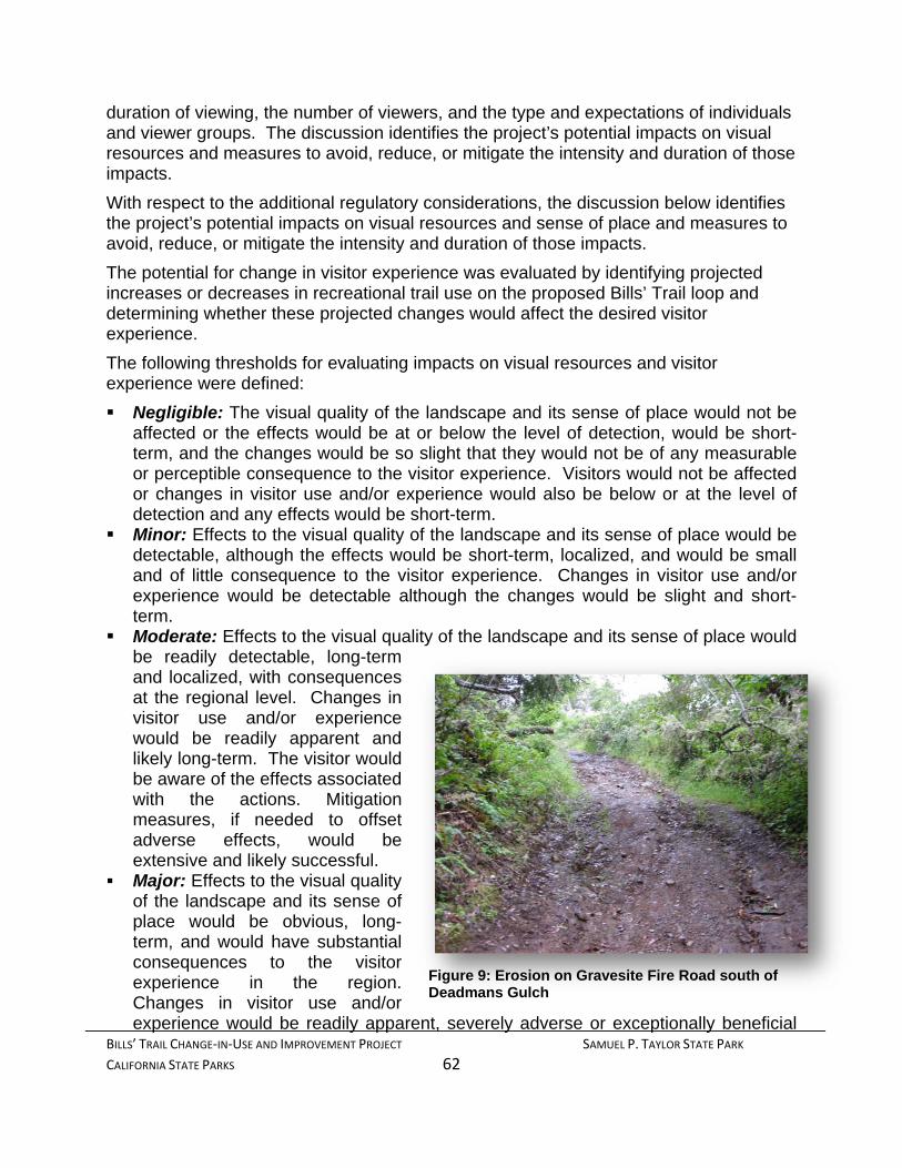
BILLS’ TRAIL CHANGE‐IN‐USE AND IMPROVEMENT PROJECT SAMUEL P. TAYLOR STATE PARK
CALIFORNIA STATE PARKS 62
duration of viewing, the number of viewers, and the type and expectations of individuals and viewer groups. The discussion identifies the project’s potential impacts on visual resources and measures to avoid, reduce, or mitigate the intensity and duration of those impacts.
With respect to the additional regulatory considerations, the discussion below identifies the project’s potential impacts on visual resources and sense of place and measures to avoid, reduce, or mitigate the intensity and duration of those impacts.
The potential for change in visitor experience was evaluated by identifying projected increases or decreases in recreational trail use on the proposed Bills’ Trail loop and determining whether these projected changes would affect the desired visitor experience.
The following thresholds for evaluating impacts on visual resources and visitor experience were defined:
Negligible: The visual quality of the landscape and its sense of place would not be affected or the effects would be at or below the level of detection, would be short-term, and the changes would be so slight that they would not be of any measurable or perceptible consequence to the visitor experience. Visitors would not be affected or changes in visitor use and/or experience would also be below or at the level of detection and any effects would be short-term.
Minor: Effects to the visual quality of the landscape and its sense of place would be detectable, although the effects would be short-term, localized, and would be small and of little consequence to the visitor experience. Changes in visitor use and/or experience would be detectable although the changes would be slight and short-term.
Moderate: Effects to the visual quality of the landscape and its sense of place would be readily detectable, long-term and localized, with consequences at the regional level. Changes in visitor use and/or experience would be readily apparent and likely long-term. The visitor would be aware of the effects associated with the actions. Mitigation measures, if needed to offset adverse effects, would be extensive and likely successful.
Major: Effects to the visual quality of the landscape and its sense of place would be obvious, long-term, and would have substantial consequences to the visitor experience in the region. Changes in visitor use and/or experience would be readily apparent, severely adverse or exceptionally beneficial
Figure 9: Erosion on Gravesite Fire Road south of Deadmans Gulch
BILLS’ TRAIL CHANGE‐IN‐USE AND IMPROVEMENT PROJECT SAMUEL P. TAYLOR STATE PARK
CALIFORNIA STATE PARKS 63
and have important long-term consequences. Extensive mitigation measures would be needed to offset any adverse effects and their success would not be guaranteed.
Impact Statement AES 1: Construction activities associated with the proposed project will have no adverse effect on a scenic vista.
During construction, and until vegetation is established on the disturbed soil created by the project, the scenic vista, which includes the project site, would be affected. This would be a short-term effect that would last through the growing season following construction, a time when the trail would be closed to all users. The proposed work would not hinder accessibility to any of the park's scenic areas with the exception of Stairstep Falls and no new structures will be constructed during this project. Construction activities may have a limited temporary impact on the scenic view from the trail, but obstructions would be extremely limited and exposure of brief duration. Therefore, the affect on visitors would be minor.
Level of Significance Before Mitigation: Less than Significant Mitigation: None
Impact Statement AES 2: Construction activities associated with the proposed project could substantially damage scenic resources, including, but not limited to, trees, rock outcroppings, and historic buildings within a state scenic highway.
The project is not located within the viewshed of a State Scenic Highway. However, scenic vistas are also defined as singular vantage points that offer unobstructed views of valued viewsheds. The proposed project is located near or within the viewshed of a scenic vista. The viewshed and visible components of the landscape within that viewshed, including the underlying landform and overlaying land cover, establish the visual environment for the scenic vista. Nevertheless, impacts to scenic vistas resulting from the project would be negligible.
Level of Significance Before Mitigation: Less than Significant Mitigation: None
Impact Statement AES 3: Construction and operational activities associated with the proposed project could potentially degrade the existing visual character, or quality of the site and its surroundings.
Construction Activities
Project implementation would temporarily disturb the visitor experience by altering the visual resources in the area immediately affected by the work being performed. Construction equipment and personnel, staging areas and stored materials and stockpiles could be visible to motorists, trail users and campers over the period of construction. Although adverse, the effects of construction activities on visual resources would be short-term, temporary and minor. Integration of Project Requirement HYDRO 1, use of Best Management Practices, will ensure impacts remain at a less than significant level.

BILLS’ TRAIL CHANGE‐IN‐USE AND IMPROVEMENT PROJECT SAMUEL P. TAYLOR STATE PARK
CALIFORNIA STATE PARKS 64
Operational Activities
As noted in Chapter 2.7 above, improvements undertaken within State Park units are limited to those that make areas available for public enjoyment and education. These improvements must be consistent with the preservation of natural, scenic, cultural and ecological values. Improvements which do not enhance these resource values, which are “attractions in themselves”, cannot be undertaken within State Parks.
Attractions in themselves can result in reduce parkland available for resource-based outdoor recreational uses; displace park users; reduce a parks’ sense of place; reduce open space; and consume staff time overseeing improvements.
Many of the mountain biking styles identified in Chapter 2, Table 2 rely on facilities that are essentially attractions in themselves. Some riding styles embrace speed while others challenge mental and physical capabilities. Aggressive riding styles could potentially displace users concerned about real or perceived threats to their safety as well as change the visual experience and natural ambiance of the trail. Therefore, accommodating mountain bikes on DPR trails requires careful planning to insure that the trail does not by design or by default, become such an attraction.
The trail’s design minimizes the ability for mountain bikers to attain high speeds in areas of the trail where speed affects safety, and minimizes design features that could be used to “challenge” their physical or mental skills. By design, mountain biker seeking these types of challenges will seek out trails in other regional parks. The typical mountain bikers for which this trail has been designed are those that simply seek to enjoy the natural, scenic and ecological values, doing so at speeds similar to those of hikers and equestrians. So, while there may be an increase in mountain bikers and a corresponding decrease in existing users, it is expected that this increase will be temporary. Once they experience the speed-limiting nature of the trail many mountain bikers will likely choose to ride other trails that better appeal to their style of riding and the spike in this user group will ultimately flatten.
Nevertheless, effects to the visual quality of the landscape and its sense of place could be moderately affected with the change in use project. Changes in visitor use and/or experience could also be readily apparent and long-term with the project. The following mitigation measure, however; would reduce the potential impact to a less than significant level on aesthetics and visual resources.
Mitigation Measure AES 1 – Active Management and Maintenance will require inspection of the trail annually and as needed to ensure that natural resources (including aesthetics) are not impacted by the change in use.
Level of Significance Before Mitigation: Potentially Significant Mitigation: AES 1 Active Management and
Maintenance Level of Significance After Mitigation: Less Than Significant
Qualified DPR staff will annually (or as needed) inspect the trail during the first three years following reopening to users and will prepare a report regarding CEQA-related

BILLS’ TRAIL CHANGE‐IN‐USE AND IMPROVEMENT PROJECT SAMUEL P. TAYLOR STATE PARK
CALIFORNIA STATE PARKS 65
issues (does not include user conflict), available for public review at District Headquarters. The report will include, but not be limited to the following for each issue:
Trail Sustainability (additional users, impacts and trail degradation); Impact identification, including source of impact if possible; Recommendations to remedy impact; Implementation schedule; Follow up on remedy effectiveness in 3 months.
If after, re-inspection: park staff determines the remedy to be effective, no further action is required on that issue; if DPR staff is unable to remedy an identified issue, a Superintendent’s Order could be used to immediately reduce user type, seasonally or permanently close the trail, and/or any other action deemed necessary to protect the impacted resource or user groups. DPR staff will utilize a Trail Use Survey to determine which user groups can maintain trail sustainability.
4.1.5. Effects Considered No Impact or Less than Significant without Project Requirements
No Impact and Less Than Significant impact determinations based on the CEQA Guidelines Section 15064.5 and Appendix G.
Impact Statement AES 4: Create a new source of substantial light or glare which would adversely affect day or nighttime views in the area: All construction work for the proposed project would be limited to daylight hours, eliminating the need for night-time work lights. No permanent new light sources would be introduced into the landscape. Neither construction nor operation of the trail would require or create lighting conditions that would adversely affect day or nighttime views. The project would have no effect on natural darkness.
4.1.6. Findings With the integration of Project Requirements and Mitigation Measures AES 1, temporary impacts to the scenic vista, scenic resources, and the visual character of the area would be less than significant.
4.2. Air Quality This section describes existing local and regional conditions and the potential impacts of the proposed project on air quality, along with pertinent air quality standards and regulations, and Project Requirements and/or mitigations proposed to reduce the significance of potential impacts.
4.2.1. Existing Conditions The following provides a discussion of the incremental and cumulative effect the proposed project could have on the air quality in the vicinity of the project site and within the San Francisco Air Basin and Bay Area Air Quality Management District.

BILLS’ TRAIL CHANGE‐IN‐USE AND IMPROVEMENT PROJECT SAMUEL P. TAYLOR STATE PARK
CALIFORNIA STATE PARKS 66
Climate Marin County is bounded on the west by the Pacific Ocean, on the east by San Pablo Bay, on the south by the Golden Gate and on the north by the Petaluma Gap. The eastern portion of the County contains small, sheltered valleys which act like a series of miniature air basins.
Marin County has a wedge shape with the southeastern section of the County located closer to the ocean than the northeastern portion. In southern Marin County, the distance from the ocean is short and the elevations are lower, resulting in higher incidence of maritime air in that area. Wind speeds are highest along the west coast of Marin, averaging about 8 to 10 miles per hour. The complex terrain in central Marin creates sufficient friction to slow the air flow. In portions of San Rafael, the average annual winds speeds are approximately 5 mph. The prevailing wind directions throughout Marin County are generally from the northwest.
The eastside of Marin County has warmer weather than the western side because of the greater distance from the ocean and because the hills that separate eastern Marin from western Marin can block the flow of marine air. The temperatures of the cities next to the Bay are moderated by the cooling effect of the Bay in the summer and the warming effect of the Bay in the winter. San Rafael experiences average maximum summer temperatures in the low-80s and average minimum winter temperatures in the low-40s. Inland towns experience average maximum temperatures that are two degrees cooler in the winter and two degrees warmer in the summer.
Air Basin California is divided into 15 Air Basins to better manage air pollution. Air basin boundaries were decided by grouping similar geographic features together. Some air basins really are like a basin, with valleys surrounded by mountains. Political boundaries, such as counties, were also important. While air pollution can move freely within an air basin, it can also sometimes move from one basin to another basin. The San Francisco Air Basin includes: part of Sonoma County, part of Napa County, and all of Marin, Contra Costa, Alameda, Santa Clara, San Mateo, and San Francisco County
Air Quality Standards Ambient air quality standards (AAQS) were established to set the maximum amount of pollutants that can be in the air without harming even the most sensitive individuals. Individuals or groups who are especially reactive to criteria pollutants are considered sensitive receptors and include children, the elderly, individuals susceptible to respiratory distress, and those who are acutely or chronically ill. Air pollutants have the ability to affect the health of the population, damage agricultural crops, and diminish visibility (Cal EPA Air Resources Board, 2011). The National Ambient Air Quality Standards (NAAQS) and CAAQS identify six common air pollutants: carbon monoxide (CO), lead (Pb), nitrogen dioxide (NO2), ozone (O3), particulate matter (PM10 & PM2.5), and sulfur dioxide (SO2). The California Air Resources Board (CARB) have identified other air pollutants that have standards for hydrogen sulfide (H2S), sulfates (SO4), vinyl chloride (VC), and visibility reducing particles (VRPs).

BILLS’ TRAIL CHANGE‐IN‐USE AND IMPROVEMENT PROJECT SAMUEL P. TAYLOR STATE PARK
CALIFORNIA STATE PARKS 67
Designations for air quality differ between the National and State standards. Under the Clean Air Act (U.S. Environmental Protection Agency, nd), the designations for air pollution are defined. “Attainment” is the designation given when an area meets the AAQS for a pollutant. “Non-attainment” is the designation given when an area does not meet (or contributes to ambient air quality nearby that does not meet) the AAQS. “Unclassified” refers to an area that cannot be classified by the amount of available data for the AAQS.
At the State level, some of the designation definitions vary slightly. The designation of “Attainment” is given to a site where the State standard for the pollutant was not violated during a three year period. “Non-attainment” refers to an area where at least one violation of the State standard occurred during the three year period. “Non-attainment / transitional” refers to an area of non-attainment that is close to attaining the State standard for compliance.
Table 3: Marin County Attainment Designations
Pollutant State Levels* National Levels**
Ozone (O3) - 1 hour Non-Attainment ____
Ozone (O3) - 8 hour ___ Non-Attainment
Carbon Monoxide (CO) Attainment Unclassified/Attainment
Nitrogen Dioxide (NO2) Attainment Unclassified/Attainment
Sulfur Dioxide (SO2) Attainment Attainment
Particulate Matter (PM10) Non-Attainment Unclassified
Particulate Matter (PM2.5) Non-Attainment Non-Attainment
Sulfates Attainment
Lead (Pb) Attainment
Hydrogen Sulfate Unclassified
Visibility-Reducing Particles (VRP) Unclassified
* 2010 State Area Designations effective on March 25, 2010 ** National Area Designations current as of September 2010
Sources: California Air Resources Board, U.S. Environmental Protection Agency, NSAQMD
Description of Pollutants The following air pollutants were selected for AAQS because research indicates exposure can have harmful effects on health and the environment. The descriptions include information regarding sources and effects of air pollutants recognized by the (EPA, nd). These pollutants impact individuals at differing rates dependent on susceptibility, concentrations, and the frequency of exposure. These health effects include increased respiratory disease, lung damage, headaches, chest pain, cancer, neurological or reproductive disorders, and in extreme situations even premature death.

BILLS’ TRAIL CHANGE‐IN‐USE AND IMPROVEMENT PROJECT SAMUEL P. TAYLOR STATE PARK
CALIFORNIA STATE PARKS 68
NAAQS and CAAQS Common Air Pollutants
Carbon Monoxide Carbon Monoxide (CO) is a colorless, odorless gas emitted by mobile and stationary sources as a result of incomplete combustion. Motor vehicle emissions contribute about 56 percent of all CO emissions nationwide, with an additional 22 percent from non-road engines (such as construction equipment and boats) (EPA 2007). Other sources of CO emissions include industrial processes (such as metals processing and chemical manufacturing), residential indoor and outdoor activities (including wood burning, gas stoves, cigarette smoke, and space heaters), and natural sources such as forest fires. The highest levels of CO in the outside air typically occur during the colder months of the year when inversion conditions are more frequent (EPA 2007). The air pollution becomes trapped near the ground beneath a layer of warm air.
Health risks associated with CO exposure range from person to person and by the concentration and length of the exposure. At lower levels of exposure, symptoms experienced include headaches, dizziness, disorientation, nausea, and fatigue. Higher exposure reduces delivery of oxygen to organs and tissue throughout the body. For individuals suffering from heart disease, exposure can be serious causing chest pains. Those who breathe in a high level of CO repeatedly can develop vision problems and reduced brain function, slowing down work and the ability to learn. In extreme cases CO can be fatal and cause death.
Lead Lead is a metal found naturally as a relatively soft yet resistant metal. The major sources of lead emissions have historically been motor vehicles (such as cars and trucks) and industrial sources (EPA, nd). Since the elimination of lead additives in motor vehicles, the major source for lead emissions today is from industrial plants processing metal (Cal EPA, 2010). The highest levels of lead in air are generally found near lead smelters. Other stationary sources are waste incinerators, utilities, and lead-acid battery manufacturers (EPA, nd).
Exposure to lead occurs from breathing or eating it in food, water, soil, or dust. Even in small amounts, exposure to lead is unhealthy because lead accumulates within the body to harmful levels. Lead can adversely affect the nervous, reproductive, digestive, immune, and circulatory systems. High levels of exposure could lead to osteoporosis, mental retardation, and heart disease. Infants and young children are especially sensitive to even low levels of lead.
Nitrogen Oxides A by-product of fuel combustion, nitrogen oxides (NOx) is the generic term for a family of highly reactive gases. NOx in combination with various compounds causes a variety of environmental impacts including ground-level ozone (smog), acid rain, reduced water quality, and reduced visibility. Many of the nitrogen oxides are colorless and odorless. However, one common pollutant, nitrogen dioxide (NO2) along with particles in the air can often be seen as a reddish-brown layer over many urban areas (EPA, nd). Fuels burned at high temperatures, during combustion processes for motor vehicles, electric

BILLS’ TRAIL CHANGE‐IN‐USE AND IMPROVEMENT PROJECT SAMUEL P. TAYLOR STATE PARK
CALIFORNIA STATE PARKS 69
utilities, and other industrial, commercial, and residential sources, result in the formation of nitrogen oxides. NOx can also be formed naturally.
As an acute irritant, NOx raises health concerns related to the respiratory system. Continual exposure to NOx can damage lung tissue and cause increased respiratory infection (Illingworth & Rodkin, Inc., Updated 2005). Higher levels of exposure could cause emphysema, bronchitis, and aggravate heart disease.
Ozone Ozone occurs within two levels of the atmosphere. The “good” ozone occurs naturally within the stratosphere approximately 10 to 30 miles above the earth’s surface. At that level, ozone protects life on earth from the sun’s harmful ultraviolet rays. The “bad” ozone occurs in the troposphere, which extends from the earth’s surface to approximately ten miles above ground level (EPA, nd).
Ozone is gas composed of three oxygen atoms that are a result of a chemical reaction at ground level. The reaction consists of nitrogen oxides (NOx) combining with volatile organic compounds (VOC) in the presence of sunlight.
Within the troposphere, sources of VOC and NOx are from motor vehicle exhaust, industrial emissions, gasoline vapors, chemical solvents, and natural sources. Ground-level ozone is the primary constituent of smog. Ozone concentrations tend to be higher when temperatures are high and days are long during spring, summer and fall months. As a result, it is known as a summertime air pollutant. Many urban areas tend to have high levels of "bad" ozone, but even rural areas are also subject to increased ozone levels because wind carries ozone and pollutants that form it hundreds of miles away from their original sources (EPA, nd).
Health effects associated with exposure to ozone include chest pain, coughing, sore throat, and congestion. With exposure to high levels of ozone, sensitive receptors are susceptible to reduced lung function.
Particulate Matter Particulate matter (PM) consists of tiny particles of dry solid fragments, small liquid droplets, or solid particles with liquid coatings. The particles vary in shape, size, and chemical composition, and can be made of different materials such as metals, soot, soil, and dust (Cal EPA 2007). Particulate matter that is 10 microns or less in diameter (PM10) is considered small enough to be inhaled and penetrate the lungs. Even smaller than PM10 are fine particles measuring 2.5 microns or less in diameter (PM2.5). Fine particles (PM 2.5) are the major cause of reduced visibility (haze) in parts of the United States (EPA, nd).
Directly emitted particulate matter, known as primary particles, are from sources that include combustion, motor vehicles, field burning, factories, construction sites, and road dust. Others form in complicated reactions in the atmosphere of chemicals such as sulfur dioxides and nitrogen oxides that are emitted from power plants, industries and
NOx + VOC O3 sunlight

BILLS’ TRAIL CHANGE‐IN‐USE AND IMPROVEMENT PROJECT SAMUEL P. TAYLOR STATE PARK
CALIFORNIA STATE PARKS 70
automobiles. These particles, known as secondary particles, make up most of the fine particle pollution across the country (EPA, nd).
Due to the size of particulate matter, inhalation can carry the smaller particles into the lungs and even through transfer into the bloodstream. Made up of different chemical components particulate matter can cause lung and heart related health problems.
Sulfur Dioxide Sulfur dioxide (SO2) is an extremely reactive, colorless, gaseous compound of sulfur and oxygen. SO2 is formed when sulfur containing fuel is burned by locomotives, ships, off-road diesel equipment, petroleum refineries, or metal production (Cal EPA 2007a). Sulfur dioxide is also produced through natural causes including geologic vents and hot springs. These gases dissolve easily in water creating acid rain or fog. Over 65% of SO2 released to the air, or more than 13 million tons per year, comes from electric utilities, especially those that burn coal (EPA, nd).
SO2 causes a wide variety of health and environmental impacts because of the way it reacts with other substances in the air. Heart and lung disease can occur due to exposure to particularly sensitive groups including people with asthma who are active outdoors, children, and the elderly (EPA, nd).
CAAQS Additional Air Pollutants Hydrogen Sulfide Hydrogen sulfide (H2S) is a colorless gas identifiable by its odor of rotten eggs. It is produced during bacterial anaerobic decomposition of substances containing organic sulfur (Cal EPA 2007). In nature, hydrogen sulfide can be found around hot springs, and geothermic sources. It is also produced through industrial processes such as oil production. At high levels it can be fatal because hydrogen sulfide prevents the uptake of oxygen by the blood. H2S is regulated by the CARB to eliminate exposure to disagreeable odors because the human nose detects the smell at low levels.
Sulfates Sulfates (SO4) are the fully oxidized ionic form of sulfur. Sulfates occur in combination with metal and / or hydrogen ions (Cal EPA, nd). In California, emissions of sulfur compounds occur primarily from the combustion of petroleum-derived fuels (e.g., gasoline and diesel fuel) that contain sulfur. This sulfur is oxidized to sulfur dioxide (SO2) during the combustion process and subsequently converted to sulfate compounds in the atmosphere (Cal EPA, nd). Sulfates tend to be acidic which can harm ecosystems and damage materials and property. Exposure to high levels of sulfates can cause health risks including a decrease in breathing function, aggravation of asthmatic symptoms, and an increased risk of cardio-pulmonary disease (Cal EPA, nd).
Vinyl Chloride Vinyl chloride (chloroethene) is a colorless gas with a mild, sweet odor. It is used in the production of vinyl products and polyvinyl chloride (PVC) plastic (Cal EPA, 2009). Once these vinyl products are disposed of in local landfills, sewage plants, or hazardous waste sites they break down emitting vinyl chloride. Health risks associated with short-

BILLS’ TRAIL CHANGE‐IN‐USE AND IMPROVEMENT PROJECT SAMUEL P. TAYLOR STATE PARK
CALIFORNIA STATE PARKS 71
term exposure to high levels include dizziness, drowsiness, and headaches. Long-term exposure through inhalation can cause liver damage and cancer (Cal EPA, 2009).
Visibility-Reducing Particles (VRPs) Visibility-reducing particles are made up of suspended particulate matter, which is a complex mixture of tiny particles that consists of dry solid fragments, small droplets of liquid or solid cores with liquid coatings. These particles vary greatly in shape, size and chemical composition, and can be made up of many different materials such as metals, soot, soil, dust, and salt (Cal EPA, 2009).
Air Monitoring Pollutant monitoring results for the years 2005 to 2008 (see Table 4.9.B) at the San Rafael ambient air quality monitoring station (the closest monitoring station to the project site) indicate that air quality in the project area has generally been good. As indicated in the monitoring results, one violation of the State PM10 standard and one violation of the federal PM2.5 standard was recorded during the 3-year period. State 1-hour O3 and federal 8-hour O3 standards have not been exceeded at this monitoring station in the last three years. CO, SO2, and nitrogen dioxide (NO2) standards were not exceeded in this area during the three-year period.
Sensitive Receptors A sensitive receptor is a person in the population who is particularly susceptible to health effects resulting from exposure to an air contaminant, when compared to the population at large. These include the elderly, children, and those with compromised immune systems, asthma, or severe allergies.
4.2.2. Regulatory Setting Federal Air Quality Regulations The Federal Clean Air Act (CAA) was originally written in 1963 as a means to provide funding for air quality research. A subsequent CAA was written in 1970 to enable nationwide responses for air pollution. After an amendment in 1990, the CAA was expanded to cover the impacts of air pollution and empower the U.S. EPA to implement and enforce stronger air pollution regulations. The CAA has two standards: to protect public health and public welfare.
The U.S. EPA is a regulatory agency charged with setting the NAAQS, creating minimum National emission limits for pollution sources (i.e. utilities and steel mills), and establishing regulations. Together these functions reduce the population’s exposure to air pollutants.
State Air Quality Regulations This 1988 California Clean Air Act (CCAA) was adopted by the State to implement statewide air pollution controls regulated by the California Air Resources Board (CARB) a section of the California Environmental Protection Agency (Cal EPA). This board set more stringent air pollution laws than are approved by the U.S. EPA. The CAAQS, regulated by the state, also include air pollutants that may cause serious long term

BILLS’ TRAIL CHANGE‐IN‐USE AND IMPROVEMENT PROJECT SAMUEL P. TAYLOR STATE PARK
CALIFORNIA STATE PARKS 72
effects such as sulfates (S), lead (Pb), hydrogen sulfide (H2S), and visibility reducing particles (VRPs).
Samuel P. Taylor State Park General Plan DPR has not completed a General Plan for SPTSP. However, the management approach for any unit of the State Park System, including SPTSP, is based on unit classification statutes specified in the California Public Resources Code (PRC) § 5019.50 through 5019.74. The statutes set forth the primary purpose of each classified unit, identify in general what types of facilities and uses could be permitted, and provide direction on how unit resources would be managed. The purpose of a State Park is to preserve outstanding resource values, species, and significant examples of California’s ecological regions; each State Park would be managed as a composite whole to restore, protect, and maintain its native environmental complexes; improvements undertaken within a State Park would serve to make areas within the park unit available for public enjoyment and education in a manner consistent with resource preservation; and improvements could include recreational facilities as long as no major modification of land, forests, or waters occurs (PRC § 5019.53).
Local regulations Bay Area Air Quality Management District (BAAQMD) The BAAQMD is the agency primarily responsible for regulating air pollution emissions from stationary sources (e.g., factories) and indirect sources (e.g., traffic associated with new development), as well as for monitoring ambient pollutant concentrations. BAAQMD’s jurisdiction encompasses seven Bay Area counties—Alameda, Contra Costa, Marin, San Francisco, San Mateo, Santa Clara and Napa—and portions of Solano and Sonoma counties.
Marin County General Plan DPR is exempt from local regulations, including general plans, specific plans and zoning ordinances (California Constitution Article XI, Section 7), although the project must comply with applicable state and federal rules and regulations governing local regulations applicable to impacts located outside Park boundaries (i.e. air quality and noise).
4.2.3. Thresholds of Significance The following thresholds have been prepared based on the State CEQA Guidelines (Appendix G) and Section 15065 of the State CEQA Guidelines. The Project would have a significant impact* on Air Quality if it would:
AIR 1: Conflict with or obstruct implementation of the applicable air quality plan or regulation.
AIR 2: Violate any air quality standard or contribute substantially to an existing or projected air quality violation.
AIR 3: Result in a cumulatively considerable net increase of any criteria pollutant for which the project region is in non-attainment under an applicable federal or state AAQS (including releasing emissions which exceed quantitative thresholds for ozone precursors).

BILLS’ TRAIL CHANGE‐IN‐USE AND IMPROVEMENT PROJECT SAMUEL P. TAYLOR STATE PARK
CALIFORNIA STATE PARKS 73
AIR 4: Expose sensitive receptors (e.g., children, the elderly, and individuals with compromised respiratory or immune systems) to substantial pollutant concentrations.
AIR 5: Create objectionable odors affecting a substantial number of people.
*Where available, the significance criteria established by the applicable air quality management or air pollution control district will be relied upon to make these determinations. 4.2.4. Environmental Impacts, Project Requirements, and
Mitigation Measures Impact Statement Air 2: Would construction activities associated with the proposed project would violate any air quality standard or contribute substantially to an existing or projected air quality violation?
Air Quality Standard/Air Quality Violation Emissions during project implementation would not include air contaminants at levels that would, by themselves, violate local, state, or federal ambient air quality standards. Emissions would not contribute to a substantial permanent or long-term increase in any air contaminant, but could still cause adverse air quality impacts. Construction would cause intermittent and temporary increases of fugitive dust (PM10) and ozone precursors (i.e., volatile organic compounds [VOC] and nitrogen oxides [NOx]). These air quality impacts would be limited to the segment of Bills’ Trail or Gravesite Fire Road where construction occurs. This would vary from day to day, location along the road/trail, type of work occurring, and the weather.
Ozone precursors (chemicals, which contribute to the creation of ozone) from project vehicles would increase in the general vicinity of the site. Project and worker vehicles would range from 5-20 daily, with 1-2 trips per vehicle. Most heavy equipment would remain on the site for the duration of the work. Suppliers would drop off equipment and materials and leave the same day, with an average of 1-3 deliveries per day. During project implementation, there is a projected possibility of an additional 43 trips per day by delivery and worker vehicles. Based on these figures, maximum project traffic would only increase total traffic volume, and vehicle emissions, in the vicinity of the construction site by approximately five percent. This increase would constitute a less than significant impact at the site and a negligible impact on the air quality in the BAAQMD.
Construction equipment powered by diesel would also emit air pollutants during project implementation. Diesel exhaust emits nitrogen oxides (NOx) (another component of ozone) and particulate matter (diesel PM). Diesel PM has been identified by CARB as a toxic air contaminant with chronic and carcinogenic risks to public health. A significance threshold for diesel PM has not been established. Emissions can vary widely, depending on the length of time each piece of equipment would be operated, condition of the equipment’s engine and exhaust, weather, and type of operation.

BILLS’ TRAIL CHANGE‐IN‐USE AND IMPROVEMENT PROJECT SAMUEL P. TAYLOR STATE PARK
CALIFORNIA STATE PARKS 74
Steep grades, dry summer conditions, travel and work along the unpaved trail and roads could result in short term increases of fugitive dust (PM10) during trail and road improvements. In addition to increased PM10 along the trail and road, the movement of vehicles in and out of the project area could move soil onto Sir Francis Drake Boulevard. Once on the paved road, continual traffic and off shore breezes could transfer the soil to airborne PM.
Due to the limited size of this project, it is expected that the project’s operational emissions would not exceed the BAAQMD’s Thresholds for Significant Contribution to regional air pollution (VOC, NOx, and PM10).
Increased emissions of particulate matter and ozone related to activities proposed as part of this project could contribute to existing non-attainment conditions and interfere with achieving the projected attainment standards. However, construction related emissions would be short-term and temporary in nature, local air quality conditions would return to existing conditions at the end of the project. Integration of Project Requirement AIR 2, limiting the quantity, type, and duration of equipment used during project implementation, would ensure impacts remain at a less than significant level.
Level of Significance Before Mitigation: Less than significant Mitigation Measure: None
Impact Statement AIR 3: Construction activities associated with the proposed project could result in a cumulatively considerable net increase of any criteria pollutant for which the project region is in non-attainment under an applicable federal or state AAQS (including releasing emissions which exceed quantitative thresholds for ozone precursors)
Particulate Matter Fugitive Dust Emissions DPR and its contractors would limit the emission and/or airborne transport of fugitive dust in implementing the measures outlined in the (BAAQMD, 1999). Integration of Project Requirement AIR 3 will ensure fugitive dust emission impacts remain at a less than significant level.
Level of Significance Before Mitigation: Less than significant Mitigation Measure: None
4.2.5. Effects Considered No Impact or Less than Significant
without Project Requirements No Impact and Less Than Significant impact determinations based on the CEQA Guidelines Section 15064.5 and Appendix G.
Impact Statement AIR 1: Conflict with or obstruct implementation of the applicable air quality plan or regulation: Proposed work will not conflict or obstruct the implementation of any applicable air quality management plan for Monterey County.
Impact Statement AIR 4: Expose sensitive receptors (e.g., children, the elderly, and individuals with compromised respiratory or immune systems) to substantial

BILLS’ TRAIL CHANGE‐IN‐USE AND IMPROVEMENT PROJECT SAMUEL P. TAYLOR STATE PARK
CALIFORNIA STATE PARKS 75
pollutant concentrations: Sensitive receptors would have the ability to avoid the SPTSP or visit other areas of the Park free of potential air pollutants. Although the project site is currently open to the public; access would be restricted during construction to protect public health and safety. Area residences are sufficiently distant from proposed construction activities to be safe from serious exposure. Facilities that provide care for sensitive receptors (such as schools, hospitals) are not within a mile of the project site.
Impact Statement AIR 5: Create objectionable odors affecting a substantial number of people: Construction-related activities and emissions would result in a short-term generation of odors, including diesel exhaust, and fuel vapors. These odors could be considered objectionable by some Park visitors and employees. However, construction activities would be short-term; odorous emissions would dissipate rapidly in the air, with increased distance from the source; and visitor exposure to these odors would be extremely limited.
4.2.6. Findings For air quality evaluated as part of this environmental document, the potential exists for the release of air pollutants that could result in a temporary significant risk to the public and the environment. However, the implementation of this project would only impact air quality for a short period of time during construction. Integration of Project Requirements would reduce air quality impacts to a less than significant level.
4.3. Biological Resources This section provides information on biological resources that occur or could potentially occur within the proposed project site, or could be impacted by the Trail Improvement Project activities at Samuel P. Taylor State Park (SPTSP). This includes specific information on the biological resources and potential impacts to these resources from trail improvement construction activities as well as operational activities resulting from the proposed change in use.
4.3.1. Existing Conditions The following is a discussion of the existing vegetation and wildlife habitats and species that are potentially found in the vicinity of the project area and surrounding region.
4.3.1.1. Vegetation and Wildlife Habitat
Vegetation Vegetation within the project area is comprised of six vegetation types as defined in Sawyer et al (2009), which conforms to the National Vegetation Classification Standard adopted by the federal government (USGS 2010).
Mediterranean California Naturalized Annual and Perennial Grassland Group Baccharis pilularis Shrubland Alliance Umbellularia californica Forest Alliance Pseudotsuga menziesii Forest Alliance

BILLS’ TRAIL CHANGE‐IN‐USE AND IMPROVEMENT PROJECT SAMUEL P. TAYLOR STATE PARK
CALIFORNIA STATE PARKS 76
Eucalyptus globulus Semi-Natural Woodland Stands Alnus rhombifolia Forest Alliance
The Mediterranean California Naturalized Annual and Perennial Grassland Group consists of several alliances (equivalent to plant communities) dominated by non-native grass species. This vegetation type best characterizes the diverse mixture of grassland types bordering most of the Barnabe Fire Road, a portion of the Gravesite Fire Road, and two small areas on the upper portion of Bills’ Trail. Commonly encountered species include non-native slender wild oat (Avena barbata), soft chess (Bromus hordeaceus), ripgut grass (Bromus diandrus), Mediterranean barley (Hordeum marinum ssp. gusseanum), rattlesnake grass (Briza maxima), English plantain (Plantago lanceolata), scarlet pimpernel (Anagallis arvensis), annual Italian ryegrass (Lolium multiflorum), dogtail grass (Cynosurus echinatus), narrowleaf cottonrose (Logfia gallica), sheep sorrel (Rumex acetosella), and hairy cat’s ear (Hypochaeris radicata); native species include winecup clarkia (Clarkia purpurea ssp. quadrivulnera), California poppy (Eschscholzia californica), wild blue rye (Elymus glaucus), purple needlegrass (Nasella pulchra), California brome (Bromus carinatus), bracken fern (Pteridium aquilinum var. pubescens), and harvest brodiaea (Brodiaea elegans ssp. elegans). Native purple needlegrass, the most abundant of the remaining native bunchgrasses in this area, occurs in greatest numbers in locations adjacent to road sides.
Patchy stands of Baccharis pilularis Shrubland Alliance vegetation dominated by coyote brush (Baccharis pilularis) interspersed with grasslands adjacent to the Barnabe Fire Road. Other commonly encountered species include California blackberry (Rubus ursinus), bush monkey flower (Mimulus aurantiacus), California coffeeberry (Frangula californica ssp. californica), poison oak (Toxicodendron diversilobum), California sagebrush (Artemisia californica), cow parsnip (Heracleum maximum), and shrubby specimens of California bay laurel (Umbellularia californica).
Umbellularia californica Forest Alliance comprises the dominant vegetation type along most of the length of Bills’ Trail. California bay laurel dominates the canopy of this vegetation, which supports significant numbers of Douglas-fir (Pseudotsuga menziesii) and California hazelnut (Corylus cornuta var. californica) in the canopy and sub-canopy, respectively. Small, scattered stands of California nutmeg (Torreya californica) are distributed discontinuously along portions of Bills’ Trail. Commonly encountered species in the shrub and herbaceous layer include bracken fern, western sword fern (Polystichum munitum), California blackberry, poison oak, California maidenhair fern (Adiantum jordanii), five-finger fern (Adiantum aleuticum), wood rose (Rosa gymnocarpa), fringe cups (Tellima grandiflora), Pacific sanicle (Sanicula crassicaulis), coastal wood fern (Dryopteris arguta), California coffeeberry, and blue forget-me-not (Myosotis latifolia).
Pseudotsuga menziesii Forest Alliance integrates with Umbellularia californica Forest Alliance in lower elevation sections of Bills’ Trail and the Gravesite Fire Road. Douglas-fir dominates the canopy of the Pseudotsuga menziesii Forest Alliance, which supports the same complement of shrub and herbaceous species as the preceding vegetation type. Although often co-dominant with Douglas-fir in other park locations, tanoak
BILLS’ TRAIL CHANGE‐IN‐USE AND IMPROVEMENT PROJECT SAMUEL P. TAYLOR STATE PARK
CALIFORNIA STATE PARKS 77
(Lithocarpus densiflorus) is largely absent from this vegetation type within the project area.
A patch of Eucalyptus globulus Semi-Natural Woodland Stands vegetation type occurs near the beginning of Bills’ Trail. Dominated by non-native blue gum eucalyptus (Eucalyptus globulus), this vegetation type shares the same assemblage of shrub and herbaceous species as the surrounding Pseudotsuga menziesii and Umbellularia californica Forest Alliance types described above. One key difference is blue gum typically inhibits the establishment of a dense understory.
A narrow strip of riparian vegetation best characterized as Alnus rhombifolia Forest Alliance borders Devil’s Gulch. White alder (Alnus rhombifolia) co-dominates with arroyo willow (Salix lasiolepis). Other common species include big-leaf maple (Acer macrophyllum), California buckeye (Aesculus californica), creek dogwood (Cornus sericea var. sericea), California hazel (Corylus cornuta var. californica), Oregon ash (Fraxinus latifolia), thimbleberry (Rubus parviflorus), California blackberry (Rubus ursinus), Sitka willow (Salix sitchensis), blue elderberry (Sambucus mexicana), California bay, western sword fern, and coastal wood fern. Pseudotsuga menziesii and Umbellularia californica Forest Alliance types enclose and overtop the shorter riparian canopy. A few scattered coast redwoods (Sequoia sempervirens) inhabit sites adjacent to Devil’s Gulch, including an estimated 10 foot diameter at breast height (dbh) tree near the beginning of Bills’ Trail.
Sudden Oak Death Discovered in 1995, Sudden Oak Death (SOD) is caused by the pathogen Phytophthora ramorum, has infected and killed thousands of tanoak, coast live oak (Quercus agrifolia), Shreve oak (Quercus parvula var. shrevei), and California black oak (Quercus kelloggii) trees in coastal forests from Humboldt County to Monterey County. This water mold also infects California bay laurel, Pacific madrone (Arbutus menziesii), California buckeye, coast redwood, Douglas-fir, big-leaf maple, hairy honeysuckle (Lonicera hispidula var. vacillans), California coffeeberry, toyon (Heteromeles arbutifolia), California rose bay (Rhododendron macrophyllum), manzanita species (Arctostaphylos spp.), and California huckleberry (Vaccinium ovatum).
SOD is transported to new areas when infected plants or infested soil is moved. Phytophthora ramorum thrives in wet or moist climates with cool temperatures; these organisms and their spores can be found in soil and water as well as plant material. The risk of SOD spread is greatest in muddy areas and during rainy weather where spore-producing hosts are present and can occur with any type of user. Many of the tanoaks in the park and surrounding locations have been affected by SOD, resulting in numerous dead and dying trees.
Marin County is one of 14 California counties to have confirmed SOD findings and is under State and federal quarantine regulations. Quarantined areas are subject to specific regulations regarding the movement and use of susceptible plants. County Agricultural Commissioners’ enforce both State and federal regulations.
Wildlife Habitat

BILLS’ TRAIL CHANGE‐IN‐USE AND IMPROVEMENT PROJECT SAMUEL P. TAYLOR STATE PARK
CALIFORNIA STATE PARKS 78
Wildlife habitat types described below are based upon vegetation characteristics. For this project these can be grouped into three categories: Herbaceous Dominated Habitats, Shrub Dominated Habitats, and Tree Dominated Habitats. Within each of the three categories, habitat types are defined based upon the California Wildlife Habitat Relationship Database (CWHR) habitat classification system (CDFG 2010a, Mayer and Laudenslayer 1988). Each CWHR habitat type corresponds to a vegetation type described in the Vegetation section above; however the CWHR habitat and corresponding vegetation type are not necessarily equivalent. For example, the CWHR’s Coastal Scrub corresponds to Baccharis pilularis Shrubland Alliance, which is not equivalent because the CWHR type
is more broadly defined and can include numerous plant species that do not occur in the vegetation type. While the vegetation section identifies assemblages of plant species, wildlife habitat types focus on component habitat elements (e.g. environmental diversity, food items) that are capable of sustaining and supporting both common and special status wildlife species.
Herbaceous Dominated Habitats Mediterranean California Naturalized Annual and Perennial Grassland
Group (corresponds to Annual Grassland and Perennial Grassland) – These habitat types consists of open grasslands composed primarily of non-native grass and forb species that provide foraging and/or breeding habitat for various species of lizards, snakes, raptors, songbirds, and mammals (LSA 2010, Mayer and Laudenslayer 1988). Typical wildlife species inhabiting annual grasslands in Marin County include western fence lizard (Sceloporus occidentalis), common garter snake (Thamnophis sirtalis), gopher snake (Pituophis catenifer), racer (Coluber constrictor), red-tailed hawk (Buteo jamaicensis), American kestrel (Falco sparverius), western meadowlark (Sturnella neglecta), savanna sparrow (Passerculus sandwichensis), western bluebird (Sialia mexicana) California ground squirrel Spermophilus beecheyi), Botta’s pocket gophers (Thomomys bottae), coyote (Canis latrans), and mule deer (Odocoileus hemionus).
Shrub Dominated Habitats Baccharis pilularis Shrubland Alliance (corresponds to Coastal Scrub) – This
habitat type consists of a dense to moderately dense and continuous cover of a tall overstory shrub layer with a short, perennial herb/sub-shrub understory (LSA 2010). Like the grassland habitats Coastal Scrub occurs on drier sites than Forest Dominated Habitats. It provides foraging, perching and nesting sites for some birds and cover for small mammals and reptiles. Species common to this habitat include western fence lizard, California quail (Callipepla californica), western scrub-jay (Aphelocoma californica), California towhee (Pipilo crissalis), American goldfinch (Carduelis tristis), chestnut-backed chickadee (Poecile rufescens), black-tailed jackrabbit (Lepus californicus), and brush rabbit (Sylvilagus bachmani).
Tree Dominated Habitats

BILLS’ TRAIL CHANGE‐IN‐USE AND IMPROVEMENT PROJECT SAMUEL P. TAYLOR STATE PARK
CALIFORNIA STATE PARKS 79
Umbellularia californica Forest Alliance (corresponds to Coastal Oak Woodland) – This habitat type consists of closed to mostly closed tree canopies with a sparse to moderately dense shrub layer and a well-developed herbaceous layer (LSA 2010). Coastal Oak Woodland provides habitat for a variety of wildlife species, including western fence lizard, California quail, wild turkey (Meleagris gallopavo), western scrub jay(Aphelocoma californica), white-crowned sparrow (Zonotrichia leucophrys), white-throated sparrow (Zonotrichia albicollis), golden-crowned sparrow (Zonotrichia atricapilla), California towhee, mourning dove (Zenaida macroura), Stellar’s jay (Cyanocitta stelleri), red-tailed hawk, common raven (Corvus corax), western gray squirrel (Sciurus griseus), and black-tailed deer (Odocoileus columbianus).
Pseudotsuga menziesii Forest Alliance (corresponds to Douglas-fir) – This habitat
type is similar to the preceding type, but with a taller canopy and a typically closed tree canopy. The moist environment supports a well-developed herbaceous layer and a sparse to moderately dense shrub layer (LSA 2010), creating an environment suitable for many amphibians and reptiles such as ensatina (Ensatina eschscholtzii), California slender salamander (Batrachoseps attenuatus), western fence lizard, rubber boa (Charina bottae), and ring-necked snake (Diadophis punctatus). Other wildlife species commonly found in this habitat type include Stellar’s jay, California quail, pileated woodpecker (Dryocopus pileatus), and golden-crowned sparrow (Zonotrichia atricapilla), winter wren (Troglodytes troglodytes), and the federally Threatened northern spotted owl (Strix occidentalis caurina).
Eucalyptus globulus Semi-Natural Woodland Stands (corresponds to Eucalyptus) – This habitat type is dominated by non-native eucalyptus, which provides roosts, perches, and nest sites for bird species, especially raptors (Mayer and Laudenslayer 1988). Typically the canopy of Eucalyptus habitat is closed and the shrub and herbaceous layers are sparse and not well-developed. Although very limited in extent within the project area, it can provide habitat for American crow (Corvus brachyrhynchos), common raven, barn owl (Tyto alba), red-tailed hawk, and red-shouldered hawk (Buteo lineatus).
Alnus rhombifolia Forest Alliance (corresponds to Montane Riparian) – This streamside habitat type consists of a narrow strip of broadleaved tree dominated vegetation with a closed canopy. It has an exceptionally high habitat value, providing water, forage, breeding areas, migration and dispersal corridors, and thermal cover for numerous common as well as special status wildlife species (LSA 2010, Mayer and Laudenslayer 1988). Within the project area this habitat is limited to the riparian strip along Devil’s Gulch at the beginning of Bills’ Trail.
Devil’s Gulch supports known populations of federally Threatened steelhead (Oncorhynchus mykiss) and federally Endangered Coho salmon (Oncorhynchus kisutch). Amphibians and reptiles potentially occurring or known to occur in Devil’s Gulch include foothill yellow legged frog (Rana boylii), California giant

BILLS’ TRAIL CHANGE‐IN‐USE AND IMPROVEMENT PROJECT SAMUEL P. TAYLOR STATE PARK
CALIFORNIA STATE PARKS 80
salamander (Dicamptodon ensatus), Pacific treefrog (Pseudacris regilla), California newt (Taricha torosa), and several species of garter snake. Bird species commonly found in this habitat type include mallard (Anas platyrhynchos), great blue heron (Ardea herodias), house wren (Troglodytes aedon), mourning dove, Pacific-slope flycatcher (Empidonax difficilis), warbling vireo (Vireo gilvus), barn swallow (Hirundo rustica), black phoebe (Sayornis nigricans), belted kingfisher (Ceryle alcyon), Swainson’s thrush (Catharus ustulatus), American dipper (Cinclus mexicanus), and black-headed grosbeak (Pheucticus melanocephalus). Mammal species that may be found in this habitat type include northern raccoon (Procyon lotor), Virginia opossum (Didelphis virginianus), mule deer, coyote, bobcat (Lynx rufus), and mountain lion (Puma concolor).
Wetlands, Riparian Zones, and Waters of the U.S. The U.S. Army Corps of Engineers (USACE) defines wetlands as areas that are inundated or saturated by surface or ground water at a frequency and duration sufficient to support, and under normal circumstances do support, a prevalence of vegetation typically adapted for life in saturated soil conditions. The majority of USACE-jurisdictional wetlands meet three wetland delineation criteria: (1) hydrophytic vegetation, (2) hydric soil types, and (3) wetland hydrology. No USACE-jurisdictional wetlands occur within the project area.
The term “waters of the U.S.” applies to the jurisdictional limits of the authority of the US Army Corps of Engineers to regulate navigable waters under Section 404 of the federal Clean Water Act. Navigable waters are defined in Section 502(7) of the Act as "waters of the United States, including the territorial seas." By definition, navigable waters include all wetlands and tributaries to "waters of the United States." Under Section 404 of the Act, the USACE has authority to regulate the discharge of dredged or fill material into navigable waters. The authority for the USACE to regulate navigable waters is also provided under Section 10 of the Rivers and Harbors Act of 1899. Under this statute, the USACE regulates excavation or filling operations or the alteration or modification of the course, location, condition, or capacity of any navigable water of the United States.
For purposes of Section 404 of the Clean Water Act, the lateral limits of USACE-jurisdiction over non-tidal water bodies (e.g. streams) extend to the ordinary high water mark (OHWM), in the absence of wetlands (USACE 2005). The proposed project would include construction activities within the OHWM of three perennial streams and three intermittent streams; hence these streams are subject to Section 404 regulation by the USACE.
The State Water Resources Control Board regulates the alteration of any federal water body, including the streams identified above, through Section 401 of the Clean Water Act. The appropriate Regional Water Quality Control Board(s) certify that water quality of the affected water body is not subject to unacceptable environmental impacts through provisions of the 401 certification program (SWRCB 2010).
Pursuant to Section 1600 of the Fish and Game Code the California Department of Fish and Game (CDFG) regulates any work occurring in or near a river, stream, or lake that
BILLS’ TRAIL CHANGE‐IN‐USE AND IMPROVEMENT PROJECT SAMUEL P. TAYLOR STATE PARK
CALIFORNIA STATE PARKS 81
flows at least intermittently through a bed or channel. Construction activities proposed for the six stream channels identified above are subject to the jurisdictional authority of the CDFG. 4.3.2. Special Status Biological Resources Special status biological resources include plants and animals that have been afforded special recognition by federal, state, or local resource agencies and organizations. Also included are habitats that are of relatively limited distribution or are of particular value to wildlife.
For the purposes of this EIR, special-status species are defined as plants and animals that are legally protected under the federal Endangered Species Act (ESA), the California Endangered Species Act (CESA) or other laws, or that are otherwise considered sensitive by federal, state, or local resource conservation agencies and organizations. Specifically, this includes species listed as state and/or federally Threatened, Endangered, or Rare; those considered as candidates for listing; species identified by USFWS and /or CDFG as Species of Special Concern (SSC); wildlife identified by CDFG as Fully Protected (FP) or
Protected (P); and plants considered by the CNPS to be rare, threatened, or endangered (i.e., plants on CNPS lists 1 and 2). Special-status species that are not federally protected or state listed as threatened, endangered, or rare do not receive protection under ESA or CESA. However, impacts to these species could still be considered significant under CEQA if it determined to be rare or endangered by the lead agency [CEQA Guidelines §15380(b)].
A species can be considered:
“Endangered" when its survival and reproduction in the wild are in immediate jeopardy from one or more causes, including loss of habitat, change in habitat, overexploitation, predation, competition, disease, or other factors.
“Rare" when either:
the species is not presently threatened with extinction, but is existing in such small numbers throughout all or a significant portion of its range that it may become endangered if its environment worsens; or
the species is likely to become endangered within the foreseeable future throughout all or a significant portion of its range and may be considered "threatened" as that term is used in the Federal Endangered Species Act.
Special-Status Plants
Identification of the special status plant species that are known or that could potentially occur within or near the project area are based on 2010 surveys conducted by DPR biologists and a review of existing information from the following sources: the CNPS (Inventory of Rare and Endangered Plants of California, 6th edition, electronic version, 2010), the CNDDB (CDFG 2010c), and the USFWS list of federally listed species for Marin County (USFWS 2010a).

BILLS’ TRAIL CHANGE‐IN‐USE AND IMPROVEMENT PROJECT SAMUEL P. TAYLOR STATE PARK
CALIFORNIA STATE PARKS 82
The CNPS1 identifies 76 special status species for the San Geronimo 7.5-minute U. S. Geological Survey (USGS) quadrangle and adjacent San Rafael, Bolinas, Novato, Inverness, Petaluma River, Petaluma, Point Reyes NE, and Double Point quadrangles (see Table 4.3.2, Appendix F). Occurrences of 64 special status plant species appear in the CNDDB for these quads, all of which are reported by the CNPS. The USFWS identifies 12 federally listed species for Marin County, four of which do not appear on the CNPS or CNDDB lists for the aforementioned quads. Special status species identified above and their relevant listing status and pertinent biological information are presented in Table 4.3.1 contained in Appendix F.
Of the 76 species listed in Table 4.3.1, 57 of these have no potential to occur in or near the project area based on the absence of suitable habitat or soils substrates, including all of the species with federal listing status. Habitat types not found in the project area include coastal dunes, vernal pools, coastal bluff scrub, closed cone coniferous forest and mesic meadows; substrates types absent from the project area include serpentine derived soils, adobe clay, and sand. For example, short-leaved evax (Hesperevax sparsiflora var. brevifolia) is limited to sandy areas in coastal bluff scrub or coastal dunes, which are habitats that do not exist within the project area.
Suitable habitat is available within or adjacent to the project area for 19 special status plant species. The CNDDB reports an occurrence of the shrub western leatherwood (Dirca opccidentalis) in Devil’s Gulch; no other occurrences of special status plants species have been reported the CNDDB for the project area.
Multiple field surveys for special status plants were conducted by a qualified biologist in May and June of 2010. These surveys were timed to coincide with plant blooming periods and 2010 plant phenology and conform to the botanical survey protocols established by the CDFG (2009). Surveys consisted of visual inspection of the vegetation bordering Bills’ Trail and Gravesite Fire Road within the Area of Potential Effect (APE), which could extend up to several feet from the center point of the existing trail/road. No special status plant species were detected during these surveys.
Sensitive Natural Plant Communities
Sensitive natural plant communities are especially diverse, regionally uncommon, or of special concern to local, state and federal agencies. Elimination or substantial degradation of these communities would constitute a significant impact under CEQA.
Although considered common enough not to be of concern by the CDFG, Alnus rhombifolia and Pseudotsuga menziesii Forest Alliances provide valuable habitat for special status wildlife species and are identified in this document as sensitive natural plant communities. The Alnus rhombifolia Forest Alliance, which encompasses Devil’s
1 California Native Plant Society (CNPS) Lists: List 1A = presumed extinct in California; List 1B = rare or endangered in California and elsewhere; List 2 = rare or endangered in California, more common elsewhere; List 3 = need more information; List 4 = plants of limited distribution. New threat code extensions are: .1 = seriously endangered in California; .2 = fairly endangered in California; and .3 = not very endangered in California.
BILLS’ TRAIL CHANGE‐IN‐USE AND IMPROVEMENT PROJECT SAMUEL P. TAYLOR STATE PARK
CALIFORNIA STATE PARKS 83
Gulch, provides habitat for known populations of the federally Threatened steelhead and federally Endangered coho salmon. Habitat for federally Threatened northern spotted owl is furnished by the Pseudotsuga menziesii Forest Alliance.
Special-Status Wildlife
A list of 78 special status wildlife species with the potential to occur in SPTSP or on surrounding lands was generated from the USFWS list of federally listed species for Marin County and the CNDDB (CDFG 2010c). These species are identified in Table 4.3.1in Appendix F. Species with the potential to occur in or near the project area are discussed below.
INVERTEBRATES
Marin blind harvestman (Calicina diminua) – Arachnid species of the genus Calicina occur in mesic habitats under medium to large undisturbed rocks that are in contact with the soil (CDFG 2010d). They are not present in locations where soils are saturated or periodically inundated. The CNDDB identifies Marin blind harvestman as critically imperiled and at very high risk of extinction. The only reported occurrence of this species is from specimens collected between 1968 and 1986 under serpentine rocks on a grassy hillside along San Marin Drive in Novato, California (CDFG 2010c). The probability of occurrence in the project area is very low since suitable rock habitat is extremely scarce. Robust walker (Pomatiopsis binneyi) – Information regarding this snail species is very limited and like the preceding species, is identified as critically imperiled and at very high risk of extinction by the CNDDB. It is found in aquatic habitats and has been reported to occur in springs at Potrero Meadows on Marin Water District land and at a non-specific location identified as Bolinas (Perez et al. 2004, CDFG 2010c). Based on existing information, no suitable habitat for this species occurs in the project area.
California freshwater shrimp (Syncaris pacifica) – This federally and state Endangered species occurs only in 23 stream segments within Sonoma, Napa and Marin Counties (Martin et al. 2009, USFWS 2007). The California freshwater shrimp is the State’s only native, stream-dwelling shrimp (CDFG 2010e). Individuals are generally less than 3 inches in length and are found in reaches that are structurally diverse with undercut banks, exposed roots, overhanging woody debris, or overhanging vegetation. It is known to inhabit Lagunitas Creek, but has not been reported to inhabit Devil’s Gulch (CDFG 2010c, USFWS 2007). Suitable riparian habitat could occur in Devil’s Gulch.
Marin hesperian (Vespericola marinensis) – Various shell populations of the Marin Hesperian, a terrestrial snail, have been identified throughout the Point Reyes Peninsula and surrounding region, primarily near or adjacent to the coast (Conchologists of America, Inc. 2010). Reported habitat preferences include the underside of logs and bark. The CNDDB identifies Marin hesperian as imperiled to vulnerable and at high to moderate risk of extinction. The closest reported occurrence

BILLS’ TRAIL CHANGE‐IN‐USE AND IMPROVEMENT PROJECT SAMUEL P. TAYLOR STATE PARK
CALIFORNIA STATE PARKS 84
is about 1.4 road miles west of Lagunitas (CDFG 2010c). Suitable habitat for Marin Hesperian could occur in the project area.
FISH
Tomales roach (Lavinia symmetricus) – This California Species of Special Concern (SSC) fish species occupies a variety of habitat types from cool headwater streams to warm water lower reaches of streams (Moyle 2002). Tomales roach occurs in streams that empty into Tomales Bay, including Lagunitas Creek, where it inhabits gravel, sand, and bedrock substrates under canopies ranging from redwood to white alder/ Oregon ash/California bay laurel (CDFG 2010c). Suitable habitat for Tomales Roach occurs in Devil’s Gulch.
Steelhead - Central California Coast DPS (distinct population segment) (Oncorhynchus mykiss) – This unique fish species consist of two forms; rainbow trout stays in freshwater for their entire life cycle; whereas, the steelhead, , migrates to the ocean and returns to spawn in its natal stream. Steelhead is federally listed as Threatened (NOAA 2010a). The migration from freshwater streams into a marine environment and then returning to the streams of their birth in order to mate is known as anadromy.
Juvenile steelhead can spend up to seven years in freshwater streams before migrating to estuarine areas as smolts, then into the Pacific Ocean to feed and mature (NOAA 2010a). Steelhead can then remain in the ocean for up to three years before returning to spawn in freshwater. Unlike some other anadromous fish, steelhead can spawn more than once.
Lagunitas Creek and its tributary, Devil’s Gulch, support populations of steelhead (CDFG 2010c, MMWD 2010). Both of these streams have been federally designated as critical habitat for central California coast DPS steelhead by NOAA’s National Marine Fisheries Service (NOAA 2010b).
Coho salmon - Central California Coast ESU (evolutionarily significant unit) (Oncorhynchus kisutch) – This anadromous fish species is federally listed as Endangered (NOAA 2010c). Coho salmon spend the first half of their life cycle maturing and feeding in freshwater streams; the remainder of the life cycle is spent foraging in estuarine and marine waters of the Pacific Ocean. Adults return to their stream of origin to spawn and die, usually at three years of age.
Lagunitas Creek and its tributary Devil’s Gulch support populations of central California Coast Coho salmon (CDFG 2010c, MMWD 2010). Both of these streams have been federally designated as critical habitat for central California coast ESU Coho salmon by NOAA’s National Marine Fisheries Service (NOAA 2010d).
AMPHIBIANS
Foothill yellow-legged frog (Rana boylii) – This SSC requires shallow, flowing water in small to moderate-sized streams with at least some cobble-sized substrate (Jennings and Hayes 1994). Foothill yellow-legged frogs are usually found in or near water. The CNDDB records an occurrence of foothill yellow-legged frog in Devil’s Gulch.

BILLS’ TRAIL CHANGE‐IN‐USE AND IMPROVEMENT PROJECT SAMUEL P. TAYLOR STATE PARK
CALIFORNIA STATE PARKS 85
California red-legged frog (Rana draytonii) – This federally listed Threatened and SSC is the largest native frog in the western United States (USFWS 2002). Adult red-legged frog habitat consists of aquatic, riparian, and upland areas; they often use vegetation around deep pools with slow moving water, cattails, and overhanging vegetation. In colder areas, they can hibernate in burrows during the winter. They remain active during the summer if access to permanent water is available. Some frogs remain at or close to their breeding sites year round, while others disperse to non-breeding habitat. There is no breeding habitat for California red-legged frog in SPTSP. However, potentially suitable non-breeding terrestrial habitat occurs in the park unit and the project area.
REPTILES
Northwestern pond turtle (Actinemys mamorata marmorata) - Northwestern pond turtle is a SSC that inhabits still or slow moving aquatic habitats with submerged or emergent vegetation, requires open basking areas and sandy or loose soil sites to lay eggs (Jennings and Hayes 1994; Stebbins 2003). Mating usually occurs in April and May and females then lay eggs in upland nest locations. Nests must have sufficient internal humidity for eggs to develop and hatch properly (Jennings and Hayes 1994). Suitable nesting habitat for northwestern pond turtle is not present within the project area.
BIRDS
All raptor species and their nests are protected under Fish and Game Code §3503.5. Migratory, non-game native bird species are protected under the Migratory Bird Treaty Act (MBTA), described in Section 4.3.2 below. These protections prohibit the take (including disturbances which would cause abandonment of active nests containing eggs and/or young) of all birds and their active nests.
Raptors The project area contains potential foraging and/or nesting habitat for the following raptor species:
Cooper’s hawk (Accipiter cooperi) and Sharp-shinned hawk (Accipiter striatus) – These medium-sized hawks are similar in general appearance; both are listed as SSC by the CDFG. Their diet primarily consists of small to medium-sized birds and small mammals; both utilize a quick burst of speed to capture their prey (The Peregrine Fund 2010). Cooper’s Hawks inhabit dense canopied evergreen and deciduous forests or riparian zones, establishing stick nests in large trees on more level ground. Sharp-shinned hawks inhabit a wide range of habitats, including riparian areas and coniferous forests. Both species build stick nests in dense stands of trees.
Northern harrier (Circus cyaneus) – This SSC is larger than the Accipiter hawks and prefers more open habitat such as grasslands (The Peregrine Fund 2010). Northern harriers prey on mammals, birds, reptiles, insects, and carrion by using a low, slow flight

BILLS’ TRAIL CHANGE‐IN‐USE AND IMPROVEMENT PROJECT SAMUEL P. TAYLOR STATE PARK
CALIFORNIA STATE PARKS 86
over the ground, then plunging on to their prey. They nest on or near the ground in dense grass, shrubs, or other vegetation.
White-tailed kite (Elanus leucurus) – This FP-listed species is similar in size to Cooper’s Hawk, but like the northern harrier prefers open habitat types such as grasslands (The Peregrine Fund 2010). White-tailed kites prey on small mammals such as mice and voles, but will occasionally hunt birds, reptiles, and amphibians. Their characteristic hunting behavior consists of soaring, flapping, or hovering flight, then swooping down onto their prey. They build stick nests in the forks of trees or shrubs.
Merlin (Falco columbarius) – Merlins inhabit forests and grasslands, hunting small to medium birds, but also preying on bats, insects, and small rodents (The Peregrine Fund 2010). This falcon species usually catches prey in the air after swooping from a perch or while flying low over the ground. Merlins utilize abandoned stick nests from crows, magpies, and hawks or nest on cliff ledges and in natural cavities.
Peregrine falcon (Falco peregrinus anatum) – This state Endangered species lives in a wide variety of habitats, usually near water (The Peregrine Fund 2010). Its primary prey consists of other birds such as starlings, pigeons, blackbirds, jays, shorebirds, and waterfowl. Prey is typically captured in the air after a fast pursuit, often a rapid dive to catch the prey. Nests are established on rocky ledges near water. There is no suitable nesting habitat for peregrine falcons in or adjacent to the project area, although foraging habitat is available.
Northern spotted owl (Strix occidentalis caurina) – Northern spotted owl is a federally threatened and SSC that typically inhabits mature coniferous forests containing the structural characteristics required for nesting, roosting, and foraging (USFWS 2010b). These characteristics include a multi-layered, multi-species canopy with moderate to high canopy closure. This owl hunts mainly at night by swooping down from a higher perch and preying primarily on small mammals like flying squirrels, wood rats, mice, voles, some birds, reptiles, amphibians, and insects. Nests typically consist of cavities, old stick nests, or clumps of debris located in trees, on cliffs or ledges, or inside caves. Northern spotted owls are known to nest in the park unit.
Migratory birds Vaux’s swift (Chaetura vauxi) – This SSC is a summer resident of northern California and prefers redwood and Douglas-fir habitats. Nest sites are found in large hollow trees and snags, especially tall, burned-out stubs (Shuford and Gardali 2008, Zeiner et. al. 1990a). The Douglas-fir habitat in the project area provides suitable breeding habitat for this species.
Yellow warbler (Dendroica petechia brewsteri) – Yellow warbler is a migratory SSC that usually breeds in summer in riparian deciduous habitats, such as cottonwoods, willows, alders, and other small trees and shrubs typical of low open-canopy riparian woodland (Shuford and Gardali 2008, Zeiner et. al. 1990a). Potentially suitable breeding habitat occurs in Devil’s Gulch.
Purple martin (Progne subis) – This SSC is an uncommon summer resident of wooded, low-elevation habitats throughout the state, including Douglas-fir and redwood

BILLS’ TRAIL CHANGE‐IN‐USE AND IMPROVEMENT PROJECT SAMUEL P. TAYLOR STATE PARK
CALIFORNIA STATE PARKS 87
(Shuford and Gardali 2008, Zeiner et. al. 1990a). Aerial insects are a primary food source; Devil’s Gulch provides potentially suitable habitat for this species.
MAMMALS
Bat Species Pallid bat (Antrozous pallidus); western red bat (Lasiurus blossevillii); silver-haired bat (Lasionycteris noctivagans); long-eared myotis (Myotis evotis) Yuma myotis (Myotis yumanensis) – Pallid bat and western red bat are listed as SSC by the CDFG; the other three species have no listing status, but are considered species of interest by Regulatory agencies. Preferred habitat includes tree cavities, the underside of bridges, and rock crevices (Organization for Bat Conservation 2010, Zeiner et. al. 1990b). Suitable roosting and/or breeding habitat are potentially available within the project area for these bat species.
Point Reyes mountain beaver (Aplodontia rufa phaea) – This SSC is only known to occur in western Marin County (NPS 2010). This species was historically collected in Lagunitas Creek just south of the park (CDFG 2010c). However, during a survey conducted during 1979-83, the closest populations of Point Reyes mountain beaver were located on the Point Reyes Peninsula, and none were found in Lagunitas Creek near the park (Steele, 1989). Although suitable habitat exists within the project area, the Point Reyes mountain beaver is unlikely to occur this distance from the Point Reyes Peninsula.
American badger (Taxidea taxus) – This SSC occurs primarily in grasslands, parklands, farms, and other treeless areas with friable soil (i.e. breaks or crumbles easily) and a supply of rodent prey (USFS 2010). American badger could occur in the park unit; however, no suitable denning habitat is available.
4.3.3. Regulatory Setting The project area includes biological resources that are protected and/or regulated by state and federal laws, regulations, and policies. This section discusses potential impacts and permit requirements associated with “waters of the U.S.”, sensitive natural plant communities, and species currently listed or proposed for listing as threatened or endangered under the State or Federal Endangered Species Acts, as well as special-status plant and wildlife species not currently listed or proposed for listing. Prior to implementation, it would be necessary for the proposed project to be in compliance with these laws, regulations, and policies.
Applicable Federal laws and regulations pertaining to plants, wildlife, and wetlands/waters of the U.S. include the following:
Federal Endangered Species Act Migratory Bird Treaty Act Bald and Golden Eagle Protection Act Clean Water Act
Federal Endangered Species Act (ESA)

BILLS’ TRAIL CHANGE‐IN‐USE AND IMPROVEMENT PROJECT SAMUEL P. TAYLOR STATE PARK
CALIFORNIA STATE PARKS 88
The primary federal law protecting threatened and endangered species is the Federal ESA (16 United States Code Section 1531, et seq. and 50 CFR Part 402). The ESA and its amendments provide for the conservation of endangered and threatened species and the ecosystems upon which they depend. The USFWS has regulatory authority over projects that may result in take of a federally listed species. Section 3 of the ESA defines take as “harass, harm, pursue, hunt, shoot, wound, kill, trap, capture or collect or any attempt at such conduct.” Under federal regulation, take is further defined to include habitat modification or degradation where it results in death or injury to wildlife by significantly impairing essential behavioral patterns, including breeding, feeding, or sheltering. If incidental take is a possibility, then a Biological Opinion is prepared for take of listed species under Section 7 of the ESA. An incidental take permit can be authorized by the USFWS.
Migratory Bird Treaty Act and Bald and Golden Eagle Protection Act The Migratory Bird Treaty Act (MBTA) establishes a Federal prohibition to pursue, capture, kill, possess, sell or purchase, transport, or export any migratory bird or any part, nest, or egg of any such bird (16 U.S.C 703). This Act was established in 1918 to try to end the commercial trade in birds and their feathers that were severely impacting populations of many native bird species. A list of migratory birds protected under this Act is provided in Title 50 of the Code of Federal Regulations, Section 10.13. The Bald and Golden Eagle Protection Act prohibits any form of take, possession, or commerce in bald or golden eagles, including disturbance.
Clean Water Act (CWA) The federal Clean Water Act was established in 1972 to maintain the chemical, physical, and biological integrity of the nation’s waters [Federal Water Pollution Control Act/Clean Water Act, 33 U.S.C. 1251, §101(a), 2002]. It was also intended to provide a mechanism for regulating discharges of pollutants into the waters of the U.S and gave the USEPA authority to implement pollution control programs, such as setting wastewater standards for industry and water quality standards for all contaminants in surface waters.
Section 400 et seq. of the Clean Water Act applies to permits and licenses required for activities that may impact the nation’s surface water (waters of the U.S.). Activities that might result in any discharge into navigable waters are covered under CWA Section 401.
The California State Water Resources Control Board (SWRCB) and Regional Water Quality Control Board’s (RWQCB) enforce the federal Clean Water Act, including administration of the National Pollutant Discharge Elimination System (NPDES) permits for various discharges into waters of the U.S. (CWA §402). The new NPDES Stormwater Phase II requires implementation of BMPs to maintain water quality control of runoff from (post-construction) operations, in addition to construction-related discharge protections. A Notice of Intent is filed with the SWRCB when a project is subject to an NPDES permit and a Stormwater Pollution Prevention Plan (SWPPP) must be approved prior to the start of work.

BILLS’ TRAIL CHANGE‐IN‐USE AND IMPROVEMENT PROJECT SAMUEL P. TAYLOR STATE PARK
CALIFORNIA STATE PARKS 89
Waters of the U.S. are also subject to Section 404 of the CWA. Section 404 establishes a requirement to obtain a permit prior to any activity that involves any discharge of dredged or fill material into the waters of the U.S., including wetlands. In general, if the fill to be placed into waters of the U.S. is limited to an area of no more than 0.2 ha (0.5 ac), such fill can be approved through the USACE Nationwide Permit (NWP) Program. USACE districts use NWPs to authorize categories of activities with minimal effects on the aquatic environment.
Applicable State laws and regulations pertaining to plants and wildlife include the following:
California Environmental Quality Act California Endangered Species Act California Native Plant Society Sections 1601 to 1603 of the Fish and Game Code Sections 1900 to 1913 of the Fish and Game Code Sections 4150 and 4152 of the Fish and Game Code Section 3503.5 of the Fish and Game Code
California Environmental Quality Act CEQA Guidelines Section 15380: Although Threatened and Endangered species are protected by specific federal and State statutes, CEQA Guidelines Section 15380(b) provides that a species not listed on the federal or State list of protected species may be considered Rare or Endangered if the species can be shown to meet certain specified criteria. These criteria have been modeled after the definition in the federal Endangered Species Act and the section of the California Fish and Game Code dealing with Rare or Endangered species. Section 15380 (b) was included in the guidelines primarily to deal with situations in which a public agency is reviewing a project that may have a significant effect on a species that has not yet been listed by either the USFWS or CDFG. Thus, CEQA provides a lead agency with the ability to protect a species from a project's potential impacts until the respective government agencies have an opportunity to designate the species as protected, if warranted.
California Endangered Species Act The California Endangered Species Act (CESA) emphasized early consultation to avoid potential impacts to rare, threatened, and endangered species and to develop appropriate planning to offset project-caused losses of listed species populations and their essential habitats (California Fish and Game Code, Section 2050, et seq.). The CDFG is the agency responsible for implementing CESA. Section 2081 of the Fish and Game Code prohibits take of any species determined to be an endangered or threatened species. Take is defined in Section 86 of the Fish and Game Code as “hunt, pursue, catch, capture, or kill, or attempt to hunt, pursue, catch, capture, or kill.” It does not include “harm” or “harass” as provided under the federal ESA. CESA allows for take incidental to otherwise lawful activities; for these actions an incidental take permit is issued by CDFG. For projects requiring a Biological Opinion under Section 7 of the ESA, CDFG may also authorize impacts to CESA species by issuing a Consistency Determination under Section 2080.1 of the Fish and Game Code.

BILLS’ TRAIL CHANGE‐IN‐USE AND IMPROVEMENT PROJECT SAMUEL P. TAYLOR STATE PARK
CALIFORNIA STATE PARKS 90
California Native Plant Society The California Native Plant Society (CNPS), a non-governmental conservation organization, has developed lists of plants of special concern in California. A CNPS List 1A plant is a species, subspecies, or variety that is considered to be extinct. A List 1B plant is considered Rare, Threatened, or Endangered in California and elsewhere. A List 2 plant is considered Rare, Threatened, or Endangered in California but is more common elsewhere. A List 3 plant is a species for which CNPS lacks necessary information to determine if it should be assigned to a list or not. A List 4 plant has a limited distribution in California. All of the plant species on List 1 and List 2 meet the requirements of Section 1901, Chapter 10 (Native Plant Protection Act) or Sections 2062 and 2067 (California Endangered Species Act) of the CDFG Code, and are eligible for State listing. Therefore, plants appearing on Lists 1 or 2 are considered to meet CEQA’s Section 15380 criteria.
California Department of Fish and Game California Department of Fish and Game Code: The following sections of the CDFG Code apply to the proposed project:
California Fully Protected and Protected Species. California fully protected and protected species may not be taken or possessed without a permit from the Fish and Game Commission and/or the CDFG. These take permits do not allow “incidental take,” except in limited circumstances, and are more restrictive than the take allowed under Section 2081 for the California Endangered Species Act. Information on fully protected species can be found in the Fish and Game Code (birds at Section 3511, mammals at Section 4700, reptiles and amphibians at Section 5050, and fish at Section 5515). Information on protected (as opposed to fully protected) amphibians can be found in Chapter 5, Section 41; protected (as opposed to fully protected) reptiles at Chapter 5, Section 42.
California Fish and Game Code Sections 3503, 3503.5, and 3513. The CDFG Code (cited sections) protects the nests and eggs of birds, including raptors (Falconiformes and Strigiformes) and the migratory bird species protected under the Migratory Bird Treaty Act.
California Fish and Game Code Section 1600. The CDFG also administers the issuance of Streambed Alteration Agreements under the CDFG Code Section 1600. Streambed Alteration Agreements are required any time project activities would substantially divert or obstruct the natural flow or substantially change the bed, channel, or bank of any river, stream, or lake designated as such by CDFG.
The Native Plant Protection Act (NPPA) of 1977 (Fish and Game Code Section 1900-1913) directed the Department of Fish and Game (DFG) to carry out the Legislature’s intent to “preserve, protect, and enhance rare and endangered plants in this State.” The NPPA gave the California Fish and Game Commission the power to designate native plants as “endangered” or “rare” and protected endangered and rare plants from take.

BILLS’ TRAIL CHANGE‐IN‐USE AND IMPROVEMENT PROJECT SAMUEL P. TAYLOR STATE PARK
CALIFORNIA STATE PARKS 91
4.3.4. Thresholds of Significance The following thresholds have been prepared based on Appendix G and Section 15065 of the State CEQA Guidelines. The Project would have a significant impact on biological resources if it would:
BIO 1: Have a substantial adverse effect, either directly or through habitat modifications, on any species identified as a candidate, sensitive or special status species in local or regional plans, policies, or regulations, or by the California Department of Fish and Game or the U.S. Fish and Wildlife Service?
BIO 2: Have a substantial adverse effect on any riparian habitat or other sensitive natural community identified in local or regional plans, policies, or regulations, or by the California Department of Fish and Game or the U.S. Fish and Wildlife Service?
BIO 3: Have a substantial adverse effect on federally protected wetlands, as defined by §404 of the Clean Water Act (including, but not limited to, marsh, vernal pool, coastal, etc.) through direct removal, filling, hydrological interruption, or other means?
BIO 4: Interfere substantially with the movement of any native resident or migratory fish or wildlife species or with established native resident or migratory wildlife corridors, or impede the use of native wildlife nursery sites?
BIO 5: Conflict with any local policies or ordinances protecting biological resources, such as a tree preservation policy or ordinance?
BIO 6: Conflict with the provisions of an adopted Habitat Conservation Plan, Natural Community Conservation Plan, or other approved local, regional, or state habitat conservation plans.
4.3.5. Methodology All sensitive species and their habitats were evaluated for potential impacts from this project both from construction and operational activities. DPR staff collected and reviewed existing available data to determine the proximity of sensitive plants, animals, and their habitats to the project area. Staff conducted a query of the California Department of Fish and Game’s Natural Diversity Database (CNDDB 2010c) for the San Geronimo and all adjacent 7.5-minute USGS quadrangles. An official U. S. Fish and Wildlife Service (USFWS) species list for Marin County was also reviewed. A list of special-status plant species potentially occurring in the area were derived from the California Native Plant Society (CNPS) Inventory of Rare and Endangered Plants of California (CNPS 2010) for the USGS quadrangles identified above.
Information on special-status species was obtained through discussions with California Department of Parks and Recreation (DPR) biologists, literature review, and on-site reconnaissance-level surveys. Multiple visits by DPR biologists were conducted to: survey and map for special status plants and to assess potential habitat for special status wildlife species.

BILLS’ TRAIL CHANGE‐IN‐USE AND IMPROVEMENT PROJECT SAMUEL P. TAYLOR STATE PARK
CALIFORNIA STATE PARKS 92
4.3.6. Environmental Impacts, Project Requirements, and Mitigation Measures
Impact Statement BIO 1 (Wildlife Species): Would construction and/or operational activities associated with the proposed change in use project have a potential adverse effect, either directly or through habitat modification, on any species identified as a sensitive, candidate, or special status species in local or regional plans, policies, or regulations, or by the CDFG or the USFWS?
Marin blind harvestman This arachnid species is reported to occur in mesic habitat under medium to large sized rocks. Although unlikely to occur within the project area, there is limited habitat for this species in moist, rocky project locations. Project construction activities could potentially impact this species. Integration of Project Specific Requirement BIO-1.1, Marin blind harvestman, into design plans will ensure impacts remain at a less than significant level. The Marin blind harvestman is restricted to terrestrial habitats that do not occur in terrain traversed by Bills’ Trail and would not be affected by bicycle users or horses.
Level of Significance Before Mitigation: Less than significant. Mitigation Required: None
Marin hesperian Suitable terrestrial habitat for this snail species exists within the project area, which includes the underside of logs and bark. Construction activities could potentially impact this species; however; integration of Project Specific Requirement BIO-1.2, Marin hesperian, into design plans will ensure impacts remain at a less than significant level. As Marin hesperian are restricted to terrestrial habitats that do not occur in terrain traversed by Bills’ Trail they would not be affected by bicycle users or horses.
Level of Significance Before Mitigation: Less than significant. Mitigation Required: None
California freshwater shrimp, Tomales roach, steelhead, coho salmon, foothill yellow-legged frog
The federally and State Endangered California freshwater shrimp is a species that is known to inhabit Lagunitas Creek; potentially suitable habitat occurs in Devil’s Gulch. The Tomales roach is a CDFG listed SSC freshwater fish species that is known to occur in the park unit and could inhabit Devil’s Gulch. Both the federally Threatened steelhead (Central California Coast DPS) and federally and State Endangered coho salmon (Central California Coast ESU) are known to occur in Devil’s Gulch. Foothill yellow-legged frog is a SSC that has been reported in Devil’s Gulch; there is a potential for this species to occur in the project area.
Although no construction activities would directly impact habitat for these species, the absence of erosion control measures could potentially release sediment and construction materials into Devil’s Gulch. However, integration of Standard Project Requirement HYDRO-1, Best Management Practices to Control Erosion and
BILLS’ TRAIL CHANGE‐IN‐USE AND IMPROVEMENT PROJECT SAMUEL P. TAYLOR STATE PARK
CALIFORNIA STATE PARKS 93
Sedimentation, into design plans would ensure construction impacts remain at a less than significant level.
Potential indirect effects could occur from release of sediment into nearby aquatic habitat, such as Devil’s Gulch, caused by trail users particularly if the trails are used during inclement conditions. Incorporation of Specific Project Requirement HYDRO-3, Seasonal trail closure during the wet rainy season, would ensure that impacts resulting from sediment release remain at a less than significant level.
Level of Significance Before Mitigation: Less than significant. Mitigation Required: None
California red-legged frog There is no breeding habitat for California red-legged frog in SPTSP although potentially suitable non-breeding terrestrial habitat occurs in the project area. Potential impacts could occur if an individual moves from breeding habitat outside of the park unit and enters the project area either during construction or normal trail use. Integration of Standard Project Requirement BIO-1.3, California Red-legged Frog, into design plans would ensure construction-related impacts remain at a less than significant level.
Although there is potentially suitable non-breeding terrestrial habitat in the park unit for California red-legged frog, movement of individuals from breeding habitat into the park primarily occurs during the wet season when the trail would be subject to seasonal closure by Specific Project Requirement HYDRO-3, seasonal trail closure. In addition, frogs are active after nightfall when the trail is closed to users with the exception of those camping in the park.
Level of Significance Before Mitigation: Less than significant. Mitigation Required: None
Northern spotted owl Suitable nesting habitat for the federally threatened and CDFG listed SSC northern spotted owl occurs within portions of the project area. No trees with the required nesting characteristics (see Special status wildlife species above) would be removed for this project; however, breeding spotted owls could be disturbed by noise from construction activities. Integration of Standard Project Requirement BIO-1.4, Northern Spotted Owl, into design plans would ensure construction-related impacts remain at a less than significant level.
SPTSP is considered a known activity center for the northern spotted owl. The National Park Service conducts annual surveys for the species throughout Marin County within National Park Service property and adjacent State Park lands including SPTSP. Several territories within the park are in the vicinity of Sir Francis Drake Boulevard, the main campground, and existing multi-use trails. (Personal communication, Bree Hardcastle, Diablo Vista District, DPR) The species has demonstrated an ability to adapt to human activity evidenced by their success near these facilities. Consequently, introduction of mountain bikes on Bills’ Trail would have no adverse effect on northern spotted owl.

BILLS’ TRAIL CHANGE‐IN‐USE AND IMPROVEMENT PROJECT SAMUEL P. TAYLOR STATE PARK
CALIFORNIA STATE PARKS 94
Level of Significance Before Mitigation: Less than significant. Mitigation Required: None
Other Raptor Species and Migratory Birds Sensitive raptor species such as northern harrier, Cooper’s hawk, sharp-shinned hawk, merlin, white-tailed kite, and the State Endangered Peregrine falcon could be present and nesting in or near the project area. Raptors and their nests are protected under the Fish and Game Code (Section 3503.5).
Sensitive migratory bird species such as the CDFG listed SSC purple martin, Vaux’s swift, and yellow warbler could be present and nesting in or near the project area. Migratory non-game native bird species are protected under the federal Migratory Bird Treaty Act.
Breeding raptors and migratory birds could be disturbed by noise and/or visual disturbances from construction activities. Integration of Standard Project Requirement BIO-1.5, Nesting Raptors and Migratory Birds, into design plans would ensure impacts remain at a less than significant level. A change in use to allow for bicycles on Bills’ Trail and formalize equestrian use would have less than significant or no effects with project requirements on special status species identified in this document. With respect to operational impact, these species reside in arboreal habitat and utilize flight as their primary means of locomotion and thus would not come into contact with bicycle users. Although northern harriers will sometimes establish nests in dense grass, this habitat would not be affected by bicycle use; hence no effect on this species.
Level of Significance Before Mitigation: Less than significant. Mitigation Required: None
Bat species The project area is within the potential range of two bat species of special concern; tree-roosting bat species, including pallid bat and western red bat, and three considered species of interest; silver-haired bat, long-eared myotis, and Yuma myotis. No trees would be removed during the bat maternity season. However, project activities with excessive noise could impact bats in or near the project area. Integration of Standard Project Requirement BIO-1.6, Bat Species, into design plans would ensure construction-related impacts remain at a less than significant level. With respect to operational impacts, these species reside in arboreal habitat and utilize flight as their primary means of locomotion would not come into contact with bicycle users.
Level of Significance Before Mitigation: Less than significant. Mitigation Required: None
Finally, it should also be noted with respect to sensitive species that prior to the start of construction on all DPR projects having the potential for such species; a DPR-approved biologist must conduct training sessions for all project personnel. Instruction covers identification of sensitive wildlife species and their habitat, and specific measures required to protect and avoid sensitive wildlife. Training addresses general
BILLS’ TRAIL CHANGE‐IN‐USE AND IMPROVEMENT PROJECT SAMUEL P. TAYLOR STATE PARK
CALIFORNIA STATE PARKS 95
conservation measures, proper disposal and covering of trash and construction debris, and response to fluid spills.
Training materials are provided to construction personnel describing the federally listed northern spotted owl and California red legged frog, both of which are known to occur in the vicinity of the project. These materials consist of a laminated photo and short description of the species habitat and other pertinent information for onsite visual identification.
Impact Statement BIO 2: Would construction activities associated with the proposed project have a potential adverse effect on any riparian habitat or other sensitive natural community identified in local or regional plans, policies, or regulations, or by the CDFG or the USFWS.
Sensitive Natural Plant Communities Alnus rhombifolia and Pseudotsuga menziesii Forest Alliances are considered sensitive natural plant communities because they provide valuable habitat for special status wildlife species. Project activities such as grading trail surfaces could create significant impacts to these communities by severing tree roots. Maintenance including periodic vegetation removal along Bills’ Trail is a baseline condition. All proposed work along Bills’ Trail will be performed within the existing trail profile; therefore vegetation removal as part of this project would be considered no impact. Some vegetation removal could occur along Gravesite Fire Road; however integration of Standard Project Requirement BIO-2.1, Sensitive Natural Plant Communities, into design plans would ensure impacts remain at a less than significant level.
Level of Significance Before Mitigation: Less than significant. Mitigation Required: None
Sudden Oak Death Sudden Oak Death, as described in Section 4.3.1.1 Vegetation and Wildlife Habitat, is known to occur in SPTSP. Many of the tanoaks in the park and surrounding locations have been affected by Sudden Oak Death (SOD), resulting in numerous dead and dying trees. Within the project area this is limited to forested areas in the central and upper portions of the Road and a few isolated stands of tanoaks and live oaks along the lower portion of the road. Integration of Standard Project Requirement BIO 2.2, Sudden Oak Death BMPs, into design plans would ensure impacts remain at a less than significant level. Transmittal of SOD can occur with any type of user and is not limited to mountain bicycles. Transmittal of the pathogen is more likely to occur in the rainy season when it is actively producing spores and spreading naturally (website, NPS Point Reyes National Seashore). Integration of Standard Project Requirement BIO 2.2: Sudden Oak Death and Specific Project Requirement HYDRO 3: Seasonal Trail Closures will insure impacts remain at a less than significant level.
Level of Significance Before Mitigation: Less than significant. Mitigation Required: None

BILLS’ TRAIL CHANGE‐IN‐USE AND IMPROVEMENT PROJECT SAMUEL P. TAYLOR STATE PARK
CALIFORNIA STATE PARKS 96
Impact Statement BIO 3: Could construction activities associated with the proposed project have a potential adverse effect on federally protected wetlands as defined by the Clean Water Act (Section 404), including, but not limited to marsh, vernal pool, coastal, etc., through direct removal, filling, sedimentation, hydrological interruption, or other means?
Wetlands, Riparian Zones, and Waters of the U.S.
The proposed project would include construction activities that include the placement of fill material within the ordinary high water mark of three perennial streams and three intermittent streams that are jurisdictional "waters of the United States", as defined in Section 404 of the federal Clean Water Act. These streams are subject to Section 404 regulation by the U.S. Army Corps of Engineers (USACE). Integration of Standard Project Requirement BIO 3, Wetlands, Riparian Zones, and Waters of the U.S., would ensure impacts remain at a less than significant level.
Level of Significance Before Mitigation: Less than significant. Mitigation Required: None
Impact Statement BIO 4: Would the Project interfere substantially with the movement of any native resident or migratory fish or wildlife species or with established native resident or migratory wildlife corridors, or impede the use of native wildlife nursery sites. The proposed project would not interfere substantially with the movement of any native resident or migratory fish or wildlife species or with established native resident or migratory wildlife corridors. Furthermore, the use of native wildlife nursery sites would not be affected by this project.
No barriers would be installed and no work would occur in the channels of any fish-bearing streams. Conversion of the existing Bills Trail for use by bicycles would not create permanent barriers to movement of resident or migrating wildlife utilizing native habitat bordering the trail and would not create a significant change from existing trail use.
While the goal is to completely avoid impacting species of concern as well as common beneficial plant and wildlife species, the threshold recognized by CEQA is to a “less than significant” level. As an example, transportation facilities are often constructed that later result in common animal species struck and killed by vehicles using those facilities, however; this is not a basis under CEQA for denying the project. This is not to say that DPR anticipates a higher animal mortality rate on the trail as a result of the change in use; only that a higher animal mortality rate in and of itself is not a justifiable rationale for not moving forward with the project.
Implementation of project requirements BIO 1.1 to BIO 3 GEO 3, HYDRO 1, 2 and 3 will ensure that impacts to resident or migratory species resulting from the project construction will remain at a less than significant level. Additionally, Mitigation Measure AES 1, discussed in Chapter 4.1 of the FEIR will ensure that resulting trail use will be sustainable. Should impacts occur to the trail and resources along the trail,

BILLS’ TRAIL CHANGE‐IN‐USE AND IMPROVEMENT PROJECT SAMUEL P. TAYLOR STATE PARK
CALIFORNIA STATE PARKS 97
measures will be identified by DPR to address the impacts up to and including removal of a particular trail user.
With respect to increased trail use, DPR has developed baseline information from the Trail Use Change Survey and the Trail Log and will have additional information from required pre-construction surveys and following completion of the trail improvements. If a trail becomes overcrowded to the point that resources are damaged or destroyed, park superintendents have the authority and the obligation to close the trail or make other operational changes as may be necessary to protect the resources. Implementation of Mitigation Measure AES 1: Active Management and Maintenance, requiring DPR staff to annually evaluate the effects of the multi-use trails in part on sustainability issues as well as recommend and implement corrective measures to remedy impacts. Therefore, with implementation of the features detailed in the project description and incorporation of the aforementioned mitigation measure, impacts to the movement of wildlife will be reduced to a less than significant level.
Level of Significance Before Mitigation: Potentially significant. Mitigation Required: AES 1: Active Management and
Maintenance Level of Significance After Mitigation: Less than significant.
4.3.7. Effects Considered No Impact or Less than Significant without Project Requirements
No Impact and Less Than Significant impact determinations are based on the CEQA Guidelines Section 15064.5 and Table 4.3.2 of Appendix F.
Impact Statement BIO 1 (Plant Species): Construction activities associated with the proposed project would have a potential adverse effect, either directly or through habitat modification, on any species identified as a sensitive, candidate, or special status species in local or regional plans, policies, or regulations, or by the CDFG or the USFWS.
Suitable habitat is available within or adjacent to the project area for 19 special status plant species. The CNDDB reports an occurrence of the shrub western leatherwood in Devil’s Gulch; no other occurrences of special status plants species have been reported for the project area. Surveys for special status plants within the project area were conducted during 2010 to coincide with plant blooming periods. No special status plants were located in or adjacent to the project area; therefore, no impact.
Impact Statement BIO 5: Construction activities associate with the proposed project could conflict with any local policies or ordinances protecting biological resources, such as a tree preservation policy or ordinance.
The proposed project would occur on State Park lands and is not subject to any city or county policies or ordinances; therefore, no impact.
Impact Statement BIO 6: Construction activities associate with the proposed project could conflict with the provisions of an adopted Habitat Conservation

BILLS’ TRAIL CHANGE‐IN‐USE AND IMPROVEMENT PROJECT SAMUEL P. TAYLOR STATE PARK
CALIFORNIA STATE PARKS 98
Plan, Natural Community Conservation Plan, or other approved local, regional, or state habitat conservation plans.
The proposed project would not conflict with the provisions of an adopted Habitat Conservation Plan, Natural Community Conservation Plan, or other approved local, regional, or state habitat conservation plan. No Habitat Conservation Plans (HCP) or Natural Community Conservation Plans (NCCP) are underway or approved which address the project area; therefore, no impact.
4.3.8. Findings
Construction of the proposed project, the formalization of equestrian use, and the introduction of bicycles could result in potentially significant impacts to biological resources within the project area, which encompasses Bills’ Trail and portions of Gravesite Fire Road in SPTSP. However, with integration of project requirements and Mitigation Measure AES 1, would ensure biological impacts remain at, and or reduced to a less than significant level.
4.4. Greenhouse Gas Emissions and Climate Change Global climate change is the observed increase in the average temperature of the Earth’s atmosphere and oceans along with other significant changes in climate (such as precipitation or wind) that last for an extended period of time. In contrast to the Air Quality Section that discusses local air issues, this section includes specific information on greenhouse gas emissions and climate change on a global scale as well as the local actions and decisions that incrementally contribute to increased greenhouse gas emissions leading to climate change.
Some gases in the atmosphere affect the Earth’s heat balance by absorbing infrared radiation. Accumulation of greenhouse gases (GHGs) can prevent the escape of heat from the Earth in a similar manner as glass prevents heat escape from a greenhouse. This phenomenon is termed the “greenhouse effect” and it serves to maintain a habitable climate.
A detrimental effect can occur when concentrations of GHGs exceed the normal concentrations in the atmosphere. GHGs, such as carbon dioxide, methane, water vapor, nitrous oxide, ozone, hydro-fluorocarbons, per-fluorocarbons, and sulfur hexafluoride are believed to be most responsible for the greenhouse effect contributing to climate change. Of these GHGs, carbon dioxide (CO2) and methane are emitted in the greatest quantities by humans. Emissions of CO2 are largely by-products of fossil fuel combustion, whereas methane results from off-gassing associated with agricultural practices and landfills. There is international scientific consensus that human-caused increases in GHGs has and will continue to contribute to climate change (IPCC, 2007).
Unlike criteria air pollutants and toxic air contaminants (TAC) that are pollutants of local or regional concern, GHGs are global pollutants. Pollutants with localized air quality effects have relatively short atmospheric lifetimes, about a day, while GHGs have

BILLS’ TRAIL CHANGE‐IN‐USE AND IMPROVEMENT PROJECT SAMUEL P. TAYLOR STATE PARK
CALIFORNIA STATE PARKS 99
relatively long atmospheric lifetimes, 1 year to several thousand years – long enough to be dispersed around the globe. The lifetime of any specific GHG is dependent on multiple variables and cannot be pinpointed. Scientists understand that more CO2 is emitted into the atmosphere that is sequestered by ocean uptake, vegetation, and other forms of sequestration. Of the total annual human-caused CO2 emissions: approximately 54% is sequestered through ocean uptake, uptake by northern hemispheres forest regrowth, and other terrestrial sinks within a year; the remaining 46% is stored in the atmosphere (Seinfeld and Pandis, 1998)
The rising temperatures resulting from GHGs has the potential to alter the climate, resulting in impacts such as loss in snow pack, sea level rise, increased drought years, extreme heat days, high ozone days, and large forest fires (CARB, 2006c).
4.4.1. Existing Conditions Unlike criteria air pollutants and toxic air contaminants (see Section 4.3.2 Air Quality) that are pollutants of local or regional concern, GHGs are global pollutants. Some GHGs such as carbon dioxide occur naturally and are emitted to the atmosphere through natural processes and through human activities. Naturally occurring greenhouse gasses include water vapor, carbon dioxide, methane, nitrous oxide, and ozone.
Water Vapor - Water Vapor is the most abundant greenhouse gas in the atmosphere. Changes in its concentration are considered a result of climate feedback loops rather than a direct result of human activities. The feedback loop that involves water is critically important to projecting future climate change.
Feedback Loop As the temperature of the atmosphere rises more water is evaporated from the earth. Warm air increases the absolute humidity leading to more water vapor in the atmosphere absorbing thermal energy radiated from the earth. This is referred to as a 'positive feedback loop'.
Scientific uncertainty exists in defining the extent and importance of this feedback loop. As water vapor increases in the atmosphere, it eventually condenses into clouds at increasing amounts reflecting incoming solar radiation and allowing less energy to heat the Earth's surface.
Nitrous Oxide - Nitrous oxide (N2O) is produced naturally from a wide variety of biological sources in soil and water, particularly microbial action in wet tropical forests. Concentrations of nitrous oxide began to rise at the beginning of the industrial revolution and is understood to be produced by reactions that occur in fertilizer containing nitrogen. Increasing use of these fertilizers has been made over the last century (NOAA).
Ozone – Ozone (O3) is a gas present in both the upper stratosphere, where it shields the Earth from harmful levels of ultraviolet radiation, and at lower concentrations in the troposphere, the air closest to the Earth’s surface, where it forms through chemical reactions between pollutants from vehicles, factories,

BILLS’ TRAIL CHANGE‐IN‐USE AND IMPROVEMENT PROJECT SAMUEL P. TAYLOR STATE PARK
CALIFORNIA STATE PARKS 100
fossil fuels combustion, evaporation of paints and many other sources. Key Pollutants involved in ozone formation are hydrocarbon and nitrous oxide gases (CARB). Sunlight and hot weather cause the ground-level ozone to form in harmful concentrations and is the main component of anthropogenic photochemical “smog.” (USEPA).
Other greenhouse gases (e.g., fluorinated gases) are created and emitted solely through human activities.
Fluorinated Gases: Hydrofluorocarbons, perfluorocarbons, and sulfur hexafluoride are synthetic, powerful greenhouse gases that are emitted from a variety of industrial processes. Fluorinated gases are sometimes used as substitutes for ozone-depleting substances (i.e., CFCs, HCFCs, and halons). These gases are typically emitted in smaller quantities, but because they are potent greenhouse gases, they are sometimes referred to as High Global Warming Potential gases (“High GWP gases”) (USEPA).
Carbon Dioxide - Carbon dioxide enters the atmosphere through burning fossil fuels (oil, natural gas, and coal), solid waste, trees, wood products, and as a result of other chemical reactions (e.g., manufacture of cement).
Methane – Anthropogenic sources of methane are emitted during the production and transport of coal, natural gas, and oil. Methane emissions also result from livestock and other agricultural practices and by the decay of organic waste in municipal solid waste landfills.
According to the County of Marin Countywide Plan (2007) nearly 3 million tons of CO2 are emitted in the county annually. Vehicle traffic accounts for 50 percent of the total emissions and energy use by buildings (residential, commercial and industrial combined) account for 44 percent.
4.4.2. Regulatory Setting Various statewide and local initiatives to reduce the state’s GHG emissions contribution have raised awareness that although the various contributors to and consequences of global climate change are not fully understood, there is a potential for severe adverse environmental, social, and economic effects in the long run.
Background Over a decade ago, most countries joined an international treaty, the UNFCCC, to begin to consider what can be done to reduce global warming and to cope with the physical and socioeconomic effects of climate change. More recently, a number of nations have ratified an amendment to the treaty: the Kyoto Protocol. The goal of the Kyoto Protocol is to achieve overall emissions reduction targets for six GHGs regulated under the Protocol (CO2, CH4, N2O, HFCs, PFC, and SF6) by 2012. As of November 2009, over 180 countries have ratified the Kyoto Protocol. Industrialized and developing nations have different requirements for GHG reductions. Each nation must reduce GHG emissions by a certain percentage below 1990 levels (e.g., 8 percent reduction for the European Union, 6 percent reduction for Japan). The average reduction target for

BILLS’ TRAIL CHANGE‐IN‐USE AND IMPROVEMENT PROJECT SAMUEL P. TAYLOR STATE PARK
CALIFORNIA STATE PARKS 101
nations participating in the Kyoto Protocol is approximately 5 percent below 1990 levels. The United States has not ratified the Kyoto Protocol.
In February 2002, the United States government announced a comprehensive strategy to reduce the GHG intensity210 of the American economy by 18 percent over the 10-year period from 2002 to 2012. This strategy has three basic components: (1) slowing the growth of emissions, (2) strengthening science, technology and institutions, and (3) enhancing international cooperation.2011 The federal multi-agency programs for Climate Change Science and Climate Change Technology were established to investigate natural and human-induced changes in the Earth’s global environmental system; to monitor, understand, and predict global change; to provide a sound scientific basis for national and international decision-making and to accelerate the development and deployment of key technologies to reduce GHG emissions. The U.S. EPA plays a role within the Climate Change Science Program by evaluating the potential consequences of climate variability and the effects on air quality, water quality, ecosystems, and human health in the United States.
Applicable Federal Regulations Currently there are no adopted federal regulations to control global climate change or GHG emissions. However, recent court cases may change the voluntary approach to address global climate change and GHG emissions. On April 2, 2007, the United States Supreme Court ruled that the U.S. EPA has the authority to regulate CO2 emissions under the federal Clean Air Act (CAA). The U.S. EPA is currently undertaking the rulemaking process that would establish GHG emissions from vehicles. On September 15, 2009, U.S. EPA and the Department of Transportation’s National Highway Safety Administration proposed a national program that would reduce GHG emissions and improve fuel economy for new cars and trucks sold in the United States. (U.S. EPA, 2011)
Applicable State Regulations
Executive Order S-03-05 Executive Order S-3-05 was signed by Governor Schwarzenegger in 2005 and proclaims that California is vulnerable to the impacts of climate change. It declares that increased temperatures could reduce snowpack, further exacerbate California’s air quality problems, and potentially cause a rise in sea levels. To combat those concerns, the Executive Order established total greenhouse gas emission targets. Specifically, emissions are to be reduced to the 2000 level by 2010, the 1990 level by 2020 and to 80% below the 1990 level by 2050.
Assembly Bill 32, the California Global Warming Solutions Act of 2006 Governor Schwarzenegger signed AB 32, the California Global Warming Solutions Act of 2006 in September 2006. AB 32 establishes regulatory, reporting, and market mechanisms to achieve quantifiable reductions in GHG emissions and a cap on statewide GHG emissions. AB 32 requires that statewide GHG emissions be reduced to 1990 levels by 2012. This reduction would be accomplished through an enforceable statewide cap on GHG emissions that would be phased in starting in 2012. To

BILLS’ TRAIL CHANGE‐IN‐USE AND IMPROVEMENT PROJECT SAMUEL P. TAYLOR STATE PARK
CALIFORNIA STATE PARKS 102
effectively implement the cap, AB 32 directs the Air Resources Board to develop and implement regulations to reduce statewide GHG emissions from stationary sources. AB 32 also includes guidance to institute emission reductions in an economically efficient manner and conditions to ensure that businesses and consumers are not unfairly affected by the reductions.
Senate Bill 97 Senate Bill (SB) 97, signed August 2007, acknowledges that climate change is a prominent environmental issue that requires analysis is under CEQA. This bill directs the California Office of Planning and Research to prepare, develop, and transmit to the Resources Agency guidelines for the feasible mitigation of GHG emission or the effects of GHG emissions, as required by CEQA by July 1, 2009. The Resources Agency is required to certify or adopt those guidelines by January 1, 2010. On April 13, 2009, OPR submitted to the Secretary of the Resources Agency its proposed amendments to the State CEQA Guidelines for GHG emissions. These proposed CEQA Guidelines amendments provide guidance to public agencies regarding the analysis and mitigation of the effects of greenhouse gas emissions in draft CEQA documents. The adopted amendments to the State CEQA Guidelines include; provisions for determining significance of GHG emissions, mitigating significant GHG impacts, streamlining of CEQA analysis of GHG impacts, and additional questions in the Appendix G checklist.
California Air Resources Board CARB has developed the Climate Change Scoping Plan (Scoping Plan) California’s roadmap to reach the GHG reduction goals required in AB 32. The Scoping Plan has several strategies and recommended measures to reduce GHG emissions. One of these measures states that approximately one-fifth of the electricity consumed in California is associated with water delivery, treatment, and use. GHG emissions can be reduced if California can move, treat, and use water more efficiently (CARB 2008).
Samuel P. Taylor State Park General Plan DPR has not completed a General Plan for SPTSP. However, the management approach for any unit of the State Park System, including SPTSP, is based on unit classification statutes specified in the California Public Resources Code (PRC) § 5019.50 through 5019.74. The statutes set forth the primary purpose of each classified unit, identify in general what types of facilities and uses could be permitted, and provide direction on how unit resources would be managed. The purpose of a State Park is to preserve outstanding resource values, species, and significant examples of California’s ecological regions; each State Park would be managed as a composite whole to restore, protect, and maintain its native environmental complexes; improvements undertaken within a State Park would serve to make areas within the park unit available for public enjoyment and education in a manner consistent with resource preservation; and improvements could include recreational facilities as long as no major modification of land, forests, or waters occurs (PRC § 5019.53).
Cool Parks Initiative

BILLS’ TRAIL CHANGE‐IN‐USE AND IMPROVEMENT PROJECT SAMUEL P. TAYLOR STATE PARK
CALIFORNIA STATE PARKS 103
The California Department of Parks and Recreation (DPR) has developed a “Cool Parks” initiative to address climate change within the State Park system. Cool Parks proposes that State Parks itself as well as resources under its care adapt to the environmental changes resulting from climate change. In order to fulfill the Cool Parks initiative, State Parks is dedicated to using alternative energy sources, low emission vehicles, recycling and reusing supplies and materials, and educating staff and visitors on climate change (CDPR 2008).
DPR has proposed to measure its energy consumption (kilowatt hours of electricity, gallons of gasoline, diesel, propane, etc. that can be converted into tons of carbon emission) in addition to the dollars spent on that energy. Those numbers would be reported to the California Climate Action Registry and used to measure and reduce GHG emissions within the State Park System (CDPR 2007).
Regional Regulations The Bay Area Air Quality Management District Guidelines include Thresholds of Significance for Greenhouse Gases at the Project level for operational-related GHG emissions. The District does not have an adopted Threshold of Significance for construction-related GHG emissions. The Guidelines direct Lead Agencies who are preparing CEQA documents to quantify and disclose GHG emissions that would occur during construction, make a determination on the significance of these construction-generated GHG emission impacts in relation to meeting AB 32 GHG reduction goals, as required by the Public Resources Code, Section 21082.2. They also encouraged agencies to incorporate best management practices to reduce GHG emissions during construction.
4.4.3. Thresholds of Significance The following thresholds have been prepared based on the CEQA Guidelines Section 15064.5 and Appendix G. The Project would have a significant impact on Climate Change / Greenhouse Gases if it would:
GHG 1: Generate greenhouse gas emissions, either directly or indirectly, that may have a significant impact on the environment.
GHG 2: Conflict with an applicable plan, policy or regulation adopted for the purpose of reducing the emissions of greenhouse gases.
The quantity of GHGs that it takes to ultimately result in climate change is not known; no single project alone would measurably contribute to a noticeable incremental change in the global average temperature or to global, local, or micro climate. From a CEQA perspective, GHG impacts to global climate change are inherently cumulative.
For land use development projects, the BAAQMD threshold is compliance with a qualified GHG Reduction Strategy ; or annual emissions less than 1,100 metric tons per year (MT/yr) of CO2e; or 4.6 MT CO23/SP/yr (residents + employees). Land use development projects include residential, commercial, industrial, and public land uses and facilities.

BILLS’ TRAIL CHANGE‐IN‐USE AND IMPROVEMENT PROJECT SAMUEL P. TAYLOR STATE PARK
CALIFORNIA STATE PARKS 104
For stationary-source projects, the BAAQMD threshold is 10,000 metric tons per year (MT/yr) of CO2e. Stationary-source projects include land uses that would accommodate processes and equipment that emit GHG emissions and would require an Air District permit to operate.
If annual emissions of operational-related GHGs exceed these levels, the proposed project would result in a cumulatively considerable contribution of GHG emissions and a cumulatively significant impact to global climate change.
4.4.4. Environmental Impacts, Project Requirements, and Mitigation Measures
Impact Statement GHG 1: Generate greenhouse gas emissions, either directly or indirectly that could have a significant impact on the environment?
SPTSP approximates the “city park” Land Use Type identified by the BAAQMD, the City Park Land Use Type screening level criteria was applied to the Bills’ Trail project to determine if the project would have to be subjected to a detailed air quality assessment. The comparison between the City Park Land Use Type screening criteria and the Bills’ Trail project are as shown in Table 4 below:
Table 4: Operational Criteria
Pollutant Screening Operational GHG Construction-Related
Land Use Type Size Screening Size Screening Size
BAAQMD City Park 2613 acres (ROG) 600 acres 67 acres (PM 10)
Bills Trail Project –Samuel P. Taylor SP
6 acres 6 acres 6 acres
Because the project does not exceed any BAAQMD screening level criteria categories for a city park, a detailed air quality assessment of the project’s air pollutant emissions is not required. The project does not include any stationary sources.
The Trail Change in Use Project construction period will last approximately 3 months. Equipment used in construction, including one excavator (estimated total use time of 40 hours), one dozer crawler (estimated total use time 40 hours), one vibratory compactor (estimated use time 1 hr per day), one chainsaw (estimated total use time 15 hours), one light pickup, one dump truck, one crew van, grader, large dozer and 3 tracked toters (estimated use time 6 hours/day each) could contribute to a temporary increase in CO2 and N2O levels, both components of GHG. Standard Project Requirement AIR 1 would require all construction related equipment engines to be maintained in proper tune (according to manufacturer’s specifications), and in compliance with all state and federal requirements. This requirement is designed to reduce construction-related emissions of CO2 and N2O.

BILLS’ TRAIL CHANGE‐IN‐USE AND IMPROVEMENT PROJECT SAMUEL P. TAYLOR STATE PARK
CALIFORNIA STATE PARKS 105
Level of Significance Before Mitigation: Less than Significant Mitigation Measures: None
4.4.5. Effects Considered No Impact or Less Than Significant Without Project Requirements
The following describes environmental effects that were determined to be less than significant without Project Requirements or no impact; therefore, they are not discussed in detail in the Draft EIR:
Impact Statement GHG 2: Conflict with an applicable plan, policy or regulation adopted for the purpose of reducing the emissions of greenhouse gases.
The proposed project would not conflict with any applicable plan, policy or regulation adopted for the purpose of reducing GHG emissions. While this proposed project involves the use of equipment and materials that can contribute to GHG levels as discussed above, integration of Standard Project Requirement AQ 1 is adhering to the principle of the plans, policies and regulations to reduced GHG emissions.
4.4.6. Findings The Trail Change in Use Project does not exceed BAAQMD screening level criteria for GHG; therefore quantification of project-related emissions is not necessary. The project is of short construction duration and releases of construction-related GHGs would only affect the environment for a short period of time. Standard Project Requirement AQ 1 is integrated into the project description in order to maximize the reduction of emissions of internal combustion equipment during construction. The project is to improve an existing trail; no new facilities or stationary sources of GHG’s are included in the project. Increases in visitation resulting from this project are not expected; therefore no additional vehicle trips are anticipated. Impacts from project-related GHG’s will be at insignificant levels.
4.5. Cultural Resources This section includes specific information on the historical and archaeological resources in the project’s area of potential effect (APE) and potential impacts to these resources.
4.5.1. Existing Conditions Samuel P. Taylor State Park consists of approximately 2,685 acres located in the coastal hills of Marin County. The park is located 6.5 air miles west of the town of Fairfax and 2.5 air miles east of Olema. The rural community of Lagunitas sits on the east boundary of the park, while the town of Nicasio is just over the ridge to the northeast, 1.7 miles distant. Both Sir Francis Drake Boulevard and Lagunitas Creek bisect the park from southeast to northwest. The Cross-Marin Trail (see Recreation Section 4.8.3) parallels these features through the park.

BILLS’ TRAIL CHANGE‐IN‐USE AND IMPROVEMENT PROJECT SAMUEL P. TAYLOR STATE PARK
CALIFORNIA STATE PARKS 106
The APE is in the northern half of the park, in the area drained by Devil’s Gulch and Deadman’s Gulch, a line around the two trail segments – Gravesite Fire Road and Bills’ Trail -- encloses about 240 acres, but when considering the actual area of potential disturbance, approximately 52 acres is involved.
There are no known cultural resources within the 52 acre APE. However, there are recorded resources nearby.
Prehistory Human habitation in the San Francisco Bay Area extends back 10,000 years. In all this time, cultural changes occurred in response to climatic and environmental changes. It was at about 8000 BC that the Pacific Ocean rose again to fill the valley that became the bay and eventually create the environment we know today. People who lived in the area had to adapt to these changes, using new technologies to wrest their living from the land. Archaeological evidence suggests different cultural responses to the conditions (Bickel 1978).
Breaks seen between the various culture periods suggest that they are the result of migrating waves of Penutian speakers possibly from the Great Basin. A changing environment, most likely the warming of the Great Basin and the drying of lakes, could have pushed the Penutian speakers and the culture markers associated with Emergent Period into Central California, as they gradually displaced native Hokan speakers of the Archaic Period. The increase in shore marshes and lagoons associated with sea-level rise provided the resources to support growth in populations (Moratto 1984: 219-223).
N. C. Nelson sampled middens all around the San Francisco Bay region, and developed an archaeological sequence for the North Bay Area (Nelson 1908; Moratto 1984: 233-234). In 1948 Beardsley expanded the Central California Taxonomic System (CCTS) to correlate Bay region sequences with those of the Delta, and Bennyhoff and Hughes (1987) further modified the time frames. In 1994, Frederickson synthesized the available data and adjusted the CCTS.
Table 5: Central California Taxonomic System
Period Dates
Upper Emergent (Late Phase II) 1500 AD to 1800 AD
Lower Emergent (Late Phase I) 1000 AD to 1500 AD
Upper Archaic (Middle) 200 AD to 1000 AD
Upper Archaic (Transition) 500 BC to 300 AD
Middle Archaic (Early) 3000 BC to 500 BC
Lower Archaic 6000 BC to 3000 BC
Paleo-Indian 8000 BC to 6000 BC
These periods were likely defined by changes in both climate and technology. Table 6 on the following page describes the characteristics of the hypothesized cultural periods.

BILLS’ TRAIL CHANGE‐IN‐USE AND IMPROVEMENT PROJECT SAMUEL P. TAYLOR STATE PARK
CALIFORNIA STATE PARKS 107
Radiocarbon-dated finds between San Francisco Bay and Monterey Bay indicate that human beings were in the region as early as 8000 B.C. A Contra Costa County site (CA-CCO-308) situated near Walnut Creek was dated to 5000-2000 B.C. A new and distinctive culture of shore- and marsh-adapted people appeared after 2000 B.C. By the beginning of the Christian era, numerous villages were established throughout the San Francisco Bay region. David Fredrickson identified these settlements collectively as the "Berkeley Pattern,” a variant of the "Windmiller Pattern" from the interior valley and distinct from the late "Borax Lake Pattern" of the north coast ranges (Fredrickson 1973: 116-133).
Fredrickson’s work in Contra Costa County, Gerow’s excavation at University Village (CA-SMA-77), and Wallace and Lathrop’s work at West Berkeley (CA-ALA-307) were the first indications of a Middle Archaic/Early Horizon component in the Bay Area. Several such sites have been excavated in Marin County. Two of the more important reports concerning this work are “Shelter Hill Archaeological Investigation at Mrn-14; Mill Valley, California” (Moratto, Riley and Wilson 1974) and “The Dead at Tiburon: Mortuary, Customs and Social Organization on Northern San Francisco Bay” (King 1970).
Closer to SPTSP, there has been extensive work on the Point Reyes Peninsula, originally initiated by Robert Heizer, University of California. While this work has
Table 6: Cultural Period Characteristics (Reproduced from fig II.7 (Stewart 2003:105))
Period Characteristics 1800
Em
erge
nt P
erio
d
Low
er
Upp
er Clam disk bead money economy appears. More and more goods moving farther and farther.
Growth of local specializations re: production and exchange. Interpenetration of south and central exchange systems.
Bow and arrow introduced, replace dart and atlatl; south coast maritime adaptation flowers. Territorial boundaries well established. Evidence of distinction in social status linked to wealth increasingly common. Regularized exchanges between groups continue with more material put into the network of exchanges.
1000
Upp
er
Arc
haic
P
erio
d
Growth of sociopolitical complexity; development of status distinctions based on wealth. Shell beads gain importance, possibly indicators of both exchange and status. Emergence of group-oriented religious organizations; possible origins of Kuksu religious system and end of period. Greater complexity of exchange systems; evidence of regular, sustained exchanges between groups; territorial boundaries not firmly established.
500
Mid
dle
Arc
haic
P
erio
d Climate more benign during this interval. Mortars and pestles and inferred acorn economy introduced. Hunting important. Diversification of economy; sedentism begins to develop; accompanied by population growth and expansion. Technological and environmental factors provide dominant themes. Changes in exchange or in social relations appear to have little impact.
3000
Low
er
Arc
haic
P
erio
d Ancient lakes dry up as a result of climatic changes; milling stones found in abundance; plant food emphasis, little hunting. Most artifacts manufactured of local materials; exchange similar to previous period. Little emphasis on wealth. Social unit remains the extended family.
6000
Pal
eo-I
ndia
n P
erio
d
First demonstrated entry and spread of humans into California; lakeside sites with a probable but not clearly demonstrated hunting emphasis. No evidence of a developed milling technology although cultures with such technology may exist in state at this time depth. Exchange probably ad hoc on one-t-one basis. Social unit (the extended family) not heavily dependent on exchange; resources acquired by changing habitat.
8000
A.D.
B.C.

BILLS’ TRAIL CHANGE‐IN‐USE AND IMPROVEMENT PROJECT SAMUEL P. TAYLOR STATE PARK
CALIFORNIA STATE PARKS 108
established a culture sequence for West Marin, much of the focus at these sites was diverted by the discovery of 16th century artifacts, attributed to the visits of Sir Francis Drake and Sebastian Cermeño [see below] (Moratto 1983:234).
There was a dramatic increase in the number of sites occupied during the Emergent/Late Period, the components of which overlay those of the Archaic/Middle Period at a number of sites in Marin County (CA-MRN-158, CA-MRN-192 and CA-MRN-357). While the latter sites are all found along the bay-shore, Emergent/Late Period sites are found in many different niches. Coast Miwok The Coast Miwok territory centered in Marin and Sonoma counties. Barrett recognizes two distinct dialectic groups for the Coast Miwok, Western or Bodega and Southern or Marin groups. The Marin group is further divided into valley and coast. There was no overall tribal organization. Large villages had a non-hereditary headman but if settlements were grouped into meaningful, named clusters the clusters have not been recorded (Kelly 1978: 414).
The Coast Miwok territorial terrain was a mixture of part coast—low-lying, or with cliffs, and with extensive bays, lagoons, sloughs, and marshes—and part open valleys alternating with low hills. Vegetation ranged from salt-marsh plants to grasses, oaks, redwoods and pines. The acorn of the tanbark and valley oak was a vital subsistence item. Game included sea foods, deer and bear. The available resources allowed for an economy based on fishing, hunting and gathering with deer and crab available all year and other food seasonally. These foods included shellfish, surf fish, steelhead, salmon, birds, elk and rabbits (Kelly 1978: 415-416).
Large villages had substantial semi-subterranean circular sweat houses. In populous settlements, the so-called secret societies had a ceremonial chamber or dance house that was constructed in essentially the same way as the sweathouse. Dwellings were generally conical and grass covered. They were built on a frame of two forked, interlocking poles of willow or driftwood that were leaned with light, flexible poles lashed horizontally to the skeleton (Kelly 1978: 416).
Disk beads of clamshell were used as money. The shells were broken, roughly shaped and pierced using a pump drill prior to being strung. After they were strung, the beads were rubbed on a stone to refine the shape and give polish. Despite a substantial supply of clamshell currency, there is no indication of extensive trade with neighboring groups, though sometimes it was used to buy venison, obsidian and magnesite cylinders from the Pomo and yellow paint and obsidian from the Wappo. Most of the time, however, there seemed to be access agreements between the groups. The Coast Miwok traveled to Wappo country for medicinal plants and to South Pomo territory for turtles, willow, angelica and tobacco. In return, the Pomo visited the coast to fish and dig clams (Kelly 1978: 419).
A named village, Etcha-tamal, was located near the town of Nicasio, which reportedly was named for a Tamal Indian, Guequistabal, who was baptized as Nicasio (for Saint Nicausius) at Mission Dolores in 1802 (Millikin 1995).

BILLS’ TRAIL CHANGE‐IN‐USE AND IMPROVEMENT PROJECT SAMUEL P. TAYLOR STATE PARK
CALIFORNIA STATE PARKS 109
Contact between Miwok and Europeans The Marin Peninsula received two early visits from European seafarers. The first visit was reputedly by Sir Francis Drake in 1579, when he chose the leeward of Point Reyes as the site for repairing his ships and resting his crews. Drake's presence was cause for alarm to Spain. It became necessary for Spain to seek a safe port for the Manila ships on the California coast where they might recover their crews to join in combat with a potential attacker. They sent several expeditions along the west coast of the Americas to search out a refuge.
Sebastián Rodríguez Cermeño, while on one such voyage of discovery, reached the California coast near Trinidad Bay in early November 1592 and proceeded southward. A storm forced Cermeño to seek shelter under the lee of Point Reyes where he anchored in a bay that he named San Francisco (now known as Drake's Bay). Cermeño explored the Point Reyes area for several weeks; on November 30 a high wind battered his ship, the San Agustin, against the shore, ending any hopes for further exploration. Cermeño and his sailors left Drake's Bay in a longboat, leaving copious amounts of trade goods from Manila behind.
No further European visits to the area are known until after Mission Dolores was established in San Francisco in 1776. The Franciscan padres began reaching out to the natives of Marin by the late 1700s, and during the first decade of the 19th century were drawing neophytes from the northern reaches (Engelhardt 1897).
Tamal (Coast Miwok language): Over 170 neophytes baptized at Mission San Francisco between 1802 and 1810 were identified as Tamals. The word seems to have been used by some priests to indicate a tribe, by other priests as a general term for “northerners.” Twentieth century Indian people of the Marin Peninsula remembered a village called Etcha-tamal at Nicasio (Dietz [1976]). Most of the Tamal people who were baptized at Mission San Francisco from 1802 to 1803, and who came in to San Francisco with Habastos and Olemas, were probably from that area. However some people later baptized as Olema-Tamals, and other Tamals baptized in 1807-1809, may have come from areas farther north, on the east side of Tomales Bay. (Millikin 1995:255-256)
According to the Nicasio Historical Society website (www.nicasio.net): With the closing of the mission at San Rafael in 1834, General Mariano Vallejo was appointed mission administrator. Governor Figueroa ordered Vallejo to compel the San Rafael Indians to take their choice of lands belonging to the mission. They chose Nicasio, and Vallejo set aside 80,000 acres to be their home and hunting grounds and supplied them with some of the cattle, sheep, horses, and implements from the mission stores...The Indians were soon placed under the care of Indian Agent Don Timoteo Murphy who took them to Nicasio. In spite of Murphy’s concern for and protection of the Indians and a valiant effort to save their Tinicasio (the Anglo name for the Indians’ rancheria and land in Nicasio) land grant in the courts, it was granted to others in 1844. Murphy resigned as Indian agent in 1851 demoralized that he could not save his Indian friends from neither the Mexican officials’ corruption nor the greed of the newcomers seeking gold.
BILLS’ TRAIL CHANGE‐IN‐USE AND IMPROVEMENT PROJECT SAMUEL P. TAYLOR STATE PARK
CALIFORNIA STATE PARKS 110
Despite the American and European incursion on their land, the Tamals persisted in the Nicasio area and managed to acquire 30 acres as a tribal holding. One of Isabel Kelly’s informants, Maria Copa, was born at the rancheria (Kelly 1991). History of Samuel P. Taylor State Park Samuel Penfield Taylor was born on October 9, 1827 in New York State. After the news of the discovery of gold in California spread to the east coast, Taylor and a group of friends purchased a schooner in Boston and outfitted it for a trip around Cape Horn to California. Arriving in spring of 1850, Taylor was left behind in San Francisco to protect and care for the schooner, where he took advantage of several entrepreneurial opportunities. It was not until 1852 that he managed to make his way to the gold fields, but in less than a year there, he had accumulated over $5,000 (Ammerman 1978:1, 13-14; Rothwell 1959:1).
In 1853, knowing of the importance of lumber to the growing city of San Francisco, Taylor and some partners purchased 960 acres of forest land in Marin County. Further exploration of the Marin County area led Taylor to the redwood forest and clear water of Daniels (formerly San Geronimo Creek; later Papermill, then Lagunitas) Creek. He was acquainted with paper mills on the east coast, and knew this to be an advantageous place to establish a paper mill (Ammerman 1978:11, 14, 17; Rothwell 1959:2).
The Property that he favored was part of land granted to Rafael Garcia, a former corporal in the Mexican army stationed at Mission San Rafael. In 1836, the Mexican government granted Garcia two square leagues of land, Rancho Tomales y Bolinas. After California was ceded to the United States, Garcia filed a claim to his land with the Public Land Commission, and was eventually granted a patent to this land in 1883. The patent legitimized Taylor’s claim to 101 acres that Taylor and partner Victor B. Post purchased from Garcia in 1853. Before a year was out, Taylor had a whipsaw pit and road constructed in order to start construction of the first paper mill. He also started construction of a dam to provide a steady source of water power for the mill. He had purchased the mill machinery on a trip to the east coast, when he also married Sara Washington Irving. In 1855 the machinery for the paper mill arrived in California and by the end of the year, the construction was complete. The mill commenced to produce newsprint, wrapping paper, and paper bags (Ammerman 1978:26; Rothwell 1959:3, 5-6). In addition to the mill buildings, Taylor constructed all the buildings and amenities necessary to meet the needs of the small community of people who ran the remotely located mill (Ammerman 1978:31-32).
Later, transportation was improved by the arrival of the North Pacific Coast Railroad, which ran parallel to the south bank of Lagunitas Creek and right past the paper mill. This led to the establishment of Taylorville, a recreational community, located in the same approximate area of the present campground.
Across the creek from the paper mill and about 400 yards into Devil’s Gulch were a residence and barn for a dairy farm built in the late 1860s to provide for the community. This farm was operated by one of Taylor’s sons, but prior to the senior Taylor’s death the dairy ranch was leased to outside dairymen. A number of large eucalyptus trees along the creek in Devil’s Gulch were likely planted by the Taylor family to provide

BILLS’ TRAIL CHANGE‐IN‐USE AND IMPROVEMENT PROJECT SAMUEL P. TAYLOR STATE PARK
CALIFORNIA STATE PARKS 111
shade and wind shelter at the dairy. About a mile further northwest up Devil’s Gulch was another Taylor family farm containing chickens and fruit orchards.
Barnabe Peak, on the southeast corner of the Taylor property, was so named because one of the most cherished possessions of the Taylor children was an old white mule they named Barnabe. This mule had allegedly come to California with John C. Fremont's exploratory expedition. The Taylor children idolized and pampered the mule and a picture of Barnabe and the Taylor children can be seen in the Samuel P. Taylor State Park Museum. The mule was buried behind the Taylor residence and his grave even had a marble marker (Ammerman 1978:1978:65).
Taylor’s mill and businesses continued to thrive until the financial panic of 1893 when Mr. and Mrs. Alexander Montgomery foreclosed on all of Taylor’s 2,300 acres. The Taylors were overextended after financing expansion and improvements at the mill in 1892. In addition to their debts, the mill faced stiff competition from Oregon paper mills. In addition, President Cleveland had removed the import tariff on paper. Finally, the Taylor enterprises were supporting five families instead of just one.
Shortly after they foreclosed on Taylor’s property, Mr. Montgomery died and his wife, Elizabeth, married Arthur Rogers, her deceased husband's attorney. In 1895, Joseph Brown attempted to revive the paper mill with William P. Taylor acting as the Superintendent and Manager of the mill, yet the machinery was soon shut down for good. With the loss of the paper mill and the loss of the land came the loss of the tradition of recreation in the woods along Lagunitas Creek. Although the public still viewed the Taylor property as a place for recreation and camping, Elizabeth Rogers had all of the standing structures demolished in 1905. The mill buildings burned down in 1916, leaving only the foundations and scattered ephemera to mark the site.
In 1945, the State of California purchased these 2300 acres of land from Frank and Lucille Jones (Mrs. Rogers’ niece) for $39,747.94 and established Samuel P. Taylor State Park. In 1946, development of the grounds for the park was started and construction of the maintenance and recreation facilities continued into the next year. Previous Cultural Resource Studies At Samuel P. Taylor State Park The entire State park property has never been systematically surveyed. However several cultural resource inventories have been conducted either within or near the park. The earliest work was in 1960 when San Francisco State College conducted surveys throughout Northern California State Parks (Holman et al 1960). Additional archaeological surveys were completed in 1978 (Foster), 1986 (Rivers; Rivers and Roland) and 1987 (Rivers). The latter work led to the most comprehensive survey of the unit. Three additional publications supplement the gaps in the history of SPTSP (Rothwell 1959; Ammerman 1978; DPR n.d.).
A hiatus of work occurred from 1987 until the present decade, when habitat enhancement (Cannon et al 2005; Koenig 2009), construction projects (Rich et al 2003; Losee 2006; Holm 2007; Wulzen and Aleman 2010), and scientific curiosity (Parkman 2009) contributed additional information. The present project area was recently inspected (Wulzen 2010) as part of this project.

BILLS’ TRAIL CHANGE‐IN‐USE AND IMPROVEMENT PROJECT SAMUEL P. TAYLOR STATE PARK
CALIFORNIA STATE PARKS 112
The sum of recorded cultural resources within SPTSP is eighteen sites, fourteen of which contain evidence of historic activities. Only four sites reflect a prehistoric presence in the area, and all of these are relatively small scatters of flaked rock.
4.5.2. Regulatory Setting California Environmental Quality Act (CEQA) The California Environmental Quality Act (CEQA) requires projects that are approved or funded by state agencies to assess the effects of project work on historical resources. A Historic Resource is defined as any cultural resource determined eligible for listing or listed on the California Register of Historical Resources (CRHR). Historic Resources are also defined in the California Public Resources Code (PRC), Section 5020.1(j) as, but not limited to, any object, building, structure, site, area, place, record, or manuscript which is historically or archaeologically significant, or is significant in the architectural, engineering, scientific, economic, agricultural, educational, social, political, military, or cultural annals of California. California PRC 5020.1 also includes NRHP-listed or eligible Historic Properties as Historic Resources.
Additional CEQA Regulations for Inadvertent Discoveries of Human Remains and Funerary Objects: As defined by California State Health and Safety Code, Section 7050.5, and PRC 5097.98, the inadvertent discovery of human remains requires cessation of project work relative to the find until an assessment of the remains, including determination of origin and deposition, is completed by the County Coroner, in consultation with the NAHC and/or appropriate Tribal representative(s). In the event of inadvertent discoveries, an on-going program of Native American consultation provides an opportunity for such groups to participate in the identification, evaluation, and mitigation of impacts to human remains and funerary objects.
California Register of Historical Resources The CRHR is a statewide list of Historic Resources with qualities assessed significant in the context of the state’s heritage. The register is maintained by OHP and listings are managed in much the same way as described for the NRHP. Criteria for evaluating the historical significance of Historic Resources at the state level, including integrity, are also similar to NRHP requirements. As defined by PRC 5024.1(a), the CRHR functions as an authoritative guide that is intended to be used by state and local agencies to indicate types of cultural resources that require protection, to a prudent and feasible extent, from project-related substantial adverse changes.
Steps in Determining a Substantial Adverse Change to a Historic Resource:
California PRC 5020.1(q) defines a substantial adverse change as one in which the demolition, destruction, relocation, or alteration of a cultural resource is such that its historical significance is impaired. CEQA requires all state funded or approved projects, as well as those implemented by state agencies, that could result in impacts to Historic Resources to consider alternative plans and/ or measures for mitigation. As defined by PRC Title 14, Chapter 3, Section 15064.5, CEQA guidelines for determining if a proposed project would result in substantial adverse changes to Historic Resources is

BILLS’ TRAIL CHANGE‐IN‐USE AND IMPROVEMENT PROJECT SAMUEL P. TAYLOR STATE PARK
CALIFORNIA STATE PARKS 113
much the same as defined under federal regulations for Section 106 and entails the following actions:
Identify cultural resources and previously documented Historic Resources/ Historic Properties in the proposed Area of Direct Impact (ADI) through a combination of background research, field survey, and consultation with appropriate Native American groups and other appropriate parties.
Prepare a studied evaluation of the historical significance of cultural resources in the proposed ADI that determines the resource status as Historic Resources/ Historic Properties eligible for listing on Federal and state registers.
Prepare a determination of project impacts to eligible and listed Historic Resources/ Historic Properties and implement alternative project plans and/ or measures for mitigating substantial adverse changes to such properties.
Executive Order W-26-92 As of June 30, 2007, DPR controls and administers 258 classified units and 20 major unclassified properties for a total of 278 areas, which collectively contain thousands of historic resources. Executive Order W-26-92 requires all state agencies, including DPR, in furtherance of the purposes and policies of the state’s environmental protection laws and historic resource preservation laws, to the extent prudent and feasible within existing budget and personnel resources, to preserve and maintain the significant heritage (cultural and historical) resources of the state. Each state agency, including DPR, is directed to:
Administer the cultural and historic properties under its control in a spirit of stewardship and trusteeship for future generations;
Initiate measures necessary to direct its policies, plans, and programs in such a way that state-owned sites, structures, and objects of historical, architectural, or archeological significance are preserved, restored, and maintained for the inspiration and benefit of the people;
Ensure the protection of significant heritage resources are given full consideration in all of its land use and capital outlay decisions; and
Institute procedures to ensure that state plans and programs that contribute to the preservation and enhancement of significant non-state owned heritage resources in consultation with OHP (Executive Order W-26-92 Section 1).
4.5.3. Thresholds of Significance An impact to the cultural resources of the area would be considered potentially significant if implementation of the proposed project would result in any of the following:
CULT 1: Cause a substantial adverse change in the significance of a historical resource, as defined in CEQA Guidelines §15064.5.
CULT 2: Cause a substantial adverse change in the significance of an archaeological resource, pursuant to§15064.5.
CULT 3: Disturb any human remains, including those interred outside of formal cemeteries.
BILLS’ TRAIL CHANGE‐IN‐USE AND IMPROVEMENT PROJECT SAMUEL P. TAYLOR STATE PARK
CALIFORNIA STATE PARKS 114
4.5.4. Environmental Impacts, Project Requirements, and Mitigation Measures
Impact Statement CULT 2: Would project construction cause a substantial adverse change in the significance of an archaeological resource, pursuant to §15064.5?
Although archaeological sites have not been located in the project area, project activities to realign the creek, reduce erosion and improve drainage could unearth previously undocumented cultural resources. Integration of Project Requirement CULT2, previously undocumented resources, will ensure impacts remain at a less than significant level
Level of Significance Before Mitigation Less than significant Mitigation Measure: None
Impact Statement CULT 3: Would project construction disturb any human remains, including those interred outside of formal cemeteries?
In many of California's historic townsites and rural communities discoveries have been made of non-Native American human bone including non-Anglo. Burials have not been documented or recorded in the proposed project area. However, there is always a potential of unanticipated discoveries of human bone. If any human remains or burial artifacts were identified, integration of Standard Project Requirement CULT 3 - Human Remains Discovery will ensure impacts remain at a less than significant level.
Level of Significance Before Mitigation Less than Significant Mitigation Measure: None
4.5.5. Effects Considered to be Less than Significant or No
Impact Without Project Requirements
No Impact and Less Than Significant impact determinations based on the CEQA Guidelines Section 15064.5 and Appendix G. Impact Statement CULT 1: Would project construction cause a substantial adverse change in the significance of a historical resource, as defined in CEQA Guidelines 15064.5? No historic resources exist within the APE; therefore no impact.
4.5.6. Findings There are no significant cultural resources within the currently defined APE of this project. Seven nearby resources, all originally recorded by Fran Miller (1987) must be protected if the footprint of the project is expanded.

BILLS’ TRAIL CHANGE‐IN‐USE AND IMPROVEMENT PROJECT SAMUEL P. TAYLOR STATE PARK
CALIFORNIA STATE PARKS 115
4.6. Geology and Soils This section provides information regarding the geology and soils that occur within the proposed project site at Samuel P. Taylor State Park (SPTSP); identifies geologic hazards in the vicinity of the proposed project location, such as earthquake and landslide potential; and analyzes issues related to project activities, including potential exposure of people and property to geologic hazards, landform alteration, and erosion. This analysis is based on review of technical studies performed specifically for the project, published geologic information, and field reviews. Related issues, including hydrologically-based soil erosion and impacts to water quality, are also discussed in Section 4.7, Hydrology and Water Quality.
4.6.1. Existing Conditions
Regional and Site Geology SPTSP is located within the California Coast Ranges. These are a generally northwest-trending chain of coastal mountains primarily formed from remnants of the Pacific tectonic plate that were scraped off and uplifted as it collided with and dove below the North American plate. Over millions of years, movement from ongoing tectonic plate collision, along with periodic changes of the ocean’s level, has left behind the coastal mountains. The rocks comprising the local geology were scraped onto to the North American plate during the Cretaceous period, about 145 to 65 million years ago. Tectonic plate motion affecting the region changed to dominantly strike-slip (horizontal) during the early Miocene epoch (about 23 million years ago) and continues to the present. The boundary between the North American plate, which underlies Samuel P. Taylor State Park, and the Pacific plate is expressed by the strike-slip San Andreas fault, about 2.8 miles southwest from Bills’ Trail.
Blake et al. (2000) map bedrock underlying the trail alignment and nearby slopes as the Nicasio Reservoir Terrane. This is one of a series of terranes mapped subparallel to the San Andreas Fault based on their structural and stratigraphic relationships. This late Jurassic to Cretaceous greenstone oceanic island complex formed about 20 degrees in latitude to the south, was accreted onto the continental margin and subsequently transported northward by strike-slip motion along the plate boundary. The greenstone bedrock includes mafic-rich intrusive basalt, massive basalt and pillow lava. Massive chert up to 100 feet thick or thinly bedded chert stratified with shale interbeds crops out locally; some of the chert beds form more resistant ridges in the vicinity of Barnabe Mountain. A silty sandstone is also exposed in trail cuts; though not reported by Blake et al. (2000) as a major component of the Nicasio Reservoir Terrane, sands may have been deposited within the volcanic island volcanic rocks and chert that define most of the unit.
Geologic structural data is lacking in the immediate site vicinity but sparse bedding attitudes within the Nicasio Reservoir Terrane generally strike northwest to north northwest and have very steep dips to the northeast and southwest; this is parallel to the overall northwesterly structural grain exhibited by the terranes and rocks northeast from the San Andreas Fault. It is likely that the northwest trending ridges in the vicinity of the trail owe their expression to this structural grain and possibly the presence of

BILLS’ TRAIL CHANGE‐IN‐USE AND IMPROVEMENT PROJECT SAMUEL P. TAYLOR STATE PARK
CALIFORNIA STATE PARKS 116
more resistant chert beds at depth. Colluvium up to 20 feet thick was exposed in trail cutbanks and generally consisted of sandy silt with variable quantities of angular gravel and clasts to four inches in diameter.
Quaternary alluvium consisting of sand, silt and gravel derived from local bedrock, fluvial terraces and hillslope sources forms the channel bed of Devil’s Gulch. Fluvial terraces were observed below Bills’ Trail, on the left bank of the channel, about 100 to 400 feet from the trailhead; the trail segment from the trailhead to about 400 feet to the northeast is in the closest proximity to the channel.
Topography Bills’ Trail traverses generally northeasterly across a northwest facing slope that has average grades of about 35%, though side slopes to incised drainages generally are about 50% to 75% grade; near the most incised drainages slopes approach 100% grade. The lowermost trail segment crosses an inner gorge slope that averages about 60% to 75% grade along the main stem of Devil’s Gulch. Northwest trending spur ridges emanate from a northeast trending ridge that helps define the upper southern limit of the Devil’s Gulch watershed. Minor swales and two well-defined tributaries to Devil’s Gulch occur between the northwest trending spur ridges. Flow was observed in the lowermost portions of these two tributary drainages in February 2011 but upper portions of the drainages were dry. Devil’s Gulch trends southwesterly generally subparallel to the trail, and has a relatively low average gradient in the reach below the trail (about 0 to 2%, Stillwater Sciences 2007). The trail’s elevation ranges from about 200 feet above mean sea level at the trailhead at Devil’s Gulch to about 1,200 feet, where Bills’ Trail intersects the Barnabe Fire Road.
The Gravesite Fire Road links to Bills’ Trail near Devil’s Gulch and ascends across west-northwest and westerly facing slopes to an elevation of about 400 feet, where it meets with Barnabe Fire Road. Except near Devil’s Gulch, where the slope ranges from about 60% to 75% grade, the Gravesite Fire Road generally crosses moderately gentle slopes of about 30% or less, though portions of the road are constructed down a ridge line.
Paleontological Resources There are no known paleontologic resources within the project area.
Faults and Seismicity Four active faults are mapped within 25 miles of Bills’ Trail, the San Andreas, the Hayward-Rogers Creek, the San Gregorio and the Point Reyes Thrust fault. Other faults or fault zones in the vicinity, the West Napa, Green Valley, and Maacama-Garberville, are more distant, less active and/or less capable of producing strong groundshaking at the site than these four faults.
Table 7 on the following page shows the most significant historic or pre-historic seismic event associated with each fault, though Magnitude 5.6 and 5.7 earthquakes occurred on the Rogers Creek fault in 1969.

BILLS’ TRAIL CHANGE‐IN‐USE AND IMPROVEMENT PROJECT SAMUEL P. TAYLOR STATE PARK
CALIFORNIA STATE PARKS 117
Table 7: Active Faults in the Vicinity of SPTSP
Fault Approximate
Distance from Site (miles)
Slip Rate mm/year
Maximum Credible
Earthquake*
Historical Seismicity
San Andreas (North Coast)
2.8 24 8.0 1906
Hayward-Rogers Creek
15.4 9 7.3 1868
San Gregorio 18.9 5.5 7.5 Pre-historic 1270-
1775 Pt. Reyes 8.7 0.3 6.9 No Data Sources: Simpson et al. 1997; http://pubs.usgs.gov/of/2008/1128; http://www.consrv.ca.gov/cgs/rghm/psha/ofr9608/pages/b_faults1.aspx.
Groundshaking in the vicinity of the trail could be extremely strong, possibly violent, in the event of an earthquake on a nearby fault. Peak horizontal ground accelerations with a 2% probability over the next 50 years are modeled to be about 0.75g (gravity) (Petersen et al. 2008). As higher cuts along the trail have locally produced slough and slumps in the absence of strong historical ground shaking, they appear potentially vulnerable to instability in the event of a large earthquake on a nearby fault. Soils and Erosion The Dipsea-Barnabe very gravelly loam soil complex (50 to 75% slopes) underlies the entire slope traversed by Bills’ Trail and the forested drainages that are near or cross the fire roads (Table 8). Dipsea soils comprise about 50%, Barnabe soils comprise about 20%, and minor soils comprise about 30% of the soil complex. Both the Dipsea and Barnabe soils are well drained and have rapid runoff. The erosion hazard for both is severe and the shrink-swell potential is low. Dipsea soils have a thickness of about 40 inches and predominate on north and east facing hillslopes and in moist drainages underlain by sandstone. Barnabe soils are about 20 inches thick and predominate on ridges and convex slopes underlain by sandstone and/or chert. Silt and clay comprise about 60% of the less than 2 millimeter fraction of the soil (Stillwater Sciences 2007). Though there is a large fine soil fraction the soil complex has good strength and only a slight rutting hazard rating, probably due to its relatively high gravel content (whole soil erosion ratings are lower than for the finer soil fraction).
The Cronkhite-Barnabe complex (15 to 30% slopes) underlies the Gravesite Fire Road southeast from the gravesite to its junction with Barnabe Fire Road. Cronkhite soils comprise 50% and Barnabe soils comprise 30% of the complex. Barnabe soils are well drained and Cronkhite soils are moderately well drained. Both have a severe erosion hazard rating and Cronkhite soils have a high shrink-swell potential. Cronkhite soils are mostly clay loam, are about 45 inches thick to weathered bedrock while Barnabe soils are very gravelly loams about 16 inches thick to sandstone and/or chert. Both are found on sideslopes; Cronkhite soils are on convex slopes and Barnabe on concave hillslopes. Silt and clay comprise about 65% of the less than 2 millimeter fraction of the soil. Depth to hard bedrock is a limiting factor for roads in Barnabe soils.
The Felton variant-Soulajule complex (30% to 50% slopes) underlies a small segment of the Gravesite Fire Road in prairie soils north from Deadmans Gulch. The Felton

BILLS’ TRAIL CHANGE‐IN‐USE AND IMPROVEMENT PROJECT SAMUEL P. TAYLOR STATE PARK
CALIFORNIA STATE PARKS 118
variant comprises 50% and Soulajule soils 40%, of the complex. Both are well drained and have a severe erosion hazard rating. Soulajule soils have a moderate shrink-swell potential. The Felton variant is a loam to clay about 47 inches thick to weathered sandstone and shale. Soulajule soils are a clay loam to very gravelly clay about 28 inches thick underlain by weathered sandstone and shale. Both are found on sideslopes and concave hillslopes. Silt and clay comprise about 65% of the less than 2 millimeter fraction of the soil.
Table 8: Soil Formation
Map Unit Name & Number
Soil Permeabilityand Runoff
Erosion Hazard
Shrink/Swell Potential
Location
Dipsea-Barnabe very gravelly loams, 50 to 75% slopes (Unit number 120)
Well- drained; rapid runoff
Severe Low
Dipsea = north and east-facing hillslopes, moist drainages Barnabe = ridge and convex hillslopes
Cronkhite-Barnabe Complex, 15 to 30 percent slopes (Unit number 116)
Barnabe = well-drained to Cronkhite = moderately well-drained
Severe Cronkhite = high
Cronkhite= sideslopes and convex sideslopes Barnabe= sideslopes and concave hillslopes
Felton Variant-Soulajule Complex, 30 to 50% slopes (Unit number 125)
Well-drained Severe Soulajule = moderate
Felton = sideslopes and concave hillslopes Soulajule = sideslopes and concave hillslopes
Saurin-Bonnydoon Complex, 50 to 75% slopes (Unit number 164)
Saurin = Well drained Bonnydoon = Excessively well drained
Severe Saurin = moderate
Saurin = sideslopes and concave hillslopes Bonnydoon = sideslopes and convex hillslopes
Data Sources: USDA_NRCS Web Soil Survey http://websoilsurvey.nrcs.usda.gov/app/WebSoilSurvey.aspx (latitude 38.03, longitude -122.72); Clearwater Hydrology 2009
Stillwater Sciences (2007) calculated maximum bank erosion rates along the mainstem of Devil’s Gulch at about 0.5 inch per year based on dendrochronological study of trees up to 62 years old on the creek banks. The study period covered the extreme hydrological event of the January 1982 storm. For the trail segments within 100 feet of the trailhead to both Bills’ Trail and the Gravesite Fire Road the trail bed is within about 2 to 3 feet of the uppermost mainstem banks. Assuming the average rate persists into the future, there is a low probability for fluvial undermining of the trail bed for the foreseeable future.
Clearwater Hydrology (CH) (2009) evaluated Bills’Trail for erosion and sediment yield that might result from conversion of the trails use to include bicyclists. Their report calculated that sediment yield associated with modification of the trail would increase sediment yield by about 34 percent over the lowermost 1700 feet of the trail, the trail segment in closest proximity to Devil’s Gulch. In particular CH noted longer, steeper

BILLS’ TRAIL CHANGE‐IN‐USE AND IMPROVEMENT PROJECT SAMUEL P. TAYLOR STATE PARK
CALIFORNIA STATE PARKS 119
slopes with average grades of up to 11.7% in close proximity to very steep slopes along Devil’s Gulch and trail approaches to stream crossings, as being of high concern. Specific concerns expressed by CH associated with the proposed project modification included: 1) an increase in sedimentation following construction due to disturbance of the trail bed; 2) an increase in sedimentation due to expansion of the width of the trail bed; 3) continued sloughing of the cutbank and the potential inability of the slough and/or trail edges to revegetate due to the concurrent uses by multiple user; and 4) rutting near stream crossings due to breaking by bicyclists during wet conditions. Landslides and Sedimentation Sources Nearly all of the slopes bearing Bills’ Trail and the upper slopes of Deadmans Gulch are mapped as principal predicted debris flow sources. No debris slides were mapped on the Bills’ Trail slope that may have resulted from the January 1982 storm that produced extensive debris flow failures in the San Francisco Bay Area though debris flows associated with this storm were noted on other slopes within the Devil’s Gulch watershed and near the ridgeline between the Devil’s Gulch and Deadmans Gulch watersheds. (Ellen et al. 1997). Rainfall contour mapping suggests that the Devil’s Gulch watershed could receive in excess of 7 inches of rain in a 24 hour period (Wilson and Jayko, 1997), which in combination with sufficiently steep slopes and the soil types at the site, could contribute to debris flow initiation. Wentworth et al. (1997) classified the Bills’ Trail slope as having few, if any large landslides though it could have scattered small landslides and questionable large landslides. Wentworth et al. mapped the slopes bearing the fire roads as mostly landslide, consisting of mapped landslides, having intervening areas typically narrower than 1500 feet, and narrow borders around landslides. This classification was defined by drawing envelopes around groups of mapped landslides.
Stillwater Sciences (2007) performed an extensive sediment source evaluation of the Middle Lagunitas Creek Watershed that encompassed the period from 1976 to 2006. Compiling work from earlier studies they reported an earlier sediment source study by Prunuske Chatham Inc. (PCI - 1988) showing a source about 1300 feet from the Bills’ Trail trailhead at Devil’s Gulch, though because of scale considerations it is not possible to confidently associate it with the trail. PCI (1988) also mapped sediment sources coincident with the descending limb of the Gravesite Fire Road upslope from Devil’s Gulch. PCI (1997) also mapped two sediment sources in the Deadmans Gulch watershed that appear to be coincident with the Gravesite Fire Road alignment. Stillwater also reported mapping by Ellen and Wieczorek (1988) showing three sediment sources upslope and two sources downslope (PCI 1988 and 1997) from the Gravesite Fire Road in the Deadmans Gulch watershed.
In 2006 Stillwater Sciences (2007) mapped sediment sources in the lower portions of the two most incised drainages that cross Bills’ Trail; one of these sources classified as channel incision, produced about 77 tons of material and is in the general vicinity of the trail, but appears to be slightly upslope, assuming that Stillwater’s traverse followed the trail. The 2006 Stillwater traverse did not record the source identified by PCI (1988) suggesting it was not associated with the trail. Stillwater Sciences also reported about

BILLS’ TRAIL CHANGE‐IN‐USE AND IMPROVEMENT PROJECT SAMUEL P. TAYLOR STATE PARK
CALIFORNIA STATE PARKS 120
43 sediment sources on the slope opposite Bills’ Trail and in the upper watershed (PCI 1988; 1997; Ellen and Wieczorek 1988) in addition to several sources they mapped in the mainstem of Devil’s Gulch. Overall the Devil’s Gulch watershed is a moderately high source of sediment in the Middle Lagunitas Creek watershed, owing to the presence of comparatively less stable Franciscan Melange Terrane in the upper watershed.
However, the specific slopes bearing Bills’ Trail and Deadmans Gulch were assigned the lowest category for both fine (less than 25 tonnes/square kilometer) and total (less than 100 tonnes/square kilometer) sediment production within the Middle Lagunitas Creek Sediment Delivery Assessment Area.
Clearwater Hydrology (2009) reported sediment impoundments upchannel from the crib walls crossing ephemeral channels, consistent with some level of sediment delivery since the trail was constructed. They noted localized slump failures along some of the nearly vertical trail cuts; some of the cut bank failures were revegetated. CH also noted a prominent bench about 2000 feet from the trailhead and noted that this bench and other mid slope benches on steep slopes are typically associated with a landslide origin.
Examination of a single air photo image (2005 AMBAG Aerial Photos) and limited rapid reconnaissance mapping by Certified Engineering Geologist Patrick Vaughan along the immediate trail- fire road loop corridor revealed some areas of instability and high erosion potential that coincided with previously identified sediment sources. Vaughan confirmed the aggraded condition reported by CH (2009) upchannel from drainage structures in the uppermost tributary channels along Bills’ Trail. At minor drainages some wood was exposed in the crossing fill. Cutbanks had some minor slough locally but generally were stable; two locations with more significant cutbank instability were noted along Bills’ Trail. P. Dumont (pers. comm., 2011) reported that debris from many of the sloughing cutbanks had been removed since the Clearwater observations. 4.6.2. Regulatory Setting
Applicable Federal Regulations For geologic and topographic features, the key federal law is the Historic Sites Act of 1935 that establishes a national registry of natural landmarks and protects “outstanding examples of major geological features.”
Clean Water Act Section 402 The National Pollutant Discharge Elimination System (NPDES) regulations for discharges to navigable waters are administered in California by the State Water Resources Control Board and the nine Regional Water Quality Control Boards. Under the Construction Storm Water NPDES Program, dischargers whose projects disturb one or more acres of soil are required to obtain coverage under the General Permit for Discharges of Storm Water Associated with Construction Activity (Construction General Permit, 99-08-DWQ). The Construction General Permit requires the development and implementation of a Storm Water Pollution Prevention Plan (SWPPP). The SWPPP must list Best Management Practices (BMPs) the discharger will use to protect storm water runoff and the placement of those BMPs. Additionally, the SWPPP must contain
BILLS’ TRAIL CHANGE‐IN‐USE AND IMPROVEMENT PROJECT SAMUEL P. TAYLOR STATE PARK
CALIFORNIA STATE PARKS 121
a visual monitoring program; a chemical monitoring program for "non-visible" pollutants to be implemented if there is a failure of BMPs; and a sediment monitoring plan if the site discharges directly to a water body listed on the 303(d) list for sediment.
Applicable State Regulations
Alquist Priolo Earthquake Fault Zone Act The Alquist-Priolo Special Studies Zone Act was passed in 1972 to mitigate surface faulting hazards associated with structures intended for human occupancy. Passage of this law was a direct result of the 1971 San Fernando Earthquake, which caused extensive damage due to surface fault ruptures. In 1994, it was renamed the Alquist-Priolo Earthquake Fault Zoning Act (APEFZ Act). The primary purpose of the APEFZ Act is to mitigate the hazard of fault rupture by prohibiting the location of structures for human occupancy across the trace of an active fault. The APEFZ Act defines an active fault as one that has ruptured within the last 11,000 years. Many of these faults have documented surface displacement within historical records. According to the current APEFZ maps the project site does not lie within a Special Studies Zone.
Seismic Hazards Mapping Act: Prompted by damaging earthquakes in northern and southern California, in 1990 the State Legislature passed the Seismic Hazards Mapping Act (SHMA). The Governor signed the Act, codified in the Public Resources Code as Division 2, Chapter 7.8 on April 1, 1991.
The purpose of the Act is to protect public safety from the effects of strong ground shaking, liquefaction, landslides, or other ground failure, and other hazards caused by earthquakes. The program and actions mandated by the Seismic Hazards Mapping Act closely resemble those of the Alquist-Priolo Earthquake Fault Zoning Act, which addresses only surface fault-rupture hazards.
The California Geological Survey (CGS) is the principal State agency charged with implementing the 1990 SHMA. Pursuant to the SHMA, the CGS is directed to provide local governments with seismic hazard zone maps that identify areas susceptible to amplified shaking, liquefaction, earthquake-induced landslides, and other ground failures.
Samuel P. Taylor State Park General Plan DPR has not completed a General Plan for SPTSP. However, the management approach for any unit of the State Park System, including SPTSP, is based on unit classification statutes specified in the California Public Resources Code (PRC) § 5019.50 through 5019.74. The statutes set forth the primary purpose of each classified unit, identify in general what types of facilities and uses could be permitted, and provide direction on how unit resources would be managed. The purpose of a State Park is to preserve outstanding resource values, species, and significant examples of California’s ecological regions; each State Park would be managed as a composite whole to restore, protect, and maintain its native environmental complexes; improvements undertaken within a State Park would serve to make areas within the park unit available

BILLS’ TRAIL CHANGE‐IN‐USE AND IMPROVEMENT PROJECT SAMUEL P. TAYLOR STATE PARK
CALIFORNIA STATE PARKS 122
for public enjoyment and education in a manner consistent with resource preservation; and improvements could include recreational facilities as long as no major modification of land, forests, or waters occurs (PRC § 5019.53).
Local Regulations
Marin Countywide General Plan DPR is exempt from local regulations, including general plans, specific plans and zoning ordinances (California Constitution Article XI, Section 7), although the project must comply with applicable state and federal rules such as the Coastal Act.
4.6.3. Thresholds of Significance The following thresholds have been prepared based on the State CEQA Guidelines (Appendix G) and Section 15065 of the State CEQA Guidelines. The Project would have a significant impact on geologic resources if it will:
GEO 1: Expose persons or property to potential substantial adverse effects from an earthquake, including the risk of loss, injury, or death due to fault rupture, ground shaking, liquefaction, or landslides;
GEO 2: Result in substantial soil erosion or loss of topsoil; GEO 3: Be located on a geologic unit or soil that is unstable, or that would
become unstable as a result of the project; resulting in ground failures; GEO 4: Permit development on expansive soils; GEO 5: Permit the use of septic or alternative wastewater systems in areas
where soils are incapable of supporting such systems; or GEO 6: Directly or indirectly destroy a unique paleontological resource or site, or
a unique geologic feature. 4.6.4. Environmental Impacts, Project Requirements, and
Mitigation Measures The following impact analysis is based on an inventory of existing road/trail conditions, a summary of which are contained in Trail Observations (see Appendix H). Trail Observations were made by Patrick Vaughn during a field visit conducted in February 2011. The roads and trail were walked in a counterclockwise rotation starting at the trailhead to the Gravesite Fire Road, connecting with Barnabe Fire Road and concluding on Bills’ Trail.
Trail measurements were taken in meters using a trail wheel with the overall length of the loop trail (including Barnabe Fire Road that is not part of the project) measured at 8510 meters (28,000ft). At various points along the trail, Vaughn noted the location of existing road and trail issues including, but not limited to, sediment sources, volunteer trails and steep slopes. Recommendations to address the existing issues as well as potential short term construction impacts and long term operational impacts from trail use follow the impact statements below.
Impact Statement GEO 1: Construction activities associated with the proposed project could result in potential soil erosion or loss of topsoil

BILLS’ TRAIL CHANGE‐IN‐USE AND IMPROVEMENT PROJECT SAMUEL P. TAYLOR STATE PARK
CALIFORNIA STATE PARKS 123
Level of Significance Before Mitigation Less than significant Mitigation Measure: None
Construction and subsequent use of the trail has the potential to result in potential erosion and soil loss. Integration of standard project requirements discussed in Hydro 1, “Sediment Control and Pollution Prevention Plan”, into design plans will reduce impacts to a less than significant level. Integration of Specific Project Requirement GEO 1 will ensure impacts remain at a less than significant level.
Impact Statement GEO 2: The project could expose persons or property to potential substantial adverse effects from an earthquake, including the risk of loss, injury, or death due to fault rupture, ground shaking, liquefaction, or landslides:
In this seismically active area of California, strong shaking can be expected in the event of a seismic event. Strong ground shaking generated by an earthquake could cause landslide movement and other ground collapse or in steeper areas, especially during saturated conditions. This is an ongoing occurrence in this area and would not be increased due to the proposed project. The project area has a low potential for liquefaction, settlement, subsidence or lateral spreading due to a seismic event; however integration of Specific Project Requirement GEO 2, Seismic Event, will ensure impacts remain at a less than significant level.
Level of Significance Before Mitigation Less Than Significant Mitigation Measure: None
4.6.5. Effects Considered No Impact or Less Than Significant Without Project Requirements
No Impact and Less Than Significant impact determinations based on the CEQA Guidelines Section 15064.5 and Appendix G.
GEO 3: Be located on a geologic unit or soil that is unstable, or that would become unstable as a result of the project; resulting in ground failures: The project entails improving existing trails creating no new cuts. Therefore, no impact would result.
GEO 4: Permit development on expansive soils: No development is being proposed with this project. Therefore, no impact would result.
GEO 5: Permit the use of septic or alternative wastewater systems in areas where soils are incapable of supporting such systems: No septic systems or alternative wastewater systems are proposed for the project. Therefore, no impact would result.
GEO 6: Directly or indirectly destroy a unique paleontological resource or site, or a unique geologic feature: No unique paleontological or geologic features are found on the site. Therefore, no impact would result.

BILLS’ TRAIL CHANGE‐IN‐USE AND IMPROVEMENT PROJECT SAMUEL P. TAYLOR STATE PARK
CALIFORNIA STATE PARKS 124
4.6.6. Findings For geology and soils evaluated as part of this environmental document, the potential exists for significant degradation of the environment from erosion and sedimentation. However, with integration of project requirements Hydro 1 and Geo 1, the impacts on geology and soils would be considered less than significant.
4.7. Hazards and Hazardous Materials A material is considered hazardous if it appears on a list of hazardous materials prepared by a federal, state, or local agency. It is also considered hazardous by such an agency if materials or mixtures of materials are classified as corrosive, ignitable, reactive, or toxics. The health effects related to hazardous materials are dependent on the path of entry into the body, the dosage amount including concentration, frequency of exposure, and individual susceptibility.
4.7.1. Existing Conditions Samuel P. Taylor State Park (SPTSP) is 15 miles west of the City of San Rafael in Marin County, California. The Park unit is bordered by the Golden Gate National Recreation Area on the north, east, and south sides and on the west by a mixture of agriculture and residential areas.
Hazardous Materials A review of the listed hazardous material release sites complied pursuant to Government Code Section 65962.5 (Cortese List) indicates that there is one site, a leaking underground gasoline storage tank discovered and removed in 1986, is located within the Park (State Water 2010). The site is listed as Samuel P. Taylor State Park however, the Park is over 2600 acres and the contamination has been confined to the maintenance yard over half a mile away from the proposed project site. DPR is working with the San Francisco Regional Water Quality Control Board (SFRWQCB) on site remediation. Airports The Park Unit is not within an airport land use zone or within two miles of an airport. The Marin County Airport at Gnoss Field is located approximately 22 miles northeast of the Park Unit, in the City of Novato (Google Maps 2010). In addition, there are no known private airstrips in the vicinity of the Park Unit.
Schools The closest school, Lagunitas Elementary is located approximately 3 miles to the southeast at the intersection of Lagunitas School Road and Sir Francis Drake Boulevard (Google Maps 2010).
Natural Hazard (Wildland Fire)

BILLS’ TRAIL CHANGE‐IN‐USE AND IMPROVEMENT PROJECT SAMUEL P. TAYLOR STATE PARK
CALIFORNIA STATE PARKS 125
Wildland fire hazard areas exist over 85 percent of Marin County (Marin County 2007). These areas are caused by a combination of factors including rugged terrain, highly flammable vegetation, long summers, and human activity. The fire season extends approximately 5 to 6 months, from late spring through fall (EOP 1999). The Marin County Fire Department classifies the project vicinity as having a Moderate to High fire hazard rating (Marin County 2007). The closest fire station is the Marin County Fire Department out of City of Woodacre, approximately 4 miles from the Park (Google Maps 2010).
4.7.2. Regulatory Setting Federal, State and Local Agencies have enacted laws and regulations governing environmental hazards and hazardous materials. Most of these laws are made at the Federal and State levels but are generally implemented and enforced by local agencies.
Applicable Federal Regulations The U.S EPA is the lead agency responsible for enforcing federal laws and regulations pertaining to hazardous materials that affect public health and the environment. The major federal laws and regulations enforced by the U.S EPA include the Clean Water Act, Resource Conservation and Recovery Act (RCRA); Toxic Substances Control Act (TSCA); Comprehensive Environmental Response, compensation and Liability act (CERCLA); and Superfund Amendments and Reauthorization Act (SARA).
Applicable State Regulations In California, the U.S. EPA has granted most enforcement authority of federal hazardous materials regulation to the California Environmental Protection Agency (Cal EPA). Under the authority of Cal EPA, the Department of Toxic Substances control (DTSC) or the San Francisco Bay Regional Water Quality Control Board is responsible for overseeing contaminated sites in the vicinity of the project area.
Cal EPA has also granted responsibilities to local agencies including Marin County for implementation and enforcement of hazardous material regulations under the Unified Program (Code of Federal Regulation, Chapter 49, part 172).
Hazardous Materials Sites Known or suspected contaminated sites under DTSC or Water Board oversight are identified by Cal EPA pursuant to Government Code section 65962.5. The provisions of Government Code Section 65962.5 that are commonly referred to as the Cortese List, require the DTSC, the Water Board, the Department of Health Services, and the California Integrated Waste Management Board to submit information pertaining to sites associated with solid waste disposal, hazardous waste disposal and or hazardous materials release to the Secretary of Environmental Protection.
Wildland Fire Hazards State policies regarding Wildland fire safety are administered by the Office of the State Fire Marshal and the California Department of Forestry and Fire Protection (CalFire).

BILLS’ TRAIL CHANGE‐IN‐USE AND IMPROVEMENT PROJECT SAMUEL P. TAYLOR STATE PARK
CALIFORNIA STATE PARKS 126
Marin County’s primary fire protection is provided by the Marin County Fire Department that also services as a CalFire contract agency.
Construction contractors are required to comply with the following requirements in the California Public Resource Code (PRC) during construction activities at any sites with forest, brush, or grass covered land;
Earthmoving and portable equipment with internal combusting engines must be equipped with a spark arrestor to reduce the potential for igniting a Wildland fire (PRC Section 4442). Appropriate fire suppression equipment must be maintained during the highest fire danger period from April to December 1 (PRC section 4428);
On days when a burning permit is required, flammable materials must be removed to a distance of 10 feet from any equipment that could produce a spark, fire, or flame, and the construction contractor must maintain the appropriate fire suppression equipment (PRC Section 4427);
On days when a burning permit is required, portable tools powered by gasoline-fueled internal combustion engines must not be used within 25 feet of any flammable materials (PRC Section 4431).
Local Regulations The Marin County Municipal Code established the Marin County Department of Public Works, Waste Management Division as the Certified Unified Program Agency (CUPA) in Marin County. CUPA responsibilities and requirement are codified in the Marin County Municipal Code Title 7 (Health and Sanitation), Chapters 7.80-7.83. As the CUPA, the Marin County Department of Public works, Waste Management division has responsibility for implementing all unified programs within its jurisdiction. Unified programs regulate: the preparation of hazardous materials business plans, hazardous waste generator, hazardous waste onsite treatment, underground storage tanks, and aboveground storage tanks. Emergency response, as coordinated with the State Office of Emergency Services is also included under the CUPA.
The Hazardous Materials Area Plan (Area Plan) describes the County’s pre-incident planning and preparedness for hazardous materials releases. The Area Plan clarifies the roles and responsibilities of federal, state, and local agencies during a hazardous materials incident. It also describes the County’s hazardous materials incident response program, training, communications, and post-incident recovery procedures (Marin Hazards Plan).
Marin County Sheriff’s Office of Emergency Services (OES) coordinates emergency operations activities among all the various local jurisdictions and develops written guidelines for emergency preparedness, response, recovery, and mitigation to natural or manmade disasters. The OES services as the liaison between the state and all the local governmental political subdivision comprising Marin County. The OES has established a fully functional Emergency Operation Center from which centralized emergency management can be performed. The OES also maintains the Operational Area Emergency Operations Plan (EOP)

BILLS’ TRAIL CHANGE‐IN‐USE AND IMPROVEMENT PROJECT SAMUEL P. TAYLOR STATE PARK
CALIFORNIA STATE PARKS 127
The EOP is the primary emergency planning and management document for the County and it describes strategies for sustaining and building on existing mitigation activities to ensure the future and safety of lives, preservation of property, and protection of the environment during a disaster. The EOP would be activated for a hazardous materials incident when additional resources or extended response activities are needed (EOP 1999). The OES has also prepared the Marin County Operational Area Plan. The purpose of the plan is to meet the requirements of the Disaster Mitigation Act of 2000 (Public Law 106-3900) and thereby maintain continued eligibility for certain hazard mitigation or disaster loss reduction programs from the Federal Emergency Management Agency. 4.7.3. Thresholds of Significance A project would be considered to have a potentially significant adverse environmental impact relating to hazards and hazardous materials if it would:
HAZ 1: Create a significant hazard to the public or the environment through the routine transport, use, or disposal of hazardous materials.
HAZ 2: Create a significant hazard to the public or the environment through reasonably foreseeable upset or accident conditions involving the release of hazardous materials into the environment.
HAZ 3: Emit hazardous emissions or handle hazardous or acutely hazardous materials, substances, or waste within one-quarter mile of an existing or proposed school.
HAZ 4: Be located on a site which is included on a list of hazardous materials sites compiled pursuant to Government Code Section 65962.5 and, as a result, would create a significant hazard to the public or the environment.
HAZ 5: Locate the project within an airport land use plan or, where such a plan has not been adopted; within two miles of a public airport or public use airport; or within the vicinity of a private airstrip, in such a manner as to result in a safety hazard for people residing or working in the project area.
HAZ 6: Impair implementation of or physically interfere with an adopted emergency response plan or emergency evacuation plan.
HAZ 7: Expose people or structures to a significant risk of loss, injury or death involving wildland fires, including where wildlands are adjacent to urbanized areas or where residences are intermixed with wildlands.
4.7.4. Environmental Impacts, Project Requirements and Mitigation Measures
Impact Statement HAZ 1 Create a significant hazard to the public or the environment through the routine transport, use, or disposal of hazardous materials
Impact Statement HAZ 2 Create a significant hazard to the public or the environment through reasonably foreseeable upset or accident conditions involving the release of hazardous materials into the environment

BILLS’ TRAIL CHANGE‐IN‐USE AND IMPROVEMENT PROJECT SAMUEL P. TAYLOR STATE PARK
CALIFORNIA STATE PARKS 128
Construction activities would require the use of powered equipment that uses potentially hazardous materials such as fuels, oils, and solvents. These materials are generally contained within vessels engineered for safe storage. Large quantities of these materials would not be stored at or transported to the project area. Spills upsets, or other construction-related accidents could result in a release of fuel or other hazardous substances into the environment. Integration of Standard Project Requirement HAZ 1, Spill Prevention, and HAZ 2, Health and Safety (see chapter 2, Project Description) will ensure impacts remain at a less than significant level.
Level of Significance Before Mitigation: Less than significant. Mitigation Required: None
Impact Statement HAZ 7: Expose people or structures to a significant risk of loss, injury or death involving wildland fires, including where wildlands are adjacent to urbanized areas or where residences are intermixed with wildlands.
As stated above, areas within the Park are susceptible to wildland fires. Heavy equipment can get very hot with extended use; this equipment would sometimes be in close proximity to this vegetation. Improperly outfitted exhaust systems or friction between metal parts and/or rocks could generate sparks, resulting in a fire. Implementation of Standard Project Requirement HAZ 7 (see Chapter 2, Project Description) will ensure impacts remain at a less than significant level.
Level of Significance Before Mitigation: Less than significant. Mitigation Required: None
4.7.5. Effects Considered No Impact or Less Than Significant Without Project Requirements
No Impact and Less Than Significant impact determinations based on the CEQA Guidelines Section 15064.5 and Appendix G.
Impact Statement HAZ 3: Emit hazardous emissions or handle hazardous or acutely hazardous materials, substances, or waste within one-quarter mile of an existing or proposed school.
Impact Statement HAZ 5: Locate the project within an airport land use plan or, where such a plan has not been adopted; within two miles of a public airport or public use airport; or within the vicinity of a private airstrip, in such a manner as to result in a safety hazard for people residing or working in the project area.
Schools and airports do not occur within the Park boundaries or within two miles of the proposed project site. Therefore the implementation of this project would not reach significant environmental thresholds regarding schools or airports.
Impact Statement HAZ 4: Be located on a site which is included on a list of hazardous materials sites compiled pursuant to Government Code Section 65962.5 and, as a result, would create a significant hazard to the public or the environment.

BILLS’ TRAIL CHANGE‐IN‐USE AND IMPROVEMENT PROJECT SAMUEL P. TAYLOR STATE PARK
CALIFORNIA STATE PARKS 129
The GEOTRACKER Database lists SPTSP has having a leaking gasoline tank that was reported and stopped in 1986. As mentioned in the Environmental Setting the gasoline tank was located in the maintenance yard over half a mile from the proposed Bills’ trail project site. The contamination has been confined to the maintenance yard and no part of the construction will disturb the contamination site. No impact.
Impact Statement HAZ 6: Impair implementation of or physically interfere with an adopted emergency response plan or emergency evacuation plan
Sir Francis Drake Blvd is an east-west arterial road connecting the small towns of Lagunitas, San Geronimo, Woodacre, and the Park to Highways 101 and 1. The proposed project would take place entirely within the Park and would not impair the implementation or interfere with the Hazardous Materials Area Plan or the Operational Area Emergency Operations Plan.
4.7.6. Findings For hazards and hazardous materials evaluated as part of this environmental document, the potential exists for an inadvertent release of fuel or other hazardous substances, resulting in a significant hazard to the public and the environment; ignition of a wildland fire, exposing people or structures to a significant risk of loss, injury, or death, as a direct or indirect result of project activities. However, integration of Standard Project Requirements into the project description eliminates or ensures impacts remain at a less than significant level.
4.8. Hydrology and Water Quality This section describes the existing hydrology setting for the proposed Trail Change in Use Project, including runoff, drainage, flood hazards, and water quality, based on available information provided as part of published reports and a field visit conducted on February 7, 2011. The setting also includes the regulatory framework for the project.
This section also identifies and analyzes the Impacts that could result from construction of the proposed project, project requirements and mitigation measures to reduce significant constructed-related impacts. Finally, this section also identifies and analyzes the long-term operational impacts to hydrology and water quality that are common among the users as well as those impacts unique to each user.
This section also includes a discussion of the Assessment of Erosion and Sediment Yield Impacts Related to Bills’ Trail Modification and Use Conversion contained in the Clearwater Hydrology Report (June 23, 2009), and identifies standard and specific project requirements, mitigation measures and design features that will reduce the impacts to a less than significant level.
4.8.1. Existing Conditions
Climate

BILLS’ TRAIL CHANGE‐IN‐USE AND IMPROVEMENT PROJECT SAMUEL P. TAYLOR STATE PARK
CALIFORNIA STATE PARKS 130
Marin County has a mild Mediterranean climate with long, dry, warm summers and cool, rainy winters. Rainfall averages from 30 to 61 inches per year. Annual rainfall within the Lagunitas Creek watershed, where the project is located, varies from 28 to 52 inches with an average of 32 inches (Marin County, 2004).
Watershed Description Samuel P. Taylor State Park (SPTSP) is completely within the Lagunitas Creek watershed boundaries, which is the largest drainage into Tomales Bay. Draining an area of 103 square miles of west central Marin County, Lagunitas Creek flows about 25 miles from the headwaters on the north slope of Mount Tamalpais before discharging into Tomales Bay. Its major tributaries include San Geronimo Creek, Devil’s Gulch, Cheda Creek, Nicasio Creek, and Olema Creek. At the southwestern edge of the watershed, Olema Creek flows in nearly a straight line through a rift valley along the San Andreas Fault zone. Two other streams entirely within the SP; Deadmans Gulch and Barnabe Creek, also flow directly into Lagunitas Creek (Prunuske Chatham, 2004).
Over half of the watershed is in public ownership. The upper part is owned and managed by the Marin Municipal Water District (MMWD) for water supply. Point Reyes National Seashore (PRNS) and Golden Gate National Recreation Area (GGNRA) manage extensive holdings north and west of SPTSP as well as in the Olema Creek and Bear Creek subdrainages (Prunuske Chatham, 2004).
The Water Quality Control Plan for the San Francisco Bay Basin (Basin Plan, 2007), identifies the beneficial uses of Lagunitas Creek as cold freshwater habitat, fish migration, preservation of rare and endangered species, water contact recreation, noncontact water recreation, fish spawning, warm freshwater habitat, wildlife habitat, agricultural supply, and municipal and domestic supply. Tomales Bay has the same designated beneficial uses. Lagunitas Creek is protected habitat for coho salmon, steelhead, and California freshwater shrimp, and is one of the most important coho salmon streams in California, supporting approximately 10 percent of the current population in the central California coast.
Beneficial uses of Devil’s Gulch are cold freshwater habitat, fish migration, preservation of rare and endangered species, water contact recreation, noncontact water recreation, fish spawning, warm freshwater habitat, and wildlife habitat.
Runoff, Drainage Bills’ Trail is located along the north-northwestern side of Barnabe Mountain, just northeast of Lagunitas Creek between Devil's Gulch and Barnabe Creek. Northwest trending spur ridges emanate from a northeast trending ridge that helps define the upper southern limit of the Devil’s Gulch watershed. Minor swales and two well defined tributaries to Devil’s Gulch occur between the northwest trending spur ridges.
Deadmans Gulch is located in the southwest portion of the project area together with several other ephemeral tributaries to these drainages. Barnabe Creek, also tributary to Lagunitas Creek, flows within the southerly portion of the Park although outside of the project area. All of the drainages are characterized by a distinct bed and bank and

BILLS’ TRAIL CHANGE‐IN‐USE AND IMPROVEMENT PROJECT SAMUEL P. TAYLOR STATE PARK
CALIFORNIA STATE PARKS 131
eventually flow into Lagunitas Creek, just across Sir Francis Drake Boulevard from the project.
The majority of the drainages in the project area are ephemeral drainages that flow for brief periods of time in response to a single rain event. A few drainages in the project area can be characterized as intermittent drainages. Intermittent drainages in the project area flow for extended periods of time throughout the rainy season and dry up during late spring or early summer.
The elevation of the proposed trail alignment ranges from approximately 200 feet at the trailhead to 1,200 feet near the Barnabe Fire Road-Bills’ Trail Junction. Vegetation consists mostly of dense wooded canopies within the drainages and swales to open grassland on the upper ridges outside of the swales.
Based on the Soil Survey of Marin County, California, Western Part, by the U.S. Soil Conservation Service (SCS) (renamed the Natural Resources Conservation Service in 1998); the predominant soil types in the project area are Dipsea-Barnabe, Cronkhite-Barnabe, Felton variant-Soulajule and Saurin-Bonnydoon complexes. See Chapter 4.6 “Soils, Geology, and Seismicity” for a comprehensive description of these soil types as well as a discussion of existing trail conditions and identified areas of existing erosion.
Flooding Based on the Federal Emergency Management Agency (FEMA) Flood Insurance Rate Map (FIRM, Panel #06041 C0275D) for the project area, SPTSP is not within the FEMA FIRM study area, and has therefore been designated by FEMA as Zone D (area of undetermined but possible flood hazards).
Dam Inundation The Peters Dam is located approximately 0.7 mile from the SPTSP boundary. In the event of a catastrophic failure of Peters Dam, portions of SP could be subject to inundation. The project area however, is located outside of the inundation zone (Marin County 2005).
Coastal Hazards The project is located in proximity to Tomales Bay, the San Francisco Bay, and the Pacific Ocean/ Drakes Bay. However, the elevation of the project (between 200 and 1200 feet NGVD) and distance from the coast would preclude its exposure to coastal hazards such as sea level rise, tsunamis, seiches, or extreme high tides.
Water Quality The quality of surface water and groundwater in the vicinity of the project site is affected by past and current land uses in the watershed as well as local geology. Water quality in surface and groundwater bodies is regulated by the State Water Resources Control Board (SWRCB) and Regional Water Quality Control Boards.
The Hydrology and Water Quality Technical Report (2005) prepared for the Countywide Plan identifies impairing pollutants listed for Lagunitas Creek in the area of the site

BILLS’ TRAIL CHANGE‐IN‐USE AND IMPROVEMENT PROJECT SAMUEL P. TAYLOR STATE PARK
CALIFORNIA STATE PARKS 132
include nutrients, pathogens, and sedimentation/siltation. The Creek is also impaired for pathogens due most likely to aging, malfunctioning septic systems in its watershed.
4.8.2. Regulatory Setting
Applicable Federal Regulations
Federal Clean Water Act The federal CWA was established in 1972 to maintain the chemical, physical, and biological integrity of the nation’s waters (Federal Water Pollution Control Act/Clean Water Act, 33 U.S.C. 1251 et seq.). It was also intended to provide a mechanism for regulating discharges of pollutants into the Waters of the U.S. and gave the U.S. EPA authority to implement pollution control programs, such as setting wastewater standards for industry and water quality standards for all contaminants in surface waters.
Section 400 et seq. of the CWA applies to permits and licenses required for activities that may impact the nation’s surface water (Waters of the U.S.). Waters of the U.S. are subject to Section 404 of the CWA. Section 404 establishes a requirement to obtain a permit prior to any activity that involves any discharge of dredged or fill material into the Waters of the U.S., including wetlands. In general, if the fill to be placed into Waters of the U.S. is limited to an area of no more than 0.5 acres, such fill can be approved through the United States Army Corps of Engineers (USACE) Nationwide Permit (NWP) program.
The SWRCB and RWQCB enforce Section 401 of the federal CWA, including administration of the NPDES permits for various discharges into Waters of the U.S. (CWA §402). The new NPDES Stormwater Phase II requires implementation of Best Management Practices (BMPs) to maintain water quality by controlling run-off from construction and post-construction operations. A Notice of Intent (NOI) to discharge stormwater is filed with the SWRCB when a project is subject to a NPDES permit and a Stormwater Pollution Prevention Plan (SWPPP) must be approved prior to the start of work (for ground disturbance over 1 acre in size).
United States Army Corp of Engineers USACE is responsible for implementing regulatory control and guidance using two statutory authorities, the Rivers and Harbor Act (Sections 9 and 10) which governs specified activities in “navigable waters” of the United States and the CWA (Section 404) which governs specified activities in “other waters of the United States” (USACE 2009). In addition, USACE districts use NWPs to authorize categories of activities with minimal effects on the aquatic environment.
The USACE defines wetlands as lands that are inundated or saturated by surface or groundwater at a frequency and duration sufficient to support, and under normal circumstances, do support a prevalence of vegetation typically adapted for life in saturated soil conditions. Typically, USACE jurisdictional wetlands meet three criteria: hydrophytic vegetation, hydric soils, and wetland hydrology. Activities that could result in any discharge into navigable waters are also covered under CWA Section 401.

BILLS’ TRAIL CHANGE‐IN‐USE AND IMPROVEMENT PROJECT SAMUEL P. TAYLOR STATE PARK
CALIFORNIA STATE PARKS 133
Applicable State Regulations
California Department of Fish and Game (CDFG) CDFG regulates activities within watercourses, lakes and in-stream reservoirs. Under California Fish and Game Codes 1600-1603, an entity proposing an activity that will substantially divert or obstruct the natural flow or substantially change the bed, channel, or bank of any river, stream, or lake designated by the CDFG must receive a Lake or
Streambed Alteration Agreement from the CDFG pursuant to Section 1601 of the California Fish and Game Code. Typically, this requirement applies to any work proposed within the 100-year floodplain of a stream or river and associated riparian areas. Construction activities within the channel of Deadmans Gulch are subject to CDFG’s Section 1601 jurisdiction.
State Water Resources Control Board (SWRCB) SWRCB has jurisdiction over water quality for both surface water and groundwater at the Park. SWRCB Resolution 68-16, commonly referred to as the non-degradation policy, requires maintenance of the existing water quality within a specific surface-water or groundwater system. SWRCB Order No. 2003-0003-DWQ addresses the discharge of “low-threat” waters from activities such as construction dewatering. Individual RWQCBs operate under the SWRCB.
San Francisco Bay RWQCB The San Francisco Bay RWQCB, under the authority of the Porter-Cologne Act and pursuant to the CWA, is responsible for authorizing activities that have the potential to discharge wastes to surface water or groundwater resources. The Water Quality Control Plan for the San Francisco Bay Region, referred to as the “Basin Plan” (RWQCB 2010) identifies the beneficial uses of water bodies and provides water quality objectives and standards for waters of the region. State and federal laws mandate the protection of designated beneficial uses of water bodies. State law defines beneficial uses as “domestic; municipal; agricultural and industrial supply; power generation; recreation; aesthetic enjoyment; navigation; and preservation and enhancement of fish, wildlife, and other aquatic resources or preserves” (Water Code Section 13050[f]). Major issues and the general conditions of existing beneficial uses of Lagunitas Creek are listed below.
4.8.3. Thresholds of Significance The following thresholds have been prepared based on Appendix G and Section 15065 of the State CEQA Guidelines. The trail/road improvements and Change in Use project would have a significant impact on hydrology or water quality if it would:
HYDRO 1: Violate any water quality standards or waste discharge requirements HYDRO 2: Substantially deplete groundwater supplies or interfere substantially
with groundwater recharge, such that there would be a net deficit in aquifer volume or a lowering of the local groundwater table level (e.g., the production

BILLS’ TRAIL CHANGE‐IN‐USE AND IMPROVEMENT PROJECT SAMUEL P. TAYLOR STATE PARK
CALIFORNIA STATE PARKS 134
rate of pre-existing nearby wells would drop to a level that would not support existing land uses or planned uses for which permits have been granted).
HYDRO 3: Substantially alter the existing drainage pattern of the site or area, including through alteration of the course of a stream or river, in a manner which would result in substantial on- or off-site erosion or siltation.
HYDRO 4: Create or contribute runoff water which would exceed the capacity of existing or planned stormwater drainage systems or provide substantial additional sources of polluted runoff.
HYDRO 5: Substantially degrade water quality. HYDRO 6: Place housing within a 100-year flood hazard area, as mapped on a
federal Flood Hazard Boundary or Flood Insurance Rate Map, or other flood hazard delineation map.
HYDRO 7: Place structures that would impede or redirect flood flows within a 100-year flood hazard area.
HYDRO 8: Expose people or structures to a significant risk of loss, injury, or death from flooding, including flooding resulting from the failure of a levee or dam.
HYDRO 9: Result in inundation by seiche, tsunami, or mudflow.
4.8.4. Environmental Impacts, Project Requirements, and Mitigation Measures
Methodology The analysis of potential impacts caused by erosion and sedimentation contained in this FEIR, is based in part on an Assessment of Erosion and Sediment Yield Impacts, prepared by Clearwater Hydrology (CH) on June 23, 2009, and attached as Appendix A. Potential impacts could occur through the following mechanisms:
Changes in hydrology and water quality due to short-term construction activities, and;
Changes in hydrology and water quality due to long-term operational activities.
Impact Statement HYDRO 1: Would the project violate Water Quality Standards or Waste Discharge Requirements.
Impact Statement HYDRO 3: Would the project substantially alter the existing drainage pattern of the site or area, including through alteration of the course of a stream or river, in a manner which would result in substantial on- or off-site erosion or siltation.
Impact Statement HYDRO 4: Would the project create or contribute runoff water which would exceed the capacity of existing or planned stormwater drainage systems or provide substantial additional sources of polluted runoff.
Impact Statement HYDRO 5: Would the project substantially degrade water quality.
Short-Term Construction Related Impacts

BILLS’ TRAIL CHANGE‐IN‐USE AND IMPROVEMENT PROJECT SAMUEL P. TAYLOR STATE PARK
CALIFORNIA STATE PARKS 135
The impacts associated with construction, are shown in Table 9 on the following page. Approximately 4 acres of vegetation and duff would be removed from existing sections of Bills’ Trail and Gravesite Fire Roads. This material would be raked or side cast above the trail and realigned segments. This material would be used after trail construction to aid in revegetation and erosion prevention. Further adjustments may be made to the proposed trail alignment if focused surveys result in identification of sensitive resources that can be avoided.

BILLS’ TRAIL CHANGE‐IN‐USE AND IMPROVEMENT PROJECT SAMUEL P. TAYLOR STATE PARK
CALIFORNIA STATE PARKS 136
Table 9: Potential Construction-Related Impacts
Construction Phase Impact Potential Threat to Water Quality Example BMPs*
Grading Exposed Soils
Grading would increase the erosion potential of onsite soils which could lead to offsite sediment transport. This impact is potentially significant.
Apply straw mulch to disturbed soils;
Limit grading activities to the driest time of the year, typically between May 15 and October 15 of each year.
Soil transport
from vehicles and equipment
Soil from disturbed areas could be tracked onto paved roads during egress from the site by vehicles and equipment, particularly during inclement weather. Soil on paved roads could be washed into the drainages during storm events. Sediment transport from the site could have adverse impacts to water quality which would be a potentially significant impact.
Wash equipment in designated, contained areas only;
Eliminate discharges to the storm drain by infiltrating the wash water;
Train employees and subcontractors.
Fugitive dust
Fugitive dust during construction is considered a form of erosion and has the potential to be deposited in sensitive resources. Without adequate dust abatement, fugitive dust could potentially result in significant impacts.
Apply water or other dust palliatives to prevent or alleviate dust nuisance.
Increased runoff
Increased runoff due to compacted soils during grading would increase the potential for offsite sedimentation. In addition to sediment, runoff could potentially carry pollutants. Runoff carrying sediment and other pollutants could potentially be significant.
Install fiber rolls at grade breaks of exposed and erodible slopes to shorten slope length and spread runoff as sheet flow;
Inadvertent release of hazardous materials
Grading, grubbing, and trenching activities could result in the release of hydraulic oil, diesel fuel, motor oil, and/or radiator fluid used in operation of mechanical equipment. If released, these products could potentially result in significant impacts on water.
Minimize the storage of hazardous materials onsite; store materials in a designated area;
Train employees and contractors.
* Actual BMPs will developed with the Stormwater Pollution Prevention Plan (SWPPP)

BILLS’ TRAIL CHANGE‐IN‐USE AND IMPROVEMENT PROJECT SAMUEL P. TAYLOR STATE PARK
CALIFORNIA STATE PARKS 137
Long-Term Operational-Related Impacts Each user group creates varying levels of water quality impacts, which is an inevitable outcome of repetitive use. Soil compaction and erosion, loss of organic litter, and loss of ground cover are all potential water quality impacts that are common for all user groups.
Certain user groups however, create impacts that are unique to those groups. Table 10 identifies the potential Impacts on runoff and water quality for each user group.
Hikers Although each user group creates water quality impacts, those caused by hikers are typically minor when exercising proper trail etiquette on adequately-maintained trails and in good weather conditions. Nevertheless, impacts do occur as use (or misuse) often occurs under suboptimum conditions. Hikers may shortcut trails on switchbacks and cause erosion over volunteer routes. Shortcuts result in trampled native vegetation, loosened soil, and discharged sediment in runoff. Severe rutting or rockiness caused by soil erosion or muddiness often brings about trail widening from users as does hiking side-by-side on narrow trails.
Horses Aust, Marion, and Kyle (2005) noted that whereas hikers generate an average of only 2.9 lbs/in2 of pressure on the ground under each foot, horses generate approximately 62 lbs/in2 of pressure on the ground under each shod hoof. The greater weight of horse and rider impacts trails by loosening surface soils that are otherwise compacted, detaching soil particles and increasing sediment yield and erosion. Horses also create potholes that fill with water and soften the surrounding surface, again increasing the potential for off-site sedimentation.
Westendorf (2009) found that horses can potentially create other water quality impacts that are unique to this user group. Organic matter present in manure can be a significant adverse impact if it runs off into surface waters. Eutrophication and additional oxygen depletion may occur as a result of decomposition of the organic matter. Grazing by horses can result in the loss of vegetation that holds soils in place and filters runoff.
Mountain Biking Impacts unique to mountain bikes that contribute to erosion and off-site sedimentation are those caused by sudden braking or skidding, linear rut development, user conflict, the addition of unauthorized constructed features to the trail, and informal trail development. These impacts primarily result from excessive speed or using the trails under suboptimum conditions.

BILLS’ TRAIL CHANGE‐IN‐USE AND IMPROVEMENT PROJECT SAMUEL P. TAYLOR STATE PARK
CALIFORNIA STATE PARKS 138
Table 10 Potential Operational Impacts to Water Quality
Operational Impact Potential Threat to Water Quality
Example BMPs*
Hiking Soil
disturbances Trampling native vegetation
holding soils in place and filtering sediment from runoff.
Crushing or uprooting native plants when hiking occurs off designated trails, or avoiding puddles or other problem areas;
Install barriers at switchbacks to discourage trail shortcuts;
Educate hikers with signage.
Horseback Riding
Soil disturbances
Loosening soil due to horse’s hoof actions. This can make soils susceptible to erosion (Whittaker 1978).
Riding on saturated trail surfaces.
Avoid creating switchbacks, shortcuts, or new paths for others to follow;
Close the trail seasonally when conditions.
Loss of plant cover
Grazing and trampling can remove vegetation cover and can uproot plants leaving exposed areas.
Use signage to educate riders to avoid grazing along trail route.
Waterway disturbance
Horses often require direct access to water or they risk colic followed by death on the trail. The degradation of banks of streams could result in a potentially significant impact.
Use signage to educate riders to avoid grazing along trail route.
Horse wastes
Horse manure near/within waterways can produce oxygen depleting algae blooms.
Use signage to educate riders to clean up after their horses.
Mountain Biking
Soil disturbances
Damaging or uprooting plants or the soil crust, thereby allowing the exposed soils to easily become windblown or washed away by water;
Crushing or uprooting native plants when riding occurs off designated trails, or avoiding puddles or other problem areas;
Skidding, linear rut development, user conflict, the addition of unauthorized constructed features to the trail, and informal trail development increases the potential for off-site sedimentation;
Construct barriers such as fencing or boulders at switchbacks to prevent shortcuts;
Install pinch points to reduce downhill speed;
Use signage to educate riders to avoid sensitive areas.
* Actual BMPs will developed with the Stormwater Pollution Prevention Plan (SWPPP)

BILLS’ TRAIL CHANGE‐IN‐USE AND IMPROVEMENT PROJECT SAMUEL P. TAYLOR STATE PARK
CALIFORNIA STATE PARKS 139
The following impact issues on Erosion and Sediment Yield Impacts were raised by Clearwater Hydrology (CH) in their letter dated June 23, 2009, and attached as Appendix A. Potential impacts could occur through the following mechanisms:
1. Erosion and soil loss will increase following completion of construction due to extent of disturbance to the trail bed and adjoining cut-slope for expansion of the trail prism – DPR’s proposed plan specifies the construction of a 4’-wide trail bed with an unspecified extent of cut-slope excavation. A narrower trail width, typically 2 to 3’, but occasionally less, currently prevails over much of the trail length. These measured widths do not include the existing slough fans or the vegetated outer edges and/or minor fill berms. Fine sediments, representing up to 50% of the total soil volume, will be released during the excavation/expansion work and for the first year following construction; as fines are flushed from the surfaces and adjoining areas have yet to revegetate and provide buffering capacity.
Site-specific mitigations for minimizing sediment loss to steep slopes immediately adjacent to the Devil’s Gulch channel or directly to tributary channels at trail crossings are necessary to minimize aquatic habitat impacts during this period.
While there will be disturbance to the trail by construction, there will be no expansion to the trail prism. It was originally constructed to a 4’ width. Over the years, portions of the trail bed have narrowed with vegetation regrowth and some upper sections of the trail are essentially a single track trail. Once the slough on the inside hinge is removed and the trail tread brought back up to standard, the trail will be reconstructed back to its original 4’ width. Components of the project including armoring ditchouts and rolling dips combined with Standard Project Requirements GEO 1, BMPs, Geo 3, Revegetation Plan, Hydro 1, Erosion, Sediment Control and Pollution Prevention and Specific Project Requirements Hydro 2, Initial Trail Closure and Hydro 3, Seasonal Trail Closure will insure that erosion and soil loss will remain at a less than significant level. With implementation of specific and standard project requirements no mitigation measures would be required.
2. Erosion and soil loss due to ongoing use of the reconfigured trail will result in increased sediment yield to the Devil’s Gulch channel and its tributaries. After the trail has been reconfigured and immediate and short term, post-construction sediment has been transported downslope, trail segments will continue to experience increased soil loss relative to the existing condition. This is primarily due to widened trail track and the more continual removal of slough sediments from the cut-slope.
CH computed existing and post-project rates of soil loss for a portion of the steep (11.7%), lower trail segment fronting the main stem Devil’s Gulch channel using the Universal Soil Loss Equation (USLE). The USLE was originally developed for farmland soil loss estimation by Wischmeier and Smith (1978), and was later adapted to construction sites and other contexts, Goldman (1986, 1991) presented regionalized maps and parameter values for application of the USLE to California, CH analyzed a 50’ sub-segment of the selected 1,700’ trail segment to incorporate

BILLS’ TRAIL CHANGE‐IN‐USE AND IMPROVEMENT PROJECT SAMUEL P. TAYLOR STATE PARK
CALIFORNIA STATE PARKS 140
the likely loss of water bars along this lengthy segment. The sub-segment soil loss total was then extrapolated over the longer 1,700’ trail segment.
The USLE analysis resulted in an estimated 34% increase in soil loss over the 1,700’ trail segment due to the proposed trail conversion and widening. Similar computations could be made for the entire trail. Note also that this estimate only quantifies the potential soil loss from the reconfigured trail bed and not from incidental erosion of the cut-slope.
CH estimations of up to 34% post-construction soil loss is only valid were DPR not to incorporate design features and implement Project Requirements such as BMPs which are standard practice for DPR trail construction and rehabilitation projects. This Change in Use project has been designed with features to minimize sediment yield to Devil’s Gulch and its tributaries. Reconstruction of the trail includes the following specific design components to minimize impacts:
Provide outslope to the trail tread and removing any outer edge berm to facilitate sheet flow off the trail where it can be filtered by vegetation and organic litter;
Remove lose-debris (slough) collecting on the inside hinge; Reconstruct existing switchbacks to provide design drainage as originally
constructed; Construct rolling dips where feasible to collect water and direct it safely off the trail to
prevent buildup of surface runoff subsequent erosion; Where rolling dips are infeasible, reconstruct failing water bars to divert water to
controlled points along the trail and provide rock at the downslope end; Install armored rock crossings at all ephemeral drainages and micro drainages to
harden the trail tread in areas of potential interface between trail users and natural topographic drainage features;
Install gravel surfacing on trail areas in close proximity to Devil’s Gulch to provide a stable tread surface as well at each bridge approach;
Seasonally and at other times as necessary, close trails to all users when soils are saturated and softened by installing locking gates at each bridge crossing.
Immediately following reconstruction, the trail would be closed for approximately 12 months to allow the soil and materials to settle and compact before the trail opens to the public. Routine maintenance will also be performed on the trail as necessary to reduce erosion to the extent possible and to repair weather-related damage that could contribute to erosion.
The project also incorporates measures to moderate rider behavior and minimize access (for all users) when conditions make the trails more susceptible to erosion and water quality impacts. They include:
Install boulders and/or logs to create “pinch points” in approximately 100 locations to reduce downhill bicycle speed and increase the line of sight at curves. This creates an “S” path necessitating slower speeds to negotiate the path through the obstacles;
Construct or repair barriers at switchbacks to discourage shortcuts and the creation of volunteer trails.

BILLS’ TRAIL CHANGE‐IN‐USE AND IMPROVEMENT PROJECT SAMUEL P. TAYLOR STATE PARK
CALIFORNIA STATE PARKS 141
Finally, standard project requirements GEO 1, BMPs, Geo 3, Revegetation Plan, Hydro 1, Erosion, Sediment Control and Pollution Prevention and specific project requirements Hydro 2, Initial Trail Closure and Hydro 3, Seasonal Trail Closure and Mitigation Measure AES 1 - Active Management and Maintenance, will insure that erosion and soil loss will remain at a less than significant level.
3. Cut-slope sloughing and dry ravel will continue along the reconfigured inslope edge of the trail bed, and the potential concurrent use by hikers, bikers and equestrians will likely result in continual disturbance and loss of the slough material. This could result in both the destabilization of the slough material, making it ready for detachment and mobilization by sheet runoff, and the loss of buttressing for the over-steepened cut-slope. Moreover, revegetation of the trail edges as occurs under existing use conditions will be highly unlikely. A negative feedback cycle could thus be established, producing an increase in erosion and sediment soil loss. This soil loss would yield increased sediment to Devil’s Gulch and its tributary channels where downslope grades are steep and distances to drainageways are short.
Standard project requirement GEO 3 - Revegetation plan will require revegetation of the cut-slopes where the underlying material is susceptible to sloughing, and on the fill-slopes to provide vegetation that will filter sediment runoff from the trail. Specific project requirement HYDRO 1 – Initial Trail Closure will insure that revegetation efforts have sufficient opportunity to establish and stabilize the slopes before traffic is permitted access to the trail.
4. Bike braking and acceleration in the approaches to bridge crossings in wet conditions could lead to excessive soil shearing, and the development of ruts that concentrate surface runoff during rainstorms. Sediment-laden runoff in the vicinity of these bridge crossings has a short path to enter the forded tributary channels. These crossing approaches require targeted mitigation strategies that minimize the influx of sediment from the adjoining cut-slopes and provide well drained conditions.
All bridge approaches will receive rock armoring or aggregate to reduce the amount of sediment that can enter the stream. The 100 pinch points will ensure that bicyclists cannot attain the speeds necessary that would necessitate hard braking. Finally, Specific Project Requirement HYDRO 3, Seasonal Trail Closure, will insure that trail use will not be possible by bicyclists or equestrians when trail conditions are unsuitable for riding.
5. Expanded mixed-use of the trail segment downslope of Bills’ Trail linking it to Sir Francis Drake (SFD) would potentially cause significant increases in trail erosion and direct transport of sediment to the Devil’s Gulch channel- While this trail link has not been specified as part of the project, access to SFD would presumably be provided in some form. In some sub-segments of this trail reach, the

BILLS’ TRAIL CHANGE‐IN‐USE AND IMPROVEMENT PROJECT SAMUEL P. TAYLOR STATE PARK
CALIFORNIA STATE PARKS 142
outer edge of the trail bed is coincident with the top of the channel bank which is vertical or even over-steepened beyond vertical.
Access to/from SFD is available via Devil’s Gulch Fire Road. This trail segment is not a part of the project and will be posted as off-limits to bikes.
6. Outside of the more sensitive trail links fronting on the Devil’s Gulch channel and its tributaries (near bridge or other channel crossings) noted above, the existing trail is positioned on benched or stepped upland slopes that accord substantial opportunities for deposition and are far removed from the Devil’s Gulch channel-Thus, these trail segments are more suitable for the increased volume of mixed-use traffic planned for the project.
Finally, the trail could realize an increase in users with the project. While there is no way to quantify such an increase, long-term operational impacts on runoff and water quality could be potentially significant. However, implementation of mitigation measure AES 1, Active Management and Maintenance, in concert with standard project requirements GEO 3, Revegetation Plan, and HYDRO 1, Erosion, Sediment Control and Pollution Prevention will control soil erosion and surface water runoff and ensure no water quality standards are violated. These measures will result in a less than significant impact to water quality and waste discharge.
Level of Significance Before Mitigation: Potentially Significant Mitigation Measures: AES 1 Active Management and
Maintenance Level of Significance After Mitigation: Less Than Significant
4.8.5. Effects Considered No Impact or Less Than Significant Without Project Requirements
No Impact and Less Than Significant impact determinations based on the CEQA Guidelines Section 15064.5 and Appendix G.
Impact Statement HYDRO 2 Could potentially deplete groundwater supplies or potentially interfere with groundwater recharge, such that there would be a net deficit in aquifer volume or a lowering of the local groundwater table level (e.g., the production rate of pre-existing nearby wells would drop to a level that would not support existing land uses or planned uses for which permits have been granted):
The proposed project would not involve groundwater extraction or major excavations that could intercept or otherwise interfere with groundwater flow or groundwater quality. The action alternatives would result in reduction of surface runoff rates and would improve sheet flow off the trail where it can be filtered by vegetation and organic matter prior to entering stream channels soil. Water supplies for the park would not be affected by the proposed project. Therefore, no impact would result.

BILLS’ TRAIL CHANGE‐IN‐USE AND IMPROVEMENT PROJECT SAMUEL P. TAYLOR STATE PARK
CALIFORNIA STATE PARKS 143
Impact Statement HYDRO 6: Place structures or housing within a 100-year flood hazard area, as mapped on a federal Flood Hazard Boundary or Flood Insurance Rate Map, or other flood hazard delineation map:
Structures or housing are not a component of the proposed project. Therefore, no impact would result.
Impact Statement HYDRO 8: Expose people or structures to a significant risk of loss, injury, or death from flooding, including flooding resulting from the failure of a levee or dam:
There is no levee or dam in any location that could threaten people or structures within SPTSP, with or without the project. Therefore, no impact would result.
Impact Statement HYDRO 9: Result in inundation by seiche, tsunami, or mudflow:
The project location within SPTSP is located approximately 5 miles from the Pacific Ocean and as such, is located outside of any potential risk of inundation by a tsunami. Therefore, this project would not increase the exposure of people or structures to risk of loss, injury, or death as a result of these events. Therefore, no impact.
4.8.6. Findings For water quality evaluated as part of this RDEIR, the potential exists for significant degradation of water quality from erosion and sedimentation into Devil’s Gulch and its tributaries. However with integration of project requirements, and mitigation the hydrologic and water quality impacts would be less than significant.
4.9. Land Use and Planning (Includes Agriculture, Minerals, and Recreation)
This section provides information on land use and planning conditions and issues, as well as Recreation within the Park. Agriculture operations are not allowed within the Park; Mineral Resource extraction is also not allowed in the park; therefore, these topics require no further discussion.
4.9.1. Land Use and Planning 4.9.1.1. Existing Conditions Samuel P. Taylor State Park (SPTSP) consists of approximately 2685 acres located in the coastal hills of unincorporated Marin County. The actual area of the project encompasses approximately 52 acres. Bills’ Trail is located on the northern half of SPTSP, and begins at a bridge crossing over Devil’s Gulch. It extends 3.3 miles up Barnabe Mountain, and eventually terminates at Barnabe Fire Road. Barnabe Fire Road, designated as a fire road, is open to hikers, horses and bicycles.

BILLS’ TRAIL CHANGE‐IN‐USE AND IMPROVEMENT PROJECT SAMUEL P. TAYLOR STATE PARK
CALIFORNIA STATE PARKS 144
Gravesite Fire Road is a narrow road as it rises away from Devil’s Gulch and widens as it approaches Deadmans Gulch. Gravesite Fire Road is open to mountain bikes, hikers and equestrians and provides a link between lower Bills’ Trail and Barnabe Fire Road.
4.9.1.2. Regulatory Framework
Applicable State Regulations Currently, SPTSP does not have a general plan that guides the park’s long-range management and goals. DPR is not required to prepare a general plan for a unit that has no general plan or to revise an existing plan, as the case may be, if the only development contemplated by the department consists of the repair, replacement, or rehabilitation of an existing facility or the construction of a temporary facility, as long as the construction does not result in the permanent commitment of a resource of the park unit. Any development is subject to the requirements of the California Environmental Quality Act (Division 13 (commencing with Section 21000)).
4.9.1.3. Thresholds of Significance The following thresholds have been prepared based on the State CEQA Guidelines (Appendix G) and Section 15065 of the State CEQA Guidelines. The Project would have a significant impact on Land Use Planning if it will:
LUP 1: Physically divide an established community. LUP 2: Conflict with the applicable land use plan, policy, or regulation of any
agency with jurisdiction over the project (including, but not limited to, a general plan, specific plan, local coastal program, or zoning ordinance) adopted for the purpose of avoiding or mitigating an environmental effect.
LUP 3: Conflict with any applicable habitat conservation plan or natural community conservation plan.
4.9.1.4. Effects Considered No Impact or Less Than Significance Without Project Requirements
No Impact and Less Than Significant impact determinations based on the CEQA Guidelines Section 15064.5 and Appendix G.
The proposed project is not located within a community nor does it conflict with any applicable land use plan, habitat conservation plan, or natural community conservation plan. 4.9.2. Agriculture The proposed project is located completely on State Park land and does not support any agricultural operations – no discussion necessary.
4.9.3. Minerals The proposed project is located completely on State Park land and does not support any mineral extraction operations – no discussion necessary.

BILLS’ TRAIL CHANGE‐IN‐USE AND IMPROVEMENT PROJECT SAMUEL P. TAYLOR STATE PARK
CALIFORNIA STATE PARKS 145
4.9.4. Recreation Outdoor recreation opportunities are plentiful in Marin County mostly because of the extensive acreage protected in public parks, including lands managed by the California Department of Parks and Recreation (CDPR), National Park Service (NPS), Marin County Department of Parks and Open Space (MCDPOS), and Marin Municipal Water District (MMWD). The County of Marin has listed existing conditions in most of these public lands and identified general countywide recreation issues and alternatives in the Park and Recreation section of the Marin Countywide Plan (Marin County 2005). Public lands and existing facilities in the county are described below in Section 4.9.1.1Existing Conditions.
4.9.4.1. Existing Conditions SPTSP Recreational Facilities SPTSP provides day use and camping facilities which are described in Table 11 below. These facilities include a family campground; two group campgrounds; a horse campground; a small tent-only campground; two picnic sites; hiking and horseback riding trails; hiking, equestrian, and bike trails; and paved and dirt parking lots (CDPR 2010).
Table 11 Samuel P. Taylor State Park Existing Facilities
NAME DESCRIPTION
Redwood Grove Group Picnic Area space for a maximum of 80 people Irving Group Picnic Area space for a maximum of 30 people
Main Campground 61 family campsites with restrooms, showers, piped drinking water; some sites can accommodate small trailers
Madrone Group Campground #1 space for a maximum of 50 people Madrone Group Campground #2 space for a maximum of 25 people
Horse Campground #1 corral, hitching racks, watering troughs, and campsite for a maximum of 20 people
Devil’s Gulch Campground 2 tent-only sites with a maximum of 10 people each
Bills’ Trail 3.48-mile trail; hiking/equestrian use; connects with 0.5-mile Stairstep Falls Spur Trail and Barnabe Fire Road
Stairstep Falls Trail 0.2-mile trail; spur trail from Bills’ Trail Taylor’s Grave Trail 0.06-mile trail; spur trail from Gravesite Fire Road
Cross Marin Trail 3.69-mile trail; hiking/equestrian/bicycle use; dogs on leash allowed
Irving Trail 0.34-mile trail; hiking use only Pioneer Tree Trail 1.71-mile trail; hiking/equestrian use Ox Trail 0.73-mile trail; hiking/equestrian use North Creek Trail 0.76-mile trail; hiking use only South Creek Trail 0.73-mile trail; hiking/equestrian use Devil’s Gulch Trail 0.73-mile trail; hiking use only Devil’s Gulch Fire Road 1.4-mile paved/dirt road; hiking/equestrian/bicycle use Deer Point Fire Road 0.68-mile dirt road; hiking/equestrian/bicycle use Gravesite Fire Road 0.52-mile dirt road; hiking/equestrian/bicycle use Barnabe Fire Road 3.14-mile dirt road; hiking/equestrian/bicycle use Deer Point Fire Road 0.68-mile; hiking/equestrian/bicycle use Shafter Grade Road 0.15-mile; hiking/equestrian/bicycle use

BILLS’ TRAIL CHANGE‐IN‐USE AND IMPROVEMENT PROJECT SAMUEL P. TAYLOR STATE PARK
CALIFORNIA STATE PARKS 146
SPTSP Recreational Activities (CDPR 2010)
Camping Camping is very popular during the summer season, partly due to limited availability of camping facilities in Marin County and high demand. Separate campgrounds serve families, groups, and equestrian users (see above). Each campground provides tables, piped water, and restrooms. Showers are only available at the family campground, which also can accommodate small trailers.
Picnicking Formal picnic facilities are provided at two sites in the park. Each site has tables and piped water, with drinking water and restrooms nearby.
Trails Approximately 19 miles of trail are available for hiking, biking, and horse riding. Bicycle use is allowed on about 10.3 miles of this total, including 3.69 miles of the paved Cross Marin Trail, which is mostly level and follows the old Northwest Pacific Railroad right-of-way. Dogs on leash are allowed on the Cross Marin Trail. Horse riding is available on all but 1.49 miles of park trails.
Trail access is available from day use facilities, park campgrounds, and a few locations along Sir Francis Drake Boulevard (e.g. the dirt parking area opposite the Devil’s Gulch Road entrance).
Water Activities Fishing is not allowed in Lagunitas Creek in order to protect aquatic resources. However, swimming in the creek is permissible and a swimming hole is identified on the park brochure at a location just east of the western park boundary.
Table 12 SPTSP Attendance Figures
Year Paid Day Use Free Day Use Overnight Total1999 41,466 80,614 89,456 21,15362000 49,681 41,470 89,288 180,4392001 43,470 29,738 68,955 142,1572002 44,437 56,034 60,769 161,2402003 48,215 48,143 68,811 165,1692004 50,701 43,369 69,804 163,8742005 36,344 81,801 72,270 190,4152006 33,667 41,137 66,684 141,4882007 32,200 35,584 77,366 145,1502008 30,028 36,340 71,071 137,4392009 25,868 46,320 63,106 135,294
Total 563,909 748,225 1,102,793 2,414,927Average 40,279 53,445 78,771 172,495

BILLS’ TRAIL CHANGE‐IN‐USE AND IMPROVEMENT PROJECT SAMUEL P. TAYLOR STATE PARK
CALIFORNIA STATE PARKS 147
From 1996 to 2009 the annual total visitor attendance for SPTDP averaged 40,279 for paid day use, 53,445 for free day use (e.g. through park trails such as Cross Marin Trail), and 78,246 for camping. The busiest months were May through September. During this period paid day use has declined from a high of 50,701 in 2004 to a low of 25,868 in 2009. Conversely, free day use has increased from 35,584 in 2007 to 46,320 in 2009, probably reflecting a weak economy. Other Public Lands in Marin County
CDPR Five other CDPR park units are located in Marin County (CDPR 2010). These are Angel Island SP, China Camp SP, Mt. Tamalpais SP, Olompali SHP, and Tomales Bay SP. A brief description of park activities and facilities in these units are listed in Table 13 below.
Table 13 California State Parks in Marin County
Activity/Facility Angel Island SP
China Camp SP
Mt. Tamalpais SP
Olompali SHP
Tomales Bay SP
Visitor Center Yes Yes Yes Yes No Parking No Yes Yes Yes Yes Exhibits and Programs Yes Yes Yes Yes Yes Food Service Yes Yes Yes No NoLodging No No Yes No NoRestrooms Yes Yes Yes No Yes Showers No Yes No No NoFamily Campsites No Yes Yes No NoGroup Campsites No No Yes No NoHike or Bike Campsites
Yes Yes No No No Environmental Campsites
Yes No Yes No No Enroute Campsites No Yes Yes No NoPicnic Areas Yes Yes Yes Yes Yes Hiking Trails Yes Yes Yes Yes Yes Bike Trails Yes Yes Yes No NoEquestrian Trails Yes Yes Yes Yes NoNature Trails No No Yes No Yes Guided Tours Yes Yes Yes Yes No Fishing Yes Yes No No Yes Wildlife Viewing No Yes Yes No NoBoat Mooring Yes No No No NoBoat Ramps No Yes No No NoWindsurfing No Yes No No Yes Swimming No Yes No No Yes
U. S. National Park Service: Federal lands managed the U. S. National Park Service (NPS) in Marin County consists of Golden Gate National Recreational Area (GGNRA), Muir Woods National Monument MWNM), and Point Reyes National Seashore (PRNS). Numerous recreational opportunities consistent with NPS rules and regulations and management philosophy

BILLS’ TRAIL CHANGE‐IN‐USE AND IMPROVEMENT PROJECT SAMUEL P. TAYLOR STATE PARK
CALIFORNIA STATE PARKS 148
are provided at these parks. A brief description of park activities and facilities in these parks are listed in Table 14 below.
Table 14 NPS Parks in Marin County
ACTIVITY/FACILITY GGNRA MWNM PRNS Visitor Center Yes Yes Yes Parking Yes Yes Yes Exhibits and Programs Yes Yes Yes Food Service Yes No Yes Lodging Yes No Yes Showers No No No Vehicular Campgrounds No No No Group Campsites No No No Hike-in Campgrounds Yes No Yes Picnic Areas Yes No Yes Hiking Trails Yes Yes Yes Bike Trails Yes No Yes Equestrian Trails Yes No Yes Interpretive Walks Yes Yes Yes Fishing Yes Yes Yes Wildlife Viewing Yes Yes Yes Kayaking No No Yes
Marin County Department of Parks and Open Space: (MCDPOS 2010) The Marin County Parks and Open Space Strategic Plan (2008) identifies existing conditions and the goals and strategies for current and future management of the County’s parks and open space preserves. These parks and preserves are described below.
County Parks: Marin County supports a series of parks that provides the public with a wide variety of outdoor recreational opportunities for individuals, groups, and families (Table 15 Marin County Parks). Recreational facilities and features include but are not limited to boat launches, beaches, golf courses, swimming pools, picnic areas, and ball fields are just a few samples of the many opportunities available.

BILLS’ TRAIL CHANGE‐IN‐USE AND IMPROVEMENT PROJECT SAMUEL P. TAYLOR STATE PARK
CALIFORNIA STATE PARKS 149
Table 15 Marin County Parks
Park Name Location Description
Agate Beach Approximately 1.6 miles west of Bolinas, CA.
6.6-acre park with access to almost two miles of Pacific Ocean shoreline at low tide; opportunities for exploration of explore tidal pools.
Black Point Boat Launch
Black Point exit on Highway 37, southeast of Novato, CA.
1-acre site with parking and a two-lane ramp for boat launching onto the mouth of the Petaluma River.
Bolinas Park Brighton Avenue in Bolinas, CA. 2-acre park with a tennis court, restrooms, and picnic tables.
Civic Center Lagoon Park
east side of Civic Center Drive near Marin County Civic Center, San Rafael, CA.
20-acre informal park with picnic areas, children's play structures and fishing; non-motorized boating is permitted in the 11 acre lagoon; in the summer, much of the park becomes the site of the Marin County Fair.
Creekside Park Bon Air Road in Greenbrae, CA. Children’s playground, picnic tables, a lawn area and links to the popular Corte Madera Creek Multi-Use Pathway; views of Mt. Tamalpais.
Deer Park Off Porteous Avenue in Fairfax, CA.
54-acre park with picnic areas and nature trails in a natural, wooded setting.
John F.McInnis County Park
1 mile east of Highway 101 on Smith Ranch Road in San Rafael, CA.
Skatepark, tennis courts, four multi-use fields, a 9-hole executive golf course, driving range, batting cages, miniature golf, a clubhouse, and hiking trails along Gallinas Creek.
McInnis Park Skatepark
1 mile east of Highway 101 on Smith Ranch Road in San Rafael, CA.
25,000 square foot skatepark at McInnis Park.
McNear's Beach Park
Off San Pedro Road along the shore of San Pablo Bay, San Rafael, CA.
Swimming pool, tennis courts, family and group picnic sites, a sandy beach, lawn areas, snack bar and a 500 foot long fishing pier.
Miller Park Boat Launch
Highway 1 at Tomales Bay, 3 miles north of Marshall, CA.
6-acre park with parking, a two lane ramp for boat launching and fishing opportunities.
Multi-purpose Paths
Sausalito to Mill Valley; San Marin H.S. to Stafford Lake Park; Creekside Park, Greenbrae & Kentfield, CA.
multi-purpose paths
Paradise Beach Paradise Drive along the east shore of the Tiburon Peninsula, Tiburon, CA.
19-acre park with family and group picnic sites, lawn areas, a horseshoe court, sandy beach and a fishing pier; some boaters anchor out and row ashore to picnic.
Stafford Lake Park
On the shore of Stafford Lake 3 miles west of Novato, CA.
139-acre park offers lake fishing, a nature trail, picnic areas with barbecue facilities for groups of up to 500 people, a popular children's play structure, lawn areas, a softball field, volleyball, disc golf and horseshoe courts.
Tiburon Uplands Nature Preserve
Paradise Drive south of Paradise Beach Park, Tiburon, CA.
24-acre wooded upland preserve with a loop trail; preserve contains a variety of native plants and animals, as well as excellent bay views from the higher elevations.
White House Pool
1 mile west of Point Reyes Station, CA.
24-acre site provides opportunities for bird viewing
Open Space Lands: The Marin County Open Space District (MCOSD) is responsible for acquiring and preserving public open space in Marin County, including ridgelands, baylands, and environmentally sensitive lands identified for preservation in the Marin Countywide Plan.
BILLS’ TRAIL CHANGE‐IN‐USE AND IMPROVEMENT PROJECT SAMUEL P. TAYLOR STATE PARK
CALIFORNIA STATE PARKS 150
These lands “are managed to protect and enhance their natural, undeveloped character while accommodating educational activities and trail-oriented uses such as hiking, horseback riding and mountain bicycling.” Approximately 70 miles of fire protection roads and service roads exceeding eight feet in width are open to bicycle use. Dogs are allowed on open space lands when restrained by a 6' (maximum) long leash. MCOSD conducts interpretive walks through an environmental education program that includes naturalist-led outings and ranger-led events.
MCOSD currently manages 33 open space preserves described in Table 16 on the following pages.

BILLS’ TRAIL CHANGE‐IN‐USE AND IMPROVEMENT PROJECT SAMUEL P. TAYLOR STATE PARK
CALIFORNIA STATE PARKS 151
Table 16 Marin County Open Space Preserves
Preserve
Name
Location Description
Alto Bowl Open Space Preserve
Mt. Tamalpais ridgelands between Corte Madera, CA on the north and Mill Valley, CA to the south.
Easternmost part of the Mt. Tamalpais ridgelands.
Bald Hill Open Space Preserve
Beside the Worn Springs Fire Road.
A small preserve of several parcels; Bald Hill summit is privately owned.
Baltimore Open Space Preserve
Headwaters of Larkspur Creek. 196-acre preserve encompasses a lovely canyon filled with history, stately trees, and a spectacular waterfall; the trail system connects to several of the main fire roads that traverse the north slopes of Mount Tamalpais, as well as to other District lands including King Mountain and Blithedale Summit.
Blithedale Summit Open Space Preserve
North ridge of Mount Tamalpais between the communities of Mill Valley and Corte Madera.
Trails and roads in through a variety of habitats, including deep forests and dense chaparral.
Bolinas Lagoon Open Space Preserve
Just north of Stinson Beach, CA. Wedge-shaped estuary is important stopover point for many species of sandpipers, plovers, geese and ducks that travel the Pacific Flyway; home to a population of harbor seals.
Bothin Marsh Open Space Preserve
North end of Richardson Bay, adjacent to junction of Highways 101 and 1.
Tidal wetland surrounded by cordgrass and pickleweed; home for several endangered species, including the California clapper rail, and the salt-marsh harvest mouse.
Camino Alto Open Space Preserve
Mt. Tamalpais ridgelands between Corte Madera on the north and Mill Valley to the south.
225-acre preserve including grasslands, bay/oak woodlands, and redwood/Douglas fir forests; fire roads in this preserve are popular with hikers, bicyclists, and equestrians, with several relatively level routes on a ridge with views of San Francisco and Mount Tamalpais; the Middle Summit Fire Road in the northern section of the preserve connects with the Blithedale Summit Open Space Preserve
Cascade Canyon Open Space Preserve
Hills above Fairfax, CA in the Corte Madera Creek watershed.
500 acres of pristine habitat consisting of mixed broadleaf and evergreen forests above lush riparian corridors.
Deer Island Open Space Preserve
Just southeast of Novato, CA. 135 acres of grasslands and oak woodlands adjacent to the Petaluma River Delta area.
French Ranch Open Space Preserve
South-facing slope above the eastern end of the San Geronimo Valley.
370-acre preserve of grasslands and a forested canyon of Douglas fir, redwood, oak, and tanoaks.
Gary Giacomini Open Space Preserve
Encompasses portions of San Geronimo Ridge north of Kent Lake between Sir Francis Drake Boulevard and Fairfax-Bolinas Road.
Windswept ridge with stands of rare dwarf Sargent Cypress trees and Marin manzanita.
Horse Hill Open Space Preserve
Mt. Tamalpais ridgelands between Corte Madera on the north and Mill Valley to the south.
Southern half of the Alto Bowl Preserve is known as “Horse Hill” and is leased for horse pasturing by the Alto Bowl Horseowners Association
Ignacio Valley Open Space Preserve
Northern slope of eastern Big Rock Ridge, west of Ignacio, CA.
450 acres of grasslands, chaparral, and woodlands.
Indian Tree Open West of Novato, CA at the end of Mixed forests of redwood, California bay, oaks, and

BILLS’ TRAIL CHANGE‐IN‐USE AND IMPROVEMENT PROJECT SAMUEL P. TAYLOR STATE PARK
CALIFORNIA STATE PARKS 152
Space Preserve Vineyard Road. madrone. Indian Valley Open Space Preserve
West end of Ignacio Valley, adjacent to Indian Valley campus of the College of Marin.
Grasslands and oak and California bay forests.
King Mountain Open Space Preserve
Above Larkspur, CA. Grasslands, chaparral, and redwood, tanoak, and California bay woodlands.
Little Mountain Open Space Preserve
Just west of Novato, CA and adjacent to Hicks Valley-Novato Road.
220-acre preserve of grasslands interspersed with oaks
Loma Alto Open Space Preserve
Approximately 2 miles north of Fairfax and adjacent to Sir Francis Drake Boulevard.
Grasslands and California bay woodlands, with 1592-foot Loma Alto, one of the highest points in Marin County
Loma Verde Open Space Preserve
Northern slope of eastern Big Rock Ridge and adjacent to Ignacio Valley OSP, west of Ignacio, CA.
Grasslands, chaparral, and oak woodlands.
Lucas Valley Open Space Preserve
Western slopes of Big Rock Ridge above Lucas Valley; accessed from Lucas Valley Road.
Grasslands, chaparral, and oak woodlands
Maurice Thorner Memorial Open Space Preserve
Adjacent to Lagunitas School in San Geronimo, CA.
32 acres of grasslands and mixed woodlands.
Mount Burdell Open Space Preserve
Approximately 1 mile north of Novato, CA and adjacent to Olompali SP.
Grasslands, oak and California bay woodlands; 1,558-foot summit of Mt. Burdell offers views of the entire Bay Area.
Old St. Hilary’s Open Space Preserve
Hilltop adjacent to Tiburon, CA Grasslands immediately surrounding Old St. Hilary’s Church; rare Tiburon jewelflower.
Pacheco Valle Open Space Preserve
Northern slope of eastern Big Rock Ridge and adjacent to Loma Verde OSP, west of town of Ignacio, CA
Grasslands, chaparral, and woodlands; includes 1825-foot summit of Big Rock Ridge, 2nd highest point in Marin County
Ring Mountain Open Space Preserve
Approximately 2 miles southeast of Corte Madera, CA on ridgeline of the Tiburon Peninsula.
Grasslands, oak and California bay woodlands; rare plant species, including extremely rare Tiburon Mariposa Lily
Roy’s Redwoods Open Space Preserve
Adjacent to the north end of San Geronimo, CA.
377 acres of redwoods, grasslands, and California bay woodlands.
Rush Creek Open Space Preserve
Adjacent to the eastern end of Novato, CA and bordered on south side by Atherton Ave and Highway 101 on west side.
500-acre plus preserve consisting of a low ridge with mixed broadleaf forests (e.g. blue oak) that adjoins CDFG managed Rush Creek Marsh.
San Pedro Ridge Open Space Preserve
Just east of San Rafael, CA and bordering China Camp SP.
Small stands of redwood and forests of oak, California bay, and Pacific madrone.
Santa Margarita Island Open Space Preserve
Just north of Marin County Civic Center, San Rafael, CA.
Grasslands dotted with oaks; adjacent to wetlands with abundant birdlife.
Santa Venetia Marsh Open Space Preserve
Just east of Santa Margarita Island OSP, San Rafael, CA
Wetlands with abundant birdlife.
Terra Linda/Sleepy Hollow Open Space Preserve
Ridge lands between Lucas Valley Road to the north, Highway 101 to the east, and Sir Francis Drake Boulevard to the southwest.
Large 1,168 acre-preserve with grasslands and broadleaf forests; abundant birdlife.
Tiburon Ridge Open Space
Adjacent to east side of Highway 101, adjoining Ring Mountain
Small parcel of grasslands.

BILLS’ TRAIL CHANGE‐IN‐USE AND IMPROVEMENT PROJECT SAMUEL P. TAYLOR STATE PARK
CALIFORNIA STATE PARKS 153
Preserve OSP and western end of the Tiburon Peninsula.
Verissimo Hills Open Space Preserve
Ridge lands on west side of Novato, CA
Grasslands and oak and California bay woodlands.
White Hill Open Space Preserve
Ridge lands northwest of Fairfax; adjoins north side Cascade Canyon OSP.
Grasslands and manzanita and chamise chaparral; includes summit of 1,430-foot White Hill.
Marin Municipal Water District (MMWD 2010): The Marin Municipal Water District preserves and protects watershed lands in the Mt. Tamalpais Watershed (slopes of Mt. Tamalpais north to Lagunitas, CA) and land adjacent to the Nicasio and Soulajule Reservoirs in west Marin County. These lands are managed as scenic open space and as areas for passive outdoor recreation, which is defined as “those activities that are based on nature and that require little or no development or facilities.”
Developed picnic areas have been established at Lagunitas Lake. Barbecues are provided at this site and open flames are restricted to the facilities provided by MMWD. Undeveloped picnic sites are available in more remote MMWD lands.
There are 30 miles of trails and unpaved roads available for hiking on MMWD lands. Many of these routes connect with adjacent national and state parks and Marin County parks open space lands. Hikers are cautioned to stay on authorized routes in order to minimize human disturbance to sensitive habitat and sensitive plant and wildlife species.
Bicycling is permitted on about 73 miles of unpaved roads but bicyclists are prohibited from riding or possessing a bike on hiking and equestrian trails. A maximum speed limit of 15 mph for bicycles is enforced.
Horseback riding is allowed on unpaved roads and designated trails. Horses may not enter streams and reservoirs, travel cross-country, or graze on watershed lands.
Fishing is allowed at all seven of the MMWD reservoirs. Dogs are permitted on MMWD lands only when restrained by a leash and under the control of the owner. Community Recreation Resources: In addition to federal, state, and county administered recreational lands there is a supporting system of more urban recreational pursuits provided by several communities and organizations in Marin County (Marin County 2005, Marin.Org 2010). These include the communities of Corte Madera, Larkspur, Marinwood, Mill Valley, Novato, San Rafael, Strawberry, Ross, San Anselmo, Sausalito, Stinson Beach, and Homestead Valley. Organizations providing and/or promoting recreation include Friends of Fields (maintains playing fields), Marin YMCA, and Marin Agricultural Trust (hikes, tours, and talks visiting farmers and ranchers in and near West Marin).
Facilities maintained by local communities and organizations include community centers, playgrounds, ball diamonds, tennis courts, bocce courts, picnic areas, and public pools. Private recreational facilities located in Marin County are listed in Table 17on the following page.

BILLS’ TRAIL CHANGE‐IN‐USE AND IMPROVEMENT PROJECT SAMUEL P. TAYLOR STATE PARK
CALIFORNIA STATE PARKS 154
Table 17 Private Recreational Facilities in Marin County
Name Location Description
Lawson's Landing (phone 707-878-2443)
Mouth of Tomales Bay at Dillon Beach, CA.
Fishing and boating resort and campground.
Olema RV Resort & Campground (Phone: 415.663.8106)
Olema, CA. Campground on 30 wooded acres with 187 camping sites, all sites have fire rings and picnic tables; some sites with full hook-ups; bathrooms and showers; dump station.
4.9.4.2. Regulatory Setting Recreation is a core program of the Department (CDPR 2001) and is embodied in the Department’s Mission Statement that reads in part, “…and creating opportunities for high-quality outdoor recreation.” Recreation in State Parks is guided in part by the Department’s strategic vision identified in “The Seventh Generation” (CDPR 2001). The Department recognizes the need to keep pace with the needs of California’s growing, diverse population and changing lifestyles, and the importance of its stakeholders, including park users, taxpayers, local communities, concessionaires, cooperating associations, and the legislature (CDPR 2001).
The Department has developed strategic initiatives to address future recreational opportunities and needs for the California State Park system (CDPR 2001, 2002). The most recent California Outdoor Recreation Plan (CORP) prepared by the Department’s Planning Division identifies the statewide master plan for parks, outdoor recreation, and open space for California (CDPR 2008). The CORP incorporates the 2005 California Recreation Policy adopted by the Department which provides a broad scope that considers the full range of recreation encompassing active, passive, indoors, and out of-doors activities (CDPR 2008). This policy has been divided into five general areas:
Adequacy of recreation opportunities Leadership in recreation management Recreation’s role in a healthier California Preservation of natural and cultural resources Accessible recreational experiences
Public input into the recreation planning process for State Parks has been facilitated through periodic surveys, such as the 2009 California State Parks (CSP) Survey on Public Opinions and Attitudes on Outdoor Recreation in California. This survey analyzed data in four demographics: adults, youth, Hispanics, and by geographic regions. Responses were collected to topics that include: outdoor recreation activities that Californians are currently engaged in; outdoor recreation activities that they’d like to do more; opinions and attitudes regarding recreation facilities programs, services and policies; and willingness to pay for their favorite activities. Based on the survey results several recommendations were identified. These are:
Care for and maintain existing parks

BILLS’ TRAIL CHANGE‐IN‐USE AND IMPROVEMENT PROJECT SAMUEL P. TAYLOR STATE PARK
CALIFORNIA STATE PARKS 155
Maintain a diversity of parks. Provide local, easily accessible parks. Make parks accessible for physical activity. Make parks safe. Support private businesses in the recreation industry. Clean up pollution and preserve resources. Go green. Provide local activities for youth. Provide easy access to parks for youth. Increase access to snow and water sports for youth. Promote programs on fishing, celebrating cultural heritage, camping, and playing
on a team. Provide youth activities that are close to home and provide equipment for these
activities.
4.9.4.3. Thresholds of Significance The following thresholds have been prepared based on Section 15065 of the State CEQA Guidelines. The Project would have a significant impact on recreation services if it would:
REC-1: Increase the use of existing neighborhood and regional parks or other recreational facilities, such that substantial physical deterioration of the facility would occur or be accelerated.
REC-2: Include recreational facilities or require the construction or expansion of recreational facilities that could have an adverse physical effect on the environment.
4.9.4.4. Environmental Impacts, Project Requirements and Mitigation Measures
To identify potentially significant impacts resulting from the project, each proposed action was assessed against the significance thresholds listed in the Threshold of Significance. The discussion bellow lists each type of potential recreational impact and provides an analysis of potential impacts from each action, assesses the significance of each impact, and if necessary, identifies measures that would minimize impacts to a level below significance.
Impact Statement REC-1: Increase the use of existing neighborhood and regional parks or other recreational facilities, such that substantial physical deterioration of the facility would occur or be accelerated.
Visitors who hike or horseback ride on Bills’ Trail and Gravesite Fire Road would be displaced during construction; upgrades to these trails, which total approximately five miles. However, during closure park visitors would be able to use approximately 70% of the 19 miles of trails at SPTSP. Park staff would inform visitors about the temporary closure of these trails. Area closure signs would be posted at all trail access points, campgrounds, and information kiosks during project implementation.

BILLS’ TRAIL CHANGE‐IN‐USE AND IMPROVEMENT PROJECT SAMUEL P. TAYLOR STATE PARK
CALIFORNIA STATE PARKS 156
In addition to SPTSP trails there are hundreds of miles of recreational trails in Marin County available for public use, including five other State Parks and lands managed by the National Park Service, Marin County Department of Parks and Open Space, and Marin Municipal Water District. More than 80 miles of trails exist within these five State Parks, some of which link to other public lands. For example, the 50 miles of trail at Mt. Tamalpais State Park connect directly to another 220 miles of trails on adjoining public lands, including the Golden Gate National Recreation Area. With the existence of so many public trails from which to choose, a substantial increase in use or deterioration of other existing recreational facilities would not be expected to occur.
While SPTSP currently has roads and trails open to biking, hiking and equestrians, the novelty of a new trail open to mountain bikes could induce more mountain bikers to experience the trail. Consequently, some existing users will avoid the trail, choosing instead to frequent other trails where bikes continue to be prohibited. However, Bills’ Trail will lack many of the features popular with the mountain biking community. For example, mountain bikers generally prefer single track trails whereas Bills’ Trail will be an average of 48” width. Furthermore, IMBA ranks trails based on the degree of difficulty from easiest to extremely difficult. With the profile of the trail at 48” and approximately 100 pinch points installed Bills’ Trail would rank in the “easy” category of mountain bike trails. Ultimately, DPR anticipates that any increase in mountain bikers will be short-term because of the design. Those seeking more complex trail attributes will soon seek out other trails leaving Bills’ Trail to reach its equilibrium of the user groups.
Level of Significance Before Mitigation: Less than significant Mitigation Measure: None
Impact Statement REC-2: Include recreational facilities or require the construction or expansion of recreational facilities that could have an adverse physical effect on the environment.
This project would require modification of existing trail surfaces through widening and outsloping improvements, installation of new or modification of existing drainage features, and removal of trail side herbaceous and shrub vegetation. Temporary impacts from trail modification could occur, including short-term erosion, potential release of sediment, or temporary increase in levels of dust or smoke. These potential impacts would be temporary and addressed by BMPs identified in Project Requirement HYDRO 1. Improvement of trail drainage characteristics and other modifications such as trail widening would produce long term benefits through improvement of existing erosion problems. Recreational users would benefit from a more stable trail surface and improvement of narrow and/or constricted trail locations.
Trail widening would require vegetation clearing along trail sides. However this would be a minimal increase in ongoing park trail maintenance activity. No sensitive plant resources would be affected by vegetation clearing, as identified in Section 4.3 Biological Resources.
Level of Significance Before Mitigation: Less than significant

BILLS’ TRAIL CHANGE‐IN‐USE AND IMPROVEMENT PROJECT SAMUEL P. TAYLOR STATE PARK
CALIFORNIA STATE PARKS 157
Mitigation Measure: None
4.9.4.5. Findings For recreation resources evaluated as part of this environmental document, there would be a less than significant adverse impact to park visitors from temporarily closing Bills’ Trail and Gravesite Fire Road, and a less than significant adverse physical effect on the environment from trail construction activities. Additionally, there would be less than significant impact from formalizing equestrian use and allowing mountain bike use on Bills’ Trail.
Approximately 70% of the 19 miles of trails at SPTSP would be available for public use during project implementation. Hundreds of miles of trails recreational trails in Marin County are available for public use by various user groups in other State Parks, National Park Service park units, Marin County Parks and Open Space Reserves, and Marin Municipal Water District lands in Marin County.
Erosion or increased sediment impacts produced from construction activities would be temporary and would be more than offset by the benefits from trail stability and improvement in trail drainage characteristics. Impacts from clearing of trailside vegetation would be a minimal increase from existing ongoing park trail maintenance activities and no sensitive plant resources would be impacted, as identified in Section 4.3 Biological Resources.
Erosion or increased sediment impacts produced from increased use would be less than significant with incorporation of project features, standard and specific project requirements and Mitigation Measure AES 1.
4.10. Noise This section provides information on the noises that occur within and in the vicinity of the proposed project site located in Samuel P. Taylor State Park (SPTSP). The section also evaluates the potential impacts of noise associated with the proposed project.
4.10.1. Existing Conditions Definitions Sound is mechanical energy transmitted by pressure waves in a compressible medium such as air and the human ear detects sound as fluctuations in air pressure. Noise is generally defined as an unwanted sound.
Sounds vary based on pressure wave characteristics such as the rate of wave oscillation, the distance between successive troughs or crests, the speed of propagation, and the pressure level or energy content. In particular, the amount of pressure has become the most common descriptor used to characterize the level of an ambient sound. Because sounds vary in intensity by over one million times within the range of human hearing, a logarithmic loudness scale similar to the Richter scale used to measure earthquake magnitude is used to measure sound pressure wave data. The

BILLS’ TRAIL CHANGE‐IN‐USE AND IMPROVEMENT PROJECT SAMUEL P. TAYLOR STATE PARK
CALIFORNIA STATE PARKS 158
logarithmic measurement of air pressure considered to be the faintest sound detectable by a keen human ear is called a decibel (dB).
Sound levels at maximum human sensitivity are considered to be noise and are factored more heavily into sound descriptions than those at lower levels; when noise is measured, an electronic filter is used to de-emphasize extreme high and low frequencies to which human hearing has decreased sensitivity. The resulting filtered noise measurements are expressed in weighting frequencies called A-weighted decibels (dBA). While zero dBA is the low threshold of human hearing, a sustained noise equal or greater than ninety dBA is painful and can cause hearing loss (Bearden 2000).
Noise is further described according to how it varies over time and whether the source of noise is moving or stationary. Background noise in a particular location gradually varies over the course of a twenty-four hour period due to the addition and elimination of individual sounds.
A sensitive receptor is a land use where a frequent or scheduled human use occurs which would benefit from low noise levels. Sensitive receptors typically include homes, schools, libraries, hospitals, skilled nursing facilities, and places of worship. Measuring Noise Many methods have been developed for evaluating community noise to account for, among other things:
Variation in noise levels over time; Influence of periodic individual loud events; and Community response to changes in the noise environment.
Numerous methods have been developed to measure sound over a period. These methods include:
Equivalent Sound Level (Leq); Community Noise Equivalent Level (CNEL); Day/Night Average Sound Level (Ldn)
These sound measurement methods and a description of how people perceive changes in sound are described below.
Equivalent Noise Level (Leq) Leq is the measurement of sound energy over a specified time interval (usually one hour), and represents the amount of variable sound energy received by a receptor over the time interval in a single numerical value; for example, a one-hour Leq sound level measurement represents the average amount of acoustical energy that occurred in one hour. Variations include L50, which identifies the percentage of time that the noise level standard is exceeded during fifty percent of one hour (i.e., 50% of an hour is 30 minutes), or L25, which identifies the percentage of time that the noise level standard is exceeded during twenty-five percent of one hour (i.e., 25% of an hour is 15 minutes). In addition, variations in sound levels may be addressed by other statistical methods; the

BILLS’ TRAIL CHANGE‐IN‐USE AND IMPROVEMENT PROJECT SAMUEL P. TAYLOR STATE PARK
CALIFORNIA STATE PARKS 159
simplest of these are the maximum (Lmax) and minimum (Lmin) noise levels, which are the highest and lowest levels observed within a specified time interval.
Community Noise Equivalent Level (CNEL) CNEL is based upon twenty-four hours of sound measurement and applies a time-weighted factor that is designed to emphasize noise events that occur during the evening (7 p.m. to 10 p.m.) and nighttime sleeping hours (10 p.m. to 7 a.m.). Noise produced during the evening hours are penalized by 5 dBA, while noise that occurs during the nighttime hours is penalized by 10 dBA. These penalties account for how much more pronounced a noise typically is at night when other sounds have diminished.
Day/Night Average (Ldn) The U.S. Environmental Protection Agency (USEPA) utilizes Ldn as a criterion in the evaluation of community noise exposure. Ldn is a measure of the twenty-four hour average noise level at a given location and is based on the average of Leq data over a twenty-four hour interval at a given location after penalizing noise produced during nighttime hours (10:00 p.m. to 7:00 a.m.) by 10 dBA to account for how much more pronounced a noise typically is at night. The maximum sound level recorded during a noise event is typically expressed as Lmax. The sound level exceeded over a specified time period is expressed as Ln (i.e., L90, L50, L10); for example, L50 equals the level exceeded fifty percent of the time.
How People Perceive Changes in Sound As previously mentioned, people tend to respond to changes in sound pressure in a logarithmic manner. In general, a three dB change in sound pressure level is considered a “just detectable” difference in most situations; a five dB change is readily noticeable; and a ten dB change is considered a doubling (or halving) of the subjective loudness. A three dB increase or decrease in the average traffic noise level is realized by a doubling or halving of the traffic volume, or by about a seven mile per hour (mph) increase or decrease in speed.
For each doubling of distance from a point noise source, the sound level decreases by six dB. In other words, if a person is 100 feet (ft) from a machine and moves 200 ft from that source, sound levels drop by approximately 6 dB. Moving 400 feet away, sound levels drop approximately another 6 dB. For each doubling of distance from a line source, such as a roadway, noise levels are reduced 3 to 5 decibels depending on the ground cover between the source and the receiver. Noise Exposure An interior CNEL of 45 dB is mandated by the State of California Noise Insulation Standards (California Code of Regulations [CCR], Title 24, Part 6, Section T25 28) for multiple-family dwellings and hotel and motel rooms. In 1988, the California Building Standards Commission expanded that standard to include all habitable rooms in residential use, including single-family dwelling units. Since normal noise attenuation within residential structures with closed windows is about 20 dB, an exterior noise exposure of 65 dB CNEL allows the interior standard to be met without any specialized structural attenuation such as dual paned windows. A noise level of 65 dB is also the level at which ambient noise begins to interfere with one’s ability to carry on a normal

BILLS’ TRAIL CHANGE‐IN‐USE AND IMPROVEMENT PROJECT SAMUEL P. TAYLOR STATE PARK
CALIFORNIA STATE PARKS 160
conversation at reasonable separation without raising one’s voice. Table 18 below summarizes typical noise sources, levels, and responses.
Table 18: Sound Levels and Noise Characteristics Generated by Various Sources
Source of Sound A-Weighted Sound Level
(dbA)
Noise Environment
Jet engine nearby 140 Deafening Civil defense siren 130 Threshold of pain Hard rock Band 120 Threshold of feeling Motorcycle accelerating a few feet away 110 Very loud Pile Driver 100 Very loud Heavy City Traffic Ambulance Siren 95 Very loud Food Blender Garbage Disposal 90 Very loud Freight Cars 85 Loud Pneumatic Drill 80
Loud Vacuum Cleaner Busy Restaurant 75 Moderately loud Near Freeway Auto Traffic 70 Moderately loud Average Office 60 Moderate Suburban Street 55 Moderate Light Traffic 50 Quiet Large Transformer 45 Quiet Average Residence Without Stereo Playing 40 Faint Soft Whisper 30 Faint Rustling Leaves 20 Very faint Human Breathing 10 Very faint
(nearing the threshold of hearing)
(LSA Associates, Inc. 2010)
Regional Setting
Existing Noise Sources and Conditions in Marin County
Roadways Motor vehicle traffic is the primary source of noise in Marin County and the highest sources of traffic noise levels occur along major roadways such as State Routes 1 and 101 and Sir Francis Drake Boulevard. Traffic noise levels along major thoroughfares have not changes significantly since 1987 (Marin County Community Development Agency 2007a). Noise levels, located along Sir Francis Drake Boulevard west and southwest of the proposed DPR project site, range from 58.2 dBA Ldn to 61.1 dBA Ldn as measured 50 feet outward from the roadway center line (LSA Associates, Inc. 2010). According to the Marin County Community Development Agency (MCCDA 2007a), projections for future traffic conditions throughout the county show that related noise levels are only expected to increase up to one dBA over existing noise levels, an amount essentially undetectable to the human ear.

BILLS’ TRAIL CHANGE‐IN‐USE AND IMPROVEMENT PROJECT SAMUEL P. TAYLOR STATE PARK
CALIFORNIA STATE PARKS 161
Aviation Facilities Three airports and fields, two heliports, and one heliport/seaplane base are located within Marin County; these six air facilities include Gnoss Field, Hamilton Field, Marin Ranch Airport, Commodore Heliport (San Francisco), San Rafael Heliport, and Commodore Center Heliport/Seaplane Base. Each of the air facilities is at least ten miles from SPTSP (Hometown Locator 2010, MCCDA 2007a).
Railroads The Northwestern Pacific Railroad maintains a rail alignment through the northeastern portion of the county. Current railroad use does not exceed of annual average 60 Ldn noise level beyond the rail line’s right-of-way (MCCDA 2007).
Industrial Uses Industrial facilities within Marin County do not generate noise above annual average 60 Ldn beyond the facility property lines (MCCDA 2007a). However, no industrial plants, factories, or sites are located in the vicinity of SPTSP.
Other Noise Sources There are a number of other noise sources in the county, such as localized agricultural activities, dog kennels, home maintenance activities, and recreational venues. None of these sources is known to generate an annual average Ldn greater than 60 dBA off of the source site (MCCDA 2007a).
Agricultural activities occur outside of the northeastern and eastern boundaries of SPTSP (MCCDA 2007a). Recreational uses occur in Golden Gate National Recreation Area (GGNRA), managed by the National Park Service (NPS) and the park unit borders GGNRA to the north, west, and southwest (DPR 2009a) Project Area SPTSP is comprised of approximately 2,685 acres in western, interior Marin County. Private rural land borders the park unit to the east, while GGNRA borders the park unit to the north, west, and southwest. Sir Francis Drake Boulevard passes through the park unit and serves as a major thoroughfare between northwestern and southeastern Marin County (DPR 2009b, Mapquest 2010, MarinMap 2010).
The proposed project site is in the north-central portion of the park unit and, at its closest point, is approximately 0.25 mile from the eastern park boundary. The towns of Shafter, Lagunitas, and Forest Knolls are located southeast within approximately 1.5 and 2.0 miles of the proposed project and San Geronimo is located approximately three miles southeast of the proposed project (DPR 2009b, Mapquest 2010, MarinMap 2010).
SPTSP is known for its quiet, rustic setting and its namesake, Samuel P. Taylor, an entrepreneur who facilitated the early industrial and recreational development of the area. Typical natural sounds heard within the park unit include bird song, wind through the trees, and water running in streams and rumbling over Stairstep Falls. Throughout the year, out-of-town and local visitors are likely to be heard within the park unit gathering at campgrounds, picnic areas, and the Swimming Hole; hiking, biking, and horseback riding along park trails; and exploring points of historic interest such as the Old Dam and Old Mill sites. Motor vehicles traveling along Sir Francis Drake Boulevard
BILLS’ TRAIL CHANGE‐IN‐USE AND IMPROVEMENT PROJECT SAMUEL P. TAYLOR STATE PARK
CALIFORNIA STATE PARKS 162
are also audible in the southern and western portions of the park unit. Visitors who utilize Bills’ Trail, Gravesite Fire Road (as well as Barnabe Fire Road which is not a part of the project) to hike a loop
beginning and terminating at the Devil’s Gulch Campground, would experience all of these sounds. Bills’ Trail consists of a series of switchbacks located in the relatively remote eastern portion of the park unit where natural sounds prevail. Gravesite Fire Road is located in the central portion of the park and within approximately 0.5 mile of park campgrounds and Sir Francis Drake Boulevard where the sounds of visitors, horses, and vehicles mix with natural sounds.
No public facilities with sensitive receptors (as defined above) are located in the vicinity of the project site in SPTSP. The closest schools to the project site are approximately three miles to the southeast in San Geronimo and include Lagunitas and San Geronimo Valley elementary schools. The closest day care facilities are located within two miles of the project site in the Shafter-Lagunitas area. The closest places of worship include St. Mary’s and St. Cecilia’s Catholic churches within two miles in Lagunitas and San Geronimo Valley Church about three miles away in San Geronimo (Hometown Locator 2010, MCCDA 2007b, Mapquest 2010). 4.10.2. Regulatory Setting Federal, state, and local governments have defined noise and established standards to protect people from adverse health effects such as hearing loss and disruption of certain activities. The project must comply with applicable state and federal rules.
Applicable Federal Regulations When the federal Noise Control Act (NCA; US Code Title 45, Chapter 65) was passed into law in 1972, the US Environmental Protection Agency (USEPA) assumed responsibility for all federal noise control activities. The NCA states that health risks from noise are a growing danger and these risks necessitate federal control of noise sources, particularly noise emissions standards for products in commerce. The Quiet Communities Act of 1978 (QCA) amended the NCA to promote the development of state and local noise control programs, provide funding for research, and distribute educational materials to the public on the harmful effects of noise and effectively noise control measures. In 1981, the presidential administration re-evaluated the federal noise control policy and transferred primary responsibility of regulating noise to state and local governments. However, Congress has not rescinded the NCA and QCA, which currently remain in effect, although essentially unfunded (Advameg 2010, Noise Pollution Clearinghouse 2010, USEPA 2009).
Applicable State Regulations Noise is defined in the California Noise Control Act, Health and Safety Code, California Code of Regulations (CCR) § 46,022 as excessive or undesirable sound made by people, motorized vehicles, boats, aircraft, industrial equipment, construction, and other objects.

BILLS’ TRAIL CHANGE‐IN‐USE AND IMPROVEMENT PROJECT SAMUEL P. TAYLOR STATE PARK
CALIFORNIA STATE PARKS 163
Samuel P. Taylor State Park Management DPR has not completed a General Plan for SPTSP. However, the management approach for any unit of the State Park System, including SPTSP, is based on unit classification statutes specified in the California Public Resources Code (PRC) § 5019.50 through 5019.74. The statutes set forth the primary purpose of each classified unit, identify in general what types of facilities and uses could be permitted, and provide direction on how unit resources would be managed. The purpose of a State Park is to preserve outstanding resource values, species, and significant examples of California’s ecological regions; each State Park would be managed as a composite whole to restore, protect, and maintain its native environmental complexes; improvements undertaken within a State Park would serve to make areas within the park unit available for public enjoyment and education in a manner consistent with resource preservation; and improvements could include recreational facilities as long as no major modification of land, forests, or waters occurs (PRC § 5019.53).
Local Regulations DPR is exempt from local regulations, including general plans, specific plans and zoning ordinances (California Constitution Article XI, Section 7). However, DPR has reviewed and taken local regulations into account for the proposed project.
To promote compatibility among various land uses and protect human health and quality of life, Marin County has established noise policies and municipal code that control potential nuisances such as noise and vibration (MCCDA 2007a, Marin County 2010).
Marin County policies seek to limit noise resulting from new development, minimize transportation noise, and regulate noise-generating activities (Marin County 2007). To support and implement these policies, Marin County has twelve programs, several of which could apply to the proposed project (MCCDA 2007a). These include:
Require Project-Specific Noise Mitigation: Require all development to mitigate its noise impacts where the project would raise the Ldn by more than 5 dBA; raise the Ldn by more than 3 dBA and exceed the normally acceptable standard; or raise the Ldn by more than 3 dBA and the normally acceptable standard is already exceeded.
Coordinate with Public Agencies: Work with local, regional, State, and federal agencies to address existing and potential noise impacts and to determine appropriate measures necessary to meet acceptable noise levels.
Regulate Noise Sources: The Marin County Code Title 6 (Loud and Unnecessary Noises), Sections 6.70.030(5) and 6.70.040 establish allowable hours of operation for construction-related activities (Marin County 2010). As a condition of permit approval for projects generating significant construction noise impacts, the County requires the project proponent to develop a construction noise reduction plan and designate a disturbance coordinator at the construction site to implement the provisions of the noise reduction plan.
Marin County Code Section 6.70.030(5) addresses construction activities, hours of operation, and exceptions while Section 6.70.040 addresses enforcement. Hours for

BILLS’ TRAIL CHANGE‐IN‐USE AND IMPROVEMENT PROJECT SAMUEL P. TAYLOR STATE PARK
CALIFORNIA STATE PARKS 164
construction activities related to building, plumbing, electrical, and other permits issued by the community development agency shall be limited to 7:00 a.m. to 6:00 p.m. Monday through Friday; 9:00 a.m. to 5:00 p.m. on Saturday; and prohibited on Sundays and designated holidays. Loud noise-generating construction-related equipment such as backhoes and generators could be maintained and operated at a construction site for permits administered by the community development agency from 8 a.m. to 5 p.m. Monday through Friday only. Special exceptions to these limitations could occur under certain conditions such as for city, county, state, or other agency or utility construction projects and for emergency work (Marin County 2010). 4.10.3. Thresholds of Significance
The following thresholds have been prepared based on the State CEQA Guidelines (Appendix G) and Section 15065 of the State CEQA Guidelines. The Project would have a significant noise impact if it will:
NOISE-1: Generate or expose people to noise levels in excess of standards established in a local general plan or noise ordinance, or in other applicable local, state, or federal standards;
NOISE- 2: Generate or expose people to excessive groundborne vibrations or groundborne noise levels;
NOISE- 3: Create a substantial permanent increase in ambient noise levels in the vicinity of the project (above levels without the project);
NOISE- 4: Create a substantial temporary or periodic increase in ambient noise levels in the vicinity of the project, in excess of noise levels existing without the project;
NOISE-5: Be located within an airport land use plan or, where such a plan has not been adopted, within two miles of a public airport or public use airport? If so, would the project expose people residing or working in the project area to excessive noise levels;
NOISE-6: Be in the vicinity of a private airstrip. If so, would the project expose people residing or working in the project area to excessive noise levels?
4.10.4. Environmental Impacts, Project Requirements, and Mitigation Measures
Impact Statement NOISE 1: Construction activities associated with the proposed project could generate or expose people to noise levels in excess of standards established by a local general plan or in another applicable local standard.
Vehicles and equipment that could be used to construct the proposed project and that could contribute to noise increases in the vicinity of the proposed project include mechanized hand tools, delivery trucks, crew trucks, backhoes, and graders. However, the types of equipment to be used are, at this point, only generally known and the specific number of the pieces of equipment cannot yet be determined. Removing brush and trees would require equipment such as a chain saw, which would generate approximately 78 dBA (Lmax at 50 feet) during periods of usage, resulting in short-term

BILLS’ TRAIL CHANGE‐IN‐USE AND IMPROVEMENT PROJECT SAMUEL P. TAYLOR STATE PARK
CALIFORNIA STATE PARKS 165
impacts to the ambient noise levels in the vicinity of the project. Removing debris and contouring the roads and trail to maintain drainage patterns would require the use of equipment like a grader, which would generate approximately 85 dBA (Lmax at 50 feet) during periods of use (Patten et al 1980).
The distances of the project site from residences and small commercial ventures located
adjacent to the property boundaries of the park unit are sufficient to prevent an objectionable level of noise. The established distance, at which noise levels noted above were measured (50 feet) places residences and businesses, including sensitive receptors, outside of the range at which noise levels would be considered a significant impact. Additionally, park topography and vegetation would effectively reduce noise levels generated by construction equipment. Nevertheless, during construction DPR would adhere to applicable Marin County standards for noise control and reduction described in the Marin Countywide Plan and the county municipal code to minimize any noise transmission beyond the boundary of the park unit (MCCDA 2007a, Marin County 2010) ; integration of Specific Project Requirement NOISE 1: Construction Noise Reduction Plan will ensure that any potential temporary noise transmission to County residences and businesses would remain less than significant.
Level of Significance Before Mitigation: Less than significant Mitigation Measure: None
Impact Statement NOISE 4: Construction activities associated with the proposed project could create an adverse temporary increase in ambient noise levels in the vicinity of the project, in excess of noise levels existing without the project.
Construction noise levels at and near the project site would fluctuate, depending on the type and number of construction vehicles and equipment operating at any given time, and would exceed ambient noise standards in the immediate vicinity of the work for brief periods of time. This work would require a relatively short construction period, resulting in temporary and short-term impacts to ambient noise levels.
Depending on the specific construction activities being performed, short-term increases in ambient noise levels could result in speech interference at the work site and a potential increase in annoyance to park personnel. As a result, construction-generated noise would be considered to have a potentially significant short-term impact. Integration of Standard Project Requirement NOISE 2: Noise Exposure will ensure any potential temporary construction noise impacts will remain at a less than significant level.
Level of Significance Before Mitigation: Less than significant Mitigation Measure: None

BILLS’ TRAIL CHANGE‐IN‐USE AND IMPROVEMENT PROJECT SAMUEL P. TAYLOR STATE PARK
CALIFORNIA STATE PARKS 166
4.10.5. Effects Considered No Impact or Less Than Significant With Project Requirements
No Impact and Less Than Significant impact determinations based on the CEQA Guidelines Section 15064.5 and Appendix G.
Impact Statement NOISE-1: Generate or expose people to noise levels in excess of standards established in a local general plan or noise ordinance, or in other applicable local, state, or federal standards.
Impact Statement NOISE-2: Generate or expose people to excessive groundborne vibrations or groundborne noise levels.
Impact Statement NOISE-3: Create a substantial permanent increase in ambient noise levels in the vicinity of the project (above levels without the project).
Impact Statement NOISE-5: Be located within an airport land use plan or, where such a plan has not been adopted, within two miles of a public airport or public use airport? If so, would the project expose people residing or working in the project area to excessive noise levels?
Impact Statement NOISE-6: Be in the vicinity of a private airstrip. If so, would the project expose people residing or working in the project area to excessive noise levels?
Normal recreational use within SPTSP does not involve activities that would increase ambient noise levels at, and adjacent to, the proposed project site. Any potential increase in ambient noise levels would generally be limited to visitor conversations and passing vehicle traffic on nearby Sir Francis Drake Boulevard. No sensitive receptors are located within the vicinity of the proposed project. Additionally, topography and screening provided by existing, on-site vegetation would also reduce the long-term transmission of noise from the trail facility.
4.10.6. Findings For noise sources and levels evaluated as part of this environmental document, the possibility exists for potentially significant short-term, construction-generated noise impacts, as a direct or indirect result of proposed project activities. However, standard and specific project requirements that avoid or substantially lessen these potentially significant environmental effects have been incorporated into the project. Full implementation of all project requirements would reduce any noise-related potential impacts to a less than significant level.
4.11. Public Services This section provides information on public services and utilities and service systems serving the local and regional population that occur, and could be impacted by project activities at Samuel P. Taylor State Park (SPTSP). Pertinent elements include law enforcement, fire protection, other emergency response, and institutional resources

BILLS’ TRAIL CHANGE‐IN‐USE AND IMPROVEMENT PROJECT SAMUEL P. TAYLOR STATE PARK
CALIFORNIA STATE PARKS 167
such as schools and hospitals. The Public Services section also identifies measures designed to avoid or reduce the significance of any potential impacts to performance levels or objectives, response times, or to available public resources.
4.11.1. Existing Conditions Marin County covers 521 square miles north of the City of San Francisco and Golden Gate Bridge. SPTSP is located in the rural western, interior of Marin County and the project site is located close to the northwest boundary of the park unit. Private rural land borders the park unit to the east, while GGNRA borders the park unit to the north, west, and southwest. Sir Francis Drake Boulevard, which passes through the park unit, serves as a major thoroughfare between northwestern and southeastern Marin County (DPR 2009, Mapquest 2010).
Bills’ Trail and Gravesite Fire Road primarily serve as trails for recreational users who visit the park unit. The trail and fire road do not serve any residences for park personnel and have limited use for emergency access. Due to the narrow width, steepness, and tight curves along Bills’ Trail, State Park rangers and any other emergency personnel would only access Bills’ Trail on foot. Gravesite Fire Road is accessible by authorized State Park ranger and other emergency vehicles and to recreational users. Gravesite Road is only accessible by the bridge across Devil’s Gulch and from Barnabe Fire Road. Law Enforcement State Park rangers are generally the first responders to emergency situations that occur within the park unit. Rangers could call for additional or specialized support to other law enforcement and emergency agencies if needed (McNamee 2010a). These law enforcement agencies and their standard responsibilities and distance from the park unit are discussed below.
State Park Rangers: State park rangers assigned to SPTSP are law enforcement officers who are certified in Peace Officer Standards and Training (POST 2009). Rangers are responsible for maintaining a peaceful and safe environment within the park unit and they provide immediate police protection twenty-four hours per day by patrolling the park boundaries and public use areas, enforcing the California Public Resource Code (PRC), and guarding against misuse of State Park property and resources. This includes SPTSP the proposed project site within the park unit near its northwest boundary.
Marin County Sheriff: The Marin County Sheriff is responsible for a number of law enforcement duties throughout the county, such as patrols, oversight of the county jail, operation of a countywide communications division, and management of the county Office of Emergency Services (OES). Additionally, the Marin County Sheriff includes a Special Response Team (SWAT), a Canine Unit, a Search and Rescue Team, and a Dive Team. Much of the county’s 521 square miles is unincorporated and the Marin County Sheriff is the primary agency that provides crime prevention and law enforcement response services in these areas. Of the Marin County Sheriff’s three substations, the substation in the town

BILLS’ TRAIL CHANGE‐IN‐USE AND IMPROVEMENT PROJECT SAMUEL P. TAYLOR STATE PARK
CALIFORNIA STATE PARKS 168
of Point Reyes Station, is approximately four miles northwest of SPTSP site and is the closest to the project site (Marin County Sheriff 2007).
California Highway Patrol (CHP): The CHP enforces the California Vehicle Traffic Code and other laws in order to prevent crime; manages traffic and emergency incidents; assists other public agencies with law enforcement duties; and provides protection to the public, state employees, and state infrastructure (CHP 2010a). The CHP Golden Gate Division serves a 7,000 square mile area that spans nine Bay Area counties including Alameda, Contra Costa, Marin, Napa, San Francisco, San Mateo, Santa Clara, Solano, and Sonoma. The Golden Gate Division, which is staffed by approximately 1,043 uniformed officers and 333 non-uniformed personnel, has twelve area offices, three commercial inspection facilities, one traffic management center, and the Air Operations Unit that operates out of the Napa County Airport. The Napa County Airport is approximately six miles northeast of SPTSP (Mapquest 2010, Napa County Airport 2005). The Golden Gate Division’s Marin Area Office is approximately eleven miles southeast of SPTSP in the town of Corte Madera and is the closest CHP office to the project site (CHP 2010b, Mapquest 2010).
Fire Protection and Other Emergency Services Rural Marin County is characterized by having a moderate to high fire risk due to high fuel loads that consist of dense or dead vegetation and by low pressure in some portions of the water system. County fire protection services provide structural fire protection to most unincorporated areas within county boundaries, while some rural and all urbanized areas are served by local fire departments, fire protection districts, or volunteer protection. Both state and local protection is provided in wildland areas (MCCDA 2007, Marin County Fire Department 2007). See Section 4.6 on Hazards and Hazardous Materials for more information about hazardous materials response by government agencies.
1. Marin County Fire Department (MCFD): MCFD provides structural fire protection and Emergency Medical Service (EMS) to the majority of unincorporated areas within Marin County. Of the seven MCFD stations in the county, the closest to SPTSP is the Headquarters station located approximately four miles east of the park unit in Woodacre. Additionally, the Headquarters station houses the department administrative staff, the Emergency Command Center, and the vehicle maintenance facility (Mapquest 2010, MCFD 2009).
2. California Regional Urban Search and Rescue Task Force 1 (US&R Task Force 1): US&R Task Force 1 serves the Marin County and could respond to a variety of emergencies or disasters such as confined space rescue, water rescue, physical search and rescue operations in collapsed structures, initial medical stabilization of injured response personnel and trapped victims, hazardous materials categorization, structural hazard evaluation, and stabilization of damaged structures. The team is comprised of members from County fire departments and the Department of Public Works. US&R Task Force 1 is based in San Rafael which is located approximately eleven miles south of SPTSP (Mapquest 2010, US&R Task Force 1 2009).

BILLS’ TRAIL CHANGE‐IN‐USE AND IMPROVEMENT PROJECT SAMUEL P. TAYLOR STATE PARK
CALIFORNIA STATE PARKS 169
3. California Department of Forestry and Fire Protection (CalFire): CalFire personnel are equipped and trained to respond to many types of emergencies by providing fire protection; medical aid during emergencies; assistance during hazardous materials spills, civil disturbances, train wrecks, floods, and earthquakes; and search and rescue expertise. CalFire is primarily responsible for fire protection and stewardship of over thirty-one million acres of California's privately-owned wildlands known as State Responsibility Areas (SRAs). While CalFire contracts with thirty-six of California’s fifty-eight counties to provide fire and other emergency services, it has allowed Marin County to assume responsibility for fire protection of SRAs within its boundaries (CalFire 2009, 2010a, 2010b) CalFire continues to be responsible for any state lands, such as SPTSP, that are located in Marin County (CalFire 2010c).
4. SPTSP is situated in the Marin Unit of the CalFire Northern Region. The closest CalFire station and conservation camp to SPTSP are located in the Sonoma-Lake-Napa Unit of the CalFire Northern Region. The CalFire Station in Petaluma and the Delta Conservation Camp in Suisun City are located approximately fourteen and thirty-seven miles northeast of the park unit respectively. Additionally, the Sonoma Air Attack-Helitack Base is the closest air base to the park unit and is approximately 28 miles to the north (CalFire 2010d, Mapquest 2010).
5. National Park Service (NPS): NPS manages the Golden Gate National Recreation Area (GGNRA) to the north and west of SPTSP. GGNRA falls under the jurisdiction the federal government and the national recreation area is, therefore, a Federal Responsibility Area for fire management. The GGNRA Office of Fire Management based in Sausalito monitors and responds to all wildland fires within the national recreation area boundaries. Additionally, the Office addresses wildfire risk on federal property under its jurisdiction and on private property in neighboring areas; manages hazardous fuels problems; and maintains effective coordination with local fire departments and state agencies (NPS 2010).
6. California Emergency Management Agency (CalEMA): CalEMA is the lead agency for mobilizing the state’s resources and requesting federal aid during an emergency such as a catastrophic fire, flood, or earthquake. While the primary responsibility for an emergency belongs to local agency, county, or other agency with jurisdiction, the CalEMA could facilitate the overall response when multiple government jurisdictions are involved. CalEMA oversees the Statewide Mutual Aid System, the process that local governments use to request additional assistance. In addition, CalEMA maintains the State Emergency Plan that defines the process for how local and state agencies coordinate their emergency response and communications (CalEMA 2007a). SPTSP is situated in the CalEMA California Coastal Region. The Coastal Region administrative office is located south of Marin County in the city of Oakland (CalEMA 2007b).
Schools The closest schools are approximately two miles east of SPTSP in San Geronimo and include Lagunitas and San Geronimo Valley elementary schools in the Lagunitas School District (Hometown Locator 2010).

BILLS’ TRAIL CHANGE‐IN‐USE AND IMPROVEMENT PROJECT SAMUEL P. TAYLOR STATE PARK
CALIFORNIA STATE PARKS 170
Parks The San Geronimo Golf Club and Maurice Thorner Open Space Preserve, and Roy’s Redwood Preserve are located in the vicinity of San Geronimo approximately two miles from SPTSP (Mapquest 2010). See Section 4.8 for more information about these outdoor recreational facilities. Other Public Services and Facilities Hospitals and Other Medical Treatment Facilities: The Kaiser Permanente Medical Center in San Rafael is located approximately nine miles southeast of SPTSP. The Medical Center provides primary and specialty outpatient care, as well as hospital and emergency services. In addition, the Medical Center manages satellite clinics that provide a variety of care including primary, specialty, laboratory testing, and pharmaceutical care. The satellite clinics are located in downtown San Rafael, Novato, Petaluma and Mill Valley (Kaiser Permanente San Rafael Medical Center 2010, Mapquest 2010). The Sutter Terra Linda Urgent Care, an affiliate of Novato Community Hospital, is located approximately ten miles southeast of SPTSP and provides medical service to for minor illness or injury (Mapquest 2010, Sutter Terra Linda Health Plaza 2008). 4.11.2. Regulatory Framework Applicable State Regulations
State Fire Responsibility Act Pursuant to PRC Section 4.15 et seq., commonly known as the State Fire Responsibility Act, the State Board of Forestry classifies all lands within the state, based on factors such as vegetative cover and fire risks and hazards. The three fire hazard levels are moderate, high, and very high. This fire hazard classification system is used to determine areas where state government is primarily responsible for preventing and suppressing fires. SPTSP is classified as a moderate to high fire hazard area (CalFire 2007).
Furthermore, state-adopted fire protection regulations establish minimum wildfire protection standards to reduce the potential for wildland fires, decrease response times, and improve firefighters’ chances of extinguishing wildland fires. These regulations are applicable in all SRAs served by CalFire. They do not apply to existing structures, roads, streets, or private drives and facilities although they do apply to provisions for emergency access; road width, grades, radius, and turnarounds; signage; one-way road designs; gate entrances; emergency fire use; fuel breaks, and greenbelts. Applicable Local Regulations DPR is exempt from local regulations, including general plans, specific plans and zoning ordinances (California Constitution Article XI, Section 7), although the project must comply with applicable state and federal rules such as the Coastal Act.

BILLS’ TRAIL CHANGE‐IN‐USE AND IMPROVEMENT PROJECT SAMUEL P. TAYLOR STATE PARK
CALIFORNIA STATE PARKS 171
4.11.3. Thresholds of Significance The following thresholds have been prepared based on the State CEQA Guidelines (Appendix G) and Section 15065 of the State CEQA Guidelines. The Project will have a significant impact on public services if it will:
PUB-1: Result in significant environmental impacts from construction associated with the provision of new or physically altered governmental facilities, or the need for new or physically altered governmental facilities, to maintain acceptable service ratios, response times, or other performance objectives.
4.11.4. Effects Considered No Impact or Less Than Significant Without Project Requirements
No Impact and Less Than Significant impact determinations based on the CEQA Guidelines Section 15064.5 and Appendix G.
Construction of the proposed project with mechanical equipment in areas with flammable vegetation could place additional demand on CalFire. However, the demand would be temporary in nature and considered less than significant.
4.11.5. Findings Impacts to Public Service associated with the Project are either non-existent or less than significant.
4.12. Utilities This section assesses the impacts of the proposed project on utilities and service systems, including water service; wastewater collection and treatment; solid waste generation and disposal service; and electrical, natural gas, and telephone services.
4.12.1. Water Service
4.12.1.1. Existing Conditions DPR obtains water for its operations needs from groundwater wells and owns and operates its own water system within the park unit. DPR pumps water from the wells located within SPTSP into water storage tanks, where it flows by gravity to park facilities such as public restrooms (McNamee 2010b). Potable water is not available in the area of the park where the project is proposed.
4.12.1.2. Regulatory Framework See Hydrology and Water Quality (Section 4.7) for a discussion of the applicable regulatory framework.

BILLS’ TRAIL CHANGE‐IN‐USE AND IMPROVEMENT PROJECT SAMUEL P. TAYLOR STATE PARK
CALIFORNIA STATE PARKS 172
4.12.1.3. Thresholds of Significance The following thresholds have been prepared based on the State CEQA Guidelines (Appendix G) and Section 15065 of the State CEQA Guidelines. The Project would have a significant impact on water services if it will:
UTIL-1: Require or result in the construction of new water treatment facilities or expansion of existing facilities that would cause a significant adverse environmental impact during construction or operation
UTIL-2: Require or result in the construction of new stormwater drainage facilities or expansion of existing facilities that would cause a significant adverse environmental impact during construction or operation; and/or
UTIL-3: Have insufficient water supplies available to serve the Project from existing entitlements and resources or require new or expanded entitlements.
4.12.1.4. Effects Considered No Impact or Less Than Significant Without Project Requirements
No Impact and Less Than Significant impact determinations based on the CEQA Guidelines Section 15064.5 and Appendix G.
Any water required to construct the project would be brought in as needed. All project activities would have sufficient water supplies available to serve the project from existing entitlements and resources within the park unit and would not require new or expanded entitlements. 4.12.1.5. Findings Project activities would not require water beyond the minor amount needed for dust control (See Air Quality, Section 4.2).
4.12.2. Wastewater Collection and Treatment
4.12.2.1. Existing Conditions DPR owns and operates a sewage treatment plant within SPTSP that processes sewage collected from park restrooms, showers, and at a sanitary dump for recreational vehicles. After sewage generated in the park unit is treated, it is pumped to multiple forced main leach fields owned and operated by the National Park Service (NPS) (McNamee 2010b). The capacity of these facilities is sufficient to meet existing demand within the park unit. SPTSP is not connected to any municipal wastewater service.
4.12.2.2. Regulatory Framework See Hydrology and Water Quality (See Section 4.7) for a discussion of the applicable regulatory framework.

BILLS’ TRAIL CHANGE‐IN‐USE AND IMPROVEMENT PROJECT SAMUEL P. TAYLOR STATE PARK
CALIFORNIA STATE PARKS 173
4.12.2.3. Thresholds of Significance The following thresholds have been prepared based on the State CEQA Guidelines (Appendix G) and Section 15065 of the State CEQA Guidelines. The Project would have a significant impact on wastewater collection and treatment services if it will:
WW-1: Exceed wastewater treatment restrictions or standards of the applicable Regional Water Quality Control Board (RWQCB);
WW-2: Result in a determination, by the wastewater treatment provider that serves or may serve the project that it has inadequate capacity to service the project’s anticipated demand, in addition to the provider’s existing commitments; and/or
WW-3: Require or result in the construction of new wastewater treatment facilities or expansion of existing facilities in conditions that would cause a significant adverse environmental impact during construction or operation.
4.12.2.4. Effects Considered No Impact or Less Than Significant Without Project Requirements
No Impact and Less Than Significant impact determinations based on the CEQA Guidelines Section 15064.5 and Appendix G.
SPTPS does not receive services from a wastewater treatment provider nor would the park unit require construction of a new wastewater treatment facility. Therefore, effects to thresholds of significance above will be less than significant.
4.12.2.5. Findings SPTSP is not served by a wastewater treatment provider. Project activities would not require the expansion of the park unit’s existing wastewater collection and treatment facility. The park unit’s existing system does not exceed wastewater treatment restrictions or standards of the RWQCB.
4.12.3. Solid Waste Generation and Disposal Service 4.12.3.1. Existing Conditions DPR personnel collect trash and recyclables from public use, day facilities, and park residences and transport these to large bins where it is removed from the park unit to approved off-site disposal and recycling facilities. Redwood Disposal Company removes trash from the park unit, while the Conservation Corps of the North Bay removes recyclables (McNamee 2010b). No garbage collection containers are located within the proposed project site.
4.12.3.2. Regulatory Framework See Hydrology and Water Quality (See Section 4.7) for a discussion of the applicable regulatory framework.

BILLS’ TRAIL CHANGE‐IN‐USE AND IMPROVEMENT PROJECT SAMUEL P. TAYLOR STATE PARK
CALIFORNIA STATE PARKS 174
4.12.3.3. Thresholds of Significance The following thresholds have been prepared based on the State CEQA Guidelines (Appendix G) and Section 15065 of the State CEQA Guidelines. The Project would have a significant impact on solid waste collection and/or disposal services if it will:
Be served by a landfill with insufficient permitted capacity to accommodate the project’s solid waste disposal needs;
And/or Violate federal, state, and local statutes and regulations as they relate to solid waste.
4.12.3.4. Findings No Impact and Less Than Significant impact determinations based on the CEQA Guidelines Section 15064.5 and Appendix G.
Project activities would not generate an excessive amount of solid waste above that which is already generated at the park unit.
4.12.4. Other Service Systems
4.12.4.1. Existing Conditions DPR obtains gas and electric to power facilities within SPTSP from Pacific, Gas, and Electric Company (PG&E) and obtains phone and internet service from AT&T (McNamee 2010b). No facilities requiring gas, electric, telephone, or internet service are available in the area of the park where the project is proposed.
4.12.4.2. Regulatory Framework The California Public Utilities Commission (CPUC) regulates California’s privately owned electric, natural gas, water, telecommunications, railroad, rail transit, and passenger transportation companies. Responsibilities of the CPUC include setting electric rates; consumer protection; promoting energy conservation; and ensuring electric system reliability. The California Energy Commission (CEC) is the state’s primary agency for developing energy policy. The CEC takes responsibility for duties such as forecasting future energy needs for California and plans for and directs a comprehensive state response to energy emergencies (Center for Sustainable Energy California 2010).
4.12.4.3. Thresholds of Significance The following thresholds have been prepared based on the State CEQA Guidelines (Appendix G) and Section 15065 of the State CEQA Guidelines. The Project would have a significant impact on other service systems if it will:
Exceed the operating limits of the existing system. Require or result in the construction of any new system facilities or expansion of
existing facilities.

BILLS’ TRAIL CHANGE‐IN‐USE AND IMPROVEMENT PROJECT SAMUEL P. TAYLOR STATE PARK
CALIFORNIA STATE PARKS 175
4.12.4.4. Findings No Impact and Less Than Significant impact determinations based on the CEQA Guidelines Section 15064.5 and Appendix G.
Project activities would not require the use of gas, electric, phone, or internet services.
4.13. Transportation, Circulation, and Traffic This section describes existing local and regional conditions and the potential impacts of the proposed Trail Change in Use Project on transportation, circulation, and traffic, along with pertinent traffic standards and regulations, and mitigations proposed to reduce the significance of potential impacts. The analysis focuses primarily on impacts to vehicle traffic on roadways providing access to Samuel P. Taylor State Park. This section also contains an analysis of the issue of potentially incompatible uses (mountain bikes and horses/hikers) and if these uses would substantially increase safety hazards.
4.13.1. Existing Conditions Originally constructed with a 48” bench, sloughing on the inside hinge and narrowing of the tread with vegetation overgrowth the trail has narrowed the trail in places, particularly on the upper portion of the trail as it approaches Barnabe Peak. The trail features a series of 7 bridges, 10 switchbacks and numerous blind corners as it winds its way up the hill. The trail is currently duel use, limited to hikers and equestrian riders only.
4.13.2. Methods DPR conducted a comprehensive review of available literature, including roadway maps, the Marin Countywide Plan, the Sir Francis Drake Roadway Rehabilitation Project EIR, the Samuel P. Taylor Park Brochure, and associated guidelines and evaluation criteria to establish conditions and analyze potential impacts associated with potential project traffic.
Level of service (LOS) measures how the route operates during peak hour traffic. Level of service summarizes the effects of speed, travel time, traffic interruptions, freedom to maneuver and other factors. On a two-lane highway such as Route 1, the primary measures of service quality (LOS) are percent time-spent-following and average travel speed. LOS C (see Table 19 below) is the target level of service for a two-lane rural highway.
Performance of the County's roads and highways is evaluated based on level of service (LOS) calculations. Six levels of service represent varying roadway conditions ranging from ideal: LOS "A," to forced flow: LOS "F." The Marin Countywide Plan states that their objective is to have a LOS D or better for vehicles on streets and highways.

BILLS’ TRAIL CHANGE‐IN‐USE AND IMPROVEMENT PROJECT SAMUEL P. TAYLOR STATE PARK
CALIFORNIA STATE PARKS 176
Table 19 Level of Service Description (LOS)
LOS Description
A Represents free flow. Individual users are virtually unaffected by the presence of others in the traffic stream.
B Stable flow, but the presence of other users in the traffic stream begins to be noticeable.
C Stable flow, but marks the beginning of the range of flow in which the operation of individual users becomes significantly affected by interactions with others in the traffic stream.
D Represents high density, but stable flow.
E Represents operating conditions at or near the capacity level.
F Represents forced or breakdown flow.
Source: Marin County General Plan
4.13.3. Roadway Systems Samuel P Taylor Park is located on Sir Francis Drake Boulevard. The park is located between 15 miles northwest of Marin County’s most populated city San Rafael (US 101) and roughly 7 miles east of the unincorporated town of Olema (State Route 1).
4.13.3.1. Highways & Arterial Streets Sir Francis Drake Boulevard: is the primary east-west corridor in Marin County, linking US 101 to State Route 1. Much of the suburban segment of Sir Francis Drake Boulevard between US 101 and State Route 1 is a four-lane rural highway. The roadway widens up to six lanes near Larkspur Landing, east of US 101 and tapers to two lanes west of Fairfax.
State Route 1 (Shoreline Highway): is the primary corridor for travel in western Marin County. State Route 1 is a two lane highway that runs north to south and is primarily used for local intercommunity travelers or visitors of Marin County. The route follows the east side of the Golden Gate National Recreation Area, with the exception of the routes access point from US 101 at Tamalpais Valley.
US 101: is Marin Counties serves as the primary corridor of travel in eastern Marin County and serves as the main surface link from Marin to the Bay Area’s financial center, San Francisco. US 101 runs north-south and varies between two and five lanes and is vital in connecting communities within Marin County for everyday activities such as work, school, shopping and recreation.
Lucas Valley Road: is an east-west arterial that connects the urbanized portions of the County with its agricultural interior and the communities in the west. Lucas Valley Road runs from US 101 in the eastern portion of the County to Nicasio Valley Road. Platform Bridge Road: is a two-lane rural roadway that connects Sir Francis Drake Boulevard with Point Reyes-Petaluma Road, which then travels west to State Route 1 and east to Petaluma and Novato.

BILLS’ TRAIL CHANGE‐IN‐USE AND IMPROVEMENT PROJECT SAMUEL P. TAYLOR STATE PARK
CALIFORNIA STATE PARKS 177
Point Reyes- Petaluma Road: is a two-lane rural roadway that connects State Route 1 with the City of Petaluma
Bear Valley Road: travels parallel to State Route 1 between Point Reyes national Seashore and Golden Gate National Recreation Area.
Nicasio Valley Road: is a two-lane rural roadway that connects Sir Francis Drake Boulevard with Point-Reyes-Petaluma Road through the town of Nicasio and to Lucas Valley Road east through Lucas Valley to US 101.
Fairfax-Bolinas Road: is a winding two-lane rural roadway that connects the Town of Fairfax to State Route 1, the community of Bolinas, and the Pacific Ocean to the southwest.
San Geronimo Valley Road: is a two-lane roadway generally parallel to and south of Sir Francis Drake Boulevard within the community of San Geronimo.
4.13.3.2. Public Transportation Marin County Transit District (MCTD): provides local fixed route services that operate throughout the day within Marin County. These routes cater to the needs of various school schedules, rural and recreational services, and paratransit service for individuals who need specialized service to individuals with disabilities.
Golden Gate Transit: is contracted by the MCTD to provide, 13 regular ‘Local Service Routes’ along with 12 supplemental ‘School Service Routes’ that provide bell time service to schools not served by a regular Local Service Route.
West Marin Stagecoach: is operated by Whistlestop Wheels and provides four round trips on weekdays from Bolinas-Stinson Beach to Mill Valley-Marin City and Inverness to San Anselmo.
Greyhound Lines, Inc.: provides interregional bus service to Marin County from its terminal in San Rafael. There are two northbound and southbound departures each day with an addition departure in each direction each day during the summer months. The northbound buses originate in San Francisco and terminate in Crescent City, Vancouver and Seattle. The outbound buses originate in Crescent City, Vancouver, and Seattle and terminate in San Francisco.
4.13.3.3. Ferry Services The Golden Gate Bridge, Highway and Transportation District offer ferry service from Larkspur and Sausalito to the Ferry Building terminal in San Francisco.
The Blue and Gold Fleet also provide a ferry service between Tiburon and San Francisco, Sausalito and Fisherman’s Wharf (San Francisco).
The Angel Island-Tiburon Ferry provides weekend service between Tiburon and Angel Island and limited, special-request-only, weekday service between Tiburon and Angel Island.

BILLS’ TRAIL CHANGE‐IN‐USE AND IMPROVEMENT PROJECT SAMUEL P. TAYLOR STATE PARK
CALIFORNIA STATE PARKS 178
4.13.3.4. Airports Marin has one general aviation airport (Gnoss Field) and one small craft airport (Marin Ranch).
Gnoss Field, north of Novato has a 3,300 foot asphalt runway that accommodates small private aircrafts up to 18,500 pounds. It is classified by the Federal Aviation Administration as a “B-1” facility and a “reliever” airport. The airport has a capacity for 320 aircrafts and handles roughly 60,000 takeoffs and landing per year.
Marin Ranch is a private airport with a 2,180 foot runway. The airport houses 100 aircrafts and caters to commuter, recreational and emergency response activities.
4.13.3.5. Bicycle and Pedestrian Travel The existing bike system consists of 8.75 miles of biking/pedestrian pathways. The notable pathways are the Mill Valley-Sausalito Bike Path, Corte Madera Creek Pathway, Pacheco Hill Pathway, and the Cross Marin Trail.
Mill Valley-Sausalito Bike Path: A three and a half mile paved pathway on an abandoned railroad right-of-way that traverses wetland areas and serves numerous activity centers. This oath is an important recreational and community route.
Corte Madera Creek Pathway: This paved path consists of five distinct segments, totaling three miles between Larkspur Landing and Ross. Near Larkspur Landing, the path is located south of Sir Francis Drake and serves the ferry terminal. West of US 101, the path is located on the Creek and is popular for recreational uses. Path users must use South Eliseo for three quarters of a mile to Bon Air Road, where another popular section of path serves a hospital, schools, and the College of Marin. The final segment to Ross is a narrow four to six foot path located alongside a drainage channel.
Pacheco Hill Pathway: This paved path provides an important link in Northern Marin County between Miller Creek Road (Marinwood) and Alameda del Prado (Ignacio). The path provides the only linkage for bicyclists and pedestrians in this entire corridor.
Cross Marin Trail: This partially paved pathway extends through the park on the old NWP right-or-way to Tocaloma, and is popular with bicyclists, hikers, and equestrians.
4.13.3.6. Systems within Project Boundary
4.13.3.6.1. Highways & Arterials Sir Francis Drake Boulevard: is the primary east-west corridor in Marin County, linking US 101 to State Route 1. Much of the suburban segment of Sir Francis Drake Boulevard between US 101 and State Route 1 is a four-lane rural highway. The roadway widens up to six lanes near Larkspur Landing, east of US 101 and thins to two lanes west of Fairfax.
Fire roads within SPTSP are, Barnabe Road, Devil’s Gulch Road, Gravesite Road, and Deer Point Road.

BILLS’ TRAIL CHANGE‐IN‐USE AND IMPROVEMENT PROJECT SAMUEL P. TAYLOR STATE PARK
CALIFORNIA STATE PARKS 179
4.13.3.6.2. Public Transportation Stagecoach Route #68 provides service between San Rafael and Inverness via Sir Francis Drake Boulevard; The bus stops at mile marker 17.10 at the campgrounds of Samuel P. Taylor Park. Eastbound stop are made at 6:30 a.m. and 6:11 p.m. and westbound stops are at 8:05 a.m. and 7:53 p.m.
4.13.3.6.3. Bicycle and Pedestrian Travel The Cross Marin Trail is a partially paved pathway that extends 2.2 miles through SPTSP on the old North West Pacific Railroad right-or-way to Tocaloma. The path is popular with bicyclist’s hikers, and equestrians.
4.13.3.6.4. Regulatory Settings The development and regulation of the transportation networks within the Project Area fall under state and local jurisdiction. While the majority of Sir Francis Drake Boulevard is maintained by Marin County, sections of the road inside of within the Golden Gate National Recreation Area and SPTSP are managed separately.
Applicable State Regulations California Department of Transportation (Caltrans) manages interregional transportation, including management of construction activities within or above the California highway system. In addition, Caltrans is responsible for permitting and regulating the use of state roadways. No state roadways occur in the immediate vicinity of the project area, the closest being Highway 1 approximately 2 miles west.
Caltrans requires that permits be obtained for transportation of oversized loads and transportation of certain materials, and for construction-related traffic disturbances. Caltrans regulations would apply to the transportation of oversized loads on state roadways associated with the construction of the proposed Project. Applicable Local Regulations As a state agency, DPR is exempt from local regulations, including general plans, specific plans, and zoning ordinances, to the extent that such requirements conflict with DPR’s own General Plan for the Park (California Constitution Article XI Section 7). However, DPR must comply with the Park’s General Plan, as well as applicable state and federal rules and regulations governing historic buildings, structures, and districts and any local regulations applicable to impacts located outside the Park boundaries.
County: The Marin County Department of Public Works Traffic Division is responsible for the safe and efficient movement of traffic on all County-maintained roadways in the unincorporated area except for:
State highways (contact Caltrans at 510-286-4444) City streets (contact the appropriate city or town) Non-County-maintained roads
According to Policy TR-1 and Implementation Plan TR-1.e of the existing Marin Countywide Plan, LOS D or better is the goal for vehicles on streets and highways.

BILLS’ TRAIL CHANGE‐IN‐USE AND IMPROVEMENT PROJECT SAMUEL P. TAYLOR STATE PARK
CALIFORNIA STATE PARKS 180
The Countywide Plan also states in Policy TR-1.6 and Implementation Plan TR-1.o, that the roads of west Marin County should be maintained as two lanes routes to keep the area rural.
4.13.4. Thresholds of Significance The following thresholds have been prepared based on the State CEQA Guidelines (Appendix G) and Section 15065 of the State CEQA Guidelines. The Project would have a significant impact on transportation, circulation, and traffic of the area if it will:
CIRC-1: Cause a substantial increase in traffic, in relation to existing traffic and the capacity of the street system (i.e., a substantial increase in either the number of vehicle trips, the volume to capacity ratio on roads, or congestion at intersections);
CIRC-2: Exceed, individually or cumulatively, the level of service standards established by the county congestion management agency for designated roads or highways;
CIRC-3: Cause a change in air traffic patterns, including either an increase in traffic levels or a change in location, that results in substantial safety risks;
CIRC-4: Contain a design feature (e.g., sharp curves or a dangerous intersection) or incompatible uses (e.g., farm equipment) that would substantially increase hazards;
CIRC-5: Result in inadequate emergency access; CIRC-6: Result in inadequate parking capacity; or CIRC-7: Conflict with adopted policies, plans, or programs supporting alternative
transportation (e.g., bus turnouts, bicycle racks).
4.13.5. Environmental Impacts, Project Requirements and Mitigation Measures
To identify potentially significant impacts resulting from the project, each proposed program action was assessed against the significance thresholds listed in the Threshold of Significance. The discussion bellow lists each type of potential traffic impact and provides an analysis of potential impacts from each program action, assesses the significance of each impact, and if necessary, identifies measures that would minimize impacts to a level below significance.
Impact Statement CIRC-1: Cause a substantial increase in traffic, in relation to existing traffic and the capacity of the street system (i.e., a substantial increase in either the number of vehicle trips, the volume to capacity ratio on roads, or congestion at intersections).
Sir Francis Drake Boulevard in the vicinity of SPTSP has ample capacity to absorb any increase in visitor use traffic resulting from project implementation. While SPTSP currently has roads and trails open to biking, hiking and equestrians, the novelty of a new trail open to mountain bikes could induce more mountain bikers to experience the trail. Ultimately, DPR anticipates that any increase in mountain bikers will be short-term in nature as the trail has been designed for a leisurely pace rather than for speed and
BILLS’ TRAIL CHANGE‐IN‐USE AND IMPROVEMENT PROJECT SAMUEL P. TAYLOR STATE PARK
CALIFORNIA STATE PARKS 181
technical skills. Those seeking those trail attributes will soon look for other trails leaving Bills’ Trail to reach its equilibrium of the user groups.
Level of significance Before Mitigation: Less than significant Mitigation Measures: None
Impact Statement CIRC-2: Exceed, individually or cumulatively, the level of service standards established by the county congestion management agency for designated roads or highways;
The Marin Countywide Plan states that their objective is to have a LOS D or better for vehicles on streets and highways. Sir Francis Drake Boulevard is below a LOS D in several segments, none of which occur in the vicinity of SPTSP. Furthermore, the project either itself or in conjunction with other projects will not reduce the LOS. Therefore, the impact is less than significant.
Level of significance Before Mitigation: Less than significant Mitigation Measures: None
Impact Statement CIRC-4: Contain a design feature (e.g., sharp curves or a dangerous intersection) or incompatible uses (e.g., farm equipment) that would substantially increase hazards:
Improperly designed trails could result in incompatibility issues (and hence safety issues) between mountain bikers and hikers. However, an even greater potential safety issue could result if sudden encounters occur between equestrians as mountain bikers as these could result in riders being thrown from their mounts and danger to the horse itself. Certainly mountain bikes and certain riders are capable of attaining speeds greater than that of hikers or equestrian riders and thus could be considered an incompatible use and safety hazard.
In contrast to multiuse trails in China Camp and Annadel State Parks, Bills’ Trail incorporates 100 pinch points that will force bike riders to slow before reaching switchbacks and blind corners where they are likely to have unexpected encounters with other users. These pinch points have been employed successfully on the Tapia Spur Trail at Malibu Creek State Park. Other improvements include widening the path to its original 48” width to facilitate safe passing; eliminating existing features, or avoid installing new features that could be utilized by riders as technical features to challenge the physical and mental skills of the rider.
The trail improvements have been designed to appeal to bike riders that, just like hikers and equestrians, will use the trail to appreciate the natural beauty that surrounds it.
Level of significance Before Mitigation: Less than significant Mitigation Measures: None
Impact Statement CIRC-6: Result in inadequate parking capacity:
While SPTSP currently has roads and trails open to biking, hiking and equestrians, the novelty of a new trail open to mountain bikes could induce more mountain bikers to

BILLS’ TRAIL CHANGE‐IN‐USE AND IMPROVEMENT PROJECT SAMUEL P. TAYLOR STATE PARK
CALIFORNIA STATE PARKS 182
experience the trail increasing park visitation and therefore parking demand. However, this increase and its potential impact on parking capacity may be short-lived and offset in several ways.
Any increase in mountain bikers may result in a corresponding decrease in other users.
Some mountain biker could use the bikes themselves to travel to the park and therefore require no parking.
Level of Significance Before Mitigation: Less Than Significant Mitigation Measures: None
Impact Statement CIRC-5: Result in inadequate emergency access;
The project site includes three roads (Devil’s Gulch, Barnabe and Gravesite) that are used in part for fire protection purposes. Additionally, Barnabe Fire Road provides access to the Barnabe Peak Fire Lookout. Devil’s Gulch and Barnabe Fire Roads however, will not be affected by construction and will remain available for emergency access. While Gravesite Fire Road will be temporarily impacted by construction activities, it serves more as maintenance access than emergency access.
Level of significance Before Mitigation: Less than significant Mitigation Measures: None
4.13.6. Effects Considered to be No Effect or Less Than Significant without Project Requirements
No Impact and Less Than Significant impact determinations based on the CEQA Guidelines Section 15064.5 and Appendix G.
Impact Statement CIRC-3: Cause a change in air traffic patterns, including either an increase in traffic levels or a change in location, that results in substantial safety risks: The project is not located near an airport nor would it affect air traffic patterns. Therefore, no impact would result.
Impact Statement CIRC-7: Conflict with adopted policies, plans, or programs supporting alternative transportation (e.g., bus turnouts, bicycle racks): The project is consistent with the adopted policies, plans and programs supporting alternative modes of transportation. Therefore, no impact would result.
4.13.7. Findings For transportation, circulation, and traffic conditions evaluated as part of this environmental document, project activities would not cause a substantial increase in traffic, exceed the LOS standards of Marin County, cause a change in air traffic patterns, result in inadequate emergency access, or parking, or conflict with adopted policies, plans or programs supporting alternative transportation.
For safety concerns associated with potentially incompatible uses (mountain bikes and horses/hikers); integration of project requirements would ensure that impacts would remain at a less than significant level.

Chapter 5.0 Growth Inducing and Cumulative Impacts


BILLS’ TRAIL CHANGE‐IN‐USE AND IMPROVEMENT PROJECT SAMUEL P. TAYLOR STATE PARK
CALIFORNIA STATE PARKS 183
5.0 GROWTH-INDUCING AND CUMULATIVE IMPACTS This section discusses ways that the Trail Change in Use Project could foster economic or population growth or increase the need for new housing construction. This section also traces any chain of cause and effect arising from project-related economic or social changes that could result in physical changes to the environment. Also, it identifies the Project’s potential cumulative impacts, including the Project’s temporary construction and long-term operational impacts. In addition, this section identifies additional impacts from Projects planned, or in the process, in the general vicinity that, combined with impacts from the Project, could result in a significant environmental impact.
5.1. Growth-Inducing Impacts (Population, Housing, and Employment)
CEQA requires a discussion of the ways that a proposed project could induce growth either locally or regionally. The CEQA Guidelines § 15126.2 (d) consider a project to be growth-inducing if it fosters economic or population growth or the construction of additional housing, either directly or indirectly, in the surrounding environment. Per the Guidelines, new employees from commercial and industrial development and new populations from residential development represent direct forms of growth. The expansion of urban services into a previously un-served or under-served area, the creation or extension of transportation links, or the removal of major obstacles to growth are examples of projects that are growth-inducing. Growth-inducing projects could have a secondary effect of expanding the size of local markets and attracting additional economic activity to the area (14 CCR § 15126.2 (d)).
Typically, the growth-inducing potential of a project would be considered significant if it fosters growth or a concentration of population above what is assumed in local and regional land use plans, or in projections made by regional planning authorities. Significant growth impacts also could occur if the project provides infrastructure or service capacity to accommodate growth levels beyond those permitted by local or regional plans and policies (14 CCR § 15126.2 (d)).
5.1.1. Existing Conditions Samuel P. Taylor State Park is located in the coastal hills of Marin County. The park is located 6.5 miles west of the town of Fairfax and 2.5 air miles east of Olema. The rural community of Lagunitas sits on the east boundary of the park, while the town of Nicasio is just over the ridge to the northeast 1.7 miles away. Both Sir Francis Drake Boulevard and Lagunitas Creek bisect the park travelling southeast to northwest. The majority of the park is surrounded by the Golden Gate National Recreation Area and other public lands.
5.1.2. Regulatory Framework There are no applicable federal, state or local regulations regarding population, housing and employment.

BILLS’ TRAIL CHANGE‐IN‐USE AND IMPROVEMENT PROJECT SAMUEL P. TAYLOR STATE PARK
CALIFORNIA STATE PARKS 184
5.1.3. Thresholds of Significance The Project would be considered to have a potentially significant adverse environmental impact to population and housing if it would:
GROWTH 1: Induce substantial population growth in an area, either directly (for example, by proposing new homes and businesses) or indirectly (for example, through extension of roads or other infrastructure);
GROWTH 2: Displace substantial numbers of existing housing units, necessitating the construction of replacement housing elsewhere; and/or
GROWTH 3: Displace substantial numbers of people, necessitating the construction of replacement housing elsewhere.
5.1.4. Effects Considered No Impact or Less than Significant without Project Requirements
No Impact and Less Than Significant impact determinations based on the CEQA Guidelines Section 15064.5 and Appendix G.
The proposed project (see Section 2.0, Project Description) would not induce substantial population growth, either directly or indirectly. The Project does not include the construction of new houses or the commencement of new businesses. Over the long term, the Project would have no impact on population growth, as no significant long-term growth employment would result from the Project. This increase in local employment, while economically beneficial, would not be of a sufficient magnitude to result in a substantial increase in local population that is not otherwise accounted for in regional planning documents.
No impacts would occur to existing off-site housing; project activities would be implemented within the Park’s boundaries. The proposed project would not result in the displacement of existing housing.
The Project would not displace a substantial number of people, thereby necessitating construction of replacement housing. The proposed project would be implemented within the Park’s boundaries; therefore, no impact would occur to off-site displacement of people.
5.1.5. Findings The proposed project would have a no impact on population growth (either directly or indirectly). Any increase in the workforce would not reach a level that would result in a substantial increase in local population not otherwise accounted for in regional planning documents. Nor would project activities have an impact on the displacement of a substantial numbers of housing or people; therefore, construction of replacement housing would not be required at, or in the vicinity of, the Park.

Chapter 6.0 Significance of Environmental Impacts


BILLS’ TRAIL CHANGE‐IN‐USE AND IMPROVEMENT PROJECT SAMUEL P. TAYLOR STATE PARK
CALIFORNIA STATE PARKS 185
6.0 SIGNIFICANCE OF ENVIRONMENTAL IMPACTS In accordance with CEQA Guidelines §15126.2, this DEIR identifies and analyzes the environmental effects of the proposed project and their significance, based on the physical conditions existing at and surrounding the proposed project location at the time the Notice of Preparation was published with the State Clearinghouse 2011032070, on March 30, 2011. Both direct and indirect potentially significant project-related effects are clearly described and the duration of these effects (long- or short-term) are noted. These include conditions specific to the proposed project area, physical changes, changes to ecological systems, human use and development of the land, public service demands, health and safety issues, and overall natural, cultural, and aesthetic impacts.
6.1. Cumulative Impacts Most Project impacts addressed in this DEIR do not overlap with additional projects in a manner that would result in cumulative impacts that are greater than the sum of the parts. Full implementation of all Project Requirements and mitigation measures will reduce any potential cumulative impact to a less than significant level.
6.2. Environmental Effects Found to be No Impact There was no potential for impacts to Land Use Planning (§4.9.1) [includes, Agriculture (§4.9.2), Minerals (§4.9.3), and Recreation (§4.9.4)]; Public Services (§4.11); Utilities (§4.12) or Growth Inducing/Cumulative (§5.0) [includes, Population, Employment, and Housing].
6.3. Environmental Effects Found to be Less Than Significant Impact
The following areas of potential environmental concern were found to have no potential for adverse impact or the potential for environmental impact was less than significant. “Significant” is defined in CEQA Guidelines §15382 as “...a substantial, or potentially substantial, adverse change in any of the physical conditions within the area affected by the project, including land, air, water, greenhouse gases and climate change, minerals, flora, fauna, ambient noise, and objects of historic or aesthetic significance. An economic or social change by itself would not be considered a significant effect on the environment. A social or economic change related to a physical change may be considered in determining whether the physical change is significant. “Additional information on existing conditions and basis for determining significance can be found in the referenced sections of this document.
The potential for significant adverse environmental impacts to Air Quality (§4.2), Biological Resources (§4.3), Green House Gases and Climate Change (§4,4),Cultural Resources (§4.5), Geology and Soils (§4.6), Hazards and Hazardous Materials (§4.7), Hydrology and Water Quality (§4.8), Noise (§4.10) and Transportation, Circulation, and Traffic (§4.13) was found to be less than significant.

BILLS’ TRAIL CHANGE‐IN‐USE AND IMPROVEMENT PROJECT SAMUEL P. TAYLOR STATE PARK
CALIFORNIA STATE PARKS 186
6.4. Environmental Effects Found to be Significant The proposed project was evaluated for potential significant adverse impacts to the natural environment. DPR determined that potentially significant impacts could result on Aesthetics and Visual Resources, Biological Resources and Hydrology/Water Quality (§4.1). Integration of Mitigation Measure AES-1 Active Management and Maintenance would reduce potential project-related adverse impacts to less than significant level.
6.5. Cumulative Impacts Impacts from environmental issues addressed in this DEIR do not overlap with these additional projects in such a way as to result in cumulative impacts that are greater than the sum of the parts. However, full implementation of all Project Requirements, mitigation measures, conditions, and constraints associated with this and other projects, and consistency with the development density established by existing zoning, community plan, and general plan policies would reduce any potential cumulative impact to a less than significant level.
6.6. Overriding Consideration This section addresses Section 15093 of the CEQA Guidelines requiring the public agency "to balance, as applicable, the economic, legal, social, technological, or other benefits of a proposed project against its unavoidable environmental risks when determining whether to approve the project. If the specific economic, legal, social, technological, or other benefits of a proposed project outweigh the unavoidable adverse environmental effects, the adverse environmental effects may be considered 'acceptable’” (14 CCR §15093). This is known as a statement of overriding considerations. This statement of overriding considerations could be made where changes or alterations in the Project that would avoid or substantially lessen the significant environmental effects are within the responsibility and jurisdiction of another public agency, or where specific economic, legal, social, technological or other considerations, which make mitigation measures or project alternatives infeasible.
The proposed project contains no impacts that cannot remain at or be reduced to a less than significant level. A Statement of Overriding Consideration is not necessary for the Trail Change in Use Project.

Chapter 7.0 Comments and Responses to the DEIR and RDEIR


BILLS’ TRAIL CHANGE‐IN‐USE AND IMPROVEMENT PROJECT SAMUEL P. TAYLOR STATE PARK
CALIFORNIA STATE PARKS 187
7.0 COMMENTS AND RESPONSES TO THE DEIR AND REDEIR
This section provides a list of all public comments received on the DEIR and RDEIR during the public review period. Table 20 indicates the commenter/organization that prepared written comments and the date the comment(s) were received.
Table 20: List of Commenters on the DEIR and RDEIR
Letter Number
Commenter Agency/Organization/Individual Represented Date Received
Project Opponents DEIR Comments
1 Mike Vandeman Mike Vandeman May 14, 2011
2 Karen Sullivan Lake County Horse Council Trails Advisory Group May 15, 2011
3 Bonnie Herzog Bonnie Herzog May 16, 2011
4 John Berg John Berg May 18, 2011
5 Nona Dennis Marin Conservation League May 20, 2011
6 Mark Bosch Novato Tuesday Hikers May 23, 2011
7 Larry Rich Larry Rich May 24, 2011
8 Karen Illich Karen Illich May 24, 2011
9 Tacy Dunham Tacy Dunham May 30, 2011
10 Dianne Burford Dianne Burford May 31, 2011
11 Kimberly Price Kimberly Price June 02, 2011
12 Karen Illich Karen Illich June 02, 2011
13 Jon Geary Jon Geary June 04, 2011
14 Mark Peery Mark Peery June 04, 2011
15 Robert Burton Robert Burton June 05, 2011
16 Tom? Sent from Bill Hess June 08, 2011
17 Larry Minikes Tamalpais Conservation Club June 10, 2011
18 Joel Bartlett Marin Horse Council June 28, 2011
19 Peggy Sheneman Peggy Sheneman June 28, 2011
20 Connie Berto Connie and Frank Berto June 29, 2011
21 Connie Berto Connie and Frank Berto June 29, 2011
22 David Lakes David Lakes June 29, 2011
23 Ruth Gerson Ruth Gerson June 29, 2011
24 C. Delos Putz C. Delos Putz June 29, 2011
25 Lois Hansen Lois Hansen June 30, 2011
26 Susan Stompe Marin Conservation League June 30, 2011
27 Gail Wilson Gail Wilson June 30, 2011
28 Susan Fisher Susan Fisher June 30, 2011
29 Stephanie Fein Stephanie Fein June 30, 2011
30 Ellie Ferrari Los Viajeros Riding Group July 01, 2011
31 Michael Bloom Michael Bloom July 01, 2011
32 Nathan Homes Nathan Homes July 01, 2011
33 Nancy Bourne Nancy Bourne July 01, 2011

BILLS’ TRAIL CHANGE‐IN‐USE AND IMPROVEMENT PROJECT SAMUEL P. TAYLOR STATE PARK
CALIFORNIA STATE PARKS 188
34 Joan Jacks Joan Jacks July 01, 2011
35 Nancy Hanson Nancy Hanson July 06, 2011
36 Nancy Brown Nancy Brown July 07, 2011
37 Dean Hanson Dean Hanson July 07, 2011
38 Steve Maass Steve Maass July 08, 2011
39 Duffy Hurwin Duffy Hurwin July 08, 2011
40 Alice Bachelder Alice Bachelder July 08, 2011
41 Robert Eichstaedt Alto Bowl Horseowners Association July 10, 2011
42 Jean Berensmeier San Geronimo Valley Planning Group July 11, 2011
Project Proponents DEIR Comments
43 Tom Ward International Mountain Bike Association June 07, 2011
44 Tom Boss Marin Trail Stewards July 09, 2011
45 Lisa Luzzi Access4Bikes July 09, 2011
Project Opponents RDEIR Comments
46 David Lakes David Lakes October 25, 2011
47 Barbara Salzman/ Phil Peterson
Marin Audubon Society October 27, 2011
48 Linda Novy Sustainable Landscape Management October 29, 2011
49 Mike Vandeman Mike Vandeman October 29, 2011
50 Lynn Brown California Equestrian Trails and Land Coalition October 30, 2011
51 Valerie Gates Valerie Gates October 31, 2011
52 Joel Bartlett Marin Horse Council October 31, 2011
53 C. Delos Putz C. Delos Putz October 31, 2011
54 Karen Sullivan Karen Sullivan October 31, 2011
55 Robert Eichstaedt Alta Bowl Horseowners Association October 31, 2011
56 Joan Weaver Joan Weaver October 31, 2011
57 Susan Stompe/ Nona Dennis
Marin Conservation League October 31, 2011
58 Theresa Alvillar/ Terri Sweet
Theresa Alvillar/Terri Sweet October 31, 2011
59 Larry Minikes Tamalpais Conservation Club October 31, 2011
60 Jean Berensmeier San Geronimo Valley Planning Group October 31, 2011
61 Steve Schoonover Steve Schoonover November 01, 2011
Project Proponents RDEIR Comments
62 Tom Ward International Mountain Bike Association October 28, 2011
63 Karen Baenisch Marin County Bicycle Coalition October 31, 2011
Agency Comments (No position)
64 Carl Wilcox California Department of Fish & Game April 19, 2011
65 Katy Sanchez Native American Heritage Commission April 21, 2011
66 Carl Wilcox California Department of Fish & Game June 02, 2011
67 George Starn North Bay Trout Unlimited October 29, 2011
68 Scott Morgan California State Clearinghouse November 1, 2011

BILLS’ TRAIL CHANGE‐IN‐USE AND IMPROVEMENT PROJECT SAMUEL P. TAYLOR STATE PARK
CALIFORNIA STATE PARKS 189
7.1. Master Responses
In the case when several comments (and/or commenters) raise similar or related concerns, a “MASTER RESPONSE” has been prepared to address the related concerns or issues in a single comprehensive manner allowing reviewers of the Final EIR, including decisions-makers, to derive a complete understanding within context. Master responses have been prepared to address the following questions and concerns:
1. Notification/Public Review Period; 2. Bills’ Trail History; 3. Detailed Project Description; 4. Project Details addressing the suitability of Bills’ Trail for Mountain Biking; 5. Alternate Days addresses the original concept of opening the trail to equestrians and
bicycles on alternating days; 6. Alternatives; 7. Aesthetics; 8. Biological Resources; 9. Hydrology/Water Quality; 10. Recreation addresses increased users and user displacement; 11. Transportation, Circulation and Traffic addresses user safety; 12. Conflict addresses mountain biker behavior; 13. Fiscal Concerns; 14. Poison Oak; 15. Comments unrelated to DEIR or RDEIR.
7.1.1. Master Response 1: Notification/Public Review Period
A number of comments raised two key issues/questions relating to the notification process and adequacy of the public review period for the DEIR:
1. Why were the stakeholders not notified immediately upon release of the DEIR? 2. Incorrect information on Notice of Availability?
These comments were raised by:
Marin Conservation League Tamalpais Conservation Club San Geronimo Valley Planning Group
DPR filed a Notice of Preparation (NOP) on April 19, 2011. Pursuant to CEQA Guidelines Section 15087(a), the Lead Agency is required to provide Notice of Availability (NOA) of the Draft EIR to the last known address of organizations and individuals who have previously requested such notice in writing, and by at least one of the following three methods:
1. Publication at least one time by the public agency in a newspaper of general circulation in the area affected by the proposed project. If more than one area is

BILLS’ TRAIL CHANGE‐IN‐USE AND IMPROVEMENT PROJECT SAMUEL P. TAYLOR STATE PARK
CALIFORNIA STATE PARKS 190
affected, the notice shall be published in the newspaper of largest circulation from among the newspapers of general circulation in those areas; or
2. Posting of notice by the public agency on and off the site in the area where the project is to be located; or
3. Direct mailing to the owners and occupants of property contiguous to the parcel or parcels on which the project is located. Owners of such property shall be identified as shown on the latest equalized assessment roll.
As required by the Governor’s Office of Planning and Research, DPR staff filed 15 copies of the DEIR and a NOC with the State Clearinghouse. The State Clearinghouse distributes copies of the document to appropriate state agencies. DPR also posted notices at the project site at the SPTSP office. Additionally, the DEIR and associated supporting documents was also posted on DPR’s CEQA website at: http://www.parks.ca.gov/default.asp?page _id=982. A legal notice was published in the Marin Independent Journal on April 19, 2011.
As stated in CEQA Guidelines Section 15087(g), “…Lead Agencies should furnish copies of draft EIRs to public library systems serving the area involved.” The Authority provided a copy of the Draft EIR, including appendices for the public during the comment period at the Fairfax Public Library, 2097 Sir Francis Drake Blvd., Fairfax, CA 94930.
As part of this process interested organizations and individuals who previously requested to receive notices were unintentionally overlooked from the mailing list. In addition, the original NOA contained inaccuracies. Once DPR recognized this oversight, it extended the comment period to July 11, 2011; on June 5, 2011, DPR mailed a corrected NOA to organizations and individuals. With extensions, the NOA was posted for an 85-day public comment period from April 18, 2011 to July 11, 2011, an additional 40 days.
The NOA prepared for the RDEIR contain correct information as well as digital copies of the entire document (including the DEIR) to every individual and organization who commented on the DEIR and/or individuals on the stakeholder list.
7.1.2. Master Response 2: Bills Trail History
A number of comments questioned the history of Bills’ Trail as detailed in Section 2.3 of the DEIR. The updated history of Bills’ Trail in Section 2.3 of the RDEIR also was challenged. These questions include:
1. Date of construction; 2. Historic trail use policy; 3. Updated history as recounted in the RDEIR.
These comments were raised by:
Marin Conservation League Marin Horse Council San Geronimo Valley Planning Group
IMBA Access 4 Bikes
The following historical background was recounted in the DEIR:

BILLS’ TRAIL CHANGE‐IN‐USE AND IMPROVEMENT PROJECT SAMUEL P. TAYLOR STATE PARK
CALIFORNIA STATE PARKS 191
“Bills’ Trail was constructed in the late 1970’s as a hiking only trail. Equestrians began using the trail in 1994 under the authorization of a Superintendent’s order; and the trail has been used by both hikers and equestrians since that time. More recently mountain bikers have petitioned to use Bills’ Trail as well, which would be consistent with the Department’s multiple use trail policy.”
As part of the RDEIR process, DPR attempted to develop a more accurate history of Bills’ Trail by speaking to individuals directly involved in its construction. Chris Hanson, an existing DPR employee in the Marin District, advised that it was indeed constructed in 1988-1989, but that it was constructed as a full multiuse trail open to all three user groups. Several years after the trail was opened, frequent reports of conflicts between equestrians and mountain bikers led to the issuance of Superintendent’s Order (SO) closing the trail to mountain bikers.
The history of Bills’ Trail was revised in the RDEIR to read as follows:
“Bills’ Trail is named for William "Bill" Lintow, a former park maintenance supervisor and Bill Taylor Northern Regional Maintenance Specialist (Price, 2011). The trail was constructed in 1988-1989 to connect Barnabe Fire Road to Devil's Gulch.
Although now restricted to hikers and equestrians, Bills’ Trail was originally constructed as a full multiuse trail open to hikers, mountain bikers and equestrians. Sometime after its opening, DPR received complaints from equestrians about conflicts with mountain bikers. To resolve the conflict DPR attempted to restrict bikes to up-hill direction only. However, conflicts and complaints continued. Mountain bikes were finally excluded under a Superintendent’s order; the trail has been used exclusively by hikers and equestrians since that time. (Hanson, 2011)”
The accuracy of this history recounted in the REDEIR was also challenged. In fact, a complete and documented history of Bills’ Trail may be forever elusive due to the passage of time and personnel. Although DPR has attempted to convey an accurate history, whether the trail has historically been multiuse or single use, and how/when horses were allowed on the trail, does not impact the proposed project. The park brochure clearly indicates that Bills’ Trail is a hiking only trail. Furthermore, DPR is unable to locate the order that allowed horses on the trail. As such the Background and Need Section in the FEIR (2.3) has been revised to read as follows:
“One individual involved in the original trail construction recalled that it was constructed as a full multiuse trail open to hikers, mountain bikers and equestrians. According to this account, sometime after its opening, DPR received complaints from equestrians about conflicts with mountain bikers. To resolve the conflict DPR attempted to restrict bikes to up-hill direction only; however, conflicts and complaints continued. Mountain bikes were finally excluded under a Superintendent’s order; the trail has been used exclusively by hikers and equestrians since that time. (Hanson, 2011)
There is no evidence however, of a Superintendent’s Order either prohibiting mountain bikes or allowing equestrian use on the trail. Additionally, the map on the park brochure indicates that Bills’ Trail is a hiking only trail. A complete and documented history of Bills’ Trail may be forever elusive due to the passage of time and personnel. Although DPR has attempted to convey an accurate history, whether the trail has historically been

BILLS’ TRAIL CHANGE‐IN‐USE AND IMPROVEMENT PROJECT SAMUEL P. TAYLOR STATE PARK
CALIFORNIA STATE PARKS 192
single use, dual use or multiuse does not impact the proposed project. The baseline conditions on which the project was evaluated include hiking and equestrian use.”
Additionally, the Project Description in the FEIR (2.11) has been revised to read as follows:
“Although most evidence suggests that Bills’ Trail is a hiking only trail, it is currently used by equestrians and hikers. More recently, mountain biking interest groups have petitioned to open Bills’ Trail to biking as well. DPR proposes to change the ‘use’ of Bills’ Trail to allow mountain biking in addition to hiking as well as formalizing equestrian use, making the trail consistent with the Department’s policy to construct multi use trails. In order to convert the trail to Class I that would sustainably and safely allow all three user groups, DPR must “catch up” with the deferred maintenance that has narrowed the trail, reduced drainage function, allowed exotic species to flourish and reduced user safety.”
7.1.3. Master Response 3: Detailed Project Description (Pinch Points)
Many comments by both opponents and proponents of the project have been directed toward the 100 pinch points proposed along Bills’ Trail. These comments note that pinch points are:
1. Ineffective at slowing the bikes; 2. Embraced as a challenge by mountain bikers; 3. A visual impact on the trail; 4. An inconvenience to other trail users. 5. Excessive (proponents of the change in use); 6. A potential source of sedimentation.
These comments were raised by:
DPR’s expert trail design and construction staff has over 20 years of combined experience proposing, planning and constructing DPR trails (Please refer to Appendix I). Additionally, this staff instructs sustainable trail construction techniques to park managers nationwide. Through this experience, staff has found that pinch points in concert with other techniques such as trail texturing, can effectively moderate bike speeds on multiuse trails. DPR regards user safety as a high priority …..and strives to make the natural environment as safe as possible for all users.
As stated in Section 2.9 of the RDEIR and 2.11 of the FEIR, pinch points would be constructed with boulders or large logs (from existing downed trees on site or imported as
Lake County Horse Council Trails Advisory Group
Marin Horse Council Connie Berto Ruth Gerson C. Delos Putz
Alta Bowl Horseowners Association San Geronimo Valley Planning Group IMBA Marin Trail Stewards Access 4 Bikes Steven Schoonover

BILLS’ TRAIL CHANGE‐IN‐USE AND IMPROVEMENT PROJECT SAMUEL P. TAYLOR STATE PARK
CALIFORNIA STATE PARKS 193
needed) extending onto the trail from each side creating the need to travel an 'S’ path through the logs/boulders to reduce bicycle speed and increase the 'line of sight" at curves, improving user safety along the 3.3 miles of trail. During construction, trail crews will make every attempt to acknowledge the aesthetics of the setting and seek opportunities to incorporate existing natural features in place of imported material. With implementation of project requirements impacts on the scenic quality of the trail will be maintained at a less than significant level.
7.1.4. Master Response 4: Project Details (The Suitability of Bills’ Trail for Mountain Biking)
Many respondents opposed to the project suggested that Bills’ Trail is unsuitable for mountain biking. Reasons cited include:
1. Steepness of the trail; 2. Narrowness; 3. Presence of sensitive resources 4. Wet climate in Marin County.
These comments were raised by:
Lake County Horse Council Trails Advisory Group
John Berg Marin Horse Council Connie Berto Ruth Gerson C. Delos Putz
Alta Bowl Horseowners Association San Geronimo Valley Planning Group IMBA Marin Trail Stewards Access 4 Bikes Steven Schoonover
Trail Steepness: Bills’ Trail has an overall average grade of 5.4%. While some portions are steeper, such as along Devil’s Gulch, most of the trail has a moderate grade, ascending approximately 1,000’ over 3.3 miles. Compare this to Barnabe Fire Road, which has an average grade of 11.4% and covers the same elevation change in only one mile. In order to obviate the need for hard braking, Bills’ Trail will be improved to slow bikes at blind corners and into the switchbacks.
Trail Width: As noted on page 20 of the DEIR, Bills’ Trail was originally constructed as a 48” wide trail. Portions of the trail, particularly the upper reaches near Barnabe Peak, have narrowed over the years through sloughing and regrowth of vegetation on the trail tread, to where it has become a single track trail. Upon completion of the project, the trail will be reconstructed back to its original 4’ width, providing ample room for the different user groups to pass or move to the side for safe passing.
Many mountain bikers prefer and advocate single track trails of 18 to 24-inches in width. While these trails may blend better into the environment, disturb fewer resources and theoretically promote slower speeds (IMBA 2004), they do not allow areas for safe passing.

BILLS’ TRAIL CHANGE‐IN‐USE AND IMPROVEMENT PROJECT SAMUEL P. TAYLOR STATE PARK
CALIFORNIA STATE PARKS 194
Many mountain bikers prefer and advocate single track trails of 18 to 24-inches in width. While these trails may blend better into the environment, disturb fewer resources and theoretically promote slower speeds (IMBA 2004), they do not allow areas for safe passing.
Resources: DPR biological specialists with over 20 years of experience visited the site numerous times and extensively researched species issues within the project area and as discussed in Section 4.3.6 of the FEIR integration of project requirements would insure that impacts to biological resources would remain at a less than significant level.
Similarly, DPR’s Certified Engineering Geologist walked the trail in February 2011 as noted in Section 4.6.4 of the DEIR, reviewed past studies of the site and concluded that with implementation of project requirements, impacts from erosion and sedimentation would remain at a less than significant level.
7.1.5. Master Response 5: Alternate Days
Several commenters wrote in opposition to making the trail available to specific user groups on alternating odd-even days.
These comments were raised by:
Lake County Horse Council Trails Advisory Group
Marin Conservation League John Berg Marin Horse Council
C. Delos Putz Gail Wilson Alta Bowl Horseowners Association
This concept of opening the trails on alternating days to equestrians and mountain bikers was an original component of the project in 2009. The intent was to separate the users that travel at speeds substantially different from one another creating potential safety hazards. Rather than rely on users to self-police, DPR opted for permanent speed reduction measure with the installation of pinch points. Odd/even days do not reduce speed and may create a false sense of security when unexpected users and higher speeds are encountered. Concerns had also been raised concerning how users would know ahead of time when the trail would be available.
DPR’s experts have determined that the speed control devices proposed as part of the Project will effectively moderate bicycle speeds on the trails similar to that of hikers and horses. Therefore, the odd/even day schedule was not proposed in the DEIR.
7.1.6. Master Response 6: Alternatives
Several commenters wrote about the alternatives considered in the DEIR. The comments on the alternatives included:
1. Advocating the “No Project” or other alternatives addressed in the DEIR; 2. Alternatives were unreasonably limited.
These comments were raised by:
Mike Vandeman San Geronimo Valley Planning Group
BILLS’ TRAIL CHANGE‐IN‐USE AND IMPROVEMENT PROJECT SAMUEL P. TAYLOR STATE PARK
CALIFORNIA STATE PARKS 195
Marin Conservation League Tamalpais Conservation Club
C. Delos Putz Access 4 Bikes
According to California Environmental Quality Act (CEQA) Guidelines Section 15126.6(a), an EIR must “describe a range of reasonable alternatives to the project, or to the location of the project, which would feasibly attain most of the basic objectives of the project, but would avoid or substantially lessen any of the significant effects of the project, and evaluate the comparative merits of the alternatives… An EIR is not required to consider alternatives which are infeasible.” As such, alternatives do not have to meet all project objectives and must seek to either reduce/lessen or avoid an impact. CEQA Guidelines Section 15126.6(e) requires that an EIR evaluate a “No Project” Alternative.
Further, “there is no ironclad rule governing the nature or scope of the alternatives to be discussed [in an EIR] other than the rule of reason.” (CEQA Guidelines § 15126.6(a); Citizens of Goleta Valley v. Board of Supervisors (1990) 52 Cal.3d 553, 565.) “CEQA establishes no categorical legal imperative as to the scope of alternatives to be analyzed in an EIR. Each case must be evaluated on its facts, which in turn must be reviewed in light of the statutory purpose . . .” (Id. at 566.) Under the rule of reason, an EIR need discuss “only those alternatives necessary to permit a reasoned choice.” (CEQA Guidelines § 15126.6(f); Residents Ad Hoc Stadium Comm. v. Board of Trustees (1979) 89 Cal.App.3d 274, 286.)
A number of comments on the Draft EIR state that the range of alternatives evaluated in the Draft EIR is inadequate and suggest that additional alternatives be considered. In addition to the CEQA required “No Project” alternative, DPR evaluated three other feasible alternatives. Each alternative was evaluated against the project objectives to determine its viability to meet the Department’s mission statement and the objectives included in the DEIR.
It should be noted here that the project objectives evolved since the DEIR was released in April.
The objectives identified in the DEIR included:
Meet departmental policy to provide a multiuse trail; Provide additional opportunities for bikers and reduce the threat of illegal trail use and
the potential for illegal trail development in other parts of the park; Convert existing well-designed trails to multi-uses thereby reducing pressure from
user groups to create use-specific new trails in pristine areas.
After revising the project description to define the type of mountain bike rider appropriate for DPR trails, staff revised the project objectives as noted below (and noted on page 18 of the RDEIR), to more clearly articulate DPR’s vision.
Meet departmental policy to provide a multiuse trail; Provide additional sustainable opportunities for mountain biking within the DPR
system; Provide an opportunity for high quality recreation while protecting resources; and Convert existing well-designed trails to multi-uses thereby reducing pressure from
user groups to create use-specific new trails in pristine areas.

BILLS’ TRAIL CHANGE‐IN‐USE AND IMPROVEMENT PROJECT SAMUEL P. TAYLOR STATE PARK
CALIFORNIA STATE PARKS 196
As noted in Section 2.7 of the RDEIR and 2.9 of the FEIR, DPR refined the project description to identify the type of mountain bike rider that DPR seeks to accommodate, which is mountain bike touring as opposed to the more aggressive riding styles that are commonly envisioned by opponents (racing or x-country). The touring rider however, is not prone to develop illegal trails. Therefore, DPR determined that opening Bills’ Trail to touring bikes would not reduce the threat of illegal trail development and the second objective was eliminated.
The former goal was to recognize that the trail change-in-use had to be consistent with DPR policy to expand mountain biking opportunities and the latter goal was to recognize DPR policies of protecting park resources.
The alternatives presented in the DEIR were selected to provide DPR with the environmental information necessary to make a decision on the proposed change-in-use project and to address potential significant adverse impacts. As described in Section 3.2.2 of the DEIR and FEIR, the following alternatives were considered in the planning stages of the proposed project: the No Project Alternative, the Bills’ Trail Maintenance Only Alternative, the Equestrian Exclusion Alternative and the Trail Closure and Rehabilitation Alternative. These alternatives represent a reasonable range of alternatives. However, because these alternatives did not meet the goals and objectives of the proposed project, these were not chosen as the preferred project.
Other Alternatives: Various comments provided in response to the DEIR requested that DPR consider additional alternatives. Based on the refined project description and the revised objectives DPR re-evaluated the alternatives in the DEIR and considered whether additional alternatives were warranted. After considerable deliberation, and extensive discussion, DPR staff determined that based on available information, alternative locations were not feasible. Therefore, further evaluation of alternative locations is not necessary. Nevertheless, alternatives specifically recommended in the comments are discussed below.
Marin Conservation League (MCL) and the San Geronimo Valley Planning Group (SGVPG) suggest consideration of a less sensitive location for a multi-use trail, such as Barnabe Peak Fire Road that provides access to the Barnabe Peak Fire Lookout. This was not included as an alternative because this road is already open to mountain bikes and is therefore similar to the No Project alternative.
In addition, there are several other reasons why this location is not “less sensitive” and would in fact, create more potentially significant impacts on area waterways. Although Barnabe Fire Road is not located within the Devil’s Gulch watershed, it is located within the Lagunitas Creek watershed. Sediment transported off Barnabe Fire Road would still eventually make its way to sensitive Lagunitas Creek.
As noted above, the fire road provides access to the Fire Lookout and access to more remote areas of SPTSP for fire protection purposes. Therefore, only minor alterations can be made to the road as DPR must maintain vehicular access over its entire length.
Additionally, the road is essentially a fall line trail with an average 11.4% grade. Fall line trails funnel water and erode quickly. DPR’s Trail Handbook states that trail grades should not exceed half the grade of the hillside and should not exceed 10% as natural and user-created erosion is a potentially serious ecological concern. A sustainably constructed dual

BILLS’ TRAIL CHANGE‐IN‐USE AND IMPROVEMENT PROJECT SAMUEL P. TAYLOR STATE PARK
CALIFORNIA STATE PARKS 197
fire road and mountain bike trail would require a major reroute given the 10% rule and the elevation change of 650 feet along with an entirely new set of environmental concerns.
Finally, Bills’ Trail would provide a gently meandering 5.4% grade for riders made easier by the numerous switchbacks along the way to the top. In contrast, the steep downhill grades of Barnabe Fire Road are an attraction for adrenaline-seeking downhill style mountain bikers, which is an entirely different group than what DPR is seeking to allow.
MCL also suggested an alternative consisting of a programmatic means of separating users. There are two possible scenarios for a trail that separates the users: construct a parallel trail for a particular user group or allow user groups on the trail on alternate days. A parallel trail is essentially a new trail for which construction would result in many environmental and financial affects and is possibly non-viable from an engineering perspective. Alternating days of availability was considered when DPR first proposed Bills’ Trail for conversion to multiuse. Please refer to Master Response 5: Alternatives for further discussion of this issue.
Mitigation Measure AES 1, incorporated as part of the RDEIR (see page 47) will enable DPR to evaluate the effectiveness of the pinch points on trail safety. As noted in the Mitigation Measure discussion, a Superintendent’s Order could be used to reduce user type or implement any other action deemed necessary to protect the impacted resource or user group including implementing alternating weekends for trail users.
7.1.7. Master Response 7: Aesthetics
Many commenters wrote in various terms how the project’s potential impact on the trail’s sense of place. These comments include:
1. Altered visitor experience that could result from such an increase;
2. Destruction of the natural beauty and serene setting; 3. Introduction of unnatural-appearing pinch points.
These comments were raised by:
Mike Vandeman Marin Conservation League Tamalpais Conservation Club
San Geronimo Valley Planning Group C. Delos Putz Access 4 Bikes
Many of the commenters who wrote in opposition to the Project expressed concerns that the change-in-use would destroy the setting of Bills’ Trail. Many spoke of the intrinsic values and the distinctive characteristics that make Bills’ Trail special. They alluded to the peaceful setting of the trail that exists now and conveyed fears that the peace would be destroyed by mountain bikers careening down the trail at speeds disproportionate to the other users.
This was addressed in Section 4.1.2 of the RDEIR (starting on page 43) as “sense of place”. Although “sense of place” is not a CEQA issue, it is a policy in DPR’s natural resource handbook that is similar to aesthetics and visual character. Sense of place as defined in DPR DOM 0312.1 addresses how inhabitants or visitors interact with and how the landscape and built environment are occupied or used. What each individual experiences at

BILLS’ TRAIL CHANGE‐IN‐USE AND IMPROVEMENT PROJECT SAMUEL P. TAYLOR STATE PARK
CALIFORNIA STATE PARKS 198
a park is subjective as each person brings their own life experiences and biases. What may be intrusive and out of place to some individuals may appear to be at home to others. Specifically with respect to mountain bikes, some non-mountain bikers may be completely comfortable sharing a trail with mountain bikes while others will be offended at the sight of just one.
The components of a site’s identity include:
Physical features and appearance including physiography, natural features, land use, community character;
Observable activities, functions and events including how visitors interact with the space.
Meanings and symbols or the experiential responses people have when they visit a park.
The concept of sense of place is more esoteric and unique to the preceptor. Certainly, it may be difficult to mitigate an individual’s emotions or feelings. If an individual strongly objects to the presence of bikes that are using the trail in a manner consistent with DPR policy, this is considered an issue of conflict, which is a social issue and not considered a significant effect under CEQA.
A comparison can be made to a project that interferes with scenic views. Courts have determined that a project that interferes with public scenic views may have an adverse aesthetic effect on the environment. (See, e.g., Ocean View Estates Homeowners Assn., Inc. v. Montecito Water Dist., supra, 116 Cal.App.4th at p. 401.) However, obstruction of a few private views in a project's immediate vicinity is not generally regarded as a significant environmental impact. (See id. at p. 402 [that a project affects "only a few private views" suggests that its impact is insignificant]; Mira Mar Mobile Community v. City of Oceanside, supra, 119 Cal.App.4th at pp. 492-493 [distinguishing public and private views; "[u]nder CEQA, the question is whether a project will affect the environment of persons in general, not whether a project will affect particular persons"].) Consequently, though the change in the “sense of place” may affect one person or group’s perception of a change, this is not considered a significant impact.
Other commenters lamented the removal of natural vegetation to accommodate the “trail widening” and the installation of unnatural appearing pinch points. Vegetation removal will only occur as necessary to restore the trail back to its originally constructed width and improve sight lines. This is considered routine and sustainable trail maintenance that does not affect the natural beauty. Implementation of Project Requirement GEO 3: Revegetation Plan along with HYDRO 2: Initial Trail Closure will restore native plant habitat in affected areas and ensure impacts resulting from the project remain less than significant.
The pinch points would be constructed with boulders or large logs (from existing eucalyptus trees culled from the site) extending onto the trail. These will be placed in strategic locations directing users to travel slowly in a natural 'S’ pattern through the logs/boulders. It will mimic the existing meandering nature of the trail and thus will be as natural appearing as the existing trail itself. During construction, trail crews will make every attempt to acknowledge the aesthetics of the setting and seek opportunities to incorporate existing natural features in

BILLS’ TRAIL CHANGE‐IN‐USE AND IMPROVEMENT PROJECT SAMUEL P. TAYLOR STATE PARK
CALIFORNIA STATE PARKS 199
place of imported material. With implementation of project requirements, impacts on the visual quality of the trail will be maintained at a less than significant level.
Mitigation Measure AES 1 was incorporated into the RDEIR to annually evaluate natural resources and trail conditions. When compared against the baseline conditions these can be indicators that trails may be overused or misused and corrective actions can be taken to address these conditions. The mitigation measure does require DPR to monitor trail conditions and resource impacts that result from excessive or overuse. Similarly, with respect to the observable activities, DPR trail personnel can determine during these inspections if a resource has been misused (e.g. using the pinch points as launches) as can the frequency of complaints.
Closely related to the trail’s sense of place are the issues of increased trail use and user displacement. Please also refer to Master Response 10: Recreation for related discussion of increased trail use and user displacement.
7.1.8. Master Response 8: Biological Resources
Many comments addressed impacts to biological resources. These comments include:
1. Omission of Impact Statement BIO 4 in the DEIR/Lack of discussion about impacts on common plants and animals resulting bicycle use;
2. Impact on special status species (including salmon, northern spotted owl, California red legged frog);
3. Lack of discussion about impacts resulting from an increase in trail use. These comments were raised by:
• Mike Vandeman • Marin Conservation League • Larry Rich • Karen Illich • Dianne Burford • Tamalpais Conservation Club • Peggy Sheneman • Nancy Hanson
Nancy Brown Dean Hanson Alice Bachelder Alta Bowl Horseowners Association San Geronimo Valley Planning Group Marin Trail Stewards Marin Audubon Society
Common Plants and Animals: Section 4.3 of the DEIR contains a comprehensive look at the potential construction-related impacts resulting from project construction. Section 4.3 of the RDEIR (starting on Page 49) considered impacts on the movement of native resident or migratory fish or wildlife species. The RDEIR determined that just as newly-constructed roads and highways may result in animals being struck and killed, common species may also occasionally be struck by bicycles on multi-use trails (although certainly to a much lesser extent). This is not however, the standard at which a project is considered to have a significant effect under CEQA. The standard is “interfere substantially” with their movement such as interference with a migrating deer herd or passage of amphibians from foraging to nesting areas

BILLS’ TRAIL CHANGE‐IN‐USE AND IMPROVEMENT PROJECT SAMUEL P. TAYLOR STATE PARK
CALIFORNIA STATE PARKS 200
Nevertheless, it is the policy of the Department to implement visitor use management strategies that foster long-term sustainability of natural animal populations and the processes that influence the dynamics of animal populations. This includes minimizing negative human impacts on native animals, populations, communities, and ecosystems, and the processes that sustain them. This is balanced, however, with providing opportunities for the public to experience animals native to California.
To that end, the Project includes adding pinch points to reduce and control speeds, as a deterrent to the subset of mountain bikers seeking speed and out-of-control or aggressive riding. With speeds controlled to that closer to horses and hikers, animals will be no more likely to be injured or killed by bike tires than by these other users.
Implementation of project requirements BIO 1.1 to BIO 3 GEO 3, HYDRO 1, 2 and 3 will ensure that impacts to biological resources resulting from the project construction will remain at a less than significant level.
With respect to increased trail use, DPR has developed baseline information from the Trail Use Change Survey and the Trail Log and will have additional information from required pre-construction surveys and following completion of the trail improvements. If a trail becomes overcrowded to the point that resources are damaged or destroyed, park superintendents have the authority and the obligation to close the trail or make other operational changes as may be necessary to protect the resources. Implementation of Mitigation Measure AES 1: Active Management and Maintenance, requires DPR staff to annually evaluate the effects of the multi-use trails in part on sustainability issues as well as recommend and implement corrective measures to remedy impacts. If impacts continue, DPR has the authority and obligation to close the trail to user groups who are impacting the resource. Therefore, with implementation of the features detailed in the project description and incorporation of the aforementioned mitigation measure, impacts to the movement of wildlife will be reduced to a less than significant level.
Salmon: The Hydrology/Water Quality Section of the DEIR extensively addresses the issues of erosion and sedimentation. The Hydrology/Water Quality Section was updated in the RDEIR (as well as the FEIR) using the Clearwater Hydrology report as a basis for discussing the potential impacts form introducing mountain bikes on Bills’ Trail. Construction-related project impacts on species of concern including salmon were considered in Section 4.3.6 of the DEIR, and DPR determined that with incorporation of project requirements including GEO 1 – Best Management Practices; GEO 3 – Revegetation Plan; and HYDRO 1 – Erosion, Sediment Control and Pollution Prevention; impacts from erosion and sedimentation on streams will remain at a less than significant level.
The RDEIR considered user-related impacts on species of concern including salmon and determined that the 5.4% slopes combined with the pinch points incorporated to slow bicycles along the trail, and project requirements HYDRO 2- Initial Trail Closure; and HYDRO 3 – Seasonal Trail Closure impacts, would ensure that erosion and sedimentation impacts on local streams from bicycle tires or horses hooves on the trail would remain at less than significant levels. Furthermore, incorporation of Mitigation Measure AES 1, discussed in Chapter 4.1 of the RDEIR and FEIR will ensure that trail use will be

BILLS’ TRAIL CHANGE‐IN‐USE AND IMPROVEMENT PROJECT SAMUEL P. TAYLOR STATE PARK
CALIFORNIA STATE PARKS 201
sustainable. Should impacts occur to water quality, measures will be identified by DPR to address the impacts up to and including removal of a particular trail user if it is determined that a particular user group is responsible for the impact.
Northern Spotted Owl: SPTSP is considered a known activity center for the northern spotted owl. The National Park Service conducts annual surveys for the species throughout Marin County within National Park Service property and adjacent State Park lands including SPTSP. Several territories within the park are in the vicinity of Sir Francis Drake Boulevard, the main campground, and existing multi-use trails. (Personal communication, Bree Hardcastle, Diablo Vista District, DPR) The species has demonstrated an ability to adapt to human activity evidenced by their success near these facilities. Consequently, introduction of mountain bikes on Bills’ Trail would have no adverse effect on northern spotted owl.
California red legged frog: Water bodies within SPTSP are too fast-moving with banks that are too steep to provide good breeding habitat for red-legged frogs. Breeding habitat may occur on nearby private and/or federal lands in backwater areas or stock ponds but none of these features occur within the park itself. (Personal communication, Bree Hardcastle, Diablo Vista District, DPR) Furthermore, the park is closed to the public between sundown and 8:00 a.m. when this species is active. DPR acknowledges that night riding could occur as trails are typically available to campers on a 24-hour basis. However, just as with species that move and forage during daylight hours, impacts to nocturnal species also would be less than significant for the same reason. In particular, while Bills’ Trail does traverse potentially suitable terrestrial habitat, no red-legged frogs have been observed within the project area.
Implementation of project requirements BIO 1.1 to BIO 3 GEO 3, HYDRO 1, 2 and 3 will ensure that impacts to biological resources resulting from the project construction will remain at a less than significant level. Additionally, Mitigation Measure AES 1, discussed in Chapter 4.1 of the FEIR will ensure that operational impacts to biological resources will be sustainable. Should impacts occur to the trail and resources along the trail, measures will be identified by DPR to address the impacts up to and including removal of a particular trail user.
7.1.9. Master Response 9: Hydrology/Water Quality (Erosion and Sedimentation Impacts
Many of the commenters opposed to the Project cited concerns about erosion and sedimentation impacts. These comments include:
1. Sedimentation and how it could affect Coho salmon in Devils Gulch and Lagunitas Creek;
2. Increase in trail use will increase the potential for erosion and sedimentation; 3. Barnabe Fire Road is more sustainable for mountain biking than Bills’ Trail; 4. Accuracy of the analysis provided in the DEIR and the veracity of the studies used to
compare impacts amongst the user groups. These comments were raised by:
BILLS’ TRAIL CHANGE‐IN‐USE AND IMPROVEMENT PROJECT SAMUEL P. TAYLOR STATE PARK
CALIFORNIA STATE PARKS 202
Mike Vandeman Karen Sullivan Bonnie Herzog John Berg Marin Conservation League Larry Rich Tacy Dunham John Geary Tamalpais Conservation Club Marin Horse Council Peggy Sheneman David Lakes C. Delos Putz
Susan Fisher Stephanie Fein Nathan Homes Nancy Bourne Joan Jacks Nancy Hanson Nancy Brown Dean Hanson Duffy Hurwin Alice Bachelder IMBA Marin Trail Stewards Marin Audubon Society Therese F. Alvillar
Section 4.8.4 of the DEIR and 4.8.4 of the RDEIR discuss impacts of erosion from mountain biking. The DEIR compared erosion and sedimentation impacts between user groups. The RDEIR updated the Hydrology/Water Quality Section using the Clearwater Hydrology report as a basis for assessing the potential impacts.
In addition to the impact analyses contained in the DEIR and the RDEIR it is important to contrast Bills’ Trail’s to Barnabe Fire Road as many of those commenting on the trail’s unsuitability for multiuse based on erosional issues also claimed Barnabe Fire Road to be more suited to mountain biking. Barnabe Fire Road, like Bills’ Trail, is located partially within the Devil’s Gulch watershed and both are located entirely within the Lagunitas Creek watershed. Soil transported from either of these, ultimately finds its way towards Lagunitas Creek. Barnabe Fire road has an average grade of 11.4% between Gravesite Fire Road and Upper Bills’ Trail, in contrast to Bills’ Trail, which has a relatively modest grade of 5.4%. Sustained trail grades of more than 10% can increase the amount of soil loosened by mountain bikers traveling up or down the slopes. Bills’ Trail’s modest grade in conjunction with sustainable trail design and construction will slow mountain bikers, obviating the need for hard braking and minimizing forces that loosen soil for subsequent water transport.
Section 4.8.4 of the FEIR analyzed the potential additional sources of polluted runoff and Hydro 5 analyzed the potential degradation of water quality from improving the trail to accommodate mountain bikes. DPR determined that the construction-related impacts would be minimized through several means, including implementation of Standard Project Requirement GEO 3 (revegetation plan) in concert with Specific Project Requirement HYDRO 1 (Initial Trail Closure), which will permit vegetation to become re-established along the trail to stabilize the slopes before the trail is reopened to users. Closure will be ensured by installing locked gates at each end of the trail together with gates at each of the bridge crossings.
Bills’ Trail is a textbook example of a sustainable trail; one that has been built correctly and in the proper location and when used by its intended user groups, lasts from season to season with minimal maintenance. If Bills’ Trail were severely impacted by erosion even

BILLS’ TRAIL CHANGE‐IN‐USE AND IMPROVEMENT PROJECT SAMUEL P. TAYLOR STATE PARK
CALIFORNIA STATE PARKS 203
before bikes were legally permitted, then site specific studies of soil conditions and potential bicycle impacts would have been very appropriate. In fact, it has been in place for 23 years and received relatively little maintenance yet the trail has withstood these years of use and very little erosion and sedimentation has resulted. It will continue to be a sustainable trail with the change-in-use as the design incorporates solutions (pinch points, rock armoring) to ensure that the trail will continue to be sustainable with minimal maintenance. Furthermore, the trail will be improved back to its original 4’ width which will allow ample room for passing and minimize the occurrences of users having to step off the trail and cause inadvertent trail widening.
Several have commented that the change-in-use would result in an increase in potential users and as such, overuse of the trail. Overuse of the trail could degrade the trail tread resulting in trail erosion and sedimentation in the drainages. Although Bills’ Trail has remained in relatively good repair in part because of its isolation and limited use, its condition is more attributable to its sustainable location and design. DPR anticipates that Bills’ Trail is likely to realize increased use initially after the project is completed. This increase will likely only be temporary once the mountain bikers that prefer a more aggressive trail gain a realization of the speed and technique limiting nature of Bills’ Trail.
Specific Project Requirement HYDRO 3 (Seasonal Trail Closure) will ensure that bikes will not have access to the trails when weather and trail conditions would render them susceptible to damage by trail users. Finally, Mitigation Measure AES 1 (Active Management) was added in the RDEIR. This mitigation measure requires annual inspections of the trail (or as needed) to evaluate it against the baseline conditions and implement any necessary corrective measures to address issues including erosion. Should these prove ineffective to address erosion caused by mountain bikes, a Superintendent’s Order can be used to eliminate bicycle use from the trail. These Project Requirements are provided in Table 2 (starting on page 29 of the RDEIR) in the Project Description Section (starting on page 13 and in the Hydrology and Water Quality section in 4.8 of the RDEIR.
Construction-related impacts on hydrology/water quality will be maintained at a less than significant level with incorporation of project requirements. Operational impacts on hydrology/water quality will be reduced to a less than significant level with implementation of Mitigation Measure AES 1: Active Management and Maintenance.
7.1.10. Master Response 10: Recreation
Many of the commenters opposed to the Project cited concerns about erosion and sedimentation impacts. These comments include:
1. Lack of baseline data of existing trail user types and numbers, as well as an analysis of anticipated increase in trail use;
2. Impact of increased trail use on natural resources; 3. User Displacement
These comments were raised by:

BILLS’ TRAIL CHANGE‐IN‐USE AND IMPROVEMENT PROJECT SAMUEL P. TAYLOR STATE PARK
CALIFORNIA STATE PARKS 204
Mike Vandeman Karen Sullivan Jon Geary Mark Peary Robert Burton Tamalpais Conservation Club Ruth Gerson
C. Delos Putz San Geronimo Valley Planning Group California Equestrian Trails Coalition Joan Weaver Theresa Alvillar Steve Schoonover
Many commenters noted that they have discontinued use of trails in China Camp (CCSP) and Annadel State Parks (ASP) once mountain bikes were permitted because bikers overran the trails. If the Project is approved, opponents assert that existing users of Bills’ Trail would inevitably suffer the same fate.
As with most trails, Bills’ Trail can at times seem isolated and very few other visitors may be seen. On other days however, visitors to Bills’ Trail may find themselves in the thick of many other nature and solitude-seeking users. Like Bills’ Trail, CCSP and ASP also see a fluctuation of visitors depending on the time of day/year, etc. For example, DPR staff walked the Shoreline Trail at CCSP during the early afternoon on September 6th, 2011, and while DPR is aware that the trail can be crowded during the evenings and on weekends, only a handful of other users (including 1 mountain biker) were on the trail during that visit.
An important distinction between CCSP/ASP and SPTSP is their geographic proximity with respect to population centers. CCSP and ASP are both located in close proximity to heavily urbanized areas with approximately 100,000 people living within a 5-mile radius. As a consequence, they receive much more use from mountain bikers in the evenings and on weekends. In contrast, SPTSP is located in a more isolated and rural area with only 6,000 people living within a 5-mile radius (FreeDemographics.com, 2011). This suggests that while an increase in the number of users is possible, the comparative lack of nearby residents may keep that increase lower, particularly during weekday evenings.
A second factor may also prove to deter some mountain bikers from Bills’ Trail over the long run. Bills’ Trail will lack many of the features popular with the mountain biking community. For example, IMBA ranks trails based on the degree of difficulty from easiest to extremely difficult. With the profile of the trail at 48” and approximately 100 pinch points installed Bills’ Trail would rank in the “easy” category of mountain bike trails. While there may be an increase in mountain bikers and a corresponding decrease in existing users, it is expected that any significant increase will be temporary. Once they experience the speed-limiting nature of the trail many mountain bikers will likely choose to ride other trails that better appeal to their style of riding and the spike in this user group will ultimately flatten.
Some commented on the lack of discussion about any estimated increase in trail use. DPR quantifies park usage as a whole by its gate receipts. However, not all those who pay to enter the park will necessarily use its trails. Conversely, not all who use the trails pay to get in the park, and thus are not accounted for in park user counts. DPR determines and controls a park’s carrying capacity by limiting parking and day use areas, and preventing paid entry when facilities are full. Once in the park however, DPR staff does not monitor movement of visitors and some venues in a park may be more popular than others. Furthermore, trail use varies hourly, daily, seasonally and as dictated by weather or external

BILLS’ TRAIL CHANGE‐IN‐USE AND IMPROVEMENT PROJECT SAMUEL P. TAYLOR STATE PARK
CALIFORNIA STATE PARKS 205
events. Although DPR does not have baseline trail user data, it does have pre-construction baseline resource conditions and will have post-construction baseline resource conditions from which to assess trail impacts.
At least one commenter noted that IMBA provided information and a website link on the trail and concluded that in part because of this, the trail is likely to be overrun by mountain bikers. IMBA (and perhaps other organizations as well) did provide a link to the DEIR and DPR received a considerable number of responses from supporters and members of that organization supporting the change-in-use. That is no different than what other user groups have done to encourage their members to voice their opinions.
The large volume of responses received from the mountain biking community (primarily emails and post cards) are treated no differently than any other comment. DPR’s decision-making on this project is based on a final determination on consistency with policy and mission along with a determination that the project actions will not have a negative environmental impact. As part of the RDEIR, DPR has incorporated Mitigation Measure AES 1 – Active Management and Maintenance (see page 47 of the RDEIR), requiring staff to annually evaluate the effects of the multi-use trails compared to the post-construction baseline conditions. If a trail appears to be used excessively based upon observed trail condition issues, evidence of illegal trail building, or even verifiable reported incidents, park staff will recommend and implement corrective measures to remedy the issue.
If after, re-inspection: park staff determines the remedy to be effective, no further action is required on that issue. If impacts or evidence of overcrowding, user displacement etc. continues, DPR has the authority via a Superintendent’s Order, and an obligation to close the trail to user groups who are impacting the resource. Therefore, with implementation of the features detailed in the project description and incorporation of the aforementioned mitigation measure, impacts to aesthetics and visual resources will be reduced to a less than significant level.
Please refer to Chapter 5 for a discussion of the recommended changes to the Recreation Section of the DEIR.
7.1.11. Master Response 11: Transportation, Circulation, and Traffic (Safety)
Most of those responding in opposition to the proposed change-in-use project addressed the issue of safety. These comments include:
1. Accounts of horses being killed by mountain bikers; 2. Speed differential between mountain bikers and other users; 3. Mountain bikers’ proclivity for crashes; 4. Unsafe bridge conditions; 5. Unsafe trail width/no place of refuge; 6. Poison Oak (this issue is addressed separately in Master Response 13).
These issues were raised by the following commenters:
• Lake County Horse Council C. Delos Putz

BILLS’ TRAIL CHANGE‐IN‐USE AND IMPROVEMENT PROJECT SAMUEL P. TAYLOR STATE PARK
CALIFORNIA STATE PARKS 206
• Bonnie Herzog • John Berg • Marin Conservation League • Larry Rich • Karen Illich • Tacy Dunham • Dianne Burford • Kimberly Price • Jon Geary • Bill Hess • Marin Horse Council • Peggy Sheneman • Connie Berto • David Lakes • Ruth Gerson
Gail Wilson
Susan Fisher
Los Viajeros Riding Group
Nathan Homes
Joan Jack
Dean Hanson
Steve Maass
Duffy Hurwin
Alta Bowl Horseowners Association
San Geronimo Valley Planning Group
Marin Trail Stewards
Access 4 Bikes
Therese Alvillar
Steven Schoonover
Important Note: Safety is not to be confused with rider behavior, which is addressed in Master Response 11: Conflict, below.
Incident Data: One comment noted that the DEIR provided no information about incidents involving injury or death to trail users-- past, present or predicted or accident statistics regarding mountain bike use on narrow multi-use trails at other local State Parks.
DPR does collect reports of incidents and accidents from park users but the DEIR did not discuss safety incidents because there are no reported incidents with mountain bikers on Bills’ Trail (although one person opposed to having bikes on Bills’ Trail recounted a near-miss incident). A survey of reported incidents was conducted as part of the Statewide Program EIR for trail change-in-use projects and the number of agencies reporting incidents or injuries is extremely small. While many commenters have recounted anecdotes of incidents from mountain bikers at other parks, such incidents are very infrequent when compared to overall trail miles.
Safety issues on multiuse trails can be compared to safety issues on public roads and highways. Design standards for these facilities have evolved over the years with current designs developed to minimize dangerous driving conditions and safely accommodate disparate users. Nevertheless, highway accidents do continue to happen, whether it is from a driver’s inattention, excessive speed, recklessness or countless other reasons. Similarly, DPR will continue to provide safely-designed facilities that may carry some risks for its visitors.
Enforcement: Section 2.16 of the FEIR discusses the issue of trail safety, user conflict and rule enforcement. DPR is responsible for management and enforcement of over 1,500 trails and pedestrian routes throughout the State. While having a ranger on every trail is unrealistic, DPR does not cease building new trails. Rather, safety is promoted by communicating information to trail users about appropriate trail use, periodic monitoring and encouraging compliance where necessary.

BILLS’ TRAIL CHANGE‐IN‐USE AND IMPROVEMENT PROJECT SAMUEL P. TAYLOR STATE PARK
CALIFORNIA STATE PARKS 207
Trail width/Places of Refuge: The DPR multiuse trail guidelines specify that there be enough trail width for safe passage, but the necessary width may change depending on the conditions. Where there are an adequate number and adequately spaced places of refuge, and where site distance is not an issue, a 48” inch tread width is generally sufficient for multi-use trails regardless of the steepness of slopes on which the trail is located. Wider trails simply encourage faster speeds, which equestrians and hikers certainly would not want.
Sight Distance: An important principal of traffic engineering generally is that visibility needs are based on speeds. The faster the speeds the greater the visibility must be to provide adequate response time. Conversely, slower speeds allow adequate response time with less visibility. Safe trail design could therefore entail wider turn radiuses or removal of greater amounts of vegetation although these would significantly change the trail’s sense of place. Instead, the project includes several components that will ensure or enhance the safety of users on the trail yet retain the trail’s sense of place. These are noted in the Detailed Project Description, Section 2.8.10 of the FEIR and include:
Reconstruction of the trail back to its original design width of 48”. This will provide ample room for users to observe and practice the principals of the yield triangle;
Installation of signage (including yield triangles) that will inform user groups on proper trail etiquette;
Brushing the trail from the top of cut bank to top of fill slope. This will improve sight lines in many areas along the trail and allow users to see approaching users in advance;
Replacing, repairing and/or installing split rail fencing in areas as necessary to ensure users will not be forced off the trail in particularly hazardous areas;
Installation of approximately 100 pinch points along the trail. In areas of minimal sight distance, these will slow bicycles approaching blind turns, thereby enhancing sight distance in areas including improving site distance and reducing speeds. The pinch points will be constructed of a minimum of 18” trees secured to the trail or boulders of a sufficient size/weight and location that would preclude unauthorized movement.
As noted in Section 2.9.2 of the FEIR the improvements were designed to impose a cross country riding style on bikers and prevent its use by those seeking speed or challenges. Impacts to user safety will be maintained at a less than significant level with integration of these project features.
7.1.12. Master Response 12: Conflict
The majority of commenters, who wrote in opposition, addressed some aspect of mountain bikers’ behavior. Concerns cited by the commenters include:
1. Aggressive riding styles; 2. Rude behavior; 3. Illegal trail building; 4. Trail Poaching.
These issues were raised by the following commenters:

BILLS’ TRAIL CHANGE‐IN‐USE AND IMPROVEMENT PROJECT SAMUEL P. TAYLOR STATE PARK
CALIFORNIA STATE PARKS 208
Mike Vandeman Karen Sullivan John Berg Jon Geary Mark Peery Robert Burton Bill Hess Marin Horse Council Connie and Frank Berto Ruth Gerson
C. Delos Putz Duffy Hurwin Alta Bowl Horseowners Association San Geronimo Valley Planning Group Marin Audubon Society Linday Novy California Equestrian Trails and Land
Coalition Joan Weaver Therese Alvillar Steven Schoonover
Many opponents cited negative experiences with mountain bikers at other parks such as CCSP and ASP. As distinguished from the proposed improvements of Bills’ Trail, the
Shoreline Trail at China Camp was reconstructed and converted to an accessible trail under the Americans with Disabilities Act in 2006, prior to DPR establishing its change-in-use and its public involvement and user input process. This has limited the ability to employ the measures that would moderate speeds.
Section 15131 of the State CEQA Guidelines indicates that economic and social issues are not considered to be a significant effect on the environment except that these could be used to determine that a physical change is significant. For example, aggressive riding could lead to impacts on the safety of users, whereas most rude behavior is viewed as conflict without safety implications. Rude behavior can also occur between members of the same user groups as it could between mountain bikers and other users.
The design component of the project aims to eliminate the behavioral aspect (aggressive trail riding) that could have potentially resulted in in safety issues. This was considered and addressed in Section 4.13.5 of the RDEIR, and in Master Response 11 above, and determined to be less than significant with implementation of project requirements.
Opponents also cite CCSP and ASP as being overrun with illegal trail building activities. It is the experience of DPR employees that volunteer trails can occur just as frequently in parks with multiuse trails as those without multiuse trails. There is no evidence of correlation either way between the presence of legal, mountain biking trails and illegal mountain biking trails.
DPR acknowledges that some mountain bikers have earned a reputation based on their past actions. Nevertheless, it is unfair to paint them as a monolithic group. While it is conceivable that Bills’ Trail may initially have some aggressive mountain bikers use the trail following implementation of the project, the pinch points incorporated into the trail design will force even the most aggressive riders to slow to negotiate the tight turns. These riders will either adapt to the trail with a slower pace or otherwise quickly abandon this trail for one that better suits their riding style.
There is one other important point when considering the successful integration of mountain biking on the trail. This project has been advocated by mountain biking organizations as a model trail where multiuse can be safely achieved. It is in their interest to educate their

BILLS’ TRAIL CHANGE‐IN‐USE AND IMPROVEMENT PROJECT SAMUEL P. TAYLOR STATE PARK
CALIFORNIA STATE PARKS 209
constituency so as to ensure that it be viewed as a success by all user groups. They understand that mountain bikes can not only again be banned from Bills’ Trail, but that the lack of success here could jeopardize future multiuse trails in other DPR facilities.
7.1.13. Master Response 13: Fiscal Concerns (e.g. Park Closure List, State and Department Budget, Monitoring, Enforcement and Maintenance Costs)
Many commenters cited concerns about the fiscal status of the state and questioned DPR’s decision to prepare a DEIR for the Project. Specific concerns cited by commenters include:
1. Park system’s historic lack of maintenance; 2. Budgetary constraints on future maintenance; 3. Closure status/Effect of interim transfer to Federal management.
These issues were raised by the following commenters:
Mike Vandeman Karen Sullivan Marin Conservation League Mark Bosch Bill Hess Tamalpais Conservation Club Marin Horse Council
Peggy Sheneman C. Delos Putz Stephanie Fein Duffy Hurwin Alta Bowl Horseowners Association Marin Audubon Society California Equestrian Trails and Land
Coalition
It is DPR’s mission to provide high quality recreation and is our obligation to ensure that we spend public money prudently. DPR has determined that converting a dual use trail to a multiuse trail provides expanded recreational opportunities and impacts the environment to a lesser degree over creation of new trails to accommodate additional users or specific user groups.
As noted above, DPR received several comments from individuals concerned about the system’s historic lack of maintenance as well as the budgetary constraints on future maintenance on Bills’ Trail. In spite of minimal maintenance, the trail remains in remarkably good condition. Bills’ Trail is a textbook example of a sustainable trail; one that has been built correctly, in the proper location and when used by its intended user groups, lasts from season to season with minimal maintenance. It will continue to be a sustainable trail with the change-in-use as the design incorporates solutions (pinch points, rock armoring) to ensure that the trail will require only minimal maintenance. Mitigation Measure AES 1 (RDEIR Section 4.1) will require annual condition assessments of the trail to evaluate its sustainability with the additional user group and increased use. With implementation of the project requirements and incorporation of this Mitigation Measure, impacts resulting from the change-in-use will be reduced to a less than significant level.

BILLS’ TRAIL CHANGE‐IN‐USE AND IMPROVEMENT PROJECT SAMUEL P. TAYLOR STATE PARK
CALIFORNIA STATE PARKS 210
Park Closure was addressed in Section 2.16 of the RDEIR and 2.18 of the FEIR. Since preparation and circulation of the RDEIR, the Federal Government, through the Golden Gate National Recreation Area (GGNRA) has entered into a management contract with DPR. The park will continue to be managed in accordance with DPR policies and plans. No further comment on this issue is required.
7.1.14. Master Response 14: Poison Oak Several commenters wrote in various terms how mountain bikers would force hikers off the trail and into poison oak that lines the trail. These comments were raised by:
Mark Bosch Larry Rich Karen Illich
• Tacy Dunham • Dianne Buford • Dean Hanson
Hikers are at their greatest risk of unexpected encounters with bicycles in areas where vegetation and/or topography limit sight distance along winding trails. If mountain bikers are moving at a high rate of speed when these encounters occur, hikers (or the mountain bikers themselves) might be forced off the trail and into natural areas where poison oak may exist.
While it is the policy of DPR to protect the health and safety of visitors to State Park facilities, it is a fact that hazards may occur within State Parks (e.g. steep drop-offs, poisonous snakes). It is also the policy to maintain native plants as part of the natural ecosystem and poison oak is part of the ecosystem. Instead, DPR focuses efforts to keep trail users on the trail and away from such hazards. This project will minimize these risks through several means. First, the profile of Bills’ Trail will be increased back to its original 4’ width to provide ample width for passing and refuge. Secondly, approximately 100 pinch points will be installed in strategic locations to force mountain bikers to slow in areas with poor sight distance, reducing the potential that unexpected and sudden confrontations will result in a user being forced off a trail. Rock armoring of portions of the trail may also be used in appropriate locations.
Reconstruction of the trail in accordance with the detailed project description will ensure that impacts from mountain bikes on trail user safety with respect to poison oak, will remain at a less than significant level.
7.1.15. Master Response 15: Comments Unrelated to DEIR or RDEIR Several respondents have sent letters that were written prior to DPR’s decision to prepare an EIR. Many others have expressed their positions about the proposed Change-in-Use Project but have not provided comments specific to data used in preparation, or conclusions made in the EIR. While DPR appreciates all who have taken time to make their opinions known about the project, Section 15088 of the State CEQA Guidelines state that “the lead agency shall evaluate comments on environmental issues received from persons who review the draft EIR and shall prepare a written response”. As such, these opinions are acknowledged but no responses are included.

BILLS’ TRAIL CHANGE‐IN‐USE AND IMPROVEMENT PROJECT SAMUEL P. TAYLOR STATE PARK
CALIFORNIA STATE PARKS 211
7.2. Comments Letters and DPR Responses
This section provides a complete copy of the written comments received on the DEIR and the RDEIR for the Trail Change in Use and Improvement Project at Samuel P. Taylor State Park, and presents responses to significant environmental issues raised in the comments, as required by CEQA Guidelines Section 15132. Each letter is reproduced in it’s entirely, including attachments (except where noted) and corresponds to Table 20 above. Department of Parks and Recreations’ written responses to comments follow each letter.

BILLS’ TRAIL CHANGE‐IN‐USE AND IMPROVEMENT PROJECT SAMUEL P. TAYLOR STATE PARK
CALIFORNIA STATE PARKS 212
This page left intentionally blank

BILLS’ TRAIL CHANGE‐IN‐USE AND IMPROVEMENT PROJECT SAMUEL P. TAYLOR STATE PARK
CALIFORNIA STATE PARKS 213
COMMENT LETTER 1
From: Mike Vandeman [[email protected]] Sent: Saturday, May 14, 2011 8:00 AM To: CEQA NSC Subject: Bill's Trail (Samuel Taylor State Park, CA)
Please share with all appropriate and interested parties.
Your EIR is dishonest. Mountain biking would accelerate erosion, and thus have a large impact on wildlife, including species of special concern. It would also transmit Sudden Oak Death and drive legitimate park users off the trail. Mountain bikers ALREADY have full access to the trail: they can WALK on it, JUST LIKE EVERYONE ELSE! Luckily, in an act that exemplifies poetic justice, the park is scheduled to be closed, due to bugetary constraints. At that time, you will no doubt catch mountain bikers "poaching" (biking on) the trail, because they don't respect the law.
Bicycles should not be allowed in any natural area. They are inanimate objects and have no rights. There is also no right to mountain bike. That was settled in federal court in 1994: http://home.pacbell.net/mjvande/mtb10. It's dishonest of mountain bikers to say that they don't have access to trails closed to bikes. They have EXACTLY the same access as everyone else ‐‐ ON FOOT! Why isn't that good enough for mountain bikers? They are all capable of walking....
A favorite myth of mountain bikers is that mountain biking is no more harmful to wildlife, people, and the environment than hiking, and that science supports that view. Of course, it's not true. To settle the matter once and for all, I read all of the research they cited, and wrote a review of the research on mountain biking impacts (see http://home.pacbell.net/mjvande/ scb7 ). I found that of the seven studies they cited, (1) all were written by mountain bikers, and (2) in every case, the authors misinterpreted their own data, in order to come to the conclusion that they favored. They also studiously avoided mentioning another scientific study (Wisdom et al) which did not favor mountain biking, and came to the opposite conclusions.
Those were all experimental studies. Two other studies (by White et al and by Jeff Marion) used a survey design, which is inherently incapable of answering that question (comparing hiking with mountain biking). I only mention them because mountain bikers often cite them, but scientifically, they are worthless.
Mountain biking accelerates erosion, creates V‐shaped ruts, kills small animals and plants on and next to the trail, drives wildlife and other trail users out of the area, and, worst of all, teaches kids that the rough treatment of nature is okay (it's NOT!). What's good about THAT?
6
7
8
1-5

BILLS’ TRAIL CHANGE‐IN‐USE AND IMPROVEMENT PROJECT SAMUEL P. TAYLOR STATE PARK
CALIFORNIA STATE PARKS 214
COMMENT LETTER 49
________________________________________
From: Mike Vandeman [[email protected]] Sent: Saturday, October 29, 2011 9:12 AM To: CEQA NSC Subject: Bill’s Trail (Comment period closes at the end of business on 10/31) Please share with all appropriate and interested parties.
1. CEQA requires a No Project alternative. That is my preferred alternative.
2. There is absolutely no good reason to allow bikes on trails.
Mountain bikers are all capable of walking, JUST LIKE EVERYONE ELSE.
3. The presence of bikes on trails discriminates against the MAJORITY of citizens and park users. It will effectively destroy most of the value of the trail, by making hiking unpleasant and dangerous. If we wanted to be around bicycles and other large, fast‐moving pieces of MACHINERY, we would stay in the city! We go to parks precisely to get AWAY from stuff like that!
4. Bikes kill plants and animals on and next to the trail. It is unavoidable, if bikes are allowed. That is unacceptable.
5. You mention rock‐armoring trails. Bringing in foreign materials destroys the authenticity of the trail.
6. Allowing bikes on trails GREATLY increases the cost of trail maintenance, due to the greater amount of erosion that knobby tires cause.
Bicycles should not be allowed in any natural area. They are inanimate objects and have no rights. There is also no right to mountain bike. That was settled in federal court in 1994:
http://mjvande.nfshost.com/mtb10.htm . It's dishonest of mountain bikers to say that they don't have access to trails closed to bikes.
They have EXACTLY the same access as everyone else ‐‐ ON FOOT! Why isn't that good enough for mountain bikers? They are all capable of walking....
A favorite myth of mountain bikers is that mountain biking is no more harmful to wildlife, people, and the environment than hiking, and that science supports that view. Of course, it's not true. To settle the matter once and for all, I read all of the research they cited, and wrote a review of the research on mountain biking impacts (see http://mjvande.nfshost.com/scb7.htm ). I found that of the seven studies they cited, (1) all were written by mountain bikers, and (2) in every case, the authors misinterpreted their own data, in order to come to the conclusion that they favored. They also studiously avoided mentioning another scientific study (Wisdom et al) which did not favor mountain biking, and came to the opposite conclusions
Those were all experimental studies. Two other studies (by White et al and by Jeff Marion) used a survey design, which is inherently incapable of answering that question (comparing hiking with mountain biking). I only mention them because mountain bikers often cite them, but scientifically, they are worthless.
10
9
11
12
13
14
15
16

BILLS’ TRAIL CHANGE‐IN‐USE AND IMPROVEMENT PROJECT SAMUEL P. TAYLOR STATE PARK
CALIFORNIA STATE PARKS 215
RESPONSE TO COMMENT LETTERS 1 AND 49
Mike Vandeman [email protected]
RE: Draft Environmental Impact Report/Recirculated Environmental Impact Report Trail Change-In-Use and Improvement Project Samuel P. Taylor State Park
Mr. Vandeman:
Thank you for your comments during the public review period for the Samuel P. Taylor State Park, Trail Change-In-Use and Improvement Project (Project) Draft Environmental Impact Report (DEIR)/Recirculated Environmental Impact Report (RDEIR). The following is a summarized list of the issues that you raise along with corresponding responses for the May 14, 2011 and October 29, 2011 emails you submitted to the California Department of Parks and Recreation.
The following are your comments and DPR’s responses to your May 14, 2011 email:
1. You commented that mountain biking would accelerate erosion.
Please refer to Master Response 9: Hydrology/Water Quality (Erosion and Sediment Impacts) for a discussion of this issue and Section 4.8 of the FEIR. The EIR finds that erosion and sedimentation impacts resulting from introducing bicycles to Bills’ Trail would be less than significant. No substantial evidence has been submitted to support this opinion.
2. This comment suggested that erosion resulting from introducing mountain bikes to Bills’ Trail will have an impact on wildlife including species of special concern.
Please refer to Master Response 8: Biological Resources and Section 4.3 of the FEIR for a discussion of impacts on wildlife and species of special concern. The EIR finds that impacts on wildlife and species of special concern resulting from introducing bicycles to Bills’ Trail would be less than significant. No substantial evidence has been submitted to support this opinion.
3. This comment was that mountain bikes would transmit Sudden Oak Death (SOD).
Impact Statement BIO 2: (Sudden Oak Death) on Page 94 of the FEIR) contains a discussion of this issue. Transmittal of SOD can occur with any type of user and is not limited to mountain bicycles. Transmittal of the pathogen is more likely to occur in the rainy season when it is actively producing spores and spreading naturally (NPS Point Reyes National Seashore). Integration of Standard Project Requirement BIO 2.2: Sudden Oak Death and Specific Project

BILLS’ TRAIL CHANGE‐IN‐USE AND IMPROVEMENT PROJECT SAMUEL P. TAYLOR STATE PARK
CALIFORNIA STATE PARKS 216
Requirement HYDRO 3: Seasonal Trail Closures will insure impacts remain at a less than significant level.
4. This comment claims that allowing mountain bikers onto Bills’ Trail would drive legitimate park users off the trail.
Please refer to Master Response 10: Recreation for a discussion of user displacement. Pursuant to Trail Policy 2005-06, it is the policy of California State Parks to consider multi-use trails in the development of trail plans or on individual trails. Therefore, mountain biking is also considered to be a legitimate use.
5. This comment referred to the impending park closure due to budgetary constraints.
Please refer to Master Response 13: Fiscal Concerns (e.g. Park Closure List, State and Department Budget, monitoring, enforcement and maintenance costs) for a comprehensive discussion of this issue.
6. You commented that “bicycles should not be allowed in any natural area. They are inanimate objects and have no rights. There is also no right to mountain bike. That was settled in federal court in 1994.”
This is an opinion without substantial evidence to support the opinion and is outside the scope of the EIR. DPR was unable to access this website. Comments on the DEIR/RDEIR should be sent to the lead agency and not refer to another website. It is not the task of the lead agency to cull through a website to see what the commenter wants to say. Please refer to Master Response 15: Comments unrelated to DEIR or RDEIR.
7. You commented that the research cited by mountain bike groups comparing their impact to that of hiking was not supported and you debunked that research.
Please see response to Comment 6 above. The EIR presents substantial evidence to support this project. The research that is cited by mountain bike groups referenced in your email was not used in either the DEIR or the RDEIR. Therefore, no response to this comment is required.
8. You commented that mountain biking kills small animals and plants on and next to the trail and drives wildlife out of the area.
This is an opinion and is not supported by substantial evidence. Please refer to Master Response 8: Biological Resources. No further response to this comment is required.
The following are your comments and DPR’s responses to your May 14, 2011 email:
9. With this comment you expressed preference for the “No Project” Alternative.
Please refer to Master Response 6: Alternatives, for a discussion of the alternatives considered in the DEIR.
10. You commented that there was no good reason to allow mountain bikes on trails and those bikers are capable of walking like everyone else.
Pursuant to Policy Notice 2005-06, it is the policy of California State Parks to consider multi-use trails in the development of trail plans or on individual trails. The comment is a policy issue and therefore outside the scope of these environmental documents. No further comment is required.
11. You commented that allowing bikes on trails is discriminatory against other park users making hiking unpleasant and dangerous.

BILLS’ TRAIL CHANGE‐IN‐USE AND IMPROVEMENT PROJECT SAMUEL P. TAYLOR STATE PARK
CALIFORNIA STATE PARKS 217
Please refer to Response 4 above.
12. You commented that mountain biking kills small animals and plants on and next to the trail and drives wildlife out of the area.
This is an opinion and is not supported by substantial evidence. Please refer to Master Response 8: Biological Resources. No further response to this comment is required.
13. You commented that rock armored trails entails bringing in foreign materials destroying the authenticity of the trail.
This comment speaks to what the Department Operations Manual Section 0312.1 refers to as “Sense of Place”. It is a site’s unique experiential essence which sets it apart from all other places. Rock armoring as well as pinch point construction will entail use of native materials to the extent possible. Regardless of construction material origin, every effort will be made to ensure that the resulting trail does maintain its current sense of place.
14. You commented that bike tires on trails will increase maintenance costs.
This is an opinion and does not provide substantial evidence to support a position. Maintenance costs are however, addressed in Master Response 13. No further response to this comment is required.
15. This comment states that bicycles do not belong in natural areas.
This comment is an opinion about Departmental policy generally and is outside the scope of this environmental document. Please refer to Master Response 15: Comments Unrelated to DEIR or RDEIR.
16. This comment challenges studies often cited by mountain bike organizations to support their contention that bikes do not impact the environment.
These studies were not cited in either the DEIR or RDEIR. Therefore, no further response to this comment is required.
Thank you again for your comments.
Sincerely,
Brad Michalk Environmental Coordinator Northern Service Center

BILLS’ TRAIL CHANGE‐IN‐USE AND IMPROVEMENT PROJECT SAMUEL P. TAYLOR STATE PARK
CALIFORNIA STATE PARKS 218
This page left intentionally blank
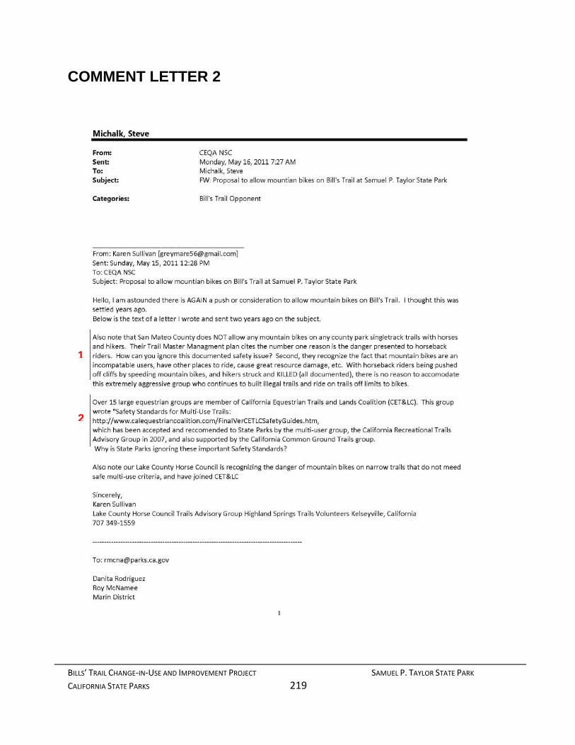
BILLS’ TRAIL CHANGE‐IN‐USE AND IMPROVEMENT PROJECT SAMUEL P. TAYLOR STATE PARK
CALIFORNIA STATE PARKS 219
COMMENT LETTER 2
1
2
BILLS’ TRAIL CHANGE‐IN‐USE AND IMPROVEMENT PROJECT SAMUEL P. TAYLOR STATE PARK
CALIFORNIA STATE PARKS 220
4

BILLS’ TRAIL CHANGE‐IN‐USE AND IMPROVEMENT PROJECT SAMUEL P. TAYLOR STATE PARK
CALIFORNIA STATE PARKS 221
5
6
7
8
4

BILLS’ TRAIL CHANGE‐IN‐USE AND IMPROVEMENT PROJECT SAMUEL P. TAYLOR STATE PARK
CALIFORNIA STATE PARKS 222
9
10
11

BILLS’ TRAIL CHANGE‐IN‐USE AND IMPROVEMENT PROJECT SAMUEL P. TAYLOR STATE PARK
CALIFORNIA STATE PARKS 223
COMMENT LETTER 54 ________________________________________
From: Karen Sullivan [[email protected]] Sent: Monday, October 31, 2011 9:00 AM To: CEQA NSC Subject: Bills Trail Samuel P. Taylor Park Dear Land Managers,
I am quite concerned that again, the Mountain bike groups are pushing for use of Bill's Trail and that State Parks is even considering it.
This is one of the most unsuitable trails I have ever hiked and ridden to be considered for multi‐use. The trail is extremely narrow, with tight turns, and often a damp surface. It will not hold up to downhill mountain bike riding, and combined with other users, bikers will be going fast and skidding. To resurface the trail to hold up to this kind of abuse is not fair to other users. You will also put other users in danger.
Also, The trail has limited visibility, and no place for turnouts or passing.
Multi‐use works well on open space fireroads (such as Bolinas Ridge), where users can see each other and have room to step off the trail.
San Mateo County does not allow bikes on trails in their county parks.
This was studied and many workshops held. They cite SAFETY as the number one reason, as well as disenfranchisement with other uses when bikes are included, and resource damage from bikes. L.A. City Parks do not allow bikes on trails, nor does Pt. Reyes National Seashore on many of it's singletrack.
The Mountain bikers have created as many illegal trails in Annadel State Park as legal ones, and continue to cut trees to make jumps.
This has not been an accountable, responsible user group, and illegal trail building has also cost the county of Marin thousands of dollars to mitigate damage. Mountain bikers riding trails closed to them is also well documented.
Bicycles are vehicles and subject to California vehicle code. They are not considered legal on sidewalks due to risk to pedestrians; how can you justify allowing them on narrow trails, with poor visibility and steep grades that are narrower than sidewalks?
This user group is not a compatable mix with foot traffic. Please do not allow them access to Bills trail or any other hiker/equestrian trails in California State Parks.
Sincerely, The Sullivan Family Kelseyville, California 707 349‐1559
12
13
14
15
16

BILLS’ TRAIL CHANGE‐IN‐USE AND IMPROVEMENT PROJECT SAMUEL P. TAYLOR STATE PARK
CALIFORNIA STATE PARKS 224
RESPONSE TO COMMENT LETTERS 2 AND 54
Karen Sullivan [email protected]
RE: Draft Environmental Impact Report/Recirculated Environmental Impact Report Trail Change-In-Use and Improvement Project Samuel P. Taylor State Park
Ms. Sullivan:
Thank you for your comments during the public review period for the Samuel P. Taylor State Park, Trail Change-In-Use and Improvement Project (Project) Draft Environmental Impact Report (DEIR)/Recirculated Environmental Impact Report (RDEIR). The following is a summarized list of the issues that you raised along with corresponding responses for the emails of May 15, 2011 (with attached letter of June 19, 2009) and October 31, 2011 emails you submitted to the California Department of Parks and Recreation.
The following are your comments and DPR’s responses to your May 15, 2011 email:
1. In this comment you mention San Mateo County’s policy on multiuse trails. You assert that that agency’s stance is based on incompatibility issues between bikers and other users, resource issues and safety.
California State Parks has a different policy. This comment is beyond the scope of this environmental document. Please refer to Master Response 15: Comments Unrelated to the DEIR or RDEIR.
2. In this comment you mentioned the California Equestrian Trails and Lands Coalition (CET&LC), who wrote "Safety Standards for Multi-Use Trails. You also questioned why DPR is ignoring important safety standards recommended in this report and you refer to documented incidents.
These guidelines have been utilized by California State Parks in determining the ability to appropriately combine mountain bikes, horses and hikers on system trails and roads. Furthermore, safety is clearly a serious consideration, as indicated in the Project Description; the designed modifications to the existing trail tread are intended to slow mountain bike use (thus making the trail safer for all users). As the EIR/RDEIR/FEIR discusses, we have not found documentation of the types of accidents or events to which you refer. Without a citation to this documentation, we cannot treat it as substantial evidence.
The following are your comments and DPR’s responses to your June 19, 2009 letter:

BILLS’ TRAIL CHANGE‐IN‐USE AND IMPROVEMENT PROJECT SAMUEL P. TAYLOR STATE PARK
CALIFORNIA STATE PARKS 225
3. In this comment you address a number of concerns about allowing mountain bikes on Bills’ Trail. These issues include the trail’s suitability for bikes because of erosion, sustainability, the fairness of pinch points, safety, alternate days, visibility, and legal standing.
Each of these comments is expounded on in subsequent comments. The overall suitability of Bills’ Trail for mountain bikes is addressed in Master Response 4: Project Details. Erosion is addressed in Master Response 9: Hydrology/Water Quality. The sustainability issue is addressed in Master Response 4 and Master Response 13: Fiscal Concerns. User safety is addressed in Master Response 11: Transportation, Circulation, and Traffic (Safety). Alternating days (no longer a component of the project) is addressed in Master Response 5: Alternative Days. The legal standing of mountain bikers is outside the scope of the DEIR or RDEIR, addressed in Master Response 15: Comments unrelated to DEIR or RDEIR. Please refer to Master Response 3: Detailed Project Description for a discussion of Pinch Points.
4. In this comment you address several issues under the heading of “User Goals, Danger and Conflicts”. You refer to increasing evidence that safety is an issue on multi-use trails. You also refer to safety and conflict interchangeably and touch on issues of biker behavior, erosion and user displacement (resulting from user conflict).
Please refer to Master Response 11: Transportation, Circulation, and Traffic (Safety) for a discussion of impacts on user safety. Please refer to Master Response 9: Hydrology and Water Quality for a discussion of erosion impacts and water quality issues.
5. Under the heading “Safe and Sustainable Trail Criteria” you comment about bike proponents pushing for multi-use trails constructed to the standards they promote rather than standards that protect all users. You discuss trail widths, grades, speed limits, good visibility and ample room and suggest these can best be accommodated on fire roads.
It is true that the International Mountain Biking Association (IMBA) actually prefers, and has advocated for, single track trails of 18 to 24-inches in width for enhanced “sinuosity”. Whether such trails blend better into the environment, disturb fewer resources and (in their opinion) promote slower speeds (IMBA 2004) is debatable; single track trails do not allow areas for safe passing and reduce visibility between users. Additionally, single track trails are environmentally and economically infeasible for the most part in State Parks at this time.
DPR however, is not proposing single track tails. The project will restore the trail’s original 48” width to allow ample passing room and improved visibility of oncoming users. As noted in response 1 above, incorporation of the pinch points, a standard slowing technique that does not affect walkers or equestrians, will moderate bike speeds increasing safety for all users.
6. In this comment you address education of user groups, and contend that education does not work as the nature of bike riders is that they are going to do whatever they want to do.
Please refer to Master Response 12: Behavior for a discussion of mountain biker behavior. The behavior of mountain bikers is considered a social issue and under CEQA, not considered a significant effect.
7. In this comment you refer to the inherent costs that mountain biking incurs as a result of the damage they create. You refer specifically to gravity biking and racing as well as illegal trail building.
Please refer to Master Response 13: Fiscal Concerns for a discussion of this issue.

BILLS’ TRAIL CHANGE‐IN‐USE AND IMPROVEMENT PROJECT SAMUEL P. TAYLOR STATE PARK
CALIFORNIA STATE PARKS 226
8. In this comment you question the legality of providing mountain bike access to DPR trails, citing a Federal Court decision on bike access in the Golden Gate National Recreation Area (GGNRA) as well as in Oroville.
DPR Staff has reviewed and considered the referenced legal decision. As you noted, Bicycle Trails Council of Marin v. Babbitt 82 F.3d 1445 (9th Cir. 1996) suggests only that Federal Agencies do have the right to limit access to trails on federal lands; it does not mandate prohibition of mountain bike access. As Policy Notice 2005-06 establishes as the policy of California State Parks, to consider multi-use trails in the development of trail plans or on individual trails, the project is consistent with DPR policy. Also refer to Master Response 13 for a discussion about GGNRA’s interim management of SPTSP.
9. In this comment you indicate that there is a trend in park management nationwide to limit or ban mountain bike access, citing several park entities including units of the California State Park system.
This issue is a policy issue and as such, is outside the scope of this environmental document. Please refer to Master Response 15: Comments Unrelated to DEIR or RDEIR.
10. In this comment you suggest that “statistics provide that mountain bike sales and usage are down” referring to a report in “Adventure Cyclist” in 2007, and it is not “contributing significantly to the economy”. You contrast it with recreational horseback riding which “is growing”.
Section 15131(a) of the California Environmental Quality Act (CEQA) states that economic effects of a project shall not be treated as a significant effect on the environment. Furthermore, the economic impact of one user group or another is not a factor in determining park policy. It is the policy of DPR to strive to meet the needs of diverse trail users. No further response to this comment is required.
11. In this comment you assert that there are more appropriate places for mountain biking than places such as Bills’ Trail.
As noted in response 5 above, DPR Policy Notice 2005-06 establishes as the system policy to consider multi-use trails when developing trail management plans or on specific trails. Mountain biking is not limited to OHV facilities. This comment addresses DPR policy rather than Bills’ Trail specifically. As such, the comment will be referred to DPR policy makers but not further comment is required.
The following are your comments and DPR’s responses to your email dated October 31, 2011:
12. In this comment you assert the unsuitability of Bills’ Trail as a multi-use trail because of its narrowness, turns, climatic conditions and the safety of other users.
Please refer to Master Response 4: Project Details for a discussion of Bills’ Trail’s suitability for mountain biking.
13. In this comment you state that the trail has limited visibility and no place for turnouts or passing.
Please refer to Section 2.11 of the FEIR for the comprehensive project description. Upon completion of the project, the trail will again have a width of 48”, sufficient for passing.

BILLS’ TRAIL CHANGE‐IN‐USE AND IMPROVEMENT PROJECT SAMUEL P. TAYLOR STATE PARK
CALIFORNIA STATE PARKS 227
With respect to visibility; an important principal of traffic engineering generally is that visibility needs are based on speeds. The faster the speeds the greater the visibility must be to provide adequate response time. Conversely, slower speeds allow adequate response time with less visibility. Safe trail design could therefore entail wider turn radiuses or removal of greater amounts of vegetation but significantly changes the trail’s sense of place. Incorporation of the pinch points will necessarily slow mountain bikers thereby providing ample response time to avoid other users.
14. In this comment you again discuss San Mateo County’s policy for mountain bikes on County Trails because of the issues of safety and user disenfranchisement.
Policy Notice 2005-06 establishes as DPR policy to consider the establishment of multiuse trails. San Mateo County’s policy is unrelated to the DEIR or RDEIR. Please refer to Master Response 11 for a discussion of user safety. Please refer to Master Response 10: Recreation and Section 4.9.4 Land Use and Planning (Recreation) in the FEIR for a discussion of user disenfranchisement (displacement).
15. In this comment you address the issue of illegal trail building and your perception of mountain biker behavior.
Please refer to Master Response 12: Behavior for a discussion of mountain biker behavior and illegal trail building.
16. In this comment you address the bicycle’s status under the California Vehicle Code and question why DPR would permit them on trails if they are prohibited on trails.
Please refer to DPR’s response to comment #8 above for a discussion of DPR policy with respect to mountain bikes. No further comment is required with respect to this issue.
Thank you again for your comments.
Sincerely, Brad Michalk Environmental Coordinator Northern Service Center

BILLS’ TRAIL CHANGE‐IN‐USE AND IMPROVEMENT PROJECT SAMUEL P. TAYLOR STATE PARK
CALIFORNIA STATE PARKS 228
This page left intentionally blank

BILLS’ TRAIL CHANGE‐IN‐USE AND IMPROVEMENT PROJECT SAMUEL P. TAYLOR STATE PARK
CALIFORNIA STATE PARKS 229
COMMENT LETTER 3 From: Bonnie Herzog [[email protected]] Sent: Monday, May 16, 2011 7:51 PM To: Garlock, John; CEQA NSC Subject: Oppose Opening Bill's Trail to Mountain Biking
I just found out about the possible opening of Bill's Trail in Samuel P. Taylor Park for mountain cyclists. While I whole-heartedly embrace biking, I beg you to consider the need for the entire bay area to have places where they can get away from all the city sounds, the sounds of technology, the fast-paced life style and walk quietly....to hear the birds, to be at peace, to lessen the stress in their life. Cyclists do not belong on these kinds of trails. Let them travel on the fire roads...the paved and wide dirt trails that are wide enough for safety and won't erode the fragile trails and intrude on the much needed solitude that hiking/walking allows. PLEASE say "NO" to mountain bikes (any bikes) on Bill's Trail
Thank you! Bonnie Herzog Larkspur, California
1

BILLS’ TRAIL CHANGE‐IN‐USE AND IMPROVEMENT PROJECT SAMUEL P. TAYLOR STATE PARK
CALIFORNIA STATE PARKS 230
RESPONSE TO COMMENT LETTER 3
August 1, 2012
Bonnie Herzog [email protected] Larkspur, California
RE: Draft Environmental Impact Report/Recirculated Environmental Impact Report Trail Change-In-Use and Improvement Project Samuel P. Taylor State Park
Dear Ms. Herzog:
Thank you for your comments during the public review period for the Samuel P. Taylor State Park, Trail Change-In-Use and Improvement Project (Project) Draft Environmental Impact Report (DEIR)/Recirculated Environmental Impact Report (RDEIR). The following is a summarized list of the issues that you raise along with corresponding response to the May 16, 2011, email you submitted to the California Department of Parks and Recreation.
1. This comment expresses general opposition to introducing mountain bikes on Bills’ Trail with the fear that they would destroy the trail’s sense of place, erode soils and compromise user safety.
Please refer to Master Response 7: Aesthetics for a discussion of Bills’ Trail’s sense of place. Erosion is addressed in Master Response 9: Hydrology/Water Quality. User safety is addressed in Master Response 11: Transportation, Circulation, and Traffic (Safety).
Thank you again for your comments.
Sincerely,
Brad Michalk Environmental Coordinator Northern Service Center
BILLS’ TRAIL CHANGE‐IN‐USE AND IMPROVEMENT PROJECT SAMUEL P. TAYLOR STATE PARK
CALIFORNIA STATE PARKS 231
COMMENT LETTER 4
From: Berg, John [[email protected]] Sent: Wednesday, May 18, 2011 1:46 PM To: CEQA NSC Subject: Bill's Trail Greetings‐ Bill's trail is a narrow 48‐inch trail with multiple switchbacks. It is unsuitable for mountain biking. Mountain bikes do not take to switchbacks well and will cut the trail. Mountain bikes go downhill at high speeds and will cause a hazardous conditions for hikers and especially to equestrians. Mountain bikes will use this trail as a downhill race course causing damage and danger to other users. The groups supporting this request for bicycle use are hoping this will be a means to open other trails to this inappropriate use.
Please do not allow mountain bikes on this single track trail. John Berg 415‐717‐4720 Email Disclaimer: http://www.co.marin.ca.us/nav/misc/EmailDisclaimer.cfm
1
2
3

BILLS’ TRAIL CHANGE‐IN‐USE AND IMPROVEMENT PROJECT SAMUEL P. TAYLOR STATE PARK
CALIFORNIA STATE PARKS 232
RESPONSE TO COMMENT LETTER 4
August 1, 2012
John Berg
RE: Draft Environmental Impact Report/Recirculated Environmental Impact Report Trail Change-In-Use and Improvement Project Samuel P. Taylor State Park
Dear Mr. Berg:
Thank you for your comments during the public review period for the Samuel P. Taylor State Park, Trail Change-In-Use and Improvement Project (Project) Draft Environmental Impact Report (DEIR)/Recirculated Environmental Impact Report (RDEIR). The following is a summarized list of the issues that you raise along with corresponding response to the May 18, 2011, email you submitted to the California Department of Parks and Recreation.
1. This comment addresses the characteristics of Bills’ Trail that makes it unsuited for mountain bikes.
Please refer to Master Response 4: Project Details for a discussion of the suitability for mountain bikes on Bills’ Trail. Erosion is addressed in Master Response 9: Hydrology/Water Quality.
Mitigation measure, AES 1: Active Management and Maintenance was incorporated into the project to provide subsequent evaluation of resource damage following the trail’s conversion to multi-use, reducing any resulting impact to a less than significant level.
2. This comment addresses the safety concerns of allowing mountain bikes on Bills’ Trail. User safety is addressed in Master Response 11: Transportation, Circulation, and Traffic (Safety).
3. This comment expresses concern that this will open the door to future requests for other trails. Consideration of mountain bikes on Bills’ Trail is a decision that affects this trail only. DPR will evaluate future multiuse trail requests independently, based on suitability and sustainability. No further comment is required.
Thank you again for your comments.
Sincerely,
Brad Michalk Environmental Coordinator Northern Service Center

BILLS’ TRAIL CHANGE‐IN‐USE AND IMPROVEMENT PROJECT SAMUEL P. TAYLOR STATE PARK
CALIFORNIA STATE PARKS 233
COMMENT LETTER 5
1

BILLS’ TRAIL CHANGE‐IN‐USE AND IMPROVEMENT PROJECT SAMUEL P. TAYLOR STATE PARK
CALIFORNIA STATE PARKS 234
1

BILLS’ TRAIL CHANGE‐IN‐USE AND IMPROVEMENT PROJECT SAMUEL P. TAYLOR STATE PARK
CALIFORNIA STATE PARKS 235
BILLS’ TRAIL CHANGE‐IN‐USE AND IMPROVEMENT PROJECT SAMUEL P. TAYLOR STATE PARK
CALIFORNIA STATE PARKS 236
COMMENT LETTER 26
2
3

BILLS’ TRAIL CHANGE‐IN‐USE AND IMPROVEMENT PROJECT SAMUEL P. TAYLOR STATE PARK
CALIFORNIA STATE PARKS 237
3
4
5

BILLS’ TRAIL CHANGE‐IN‐USE AND IMPROVEMENT PROJECT SAMUEL P. TAYLOR STATE PARK
CALIFORNIA STATE PARKS 238
5

BILLS’ TRAIL CHANGE‐IN‐USE AND IMPROVEMENT PROJECT SAMUEL P. TAYLOR STATE PARK
CALIFORNIA STATE PARKS 239
6
7

BILLS’ TRAIL CHANGE‐IN‐USE AND IMPROVEMENT PROJECT SAMUEL P. TAYLOR STATE PARK
CALIFORNIA STATE PARKS 240
8
7

BILLS’ TRAIL CHANGE‐IN‐USE AND IMPROVEMENT PROJECT SAMUEL P. TAYLOR STATE PARK
CALIFORNIA STATE PARKS 241
8
9

BILLS’ TRAIL CHANGE‐IN‐USE AND IMPROVEMENT PROJECT SAMUEL P. TAYLOR STATE PARK
CALIFORNIA STATE PARKS 242
10

BILLS’ TRAIL CHANGE‐IN‐USE AND IMPROVEMENT PROJECT SAMUEL P. TAYLOR STATE PARK
CALIFORNIA STATE PARKS 243
COMMENT LETTER 57
11

BILLS’ TRAIL CHANGE‐IN‐USE AND IMPROVEMENT PROJECT SAMUEL P. TAYLOR STATE PARK
CALIFORNIA STATE PARKS 244
12
13
14

BILLS’ TRAIL CHANGE‐IN‐USE AND IMPROVEMENT PROJECT SAMUEL P. TAYLOR STATE PARK
CALIFORNIA STATE PARKS 245
14
15
16
17

BILLS’ TRAIL CHANGE‐IN‐USE AND IMPROVEMENT PROJECT SAMUEL P. TAYLOR STATE PARK
CALIFORNIA STATE PARKS 246
17
18
19

BILLS’ TRAIL CHANGE‐IN‐USE AND IMPROVEMENT PROJECT SAMUEL P. TAYLOR STATE PARK
CALIFORNIA STATE PARKS 247
19
20

BILLS’ TRAIL CHANGE‐IN‐USE AND IMPROVEMENT PROJECT SAMUEL P. TAYLOR STATE PARK
CALIFORNIA STATE PARKS 248
RESPONSE TO COMMENT LETTERS 5, 26, and 57
August 1, 2012 Marin Conservation League Attention: Nona Dennis 1623-A Fifth Avenue San Rafael, CA 94901 [email protected] RE: Draft Environmental Impact Report/Recirculated Environmental Impact Report Trail Change-In-Use and Improvement Project Samuel P. Taylor State Park Dear Ms. Dennis:
Thank you for your comments during the public review period for the Samuel P. Taylor State Park (SPTSP), Trail Change-In-Use and Improvement Project (Project) Draft Environmental Impact Report (DEIR)/Recirculated Environmental Impact Report (RDEIR). The following is a summarized list of the issues that you raise in your letters of May 20, 2011, June 30, 2011 and October 31, 2011 your organization submitted to the California Department of Parks and Recreation, as well as DPR’s responses to each of the issues.
The following are comments and DPR responses to your May 20, 2011 letter:
1. This entire comment letter entails a request that DPR extend the comment period because of the late receipt of the Notice of Availability. You further request information about the locations of local postings of the notice as required by CEQA Guidelines.
Please refer to Master Comment 1: Notification/Public Review Period for a discussion of this issue.
The following are responses to comments contained in your letter of June 30, 2011:
2. In this comment you noted that DPR failed to provide 30 days for response from responsible and trustee agencies to the Notice of Preparation before circulating the draft EIR for public review, and did not include agency responses in the DEIR. You specifically referred to the Regional Water Quality Control Board (RWQCB).
Please refer to Master Comment 1: Notification/Public Review Period for a discussion of this issue. The RWQCB recommendations referenced on Page 52 of the DEIR were the result of an

BILLS’ TRAIL CHANGE‐IN‐USE AND IMPROVEMENT PROJECT SAMUEL P. TAYLOR STATE PARK
CALIFORNIA STATE PARKS 249
on-site meeting that Karl Knapp and Roy McNamee had with Leslie Ferguson. DPR received no written comments from that agency although they were notified as a responsible agency.
3. In this comment you address the issue of lack of timely notification of the DEIR availability.
Please refer to Master Comment 1: Notification/Public Review Period for a discussion of this issue.
4. This comment refers to inaccurate information contained in the Notice of Availability and contends there were misleading errors.
The NOA contained a link to DPR’s CEQA website web site. Further, DPR provided an 85-day public review and comment period. Additionally, the NOA prepared for the RDEIR contained correct information as well as digital copies of the entire document (including the DEIR) to every individual and organization who commented on the DEIR and/or individuals on the stakeholder list.
5. In this comment you assert that the “DEIR does not acknowledge the background or that the project description has shifted over time”. Issues that you have cited include the project in context of the statewide trails change-in-use program EIR; efforts of organizations to expand multi-use trails in State Parks; and omitting other trails previously considered from the range of alternatives considered in the DEIR.
The Trail Change-in-Use and improvement project on Bills’ Trail is a separate and distinct project from the Statewide Trails Change-in-Use project. It is however, the type of project that would be considered under the Program.
According to CCR Section 15168 of the State CEQA Guidelines, a Program EIR may be prepared on a series of actions that can be characterized as one large project and are related to, among other things, the issuance of general criteria to govern the conduct of a continuing program or individual activities carried out under the same authorizing statutory or regulatory authority and having generally similar environmental effects that can be mitigated in similar ways. The Road and Trail Change-in-Use Evaluation Process meets these criteria for use of a Program EIR.
Preparing a Program EIR allows for a more exhaustive consideration of effects than would be practical in separate EIRs on individual actions, and ensures consideration of cumulative impacts that might be missed on a case-by-case basis. It also allows avoidance of duplicative consideration of basic policy and program-wide mitigation measures at a time when there is greater flexibility to deal with basic environmental problems or cumulative impacts.
In response to the change-in-use request, DPR filed a Notice of Exemption (NOE) for the Bills’ Trail project in 2009. Private entities challenged the NOE asserting that the review conducted for the NOE was insufficient. Opponents to the project commissioned a study prepared by Clearwater Hydrology citing substantial evidence of potential erosion and sedimentation increases to Lagunitas Creek. The existence of that study does not mean the Project will have an adverse substantial effect; the study presented another view of erosion concerns, which indicated a difference of opinion. Therefore, based on the fair argument test, DPR prepared the DEIR.
Article 9 of the State CEQA Guidelines details the required content of an EIR, an informational document to inform public agency decision makers and the public of the significant effect of a

BILLS’ TRAIL CHANGE‐IN‐USE AND IMPROVEMENT PROJECT SAMUEL P. TAYLOR STATE PARK
CALIFORNIA STATE PARKS 250
project. The Trail Change-in-Use and Improvement DEIR contained all the information required pursuant to Section 15121 through 15131 of the State CEQA Guidelines.
Typically a DPR project description evolves from the proposal phase to the CEQA document phase as DPR staff meet with individuals, public agencies, community organizations and staff. The only “shift” in the project is that alternate days are no longer being considered due to infeasibility.
Since Access 4Bikes submitted their request, DPR has conducted numerous meetings, surveyed each of the 4 proposed trails and concluded that Bills’ Trail is the most sustainable at baseline, subject to a thorough environmental analysis. In regard to mountain biking organizations’ involvement with the project; a change-in-use request can be generated by any user group. While DPR might prefer that user groups coordinate with each other before submitting a request, coordination and/or consensus is not a prerequisite for request submittal.
6. This comment states that the DEIR contained an inadequate discussion of the baseline conditions of Bills’ Trail and, as a consequence, impacts are understated.
Comment noted. Please refer to Section 2.3 of the FEIR for a more comprehensive discussion of the baseline conditions of Bills’ Trail taken from Clearwater Hydrology’s report from June 2009. With respect to the comment about the understated impacts, the work being contemplated on Bills’ Trail truly is minimal and does not require substantial structural changes. The trail was originally constructed with a 48” base. A trail naturally narrows over time. Aside from the pinch points and signage related to multi-use, the trail work is considered routine maintenance typically categorically exempted from CEQA pursuant to Sections 15304 and 15306. Material for the pinch points will be sustainably harvested from the site and transported to its final resting spot. As noted in Figure 2.5 (page 44) of the DEIR, pinch points will require a small amount of excavation to set the log, backfilled around the log, compacted and mulched. Implementation of project requirements GEO 1: BMPs; GEO 3: Revegetation Plan; HYDRO 1: Erosion, Sediment Control and Pollution Prevention; and HYDRO 2: Initial Trail Closure will ensure that impacts related to the construction remain at a less than a significant effect.
7. This comment refers to the alternatives considered in the DEIR and suggests that they were “unreasonably limited”.
Please refer to Master Response 6: Alternatives for a discussion of the alternatives considered in the DEIR.
8. This comment calls the Aesthetics/Visual Resources Section incomplete and conclusory.
Please refer to Master Response 7: Aesthetics for a discussion of this issue. No further comment is required.
9. This comment addresses the Biological Resources Section and notes its omission of a discussion of Impact Statement BIO 4, failure to protect special status species and impacts to native wildlife species.
Please refer to Master Response 8: Biological Resources for a discussion of this issue.
10. This comment addresses the Hydrology and Water Quality Section of the DEIR. The comment refers to a project requirement referred to in the section but missing from Table 2.6.1.
BILLS’ TRAIL CHANGE‐IN‐USE AND IMPROVEMENT PROJECT SAMUEL P. TAYLOR STATE PARK
CALIFORNIA STATE PARKS 251
Comment noted. The Standard and Specific Requirement Table has been updated in the FEIR (now Table 2) to include the revegetation plan. This project requirement is referred to as GEO 3: Revegetation Plan and is found on page 34 of the RDEIR.
The following responses answer comments to the RDEIR contained in the letter dated October 31, 2011:
11. You note in this comment that circumstances have changed since the DEIR was released. This comment refers to the partnership with the Golden Gate National Recreation Area (GGNRA) that has since emerged. You also address essential and non-essential maintenance.
GGNRA received notification and a complete copy of the DEIR/RDEIR. DPR followed up with a phone call to that agency. Please refer to Master Response 13: Fiscal Concerns for a further discussion of this issue.
12. This comment states that the description of the project setting has changed. This comment also addresses conflict and safety.
Please refer to Master Response 2: Bills’ Trail History for a comprehensive discussion of this issue. Please refer to Master Response 11: Transportation, Circulation and Traffic for a discussion of the issue of safety and Master Response 12: Conflict for a discussion of the issue of conflict between horses and bicycles.
13. This comment addresses the change in project objectives.
Please refer to Master Response 6: Alternatives for a discussion of the change in objectives.
14. This comment suggests that DPR cannot ensure what type of mountain biker will ride Bills’ Trail and it will become an attraction in itself.
Just as highway engineers cannot design out bad driver behavior, it is true that DPR cannot ensure that mountain bikers will always abide by the rules of the trail. That does not translate to the trail becoming an attraction in itself. DPR Operations Manual cites examples of such attractions to include community centers, team sports complexes or destination type restaurants that are more appropriately located on private lands. The proposed change-in-use will assist visitors in enjoying Bills’ Trail’s resource values. With so many parks and trail miles within the State Park system, that some may use a facility contrary to State Park Policy such as trail running, does not make it an attraction in itself.
Bills’ Trail is a gently meandering 5.4% grade made easier by the numerous switchbacks along the way to the top. DPR designed the improvements proposed for Bills’ Trail to improve sight lines and, where sight lines were restricted, to slow oncoming bikers with pinch points. These will reduce bikes to an acceptable speed around other users thereby increasing safety.
Although it is possible that a few mountain bikers may initially attempt to ride the trail in an aggressive manner, the trail’s design combined with management will deter these users who will ultimately seek out trails that are more suited to that style of riding.
15. This comment again addresses DPR Policy regarding Attractions in Themselves.
This comment was addressed in response to comment 14 above. No further comment is required.
BILLS’ TRAIL CHANGE‐IN‐USE AND IMPROVEMENT PROJECT SAMUEL P. TAYLOR STATE PARK
CALIFORNIA STATE PARKS 252
16. In this comment you note that the RDEIR relies on policy intent and user cooperation to ensure safety.
Please refer to Master Response 11: Transportation, Circulation and Traffic for a discussion of the issue of safety.
17. This comment states that the neither the impact nor mitigation measure address how “inhabitants or visitors interact with and how the landscape and built environment are occupied or used (activity levels and use intensities). You also state you find the similarity of speed between equestrians, hikers and bikers impossible to believe unless traveling uphill. Finally, you believe that mitigation measure AES 1 will not mitigate adverse changes of intensity in use to levels if insignificance.
Please refer to Section 4.1 of the FEIR and Master Response 7: Aesthetics for a discussion of Bills’ Trail’s sense of place. Please refer to Master Response 4: Project Details and Master Response 11: Transportation, Circulation and Traffic for a discussion of how pinch points are used to control bike speeds.
18. This comment is in regards to the potentially significant impacts on special status species. In particular you note the practice of night riding that was not listed in the mountain biking riding styles.
Please refer to Master Response 8: Biological Resources for a discussion of this issue.
19. This comment is in regards to the project requirement to prepare a revegetation plan. You state that it is missing from the DEIR and RDEIR.
The project requirement was inadvertently omitted from the DEIR but was in fact incorporated in the RDEIR and now the FEIR. Also refer to response to comment 10 above.
20. This comment references Impact Statement CIRC 4, specifically with regards to trail safety. Your comment suggests that because of the trail location along steep slopes, a 48” trail tread offers no room to escape potential collisions.
Please refer to Master Response 4: Project Details and Master Response 11: Transportation, Circulation and Traffic for a discussion of how pinch points are used to control bike speeds.
Thank you for your comments.
Sincerely,
Brad Michalk Environmental Coordinator Northern Service Center

BILLS’ TRAIL CHANGE‐IN‐USE AND IMPROVEMENT PROJECT SAMUEL P. TAYLOR STATE PARK
CALIFORNIA STATE PARKS 253
COMMENT LETTER 6
From: Mark Bosch [[email protected]] Sent: Monday, May 23, 2011 10:36 PM To: CEQA NSC Subject: Bill's Trail
I understand that bikers want to have access to Bill's trail in Samuel P. Taylor park. We hiked this trail recently and feel that it is very narrow and the poison oak growth on the sides of the trail is abundant.
Many hikers who enjoy this trail fear injury and exposure to the poison oak trying to avoid being hit by the bikers.
Are additional funds going to be available to maintain the trail with this additional pressure?
I don't see any reason to allow the bikers access to Bills trail and Devil's Gulch. Thank you Mark A. Bosch Novato Tuesday Hikers
1
2

BILLS’ TRAIL CHANGE‐IN‐USE AND IMPROVEMENT PROJECT SAMUEL P. TAYLOR STATE PARK
CALIFORNIA STATE PARKS 254
RESPONSE TO COMMENT LETTER 6
August 1, 2012
Mark Bosch [email protected]
RE: Draft Environmental Impact Report/Recirculated Environmental Impact Report Trail Change-In-Use and Improvement Project Samuel P. Taylor State Park
Dear Mr. Bosch:
Thank you for your comments during the public review period for the Samuel P. Taylor State Park, Trail Change-In-Use and Improvement Project (Project) Draft Environmental Impact Report (DEIR)/Recirculated Environmental Impact Report (RDEIR). The following is a summarized list of the issues that you raise in your email of May 23, 2011, along with the Department of Parks and Recreation’s corresponding responses.
1. This comment expresses a concern about the narrowness of the trail and the poison oak found along parts of its path. Introducing mountain bikes to the narrow trail will endanger hikers trying to avoid the bikes.
The issue of poison oak is addressed in Master Response 14. With implementation of the project components (trail width restoration, pinch points and rock armoring), safety impacts to hikers, including with respect to poison oak would remain at a less than significant level.
2. In this comment you question the availability of funding that will inevitably increase with the introduction of mountain bikes to the trail.
Please refer to Master Response 13: Fiscal Concerns for a discussion of this issue.
Thank you again for your comments.
Sincerely,
Brad Michalk Environmental Coordinator Northern Service Center

BILLS’ TRAIL CHANGE‐IN‐USE AND IMPROVEMENT PROJECT SAMUEL P. TAYLOR STATE PARK
CALIFORNIA STATE PARKS 255
COMMENT LETTER 7
From: LARRY RICH [[email protected]] Sent: Tuesday, May 24, 2011 4:35 PM To: CEQA NSC Subject: BILL'S TRAIL - MT BARNABE AREA
I understand that bicyclers are requesting approval to have Bill's Trail (Devil's Gulch) opened up for dirt bike use. I oppose this request;
This trail is not very wide and has a lot of poison oak on both sides. Trying to get out of the way of bikers can create a dangerous situation and could put a person into the poison oak.
Also, the trail is very soft and steep. Bicycles will do much more damage to the trail than hikers.
Thank you for considering my concerns.
Larry Rich
1

BILLS’ TRAIL CHANGE‐IN‐USE AND IMPROVEMENT PROJECT SAMUEL P. TAYLOR STATE PARK
CALIFORNIA STATE PARKS 256
RESPONSE TO COMMENT LETTER 7
August 1, 2012
Larry Rich [email protected]
RE: Draft Environmental Impact Report/Recirculated Environmental Impact Report Trail Change-In-Use and Improvement Project Samuel P. Taylor State Park
Dear Mr. Rich:
Thank you for your comments during the public review period for the Samuel P. Taylor State Park, Trail Change-In-Use and Improvement Project (Project) Draft Environmental Impact Report (DEIR)/Recirculated Environmental Impact Report (RDEIR). The following is a summarized list of the issues that you raise in your email of May 24, 2011, along with the Department of Parks and Recreation’s corresponding responses.
1. This comment expresses a concern about the narrowness of the trail and the poison oak found along parts of its path. Introducing mountain bikes to the narrow trail will endanger hikers trying to avoid the bikes. Your comment also addresses your concern about resulting trail damage.
The issue of poison oak is addressed in Master Response 14. With implementation of the project components (trail width restoration, pinch points and rock armoring), safety impacts to hikers, including with respect to poison oak would remain at a less than significant level. Please refer to Section 4.8 of the FEIR and Master Response 9: Hydrology/Water Quality for a discussion of potential erosion impacts.
Thank you again for your comments.
Sincerely,
Brad Michalk Environmental Coordinator Northern Service Center
BILLS’ TRAIL CHANGE‐IN‐USE AND IMPROVEMENT PROJECT SAMUEL P. TAYLOR STATE PARK
CALIFORNIA STATE PARKS 257
COMMENT LETTER 8
From: karen illich [[email protected]] Sent: Tuesday, May 24, 2011 9:15 PM To: CEQA NSC Subject: Bill's Trail
I strongly feel that bicycles are dangerous to be on Bills Trail. It is very narrow, full of poison oak and it is dangerous to try to step out of a bicyclists way Please do not allow them. Thank you, Karen Illich Novato
COMMENT LETTER 12 From: karen illich [[email protected]] Sent: Thursday, June 02, 2011 12:25 PM To: CEQA NSC Subject: Bill's Trail in Samuel Taylor State Park
Attn. Brad Michalk I with a group of other SR. Citizens hike this trail often. Because it is narrow we feel it is not safe to allow bicycles on it. There is little space to safely move aside for them, to see them come or to hear them. Please do not allow them on the trail. Thank you Karen Illich Novato, CA
1
2

BILLS’ TRAIL CHANGE‐IN‐USE AND IMPROVEMENT PROJECT SAMUEL P. TAYLOR STATE PARK
CALIFORNIA STATE PARKS 258
RESPONSE TO COMMENT LETTERS 8 AND 12
August 1, 2012
Karen Illich
RE: Draft Environmental Impact Report/Recirculated Environmental Impact Report Trail Change-In-Use and Improvement Project Samuel P. Taylor State Park
Ms. Illich:
Thank you for your comments during the public review period for the Samuel P. Taylor State Park, Trail Change-In-Use and Improvement Project (Project) Draft Environmental Impact Report (DEIR)/Recirculated Environmental Impact Report (RDEIR). The following is a summarized list of the issues that you raise along with corresponding responses for the May 24, 2011, and June 2, 2011 emails you submitted to the California Department of Parks and Recreation.
The following are your comments and DPR’s responses to your May 24, 2011 email:
1. In this comment you expressed strong opposition to allowing mountain bikes on Bills’ Trail because of its narrowness and poison oak along its edges.
Please refer to Master Response 14: Poison Oak for a discussion of this issue. . With implementation of the project components (trail width restoration, pinch points and rock armoring), impacts to hikers would remain at a less than significant level.
The following are your comments and DPR’s responses to your June 2, 2011 email:
2. In this comment you express opposition to the change-in-use project as senior citizens and mountain bikes are incompatible. You cite the narrowness of the trails and no room to move out of their way.
Please refer to Master Response 4: Project Details for a discussion of Bills’ Trail’s suitability for multiuse. Thank you again for your comments.
Sincerely,
Brad Michalk Environmental Coordinator Northern Service Center

BILLS’ TRAIL CHANGE‐IN‐USE AND IMPROVEMENT PROJECT SAMUEL P. TAYLOR STATE PARK
CALIFORNIA STATE PARKS 259
COMMENT LETTER 9 From: Tacy Dunham [[email protected]] Sent: Monday, May 30, 2011 12:25 PM To: CEQA NSC Subject: Hiker safety on Bill's Trail
Dear Committee,
As a long time hiker and frequent leader of hikes on Bill's Trail in Samuel P. Taylor State Park, I am strongly against allowing bicycles on Bill's Trail.
Hikers will be in danger if bicycles are allowed on Bill's Trail. Sight distance is limited by vegetation, terrain, and turns and the possibility of bikes colliding with hikers would be very real and could result in serious injury.
Bill's Trail has become a single track trail. It is too narrow for hikers to walk side by side and it is too narrow for bikes to pass hikers safely. Hikers would have to stop and huddle to the edge of the trail, often into poison oak, to allow bikes to pass.
Bill's Trail has many sharp turns in its switchbacks that are too sharp for a bike to turn without skidding which would cause severe erosion.
Please prevent bicycle use on Bill's Trail. Thank you, Tacy Dunham
1
2
3
4

BILLS’ TRAIL CHANGE‐IN‐USE AND IMPROVEMENT PROJECT SAMUEL P. TAYLOR STATE PARK
CALIFORNIA STATE PARKS 260
RESPONSE TO COMMENT LETTER 9
August 1, 2012
Tacy Dunham [email protected]
RE: Draft Environmental Impact Report/Recirculated Environmental Impact Report Trail Change-In-Use and Improvement Project Samuel P. Taylor State Park
Ms. Dunham:
Thank you for your comments during the public review period for the Samuel P. Taylor State Park, Trail Change-In-Use and Improvement Project (Project) Draft Environmental Impact Report (DEIR)/ Recirculated Environmental Impact Report (RDEIR). The following is a summarized list of the issues that you raise along with corresponding responses for the May 30, 2011, email you submitted to the California Department of Parks and Recreation.
1. In this comment you expressed strong opposition to allowing mountain bikes on Bills’ Trail.
Comment noted. No further response is required for this comment.
2. In this comment you contend that hikers will be endangered by mountain bikes for reasons because sight distance would be limited by vegetation, terrain and turns.
Please refer to Section 4.13 of the FEIR and Master Response 11: Transportation, Circulation and Traffic for a discussion of safety issues.
3. In this comment you note that Bills’ Trail has become a single track trail, too narrow for multi-use. Hikers would be forced to the edge and off the trail and into the poison oak to allow bikes to pass.
Please refer to Master Response 14: Poison Oak for a discussion of this issue.
4. This comment addresses the switchbacks that you believe will force bikes to come to a skidding halt, causing erosion issues.
Please refer to Section 4.8 of the FEIR and Master Response 9: Hydrology/Water Quality for a discussion of trail damage and soil erosion.
Thank you again for your comments.
Sincerely,
Brad Michalk Environmental Coordinator Northern Service Center

BILLS’ TRAIL CHANGE‐IN‐USE AND IMPROVEMENT PROJECT SAMUEL P. TAYLOR STATE PARK
CALIFORNIA STATE PARKS 261
COMMENT LETTER 10 From: DIANNE BURFORD [[email protected]] Sent: Tuesday, May 31, 2011 10:00 AM To: CEQA NSC Subject: BILL'S TRAIL
I UNDERSTAND BIKERS WOULD LIKE TO USE THIS TRAIL.
IT IS NOT A VERY WIDE TRAIL AND IT IS FULL OF POISON OAK WHICH WOULD MAKE IT DIFFICULT TO GET OUT OF THE WAY.
PLEASE TRY TO FIND ANOTHER TRAIL
THANX
1
BILLS’ TRAIL CHANGE‐IN‐USE AND IMPROVEMENT PROJECT SAMUEL P. TAYLOR STATE PARK
CALIFORNIA STATE PARKS 262
RESPONSE TO COMMENT LETTER 10
August 1, 2012
Dianne Burford [email protected]
RE: Draft Environmental Impact Report/Recirculated Environmental Impact Report Trail Change-In-Use and Improvement Project Samuel P. Taylor State Park
Ms. Burford:
Thank you for your comments during the public review period for the Samuel P. Taylor State Park, Trail Change-In-Use and Improvement Project (Project) Draft Environmental Impact Report (DEIR)/Recirculated Environmental Impact Report (RDEIR). The following is a summarized list of the issues that you raise along with corresponding responses for the May 31, 2011, email you submitted to the California Department of Parks and Recreation.
1. In this comment you note the narrowness of Bills’ Trail and the poison oak found along portions of the trail. Hikers would be forced to the edge and off the trail and into the poison oak to allow bikes to pass.
Please refer to Master Response 14: Poison Oak for a discussion of this issue.
Thank you again for your comments.
Sincerely,
Brad Michalk Environmental Coordinator Northern Service Center

BILLS’ TRAIL CHANGE‐IN‐USE AND IMPROVEMENT PROJECT SAMUEL P. TAYLOR STATE PARK
CALIFORNIA STATE PARKS 263
COMMENT LETTER 11
From: Price, Kimberly [[email protected]] Sent: Thursday, June 02, 2011 9:29 AM To: CEQA NSC Subject: Samuel P. Taylor bike trail plan
As a hiker, biker and equestrian that uses Bill’s Trail quite often, I am appalled that State Park Officials would even consider opening up this trail to bikes.
This single foot trail is a switchback that goes up the back side of Mt. Barnabe. It is full of blind curves, very steep and narrow, crosses many wooden bridges and there is no place to step off trail quickly to allow a speeding bike to pass. One cannot see what is right around the corner so a bike heading down the trail at speed will create a recipe for disaster.
The wooden bridges also become very slick and slippery during the winter. It is easy to slip and fall when hiking and riding; I can only imagine a bike falling and the park getting sued.
I urge you to do your research before making a final decision on this….go hike the trail. Then, let common sense prevail and keep bikes on trails that are safe for all users; mainly fire roads.
Thank you,
Kimberly M Price 2428 Topaz Drive Novato, CA 94945
1
2

BILLS’ TRAIL CHANGE‐IN‐USE AND IMPROVEMENT PROJECT SAMUEL P. TAYLOR STATE PARK
CALIFORNIA STATE PARKS 264
RESPONSE TO COMMENT LETTER 11
August 1, 2012
Kimberly Price [email protected]
RE: Draft Environmental Impact Report/Recirculated Environmental Impact Report Trail Change-In-Use and Improvement Project Samuel P. Taylor State Park
Ms. Price:
Thank you for your comments during the public review period for the Samuel P. Taylor State Park, Trail Change-In-Use and Improvement Project (Project) Draft Environmental Impact Report (DEIR)/Recirculated Environmental Impact Report (RDEIR). The following is a summarized list of the issues that you raise along with corresponding responses for the June 2, 2011 email you submitted to the California Department of Parks and Recreation.
1. In this comment you describe the narrow, winding conditions of Bills’ Trail, the lack of visibility and places of refuge from speeding bikes.
Please refer to Section 4.13 of the FEIR and Master Response 11: Transportation, Circulation and Traffic for a discussion of safety issues and Master Response 4: Project Details for a discussion on Bills’ Trail’s suitability for multiuse.
2. In this comment you refer to the bridges which become slick when wet and contemplate the potential danger to bikers and resulting liability for DPR.
As noted in the Project Description of the RDEIR (page 24) gates or lockable barriers will be added to the bridge crossings to facilitate closing the trail to users as necessary. Additionally, Specific Project Requirement HRDRO 3- Seasonal Trail Closures require the trails to be closed to bikes during inclement conditions to reduce the threat of trail damage. The aforementioned gates will ensure its effectiveness. Implementation of the gates/barriers in concert with SPR HYDRO 3 will ensure that impacts to user safety will remain at a less than significant level.
Thank you again for your comments.
Sincerely,
Brad Michalk Environmental Coordinator Northern Service Center

BILLS’ TRAIL CHANGE‐IN‐USE AND IMPROVEMENT PROJECT SAMUEL P. TAYLOR STATE PARK
CALIFORNIA STATE PARKS 265
COMMENT LETTER 13 From: Nathan Homes [[email protected]] Sent: Saturday, June 04, 2011 12:08 AM To: CEQA NSC Subject: Bills Trail - Multi Use Proposal - Taylor State Park
Hello, I would like to share my concerns about Bills Trail in Samuel P. Taylor State Park being opened for multi- use. Mountain Bikers should not be allowed to use Bills Trail because of very serious safety and environmental issues. Currently, hikers and horsebackriders are allowed on Bills Trail. Mountain Bikers would also be allowed under the proposal. Mountain bikes would create a very dangerous situation for hikers, horsebackriders and for bikers themselves. Mountain bikes have been involved in countless collisions and injuries. This is a remote trail that is difficult for paramedics and rescue personnel to access. Bikers would erode the trail and put themselves and other trail users in physical danger. Bikers already have another access road that creates a loop trail in this area. Barnabe Fire Road and the Cross Marin Trail provides bikers with the alternative route they need. Gravesite Fire Road also connects to Barnabe Rd. There are dozens of miles of legal trails open to bikes in Marin County. Opening Bills Trail to bikers would create unnecessary environmental and safety hazards. The Draft EIR states that Bills Trail should be opened to bikers so they wont build and ride on illegal trails. Opening Bills Trail to bikes will attract more bikers to the area. These bikers will build more illegal trails and ride on trails closed to bikes. China Camp State Park and Annadel State Park have miles of multi use trails open to mountain bikers, but bikers have built miles of illegal trails at those parks. Bikers did not remain on the legal multi use trails. They built illegal trails and destroyed pristine environmental habitat. Opening Bills Trail to bikes will not relieve pressure on illegal trails, it will attract more bikers who will ride on closed trails and build illegal trails. The Gravesite Fire Road should be rehabilitated so that sediment runoff is minimized. Bills Trail should be maintained in the same way. Bikers travel on the multi use Barnabe Fire Rd. I am an avid mountain biker myself, but I know that opening Bills Trail to bikers would ruin the trail and put trail users in danger; Bikes would cause crashes and erode the trail.There are already enough trails for bikes. Opening more trails to bikes will cause more problems. Bills Trail should remain closed to bikes because of serious safety and environmental dangers.
Thank you for considering my suggestions. Jon Geary
1
2
3
4
5

BILLS’ TRAIL CHANGE‐IN‐USE AND IMPROVEMENT PROJECT SAMUEL P. TAYLOR STATE PARK
CALIFORNIA STATE PARKS 266
RESPONSE TO COMMENT LETTER 13
August 1, 2012
Jon Geary [email protected]
RE: Draft Environmental Impact Report/Recirculated Environmental Impact Report Trail Change-In-Use and Improvement Project Samuel P. Taylor State Park
Mr. Geary:
Thank you for your comments during the public review period for the Samuel P. Taylor State Park, Trail Change-In-Use and Improvement Project (Project) Draft Environmental Impact Report (DEIR)/Recirculated Environmental Impact Report (RDEIR). The following is a summarized list of the issues that you raise along with corresponding responses for the June 4, 2011 emails you submitted to the California Department of Parks and Recreation.
1. In this comment you assert the unsuitability of Bills’ Trail as a multi-use trail because it would be unsafe for all users. You also believe bikes will induce erosion on the trails.
Please refer to Section 4.13 of the FEIR and Master Response 11: Transportation, Circulation, and Traffic for a discussion of user safety. Please refer to Section 4.8 of the FEIR and Master Response 9: Hydrology/Water Quality for a discussion of erosion.
2. In this comment you argue that Bills’ Trail is not needed by mountain bikers as they already have access to Barnabe Fire Road, the Cross Marin Trail and “dozens” of legal trails in Marin County. This comment also suggests that the project would create unnecessary (unspecified) environmental hazards.
Barnabe Fire Road is indeed open to mountain bikers, hikers and equestrians and with Gravesite Fire Road, reaches the same destination points. It is however, a far different experience from Bills’ Trail with its own unique sense of place. (Bills’ Trail’s sense of place is discussed in Section 4.1 of the FEIR.) Barnabe Fire Road is a more direct route up/down Barnabe Peak covering the elevation change in only 1 mile, whereas Bills’ Trail meanders gently on 5.4% slopes over 3.3 miles. Barnabe Fire Road is located in open grasslands while Bills’ Trail is located primarily on north-facing slopes beneath the tall trees and over flowing streams.
The cross Marin Trail is a multi-use trail located in the roadbed of the former North Pacific Coast Railroad. In the vicinity of SPTSP the trail is paved, again a far different experience from Bills’ Trail.
Policy Notice 2005-06 establishes as the policy of California State Parks, to consider multi-use trails in the development of trail plans or on individual trails. Therefore, provided the appropriate

BILLS’ TRAIL CHANGE‐IN‐USE AND IMPROVEMENT PROJECT SAMUEL P. TAYLOR STATE PARK
CALIFORNIA STATE PARKS 267
environmental review is conducted and if DPR staff determine it can be safely operated as such, multi-use trails can be determined to be appropriate.
3. In this comment you suggest that introducing mountain bikers to Bills’ Trail will attract more bikers to the area and illegal trail building will result, comparing the situation with China Camp and Annadel State Parks.
Please refer to Master Response 10: Recreation for a discussion of increased trail usage and Master Response 12: Conflict for a discussion of illegal trail building.
4. In this comment you assert that Gravesite Fire Road and Bills’ Trail should be rehabilitated to minimize sediment runoff and continue to permit bikes only on Barnabe Fire Road.
There are several reasons why Barnabe Fire Road is actually more susceptible to environmental impacts from mountain bikes. Although Barnabe Fire Road is not located within the Devil’s Gulch watershed, it is located within the Lagunitas Creek watershed. Sediment transported off Barnabe Fire Road would still eventually make its way to sensitive Lagunitas Creek.
The fire road provides access to the Fire Lookout and access to more remote areas of SPTSP for fire protection purposes. Therefore, only minor alterations can be made to the road as DPR must maintain vehicular access over its entire length. The road is essentially a fall line trail with an average 11.4% grade. Fall line trails funnel water and erode quickly. DPR’s Trail Handbook states that trail grades should not exceed half the grade of the hillside and should not exceed 10% as natural and user-created erosion is a potentially serious ecological concern. A sustainably constructed dual fire road and mountain bike trail would require a major reroute given the 10% rule and the elevation change of 650 feet along with an entirely new set of environmental concerns.
Bills’ Trail is a gently meandering 5.4% grade for riders made easier by the numerous switchbacks along the way to the top. In contrast, the steep downhill grades of Barnabe Fire Road are an attraction for adrenaline-seeking Downhill Style mountain bikers, which is an entirely different group than what DPR is seeking to allow.
5. This comment is a summary of points made in previous comments regarding safety and soil erosion.
Please refer to Section 4.8 of the FEIR and Master Response 9: Hydrology/Water Quality for a discussion of erosion impacts. Please refer to Section 4.13 of the FEIR and Master Response 11: Transportation, Circulation and Traffic for a discussion of user safety.
Sincerely,
Brad Michalk Environmental Coordinator Northern Service Center

BILLS’ TRAIL CHANGE‐IN‐USE AND IMPROVEMENT PROJECT SAMUEL P. TAYLOR STATE PARK
CALIFORNIA STATE PARKS 268
This page left intentionally blank

BILLS’ TRAIL CHANGE‐IN‐USE AND IMPROVEMENT PROJECT SAMUEL P. TAYLOR STATE PARK
CALIFORNIA STATE PARKS 269
COMMENT LETTER 14 From: Mark Peery [[email protected]] Sent: Saturday, June 04, 2011 9:22 AM To: CEQA NSC Cc: [email protected] Subject: Samuel P. Taylor trail plan
Dear Mr. Michalk,
I spend a lot of my leisure time in Samuel Taylor Park hiking, birdwatching, and riding my mountain bike on the (legal) Cross Marin Trail.
My favorite hiking and birding trail in the park is Bill's Trail. I have spent many wonderfully peaceful hours on that trail. It is an excellent habitat for birds--olive-sided flycatchers, woodpeckers and many other species.
I believe it would be a travesty to allow mountain bikers on Bill's Trail. The people who ride mountain bikes often have no respect for the environment or for the law--I see evidence of illegal biking on Bill's Trail every time I am out there. If the trail were to be open to mountain bikers on certain days of the week, many more bikers would be attracted to the trail (witness the chaos in China Camp) and it is inevitable that there would be illegal riding on the off days as well.
I urge the Parks Department to leave the Trail undisturbed for people who enjoy the peace and quiet of the woods
Yours truly,
Mark C. Peery
Mark C. Peery, Attorney at Law 135 Corte Balboa Greenbrae, CA 415-461-2422 [email protected]
1

BILLS’ TRAIL CHANGE‐IN‐USE AND IMPROVEMENT PROJECT SAMUEL P. TAYLOR STATE PARK
CALIFORNIA STATE PARKS 270
RESPONSE TO COMMENT LETTER 14
August 1, 2012
Mark Peery [email protected]
RE: Draft Environmental Impact Report/Recirculated Environmental Impact Report Trail Change-In-Use and Improvement Project Samuel P. Taylor State Park
Mr. Peery:
Thank you for your comments during the public review period for the Samuel P. Taylor State Park, Trail Change-In-Use and Improvement Project (Project) Draft Environmental Impact Report (DEIR)/Recirculated Environmental Impact Report (RDEIR). The following is a summarized list of the issues that you raise along with corresponding responses for the June 4, 2011 emails you submitted to the California Department of Parks and Recreation.
1. In this comment, you express your disagreement with the change-in-use project. Your comment is based on perceptions of mountain biker behavior as a monolithic group, that they naturally will commence with illegal trail building throughout the park
Please refer to Master Response 10: Recreation for a discussion of increased trail usage and Master Response 12: Conflict for a discussion of illegal trail building.
Thank you again for your comments.
Sincerely,
Brad Michalk Environmental Coordinator Northern Service Center
BILLS’ TRAIL CHANGE‐IN‐USE AND IMPROVEMENT PROJECT SAMUEL P. TAYLOR STATE PARK
CALIFORNIA STATE PARKS 271
COMMENT LETTER 15 From: robert burton [[email protected]] Sent: Sunday, June 05, 2011 9:10 AM To: CEQA NSC; [email protected] Subject: FW: Samuel P. Taylor trail plan
Dear Mr. Michalk, I spend a lot of my leisure time in Samuel Taylor Park. My favorite hiking trail in the park is Bill's Trail. I have spent many wonderfully peaceful hours on that trail. It is an excellent habitat for birds--olive-sided flycatchers, woodpeckers and many other species.
I believe it would be a huge mistake to allow mountain bikers on Bill's Trail. The people who ride mountain bikes often have no respect for the environment or for the law--I see evidence of illegal biking on Bill's Trail every time I am out there. If the trail were to be open to mountain bikers on certain days of the week, many more bikers would be attracted to the trail (witness the chaos in China Camp) and it is inevitable that there would be illegal riding on the off days as well.
I urge the Parks Department to leave the Trail undisturbed for people who enjoy the peace and quiet of the woods.
Yours truly, Robert A. Burton, MD. 415-235-7449 [email protected]
1

BILLS’ TRAIL CHANGE‐IN‐USE AND IMPROVEMENT PROJECT SAMUEL P. TAYLOR STATE PARK
CALIFORNIA STATE PARKS 272
RESPONSE TO COMMENT LETTER 15
August 1, 2012
Robert Burton [email protected]
RE: Draft Environmental Impact Report/Recirculated Environmental Impact Report Trail Change-In-Use and Improvement Project Samuel P. Taylor State Park
Dear Mr. Burton:
Thank you for your comments during the public review period for the Samuel P. Taylor State Park, Trail Change-In-Use and Improvement Project (Project) Draft Environmental Impact Report (DEIR)/Recirculated Environmental Impact Report (RDEIR). The following is a summarized list of the issues that you raise along with corresponding responses for the June 4, 2011 emails you submitted to the California Department of Parks and Recreation.
1. In this comment, you express your disagreement with the change-in-use project. Your comment is based on perceptions of mountain biker behavior as a monolithic group and they are already poaching Bills’ Trail.
Please refer to Master Response 10: Recreation for a discussion of increased trail usage and Master Response 12: Conflict for a discussion of illegal trail building.
Thank you again for your comments.
Sincerely,
Brad Michalk Environmental Coordinator Northern Service Center

BILLS’ TRAIL CHANGE‐IN‐USE AND IMPROVEMENT PROJECT SAMUEL P. TAYLOR STATE PARK
CALIFORNIA STATE PARKS 273
COMMENT LETTER 16 From: Bill Hess [[email protected]] Sent: Wednesday, June 08, 2011 4:35 PM To: CEQA NSC Subject: Samuel P. Taylor trail
I am absolutely against making the trail available for bikers. Bikers cause more problems and accidents. They ride two or three abreast causing drivers to drive in the wrong lane. They disrespect all rules/laws. They pay for nothing. eg. they get a free ride on the Golden Gate Bridge. They are the only wheeled vehicle not having to pay. Their reasoning for all the free trails/roads is that they are saving gas and not polluting. It is time they paid their fair share. If they want a path in the park let them pay to build their own trail. I am tired of dodging bikers as I hike in the Headlands or any state park. Tom
3
2
1

BILLS’ TRAIL CHANGE‐IN‐USE AND IMPROVEMENT PROJECT SAMUEL P. TAYLOR STATE PARK
CALIFORNIA STATE PARKS 274
RESPONSE TO COMMENT LETTER 16
August 1, 2012
Bill Hess [email protected]
RE: Draft Environmental Impact Report/Recirculated Environmental Impact Report Trail Change-In-Use and Improvement Project Samuel P. Taylor State Park
Mr. Hess:
Thank you for your comments during the public review period for the Samuel P. Taylor State Park, Trail Change-In-Use and Improvement Project (Project) Draft Environmental Impact Report (DEIR)/Recirculated Environmental Impact Report (RDEIR). The following is a summarized list of the issues that you raise along with corresponding responses for the June 8, 2011 email you submitted to the California Department of Parks and Recreation.
1. This comment addresses behavior of bicyclists generally but not mountain bikers.
This comment refers to road bikers riding two or three abreast and its impact on drivers. It does not address mountain biking, the proposed change-in-use project in SPTSP or environmental effects thereto. Please refer to Master Response 15: Comments Unrelated to DEIR or RDEIR.
2. This comment again addresses bicyclist behavior citing their ability to traverse the Golden Gate Bridge without charge.
This comment does not apply to mountain biking, the proposed change-in-use project in SPTSP or environmental effects associated thereto. Please refer to Master Response 15: Comments Unrelated to DEIR or RDEIR.
3. In this comment you suggest that if mountain bikers wanted a trail, they should build their own…at their own expense. You also express annoyance at having to avoid bikers when hiking in the Marin Headlands or any state park.
Commented noted.
Thank you again for your comments.
Sincerely,
Brad Michalk Environmental Coordinator Northern Service Center

BILLS’ TRAIL CHANGE‐IN‐USE AND IMPROVEMENT PROJECT SAMUEL P. TAYLOR STATE PARK
CALIFORNIA STATE PARKS 275
COMMENT LETTER 17
1

BILLS’ TRAIL CHANGE‐IN‐USE AND IMPROVEMENT PROJECT SAMUEL P. TAYLOR STATE PARK
CALIFORNIA STATE PARKS 276
1
2

BILLS’ TRAIL CHANGE‐IN‐USE AND IMPROVEMENT PROJECT SAMUEL P. TAYLOR STATE PARK
CALIFORNIA STATE PARKS 277
3

BILLS’ TRAIL CHANGE‐IN‐USE AND IMPROVEMENT PROJECT SAMUEL P. TAYLOR STATE PARK
CALIFORNIA STATE PARKS 278
4

BILLS’ TRAIL CHANGE‐IN‐USE AND IMPROVEMENT PROJECT SAMUEL P. TAYLOR STATE PARK
CALIFORNIA STATE PARKS 279
5
6

BILLS’ TRAIL CHANGE‐IN‐USE AND IMPROVEMENT PROJECT SAMUEL P. TAYLOR STATE PARK
CALIFORNIA STATE PARKS 280
7

BILLS’ TRAIL CHANGE‐IN‐USE AND IMPROVEMENT PROJECT SAMUEL P. TAYLOR STATE PARK
CALIFORNIA STATE PARKS 281
8

BILLS’ TRAIL CHANGE‐IN‐USE AND IMPROVEMENT PROJECT SAMUEL P. TAYLOR STATE PARK
CALIFORNIA STATE PARKS 282
9A

BILLS’ TRAIL CHANGE‐IN‐USE AND IMPROVEMENT PROJECT SAMUEL P. TAYLOR STATE PARK
CALIFORNIA STATE PARKS 283
9A

BILLS’ TRAIL CHANGE‐IN‐USE AND IMPROVEMENT PROJECT SAMUEL P. TAYLOR STATE PARK
CALIFORNIA STATE PARKS 284
9B

BILLS’ TRAIL CHANGE‐IN‐USE AND IMPROVEMENT PROJECT SAMUEL P. TAYLOR STATE PARK
CALIFORNIA STATE PARKS 285
9C
9D

BILLS’ TRAIL CHANGE‐IN‐USE AND IMPROVEMENT PROJECT SAMUEL P. TAYLOR STATE PARK
CALIFORNIA STATE PARKS 286
9D

BILLS’ TRAIL CHANGE‐IN‐USE AND IMPROVEMENT PROJECT SAMUEL P. TAYLOR STATE PARK
CALIFORNIA STATE PARKS 287
10

BILLS’ TRAIL CHANGE‐IN‐USE AND IMPROVEMENT PROJECT SAMUEL P. TAYLOR STATE PARK
CALIFORNIA STATE PARKS 288
11
BILLS’ TRAIL CHANGE‐IN‐USE AND IMPROVEMENT PROJECT SAMUEL P. TAYLOR STATE PARK
CALIFORNIA STATE PARKS 289
12

BILLS’ TRAIL CHANGE‐IN‐USE AND IMPROVEMENT PROJECT SAMUEL P. TAYLOR STATE PARK
CALIFORNIA STATE PARKS 290
13

BILLS’ TRAIL CHANGE‐IN‐USE AND IMPROVEMENT PROJECT SAMUEL P. TAYLOR STATE PARK
CALIFORNIA STATE PARKS 291
BILLS’ TRAIL CHANGE‐IN‐USE AND IMPROVEMENT PROJECT SAMUEL P. TAYLOR STATE PARK
CALIFORNIA STATE PARKS 292
14

BILLS’ TRAIL CHANGE‐IN‐USE AND IMPROVEMENT PROJECT SAMUEL P. TAYLOR STATE PARK
CALIFORNIA STATE PARKS 293

BILLS’ TRAIL CHANGE‐IN‐USE AND IMPROVEMENT PROJECT SAMUEL P. TAYLOR STATE PARK
CALIFORNIA STATE PARKS 294
COMMENT LETTER 59
15
16
15
16
BILLS’ TRAIL CHANGE‐IN‐USE AND IMPROVEMENT PROJECT SAMUEL P. TAYLOR STATE PARK
CALIFORNIA STATE PARKS 295
RESPONSE TO COMMENT LETTERS 17 and 59
August 1, 2012
Tamalpais Conservation Club Attention: Larry Minikes P.O. Box 2272 Mill Valley, CA 94942 [email protected]
RE: Draft Environmental Impact Report/Recirculated Environmental Impact Report Trail Change-In-Use and Improvement Project Samuel P. Taylor State Park
Mr. Minikes:
Thank you for your comments during the public review period for the Samuel P. Taylor State Park, Trail Change-In-Use and Improvement Project (Project) Draft Environmental Impact Report (DEIR)/Recirculated Environmental Impact Report (RDEIR). The following is a summarized list of the issues that you raise along with corresponding responses for the June 10, 2011 and October 31, 2011 letters email you submitted to the California Department of Parks and Recreation.
1. In this comment you address DPR’s failure to honor an agreement with stakeholders regarding involvement and notification.
Please refer to Master Response 1: Notification/Public Review Period for a discussion of this issue.
2. This comment addresses the Notice of Preparation (NOP) and responses thereto which were referred to but missing from the DEIR. You also questioned if certain non-state agencies received notification of the project.
The agencies you refer to were sent notification at the same time as all other stakeholders. All comments received by the stakeholders (as well as DPR responses) have been included in the Final EIR.
3. In this comment (under the heading “Conflicts of Multiple-Use Trails”) you list the factors of sustainable trails.
These are criteria used by federal organizations. DPR has its own criteria and relies on its own experts to determine the suitability of a trail for multiuse. Most of the criteria cited in this comment have been addressed in the DEIR, the RDEIR, FEIR, the master responses, and/or responses contained in this letter. Other criteria cited in this comment do not apply (e.g. elevation). Our State Park experts are fully aware of State Park requirements and criteria used to determine the trail’s sustainability for multiple uses. Therefore, no further response to this comment is required.
4. This comment challenges the DEIR’s inadequate discussion of impacts to the common animal species found in SPTSP. The comment letter was accompanied by electronic file of

BILLS’ TRAIL CHANGE‐IN‐USE AND IMPROVEMENT PROJECT SAMUEL P. TAYLOR STATE PARK
CALIFORNIA STATE PARKS 296
photographic documentation of numerous creatures killed by mountain bike tires at trails in unspecified parks in unspecified locations taken over an undetermined period of time.
DPR acknowledges its receipt and review of the photographic documentation. DPR also acknowledges that small animals can be injured or killed on trails by various users. However, there is no context given to the photos (e.g., locations, dates, etc.) that indicate the frequency at which they occur, the location or any other identifying information. Please refer to Master Response 8: Biological Resources for a discussion of impacts to biological resources including common species.
5. In this comment, you suggested that Bills’ Trail will become an attraction for the mountain biking community as evidenced by IMBA’s posting a link of the DEIR on their organization’s website. The result will be greater pressure on the natural resources at SPTSP.
DPR acknowledges that mountain biking organizations have given this project a high profile with its members. This is to be expected as they submitted the request for the trail change-in-use. Please refer to Master Response 7: Aesthetics and Master Response 10: Recreation for a discussion of the issue of Bills; Trail as an attraction. Also, refer to Section 4.8 of the FEIR and Master Response 9: Hydrology/Water Quality for a discussion of the impact on erosion and sedimentation based on increased use of the trail.
6. This comment expresses disagreement with the conclusion that traffic impacts resulting from the change-in-use project would be less than significant. You also state that SPTSP currently has fire roads open to bicycling but not trails.
As stated in Section 4.13.5 of the DEIR, SPTSP has trails (Cross Marin) as well as fire roads currently open to bikes. DPR acknowledges in Section 4.13 of the FEIR that there may be an increase in traffic on Sir Francis Drake Boulevard (SFDB) from mountain bikers trying the new trail but a corresponding decrease in other trail users will likely offset that increase. Furthermore, Section 4.13.3 of the FEIR also states that the target Level of Service for Sir Francis Drake Boulevard is “D” or better and the existing LOS is presently closer to LOS B. Any resulting increase will not increase traffic to greater than the target LOS. Therefore, resulting traffic impacts will remain less than significant.
7. This comment refers primarily to budgetary issues specifically as they affect enforcement and monitoring of the trail. You suggest that the trail will be used by mountain bikers regardless of whether or not the park is open or closed, or the trail is upgraded or not, forcing “traditional users” off the trail.
The trail will be closed to all users during construction and for a year following completion of construction to ensure the trail has adequate time to season, and the revegetation plan fully implemented. Closure will be ensured by the placement of locked gates or barriers at each of the bridge crossings, including the crossing over Devils Gulch. Please refer to the Project Requirements in Table 2 of the FEIR. Please refer to Master Response 13: Fiscal Concerns regarding the issue of funding maintenance and enforcement programs and the manner in which DPR will be able to ensure the safety of users and sustainability of the trail in the future.
8. In this comment you state that the DEIR did not consider impacts on erosion resulting from an expected increase in the frequency in use.
Please refer to Section 4.8 of the FEIR and Master Response 9: Hydrology/Water Quality for a discussion of the increased frequency of use on erosion and sedimentation.
9. (A) In this comment you challenge the Wilson and Seney study cited in the Hydrology/Water Quality Section of the DEIR calling it quasi-science because it was funded in part by a contribution from IMBA. You also state that “in the author’s own works, this study has no

BILLS’ TRAIL CHANGE‐IN‐USE AND IMPROVEMENT PROJECT SAMUEL P. TAYLOR STATE PARK
CALIFORNIA STATE PARKS 297
relationship whatsoever to the Bills’ Trial proposal. It is so limited in scope that it has no place being part of the DEIR conclusion”.
The referenced study has been widely cited by others and is considered by many to be valid research. The research was conducted by an Assistant Professor of Geography (Dr. Wilson, now at USC) and a master’s candidate in earth sciences (Seney). You allude to “the author’s own words” as “the study has no relationship whatsoever to the Bills’ Trail Proposal” but provide no details as to when/where this conversation was documented.
In fact the study states as follows: “Two sets of findings emerged from this study which probably apply to many (if not most) environments. The first was that trail use by horses produced greater sediment yields than trail use by other users. The second and perhaps more important result was that the greatest sediment yields were generated on prewetted trails. This result occurs because the application of rainfall and the increases in soil moisture that follow reduce soil resistance which, in turn, reduces the trail's ability to bear a moving load.” As such, the conversation you recount with the study’s author differs from the study itself.
9. (B) In this comment you challenge the reference in the Hydrology/Water Quality Sections, to Lanza because his lack of accreditation as a scientist.
The Michael Lanza quote that you disagreed with (and for which you suggested the quote should be changed) was with respect to interviews the author conducted with numerous trail experts including those who generally disapproved of mountain bikes on trails. Furthermore, although Michael Lanza may not be an “accredited scientist”, he is indeed an expert hiker and his accomplishments and experiences on the trail should not be discounted (nor the adequacy of this Section of the DEIR). As noted on his website many of his writings explore mans’ impact on the environment. “He has written about topics as diverse as record floods at Mt. Rainier, the controversy over snowmobiles in Yellowstone, and the impacts of climate change on Glacier National Park and other wild lands”. With respect to your reference to the article http://old.imba.com/resources/science/trail_ shock.html and specifically the comment you attribute to Mr. Lanza recommending a separate network of trails; it is the same article referenced in the DEIR but it was linked from separate web sites. Furthermore, the quote you attributed to Mr. Lanza is not Mr. Lanza’s quote at all. It is actually two separate quotes from two separate individuals that you have combined and incorrectly attributed to Lanza. The two quotes read as follows:
In the 1990s, the NY-NJTC actively opposed "the redesignation of hiking trails as mountain biking trails without our knowledge of consent," Haugland says, while also encouraging land managers to establish separate bike trails. "We believe that in order to serve hikers and mountain bikers, there need to be separate networks of trails." The AMC trail-use policy also recognizes that in some cases land managers "should consider designated single-use trails" in a given areas and "may wish to designate mountain-biking-only trails as well."
The other part of the quote you attributed to Mr. Lanza was actually from Mr. Bob Moss at Ringwood State Park. It states:
“"There are ways to build trails that will stand up to bicycle use or heavy hiking use," Moss says. "If there are enough trails to keep mountain bikers happy and they don't have to go on hiking trails, that (sic) should take care of the problem."
Regarding the sidebar, “Why Wheels Seem Worse”, the discussion covered two theories about an increase in mountain bikers and mountain bikers enjoy a challenge of obstacles. The potential erosion impacts resulting from an increase in the frequency of use was addressed in Master Response 9: Hydrology/Water Quality. The issue of mountain biking styles including the use of technical trail features is addressed in Section 2.7 of the RDEIR (page 19). The changes proposed

BILLS’ TRAIL CHANGE‐IN‐USE AND IMPROVEMENT PROJECT SAMUEL P. TAYLOR STATE PARK
CALIFORNIA STATE PARKS 298
for Bills’ Trail will ensure that there will be no technical features to the trail and no ability to achieve speeds that could impact the trail.
9. (C) In this comment you challenge the inclusion of the reference to the Pickering compilation of studies as definitively concluding that impacts from equestrians are far greater than either pedestrian or bike.
DPR acknowledges that the Pickering was misquoted. Reference to that document will be removed from the final EIR.
9. (D) In this comment you contend that because the DEIR cited both the Seney and Pickering studies, it contradicted itself. You suggest that the Pickering report negated the Seney study. You also challenge the Brill, Harris and Norman study at Lake Tahoe Basin as being irrelevant because of differing conditions.
As you noted the Pickering study suggests only that there were fewer studies that evaluated the impacts of mountain biking on erosion. That does not amount to a contradiction of the Seney study. The Pickering study found that generally horse riding was worse than biking or hiking but that there needs to be more research into the various riding styles. As noted in Response to comment 9A above, the Seney study concluded that trail use by horses produced greater sediment yields than trail use by other users. There is no contradiction.
With Respect to Brill, et al; they have suggested that sediment yields at stream crossings could be reduced through implementation of trail upgrades such as decreasing trail slope, and increasing water diversions to reduce connected length. These measures are certainly valid and in fact are standard practice at most trail management agencies regardless of soil type, climate, etc.
10. In this comment you express disagreement with the conclusion drawn in 6.1 of the DEIR, “Full implementation of all Project Requirements and mitigation measures will reduce any potential cumulative impact to a less than significant level.”
Your emphasis under this heading appears to be on the increased frequency of use (addressed in response to comment 6 above) and the behavior of mountain bikers, primarily illegal trail building and failure to honor rules of the trails.
The threat of illegal trail building exists with or without this project. Please refer to Master Response 12: Conflict for a discussion of illegal trail building. Please refer to Master Response 7: Aesthetics for a discussion of the potential for increased trail usage resulting from the change-in-use.
Finally, regarding mountain bikers prematurely accessing the trail before it is properly seasoned; Specific Project Requirement HYDRO 1 – Initial Trail Closure requires closure of the trail during the rehabilitation and construction process and for a year following its construction to allow the trail to season. Closure will be ensured by the placement of locked gates or barriers at each of the bridge crossings, including the crossing over Devils Gulch. Please refer to the Project Requirements in Table 2 FEIR.
11. This comment challenges DPR’s conclusion of effects found to be less than significant. You cite seasonal trail impacts, frequency of use, and the similarities to the Shoreline Trail at CCSP.
Please refer to Master Response 9: Hydrology/Water Quality for a discussion of seasonal trail use. Frequency of use and the comparison to China Camp State Park is addressed in Master Response 7: Aesthetics.
12. In this comment you express preference for the Bills’ Trail maintenance only alternative.

BILLS’ TRAIL CHANGE‐IN‐USE AND IMPROVEMENT PROJECT SAMUEL P. TAYLOR STATE PARK
CALIFORNIA STATE PARKS 299
Comment noted. Please refer to Master Response 6: Alternatives for a discussion of the Alternatives Analysis.
13. This comment refers to “factual and anecdotal evidence” previously sent to DPR in 2002, primarily in regards to negative stereotypes of the mountain biking community and their penchant for bad behavior. In this comment you also opine that this project is a waste of the State’s money.
The information referenced in this comment was not presented with the letter and as such, was not reviewed or considered. Please refer to Master Response 12: Conflict for a discussion of mountain biker behavior. Please refer to Master Response 13: Fiscal Concerns for a discussion of the financial aspect of the project.
14. This comment suggests a pilot study be performed to assess your findings. You also question why DPR would move forward with the project knowing the resistance of the environmental community.
You have presented no substantive evidence that significant impacts to wildlife would result from the project. You have only presented opinions and photos without context. Furthermore, the FEIR concludes that there is no substantial evidence that impacts to wildlife would result. Therefore, the existence of opposition by one interest group or another is not adequate justification for denying access to users.
The following are comments and responses to your letter of October 31, 2011:
15. This comment challenges DPR for the lack of site-specific studies. You also challenge the determination that impacts to biological resources would be less than significant, saying that it can be proven patently false and based on skimpy and incomplete research.
Please refer to Master Response 9: Hydrology/Water Quality for a discussion of erosion and the need for site specific studies. Please refer to Master Response 8: Biological Resources for a discussion of impacts to biological resources.
16. This comment addresses Section 2.15 of the RDEIR, regarding trail maintenance and specifically, partnering with other entities to share maintenance responsibilities. You suggest that these efforts have proven unsuccessful at China Camp State Park.
The RDEIR does not suggest that DPR will depend on outside groups to perform maintenance but looks for opportunities where we can augment trail maintenance efforts with user groups. Mitigation Measure AES 1, discussed in Chapter 4.1 of the FEIR will ensure that trail use will be sustainable. If impacts occur to the trail, measures will be identified by DPR to address the impacts up to and including removal of a particular trail user.
Thank you again for your comments.
Sincerely,
Brad Michalk Environmental Coordinator Northern Service Center

BILLS’ TRAIL CHANGE‐IN‐USE AND IMPROVEMENT PROJECT SAMUEL P. TAYLOR STATE PARK
CALIFORNIA STATE PARKS 300
This page left intentionally blank

BILLS’ TRAIL CHANGE‐IN‐USE AND IMPROVEMENT PROJECT SAMUEL P. TAYLOR STATE PARK
CALIFORNIA STATE PARKS 301
COMMENT LETTER 18
2
1

BILLS’ TRAIL CHANGE‐IN‐USE AND IMPROVEMENT PROJECT SAMUEL P. TAYLOR STATE PARK
CALIFORNIA STATE PARKS 302
2
3
4
5

BILLS’ TRAIL CHANGE‐IN‐USE AND IMPROVEMENT PROJECT SAMUEL P. TAYLOR STATE PARK
CALIFORNIA STATE PARKS 303
5
6
7
8

BILLS’ TRAIL CHANGE‐IN‐USE AND IMPROVEMENT PROJECT SAMUEL P. TAYLOR STATE PARK
CALIFORNIA STATE PARKS 304
10
9
11
BILLS’ TRAIL CHANGE‐IN‐USE AND IMPROVEMENT PROJECT SAMUEL P. TAYLOR STATE PARK
CALIFORNIA STATE PARKS 305
11

BILLS’ TRAIL CHANGE‐IN‐USE AND IMPROVEMENT PROJECT SAMUEL P. TAYLOR STATE PARK
CALIFORNIA STATE PARKS 306
COMMENT LETTER 52
From: Joel Bartlett [[email protected]] Sent: Monday, October 31, 2011 9:31 AM To: CEQA NSC Subject: Bill's Trail
Re: Recirculated Draft EIR –Trail Changes in Use and Improvement Project, Bill’s Trail, Samuel P. Taylor State Park
Dear Sir:
The Marin Horse Council appreciates the opportunity to comment on the Recirculated Draft EIR (RDEIR).
First, we wish to emphatically contradict the CADPR's assertion that Bill's Trail was initially intended as multiple‐use, i.e., hiker, horse, bicycle. In fact, it was constructed and signed as a HIKER ONLY trail from the very beginning until equestrian use was tacitly allowed due to its proximity to the Horse Camp at Devil's Gulch. Horse use of Bill's Trail has never been specifically signed against such use. When Bill's Trail was built over several years in the mid‐1980's, mountain bicycling was just beginning to become widely popular and the sport, using trails in the Marin Municipal Water District, simply did not warrant the inclusion of bicycles in any current trail construction in SP Taylor Park. Our position is supported by several letters dated 1998 and 1999, when the first proposals to open BT to horses and mountain bicycles surfaced.
A letter to Ken Leigh, then District Superintendent of Marin District of CDPR from (the late) Brian O'Neill, General Superintendent of GGNRA/NPS/US Dept. of the Interior dated 2 December 1998, notes the validated presence of northern spotted owls in the vicinity of Bill's Trail and states that since this area has "historically supported spotted owls for many years" that "protection of a federally listed threatened species should take precedence over increased public use of an area."
This specific area as a spotted owl nesting site is supported by a letter from Dave Boyd, GGNRA Natural Resources Chief, dated 2 July 1999, to Katherine Hibbard, USFWS. Mr. Boyd's memo ends with this paragraph: "I have two additional concerns regarding the possible designation of Bill's Trail to multiple‐use. A number of illegal bike trails already exist within Samuel P. Taylor State Park, particularly in the vicinity of Devil's Gulch and Pioneer Tree Trail. At least two illegal bike trails bisect the middle of the Pioneer Tree Trail spotted owl territory. The design of Bill's Trail lends itself to extensive short‐cutting by bikes, which is already evident. Another illegal trail descends to the base of Stairstep Falls. I am unsure what action State Parks is taking to deal with existing illegal trail construction and use."
Similar letters in opposition to bicycle use of Bill's trail are on record from that time frame from the "Save the Valley" board (2 July 1999). The Environmental Forum of Marin (17 May 1999), the Bay Area Trails Preservation Council (Spring Newsletter 1999 and letter dated 9 Sept. 1999), the Salmon Protection and Watershed Network (SPAWN) dated 10 June 1999, the Sierra Club/Marin Group (3 July 1999), and numerous letters from concerned and knowledgeable individuals. A recent letter from the Marin Horse Council in opposition to allowing mountain bicycles on Bill's Trail is dated 27 March 2009. Please note that the objections to allowing mountain bike use of Bill's Trail voiced in all of these letters are just as applicable today, 2011, as when originally written.
12
13
14

BILLS’ TRAIL CHANGE‐IN‐USE AND IMPROVEMENT PROJECT SAMUEL P. TAYLOR STATE PARK
CALIFORNIA STATE PARKS 307
The basic question remains: with California State Park system all but bankrupt, how can CDPR justify the spending of thousands of dollars to rehabilitate Bill's Trail to allow bicycle use? When dozens of valuable, well‐patronized state parks in this state are to be closed for lack of funds, how can CDPR even consider the waste of money on this plan, especially when mountain bicycles ALREADY have an existing nearby fire road available for loops and recreation?
Like the Marin Conservation League (whose response Marin Horse Council wholeheartedly endorses), a major concern is the preservation of a healthy environment and resource. MHC is also especially aware of the safety hazards that are presented by mountain bicycles to other trail users. These hazards would be especially applicable to the steep, winding, narrow footpath of Bill’s Trail.
In closing: the Marin Horse Council adamantly opposes the opening of Bill's Trail, SP Taylor State Park, to mountain bicycle use, under any circumstances.
Sincerely, Joel Bartlett President/ Marin Horse Council
15
16

BILLS’ TRAIL CHANGE‐IN‐USE AND IMPROVEMENT PROJECT SAMUEL P. TAYLOR STATE PARK
CALIFORNIA STATE PARKS 308
RESPONSE TO COMMENT LETTERS 18 AND 52
August 1, 2012
Marin Horse Council 171 Bel Marin Keys Blvd Novato, CA 94949 RE: Draft Environmental Impact Report/Recirculated Environmental Impact Report Trail Change-In-Use and Improvement Project Samuel P. Taylor State Park
Mr. Bartlett:
Thank you for your comments during the public review period for the Samuel P. Taylor State Park, Trail Change-In-Use and Improvement Project (Project) Draft Environmental Impact Report (DEIR)/Recirculated Environmental Impact Report (RDEIR). The following is a summarized list of the issues that you raise along with corresponding responses for the June 28, 2011 and October 31, 2011 letters you submitted to the California Department of Parks and Recreation.
The following are comments and responses to the June 28, 2011 letter:
1. This comment provides background of your organizations efforts and involvement to oppose the change-in-use project on Bills’ Trail. You also address DPR’s failure to promptly notify stakeholder groups about the availability of the DEIR.
Please refer to Master Response 1: Notification/Public Review Period for a discussion of this issue.
2. In this comment you point out that lower Bills’ Trail is adjacent to the Devils Gulch Horse Camp. It notes that it has maintained the camp and has previously volunteered to maintain the trail, an offer never acted on by DPR.
Comment noted. The horse camp is indicated on Figure 2 of the FEIR. With regard to the offer, Section 2.15 of the FEIR states that “in the spirit of partnering with other entities for park operations, DPR will continue to seek opportunities to share maintenance responsibilities with trail users and user groups”. Accordingly, the offer will be forwarded to park and district staff that will be responsible for coordinating these offers.
3. This comment notes your ongoing and longstanding opposition to mountain bikes on Bills’ Trail. It notes over a dozen areas of deficiency.

BILLS’ TRAIL CHANGE‐IN‐USE AND IMPROVEMENT PROJECT SAMUEL P. TAYLOR STATE PARK
CALIFORNIA STATE PARKS 309
Your opposition to the project is noted. Each deficiency is specifically addressed in comments and responses to those comments as noted below. Therefore, no further response to this comment is necessary.
4. This comment addresses what you believe to be a valid safety issue. It also addresses a pattern of mountain biker behavior and their proclivity to see challenges in whatever obstacles they confront.
Please refer to Section 4.13 of the FEIR Master Response 11: Transportation, Circulation and Traffic for a discussion of the issue of safety. Conflicts and the issue of the behavior of mountain bikers are addressed in Master Response 12: Conflict.
5. In this comment you note that Bills’ Trail is a favorite of senior citizens and young children. Allowing mountain bikers on this trail will be hazardous to these groups, displacing these types of users just as they were displaced on the trails at China Camp State Park.
Please refer to Section 4.13 of the FEIR and Master Response 11: Transportation, Circulation and Traffic for a discussion of the issue of safety. Please refer to Section 4.9.4 of the FEIR and Master Response 10: Recreation for a discussion of user displacement.
6. In this comment, you indicate that the wide fire roads are better suited to mountain bikes than is Bills’ Trail. You also suggest that DPR not accede to the mountain bikers demands to allow mountain bikes on Bills’ Trail.
Policy Notice 2005-06 establishes as the policy of California State Parks, to consider multi-use trails in the development of trail plans or on individual trails. The intent is to meet the recreational, educational and interpretation needs of its diverse trail users. Therefore, provided the appropriate environmental review is conducted, multi-use trails can be a legitimate use on DPR trails. The issue of safety is addressed in Comment 5 above.
Many of the wildlife species that are found along Bills’ Trail are also found along the Barnabe Fire Road. Wide fire roads encourage faster speeds, particularly along Barnabe Fire Road which has an average grade of 11.4% grade and in some areas 25% grade. On Barnabe Fire Road, bike speeds are uncontrolled and thus are more likely to impact the wildlife for which you proffer concern.
7. You note in this comment that IMBA and other mountain biking websites already are suggesting the project is fait accompli.
IMBA (and perhaps other organizations as well) did in fact provide a link to the DEIR and DPR received a considerable number of responses from supporters and members of that organization. Bills’ Trail however, will lack many of the features desired by the mountain biking community. For example, IMBA ranks trails based on the degree of difficulty from easiest to extremely difficult. With the profile of the trail at 48” and pinch points installed, Bills’ Trail would rank in the “easy” category of mountain bike trails.
DPR does not make decisions based on the volume of response received. We will make the final determination on consistency with policy and mission along with a determination that the project actions will not have a negative environmental impact. Mitigation Measure AES 1, discussed in Chapter 4.1 of the RDEIR and the FEIR will ensure that trail use will be sustainable. Should impacts occur to the trail and existing trail users are displaced, measures

BILLS’ TRAIL CHANGE‐IN‐USE AND IMPROVEMENT PROJECT SAMUEL P. TAYLOR STATE PARK
CALIFORNIA STATE PARKS 310
will be identified by DPR to address the impacts up to and including removal of a particular trail user.
8. In this comment you express disagreement with the claim in the DEIR that equestrian use causes significantly greater impact on trails than bicycles.
This was not a conclusion of the DEIR, but recitation of a common conclusion found in the studies that were reviewed. The Hydrology and Water Quality Section of the DEIR (Section 4.8.4 on page 131) states with respect to the level of impacts; “most studies agree however, that equestrian impacts are far greater than either pedestrian or bike”. This not only takes into account erosion issues, but to water quality issues that are unique to horses.
The DEIR attempted to cite studies that appeared to be independent from sponsorship by any user group as any studies cited by a user group is automatically considered suspect by the other user groups. DPR attempted to utilize studies that were based on sound scientific principles.
The Hydrology/Water Quality Section was updated in the FEIR to include the Clearwater Hydrology report (Appendix A) as a basis for discussing the potential impacts and all previous references to any studies were eliminated. Construction-related impacts on hydrology/water quality will be maintained at a less than significant level with incorporation of project requirements. Mountain biking and equestrian impacts on hydrology/water quality will be reduced to a less than significant level with implementation of Mitigation Measure AES 1: Active Management and Maintenance.
9. In this comment you suggest that discussion of manure on trails is erroneous and irrelevant to the DEIR. This comment also states that the DEIR failed to consider the level of use Bills’ Trail will likely receive from mountain bikers in contrast to the trail’s occasional use by equestrians. You point again to CCSP, where heavy bicycle use has created various trail condition issues.
Horses do eliminate along the trail and regardless of their diets, manure-laden runoff does have the potential to impact the environment. The Regional Water Quality Control Board itself recognizes that animal wastes can pose a threat to both surface and ground water quality, by contributing pathogens, ammonia, salts, and excess sediment to nearby streams. The deleterious properties of animal wastes to aquatic organisms have been well documented, contributing to decreased in-stream dissolved oxygen levels, and causing acute and chronic toxicity due to un-ionized ammonia levels.
A discussion of the potential increase in visitor use of the trail is contained in Master Response 7: Aesthetics.
10. This comment challenges the statement that horse hooves bear the weight as stated in the DEIR of 62 lbs. psi. This comment also challenges the significance of a horse hoof imprint stating that it will simply pool water.
The 62 lbs. psi was weight of horse hooves referenced a study prepared by Aust, Marion and Kyle (2005). Although you may disagree with their conclusion, you present no substantial evidence that the conclusion is incorrect. A horse on a trail is not simply standing in place with all four hooves on the ground at a time. As a horse walks, its weight is transferred to the two hooves that are on the ground. Horse hooves puncture and dig of the soil surface. Loose, unconsolidated soil is more prone to muddy trails resulting in excessive trail widening when users seek to avoid muddy sections.

BILLS’ TRAIL CHANGE‐IN‐USE AND IMPROVEMENT PROJECT SAMUEL P. TAYLOR STATE PARK
CALIFORNIA STATE PARKS 311
11. This comment contains criticisms of the alternatives analysis contained in Chapter 3 (beginning on page 51) of the DEIR. You state that DPR has erred in rejecting other alternative uses as infeasible and support the maintenance only or close and rehabilitate Bills’ Trail with continuing availability to hikers and horses. You also refer to a 1989 incident in Annadel State Park where a horse was killed as a result of speeding mountain bikers on trails.
Please refer to Master Response 6: Alternatives for a discussion of the issue of alternatives. In regards to the 1989 incident, DPR searched the internet and contacted staff at Annadel State Park but was unable to locate the referenced article and you did not provide a copy of the article with your comments.
Responses to email comments dated October 31, 2001:
12. This comment challenges the history/background of Bills’ Trail as updated in Section 2.3 of the RDEIR (page 14). Specifically, you challenge the assertion that it was constructed as a multi-use trail.
Please refer to Master Response 2: Bills Trail History for a discussion of this issue. Furthermore, the Background and Need Section (2.3) of the FEIR was updated to address the trail’s uncertain history.
13. In this comment you note the presence of northern spotted owls in the vicinity of Bills’ Trail.
Please refer to Section 4.3 of the FEIR and Master Response 8: Biological Resources for a discussion of this issue.
14. This comment refers to prior opposition by various organizations 13 years prior.
This comment does not address issues of the DEIR or the RDEIR. Therefore, no response to this comment is required.
15. This comment is in regards to State finances and suggests that this project is wasting taxpayers’ money.
Please refer to Master Response 13: Fiscal Concerns for a discussion of this issue.
16. This comment states your organization’s concurrence with the comments provided by the Marin Conservation League. You again address safety issues and the hazards inherent in Bills’ Trail.
Regarding the Marin Conservation League’s comments, comment noted. Regarding the latter issues; please refer to response to Section 4.13 of the FEIR and Master Response 10 for a discussion of safety issues.
Thank you again for your comments.
Sincerely,
Brad Michalk Environmental Coordinator Northern Service Center

BILLS’ TRAIL CHANGE‐IN‐USE AND IMPROVEMENT PROJECT SAMUEL P. TAYLOR STATE PARK
CALIFORNIA STATE PARKS 312
This page left intentionally blank

BILLS’ TRAIL CHANGE‐IN‐USE AND IMPROVEMENT PROJECT SAMUEL P. TAYLOR STATE PARK
CALIFORNIA STATE PARKS 313
COMMENT LETTER 19
From: [email protected] [[email protected]] Sent: Tuesday, June 28, 2011 10:06 AM To: CEQA NSC Subject: Please, No Bikes on Bill's Trail
To: Brad Michalk Environmental Coordinator California State Parks One Capitol Mall, Suite 410 Sacramento CA 95814
From: Peggy Sheneman P O Box 914 Woodacre CA 94973 415-488-4426
Please, do not permit mountain bikes on Bill's Trail in Samuel P. Taylor Park, Marin County, for three reasons:
Safety Salmon Fiscal Sanity
Safety: As a resident of West Marin for 29 years, I have hiked Bill's Trail many times. The trail grasps the edge of a steep ravine, and is so narrow in places that two people on foot cannot pass each other. Mountain bikes travel at least 10 miles per hour and there is no time or space for safe passage of a human when a bike comes around the bend. Every time someone is forced to step off the trail, a small native plant is trampled, and rocks fall into the creek below.
Salmon: The trail head is near Horse Camp and Devil's Gulch, where Trout Unlimited has been working for several years to restore spawning grounds for the endangered coho salmon. The creek banks are very fragile, so a trail suitably wide for bikes, continued track use by bike tires, and more autos and vans to deliver bikers to the area will adversely effect the creekside environment.
Marin County and Coastal Conservancy recently paid over $300,000 for experts to prepare the "San Geronimo Valley Salmon Enhancement Plan" for the Lagunitas watershed. Please read it--Bill's Trail is no place for mountain bikes and increased tourist traffic. The SEP report can be found at www.marinwatersheds.org, click on "library".
Fiscal Sanity. The State Parks budget has been cut drastically. California will have to make choices and set reasonable priorities for many years to come. We do not have money to spend on the recreational bike wish list. (No one is commuting to a job on Bill's Trail.) Taylor Park already has several miles of bike trails built specially for bicyclists. The bikers can also ride on Sir Francis Drake Blvd, which is now being widened through Taylor Park to accommodate multiple uses as well as cars.
1
2
3

BILLS’ TRAIL CHANGE‐IN‐USE AND IMPROVEMENT PROJECT SAMUEL P. TAYLOR STATE PARK
CALIFORNIA STATE PARKS 314
In contrast, the current footpath along Bill's Trail can be maintained at relatively low cost. Volunteer groups work on removal of invasive plants and trail repair.
I hope you will place great weight on the walkers and park users who live in the Lagunitas watershed. We don't have a well-funded lobbyist like the bikers. We don't get taxpayer grant dollars to promote our favorite mode of transportation or recreation.
But we take seriously our stewardship of the land and creeks, because we live here.
Thank you for your consideration.

BILLS’ TRAIL CHANGE‐IN‐USE AND IMPROVEMENT PROJECT SAMUEL P. TAYLOR STATE PARK
CALIFORNIA STATE PARKS 315
RESPONSE TO COMMENT LETTER 19
August 1, 2012
Peggy Sheneman P O Box 914 Woodacre CA 94973 415-488-4426 [email protected]
RE: Draft Environmental Impact Report/Recirculated Environmental Impact Report Trail Change-In-Use and Improvement Project Samuel P. Taylor State Park
Ms. Sheneman:
Thank you for your comments during the public review period for the Samuel P. Taylor State Park, Trail Change-In-Use and Improvement Project (Project) Draft Environmental Impact Report (DEIR)/ Recirculated Environmental Impact Report (RDEIR). The following is a summarized list of the issues that you raise along with corresponding responses for the June 28, 2011 email you submitted to the California Department of Parks and Recreation.
1. This comment addresses the setting of Bills’ Trail located at the edge of a steep ravine as well as its narrowness.
Please refer to Section 4.13 of the FEIR and Master Response 11: Transportation, Circulation and Traffic for a discussion of the issue of safety. Conflicts and the issue of the behavior of mountain bikers are addressed in Master Response 12: Conflict. Also refer to Master Response 5: Project Details which considers the suitability of Bills’ Trail for mountain bikes.
2. This comment is in regards to nearby Devils Gulch and the salmon that spawn in its reaches. The comment suggests that bikes, as well as the vehicles used to deliver bikers to the park will be a significant effect.
Please refer to Section 4.3 of the FEIR, Master Response 8: Biological Resources, as well as Section 4.8 of the FEIR and Master Response 9: Hydrology/Water Quality for a discussion of this issue.
3. This comment is in regards to State finances and suggests that bikes are more appropriately kept to Sir Francis Drake Boulevard and the bike (only) trails that already exist in SPTSP.

BILLS’ TRAIL CHANGE‐IN‐USE AND IMPROVEMENT PROJECT SAMUEL P. TAYLOR STATE PARK
CALIFORNIA STATE PARKS 316
Please refer to Master Response 13: Fiscal Concerns for a discussion of this issue. Also refer to Master Response 5: Project Details which considers the suitability of Bills’ Trail for mountain bikes.
Thank you again for your comments.
Sincerely,
Brad Michalk Environmental Coordinator Northern Service Center

BILLS’ TRAIL CHANGE‐IN‐USE AND IMPROVEMENT PROJECT SAMUEL P. TAYLOR STATE PARK
CALIFORNIA STATE PARKS 317
COMMENT LETTER 20
From: Connie Berto [[email protected]] Sent: Wednesday, June 29, 2011 11:19 AM To: CEQA NSC Cc: [email protected]; [email protected] Subject: Bill's Trail DEIR -- SP Taylor State Park
To whom it may concern:
My husband, Frank, and I wish to go on record as strongly opposing the opening up of Bill's Trail in S.P. Taylor Park to mountain bicycles. We have lived in Marin County since 1958 and we ride bicycles, hike, and ride horses. This narrow, steep-sided, and winding trail is a fine example of compatible, shared hiker/horse use, but due to the topography, it can never be made safe for users if bicycle use is allowed. When we hiked Bill's Trail last, the natural folds in the steep hillside and the thick vegetation made it impossible to see more than 20 feet around the many blind corners. Those natural folds can not be altered.
We challenge the findings of the DEIR in that it glosses over the safety hazards to hikers, the elderly, young families, the disabled, and equestrians, for the purported "need" of providing a loop for mountain bicyclists. There are already loops in that area for their use -- the Mt. Barnabe Fire Road and the Railroad Grade are open and available for such loops. Putting mountain bicycles on Bill's Trail will be disastrous to the safety of others, to the environment, and to wildlife. These slower, vulnerable users will be displaced. They will abandon Taylor Park and go elsewhere -- or nowhere -- away from fast bicycles.
The proposal to put "sinuous curves" and 100 pinch points to slow down the bicycles is an admission on the part of State Parks that bicycles ARE THE PROBLEM. These mitigations -- curves and logs on the trail -- will merely be obstacles to be flown through as fast as possible. These are sham "solutions" and makes foot traffic and equestrian usage the scapegoats of a misguided idea.
There is little hope that bicycle use will be monitored and regulations enforced. They are not enforced even as I write this. The serene, peaceful nature of Bill's Trail as it is now without bicycles -- will be gone forever.
My husband and I are 81 and 78 years old, respectively. We would not dare to use Bill's Trail if mountain bicycles are allowed, nor would we dream of taking our small grandchildren for a walk on this trail if we knew bicycles could be flying around a corner.
We hope that common sense will prevail. Please do NOT allow bicycles on Bill's Trail. Sincerely, Connie and Frank Berto, 70 Crane Drive, San Anselmo CA 94960 Phone 415-454-2923.
1
3
2
4
5

BILLS’ TRAIL CHANGE‐IN‐USE AND IMPROVEMENT PROJECT SAMUEL P. TAYLOR STATE PARK
CALIFORNIA STATE PARKS 318
COMMENT LETTER 21
From: Connie Berto [email protected] To: [email protected] Sent: Wed 29/06/11 2:13 PM Subject: Fwd: Addendum to previous letter on Bill's Trail DEIR
To Mr. Michalk: This letter is in addition to the letter from my husband, Frank Berto, and I earlier today. Please include it with the other. The previous plan to open Bill's Trail, S.P. Taylor State Park, included a deal for mountain bicycle use on odd numbered days and horse use on even numbered days. Not only is this is the reverse of what is customarily allotted -- equestrians usually have the odd-numbered days. In this instance, this type of juggling is unacceptable for at least the following reason: Equestrians pay good money to come to Devil's Gulch Horse Camp and invariably come on a weekend. If bicycles gain the odd-numbered days, consider this: a horse group arriving on a Friday the 30th. The next day, Saturday the 31st, means that horsemen can't go on Bill's Trail! and the next day, Sunday the 1st, is also an odd-numbered day...no horses allowed on Bill's Trail that day either. So, these horsemen have paid good money and find themselves unable to ride the best and most available trail out of the camp during their visit. As I said, this is not acceptable. Odd-even day rules work ONLY when there is constant monitoring and enforcement. State parks are notorious for having neither. Furthermore, Marin County is infamous for the arrogance and lawbreaking element of its mountain bicyclists and the odd-even day arrangement is doomed before even put on paper. We feel that the odd-even day rule is being held out in order to somehow justify the plan to put bicycles on this narrow footpath. This will not work. Bicycles should not be allowed on Bill's Trail at all, at any time. Sincerely, Connie and Frank Berto, 70 Crane Drive, San Anselmo CA 94960 phone 415-454-2923
1

BILLS’ TRAIL CHANGE‐IN‐USE AND IMPROVEMENT PROJECT SAMUEL P. TAYLOR STATE PARK
CALIFORNIA STATE PARKS 319
RESPONSE TO COMMENT LETTERS 20 and 21
August 1, 2012
Connie and Frank Berto 70 Crane Drive, San Anselmo CA 94960 Phone 415-454-2923 [email protected]
RE: Draft Environmental Impact Report/Recirculated Environmental Impact Report Trail Change-In-Use and Improvement Project Samuel P. Taylor State Park
Mr. and Mrs. Berto:
Thank you for your comments during the public review period for the Samuel P. Taylor State Park, Trail Change-In-Use and Improvement Project (Project) Draft Environmental Impact Report (DEIR)/Recirculated Environmental Impact Report (RDEIR). The following is a summarized list of the issues that you raise along with corresponding responses for the two emails you submitted on June 29, 2011, to the California Department of Parks and Recreation.
The following are your comments followed by DPR’s responses to the first email:
1. This comment outlines your strong opposition to the change-in-use project. You state that the trail is ideal for hikers/horses but in your opinion could not be made safe for cyclists due to the limited visibility along its route.
Please refer to Section 4.13 of the FEIR and Master Response 11: Transportation, Circulation and Traffic for a discussion of this issue.
2. This comment is in regards to the DEIR’s lack of assessment on user safety on other users as well as on wildlife.
Please refer to Section 4.13 of the FEIR and Master Response 11: for a discussion of the issue of safety. Please refer to Section 4.3 of the FEIR and Master Response 8: Biological Resources for a discussion on wildlife issues.
3. In this comment you suggest that DPR admits that bikes are the problem by proposing pinch points and sinuous curves. You further characterize pinch points as “sham solutions” making scapegoats of horses and hikers.
DPR recognizes that many bikers given the ability would tend to ride faster than hikers or equestrians on the trail. DPR has not however, proposed any more “sinuous curves” than are what are currently in place. The pinch points are not for the benefit of providing sinuosity. Pinch

BILLS’ TRAIL CHANGE‐IN‐USE AND IMPROVEMENT PROJECT SAMUEL P. TAYLOR STATE PARK
CALIFORNIA STATE PARKS 320
points force riders to slow while maneuvering through an “S” pattern. It does not make scapegoats of horses and hikers but rather allows these users and mountain bikers to safely coexist.
4. With this comment you contend that DPR conducts very little enforcement on the trail now and bikes on the trail would destroy the trail’s sense of place.
Please refer to Master Response 7: Aesthetics for a discussion of the Trail’s sense of place.
5. In this comment you suggest that as seniors, you will refuse to walk Bills’ Trail if bicycles are permitted because of the riders’ proclivity for flying through.
Please refer to Master Response 11: Transportation, Circulation and Traffic for a discussion of the safety between user groups and Master Response 12: Conflict for a discussion of mountain biker behavior.
The following are your comments followed by DPR’s responses to your second email:
6. This comment is in regards to a prior plan to allow users access to the trail on alternate days and your reasons for opposing that plan.
Please refer to Master Response 5: Alternate Days for a discussion of this issue.
Thank you again for your comments.
Sincerely,
Brad Michalk Environmental Coordinator Northern Service Center

BILLS’ TRAIL CHANGE‐IN‐USE AND IMPROVEMENT PROJECT SAMUEL P. TAYLOR STATE PARK
CALIFORNIA STATE PARKS 321
COMMENT LETTER 22
1
2

BILLS’ TRAIL CHANGE‐IN‐USE AND IMPROVEMENT PROJECT SAMUEL P. TAYLOR STATE PARK
CALIFORNIA STATE PARKS 322
COMMENT LETTER 46
From: David Lakes [[email protected]] Sent: Tuesday, October 25, 2011 6:45 PM To: CEQA NSC Subject: Bill's Trail
Dear Mr. Michalk: I have reviewed the recirculated EIR regarding this project. My opinion, stated in my letter of several months ago, has not changed. I am convinced that Bill's trail should NOT be open to biking at any time. The EIR lists "10" switchbacks but in reality there are at least 20. The two legs of each switchback were called one, but when one examines the map one sees 20 zig-zagging legs to this challenging trail. I have hiked the trail many times. Currently, as noted in the EIR, it is in poor repair. Even if restored, which I doubt would really happen in the current economic climate, the trail faces rapid degradation from bikers, particularly when it is wet (ie winter through spring). The rapid sequence of switchbacks would make for hazardous biking and even more hazardous encounters between hikers and bikers. In some places it is so steep and narrow there is no safe place a hiker could exit the trail to avoid a biker. As noted in the map, there is an existing fire road (Devil's Gulch Road) which ascends Mt. Barnabe. This is infinitely safer for hikers and bikers to share. I vehemently oppose the conversion of this spare hiking trail to dual use. Sincerely, David M. Lakes PO Box 299 276 Arroyo Road Lagunitas, CA 94938
3-5

BILLS’ TRAIL CHANGE‐IN‐USE AND IMPROVEMENT PROJECT SAMUEL P. TAYLOR STATE PARK
CALIFORNIA STATE PARKS 323
RESPONSE TO COMMENT LETTERS 22 AND 46
August 1, 2012
David Lakes P.O. Box 299 Lagunitas, California 94938
RE: Draft Environmental Impact Report/Recirculated Environmental Impact Report Trail Change-In-Use and Improvement Project Samuel P. Taylor State Park
Dear Mr. Lakes:
Thank you for your comments during the public review period for the Samuel P. Taylor State Park, Trail Change-In-Use and Improvement Project (Project) Draft Environmental Impact Report (DEIR)/Recirculated Environmental Impact Report (RDEIR). The following is a summarized list of the issues that you raise in your letter of June 29, 2011, and your email of October 25, 2011 along with the Department of Parks and Recreation’s corresponding responses.
The following are responses to the June 29, 2011 letter:
1. In this comment you suggest that because of the age and condition of Bills’ Trail that it would be susceptible to increased erosion from bicycles. This comment also addresses increased safety risks from mixing bikes with hikers or equestrians.
Please refer to Master Response 4: Project Details for a discussion of the suitability of Bills’ Trails for mountain bike use; Section 4.8 of the FEIR and Master Response 9: Hydrology/Water Quality for a discussion of erosion issues and Section 4.13 of the FEIR and Master Response 11: Transportation, Circulation and Traffic for a discussion of trail safety.
2. In this comment, you indicate that mountain bikers do not need Bills’ Trail as they already have Barnabe Fire Road available for their use. This comment also touches on the trail’s sense of place.
Barnabe Fire Road is indeed open to mountain bikers, hikers and equestrians and with Gravesite Fire Road, reaches the same destination points. It is however, a far different experience from Bills’ Trail with its own unique sense of place. (Bills’ Trail’s sense of place is discussed in Section 4.1, of the FEIR.) Barnabe Fire Road is a more direct route up/down Barnabe Peak covering the elevation change in only 1 mile, whereas Bills’ Trail meanders

BILLS’ TRAIL CHANGE‐IN‐USE AND IMPROVEMENT PROJECT SAMUEL P. TAYLOR STATE PARK
CALIFORNIA STATE PARKS 324
gently on 5.4% slopes over 3.3 miles. Barnabe Fire Road is located in open grasslands while Bills’ Trail is located primarily on north-facing slopes beneath the tall trees and over flowing streams. With the measures proposed to slow bicycles discussed in Section 2.11 of the FEIR, and with incorporation of Mitigation Measure AES 1 – Active Management and Maintenance, impacts to Bills’ Trail’s sense of place will be reduced to a less than significant level.
The following are responses to the October 25, 2011 email:
3. You challenge DPR’s characterization of Bills’ Trail of having 10 switchbacks. You state that it is really more like 20 “zig-zagging legs”.
The “Trails Glossary” found on page 7 of the RDEIR provides a definition of switchbacks. Based on the definition, the number of switchbacks noted in the DEIR and RDEIR is correct. Regardless, of the number of switchbacks it does not change how they are addressed with respect to safety and therefore, no further response to this comment is required.
4. In this comment you indicate that the EIR considers the trail in poor repair and would be further degraded, particularly when ridden in wet conditions.
In fact, Section 2.3 of the DEIR and RDEIR (page 18 and 14 respectively) stated that although the trail has received minimal maintenance, it has aged relatively well over the years with very little sediment washing form the trail into Devils Gulch. The DEIR did state that Gravesite Fire Road is poorly designed and is presently recognized as a direct sourced of sediment into Deadmans Gulch flowing directly into Lagunitas Creek.
With respect trail use under sub-optimum conditions, please refer to Section 4.8 of the FEIR and Master Response 9: Hydrology/Water Quality for a discussion of this issue.
5. In this comment you state that the switchbacks and narrowness of the trail would lead to hazardous encounters between users.
Please refer to Master Response 11: Transportation, Circulation and Traffic for a discussion of trail safety.
Thank you again for your comments.
Sincerely,
Brad Michalk Environmental Coordinator Northern Service Center

BILLS’ TRAIL CHANGE‐IN‐USE AND IMPROVEMENT PROJECT SAMUEL P. TAYLOR STATE PARK
CALIFORNIA STATE PARKS 325
COMMENT LETTER 23
Ruth Gerson PO Box 787 Agoura, CA 91376 818-991-1236 [email protected]
June 29, 2011
Brad Michalk Environmental Coordinator CA State Parks [email protected]
RE: Bill’s Trail in Samuel Taylor State Park
It will be a disaster waiting to happen if this trail is opened to bikers. It is well known that sinuosity and pinch points are mere challenges to bikers. What trail has these so-called slowing devices where hikers and equestrians have been able to enjoy the trail without dodging bikers? Just because it seems to work on the drawing board is no certainty that it works in reality. Why should there be more of a need to provide a loop for mountain bikers than there is a need to provide a safe trail for hikers and equestrians? The displacement of hikers and equestrians on multi-use trails has been evident for years and years on many, many trails. Since State Parks is well aware of this situation, why change another trail to displace hikers and equestrians? Further, the proximity of Bill’s Trail to the Horse Camp at Devil’s Gulch adds an almost certain risk of accidents if bikes are on that narrow trail as they will surely encounter many horses.
In Southern California the Tapia Spur Trail, designated as multi-use 16 years ago, rarely has hikers or equestrians. That trail and Bill’s Trail are the same risk and afford the same displacement of hikers and equestrians.
In your push to accommodate bikers, you really need to take into account the safety of other trail users – elderly, disabled, very young,, and horses - all of whom are becoming the scapegoats of the State Parks’ goal of multi-use for all trails. What happened to the Mission of a safe trail and a high quality experience? Hikers and equestrians are definitely entitled to be afforded the safety and high quality trail experiences. They should not be forced to encounter speeding bikes on trails that they have been safely using for decades. Isn’t it a shame that multi-use trails have become a major safety risk for non-bikers? Why does State Parks condone and enable such situations to continue? Every trail user does not have to have access to every trail. Every trail does not have to accommodate every trail user.
It is hoped that sensibility and trail safety for horses, hikers and equestrians will prevail. I OPPOSE allowing bikes on Bill’s Trail.
Thank you for the opportunity to comment on this issue.
Ruth Gerson
1
2
3

BILLS’ TRAIL CHANGE‐IN‐USE AND IMPROVEMENT PROJECT SAMUEL P. TAYLOR STATE PARK
CALIFORNIA STATE PARKS 326
RESPONSE TO COMMENT LETTER 23
August 1, 2012
Ruth Gerson PO Box 787 Agoura, CA 91376
RE: Draft Environmental Impact Report/Recirculated Environmental Impact Report Trail Change-In-Use and Improvement Project Samuel P. Taylor State Park
Ms. Gerson:
Thank you for your comments during the public review period for the Samuel P. Taylor State Park, Trail Change-In-Use and Improvement Project (Project) Draft Environmental Impact Report (DEIR)/Recirculated Environmental Impact Report (RDEIR). The following is a summarized list of the issues that you raise along with corresponding responses for the June 29, 2011 email you submitted to the California Department of Parks and Recreation.
1. In this comment you assert that the pinch points will simply challenge mountain bikers to see how fast than go navigate through.
Please refer to Master Response 3: Project Details for a discussion of pinch points, the method of placement and construction and their effectiveness in moderating mountain bike speeds.
2. This comment addresses the potential displacement of existing users by those concerned about sharing trails with cyclists. Compounding the issue is the horse camp located across from the trail. You also mention the Tapia Spur Trail asserting that non-bicyclists have been displaced.
Please refer to Section 4.9.4 Land Use Planning (Recreation) and Master Response 10: Recreation for a discussion of the potential for user displacement.
3. In this comment you state that DPR is accommodating mountain bikers at the expense of the existing users.
A user group has the right to request trail access and DPR has established a process to consider that request in efforts to increase visitor opportunities. Existing users will benefit from a rehabilitated and sustainable trail that improves safety of all users. User safety is addressed in Master Response 11: Transportation, Circulation and Traffic.
Thank you again for your comments.
Sincerely,
Brad Michalk Environmental Coordinator Northern Service Center

BILLS’ TRAIL CHANGE‐IN‐USE AND IMPROVEMENT PROJECT SAMUEL P. TAYLOR STATE PARK
CALIFORNIA STATE PARKS 327
COMMENT LETTER 24
1

BILLS’ TRAIL CHANGE‐IN‐USE AND IMPROVEMENT PROJECT SAMUEL P. TAYLOR STATE PARK
CALIFORNIA STATE PARKS 328
2
3
4

BILLS’ TRAIL CHANGE‐IN‐USE AND IMPROVEMENT PROJECT SAMUEL P. TAYLOR STATE PARK
CALIFORNIA STATE PARKS 329
5
6
7

BILLS’ TRAIL CHANGE‐IN‐USE AND IMPROVEMENT PROJECT SAMUEL P. TAYLOR STATE PARK
CALIFORNIA STATE PARKS 330
9
10
8
7

BILLS’ TRAIL CHANGE‐IN‐USE AND IMPROVEMENT PROJECT SAMUEL P. TAYLOR STATE PARK
CALIFORNIA STATE PARKS 331
11

BILLS’ TRAIL CHANGE‐IN‐USE AND IMPROVEMENT PROJECT SAMUEL P. TAYLOR STATE PARK
CALIFORNIA STATE PARKS 332
COMMENT LETTER 53
12
13

BILLS’ TRAIL CHANGE‐IN‐USE AND IMPROVEMENT PROJECT SAMUEL P. TAYLOR STATE PARK
CALIFORNIA STATE PARKS 333
13
14
15

BILLS’ TRAIL CHANGE‐IN‐USE AND IMPROVEMENT PROJECT SAMUEL P. TAYLOR STATE PARK
CALIFORNIA STATE PARKS 334
RESPONSE TO COMMENT LETTERS 24 AND 53
August 1, 2012
C. Delos Putz P.O. Box 146 San Geronimo, CA 94963
RE: Draft Environmental Impact Report/Recirculated Environmental Impact Report Trail Change-In-Use and Improvement Project Samuel P. Taylor State Park
Mr. Putz:
Thank you for your comments during the public review period for the Samuel P. Taylor State Park, Trail Change-In-Use and Improvement Project (Project) Draft Environmental Impact Report (DEIR)/Recirculated Environmental Impact Report (RDEIR). The following is a summarized list of the issues that you raise along with corresponding responses for the June 29, 2011 and October 31, 2011 letters you submitted to the California Department of Parks and Recreation.
Responses to comment letter date June 29, 2011:
1. This comment provides a background overview.
This comment serves as background only. No responses to these comments are required.
2. This comment touches on several points including background, mountain biker behavior, safety concerns and mountain biker’s request for access to Bills’ Trail.
Please refer to Master Response 12: Conflict for a discussion of the behavior or mountain bikers. It is the policy of DPR to consider multi-use on some trails to expand recreational opportunities. Further, any user group has the right to request trail access and DPR has established a process to consider that request in efforts to increase visitor opportunities. This change-in-use is not to satisfy their demands but is to comply with our policy.
3. In this comment you address the following objectives of the project cited on Page 21 of the DEIR.
a. Provide additional opportunities for bikers and reduce the threat of illegal trail use and the potential for illegal trail development in other parts of the Park.

BILLS’ TRAIL CHANGE‐IN‐USE AND IMPROVEMENT PROJECT SAMUEL P. TAYLOR STATE PARK
CALIFORNIA STATE PARKS 335
b. Converting existing well-designed trails to multi-uses thereby reducing pressure from user groups to create use-specific new trails in pristine areas.
Your comment suggests that these objectives are not a sound basis for management of State Parks as it inevitably has the net effect of displacing law-abiding users with law breaking users.
Please refer to Master Response 6: Alternatives for a discussion of the project objectives.
4. This comment asserts that Bills’ Trail is unsuitable for Multi-Use because of the trail width and lack of visibility.
Please refer to Master Response 4: Project Details for a discussion of the suitability of Bills’ Trail for Mountain Bikes and Section 4.13 of the FEIR as well as Master Response 11: Transportation, Circulation and Traffic for a discussion of user safety.
5. This comment cites your opposition to the pinch points based on their unsightliness, ineffectiveness and because it would inevitably promote erosion and soil instability.
Please refer to Master Response 3: Detailed Project Description for a discussion of pinch points and Section 4.8 of the FEIR as well as Master Response 9: Hydrology/ Water Quality for a discussion of erosion.
6. In this comment you note that DPR lacks the resources to maintain the pinch points.
Please refer to Master Response 13: Fiscal Concerns for a discussion of trail maintenance.
7. This comment addresses the lack of enforcement of trail rules.
Please refer to Master Response 11: Transportation, Circulation and Traffic for a discussion of the issue of enforcement. Additionally, it should also be noted that the project will incorporate features to help enforce appropriate usage with respect to trail conditions. Specific Project Requirement HYDRO 2 – Seasonal Trail Closures, requires the closure of the trail during periods of saturation and softened soils to maximize sustainability. Closure will be ensured by the placement of locked gates or barriers at each of the bridge crossings, including the crossing over Devils Gulch. Please refer to the Project Requirements in Table 2, of the FEIR.
8. This comment is in regards to the concept originally considered whereby different user groups would be allowed access on alternative odd/even days.
Please refer to Master Response 5: Alternate Days for a discussion of this issue.
9. This comment addresses the failure of the DEIR to consider the increase in use of the trail by the introduction of bikes.
Please refer to Master Response 10: Recreation for a discussion of this issue.
10. Your comment concludes that the DEIR is flawed by its failure to consider the adverse impacts of bikes and displacement of other users in other nearby state parks.
Please refer to Section 4.9.4; Land Use Planning (Recreation) and Master Response 10: Recreation for a discussion of this issue.

BILLS’ TRAIL CHANGE‐IN‐USE AND IMPROVEMENT PROJECT SAMUEL P. TAYLOR STATE PARK
CALIFORNIA STATE PARKS 336
11. This comment asserts that the project violates DPR’s own policies regarding natural resource protection and public safety.
Please refer to Master Response 7: Aesthetics, Master Response 8: Biological Resources; Master Response 9: Hydrology/Water Quality and Master Response 10: Recreation for a discussion of natural resource protection.
Responses to email comments dated October 31, 2001:
12. This comment asserts that the RDEIR fails to adequately and realistically address safety.
Please see Section 4.13 of the FEIR and Master Response 11: Transportation, Circulation and Traffic for a discussion of user safety.
13. This comment covers several issues including the trail’s unsuitability for multi-use, ineffective pinch points, bicyclist behavior, enforcement and safety.
Please refer to Master Response 4: Project Details for a discussion of the suitability of Bills’ Trail for Mountain Bikes; FEIR Section 4.13 and Master Response 11: Transportation, Circulation and Traffic for a discussion of user safety; Master Response 3: Detailed Project Description for a discussion of pinch points and Master Response 12: Conflict for a discussion of the behavior of mountain bikers.
14. This comment addresses the potential for displacement of existing users.
Please refer to Master Response 10: Recreation for a discussion of this issue.
15. In this comment you assert that bikes on trails generally are antithetical to passive recreation and user safety. You also state that the character of Bills’ Trail will be forever changed if bicyclists are permitted.
Policy Notice 2005-06 has previously established a policy of considering multi-use trails and mountain bikes on those trails. Consequently, this comment is outside the purview of this environmental document and will be forwarded to policy makers for their consideration. Bills’ Trail’s character is addressed in Master Response 7.
Thank you again for your comments.
Sincerely,
Brad Michalk Environmental Coordinator Northern Service Center

BILLS’ TRAIL CHANGE‐IN‐USE AND IMPROVEMENT PROJECT SAMUEL P. TAYLOR STATE PARK
CALIFORNIA STATE PARKS 337
COMMENT LETTER 25
From: Lois Hansen [[email protected]] Sent: Thursday, June 30, 2011 6:24 PM To: CEQA NSC Subject: Bills' trail as multi‐use Attn: Brad Michalk I've been hiking this wonderful, beautiful, quiet trail for many years with my hiking group of ladies. The thought of having bikes or horses on this narrow trail is absurd. It's too narrow with hairpin turns. There is a fire road alternative that should be used by bikes and horses. Leave the peace and quiet to the hikers. I vote no on making this a multi‐use trail. Sincerely, Lois Hansen
1
BILLS’ TRAIL CHANGE‐IN‐USE AND IMPROVEMENT PROJECT SAMUEL P. TAYLOR STATE PARK
CALIFORNIA STATE PARKS 338
RESPONSE TO COMMENT LETTER 25
August 1, 2012
Lois Hansen [email protected]
RE: Draft Environmental Impact Report/Recirculated Environmental Impact Report Trail Change-In-Use and Improvement Project Samuel P. Taylor State Park
Ms. Hansen:
Thank you for your comments during the public review period for the Samuel P. Taylor State Park, Trail Change-In-Use and Improvement Project (Project) Draft Environmental Impact Report (DEIR)/Recirculated Environmental Impact Report (RDEIR). The following is a summarized list of the issues that you raise along with corresponding responses for the June 30, 2011email you submitted to the California Department of Parks and Recreation.
1. In this comment you state your objection to allowing bikes or horses on Bills’ Trail based on its narrowness. You prefer that bikes and horses utilize the existing fire roads so as not to alter the character of the trail.
The baseline conditions under which the project was evaluated for includes equestrians as an existing use of the trail. Please refer to Master Response 4: Project Details which addresses the suitability of Bills’ Trail to accommodate multiple uses.
Thank you again for your comments.
Sincerely,
Brad Michalk Environmental Coordinator Northern Service Center

BILLS’ TRAIL CHANGE‐IN‐USE AND IMPROVEMENT PROJECT SAMUEL P. TAYLOR STATE PARK
CALIFORNIA STATE PARKS 339
COMMENT LETTER 27
From: Gail Wilson [[email protected]]
Sent: Thursday, June 30, 2011 3:15 PM To: CEQA NSC Subject: att. Brad Michalk I'm emailing to ask you NOT to change Bill's Trail (out of Devil's Gulch) to a multi‐use trail. Even with your designation of different days for different use access, it is a bad as well as dangerous idea. It is a narrow trail and would put hikers at risk, plus, in rainy weather, it is muddy and can be slippery. Save this trail for hikers. Bill would have liked it for the walkers and not wanted it used in the wrong way. Sincerely, Gail D. Wilson
1-3

BILLS’ TRAIL CHANGE‐IN‐USE AND IMPROVEMENT PROJECT SAMUEL P. TAYLOR STATE PARK
CALIFORNIA STATE PARKS 340
RESPONSE TO COMMENT LETTER 27
August 1, 2012
Gail Wilson [email protected]
RE: Draft Environmental Impact Report/Recirculated Environmental Impact Report Trail Change-In-Use and Improvement Project Samuel P. Taylor State Park
Ms. Wilson:
Thank you for your comments during the public review period for the Samuel P. Taylor State Park, Trail Change-In-Use and Improvement Project (Project) Draft Environmental Impact Report (DEIR)/Recirculated Environmental Impact Report (RDEIR). The following is a summarized list of the issues that you raise along with corresponding responses for the June 30, 2011 email you submitted to the California Department of Parks and Recreation.
1. This comment addresses alternate days, a concept that is no longer being considered with this project.
Please refer to master Response 5: Alternate Days for a discussion of this issue. .
2. This comment asserts that Bills’ Trail is unsuited for multi-use.
Please refer to Master Response 4: Project Details which addresses the suitability of Bills’ Trail to accommodate multiple uses.
3. This comment alludes to the adverse conditions of the trail during rainy weather.
Please refer to Section 4.8 of the FEIR and Master Response 9: Hydrology/Water Quality for a discussion of trail use during inclement weather conditions.
Thank you again for your comments.
Sincerely,
Brad Michalk Environmental Coordinator Northern Service Center

BILLS’ TRAIL CHANGE‐IN‐USE AND IMPROVEMENT PROJECT SAMUEL P. TAYLOR STATE PARK
CALIFORNIA STATE PARKS 341
COMMENT LETTER 28 From: Susan Fisher [[email protected]] Sent: Thursday, June 30, 2011 2:44 PM To: CEQA NSC Subject: Devil's Gulch trail use
Dear Brad Michalk,
As a native of the San Francisco Bay Area and a resident of Marin County, I have long had the pleasure of hiking its beautiful parks and open spaces.
The carefully engineered switch back Bill's Trail in Devil's Gulch is spectacular in every season. Now that I am 70+ years I can still delight in hiking to the top of Mt. Barnabe on its perfect grade.
I was astonished to learn that a proposal to allow mountain bikers and equestrians to share this trail is proposed. Bill's trail is a series of one blind curve after another as well as being narrow virtually throughout its length. Fast moving mountain bikes and horses are completely incompatible with hikers. In addition, the trail is often wet given local weather conditions. Additional erosion will result from multiple use and maintenance costs rise accordingly.
In light of the above and of the fact that there are multiple alternative routes up to Barnabe I strongly urge you to veto this seriously flawed proposal.
Sincerely, Susan K Fisher
1, 2

BILLS’ TRAIL CHANGE‐IN‐USE AND IMPROVEMENT PROJECT SAMUEL P. TAYLOR STATE PARK
CALIFORNIA STATE PARKS 342
RESPONSE TO COMMENT LETTER 28
August 1, 2012
Susan Fisher [email protected]
RE: Draft Environmental Impact Report/Recirculated Environmental Impact Report Trail Change-In-Use and Improvement Project Samuel P. Taylor State Park
Ms. Fisher:
Thank you for your comments during the public review period for the Samuel P. Taylor State Park, Trail Change-In-Use and Improvement Project (Project) Draft Environmental Impact Report (DEIR)/Recirculated Environmental Impact Report (RDEIR). The following is a summarized list of the issues that you raise along with corresponding responses for the June 30, 2011 email you submitted to the California Department of Parks and Recreation.
1. This comment asserts that Bills’ Trail is unsuited for bike and horses.
Please refer to Master Response 4: Project Details which addresses the suitability of Bills’ Trail to accommodate multiple uses.
2. This comment addresses the unsuitability of the trail in inclement weather conditions.
Please refer to Section 4.8 of the FEIR and Master Response 9: Hydrology/Water Quality for a discussion of trail use during inclement weather conditions.
Thank you again for your comments.
Sincerely,
Brad Michalk Environmental Coordinator Northern Service Center

BILLS’ TRAIL CHANGE‐IN‐USE AND IMPROVEMENT PROJECT SAMUEL P. TAYLOR STATE PARK
CALIFORNIA STATE PARKS 343
COMMENT LETTER 29
1
2
3
4
5

BILLS’ TRAIL CHANGE‐IN‐USE AND IMPROVEMENT PROJECT SAMUEL P. TAYLOR STATE PARK
CALIFORNIA STATE PARKS 344
RESPONSE TO COMMENT LETTER 29
August 1, 2012
Stephanie Fein P.O. Box 299 Lagunitas, CA 94933
RE: Draft Environmental Impact Report/Recirculated Environmental Impact Report
Trail Change-In-Use and Improvement Project Samuel P. Taylor State Park
Ms. Fein:
Thank you for your comments during the public review period for the Samuel P. Taylor State Park, Trail Change-In-Use and Improvement Project (Project) Draft Environmental Impact Report (DEIR)/Recirculated Environmental Impact Report (RDEIR). The following is a summarized list of the issues that you raise along with corresponding responses for the June 30, 2011 letter you submitted to the California Department of Parks and Recreation.
1. In this comment you describe Bills’ Trail’s narrow pathways and switchbacks and the susceptibility to destruction by bicycles. You refer to the project’s impact on erosion and sedimentation (and those impacts on salmon) as well as trail use during inclement conditions.
Please refer to Section 4.8 of the FEIR and Master Response 9: Hydrology/Water Quality for a discussion of the impact of trail use by mountain bikes on erosion; Section 4.3 of the FEIR and Master Response 8: Biological Resources for a discussion of the impacts on salmon and Master Response 4: Project Details for a discussion of Bills’ Trail and its general suitability to accommodate mountain bikes. .
2. This comment speaks to the trails “ambience”, or its sense of place. You describe the beauty and wildlife of the trail and question how mountain bikers can appreciate that beauty.
Please refer to Section 4.1 of the FEIR and Master Response 7: Aesthetics for a discussion of this issue.
3. In this comment you question the effect of tight budgets on maintenance and enforcement.
Please refer to Master Response 13: Fiscal Concerns for a discussion of these issues.

BILLS’ TRAIL CHANGE‐IN‐USE AND IMPROVEMENT PROJECT SAMUEL P. TAYLOR STATE PARK
CALIFORNIA STATE PARKS 345
4. In this comment you suggest that Bills’ Trail is not needed by mountain bikers to ascend Barnabe Mountain.
Barnabe Fire Road is indeed open to mountain bikers, hikers and equestrians and with Gravesite Fire Road, reaches the same destination points. It is however, a far different experience from Bills’ Trail with its own unique sense of place. (Bills’ Trail’s sense of place is discussed in Section 4.1 of the FEIR. Barnabe Fire Road is a more direct route up/down Barnabe Peak covering the elevation change in only 1 mile at a 11.4% grade, whereas Bills’ Trail meanders gently on 5.4% slopes over 3.3 miles. Bills’ Trail provides an ideal climb for families with young children whereas Barnabe Fire Road is much steeper; making it more challenging to less agile riders such as seniors and children.
Barnabe Fire Road is located in open grasslands while Bills’ Trail is located primarily on north-facing slopes beneath the tall trees and over flowing streams. With the measures proposed to slow bicycles discussed in Section 2.11 of the FEIR, and with incorporation of Mitigation Measure AES 1 – Active Management and Maintenance, impacts to Bills’ Trail’s sense of place will be reduced to a less than significant level.
5. You indicate with this comment acceptance of equestrians on Bills’ Trail if the experts believe it is safe for the salmon.
Comment noted. DPR staff and the Regional Water Quality Control Board have found no concerns with the water quality in Devils Gulch even with horses on the trail.
Thank you again for your comments.
Sincerely,
Brad Michalk Environmental Coordinator Northern Service Center

BILLS’ TRAIL CHANGE‐IN‐USE AND IMPROVEMENT PROJECT SAMUEL P. TAYLOR STATE PARK
CALIFORNIA STATE PARKS 346
This page left intentionally blank

BILLS’ TRAIL CHANGE‐IN‐USE AND IMPROVEMENT PROJECT SAMUEL P. TAYLOR STATE PARK
CALIFORNIA STATE PARKS 347
COMMENT LETTER 30
From: Ellie Ferrari [[email protected]] Sent: Friday, July 01, 2011 8:17 AM To: CEQA NSC Subject: Trail safety for hikers and equestrians
I understand that the State Parks is considering opening up Bill's Trail in Samuel P. Taylor Park to mountain bicycles. I feel this is a mistake as it is a very narrow, switchback trail and would pose a hazard for slow-moving users such as hikers and equestrians, especially the latter. Mountain bikers do not move at a slow pace. Even with barriers to slow speeds, such as logs, rolling swales, bikers will still brake ferociously on the downgrades which also spooks horses.
Wide fire roads are great places for multi-use with plenty of room to accommodate all. Narrow steep trails are not. Bill's Trail accesses Devil's Gulch Horse Camp so is well-used by equestrians and is their main trail to get to Bolinas Ridge.
I do hope you will re-consider this pending decision and not unnecessaraily endanger the slow-moving users of this trail. Thank you,
Ellie Ferrari Los Viajeros Riding Group
1
2

BILLS’ TRAIL CHANGE‐IN‐USE AND IMPROVEMENT PROJECT SAMUEL P. TAYLOR STATE PARK
CALIFORNIA STATE PARKS 348
RESPONSE TO COMMENT LETTER 30
August 1, 2012
Ellie Ferrari [[email protected]] Los Viajeros Riding Group
RE: Draft Environmental Impact Report/Recirculated Environmental Impact Report Trail Change-In-Use and Improvement Project Samuel P. Taylor State Park
Ms. Ferrari:
Thank you for your comments during the public review period for the Samuel P. Taylor State Park, Trail Change-In-Use and Improvement Project (Project) Draft Environmental Impact Report (DEIR)/Recirculated Environmental Impact Report (RDEIR). The following is a summarized list of the issues that you raise along with corresponding responses for the July 1, 2011 email you submitted to the California Department of Parks and Recreation.
1. In this comment you address the narrowness of the trail and all the switchbacks in noting your concern about the safety of users. You contend in this comment that the proposed pinch points will do little to ameliorate bike speeds on the trail.
Please refer to Master Response 4: Project Details for a discussion of the suitability of Bills’ Trail for Mountain Bikes; Section 4.13 of the FEIR and Master Response 11: Transportation, Circulation and Traffic for a discussion of user safety; Master Response 3: Detailed Project Description for a discussion of pinch points and Master Response 12: Conflict for a discussion of the behavior of mountain bikers.
2. In this comment you suggest that mountain bikes are more suited to wide fire roads than on a steep and narrow trail.
Please refer to Master Response 6: Alternatives for a discussion of issues related to mountain bikes on Barnabe Fire Road.
Thank you again for your comments.
Sincerely,
Brad Michalk Environmental Coordinator Northern Service Center

BILLS’ TRAIL CHANGE‐IN‐USE AND IMPROVEMENT PROJECT SAMUEL P. TAYLOR STATE PARK
CALIFORNIA STATE PARKS 349
COMMENT LETTER 31 From: Michael Bloom [[email protected]] Sent: Friday, July 01, 2011 12:17 AM To: CEQA NSC Subject: Bill's Trail in SAmuel P. Taylor Park
To Whom it May Concern, As a 35 year resident of Laguinitas, a hiker and a mountain biker, I strongly urge you to restrict the use of Bill's Trail in Samuel P. Taylor park by making it a hier's only trail. Neither horses nor mountain bikes should be on that trail. There are other, beautiful and alternative routes up Mt. Barnabee for bikers and equestrians to use. This trail is narrow, winding, and serene. Those qualities mitigate against its use by bikers and equestrians. Please preserve its nature. You will not be denying the other users the opportunity to enjoy themselves on the mountain. There are many other routes. Thank you for considering this email. Michael Bloom P.O. Box 18 Lagunitas, Ca. 94938
1, 2

BILLS’ TRAIL CHANGE‐IN‐USE AND IMPROVEMENT PROJECT SAMUEL P. TAYLOR STATE PARK
CALIFORNIA STATE PARKS 350
RESPONSE TO COMMENT LETTER 31
August 1, 2012
Michael Bloom P.O. Box 18 Lagunitas, Ca. 94938
RE: Draft Environmental Impact Report/Recirculated Environmental Impact Report Trail Change-In-Use and Improvement Project Samuel P. Taylor State Park
Mr. Bloom:
Thank you for your comments during the public review period for the Samuel P. Taylor State Park, Trail Change-In-Use and Improvement Project (Project) Draft Environmental Impact Report (DEIR)/Recirculated Environmental Impact Report (RDEIR). The following is a summarized list of the issues that you raise along with corresponding responses for the July 1, 2011 letter you submitted to the California Department of Parks and Recreation.
1. This comment is a plea to DPR not to open Bills’ Trail to bicycles and to make it a hiking only trail. You suggest cyclists and equestrians utilize alternative routes that are already available.
This response acknowledges your opposition to Bills’ Trail as a multi-use trail. Horses are already tacitly permitted on Bills’ Trail. No additional response to this comment is required.
2. In this comment you suggest that the other routes up Barnabe Peak are equally beautiful and as such, other users do not need Bills’ Trail. You refer to the trail’s natural beauty and serene nature that would likely be lost if other users permitted on the trail.
Barnabe Fire Road is indeed open to mountain bikers and other users and with Gravesite Fire Road, reaches the same destination points. It is however, a far different experience from Bills’ Trail with its own unique sense of place. (Bills’ Trail’s sense of place is discussed in Section 4.1, of the FEIR. Barnabe Fire Road is a more direct route up/down Barnabe Peak covering the elevation change in only 1 mile at a 11.4% grade, whereas Bills’ Trail meanders gently on 5.4% slopes over 3.3 miles.
Bills’ Trail provides an ideal climb for families with young children whereas Barnabe Fire Road is much steeper; making it more challenging to less agile riders such as seniors and

BILLS’ TRAIL CHANGE‐IN‐USE AND IMPROVEMENT PROJECT SAMUEL P. TAYLOR STATE PARK
CALIFORNIA STATE PARKS 351
children. In contrast, the steep downhill grades of Barnabe Fire Road are an attraction for adrenaline-seeking Downhill Style mountain bikers, which is an entirely different group than what DPR is seeking to allow on Bills’ Trail.
Barnabe Fire Road is located in open grasslands while Bills’ Trail is located primarily on north-facing slopes beneath the tall trees and over flowing streams. With the measures proposed to slow bicycles discussed in Section 2.11 of the FEIR, and with incorporation of Mitigation Measure AES 1 – Active Management and Maintenance, impacts to Bills’ Trail’s sense of place will be reduced to a less than significant level.
Thank you again for your comments.
Sincerely,
Brad Michalk Environmental Coordinator Northern Service Center

BILLS’ TRAIL CHANGE‐IN‐USE AND IMPROVEMENT PROJECT SAMUEL P. TAYLOR STATE PARK
CALIFORNIA STATE PARKS 352
This page left intentionally blank
BILLS’ TRAIL CHANGE‐IN‐USE AND IMPROVEMENT PROJECT SAMUEL P. TAYLOR STATE PARK
CALIFORNIA STATE PARKS 353
COMMENT LETTER 32
From: Nathan Homes [[email protected]] Sent: Friday, July 01, 2011 12:11 AM To: CEQA NSC Subject:
Hello, I would like to express concerns about the proposal for Bills Trail in Samuel P. Taylor State Park being opened for multi- use.
Mountain Bikers should not be allowed to use Bills Trail because of very serious safety and environmental issues.
Hikers and horse backriders are currently allowed on Bills Trail. Mountain Bikers would also be allowed under the proposal. Mountain bikes would create a very dangerous situation for hikers, horse backriders and for bikers themselves. Mountain bikes have caused horrible collisions and injuries. Bills Trail is a remote trail that is difficult for paramedics and rescue personnel to access. Bikers would erode the trail and put themselves and other trail users in physical danger.
Bikers already have another access road that creates a loop trail in this area. Barnabe Fire Road and the Cross Marin Trail provides bikers with the alternative route they need. Gravesite Fire Road also connects to Barnabe Rd. There are dozens of miles of multi use trails open to bikes in Marin County. Opening Bills Trail to bikers would create unnecessary environmental and safety hazards.
The Draft EIR states that Bills Trail should be opened to bikers so they wont build and ride on illegal trails. Opening Bills Trail to bikes will attract more bikers to the area. These bikers will build more illegal trails and ride on trails closed to bikes. China Camp State Park and Annadel State Park have many miles of multi use trails open to mountain bikers, but bikers have built miles of illegal trails at those parks. Bikers did not remain on the legal multi use trails. They built illegal trails and destroyed pristine environmental habitat. Opening Bills Trail to bikes will not relieve pressure on illegal trails, it will attract more bikers who will ride on closed trails and build illegal trails.
The Gravesite Fire Road should be rehabilitated so that sediment runoff is minimized. Bills Trail should be maintained in the same way. Bikers can travel on the multi use Barnabe Fire Rd.
I go mountain biking myself, and I know that opening Bills Trail to bikers would ruin the trail and put trail users in danger, Mountain bikers would cause collisions, erode the trail, and disturb the peaceful forest.
There are already enough trails for bikes. Opening more trails to bikes will cause more problems. Bills Trail should remain closed to bikes because of serious safety and environmental dangers.
Thank you for considering my suggestions.
1
4
2
3
5

BILLS’ TRAIL CHANGE‐IN‐USE AND IMPROVEMENT PROJECT SAMUEL P. TAYLOR STATE PARK
CALIFORNIA STATE PARKS 354
RESPONSE TO COMMENT LETTER 32
August 1, 2012
Nathan Homes [email protected]
RE: Draft Environmental Impact Report/Recirculated Environmental Impact Report Trail Change-In-Use and Improvement Project Samuel P. Taylor State Park
Mr. Homes:
Thank you for your comments during the public review period for the Samuel P. Taylor State Park, Trail Change-In-Use and Improvement Project (Project) Draft Environmental Impact Report (DEIR)/Recirculated Environmental Impact Report (RDEIR). The following is a summarized list of the issues that you raise along with corresponding responses for the July 1, 2011 email you submitted to the California Department of Parks and Recreation.
1. In this comment you express your concern about trail safety with bicycles and the remoteness and difficult rescue access.
Please see Section 4.13 of the FEIR and Master Response 11: Transportation, Circulation and Traffic for a discussion of user safety.
2. In this comment you suggest that Bills’ Trail is not needed by mountain bikers in general, or to ascend Barnabe Mountain.
Barnabe Fire Road is indeed open to mountain bikers, hikers and equestrians and with Gravesite Fire Road, reaches the same destination points. It is however, a far different experience from Bills’ Trail with its own unique sense of place. (Bills’ Trail’s sense of place is discussed in Section 4.1 of the FEIR. Barnabe Fire Road is a more direct route up/down Barnabe Peak covering the elevation change in only 1 mile at a 11.4% grade, whereas Bills’ Trail meanders gently on 5.4% slopes over 3.3 miles. Bills’ Trail provides an ideal climb for families with young children whereas Barnabe Fire Road is much steeper; making it more challenging to less agile riders such as seniors and children.
Barnabe Fire Road is located in open grasslands while Bills’ Trail is located primarily on north-facing slopes beneath the tall trees and over flowing streams. With the measures proposed to slow bicycles discussed in Section 2.11 of the FEIR, and with incorporation of Mitigation Measure AES 1 – Active Management and Maintenance, impacts to Bills’ Trail’s sense of place will be reduced to a less than significant level.

BILLS’ TRAIL CHANGE‐IN‐USE AND IMPROVEMENT PROJECT SAMUEL P. TAYLOR STATE PARK
CALIFORNIA STATE PARKS 355
3. In this comment you suggest that the trail will attract more mountain bikers to the area and more illegal trails will result.
Please refer to Master Response 12: Conflict for a discussion of behavior of mountain bikers.
4. In this comment you suggest rehabilitation of the Gravesite Fire Road and bikers kept on this and Barnabe Fire Road.
Regarding Gravesite Fire Road, your comment is noted. DPR will be rehabilitating Gravesite Fire Road: With respect to bikes on Barnabe Fire Road; please refer to response to your comment 3 for a thorough discussion of this issue.
5. This comment covers several distinct issues including trail damage, safety concerns, erosion and disturbance of the setting.
Please refer to Section 4.8 of the FEIR and Master Response 9: Hydrology/Water Quality for a discussion of erosion. Please see Section 4.13 of the FEIR and Master Response 11: Transportation, Circulation and Traffic for a discussion of user safety. Please refer to Section 4.1 of the FEIR and Master Response 7: Aesthetics for a discussion of impacts to visual quality.
Thank you again for your comments.
Sincerely,
Brad Michalk Environmental Coordinator Northern Service Center

BILLS’ TRAIL CHANGE‐IN‐USE AND IMPROVEMENT PROJECT SAMUEL P. TAYLOR STATE PARK
CALIFORNIA STATE PARKS 356
This page left intentionally blank

BILLS’ TRAIL CHANGE‐IN‐USE AND IMPROVEMENT PROJECT SAMUEL P. TAYLOR STATE PARK
CALIFORNIA STATE PARKS 357
COMMENT LETTER 33
From: Nancy Bourne [[email protected]] Sent: Friday, July 01, 2011 3:53 PM To: CEQA NSC Subject: opposition to multi‐purpose use of Bill's Trail I am a frequent hiker in the Devil's Gulch area and in general favor public access to all the trails. But the proposed plan for Bill's Trail is poorly thpought‐out and destructive of the environment. Who is going to monitor the use? How can you prevent erosion and ecological damage from horses and bicycles and motorcycles? This plan will destroy Bill's Trail for hikers. Please do not approve this plan. Nancy Bourne, Mill Valley
1, 2

BILLS’ TRAIL CHANGE‐IN‐USE AND IMPROVEMENT PROJECT SAMUEL P. TAYLOR STATE PARK
CALIFORNIA STATE PARKS 358
RESPONSE TO COMMENT LETTER 33
August 1, 2012
Nancy Bourne [[email protected]]
RE: Draft Environmental Impact Report/Recirculated Environmental Impact Report Trail Change-In-Use and Improvement Project Samuel P. Taylor State Park
Ms. Bourne:
Thank you for your comments during the public review period for the Samuel P. Taylor State Park, Trail Change-In-Use and Improvement Project (Project) Draft Environmental Impact Report (DEIR)/Recirculated Environmental Impact Report (RDEIR). The following is a summarized list of the issues that you raise along with corresponding responses for the July 1, 2011 email you submitted to the California Department of Parks and Recreation.
1. In this comment you suggest that the proposed change-in-use project is poorly conceptualized and will impact the environment.
The project complies with Departmental policy and is in conformance with CEQA. The Department Operational Manual Section 0317.1.1 articulates DPR’s policy of conducting careful analysis of long-term impacts to natural processes and resources. This section also states that long-term monitoring of the natural resource health will be applied when planning recreational uses.
2. In this comment you question how monitoring of the trail will be accomplished to prevent erosion and ecological damage.
Please refer to Section 4.8 of the FEIR and Master Response 9: Hydrology/Water Quality for a discussion of natural resource protection and Master Response 13: Fiscal Issues for a discussion of maintenance issues. .
Thank you again for your comments.
Sincerely,
Brad Michalk Environmental Coordinator Northern Service Center
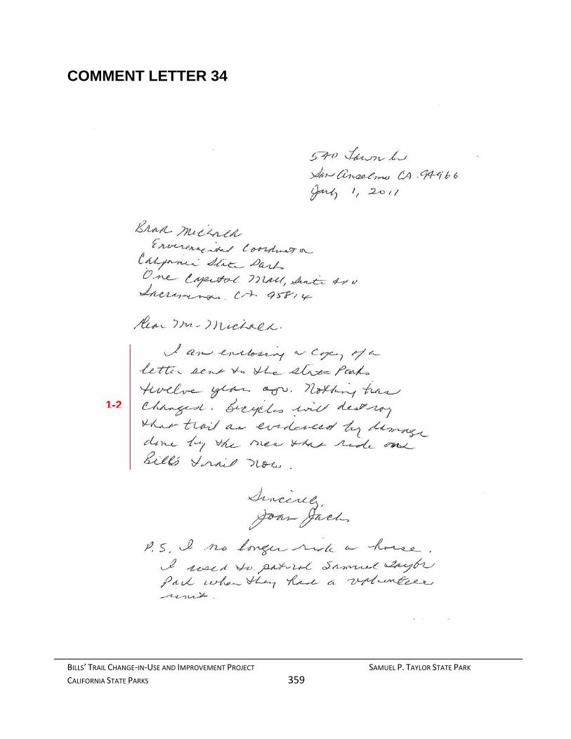
BILLS’ TRAIL CHANGE‐IN‐USE AND IMPROVEMENT PROJECT SAMUEL P. TAYLOR STATE PARK
CALIFORNIA STATE PARKS 359
COMMENT LETTER 34
1-2

BILLS’ TRAIL CHANGE‐IN‐USE AND IMPROVEMENT PROJECT SAMUEL P. TAYLOR STATE PARK
CALIFORNIA STATE PARKS 360
3
4
5
6
7

BILLS’ TRAIL CHANGE‐IN‐USE AND IMPROVEMENT PROJECT SAMUEL P. TAYLOR STATE PARK
CALIFORNIA STATE PARKS 361
RESPONSE TO COMMENT LETTER 34
August 1, 2012
Joan Jacks 540 Fawn Drive San Anselmo, CA 94960
RE: Draft Environmental Impact Report/Recirculated Environmental Impact Report Trail Change-In-Use and Improvement Project Samuel P. Taylor State Park
Ms. Jacks:
Thank you for your comments during the public review period for the Samuel P. Taylor State Park, Trail Change-In-Use and Improvement Project (Project) Draft Environmental Impact Report (DEIR)/Recirculated Environmental Impact Report (RDEIR). The following is a summarized list of the issues that you raise along with corresponding responses for the July 1, 2011 letter and an attached letter from January 4, 1999, you submitted to the California Department of Parks and Recreation.
Responses to comment letter date July 1, 2011:
1. This comment provides an introduction to a 1999 letter that was attached.
This comment serves as background only. No responses to these comments are required.
2. This comment suggests that bikes will destroy the trail much like the few trail poachers have been doing that have already been accessing the trail.
Please refer to Master Response 4: Project Details which consider the suitability of Bills’ Trail for mountain biking. Also, refer to Section 4.8 of the FEIR and Master Response 9: Hydrology/Water Quality for a discussion of erosion/water quality impacts from mountain biking.
Responses to comment letter date January 4, 1999:
3. In this comment you stated your concerns that bikes would destroy the trail, particularly in wet conditions.
Please refer to Master Response 9: Hydrology/Water Quality for a discussion of erosional impacts from mountain biking.
4. In this comment, you indicate your willingness to give up riding your horse on the trail in order to maintain its integrity.

BILLS’ TRAIL CHANGE‐IN‐USE AND IMPROVEMENT PROJECT SAMUEL P. TAYLOR STATE PARK
CALIFORNIA STATE PARKS 362
Comment noted.
5. This comment addresses the issue of safety from mixing mountain bikes and the existing users.
Please see Section 4.13 of the FEIR and Master Response 11: Transportation, Circulation and Traffic for a discussion of user safety.
6. This comment addresses a riding trail that is not a part of the project.
Please refer to Master Response 15: Comments Unrelated to the DEIR or RDEIR.
7. In this comment you state that no single track trail is suitable for bicycle travel.
A single track trail is defined in the FEIR as a trail so narrow that users must generally travel in single file. Portions of Bills’ Trail, particularly the upper reaches of the trail have narrowed as a result of sloughing and vegetation overgrowth to where it appears as a single track. That is the baseline condition against which the project is being evaluated. The trail will be improved back to its original 48” profile, allowing ample room for passing and refuge.
Thank you again for your comments.
Sincerely,
Brad Michalk Environmental Coordinator Northern Service Center

BILLS’ TRAIL CHANGE‐IN‐USE AND IMPROVEMENT PROJECT SAMUEL P. TAYLOR STATE PARK
CALIFORNIA STATE PARKS 363
COMMENT LETTER 35
From: Nancy Hanson [[email protected]] Sent: Wednesday, July 06, 2011 5:50 PM To: CEQA NSC Subject: Bill's Trail, Samuel P. Taylor Park
To: Brad Michalk Environmental Coordinator California State Parks One Capitol Mall, Suite 410 Sacramento CA 95814
Dear Mr. Michalk,
Please do not widen Bill's Trail in Samuel P. Taylor Park for bicyclists.
This particular trail is not a good candidate for bicycles for several reasons.
1. Erosion: the soil is very soft, the terrain is very steep and slopes down to an important salmon creek that is in the process of being restored. Widening it create an ongoing problem with erosion and siltation.
2. Native plants: this is a quiet, lovely woodland trail closely bordered by a wide variety of native wildflowers and shrubs. Widening it would destroy the flora that many of us have been working hard to rescue from the invasive forget-me-nots. Widening the trail would eradicate the plants we have been working many long volunteer hours to save.
3. Botanical, birding, family hikes: Botanists, birders, families with small children and elders all walk this trail now. Allowing bikes on it would make it impossible for all of us to enjoy these quiet activities.
4. There are miles and miles of bike trails in Marin. There are fewer and fewer trails dedicated to foot traffic. Please stop giving away our walking trails. We need to have trails that are protected from all wheeled traffic. We need you to dedicate trails for walkers and hikers as a matter of policy so that when the bicycle coalition asks for more and more trails, you can tell them which trails are not for bikes. Bill's Trail is not needed for bikes. To open it to bikes would destroy a beloved walking trail forever.
Thank you for your consideration.
Nancy Hanson, Woodacre, Marin County, California
4
2
3
1
BILLS’ TRAIL CHANGE‐IN‐USE AND IMPROVEMENT PROJECT SAMUEL P. TAYLOR STATE PARK
CALIFORNIA STATE PARKS 364
RESPONSE TO COMMENT LETTER 35
August 1, 2012
Nancy Hanson [email protected] Woodacre, California
RE: Draft Environmental Impact Report/Recirculated Environmental Impact Report Trail Change-In-Use and Improvement Project Samuel P. Taylor State Park
Dear Ms. Hanson:
Thank you for your comments during the public review period for the Samuel P. Taylor State Park, Trail Change-In-Use and Improvement Project (Project) Draft Environmental Impact Report (DEIR)/Recirculated Environmental Impact Report (RDEIR). The following is a summarized list of the issues that you raise in your letter of July 6, 2011, along with the Department of Parks and Recreation’s corresponding response.
1. This comment expresses a concern for the impact mountain bikes would have on erosion given its location within salmon habitat.
Please refer to Master Response 3: Detailed Project Description for a discussion of pinch points and Section 4.8 of the FEIR and Master Response 9: Hydrology/ Water Quality for a discussion of erosion. Additionally, refer to Section 4.3 of the FEIR and Master Response 8: biological Resources for a discussion of the project’s potential effects on salmon habitat.
2. In this comment you indicate that widening the trail will destroy the native flora that volunteers have been working to save.
As noted in the Detailed Project Description in Section 2.11 of the FEIR, Bills’ Trail will be rehabilitated back to its original 48” prism and will not be widened beyond that original profile. This type of work is typically considered routine trail maintenance, which is generally exempt from environmental review. While the work will necessitate some native vegetation removal, this is not considered a significant environmental effect under the State CEQA Guidelines. Specific Project Requirement GEO 3 – Revegetation Plan will be implemented as part of the project. This requirement will restore native plant habitat in affected areas

BILLS’ TRAIL CHANGE‐IN‐USE AND IMPROVEMENT PROJECT SAMUEL P. TAYLOR STATE PARK
CALIFORNIA STATE PARKS 365
(outside of the trail tread). Implementation of this requirement will ensure that impact to native vegetation will remain at a less than significant level.
3. This comment addresses Bills’ Trail’s sense of place and how it will be changed if mountain bikes are introduced.
Please refer to Section 4.1 of the FEIR and Master Response 7: Aesthetics for a discussion of the project’s potential impact on the trail’s sense of place.
4. This comment states that the number of hiking only trails in Marin County is going down and mountain bikers don’t need Bills’ Trail.
There is no empirical data to suggest that dedicated hiking trails in Marin County have been reduced when taking into account federal, state and regional parks. DPR believes that safe and sustainable multi-use trails are viable and work as designed. No further response to this comment is necessary.
Thank you again for your comments.
Sincerely,
Brad Michalk Environmental Coordinator Northern Service Center

BILLS’ TRAIL CHANGE‐IN‐USE AND IMPROVEMENT PROJECT SAMUEL P. TAYLOR STATE PARK
CALIFORNIA STATE PARKS 366
This page left intentionally blank

BILLS’ TRAIL CHANGE‐IN‐USE AND IMPROVEMENT PROJECT SAMUEL P. TAYLOR STATE PARK
CALIFORNIA STATE PARKS 367
COMMENT LETTER 36
From: Nancy Brown [[email protected]] Sent: Thursday, July 07, 2011 9:40 AM To: CEQA NSC Subject: Bill's Trail, Samuel Taylor Park
(hard copy follows) Mr. Brad Michalk, Environmental Coordinator California State Parks One Capitol Mall, Suite 410 Sacramento, CA 95814
Dear Mr. Michalk:
Please do not widen Bill’s Trail in Samuel P. Taylor Park to accommodate bicyclists. It is a narrow trail with steep, soft slopes populated by native plants of every description, some of which are rare or endangered. It draws butterflies and birds, protects the watershed and salmon creek below, and offers a peaceful encounter with nature to visitors of all ages from around the Bay Area and beyond.
There are already many more suitable trails for bicyclists in Taylor Park and Marin County. Please safeguard this one for walkers. It is beautiful and fragile, and deserves be preserved and protected. Our limited fiscal resources could be put to much better use than to degrade this legacy
Sincerely, Nancy Brown 232 Frustuck Ave Fairfax, CA 94930
1
2

BILLS’ TRAIL CHANGE‐IN‐USE AND IMPROVEMENT PROJECT SAMUEL P. TAYLOR STATE PARK
CALIFORNIA STATE PARKS 368
RESPONSE TO COMMENT LETTER 36
August 1, 2012
Nancy Brown 232 Frustuck Ave Fairfax, CA 94930 [email protected]
RE: Draft Environmental Impact Report/Recirculated Environmental Impact Report Trail Change-In-Use and Improvement Project Samuel P. Taylor State Park
Ms. Brown:
Thank you for your comments during the public review period for the Samuel P. Taylor State Park, Trail Change-In-Use and Improvement Project (Project) Draft Environmental Impact Report (DEIR)/Recirculated Environmental Impact Report (RDEIR). The following is a summarized list of the issues that you raise along with corresponding responses for the July 7, 2011 email you submitted to the California Department of Parks and Recreation.
1. In this comment you ask DPR not to approve the change-in-use. The comment is primarily a descriptive overview of the trail setting with the implication that everything the trail is will no longer be if bikes are permitting on the trail.
As this comment offers no specific issues of concern, no response to this comment is required.
2. This comment suggests that there are many other far more suitable trails for converting to multi-use although offering no specifics.
Please refer to Master Response 4: Project Details which addresses the suitability of Bills’ Trail for multi-use.
Thank you again for your comments.
Sincerely,
Brad Michalk Environmental Coordinator Northern Service Center
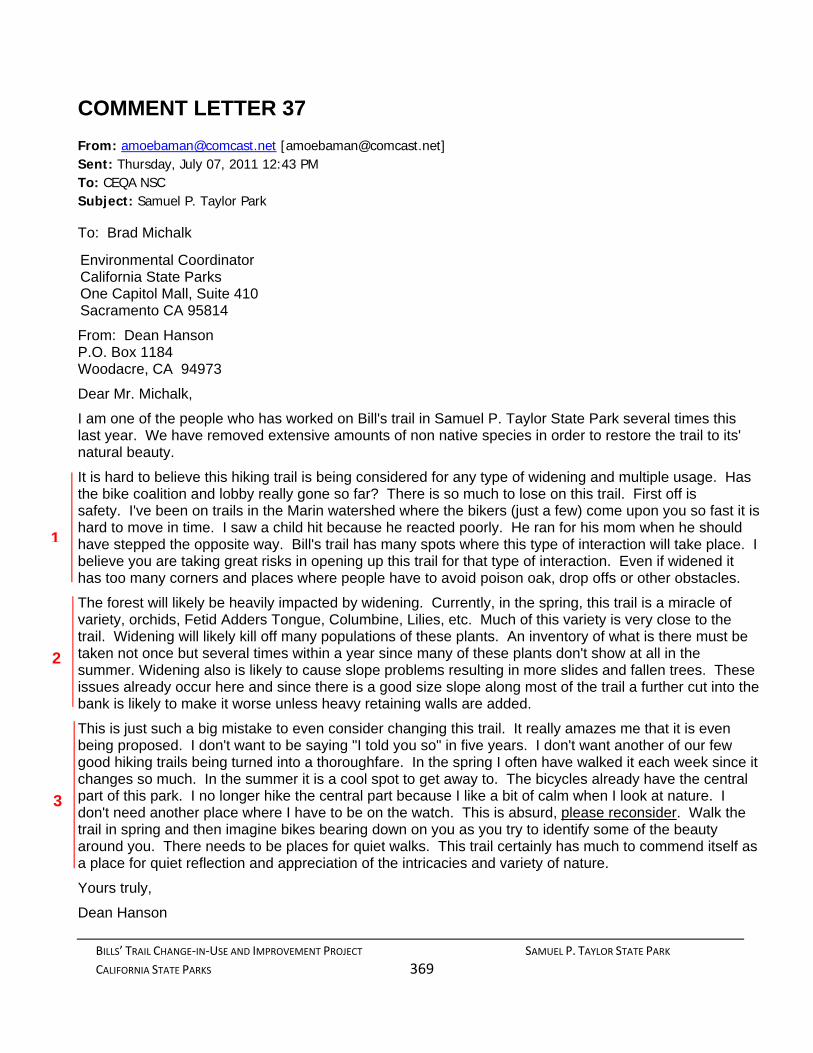
BILLS’ TRAIL CHANGE‐IN‐USE AND IMPROVEMENT PROJECT SAMUEL P. TAYLOR STATE PARK
CALIFORNIA STATE PARKS 369
COMMENT LETTER 37
From: [email protected] [[email protected]] Sent: Thursday, July 07, 2011 12:43 PM To: CEQA NSC Subject: Samuel P. Taylor Park
To: Brad Michalk
Environmental Coordinator California State Parks One Capitol Mall, Suite 410 Sacramento CA 95814
From: Dean Hanson P.O. Box 1184 Woodacre, CA 94973
Dear Mr. Michalk,
I am one of the people who has worked on Bill's trail in Samuel P. Taylor State Park several times this last year. We have removed extensive amounts of non native species in order to restore the trail to its' natural beauty.
It is hard to believe this hiking trail is being considered for any type of widening and multiple usage. Has the bike coalition and lobby really gone so far? There is so much to lose on this trail. First off is safety. I've been on trails in the Marin watershed where the bikers (just a few) come upon you so fast it is hard to move in time. I saw a child hit because he reacted poorly. He ran for his mom when he should have stepped the opposite way. Bill's trail has many spots where this type of interaction will take place. I believe you are taking great risks in opening up this trail for that type of interaction. Even if widened it has too many corners and places where people have to avoid poison oak, drop offs or other obstacles.
The forest will likely be heavily impacted by widening. Currently, in the spring, this trail is a miracle of variety, orchids, Fetid Adders Tongue, Columbine, Lilies, etc. Much of this variety is very close to the trail. Widening will likely kill off many populations of these plants. An inventory of what is there must be taken not once but several times within a year since many of these plants don't show at all in the summer. Widening also is likely to cause slope problems resulting in more slides and fallen trees. These issues already occur here and since there is a good size slope along most of the trail a further cut into the bank is likely to make it worse unless heavy retaining walls are added.
This is just such a big mistake to even consider changing this trail. It really amazes me that it is even being proposed. I don't want to be saying "I told you so" in five years. I don't want another of our few good hiking trails being turned into a thoroughfare. In the spring I often have walked it each week since it changes so much. In the summer it is a cool spot to get away to. The bicycles already have the central part of this park. I no longer hike the central part because I like a bit of calm when I look at nature. I don't need another place where I have to be on the watch. This is absurd, please reconsider. Walk the trail in spring and then imagine bikes bearing down on you as you try to identify some of the beauty around you. There needs to be places for quiet walks. This trail certainly has much to commend itself as a place for quiet reflection and appreciation of the intricacies and variety of nature.
Yours truly,
Dean Hanson
1
3
2

BILLS’ TRAIL CHANGE‐IN‐USE AND IMPROVEMENT PROJECT SAMUEL P. TAYLOR STATE PARK
CALIFORNIA STATE PARKS 370
RESPONSE TO COMMENT LETTER 37
August 1, 2012
Dean Hanson P.O. Box 1184 Woodacre, CA 94973 [email protected]
RE: Draft Environmental Impact Report/Recirculated Environmental Impact Report Trail Change-In-Use and Improvement Project Samuel P. Taylor State Park
Mr. Hanson:
Thank you for your comments during the public review period for the Samuel P. Taylor State Park, Trail Change-In-Use and Improvement Project (Project) Draft Environmental Impact Report (DEIR)/Recirculated Environmental Impact Report (RDEIR). The following is a summarized list of the issues that you raise along with corresponding responses for the July 7, 2011 email you submitted to the California Department of Parks and Recreation.
1. This comment expresses surprise that DPR is considering Bills’ Trail for multi-use because of the inherent safety issues (including poison oak). In this comment you also recount a personal anecdote you witnessed on another trail with a biker.
Please refer to Section 4.13 of the FEIR and Master Response 11: Transportation, Circulation and Traffic for a discussion of safety issues generally and Master Response 14: Poison Oak for a discussion of safety issues specific to this hazard.
2. This comment primarily pertains to plant species found along the trail and the impacts the trail widening will have on these plants.
DPR biologists have conducted extensive surveys of plants along Bills’ Trail and prepared a comprehensive discussion of these plants in Section 4.3 of the FEIR. It should also be noted that portions of Bills’ Trail, particularly the upper reaches of the trail have narrowed as a result of sloughing and vegetation overgrowth to where it now appears as a single track. That is the baseline condition against which the project is being evaluated. The trail will be improved back to its original 48” profile. The widening will only occur by removing sloughing from the inside hinge. Incorporation of Project Requirements 2.1 – Sensitive Natural Plant

BILLS’ TRAIL CHANGE‐IN‐USE AND IMPROVEMENT PROJECT SAMUEL P. TAYLOR STATE PARK
CALIFORNIA STATE PARKS 371
Communities and GEO 3 – Revegetation Plan will insure that impacts from the change-in-use will remain at a less than significant level.
Finally, a mitigation measure will require DPR to walk the trail annually against baseline conditions to evaluate the presence of resource damage. If resource damage on the trail is observed a work plan must be developed to remediate the damage and implemented. Trail closure to specific user groups via a Superintendent’s Order may be implemented if damage continues to occur. As such with implementation of the Specific Project Requirements and incorporation of Mitigation Measure AES 1, impacts to resources resulting from the change-in-use project will be reduced to a less than significant level.
3. In this comment you note that you no longer user the central portion of the park because of the bikes and other users. This speaks to the trail’s sense of place and your fear that bikes on Bills’ Trail will change the visitor experience.
Please refer to Section 4.9.4: Land Use Planning (Recreation) and Master Response 10: Recreation for a discussion of user displacement, the trail’s sense of place and visitor experience.
Thank you again for your comments.
Sincerely,
Brad Michalk Environmental Coordinator Northern Service Center

BILLS’ TRAIL CHANGE‐IN‐USE AND IMPROVEMENT PROJECT SAMUEL P. TAYLOR STATE PARK
CALIFORNIA STATE PARKS 372
This page left intentionally blank

BILLS’ TRAIL CHANGE‐IN‐USE AND IMPROVEMENT PROJECT SAMUEL P. TAYLOR STATE PARK
CALIFORNIA STATE PARKS 373
COMMENT LETTER 38
From: Steve Maass [[email protected]] Sent: Friday, July 08, 2011 8:28 PM To: CEQA NSC Subject: bills trail samuel b taylor park
If you are considering bikes on Bills Trail I strongly object. You will just inviting acecidents as this is a steep single track trail and horses and bikes on those kinds of trails do not mix. I strongly hope that you will not allow bikes on this trail as it would be catastrophic for the horses. Steve Maass
1
BILLS’ TRAIL CHANGE‐IN‐USE AND IMPROVEMENT PROJECT SAMUEL P. TAYLOR STATE PARK
CALIFORNIA STATE PARKS 374
RESPONSE TO COMMENT LETTER 38
August 1, 2012
Steve Maass [[email protected]]
RE: Draft Environmental Impact Report/Recirculated Environmental Impact Report Trail Change-In-Use and Improvement Project Samuel P. Taylor State Park
Mr. Maass:
Thank you for your comments during the public review period for the Samuel P. Taylor State Park, Trail Change-In-Use and Improvement Project (Project) Draft Environmental Impact Report (DEIR)/Recirculated Environmental Impact Report (RDEIR). The following is a summarized list of the issues that you raise along with corresponding responses for the July 8, 2011 email you submitted to the California Department of Parks and Recreation.
1. In this comment you suggest opening the trail to bikes will impact the safety of users because of its steepness and narrowness, and will be catastrophic for horses.
Please refer to Section 4.13 of the FEIR and Master Response 11: Transportation, Circulation and Traffic for a discussion of user safety. Additionally, as noted in the Detailed Project Description in Section 2.11 of the FEIR, the trail will not be a single track trail. Rather, it will be restored back to its original 48” profile providing ample room for passing.
Thank you again for your comments.
Sincerely,
Brad Michalk Environmental Coordinator Northern Service Center

BILLS’ TRAIL CHANGE‐IN‐USE AND IMPROVEMENT PROJECT SAMUEL P. TAYLOR STATE PARK
CALIFORNIA STATE PARKS 375
COMMENT LETTER 39
From: Duffy Hurwin [[email protected]] Sent: Friday, July 08, 2011 2:31 PM To: CEQA NSC Cc: Joel Bartlett; Connie Berto; Linda J. Novy Subject: Bill's Trail, Samuel P. Taylor State Park To: Brad Michalk Re: Bill's Trail I wish to go on record of my very strong opposition to opening Bill's Trail to mountain bikes. This trail is a prime example of the most dangerous type of trail to be designated multiuse. It is very narrow with steep dropoffs on the sides. It has many tight blind corners and is impossible to see other users around the corners.
I have had several very dangerous close calls with mountain bikers on my horse, one in China Camp State Park and another on Diaz Ridge Spur Trail which was very clearly marked No Bikes on both ends of the trail. In both instances the cyclists were obnoxious and rude and put my riding partners and myself in harms way and shoved their bicycles into my horse's face. I realize that their are rude people in every user group but only the cyclists travel at high speeds and wear headphones further impairing their ability to hear around them. There is a culture of defiance in the mountain biking community that is absent in the other user groups and they view the trail system as an amusement park ride. The only reason they wish to use Bill's Trail is because of the technical challenges it offers as cyclists like to challenge themselves with hairy terrain much like other extreme athletes like to get a rush being on the edge.
The park experience is supposed to be about enjoying the tranquility and beauty of nature, not to be a free amusement park ride where you can speed through destroying plant and animal life and causing erosion in the course of getting a rush.
It is completely incompatible to have slow nature savoring users on the same trail as speeding thrill seekers who don't care about who they run over in the process.
I have no problem sharing trails where there is sufficient width for passing and an absence of blind corners which obstruct adequate view of other users to allow significant deceleration and stopping time. Bill's Trail is the opposite of that type of trail. Should Bill's Trail be opened for cycling, there is not another single trail that by reason would not be opened for multi use as it is the most unsafe trail for sharing due to it's many severe switchbacks. The cycling groups will hold it up as an example and say that, if Bill's Trail is "safe" for cycles, every other trail is. There must be a differentiation between trails that are safe for sharing and those that are not. Bill's is the worst example of a hazardous trail and that is the exact reason the cyclists want it.
I will never ride China Camp again and you will note that, since it has become so popular with cyclists, use by equestrians has become almost nil. No one wants to take their life in their hands riding there.
Just because the cycling community is a loud and growing group does not justify opening every trail to them that they demand. The park must have some responsibility to keep public trails safe for all users and not create additional obvious hazards. Keep the cyclists in areas where they can be seen coming from a distance to give other users the opportunity to defend themselves & get out of
1
2
3
4
5

BILLS’ TRAIL CHANGE‐IN‐USE AND IMPROVEMENT PROJECT SAMUEL P. TAYLOR STATE PARK
CALIFORNIA STATE PARKS 376
the way since the cyclists are often oblivious to anything other than their own thrill. Only the technically skilled cyclists will tackle a trail like Bills as it will be a difficult trail to cycle on. And those more skilled cyclists are the ones that will ride faster. It's really a case of user groups who travel slowly and cautiously v.s. those that seek speed. Bill's is not a suitable trail for high speed use.
The parks are out of funds and it is unconscionable to dredge up funds to do the kind of work that would be required to open Bill's to cyclists. Leave things as they are & prohibit cycling on Bills and spend the money just keeping the park open in general.
People spend money camping with their horses at Devils Gulch Horse Camp which I noticed had it's sign changed to Devils Gulch Camp. Is this an indication of the direction the park is going which is starting to look like excluding horses from the trails in favor of widening mountain bike use?
I urge you to not set the precedent of opening a very hazardous trail to mountain biking that will cause other such trails to be opened up as well. This will essentially constitute the California State Park system's condoning the ignorance of obvious risks to the public. The park system has a mandate to protect the public and not increase perils and risks. Bill's Trail has every single risk factor that justifies keeping mountain bikes off:
In summary:
Blind corners and switchbacks with lots of vegetation that obscures views from a distance which costs alot of money to keep cutting back. There are no funds for this continuing work.
Narrow trail with little room for passing and none when a quick decision must be made if someone is approaching at speed.
Dropoffs on the sides which make it impossible to get out of the way quickly
- Hikers and horseback riders travel slowly and never reach speeds exceeding 2-3 miles per hour on such a trail. It is very easy at that slow speed to make a stop & navigate around each other. Downhill mountain bikes can travel as fast as 20-25 mph on straightaway sections and require much longer stopping distance at that rate of speed assuming the rider isn't listening to music on a player and hears someone approaching. The sound of the tires alone on leaves & dirt obscure hearing well.
Bill's Trail MUST remain open only for users on foot & hoof.
Sincerely, Duffy Hurwin
6
7
8
5

BILLS’ TRAIL CHANGE‐IN‐USE AND IMPROVEMENT PROJECT SAMUEL P. TAYLOR STATE PARK
CALIFORNIA STATE PARKS 377
RESPONSE TO COMMENT LETTER 39
August 1, 2012
Duffy Hurwin [[email protected]]
RE: Draft Environmental Impact Report/Recirculated Environmental Impact Report Trail Change-In-Use and Improvement Project Samuel P. Taylor State Park
Ms. Hurwin:
Thank you for your comments during the public review period for the Samuel P. Taylor State Park, Trail Change-In-Use and Improvement Project (Project) Draft Environmental Impact Report (DEIR)/Recirculated Environmental Impact Report (RDEIR). The following is a summarized list of the issues that you raise along with corresponding responses for the July 8, 2011 email you submitted to the California Department of Parks and Recreation.
1. In this comment you express strong opposition to the proposed Bills’ Trail change-in-use project because the trail is narrow, with steep drop-offs, and blind corners.
These comments consist of an overview of your objection to the project and primary reasons for your objection. Opposition is noted and responses to these issues are addressed in detail below. Consequently, no further response to this comment is required.
2. This comment contains anecdotal reports of previous dangerous encounters with mountain bikers who were rude. The comment speaks to the mountain biker attitudes and their motives for wanting access to Bills’ Trail.
Please refer to Master Response 11: Transportation, Circulation and Traffic for a discussion of user safety and Master Response 12: Conflict for a discussion of mountain biker behavior.
3. This comment addresses the desired experience of experiencing the natural beauty. The contention is that bikers are thrill-seekers speeding along on the trail and will not be there to appreciate its beauty.
Please refer to Master Response 7: Aesthetics for a discussion of the visual quality issues and the trail’s sense of place.
4. In this comment, you state your willingness to share trails with bicyclists on trails suitable for shared use. You further state that if Bills’ Trail is opened to bikes, there is not another trail in the State that will not be deemed suitable for mountain bikes.
The suitability of Bills’ Trail for multi-use trail is addressed in Master Response 4: project Details.
BILLS’ TRAIL CHANGE‐IN‐USE AND IMPROVEMENT PROJECT SAMUEL P. TAYLOR STATE PARK
CALIFORNIA STATE PARKS 378
5. In this comment you suggest that DPR does not have to open every trail requested by the bike community.
A user group has the right to request trail access and DPR has established a process to consider that request in efforts to increase visitor opportunities. Although mountain bikers will gain access to a new trail, it will not be a single track trail requiring mastery of technical skills and high speeds. IMBA ranks trails based on the degree of difficulty from easiest to extremely difficult. With the profile of the trail at 48” and pinch points limiting speeds, Bills’ Trail would rank in the “easy” category of mountain bike trails. So, while a temporary spike in bicyclists could occur as a result of the change-in-use, it is anticipated that the aggressive rider will incorporate only those trails that meet their experience level. DPR recognizes however, that even with the trail design that emphasizes safety, there will still remain a segment of hikers and equestrians who will refuse to share the trail with cyclists out of fear or out of goal conflict. Many others will limit their access of Bills’ Trail to times when mountain bikers are less likely to be on the trial.
What they will not sacrifice; however is safety. They will gain a rehabilitated trail that improves safety of all users. Impacts to user safety will be maintained at a less than significant level with integration of these project components and implementation of Mitigation Measure AES 1: Active Management and Maintenance as discussed on page 47 of the RDEIR.
6. This comment is in regards to costs associated with the trail change-in-use project. You state that this money should more appropriately go towards keeping the park itself open.
Please refer to Master Response 13: Fiscal Issues for a discussion of the issue of costs.
7. This comment is in regards to the Devils Gulch Horse Camp located adjacent to the base of Bills’ Trail. You question if a sign removed from the horse camp is indicative of the park’s changing position towards mountain bikers and away from equestrians.
DPR acknowledges the existence of the horse camp and that many utilizing the camp also ride their horses on Bills’ Trail. DPR has no intent to eliminate horses or the camp. No further response to this comment is required.
8. In this comment you implore DPR not to move forward with the trail change-in-use as it will open the door for bikes to all other trails regardless of the safety issues.
As noted in the responses above, DPR has thoroughly considered the issue of safety impacts from permitting bike access to Bills’ Trail. Furthermore, DPR will consider user safety on trails considered for multi-use in the future. No further response to this comment is required.
Thank you again for your comments.
Sincerely,
Brad Michalk Environmental Coordinator Northern Service Center

BILLS’ TRAIL CHANGE‐IN‐USE AND IMPROVEMENT PROJECT SAMUEL P. TAYLOR STATE PARK
CALIFORNIA STATE PARKS 379
COMMENT LETTER 40
1
2
3
4

BILLS’ TRAIL CHANGE‐IN‐USE AND IMPROVEMENT PROJECT SAMUEL P. TAYLOR STATE PARK
CALIFORNIA STATE PARKS 380
RESPONSE TO COMMENT LETTER 40
August 1, 2012
Alice Bachelder 49 summit Road San Anselmo, CA 94960
RE: Draft Environmental Impact Report/Recirculated Environmental Impact Report Trail Change-In-Use and Improvement Project Samuel P. Taylor State Park
Ms. Bachelder:
Thank you for your comments during the public review period for the Samuel P. Taylor State Park, Trail Change-In-Use and Improvement Project (Project) Draft Environmental Impact Report (DEIR)/Recirculated Environmental Impact Report (RDEIR). The following is a summarized list of the issues that you raise along with corresponding responses for the July 8, 2011 letter you submitted to the California Department of Parks and Recreation.
1. In this comment you suggest that should bikes be eventually permitted on Bills’ Trail, DPR would not be able to later ban them from the trail regardless of the damage they may cause.
As a part of the change-in-use process, DPR will establish the existing use levels prior to the change as well as after the work is completed, and monitor the conditions as a new use or change is implemented. As part of the RDEIR, DPR has incorporated Mitigation Measure AES 1 – Active Management and Maintenance (see page 47 of the RDEIR), requiring staff to annually evaluate the effects of the multi-use trails in part on sustainability issues as well as recommend and implement corrective measures to remedy impacts. If impacts continue, DPR has the authority and obligation to close the trail to user groups who are impacting the resource. Therefore, with implementation of the features detailed in the project description and incorporation of the aforementioned mitigation measure, impacts to the movement of wildlife will be reduced to a less than significant level.
2. With this comment you describe the setting of Bills’ Trail and encapsulate the ideal user. You also suggest reasons why it is not suited for bicycles including erosion and impacts to wildflowers and because it is a dead-end trail.
Please refer to Master Response 9: Hydrology/Water Quality for a discussion of erosion impacts and Master Response 8: Biological Resources for a discussion of potential

BILLS’ TRAIL CHANGE‐IN‐USE AND IMPROVEMENT PROJECT SAMUEL P. TAYLOR STATE PARK
CALIFORNIA STATE PARKS 381
biological impacts resulting from introducing bikes on the trail. The suitability of Bills’ Trail for mountain bikes is addressed in Master Response 4: Project Details.
3. In this comment you address erosion and sedimentation impacts on salmon located in Devils Gulch and Lagunitas Creek.
Please refer to Master Response 8: Biological Resources and Master Response 9: Hydrology/Water Quality for a discussion of potential impacts from erosion on salmon habitat.
Thank you again for your comments.
Sincerely,
Brad Michalk Environmental Coordinator Northern Service Center

BILLS’ TRAIL CHANGE‐IN‐USE AND IMPROVEMENT PROJECT SAMUEL P. TAYLOR STATE PARK
CALIFORNIA STATE PARKS 382
This page left intentionally blank
BILLS’ TRAIL CHANGE‐IN‐USE AND IMPROVEMENT PROJECT SAMUEL P. TAYLOR STATE PARK
CALIFORNIA STATE PARKS 383
COMMENT LETTER 41
2
3
1

BILLS’ TRAIL CHANGE‐IN‐USE AND IMPROVEMENT PROJECT SAMUEL P. TAYLOR STATE PARK
CALIFORNIA STATE PARKS 384
5
7
6
4
3

BILLS’ TRAIL CHANGE‐IN‐USE AND IMPROVEMENT PROJECT SAMUEL P. TAYLOR STATE PARK
CALIFORNIA STATE PARKS 385
8
9
10
11
12
7

BILLS’ TRAIL CHANGE‐IN‐USE AND IMPROVEMENT PROJECT SAMUEL P. TAYLOR STATE PARK
CALIFORNIA STATE PARKS 386
COMMENT LETTER 55
14
16
13
15
BILLS’ TRAIL CHANGE‐IN‐USE AND IMPROVEMENT PROJECT SAMUEL P. TAYLOR STATE PARK
CALIFORNIA STATE PARKS 387
17

BILLS’ TRAIL CHANGE‐IN‐USE AND IMPROVEMENT PROJECT SAMUEL P. TAYLOR STATE PARK
CALIFORNIA STATE PARKS 388
RESPONSE TO COMMENT LETTERS 41 AND 55
August 1, 2012
Robert Eichstaedt, President Alto Bowl Horseowners Association PO Box 1954 Mill Valley, CA 94942 [email protected]
RE: Draft Environmental Impact Report/Recirculated Environmental Impact Report Trail Change-In-Use and Improvement Project Samuel P. Taylor State Park
Mr. Eichstaedt:
Thank you for your comments during the public review period for the Samuel P. Taylor State Park, Trail Change-In-Use and Improvement Project (Project) Draft Environmental Impact Report (DEIR)/Recirculated Environmental Impact Report (RDEIR). The following is a summarized list of the issues that you raise along with corresponding responses for the July 10, 2011 and October 31, 2011 letters you submitted to the California Department of Parks and Recreation.
Responses to comments in letter dated July 10, 2001:
1. This comment provides a background narrative of the change-in-use project and mentions other trails that were promoted by mountain biking supporters, all of which were deemed by your organization unsuitable for bikes.
This comment serves as background only. No responses to these comments are required.
2. This comment references the Trail Use Change Survey. You contend that it was developed with the assistance of bicycle industry groups and is deficient in many regards. This comment ends with a conclusion that the project will change the quality and character of the trail.
DPR developed the Trail Use Change Survey (Survey) with the input of all user groups, to provide an objective evaluation of the existing measureable trail conditions and helps DPR determine if the proposed use could be sustainably accommodated. The “intrinsic or experiential character” of the trail, although important, may mean different things to different people and is therefore too subjective for the Survey. These issues are; however relevant to the environmental document. There has been ample comment from individuals across the spectrum on the suitability of Bills’ Trail for mountain bikes.
Section 2.6 of the FEIR notes that once the Survey is complete “DPR makes a recommendation to the District Superintendent whether to move to the next step or deny the change in use”. Policy Notice 2005-06 outlines a conflict resolution procedure to resolve public concerns and conflict on any

BILLS’ TRAIL CHANGE‐IN‐USE AND IMPROVEMENT PROJECT SAMUEL P. TAYLOR STATE PARK
CALIFORNIA STATE PARKS 389
policy that affects trail use. This procedure creates an opportunity for meaningful public input. There have been several meetings as early as 2006 to receive public input.
Public input has also been solicited and received as a part of this DEIR and RDEIR process. Approximately 42 comment letters have been received from opponents responding to the DEIR and 16 comments on the RDEIR. DPR recognizes the issue of the trail’s character and have addressed the issue thoroughly. Please refer to Master Response 7: Aesthetics for further discussion of this issue.
3. With this comment you again are addressing the Use Change Survey, specifically regarding the question of evidence of user conflict or unauthorized use and challenging the survey as a set-up to aid mountain biking groups.
Although the Survey referenced in part equestrians co-opting the trail equestrian use of the trail is considered an existing use by virtue of the signs permitting horses at both ends of the trail (See Master Response 2: Bills’ Trail History). It is the baseline against which the impacts of the change-in-use are measured.
Evidence of unauthorized use is a relevant part of a trail’s analysis. The consideration of such is not acquiescence as much as it is to identify evidence of resource damage that can be identifiably caused by that unauthorized use. Evidence of a tire track on the tread is not resource damage but certainly massive rutting that can be attributed to mountain bike tires can be a reason to limit or exclude bike use. Bills’ Trail had no discernible resource damage caused by mountain bikes as the Survey would have noted any such issues.
In regards to the survey question, "Does the proposed use change provide a legal ... route for existing unauthorized trail use...?", part of the consideration for the suitability of a change-in-use is the circulation patterns of trail users both inside and outside of the park unit, particularly If it provides a sustainable alternative to some other unsustainable trail. Regardless, this is one question out of 97 in the survey. That this question may be answered in the affirmative means little if all the other answers lead to a conclusion that the use cannot be sustainably accommodated.
4. This comment is also in regards to the Use Change Survey. The survey indicated that pinch points and alternate days would mitigate any safety issue. The commenter has asked why alternate days were no longer considered.
The survey did not suggest that both of these measures were required to address safety but listed measures that could be employed. The concept of alternate days is to separate the users that travel at speeds substantially different from one another creating potential safety hazards. Odd/even days however, do not reduce speed and create a false sense of security when unexpected users and higher speeds are encountered. Rather than rely on users to self-police, DPR opted for permanent speed reduction measure with the installation of pinch points. Please refer to Section 2.11 of the FEIR and Master Response 3: Detailed Project Description for further discussion of pinch points.
5. This comment suggests that pinch points would be ineffective and would be used like technical features. You also commented that the DEIR incorporated an IMBA illustration.
As noted on the illustration itself, it was adapted from IMBA but is not an IMBA-supplied graphic. The “choke points” as referred to by IMBA differ from the pinch points that DPR installs to control speed and thus the graphic was revised to reflect DPR’s construction method. Nevertheless, attribution of the original source is necessary. It should be noted that the DEIR did include two original illustrations that DPR prepared.
6. This comment addresses the work proposed on the Gravesite Fire Road. You note that the road “is a significant environmental problem in its own right with serious direct impacts on the local streams” and contend that the work should be evaluated separately.

BILLS’ TRAIL CHANGE‐IN‐USE AND IMPROVEMENT PROJECT SAMUEL P. TAYLOR STATE PARK
CALIFORNIA STATE PARKS 390
The road is unquestionably a component of the project as the two facilities meet at Devil’s Gulch and trail users commonly use both. Splitting the project would likely be seen as “piece-mealing” the project, a practice by which projects are analyzed incrementally by parts to make the environmental impacts appear smaller. DPR is committed to complying with established case law by evaluating the entirety of the project.
7. This comment questions why incident data was not included in the DEIR or survey.
Although DPR can collect reports of incidents and accidents from park users, the DEIR did not discuss safety incidents because there are no reported incidents with mountain bikers on Bills’ Trail (although one commenter recounted a near-miss incident). While the incidents you referred to at China Camp State Park (CCSP) may have occurred, the trails at that park do not have pinch points or other speed control devices so the comparison is irrelevant to the project on Bills’ Trail.
As noted in response to comment 4 above, a survey of reported incidents was conducted as part of the Statewide Program EIR for trail change-in-use projects and the number of agencies reporting incidents or injuries is extremely small. While many commenters have recounted anecdotes of incidents from mountain bikers at other parks, such incidents have been very infrequently reported or documented when compared to overall trail miles. Please refer to Section 4.13 of the FEIR and Master Response 11: Transportation, Circulation and Traffic for further discussion of safety issues.
8. In this comment you suggest that the 48” trail width is inadequate for passing and in fact DPR’s standard is 60” for multi-use trails.
The DPR multi-use trail guidelines do not specify a 60” minimum. It specifies that there be enough width for safe passage, but the necessary width may change depending on the conditions. Where there are adequate and adequately spaced places of refuge, adequate sight lines and/or methods of moderating speeds, 48” inch tread width is generally sufficient for multi-use trails. Wider trails simply encourage faster speeds.
9. In this comment you suggest that more intense use of the trail will require more maintenance.
It is a true that increased use will increase the demand for maintenance. It is also true that Bills’ Trail has also seen very limited maintenance with the primary exception of removal of wind-downed trees. Had there been resource impact issues needing remediation however, DPR would have responded in accordance with our mission. The most important factor for a sustainably trail is that it be properly located, followed by proper design and construction. That Bills’ Trail currently has very little maintenance and yet few resource issues of concern, speaks volumes to its sustainability. DPR has determined through years of experience in proper trail design that Bills’ Trail can sustainably accommodate mountain bikes provided that the improvements are properly designed and constructed. Incorporation of Mitigation Measure AES 1 will ensure that trail and resource impacts from increased usage will be reduced to a less than significant level.
10. In this comment you refer to a lack of public input and lack of independent decision-making from mountain biking organizations.
As indicated in response to comment 3 above; the record of adequate public input is clear and incontrovertible. That DPR continues to pursue this trail change-in-use is not indicative of IMBA’s influence but DPR’s independence in objectively finding that mountain biking can be sustainably accommodated on the trail.
11. This comment again recommends segmenting the two components of the project. It also recommends adoption of the “No Project” Alternative.
Please refer to response to comment 5 above for a discussion of piece-mealing. Please refer to Master Response 6: Alternatives for a discussion of the project alternatives.
12. This comment is in regards to the objectives outlined in the DEIR.
Please refer to Master Response 6: Alternatives for a discussion of the project objectives.

BILLS’ TRAIL CHANGE‐IN‐USE AND IMPROVEMENT PROJECT SAMUEL P. TAYLOR STATE PARK
CALIFORNIA STATE PARKS 391
Responses to comment letter dated October 31, 2011:
No comment required.
13. In this comment you note your agreement with Marin Conservation League’s comment letter of 10/217/2011.
Comment noted. No further response to this comment is required.
14. With this comment you express doubt about the consistency of a trail with 100+ pinch points created with non-native (eucalyptus) logs would be compatible with Bills’ Trail’s sense of place.
All logs placed as pinch points will be harvested from areas along Bills’ Trail. They will be installed so as to appear similar to the many trees that have fallen along the trail as a result of natural forces. As such, the pinch points are no less natural in appearance than the trail itself. No further response to this comment is required.
15. You address the different mountain biking styles discussed in Section 2.7 of the RDEIR (page starting on page 19). You assert that the methods used to slow the bikers will be used to make the trail more dangerous…based on your experience.
In your previous letter, you advocate wide trails that would allow ample room for passing (comment 8) and in this comment you advocate for no pinch points that would slow bikes. As noted above, wide trails increases speeds which the pinch points effectively restrict. No further response to this comment is required.
16. This comment is in regards to the style of mountain biking for which DPR has designed the trail. You note that long cross-country (XC) rides are easily accomplished thereby impacting a greater stretch of trail miles.
Section 2.7 of the RDEIR (Section 2.9 of the FEIR) was intended to educate the reader about the numerous mountain biking styles. XC touring most closely approximates the riding style as it focuses on the rider who chooses a trail based upon the setting rather than the thrill of the ride. That they conceivably can ride hundreds of miles is irrelevant to this project as the Bills’ Trail is only 3.3 miles in length. The environmental effect of adding users to Bills’ Trail has been adequately addressed in the DEIR and RDEIR and that impact does not change based on a particular mountain biker’s riding range.
17. In this comment you suggest that DPR’s financial challenges of late are reason enough to not pursue the project.
Please refer to Master Response 13: Fiscal Concerns for a discussion of this issue.
Thank you again for your comments.
Sincerely,
Brad Michalk Environmental Coordinator Northern Service Center

BILLS’ TRAIL CHANGE‐IN‐USE AND IMPROVEMENT PROJECT SAMUEL P. TAYLOR STATE PARK
CALIFORNIA STATE PARKS 392
This page left intentionally blank

BILLS’ TRAIL CHANGE‐IN‐USE AND IMPROVEMENT PROJECT SAMUEL P. TAYLOR STATE PARK
CALIFORNIA STATE PARKS 393
COMMENT LETTER 42

BILLS’ TRAIL CHANGE‐IN‐USE AND IMPROVEMENT PROJECT SAMUEL P. TAYLOR STATE PARK
CALIFORNIA STATE PARKS 394
4
2
3
1
5
6

BILLS’ TRAIL CHANGE‐IN‐USE AND IMPROVEMENT PROJECT SAMUEL P. TAYLOR STATE PARK
CALIFORNIA STATE PARKS 395
10
9
8
7
6

BILLS’ TRAIL CHANGE‐IN‐USE AND IMPROVEMENT PROJECT SAMUEL P. TAYLOR STATE PARK
CALIFORNIA STATE PARKS 396
COMMENT LETTER 60
11

BILLS’ TRAIL CHANGE‐IN‐USE AND IMPROVEMENT PROJECT SAMUEL P. TAYLOR STATE PARK
CALIFORNIA STATE PARKS 397
15
14
13
12

BILLS’ TRAIL CHANGE‐IN‐USE AND IMPROVEMENT PROJECT SAMUEL P. TAYLOR STATE PARK
CALIFORNIA STATE PARKS 398
16
19
18
17
15

BILLS’ TRAIL CHANGE‐IN‐USE AND IMPROVEMENT PROJECT SAMUEL P. TAYLOR STATE PARK
CALIFORNIA STATE PARKS 399
RESPONSE TO COMMENT LETTERS 42 AND 60
August 1, 2012
San Geronimo Valley Planning Group Attention: Jean Berensmeier, Chairperson P. O Box 57 Forest Knolls, CA 94933
RE: Draft Environmental Impact Report/Recirculated Environmental Impact Report Trail Change-In-Use and Improvement Project Samuel P. Taylor State Park
Ms. Berensmeier:
Thank you for your comments during the public review period for the Samuel P. Taylor State Park, Trail Change-In-Use and Improvement Project (Project) Draft Environmental Impact Report (DEIR)/Recirculated Environmental Impact Report (RDEIR). The following is a summarized list of the issues that you raise along with corresponding responses for the July 11, 2011 and October 31, 2011 letters email you submitted to the California Department of Parks and Recreation.
1. In this comment you address DPR’s failure to provide ample time for agencies to respond to the NOP and failed to include the responses in the DEIR.
Please refer to Master Response 1: Notification/Public Review Period for a discussion of this issue.
2. In this comment you request information on the public notification process of this DIEIR.
Please refer to Master Response 1: Notification/Public Review Period for a discussion of this issue.
3. In this comment you provide a narrative of Bills’ Trail user demographics and suggest that the DEIR inadequately addressed this issue. You suggest that seniors should be given more consideration because they are the largest growing demographic in the San Geronimo Valley.
DPR acknowledges that the 65+ demographic in San Geronimo Valley is rapidly growing as an overall percentage of this census-designated place but that still represents less than 100 people. Moreover, while SPTSP is important to the region it should not be confused as a regional park.
Trails Policy Number. 2005-05 (Trails Policy) states that DPR will strive to meet the recreational, educational and interpretation needs of its diverse trail users. The change-in-use project is not intended to take the trail away from senior citizens and give it to the mountain bikers. It is

BILLS’ TRAIL CHANGE‐IN‐USE AND IMPROVEMENT PROJECT SAMUEL P. TAYLOR STATE PARK
CALIFORNIA STATE PARKS 400
intended to make it accessible to a more diverse set of trail users as per the Trails Policy, and do so in a manner that improves the safety for all users.
While not condoning illegal trail use, the improvements proposed in the project description (RDEIR page 23) will make the trail safer by forcing bicycles to traverse the trail slowly and reducing unexpected and sudden encounters.
4. In this comment you suggest that the DEIR does not describe the existing trail accurately and as a consequence, construction impacts characterized as “major” are vastly understated.
The comment does not offer any substantial evidence as to why or how the trail description is inaccurate. However, the background of Bills’ Trail was updated in Section 2.3 of the RDEIR (and Section 2.3 of the FEIR). The trail background quotes the description prepared by Clearwater Hydrology from 2009).
As noted in the Detailed Project Description in Section 2.11 of the FEIR, trail work includes brushing the trail from top of cut back to top of fill slope, improving trail out-sloping/removing outside berm and removing slough from the inside hinge and some bridge/drainage crossing repairs and improvements. This type of work under normal circumstances is considered routine maintenance work and processed under a Notice of Exemption.
Because the project is also a change-in-use, additional work will be performed including installation of pinch points and trail signage. The work however, is not considered major construction and the impacts were thoroughly considered and addressed in the DEIR.
5. In this comment you suggest that the damage from the construction aspect alone will be severe. You suggest the wider trail will simply encourage mountain bikers to speed down the hill. You further suggest that the mitigations suggested are inadequate
Please see response to Comment 3 above. Please refer to Section 2.11 of the FEIR and Master Response 3: Detailed Project Description for a discussion of pinch points. Please refer to Section 4.13 of the FEIR and Master Response 11: Transportation, Circulation and Traffic for a discussion of bicycle speeds and their control by pinch points. Please refer to Master Response 12: Fiscal Concerns for a discussion of issues related to maintenance costs.
As to your comment about which mitigations “work against themselves” and which are “unreasonable”, there is no specificity as to which you refer. Therefore, no additional response can be made to address your concern.
6. This comment challenges the Alternatives section of the DEIR (Chapter 3.0, page 51). You recommend alternatively that Barnabe Fire Road can be improved to meet the needs of the mountain biking community.
Please refer to Master Response 6: Alternatives for a discussion of this issue.
7. In this comment you questioned why there wasn’t more discussion about increased visitor usage.
Please refer to Section 4.9.4: Land Use Planning (Recreation) and Master Response 10: Recreation for a discussion of this issue.
8. This comment also questions the lack of discussion of increased visitor usage.

BILLS’ TRAIL CHANGE‐IN‐USE AND IMPROVEMENT PROJECT SAMUEL P. TAYLOR STATE PARK
CALIFORNIA STATE PARKS 401
Please refer to Master Response 10: Recreation for a discussion of this issue. Increased visitor usage and resulting impacts on resources are addressed in Sections 4.3 and 4.8 (Biological Resources, Hydrology/Water Quality) of the FEIR and Master Responses 8: Biological Resources and 9: Hydrology/Water Quality.
9. This commented is directed at the Biological Resources section which you suggest was too limited.
Please refer to Section 4.3 of the FEIR and Master Response 8: Biological Resources for a discussion of this issue.
10. This comment questions why impacts on local wildlife are not included and discussed including impacts from night riding, illegal trail riding.
Please refer to Section 4.3 of the FEIR and Master Response 8: Biological Resources for a discussion of this issue.
The following are responses to your comments in the October 31, 2011 letter:
11. This comment discusses the history of Bills’ Trail and your role in the park’s expansion. You suggest that mountain bikers were rare during this period.
Please refer to Master Response 2: Bills’ Trail History for a discussion of this issue.
12. In this comment you refer to the illegal use of Bills’ Trail and the behavior of mountain bikers encountered on the trail.
Please refer to Master Response 12: Conflict for a discussion of issues that include illegal trail use and behavior of mountain bikers generally.
13. This comment refers to mountain biking styles as discussed in Section 2.7 of the RDEIR (starting on page 19). You state that mountain bikers “don’t ride to test their brakes”.
Please refer to DPR’s response to comment 7 above. 14. In this comment you challenge DPR’s characterization that the mode of transport (with
the mountain biker) is secondary.
Please refer to Master Response 3: Detailed Project Description for a discussion of pinch points and how these function. Also, refer to Master Response 4: Project Details for a discussion of how mountain bikes can be accommodated on Bills’ Trail and finally, Master Response 6: Alternatives has a comparative discussion of the steepness of Bills’ Trial and Barnabe Fire Road.
15. This comment addresses the issue of safety referring again to an incident with a bicyclist on a non-permitted trail. The comment also addresses the displacement of other users as well as user conflict.
Please refer to Section 4.13 of the FEIR and Master Response 11: Transportation, Circulation and Traffic for a discussion of safety. Also refer to Section 4.1 of the FEIR and Master Response 4: Aesthetics for a discussion of user displacement.
16. This comment refers to the trail’s “sense of place” and DPR’s contention that the pinch points will reduce the likelihood of aggressive riders using the trail. You further contend that most mountain bikers access the park to go downhill on Bills’ Trail.

BILLS’ TRAIL CHANGE‐IN‐USE AND IMPROVEMENT PROJECT SAMUEL P. TAYLOR STATE PARK
CALIFORNIA STATE PARKS 402
Please refer to Section 4.1 of the FEIR and Master Response 7: Aesthetics for a discussion of Bills’ Trail’s sense of place and the potential impact from permitting mountain bikes on the trail.
17. This comment refers to the park closures, lack of funding resources and the impact on enforcement and maintenance.
Please refer to Master Response 13: Fiscal Issues for a discussion of this issue.
18. This comment refers to the conclusions contained in the DEIR and RDEIR, with respect to impacts on endangered and special status species.
Please refer to Section 4.3 of the FEIR and Master Response 8: Biological Resources for a discussion of the potential impacts from the change-in-use on these resources.
19. This comment surmises that all the safety features that are proposed on Bills’ Trail to address safety issues will not prevent aggressive riders from doing what they do.
Please refer to Section 4.13 of the FEIR and Master Response 11: Transportation, Circulation and Traffic for a discussion of safety.
Thank you again for your comments.
Sincerely,
Brad Michalk Environmental Coordinator Northern Service Center

BILLS’ TRAIL CHANGE‐IN‐USE AND IMPROVEMENT PROJECT SAMUEL P. TAYLOR STATE PARK
CALIFORNIA STATE PARKS 403
COMMENT LETTER 43
June 7, 2011
Brad Michalk California Department of Parks & Recreation Northern Service Center One Capital Mall Suite 500 Sacramento, California 95814
Subject: Bill’s Trail Draft Environmental Impact Report (DEIR)
The following comments by the International Mountain Bicycling Association (IMBA) concern the Draft Environmental Impact Report (DEIR) to evaluate the potential environmental effects of the proposed Trail Change in Use Project at Samuel P. Taylor State Park, Marin County, California.
Founded in 1988, IMBA leads the national and worldwide mountain bicycling communities through a network of 80,000 individual supporters, 750 affiliate clubs, and 600 bicycle related industry members. There are 60 IMBA affiliated clubs in California that represent the interests of millions of cyclists. IMBA teaches sustainable trail building techniques and has become a leader in trail design, construction and maintenance. IMBA encourages responsible riding, volunteer trail work, and cooperation among trail user groups and land managers. Each year, IMBA members and affiliated clubs conduct more than one million hours of volunteer trail stewardship work on America’s public lands and are some of the best partners to federal, state, and local land managers.
We appreciate the opportunity to comment on behalf of the California mountain bike community on the Draft EIR for Bill’s Trail in Samuel P. Taylor State Park. Cyclists in Marin County and the surrounding Bay Area have been seeking increased access in Marin on singletrack trails for decades. Unfortunately, progress on access has been painstakingly slow and often fraught with controversy among other trail users, land managers and government officials. Even though Marin County was the birthplace of mountain biking over 30 years ago, cyclists have been systematically banned from trails and relegated to wide service and fire roads. Public land managers in Marin have historically with few exceptions sided with equestrians and hikers to keep bikes off trails, even as the cycling population increases and even though numerous studies have shown that multi-use trails can be safe and sustainable.
There are millions of mountain bikers in California, men, women and kids of all ages and abilities. They are seeking outlets for their form of healthy, quiet, low impact recreation. We are pleased that State Parks has taken the lead to meet the needs of this large and growing segment of the recreation community, by pursuing a policy of providing multi-use trails wherever possible. Bill’s Trail, as is the case with many trails in Marin County, is uniquely suited for multi-use. The conclusion of the preferred option in the Draft EIR bares this out. Overall, IMBA is very supportive of the Draft EIR and the project to open Bill’s Trail to bicycle use. We offer several comments below on the document specific to historical facts, physical trail alterations and trail user impacts.

BILLS’ TRAIL CHANGE‐IN‐USE AND IMPROVEMENT PROJECT SAMUEL P. TAYLOR STATE PARK
CALIFORNIA STATE PARKS 404
7. On page 18, 2.3 of the document, it states that Bill’s Trail, while originally a hiking only trail, was opened to equestrians “under the authorization of a Superintendent’s order... in 1994”. However, while working closely over the past 5 years with state park mangers for trail access, it is our understanding that there was in fact no Superintendent order and that equestrians were never formally allowed on the trail. Equestrian use evolved informally over the years without any formal Superintendent approval. We would like verification of the Superintendent order as sited in the DEIR. Whether or not equestrians have been formally authorized to use the trail would be an important factor in deciding whether or not they support changing the use as proposed. Regardless of the history of equestrian trail access, it is significant to note that Bills’ Trail has remained sustainable over the many years with hiker and equestrian use. Adding bicycles to the trail will have negligible environmental impact, given the fact that horses create significantly more trail impact than bikes.
8. In the same paragraph as above, the document states that Bills Trail was constructed in the “late 1970’s”, yet in a 1988 official park map/brochure the trail is shown as “proposed” and not yet built. Question: Is it possible to clarify this apparent discrepancy?
9. The DEIR proposes numerous physical alterations to the trail to make it “safe” for multi-use (pinch points to slow bikes down is an example) and to mitigate potential environmental impacts. We support the proposed measures because they take into consideration the uniqueness of the trail’s location, the history of use and need for more multi-use options for trail users. We assume that future change-in-use projects will treat each trail as unique and vary trail alterations to fit the situation. In some cases there may be significant alterations, in other instances there may be minimal physical changes to a trail. Successful multi-use trails in State Parks such as China Camp, Annadel, Montana de Oro, just to name several, have operated in a safe and sustainable manner for many years, without the need for extensive measures to control speed or impacts of bikes.
10. The DEIR mentions the various impacts by the different trail users i.e. bicyclists, hikers, equestrians. It is important to emphasize that numerous recent scientific studies exist regarding the natural resource impacts of mountain biking showing that mountain bicycles do not disturb the environment any more than hiking, and significantly less than equestrian and motorized uses. All of these studies taken together, at the very least strongly suggest -- if collectively they do not prove -- that mountain biking has no more significant impacts on soils than does hiking. For instance, numerous studies show that mountain bicycles cause less erosion than other activities, including hiking and horseback riding. See Jeffrey L. Marion, Assessing and Understanding Trail Degradation: Results from Big South Fork National River and Recreational Areas, United States Department of Interior (2006) (finding that bicycle trails were the least eroded, narrowest, and least muddy of the trails studied, including hiking, equestrian, ATV, and mixed-use trails); Luke Chiu & Lorne Kriwoken, Managing Recreational Mountain Biking in Wellington Park, Tasmania, Australia, Annals of Leisure Research, Vol. 6, No. 4, 339-361 (2004) (finding no significant difference in the surface wear on a control plot by hikers and mountain bicyclers); and John
4
3
2
1

BILLS’ TRAIL CHANGE‐IN‐USE AND IMPROVEMENT PROJECT SAMUEL P. TAYLOR STATE PARK
CALIFORNIA STATE PARKS 405
Wilson & Joseph P. Seney, Erosional Impacts of Hikers, Horses, Motorcycles and Off-Road Bicycles on Mountain Trails in Montana, Mountain Research and Development, Vol. 14, No.1, 77-88 (1994) (finding no difference between the erosional impacts of hikers and mountain bicyclers in a controlled study, and noting that horses cause the most erosion as does motorized use.
As previously stated, IMBA supports State Parks in their work to provide more trail opportunities for mountain bikers. We are pleased to provide comments on the Bill’s Trail EIR and are supportive of the conclusion to add bikes to the trail. We look forward to continued work with Park Districts throughout the state in meeting the recreation needs of the large and growing bicycling community. Sincerely
Tom Ward IMBA California Policy Director 2750 Land Park Drive Sacramento, CA 95818 W 916-505-6875 [email protected]

BILLS’ TRAIL CHANGE‐IN‐USE AND IMPROVEMENT PROJECT SAMUEL P. TAYLOR STATE PARK
CALIFORNIA STATE PARKS 406
COMMENT LETTER 62
October 28, 2011 Brad Michalk California Department of Parks & Recreation Northern Service Center One Capital Mall Suite 410 Sacramento, California 95814 Subject: Comments on the Recirculated Draft Environmental Impact Report (RDEIR) – Bill’s Trail Change in Use and Improvement Project.
The following comments by the International Mountain Bicycling Association (IMBA) concern the Recirculated Draft Environmental Impact Report (RDEIR) to evaluate the potential environmental effects of the proposed Trail Change in Use Project at Samuel P. Taylor State Park, Marin County, California.
Founded in 1988, IMBA leads the national and worldwide mountain bicycling communities through a network of 80,000 individual supporters, 750 affiliate clubs, and 600 bicycle related industry members. There are 60 IMBA affiliated clubs in California that represent the interests of millions of cyclists. IMBA teaches sustainable trail building techniques and has become a leader in trail design, construction and maintenance. IMBA encourages responsible riding, volunteer trail work, and cooperation among trail user groups and land managers. Each year, IMBA members and affiliated clubs conduct more than one million hours of volunteer trail stewardship work on America’s public lands and are some of the best partners to federal, state, and local land managers.
We would first like to comment on those sections of the RDEIR that deal with historical and current use of Bill’s trail by equestrians and cyclists. Both the RDEIR and the DEIR are markedly inconsistent with each other and our understanding of the history of equestrian and bike use. The history and facts surrounding the use of Bill’s Trail are sketchy at best and fraught with hearsay information and differing personal recall by park staff, advocates and trail users. Unfortunately there is not a consistent, reliable paper trail that documents equestrian or bike use on the trail.
The history of trail use as understood by local activists and users is that Bill’s Trail was always treated as closed to both horses and bikes. Over that past several years park managers repeatedly stated that Bill’s Trail was closed to horses and that there was not a superintendent’s order that formally allowed equestrians on the trail. Equestrians began informally using the trail in the early 90s with passive approval by park staff. There does not exist a superintendent’s order allowing equestrians on Bills Trails.
5

BILLS’ TRAIL CHANGE‐IN‐USE AND IMPROVEMENT PROJECT SAMUEL P. TAYLOR STATE PARK
CALIFORNIA STATE PARKS 407
A similar situation exists in regard to bikes use on Bill’s Trail. It is our understanding that cyclists have been informally banned from the trail, but contrary to the statement in the RDEIR, there simply is no superintendent’s order forbidding bikes on the trail.
Given the trail use history of hearsay, lack of superintendents’ orders, conflicting accounts by park staff, trail advocates and trail users, we think the most prudent approach in the final Environmental Impact Report is to simply acknowledge the confusing history of use, remove all references to non-existent superintendents’ orders, and change the project objectives to include opening Bill’s Trail to bikes and equestrians.
A final note on this issue is that we fully support officially adding horses to Bill’s Trail. The trail has held up well over many years of equestrian use and the nature of the proposed trail changes will provide adequate safety for all users.
The second area of the DREIR that we would like to comment on concerns the interpretation of the Resource Code, as defined in the Department’s DOM Sec.0317.1.2, pertaining to improvements undertaken in state parks. We do not agree with including natural surface trail improvements in the same category as “community centers, team sports complexes, and restaurants”.
Professional trail engineers of today are capable of creating sustainable natural surface trails that are molded to the surrounding environment. They become inseparable from the environment. Yet DOM incorrectly and arbitrarily attempts to intellectually separate out the experience of the park user to be either the trail itself or the surrounding environment. It goes further by saying that trails cannot be “attractions in themselves” and that mountain bike riding on challenging trails (Technical Trail Features, TTFs) is inconsistent with DOM.
We believe quite to the contrary that the challenge of natural TTFs enhances the trail users appreciation and connection to the land. Riding or walking over rocks and roots, and negotiating grades allow the trail user to “feel” and appreciate the unique environmental features. Trails enable the user to become intimately connected to their surroundings. To intellectually disconnect the trail experience from the environment, and then pass judgment on the “right way” to enjoy the outdoor setting is not only presumptuous, but demeaning to all trail users. We therefore feel strongly that the reference to DOM in this regard be removed in the final EIR.
In conclusion, we would like to reiterate our support of State Park’s intention to open Bill’s Trail to bikes, and as discussed, horses. When this occurs, we pledge our support to make this a very successful trail experience for all users.
Sincerely
Tom Ward IMBA California Policy Director 2750 Land Park Drive Sacramento, CA 95818 W 916-505-6875 [email protected]
5
7
6

BILLS’ TRAIL CHANGE‐IN‐USE AND IMPROVEMENT PROJECT SAMUEL P. TAYLOR STATE PARK
CALIFORNIA STATE PARKS 408
RESPONSE TO COMMENT LETTERS 43 AND 62
August 1, 2012
IMBA 2750 Land Park Drive Sacramento, CA 95818 W 916-505-6875
RE: Draft Environmental Impact Report/Recirculated Environmental Impact Report Trail Change-In-Use and Improvement Project Samuel P. Taylor State Park
Dear Mr. Ward:
Thank you for your comments during the public review period for the Samuel P. Taylor State Park (SPTSP), Trail Change-In-Use and Improvement Project (Project) Draft Environmental Impact Report (DEIR)/Recirculated Environmental Impact Report (RDEIR). The following is a summarized list of the issues that you raise in your letters of June 7, 2011 and October 28, 2011 your organization submitted to the California Department of Parks and Recreation, as well as DPR’s responses to each of the issues.
The following are your comments and DPR’s responses to your letter of June 7, 2011:
1. This comment challenges DPR’s description of the history of Bills’ Trail with respect to equestrian use specifically.
Please refer to Section 2.3 of the FEIR for a revised discussion of the history of Bills’ Trail.
2. This comment also is in regards to the history and questions if the date cited in the DEIR is correct.
Please see response to comment 1 above.
3. This comment is in regards to the pinch points and questions the need to install 100 of them along the trail. The comment has more to do with conversion of future trails to multiuse and expresses the hope that each will not necessarily employ pinch points on every trail to address safety issues.
The pinch points and the number proposed are unique to this specific trail. Other trails that may be considered for a change-in-use may require fewer or more pinch point or perhaps none at all as each trail, its setting and users are unique. The pinch points are a direct response to the safety of the trail, including lines of sight and speed. Please refer to Master Response 15: Comments Unrelated to DEIR or RDEIR.

BILLS’ TRAIL CHANGE‐IN‐USE AND IMPROVEMENT PROJECT SAMUEL P. TAYLOR STATE PARK
CALIFORNIA STATE PARKS 409
4. This comment addresses the impacts of mountain bikes compared to other users.
Comment noted. Please refer to Section 4.8 of the FEIR and Master Response9: Hydrology/Water Quality. No further response to this comment is required.
The following are your comments and DPR’s responses to your letter of October 28, 2011:
5. This comment again questions the history of Bills’ Trail as well as the discrepancy between the history cited in the DEIR and the RDEIR.
Please refer to Master Response 2: Bills’ Trail History for a discussion of this issue.
6. In this comment you indicate support for “officially adding” horses to Bills’ Trail.
As noted in Master Response 2; Bills’ Trail History, the allowance of equestrians on the trail is of uncertain origin but the trail is nevertheless currently signed to allow equestrian use. As such, it would be accurate to restate the project description to say “allow mountain biking and formalize equestrian use, in addition to hikers”.
7. This comment is with respect to the discussion of DOM Sec.0317.1.2, contained in 2.6 on page 19 of the RDEIR. It pertains to improvements undertaken in state parks. You state that your organization do not agree with including natural surface trail improvements in the same category as “community centers, team sports complexes, and restaurants”.
It is not the composition of the improvement but the intent of the facility’s use. It would undoubtedly be inconsistent with this policy if DPR incorporated man-made technical trail features (e.g. ladder bridges) as this would certainly be considered an attraction in itself. Our policy is to access and enjoy the park; not entertainment. Mountain biking that incorporates challenges can result in safety issues, displacing park users and reduce the units sense of place (perhaps not for mountain bikers but every other user). Therefore, it is entirely appropriate that DPR dictate the type of riding style that occurs on Bills’ Trail. Attempts to use the trail contrary to the manner that it was designed (slow, cross country touring) may result in a reevaluation of best practices that may include excluding mountain biking being eliminated once again from the trail.
Thank you for your comments.
Sincerely,
Brad Michalk Environmental Coordinator Northern Service Center

BILLS’ TRAIL CHANGE‐IN‐USE AND IMPROVEMENT PROJECT SAMUEL P. TAYLOR STATE PARK
CALIFORNIA STATE PARKS 410
This page left intentionally blank

BILLS’ TRAIL CHANGE‐IN‐USE AND IMPROVEMENT PROJECT SAMUEL P. TAYLOR STATE PARK
CALIFORNIA STATE PARKS 411
COMMENT LETTER 44
A COALITION OF ENVIRONMENTALLY MINDFUL TRAIL USERS IMPROVING THE OUTDOOR EXPERIENCE IN MARIN COUNTY.
133 LANSDALE AVENUE ・ FAIRFAX, CA 94930 ・ 415-272-2756
July 9, 2011
California Department of Parks and Recreation Brad Michalk California Department of Parks & Recreation Northern Service Center One Capital Mall, Suite 500 Sacramento, California 95814
Subject: Marin Trail Stewards–Comments On the Bill’s Trail Draft Environmental Impact Report
Dear Mr. Michalk,
The Marin Trail Stewards is a fledgling non‐‐‐profit in Marin County whose mission is to improve the experience of trail users in Marin County by promoting cooperation between the local user groups, land managers, and environmental advocates. Our members are comprised of representatives from many of these groups, and we will foster safe, respectful and environmentally sustainable recreation for future generations of trail users. To this end, we have reviewed the Draft Environmental Impact Report (DEIR) prepared for the proposed conversion of Bill’s Trail in Samuel P. Taylor State Park to a multi‐‐‐use (pedestrian/cycling/ equestrian) trail.
We would like to make clear that we fully support the conversion of Bill’s Trail to a multi‐‐‐use trail. Bill’s Trail is well loved by local hiking and equestrian communities, for good reason–it is a gently graded trail through forest that is emblematic of the ecosystems for which West Marin is famous. Winding through towering Douglas firs, gnarly madrones, and over ephemeral streams, the trail rewards its users with uniquely intimate views of the many different levels of forest life (floor, understory, and canopy). Its gentle slopes and relatively easy access from Sir Francis Drake Boulevard and the Devil’s Gulch Horse Camp make it a trail that can be enjoyed by nature‐‐‐lovers both young and old. Upon reaching its terminus with the Barnabe Fire Road, the trail opens up into a Dramatic grassland landscape that looks like a postcard regardless of the weather. We

BILLS’ TRAIL CHANGE‐IN‐USE AND IMPROVEMENT PROJECT SAMUEL P. TAYLOR STATE PARK
CALIFORNIA STATE PARKS 412
are therefore very pleased to hear that CDPR has decided to share this unique experience with cyclists, a large, growing user community that includes a significant proportion of our county’s young residents (and anticipated future conservationsists). Currently, the only way cyclists can legally access the sweeping views from Mt. Barnaby Is from a steep, exposed, eroding fire road that for the most part deters all but the fittest and most dedicated cyclists. Opening up Bill’s Trail to cyclists will give a whole new user community the chance to experience, appreciate, and conserve this special landscape that CDPR has worked so hard to protect.
Along those lines, we are also very excited to learn that CDPR is proposing to address significant erosion concerns on Gravesite Fire Road as part of this project. Deadman’s Gulch flows into Lagunitas Creek, which is a regionally critical watershed for spawning steelhead and coho salmon. The impact of eroding, poorly‐‐‐maintained fire roads on sediment delivery to Marin County salmonid streams (especially Lagunitas Creek and its tributaries) is well‐‐‐established, and the Marin Municipal Water District, Marin County Open Space District, and California Department of Fish and Game Have devoted considerable resources to addressing these impacts. Rehabilitating Gravesite Fire Road Is consistent with these efforts, and will help to improve the suitability of spawning habitats within Lagunitas Creek.
Our specific comments on the DEIR are detailed below.
1. It is obvious the amount of effort that CDPR staff have put into developing this CEQA document, and we
appreciate the Department’s attention to detail in addressing an exhaustive list of potential impacts to
physical processes and ecological communities. We hope that this document will inform the efforts CDPR
Is currently undertaking to develop a programmatic EIR for similar proposed trail use changes throughout
the state.
2. We support the proposed vegetation management activities that are aimed at maintaining a clear, open
rail with adequate sight lines. These activities primarily consist of clearing brush/shrub/understory
communities within the trail profile. Currently, much of the trail is overgrown with poison oak and
blackberry brambles that are a health and safety hazard, and discourage use by families with young
children and those who are less able to maneuver around plants. Clearing the trail profile of this
overgrown vegetation will improve the overall safety and usability of the trail by all user groups.
3. We strongly support the proposed actions aimed at reducing the potential for sediment release from the
trail that are described in the Project Description and page 132 of the Hydrology and Water Quality
chapter. Page 18 states that “very little sediment is washing from the trail into Devil’s Gulch”, and it is
critical that this condition is maintained in the future. Devil’s Gulch is a particularly productive (in terms
of salmon) tributary of Lagunitas Creek, and the preservation of its salmonid spawning beds and water
quality should be a top priority of CDPR. If properly constructed and maintained, we see no reason why a
multi‐‐‐use Bill’s Trail is fundamentally incompatible with the conservation of this critical salmonid habitat
4. We understand the need for pinch points to reduce the potential for cyclists to develop excessive speeds
on the trail, which could pose a safety hazard to themselves and other users. However, we are
concerned that the level of disturbance required to install approximately 100 pinch points is
disproportionate with (1) Expected usage of the trail given its distance from residential areas and (2) The
environmental sensitivity of Devil’s Gulch. Since the installation of pinch points requires cut and fill
activities (Pages 44 and 45), the amount of soil that may have to be disturbed to construct so many pinch
points could create significant impacts along the trail. We request that CDPR re‐‐‐examine the number of
1
2
3
4

BILLS’ TRAIL CHANGE‐IN‐USE AND IMPROVEMENT PROJECT SAMUEL P. TAYLOR STATE PARK
CALIFORNIA STATE PARKS 413
pinch points that would be necessary to ensure safe passage for all users along the trail, and install the
minimum number necessary.
5. Page 81 of the Biological Resources chapter states without a citation that “there Is no breeding habitat
for California red‐‐‐legged frog In [Samuel P. Taylor State Park]”. We are surprised by this assessment
and would appreciate the inclusion of references explaining this analysis.
6. Page 33 of the Project Description refers to the “erosive forces associated with mountain bikes.” Though
we acknowledge that, like all trail uses, mountain biking on improperly constructed and maintained rails
can cause erosion, the language implies (without citing any relevant studies) that there is a particular
magnitude of erosion that is associated with mountain biking and not other uses. Later in the document,
Table 4.8.2 in the Hydrology and Water Quality chapter makes clear that the magnitude of this erosion is
not necessarily greater –Just that the nature of the erosion is different than that of other uses (which
makes perfect sense, given how the mechanics of hiking, mountain biking, and horseback riding are
entirely different). The language on Page 33 Incorrectly singles out mountain biking and implies that at
some level it is fundamentally more damaging to the environment than other types of use. We believe it
is prudent to revise the language within the Project Description to be consistent with the language of the
Hydrology and Water Quality Chapter, and be clear that the design, construction, and maintenance of a
trail ultimately control its erosive potential – not the particular user groups that utilize the trail.
Marin Trail Stewards has multiple members ready and willing to serve as volunteers to assist with the construction, maintenance, and monitoring of an improved Bill’s Trail and Gravesite Fire Road Fire Road. Please do not hesitate to contact us if you feel we can be of service to this project.
We appreciate the opportunity to comment on the Bill’s Trail DEIR, and would be happy to discuss our comments further with Department staff. I can be reached at 415‐272‐2756, or at [email protected].
Sincerely,
Tom Boss Marin Trail Stewards
5
6

BILLS’ TRAIL CHANGE‐IN‐USE AND IMPROVEMENT PROJECT SAMUEL P. TAYLOR STATE PARK
CALIFORNIA STATE PARKS 414
RESPONSE TO COMMENT LETTER 44
August 1, 2012
Marin Trail Stewards 133 Lansdale Avenue Fairfax, CA 94930 415-272-2756
RE: Draft Environmental Impact Report/Recirculated Environmental Impact Report Trail Change-In-Use and Improvement Project Samuel P. Taylor State Park
Dear Mr. Boss:
Thank you for your comments during the public review period for the Samuel P. Taylor State Park (SPTSP), Trail Change-In-Use and Improvement Project (Project) Draft Environmental Impact Report (DEIR)/Recirculated Environmental Impact Report (RDEIR). The following is a summarized list of the issues that you raise in your letters of July 9, 2011 your organization submitted to the California Department of Parks and Recreation, as well as DPR’s responses to each of the issues.
1. Thank you for your support for DPR’s efforts on the change-in-use project on Bills’ Trail. We appreciate your mission and support for a coalition-based approach to trail use. The comment also provides a descriptive background of the setting.
No response to this comment is required.
2. In this comment you address the vegetation management efforts to maintain a clear, open trail with adequate site lines. .
No response to this comment is required.
3. This comment commends DPR for addressing the condition of the Gravesite Fire Road as part of the project recognizing it as a source of sedimentation into Lagunitas Creek.
No response to this comment is required.
4. This comment is in regards to the pinch points and questions the need to install 100 of them along the trail, as well as the potential impacts from their installation.

BILLS’ TRAIL CHANGE‐IN‐USE AND IMPROVEMENT PROJECT SAMUEL P. TAYLOR STATE PARK
CALIFORNIA STATE PARKS 415
Please refer to Master Response 3: Detailed Project Description for a discussion of the pinch points and Master Response 11: Transportation, Circulation and Traffic for a discussion of safety and the need for the pinch points.
5. This comment questions the determination that no Red Legged Frog breeding habitat occurs on the site and requests references.
Water bodies within the SPTSP are too fast-moving with banks that are too steep to provide good breeding habitat for red-legged frogs. Breeding habitat may occur on nearby private and/or federal lands in backwater areas or stock ponds but none of these features occur within the park itself. (Personal communication, Bree Hardcastle, Diablo Vista District, DPR). Please refer to Master Response 8: Biological Resources for a discussion of this issue.
6. This comment refers to Section 2.8.2 on page 33 of the DEIR. It is specifically in regards to the comment about the erosive forces of mountain bikes and that the comment is made without citation of relevant studies that back that up.
Section 2.8.2 has been revised to read “erosive forces” many commonly associate with mountain bikes.
Thank you for your comments.
Sincerely,
Brad Michalk Environmental Coordinator Northern Service Center

BILLS’ TRAIL CHANGE‐IN‐USE AND IMPROVEMENT PROJECT SAMUEL P. TAYLOR STATE PARK
CALIFORNIA STATE PARKS 416
This page left intentionally blank

BILLS’ TRAIL CHANGE‐IN‐USE AND IMPROVEMENT PROJECT SAMUEL P. TAYLOR STATE PARK
CALIFORNIA STATE PARKS 417
COMMENT LETTER 45
July 9, 2011
Brad Michalk California Department of Parks & Recreation Northern Service Center One Capital Mall, Suite 500 Sacramento, California 95814 Subject: Bill’s Trail Draft Environmental Impact Report (DEIR) I am submitting comments on behalf of Marin County’s trail advocacy group Access4Bikes (A4B). We are a non-profit political organization under IRC 527. Our mission is to establish equitable access for bikes on the public trails of Marin County. Access4Bikes, along with the Bicycle Trails Council of Marin, were the two local organizations that made the original request of State Parks to review Bill’s Trail for change of use.
We appreciate the time and effort that went into preparing this CEQA document, and commend CDPR for doing such a thorough and exhaustive study. Access4Bikes fully supports the conclusion of the preferred option in the Draft EIR, to add bikes to Bill’s Trail. Following are our comments by section.
2.3 Background & Need The DEIR states Bill’s Trail was built in the late 1970’s. Maps show that the trail was proposed to be built in 1989 as a hiking only trail. The DEIR also states that under the authorization of a superintendent’s order that equestrians were allowed in 1994. We do not believe this statement to be true. A4B requested this fact be researched and discovered that no such order exists. One of the reasons we felt Bill’s Trail would be an excellent candidate for shared-use, was because we believed it was closed to both equestrians and bikers, and thus would be a win for both user groups and the normal opposition from the Marin horse groups would be abated. We were surprised to learn that the equestrians had “unofficial permission” to use the trail and were indeed going to oppose the change of use. This document needs to make clear that Bill’s Trail is officially closed to horses and this project’s change of use would officially allow horses.
Access4Bikes PO Box 526 Pt. Reyes Station, CA
1

BILLS’ TRAIL CHANGE‐IN‐USE AND IMPROVEMENT PROJECT SAMUEL P. TAYLOR STATE PARK
CALIFORNIA STATE PARKS 418
2.8.10 Detailed Project Description
This section should be corrected as mentioned above. DPR proposes to change the ‘use’ of Bill’s Trail to allow mountain biking and equestrian use, in addition to hiking.
User Safety We agree that user safety is very important when sharing a trail, and we agree techniques for slowing bike speed are a good idea, but we question the amount of pinch points proposed in the DEIR. Bill’s Trail is fairly remote and not likely to see high traffic from bikes. 100 pinch points on a 3.3 mile long trail would be an interruption in the flow every 174 feet. Also, ascetically it could detract from the beauty of the trail and surrounding forest. We would hope the number of pinch points could be kept to a minimum, and other methods such as education, signage and common courtesy used to contain speed.
Alternatives Considered 3.2.2.1 Bill’s Trail Maintenance Only
Under this alternative, only Bill’s Trail would be maintained back to its original profile for hiking only. (remove equestrian use)
3.2.2.2 Bill’s Trail Maintenance Only & Gravesite FR Maintenance Under this alternative, only Bill’s Trail would be maintained back to its original profile for hiking only. (remove equestrian use)
4.9.4.1 Existing Conditions – Trails On page 136 the document states that 19 miles of trails are available for hiking, biking, and horse riding. Bicycle use is allowed on about 10.3 miles of this total. This is misleading, as all the trails in SPTSP are closed to bikes, Only the dirt roads are open to bikes. Dirt roads and trails should be identified and quantified separately, as it is the narrow trail experience that the mountain biker is seeking.
Access4Bikes appreciates the efforts of State Parks in making Bill’s trail consistent with the Departments multiple use trail policy. Trail access for bikes has been extremely limited in Marin County in all land jurisdictions and State Parks has shown great leadership in pursuing a policy of providing multi-use trails wherever possible. We strongly support the preferred alternative of adding bikes (and horses) to Bill Trail in Samuel P. Taylor State Park.
Sincerely, Lisa Luzzi President, Access4Bikes PO Box 526 Point Reyes Station, CA 94956 (415) 419-6693 [email protected]
5
4
3
2

BILLS’ TRAIL CHANGE‐IN‐USE AND IMPROVEMENT PROJECT SAMUEL P. TAYLOR STATE PARK
CALIFORNIA STATE PARKS 419
RESPONSE TO COMMENT LETTER 45
August 1, 2012
Access4Bikes PO Box 526 Pt. Reyes Station, CA 94956
RE: Draft Environmental Impact Report/Recirculated Environmental Impact Report Trail Change-In-Use and Improvement Project Samuel P. Taylor State Park
Dear Ms. Luzzi:
Thank you for your comments during the public review period for the Samuel P. Taylor State Park (SPTSP), Trail Change-In-Use and Improvement Project (Project) Draft Environmental Impact Report (DEIR)/Recirculated Environmental Impact Report (RDEIR). The following is a summarized list of the issues that you raise in your letters of June 9, 2011 your organization submitted to the California Department of Parks and Recreation, as well as DPR’s responses to each of the issues.
1. This comment challenges DPR’s description of the history of Bills’ Trail with respect to equestrian use specifically.
Please refer to Master Response 2: Bills’ Trail History for a discussion of this issue.
2. This comment addresses Section 2.8.11, the “Detailed Project Description” and state that the change the ‘use’ of Bills’ Trail to allow mountain biking and equestrian use, in addition to hiking.
As noted in Master Response 2; Bills’ Trail History, the allowance of equestrians on the trail is of uncertain origin. As such, it would be accurate to state “to allow mountain biking and formalize equestrian use, in addition to hikers”.
3. This comment is in regards to the pinch points and questions the need to install 100 of them along the trail, as well as the potential aesthetic impacts from their installation.
Please refer to Master Response 3: Detailed Project Description for a discussion of the pinch points and Section 4.13 of the FEIR and Master Response 11: Transportation, Circulation and Traffic for a discussion of safety and the need for the pinch points. Also refer to Section 4.3 of the FEIR and Master Response 8: Biological Resources. Finally, please refer to Section 4.8 of the FEIR and Master Response 9: Hydrology/Water Quality for

BILLS’ TRAIL CHANGE‐IN‐USE AND IMPROVEMENT PROJECT SAMUEL P. TAYLOR STATE PARK
CALIFORNIA STATE PARKS 420
a discussion of resource impacts from constructing the improvements. While the number of pinch points might seem excessive, the lines of sight make them necessary. The suggestion is made that pinch points be kept to a minimum and other methods such as education, signage and common courtesy would be used to contain speed. Thus far, we would need far more adherence to common courtesy and the acknowledgement by all that everyone should be able to enjoy and use the trail in a safe way.
4. This comment addresses the “Alternatives” section, specifically 3.2.2.1 and 3.2.2.2. . You state that these should more appropriately state “Under this alternative, only Bills’ Trail would be maintained back to its original profile for hiking only (strike equestrian use)
Equestrian use was considered the baseline conditions under which the project was evaluated. Striking equestrian use would be the same alternative as 3.2.2.3 with the exception of Gravesite Fire Road. Equestrian use was considered the baseline conditions under which the project was evaluated. Striking equestrian use would be the same alternative as 3.2.2.3.
5. This comment challenges the statement that SPTSP has “19 miles of trails are available for hiking, biking, and horse riding. Bicycle use is allowed on about 10.3 miles of this total”.
Comment noted.
Thank you for your comments.
Sincerely,
Brad Michalk Environmental Coordinator Northern Service Center

BILLS’ TRAIL CHANGE‐IN‐USE AND IMPROVEMENT PROJECT SAMUEL P. TAYLOR STATE PARK
CALIFORNIA STATE PARKS 421
COMMENT LETTER 47
1
2
BILLS’ TRAIL CHANGE‐IN‐USE AND IMPROVEMENT PROJECT SAMUEL P. TAYLOR STATE PARK
CALIFORNIA STATE PARKS 422
3
4
5
6
7
8
9

BILLS’ TRAIL CHANGE‐IN‐USE AND IMPROVEMENT PROJECT SAMUEL P. TAYLOR STATE PARK
CALIFORNIA STATE PARKS 423
10
9

BILLS’ TRAIL CHANGE‐IN‐USE AND IMPROVEMENT PROJECT SAMUEL P. TAYLOR STATE PARK
CALIFORNIA STATE PARKS 424
RESPONSE TO COMMENT LETTER 47
August 1, 2012
Marin Audubon Society P.O. Box 599 Mill Valley, CA 94942
RE: Draft Environmental Impact Report/Recirculated Environmental Impact Report Trail Change-In-Use and Improvement Project Samuel P. Taylor State Park
Ms. Salzman and Mr. Peterson:
Thank you for your comments during the public review period for the Samuel P. Taylor State Park, Trail Change-In-Use and Improvement Project (Project) Draft Environmental Impact Report (DEIR)/Recirculated Environmental Impact Report (RDEIR). The following is a summarized list of the issues that you raise along with corresponding responses for the October 27, 2011 letter you submitted to the California Department of Parks and Recreation.
1. In this comment you question why the work on Gravesite Fire Road is coupled with the “large, potentially environmentally damaging, and contentious” project.
The road is unquestionably a component of the project as the two facilities meet at Devil’s Gulch and trail users commonly use both. What you are suggesting is considered “piece-mealing” the project, which is a practice by which projects are analyzed incrementally by parts to make the environmental impacts appear smaller. DPR is committed to complying with established case law by evaluating the entirety of the project.
While the project is certainly contentious, characterizing it as large is inaccurate. Much of the work that will be performed is maintenance work that ordinarily is accomplished without the level of environmental review that this change-in-use project has received.
2. In this comment you ask what comment the Golden Gate National Recreation Area (GGNRA) has offered on the project.
GGNRA received notification and complete copies of the DEIR/RDEIR. They have offered no comment on the project. DPR has entered into an agreement to partner with this entity to operate SPTSP, but will be staffed by DPR personnel and operate under DPR policies.
3. In this comment you inquire about the increase of visitors and whether impacts to the increased users have been considered.

BILLS’ TRAIL CHANGE‐IN‐USE AND IMPROVEMENT PROJECT SAMUEL P. TAYLOR STATE PARK
CALIFORNIA STATE PARKS 425
Please refer to Master Response 10: Recreation for a discussion of increased visitor usage.
4. This comment addresses the Northern Spotted Owl and the project’s potential impact on this species.
Bicycles are already permitted in the park and automobile traffic occurs closer to the nearest recorded siting of the species. Consequently, Section 4.3 of the FEIR has considered effects of bicycles on the Northern Spotted Owl and concluded that no effect on this species would result. Please refer to Master Response 8: Biological Resources for a discussion of this issue.
5. This comment addresses the proposed Mitigation Measure AES 1 and suggests that it would be inadequate to ensure that preservation of natural resources. You also suggest that it should include documenting and analyzing user conflicts.
The mitigation measure was written to provide DPR the flexibility to address trail and resource impacts when and as they occur. The mitigation measure is consistent with Department Operations Manual Section 0313.1.1.1.6 requiring Annual Inspections of Resources.
The perception of user conflicts means different things to different individuals, even within the same user group. Furthermore, while conflicts may occur, the likelihood that a conflict would occur as the trail is being inspected is remote. Even if one was to occur while the trail was being inspected, there is no way to extrapolate from that circumstance a level of frequency for which it occurs.
While conflicts can sometimes result in safety issues, conflict itself is a social issue, which under CEQA is not considered a significant effect. The mitigation measure was formulated to evaluate the Project’s post-construction effect on CEQA-related issues. Safety issues were comprehensively addressed in Section 4.13 of the FEIR. No further response to this requirement is required. Please refer to Master Response 11: Transportation, Circulation and Traffic and Master Response 11: Conflict for a discussion of these respective issues.
6. This comment addresses Mitigation Measure AES 1 and you note that actual implementation of corrective measures identified during inspections is not specified.
Comment noted.
7. In this comment, you question the effectiveness of measures to protect spawning salmon. You state that closures should be mandatory during their spawning season.
Project Requirement HYDRO 3 states as follows: “Bills’ Trail will be closed seasonally during periods of saturated and softened soils to maximize sustainability, minimize trail maintenance, and support resource protection by limiting potential rain generated sediment transport. Closure will be ensured by locked gates at each of the 7 bridge crossings including the bridge over Devils Gulch.” Therefore, the trail will be closed seasonally not only to bikers, but also to equestrians who also contribute to degradation of trails and resources. Dry conditions often occur well after November 15. When there is no possibility of affecting spawning areas, there is no reason to close the trail.
8. In this comment you question the effectiveness of the Yield Triangle and state that it should clarify that yield in this case means stop.

BILLS’ TRAIL CHANGE‐IN‐USE AND IMPROVEMENT PROJECT SAMUEL P. TAYLOR STATE PARK
CALIFORNIA STATE PARKS 426
The Detailed Project Description in Section 2.11 of the FEIR states that the project includes the installation of “signage to inform user groups how to have a safe and fun trail experience without conflict”. Specific sign needs will be determined but could include an enhanced discussion of what the Yield Triangle means.
9. This comment addresses an opinion of mountain biker behavior; ignored signs, illegally constructed trails; trail poaching, etc.
Please refer to Master Response 12: Conflict for a discussion of this issue.
10. This comment addresses the partnership with the GGNRA and how speed limits and proper trail use will be enforced.
Please refer to Master Response 13: Fiscal Issues for a discussion of this issue.
Thank you again for your comments.
Sincerely,
Brad Michalk Environmental Coordinator Northern Service Center

BILLS’ TRAIL CHANGE‐IN‐USE AND IMPROVEMENT PROJECT SAMUEL P. TAYLOR STATE PARK
CALIFORNIA STATE PARKS 427
COMMENT LETTER 48
From: Linda Novy [[email protected]] Sent: Saturday, October 29, 2011 7:41 PM To: CEQA NSC Subject: Bills Trail
I am against opening Bill’s Trail to bike use, and request that Parks defend the trail from illegal use. I believe there is substantial evidence and CEQA credibility that clearly denies this use. Thank you, Linda J. Novy
Linda J. Novy & Associates Sustainable Landscape Management P O Box 969 Fairfax, Ca. 94978 O ‐ 415 457 5268 C ‐ 415 497 4783 www.lindanovy.com
1

BILLS’ TRAIL CHANGE‐IN‐USE AND IMPROVEMENT PROJECT SAMUEL P. TAYLOR STATE PARK
CALIFORNIA STATE PARKS 428
RESPONSE TO COMMENT LETTER 48
August 1, 2012
Linda Novy [email protected]
RE: Draft Environmental Impact Report/Recirculated Environmental Impact Report Trail Change-In-Use and Improvement Project Samuel P. Taylor State Park
Ms. Novy:
Thank you for your comments during the public review period for the Samuel P. Taylor State Park, Trail Change-In-Use and Improvement Project (Project) Draft Environmental Impact Report (DEIR)/Recirculated Environmental Impact Report (RDEIR). The following is a summarized list of the issues that you raise along with corresponding responses for the October 29, 2011, email you submitted to the California Department of Parks and Recreation.
1. In this comment you stated that you “believe there is substantial evidence and CEQA credibility that clearly denies this use”.
Your email did not specify what evidence and credibility would deny the use. Please refer to the DEIR and RDEIR, both of which concludes that with implementation of the project design and project requirements, as well as incorporation of the mitigation measure, environmental impacts resulting from the proposed trail change-in-use project would reduce impacts to a less than significant level. No further response to this comment is required.
Thank you again for your comments.
Sincerely,
Brad Michalk Environmental Coordinator Northern Service Center

BILLS’ TRAIL CHANGE‐IN‐USE AND IMPROVEMENT PROJECT SAMUEL P. TAYLOR STATE PARK
CALIFORNIA STATE PARKS 429
COMMENT LETTER 50
From: akalynnbrown [[email protected]] Sent: Sunday, October 30, 2011 4:28 PM To: CEQA NSC Subject: Bill's Trail
Dear Sir or Madam,
The majority of trail users are very opposed to "sharing" trails with a fast moving, adrenaline fueled vehicle. "Multi-use" is a lie, as a trail that allows mountain bikers quickly becomes the exclusive use of the bikers, as other traditional trail users are driven off due to user conflict and quality of life issues.
In Boulder Colorado, IMBA headquarters where mountain bikes have been given free rein, land managers and City Councilmembers are now closing trails to bikes for the same reasons, user conflict, environmental damage and quality of life considerations.
Historically there is little conflict between traditional users. Trail riding and hiking are considered passive recreation as runners, hikers, and trail riders are all moving at about the same speed. The City of Los Angeles forbids mountain bikes on all City Park dirt trails. They are allowed on paved roads, but not on equestrian and hiking trails.
Mountain biking is an extreme sport. Other equestrian extreme sports such as rodeo, pole bending, barrel racing, cross country jumping event s are held at equestrian expense in rented fields, and arenas. Equestrians come together, put up the money for the rental and pay their own insurance. BMX biking, ORV etc. do the same.
Mountain biking is a well funded sport. They need their own area to perform their thrill seeking events. It is outrageous that mountain bikers expect to have access to public lands, expect the public to pay for their sport, and then put the public at risk. -- LYNN BROWN California Equestrian Trails and Land Coalition
5
4
3
2
1

BILLS’ TRAIL CHANGE‐IN‐USE AND IMPROVEMENT PROJECT SAMUEL P. TAYLOR STATE PARK
CALIFORNIA STATE PARKS 430
RESPONSE TO COMMENT LETTER 50
August 1, 2012
Lynn Brown California Equestrian Trails and Land Coalition [email protected]
RE: Draft Environmental Impact Report/Recirculated Environmental Impact Report Trail Change-In-Use and Improvement Project Samuel P. Taylor State Park
Ms. Brown:
Thank you for your comments during the public review period for the Samuel P. Taylor State Park, Trail Change-In-Use and Improvement Project (Project) Draft Environmental Impact Report (DEIR)/Recirculated Environmental Impact Report (RDEIR). The following is a summarized list of the issues that you raise along with corresponding responses for the October 30, 2011 email you submitted to the California Department of Parks and Recreation.
1. In this comment you state that the majority of users a very opposed to sharing trails with mountain bikes. You state that true multiuse trails are an elusive goal as equestrians will quickly abandon such trails.
DPR provides opportunities for many different kinds of users. It does not have the resources, nor do we think it is wise to provide separate trails for each user. We believe that safe trails can be constructed that will allow all users to have a safe and enjoyable State Parks experience. If users do demonstrate that they are part of the problem, the evaluation process will lead to exclusion from trails.
Please refer to Section 4.9.4 of the FEIR and Master Response 10: Recreation for a discussion of user displacement.
2. In this comment you discuss mountain bike issues in Boulder Colorado.
Comment is noted but refers to already established policy rather than a critique of the DEIR or RDEIR. Please refer to Master Response 15: Comments Unrelated to DEIR or RDEIR.
3. You indicate in this comment that “traditional users”, including trail riding; hiking and trail running have had very little conflict as all are passive activities. You also discuss trail policies in the City of Los Angeles.

BILLS’ TRAIL CHANGE‐IN‐USE AND IMPROVEMENT PROJECT SAMUEL P. TAYLOR STATE PARK
CALIFORNIA STATE PARKS 431
Please refer to Master Response 12: Conflict for a discussion of the issue of conflict. Regarding policies in the City of Los Angeles; the comment is noted but refers to already established policy rather than a critique of the DEIR or RDEIR. Please refer to Master Response 15: Comments Unrelated to DEIR or RDEIR.
4. In this comment you state that mountain biking is an extreme sport and should not occur in a park setting.
As noted in Section 2.9 of the FEIR, there are many different mountain biking styles. There are extreme styles such as dirt jumpers; downhill, free riders and there are “passive”, such as cross-country (XC). The trail has been designed for the XC-style of riding where the mode of transport is secondary and incidental to the enjoyment of the natural, scenic, cultural and ecological values found in the park. Mountain bikes have already been deemed appropriate in State Parks on certain trails and on fire roads. Therefore, no further comment is required.
5. In this comment you state that mountain bikers have money to open their own area to ride and the public should not be expected to pay for their sport.
As noted in Section 4.8 of the FEIR, trail damage is not unique to mountain bikes. Horses also create trail and resource impacts including some that are unique to horses. This does not stop the State from banning horses from all trails. Policy Notice 2005-06 states that DPR will strive to meet the recreational needs of its diverse trail users. It also states that multi-use trails will be considered in the development of trail plans or individual trails. No further comment is required.
Thank you again for your comments.
Sincerely,
Brad Michalk Environmental Coordinator Northern Service Center

BILLS’ TRAIL CHANGE‐IN‐USE AND IMPROVEMENT PROJECT SAMUEL P. TAYLOR STATE PARK
CALIFORNIA STATE PARKS 432
This page left intentionally blank

BILLS’ TRAIL CHANGE‐IN‐USE AND IMPROVEMENT PROJECT SAMUEL P. TAYLOR STATE PARK
CALIFORNIA STATE PARKS 433
COMMENT LETTER 51
________________________________________
From: Gates Family [[email protected]]
Sent: Monday, October 31, 2011 11:13 AM To: CEQA NSC Subject: Please do not add mountain bikes to Bill's Trail Please do not add mountain bikes to Bill's Trail in Marin County. Other opponents have eloquently expressed themselves so I do not feel the need to write a long email. Thank you for your consideration, Valerie Gates (916) 718‐2977
1
BILLS’ TRAIL CHANGE‐IN‐USE AND IMPROVEMENT PROJECT SAMUEL P. TAYLOR STATE PARK
CALIFORNIA STATE PARKS 434
RESPONSE TO COMMENT LETTER 51
August 1, 2012
Valerie Gates [email protected]
RE: Draft Environmental Impact Report/Recirculated Environmental Impact Report Trail Change-In-Use and Improvement Project Samuel P. Taylor State Park
Ms. Gates:
Thank you for your comments during the public review period for the Samuel P. Taylor State Park, Trail Change-In-Use and Improvement Project (Project) Draft Environmental Impact Report (DEIR)/Recirculated Environmental Impact Report (RDEIR). The following is a summarized list of the issues that you raise along with corresponding responses for the October 31, 2011 email you submitted to the California Department of Parks and Recreation.
Your opposition to the project has been noted. As you had no further comment on the DEIR or the RDEIR, no further response is required.
Thank you again for your comments.
Sincerely,
Brad Michalk Environmental Coordinator Northern Service Center

BILLS’ TRAIL CHANGE‐IN‐USE AND IMPROVEMENT PROJECT SAMUEL P. TAYLOR STATE PARK
CALIFORNIA STATE PARKS 435
COMMENT LETTER 56 From: Joan Weaver [[email protected]] Sent: Monday, October 31, 2011 12:59 PM To: CEQA NSC Subject: Bill's Trail, California
Keep mountain bikers out of shared areas! The majority of trail users are very opposed to "sharing" trails with a fast moving, adrenaline fueled vehicle. "Multi-use" is a lie, as a trail that allows mountain bikers quickly becomes the exclusive use of the bikers, as other traditional trail users are driven off due to user conflict and quality of life issues. In Boulder Colorado, IMBA headquarters where mountain bikes have been given free rein, land managers and City Councilmembers are now closing trails to bikes for the same reasons, user conflict, environmental damage and quality of life considerations. Historically there is little conflict between traditional users. Trail riding and hiking are considered passive recreation as runners, hikers, and trail riders are all moving at about the same speed. The City of Los Angeles forbids mountain bikes on all City Park dirt trails. They are allowed on paved roads, but not on equestrian and hiking trails. Mountain biking is an extreme sport. Other equestrian extreme sports such as rodeo, pole bending, barrel racing, cross country jumping event s are held at equestrian expense in rented fields, and arenas. Equestrians come together, put up the money for the rental and pay their own insurance. BMX biking, ORV etc. do the same. Mountain biking is a well funded sport. They need their own area to perform their thrill seeking events. It is outrageous that mountain bikers expect to have access to public lands, expect the public to pay for their sport, and then put the public at risk.
1
2
3
4
5

BILLS’ TRAIL CHANGE‐IN‐USE AND IMPROVEMENT PROJECT SAMUEL P. TAYLOR STATE PARK
CALIFORNIA STATE PARKS 436
RESPONSE TO COMMENT LETTER 56
August 1, 2012
Joan Weaver [email protected]
RE: Draft Environmental Impact Report/Recirculated Environmental Impact Report Trail Change-In-Use and Improvement Project Samuel P. Taylor State Park
Ms. Weaver:
Thank you for your comments during the public review period for the Samuel P. Taylor State Park, Trail Change-In-Use and Improvement Project (Project) Draft Environmental Impact Report (DEIR)/Recirculated Environmental Impact Report (RDEIR). The following is a summarized list of the issues that you raise along with corresponding responses for the October 31, 2011 email you submitted to the California Department of Parks and Recreation.
1. In this comment you state that the majority of users a very opposed to sharing trails with mountain bikes. You state that true multiuse trails are an elusive goal as equestrians will quickly abandon such trails.
Please refer to Section 4.9.4 of the FEIR and Master Response 10: Recreation for a discussion of user displacement.
2. In this comment you discuss mountain bike issues in Boulder Colorado.
Comment is noted but refers to already established policy rather than a comment on the DEIR or RDEIR. Please refer to Master Response 15: Comments Unrelated to DEIR or RDEIR.
3. You indicate in this comment that “traditional users”, including trail riding; hiking and trail running have had very little conflict as all are passive activities. You also discuss trail policies in the City of Los Angeles.
Conflict can occur between members of the same user group just as it can occur between different users. Conflict however, is a social effect that under CEQA, is not considered a significant effect.

BILLS’ TRAIL CHANGE‐IN‐USE AND IMPROVEMENT PROJECT SAMUEL P. TAYLOR STATE PARK
CALIFORNIA STATE PARKS 437
Regarding Los Angeles; the comment is noted but refers to already established policy rather than a critique of the DEIR or RDEIR. Please refer to Master Response 15: Comments Unrelated to DEIR or RDEIR.
4. In this comment you state that mountain biking is an extreme sport and should not occur in a park setting.
As noted in Section 2.9 of the FEIR, there are many different mountain biking styles. There are extreme styles such as dirt jumpers; downhill, free riders and there are “passive”, such as cross-country (XC). The trail has been designed for the XC-style of riding where the mode of transport is secondary and incidental to the enjoyment of the natural, scenic, cultural and ecological values found in the park. Mountain bikes have already been deemed appropriate in State Parks on certain trails and on fire roads. Therefore, no further comment is required.
5. In this comment you state that mountain bikers have money to open their own area to ride and the public should not be expected to pay for their sport.
As noted in Section 4.8 of the FEIR, trail damage is not unique to mountain bikes. Horses also create trail and resource impacts including some that are unique to horses. This does not stop the State from banning horses from all trails. Policy Notice 2005-06 states that DPR will strive to meet the recreational needs of its diverse trail users. It also states that multi-use trails will be considered in the development of trail plans or individual trails. No further comment is required.
Thank you again for your comments.
Sincerely,
Brad Michalk Environmental Coordinator Northern Service Center

BILLS’ TRAIL CHANGE‐IN‐USE AND IMPROVEMENT PROJECT SAMUEL P. TAYLOR STATE PARK
CALIFORNIA STATE PARKS 438
This page left intentionally blank

BILLS’ TRAIL CHANGE‐IN‐USE AND IMPROVEMENT PROJECT SAMUEL P. TAYLOR STATE PARK
CALIFORNIA STATE PARKS 439
COMMENT LETTER 58 From: Terri Sweet [[email protected]] Sent: Monday, October 31, 2011 11:41 AM To: CEQA NSC Subject:
TERRI SWEET P.O. Box 518 Kenwood, CA 95452 Cell 707-536-9290 June 4, 2009
TO: Office of Planning and Research Department of Parks and Recreation 1400 Tenth Street P.O. Box 942896 Sacramento, CA 95814 Sacramento, CA 94296-0001 From: Therese F. Alvillar, P.O. Box 1197, Occidental, CA 95465, 707-874-2424 RE: OBJECTION TO NOTICE OF EXEMPTION Project Title: Bill’s Trail, CEQA#8640, County of Marin A Notice of Exemption was improperly filed for this project. 1) The project is inconsistent with California State Park Trails Policy (Policy Notice No. 2005-06). a. The project unnecessarily opens Bill’s Trail to mountain bicycles whose riders already have access to the same park resources via an alternate route. b. Mountain bicyclists currently ride Bill’s Trail illegally day and night. It is logical to assume that illegal use of the trail will continue regardless of park policy regarding trail use. Park management and the public can expect that if mountain bicycles are permitted on Bill’s Trail on certain days that they will also be ridden on the trail on prohibited days. Riding trails illegally is an historic and inherent characteristic of the sport. c. The project displaces an existing and historic user group, equestrians. d. Park policy requires consistency with public safety and user compatibility. The foreseeable outcome of opening Bill’s Trail to mountain bicycles is an increase in personal and equine injuries (see attached Coastal Post article dated July 2000 or web site http://www.coastalpost.com/00/7/09.htm) and (BicycleTrails Council of Marin v.
Babbitt, 82 F.3d 1445, 1452 [9th
Cir. 1996]). 2) The Notice of Exemption was inappropriately used in this instance because it fails to make a finding that there is no possibility that the activity in question (project) may have a significant effect on the environment. a. Quite the opposite is true. There is significant evidence that mountain bicycling causes environmental damage, especially erosion of top soil. b. It can not be said with certainty that there will not be “a substantial, or potentially substantial, adverse change in any of the physical conditions within the area affected by the project including land, air, water, minerals, flora, fauna, ambient noise, and objects of historic or aesthetic significance.” c. The location of Bill’s Trail, in fact, is situated in the watershed of protected species, Coho Salmon and Steelhead. It can not be said with certainty that allowing mountain bicycle use of Bill’s Trail will not increase sedimentation in protected habitat. d. Class 4 & 6 exemptions, as is claimed on the Notice of Exemption, are to be held to a higher standard due to the project’s sensitive location. For the aforementioned reasons, a Notice of Exemption for this projected should not be permitted. Sincerely, Therese F. Alvillar
2
1

BILLS’ TRAIL CHANGE‐IN‐USE AND IMPROVEMENT PROJECT SAMUEL P. TAYLOR STATE PARK
CALIFORNIA STATE PARKS 440
RESPONSE TO COMMENT LETTER 58
August 1, 2012
Therese F. Alvillar P.O. Box 518 Kenwood, CA 95452 [email protected]
RE: Draft Environmental Impact Report/Recirculated Environmental Impact Report Trail Change-In-Use and Improvement Project Samuel P. Taylor State Park
Dear Ms. Alvillar:
Thank you for your comments during the public review period for the Samuel P. Taylor State Park (SPTSP), Trail Change-In-Use and Improvement Project (Project) Draft Environmental Impact Report (DEIR)/Recirculated Environmental Impact Report (RDEIR). The following is a summarized list of the issues that you raise in your email of October 31, 2011, along with the Department of Parks and Recreation’s corresponding responses.
1. In this comment you state that the Notice of Exemption was improperly filed. You also suggest that the trail is inconsistent with Policy Notice No. 2005-06 because riders already have access via alternate routes, illegal trail riding, user displacement and inconsistency with public safety and user compatibility.
Although a Notice of Exemption was prepared for the project, it was withdrawn back in 2009 and a DEIR and subsequent RDEIR was prepared for the project. As such, no further response to this comment is required.
Policy Notice No. 2005-06 states that “it is the policy of California State Parks to provide trails for accessing park features and facilities and to provide planning that will effectively meet near-term and long-term recreation opportunities. The Department, through a public planning process, will strive to meet the recreational, educational and interpretation needs of its diverse trail users by developing trails within state park units, consistent with unit classification, general plan directives, cultural and natural resource protection, public safety, accessibility, user compatibility and other legal and policy mandates. Multi-use trails and trail connectivity with adjacent public trail systems will be considered in the development of trial plans or individual trails”.
Barnabe Fire Road is indeed open to mountain bikers, hikers and equestrians and with Gravesite Fire Road, reaches the same destination points. It is however, a far different experience from Bills’ Trail with its own unique sense of place. (Bills’ Trail’s sense of place is discussed in Section 4.1 of the FEIR.) Barnabe Fire Road was built as a fire road for direct

BILLS’ TRAIL CHANGE‐IN‐USE AND IMPROVEMENT PROJECT SAMUEL P. TAYLOR STATE PARK
CALIFORNIA STATE PARKS 441
access to Barnabe Peak, covering the elevation change in only 1 mile at a 11.4% grade, whereas Bills’ Trail meanders gently on 5.4% slopes over 3.3 miles. Bills’ Trail provides an ideal climb for families with young children whereas Barnabe Fire Road is much steeper; making it more challenging to less agile riders such as seniors and children.
Barnabe Fire Road is located in open grasslands while Bills’ Trail is located primarily on north-facing slopes beneath the tall trees and over flowing streams. With the measures proposed to slow bicycles discussed in Section 2.11 of the RDEIR, and with incorporation of Mitigation Measure AES 1 – Active Management and Maintenance, impacts to Bills’ Trail’s sense of place will be reduced to a less than significant level.
With respect to illegal trail riding; DPR acknowledges that mountain bikers may indeed illegally ride Bills’ Trail now as they do on many other trails. The trail however, is in remarkably good condition relative to the amount of maintenance it has received of late even with the illegal bike use. Sedimentation of Devils Creek from Bills’ Trail is minimal although Gravesite Fire Road has some erosion issues that require attention. With implementation of the project plans, including pinch points as well as the project requirements and mitigation measure, impacts from the change-in-use project on trails and natural resources will be reduced to a less than significant level.
Regarding user displacement; Please refer to Section 4.9.4 of the FEIR and Master Response 10: Recreation for a discussion of this issue.
With regard to the issue of safety; Please refer to Master Response 11: Transportation, Circulation and Traffic for a discussion of this issue.
2. In this comment you again challenge the filing of the Notice of Exemption.
Please refer to the response to comment 1 above.
Thank you again for your comments.
Sincerely,
Brad Michalk Environmental Coordinator Northern Service Center

BILLS’ TRAIL CHANGE‐IN‐USE AND IMPROVEMENT PROJECT SAMUEL P. TAYLOR STATE PARK
CALIFORNIA STATE PARKS 442
This page left intentionally blank

BILLS’ TRAIL CHANGE‐IN‐USE AND IMPROVEMENT PROJECT SAMUEL P. TAYLOR STATE PARK
CALIFORNIA STATE PARKS 443
COMMENT LETTER 61
3
2
1

BILLS’ TRAIL CHANGE‐IN‐USE AND IMPROVEMENT PROJECT SAMUEL P. TAYLOR STATE PARK
CALIFORNIA STATE PARKS 444
RESPONSE TO COMMENT LETTER 61
August 1, 2012 Steven Schoonover 1537 Fourth Street, #164 San Rafael, California 94901
RE: Draft Environmental Impact Report/Recirculated Environmental Impact Report Trail Change-In-Use and Improvement Project Samuel P. Taylor State Park
Dear Mr. Schoonover:
Thank you for your comments during the public review period for the Samuel P. Taylor State Park, Trail Change-In-Use and Improvement Project (Project) Draft Environmental Impact Report (DEIR)/Recirculated Environmental Impact Report (RDEIR). The following is a summarized list of the issues that you raise in your letter of November 1, 2011, along with the Department of Parks and Recreation’s corresponding response.
1. This comment expresses a concern that the proposed change-in-use on Bills’ Trail will result in displacing existing users and referenced China Camp, which is used heavily by mountain bikers.
Please refer to Section 4.9.4 of the FEIR and Master Response 10: Recreation for a discussion of this issue.
2. In this comment you suggest that because of the narrowness of Bills’ Trail there is an inherent safety risk between mountain bikers and other users.
Please refer to Section 4.13 of the FEIR and Master Response 11: Transportation, Circulation and Traffic for a discussion of this issue.
3. In this comment, you suggest that the pinch points will be employed as technical trail features by mountain bikers and as the result will be existing users abandoning the trail.
Please refer to Section 2.11 of the FEIR and Master Response 3: Detailed Project Description for a discussion of pinch points including their potential for misuse.
Thank you again for your comments.
Sincerely,
Brad Michalk Environmental Coordinator Northern Service Center

BILLS’ TRAIL CHANGE‐IN‐USE AND IMPROVEMENT PROJECT SAMUEL P. TAYLOR STATE PARK
CALIFORNIA STATE PARKS 445
COMMENT LETTER 63

BILLS’ TRAIL CHANGE‐IN‐USE AND IMPROVEMENT PROJECT SAMUEL P. TAYLOR STATE PARK
CALIFORNIA STATE PARKS 446
RESPONSE TO COMMENT LETTER 63
August 1, 2012
Marin County Bicycle Coalition 733 Center Boulevard Fairfax, CA 94930
RE: Draft Environmental Impact Report/Recirculated Environmental Impact Report Trail Change-In-Use and Improvement Project Samuel P. Taylor State Park
Dear Ms. Baenisch:
Thank you for your comments during the public review period for the Samuel P. Taylor State Park (SPTSP), Trail Change-In-Use and Improvement Project (Project) Draft Environmental Impact Report (DEIR)/Recirculated Environmental Impact Report (RDEIR).
Thank you for your comments.
Sincerely,
Brad Michalk Environmental Coordinator Northern Service Center

BILLS’ TRAIL CHANGE‐IN‐USE AND IMPROVEMENT PROJECT SAMUEL P. TAYLOR STATE PARK
CALIFORNIA STATE PARKS 447
COMMENT LETTER 64
1

BILLS’ TRAIL CHANGE‐IN‐USE AND IMPROVEMENT PROJECT SAMUEL P. TAYLOR STATE PARK
CALIFORNIA STATE PARKS 448
1
2

BILLS’ TRAIL CHANGE‐IN‐USE AND IMPROVEMENT PROJECT SAMUEL P. TAYLOR STATE PARK
CALIFORNIA STATE PARKS 449
COMMENT LETTER 66
3
BILLS’ TRAIL CHANGE‐IN‐USE AND IMPROVEMENT PROJECT SAMUEL P. TAYLOR STATE PARK
CALIFORNIA STATE PARKS 450
3
4
5

BILLS’ TRAIL CHANGE‐IN‐USE AND IMPROVEMENT PROJECT SAMUEL P. TAYLOR STATE PARK
CALIFORNIA STATE PARKS 451
RESPONSE TO COMMENT LETTERS 64 and 66
August 1, 2012
State of California Department of Fish and Game
RE: Draft Environmental Impact Report/Recirculated Environmental Impact Report Trail Change-In-Use and Improvement Project Samuel P. Taylor State Park
Dear Mr. Wilcox:
Thank you for your comments during the public review period for the Samuel P. Taylor State Park (SPTSP), Trail Change-In-Use and Improvement Project (Project) Draft Environmental Impact Report (DEIR)/Recirculated Environmental Impact Report (RDEIR). The following is a summarized list of the issues that you raise in the letters of April 19, 2011 and June 2, 2011 DF & G submitted to the California Department of Parks and Recreation, as well as DPR’s responses to each of the issues.
The following are responses to comments in your April 19, 2011 letter:
1. This comment advises DPR on what biological issues the EIR should consider. The assessment should include reasonably foreseeable direct and indirect changes that may occur with project implementation. The EIR should consider both aquatic and upland biological resources and protocol-level plant and wildlife surveys. Additionally, this comment lists the Threatened and Endangered species that are known to occur near the project area and notes that a California Endangered Species Act (CESA) permit must be obtained if the Project has the potential to result in a take of a listed species.
Chapter 4.3 of the FEIR contains a comprehensive discussion of the biological issues on the construction-related impacts. No further response to this comment is required.
2. This comment notes that a Lake and Streambed Alteration Agreement must be obtained for any activity that diverts or obstructs the natural flow, or change the bed, channel, or bank or use material from a streambed.
Comment noted. Section 4.3.3 of the FEIR contains a discussion of this requirement. A Streambed Alteration Agreement will be secured for any such work. No further response to this comment is required.

BILLS’ TRAIL CHANGE‐IN‐USE AND IMPROVEMENT PROJECT SAMUEL P. TAYLOR STATE PARK
CALIFORNIA STATE PARKS 452
The following are responses to comments in your April 19, 2011 letter:
3. This comment is in regards to Project Requirement 1.3 pertaining to protection of the California red-legged frog. Specifically, you recommend that the following two bullets be replaced.
If a California red-legged frog is found, start of work at that project location will be delayed until the species moves out of the site on its own accord, or is relocated by a USFWS-approved biologist.
Work will be confined to daylight hours to avoid activities during periods when California red legged frogs are known to be active.
The Project Requirement should be replaced with the following:
A U.S. Fish and Wildlife Service approved biologist shall survey the work site two weeks before the onset of activities. If California red-legged frogs (CRLF) or tadpoles are found, the approved biologist shall capture and relocate them away from the project construction site and to the nearest suitable aquatic habitat. If egg masses are found, they shall not be removed and no work shall occur until the tadpoles metamorphose and then relocate the metamorphs. Only the approved biologist shall be able to capture, handle and relocate the animals, and he/she shall be given ample time to move the animals prior to commencement of work.
Comment noted. The Project Requirements have been revised in the Final EIR to reflect these changes.
4. This comment is in regards to Project Requirement BIO 1.6, which addresses sensitive bat species. You recommend that the following bullet be replaced.
If project activities must be conducted during the bat maternity season then a DPR-approved bat specialist will conduct a survey for bats within 100 feet of those project areas with suitable bat habitat. If bat roosts are observed, a buffer of 100 feet will be established around the roost in which only those project activities could occur without significant impacts to bats within the buffer zone, as determined by the bat specialist.
The recommended alternative is as follows:
If project activities must be conducted during the bat maternity season, prior to work, a DPR-approved bat specialist will conduct surveys of suitable bat roosting habitat within 100-feet of the work area. If potential bat roosts are found, night emergence surveys shall be conducted to determine presence or absence of bats. If bats are absent then work shall begin within 1-2 days. If bats are present, work shall not comment within 100-feet of the roost and shall be postponed until the end of the maternity season.
Comment noted. The Project Requirements have been revised in the Final EIR to reflect these changes.

BILLS’ TRAIL CHANGE‐IN‐USE AND IMPROVEMENT PROJECT SAMUEL P. TAYLOR STATE PARK
CALIFORNIA STATE PARKS 453
5. This comment notes that a Revegetation Plan referenced in the Biological Resources discussion was omitted from the project requirements.
Comment noted. The omitted Revegetation Plan has been included in the FEIR Project Requirements.
6. This comment is with respect to the stream crossings that are proposed to be improved. Any activity that will divert or obstruct the natural flow, or change the bed, channel, or bank (which may include associated riparian resources), or use material from a streambed, DFG will require a Lake and Streambed Alteration Agreement (LSAA), pursuant to section 1600 et seq. of the Fish and Game Code.
Comment noted.
Thank you for your comments.
Sincerely,
Brad Michalk Environmental Coordinator Northern Service Center

BILLS’ TRAIL CHANGE‐IN‐USE AND IMPROVEMENT PROJECT SAMUEL P. TAYLOR STATE PARK
CALIFORNIA STATE PARKS 454
This page left intentionally blank

BILLS’ TRAIL CHANGE‐IN‐USE AND IMPROVEMENT PROJECT SAMUEL P. TAYLOR STATE PARK
CALIFORNIA STATE PARKS 455
COMMENT LETTER 65
1
2
3
4

BILLS’ TRAIL CHANGE‐IN‐USE AND IMPROVEMENT PROJECT SAMUEL P. TAYLOR STATE PARK
CALIFORNIA STATE PARKS 456

BILLS’ TRAIL CHANGE‐IN‐USE AND IMPROVEMENT PROJECT SAMUEL P. TAYLOR STATE PARK
CALIFORNIA STATE PARKS 457
RESPONSE TO COMMENT LETTER 65
August 1, 2012 Native American Heritage Commission 915 Capital Mall, Room 364 Sacramento, CA 95814
RE: Draft Environmental Impact Report/Recirculated Environmental Impact Report Trail Change-In-Use and Improvement Project Samuel P. Taylor State Park
Dear Ms. Sanchez:
Thank you for your comments during the public review period for the Samuel P. Taylor State Park (SPTSP), Trail Change-In-Use and Improvement Project (Project) Draft Environmental Impact Report (DEIR)/Recirculated Environmental Impact Report (RDEIR). The following is a summarized list of the issues that you raise in your letter of April 21, 2011, as well as DPR’s responses to each of the issues.
1. This comment advises DPR to contact the appropriate regional archeological Information Center for a record search.
DPR requested A Sacred Lands Search On May 11, 2010. NAHC responded on May 19, 2010. DPR sent letters to Native Americans on the list on June 3, 2010 and requested Records Search from the Northwest Information Center (NWIC) on May 24, 2010, and sent request for specific reports on June 3, 2010. NWIC responded on June 12, 2010 (sent reports). 2. This comment notes that if an archaeological inventory survey is required, the final
stage is the preparation of a professional report detailing the findings and recommendations of the records search and field survey.
Comment noted. A survey was conducted and a report was prepared. Please refer to Chapter 8.0 of the DEIR (page 186). No further response to this comment is required. 3. The comment advises DPR to contact the NAHC for assistance.
Comment noted. The recommended contacts were notified of the project. No responses were received. 4. This comment notes that a lack of surface evidence of archeological resources does
not preclude their subsurface existence. The comment also contains recommendations on steps to take in the event of inadvertent discoveries.
Comment noted. Please refer to Project Requirements CULT 2 and 3, which outlines DPR’s protocol in the event of inadvertent discoveries.

BILLS’ TRAIL CHANGE‐IN‐USE AND IMPROVEMENT PROJECT SAMUEL P. TAYLOR STATE PARK
CALIFORNIA STATE PARKS 458
Thank you for your comments.
Sincerely,
Brad Michalk Environmental Coordinator Northern Service Center

BILLS’ TRAIL CHANGE‐IN‐USE AND IMPROVEMENT PROJECT SAMUEL P. TAYLOR STATE PARK
CALIFORNIA STATE PARKS 459
COMMENT LETTER 67

BILLS’ TRAIL CHANGE‐IN‐USE AND IMPROVEMENT PROJECT SAMUEL P. TAYLOR STATE PARK
CALIFORNIA STATE PARKS 460
RESPONSE TO COMMENT LETTER 67
August 1, 2012
George Starn, Pres. NBTU [email protected]
RE: Draft Environmental Impact Report/Recirculated Environmental Impact Report Trail Change-In-Use and Improvement Project Samuel P. Taylor State Park
Mr. Starn:
Thank you for your comments during the public review period for the Samuel P. Taylor State Park, Trail Change-In-Use and Improvement Project (Project) Draft Environmental Impact Report (DEIR)/Recirculated Environmental Impact Report (RDEIR). The following is a summarized list of the issues that you raise along with corresponding responses for the October 29, 2011 email you submitted to the California Department of Parks and Recreation.
1. This comment addresses the Background and Need for the Project (Section 2.3 of the DEIR) which states that Gravesite Fire Road is recognized as a direct source of sediment eventually making its way to Lagunitas Creek. You state that Gravesite Fire Road also is a source of sedimentation into Devils Gulch.
Comment noted. The FEIR has been revised to note both drainages as a direct source of sediment in Lagunitas Creek.
Thank you again for your comments.
Sincerely,
Brad Michalk Environmental Coordinator Northern Service Center

BILLS’ TRAIL CHANGE‐IN‐USE AND IMPROVEMENT PROJECT SAMUEL P. TAYLOR STATE PARK
CALIFORNIA STATE PARKS 461
COMMENT LETTER 68

BILLS’ TRAIL CHANGE‐IN‐USE AND IMPROVEMENT PROJECT SAMUEL P. TAYLOR STATE PARK
CALIFORNIA STATE PARKS 462

Chapter 8.0 Report Preparation


BILLS’ TRAIL CHANGE‐IN‐USE AND IMPROVEMENT PROJECT SAMUEL P. TAYLOR STATE PARK
CALIFORNIA STATE PARKS 463
8.0 REPORT PREPARATION Department of Parks and Recreation
Northern Service Center - Sacramento, California
Patti DuMont, Staff Park and Recreation Specialist Roy Martin, Environmental Scientist Heidi West, Environmental Coordinator Michael Jasinski, Seasonal Archeologist Warren Wulzen, Associate State Archeologist Brad Michalk, Environmental Coordinator Gary Waldron, Senior Park and Recreation Specialist Dan Osanna, State Historian III
Marin District – Petaluma, California
Roy McNamee, Staff Park and Recreation Specialist Bree Hardcastle, Environmental Scientist
Facilities Karl Knapp, Staff Park and Recreation Specialist

BILLS’ TRAIL CHANGE‐IN‐USE AND IMPROVEMENT PROJECT SAMUEL P. TAYLOR STATE PARK
CALIFORNIA STATE PARKS 464
This page left intentionally blank

Chapter 9.0 References


P a g e | 465
BILLS’ TRAIL CHANGE‐IN‐USE AND IMPROVEMENT PROJECT SAMUEL P. TAYLOR STATE PARK
CALIFORNIA STATE PARKS 465
9.0 REFERENCES
General Brian R. Merrill, C. a. (2003). Best Management Practices for Road Rehabilitation Road to
Trail Conversion. Sacramento: California State parks. Price, J. (2011, August 24). (B. Michalk, Interviewer) Hanson, C. (2011, August 27). Chief Plant Operator, Marin District. (B. Michalk, Interviewer) Clearwater Hydrology. 2009. Erosion and Sediment Yield Impact Assessment for the Bills’
Trail use Conversion Project, Samuel P. Taylor State Park, Marin County, CA, Letter report prepared for June 23, 2009 for Rachel Hooper, Esq., Shute, Mihaly & Weinberger LLP, 6 p.
Kollar, C. D. (2011). Characterizing Mountain Biking Use and Biophysical Impacts through
Technical Trail Features. Thesis, North Carolina State University, Raleigh.
Aesthetics/Visual Resources LSA Associates, Inc. 2010. Sir Francis Drake Boulevard Rehabilitation Project,
Environmental Impact Report, Public Review Draft. Marin County Community Development Agency. 2007. Marin Countywide Plan. http://www.future-marin.org Caltrans. nd. Scenic Highway Guidelines. http://www.dot.ca.gov/hq/LandArch/scenic/
guidelines/scenic_hwy_guidelines.pdf California State Department of Parks and Recreation, 2004. Department Operations
Manual, Natural Resources, Sacramento.
Air Quality BAAQMD. (1999). Bay Area Air Quality Management District (BAAQMD). San Francisco,
CA: Bay Area Air Quality Management District. Cal EPA. (2009, November). Vinyl Chloride. Retrieved February 2011, from California
Environmental Protection Agency Air Resources Board: http://www.arb.ca.gov/research/aaqs/caaqs/vc/vc.htm
Cal EPA. (2009, November). Visibility-Reducing Particles. Retrieved February 2011, from
California Environmental Protection Agency Air Resources Board: http://www.arb.ca.gov/research/aaqs/caaqs/vrp-1/vrp-1.htm

P a g e | 466
BILLS’ TRAIL CHANGE‐IN‐USE AND IMPROVEMENT PROJECT SAMUEL P. TAYLOR STATE PARK
CALIFORNIA STATE PARKS 466
Cal EPA. (2010). Air Resources Board: Ozone and Particulate Matter (PM10) Trends Summary. Retrieved February 2011, from California Environmental Protection Agency: http://www.arb.ca.gov/adam/cgi-bin/db2www/polltrensb.d2w/start
Cal EPA Air Resources Board. (2011, August). Understanding Air Pollution. Retrieved Marc
16, 2011, from California Environmental Protection Agency Air Resources Board: http://www.arb.ca.gov/ch/educational/understanding_air_pollution.htm
Cal EPA. (nd). Area Designations Maps / State and National. Retrieved February 2011, from
California Environmental Protection Agency Air Resources Board: http://www.arb.ca.gov/desig/adm/adm.htm
EPA. (nd). Air and Radiation. Retrieved February 2011, from U.S. EPA:
http://www.epa.gov/air/airpollutants.html Illingworth & Rodkin, Inc. (Updated 2005). Marin Countywide Plan Air Quality Technical
Background Report. San Rafael, CA: Marin County Community Development Agency, Planning Division.
Marin County Community Development Agency. (2007). Marin Countywide Plan. San
Rafael, CA: Marin County Community Development Agency. U.S. Environmental Protection Agency. (nd). Sections of the Clean Air Act. Retrieved
February 11, 2011, from U.S. Enviornmental Protection Agency Green Book: http://www.epa.gov/oaqps001/greenbk/caa-t1p.html
U.S. EPA. (2011). Transportation and Climate. Retrieved March 15, 2011, from U.S.
Environmental Protection Agency: http://www.epa.gov/oms/climate/regulations.htm
Biological Resources California Department of Fish and Game (CDFG). 2009. Protocols for Surveying and
Evaluating Impacts to Special Status Native Plant Populations and Natural Communities. 7 pp.
________. 2010a. California Wildlife Habitat Relationships (CWHR) System. . Website:http://www.dfg.ca.gov/biogeodata/cwhr/morecwhr.asp Accessed 7-8-10.
________. 2010b. Lake and Streambed Alteration Program. Website:
http://www.dfg.ca.gov/habcon/1600 Accessed 7-9-10. ________. 2010c. Rare Find: California Department of Fish and Game Natural Diversity
Database (CNDDB). Version 3.1.0. Accessed 4-29-10. ________. 2010d. Report on Calicina species prepared by Sandra Shanks California
Department of Fish and Game, Natural Diversity Database. Date unknown. Website:

P a g e | 467
BILLS’ TRAIL CHANGE‐IN‐USE AND IMPROVEMENT PROJECT SAMUEL P. TAYLOR STATE PARK
CALIFORNIA STATE PARKS 467
http://www.dfg.ca.gov/biogeodata/cnddb/pdfs/invert/Arachnids/Calicina_arida_etc.pdf Accessed 7-13-10.
________. 2010e. Species Accounts – Invertebrates and Crustaceans. Website:
http://www.dfg.ca.gov/wildlife/nongame/t_e_spp/docs/2004/t_einverts.pdf Accessed 7-14-10.
California Native Plant Society (CNPS). 2010. Inventory of Rare and Endangered Plants of
California, 7th edition, electronic version. Website: http://cnps.site.aplus.net/cgi-bin/inv/inventory.cgi Accessed 4-29-10.
Conchologists of America, Inc. 2010. New Species – Terrestrial. Website:
http://www.conchologistsofamerica.org/theshells/new_terrest.asp Accessed 7- 14-10.
Jennings, Mark R. and Marc P. Hayes. 1994. Amphibian and Reptile Species of Special
Concern in California. California Department of Fish and Game Inland Fisheries Division. Rancho Cordova, CA. 255 pp.
LSA Associates, Inc. 2010. Sir Francis Drake Boulevard Rehabilitation Project
Environmental Impact Report. Prepared for the Marin County Department of Public Works, San Rafael, California.
Marin Municipal Water District (MMWD). 2010. Lagunitas Creek Fisheries Program. Website: http://www.marinwater.org/controller?action=menuclick&id=442 Accessed 7-14-10.
Martinhttp://www.bioone.org/doi/abs/10.1651/08-3134.1 - cor1#cor1, Barbara A., Michael K. Saikihttp://www.bioone.org/doi/abs/10.1651/08-3134.1 - cor1#cor1, and Darren Fong. 2009. Habitat Requirements of the Endangered California Freshwater Shrimp (Syncaris pacifica) in Lagunitas and Olema Creeks, Marin County, California, USA. Journal of Crustacean Biology 29(4):595-604.
Mayer, K.E. and W.F. Laudenslayer Jr., eds. 1988. A Guide to Wildlife Habitats of
California. California Department of Fish and Game. Sacramento, CA. Moyle, Peter B. 2002. Inland Fishes of California. University of California Press. National Park Service (NPS). 2010. Mountain beaver. Website:
http://www.nps.gov/pore/naturescience/mountain_beaver.htm Accessed 7-19-10. National Park Service (NPS). 2012. Sudden Oak Death. Website:
http://www.nps.gov/pore/naturescience/diseases_sod.htm NOAA National Marine Fisheries Service. 2010a. NOAA Fisheries Office of Protected
Services, Steelhead Trout (Oncorhynchus mykiss). Website:

P a g e | 468
BILLS’ TRAIL CHANGE‐IN‐USE AND IMPROVEMENT PROJECT SAMUEL P. TAYLOR STATE PARK
CALIFORNIA STATE PARKS 468
http://www.nmfs.noaa.gov/pr/species/fish/steelheadtrout.htm#habitat Accessed 7-14-10.
________. 2010b. Federal Register: 50 CFR Part 226, Endangered and Threatened
Species; Designation of Critical Habitat for Seven Evolutionarily Significant Units of Pacific Salmon and Steelhead in California; Final Rule. Vol. 70, No. 170 / Friday, September 2, 2005 / Rules and Regulations. Website: http://www.nwr.noaa.gov/Publications/FR-Notices/2005/upload/70FR52488.pdf Accessed 7-14-10.
________. 2010c. NOAA Fisheries Office of Protected Services, Coho Salmon
(Oncorhynchus kisutch). Website: http://www.nmfs.noaa.gov/pr/species/fish/cohosalmon.htm Accessed 7-14-10.
________. 2010d. Federal Register: 50 CFR Part 226, Designated Critical Habitat; Central
California Coast and Southern Oregon/Northern California Coasts Coho Salmon, Final Rule. Vol. 64, No. 86 /Wednesday, May 5, 1999 / Rules and
Regulations. Website: http://www.nwr.noaa.gov/Publications/FR-Notices/1999/loader.cfm?csModule=security/getfile&pageid=20062
Organization for Bat Conservation. 2010. Website:
http://www.batconservation.org/index.html Accessed 7-16-10. Perez, Kathryn E., Stephanie A. Clark and Charles Lydeard, editors. 2004. Showing your
Shells, A Primer to Freshwater Gastropod Identification. Freshwater Gastropod Identification Workshop, University of Alabama, Tuscaloosa, Alabama, 15-18 March 2004.
Sawyer, John O., Todd Keeler-Wolf, and Julie M. Evens. 2009. A Manual of California
Vegetation, 2nd edition. California Native Plant Society. Shuford, W. D., and T. Gardali, editors. 2008. California Bird Species of Special Concern:
A ranked assessment of species, subspecies, and distinct populations of birds of immediate conservation concern in California. Studies of Western Birds 1. Western Field Ornithologists, Camarillo, California, and California Department of Fish and Game, Sacramento.
State Water Resources Control Board (SWRCB). 2010. Dredge/Fill (401) and Wetlands
Program. Website: http://www.swrcb.ca.gov/water_issues/programs/cwa401/index.shtml
Accessed 7-8-10. Stebbins, Robert C. 2003. A Field Guide to Western Reptiles and Amphibians. 3rd Edition,
Houghton Mifflin Company.

P a g e | 469
BILLS’ TRAIL CHANGE‐IN‐USE AND IMPROVEMENT PROJECT SAMUEL P. TAYLOR STATE PARK
CALIFORNIA STATE PARKS 469
Steele, Dale T. 1989. An Ecological Survey of Endemic MOUNTAIN BEAVERS (Aplodontia rufa) in California, 1979-83. California Department of Fish and Game Wildlife Management Division Administrative Report No. 89-1.
The Peregrine Fund. 2010. Website: http://www.peregrinefund.org/default.asp Accessed
7-16-10. U. S. Army Corps of Engineers. 2005. Regulatory Guidance Letter 05-05, Subject:
Ordinary High Water Mark Identification. U. S. Geological Service. 2010. USGS Vegetation Characterization Program - National
Vegetation Classification Standard (NVCS). Website: http://biology.usgs.gov/npsveg/nvcs.html Accessed 6-30-10.
U.S. Fish and Wildlife Service (USFWS). 2002. Recovery Plan for the California Red-
legged Frog (Rana aurora draytonii). Region 1, U.S. Fish and Wildlife Service, Portland, Oregon.
________. 2007. California Freshwater Shrimp (Syncaris pacifica), 5-Year Review:
Summary and Evaluation. U.S. Fish and Wildlife Service, Sacramento Fish and Wildlife Office.
________. 2010a. Federal Endangered and Threatened Species that Occur in Marin
County. U.S. Fish & Wildlife Service, Sacramento Fish & Wildlife Office. Website: http://www.fws.gov/sacramento/es/spp_lists/auto_list.cfm Accessed 5- 3-10.
________. 2010b. Northern Spotted Owl (Strix occidentalis caurina). Arcata Fish and
Wildlife Office. Website: http://www.fws.gov/arcata/es/birds/NSO/ns_owl.html Accessed 7-16-10.
U.S. Forest Service (USFS). 2010. Index of Species Information, Wildlife Species: Taxidea
taxus. Website: http://www.fs.fed.us/database/feis/animals/mammal/tata/all.html Accessed 7-19- 10. Zeiner, David C., William F. Laudenslayer, Kenneth E. Mayer, and Marshall White. 1988.
California’s Wildlife – Volume I – Amphibians and Reptiles. California Department of Fish and Game. Sacramento, CA. 272 pp.
________. 1990a. California’s Wildlife – Volume II – Birds. California Department of Fish
and Game. Sacramento, CA. 732 pp. ________. 1990b. California’s Wildlife – Volume III – Mammals. California Department of
Fish and Game. Sacramento, CA. 407 pp.

P a g e | 470
BILLS’ TRAIL CHANGE‐IN‐USE AND IMPROVEMENT PROJECT SAMUEL P. TAYLOR STATE PARK
CALIFORNIA STATE PARKS 470
Cultural Resources Ammerman, Dan. 1978. Samuel P. Taylor State Park: Its Cultural Heritage, Historic Period.
Dated June 22, 1978. California Department of Parks and Recreation, Sacramento. Bickel, Polly McW. 1978. Changing Sea Levels Along the California Coast: Anthropological
Implications. Journal of California Anthropology 5(1):6-20. Cannon, Amanda, Bethany Weber, and James Roscoe. 2005. A Cultural Resources
Investigation of the Lagunitas Creek Sediment Control Project, located in Marin County, California, DF&G #317-R3. Center for Indian Community Development, Humboldt State University Foundation, Arcata.
Department of Parks and Recreation (DPR). N.d. Samuel P. Taylor State Park Unit
History (by various DPR Staff). On file, California Department of Parks and Recreation, Sacramento, CA
Dietz, Stephen Alan. 1976. Echa-Tamal: a study in Coast Miwok acculturation. San
Francisco State University, San Francisco. Engelhardt, Zephyrin. 1897. The Franciscans in California. Holy Childhood Indian School,
Harbor Springs, MI. Foster, Dan. 1978a. Initial Report of the Prehistoric Inventory of Samuel P. Taylor State
Park. Dated 16 May 1978. California Department of Parks and Recreation, Sacramento.
Frederickson, David A. 1973. Early Cultures of the North Coast Ranges, California. Ph.D.
dissertation. University of California, Davis. Frederickson, David A. 1994. Archaeological Taxonomy in Central California Revisited. In
Toward a New Taxonomic Framework for Central California Archaeology: Essays by James A. Bennyhoff and David A. Frederickson. Richard A. Hughes, editor. Contributions of the University of California Archaeological Research Facility 52:91-103. Berkeley.
Holman, M., B. Melander, S. Van Dyke, and W. Woolfenden. 1960. Archaeological Survey
Report of Selected Beaches and Parks from District 2: 1. Samuel P. Taylor State Park (Melander). San Francisco State College Archaeological Survey, San Francisco.
Irr, Caren. 2000. Kenneth Rexroth’s Life. Modern American Poetry, edited by Cary Nelson.
http://www.english.illinois.edu/maps/poets/m_r/rexroth/rexroth_life.htm. Access date 7/26/2010. Oxford University Press. New York.

P a g e | 471
BILLS’ TRAIL CHANGE‐IN‐USE AND IMPROVEMENT PROJECT SAMUEL P. TAYLOR STATE PARK
CALIFORNIA STATE PARKS 471
Kelly, Isabel. 1978. “Coast Miwok.” In Handbook of North American Indians, Volume 8: California, 414-425. W.C. Sturtevant, general editor, R.F. Heizer, volume editor. Smithsonian Institution, Washington D.C.
Kelly, Isabel T. 1991. Interviews with Tom Smith and Maria Copa: Isabel kelly’s
ethnographic notes on the coast Miwok Indians of marin and southern Sonoma Counties, California. Edited by Mary E.T. Collier and Sylvia Barker Thalman. Miwok Archaeological Preserve of Marin, San Rafael.
King, Thomas L. 1970. The dead at Tiburon: mortuary customs and social organization on
northern San Francisco Bay. Northwestern California Archaeological Society Occasional paper 2.
Miller, Frances. 1987a. Samuel P. Taylor State Park Cultural Resource Inventory, A
Preliminary Study. California Department of Parks and Recreation, Northern Region, Santa Rosa.
Milliken, Randall. 1995. A Time of Little Choice:The Disintegration of Tribal Culture in the
San Francisco Bay Area, 1769-1810. Ballena Press, Menlo Park, CA. Moratto, Michael J., Lynn M. Riley, and Steven C. Wilson. 1974. Shelter Hill: Archaeological
Investigations at Mrn-14, Mill Valley, California. Miwok Archaeological Preserve Papers, No. 2. San Rafael.
Moratto, Michael J. 1984. California Archaeology. Academic Press, Inc., New York. Nelson, N. C. 1909. Shellmounds of the San Francisco Bay Region. University of California
Publications in American Archaeology and Ethnology 7(4):310-357. University Press, Berkeley. Reprint by Coyote Press, Salinas.
Rich, William, Bethany Weber, and James Roscoe. 2003. A Cultural Resources
Investigation of the Devil’s Gulch Culvert Modification Project, located in Marin County, California, DF&G #329-R3. Center for Indian Community Development, Humboldt State University Foundation, Arcata.
Rivers, Betty. 1986. Cultural Resource Check, Samuel P. Taylor State Park (Campground
Rehabilitation Project). Dated September 16, 1986. California Department of Parks and Recreation, Sacramento.
Rivers, Betty. 1987. Historic Resources, Lagunitas Creek Area, Samuel P. Taylor State
Park. Dated May 9, 1978. California Department of Parks and Recreation, Sacramento.

P a g e | 472
BILLS’ TRAIL CHANGE‐IN‐USE AND IMPROVEMENT PROJECT SAMUEL P. TAYLOR STATE PARK
CALIFORNIA STATE PARKS 472
Rivers, Betty, and Carol Roland. 1986. Samuel P. Taylor State Park Campground Facilities Rehabilitation, Evaluation of Diablo Stoves. Dated November, 1986. California Department of Parks and Recreation, Sacramento.
Rothwell, Bertha Stedman. 1959. Pioneering in Marin County, A Historical Recording.
Daughters of the American Revolution, San Francisco. Stewart, Suzanne. 2007. Part II, An Overview of Research Issues for Indigenous
Archaeology for the PRNS – GGNRA. In, Archaeological Research Issues for the Point Reyes National Seashore – Golden Gate National Recreation Area, edited by Suzanne Stewart and Adrian Praetzellis. Anthropological Studies Center, Sonoma State University, Rohnert Park.
Wulzen, Warren, and Monica Aleman. 2010. Archaeological Survey Report, South Creek
Trail Rehabilitation and Accessibility Improvements Project 015008, Samuel P. Taylor State Park, Marin County, CA. California Department of Parks and Recreation, Sacramento.
Wulzen, Warren. 2010. Archaeological Survey Report, Bills’ Trail Use Change and Minor
Modifications, Project 016402, Samuel P. Taylor State Park, Marin County, CA. California Department of Parks and Recreation, Sacramento.
Geology and Soils Blake, M.C. ,Jr., R.W. Graymer and D.L. Jones. 2000. Geologic Map and Map Database of
Parts of Marin, San Francisco, Alameda, Contra Costa, and Sonoma Counties, California. United States Geological Survey Miscellaneous Field Studies MF-2337, Online version 1.0. http://pubs.usgs.gov/mf/2000/2337. Accessed February 4, 2011
California Department of Conservation, No Date. California Fault Parameters, Division of Mines and Geology Open File Report 96-01. United States Department of the Interior OFR 96-706. http://www.consrv.ca.gov/cgs/rghm/psha/ofr9608/pages/b_faults1.aspx. Accessed February 4, 2011
Clearwater Hydrology. 2009. Erosion and Sediment Yield Impact Assessment for the Bills’ Trail use Conversion Project, Samuel P. Taylor State Park, Marin County, CA, Letter report prepared for June 23, 2009 for Rachel Hooper, Esq., Shute, Mihaly & Weinberger LLP, 6 p.
Ellen, S.D, R.K. Mark, G.F. Wieczorek, C.M. Wentworth, D.W. Ramsey and T.E. May. 1997. Map of Debris Flow Source Areas in the San Francisco Bay Region, California. United States Geological Survey Open File Report 97-745-E. http://pubs.usgs.gov/of/1997/of97-745/of97-745fe.html, Accessed February 4, 2011
Ellen, S.D. and G.F. Wieczorek. 1988. Landsliding, flooding and marine effects of the storm of January 3-5, 1982, in the San Francisco Bay region, California, United States

P a g e | 473
BILLS’ TRAIL CHANGE‐IN‐USE AND IMPROVEMENT PROJECT SAMUEL P. TAYLOR STATE PARK
CALIFORNIA STATE PARKS 473
Geological Survey Professional Paper 1434. US Government Printing office, Washington, DC
Merrill, B.R. and E. Casaday. 2001. Field techniques for forest and range road removal, California State Parks, North Coast Redwoods District, Roads, Trails and Resources Maintenance, 44 p.
Petersen, M. D., A.D. Frankel, S.C. Harmsen, C.S. Mueller, K.M. Haller, R.L, Wheeler, R.L. Wesson, Y. Zeng, O.S. Boyd, D.M. Perkins, N. Luco, E.H. Field, C.J. Wills, and K.S. Rukstales. 2008. Documentation for the 2008 Update of the United States National Seismic Hazard Maps: U.S. Geological Survey Open-File Report 2008–1128, 61 p. http://pubs.usgs.gov/of/2008/1128. Accessed February 4, 2011.
Prunuske Chatham Inc. 1988. Lagunitas Watershed Erosion Control Program, Final Report. Prepared for the Marin County Resource Conservation District.
Prunuske Chatham Inc. 1997. Final sediment and riparian management plan: Lagunitas Creek, Marin County, California. Report to the Marin Municipal Water District
Simpson, G.D., S.C. Thompson, J.S. Noller, and W.R. Lettis. 1997. The Northern San Gregorio Fault Zone: Evidence for the Timing of Late Holocene Earthquakes Near Seal Cove, California. Bulletin of the Seismological Society of America 87 (5); 1158-1170
Stillwater Sciences, 2007, Middle Lagunitas Creek Watershed Sediment Delivery Analysis. Prepared for the Department of Public Works, Marin County, California, May 2007, 53 p. http://www.marinwater.org/documents/lagunitas_seddeliveryanalysis.pdf. Accessed February 4, 2011.
United States Department of Agriculture, Natural Resources Conservation Service. No date. Web Soil Survey. Latitude 38.03, Longitude -122.72, Soil Map Version 1 July 28, 2004; Soil Data Version 5, December 10, 2007. http://websoilsurvey.nrcs.usda.gov/app/WebSoilSurvey.aspx. Accessed February 4, 2011
United States Geological Survey. No date. 2008 National Seismic Hazard Maps. Latitude 38.03. Longitude -122.72. http://geohazards.usgs.gov/cfusion/hazfaults_search/hf_search_main.cfm. Accessed February 4, 2011
Wentworth, C.M., S.E. Graham, R.J. Pike, G.S. Beukelman, D.W. Ramsey and A.D. Barron, 1997. (updated February 17, 1998). Summary Distribution of Slides and Earth Flows in the San Francisco Bay Region, California. United States Geological Survey Open File Report 97-745-C. http://pubs.usgs.gov/of/1997/of97-745/of97-745c.html, Accessed February 4, 2011

P a g e | 474
BILLS’ TRAIL CHANGE‐IN‐USE AND IMPROVEMENT PROJECT SAMUEL P. TAYLOR STATE PARK
CALIFORNIA STATE PARKS 474
Wilson, R. C. and A.S. Jayko. 1997. Preliminary Maps Showing Rainfall Thresholds for Debris Flow Activity in the San Francisco Bay Region, California. United States Geological Survey Open File Report 97-745-F. http://pubs.usgs.gov/of/1997/of97-745/of97-745f.html, Accessed February 4, 2011
Greenhouse Gases NOAA. National Oceanic and Atmosphere Administration National Climate Data Center –
Greenhouse Gases - February 23, 2010. http://lwf.ncdc.noaa.gov/oa/climate/gases.html
CARB. Climate Change Scoping Plan - a framework for change 2008. by the California Air
Resource Board. U.S. EPA 2009. Proposed Rulemaking: Light-Duty Vehicle Greenhouse Gas Emissions
Standards and Corporate Average Fuel Economy Standards. http://www.epa.gov/oms/climate/regulations.htm
USEPA. United States Environmental Protection Agency. Climate change – Greenhouse
Gas Emissions http://www.epa.gov/climatechange/emissions/index.html accessed on April 19, 2010.
CDPR 2008. Department of Parks and Recreation Memorandum Vision Statement and
strategic Initiatives February 8, 2008. CDPR 2007. Department of Parks and Recreation Memorandum October 19, 2007. UNEP 2000. The Montreal Protocol on Substances that Deplete the Ozone Layer. United
Nations Environmental Programme website: http://www.unep.org/ozone accessed July 9, 2010
AB 32. Assembly Bill No. 32 California Global Warming Solutions Act of 2006. CARB. Climate Change Scoping Plan - a framework for change 2008. by the California Air
Resource Board Bay Area Air Quality Management District California Environmental Quality Act Air Quality
Guidelines June 2010 Hazards and Hazardous Materials State Water 2010. State Water Resources Control Board GEOTRACKER 2010
https://geotracker.waterboards.ca.gov/ accessed June 7, 2010. Google Maps 2010. http://maps.google.com/maps?hl=en&tab=wl accessed July 1, 2010.
P a g e | 475
BILLS’ TRAIL CHANGE‐IN‐USE AND IMPROVEMENT PROJECT SAMUEL P. TAYLOR STATE PARK
CALIFORNIA STATE PARKS 475
Marin County Fire Department, 2007. Marin County fire Hazard Severity Zone Map,
December 18, 2007. Website: http://www.xmrfire.org/mrn/Public%20Documents/FHsz-M-2.pdf Accessed July 2, 2010)
Marin County Department of Public Works, 2008 County of Marin Hazardous Materials Area
Plan. Marin County Sheriff’s Office of Emergency Services 1999. Marin Operational Area
Emergency Operations Plan, May 1999. Google Maps 2010. http://maps.google.com/maps?hl=en&tab=wl accessed July 6, 2010. Hydrology and Water Quality Aust, Michael W., Marion, Jeffrey L., Kyle, Kevin, 2005, Research for the Development of
Best Management Practices to Minimize Horse Trail Impacts on the Hoosier National Forest, Virginia Tech College of Natural Resources, Department of Forestry
Brill, Nicole, Harris, Jim and Norman, Sue, 2009 Trails BMP Retrofit Monitoring Report,
2010, US Forest Service Lake Tahoe Basin Management Unit, 8 p. Clearwater Hydrology. 2009. Flood Insurance Rate Map Panel No. 06041 C0275D, effective date May 4, 2009. Lanza, Michael, 2001, Trail Maintenance and Management, American Trails Website
http://www.americantrails.org/resources/ManageMaintain/BikeAMC.html, accessed February 11, 2011
Marin County Community Development Agency, Planning Division, 2004, Marin County
Watershed Management Plan Administrative Draft. Website: www.co.marin.ca.us/depts/cd/main/pdf/eir/CWP/Appendix1_Q.pdf, accessed October 7, 2009.
Marin County Community Development Agency, Planning Division, 2005, Marin Countywide
Plan, Flooding Technical Background Report Marin Countywide Plan, Hydrology and Water Quality Technical Background Report,
November 2005 Prunuske Chatham, Inc., April 2004, Marin County Watershed Management Plan,
http://www.co.marin.ca.us/depts/cd/main/comdev/Watershed/WMP_Pt1.pdf, accessed on February 15, 2011, Appendix A-23

P a g e | 476
BILLS’ TRAIL CHANGE‐IN‐USE AND IMPROVEMENT PROJECT SAMUEL P. TAYLOR STATE PARK
CALIFORNIA STATE PARKS 476
San Francisco Bay Regional Water Quality Control Board, 2007, San Francisco Bay Basin (Region 2) Water Quality Control Plan (Basin Plan), incorporating all amendments as of January 18, 2007.
Westendorf, M., 2009. Horses and Manure. Fact Sheet FS036. Rutgers University, New Brunswick. Wilson, J.P., Seney, J.P., 1994. Erosional impacts of hikers, horses, motor cycles, and off-
road bicycles on mountain trails in Montana. Mountain Research and Development 14, 77-78
Land Use and Planning (including Agriculture and Minerals)
Noise Advameg, Inc. 2010. Pollution Issues: Noise Control Act of 1972. http://www.
pollutionissues.com/Na-Ph/Noise-Control-Act-of-1972.html (accessed July 6, 2010). Bearden, David M. 2000. Noise Abatement and Control: An Overview of Federal Standards
and Regulations. http://ncseonline.org/NLE/ CRSreports/Risk/ rsk-52.cfm?&CFID=7463199&CFTOKEN=71822941 (accessed June 28, 2010).
California Department of Parks and Recreation (DPR). 2009a. Samuel P. Taylor State Park
(park brochure). 2009. Sacramento, CA. ________. 2009b. Statistical Report: 2007/08 Fiscal Year. Planning Division: California
Department of Parks and Recreation, Sacramento, CA. Hometown Locator. 2010. Marin County Cultural Features: Airports, Hospitals, Schools.
http://california.hometownlocator.com/features/cultural, class, airport, scfips,06041.cfm (accessed July 6, 2010). LSA Associates, Inc. 2010. Public Review Draft: Sir Francis Drake Roadway Rehabilitation
Project Environmental Impact Report (SCH # 2008112004) for Marin County Department of Public Works. Point Richmond, CA.
Mapquest. 2010. Search Samuel P. Taylor State Park, Airports, Hospitals, Schools,
Churches, Cemeteries. http://www.mapquest.com/ (accessed June 29, 2010). Marin County. 2010. Municipal Code, Marin County, California. http://library2.
municode.com/defaulttest/home.htm?infobase=16476&doc_action=whatsnew (accessed July 12, 2010).

P a g e | 477
BILLS’ TRAIL CHANGE‐IN‐USE AND IMPROVEMENT PROJECT SAMUEL P. TAYLOR STATE PARK
CALIFORNIA STATE PARKS 477
Marin County Community Development Agency (MCCDA). 2007a. Marin Countywide Plan: Section 3.10 Noise. http://www.co.marin.ca.us/depts/ CD/main/fm/cwpdocs/ CWP_CD2.pdf (accessed July 1, 2010).
________. 2007b. Marin Countywide Plan: Map 2-16 Sensitive Receptor Sites in
Unincorporated Marin County. http://www.co.marin.ca.us/depts/CD/ main/fm/cwpdocs/Maps/Map2_16_Sensitive_Receptor_Sites.pdf (accessed July 1, 2010).
MarinMap. 2010. MarinMap Data Viewer. http://mmgis.marinmap.org/ dataviewer/ (accessed June 25, 2010). McNamee, Roy. 2010. Staff Park and Recreation Specialist (DPR: Marin District).
Personal Communication with Patti Dumont and Heidi West. July 16, 2010. Noise Pollution Clearinghouse. 2010. Noise Control Act. http://www.nonoise.
org/epa/act.htm (accessed July 6, 2010). Patten, CW, W Benson, J Kirkland, L Ronk, B Rudman, R Samis, and M Staiano.
1980. Construction Noise Control Technology Initiatives (Technical Report No. 1789). Contract 68-01-6154 with the US Environmental Protection Agency Office of Noise Abatement and Control, Washington, DC. ORI, Inc., Silver Spring, MD.
US Environmental Protection Agency (USEPA). 2009. History: Noise Control Act
http://www.epa.gov/history/topics/nca/index.htm (accessed July 6, 2010) Public Services and Utilities California Commission on Peace Officer Standards and Trailning (POST). 2009. Welcome
to POST. http://www.post.ca.gov/ (accessed August 3, 2010). California Department of Forestry and Fire Protection (CalFire). 2007. Marin County Fire
Hazard Severity Zones Map (State Responsibility Areas). http://www.fire.ca.gov/fire_prevention/fhsz_maps/fhsz_maps_marin.php
(accessed August 4, 2010). _______. 2009. Administrative Units: Department of Forestry and Fire Protection.
http://frap.cdf.ca.gov/webdata/maps/statewide/adminmap.pdf (accessed August 2, 2010).
________. 2010a. About CalFire. http://www.fire.ca.gov/about/about.php (accessed July
29, 2010).

P a g e | 478
BILLS’ TRAIL CHANGE‐IN‐USE AND IMPROVEMENT PROJECT SAMUEL P. TAYLOR STATE PARK
CALIFORNIA STATE PARKS 478
________. 2010b. CalFire Contacts: CalFire Regions, Operational Units, and Contract Counties Map. http://www.fire.ca.gov/about/contacts/index.php (accessed August 2, 2010).
________. 2010c. Cooperative Efforts. http://www.fire.ca.gov/fire_protection/
fire_protection_coop_efforts.php (accessed July 27, 2010). ________. 2010d. CalFire Contacts: Sonoma-Lake-Napa Unit.
http://www.fire.ca.gov/about/contacts/units.php?UID=37 (accessed August 2, 2010). California Department of Parks and Recreation (DPR). 2009. Samuel P. Taylor State Park
(park brochure). 2009. Sacramento, CA. California Emergency Management Agency (CalEMA). 2007a. Planning and
Preparedness Division. http://cms.calema.ca.gov/preparednesshome. aspx (accessed August 3, 2010).
________. 2007b. Coastal Region Map and Offices. http://www.oes.ca.gov/
WebPage/oeswebsite.nsf/ Content/421A8B74D782157A88 257350005375B4?OpenDocument (accessed August 3, 2010). California Highway Patrol (CHP). 2010a. Mission Statement and Organizational Goals.
http://www.chp.ca.gov/html/mission.html (accessed July 22, 2010). ________. 2010b. Golden Gate Division. http://www.chp.ca.gov/depts
_divs_offs/ggoffices/301_about.html (accessed July 21, 2010). California Regional Urban Search and Rescue Task Force 1 (US&R Task Force 1). 2009.
Homepage. http://www.xmrfire.org/rtf1/default.aspx?ID=1 (accessed August 3, 2010).
Center for Sustainable Energy California. 2010. California’s Energy Regulatory Structure.
http://energycenter.org/index.php/policy-a-planning/regulatory-affairs-a-resources/1163-californias-energy-regulatory-structure (accessed August 5, 2010).
Hometown Locator. 2010. Marin County Cultural Features: Airports, Hospitals, Schools.
http://california.hometownlocator.com/features/cultural, class, airport, scfips,06041.cfm (accessed July 6, 2010). Kaiser Permanente San Rafael Medical Center. 2010. Our Story.
http://www.kaisersanrafael.org/about/story.htm (accessed August 4, 2010). Mapquest. 2010. Search Samuel P. Taylor State Park and Regional Cities.
http://www.mapquest.com/ (accessed August 2, 2010).

P a g e | 479
BILLS’ TRAIL CHANGE‐IN‐USE AND IMPROVEMENT PROJECT SAMUEL P. TAYLOR STATE PARK
CALIFORNIA STATE PARKS 479
Marin County Community Development Agency (MCCDA). 2007. Marin Countywide Plan: Section 2.6 Environmental Hazards. http://www.co.marin.ca.us/depts/ CD/main/fm/cwpdocs/ CWP_CD2.pdf (accessed July 29, 2010).
Marin County Fire Department (MCFD). 2007. Fire Hazard Severity Zone Map.
http://www.xmrfire.org/mrn/Public%20Documents/FHSZ-M-2.pdf (accessed August 2, 2010).
________. 2009. Fire Stations (Woodacre – Headquarters).
http://www.xmrfire.org/mrn/about/stations.aspx (accessed August 2, 2010). Marin County Sheriff. 2007. Marin County Sheriff. http://www.marinsheriff. org/default.aspx
(accessed July 19, 2010). McNamee, Roy. 2010a. Staff Park and Recreation Specialist (DPR: Marin District).
Personal Communication with Patti Dumont and Heidi West. July 16, 2010. ________. 2010b. Staff Park and Recreation Specialist (DPR: Marin District). Personal
Communication with Heidi West. August 5, 2010. Napa County Airport. 2005. Contact Us and Directions. http://www.napa
countyairport.org/Site/6/0/8/ContactUs.aspx (accessed July 30, 2010). National Park Service. 2010. Golden Gate National Recreation Area: Fire Management.
http://www.nps.gov/goga/parkmgmt/firemanagement.htm (accessed August 3, 2010). Sutter Terra Linda Health Plaza. 2008. Urgent Care. http://www.novato
community.sutterhealth.org/terra_linda/tl_urgent_care.html (accessed August 4, 2010).
Recreation California Department of Parks and Recreation (CDPR). 2001. The Seventh Generation:
he Strategic Vision of California State Parks. 36 pp. ________. 2002. California Outdoor Recreation Plan. ________. 2010a. Samuel P. Taylor State Park brochure. Website:
http://www.parks.ca.gov/pages/469/files/SPTaylorWebLayout091110.pdf Accessed 7-20-10.
________. 2010b. California State Parks, Find A Park. Website:
http://www.parks.ca.gov/parkindex/?tab=1 Accessed 7-23-10. Marin County. 2005. Marin Countywide Plan: Parks and Recreation Technical Background Report.

P a g e | 480
BILLS’ TRAIL CHANGE‐IN‐USE AND IMPROVEMENT PROJECT SAMUEL P. TAYLOR STATE PARK
CALIFORNIA STATE PARKS 480
________. 2010. Marin.Org. Website:
http://www.marin.org/comres/recreation.cfm?p_alph=L Accessed 7-24-10. Marin County Department of Parks and Open Space (MCDPOS). 2008. Website:
http://www.co.marin.ca.us/depts/PK/main/MCOSD/csp/pdf/MC- POS-Strategic-Plan-Web-2-2-2009.pdf Accessed 7-19-10.
________. 2010. Website: http://www.co.marin.ca.us/depts/PK/main/ Accessed 7-22-10. Marin Municipal Water District (MMWD). 2010. Watershed: Recreation. Website:
http://www.marinwater.org/controller?action=menuclick&id=242 Accessed 7-20-10.
Transportation, Circulation, and Traffic LSA Associates, INC. Sir Francis Drake Roadway Rehabilitation Project Environmental
Impact Report: Chapter 4.8 Traffic and Circulation. May 2010. www.mcgv.org/depts/CD/main/pdf/eir/SFDB_PRDEIR.pdf (accessed July 7, 2010).
Marin County Community Development Agency (MCCDA). 2007. Marin Countywide Plan:
Section 3.9 Transportation. http://www.co.marin.ca.us/depts/ CD/main/fm/cwpdocs / CWP_CD2.pdf (accessed July 1, 2010).
Transportation Technical Background Report. Updated November 2005. Marin County
Wide Plan. http://www.co.marin.ca.us/depts/CD/main/comdev/ADVANCE/cwp/back ground.cfm (accessed July 7, 2010).
Alta Transportation Consulting. February 2001. Marin County Unincorporated Bicycle and
Pedestrian Master Plan: Section 3.0 Existing Conditions. http://www.co.marin.ca.us/depts/pw/main/bikeplan.cfm (accessed July 7, 2010).