Distribution of cobalt in soil from Kavadarci and the environs
11
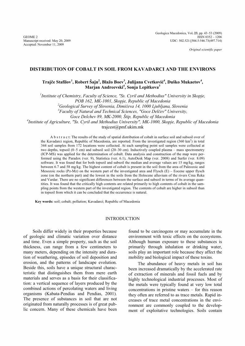
Geologica Macedonica, Vol. 23, pp. 43–53 (2009) GEOME 2 ISSN 0352 – 1206 Manuscript received: May 20, 2009 UDC: 502.521:[504.5:546.73(497.714) Accepted: November 11, 2009 Original scientific paper DISTRIBUTION OF COBALT IN SOIL FROM KAVADARCI AND THE ENVIRONS Trajče Stafilov 1 , Robert Šajn 2 , Blažo Boev 3 , Julijana Cvetković 4 , Duško Mukaetov 4 , Marjan Andreevski 4 , Sonja Lepitkova 3 1 Institute of Chemistry, Faculty of Science, "Ss. Cyril and Methodius" University in Skopje, POB 162, MK-1001, Skopje, Republic of Macedonia 2 Geological Survey of Slovenia, Dimičeva 14, 1000 Ljubljana, Slovenia 3 Faculty of Natural and Technical Sciences, "Goce Delčev" University, Goce Delchev 89, MK-2000, Štip, Republic of Macedonia 4 Institute of Agriculture, "Ss. Cyril and Methodius University", MK-1000, Skopje, Republic of Macedonia [email protected] A b s t r a c t: The results of the study of spatial distribution of cobalt in surface soil and subsoil over of the Kavadarci region, Republic of Macedonia, are reported. From the investigated region (360 km 2 ) in total 344 soil samples from 172 locations were collected. At each sampling point soil samples were collected at two depths, topsoil (0–5 cm) and subsoil soil (20–30 cm). Inductively coupled plasma – mass spectrometry (ICP-MS) was applied for the determination of cobalt. Data analysis and construction of the map were per- formed using the Paradox (ver. 9), Statistica (ver. 6.1), AutoDesk Map (ver. 2008) and Surfer (ver. 8.09) software. It was found that for both topsoil and subsoil the median and average values are 15 mg/kg, ranges between 6.7 and 58 mg/kg. The highest content of cobalt is present in the soil from the area of Paleozoic and Mesozoic rocks (Pz-Mz) on the western part of the investigated area and Flysch (E) – Eocene upper flysch zone (on the northern part) and the lowest in the soils from the Holocene alluvium of the rivers Crna Reka and Vardar. There are no significant differences between the surface and subsoil in terms of its average quan- tities. It was found that the critically high contents are related primarily to high contents of cobalt in the sam- pling points from the western part of the investigated region. The contents of cobalt are higher in subsoil than in topsoil from which it can be concluded that the occurrence is natural. Key words: soil; cobalt; pollution; Kavadarci; Republic of Macedonia INTRODUCTION Soils differ widely in their properties because of geologic and climatic variation over distance and time. Even a simple property, such as the soil thickness, can range from a few centimeters to many meters, depending on the intensity and dura- tion of weathering, episodes of soil deposition and erosion, and the patterns of landscape evolution. Beside this, soils have a unique structural charac- teristic that distinguishes them from mere earth materials and serves as a basis for their classifica- tion: a vertical sequence of layers produced by the combined actions of percolating waters and living organisms (Kabata-Pendias and Pendias, 2001). The presence of substances in soil that are not originated from naturally processes is of great pub- lic concern. Many of these chemicals have been found to be carcinogens or may accumulate in the environment with toxic effects on the ecosystems. Although human exposure to these substances is primarily through inhalation or drinking water, soils play an important role because they affect the mobility and biological impact of these toxins. The abundance of heavy metals in soil has been increased dramatically by the accelerated rate of extraction of minerals and fossil fuels and by highly technological industrial processes. Most of the metals were typically found at very low total concentrations in pristine waters – for this reason they often are referred to as trace metals. Rapid in- creases of trace metal concentrations in the envi- ronment are commonly coupled to the develop- ment of exploitative technologies. Soils contain
-
Upload
facultynaturalsciencesmathematics -
Category
Documents
-
view
4 -
download
0
Transcript of Distribution of cobalt in soil from Kavadarci and the environs
Geologica Macedonica, Vol. 23, pp. 43–53 (2009) GEOME 2 ISSN 0352 – 1206 Manuscript received: May 20, 2009 UDC: 502.521:[504.5:546.73(497.714) Accepted: November 11, 2009
Original scientific paper
DISTRIBUTION OF COBALT IN SOIL FROM KAVADARCI AND THE ENVIRONS
Trajče Stafilov1, Robert Šajn2, Blažo Boev3, Julijana Cvetković4, Duško Mukaetov4, Marjan Andreevski4, Sonja Lepitkova3
1Institute of Chemistry, Faculty of Science, "Ss. Cyril and Methodius" University in Skopje, POB 162, MK-1001, Skopje, Republic of Macedonia
2Geological Survey of Slovenia, Dimičeva 14, 1000 Ljubljana, Slovenia 3Faculty of Natural and Technical Sciences, "Goce Delčev" University,
Goce Delchev 89, MK-2000, Štip, Republic of Macedonia 4Institute of Agriculture, "Ss. Cyril and Methodius University", MK-1000, Skopje, Republic of Macedonia
A b s t r a c t: The results of the study of spatial distribution of cobalt in surface soil and subsoil over of the Kavadarci region, Republic of Macedonia, are reported. From the investigated region (360 km2) in total 344 soil samples from 172 locations were collected. At each sampling point soil samples were collected at two depths, topsoil (0–5 cm) and subsoil soil (20–30 cm). Inductively coupled plasma – mass spectrometry (ICP-MS) was applied for the determination of cobalt. Data analysis and construction of the map were per-formed using the Paradox (ver. 9), Statistica (ver. 6.1), AutoDesk Map (ver. 2008) and Surfer (ver. 8.09) software. It was found that for both topsoil and subsoil the median and average values are 15 mg/kg, ranges between 6.7 and 58 mg/kg. The highest content of cobalt is present in the soil from the area of Paleozoic and Mesozoic rocks (Pz-Mz) on the western part of the investigated area and Flysch (E) – Eocene upper flysch zone (on the northern part) and the lowest in the soils from the Holocene alluvium of the rivers Crna Reka and Vardar. There are no significant differences between the surface and subsoil in terms of its average quan-tities. It was found that the critically high contents are related primarily to high contents of cobalt in the sam-pling points from the western part of the investigated region. The contents of cobalt are higher in subsoil than in topsoil from which it can be concluded that the occurrence is natural.
Key words: soil; cobalt; pollution; Kavadarci; Republic of Macedonia
INTRODUCTION
Soils differ widely in their properties because of geologic and climatic variation over distance and time. Even a simple property, such as the soil thickness, can range from a few centimeters to many meters, depending on the intensity and dura-tion of weathering, episodes of soil deposition and erosion, and the patterns of landscape evolution. Beside this, soils have a unique structural charac-teristic that distinguishes them from mere earth materials and serves as a basis for their classifica-tion: a vertical sequence of layers produced by the combined actions of percolating waters and living organisms (Kabata-Pendias and Pendias, 2001). The presence of substances in soil that are not originated from naturally processes is of great pub-lic concern. Many of these chemicals have been
found to be carcinogens or may accumulate in the environment with toxic effects on the ecosystems. Although human exposure to these substances is primarily through inhalation or drinking water, soils play an important role because they affect the mobility and biological impact of these toxins.
The abundance of heavy metals in soil has been increased dramatically by the accelerated rate of extraction of minerals and fossil fuels and by highly technological industrial processes. Most of the metals were typically found at very low total concentrations in pristine waters – for this reason they often are referred to as trace metals. Rapid in-creases of trace metal concentrations in the envi-ronment are commonly coupled to the develop-ment of exploitative technologies. Soils contain
44 T. Stafilov R. Šajn, B. Boev, J. Cvetković, D. Mukaetov, M. Andreevski, S. Lepitkova
Geologica Macedonica, 23, 43–53 (2009)
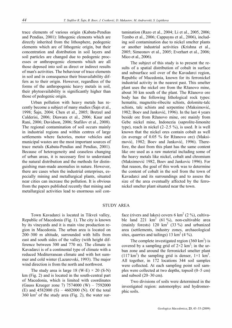
trace elements of various origin (Kabata-Pendias and Pendias, 2001): lithogenic elements which are directly inherited from the lithosphere, pedogenic elements which are of lithogenic origin, but their concentration and distribution in soil layers and soil particles are changed due to pedogenic proc-esses or anthropogenic elements which are all those deposed into soil as direct or indirect results of man's activities. The behaviour of trace elements in soil and in consequence their bioavailability dif-fers as to their origin. However, regardless of the forms of the anthropogenic heavy metals in soil, their phytoavailability is significantly higher than those of pedogenic origin.
Urban pollution with heavy metals has re-cently become a subject of many studies (Šajn et al., 1998; Šajn, 2004; Chen et al., 2005; Bretzel and Calderisi, 2006; Diawara et al., 2006; Kaur and Rani, 2006; Davidson, 2006; Stafilov et al., 2008). The regional contamination of soil occurs mainly in industrial regions and within centres of large settlements where factories, motor vehicles and municipal wastes are the most important sources of trace metals (Kabata-Pendias and Pendias, 2001). Because of heterogeneity and ceaseless changing of urban areas, it is necessary first to understand the natural distribution and the methods for distin-guishing man-made anomalies in nature. However, there are cases when the industrial enterprises, es-pecially mining and metallurgical plants, situated near cities can increase the pollution. It is obvious from the papers published recently that mining and metallurgical activities lead to enormous soil con-
tamination (Razo et al., 2004; Li et al., 2005, 2006; Tembo et al., 2006; Cappuyns et al., 2006), includ-ing soil contamination due to nickel smelter plants or another industrial activities (Krishna et al., 2005; Simeonov et al., 2005; Everhart et al., 2006; Mico et al., 2006).
The subject of this study is to present the re-sults of a spatial distribution of cobalt in surface and subsurface soil over of the Kavadarci region, Republic of Macedonia, known for its ferronickel industrial activity in the nearest past. This smelter plant uses the nickel ore from the Ržanovo mine, about 30 km south of the plant. The Ržanovo ore body has the following lithological rock types: hematite, magnetite-ribecite schists, dolomite-talc schists, talc schists and serpentine (Maksimović, 1982; Boev and Janković, 1996). In the last 4 years beside ore from Ržanovo mine, ore mainly from Gebe nickel mine, Indonezia (saprolite-limonite type), reach in nickel (2–2.5 %), is used. It is well known that the nickel ores contain cobalt as well (in average of 0.05 % for Ržanovo ore) (Maksi-mović, 1982; Boev and Janković, 1996). There-fore, the dust from this plant has the same content like ore used as a raw material including some of the heavy metals like nickel, cobalt and chromium (Maksimović 1982, Boev and Jankovic 1996). For that reason, the goal of this work was to determine the content of cobalt in the soil from the town of Kavadarci and its surroundings and to assess the size of the area eventually affected by the ferro-nickel smelter plant situated near the town.
STUDY AREA
Town Kavadarci is located in Tikveš valley, Republic of Macedonia (Fig. 1). The city is known by its vineyards and it is main vine production re-gion in Macedonia. The urban area is located on 200–300 m altitude, surrounded with hills from east and south sides of the valley (with height dif-ference between 300 and 770 m). The climate in Kavadarci is of a continental type of climate with a reduced Mediterranean climate and with hot sum-mer and cold winter (Lazarevski, 1993). The major wind direction is from the north and northwest.
The study area is large 18 (W-E) × 20 (S-N) km (Fig. 2) and is located in the south-central part of Macedonia, which is limited with coordinates (Gauss Krueger zone 7) 7574000 (W) – 7592000 (E) and 4582000 (S) – 4602000 (N). Of the total 360 km2 of the study area (Fig. 2), the water sur-
face (rivers and lakes) covers 6 km2 (2 %), cultiva-ble land 221 km2 (61 %), non-cultivable area (mainly forests) 120 km2 (33 %) and urbanized area (settlements, industry zones, archaeological sites, quarries and tailings) 13 km2 (4 %).
The complete investigated region (360 km2) is covered by a sampling grid of 2×2 km2; in the ur-ban zone and around the ferronickel smelter plant (117 km2) the sampling grid is denser, 1×1 km2. All together, in 172 locations 344 soil samples were collected. At each sampling point soil sam-ples were collected at two depths, topsoil (0–5 cm) and subsoil (20–30 cm).
Two divisions of soils were determined in the investigated region: automorphyc and hydromor-phic soils.

Distribution of cobalt in soil from Kavadarci and the environs 45
Geologica Macedonica, 23, 43–53 (2009)
Fig. 1. Location of the study area
SOIL CONDITIONS
Automorphic soils
Several types of automorphic soils were es-tablished: lithosols , regosols, different soil com-plexes (regosols-lithosols, lithosols-regosol-rend-zinas, lithosols-regosols-rankers), deluvial (colu-vial) soils, rendzinic soils, vertisols, chernozems, and cinnamonic forest soils.
Lithosols with (A)-R1-R2 type of soil profile are undeveloped or weakly developed soils with maximum soil depth of 20 cm, formed on a solid or slightly defragmented rock. These soils have a low productive capability, due to the shallow solum and small amount of clay and have no im-portance for agricultural production.
Regosols with (A)-C type of soil profile are formed on a loose substrates. They are formed with
severe erosion of the soil profile of the formerly developed soils and with an initial process of pe-dogenesis which leads to formation of an undevel-oped top layer (A). These soils are prone to surface or dice erosion, so antierosive measures should be implemented. Regosols are characterized with low soil fertility in comparison with the adjacent soil types, which were transformed into regosols with severe erosion.
Soil complex: regosols-lithosol. In the Tikveš region these two soil types alter on a very small distances and it’s very difficult to delineate then as separate cartographic units. This complex is spread on sloppy terrains west of the Tikveš Lake in the districts of Debrište, Kamen Dol and Kruševica villages and north-west of Dolno Čičevo village.
Soil complex: lithosol, regosols and rendzi-nas. Series of lithosol-regosols-rendzinas can be

46 T. Stafilov R. Šajn, B. Boev, J. Cvetković, D. Mukaetov, M. Andreevski, S. Lepitkova
Geologica Macedonica, 23, 43–53 (2009)
often noticed in the region of Tikveš valley. Litho-sols occupy the highest parts of the terrain. Very often the solid rock can be noticed on the surface. Regosols are developed on inclined terrains where due to the erosion processes the solum is con-stantly in its initial phase of development, while the rendzinic soils are developed on amore flat ter-rains at foothills and are altering with regosols on very small distances. This soil complex is extended over the districts of Drenovo, Sirkovo, Kamen Dol, Mrzen Oreovec, Debrešte and east of Gradsko set-tlement on the left side of Vardar river.
Soil complex: Lithosols, regosols and rankers. This series is delineated on the highland Vitačevo, nearby Kavadarci. Lithosols and rankers are formed on compact volcanic rocks, while regosols are developed with erosion processes and degrada-tion of the top soil of rankers.
Deluvial (coluvial) soils with (A)-C type of soil profile are undeveloped or weakly developed soils with (A) or Ap top layer, formed with erosion of the material from the upper part of the terrain with surface and torrent erosion and its deposition in the foothill. The hor. (A) contains a bit higher amounts of organic matter than hor. C, but still there are no obvious signs of formations of soil structure. Deluvial soils posses big spatial and ver-tical (in depth soil profile) heterogeneity of all its properties. In comparison with the bordering allu-vial soils, deluvial soils have lower productivity.
Rendzinic soils with an A-AC-C type of pro-file are formed on a loose silicate-carbonate sub-strate, with mollic A horizon. The depth of the top soil is up to 40 cm, with dark gray, dark brown or black color with well developed soil structure. Carbonates are present from the surface or deeper in the soil profile. The major part of these soils is used for intensive agricultural production, while a small part is under pastures. On the soil map these soils are indicated as a complex of lithosols-rego-sols-rendzinas. The complex of rendzinas and re-gosols covers the biggest part of the investigated area. In the area of village Dolno Čičevo on a small area a complex of cinnamonic forest soils and regosol is presented.
Vertisols are formed on a clay sediment (mostly carbonate) with more than 30 % of clay content with ability for swealing (smectites) or on basic or ultrabasic rocks which with decaying de-rives such type of clay. Vertisols at the examined area are formed on clay tercier sediment on moder-ately wavy landscape with small inclination. The profille type is A-AC-C. The soil contains more
than 30 % clay and hor. A hase vertical character: cracks, and specific prismatic structure. The aggre-gate surface is shiny („slickensides”). Hor. A is deaper than 30 cm, while the AC hor. is on 20–30 cm depth. In the examined area vertisols are de-tached as a separate soil type. These soils are spread in the adjacent surroundings of the Ribarci, Trstenik and Vozarci, northern of the city of Kavadarci.
Chernozems are commonly developed in semi-arid steppe regions with typical molic hor. Amo thicker than 40 cm and an intermediate hor. AC (25–30 cm). This soil contains carbonates which appears from the soil surface, in some cases from the lower part of hor. A or from hor. AC. Hor. A has a well developed, stabile granular soil structure. In the examined area chernozems con-tains carbonates at its surface, while in some cases carbonates are washed out at certain depth of the soil profile. Chernozems are delineated as a sepa-rate carthographic unit (Fig. 3). On the soil map a big areas are detached north from Rosoman vil-lage, and some small units east from Palikura vil-lage and between villages Timjanik and Dolni Disan.
Cinnamonic forest soils with Ap-(B)v-C or Ap-(B)v-(B)vC-C type of profile are characterized with the presence of clay cambic hor. (B). The cambic hor. (B) always contains more clay than the hor. A. It is denser with reduced capillary porosity and stability of the structural aggregates and lower water conductivity. Production capability is me-dium due to the bad soil structure, low humus con-tent, insufficient quantities of nutrients and appear-ance of erosion on sloppy terrains.
Hydromorphic soils
Alluvial soils are recent layers of river or lake sediments, and usually have hor. (A) or Ap, hor. C and in some cases hor. G. Unlike deluvial soils, they have good fractionation of the parent material. The alluvial sediments which serve as a parent ma-terial for formation of this soil have hetero-organic mineralogical composition. In terms of its me-chanical composition these are light soils, with weakly emphasized soil structure and high depend-ence of the physical characteristic to the mechani-cal composition. They are characterized with good air, water and temperature regime. These are very fertile soils with intensive agricultural production. They are represented as a separate soil type along the river beads of the rivers Vardar, Crna Reka and Luda Mara.

Distribution of cobalt in soil from Kavadarci and the environs 47
Geologica Macedonica, 23, 43–53 (2009)
Fig. 2. Land use map and soil samples locations in the Kavadarci area

48 T. Stafilov R. Šajn, B. Boev, J. Cvetković, D. Mukaetov, M. Andreevski, S. Lepitkova
Geologica Macedonica, 23, 43–53 (2009)
Fig. 3. Soil map of Kavadarci area

Distribution of cobalt in soil from Kavadarci and the environs 49
Geologica Macedonica, 23, 43–53 (2009)
MATERIAL AND METHODS
Sampling
Samples of surface soils in the town of Kava-darci and the surrounding region were collected according to the European guidelines for soil pollution studies (Theocharopoulos et al. 2001; Darnley et al. 1995; Šajn 2004, Reimann et al. 2008). The complete investigated region (360 km2) was covered by a sampling grid 2×2 km2, but in urban zone of Kavadarci and around the ferro-nickel smelter plant (117 km2), the sampling grid was denser, 1×1 km (Fig. 2). Altogether 344 soil samples were collected from 172 locations. In each sampling point soil samples were collected at two depths, topsoil (0–5 cm) and subsoil (20–30 cm). The possible organic horizon was excluded. One sample represents the composite material collected at the central sample point itself and at least four points within the radius of 10 m around it towards N, E, S and W. The mass of such composite sam-ple was about 1 kg (Darnley et al. 1995).
With regard to the basic lithological units, 24 location of sampling are located on the area of Pa-leozoic and Mesozoic rocks (39 km2), 10 on the Eocene upper flysch zone (34 km2), 90 on the Plio-cene sandy series (182 km2), 29 on the Pleistocene tuff, Holocene deluvium and Holocene alluvium of the river Luda Mara (46 km2), 10 on the Holocene river terraces (23 km2) and 9 on the Holocene allu-vium of the rivers Crna and Vardar (21 km2).
Preparation
The soil samples were air dried indoors at room temperature for about two weeks. Then they were gently crushed, cleaned from extraneous ma-
terial and sifted through a plastic sieve with 2 mm mesh (Salminen et al., 2005). The shifted mass was quartered and milled in agate mill to an analytical grain size below 0.125 mm.
Chemical analyses
Mass spectrometry with inductively coupled plasma (ICP-MS) determination of cobalt was per-formed in the laboratory of ACME Ltd. in Van-couver, Canada, after aqua regia digestion (mixture of HCl, HNO3 and water at 95°C – 1DX method).
Data processing and construction of maps
Data analysis and production of maps were performed on a PC using the Paradox (ver. 9), Sta-tistica (ver. 6.1), AutoDesk Map (ver. 2008) and Surfer (ver. 8.09) software. The methods of para-metric and nonparametric statistics were used for the data analysis (Snedecor and Cochran, 1967; Davis, 1986). On the basis of the results of the normality tests and visual inspection of the distri-bution histograms the logarithms from the content for the normal distribution was used.
The universal method kriging with linear va-riogram interpolation (Davis, 1986) was applied for construction of the areal distribution map of cobalt in topsoil (0–5 cm) and subsoil (20–30 cm). The basic grid cell size for interpolation was 20×20 m. For class limits the percentile values of distribu-tion of the interpolated values were chosen. Seven classes of the following percentile values were se-lected: 0–10, 10–25, 25–40, 40–60, 60–75, 75–90 and 90–100.
RESULTS AND DISCUSSION
The basic data obtained from the descriptive statistics for cobalt content in the soil in the inves-tigated area are given in Table 1 and the averages of the cobalt content in the soil according to basic lithological units for both topsoil and subsoil are given in Table 2. It can be seen (Table 1) that the median and average values are the same (15 mg/kg) and that the content of cobalt in the whole investigated area ranges between 6.7 and 58 mg/kg. From data given in Table 2 it can be con-cluded that the highest content of cobalt is present
in the soil from the area of Paleozoic and Mesozoic rocks (Pz-Mz) on the western part of the investi-gated area and flysch (E) – Eocene upper flysch zone (on the northern part), and the lowest in the soils from the Holocene alluvium of the rivers Crna and Vardar.
On the Fig. 4 the spatial distribution of cobalt in topsoil (left) and subsoil (right) is presented. It can be seen that the spatial distribution of cobalt in both soil layers is closely dependent on the litho-genesis. The highest contents were found in areas

50 T. Stafilov R. Šajn, B. Boev, J. Cvetković, D. Mukaetov, M. Andreevski, S. Lepitkova
Geologica Macedonica, 23, 43–53 (2009)
of Paleozoic and Mesozoic rocks and Eocene up-per flysch zone and the lowest values in area of the Pleistocene tuff, Holocene deluvium (W from the town of Kavadarci) and Holocene alluvium of the rivers Luda Mara, Crna Reka and Vardar.
The ferronickel smelter plant, in spite of the obvious environmental pollution has not contrib-uted significantly to the measured amount of this element, which occurs in high concentrations in the background. It was found (Fig. 4) that the critically high concentrations are related primarily to high concentrations of cobalt in the sampling points from the western part of the investigated region. In some cases the content of this element is higher in subsoil than in topsoil from which it can be con-cluded that the occurrence is natural.
T a b l e 1
Descriptive statistics of measurements for cobalt content in top and subsoil layers the investigated
area (data given in mg/kg)
Number of samples 344 Distribution (Log – lognormal) Log Md – Median 15 Xg – geometrical mean 15 sg – geometrical standard deviation 1.4 A – skewness 0.98 E – kurtosis 1.96 Minimum 6.7 Maximum 58 P10 – 10 percentile 11 P90 – 90 percentile 24
T a b l e 2
Average of the cobalt content in the soil according to basic lithological units (in mg/kg)
Soil layer/ Mean Rocks Flysch Sand Tuff Terraces Alluvium number of samples (n) All (Pz-Mz) (E) (Pl) (Q) (Q) (Q) n 172 24 10 90 29 10 9 Topsoil (depth 0–5 cm) 16.2 26 10 14 13 15 12 Subsoil (depth 20–30 cm) 17.2 29 22 14 14 16 13
Mean (EU) – European topsoil average (Salminen et al., 2005); Rocks (Pz-Mz) – area of Paleozoic and Mesozoic rocks (39 km2); Flysch (E) – Eocene upper flysch zone (34 km2); Sand (Pl) – Pliocene sandy series (182 km2); Tuff (Q) – Pleistocene tuff, Holocene dеluvium and Holocene alluvium of the river Luda Mara (46 km2); Terraces (Q) – Holocene river terraces (23 km2); Alluvium (Q) – Holocene alluvium of the rivers Crna and Vardar (21 km2)
Fig. 4. Spatial distribution of cobalt in topsoil (left) and subsoil (right)

Distribution of cobalt in soil from Kavadarci and the environs 51
Geologica Macedonica, 23, 43–53 (2009)
Average and border contents (max. and min.) of Co in different soil types of the investigated re-gion are presented in Table 3. Average contents of Co in topsoil of the complex regosols-lithosols is significantly higher (24.2 mg/kg) comparing with the Co content in the topsoil of all other soil types which vary in the ranges of 12.0–17.8 mg/kg. There are no significant differences between the surface and subsoil in terms of its average quanti-ties. The differences of quantities between the soil types are following the same logic as in the surface
layer. The highest quantities are noticed in the complex regosols-lithosols (25.3 mg/kg) while the lowest values are detected in the subsoil of fluvi-sols. Maximum and minimum contents of Co differ in broad ranges in all soil types, either in the sur-face or in a subsurface layer.
Generally speaking, the average contents in almost all soil types are slightly higher in subsoil (20–30 cm), which again leads to a conclusion that there is no human induced surface accumulation of Co in soils in Kavadarci region.
T a b l e 3
Average of the cobalt content in the soil according to basic pedological units (in mg/kg)
Soil layer Co
content All
samples Complex regosol-lithosol
Complex lithosol/regosol
Delluvial soil
Fluvisol Complex rendzina-regosol
Chernozem Vertisol
No of samples (n) 172 13 23 19 13 80 8 16
Average 16.2 24.2 17.8 16.0 12.0 15.0 13.9 14.5
Max. 54.3 54.3 47.9 26.9 16.7 28.6 20.3 17.3 Topsoil (depth 0–5 cm)
Min 7.6 11.8 10.4 10.9 9.3 7.6 7.9 10.1
Average 17.2 25.3 19.2 17.9 12.4 15.0 15.2 15.2
Max. 57.8 57.8 55.7 30.9 17.6 29.3 21.1 21.0 Subsoil (depth 20–30 cm)
Min 6.7 12.9 9.9 10.7 8.2 6.7 11.3 9.3
CONCLUSION
It was found that the averages of the cobalt content in the soil according to basic lithological units for both topsoil and subsoil with the median and average values of 15 mg/kg, ranges between 6.7 and 58 mg/kg. The highest content of cobalt is present in the soil from the area of Paleozoic and Mesozoic rocks (Pz-Mz) on the western part of the investigated area and Flysch (E) – Eocene upper flysch zone (on the northern part) and the lowest in the soils from the Holocene alluvium of the rivers Crna and Vardar. It was also found that the average contents of Co in topsoil of the complex regosols-lithosols is significantly higher (24.2 mg/kg) com-paring with the Co content in the topsoil of all
other soil types which vary in the ranges of 12.0–17.8 mg/kg. There are no significant differences between the surface and subsoil in terms of its av-erage quantities. The ferronickel smelter plant, in spite of the obvious environmental pollution, has not contributed significantly to the measured amount of this element, which occurs in high con-centrations in the background. It was found that the critically high concentrations are related primarily to high concentrations of cobalt in the sampling points from the western part of the investigated region. The contents of this element are higher in subsoil than in topsoil from which it can be con-cluded that the occurrence is natural.

52 T. Stafilov R. Šajn, B. Boev, J. Cvetković, D. Mukaetov, M. Andreevski, S. Lepitkova
Geologica Macedonica, 23, 43–53 (2009)
REFERENCES
Boev B., Janković S., 1996: Nickel and nickeliferrous iron deposits of the Vardar zone (SE Europe) with particular references to the Ržanovo–Studena Voda ore-bearing series, Faculty of Mining and Geology, Special issue No. 3, Štip, p. 103–126.
Bretzel F., Calderisi M., 2006: Metal contamination in urban soils of coastal Tuscany (Italy), Environ. Monit. Assess., 118, 319–335.
Cappuyns V., Swennen R., Vandamme A., Niclaes M., 2006: Environmental impact of the former Pb-Zn mining and smelting in East Belgium, J. Geochem. Explor., 88, 6–9.
Chen T. B., Zheng Y. M., Lei M., Huang Z. C., Wu H.T., Chen H., Fan K. K., Yu K., Wu X., Tian Q. Z., 2005: As-sessment of heavy metal pollution in surface soils of urban parks in Beijing, China, Chemosphere, 60, 542–551.
Darnley A. G., Björklund A., Bolviken B., Gustavsson N., Koval P. V., Plant J. A., Steenfelt A., Tauchid M., Xuejing X., Garrett R. G., Hall G. E. M., 1995: A global geochemical database for environmental and resource management. Recommendations for international geo-chemical mapping. Final report of IGCP project 259, UNESCO Publishing, Paris.
Davidson C. M., Urquhart G. J., Ajmone-Marsan F., Biasioli M., Duarte A. D., Diaz-Barrientos E., Grcman H., Hossack L., Hursthouse A. S., Madrid L., Rodrigues S., Zupan M., 2006: Fractionation of potentially toxic elements in urban soils from five European cities by means of a harmonised sequential extraction procedure, Anal. Chim. Acta, 565, 63–72.
Davis J. C. 1986: Statistic and Data Analysis in Geology, Willey in Sons, New York, pp. 651.
Diawara M. M., Litt J. S., Unis D., Alfonso N., Martinez L. A., Crock J. G., Smith D. B., Carsella J., 2006: Arsenic, cadmium, lead, and mercury in surface soils, Pueblo, Colorado: implications for population health risk, Environ. Geochem. Health, 28, 297–315.
Everhart J. L., McNear Jr. D., Peltier E., Van der Lelie D., Chaney R. L., Sparks D. L., 2006: Assessing nickel bioavailability in smelter-contaminated soils, Sci. Total Environ., 367, 732–744.
Kabata-Pendias A., Pendias H. 2001: Trace elements in soil and plants, Third Edition, CRC Press, Boca Raton.
Kaur R., Rani R., 2006: Spatial characterization and prioritiza-tion of heavy metal contaminated soil-water resources in Peri – Urban areas of National Capital Territory (NCT), Delhi, Environ. Monit. Assess., 123, 233–247.
Krishna A. K., Govil P. K., 2005: Heavy metal distribution and contamination in soils of Thane-Belapur industrial de-velopment area, Mumbai, Western India, Environ. Geol., 47, 1054–1061.
Lazarevski A., 1993: Climate in Macedonia, Kultura, Skopje.
Li J., Xie Z. M., Zhu Y. G., Naidu R., 2005: Risk assessment of heavy metal contaminated soil in the vicinity of a lead/zinc mine, J. Environ. Sci.– China, 17, 881–885.
Li Y., Wang Y. B., Gou X., Su Y., Wang G., 2006: Risk as-sessment of heavy metals in soils and vegetables around non-ferrous metals mining and smelting sites, Baiyin, China, J. Environ. Sci.– China, 18, 1124–1134.
Maksimović Z., 1982: Mineralogical Study of the Ore from Ržanovo Mine, Faculty of Geology and Mining, Belgrade.
Mico C., Reatala L., Peris M., Sanchez J., 2006: Assessing heavy metal sources in agricultural soils of an European Mediterranean area by multivariate analysis, Chemos-phere, 65, 863–872.
Reimann C., Albanese S., Batista M. J., Bel-Lan A., Birke M., Cicchella D., Demetriades A., de Vivo B., de Vos W., Dinelli E., Duris M., Dusza-Dobek A., Ernstsen V., Flight D., Gilucis A., Gosar M., Gregorauskiene V., Gulan A., Hayoz P., Halamic J., Haslinger E., Hratovic H., Ion A., Ivanovna Y., Johnson C., Jordan G., Kisivilla J., Klein P., Kwecko P., Lax K., Lima A., Locutura J., Malyuk B.I., Maquil R., Marku S., Martins L., Mazreku A., Messina A., O’Connor P., Ottesen R.T., Pasieczna A., Petersell W., Reeder S., Salpeteur I., Schedl A., Sefcik P., Slaninka I., Sorsa A., Selinus O., Stafilov T., Tarvainen T., Trendavilov V., Utermann J., Valera P., Vidojevic D., Volden T., 2008: Eurogeosurveys geochemical mapping of agricultural and grazing land soil of Europe (GEMAS), Field manual. NGU Report 2008.038. Geological Survey of Norway.
Razo I., Carrizales L., Castro J., Diaz-Barriga F., Monroy M., 2004: Arsenic and heavy metal pollution of soil, water and sediments in a semi-arid climate mining area in Mexico, Water Air Soil Poll., 152, 129–152.
Šajn R., Bidovec M., Andjelov M., Pirc S., Gosar M., 1998: Geochemical Atlas of Ljubljana and Environs, Institute of Geology, Geotechnique and Geophysics, Ljubljana.
Šajn R., 2004: Distribution of mercury in surface dust and topsoil in Slovenian rural and urban areas, RMZ-Geol. Geoenviron., 51, 1800–1803.
Salminen R., Batista M. J., Bidovec M., Demetriades A., De Vivo B., De Vos W., Duris M., Gilucis A., Gregorauskiene V., Halamic J., Heitzmann P., Jordan G., Klaver G., Klein P., Lis J., Locutura J., Marsina K., Mazreku A., O’Connor P. J., Olsson S. Å., Ottesen R. T., Petersell V., Plant J. A., Reeder S., Salpeteur I., Sandström H., Siewers U., Steenfelt A., Tarvainen T., 2005: Geochemical Atlas of Europe, Part 1, Background Information, Methodology and Maps. Geo-logical Survey of Finland, Espoo.
Simeonov V., Einax J., Tsakovski S., Kraft J., 2005: Multivari-ate statistical assessment of polluted soils, Cent. Europ. J. Chem., 3, 1–9.
Snedecor G. W., Cochran W. G., 1967: Statistical Methods, The Iowa State University Press, Ames, Iowa, pp. 575.
Stafilov T., Šajn R., Boev B., Cvetković J., Mukaetov D., Andreevski M., 2008: Geochemical Atlas of Kavadarci and the Environs, Faculty of Natural Sciences and Mathematics, Skopje.
Tembo B. D., Sichilongo K., Cernak J., 2006: Distribution of copper, lead, cadmium and zinc concentrations in soils around Kabwe town in Zambia, Chemosphere, 63, 497–501.

Distribution of cobalt in soil from Kavadarci and the environs 53
Geologica Macedonica, 23, 43–53 (2009)
Р е з и м е
ДИСТРИБУЦИЈА НА КОБАЛТ ВО ПОЧВИТЕ ВО КАВАДАРЦИ И НЕГОВАТА ОКОЛИНА
Трајче Стафилов1, Роберт Шајн2, Блажо Боев3, Јулијана Цветковиќ4, Душко Мукаетов4, Марјан Андреевски4, Соња Лепиткова3
1Инсtиtуt за хемија, Природно-маtемаtички факулtеt, Универзиtеt „Св. Кирил и Меtодиј“ во Скоpје, p. фах 162, МК-1001, Скоpје, Реpублика Македонија
2Геолошки завод на Словенија, Димичева 14, 1000 Љубљана, Словенија 3Факулtеt за pриродни и tехнички науки, Универзиtеt „Гоце Делчев“, МК-2000 Шtиp, Република Македонија
4Земјоделски инсtиtуt, Универзиtеt „Св. Кирил и Меtодиј“ во Скоpје, МК-1000, Скоpје, Реpублика Македонија [email protected]
Клучни зборови: почви; кобалт; загадување; Кавадарци; Република Македонија
Во трудот се презентирани резултатите од простор-ната распределба на кобалт во почвите во Кавадарци (Ре-публика Македонија) и неговата околина. Од испитувана-та област (360 km2) се земени вкупно 344 примероци од 172 локации. На секоја локација се земени почви од две длабочини, површински слој почва (0–5 cm) и потповр-шински слој (20–30 cm). Определувањето на кобалтот е вршено со индуктивно спрегната плазма со масена спек-трометрија (ICP-MS). Обработката на податоците и конс-труирањето на картата на дистрибуција се вршени со при-мена на софтверите Paradox (ver. 9), Statistica (ver. 6.1), AutoDesk Map (ver. 2008) и Surfer (ver. 8.09). Утврдено е дека вредноста за медијаната и средната вредност на со-држината на кобалт во површинските и потповршинските
почви изнесува 15 mg/kg (од 6,7 до 58 mg/kg). Највисоки содржини се најдени во областите на палеозојските и ме-зозојските стени и во зоната на горноеоценскиот флиш, а најниските вредности во областа на плеистоценскиот туф, холоценскиот делувиум (западно од градот Кавадарци) и холоценскиот алувиум на реките Црна Река и Вардар. Не е забележана значителна разлика помеѓу содржините на кобалт во површинските и потповршинските почви. Утвр-дено е дека високи вредности за кобалт се најдени во при-мероците почва од западниот дел на испитуваното подрач-је. Исто така, утврдено е дека во овие примероци повисо-ки вредности на кобалт се најдени во потповршинските почви во однос на површинските, што укажува на природ-ната застапеност на кобалтот во овие почви.