Titan's winter polar vortex structure revealed by chemical tracers
Upload
independentCategory
view
5download
0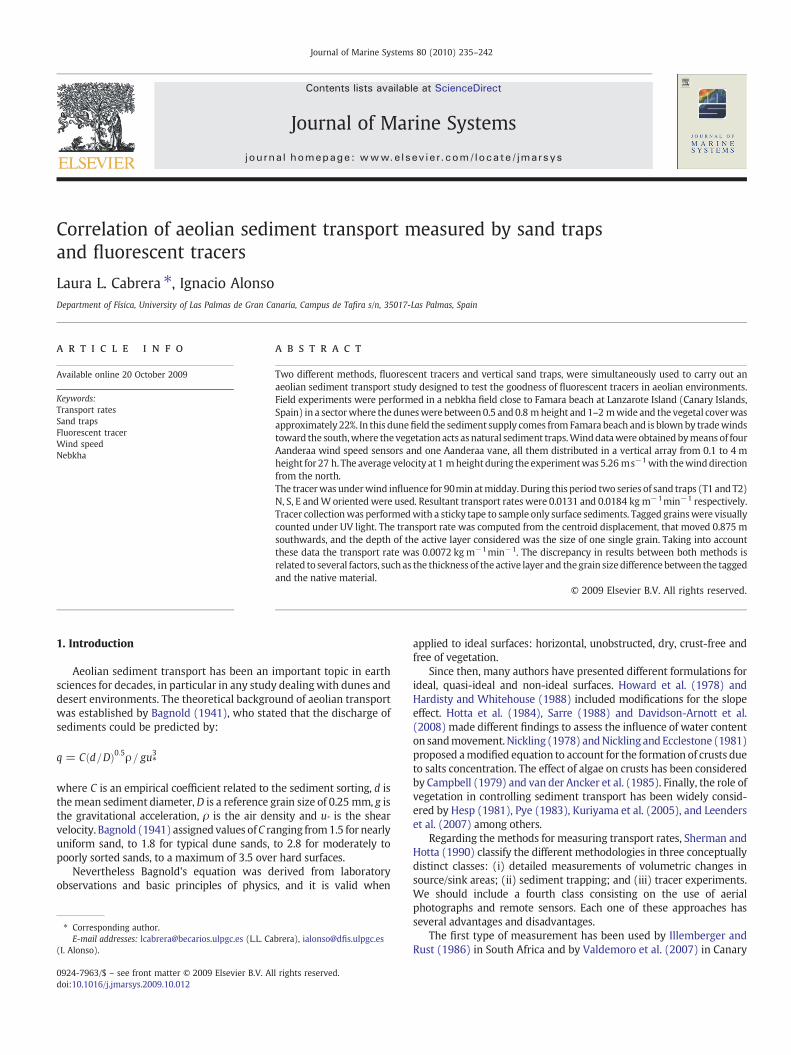
Journal of Marine Systems 80 (2010) 235–242
Contents lists available at ScienceDirect
Journal of Marine Systems
j ourna l homepage: www.e lsev ie r.com/ locate / jmarsys
Correlation of aeolian sediment transport measured by sand trapsand fluorescent tracers
Laura L. Cabrera ⁎, Ignacio AlonsoDepartment of Física, University of Las Palmas de Gran Canaria, Campus de Tafira s/n, 35017-Las Palmas, Spain
⁎ Corresponding author.E-mail addresses: [email protected] (L.L. Ca
(I. Alonso).
0924-7963/$ – see front matter © 2009 Elsevier B.V. Aldoi:10.1016/j.jmarsys.2009.10.012
a b s t r a c t
a r t i c l e i n f oAvailable online 20 October 2009
Keywords:Transport ratesSand trapsFluorescent tracerWind speedNebkha
Two different methods, fluorescent tracers and vertical sand traps, were simultaneously used to carry out anaeolian sediment transport study designed to test the goodness of fluorescent tracers in aeolian environments.Field experiments were performed in a nebkha field close to Famara beach at Lanzarote Island (Canary Islands,Spain) in a sectorwhere the duneswere between0.5 and 0.8 mheight and 1–2 mwide and the vegetal coverwasapproximately 22%. In this dunefield the sediment supply comes from Famara beach and is blownby tradewindstoward the south,where the vegetation acts as natural sediment traps.Winddatawere obtainedbymeans of fourAanderaa wind speed sensors and one Aanderaa vane, all them distributed in a vertical array from 0.1 to 4 mheight for 27 h. The average velocity at 1 mheight during the experimentwas 5.26 ms−1with thewinddirectionfrom the north.The tracerwas underwind influence for 90min atmidday.During this period two series of sand traps (T1 and T2)N, S, E andW orientedwere used. Resultant transport rates were 0.0131 and 0.0184 kg m−1min−1 respectively.Tracer collectionwas performedwith a sticky tape to sample only surface sediments. Tagged grainswere visuallycounted under UV light. The transport rate was computed from the centroid displacement, that moved 0.875 msouthwards, and the depth of the active layer considered was the size of one single grain. Taking into accountthese data the transport rate was 0.0072 kg m−1min−1. The discrepancy in results between both methods isrelated to several factors, suchas the thickness of the active layer and thegrain sizedifferencebetween the taggedand the native material.
brera), [email protected]
l rights reserved.
© 2009 Elsevier B.V. All rights reserved.
1. Introduction
Aeolian sediment transport has been an important topic in earthsciences for decades, in particular in any study dealingwith dunes anddesert environments. The theoretical background of aeolian transportwas established by Bagnold (1941), who stated that the discharge ofsediments could be predicted by:
q = Cðd=DÞ0:5ρ= gu3*
where C is an empirical coefficient related to the sediment sorting, d isthemean sediment diameter,D is a reference grain size of 0.25 mm, g isthe gravitational acceleration, ρ is the air density and u* is the shearvelocity. Bagnold (1941) assigned values ofC ranging from1.5 for nearlyuniform sand, to 1.8 for typical dune sands, to 2.8 for moderately topoorly sorted sands, to a maximum of 3.5 over hard surfaces.
Nevertheless Bagnold's equation was derived from laboratoryobservations and basic principles of physics, and it is valid when
applied to ideal surfaces: horizontal, unobstructed, dry, crust-free andfree of vegetation.
Since then, many authors have presented different formulations forideal, quasi-ideal and non-ideal surfaces. Howard et al. (1978) andHardisty and Whitehouse (1988) included modifications for the slopeeffect. Hotta et al. (1984), Sarre (1988) and Davidson-Arnott et al.(2008) made different findings to assess the influence of water contenton sandmovement. Nickling (1978) andNickling and Ecclestone (1981)proposed amodified equation to account for the formation of crusts dueto salts concentration. The effect of algae on crusts has been consideredby Campbell (1979) and van der Ancker et al. (1985). Finally, the role ofvegetation in controlling sediment transport has been widely consid-ered by Hesp (1981), Pye (1983), Kuriyama et al. (2005), and Leenderset al. (2007) among others.
Regarding the methods for measuring transport rates, Sherman andHotta (1990) classify the different methodologies in three conceptuallydistinct classes: (i) detailed measurements of volumetric changes insource/sink areas; (ii) sediment trapping; and (iii) tracer experiments.We should include a fourth class consisting on the use of aerialphotographs and remote sensors. Each one of these approaches hasseveral advantages and disadvantages.
The first type of measurement has been used by Illemberger andRust (1986) in South Africa and by Valdemoro et al. (2007) in Canary

236 L.L. Cabrera, I. Alonso / Journal of Marine Systems 80 (2010) 235–242
Islands, among others. The use of traps is broad, since there are manydifferent kinds of trapping devices. Probably the most widely used arethe vertical traps described by Leatherman (1978) and Rosen (1978),although other authors have used trench collectors (Greeley et al.,1996), saltiphones (Vanhee, 2004), saltation flux impact responders(Baas, 2004) and other types. Goossens et al. (2000) gives a calibra-tion of five different types of sand traps.
Tracers are commonly used for measuring longshore drift (Whiteand Inman, 1989; Vila-Concejo et al., 2004; McComb and Black, 2005;Silva et al., 2007), but not in aeolian environments. The only paper,that we have found, that uses fluorescent tracers in field experimen-tation to estimate aeolian transport rates was that of Berg (1983).Since then no one seems to have followed this approach.
Finally, there are many authors who use aerial photographs tomeasure dunefield evolution, and to estimate transport rates (Levin andBen-Dor, 2004; Hernández et al., 2007). Others use remote sensors(Levin et al., 2007; Stockdon et al., 2007).
Here, we describe a field experiment carried out on September 2004.The experiment consisted of simultaneous measurements of aeoliantransport in a nebkhadunefield usingvertical sand traps andfluorescenttracers. The first aim of this study was to test the utility of fluorescenttracers in aeolian studies, and the second was to compare the sandtransport measurements obtained by both methods and by Bagnold´stheoretical expression to gain insight into the aeolian transport process.
2. Study area
The study area is located on Lanzarote Island (Canary Islands, Spain).This island is crossed from the northern to the southern coast by a sandstrip called El Jable, where aeolian sediments cover an area of nearly90 km2 (Fig. 1). In the northeast of El Jable there is a beach 4 km longcalled Famara Beach which is the input zone of marine sedimentsmigrating inland, and an small dunefield of about 0.5 km2 mainlyformed by nebkhas (Fig. 2).
Since the beginning of the XX century, El Jable has evolved from abarchans dunefield to a sand sheet that in most places is only a few
Fig. 1. Location map o
centimetres thick, with a few barchan dunes on it (Cabrera and Alonso,2006).
Prevailing tradewinds blow steadily from the NNE from April untilOctober. The rest of the year the wind is much more variable, both indirection and intensity.
The nebkha dunefield cannot be properly defined as a foredune,since rather than a continuous dune ridge, it is formed by isolated dunesassociated with discrete plant species. This vegetation shows gradualchanges both in surface cover and dominant species depending on thedistance to the shoreline. Considering its effect on sediment transport,Traganum moquinii is the dominant species closer to the shoreline,since it can reach up to 3 m height and the associated shadow dunesmay reach up to 10 m length. Moving inland vegetation graduallychanges to Launaea arborescens, which due to the smaller height andsize forms smaller dunes ranging between 0.5 and 0.8 m height and 1–2 m large). Both species are shrubs and in both of them nebkhas areperennial, showinga clear correlationbetweenduneheight and spacing,as stated by Tengberg (1995).
The surfaces between the nebkhas are sandy and become bareduring the whole year except during rainy periods at winter time.During these periods the area is more humid and it is possible to findherbaceous species. The contribution of these species to fix the sand islimited, since they die in few weeks after the rain.
Sediments in the nebkha dunes have both bioclastic and terrigenouscomponents,with a 55–60% in carbonate content derived frombioclasts(Cabrera et al, 2006).
3. Methods
3.1. Site selection and wind measurements
The experiment site was located 500 m from the shoreline in anarea where Launaea arborescens is the dominant species. Thevegetation cover was about 22% estimated from field observationsand very detailed aerial photographs of the area (Fig. 2).
f the study area.

Fig. 2. Closer aerial view of the experiment area.
237L.L. Cabrera, I. Alonso / Journal of Marine Systems 80 (2010) 235–242
Field experiment was developed in a sector where the nebkhas aremid-size: around 2 m wide and 0.5 m high. Both traps and tracerexperiments were located in sandy clear zones between the nebkhas, inorder to minimize the topographic influence in the aeolian transport.Selected areas for both sand traps and fluorescent tracers were verysimilar in bush density and bedforms.Wind ripples in the area are about10 cm wavelength (Figs. 3 and 4). The sand traps and the tracers wereworking simultaneously, so that both of themwere exposed to the sameconditions of wind, surrounding obstacles and sediment.
During the experiments wind data were recorded by means ofone anemometer mast 4 m high consisting of 4 Aanderaa three-cupanemometers locatedat 0.125, 0.5, 1.0 and4.0 mand1Aanderaavaneat2.0 m above the surface. The recording interval was 1min and therecording period was from 17:00 on 6 September until 20:00 the dayafter, with a total record of 27 h (Fig. 5).
Both the original sediment used to create the tracer and the traceritself, were dry sieved at 0.5Ø intervals between −1 and 5Ø, and thesediment bulk densityρs, was obtained by picnometry (Newkirk, 1920).
Fig. 3. In situ photograph of the injection point, looking southwards.
3.2. Fluorescent tracer
Several paints have been used to make tracers for measuringsediment transport inmarineenvironments. Themost commonmethodwhen using fluorescent tracers consists of painting the sand previouslycollected from the study site. Another option is using artificialfluorescent material with the same hydrodynamic characteristics asthe natural sediments (McComb and Black, 2005). In this work wepainted sand from the field experiment location.
Prior to the field experiment we performed several tests in labo-ratory in order to find the best product and procedure to make thetracer. Three different kinds of fluorescent paints were tested. Table 1summarizes the advantages and disadvantages of each one. The bestresult was obtained with the fluorescent acrylic spray paint. It formedfew aggregates, and these are easily disaggregated.
About 0.5 kg of tagged sand was used in the experiment. It wasplaced in a 0.27×0.27 m area with a thickness of 3–5 mm (Fig. 3), andexposed to wind action from 11:10 h until 12:40 h on September 7th.For 90 min the wind moved the tracer.
At 12:40 h wind action was stopped using a portable fence 2×1 m,so that transport was completely interrupted. Then we began tosample. Assuming the blown tracer was distributed on the uppermostlayer of the sediment surface, sampling was carried out with a stickytape 5 cm wide, which collected only surface sediments. Special carewas taken to avoid disturbance of the surface during the sampling.The tape was placed in several strips normal to wind direction, beingcloser to the injection point where the highest tracer concentrationswere found. This collection procedure simplifies the subsequent work
Fig. 4. Sediment traps location, looking northwards.

Fig. 5. Wind mast in the experiment area.
238 L.L. Cabrera, I. Alonso / Journal of Marine Systems 80 (2010) 235–242
in the laboratory. One drawback of this method is that it only takesinto account surface material. It does not consider any tracer grainswhich may be below the surface.
Once in the laboratory, the sticky tapewith the sediment stuck on it,was cut into 10 cm strips. Each one was conveniently marked and thetagged grains were visually counted under UV light. The greatestdisadvantage of this method of counting is that it is tedious and time-consuming. To avoid this problem Silva et al. (2007) used an automaticdigital image processing system called SAND (System of Automatic N-particle Detection). This system automatically counts the number ofmarked particles in collected sand samples. We tried to develop similarsoftware based on image processing, but it was not possible because ofthe naturalfluorescence of same carbonates. Their presence obligated toan accurate calibration of the methodology, making this approach evenmore time-consuming than the original method.
The mass center of the wind-blown sand was computed followingthe method described in Madsen (1987) and Vila-Concejo et al. (2004).
Table 1Advantages and disadvantages of different products used to make the tracer.
Product Advantages Disadvantages
Red dust pigment –Donot formaggregates – Do not highlight muchunder UV light– Easy to make the
mixture with water – Leaves dust pigment residues– Cheap prize – Low adherence to the
sediment grains– Easy to cleanOrange fluorescentacrylic paint
– High highlight underUV light
– Forms aggregates
– Good adherence– Forms small grains of paint
– Medium prizeOrange fluorescentacrylic paint in spray
– Few aggregates easyto disaggregate
– Big quantities are necessaryfor a small amount of sediment
– High highlight underUV light
– Expensive price
– Good adherence– Easy to use– Quick dry
3.3. Sediment traps
The sand traps used in the field experiment were vertical cylindersfollowing the design proposed by Leatherman (1978) and Rosen(1978).
These traps consistedof half-buriedPVC tubes,with two longitudinalopenings in the subaerial part.Oneof these openingswas coveredwitha60µm screen that retained the transported grains. Thismaterial fell intothe buried part of the trap where it was deposited in a plastic bag fittedto the inner part of the trap. Traps had a trapping height of 29 cm abovesurface and a diameter of 4 cm.
The traps were placed in a group of four, facing N, S, E and W(Fig. 4). The orientation of the traps was determined by wind action,since in this area prevailing winds were from the north. In fact,shadow dunes were facing southward during the experiment. Thisorientation meant that the traps were oriented parallel and normal tothe shoreline, which made easier the calculations of onshore/offshoretransport.
In this way the effect of possible changes in wind direction could beconsidered by computing the vector sum of the sediments collected ineach trap. During the 90 min period inwhich the tracerwas underwindaction, two series of sand traps, T1 and T2,wereworking for 8 and 5minrespectively. The plastic bags were marked and changed after eachtrapping series, and the material collected was weighted with anaccuracy of 0.001 g. These relatively short sampling intervals were usedin order to obtain a better correlation between sediment transport andwind data.
To avoid the scour that usually takes place around the tube by winddrift, traps were slightly modified according to Alcántara-Carrió (2003).Themodification consisted of an apron cloth placed around the trap andcovered with sand (Jones and Willetts, 1979; Jackson and Nordstrom,1997). This apron is very similar to the oneused by Illemberger andRust(1986) in Venturi traps and has proved to be efficient, since no scouringwas observed around the traps.
4. Results
4.1. Tracer procedure
Selected paint showed quite good results, since it formed lessaggregates than the others, itwas easy to use and it driedquickly. On theother hand, large quantities of spray were needed to paint a smallamount of sediment.
Grain size distribution for native sediment and thefluorescent tracershowed that both samples have similar unimodal grain size distribu-tions, although the native one is slightly finer and better sorted than themarked one (Fig. 6). The results also indicated that the fluorescent sandformed small aggregates that slightly increased the original size of thenative sample changing themedium size range from 0.208 to 0.268 mmin the tagged sample.
4.2. Wind data
The wind blew onshore during the experiments with an averagedirection of 15° N. Wind speeds monitored on-site show that highervelocities occurredbetween11:00and17:00,when the airwaswarmer.During the evening, the night and early morning, wind velocitydecreased considerably (Fig. 7a). The average velocity at 1 m heightwas 5.26 ms−1 during the 90 min period in which the tracer wasexposed to wind action, and 5.12 and 5.21 ms−1 during T1 and T2respectively (Fig. 7b).
Time averagedwind velocity profiles show that thewind speed bothin T1 and T2 followed a logarithmic relationship (R2 associatedwith thevelocity profiles exceeds 0.96, Fig. 8).

Fig. 6. Grain size distribution for native sediments and fluorescent tracer.
Fig. 8. Wind profiles for T1 and T2.
239L.L. Cabrera, I. Alonso / Journal of Marine Systems 80 (2010) 235–242
4.3. Transport rate from traps
Sand roses were obtained from the vector sum of the weight oftrapped sediments (Fig. 9). The transport rate obtained with the traps(Q traps) was obtained after considering the time each trapwasworking,and it yielded Q traps=0.0131 and 0.0184 kg m−1min−1 for T1 and T2,respectively.
4.4. Transport rate from tracer
Transport rate in the fluorescent tracer experiment (Qtracer) wasderived from the center of mass velocity (distance travelled by thecentroid in a certain time, Vtracer). Since the centroid displacement was0.875 m southwards (Fig. 10), and the period that the tracer was underwind action was 90min, it yielded
Vtracer = 0:00972m min−1
According to Komar and Inman (1970),
Q tracer = Vtracer × A ð1Þ
where A is the cross sectional area of the moving layer.The geometry of the moving layer is related in beach transport
experiments to the cross-shore distribution of mixing depth (Silva
Fig. 7. a) Running average of wind speed during the whole experiment. b) W
et al, 2007). This moving layer has normally the width of the swashzone and the thickness of movement of sand, which is a variable depthdepending on beach slope and waves, and it is normally measuredfrom low-tide conditions to the next low-tide (Ferreira et al, 2000).
In aeolian environments the concept of a moving layer is not verycommon, but should be used with the same purpose: the area in thewind normal direction in which sediment transport takes place, over acertain period of time. In our case this area can be estimated assumingthat the tagged particles only distribute themselves in the surface orvery close to it. We observed that after the 90-min period the wind wasblowing over the tracer and once the wind had been stopped with thefence, there were still many tagged grains at the injection point, thoughmany of them were arrayed in ripple morphology (Fig. 11). Since thetracer was originally deposited in a layer 3–5 mm thick, the remains ofthe trace deposit indicates that not all the marked material wasmobilized and, that themoving layerwas less than 3–5 mmdeep. This isquite reasonable considering the short period the wind was blowingover the tracer (90min) and the low wind velocities (5.2 ms−1). Inlonger experiments or under stronger winds this estimation would notbevalid because the tagged grainswouldbecomeburied or blownaway.Since the sampling scheme consisted of collecting only the surfacesediments, the thickness of the active layer should be considered the
ind record during the 90min while the tracer experiment was running.

Fig. 9. Sand roses from the sediment traps.
Fig. 11. Tracer distribution at the injection point just before the sampling. The tracergrains were displayed following the ripple morphology. Part of the injection point wasburied with original upwind sediments.
240 L.L. Cabrera, I. Alonso / Journal of Marine Systems 80 (2010) 235–242
average grain size of tagged grains (Dtracer=0.268 mm). Normalizingthe width of the active layer to 1 m, with A=0.000268 m2m−1, thetransport rate from Eq. (1) becomes:
Q tracer = 2:6*10−6m3m−1 min−1
Fig. 10. Distribution pattern of the fluorescent tracer. Each dot indicates the center ofthe sticky tape where tagged grains were counted.
Considering the sediment bulk density (ρs=2770 kg m−3), thetransport rate becomes:
Q tracer = 0:0072kgm−1min−1
5. Discussion
5.1. Transport rate from the Bagnold equation
Taking into account that both series of traps demonstratedeffective transport and convergence at a focal point, the shear velocity(U*′) was calculated using the logarithm law for wind velocities, andthe threshold shear velocity (U*c) of Bagnold (1941):
Uz = 5:75U′
* log10ðz = z0Þ + Ut ð2Þ
where Uz is the wind velocity at height z, z0 is the roughness of thesubstrate and Ut is the threshold velocity to move sand. The thresholdshear velocity (U*c) was obtained from the expression of Bagnold fordry sand,
U�c = Abððρs−ρa =ρaÞgdÞ1=2 ð3Þ
where Ab is an empirical coefficient with a value of 0.1 (Bagnold,1941; Sarre, 1987), ρs is the sediment density, ρa is the air density, g isthe acceleration due to gravity and d is the mean grain size. Airdensity was determined by converting the temperature and therelative humidity obtained during the experiment using the tablefrom Pye and Tsoar (1990). The air density for our experiment was1.162 kg m−3.
From these data, the shear velocity was 0.29 and 0.31 ms−1 for T1and T2 respectively,while the threshold shear velocitywas 0.221 ms−1.
The transport rate calculated from Bagnold's equation (1941) was:
QBagnold = Cðρa = gÞðd=DÞ1=2U′3* ð4Þ
where C is an empirical coefficient having a value of 1.8 for naturallygraded sand, like samples found on dunes (Bagnold, 1941) and D is areference grain diameter of 0.25 mm.
The theoretical values obtained for QBagnold with Eq. (4) are 0.29and 0.33 kg m−1min−1 for T1 and T2 respectively.
5.2. Considerations regarding sediment transport measured with traps
The two values of sediment transport measured from traps(Q trap for T1 and T2) showed large differences (Q traps=0.0131 and

Table 2Wind data at 1 m height.
Series of sand traps Number of data Maximum velocity (ms−1) Average velocity (ms−1) Direction (deg N)
Max Min Av Max Min Av Max Min Av
T1 8 7.56 6.07 6.77±0.52 5.54 4.50 5.12±0.38 16.17 9.14 12.54±2.66T2 5 7.26 6.39 6.81±0.31 5.40 5.03 5.21±0.16 14.77 12.31 13.48±0.82
241L.L. Cabrera, I. Alonso / Journal of Marine Systems 80 (2010) 235–242
0.0184 kg m−1min−1 for T1 and T2 respectively). This differencecannot be attributed to wind velocity changes, since average windvelocities at 1 m height were 5.1 and 5.2 ms−1 respectively. Whenconsidering the maximum wind velocities (6.77 and 6.82 ms−1 for T1and T2 respectively) instead of the averages, the differences are still toosmall to explain the transport measurements.
The other variable to consider is wind direction, which is similarbetween T1 and T2. Nevertheless, thewind direction variability is muchhigher at T1 compared to T2 (Table 2). This variability could explain themeasured difference in Q trap T1 and Q trap T2.
Even though thewind instruments only record1 readingperminute,it seems clear from Table 1 that the wind during T1 was more variable(both in average speed, maximum speed and direction) than at T2,when it wasmore constant. This small change in uniformity and steadi-ness of the flow field seem to be the determinant factor in sedimenttransport (Bauer et al, 1990), so that themore uniform theflowfield, thegreater the transport rates.
5.3. Relationship of measured transport rates
Measured transport rates from traps and tracer make possible tocompare both values, which gives
Q trap T1 = 1:82Q tracer
Q trap T2 = 2:56Q tracer
Even though we have not found any equivalent expression in theliterature, this relationship seems to be quite reasonable. Thus thedifference between both methods can be explained by three factors.(1) Q tracer only takes into account the distribution of marked particles,while Q traps accounts for any particle in movement. (2) The nativesediment is also transported, and may partially cover the taggedmaterial rendering it uncollectible by our sampling technique. Thiswouldmean that the thickness of the active layer should be thicker thana single grain. (3) The difference in grain size between the tracer and thenative material. These factors contribute to reduce the mobility of themarked grains compared to the native ones. This would explain thelower transport rates measured with the tracer as compared to thosefrom traps.
Comparison of transport ratesmeasuredwith traps in this study andresults from other authors reveal that our values are normally lower(Table 3). Apart from changes in environmental factors, such as vege-tation cover and moisture, the difference in average grain size is likelythe main reason for discrepancies in transport rates.
Table 3Comparison of transport rates measured from traps and the more relevant variables concer
Author Q (kg m−1min−1) V (Vmax) (m s−1) U
Jackson and Nordstrom (1997) 0.32–0.41 5–7 0Jackson and Nordstrom (1998) 0.235 7.8 (9.2) –
0.293 8.1 (9.6)2.337 10.4 (12.3)
Sherman et al. (1998) 0.00033–1.333 – 0Present study 0.013 5.1 (6.8) 0
0.018 5.2 (6.8) 0
V is average wind speed al 1 m height; Vmax is the maximum wind speed at same height;
On the other hand, comparison of field transport rates with thosederived fromBagnold´s equation demonstrates that the theoretical onesare much higher than those measured in the field. Other authors havealready considered this discrepancy (e.g. Bauer et al, 1990), and attri-bute it to the difference between ideal and non-ideal conditions.
6. Conclusions
Fluorescent tracers are valid for sediment transport studies, althoughthe values we have obtained are approximately half the value of thoseobtained when using vertical traps. This difference is mainly related totwo aspects: (i) the differences in grain size between the tagged and theoriginal material, and (ii) the way in which Q tracer is acquired. SinceQ tracer derives from the displacement of the centroid and the thicknessof the active layer (Eq. (1)), it is important to measure this layer,especially because it may change depending on the sampling scheme.According to the methodology followed in this study, the active layer isreliably the average size of the tagged grains, even though themovement of the native sediment may eventually cover the taggedmaterial.
Subsequent work in this topic should include more field experi-ments on the thickness of the active layer.
Acknowledgements
This work is a contribution from research project PI 2002/008,funded by the Canarian Government, and from research contract“Sedimentología, Geomorfología yDinámica Sedimentaria de Famara-ElJable (Lanzarote)”, funded by Cabildo de Lanzarote. Thanks are given toAlondra Díaz for her help during the field survey and the laboratorywork, to two anonymous reviewers whose comments helped toimprove the original manuscript and to Tedd Packard for his commentswith the English translation.
References
Alcántara-Carrió, J., 2003. Dinámica sedimentaria eólica en el istmo de Jandía(Fuerteventura). Modelización y cuantificación del transporte. Cabildo de GranCanaria, Gran Canaria. 288 pp.
Baas, A.C.W., 2004. Evaluation of saltation flux impact responders (Safires) for measuringinstantaneous aeolian sand transport intensity. Geomorphology 59, 99–118.
Bagnold, R.A., 1941. The physics of blown sand and desert dunes. Methuen, London.265 pp.
Bauer, B.O., Sherman, D.J., Nordstrom, K.F., Gares, P.A., 1990. Aeolian transportmeasurements and direction across a beach and dune at Castroville, California. In:Nordstrom, K.F., Psuty, N.P., Carter, R.W.G. (Eds.), Coastal Dunes, Form and Process.Wiley, New York, pp. 39–55.
ning sediment transport.
* (m s−1) D50 (mm) Vegetation Weather conditions
.20–0.32 Fine sand Unvegetated backbeach Rainy and humid0.16 Unvegetated Rainy and humid
.23–0.65 0.17 Foredune Rainy and humid
.29 0.21 Small nebkhas Dry weather
.31
and D50 is the average grain size.

242 L.L. Cabrera, I. Alonso / Journal of Marine Systems 80 (2010) 235–242
Berg,N., 1983. Field evaluation of some sand transportmodels. Earth Surface Processes andLandforms 8, 101–114.
Cabrera, L.L., Alonso, I., 2006. Geomorfología en el sector NE de El Jable de Lanzarote:pasado y presente. In: Mangas, J., Lomoschitz, A., Yepes, J. (Eds.), III Jornadas Canariasde Geología. Las Palmas Univ. Press, Las Palmas de Gran Canaria, pp. 21–37.
Cabrera, L.L., Alonso, I., Alcántara-Carrió, J., 2006. Spatial changes in surface sedimentsderived from different sediment sources and land uses at “El Jable” (Lanzarote,Spain). Journal of Coastal Research 48, 29–34 (Specc. Iss.).
Campbell, S., 1979. Soil stabilization by a prokaryotic desert crust: implications forPrecambrian land biota. Origins of Life. Reidel, Holland, pp. 335–348.
Davidson-Arnott, R.G.D., Yang, Y., Ollerhead, J., Hesp, P.A., Walker, I.J., 2008. The effectsof surface moisture on aeolian sediment transport threshold and mass flux on abeach. Earth Surface Processes and Landforms 33, 55–74.
Ferreira, O., Ciavola, P., Taborda, R., Bairros, M., Dias, J.A., 2000. Sediment mixing depthdetermination for steep and gentle foreshores. Journal of Coastal Research 16 (3),830–839.
Goossens, D., Offer, Z., London, G., 2000.Wind tunnel and field calibration of five aeoliansand traps. Geomorphology 35 (3–4), 233–252.
Greeley, R., Blumberg, D.G., Williams, S.H., 1996. Field measurements on the flux andspeed of wind blow sand. Sedimentology 43, 41–52.
Hardisty, J., Whitehouse, R.J.S., 1988. Evidence for a new sand transport process fromexperiments on Saharan dunes. Nature 322, 532–534.
Hernández, L., Alonso, I., Sánchez-Pérez, I., Alcántara-Carrió, J., Montesdeoca, I., 2007.Shortage of sediments in theMaspalomas dune field (Gran Canaria, Canary Islands)deduced from analysis of aerial photographs, foraminferal content and sedimenttransport trends. Journal of Coastal Research 23 (4), 993–999.
Hesp, P.A., 1981. The formation of shadow dunes. Journal of Sedimentary Petrology 51,101–112.
Hotta, S., Kubota, S., Katori, S., Horikawa, K., 1984. Sand transport by wind on awet sandbeach. 19° Coastal Engineering Conference. ASCE, pp. 1265–1281.
Howard, A.D., Morton, J.B., Gad-el-Hak, M., Pierce, D.B., 1978. Sand transport model ofbarchan dune equilibrium. Sedimentology 25, 307–338.
Illemberger, W.K., Rust, I.C., 1986. Venturi-compensated eolian sand trap for field use.Journal of Sedimentary Petrology 56 (4), 541–543.
Jackson, N.L., Nordstrom, K.F., 1997. Effects of time-dependent moisture content ofsurface sediments on aeolian transport rates across a beach,Wildwood, New Jersey,U.S.A. Earth Surface Processes and Landforms 22 (7), 611–621.
Jackson, N.L., Nordstrom, K.F., 1998. Aeolian sediment transport of sediment on a beachduring and after rainfall, Wildwood, NJ, USA. Geomorphology 22, 151–157.
Jones, J.R., Willetts, B.B., 1979. Errors in measuring uniform aeolian sand flow by meansof an adjustable trap. Sedimentology 26 (3), 463–468.
Komar, P.D., Inman, D.L., 1970. Longshore sand transport on beaches. Journal ofGeophysical Research 75, 5514–5527.
Kuriyama, Y., Mochizuki, N., Nakashima, T., 2005. Influence of vegetation on aeoliansand transport rate from a backshore to a foredune at Hasaki, Japan. Sedimentology52, 1123–1132.
Leatherman, S.P., 1978. A new eolian sand trap design. Sedimentology 25, 303–306.Leenders, J.K., van Boxel, J.H., Sterk, G., 2007. The effect of single vegetation elements on
wind speed and sediment transport in the Sahelian Zone of Burkina Faso. EarthSurface Processes and Landforms 32, 1454–1474.
Levin, N., Ben-Dor, E., 2004. Monitoring sand dune stabilization along the coastal dunesof Ashdod-Nizanim, Israel, 1945–1999. Journal of Arid Environment 58, 335–355.
Levin, N., Kidron, G.J., Ben-Dor, E., 2007. Surface properties of stabilizing coastal dunes:combining spectral and field analyses. Sedimentology 54, 771–788.
Madsen, O.S., 1987. Use of tracers in sediment transport studies. Proceedings of theInternational Conference on Coastal Sediments'87. ASCE, pp. 424–435.
McComb, P.J., Black, K.P., 2005. Detailed observations of littoral transport using artificialsediment tracer, in a high-energy rocky reef and iron sand environment. Journal ofCoastal Research 21, 358–373.
Newkirk, W.B., 1920. Picnometer for determination of density of molasses. Journal ofthe Franklin Institute 189 (6) (781 pp.).
Nickling, W.G., 1978. Eolian sediment transport during dust storms. Canadian Journal ofEarth Sciences 15, 1069–1084.
Nickling, W.G., Ecclestone, M., 1981. The effects of soluble salts on the threshold shearvelocity of fine sand. Sedimentology 28, 505–510.
Pye, K., 1983. Coastal dunes. Progress in Physical Geography 7, 531–557.Pye, K., Tsoar, H., 1990. Aeolian sand and sand dunes. Unwin Hyman, London. (396 pp.).Rosen, P.S., 1978. An efficient, low-cost eolian sampling system. Current Research, Part
A. Geological Survey of Canada 78-1A, 531–532.Sarre, R.D., 1987. Aeolian sand transport. Progress in Physical Geography 11, 155–182.Sarre, R.D., 1988. An evaluation of aeolian sand transport equations using intertidal
zone measurements. Sedimentology 35, 671–679.Sherman, D.J., Hotta, S., 1990. Aeolian sediment transport: theory andmeasurement. In:
Nordstrom, K.F., Psuty, N.P., Carter, R.W.G. (Eds.), Coastal Dunes: Form and Process.John Wiley, Chichester, pp. 17–37.
Sherman, D.J., Jackson, D., Namikas, S.L., Wang, J., 1998. Wind-blown sand on beaches:an evaluation of models. Geomorphology 22, 135–149.
Silva, A., Taborda, R., Rodrigues, A., Duarte, J., Cascalho, J., 2007. Longshore driftestimation using fluorescent tracers: new insights from an experiment at ComportaBeach. Portugal Marine Geology 240, 137–150.
Stockdon, H.F., Sallenger, A.H., Holman, R.A., Howd, P.A., 2007. A simple model for thespatially-variable coastal response to hurricanes. Marine Geology 238 (1–4), 1–20.
Tengberg, A., 1995. Nebkha dunes as indicators of wind erosion and land degradation inthe Sahel Zone of Burkina Faso. Journal of Arid Environments 30, 265–282.
Valdemoro, H.I., Jiménez, J.A., Alonso, I., Lorente, P., Rodríguez-Herrerías, M., 2007.Coastal dunefield evolution in conditions of limited sediments availability. Naturaland anthropogenic controls on Corralejo dunes. Proceedings Coastal Sediments2007, vol. I. American Society of Civil Engineers, New Orleans, USA, pp. 1283–1296.
Vanhee, S., 2004. Aeolian transport and fetch on intertidal barred beaches: Leffrinck-oucke example, cote d'opale. Bulletin De l'Association De Geographes Francais 3,427–437.
van der Ancker, J.A.M., Jungerius, P.D., Mur, L.R., 1985. The role of algae in thestabilization of coastal dune blowouts. Earth Surface Processes and Landforms 10,189–192.
Vila-Concejo, A., Ferreira, Ó., Ciavola, P., Matias, A., Dias, J.M.A., 2004. Tracer studies onthe updrift margin of a complex inlet system. Marine Geology 208, 43–72.
White, T.E., Inman, D.L., 1989. Transport determination by tracers. In: Seymour, R.J.(Ed.), Nearshore Sediment Transport. New York, Plenum, pp. 115–128.
Copyright © 2022 FDOKUMEN