Comparison of four models to determine surface soil moisture from C-band radar imagery in a sparsely...
12
Comparison of four models to determine surface soil moisture from C-band radar imagery in a sparsely vegetated semiarid landscape D. P. Thoma, M. S. Moran, R. Bryant, M. Rahman, C. D. Holifield-Collins, and S. Skirvin USDA ARS Southwest Watershed Research Center, Tucson, Arizona, USA E. E. Sano Embrapa Cerrados, Planaltina, Brazil K. Slocum U.S. Army Engineer Research and Development Center, Topographic Engineering Center, Alexandria, Virginia, USA Received 16 December 2004; revised 14 September 2005; accepted 24 October 2005; published 31 January 2006. [1] Four approaches for deriving estimates of near-surface soil moisture from radar imagery in a semiarid, sparsely vegetated rangeland were evaluated against in situ measurements of soil moisture. The approaches were based on empirical, physical, semiempirical, and image difference techniques. The empirical approach involved simple linear regression of radar backscatter on soil moisture, while the integral equation method (IEM) model was used in both the physical and semiempirical approaches. The image difference or delta index approach is a new technique presented here for the first time. In all cases, spatial averaging to the watershed scale improved agreement with observed soil moisture. In the empirical approach, variation in radar backscatter explained 85% of the variation in observed soil moisture at the watershed scale. For the physical and best semiempirical adjustment to the physical model, the root-mean-square errors (RMSE) between modeled and observed soil moisture were 0.13 and 0.04, respectively. Practical limitations to obtaining surface roughness measurements limit IEM utility for large areas. The purely image-based delta index has significant operational advantage in soil moisture estimates for broad areas. Additionally, satellite observations of backscatter used in the delta index indicated an approximate 1:1 relationship with soil moisture that explained 91% of the variability, with RMSE = 0.03. Results showed that the delta index is scaled to the range in observed soil moisture and may provide a purely image based model. It should be tested in other watersheds to determine if it implicitly accounts for surface roughness, topography, and vegetation. These are parameters that are difficult to measure over large areas, and may influence the delta index. Citation: Thoma, D. P., M. S. Moran, R. Bryant, M. Rahman, C. D. Holifield-Collins, S. Skirvin, E. E. Sano, and K. Slocum (2006), Comparison of four models to determine surface soil moisture from C-band radar imagery in a sparsely vegetated semiarid landscape, Water Resour. Res., 42, W01418, doi:10.1029/2004WR003905. 1. Introduction [2] Near-surface soil moisture conditions are primary determinants of cross-country mobility, irrigation schedul- ing, pest management, biomass production, and watershed modeling, and are also an important factor related to climate, floods, and drought. Radar remote sensing presents advan- tages for monitoring near-surface soil moisture (0 – 5 cm), including synoptic, timely coverage with repeat passes, and day or night operational capability. For these reasons, there is much interest in developing radar-based remote sensing techniques for monitoring surface soil moisture. [3] Currently orbiting radar satellites offer an opportunity for near-surface soil moisture assessment at high resolution due to the response of radar backscatter to changes in soil moisture resulting from the difference in real dielectric constant, e, for dry soil ( e = 2) and water ( e = 80) [Henderson and Lewis, 1998]. Microwave energy penetra- tion in the C-band used in this study is 1–5 cm depending on the soil moisture [Nolan and Fatland, 2003; van Oevelen and Hoekman, 1999]. Surface roughness and vegetation affect backscatter as much or more than soil moisture [Zribi and Dechambre, 2002; van Oevelen and Hoekman, 1999]; thus different methods of accounting for vegetation and roughness have resulted in numerous models to determine soil moisture from radar imagery. [4] Research has shown it is possible to determine soil moisture from C-band radar imagery using empirical, phys- ical, and semiempirical models. Image differencing is a fourth model used in this research. A brief discussion of the Copyright 2006 by the American Geophysical Union. 0043-1397/06/2004WR003905$09.00 W01418 WATER RESOURCES RESEARCH, VOL. 42, W01418, doi:10.1029/2004WR003905, 2006 1 of 12
-
Upload
independent -
Category
Documents
-
view
0 -
download
0
Transcript of Comparison of four models to determine surface soil moisture from C-band radar imagery in a sparsely...

Comparison of four models to determine surface soil moisture
from C-band radar imagery in a sparsely vegetated semiarid
landscape
D. P. Thoma, M. S. Moran, R. Bryant, M. Rahman, C. D. Holifield-Collins,
and S. Skirvin
USDA ARS Southwest Watershed Research Center, Tucson, Arizona, USA
E. E. Sano
Embrapa Cerrados, Planaltina, Brazil
K. Slocum
U.S. Army Engineer Research and Development Center, Topographic Engineering Center, Alexandria, Virginia, USA
Received 16 December 2004; revised 14 September 2005; accepted 24 October 2005; published 31 January 2006.
[1] Four approaches for deriving estimates of near-surface soil moisture from radarimagery in a semiarid, sparsely vegetated rangeland were evaluated against in situmeasurements of soil moisture. The approaches were based on empirical, physical,semiempirical, and image difference techniques. The empirical approach involved simplelinear regression of radar backscatter on soil moisture, while the integral equation method(IEM) model was used in both the physical and semiempirical approaches. The imagedifference or delta index approach is a new technique presented here for the first time. Inall cases, spatial averaging to the watershed scale improved agreement with observed soilmoisture. In the empirical approach, variation in radar backscatter explained 85% of thevariation in observed soil moisture at the watershed scale. For the physical and bestsemiempirical adjustment to the physical model, the root-mean-square errors (RMSE)between modeled and observed soil moisture were 0.13 and 0.04, respectively. Practicallimitations to obtaining surface roughness measurements limit IEM utility for large areas.The purely image-based delta index has significant operational advantage in soil moistureestimates for broad areas. Additionally, satellite observations of backscatter used in thedelta index indicated an approximate 1:1 relationship with soil moisture that explained91% of the variability, with RMSE = 0.03. Results showed that the delta index is scaled tothe range in observed soil moisture and may provide a purely image based model. Itshould be tested in other watersheds to determine if it implicitly accounts for surfaceroughness, topography, and vegetation. These are parameters that are difficult to measureover large areas, and may influence the delta index.
Citation: Thoma, D. P., M. S. Moran, R. Bryant, M. Rahman, C. D. Holifield-Collins, S. Skirvin, E. E. Sano, and K. Slocum (2006),
Comparison of four models to determine surface soil moisture from C-band radar imagery in a sparsely vegetated semiarid landscape,
Water Resour. Res., 42, W01418, doi:10.1029/2004WR003905.
1. Introduction
[2] Near-surface soil moisture conditions are primarydeterminants of cross-country mobility, irrigation schedul-ing, pest management, biomass production, and watershedmodeling, and are also an important factor related to climate,floods, and drought. Radar remote sensing presents advan-tages for monitoring near-surface soil moisture (0–5 cm),including synoptic, timely coverage with repeat passes,and day or night operational capability. For these reasons,there is much interest in developing radar-based remotesensing techniques for monitoring surface soil moisture.[3] Currently orbiting radar satellites offer an opportunity
for near-surface soil moisture assessment at high resolution
due to the response of radar backscatter to changes in soilmoisture resulting from the difference in real dielectricconstant, �e, for dry soil (�e = 2) and water (�e = 80)[Henderson and Lewis, 1998]. Microwave energy penetra-tion in the C-band used in this study is 1–5 cm dependingon the soil moisture [Nolan and Fatland, 2003; van Oevelenand Hoekman, 1999]. Surface roughness and vegetationaffect backscatter as much or more than soil moisture [Zribiand Dechambre, 2002; van Oevelen and Hoekman, 1999];thus different methods of accounting for vegetation androughness have resulted in numerous models to determinesoil moisture from radar imagery.[4] Research has shown it is possible to determine soil
moisture from C-band radar imagery using empirical, phys-ical, and semiempirical models. Image differencing is afourth model used in this research. A brief discussion of the
Copyright 2006 by the American Geophysical Union.0043-1397/06/2004WR003905$09.00
W01418
WATER RESOURCES RESEARCH, VOL. 42, W01418, doi:10.1029/2004WR003905, 2006
1 of 12
advantages and disadvantages of each type is presentedbeginning with empirical models.[5] Many empirical or regression-based models exist for
determining soil moisture directly from radar backscatter.Although regression models using only single polarizationand single incidence angle radar are generally positive, theyrange from weak (R2 = 0.09) for shrub-dominated sites[Sano et al., 1998] in Arizona and winter wheat in Okla-homa (R2 = 0.15) [Oldak et al., 2003] to moderate (R2 =0.58) for a dry lake bed in Nevada and an agricultural fieldin England (R2 = 0.44) [Kelly et al., 2003], to strong (R2 =0.92) for herbaceous vegetation and shrubs in Israel[Shoshany et al., 2000]. Leconte used the Dubois et al.[1995] model to estimate surface roughness from a uni-formly wet radar scene that was then used to account forroughness in derivation of soil moisture estimates for newimages. This model worked well at the watershed scale (r =0.96) when radar signal and measured water content wereaveraged, but performed poorly at the field scale. Disadvan-tages of empirical models are that numerous measurementsof in situ soil moisture are required at one site over time andresults are generally site specific, with varying predictivecapability as evidenced by studies conducted around theworld.[6] Physical methods use a radar scattering model to
predict backscatter from inputs including radar frequency,incidence angle, surface roughness, and dielectric constant.The most commonly used radar scattering model coveringa wide range of microwave and surface parameters is theintegral equation method (IEM) model of Fung et al.[1992]. IEM has been validated at fine scales in alaboratory setting [Hsieh et al., 1997; Licheri et al.,2001; Macelloni et al., 2000] using uniform media buthas not been shown to consistently predict radar backscat-ter at broad scales. Some of the more successful broad-scale studies include those by Bindlish and Barros [2000],who obtained maximum error in estimates of soil moistureless than 10% for a large agricultural watershed in Okla-homa, and Colpitts [1998], who found the IEM modelpredicted soil moisture values 1.8% below measured soilmoisture with a standard deviation of 5.8% in plowedfields. The IEM model is difficult to apply for soilmoisture retrieval over large areas because natural surfaceroughness is not well described by statistical representa-tions used in the models and it is difficult to measure overlarge areas. Additional information such as topography andsoil type may also be required to optimize the performanceof IEM.[7] Semiempirical adjustments to physical models have
been proposed as practical solutions to the problem ofobtaining accurate input parameters to physical models overwidely distributed and highly variable geographic surfaces[Verhoest et al., 2000; Baghdadi et al., 2004]. Using a watercloud model in Kansas grasslands, Hutchinson [2003] foundsingle date correlations between soil moisture and radarbackscatter were r = 0.62 and 0.67 for burned and unburnedareas, respectively. Baghdadi et al. [2004] optimized cor-relation lengths for the IEM model and showed a reductionin standard deviation in the difference between modeled andobserved backscatter from 2.6 to 1.8 dB that would pre-sumably improve inversion results. Optimization such asthis is data intensive and limited in scope by the number and
variety of fields where roughness measurements can bemade.[8] All models described to this point are based on soil
moisture retrieval from a single image. Image differencingon the other hand requires two images obtained withidentical radar wavelength, viewing geometry, and beammode. Image differencing is an empirical model used byseveral researchers with much improved results over mois-ture retrieval using single date imagery [Sano et al., 1998;Moran et al., 2000; Shoshany et al., 2000]. They demon-strated this technique in landscapes where surface rough-ness is time-invariant, thus optimizing the potential toobserve backscatter differences due solely to changes innear-surface soil moisture. Coefficients of determination forsoil moisture and backscatter greatly improved when relatedto the difference between a reference (dry) image andchanged (wetter) image (R2 = 0.93) [Moran et al., 2000].However, the difference still required a site-specific cali-bration to soil moisture. The newly developed delta index,presented here for the first time, is similar to imagedifferencing except that the difference is divided by thedry reference backscatter which scales the index to therange of soil moisture. A significant advantage of differencemodels such as the delta index is that variability in surfaceproperties, which must be parameterized in single-imagemodels, may be accounted for implicitly in the image pair.[9] Objectives of this research were to (1) evaluate
empirical models, the physically based IEM model, semi-empirical adjustments to IEM, and the newly defined deltaindex, (2) identify the primary factors affecting accuracy ineach method, and (3) make recommendations to improveresults.
2. Methods
2.1. Study Area
[10] The study area was the 150-km2 Walnut GulchExperimental Watershed (31�430N, 110�410W) in southernArizona (Figure 1) operated by the U.S. Department ofAgriculture Agricultural Research Service. The watershedis a semiarid rangeland supporting low-density grass andshrub vegetation that has negligible effect on radarbackscatter [Moran et al., 2000]. Soils are composedprimarily of alluvium and contain 0–60% rock fragmentsby volume in the top 5 cm of soil profiles. The diameterof most rock fragments falls between 2 and 75 mm. Rockfragment volume averaged 47% at the sites selected forstudy in this experiment [U.S. Department of Agriculture,2002]. Common near-surface soils are very gravellysandy loams, and very gravelly loamy sands. Elevationranges from 1220 to 1960 m across rolling and heavilydissected terrain.
2.2. Imagery and Image Processing
[11] ERS-2 and RADARSAT-1 imagery were used in thisstudy (Table 1). The ERS-2 imagery and associated soilmoisture data were obtained from Moran et al. [2000] forthe Walnut Gulch study area from field campaigns con-ducted in 1997 at three sites that were sampled repeatedlyover time. Three RADARSAT-1 images were acquiredcoincident with field measures of soil moisture at 44 sitesin 2003 on 30 July, 31 August, and 16 September.
2 of 12
W01418 THOMA ET AL.: COMPARISON OF FOUR SURFACE SOIL MOISTURE MODELS W01418

[12] Careful registration was necessary for meaningfulresults in the image difference approach. Some registrationerror was unavoidable but was minimized by averagingpixels over a homogenous land surface that encompassedareas of field work. RADARSAT imagery was georefer-enced by matching clearly visible buildings and roadintersections with 1-m resolution U.S. Geological Survey(USGS) digital orthophotographs. Registration error (root-mean-square error (RMSE)) was kept below 4 m usingbetween 26 and 44 ground control points. No quantitativeinformation on registration accuracy was available for the1997 ERS imagery, but similar registration procedures wereused.
2.3. RADARSAT Speckle Analysis
[13] A potential advantage of radar remote sensing overpassive microwave is the possibility to make observations athigher spatial resolution. However, the interaction of radarand rough surface features results in addition and cancella-tion of waves, causing random return intensities for similaradjacent surfaces, which is termed speckle [Henderson andLewis, 1998]. Speckle removal is necessary for quantitativeanalysis, yet there exists a tradeoff between speckle removaland resolution.
[14] The best size for a speckle-reducing median filterwindow was determined for RADARSAT images by exam-ining the change in backscatter statistics at 44 field sitesafter passing moving window filters ranging in size from3 � 3 to 49 � 49 pixels across the images. The pixelresolution was retained at 7 m after all levels of medianfiltering. The 7-m filtered output pixel resolution resulted inpixels that contained information from surrounding pixels inthe input imagery and thus represented a ground area greaterthan 7 m2. The relationship used to determine the groundarea represented by a square pixel cluster after passing amoving window median filter is
a ¼ffiffiffic
pþ 2�
ffiffiffin
p� 1
� �� �� r
� �2; ð1Þ
wherea ground area after median filtering (m2);c square pixel cluster size of interest (pixels2);n moving window median filter size (pixels2);r pixel resolution (m).
[15] We determined an appropriate median filter size thatreduced speckle yet retained the highest possible groundresolution by examining trends in backscatter statistics
Figure 1. Location of Walnut Gulch Experimental Watershed in southern Arizona, and sites whereground measurements of soil moisture and surface roughness were made.
Table 1. Characteristics of Radar Imagery and Number of Field Sites Sampled at Time of Satellite Overpass
ERS-2 All Dates RADARSAT-1 19 Jan 2003 RADARSAT-1 All Other Dates
Number of images 8 1 3Field sites 10 18 44Pixel resolution 12.5 7 7Polarization VV HH HHIncidence angle, deg 23 46 46Frequency, GHz C-band, 5.3 C-band, 5.3 C-band, 5.3Wavelength, cm 5.6 5.6 5.6
W01418 THOMA ET AL.: COMPARISON OF FOUR SURFACE SOIL MOISTURE MODELS
3 of 12
W01418

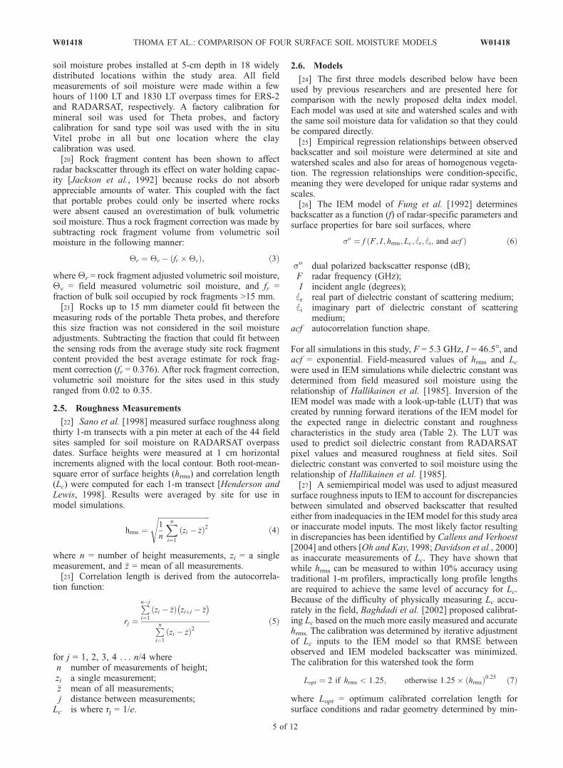
according to moving window filter size. Averaging themean and standard deviation at each filter level across all44 sites provided a way to determine the best filter level forthe watershed as a whole, which was determined as themoving window size where further increases in window sizedid not appreciably change the watershed backscatter sta-tistics. The filter size where curves flattened indicated thefinest spatial scale where speckle influence was minimized(Figures 2a and 2b). For the mean curve this occurred with a7 � 7 pixel moving window which represented a groundarea of 119 � 119 m, and for the standard deviation curvethis occurred with a 15 � 15 pixel moving window whichrepresented a ground area of 231 � 231 m. Standarddeviation continued to decrease even as the mean stabilizedbeyond the 7 � 7 pixel median filter window (Figure 2b),indicating that outlying backscatter values continued to beremoved with larger filter sizes. At the same time, the meanbackscatter became more positive (Figure 2a), indicatingthat a skewed negative distribution of backscatter in unfil-tered imagery became less important on computation of themean as filter size increased. Although larger window sizes
improved aesthetic image quality at broader scales, thedifference between mean backscatter of field sites using a5 � 5 pixel window and any filter larger than 5 � 5 pixelswas no more than 0.07 dB (Figure 2a). For this reason, the5 � 5 filter size was selected as the optimum filter windowsize that balanced resolution with a consistent measure ofbackscatter central tendency. From this point forward, whenmaking reference to the RADARSAT image data, only the5 � 5 pixel median filtered imagery is discussed.[16] Distribution and abundance of scatterers on the
ground including surface roughness and near-surface rockfragments affect the spatial scale of speckle. Thus it isexpected that the magnitude and distribution of speckle willvary by study area and the optimum median filter chosen forthis study area may be unique.[17] Because some residual speckle effect may have still
been present after filtering, the backscatter at each of 44field sites was averaged over 5 � 5 pixels, representing aneffective ground area of 91 � 91 m to obtain backscattervalues used in subsequent analysis. The 12.5-m resolutionERS-2 imagery was not median filtered because it waslower resolution and three-look, which had the effect ofreducing speckle. However, backscatter for the ERS-2 fieldsites (different from those used with RADARSAT) was alsodetermined by averaging pixels, in this case a 7 � 7 pixelarea (87.5 � 87.5 m) that further reduced speckle effects. Inboth ERS and RADARSAT imagery the number of pixelsaveraged to determine backscatter at field sites representedapproximately the same geographic extent.[18] No topographic correction was applied to ERS
imagery because the associated field sites were flat. How-ever, because some of the field sites associated with theRADARSAT imagery were not flat, a local incident anglecorrection was applied [Henderson and Lewis, 1998]. Thecorrection involved multiplying backscatter values by theratio of backscatter received from a sloping surface to thatreceived from a horizontal surface, where
bos=boh ¼ sinQi= sin Qi � alocð Þ; ð2Þ
bso backscatter from sloping surface;bho backscatter from a horizontal surface;
Qi average radar incident angle;aloc local incident angle determined from 7-m digital
elevation model.The correction effect was minor in most cases becauseslopes at the field sites were mostly level.
2.4. Soil Moisture Measurements
[19] Soil moisture measurements at field sites weremade in one of three ways over an integrated 0- to 5-cmdepth, or at 5-cm depth for the in situ sensors. (1) For eachERS-2 image, 49 soil moisture measurements were madegravimetrically over a 90 � 90 m area at three sites. (2) ForRADARSATimage acquisition dates, 30 July, 31August, and16 September 2003, volumetric soil moisture was measuredusing capacitance-based Dynamax TH2O Theta probes at 30to 50 locations on a grid within a 35 � 35 m area ateach of 44 sites. The number of measurements made wasbased on sampling intensity needed to obtain a stablemeasure of mean soil moisture. (3) For the RADARSATimage acquisition date 19 January 2003, soil moistures wereretrieved from continuously recording Stevens/Vitel Hydra
Figure 2. Effect of median filter window size onRADARSAT backscatter. (a) Mean backscatter from 44field sites on three image dates in Walnut Gulch, Arizona.(b) Mean of standard deviations of backscatter from 44 fieldsites on three image dates. The area used to calculatestandard deviation and mean for each of 44 sites was five byfive pixels (91 � 91 m) nested over the 35 � 35 m groundarea sampled for soil moisture at time of satellite overpass.
4 of 12
W01418 THOMA ET AL.: COMPARISON OF FOUR SURFACE SOIL MOISTURE MODELS W01418
soil moisture probes installed at 5-cm depth in 18 widelydistributed locations within the study area. All fieldmeasurements of soil moisture were made within a fewhours of 1100 LT and 1830 LT overpass times for ERS-2and RADARSAT, respectively. A factory calibration formineral soil was used for Theta probes, and factorycalibration for sand type soil was used with the in situVitel probe in all but one location where the claycalibration was used.[20] Rock fragment content has been shown to affect
radar backscatter through its effect on water holding capac-ity [Jackson et al., 1992] because rocks do not absorbappreciable amounts of water. This coupled with the factthat portable probes could only be inserted where rockswere absent caused an overestimation of bulk volumetricsoil moisture. Thus a rock fragment correction was made bysubtracting rock fragment volume from volumetric soilmoisture in the following manner:
Qr ¼ Qv � fr �Qvð Þ; ð3Þ
where Qr = rock fragment adjusted volumetric soil moisture,Qv = field measured volumetric soil moisture, and fr =fraction of bulk soil occupied by rock fragments >15 mm.[21] Rocks up to 15 mm diameter could fit between the
measuring rods of the portable Theta probes, and thereforethis size fraction was not considered in the soil moistureadjustments. Subtracting the fraction that could fit betweenthe sensing rods from the average study site rock fragmentcontent provided the best average estimate for rock frag-ment correction (fr = 0.376). After rock fragment correction,volumetric soil moisture for the sites used in this studyranged from 0.02 to 0.35.
2.5. Roughness Measurements
[22] Sano et al. [1998] measured surface roughness alongthirty 1-m transects with a pin meter at each of the 44 fieldsites sampled for soil moisture on RADARSAT overpassdates. Surface heights were measured at 1 cm horizontalincrements aligned with the local contour. Both root-mean-square error of surface heights (hrms) and correlation length(Lc) were computed for each 1-m transect [Henderson andLewis, 1998]. Results were averaged by site for use inmodel simulations.
hrms ¼ffiffiffiffiffiffiffiffiffiffiffiffiffiffiffiffiffiffiffiffiffiffiffiffiffiffiffiffiffi1
n
Xni¼1
zi � �zð Þ2s
ð4Þ
where n = number of height measurements, zi = a singlemeasurement, and �z = mean of all measurements.[23] Correlation length is derived from the autocorrela-
tion function:
rj ¼
Pn�j
i¼1
zi � �zð Þ ziþj � �z� �
Pni¼1
zi � �zð Þ2ð5Þ
for j = 1, 2, 3, 4 . . . n/4 wheren number of measurements of height;zi a single measurement;�z mean of all measurements;j distance between measurements;
Lc is where rj = 1/e.
2.6. Models
[24] The first three models described below have beenused by previous researchers and are presented here forcomparison with the newly proposed delta index model.Each model was used at site and watershed scales and withthe same soil moisture data for validation so that they couldbe compared directly.[25] Empirical regression relationships between observed
backscatter and soil moisture were determined at site andwatershed scales and also for areas of homogenous vegeta-tion. The regression relationships were condition-specific,meaning they were developed for unique radar systems andscales.[26] The IEM model of Fung et al. [1992] determines
backscatter as a function (f) of radar-specific parameters andsurface properties for bare soil surfaces, where
so ¼ f F; I ; hrms; Lc;�er;�ei; and acfð Þ ð6Þ
so dual polarized backscatter response (dB);F radar frequency (GHz);I incident angle (degrees);�er real part of dielectric constant of scattering medium;�ei imaginary part of dielectric constant of scattering
medium;acf autocorrelation function shape.
For all simulations in this study, F = 5.3 GHz, I = 46.5�, andacf = exponential. Field-measured values of hrms and Lcwere used in IEM simulations while dielectric constant wasdetermined from field measured soil moisture using therelationship of Hallikainen et al. [1985]. Inversion of theIEM model was made with a look-up-table (LUT) that wascreated by running forward iterations of the IEM model forthe expected range in dielectric constant and roughnesscharacteristics in the study area (Table 2). The LUT wasused to predict soil dielectric constant from RADARSATpixel values and measured roughness at field sites. Soildielectric constant was converted to soil moisture using therelationship of Hallikainen et al. [1985].[27] A semiempirical model was used to adjust measured
surface roughness inputs to IEM to account for discrepanciesbetween simulated and observed backscatter that resultedeither from inadequacies in the IEMmodel for this study areaor inaccurate model inputs. The most likely factor resultingin discrepancies has been identified by Callens and Verhoest[2004] and others [Oh and Kay, 1998; Davidson et al., 2000]as inaccurate measurements of Lc. They have shown thatwhile hrms can be measured to within 10% accuracy usingtraditional 1-m profilers, impractically long profile lengthsare required to achieve the same level of accuracy for Lc.Because of the difficulty of physically measuring Lc accu-rately in the field, Baghdadi et al. [2002] proposed calibrat-ing Lc based on the much more easily measured and accuratehrms. The calibration was determined by iterative adjustmentof Lc inputs to the IEM model so that RMSE betweenobserved and IEM modeled backscatter was minimized.The calibration for this watershed took the form
Lopt ¼ 2 if hrms < 1:25; otherwise 1:25� hrmsð Þ0:25 ð7Þ
where Lopt = optimum calibrated correlation length forsurface conditions and radar geometry determined by min-
W01418 THOMA ET AL.: COMPARISON OF FOUR SURFACE SOIL MOISTURE MODELS
5 of 12
W01418
imizing RMSE between observed and IEM simulated back-scatter (cm), and hrms = field-measured root-mean-squareerror of surface heights from equation (4) (centimeters).[28] First we focused on adjustments to field measured Lc
to derive Lopt as suggested by Baghdadi et al. [2002], thenmoved on to iterative adjustments of hrms to account forinaccuracies in hrms measured in the field with a pin meterprofiler. Multiple iterations indicated that the best calibra-tion for hrms in this watershed occurred when hrms wasmultiplied by a factor of 2. Then,
Lopt ¼ 0:25 if hrms < 1:5; otherwise 1:5� hrmsð Þ2: ð8Þ
[29] An image difference technique proposed by Sano etal. [1998] was modified to evaluate backscatter from a dryreference scene and a wetter scene of interest by normaliz-ing the difference of pixel values to the dry scene value. Thedelta index represents a change relative to dry scenebackscatter, and thus the delta index should be interpretedin light of dry scene soil moisture. This is because any‘‘dry’’ scene backscatter is likely to be affected by at least asmall amount of residual soil moisture. For two carefullycoregistered images representing dry conditions in oneimage and wetter conditions in the other obtained at adifferent time, the delta index is defined on a per pixelbasis as
delta index ¼sowet � sodry
sodry
���������� ð9Þ
where sdryo = backscatter (decibels) from a pixel in a radar
image representing dry soil conditions, and sweto = radar
backscatter (decibels) from a pixel in the same geographiclocation representing wet soil conditions at a different time.[30] The delta index quantifies the change from a more
negative backscatter (dry image) to a more positive back-scatter (wet image). In terms of soil moisture this is achange in the positive direction. Because backscatter valuesare always negative, the absolute value is necessary to scalethe delta index to a positive range that reflects the positivechange in soil moisture status. The delta index can becalculated for spatial extents greater than the pixel resolu-tion by averaging backscatter from blocks of pixels tofurther minimize the influence of speckle if both images
are filtered in the same way and if the arithmetic average ofpixel values for coincident areas in the two images are usedin the computation.[31] In semiarid regions, long dry periods up to several
months duration are common and generally are the besttimes to obtain a reference image representing dry soilconditions across broad areas. Obtaining dry referenceimagery for more humid regions may be difficult, but ifsoil moisture measurements are made on the ground at timesof image acquisition it may be possible to account for thatlevel of soil moisture through subtraction, or interpret thedelta index as a relative change from the reference soilmoisture, rather than an absolute measure of soil moisture.In this study the watershed average volumetric soil moistureassociated with imagery used for the reference pixel valueswas between 0.01 and 0.05 at the time of dry referenceimage acquisition on 19 January 2003 and 7 July 1997 forRADARSAT and ERS, respectively.
3. Results and Discussion
3.1. Scale Effects on Model Accuracy
[32] A general finding related to scale pertinent to allmodels used in this study is that site-specific relationshipsbetween model predictions and observed soil moisture werepoor. A representative example is that obtained for the site-based empirical relationship for all RADARSAT image siteson four dates (Figure 3a). The same observation is presentedin later sections for the other models. The most likely reasonfor poor results at high spatial resolution is due to theinsensitivity of the radar to changes in soil moisture, effectsof residual speckle, and natural variability of surface char-acteristics that interact to affect backscatter that confoundrelationships. This is even true for physical models that canaccount for complex interactions, because variability insurface characteristics that serve as model inputs is difficultto measure accurately over large areas of natural surfaces.Some residual speckle influence is expected to affect site-specific relationships because the speckle-reducing tech-nique was based on the best filter for the watershed as awhole. Natural variability in surface features would implythe chosen filter technique may ‘‘over’’ filter or ‘‘under’’filter in different areas. By averaging spatially across thewatershed and temporally across a large range in soilmoisture conditions, the variability of surface factors isminimized while the range in observations is maximized.Only when central tendencies in soil moisture and back-scatter become apparent through the noise of variability douseful broad-scale relationships appear (Figure 3b). Thisstudy indicated that accurate soil moisture relationshipsobtained with radar may not provide improved spatialresolution over that achievable with passive sensors. Thisdoes not mean radar imagery used in this study is onlyuseful for broad-scale observations, but that the highestresolution achievable must be broader than the scale repre-sented by individual sites used in this study.
3.2. Empirical Model
[33] On a site by site basis, the relationship between 5 �5 pixel average backscatter and soil moisture was weak.Backscatter and soil moisture, grouped by date and thenspatially averaged across the watershed, showed a dramaticimprovement over site-specific relationships (Figure 3a) by
Table 2. Parameters Used in Forward Iterations of IEM Model to
Generate the Look-up-Table (LUT) of Expected Backscatter for
Known Surface Parameters and Viewing Geometrya
Parameter Value
Frequency, GHz 5.3Incidence angle, deg 46Lc correlation length, cm 0.1–50.1hrms height, cm 0.1–5.1Real dielectric constantb, unitless 0.2–80Imaginary dielectric constantb, unitless 0.00–23.83Autocorrelation function exponential
aThe LUT was used with measurements and adjusted measurements ofsurface roughness to determine soil moisture from RADARSAT imagery.
bReal and imaginary dielectric constants were computed via Hallikainenet al. [1985].
6 of 12
W01418 THOMA ET AL.: COMPARISON OF FOUR SURFACE SOIL MOISTURE MODELS W01418

reducing the effect of variation in surface roughness, soilmoisture, and residual speckle. Spatial and temporal aggre-gation highlighted a range of soil moistures that induced abackscatter response outside the variability caused by con-founding factors. This in part explained better correlationbetween backscatter and multidate imagery when the tem-poral range of soil moisture was greater than that generallyfound in a single image. Useful relationships might bepossible at scales intermediate between ‘‘site’’ and ‘‘water-shed,’’ as indicated by a weakly defined scale based onareas of homogenous vegetation type (Figure 3b).[34] Although several of the condition-specific relation-
ships were strong, they have limited predictive capabilitydue to subtle changes in backscatter response across largeranges in soil moisture indicated by flat regression lineslopes. The need to spatially average backscatter at somescale agreed with LeConte et al. [2004], Kelly et al. [2003],Hutchinson [2003], and Moran et al. [2000], who alsofound poor relationships at field scales but better relation-ships when sites or fields were spatially averaged.[35] Aside from predictive capability, another interesting
observation can be made related to vegetation and its
influence on backscatter. In general, backscatter fromshrub-dominated portions of the watershed is greater thanthat from grass-dominated portions of the watershed regard-less of moisture status (Figure 3b). This difference, presum-ably due to vegetation type, is only apparent when data areaveraged across the watershed.
3.3. Physical Model
[36] The geographic limitations imposed by empiricaltechniques do not apply to physical models such as IEM,but physical models present other challenges. The IEMmodel is point based and has been validated with scatter-ometers at lab and plot scales with well-defined media ofknown dielectric constant and well-characterized roughness.However, when the IEM model was extended to highlyvariable landscapes using space-based imagery, it per-formed poorly (Figure 4a). IEM backscatter was less thanobserved RADARSAT backscatter for all dates, whichcontradicts Baghdadi et al. [2002], who found IEM gener-ally overestimated observed backscatter. This differencemay be in part explained by the presence of minor amountsof vegetation in this study area as pointed out earlier.Bindlish and Barros [2001] showed a weak positive rela-tionship (R2 = 0.23) between radar backscatter and range-land biomass. The lack of fit between measured andobserved backscatter could be caused by not accountingfor vegetation in the IEM model or due to difficultymeasuring Lc and hrms of rangeland surfaces used for modelinputs. Also, the inability of the pin meter to measuresubsurface rock fragments that affect volume scatter mayhave resulted in underestimation of IEM backscatter relativeto observed radar backscatter. The speculation that theproblem is largely due to roughness is echoed by thefindings of Moran et al. [2000], who showed vegetationhad no effect on backscatter in this watershed, and otherswho have noted difficulty characterizing surface roughnessat field scales [Verhoest et al., 2000; Baghdadi et al., 2004],and results presented next for the semiempirical model.[37] Inversion of the IEM model with the LUT to
generate predictions of soil moisture performed poorly ona site by site basis, but had a near linear fit when data werespatially averaged (Figure 4b). Nevertheless, soil moisturemodeled this way overestimated measured soil moisture onall image dates.
3.4. Semiempirical Model
[38] Semiempirical adjustments can be made in light ofpotential weaknesses in field measurement of model param-eters. The physics behind IEM theory have been carefullyevaluated and shown to work at fine scales, but it is notclear if weaknesses in the model result in poor results atbroad scales or, if more likely, the lack of fit betweenobserved and modeled backscatter is due to uncertainty inobserved radar backscatter, uncertainty in field measuredsurface roughness, or uncertainty in field measured soilmoisture.[39] Uncertainty in radar backscatter for the duration of
this study was expected at worst to be within 2 dB[Staples and Branson, 1998], and although this level oferror could result in modeled error greater than plus orminus 0.10 cm3 cm�3, it was not considered for adjustmentbeyond the median filter step because radiometric calibra-tion was performed by the data provider.
Figure 3. (a) Backscatter versus measured soil moistureby site and averaged for the watershed on four dates in 2003using only RADARSAT observations. (b) Empiricalrelationships derived for homogenous areas of vegetationwith both RADARSAT and ERS radar sensors acrossmultiple dates.
W01418 THOMA ET AL.: COMPARISON OF FOUR SURFACE SOIL MOISTURE MODELS
7 of 12
W01418

[40] Uncertainty in field-measured soil moisture wasaddressed by confidence interval testing at 95% with onesample t-test. This indicated that sample sizes of field soilmoisture measurements (30–50 measurements at each fieldsite) were sufficient to ensure mean soil moisture estimateswere within 1 and 2% of true soil moisture for dry and moistfield conditions, respectively. Additional measurements didnot change the mean value more than 1%. Thereforeadjustment of soil moisture used to compute dielectricconstant was not considered. The discrepancy in field areasampled (35 � 35 m) for RADARSAT image dates and thearea used to determine mean backscatter (91 � 91 m) mayhave influenced model results. However, the pixels used todetermine the mean backscatter were centered over the fieldsites, and the field sites on the scale of 100 m wererelatively homogenous. In two field trials at 13 representa-tive field sites we obtained mean soil moisture values innested blocks of 35 � 35 m and 100 � 100 m that differed
by less than 0.018 cm3 cm�3. This provided some assurancethat the measurements made at 35 � 35 m adequatelyrepresented the soil moisture status of larger 100 � 100 mareas.[41] This left uncertainty in surface roughness as an
important factor that could affect model performance.Surface roughness parameters, Lc and hrms, have stronginfluence on IEM-generated backscatter and thus, throughadjustment, have much potential to improve fit betweenobserved and modeled soil moisture. Furthermore, othershave had difficulty accurately measuring surface roughness[Baghdadi et al., 2002; Verhoest et al., 2000]. Coefficientswere calibrated using equations (7) and (8) to achieveadjustments to field-measured Lc and hrms that minimizedthe difference between modeled and measured backscatter.Evaluation of roughness calibration was made by compar-ing LUT modeled soil moisture to field measured soilmoisture (Figure 5).[42] Simulations using adjusted surface roughness param-
eters showed improvement when Lc was decreased andwhen hrms was increased. Shorter correlation lengths andlarger hrms values effectively increased roughness in theIEM model and its inversion which improved the fitbetween modeled and observed soil moisture. Poor agree-ment between modeled and observed backscatter resultedwhen field measures of surface roughness, Lc and hrms, wereused (RMSE = 0.13). Considerable improvement occurredby adjusting Lc only (RMSE = 0.05), but little additionalimprovement could be achieved for all dates by adjustinghrms and Lc simultaneously (RMSE = 0.04). However,adjusting hrms and Lc simultaneously had a large influenceon accuracy of soil moisture prediction for the wettestmonth. This difference may be due to inability of thesurface-based pin meter to account for volume scatteringcaused by subsurface rock fragments that have a greaterproportional effect on volumetric soil moisture in wetterconditions (equation (3)). Although the fit between modeled
Figure 4. (a) Site-averaged IEM versus RADARSATbackscatter for 44 field sites sampled on four dates. Theerror bars represent backscatter standard deviation. (b) Site-specific modeled versus measured soil moisture and averagemodeled versus measured soil moisture. Only RADARSATresults are presented because surface roughness data werenot available for IEM simulation at the ERS-2 field sites.
Figure 5. Modeled versus measured soil moisture forsimulations at the watershed scale. The shift in data groupedby symbol represents Lc calibration suggested by Baghdadiet al. [2004] or Lc calibration plus hrms adjustment. OnlyRADARSAT results are shown here because surfaceroughness data were not available for IEM simulation atthe ERS-2 field sites.
8 of 12
W01418 THOMA ET AL.: COMPARISON OF FOUR SURFACE SOIL MOISTURE MODELS W01418

and measured backscatter could be optimized by adjustingroughness parameters, inversion to obtain soil moisture stilloverestimated measured soil moisture.[43] Others [Baghdadi et al., 2002; Verhoest et al., 2000]
have made adjustments to Lc based on the assumption thathrms can be accurately measured in the field and is related toLc. However, those studies were made in agricultural fieldsthat have periodic row structure and may not have high rockfragment content. Empirical adjustments to both hrms and Lcmay complicate handling of roughness in model inversions.Adjustment of hrms, however, may be necessary in rockyenvironments to account for subsurface volume scatteringthat cannot be measured using surface-based pin meters.
3.5. Delta Index Model
[44] As with the other models, the site-specific relation-ship between delta index and measured soil moisture waspoor but improved dramatically with spatial and temporalaveraging (Figure 6a). A strong relationship through time
existed between the delta index and field-measured soilmoisture at the watershed scale with delta index explain-ing 91% of the variability in soil moisture when bothRADARSAT and ERS imagery were used to predict soilmoisture (Figure 6b). In this study the delta index rela-tionship was a good predictor of soil moisture with pairsof HH and pairs of VV polarized imagery. The key tomeaningful results lies in obtaining imagery with the samebeam position, precise image to image registration, andspeckle filtering and so that differences result primarilyfrom changes in moisture status.[45] The effect of normalizing with dry reference image
pixel values was that delta index values were scaled to therange of observed soil moistures, a marked improvementin the image difference approach first proposed by Sano etal. [1998], and the observations, at least in this watershed,approximated a 1:1 relationship. The proximity of obser-vations to the 1:1 line may result from cancellation oftime-invariant features that affect backscatter, includingview geometry, polarization, topography, soil type, andsurface roughness because they are the same in the twoimages used in the delta index and the only difference inthe image backscatter is due to soil moisture. If this holdstrue in other watersheds, empirical calibration may not berequired if reference scene soil moisture is very dry. Thispresents an important operational advantage if soil mois-ture could be predicted by imagery alone without the needfor ground-based measures of surface roughness. However,if roughness and soil moisture have an interaction effect assuggested by IEM model simulations, then the delta indexmay be no different from other empirical models that mustbe reexamined for each new study area.[46] The delta index may be less affected by surface
roughness, rock fragments, and subtle vegetation influencesthan IEM, as indicated by an examination of site-scalevariability in IEM and delta index modeled soil moisturefor September (Figures 4b and 6a). For the range in soilmoisture measured on the ground for the September imagedate, there is a larger spread in modeled IEM soil moisturevalues (0–0.4) than delta index values (0–0.2). We specu-late that there are two primary reasons why the delta indexoutperformed the IEM model at the site scale. First, for theIEM model, it is difficult to accurately characterize surfaceroughness and other factors such as subsurface rock frag-ments that may contribute to roughness even over relativelysmall areas such as the 35 � 35 m sites used in this study.The second is due to residual speckle influence that may nothave been entirely removed or minimized at each field siteduring the filtering process. All imagery in the study wasfiltered the same way, but if residual speckle remained itserved as error in IEM inversion but ‘‘cancelled’’ in thedelta index. The relatively large spread in the delta indexresults indicates speckle effects did not entirely cancel,which may result from very slight shifts in viewing geom-etry on successive orbits that cannot be practically takeninto account. This is a limitation imposed by the observationsystem that will limit the scale at which model results willbe valid.[47] The delta index is largely determined by two theo-
retical relationships that are illustrated with a dielectricmodel [Hallikainen et al., 1985] and IEM [Fung et al.,1992]. These are the dependency of real dielectric constant
Figure 6. (a) Site-specific relationship between deltaindex and field measured soil moisture and averages ofdelta index and measured soil moisture. (b) Average deltaindex from 44 sites derived from RADARSAT imagery onthree dates and delta index from three sites derived fromERS imagery on multiple dates versus soil moisturemeasured in the field. RMSE was computed as averagedifference between observed soil moisture and delta index.
W01418 THOMA ET AL.: COMPARISON OF FOUR SURFACE SOIL MOISTURE MODELS
9 of 12
W01418

on volumetric soil moisture (Figure 7a), and the dependencyof backscatter on real dielectric constant (Figure 7b).Backscatter and soil moisture are linked through theserelationships (Figure 7c). Because imaginary dielectricconstant changes much less than real dielectric constantwith soil moisture, it will not be discussed further.Increasing backscatter with soil moisture presents theopportunity to discriminate levels of soil moisture byexploiting the change in backscatter normalized by theinitial, or ‘‘reference,’’ condition, similar to the waygravimetric soil moisture content is normalized by drysoil mass. Because the relationships between soil moisture,dielectric constant, and backscatter are nonlinear, the deltaindex as modeled with IEM is also nonlinear (Figure 7d)with a shape similar to the backscatter/soil moisturerelationship of Figure 7c. For comparison, a delta indexcurve derived by generating backscatter values using IEM(dashed blue line in Figure 7d) was made for the specificconditions of surface roughness in the watershed. TheRMSE was less around the observed delta index line(0.03) than around the IEM-derived delta index curve(0.12). This indicates that IEM may not be a suitable
model for operational broad-scale soil moisture estimatesin this watershed. However, more data at higher watercontents might indicate a better fit with the IEM-derivedcurve.[48] The linearity of the observed delta index may result
from factors that cannot be accounted for in the IEMmodel. It could be related to cumulative effects of surfacefeatures and scale that IEM does not model effectively, orit could be the IEM model does not account for rockfragments just below the soil surface that act as roughnesselements affecting backscatter and also act as a limit onvolumetric soil moisture content. In a dry soil the sur-rounding matrix is as dry as rocks contained therein. Asthe soil wets-up the volume occupied by rocks remainsdry, thus suppressing the backscatter influence for thatvolume. This has the effect of compressing the entirebackscatter response into a narrower range that may bemore linear than what would be observed over a broaderrange of soil moisture if rocks were absent. If the deltaindex is capable of handling the cumulative effect of rockfragments and variable surface factors, it may have poten-tial to be extended easily to other study sites. For this
Figure 7. (a) Modeled dependence of real dielectric constant on soil moisture. (b) Modeled dependenceof backscatter on dielectric constant. (c) Soil moisture versus backscatter relationship that is exploited bythe delta index. (d) Delta index computed using radar image pixel values from Figure 6 and IEM-modeled backscatter versus field-measured soil moisture. A volumetric soil moisture content of 0.05 wasused as the dry ‘‘reference’’ soil condition while optimized hrms and Lc (1.13 cm and 1.93 cm,respectively) served as roughness inputs to develop the IEM-simulated delta index. RMSE was computedas average difference between observed soil moisture and modeled fit.
10 of 12
W01418 THOMA ET AL.: COMPARISON OF FOUR SURFACE SOIL MOISTURE MODELS W01418
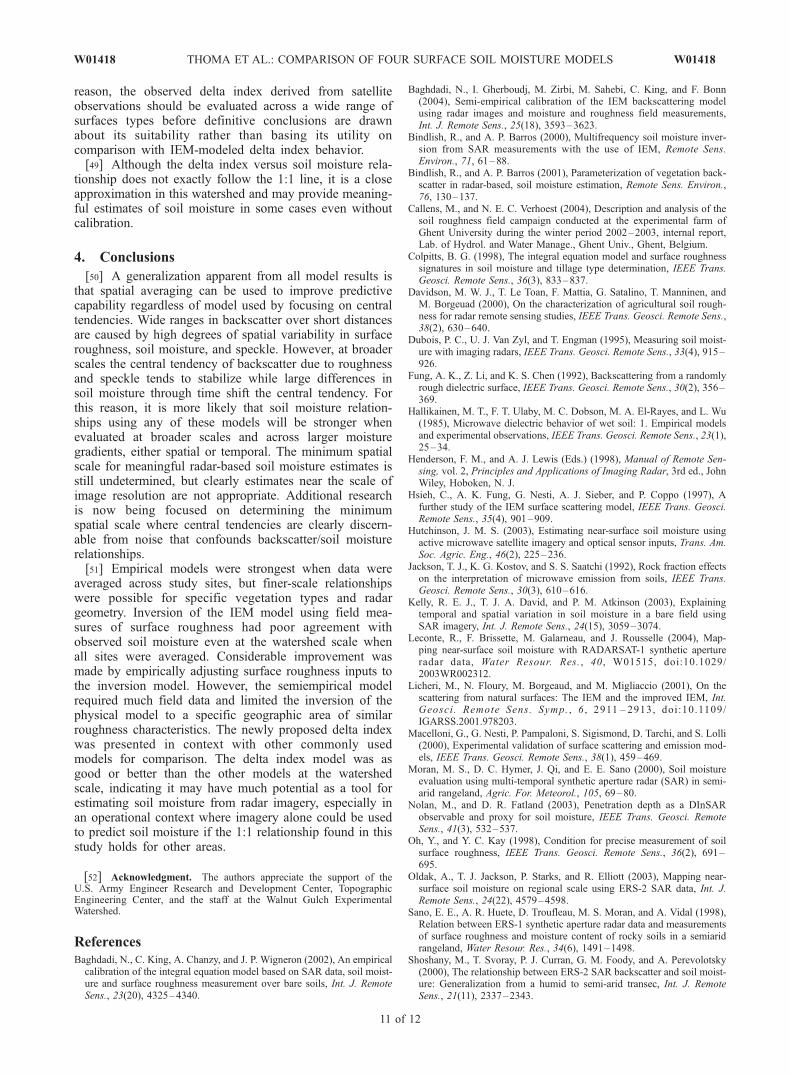
reason, the observed delta index derived from satelliteobservations should be evaluated across a wide range ofsurfaces types before definitive conclusions are drawnabout its suitability rather than basing its utility oncomparison with IEM-modeled delta index behavior.[49] Although the delta index versus soil moisture rela-
tionship does not exactly follow the 1:1 line, it is a closeapproximation in this watershed and may provide meaning-ful estimates of soil moisture in some cases even withoutcalibration.
4. Conclusions
[50] A generalization apparent from all model results isthat spatial averaging can be used to improve predictivecapability regardless of model used by focusing on centraltendencies. Wide ranges in backscatter over short distancesare caused by high degrees of spatial variability in surfaceroughness, soil moisture, and speckle. However, at broaderscales the central tendency of backscatter due to roughnessand speckle tends to stabilize while large differences insoil moisture through time shift the central tendency. Forthis reason, it is more likely that soil moisture relation-ships using any of these models will be stronger whenevaluated at broader scales and across larger moisturegradients, either spatial or temporal. The minimum spatialscale for meaningful radar-based soil moisture estimates isstill undetermined, but clearly estimates near the scale ofimage resolution are not appropriate. Additional researchis now being focused on determining the minimumspatial scale where central tendencies are clearly discern-able from noise that confounds backscatter/soil moisturerelationships.[51] Empirical models were strongest when data were
averaged across study sites, but finer-scale relationshipswere possible for specific vegetation types and radargeometry. Inversion of the IEM model using field mea-sures of surface roughness had poor agreement withobserved soil moisture even at the watershed scale whenall sites were averaged. Considerable improvement wasmade by empirically adjusting surface roughness inputs tothe inversion model. However, the semiempirical modelrequired much field data and limited the inversion of thephysical model to a specific geographic area of similarroughness characteristics. The newly proposed delta indexwas presented in context with other commonly usedmodels for comparison. The delta index model was asgood or better than the other models at the watershedscale, indicating it may have much potential as a tool forestimating soil moisture from radar imagery, especially inan operational context where imagery alone could be usedto predict soil moisture if the 1:1 relationship found in thisstudy holds for other areas.
[52] Acknowledgment. The authors appreciate the support of theU.S. Army Engineer Research and Development Center, TopographicEngineering Center, and the staff at the Walnut Gulch ExperimentalWatershed.
ReferencesBaghdadi, N., C. King, A. Chanzy, and J. P. Wigneron (2002), An empiricalcalibration of the integral equation model based on SAR data, soil moist-ure and surface roughness measurement over bare soils, Int. J. RemoteSens., 23(20), 4325–4340.
Baghdadi, N., I. Gherboudj, M. Zirbi, M. Sahebi, C. King, and F. Bonn(2004), Semi-empirical calibration of the IEM backscattering modelusing radar images and moisture and roughness field measurements,Int. J. Remote Sens., 25(18), 3593–3623.
Bindlish, R., and A. P. Barros (2000), Multifrequency soil moisture inver-sion from SAR measurements with the use of IEM, Remote Sens.Environ., 71, 61–88.
Bindlish, R., and A. P. Barros (2001), Parameterization of vegetation back-scatter in radar-based, soil moisture estimation, Remote Sens. Environ.,76, 130–137.
Callens, M., and N. E. C. Verhoest (2004), Description and analysis of thesoil roughness field campaign conducted at the experimental farm ofGhent University during the winter period 2002–2003, internal report,Lab. of Hydrol. and Water Manage., Ghent Univ., Ghent, Belgium.
Colpitts, B. G. (1998), The integral equation model and surface roughnesssignatures in soil moisture and tillage type determination, IEEE Trans.Geosci. Remote Sens., 36(3), 833–837.
Davidson, M. W. J., T. Le Toan, F. Mattia, G. Satalino, T. Manninen, andM. Borgeuad (2000), On the characterization of agricultural soil rough-ness for radar remote sensing studies, IEEE Trans. Geosci. Remote Sens.,38(2), 630–640.
Dubois, P. C., U. J. Van Zyl, and T. Engman (1995), Measuring soil moist-ure with imaging radars, IEEE Trans. Geosci. Remote Sens., 33(4), 915–926.
Fung, A. K., Z. Li, and K. S. Chen (1992), Backscattering from a randomlyrough dielectric surface, IEEE Trans. Geosci. Remote Sens., 30(2), 356–369.
Hallikainen, M. T., F. T. Ulaby, M. C. Dobson, M. A. El-Rayes, and L. Wu(1985), Microwave dielectric behavior of wet soil: 1. Empirical modelsand experimental observations, IEEE Trans. Geosci. Remote Sens., 23(1),25–34.
Henderson, F. M., and A. J. Lewis (Eds.) (1998), Manual of Remote Sen-sing, vol. 2, Principles and Applications of Imaging Radar, 3rd ed., JohnWiley, Hoboken, N. J.
Hsieh, C., A. K. Fung, G. Nesti, A. J. Sieber, and P. Coppo (1997), Afurther study of the IEM surface scattering model, IEEE Trans. Geosci.Remote Sens., 35(4), 901–909.
Hutchinson, J. M. S. (2003), Estimating near-surface soil moisture usingactive microwave satellite imagery and optical sensor inputs, Trans. Am.Soc. Agric. Eng., 46(2), 225–236.
Jackson, T. J., K. G. Kostov, and S. S. Saatchi (1992), Rock fraction effectson the interpretation of microwave emission from soils, IEEE Trans.Geosci. Remote Sens., 30(3), 610–616.
Kelly, R. E. J., T. J. A. David, and P. M. Atkinson (2003), Explainingtemporal and spatial variation in soil moisture in a bare field usingSAR imagery, Int. J. Remote Sens., 24(15), 3059–3074.
Leconte, R., F. Brissette, M. Galarneau, and J. Rousselle (2004), Map-ping near-surface soil moisture with RADARSAT-1 synthetic apertureradar data, Water Resour. Res., 40 , W01515, doi:10.1029/2003WR002312.
Licheri, M., N. Floury, M. Borgeaud, and M. Migliaccio (2001), On thescattering from natural surfaces: The IEM and the improved IEM, Int.Geosci . Remote Sens. Symp. , 6 , 2911 – 2913, doi:10.1109/IGARSS.2001.978203.
Macelloni, G., G. Nesti, P. Pampaloni, S. Sigismond, D. Tarchi, and S. Lolli(2000), Experimental validation of surface scattering and emission mod-els, IEEE Trans. Geosci. Remote Sens., 38(1), 459–469.
Moran, M. S., D. C. Hymer, J. Qi, and E. E. Sano (2000), Soil moistureevaluation using multi-temporal synthetic aperture radar (SAR) in semi-arid rangeland, Agric. For. Meteorol., 105, 69–80.
Nolan, M., and D. R. Fatland (2003), Penetration depth as a DInSARobservable and proxy for soil moisture, IEEE Trans. Geosci. RemoteSens., 41(3), 532–537.
Oh, Y., and Y. C. Kay (1998), Condition for precise measurement of soilsurface roughness, IEEE Trans. Geosci. Remote Sens., 36(2), 691–695.
Oldak, A., T. J. Jackson, P. Starks, and R. Elliott (2003), Mapping near-surface soil moisture on regional scale using ERS-2 SAR data, Int. J.Remote Sens., 24(22), 4579–4598.
Sano, E. E., A. R. Huete, D. Troufleau, M. S. Moran, and A. Vidal (1998),Relation between ERS-1 synthetic aperture radar data and measurementsof surface roughness and moisture content of rocky soils in a semiaridrangeland, Water Resour. Res., 34(6), 1491–1498.
Shoshany, M., T. Svoray, P. J. Curran, G. M. Foody, and A. Perevolotsky(2000), The relationship between ERS-2 SAR backscatter and soil moist-ure: Generalization from a humid to semi-arid transec, Int. J. RemoteSens., 21(11), 2337–2343.
W01418 THOMA ET AL.: COMPARISON OF FOUR SURFACE SOIL MOISTURE MODELS
11 of 12
W01418

Staples, G., and W. Branson (1998), RADARSAT Illuminated: YourGuide to Products and Services, RADARSAT Int., Richmond, B. C.,Canada.
U.S. Department of Agriculture (2002), Soil Survey of Cochise County,Arizona, Douglas-Tombstone Part, Nat. Resour. Conserv. Serv.,Washington, D. C.
Van Oevelen, P., and D. H. Hoekman (1999), Radar backscatter inversiontechniques for estimation of surface soil moisture: EFEDA-Spain andHAPEX-Sahel case studies, IEEE Trans. Geosci. Remote Sens., 37(1),113–123.
Verhoest, N. E. C., R. Hoeben, F. P. De Troch, and P. A. Troch (2000), Soilmoisture inversion from ERS and SIR-C imagery at the Zwalmcatchment, Belgium, IEEE Proc. Int. Geosci. Remote Sens. Symp., 5,2041–2043.
Zribi, M., and M. Dechambre (2002), A new empirical model to retrievesoil moisture and roughness from C-band radar data, Remote Sens.Environ., 84, 42–52.
����������������������������R. Bryant, C. D. Holifield-Collins, M. S. Moran, M. Rahman, S. Skirvin,
and D. P. Thoma, U.S. Department of Agriculture ARS SouthwestWatershed Research Center, 2000 East Allen Road, Tucson, AZ 85719,USA. ([email protected])
E. E. Sano, Embrapa Cerrados, EMBRAPA/CPAC BR-20 Km 18 Cx.,Postal 08223 CEP 73301-970 Planaltina, Brazil.
K. Slocum, U.S. Army Engineer Research and Development Center,Topographic Engineering Center, 7701 Telegraph Road, Alexandria, VA22315-3864, USA.
12 of 12
W01418 THOMA ET AL.: COMPARISON OF FOUR SURFACE SOIL MOISTURE MODELS W01418