Commencing uplift of the Liupan Shan since 9.5 Ma: Evidences from the Sikouzi section at its east...
11
Commencing uplift of the Liupan Shan since 9.5 Ma: Evidences from the Sikouzi section at its east side Xiubin Lin a,b,c, * , Hanlin Chen a,b , Karl-Heinz Wyrwoll c , Xiaogan Cheng a,b a Department of Earth Sciences, Zhejiang University, Hangzhou 310027, China b Research Center for Structures in Oil and Gas Bearing Basin, Ministry of Education, Hangzhou 310027, China c School of Earth and Environment, The University of Western Australia, Stirling Highway, Crawley, WA 6009, Australia article info Article history: Received 17 February 2009 Received in revised form 17 July 2009 Accepted 30 September 2009 Keywords: Sikouzi section Liupan Shan Northeast Tibetan Plateau Miocene abstract The Cenozoic evolution of the Liupan Shan, situated at the northeast of the Tibetan Plateau, will provide constraints to test the models and mechanisms of the evolution of the plateau. In this contribution, the Sikouzi section, at the east of the Liupan Shan, has been selected to study Liupan Shan’s uplift history. At around 9.5 Ma, constrained by the magnetostratigraphy, the sediment and depositing architecture char- acteristics obviously changed. Synchronously, flow direction changed from E ? W to W ? E, and accu- mulation rate increased to more than double. All these evidences suggest that the Liupan Shan initiated uplifting at around 9.5 Ma. Subsequently, a stage of intense uplift happened during 8.2– 7.3 Ma, indicated by the apatite fission-track (AFT) data across the Liupan Shan. Regional comparison indicates that this stage of uplift is not only with local but also regional significance. The Miocene uplift of the Tibetan Plateau triggered the intensification of the East Asian Monsoon and Asian intercontinental aridity, which has been implied by the pollen results of the Sikouzi section. Ó 2009 Elsevier Ltd. All rights reserved. 1. Introduction The formation of the Tibetan Plateau, with average elevation more than 5000 m, is one of the most dramatic geological events during Cenozoic around the world, which has exerted impacts to wide aspects, including tectonics, magmatism, crustal deforma- tion, sedimentology, atmospheric circle variation and climate changes. Numerous models have been suggested to explain the for- mation, growth, evolution and mechanism of the Tibetan Plateau, e.g. episodic uplift (Li, 1995; Shi et al., 1998; Li and Fang, 1998; Zhong and Ding, 1996; Wang and Ding, 1998), convective removal around 8 Ma (Platt and England, 1993; Molnar et al., 1993; Molnar, 2005), oblique stepwise rise and growth (Tapponnier et al., 2001), entire intact Indian lithosphere thrusting beneath the Tibetan Pla- teau (Seeber and Ambruster, 1981), north–south shortening of southern Eurasian crust (England and Houseman, 1986), mid-low- er crustal channel flow (Royden et al., 1997; Clark and Royden, 2000), growth from the central to southward and northward (Wang et al., 2008), etc. Among the large-scaled mountain and fault ranges, triggered by the Indian–Asian collision, Haiyuan–Liupan Shan bounds the northeast margin of the present Tibetan Plateau. The study of the uplift timing of the Haiyuan–Liupan Shan range will provide con- straints to test the models, which have been proposed to explain the formation, evolution and mechanism of the plateau. Regarding to the uplift timing of the Haiyuan–Liupan Shan area, so far, it has been being a controversial issue. Zhang et al. (1991) and Burchfiel et al. (1991) proposed that the uplift and crustal deformation happened during late Pliocene and early Quaternary. However, as lack of reliable technique to constrain the timing, this timing has uncertainty to some extent. More recent studies, based on the structural geology, magnetostratigraphy, apatite fission- track thermochronology, implied that the uplift probably occurred during late Miocene (Song et al., 2001; Ding et al., 2004; Zhang et al., 2006; Zheng et al., 2006a). However, Zhang et al. (2005), based on the sedimentology of this area, proposed an even older uplift timing, around 30–40 Ma. This controversy is partly because that different sites or sections and methods have been selected in their studies. Another reason probably is that the uplift and exist- ing relief occurred since late Cretaceous through early Cenozoic has not been taken into consideration. In this contribution, a well-exposed section, the Sikouzi section at the east side of the Liupan Shan, has been selected to study the sedimentology and palaeo-flow direction. Combined with the pre- vious magnetostratigraphy and apatite fission-track results, the authors determine the timing of the commencing uplift of the Liu- pan Shan to be around 9.5 Ma. After then, the Liupan Shan under- went a stage of intense uplift since 8.2–7.3 Ma. 1367-9120/$ - see front matter Ó 2009 Elsevier Ltd. All rights reserved. doi:10.1016/j.jseaes.2009.09.005 * Corresponding author. Address: Department of Earth Sciences, Zhejiang University, Hangzhou 310027, China. Tel.: +86 571 87952791; fax: +86 571 87951336. E-mail address: [email protected] (X. Lin). Journal of Asian Earth Sciences 37 (2010) 350–360 Contents lists available at ScienceDirect Journal of Asian Earth Sciences journal homepage: www.elsevier.com/locate/jseaes
-
Upload
independent -
Category
Documents
-
view
3 -
download
0
Transcript of Commencing uplift of the Liupan Shan since 9.5 Ma: Evidences from the Sikouzi section at its east...

Journal of Asian Earth Sciences 37 (2010) 350–360
Contents lists available at ScienceDirect
Journal of Asian Earth Sciences
journal homepage: www.elsevier .com/locate / jseaes
Commencing uplift of the Liupan Shan since 9.5 Ma: Evidencesfrom the Sikouzi section at its east side
Xiubin Lin a,b,c,*, Hanlin Chen a,b, Karl-Heinz Wyrwoll c, Xiaogan Cheng a,b
a Department of Earth Sciences, Zhejiang University, Hangzhou 310027, Chinab Research Center for Structures in Oil and Gas Bearing Basin, Ministry of Education, Hangzhou 310027, Chinac School of Earth and Environment, The University of Western Australia, Stirling Highway, Crawley, WA 6009, Australia
a r t i c l e i n f o a b s t r a c t
Article history:Received 17 February 2009Received in revised form 17 July 2009Accepted 30 September 2009
Keywords:Sikouzi sectionLiupan ShanNortheast Tibetan PlateauMiocene
1367-9120/$ - see front matter � 2009 Elsevier Ltd. Adoi:10.1016/j.jseaes.2009.09.005
* Corresponding author. Address: Department oUniversity, Hangzhou 310027, China. Tel.: +86 5787951336.
E-mail address: [email protected] (X. Lin).
The Cenozoic evolution of the Liupan Shan, situated at the northeast of the Tibetan Plateau, will provideconstraints to test the models and mechanisms of the evolution of the plateau. In this contribution, theSikouzi section, at the east of the Liupan Shan, has been selected to study Liupan Shan’s uplift history. Ataround 9.5 Ma, constrained by the magnetostratigraphy, the sediment and depositing architecture char-acteristics obviously changed. Synchronously, flow direction changed from E ? W to W ? E, and accu-mulation rate increased to more than double. All these evidences suggest that the Liupan Shaninitiated uplifting at around 9.5 Ma. Subsequently, a stage of intense uplift happened during 8.2–7.3 Ma, indicated by the apatite fission-track (AFT) data across the Liupan Shan. Regional comparisonindicates that this stage of uplift is not only with local but also regional significance. The Miocene upliftof the Tibetan Plateau triggered the intensification of the East Asian Monsoon and Asian intercontinentalaridity, which has been implied by the pollen results of the Sikouzi section.
� 2009 Elsevier Ltd. All rights reserved.
1. Introduction
The formation of the Tibetan Plateau, with average elevationmore than 5000 m, is one of the most dramatic geological eventsduring Cenozoic around the world, which has exerted impacts towide aspects, including tectonics, magmatism, crustal deforma-tion, sedimentology, atmospheric circle variation and climatechanges. Numerous models have been suggested to explain the for-mation, growth, evolution and mechanism of the Tibetan Plateau,e.g. episodic uplift (Li, 1995; Shi et al., 1998; Li and Fang, 1998;Zhong and Ding, 1996; Wang and Ding, 1998), convective removalaround 8 Ma (Platt and England, 1993; Molnar et al., 1993; Molnar,2005), oblique stepwise rise and growth (Tapponnier et al., 2001),entire intact Indian lithosphere thrusting beneath the Tibetan Pla-teau (Seeber and Ambruster, 1981), north–south shortening ofsouthern Eurasian crust (England and Houseman, 1986), mid-low-er crustal channel flow (Royden et al., 1997; Clark and Royden,2000), growth from the central to southward and northward(Wang et al., 2008), etc.
Among the large-scaled mountain and fault ranges, triggered bythe Indian–Asian collision, Haiyuan–Liupan Shan bounds thenortheast margin of the present Tibetan Plateau. The study of the
ll rights reserved.
f Earth Sciences, Zhejiang1 87952791; fax: +86 571
uplift timing of the Haiyuan–Liupan Shan range will provide con-straints to test the models, which have been proposed to explainthe formation, evolution and mechanism of the plateau.
Regarding to the uplift timing of the Haiyuan–Liupan Shan area,so far, it has been being a controversial issue. Zhang et al. (1991)and Burchfiel et al. (1991) proposed that the uplift and crustaldeformation happened during late Pliocene and early Quaternary.However, as lack of reliable technique to constrain the timing, thistiming has uncertainty to some extent. More recent studies, basedon the structural geology, magnetostratigraphy, apatite fission-track thermochronology, implied that the uplift probably occurredduring late Miocene (Song et al., 2001; Ding et al., 2004; Zhanget al., 2006; Zheng et al., 2006a). However, Zhang et al. (2005),based on the sedimentology of this area, proposed an even olderuplift timing, around 30–40 Ma. This controversy is partly becausethat different sites or sections and methods have been selected intheir studies. Another reason probably is that the uplift and exist-ing relief occurred since late Cretaceous through early Cenozoichas not been taken into consideration.
In this contribution, a well-exposed section, the Sikouzi sectionat the east side of the Liupan Shan, has been selected to study thesedimentology and palaeo-flow direction. Combined with the pre-vious magnetostratigraphy and apatite fission-track results, theauthors determine the timing of the commencing uplift of the Liu-pan Shan to be around 9.5 Ma. After then, the Liupan Shan under-went a stage of intense uplift since 8.2–7.3 Ma.

X. Lin et al. / Journal of Asian Earth Sciences 37 (2010) 350–360 351
2. Geologic setting
The studied Haiyuan–Liupan Shan area is situated at the north-east of the Tibetan Plateau. It consists of four ranges of mountainsand related intermont basins (Fig. 1). Haiyuan–Liupan Shan faultbelt connects the Qinling and Qilian orogen in the south and west,respectively, while stable Ordos and Ala Shan blocks stand at theeast and north.
The Sikouzi section, around 35 km northwest to the GuyuanCity, with a GPS of 36.299�N and 106.034�E, at the east of the Liu-pan Shan northeast Tibetan Plateau, has been exposed by the inci-sion of the river sourced from the Liupan Shan. The entire Cenozoicsequences have been well-exposed in this section, with a thicknessof 3263 m. The Cenozoic sequences cover the lower Cretaceous inan unconformity, with the upper Cretaceous sequences absent.All the lower Cretaceous and Cenozoic sequences have been de-formed to form a syncline and an anticline. The Quaternary loess
Fig. 1. Simplified geological map of the Haiyuan–Liupan Sha
covers the Cretaceous and Cenozoic sequences in an angularunconformity.
The stratigraphical division of the Cenozoic sequences is still acontroversial issue. In the past, Cenozoic sequences have been di-vided into several formations, each of which means not only a lith-ological assemble, but also a timing signification (Zhang et al.,1991, 2005; Shen et al., 2001; Fu and Li, 2002). More recent studiestook an advisable methodology, dividing the sequences into differ-ent successions to avoid using the formation names and being dri-ven into the stratigraphical argument (Jiang et al., 2007; Jiang andDing, 2008). In this paper, the authors will follow this methodol-ogy, dividing the Cenozoic sequences of the Sikouzi section intofour successions based on the lithological variation (Fig. 2).
The first succession is predominated by red sands. Poorly ce-mented medium-graded sand and occasional fine-graded sandform mega cross beds and complex tabular cross bedding. Thetop of this succession is dominated by carbonate paleosol, with
n area and the situation of the studied Sikouzi section.

Fig. 2. Stratigraphy and magnetostratigraphy of the Cenozoic sequences in the Sikouzi section at the east of the Liupan Shan. The magnetostratigraphical data are from Jianget al. (2007). (a) The top of the carbonate paleosol, which bounds the magnetostratigraphical sampling of Jiang et al. (2007). (b) The bottom of the thick gypsum layer. (c) Theending of the large and complex channels. (d) The situation where the flow direction changes. (e) The dark blue mudstone contains yellowish sulfide nodules, which forms theboundary of the succession III. A–A�, B–B� and C–C� are the typical stratigraphical columns exhibited in Fig. 3.
352 X. Lin et al. / Journal of Asian Earth Sciences 37 (2010) 350–360
abundant roots and carbonate nodules. The second succession isdominated by red mud, silt and gray silty sand, and thin layers of
gypsum as well. The third succession consists of gray and yellowmedium-graded sand, red-, gray- and dark-colored silt and mud,

Fig. 3. Typical stratigraphical columns of the succession III of the Cenozoic sequences in the Sikouzi section. A–A� shows the large and complex channels. B–B� shows thesingle channels and flood plain sequences. C–C� shows the single channels and lacustrine sequences.
X. Lin et al. / Journal of Asian Earth Sciences 37 (2010) 350–360 353
and occasional thin layers of gypsum and rare gravels as well. Thefourth succession consists of gray-colored, thin-bedded sand andsilt, and conglomerate at the upper part.
In this paper, the authors will focus on the channels of the thirdsuccession, which have been considered to have close link with theuplift of the Liupan Shan.
3. Methods and materials
Deposit architectures, magnetostratigraphy and related accu-mulation rate, and AFT thermochronology have been used to deter-mine the tectonic uplift in the Liupan Shan.
3.1. Deposit architecture
Based on the lithological variation, the succession III has beendivided into three parts (Fig. 3). The first part is predominated bythe large-scaled groups of white-colored sand units, intercalatingred-colored silt and mud and layers of thin-bedded gypsum. With-in each sand unit, several lentoid sand bodies stack one above an-other to form very complex architecture (Fig. 4a). At the base ofeach sand body, erosion surface present to be fluctuant, and theone above always cuts the sand body below. The thickness of thesand unit is always around 5–15 m. The lateral extension alwaysreaches 20–30 m. Cross beddings within the sand units in this partare also very complex. Groups of cross beddings stack one above

354 X. Lin et al. / Journal of Asian Earth Sciences 37 (2010) 350–360
another (Fig. 4b). Each of them is bounded by irregularly fluctuantsurface. In this part, the mud and silt are relatively thin, comparedwith the thick sand units. Taking the typical stratigraphical columnA–A� (Fig. 3) for example, the sand/mud ratio reaches 2.76.
The second part is dominated by white-colored sand and gray-colored mud and silt. Sand units are always formed by lentoid-shaped sand bodies. The architecture of the sand unit is relativelysimple, consisting of single sand body (Fig. 4c). Erosion surfacedevelops at the base of each single sand body. The thickness ofthe sand unit is always 2–3 m. The lateral extension is always only5–10 m. Cross beddings developing within the sand units are sim-ple, only single group of beds with uniform occurrence. In this part,the proportion of mud and silt increases, compared with the part i.Taking the typical stratigraphical column B–B� (Fig. 3) for example,the sand/mud ratio decreases to 0.48. Another obvious change of
Fig. 4. The differences of the sedimentary characteristics of the three parts in the successComplex cross-bedding of the channel in the part i. (c) Single channel in the part ii. (d) Sithe base of the channel in the part iii.
the sediments is the color. In this part, the color change to be grayfor the mud and silt.
The third part consists of yellow-colored sand, gray-coloredmud and silt, dark-colored mud, and rare gravel. The sand unit con-sists of single sand body (Fig. 4d). Fluctuant erosion surface devel-ops at the base of each single sand body. The Erosion surface hasbeen filled with rounded gravels (Fig. 4e). The gravels are alwaysless than 5 mm, well sorted, and have preferred orientation alongthe bedding. The components of the gravels are yellow-coloredsandstone and white-colored chert. These basal gravels have notbeen discovered in the previous part i and ii. Cross beddings in thispart are as simple as in part ii, only single group of beds with uni-form occurrence. The proportion of sand decreases further in thispart. Taking the typical stratigraphical column C–C� (Fig. 3) forexample, the sand/mud ratio drops to only 0.17.
ion III in the Sikouzi section. (a) Complex architecture of the channel in the part i. (b)ngle channel consisting of yellowish sands in the part iii. (e) The gravels occurring at

Table 1The comparisons between the three parts of the succession III.
Part i Part ii Part iii
Channel scale (thickness/extension) (m) Large-scaled (5–15/20–30) Medium-scaled (2–3/5–10) Medium-scaled (2–3/5–10)Channel architecture Complex, one stacks above and erodes another Single SingleCross bedding Complex, one group imbricates another Simple, single group Simple, single groupErosion surface Several Single SingleBasal gravel None None Thin-layered, roundedSediment color White White YellowSand/mud ratio High Medium Low
X. Lin et al. / Journal of Asian Earth Sciences 37 (2010) 350–360 355
In summary, comparing between the three parts of the succes-sion III, as shown in Table 1, obvious variations can be discovered.Channels change from large-scaled in part i to medium-scaled inpart ii and iii. Channel architecture, cross bedding and erosion sur-face change from complex in part i to simple in part ii and iii. Basalgravels fill in the erosion surfaces of part iii, while none in part iand ii. The sediment color changes from white in part i and ii toyellow in part iii. The sand/mud ratio changes gradually from highin part i to low in part iii.
Based on the magnetostratigraphical constraints by Jiang et al.(2007), as shown in Fig. 2, the boundary between part i and ii isaround 12.9 Ma, and the boundary between part ii and iii is around9.5 Ma.
3.2. Flow direction
The acute angle between the cross strata and the basal surfacecan be used to determine the flow direction of the channel. In thispaper, the cross bedding developing in the sand units will be usedto calculate the flow direction. Single site of cross bedding within ameandering channel might give random information of the flowdirection. Here, we have measured as more sites as we can to cal-culate the useful information of the flow direction. In this paper, 24sites of cross-bedding in the fluvial sandstones have been mea-sured. Among these sites, 18 sites (a–r) are situated in part i andii, while the other 6 sites (s–x) in part iii of the succession III.
However, the strata in the Sikouzi section have been deformedby thrusting. All the occurrences of the cross beddings have to becorrected with the occurrences of the deformed strata. In this pa-per, stereographic projection and Wulff net have been used to con-duct this correction (Fig. 5). Firstly, the deformed bedding andcross-bedding planes have been projected to the Wulff net, whichare symbolized by arcs. Then, we rotate the bedding planes to thepositions of the longitudinal arcs. The angles between the longitu-dinal arcs and the circle edge have been measured. Some points atthe intersections of the longitudinal and latitudinal arcs have beenselected. Move these points by the angles, which have been mea-sured between the longitudinal arcs and the circle edge. Then,we get some new points, which should be in the arcs symbolizingthe undeformed cross-bedding planes. After that, we rotate theWulff net to some positions, in which the new points and somelongitudinal arcs coincide with each other. Draw these longitudinalarcs and they symbolize the undeformed cross-bedding planes. Fi-nally, we rotate the Wulff net and the arcs to the original positionsand we get the projections and the occurrences of the undeformedcross-bedding planes.
The results of the corrected undeformed occurrences have beenplotted into the rose diagram (Fig. 6), which shows that the flowdirections are mainly to southwest, southeast and northwest. Con-sidering the N–S regional structural trending, the flow directionshave been classified into two groups, one from east to west(E ? W) and the other from west to east (W ? E). The change ofthe flow direction happens at the boundary between part ii andpart iii, which is about 9.5 Ma constrained by the magnetostrati-
graphical results of Jiang et al. (2007). In part i and ii, the flowdirections are mainly E ? W, while in part iii, the flow directionchanges to W ? E.
3.3. Accumulation acceleration
Detailed and high-precision magnetostratigraphical work at theinterval from the bottom of the succession II to the top of the Si-kouzi section has been completed by Jiang et al. (2007). They gotan age interval from 0.07 to 20.13 Ma. Calculating with the sam-pling thickness and age intervals, Jiang and Ding (2008) publishedmean sedimentary rate curve (Fig. 7).
In this paper, average sedimentary rates have been calculatedfrom the mean sedimentary rate curve. During 20.1–9.5 Ma, theaverage sedimentary rate is 8.87 cm/kyr, while during the intervalof 9.5–0.2 Ma, the average sedimentary rate increases to more thandouble, reaching 20.75 cm/kyr.
Sedimentary acceleration events are always considered to linkto tectonic uplift (Sun et al., 2004, 2005; Chen et al., 2006, 2007;Li et al., 2007) or climatic fluctuation (Zhang et al., 2001; Zhenget al., 2006b). In order to distinguish the tectonic impact fromthe climatic influence, it is necessary to analyze the climate back-ground during this sedimentary acceleration event. Fortunately,detailed pollen results have been reported by Jiang and Ding(2008). The humidity index, calculating from the proportion of dif-ferent types of pollen, suggests that the climate in the study areawas mainly arid and semi-arid, while the climatic fluctuation hap-pened during the intervals of 20.13–14.25 Ma and 1.20–0.08 Ma.
This result indicates that the sedimentary acceleration eventcannot be linked to the climatic fluctuation.
3.4. AFT thermochronology
All the previous evidences are from the Sikouzi section at theeast side of the Liupan Shan. In this part, AFT results (Zhenget al., 2006a), conducted in the hanging wall of the Liupan Shanfault across the Liupan Shan, will be reviewed.
Among the 10 AFT samples, five samples have AFT ages be-tween 7.3 and 8.2 Ma. These five samples have relatively longmean track length, ranging 12.74–14.71 lm, suggesting rapid cool-ing. The other five samples have AFT ages ranging 27.1–111.4 Ma.
The plot of apparent age versus paleo-depth shows that the AFTages are relatively invariant with the paleo-depth less than 6.1 km.The samples above 6.1 km paleo-depth have AFT ages decreasewith the increasing of depth. The plot of mean track length versuspaleo-depth shows that the samples have relatively long meantrack length under 6.1 km paleo-depth. Zheng et al. (2006a) inter-preted that the five samples below 6.1 km, having AFT ages around7.3–8.2 Ma, had been totally annealed and reset, and underwentrapid cooling during 7.3–8.2 Ma. The other five samples above6.1 km have not been totally annealed. These have been furtherconfirmed by the plots of AFT age versus track length and AFTage versus standard deviation of the track length.

Fig. 5. Stereographic projections of the occurrences of the beddings and cross-bedding and related corrections of the occurrences into undeformed situations in theSuccession III of the Sikouzi section: (a–x) the projections of the occurrences after deformation; (a�–x�) the corrections of the occurrences; (a��–x��) the projections of theundeformed occurrences. Data are from Zhang (2004).
356 X. Lin et al. / Journal of Asian Earth Sciences 37 (2010) 350–360

Fig. 6. Rose diagram of the results of the occurrences of the cross-beddings aftercorrection.
Fig. 7. Mean sedimentary rate curve (Jiang and Ding, 2008) and average sedimen-tary rates during the intervals of 20.1–9.5 and 9.5–0.2 Ma. MSR: mean sedimentaryrate. Gray rectangle: average sedimentary rate.
X. Lin et al. / Journal of Asian Earth Sciences 37 (2010) 350–360 357
4. Interpretations
The flow direction change at about 9.5 Ma implies that thetopography varied. In the former stage, when flow directionwas E ? W, the relative high relief appeared in the east of the Si-kouzi section. In the later stage, while flow direction was W ? E,high relief occurred in the west. This topographic variation hasbeen interpreted to be caused by the uplift of the Liupan Shan,which situated in the west of the Sikouzi section. The uplift ofthe Liupan Shan also induced the changes of deposit architecturein the Sikouzi section. White-colored deposits in the part i and iiindicated that they sourced from the Ordos plateau in the east,while yellow-colored sediments in the part iii suggest a sourcefrom the Liupan Shan in the west. Deposit architecture, includingchannel and cross bedding architectures, changed from relativelycomplex in the part i to simple in the part ii and iii. The probableinterpretation is that the topographic gradient during the deposi-tion of part i was lower than that when part ii and iii deposited.Under the condition of lower topographic gradient, channels wereinclined to be meandering. With a relatively high sinuosity, chan-nel underwent repetitious lateral shifting and channel sandstonebodies stacked one above another. While the topographic gradi-ent became high during the deposition of part ii and iii, thestream current might be faster. Therefore, channels had low sin-uosity, and they preferred to be rectilinear, without obvious latershifting. Under this condition, channels appeared to be single,without complex architecture and cross bedding, as discoveredin part ii and iii.
The sheet gravels appearing in the part iii, while none in part iand ii, gives an impression that the sedimentary source becamecloser in part iii compared with part i and ii. This provides anotherevidence for the uplift of the Liupan Shan during the boundary be-tween part iii and part ii. Given a high Liupan Shan, the depositssourced from the west, with shorter transport distance, which isconsistent with the deposit color changes. Shorter transport dis-tance produced coarser sediments. Therefore, there were sheetgravels depositing in the erosion surfaces in part iii, while nonein part i and ii because of longer transport distance.
Regarding to the accumulation acceleration, the previous dis-cussion has excluded the impact of the climatic factor. The authorslink this acceleration to the tectonic uplift of the Liupan Shan.While there was a high relief in the Liupan Shan, the erosion ratehad been increased, causing more sediments depositing in the Si-kouzi section.
After the initial uplift, the Liupan Shan underwent a stage of ra-pid uplift at around 8.2–7.3 Ma, which has been recorded by theAFT thermochronology. Constant AFT ages and long track lengthimply a rapid cooling event. This is result from the fast uplift andrapid exhumation in the Liupan Shan (Zheng et al., 2006a).
In summary, the Liupan Shan initiated uplifting at around9.5 Ma, which caused the tectonic topography change. The topog-raphy change induces the variation of deposit architecture and col-or. With a high and closer source in the west after 9.5 Ma, theaccumulation rate in the Sikouzi section has been acceleratedand coarser sediments have been deposited in the erosion surfacesof the channel. Subsequently, after the initial uplift, the LiupanShan underwent a stage of rapid uplift and exhumation at around8.2–7.3 Ma.
358 X. Lin et al. / Journal of Asian Earth Sciences 37 (2010) 350–360
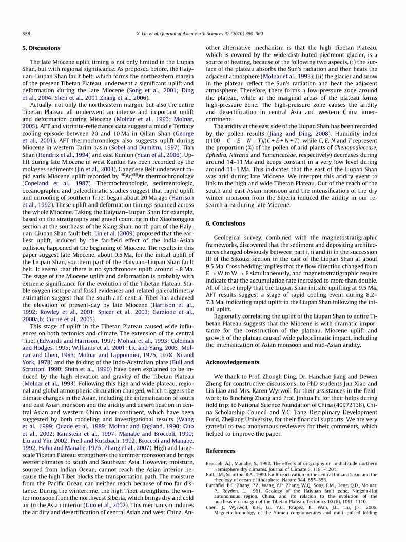
5. Discussions
The late Miocene uplift timing is not only limited in the LiupanShan, but with regional significance. As proposed before, the Haiy-uan–Liupan Shan fault belt, which forms the northeastern marginof the present Tibetan Plateau, underwent a significant uplift anddeformation during the late Miocene (Song et al., 2001; Dinget al., 2004; Shen et al., 2001;Zhang et al., 2006).
Actually, not only the northeastern margin, but also the entireTibetan Plateau all underwent an intense and important upliftand deformation during Miocene (Molnar et al., 1993; Molnar,2005). AFT and vitrinite-reflectance data suggest a middle Tertiarycooling episode between 20 and 10 Ma in Qilian Shan (Georgeet al., 2001). AFT thermochronology also suggests uplift duringMiocene in western Tarim basin (Sobel and Dumitru, 1997), TianShan (Hendrix et al., 1994) and east Kunlun (Yuan et al., 2006). Up-lift during late Miocene in west Kunlun has been recorded by themolasses sediments (Jin et al., 2003). Gangdese Belt underwent ra-pid early Miocene uplift recorded by 40Ar/39Ar thermochronology(Copeland et al., 1987). Thermochronologic, sedimentologic,oceanographic and paleoclimatic studies suggest that rapid upliftand unroofing of southern Tibet began about 20 Ma ago (Harrisonet al., 1992). These uplift and deformation timings spanned acrossthe whole Miocene. Taking the Haiyuan–Liupan Shan for example,based on the stratigraphy and gravel counting in the Xiaohonggousection at the southeast of the Xiang Shan, north part of the Haiy-uan–Liupan Shan fault belt, Lin et al. (2009) proposed that the ear-liest uplift, induced by the far-field effect of the India–Asiancollision, happened at the beginning of Miocene. The results in thispaper suggest late Miocene, about 9.5 Ma, for the initial uplift ofthe Liupan Shan, southern part of the Haiyuan–Liupan Shan faultbelt. It seems that there is no synchronous uplift around �8 Ma.The stage of the Miocene uplift and deformation is probably withextreme significance for the evolution of the Tibetan Plateau. Sta-ble oxygen isotope and fossil evidences and related paleoaltimetryestimation suggest that the south and central Tibet has achievedthe elevation of present-day by late Miocene (Harrison et al.,1992; Rowley et al., 2001; Spicer et al., 2003; Garzione et al.,2000a,b; Currie et al., 2005).
This stage of uplift in the Tibetan Plateau caused wide influ-ences on both tectonics and climate. The extension of the centralTibet (Edwards and Harrison, 1997; Molnar et al., 1993; Colemanand Hodges, 1995; Williams et al., 2001; Liu and Yang, 2003; Mol-nar and Chen, 1983; Molnar and Tapponnier, 1975, 1978; Ni andYork, 1978) and the folding of the Indo-Australian plate (Bull andScrutton, 1990; Stein et al., 1990) have been explained to be in-duced by the high elevation and gravity of the Tibetan Plateau(Molnar et al., 1993). Following this high and wide plateau, regio-nal and global atmospheric circulation changed, which triggers theclimate changes in the Asian, including the intensification of southand east Asian monsoon and the aridity and desertification in cen-tral Asian and western China inner-continent, which have beensuggested by both modeling and investigational results (Wanget al., 1999; Quade et al., 1989; Molnar and England, 1990; Guoet al., 2002; Ramstein et al., 1997; Manabe and Broccoli, 1990;Liu and Yin, 2002; Prell and Kutzbach, 1992; Broccoli and Manabe,1992; Hahn and Manabe, 1975; Zhang et al., 2007). High and large-scale Tibetan Plateau strengthens the summer monsoon and bringswetter climates to south and Southeast Asia. However, moisture,sourced from Indian Ocean, cannot reach the Asian interior be-cause the high Tibet blocks the transportation path. The moisturefrom the Pacific Ocean can neither reach because of too far dis-tance. During the wintertime, the high Tibet strengthens the win-ter monsoon from the northwest Siberia, which brings dry and coldair to the Asian interior (Guo et al., 2002). This mechanism inducesthe aridity and desertification of central Asian and west China. An-
other alternative mechanism is that the high Tibetan Plateau,which is covered by the wide-distributed piedmont glacier, is asource of heating, because of the following two aspects, (i) the sur-face of the plateau absorbs the Sun’s radiation and then heats theadjacent atmosphere (Molnar et al., 1993); (ii) the glacier and snowin the plateau reflect the Sun’s radiation and heat the adjacentatmosphere. Therefore, there forms a low-pressure zone aroundthe plateau, while at the marginal areas of the plateau formshigh-pressure zone. The high-pressure zone causes the aridityand desertification in central Asia and western China inner-continent.
The aridity at the east side of the Liupan Shan has been recordedby the pollen results (Jiang and Ding, 2008). Humidity index((100 � C � E � N � T)/(C + E + N + T), while C, E, N and T representthe proportion (%) of the pollen of arid plants of Chenopodiacease,Ephedra, Nitraria and Tamaricaceae, respectively) decreases duringaround 14–11 Ma and keeps constant in a very low level duringaround 11–1 Ma. This indicates that the east of the Liupan Shanwas arid during late Miocene. We interpret this aridity event tolink to the high and wide Tibetan Plateau. Out of the reach of thesouth and east Asian monsoon and the intensification of the drywinter monsoon from the Siberia induced the aridity in our re-search area during late Miocene.
6. Conclusions
Geological survey, combined with the magnetostratigraphicframeworks, discovered that the sediment and depositing architec-tures changed obviously between part i, ii and iii in the successionIII of the Sikouzi section in the east of the Liupan Shan at about9.5 Ma. Cross bedding implies that the flow direction changed fromE ? W to W ? E simultaneously, and magnetostratigraphic resultsindicate that the accumulation rate increased to more than double.All of these imply that the Liupan Shan initiate uplifting at 9.5 Ma.AFT results suggest a stage of rapid cooling event during 8.2–7.3 Ma, indicating rapid uplift in the Liupan Shan following the ini-tial uplift.
Regionally correlating the uplift of the Liupan Shan to entire Ti-betan Plateau suggests that the Miocene is with dramatic impor-tance for the construction of the plateau. Miocene uplift andgrowth of the plateau caused wide paleoclimatic impact, includingthe intensification of Asian monsoon and mid-Asian aridity.
Acknowledgements
We thank to Prof. Zhongli Ding, Dr. Hanchao Jiang and DewenZheng for constructive discussions; to PhD students Jun Xiao andLin Liao and Mrs. Karen Wyrwoll for their assistances in the field-work; to Bincheng Zhang and Prof. Jinhua Fu for their helps duringfield trip; to National Science Foundation of China (40972138), Chi-na Scholarship Council and Y.C. Tang Disciplinary DevelopmentFund, Zhejiang University, for their financial supports. We are verygrateful to two anonymous reviewers for their comments, whichhelped to improve the paper.
References
Broccoli, A.J., Manabe, S., 1992. The effects of orography on midlatitude northernHemisphere dry climates. Journal of Climate 5, 1181–1201.
Bull, J.M., Scrutton, R.A., 1990. Fault reactivation in the central Indian Ocean and therheology of oceanic lithosphere. Nature 344, 855–858.
Burchfiel, B.C., Zhang, P.Z., Wang, Y.P., Zhang, W.Q., Song, F.M., Deng, Q.D., Molnar,P., Royden, L., 1991. Geology of the Haiyuan fault zone, Ningxia-Huiautonomous region, China, and its relation to the evolution of thenortheastern margin of the Tibetan Plateau. Tectonics 10 (6), 1091–1110.
Chen, J., Wyrwoll, K.H., Lu, Y.C., Krapez, B., Wan, J.L., Liu, J.F., 2006.Magnetochronology of the Yumen conglomerates and multi-pulsed folding

X. Lin et al. / Journal of Asian Earth Sciences 37 (2010) 350–360 359
and thrusting in the northern Qilianshan. Quaternary Sciences 26 (1), 20–31 (inChinese with English abstract).
Chen, J., Heermance, R.V., Burbank, D.W., Scharer, K.M., Wang, C.S., 2007.Magnetochronology and its implications of the Xiyu conglomerate in thesouthwestern Chinese Tian Shan foreland. Quaternary Sciences 27 (4), 576–587(in Chinese with English abstract).
Clark, M.K., Royden, L.H., 2000. Topographic ooze: building the eastern margin ofTibet by lower crustal flow. Geology 28 (8), 703–706.
Coleman, M., Hodges, K., 1995. Evidence for Tibetan plateau uplift before 14 Myrago from a new minimum age for east–west extension. Nature 374,49–52.
Copeland, P., Harrison, T.M., Kidd, W.S.F., Xu, R.H., Zhang, Y.Q., 1987. Rapid earlyMiocene acceleration of uplift in the Gangdese Belt, Xizang (southern Tibet),and its bearing on accommodation mechanisms of the India–Asia collision.Earth and Planetary Science Letters 86, 240–252.
Currie, B.S., Rowley, D.B., Tabor, N.J., 2005. Middle Miocene paleoaltimetry ofsouthern Tibet: implications for the role of mantle thickening and delaminationin the Himalayan orogen. Geology 33 (3), 181–184.
Ding, G.Y., Chen, J., Tian, Q.J., Shen, X.H., Xing, C.Q., Wei, K.B., 2004. Active faults andmagnitudes of left-lateral displacement along the northern margin of theTibetan Plateau. Tectonophysics 380, 243–260.
Edwards, M.A., Harrison, T.M., 1997. When did the roof collapse? Late Miocenenorth–south extension in the high Himalaya revealed by Th–Pb monazitedating of the Khula Kangri granite. Geology 25 (6), 543–546.
England, P.C., Houseman, G.A., 1986. Finite strain calculations of continentaldeformation 2. Comparison with the India–Asia collision. Journal of GeophysicalResearch 91, 3664–3676.
Fu, G.-B., Li, X.-L., 2002. The sedimentary strata from Mesozoic to the Cenozoic inLiupanshan basin. Journal of Xingjiang Petroleum Institute 14 (2), 24–27 (inChinese with English abstract).
Garzione, C.N., Dettman, D.L., Quade, J., DeCelles, P.G., Butler, R.F., 2000a. High timeson the Tibetan Plateau: paleoelevation of the Thakkhola graben. Nepal Geology28 (4), 339–342.
Garzione, C.N., Quade, J., DeCelles, P.G., English, N.B., 2000b. Predictingpaleoelevation of Tibet and the Himalaya from d18O vs. altitude gradients inmeteroric water across the Nepal Himalaya. Earth and Planetary Science Letters183, 215–229.
George, A.D., Marshallsea, S.J., Wyrwoll, K.-H., Chen, J., Lu, Y.C., 2001. Miocenecooling in the northern Qilian Shan, northeastern margin of the Tibetan Plateau,revealed by apatite fission-track and vitrinite-reflectance analysis. Geology 29(10), 939–942.
Guo, Z.T., Ruddiman, W.F., Hao, Q.Z., Wu, H.B., Qiao, Y.S., Zhu, R.X., Peng, S.Z., Wei,J.J., Yuan, B.Y., Liu, T.S., 2002. Onset of Asian desertification by 22 Myr agoinferred from loess deposits in China. Nature 416, 159–163.
Hahn, D.G., Manabe, S., 1975. The role of mountain in the south Asian monsooncirculation. Journal of Atmospheric Sciences 32, 1515–1541.
Harrison, T.M., Copeland, P., Kidd, W.S.F., Yin, A., 1992. Raising Tibet. Science 255,1663–1670.
Hendrix, M.S., Dumitru, T.A., Graham, S.A., 1994. Late Oligocene-early Mioceneunroofing in the Chinese Tian Shan: an early effect of the India–Asia collision.Geology 22, 487–490.
Jiang, H.C., Ding, Z.L., 2008. A 20 Ma pollen record of Earth-Asian summer monsoonevolution from Guyuan, Ningxia, China. Palaeogeography PalaeoclimatologyPalaeoecology 265, 30–38.
Jiang, H.C., Ding, Z.L., Xiong, S.F., 2007. Magnetostratigraphy of the Neogene Sikouzisection at Guyuan, Ningxia, China. Palaeogeography PalaeoclimatologyPalaeoecology 243, 223–234.
Jin, X.C., Wang, J., Chen, B.W., Ren, L.D., 2003. Cenozoic depositional sequences inthe piedmont of the west Kunlun and their paleogeographic and tectonicimplications. Journal of Asian Earth Sciences 21, 755–765.
Li, J.J., 1995. Uplift of the Qinghai–Tibet Plateau and Global Change. LanzhouUniversity Press, Lanzhou.
Li, J.J., Fang, X.M., 1998. The uplift of the Tibetan Plateau and climate changes.Chinese Science Bulletin 43 (15), 1569–1574 (in Chinese).
Li, B., Li, Y., Zhang, K.J., Zhang, Y.X., Zhang, Y., Wei, Q.G., Wang, Y., 2007. Provenanceof the siliciclastic rocks of the late Cenozoic Dayi formation and drainagechange at eastern margin of the Tibetan Plateau. Quaternary Sciences 27 (1),64–73 (in Chinese with English abstract).
Lin, X.B., Chen, H.L., Wyrwoll, K.-H., Cheng, X.G., Wang, X.L., Fu, K.A., Liao, L., Xiao, J.,Krapez, B., 2009. Uplift of northeastern Tibetan Plateau: evidences fromXiaohonggou section in Tongxin, Ningxia. Acta Geologica Sinica 83 (4), 455–467 (in Chinese with English abstract).
Liu, M., Yang, Y.Q., 2003. Extensional collapse of the Tibetan Plateau: results ofthree-dimensional finite element modeling. Journal of Geophysical Research108 (8), 1–15.
Liu, X.D., Yin, Z.-Y., 2002. Sensitivity of East Asian monsoon climate to the uplift ofthe Tibetan Plateau. Palaeogeography Palaeoclimatology Palaeoecology 183,223–245.
Manabe, S., Broccoli, 1990. Mountains and arid climates of middle latitudes. Science247, 192–195.
Molnar, P., 2005. Mio-pliocene growth of the Tibetan Plateau evolution of East Asianclimate. Palaeontologia Electronica 8 (1), 1–23.
Molnar, P., Chen, W.-P., 1983. Focal depths and fault plane solutions of earthquakesunder the Tibetan plateau. Journal of Geophysical Research 88, 1180–1196.
Molnar, P., England, P., 1990. Late Cenozoic uplift of mountain ranges and globalclimate change: chicken or egg? Nature 346, 29–34.
Molnar, P., Tapponnier, P., 1975. Cenozoic tectonics of Asia: effects of a continentalcollision. Science 189, 419–426.
Molnar, P., Tapponnier, P., 1978. Active tectonics of Tibet. Journal of GeophysicalResearch 83, 5361–5375.
Molnar, P., England, P., Martinod, J., 1993. Mantle dynamics, uplift of the TibetanPlateau, and the Indian monsoon. Reviews of Geophysics 31 (4), 357–396.
Ni, J., York, J.E., 1978. Late Cenozoic extensional tectonics of the Tibetan Plateau.Journal of Geophysical Research 83, 5377–5387.
Platt, P.J., England, P.G., 1993. Convective removal of lithosphere beneath mountainbelts: thermal and mechanical consequences. American Journal of Science 293,307–336.
Prell, W.L., Kutzbach, J.E., 1992. Sensitivity of the Indian monsoon to forcingparameters and implications for its evolution. Nature 360, 647–651.
Quade, J., Cerling, T.E., Bowman, J.R., 1989. Devolopment of Asian Monsoon revealedby marked ecological shift during the latest Miocene in northern Pakistan.Nature 342, 163–166.
Ramstein, G., Fluteau, F., Besse, J., Joussaume, S., 1997. Effect of orogeny, platemotion and land-sea distribution on Eurasian climate change over the past 30million years. Nature 386, 788–795.
Rowley, D.B., Pierrehumbert, R.T., Currie, B.S., 2001. A new approach to stableisotope-based paleoaltimetry: implications for paleoaltimetry andpaleohypsometry of the Hing Himalaya since the late Miocene. Earth andPlanetary Science Letters 188, 253–268.
Royden, L.H., Burchfiel, B.C., King, R.W., Wang, E.C., Chen, Z.L., Shen, F., Liu, Y.P.,1997. Surface deformation and lower crustal flow in eastern Tibet. Science 276,788–790.
Seeber, L., Ambruster, J.G., 1981. Great detachment earthquakes along theHimalayan arc and long-term forecasting. In: Maurice Ewing Series 4,Earthquake Prediction—An International Review. American GeophysicalUnion, pp. 259–277.
Shen, X.H., Tian, Q.J., Ding, G.Y., Wei, K.B., Chen, Z.W., 2001. The late Cenozoicstratigraphic sequence and its implication to tectonic evolution, Hejiakouzi ara,Ningxia Hui Autonomous Region. Earthquake Research in China 17 (2), 156–166(in Chinese with English abstract).
Shi, Y.F., Tang, M.C., Ma, Y.Z., 1998. Discussion of two-stage uplift of the TibetanPlateau and its linkage with the formation of the Asian monsoon. Science inChina Series D 28 (3), 263–271 (in Chinese).
Sobel, E.R., Dumitru, T.A., 1997. Thrusting and exhumation around the margins ofthe western Tarim basin during the India–Asia collision. Journal of GeophysicalResearch 102, 5043–5063.
Song, Y.G., Fang, X.M., Li, J.J., An, Z.S., Miao, X.D., 2001. The Late Cenozoic uplift of theLiupan Shan, China. Science in China Series D 44 (Suppl.), 176–184.
Spicer, R.A., Harris, N.B.W., Widdowson, M., Herman, A.B., Guo, S.X., Valdes, P.J.,Wolfe, J.A., Kelley, S.P., 2003. Constant elevation of southern Tibet over the past15 million years. Nature 421, 622–624.
Stein, C.A., Cloetingh, S., Wortel, R., 1990. Kinematics and mechanics of the IndianOcean diffuse plate boundary. In: Proceeding of the Ocean Drilling Program,Scientific Results, vol. 116. pp. 261–277.
Sun, J.M., Zhu, R.X., Bowler, J., 2004. Timing of the Tianshan Mountains upliftconstrained by magnetostratigraphic analysis of molasses deposits. Earth andPlanetary Science Letters 219, 239–253.
Sun, J.M., Zhu, R.X., An, Z.S., 2005. Tectonic uplift in the northern Tibetan Plateausince 13.7 Ma ago inferred from molasses deposits along the Altyn Tagh Fault.Earth and Planetary Science Letters 235, 641–653.
Tapponnier, P., Xu, Z.Q., Roger, F., Meyer, B., Arnaud, N., Wittlinger, G., Yang, J.S.,2001. Oblique stepwise rise and growth of the Tibet Plateau. Science 294, 1671–1677.
Wang, C.-S., Ding, X.-L., 1998. The new researching progress of Tibet Plateau uplift.Advance in Earth Sciences 13 (6), 526–532 (in Chinese with English abstract).
Wang, J., Wang, Y.J., Liu, Z.C., Li, J.Q., Xi, P., 1999. Cenozoic environmental evolutionof the Qaidam Basin and its implications for the uplift of the Tibetan Plateau andthe drying of central Asia. Palaeogeography Palaeoclimatology Palaeoecology152, 37–47.
Wang, C.S., Zhao, X.X., Liu, Z.F., Lippert, P.C., Graham, S.A., Coe, R.S., Yi, H.S., Zhu, L.D.,Liu, S., Li, Y.L., 2008. Constraints on the early uplift history of the TibetanPlateau. Proceedings of the National Academy of Sciences 105 (13), 4987–4992.
Williams, H., Turner, S., Kelley, S., Harris, N., 2001. Age and composition of dikes inSouthern Tibet: new constraints on the timing of east–west extension and itsrelationship to postcollisional volcanism. Geology 29 (4), 339–342.
Yuan, W.M., Carter, A., Dong, J.Q., Bao, Z.K., An, Y.C., Guo, Z.J., 2006. Mesozoic-tertiary exhumation history of the Altai mountains northern Xijiang, China:new constraints from apatite fission track data. Tectonophysics 412, 183–193.
Zhang, J., 2004. Sedimentary facies analysis of the central and southern parts ofNingxia and its relationship with evolution of the Tibetan Plateau. Post-doctorreport, School of Earth and Space Sciences, Peking University, Beijing.
Zhang, P.Z., Burchfiel, B.C., Molnar, P., Zhang, W.Q., Jiao, D.C., Deng, Q.D., Wang, Y.P.,Royden, L., Song, F.M., 1991. Amount and style of late Cenozoic deformation inthe Liupan Shan area, Ningxia Autonomous Region, China. Tectonics 10 (6),1111–1129.
Zhang, P.Z., Molnar, P., Downs, W.R., 2001. Increased sedimentation rates and grainsizes 2–4 Myr ago due to the influence of climate change on erosion rates.Nature 410, 861–897.
Zhang, J., Ma, Z.J., Ren, W.J., 2005. The sedimentary characteristics of Cenozoic stratain central and southern Ningxia and their relationships with the development ofthe Qinghai–Tibetan Plateau. Acta Geologica Sinica 79 (6), 757–773 (in Chinesewith English abstract).

360 X. Lin et al. / Journal of Asian Earth Sciences 37 (2010) 350–360
Zhang, P.Z., Zheng, D.W., Yin, G.M., Yuan, D.Y., Zhang, G.L., Li, C.Y., Wang, Z.C., 2006.Discussion on late Cenozoic growth and rise of northeastern margin of theTibetan Plateau. Quaternary Sciences 26 (1), 5–13 (in Chinese with Englishabstract).
Zhang, Z.S., Wang, H.J., Guo, Z.T., Jiang, D.B., 2007. What triggers the transition ofpalaeoenvironmental patterns in China, the Tibetan Plateau uplift or theParatethys Sea retreat. Palaeogeography Palaeoclimatology Palaeoecology 245,317–331.
Zheng, D.W., Zhang, P.Z., Wan, J.L., Yuan, D.Y., Li, C.Y., Yin, G.M., Zhang, G.L., Wang,Z.C., Min, W., Chen, J., 2006a. Rapid exhumation at �8 Ma on the Liupan Shan
thrust fault from apatite fission-track thermochronolgy: implications forgrowth of the northeastern Tibetan Plateau margin. Earth and PlanetaryScience Letters 248, 198–208.
Zheng, D.W., Zhang, P.Z., Wan, J.L., Yuan, D.Y., Li, D.M., Wang, J.P., Yin, J.W., Li, C.Y.,Wang, Z.C., 2006b. Tectonicevents, climate and conglomerate: example fromJishishan Mountain and Linxia Basin. Quaternary Sciences 26 (1), 63–69 (inChinese with English abstract).
Zhong, D.L., Ding, L., 1996. The discussion of the Tibet uplift and its mechanism.Science in China Series D 26 (4), 289–295 (in Chinese).